Early Los Angeles City Views (1925 +)
Historical Photos of Early Los Angeles |
|
 |
|
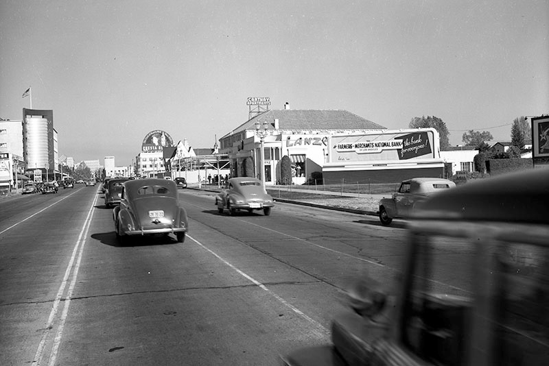
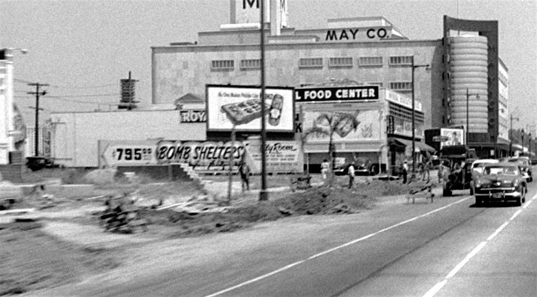
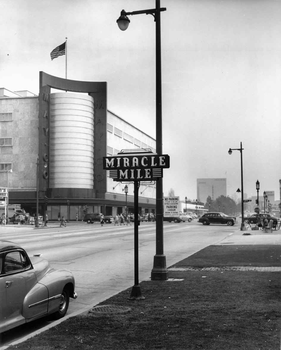
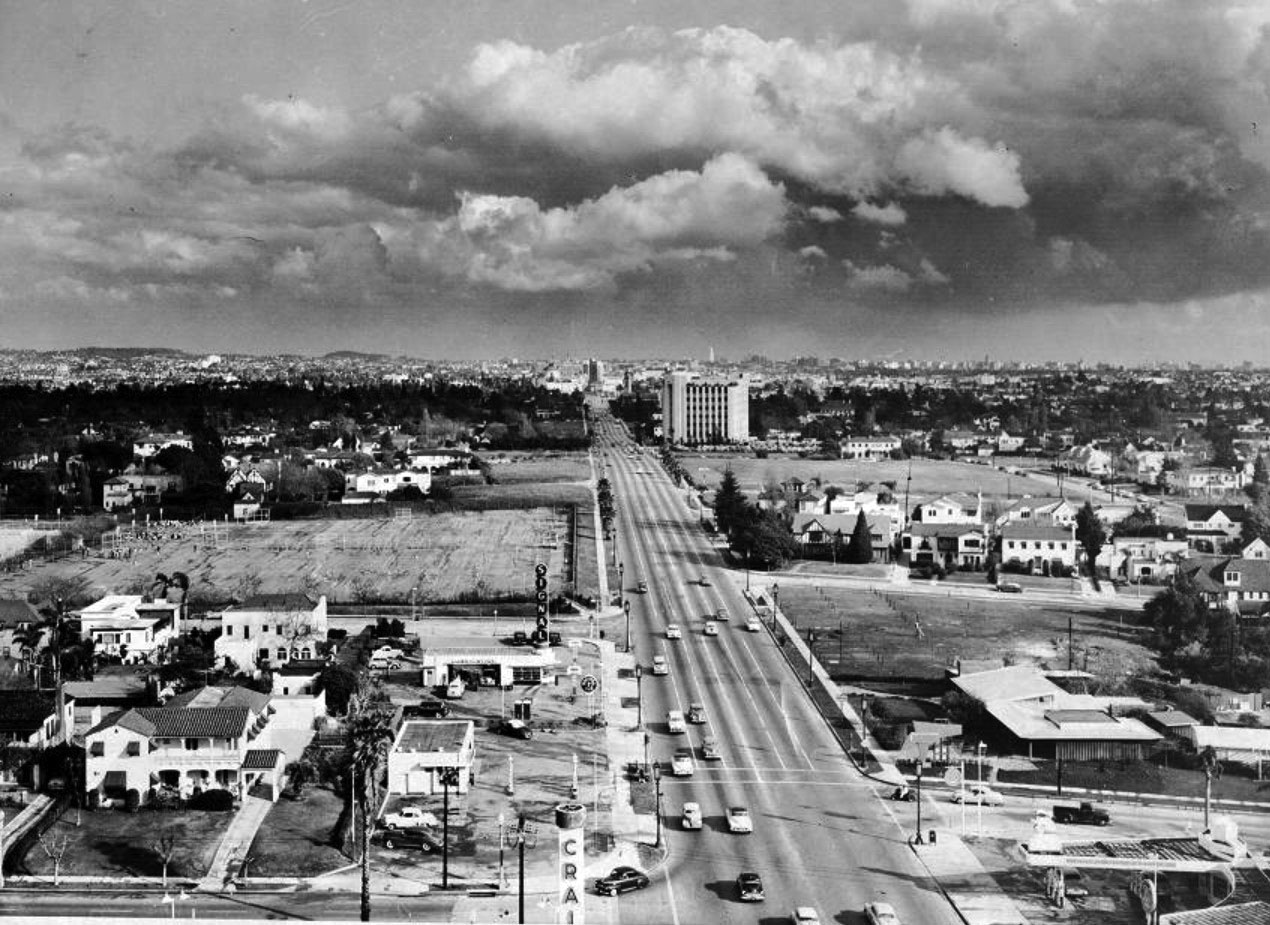
| (ca. 1950)+# – View looking east on Wilshire Boulevard toward Fairfax Avenue with the May Company Depatrment Store seen on the northeast corner. There appears to be street improvement work on the north side of Wilshire Blvd. Note the billboard advertising BOMB SHELTERS for $795. A market ("__ Food Center" ) stands further west, and beyond that (out of view) is Simon's Drive-in located on the NW corner of Wilshire and Fairfax. |
Miracle Mile
 |
|
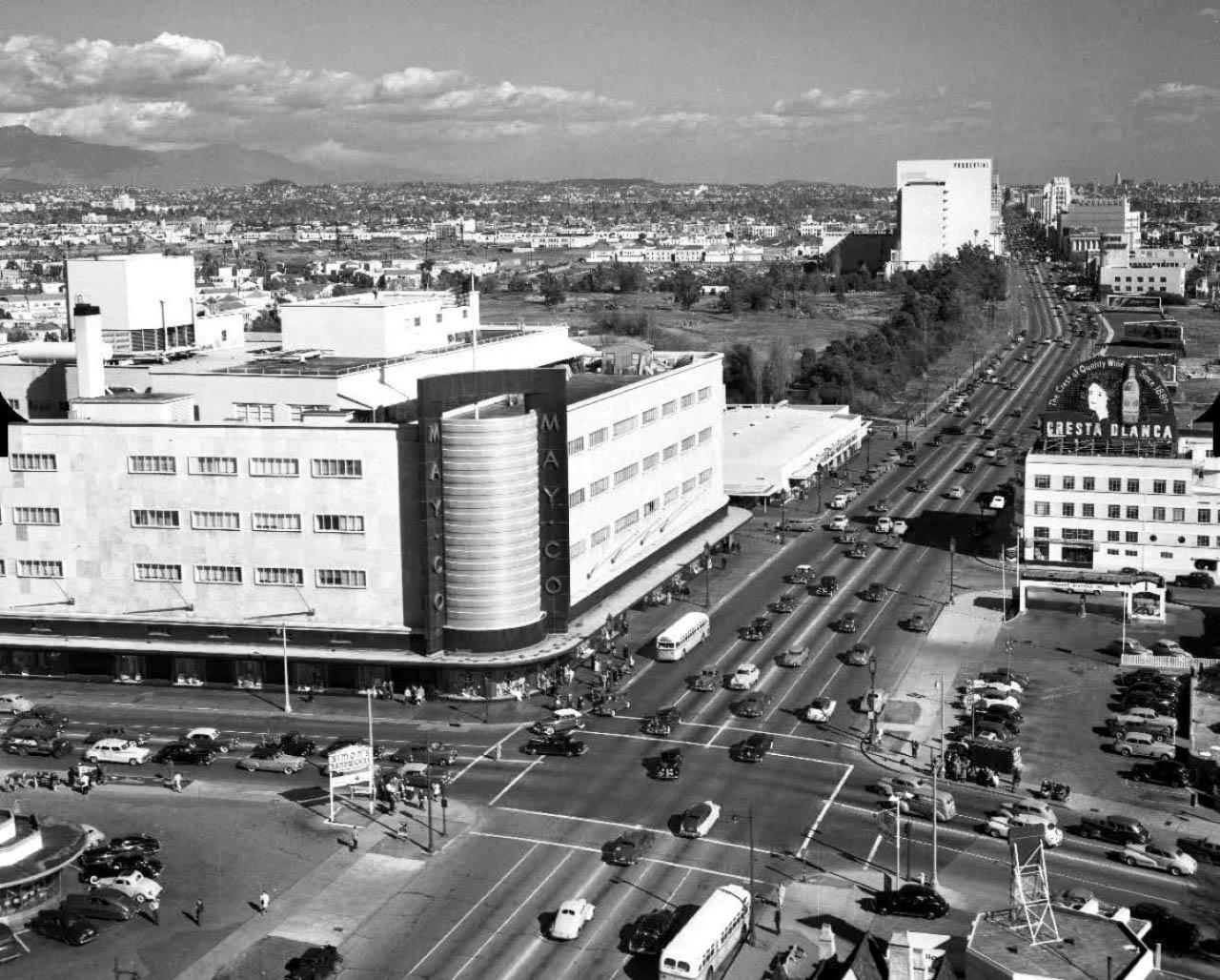
| (1940s)+## – Aerial view of Wilshire Blvd facing east at the Fairfax Ave, showing the May Company department store on the NE corner. Simon's Drive-in Restaurant can be seen at lower-left on the NW corner. This intersection was referred to as the western gateway to the 'Miracle Mile'. |
Historical Notes The Miracle Mile is an area in the Mid-Wilshire and Mid-City West regions consisting of a 1.5-mile stretch of Wilshire Boulevard between Fairfax and Highland Avenues. The May Company Building, now LACMA West, marks the western border of Miracle Mile's "Museum Row".^* |
 |
|
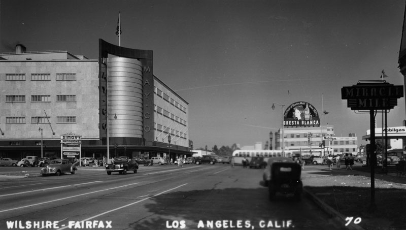
| (1947)^ - Postcard view of the beginning of the Miracle Mile, at Fairfax and Wilshire, with the May Company Building prominently seen in the background. |
 |
|
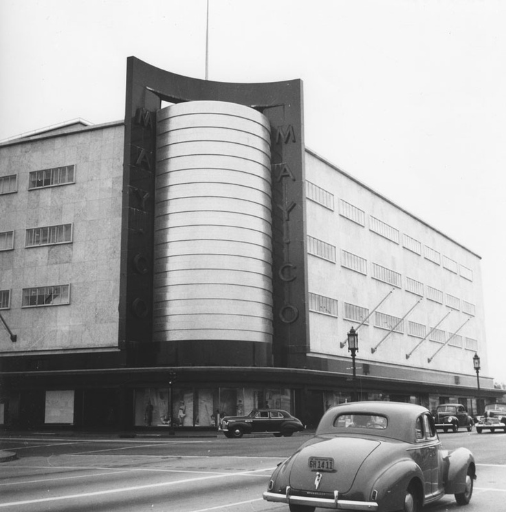
| (1948)*# - View of the Miracle Mile and the May Company Building, looking east down Wilshire Boulevard. Different styles of streetlights run up and down Wilshire Boulevard. Click HERE to see more in Early Los Angeles Street Lights. |
Historical Notes The May Company Building has a Streamline Modern style with gold corner towers. Built in 1940. Architects: A.C. Martin, S.A. Marx.^ In 1992, the building was designated LA Historic-Cultural Monument No. 566 (Click HERE to see complete listing). |
 |
|
| (1940s)^ - View looking at the intersection of Fairfax Avenue and Wilshire Boulevard. The May Company Building can be seen on the northeast corner. |
Historical Notes May Company California was established in 1923 when May acquired A. Hamburger & Sons Co.(founded in 1881 by Asher Hamburger). The company operated exclusively in Southern California until 1989 when May Department Stores had dissolved Goldwater's, based in Scottsdale, Arizona and transferred its Las Vegas, Nevada store to May Company California.^* |
 |
|
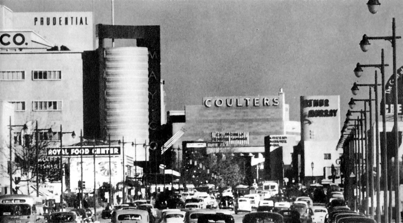
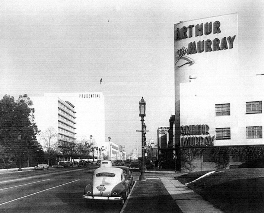
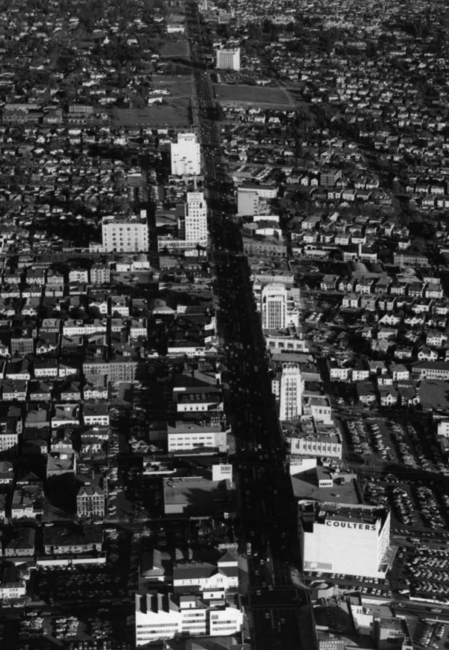
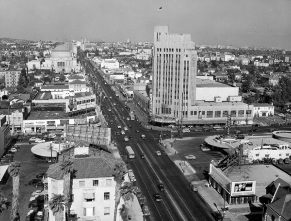
| (1940s)+## – Panoramic view looking east on Wilshire Boulevard through the Fairfax Avenue intersection. We can see the May Company department store (now part of LACMA and future home of the Hollywood museum of the Academy of Motion Picture Arts and Sciences), Prudential Building, Coulter's Department Store, and the Arthur Murray Dance Studio. This “Miracle Mile” stretch of Wilshire Blvd is busy now but back then it looks positively jam-packed! |
 |
|
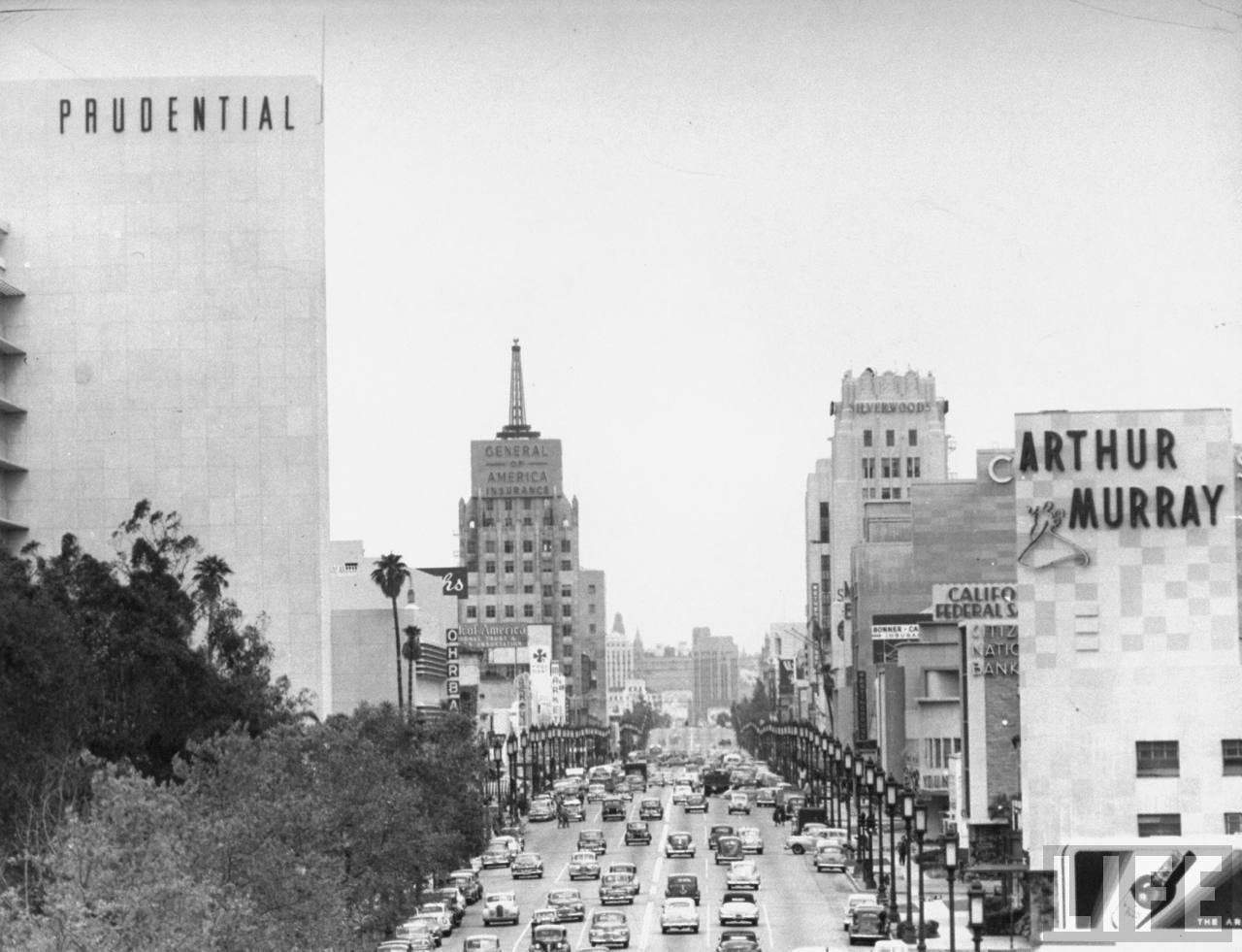
| (1949)**^ - View looking east of Wilshire Boulevard from Curson Avenue showing the heart of the Miracle Mile. Some of the more recognizable building include the (l to r): Prudential Building, E. Clem Wilson Building, (Wilshire & La Brea, NE Corner), Wilshire Tower, and Arthur Murray Dance Studio. |
Historical Notes Developer A. W. Ross saw potential for the area and developed Wilshire as a commercial district to rival downtown Los Angeles. Ross's insight was that the form and scale of his Wilshire strip should attract and serve automobile traffic rather than pedestrian shoppers. He applied this design both to the street itself and to the buildings lining it.^* |
 |
|
| (ca. 1950)^^ - View looking east on Wilshire Blvd at Stanley Ave. The Arthur Murray Dance Studio is on right (SE corner) and the Prudential Building can be seen in the distance on the left. Hancock Park and the La Brea Tar Pits. Photo by Dick Whittington |
Historical Notes Arthur Murray launched his third business in 1925 by selling branded dance lessons through franchising. He trained dance instructors for the Statler Hotel chain, who then went to various hotels and gave lessons; Murray kept some of the profits from each franchise. This business was expanded more widely in 1938, when an Arthur Murray dance studio franchise was opened in Minneapolis, Minnesota. Others followed. His slogan was: "If you can walk, we teach you how to dance", and the company guaranteed that the pupils learn to dance in ten lessons. After WWII, Murray's business grew with the rise of interest in Latin dance, and he regularly taught and broadcast in Cuba in the 1950s. Murray went on television with a dance program hosted by his wife, Kathryn Murray, The Arthur Murray Party, which ran from 1950 to 1960, on CBS, NBC, DuMont, ABC, and then on CBS. The Murrays retired in 1964; but they continued to be active for some time, appearing as guests on the Dance Fever disco show in the late 1970s. By then, there were more than 3,560 dance studios bearing his name. In 2007, about 220 Arthur Murray Studios remained in operation. Arthur Murray Dance Studios claims to be the second-oldest franchised company (the first, A&W Restaurants, began in 1919). *^ Click HERE to see more on the Moderne-style Arthur Murray Dance Studio Building (seen above) designed by Stiles O. Clements (1941). |
 |
|
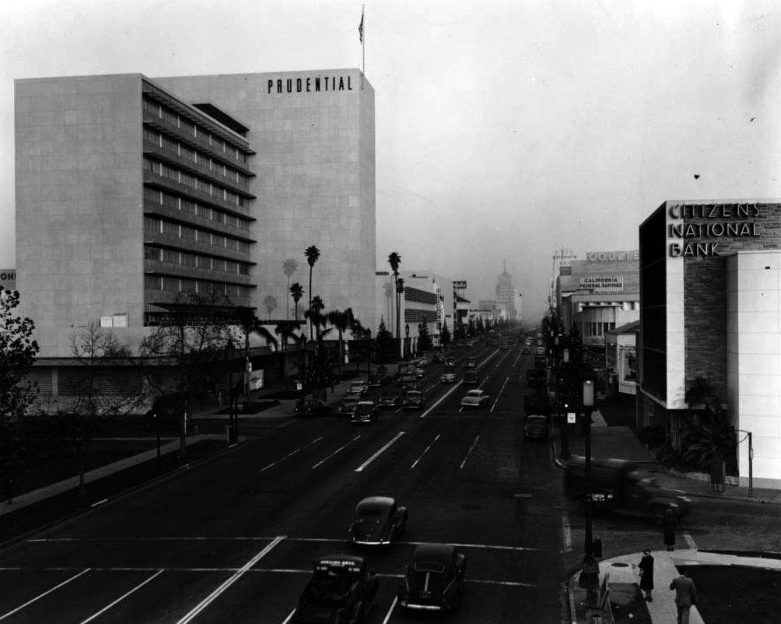
| (1950)^^ - Corner of Wilshire Boulevard and Curson Avenue across from Hancock Park and the La Brea Tar Pits. The Prudential Building, Citizen National Bank, Orbachs, Ralph's supermarket, California Federal Savings, Bank of America are all located within this area. Click HERE for contemporary view. |
Historical Notes The Prudential Building (aka Prudential Square) opened in 1948, housing more than 1,200 employees of the western office of Prudential Insurance Company. It was designed by famed architects Walter Wurdeman and Welton Becket in the International Style and was the tallest and largest privately owned building in the city when it opened. The duo also designed the Pan-Pacific Auditorium. In 1993, Screen Actors Guild moved its national headquarters into the building and the American Federation of Television and Radio Artist’s followed in 1997. In 2015, the historic Miracle Mile building at 5757 Wilshire Blvd. was renamed SAG-AFTRA Plaza. |
 |
|
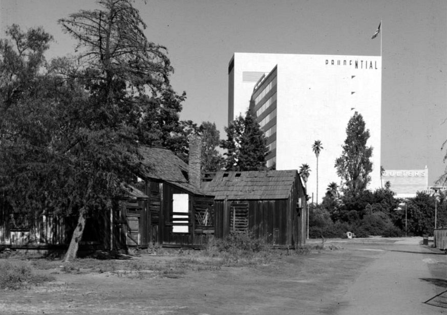
| (1950)^^ - View showing the ranch house built in the 1880s by Henry Hancock on Rancho La Brea shortly before its demolition with the 1948-built Prudential Building in the background. This is also the location of the La Brea Tar Pits. |
Historical Notes As a lawyer, Henry Hancock worked for the Rocha family to aid them with their efforts to prove their claim to Rancho La Brea. The Rochas finally won their claim, but like so many other rancheros, their legal expenses left them broke. In 1860 Jose Jorge Rocha, the son of Don Antonio Jose Rocha, deeded Rancho La Brea to Henry Hancock. Click HERE to see more in early views of La Brea Tar Pits. |
 |
|
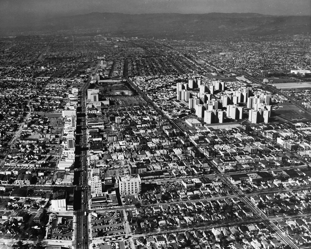
| (1954)^*** – Aerial view looking west showing the full extent of the Miracle Mile at left with Park La Brea Towers at upper center-right. The intersection of Wilishire and La Brea is at lower-left. The Prudential Building and La Brea Tar Pits can be seen at upper center-left. |
 |
|
| (ca. 1950)^ - Aerial view looking north showing the Prudential Building at 5757 Wilshire Boulevard in the foreground with Park La Brea Towers at top. The eastern edge of the La Brea Tar Pits can be seen at left. |
Historical Notes Park La Brea was originally conceived as an entirely low-rise development. Construction began in 1941, but building restrictions during WWII halted work in 1945 with only the western half of the site completed. By the time construction resumed in 1948, the continued demand for postwar housing had prompted builder, MetLife, to dramatically revise the project to provide greater density and site amenities. The second phase of development included 18 towers rising to the city’s 13-story height limit in addition to three groups of two-story buildings matching those already built. |
 |
|
| (1949)^*** - View looking east on Wilshire from the SE corner of Wilshire and Hauser. The 1948-built Prudential Building, located at Wilshire and Curson, is seen at left. Click HERE to see contemporary view. |
Historical Notes The building on the NW corner of Wilshire and Hauser was originally called the Western Auto Supply Co. Building It was built in 1931 and designed by Carl Lindbom. |
 |
|
| (1950s)^^ – Postcard view looking east from the northwest corner of Wilshire and Curson with Prudential Square on the left. Coulters and California Federal Savings can be seen in the distance. |
Historical Notes Designed by Wurdeman and Becket and built in 1948, the Prudential Building was later renamed Museum Square. |
 |
|
| (1950s)^^ - Linen finish postcard of Wilshire Boulevard looking east. Note the Orbach’s sign on left. Orbach’s was originally located in the Prudential Square complex. The block housing the California Federal Bank building later became the site of the “Cal Fed” skyscraper (1965). |
Historical Notes Ohrbach's department store was housed in the Prudential Square complex until 1965, when the store relocated to another Becket design down the street, the former Seibu Department Store (now the Petersen Automotive Museum). |
 |
|
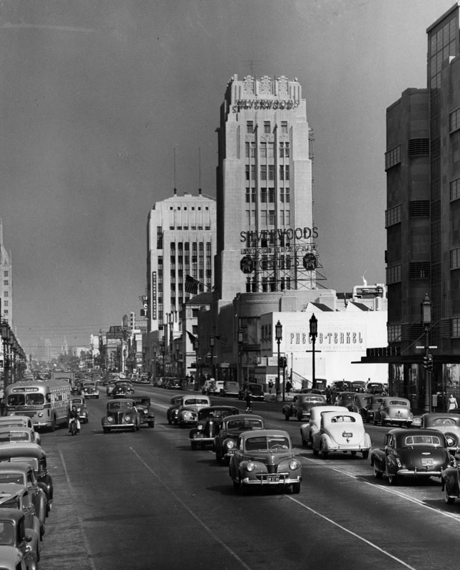
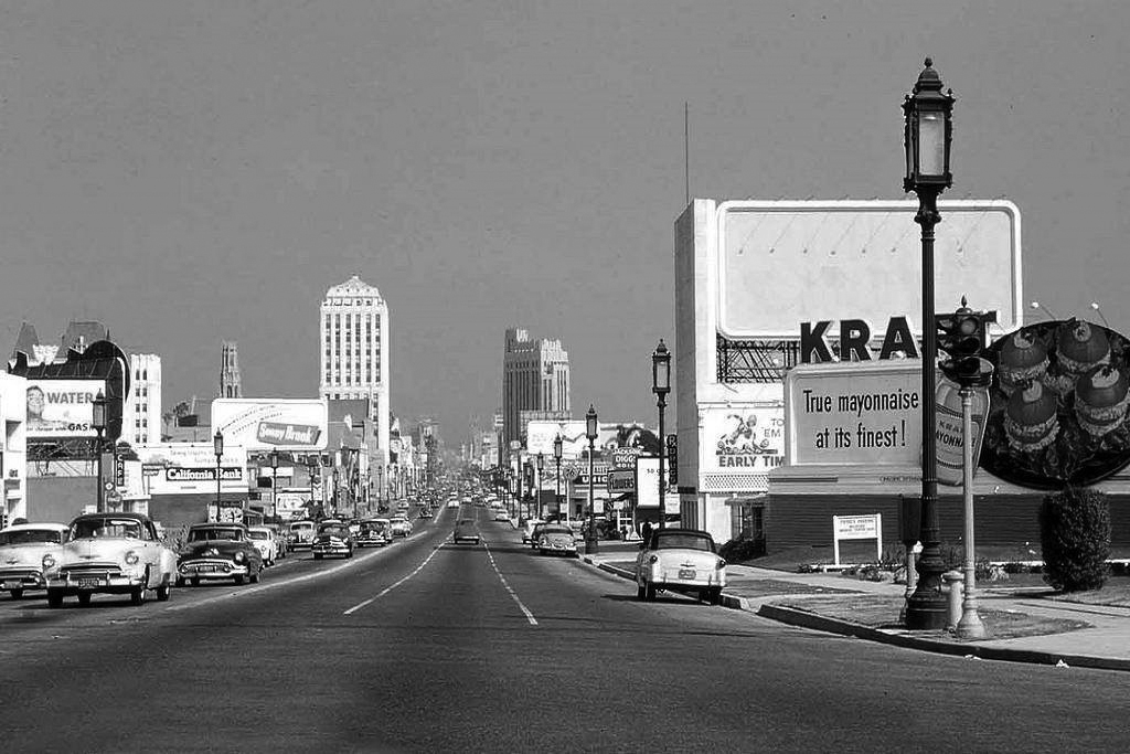
| (1949)^ - Looking east down Wilshire Boulevard at Burnside Avenue in the Miracle Mile. Silverwoods Clothes in the Wilshire Tower, the Phelps-Terkel building, and Wetherby-Kayser are seen at right with the Dominguez Building further back at center. Traffic is traveling down in both directions on Wilshire. F.B. Silverwood founded his first store at 124 So. Spring Street in the 1890s |
Historical Notes A. W. Ross gave Wilshire various "firsts," including dedicated left-turn lanes and the first timed traffic lights in the United States; he also required merchants to provide automobile parking lots, all to aid traffic flow. Major retailers such as Desmonds, Silverwood's, May Co., Coulter's, Mullen & Bluett, Myer Siegel, and Seibu eventually spread across Wilshire Boulevard from Fairfax to La Brea. Ross ordered that all building facades along Wilshire be engineered so as to be best seen through a windshield. This meant larger, bolder, simpler signage; longer buildings in a larger scale, oriented toward the boulevard; and architectural ornament and massing perceptible at 30 MPH instead of at walking speed. These simplified building forms were driven by practical requirements but contributed to the stylistic language of Art Deco and Streamline Moderne. A sculptural bust of Ross stands at 5800 Wilshire, with the inscription, "A. W. Ross, founder and developer of the Miracle Mile. Vision to see, wisdom to know, courage to do." ^* |
 |
|
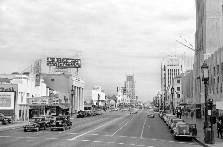
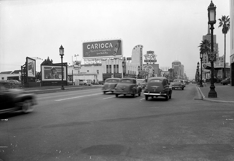
| (ca. 1947)^^ – View looking east along Wilshire Boulevard showing the El Rey Theatre is on the left and Desmond’s Building (Wilshire Tower) is on the right. The El Rey Theatre is showing a double bill: “Mr. District Attorney” (1947) and “Strange Journey” (1946). Further back (from l to r) can be seen the Bank of America Building, E. Clem Wilson Building, and the Dominguez Building. |
Historical Notes The El Rey began its life in 1936 as an independent neighborhood theatre. With a succession of owners and tenants over the decades, the theatre has run the gamut from hosting spiritual services to showing adult films. It stopped showing movies in the 1980s. From the 1980s to the early 1990s El Rey Theatre was a dance-music club called Wall Street, but since 1994 this theatre has been a live music venue which is now exclusively booked through Golden Voice. The capacity is 771 and it also has a VIP balcony in the back.*^ Click HERE to see more of the El Rey Theatre. |
 |
|
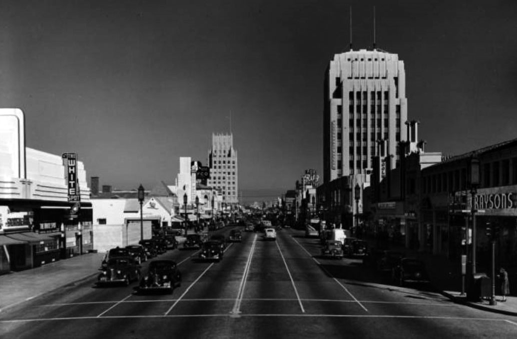
| (ca. 1940)*# - Wilshire Boulevard looking east from Dunsmuir Avenue; the White Spot, Wetherby-Kayser, Graysons, Woolworth's, Lilyans, New York Millinery, The Glorified Hamburger, The Food Palace, Melody Lane Cafe, the Fox Ritz Theater, etc. Additional information: The Glorified Hamburger sign was a slogan for Wimpy Grills which was located on the northeast side of Cochran and Wilshire (5425 Wilshire). It eventually became the Flying Saucer, and is now (end of 2012) a Staples store that pays homage to a flying saucer. |
 |
|
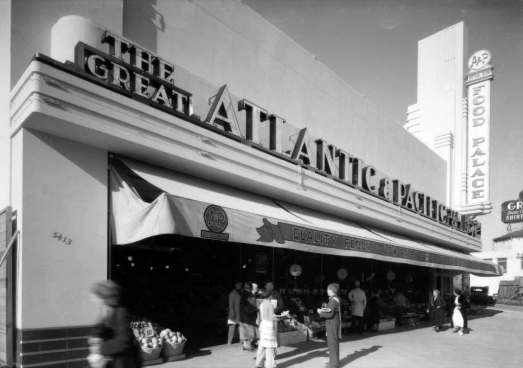
| (ca. 1935)*# - View showing the Food Palace, an Atlantic & Pacific (A&P) Market located at 5413 Wilshire Boulevard, near the NE corner of Wilshire and Cochran. Today, this building is a Staples Store. Click HERE for contemporary view. |
Historical Notes The Great Atlantic & Pacific Tea Company, better known as A&P, was a chain of grocery stores that ceased supermarket operations in November 2015, after 156 years in business. From 1915 through 1975, A&P was the largest grocery retailer in the United States (and until 1965, the largest U.S. retailer of any kind). A&P was considered an American icon that according to The Wall Street Journal "was as well-known as McDonald's or Google is today" and that A&P was "Walmart before Walmart." Known for innovation, A&P and the supermarkets that followed its lead significantly improved nutritional habits by making available a vast assortment of food products at much lower costs. Until 1982, A&P also was a large food manufacturer.*^ |
 |
|
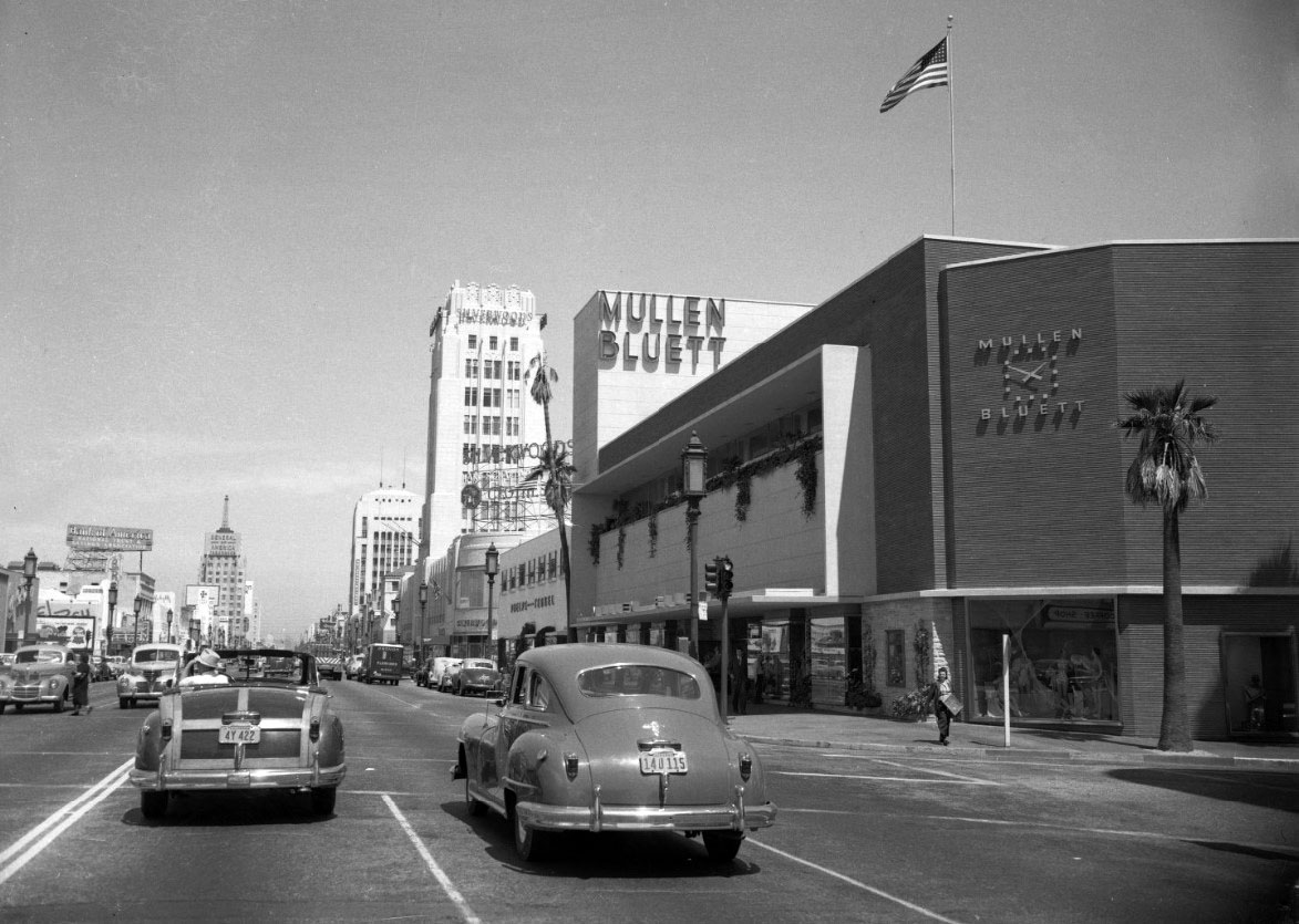
| (1949)^*** – View looking east on Wilshire Boulevard at Ridgeley Drive with the Mullen Bluett Building seen on the right. Other building signs include: Silverwoods, Wetherby Kayser, Bank of America National Trust & Savings Association, General of America Insurance. |
Historical Notes The once-popular Mullen and Bluett clothing store chain had several stores in Los Angeles, all designed by Stiles O. Clements in a distinct style to complement its neighborhood. The last of these stores rose on the Miracle Mile after World War II in the California style, bringing the outdoors in with welcoming patios, open display windows, and dozens of flagstone planter boxes scattered throughout the store. Clements designed every detail of the building, inside and out. A façade of Roman brick was balanced with a geometric grid of plasterwork and flagstone, softened by greenery, punctuated by copper-framed windows, and topped with an integrated sign pylon. Inside, women's and children's clothing were located on the second floor. Assuming that men would not travel as far as the second floor to shop, menswear and a convenient carousel of women's gift items were located on the first floor.^ |
 |
|
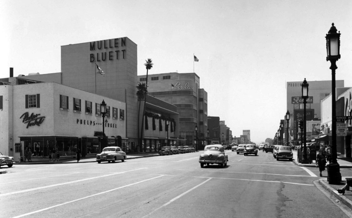
| (ca. 1949)*^# – View looking west on Wilshire Blvd at Burnside Ave. On the SW corner is Phelps and Terkel Department Store with Mullen Bluett next door to the west. Further back, on the SW corner of Wilshire and Hauser, stand the 5-story Coulter's Department Store. |
Historical Notes Next door to Mullen and Bluett stood the 1936 Phelps-Terkel department store, designed by Morgan, Walls, and Clements. Together, they helped secure the Miracle Mile's reputation as a shopper's paradise. Both buildings succumbed over time to insensitive treatment and lack of protection, due largely to the priority placed on preserving the Miracle Mile's Art Deco buildings. A succession of owners and tenants over the years eventually gutted and subdivided the Mullen and Bluett building, though its façade remained intact. The Los Angeles Conservancy's Modern Committee fought to save both the Mullen and Bluett and Phelps-Terkel building, neither of which was designed in the Art Deco style. Both buildings were demolished in 2006 and replaced with an enormous apartment complex in a faux Art Deco design. ^ |
 |
|
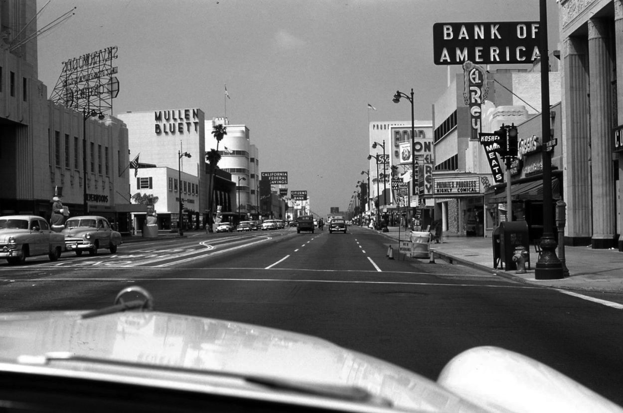
| (ca. 1957)^^ - Westbound on Wilshire approaching Masselin Avenue with Desmond’s, Mullen Bluett, and Coulter's on the left, and Bank of America, El Rey, and Prudential on the right. |
 |
|
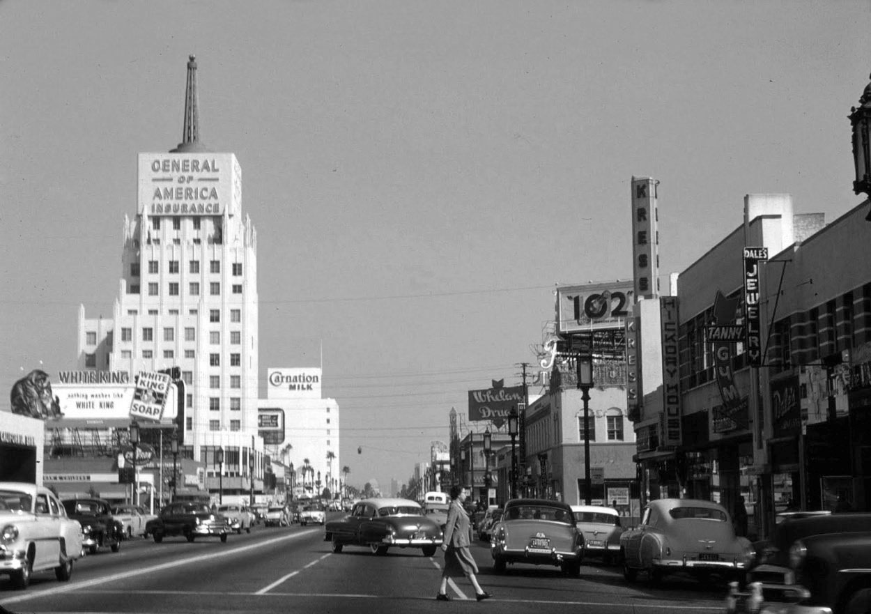
| (1954)^.^ - Looking east on Wilshire at the E. Clem Wilson Building at La Brea and Wilshire. Sign on building reads: General of America Insurance. The Carnation Building is seen in the distance. |
Historical Notes Because of its height and prime location on the northeast corner of Wilshire and La Brea, the Art Deco E. Clem Wilson Building has attracted prominent signage over the years. Corporate names that adorned The Wilson Building included (in chronological order): General Insurance, Mutual of Omaha (until 1990), Asashi, and Samsung. |
 |
|
| (1957)*# - Aerial view looking east along the ‘Miracle Mile’, Wilshire Boulevard between Fairfax and La Brea. Near the top-center can be seen the E. Clem Wilson Building (NE corner of Wilshire and La Brea). The next large building east of La Brea is the Carnation Building. Coulter's Department Store can be seen at lower right (SW corner of Wilshire and Hauser). |
Wilshire near Highland
 |
|
| (1950)^ – View looking west on Wilshire Boulevard toward La Brea Avenue as seen from Citrus Avenue (right). Several significant buildings can be seen in the distance. From left to right: Four Star Theatre, Fox Ritz Theatre, Dominguez-Wilshire Building, and the E. Clem Wilson Building (NE corner of Wilshire and La Brea). The Carnation Building is to the right (out of view). |
 |
|
| ca. 1962)^.^ – View looking at the southwest corner of Wilshire and Mansfield Ave showing the Four Star Theatre. Coincidentally, the theater is showing “The Four Days of Naples”. A Dutch Boy Paint Store occupies the corner space of the Art Deco building. Also note the huge roof-mounted billboard advertising Buick. |
 |
|
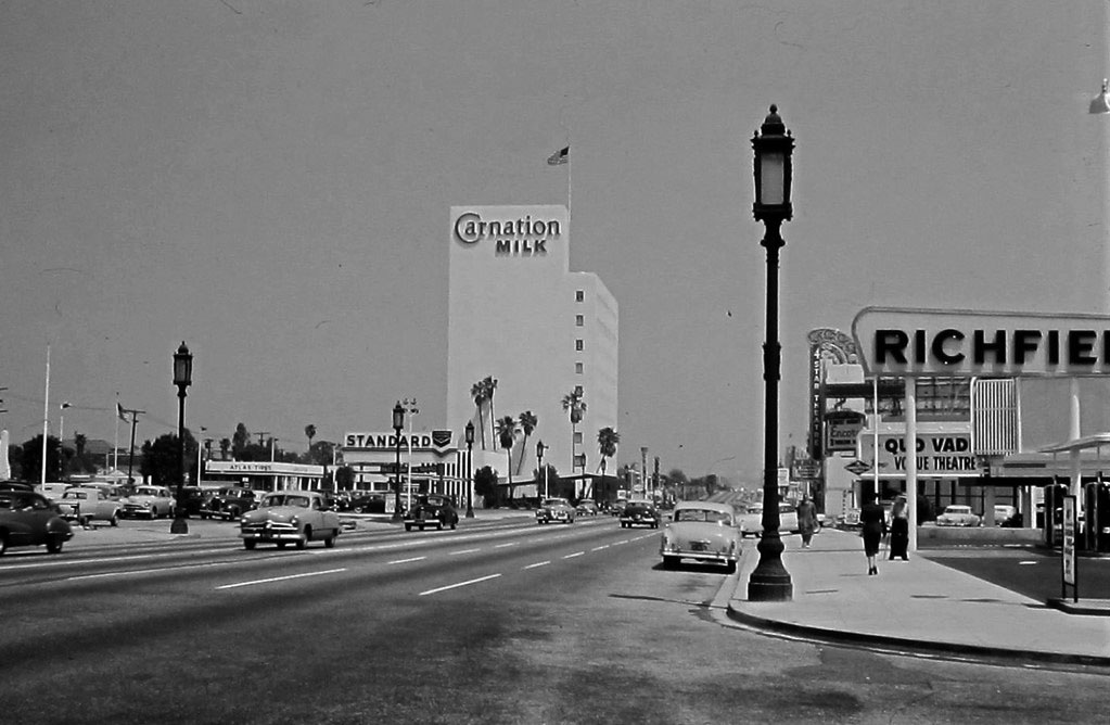
| (ca. 1951)^.^ – View looking east on Wilshire Boulevard from Orange Drive showing the Carnation Building in the distance. At right, the Four Star Theatre can be seen behind the Richfield sign. |
Historical Notes This stretch of the eastern end of the Miracle Mile has seen dramatic change with building construction. Click HERE to see this same view in 2009. HERE's the same view in 2017. |
 |
|
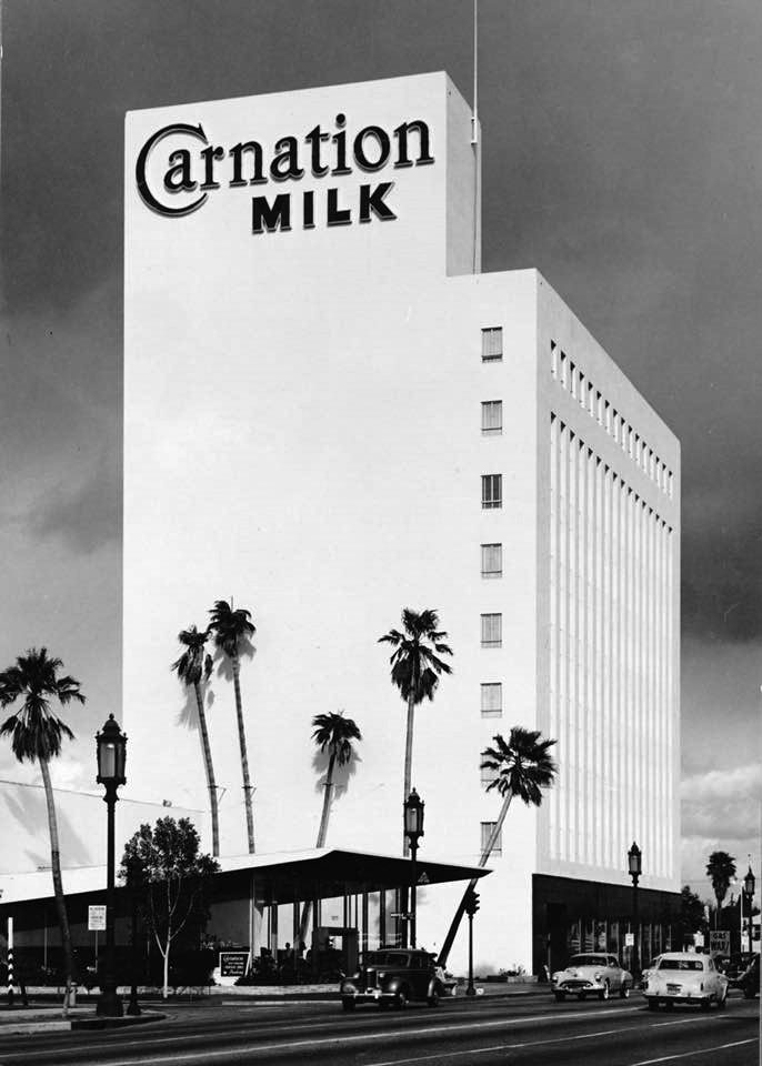
| (ca. 1949)^# – View showing the Carnation Building and adjacent Carnation Coffee Shop located on the north side of Wislhire between Mansfield and Citrus. Bob's Big Boy was on the south side of Wilshire, right across the street from Carnation. The former Big Boy is now the home of Beverly Hills BMW and the adjacent movie theater was the Four Star, which became a church. |
Historical Notes In 1948, the Carnation Company hired Beaux-Arts educated architect Stiles O. Clements (1883-1966) to design its new corporate headquarters on Wilshire Boulevard in Los Angeles. The company decided to maximize on the high percentage (30%) of its employees living in California. Staff in Seattle, Milwaukee and New York were relocated and former branch operations such as accounting, advertising and purchasing were centralized. ^ Click HERE to see more early views of the Carnation Building and Coffee Shop. |
 |
|
| (1952)*# – View looking east on Wilshire Boulevard as seen from the Carnation Building, after a storm. Citrus Avenue runs horizontally at bottom of photo. A Signal Gas Station is seen on the northeast corner of Wilshire and Highland Avenue. Click HERE for contemporary view. |
Wilshire near Western
 |
|
| (ca. 1950)^ - View showing the intersection of Wilshire Boulevard and Western Avenue, looking east down Wilshire. The Pellissier Building / Wiltern Theatre are on the SE corner. Across the street, SW corner, can be seen the saucer-shaped Melody Lane Drive-in Restaurant. In the distance is the Wilshire Boulevard Temple with its immense Byzantine revival dome. |
 |
|
| (ca. 1952)##^# – View looking east on Wilshire Boulevard from S. Wilton Place showing several large signboards on both sides of the street. Three tall buildings can be in the distance (l to r): St. James' Episcopal Church, Wilshire Professional Building (N/E corner of Wilshire and St. Andrews) and the Pellissier Building (S/E corner of Wilshire and Western). Note the ornate "Wilshire Special" streetlamps. Click HERE to see more in Early LA Streetlights. |
Wilshire near Normandie
 |
|
| (1952)^ – View looking west on Wilshire Boulevard at Catalina Street. The three 12-story office buildings of Tishman Plaza (later Central Plaza) is seen in the distance at Wilshire and Normandie Avenue. |
.jpg) |
|
| (1953)*# - View of Wilshire Boulevard looking west from Mariposa Avenue, showing a 1952 Pontiac streaking by in the foreground. The large building on the left is the Tishman Plaza (built 1951-1952). Across the street on the right can be seen the Wilshire Christian Church (built in 1927), located on the NE corner of Wilshire and Normandie. |
 |
|
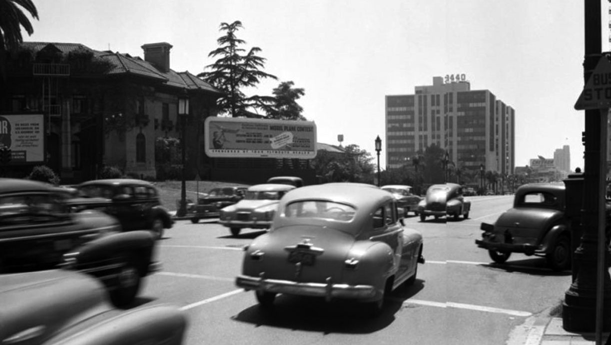
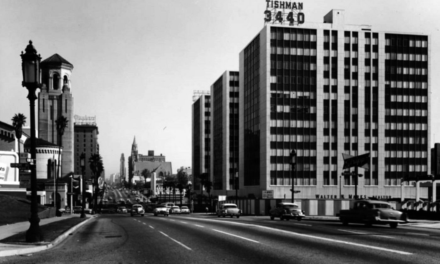
| (1955)*# – View looking east on Wilshire Boulevard at Ardmore Avenue showing the Tishman Plaza at 3440 Wilshire Boulevard (SE corner of Wilshire and Normandie). The Wilshire Christian Church and Gaylord Apartments are seen on the left. |
Click HERE to see Wilshire and Normandie in the 1920s & 1930s |
 |
|
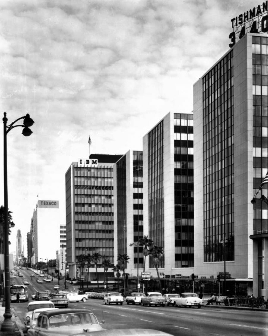
| (1958)*# – View looking east from Normandie Avenue down Wilshire Boulevard showing the Tishman Plaza on the right with the IBM and Texaco buildings in the distance. |
 |
|
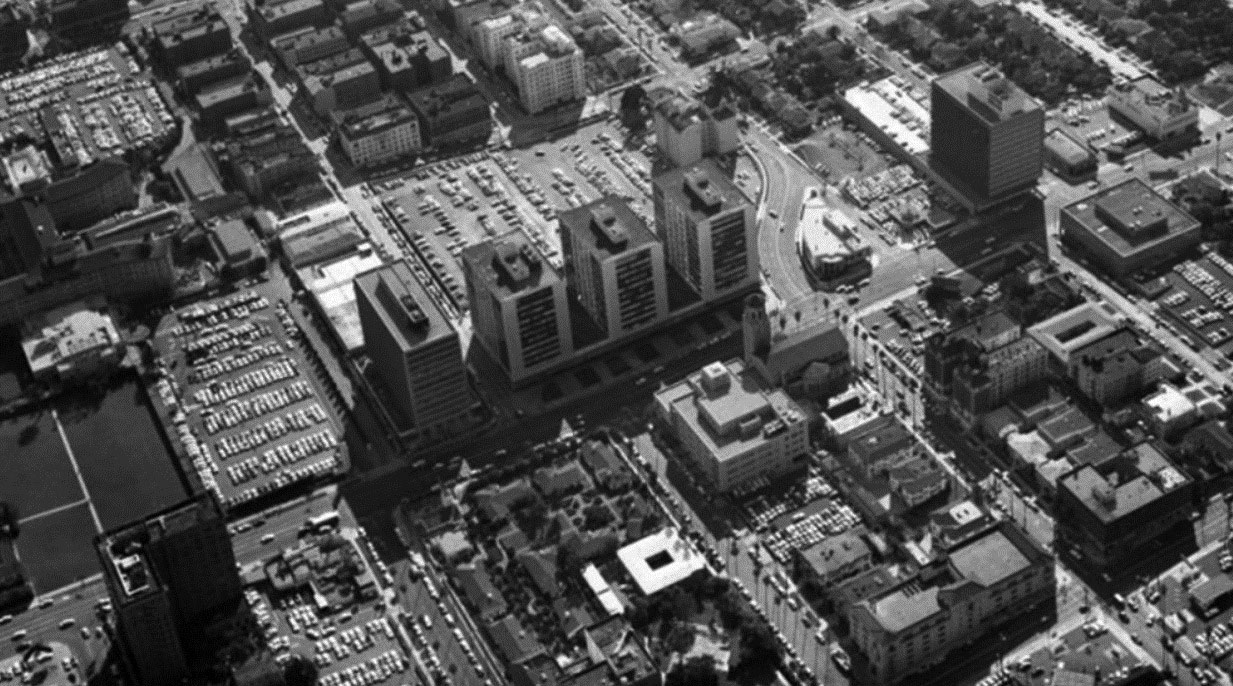
| (1958)^ - Aerial view of the IBM Building (tall, rectangular building next to three identical buildings), located at 3424 Wilshire Boulevard and the Tishman Plaza, located at 3450, 3460, and 3540 Wilshire Boulevard; view is looking southwest. Also visible directly across the street is Wilshire Christian Church, located on the NE corner of Wilshire and Normandie Avenue (street that curves mid-photo). The Ambassador Hotel is on the far left, across the street from the Brown Derby. The Tishman Buildings, three 12-story office buildings of Tishman Plaza (later Central Plaza) were built in 1952 and were sold by Tishman Realty and Construction Co. to Prudential in 1953. |
Historical Notes In 1952, on the driving range on the south side of Wilshire between Mariposa and Normandie, the first three 12-story Tishman Plaza buildings were built (they're now known as Central Plaza), designed by Claude Beelman. Insurance companies began locating their West Coast headquarters in Wilshire Center because of tax incentives provided by the State. Some 22 high-rise office buildings were erected on Wilshire Boulevard from 1966 to 1976 to provide office space for such companies as Getty Oil Co., Ahmanson Financial Co., Beneficial Standard Life Insurance, Wausau, and Equitable Life Insurance. The Chapman Park Hotel, built in 1936, was torn down to make way for the 34-story Equitable Plaza office building erected in 1969. By 1970, firms such as CNA, Pacific Indemnity, and Pierce National Life were starting construction of their own high-rise buildings. Southwestern University School of Law moved from its downtown location of 50 years to a four-story campus just south of Wilshire Boulevard on Westmoreland in 1973. In the 1970s and 1980s, commerce moved to the city's less congested Westside as well as the San Fernando Valley, and businesses and affluent residents eventually followed. I. Magnin closed, while Bullocks Wilshire held out until 1993. Rental rates in office buildings plummeted from an average of $1.65/sq ft to a dollar between 1991 and 1996; property values dropped from a high of $120/sq ft to $30 or $40 per foot in 1998 Subsequently, the Wilshire Center Streetscape Project used federal funds to rejuvenate Wilshire Boulevard. It was one of the most ambitious and significant urban rehabilitation projects found anywhere in America and in 1999 was awarded the Lady Bird Johnson Award from The National Arbor Day Foundation. New buildings include the Aroma Center on Wilshire, which is topped by a large digital billboard, and a modern retail building facing 6th Street on the former parking lot of the Equitable Building.*^ |
Wilshire near Ambassador Hotel
 |
|
| (1950)^ - Looking down Wilshire Boulevard from near Mariposa Avenue, showing the Chapman Park Hotel (left), the Brown Derby (left), the Gaylord Apartments (upper left), Bullock's Wilshire (left of center), Immanuel Presbyterian Church (left of center), the pylon identifying the entrance for the Ambassador Hotel (left of center), and two Foster and Kleiser billboards. |
 |
|
| (ca. 1950)**^ - Postcard view of Wilshire Boulevard looking east toward the intersection of Alexandria Avenue and Wilshire. From left to right can be seen the Zephyr Room, Brown Derby Restaurant and the Gaylord Apartments. Across the street, on the south side of Wilshire, is the entrance to the Ambassador Hotel. |
Historical Notes The Brown Derby chain was started by Robert H. Cobb and Herbert Somborn (a former husband of film star Gloria Swanson). Bob Cobb is known as the inventor of the California Cobb Salad. He was also part owner of the Hollywood Stars baseball team. The Brown Derby was moved in 1937 to 3377 Wilshire Boulevard at the northeast corner of Wilshire Boulevard and Alexandria Avenue, about a block from its previous location (and about a block north of the Ambassador Hotel).^* |
 |
|
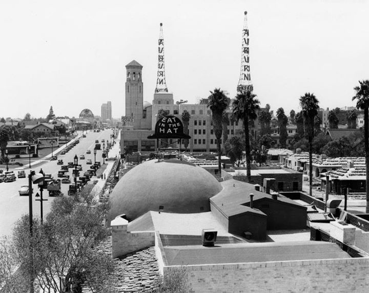
| (ca. 1938)^#** - Wilshire Boulevard, looking west near Alexandria, most likely taken from the Gaylord Apartments. A large sign on top of the Brown Derby Restaurant reads: "Eat in the Hat". Two radio towers can be seen in the background as well as the Wilshire Christian Church. |
Historical Notes The Brown Derby chain also included restaurants in Hollywood, Beverly Hills, and the Los Feliz area. The Los Feliz Brown Derby at 4500 Los Feliz Blvd is the last remaining branch of the chain still extant and in operation. |
 |
|
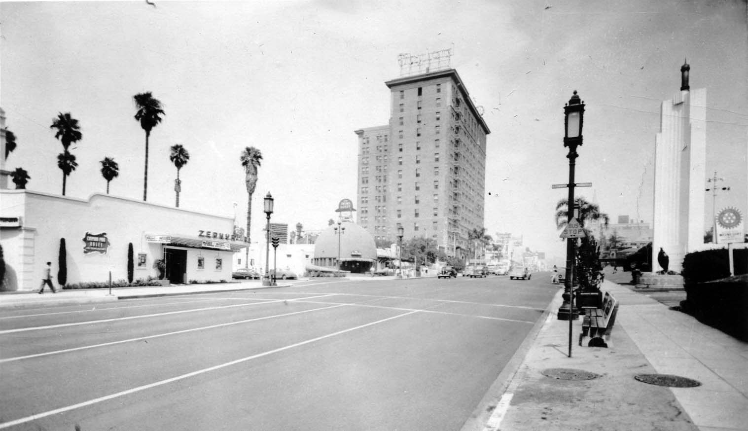
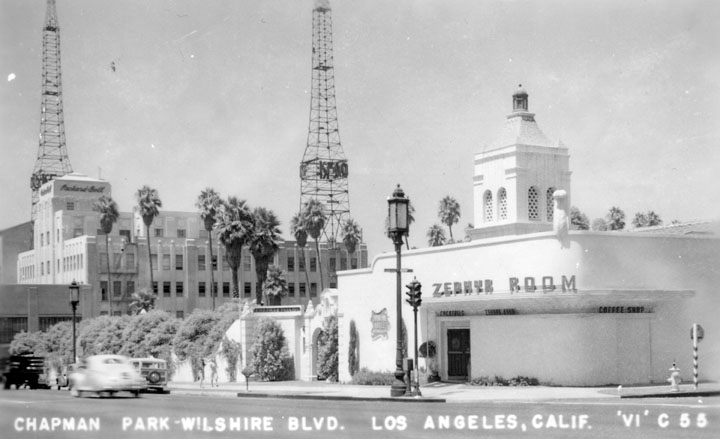
| (ca. 1947)^ - A postcard view of the Zephyr Room at Chapman Park Hotel, located at 615 South Alexandria Avenue. The "Packard Bell" building, with 2 radio towers near it, is also visible. |
Historical Notes Architect A. C. Martin designed the1931 Cord Building located at 3443 Wilshire Boulevard, which featured a sandstone and marble exterior and a 30 foot tower. E.L. Cord, owner of a Fuller Motors dealership and producer of Auburn and Cord automobiles, chose his business initials KFAC for a new radio station, and in 1932 the Federal Radio Commission approved a new location for the station and towers in the penthouse of the dealership. In 1945 Packard-Bell moved in and the building was renamed. The building underwent a major remodel in 1949.^ |
Wilshire near Vermont
 |
|
| (1947)*#* – View looking west on Wilshire Boulevard at Vermont Avenue. Carpenter's Drive-in Restaurant stands on the northwest corner. Further west can be seen the Moorish-style roof of a Texaco Service Station. The tall building in the distance is the Gaylord Apartments. |
Historical Notes Between 1905 and 1928, the Burkhard Residence would stand on the northwest corner of Wilshire and Vermont. The lot would sit empty for a while and then be occupied by a florist shop and billboard for a short 5 years (1928 – 1933). The building that went up on the site in 1933 was first occupied by restaurateur Harry Bogen; two years later, it became a branch of the popular Carpenter's Drive-in chain. |
 |
|
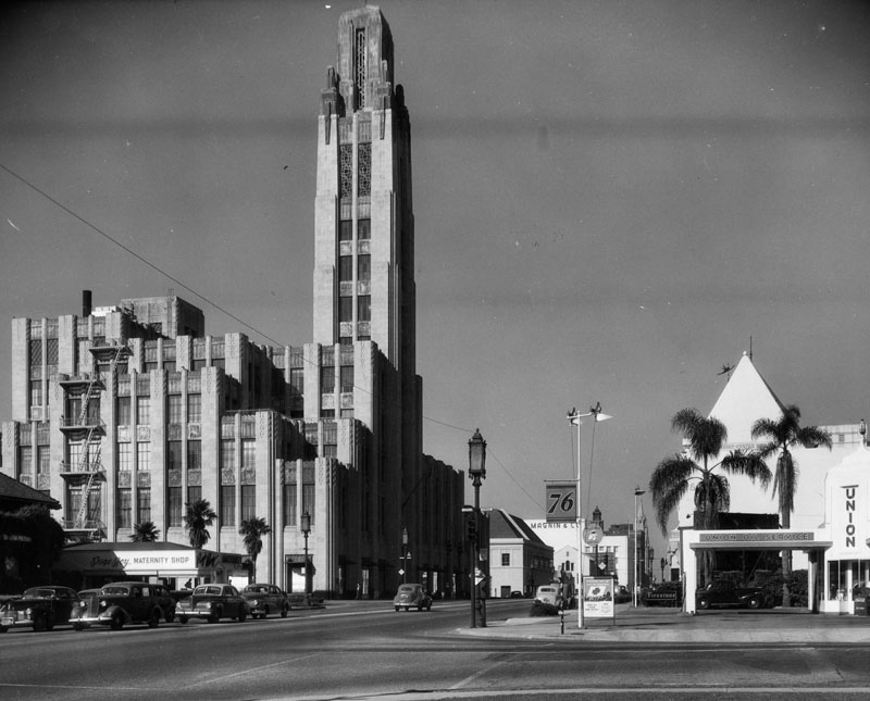
| (1949)^ - View of Bullock's Wilshire department store from a block east at Virgil Avenue where it meets Wilshire Blvd. Neighboring businesses, including: a 76 Union Oil gas station, Page Boy Maternity Shop, I Magnin & Co. are also visible throughout the image. On the right, a few cars traveling east on Wilshire are seen stopped at the light at Virgil. |
Westwood Village
 |
|
| (1936)^ - Aerial view of Westwood Village from a blimp (note the shadow in the foreground). The Westwood Village Theatre (aka Fox Theatre) is at the upper left and Ralphs Market is at lower right. At upper center is the Holmby Building with its clock tower. At center of photo, where Westwood Boulevard intersects Broxton Avenue, sits the Janss Dome Building, built in 1929. |
Westwood and UCLA were developed on the lands of the historic 'Wolfskill Ranch', a 3,000-acre parcel that was purchased by Arthur Letts, the successful founder of the Broadway, and Bullock's department stores, in 1919. Upon Arthur Lett's death, his son-in-law, Harold Janss, vice president of Janss Investment Company, inherited the land and started to develop the area in 1922. In 1925, in a deal to get the University of California, Los Angeles built, the Janss Investment Company sold 375 acres to the cities of Los Angeles, Santa Monica and Beverly Hills at the bargain price of $1.2 million — about a quarter of its value. The cities, whose voters had passed bond issues to pay for the site, turned around and donated it to the state. While the UCLA campus was being built, Janss Investment Company went to work developing the Westwood Village commercial area and surrounding residential neighborhoods. ^ |
 |
|
| (ca. 1940)**^* - Postcard view of Westwood Boulevard looking north, circa 1940. |
Historical Notes Opening in 1929, the original design of Westwood Village was considered one of the most well planned and beautifully laid out of commercial areas in the nation. Harold Janss had hired major architects and instructed them to follow a Mediterranean theme, with clay tile roofs, decorative Spanish tile, paseos, patios and courtyards. Buildings located at strategic points, including theaters, used towers to serve as beacons for drivers on Wilshire Boulevard. Janss picked the first slate of businesses and determined their location in the neighborhood; the area opened with 34 businesses, despite the Great Depression, had 452 in 1939. ^ |
 |
|
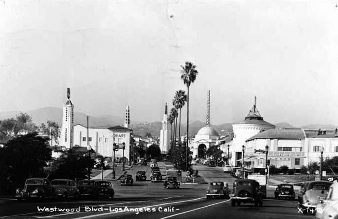
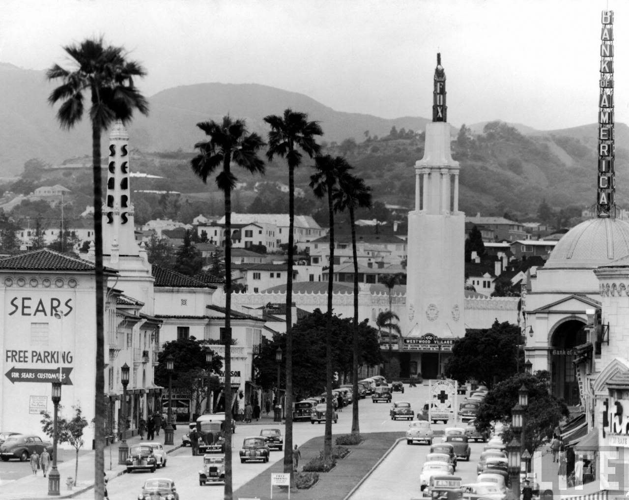
| (1949)**^ - View looking northwest down Broxton Avenue in Westwood Village. The Fox Theatre tower stands in line with the tall palm trees along the center median of Broxton. The towers of the Sears and Bank of America buildings can also be seen. |
Click HERE to see more in Early Views of Westwood |
* * * * * |
UCLA
 |
|
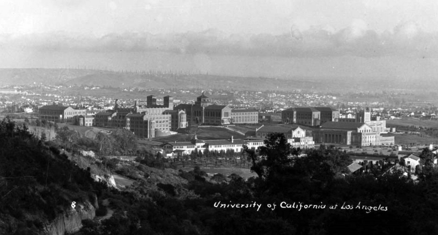
| (1940s)#* – Postcard view looking southeast showing the campus of UCLA with the Powell Library in the distance at center, the backside of Royce Hall at left and the Women's and Men's gym in the foreground at right. Homes can be seen in the hills, and what appear to be oil derricks in the far distance. |
In 1929, the UCLA campus had four buildings: Royce Hall and Haines Hall on the north, and Powell Library and Kinsey Hall (now the Humanities Building) on the south. The Janss Steps were the original 87-step entrance to the university that led to the quad of these four buildings. Today, the campus includes 163 buildings across 419 acres in the western part of Los Angeles, north of the Westwood shopping district and just south of Sunset Boulevard.^ |
.jpg) |
|
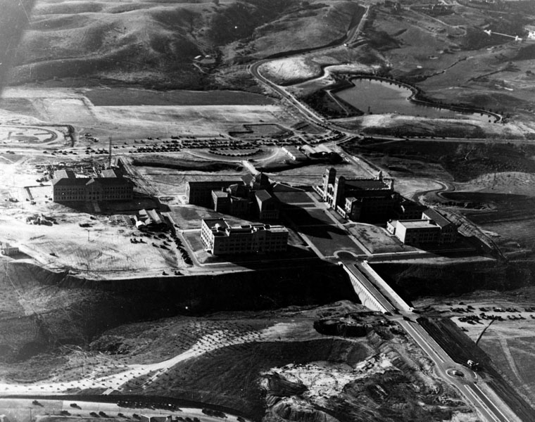
| (ca. 1953)*# – Aerial view looking west showing the University of California Los Angeles campus with the Sawtelle Reservoir seen at center-right. The two large quads in the foreground at right are situated where a gully once existed with a bridge over it connecting the campus to Hilgard Avenue. |
Before and After
 |
|
|
|
| (1929)^ vs. (ca 1953)^^ - Aerial view looking west of the UCLA campus before and after the gully was filled-in. |
Click HERE to see more in Early Views of UCLA |
* * * * * |
West Los Angeles
 |
|
| (1950s)*# - Aerial view facing west over the Rancho Golf Courses, the corner of the Hillcrest Country Club, the Cheviot Hills Recreation Center, Motor Avenue and Monte Mar Drive. Motor Avenue runs from lower-left to center-right where it intersects with Pico Boulevard. In the distance are the Santa Monica Mountains, the City of Santa Monica and the Pacific Ocean. |
 |
|
| (ca. 1950s)*# - Aerial view looking east showing the Rancho Golf Course and the Cheviot Hills playground. Pico Boulevard runs away from the camera on the left. Motor Avenue runs horizontally at upper-center and dead ends at Pico Boulevard in front of the Fox Studios (upper-center left). |
 |
|
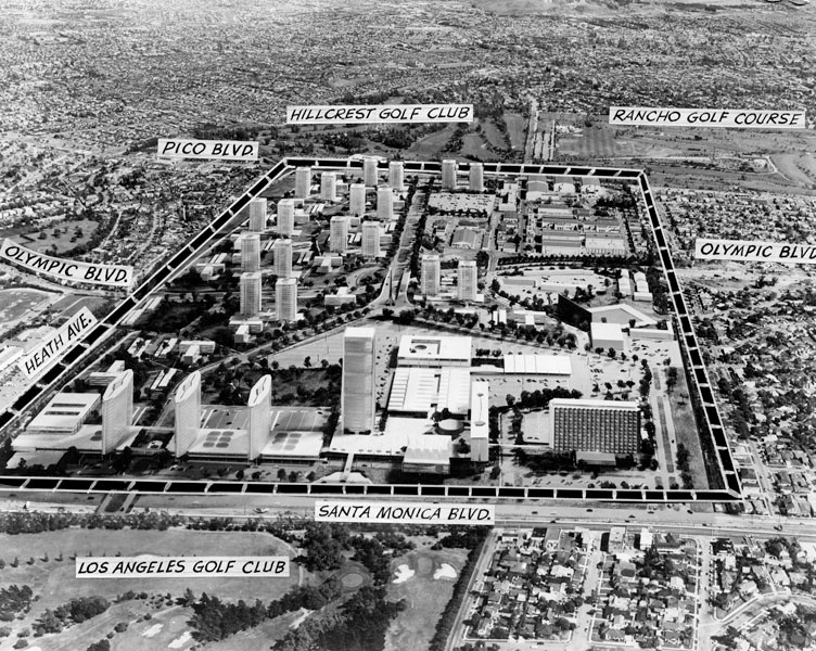
| (1958)^ - Aerial view showing the conceptual design for the proposed Century City project encompassing all of 20th Century-Fox's 280 acres. Approximately 60 acres will be retained by the studio. Rancho and Hillcrest Golf Courses can be seen at top of photo separated by Motor Avenue. Santa Monica Boulevard runs horizontally at bottom with the Los Angeles Golf Club at lower-left. Click HERE to see more Early Views of Century City. |
 |
|
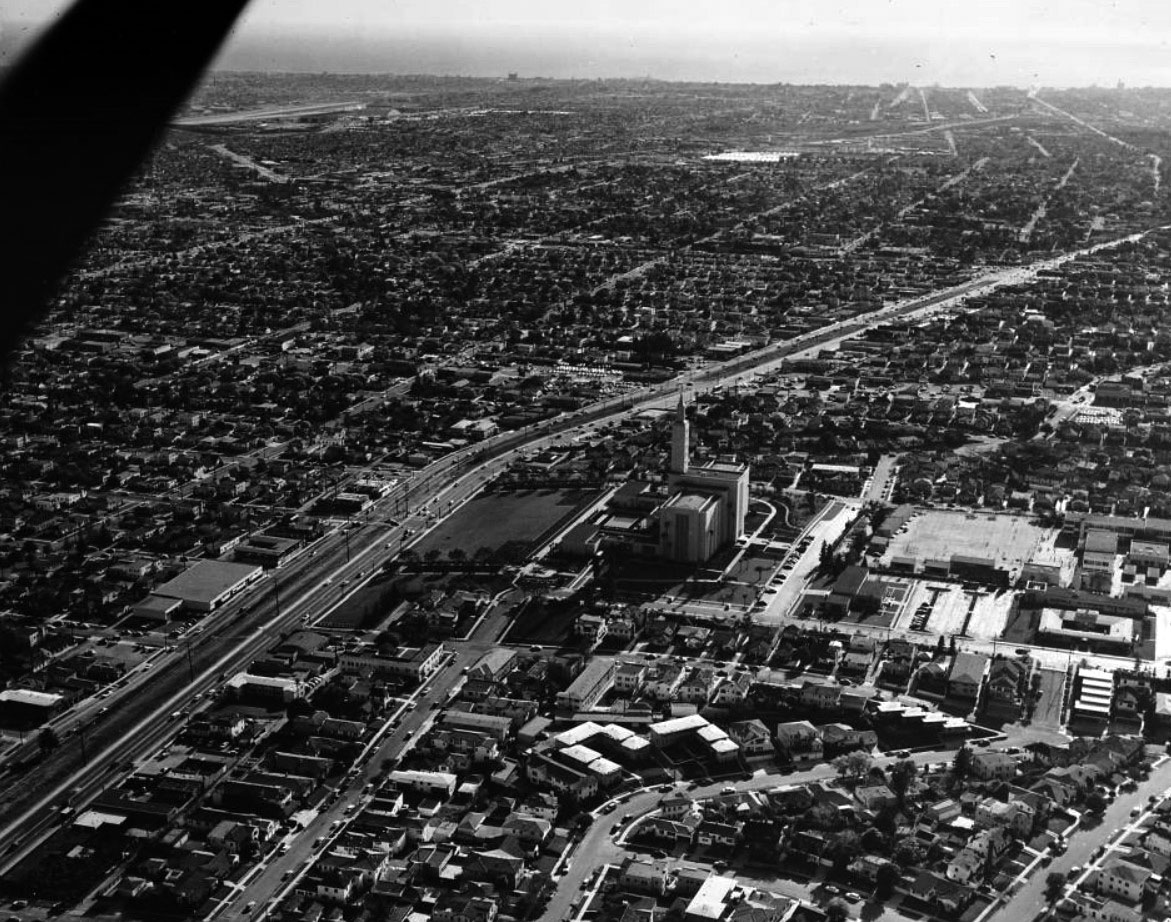
| (1954)*# - Aerial view facing West toward the Pacific Ocean showing the Los Angeles Mormon Temple (still under construction) with Santa Monica Boulevard running from lower-left to upper-right. The Santa Monica Municipal Airport (Clover Field) is to the south in the distance. |
 |
|
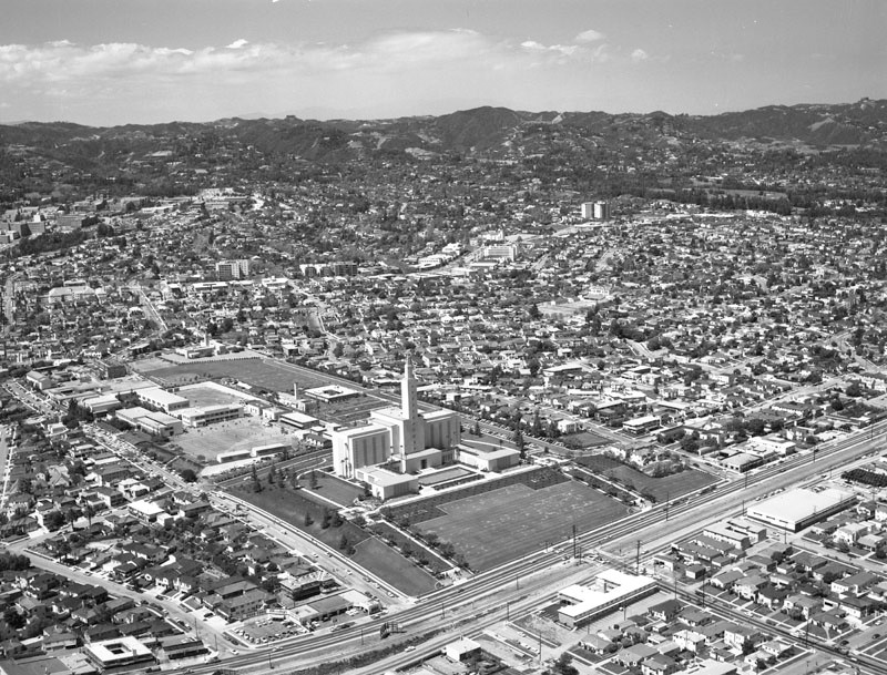
| (1957)^ - Aerial view looking north showing the Church of Jesus Christ of Latter-day Saints Temple located at 10777 Santa Monica Boulevard. Santa Monica Boulevard runs from bottom left to middle right; Wilshire Boulevard is seen at upper left, curving to upper right; a portion of the UCLA campus is at upper left; the Los Angeles Country Club is at upper right. |
Historical Notes When it was dedicated in 1956, it was the largest of the church's temples, though it has since been surpassed by the Salt Lake Temple due to later expansions. The temple serves 41 stakes in Los Angeles, Ventura, Kern, Santa Barbara, and San Luis Obispo counties. Click HERE to see more Early Views of the LDS Church Temple. |
Santa Monica Air Line (Pacific Electric)
 |
|
| (1953)* - A Pacific Electric Santa Monica Air Line car travels eastbound on Exposition Boulevard in front of USC's Mudd Memorial Hall. Photo courtesy of the Transportation Library and Archive. |
Historical Notes Today’s Expo Line has its origins in a railroad between Los Angeles and Santa Monica that went into service in 1875. The Los Angeles & Independence Railroad later became the PE Air Line (seen above), the direct ancestor of the Expo Line. Beginning at the Pacific Electric Building at 6th and Main streets in downtown Los Angeles, the line traveled south with other lines alongside what is now Long Beach Boulevard and the Blue Line. At 25th Street, the Air Line turned west onto an exclusive right-of-way alongside Exposition Boulevard toward Santa Monica Beach. The currently abandoned section between the Blue Line tracks and USC is the primary difference between today's Expo Line and Air Line routes.^* |
 |
|
| (1953)* - A Santa Monica Air Line car travels west through Culver City at Venice and Robertson. Photo by Alan Weeks, courtesy of the Metro Transportation Library and Archive. |
Historical Notes Built in 1875 as the steam-powered Los Angeles and Independence Railroad, it was intended to bring mining ore to ships in Santa Monica harbor's Long Wharf and as a passenger excursion train to the beach. Eventually purchased by Southern Pacific Railroad, it was leased to the Los Angeles Pacific Railroad for electric passenger and light freight use in 1909. Pacific Electric purchased the line in 1911, along with all the other lines owned by Los Angeles Pacific.^* |
 |
|
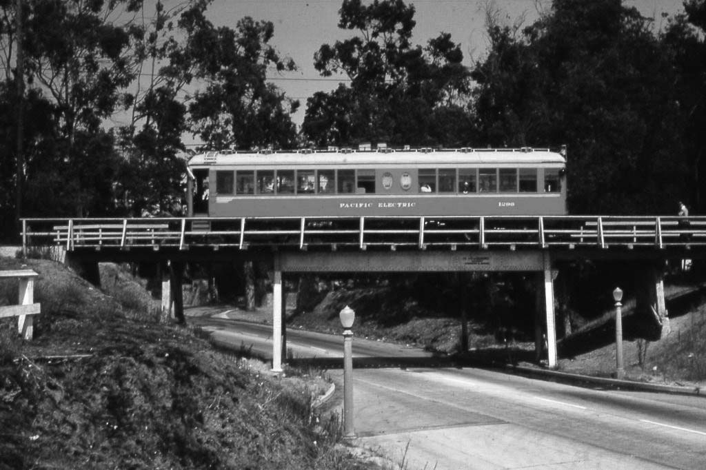
| (1953)#* - A PE Red Car traveling on the Santa Monica Air Line crosses over Motor Avenue. Photo by Alan Weeks, courtesy of the Metro Transportation Library and Archive. |
Historical Notes With the (then) sparse population along much of the route, service on the Air Line was reduced as early as 1924 with passenger cars running only during rush hours. At that point most passengers traveled to Santa Monica on a different rail line which ran primarily down Santa Monica Boulevard. Passenger service on the Air Line was completely discontinued on September 30, 1953, however freight service remained. Because the Air Line route was also connected to the Santa Monica Boulevard line via tracks on Sepulveda Boulevard, it was the only way for freight trains to reach West Los Angeles, Beverly Hills and Hollywood warehouses (usually at night due to city regulations). Track replacement and various construction tasks began in 2006, and the first phase of the "Expo Line" from downtown Los Angeles to Culver City opened in April, 2012. Service for the second phase to Santa Monica began on May 20, 2016.^* |
 |
|
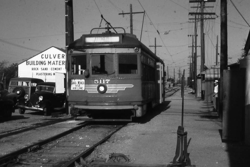
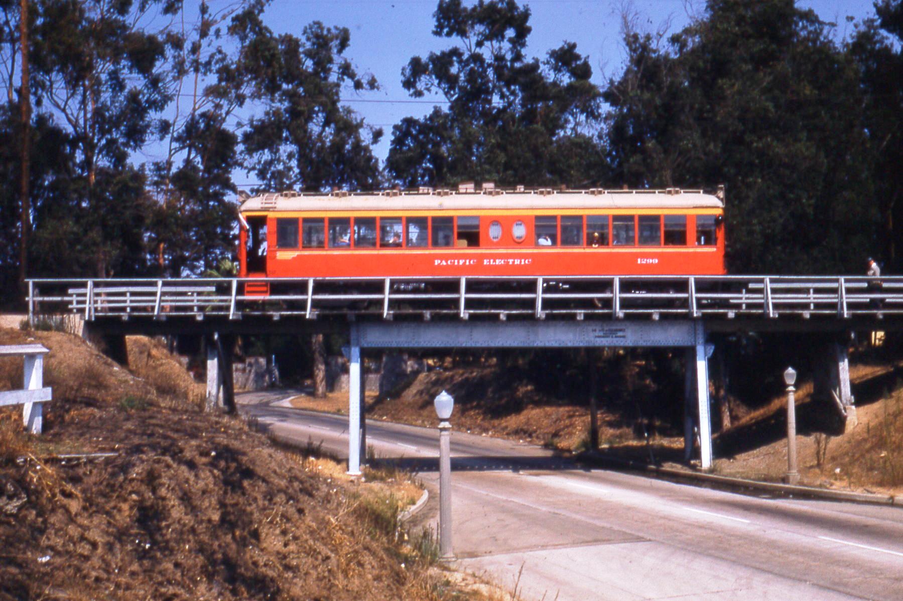
| (1953)* - A PE Red Car traveling on the Santa Monica Air Line crosses over Motor Avenue. Photo by Alan Weeks, courtesy of the Metro Transportation Library and Archive. |
Historical Notes This is a shot of P.E. Car 1299 on a charted club trip on the former Motor Ave bridge. The light-rail car is heading west and we are looking north on Motor Ave. You can see the gates of Vista Del Mar Orphanage, where the Phase 2 meetings for the Expo Line are held, in the background. Note the right-of-way crossed Motor Ave where the westboound lanes of the freeway crossed today, and the tracks were near the northern edge of the right-of-way. Hence this former bridge used to be near the northern edge of the freeway. When the freeway was built, this old bridge was removed and the tracks were put along the southern egde of the freeway near Motor Ave, with a new bridge over Motor.* |
Then and Now
 |
|
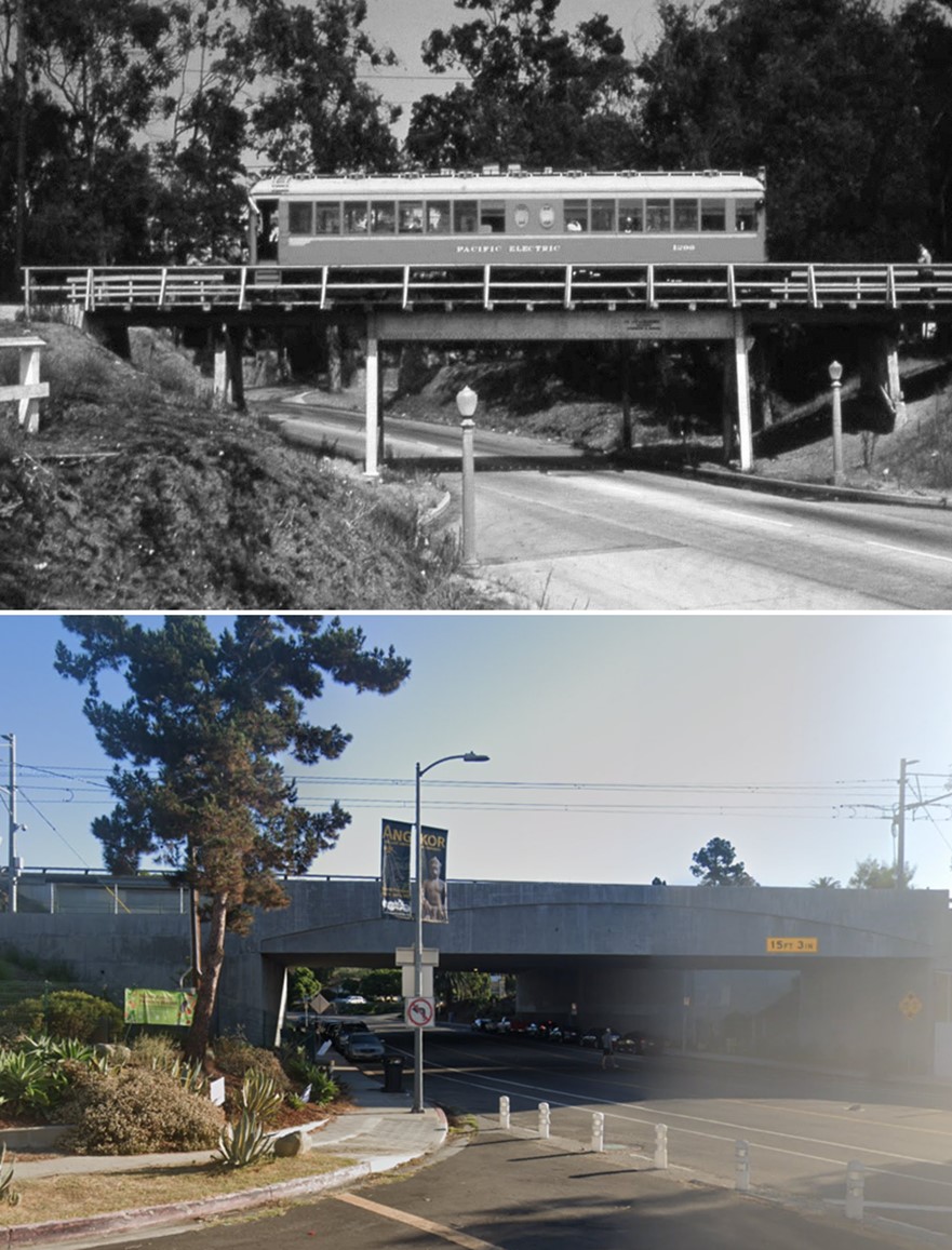
| (1953 vs. 2022)* – Top photo shows a PE Red Car traveling on the Santa Monica Air Line crossing over Motor Avenue. Today this is the westound lanes of the Santa Monica Frwy. The former bridge used to be near the northern edge of the freeway. When the freeway was built, the old streetcar bridge was removed and the tracks were put along the southern edge of the freeway with a new bridge over Motor. |
Santa Monica
 |
|
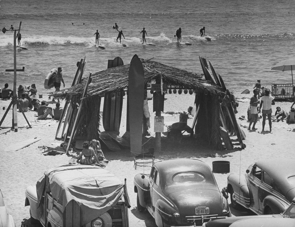
| (1950)* - Surfing California. Surfing is more than a sport....it's a way of life! Loomis Dean/Life |
Historical Notes “Out of water, I am nothing.” — Duke Kahanamoku “Surfing’s one of the few sports where you look ahead to see what’s behind.” — Laird Hamilton “One of the greatest things about the sport of surfing is that you need only three things: your body, a surfboard, and a wave.” — Naima Green |
 |
|
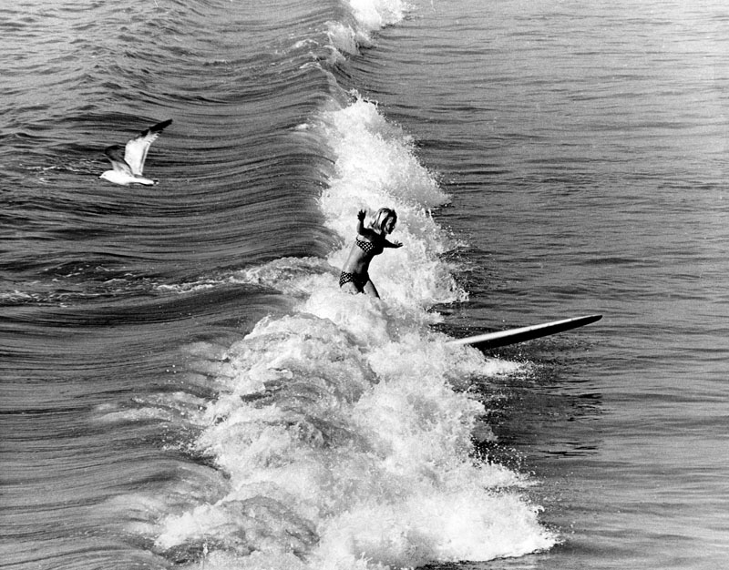
| (1968)^ - View of a young surfer riding a wave in Santa Monica. |
 |
|
| (1988)^ - Santa Monica Pier looking north on the first day of Spring. Photograph dated: March 21, 1988. |
 |
|
| (2011)^ - Panoramic view showing the California Incline as seen from the Santa Monica Pier. LA Times Photo Archives |
Historical Notes The California Incline was originally a walkway known as Sunset Trail, which was cut through the bluffs to provide beach access to pedestrians in 1896. It has become a vital street in Santa Monica, linking the PCH with Ocean Avenue, and California Avenue, bisecting Palisades Park. It begins at an intersection with Ocean Avenue and California Avenue, at the top of the palisades, extending to the PCH at the base of the bluffs.^* |
.jpg) |
|
| (n.d.)^ - Tall palm trees line the walking path in Palisades Park. The Santa Monica beach can be seen in the background. |
Click HERE to see more in Early Views of Santa Monica |
* * * * * |
Downtown
 |
|
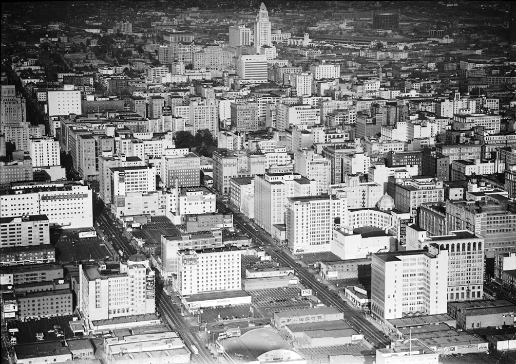
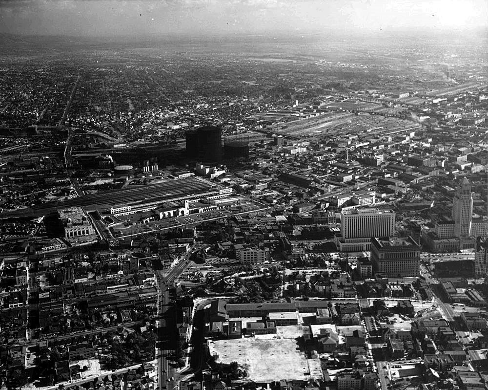
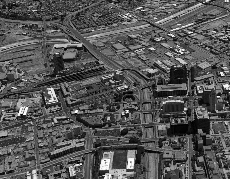
| (1940s)*# - Aerial view of downtown Los Angeles from the south. City Hall stands alone as the tallest building. |
Historical Notes From its completion in 1928 until 1964, City Hall was the tallest building in Los Angeles. It's distinctive tower was based on the purported shape of the Mausoleum of Mausolus and shows the influence of the Los Angeles Central Library, completed soon before the structure was started.^* |
 |
|
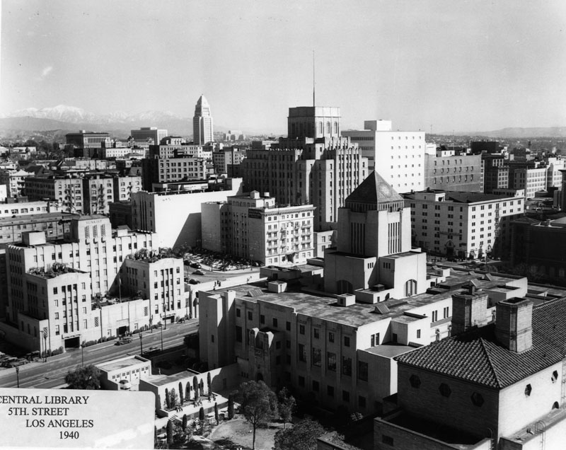
| (1940)^ - View of Downtown L.A. as seen from the Richfield Building. The Flower St. side of the Central Library Building appears in the foreground. The library's park has been partly taken for auto parking. The parking lot would later engulf the remaining grassland. To the right appears a corner of the California Club. On the left, across from the library, is the Sunkist building. |
Historical Notes The Central Library Building was constructed between 1922 and 1926. Architect Bertram Grosvenor Goodhue designed the building with influences of ancient Egyptian and Mediterranean Revival architecture. The central tower is topped with a tiled mosaic pyramid with suns on the sides with a hand holding a torch representing the "Light of Learning" at the apex. Other elements include sphinxes, snakes, and celestial mosaics. It has sculptural elements by the preeminent American architectural sculptor Lee Lawrie, similar to the Nebraska State Capitol in Lincoln, Nebraska, also designed by Goodhue.^* |
 |
|
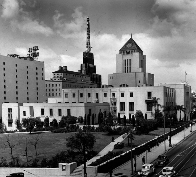
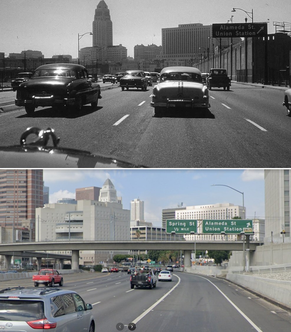
| (1949)^ - View looking southwest showing the Central Library as seen from the corner of 5th and Grand streets. Behind the library stands a tall tower with the name Richfield on it and to the left another sign which reads "Jesus Saves." The California Club can also be seen on the left. |
Historical Notes Originally named the Central Library, the building was first renamed in honor of the longtime president of the Board of Library Commissioners and President of the University of Southern California, Rufus B. von KleinSmid. The new wing of Central Library, completed in 1993, was named in honor of former mayor Tom Bradley. The complex (i.e., the original Goodhue building and the Bradley wing) was subsequently renamed in 2001 for former Los Angeles Mayor Richard Riordan, as the Richard Riordan Central Library.^* |
 |
|
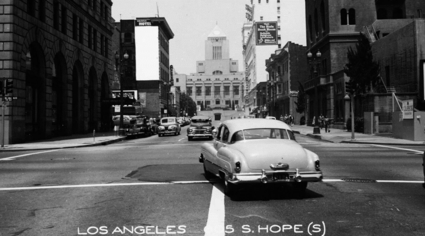
| (1951)*# – View looking north on Hope Street from Wilshire Boulevard showing the Los Angeles Central Library in the background. |
* * * * * |
Arroyo Seco Parkway (later Pasadena Freeway)
 |
|
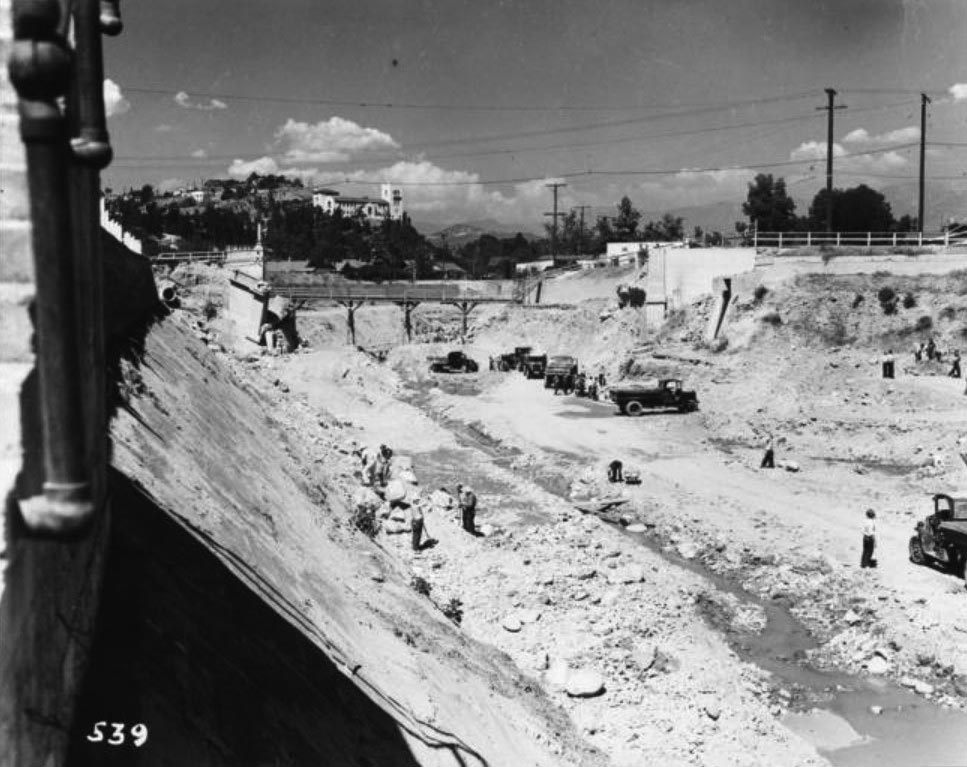
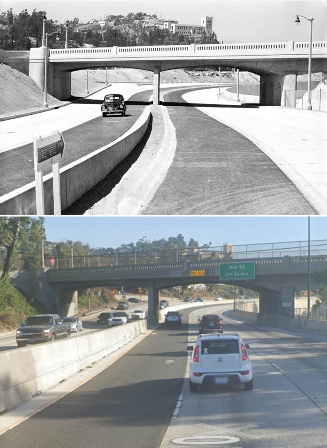
| (1938)* - Looking northerly showing the construction of the Arroyo Seco Parkway, with the demolition of old Avenue 43 Bridge in progress. The Southwest Museum is on the hill in the background. |
 |
|
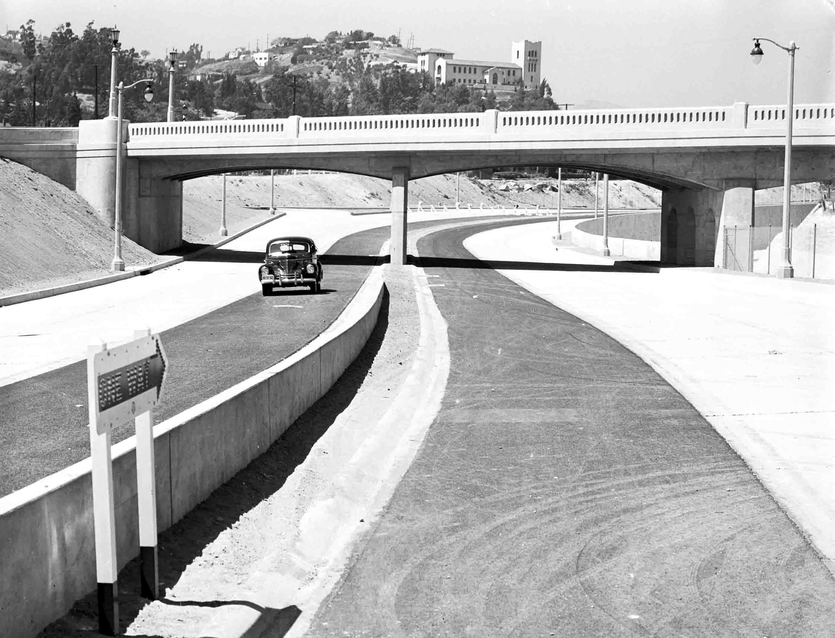
| (1940)^^^* – View showing a lone car on the Arroyo Seco Parkway just after the highway opened. The Southwest Museum can be seen in the background. Courtesy of the Automobile Club of Southern California Archives. |
Historical Notes The Arroyo Seco Parkway was the first freeway in California and the western United States. It connects Los Angeles with Pasadena alongside the Arroyo Seco seasonal river. It is notable not only for being the first, mostly opened in 1940, but for representing the transitional phase between early parkways and modern freeways. It conformed to modern standards when it was built, but is now regarded as a narrow, outdated roadway. ^ |
 |
|
| (1940)^ - Caption reads, "First motorists to travel over the new link are pictured at the Avenue 53 bridge. The freeway is divided in the center by a small parkway. Each side has three wide lanes for traffic. The new part runs from Avenue 40 to Orange Grove drive. The Glenarm-Fair Oaks section has been open some time." Photograph dated: July 20, 1940. The Southwest Museum can be seen in the background. |
Historical Notes The Parkway was designed with two 11–12 foot lanes and one ten-foot shoulder in each direction, with the wider inside (passing) lanes paved in black asphalt concrete and the outside lanes paved in gray Portland cement concrete. ^ |
 |
|
| (1940)*- Looking west over Arroyo Seco Pkwy from the Fair Oaks Ave overcrossing. Below can be seen the official opening procession led by Gov. Olson. A speed limit sign on right near bridge indicates a 45 mph speed limit. Photo date: Dec 30, 1940. |
 |
|
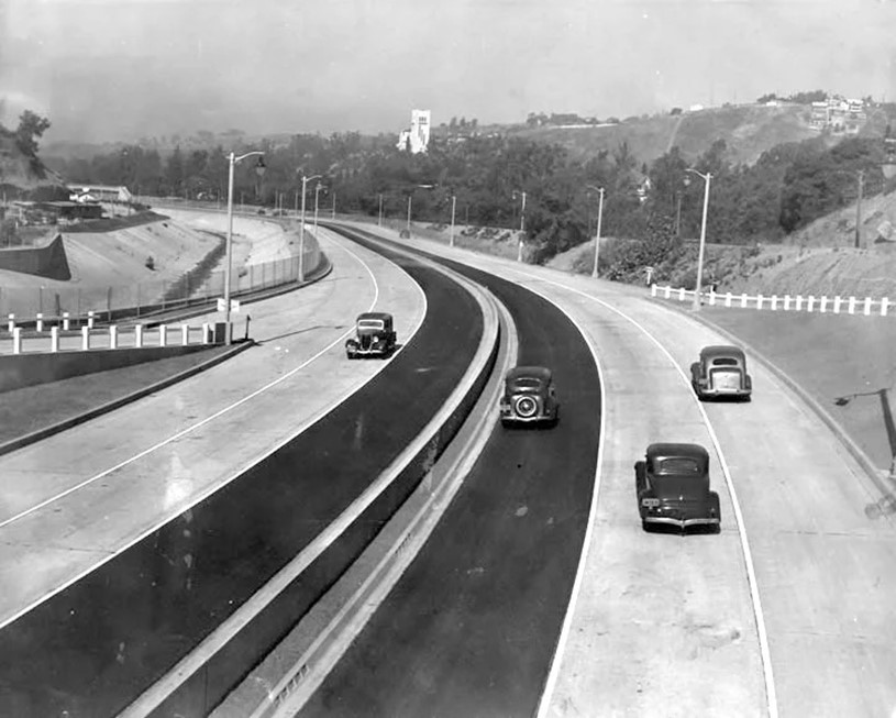
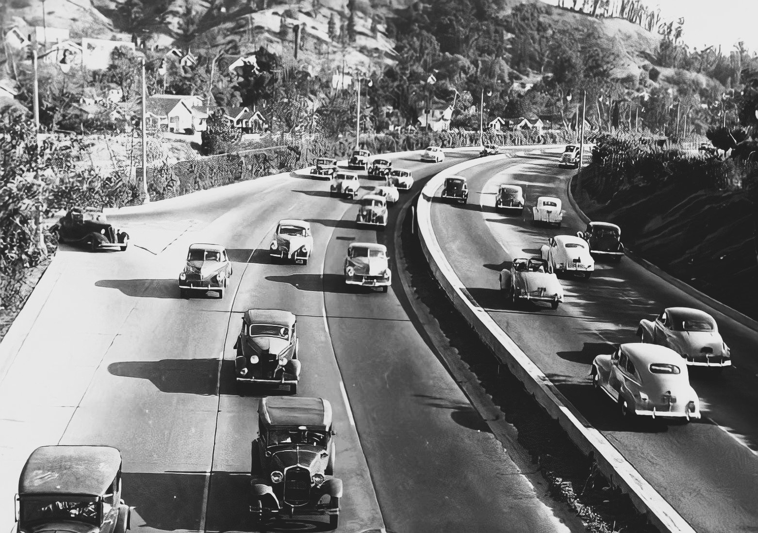
| (1941)*# - The Arroyo Seco Parkway shortly after it was completed. View is looking south from Avenue 60. Note the exit on the right is virtually a perpendicular right turn without an off-ramp or transition. |
Historical Notes Before the Parkway was built, cottonwoods filled the Arroyo Seco at Avenue 26. The first known survey for a permanent roadway through the Arroyo was made by T.D. Allen of Pasadena in 1895, and in 1897 two more proposals were made, one for a scenic parkway and the other for a commuter cycleway. ^ |
 |
|
| (1942)*# - View of a 1941 Ford Woody, with the bumper-guard and dual spotlights options, waiting at the stop sign before proceeding unto the Arroyo Seco Parkway. |
Historical Notes The Arroyo Seco Parkway design, state-of-the-art when built, included tight "right-in/right-out" access with a recommended exit speed of 5 miles per hour and stop signs on the entrance ramps; there are no acceleration or deceleration lanes. ^ |
 |
|
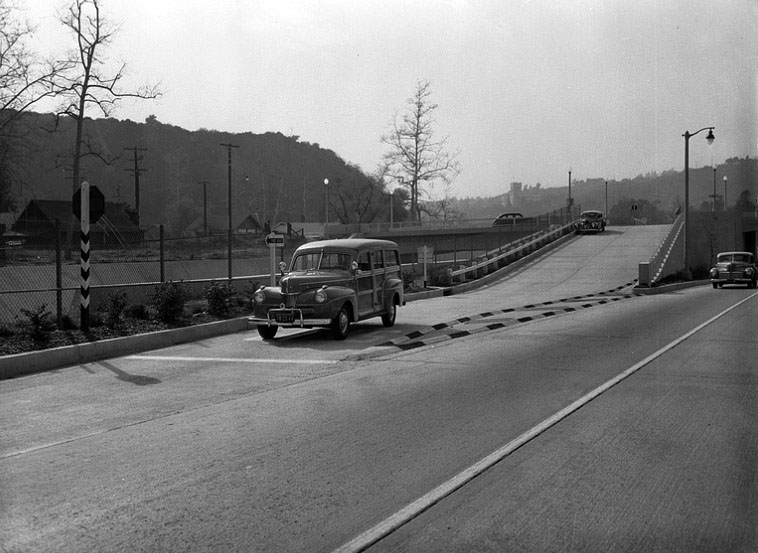
| (1948)* – View looking south on the Arroyo Seco Parkway at Shults St. [Ave. 60], Highland Park. John Gutmann photo. |
 |
|
| (1948)* - Looking southerly over Arroyo Seco Pkwy (then US-66, now CA-110) at Avenue 43 (Valley Times photo). |
Then and Now
 |
|
| (1940 vs 2022)* – Looking northerly on the Arroyo Seco Parkway toward the Avenue 43 Bridge with the Southwest Museum seen in the distance. |
 |
|
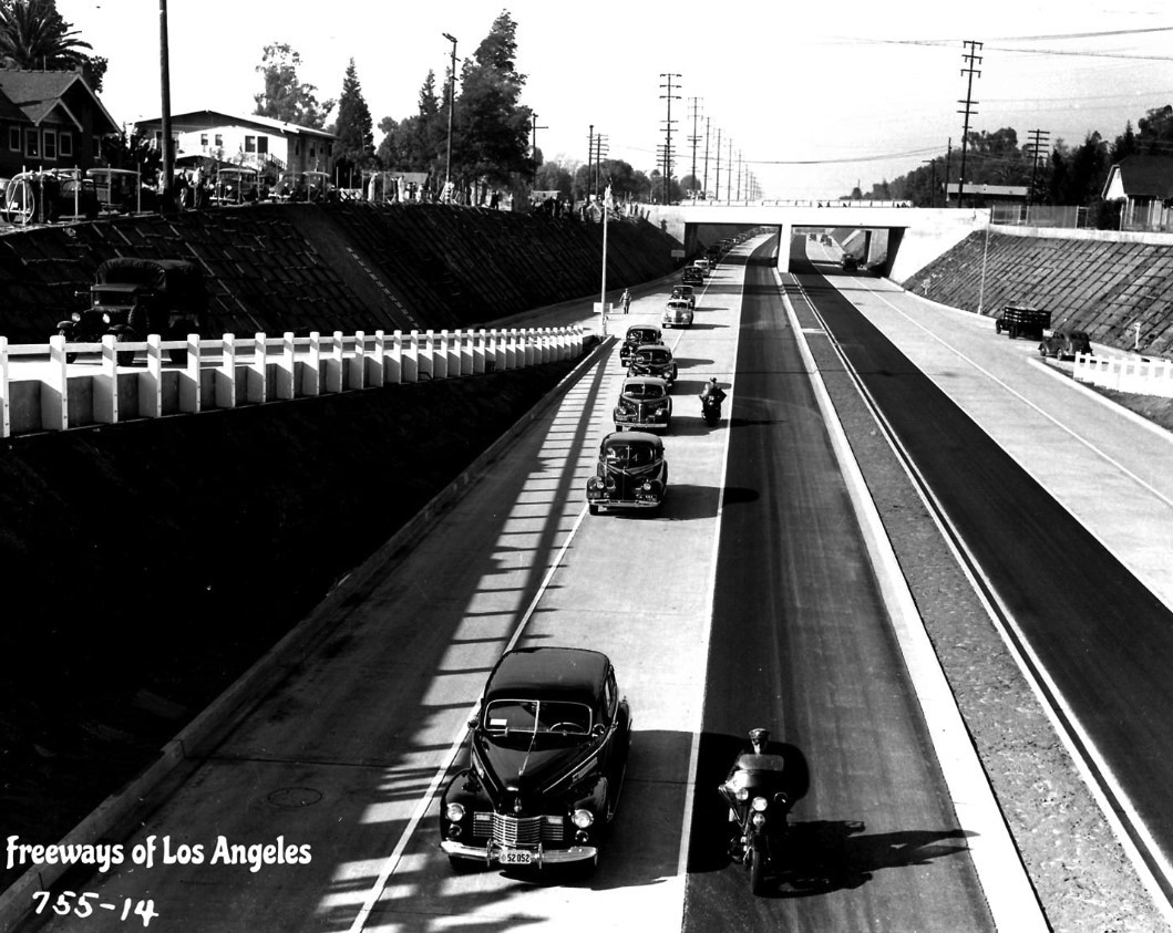
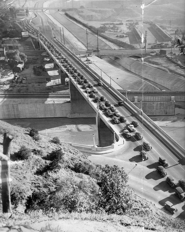
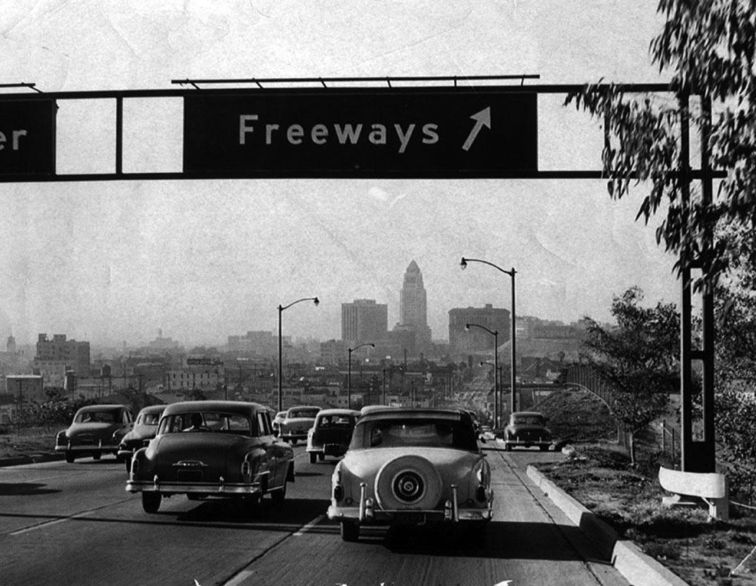
| (1947)* – View showing the Arroyo Seco Parkway with traffic backed up on the southbound lanes heading into downtown Los Angeles on the Figueroa Street Viaduct. |
Historical Notes The state legislature designated the original section, north of the Figueroa Street Viaduct, as a "California Historic Parkway" (part of the State Scenic Highway System reserved for freeways built before 1945) in 1993. The American Society of Civil Engineers named it a National Civil Engineering Landmark in 1999, and it became a National Scenic Byway in 2002 and was added to the National Register of Historic Places in 2011. ^ |
 |
|
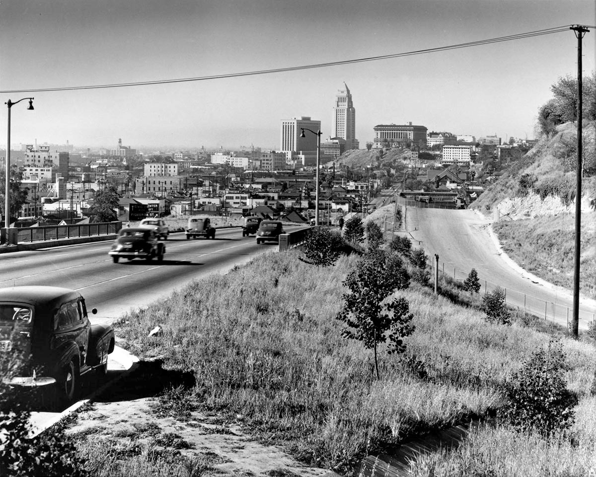
| (1949)^ – View looking at downtown Los Angeles from the Arroyo Seco Parkway. The road heading towards the Hall of Justice is N. Hill Street. On the right is a road running around the edge of Chavez Ravine over a decade before the opening of Dodger Stadium. Photo by Julius Shulman, Getty Research Institute |
 |
|
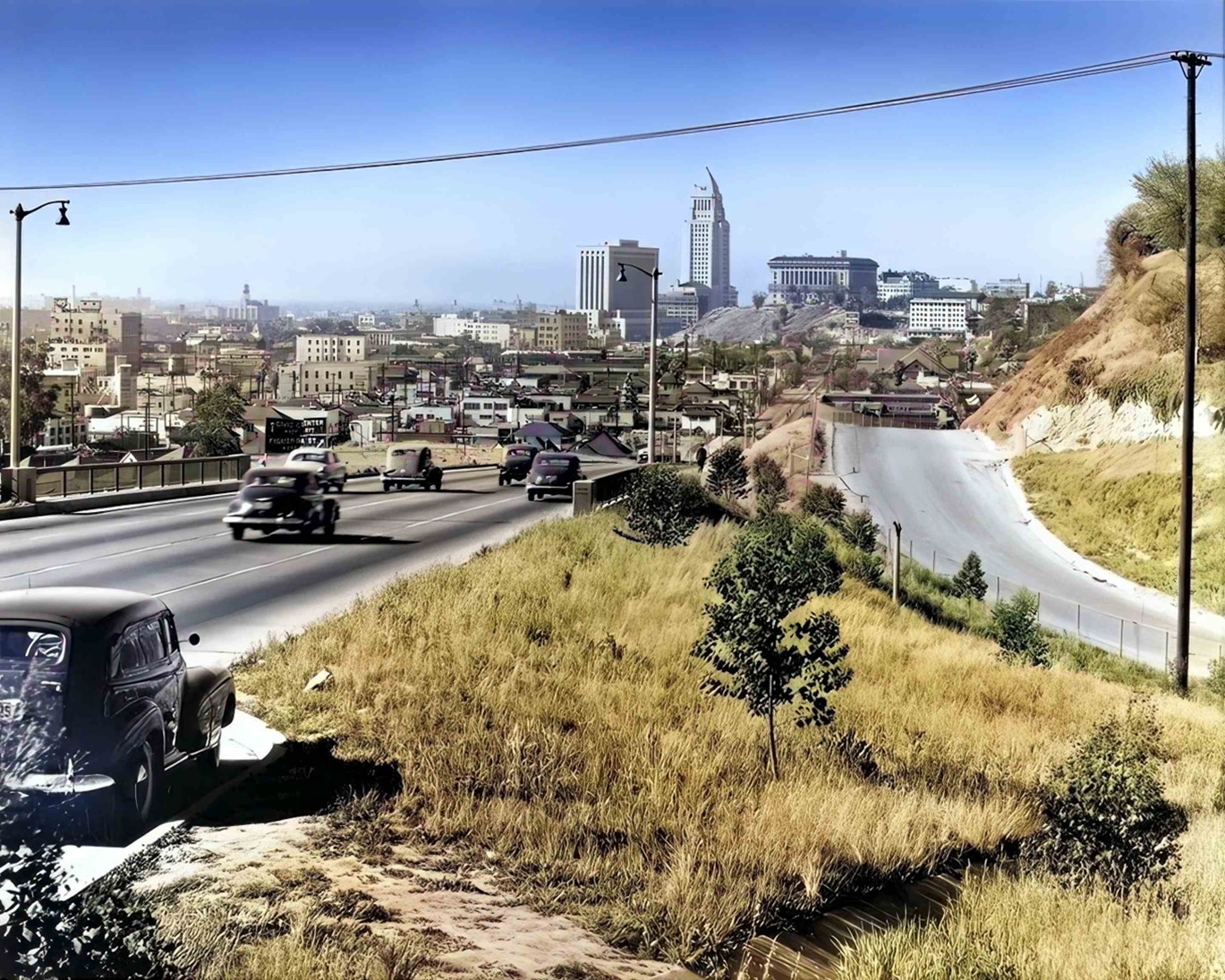
| (1949)^ – View looking at downtown Los Angeles from the Arroyo Seco Parkway. The road heading towards the Hall of Justice is N. Hill Street. On the right is a road running around the edge of Chavez Ravine over a decade before the opening of Dodger Stadium. Photo by Julius Shulman, Getty Research Institute (AI image enhancement and colorization by Richard Holoff) |
 |
|
| (ca. 1949)^ – View of the Arroyo Seco Parkway, looking south from Bishops Road Bridge. The freeway is divided in the center by a small parkway. Each side has four wide lanes for traffic - though the southbound portion is not visible due to the parkway. |
 |
|
| (1949)^ - View is of the Arroyo Seco Parkway, looking south from Bishops Road Bridge. Photograph dated January 31, 1949. |
 |
|
| (1949)* - Looking NE over Arroyo Seco Pkwy (US-66) from atop Castelar (Hill) Street off-ramp overpass. Because freeway driving was still in its infancy, drivers had to be reminded not to turn left at the NB on-ramp (note sign). |
 |
|
| (1949)^ – View showing the outbound Arroyo Seco Parkway at the end of a work day. |
Historical Notes Today, the Arroyo Seco Parkway remains the most direct route between downtown Los Angeles and Pasadena despite its flaws; the only reasonable freeway alternate (which trucks must use) is the Glendale Freeway to the west, which is itself not easily reached by trucks from downtown Los Angeles. ^* |
 |
|
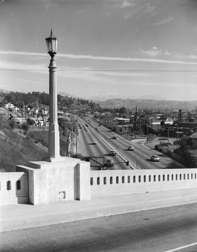
| (1955)*# - View looking north of Arroyo Seco Parkway (Pasadena Freeway) from College St. bridge. In the distance can be seen the San Gabriel Mountains partly covered with snow. Note the ornate streetlight on the bridge (Click HERE to see more in Early Streetlights in L.A. |
 |
|
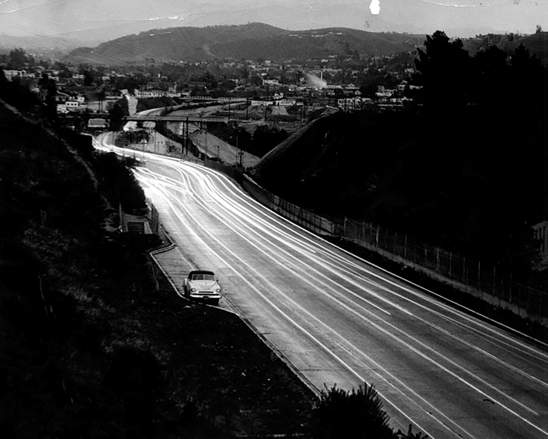
| (1948)^ – Night view looking north on the 110 (Arroyo Seco Parkway) on a rainy day, with one car pulled over in the turnout. |
 |
|
| (1954)* - Heading towards downtown Los Angeles on the Arroyo Seco Parkway. |
 |
|
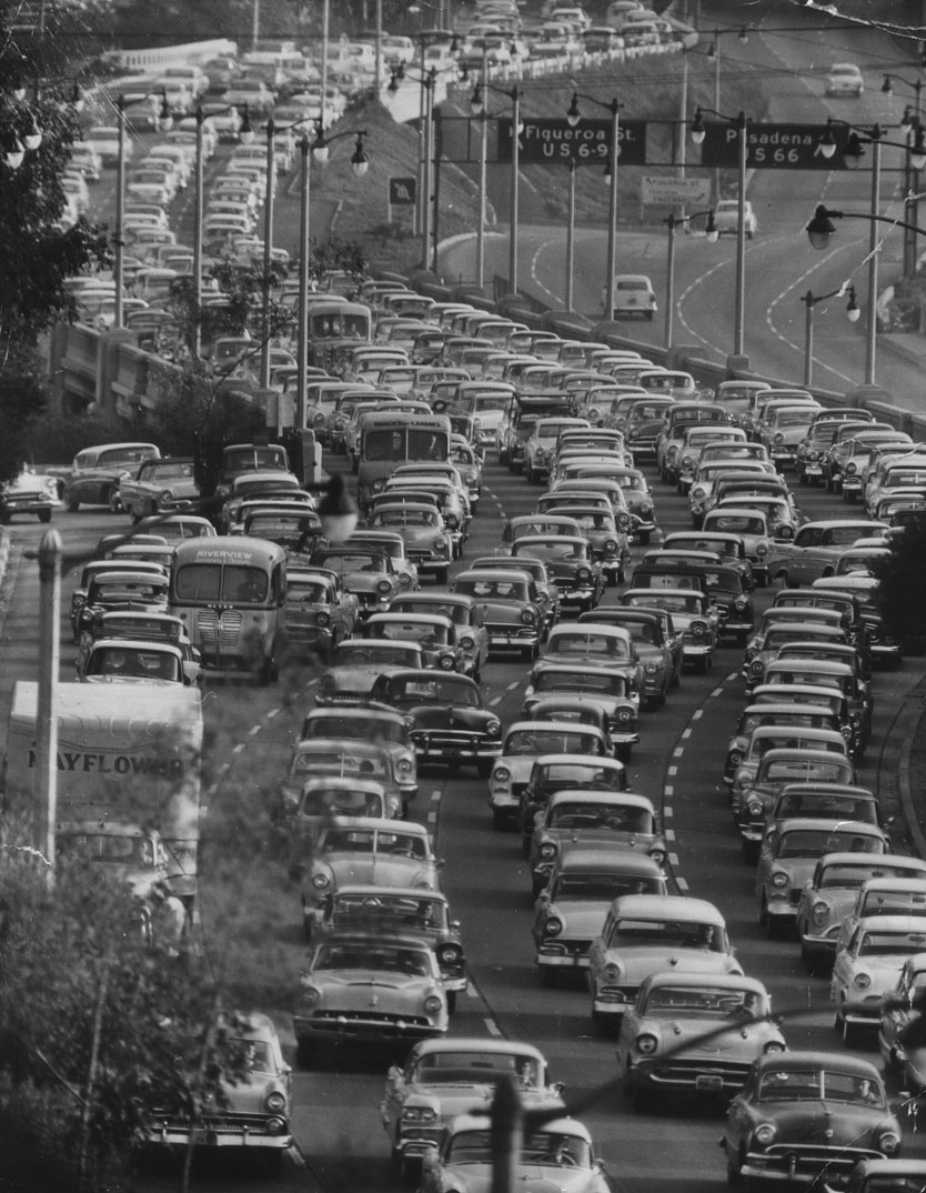
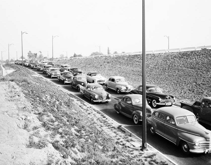
| (1950s)^ – View showing densely packed traffic travelling southbound on the Pasadena Freeway, from Park Row Drive overlooking the Freeway near Civic Center. |
Historical Notes Between 1954 and 2010, Arroyo Seco Parkway was officially designated the Pasadena Freeway. In 2010, as part of plans to revitalize its scenic value and improve safety, Caltrans renamed the roadway back to its original name. All the bridges built during parkway construction remain, as do four older bridges that crossed the Arroyo Seco before the 1930s.*^ |
* * * * * |
Pasadena
 |
|
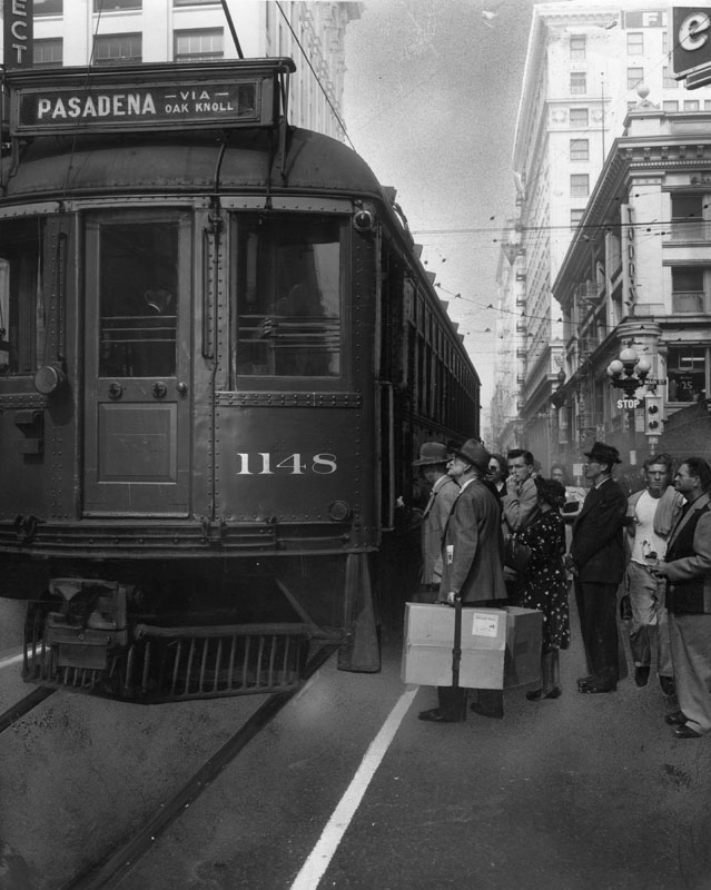
| (1950)^ - A crowd of passengers wait to board the Pacific Electric Red Car No. 1148 at 6th and Main, going to Pasadena via Oak Knoll. A man carries a large package labeled "rush" and "fragile". |
Historical Notes The Red Car trolley line to Pasadena made its last run in 1950. The caption for the Oct. 3, 1950 photo read: "Its days are numbered. After Sunday, no more P.E. Oak Knoll Red Cars will rumble from Sixth and Main (above) to Pasadena".^ |
 |
|
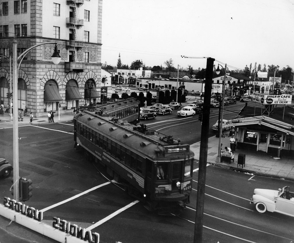
| (1950)*^^ - A Pacific Electric street car turns onto Colorado from Lake, on the last day of the line’s operation in Pasadena, October 7, 1950. |
Click HERE to see more in Early Views of Pasadena |
 |
|
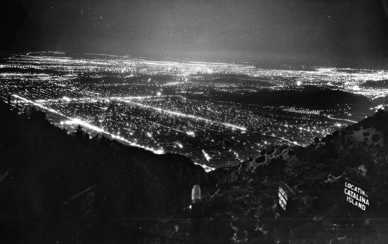
| (ca. 1950)^ - Lights of Los Angeles and adjoining cities, as far distant as 60 miles, as seen from Inspiration Point, Mt. Lowe, 5,000 feet above the sea. Fifty-six cities may be viewed on clear nights from this vantage point, the thrill of which attracts thousands of visitors annually. |
Click HERE to see more in Early Views of Mt. Lowe |
* * * * * |
Highland Park
 |
|
| (1955)^#^ - Los Angeles Transit Lines (ex-Los Angeles Railway) W Line streetcar no. 1553 passes in front of tall spring grass heading northbound on Marmion Way with the Southwest Museum in the background. |
Historical Notes Built in 1914, the Southwest Museum was Los Angeles’ first world-class museums that had an immense collection of Native-American and Pre-Columbian artifacts (collected by Charles Lummis during his travels throughout the Southwest and South America). Click HERE to see more. |
 |
|
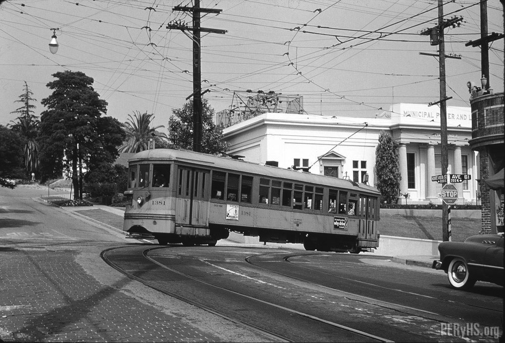
| (n.d.)^#^ – View looking south on N. Ave 61 showing Los Angeles Railway streetcar no. 1544 about to make a turn Monte Vista Street. The Classic Greek-style building on the left is DWP’s Power Distribution Station No. 2. |
Historical Notes On April 21, 1962, Distribution Station No. 2 was designated Los Angeles Historical-Cultural Monument No. 558 (Click HERE to see complete listing). |
 |
|
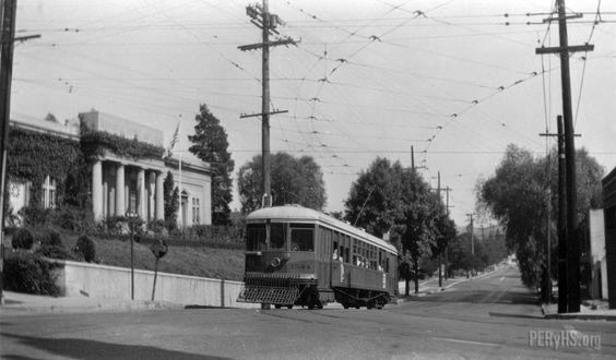
| (1955)^#^ - Los Angeles Transit streetcar no. 1381 looking is turning west unto Monte Vista Street from N. Ave 61 with DWP Power Distribution Station No. 2 in the background. Alan Weeks Photo Collection |
Historical Notes Click HERE to see more Early Power Distribution Stations. |
 |
|
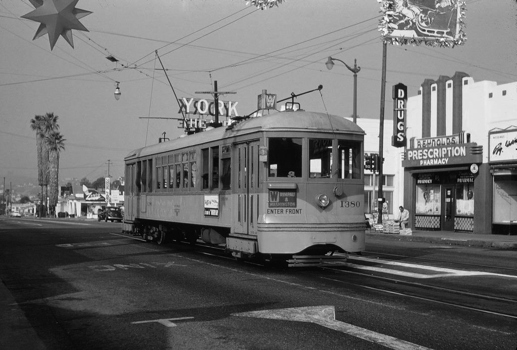
| (1950s)##^# – Streetcar no. 1380 heading southbound on York Boulevard at N. Ave 50 in Highland Park. The York Theatre can be seen in the background. Click HERE to see contemporary view. |
Historical Notes The York Theatre, located in the Highland Park district, opened in 1923. It became a Korean Church in about 1985. |
Glendale
 |
|
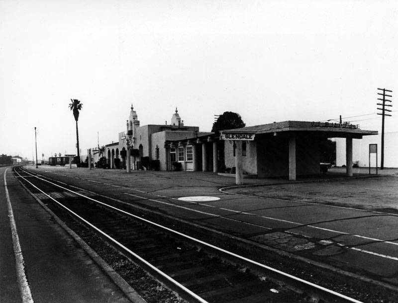
| (n.d.)^ - Exterior view of the surprisingly empty railroad station at Glendale. This is the "back" portion of the station, where travelers wait for their trains to arrive and/or depart. Two stationary freight cars can be seen at the rear of the building. |
Historical Notes The Glendale Southern Pacific Railroad Depot (now known as Glendale Amtrak/Metrolink Station) was designed in the Mission Revival Style by architects Maurice Couchot and Kenneth MacDonald, Jr. and built by the Southern Pacific Railroad in 1923; replacing an older one that dated as far back as 1883. It was added to the National Register of Historic Places on May 2, 1997 - #97000376, and has undergone an extensive renovation since then. The Glendale train station is located at 400 Cerritos Avenue.^ |
 |
|
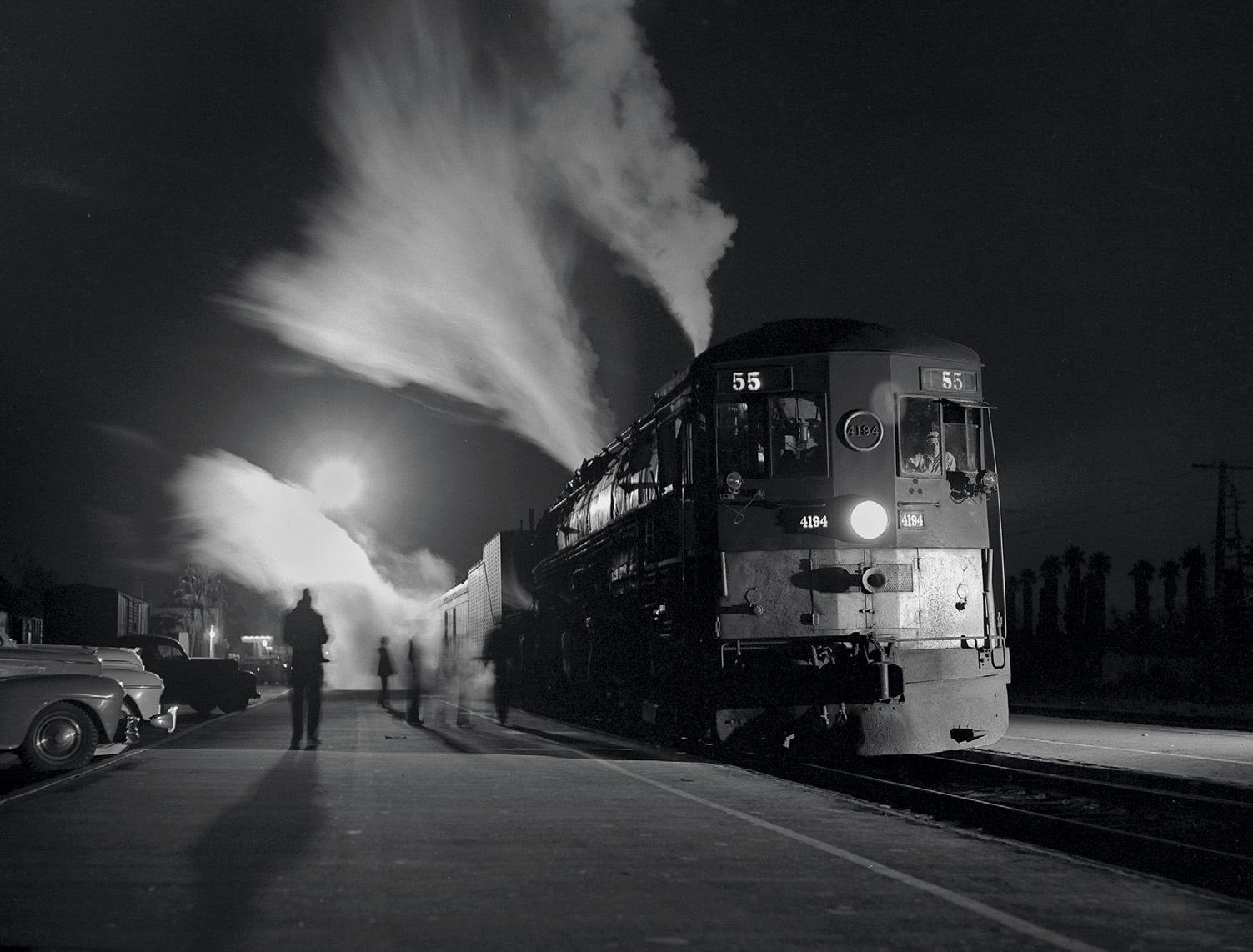
| (ca. 1950)^^^^ - Southern Pacific #4194 ‘Tehachapi’ Night Train 55 at the Glendale Station. Photo by Richard Steinheimer. |
Click HERE to see more in Early Views of Glendale |
 |
|
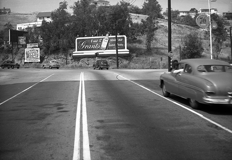
| (1950)^ - Looking southwest from Fletcher Drive where it meets Glendale Boulevard in Silver Lake. A few homes are present on the hillside and a few different signs are visible. To the left of the Foster and Kleiser billboard promoting Grant's Scotch Whiskey, is a sign for the Thistle Inn, located two blocks south at 2395 Glendale Blvd. |
 |
|
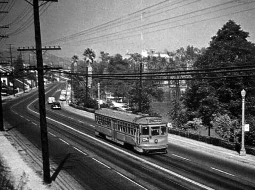
| (1955)##^# - View showing a Pacific Electric Car traveling down Glendale Boulevard in front of Echo Park. |
Temple and Edgeware
 |
|
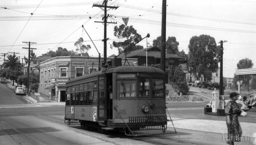
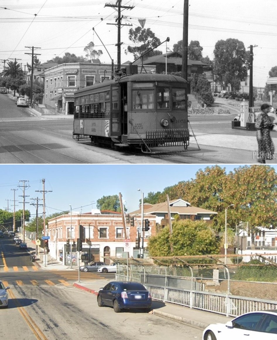
| (ca. 1945)^ – View looking south showing Los Angeles Railway Edgeware Shuttle Line streetcar no. 1051 stopped at Edgeware and Temple. Note the gas station to the right and Edgeware Pharmacy in the background. Jack Finn Collection / Pacific Electric Railway Historic Society |
Historical Notes The Pharmacy building is still there, now George’s Liquor market. The houses up the street just beyond the old pharmacy building are gone; the land was taken over by the Betty Plasencia School for new class rooms. The land Where the streetcar, lady and the gas station are was excavated away to create the trench for the 101 freeway. Where the photographer was standing is now over the south bound fast lane of the 101. The building to the right of the old pharmacy is also still there but has been stuccoed over and painted off white. Click HERE to see contemporary view. |
Then and Now
 |
|
| (1945 vs 2022)* – View looking south on E. Edgeware Road toward Temple Street. |
* * * * * |
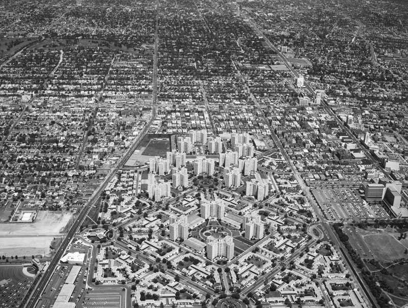
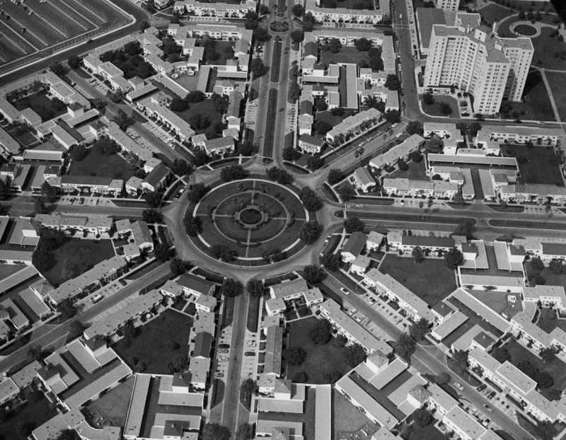
Park La Brea
 |
|
| (ca. 1947)^ – View looking NE showing Park La Brea under construction. |
Historical Notes At 4,255 units, the complex with its octagonal street layout is the largest housing development west of the Mississippi. Thirty-one 2-story garden apt. buildings opened in 1941 and eighteen 13-story towers opened in 1948. |
 |
|
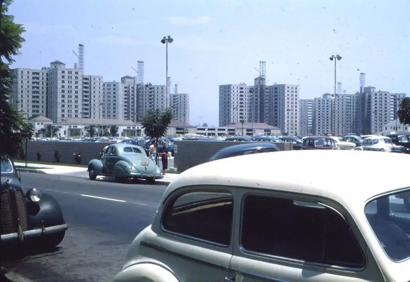
| (1952)* – View looking northeast showing Park La Brea as seen from the building formerly known as Prudential on Wilshire Boulevard. 6th Street can be seen running across the center of photo. |
Historical Notes Park La Brea represents something of a historical anomaly, having been built at a time when most visions of Los Angeles' development were dominated by low-rise tracts of single-family houses along freeway corridors. The street layout was created in a masonic pattern as a reference to the masonic heritage of the Metropolitan Life Insurance Company, which built the complex toward the end of World War II and immediately thereafter (1944 - 1948).* |
|
|
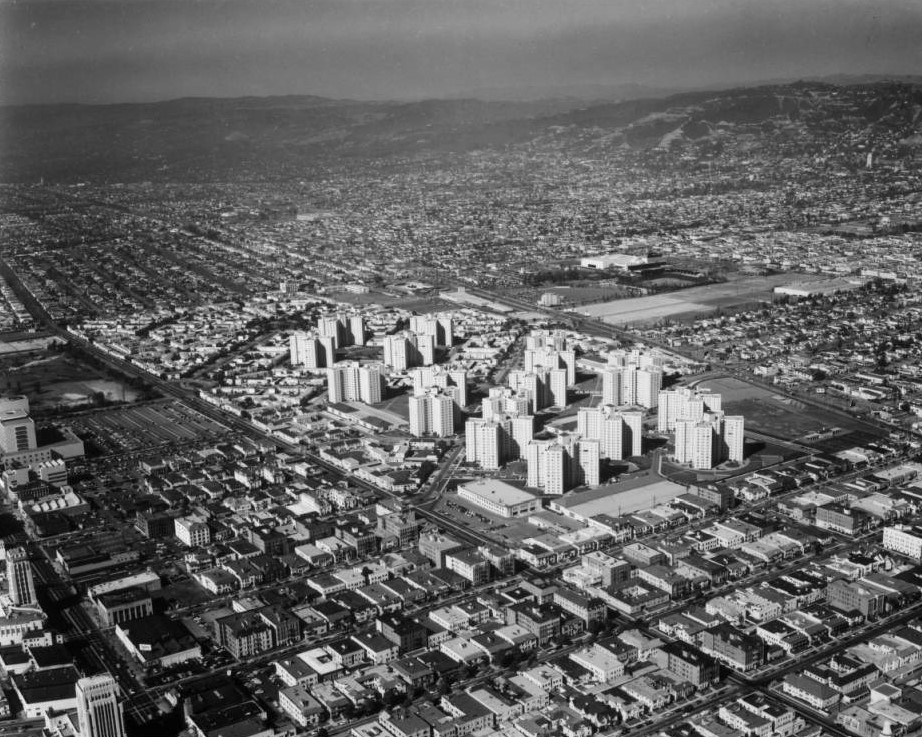
| (1954)* – Aerial view looking west showing Park La Brea at upper center-right. The intersection of Wilishire and La Brea is at lower-left. |
Historical Notes Park La Brea was originally conceived as an entirely low-rise development. Construction began in 1941, but building restrictions during WWII halted work in 1945 with only the western half of the site completed. By the time construction resumed in 1948, the continued demand for postwar housing had prompted MetLife to dramatically revise the project to provide greater density and site amenities. The second phase of development included 18 towers rising to the city’s 13-story height limit in addition to three groups of two-story buildings matching those already built. |
 |
|
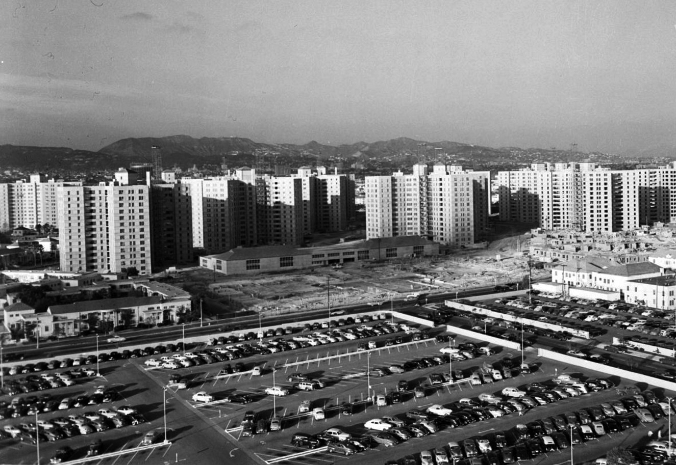
| (1954)* - Aerial view looking northwest over the Park La Brea apartment complex and surrounding area. |
 |
|
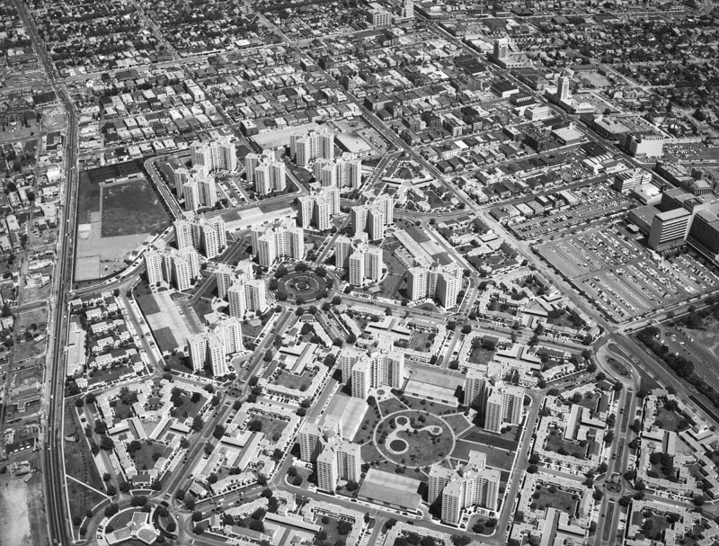
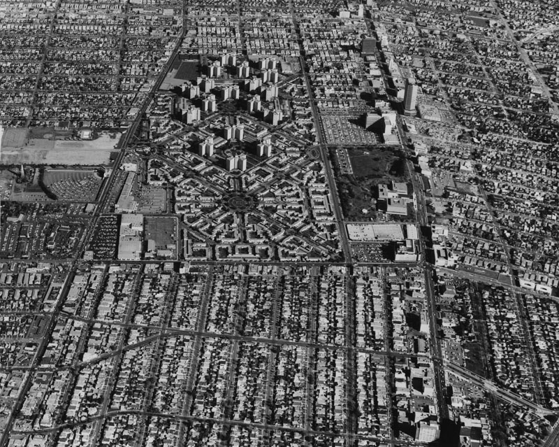
| (ca. 1957)^ - Aerial view of Park La Brea and the Miracle Mile; view is looking east. 3rd Street is visible from bottom left and jars to upper left; Pan Pacific Park peeks from bottom left corner; the Gilmore Drive-In is also visible; 6th Street runs from bottom right to middle top; Hancock Park peeks from bottom right corner; Wilshire Boulevard can be seen from lower right to middle top; and La Brea Avenue is horizontally at upper middle. |
 |
|
| (1957)^ - A closer view of Park La Brea and the Miracle Mile; view is looking southeast. 3rd Street is visible from bottom left and jars to top left; Pan Pacific Park peeks from bottom left corner; 6th Street runs from lower right to middle top; Hancock Park peeks from lower middle; Wilshire Boulevard can be seen from upper right to top right; and La Brea Avenue is horizontally at top. |
Historical Notes Park La Brea is the largest housing development in the U.S. west of the Mississippi River. It sits on 160 acres of land and has 4,255 units located in 18 13-story towers and 31 2-story "garden apartment buildings" |
 |
|
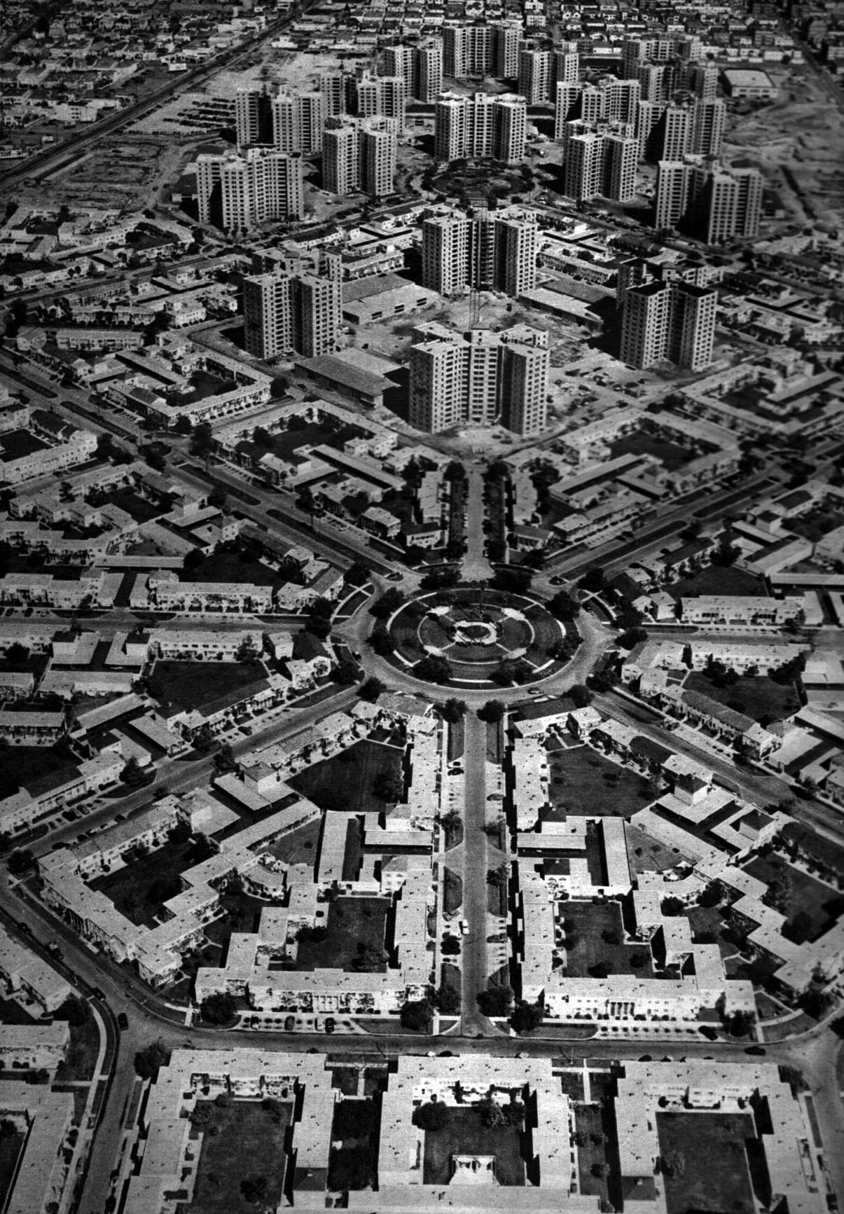
| (1950s)^ - Aerial view of Park La Brea from 800 feet above. |
 |
|
| (1951)^ - Aerial view of Park La Brea looking northeast. All of the 18, 13-story towers are highlighted in this photo. They stand behind the 2-story garden apartment buildings, most of which were built in the earlier development phase. |
 |
|
| (ca. 1950s)^ - Aerial view taken from a blimp showing one of several roundabouts in the Park La Brea housing development. |
 |
|
| (1965)^ - Aerial view is looking east from Fairfax with Wilshire on the right. View shows the Park La Brea Towers and Miracle Mile area. The towers, a residential community, was built at a cost of $40,000,000, which includes 18 apartment buildings 13-stories high, and business and park areas. Photo dated: February 10, 1965.* |
 |
|
| (1954)* – View looking SE across 3rd Street toward Ogden Drive as seen from the Farmers Market parking lot. Park La Brea Apartments are seen in the distance with Market Basket directly across the street (today a Ross Dress for Less store). |
Historical Notes In the 2000s, Park La Brea had become a desirable rental community with its own community center, health club and pool, beauty parlor, and drycleaner in addition to its convenient proximity to local museums, Farmers Market (Los Angeles), and The Grove at Farmers Market shopping complex. In recent years, additional improvements have been made, such as adding new pools. The complex completed another $8 million renovation in 2010. |
* * * * * |
Pershing Square
 |
|
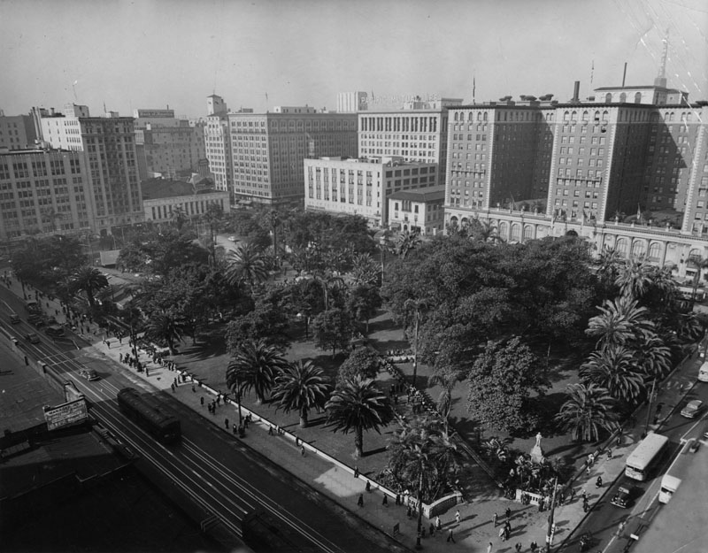
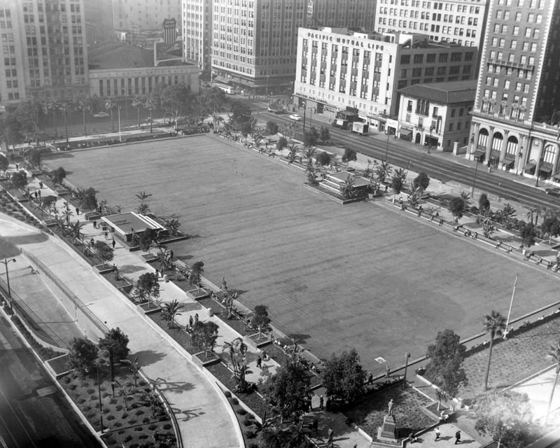
| (1951)^ - View looking southwest showing Pershing Square one year before it would be excavated to build an underground parking garage. The Biltmore Hotel is seen in the upper right. |
 |
|
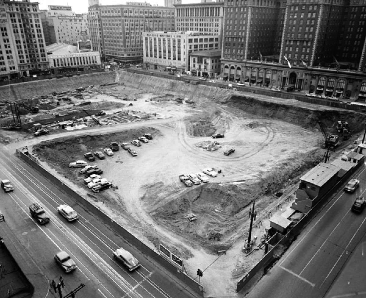
| (1952)^ – Excavation at Pershing Square for the construction of an underground parking garage. |
Historical Notes The entire park was demolished and excavated in 1952 to build an underground parking garage. In its place was concrete topped by a thin layer of soil with a broad expanse of lawn. |
 |
|
| (1954)^ - View from above onto Pershing Square showing a large central area of cement or blacktop and plantings on the four sides, Jan. 26, 1954. This is the top of the undergound garage before landscaping was added to the central area. |
 |
|
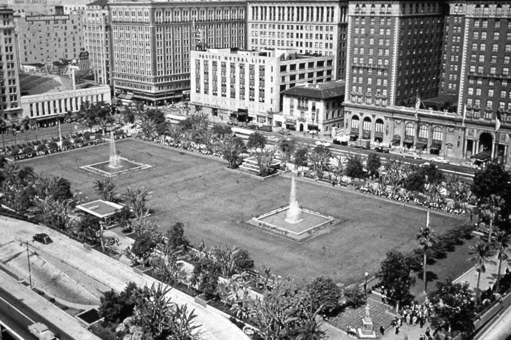
| (ca. 1956)##^# – Postcard view looking southwest showing Pershing Square with two fountains at center. The Biltmore Hotel is seen at upper-right (SW corner of 5th and Olive streets). |
 |
|
| (1968)^.^ – View of Pershing Square showing a changing downtown skyline. The Crocker-Citizens Bank Building can be seen going up behind the Biltmore Hotel. |
 |
|
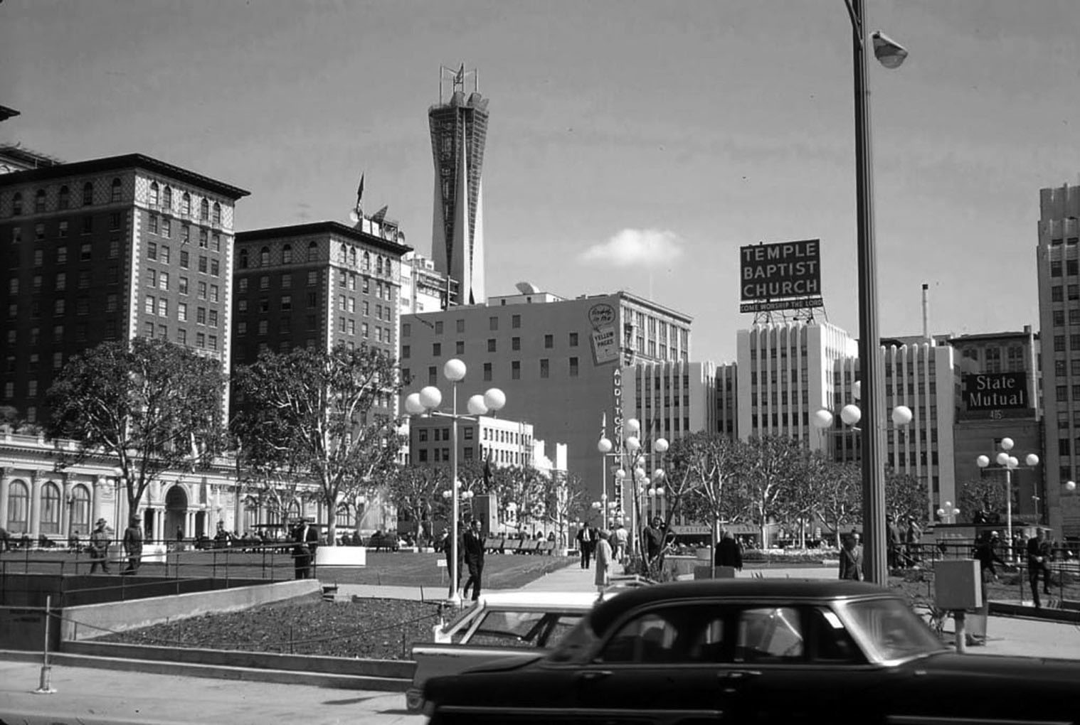
| (1965)^ – Ground view looking across Pershing Square.The tallest building in the distance is the AT&T Madison Complex Tandem Office Building with microwave tower, built in 1961. |
Historical Notes The Temple Baptist Church in the distance, built in 1906 and remodeled in 1964, was also known as the Auditorium Building and Philharmonic Auditorium for many years. Click HERE to see more. |
 |
|
| (ca. 2011)*#^ – View looking southwest showing Pershing Square as it appears today with the Biltmore Hotel on the right and the downtown skyline in the background. |
Then and Now
|
|
|
|
| (1951) vs. (2011) - 50 years makes a difference! |
* * * * * |
Hollywood Freeway (Downtown)
 |
|
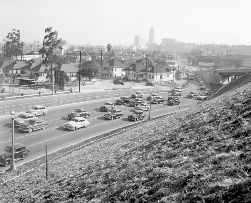
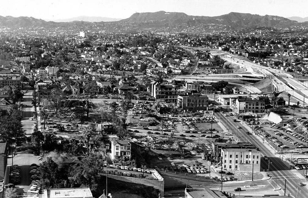
| (1945)^ - Aerial view over Bunker Hill looking east toward the Los Angeles Civic Center before construction of the Hollywood and Harbor freeways. Temple Street is on the left running away from the camera. Court Street is on the right running toward the Old Hall of Records and City Hall buildings. A small section of First Street can be seen at upper-right. Figueroa Street runs horizontally at bottom. |
 |
|
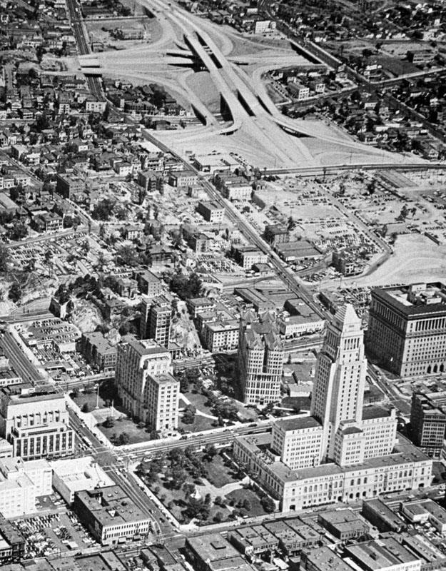
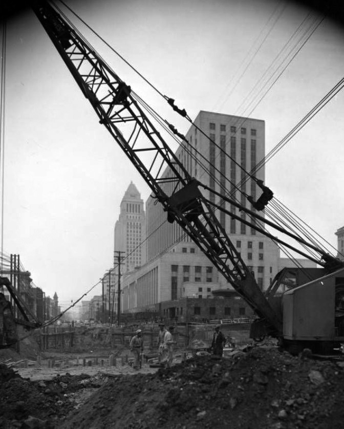
| (1948)^ - View looking west across North Figueroa Street toward the Civic Center. The outlines indicate the area where the Hollywood Freeway and the four-level bridge is to be constructed. Fort Moore Hill and Bunker Hill are being dug up to make way for the freeway. |
Historical Notes Photo note reads: Historic Bunker Hill is 'going into history' as workmen push construction of the Hollywood Freeway. The sound of shovels and tractors is roaring heavily these days along North Figueroa Street, between Sunset and Temple. In this area workmen are busily cutting away sections of Fort Moore Hill or Bunker Hill to make way for the construction of the Hollywood Freeway and the four-level bridge. This view shows the area, with historic Bunker Hill almost "gone." Photo dated: May 11, 1948.^ |
Four Level Interchange Construction
 |
|
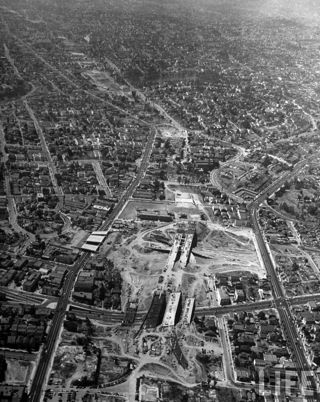
| (1948)^#^^ – Aerial detailed view looking northwest over the intersection of Figueroa and Temple streets (lower-left) showing the initial excavation for the Four Level Interchange. Custer Street School is at center/left on Temple between Beaudry and Custer. Sunset Boulevard is at the right edge, a shoo-fly (detour) has been built to allow for the construction. LA Times Photo Archive, February 16, 1948 |
 |
|
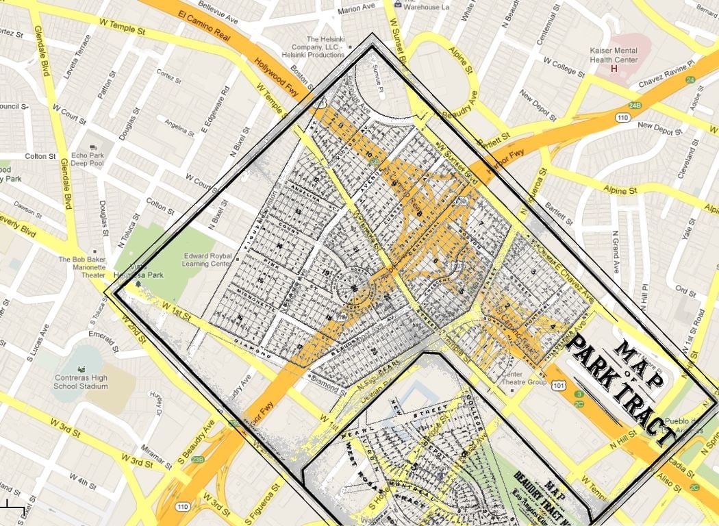
| The image above shows a map of the area around the Hollywood and Harbor Freeway interchange. There is an overlay of another map that shows what was there before the freeways. This provides a hint about how neighborhoods are decimated by freeways.* |
Historical Notes Figueroa became Boylston, Pearl (previously Grasshopper) became Figueroa, the right-hand Beaudry became Fremont and most of Bellevue became Sunset Blvd. At the rightmost edge of the tract map, Philadelphia became Grand Ave. |
 |
|
| (1949)**^ - Looking northwest across Figueroa Street at the start of construction of the stack interchange between the Hollywood, Arroyo Seco (Pasadena), and Harbor freeways. Temple Street is on the left, Sunset on the right. The large body of water at upper-center is Echo Park. |
Historical Notes The Hollywood Freeway’s segment through Hollywood was the first to be built through a heavily populated area and requiring the moving or demolition of many buildings, including Rudolph Valentino's former home in Whitley Heights. The freeway was also designed to curve around KTTV Studios and Hollywood Presbyterian Church. Much of the rubble and debris from the buildings removed for the freeway's construction was dumped into Chávez Ravine, the current home to Dodger Stadium.^* |
 |
|
| (1949)**^ - Looking east during construction of the 101 Freeway from Figueroa. The old Los Angeles High School building is still standing and is visible in the upper-left of photo. |
 |
|
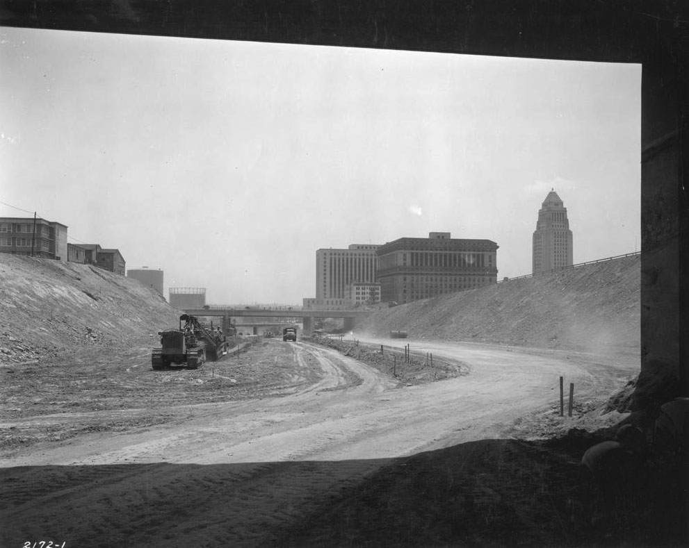
| (1949)^ - Aerial view showing the construction of the Four Level Interchange (top of photo)l. Note that Bunker Hill is still covered with apartment buildings and houses. |
Historical Notes The Four Level Interchange was the first stack interchange in the world. Completed in 1949 and fully opened in 1953 at the northern edge of Downtown it connects U.S. Route 101 (Hollywood Freeway and Santa Ana Freeway) to State Route 110 (Harbor Freeway and Arroyo Seco Parkway).^* |
Phase 1 Completion
 |
|
| (1949)* – View looking toward downtown and City Hall showing the Four Level Interchange close to the completion of phase 1. |
Historical Notes The so nick-named "Stack" was virtually completed in 1949, but it took a few years for all the Freeways to connect up. The first was the Hollywood Freeway (1950) and the last the Pasadena Freeway (1953). |
.jpg) |
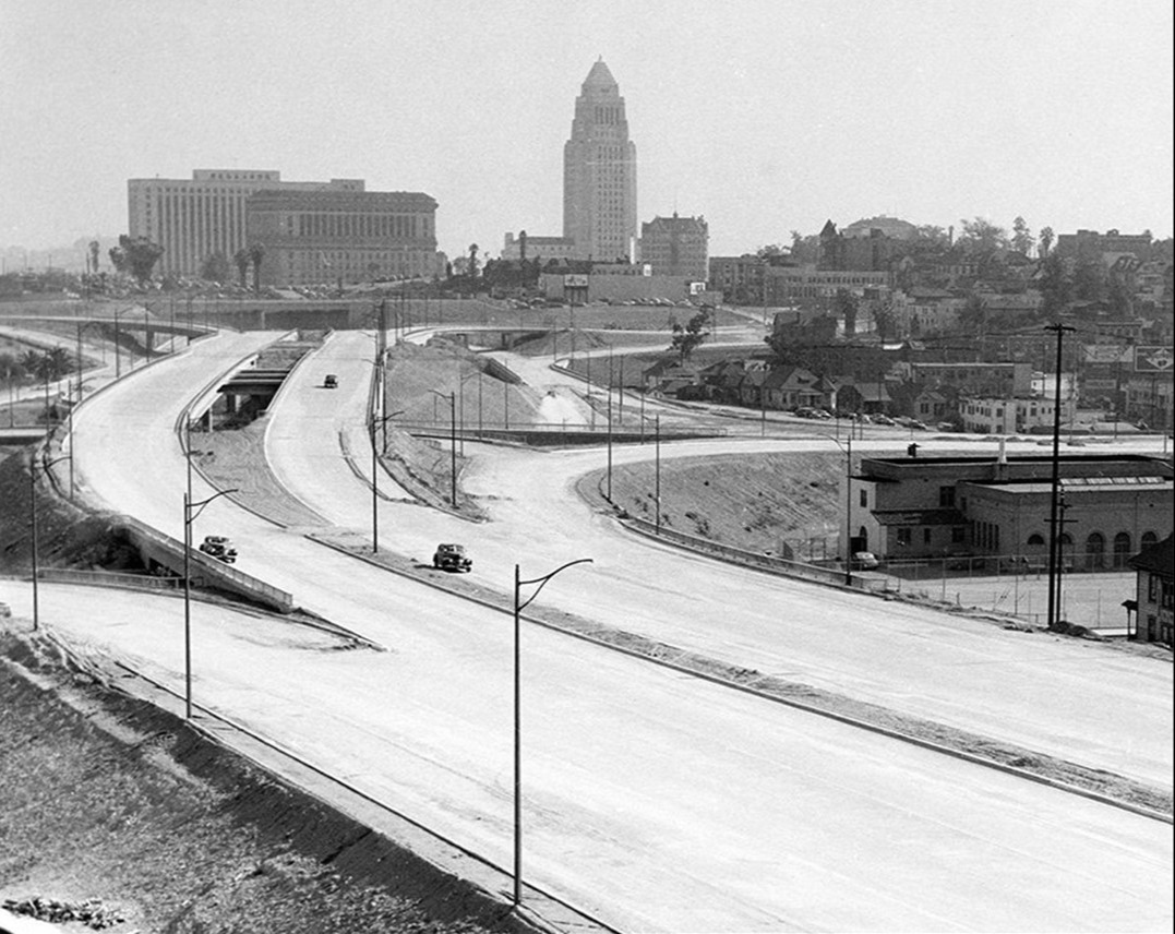
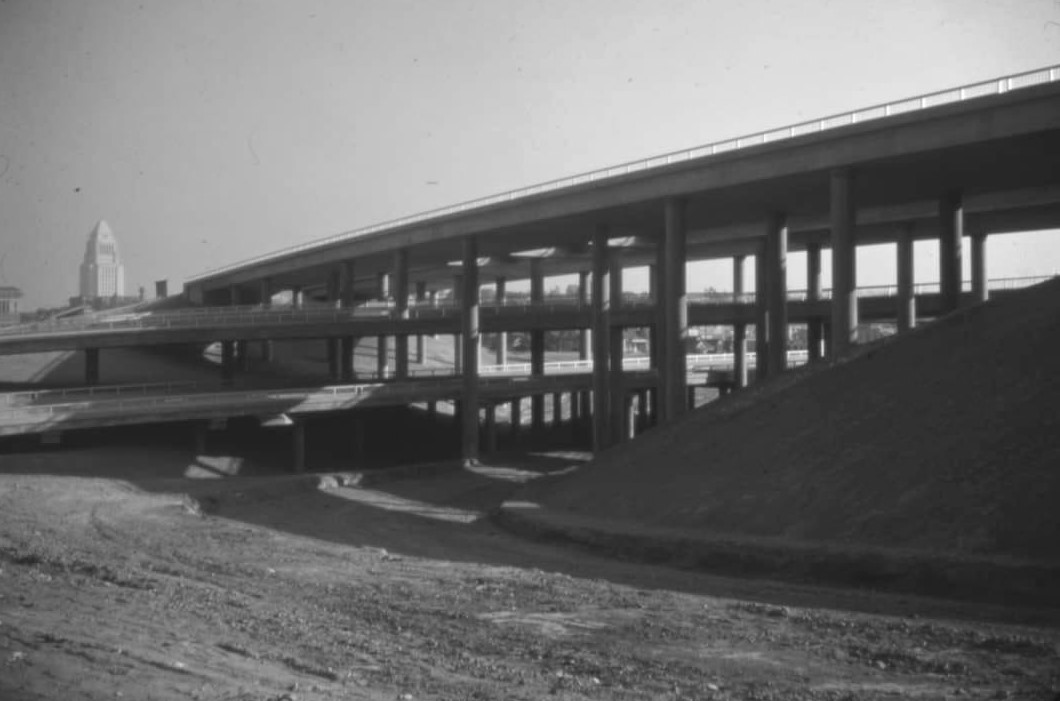
|
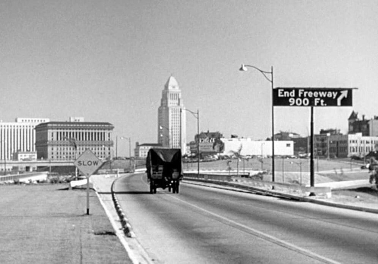
| (ca. 1950)*# - Aerial view looking west showing the 4-level interchange where the Hollywood Freeway (U.S. 101) and the Pasadena/Harbor Freeway (SR 110) meet. Grand Avenue is running left to right at the bottom. Figueroa Street goes under the freeway. It intersects with Boston Street to the right of the freeway bridges. The inbound Hollywood can be seen exiting at the Hope/Temple exit in the lower-left. |
 |
|
| (1951)^#^^ – View looking west from the City Hall tower on a clear day as the Hollywood and Harbor Freeways come on line. The inbound Hollywood exits at Hope/Temple at center-right. |
 |
|
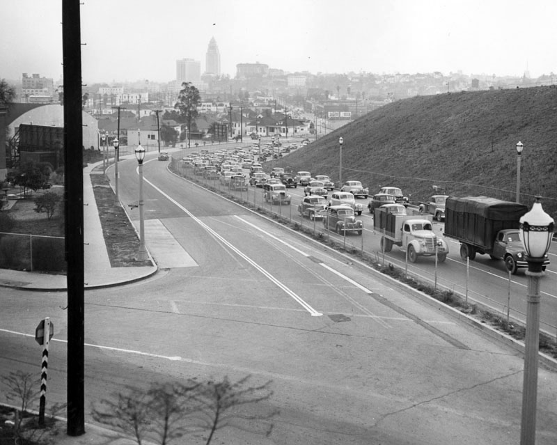
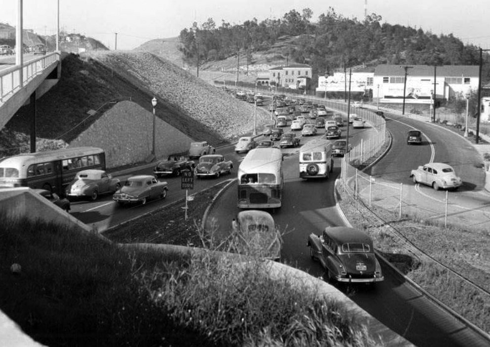
| (1951)+# – View showing the Silver Lake Boulevard exit off the Hollywood Freeway (the 101). This was one of the last exits before the freeway would dead-end near the four level interchange. |
 |
|
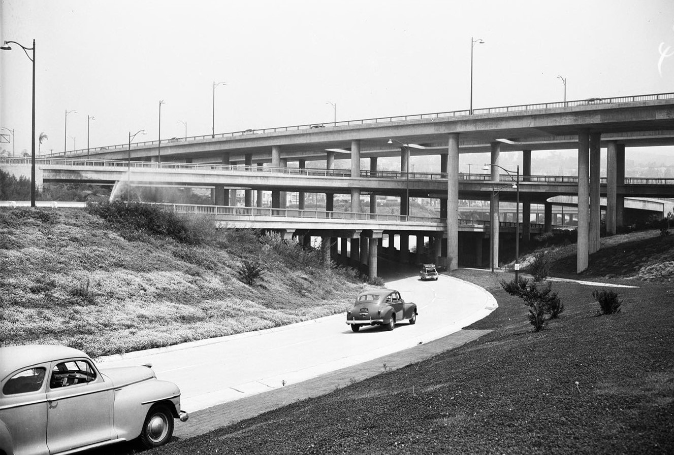
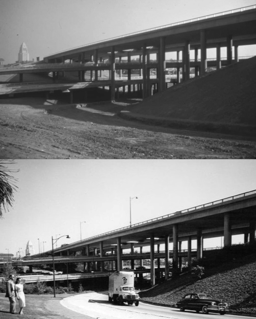
| (ca. 1952)* - A truck makes its way over the Four Level Interchange towards a dead end on the 101 Freeway. |
Historical Notes Only the top level was used for the Hollywood Fwy (US-101) when it was completed in 1950-51. The rest of it opened in late 1953. The last section of the 101 Freeway through Downtown Los Angeles was completed in 1954. |
 |
|
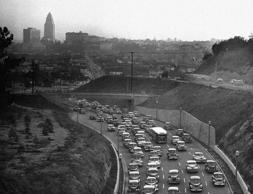
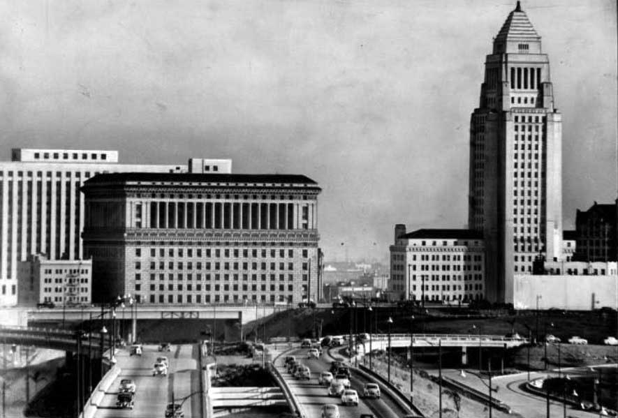
| (ca. 1953)*# - Driving east on the Hollywood Freeway, Los Angeles' Civic Center provides a massive and impressive appearance. In immediate foreground is the Hall of Justice, with the Federal Courthouse and U.S. Post Office Building framing it on left and the City Hall and Hall of Records, on right. In this telephoto view, it appears the east bound traffic is still dead-ended with traffic funneled into the off-ramp after the four-level. |
Four Level Interchange
 |
|
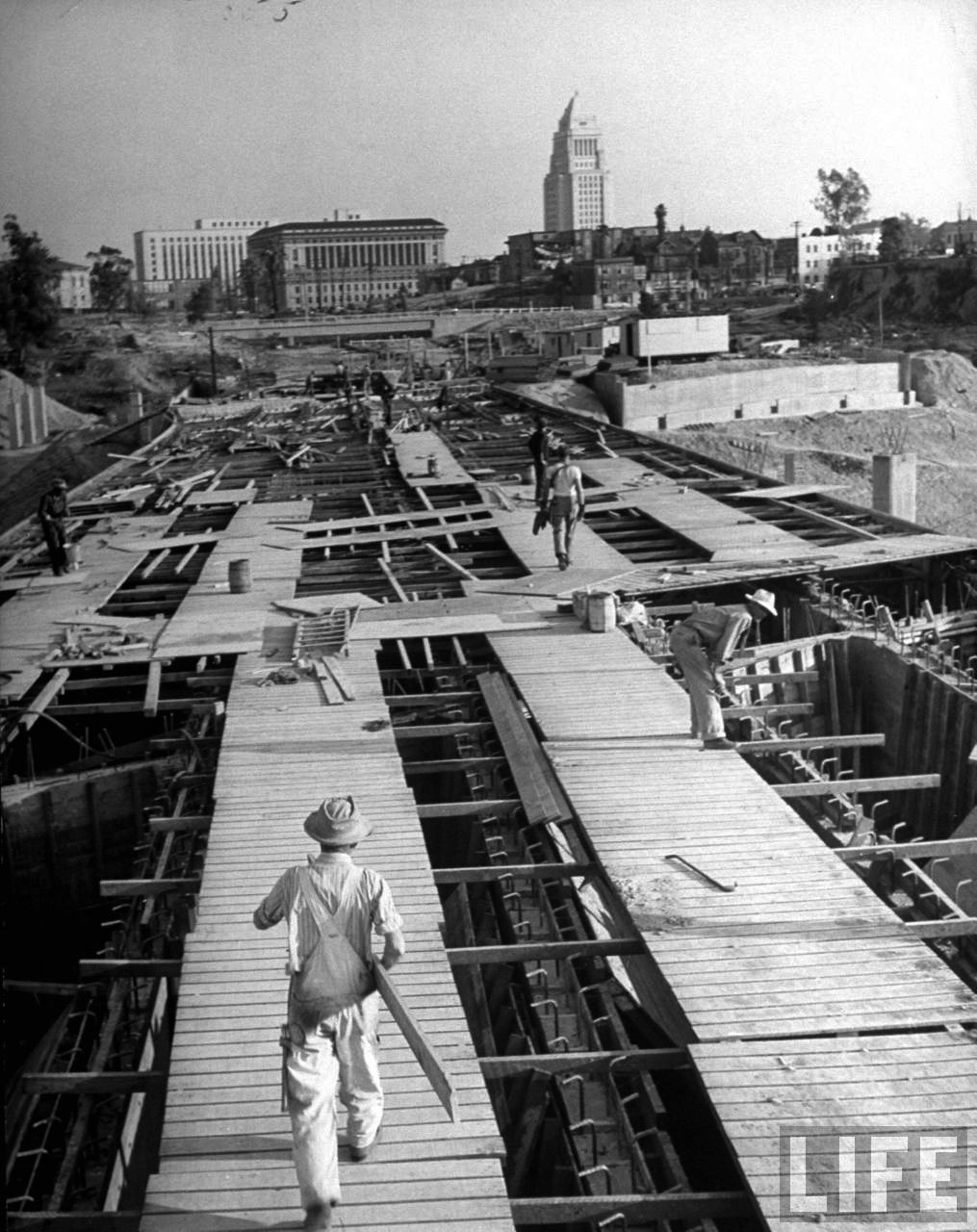
| (1949)* - Ground view of the Four Level Interchange under construction but near completion with City Hall in the background. |
Historical Notes Only the top level was used for the Hollywood Fwy (US-101) when it was completed in 1950-51. The rest of it opened in 1952-1953. |
 |
|
| (1952)* - Harbor Freeway transition into the Hollywood Freeway at the Four Level Interchange. |
 |
|
| (1953)* - Harbor Freeway transition into the Hollywood Freeway at the Four Level Interchange. |
Before and After
 |
|
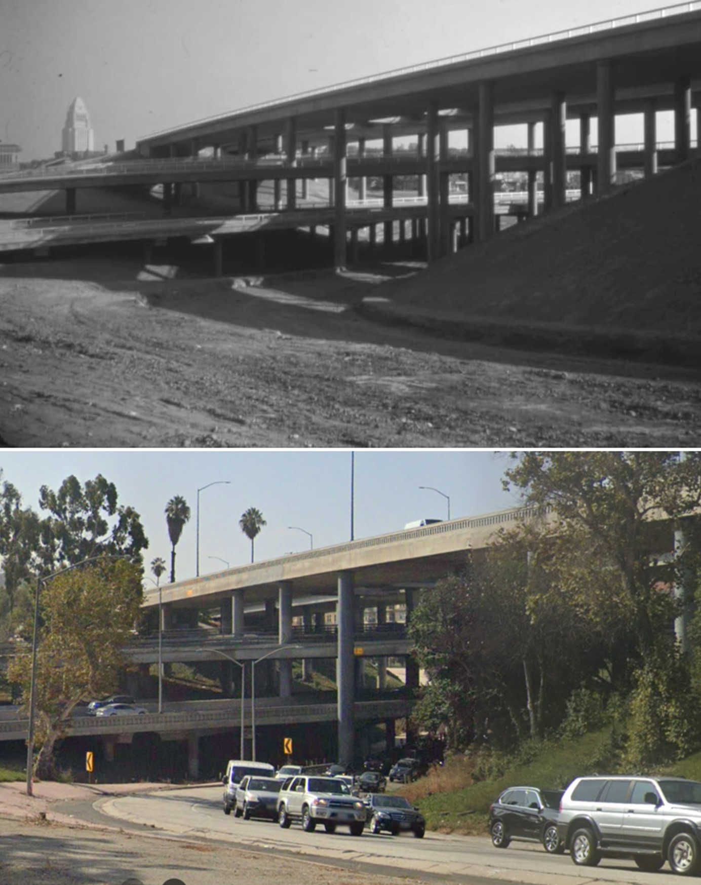
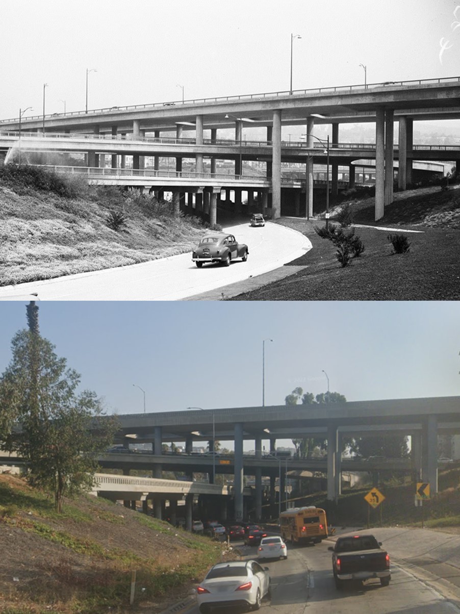
| (1949 vs. 1953) - Harbor Freeway transition into the Hollywood Freeway at the Four Level Interchange. |
Then and Now
 |
|
| (1949 vs. 2022)* - Harbor Freeway transition into the Hollywood Freeway at the Four Level Interchange. |
Then and Now
 |
|
| (1952 vs. 2022) - Harbor Freeway transition into the Hollywood Freeway at the Four Level Interchange. |
 |
|
| (1953)* – Aerial view showing the Four Level Interchange, or Stack, just after all levels were opened. The intersection of Sunset and Figueroa is at lower-center-left. |
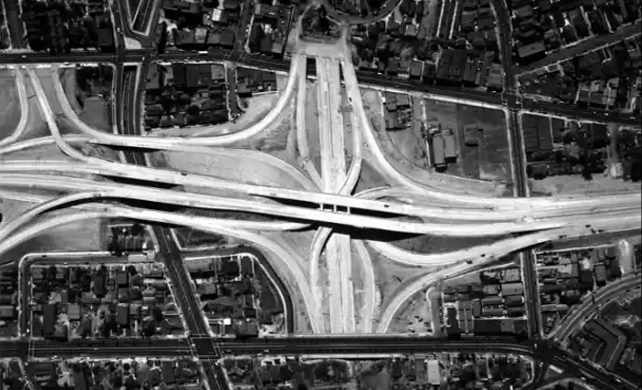
Historical Notes Diverging from the common looping cloverleaf design of other freeway intersections being built around the country early on in the interstate highway system, the Four Level was relatively compact and, as the name implies, built in overlapping layers. The idea for the space-saving stacked interchange is attributed to WH Irish, a location engineer with the California Division of Highways in the 1940s. His idea has since been replicated in cities across the US and the world. The Four Level connects US Route 101 (the Hollywood–Santa Ana Freeway) and Route 110 (the Arroyo Seco Parkway–Harbor Freeway), crossing perpendicularly on the fourth and second levels, respectively. The first and third levels accommodate transfer between the two. An average of more than 425,000 automobiles drive on, over or through these four levels of freeway every day on their way to downtown LA, Hollywood, Long Beach, Pasadena and beyond. |
Construction of the Hollywood Freeway through Downtown
 |
|
| (1949)*#^ – Aerial view looking northwest showing an overlay of the future Hollywood Freeway alignment with the 4-level Interchange location shown at top near Figueroa Street. Source: California Highways & Public Works Magazine, May/June 1949. Note that the Hollywood Freeway is referred to as the Hollywood Parkway. |
 |
|
| (ca. 1951)^.^ – Construction of the 101 Freeway at Main Street. View is looking south on Main Street toward the Federal Courthouse and City Hall. |
 |
|
| (1951)^* - Ground view looking east showing grading for the last leg of the Hollywood Freeway through the Civic Center. |
 |
|
| (1951)^ - Dedication ceremonies will send cars rolling along the new $7,000,000 link of Hollywood Freeway, reaching from Alameda to Grand Avenue. Bridge shown is the Broadway Bridge. Towards the right is City Hall. Photo dated: December 20, 1951. The section of the freeway that ran all the way through downtown wasn't completed until 1954. |
 |
|
| (ca. 1952)* - Looking west showing Civic Center and an unoccupied Hollywood Freeway. |
Aliso Street Project
 |
|
| (1952)* - Looking west over Santa Ana Fwy (US-101) construction at the Alameda Street overcrossing. Southbound traffic is detoured off freeway around bridge construction through Commercial Street and back onto eastbound Aliso Street. |
 |
|
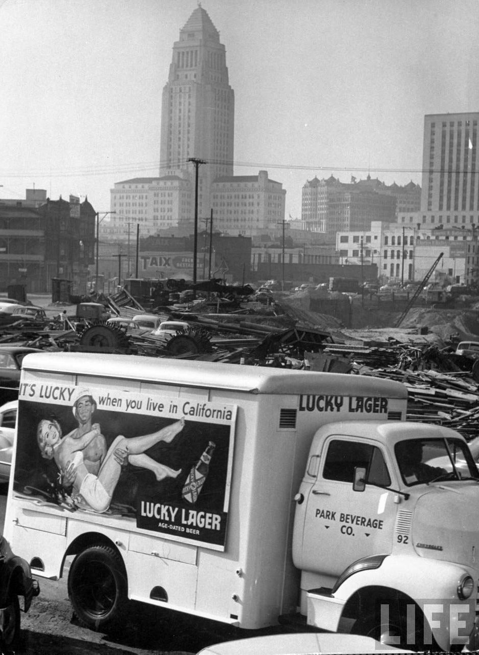
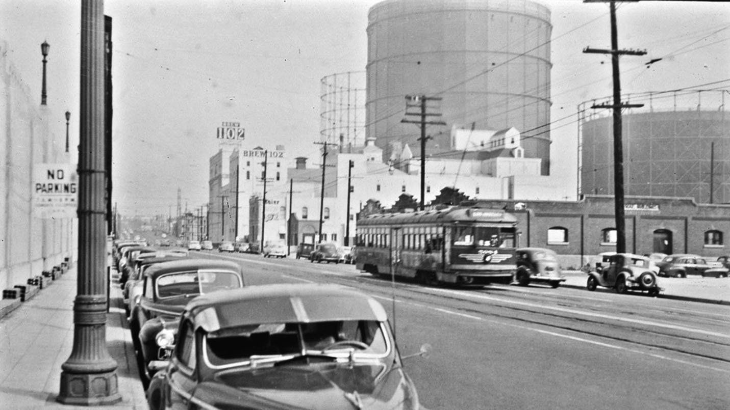
| (1953)* - View looking west toward the Hollywood Freeway showing the Aliso Street Project of the Santa Ana Freeway. Cars are seen being diverted around the construction area. Brew 102 is in the lower right. |
Historical Notes The last section that completed the Hollywood Freeway through Downtown Los Angeles opened on April 16, 1954. |
 |
|
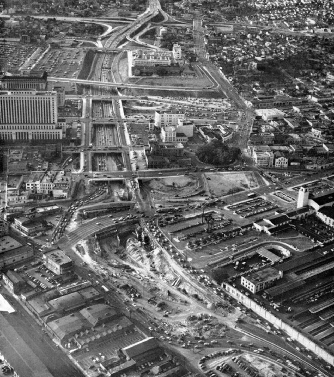
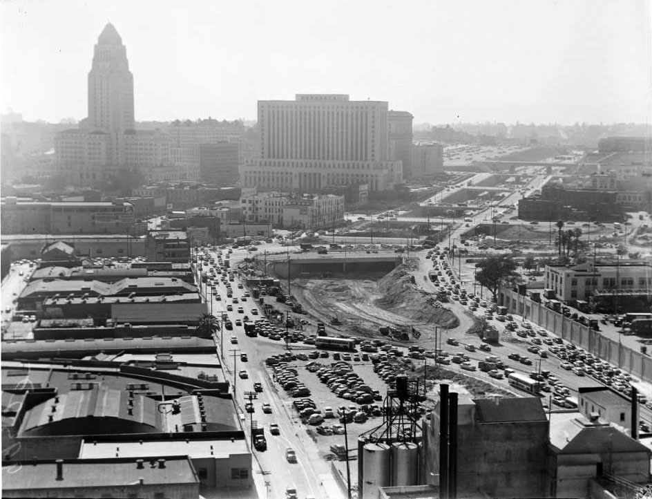
| (1953)* – Close-up view showing traffic being diverted during construction of the Hollywood Freeway through downtown with Taix Restaurant and City Hall seen in the background. |
 |
|
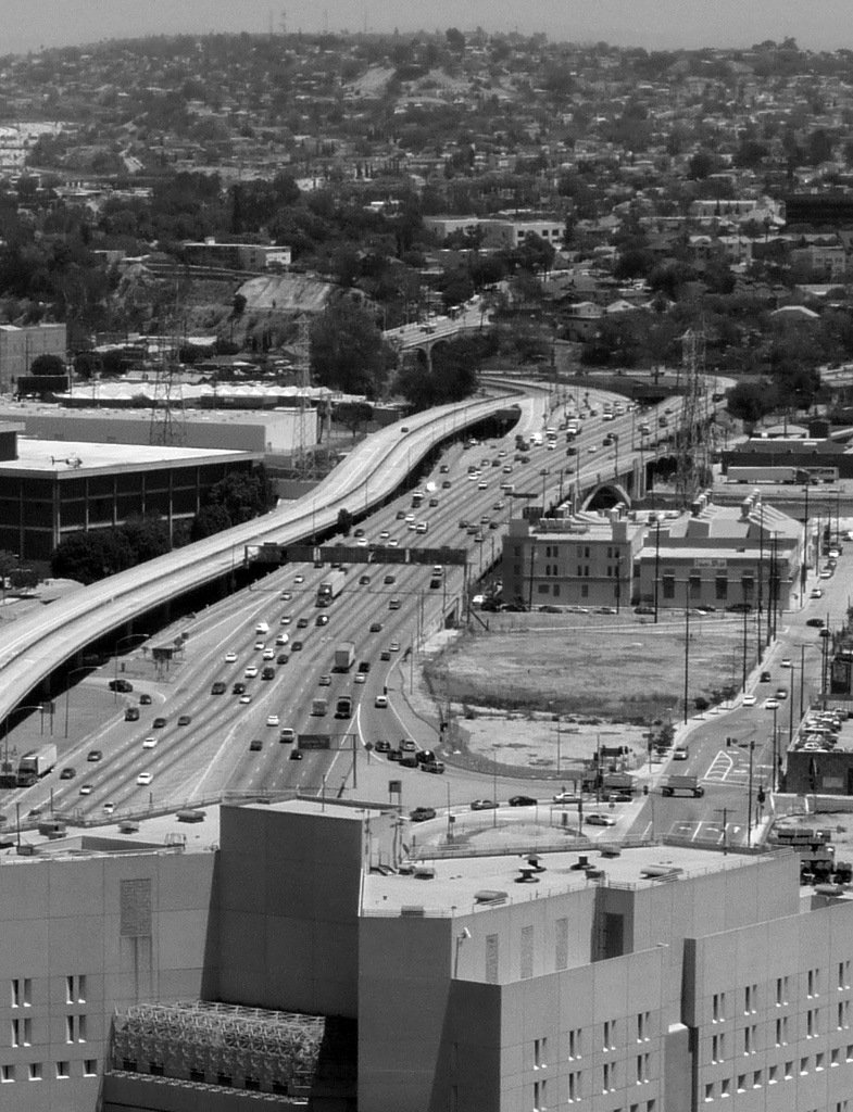
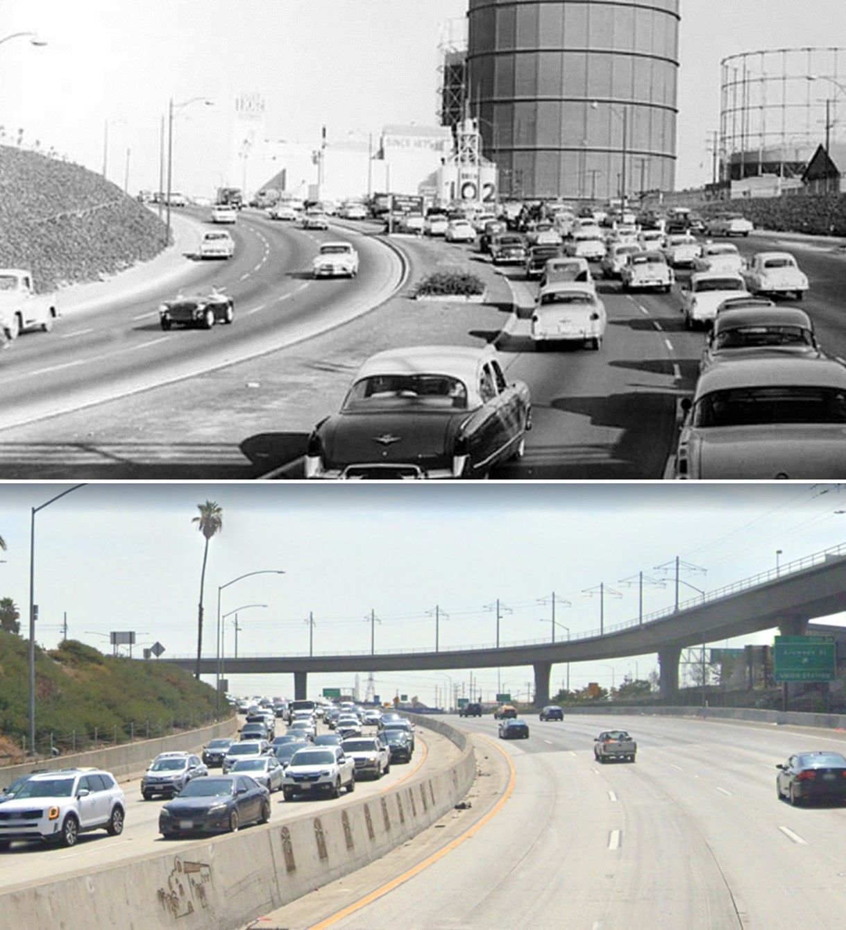
| (1952)*# - View looking east from the top of City Hall of Aliso Street before the 101 Freeway (Hollywood Frwy) was built. Brew 102 and Friedman Bag Company can be seen adjacent to Aliso St. The section of the Hollywood Freeway that runs through downtown goes right through where Aliso Street is shown above. |
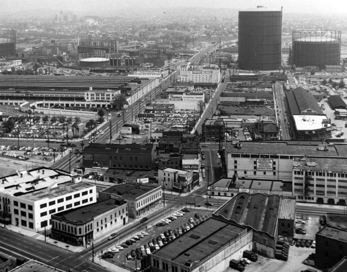 |
|
| (1951)* - Aerial view taken from City Hall looking east with Aliso Street and Union Station seen on the left. This is where the 101 Freeway would be constructed over the next three years. |
Historical Notes The large gas holders seen in the distance commonly known as ‘Gasometers’ were common before the 1960s. Click HERE to see more. |
 |
|
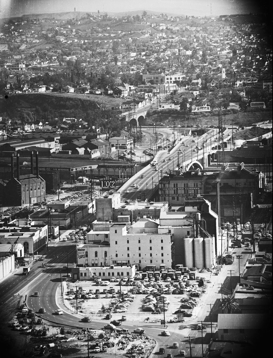
| (ca. 1950)* – Aliso Street looking east showing Brew 102 and the large natural gas holders (Gasometers) in the distance. Union Station is on the left. |
Historical Notes By the mid-1950s, Aliso Street, seen above, would be replaced by the Hollywood Freeway (U.S. 101). |
 |
|
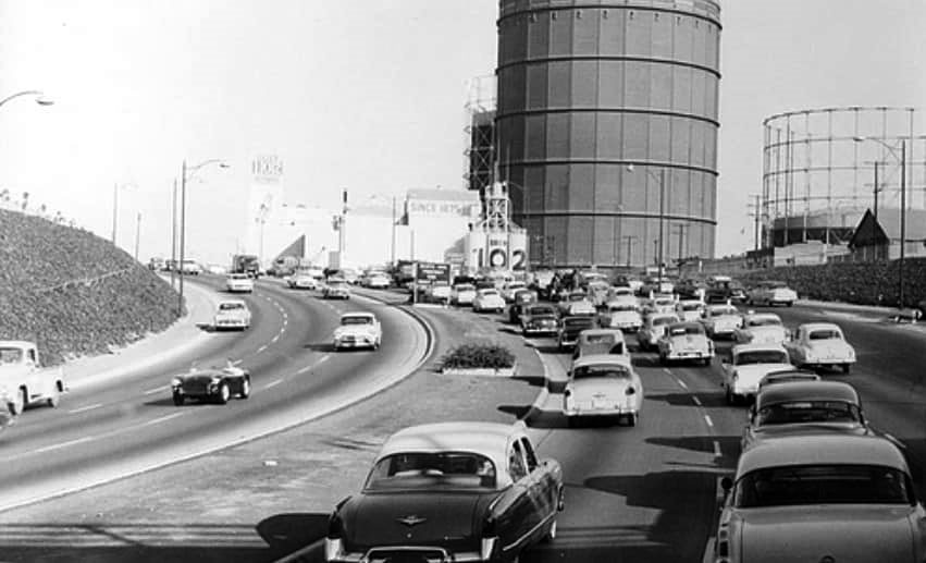
| (1954)* – Hollywood Freeway shorty after it was completed running where Aliso Street used to be. Brew 102 and three large natural gas holders (Gasometers) are seen in the background |
Historical Notes The last section of the 101 Freeway (aka Hollywood Frwy) through Downtown Los Angeles was completed in 1954. It ran in line with what used to be Aliso Street (seen above). |
 |
|
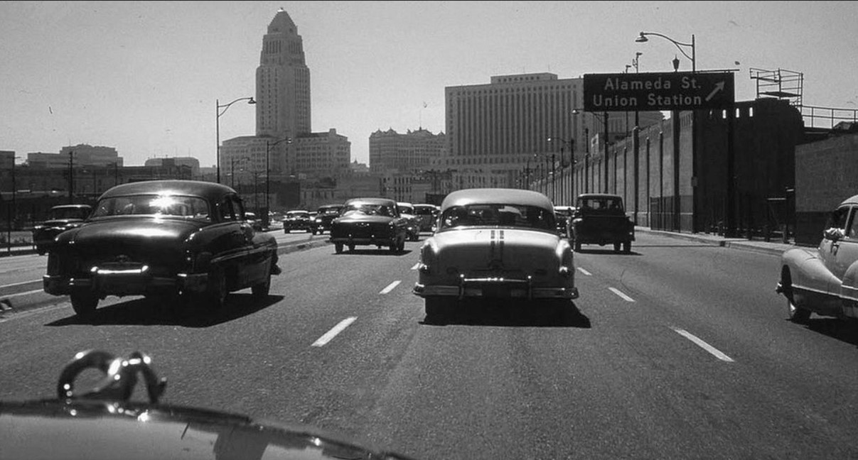
| (1954)* – 101 Freeway inbound from the eastside near the Alameda Street/Union Station exit. Note the bare center-divider medians in the early photo. |
Before and After
|
 |
|
| (1952)*# - Aliso Street before the construction of the 101 Freeway. | (2010)**^ - After the construction of the 101 Freeway. |
Then and Now
 |
|
| (1954 vs. 2022)* – Top photo shows the Hollywood Freeway shorty after it was completed running where Aliso Street used to be. Brew 102 and three large natural gas holders (Gasometers) are seen in the background. |
Then and Now
 |
|
| (1954 vs 2022)* - 101 Freeway inbound from the eastside near the Alameda Street/Union Station exit. |
Then and Now
 |
|
 |
|
| (ca. 1950)##^# vs. (2016)##^ – Aerial view showing Civic Center (right) and the Station/LA Plaza area (center-left) before and after the Hollywood Freeway. Sunset Blvd (Caesar Chavez) runs away from the camera at lower center-left. Temple Street is at lower right. |
Then
 |
|
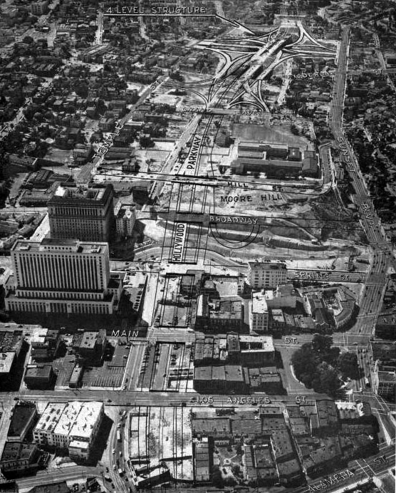
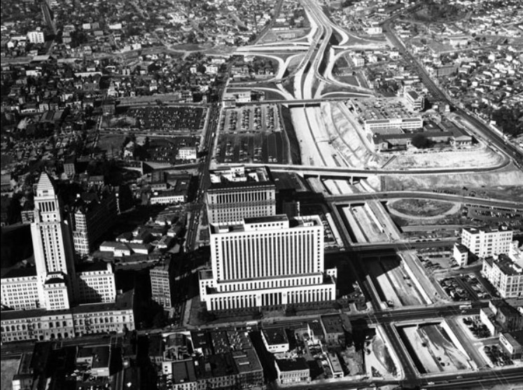
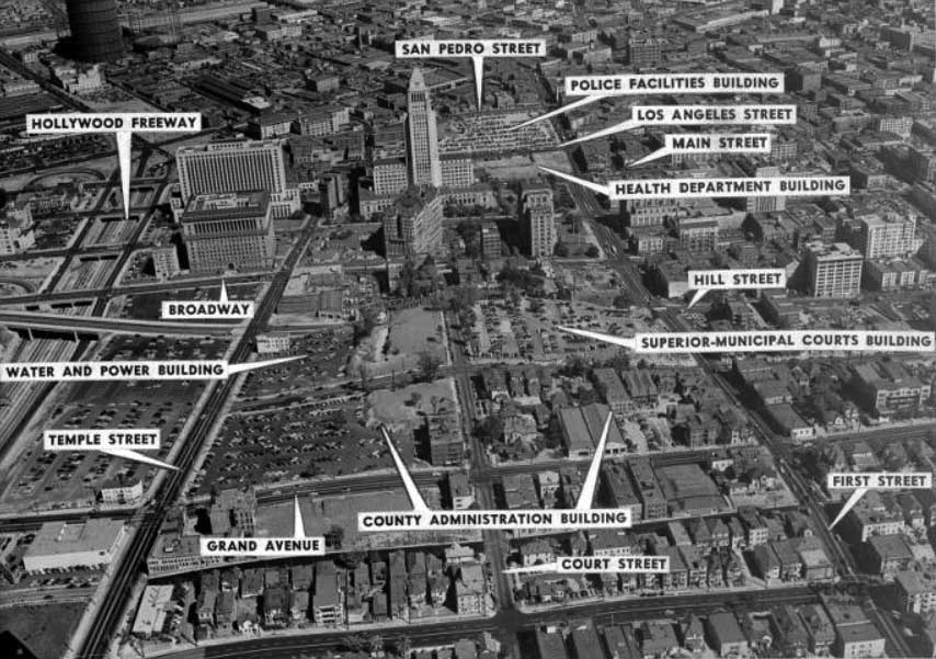
| (1952)*# - Aerial view of Los Angeles Civic Center with City Hall in the background. The surrounding area is annotated to show street names and proposed new building locations. |
Now
.jpg) |
|
| (2016)##^ – Google Earth View showing the Civic Center with City Hall in the distance as seen from above the DWP John Ferraro Office Building. |
* * * * * |
City Hall
 |
|
| (1951)^^ - City at night on New Year's Eve, December 31, 1951. Post Office on left; City Hall on right. |
 |
|
| (1951)*# - The rotating beacon (The 'Lindbergh Beacon') is visible atop City Hall, and a portion of Bunker Hill can be seen on the lower left. At center-right is the old State Building. |
Historical Notes The Lindbergh beacon was installed on top of City Hall in 1928. Originally white, the light was replaced with a red light in 1931 after the U.S. Department of Commerce deemed the bright beacon a hazard to air safety. During WWII the light was turned off, and relit just a few of times more before being removed in the early 1950s. |
.jpg) |
|
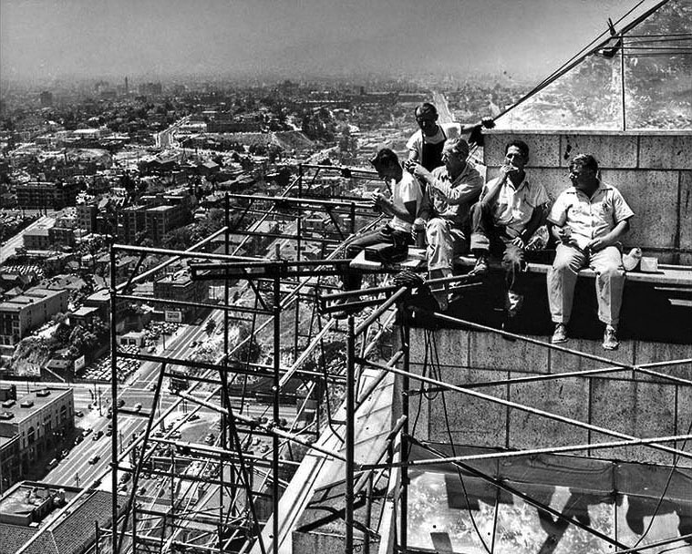
| (1950)*# - Oh My! View looking down from the Lindbergh Beacon showing two workers precariously standing on scaffolding attached to the side of the City Hall tower. Both the LA Times Building and the old State Building are seen below. |
 |
|
| (1950)* - Workmen putting stainless steel covering atop Los Angeles City Hall take a lunch break. |
 |
|
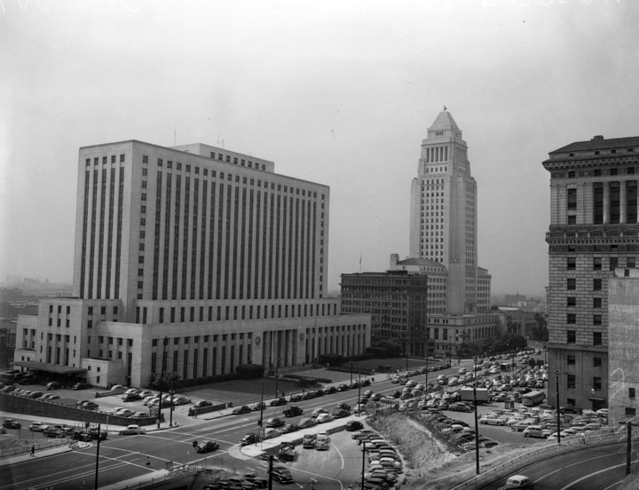
| (1949)^ - View of the Los Angeles Civic Center, showing the International Bank Building dwarfed by its two bookends, the Federal Courthouse and U.S. Post Office Building and City Hall. The Hall of Justice is seen on the right. |
 |
|
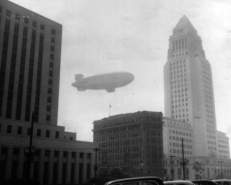
| (1954)^ - Closer view showing the International Bank Building bookended by the Federal Courthouse and U.S. Post Office Building on the left and City Hall on the right with the Goodyear Blimp flying overhead. |
Historical Notes The 1907-built International Bank Building would be razed in 1954, same year as the photo above. Click HERE to see more Early Views of City Hall. |
 |
|
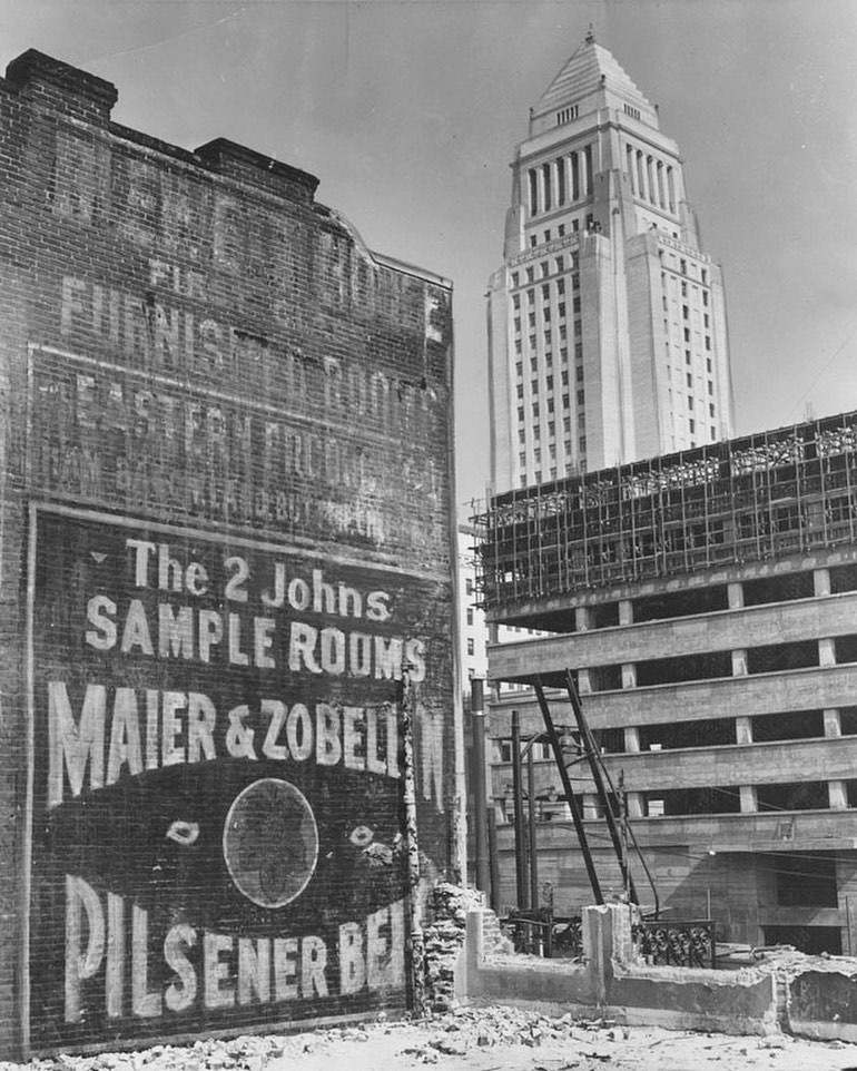
| (1953)* - Construction site downtown, taken at First and Main with City Hall in the background. Photo date: October 26, 1953 |
Historical Notes The advertisement seen above is for “Pilsener” beer from Maier & Zobelein. This was the pairing of Joseph Maier and George Zobelein who, together, took over LA’s “Philadelphia Brewery” in 1882 and ran it until their partnership dissolved in 1907, meaning that this ad would have been painted prior to that date. More interesting is the mention of “sample rooms,”. Apparently, in addition to regular sleeping rooms, high-end hotels used to offer furnished ‘sample rooms’ where salespeople could rent space to display their merchandise for the inspection of buyers for retail stores. Sort of like when sales markets for various industries take over hotels today, converting rooms to office space for a week, with the difference being that these rooms were permanent fixtures and were used/needed regularly. Ultimately, they died out when the automobile became a way of life, and salesmen could more easily visit individual retailers, or bypass them, going door-to-door.^ |
* * * * * |
Dodger Stadium
 |
|
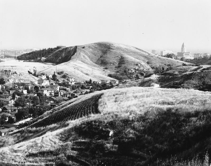
| (ca. 1952)^ - Panoramic view of the Chavez Ravine area, with Bishops Road cutting through. City Hall is in the background. |
Historical Notes The land for Dodger Stadium was purchased from local owners/inhabitants in the early 1950s by the City of Los Angeles using eminent domain with funds from the Federal Housing Act of 1949. The city had planned to develop the Elysian Park Heights public housing project which included two dozen 13-story buildings and more than 160 two-story townhouses, in addition to newly rebuilt playgrounds and schools. Before construction could begin, the local political climate changed greatly when Norris Poulson was elected mayor of Los Angeles in 1953. Proposed public housing projects like Elysian Park Heights lost most of their support. Following protracted negotiations, the City of Los Angeles was able to purchase the Chavez Ravine property back from the Federal Housing Authority at a drastically reduced price, with the stipulation that the land be used for a public purpose. It wasn't until the baseball referendum Taxpayers Committee for Yes on Baseball, which was approved by Los Angeles voters on June 3, 1958 that the Dodgers were able to acquire 352 acres of Chavez Ravine from the City of Los Angeles. (The Dodgers, from 1958 to 1961, played their home games at the Los Angeles Memorial Coliseum.)^* |
 |
|
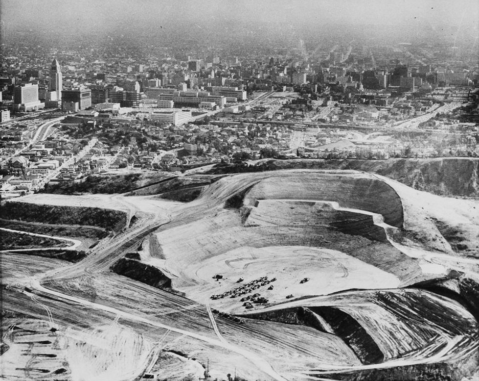
| (1959)* - Hundreds of onlookers watch bulldozers charging down the hills to begin the massive leveling and grading process for Dodger Stadium. In all, eight million cubic yards of earth were moved to prepare the rugged land for the building of Dodger Stadium. Photo dated: September 17, 1959. |
 |
|
| (1960)*# - Photograph of Chavez Ravine Dodger Stadium excavation. The downtown civic center can be seen in the background. |
 |
|
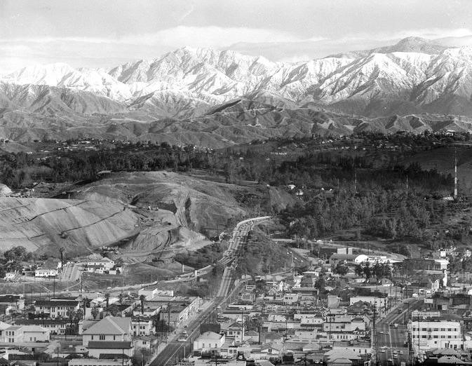
| (1962)#+ – Aerial view looking up N. Hill Street where it merges with the Arroyo Seco Parkway (Pasadena Freeway). Grading for Dodger Stadium is tearing up Chavez Ravine on the left. In the background stands the San Gabriel Mountains with an incredibly low snow line. |
 |
|
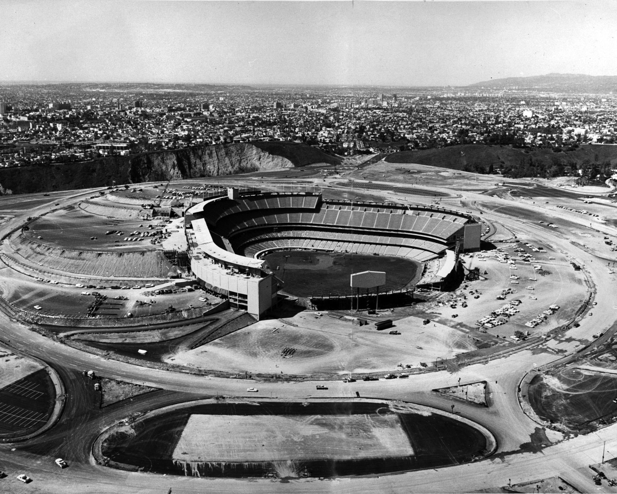
| (1962)* - Aerial view of Dodger Stadium before it opened looking towards Hollywood. The parking lots are beginning to take shape, some already striped, and the signboards are standing. |
Click HERE to see more in Baseball in Early L.A. |
* * * * * |
Cahuenga Pass
 |
|
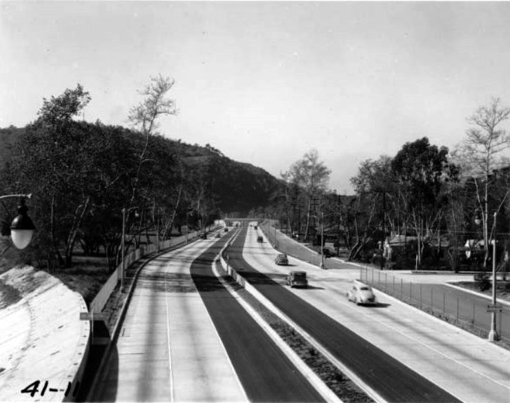
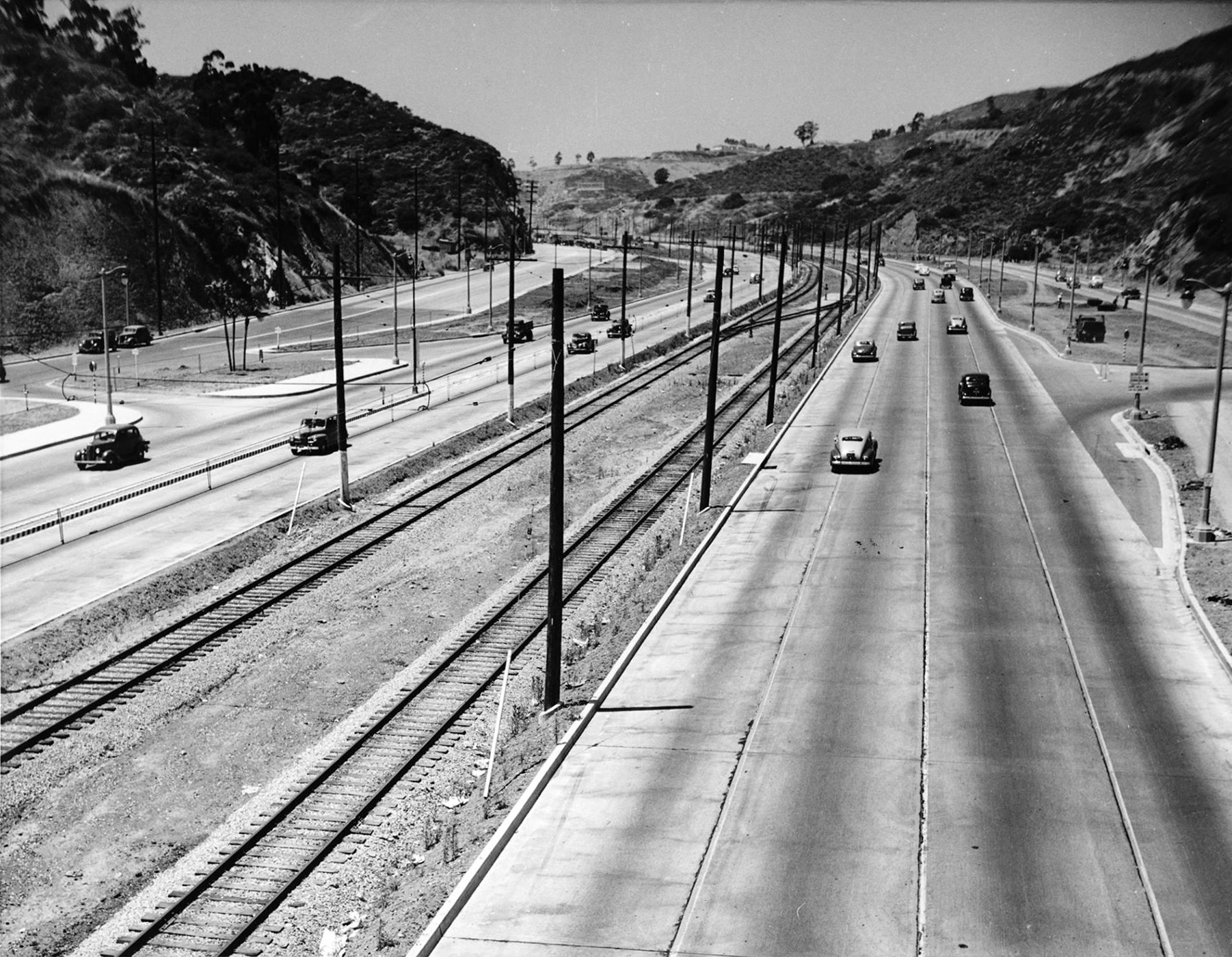
| (1940s)^x^ – Cahuenga Pass as it appeared in the mid-1940s. Note the Pacific Electric railway tracks running down the center median. |
Historical Notes The first segment of the Hollywood Freeway built was a one and a half mile stretch through the Cahuenga Pass. That segment opened on June 15, 1940. It was then known as the "Cahuenga Pass Freeway." ^* |
.jpg) |
|
| (1949)^ - View of the roads, rail lines, and cars traveling through the Cahuenga Pass, the most important section of the Hollywood Freeway, which is the "gateway" that opens fast traffic from the rich San Fernando Valley into Hollywood and the heart of metropolitan Los Angeles. |
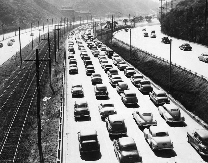 |
|
| (1948)^ - This view of the Cahuenga Pass in 1948 shows one road of cars end to end. The short city-built Cahuenga Pass Freeway was opened on June 15, 1940. |
 |
|
| (1952)*# - View of Cahuenga Pass during rush hour traffic on a rainy morning. |
.jpg) |
|
| (1948)^ – Valley Times photo shows paving of Hollywood Freeway lanes that extend from the Cahuenga Pass to Vineland Avenue. In between the freeway lanes are electric lines used by Pacific Electric trains. Photograph dated November 10, 1948 |
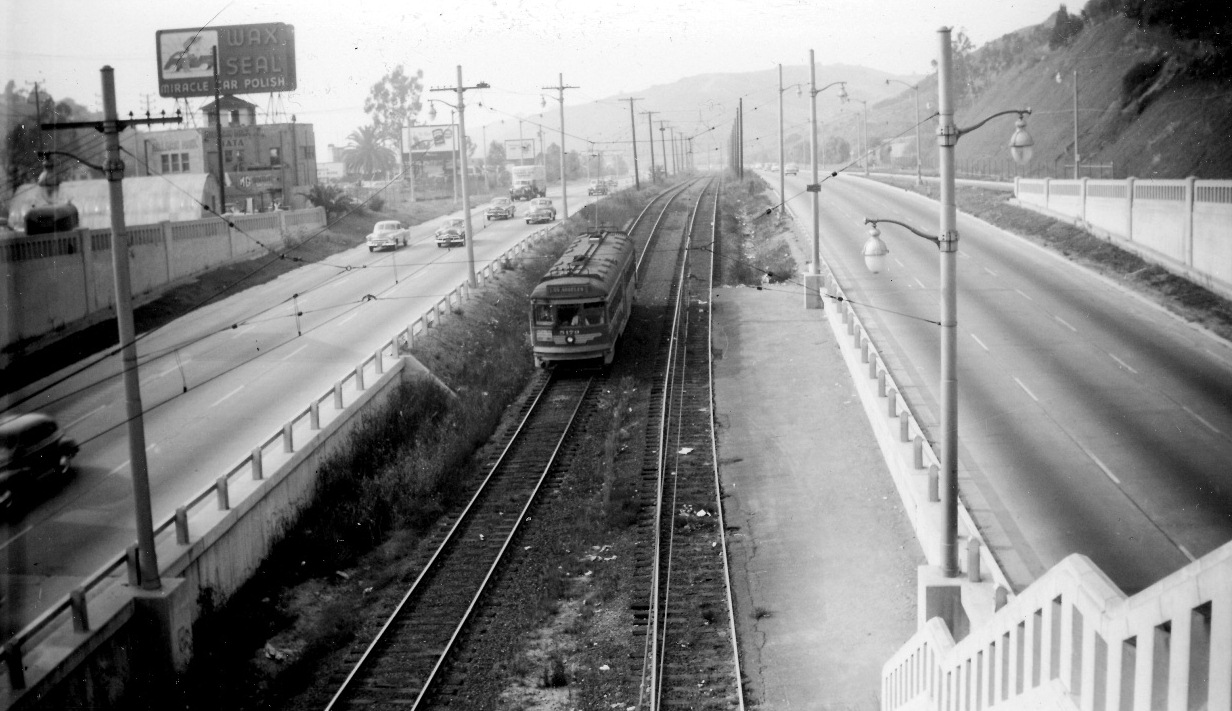 |
|
| (1952)*^^ - A Pacific Electric Red Car headed south in the median of the Hollywood Freeway near Barham. |
Historical Notes Pacific Electric Railway trolleys ran down the center of the Hollywood Freeway through Cahuenga Pass until 1952.^* |
| (1952)##^# – View of the Lankershim Boulevard underpass at the Hollywood Freeway, showing two Pacific Electric Red Cars passing each other above. |
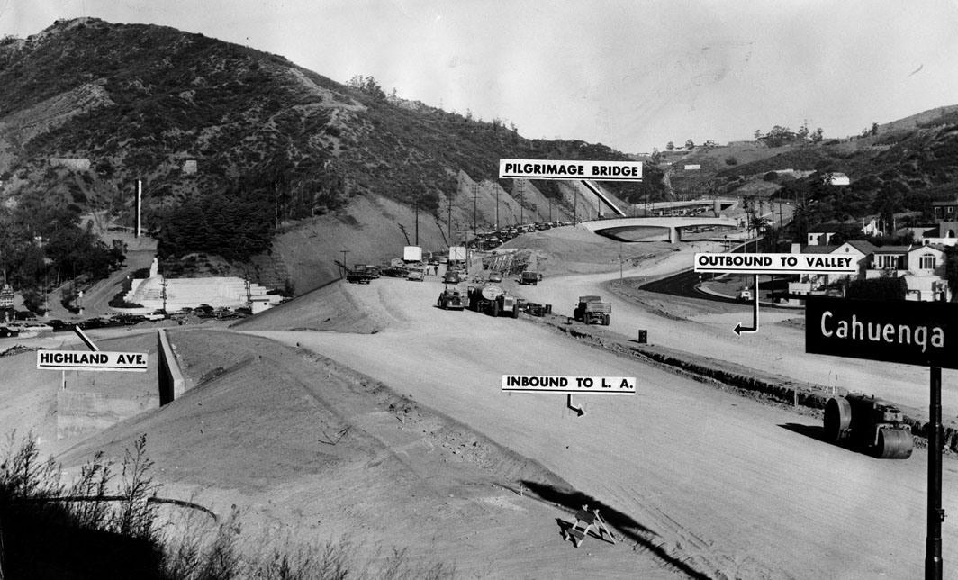 |
|
| (1953)^ - View, looking north, showing the construction of the Hollywood Freeway through Cahuenga Pass. |
Historical Notes The second section of the Hollywood Freeway that stretched from the San Fernando Valley to Downtown Los Angeles opened on April 16, 1954 at a cost of $55 million. The final section, north of the Ventura Freeway to the Golden State Freeway was completed in 1968.^* Click HERE to see more in early Views of Cahuenga Pass. |
* * * * * |
Hollywood Freeway (CA-101)
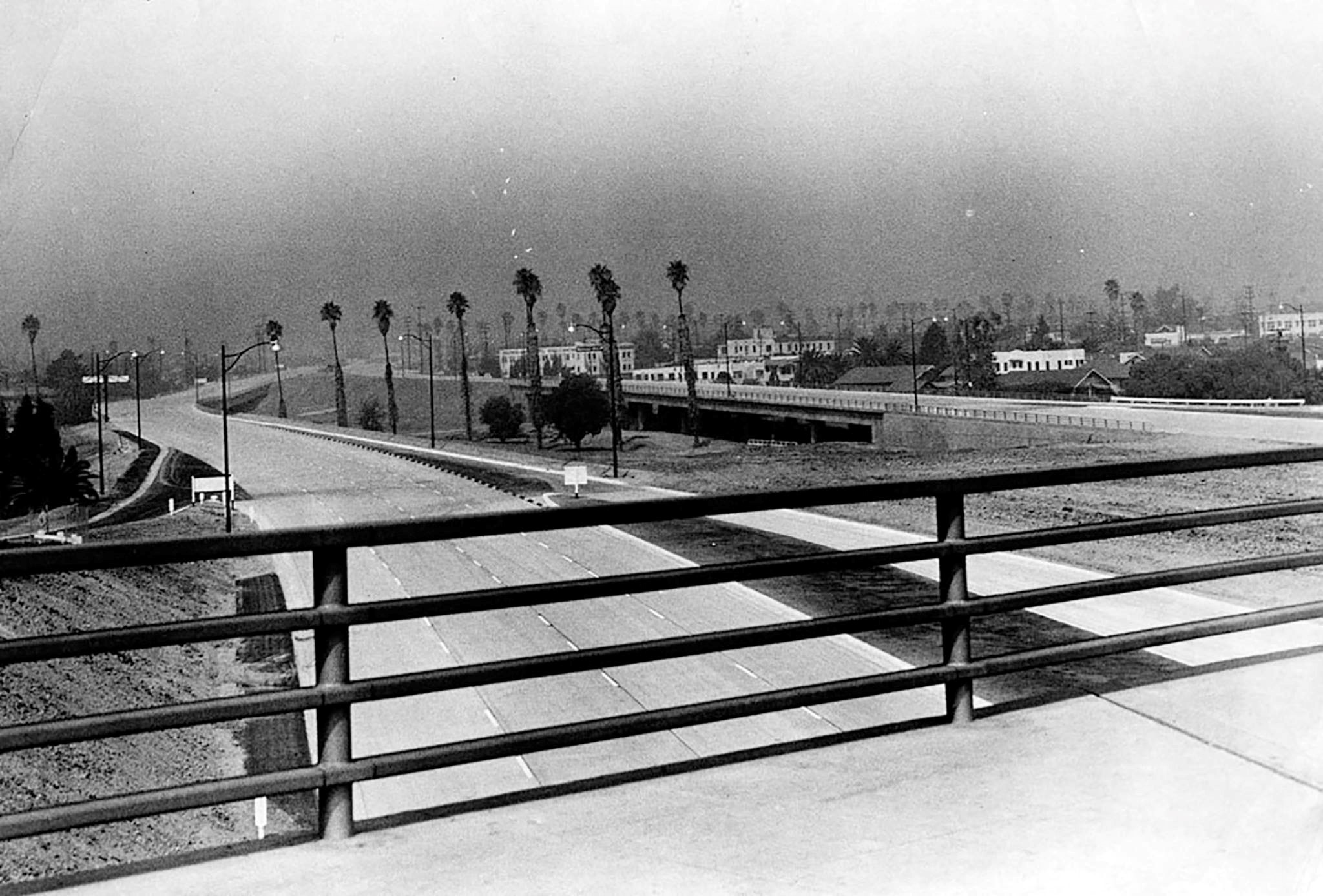 |
|
| (1951)^ – View looking northwest of the Hollywood Freeway as seen from the Vermont Bridge. Photo dated: September 25, 1951. |
Historical Notes Near the Vermont Avenue exit, there's a seemingly over-wide center strip now filled with trees. This is where the never-built Beverly Hills Freeway was to merge with the Hollywood Freeway. Plans for the Beverly Hills Freeway were halted in the 1970s.^* |
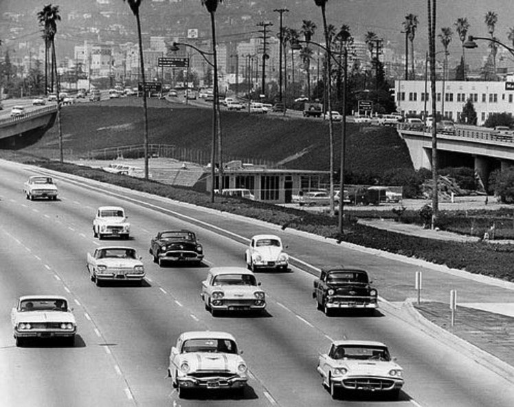 |
|
| (ca. 1962)* – View looking at the southbound lanes of the Hollywood Freeway near Vermont Avenue. |
Historical Notes The gore point in the fast lane marked the beginning of the "Bus Only" exit for Vermont. The slow buses used to have to lumber over to the fast lane to use the exit. Then, further to the South, the buses would then have to merge back onto the Freeway into the fast lane and fight their way back to the right. The "Bus Only" exit was finally relocated to the right in the late 1970s or early 1980s. The abandoned left exit and entrance ramps are still there. |
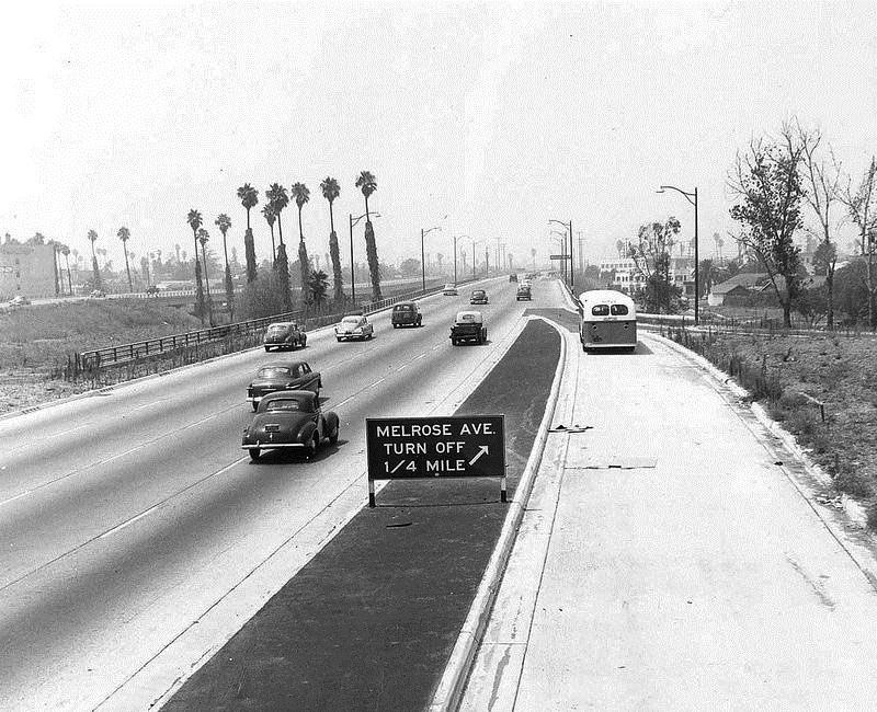 |
|
| (ca. 1954)**^ - Hollywood Freeway northbound at Melrose Ave with bus lane on the right. |
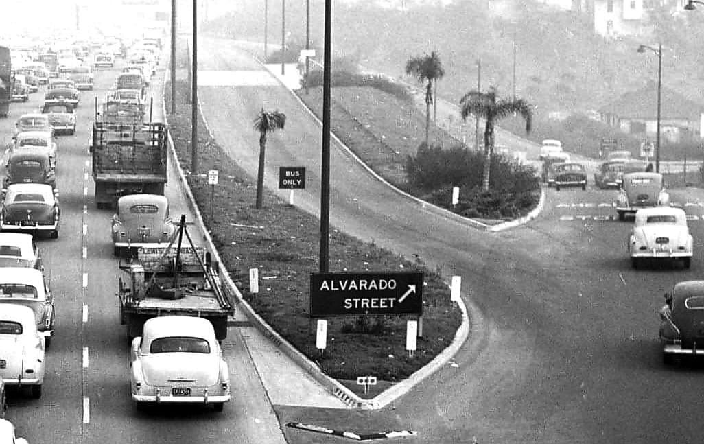 |
|
| (1954)* – Hollywood Freeway at Alvardo Street with bus lane on the right. |
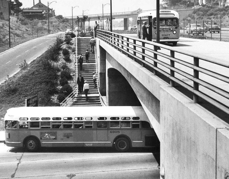 |
|
| (1953)* – Bus services on the Hollywood Freeway at the Alavarado Street crossing. View is looking NW toward the Rosemont Ave overpass seen in the distance. Photo: Herald Examiner, September 8, 1953 |
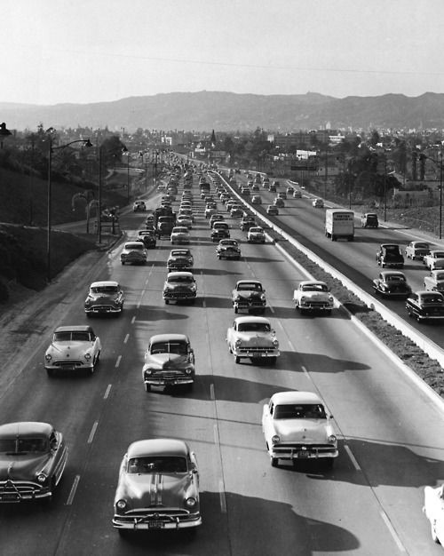 |
|
| (1950s)* – View looking north showing the Hollywood Freeway southbound traffic heading toward Downtown Los Angeles. |
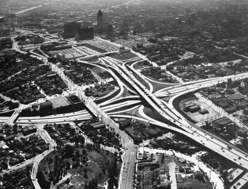 |
|
| (1954)* – Aerial view looking east across the four-level. Sunset dog-legs away from the camera at lower-center. Photo by Dick Whittington. |
| (1954)* - Aerial view looking southeast across the Four Level Interchange and Bunker Hill. |
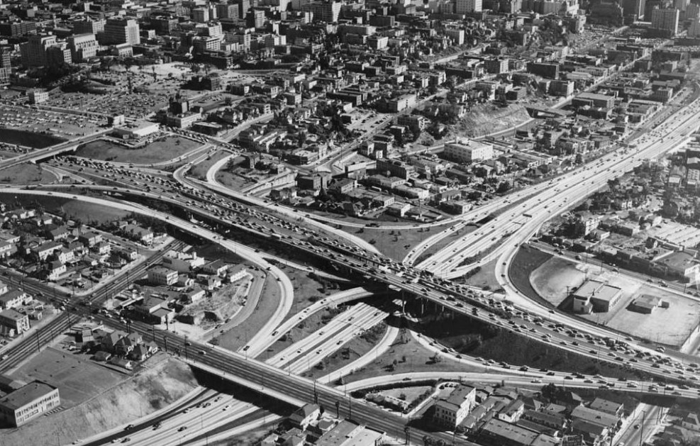
| (1955) - Less than five years after its opening, Hollywood Fwy (US-101) traffic is at a standstill near the four level interchange. |
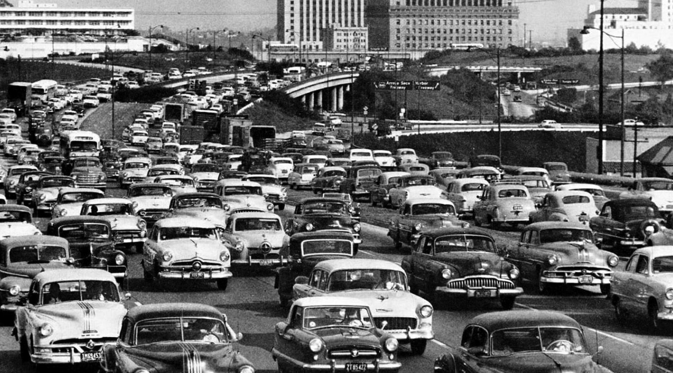
Four-Level Interchange
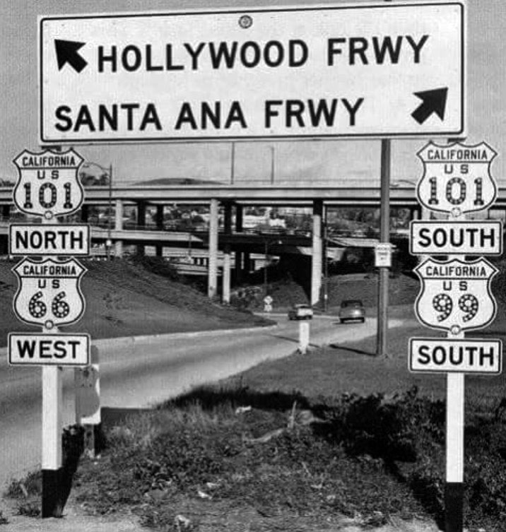 |
|
| (1954)##^# - View looking north toward the Four Level Interchange showing the transition from the Harbor Freeway to the Hollywood Freeway. |
Historical Notes The Four Level Interchange was the first stack interchange in the world. Completed in 1949 and fully opened in 1953 at the northern edge of Downtown Los Angeles, it connects U.S. Route 101 (Hollywood Freeway and Santa Ana Freeway) to State Route 110 (Harbor Freeway and Arroyo Seco Parkway).^* |
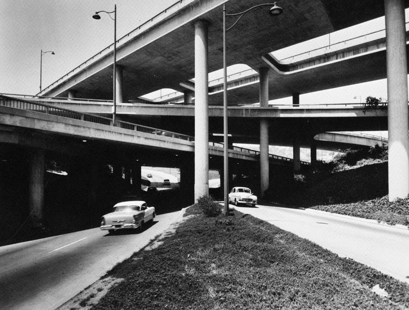 |
|
| (1954)^ - The Four Level Interchange, built in 1954, is the hub and symbol of the Los Angeles freeway system. Postcard of a photo by Dick Whittington. |
Historical Notes The Four Level, also known as the Stack, gets its name from its multi-tiered structure that separates traffic heading in each direction into dedicated lanes. On the bottom level are curved ramps for those changing from the 110 freeway to the 101. One level above is the main trunk of the 110 freeway, named the Arroyo Seco Parkway north of the interchange and the Harbor Freeway south of it. On the third level are the arcing flyover ramps carrying traffic from the 101 freeway to the 110. Finally, on the fourth and top level is the main trunk of the 101 freeway, named the Hollywood Freeway to the west and the Santa Ana Freeway to the east.^^^* |
Then and Now
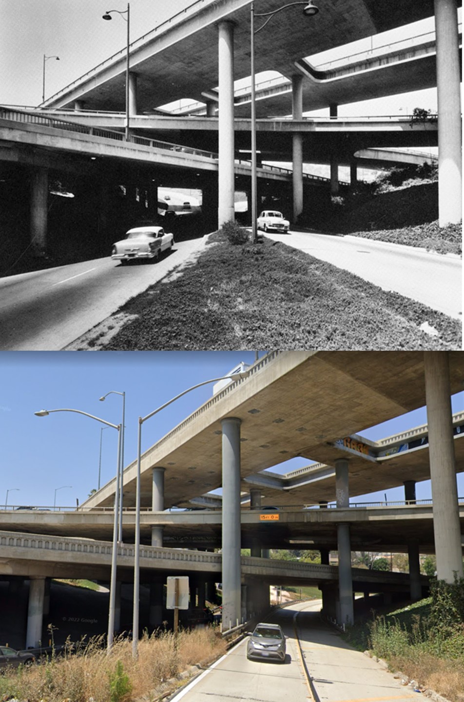 |
|
| (1954 vs 2022)* - The Four Level relatively unchanged (except for streeetlights and landscaping). |
Historical Notes The Four Level Interchange, sometimes called “The Stack,” was retrofitted after the 1994 Northridge earthquake. |
 |
|
| (2022)* - Looking up towards the bottom of the Four level Interchange. Photo by Carlos G. Lucero |
| (1953)^^^* - The Four Level carrying traffic in all eight directions shortly after its 1953 opening. |
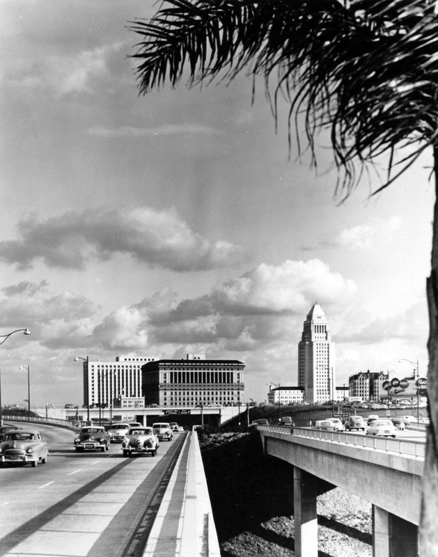 |
|
| (ca. 1953)^ - Vintage cars of the 1950s are seen traveling on the Hollywood Freeway on the northerly edge of the Four Level Interchange near the Temple Street exit. In the background can be seen (from L to R): Federal Courthouse and U.S. Post Office Building, Hall of Justice, City Hall , and the old Hall of Records. |
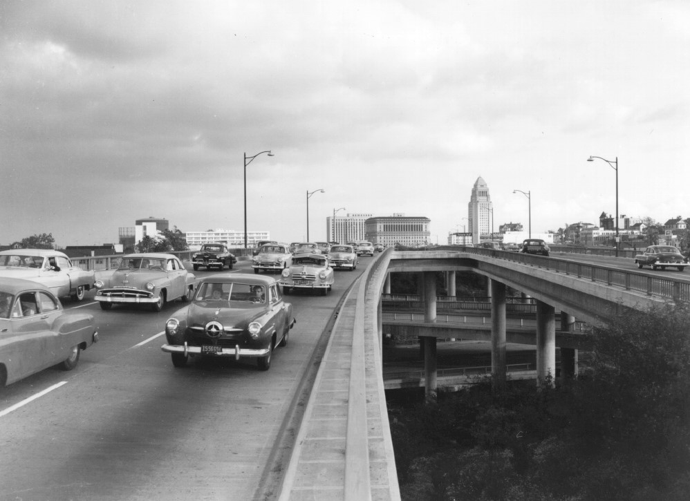 |
|
| (1953)* - View of the top level of the Four Level Interchange looking east toward City Hall. |
Historical Notes The interchange was constructed as a stack interchange because surrounding buildings and terrain made construction of a cloverleaf interchange impractical. The mainline traffic of US 101 is at the top of the interchange, above the ramps, a rarity in stack interchanges. Its distinctive architecture has long made it a symbol of Los Angeles' post-World War II development, and it appears on numerous postcards of the 1950s and 1960s.^* |
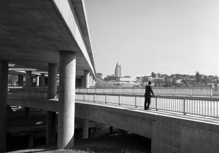 |
|
| (1958)^*** - View from the Interchange looking essentially southeast from the second level of the four-level cloverleaf. UCLA Digital Archives |
| (1959)*# - Aerial view of a helicopter flying over the Four Level Interchange in downtown L.A. |
Historical Notes In July 2006, the freeway interchange was officially named in honor of Bill Keene, former KNX and KNXT traffic and weather reporter, although the new name is rarely used. Keene referred to the interchange as "The Stacks" and the "4-H Interchange".^* |
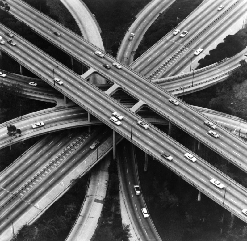 |
|
| (ca. 1960s)^ - Aerial view of the Four Level Interchange of the Los Angeles freeway system. |
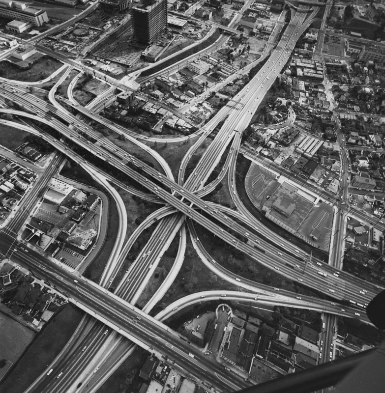 |
|
| (1960s)^ - Aerial view of one of the busiest hubs of the Los Angeles freeway system, the Four Level Interchange where the Harbor Freeway meets the 101 Freeway near Downtown Los Angeles. |
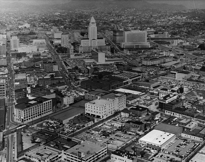 |
|
| (ca. 1950)^ - Aerial view of downtown Los Angeles looking northwest (before either the Hollywood Freeway or Harbor Freeway were completed). The tower, center, is City Hall, the tallest building in Los Angeles until 1964. Behind City Hall, construction for the Civic Center is underway and behind and to the right is the Pasadena Freeway. |
* * * * * |
Harbor Freeway
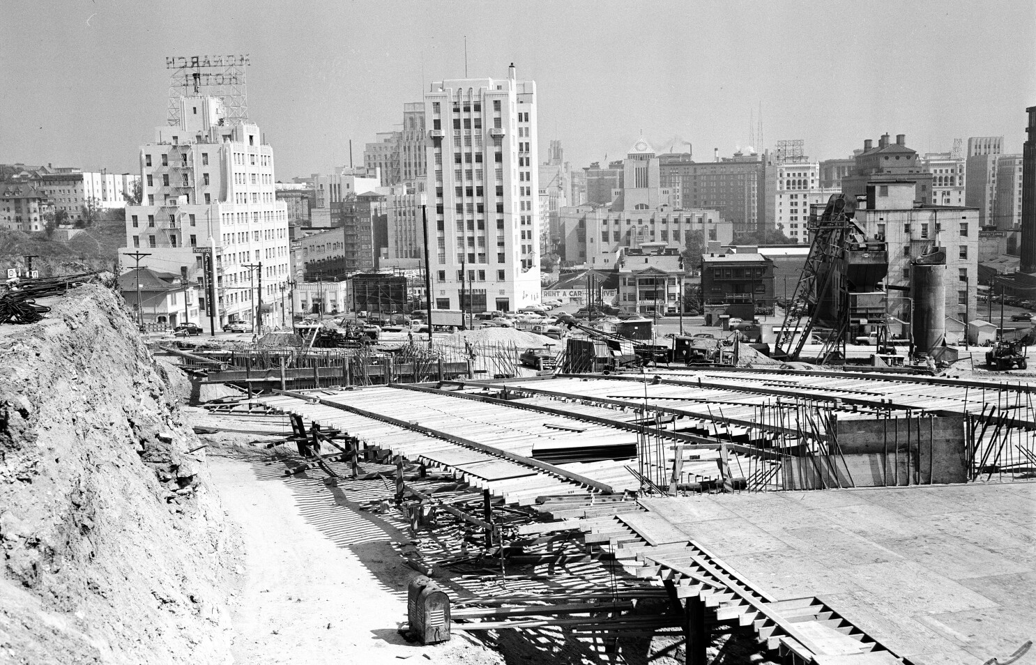 |
|
| (1951)* - Early construction phase of the Harbor Freeway (I-110) as it enters downtown Los Angeles. The Central Library can be seen at top center-right. |
Historical Notes Construction of the Harbor Freeway began at the Four Level in 1949 and gradually pushed south, opening to Olympic Boulevard on March 23, 1954 and Washington Boulevard on May 14, 1954. On March 27, 1956, the highway was extended to 42nd Street, and on April 24, 1957 it reached temporary ramps at 88th Place. Further extensions were made to Century Boulevard on July 31, 1958, 124th Street on September 24, 1958, Alondra Boulevard (which the county widened to carry the load) on May 2, 1960, 190th Street on July 15, 1960, Torrance Boulevard on August 28, 1962, and finally Pacific Coast Highway (SR 1) on September 26, 1962. There it connected with a section that had been open since June 19, 1956, from Pacific Coast Highway south to Channel Street. Along with the Vincent Thomas Bridge to Terminal Island, the final piece in San Pedro opened on July 9, 1970, completing the Harbor Freeway to its present length.^* |
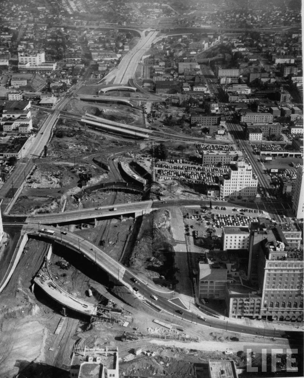 |
|
| (1953)**^ - Aerial view looking north across 6th Street showing the Harbor Freeway under construction. |
Historical Notes Initially, the Harbor Parkway was to split at the merge with the Venice Parkway northeast of the University of Southern California, with the East By-Pass and West By-Pass straddling the Los Angeles Central Business District and rejoining at the split between the Arroyo Seco Parkway and Riverside Parkway south of Dodger Stadium. The West By-Pass was soon incorporated into the Harbor Parkway, and the first short piece, by then renamed the Harbor Freeway, opened on July 30, 1952 from the Four Level Interchange south to 3rd Street. (The Arroyo Seco Parkway was completed to the Four Level Interchange on September 22, 1953, and renamed the Pasadena Freeway on November 16, 1954.^* |
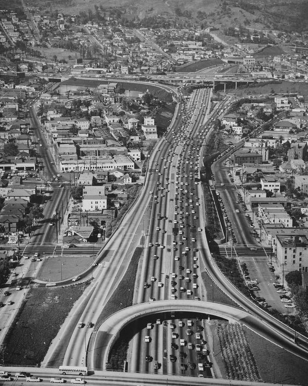 |
|
| (1956)*# - Aerial view of the Harbor Freeway facing north approaching the Hollywood Freeway. Also showing Fremont Avenue, Beaudry Avenue, Second Street, and Third Street. |
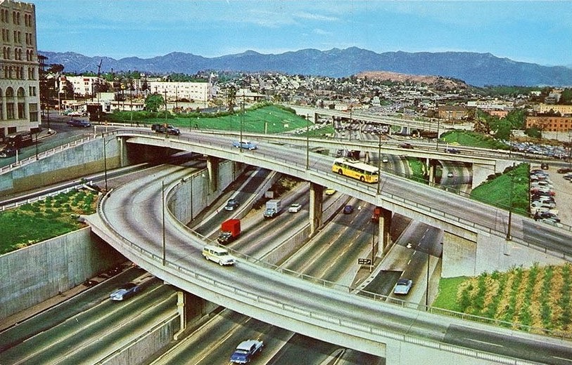 |
|
| (1956)* - Postcard view of Harbor Freeway looking north from Sixth Street. Photo by Frank J. Thomas |
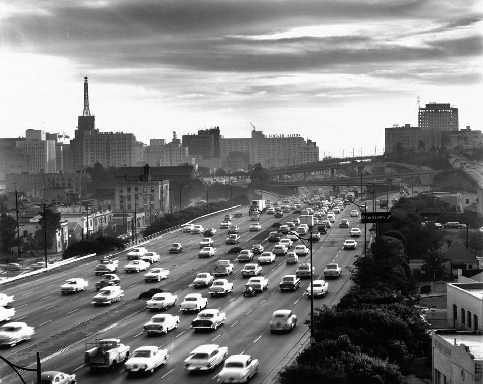 |
|
| (ca 1959)##^# – View looking south on the Harbor Freeway in downtown Los Angeles. The Richfield Oil Company Building with its 146-foot tower sign can be seen at upper-left. |
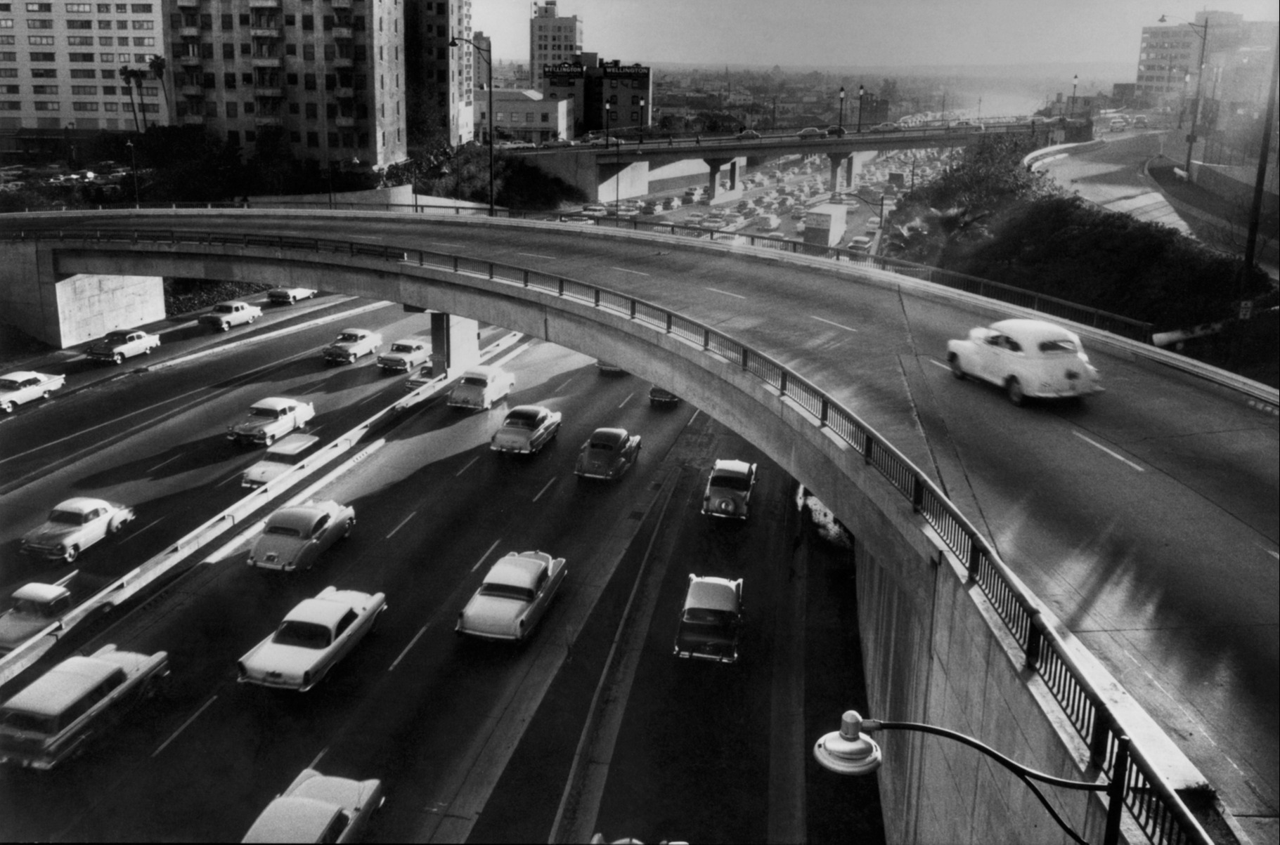 |
|
| (1959)* - Rush hour traffic heading south on the Harbor Freeway. By 1960 the Harbor Frwy extended all the way down to 190th Street. It's present length down to San Pedro would not be completed until 1970. Photo by Marc Riboud |
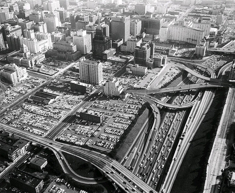 |
|
| (1961)*# - View looking southeast from 4th Street and Beaudry Avenue showing the Harbor Freeway and how its arteries intertwine with the heart of downtown Los Angeles. LA Public Central Library can be seen in upper-left. |
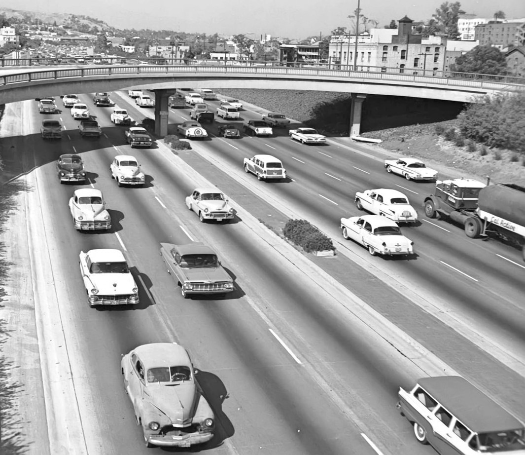 |
|
| (1959)* - Looking NE over the Harbor Freeway (then US-6/CA-11, now CA-110) from 3rd Street overcrossing. Curved 3rd Street on-ramp structure at top. |
Historical Notes Quaint redwood planter boxes were a common occurrence in early freeway medians. They were scrapped when freeway engineers determined that wind-whipped plants didn't last very long and that median barriers were a better idea. |
Then and Now
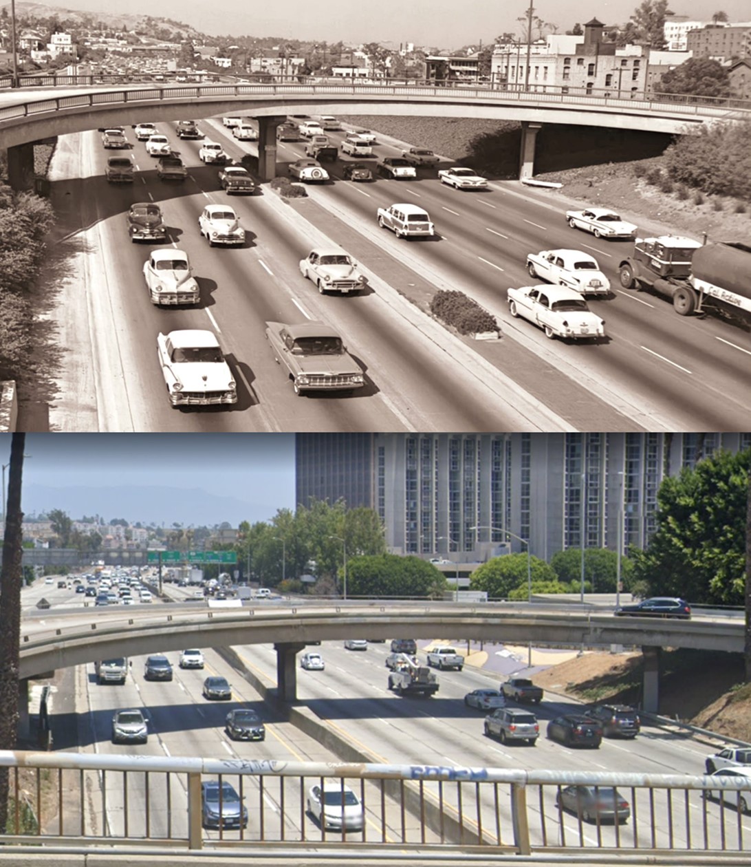 |
|
| (1959 vs. 2022)* - Looking NE over the Harbor Freeway toward the 3rd Street curved on-ramp. |
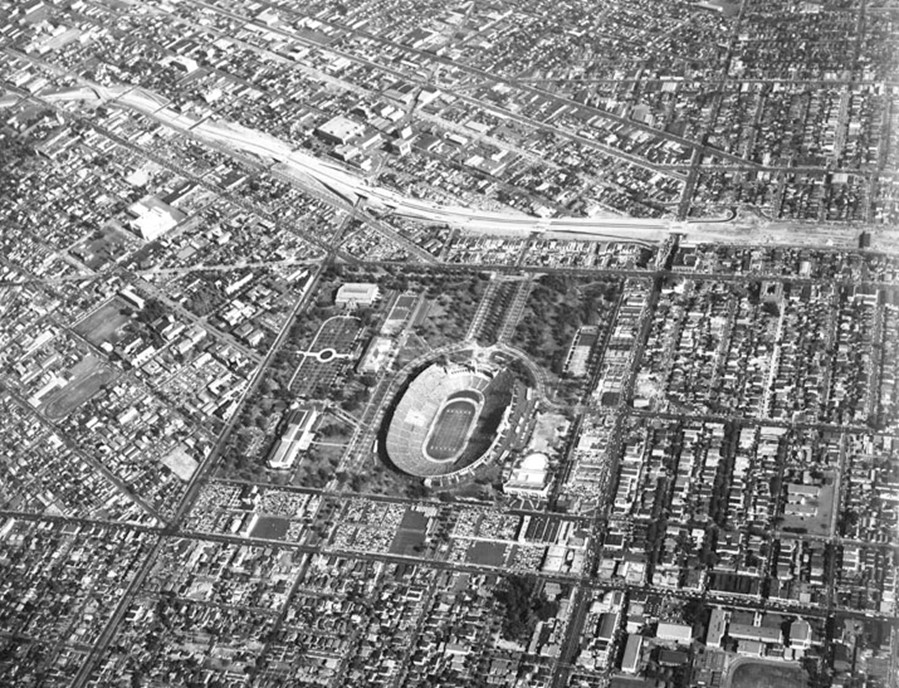 |
|
| (1955)^ - The Harbor Freeway (I-110) takes form near Exposition Park (center) and USC (left-center) in 1955. |
Historical Notes The Harbor Freeway gradually pushed south, opening to Olympic Boulevard on March 23, 1954 and Washington Boulevard on May 14, 1954. On March 27, 1956, the highway was extended to 42nd Street.^* |
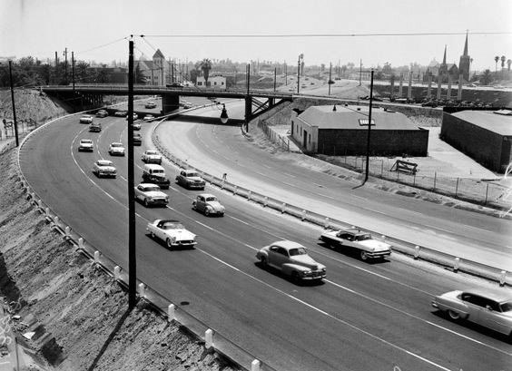 |
|
| (1958)#** – View showing the Harbor Freeway between Pico and Washington boulevards. |
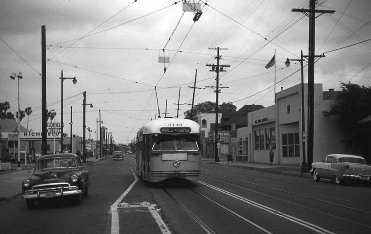 |
|
| (1959)^#^^ – View looking east on Pico Boulevard at Menlo Avenue showing streetcar heading toward the camera. The Post Office building on the right is still there but no longer a post office. Click HERE for contemporary view. |
* * * * * |
Hill Street Tunnels
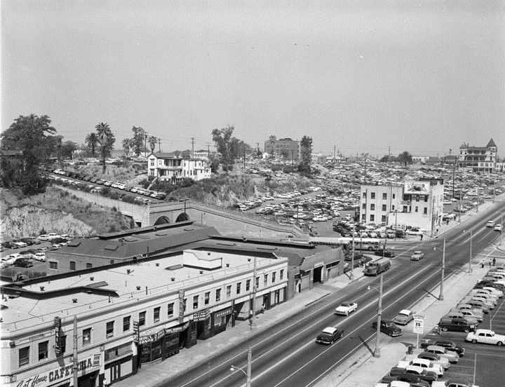 |
|
| (1954)* - Temple Street looking west with the Hill Street tunnels (north portals) in view. |
Historical Notes The first of the two Hill Street Tunnels was bored through a part of Bunker Hill in 1909 by Los Angeles Pacific (a predecessor of Pacific Electric). It connects Hill Street from First to Temple. In 1913, the second tunnel (on the left) was bored for streetcar traffic.^ |
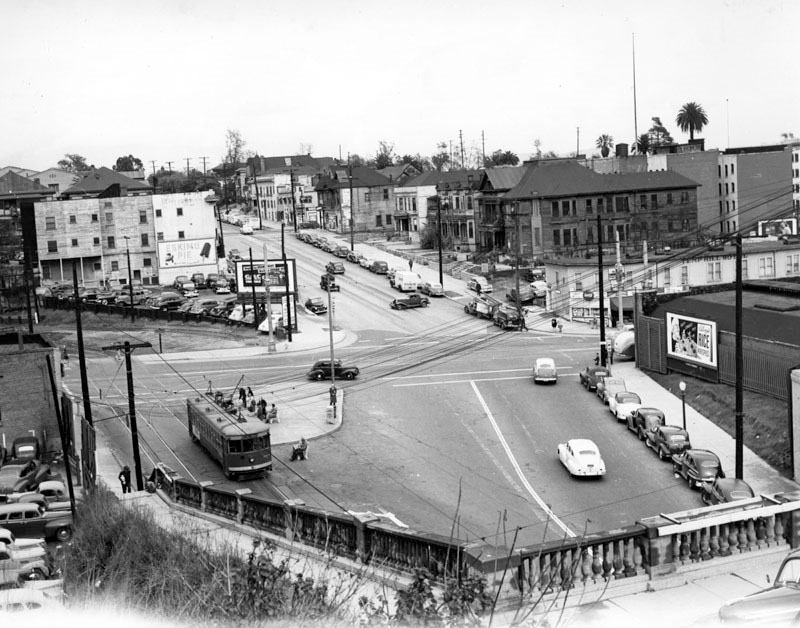 |
|
| (1945)^ - View looking north from the top of the stairs above the Hill Street tunnels (trains on the left, cars on the right). A northbound train is about to pick up some riders, and then it will cross Temple St. and bear left into the unpaved approach to another tunnel (out of view). |
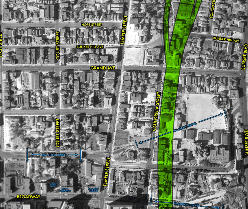 |
|
| (1933)* – Aerial view over Bunker Hill, Court Hill, and Fort Moore Hill, annotated to show the locations of both the Hill Street Tunnel and the Broadway Tunnel. The green shaded area is where the Hollywood Freeway would be constructed in the early 1950s. Photo Courtesy: Scott Charles |
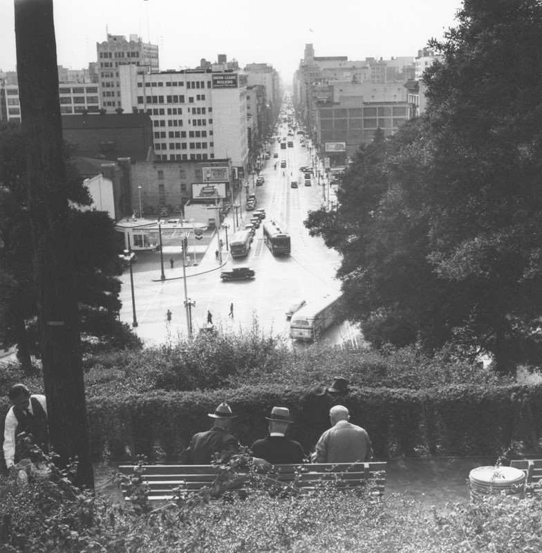 |
|
| (ca. 1940)^ - Three elderly gentlemen socialize on a bench on top of the Hill Street Tunnel, looking south. The intersection seen below at street level is where 1st street (only partially visible) meets Hill Street. Cars and streetcars are seen traveling north and south. Photo by Ansel Adams |
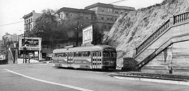 |
|
| (1949)^*^# - View of a streetcar running inbound on the Hollywood Boulevard streetcar line, which runs through Court Hill in a the Hill Street Tunnels |
Historical Notes The Hill Street tunnels ran through a hill called Court Hill. Both Hill Street and Broadway had tunnels through Court Hill. In the photo above we're looking southwest towards First and Hill. First Street comes in behind the streetcar. At this point First Street is in a valley between Bunker Hill and Court Hill. The apartment houses in the center are on Bunker Hill. The hill at right is Court Hill. |
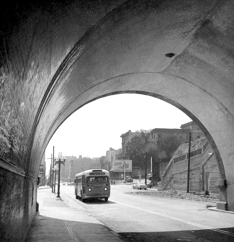 |
|
| (1953)* - The #11 Temple Street bus enters the north portal of the Hill Street tunne heading south. |
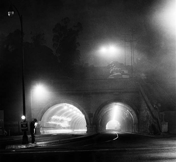 |
|
| (1954)^^ – Hill Street tunnels (north portal) seen from Temple Street on a fogbound night. The tunnels connected Temple with 1st Street. Photo by the LA Times on Oct. 12, 1954 |
South Portal
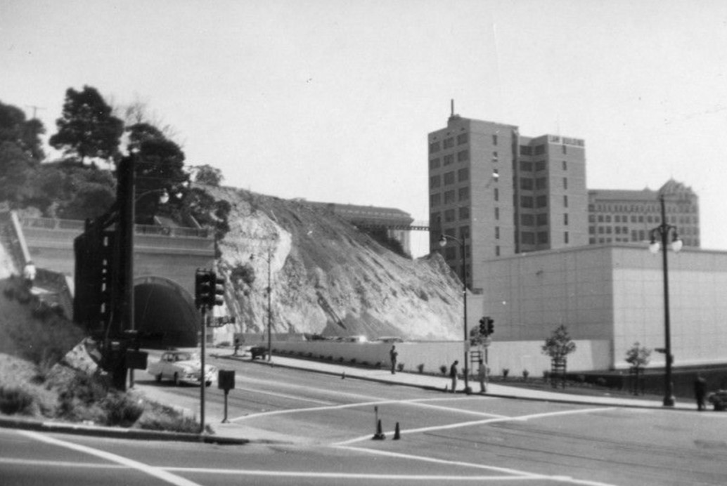 |
|
| (ca. 1953)* - Looking northeast across the intersection of W. First (foreground) and N. Hill streets (running diagonally from left to lower right), showing the Los Angeles County Law Library (right), the Law Building at 139 N. Broadway and the bridge to its parking lot (upper right and center) and the south portal of the Hill Street Tunnelsis seen on the left. |
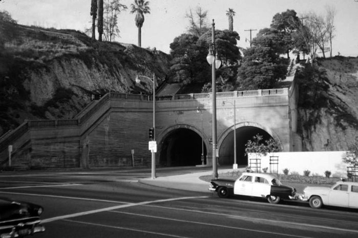 |
|
| (1954)* – Hill Street tunnels as seen from the south side of 1st Street. |
Historical Notes Within months of the above photo, construction work to enlarge the Los Angeles Civic Center would begin. By June, 1955, the two Hill Street tunnels were gone. |
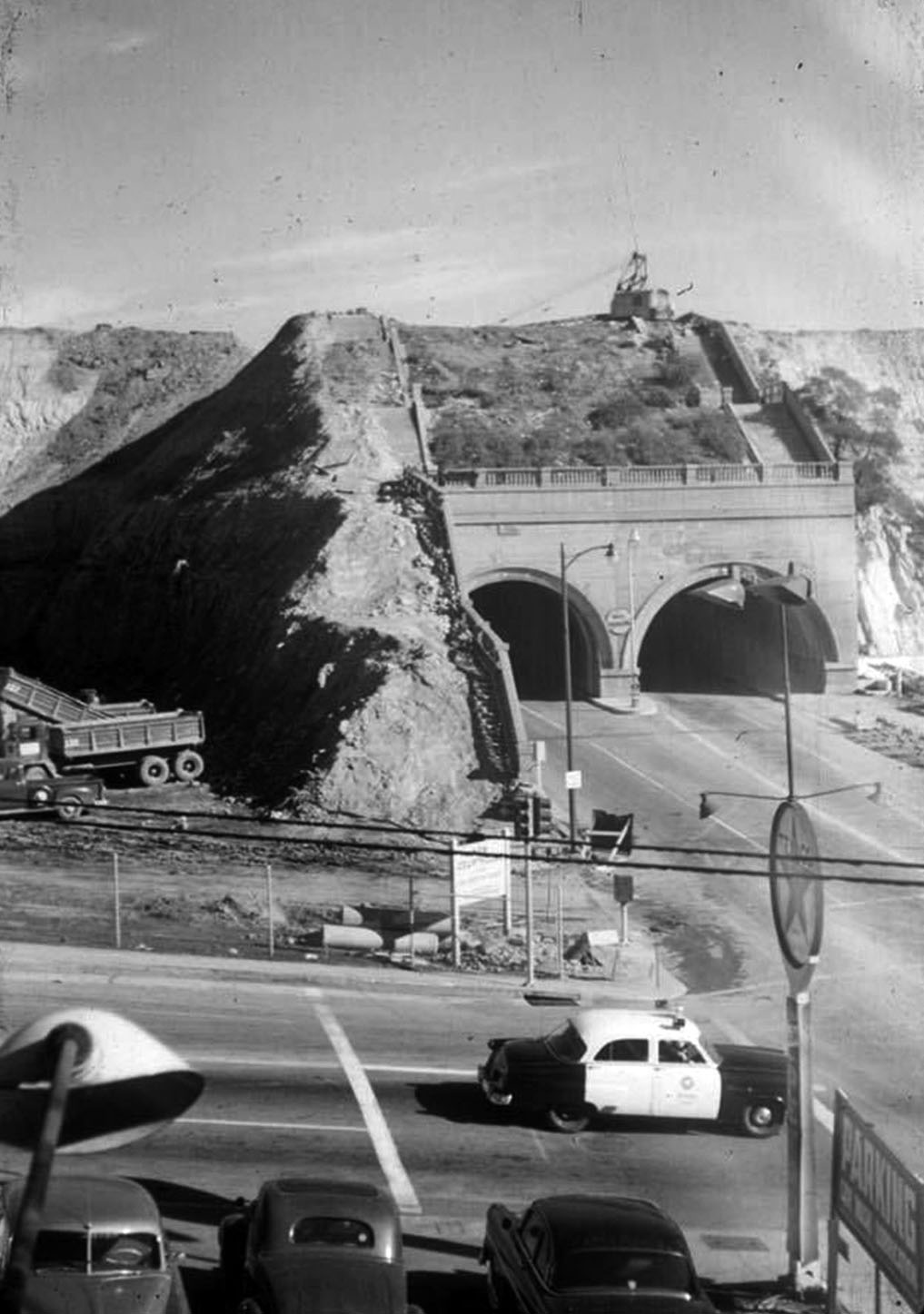 |
|
| (1954)* - Demolition begins on the Hill Street Tunnels. View is looking north at Hill and 1st streets. |
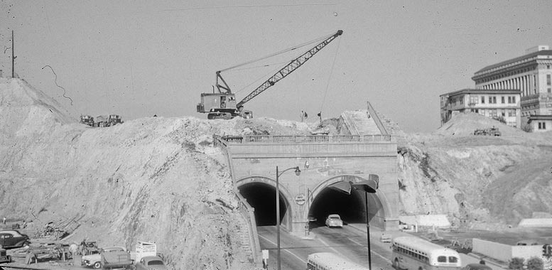 |
|
| (1954)* – Panoramic view showing the Hill Street Tunnels during early stages of demolition. Note that traffic is still flowing through the tunnels. |
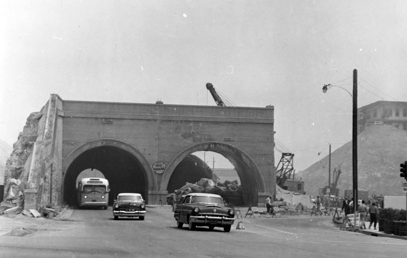 |
|
| (1955)^ - View of the side-by-side Hill Street tunnels, looking north from 1st Street. Two autos and a bus are exiting the left side tunnel, even though the entire surroundings have been demolished, in preparation for future buildings. |
Then and Now
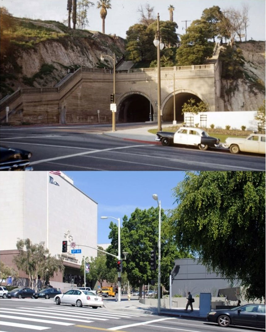 |
|
| (1954 vs. 2014)* - The intersection of Hill and 1st streets, looking north. Photo courtesy of Brian Hsu |
Then and Now
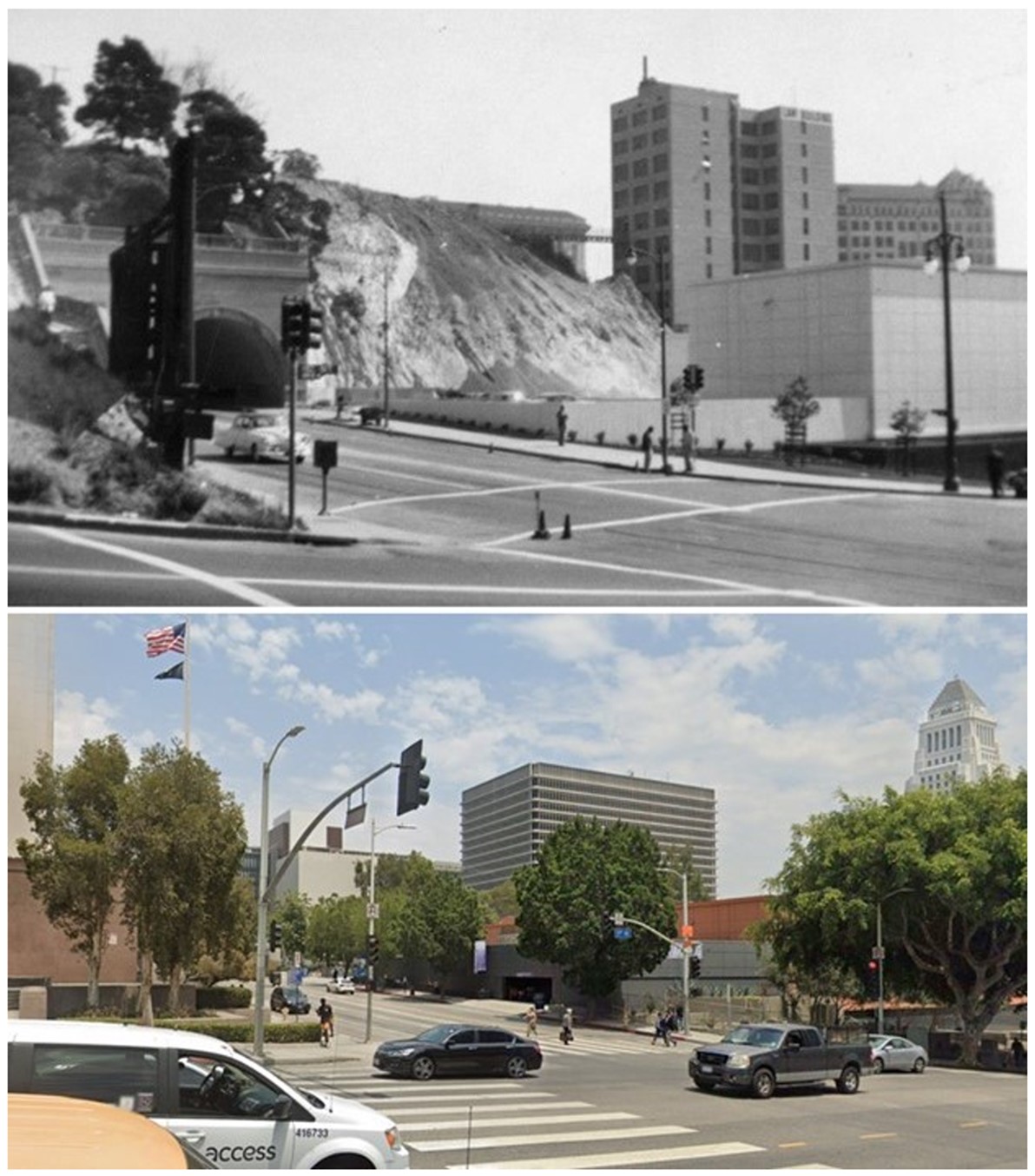 |
|
| (1953 vs 2021)*– Looking NE at the intersection of Hill and 1st streets. |
Historical Notes Click HERE to see the Construction and Opening of the Hill Street Tunnel |
Spring and 1st
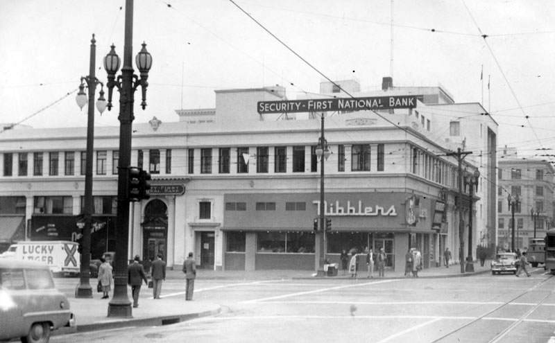 |
|
| (ca. 1953)* - Looking southeast across the intersection of S. Spring (right) and W. First Street (running from left to right, foreground), showing various restaurants, including Nibblers (center), a bank, storefronts, and other office buildings. Note the two different styles of streetlights on the northeast corner of Spring and First streets. |
Historical Notes The southeast corner of Sprng and 1st streets was once the locatiion of the 1886-built Wilson Block. |
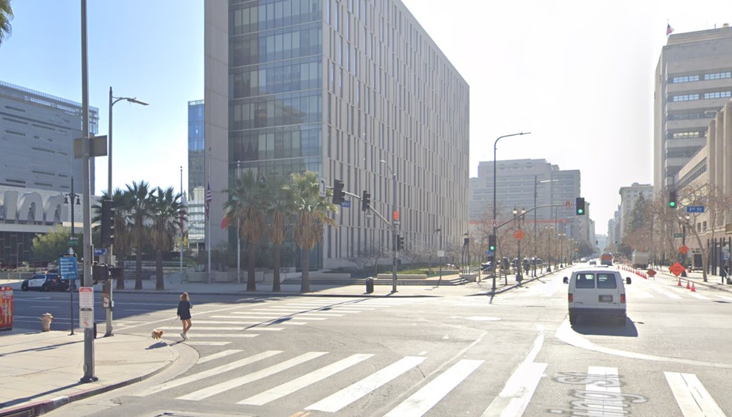 |
|
| (2021)* - Looking at the SE corner of Spring and 1st streets where today stands the LAPD Headquarters. |
Then and Now
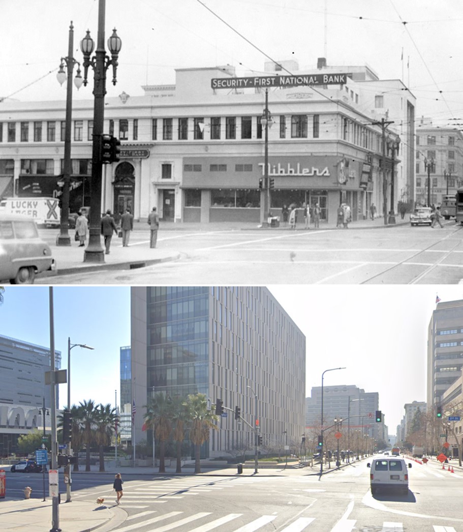 |
|
| (1953 vs. 2021)* - Looking at the SE corner of Spring and 1st streets where today stands the LAPD Headquarters. |
Then and Now
.jpg) |
|
| (1953 vs. 2023)*- Looking at the SE corner of Spring and 1st streets where today stands the LAPD Headquarters. |
Spring and 2nd
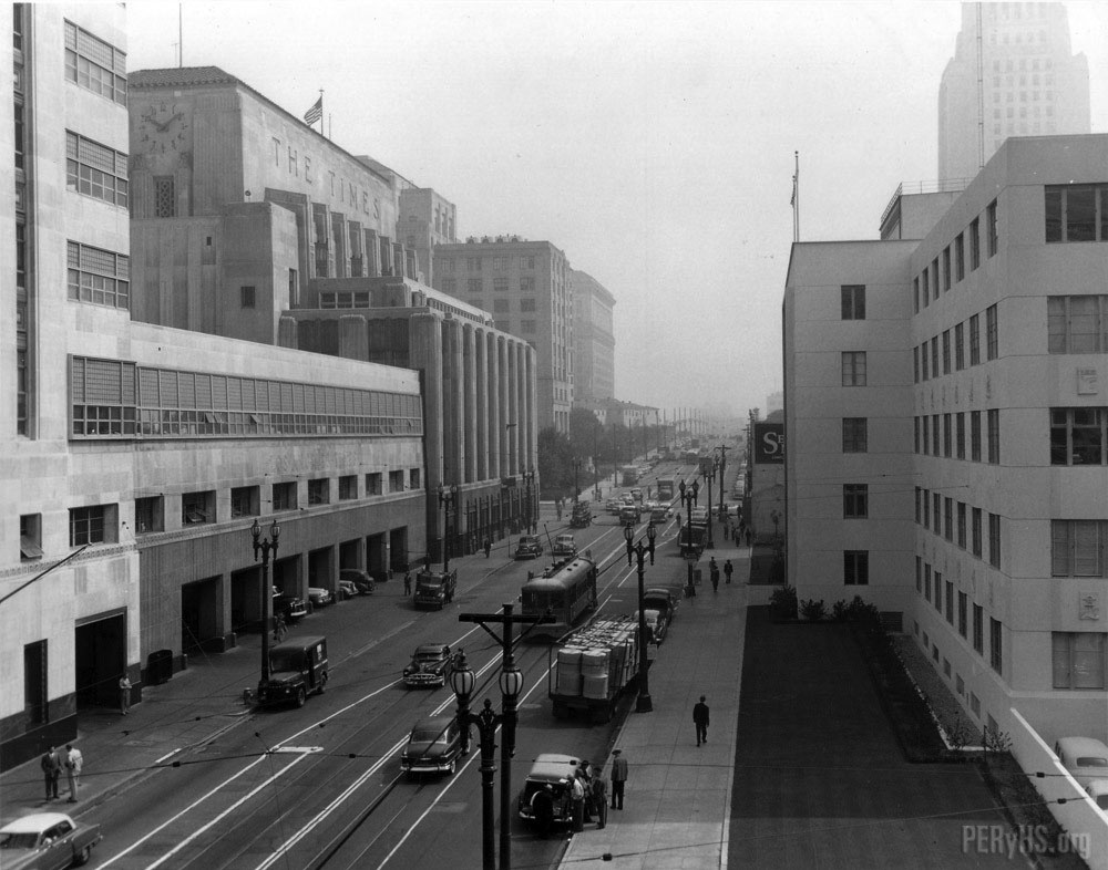 |
|
| (ca. 1950)* – View looking north on Spring Street from north of 2nd Street showing dual lamp electroliers on both sides of the street. The massive LA Times Building and Annex is on the left. City Hall can be seen in upper-right. |
Broadway and 9th
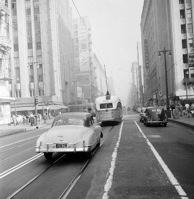 |
|
| (ca. 1951)^ – View looking north on Broadway toward 9th Street on a hazy day showing cars sharing the street with a streetcar. The Orpheum Theatre (842 S. Broadway) can be seen in the upper-right. Note the two-lamp light post on the S/E corner. |
Then and Now
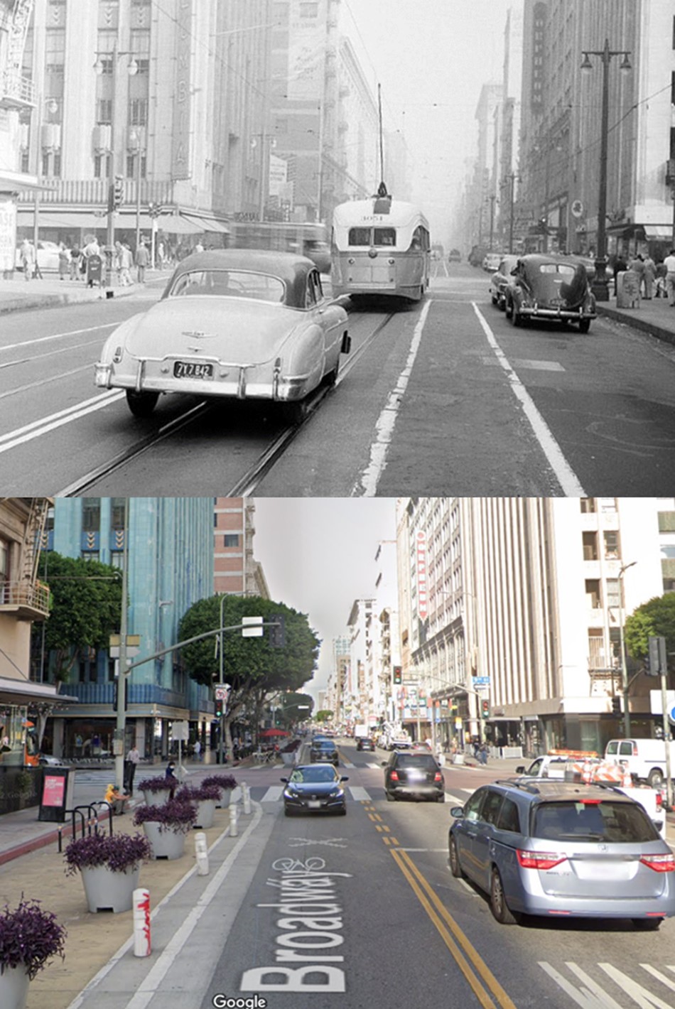 |
|
| (1951 vs. 2022)* - Looking north on Broadway toward 9th Street. |
Broadway and 11th
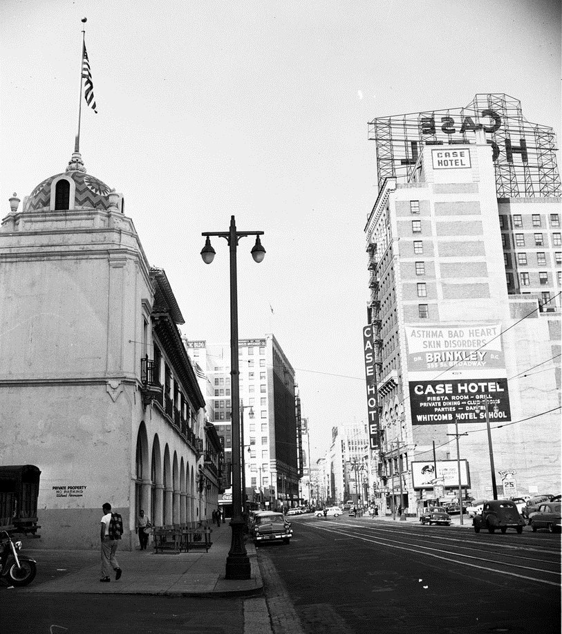 |
|
| (ca. 1955)*# - View looking north on Broadway toward 11th Street. The Case Hotel is seen on the southeast corner of Broadway and 11th on the right. Note the dual-lamp streetlight standing on the corner next to the Herald-Examiner Building. |
Click HERE to see more Early Los Angeles Street Lights. |
* * * * * |
Smog in LA
.jpg) |
|
| (1955)* - Buildings in Los Angeles Civic Center are barely visible in picture looking east at 1st and Olive Streets when smog was at its peak. Photo by John Malmin / Los Angeles Times |
Historical Notes Air pollution reached its worst levels in Los Angeles during the 1940s and 1950s. Millions of people driving millions of cars plus temperature inversion provided Los Angeles with a near perfect environment for the production and containment of photochemical smog. |
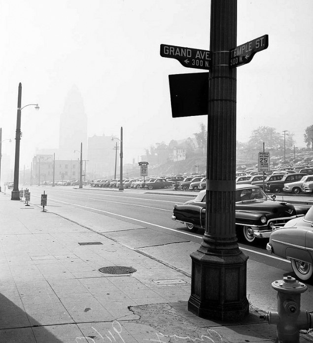 |
|
| (1953)* – View looking toward a barely visible City Hall in downtown Los Angeles as seen from the corner at Temple Street and Grand Avenue. |
Historical Notes The real cause of L.A. smog wasn’t determiend until the 1950s. The scientist who solved the smog mystery was Arie Haagen-Smit, a chemist at the California Institute of Technology. He was the first to recognize that ozone was the primary source of the haze. Ozone is created when partially unburned exhaust from automobiles and the hydrocarbons from oil refineries are hit by sunlight. |
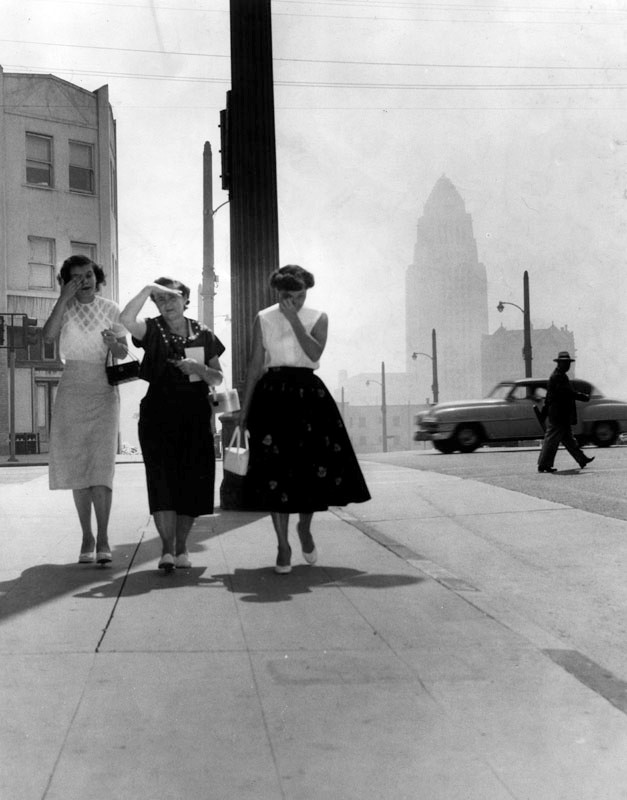 |
|
| (1955)^ - Three women on a downtown Los Angeles sidewalk are troubled by the eye-irritating smog. City Hall is barely visible in the background. Photograph dated Septmber 14, 1955. |
Historical Notes On some days, the air was so polluted that parents kept their kids out of school; athletes trained indoors; citrus growers and sugar-beet producers watched in dismay as their crops withered; the elderly and young crowded into doctors' offices and hospital ERs with throbbing heads and shortness of breath. |
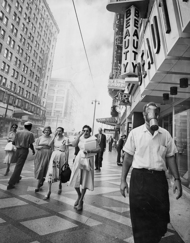 |
|
| (1958)^ – Photo caption reads: “Man at right defies convention and eye-searing pollutant as he strolls down Broadway wearing a gas mask, as Los Angeles battles another smog attack. Women on left suffer and use their handkerchiefs to wipe away their tears.” Photo dated: September 19, 1958. |
Historical Notes By the mid 1950s there was no doubt among scientists that cars were a primary factor in LA’s smog crisis. It wasn't until 1975 that the U.S. required new cars to have catalytic converters, teh key piece of technology that allowed everything to change. Click HERE to see more Smog in Early Los Angeles. |
Then and Now
.jpg) |
|
| (1955 vs. 2016)* - Looking east on 1st Street at Olive Street in DTLA. Two things to note here: (1) Air Quality change since 1955 (top photo) and (2) How much 1st Street (Bunker Hill) was shaved down. |
Click HERE to see more Smog in Early Los Angeles. |
Los Angeles Freeways
 |
|
| (1955)^ - Aerial view of Los Angeles from an altitude of approximately 5,000 feet. View is looking northwest with the Civic Center at center, and City Hall's tower visible in the middle; 101 Freeway runs right to left through center (barely visible); 110 Freeway runs middle left to middle right (barely visible); Chavez Ravine is at middle (before Dodger Stadium was developed); Los Angeles River zigzags from bottom middle to upper left. The Verdugo and San Gabriel mountains can be seen in the background. |
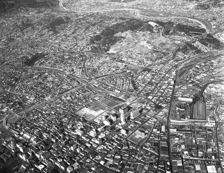 |
|
| (1955)^ - Aerial view of Los Angeles looking slightly northwest with the Civic Center at lower center; 101 Freeway runs right to left through center; 110 Freeway runs lower left to upper right; the river station yard of Southern Pacific at top right; Chavez Ravine (upper middle) before Dodger Stadium was developed; Los Angeles River runs across top; Union Station just right of center; U.S. Post Office Terminal Annex just to its north; and City Hall is at lower middle. |
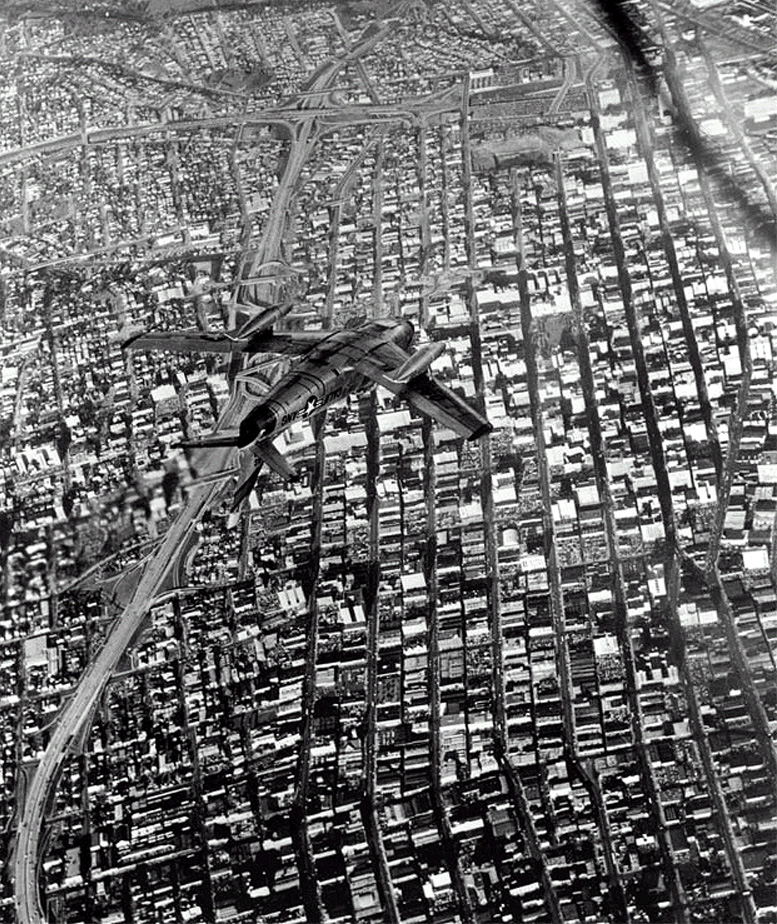 |
|
| (1954)^ - Aerial view looking north of an upside down Air Force fighter plane flying over downtown Los Angeles. City Hall can faintly be seen in the upper right corner of the photo. Click HERE to see more in Aviation in Early L.A. |
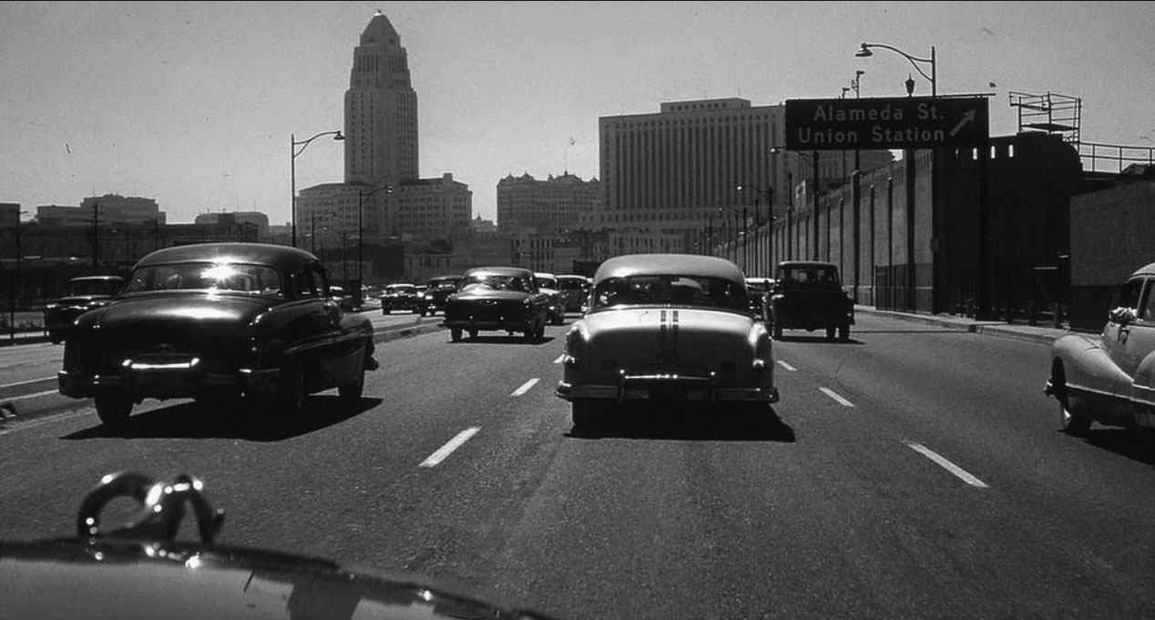 |
|
| (ca. 1954)* – View showing the 101 inbound from the eastside near the Alameda Street/Union Station exit. Note the bare center-divider medians. |
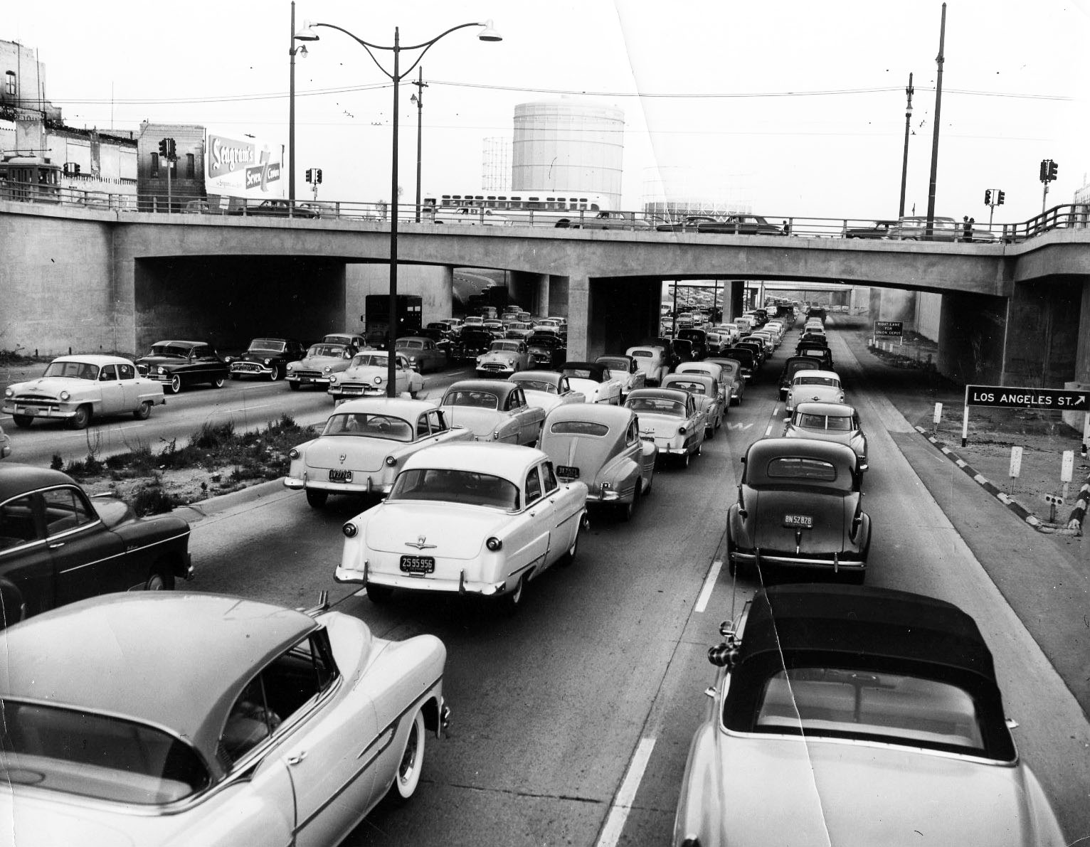 |
|
| (1954)**^ - View looking east on the Hollywood Freeway through the Civic Center. The Los Angeles Street exit is on the right. The freeway just opened and there are already traffic jams. |
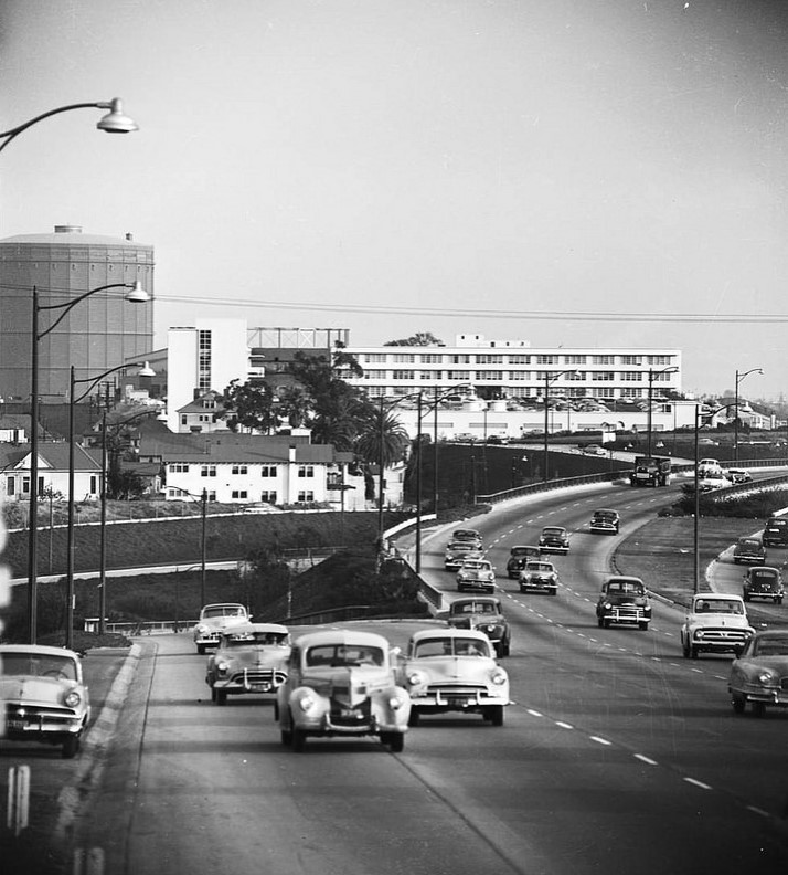 |
|
| (1953)* – View looking east at the Arroyo Seco feeder entering the northbound Hollywood Freeway. The car in the lead at center-left is a 1939 Chrysler followed by a 1952 Chevrolet. |
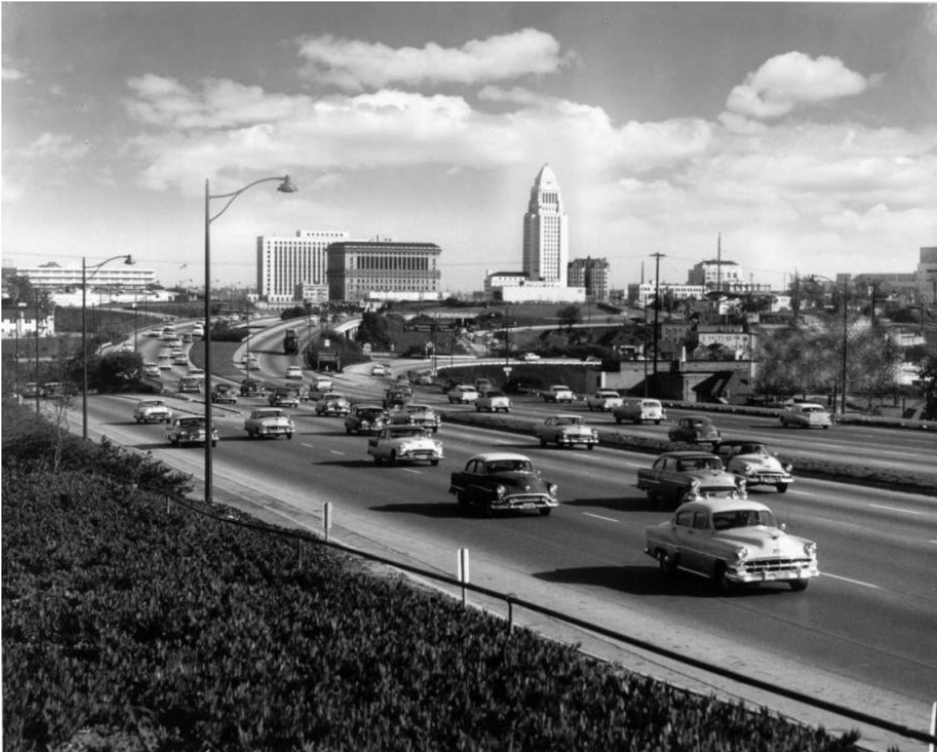 |
|
| (1950s) - The 101 (Hollywood Frwy) near the Four Level Interchange with City Hall and the Civic Center in the background. |
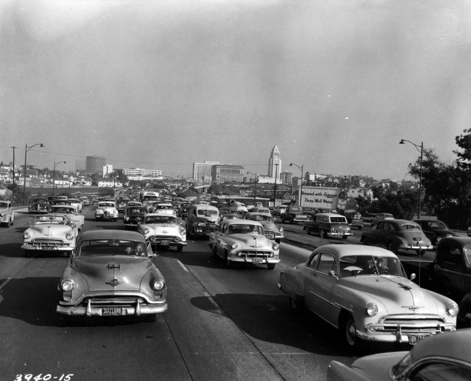 |
|
| (1954)+++ – View of US 101 near the Four Level Interchange, looking easterly toward Los Angeles City Hall. |
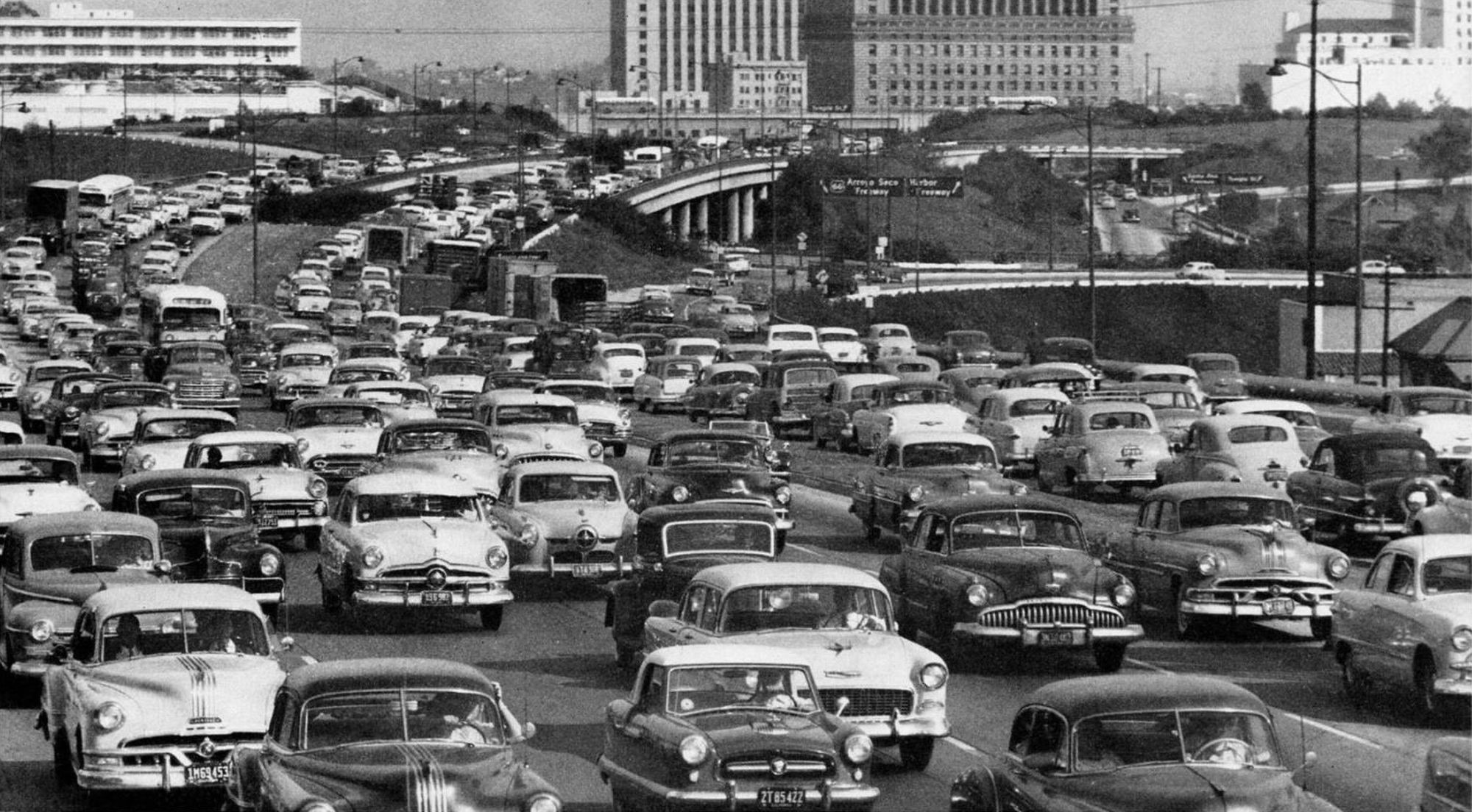 |
|
| (1955)* - Rush hour traffic on the 101 (Hollywood Frwy) near the Four Level Interchange on a hot afternoon. Not too many cars with air conditioning back then. |
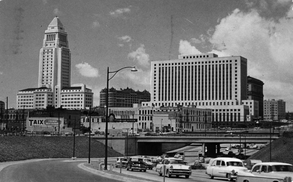 |
|
| (ca. 1961)* – Postcard view of automobiles going East on the Hollywood Freeway, leaving downtown. Also seen are: the Federal Building; old Hall of Records; City Hall; Taix French Restaurant; and a billboard for "Burgemeister Beer." |
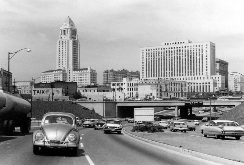 |
|
| (ca. 1960)^ – View looking southwest toward Downtown from the Hollywood Freeway with Taix French Restaurant seen on the left. Note the wide center median on the freeway. |
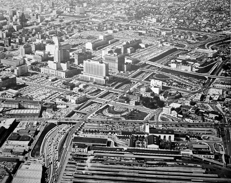 |
|
| (ca. 1955)^ - Aerial view of the Civic Center looking southwest. The Hollywood Freeway with all its overpasses stands out as it runs through downtown toward Hollywood. Union Station is in the foreground. The circular LA Plaza can be seen at center-right. Click HERE to see more in Early Views of the Plaza of L.A. |
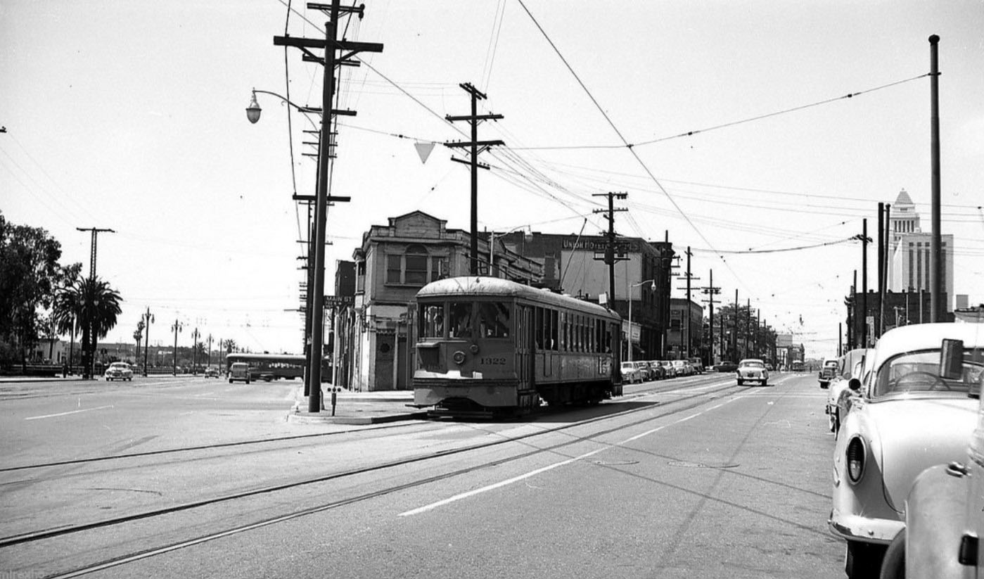 |
|
| (ca. 1955)* - Looking south on Main Street (on the right) and southeast on Alameda Avenue (on the left) where it passes in front of Union Station. '54 Chevy over here on the right. |
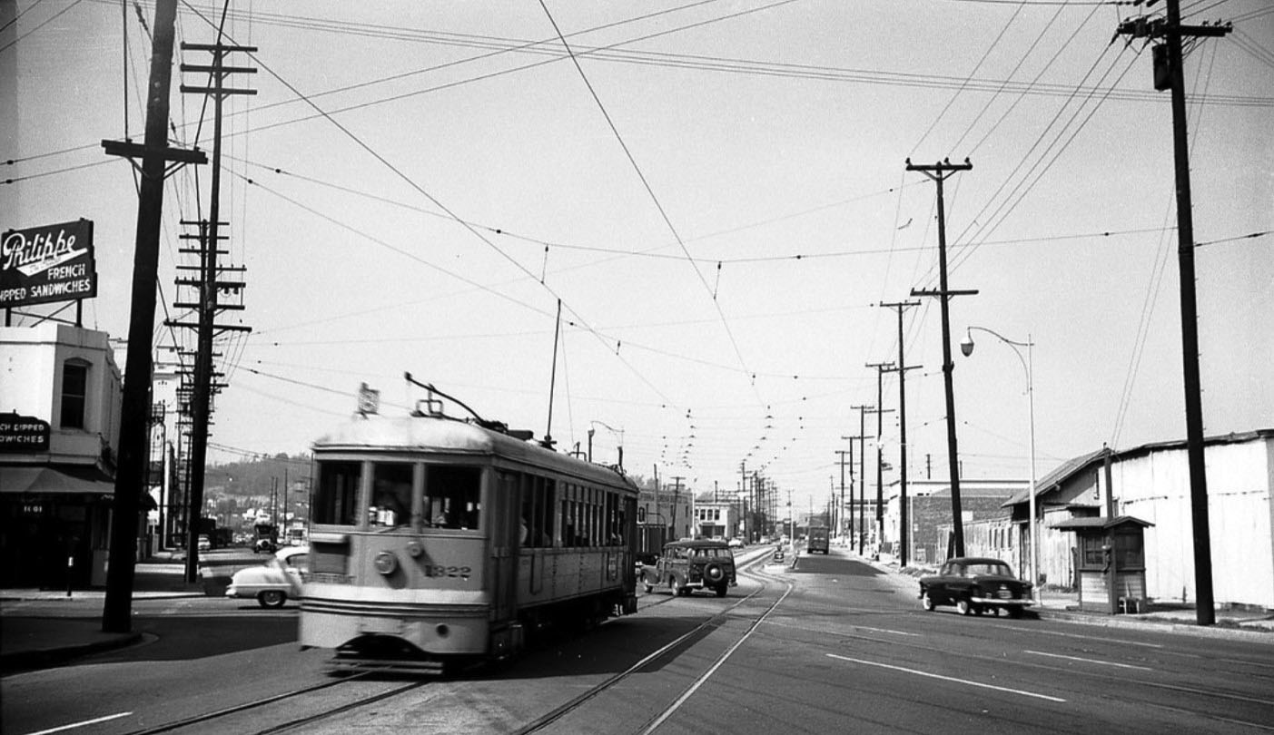 |
|
| (ca. 1955)* - Looking northeast on Main Street (center right, to the right of the streetcar) and north on Alameda Avenue (to the left of the streetcar) with the light colored Dodge(?) or Plymouth pulling out of Ord Street where Philippe's stands on the NW corner. SP switchman's shack is on the right. |
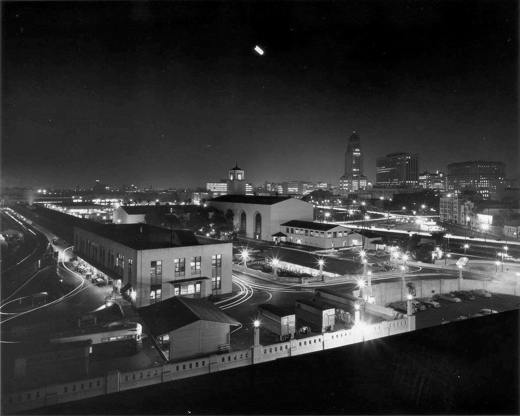 |
|
| (1956)* - Time elapsed photo showing Union Station in the foreground with City Hall, the Federal Courthouse Building, and the Hall of Justice in the distance. |
Aerial Views of Civic Center and Bunker Hill
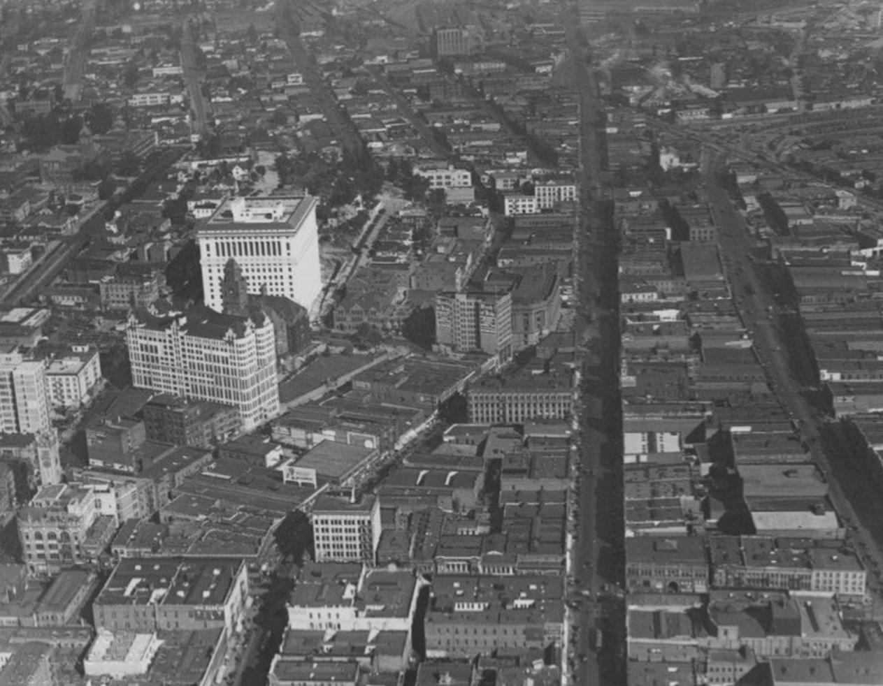 |
|
| (1925)* - Aerial view of the proposed civic center area looking north. The Hall of Records and the Hall of Justice are at left, with the old Courthouse between. The current LA City Hall would not be built until 1928 and will be located at center of photo. |
Historical Notes Today's Los Angeles City Hall building would be built in 1928 and be located at center of the above photo. Click HERE to see more. |
.jpg) |
|
| (1925)* - Aerial view of the Civic Center, looking north, showing the new Hall of Justice. Photo date: January 16, 1925 |
.jpg) |
|
| (1930)* - Aerial view of Los Angeles Civic Center. |
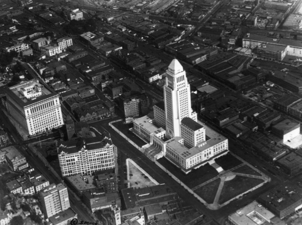 |
|
| (ca. 1930)* - Aerial view of the Civic Center, showing City Hall and the Los Angeles County Hall of Records, and Hall of Justice. |
Historical Notes The iconic Los Angeles City Hall was constructed between 1927 and 1928. Click HERE to see more. |
.jpg) |
|
| (1938)* - Aerial view of Bunker Hill and the Civic Center. City Hall was the tallest building in Los Angeles for decades. Photo by Dick Whittington |
Historical Notes Los Angeles City Hall was the tallest building in the city for several decades due to a municipal height ordinance that was in place. In 1905, the city of Los Angeles passed an ordinance that prohibited the construction of buildings taller than 150 feet. This was done for aesthetic reasons, as the city wanted to maintain a "harmonious" and low-rise skyline. Los Angeles City Hall, which was completed in 1928, became the tallest building in the city at 454 feet tall. This was an exception to the height limit, as public buildings were not subject to the same restrictions. For over 30 years, from the 1920s to the early 1960s, City Hall remained the tallest structure in Los Angeles' skyline. The height ordinance was not overturned until 1958, allowing for taller buildings to be constructed. |
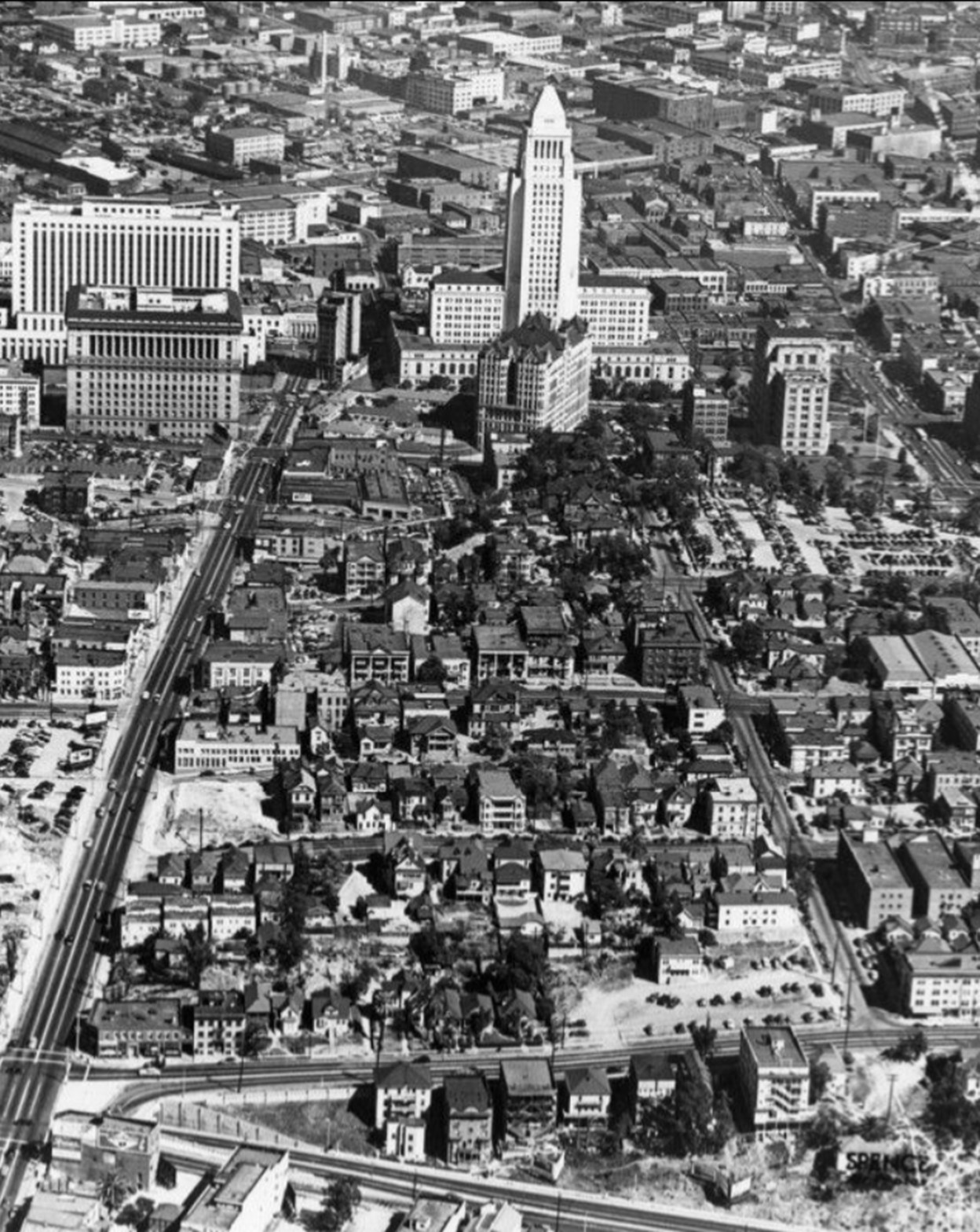 |
|
| (ca. 1945)* - Aerial view Bunker Hill and the Civic Center. |
Historical Notes The development of Bunker Hill in Los Angeles during the 1950s and 1960s involved the transformation of the historic neighborhood from a residential area to a modern commercial and cultural center. In the early-to-mid 20th century, Bunker Hill had become a dilapidated area with many Victorian-era mansions converted into low-income housing and rooming houses. The city government and business leaders viewed it as a "slum" that needed to be redeveloped. In 1945, the California Community Redevelopment Law enabled cities to use eminent domain to condemn and demolish blighted districts. This led the Los Angeles Community Redevelopment Agency to target Bunker Hill for redevelopment. The CRA argued that Bunker Hill was a "high frequency crime area" and a health hazard, which allowed them to win a court case against the residents and displace many families living there. Starting in the late 1950s, the city began implementing plans to demolish the existing buildings on Bunker Hill and redevelop the area. This included the construction of Dodger Stadium in the adjacent Chavez Ravine neighborhood, which displaced a Mexican-American community. |
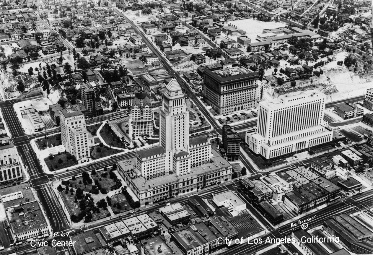 |
|
| (1948)* - Aerial view of the Civic Center and surrounding buildings in downtown Los Angeles, the Los Angeles City Hall at 200 North Spring Street at center, with the Los Angeles County Hall of Records (with divided top stories) directly behind it at center, and across Temple Street, the United States Courthouse at center right, and Los Angeles County Hall of Justice at upper right. The edge of the Los Angeles Times building is at far left on the corner of Spring and First Streets. Bunker Hill can be seen in the background. Photo by Fairchild Aerial Surveys |
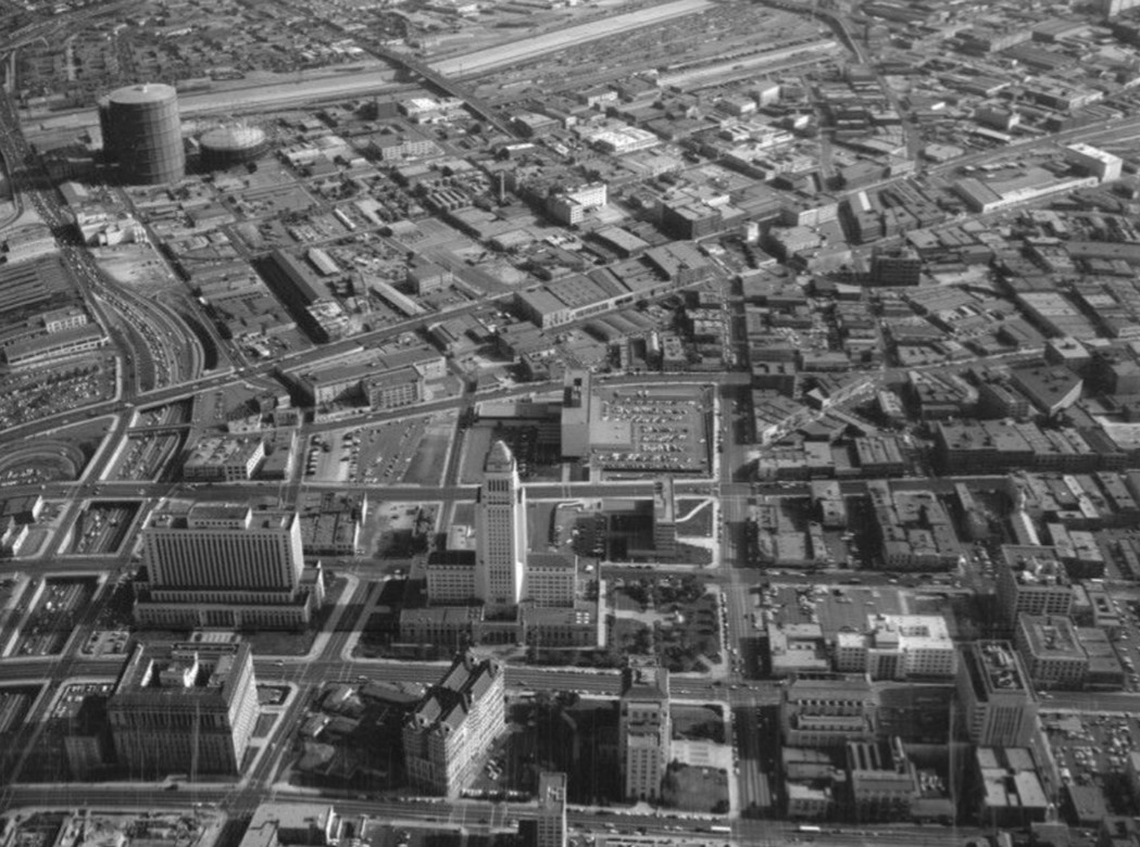 |
|
| (1948)* - Aerial view of Los Angeles Civic Center, looking east toward City Hall. The Hollywood (101) Freeway runs vertically along the left, Temple Street is on the left of City Hall; 1st Street is to the right of City Hall; 2nd Street is vertically along the right; North Broadway is at forefront; followed by Spring Street, Main Street, San Pedro Street, and Alameda Street (middle left to upper right); Los Angeles River is visible at top. |
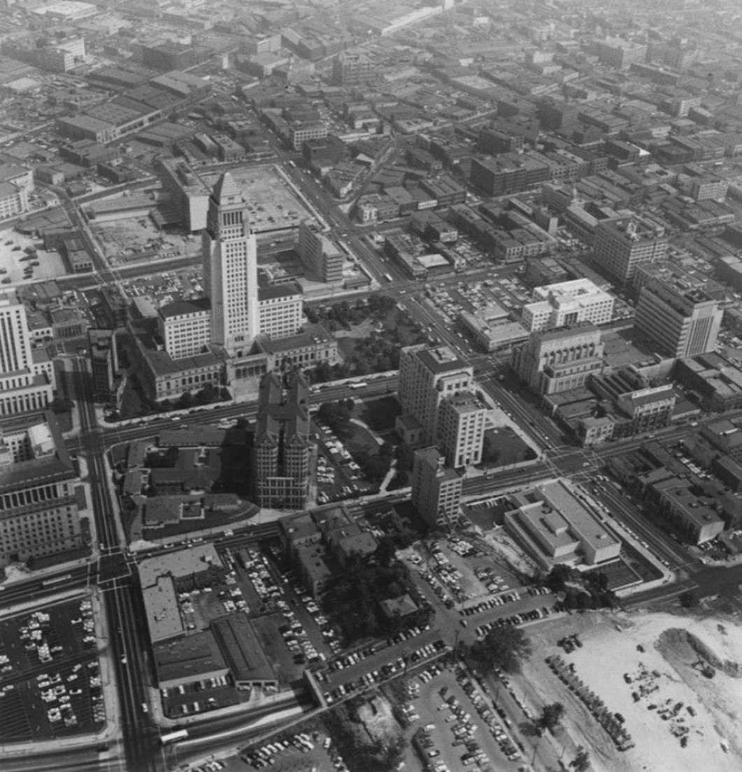 |
|
| (ca. 1954)* - View of Los Angeles Civic Center and Bunker Hill. The Hill Street Tunnels, seen in the foreground, would be demolished in 1955. |
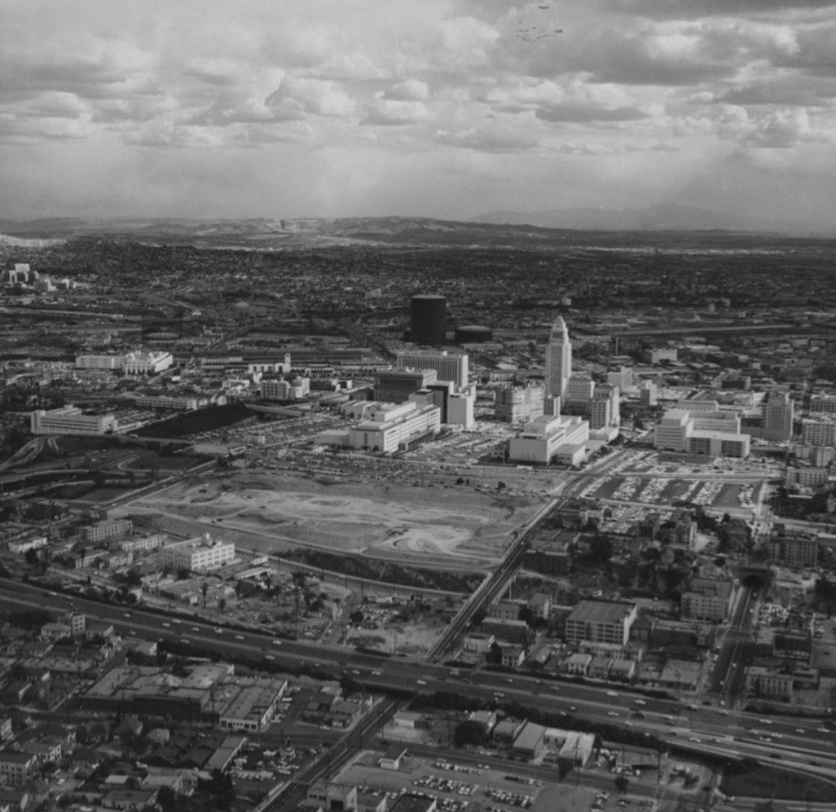 |
|
| (ca. 1960)* – Aerial view looking east showing Bunker Hill and the Los Angeles Civic Center. The flattened land on Bunker Hill at center left is where the Music Center and DWP Building would be constructed in the early 1960s. The Harbor Freeway is seen in the foreground and First Street is the diagonal street running from lower left to upper right. |
Historical Notes The Music Center and Water and Power Building would not be completed until 1965. The Harbor Freeway opened in 1952 from the Four Level Interchange south to 3rd Street. |
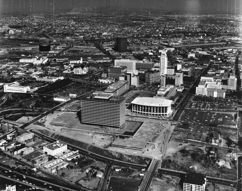 |
|
| (1964)* - Aerial view of Bunker Hill and the Los Angeles Civic Center showing the Music Center and LADWP Building still under construction (opened in 1965). Photo by Dick Whittington |
 |
|
| (2022)* - Google Earth View showing Bunker Hill and the Civic Center. |
Historical Notes The redevelopment of Bunker Hill in the 1950s and 1960s transformed it from a residential neighborhood to a commercial and cultural center, with the construction of high-rise office buildings, theaters, museums, and other institutions like the Dorothy Chandler Pavilion and the Walt Disney Concert Hall. |
Then and Now
 |
|
| (1960 vs. 2022)* - Aerial view looking east showing Bunker Hill and the Los Angeles Civic Center. |
* * * * * |
Main and 1st Streets - SW Corner (Natick House Hotel)
 |
|
| (ca. 1900)* – View showing the Natick House, a hotel located in the Bernard Block, southwest corner South Main and West First Streets. The Italianate style Commercial block building has molded arched windows, bracketed cornice, with small cupolas. Seen here are horse-drawn carts and wagons parked at curbside, men on sidewalk under awnings and streetcar tracks. |
Historical Notes The Natick House Hotel was a historic hotel building located at the southwest corner of Main and 1st Streets in downtown Los Angeles, as part of the larger Bernard Block complex. It was the third major hotel in the city, after the Bella Union and the Lafayette Hotel. In the 1890s, the Natick Hotel was taken over by the Hart brothers, who were major hotel operators in Los Angeles at the time. They renovated and expanded the Natick, adding a third story. |
 |
|
| (1928)* - View showing the Natick House Hotel, located at on the SW corner of 1st and Main streets. |
Historical Notes In the 1890's the Hart brothers, who were major hotel operators in Los Angeles at the time, took over the Natick House Hotel. They renovated and expanded the Natick, adding a third story. By the early 1900s, the Natick House was doing good business under the Hart brothers' management. Around this time, the brothers turned their attention to expanding their hotel empire, opening the new Hotel Rosslyn and its annex. |
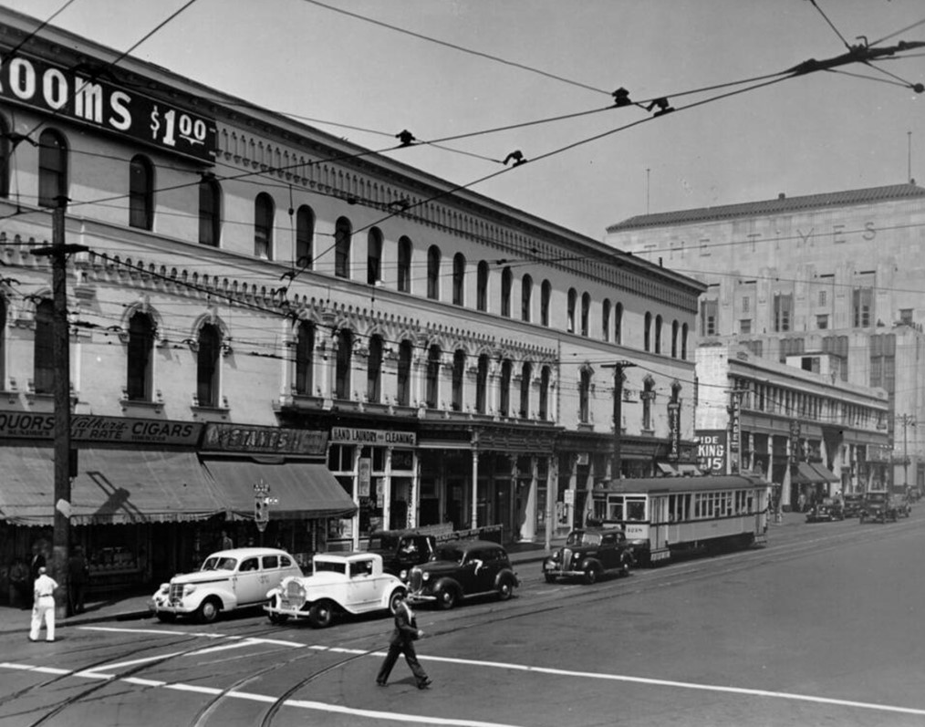 |
|
| (1939)* - First Street between Spring Street and Main Street showing the Natick Hotel on the SW corner of First and Main with the Los Angeles Times Building seen in the distance (SW corner of Spring and 1st). |
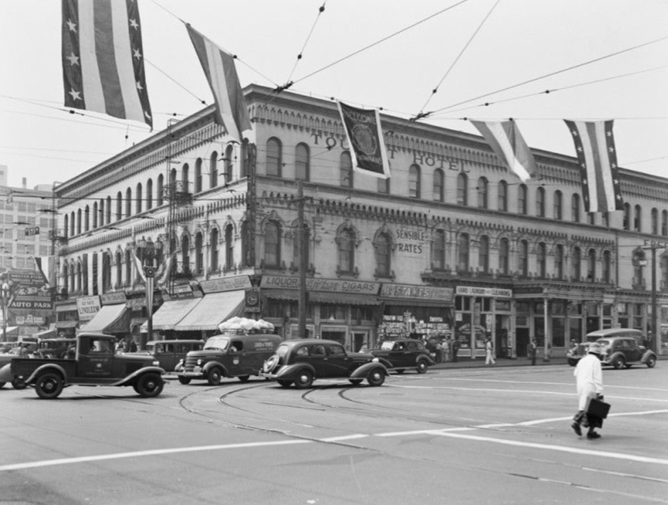 |
|
| (1939)* – Looking at the SW corner of Main and 1st Streets showing the Natick House Hotel, a three-story hotel located at 108 W. 1st Street. There are several retail shops on the first floor. Signs indicate it is a tourist hotel, with sensible rates. Banners are seen hung across the street, welcoming Legionnaires. |
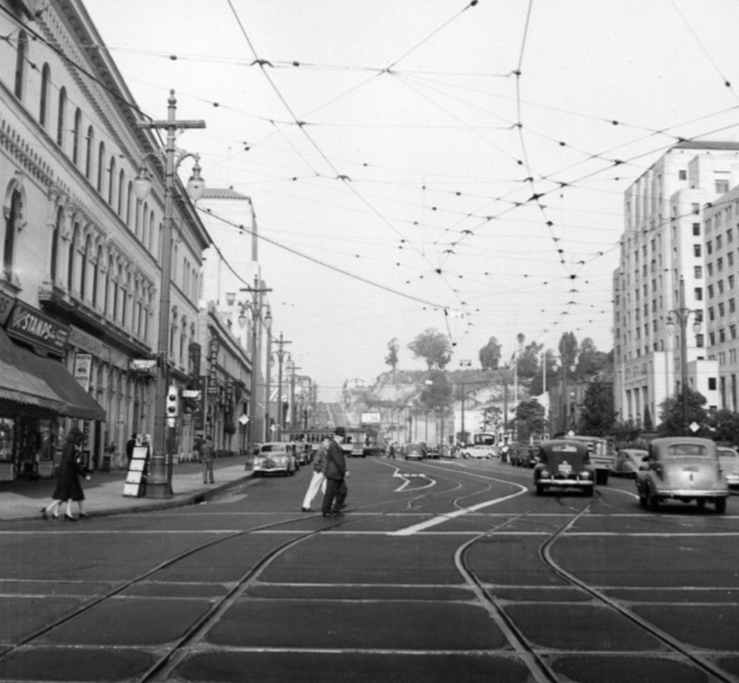 |
|
| (ca. 1948)* - View looking west on 1st Street at Main Street showing the Natick Hotel on the left (SW corner). On the right is the California State Building located on the NW corner of Spring and 1st streets. It the distance is Bunker Hill. |
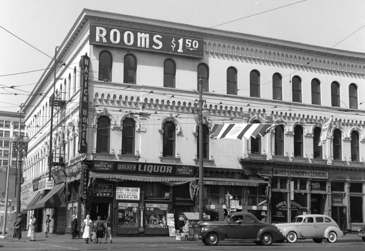 |
|
| (1948)* - View of Natick Hotel at southwest corner of First and Main Streets. Lower level includes liquor store, clothing store, laundry, shoe shine shop. Autos and pedestrians seen. Flag flying from wires. |
Historical Notes The historic Natick Hotel building would be demolished in 2001. The site is currently occupied by the Los Angeles Police Department Headquarters building, constructed in 2009. |
 |
|
| (2021)* - Looking at the SW corner of Main and 1st Streets showing the Los Angeles Police Headquarters building, built in 2009 and located where the historic Natick Hotel once stood. |
Historical Notes The LAPD headquarters, also known as the Police Administration Building or the New Parker Center, replaced the previous LAPD headquarters at Parker Center, which was demolished in 2019. The new headquarters building is a 500,000 square foot, 10-story complex that consolidates various LAPD functions previously spread across multiple locations. It includes offices, a café, underground parking, bicycle racks, and a 400-seat civic auditorium. The total cost of the new headquarters complex was $437 million. Completed in 2009, the Police Administration Buiding was designed by AECOM Los Angeles and received a LEED Gold certification. |
Then and Now
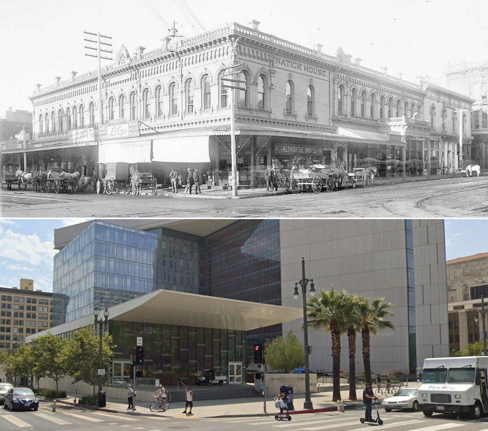 |
|
| (1900 vs 2021)* - Looking at the SW corner of Main and 1st Streets where the historic Natick House Hotel once stood, today the site of the LAPD Headquarters building. |
Main Street (between 1st & 2nd Street)
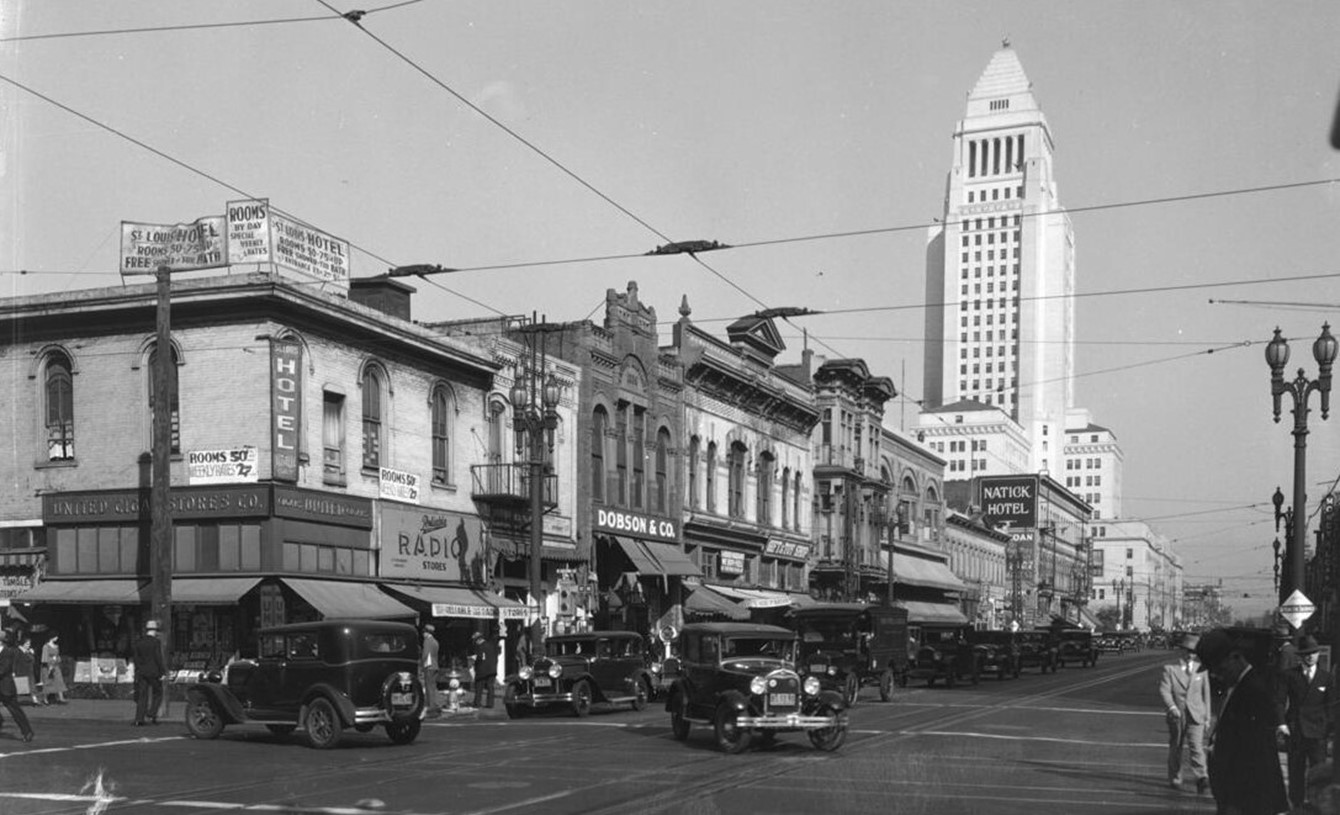 |
|
| (ca. 1930)* - View looking north on Main Street at 2nd Street with Los Angeles City Hall seen in the distance. Numerous automobiles can be seen driving on the street and pedestrians walking on the sidewalk and crossing the street. A network of streetcar electric cables can be seen suspended above the street.; Legible signs read: "Hotel", "St. Louis Hotel rooms 50-75c. and up free shower or tub bath", "rooms by day special weekly rates", "United cigar stores co.", "Reliable radio stores", "Dobson & Co.", "gift and toy shop", "Natick Hotel". |
Historical Notes In the 1930s, the Civic Center area of downtown Los Angeles was still in a state of flux and development. The new City Hall seen above was built in 1928, however the civic and government buildings that now define the Civic Center were still being planned and constructed during this time period. The Civic Center was originally centered around the southern end of the historic Los Angeles Plaza, and had grown southward along Main Street, Spring Street, and Broadway by the mid-1890s. However, as wealthier businesses moved further south into the Historic Core area around 1900-1910, the older Victorian-era blocks of the Civic Center became increasingly neglected. |
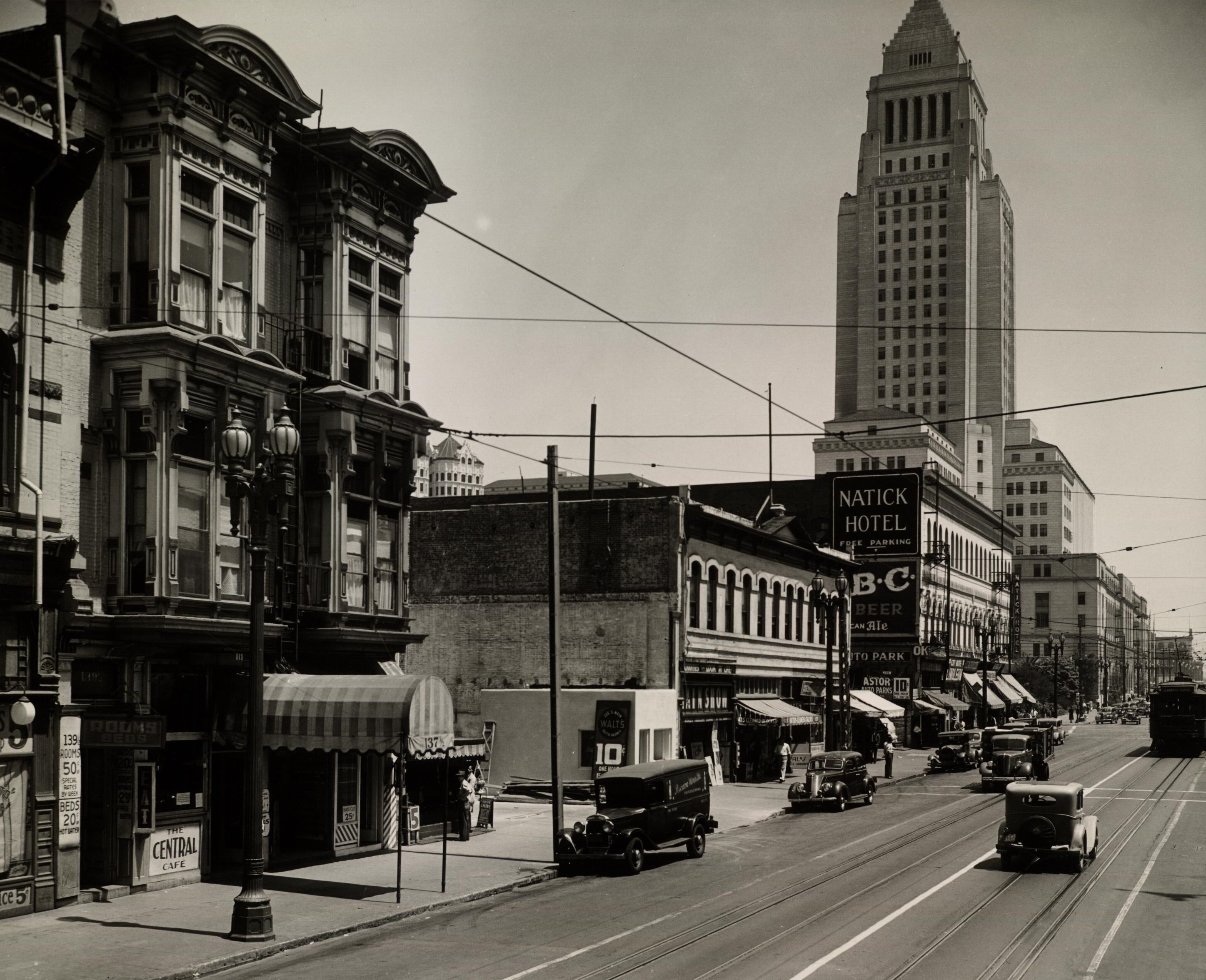 |
|
| (1938)* - Facing north on South Main Street between 1st Street and 2nd Street in Downtown Los Angeles |
Historical Notes Shown along Main Street are the Natick Hotel, Central Cafe, Astor Auto Park, City Hall, and the Court House. |
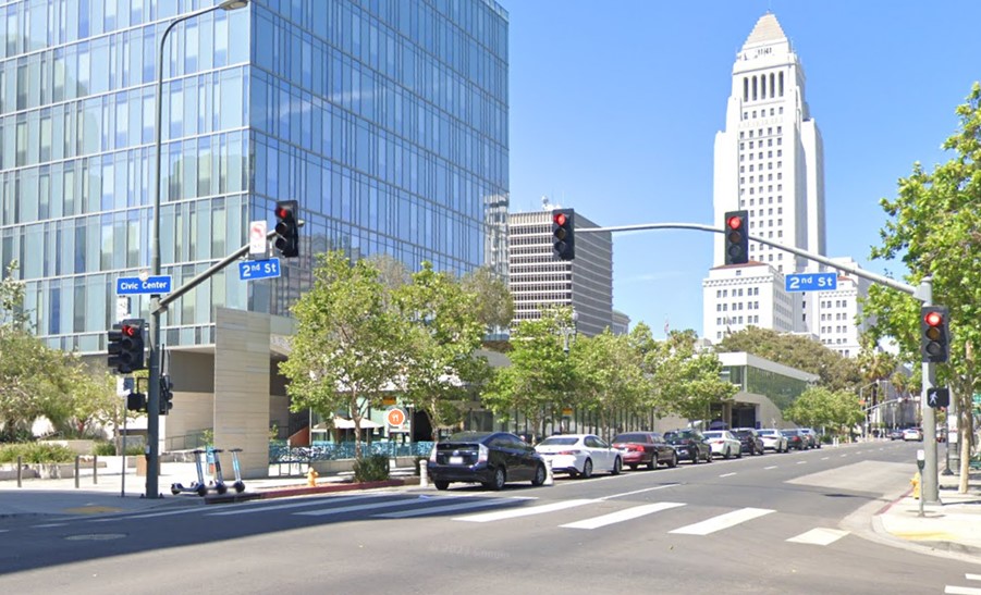 |
|
| (2022)* – Looking north on Main Street at 2nd Street with City Hall in the background. |
Then and Now
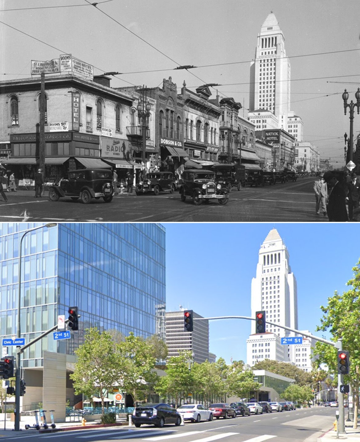 |
|
| (1930 vs 2022)* – Looking north on Main Street at 2nd Street with City Hall in the background. |
 |
|
| (1954)* – Looking south on Main Street toward 2nd Street. |
Historical Notes The bay windows building is 137 South Main Street. Next to it is the Kurtz Block at 145 South Main Street, then 149 South Main Street, and the Newell Block hotel is at the corner of 2nd Street. The large building in the background is the Higgins Building. |
 |
|
| (1952)* – Looking toward the west side of Main Street just north of 2nd Street with the White Star Hotel, 151 S. Main Street, on the left. |
 |
|
| (2022)* - West side of Main Street north of 2nd Street (151 S. Main Street). |
Then and Now
 |
|
| (1952 vs 2022)* - West side of Main Street north of 2nd Street (151 S. Main Street). |
* * * * * |
 |
|
| (1954)* - View looking southeast showing Bunker Hill and a portion of Los Angeles civic center. Parking lots are seen throughout. |
Historical Notes Within just a few years of the above photo, Bunker HIll would undergo a major transformation. The hill would be graded to make room for the new Civic Center expansion which would inlcude the construction of new City and County buildings, the Dorothy Chandler Pavilion, Ahmanson Theatre, and the Department of Water and Power Building. |
Los Angeles County Courthouse (Stanley Mosk County Courthouse)
 |
|
| (1956)^ – View looking northwest from above Hill Street towards Grand Avenue and Bunker Hill showing the early stages of construction on the new Los Angeles County Courthouse. 1st Street is on the left and the building with the turret in the upper-left is the Seymour Apartments. |
Historical Notes The new LA County Courthouse (later renamed Stanley Mosk Courthouse) was completed in 1958 and formally opened on January 5, 1959. It was designed by the architectural firm of Stanton, Stockwell, Williams and Wilson, in the Late Moderne architectural style. The courthouse was part of the 1947 Civic Center Master Plan, which aimed to develop a cohesive government and civic district in downtown LA. The new courthouse was a joint project of the "Associated Architects" group, which included architects like Paul R. Williams and Adrian Wilson. |
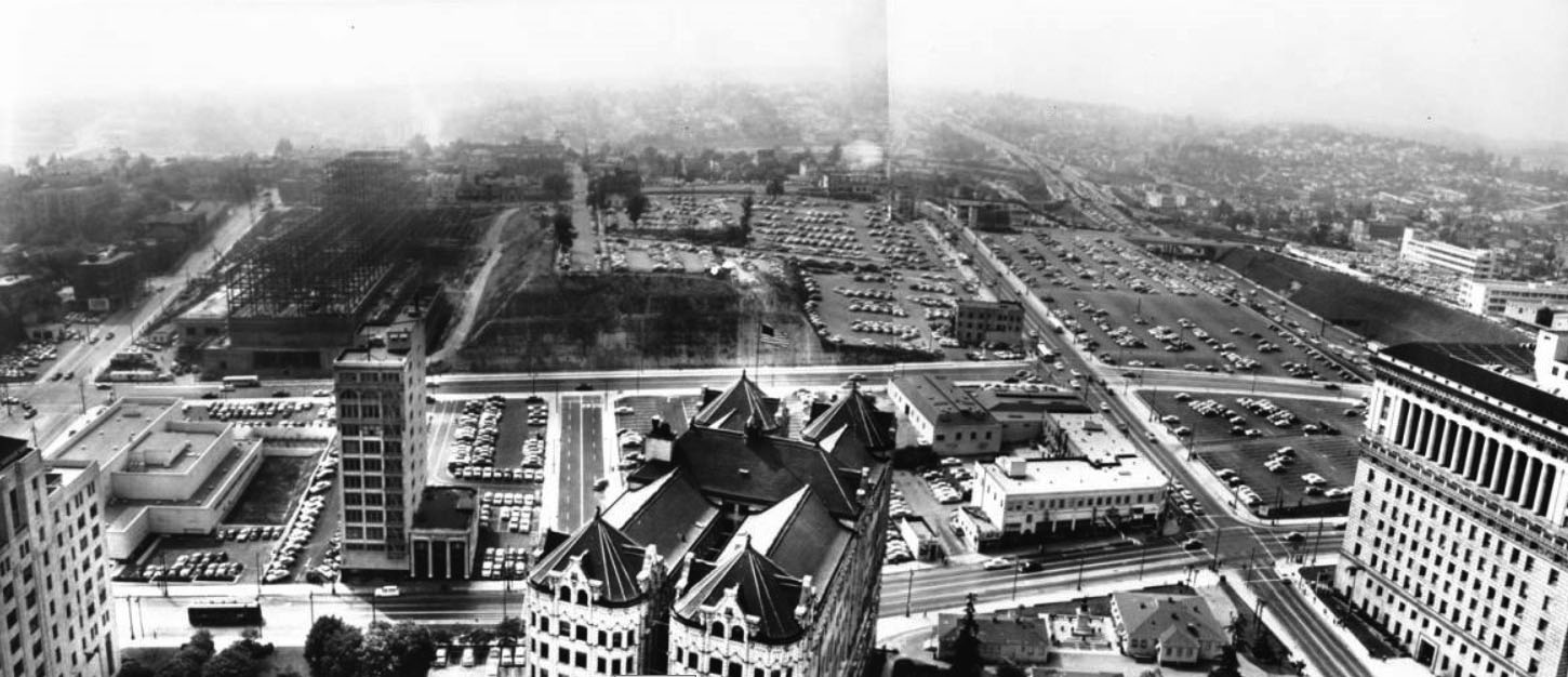 |
|
| (1956)*# - Panoramic photograph composite taken from the City Hall tower, facing west to northwest towards Bunker Hill and Hollywood. The State Building, Law Library, Hall of Records and the Hall of Justice are visible in the foreground, with the Board of Education Building further in the background. Court Street is seen on top of Bunker Hill at upper left-center. Broadway runs horizontally at the base of Bunker Hill. At center-left can be seen the steel framing for the new LA County Courthouse. |
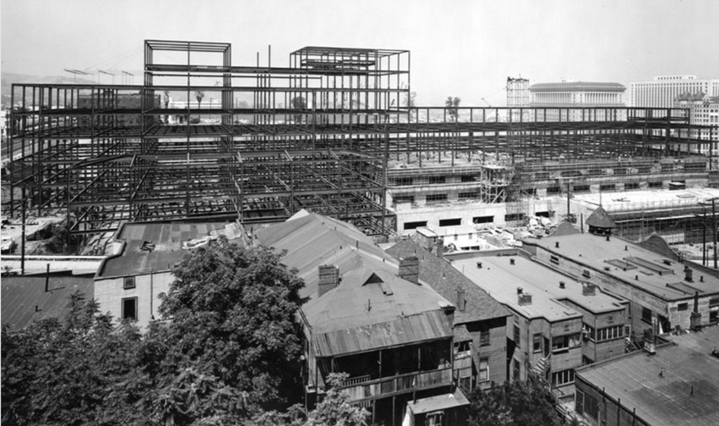 |
|
| (1956)**^ – View looking northeast showing the steel framing of the new County Courthouse located on the north side of First Street between Grand Avenue and Hill Street. In the distance (upper-right) can be seen the Hall of Justice, Federal Building, and the Hall of Records. In the foreground is a row of apartment buildings on the south side of First Street. The building with the turret on the right is the Seymour Apartments (S/W corner of First and Olive). |
First and Olive
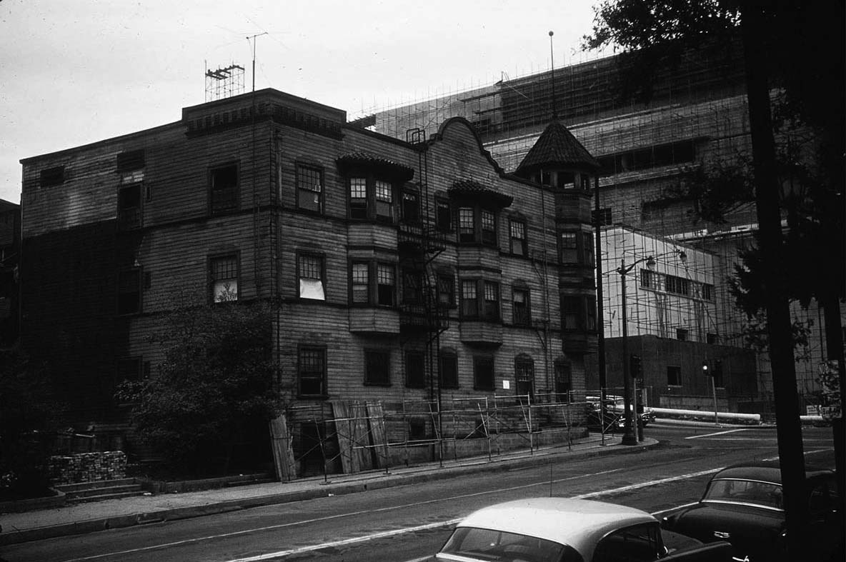 |
|
| (1957)^ – View looking northwest showing the Seymour Apartments (S/W corner of 1st and Olive) shortly before the building was demolished. Across 1st Street can be seen the County Courthouse under construction. |
.jpg) |
|
| (1957)^ – View looking west on 1st Street at Olive Street with the Seymour Apartments on the southwest corner. All the buildings on the south side of 1st Street will be demolished within a year. |
First and Grand
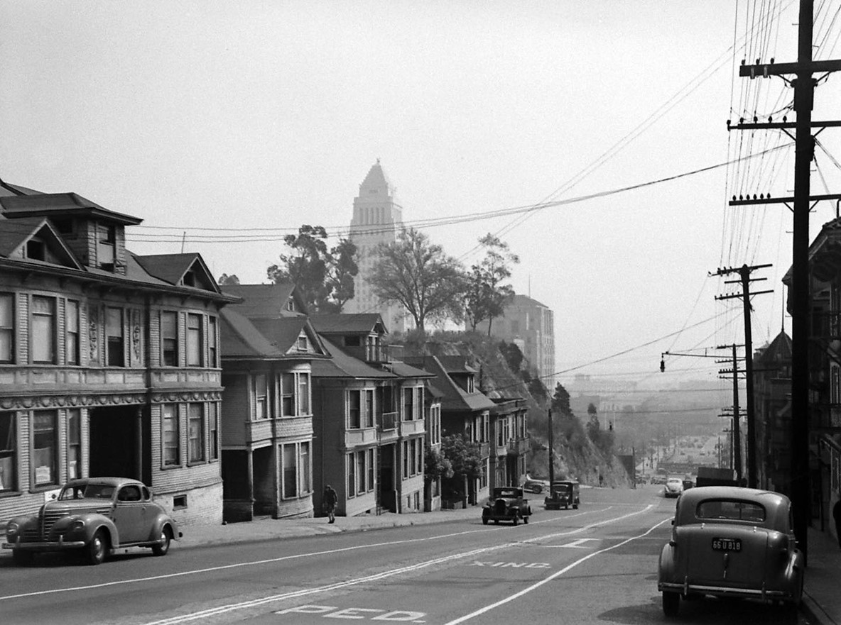 |
|
| (1945)* - Looking east on First Street from Grand Avenue towards Olive, with City Hall and the California State Building visible over the hill on the left. |
Then and Now
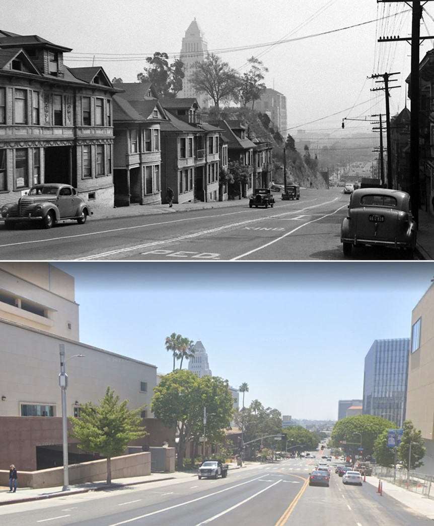 |
|
| (1945 vs 2022)* - Looking east on First Street from Grand Avenue. |
First and Olive
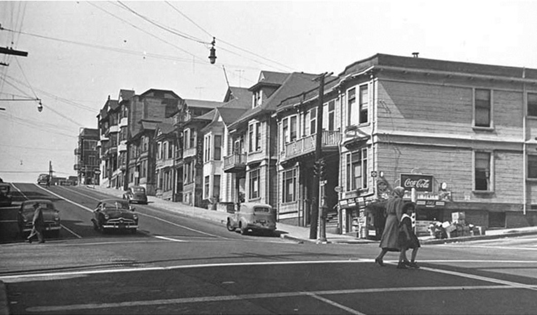 |
|
| (ca.1950)* – View looking west on 1st Street at Olive Street toward the top of Bunker Hill. |
.jpg) |
|
| (1945)* – Close-up view of the northwest corner of Olive and 1st streets, today the side entrance to the Stanley Mosk Courthouse. |
Then and Now
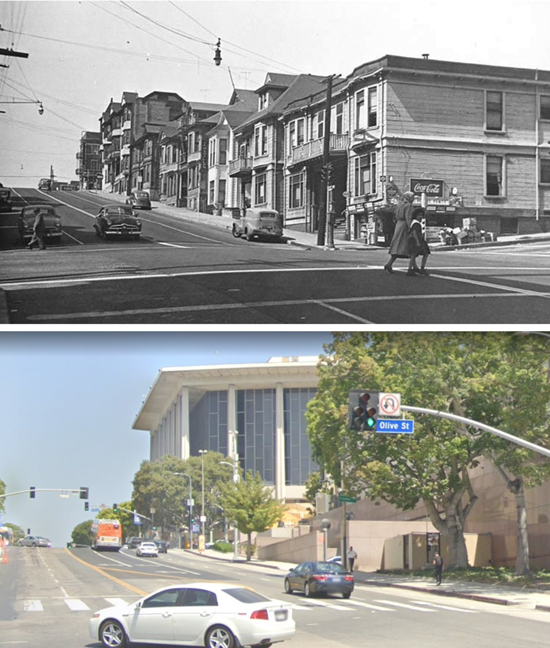 |
|
| Then and Now – Looking west on 1st Street at Olive Street.* |
Historical Notes It should be noted that the top of the Dorothy Chandler Pavilion is about where the bottom of the buildings on the older shot is. They did not just remove the buildings, they also carved off the top of the hill. |
Broadway and 1st Street
 |
|
| (1956)* - Southeast corner of the 1st Street and Broadway intersection. Bancroft-Whitney Company, publisher of law books, has a place on the 1st Street side. Ogee's restaurant at the corner with Mexico City Cafe to the right. Los Angeles Transit Lines' Line 6 bus going north on Broadway. 1949-50 Ford wagon leaving the intersection at left. Los Angeles Times building complex in surrounding background |
 |
|
| (2023)* – Looking at the SE corner of Broadway and 1st Street. |
 |
|
| (1956)^ – View looking south on Broadway from 1st Street showing the businesses and buildings along the west side of the street. These buildings would soon be demolished to make way for a State building. Buildings seen include the Mason Theater (at center-left) and the Hough Block building with its fire escape ladder down the front and Rowan ad on the side (at center). |
 |
|
| (ca. 1957)* – View looking down toward the intersection of 1st and Broadway showing an excavation site on the SW corner. This is where a new short-lived Junipero Serra State Office Building would soon be built. At the middle of the block is where the 1903-built Mason Opera House once stood. The two buildings to the left (SE corner) would be demolished in the early 1970s to make way for a 6-story modern addition to the LA Times Building. The photo was taken from the California State Building which was itself demolished in 1976. Bunker Hill can be seen in the background. |
 |
|
| (1978)^ - View looking down at the intersection of 1st and Broadway as seen from City Hall. In the foreground are the remains of the California State Building, demolished in 1976. The LA Times Building has a new additon (SE corner). On the SW corner stands the 1960-built Junipero Serra State Office Building*. Also, note how the skyline is beginning to change with the additon of the ARCO Towers, Security Pacific Building, and the Westin Bonaventure Hotel among others. |
Historical Notes *Junipero Serra State Office Building #1 (aka Ronald Reagan State Office Building), at 109 S. Broadway was built in 1960. A Los Angeles Times article of 11/20/1960, described the tower's design: "It is so severely plain, functional in its accommodations as to be almost Spartan when compared with many other public buildings." It stated that the new building would be occupied by 26 state agencies, and "...was built at a cost of approximately $4,300 per occupant, as compared to average building costs of around $6,000 per occupant." This new building complemented an older state office building located diagonally across the street. "Heat for both old and new State Buildings will be furnished by boilers in the new building. Each building will operate its own air-conditioning equipment. Steam pipes and electric and telephone wires connect the buildings through a tunnel running diagonally across the 1st St. at Broadway intersection." The lifespan of this building was unfortunately short. The building's spartan aesthetic probably did not win it much popularity over time; low cost construction also may have played into the building's structural deficiencies. Frequent earthquakes had compromised the building's structure, and the 1994 Northridge Earthquake proved the final straw. Engineers condemned the Serra Building's parking garage soon after the 6.7 temblor (which created extreme ground acceleration), and gave five years for employees to clear out of the office tower. They left by 1998, moving into the former Broadway Department Store at 320 West 4th Street, renovated and seismically upgraded during an early-1990s. When employees moved there, the upgraded facility became known as the second Junipero Serra State Office Building in LA.^ The Junipero Serra State Office Building was razed in 2006. The lot sat empty until 2014 when construction began for the First Street U.S. Courthouse Building. |
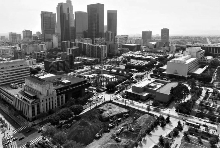 |
|
| (2014)^ – View looking down toward the intersection of 1st and Broadway as seen from the top of City Hall. A tall crane can be seen in the middle of the site where the 1970-built Junipero Serra State Office Building (seen in previous photo) once stood. The new U.S. Courthouse is being constructed here. The lot that’s being excavated in the foreground is where the California State Building (1931-1976) once stood. The LA Times Building with its new Annex are on the left and take up the whole southern side of 1st Street between Spring and Broadway. In the upper-right you can just make out the Disney Hall, Dorothy Chandler Pavilion, and the Mosk Courthouse. Photo courtesy of Hunter Kerhart |
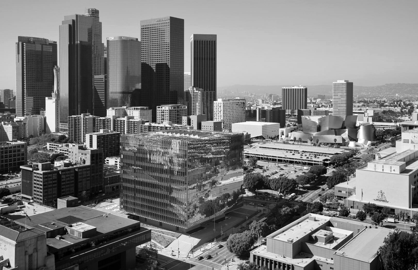 |
|
| (2016)* - View looking SW toward the intersection of 1st and Broadway showing the newly completed 10-story U.S. Courthouse with part of the Downtown skyline in the background. In the foreground can be seen the LA Times Building (lower-left) and the LA Law Library (lower-right). |
Historical Notes Completed in 2016, the New United States Courthouse at 1st and Broadway is a 10-story, 633,000-square-foot building that contains 24 courtrooms and 32 judicial chambers. It houses the U.S. District Court of the Central District of California, accommodates the U.S. Marshals Service, and provides trial preparation space for the U.S. Attorney’s Office and Federal Public Defender. The $340-million Civic Center building was erected at the site of the old Junipero Serra State Office Building, which was bulldozed in 2006 due to extensive earthquake damage. |
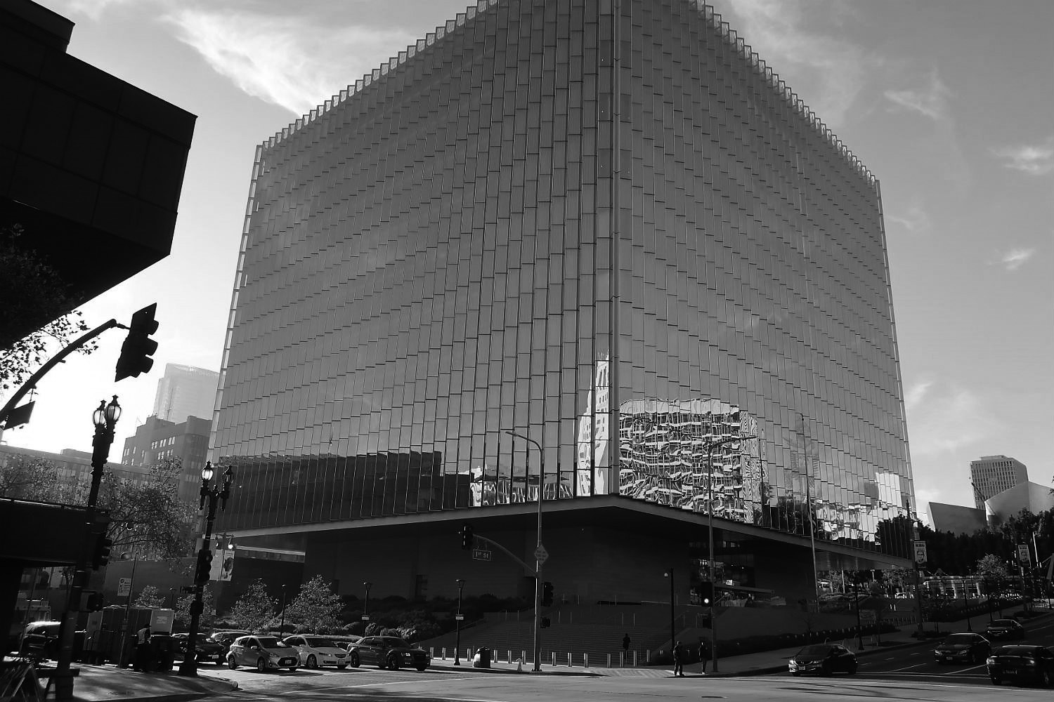 |
|
| (2018)^ – View showing the new First Street U.S. Courthouse located on the SW corner of 1st and Broadway. On the left it's a bit of the 70s addition to the LA Times Building. On the right in the distance is the Disney Hall with Bunker Hill Tower behind it. Photo: Bill Counter |
Historical Notes Architects Skidmore, Owings and Merrill designed the new 10-story courthouse to look like a floating cube (it's set atop a stone podium) with a pleated facade made of tempered glass. Its construction included 4,300 tons of steel.^ |
Fort Moore Pioneer Memorial
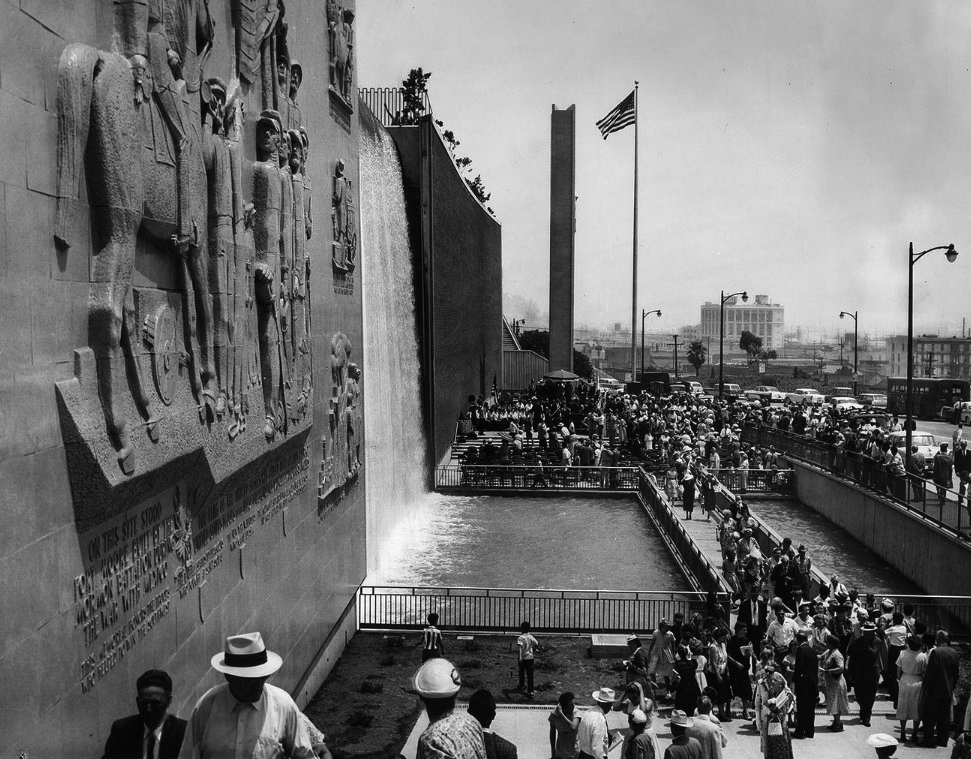 |
|
| (1958)^^ - A crowd gathers for the dedication of Ft. Moore Pioneer Memorial on Hill Street, north of the Hollywood Freeway. The wall re-creates the city's first Independence Day celebration on July 4, 1847. LA Times photo date: July 3, 1958 |
Historical Notes The accompanying LA Times article reads: The city’s first Independence Day celebration — July 4, 1847 — was recalled yesterday in the dedication of 400-foot-long, 45-foot-high Ft. Moore Pioneer Memorial Wall on Hill St. just north of the Hollywood Freeway. The Memorial Wall, dedicated “to the brave men and women who faced privation and death in extending the frontiers of our country to include this land of promise,” commemorates Los Angeles’ first Independence Day. It was in 1847 at the newly constructed Ft. Moore on the hill overlooking the little Mexican pueblo that all American troops in the immediate area — the First U.S. Dragoons, New York Volunteers and Mormon Battalion — gathered to participate in the historic Flag-raising ceremony. The largest section of the huge bas-relief panel of the Memorial Wall depicts that Flag-raising. Three smaller sections illustrate other aspects of pioneer life. In addition to the ceramic veneer bas-relief panel, the Memorial Wall features an 80-foot-wide, 47-foot-high waterfall, a 68-foot-high pylon in front of the wall supporting an immense ceramic eagle and a towering flagpole. Participating in yesterday’s dedication ceremony of the $373,887 memorial were city and county officials, descendants of members of the Mormon Battalion, members of the Sons and Daughters of Utah Pioneers and the 72nd U.S. Army Band and a color guard from Ft. MacArthur. ^^ --- The waterfall was shut-down during the drought of 1977. Even though a pump recycled the water, it looked wasteful. It was turned back on in late 2018, but has only been on intermittenly since then. Click HERE to see a contemporary view of the Fort Moore Pioneer Memorial. |
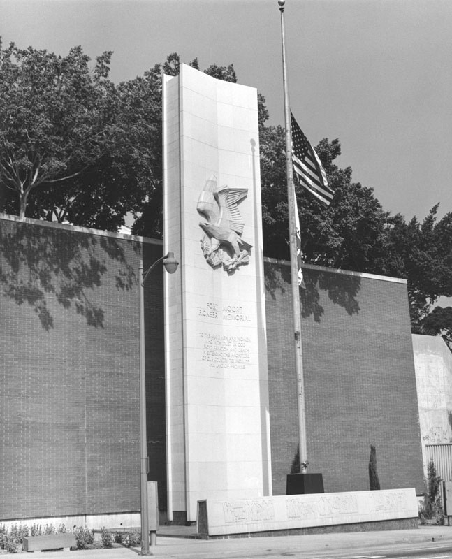 |
|
| (ca. 1958)^ - Photo of one section of the Fort Moore Pioneer Memorial showing a 68-foot high concrete pylon with a 16-foot terra-cotta bas-relief American eagle, designed by noted sculptor Albert Stewart. Below that an inscription reads: "Fort Moore Pioneer Memorial - To the brave men and women who with trust in God faced privation and death in extending the frontiers of our country to include this land of promise." Location: 451 N. Hill St. |
Historical Notes Groundbreaking for the memorial took place on July 13, 1953 and was completed in 1957. Note that the flag to the right of the monument is at half-staff. ^ |
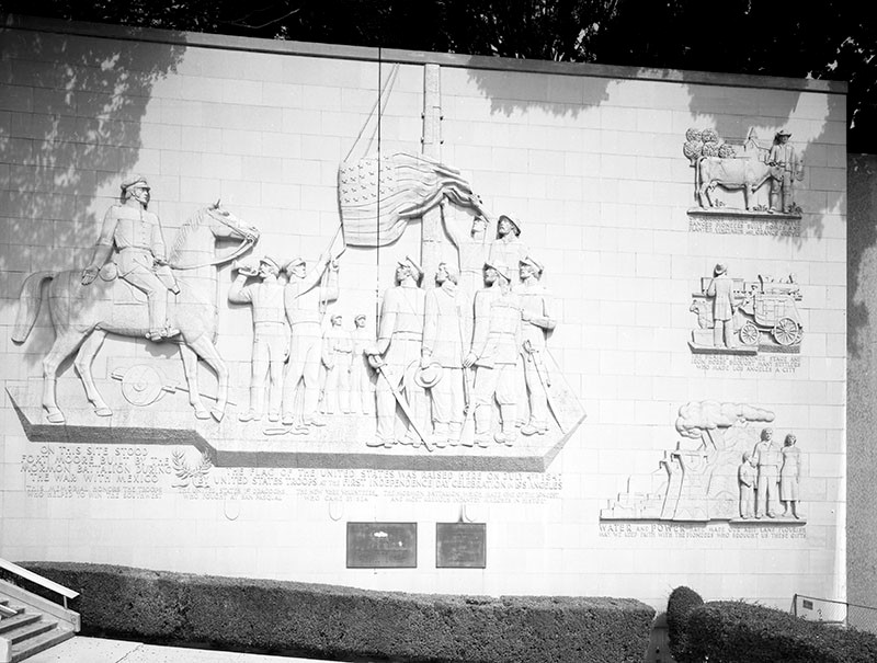 |
|
| (2002)^ – Detail view showing the 78 foot tall terra cotta bas relief mural section of the Fort Moore Pioneer Memorial located on the west side of Hill Street, south of Cesar Chavez Avenue. |
Historical Notes The mural was designed by Henry Kreis and depicts the raising of the American flag on July 4, 1847 at the first Independence Day celebration in Los Angeles. Three other panels depict scenes of agriculture, transportation, and water and power. The site for the Central Los Angeles Area New High School #9 sits just west of the memorial.^ |
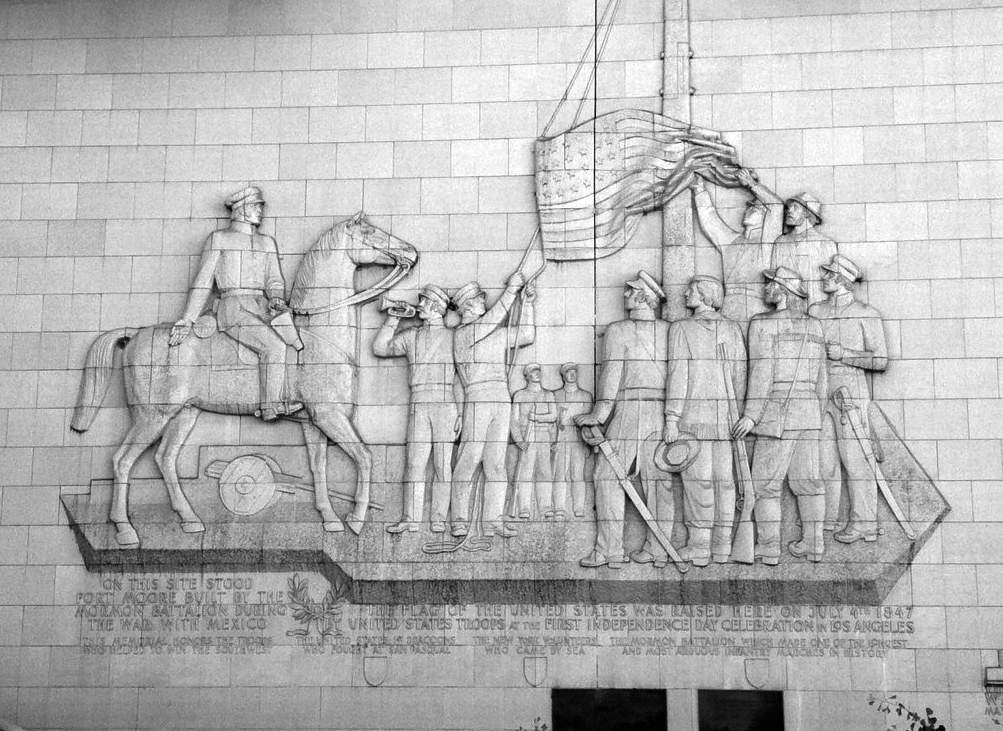 |
|
| (2012)#^* – Close-up view showing the Pioneer Monument's largest panel. The text reads: “On this site stood Fort Moore. Built by the Mormon battalion during the War with Mexico. The flag of the United States was raised here on July 4th, 1847, by Unites States troops at the first independence day celebration in Los Angeles. This memorial honors the troops who helped win the Southwest: The United States 1st Dragoons who fought at San Pasqual. The New York Volunteers who came by sea. The Mormon Battalion who made on the longest and most arduous infantry marches in history.” |
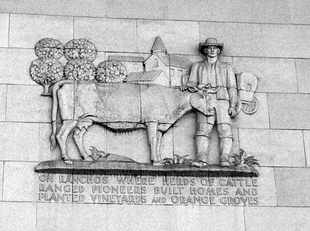 |
|
| (2012)#^* – Close-up view of one of the four Pioneer Monument panels. It reads: “On ranchos where herds of cattle ranged pioneers built homes and planted vineyards and orange groves.” |
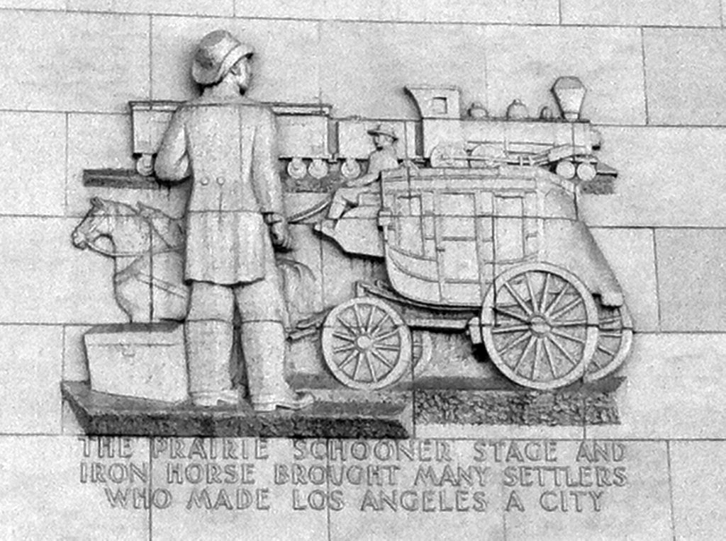 |
|
| (2012)#^* - “The prairie schooner stage and iron horse brought many settlers who made Los Angeles a city.” |
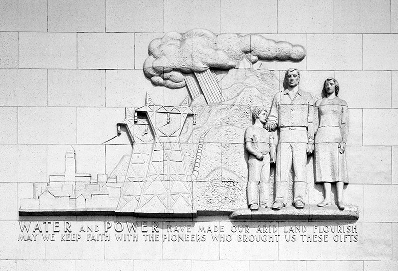 |
|
| (2002)^ - Close-up view showing the Pioneer Monument panel that makes reference to the energy resources that contributed to the city's growth. The inscription reads, "Water and Power have made our arid land flourish. May we keep faith with the pioneers who brought us these gifts." |
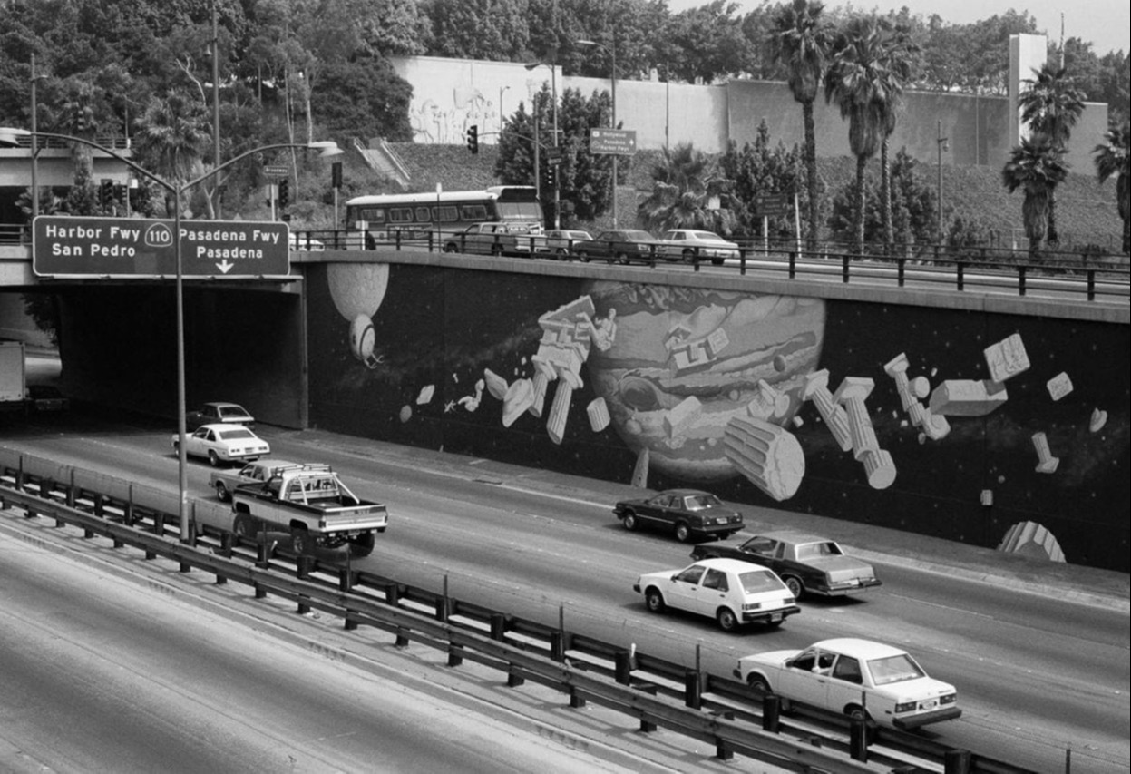 |
|
| (ca. 1984)* - Looking across the Hollywood Freeway (US-101) with its artistic murals toward the Fort Moore Pioneer Memorial on Hill Street. |
Historical Notes The Memorial is located at 451 N. Hill Street. Clcik HERE for map showing the exact lcoation. |
* * * * * |
|
|
| (ca. 1953)*# - Driving east on the Hollywood Freeway, Los Angeles' Civic Center provides a massive and impressive appearance. In immediate foreground is the Hall of Justice, with the Federal Courthouse and U.S. Post Office Building framing it on left and the City Hall and Hall of Records, on right. Grand Avenue exit from new freeway is seen in lower right. Just beyond the Civic Center, Hollywood Freeway joins the Santa Ana and Ramona Freeways, both of which are in the process of extension. |
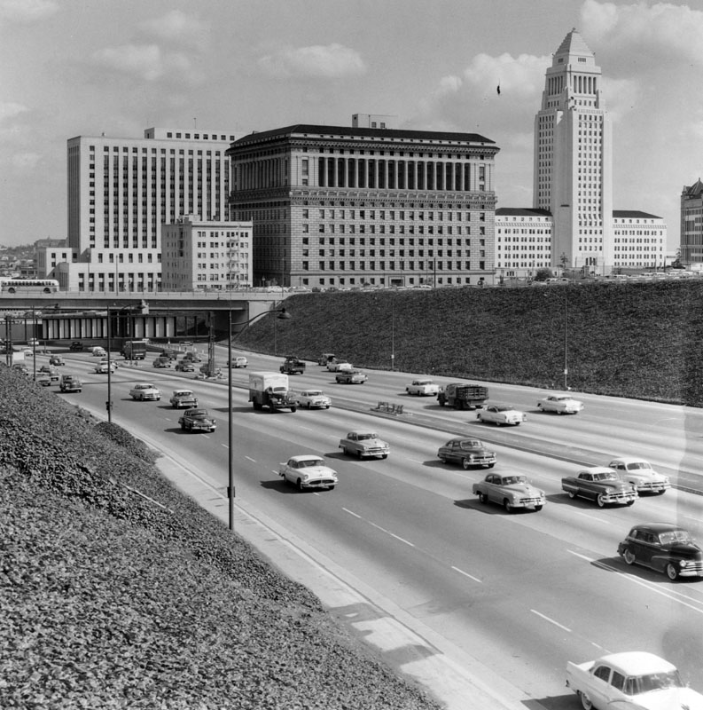 |
|
| (1957)^ - Traffic on the Hollywood Freeway in the mid-1950s flowed easily in both the southbound and northbound lanes, making the ride around the City of Angels quick and easy. Shown are the popular cars of the day, which would be valuable collectors items if they were around today. When this shot was taken, City Hall dominated the Los Angeles skyline and the Downtown area was still the major shopping spot in the metropolitan L.A. area. The Hall of Justice and part of the old Hall of Records are also prominently pictured. Photograph was taken from Grand Avenue overpass. |
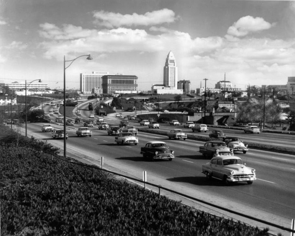 |
|
| (1958)*# – View looking east at the Hollywood Freeway with the Los Angeles Civic Center in the background. |
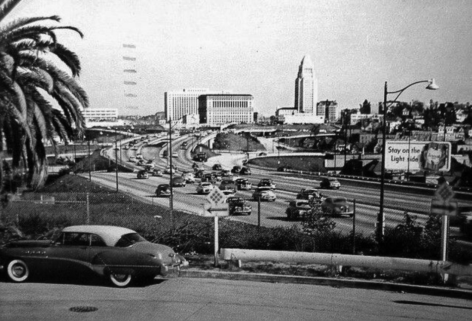 |
|
| (1950s)^ – Postcard view showing the Hollywood Freeway with the Civic Center in the background. |
 |
|
| (ca. 1963)* – Looking toward the Downtown Civic Center over the Hollywood Freeway and the Four Level Interchange. |
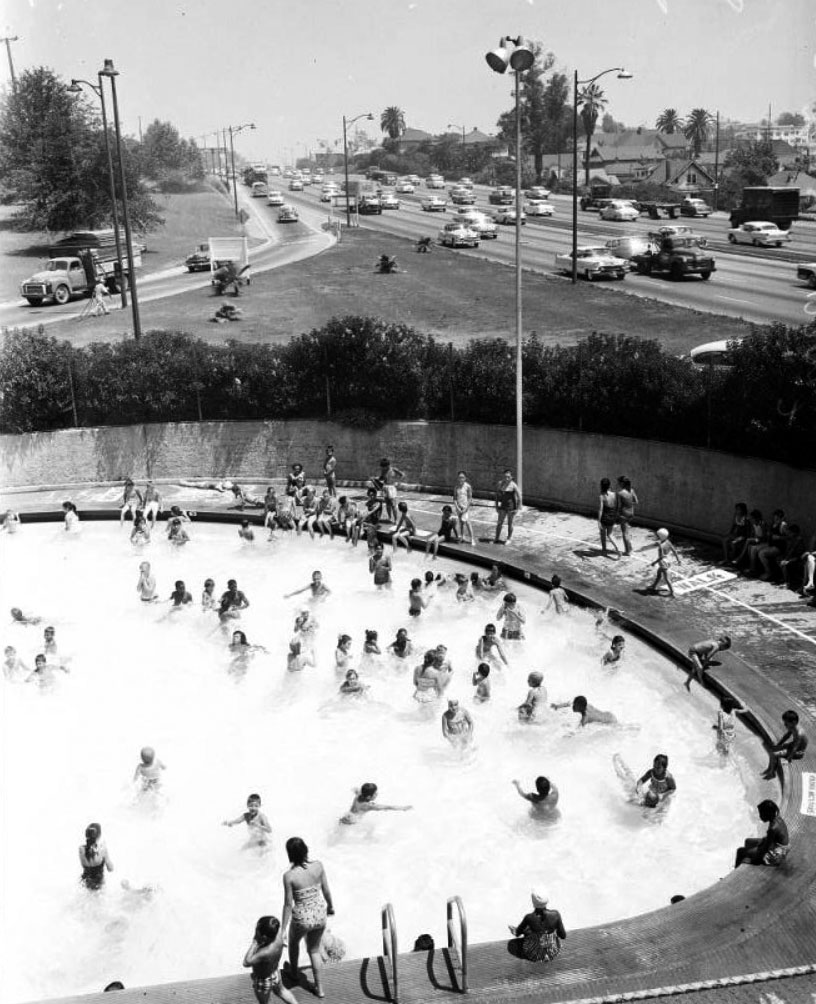 |
|
| (1958)*# - Cars on the Hollywood Freeway speeding by the Echo Park Community Pool located in one of the oldest parks in the City of Los Angeles. Note the freeway on-ramp and off-ramp adjacent to the pool. |
Historical Notes The Echo Park Playground opened in 1907 between Bellevue Avenue and Temple Street, and was only the second public playground to be built in the city of Los Angeles. It still remains today, although in a highly altered form with the Hollywood Freeway (101) bisecting its grounds. A skate park is planned to be built (2019) where the now empty public swimming pool is located next to the 101 Freeway onramp at Echo Park and Bellevue avenues. |
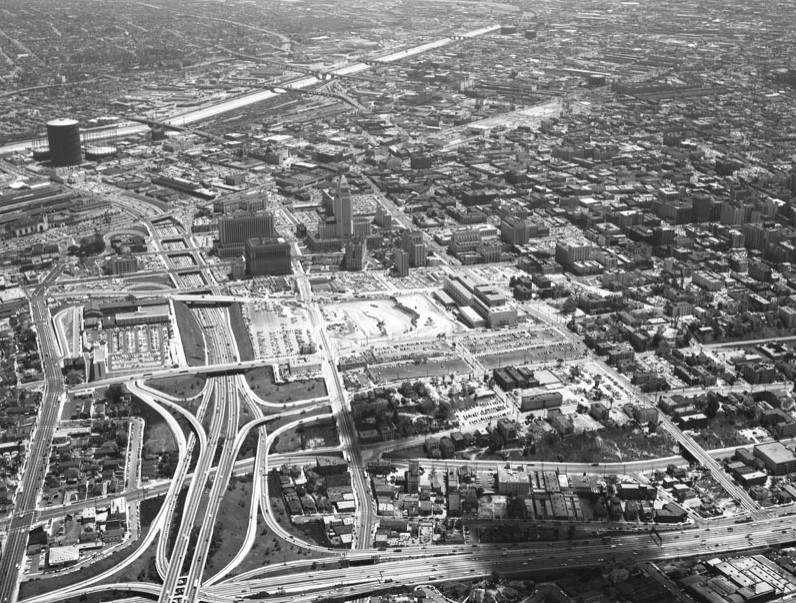 |
|
| (1957)#* - Aerial view looking east over Bunker Hill remains, Civic Center. |
Historical Notes In the lower right quadrant of the photo, the last remnants of Bunker Hill are holding on. The Rex Apartments can be seen just west of Figueroa. The 1st Street bridge over Figueroa is easy to pick out, Diamond Street is just to the north of 1st Street (to the left) and runs at a little bit of an angle. The Rex Apartments is the only elongated four story building on the street. #* |
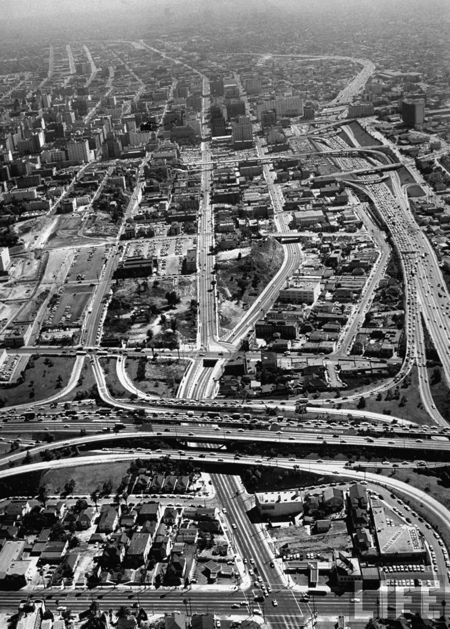 |
|
| (1958)**^ - Aerial view of Downtown Los Angeles looking south from the intersection of Sunset and Figueroa. A helicopter can be seen flying high above the newly constructed Hollywood Freeway. |
Historical Notes The Music Center and DWP Building on Hope St. between 1st and Temple (Bunker Hill) have yet to be built (left-center of photo). Click HERE to see more in Construction of the LA DWP Building. |
.jpg) |
|
| (ca. 1960)**^ – Aerial view of the Harbor Freeway looking south from over 1st Street on a light traffic day. J. Paul Getty Trust Collection |
* * * * * |
MacArthur Park and the Westlake Area
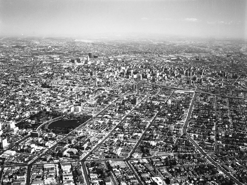 |
|
| (1957)^ - Aerial view of the Westlake area, looking east toward downtown. The major street closest to bottom is Hoover Street; Alvarado runs horizontally from middle right to middle left; the Harbor Freeway (110) is farther up from middle right to upper left. The major streets running vertically from bottom right corner to the left are: Olympic Boulevard, 9th Street, 8th Street, 7th Street, and Wilshire Boulevard, which runs through MacArthur Park - at left. |
Historical Notes In the mid-1800's, this area was a swampland. MacArthur Park, created in the 1880s under the name Westlake Park, was later renamed in honor of General Douglas MacArthur. By the 1890s, it was a vacation destination surrounded by luxury hotels; in the early part of the 20th Century, the area became known as the Champs Elysees of Los Angeles. MacArthur Park has been designated City of Los Angeles Historic Cultural Monument No.100 (Click HERE to see complete listing).^ |
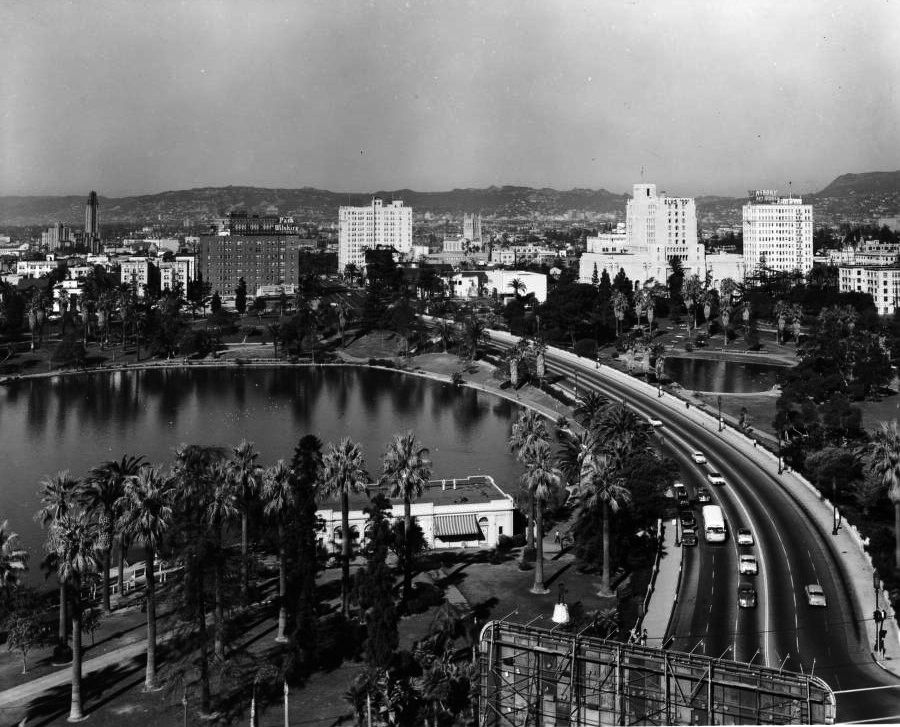 |
|
| (ca. 1950)*# - Aerial view of MacArthur Park looking northwest from the corner of Wilshire Boulevard and Alvarado Street. MacArthur Lake is on the south side of Wilshire Boulevard, the Towne House Building and the Bullock's Wilshire Tower can be seen further west along Wilshire Boulevard. Click HERE to see more early views of MacArthur Park (previously Westlake Park). |
Then and Now
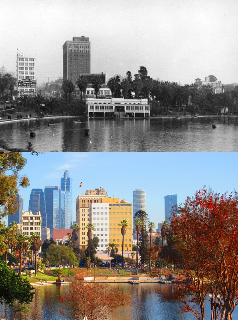 |
|
| (1937 vs. 2021)* – View of MacArthur Park looking east with the Downtown skyline in the background. Contemporary photo by Howard Gray |
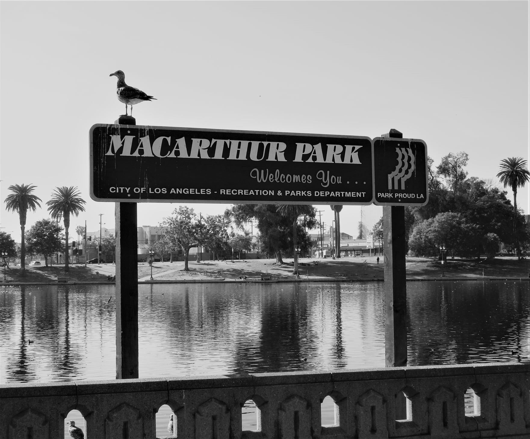 |
|
| (2021)^.^ – Sign at the edge of the park reads: ‘MacArthur Park Welcomes You…’ |
Historical Notes Click HERE to see more early views of MacArthur Park when it was call Westlake Park in the 1880s. |
* * * * * |
405 Freeway (San Diego Freeway)
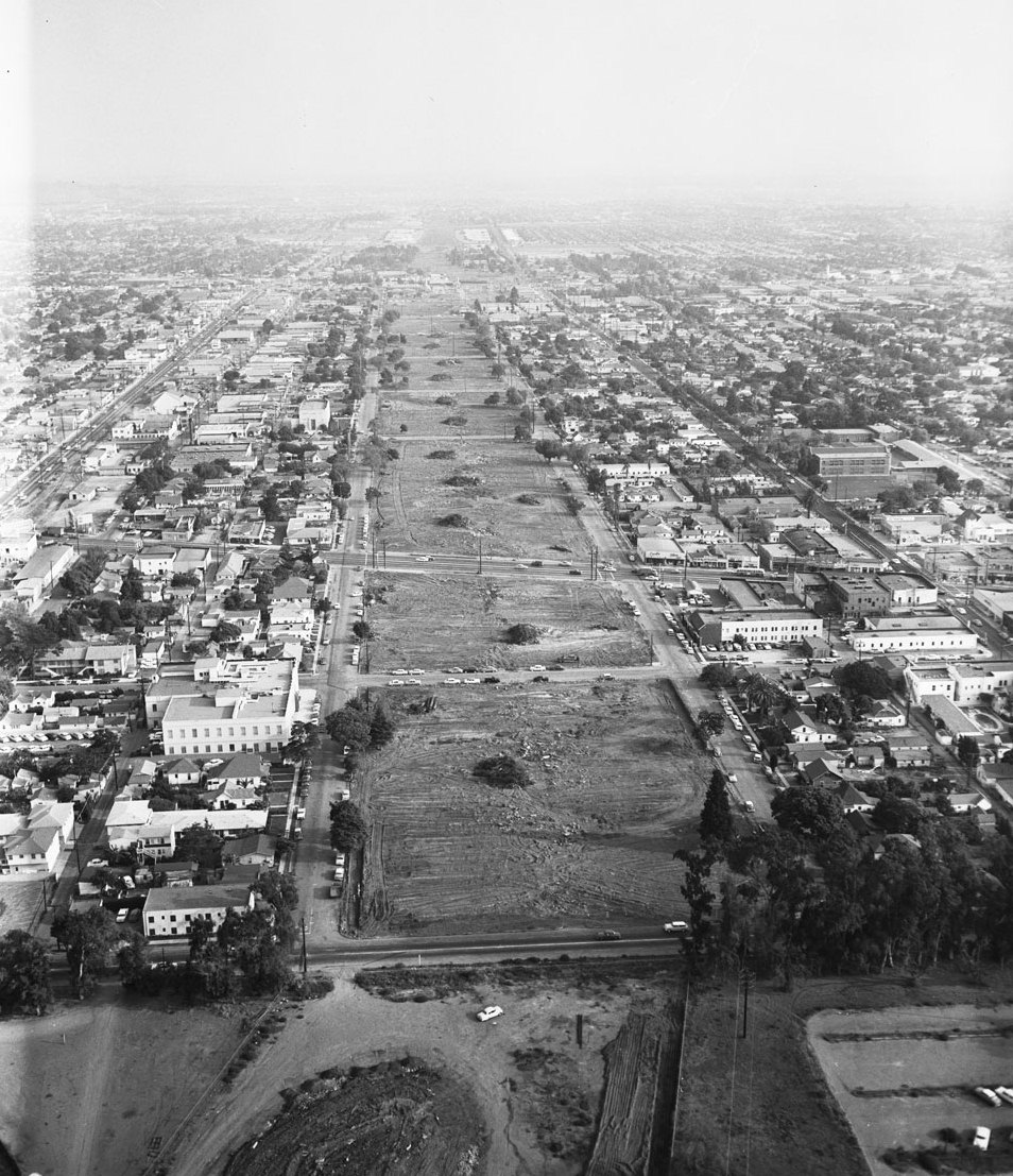 |
|
| (1957)*# - Construction of the San Diego (405) Freeway, pictured here in 1957 between Wilshire and Venice boulevards, split Westside neighborhoods. |
Historical Notes Construction of the 405 Freeway (originally California State Highway 7) began in 1957 with the first section, mostly north of LAX Airport being completed in 1961. The section of the 405 that would connect western Los Angeles to the San Fernando Valley was part of a 12-mile, $20 million project, then the most expensive California highway project to date.^ |
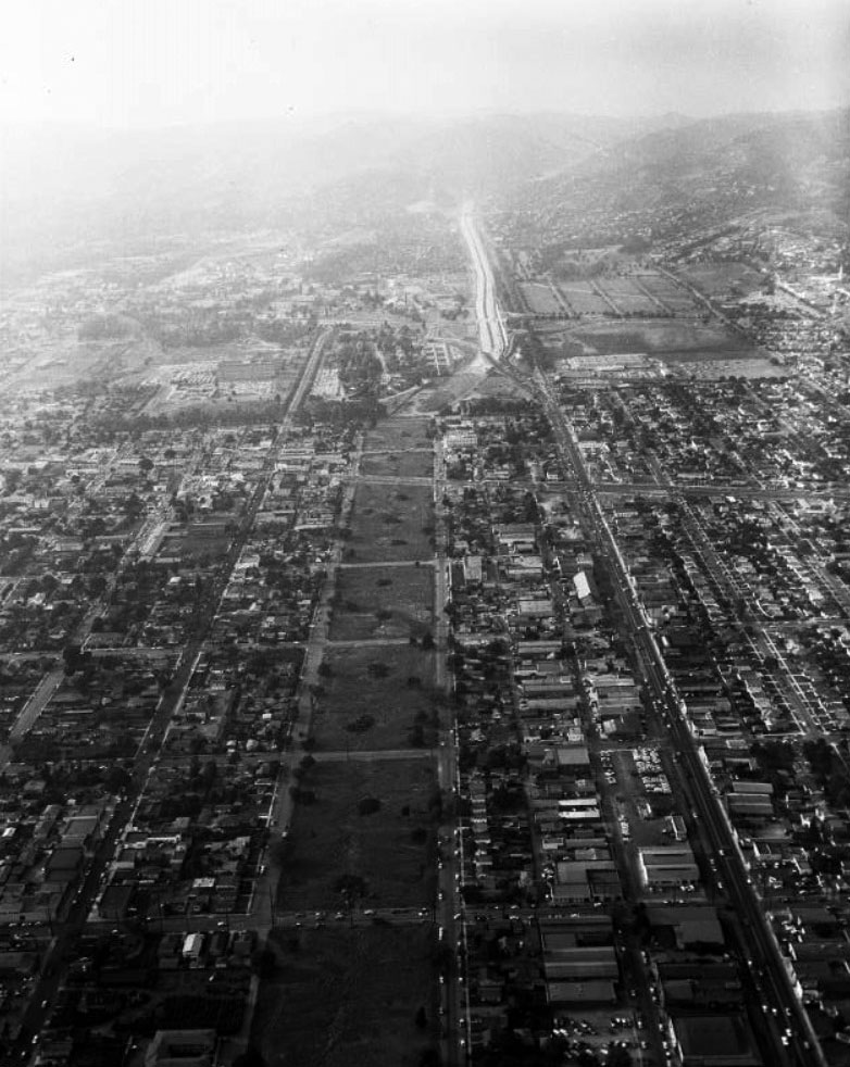 |
|
| (1957)*- Aerial view looking north toward Sepulveda Pass where construction of California State Highway 7 (later 405 Freeway) is underway. |
Historical Notes California State Highway 7 began construction through the West Los Angeles area in 1957. In the above image the highway is cutting a swath from Olympic Ave (bottom cross street) to out of sight distance up the hill past Sunset Blvd. By the time of it's many sections opening in 1964/5 to and through the San Fernando Valley, it was christened with an Interstate designation of 405 for the entire built and soon to be completed route. |
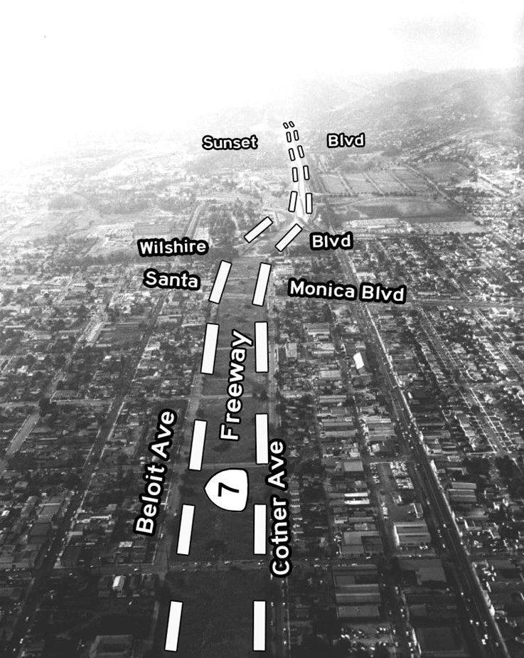 |
|
| (1957)* - Aerial view looking north showing the path of the 7 (later 405 Freeway). The section between Wilshire Blvd to Venice Blvd in Culver City is the next segment scheduled for construction. |
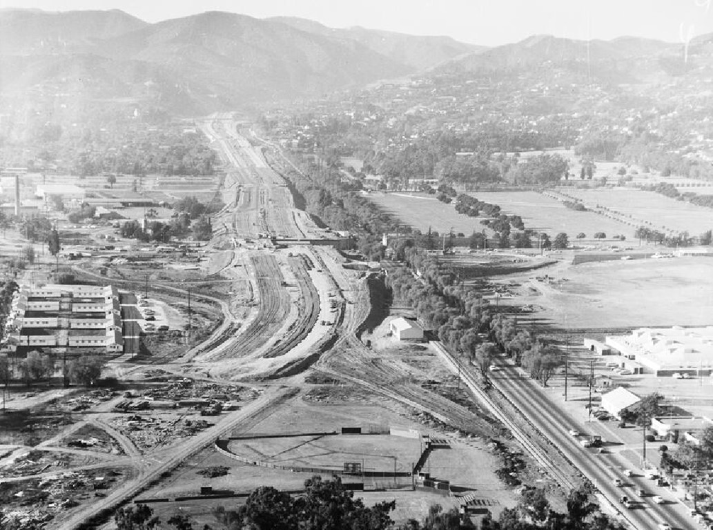 |
|
| (1956)* - Looking north toward Sepulveda Pass during the construction of the San Diego Freeway. The intersection of Wilshire and Sepulveda is seen at center of the photo. |
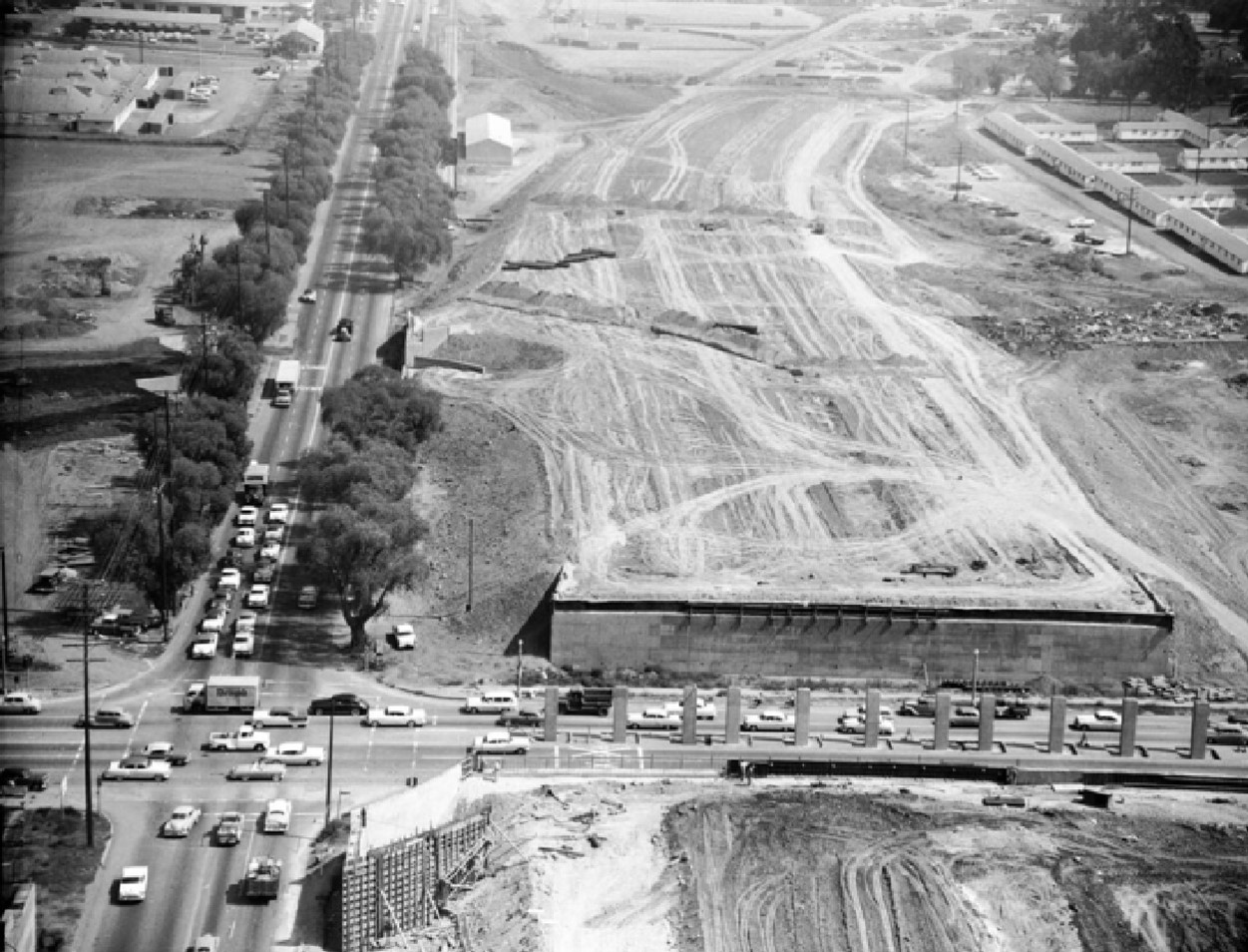 |
|
| (1957)* - Aerial view looking south showing the construction of the 405 Freeway with the intersection of Wilshire and Sepulveda boulevards seen at lower-left. |
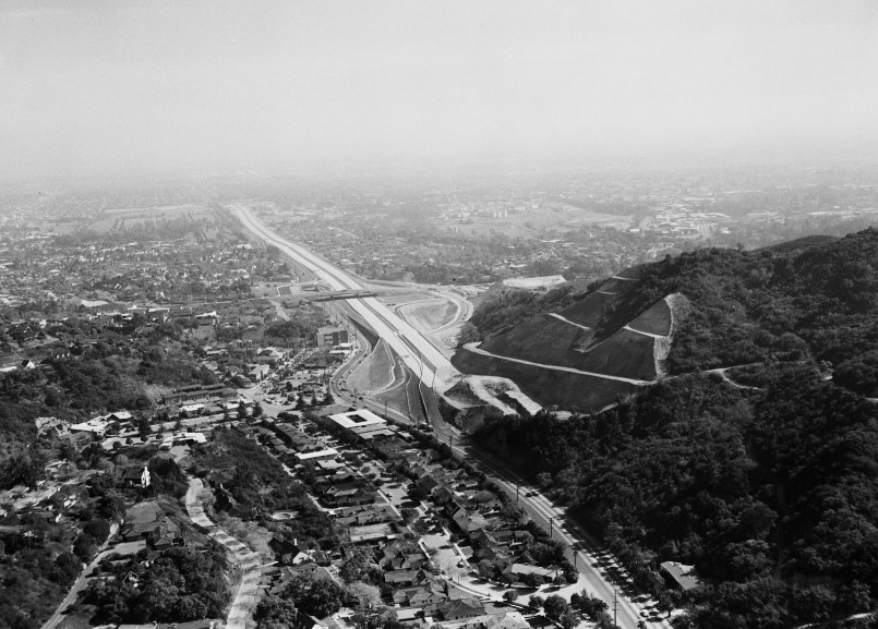 |
|
| (1957)*# - The San Diego Freeway makes its entry through the Santa Monica Mountains in 1957. The hill on the right is now the site of the Getty Center. |
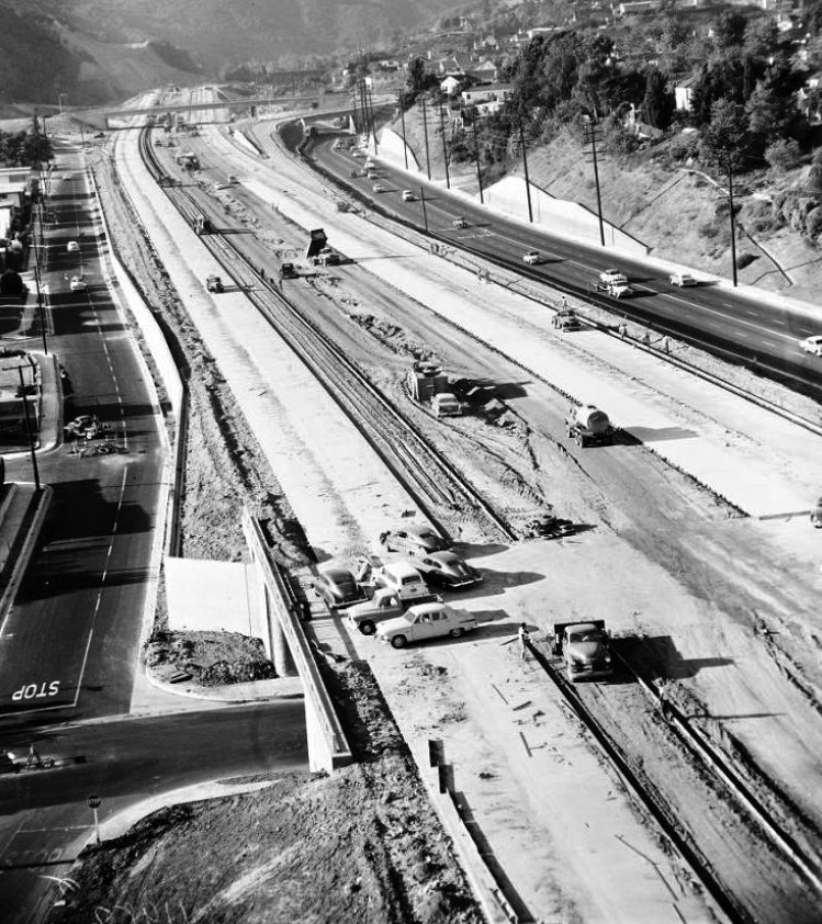 |
|
| (1956)^.^ - Looking north over San Diego Fwy construction at Montana Ave UC. Church Lane at left; Sepulveda Blvd on right; Sunset Blvd OC in background (LA Examiner). |
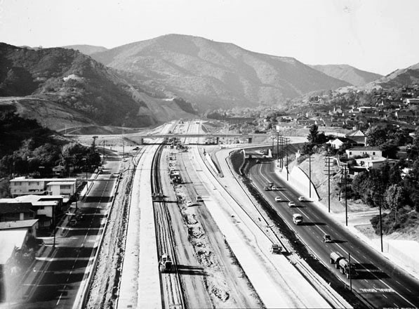 |
|
| (1957)^ - View looking north showing construction of the 405 Freeway just south of Sepulveda Canyon. Sepulveda Blvd is on the right and the Sunset Blvd Bridge is in the distance. |
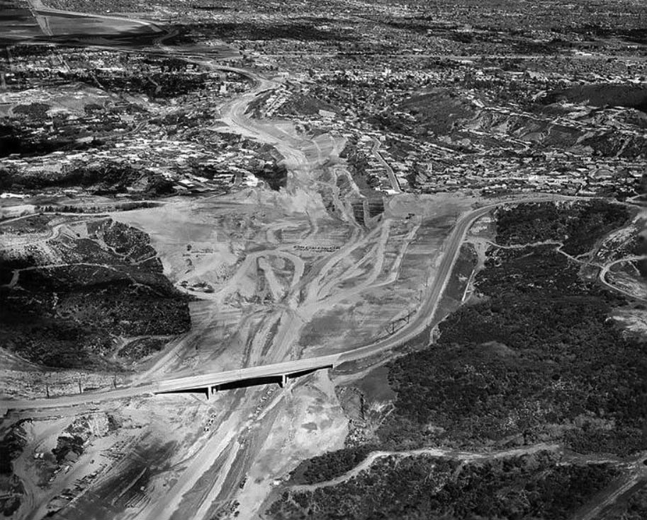 |
|
| (1960)****^ – Aerial view looking north toward the San Fernando Valley showing the newly completed Mulholland Drive Bridge. The Sepulveda Pass is chiseled out in preparation for the construction of the new 405 Freeway. |
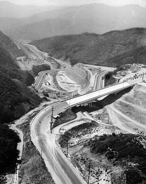 |
|
| (1960)^^ - An aerial view of the San Diego Freeway construction project shows the Mulholland Drive Bridge. Dirt is being dug from beneath the bridge and hauled to the San Fernando Valley for freeway fill. This bridge was constructed like no other, from the top down! |
Historical Notes This Mullholland Dr. Bridge was constructed like no other, from the top down. The bridge was completed over two years before the freeway that connected West L.A. to the San Fernando Valley would open.* |
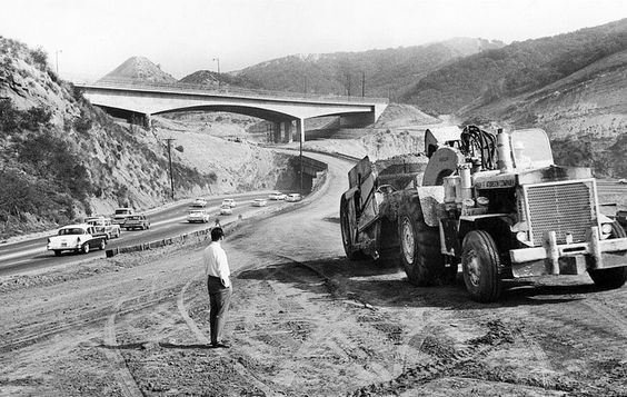 |
|
| (1960)^x^ - View showing the bridge across the Sepulveda Pass the official day of its completion, April 4, 1960. |
Historical Notes On Monday, April 4, 1960, the same day the 1959 Academy Awards were held at RKO's Pantages Theatre in Hollywood, Peter Kiewit Sons Co. completed the Mulholland Drive Bridge across the Sepulveda Pass. In June 1960, bids were opened for a $14-million contract to extend the San Diego Freeway 7.4 miles from Brentwood to Valley Vista Blvd. in the San Fernando Valley. Mulholland Dr. Bridge would finally span a freeway.* |
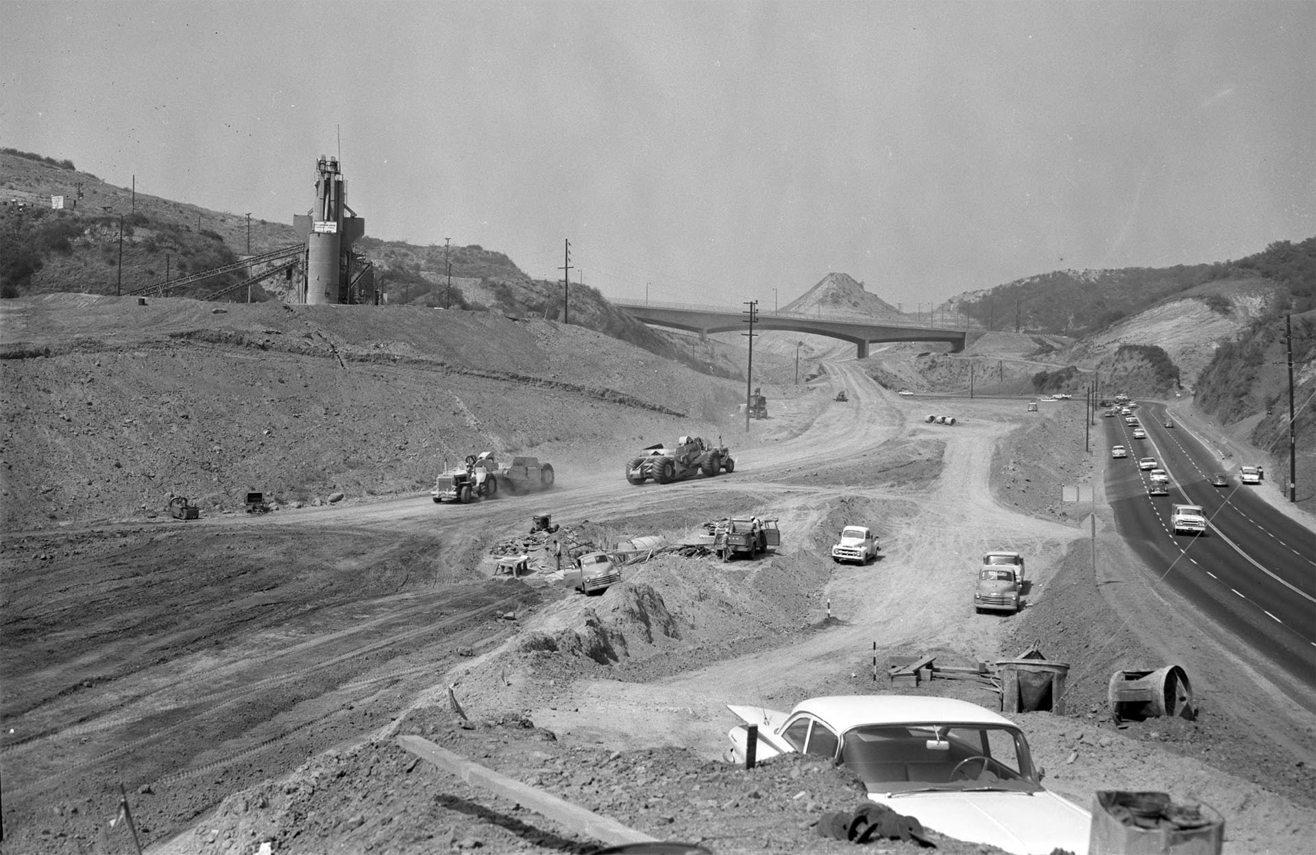 |
|
| (1961)^ – View looking north showing the construction of the San Diego Freeway through Sepulveda Pass with a newly completed Mulholland Bridge in the distance and Sepulveda Boulevard on the right. |
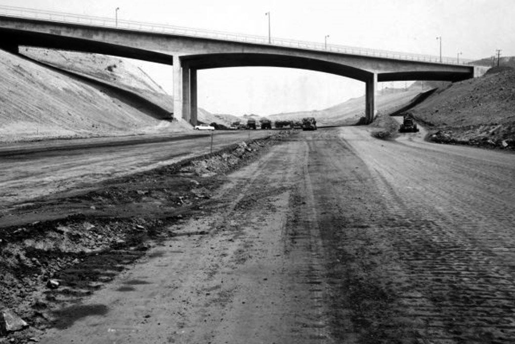 |
|
| (1961)****^ – View looking north toward the Mulholland Dr. Bridge over a yet-to-be completed San Diego Freeway. |
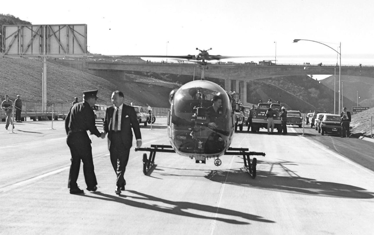 |
|
| (1962)* - Mayor Sam Yorty makes a grand entrance as he arrives via helicopter on the SB lanes of the San Diego Freeway for the openinng day festivities with the Mulholland Drive Bridge in the background.. |
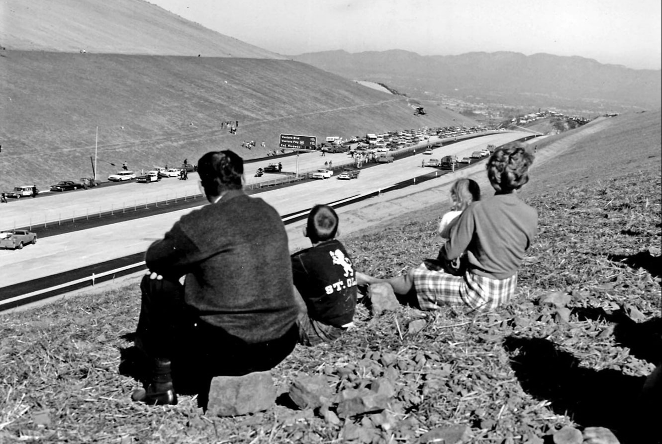 |
|
| (1962)* - Looking north over San Diego Fwy (I-405) dedication at Sepulveda Pass; freeway ended 3 miles north of here. Onlookers sitting on a bare slope watch as Mayor Sam Yorty arrives via helicopter at center. |
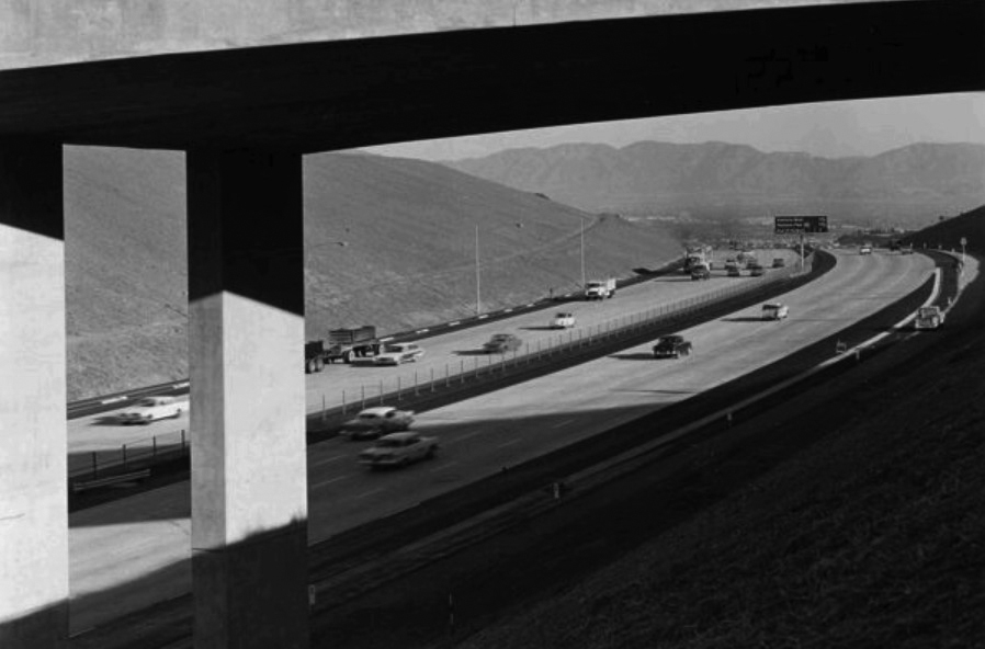 |
|
| (1962)##^# – View looking north through the Mulholland Dr. Bridge shortly after the completion of the Sepulveda Pass section of the San Diego Freeway (Dec, 1962). The San Fernando Valley is seen in the background. |
Then and Now
|
|
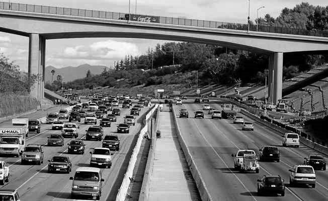 |
|
| (1961)** vs. (2014)* - View looking north toward the Mulholland Dr. Bridge. 2014 Photo by Dean Musgrove |
Historical Notes In 2012, 52 years after it was originally built, the Mulholland Dr. Bridge was demolished and reconstructed to accommodate the widening of the I-405 freeway. The new bridge was widened by approximately 10 feet and designed to the latest seismic standards.* |
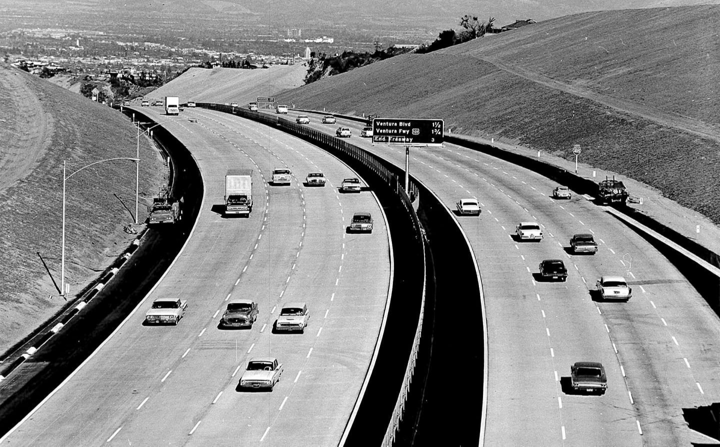 |
|
| (1962)* - View looking north toward the San Fernando Valley shortly after completion of the 405 Freeway (at the time just called San Diego Freeway).. |
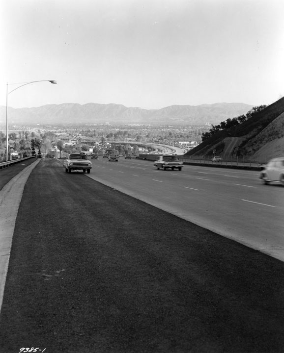 |
|
| (1962)^ - View looking north toward the San Fernando Valley from the edge of the newly completed 405 Freeway. An early model Ford Rambler is seen on the left merging onto the freeway, having used the ramp at Sepulveda Boulevard and Fiume Walk in Sherman Oaks. Photo date: December 26, 1962. |
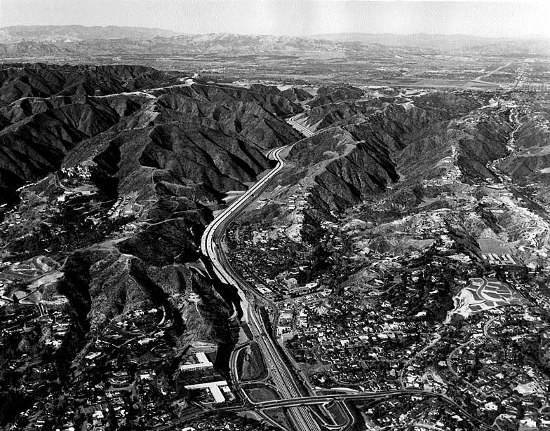 |
|
| (1962)^^ - Six days after the Sepulveda Pass portion of the 405 Freeway opened, there's hardly a car in sight from the Sunset Boulevard bridge into the San Fernando Valley. Photo date: Dec. 27, 1962 |
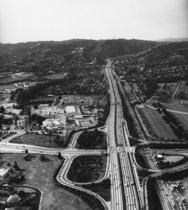 |
|
| (1968)*# - Aerial view of the San Diego Freeway (US-405) looking north from Wilshire Boulevard along Sepulveda Boulevard. |
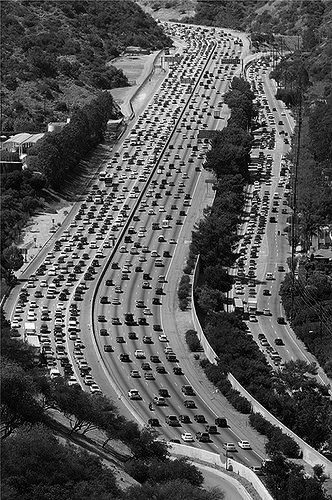 |
(ca. 2017)^.^ - The I-405 has earned its place as the busiest and most congested freeway in the United States. |
|
Historical Notes The freeway's congestion problems are legendary, leading to jokes that the road was numbered 405 because traffic moves at "four or five" miles per hour, or because drivers need "four or five" hours to get anywhere. Indeed, average speeds as low as 5 mph are routinely recorded during morning and afternoon commutes, and its interchanges with the Ventura Freeway (U.S. Route 101) and with the Santa Monica Freeway (Interstate 10) each consistently rank among the five most congested freeway interchanges in the United States.*^ |
San Diego and Ventura Freeway Interchange
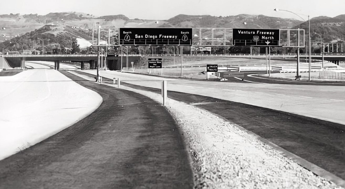 |
|
| (1958)* - Facing south at newly constructed San Diego Fwy (initially CA-7, now I-405) at Ventura Fwy (US-101) interchange. New 1.5 mile long freeway segment extended from Valley Vista Blvd to Burbank Blvd (Valley Times photo date July 1, 1958). |
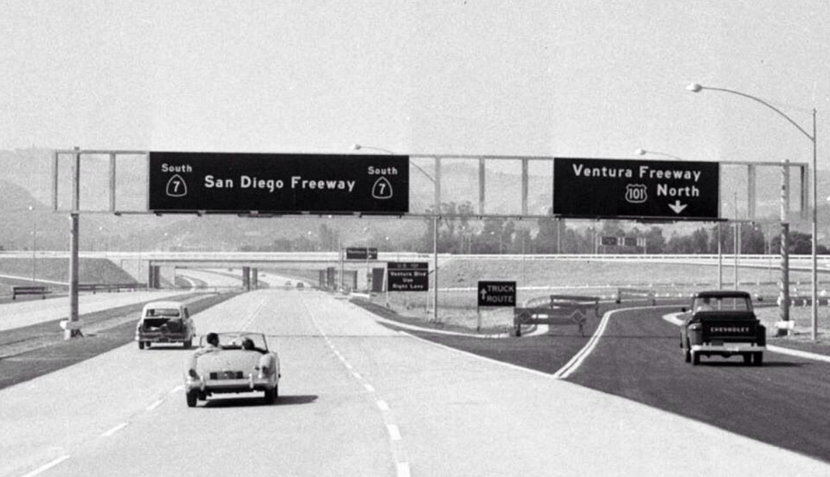 |
|
| (1961)#^*^ - Wide-angle view looking south on the San Diego Freeway at its junction with the Ventura Freeway shorthly after it opened. What traffic congestion? |
Historical Notes Note the signage for SR-7 instead of I-405, which changed only a few years later. |
* * * * * |
Olympic Drive-in (formerly Pico Drive-in)
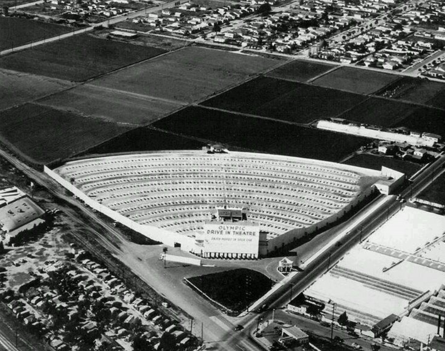 |
|
| (1956)##^# – Aerial view looking northwesterly showing the Olympic Drive-In Theatre located at the intersection of Olympic Blvd (left) and S. Bundy Drive (right). Note how much land is still undeveloped behind the theatre. |
Historical Notes This former drive-in originally opened as the Pico Drive-In (the first drive-in in California) at Pico Boulevard and Westwood Boulevard in 1934, but moved from that location to Olympic Boulevard in the late-1940’s and was renamed the Olympic Drive-In. ##^^ |
* * * * * |
Bunker Hill
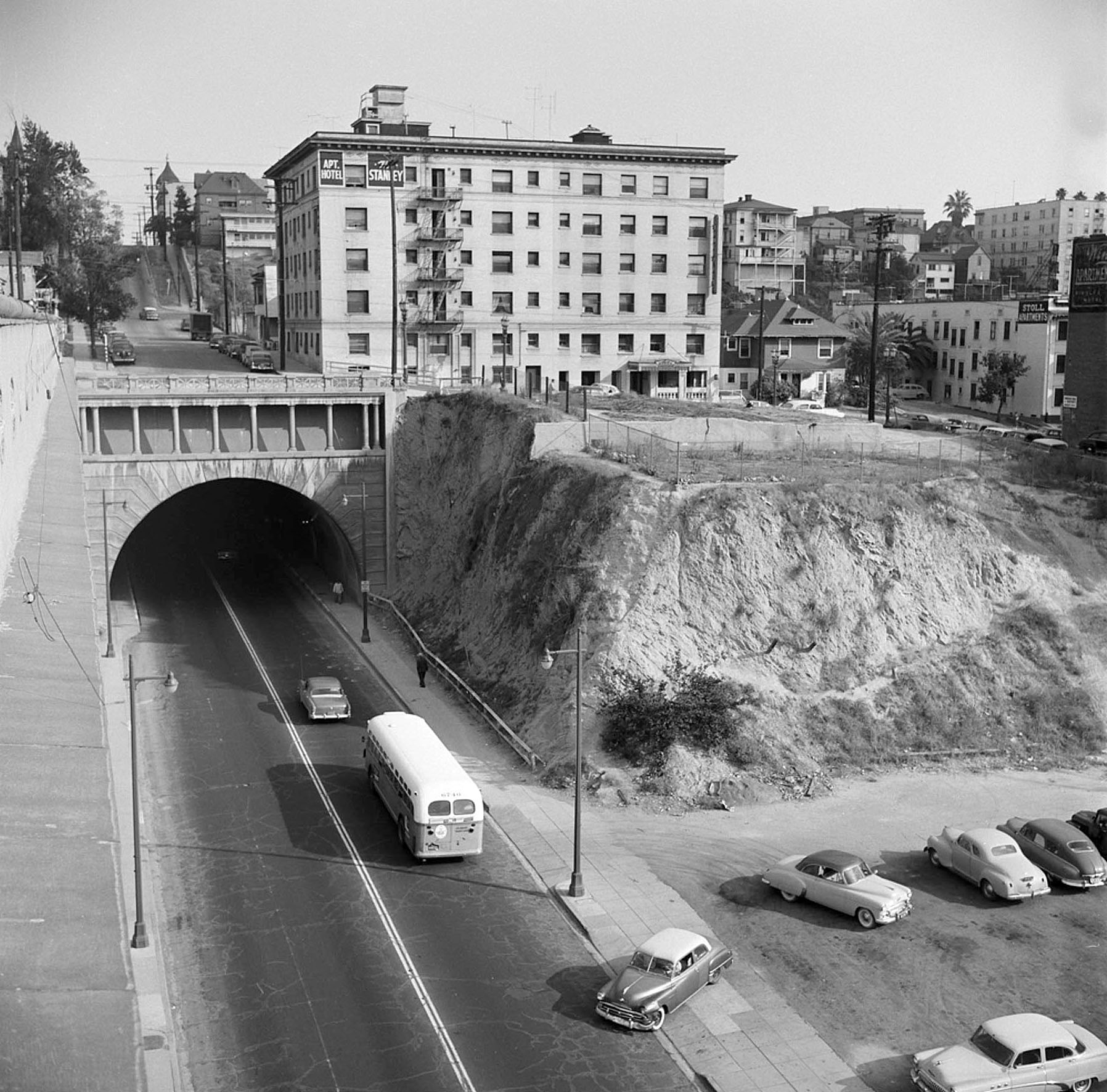 |
|
| (1950s)*^^ - View looking east toward the west end of the 2nd Street Tunnel. The Stanley Apartments is seen above the tunnel on Bunker Hill. In the distance can be seen the dome of the Dome Apartments. Bunker Hill would soon be scraped clean to make way for “redevelopment”. |
Historical Notes The Community Redevelopment Agency of the city of Los Angeles undertook the Bunker Hill Redevelopment Project in 1955, a massive clearance project that leveled homes and cleared land for future commercial skyscraper development. This period saw the clearing and upzoning of the entire neighborhood.^* |
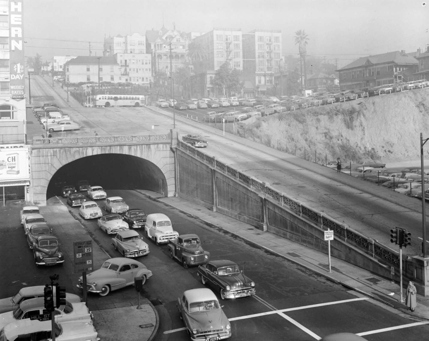 |
|
| (1950s)*++ – View looking at the eastern portal of the 2nd Street Tunnel showing a line of cars heading toward the Civic Center. Click HERE to see more Early Views of the 2nd Street Tunnel. |
Broadway and 7th Street (Downtown's Busiest Intersection)
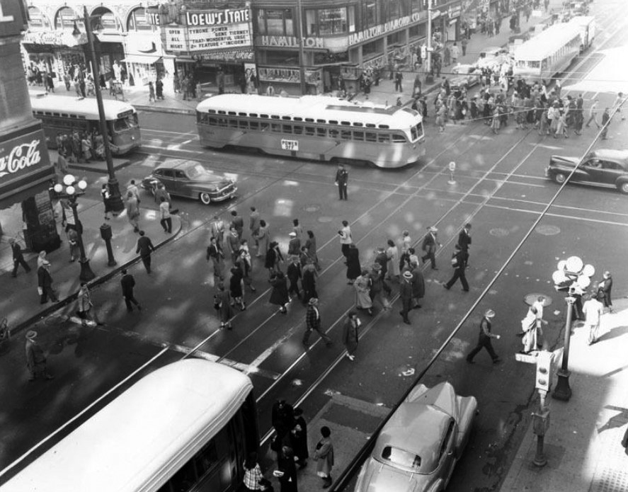 |
|
| (1953)^#^^ – View looking down at the intersection of Broadway and 7th Street, busiest intersection in Los Angeles. Lowe's State Theatre can be seen in the background. |
Historical Notes As Los Angeles entered the twentieth century, the area around Broadway and 7th Street became the city's commercial center. James B. Lankershim opened a new, nine-story hotel at the intersection in 1905. His original hotel, meanwhile, came down to make way for John Bullock's seven-story department store, which opened in 1906. Fifteen years later, the Loew's State Theatre -- one of several movie palaces to locate on Broadway -- opened across the street.^^^* |
 |
|
| (1958)^ - View showing one of downtown's busiest intersections, Broadway and 7th Street, during mid-day. The State Theatre on the corner is showing "The Brothers Karamazov." |
Historical Notes Click HERE to see more of the intersection of Broadway and 7th Street in the 1920s. |
 |
|
| (1964)^.^ – Close-up view of a newsstand located on the corner of 7th and Broadway with the Loew's State Theatre and Hamilton Diamond Co. seen across the street. Newspaper headline reads: “Ruby is Guilty” |
.jpg) |
|
| (1959)^*^# – Postcard view showing the intersection of Broadway and 7th Street. The State Theatre (703 S. Broadway) is showing “Ben-Hur.” At left is the Lankershim Hotel and at right is Bullock's Department Store. |
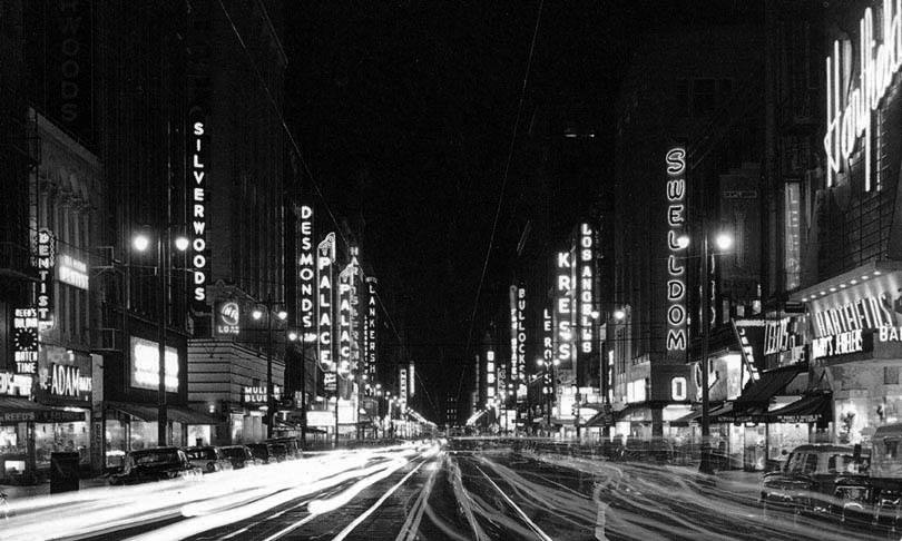 |
|
| (1959)^^*# - Postcard view of the bright lights of Broadway, looking south toward 7th Street. Brightly illuminated signs are seen on both sides of the street, including (l to r): Silverwoods, Desmonds, Palace Theatre, Lankershim Hotel, Bullock's, Leroys, Kress Shoes, Los Angeles Theatre, and Swelldom. |
Dodgers Move to LA
 |
|
| (1958)^ - The Dodgers ride in a motorcade parade down Broadway, en route to the Coliseum for their first game in Los Angeles. |
Historical Notes In the mid-1950s, Brooklyn Dodger team president Walter O'Malley had tried to build a domed stadium in the New York City borough of Brooklyn, but was unable to reach an agreement with city officials on land acquisition, and eventually reached a deal with the city of Los Angeles. The rest is history.^* Click HERE to see more in Baseball in Early Los Angeles. |
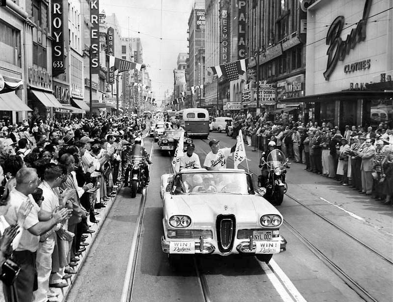 |
|
| (1958)^^ - Spectators line Broadway as Dodgers Manager Walter Alston, right, and coach Charlie Dressen ride in a 1958 Edsel to their first game at the Coliseum, April 18, 1958 (Click HERE to see more). |
Historical Notes Edsel - In 1958, Ford invested heavily in a yearlong teaser campaign leading consumers to believe that the Edsel was the car of the future – an expectation it failed to deliver. After it was unveiled to the public, it was considered to be unattractive, overpriced, and overhyped. The Edsel never gained popularity with contemporary American car buyers and sold poorly. The Ford Motor Company lost $250 million on the Edsel's development, manufacturing and marketing. The very name "Edsel" became a popular symbol for a commercial failure. ^* |
Downtown L.A.
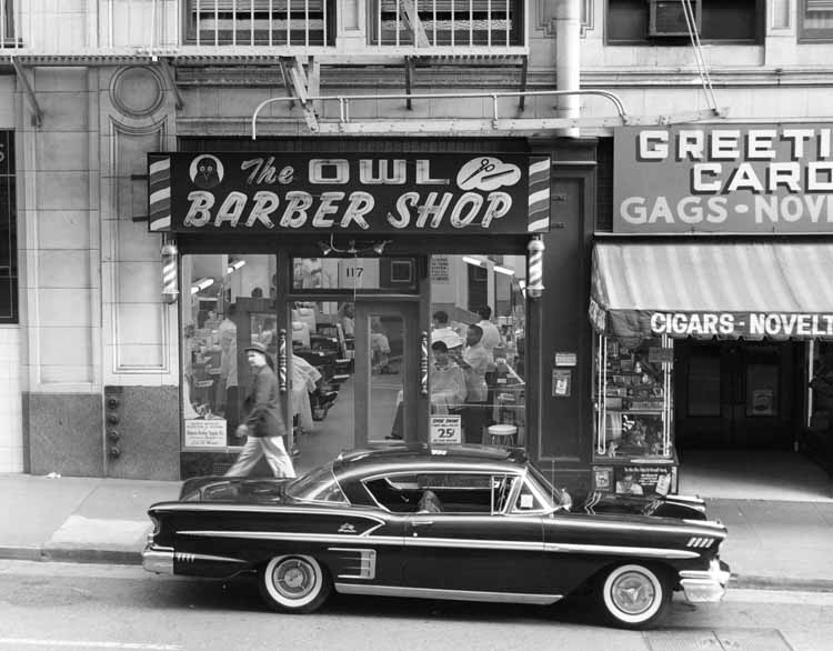 |
|
| (1959)*^^ - 25¢ haircuts: The Owl Barber Shop, 117 E. 6th Street, downtown Los Angeles. Located directly across the street from Cole’s Pacific Electric Buffet. In front sits a 1958 Impala Hardtop Sport Coupe. |
Historical Notes The Impala was introduced in 1958 and positioned as top of the line Bel Air coupes and convertibles. From the windshield pillar rearward, the 1958 Chevrolet Bel Air Impala differed structurally from typical Chevrolets. Hardtops had a slightly shorter greenhouse and longer rear deck, giving the impression of an extended body. Three taillights each side would become an Impala hallmark whereas lesser models had two and wagons just one. Special crossed-flag insignias sat above the side moldings plus bright rocker moldings and dummy rear-fender scoops. 1958 was the first year of dual headlamps. With a six-cylinder engine, a Chevrolet Bel Air Impala started at $2,586, while $2,693 bought a V8. In all, 55,989 convertibles and 125,480 Sport Coupes were built.. The 1959 Chevrolet Impala was radically reworked having large tailfins that protruded outward rather than upward.^* |
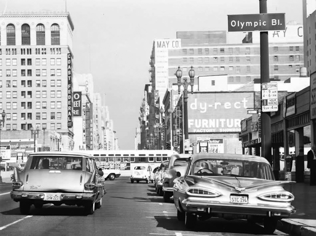 |
|
| (1960)**^# – View looking north on Hill Street at Olympic Boulevard with a 1959 Chevrolet Impala parked at right. Photo courtesy of Bobby Cole |
Historical Notes The 1959 Chevrolet Impala, following the styling excess of the late Fifties, was radically reworked and veered away from the GM pack by shooting its tailfins outward rather than upward. Admakers always were fond of naming nearly every part, but this year's "bat wing" fins above "cat's eye" taillights earned no such designations in the sales catalog. Those nicknames came later, though brochures did brand the deck "saucy." ^^+ |
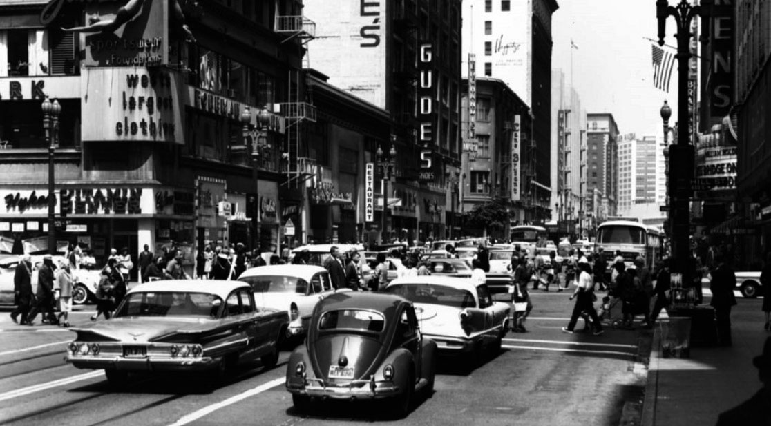 |
|
| (ca. 1960)*# – View looking west on 7th Street at Hill. The Bridge on the River Kwai (1957) is enjoying a re-release. Large white building at the 'end' of 7th is the Statler-Hilton. On the left is a two-tone 1960 Chevrolet Impala. Click HERE to see contemporary view. |
Historical Notes The Impala was toned down for 1960 and lost some of their distinct styling. Chevrolet changed almost every body panel on its 1960 cars except the roof. GM designers later admitted that they knew they’d gone too far, hence the more conservative approach for 1960. The “cat’s eye” tail lamps were replaced by three round cone shaped tail lamps per side and the gullwing fins were toned down. Prices ranged from $2,590-$2,954. ^ |
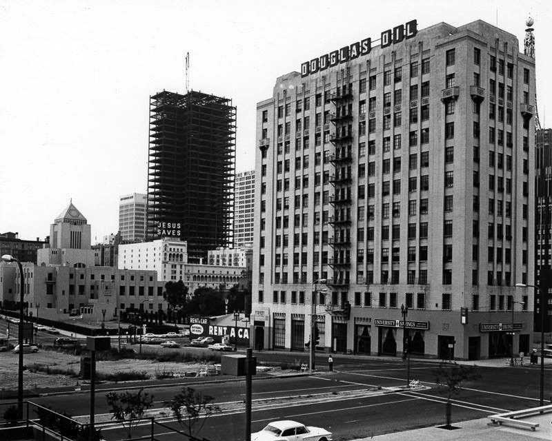 |
|
| (1968)^ - Looking from west to east towards the intersection of 5th and Figueroa streets in downtown Los Angeles. The vacant lot on the north side of 5th Street (left) is where the Westin Bonaventure Hotel is now located. The Douglas Oil Building and Richfield Oil Company Building (partially visible) are seen on the right. In the background are the LA Public Central Library (left) and the Church of the Open Door, upon which the " Jesus Saves" sign is mounted. The Crocker-Citizens Bank Tower at 6th Street and Grand Avenue is shown under construction. |
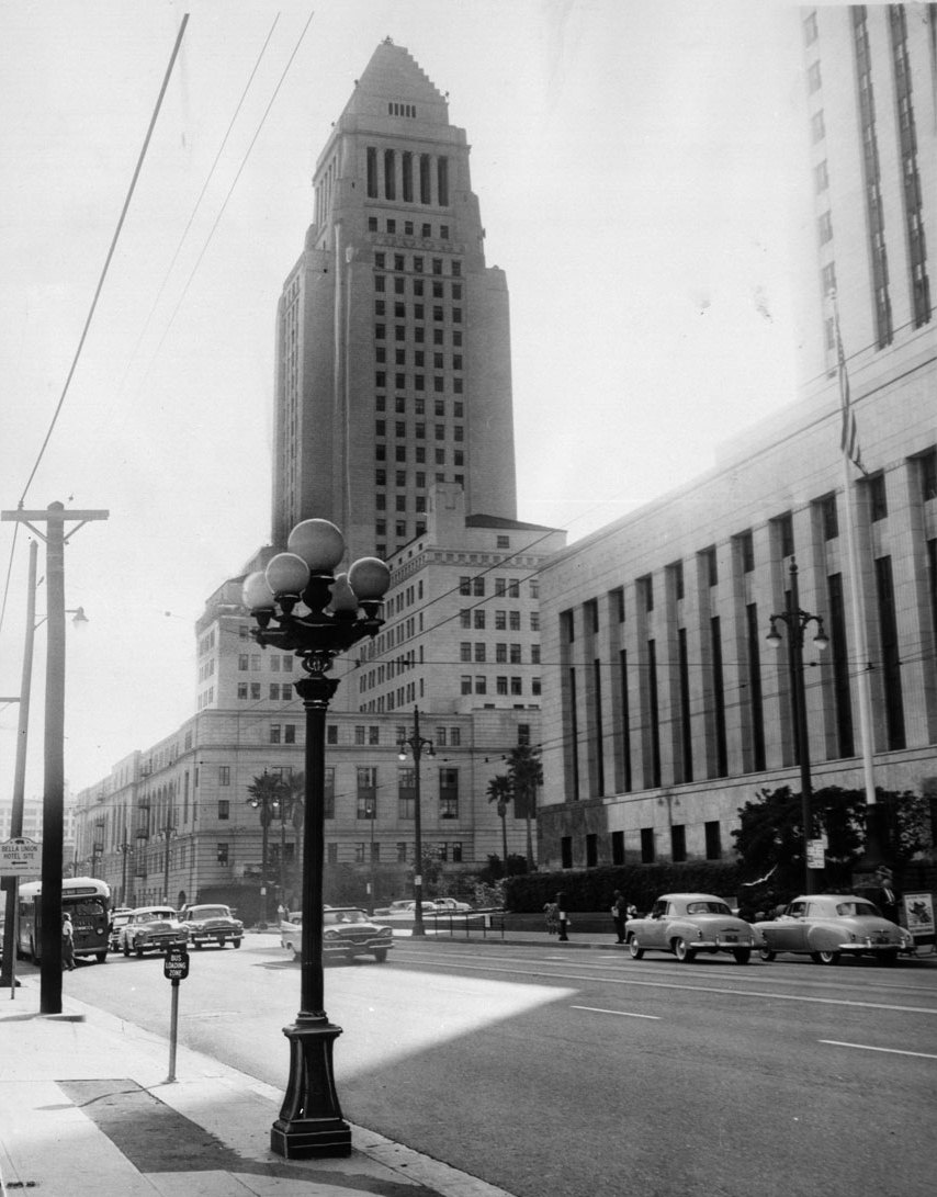 |
|
| (1959)*# - A five-globe lamp post with City Hall in the background. Today, the last remaining of these ornate street lights can still be found in the gardens and malls adjacent to City Hall. Click HERE to see more in Early Los Angeles Street Lights. |
Historical Notes Note the similiarities between the design of City Hall and the Central Library (previous photo). City Hall's distinctive tower was based on the purported shape of the Mausoleum of Mausolus and shows the influence of the Los Angeles Central Library, completed soon before the structure was started.^* |
Hollywood Aerials (1956)
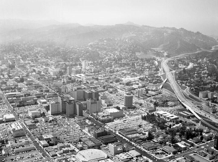 |
|
| (1956)^ - Aerial view looking northwest showing the Hollywood business district, with the Capitol Records Building visible middle right. Other visible buildings include: Pantages Theatre, E.F. Hutton Building, Broadway-Hollywood, Hotel Knickerbocker, Guaranty Building, and the Taft Building. The streets are (diagonally, l to r): Selma Avenue, Hollywood Boulevard, and Yucca Street; and (bottom to top) Gower Street, Argyle Avenue, Vine Street, Ivar Avenue, and Cahuenga Boulevard, to name a few. The Hollywood (101) Freeway is visible along the right as it heads its way through Cahuenga Pass. |
.jpg) |
|
| (1956)^ - Aerial view of the Hollywood business district, with the Capitol Records Building in the foreground; view is looking south. The cluster of tall buildings around the intersection of Hollywood and Vine can be seen at center of photo. Visible buildings include: Pantages Theatre, E.F. Hutton Building, Broadway-Hollywood, Hotel Knickerbocker, Guaranty Building, and the Taft Building. The streets are (vertically, l to r): Argyle Avenue, Vine Street, Ivar Avenue, Cahuenga Boulevard; and (horizontally, bottom to top) Yucca Street (extreme bottom), Hollywood Boulevard, Selma Avenue, and Sunset Boulevard, to name a few. |
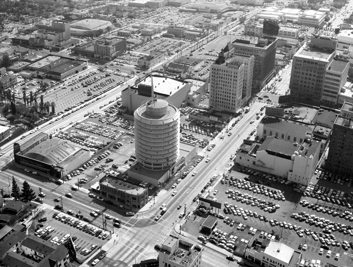 |
|
| (1956)^ - Aerial view of Hollywood showing the Capitol Records Building in the center surrounded by other buildings near Hollywood Boulevard and Vine Street; view is looking southeast. The visible streets are (diagonally, r to l): Vine Street, Argyle Avenue, Gower Street, and Bronson Avenue and (l to r): Yucca Street, Hollywood Boulevard, and Sunset Boulevard. Other visible buildings are Yucca Vine Building (corner of Yucca and Vine), Equitable Building (corner of Vine and Hollywood), Pantages Theatre (corner of Hollywood and Argyle), and Charles E. Skinner Studios (corner of Argyle and Yucca). |
Click HERE to see more in Early Views of Hollywood |
* * * * * |
Please Support Our CauseWater and Power Associates, Inc. is a non-profit, public service organization dedicated to preserving historical records and photos. We are of the belief that this information should be made available to everyone—for free, without restriction, without limitation and without advertisements. Your generosity allows us to continue to disseminate knowledge of the rich and diverse multicultural history of the greater Los Angeles area; to serve as a resource of historical information; and to assist in the preservation of the city's historic records.
|
For more Historical Los Angeles Views click one of the following:
For Other Historical Views click one of the following:
See Our Newest Sections:
To see how Water and Electricity shaped the history of Los Angeles click one of the following:
Water:
Power:
* * * * * |
References and Credits
* DWP - LA Public Library Image Archive
^ LA Public Library Image Archive
*^Oviatt Library Digital Archives
^^LA Times: Photo Archive; An Oil Well on La Cienega; Mulholland Bridge; A Mountain of Red Cars; The Vincent Thomas Bridge; Hill Street Tunnels; Harbor-Santa Monica Freeway Interchange; Dodgers Caravan,1958
#*MTA Transportation and Research Library Archives
+#Facebook.com: Garden of Allah Novels
#^^Picturetrail.com: KCET - Angels Flight
#^*Downtown LA Public Art: Fort Moore Pioneer Monument
^**Flickr: Enock 1; Eric Richardson
*^#Los Angeles Conservancy: LA Stock Exchange Building; Park La Brea
^#^Pacific Electric Railway Historical Society - Alan Weeks Collection
*#*Westland.net: Venice History
*#^Forum.Skyscraper.com: Arroyo Seco Library; Westwood-Life Magazine; North Los Angeles Street
^#*Metro.net: Mulholland Drive Bridge
**#The California History Room, California State Library: William Reagh
#**Pinterest - California and DailyBreeze.com
#^#Deadhistoryproject.com: Silent Movie Theater
+**Los Angeles' Bunker Hill - Alta Visa Apartments
+##MartinTurnbull.com: Fairfax and Wilshire
^^+How Stuff Works: Chevrolet Impala
+#+Pinterest - California and DailyBreeze.com; Mid Century Hollywood
++#Facebook.com: Photos of Los Angeles
^^#The George A. Eslinger Street Lighting Photo Gallery
^^*Early Downtown Los Angeles - Cory Stargel, Sarah Stargel
***Los Angeles Historic - Cultural Monuments Listing
*^*California Historical Landmarks Listing (Los Angeles)
*^^Nuestra Señora la Reina de los Ángeles: losangelespast.com
**** Pinterest.com: Los Angeles Dodgers; Los Angeles and Hollywood; MacArthur Park w/Downtown Skyline; Gilmore Self-Service Gas Station
**^*California State Library Image Archive
**^#Vintage Los Angeles: Facebook.com - Gilmore Stadium and Field; Cruising Hollywood Blvd
^^^^Depaul.edu: Night Train 55
**#^Vincent Thomas Bridge - Facts and Figures
*#**Flickr-Los Angeles in Good Light - Ron Reiring
^#^^Flickr.com: Michael Ryerson
*#^#Life.time.com: Stoked-Life Goes Surfing
*#*#Abandoned & Little-Known Airfields – Paul Freeman
^#*#LA Magazine: Beverly Park Ponyland
^^##Pacific Electric Railway Historical Society
^^*#Historic LA Theatres: Downtown Broadway Theatres
^^#*LA Observed.com: Decommissioned Street Cars; Bunker HIll, 1964
*^^*Pinterest.com: Bertrand Lacheze
^^**Pinterest.com: Vintage California
^^++Huntington Digital Library Archive
*##*Pinterest.com: Trucks, Pick-Ups, and Gas Stations
*##^LAist.com: Harbor Freeway, 1969; Century Plaza Hotel
##*^Port of Los Angeles: portoflosangeles.corg
##^*Calisphere: University of California Image Archive
##^^Cinema Treasures: Olympic Drive-In
#**#California State University Northridge History: csun.edu
#++#The Pacific Electric Railway Historical Society (PERyHS)
#*##Daily News: Mulholland Bridge
#^**The Go Go's: N/W Corner of Hollywood and Vine
#^*#Flickr.com: Paul Bajerczak
##^#Facebook.com: Classic Hollywood-Los Angeles-SFV
^***UCLA Library Digital Archive
^^^*KCET: Welcome to L.A. River; Four Level Interchange; Construction of 5 Southern California Freeways; Beverly Park and Ponyland; Before the 'Carmageddon': A Photographic Look at the Construction of 5 SoCal Freeways; Seventh and Broadway; L.A.'s First Freeways
****^Facebook.com: West San Fernando Valley Then And Now
*^^^^Los Angeles Maritime Museum
^^^**tumblr.com: John Ferraro Office Building; DWP Office Building
**^^^Facebook.com - San Pedro's Original Website, San Pedro.com
#*#**Facebook.com: Beverly Park - L.A.'s Kiddieland
**#**LMU Digital Archive
**^ Noirish Los Angeles - forum.skyscraperpage.com; Westwood-Life Magazine; Selling Papers on Olive; California Federal Plaza Building; Downtown Aerial 1958; 1949 Construction of 101 Freeway; 1953 Harbor Freeway Construction; Wilshire Blvd, 1949; Zephyr Room and Brown Derby Postcard View; Aliso Before and After 101 Frwy; Vincent Thomas Bridge; Gilmore Aerial; Hollywood Frwy Traffic Jam; 2012 Downtown Skyline; View from GOB; Bonaventure Hotel Aerial; Hollywood and Vine
^* Wikipedia: Hollywood Sign; Carthay Circle Theatre; Fairfax High School; Park La Brea; San Vicente Boulevard; Etymologies of place names in Los Angeles; Los Angeles Central Library; Broadway Tunnel; Pershing Square; Pacific Electric Railway; Gilmore Field; GilmoreStadium; Union Station; Westwood; 6th Street Viaduct Bridge; Figueroa Street Tunnels; Chavez Ravine; 2nd Street Tunnel; Hollywood Freeway; Los Angeles International Airport; Los Angeles City Hall; Wilshire Boulevard Temple; Egyptian Theatre; The Pig 'N Whistle; Sunland-Tujunga; Van de Kamp Bakery Building; Los Angeles County Art Museum; Los Angeles City Oil Field; Los Angeles Railway; Miracle Mile; Interstate 405; Chevrolet Impala; Playa Vista; Harbor Frwy (Interstate 110); History of Los Angeles Population Growth; Los Angeles City Hall Lindbergh Beacon; May Company California; Four Level Interchange; California Federal Bank; Harbor Freeway; Arroyo Seco Parkway; Brown Derby; 2004 Los Angeles Skyline; LA's Oldest Palm Trees; Vincent Thomas Bridge; World Cruise Center; CSUN; Westwood; Westwood Village; UCLA; History of UCLA; 1950s Americal Automotove Culture; Pershing Square; Century Plaza Hotel; California Incline
< Back