Early Los Angeles City Views (1925 +)
Historical Photos of Early Los Angeles |
 |
|
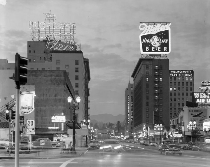
| (ca. 1950s)^ - View at dusk, neon signs lit, looking northward on Vine Street from Selma Ave. On the left, The Broadway-Hollywood, Plaza Hotel, Mobilgas ; on the right, Equitable Building, Taft Building, The Brown Derby Coffee Shop. Atop the Taft Building a large neon sign for Miller High Life beer. The Capitol Records Building is hidden from view by the Equitable Building. |
 |
|
| (1950s)+^+ - View looking north toward the intersection of Hollywood and Vine. The four main buildings located on the corners of the intersection can be seen (L to R): The Broadway-Hollywood, Hody's Restaurant, Equitable Building, and the Taft Building. The iconic Capitol Records Building stands in the background. |
 |
|
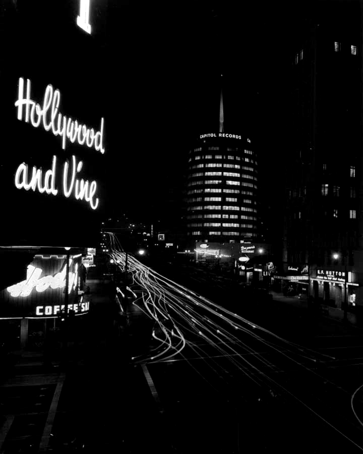
| (ca. 1956)*^^ - Long exposure photo of Hollywood and Vine at night. Capitol Records Building is in the background. |
 |
|
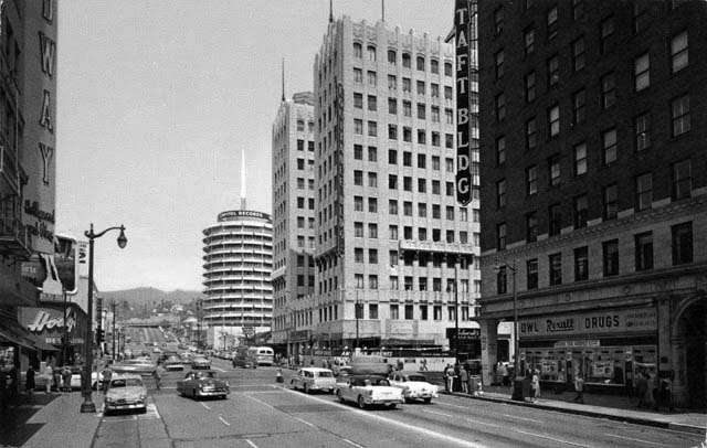
| (ca. 1961)+#+ – View looking south on Vine Street from Yucca Street with the Capitol Records Building on the left. |
 |
|
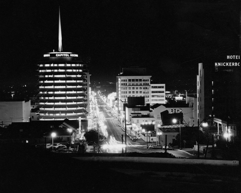
| (ca. 1960)^ - View shows the Capitol Records Building (left) and Hotel Knickerbocker (right). Capitol Records, located on Vine Street, is a unique 13-story, 150 ft. high-rise cylindrical building that was built in 1956 by architect Welton David Becket and contractor C. L. Peck Co. |
 |
|
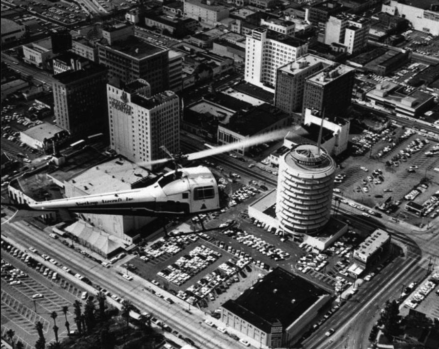
| (1970)##^# - Aerial view looking southwest showing a helicopter hovering over Hollywood. The intersection of Hollywood and Vine is at upper center-left and the Capitol Records Building stands tall at center-right. |
 |
|
| (1978)^ - A view taken from the west side of Vine St., looking north toward the Capitol Records Building. A sign over the Howard Johnsons on the northwest corner advertises Universal Studios Tour and the film Airport '77. Also visible are stars on a portion of the Hollywood Walk of Fame. |
 |
|
| (n.d.)**** - View of the Capitol Records Building during the holidays. Each year, they add the Xmas tree to help make the city a little more festive. |
Click HERE to see more in Early Views of Hollywood (1920 +) |
* * * * * |
LA Memorial Coliseum and Sports Arena
 |
|
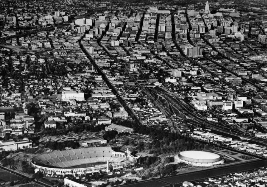
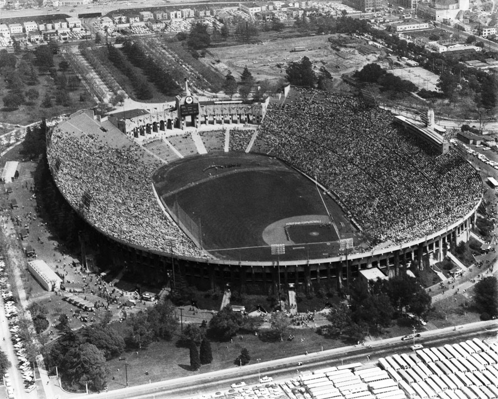
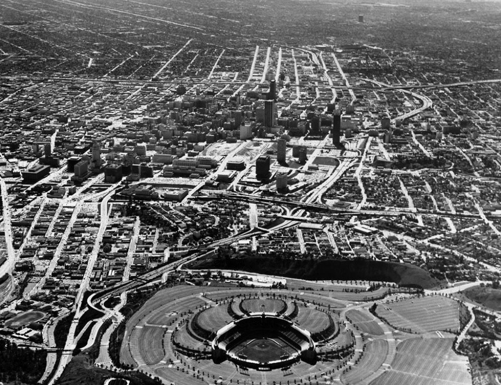
| (ca. 1960)*# - Aerial view of the Los Angeles Coliseum, Los Angeles Los Angeles Sports Arena, University of Southern California (USC), Downtown Los Angeles, and the Harbor Freeway (I-110). |
 |
|
| (1958)*# - Aerial view of the Los Angeles Memorial Coliseum on Dodger’s opening day, April, 18, 1958. |
Historical Notes While Dodger Stadium was under construction, the Dodgers played in the league's largest capacity venue from 1958 through 1961 at their temporary home, the Los Angeles Memorial Coliseum, which could seat in excess of 90,000 people. Despite their inept play and seventh-place finish, the Dodgers drew a record 1,845,556 fans in their first year in Los Angeles when they played at the Coliseum.* |
 |
|
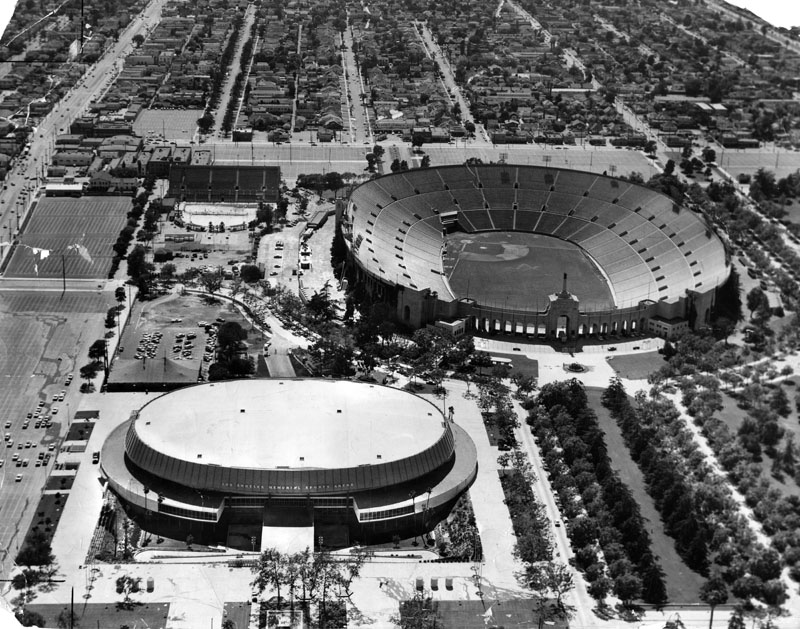
| (1960)^ - Blimps-eye view shows both the Los Angeles Memorial Coliseum and the Los Angeles Memorial Sports Arena. Note the baseball diamond in the Coliseum where the LA Dodgers played (1958-1961). |
Click HERE to see more in Baseball in Early Los Angeles |
Super Bowl I
 |
|
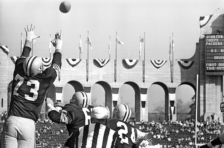
| (1967)^^ – The Packer’s Jim Weatherwax, No. 73, tries to block a Chiefs kick at Super Bowl I on January, 15, 1967. |
Historical Notes The Green Bay Packers defeat the Kansas City Chiefs 35-10 in the first Super Bowl, played at the Los Angeles Memorial Coliseum. At halftime, the Chiefs were only behind 14-10, but the Packers took over in the third quarter.^^* Super Bowl I was the only Super Bowl in history that was not a sellout in terms of attendance, despite a TV blackout in the Los Angeles area (at the time, NFL games were required to be blacked out in the market of origin, even if it was a neutral site game and if it sold out). Of the 94,000-seat capacity in the Coliseum, 33,000 went unsold. Days before the game, local newspapers printed editorials about what they viewed as a then-exorbitant $12 price for tickets, and wrote stories about how to pirate the signal from TV stations outside the Los Angeles area.*^ |
* * * * * |
Bunker Hill
 |
|
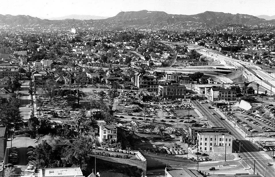
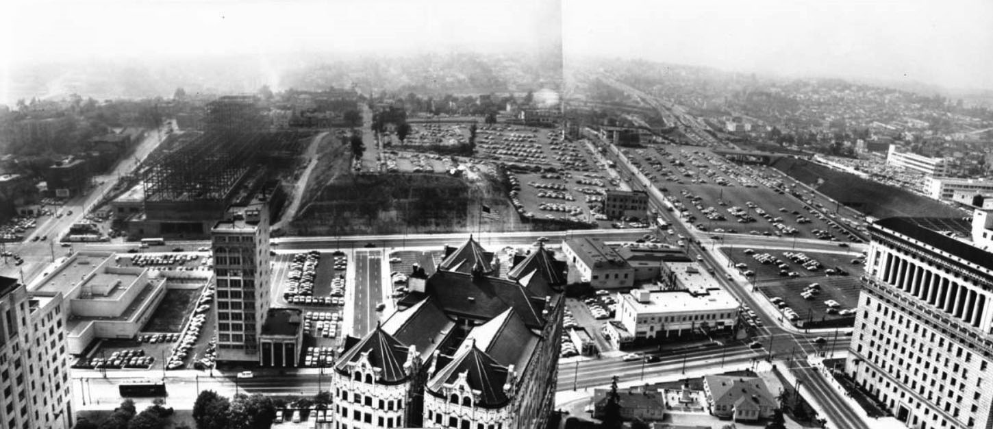
| (ca. 1937)^#^^ - View looking northwest from City Hall tower over the Hall of Records. Bunker Hill is covered with multiple dwellings. |
Historical Notes The prominent street running diagonally up from the lower right corner is Temple Street coming from the intersection with Broadway (barely seen, lower right corner). This baroque rooftop in the bottom of the image is the Hall of Records which reaches through from Spring Street all the way to Broadway. Court Street can be seen running directly away from the camera near the left edge. At lower-left, can be seen Court Flight running from the eastern terminus of Court Street down to Broadway (out of view). Mount Lee and the Hollywood Hills are seen in the distance where the elongated white smudge near the top of the ridge is the Hollywoodland Sign.^#^^ |
 |
|
| (1951)##^#– View looking northwest from the top of the Hall of Records showing Bunker Hill as it appeared in the early 1950s. The Four Level Interchange is seen under construction at center-right. Parking lots fill the void where apartment house once stood. Court Street is seen at left running away from the camera. At lower-right is the instersection of Temple and Hill streets. The Hollywood Hills and Hollywood Sign can be seen seen in the distance. |
 |
|
| (Early 1950s)^#^^ - View looking northwest from City Hall tower. Court Street runs away from the bottom on the left. Bunker Hill has been slightly shaved to make room for the New County Courthouse, which is under construction, and several parking lots. There are still a few remaining dwellings at the far end of Bunker Hill. |
 |
|
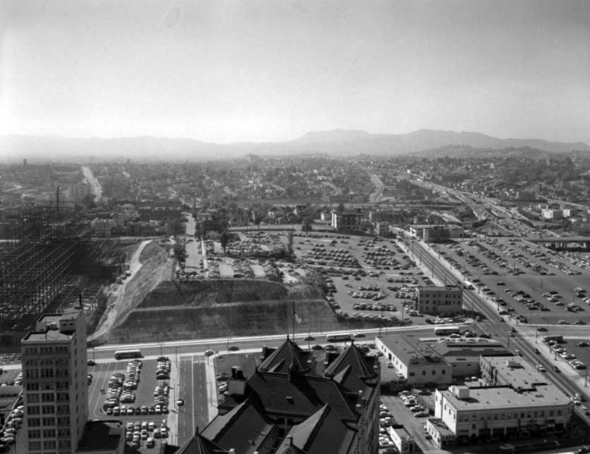
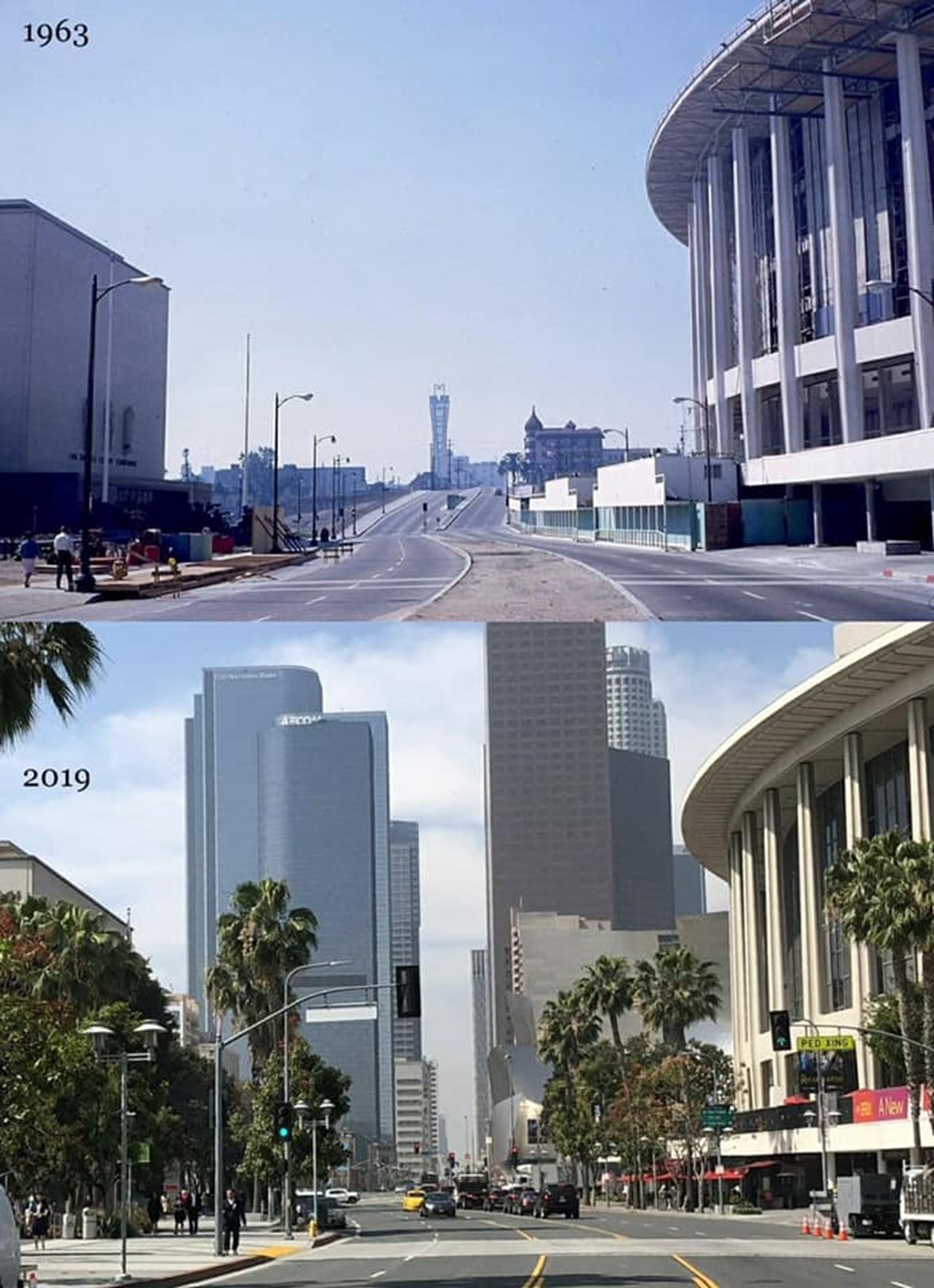
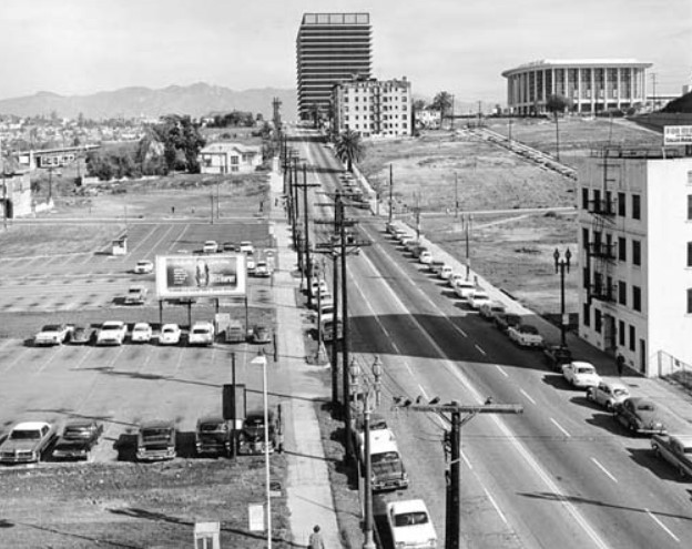
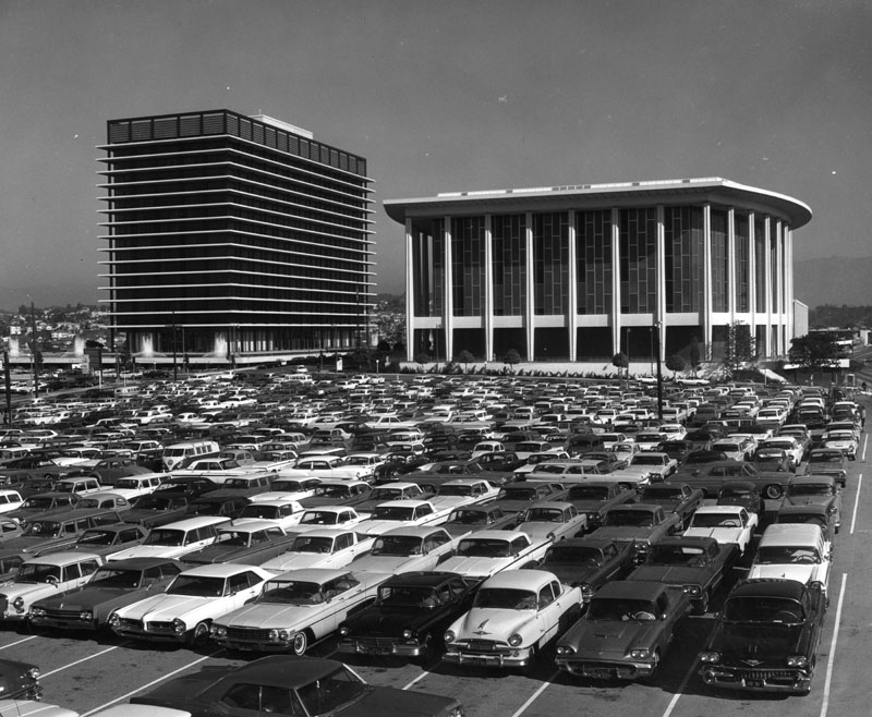
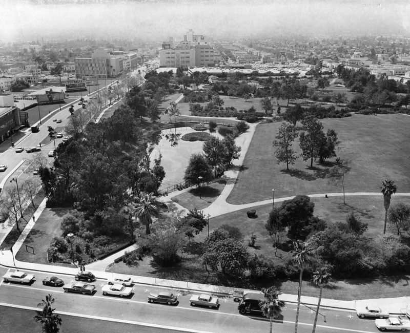
| (ca. 1960)^ - View looking northwest from City Hall toward Bunker Hill prior to construction of the DWP General Office Building and the Music Center. |
 |
|
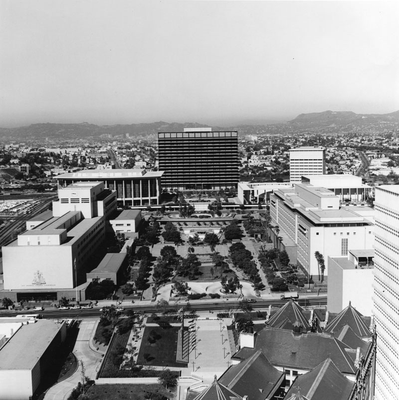
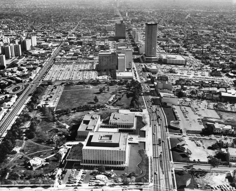
| (ca. 1970)^ - View of from City Hall looking northwest toward the DWP General Office Building and the Music Center located on Bunker Hill. |
Before and After
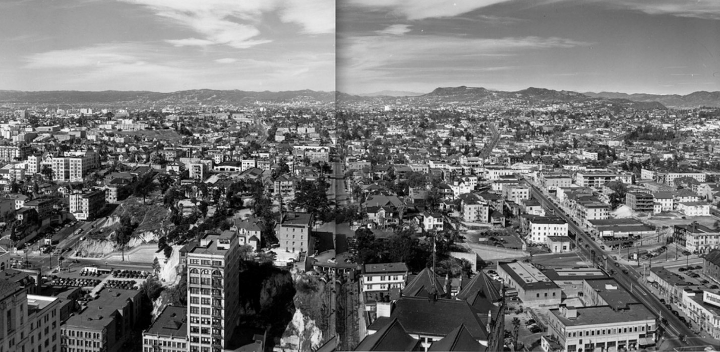 |
|
| ca. 1937)*# - Panoramic photograph composite looking west from City Hall along Court Street with Hall of Records roof and Court Flight in the foreground. |
 |
|
| (1956)*# - Panoramic photograph composite taken from the City Hall tower, facing west to northwest towards Bunker Hill and Hollywood. Bunker Hill has been slightly shaved off to make room for the County Courthouse, which is under construction, as well as several parking lots. There are still a few remaining dwellings at the far end of Bunker Hill. | Broad |
 |
.jpg) |
|
| (ca. 1960)^ - View looking northwest from City Hall. | (ca. 1970)^ - View looking northwest from City Hall. |
 |
|
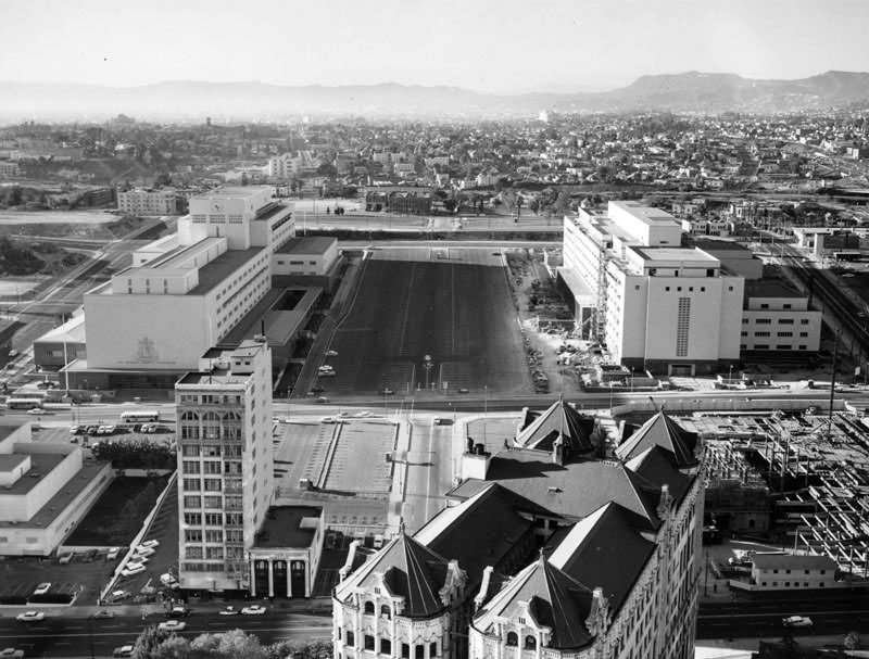
| (ca. 1963)^ - Photo taken from the City Hall Tower; view is looking northwest. The old State Building can be seen on the left, and the old Hall of Records (diagonally set building) is on the lower right foreground with a large, practically empty parking lot to the right of the building. In the center of the photo are the New County Courthouse, County Administration, and construction of the County mall (excavated area). In the distance is the Department of Water and Power building, and the Dorothy Chandler Pavilion and Music Center are on the left of DWP (between DWP and County Courthouse). |
 |
|
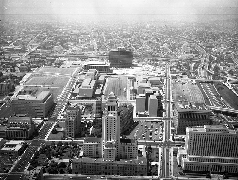
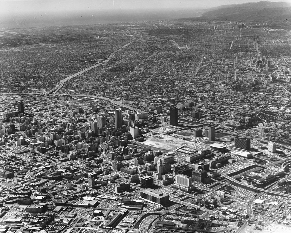
| (1963)^ - Aerial view of Los Angeles Civic Center neighborhood of government offices; view is looking northwest. Identifiable landmarks include the Federal Courthouse at bottom right; Los Angeles City Hall, located at 200 N. Spring St. sits at center forefront; the old Hall of Records, the Hall of Justice behind City Hall; in the distance is the Department of Water and Power building (tall building with horizontal lines), and the Dorothy Chandler Pavilion and Music Center are on the left of DWP (between DWP and New County Courthouse. The Hollywood (101) Freeway is on the right; Temple St. is vertically at center right; 1st St. is vertically at left; Main St., Spring St., Broadway, Hill St. Grand Ave. are horizontally from bottom up; the Harbor (110) Freeway is horizontally at upper middle. |
 |
|
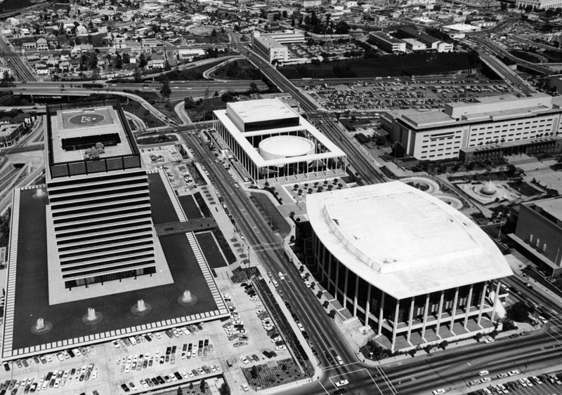
| (1963)^ – Aerial view looking northeast showing Bunker Hill and the Civic Center. Both the DWP General Office Building and Dorothy Chandler Pavilion are nearly completed. The Ahmanson Theater and Mark Taper Forum would not be completed until 1967. The empty lot across the street from the Dorothy Chandler Pavilion will become the future home of Walt Disney Concert Hall. |
 |
|
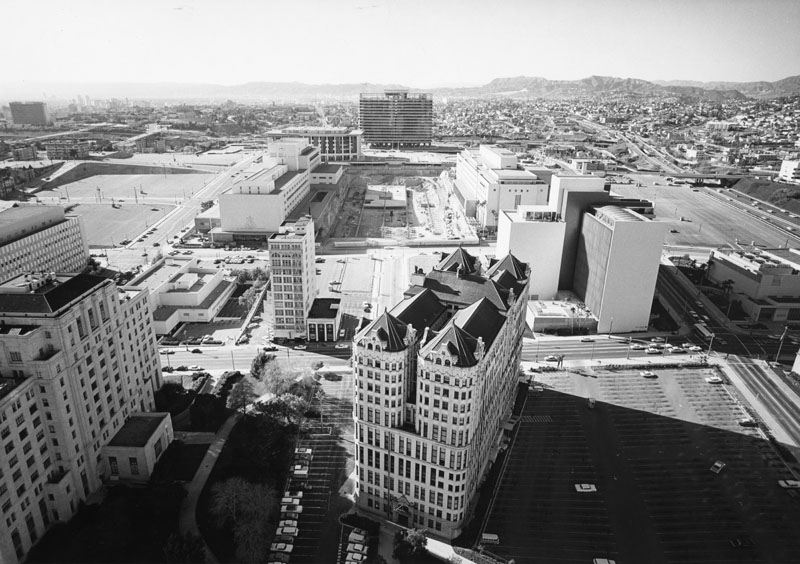
| (ca. 1963)^ - Another aerial view of the civic center with City Hall in the background and the yet to be completed Dorothy Chandler Pavilion and Department of Water and Power General Office Building (GOB) in the foreground. |
Click HERE to see more Early Views of the Construction of the DWP General Office Building |
Bunker Hill
 |
|
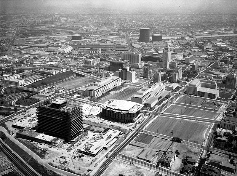
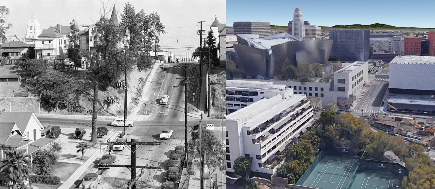
| (1955)**^ – View looking east on 2nd Street at Hope Street toward Bunker Hill. The tower of the Dome_Hotel and Apartments (SW corner of 2nd and Grand) can be seen at upper-right. City Hall is at upper-left. Photo by Leonard Nadel |
Historical Notes In 1955, Los Angeles city planners decided that Bunker Hill required a massive slum clearance project. There were a couple of major political events which led to the "removal of the blight" and redevelopment of Bunker hill. The California Community Redevelopment Law of 1945, the Federal Housing Act of 1946 and 1949, the creation of the Community Redevelopment Agency in 1948, and also the Bunker Hill Urban Renewal Project in 1959. The California Community Redevelopment law of 1945 allowed counties and cities to create and implement these agencies to help deal with the redevelopment of local cities. Until 2011, these Agencies held much power and were still around, until Governor Jerry Brown signed into law two bills to dissolve them. Along with those political factors, other things which led to the conclusion of the blighted neighborhood came from some of the government offices. The LAPD called the area a "high frequency crime area", due to the fact that the area's apartments catered to known offenders. The Health department of Los Angeles also called the area a health hazard for its city. It wasn't until the CRA had won an ongoing court case against the residents of Bunker Hill. This loss for the residents of Bunker Hill led to the displacement of many families and removal of many of the low income residents of the area. This victory for the CRA led to them being able to buy land to redevelop as they saw fit. Within the plans for the redevelopment, there was a section for the rehabilitation of the buildings of Bunker Hill. The section was slated to preserve the historical buildings of Bunker Hill, but instead were demolished since there was no actual rehabilitation planned.* |
 |
|
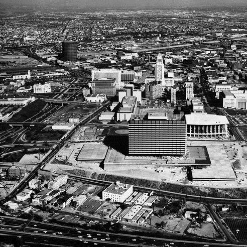
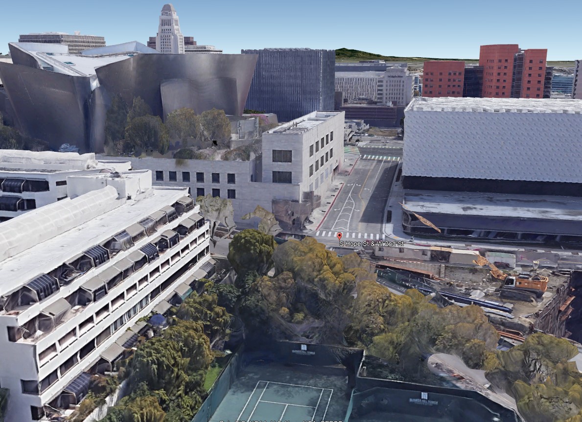
| (2020) – Google Earth view looking East on 2nd Street at Hope Street. |
Then and Now
 |
|
| (1955 vs. 2020) – View looking east on 2nd Street at Hope Street toward Bunker Hill before and after it was shaved down. The tower of the Dome Hotel and Apts (SW corner of 2nd and Grand) can be seen in the upper-right corner of photo on the left. This is where the Broad Museum stands today. Disney Concert Hall took over the entire Bunker Hill block where these old homes once stood. |
 |
|
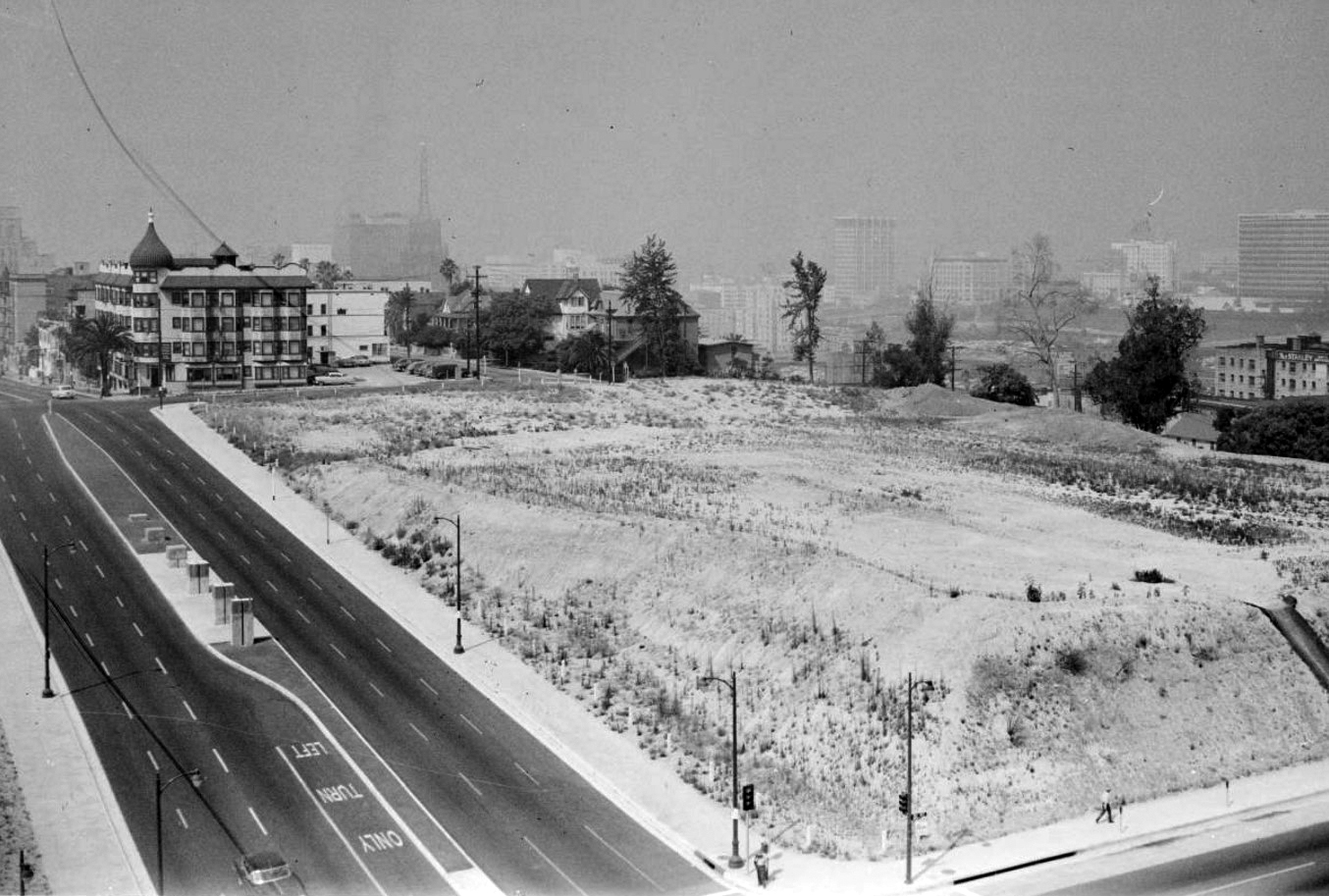
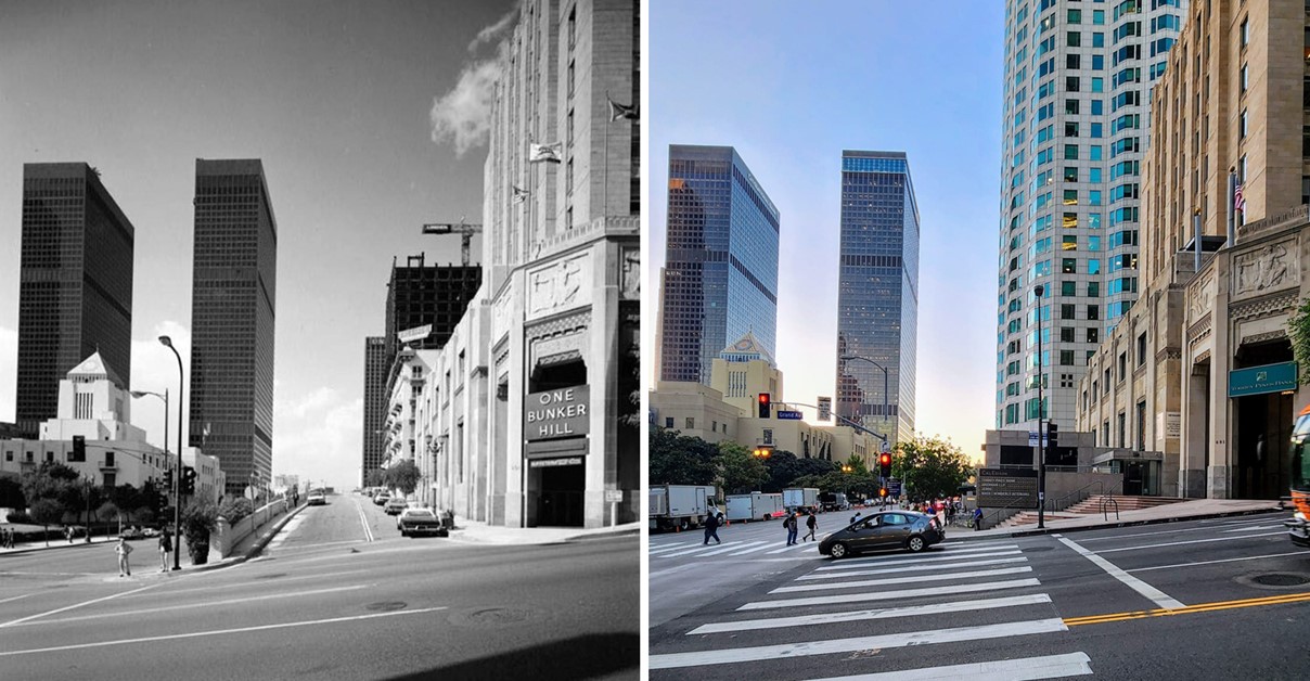
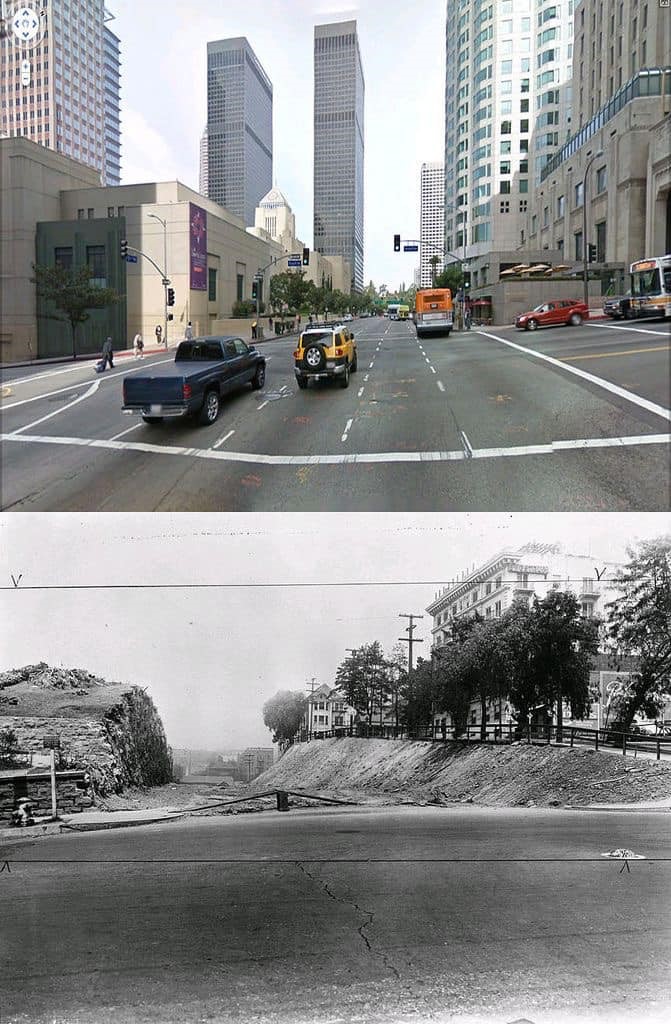
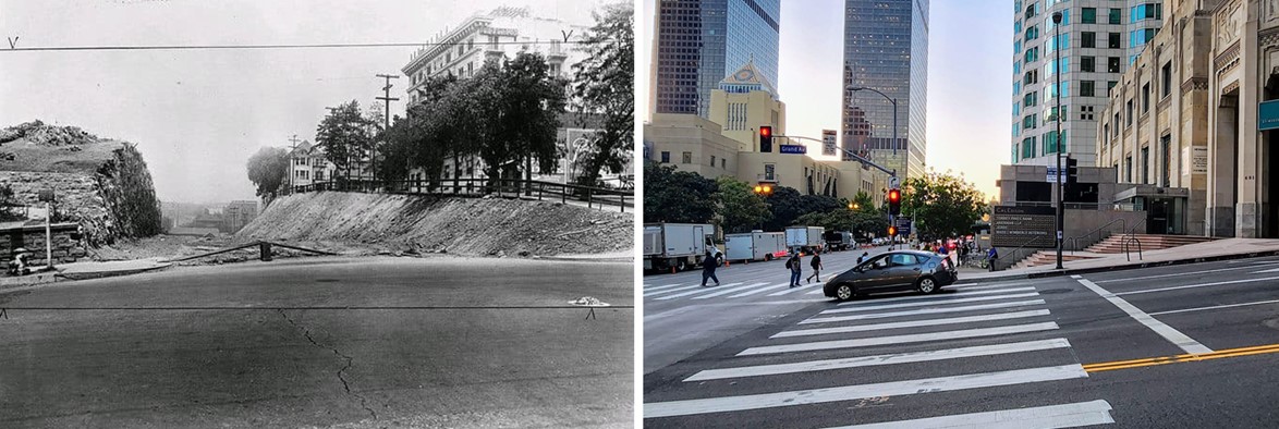
| (1960)*# – View looking southwest from the L. A. County Courthouse at 1st and Grand showing a large empty lot sitting on top of Bunker Hill. This will become the site of the Walt Disney Concert Hall (completed in 2003). The multi-story building with the dome seen in the upper-left is the Dome_Hotel and Apartments (S/W corner of 2nd and Grand). Today, the Broad Contemporary Art Museum stands at |
 |
|
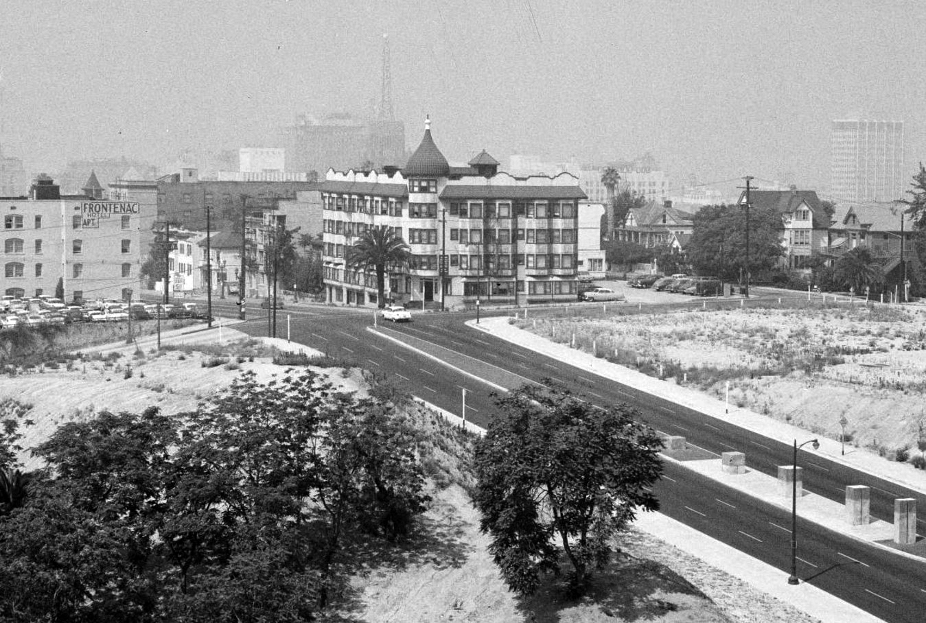
| (1960)*# – Closer view showing the Dome Hotel and Apartments (built in 1903) on the southwest corner of 2nd and Grand. The lot to the right is the future location of the Walt Disney Concert Hall. In the background through the haze and smog can be seen the Richfield Oil Company Building which was demolished in 1969 to make way for the ARCO Towers. |
Historical Notes On the morning of July 25, 1964, the Dome burst into flames. The building would be razed later that year to make room for a parking lot which existed until 2014 when construction began for the Broad Contemporary Art Museum (completed in 2015). |
 |
|
| (1963)* – View looking South on Grand Ave at 1st Street with the Dorothy Chandler Pavilion (right) and the L. A. County Courthouse (left). In the distance can be seen the AT&T Madison Complex Tandem Office Building and the Dome Hotel and Apartments. |
Then and Now
 |
|
| (1963 vs. 2019)* – Grand Avenue looking South toward First Street. |
 |
|
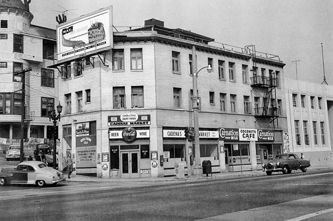
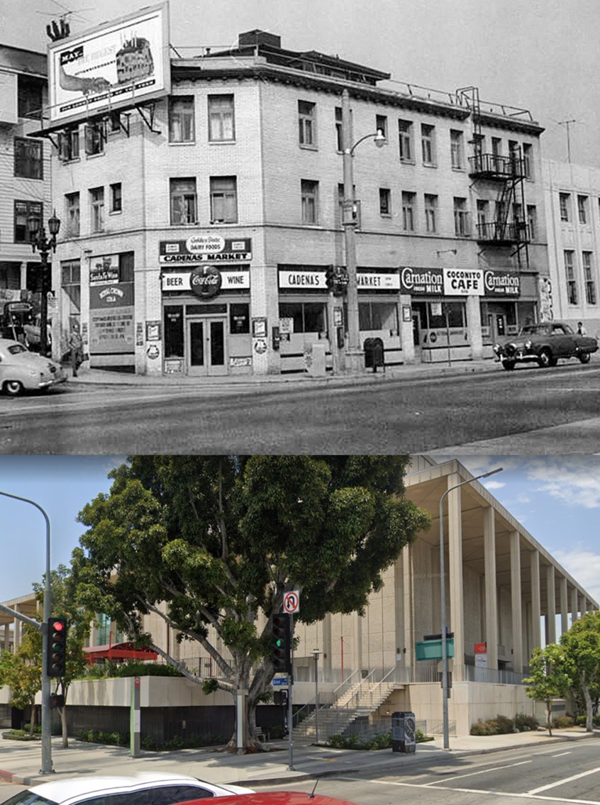
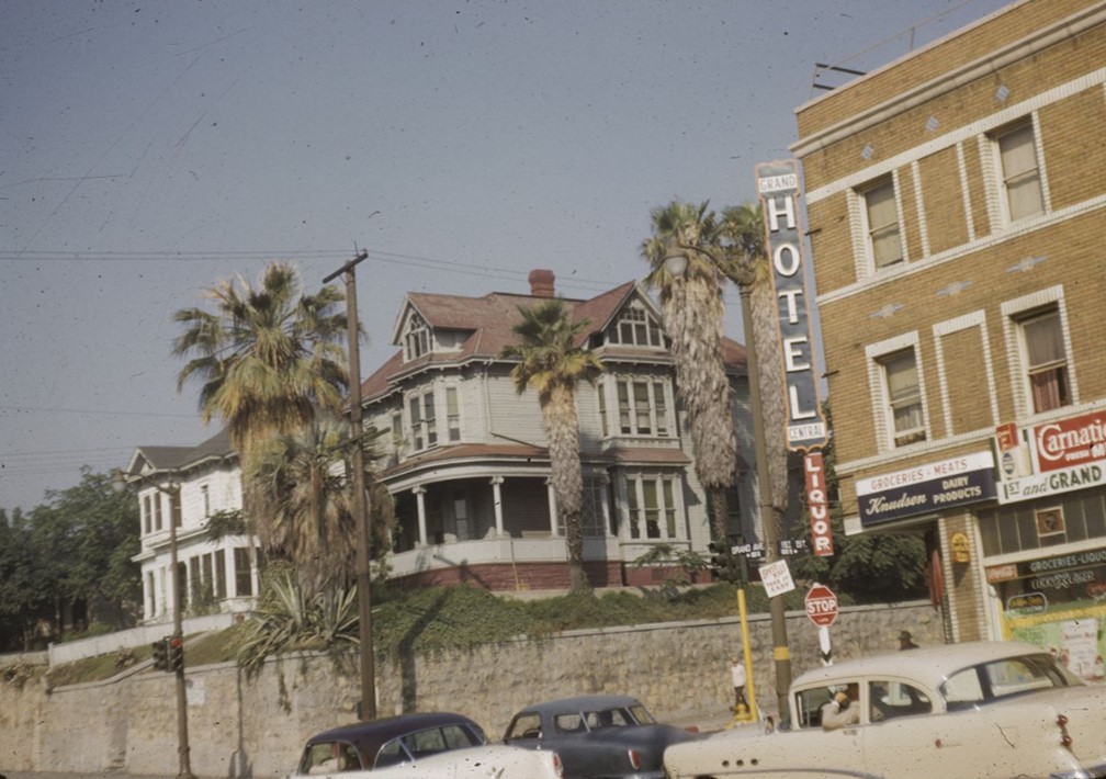
| (ca. 1955)* – Looking southwest across the intersection of Temple Street (foreground) and N. Grand Avenue (left) towards the Cadena Hotel located at 600 Temple Street; Cadena's Market occupies the ground floor. On the far right is the Art Deco style building at 610-614 Temple Street occupied by the offices for the Federation of Jewish Welfare Organizations, and on the far left, a portion of the former St. Angelo Hotel is visible. |
Then and Now
 |
|
| (1955 vs. 2021)* – Looking at the SW corner of Temple Street and Grand Avenue, current location of the Ahmanson Theatre. |
* * * * * |
 |
|
| (1965)^^#* – View looking north on Flower Street from 4th Street, through the former Bunker Hill neighborhood. The newly constructed Dorothy Chandler Pavilion, right, and the Department of Water and Power Headquarters can be seen past 1st Street. |
Historical Notes The Bunker Hill Towers have yet to be constructed. |
 |
|
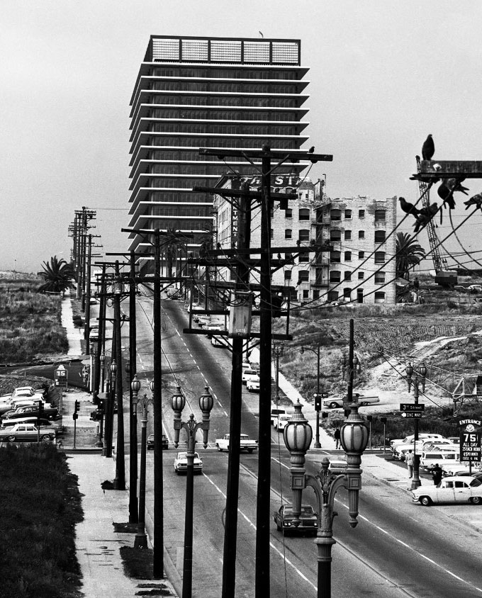
| (1966)^.^ - View looking north on Flower Street from the 4th Street Bridge showing the DWP Building at top of Bunker Hill. Pigeons are seen resting on the overhead lines and pole at right. Ornate two-lamp streetlights run up both sides of the street. At center can be seen the Stanley Hotel and Apartments (Flower and 2nd), being demolished to make way for the Bunker Hill Towers. Photo by Lin Cariffe |
Historical Notes The Department of Water and Power Building on Bunker Hill was built between 1963 and 1965. Click HERE to see more. |
 |
|
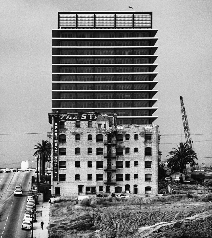
| (1966)^.^ – View looking north showing the demolition of the Stanley Hotel and Apartments at 2nd & Flower, exposing the newly built DWP Building. Photo by Lin Cariffe |
Historical Notes Today, Bunker Hill Towers stand at the approximate location of the old Stanley Hotel and Apartments. Click HERE for contemporary view. |
 |
|
| (ca. 1967)^.^ – View looking north as seen from the SW corner of 1st and Hope streets with the DWP Building at left and the Dorothy Chandler Pavilion in the distance on the right. |
 |
|
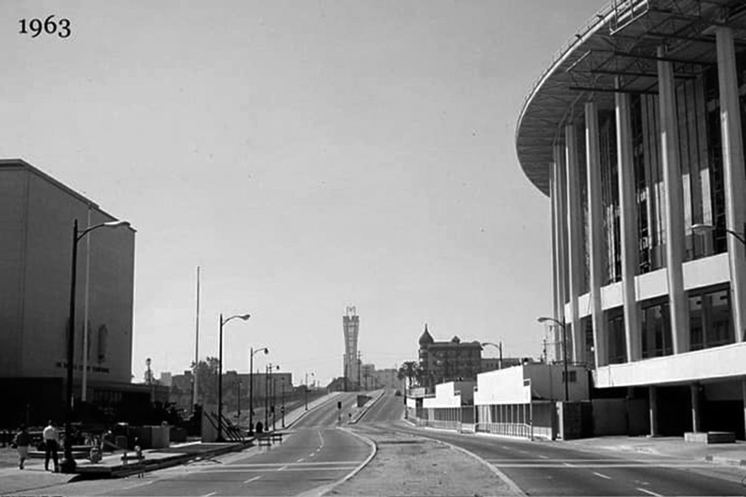
| (1967)^.^ - Composite panoramic photo taken from the 5th floor of the DWP Building. The view is looking south at Bunker Hill. Hope Street is at left with Flower Street at center. Note the parking lots in left foreground. This is where Bunker Towers and Disney Hall stand today. |
 |
|
| (ca. 1970)^.^ – View looking south down Flower Street as seen from the Bunker Hill Tower. At lower-right (NW corner of Flower and 3rd St) are the Bunker Hill Apartments. Also seen here is the Union Bank Building (upper-right), Citizens Citizens-Bank (upper-left) and the additional onramp construction at 4th Street. |
 |
|
| (1970)*^#^ - View from atop the Bank of California Building, looking north along Flower Street from 6th Street to the additional onramp construction at 4th Street. Prominent buildings in the background from left to right are the Bunker Hill Apartments and Tower, Los Angeles Department of Water and Power, and the Music Center. |
Historical Notes Since the previous photos, the Bunker Towers have been constructed. Built in 1968, the 32-story Bunker Hill Tower was one of the original buildings in the extensive Bunker Hill Redevelopment Project. |
 |
|
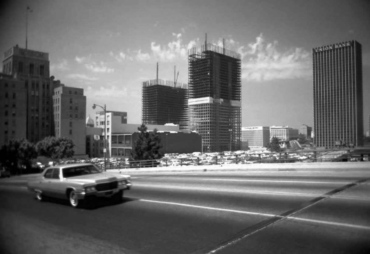
| (1970)^.^ – View looking SW across Grand Avenue showing the ARCO Towers under construction with the Edison Building seen on the left and Union Bank Building on the right. Photo by Leo Zahn |
Historical Notes The ARCO Towers were built on the site of the Richfield Building (1928, demolished 1968), an Art Deco masterpiece. Upon completion in 1972, the ARCO Plaza towers were the tallest buildings in the city for one year before being overtaken by Aon Center, and were the tallest twin towers in the world until the completion of the World Trade Center in New York City. The towers are the tallest twin buildings in the United States outside of New York City, where the 55-floor Time Warner Center stands at 750 ft.*^ |
 |
|
| (1982)^ - View showing the four-lane Grand Avenue looking south. Several high-rise buildings can be seen throughout. On the right, a tall building under construction, and on the left, the PacBell Tower located at 420 S. Grand Avenue. Also seen are: the Edison Building, Los Angeles Central Library, Aon Center, ARCO Towers, Crocker-Citizens Bank Building, UBC (United California Bank) and Union Bank. |
Bunker Hill in Transition (1950s & 1960s)
Olive and 2nd Street
 |
|
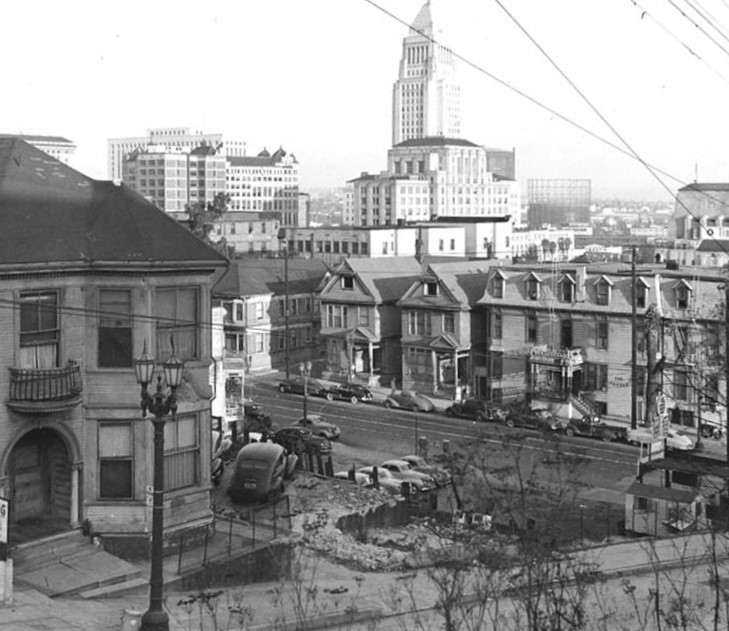
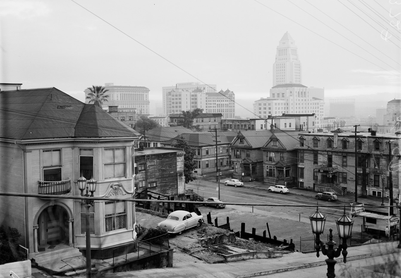
| (ca. 1950)* - View looking northeast from south side of 2nd Street between Olive Street and Grand Avenue. Shows nearby houses and apartments, with downtown buildings and City Hall in the distance. |
Historical Notes The beautiful Queen Anne style residence on the left was the Koster House. It was located at 507 W. Second Street. On the right is the mansared-roofed Argyle Hotel/Apartments located on the NE corner of Olive and 2nd streets. |
.jpg) |
|
| (ca. 1950)* - View looking east at northeast corner of Second and Olive Streets. Automobiles are parked in the foreground next to two gasoline pumps and on Olive Street. The mansared-roofed Argyle Hotel/Apartments are located at the corner, near other Victorian-era houses. City Hall tower is visible in the left distance. |
Historical Notes The Argyle Hotel, the oldest hotel on Bunker Hill, built in the 1870s and located on the northeast corner of 2nd and Olive Streets. It was demolished along with the two beautiful homes to its left in the 1960s to make way for a parking lot which still exist today (Click HERE for contemporary view). |
.jpg) |
|
| (ca. 1950)* - Looking at the northeast corner of 2nd and Olive Streets showing the mansard-roofed Argyle Hotel/Apartments, containing a laundry and a grocery. City Hall is seen at right. |
 |
|
| (1955)* – City Hall as seen from the south side of 2nd Street looking over the Olive Street roofline with light in eastern sky peeping through low overcast.; Caption slip reads: "Photographer: Wesselmann. Date: 1955-03-11 |
Historical Notes The above street light is a Union Metal UM-1747 "Pacific" model with GE Form 18-B lanterns. They were found all over Bunker Hill until the neighborhood was bulldozed into oblivion. Only one Bunker Hill example survives as of 2021. It's on the East side of Olive Street, just South of 4th Street. Click HERE to see more 'Pacific' UM 1747 dual-lamp streetlights (Contemporary Views) |
 |
|
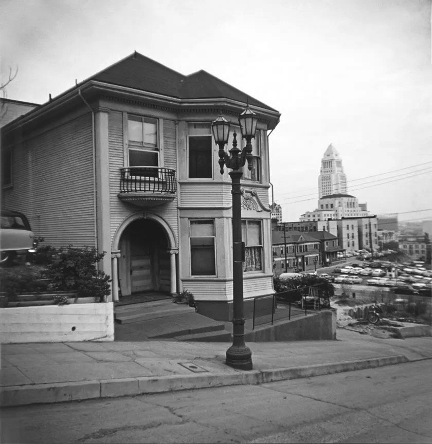
| (ca. 1965)* – A decorative dual-lamp ‘Pacific’ (UM-1747) stands in front of the Koster House, a Queen Anne style residence at 507 W. Second Street on Bunker Hill. The Los Angeles Times Building, and City Hall are seen in the distance on the right. Also seen is a parking lot where the Argyle Hotel once stood. |
Grand and 2nd Street
.jpg) |
|
| (1957)^*# – View looking at the Richelieu and Melrose Hotels from the corner of 2nd Street and Grand Avenue. Both hotels were razed shortly after this photo was taken. |
 |
|
| (1957)* - One of the last photos taken of the former Bunker Hill hotels on S. Grand Avenue; from left to right, the Melrose Hotel "Annex" (at 120), the original Melrose (at 130), and a glimpse of the Richelieu Hotel (at 142). |
Historical Notes For nearly seventy years the pair of Queen Anne Victorian buildings were two of the most stunning structures on the Hill, but the Richelieu always stood in the shadow of its counterpart. The Melrose once played host to President McKinley, was memorialized by artists like Leo Politi, and was covered by local press when the wrecking crews came. The Richelieu on the other hand, was far less celebrated but no less important, making its small mark on the history of a neighborhood that no longer exists.^ |
 |
|
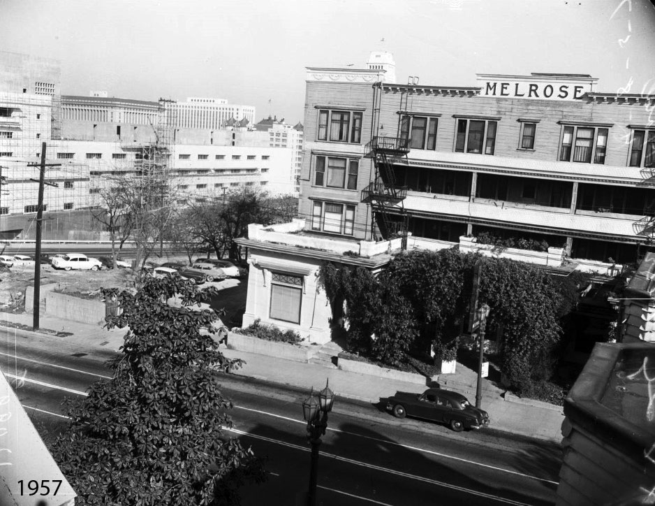
| (1957)^^* – Long shot of Melrose Hotel to be torn down after 75 years with City Hall tower in background. View is from the future home of the Disney Hall. Photo Date: April 8, 1957. |
Before and After
.jpg) |
||
.jpg) |
Then and Now
|
 |
|
| (1957 vs. 2021) - Looking toward the east side of Grand Avenue between 1st and 2nd streets, where two of the most stunning Queen Anne Victorian buildings once stood, the Melrose and Richelieu Hotels. |
* * * * * |
Grand and 1st Street
 |
|
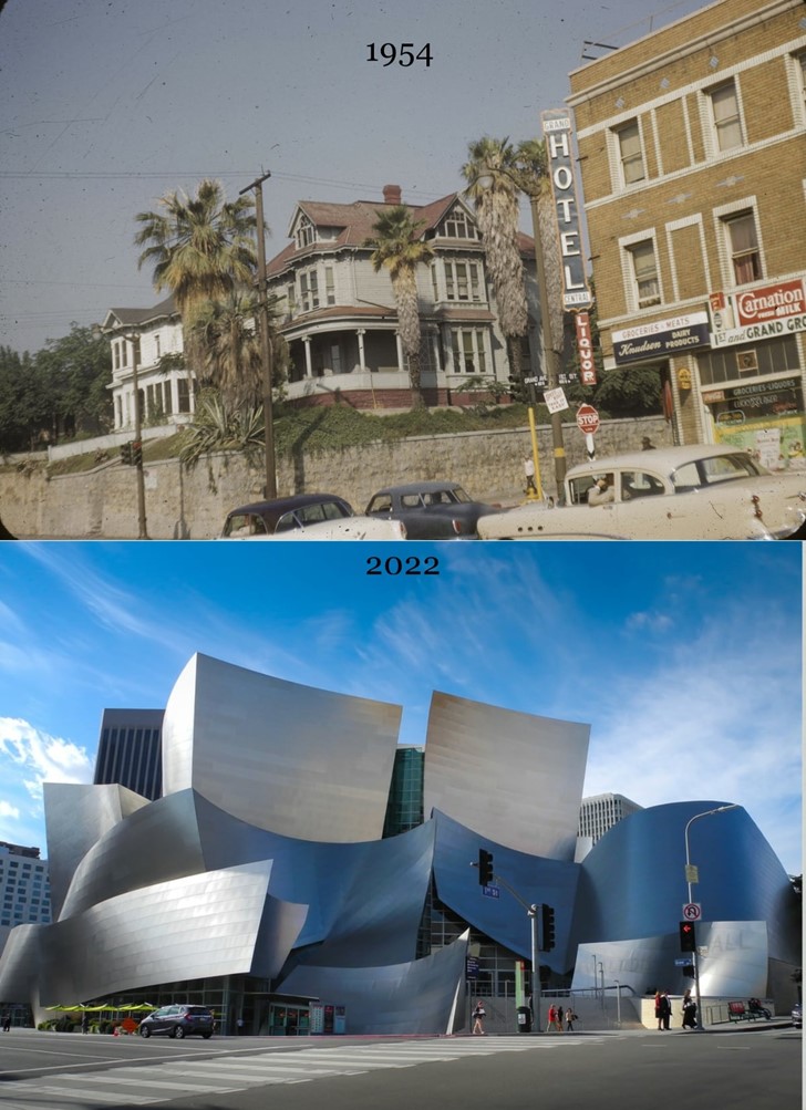
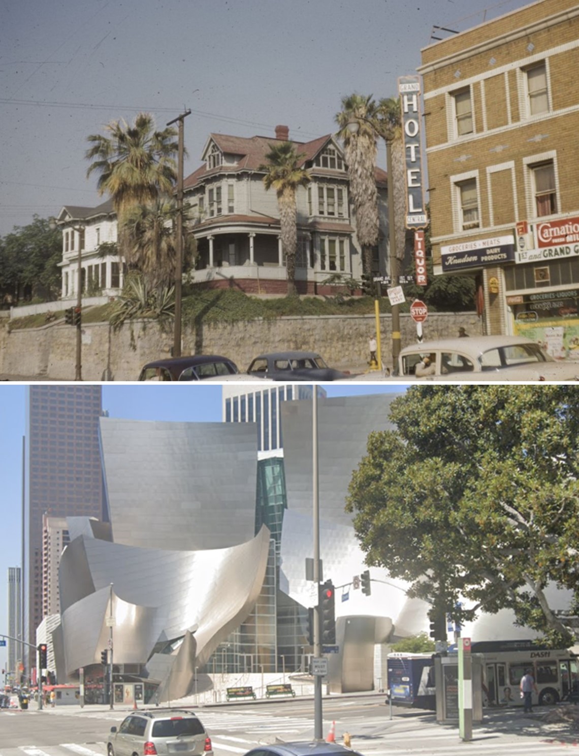
| (1954)* – Looking SW toward the intersection of Grand and 1st streets. On the SW corner can be seen two house addressed 103 and 109 South Grand Avenue. At right, NW corner, is the Grand Central Hotel at 101 North Grand Avenue. Photo by Palmer Conner |
 |
|
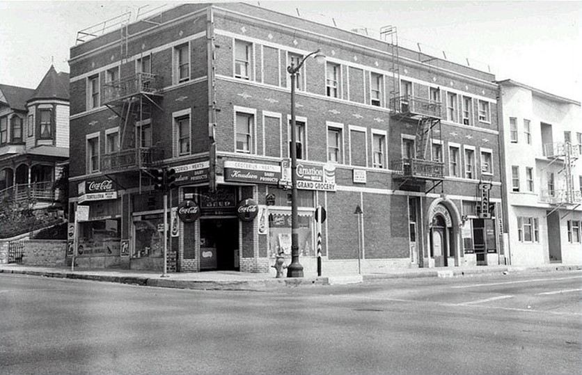
| (ca. 1955)* - Looking north across the intersection of W. First Street (running from middle left to lower right) and N. Grand Avenue towards an apartment building, located at 601-603 W. First Street, with Grand Grocery occupying the ground floor; on the far left is the Queen Anne Revival style apartment house at 609-611. Directly to the right of the market is the New Grand Cleaners on the ground floor of the Grand Central Hotel at 103-107 N. Grand Avenue and another apartment building with the addresses of 109, 109 1/2, 111, and 111 1/2. |
Then and Now
 |
|
| (1954 vs. 2022)^ – View looking toward the SW corner of Grand Avenue and 1st Street...present site of the Disney Concert Hall. |
 |
|
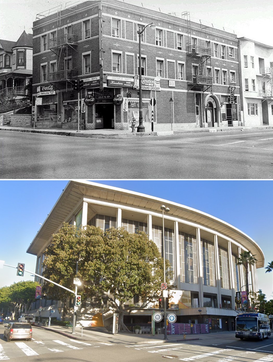
| (1955 vs 2022)* - Looking at the NW corner of Grand Avenue and 1st Street....present site of the Dorothy Chandler Pavilion. |
 |
|
| (1955 vs 2023)* - Looking at the NW corner of Grand Avenue and 1st Street....present site of the Dorothy Chandler Pavilion. |
* * * * * |
Bunker Hill - The 'Castle' and the 'Salt Box'
 |
|
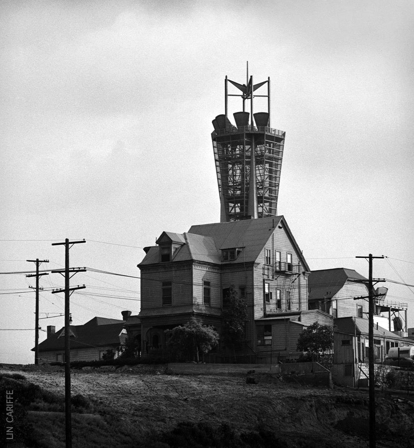
| (1965)^.^ - View showing the “Castle” (at center) and the ‘Salt Box’ (right) located at 325 S. Bunker Hill Avenue, with the PacBell Telephone MicrowaveTower behind them in the distance. Photo courtesy of Lin Cariffe |
Historical Notes The 'Castle', in foreground, and the 'Salt Box', both built before 1890, were the only two buildings saved from the bulldozer when the entirety of Bunker Hill was leveled to make way for the future. With their move in 1969 to the new Heritage Square Museum the last remnants of old Bunker Hill were gone. |
 |
|
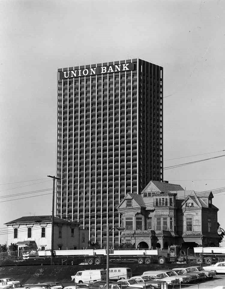
| (1967)^*# – View showing The Castle and Salt Box houses with the Union Bank Building in the background and trucks and cars in foreground. |
 |
|
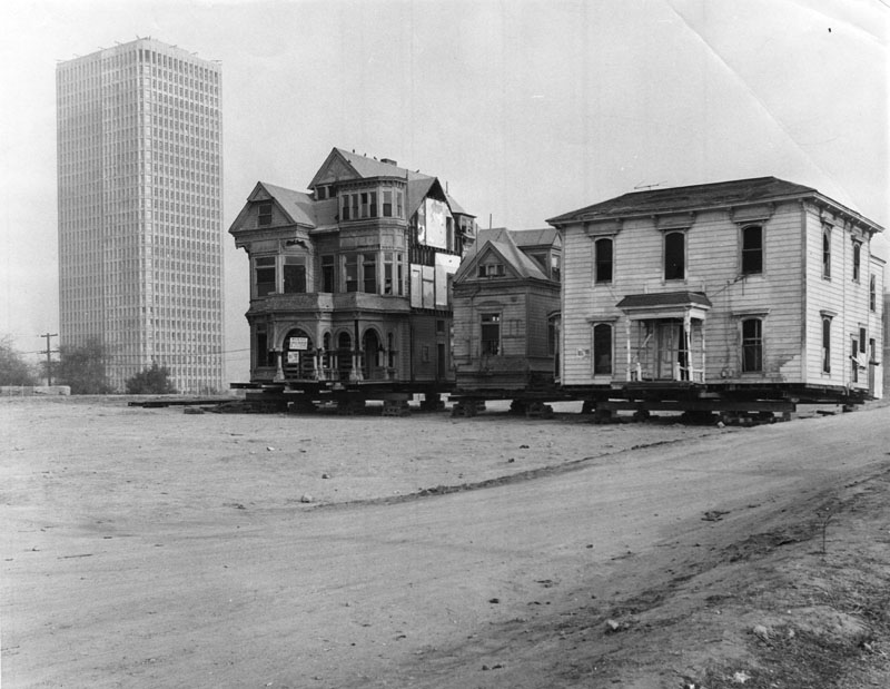
| (1969)* - "The Castle" and "The Saltbox," sit on blocks awaiting their removal to Montecito Heights. The 32-story Bunker Hill Tower, built in 1968, is seen in the background. Photo Date: January 10, 1969. |
Historical Notes By 1968, all of the once proud Victorians of Bunker Hill Avenue had been demolished, except for the Castle and the Salt Box. The two structures that had been constructed at the same time had been spared. Once the CRA began pushing forward with their grand redevelopment plan in the mid-1950s, the writing was on the wall for the mansions in the neighborhood, and in an attempt to save a couple of the structures, the Salt Box was declared Historic Cultural Monument #5 in October in August 1962. Designation was soon bestowed upon the Castle which became HCM #27 in May 1964. The rest of the decade was spent trying to figure out a way to spare the two structures from the wrecking ball.* |
 |
|
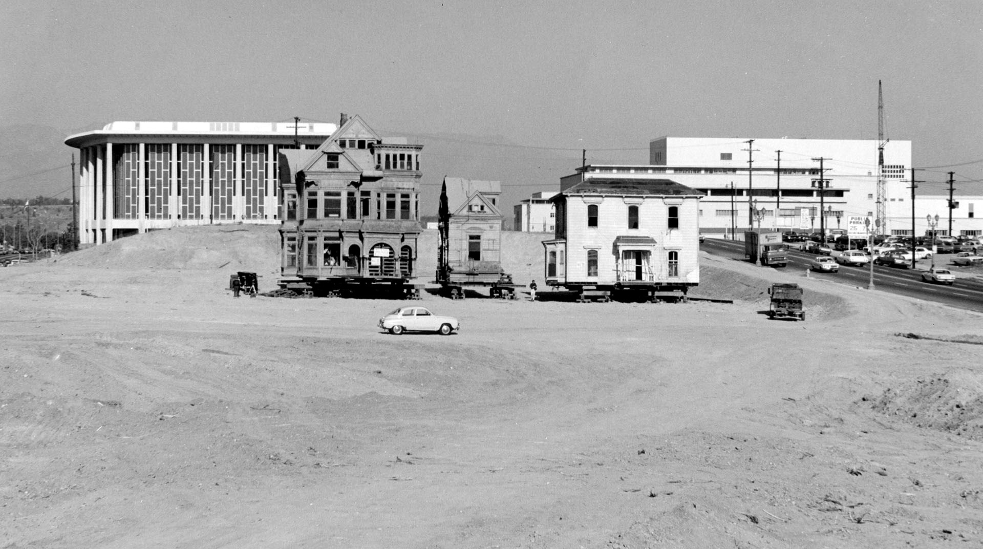
| (1969)* - View of the last remaining residence on Bunker Hill. "The Castle" and "The Saltbox" are jacked up and ready for moving. The Dorothy Chandler Pavilion and Stanley Mosk County Courthouse can be seen behind them to the north. |
Historical Notes Both "The Castle" and "The Saltbox" were successfully relocated to Heritage Square in March 1969. Unfortunately, the area was not well protected, and both the Castle and the Salt Box were burned to the ground by vandals in October 1969. Click HERE to see more on "The Castle" and "The Saltbox". |
Civic Center
_1963.jpg) |
|
| (1963)^ - Aerial view of Los Angeles Civic Center neighborhood of government offices; view is looking west. Identifiable landmarks include the Federal Courthouse at bottom right; Los Angeles City Hall, located at 200 N. Spring St. sits at center forefront; the old Hall of Records, and the Hall of Justice on the right; Los Angeles St., Main St., Spring St., and Broadway are visible from bottom left to middle right; Temple St., 1st St., and 2nd St. are visible from lower right to middle; the Harbor (110) Freeway is horizontally at top in the far distance. |
_1963.jpg) |
|
| (1963)^ - Aerial view of Los Angeles Civic Center neighborhood of government offices; view is looking southwest. Identifiable landmarks include the Federal Courthouse at bottom middle; Los Angeles City Hall, located at 200 N. Spring St. sits at center forefront; the old Hall of Records, and the Hall of Justice on the right; Hill St., Broadway, Spring St., Main St., Los Angeles St. and San Pedro St. are vertically from right to left; Temple St., 1st St., 2nd St. and 3rd St. are horizontally from bottom to top. |
_1963.jpg) |
|
| (1963)^ - Aerial view of Los Angeles Civic Center neighborhood of government offices; view is looking south. Identifiable landmarks include the Federal Courthouse at bottom left corner; Los Angeles City Hall, located at 200 N. Spring St. sits at forefront; Temple Street, lower right to upper left; Main St. is at upper right to bottom left corner; San Pedro St. from top right corner to lower left; Central Ave. paralleling Alameda St. are top middle to middle left; Los Angeles River at top left corner. |
_1963.jpg) |
|
| (1963)^ - Aerial view of Los Angeles Civic Center neighborhood of government offices; view is looking northwest. Identifiable landmarks include the Federal Courthouse at lower right; Los Angeles City Hall, located at 200 N. Spring St. sits at center forefront; the old Hall of Records, and the Hall of Justice behind City Hall; in the distance is the Department of Water and Power building (tall building with horizontal lines), and the Dorothy Chandler Pavilion and Music Center are on the left of DWP (between DWP and New County Courthouse). The Hollywood (101) Freeway at lower right to upper left; Temple St. is bottom middle to upper left; 1st St. is at bottom left corner; Main St., Spring St., Broadway, Hill St. Grand Ave. are diagonally from bottom right to middle; the Harbor (110) Freeway is horizontally at upper middle. Hollywood can be seen in the background. |
 |
|
| (1963)^ - Aerial view of Los Angeles Civic Center neighborhood of government offices; view is looking northeast. Identifiable landmarks include the Hall of Records, and the Hall of Justice on the left; Los Angeles City Hall, located at 200 N. Spring St. sits at forefront; the Federal Courthouse is under construction on the right, north of the LAPD headquarters (later Parker Center); the Santa Ana (101) Freeway is horizontally across the middle; Union Passenger Terminal, located at 800 N. Alameda St. and the Post Office Terminal Annex are at center right; Hill St., Broadway; Spring St., Main St., Los Angeles St. and Alameda St. are vertically left to right; Temple Street is horizontally at lower center; Cesar Chavez Ave. is horizontally at upper center. |
 |
|
| (ca. 1965)#^^^ – View of the Los Angeles Civic Center looking southwest. The recently completed Federal Building is in the foreground. |
* * * * * |
Hollywood
 |
|
| (ca. 1960s)* - Aerial view of Hollywood and its surrounding areas. Cars may be seen travelling the Hollywood Freeway. Traffic going north is towards the Valley, going south is towards Los Angeles. The Hollywood Reservoir is in the hills above Hollywood (Click HERE to see more Early Views of the Hollywood Reservoir). |
Historical Notes The Capitol Records Building is in the middle foreground of this photo (it is the cylindrical shaped building whose shape is devised from the vision of a stack of records. 13 stories rise 150 ft. high to provide 78,000 square ft. of space). Architect for the Capitol Records building was Welton David Becket, contractor, C.L. Peck Co. It was built in 1954.* |
Click HERE to see more Early Views of Hollywood (1920 +) |
* * * * * |
Valley State College (CSUN)
 |
|
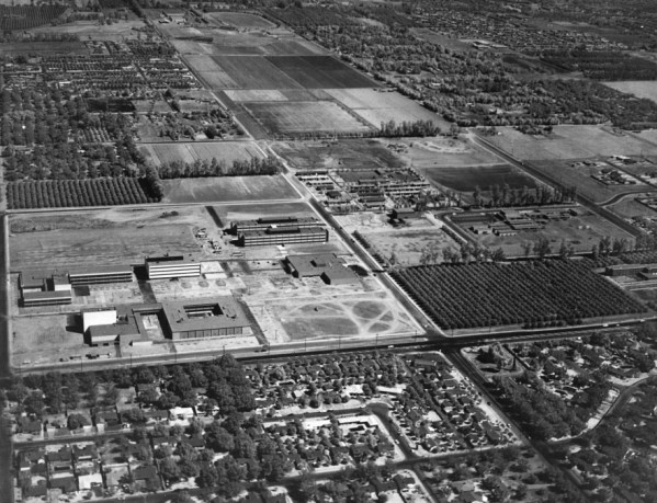
| (1956)*^ - Aerial view of Los Angeles State College, San Fernando Valley Branch (now CSUN), looking northwest. The intersection of Zelzah and Nordhoff is in the left foreground. |
Historical Notes In 1952, state officials had originally identified Baldwin Hills as the site of a satellite campus for Los Angeles State College (now Cal State Los Angeles). In reaction to the decision, Valley leaders organized to successfully overturn the legislation and to later ensure that a four-year college would be sited in the San Fernando Valley. On December 21, 1954, advocates for a Valley four-year college hosted 23 legislators for dinner at the Brown Derby on Wilshire Boulevard. Armed with demographic projections, they pitched the Valley as the only logical place for the next state college. The pitch worked. In 1955, state Assemblyman Judge Julian Beck sent the legislation for approval to pruchase land in the north San Fernando Valley for a new satellite campus to Los Angeles State College. #**# |
 |
|
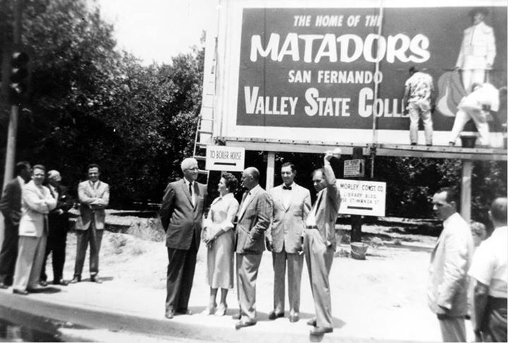
| (1958)*^ - New sign in 1958 after Los Angeles State College separated from its parent institution and became San Fernando Valley State College (now CSUN) Pictured: Howard McDonald (President of L.A. State College), Ralph Prator (President of San Fernando Valley State College) and Delmar T. Oviatt (Dean of Instruction at San Fernando Valley State College). |
Historical Notes In fall 1956, the San Fernando Valley campus of the Los Angeles State College of Applied Arts and Sciences (later Cal State Los Angeles) was established on the present Northridge site. Soon after, the state Legislature passed Assembly Bill 971, which provided for the campus to separate from its parent college. On July 1, 1958, the founding date of the present university, the institution became San Fernando Valley State College, with about 3,300 students and 104 faculty.^* |
 |
|
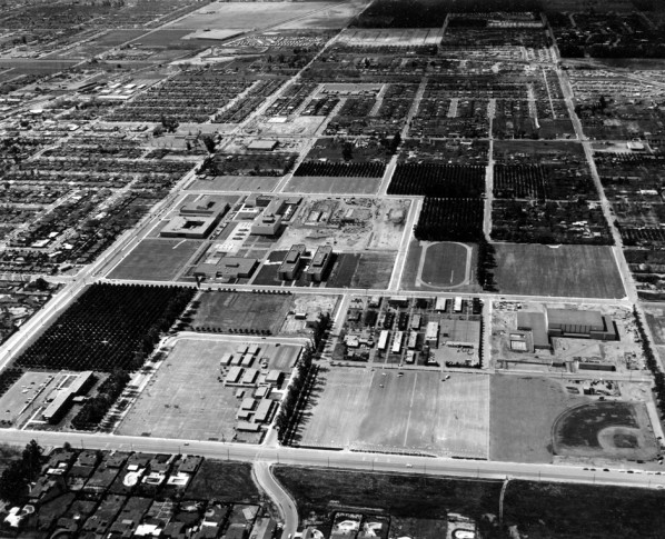
| (ca. 1960)*^ - Campus of San Fernando Valley State College (now CSUN), aerial view looking north. Nordhoff Hall, the Music Building on the left; Science buildings 1 and 2 and Bookstore Complex in the center. |
Historical Notes On June 1, 1972, the college was renamed California State University, Northridge, by action of the state Legislature and the Board of Trustees of the California State University.*^ |
 |
|
| (1962)*^ - Another view of the campus of San Fernando Valley State College (now California State University Northridge). Clockwise: Sierra Hall construction site, Science Buildings 1 and 2, Bookstore Complex, Music Building, Nordhoff Hall. |
Click HERE to see more in Early Views of the San Fernando Valley. |
* * * * * |
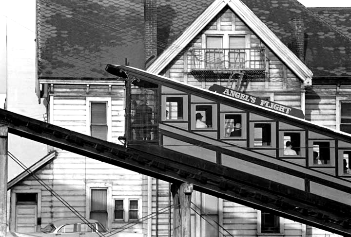
Angels Flight
 |
|
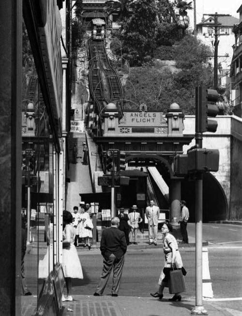
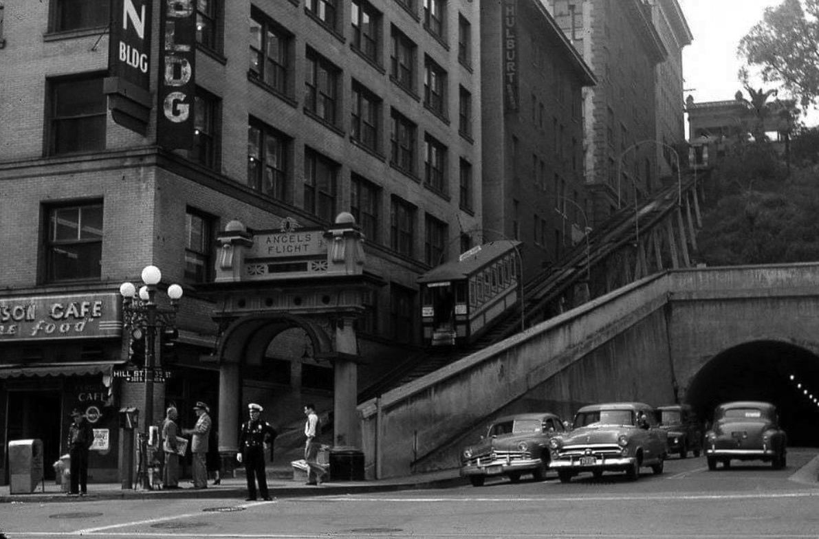
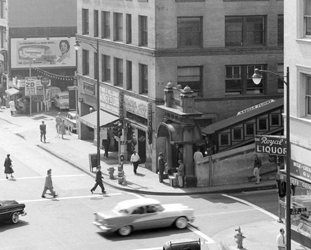
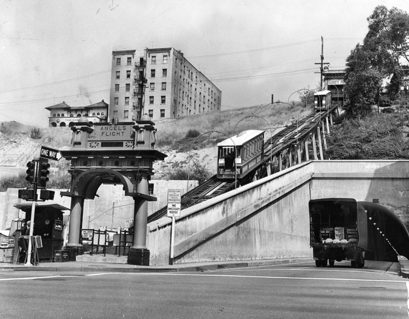
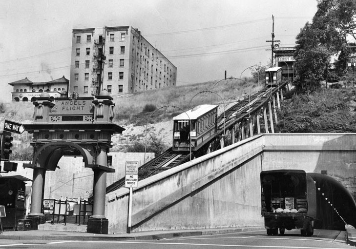
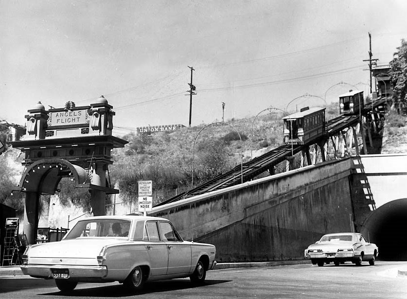
| (1949)^ - View of Angels Flight as seen from the SE corner of 3rd and Hill streets. The Third Street Tunnel is on the right. |
Historical Notes Angels Flight operated from 1901 until it was closed in 1969 when its location was redeveloped. The railway was relocated and reassembled at California Plaza in 1995. |
 |
|
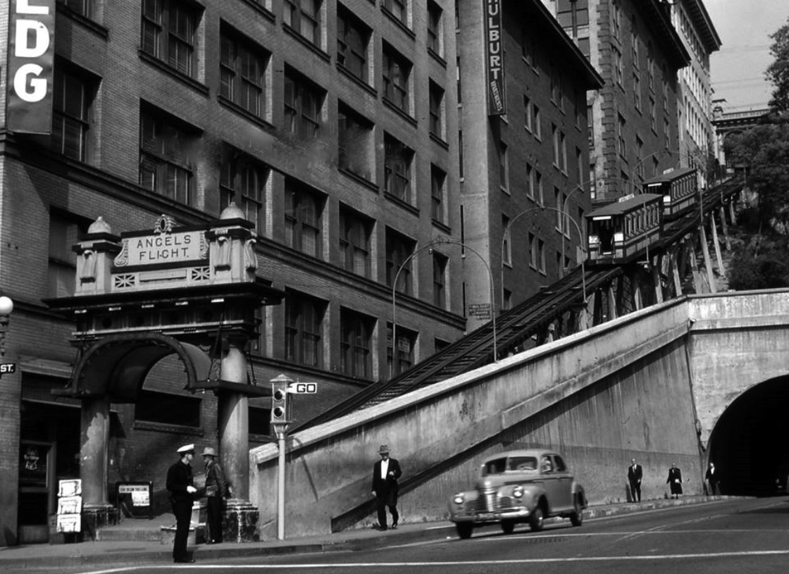
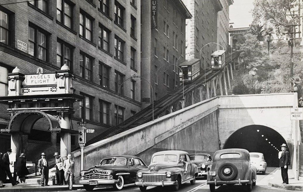
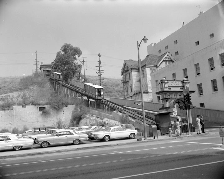
| (1952)* - Angels Flight Railway, probably the top noir location in bygone L.A...Looking west towards Hill St. and the Third Street Tunnel. |
 |
|
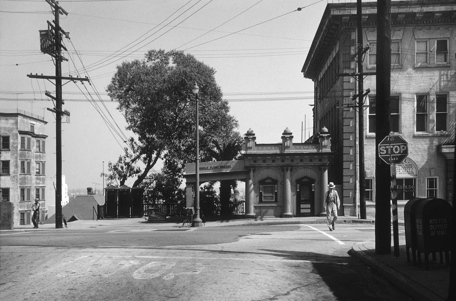
| (1950s)^ - View looking at the SW corner of 3rd and Hill streets showing a “Winslow” 5-bulb electrolier in front of Angels Flight with the Third Street Tunnel seen on the right. |
 |
|
| (1950s)* - View of Angels Flight and 3rd St. Tunnel. Photo by Max Yavno |
Historical Notes Angels Flight operated from 1901 until it was closed in 1969 when its location was redeveloped. The railway was relocated and reassembled at California Plaza in March of 1995 until it was closed in February of 2001 due to a serious accident. After a 9 year period, which included several safety modifications, Angels Flight reopened (2010) and is still in operation today.^ |
Before and After
.jpg) |
|
|
| (1903)^ - Angels Flight | (1952)* - Angels Flight |
 |
|
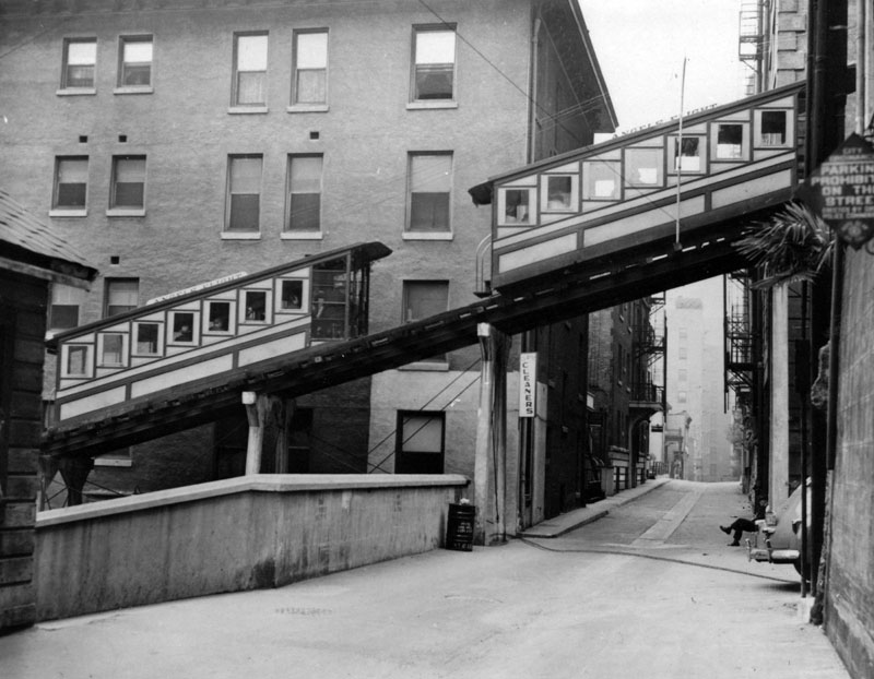
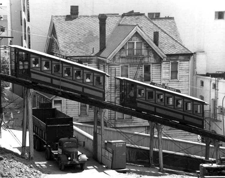
| (1948)^ - A side view of two Angels Flight cable cars shortly after they crossed paths as they travel on the funicular tracks. The track for the rail cars is seen mid-air, from the side along Clay Street, with cement "brackets" holding it up in the air. |
 |
|
| (1957)^ - Angels Flight cable cars as seen from the concrete stairway on the other side of the Third Street Tunnel portal. |
 |
|
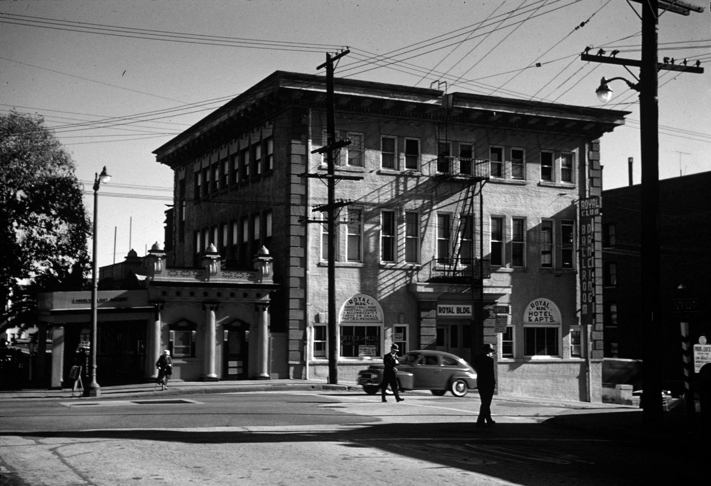
| (1950s)* - Looking toward the SW corner of 3rd and Hills streets showing the Angels Flight funicular waiting to be loaded with passengers. Across the 3rd Street can be seen Royal Drug Store. |
 |
|
| (1955)^ – View looking down from the top of the Third Street Tunnel with Angels Flight seen on the right. |
.jpg) |
|
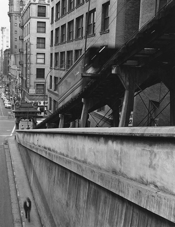
| (ca. 1955)**^* - A man carrying a bag is seen climbing up the stairs alongside Angels Flight. |
 |
|
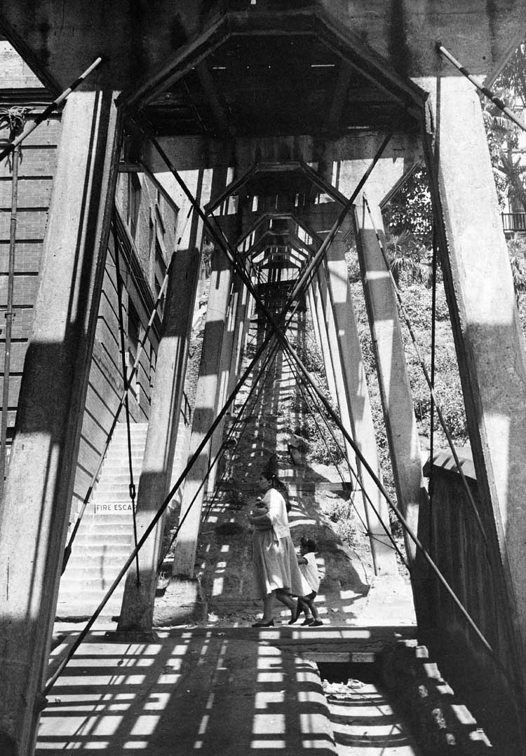
| (ca. 1960)* - View of the underside of Angels Flight, looking west from just east of Clay Street. A woman and a little girl can be seen walking south on Clay. |
 |
|
| (ca. 1960)**^* - Dump truck passes underneath Angels Flight cars as they pass each other. |
 |
|
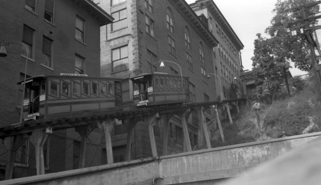
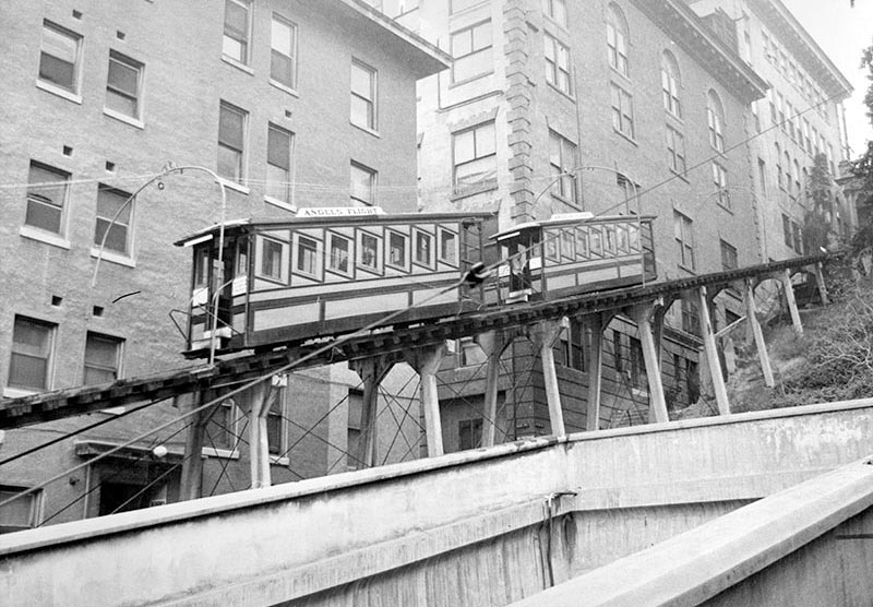
| (1955)*^^ - A rundown boarding house provides the backdrop to an Angels Flight car as it climbs Bunker Hill. |
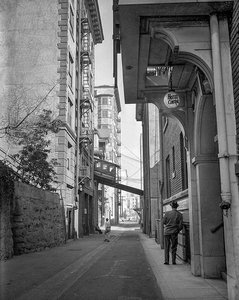 |
|
| (1955)^^ - Angels Flight as it crosses Clay Street. A man in a suit is seen leaning against a building (Hotel Central). |
 |
|
| (ca. 1960)**^* - Angels Flight crossing over Clay Street. Every building on either side of the street would meet the wrecking ball within a few short years.*^^ |
 |
|
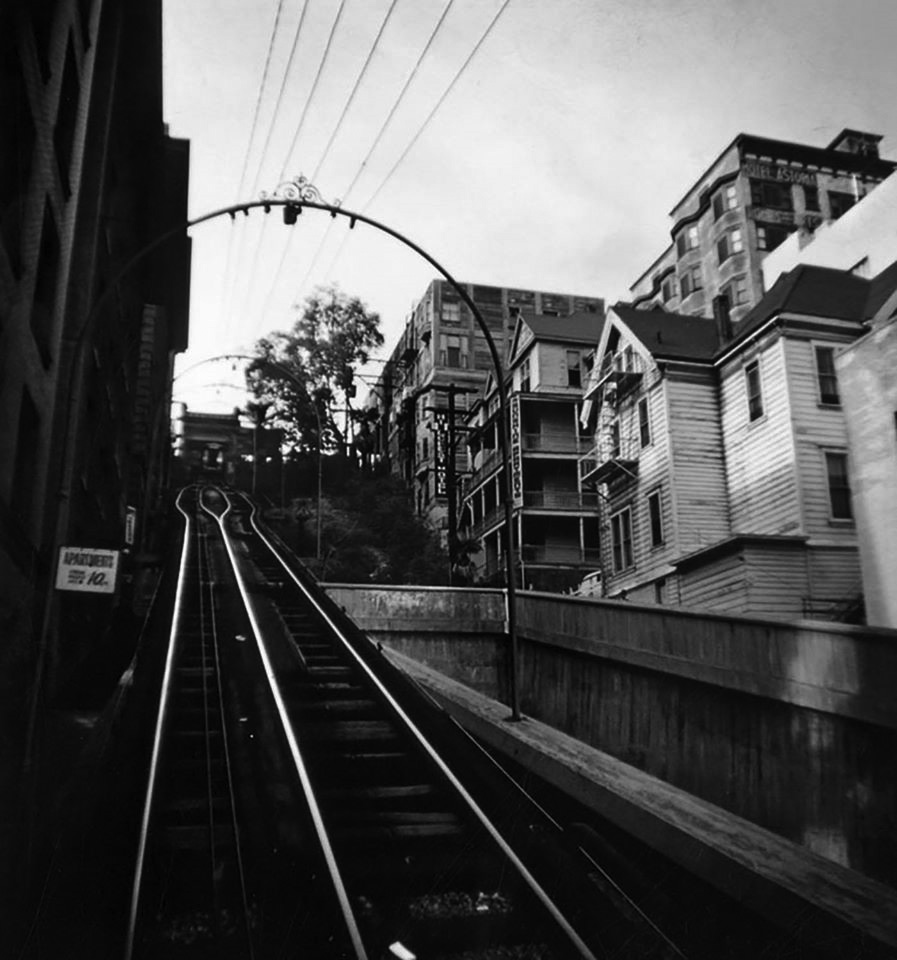
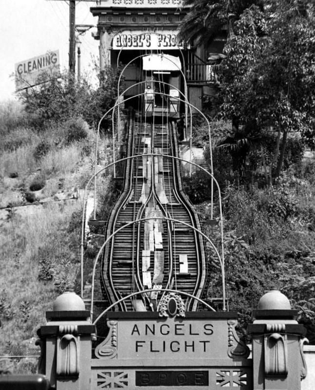
| (1962)^ - View looking up towards the upper Angels Flight Terminus with the 3rd Street Tunnel entrance seen on the right. |
 |
|
| (1960)^.^ - Angels Flight upper terminus at 3rd and Olive. The adjacent 3-story brick building is the former Benevolent & Protective Order of Elks (BPOE) Lodge, No. 99. Photo Palmer Conner. |
 |
|
| (1962)* - A man is seen crossing Olive Street with the Angels Flight upper terminus seen behind him. This view is looking East on 3rd Street at Olive Street. Photo by Palmer Conner. |
 |
|
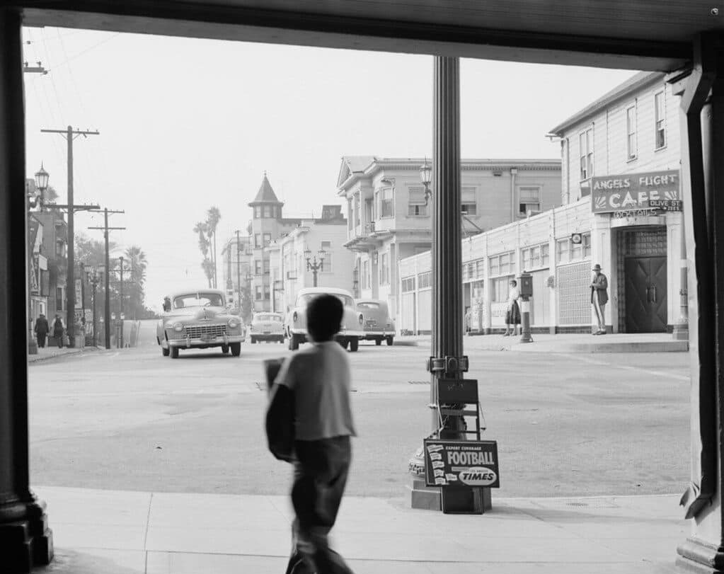
| (1950s)* - Looking west on 3rd Street from upper Angels Flight terminus. Angels Flight Café is on the NW corner of Olive and 3rd. |
 |
|
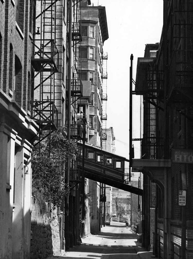
| (1962)^ – View of Angels Flight with the eastern portal to the Third Street Tunnel in the foreground. |
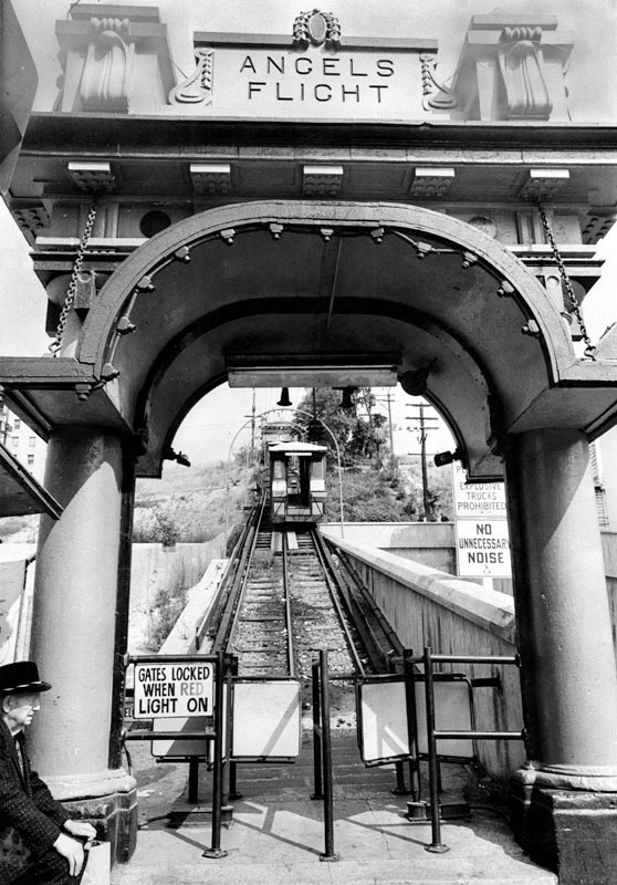
Historical Notes Valley Times photograph caption dated July 21, 1962 reads "The Angel's Flight Railway, a Los Angeles landmark for nearly 50 years, has been authorized by the State Public Utilities Commission to discontinue operation on or before Dec. 1. The Community Redevelopment Agency of the City of Los Angeles has agreed to purchase the landmark for $35,000. It is expected the railway will be moved to Griffith Park's Travel Town or to the Hollywood Bowl, to make way for development of Bunker Hill. The line, on 315 feet long, has shuttled 100 million passengers up the steep incline along Third St. between Hill and Olive streets for a nickel a ride." ^ |
 |
|
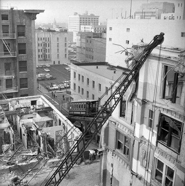
| (1962)^^ - Bunker Hill buildings are demolished as Angels Flight continues to scale the hillside in 1962. |
Historical Notes In 1959 Angels Flight was destined for demolition as part of Bunker Hill Urban Renewal Project but loyal riders and enthusiastic supporters thwarted those plans, at least temporarily. During the next ten years the community of Bunker Hill changed dramatically as apartment houses were razed and residents dislocated by the redevelopment project.** |
 |
|
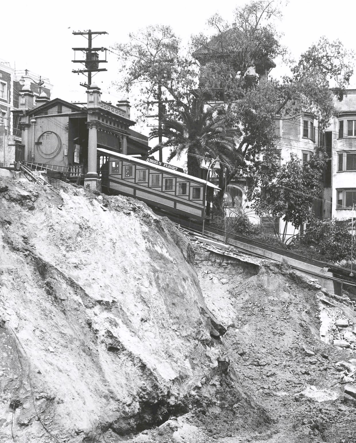
| (1963)**^* - A mound of dirt sits adjacent to Angels Flight where a building once stood. |
 |
|
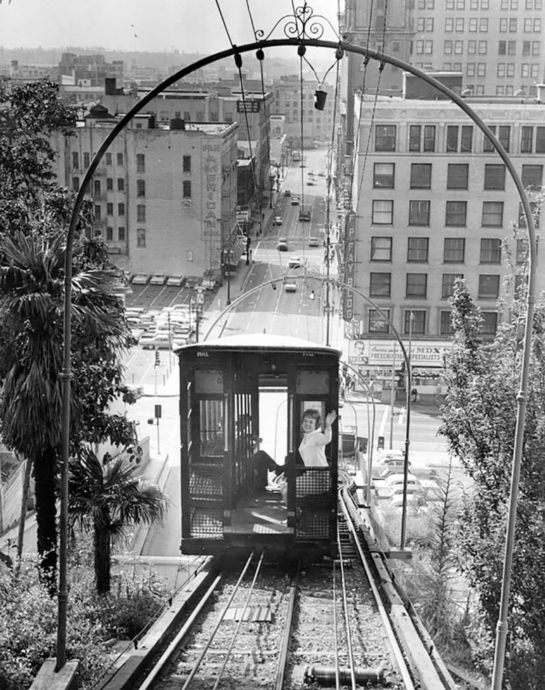
| (1965)* - Angels Flight - The passenger waving is a 22 year old named Stephanie on her way to work at The Broadway Stores. |
.jpg.jpg) |
|
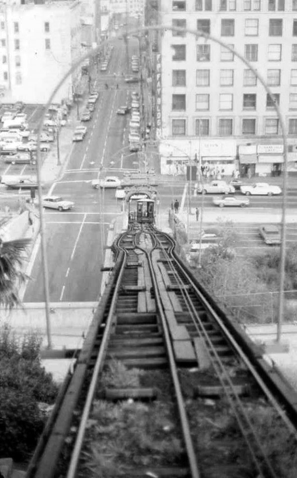
| (ca. 1965)^^ – View looking down toward the intersection of 3rd and Hill streets showing Angels Flight ferrying passengers up and down Bunker Hill. All the buildings that once stood on the right have now been demolished. |
 |
|
| (1960s)* - Upper Terminus of Angels Flight showing an excavated Bunker Hill. |
 |
|
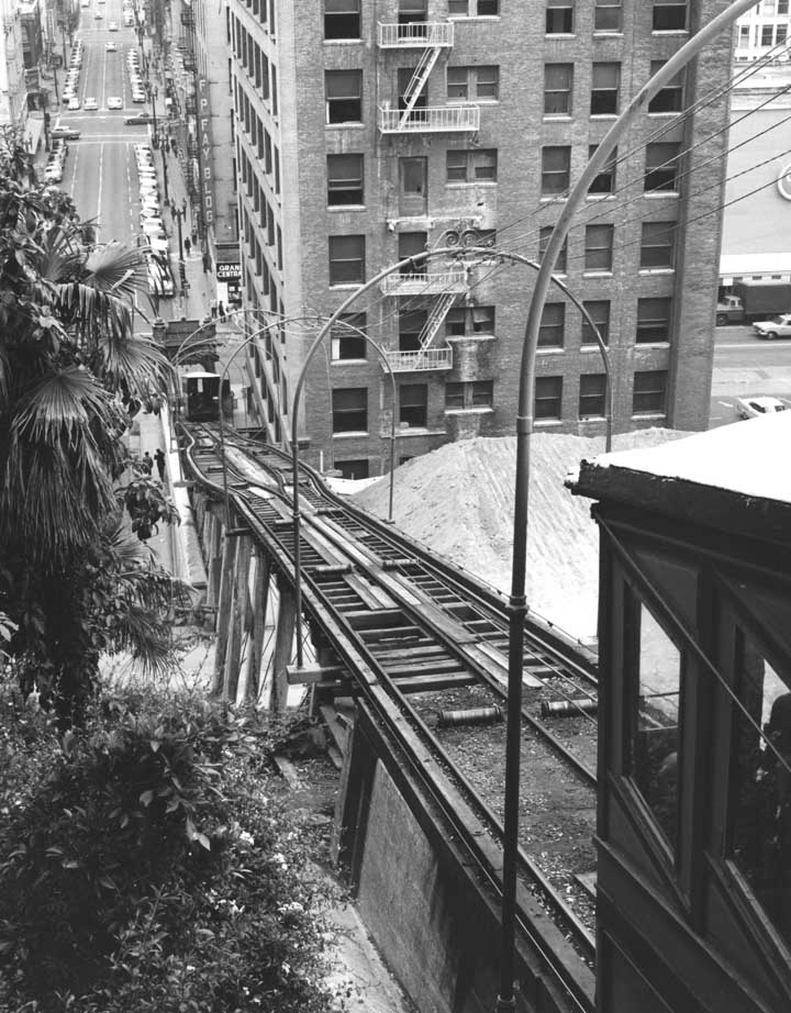
| (1965)^ - View of Angels Flight from a corner at Hill and Third Streets, showing the 33-degree tracks. Most of the old buildings on both sides have been razed as part of the Bunker Hill redevelopment program. At right is the Third Street Tunnel. |
 |
|
| (1965)^ - Photograph caption reads, "Old gent waits on Hill St. entrance for ride to top of Angeles Flight." Photo Credit: Herald-Examiner |
Before and After
|
 |
|
| (1952)* - Angels Flight | (1965)^ - Angels Flight |
 |
|
| (1966)* - View of Angels Flight during one of its last years of operation. Most of the buildings on the hill have been demolished to make room for progress. |
 |
|
| (1967)* – View showing Angels Flight with the very top of the 42-story Union Bank Building seen in the distance. |
Before and After
|
|
|
| (1952) vs. (1967) |
 |
|
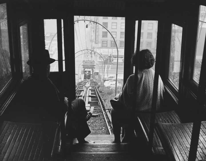
| (1967)**# - Passengers looking out the Angels Flight doorway as it appears to be heading down the hill. |
 |
|
| (1969)^.^ - Looking down toward the intersection of 3rd and Hill streets. |
 |
|
| (ca. 1969)^^** - View of Angels Flight shortly before it was shut down and dismantled. |
Historical Notes Ever decreasing numbers of commuters and tourists and lack of funding contributed to the inevitable. Even the designation of Historical Cultural Landmark could not save Angels Flight and she was dismantled in 1969.** |
Angels Flight (2nd Location)
 |
|
| Angels Flight, Bunker Hill. Before and After relocation. Photo comparison by Trey Callaway |
Historical Notes The second Angels Flight location opened one half block south of the original location in 1996, with tracks connecting Hill Street and California Plaza. It was shut down in 2001, following a fatal accident, and took nine years to commence operations again. The railroad restarted operations on March 15, 2010. It was closed again from June 10, 2011, to July 5, 2011, and then again after a minor derailment incident on September 5, 2013. The investigation of this 2013 incident led to the discovery of potentially serious safety problems in both the design and the operation of the funicular. Before the 2013 service suspension, the cost of a one-way ride was 50 cents (25 cents for Metro pass holders). After safety enhancements were completed, Angels Flight reopened for public service on August 31, 2017, now charging $1 for a one-way ride (50 cents for metro pass holders).* |
 |
|
| (2017)* - View of Angels Flight at its new location, 351 S. Hill Street (lower station) across from Grand Central Market. Photo: Wikipedia Commons |
Historical Notes Angels Flight Railway was designated Los Angeles Historic-Cultural Monument No. 4 on August 6, 1962. It was also added to the National Register of Historic Places on October 13, 2000. |
Click HERE to see Earlier Views of Angels Flight |
* * * * * |
Vincent Thomas Bridge
 |
|
| (ca. 1960)##*^ - View of the Vincent Thomas Bridge in San Pedro during its construction. It is the fourth largest suspension bridge in the State of California. |
Historical Notes The Vincent Thomas Bridge is the first suspension span ever to be built on steel piles — 990 of them were sunk to hold it up, instead of the more traditional concrete supports. And it is the first to be built entirely without rivets; the steel is welded together. ##*^ Before the bridge was built, hundreds of cannery and shipyard workers made their daily passage from San Pedro to Terminal Island aboard ferry boats. State Assemblyman Vincent Thomas thought the ferry system inadequate, and proposed the bridge to replace it.^^ |
 |
|
| (ca. 1963)**^ - View of the Vincent Thomas Bridge showing its longest span nearly completed. |
Historical Notes The bridge is 6,060 feet long, 52 feet wide, 365 feet tall. Its longest span is 1,500 feet, and the clearance below is 185 feet.^* Construction of the bridge required: 92,000 tons of Portland cement; 13,000 tons of lightweight concrete; 14,100 tons of steel; and 1,270 tons of suspension cable. The main span of the Vincent Thomas Bridge is 1,500 feet long as compared to the Golden Gate Bridge at 4,200 feet long.**#^ |
 |
|
| (1963)^^ - The Vincent Thomas Bridge nears completion between San Pedro and Terminal Island. |
Historical Notes California Assemblyman Vincent Thomas, who represented San Pedro, spent 19 years beginning in 1940 arguing for the 16 different pieces of legislation that were necessary for its construction. When the bridge opened in 1963, Thomas was the longest-serving assembyman. In 1961, the legislature passed a special Concurrent Resolution 131 in order to name it after him while he was still serving.^* |
 |
|
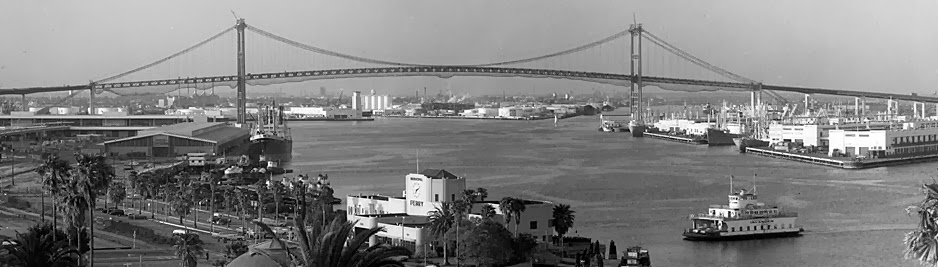
| (1963)*^^^^ - Panoramic view showing "The Islander" ferry in its last days of service with the nearly completed Vincent Thomas Bridge in the background. |
Historical Notes The Vincent Thomas Bridge officially opened on November 15, 1963 and ferry service discontinued after 22 years of operations. ##*^ |
.jpg) |
|
| (ca. 1964)**^^^ - One of the world’s largest car carriers at the time, Volkswagen ship Johann Schulte, arrives at the Port of Los Angeles. View shows 100s of VW Beetles, all lined up and waiting for transport to dealerships. The newly opened Vincent Thomas Bridge stands tall in the background. |
Historical Notes The Volkswagen Beetle, or informally the Volkswagen Bug, was produced from 1938 until 2003. The need for this kind of car, and its functional objectives, were formulated by Adolf Hitler, leader of Nazi Germany, wishing for a cheap, simple car to be mass-produced for the new road network of his country. He contracted Porsche in 1934 to design and build it to his exacting standards. Ferdinand Porsche and his team took until 1938 to finalize the design. This is one of the first rear-engined cars. With over 21 million manufactured in an air-cooled, rear-engined, rear-wheel drive configuration, the Beetle is the longest-running and most-manufactured car of a single design platform, worldwide.^* |
 |
|
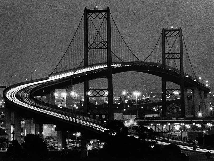
| (1988)^^ - Traffic streams across the Vincent Thomas Bridge at dusk. |
Historical Notes Skeptics predicted it would serve fewer than 2,000 vehicles a day and that it would take taxpayers 40 years to pay for the $21-million structure. In its first month of operation, however, the bridge served a daily average of 9,631 vehicles. And most of the debt was paid off within 20 years.^^ |
 |
|
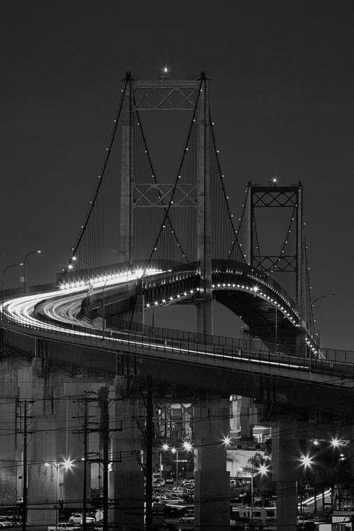
| (ca. 2010s)##^# – Night view showing the Vincent Thomas Bridge. |
Historical Notes When the Bridge opened in 1963, a 25-cent toll was collected in each direction. On grand opening day, Assemblyman Thomas paid the first toll. In 1983, the toll increased to 50 cents for westbound traffic and was free for eastbound traffic. In 2000, the Bridge was considered “paid for” and the toll was repealed.**#^ |
 |
|
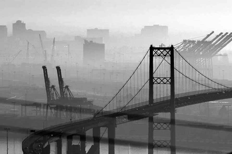
| (2013)^^ - Vincent Thomas Bridge on a foggy morning from West Santa Cruz Street, Rancho Palos Verdes. |
Historical Notes The Vincent Thomas Bridge now carries 26,500 vehicles a day. It is widely credited with providing a crucial transportation link to the Port of Los Angeles and of aiding the port’s phenomenal growth.^^ |
 |
|
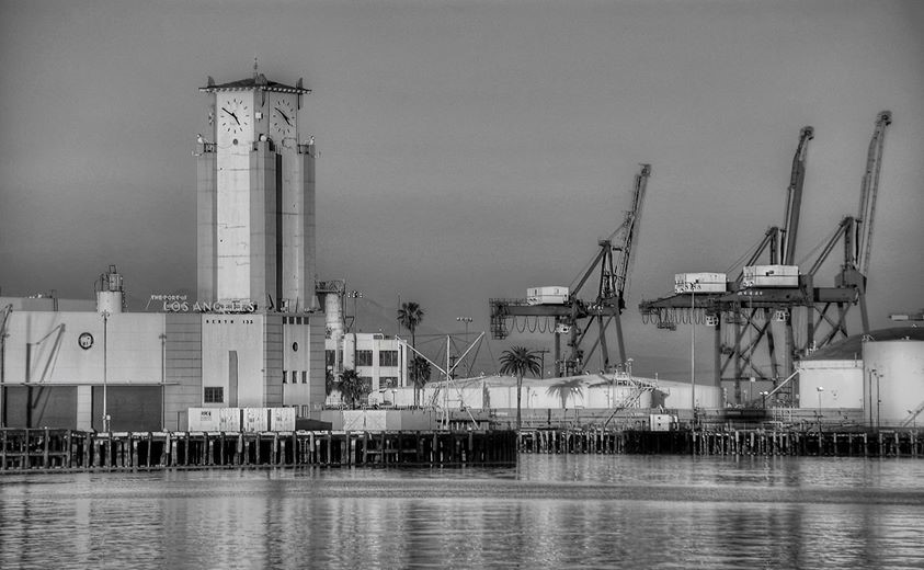
| (2009)**^^^ - View of the former cruise ship terminal at Berth 153 and the Port of Los Angeles clock tower. Photo taken February 2, 2009. |
Historical Notes The World Cruise Terminal at the Port of Los Angeles (passenger and cargo ternminals at Berth 93), opened in 1963. It was designed by AIA award-winning architect Edward H. Fickett, F.A.I.A. The terminal which hosted the original Love Boat TV series from 1977 to 1986 was modernized and expanded in 2010-11 to accommodate the most modern megaships. ##*^ |
 |
|
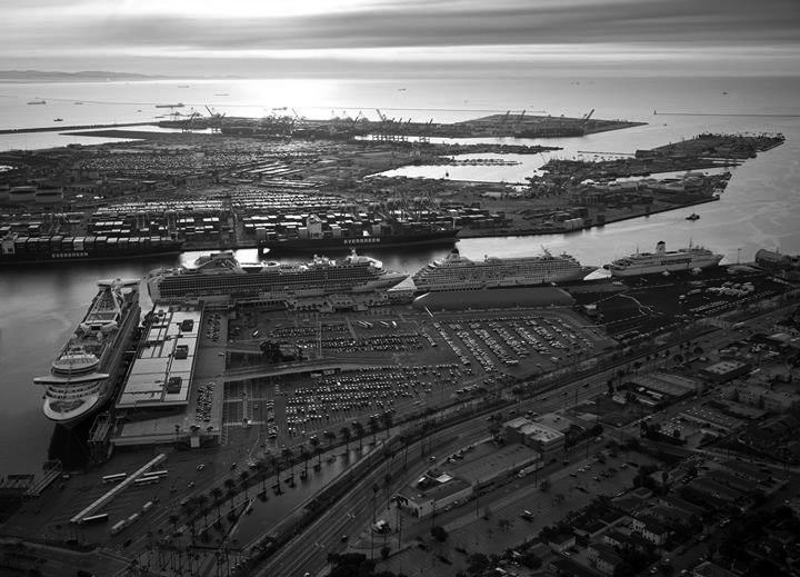
| (2011)**^^^ - A busy day in San Pedro with four cruise ships docked at the World Cruise Center. |
Historical Notes Located in the San Pedro District beneath the Vincent Thomas Bridge, the World Cruise Center is th largest cruise ship terminal on the West Coast. It has three passenger ship berths and transports over 1 million passengers annually.^* Cruise lines served: Carnival Cruise Lines, Celebrity Cruises, Crystal Cruises, Cunard Line, Disney Cruise Line, Holland America Line, Princess Cruises, Norwegian Cruise Line, Royal Caribbean International, Seabourn Cruise Line, Silver Sea Cruises. ##*^ |
Click HERE to see more in Early Views of San Pedro and Wilmington |
* * * * * |
Mount Olympus
 |
|
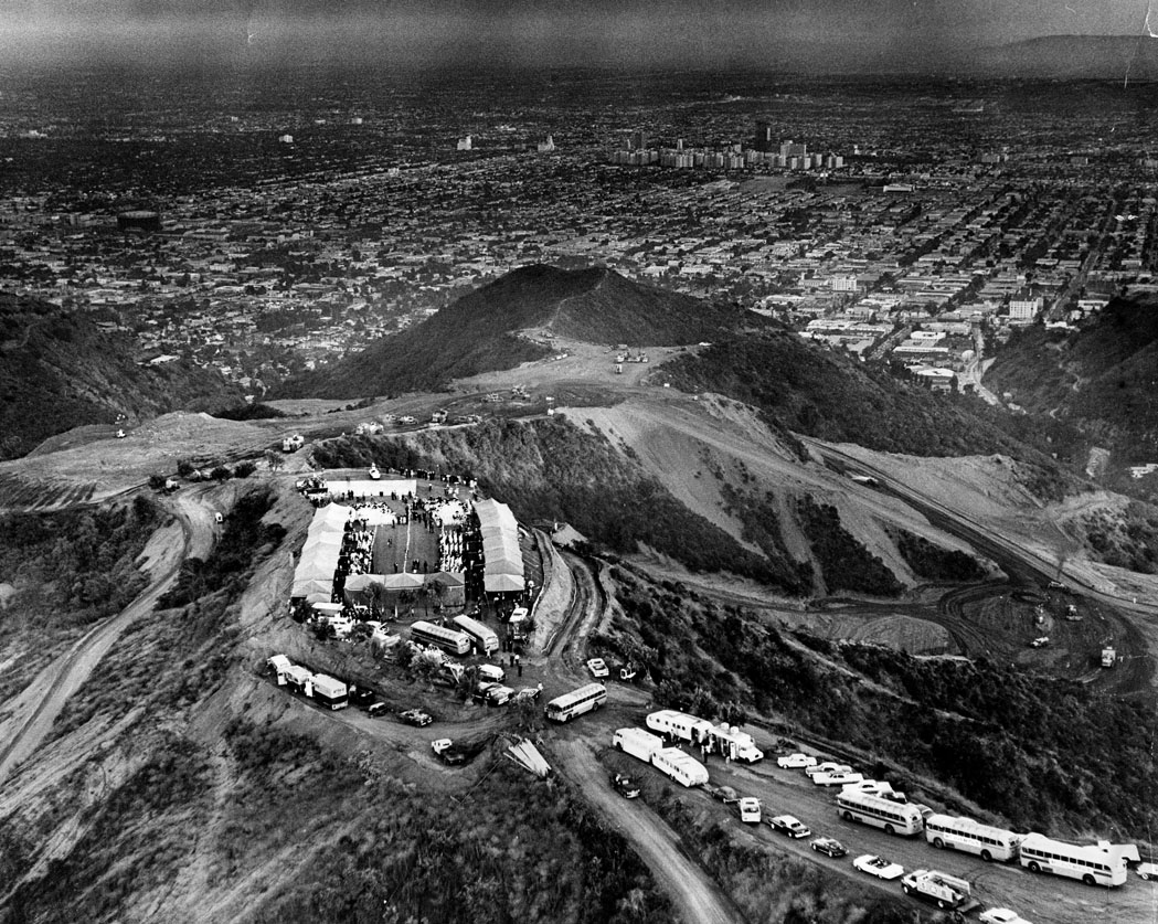
| (1963)^ - Aerial view of Mount Olympus as the first of 2500 guests arrive at the hilltop "house warming party" for the 300-acre development of $150,000 homes 1500 feet above sea level near Laurel Canyon Blvd. and Mulholland Drive. View is toward the southeast. Group of buildings at top right are the Park La Brea Towers. |
Historical Notes Mount Olympus is a prominent neighborhood in the Hollywood Hills area of the city of Los Angeles. A community of single family residences founded by developer Russ Vincent, it is bounded by Hollywood Boulevard, Laurel Canyon Boulevard, Willow Glen Road, and Nichols Canyon Road.^* |
 |
|
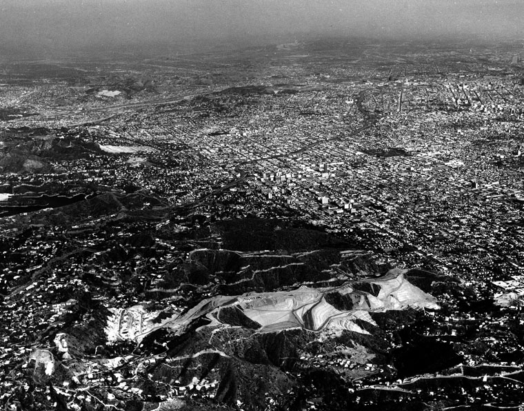
| (1964)^ - Aerial view showing Mount Olympus grading in preparation for the construction of housing. The city lies beyond, looking southeast. |
* * * * * |
Los Angeles Freeways
 |
|
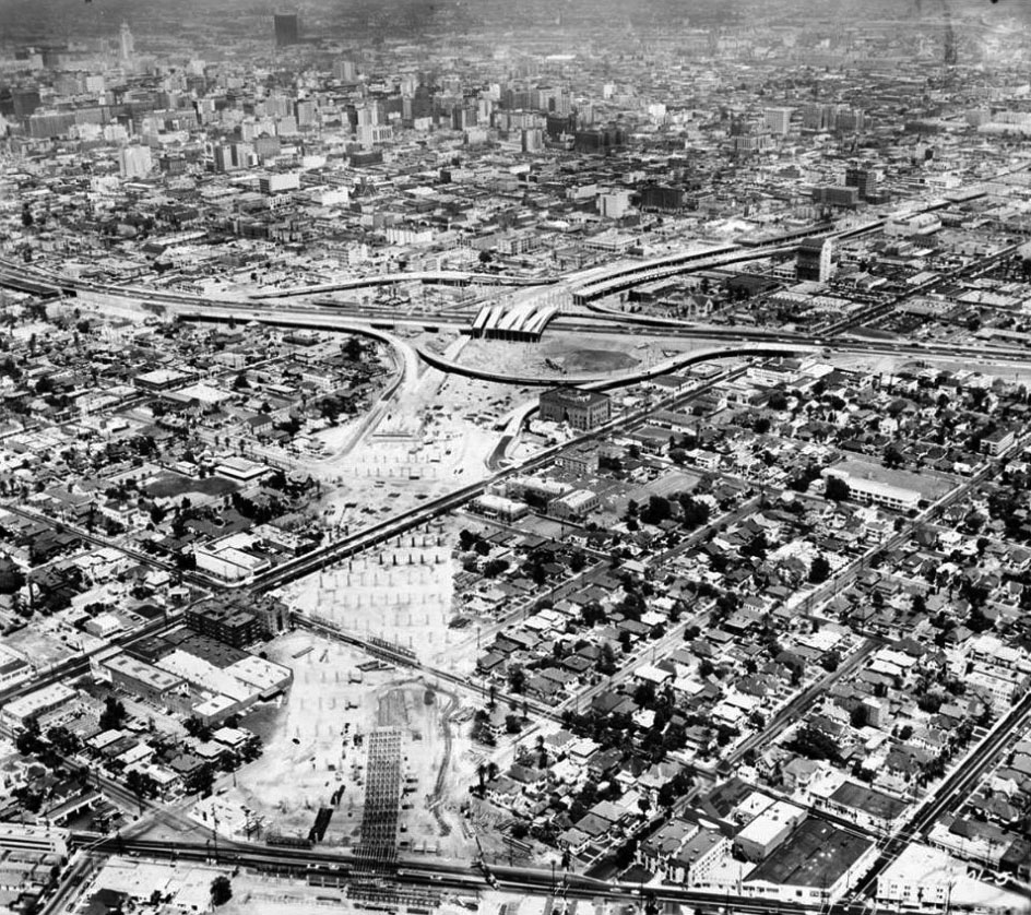
| (1962)##^# - Aerial view showing the Santa Monica Freeway under construction near the Harbor Freeway with downtown Los Angeles in the background. |
Historical Notes Work on the Santa Monica Freeway progressed slowly, and in stages. It was not until October 1964 that it extended west to La Cienega Boulevard, and on January 29, 1965--several years after residents in the freeway's path were displaced--a Goodyear blimp helped cut the ribbon on the 4.5-mile segment between La Cienega and Bundy Drive.^^^* |
 |
|
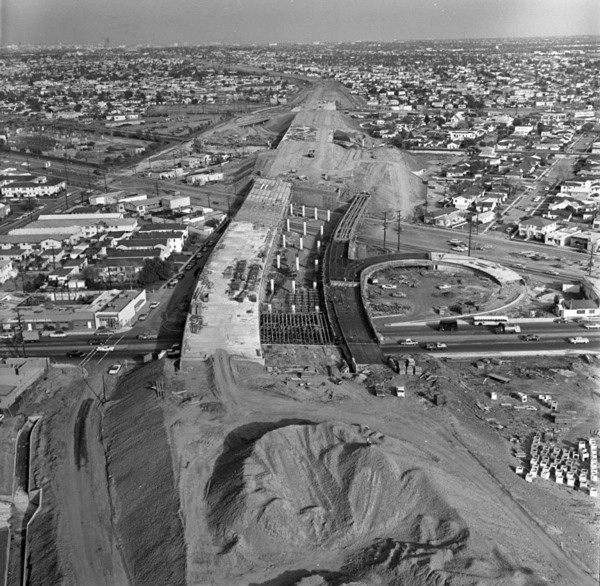
| (1964)^^^* – View looking west showing the Santa Monica Freeway under construction at La Cienega and Venice boulevards. |
Historical Notes Local opposition immediately coalesced against the Santa Monica Freeway when state highway planners announced a major part of its route in August 1955. The entire route -- known originally as the Olympic Freeway -- would span 16.6 miles between the East L.A. Interchange in Boyle Heights and Pacific Coast Highway in Santa Monica, barreling through quiet bedroom communities on its path to the sea. Hundreds of churches, homeowners groups, and other community organizations rallied against the proposal, focusing their opposition on the 6.6-mile stretch west of La Cienega Boulevard. In April 1956 planners revised their original route in the face of community opposition. But while the new route saved 47 homes, it largely shifted the freeway away from the domains of its most vocal opponents and into new neighborhoods. Local opposition persisted, but the highway commission held firm.^^^* |
 |
|
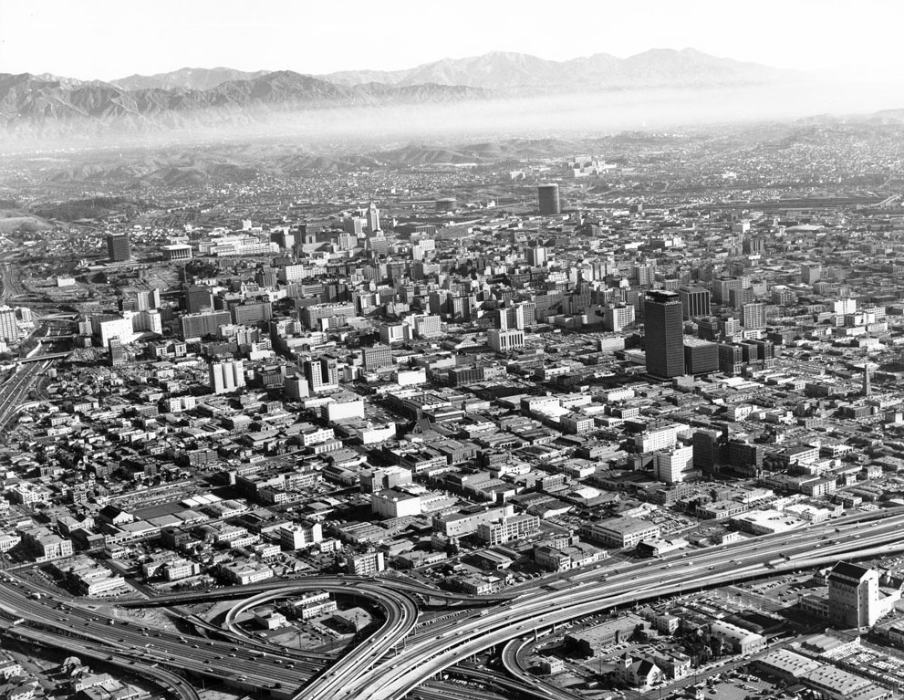
| (ca. 1965)*# - Aerial view of downtown Los Angeles taken from just above the Santa Monica and Harbor Freeway interchange. |
.jpg) |
|
| (1980)^^ – Aerial view of the intersection of the Harbor (110) and Santa Monica (10) freeways just southwest of downtown Los Angeles. |
 |
|
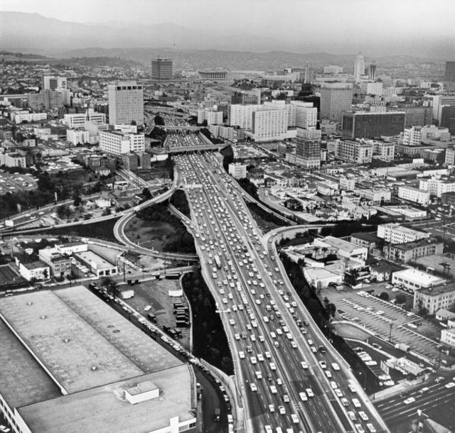
| (1969)*##^ – View looking north showing the Harbor Freeway running through downtown Los Angeles. In the distance can be seen the new Department of Water and Power Building, Music Center, and City Hall. |
 |
|
| (1962)^.^ - Santa Ana Fwy (US-101) at Union Station near Alameda St -- view looking southwest. ‘Metropolitan’-style electroliers line the concrete railing on the right. |
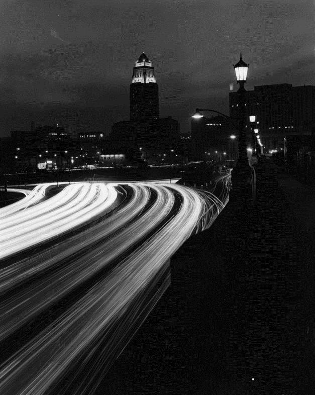 |
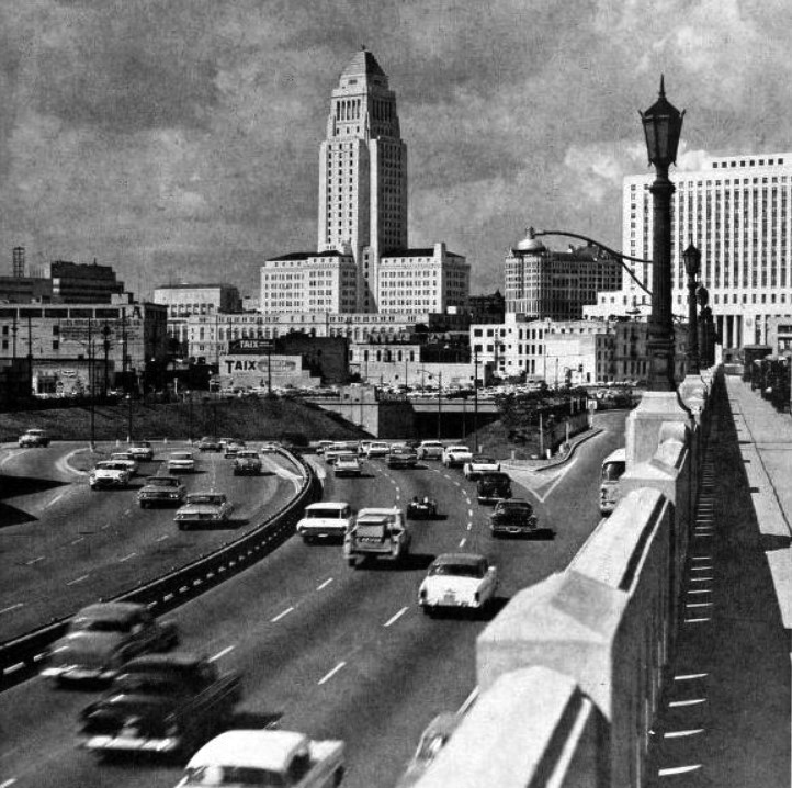
|
| (1962)^ - Nighttime view of Los Angeles and City Hall, looking southwest from the Union Station at the Santa Ana Freeway (same view as previous photo). A billboard for the French restaurant "Taix" and "The TIMES" up in lights on the top of a building appear in the background. |
 |
|
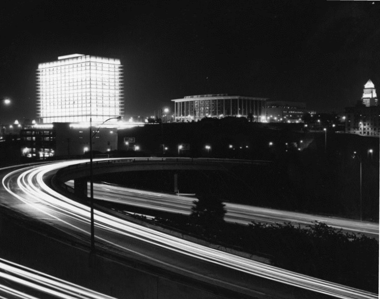
| (1965)^ - Civic center buildings at night; left to right, the Department of Water and Power Building, Music Center and City Hall, seen from across the Harbor Freeway. |
* * * * * |
Water & Power Building and Music Center
.jpg) |
|
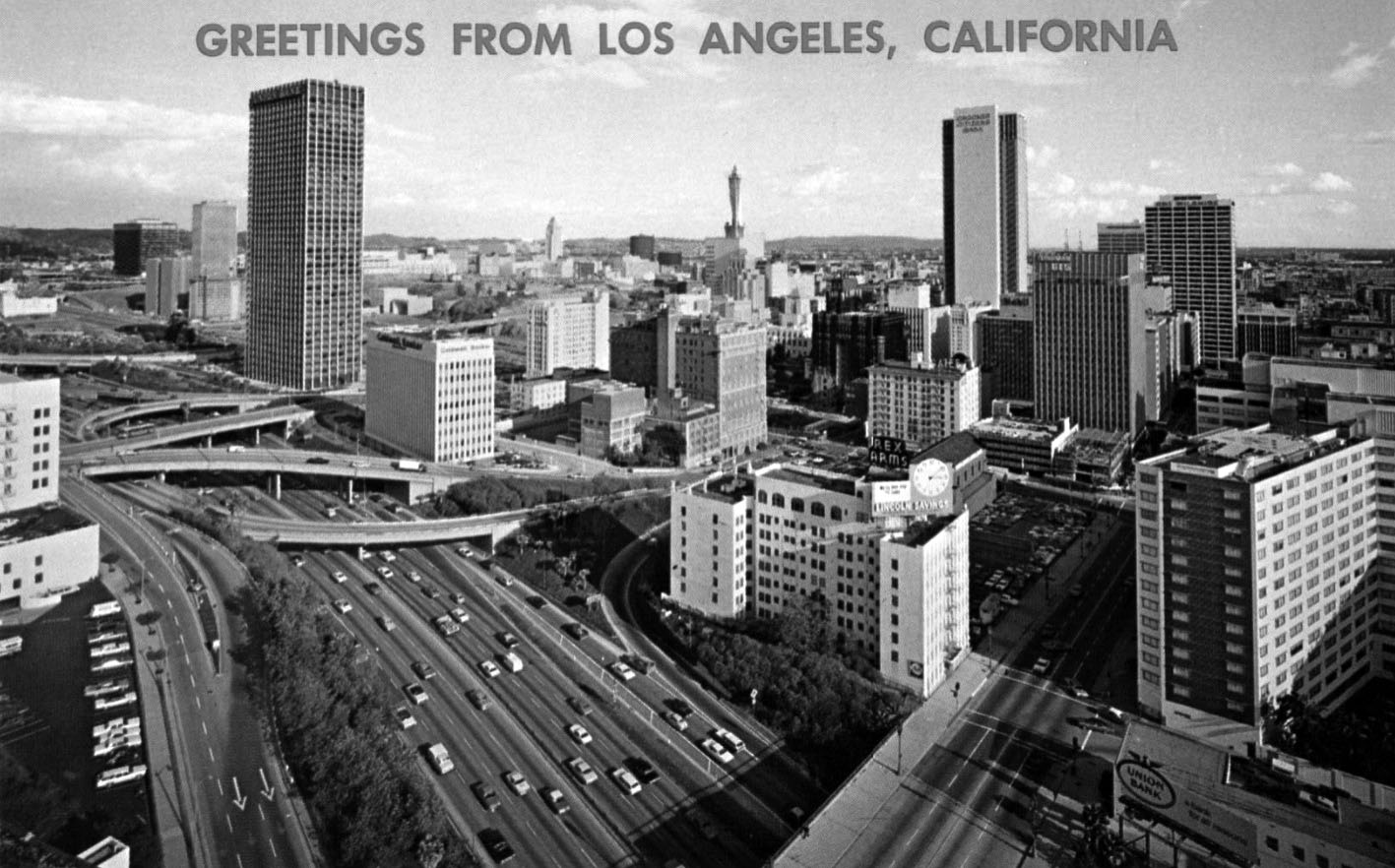
| (ca. 1970)**#**- Panoramic postcard view looking east from Beaudry Avenue toward the 110 Freeway, showing the Los Angeles Department of Water and Power GOB, Dorothy Chandler Pavilion, and Los Angeles City Hall. |
 |
|
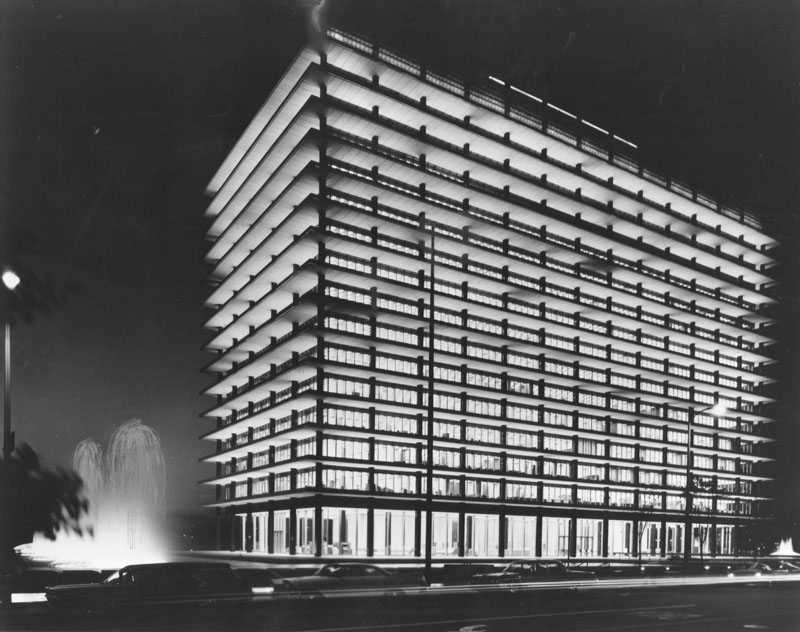
| (1966)^ - Night view of a well lit Department of Water and Power building, including fountains, as seen from the Dorothy Chandler Pavillion across the street. Click HERE to see more in Construction of the DWP Building. |
 |
|
| (1967)* - View of Department of Water and Power Building (GOB) on the left and Dorothy Chandler Music Center on the right from a parking lot across First Street. The parking lot in the above photo is where the Walt Disney Concert Hall stands today (opened 2003). |
 |
|
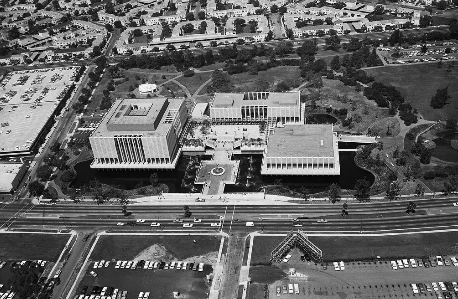
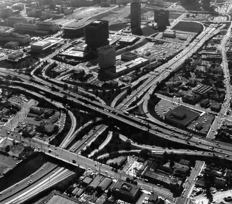
| (ca. 1967)^ - An aerial shot of the Music Center and the Department of Water and Power Building. |
 |
|
| (1967)*# - Aerial view looking east toward City Hall from directly above the Department of Water and Power Building. |
 |
|
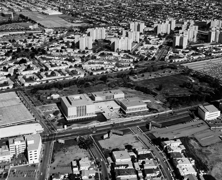
| (1968)*#- Aerial view looking toward LADWP's General Office Building (GOB) with the Los Angeles Civic Center in the background. |
* * * * * |
Wilshire Boulevard (1950s - Miracle Mile)
 |
|
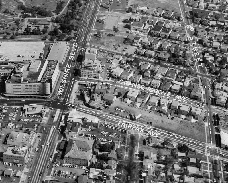
| (1959)^ – Aerial view looking east over the intersection of Wilshire and Fairfax, where the Miracle Mile begins. May Company (built in 1939) can be seen on the northeast corner. Across the street (SE corner) would be built Seibu Department Store (1962-64) and later converted to Ohrbach’s Department Store (1964-86), and Peterson Automotive Museum (1994 – Present). |
Historical Notes The Miracle Mile is an area in the Mid-Wilshire and Mid-City West regions consisting of a 1.5-mile stretch of Wilshire Boulevard between Fairfax and Highland Avenues. The May Company Building, now LACMA West, marks the western border of Miracle Mile's "Museum Row". |
 |
|
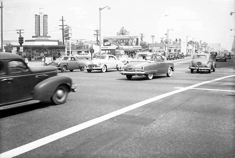
| (1950)^ - Looking northwest across the intersection of Fairfax Avenue and Wilshire Boulevard, showing a Simon's Drive-in restaurant on the northwest corner. Next door, to the right, is a Foster and Kleiser billboard promoting Adohr milk. |
Historical Notes In the 1930s, Wayne McAllister, the originator of the circular drive-in, designed circular Simon's Drive-in Restaurants in the Streamline Moderne style with a three-layer roof and neon advertising pylon; this style was copied throughout the country. Click HERE to see more Early LA Drive-in Restaurants. Since 1955, a Googie-style structure, occupied by Romeo's Times Square and later Johnie's Coffee Shop, has been present on the northwest corner seen here. |
 |
|
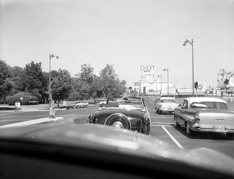
| (1959)^ – Dashboard view looking east down Wilshire Boulevard from just west of where it crosses Ogden Drive (center). Hancock Park and the La Brea Tar Pits are on the left. Office buildings, including one for Financial Indemnity Company, are seen right of center and various billboards are seen on the right. |
Historical Notes In 1965, just a few years after the above photo was taken, a new facility for the Los Angeles County Museum of Art (LACMA) opened in the section of Hancock Park seen on the left. |
 |
|
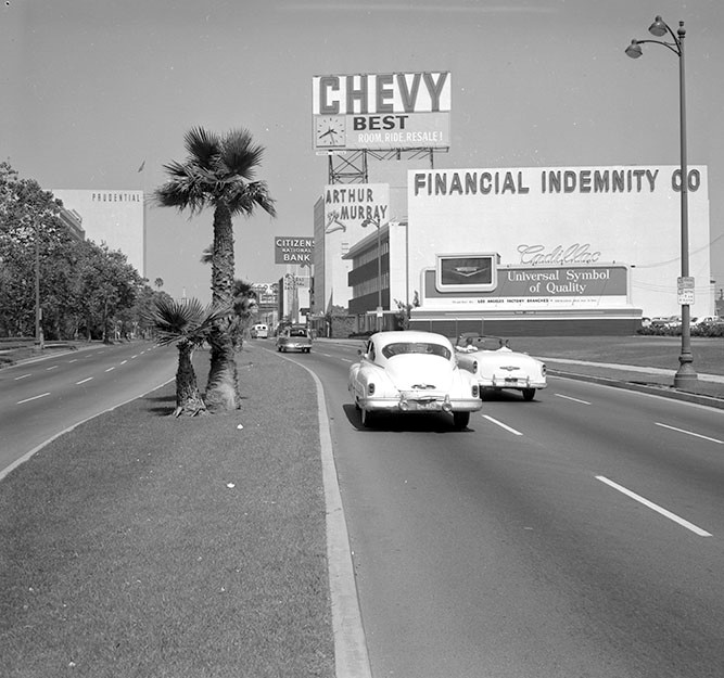
| (1959)^ - Looking east on Wilshire Boulevard from just east of Spaulding Avenue. Hancock Park, home of the La Brea Tar Pits, is on the left. Office buildings, including one for Financial Indemnity Company, and a Foster and Kleiser Cadillac billboard are seen on the right. |
La Brea Tar Pits
 |
|
| (1962)^ - Panoramic view of the La Brea Tar Pits and the La Brea Park looking west as seen from above Curson Avenue and Wilshire Boulevard. Spectators lean against the fence as they look at the tar pit. In the background, center, is the May Company Department Store. A billboard on Wilshire exhorts viewers to "Fly Delta." Click HERE to see more early views of the La Brea Tar Pits. |
La Brea Tar Pits and LACMA
 |
|
| (ca. 1965)^ - Aerial view looking east showing the Miracle Mile (Wilshire Blvd.) with the LA County Museum of Art and the La Brea Tar Pits seen in the foreground. |
Historical Notes The Los Angeles County Museum of Art (LACMA) was established as a museum in 1961. Prior to this, LACMA was part of the Los Angeles Museum of History, Science and Art, founded in 1910 in Exposition Park near the University of Southern California. Early trustee Howard F. Ahmanson Sr. made the lead donation of $2 million, convincing the museum board that sufficient funds could be raised to establish the new museum. In 1965, the museum moved to a new Wilshire Boulevard complex as an independent, art-focused institution, the largest new museum to be built in the United States after the National Gallery of Art.^* |
 |
|
| (ca. 1965)^ - Aerial view of the Los Angeles County Museum of Art. In the background are the Park La Brea Towers appartments. The La Brea Tar Pits can be seen to the right of the museum. The museum was built in 1964 at Wilshire & Genesee (lower center-left). |
 |
|
| (1965)^#^^ – Aerial view looking north showing the Los Angeles County Museum of Art located at 5905 Wilshire Boulevard. On the right is the La Brea Tar Pits. To the left is the parking structure for May Company Department Store. |
 |
|
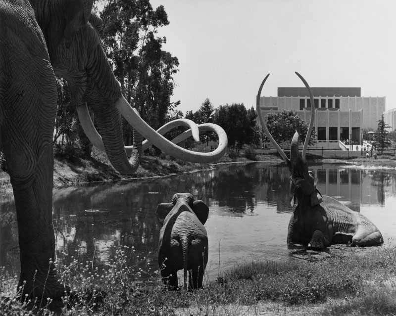
| (1967)* - Sculptor Howard Ball towing his life-size Imperial Mammoth en route to the La Brea Tar Pits for installation. |
 |
|
| (1968)^ - Three life-sized replicas of giant Imperial Mammoths, sculpted by artist Howard Ball, are shown on the shore at the tar pits adjacent to the Los Angeles County Museum of Art, present in the background. Click HERE to see more early views of the La Brea Tar Pits. |
* * * * * |
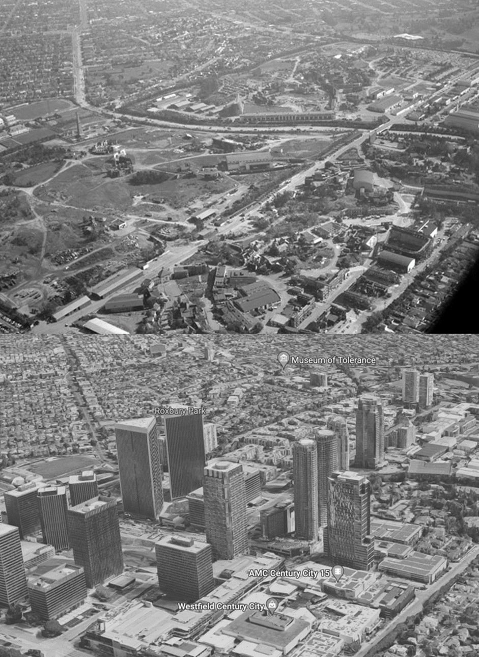
Century City
 |
|
| (1956)^ – Aerial view looking southeast showing some of the buildings at Twentieth Century-Fox Film Corporation. Avenue of the Stars runs from bottom left corner to upper right, intersecting with Olympic Boulevard at right. Beverly Hills High School (sports field) can be seen at upper center-left. |
Historical Notes Before William Fox built his studio here in 1928, the 176-acre site that would one day become Century City was first the personal ranch of movie cowboy legend Tom Mix. By 1935, Fox—producers of the famous Movietone Newsreels—had merged operations with Daryll Zanuck’s 20th Century Pictures to form what would become one of the truly great studios of the American cinema’s Golden Age—20th Century Fox Pictures. But by 1957, with box office receipts down and filmmakers shooting more on location, 20th Century Fox decided to either develop part of their extensive 260-acre back-lot or sell it off entirely. Ultimately, in 1961, the Aluminum Co. of America (Alcoa) purchased 260 acres from 20th Century Fox for $43 million, with 80 acres to remain in use by the film company for its studios. +^^ |
 |
|
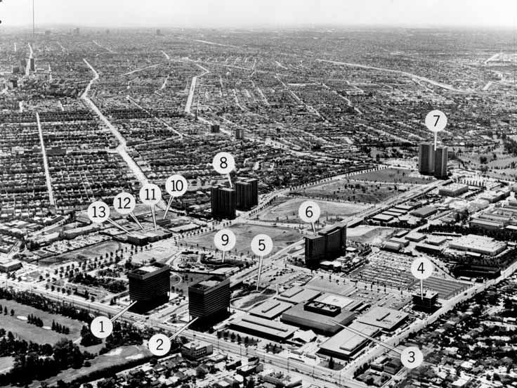
| (1967)^ - Aerial view looking southeast showing Century City with buildings identified: (1-2) Gateway East and Gateway West; (3) Century Square shopping mall; (4) Prudential building; (5) 1901 building; (6) Century Plaza Hotel; (7) Century Towers; (8) Century Park East apartments; (9) Restaurant; (10) Century City Service Center; (11) Pacific Telephone building; (12) Auto Club |
Historical Notes At the southern edge of Century City, a small community of office buildings, bungalows and sound stages is all that remains of the once grand and sprawling 20th Century Fox Studios. |
Then and Now
 |
|
| (1956 vs 2020s) - Century City Then and Now |
 |
|
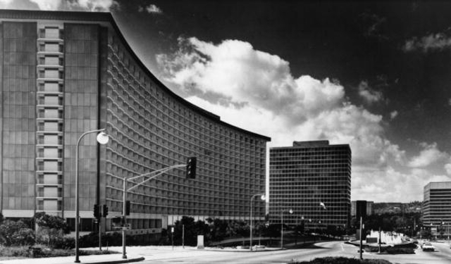
| (1969)*##^ - View looking north on Avenue of the Stars with the Century Plaza Hotel on the left. |
Historical Notes In 1961, developer William Zeckendorf and Alcoa bought about 180 acres from 20th Century Fox after the studio had suffered a string of expensive flops, culminating in the box-office disaster Cleopatra. The new owners conceived Century City as "a city within a city" with the arc-shaped, 19-story, 726-room Minoru Yamasaki-designed Century Plaza as the centerpiece of the new city.^* |
 |
|
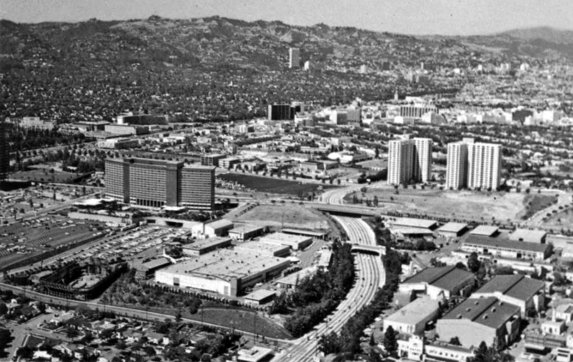
| (ca. 1969)##^* – Postcard view of Century City looking northeast. The Century Plaza Hotel stands at center-left. The curved street running down toward the center bottom is Olympic Boulevard and 20th Century Fox Studios is at lower-right. Hollywood can be seen in the far distance (upper-right). |
 |
|
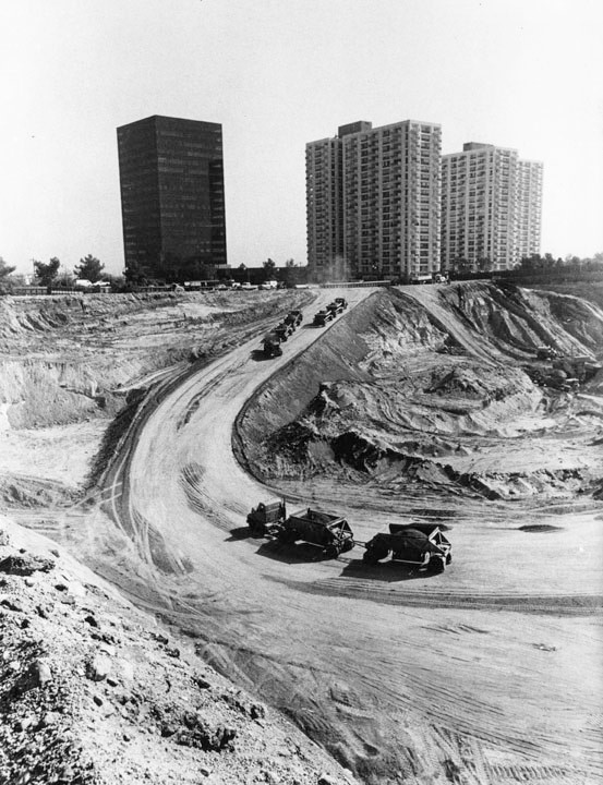
| (1969)^ - Photograph caption dated November 17, 1969 reads, "Dump trucks haul a small portion of the dirt away from Century City site. A total of two million cubic yards of dirt will have to be removed to make way for the Entertainment Center." In the background are an office building (left) of the Century City Medical Center and the condominium towers of Century Park East, located at 2160 & 2170 Century Park East and built in 1966. |
 |
|
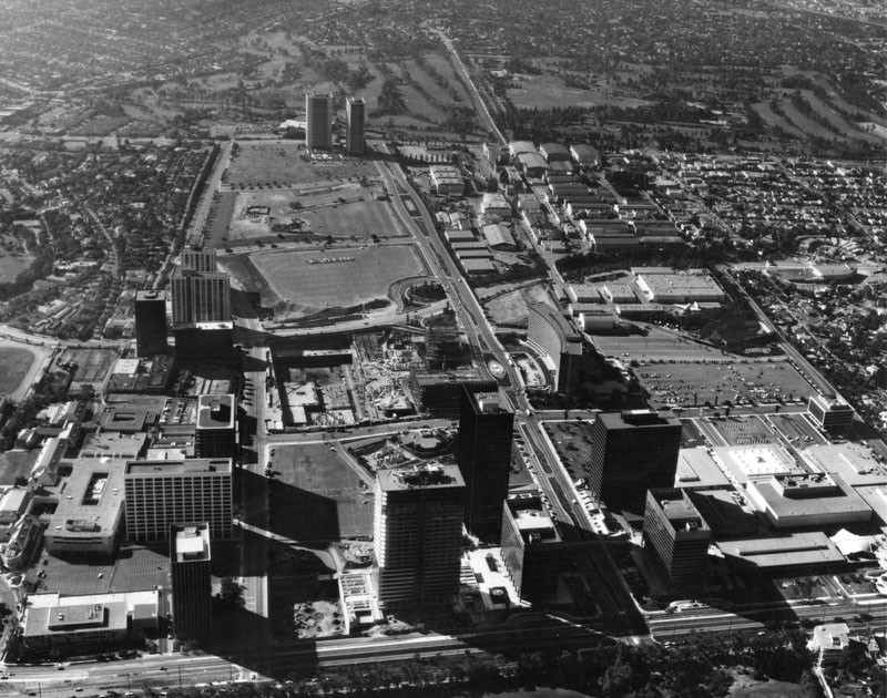
| (1971)^ - Aerial view of Century City looking south. In the foreground is Santa Monica Boulevard. In the background is Pico Boulevard, and Avenue of the Stars connects the two. The ABC Entertainment Center is under construction at center, across the street from the Century Plaza Hotel. 20th Century-Fox Film Studio is in the right background. |
Historical Notes A shopping center (Century Square Shopping Mall) is seen in the lower right-hand corner. Construction began in 1960. Architects: Charles Luckman, Welton Beck, Minoru Yamsaki, et al. Boundaries were: N-Santa Monica Blvd. ; S-Olympic Blvd. ; E-Century Park-East ; W-Century Park-West. |
 |
|
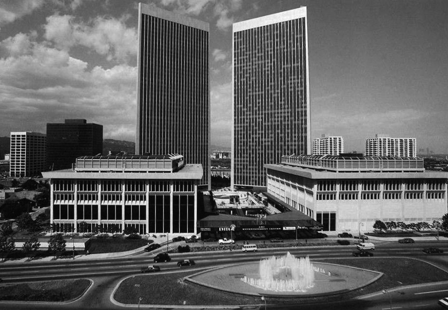
| (1980)^**# – View showing the the ABC Entertainment Center with the Century Plaza Towers in the background as seen from across Avenue of the Stars in front of the Century Plaza Hotel. |
Historical Notes Completion of the new ABC Entertainment Center was finalized in 1972, offering a movie complex that screened Cabaret as its first film. That same year, as part of Century City’s cultural center, the Shubert Theatre opened with Follies starring Alexis Smith. For the next thirty years, the theater would bring Broadway productions to West Los Angeles, including Sly Fox with George C. Scott, A Chorus Line, Chicago, Ragtime, Cats, Les Miserables, Sunset Boulevard and the Shubert’s longest running hit Beauty and the Beast. +^^ |
 |
|
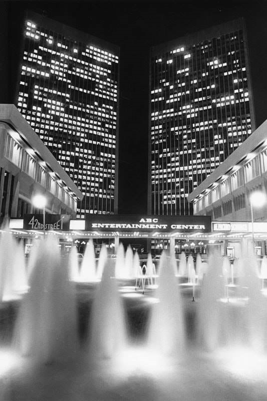
| (1986)^ – Street level view showing four prominent structures of Century City: the Shubert Theatre (left), the ABC Entertainment Center (right), and the Century Plaza Towers (background). |
Historical Notes The ABC Entertainment Center was designed by Henry George Greene, and completed in 1972; the Century Plaza Towers were designed by Minoru Yamasaki and built between 1969 and 1975. The Shubert Theatre was demolished in 2002 and the ABC Entertainment Center was demolished in 2003. |
 |
|
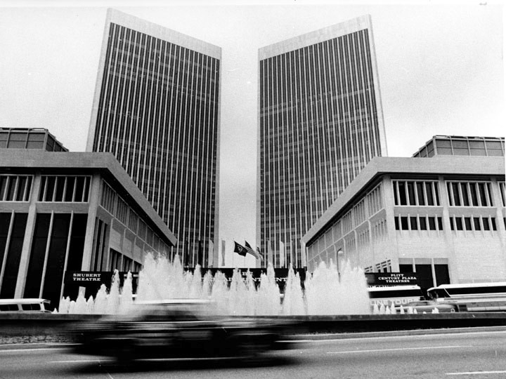
| (1984)^ - In the foreground is the ABC Entertainment Center featuring a lighted fountain. In the background are the Century Plaza Towers. |
Historical Notes The ABC Entertainment Center, designed by Henry George Greene was completed in 1972 and demolished in 2003; the Century Plaza Towers, designed by Minoru Yamasaki was built between 1969 and 1975. Playing at the Shubert, the theater of the complex, is "42nd Street," and "Scarface", starring Al Pacino. Minoru Yamasaki's two soaring towers with triangular floor plans rise behind Greene's Brutalist theatre complex in this view. At the time, the complex had the world's largest underground parking garage with 5600 parking spaces. |
 |
|
| (ca. 1986)^ - Close-up of the entrance to the ABC Entertainment Center with a view of the Shubert Theatre (left), which was later demolished in 2002. |
 |
|
| (1991)##++ – Aerial view showing the twin 44-story Century Plaza Towers and the old ABC Entertainment Center seen in the foreground. Photo by Jim Vines |
Historical Notes 1975 marked the end of The Golden Age of Century City development, with the completion of the Century Plaza Towers, which majestically loomed above The ABC Entertainment Center. Designed by Minoru Yamasaki, the two 44- story triangular towers became an instant showpiece for Alcoa, with its aluminum siding that shimmered in the sun for miles around. The following year, on May 17, 1976, the Shubert Theatre hosted the 28th Annual Emmy Awards using the Century Plaza Towers as two large 44-storied neon signs that could be seen from an airplane. Boasting the largest underground parking structure in the world, both The Century Plaza Towers and The ABC Entertainment Center became the heart of Century City. +^^ The Entertainment Center was demolished in October 2002 to make way for the 2000 Avenue of the Stars office building. The Plaza Towers' prominence in the Century City skyline has been reduced in recent years with the addition of new skyscrapers that partially block their view. Nevertheless, the Century Plaza Towers remain the tallest buildings in Century City and the tallest skyscrapers in Southern California outside of downtown Los Angeles. |
* * * * * |
Hughes Airport - Playa Vista
 |
|
| (1968)* - Aerial view looking east along the runway of the Hughes Airport. Loyola University and Westchester can be seen on the right. |
Historical Notes In 1940, Howard Hughes purchased 380 acres of the Ballona Wetlands just west of Culver City for $500,000. Hughes recognized the area as one of the few large tracts of remaining undeveloped land in Los Angeles. The high water table made it necessary to sink 50' pilings into the wetlands to support Hughes’ buildings & reroute the course of the Centinela River, which flowed through the site every spring & flooded it. On his new land Hughes constructed a 60,000 square foot air conditioned, humidity-controlled aircraft plant with an adjacent grass runway.*#*# Little known fact: The Los Angeles River was originally alluvial, meaning its banks and bed were formed from loose sediments and rock that allowed it to change its path depending on water flow and season. Up until the early 1800's, the river actually flowed into the Pacific near Marina Del Ray (Ballona Wetlands), but a particularly severe flash flood in 1825 diverted the river all the way to Long Beach, where it has remained since.^^^* In 1943, Hughes built the world’s longest private runway at the Hughes Airport. Runway 5/23 was 9,600' long - nearly 2 miles in length. It was not paved for its first few years, because Hughes believed that paved runways imparted unnecessary stress on an aircraft's landing gear. He reportedly had to add fill regularly to keep the ground solid.*#*# |
 |
|
| (1972)*#*# - Aerial view looking west at the Hughes Airfield. |
Historical Notes After an often strange & reclusive life, Howard Hughes died in 1976. After the dust of Hughes’ estate had settled, the Culver City property was in the hands of Summa Corporation. Summa proposed a mega-development, with 29,000 people in 13,000 units, and an additional 20,000 employed by an on-site world-class motion picture studio. The project was called "Playa Vista." *#*# During the late 1990s, DreamWorks failed in its attempt to build a studio in Playa Vista.*^ |
Click HERE to see more in Aviation in Early L.A. |
* * * * * |
 |
|
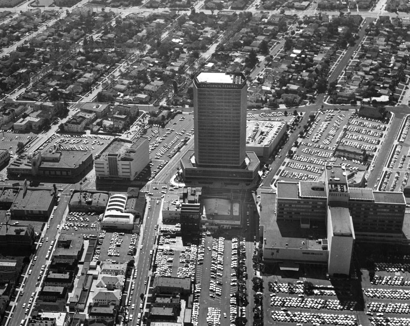
| (ca. 1970s)^ - The California Federal Plaza building is in the center of an aerial shot showing surrounding commercial and residential areas. Signage on some of the commercial buildings include Van de Kamp's, and Prudential, later renamed Museum Square. |
Historical Notes California Federal Bank, often abbreviated to "Cal Fed", was a savings and loan bank in California with the corporate headquarters being located at 5670 Wilshire Boulevard, in Los Angeles. It existed from 1926 until 2002, when its parent company, Golden State Bancorp, was acquired by Citigroup, resulting in the bank being merged into Citibank. Cal Fed first ceased to be an independent banking company after its acquisition in 1997 by First Nationwide Bank of San Francisco, California. First Nationwide Bank changed the name of the new merged banking entity to CalFed Bank due to the appeal of the CalFed brand name. A few years later the bank was bought out by Citigroup.^* |
 |
|
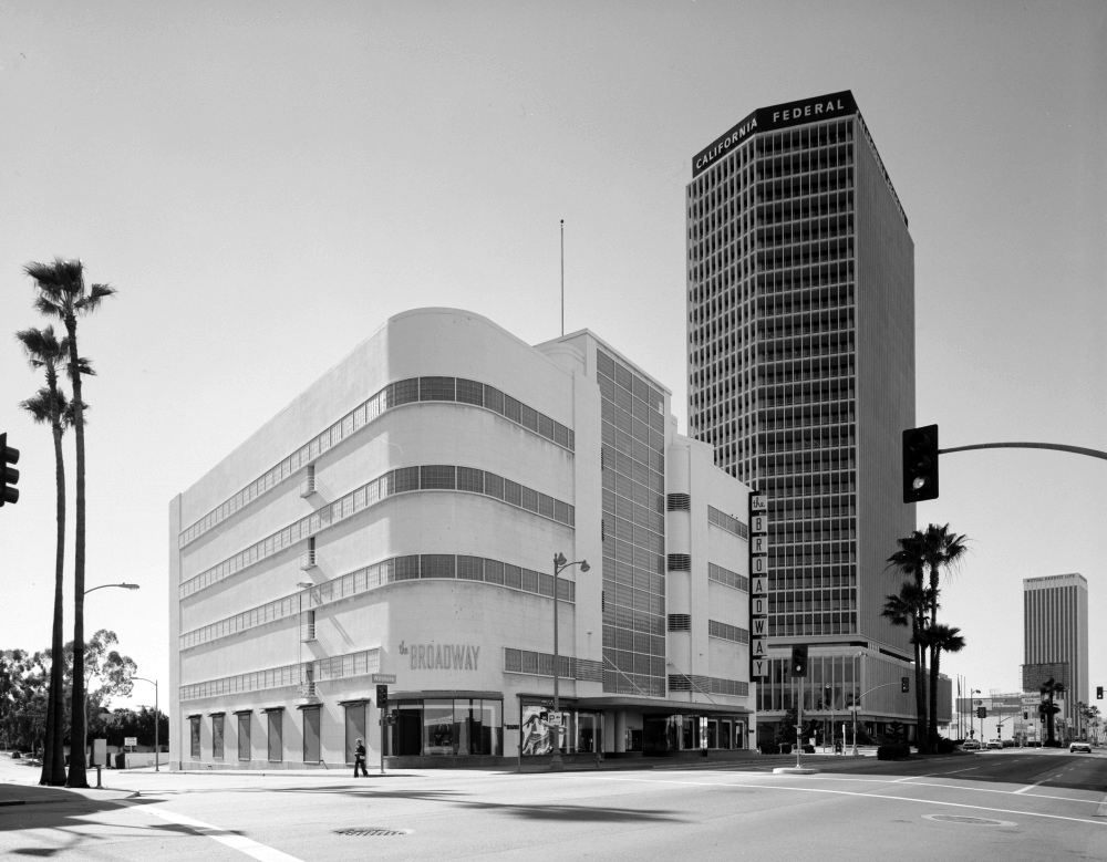
| (1972)**^ - View looking west on Wilshire Boulevard. The Broadway (originally Coulter's) Department Store is at 5600 Wilshire Boulevard. The California Federal Bank Building stands to the right. |
Historical Notes California Federal Bank's historic building, opened in 1965, on Wilshire was one of the original bank corporate headquarters in the Miracle Mile area.^* |
* * * * * |
 |
|
| (1979)^ - Panoramic view from Los Angeles City Hall, looking northeast from the southern side of Highway 101. Several landmarks are visible, including the Terminal Annex Post Office, Union Station, and the L.A. Plaza. |
Click HERE to see more in Early Plaza of Los Angeles |
 |
|
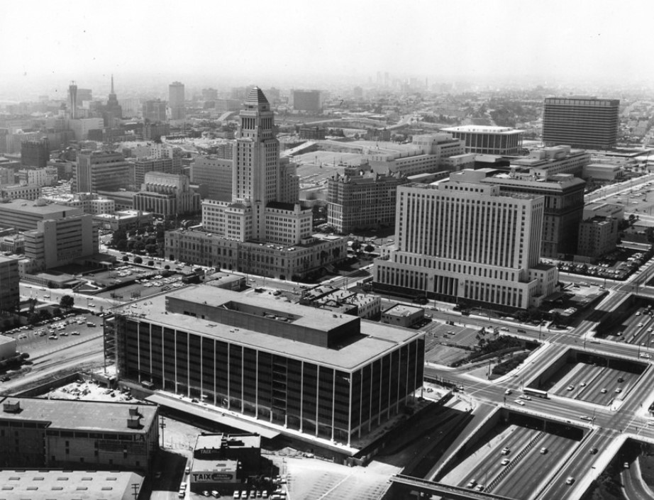
| (1968)*# - Aerial view facing north over Downtown Los Angeles with the Harbor and Hollywood freeways in the background. Notable buildings are the Eastern-Columbia with the clock tower, Texaco Building, One Wilshire, City National Bank, AT&T Building (under construction), Union Bank Square. |
 |
|
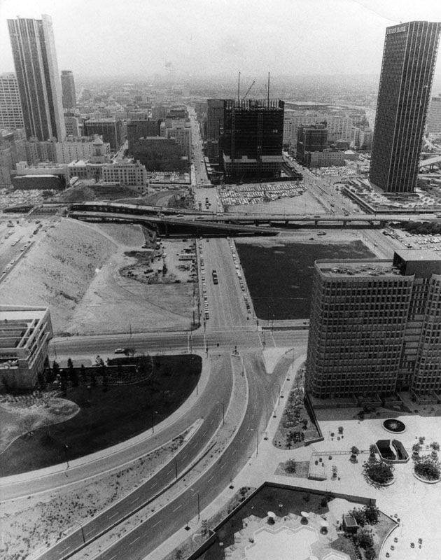
| (1970)^#^^ – Aerial view looking south over Dodger Stadium showing downtown and the Bunker Hill Redevelopment area (open space). |
 |
|
| (1971)**^ - Aerial view of downtown Los Angeles looking southwest from over the Hollywood Freeway. The Pacific Ocean can be seen in the distance. Note the cleared area at center of photo. It is part of the Bunker Hill Redevelopment Project. |
 |
|
| (1970)^ - Aerial view of the Four Level Interchange in downtown L.A. Some of the recently constructed buildings (Music Center, DWP, Bunker Tower, etc.) can be seen in the background. |
Before and After
.jpg) |
|
.jpg) |
|
| (1954)*# vs. (1970)^ |
 |
|
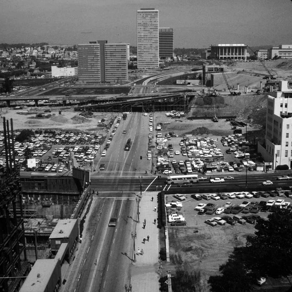
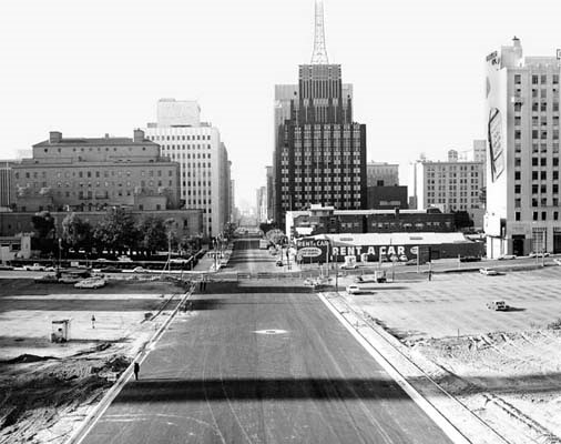
| (1968)^ - View looking south on Flower Street toward 5th Street. The California Club stands on the left. The Richfield Building is the tallest building in view. Empty parking lots are seen in the foreground. |
 |
|
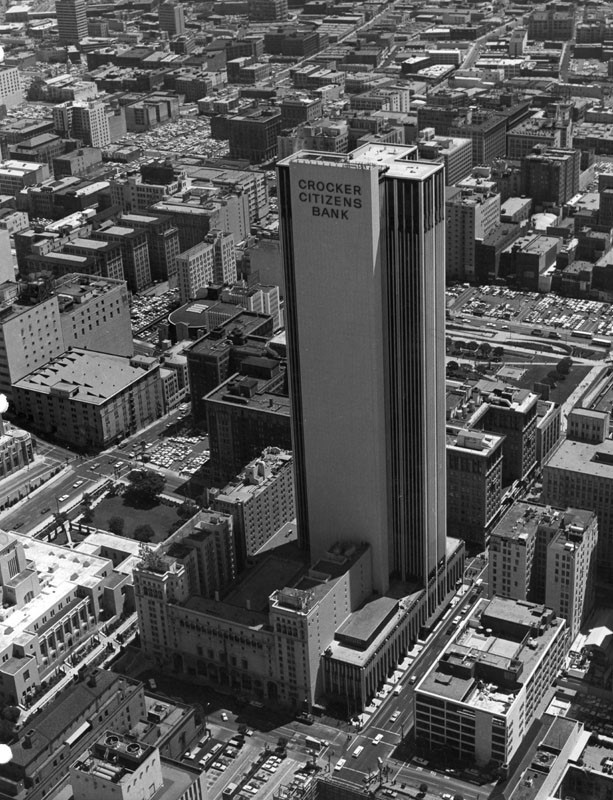
| (1968)^ - Aerial view looking northeast showing the 42-story Crocker-Citizens Plaza and surrounding buildings in downtown Los Angeles. In the lower-left can be seen LA Central Library, the California Club, and Church of the Open Door/Biola Institute. |
Historical Notes The Crocker-Citizens Plaza was designed by William L. Pereira & Associates and completed in 1968 (Click HERE to see more). |
 |
|
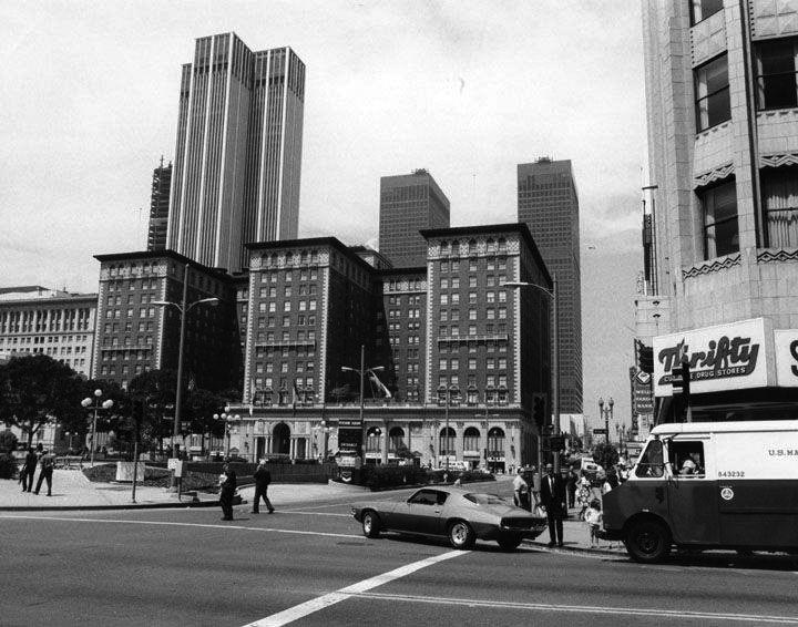
| (1970s)##^# – View looking west from the corner of 5th and Hill streets showing the Biltmore Hotel with Crocker-Citizens Bank Building and ARCO Towers behind it. Thrifty is on the N/W corner. |
Historical Notes The 1923-built Biltmore Hotel was designated a Los Angeles Historic-Cultural Monument No. 60 in 1969. Click HERE to see the LA Historic-Cultural Monument List. As of 2009, the Los Angeles Biltmore is operated as part of the Millennium & Copthorne Hotels chain as the Millennium Biltmore Hotel. From its original 1500 guestrooms it now has 683, due to room reorganization.^* Click HERE to see more Early Views of the Biltmore Hotel. |
Grand and 5th
 |
|
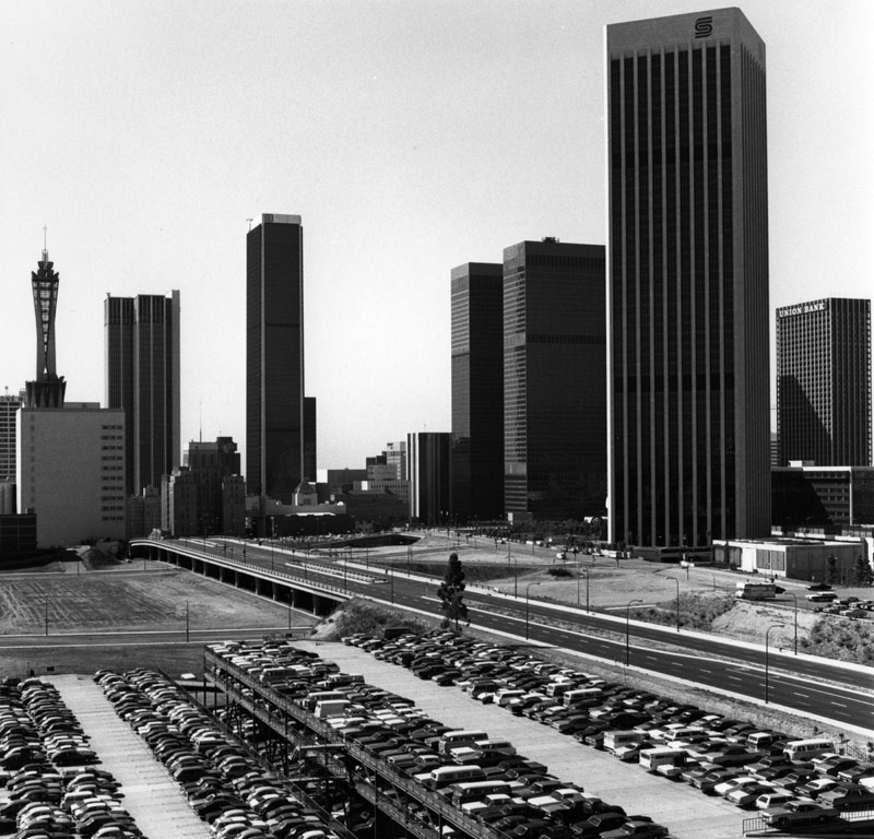
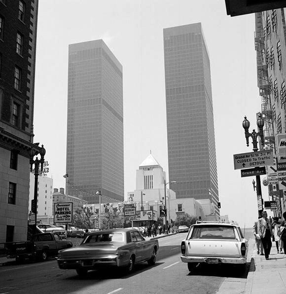
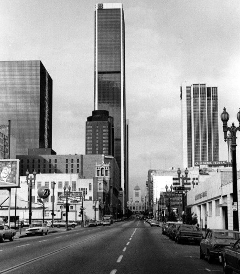
| (ca. 1975)##^# – View looking west on 5th Street toward Grand Avenue showing the Los Angeles Central Library seemingly dwarfed by the the ARCO Plaza Towers. At left is a portion of the Biltmore Hotel. |
Historical Notes Upon completion in 1972, the ARCO Plaza Towers were the tallest buildings in the city for one year before being overtaken by Aon Center (originally United California Bank Building) , and were the tallest twin towers in the world until the completion of the World Trade Center in New York City. ^* |
 |
|
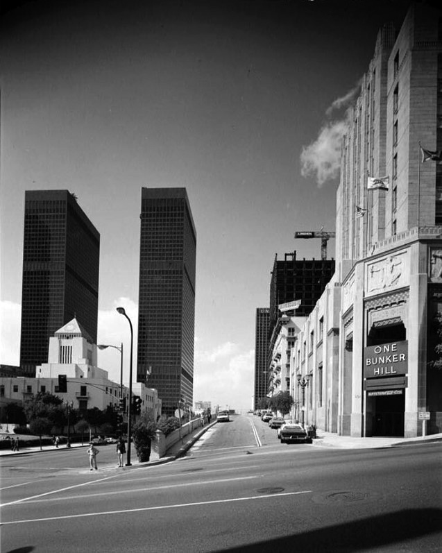
| (ca.1979)^.^ – View looking west on 5th Street at Grand Avenue showing the One Bunker Hill Building (originally Edison Building) on the right (NW Corner) with the Engstrum Apartments furter back. The Central Library can be seen on the left with the twin ARCO Towers in the distance. The skyscraper going up at center-right is the 444 Flower Building (later Citigroup Center) at the NE corner of Flower and 5th Street. |
Historical Notes Located on the NW corner of Fifth Street and Grand Avenue, the One Bunker Hill building opened on March 20, 1931 as the Southern California Edison Company corporate headquarters. Originally known as the Edison Building, it was one of the first all-electrically heated and cooled buildings constructed in the western United States. The Art Deco building, located at 601 W. 5th Street, was designed by James and David Allison. |
Then and Now
 |
|
| (1979) vs. (2022)* - View looking west on 5th Street at Grand Avenue. Contemporary photo by Paul Wright |
Now and Then
 |
|
| (1924) vs. (2020)* - View looking west on 5th Street at Grand Avenue. Lower photo was taken after the demolition of the State Normal School to make way for the Central Library. The Engstrum Apartment Building can be seen at upper-right. |
Then and Now
 |
|
| (1924) vs. (2022)* - View looking west on 5th Street at Grand Avenue. |
Historical Notes 1924 photo was taken after the demolition of the State Normal School (precursor to UCLA) to make way for the Central Library. |
* * * * * |
 |
|
| (1974)^#^^ – View looking north on Hope Street with the LA Central Library in the distance. From L to R can be seen the ARCO Plaza Towers, United California Bank Building (now Aon Center), and the Crocker-Citizens Bank Building. Click HERE for contemporary view. |
Historical Notes Aon Center was originally named the United California Bank Building from its completion in 1973 until 1981, when it became First Interstate Tower. It was the tallest building west of the Mississippi River when built, until 1982 when it was surpassed by the Texas Commerce Tower in Houston. Upon its completion in 1973, the building was the tallest in the world outside of New York and Chicago. It remained the tallest building in Los Angeles until 1989, when Library Tower (now U.S. Bank Tower) was completed. Between 1998 and 2005, there were no logos on the building.^* |
Then and Now
 |
|
| (1974 vs 2020)* – Downtown's Changing Skyline. View looking north on Hope Street toward the Central Library. |
Downtown's Changing Skyline
 |
|
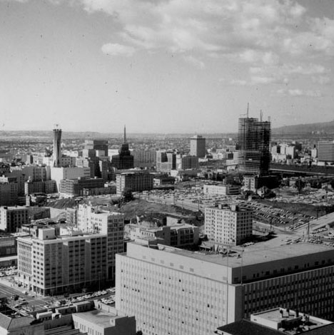
| (ca. 1967)^ - View from City Hall looking south over downtown. The LA Times Building (foreground) has now been expanded, the Atlantic Richfield Building is still standing, and redevelopment on Bunker Hill has not yet been completed. |
Historical Notes Prior to the late 1950s the Charter of the City of Los Angeles did not permit any portion of any building other than a purely decorative tower to be more than 150 feet. Therefore, from its completion in 1928 until 1964, the City Hall was the tallest building in Los Angeles, and shared the skyline with only a few structures having decorative towers, including the Richfield Tower and the Eastern Columbia Building.^* |
 |
|
| (1968)**^* - View of Bunker Hill from City Hall looking southwest. The State Building in the foreground sustained damage in the 1971 San Fernando Earthquake and was demolished in 1976 (see next photo). |
 |
|
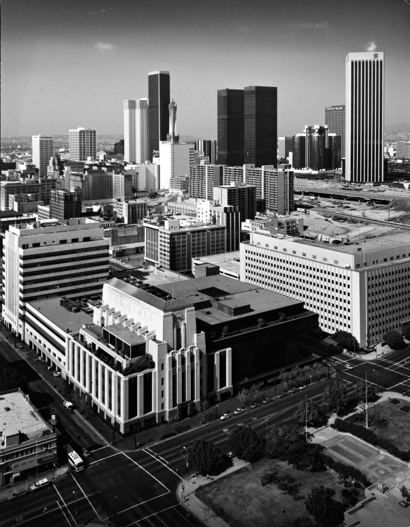
| (1978)^ - View of Bunker Hill from City Hall looking southwest. Same view as previous photo but 10 years later. In the foreground are the remains of the State Building, demolished in 1976. The LA Times Building has a new additon. Also, note how the skyline is beginning to change with the additon of the ARCO Towers, Security Pacific Building, and the Westin Bonaventure Hotel among others. |
Historical Notes Built just a few years earlier, both the ARCO Towers and the Bonaventure Hotel (background) are present. A redesigned Grand Avenue (right) running through Bunker Hill has been completed, but other construction in that corridor has not yet begun.^ |
 |
|
| (1980)*++ - View of Bunker Hill from City Hall, looking southwest, with a clear view of the Westin Bonaventure Hotel (built in 1976) in the upper-right. The LA Times Building and Annex can be seen at lower-center. The large building at center-right (SW corner of 1st and Broadway) is the Junipero Serra State Office Building. It would be demolished in 2006 to make way for the First Street U.S. Courthouse. |
 |
|
| (2019)^.^ – View looking SW as seen from mid-level City Hall. The building at lower-right is the 10-story First Street U.S. Courthouse (completed in 2016). Photo courtesy of Howard Gray |
Then and Now
 |
|
| (1967) vs. (2019) - Downtown Los Angeles Skyline |
* * * * * |
 |
|
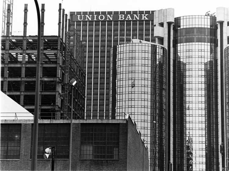
| (1976)**^ – Aerial view looking southwest showing the Westin Bonaventure Hotel under construction on the southeast corner of 4th and Figueroa streets. Behind the hotel is the Union Bank Building. At lower right stands the microwave tower on top of the Madison Complex Tandem Office Building. |
 |
|
| (1980)**^* - View looking west showing from left to right; the Wells Fargo Building (under construction), the Union Bank Building, and the Westin Bonaventure Hotel. |
|
Statler Hilton (later Los Angeles Hilton and Wilshire Grand Hotel)
 |
|
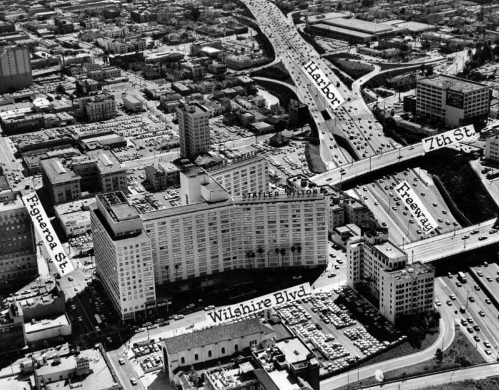
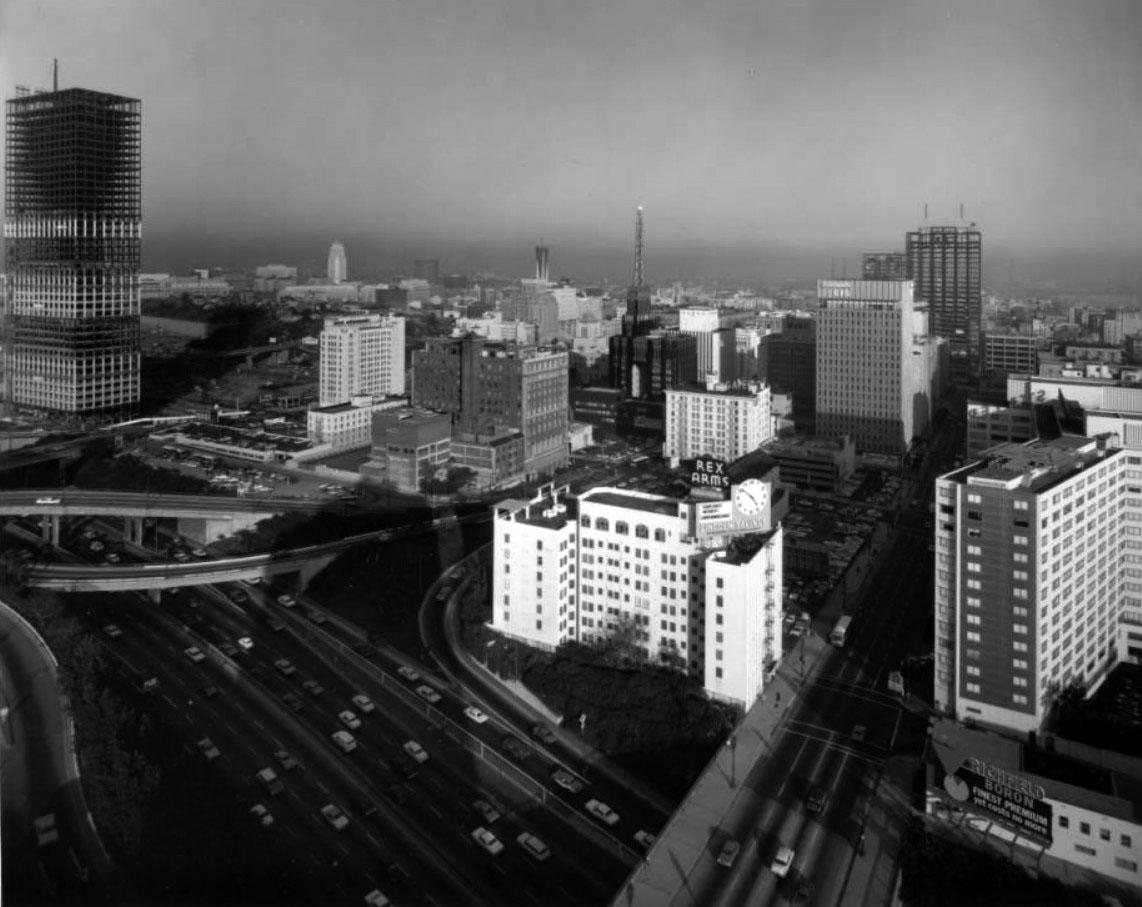
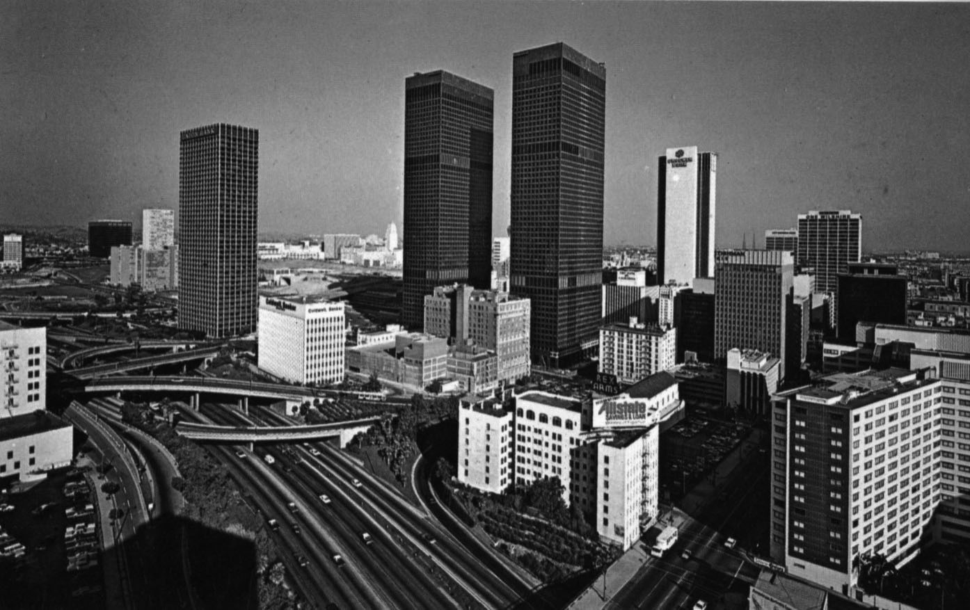
| (1960)^ - Aerial view over the Statler Hilton (later Wilshire Grand Hotel) at Figueroa Street and Wilshire Boulevard with the Harbor Freeway seen at right. The Rex Arms Apartments can also be seen at lower-right. |
Historical Notes Built in 1952, the Statler Center was hailed as the first major downtown hotel to be developed since the Biltmore in 1923. The hotel later operated as the Statler Hilton, Los Angeles Hilton, and lastly the Wilshire Grand Hotel. The building was demolished in 2013 and replaced with a new Wilshire Grand, designed by AC Martin. It is the tallest building on the West Coast.* |
Wilshire and Beaudry
 |
|
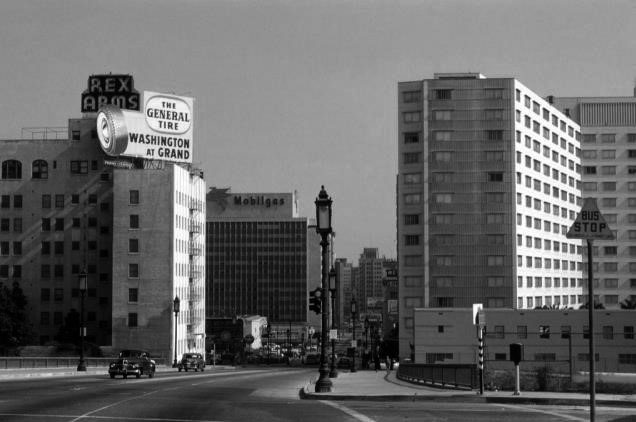
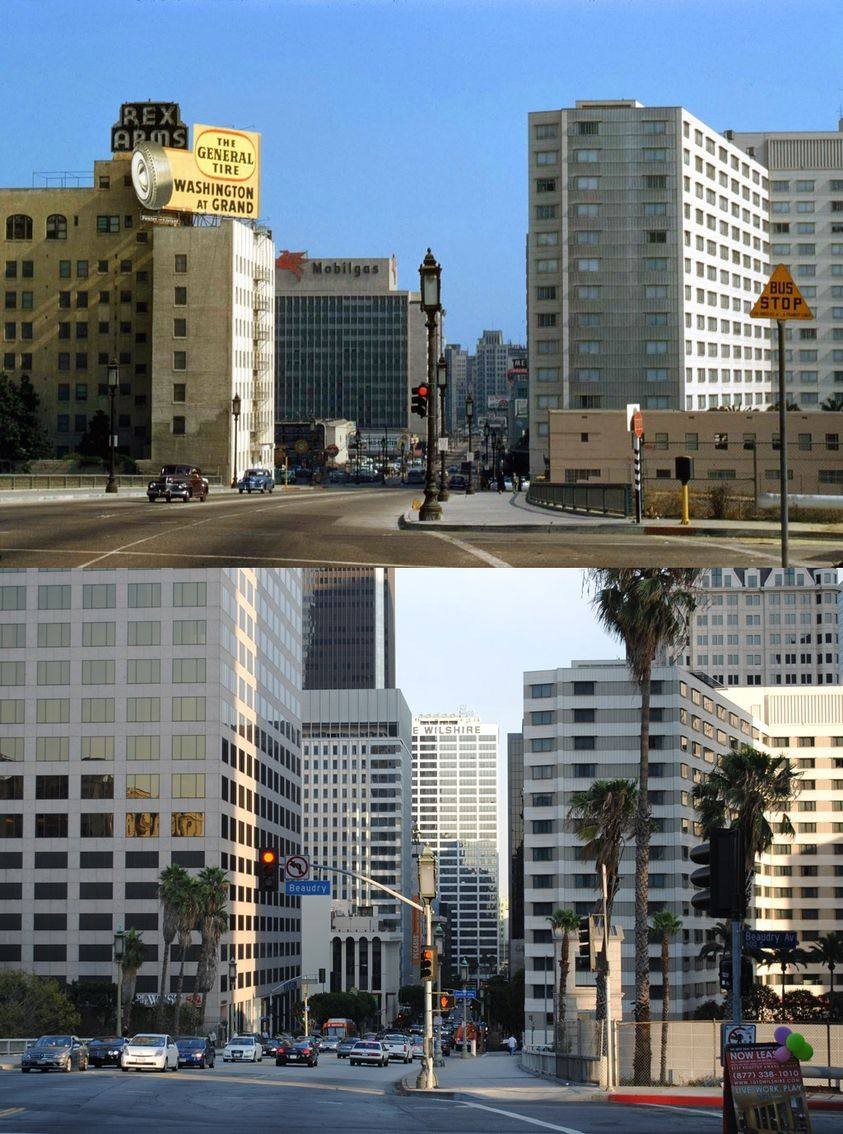
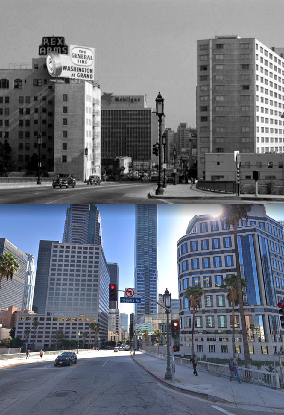
| (1954)^.^ – View looking east on Wilshire Boulevard at Beaudry Avenue over the Harbor Freeway. The three buildings seen are the (l to r): Rex Arms Apartments, General Petroleum Building (Mobilgas sign), and Statler Hotel (later Wilshire Grand). |
Historical Notes Only one building in the above photo has survived to this day, although modified. The 1949-built General Petroleum Building (Mobilgas sign), designed by Welton Becket, was claimed to be the largest office building in the city at the time of its construction in 1948, only to be swiftly dwarfed by its new neighbors. On the right is the Statler Hotel (later Wilshire Grand Hotel) built in 1952. Today it’s the site of the new Wilshire Grand Center, tallest building in Los Angeles. To the left is the 1912-built Rex Arms Apartments, demolished in 1976 to make way for a 22-story office building (915 Wilshire). The General Petroleum Building was vacated in 1994 and converted into 322 apartments in 2003. The apartment building was, and remains, operated under the name Pegasus in tribute to the flying red horse that was displayed for decades atop the structure. The building was added to the National Register of Historic Places based on architectural criteria in 2004. |
Then and Now
 |
|
| (1954 vs. 2010)* – View looking east on Wilshire Boulevard at Beaudry Avenue over the Harbor Freeway. |
Then and Now
 |
|
| (1954 vs. 2018)^ – View looking east on Wilshire Boulevard at Beaudry Avenue over the Harbor Freeway. |
Then and Now
|
|
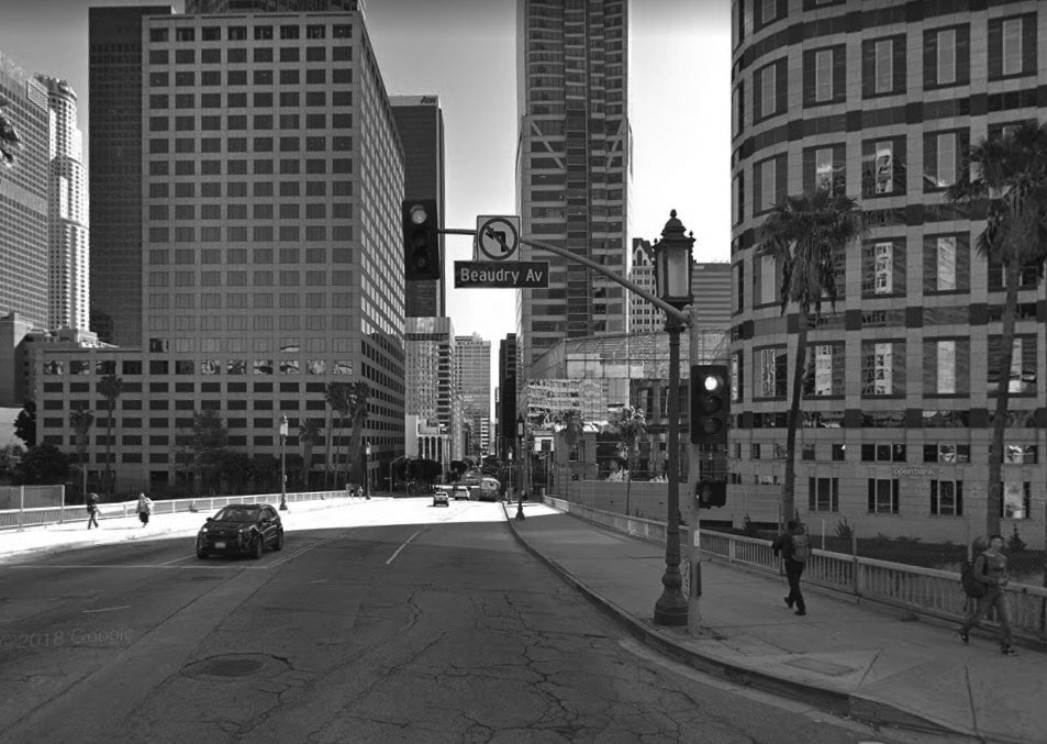 |
| (1954) vs. (2018)* - Wilshire and Beaudry looking east. About the only thing that has stayed the same is the "Wilshire Special" streetlight seen on the corner. |
|
Downtown Skyline (Looking NE)
 |
|
| (1966)*# – View looking northeast from above Wilshire Boulevard showing two high-rise towers under construction in downtown Los Angeles with the Harbor Freeway and Rex Arms Apartments seen in foreground. The tall new building at top-left is the 42-story Union Bank Building, 455 S. Figueroa Street. The other high-rise (center-right) is the 30-story One Wilshire Building (1966), 624 S. Grand Ave. |
 |
|
| (ca. 1969)^ – Postcard view looking northeast over the Harbor (110) Freeway with the Union Bank Building, Jonathan Club, Crocker-Citizens Bank (now 611 Place), One Wilshire, SBC/PacBell Tower (now AT&T Switching Station), Carpenters Building, and Rex Arms Apartments featured in the foreground. City Hall and the John Ferraro (DWP) Building can be seen in the distance. |
 |
|
| (1972)^ – Panoramic view looking NE over the Harbor (110) Freeway at Wilshire Boulevard. Featuring the 'new' ARCO Plaza Towers, Union Bank Building, Jonathan Club, Crocker-Citizens Bank (now 611 Place), One Wilshire, Carpenters Building, and Rex Arms Apartments in the foreground. City Hall and the John Ferraro (DWP) Building can be seen in the distance. A construction site (Bunker Hill Development) can be seen east of the Union Bank building. |
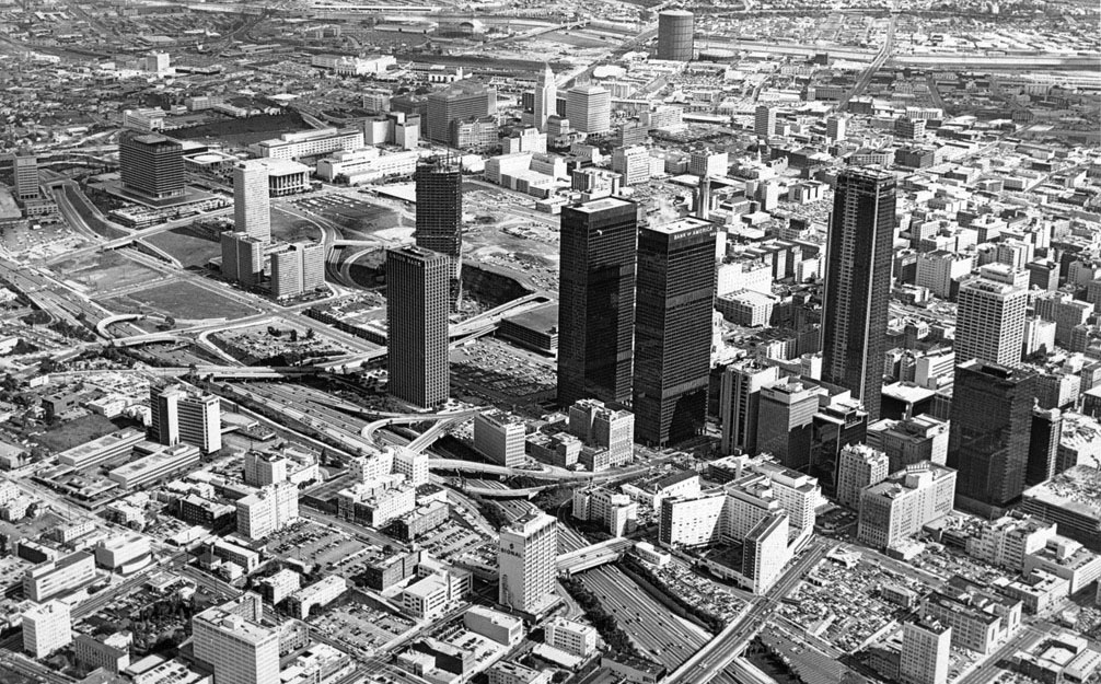 |
|
| (1973)* - Aerial view of downtown LA looking NE, showing vacant expanses on Bunker Hill. Note the large gas hold (Gasometer) at center top. |
Then and Now
.jpg) |
|
 |
| (1973 vs. 2020) |
|
Bunker Hill Development
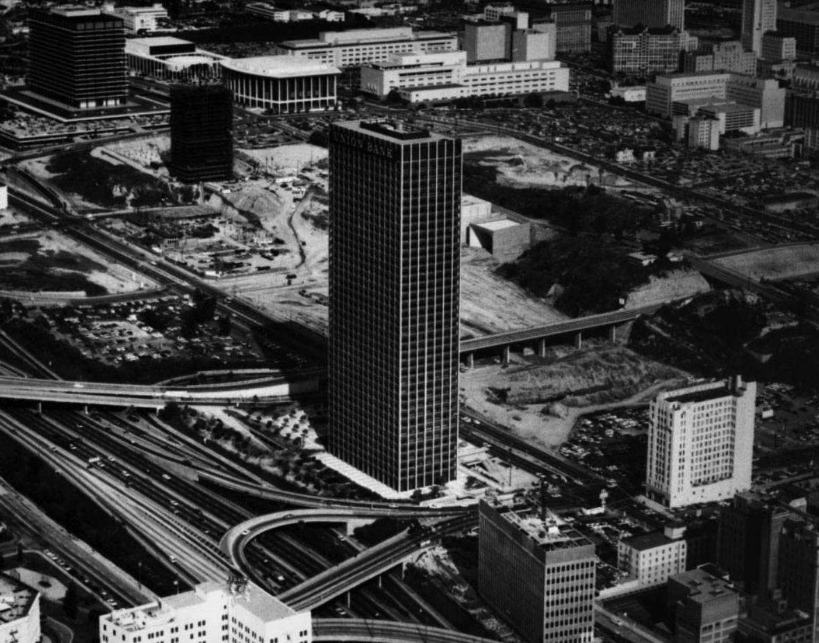 |
|
| (1968)*# - Aerial view looking northeast showing the Union Bank Building, the first high-rise built on Bunker Hill in Downtown Los Angeles. The building under construction in the upper left is Bunker Hill Tower. The white building in lower-right is the Douglas Oil Building. The Harbor Freeway is seen at lower left. Also seen in the background is the DWP Building, Dorothy Chandler Pavilion, and County Courthouse. |
Historical Notes The Union Bank Building was the first high-rise built (1967) in the Central Business District after the 1920s. It was one of the first skyscrapers erected after the 150’ height limit was repealed in 1957 and the first building taller than City Hall. It was also the first structure to be completed as part of the Bunker Hill redevelopment project that began an era of skyscraper building in the Central Business District.^#^ |
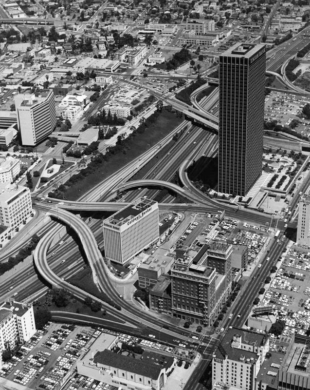 |
|
| (ca. 1968)^ - Aerial view looking north along the Harbor Freeway in downtown Los Angeles. Union Bank Building stands tall east of the freeway. Also seen at lower-center is the Coldwell Banker Building and the Jonathan Club. |
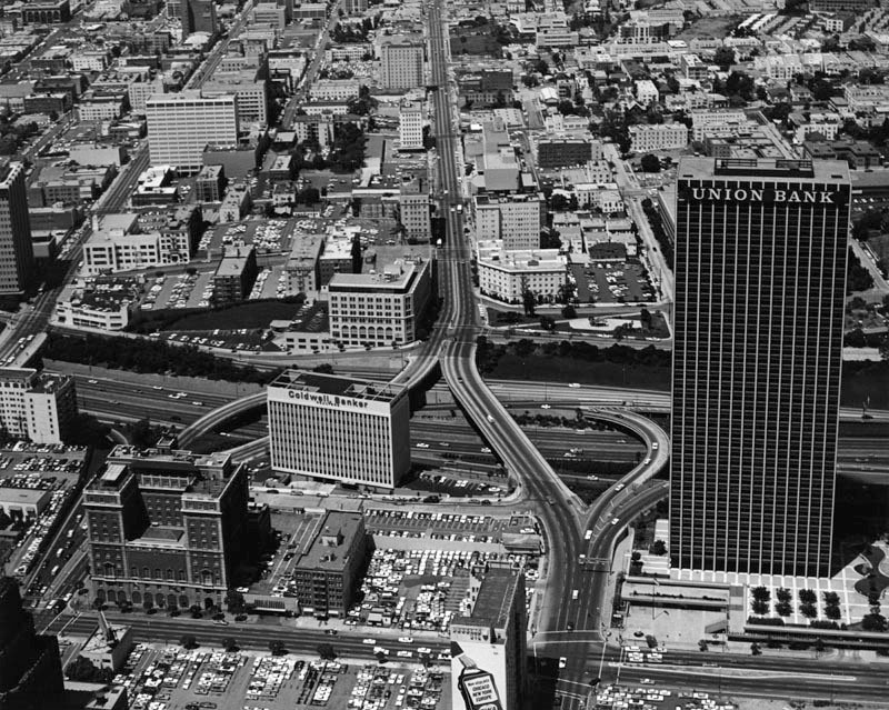 |
|
| (ca. 1968)^ - Aerial view looking west along 5th Street toward the #110 Harbor Freeway. The three dominant buildings east of the freeway are (l to r): the Jonathan Club, Coldwell Banker, and Union Bank Building. |
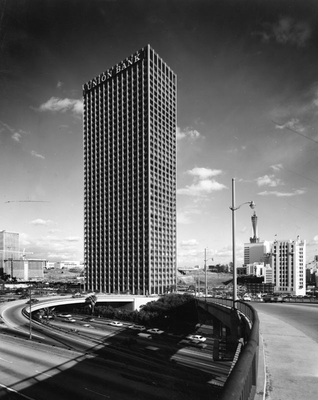 |
|
| (1969)^ – View looking northeast across the Harbor Freeway showing the 42-story Union Bank Building, the first skyscraper* on Bunker Hill. At left can be seen the Bunker Hill Tower Apartments, still under construction, and the Bunker Hill Tower behind them. To the right stands the Madison Complex Tandem Office Building with its towering microwave tower. The building to the far right is the Douglas Oil Building. |
Historical Notes In the southern end of the Bunker Hill redevelopment zone, in what’s typically thought of as the Financial District, the 40-story, 157 meter tall Union Bank Plaza became the first skyscraper to be built as part of the Bunker Hill Redevelopment Project. |
Then and Now
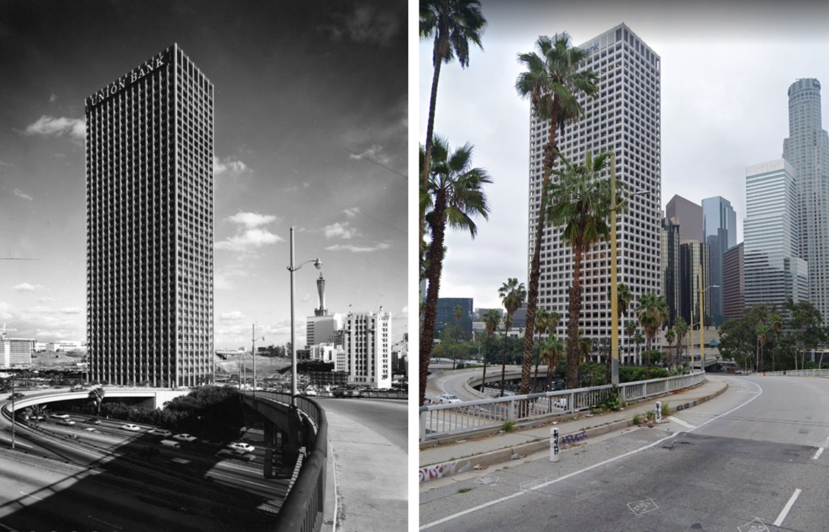 |
|
| Then and Now – Union Bank Building in 1969 and Today. Built in 1967, it was the first skyscraper constructed on Bunker Hill. |
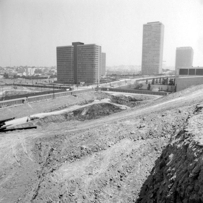 |
|
| (1971)^ – View looking north showing (L to R) Bunker Hill Apartments, Bunker Hill Tower, and the DWP Office Building rising up from a flattened Bunker Hill. |
Historical Notes The Community Redevelopment Agency of the city of Los Angeles undertook the Bunker Hill Redevelopment Project in 1955, a massive clearance project that leveled homes and cleared land for future commercial skyscraper development. This period saw the clearing and upzoning of the entire neighborhood.^* |
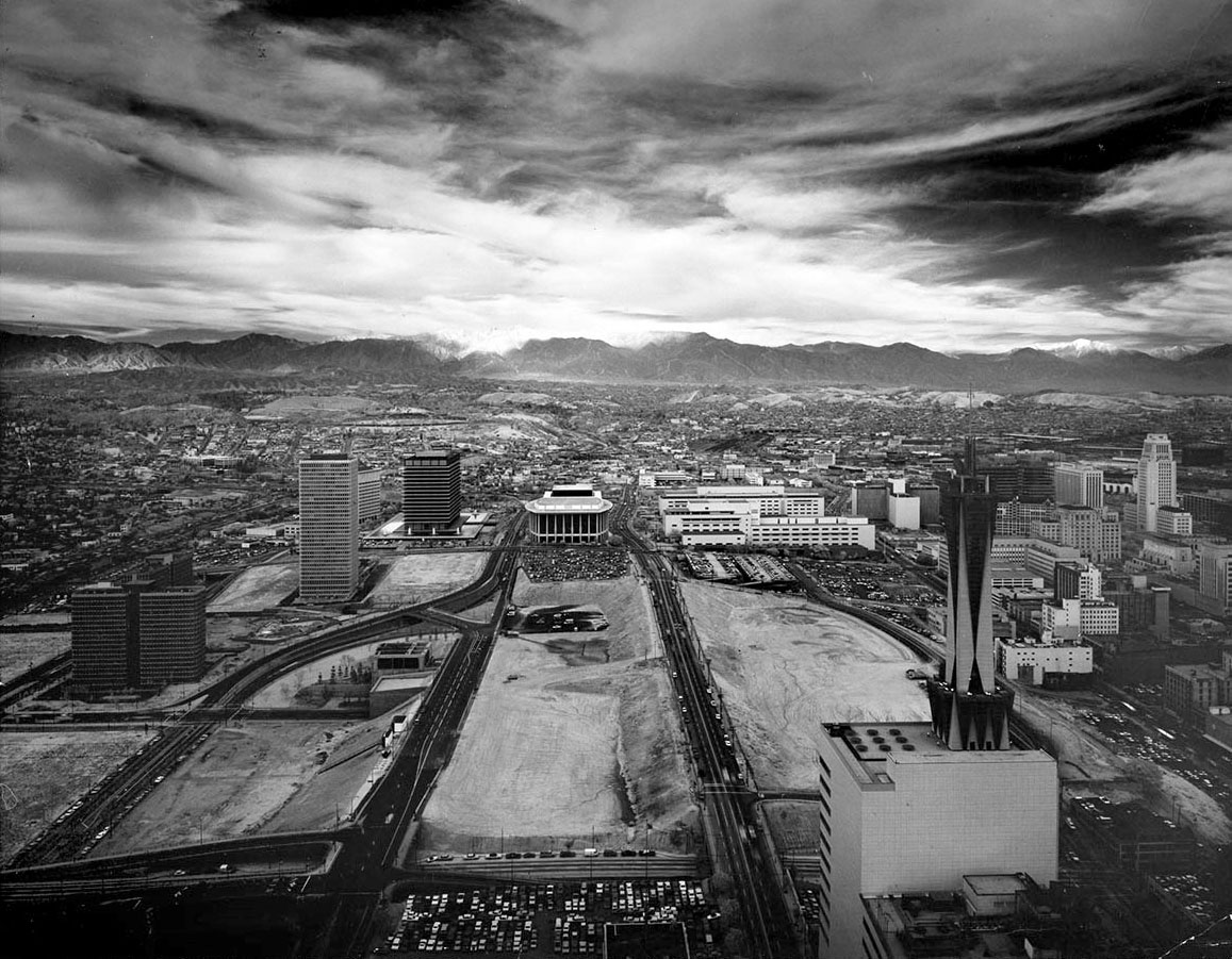 |
|
| (1971)**^ – View looking north over the Bunker Hill Redevelopment area on a stormy-looking day. From left to right can be seen Bunker Hills Towers, DWP Building, Music Center, LA County Courthouse, California State Building, Federal Building, City Hall, and in the lower-right foreground, the AT&T Madison Complex Tandem Office Building. Photo by Julius Shulman |
Historical Notes Atop the actual Bunker Hill (but generally thought of as lying within the Civic Center) are two of the first buildings to follow the neighborhood’s redevelopment, the beautiful John Ferraro Building (formerly known as the Department of Water and Power’s General Office Building), completed in 1964, and the Los Angeles Music Center’s Dorothy Chandler Pavilion (1964), Ahmanson Theater (1967), and Mark Taper Forum (1967). |
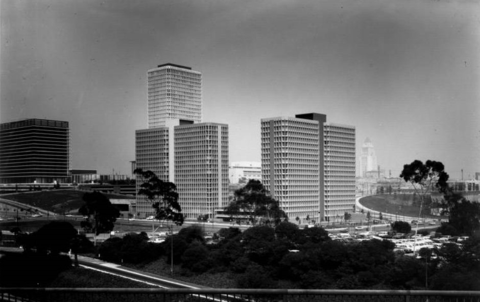 |
|
| (ca. 1971)*# - Overlooking Downtown Los Angeles and the Civic Center from an overpass above the Harbor Freeway. The two 19-story Bunker Hill Tower Apartments are in the foreground with the taller Bunker Hill Tower behind them. DWP's office building is on the left and City Hall is in the background on the right. West Second Street, West Third Street, General Thaddeus Kosciuszko Way can all be seen. |
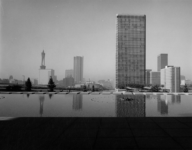 |
|
| (1974)^ - Looking south from the water courtyard of the General Office Building of the Department of Water and Power. Bunker Hill Tower can be seen across the street (1st Street) and the Pac Bell Tower is at center-left. |
Historical Notes Built in 1968, the 32-story Bunker Hill Tower was one of the original buildings in the extensive Bunker Hill Redevelopment Project. The project was proposed by the City of Los Angeles in 1955 and is scheduled to end in 2015. |
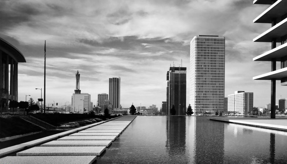 |
|
| (1970s)**^ – View looking south from the front entry ‘bridge’ leading to the Water and Power Office Building. The twin Bonaventure Hotel, completed in 1972, are seen in the background. Photo by Julius Schulman |
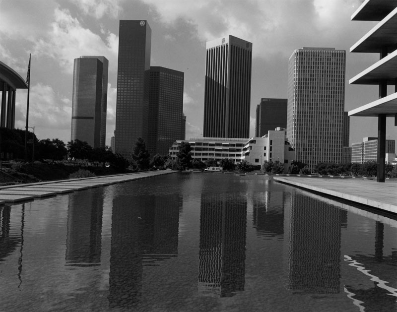 |
|
| (1986)^ - Another view looking south from the water courtyard of the DWP Building 12 years later. Notice how the skyline has changed. The 32-story Bunker Hill Tower now looks small when compared to the other buildings in the background. Click HERE to see more in Construction of the DWP's General Office Building. |
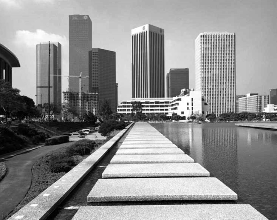 |
|
| (1988)^ - View looking south across the concrete pads that surround the DWP Building's water courtyard towards an ever-changing downtown skyline. Photo by William Reagh |
.jpg) |
|
| (2016)^.^ – Night view looking south from the front entry ‘bridge’ leading to the Water and Power Office Building. A couple of new buildings have been added to the skyline including the U.S. Bank Tower (1989) and the Walt Disney Concert Hall (2003). Photo courtesy of John S. Rose |
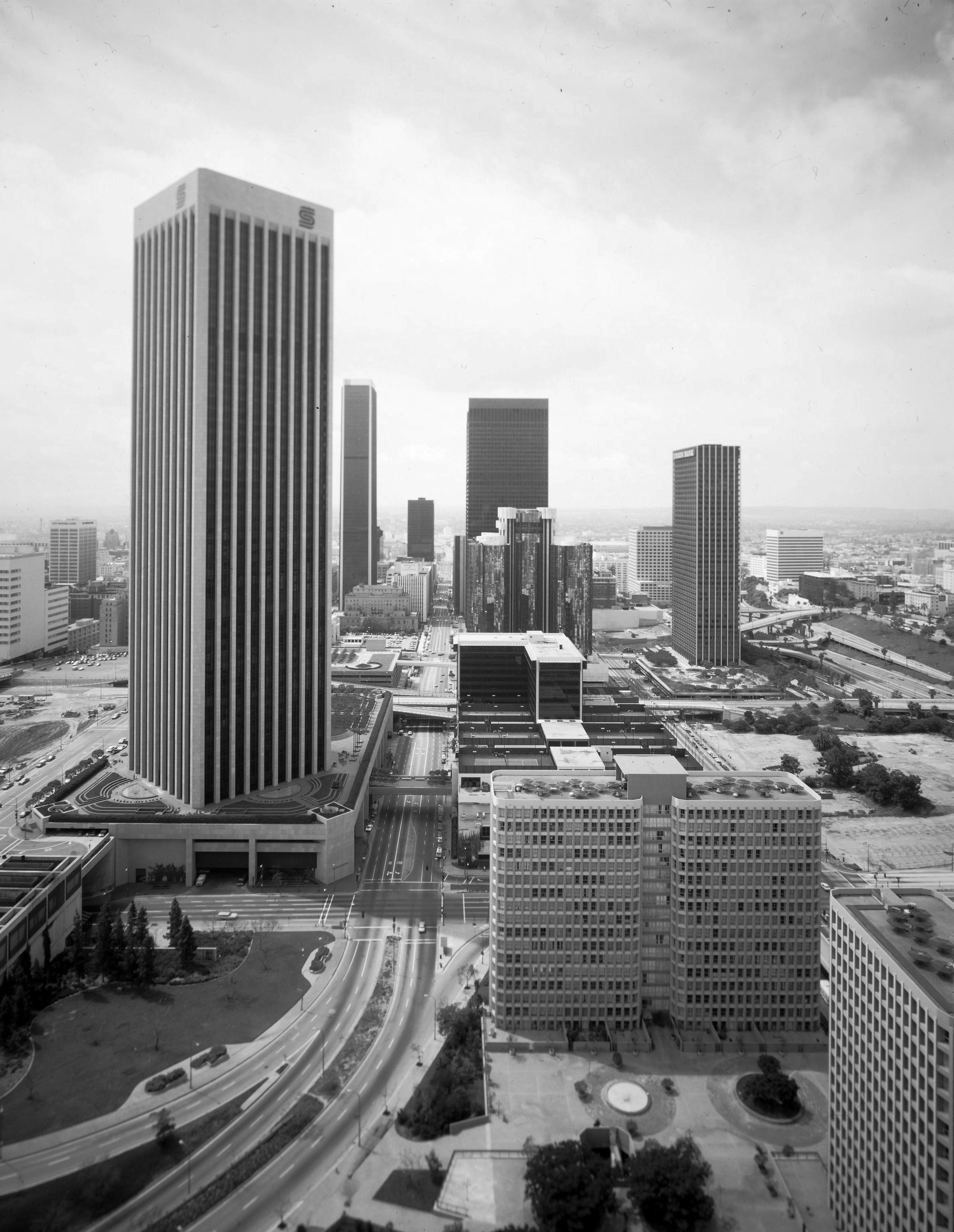 |
|
| (1980)*++ – Aerial view looking south on Flower Street from over 2nd Street showing how the Bunker Hill Redevelopment area is taking shape. To the left is the 55-story Security Pacific Tower and at lower-right are the Bunker Towers. The Westin Bonaventure Hotel is seen at upper-center, with the Union Bank Building to its right. |
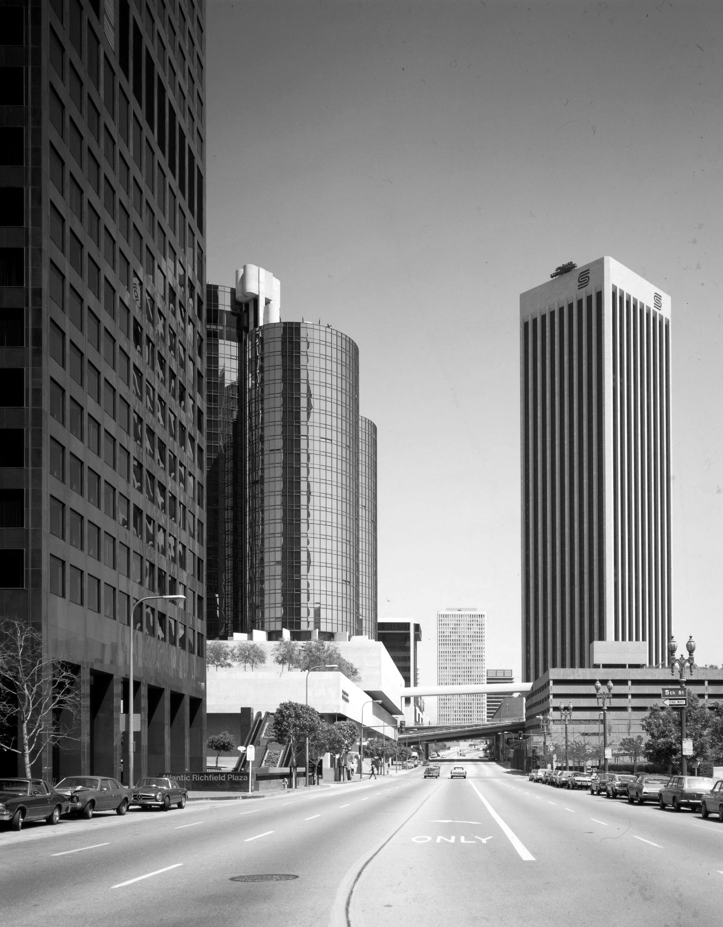 |
|
| (1980)*++ – Street view looking north on Flower Street from near 5th Street. Buildings from left to right include: Atlantic Richfield Plaza, Westin Bonaventure Hotel, Bunker Hill Tower, DWP Office Building, and theSecurity Pacific Tower, now known as Bank of America Plaza. |
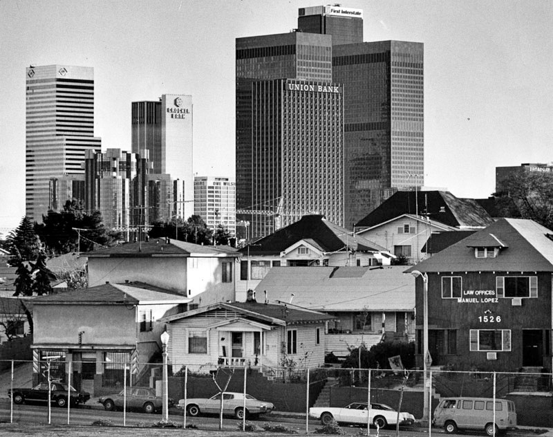 |
|
| (1982)^ - Older homes, apartments, and businesses (foreground) contrast greatly with the shiny office buildings of downtown Los Angeles. This view, taken on January 23, 1982, is seen from the Hollywood Freeway, just south of Glendale Boulevard. |
Historical Notes The above photograph was also used for article dated March 10, 1985; the caption reads, "Mayor Bradley cites downtown boom as his major feat, but critics say redevelopment funds would have been better spent for low-and moderate-income housing." |
.jpg) |
|
| (1983)* - Aerial view looking north at downtown Los Angeles, with Harbor Freeway on the left. Some identifiable buildings include offices for First Interstate, Bank of America, City National Bank, One Wilshire, and Security Pacific. Also seen are Los Angeles Public Library, Broadway Plaza, and City Hall. |
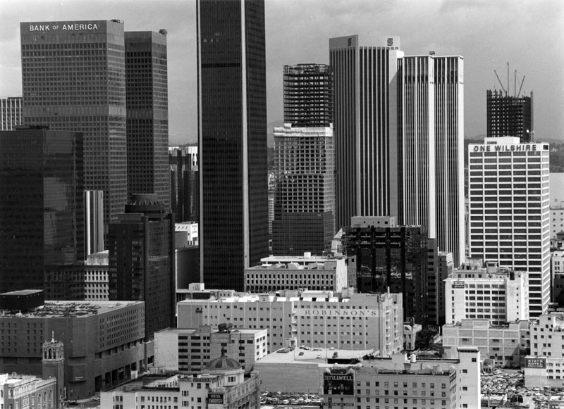 |
|
| (1981)^ - The downtown skyline, as seen from the Occidental Center. Broadway Plaza, Robinson's, hotels and office buildings make up the skyline. The First United Methodist Church (lower left) was demolished not long after this photograph was taken, and a few skyscrapers are under construction in the background. |
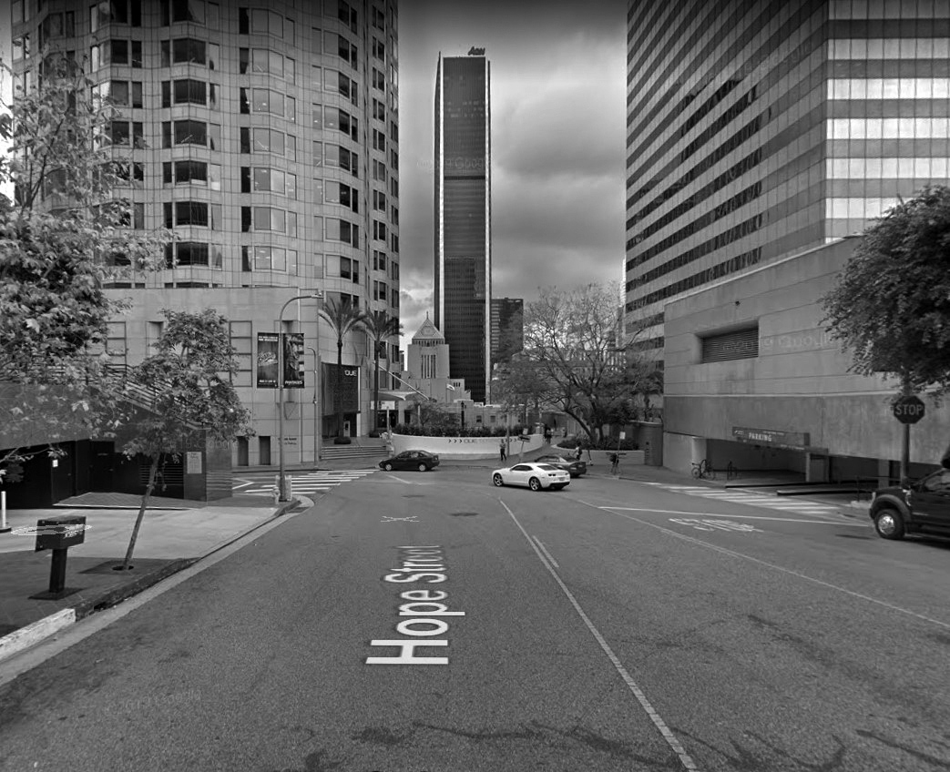 |
|
| (2019)** - View looking south on Hope Street showing where it dead ends at Hope Place. It continues again just south of the LA Central Library. At the end of Hope are the Bunker Hill Steps which descends down to 5th Street to a point just across from the Central Library. There is a five-story grade between Hope and 5th (103 steps). |
* * * * * |
Bunker Hill Steps
 |
|
| (ca. 1990)** – Sketch showing the Bunker Hills Steps as originally designed by Architect Lawrence Halprin. |
Historical Notes The connection between downtown Los Angeles and Bunker Hill has been tenuous since the widespread demolition of Bunker Hill's early buildings in the 1960s. Since then, new construction has sprouted skyward. Even as the area's density neared pre-redevelopment levels, it never quite seemed to link back up to the older downtown. The Bunker Hill Steps, cascading from Hope Street down to Fifth Street, are a thoughtful attempt to remedy the situation. Designed by architect Lawrence Halprin, the Bunker Hill Steps were completed in 1990. A sign at the top of the 103 steps claims that they “were modeled in theory on the Spanish Steps in Rome but more pleasingly asymmetrical in execution”. * |
 |
|
| (2003)^ – View looking north from 5th Street showing the Bunker Hill Steps with the LA Central Library behind the camera. |
Historical Notes The masive concrete staircase provides a pedestrian route from Bunker Hill to the Los Angeles Central Library. It passes just to the west of the U.S. Bank Tower (formerly Library Tower) and is heavily used by local office workers to negotiate the five-story grade between Fifth and Hope. The Bunker Hill Steps is Los Angeles' architectural translation of Rome's Spanish Steps and, indeed, are often referred to as the "Spanish Steps." |
 |
|
| (2019)^ - Close-up view showing the fountain spring spilling down the center of the staircase, also entrances to Citigroup Center (left) and the U.S. Bank Tower (right). |
Historical Notes The stairway is divided in two by a simulated mountain stream of rock-like concrete forms, its water originating in a round fountain in a plaza at the top and ending in a small basin. Robert Graham's 1992 sculpture of a woman offering the bounty of water stands in the middle of the fountain. The stairway is punctuated by a series of terraces and landings containing small cafes, shops, and dining areas, lending it the feel of an urban street. Flowering trees and other vegetation line the stairway's edges, which curve past artwork and a wall of sculptured grottoes and fountains. An escalator on the west side ensures the pedestrian route is accessible to all.* |
 |
|
| (2019)^^ – Looking down (South) from the top of Bunker Hills Steps toward the LA Central Library, and to its right, Aon Center Building and the California Club. |
Historical Notes Halprin likened the role of a landscape architect to that of a choreographer, aiming to guide human movement through the environment in positive ways. As a monumental landscape feature linking two spheres together, his Bunker Hill Steps have proven to be a successful and visually striking path for moving people between old and new Los Angeles.* |
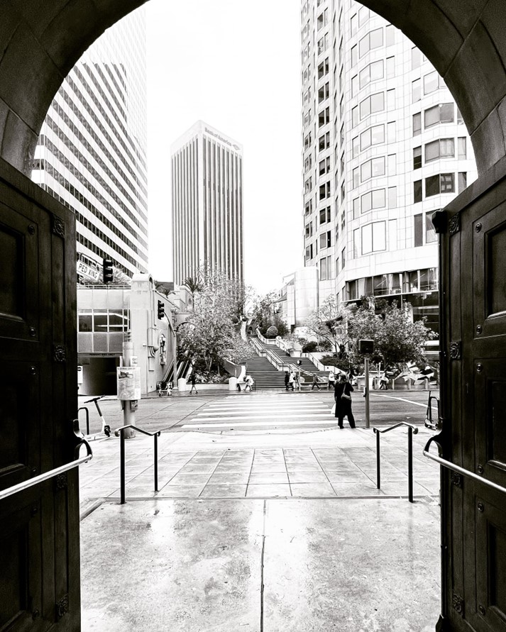 |
|
| (2022)* - Looking across 5th Street toward the Bunker Hills Steps as seen from the Central Library gate. Photo by Carlos G. Lucero |
* * * * * |
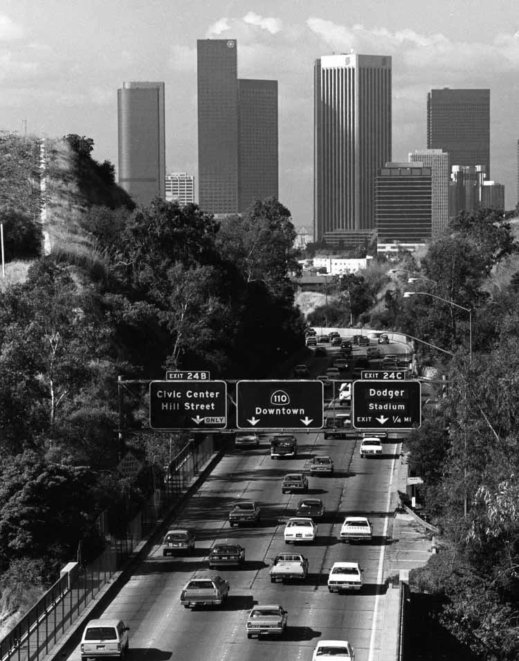 |
|
| (1980)**^* - Pasadena Freeway westbound with the Downtown LA skyline in the background. |
Chinatown
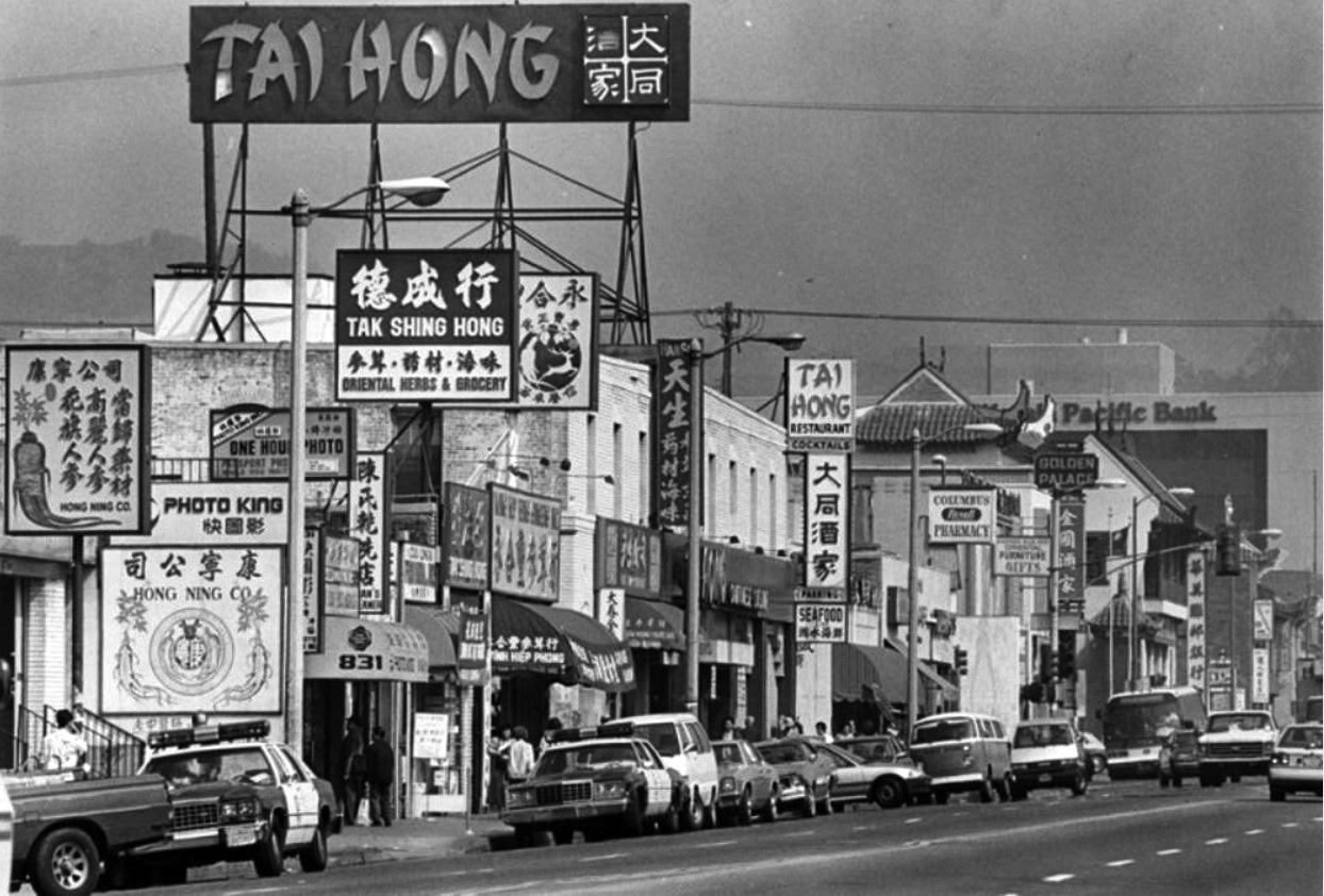 |
|
| (1988)^ - View looking north on Broadway toward the center of the Chinatown District. |
Historical Notes Chinatown is a neighborhood in Downtown Los Angeles that became a commercial center for Chinese and other Asian businesses in Central Los Angeles in 1938. The area includes restaurants, shops and art galleries but also has a residential neighborhood with a low-income, aging population of about 20,000 residents. The original Chinatown developed in the late 19th century, but it was demolished to make room for Union Station, the city's major ground-transportation center. A separate commercial center, known as "New Chinatown," opened for business in 1938. Street and natural limits of the Chinatown neighborhood are: north, Beaudry Avenue, Stadium Way, North Broadway; east, the Los Angeles River; and southwest, Cesar Chavez Avenue. Chinatown beyond the concentrated business center is flanked by the Elysian Park to the north, Lincoln Heights to the east, Downtown to the south and southwest and Echo Park to the west and northwest.* |
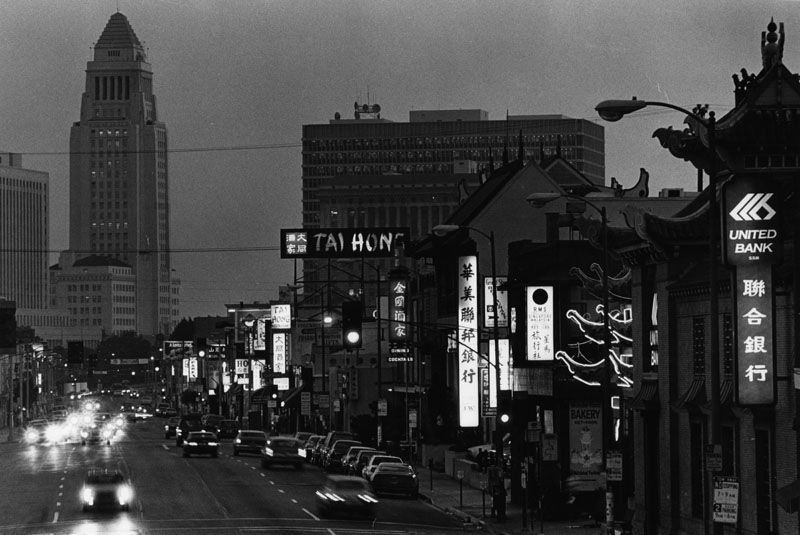 |
|
| (1988)^ - City Hall stands tall in the background as darkness descends on Chinatown and North Broadway Street. |
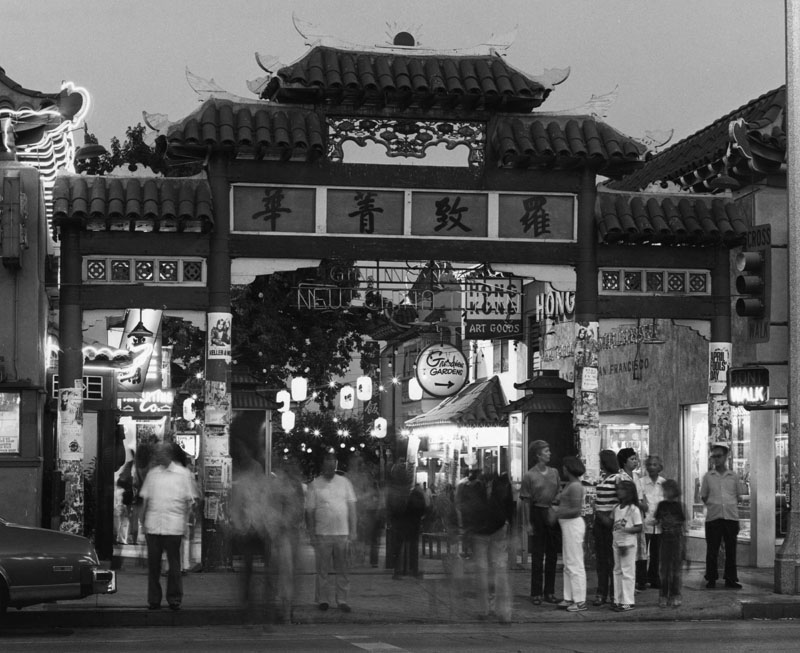 |
|
| (1980)^ – View of the gateway to New Chinatown, with people standing on the sidewalk, near Castelar Street, off Sunset Blvd. Photo by Roy Hankey |
Echo Park
 |
|
| (1998)^ – View looking east in downtown Echo Park showing Sunset Blvd as it crosses Glendale Blvd and heads east with the Jensen's Recreation Center seen at upper-right. The northern portal of the Glendale Blvd Tunnel (under Sunset Blvd) is on the left near Burger King. |
Historical Notes Echo Park is a neighborhood that is flanked by Elysian Valley to the north and northeast, Elysian Park to the east, Chinatown and Downtown to the southeast, Westlake to the southwest and west, and Silver Lake to the northwest. Boundaries are the Golden State Freeway–Glendale Freeway interchange at the north apex, Riverside Drive on the northeast, Elysian Park on the east, Stadium Way and Beaudry Avenue on the southeast, the south apex being Beaudry Avenue and West Second Street and the west limit being an irregular line consisting of Second Street and Beverly Blvd, then moving upward north along Benton Way and the Glendale Freeway. * |
 |
|
| (1975)^* - View looking south showing a man fishing in Echo Park Lake with buildings of Bunker Hill in background. |
Historical Notes Echo Park Lake began life as one of the City of Los Angeles' water reservoirs in 1868 and it was later developed into one of the city's early parks. |
 |
|
| (n.d.)* - View looking SE across Echo Park Lake toward the boathouse as seen from the Glendale Boulevard side. |
Historical Notes The Spanish Colonial boathouse and 35 foot tall lighthouse were built in 1932 (renovated in 2014). |
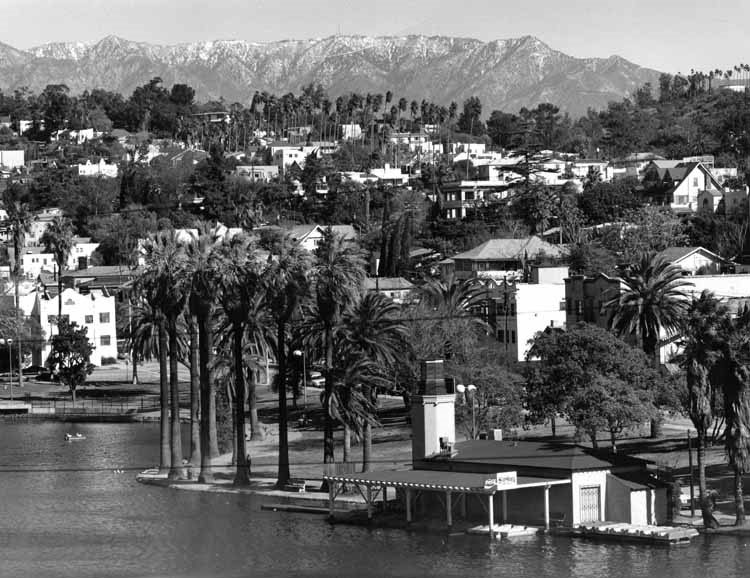 |
|
| (1988)^ - View looking NE showing Echo Park Lake with residences on hillside, snow-capped mountains in the distance, and palm trees throughout. |
 |
|
| (2007)^.^ - View looking SE showing the Echo Park Lake boathouse with U.S Bank Tower seen in the background. Sketch by P. Morris |
 |
|
| (ca. 2018)* - Close-up view looking SW showing the Echo Park Lake lighthouse and Pedal Boats Concession. |
 |
|
| (2020)^.^ - Echo Park after dark. |
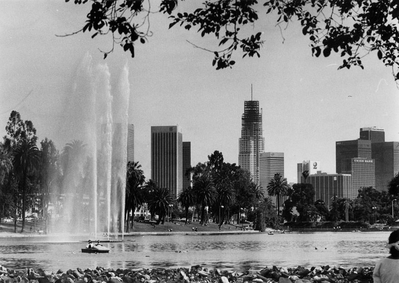 |
|
| (1989)^ - Panoramic view of Echo Park Lake on a bright sunny day. The city's skyline can also be seen clearly in the background. |
Historical Notes US Bank Tower is seen under construction. Opened in 1989- Designed by Henry N. Cobb & Partners (1,018 feet/73 floors) Formerly called 'The Library Tower'. |
 |
|
| (2022)* – Echo Park with the Downtown skyline in the background. Photo by Paul Wright |
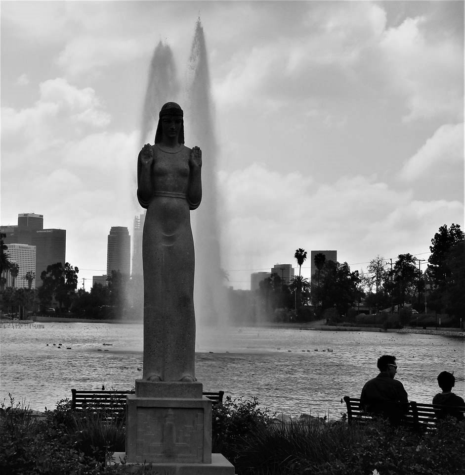 |
|
| (ca. 2000)^.^ – View showing the “Lady of the Lake” statue at Echo Park with fountain in the background. |
Historical Notes One of Echo Park’s most beloved icons is the statue of a female figure standing near the eastern edge of Echo Park Lake. Sculpted in the Art Deco style by artist Ada Mae Sharpless, the statue’s official name is “Nuestra Reina de Los Angeles” (Queen of the Angels). But most people refer to the statue as the “Lady of the Lake." ^ Click HERE to see more Early Views of Echo Park. |
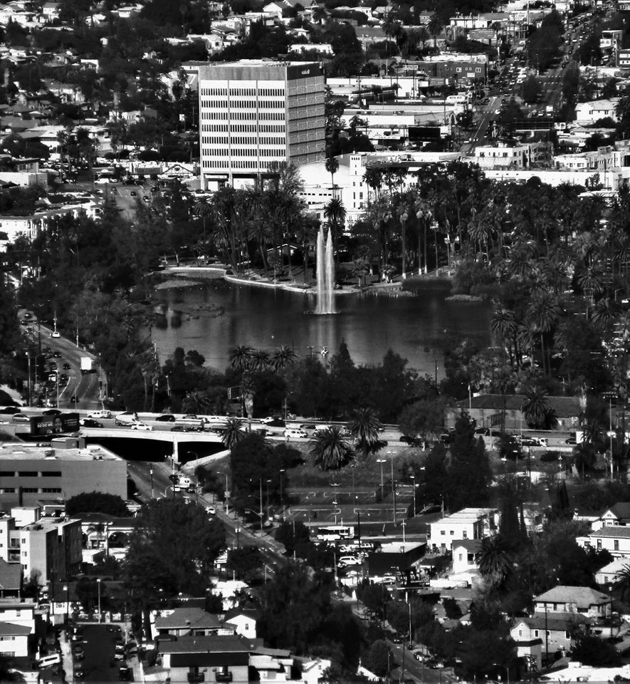 |
|
| (2018)^.^ - View of Echo Park Lake with all three fountain jets turned on, as seen from the Wilshire Grand. The Hollywood Freeway can be seen crossing over Glendale Boulevard at center-left. Photo by Howard Gray |
Historical Notes Echo Park Lake's center fountain was added in 1986. |
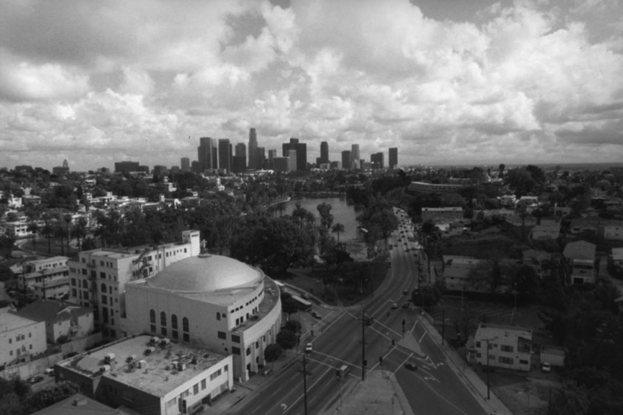 |
|
| (1998)^ - Echo Park and its Lake are visible in the center of the photo, the famed Angelus Temple with its domed roof can be seen on the lower left, and Downtown L.A. skyscrapers sit majestically in the background. |
Historical Notes Angelus Temple was dedicated on January 1, 1923. It was added to the National Register of Historic Places in 1992, Building #92001875. On July 2002 the historic Temple completed major renovations, returning it to the classic and elegant look of the 1920's while also making it modern enough to have contemporary services suitable for today, without changing its historic elements. Nearly century-old homes, hillside bungalow courts, apartment buildings and pubic stairways also surround the landmark Echo Park. The visible street running along Angelus Temple and Echo Park is Glendale Boulevard. |
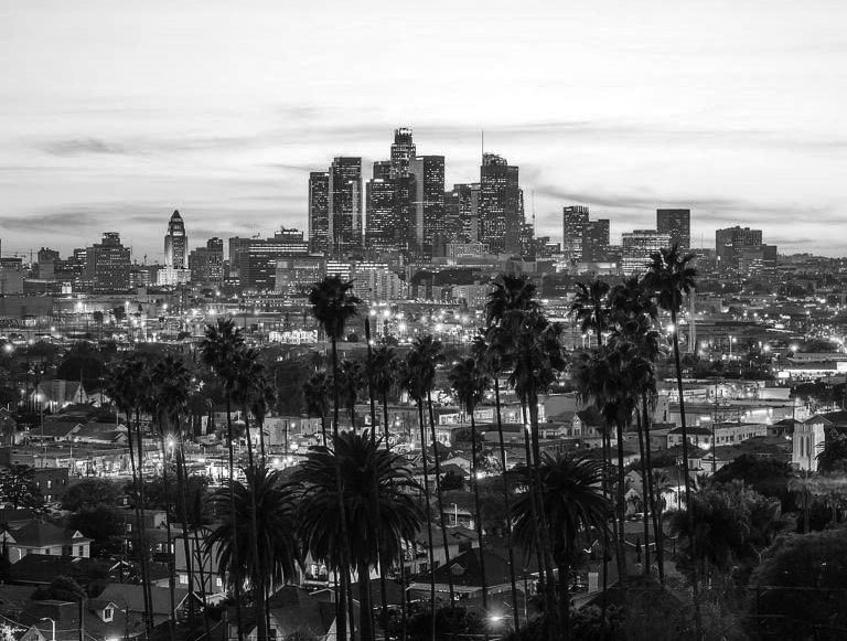 |
|
| (2019)^.^ – Dusk view of Downtown Los Angeles as seen from the hills of Echo Park. |
* * * * * |
Downtown Skyline
|
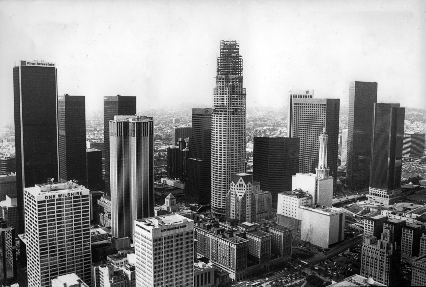
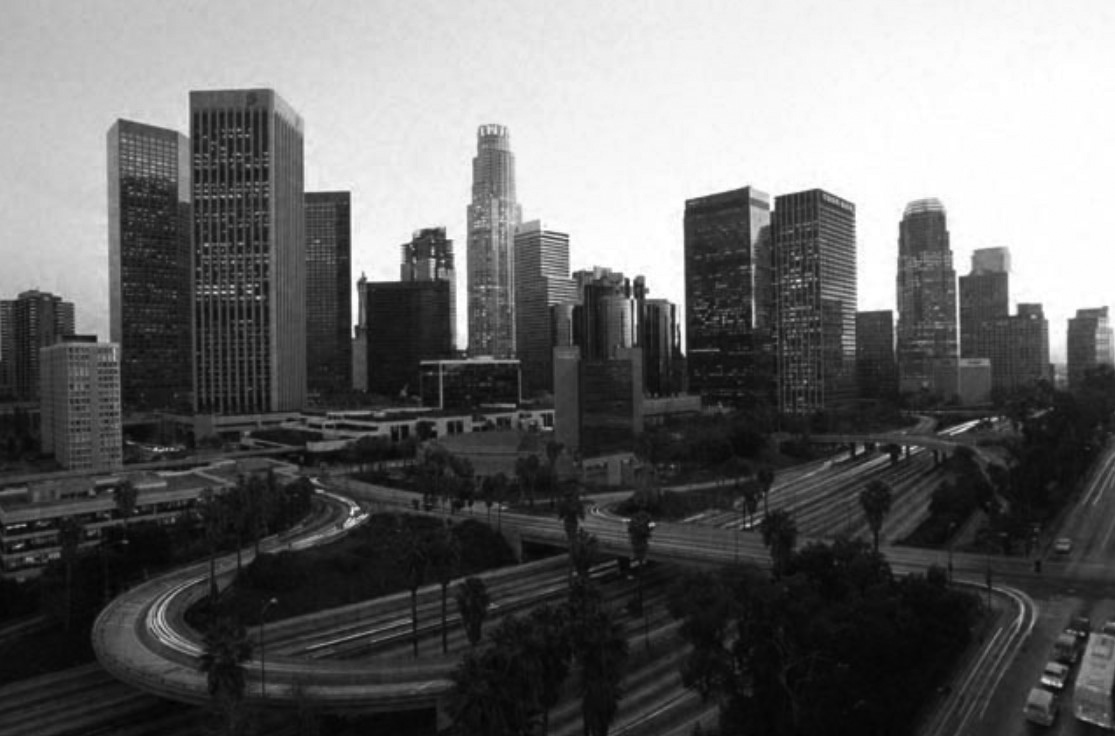
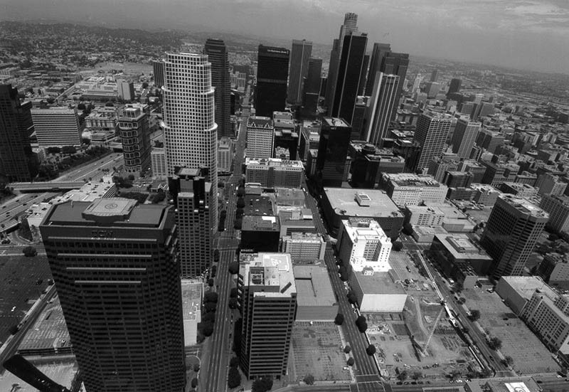 |
|
| (2005)* - Panoramic view of Downtown Los Angeles. Photo shows numerous highrise buildings; among them are Ernst & Young, TCW, AON, U.S. Bank, One Wishire, Citigroup, etc. The Harbor (110) Freeway is visible at middle left. |
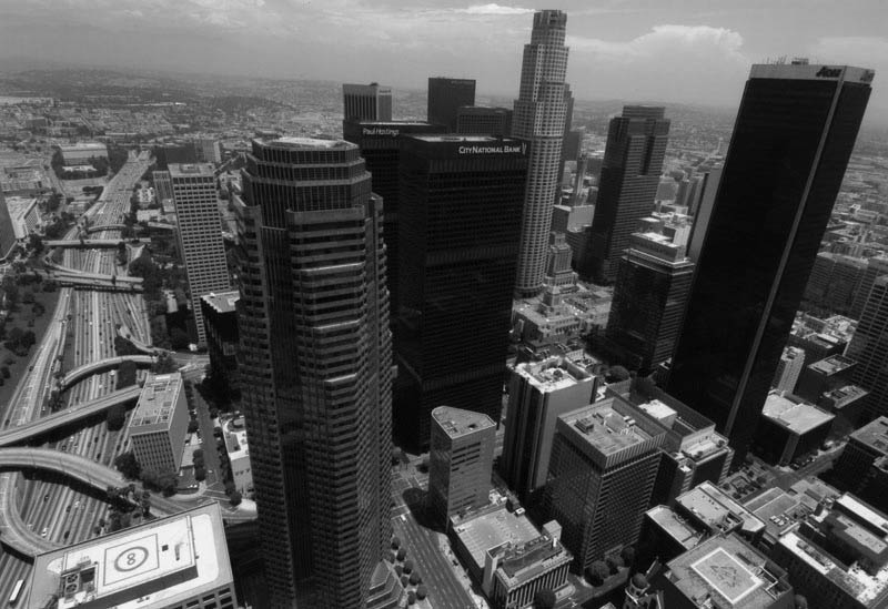 |
|
| (2005)* - Panoramic view of the Central City area, looking northeast. Traffic is moving north and south on the 110 freeway, shown on the left. Photo by Gary Leonard |
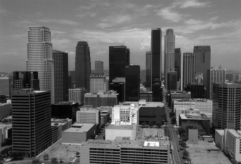 |
|
| (2005)* - Panoramic view of Downtown Los Angeles looking north showing numerous highrise buildings; among them are Ernst & Young, TCW, AON, US Bank, One Wishire, Citigroup, etc. Hope Street runs away from the camera at lower right. Photo by Gary Leonard |
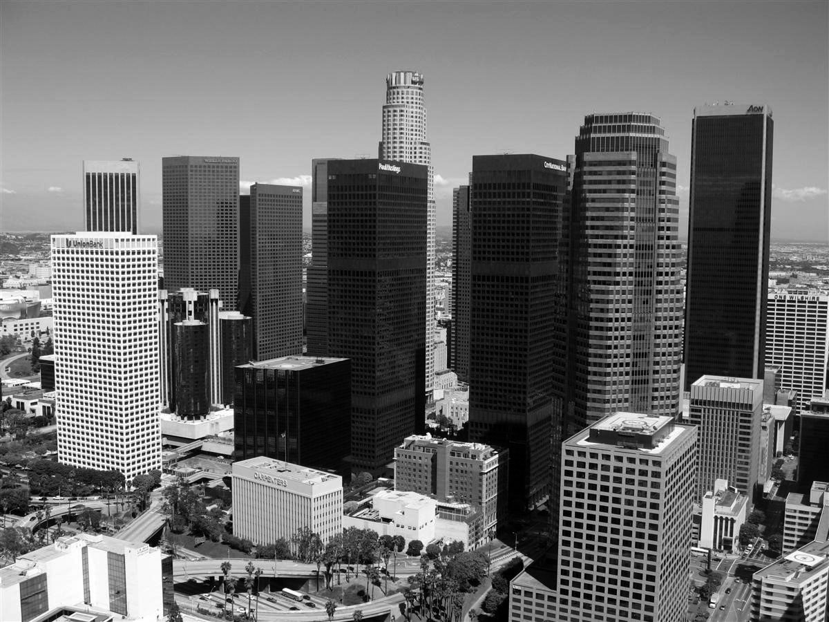 |
|
| (ca. 2012)**^ - Aerial view of the Downtown skyline, looking northeast, as seen from west of the Harbor Freeway. |
Historical Notes As of 2015 the tallest building in Los Angeles is the 73-story U.S. Bank Tower (center-top), which rises 1,018 feet in Downtown Los Angeles and was completed in 1989. It also stands as the tallest building in the state of California, tallest building west of the Mississippi, and the 11th-tallest building in the United States. The second-tallest skyscraper in the city and the state is the Aon Center (right), which rises 858 feet. Seven of the ten tallest buildings in California are located in Los Angeles.^* |
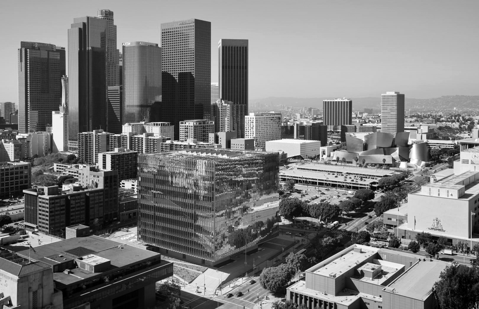 |
|
| (2016)^* - View looking SW from City Hall showing the Downtown skyline. The large cubed building at center is the 10-story First Street U.S. Courthouse located on the SW corner of 1st and Broadway. In the foreground can be seen the LA Times Building (lower-left) and the LA Law Library (lower-right). At center-right is the Walt Disney Concert Hall and the Bunker Hill Tower behind it. |
 |
|
| (2004)^* - View of the Los Angeles skyline as seen from the Grand Central Market. Angels Flight terminal on Hill Street is seen at the lower right. |
 |
|
| (2018)^.^ – View showing (l to r): U.S. Bank Tower (1,018 feet), 611 Place (620 feet), and Citigroup Center (627 feet). |
Pershing Square
 |
|
| (1995)^.^ - View looking northwest showing part of the Downtown skyline as seen from Pershing Square. Photo by Denis Freppel |
Historical Notes In 1992, Pershing Square was closed for a major $14.5-million redesign and renovation by Mexican architect and landscape architect Ricardo Legorreta and U.S. landscape architect Laurie Olin. The redesigned park opened in 1994 with a 10-story purple bell tower, fountains, and a walkway representing an earthquake fault line (by artist Barbara McCarren), concert stage, and perimeter seating. Pavement covered almost the entire block, with copses of trees placed in raised planters.^ |
 |
|
| (2007)^* - View looking northwest from Pershing Square showing the Downtown skyline. The tallest building, the 73-story. U.S. Bank Tower, is at upper-left. The Biltmore Hotel is directly across Olive Street at lower-left. |
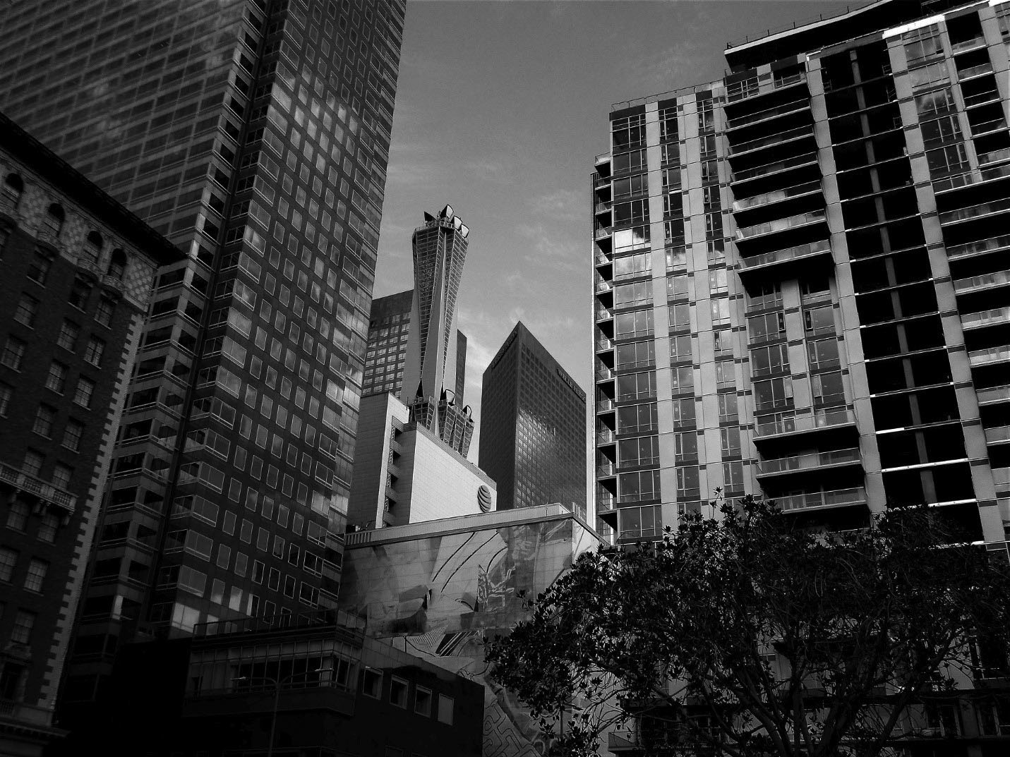 |
|
| (2019)^.^ - View looking northwest from Pershing Square toward Bunker Hill showing the Downtown skyline with some of the tall buildings seen in previous photo now obscured by newer builings. The edge of the Biltmore Hotel can be seen on the left amd the AT&T Tower is at center-left. Photo by Howard Gray. |
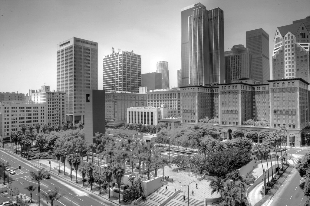 |
|
| (ca. 2011)**# – View looking southwest from over the intersection of 5th and Hill streets showing Pershing Square with the Biltmore Hotel on the right and the Downtown skyline in the background. |
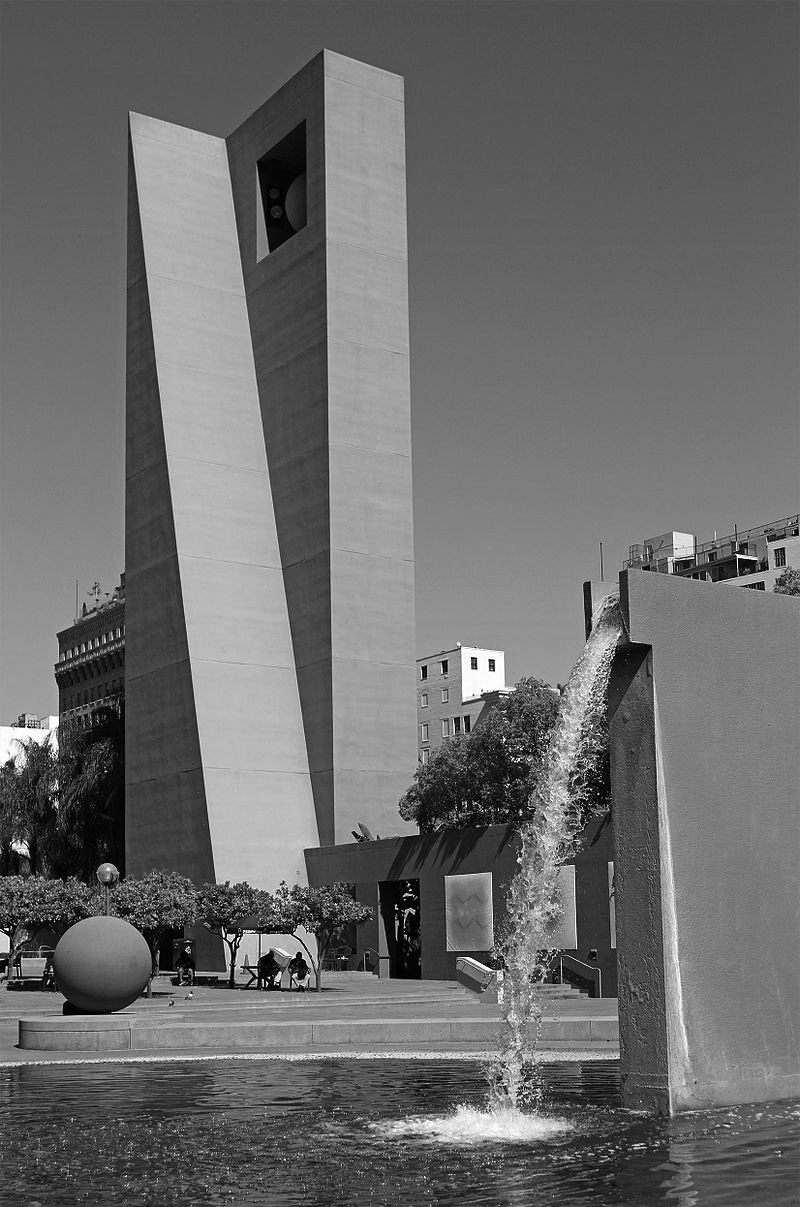 |
|
| (2012)^ - The current Pershing Square designed by Ricardo Legorreta in 1992, with the fountain and bell tower. Photo by John O'Neill |
 |
|
| (2020)^.^ - The Beethoven statue at Pershing Square in downtown Los Angeles. Created by sculptor Arnold Foerster in 1932. Photo by Paul Wright |
Historical Notes Currently located on the east side of Pershing Square, the statue used to be closer to the west side. I faced north, across from the old Philharmonic Hall. It's been moved several times since 1932 and last moved during Pershing Square's major update in 1992. The statue, by sculptor Arnold Foerster in 1932, was dedicated William Andrews Clark Jr. who was founder of the Los Angeles Philharmonic Orchestra. Clark, a senator's son and copper baron, had founded the Philharmonic in 1919. An amateur violinist, he would often sit in with musicians as they played. In 1928, a testimonial concert honoring Clark had raised money for a memorial, and in 1932 plans were started for the commissioning of a statue of Clark's favorite composer, Beethoven. The Philharmonic would use the testimonial concert funds to make the statue and then donate it to the city, so that it could sit in Pershing Square, eternally staring at the Philharmonic Auditorium, imposingly standing directly across.* |
5th and Los Angeles Streets
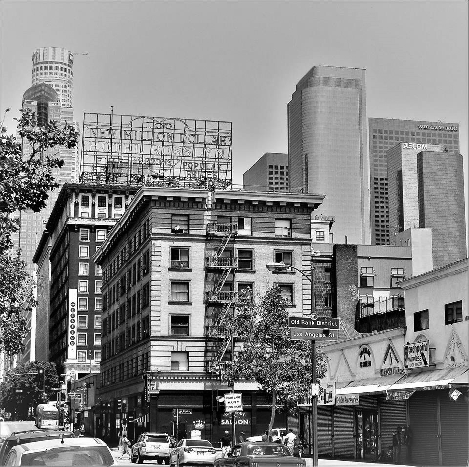 |
|
| (2018)^.^ – View looking west on 5th Street toward Los Angeles Street. Sign at right reads “Old Bank District”. Rosslyn Lofts (formerly the Rosslyn Hotel and Annex) with large roof-mounted sign can be seen at left. In the background can be seen several skyscrapers including (l to r): The U.S. Bank Tower, Gas Company Tower, Two California Plaza, One California Plaza (AECOM), and Wells Fargo Center. |
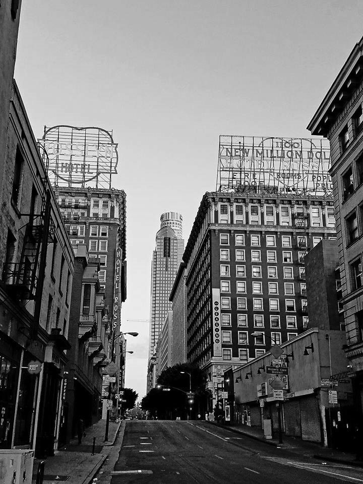 |
|
| (ca. 2018)^.^ - View looking west on 5th Street from Los Angeles Street showing the Rosslyn Lofts (formerly the Rosslyn Hotel and Annex) as they appear today. The U.S. Bank Tower and Gas Company Tower are seen in the background. |
Historical Notes Renamed the Rosslyn Lofts in 2006, it currently provides both market-rate lofts and low-income housing. |
Then and Now
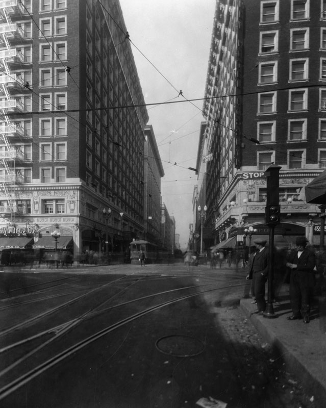 |
|
 |
| (1930) vs. (2018)* - Rosslyn Hotel and Annex at 5th and Main streets. |
Historical Notes The 1913-built Hotel Rosslyn has a history unique in all of the city of Los Angeles. Once the tallest building in LA, the 12-story Rosslyn boasted in it's large rooftop sign as being the "Fireproof Million Dollar Hotel." Click HERE to see more Early Views of the Rosslyn Hotel and Annex. |
* * * * * |
Downtown Skyline
 |
|
| (2010)^* - View looking north toward the downtown skyline through what is the LA's oldest palm trees. The trees are located on what was Palm Avenue at Adams Boulevard and were planted cira 1875. Click HERE to see more on LA's oldest palm trees. |
 |
|
| (ca. 2010)**** - View of MacArthur Park with the Los Angeles Downtown skyline in the background. |
.jpg) |
|
| (2021)* – View of MacArthur Park looking east with the Downtown skyline in the background. Photo by Howard Gray |
Then and Now
 |
|
| (1937 vs. 2021)* – View of MacArthur Park looking east with the Downtown skyline in the background. Contemporary photo by Howard Gray |
 |
|
| (ca. 2010s)##^# – View looking west showing the Sixth Sthreet Bridge with the Los Angeles Downtown skyline in the distance. |
Hollywood
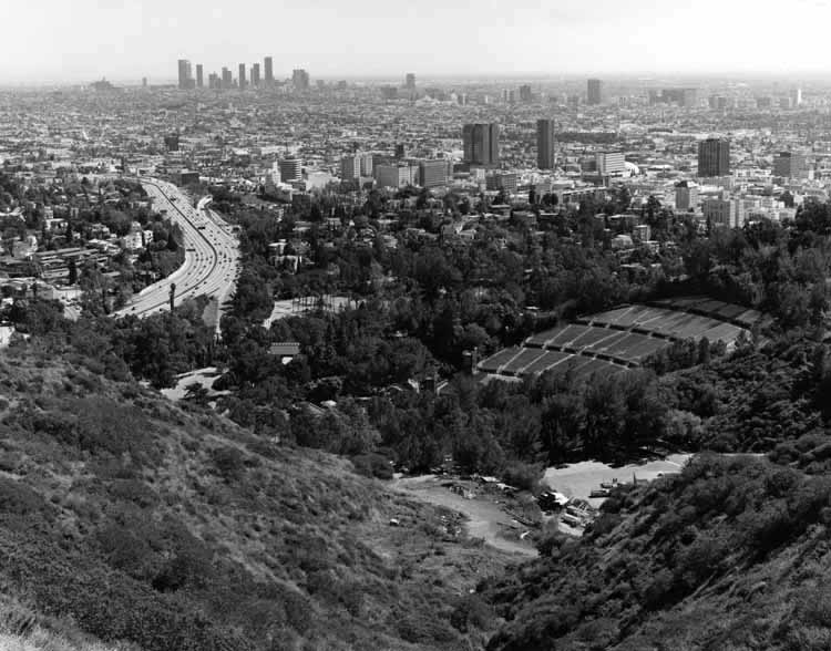 |
|
| (1989)**^* - View of Hollywood from Mulholland Drive. The Hollywood Bowl can be seen in the foreground and the Hollywood Freeway is to the left. In the far distance can be seen Downtown L.A. and the Wilshire corridor. |
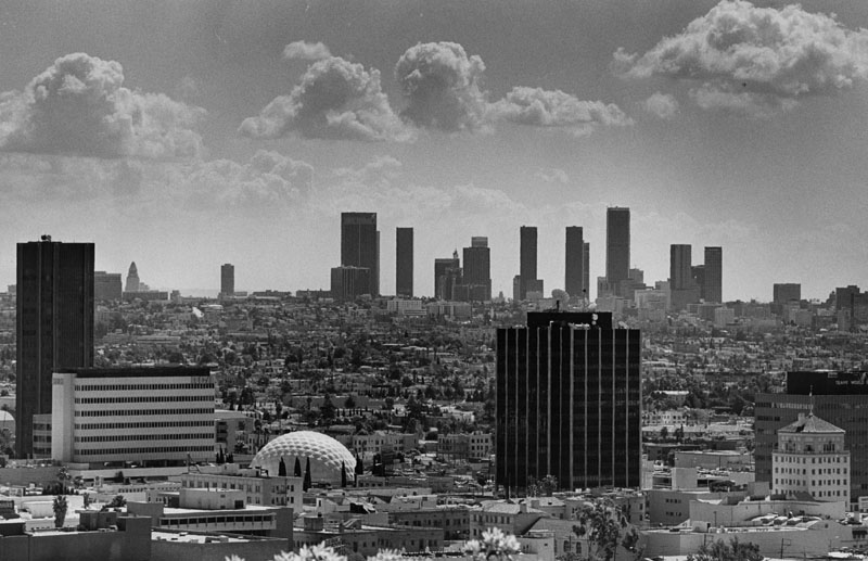 |
|
| (1987)^ - Looking east from the Hollywood Hills, L.A.'s skyline appears clear and bright as does Hollywood and its distinctive Cinerama Dome. Click HERE to see more in Early Views of Hollywood. |
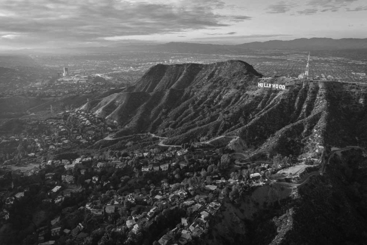 |
|
| (2015)*##^ – Aerial view on a crystal clear day showing the Hollywood Hills, Hollywood Sign, Mt. Lee Tower, and the San Fernando Valley in the distance. Photo by Mike Kelley |
.jpg) |
|
| (n.d.)++# - Telephoto view looking northwest showing Mt. Lee tower, Griffith Observatory, and the HOLLYWOOD Sign. |
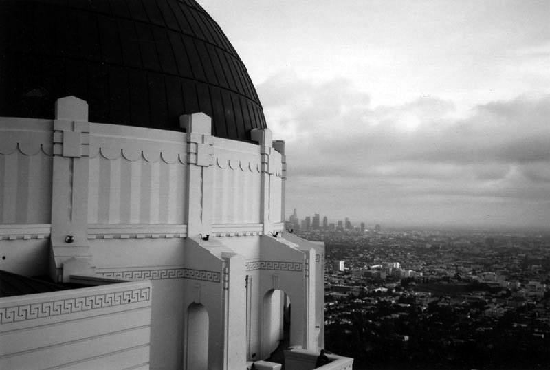 |
|
| (ca. 2006)^ - Panoramic view of Los Feliz, Hollywood and downtown Los Angeles, taken from outside of the Samuel Oschin Planetarium at Griffith Observatory. |
Historical Notes For over 75 years, the planetarium has been used to present astronomical programs overseen by a lecturer. The view reveals a variety of buildings, homes and the numerous skyscrapers located in Downtown L.A. in the background. This photograph was taken not long after the observatory reopened on November 3, 2006, after having been closed since 2002 for an extensive renovation. John C. Austin and Frederick M. Ashley were the original architects of the Art Deco structure.^ |
 |
|
| (ca. 2018)^.^ – View showing the Griffith Observatory perched on the south-facing slope of Mount Hollywood overlooking the Los Angeles Basin at dusk. |
 |
|
| (2012)^.^ – View showing Space Shuttle Endeavour atop of its 747 carrier aircraft being transported to LAX as it flies over the Griffith Observatory with the downtown skyline in the background. Note the large crowd of people in and around the Observatory, there to witness Endeavour’s “last flight”. |
Historical Notes After low level flyovers above NASA and civic landmarks across the country and in California, Endeavor was delivered to Los Angeles International Airport (LAX) on September 21, 2012. The orbiter was slowly and carefully transported through the streets of Los Angeles and Inglewood three weeks later, from October 11–14 along La Tijera, Manchester, Crenshaw, and Martin Luther King, Jr. Boulevards to its final destination at the California Science Center in Exposition Park. |
 |
|
| (2020)^.^ - Downtown LA skyline as seen from the Observatory at sunset. Photo by Danny Demarcus |
 |
|
| (2015)#* - Griffith Observatory through a telephoto lens with Downtown Los Angeles in the background. Photo by Wally Skalij, Los Angeles Times |
 |
|
| (2011)#^*# - View of Downtown Los Angeles from behind the Hollywood Sign. |
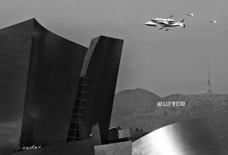 |
|
| (2012)#** - Space Shuttle Endeavour makes its final flight to LAX on September 21, 2012 as it passes over Disney Hall and the Hollywood Sign. |
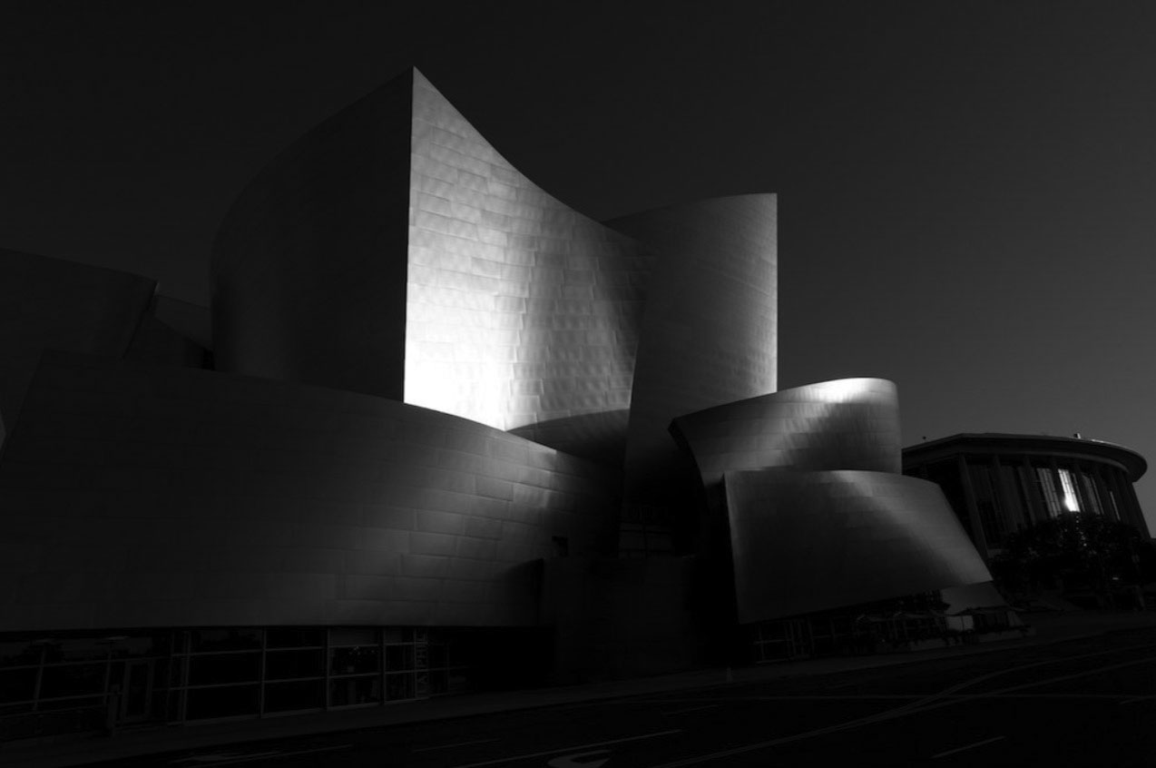 |
|
| (2012)^** - View of Disney Hall at sunrise as seen from Grand Avenue. The Dorothy Chandler Pavilion stands at right, across 1st Street. |
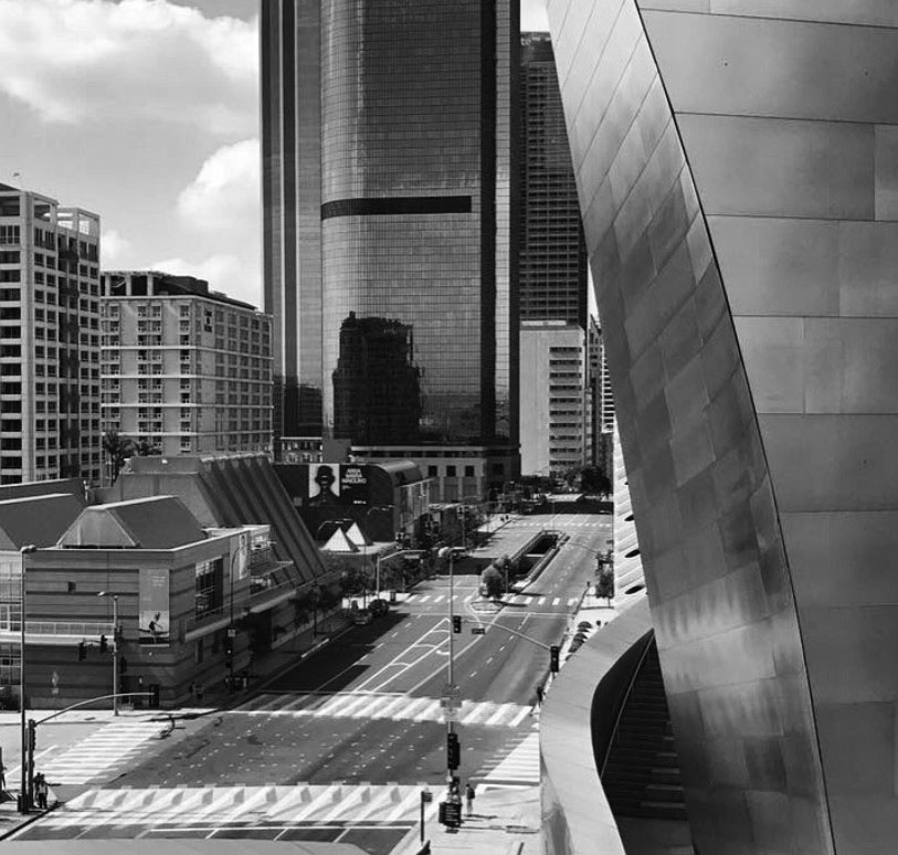 |
|
| (2017)^^ – View looking southeast down Grand Avenue from the Walt Disney Concert Hall showing the Colburn School (lower-left) and the Museum of Contemporary Art further south. A sliver of The Broad Contemporary Museum can be seen across the street (center-right), just south of the Disney Hall |
Historical Notes The Colburn School is a performing arts school with a focus on music and dance located in downtown Los Angeles adjacent to the Museum of Contemporary Art and across the street from the Walt Disney Concert Hall and Broad Museum. Informally referred to as Colburn, the school consists of four divisions: the Conservatory of Music, the Music Academy, Community School of Performing Arts, and Dance Academy.^ |
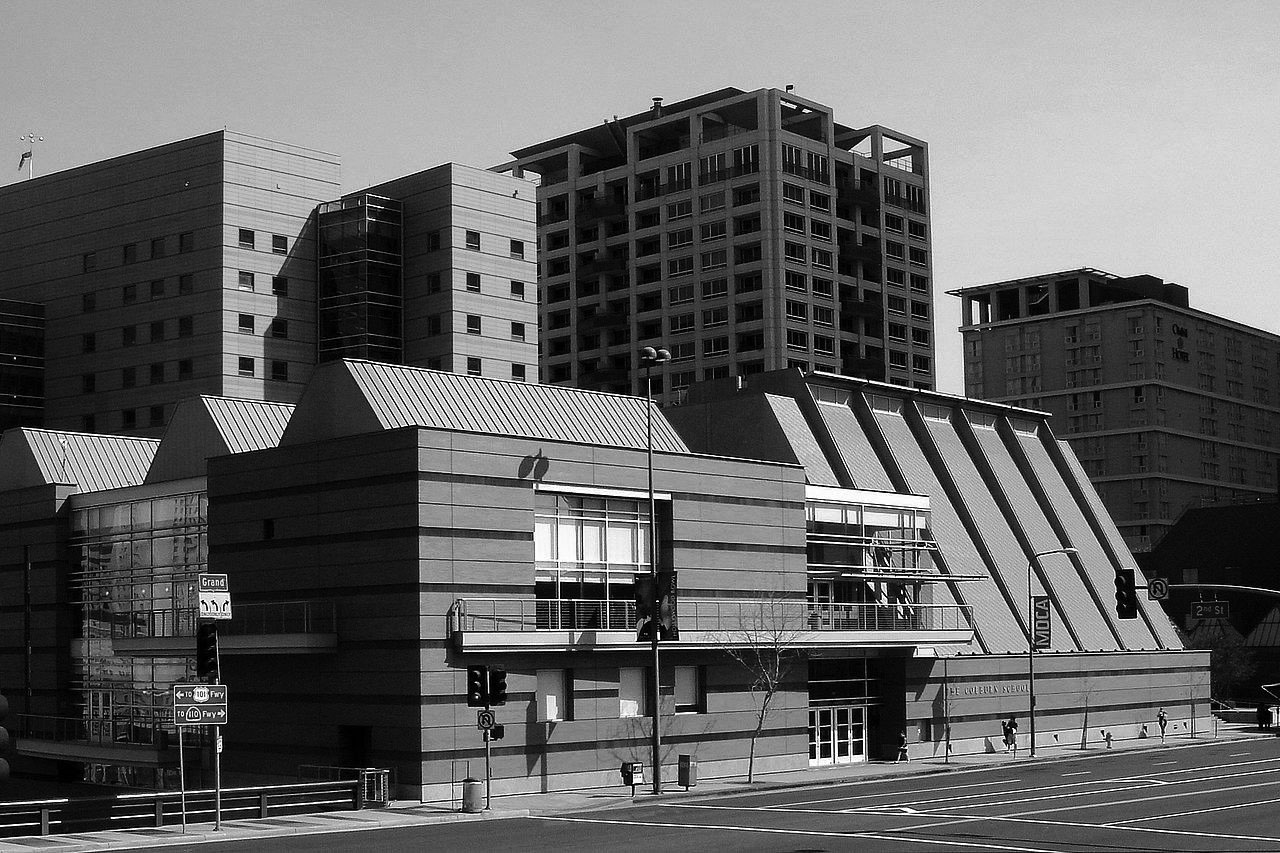 |
|
| (2007)*^ – View looking at the Colburn School located on Grand Avenue at 2nd Street. |
Historical Notes The Colburn School was originally established in 1950 as a preparatory arm of the USC Thornton School of Music, and was located across the street from the Shrine Auditorium, in a warehouse that had been converted into extra USC practice rooms, rehearsal halls, and dance studios. It later broadened its mission and changed its name to the Community School of Performing Arts. In 1980, it finalized its split with USC and branched out on its own. In 1985, the school received a significant endowment from Richard D. Colburn, and it was renamed in his honor. It moved from its original location near the USC campus to its current location in 1998. ^ |
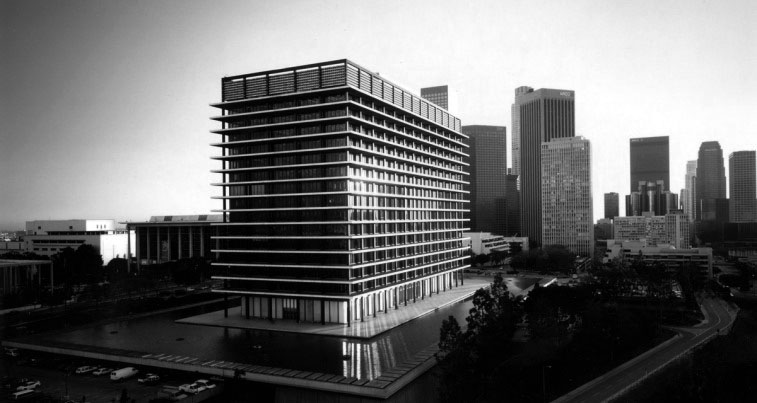 |
|
| (2010s)^.^ – View looking southeast showing the DWP Building at sunset with the Dorothy Chandler Pavilion at left and the downtown skyline in the background. |
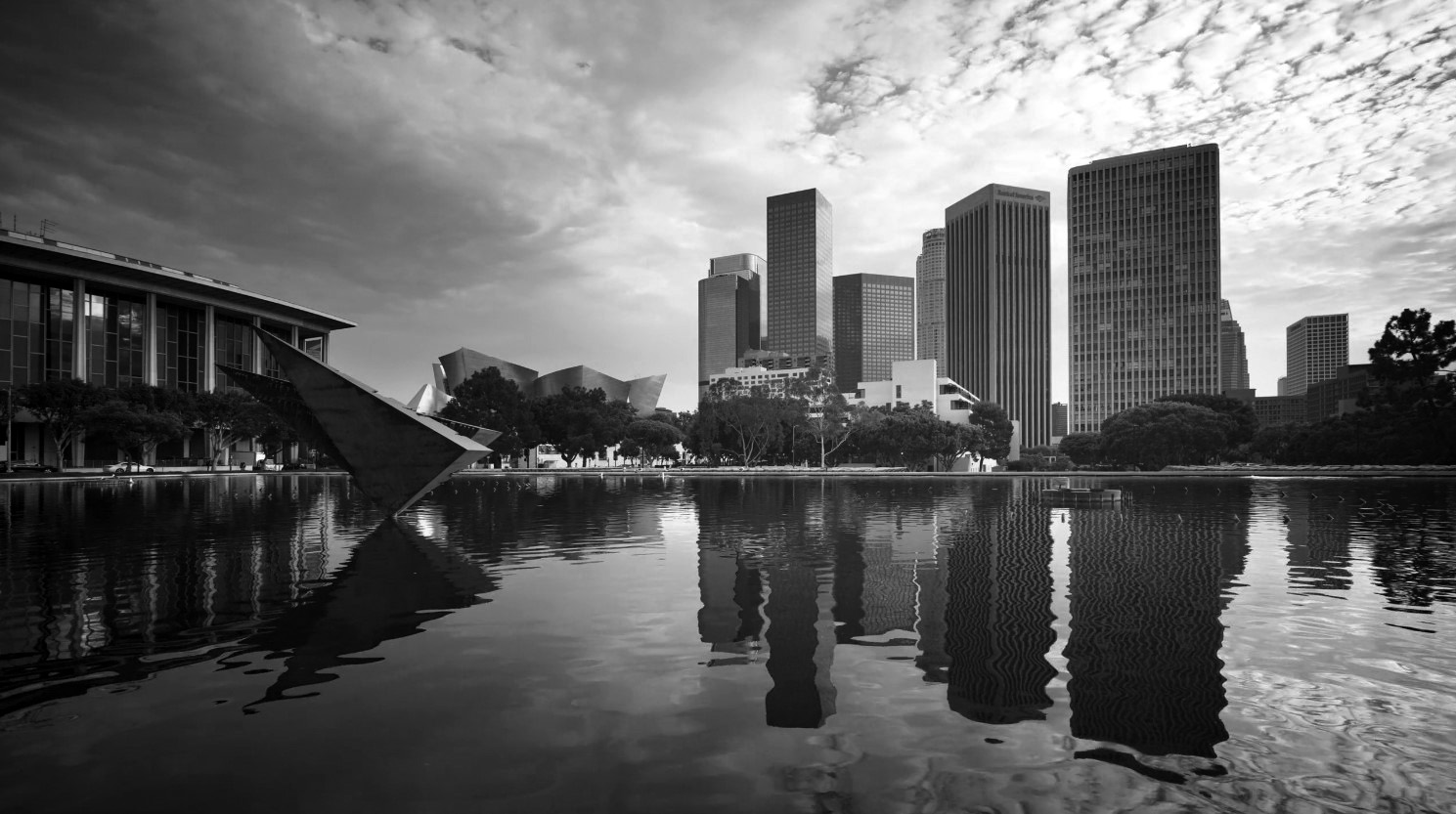 |
|
| (2019)^.^ – Dusk view looking southeast from the south end walkway of the DWP Building toward the Downtown skyline. Dorothy Chandler Pavilion and the Disney Hall are seen at left in background with the DWP’s Colpo d’ala sculpture seen in the foreground. Photo by Miguel Rodriguez |
Historical Notes The sculpture seen above in the reflecting pool is called "Colpo d'ala"(wing-beat) by Arnaldo Pomodoro. It was donated to the U.S. as gratitude from Italy for assistance provided under the Marshall Plan. |
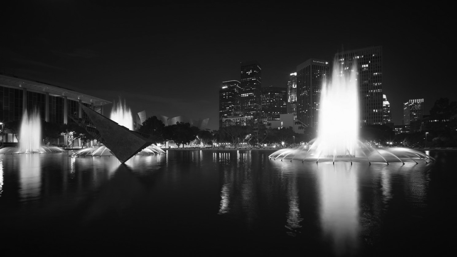 |
|
| (2019)^.^ – Night view looking southeast from the south end walkway of the DWP Building toward the Downtown skyline. Dorothy Chandler Pavilion is at left with the DWP’s illuminated fountains and Colpo d’ala sculpture in the foreground. Photo by Miguel Rodriguez |
Historical Notes "Colpo d'ala"(wing-beat) by Arnaldo Pomodoro, is distinguished from other public monuments in downtown by remembering a national as well as an international endeavor. The Marshall Plan was an historic effort in which the United States, motivated by a mix of high-minded altruism and national self-interest, financed the restoration of Europe's war ravaged economies. In gratitude for the $1.5 billion Italy received between 1948 and 1952, Italian Prime Minister Ciriaco De Mita presented the six ton bronze sculpture to the United States on December 12, 1988 at dedication ceremonies commemorating the 40th anniversary of the Marshall Plan. Los Angeles was selected as the site for the gift because the city represents the "the model American city of the Space Age."^ |
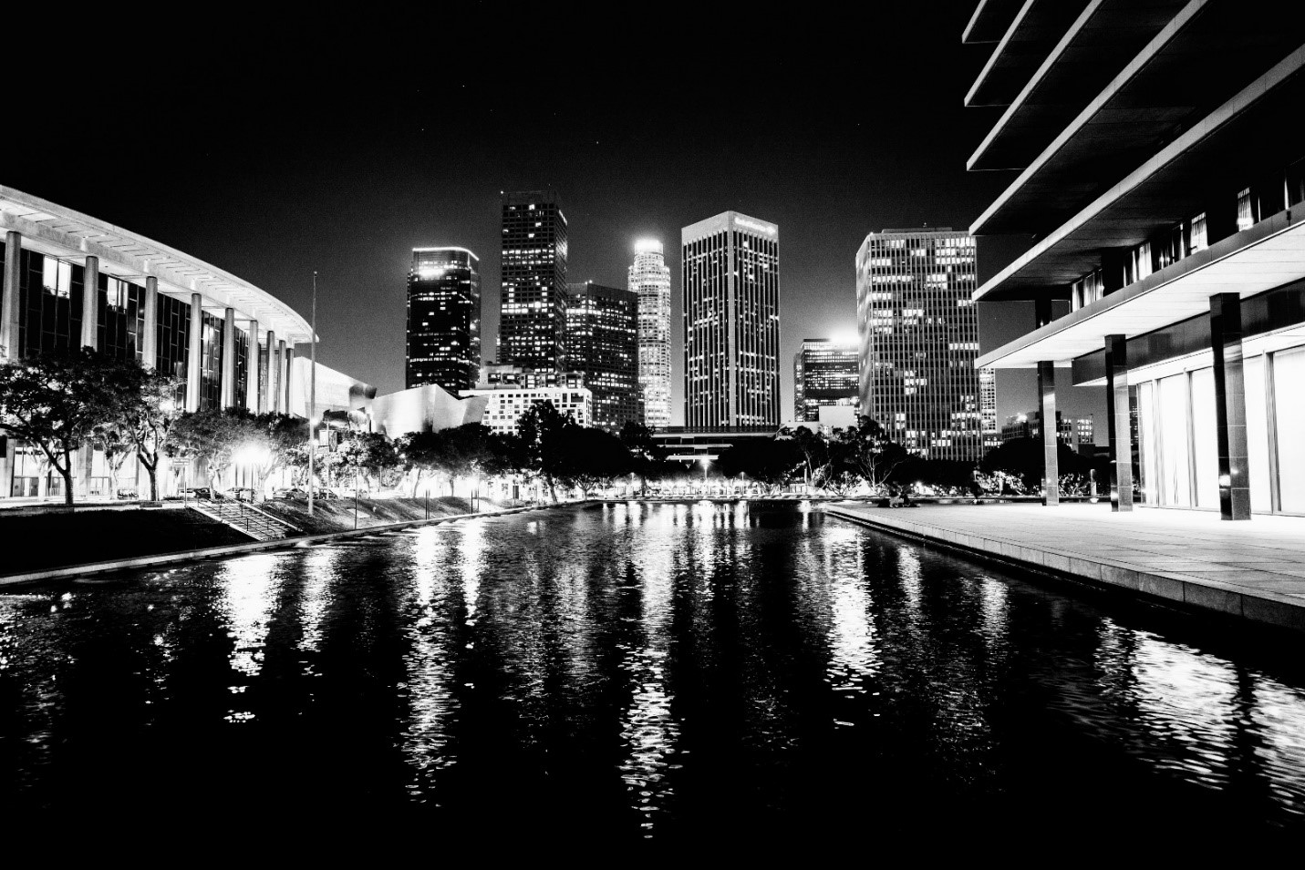 |
|
| (2016)^.^ – Night view looking south from the front entry ‘bridge’ leading to the Water and Power Office Building. Photo courtesy of John S. Rose |
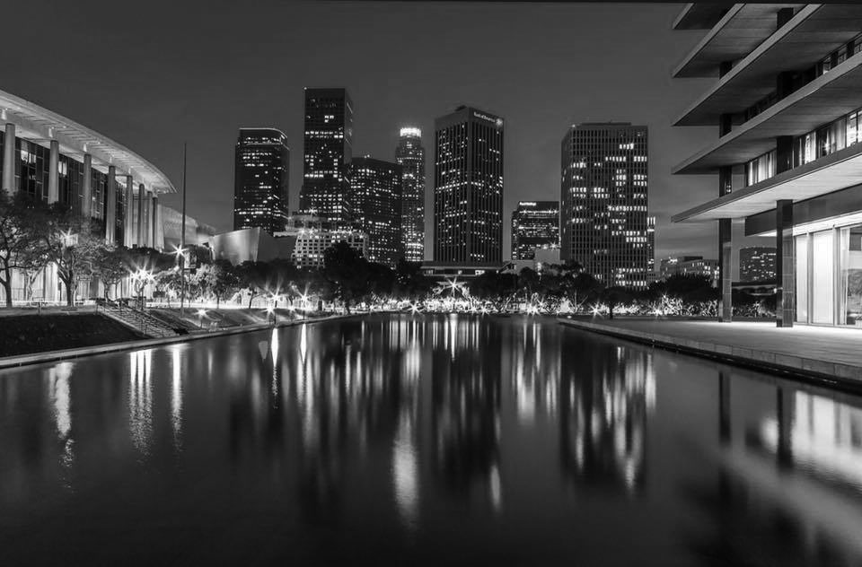 |
|
| (2020^.^ – Night view looking south from the front entry ‘bridge’ leading to the Water and Power Office Building showing the Downtown Skyline. Photo by Tom Awai |
.jpg) |
|
| (2020)^.^ – Night view in living color looking south from the front entry ‘bridge’ leading to the Water and Power Office Building showing the Downtown Skyline. Photo by Tom Awai |
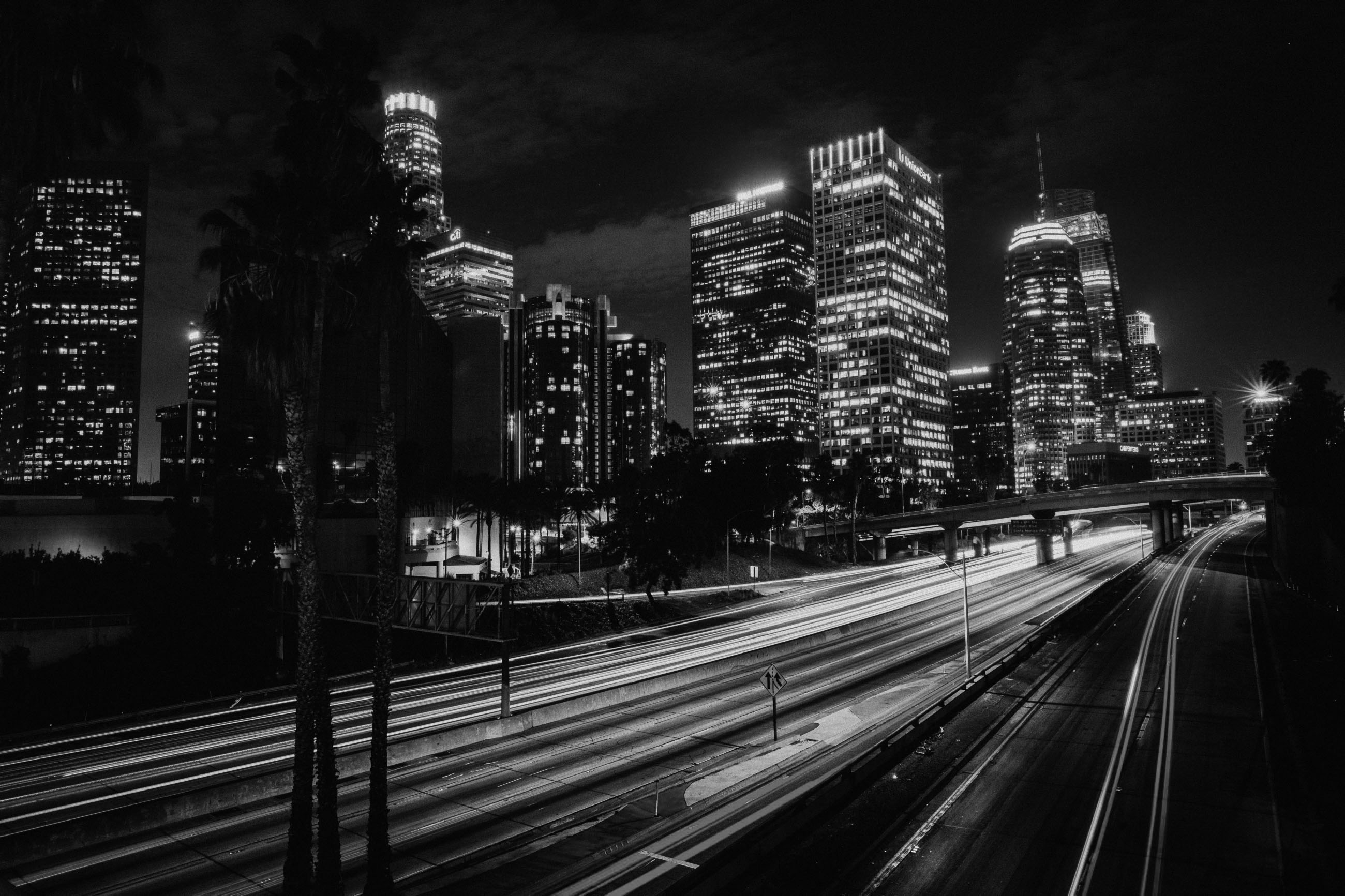 |
|
| (2016)^.^ - Time-lapsed image looking southeast showing the Downtown skyline with the Harbor Freeway seen in the foreground. The U.S. Bank Tower is at upper- left with the Westin Bonaventure Hotel at center-left. Photo courtesy of John S. Rose |
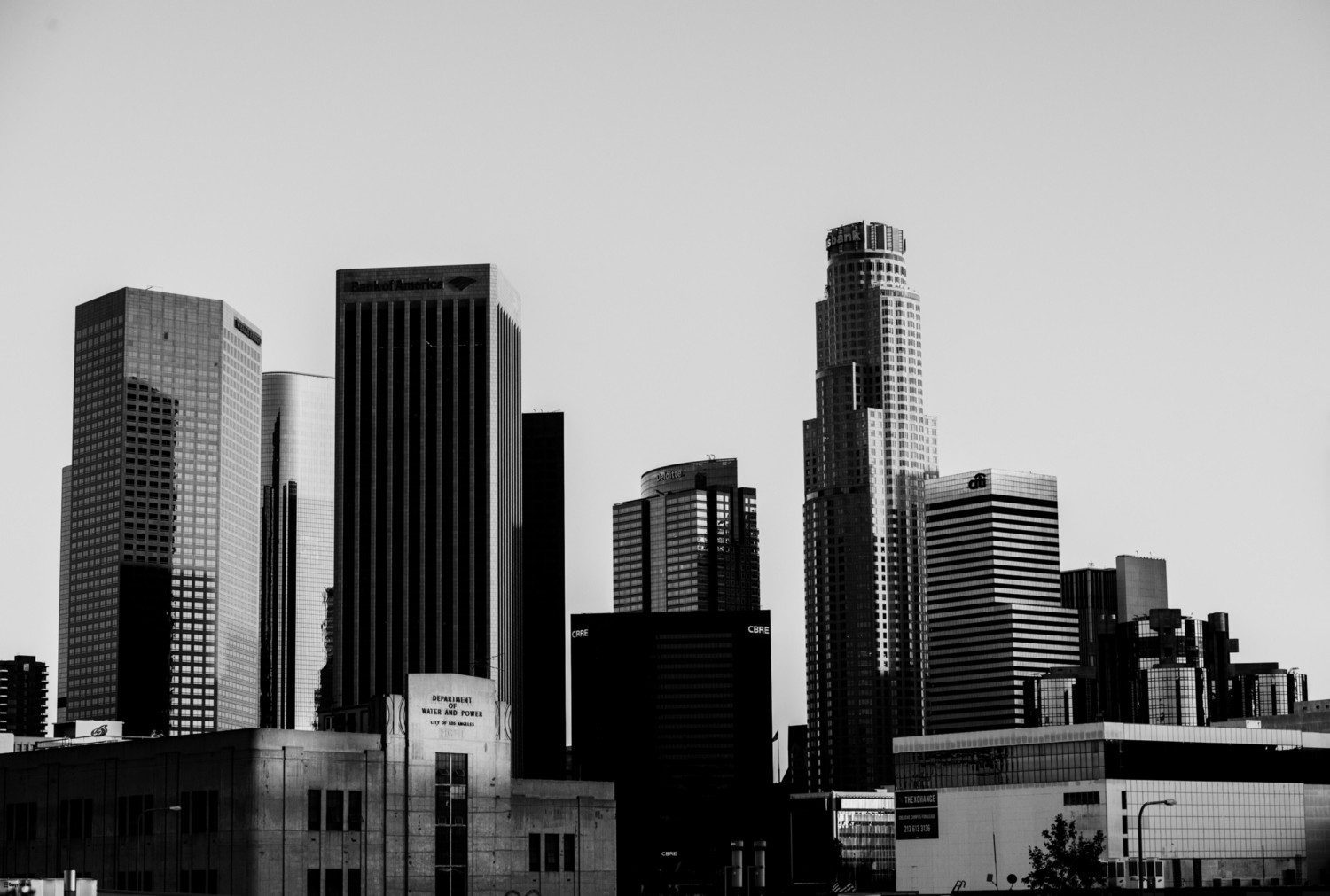 |
|
| (2016)^.^ - View looking southeast showing the Downtown skyline as seen from the Edward R. Roybal Learning Center on 2nd Street just west of Beaudry Avenue. The tallest building seen here is the U.S. Bank Tower at center-right with the Westin Bonaventure Hotel at far right. At lower-left is an art deco-style building located within Department of Water and Power’s Boylston Street Yard. Click HERE for contemporary street view. |
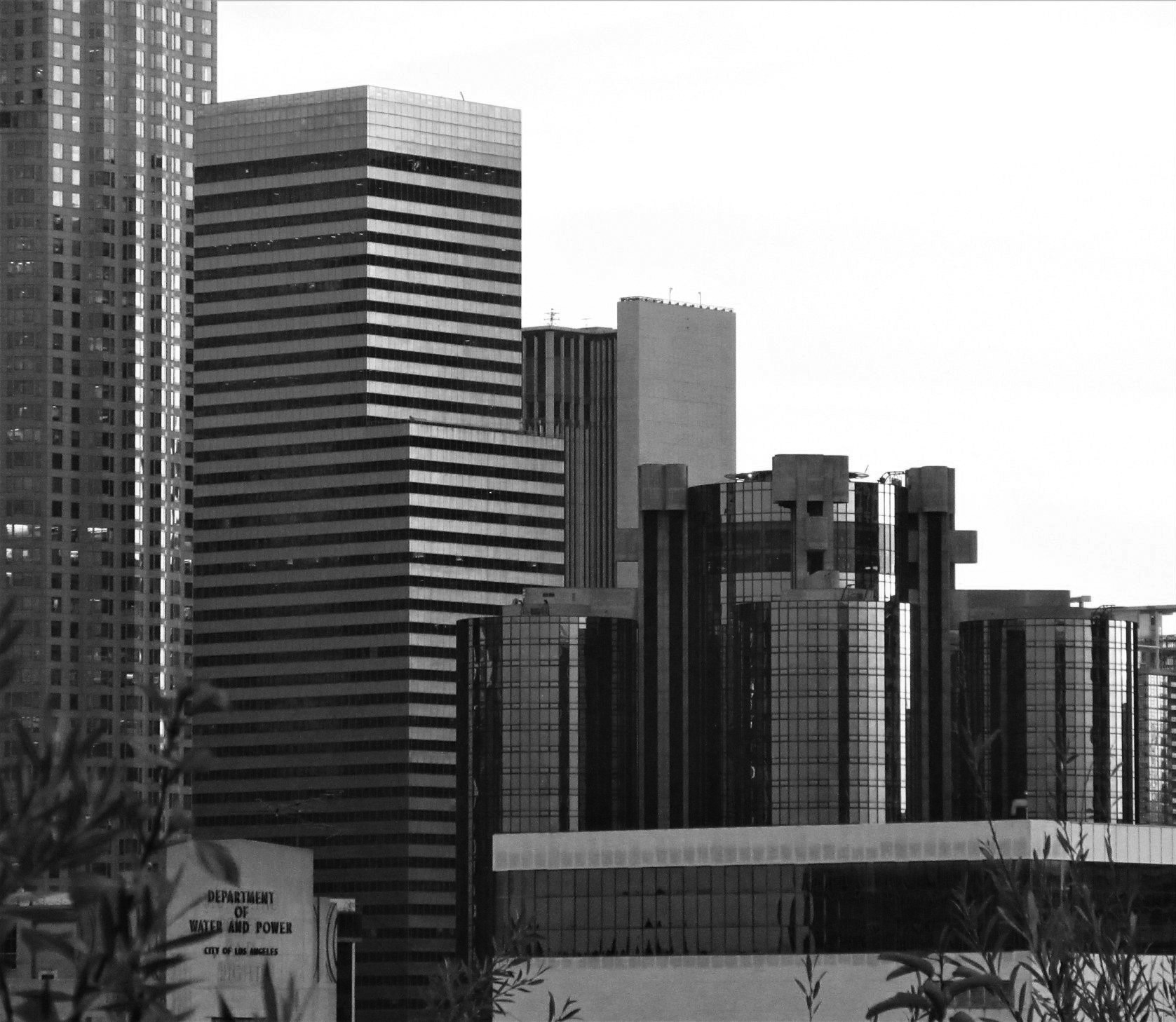 |
|
| (2020)^.^ - Telephoto view of downtown looking southeast as seen from Vista Hermosa National Park. Buildings from left to right include: U.S. Bank Tower, Citigroup Center, and Westin Bonaventure Hotel. Also, at lower-left can be seen the Department of Water and Power’s Boylston Street Yard. Photo by Howie Gray |
 |
|
| (2020)^.^ - ‘Twin Guardians’ - Two tall palm trees stand sentry with the Downtown Skyline in the background. Buildings from left to right: CBRE, Deloitte, U.S. Bank, Citigroup Center, and the Westin Bonaventure Hotel. Photo by Carlos G. Lucero |
 |
|
| (2020)^*^ – Beautiful sunny day in DTLA. Photo by Paul Wright |
 |
|
| (2020)^*^ – Beautiful sunny day in DTLA in living color Photo by Paul Wright |
 |
|
| (2020)^.^ - View looking down from the Wilshire Grand. Photo by Howard Gray |
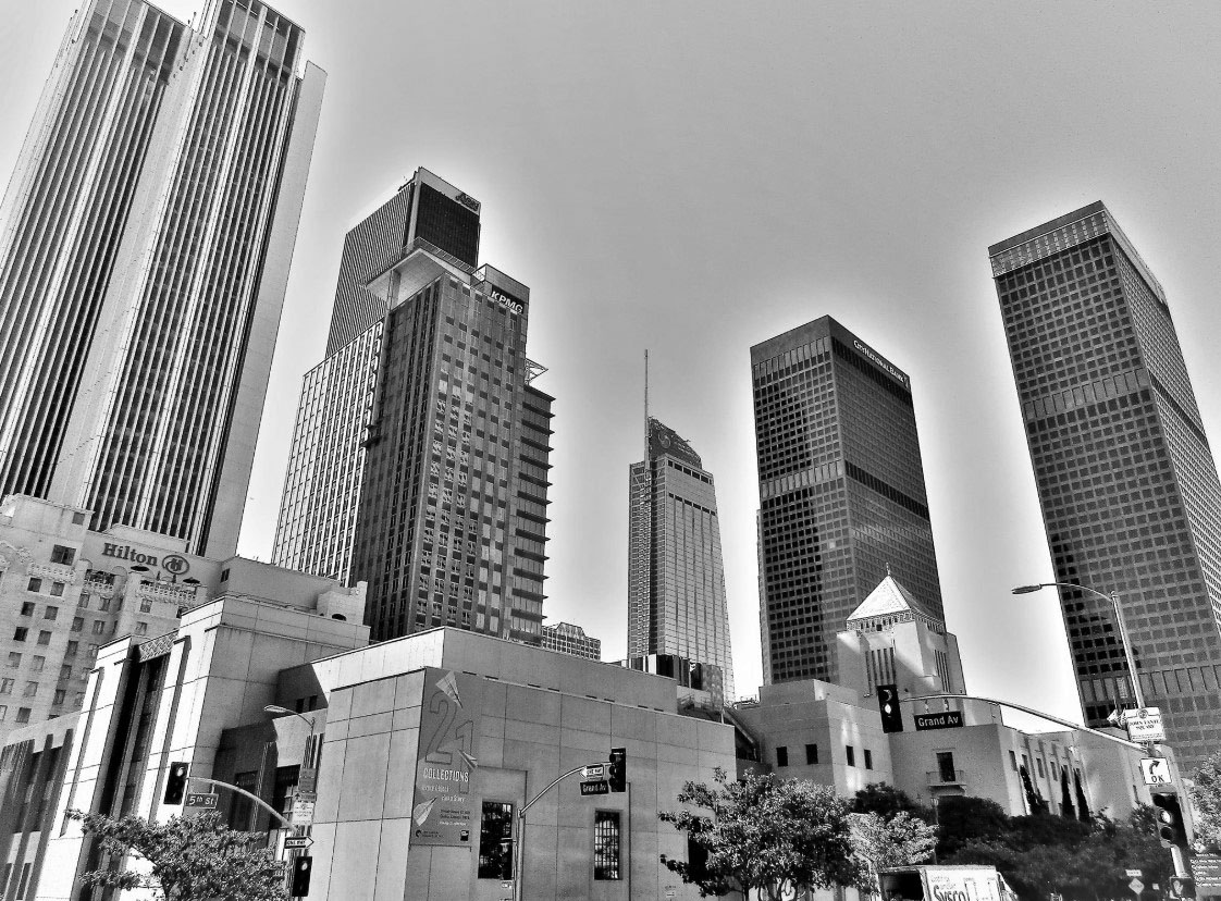 |
|
| (2019)^.^ – View looking up toward the Downtown LA skyline from the corner of 5th and Grand with the Central Library seen in the foreground. Photo by Howard Gray |
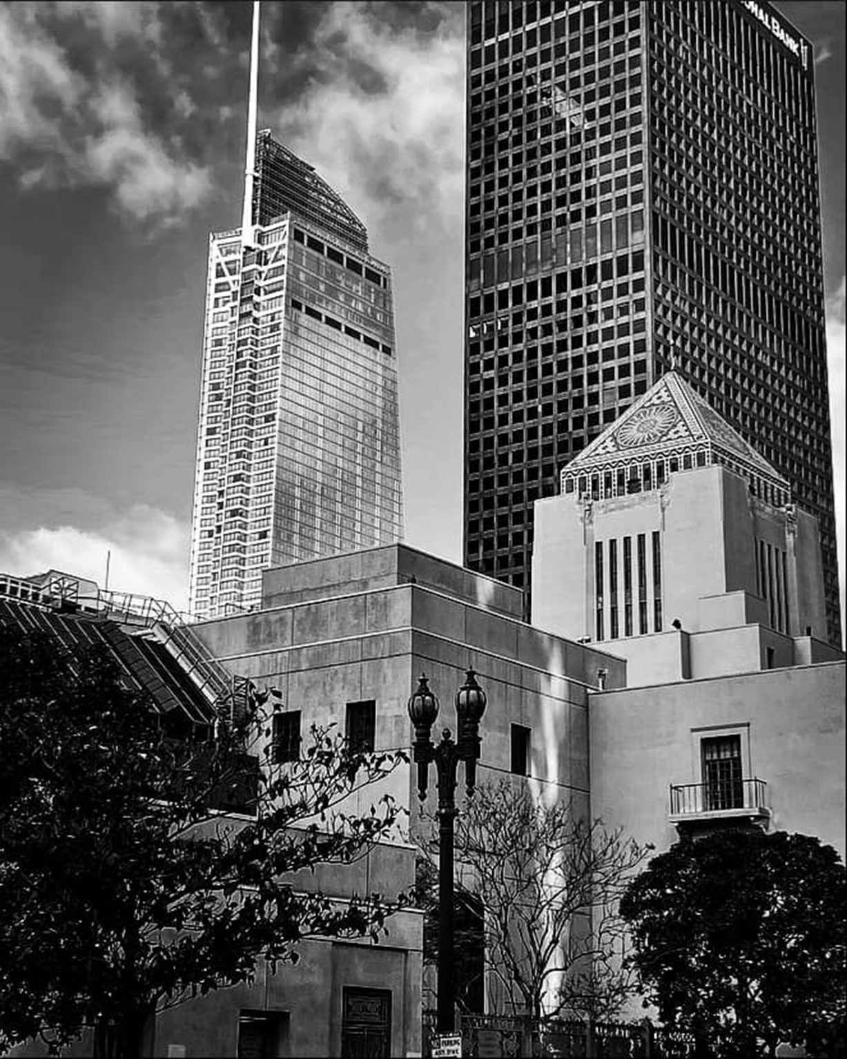 |
|
| (2022)* – An ornate dual-lamp UM (Union Metal) 1906 electrolier stands in front of the Los Angeles Central Library with the Wilshire Grand Center and City National Bank buildings seen in the background. View is looking SW from 5th Street. Photo by Carlos G. Lucero |
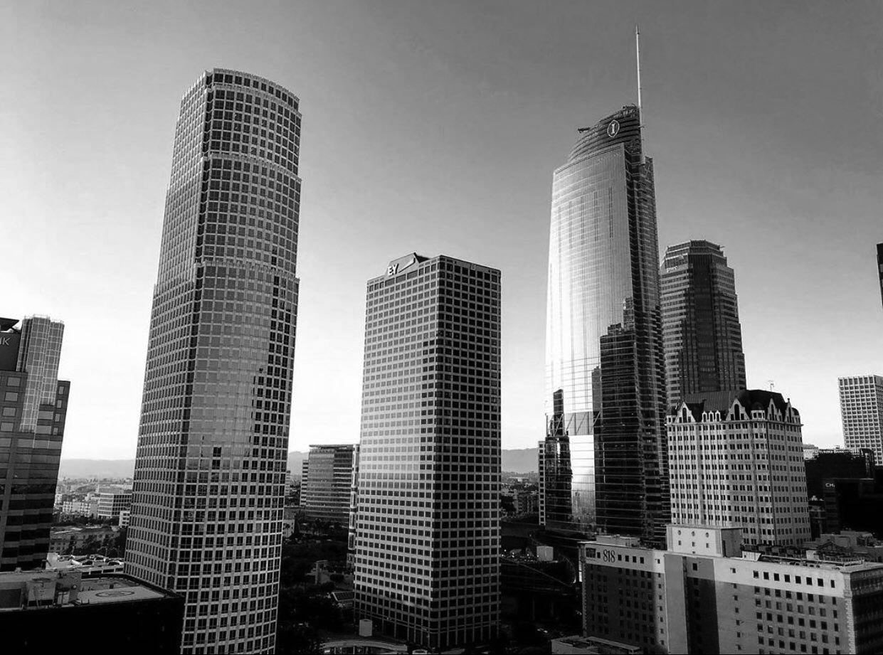 |
|
| (2020)^.^ - Three of LA’s tallest buildings (l to r): 777 Tower (1991 – 53-story), Ernst & Young Plaza (1985 – 41-story), and the Wilshire Grand Center (2017 – 73-story). |
.jpg) |
|
| (2019)* - View looking South at the Los Angeles skyline as seen from Marview Ave and Figueroa Terrace in Victor Heights. Photo by Jack Feldman. |
Historical Notes Victor Heights is named after Victor Beaudry. Also, Victor Street, a short two block span between Temple Street and Bellevue Ave that is bisected by the 101 Freeway. Canadian brothers Victor and Prudent Beaudry helped construct LA’s early water works system in the late 1800’s. They were also successful in local real estate. Prudent would go on to develop Bunker Hill. He also became Los Angeles' thirteenth mayor from 1874 to 1876. Beaudry Avenue was named after him. |
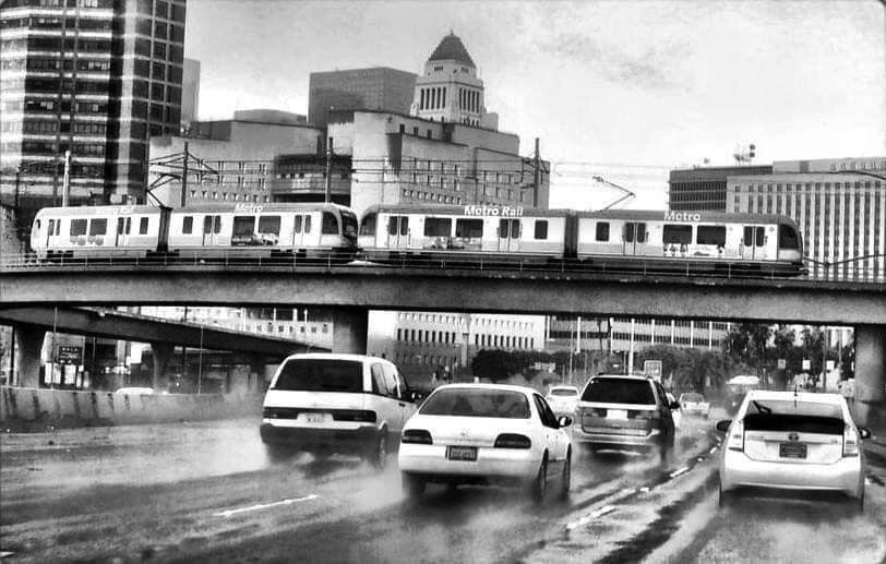 |
|
| (2020)^.^ – “Cross Town Traffic”. Metro Gold Line crosses the Hollywood Freeway as it heads toward Union Station on a rainy day. Photo by Larry L Abellera |
Historical Notes *The Gold Line is a 31-mile light rail line running from Azusa to East Los Angeles via Downtown Los Angeles serving several attractions, including Little Tokyo, Union Station, the Southwest Museum, Chinatown and the shops of Old Pasadena. The line, which is one of six in the Metro Rail system, entered service in 2003.^ |
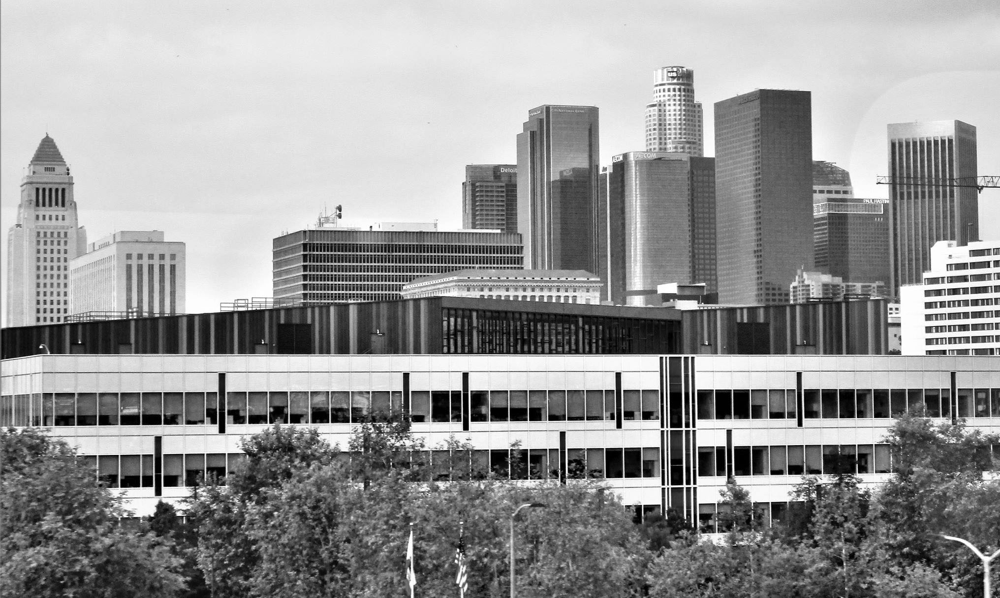 |
|
| (2019)^.^ – View looking southwest toward the Downtown LA skyline as seen from the Gold Line*. Photo by Howard Gray |
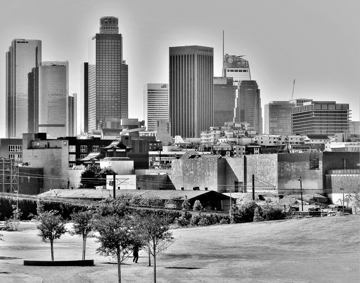 |
|
| (2020)^.^ – View showing the Downtown LA skyline as seen from ‘The Cornfield’ – LA Historic Park, Chinatown. City Hall is to the left and out of view. Photo by Howard Gray |
Historical Notes *Los Angeles State Historic Park is a California State Park within the Chinatown neighborhood of Los Angeles. Also known as the Cornfield, the former brownfield consists of a long open space between Spring Street and the tracks of the Metro Gold Line. Located outside the main commercial and residential area in the northeast portion of Chinatown, the area is adjacent and southeast of the Elysian Park neighborhood. This former site of the Southern Pacific Transportation Company's River Station (1876−1901) is considered the "Ellis Island of Los Angeles" where new arrivals from the east first disembarked. Corn leaking from train cars and sprouting along the tracks gave rise to the nickname The Cornfield. The 32-acre site was established as a California state park in 2001.^ |
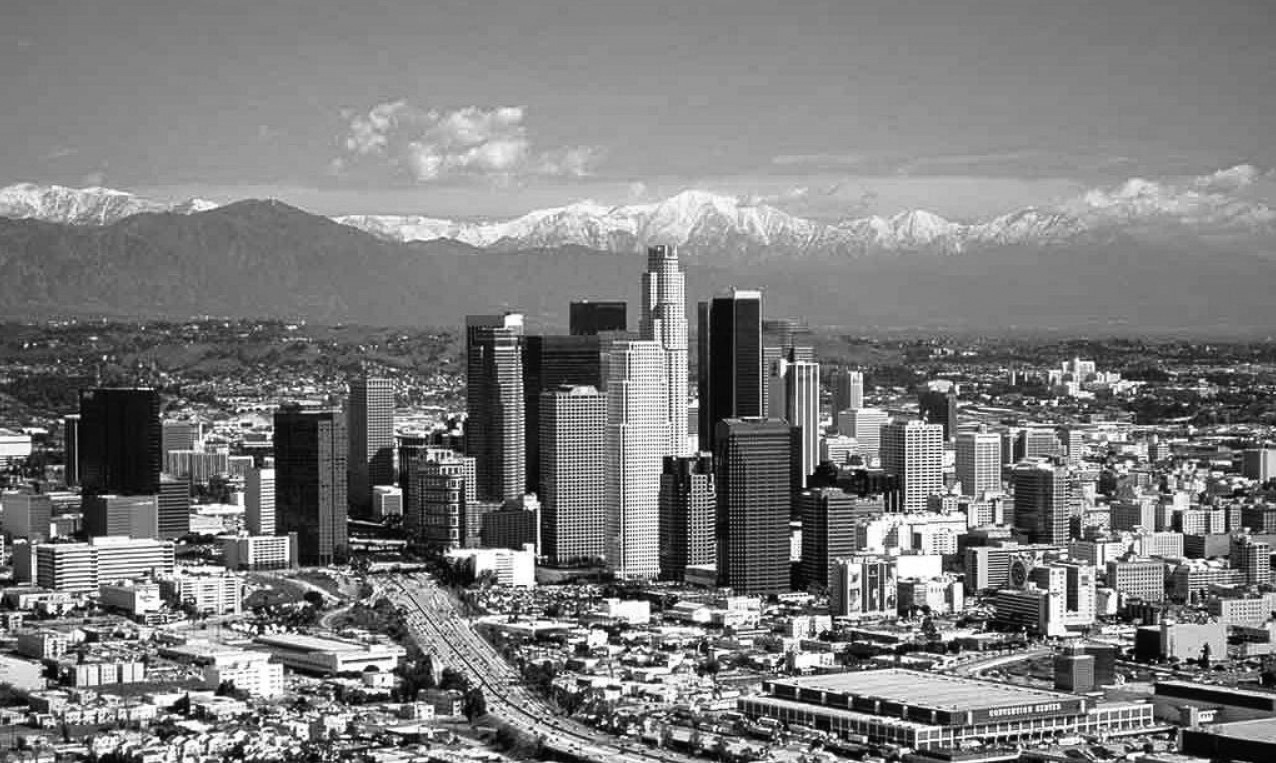 |
|
| (2005)++ – Panoramic view looking northeast showing downtown Los Angeles, with snow-capped San Gabriel Mountains in the background. The Harbor Freeway and LA Convention Center are in the foreground. Photo by Daniel Castro |
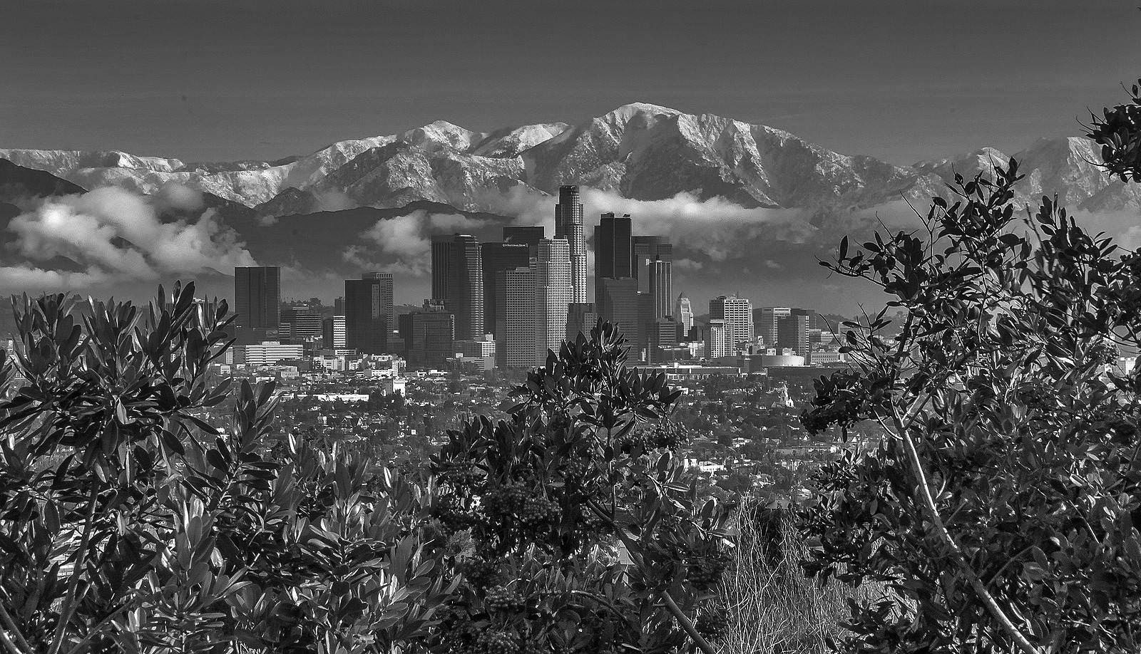 |
|
| (2010s)^.^ – Panoramic telephoto view showing downtown Los Angeles with the snow-capped San Gabriel Mountains as a backdrop. |
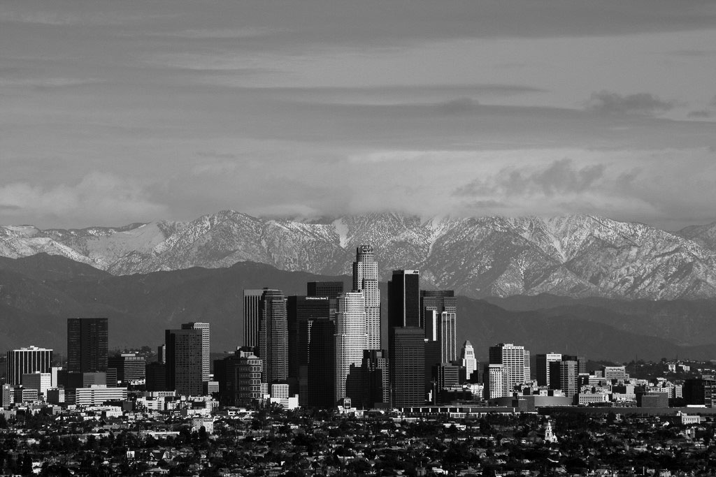 |
|
| (2013)*^ – A closer view of downtown Los Angeles and snow-capped San Gabriel Mountains, giving a better perspective of all the high-rise buildings. City Hall is seen at lower center-right. Once the tallest building in Los Angeles (1928 thru 1964), City Hall is now dwarfed by scores of other high-rise buildings. Photo by Todd Jones |
Historical Notes Los Angeles went through a large building boom that lasted from the early 1960s to the early 1990s, during which time the city saw the completion of 30 of its 32 tallest buildings, including the U.S. Bank Tower, the Aon Center, and Two California Plaza. The city is the site of 25 skyscrapers at least 492 feet (150 m) in height, more than any other city in the Pacific coast region. As of July 2011, there were 505 completed high-rises in the city. As of May 2011, there were 60 high-rise buildings under construction, approved for construction, and proposed for construction in Los Angeles. 37 of these 60 buildings are over 100 meters tall.^* |
Then and Now
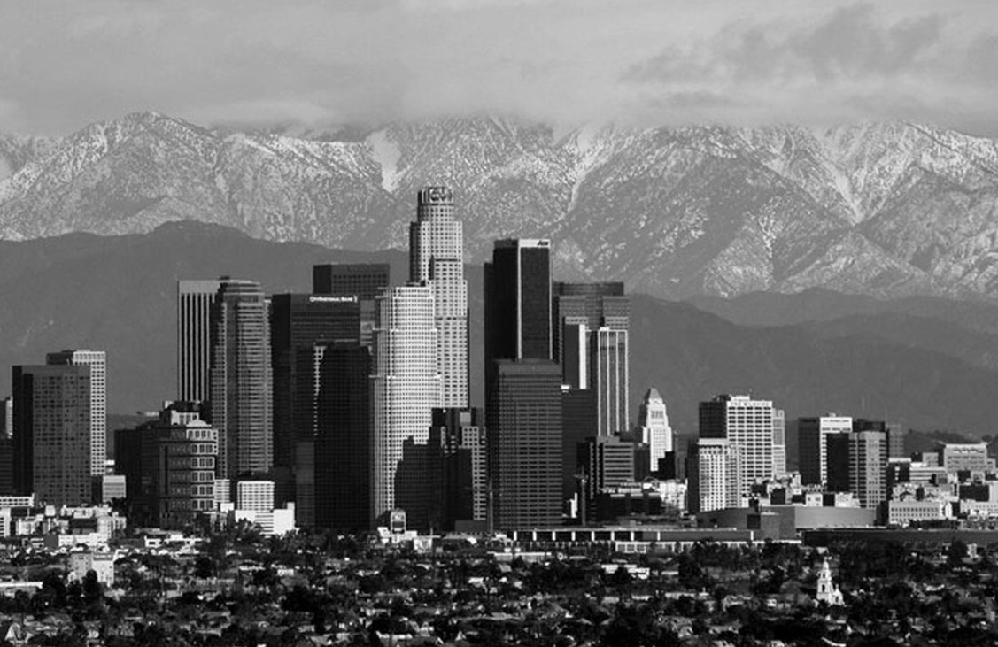 |
|
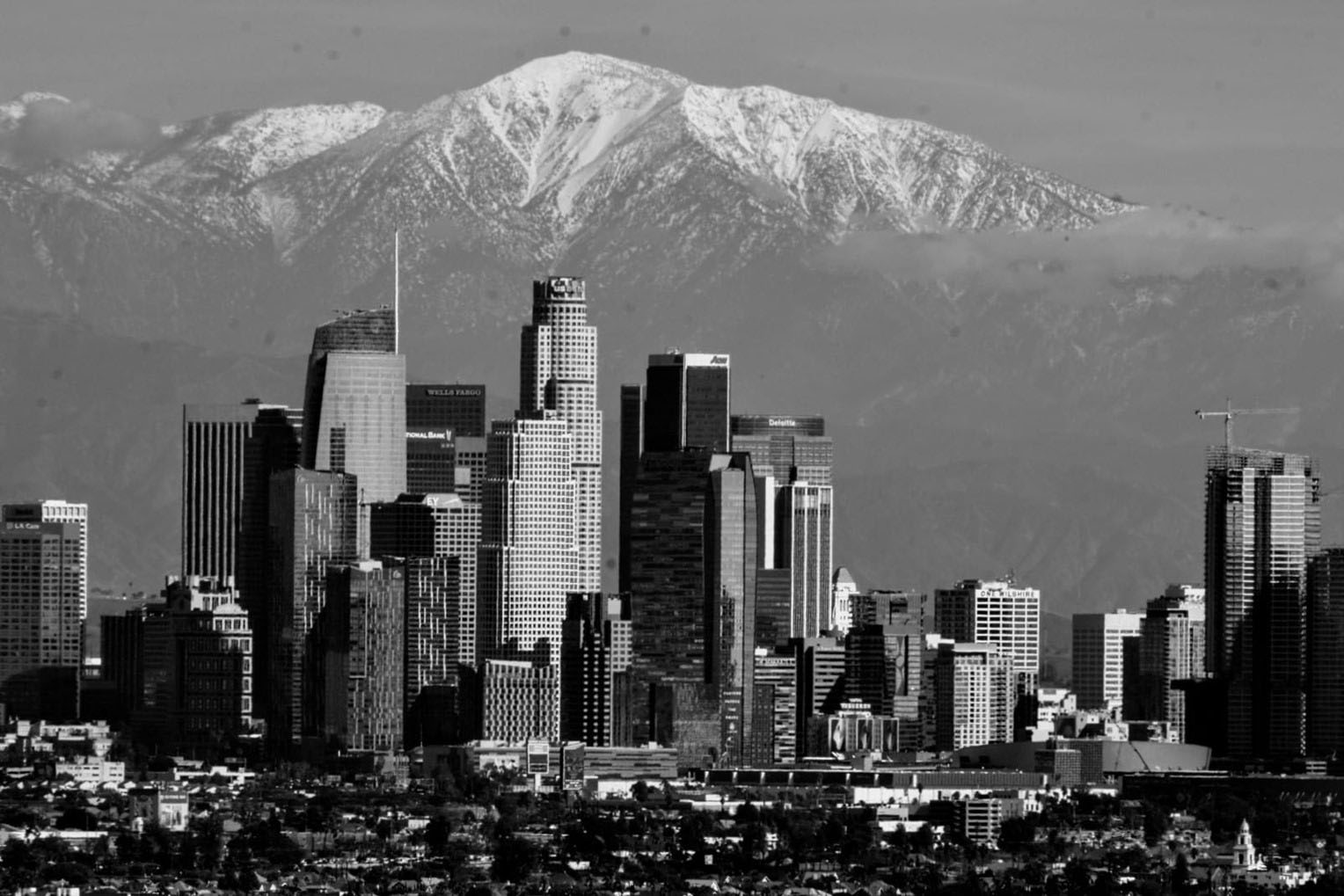 |
|
| (2013 vs. 2021)* - Contemporary photo by Paul Wright | c |
.jpg) |
|
| (2011)###* - Aerial view of Downtown Los Angeles on a clear day. Hollywood and the Hollywood Hills are in the background and the San Fernando Valley can also be seen in the distance. |
| (2010s)++# – Los Angeles on clear day as a storm passes through the area. View is looking southeast as seen from above Cahuenga Pass with Hollywood is in the foreground, the Wilshire corridor at center-right, and Downtown at center-left. |
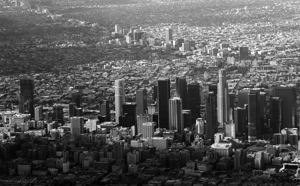 |
|
| (2008)*#** - Aerial view of Downtown Los Angeles with Wilshire Blvd in the background heading off to the west. Photo by Ron Reiring |
 |
|
| (2018)^.^ - Aerial view over Echo Park looking southeast toward Downtown Los Angeles. |
 |
|
| (2020)^.^ - Aerial view over Echo Park looking southeast toward Downtown Los Angeles. Slightly different angle than previous photo. |
 |
|
| (2019)^.^ – View looking SE toward Downtown LA as seen from the hills near Echo Park. |
 |
|
| (2019)^.^ - Closer panoramic view of Downtown Los Angeles looking southwest. Photo by Phil Sutphin |
 |
|
| (2019)^.^ - Downtown Los Angeles all lit up by building lights and the full moon. Photo by Phil Sutphin |
 |
|
| (2022)* – Looking toward Downtown Los Angeles from the Sixth Street Bridge at sunset. Photo by Carlos G. Lucero |
 |
|
| (2022)* - Sunset shot of downtown L.A. as seen from Kenneth Han Park. Photo by Peter Chacona Chaconas |
 |
|
| (2020)^.^ - Magnificent view of Downtown Los Angeles with the San Gabriel Mountains in the background. Photo by Phil Sutphin |
 |
|
| (2022)^ – Telephoto shot of Downtown LA taken from Kenneth Hahn Park after a storm with the San Gabriel Mountains (magnified) in the background. |
* * * * * |
For more Historical Los Angeles Views click one of the following:
For Other Historical Views click one of the following:
See Our Newest Sections:
To see how Water and Electricity shaped the history of Los Angeles click one of the following:
Water:
Power:
* * * * * |
References and Credits
* DWP - LA Public Library Image Archi
^ LA Public Library Image Archive
*^Oviatt Library Digital Archives
^^LA Times: Photo Archive; An Oil Well on La Cienega; Mulholland Bridge; A Mountain of Red Cars; The Vincent Thomas Bridge; Hill Street Tunnels; Harbor-Santa Monica Freeway Interchange; Super Bowl I
#*MTA Transportation and Research Library Archives
#^^Picturetrail.com: KCET - Angels Flight
^**Flickr: Enock 1; Eric Richardson
*^#Los Angeles Conservancy: LA Stock Exchange Building; Park La Brea
^#^Pacific Electric Railway Historical Society - Alan Weeks Collection
*#*Westland.net: Venice History
*#^Forum.Skyscraper.com: Arroyo Seco Library; Westwood-Life Magazine; North Los Angeles Street
^#*Metro.net: Mulholland Drive Bridge
**#The California History Room, California State Library: William Reagh
#**Pinterest - California and DailyBreeze.com
#^#Deadhistoryproject.com: Silent Movie Theater
+**Los Angeles' Bunker Hill - Alta Visa Apartments
+##MartinTurnbull.com: Fairfax and Wilshire
+^^Century City History; History of Century City
^^+How Stuff Works: Chevrolet Impala
+#+Pinterest - California and DailyBreeze.com; Mid Century Hollywood
++#Facebook.com: Photos of Los Angeles
^^#The George A. Eslinger Street Lighting Photo Gallery
^^*Early Downtown Los Angeles - Cory Stargel, Sarah Stargel
***Los Angeles Historic - Cultural Monuments Listing
*^*California Historical Landmarks Listing (Los Angeles)
*^^Nuestra Señora la Reina de los Ángeles: losangelespast.com
**** Pinterest.com: Los Angeles Dodgers; Los Angeles and Hollywood; MacArthur Park w/Downtown Skyline; Gilmore Self-Service Gas Station
**^*California State Library Image Archive
**^#Vintage Los Angeles: Facebook.com - Gilmore Stadium and Field; Cruising Hollywood Blvd
^^^^Depaul.edu: Night Train 55
**#^Vincent Thomas Bridge - Facts and Figures
*#**Flickr-Los Angeles in Good Light - Ron Reiring
^#^^Flickr.com: Michael Ryerson
*#^#Life.time.com: Stoked-Life Goes Surfing
*#*#Abandoned & Little-Known Airfields – Paul Freeman
^#*#LA Magazine: Beverly Park Ponyland
^^##Pacific Electric Railway Historical Society
^**#Los Angeles Movie Palaces: The ABC Entertainment Center
^^*#Historic LA Theatres: Downtown Broadway Theatres
^^#*LA Observed.com: Decommissioned Street Cars; Bunker HIll, 1964
*^^*Pinterest.com: Bertrand Lacheze
^^**Pinterest.com: Vintage California
*##*Pinterest.com: Trucks, Pick-Ups, and Gas Stations
*##^LAist.com: Harbor Freeway, 1969; Century Plaza Hotel
##*^Port of Los Angeles: portoflosangeles.corg
##^*Calisphere: University of California Image Archive
##^^Cinema Treasures: Olympic Drive-In
##++Facebook.com - Beverly Hills Heritage
#**#California State University Northridge History: csun.edu
#^*#Flickr.com: Paul Bajerczak
##^#Facebook.com: Classic Hollywood-Los Angeles-SFV
^***UCLA Library Digital Archive
^^^*KCET: Welcome to L.A. River; Four Level Interchange; Construction of 5 Southern California Freeways; Beverly Park and Ponyland; Before the 'Carmageddon': A Photographic Look at the Construction of 5 SoCal Freeways; Seventh and Broadway; Creating the Santa Monica Freeway
****^Facebook.com: West San Fernando Valley Then And Now
*^^^^Los Angeles Maritime Museum
^^^**tumblr.com: John Ferraro Office Building; DWP Office Building
**^^^Facebook.com - San Pedro's Original Website, San Pedro.com
#*#**Facebook.com: Beverly Park - L.A.'s Kiddieland
**#**LMU Digital Archive
**^ Noirish Los Angeles - forum.skyscraperpage.com; Westwood-Life Magazine; Selling Papers on Olive; California Federal Plaza Building; Downtown Aerial 1958; 1949 Construction of 101 Freeway; 1953 Harbor Freeway Construction; Wilshire Blvd, 1949; Zephyr Room and Brown Derby Postcard View; Aliso Before and After 101 Frwy; Vincent Thomas Bridge; Gilmore Aerial; Hollywood Frwy Traffic Jam; 2012 Downtown Skyline; View from GOB; Bonaventure Hotel Aerial
^* Wikipedia: Hollywood Sign; Carthay Circle Theatre; Fairfax High School; Park La Brea; San Vicente Boulevard; Etymologies of place names in Los Angeles; Los Angeles Central Library; Broadway Tunnel; Pershing Square; Pacific Electric Railway; Gilmore Field; GilmoreStadium; Union Station; Westwood; 6th Street Viaduct Bridge; Figueroa Street Tunnels; Chavez Ravine; 2nd Street Tunnel; Hollywood Freeway; Los Angeles International Airport; Los Angeles City Hall; Wilshire Boulevard Temple; Egyptian Theatre; The Pig 'N Whistle; Sunland-Tujunga; Van de Kamp Bakery Building; Los Angeles County Art Museum; Los Angeles City Oil Field; Los Angeles Railway; Miracle Mile; Interstate 405; Chevrolet Impala; Playa Vista; Harbor Frwy (Interstate 110); History of Los Angeles Population Growth; Los Angeles City Hall Lindbergh Beacon; May Company California; Four Level Interchange; California Federal Bank; Harbor Freeway; Arroyo Seco Parkway; Brown Derby; 2004 Los Angeles Skyline; LA's Oldest Palm Trees; Vincent Thomas Bridge; World Cruise Center; CSUN; Westwood; Westwood Village; UCLA; History of UCLA; 1950s Americal Automotove Culture; Pershing Square; Century Plaza Hotel; California Incline; Downtown Los Angeles
< Back