Early Los Angeles Historical Buildings (1800s)
 |
|
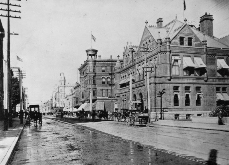
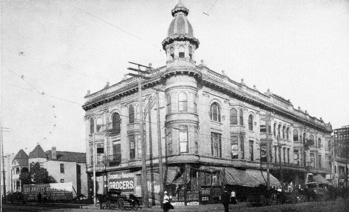
| (1890s)* - View looking north on Main Street showing horse-drawn carriages, streetcar, and pedestrians all sharing the street. The large building with the awnings on the right is the Government Building on the SE corner of Winston and Main Streets. The building with the circular-like tower with flag is the Main Street Savings Bank Building. |
 |
|
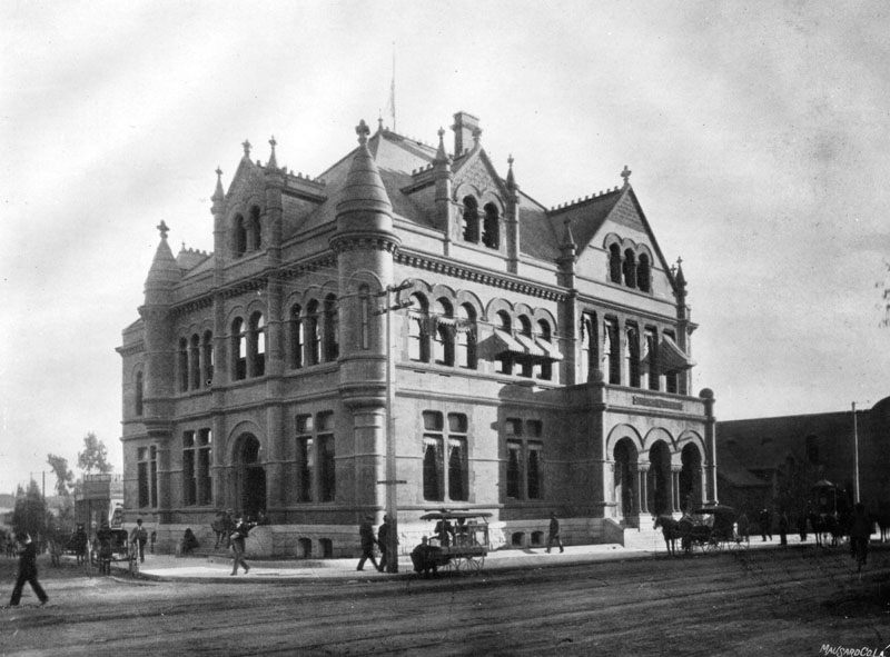
| (1893)* - View of the United States Government Building, located on the southeast corner of Main and Winston Streets. |
Historical Notes In June of 1893 the Los Angeles Post Office moved into this building from its location on Broadway near Sixth Street.* |
* * * * * |
La Grande Station
 |
|
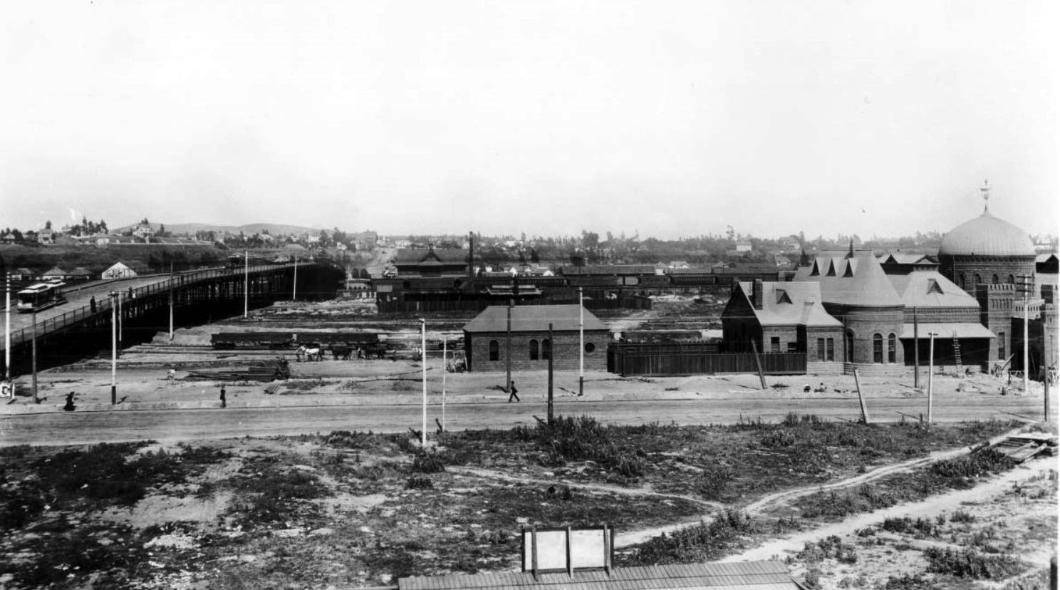
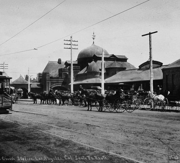
| (1893)^^ - Panoramic view showing the Atchison Topeka & Santa Fe La Grande Depot at right, located on the corner of 2nd and Santa Fe. The First Street Viaduct is seen on the left. The depot consists of a two-story brick building with a Moorish dome. A ladder leans against its eaves at the main entrance. A picket fence extends from it to the left, connecting it with a smaller brick building. A horse-drawn carriage is visible in the open lot that appears farther to the left, behind which a short train is making its way down the tracks, running under the viaduct, which is pictured at the extreme left. A streetcar can be seen making its way across the top of the viaduct. Pedestrians walk along the street, across from a second vacant lot in the foreground, where the beginnings of a shingled roof can be seen. |
Historical Notes Santa Fe opened La Grande Station on July 29, 1893 and was unique for Southern California in its Moorish-style architecture. The station was located at 2nd Street and Santa Fe Ave, just south of the First Street viaduct built in 1929 and on the west bank of the LA River.^* |
 |
|
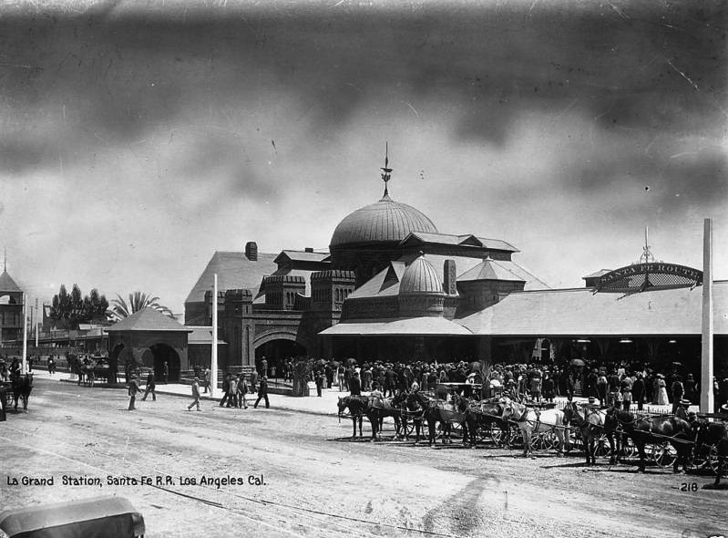
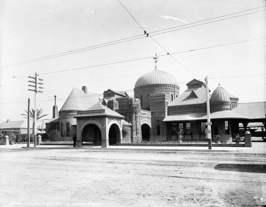
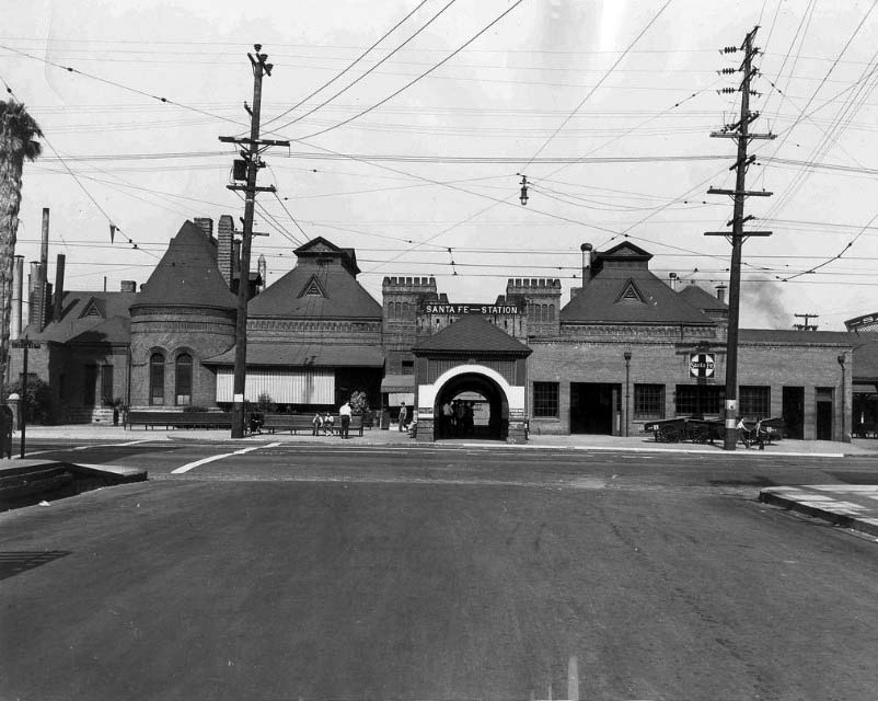
| (1890s)^^* - External view of the La Grande Santa Fe Station. Horse-drawn carriages are parked at the curb waiting for passengers. |
Historical Notes The Moorish-inspired La Grande railroad station was used as a passenger terminal for Atchison, Topeka and Santa Fe Railway (often abbreviated to "Santa Fe").^^ |
 |
|
| (1896)^# – Closer-view showing horse-drawn wagons waiting in front of the La Grande Station with streetcar seen at far left. |
 |
|
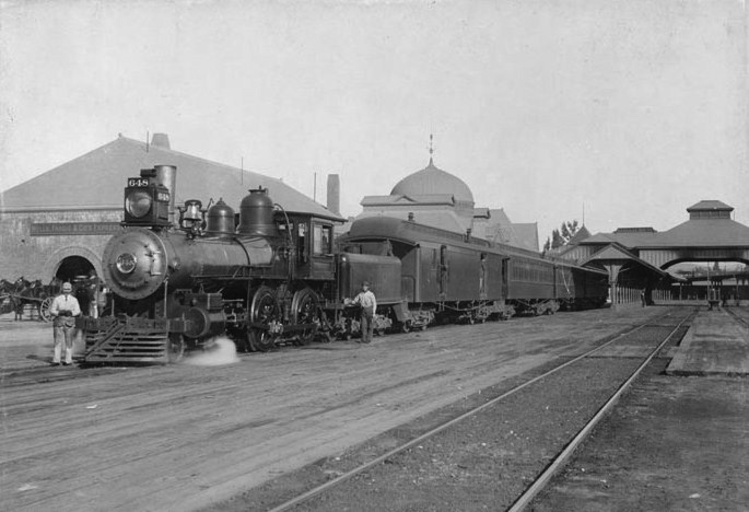
| (ca. 1895)^* - A passenger train is stopped at the La Grande Station as two men are seen posing for the camera. |
 |
|
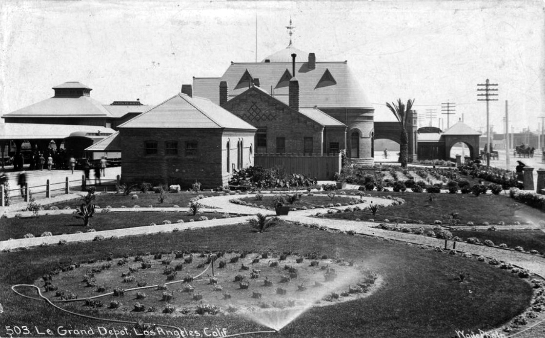
| (1894)^*# – View showing the new landscaping around La Grande Station shortly after it was built. |
Historical Notes Outside La Grande Station, a garden of exotic plants welcomed newcomers to the supposedly sub-tropical climate of Southern California. Back of photo reads: “La Grande Station, Los Angeles, taken just after its completion in 1894. Taken by E. E. Risley, deceased, who for many years was division gardener. Courtesy of his son, Leslie E. Risley, store department, Los Angeles." |
 |
|
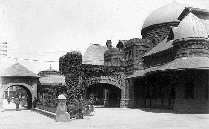
| (ca. 1900)^## - View of the La GrandeSanta Fe Depot showig the detail of its Moorish-style domes with ivy now growing over the front brick entrance.. |
Historical Notes The La Grande depot was also notable for its red-brick construction, selected because it signaled the station's importance and because it followed a rash of fires that had destroyed wooden depots.^^ |
 |
|
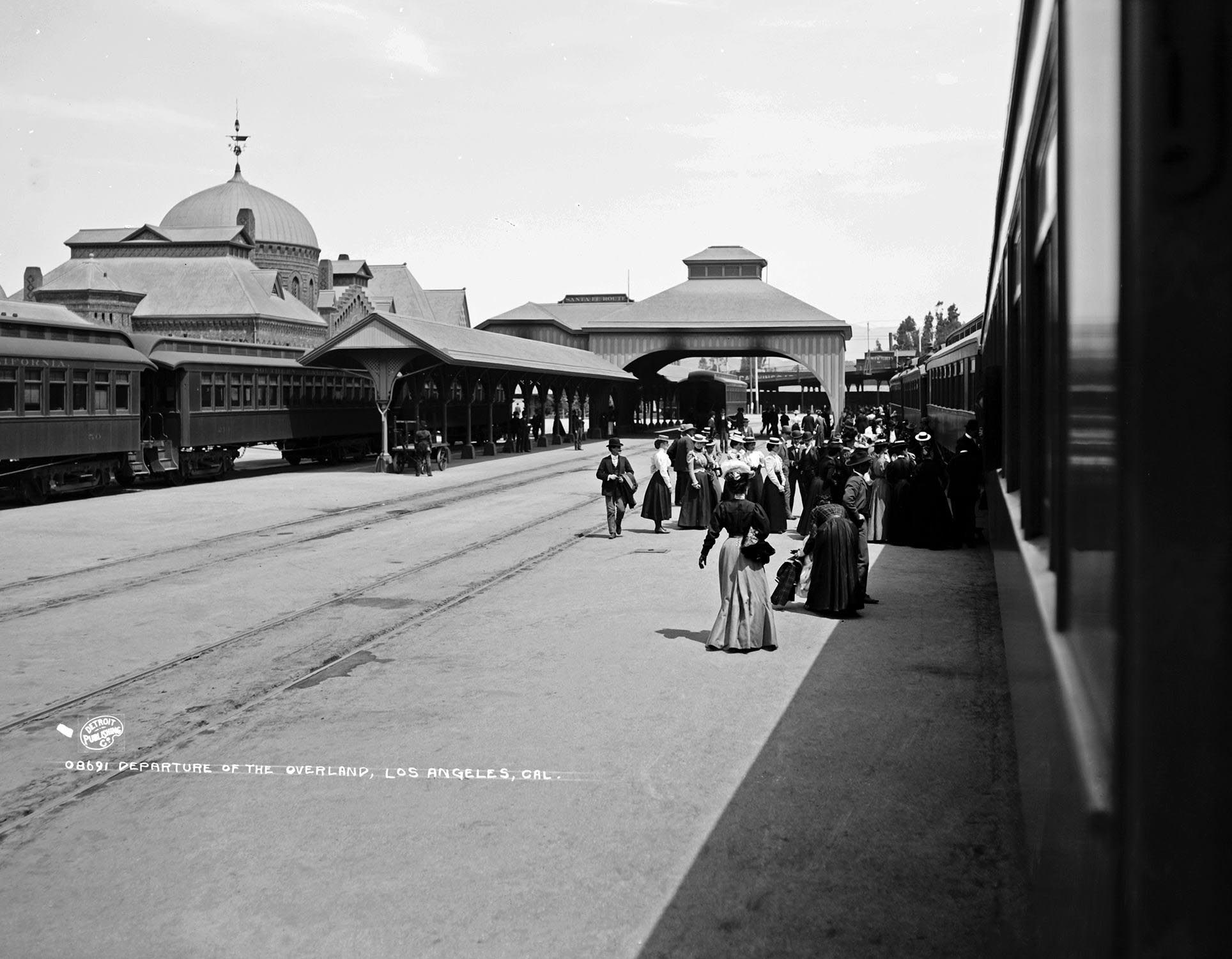
| (1893)++* – View showing passengers lining up to board the Overland Train at Los Angeles' La Grande Station. |
.jpg) |
|
| (1899)++* – Panoramic view showing a train leaving the La Grande Station. Note the tall poll in the background (center-left). It was one of Los Angeles’ first streetlights and was 150 ft. tall. Click HERE to see more in Early LA Streetlights. |
 |
|
| (ca. 1899)### - View of La Grande Station, the Atchison, Topeka and Santa Fe Railway's main railroad station. |
Historical Notes The rusticated brick building is in the Moorish style and features a gazebo like covered entrance that leads under two towers with battlements and into a circular section with a large onion dome. The building has arched stained glass windows, square windows with keystones, dentils, and bands of coursing. There are two wings. One wing has a tower with battlements, a hipped roof with a dormer, topped with a structure with a gabled roof with a pediment, and a small cupola with a dome. The second wing has a hipped roof with a dormer, topped with a structure with a gabled roof with a pediment, and a curved section with arched windows and a high, sloped, curved roof. ### |
 |
|
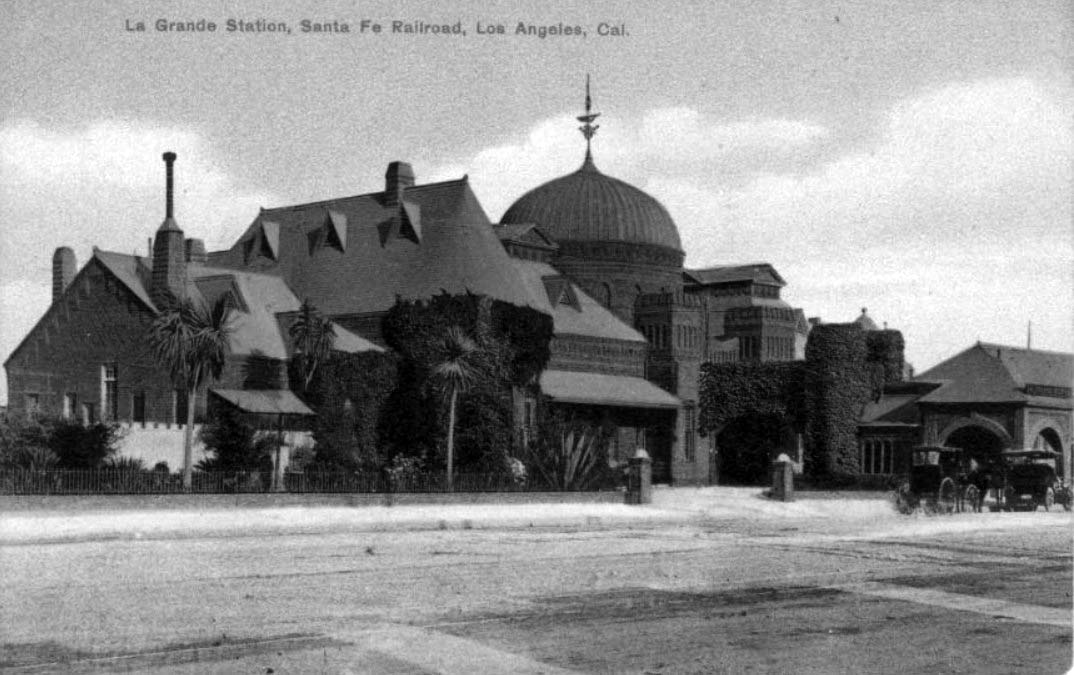
| (1910)^^ – Postcard view of the La Grande Station, Santa Fe Railroad with its beautiful Moorish-style dome. Two early model automobiles are parked in front. |
Historical Notes The Moorish-style depot cost $50,000 when built in 1893 and for 30 years boasted a first-class restaurant called "The Harvey House." ^^ |
 |
|
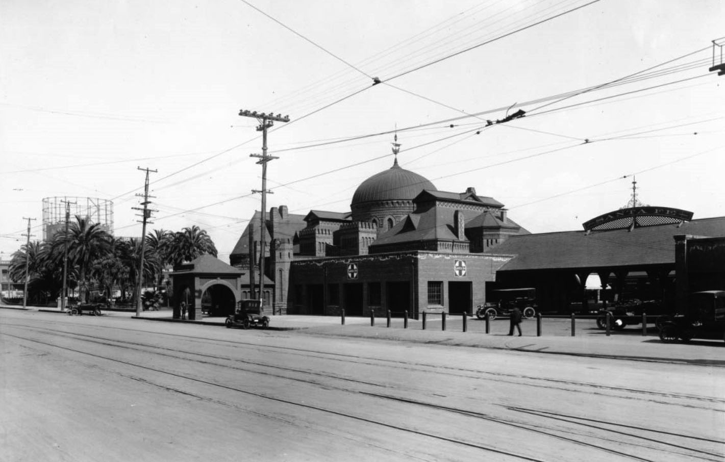
| (ca. 1911)^^ – Panoramic view showing Santa Fe Railway's "La Grande" station. The station has a round dome which comes to a peak with a decorative wind vane on the top. Five automobiles are parked on the adjacent street down which run streetcar rails over which electric lines are visible. A huge gas storage tank (gasometer) is seen in the distance behind a group of palm trees at left. |
 |
|
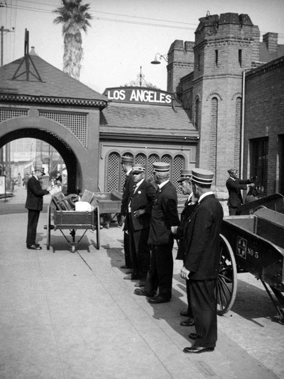
| (ca. 1910s)^.^ - Porters stand in line waiting for the arrival of the next train at the Santa Fe La Grande Station. |
 |
|
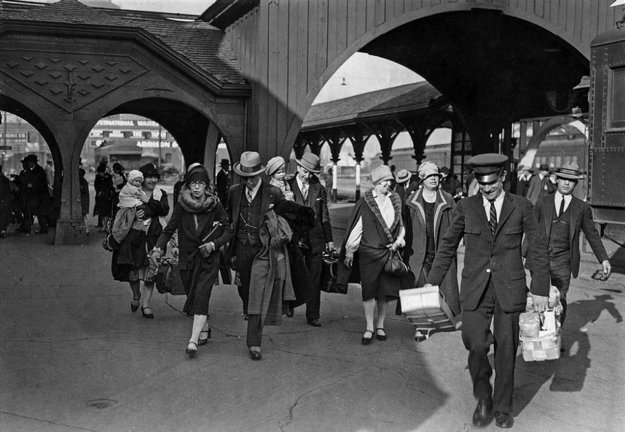
| (ca. 1924)*#*# – A group of passengers after arriving at Santa Fe La Grande Station. |
 |
|
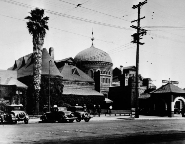
| (Early 1930s)* - Exterior view of the La Grande Station in Los Angeles showing the distinctive Moorish-style dome. Three early model cars are parked perpendicular to the curb. Photo taken prior to the 1933 Long Beach Earthquake. |
Historical Notes Many Hollywood movies were filmed at the stylish station. Laurel and Hardy's film Berth Marks (1929) was one of the first sound movies shot on location. Other movies that used Santa Fe's La Grande Station included Choo Choo 1931 (Our Gang - Little Rascals), Lady Killer, 1933 with James Cagney, Swing Time 1936 (Fred Astaire) and Something to Sing About 1937 (James Cagney).^* |
 |
|
| (1933)* - View of the La Grande station shortly after the 1933 Long Beach earthquake. Note: the Moorish-style dome has been removed because of earthquake damage. |
Historical Notes After the 1933 Long Beach earthquake, the station's dome was removed but the station continued to serve as the Santa Fe terminal until 1939 when Union Station opened.^* |
 |
|
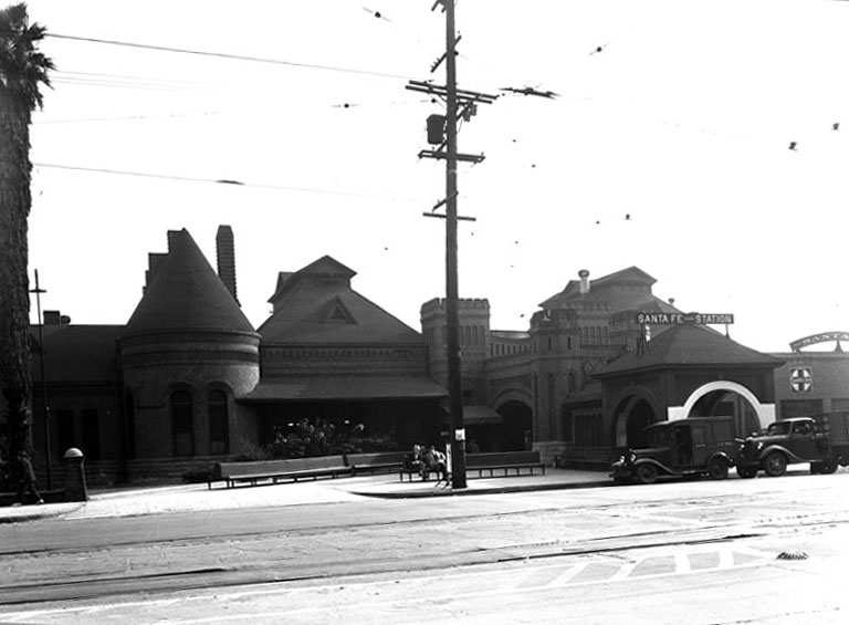
| (1930s)*#*# – Front view of the La Grande Station without its Moorish Dome. Photo taken after the 1933 Long Beach Earthquake. |
Historical Notes La Grande Station was the Santa Fe Railway's main passenger terminal in Los Angeles, until the Long Beach earthquake of 1933. After the earthquake, the station's dome was removed, but the station continued to serve as Santa Fe Railway's LA passenger terminal until the opening of the new LA Union Station on May 7, 1939. When Union Station opened in 1939, Santa Fe moved all of its passenger services there and closed the La Grande station.^^ |
* * * * * |
Bonebrake Residence
 |
|
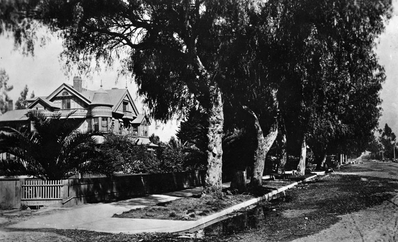
| (ca. 1890s)* - View looking north of a eucalpytus-covered, unpaved Figueroa Street. The residence of Los Angeles banker George H. Bonebrake is visible on the left at 2619 Figueroa St. The cross-street is West Adams. |
Historical Notes Major George H. Bonebrake was President of the Los Angeles National Bank and the State Loan and Trust Company. |
 |
|
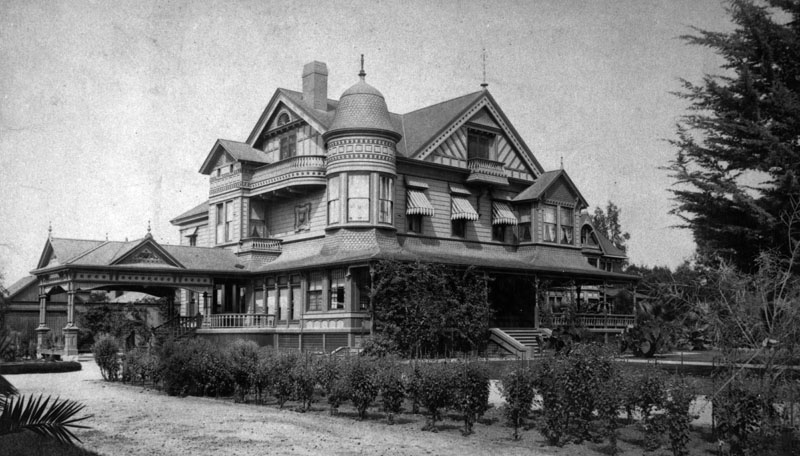
| (1893)* - The Queen Anne style residence of Los Angeles banker George H. Bonebrake located at 2619 Figueroa St. |
Historical Notes George Bonebrake was partners with John Bryson, Sr., the 19th mayor of Los Angeles. Together, they built the Bryson-Bonebrake Block, one of the more important office buildings built during the 1880s Los Angeles building boom. It was a 126-room bank and office building on the northwest corner of Spring and 2nd street. Its cost was projected to be $224,000, a staggering sum at the time. Bonebrake was one of the richest men in the city and could afford making such an investment. He located the main headquarters of his bank in the Bryson-Bonebrake Block. |
 |
|
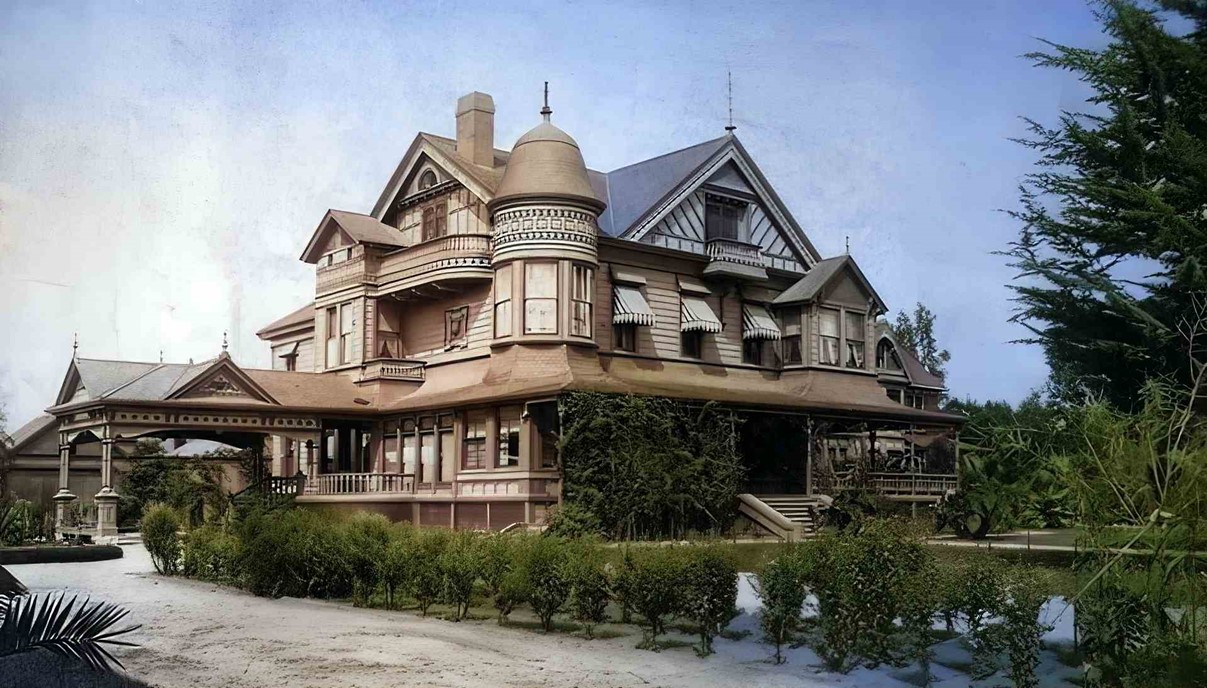
| (ca.1893)* - The Queen Anne style residence of Los Angeles banker George H. Bonebrake located at 2619 Figueroa Street (near the SW corner of Figueroa and Adams). Today this is the site of the Auto Club of Southern California Headquarters. (AI image enhancement and colorization by Richard Holoff) |
 |
|
| (ca. 1893)* - Front view of the Bonebrake residence showing porch and entryway, located at Figueroa St. near Adams. |
Historical Notes Today, the Auto Club building stands on this site. |
* * * * * |
Hildreth Mansion
 |
|
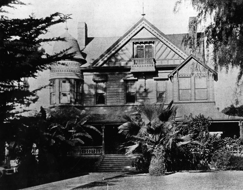
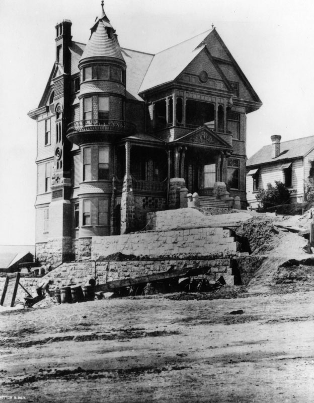
| (ca. 1895)* - - Exterior view of the ornate Hildreth Mansion, located at 357 S. Hope Street, as seen from across the unpaved street. A stone retaining wall is being built and the steps are not yet in place. |
Historical Notes Designed by Joseph C. Newsom and built in 1891 for Rev. Edward T. Hildreth, a Congregational minister. Tthe defining features of the Victorian Shingle style home were an ornate chimney and wrought iron circular balcony on the tower.* |
 |
|
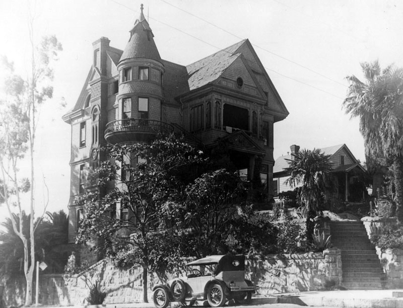
| (ca. 1928)* - View of the ornate Hildreth Mansion, located at 357 S. Hope Street, a seen from the intersection with 4th Street (foreground). |
Historical Notes Located at the northwest corner of the intersection of Hope and 4th streets, the exterior of the elevated house was finished off with a stone retaining wall and steps leading up the entrance. By 1939, the eighteen rooms of the house had been converted into nine residences. Boarders paid between thirteen and thirty-five dollars a month in rent and had lived in the mansion anywhere from one to twelve years. With the exception of the eighty-seven year old resident who was killed in an auto accident in 1940, the boarders of the once stately home lived a quiet existence and dried laundry on the grand wrought iron balcony.*##^ |
 |
|
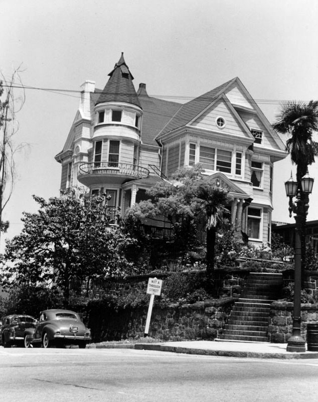
| (1950)* - Exterior of the "Hopecrest," commonly known as the Hildreth Mansion, as seen from across the intersection of Hope and Fourth streets. Numerous stairs lead up to the house, which is surrounded by palms, flowers, shrubs, and trees. |
Historical Notes By 1954, the Hildreth Mansion was but a beautiful memory, destroyed by the CRA's visions of urban renewal. Today, the 5th tallest building in Los Angeles, Bank of America Plaza (formerly Security Pacific Plaza), is located where the Hildreth Mansion once stood.^* |
* * * * * |
St. Angelo Hotel
 |
|
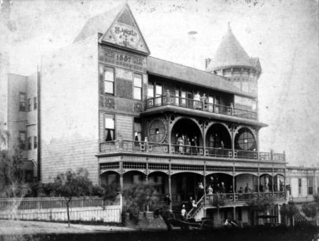
| (ca. 1895)^^* - View of the Hotel St. Angelo with people standing on all three balconies. The hotel was located near the corner of Grand Avenue and Temple Street. |
Historical Notes The St. Angelo Hotel at 237 North Grand Avenue was built during the boom of the 1880s when it was advertised as a European family-and-tourist rooming house. During the next few decades, the hotel and its guests were mentioned in the society pages.*#* |
 |
|
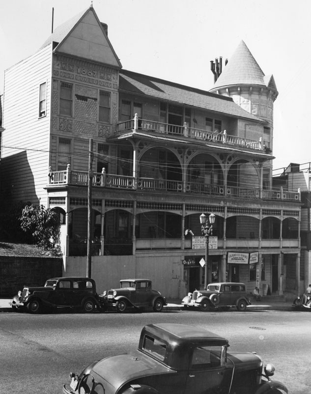
| (1939)* - Exterior of the former St. Angelo Hotel as seen from across the street. A sign over the entrance announces "new management". "Grand Cleaners" occupies one of the lower floor rooms. |
Historical Notes The hotel was a large Victorian structure with three stories, two balconies and a covered porch. A large cylindrical tower with a conical roof is at right, while a rectangular tower is at left. The balconies are held up by arch ways, and several rectangular windows are visible on the side of the building at left.^^* |
 |
|
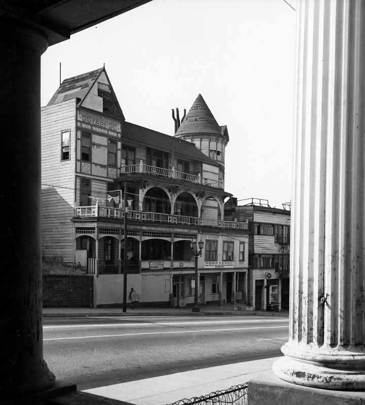
| (1952)^## - View of a man walking in front of the St. Angelo Hotel (Apts.) as seen from across the street. Bulldozers would soon demolish the building along with all its neighboring buildings located on Bunker Hill. |
Historical Notes Despite the hotel's shabby condition, it stood proudly on the Hill until the board of health ordered it vacated in 1956. All traces of the once grand hotel were soon erased and replaced by the Music Center which was dedicated in 1964.*##^ |
 |
|
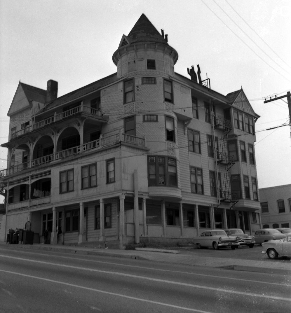
| (1956)^^+ – View showing the old St. Angelo Hotel at 237 N. Grand Avenue, just off of Temple. |
Historical Notes Photo Caption reads: The old St. Angelo Hotel was recently ordered vacated by the Board of Health and soon will be torn down. And so another famous old landmark will live only in the photo files. This would be the location of the Music Center, built in 1964. Click HERE for contemporary view. |
* * * * * |
Bradbury Building
 |
|
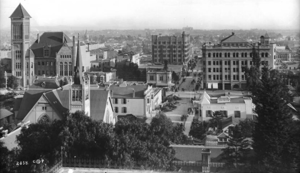
| (1894)* - Panoramic view of downtown Los Angeles, looking east on Third Street from the balcony of the Crocker Mansion. There is a clear view of the intersection of Broadway and Third Street where the Bradbury Building is seen on the southeast corner. On the northwest corner can be seen the excavation for the Irvine Building. City Hall is at upper-left of photo with the cupola of St. Vibiana's Cathedral behind it in the distance. |
 |
|
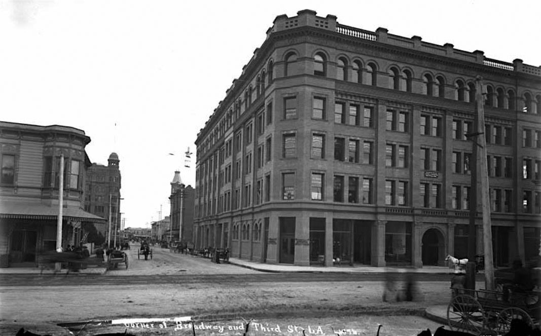
| (1894)* – Street view looking east on 3rd Street at Broadway with the Bradbury Building at right on the southeast corner. Horse-drawn wagons are seen throughout on the unpaved streets. |
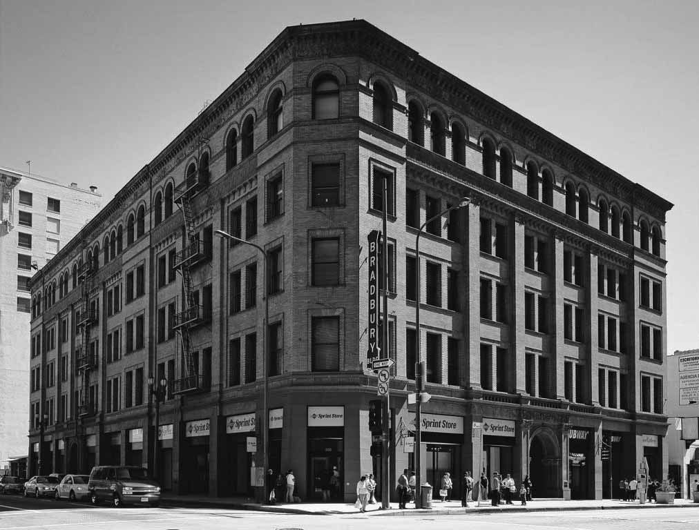
Historical Notes Built in 1893, the Bradbury Building was commissioned by LA mining millionaire Lewis L. Bradbury and designed by local draftsman George Wyman. The building features an Italian Renaissance Revival -style exterior facade of brown brick, sandstone and panels of terra cotta details, in the "commercial Romanesque Revival" that was the current idiom in East Coast American cities.^* |
 |
|
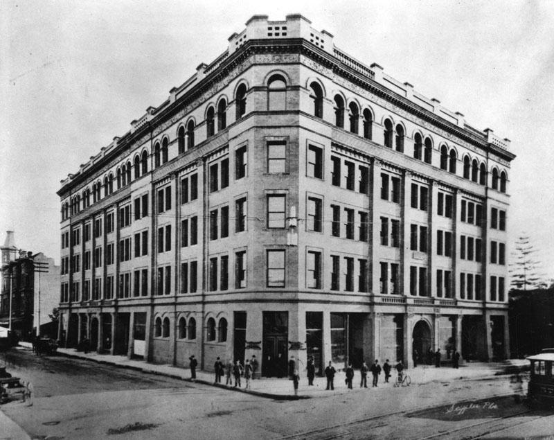
| (ca. 1895)* - Closer view of the Bradbury Building located on the southeast corner of Broadway and 3rd Street with about a dozen men standing in front of the building. Note the streetcar at lower-right. |
 |
|
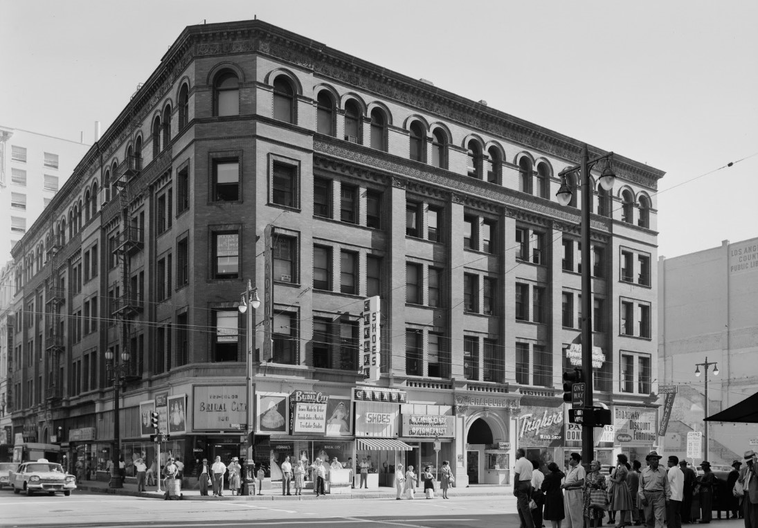
| (1950s)* – View looking at the N/E corner of Broadway and 3rd Street showing the Bradbury Building with the lower level of building covered with signage. Note the roof line has changed slightly from previous photo.. |
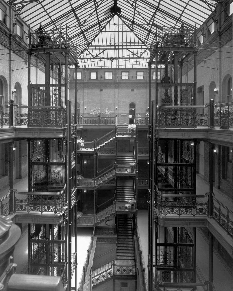
Historical Notes The beautiful Bradbury Building is one of the oldest buildings in downtown. At the time the building was completed, it featured the largest plate-glass windows in Los Angeles. But the magnificence of the building is the interior: reached through the entrance, with its low ceiling and minimal light, it opens into a bright naturally lit great center court.^* |
 |
|
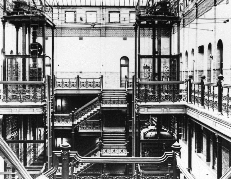
| (1964)^*# - Interior view of the Bradbury Building located at 304 South Broadway. |
Historical Notes The five-story central court features glazed brick, ornamental cast iron, tiling, rich marble, and polished wood, capped by a skylight that allows the court to be flooded with natural rather than artificial light, creating ever-changing shadows and accents during the day. Geometric patterned staircases and wrought-iron railings were used abundantly throughout. The wrought-iron was created in France and displayed at the Chicago World's Fair before being installed in the building. Freestanding mail-chutes also feature ironwork. The walls are made of pale glazed brick. The marble used in the staircase was imported from Belgium, and the floors are Mexican tiles. Cage elevators surrounded by wrought-iron grillwork go up to the fifth floor.^* |
 |
|
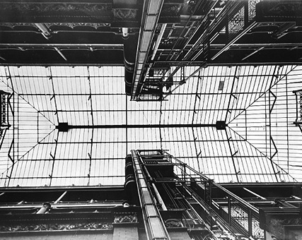
| (n.d.)^*# - View of the intricate framework that makes up the Bradbury Building's skylight. |
 |
|
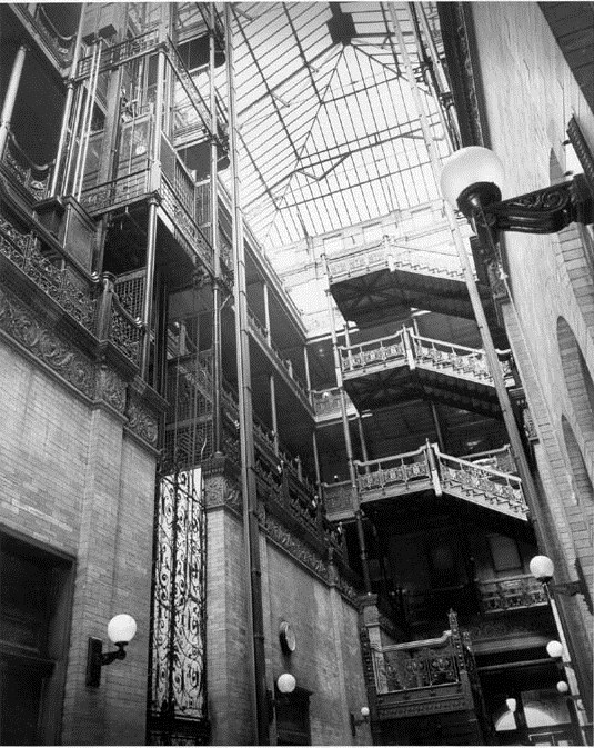
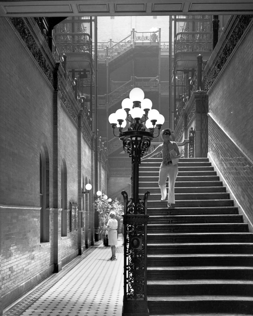
| (ca. 1970)^*# - Profile view of the Bradbury Building's ornate staircase and elevator. |
Historical Notes The Bradbury Building has operated as an office building for most of its history. It was purchased by Ira Yellin in the early 1980s, and remodeled in the 1990s. |
 |
|
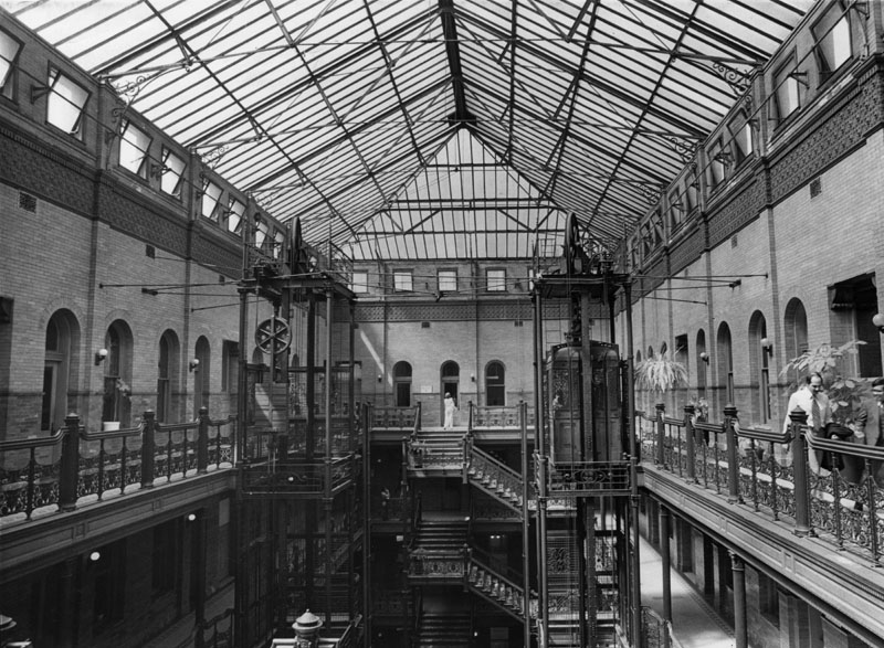
| (1978)* - A view of the interior light court's glass ceiling in the Bradbury Building, 304 South Broadway, as well as the birdcage elevators and iron wrought railings. |
 |
|
| (1970)* – View looking at the magical light-filled Victorian court that rises almost fifty feet with open cage elevators, marble stairs, and ornate iron railings. Photo by Julius Shulman |
Historical Notes In 1962, the Bradbury Building was designated LA Historic-Cultural Monument No. 6 (Click HERE to see the complete listing). In 1977, the building was designated a National Historic Landmark. It also is listed in the U.S. National Register of HIstoric Places.^* |
_2007.jpg) |
|
| (2007)* - Magnificent view looking through the ornate iron railings as seen through the lens of Julius Shulman. |
Historical Notes The building underwent complete restoration in the early 1990s as part of the Yellin Company’s Grand Central Square project. |
 |
|
| (2007)* - A woman is seen descending down the Bradbury Building's ornate staircase. Photo by Julius Shulman |
Historical Notes Today the Bradbury Building serves as headquarters for the Los Angeles Police Department's Internal Affairs division and other government agencies. Several of the offices are rented out to private concerns, including Red Line Tours.^* |
 |
|
| (2005)^ - View of the Bradbury Building as it appeared in 2005. Photo by Carol M. Highsmith |
Historical Notes The building is featured prominently as the setting in films, television, and literature (Click HERE to see detailed listing) particularly in the science fiction genre. Most notably, the building is the setting for both the climactic rooftop scene of Blade Runner (1982), as well as the set of the character J. F. Sebastian's apartment in which much of the film's story unfolds.^* |
Then and Now
 |
|
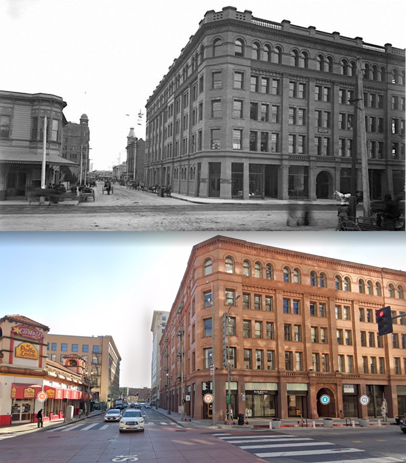
| (1894 vs. 2022)* – Looking east on 3rd Street at Broadway showing the iconic Bradbury Building on the SE corner with El Pollo Loco and Carl’s Jr. across the street on the NE corner. |
* * * * * |
Irvine-Byrne Building
 |
|
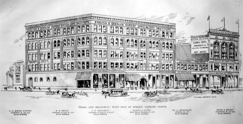
| (1895)* - An architectural drawing of the Irvine Block, located on the northwest corner of 3rd Street and Broadway. The names of various tenants in the building have been printed in the picture at different floor levels. The building stood kitty-corner from the Bradbury Building (S/E corner). |
Historical Notes Still standing today, the Irvine-Byrne building is the second oldest building in downtown Los Angeles, right behind the Bradbury Building (1893) which sits across the street. The five-story Beaux Arts style building was designed by Los Angeles architect Sumner Hunt and built in 1895 for Margaret Irvine of Irvine Ranch fame. Originally called the Irvine Block it was built as an office building and, when it was built, was only the second office building in the area.^* |
 |
|
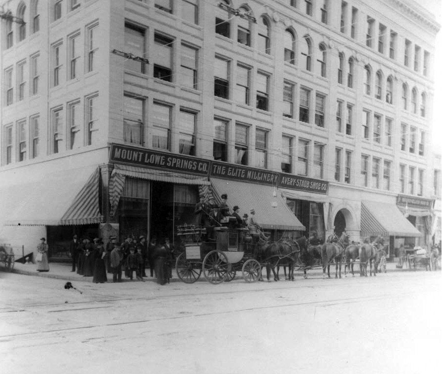
| (1890s)+++ – View showing a Tally Ho coach and group of people gathering in front of the Irvine-Byrne Building, home of the Mount Lowe Springs Co., a Thaddeus Lowe-owned water company. Tally Ho service took passengers to Mount Lowe Railway in the San Gabriel Mountains, north of Pasadena. Click HERE to see Early Views of Mt. Lowe Railway. |
Historical Notes In 1905, James W. Byrne bought the building and the name changed to the Irvine-Byrne Building. In 1911, Byrne hired San Francisco architect Willis Polk to repair the building. At some point in the next thirty years it changed hands and by World War Two, it was the home of the Mexican consulate.^* |
 |
|
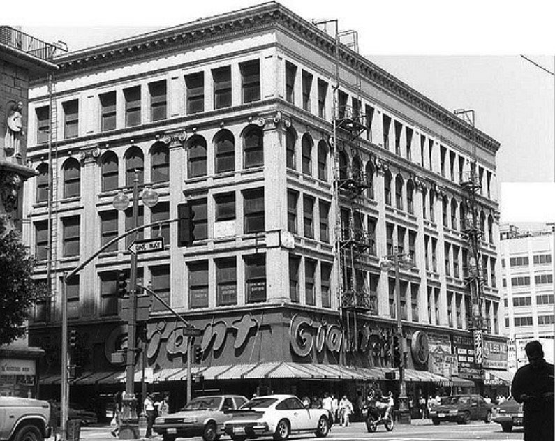
| (2010)++# – View showing the Irvine-Byrne Building at 249 South Broadway the Giant Penny store occupying the ground floor. |
Historical Notes In the 1980's, the ground floor was taken over by a Giant Penny discount store. This store remained on the premises until Urban Pacific Builders bought the building in 2004.^* In 1991 the Irvine-Byrne Building was dedicated LA Historic-Cultural Monument No. 554. |
 |
|
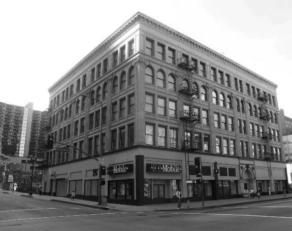
| (2013)^* – View showing the Irvine-Byrne Building, now the Pan American Lofts. |
Historical Notes In 2004 the new owners, Urban Pacific, hired Donald Barany Architects to convert the building to condominiums, which they completed before the end of the year. After the $20 million renovation, the Irvine-Byrne Building is now home to the Pan American Lofts.^* |
* * * * * |
Lankershim Building
| (1890s)* - View showing the dome-turreted Lankershim Building (built in 1887), located on the southeast corner of 3rd and Spring Streets. |
| (ca. 1900)^^* – View looking southeast showing the Lankershim Building at the intersection of 3rd and Spring streets. Two additional stories have been added to the building and the original dome turret is now gone. The markets on the first floor have large striped awnings that extend almost to the end of the sidewalks. A horse-drawn carriage can be seen passing through while two other carriages are parked along the curb. The sidewalks are bustling with pedestrian traffic. |
| (ca. 1907)^^* – View looking north on Spring Street from below Third Street. The Lankershim Building (1887-1990s) is at right on the S/E corner of 3rd and Spring. The Simpson Building (1893-1963) is on the N/E corner, the Ramona Hotel (1886-1912) is on the S/W corner, and the Douglas Building (built in 1898) is on the N/W corner. |
Historical Notes The Douglas Building is the only structure in the original view that has survived into the 21st century. The Hotel Ramona was torn down in 1912 to make way for the 13-story Washington Building which still stands today. The Stimson Building, considered by some to be the city’s first skyscraper, was damaged by fire in 1962 and demolished the following year, replaced by a parking lot. The Lankershim Building, later renamed the Title Insurance Building, seems to have been demolished around the same time. Its former footprint is now part of the Ronald Reagan State Office Building complex. #^*# |
* * * * * |
Governor Pio Pico's Office
 |
|
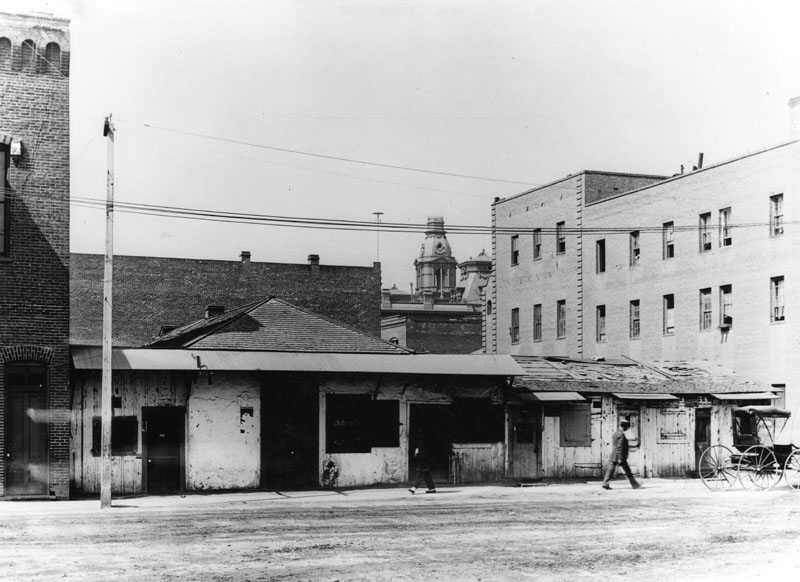
| (1895)* - View of Governor Pio Pico's office, located on the south side of Repbulic Street across from the LA Plaza. To the left is the Old Firehouse. To the right, across Sanchez Street, is the Pico House. In the distance can be seen the towers of Baker Block. |
Hisorical Notes The above building was the office of governor Pio Pico and last California capital of Mexico. Pío de Jesús Pico was the last Governor of Alta California (now the State of California) under Mexican rule. Pico spent most of his adult life in Los Angeles where he helped to transform a remote pueblo into a major world metropolis. After a brief stint as governor in 1831, he became administrator of Mission San Luis Rey. In 1834 he married María Ignacia Alvarado, a member of a respected Los Angeles family. In 1845, he led a popular coup against Governor Micheltorena, resulting in his rise to the governorship, a post that lasted until the arrival of invading United States forces in 1846.+# |
 |
|
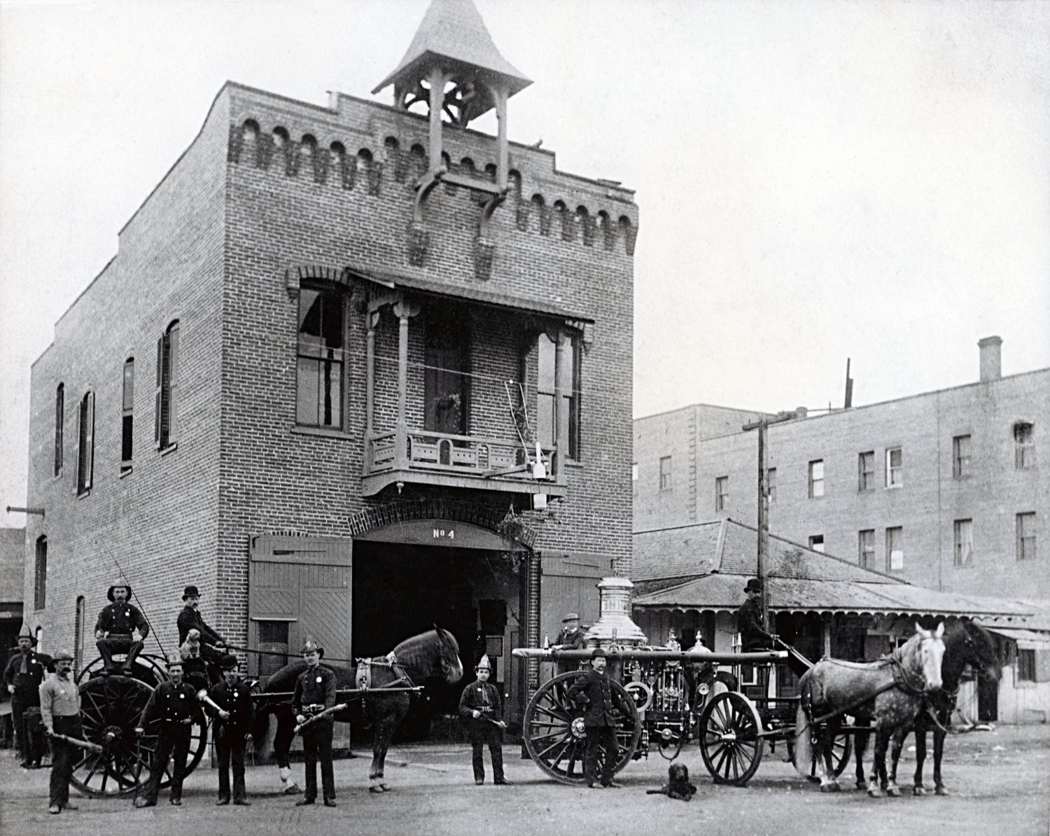
| (ca. 1884)* - View showing Los Angeles' first fire staion and Governor Pio Pico's Office Building. The Pico House is to the far right. |
Historical Notes In 1821 Pico set up a tanning hut and dram shop in Los Angeles, selling drinks for two Spanish bits (US 25 cents). His businesses soon became a significant source of his income. |
 |
|
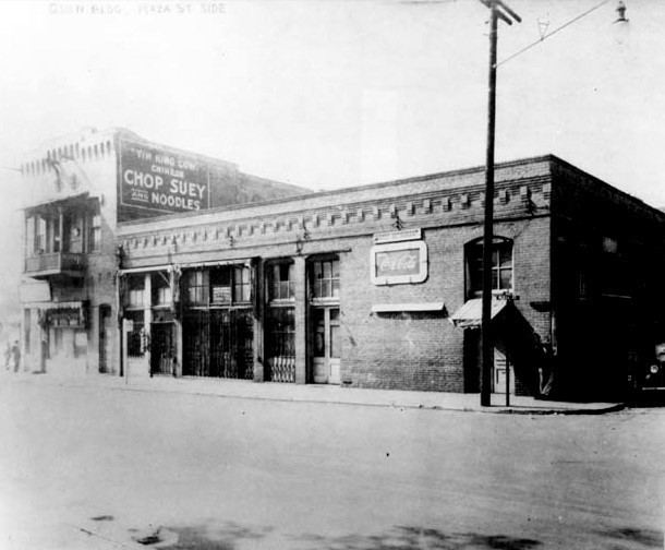
| (1920s)* - View showing the El Pueblo Hellman/Quon Building on the southeast corner of Republic and Sanchez streets on the site once occupied by Governor Pio Pico. |
Historical Notes The Hellman/Quon building is named for its two long-time owners, a white European builder and a Chinese businessman. When Hellman, the original owner, died in 1920, the building was sold to Quon How Shing, who helped fellow Chinese learn English and taught them how to adapt to American society. The building had a hidden bell to alert occupants to the presence of unwelcome visitors who might take issue with the gambling and opium smoking within. It is now the offices of Las Angelitas del Pueblo, the volunteer organization that offers free tours of El Pueblo de Los Angeles, and El Pueblo Education Center.++ |
* * * * * |
Jennette Block
 |
|
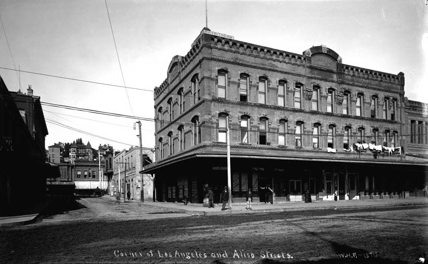
| (ca. 1895)^## - Looking west on Arcadia Street from Los Angeles Street with Fort Moore Hill in the background. The three story Jennette building is on the northwest corner of Arcadia and Los Angeles Streets with Sanchez Alley running directly behind it up to the Plaza at Republic Street. Photo is misidentified. Aliso Street did not extend beyond Los Angeles Street. This is looking up Arcadia Street. |
 |
|
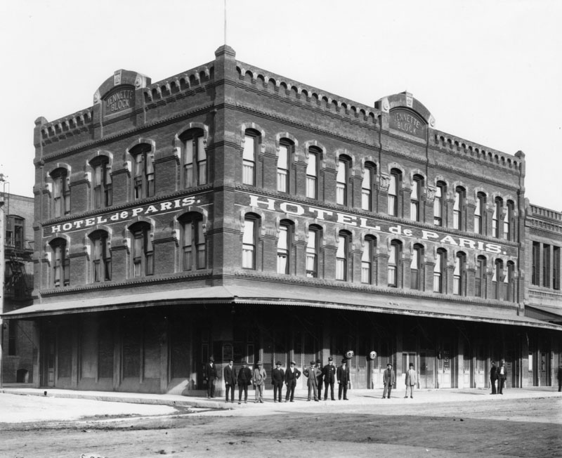
| (ca. 1890s)* - Several men, including a police officer, pose in front of the Jennette Block, which was built circa 1888. The building houses the Hotel de Paris. |
 |
|
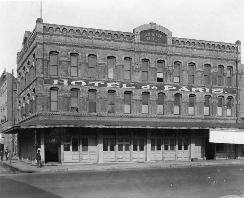
| (ca. 1920)* - Exterior view of the Jennette Block on the northwest corner of Los Angeles and Arcadia Streets, with the Hotel de Paris on the second floor. |
 |
|
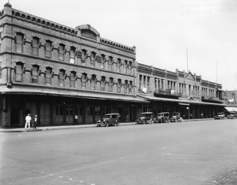
| (ca. 1925)* - On the left is the Jennette Block on the northwest corner of Arcadia and Los Angeles Streets, and on the right is the Garnier Building at 415 North Los Angeles Street. |
Historical Notes The construction of the #101 Freeway took away the Jennette Block and left the Garnier Building. The Jennette Block was built circa 1888 and the Garnier Building in 1890.* |
* * * * * |
Mason Building
 |
|
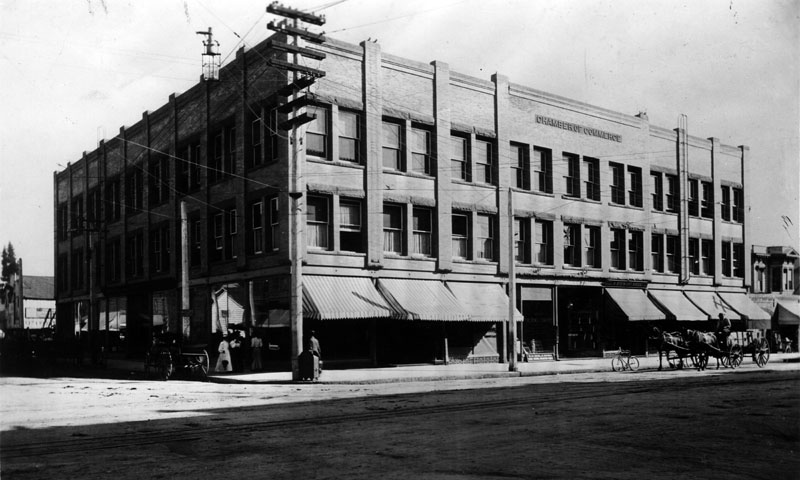
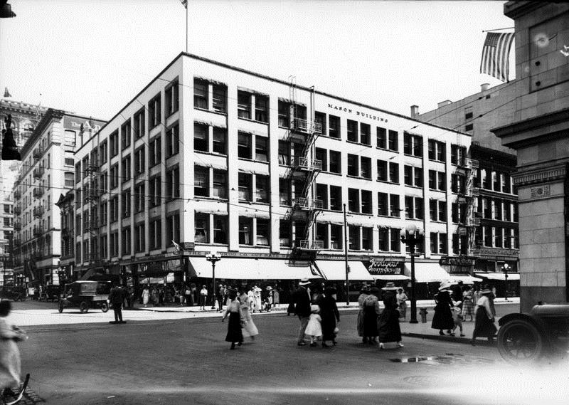
| (1895)* - Early view of the Mason Building, which broke ground in 1893 and opened in 1894. The building, owned by George Mason, was home to the Chamber of Commerce from 1894 to 1906, and boasted a frontage of 45 feet on Broadway, 275 feet on Fourth Street, and 74 feet on Lafayette Street. |
Historical Notes In 1894 LA Chamber of Commerce moved into its new quarters at the southeast corner of Broadway and 4th, in a building designed especially for its use, the then-new three-story Mason Building - which would serve as its home for twelve years. In 1906, it moved into the Southwest Building, located at 130 S. Broadway, and stayed there until January 31, 1925. In 1925 it moved to its brand new building at 1151 S. Broadway and 12th Street. It now makes its home at 350 S. Bixel and 6th streets. |
 |
|
| (ca. 1916)* - View of the Mason Building at southeast corner of 4th and Broadway. The building would have two floors be added to it (see previous photo), be used as a Broadway Dept. Store, and later be abandoned. |
* * * * * |
Van Nuys Hotel (later Barclay Hotel)
 |
|
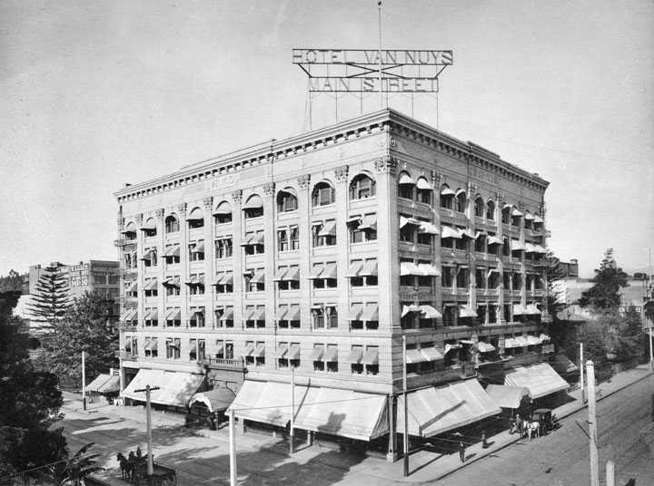
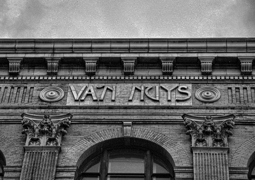
| (1897)* - A view of two sides of the Van Nuys Hotel building, located at 103 W. Fourth St (N/W corner of Main and 4th Streets), as a horse and carriage stand in front of the Main Street entrance. The awnings on the ground floor and the entrances are all extended for cooling, as well as the awnings on most of the individual rooms above. |
Historical Notes The Van Nuys Hotel was designed in 1895 by Octavius Morgan and J. A. Walls in a Beaux-Arts style for Isaac Newton Van Nuys. The view above shows the hotel’s large rooftop sign, which lured customers from railroad stations to the east. |
 |
|
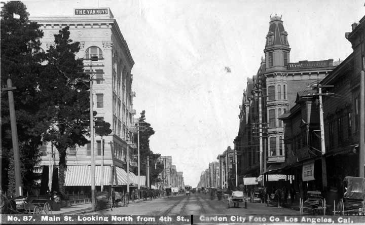
| (ca. 1898)^*# - View looking north on Main Street at 4th Street where the Van Nuys Hotel stands on the N/W corner. Across the street, on the N/E corner, is the Westminster Hotel. On the left (S/W corner) is the Hellman Residence which became the future site of the Farmers and Merchants Bank (built in 1905). |
Historical Notes The hotel was a commercial investment by Isaac Newton Van Nuys, one of Los Angeles’ wealthiest businessmen and landowners.* |
 |
|
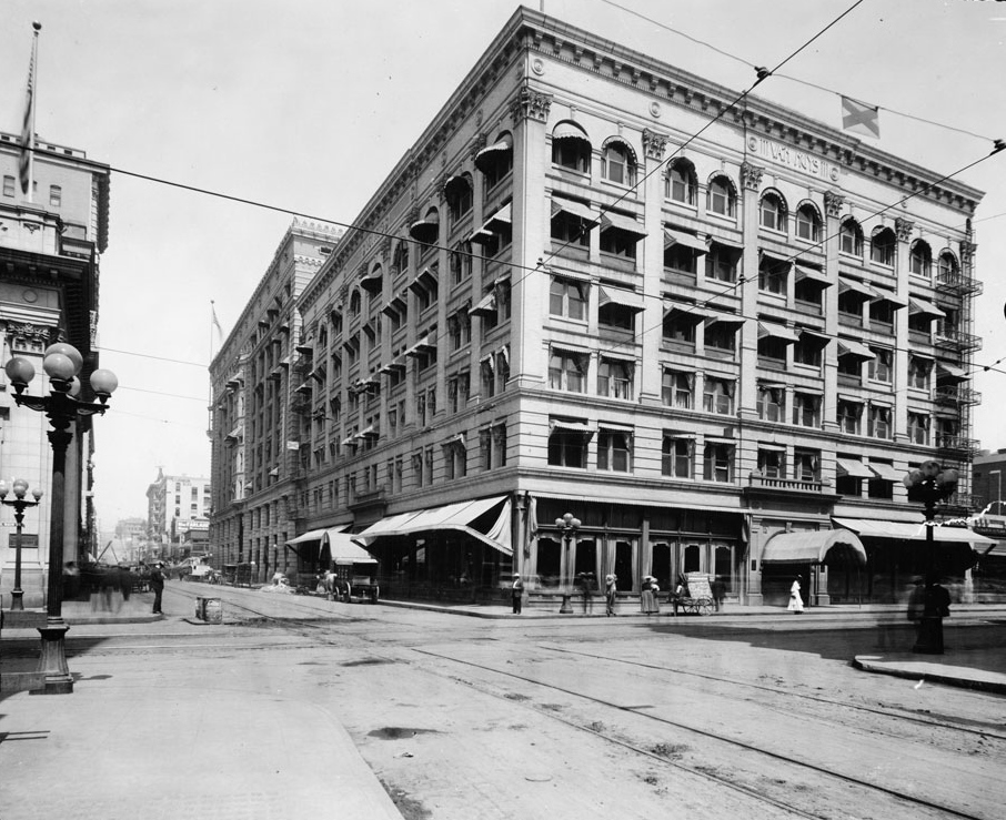
| (1905)^^* - View looking west on 4th Street at Main Street where the Van Nuys Hotel Building (later the Barclay) is seen on the northwest corner. Across the street, on the southwest corner, can be seen part of the Farmers and Merchants Bank Building. Both buildings are still standing. Click HERE to see contemporary view. |
Historical Notes When it opened in 1897, the Van Nuys was one of the finest hotels in Los Angeles. It was the first hotel to provide telephone and electric service to every room. There were thirty-two rooms on each floor with sixty private baths and ten public baths. It is the oldest hotel in continuous operation in Los Angeles.* |
 |
|
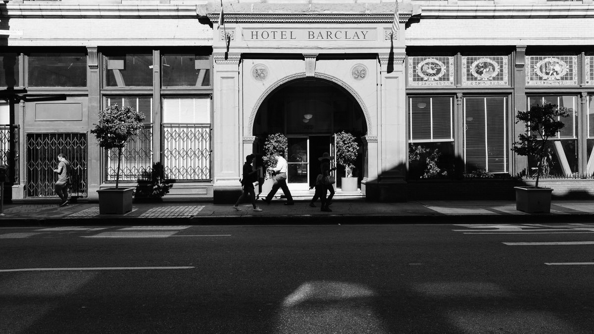
| (2016)** - Façade of the hotel facing Main Street, displaying original name, The Van Nuys Hotel. Photo courtesy of J. M. Moore |
Historical Notes Designed by the firm of Morgan and Walls, the six-story Beaux Arts-style building with Romanesque features has a ground floor with large picture windows and art-glass transoms above the lobby windows on 4th Street. The second floor exterior is of terra cotta scored to mimic blocks of stone, while the upper stories are sheathed in cream-colored pressed brick. Pilasters with Corinthian capitals rise from the second to the sixth floor, separating banks of paired windows. The building is capped by a modest cornice, under which is a plain band ornamented only with rondelles above each pier, and the building’s name, “The Van Nuys” in the center on the 4th Street and Main Street elevations.* |
 |
|
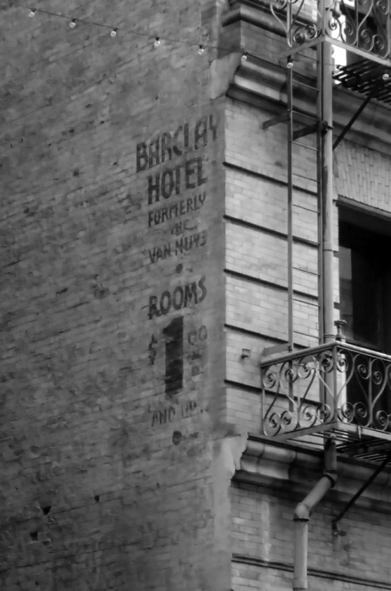
| (2016)^.^ - The Van Nuys was renamed the Barclay in 1929. At this time it was turned into cheap lodging. Because it refers to the previous name the sign must have been painted close to this time. |
Historical Notes Consolidated Hotels, Inc., leased the hotel in 1929, renamed it to Barclay, and renovated it to include a high-speed elevator and a remodeled lobby. |
 |
|
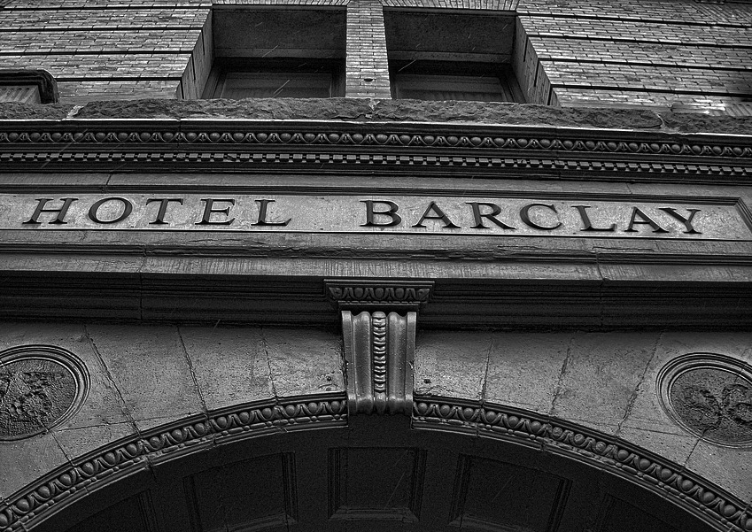
| (2016)** – Close-up view showing the sign above the main entrance on 4th Street. Photo courtesy of J. M. Moore |
Historical Notes The 4th Street lobby still retains many original elements, including Sullivanesque plasterwork, ceiling decorations, columns, and arched doorways. The stained glass windows in the lobby feature old-fashioned scenes of banqueting, fine ladies, and music. One panel has a crest with the initials “V. N.” held up by sea horses.* |
 |
|
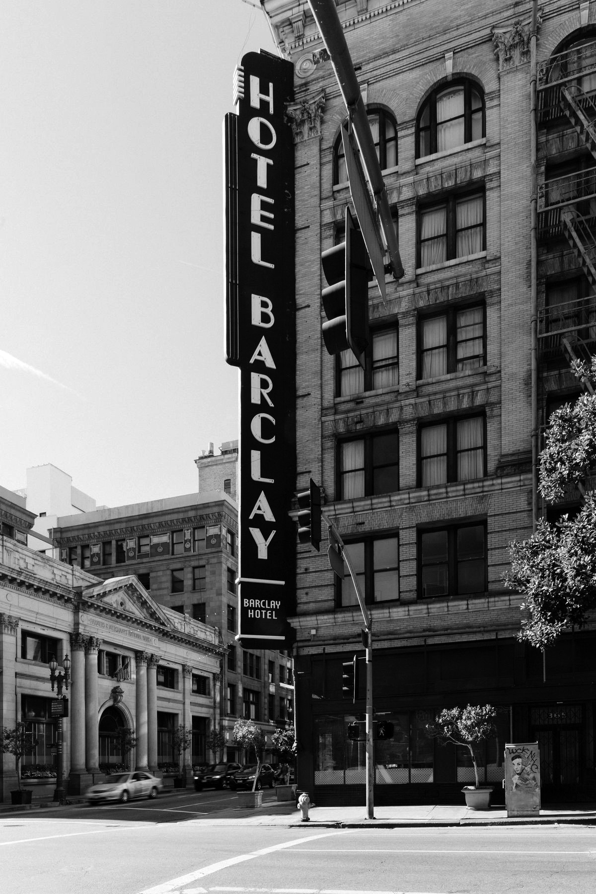
| (2017)^^ – Corner view of the Barclay Hotel standing tall on the NW corner 4th and Main streets. The Farmers and Merchants National Bank Building can be seen across the street (SW corner). |
Historical Notes A city landmark, the Barclay houses low-income tenants as the neighborhood gentrifies around it. The Barclay was granted Historic-Cultural Monument status by the city in 1985, but it continues its life of quiet oblivion. It is still a low-income residence and seems to be stubbornly resisting the gentrification that is going on all around. |
 |
|
| (2017)^^ – Street view showing the 4th Street main entrance to the Barclay Hotel. Address: 103 W. 4th Street |
Historical Notes In 2017, LA’s landmark Barclay Hotel was sold to Golden Hills Properties, a company owned by Michael Delijani. Delijani is the son of Downtown real estate investor Ezat Delijani, who bought four of Broadway’s historic theaters—the Los Angeles, the Palace, the State, and the Tower—to prevent their further ruin and, in some cases, threatened demolition.^^ |
 |
|
| (2022)* – The old with the new – profile view of the Barclay Hotel looking west on 4th Street at Main Street with the Two California Plaza skyscraper in the background. Photo by Carlos G. Lucero |
* * * * * |
Hotel Baltimore
 |
|
| (ca. 1896)* - View of the original Hotel Baltimore located on the northeast corner of Seventh and Olive streets. |
Historical Notes Hotel Baltimore was owned by mining magnate John Brockman. The hotel was purchased by the Los Angeles Athletic Club for $450,000 in 1907 and was demolished for the construction of the club’s new headquarters. The new Baltimore Hotel was built in 1910 on the southwest corner of Fifth and Los Angeles streets.*#* |
* * * * * |
First Congregational Church (Oldest Continuous Protestant Church in Los Angeles)
.jpg) |
|
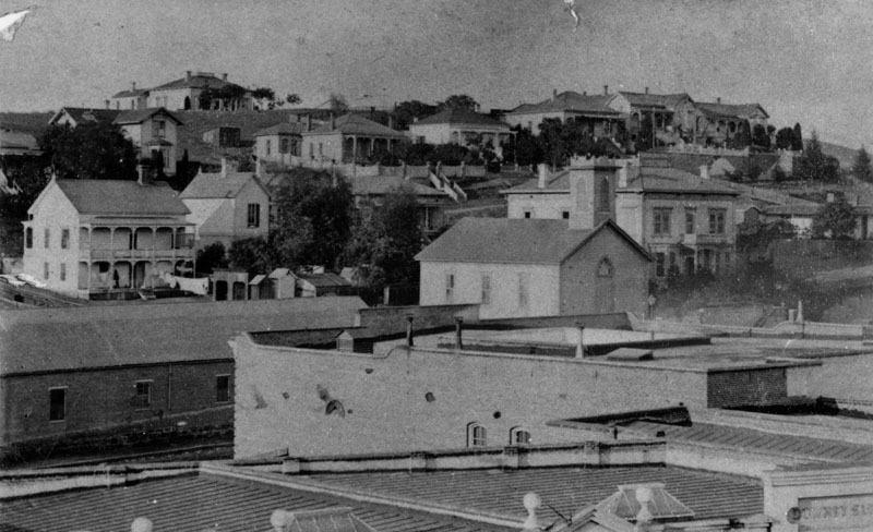
| (ca. 1869)^^* - Left panel of a panoramic photograph/sketch of downtown Los Angeles taken from Bunker Hill with each property annotated and listed at top. The photographer, S. A. Rendall, can be seen standing in his own photo (#14). The First Congregational Church can be seen at left (#6). It was located on New High Street (#18) about a block north of Temple Street (#10). |
Historical Notes The First Congregational Church was dedicated on June 26, 1868 by the Rev. Alexander Parker and was used until 1883. |
.jpg) |
|
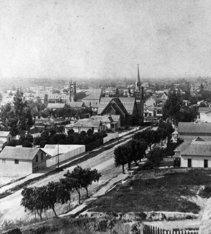
| (ca. 1875)* – Close-up view showing the First Congregational Church, the oldest continuous Protestant church in Los Angeles. It was located at New High (later Spring St), north of Temple St. |
 |
|
| (1880)* - View showing the First Congregational Church, now with steeple, located on New High Street (later Spring Street), north of Temple Street. Behind the Church and to the right is the Kimball Mansion, where Helen Hunt Jackson stayed. |
.jpg) |
|
| (1880)* - Another view of the First Congregational Church with the Kimball Mansion behind it. Wagons and horses can be seen in the foreground next to a barn. |
Historical Notes In 1883, after outgrowing the small New HIgh Street church, a new building was constructed at 3rd & Hill streets.* |
First Congregational Church (2nd Location)
 |
|
| (ca. 1883)^ - View looking south on Hill Street from 2nd Street. The First Congregational Church is seen on the northeast corner of Hill and 3rd streets. |
Historical Notes The 2nd First Congregation Church was dedicated on May 15, 1883, cost $15,000 to build and furnish. The structure includes numerous gables in which there are Sunday school rooms, a pastor's study, and a library. The auditorium, with 25 stained glass windows, seats 425.* |
 |
|
| (ca. 1885)* - View of Bunker Hill, looking west from 3rd and Hill streets. On the right is the First Congregational Church, built in 1883. It later became the Central Baptist Church and then the Unitarian Church. The Crocker Mansion is seen in the background. |
 |
|
| (ca. 1885)* - Close-up view showing the First Congregational Church of Los Angeles, located on the northeast corner 3rd and Hill streets, seen here unpaved. |
 |
|
| (ca. 1895)* - View looking at the NE corner of 3rd and Hill streets showing the First Congregational Church building, as of 1892 occupied by the Church of the Unity. |
Historical Notes The building served as the First Congregational Church until 1888, when it was sold for $30,000 to Central Baptist Church and was later sold to the Church of the Unity in 1892. |
 |
|
| (1895)* - Closer view of the Church of the Unity (previously 2nd home of the First Congregational Church of Los Angeles). The sign mounted to the post in the center of the image reads, "Take cars here (pointing to the right) for Santa Fe Station." |
Historical Notes In 1888, the First Congregational Church building was sold to the Central Baptist Church and was later sold to the Church of the Unity in 1892. The First Ccongregational Church congregation moved to a new location (it's 3rd) on the corner of Hill and 6th streets. |
First Congregational Church (3rd Location)
 |
|
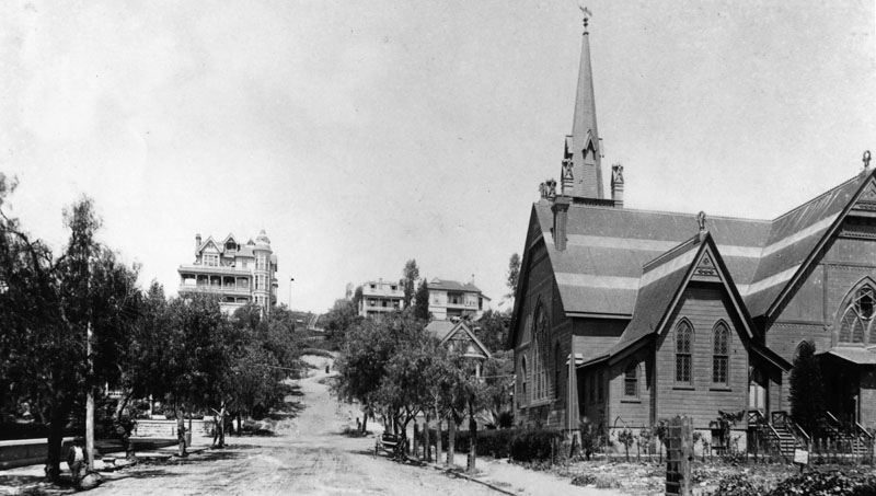
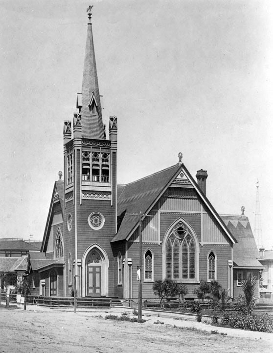
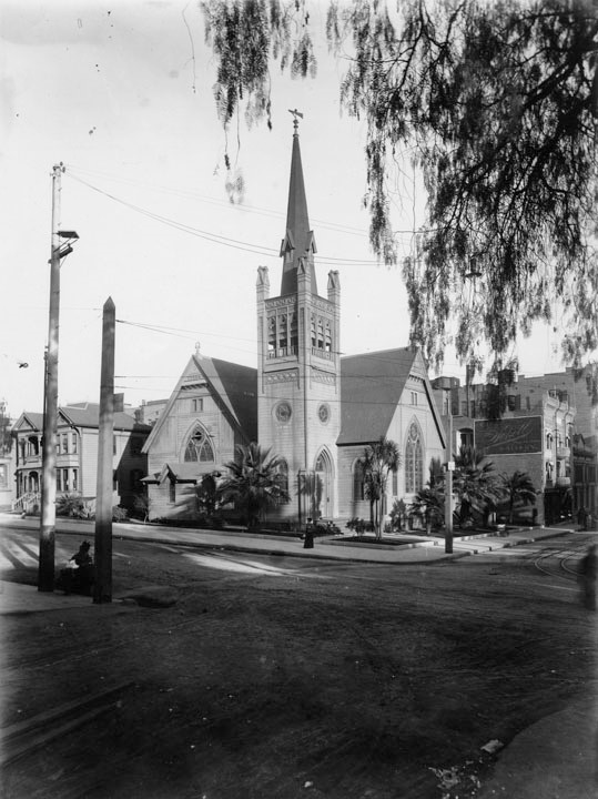
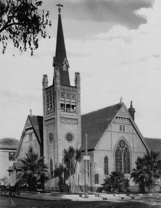
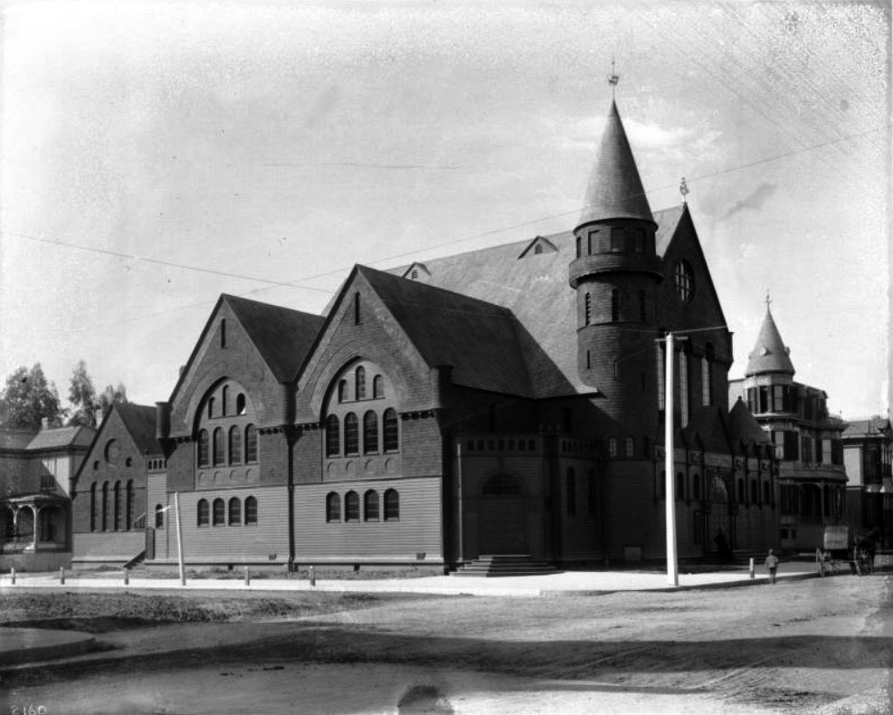
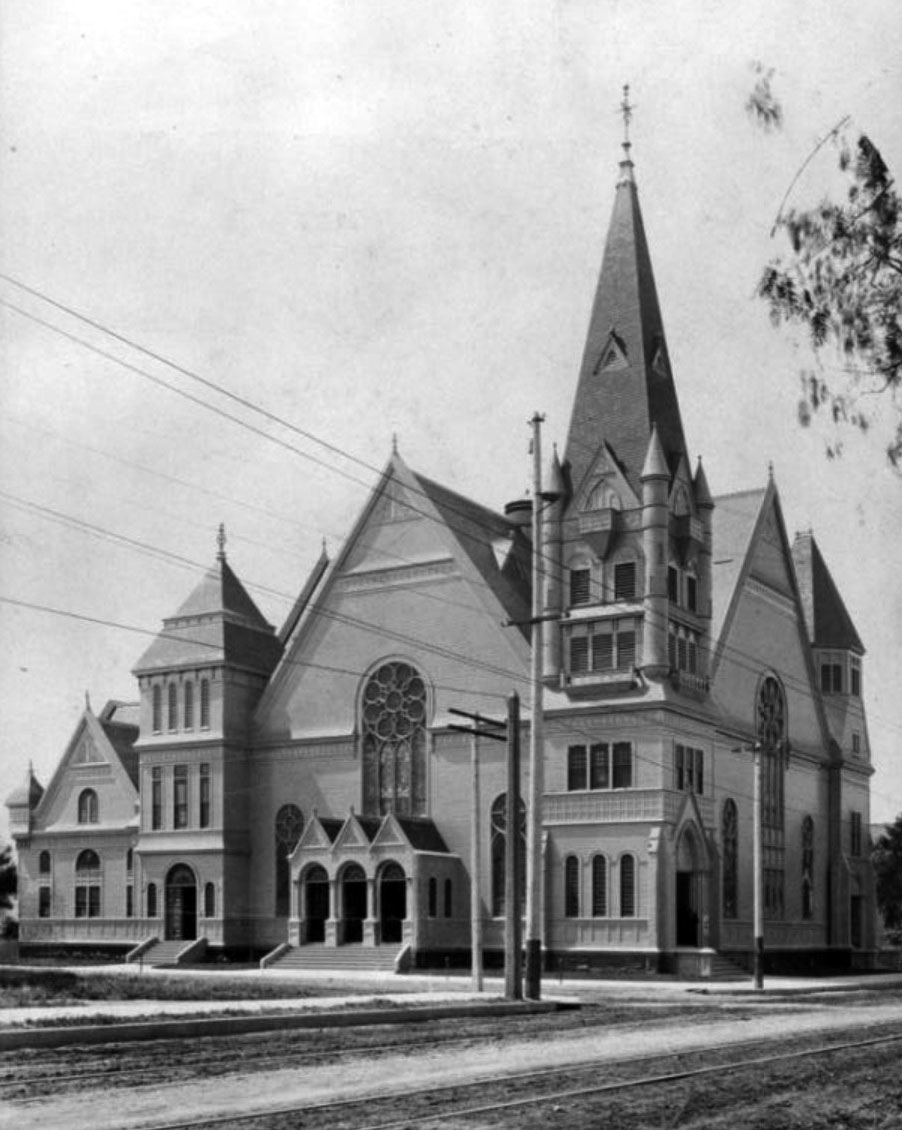
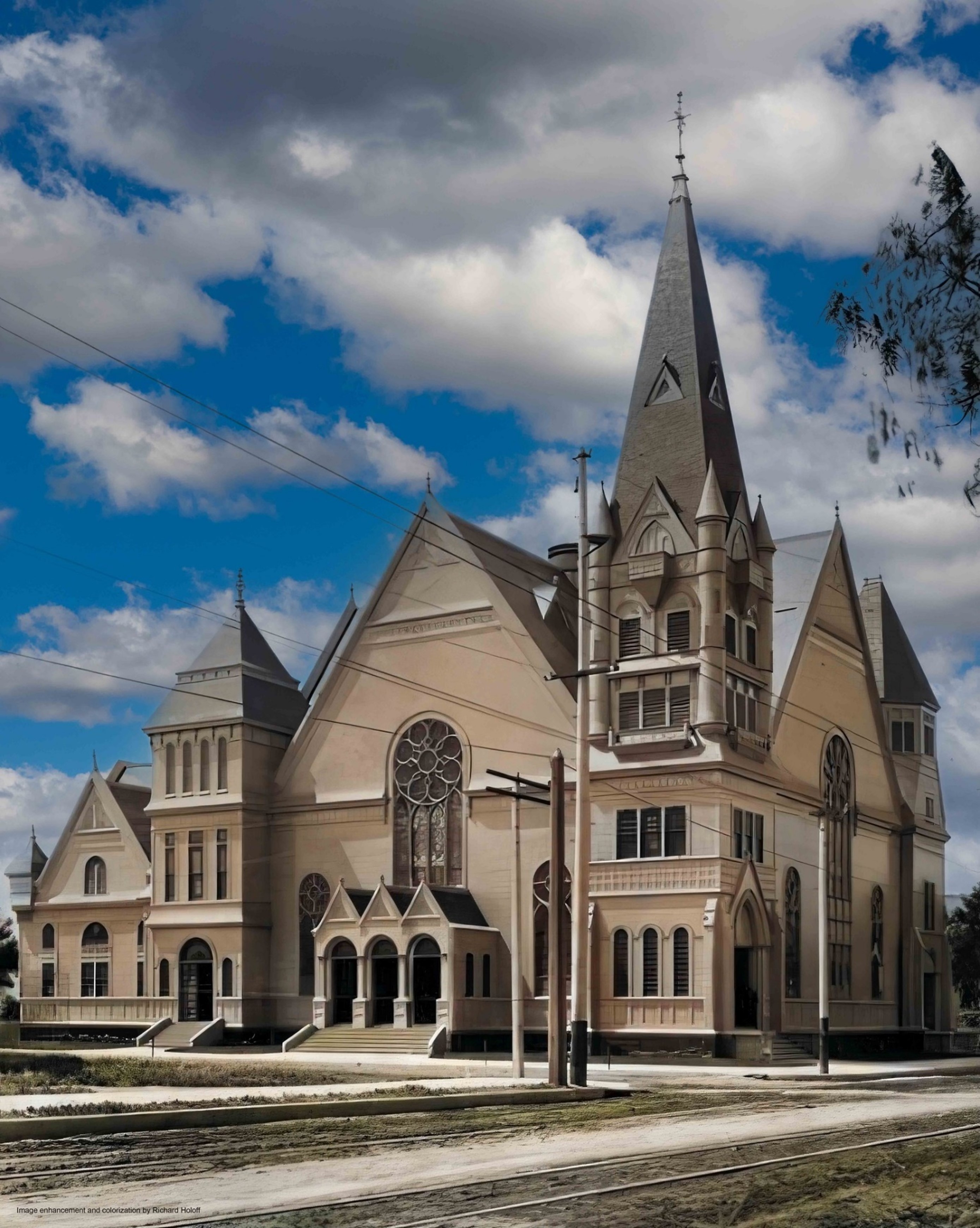
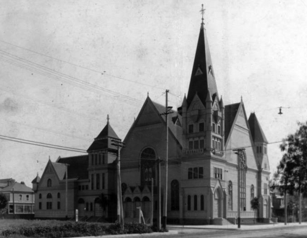
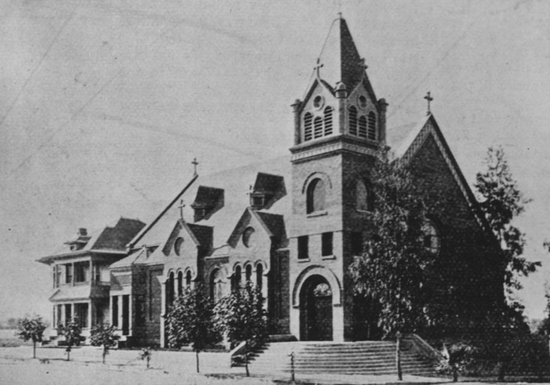
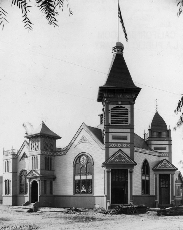
| (ca. 1900)^^* – View showing the First Congregational Church on the southwest corner of Hill Street and Sixth Street. The wood and brick structure has three roof peaks along the side of the main structure. Under each peak are rows of arched windows. A circular stained-glass window is directly under the eave of the shortest peak. A round tower with pointed turret on top is attached to the right side of the main structure. A horse and carriage is parked in front at right with a boy seen behind it. |
Historical Notes In 1902 the First Congregational Church would move to its 4th location, 841 S. Hope Street. |
First Congregational Church (4th Location)
 |
|
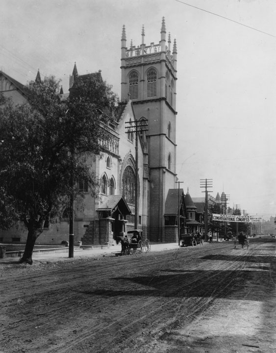
| (1906)* - View looking north on Hope Street showing the fourth building of the First Congregational Church at 841 South Hope Street. A banner hanging over an unpaved Hope Street reads, "Pacific Coast Congregational Congress May 16-23, 1906." |
Historical Notes Built in 1902, this Gothic Revival building was designed by Howard, Train & Williams, and cost approximately $50,000 to build. |
 |
|
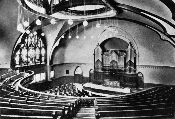
| (Early 1900s)* - Interior view of the fourth building of the First Congregational Church, located at 841 South Hope Street. |
 |
|
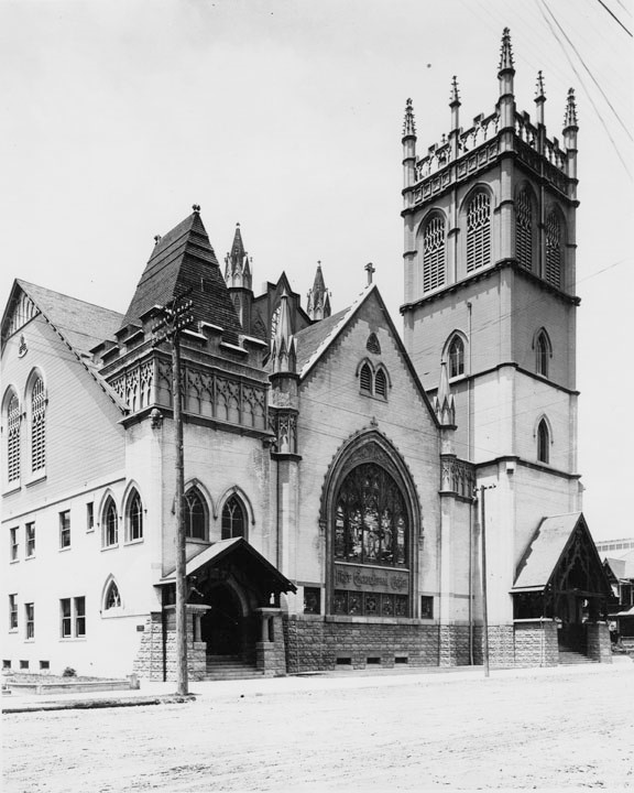
| (1905)* – Close-up view of the First Congregational Church in its 4th location, at 841 South Hope Street, which was unpaved in the early 1900s. |
Historical Notes This building served as the First Congregational Church until the early 1932 when the fifth church building was constructed on Commenwealth Ave.* |
Click HERE to see the 5th and current location of the First Congregation Church of Los Angeles |
* * * * * |
Immanuel Presbyterian Church
 |
|
| (ca. 1900)* – View looking southeast toward the intersection of Figueroa and 10th streets showing the Immanuel Presbyterian Church on the SE corner. The church has a tall square tower with a peaked roof on the corner. An arched stained-glass window is above the three doors of the main entry. |
Historical Notes Los Angeles architect James H. Bradbeer drew up plans for the Immanuel Presbyterian Church in 1890. The church was listed in the 1892 Los Angeles City Directory with Reverend W.J. Chichester as its pastor. His residence was on the west side of Burlington Avenue near Orange Street. In 1897, Hugh Kelso Walker took over as the first Pastor of the first Immanuel Presbyterian Church. His first sermon was delivered in early 12/1897.^ |
 |
|
| (ca. 1900)* – Looking SE toward the intersection of Figueroa Street and 10th Street (today, Olympic Blvd) showing the Immanuel Presbyterian Church on the SE corner. Image enhancement and colorization by Richard Holoff. |
 |
|
| (ca. 1905)^^* - A man in a 3-piece suit wearing a hat pauses on the sidewalk in front of a palm tree (Dracaena palm tree) and looks up at it. Immanuel Presbyterian Church can be seen in the background on what today is the SE corner of Figueroa Street and Olympic Boulevard. The building on the left is the Friday Morning Club Building (constructed in 1900). |
 |
|
| (ca. 1915)* – Close-up view of Immanuel Presbyterian Church, located on the southeast corner of Figueroa Street and *10th Street (now Olympic Boulevard). |
Historical Notes In 1932, the entire length of the 10th Street, from East L.A. to Santa Monica, was renamed Olympic Boulevard for the 10th Summer Olympics being held in Los Angeles that year. |
 |
|
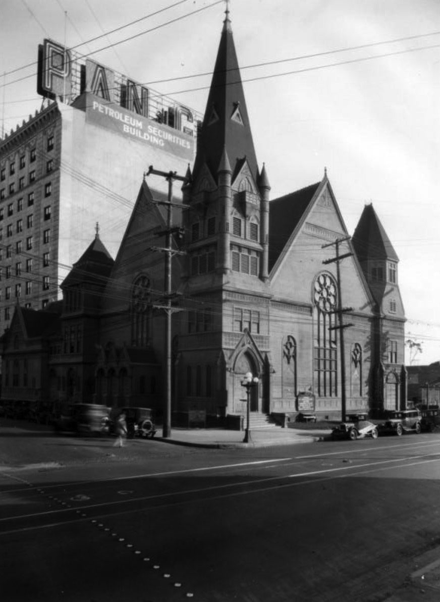
| (ca. 1928)* – View of the Immanuel Presbyterian Church taken approximately a year before it was demolished, with the neighboring Petroleum Securities Building, at 714 Olympic Boulevard, seen in the background. |
Historical Notes Immanuel Presbyterian Church relocated to a Gothic Revival style church on Wilshire Boulevard and Berendo Street in 1928. Click HERE to see more on the new church. |
* * * * * |
Hollenbeck Presbyterian Church
 |
|
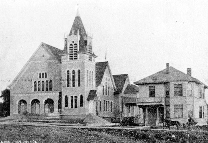
| (ca. 1895)* - Exterior view of the Hollenbeck Presbyterian Church in Boyle Heights. The building to the right is the church parsonage at 122 N. Chicago Street. |
Historical Notes According to a December 30, 1895, Los Angeles Times article that described the opening of the new Boyle Heights Presbyterian Church the previous day, "The new church is built onto the old one (built in 1885), which is separated from it by sliding oaken panels, and used for a Sunday-school and class- rooms." ^*# |
 |
|
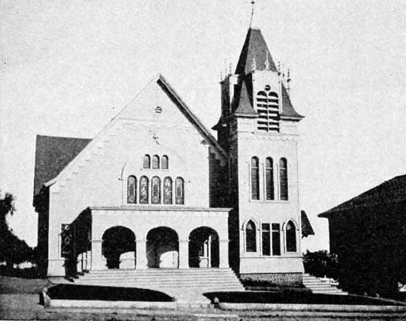
| (ca. 1895)^*# – Front view of the Hollenbeck Presbyterian Church located at 132 N. Chicago Street with the shaded parsonage next door. |
Historical Notes The church's cornerstone was laid on September 2, 1895, by Mrs. Elizabeth Hollenbeck, who apparently put up a lot of the money for the church.^*# |
 |
|
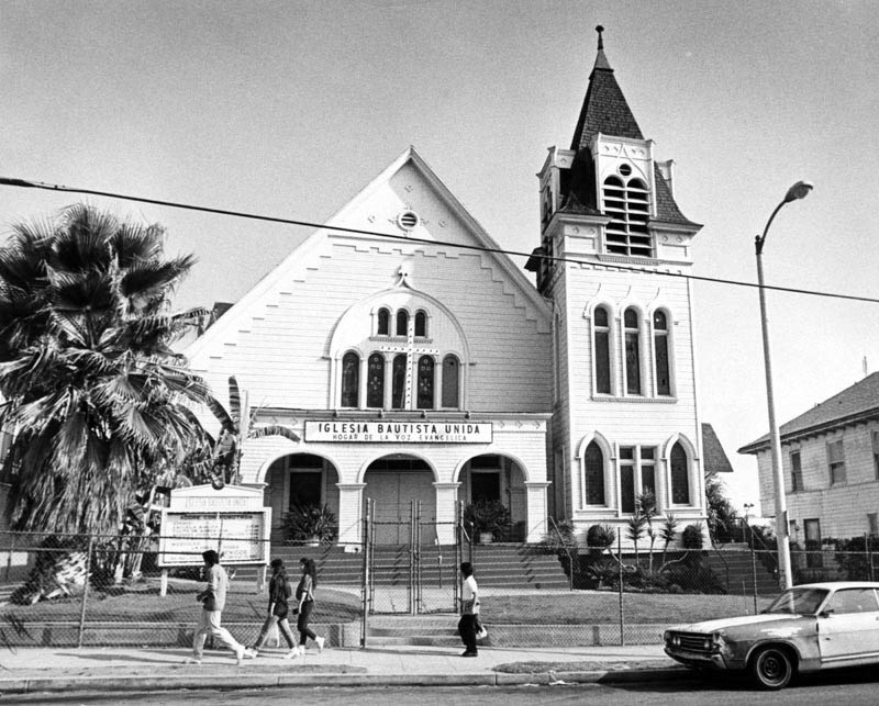
| (1987)* - Exterior view of the Iglesia Bautista Unida (United Baptist Church) located at 132 N. Chicago Street in Boyle Heights. |
.jpg) |
|
| (2014)#^** - Google street view showing the United Baptist Church (previously Hollenbeck Presbyterian Church) in Boyle Heights. |
Then and Now
.jpg) |
|
compare.jpg) |
* * * * * |
St Mary Catholic Church (Boyle Heights)
 |
|
| (ca. 1896)* - Exterior view of the original St. Mary Catholic Church in the Boyle Heights. |
Historical Notes St. Mary’s parish dates back to 1896, when it was established in Boyle Heights. The original church building was replaced by a newer sanctuary in 1926, located on 4th Street - one block east of Hollenbeck Park.*^*^ |
* * * * * |
Mott Market Building
 |
|
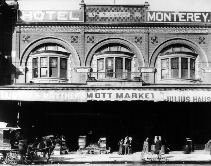
| (ca. 1897)* - View of the Mott Market Building, located on S. Main Street, between 1st and 2nd streets, which was the second home of the L.A. Chamber of Commerce between 1890-1894. The T. D. Mott Building with its arched windows on the second floor faced Main Street, and was home to several small businesses through the years. Some of the ones pictured are Hotel Monterey, Ludwig & Matthews, and Julius Hause. |
Historical Notes T. D. (Thomas Dillingham) Mott arrived in Los Angeles in 1852, was a stable-keeper by 1860, married Maria Ascencion Sepulveda in 1861, was County Clerk from 1863-1869, became political boss of the Democratic Party in L.A. County, and became a State Assemblyman in 1871. The Los Angeles Chamber of Commerce, founded in 1888, is Southern California's largest not-for-profit business federation, representing over 1,600 businesses. The Chamber's early focus promoted the region's abundance of opportunities in agriculture and international trade. In 1967, the Chamber changed its name to the Los Angeles Area Chamber of Commerce. The L.A. Chamber of Commerce takes up key issues that affect the business community in Los Angeles.* |
 |
|
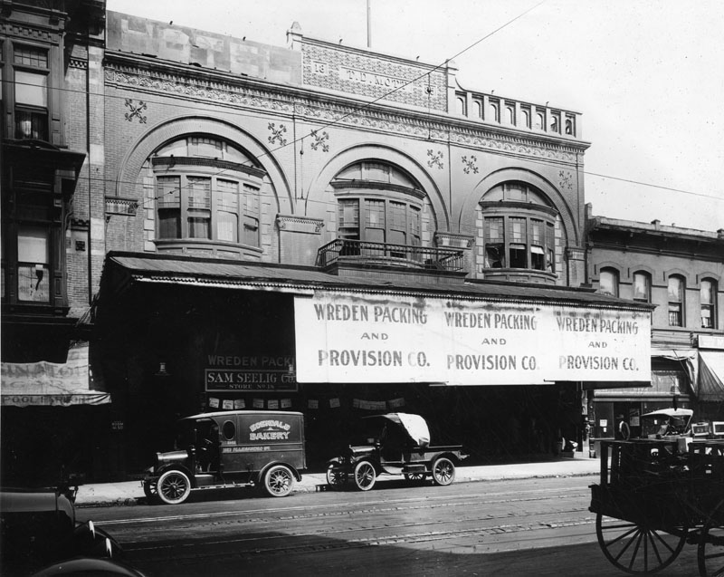
| (ca. 1920)* - View of the Mott Market Building, South Main Street. The two-story brick building seems to be overcome by signs hanging from its awnings that read "Wreden Packing and Provision Co.". In front, two automobiles are parked, one of which reads "Edendale Bakery". Farther in, a second sign reads "Sam Seelig Co. Store No. 18". |
Historical Notes In 1893 the Southern California Fruit Exchange was founded in the building. An earlier record reads: "Sunkist Adventure, Part I, History, photo h. The Los Angeles Chamber of Commerce building, birthplace of the Sunkist cooperative marketing concept. Growers meeting here in the summer of 1893 founded Southern California Fruit Exchange".^ |
* * * * * |
Ozmun Residence
 |
|
| (ca. 1897)* - Exterior front view of the Victorian style home and carriage house of Aaron M. Ozmun at 3131 South Figueroa Street. Bradbeer & Ferris were the architects. The house was demolished in 1956. |
Historical Notes Aaron M. Ozmun was president of the Columbia Savings Bank on South Broadway at the time of this photo. |
 |
|
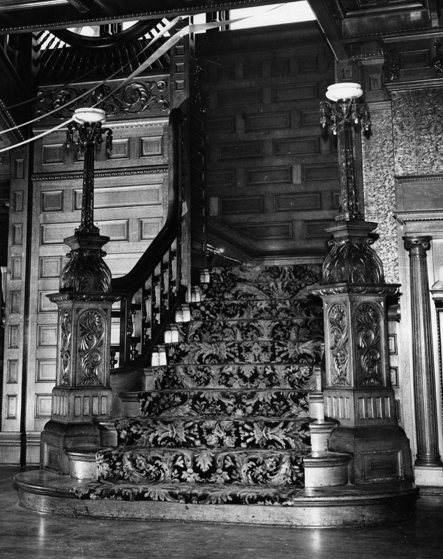
| (n.d.)* - Interior view of the grand stairway of the Victorian style home of Aaron M. Ozmun. |
* * * * * |
American Baptist Church
 |
|
| (1898)* - Exterior view of the recently completed American Baptist Church, located at 28th and Sumner streets in Los Angeles. |
* * * * * |
First German Episcopal Church
 |
||
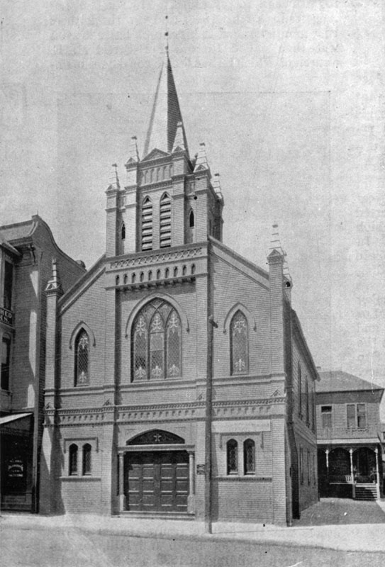
| (ca. 1898)^ - Exterior view of the First German Methodist Episcopal Church at its original location on 4th Street in Los Angeles. |
Historical Notes When built in 1875, the First German Methodist Episcopal Church was originally a one-story structure located on 4th Street near Hill. In 1897, the building was lifted and an additional story was placed underneath, as shown here. Four years later, the building was moved to 449 S. Olive Street. In 1910 the structure captured here was replaced by another. That church building served the German Methodist community until 1997, when the congregation relocated to 556 West Glenoaks Blvd. in Glendale. To this day, German continues to be the primary language for the church service.^ |
* * * * * |
B'nai B'rith Temple (2nd Location)
 |
|
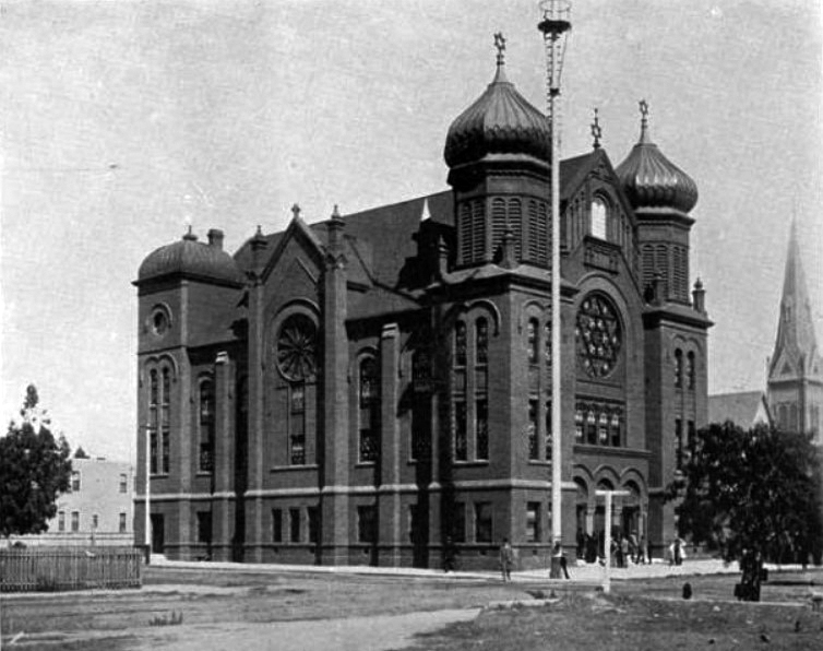
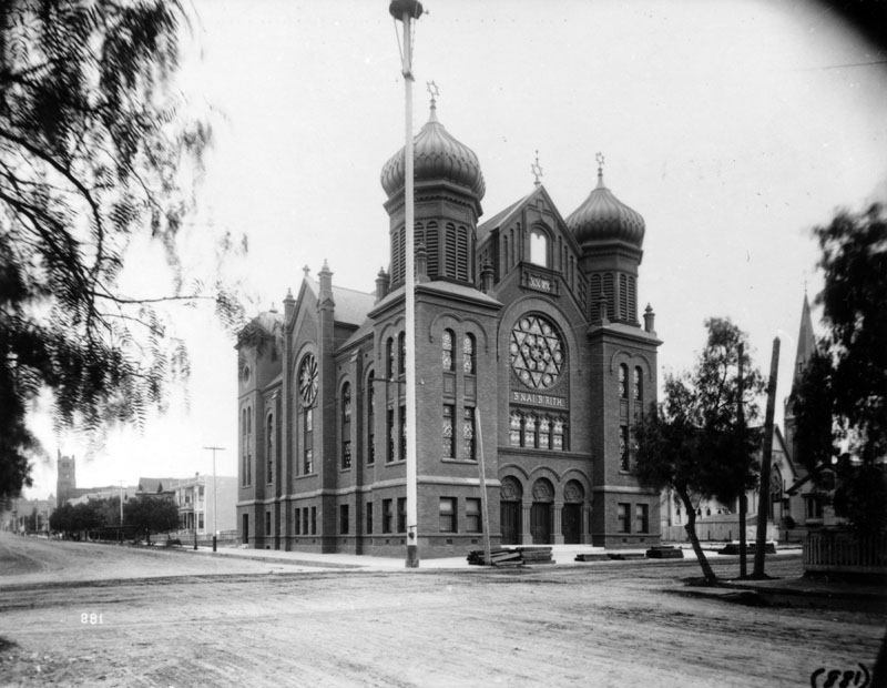
| (1897)#^^^ - View of B’nai B’rith Synagogue on the corner of 9th and Hope streets with a group of people standing in front of the entrance. Architect Abraham M. Edelman, son of long time rabbi of Congregation B'nai B'rith, designed this synagogue. |
Historical Notes In 1896, the B'nai B'rith congregation moved into its new larger brick Victorian synagogue at 9th and Hope. It was designed by A.M. Edelman (also designed 1st temple), and had tall flanking towers capped with large onion domes.*^ The cornerstone of B'nai B'rith Synagogue was laid on March 15, 1896 and it was dedicated on September 5th of the same year. The synagogue, which had seating for 600 people, was built of red brick with twin towers and pomegranate domes, its floors were carpeted in deep red with plush-cushioned pews and had a chandelier containing 60 bulbs, which made it the largest in the city. H.W. Hellman, Harris Newmark, Kaspare Cohn, and Mrs. J.P. Newmark presented the beautiful stained glass windows. Before moving into this building, Congregation B’nai B’rith occupied its first building at Temple and Broadway in Downtown L.A. from 1862 until 1895.* Click HERE to see first location of B'nai B'rith Temple. |
 |
|
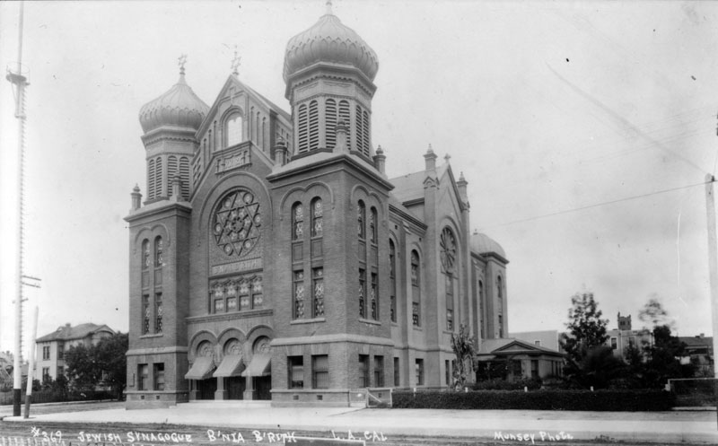
| (ca. 1898)* - Exterior view of the second B'nai B'rith Temple, located at 9th and Hope streets in Los Angeles. |
Historical Notes Sigmund Hecht became rabbi in 1899, and in 1903 the congregation joined the Union of American Hebrew Congregations, the national organization of the Reform movement. Edgar Magnin was hired as an assistant rabbi in 1915, and took over as senior rabbi upon Hecht's retirement in 1919. Both Hecht and Magnin implemented the Reform practice of the time, including heavier use of the English language and organ and choir music.*^ |
 |
|
| (ca. 1905)* - Exterior view of the second B'nai B'rith Temple located at 9th and Hope streets with a very tall streetlight standing on the corner. |
Historical Notes The tall pole seen on the corner of 9th and Hope was one of Los Angeles' earliest streetlights. The circular object located on the pole at the top of the photo is NOT the light itself, but a platform used for maintenance. At 150 ft. tall, the streetlight was twice the height that is seen in this view. It was one of Los Angeles' first electric streetlights. Click HERE to see more in Early Los Angeles Street Lights. |
 |
|
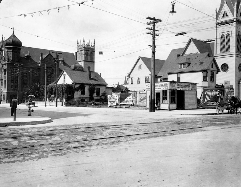
| (1908)* - View looking at the corner of Grand Avenue (with trolley lines running through it) and 9th Street showing two churches sharing the block with the B'nai B'rith Temple. The corner shop, Great Western Steam Carpet Cleaning Works, offers carpets cleaned and re-laid for .07 cents per yard. |
 |
|
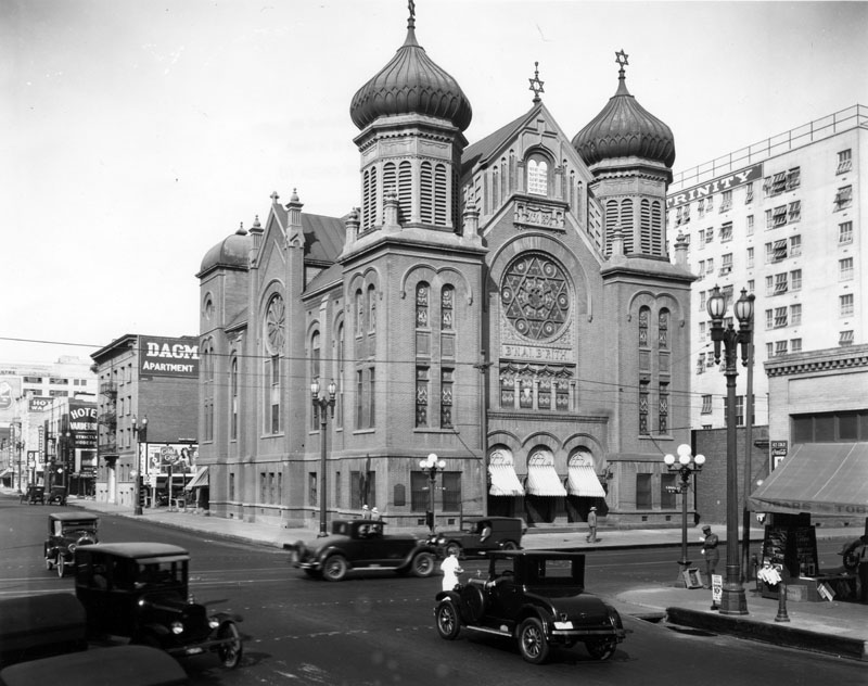
| (1926)* - Exterior view of the second B'nai B'rith Temple on the corner of 9th and Hope streets. Neighboring businesses, hotels and apartment buildings are visible all along Hope Street, which runs from the foreground to the left side of the image. |
Historical Notes This grand edifice was replaced in 1929 when Wilshire Boulevard Temple opened.* Click HERE to see the 3rd location of B'nai B'rith (Wilshire Boulevard Temple). |
* * * * * |
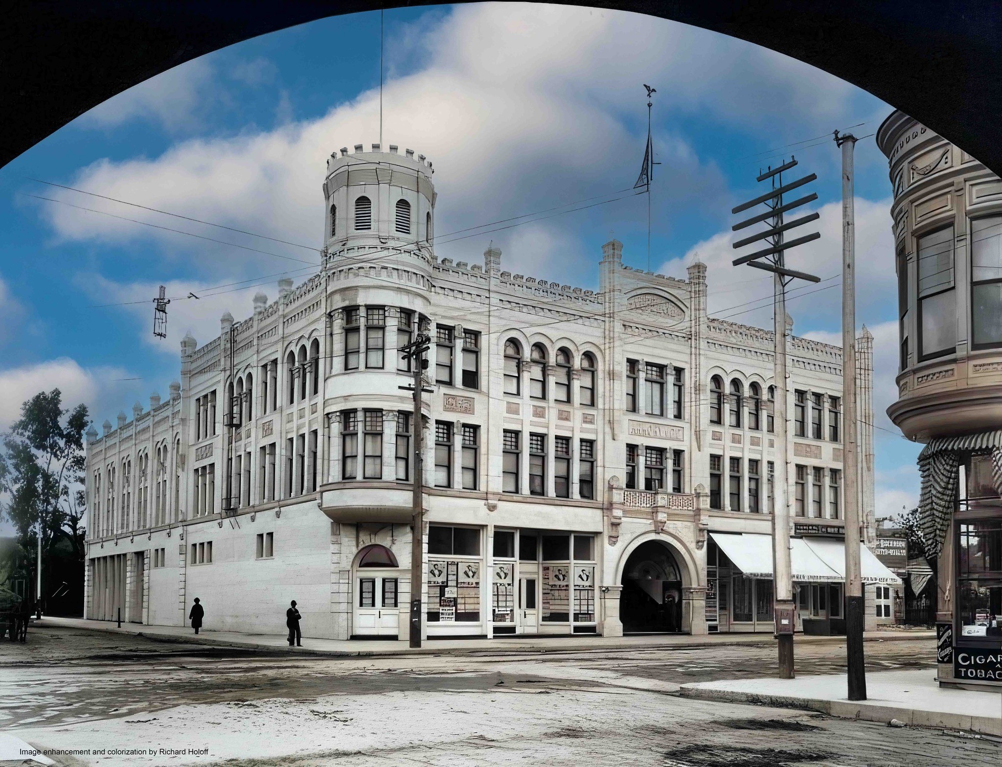
Copeland Building (aka Armory Building)
 |
|
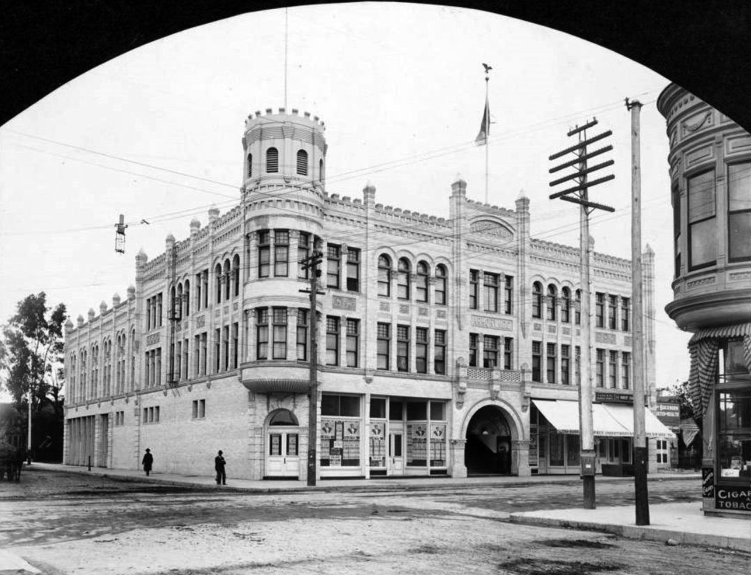
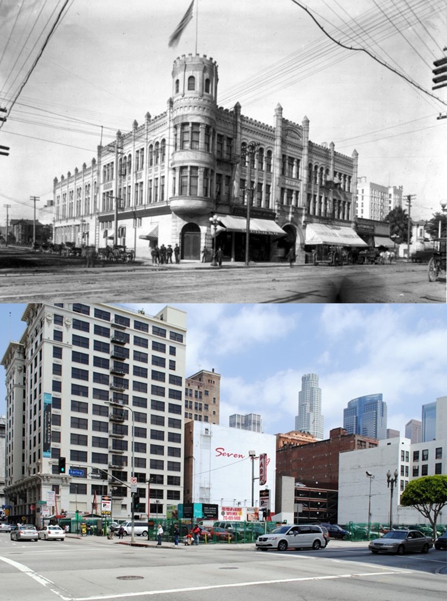
| (ca. 1898)#^ – View showing the Copeland Building, also known as the Armory Building, on the NW corner of Spring Street at Eighth Street in downtown Los Angeles. The words "Copeland" and "Armory. N.G.C." are carved into the stone on the building front. A U.S. Mail letterbox is on the corner, and theatrical posters for a May 16th event at the Orpheum Theatre and "to let" rental signs for Wright & Callender at 235 West Third St. are hanging in the windows. |
Historical Notes In 1898, the Seventh Regiment of the National Guard of California celebrated the opening of its first dedicated armory, at the northwest corner of Eighth and Spring Streets. Designed by architect T. J. McCarthy, the three-story structure was built in a bristly Romanesque Revival style, then enjoying the height of its popularity in the design of local civic buildings. At the time of its completion, it was also one of the largest buildings in the southern part of the city.* |
 |
|
| (ca. 1898)#^ – View showing the Copeland Building (aka Armory Building) located on the NW corner of Spring and 8th streets DTLA. When opened in 1898 the building had a mix of military and civilian uses. The California National Guard used it as an armory. Designed by T.J. McCarthy, it was one of the few Romanesque Revival buildings whose turret was built with a functional purpose: the easy mounting of a Gatling gun (that convenience never became a necessity). The building stood until 1938 when it was torn down and replaced by a parking lot that was there until 2017 when a high rise apartment complex took its place. (Image enhancement and colorization by Ricahrd Holoff) |
 |
|
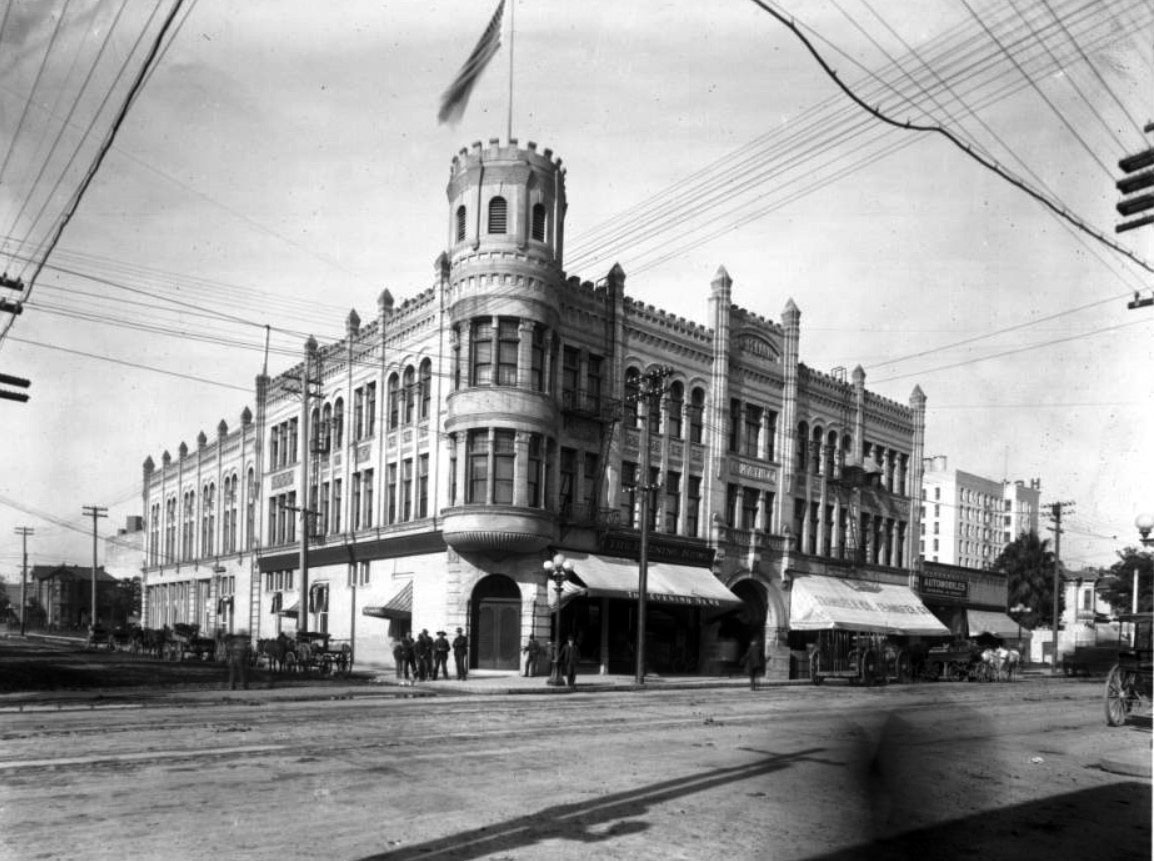
| (ca. 1908)^^* - Photograph of the Armory Building (aka Copeland Building), on the corner of Eighth Street and Spring Street. The castle-like building stands about three-stories tall. An American flag stands on top of the tower (corner of building). The tower, like the rest of the building, has battlements all the way around it. Buttresses with pyramid-like spires reinforce the building's structure at intervals all around the building. A dozen men stand around at the corner of the street. |
Historical Notes For many years, the armory building had a mix of military and civilian uses that would seem unthinkable today. The lot was privately owned and developed by John S. Copeland, and the National Guard shared the building with three storefronts along Spring Street. Nonetheless, the armory was one of the most well-appointed military buildings in California, equipped with a drill hall, saddle room, officers’ quarters, reception rooms, and a gymnasium. It was also one of the few Romanesque Revival buildings whose turret was built with a functional purpose: the easy mounting of a Gatling gun (that convenience never became a necessity, thankfully). * |
 |
|
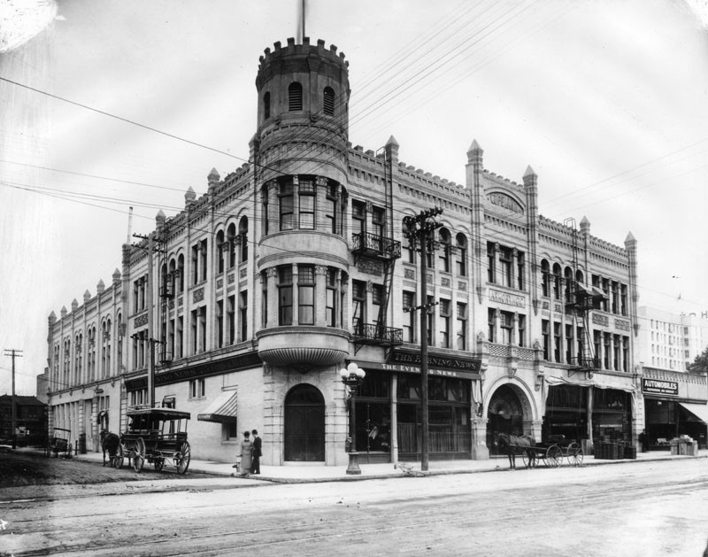
| (ca. 1900s)* - A view of the Copeland Building on the corner of 8th and Spring Streets. The Evening News occupies the ground floor. A couple of horse-drawn vehicles and a bicycle are at the curb. A man and a woman are seen at the corner. |
Historical Notes The armory building also served briefly as the headquarters of the perennially mobile Post Office. In 1901, the Post Office moved out of its cramped offices near Fourth and Main Streets, installing its main office in the armory’s ground floor. The move proved to be extremely unpopular among the city’s business leaders, who found Eighth Street to be far too distant from the city center. In a biting editorial, the Los Angeles Times ridiculed the new location as being “somewhere out in the wilderness” and “handy for the farmers.” The criticisms however, failed to elicit any change. In 1904, the main Post Office moved to its next location at Seventh Street and Grand Avenue, hardly any closer to the center of business. * |
 |
|
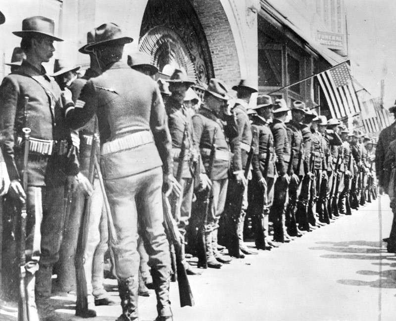
| (ca. 1917)* - Members of the 7th California Volunteers line up in front of the Copeland Building, the location of the old armory at 8th and Spring streets, before departing for San Francisco. |
 |
|
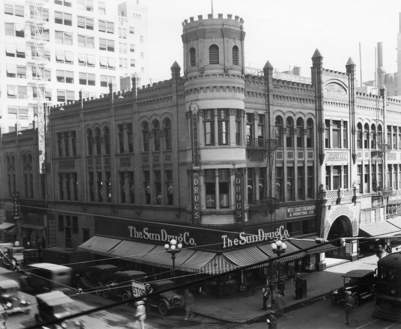
| (ca. 1920s)* - A view of the northwest corner of 8th and Spring Streets. The Sun Drug Co. occupies the ground floor of the Copeland Building. Other signage on the building includes Copeland Amory N.G.C., West Coast Stationary & Printing Co., and Rose Room Dancing. In addition to automobile and pedestrian traffic, a streetcar and a traffic policeman are also seen in the photo. |
Historical Notes The National Guard vacated its old quarters in 1914 after the completion of a new armory in Exposition Park (now the Wallis Annenberg Building). The former armory spent the remainder of its life as a rather standard small commercial building, with its upper stories converted for use as a dance hall. Somehow, it stayed untouched by its neighborhood’s rapid redevelopment during the 1920s. Like all too many of Los Angeles’ forgotten landmarks however, it was ultimately torn down by its owner in 1938 to be replaced by a parking lot. * |
Then and Now
 |
|
| (1908 vs. 2010s)* - Looking at the NW corner of Spring and 8th streets showing a parking lot where the old Copeland Building (Armory Building) once stood. |
 |
|
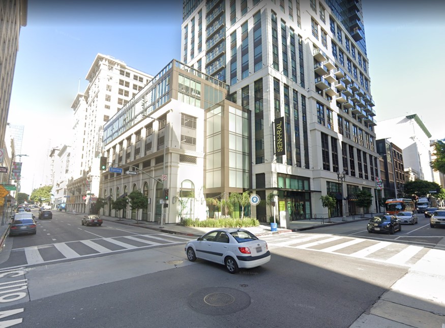
| (2023)* - Contemporary view of the NE corner of Spring and 8th streets where the Copeland Building once stood. |
* * * * * |
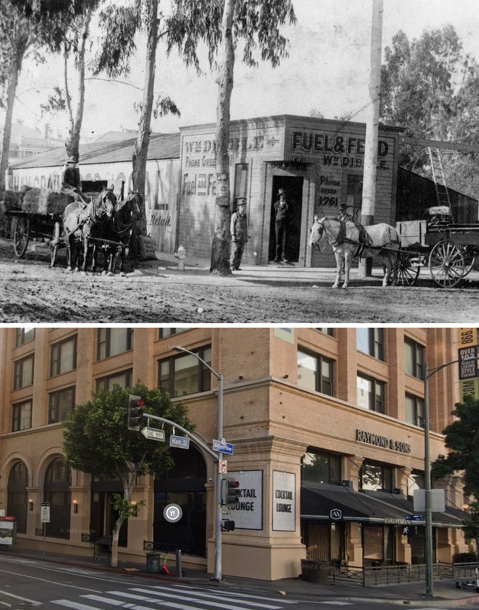
William Dibble Fuel and Feed Store
 |
|
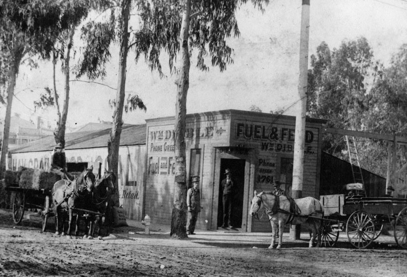
| (1898)* - Exterior view of William Dibble Fuel and Feed store, located on the southeast corner of 6th and Main Streets in 1898. Horses and wagons stand in the street, one loaded with bales of hay. |
Then and Now
 |
|
| (1898 vs 2022)* - Top photo is the William Dibble Fuel and Feed store, located on the SE corner of 6th and Main Street(oh, the simple life). Today, a mixed-use housing building stands on the corner (formerly the Pacific Electric Building, built in 1905). |
* * * * * |
Frost Building
 |
|
| (ca. 1898)* - Frost Building, northeast corner of Second Street and Broadway, 1898, architect, John Parkinson. Horse-drawn wagons can be seen parked in front of the buildings while pedestrians cross the street. |
* * * * * |
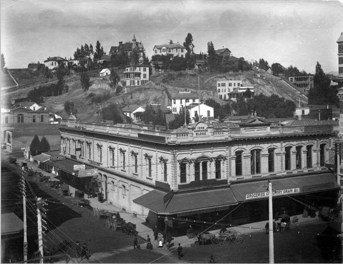
Larronde Block
 |
|
| (ca. 1898)^## - View of the Larronde Block located at 211 West First Street with Bunker Hill in the background. The Beaux Arts/Italianate style block building with sign "1882 Larronde Block" above roofline sits on the northwest corner of First and Spring streets. Horse drawn-wagons are parked at the curb and pedestrians are seen crossing the intersection. Sign on the awning facing Spring Street reads: "Groceries Crockery Grain … " |
Historical Notes At one time, the name Larronde was a fairly well known one in the City of Angels. Pierre Larronde was a native Frenchman who landed in San Francisco in 1847 and made a killing in the gold mines. When he relocated to Los Angeles in 1851, he amassed a further fortune by successfully raising sheep on one of the Ranchos. Always the astute businessman, Larronde cashed out his sheep empire in the late 1880s and focused his energies on real estate. His holdings included prime land at the corner of First and Spring, and a parcel on North Hope Street near Temple where he built the family home.^ |
 |
|
| (1920s)**# - View of the Larronde Block on the northwest corner of First and Spring streets. The LA Times Building, located on the northeast corner of First and Broadway, is seen in the background. Note the elevated kiosk at the corner. |
Historical Notes Elevated booths were used by the Los Angeles Railway and the Yellow Cars as a switchman’s tower to control the flow and path of streetcars through the intersection. |
* * * * * |
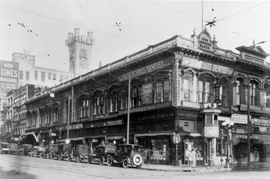
Los Angeles Theatre (later Orpheum Theatre and Lyceum Theatre - 2nd Home of the Orpheum Circuit)
 |
|
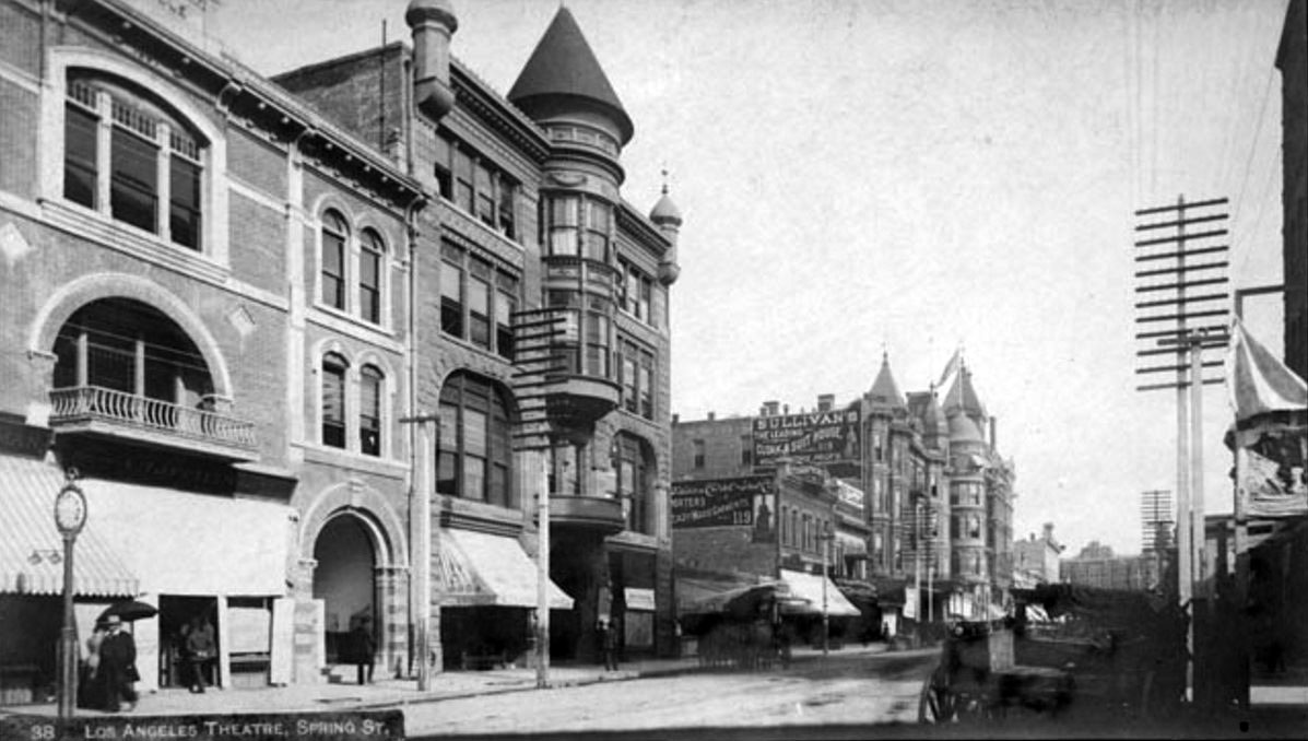
| (ca. 1897)^## – View looking north on Spring Street showing the Los Angeles Theatre (turreted building). The theatre would later be called Orpheum and Lyceum Theatre). The building on the left was later known as Lyceum Hall. |
Historical Notes The Los Angeles Theatre opened in 1888. It was built by William Hayes Perry and the building containing it was known as the Perry Building. |
 |
|
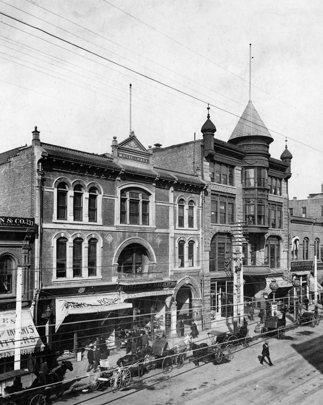
| (1895)* - - View showing the Los Angeles Theatre (future home of the Orpheum Theater) located at 227 S. Spring Street. The music hall on the left was the former home of Turnverein. Horse-drawn carriages are shown parked in front. |
Historical Notes In 1903 this interesting Richardsonian Romanesque building became the Orpheum - the second home of Orpheum Circuit vaudeville in Los Angeles. Previously they'd been at the Grand Opera House. There were four Orpheum theatres in downtown Los Angeles: ◆ 110 S. Main St. -- Grand Opera House was the home of Orpheum vaudeville from 1894 to 1903. ◆ 227 S. Spring St. -- The Los Angeles Theatre, later called The Lyceum, was known as the Orpheum from 1903 to 1911. ◆ 630 S. Broadway -- Now the Palace Theatre -- this was the Orpheum between 1911 and 1926. ◆ 842 S. Broadway -- Orpheum Theatre from 1926 to Today |
 |
|
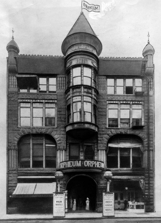
| (ca. 1903)* - Close-up front view of the old Orpheum Theater on Spring Street between 2nd and 3rd Streets. Architects: F. J. Capitain and J. Lee Burton. |
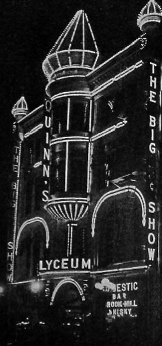 |
(1914)**^ - A view of the Lyceum all in lights from the 1914 Moving Picture World article about J.A. Quinn.
|
|
Historical Notes The Orpheum moved on in June, 1911 to their new home at 630 S. Broadway (now the Palace Theatre). The existing building became the Lyceum Theatre in 1912. **^ |
 |
|
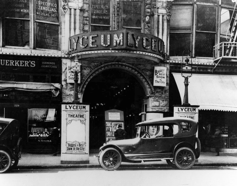
| (1919)* – View showing an early model car parked in front of the Lyceum Theatre. Opened in 1888 as the Los Angeles Theater; became the 2nd Los Angeles Orpheum from 1903 to 1911; became the Lyceum Theatre from 1911 to 1941. |
 |
|
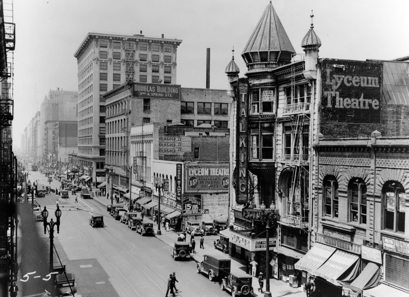
| (ca. 1930)* - Looking south down Spring Street near 3rd Street showing the ornate Lyceum Theatre. |
Historical Notes By the 1930s the Lyceum Theatre was exclusively a movie theatre. |
 |
|
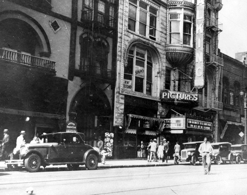
| (1935)* – Close-up view showing the Lyceum Theatre as movie house. Signs read: TALKING PICTURES |
Historical Notes Opened in 1888 as the Los Angeles Theater; became the 2nd Los Angeles Orpheum; closed in 1941 as the Lyceum Theatre. |
 |
|
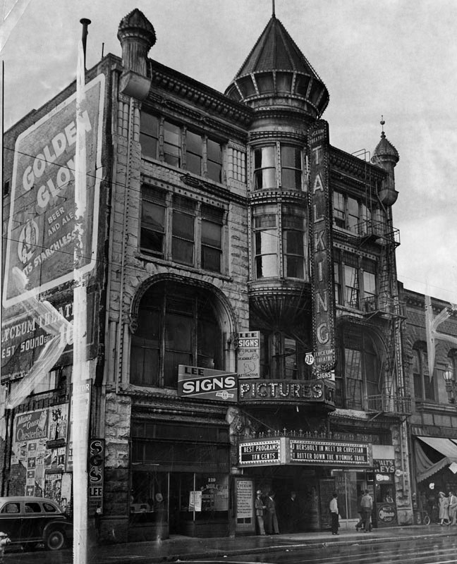
| (1941)* - A Herald Examiner photo of the Lyceum Theatre in 1941, the year of its demolition. On the marquee: "Best Programs Ten Cents" - "J Hersholt in Meet Dr. Christian - "T Ritter Down The Wyoming Trail" |
Historical Notes Herald Examiner photo caption reads: "Street view of the Lyceum Theatre, located at 227 South Spring Street, is the second oldest show house built in the city. Originally known as the Los Angeles Theater, where stars of yesteryear appeared, the theater will be razed to become a parking lot. Beneath it is one of the original springs from which Spring Street derived its name. Photo dated: January 15, 1941." The site is now the L.A. Times parking garage. |
* * * * * |
Los Angeles' 1st Telephone Pay Station
 |
|
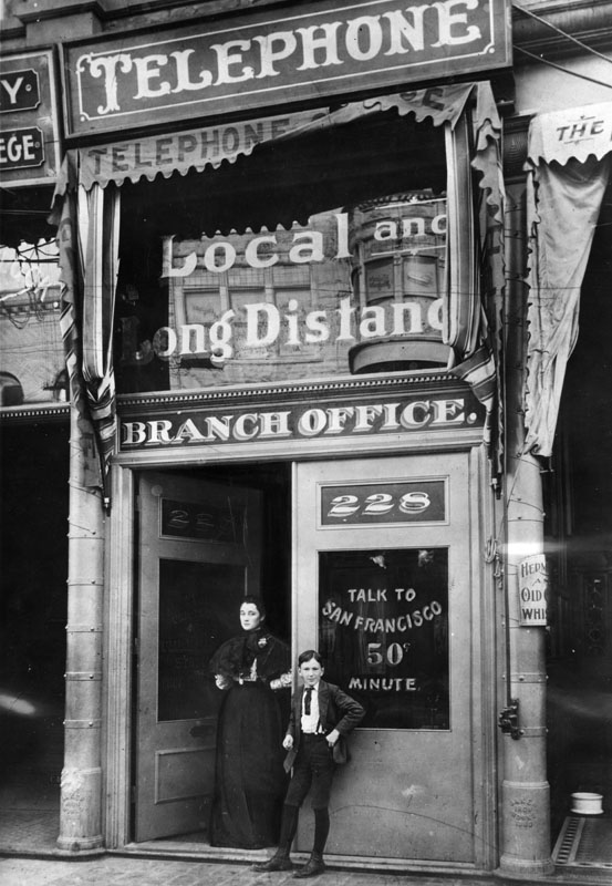
| (1899)* - This was Los Angeles' first telephone pay station, at 228 So. Spring St., in 1899. The first telephone line between San Francisco and Los Angeles had just been opened, and long distance calls to the Bay City were being stimulated. The young man, Roy E. Jillson, was messenger boy then and was still an employee of the telephone company in 1934. |
Historical Notes Alexander Graham Bell invented the telephone in the late 1870's and it didn't take long for Los Angeles to adopt the new technology. In 1879, the Los Angeles Telephone Company was formed and it began offering telephone service in the area of what is now Downtown Los Angeles. This was just one year after the very first North America telephone exchange was installed in New Haven, Connecticut (January, 1878). The Los Angeles Telephone Company originally started with only seven subscribers. In 1883, The Los Angeles Telephone Company merged with another local telephone company based in Northern California, Sunset Telephone Company. In 1906, the Sunset Telephone Company was acquired by Pacific Telephone and Telegraph, later known as Pacific Bell.^^^# |
* * * * * |
Sackett Hotel and Emporium
 |
|
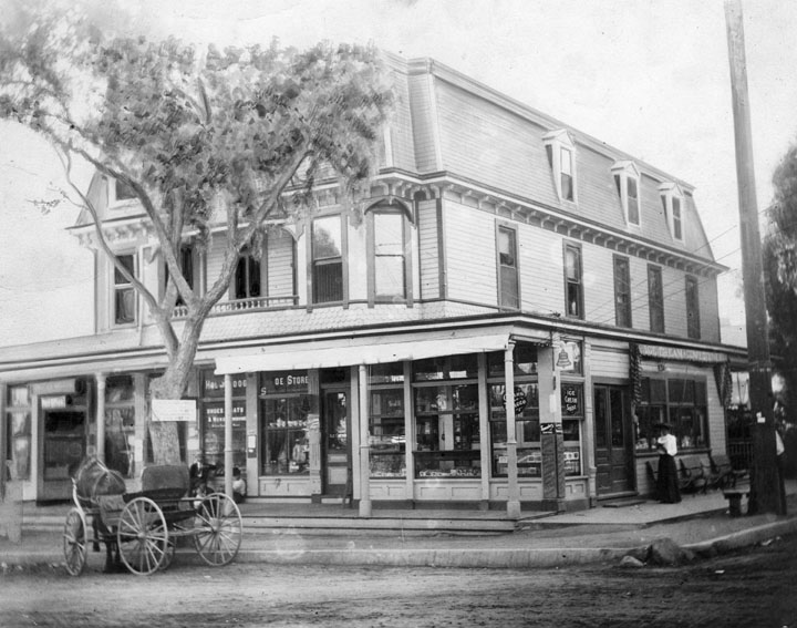
| (1899)* - View of the Sackett Hotel and Emporium, corner Cahuenga and Hollywood Blvd. The first floor includes a post office, soda fountain, and hardware store. A horse and buggy is parked out front at left. |
Historical Notes Horace David Sackett and Ellen Sackett built the hotel in 1888 at Prospect (Hollywood Boulevard) and Cahuenga, an intersection that became an early Hollywood commercial center. Their dauther, Mary Sackett, served as the first postmistress of the Hollywood post office located at the hotel.* Click HERE to see more in Early Views of Hollywood (1850 - 1920). |
* * * * * |
Weller Residence
.jpg) |
|
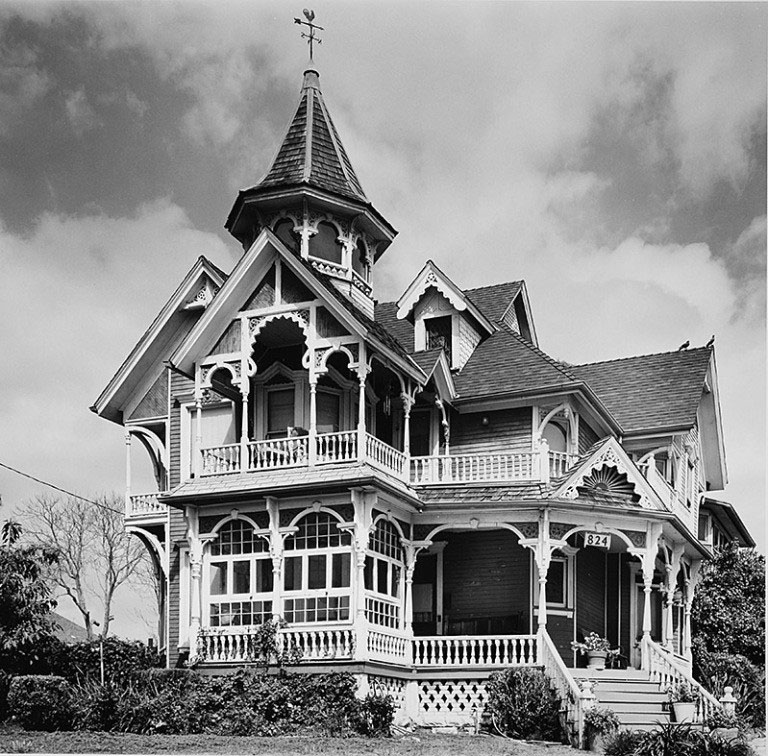
| (ca. 1890s)^^** - View of the home built for businessman Zachariah Weller in 1894. Before being moved to its current site in Angelino Heights in 1900, the structure was in the location pictured here, 401 North Figueroa (now North Boylston Street). |
Historical Notes Businessman Zachariah Weller’s house was just six years old in 1900 when he sent his family off for a short vacation on Catalina Island, split the house in two, and moved it about 3,000 feet north (as the crow flies), deep into Angeleno Heights. When the Weller clan’s Avalon holiday was up, they returned to a home not only no longer encroached upon by filthy oil wells, but one which was newly wired for electricity, the first home in the Heights to be powered as such.^ Oil was discovered by Edward L. Doheny in 1892, near the present location of Dodger Stadium. The Los Angeles City Oil Field was the first of many fields in the basin to be exploited, and in 1900 and 1902, respectively, the Beverly Hills Oil Field and Salt Lake Oil Field were discovered just a few miles west of the original find. Los Angeles became a center of oil production in the early 20th century, and by 1923 the region was producing one-quarter of the world's total supply; it is still a significant producer, with the Wilmington Oil Field having the fourth-largest reserves of any field in California.^* |
 |
|
| (1990)^.^ – View showing the Weller House at its current location in Angelino Heights. Photo by Denis Freppel |
Historical Notes In 1979 the Weller home was designated Los Angeles Historic-Cultural Monument No. 223 (Click HERE to see complete listing). Its current location is 822-826 E. Kensington Road. Click HERE for contemporary view. |
* * * * * |
Forthmann House
 |
|
| (ca. 1900)^^* - Home of John A. Forthmann, Sr, at 18th and Figueroa Streets in L.A., its original location. Today, it is the USC Community House located at 2801 S. Hoover. Click HERE to see contemporary view. |
Historical Notes John A. Forthmann, who founded the Los Angeles Soap Company with J.J. Bergin, built the house in the 1880s at 629 West 18th St. It was moved to 2801 S. Hoover in 1989 and is now the USC Community House. According to the Los Angeles Cultural Heritage Commission, it is the sixth oldest house in Los Angeles. The Los Angeles Soap Co. was most famous for its White King brand (‘It takes so little’). At one point its plant covered about sixteen acres of downtown L.A. In 1972, the Forthmann House was designated Los Angeles Historic-Cultural Monument No. 103 (Click HERE to see complete listing). In 1989, about a year after the Los Angeles Soap Co. finally closed its doors, the house was picked up and relocated to its current location on Hoover. Today the home – one of the oldest in the city – is the headquarters for USC’s Real Estate Development Corp.*^^^ |
* * * * * |
Rochester House (aka West Temple Apartments)
 |
|
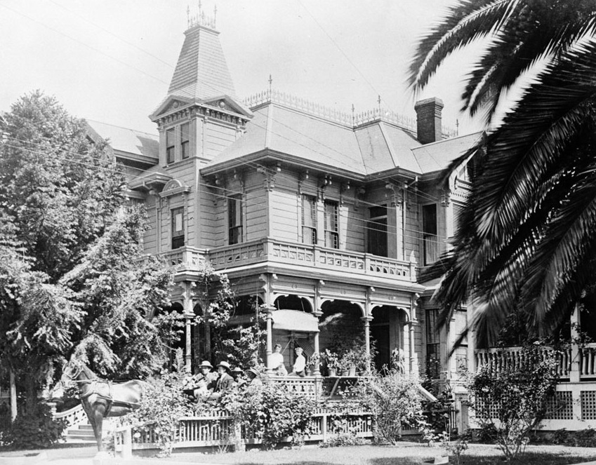
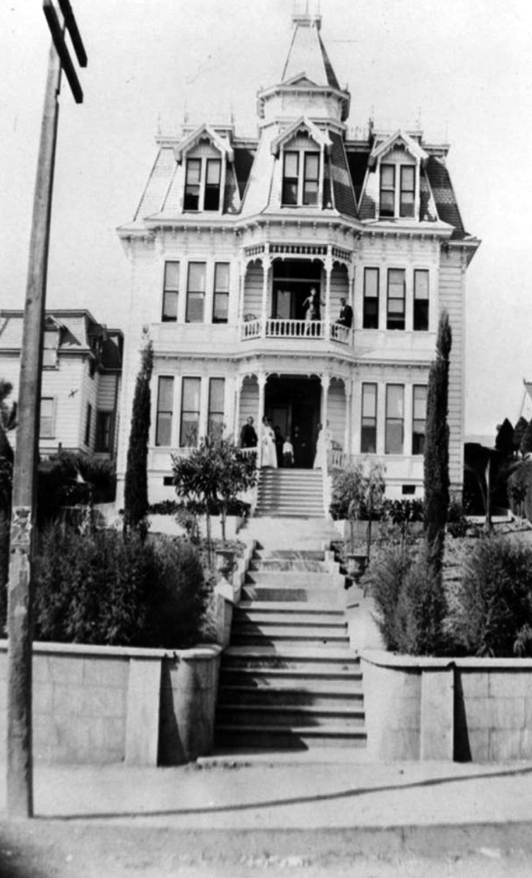
| (ca. 1890)* - View showing the Rochester House located at 1012 West Temple Street. The Dorn and Phillips families are seen on the porch. |
Historical Notes When he first had it built in the Second Empire style in 1887, Rufus Van Dorn named his house The Rochester for his New York hometown. A decade later, it was bought by the Van Nuys family who converted the structure into an apartment building at the end of World War I. Like a lot of Bunker Hill properties, it fell into disrepair following WWII.^ |
 |
|
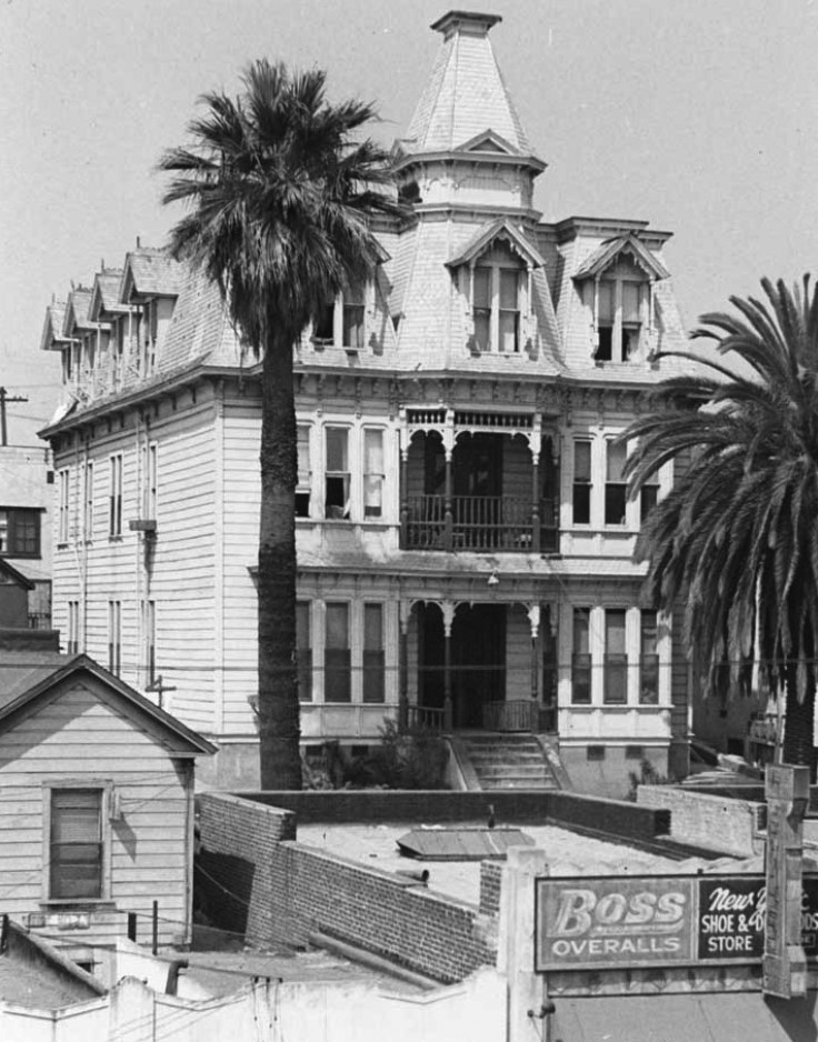
| (ca. 1950)^ - View of the Victorian-style Rochester House at 1012 West Temple Street as seen from roof top across the street. The building features a center portico topped by a tower, bay windows, a mansard roof, and dormer windows. A tall palm tree graces its front yard. |
Historical Notes The wood frame building was one of the very few extant examples of Mansard or Second Empire (Napoleon III) style structures found in Los Angeles.^ |
 |
|
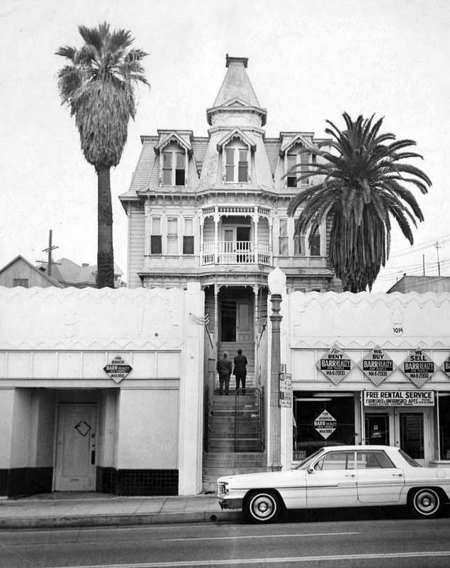
| (1960s)* - The West Temple Apartments (aka The Rochester) as seen from Temple Street. The building is partly hidden by stores on the street. |
Historical Notes On January 4, 1963 the West Temple Apartments (The Rochester) was declared LA Historic Cultural Monument No. 11. In August 1967, the El Pueblo de Los Angeles State Historical Monument Commission voted to move the Rochester from its West Temple home to Main and Republic Streets as part of the park being developed around the city’s Old Plaza (this Board – different than the Cultural Heritage Commission – had been overseeing the park project since 1965). The Commission also set up a solicitation fund for its relocation and restoration. Over the next few years, money was raised and a HUD grant of up to $100,000 was applied for and contracted.^ |
.jpg) |
|
| (1967)^.^ – View showing the Rochester Apartment Building as seen from the Harbor Freeway. |
Historical Notes In August of 1969, the Commission did an about face and decided the Rochester wasn’t allowed in the park after all. Why? Well, the idea was always a matter of disagreement within the Board. Some of the Commission maintained the non-Spanish architecture of the Rochester would look out of place in Old Plaza. Also, they felt other things – like parking space – were more necessary. In protest, a group made up of private contributors as well as three Board members (John Anson Ford, Dorothy A. Burnaby, and David A. Workman) sued the Commission, claiming the board had voted to move the Apartments, had raised public and private money, and had no right to renege. The plaintiffs won, and the Commission appealed the ruling. Jump to early fall, 1970, when, with verdict pending, the Rochester was moved temporarily to “railroad property just north of Union Station” (i.e. Alameda and Bruno Streets). In early 1971, California’s Court of Appeals upheld the original decision. Later that spring, following the State Supreme Court’s refusal to hear another appeal, the Commission unanimously consented to relocate and restore the Rochester.^ |
 |
|
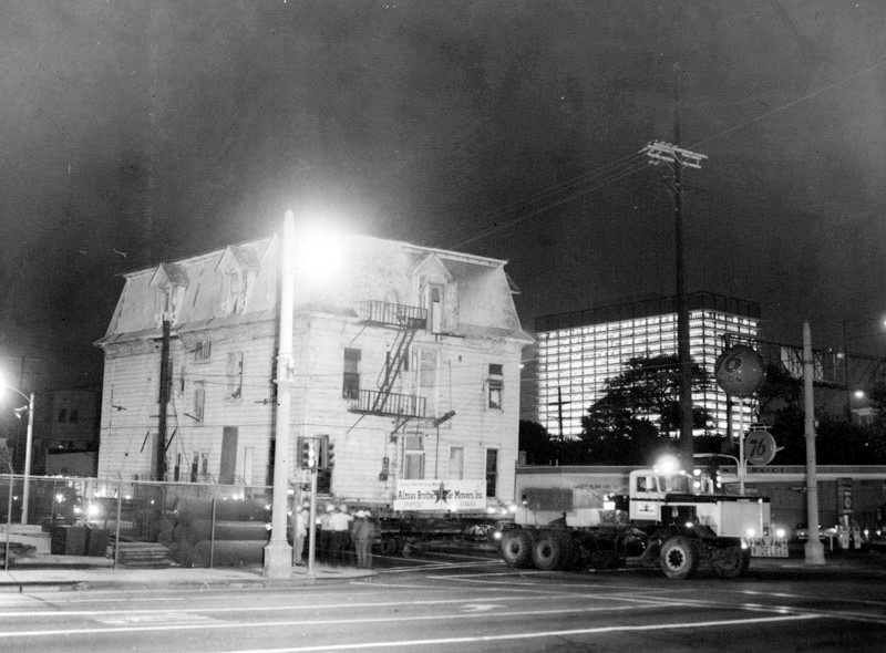
| (1970)* - The large, historically important Rochester House being moved along 2nd Street at Beaudry Ave. at night on October 1, 1970, by Almas Brothers Star Movers, Inc. The lighted Department of Water and Power building is in the background. |
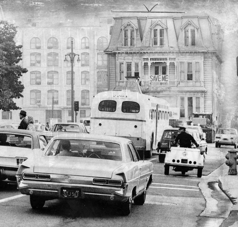 |
|
| (1970)* - A "Save Me" sign is still mounted on the Rochester House as it is being moved due to the Temple Urban Renewal Project. Photo date: October 1, 1970. |
.jpg) |
|
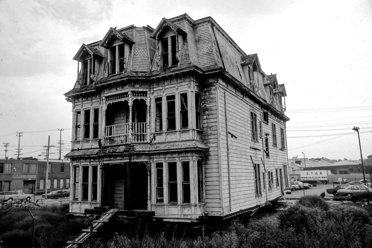
| (1978)^.^ – View showing the Rochester House at its new temporary location on railroad property just north of Union Station (i.e. Alameda and Bruno Streets). |
Historical Notes The Rochester House was featured in Walt Disney's "Return to Witch Mountain” filmed in 1977 starring Bette Davis. It is used as the childrens hangout - haunted mansion. This house has also been in the original Little Shop of Horrors as Seymore's Mom's apartment house, it is also the cover art for the children's mystery book "Go to the Room of the Eyes" by Betty K. Erwin, and it is in a great Victorian house book called "The Gingerbread Age" by John Mass. |
 |
|
| (1978)^.^ - Close-up view showing the relocated Bunker Hill mansion (Rochester House) awaiting its fate at it's temporary location near Alameda and Bruno Streets. |
Historical Notes The temporary move of the Rochester House turned out to be permanent. For whatever reason, the Rochester was allowed to languish further at the Alameda/Bruno site until it was ultimately demolished in 1979. |
* * * * * |
Feliz Adobe (Rancho Los Feliz)
 |
|
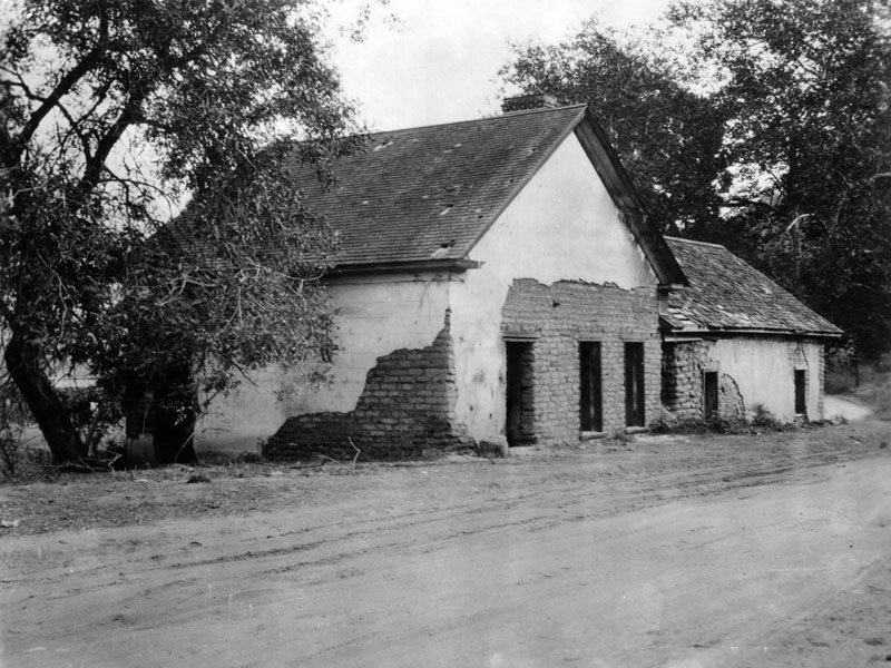
| (ca. 1900)* - Home of Antonio Feliz, originally built in the 1830s on Rancho Los Feliz, it was situated on the east side of the rancho near the river. The adobe is located at 4730 Crystal Springs Drive in Griffith Park and now serves as the Park Ranger Headquarters. |
Historical Notes Rancho Nuestra Señora de Refugio de Los Feliz as it was called, was better known as Rancho Los Feliz. This 6,647-acre rancho was granted to Corporal José Vicente Feliz as early as 1795, one of the first land grants in California; it remained in Corporal Feliz' possession as late as 1816. When Corporal Feliz died his children inherited the rancho, and they built an old adobe house on the property sometime in the 1830s. Rancho Los Feliz had a succession of owners: Doña María Ygnacia Feliz (daughter-in-law of Corporal Feliz) inherited the rancho in 1843 when her husband died. In 1853, Doña Maria divided the rancho among her own daughters; they inherited it in 1861, after their mother's death. Sadly, the daughters failed to improve the land and sold their portions for a mere $1.00 per acre. In 1860, Antonio Feliz, brother-in-law of Doña Maria acquired the property which included the adobe near the river, and which he kept until his death in 1863. Later that same year, Don Antonio Franco Coronel came into the ownership of Rancho Los Feliz. At some point, Don Antonio deeded the rancho to James Lick, a wealthy businessman from San Francisco. In 1882, Colonel Griffith Jenkins Griffith acquired 4,071 acres of the rancho, and on December 16, 1896 Griffith donated 3,015 acres to the city of Los Angeles to be used as a park; other sections of the rancho were developed and became the communities of Los Feliz and Silver Lake. The old adobe, which still exists today, stands within the park boundaries at 4730 Crystal Springs Drive in Griffith Park.* |
 |
|
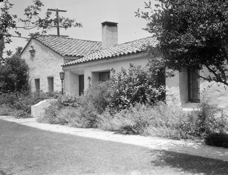
| (1936)* - Restored home of the Feliz family, originally built in the 1830s on Rancho Los Feliz. |
Historical Notes Now located in Griffith Park, the Feliz Adobe was remodeled in 1925 and 1936 it was occupied by William H. Johnson, superintendent of the golf courses at Griffith Park.* In 1988, the Feliz Adobe was designated Los Angeles Historic-Cultural Monument No. 401 (Click HERE to see the complete listing). |
* * * * * |
Bullard Block
 |
|
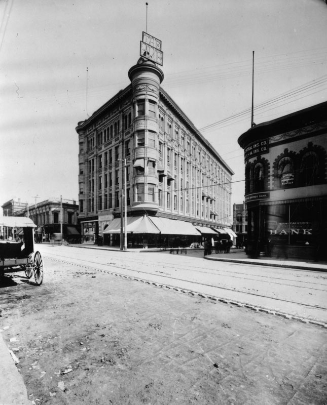
| (ca. 1900)* - View of the John Anson Bullard Block on Spring and Court streets, looking north on Spring. Southern California Savings Bank is on the southeast corner across the street. Streetcar tracks are seen on Spring, and a carriage is parked at left. A lighted sign above the turret announces the bar in the building. |
Historical Notes The Bullard Block was once the site of the old Clocktower County Courthouse. Today, City Hall stands at this location. |
 |
|
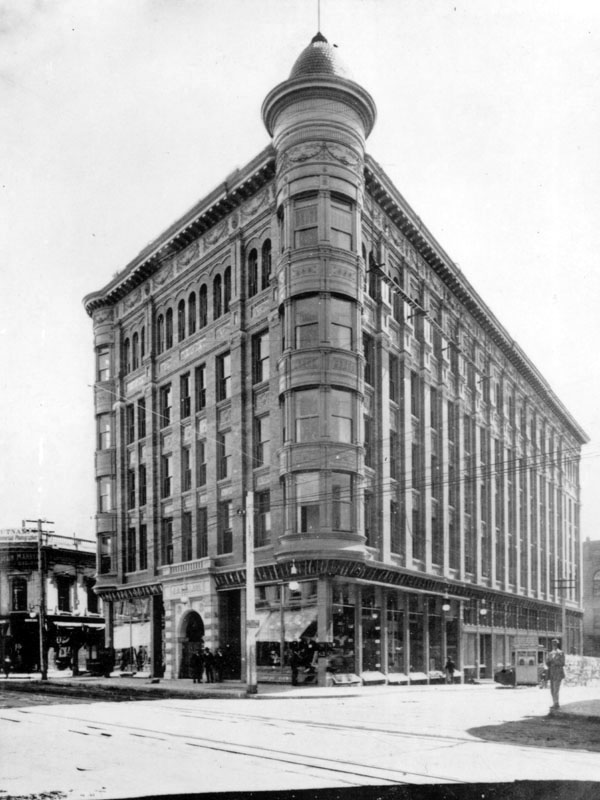
| (ca. 1900)* - View of the intersection of Spring and Court streets. The Bullard Building stands on the northeast corner. The building was designed by Architects Morgan & Walls. |
 |
|
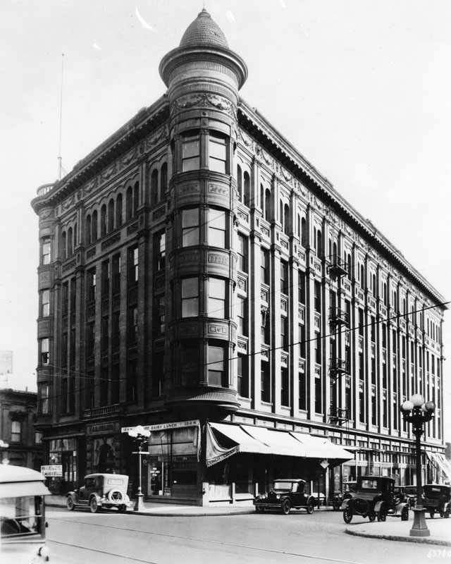
| (ca. 1925)* - Exterior view of the Bullard Block located on the northeast corner of Spring and Court streets. At one time the building housed the courthouse. Note the ornate 5-bulb lamps on the corners. Click HERE to see more in Ealry L.A. Street Lights. |
 |
|
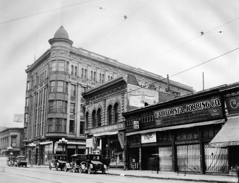
| (1925)* - The five-story J.A. Bullard Block on Spring and Court Streets, looking north on Spring in 1925. The building is on the northeast corner of the intersection. California Importing Co. is on the southeast corner. Next to it is the L.A. Mission Cafe and California Jobbing Co., featuring dishes, glassware, silverware for restaurants and apartments. Streetcar tracks are seen on Spring, and cars are parked on the street. Behind the Bullard Block is Market Street. |
* * * * * |
Hollenbeck Home for the Aged
 |
|
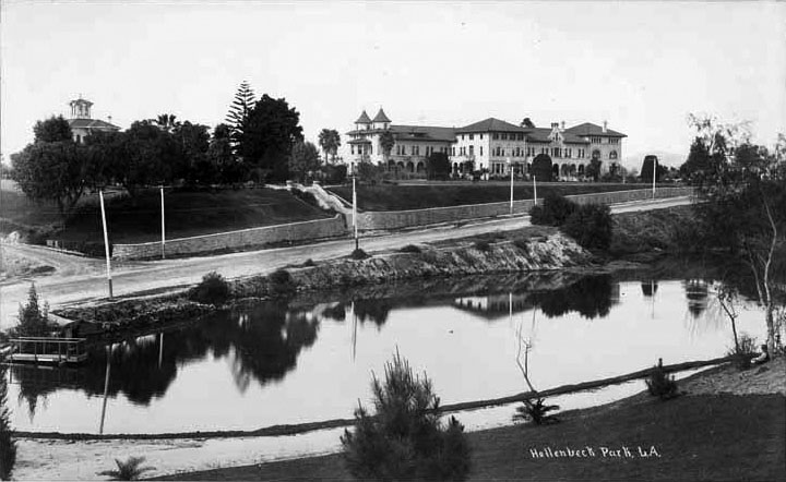
| (ca. 1896)^## - View showing the Hollenbeck Home for the Aged on a hill opposite Hollenbeck Park. In upper left is standing J.E. Hollenbeck's original residence. |
Historical Notes This early charity devoted to housing destitute elderly Los Angelenos opened on 09/06/1896 and was supported by the German-born philanthropist Elizabeth Hollenbeck (1827-1918). Elizabeth and her husband John,(1829-1885), migrated to Southern CA from Nicaragua, where they operated successful shipping lines and a hotel in the city of Greytown, now known as San Juan de Nicaragua. The couple arrived in Los Angeles in the spring of 1876 and John began actively buying real estate in town. He also became associated with bankers in town, becoming an official with the Commercial Bank of Los Angeles. He opened a hotel in Los Angeles, the Hollenbeck Hotel, in 1882, which became one of the most respected establishments of the period in the city. He passed away of a stroke in 1885, but Elizabeth lived on for another 33 years, emerging as a significant donor to various charities. She became active in a local Presbyterian congregation, later the Hollenbeck Presbyterian Church, and through these connections got the idea of opening a home for the elderly who lacked money to care for themselves.*##* |
 |
|
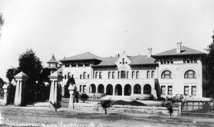
| (ca. 1896)* - View showing the main building of the Hollenbeck Home for the Aged in Boyle Heights shortly after it was constructed. |
Historical Notes According to Sam Watters, writing in the Los Angeles Times, the Hollenbeck Home for the Aged housed at its opening "...34 women and 12 men representing eight nationalities and eight faiths.... They were, as one recalled, the 'fortunate unfortunates.' They were older than 60, residents of California and without sufficient financial support. At the home they were secure, their expenses paid for life." *##* |
 |
|
| (1904)* - Hollenbeck Home for Aged on South Boyle Street. Source: Library of Congress |
 |
|
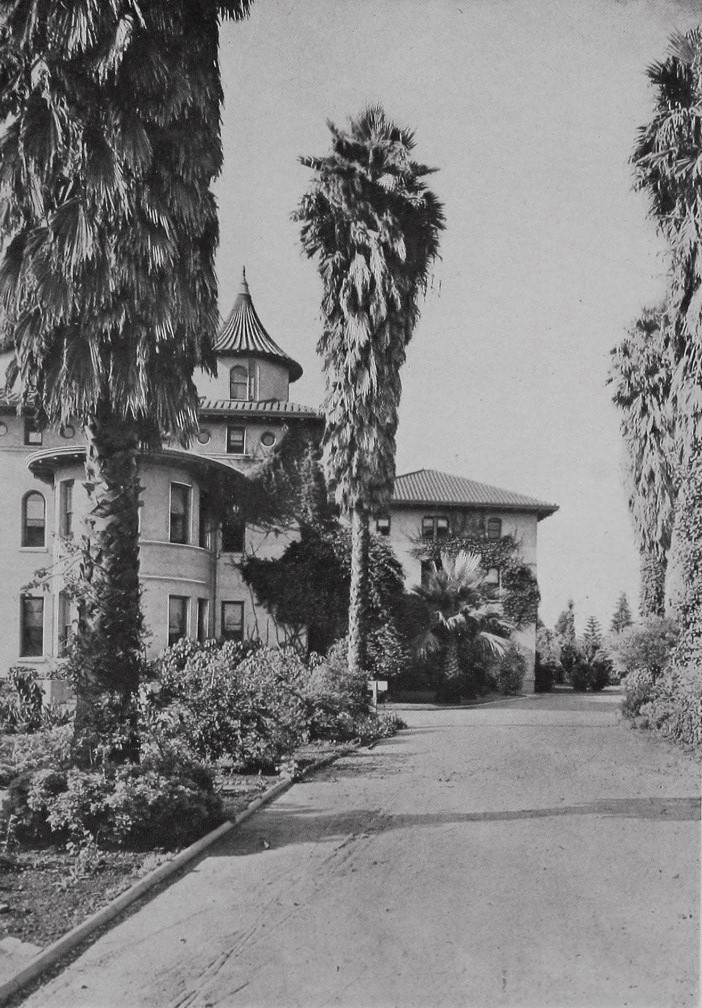
| (Early 1900s)* - View of the Hollenbeck Home for retired people in Boyle Heights, across the street from Hollenbeck Park. |
Historical Notes Originally built in 1896 and designed by architect Edelman, the Mission-Revival building had two addions, 1908 and 1923, the latter work designed by Morgan, Walls, and Clements.*##* |
 |
|
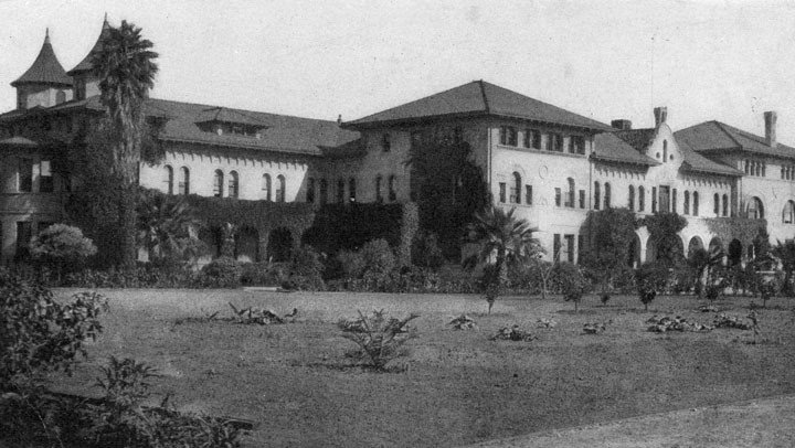
| (ca. 1936)* - View showing two cars parked in front of the Hollenbeck Home for the Aged, located at 573 South Boyle Avenue in Boyle Heights. |
Historical Notes Due to its masonry construction, the Hollenbeck House could not withstand seismic tremors and was not up to modern building codes. The Hollenbeck Trust razed the building in 1985 and replaced it with a more modern elder-care facility.*##* |
* * * * * |
Hotel Metropole
 |
|
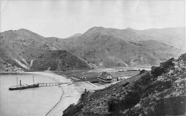
| (ca. 1888)#**^ - View of a steamer docked at a pier in Avalon Bay in front of the newly constructed Hotel Metropole, Catalina Island. |
Historical Notes The first owner to try to develop Avalon into a resort destination was George Shatto, a real estate speculator from Grand Rapids, Michigan. Shatto purchased the island for $200,000 from the Lick estate at the height of the real estate boom in Southern California in 1887. Shatto created the settlement that would become Avalon, and can be credited with building the town's first hotel, the original Hotel Metropole, and pier. His sister-in-law Etta Whitney came up with the name Avalon, which was taken from Alfred, Lord Tennyson's poem "Idylls of the King," about the legend of King Arthur.^* |
 |
|
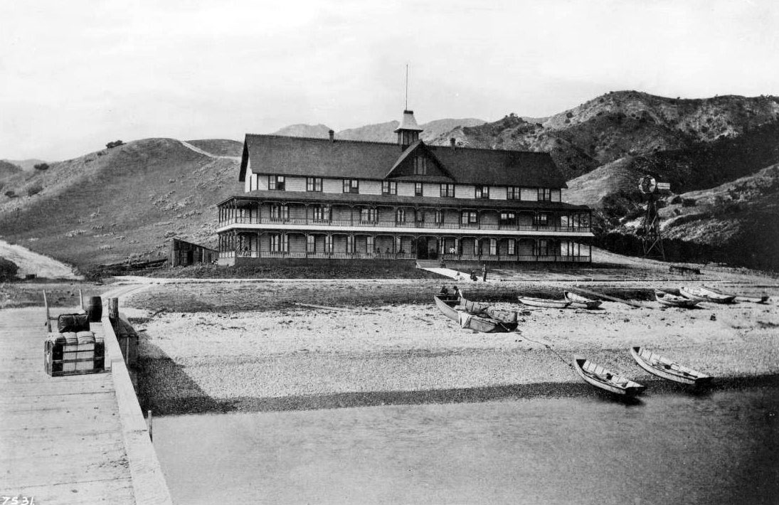
| (ca. 1888)* - View of the Hotel Metropole at Avalon Bay. The long, three-story hotel is pictured at center, just off the beach, featuring both a porch on which several people are visible, and second-floor balcony. More people stand at the end of the paved walkway from the hotel, watching two boatmen pull their boat ashore. Several other boats are in their vicinity. Mountains are visible in the background. Part of the wharf, on which a steaming trunk can be seen, is visible in the left foreground. A windmill stands to the right of the hotel. |
Historical Notes The Hotel Metropole was completed in 1888 and became Catalina's grande dame. It was a large 3-story wooden structure with views of the bay that boasted of numerous windows, several dormers, half a dozen chimneys, and two covered patios. |
 |
|
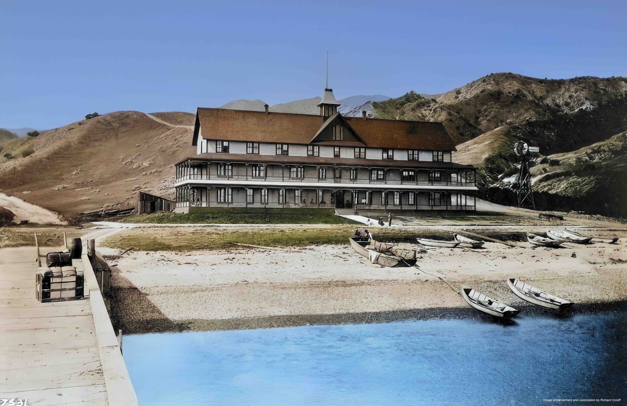
| (ca. 1888)* - View of the Hotel Metropole at Avalon Bay. The long, three-story hotel is pictured at center, just off the beach, featuring both a porch on which several people are visible, and second-floor balcony. More people stand at the end of the paved walkway from the hotel, watching two boatmen pull their boat ashore. Several other boats are in their vicinity. Mountains are visible in the background. Part of the wharf, on which a steaming trunk can be seen, is visible in the left foreground. A windmill stands to the right of the hotel. Photo by C. C. Pierce; Image enhancement and colorization by Richard Holoff. |
 |
|
| (ca. 1890s)^^ - Panoramic view looking southeast showing Hotel Metropole and steamer Hermosa. The large boat is docked at the pier with smaller boats in the water. Tents are visible close to the beach as well as buildings. Women are wearing high collared long sleeved dresses and gloves. On the right can be seen a windmill and clothes hanging on a clothesline. |
 |
|
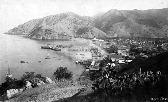
| (ca. 1898)^## - View looking south toward Avalon from the top of a mountain above Sugarloaf Point. Two steamboats can be seen in the bay near the pier. The Hotel Metropole is the largest structure in town, however more and more buildings are beginning to spring up near the hotel. A large number of tents occupy the land between the hotel and the mountains. |
 |
|
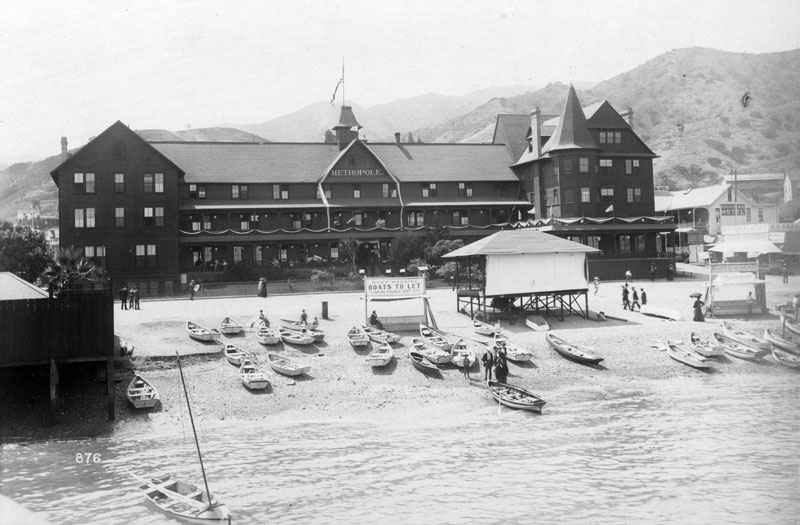
| (ca. 1900)* - View of the historic Hotel Metropole located at 205 Crescent Avenue on Santa Catalina Island. Several people take a leisurely stroll through the streets, and at least two dozen boats are 'docked' on the beach. A sign next to a small structure reads: "Bert Harding - Boats to let - Fishing, tackle, Bait, etc." |
Historical Notes The Hotel Metropole was such a success that additions to it were made in 1893 and 1897. The 1897 addition gave the hotel 58 more rooms as well as a large reception area and a ballroom.* |
.jpg) |
|
| (ca. 1900)* - View of the Hotel Metropole on Santa Catalina Island. The E.E. Beeson & Co. building, selling general merchandise, bakery and delicacies, is to the right of the hotel, and Troy Laundry Co. is to the right of that. Several people can be seen taking a leisurely stroll through the street, as others sit at the base of the beach, watching swimmers. A horse-drawn wagon is seen "parked" in the background. |
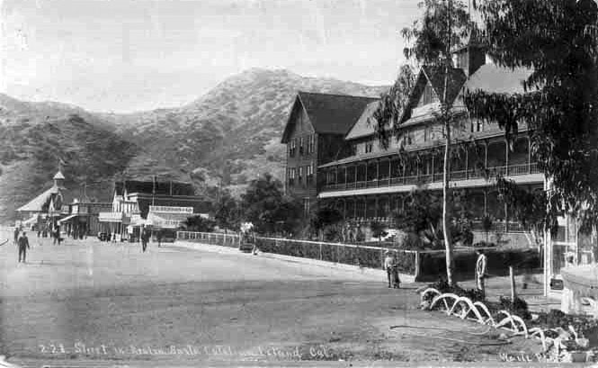 |
|
| (ca. 1900)* - Postcard view showing the historic Hotel Metropole on Santa Catalina Island. Several smaller buildings are seen in the distance with the rugged Avalon mountainscape standing in the far background. |
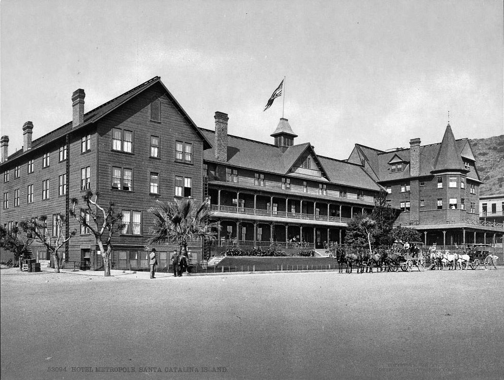 |
|
| (1901)## – View of the Hotel Metropole in Avalon, Catalina Island. Two horse-drawn wagons are seen parked in front of the hotel. |
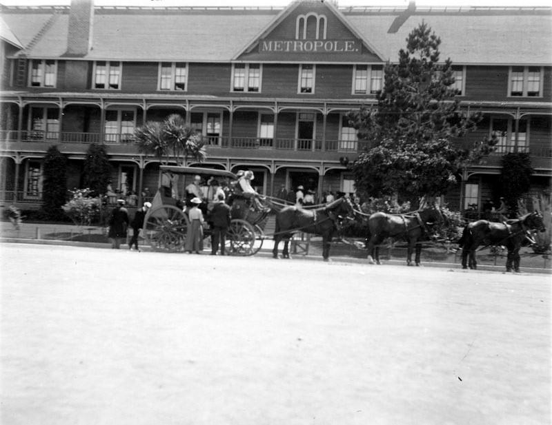 |
|
| (ca. 1900)* - Front view of the historic Hotel Metropole. Several men and women gather in and around a horse-drawn carriage, which is 'parked' at the front of the hotel, while a few more people are visible at the hotel's entrance. The stage coaches would take hotel guests to various spots around the island such as Lover's Cove and Descanso Beach. |
Historical Notes After the Banning brothers bought Catalina in 1891, they had better luck in developing the island to accomodate tourism. They developed Avalon into a proper resort community, made roads into the island’s interior for stagecoach tours and access to hunting lodges. The new roads also enabled tourists to get to Descanso Beach, Lover’s Cove, and other locations, from the town of Avalon.*#*^ |
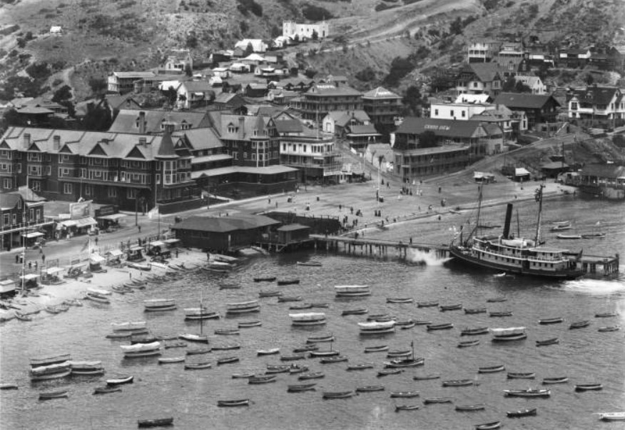 |
|
| (ca. 1905)* - Close-up view of the Town of Avalon showing the Metropole Hotel and Grand View Hotel, as well as the pier and many small boats in the water. The steamer S.S Hermosa is docked at the wharf. |
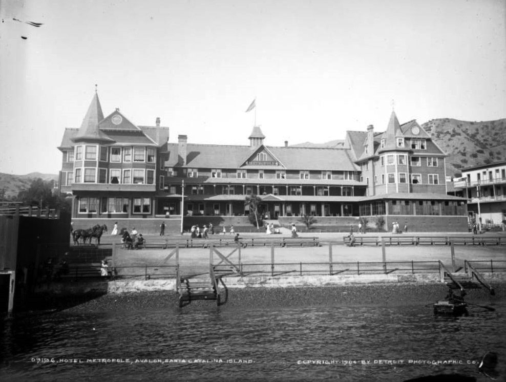 |
|
| (1904)#^ – View of the Hotel Metropole from the bay. People are seen sitting on benches while others walk on the road in front of the hotel. The Victorian structure has gables, a columned balcony, and front porch. A sign reads, "Metropole." Stairs lead down to the bay in front of the hotel. |
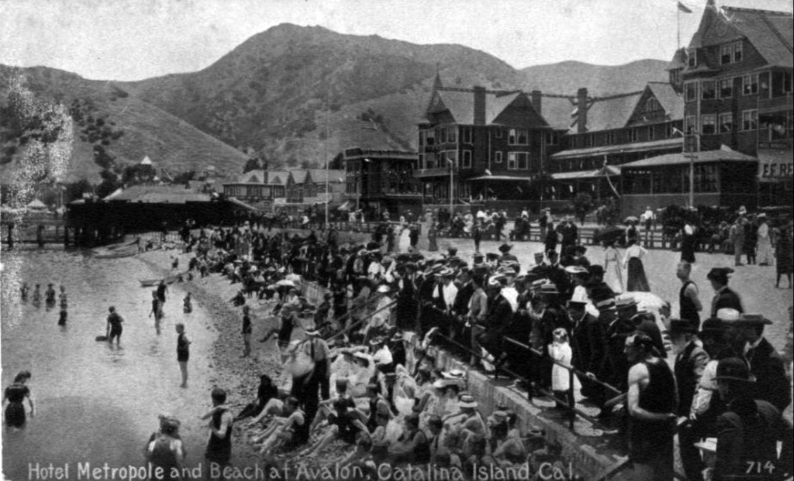 |
|
| (ca. 1907)^^ - View showing a large group of people looking out toward the bay at possibly some type of water event. The Hotel Metropole is seen in the background. |
Historical Notes The Metropole continued to thrive during the early years of the 20th century, right up until the disastrous early morning hours of Nov. 29, 1915. Between 3:30 and 4:00 a.m., a fire started mysteriously near the rear of the hotel. Avalon’s small fire department quickly was overwhelmed by the blaze, which spread until it had destroyed fully half of the town’s hotels and buildings. Many residents were left homeless.^##* A few years later, the hotel was rebuilt on the same site but was significantly downsized, this time consisting of only 48 rooms and a luxurious 2-bedroom Beach house.* A 52-room Hotel Metropole now stands on the site of the original structure in Avalon at the center of the Metropole Market Place development.* |
Click HERE to see more in Early Views of Catalina |
* * * * * |
Please Support Our CauseWater and Power Associates, Inc. is a non-profit, public service organization dedicated to preserving historical records and photos. Your generosity allows us to continue to disseminate knowledge of the rich and diverse multicultural history of the greater Los Angeles area; to serve as a resource of historical information; and to assist in the preservation of the city's historic records.
|
For more Historical Los Angeles Views click one of the following:
For Other Historical Views click one of the following
See Our Newest Sections:
To see how Water and Electricity shaped the history of Los Angeles click one of the following:
Water:
Power:
References and Credits
* LA Public Library Image Archive
**DWP - LA Public Library Image Archive
^^Calisphere: University of California Image Archive
*# Mojave Desert.net: Remi Nadeau
#* Ancestory.com - Margarita Bandini Winston
#^Huntington Digital Library Archive
^#KCET - The Lost Hills of Downtown Los Angeles; Lost LA
+#Life of Pio Pico - Pio Pico State Historic Park
##Library of Congress Image Archive
++*Facebook.com - Bizarre Los Angeles
**^LA Fire Department Historical Archive
**#Tumblr.com - LA History: LA Times; Leonis Adobe; Larronde Block
*##Historic Los Angeles Theatres: Grand Opera House; Orpheum Theatre
^^^Oviatt Library Digital Archives
^^#The Museum of the San Fernando Valley
***Los Angeles Historic - Cultural Monuments Listing
*^*California Historical Landmarks Listing (Los Angeles)
^*#Noirish Los Angeles - forum.skyscraperpage.com; Ruber Home; Villa Brunner; LA County Courthouse; Barlow Medical Library Interior; Robinson Manison and Teed Street; Main and 4th
*#*Historic Hotels of Los Angeles and Hollywood (USC - California Historic Society)
^##California State Library Image Archive
+##GlamAmor.com: Bradbury Building
##+Facebook.com: Photos of Los Angeles
+^^Facebook.com: West San Fernando Valley Then And Now
+**Facebook.com: Old Photos of Los Angeles
+++Mt. Lowe Preservation Society
*^^Nuestra Señora la Reina de los Ángeles: Bradbury Building
^*^*TheZephyr.com: O.T. Johnson
*^*^St. Mary's Catholic Church
^^^*UC Davis: Bradbury Family Papers
*^^^Big Orange Landmarks: Forthmann House and Forthmann Carriage House
^^**Flickr.com - Floyd B. Bariscale Photostream
^^##UC Irvine - The White City by Miles Clement
^#**Historic Hotels of Los Angeles and Hollywood (USC - California Historic Society)
^#*#Online Archive of California: Barlow Medical Library
^##*South Bay Daily Breeze: Hotel Metropole; Spring Training with the Cubs on Catalina
*#*#Flickr.com: Michael Ryerson
^###Electronic Scrapbook of Alhambra History
*#*^University of Maryland Digital Archive
*#^^A House for Equal Justice - Judge Elizabeth R. Feffer
*##*Pacific Coast Architecture Database (PCAD): Bryson-Bonebrake Block; Hollenbeck Home for the Aged
*##^On Bunker Hill: The Zahn Family; St. Angelo Hotel; Hildreth Mansion
***#Salvation Army History: Southern California
#**^LA County Library Image Archive
#^*#Urban Diachrony: Intersection of 3rd and Spring Streets, NW Corner of 8th and Spring Streets
#**#Santa Monica Local History: blogspot.com
#*#^Womans Christian Temperance Union
##**LAist: A Park a Day: Point Fermin Park, San Pedro
##^^The Department Store Museum: J. W. Robinson's
###Denver Public Library Image Archive
^ On Bunker Hill: The Zahn Family; Crocker Mansion; Hershey Residence; St. Angelo Hotel; Hildreth Mansion; Larronde Block and Residence
^* Wikipedia: Abel Stearns; Pío Pico; Workman-Temple Family; Jonathan Temple; Los Angeles Herald-Examiner; Charles Maclay; Los Angeles High School; Cathedral of Saint Vibiana; John Edward Hollenbeck; Foy House; Isaias W. Hellman; Isaac Newton Van Nuys; Wells Fargo; Los Angeles Plaza Historic District; Harrison Gray Otis; Harris Newmark; Bradbury Building; LA Oil Discover; Stimson House; Alhambra; Bank of America Center; La Grande Station; Santa Catalina Island; Pt. Fermin Lighthouse; Herman W. Hellman; Farmers and Merchants Bank of Los Angeles; Pan American Lofts
< Back