Early Views of Santa Monica
Historical Photos of Early Santa Monica |
 |
|
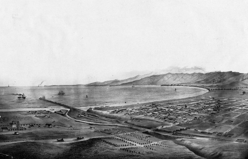
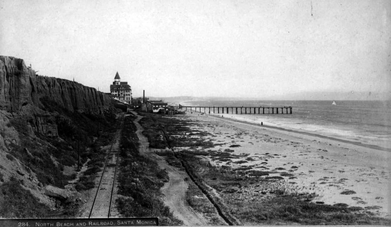
| (ca. 1875)* - View of Santa Monica and bay showing the road and wharf of the Los Angeles & Independence Railroad, about 1875. The wharf was completed in 1875 and sold in June 1877 to the Southern Pacific Railway Company, This print was photographed from an old lithograph. |
Historical Notes To make the town marketable, Jones built a 16-mile rail line between the Santa Monica Bay waterfront and downtown Los Angeles, naming it the Los Angeles and Independence Railroad. It was only the second railroad built in Los Angeles; the first was the Los Angeles and San Pedro, which opened in 1869.*#* |
 |
|
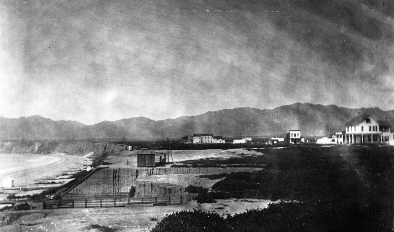
| (1877)* - View of Santa Monica looking north from the present Colorado Street, overlooking Ocean and 2nd Avenues. |
Historical Notes |
 |
|
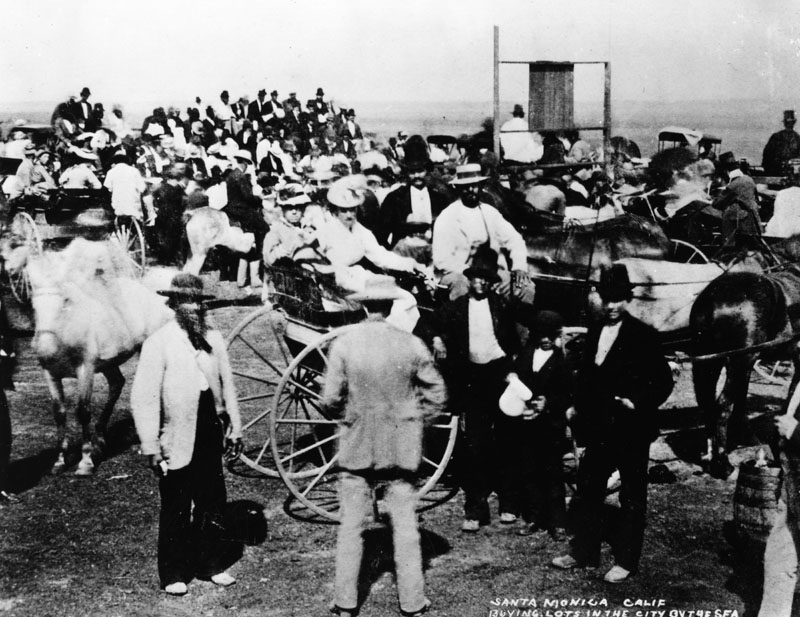
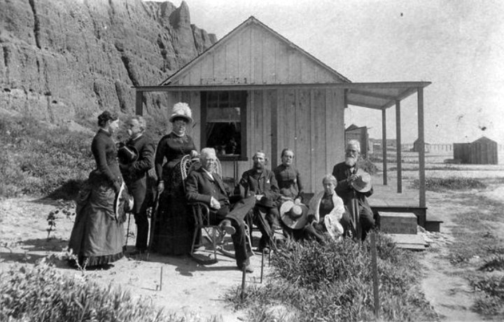
| (1875)* - Investors gathering to buy lots in Santa Monica which was promoted as the "City by the Sea." |
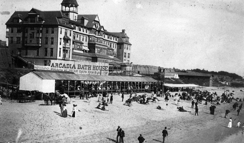
Historical Notes The land was auctioned on July 15, 1875 by the San Francisco Office of the Santa Monica Land Company. The advantages of Santa Monica were emphasized, particularly the superiority of its harbor over that of San Pedro.* The lots sold for $500 and $750. Within a few weeks after the town lot sale a change had come over the barren plain. Houses and stores sprang up, a general store was opened and a newspaper started.^#* |
 |
|
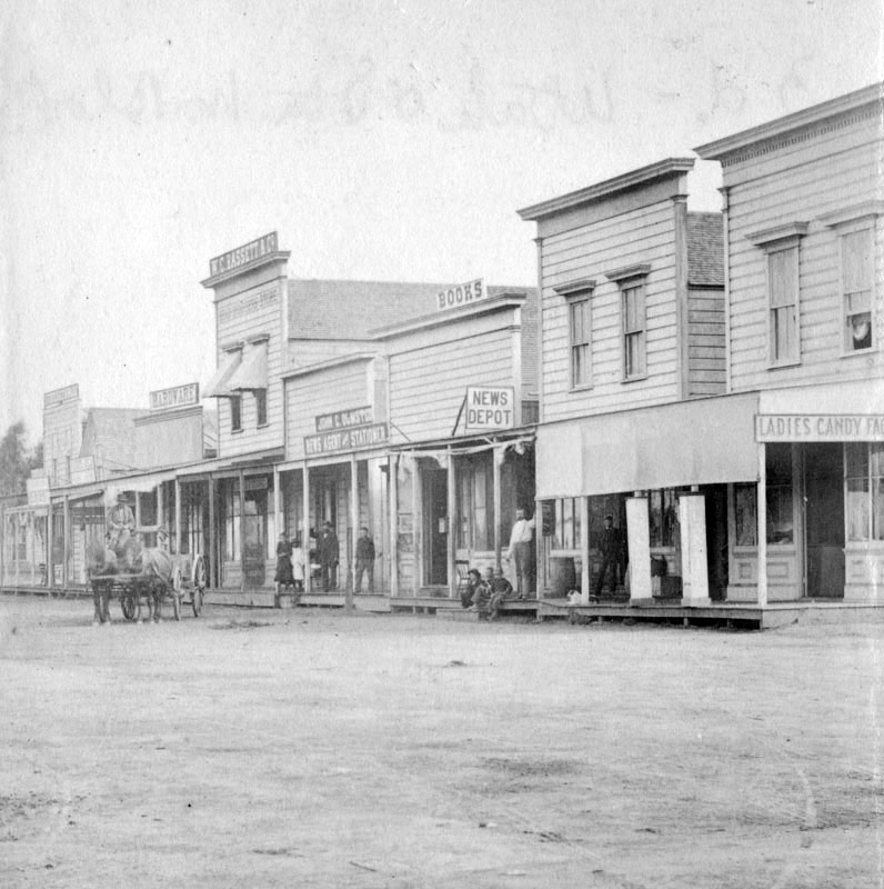
| (1880)* - Photo of the business block on Third Street, between Utah and Oregon (now Santa Monica Boulevard). Today, this is the site of the 3rd Street Promenade. Click HERE to see more early views of the 3rd Street Promenade. |
Historical Notes The town continued to grow and, in November 1886, the electorate went to the polls and voted 97 to 71 to incorporate Santa Monica.^#* |
 |
|
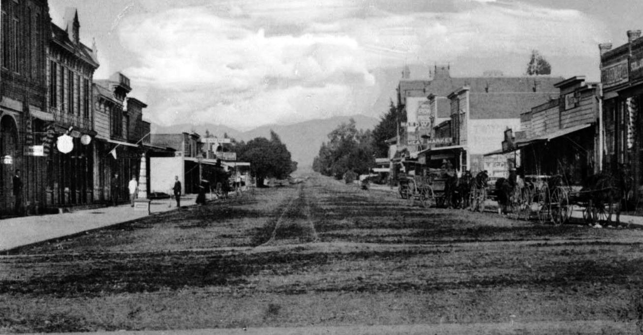
| (ca. 1891)** – Panoramic view of Santa Monica's Third Street from Broadway to Nevada Boulevard. The dirt street is lined with square buildings containing various shops and stores. Several horse-drawn wagons are lined up at right, and there are pedestrians at left. The Opera House and the Catholic Church are on the right side of the street, while the First Presbyterian Church is on the corner of Nevada. The First Presbyterian Church can also be seen at the corner of Nevada Boulevard. |
 |
|
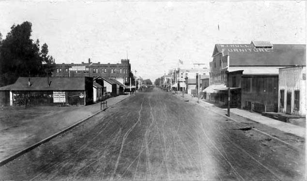
| (ca. 1896)^^ - Third Street looking north from Colorado Street, towards Broadway and Santa Monica Boulevard. View shows dirt street lined with clapboard stores and shops, one two-story brick castle-like building with crenelated turret (left center), W.T. Hull Furniture sign on roof of building at right, street trolley at distant center. |
Los Angeles & Independence Railroad
 |
|
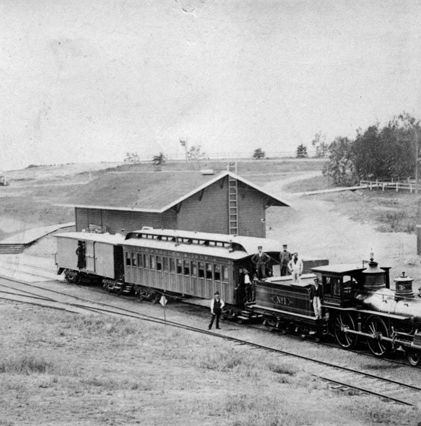
| (ca. 1875)* - View of a Los Angeles & Independence line passenger train sitting in front of the Santa Monica railway station. Several men standing on and adjacent to the train are posing for the photographer. |
Historical Notes The Los Angeles and Independence Railroad (LA&I) opened in 1875. It was a steam powered rail line which travelled from a wharf North of the current Santa Monica Pier in Santa Monica along a private right-of-way to 5th and San Pedro Street in downtown Los Angeles. The 16.67 miles of track between Los Angeles and Santa Monica were built by John P. Jones without government subsidies or land grants, all in a little over ten months - primarily using 67 Chinese laborers imported for the task. Right-of-way between Los Angeles and Santa Monica was given by local ranchers who were anxious to have access to a railroad. The line opened October 17, 1875, with two trains a day running between Santa Monica and Los Angeles; the fare was fixed at $1.00 per trip, freight at $1.00 per ton.*^ |
 |
|
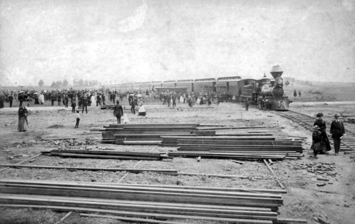
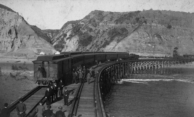
| (ca. 1877)#^^ - Crowds of people surround a train in Santa Monica shortly after the Los Angeles & Independence RR was acquired by Southern Pacific. Piles of lumber are seen in the foreground. |
Historical Notes The Los Angeles and Independence Railroad helped make Santa Monica palatable to real estate speculators and prospective residents, but Jones, who was politically well-connected as a U.S. senator from Nevada, had grander plans for the railroad. Intending to connect the line with the town of Independence in the Owens Valley, and from there to a silver mine he owned in the Panamint Mountains, Jones optimistically included "Independence" in his railroad's name. Jones, however, encountered financial problems stemming from his mines drying out. He reluctantly sold the Los Angeles and Independence to Collis P. Huntington's Southern Pacific Railroad on July 1, 1877 for $195,000.*#* Click HERE for more on the Los Angeles and Independence Railroad. |
Los Angeles & Independence Railroad Wharf (aka Shoo Fly Wharf)
 |
|
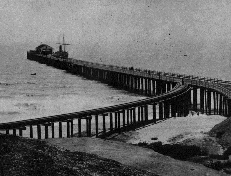
| (1877)* - View of the wharf built by the Los Angeles Independence Railroad Co. in Santa Monica (aka Shoo Fly Landing). |
Historical Notes As soon as work started on Los Angeles Independence Railroad line from Los Angeles to Santa Monica the construction of a new wharf was begun. This was located near the old "Shoo Fly" landing and near the present foot of Colorado Street, where a stub of the old wharf still remains. The first pile was driven April 22nd, 1875, and the first boat landed at the wharf in June. This wharf was 1700 feet in length and reached a depth of thirty feet at low tide. It was substantially built, with depot, and warehouses at its terminus and cost about $45,000. The wharf would be sold to Southern Pacific Railway Company in 1877. One short year later, Southern Pacific deemed the wharf unsafe for train usage and by 1888 it was torn down. ### |
 |
|
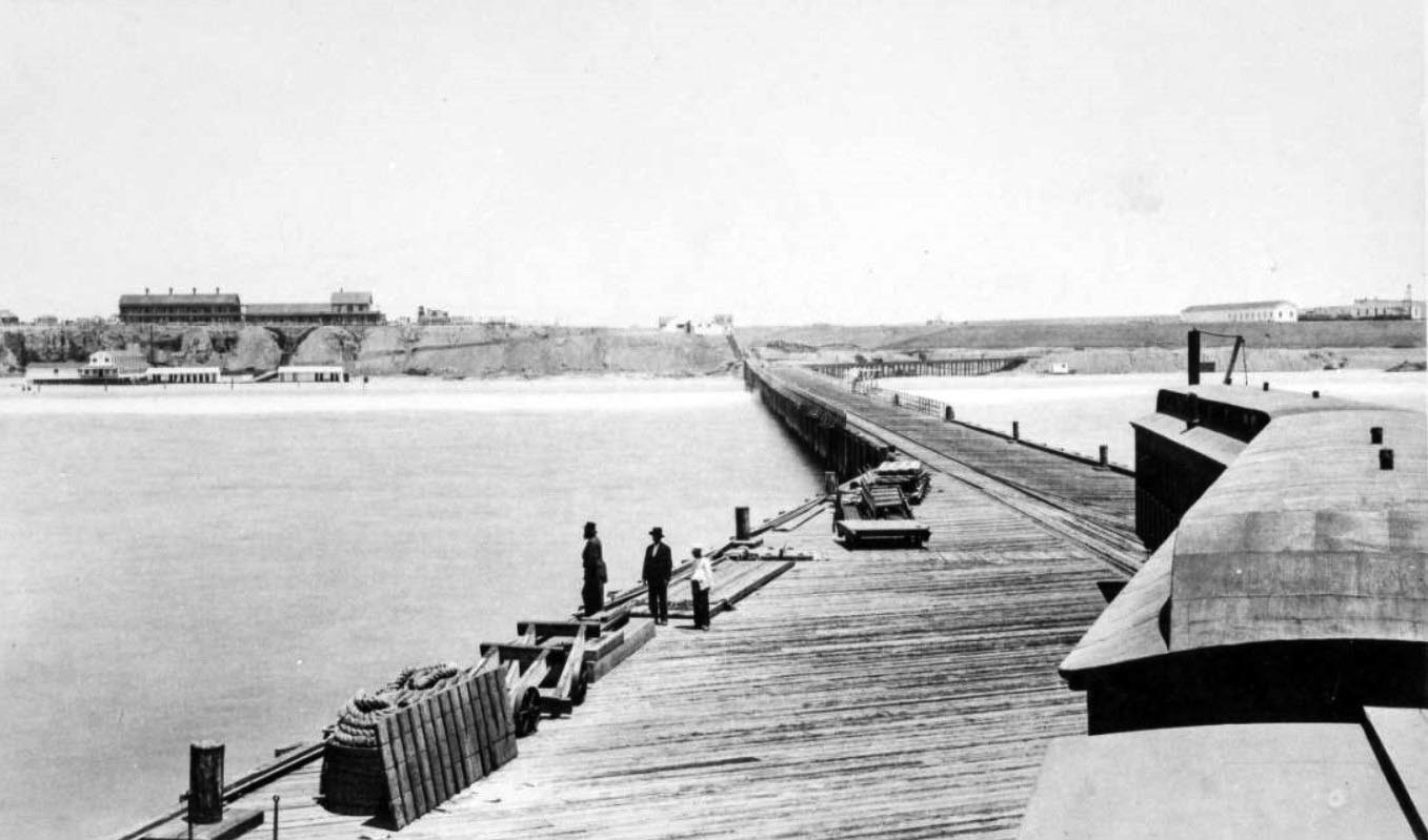
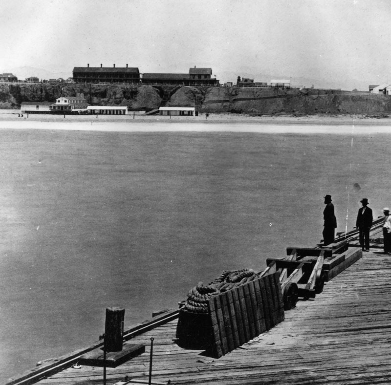
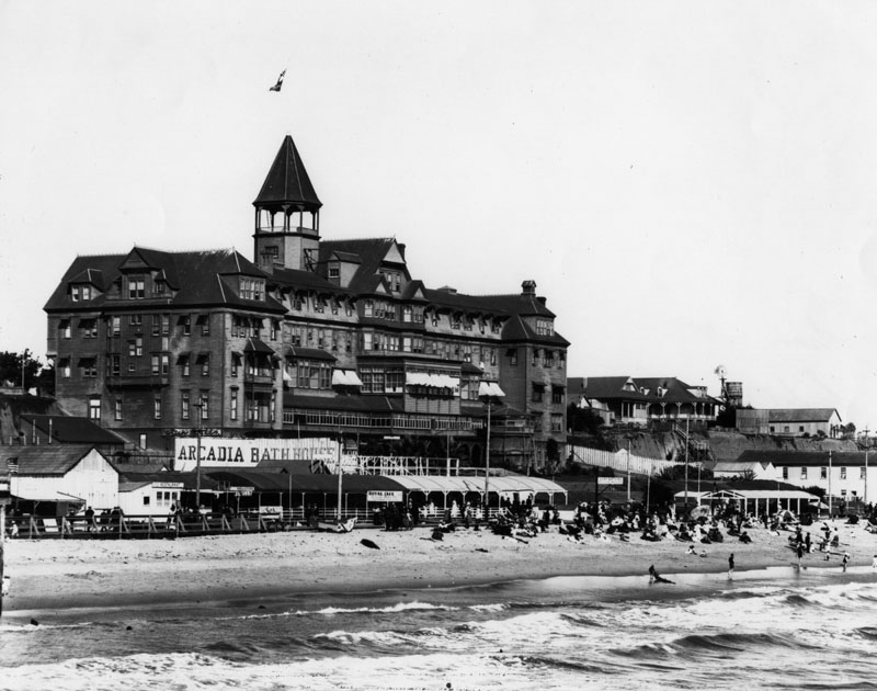
| (1877)#^^ - Panoramic view of the shoreline as seen from the roof of a railroad train at end of the Los Angeles and Independence Wharf with the Santa Monica Hotel on the Palisades bluffs and the Santa Monica Bath House on the beach below. |
Historical Notes The wharf stood just south of the present location of the Santa Monica Pier at the foot of Colorado Avenue. Photo date devised based on the history of the Santa Monica Hotel, which was built in 1877 and the history of the photographer, Carleton E. Watkins, who made two visits to Southern California in 1877 and 1880. |
Santa Monica Beach
 |
|
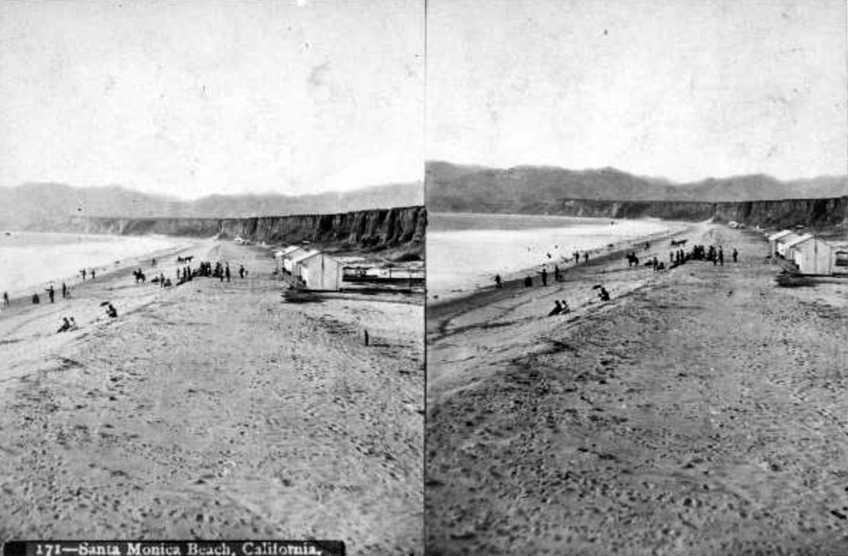
| (1870s)#^^ - Stereoscopic photo showing the beach in Santa Monica with beachgoers and buildings visible, including Michael Duffy's bathhouse visible in the background at the foot of the stairs along the Palisades cliffs. Note the horseback rider on the beach. |
Historical Notes Duffy’s Bathhouse was the first bathhouse on Santa Monica’s beach. It was built by Michael Duffy beneath the Santa Monica Hotel in 1876 and had 2 structures with 16 rooms with their own freshwater bath and shower. It closed in 1892. |
 |
|
| (ca. 1884)** - View showing the Santa Monica Bathhouse next to Duffy's Bathhouse on Santa Monica Beach. The long, two-story barn-style bathhouse stands in the background just below the land shelf behind it where a small residence-style house has been built. Crowds of beachgoers make their way towards the water to the left and a few have already made it in. |
Historical Notes The Santa Monica Bathhouse was built next to Duffy's Bath House in 1876 by Baker & Jones and located at the foot of Utah Avenue. It featured rooms for rent, enormous bathtubs and two steam rooms. It was replaced by the North Beach Bath House in 1898. |
 |
|
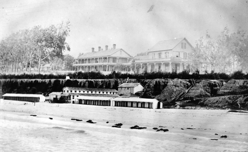
| (ca. 1885)* - View of the beachfront Santa Monica Bathhouse alongside Duffy's Bathhouse. At center-right can be seen the roofline of the new Santa Monica Hotel (built in 1885). |
Santa Monica Hotel
 |
|
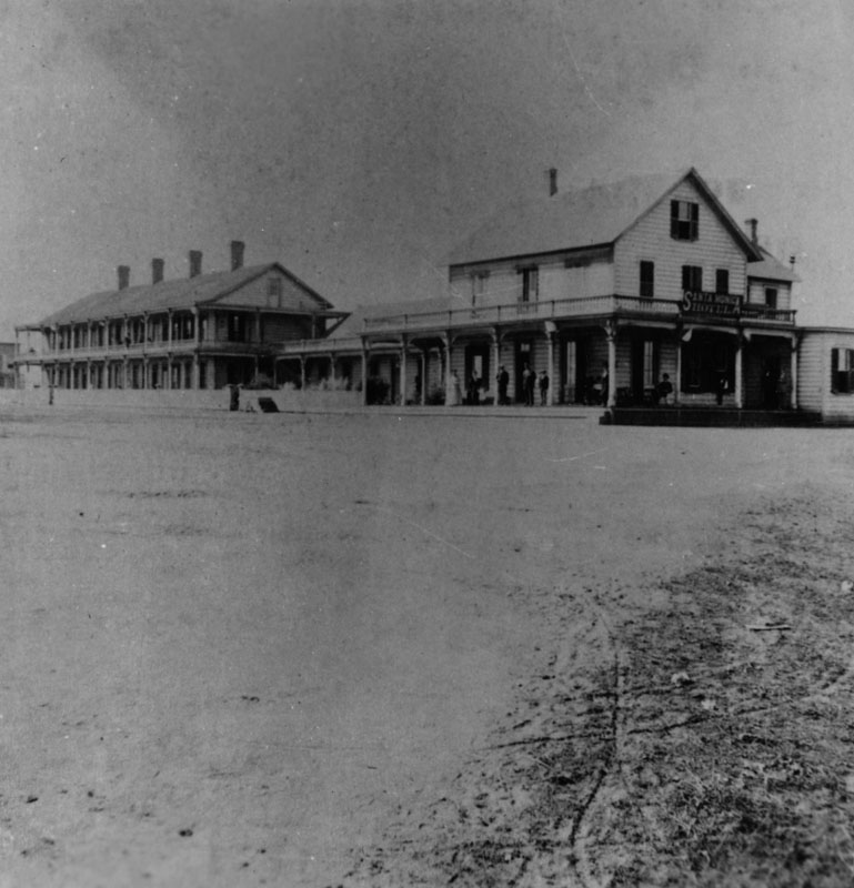
| (1885)#^^ - Image of the Santa Monica Hotel on Ocean Avenue with railroad tracks visible in the foreground. A sign that reads "sea shells" is painted on a building at right. |
Historical Notes The Santa Monica Hotel, the town's first, was constructed in 1885 to accommodate the increase in tourism resulting from the construction of the new railroad line.*^ |
 |
|
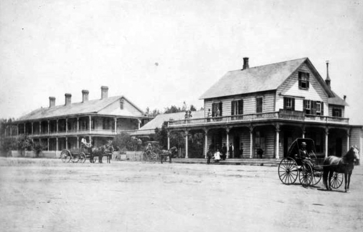
| (1885)* - Closer view of Santa Monica's first hotel, the Santa Monica Hotel, on Ocean Avenue between Colorado and Utah (now Broadway). Tracks can be seen in the lower right of photo. |
Historical Notes A later image with a bridge built over the ravine that is visible in the center of this image is seen HERE. |
 |
|
| (ca. 1885)** - Photograph of a view of the shore at Santa Monica taken from the Old Santa Monica Hotel. The balcony of the Old Santa Monica Hotel is visible in the left foreground while a long stable-style building stands surrounded with people in the distance. Horse-drawn carriages park and drive along the perimeter of a crescent of post-and-rail fence that demarcates a clearing at center behind which people are seated under a gazebo. Some kind of frame, possibly for the wall of a new building, has been erected to the far left. The ocean is visible in the background. |
 |
|
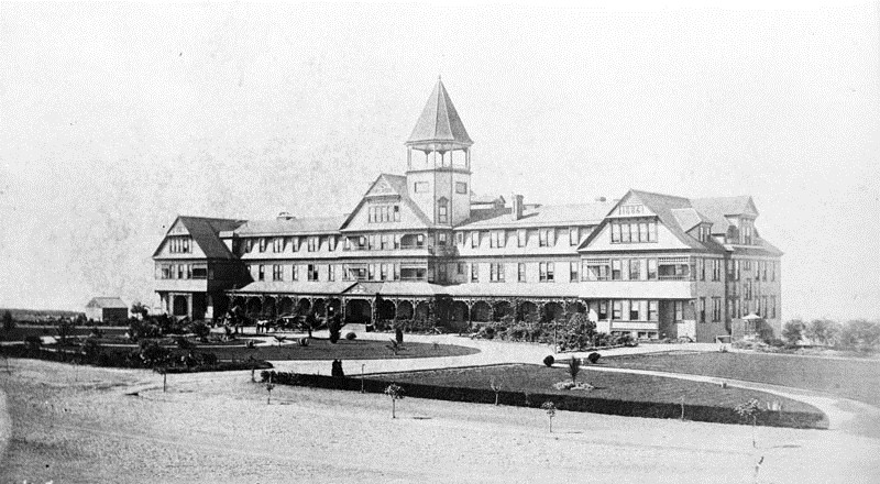
| (1885)* - A close-up view of the short-lived Santa Monica Hotel which burned down in 1887. |
 |
|
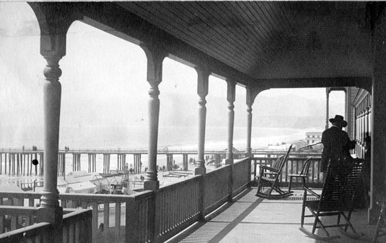
| (ca. 1885)#^^ - View showing the Santa Monica Hotel on Ocean Avenue with horse-drawn wagons and buggies in front and people standing on the porch and balcony. The larger back building housed the sleeping quarters, the front building had offices and the dining room. |
 |
|
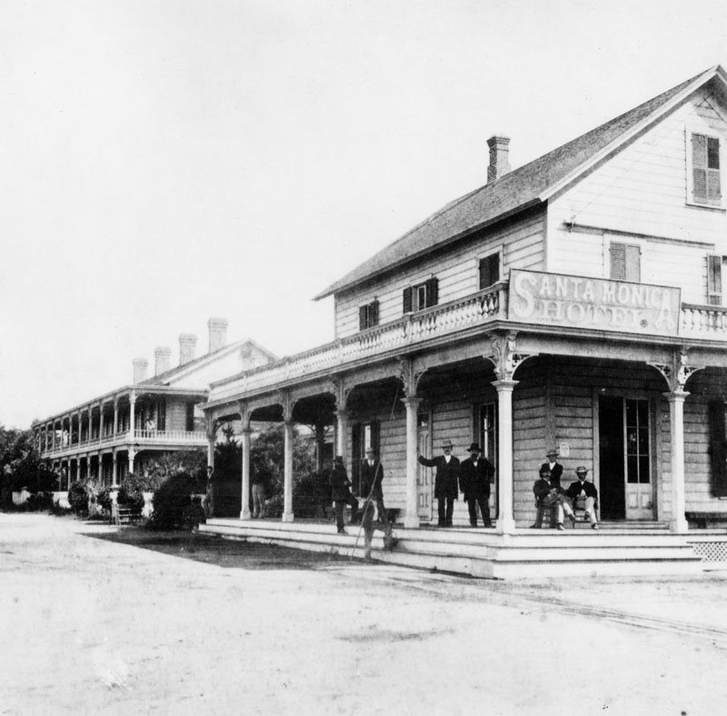
| (1885)* - A clearer image of the Santa Monica Hotel showing several people standing on the porch. |
 |
|
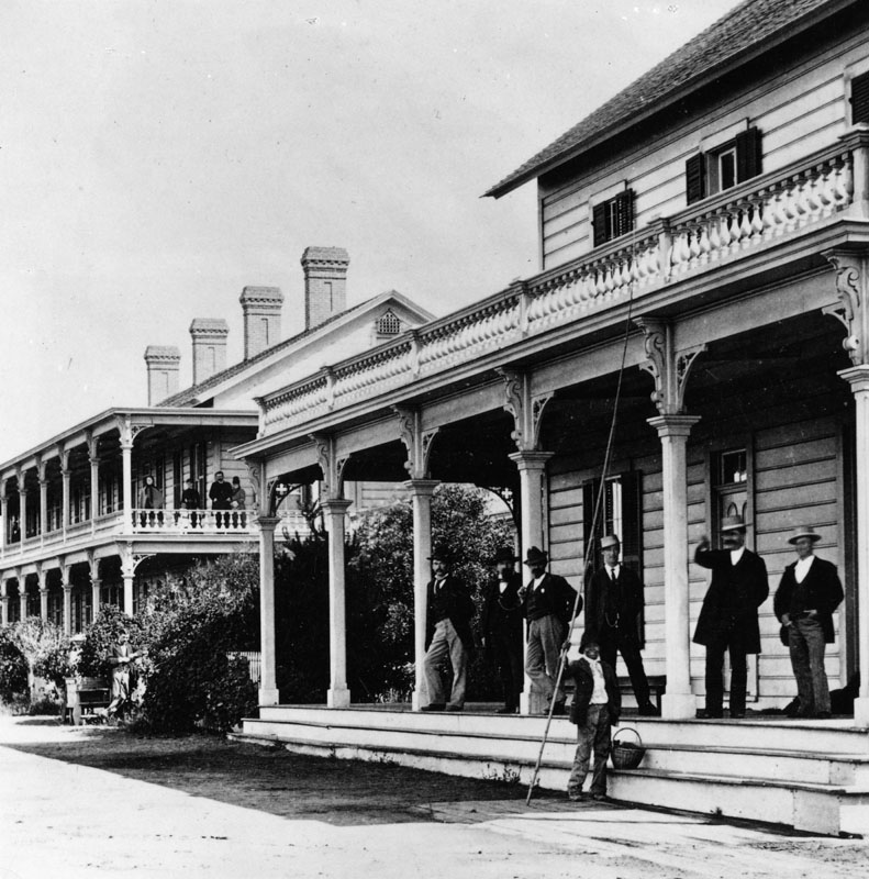
| (1885)* - An even closer view of the Santa Monica Hotel with what appears to be hotel guests standing on the porch and balcony looking toward the photographer. |
Duffy's and Santa Monica Bathhouses
 |
|
| (ca. 1877)* - View looking at the shoreline from near the end of the Los Angeles and Independence Wharf with the Santa Monica Hotel on the Palisades and the Santa Monica Bathhouse on Sunset Beach between Colorado and Utah (now Broadway). |
Historical Notes The first bathhouse on Santa Monica’s beach was built by Michael Duffy beneath the Santa Monica Hotel in 1876 and had 2 structures with 16 rooms with their own freshwater bath and shower. It closed in 1892.*^*^ |
 |
|
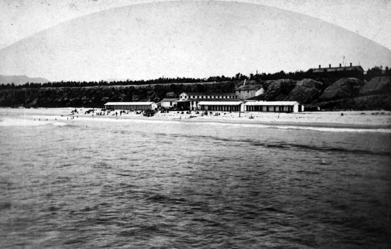
| (ca. 1877)#^^ - Image of people on the beach in front of the Santa Monica Bath House and Michael Duffy's Bath House (two long one-story buildings at right of the two-story Santa Monica Bath House) with the Santa Monica Hotel on the bluffs at right and the Ocean House on the bluffs among the trees at far left. |
Historical Notes During the ensuing years several other bathouses were built at the same site. Bathouses, featuring hot saltwater baths, were a big tourist draw to Santa Monica in the late 1800s and early 1900s.* |
 |
|
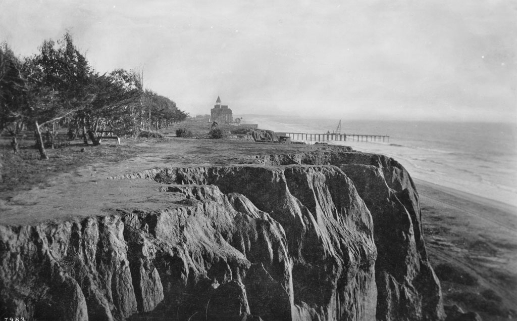
| (ca. 1880)* - The Santa Monica Hotel can be seen on the Palisades, which overlooks the beach at Santa Monica. Several people are standing or sitting on the veranda of the building on the right. A stairways (right) gives easy access from the Palisades to the beach. The two single-story structures in the lower center are Santa Monica beach's first bathouses. |
Historical Notes In 1887 the Santa Monica Hotel burned down. That same year the owner of the former Santa Monica Hotel, J. W. Scott, constructed a massive new hotel, the Arcadia Hotel. It was located near the site of the original Santa Monica Hotel at the corner of Ocean Avenue between Colorado and Pico Boulevard. The luxurious Arcadia Hotel had 125-rooms and featured the latest amenities.* |
Santa Monica Beach
 |
|
| (1880)#^^ - Image of people on the beach in front of the Santa Monica Bath House and Michael Duffy's Bath House (two long one-story buildings at right of the two-story Santa Monica Bath House) with the Santa Monica Hotel on the bluffs at right and the Ocean House on the bluffs among the trees at far left. |
 |
|
| (1880s)#^^ - View showing people on the beach and in the surf in front of the Santa Monica Bath House in Santa Monica, with trees on the bluffs above. A group of women in plain clothes are standing in the foreground. There is a boardwalk near the shops with signs that read "Coffee and Ice Cream Parlor" and "Fruits, Candies, Lemonade, Cigars." A windmill is visible behind the buildings. |
 |
|
| (ca. 1880)#^^ - Image of people on the beach and in the ocean in front of the Santa Monica Bath House, with sign "Hot Salt Water" and beach houses in Santa Monica, with a horse-drawn wagon at center. |
 |
|
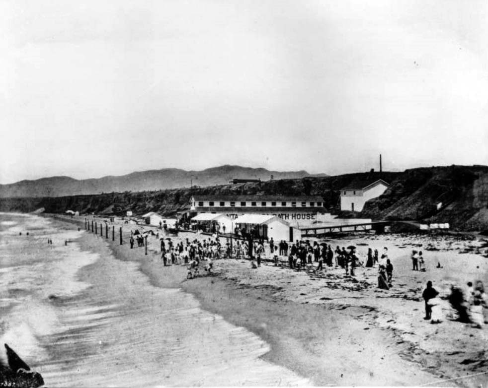
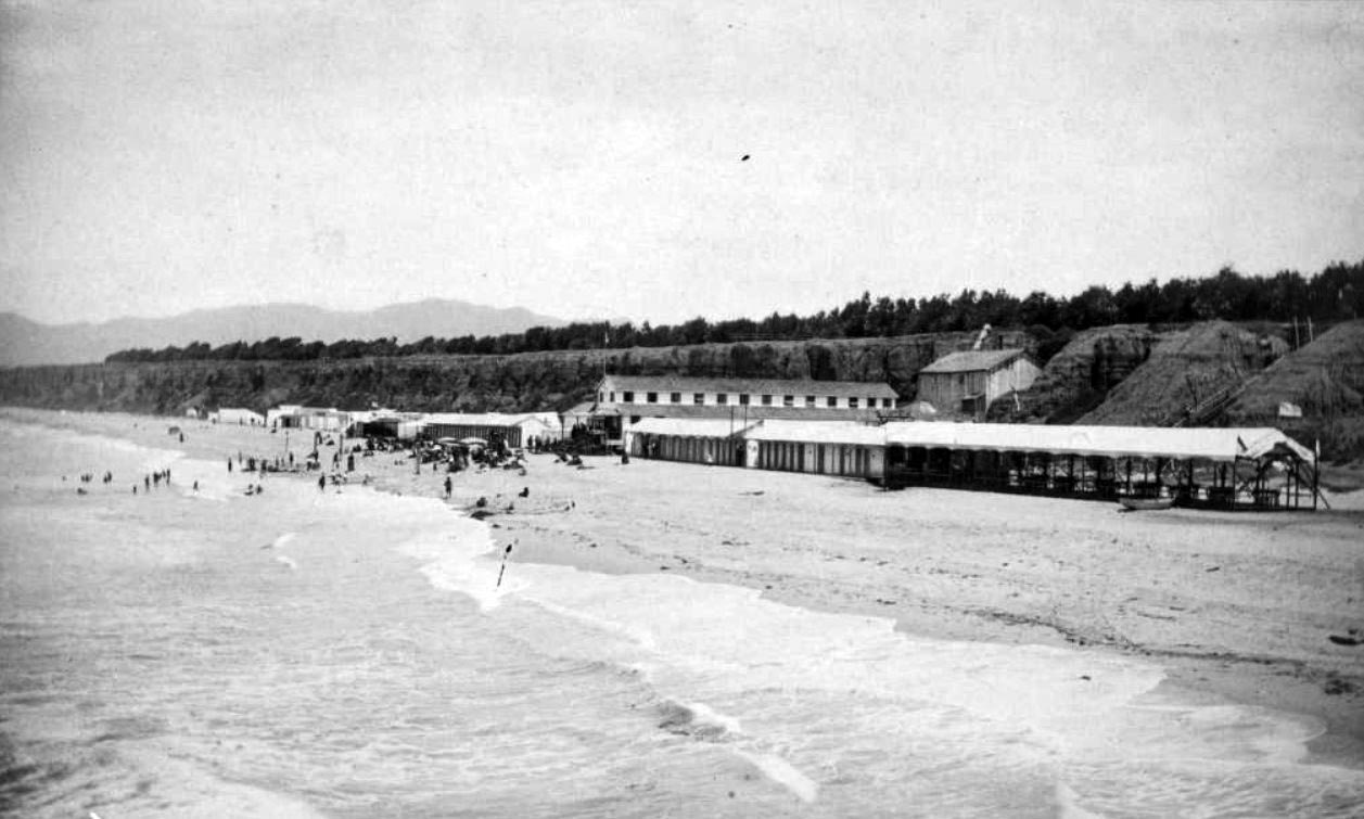
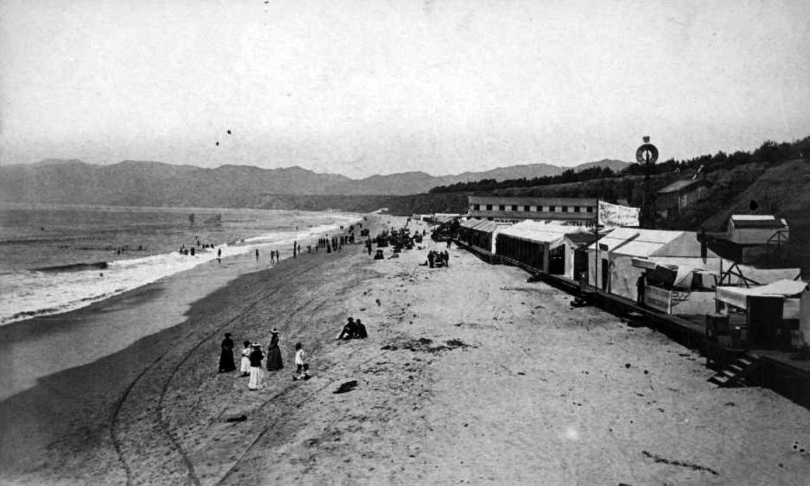
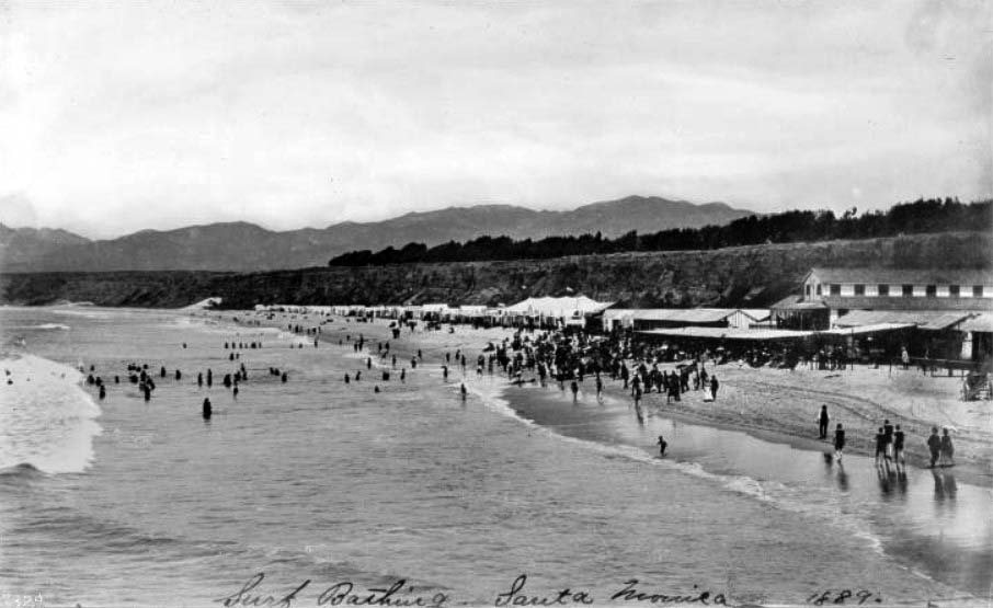
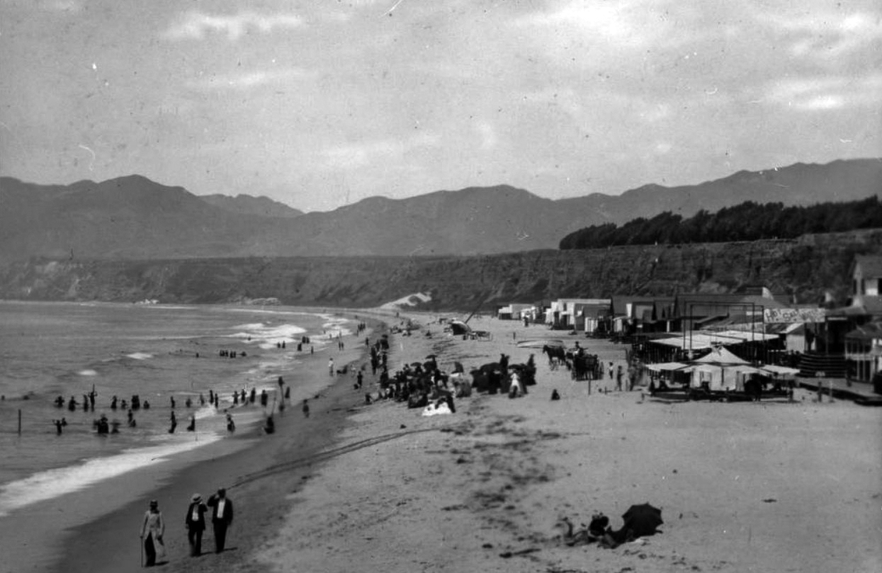
| (1889)** - Photograph of people at the shore on Santa Monica Beach. Beach houses and vendor's tents stand along the back end of the beach while a crowd of people moves into the surf at left from the shore. Mountains and trees can be seen above the cliff side in the background. Written-in text on the bottom of the image reads "Surf Bathing at Santa Monica". The Santa Monica Bathhouse is seen on the right. |
Then and Now
|
|
.jpg) |
|
| (1889 vs. 2020)* - Santa Monica Beach |
Santa Monica Canyon
 |
|
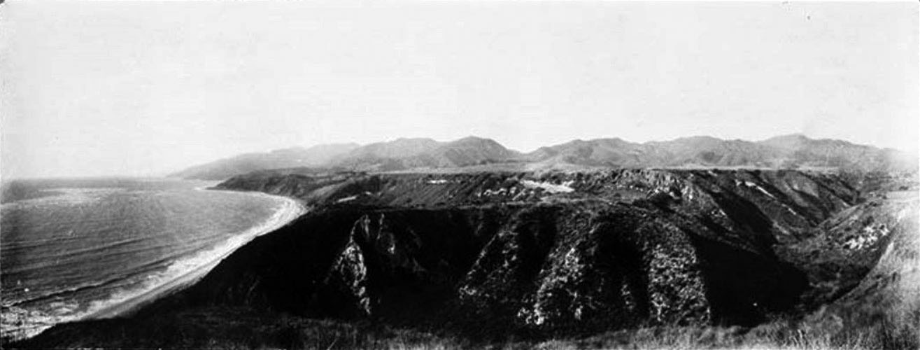
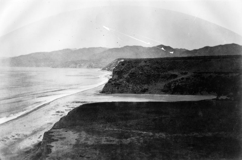
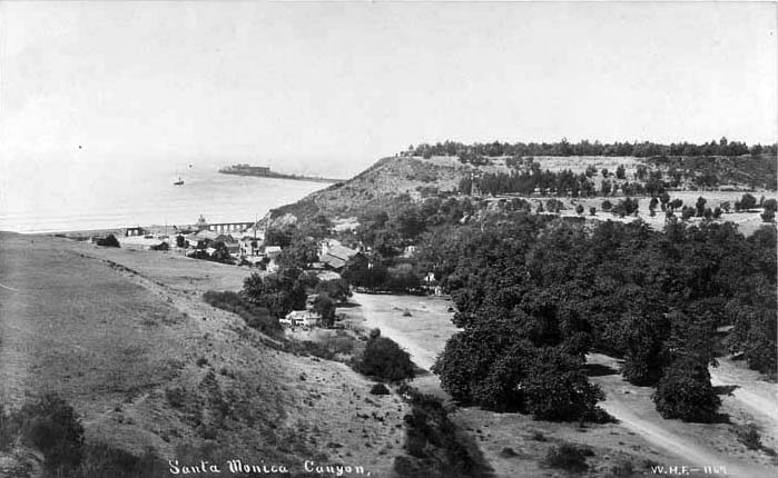
| (1900)#^- Panoramic view of the coastline and Santa Monica Canyon. |
 |
|
| (1880s)* - View of the mouth of the Santa Monica Canyon, originally part of the Rancho Boca de Santa Monica (mouth of the Santa Monica). |
Historical Notes In 1769, Francisco Reyes journeyed to Alta California to help establish Franciscan missions and claimed the land for Spain. Soldiers gave the name Santa Monica to a mountain creek that flowed to the Pacific. #* |
 |
|
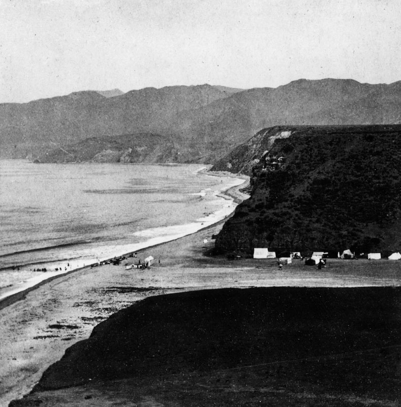
| (1880s)* - View of the mouth of the Santa Monica Canyon showing tents along the north canyon walls and on the beach. |
Historical Notes During the second-half of the 19th-century, the canyon was known as a camping area and rustic retreat near the beach hotels and resorts of nearby Santa Monica.^##* |
 |
|
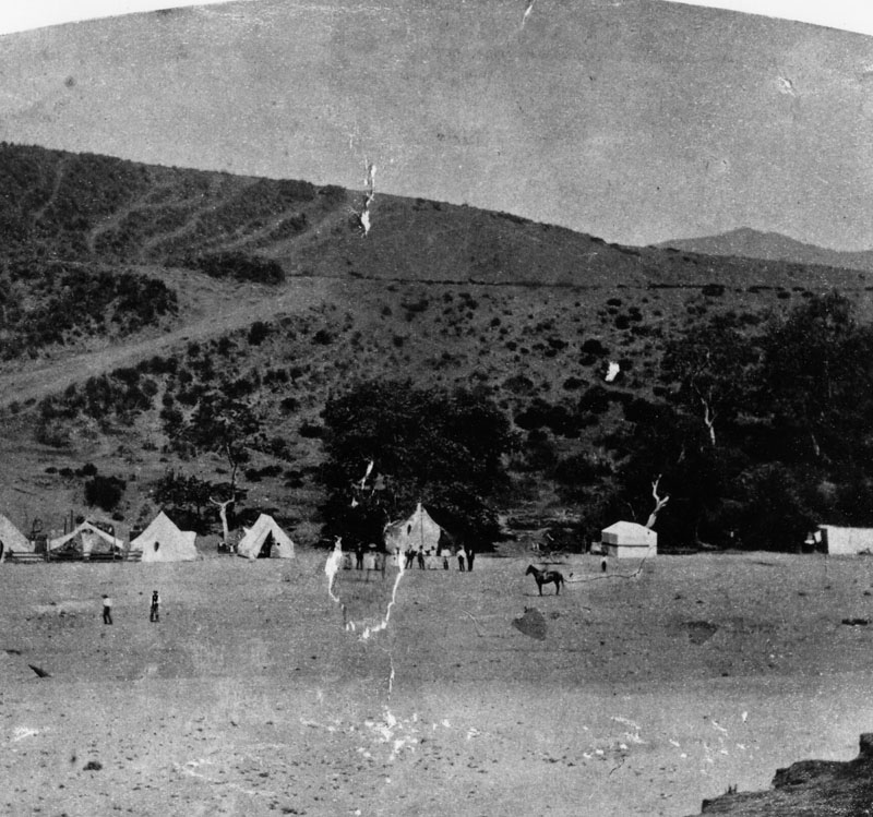
| (1880s)* - Near the mouth of the Santa Monica Canyon showing the summer camps in the 1880s. A man can be seen sitting on a horse. |
 |
|
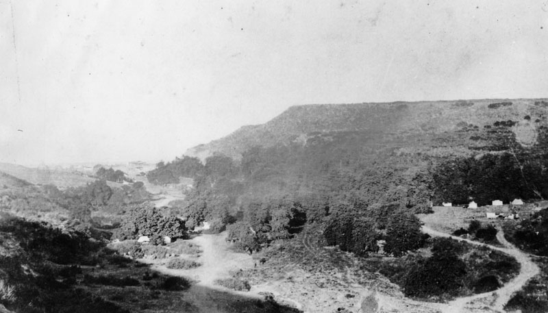
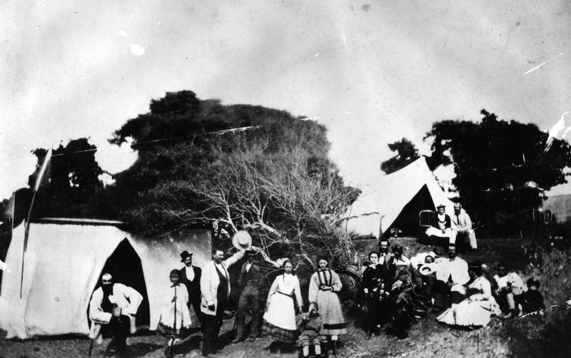
| (ca. 1890s)* - View of a campground located on the Rancho Boca de Santa Monica in Santa Monica Canyon, which once belonged to the Marquez Family. The family allowed visitors throughout the Los Angeles area to camp there and enjoy the scenery and the cool ocean breezes. |
Historical Notes In the late 1880s, Abbot Kinney, the developer best known for designing the nearby community of Venice to the south, established an experimental forestry station and planted eucalyptus trees, for which the canyon is still known today.^##* |
 |
|
| (ca. 1890s)* - People in folk costumes are camping in tents in Santa Monica Canyon probably in the 1890s. |
Historical Notes Despite the challenges of Mother Nature, the beauty and peace of The Canyon began attracted near-by Angelenos. A small grocery store sold fresh produce and items from the local Rancheros and small tents dotted the mouth of The Canyon for picnicking and camping.^##* |
Marquez Adobe
 |
|
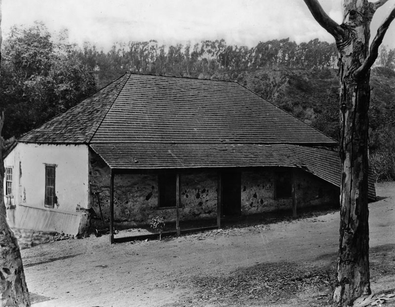
| (1900)* - Exterior of the Pascual Marquez adobe built about 1845 on the Boca de Santa Monica rancho. The adobe appears delapidated now. |
Historical Notes After Mexico won its independence from Spain, Francisco Reyes' grandson Ysidro and his neighbor, Francisco Marquez, were granted 6,656 acres of the Rancho Boca de Santa Monica (mouth of the Santa Monica). They built the area's first permanent structures. #* |
 |
|
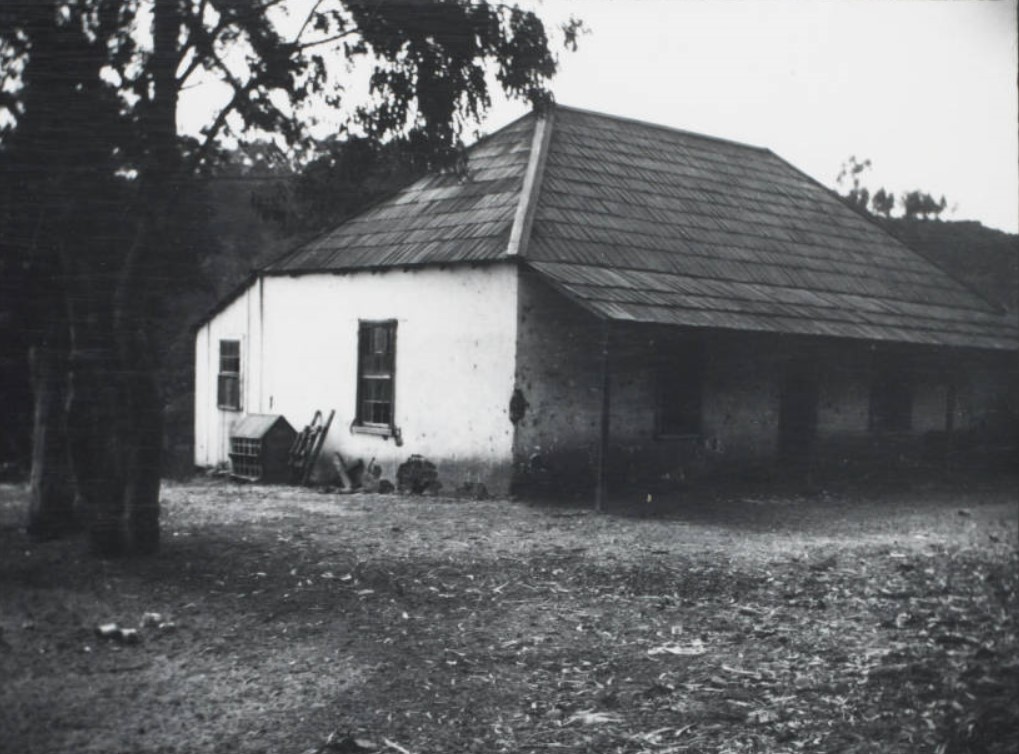
| (ca. 1900)#^^ - Image of the adobe house built by Pascual Marquez located in Santa Monica Canyon. Ernest Marquez Collection |
Historical Notes Remarks from donor Ernest Marquez, 2015: "The adobe house was built by my grandfather Pascual Marquez in 1875, about 75 yards from the adobe where he was born, built by his father Francisco in 1839. I think Pascual’s adobe collapsed in an earthquake in the 1930s." |
Marquez Bath House
 |
|
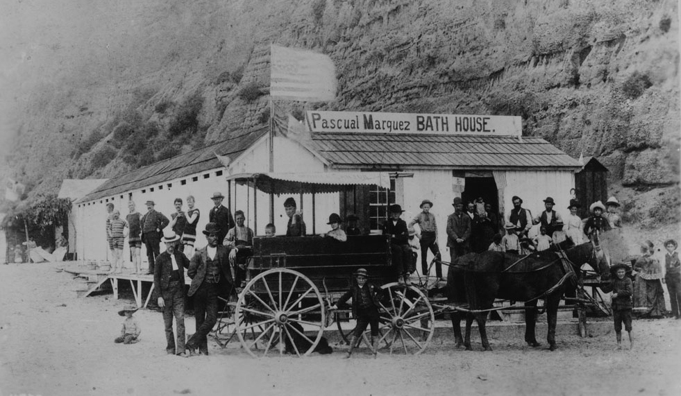
| (ca. 1887)** - Photograph of a group of about 30 people (men, women and children) posing in front of Pascual Marquez's bath house -- the first bath house in Santa Monica Canyon. A stagecoach -- the Santa Monica Canyon State -- drawn by a two-horse team stands in front. An American flag flies from the roof of the single-story wood structure. The nearly vertical rocky canyon wall looms behind. A sign on the roof reads "Pascual Marquez bath house". |
Historical Notes These type of horse-drawn wagons transported visitors from Los Angeles to Santa Monica before the arrival of train service to the area. |
First Stage and Mail Service
 |
|
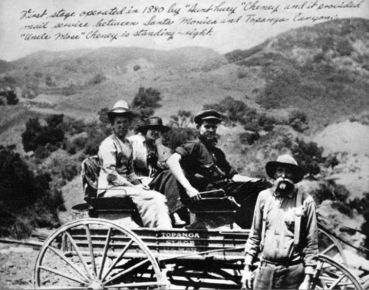
| (ca. 1880s)^ - First stage and mail service operated in 1880s between Santa Monica and Topanga Canyon. |
Historical Notes The 1st mail wagon was established by "Aunt Lucy" Cheney and began service in 1880. It provided mail service between Santa Monica and Topanga Canyon. They began to carry passengers (as shown here) in 1885. Also pictured is "Uncle Mose" Cheney.* |
Early Santa Monica Beach Views
 |
|
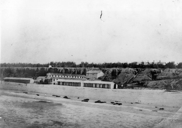
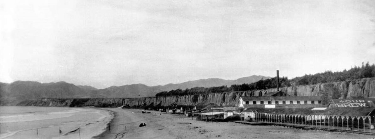
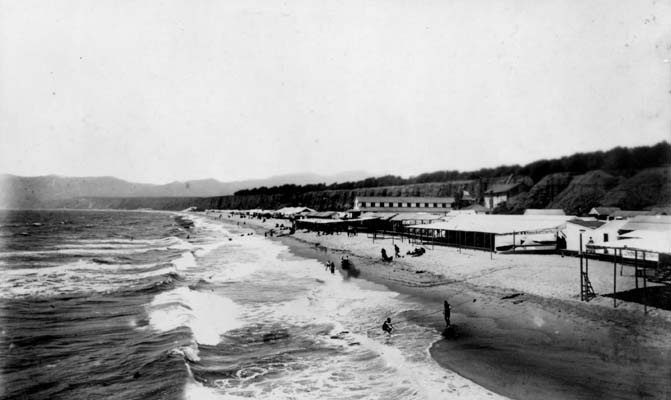
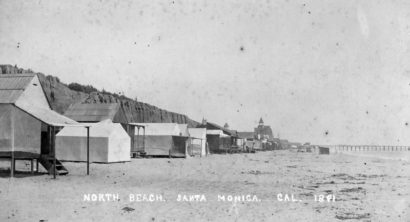
| (ca. 1887)** – Panoramic view showing the old Bath House looking north at North Beach, Santa Monica. The beach is deserted except for a group of 2 or 3 people. A long covered boardwalk runs along the front of the bath house. A tall smokestack sticks up above the bath house. The billboard on one roof at right reads "Our Brew". |
 |
|
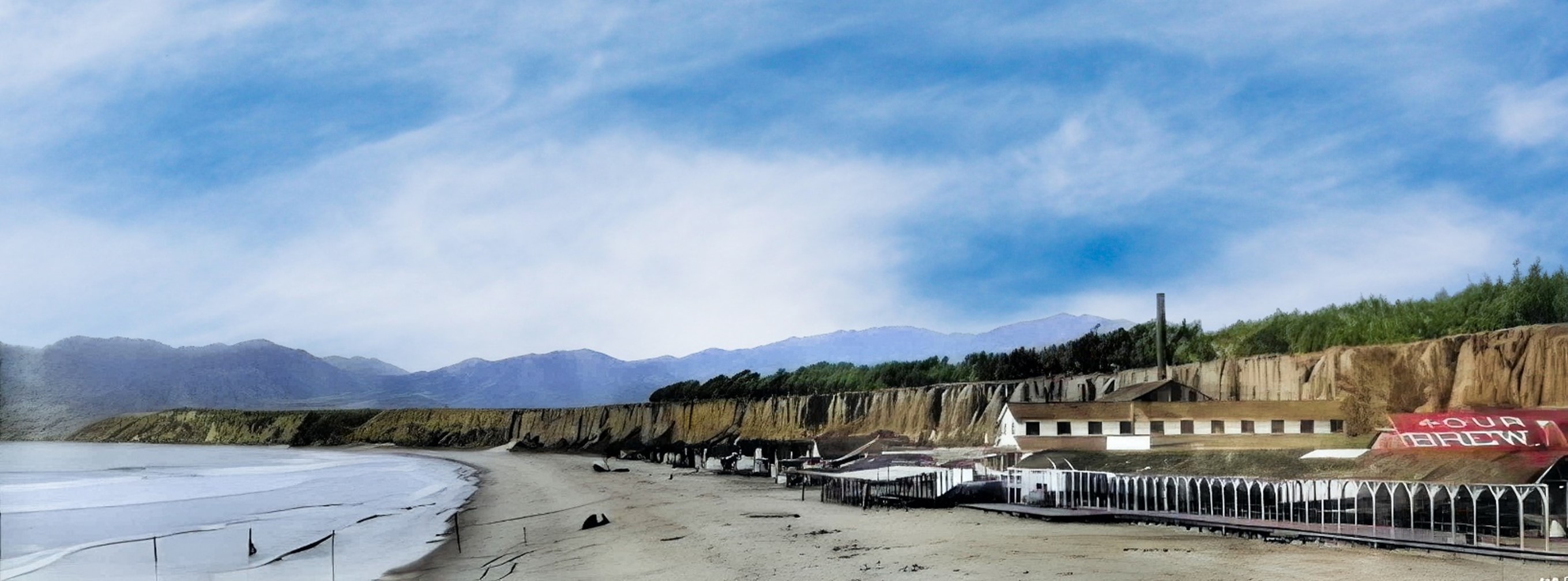
| (ca. 1887)** – Panoramic view of Santa Monica Beach and the Palisades. (AI image enhancement and colorization by Richard Holoff) |
Then and Now
 |
|
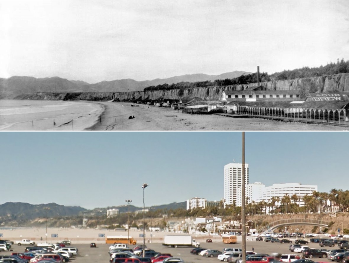
| (1887 vs. 2015)* – Panoramic view of Santa Monica Beach and the Palisades. |
 |
|
| (1880s)#^^ - View showing people on the beach and in the ocean in front of the Santa Monica Bath House, with sign "Hot Salt Water" and beach houses in Santa Monica, with a horse-drawn wagon at center-right. |
 |
|
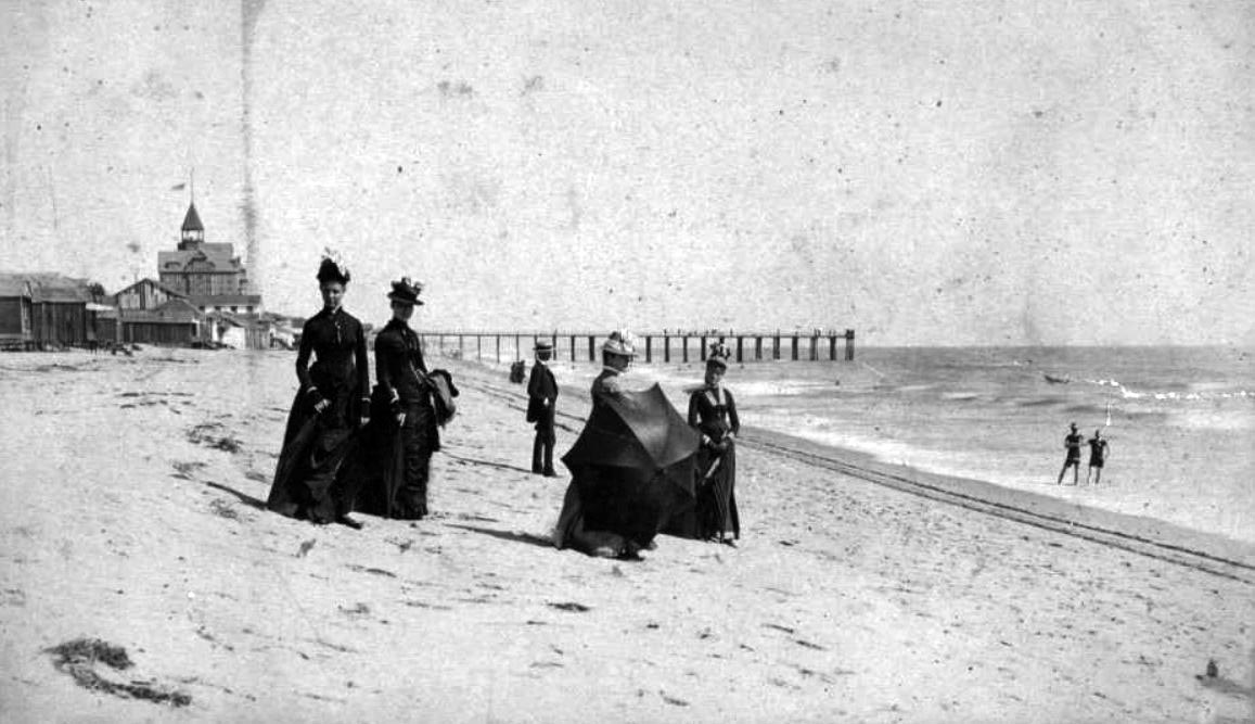
| (1887)*^ - View of Santa Monica Beach looking north in 1887. The Palisades can be seen in the background. |
 |
|
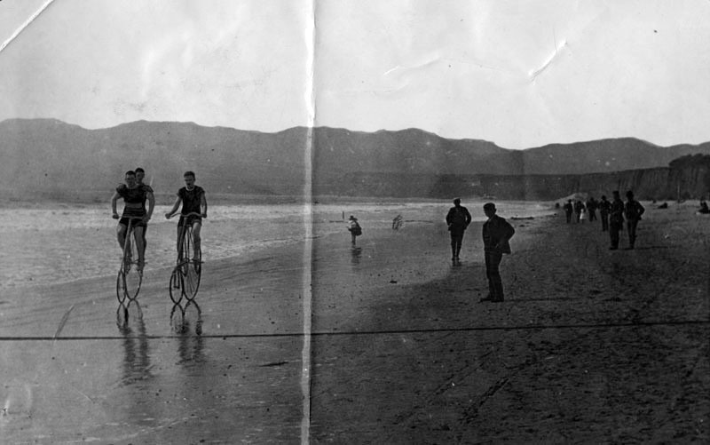
| (1887)* - Men are walking and riding bicycles on a beach in Santa Monica. The familiar palisades are visible on the right and the Santa Monica Mountains are visible in the background. |
 |
|
| (1890s)#^^ – View showing people standing on the beach in bathing suits in Santa Monica. There are horse tracks and carriage wheel tracks in the sand. |
 |
|
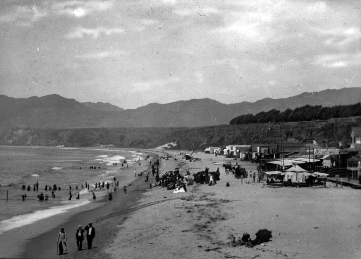
| (1880s)#^^ - Visitors to Santa Monica Beach in the 1880s. The pier can be seen in the background with the Arcadia Hotel out of view behind the beach shack. |
 |
|
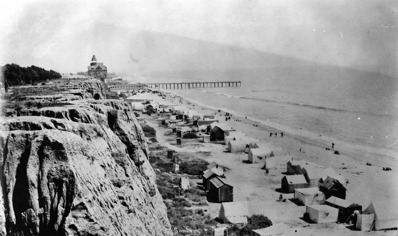
| (ca. 1887)* - View of Santa Monica beach looking south from Santa Monica Canyon rim. The newly constructed Arcadia Hotel can be seen in the background along with the remains of the Los Angeles & Independence Wharf. House-tents are seen along the beach. |
Historical Notes The Los Angeles and Independence Railroad Wharf was in use between 1875 and 1879, at which time it was purchased by the Southern Pacific Railroad company and partially dismantled. In 1898, a new pier would be built, North Beach Pier , just to the north of where the above wharf is seen. |
 |
|
| (1891)* - View of North Beach looking south towards the Arcadia Hotel. Tent houses line the beach area. |
 |
|
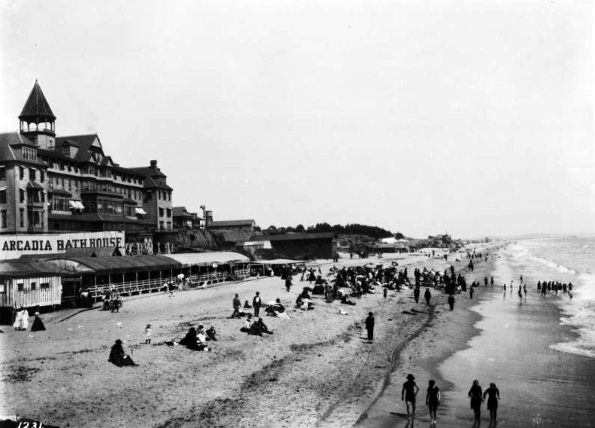
| (1888)#^^ - Image of a group of people with an umbrella on the beach in Santa Monica. The Arcadia Hotel and the remains of the Los Angeles and Independence Wharf are seen in the distance. |
Historical Notes The Arcadia Hotel opened for business in 1887 and was located on Ocean Avenue between Railroad Avenue (later known as Colorado Avenue) and Front (later known as Pico Boulevard). The Arcadia was the largest structure in Santa Monica at the time of its construction. The 125-room hotel was owned by J.W. Scott, the proprietor of the city's first hotel, the Santa Monica Hotel. The hotel was named for Arcadia Bandini de Baker, the wife of Santa Monica cofounder Colonel R. S. Baker.^* |
 |
|
| (ca. 1890)* - View looking north from the veranda of the Arcadia Hotel showing pier and Santa Monica shoreline. |
 |
|
| (1893)#^^ - View looking south showing North Beach and the Arcadia Hotel with the Southern Pacific Railroad tracks running next to the Beach Road in Santa Monica. The Santa Monica Bath House and the remains of the Los Angeles and Independence Wharf are visible at right and the Palisades Bluffs are visible at left. |
Historical Notes The Los Angeles and Independence Railroad Wharf was in use between 1875 and 1879, at which time it was purchased by the Southern Pacific Railroad company and partially dismantled. In 1898, a new pier would be built, North Beach Pier , just to the north of where the above wharf is seen. Southern Pacific laid tracks along the beach in 1892. |
 |
|
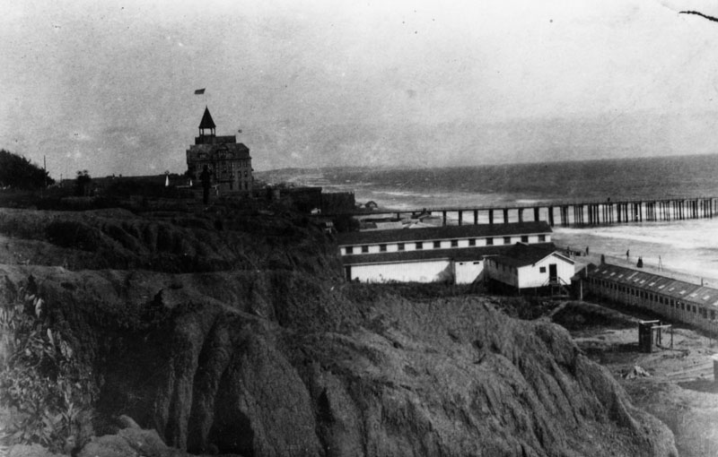
| (ca. 1895)** - View of the Santa Monica seaside bluffs (Palisades Park). The Arcadia Hotel and Los Angeles and Independence Wharf - forerunner to today’s Santa Monica Pier - are both visible in the distance. |
Historical Notes Originally known as “Linda Vista Park,” Palisades Park was the first officially-designated public open space in Santa Monica. The land was donated to the City by Santa Monica's founder, Senator John P. Jones, in 1892.*^*^ Linda Vista Park was renamed Palisades Park in the 1920s. |
Arcadia Hotel
 |
|
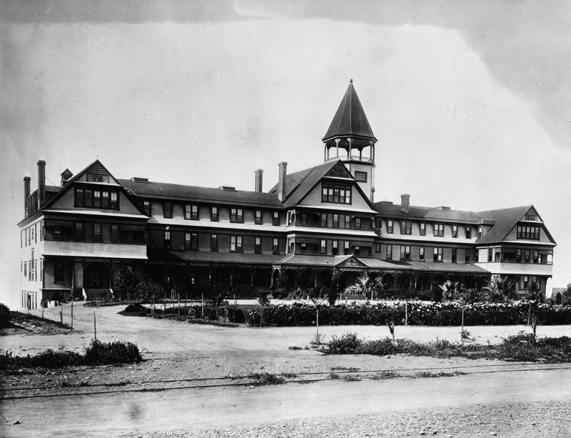
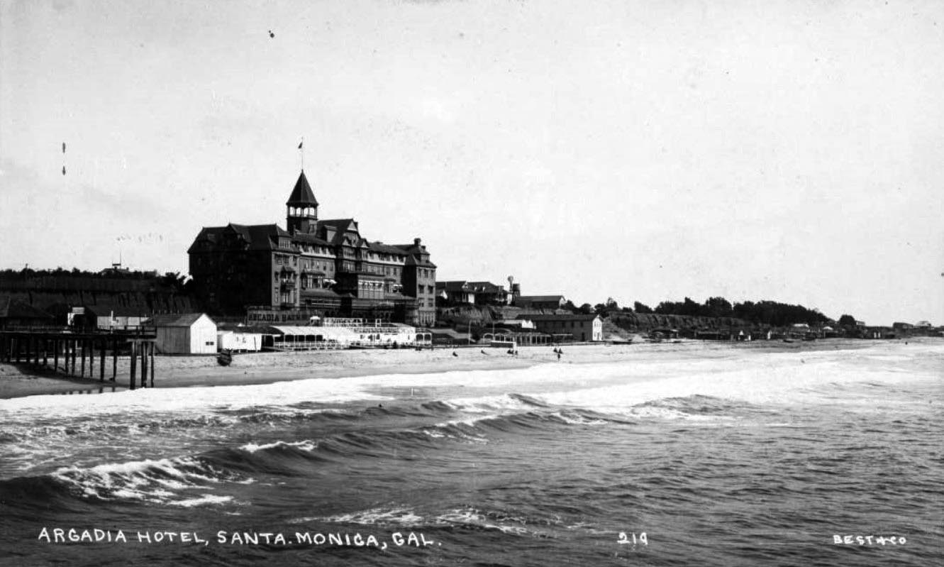
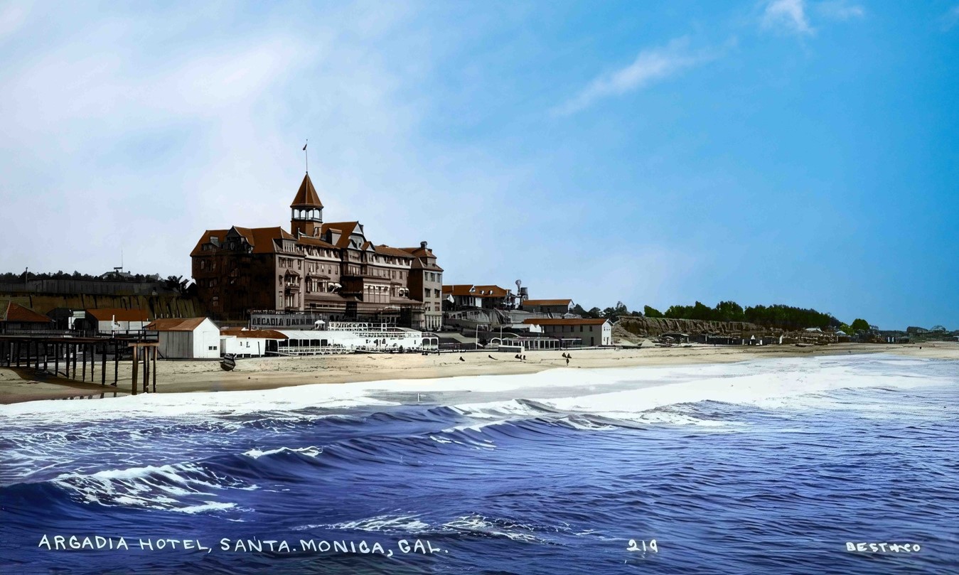
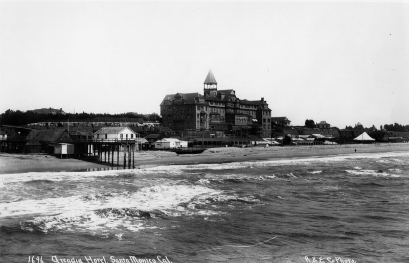
| (1887)* - Exterior view of the east front of the Arcadia Hotel in Santa Monica soon after opened in March 1887. It was located on Ocean Avenue immediately south of the bridge over the gulch that was later occupied by Roosevelt Highway. The hotel was built next to a steep cliff and shows only 3 stories on the Ocean Avenue side and 5 stories on the beach side. |
Historical Notes The Arcadia Hotel opened for business in 1887 and was located on Ocean Avenue between Railroad Avenue (later known as Colorado Avenue) and Front (later known as Pico Boulevard). The Arcadia was the largest structure in Santa Monica at the time of its construction. The 125-room hotel was owned by J.W. Scott, the proprietor of the city's first hotel, the Santa Monica Hotel. The hotel was named for Arcadia Bandini de Baker, the wife of Santa Monica cofounder Colonel R. S. Baker.^* |
 |
|
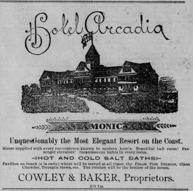
| (1890)**^ - Hotel Arcadia - 'The Most Elegant Resort on the Coast....with Passenger Elevators!' |
Historical Notes Being located on a bluff, all 125 rooms in the 5-story building boasted unobstructed views. It featured a grand ballroom, upscale dining room and its own roller coaster. A bathhouse was located on the beach directly below the hotel, offering guests hot saltwater baths.*^*^ The pinnacle of the hotel was an observation tower, offering breathtaking views in every direction a dizzying 136 feet above the beach level.*^* |
 |
|
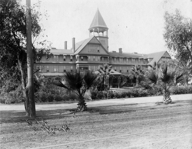
| (1890)* - Arcadia Hotel from the street side. The hotel was named for Arcadia Bandini de Baker, the wife of Santa Monica cofounder Colonel R. S. Baker. |
Historical Notes The Arcadia Hotel was the site where Colonel Griffith J. Griffith shot his wife in 1903, which led to their divorce and his (short) imprisonment.*^ In 1882 Griffith moved to Los Angeles and purchased approximately 4,000 acres of the Rancho Los Feliz Mexican land grant. On December 16, 1896, Griffith and his wife Christina presented 3,015 acres of the Rancho Los Feliz to the city of Los Angeles for use as a public park. Griffith called it "a Christmas present." After accepting the donation, the city passed an ordinance to name the property Griffith Park, in honor of the donor. Griffith later donated another 1,000 acres along the Los Angeles River.*^ |
 |
|
| (1890s)* - View of the Arcadia Hotel from the street. The landscaping is now more fully developed. |
Historical Notes The Arcadia Hotel was a landmark, hailed as one of the finest hotels in Southern California in its day. However, like many hotels in the area, the Arcadia hotel was forced to close in times of slow business; the hotel closed for one year from 1888-1889, and permanently in 1906 when the building boom subsided. In 1907, there was a failed attempt to convert the hotel into a private school for the California Military Academy, but the property stood abandoned until it was demolished in 1909 to make room for beach improvements, homes, and hotels.^* |
 |
|
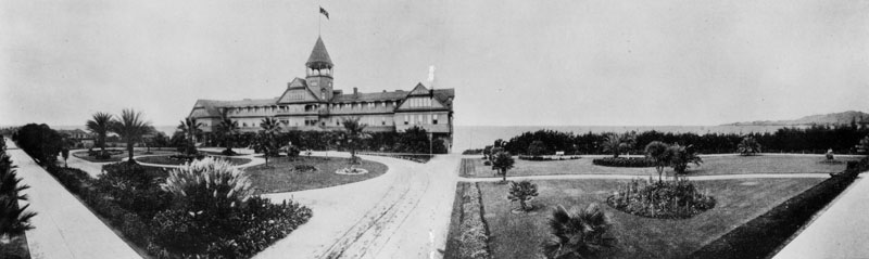
| (1890s)* - Panoramic view of the Arcadia Hotel looking towards the ocean. In front of the hotel are extensive, well manicured lawns and gardens. |
 |
|
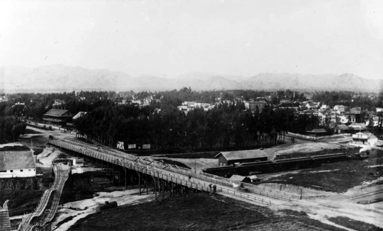
| (1887)*^ – View looking North from top of the newly-built Arcadia Hotel showing the Los Angeles & Independence Railroad Santa Monica station. The coastline and Palisades are seen on the left. |
 |
|
| (1888)#^^ - View showing the Thompson Gravity Switchback Railroad (aka Switchback Roller Coaster) on the left, which traveled across the ravine between the Arcadia Hotel (not pictured) and the north side of the Southern Pacific Railroad tracks. The Los Angeles & Independence Railroad Santa Monica Depot is on the right. |
Thompson Gravity Switchback Railroad (aka Switchback Roller Coaster)
 |
|
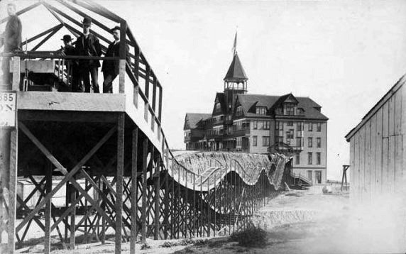
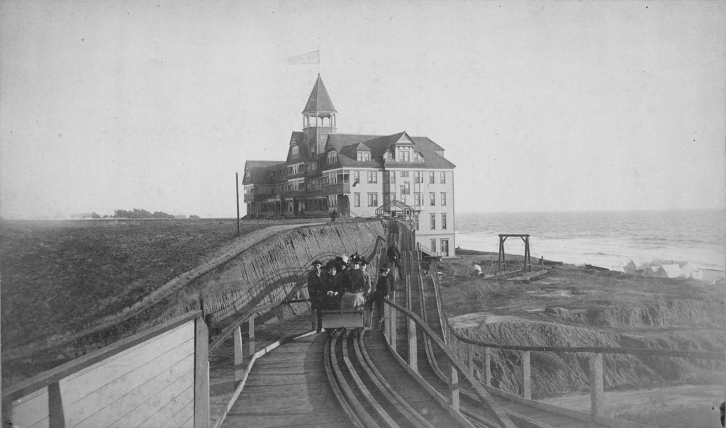
| (ca. 1887)*^* - The 'Switchback Roller Coaster' with the Arcadia Hotel in the background. |
Historical Notes A special delight for Arcadia Hotel guests was a two-track gravity switchback roller coaster, which in a one minute journey, could whisk guests either to or from the hotel and back again. For five cents, riders would climb a platform to board the large bench-like car and were pushed off to coast 300 ft. down the track across the ravine. The car went just over 6 mph. At the top of the other platform the vehicle was switched to a return track or "switched back" (hence the name). *^ |
 |
|
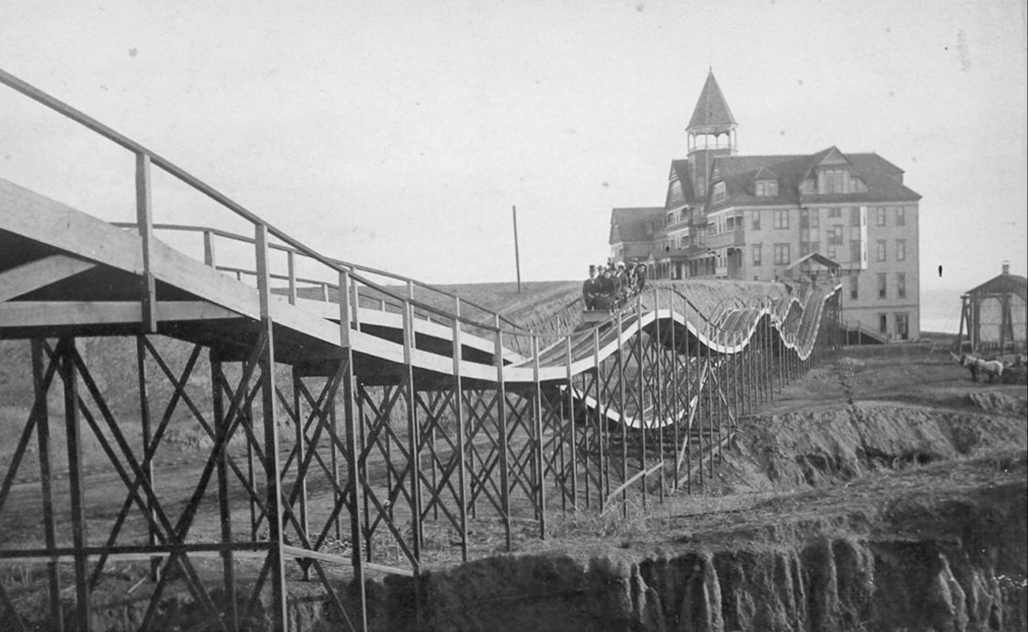
| (1880s)* - View of the switchback roller coaster in motion halfway between the Arcadia Hotel and its end point on the Santa Monica bluffs. |
Historical Notes The original Switchback Railway (Coney Island) was the first roller coaster designed as an amusement ride in America. It was designed by LaMarcus Adna Thompson in 1881 and constructed in 1884. It appears Thompson based his design, at least in part, on the Mauch Chunk Switchback Railway which was a coal-mining train that had started carrying passengers as a thrill ride in 1827. *^ |
 |
|
| (ca. 1887)#^^ - View showing several men and women in a roller coaster as it comes to the end of its ride across the Santa Monica bluffs. In the background is seen the Arcadia Hotel with a flag flying high from the top of its observation tower. |
 |
|
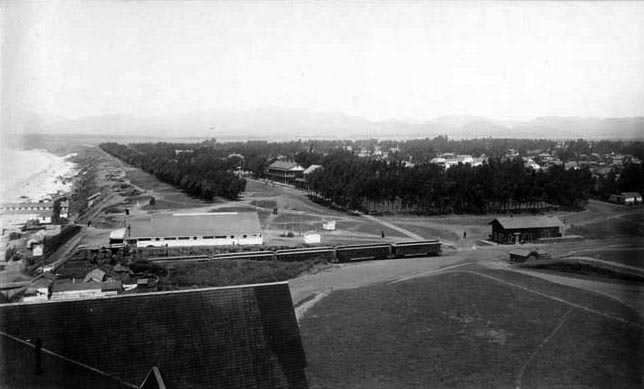
| (1894)* - Bird’s eye view looking north from the Arcadia Hotel showing the bridge over the gulch that was later occupied by the Roosevelt Highway. Note that the Switchback Roller Coaster is no longer there. Click HERE to see same view in 1888. |
 |
|
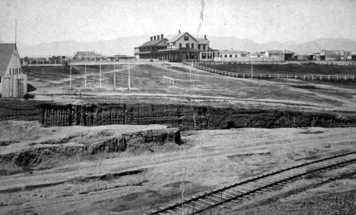
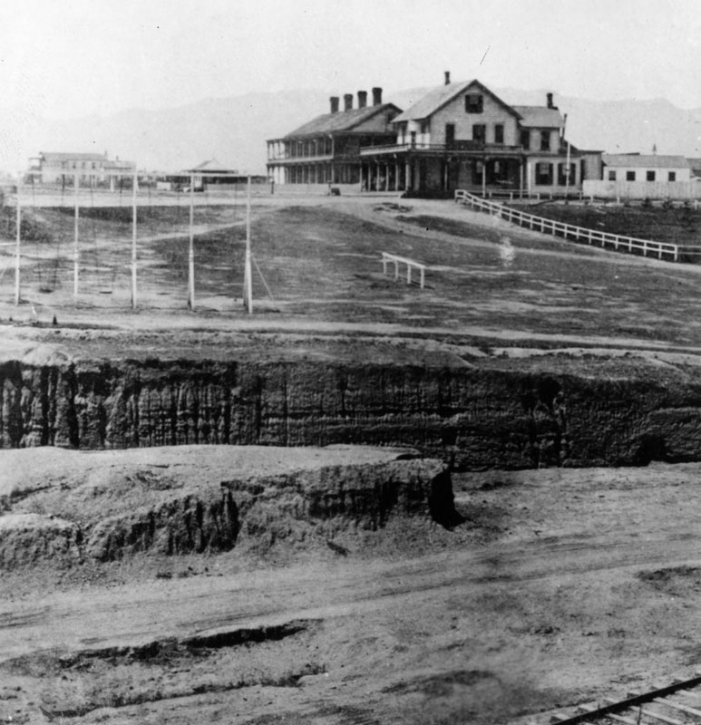
| (1894)*^ – View looking northeast from the Arcadia Hotel showing hotel on corner, horse-drawn trolley in street (left), Santa Monica railroad station with train (distant left), Santa Monica Stables (center right), and landscaped parkway (center foreground). |
 |
|
| (ca. 1890s)* - Railroad Avenue (now Colorado). The Arcadia Hotel is seen in the background. The famed beachfront establishment was on Ocean Avenue between Railroad Avenue and Front Street (now Pico Boulevard). |
 |
|
| (ca. 1898)^ - Postcard view showing the beach side of the Arcadia Hotel and bath house as seen from the 1898-built North Beach Bath House Pier. The portion of a pier at left is the remains of the Los Angeles & Independence Railroad Wharf. |
Historical Notes The Arcadia Hotel opened for business in 1887 and was located on Ocean Avenue between Railroad Avenue (later known as Colorado Avenue) and Front (later known as Pico Boulevard). The Arcadia was the largest structure in Santa Monica at the time of its construction. The 125-room hotel was owned by J.W. Scott, the proprietor of the city's first hotel, the Santa Monica Hotel. The hotel was named for Arcadia Bandini de Baker, the wife of Santa Monica cofounder Colonel R. S. Baker.^* The hotel was built next to a steep cliff and shows only 3 stories on the Ocean Avenue side and 5 stories on the beach side as seen above. |
 |
|
| (ca. 1898)^ - Postcard view showing the beach side of the Arcadia Hotel and bath house as seen from the 1898-built North Beach Bath House Pier. The portion of a pier at left is the remains of the Los Angeles & Independence Railroad Wharf. Image enhancement and colorization by Richard Holoff. |
 |
|
| (1890s)* - Slightly different view of the Arcadia Hotel with the remains of the Los Angeles & Independence Railroad Wharf on the left. |
 |
|
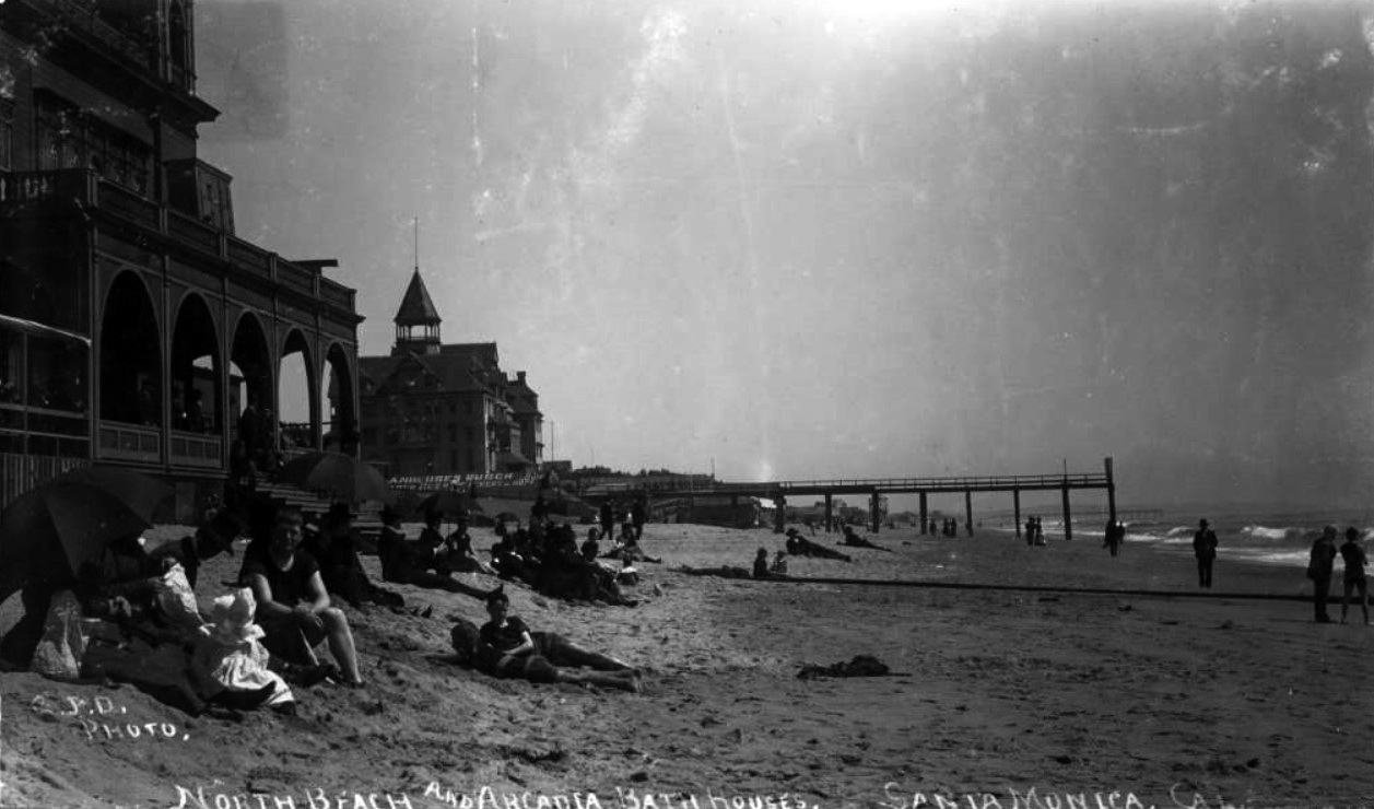
| (ca. 1898)#^^ - Image of the North Beach Bath House and Arcadia Bath Houses on the beach with people lying in the sand and piers visible in the distance. Signs are visible that read "Anheuser Busch beer St. Louis Eckert & Hopf" and "Arcadia Bathhouse." The portion of the pier at center is the remains of the Los Angeles & Independence Railroad Wharf. |
Historical Notes The North Beach Bath House was built in 1898 and replaced the 1876-built Santa Monica Bath House. |
 |
|
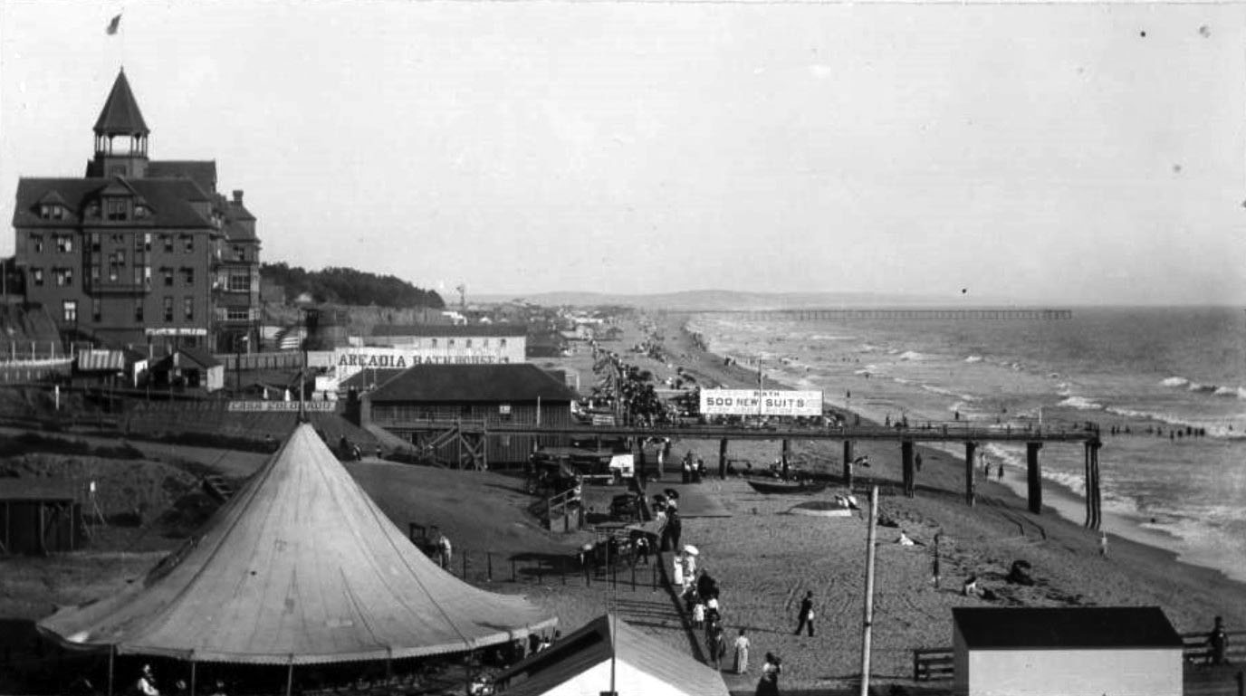
| (ca. 1898)* - View looking south from the North Beach Bath House showing the beach and pier (remaining portion of the Los Angeles and Independence Pier) near the Arcadia Hotel and Arcadia Bath House. Visible signs include "Arcadia Bath House, 500 new suits, new tubs, fish grill room" and "Casa Colorado" (partially painted over Anheuser Busch lettering). People are seen walking along a wooden boardwalk, including women with parasols, horse-drawn wagons, a carousel tent, and various small boats on the sand are also visible. A windmill can be seen in the distance. |
 |
|
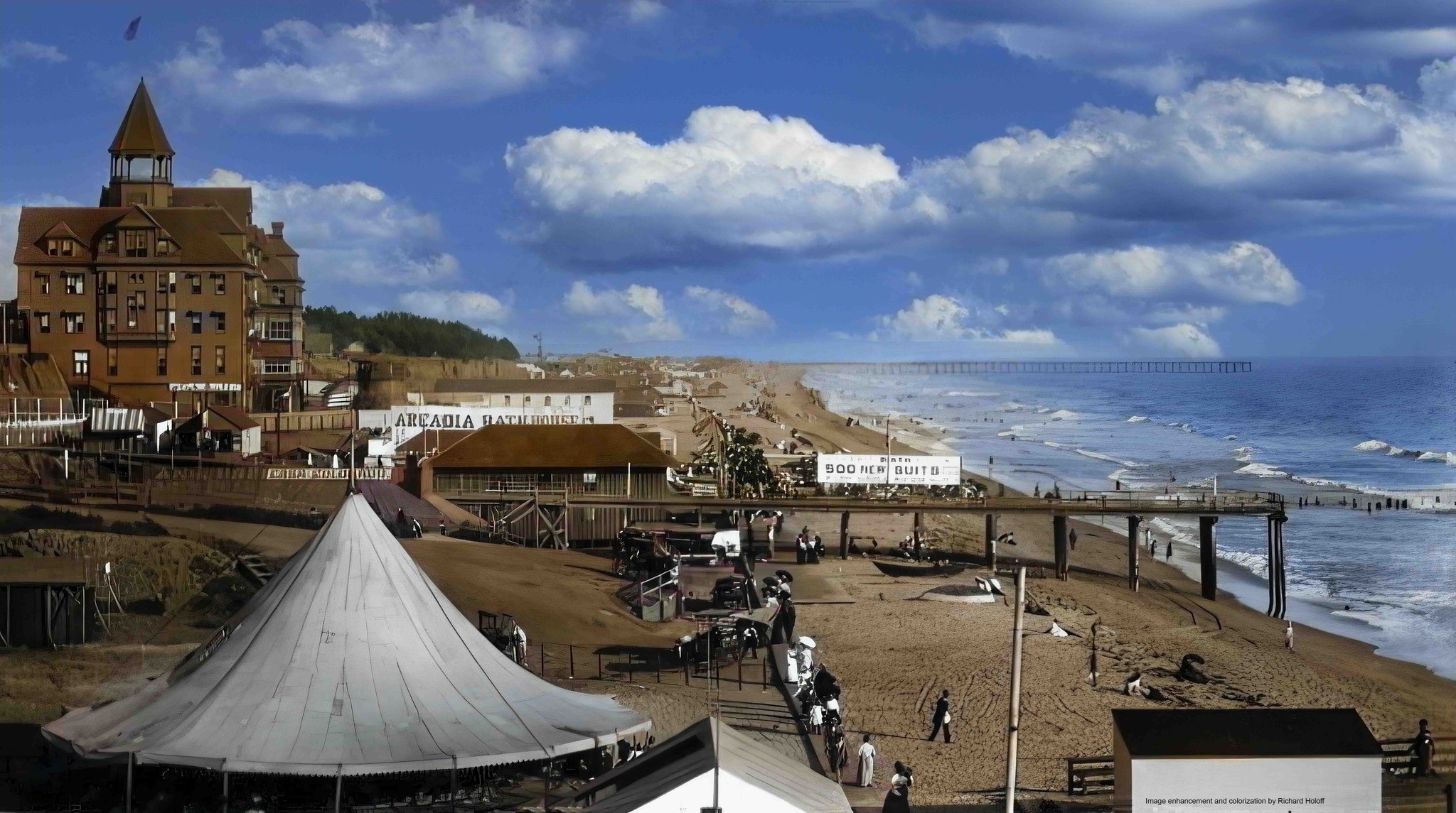
| (ca. 1898)* - Looking south from the North Beach Bath House showing the beach and pier (remaining portion of the Los Angeles and Independence Pier) near the Arcadia Hotel and Arcadia Bath House. Image enhancement and colorization by Richard Holoff |
 |
|
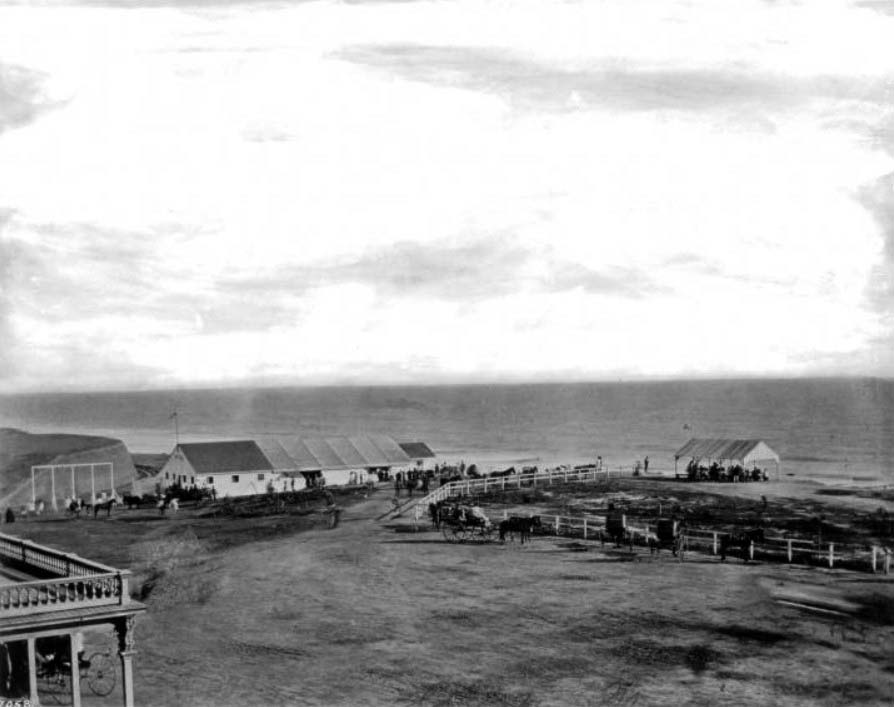
| (ca. 1890)* - Another view from the pier showing the Arcadia Hotel on Santa Monica South Beach behind the Arcadia Bath House. |
Historical Notes When it opened in 1887, Santa Monica's ritzy Arcadia Hotel offered its guests a large saltwater bathhouse, the Arcadia Bath House. |
 |
|
| (1890)* - A closer view of South Beach. People are walking and sitting in front of the Arcadia Bath House with the Arcadia Hotel sitting in the background. |
 |
|
| (ca. 1892)** - Photograph of the Arcadia Hotel and Bath House in Santa Monica, ca.1892-1898. The beach is at low tide and to the far right, the ocean can be seen crashing against the shore. Groups of people play or walk in the surf while others sunbathe on the sandy beach. To the far left, sits the large four-story wooden Arcadia Hotel with a turret on its roof. Along the base of the hotel, a tented pavilion is visible on the beach. Legible signs include: "Arcadia Bath House" and "Clam Chowder” |
 |
|
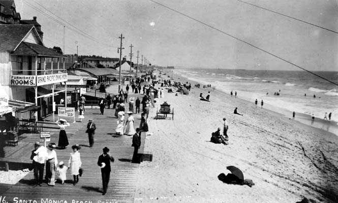
| (1890)* - People walking on the Santa Monica Beach boardwalk. A horse-drawn carriage (center of photo) appears to be heading south along the sand, parallel to the boardwalk. |
 |
|
| (ca. 1895)** - View of South Beach looking north toward the Arcadia Hotel and Palisades. The long boardwalk can be seen extending all the way to the hotel. |
 |
|
| (1888)* - Bathhouses on the beach near Santa Monica with the Arcadia Hotel standing in the background. The pier can also be seen. |
Southern Pacific Railroad Tunnel
 |
|
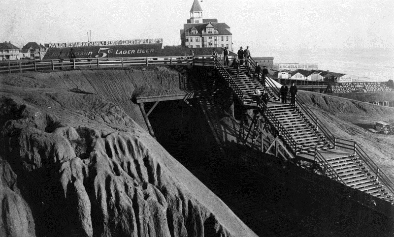
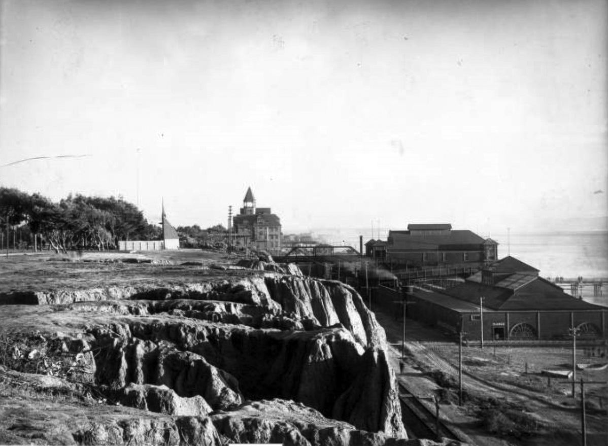
| (1890s)* - View looking south of the Arcadia Hotel and the Arcadia Bath House. The Southern Pacific Railroad tunnel is seen at center. At right are the '55 steps' that enabled visitors to have quick access to the beach below. |
Historical Notes In 1891, the Southern Pacific Railroad built a tunnel under Ocean Avenue for its new rail line to Santa Monica Canyon that was later sold to the Pacific Electric Railway . The rail line was in use from 1891 to 1933. |
 |
|
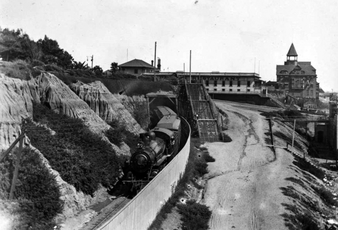
| (1896)^ – View showing a Southern Pacific train emerging from a tunnel, with the Arcadia Hotel in the distance on the right. |
Historical Notes In 1936, the Southern Pacific Tunnel was enlarged for vehicular use (later renamed McClure Tunnel) and connected Lincoln Boulevard with the Roosevelt Highway (later PCH). Click HERE to see more. |
Then and Now
 |
|
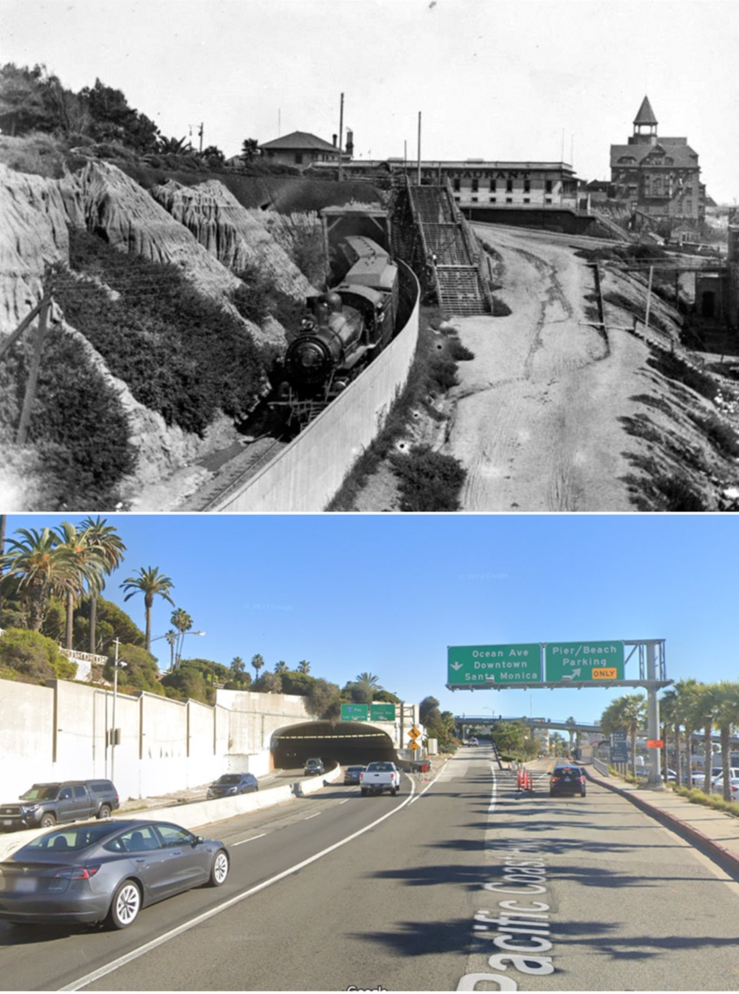
| (1896 vs. 2023)* - Southern Pacific Railroad Tunnel, today the McClure Tunnel. |
* * * * * |
Arcadia Hotel
 |
|
| (1904)^ – View showing the alluvial bluffs of Linda Vista Park (renamed Palisades Park in the 1920s) with the Arcadia Hotel in the distance at center and the North Beach Bath House at right. Train tracks are visible below the cliffs, behind the bathhouse and the North Beach Pier (built in 1898) is seen at far right. |
Historical Notes The Arcadia Hotel was built in 1887 and demolished in 1907. |
 |
|
| (1904)^ – View showing the alluvial bluffs of Linda Vista Park (renamed Palisades Park in the 1920s) with the Arcadia Hotel in the distance at center and the North Beach Bath House at right. (AI image enhancement and colorization by Richard Holoff) |
 |
|
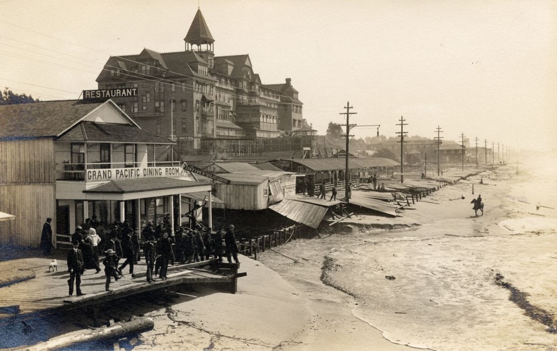
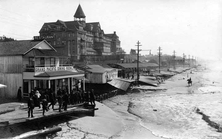
| (ca. 1905)* - Spectators stand on a partially destroyed boardwalk looking at the damage in the aftermath of a storm. A man on horseback is seen on the beach and the Arcadia Hotel stands in the background. |
 |
|
| (ca. 1905)* - Spectators stand on a partially destroyed boardwalk looking at the damage in the aftermath of a storm. A man on horseback is seen on the beach and the Arcadia Hotel stands in the background. |
Santa Monica Bathing
 |
|
| (1910s)*^^ - Neighboring Venice Beach sign. (Truth or Fiction??) |
 |
|
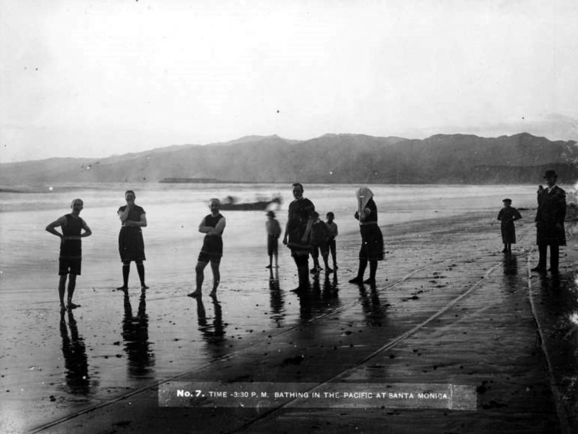
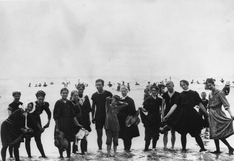
| (1890)* - Group photo of men and women in their bathing suits, standing in ankle deep water on Santa Monica beach. |
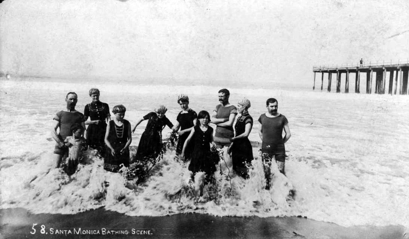 |
|
| (1890s)^ - View showing a group of men, women and children wearing bathing suits and caps and holding seaweed while standing in an incoming wave on the beach in Santa Monica, with a pier at right. |
 |
|
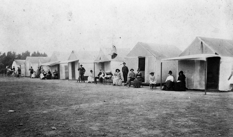
| (1890)* - People in front of their house-tents near the Santa Monica beach. |
 |
|
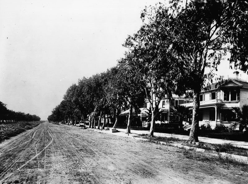
| (1890)* - View of an unpaved Ocean Avenue showing large residences and many trees lining the sidewalk. |
Senator Jones Residence (Miramar Hotel)
 |
|
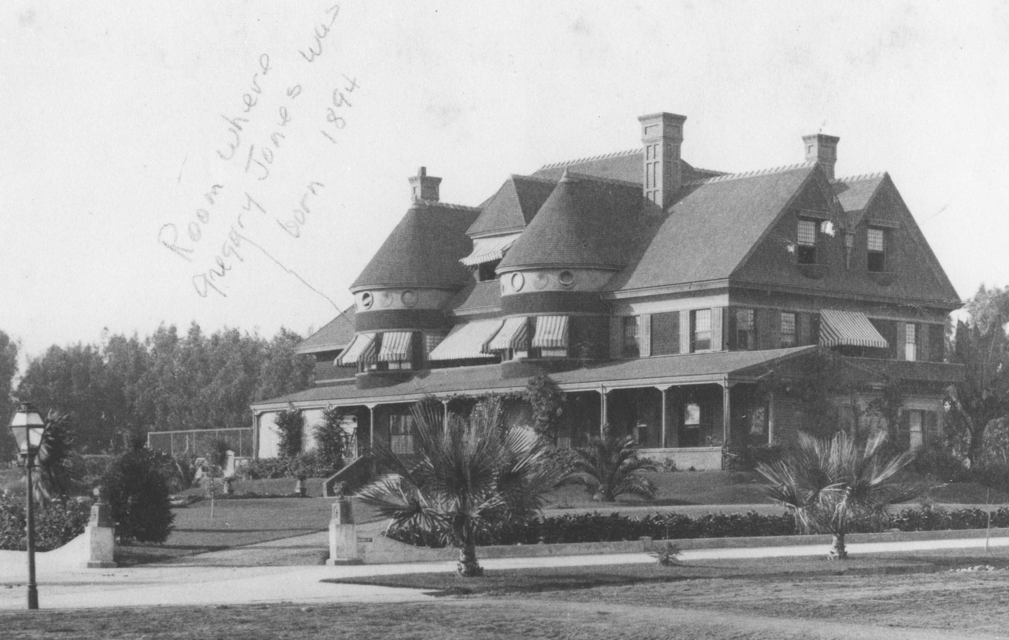
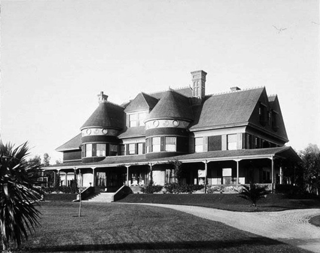
| (ca. 1890s)* - View of Miramar, the home of Senator John P. Jones and Georgina Frances Sullivan Jones, built in 1889 and located Ocean Avenue and Wilshire Boulevard. Photo is inscribed with an arrow, "Room where Gregory Jones was born 1894." |
Historical Notes Senator Jones built a mansion, Miramar, and his wife Georgina planted a Moreton Bay Fig tree in its front yard in 1889. The tree is now in the courtyard of the Fairmont Miramar Hotel and is the second-largest such tree in California, the largest being the tree in Santa Barbara.*^ |
 |
|
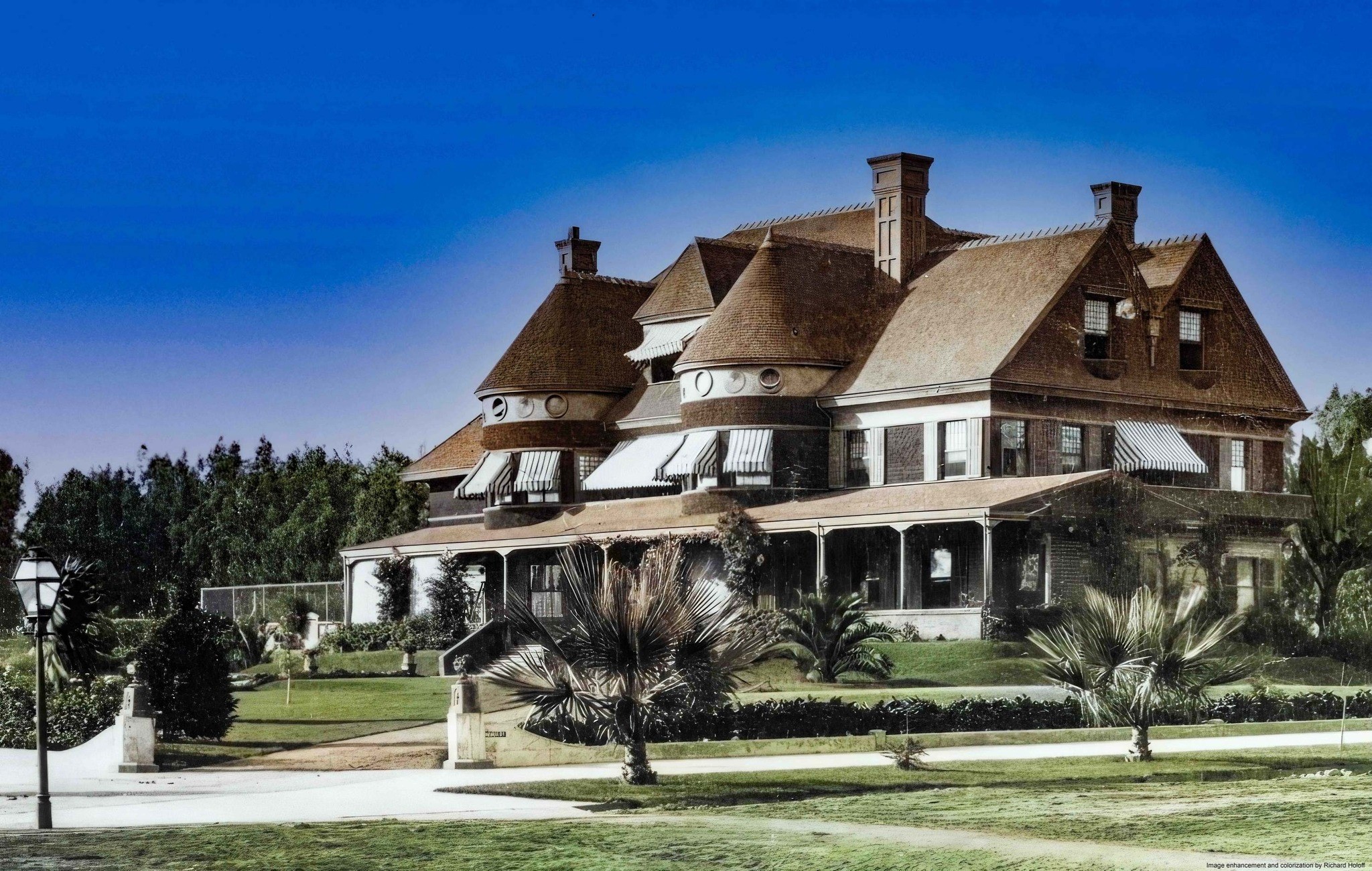
| (ca. 1890s)* - View of Miramar, the home of Senator John P. Jones and Georgina Frances Sullivan Jones, built in 1889 and located Ocean Avenue and Wilshire Boulevard. Photo is inscribed with an arrow, "Room where Gregory Jones was born 1894." Image enhancement and colorization by Richard Holoff. |
 |
|
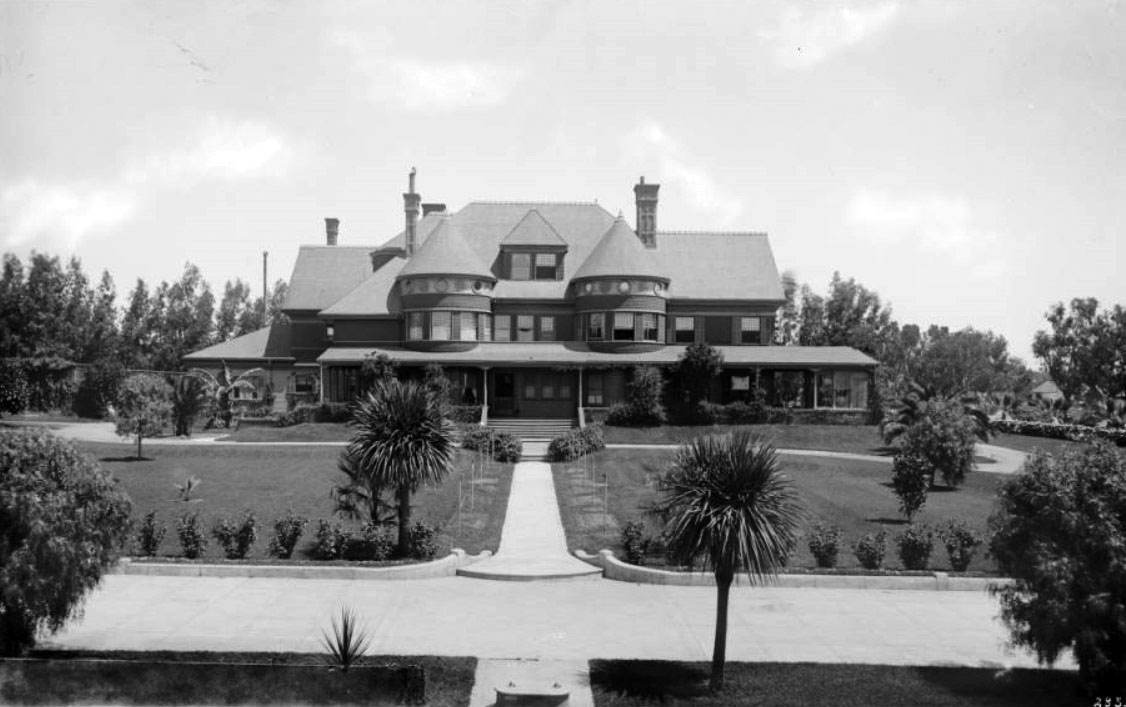
| (ca. 1890)** - View of Senator Jones residence (later the site of the Miramar Hotel) in Santa Monica showing front lawn across drive. A footpath leads from the drive to the house and is crossed by another path which goes around the house. The house itself has two round turrets in front. |
 |
|
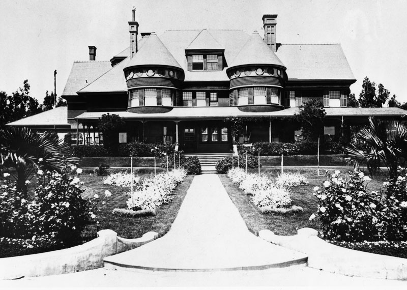
| (ca. 1890)* - Closer view of Senator John P. Jones' residence on Ocean Avenue. |
 |
|
| (1895)#^ - Residence of Senator John P. Jones called Miramar on Ocean Avenue. |
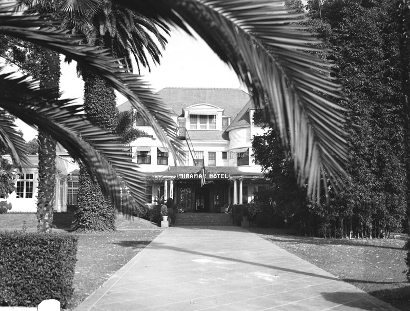
Historical Notes In 1924 Senator Jones’ mansion became the grand Miramar Hotel.* |
 |
|
| (1937)* - Exterior view of the entrance to the Miramar Hotel in Santa Monica, located on the northeast corner of Ocean Park and Wilshire Blvds. It is one of Santa Monica's oldest landmarks, dating back to 1888. |
Historical Notes Originally the location of Santa Monica's founding father Senator Jones mansion, the Miramar has provided shelter for rich and famous guests looking for an extended beach stay since the 1920s. Notables include Cary Grant, John F Kennedy, Charles Lindbergh and Eleanor Roosevelt.*^*^ In 1924 the six-story Palisades Wing was constructed to provide apartments for guests who planned lengthy stays at the beach. Scandinavian beauty Greta Garbo was one of the first celebrity guests to move into the wing and resided there for more than four years. Sultry blonde Jean Harlow rented one of the Miramar's bungalows in the early 1930s, and years later another famous blonde, Marilyn Monroe, frequently retreated to the Miramar when she wanted to disappear from the media.***^ |
* * * * * |
 |
|
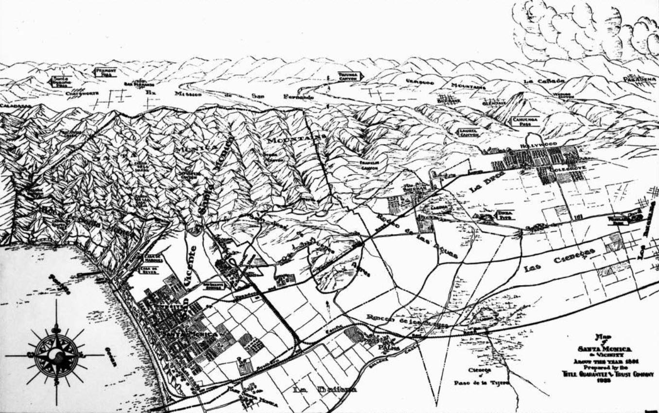
| (1891)** – Photo of a map of Santa Monica and vicinity as it appeared in 1891. Santa Monica can be seen in the lower left corner, near a small part of the Pacific Ocean. Mountains are visible above Santa Monica, and the city of Los Angeles can be seen in the lower right corner. |
Historical Notes The above map was prepared by the Title Guarantee & Trust Company in 1935. Other landmarks on the map include, from left to right, top to bottom: Calabasas, Santa Susana Pass, Chatsworth, Fremont Pass, San Bernardo, El Mission de San Fernando, Tujunga Canyon, Verdugo Mountains, Burbank, Glendale, Laurel Canyon, Cahuenga Pass, La Canada, Verdugo Canyon, Pasadena, Santa Monica Mountains, Sepulveda Canyon, Franklin Canyon, Sherman, Laguna, La Brea, Brea Pits, Hollywood, Colegrove, Bath House, Canon de Santa Monica, Casa de Reyes, Casa de Marquez, Rodeo de las Aguas, Las Cienegas, Westlake Park, Los Angeles, Santa Monica, Rincon de los Bueyos, and La Ballona.** |
 |
|
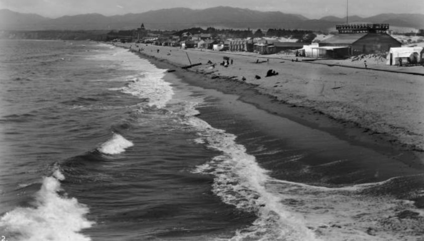
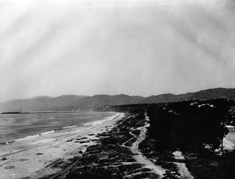
| (1890s)* - View of Palisades Park in Santa Monica, looking north from present Santa Monica Blvd. On the left is the Santa Monica beach, and the Santa Monica mountains can be seen in the background. The Long Wharf can be seen in the distance. |
Santa Monica Long Wharf
 |
|
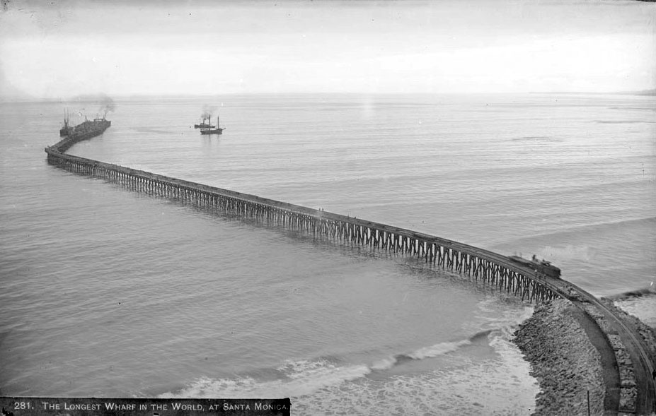
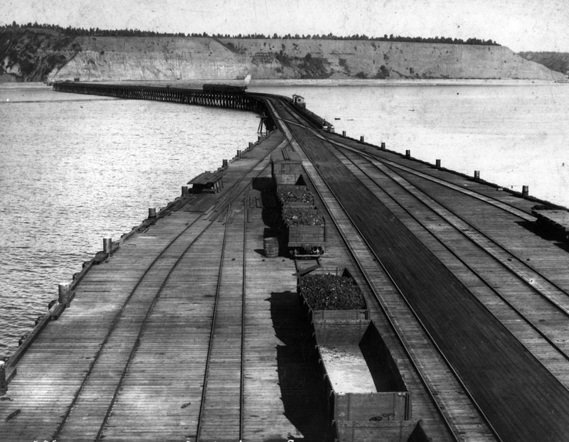
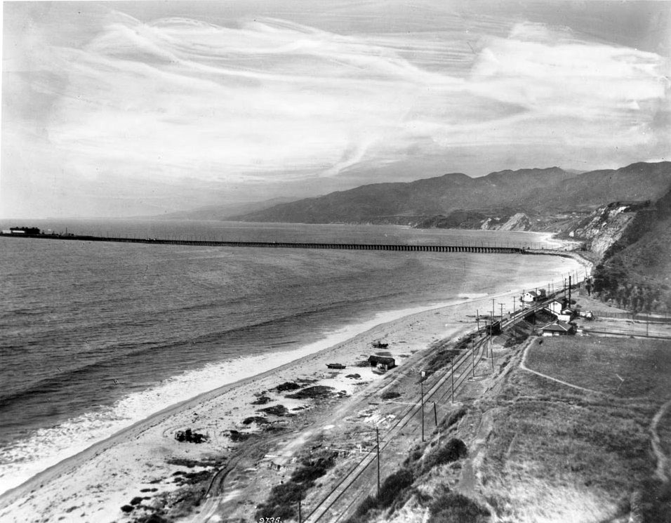
| (ca. 1893)**^ - The longest wharf in the world located off Pacific Palisades. A train can be seen close to the shoreline while several ships are seen near the end of the long wharf. |
Historical Notes When the Southern Pacific Railroad arrived at Los Angeles, a controversy erupted over where to locate the city's main seaport. The SPRR preferred Santa Monica, while others advocated for San Pedro Bay. The Long Wharf was built in 1893 at the north end of Santa Monica to accommodate large ships and was dubbed Port Los Angeles. At the time it was constructed, it was the longest pier in the world at 4700 feet, and accommodated a train.*^ However, just a short four years after the Long Wharf's construction, San Pedro Bay was chosen over Santa Monica to be the main seaport of Los Angeles. Click HERE to see more in Early Views of San Pedro and Wilmington. |
 |
|
| (ca. 1893)++ - Aerial view of the Southern Pacific Mammoth Wharf, Port Los Angeles, Calif. The wharf was also known as the old Santa Monica Long Wharf, north of Canyon. A white cloud of smoke can be seen from a train travelling on the tracks to the business end, at the end of the wharf. |
 |
|
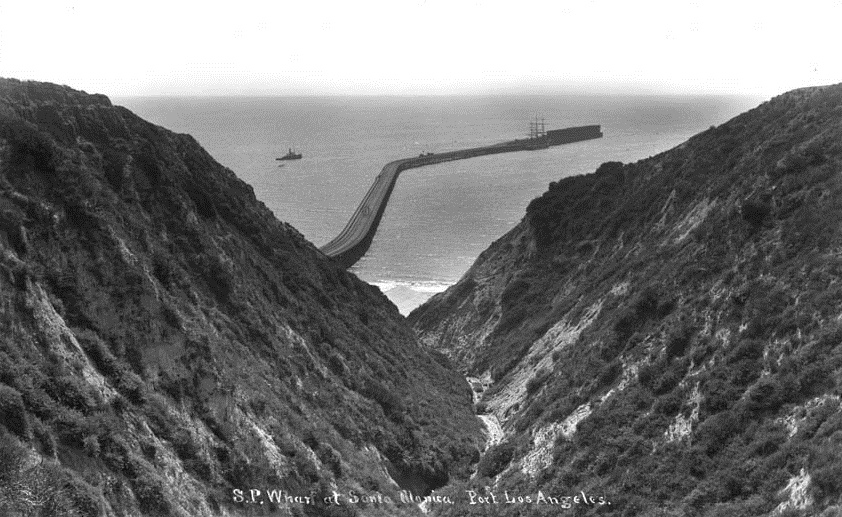
| (1895)^^ - View of the Southern Pacific wharf as seen through the hillside canyon. |
 |
|
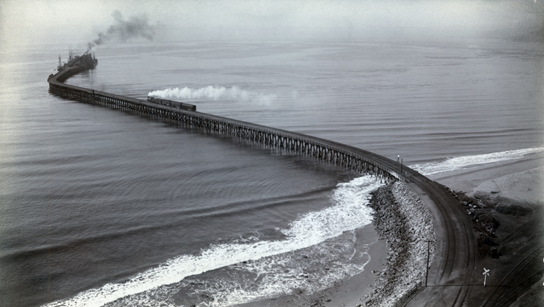
| (1893)** - View of the entire length of the Long Wharf from the beach all the way to its extremity almost a mile away. Note the RR turntable in the lower right corner. A horse-drawn carriage can be seen on the beach between the rail cars and the wharf. Empty railcars sit on a bridge over a gully. |
 |
|
| (ca. 1890s)* - Southern Pacific Mammoth Wharf, built in 1893. Well dressed men are seen standing near a train on the 4700 foot-long wharf. |
 |
|
| (1893)* - This photograph shows the arrival of the first steamer at the Southern Pacific wharf in 1893. |
 |
|
| (1898)* - Photo shows the business end of the mammoth wharf in Santa Monica. Several fully loaded railcars can be seen. |
 |
|
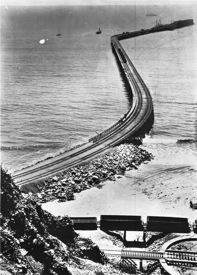
| (ca. 1893)* - Southern Pacific wharf, 4700 feet long, for the projected Port of Los Angeles. View is from the end of the wharf towards the shore. A train is seen heading toward to end of the wharf. |
 |
|
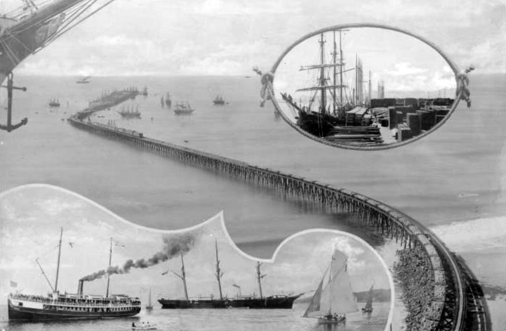
| (1894)** - A composite image showing 4 areas of the Southern Pacific Railroad Long Wharf: the wharf extending from the coast to its terminus in the ocean, ships surround the terminus and a train is visible on the tracks (middle of image); close-up of ship's prow showing anchor and figurehead of a half-nude woman (upper left); encircled by a doubly knotted rope is a docked sailing ship, on the dock are piles of dry goods (upper right); close-ups of 2 large ships (sailboat & steamer) and several smaller sailboats (lower left). |
Historical Notes In 1897, San Pedro Bay, now known as the Port of Los Angeles, was selected by the United States Congress to be the official port of Los Angeles (Port of Los Angeles) over Santa Monica. Still, the Long Wharf acted as the major port of call for Los Angeles until 1903. Though the final decision disappointed the city's residents, the selection allowed Santa Monica to maintain its scenic charm. The rail line down to Santa Monica Canyon was sold to the Pacific Electric Railway, and was in use from 1891 to 1933.*^ Click HERE to see more in Early Views of San Pedro and Wilmington. |
 |
|
| (ca. 1912)* - View of a Japanese fishing village, located north of the Long Wharf, 1/4 mile north of the entrance to Santa Monica canyon and just north of Will Roger's State Beach. |
Historical Notes Adjacent to the wharf, and extending northwest to the mouth of Temescal Canyon, a Japanese fishing village was established in 1899 by fisherman Hatsuji Sano on land leased from the railroad. Eventually the home of about 300 Japanese families and a small number of Russians, the village also included two hotels. However, this venture was largely abandoned by 1920, by which time most of the fisherman had moved to Terminal Island and the property was condemned.#^^^ |
 |
|
| (ca. 1916)** - Panoramic view looking south along the beach toward the Long Wharf. A collection of beach huts can be seen on the left which were part of a Japanese fishing village. To the right, the ocean surf can be seen lapping at the shore, with the Long Wharf extending out to deeper water. |
Santa Monica Canyon
 |
|
| (1890s)^^^ - View from the hills looking toward the mouth of the Santa Monica Canyons. The Long Wharf can be seen in the distance. |
Historical Notes The Santa Monica Canyon area was experiencing a land boom during the late 1880’s attracting tycoons (either actual or potential) of every industry. One such industrious man was Abbot Kinney who opened the first forestry station in the adjacent Rustic Canyon in 1887. One of his objectives was to test trees, primarily eucalyptus, as cash crops. On 247 acres of land Kinney began planting trees. Despite the success of the trees, it was clear they were not an effective cash crop and Kinney soon sold the property. Notwithstanding a devastating fire in 1904, many of the trees survived creating the plentiful and beautiful eucalyptus groves in Rustic Canyon today. A plaque was dedicated on August 18, 1971, officially designating the eucalyptus groves as a California State Historical Landmark.^##* Click HERE to see more California HIstorical Landmarks. |
 |
|
| (1910)* - View of the mouth of the Santa Monica Canyon with ocean and the Long Wharf in the background. |
Historical Notes Because of the construction of the nearby Long Wharf, a railroad was built right by the mouth of the Santa Monica Canyon. The area now became accessible to hundreds of people. Traveling characters enjoyed days of croquet, horseback riding, and, of course, bathing.^##* |
 |
|
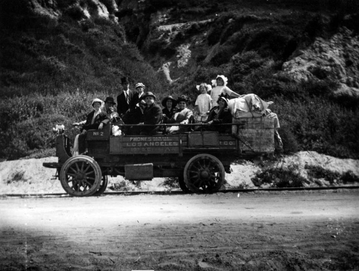
| (1914)#^^ - View showing an open-air truck filled with men, women and children with cargo strapped to the back of the vehicle and heading for the Port of Los Angeles (Long Wharf) in present-day Pacific Palisades. The truck is running on or near the tracks. |
 |
|
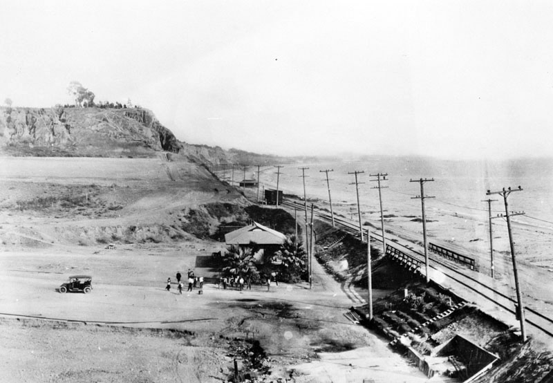
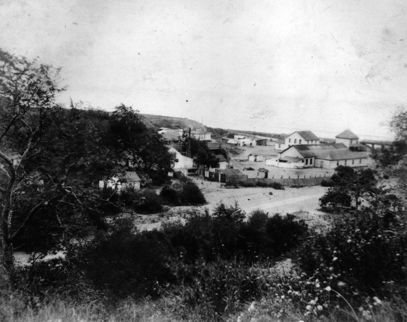
| (ca. 1910)* - View of Santa Monica Canyon looking south from the north side of the canyon mouth. Several people are seen standing in front of the railroad depot as a car appears to be pulling away. On the right, a railroad bridge crosses the canyon near the water. The bluff at left distance later became picnic grounds. |
Historical Notes The railroad depot seen in the above photo is still standing today. The original 1890’s structure is the entrance to Patrick’s Roadhouse Restaurant, 106 Entrada Drive. The lunch counter and booth area of the restaurant appear to be the original fixtures as well. |
 |
|
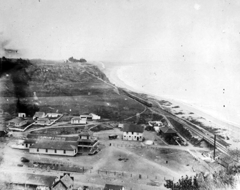
| (ca. 1910)* - View looking souh from the bluffs overlooking the mouth of Santa Monica Canyon. A train can be seen on the tracks. |
Historical Notes After San Pedro Bay was selected over the Long Wharf as the location of the new Los Angeles Harbor, the rail line down to Santa Monica Canyon was sold by Southern Pacific Railroad to the Pacific Electric Railway. The track was in use from 1891 to 1933.*^ |
 |
|
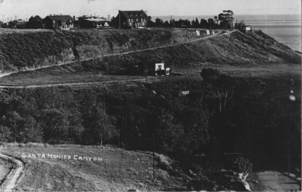
| (1915)^x^ – Close-up panoramic view showing the southern bluffs of Santa Monica Canyon with the first three houses now appearing on top at Adelaide Drive. A fourth house is also seen at the base of the bluffs. |
Historical Notes Adelaide Dr. and 4th house is still there. It was built in 1906 for R C Gillis as a summer house. Gillis and partners subdivided area as The Palisades and marketed it as a place to build summer houses for Los Angeles residents.^x^ |
 |
|
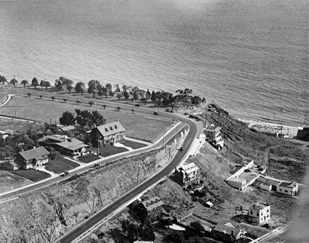
| (ca. 1918)#^ – Aerial view looking down at the southern bluffs of Santa Monica Canyone showing where Ocean Avenue meets Adelaide Drive (center of photo). Ocean Avenue runs parallel to the Palisades bluffs and the ocean. Several more homes now appear on the hillside facing Santa Monica Canyon. Click HERE for contemporary view. |
Historical Notes Ocean Avenue starts at the residential Adelaide Drive (seen above) on the north end of Santa Monica and ends at Pico Boulevard. It is westernmost street in Santa Monica, and for most of its course it runs parallel to Palisades Park, whose bluffs overlook Pacific Coast Highway and Santa Monica State Beach. |
 |
|
| (Early 1900s)* - Close-up view of buildings in Santa Monica Canyon in the early 1900s. |
 |
|
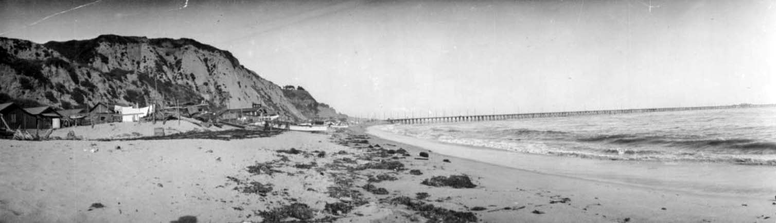
| (ca. 1880s)* - Entrance to the Santa Monica Canyon looking from the hills toward the ocean. Several buildings are situated at the mouth of the canyon. This photo was taken prior to the construction of the Long Wharf (1893). |
 |
|
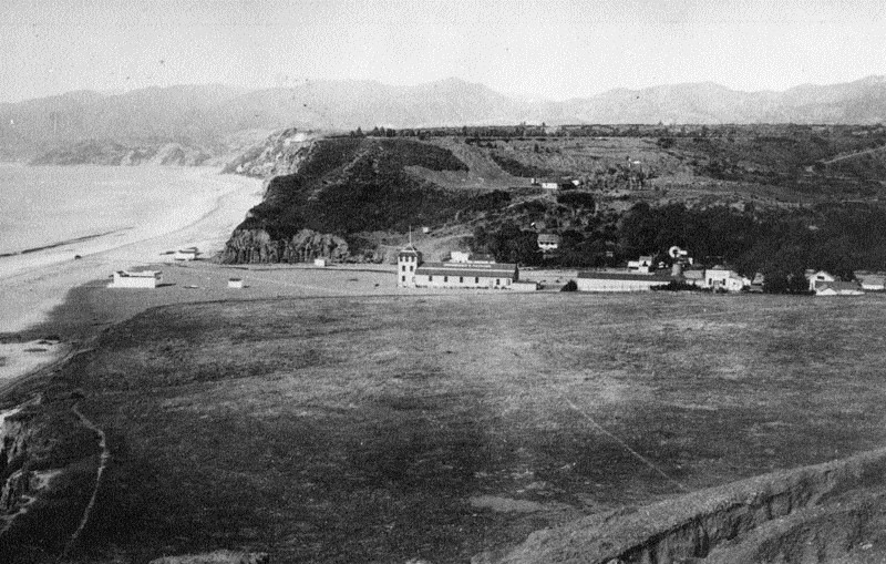
| (ca. 1912)** - View of Santa Monica Canyon and Long Wharf. The entrance to the Santa Monica Canyon is to the right. Railroad tracks and a pole line can be seen running parallel to the beach. The mountains along the Pacific coastline are visible in the distance. The long dock extends from the beach on the right to a large ship in the open ocean on the left. |
 |
|
| (ca. 1912)^x^ - View looking down at Santa Monica Canyon from Adelaide Drive on top of the southern bluff of the canyon with the Long Wharf seen in the distance. |
 |
|
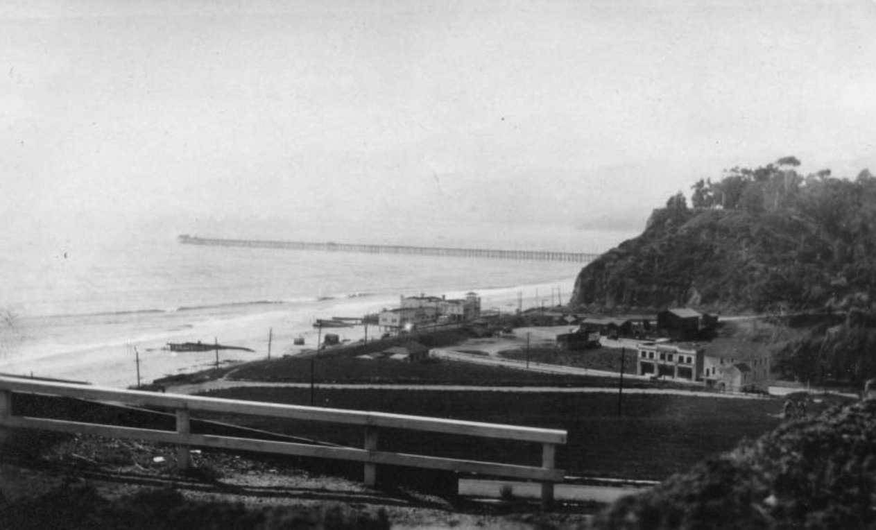
| (ca. 1915)^x^ - Postcard view showing the mouth of Santa Monica Canyon (present-day Chautauqua Blvd / W. Channel Rd. / Pacific Coast Highway). A bath house, sometimes identified as Bundy's Bathhouse, is visible on the beach, and the Long Wharf of the Port of Los Angeles (dismantled in 1920) appears in the background. |
Historical Notes Tract planning for residential homes in the Santa Monica Canyon began in 1912. Santa Monica Land Companies owned by Gillis, Sherman, and C.L. Bundy promoted one expensive new tract after another. At the place Where the Mountains meet the Sea (as The Canyon was advertised), the Bundy’s built a bath house with picnic area, refreshments, and dance pavilion. It became the favorite oasis of many until it burned down in 1927. ^ |
 |
|
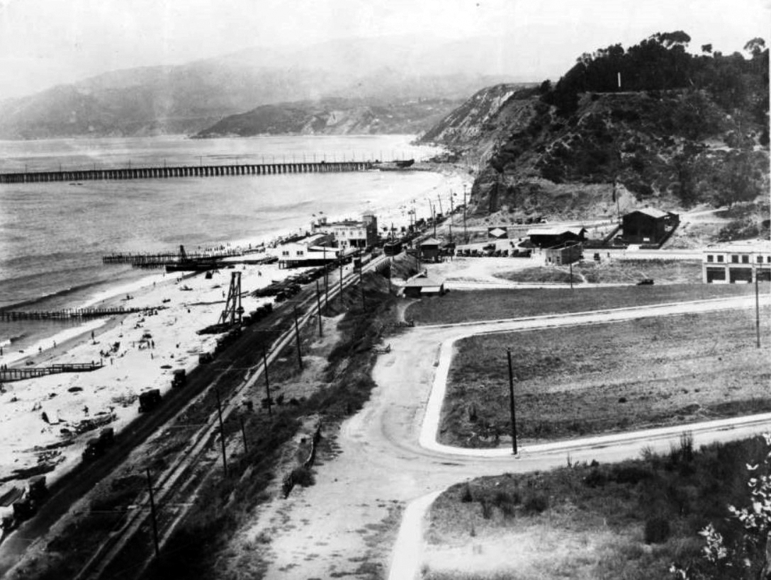
| (1916)#^ - View showing the F.E. Bundy bathhouse on the beach at the mouth of Santa Monica Canyon. The Pacific Electric tracks to Long Wharf are seen in the distance and Mayberry Road is in the foreground. |
Historical Notes In November 1919 the Pacific Electric Railway announced they were going to pull down the entire wharf. By the middle of the next summer not a trace of it was left.** |
 |
|
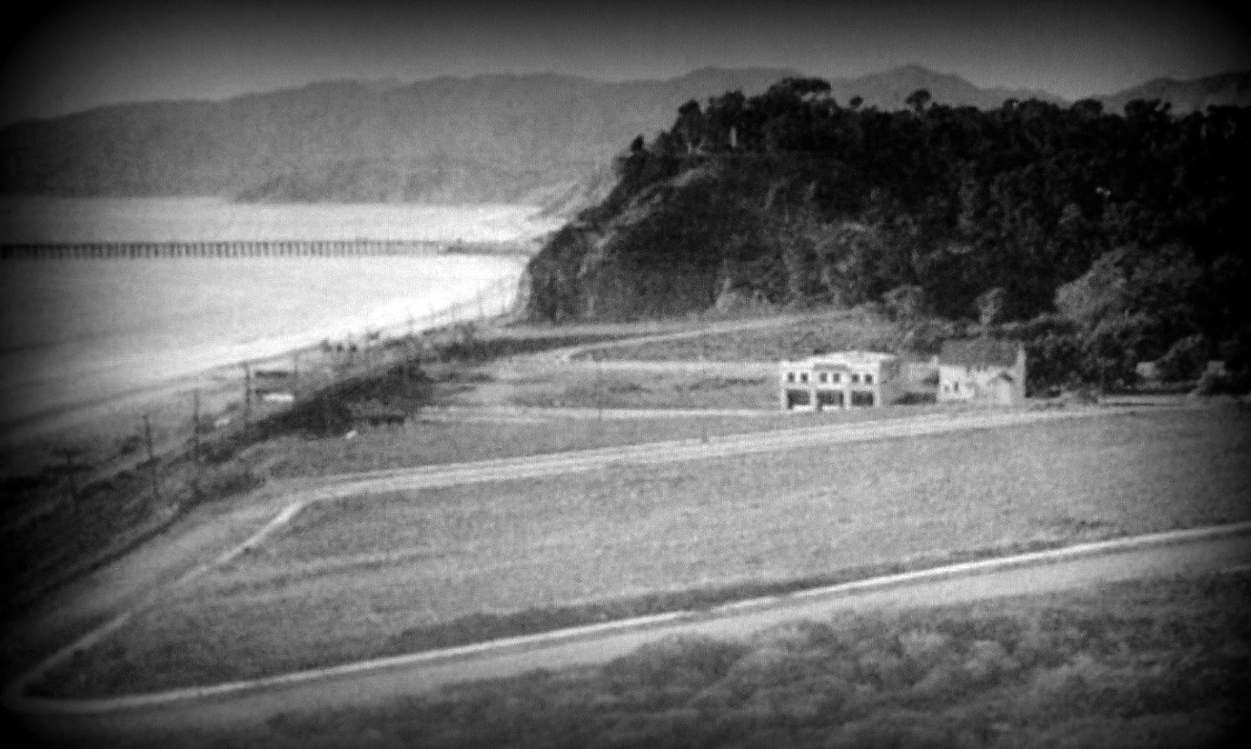
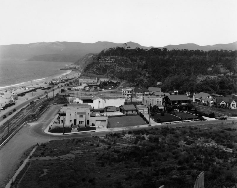
| (late 1920s)* - Santa Monica Canyon by the ocean looking across to the Huntington Palisades. Sign on the hillside reads: HUNTINGTON PALISADES. The Long Wharf no longer appears. It was demolished in 1920. Also, Bundy's Bath House, seen in previous photos, is now gone. It burned down in 1927. |
Historical Notes Pacific Palisades was founded in 1920 by Dr. Charles Holmes Scott of the Methodist Episcopal Church, who sought permanent roots for his religious community. Scott, along with a delegation of Methodist ministers and laymen, purchased 16.6 acres of Rustic Canyon property (then-owned by scholar and widow Julia Edmond) and 11.8 acres of land adjacent to a forestry station. That same year, the Pacific Palisades Association was established to implement Scott’s plans and to further expand the community — in land and in population. January 14, 1922 was Pacific Palisades’ official “opening day.” In 1926, the Pacific Palisades Association purchased the land that was owned by the Huntington family of New York. Both a commemorative gesture and a way to benefit from the prestige associated with the Huntington name, the area was deemed “Huntington Palisades.” ^*# |
 |
|
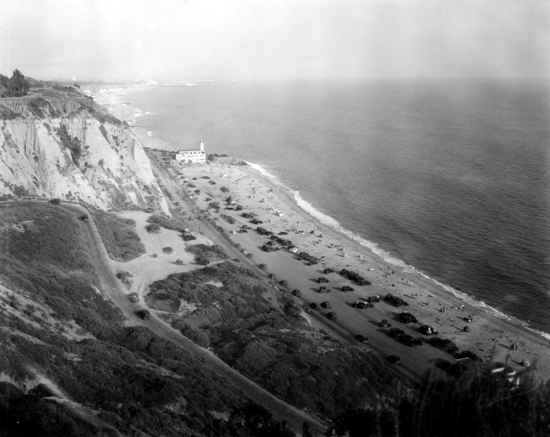
| (1930s)^v^ - Postcard view looking north toward Malibu showing the Roosevelt Highway (now Pacific Coast Highway) at Santa Monica Canyon. The Lighthouse Cafe is visible up the coast. |
 |
|
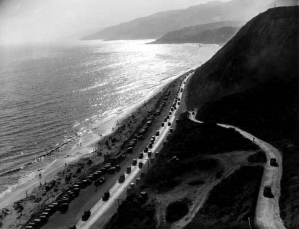
| (1930)#^^ - View looking north showing the Roosevelt Highway (later Pacific Coast Highway) with the Pacific Ocean, mountains, beach, and automobiles visible along the coastline in Pacific Palisades near Topanga Canyon. |
 |
|
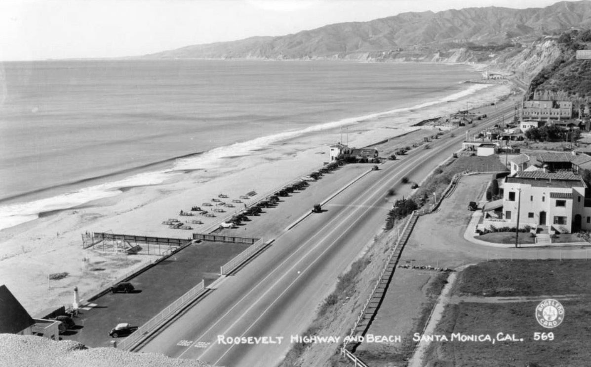
| (1920s)* - Looking south along Roosevelt Highway (PCH by end of 1930), in Pacific Palisades. The highway runs parallel with the ocean where visitors enjoy the sun and surf. Visible in the distance, the landmark Lighthouse Bathhouse that stood on Pacific Coast Highway at the point where the Santa Monica Mountains come down to the shore. |
* * * * * |
Please Support Our CauseWater and Power Associates, Inc. is a non-profit, public service organization dedicated to preserving historical records and photos. Your generosity allows us to continue to disseminate knowledge of the rich and diverse multicultural history of the greater Los Angeles area; to serve as a resource of historical information; and to assist in the preservation of the city's historic records.
|
More Historical Early Views
Newest Additions
Early LA Buildings and City Views
History of Water and Electricity in Los Angeles
* * * * * |
References and Credits
* LA Public Library Image Archive
^^California State Library Image Archive
^* LMU Digital Collection: Arcadia Hotel
*# The Los Angeles County Metro Division 7
#^ Santa Monica Public Library Image Archive
#+ Wehoville.com: Balloon Route
#^*Ocean Park History: oceanpark.wordpress.com
*^*Paradise Leased: Arcadia Hotel
^x^Facebook.com: Venice, Ca, Ocean Park, & Santa Monica in the 20th Century
**^Noirish Los Angeles - forum.skyscraperpage.com; The Long Wharf; Camera Obscura; Acadamy of the Holy Names; Inceville - Inceville - palipost.com
*#*KCET: Arch Rock and Castle Rocks; Rail Returns to the Westside: The Expo Line's Historical Precursors
^#*Santa Monica History Museum
^*#Huntington Palisades - A Brief History
*^#Nuestra Señora la Reina de los Ángeles: losangelespast.com
#**MTA Transportation and Research Library Archives
#^^Huntington Digital Library Archive; Arcadia Roller Coaster; Arcadia Roller Coaster 2; Visitors to SM Beach; Southern Pacific RR
^##The Malibu Times: On the Villa de Leon
###Ingersoll's Century History, Santa Monica Bay Cities
***^History of the Fairmont Miramar Hotel and Bungalows
**^^TheLosAngelesBeat.com: Camera Obscura
^^**Atlas Obscura: Santa Monica Camera Obscura
^*##Facebook.com - Bizarre Los Angeles
*^^#LAistory: The Santa Monica Pier
^##^San Fernando Valley Historical Society/Facebook.com 1st Mail Wagon
^##*Inthecanyon.com: History of Santa Monica Canyon
^#^#CSUN Oviatt Library Digital Archives
+#+#The Famous Lighthouse that Almost Came to Pepperdine
#**#Santa Monica Local History: blogspot.com
#^^^Survey LA: Brentwod-Pacific Palisades Community Plan Area
#^^*Pinterest.com: Old Hollywood
#^#*Denver Public Library Image Archive
*^Wikipedia: California State Route 1; History of Santa Monica; Los Angeles and Independence Railroad; Griffith J. Griffith; Memorial Day; Pacific Electric Railway; Thelma Todd
< Back