Early Views of the San Fernando Valley
Historical Photos of the San Fernando Valley |
 |
|
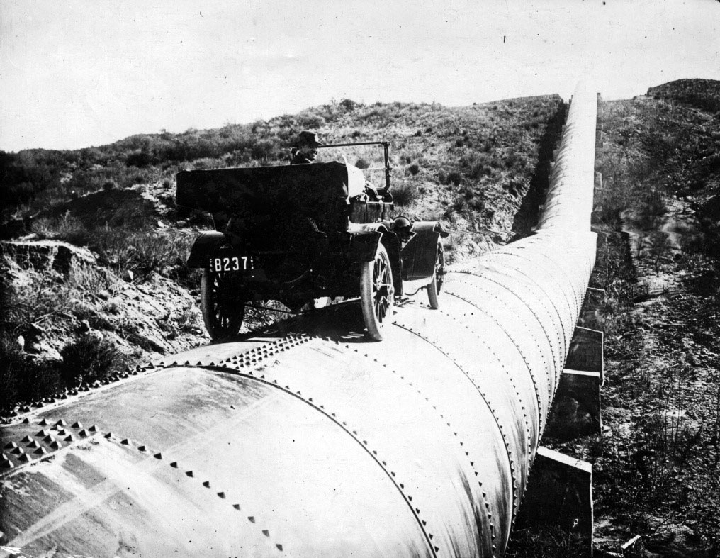
| (ca. 1913)* - A man is seen behind the wheel of an early model car sitting on top of a completed section of the LA Aqueduct. |
Historical Notes The completion of the Los Angeles Aqueduct in 1913 provided surplus water to the city and accelerated the development and growth of the San Fernando Valley. Click HERE to see more in Construction of the L.A. Aqueduct. |
.jpg) |
|
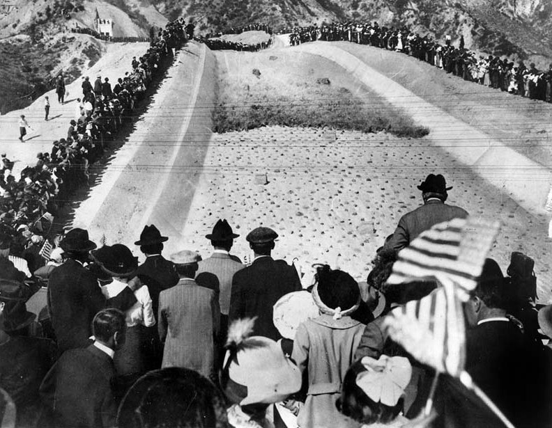
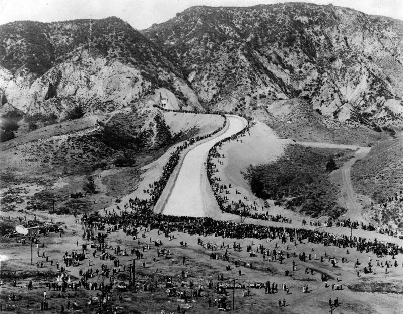
| (1913)^ - Over 30,000 people attended the opening day ceremonies of the Los Angeles Aqueduct on November 5, 1913. The caption of this picture was that the automobile was "here to stay" in the San Fernando Valley. You can make out some horse and buggies to the rear of the image. |
Historical Notes All morning long they came – out to where the Newhall hills rise above the northeastern edge of the San Fernando Valley. On foot, on special Southern Pacific trains ($1 roundtrip from the Los Angeles terminal), in automobiles, wagons and buggies – on horseback they came. By noon, 30,000 persons had stationed themselves around the natural amphitheater that centered at the concrete canal called the “Cascades.” **## |
 |
|
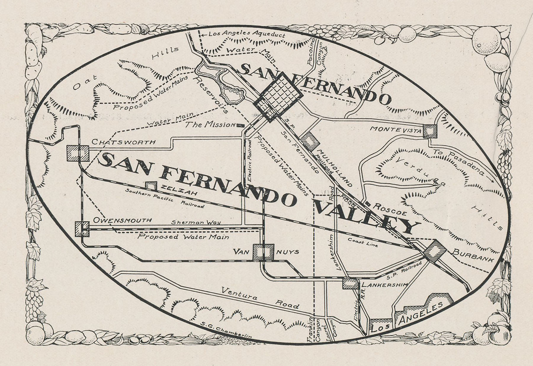
| (1913)^*^# - Map of the San Fernando Valley included in the Official Program of the Opening Ceremony of the LA Aqueduct. The map shows the location of the LA Aqueduct event as well as how the new Owens River water would be distributed to different parts of the valley and city. |
.jpg) |
|
| (1913)* - Four men open the gates allowing Los Angeles Aqueduct water to cascade down to the San Fernando Valley. |
 |
|
| (1913)^^^ - Men, women, and children stand in awe as water runs down the cascades at the opening ceremony of the LA Aqueduct. Many of the spectators are waving American flags. The man with the hat rising above the flag on the right is non other than William Mulholland.*^ |
Historical Notes "There it is......take it!" were the famous words yelled out by Wiliam Mulholland at the dedication. The remarkable photo above was taken from the grandstand a minute and a half after the LA Aqueduct water gates were opened. The view is exactly as the camera caught it, without so much as the touch of a pencil added. The front of the water wall was black from the dust and sediment that had accumulated at the head of the cascade. Click HERE and see more in the Los Angeles Aqueduct Opening Ceremony. |
 |
|
| (Novermber 5, 1913)** - Photograph caption reads: "Southern California's tremendous growth necessitated the building of the great Owens Valley aqueduct. This photo shows a crowd of over 30,000 at its dedication. |
Historical Notes Once the Los Angeles Aqueduct was completed and the City had a new source of water, it proceeded to annex outlying communities attracted by the promise of an abundant water supply. The flurry of annexations began even before the aqueduct was completed. Between 1910 and 1930, the area of Los Angeles increased from 115 sq. miles to 442 sq. miles through annexations of surrounding areas (i.e. Hollywood is annexed in 1910, the San Fernando Valley is annexed in 1915). The City's population increased from 533,535 (1915) to 1,300,000 (1930).*^ |
 |
|
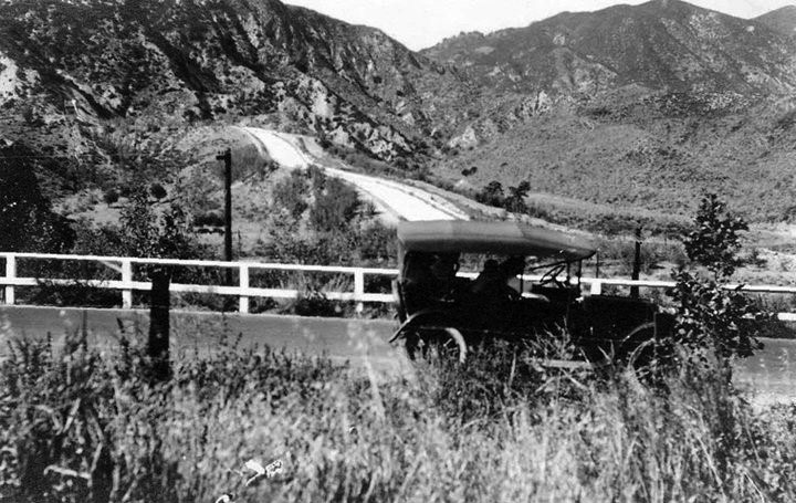
| (1915)* – An early model car traveling past the terminus of the Los Angeles Aqueduct in present day Sylmar just south of Newhall Pass in the San Fernando Valley. The aqueduct had been completed by William Mulholland two years earlier in November 1913. The road in photo is likely the predecessor to Highway 99 and Interstate 5 heading towards the Ridge Route between Los Angeles and Bakersfield which had just been completed the same year of 1915. |
 |
|
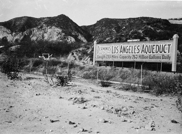
| (n.d.)^# - Terminus of the Los Angeles Aqueduct - This photograph shows a sign advertising the terminus of the Los Angeles Aqueduct, which had been completed in November, 1913. The sign was located near where present day Interstate 5 runs just east of the Van Norman Reservoir in Sylmar. In the background to the North are the San Gabriel Mountains, just east of the Newhall Pass. To the left of the sign can be seen the original water cascade that marked the terminus of the Aqueduct. The sign states "Terminus of the Los Angeles Aqueduct. Length 233 Miles. Capacity 260 Million Gallons Daily". |
Click HERE to see more in Construction of the Los Angeles Aqueduct |
* * * * * |
 |
|
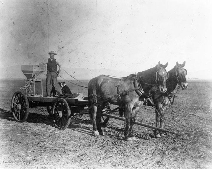
| (n.d.)*^^^ - With it's new source of water, Los Angeles invites its neighboring communities to become part of the City. Photo shows a farmer and his companion in an early and, at times, water-short San Fernando Valley. |
Historical Notes On this Day in Valley History: March 29, 1915 - Residents in most of the San Fernando Valley voted 681-25 to annex with the City of Los Angeles upon the condition of gaining drinking water from the aqueduct built by William Mulholland. Some parts of the Valley were originally opposed but ultimately gave in (with the exception of Burbank and San Fernando). Owensmouth (1917), West Lankershim (1919), Chatsworth (1920), Lankershim (1923) with smaller communities that followed. Rancho El Escorpión as late as 1958 and what was left of Ben Porter's Ranch in 1965.*^^^ |
Calabasas
 |
|
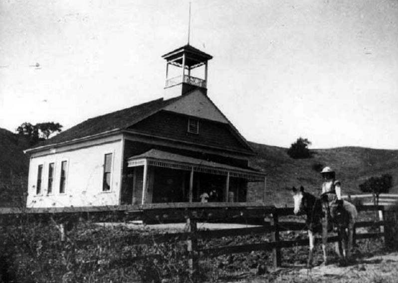
| (ca. 1908)^- View of field and buildings on the Daic Ranch in Calabasas. Left to right: Bly House, Liberty School House, and Daic Ranch buildings. |
Historical Notes When large ranches were divided into farms in the late 1800's, families of settlers struggled against poverty and drought. In her book, "Calabasas Girls," Catherine Mulholland brings the era to life with photographs and letters of her ancestors, the Ijams. When water and power came to Owensmouth (Canoga Park), they were happy to leave the difficult life of Calabasas pioneers. * |
 |
|
| (Early 1900s)* – View showing the Liberty School, one of four one-room schoolhouses in the Calabasas/Las Virgenes area around the turn of the 20th century. Photo courtesy of the Calabasas Historical Society |
Historical Notes In 1897, land for the school was purchased from John Enos for one dollar and eighty-seven cents. It was created from the Las Virgenes and Calabasas Districts, and was built on the Liberty Grade, west of Las Virgenes Rd. It was located near the Daic homestead, which itself was located near the present-day Grape Arbor Park at Lost Hills Rd. Wencil Daic helped start the school, and served on the school board for ten years; its location near his ranch was convenient for his children to attend. Additional land was purchased for the school in 1941 from Herman & Dorothy Moser. In the 1940’s, a new state law forced one room schools to form a union school district, at which time, Arthur E Wright, a member of the Liberty School Board, helped pull the new district together. The building has a feature that was not common in other schoolhouses - it had a porch.* |
 |
|
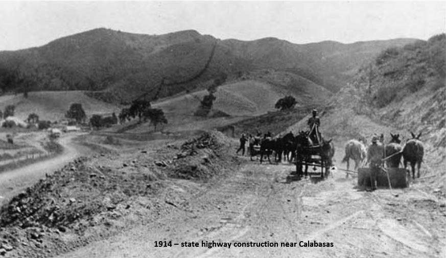
| (1914)* – View looking west showing contstruction of Ventura Highway near Calabasas using horsepower. |
Historical Notes In 1913-1914, the state highway from Calabasas on through to Ventura was being reconstructed and paved. Here is a view of the reconstruction in Calabasas. This is the westbound view in between what is now Liberty Cyn Rd and Chesebro Rd. |
Then and Now
 |
|
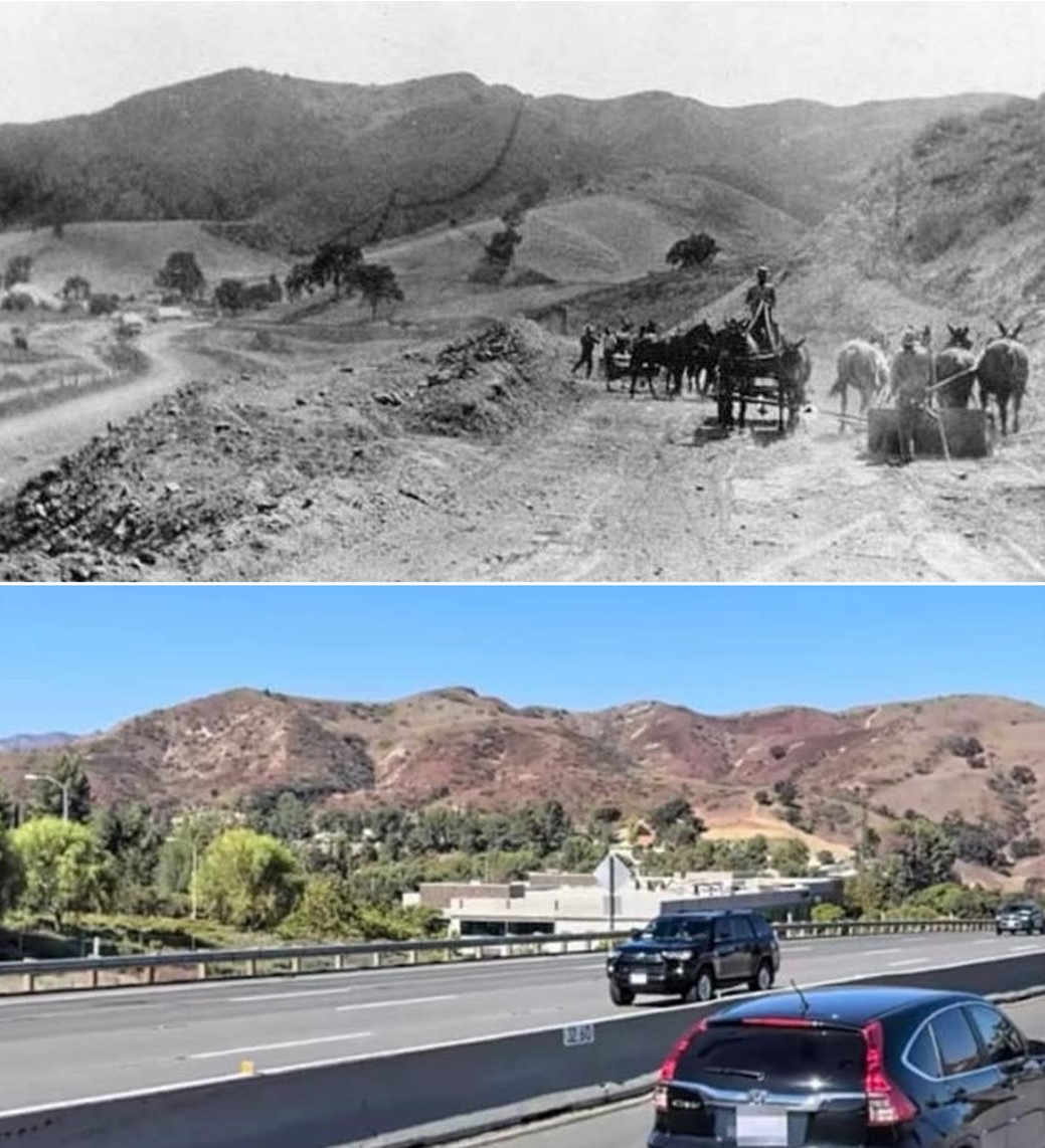
| (1914 vs 2020s)* – Ventura Freeway (Hwy 101) between Liberty Cyn Rd and Chesboro Rd near Calabasas. |
.jpg) |
|
| (1917)^ - View of a man sitting in an early model car in front of a billboard located on Ventura Boulevard at the Calabasas City line. |
Historical Notes The sign reads: “You are now entering Calabasas. Calabasas is an entrance to Santa Monica, Topanga, Dry Benedict and Laurel Canyon of the Santa Monica Mountains. Twenty miles south of Calabasas is Hollywood, the movie capital of the world.” The billboard is sponsored by Royal Cord Tires made by the US Rubber Company.^ It is generally accepted that Calabasas as the city name is derived from the Spanish calabaza meaning "pumpkin," "squash," or "gourd" (cf. with the word calabash). Some historians hold the theory that Calabasas is a translation of the Chumash word calahoosa.* |
 |
|
| (1915)^ - Samuel John Cooper family playing games. Left to Right: Rosie (daughter), Dollie Farnum (cousin), Rose (mother), unknown in wagon, Stanley Masson (cousin), Sam Cooper (father), Sam Marx Cooper (son). |
Historical Notes The first subdivision in Calabasas, called Park Moderne (in Mulwood near Calabasas High School), was a retreat for artists, craftsmen, and writers. It was built on land traded off as part of Sam Cooper Jr.’s homestead in 1928.* |
Calabasas Grocery Store, Oak Garage and the Calabasas "Hanging Tree"
 |
|
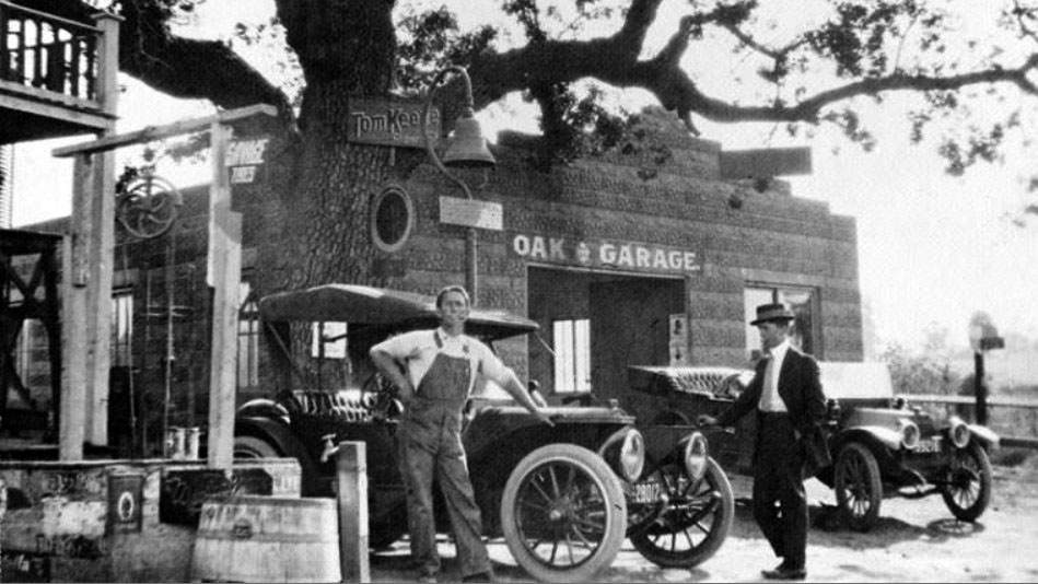
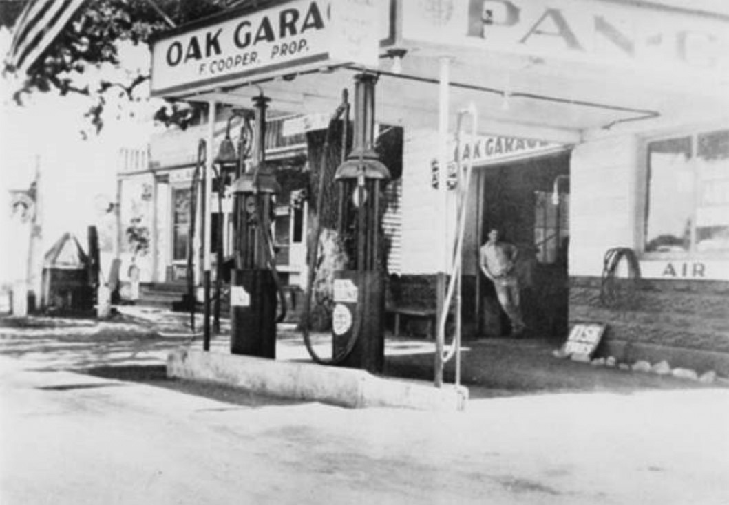
| (ca. 1910s)* - Charles Cooper, on the left, standing next to his grocery store and the Oak Garage in Calabasas. In the background stands a large oak tree and an El Camino Real Mission Bell Marker. This particular oak tree was used on numerous occasions to dispense swift justice and thus became known as the Calabasas "Hanging Tree". |
Historical Notes Charles Cooper and his wife, Alice Cooper, also owned a hotel called "Hunter's Inn." The hotel provided rooms for hunters and travelers. After Charles died, his widow married Lawrence Kramer and they renamed the grocery store Kramer's Grocery Store. They owned and operated the grocery store until he retired in 1968. * Adjacent to the grocery store was the Oak Garage, named for the oak tree, known as "Hangman's Oak". The tree was used for hangings along with a second tree located at the Calabasas Jail across the street. |
 |
|
| (1914)^ - Charles Cooper, driver, son of Samuel Cooper, Sr. in front of his store, Calabasas Grocery Store. The store also offered lodging and meals. White building east of store was the courthouse. |
Historical Notes The oak tree seen above carries with it some historical significance. It was one of two oak trees in Calabasas used repeatedly to dispense swift justice.* |
.jpg) |
|
| (1920s)^ - This Southern California historical building used to be a farmhouse but was later turned into a grocery store and hotel. The two-story building has about four rocking chairs on the front porch. Same building as above but 10 years later. On the right is the famous Calabasas "Hanging Tree" with the Oak Garage to the right (out of view). |
Historical Notes For decades residents attached nooses to the above coast live oak as well as another oak across the street; the chamber of commerce used a likeness of the “Hanging Tree” as a logo. According to doubtful town tradition, members of Tiburcio Vásquez’s outlaw gang died here. In the postwar years the massive tree, located next to a gas station, declined and died—possibly due to a gasoline leak. It was pruned down to its core and festooned with a larger noose.* |
 |
|
| (ca. 1968)^ – View showing members of the Calabasas Cattleman's Association posing in front of the old Calabasas Store. The group of men are well armed and the man on the right is holding a hanging noose. The Calabasas "Hanging Tree" is to the right and out of view. Photo by Debbie and Tom Cleaveland |
 |
|
| (1951)* – Close-up view showing Kramer's General Store on Ventura Boulevard with the Calabasas ‘Hanging Tree’ on the right. |
 |
|
| (ca. 1930)^ – View showing the Oak Garage and Gas Station with Frank Cooper standing in the doorway. In the background is the Calabasas “Hanging Tree", |
 |
|
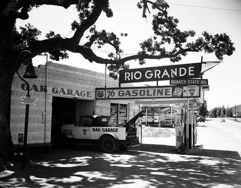
| (ca. 1936)* - Exterior view of the Oak Garage, a gas station and auto repair garage on Calabasas Road in Calabasas. A bell marker identifying El Camino Real is visible on the left side of the image right in front of the "Hangman's Oak", whose limb is seen across the top of the image. The tree was used for hangings along with another oak tree at the Calabasas Jail located nearby across the street.. |
 |
|
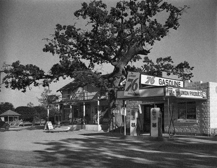
| (1939)#* - View of the “Hanging Tree” next to a Union 76 gas station (previously the Oak Garage) in Calabasas. Photograph by Dick Whittington. |
Historical Notes The above tree known by many as the Calabasas 'Hanigng Tree' stood until 2017 when it was removed since it was dying and was deemd a public hazard. The other well known "Hanging Tree" met its demise several years earilier. In 1965, Rocketdyne needed to transport a prototype rocket through Calabasas to its testing facility in Simi Hills. The landmark tree (in bad shape at the time) created a bottleneck for the oversize load. To solve the problem, a crane operator carefully transported the lifeless 30-foot trunk down the road to Leonis Adobe, a Calabasas house once owned by a prominent nineteenth-century Basque rancher. Here the beloved mock gallows, concreted into place, stood until 1995, when a winter storm toppled it. The desiccated wood shattered instantly, and in the aftermath, someone absconded with the decorative noose.* |
 |
|
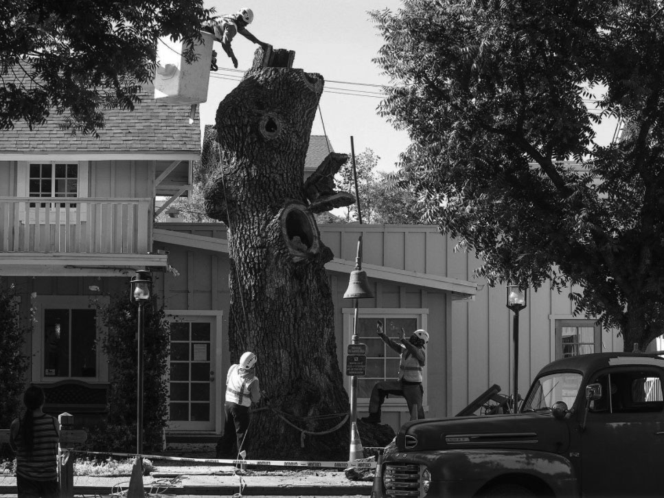
| (2017)* - Workers begin the process of taking out the rotted 20-foot-high oak tree trunk, while the city’s historic El Camino Real bell remains undisturbed. Photo courtesy of The Acorn |
Historical Notes Legend has it that the tree was used for public hangings along with another oak tree located not too far away across the street next to the jail. The oak was estimated to be between 200 and 250 years old. It stood in front of Calabasas Jewelers on the historic Kramer store property, just across the street from the Sagebrush Cantina in Old Town. Arborists determined the oak was dying and that it presented a hazard to the public. The tree was cut down and only a 20-foot-high section of trunk was left standing as a tribute to the past, but it too had to be removed due to internal rot.* |
* * * * * |
 |
|
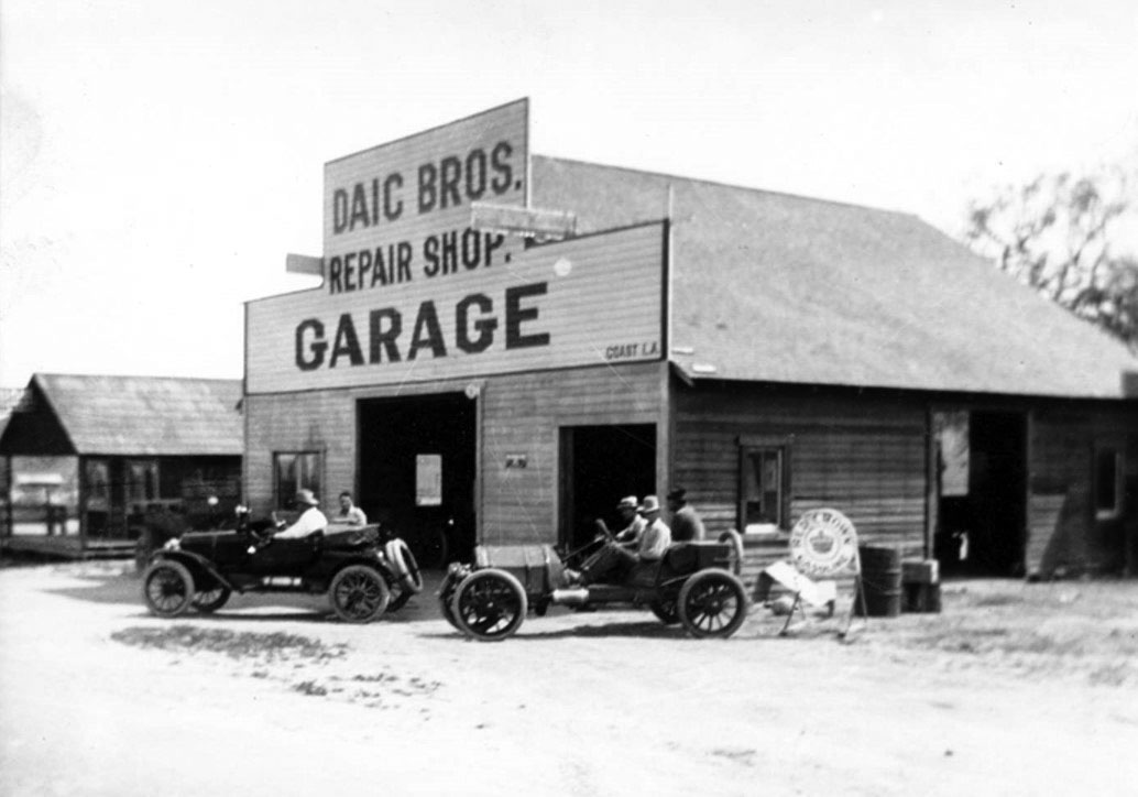
| (ca. 1915)^ - View of the first Daic Bros. garage, built 1915, across from Leonis Adobe, on property purchased from Juan Menendez. Frame building beside garage came with the property. Donor Beverly Daic Taber. |
Historical Notes Juan Menendez was the son of Espiritu, from her first marriage. Espiritu later married Miguel Leonis. * |
 |
|
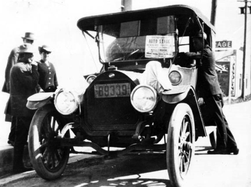
| (1915)^ – View showing Thompson's Auto Stage, the first bus (taxi) service to Hollywood. Viewed in this image are people from Calabasas leaving for a shopping trip to Los Angeles. The taxi serviced Newbury Park, Cornell, Calabasas, and Hollywood. |
 |
|
| (1918)* - View showing the future Route 101 highway heading north from what is now Lost Hills toward Las Virgenes (Malibu Canyon) and the Conejo Valley on what was then the El Camino Real from Los Angeles to Santa Barbara. |
* * * * * |
Roscoe (later Sun Valley - 1948)
 |
|
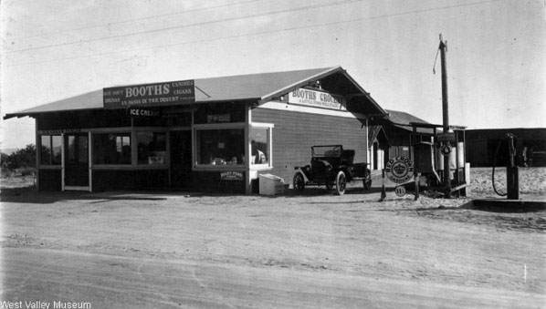
| (1915)^ - Booth's Grocery was located in Roscoe (now known as Sun Valley). The sign on the front of the building reads: "An oasis in the desert, hot -soft drinks, candies, cigars, tobacco" and the sign on the side reads: "A little store well filled." |
Historical Notes In the 1880's Sun Valley was known as Roberts, the name of a general store in town. The name was changed to Roscoe in 1896 and subsequently, Sun Valley in 1948. Roscoe Blvd, also named after the town, runs from Sun Valley all the way to Canoga Park and West Hills. ***^ Click HERE to see more early views of Sun Valley. |
* * * * * |
Glendale
 |
|
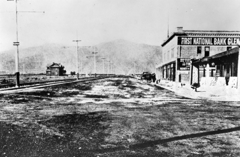
| (ca. 1905)* - Early panoramic view looking north on Brand Boulevard at Fourth Street (later Broadway) with the First National Bank of Glendale seen at right. Rail tracks run north and south on Brand with electric power poles in the middle of the street. To the far right (N/E corner) stands the Pacific Eelctric station. |
Historical Notes Brand Boulevard was named after Leslie Coombs Brand, “The Father of Glendale”. Brand was an important civic booster who built an estate in 1904 called El Miradero featuring an eye-catching mansion whose architecture combined characteristics of Spanish, Moorish, and Indian styles (today’s Brand Library and Art Center). His most important contributions to Glendale, though, was when he partnered with Henry E. Huntington to bring the Pacific Electric Railway, or the "Red Cars," to the area also in 1904. The First National Bank of Glendale seen above was the city’s second bank. It was founded by Leslie Brand in 1905. Brand's friend and business partner, Dan Campbell, served as the bank's vice president and manager. |
 |
|
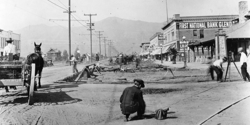
| (ca. 1910s)* - View is looking at Brand Boulevard, north of Broadway. Work is being done on the right side of the road. Several businesses are seen including the First National Bank, Glendale building on the right. |
 |
|
| (1915)* - View of north Brand from Lexington. The railroad train, "Los Angeles line" makes its way up Brand. Large residential homes may be seen on the left. |
 |
|
| (1919)* - View of Brand and Lexington and the surrounding area. The Glendale Press building is on the left. The train in the distance is stopped to pick up passengers waiting along the way. |
Historical Notes The Glendale Line was pioneered by L.C. Brand and associates starting in October, 1902, through their corporation, "The Los Angeles & Glendale Electric Railway". On June 29, 1903, Brand received a franchise from the Los Angeles City Council for an electric railway line running from Los Angeles to Glendale. The franchise was soon sold to Henry E. Huntington, owner of Pacific Electric Railway Co., who would bring the "Red Cars" to Glendale by 1904 under the name of Los Angeles Interurban Railway (later changed to Pacific Electric). Click HERE to see more in Early Views of Glendale. |
* * * * * |
Lankershim (later North Hollywood - 1927)
| (ca. 1915)^ - Lankershim Bakery and T. W. Herron's Store located at Magnolia Boulevard and Lankershim Boulevard, circa 1915. Horse carts and cars are visible. |
 |
|
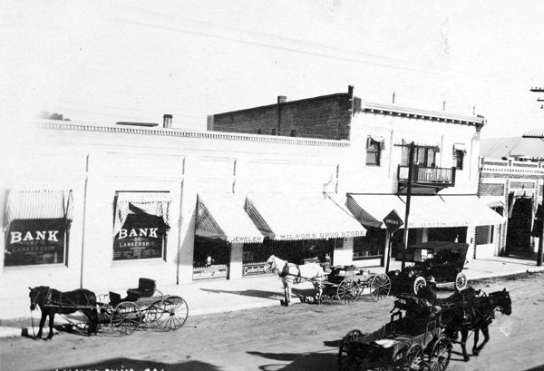
| (1916)^ - Postcard photograph of a street scene in Lankershim, Calif. outside of the Lankershim Bank. Wilson Drug Store shares the building with the Lankershim Bank. On the street are horse drawn carriages and wagons and an automobile. |
Historical Notes The town of Lankershim (first called Toluca, now North Hollywood) was named after its founding family. Isaac B. Lankershim grew wheat on a wide swath of the Valley floor on his Lankershim Ranch. North Hollywood was established by the Lankershim Ranch Land and Water Company in 1887. It was first named Toluca before being renamed Lankershim in 1896 and finally North Hollywood in 1927.*^ |
| (ca. 1920)^ - Wide angle view of the Bank of Lankershim and J. E. Jones Druggist's store located at the SE corner of Chandler and Lankershim Blvds. |
Historical Notes Named for one of the area's founding families, Lankershim Boulevard is one of the oldest streets in the area surrounding what is now the neighborhood of North Hollywood. It was a major thoroughfare for the town of Toluca (which was itself renamed "Lankershim" in 1896), connecting it to Los Angeles by way of the Cahuenga Pass. In the center of Toluca it crossed the Southern Pacific Railroad, with a depot near the current location of the North Hollywood Metro Station at Chandler Boulevard.*^ |
 |
|
| (ca. 1919)^ – View showing the North Hollywood Pacific Electric Car Station, located at the intersection of Chandler and Lankershim boulevards. |
Historical Notes The North Hollywood PE Station was part of a very efficient rail system that was dismantled due to competition from the automobile in 1952, though the station itself is still standing.^ |
| (1920)^ - The Southern Pacific Railroad in Lankershim. The Bonner Fruit Company and Diamond Walnut Plant used the railroad to ship their products across the nation from this station. |
Lankershim Blvd Bridge
| (1912)#^*^ - View looking southeast showing the Lankershim Bridge over the Los Angeles River. Universal purchased the surrounding ranches just 2 years later. There appears to be an auto and a man crossing the bridge. |
Historical Notes In 1912, several ranches were located south of the Los Angeles River and east of Lankershim Boulevard. In 1914, Universal Studios purchasted these ranches, which included the Taylor, Boag, Davis, and Hershey ranches. The ranches were once part of the overarching Clyman Ranch that was owned by the Lankershim wheat empire, which was under the guise of the Los Angeles Farm and Milling Company.^^ |
 |
|
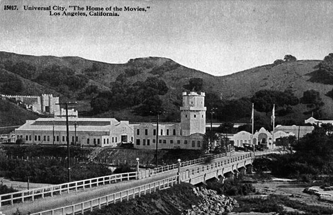
| (ca. 1916)*#^# – Postcard view showing the Lankershim Bridge over the Los Angeles River leading to the front entrance of Universal City, “The Home of the Movies”. |
Universal City
 |
|
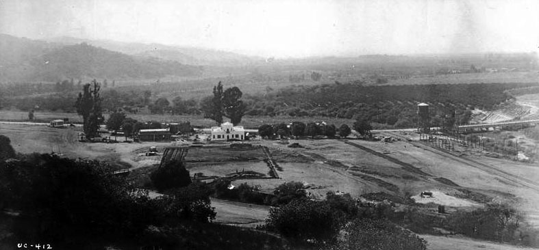
| (ca. 1914)***^# – Panoramic view looking southwest showing Universal City. The water tower at center-right would later be converted into a castle tower. The Lankershim Blvd Bridge can be seen to the right of the tower. (Universal Handout Photo). |
Historical Notes In 1913, the Universal Company purchased 12,000 acres of land in the San Fernando Valley near the railroad station of Lankershim and about eight miles from Los Angeles.^*#^ A year earlier, on April 30, 1912, Carl Laemmle merged the Independent Motion Picture Company with five smaller companies to form the Universal Film Manufacturing Company. After visiting his newly acquired west coast operations of Nestor Studios and Nestor Ranch, he renamed the studio "Universal Studios" and the leased Oak Crest Ranch became the first "Universal City" in the San Fernando Valley. The first Universal/Nestor Ranch (Providencia Land and Water Development Company property Oak Crest Ranch) is presently the site of Forest Lawn Memorial Park (Hollywood Hills). In 1915, Universal moved its operations at the Hollywood/Nestor studio and Universal/Nestor Ranch to its new Lankershim Blvd. location before the official opening of Universal City (Lankershim Blvd).*^ |
 |
|
| (1915)^^ – View looking northwest showing Universal City with its whitewashed buildings. Photo Courtesy: Marc Wanamaker |
Historical Notes The main buildings consisted of two main stages, Universal Studio Tours, and the production support facilities that were on the north side of the lot. At this time, the studio had formerly opened on Lankershim Boulevard. |
 |
|
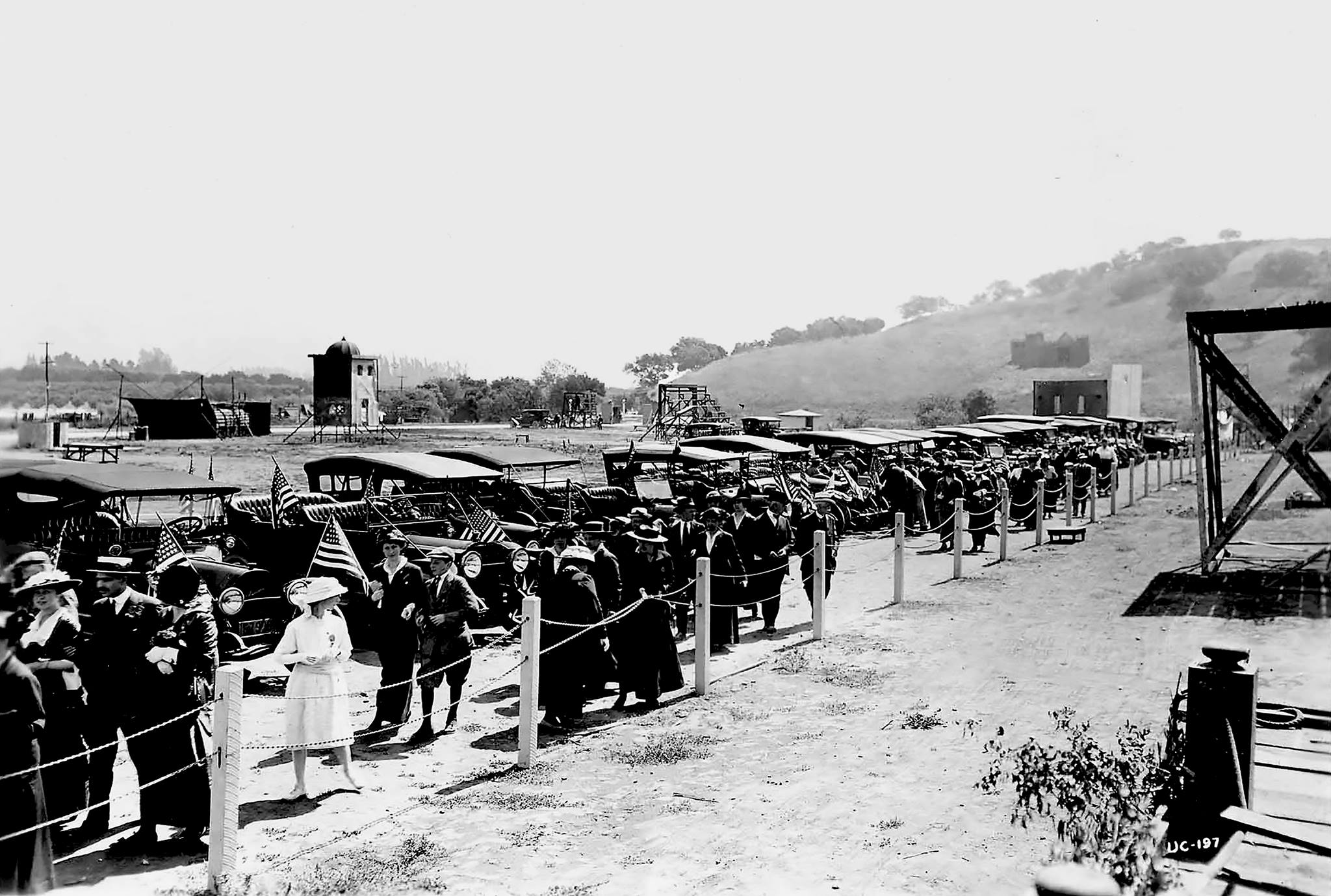
| (1915)^^^* - Crowds arrive, some carrying American Flags, to help celebrate the opening of Universal City on March 15, 1915. |
Historical Notes Universal City celebrated its grand opening on March 15, 1915. Something like 20,000 members of the public responded to studio head Carl Laemmle’s invitation to visit his new studio at the north end of Cahuenga Pass that day to check out the fancy administration building, open air stages and bleachers on which, until the advent of sound filmmaking a decade later, they were welcome to come back and watch real movies getting made.***^# |
 |
|
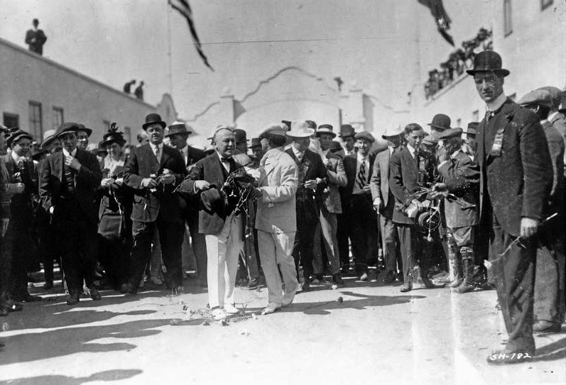
| (1915)***^# – View showing the beginning of Opening Day festivities just inside the front gate at Universal City. |
 |
|
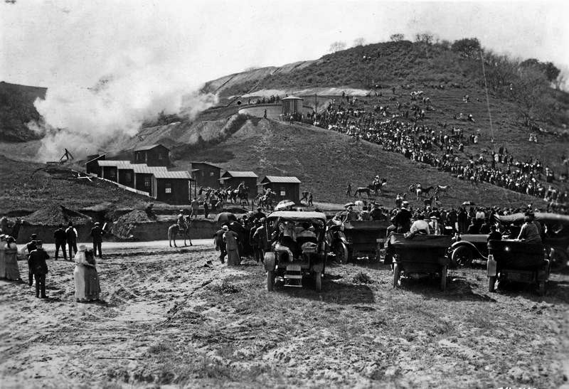
| (1915)***^# – Crowds are seen gathered on hillside and below in autos to watch the Opening Day ceremonies of Universal City on March 15, 1915. Smoke fills the sky most likely from cannon fire or fireworks. |
Historical Notes Besides showing off the facilities on opening day, Laemmle staged cowboy stunts and had engineers create a fake flood, which actually swamped a few vehicles.***^# |
 |
|
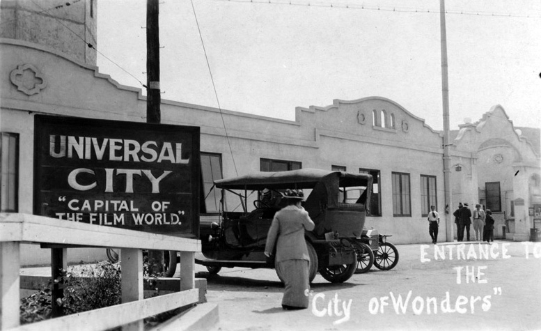
| (ca. 1915)#** - Postcard view of the entrance to Universal City: "Capital of the Film World" and the "City of Wonders". |
Historical Notes After the gala opening, Carl Laemmle continued to let the general public visit his Movie City - "The City of Wonders." |
|
|
| (ca. 1916)*#^# – Postcard view showing bridge over the Los Angeles River leading to the front entrance to Universal City, “The Home of the Movies”. |
Historical Notes The tower building near the front entrance is actually a water tower modified to resemble a castle tower (see earlier photo). |
 |
|
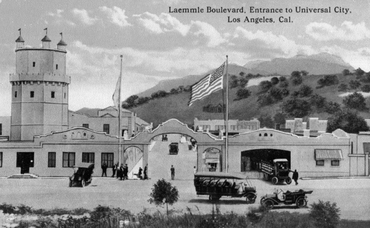
| (ca. 1916)^^*^^ - Postcard view showing Laemmle Boulevard and the Entrance to Universal City. |
 |
|
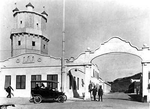
| (ca. 1916)*^^ - View showing the Lankershim Blvd. entrance to Universal Studios. Two security gaurds in uniform stand at watch under the large archway. A tall castle-like tower is seen on the left. Passengers sit in the back of an early model vehicle. |
 |
|
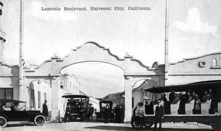
| (ca. 1916)*#^# - Postcard view showing tour buses at the front entrance to Universal City, possibly the precursor to today's tram ride. |
 |
|
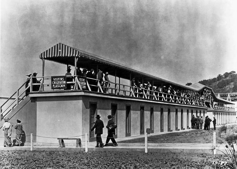
| (ca. 1916)***^# - View showing the visitors observation platform where guests could watch the filming of a movie. |
Historical Notes Carl Laemmle invited members of the public to watch films being made (in exchange for a 25 cents admission fee). A chicken lunch box was also available for a nickel; the first step towards the Universal Studios theme park we know today.^*#^ |
 |
|
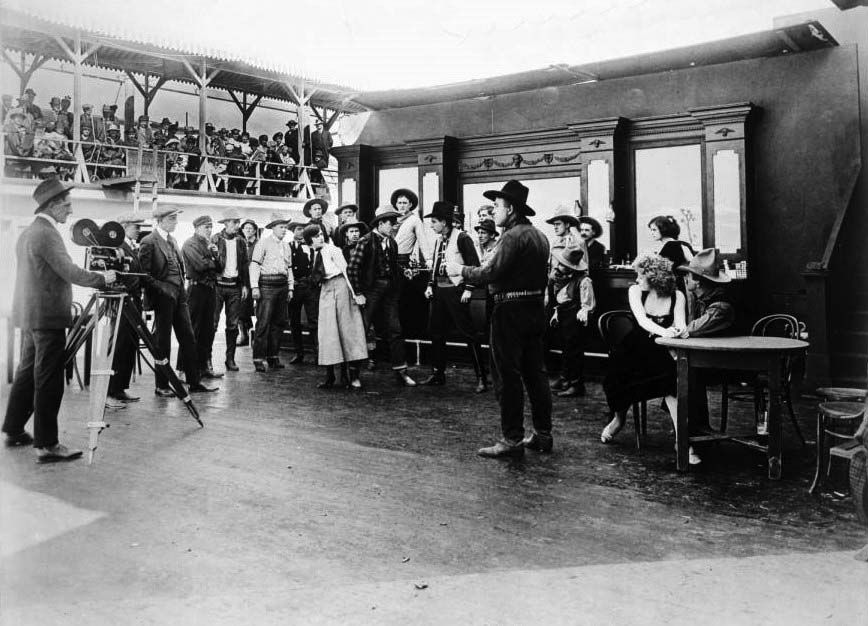
| (ca. 1915)^^ - View showing the filming a western movie on the Front Lot Stage at Universal City. A bar scene can be seen at center, and several men and women are visible in western clothing. A man and a woman are seated at a table in the foreground at right. At left, the director and cameraman can be seen, along with several other assistants. People can be seen sitting on a high balcony at left, in an area labeled "Visitor's Observatory". |
Historical Notes Guests sat in outdoor bleachers and were encouraged to cheer for the heroes and boo the villains! The advent of sound meant the end of the early Universal Studio tour (as the noise the visitors made now disrupted filming) and Universal closed its gates to the general public. Three decades would pass before the studio gates would open again.^*#^ During that time, Universal developed into a powerhouse studio, producing numerous classics such as All Quiet on the Western Front, Dracula, and Frankenstein. With its success, Universal City (and other San Fernando Valley studios) influenced the residential and commercial development of nearby North Hollywood, Studio City and Toluca Lake that took off in the 1920s. |
 |
|
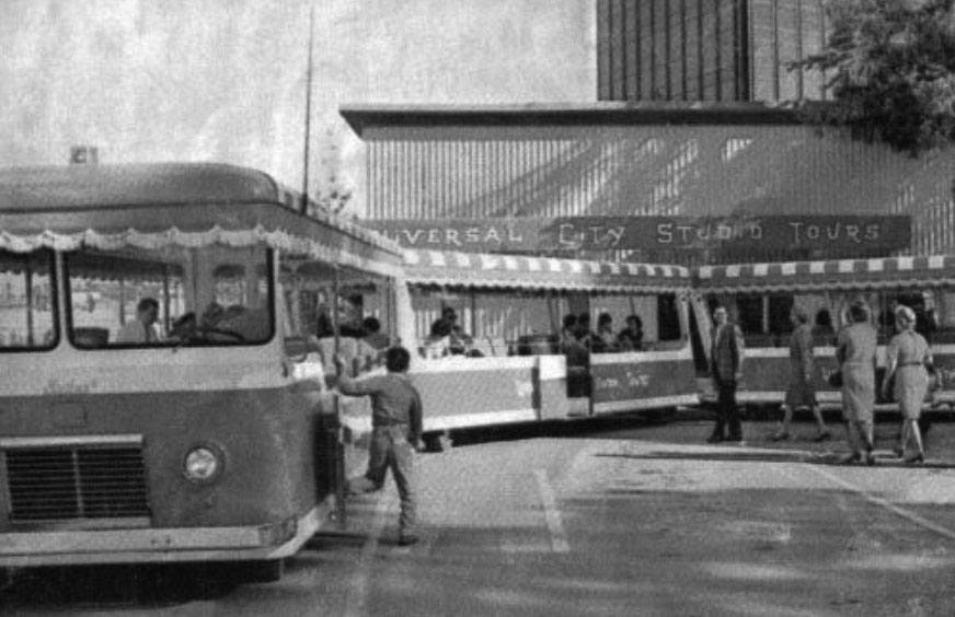
| (1964)* – Postcard view showing the Universal Studios Tour Tram as it appeared in its first year of operations. Photo courtesy Universal Studios |
Historical Notes In 1961, Universal decided to once again open up the studio gates, but this time guests toured the lots by bus. The cumbersome and noisy busses, ill-suited for discreet travel through the busy lots, were swapped out for trams in 1964. This was the year the tour officially became known as the Universal Studio Tour. For only $6.50, two adults and a child could peek into the behind-the-scenes world of one of Hollywood’s most famous studios; and if they were lucky, catch sight of star.****# Click HERE to see more Early Views of Universal Studios. |
* * * * * |
Norwegian Lutheran Church (later Faith Bible Church)
 |
|
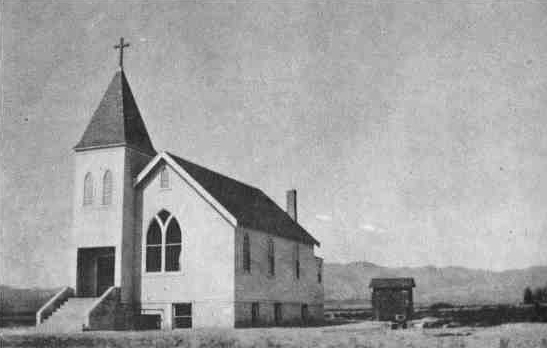
| (ca. 1917)*^^# - View of the Norwegian Lutheran Church (later Faith Bible Church) located in what is now Northridge. |
Historical Notes Faith Bible Church, built in 1917, was the first church built in Northridge. The church is in the Carpenter Gothic Victorian style. It was built nine years after the Southern Pacific Railroad first laid tracks through Northridge, which was then known as Zelzah station, in 1908. When it was built, the church was originally known as the Norwegian Lutheran Church, as the six families that formed the congregation were of Norwegian descent. Built of wood in the basilican style, with the steeple at the entrance, the church's early Gothic style is differentiated from the High Victorian Gothic by the thinness of moldings and its generally monochromatic appearance. One writer observed that, "with its steep stairs and narrow girth, it looks like a church you'd find sitting all alone on the Kansas plains." *^ |
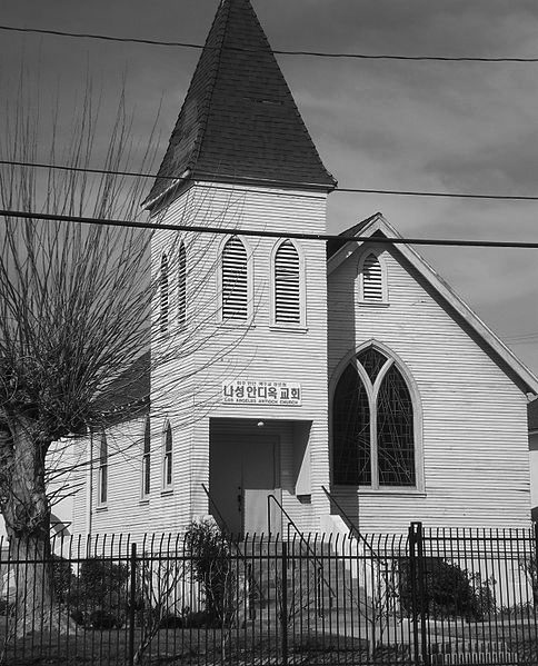 |
(2008)*^ - View of the original Norwegian Lutheran Church Building which still stands at 18531 Gresham Street in Northridge.
|
Historical Notes The original church building still stands at 18531 Gresham Street in Northridge. For many years, it was known as the Faith Bible Church. More recently, the church has been acquired and operated as a Korean congregation known as either the Northridge Free Methodist Church, or the Los Angeles Antioch Church. The sign on the church in March 2008 (in the above photograph) identified it as the Los Angeles Antioch Church.*^ In 1976, the Faith Bible Church building was declared Los Angeles Historic-Cultural Monument No. 152 (Click HERE to see complete listing). |
Sylmar (Los Angeles Olive Growers Association)
 |
|
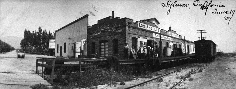
| (1909)#** - View showing the Los Angeles Olive Growers Association building in Sylmar, Los Angeles. Railroad tracks and a railroad car are adjacent to the building. Six men are seen on the platform posing for the camera. |
Historical Notes Sylmar, once home of the largest olive groves in the world, received the creative name meant to mean "Sea of Trees," combining the Latin silva (for "forest") and the Spanish mar (for "sea").^ |
 |
|
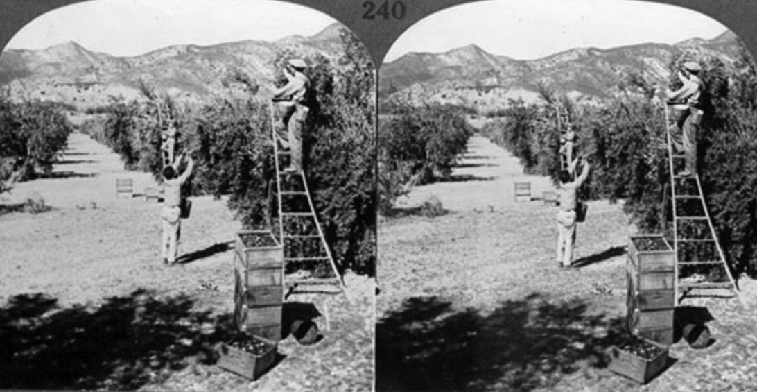
| (ca. 1910)^ - A stereographic view of workers harvesting olives in Sylmar. |
Historical Notes The foothills of the San Gabriel Mountains at the north slope of the San Fernando Valley were seen as "an unattractive and apparently worthless waste" before 2,000 acres of them were transformed in the late 1890s by the Los Angeles Olive Growers Association. One observer recalled that the land had been "a mass of ill-looking chapparal and chemisal" before it was planted with olives. In 1893, a group of Illinois businessmen purchased from the trustees of the Maclay ranch either 1,000 or 2,000 acres (the sources differ) east of the railroad tracks on San Fernando Road just south of Roxford Street and in 1894 began planting olives trees on up to 1,700 acres. Experts were brought from France to supervise the work. Calling themselves the Los Angeles Olive Growers, they built a packing plant and sold olives under the Tyler Olives label, later changing to the Sylmar Packing label. By March 1898 about 200,000 trees had been planted, and by 1906 the property had become the largest olive grove in the world. *^ |
 |
|
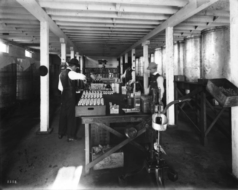
| (ca. 1909)^^ – View showing workers bottling olive oil in Sylmar in the San Fernando Valley. The men appear to be transferring olive oil from larger containers to the smaller glass bottle containers. Several crates of bottled olive oil sit on the left side of the table. Labels on the bottles of olive oil reads: "Sylmar Brand olive oil, California pure, the olive from which this oil is made were grown and the product manufactured at their grove at Fernando, Cal., and the contents guaranteed absolutely pure by Los Angeles Olive Growers Association.” |
Historical Notes One source stated in 1981 that it was the "Fusano family" who built a headquarters building for the olive association on Roxford and San Fernando in 1902 and that the first packing plant was built in 1909. In 1904 the Sylmar brand olive oil won first place at the Louisiana Purchase Exposition, St, Louis, Missouri, in 1906 at the Lewis and Clark Centennial Exposition, Portland, Oregon, and in 1915 at the Panama–Pacific International Exposition in San Francisco. *^ |
 |
|
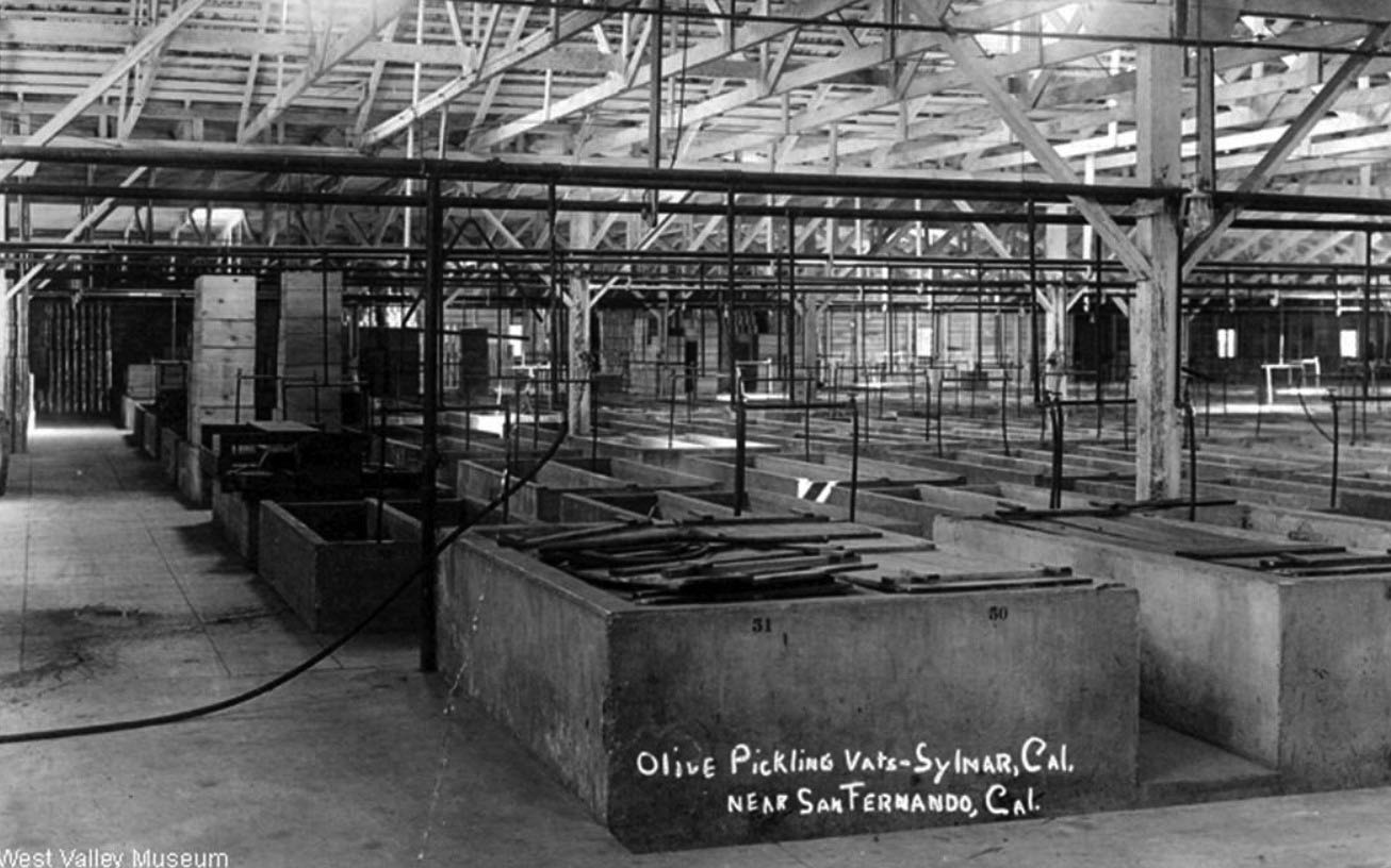
| (ca. 1926)^ – Postcard view showing olive pickling vats in Sylmar. Photo contributed to CSUN Oviatt Library by West Valley Museum. |
Historical Notes The pickling plant was located on the corner of Roxford Street and San Fernando Road.*^ |
 |
|
| (1930s)* - View showing olive groves on Roxford Avenue, north of Sylmar. |
Historical Notes The first groves were planted with Mission, Nevadillo Blanco and Manzanillo olives. Some Sevillano and Ascolano varieties were planted for extra-large fruit. During the picking season in the early 1900s, an extra force of 300 Japanese was employed and housed in a village of tents. Some of the olive trees were still growing in Sylmar decades after they were planted. In 1963 twenty-five mature olive trees were removed from the site of the Sylmar Juvenile Hall, then under construction, to be planted at Busch Gardens, an entertainment center in Van Nuys.*^ |
 |
|
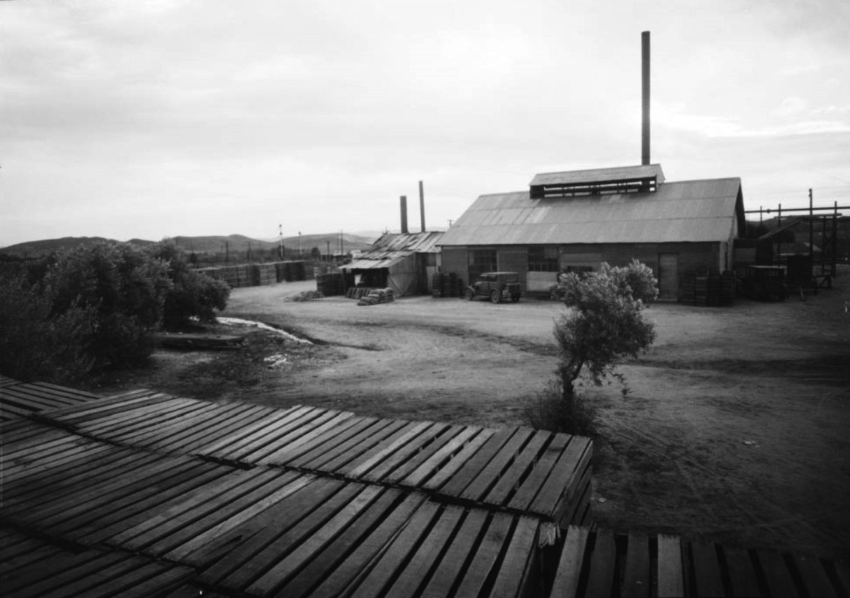
| (ca. 1930)^^ - View showing an olive factory of the Los Angeles Olive Growers Association, Sylmar. |
Historical Notes In 1927 the packing plant, which had been built in 1910, employed some five hundred workers during its busiest season, November through January. The oil was pressed from the fruit, allowed to separate from the fruit's water content, then drawn into 12,000-gallon concrete tanks lined with glass and set deep into the ground to avoid a change in temperature. Over time, the plant expanded its activities, bringing in figs, pimientos and watermelon rind from the San Joaquin Valley for processing.*^ |
 |
|
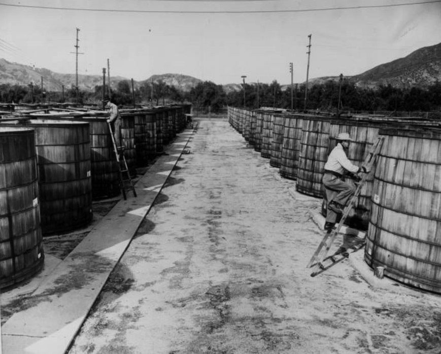
| (1953)^^ - Photo of Harold Riley and Frank Lopez climbing ladders to look into olive vats at a Sylmar packing house. |
Historical Notes In 1922, the controlling interest in the Los Angeles Olive Growers Association, which had been held by the estate of F.D. Butterfield (Charlotte M. Butterfied, the heir), was bought by Charles C. Moore of San Francisco, and its name was changed to Sylmar Packing Corporation. The management remained with Frank Simonds, who was president of the association. At that time there were 140,000 trees on the property. *^ |
 |
|
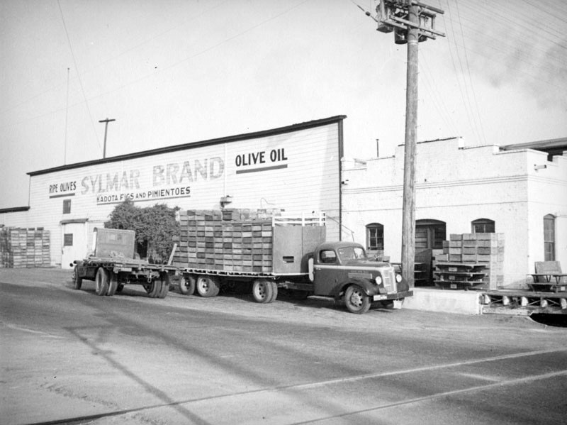
| (ca. 1937)* - A truck loaded with crates of olives and a whole olive tree, parks in front of the Sylmar Packing Corporation, where a sign painted on an industrial building proclaims "ripe olives, Sylmar Brand olive oil, Kadota figs and pimentos," making the observer wonder if they offered fig stuffed olives or if this was a separate line. |
Historical Notes The Sylmar Packing Corporation, which was located at 448 South Hill Street in Sylmar, handled the product of the largest olive grove in the world and was once the largest industry in Sylmar. It was demolished in 1958 and there is no Hill Street in Sylmar today, but there is a Hill Crest Avenue and a Hillside drive, both above a street that is still called Olive View Drive. |
City of San Fernando
 |
|
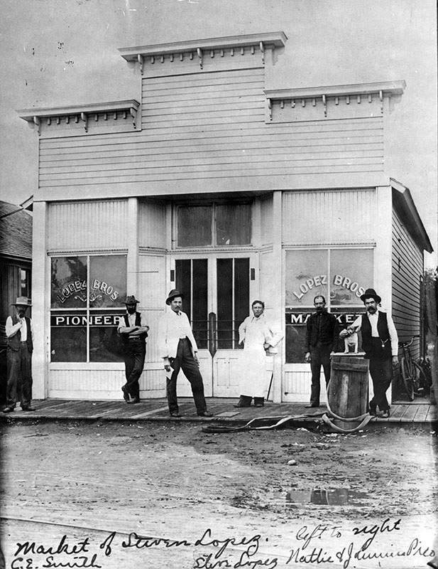
| (1899)* - View of the Lopez Market in San Fernando, which was one of the first of its kind to open in the flourishing Valley, way back in 1899. Part of the caption reads: "Open for business - San Fernando's Lopez market is open for business and on hand are C. E. Smith, Steve Lopez, Nattie and Jamaica Pico." Photo Credit: Los Angeles Public Library (Valley Times Collection). |
 |
|
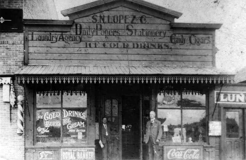
| (1918)* - The exterior of S.N. Lopez Co. grocery store on San Fernando Road. |
Historical Notes The grocery store was owned by Steve Lopez who was the son of Geronimo Lopez, a prominent resident in San Fernando. Geronimo Lopez established the Lopez Station in the early 1860s, which served as a station for stagecoach travelers.^ |
 |
|
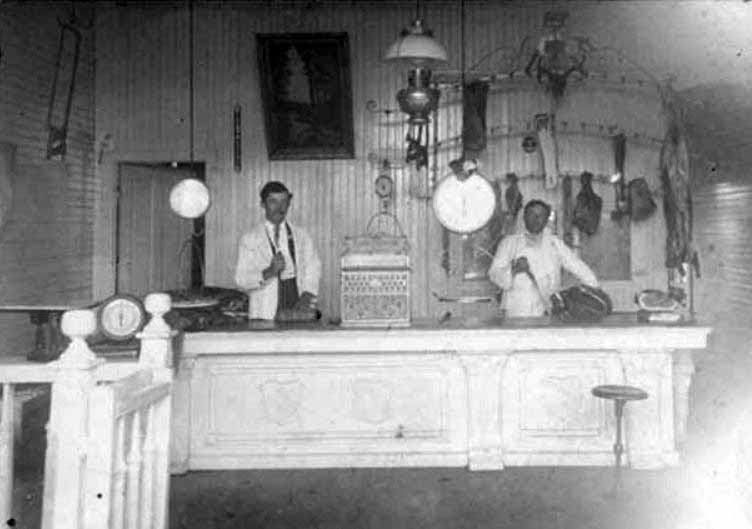
| (ca. 1900s)^ - Interior view of a butcher shop in the City of San Fernando. A counter, two men, meat, and cutting utensils are visible. The butcher shop was owned by Steve Lopez as was one of the town's grocery store. |
 |
|
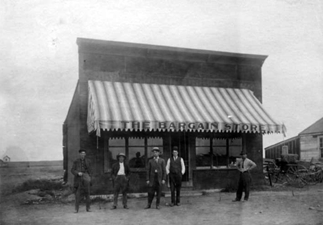
| (Early 1900s)^ - Exterior view of men standing in front of the Bargain Store in San Fernando. The store was owned by Joe Iverson (second from left). Donor: Bob Sherman (nephew of Joe Iverson). |
 |
|
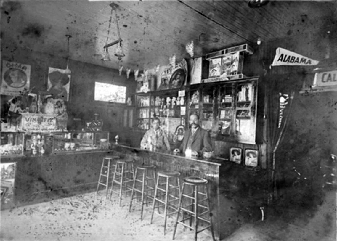
| (ca. 1900)^ - Interior view of an ice cream parlor located on Maclay Avenue between 1st and 2nd Streets in San Fernando. Nathaniel Pico (son of Benjamine and Anna Forrester Pico) and Eugene Oliver are visible behind the counter. |
 |
|
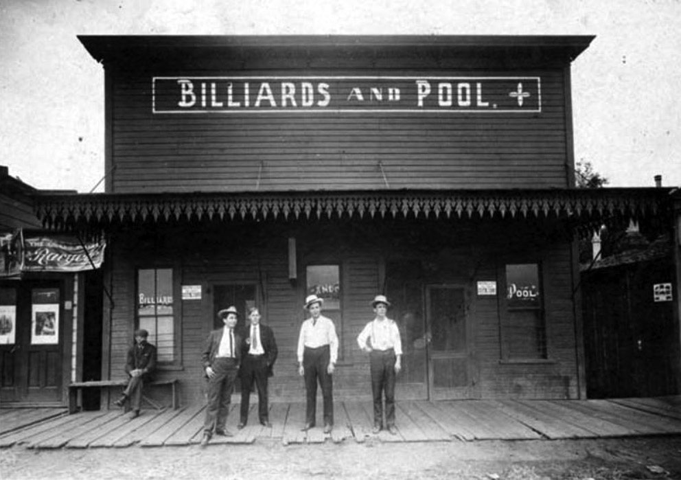
| (Early 1900s)#^ - View of the first billiards and pool hall in San Fernando. Bruno Praster, the owner, is the second person from the right. To the right of him is Roy York. |
 |
|
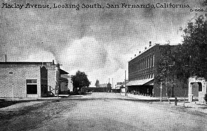
| (1908)^ - Postcard view looking south on Maclay Avenue in the City of San Fernando. The large building on the right is the Harrison Block. On the other side of the street there is a partial view of the El Rey Hotel. |
Historical Notes The City of San Fernando was named for the nearby Mission San Fernando Rey de España, and was part of the Mexican land grant of Rancho Ex-Mission San Fernando. In 1874 Charles Maclay, San Fernando founder, bought 56,000 acres of the Rancho. In 1882, cousins George K. Porter and Benjamin F. Porter of future Porter Ranch each received one-third of the total land.*^ In 1874, San Fernando became the valley's first organized community, thus earning the title "First City of the Valley". |
 |
|
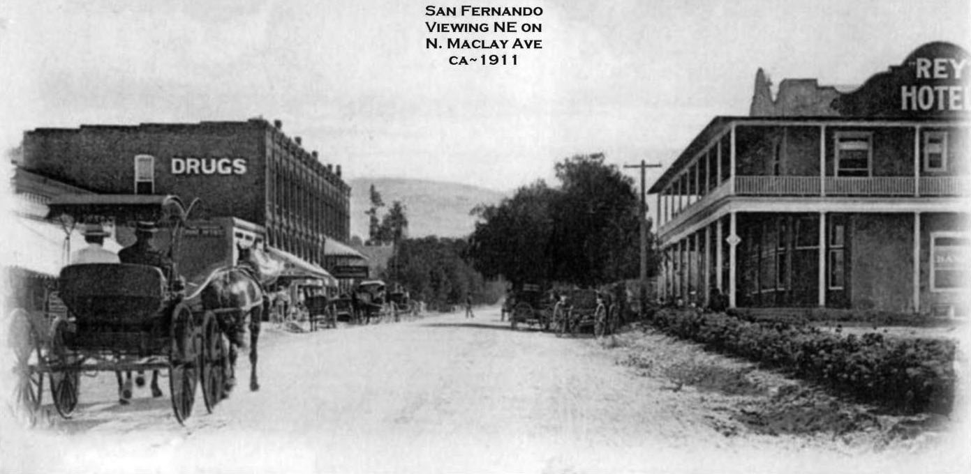
| (ca. 1911)#^*^ - View showing two men riding in a horse-drawn buggy heading north on Maclay Avenue in the City of San Fernando. The El Rey Hotel is on the right. The large building on the left with the 'DRUGS' sign on its side is the Harrison Block. |
Historical Notes While most of the towns in the surrounding San Fernando Valley agreed to annexation by Los Angeles in the 1910s, eager to tap the bountiful water supply provided by the newly opened Los Angeles Aqueduct, San Fernando's abundant groundwater supplies allowed it to remain a separate city. Even as the San Fernando Valley transformed itself from an agricultural area to a suburban one in the decades after World War II, San Fernando retained its independence.*^ |
 |
|
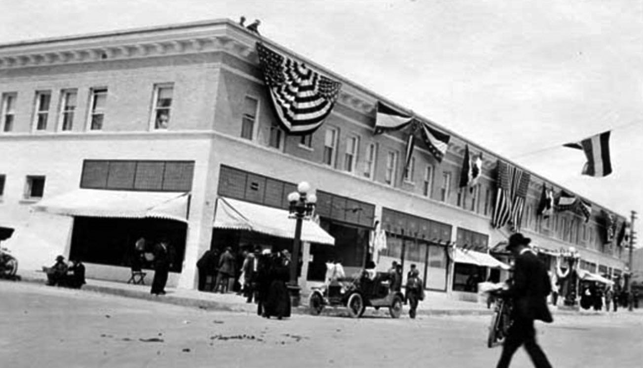
| (1912)#^ - View of the Porter Hotel decorated with patriotic bunting for the grand opening, San Fernando, 1912. The hotel was located on the west side of San Fernando Road north of Brand Boulevard and occupied the second floor of the building. |
Historical Notes From the brochure highlighting the delights of the new Porter Hotel in San Fernando: San Fernando with its altitude of 1100 feet and its pure air and health giving climate is only 20 miles from both Los Angeles and Pasadena over the finest boulevards in California. Good Roads and boulevards lead to the San Fernando Mission (1797) and to the mountains with their beautiful and easly accessible wooded canyons. More than a million dollars has been spent in the San Fernando Valley for ideal roads, well-lighted boulevards unsurpassed in the world. Few places in California are so inviting to the tourist and the city man. A quiet place near the mountain foothills surrounded by orange, lemon and olive groves, within walking distance of the famous aquedct, reservoir dam and other places of interest. The Southern Pacific and the Pacific Electric from Hill Street Station furnish transportation from Los Angeles. #^ |
 |
|
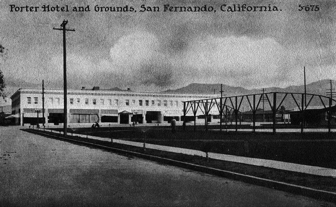
| (1912)#^# – Postcard view of the Porter Hotel in the City of San Fernando. |
Historical Notes An advertisement describes the new 1912 Porter Hotel as follows: The Porter Hotel is a new house, equipped with all modern conveniences, electric lights, steam heat and private baths and is under the personal management of John G. Holborrow. Auto parties and other guests making their first visit to the Porter Hotel never fail to express their pleasure with the entertainment furnished. You wil like it. Rates are extremely moderate, considering appointments and cuisine, $2 per day and up. Reservations may be made by either phone, calling San Fernando 642 at our expense. #^ |
 |
|
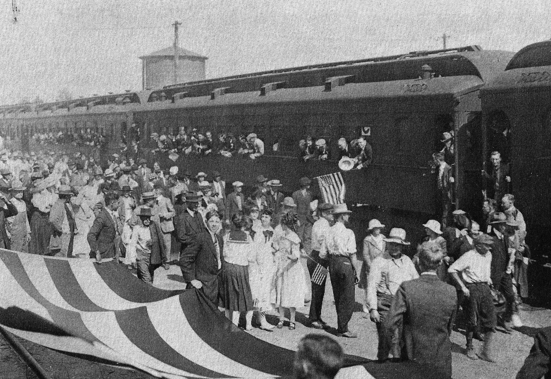
| (1917)#^*^ - View of Maclay Avenue SP crossing in San Fernando. The photo shows departure of eight coach loads of World War I draftees for Camp Lewis, WA where they will be trained or die of the Spanish Flu. View is to the north; note water tower behind coaches at left. |
Historical Notes The 1918 flu pandemic (January 1918 – December 1920) was an unusually deadly influenza pandemic, the first of the two pandemics involving H1N1 influenza virus. It infected 500 million people across the world, including remote Pacific islands and the Arctic, and resulted in the deaths of 50 to 100 million (three to five percent of the world's population), making it one of the deadliest natural disasters in human history. Disease had already greatly limited life expectancy in the early 20th century. A considerable spike occurred at the time of the pandemic, specifically the year 1918. Life expectancy dropped by about 12 years. Most influenza outbreaks disproportionately kill juvenile, elderly, or already weakened patients; in contrast, the 1918 pandemic predominantly killed previously healthy young adults. Modern research, using virus taken from the bodies of frozen victims, has concluded that the virus kills through a cytokine storm (overreaction of the body's immune system). The strong immune reactions of young adults ravaged the body, whereas the weaker immune systems of children and middle-aged adults resulted in fewer deaths among those groups. To maintain morale, wartime censors minimized early reports of illness and mortality in Germany, Britain, France, and the United States; but papers were free to report the epidemic's effects in neutral Spain (such as the grave illness of King Alfonso XIII), creating a false impression of Spain as especially hard hit—thus the pandemic's nickname Spanish flu.*^ |
 |
|
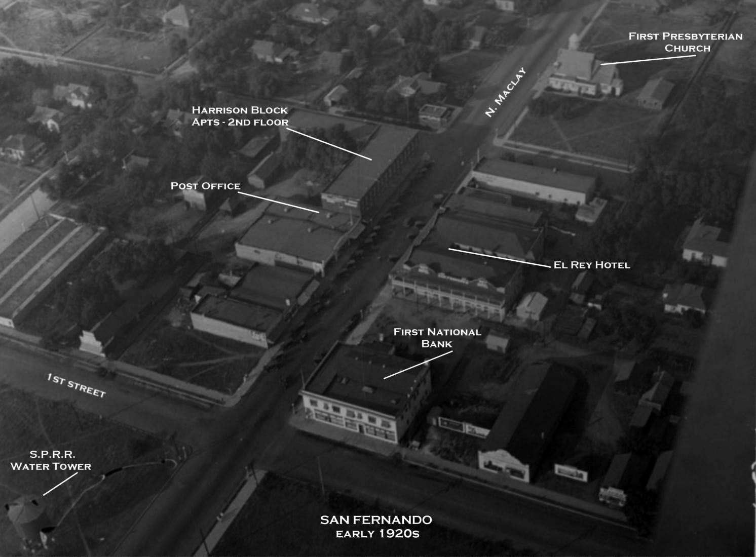
| (1920s)#^*^ – Aerial view showing the area around N. Maclay and 1st Street. The SPRR water tower can be seen at lower-left. Photo annotated by Rich Krugel |
Historical Notes From the 1921 SFV Directory: The address of the 'El Rey Hotel' is 118 N. Maclay Ave with an 'Alex Martin' being the proprietor; the 'Post Office' is 123 N. Maclay Ave and 'Ross H Hille' is the Postmaster; 'Shimmin's Pharmacy' is at 117 N Maclay Ave; 'First National Bank' is at the corner of 1st St and N Maclay; 'Harrison Block Apts' at 131 N. Maclay; 'First Presbyterian Church' is mentioned to be between 2nd & 3rd streets on N. Maclay. #^*^ |
 |
|
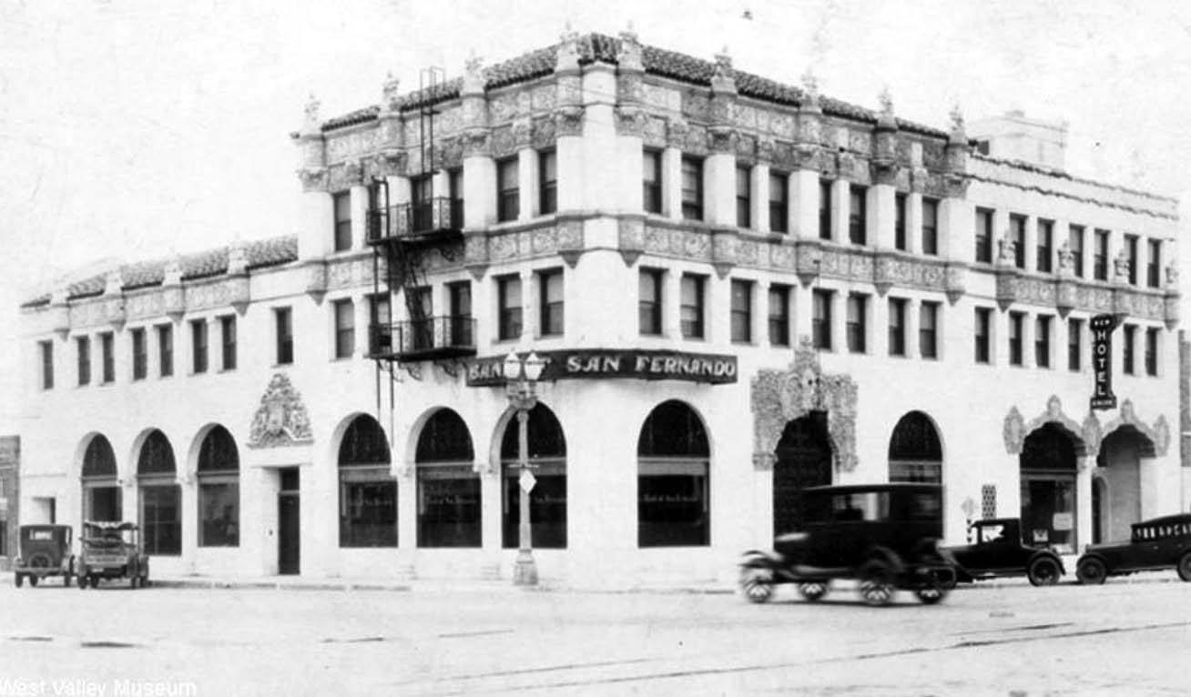
| (ca. 1922)^ – Postcard view of the Bank of San Fernando. Four cars are parked diagonally against the curb as an early model car passes through the intersection. |
 |
|
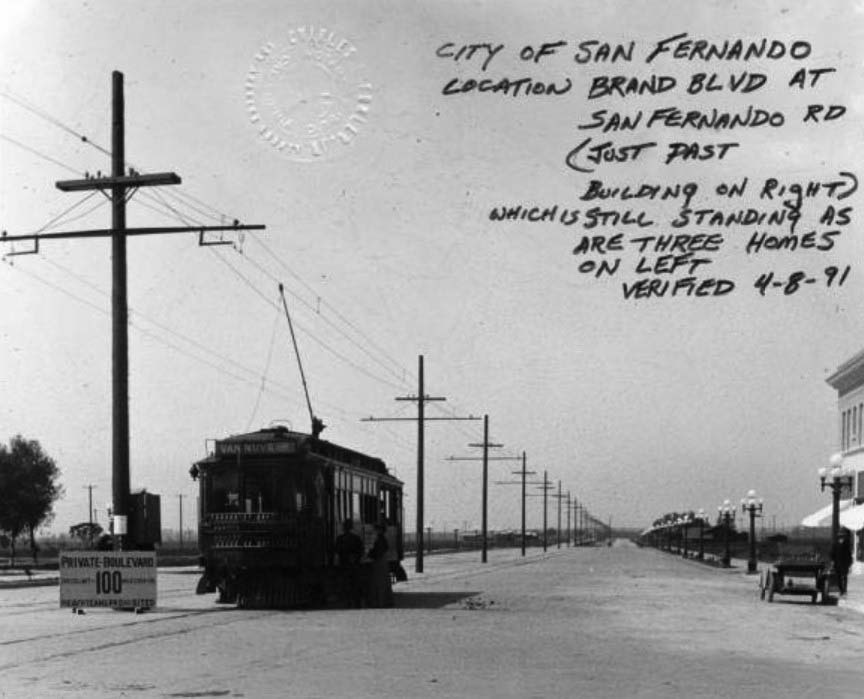
| (ca. 1925)^ - View of Brand Boulevard at San Fernando Road, San Fernando. A street car from the Van Nuys line of the Pacific Electric Railway is prominent at center. |
* * * * * |
Marian Elementary School
 |
|
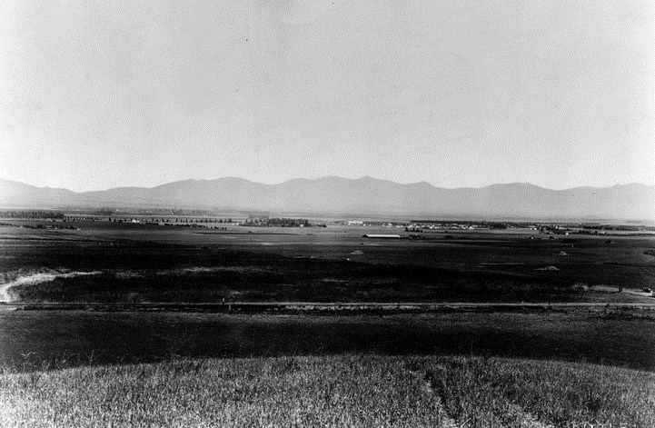
| (1925)* - View across San Fernando Valley is looking north from Tarzana, at S.P.R.R. right of way. Reseda is in the center of the picture. The large white building is Marian Elementary School, on the present site of Reseda Elementary School. |
Historical Notes The town of Marian, named for Marian Otis Chandler, was changed to the present-day Reseda in 1922.^ |
 |
|
| (1918)^ - Marian Elementary School, from the scrapbook of the Marian Mother's Club, which used the school as a meeting place. A clipping attached to the photograph reads: "Every mother in Marian is invited to join the club. The members are going to do work for the Red Cross for the present." |
Owensmouth High School (Canoga Park High School)
 |
|
| (ca. 1915)^ - View showing Owensmouth Elementary School (also the original site of Owensmouth High School). The school faced south on Valerio Street, Topanga West and Chatsworth mountains behind are to the north. |
Historical Notes The high school opened October 4, 1914, as Owensmouth High School, making it the oldest high school in the west San Fernando Valley. It was located on the second floor of the Owensmouth Elementary School building seen above for about one year until its new campus was completed at the current Topanga Boulevard site. The 1913-built elementary school building was damaged by the 1933 Long Beach earthquake and replaced by the present one story building. According to the former school secretary, Mrs. Mundale (1986), when the building opened, the elementary school occupied the lower floor and the high school was located on the upper floor.^ |
 |
|
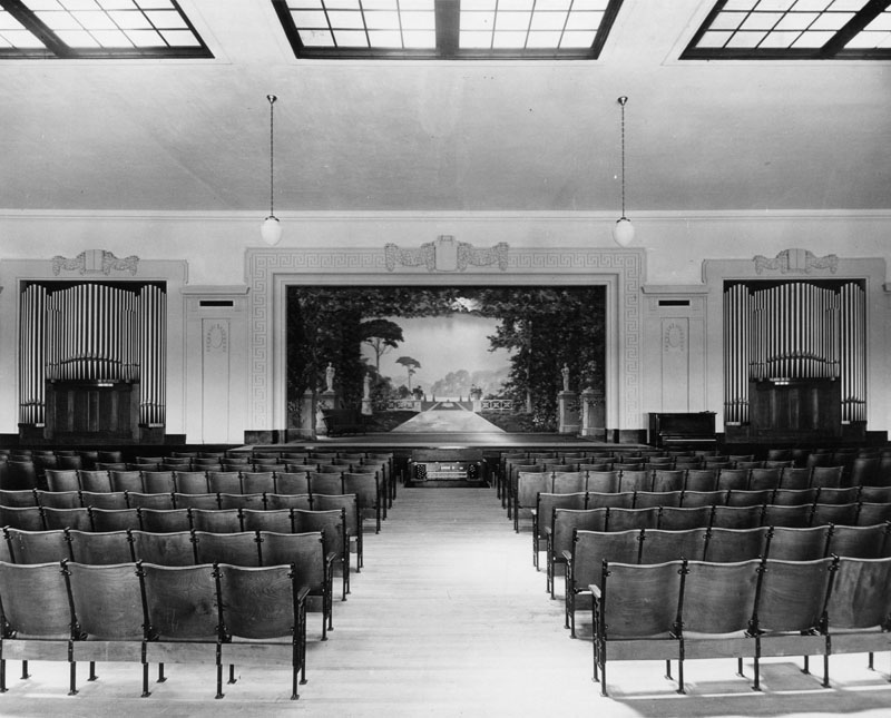
| (1915)* - Interior view of Owensmouth High School's auditorium. A mural, surrounded by organ pipes on each side, represents a Greek-themed scene and serves as the background for the stage. At the time this photograph was taken, the high school was located on the second floor of Owensmouth Grammar School, located on the current site of Canoga Park Elementary. |
.jpg) |
|
| (1915)^ - Does fashion repeat itself? Students from Owensmouth High School class of 1915 (Canoga Park H.S.) pose for a photo. |
Historical Notes Top row L to R: 3rd person Margarite Coig, Laura Hyden, Edith Haas, Dorothy Tweedy, Antonya Weber, Helen Pillcher, Mary Knapp, the rest unknown. 2nd Row L to R: Earl Haas, Carol Driscoll, ?Herby Mitchell, Merrick Gschwind, Clarence Daic, unknown, Marx Cooper, ?Herby Mitchell. These students are from pioneer families in the West Valley. You may recognize some of the surnames. |
 |
|
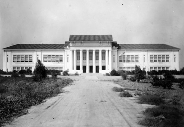
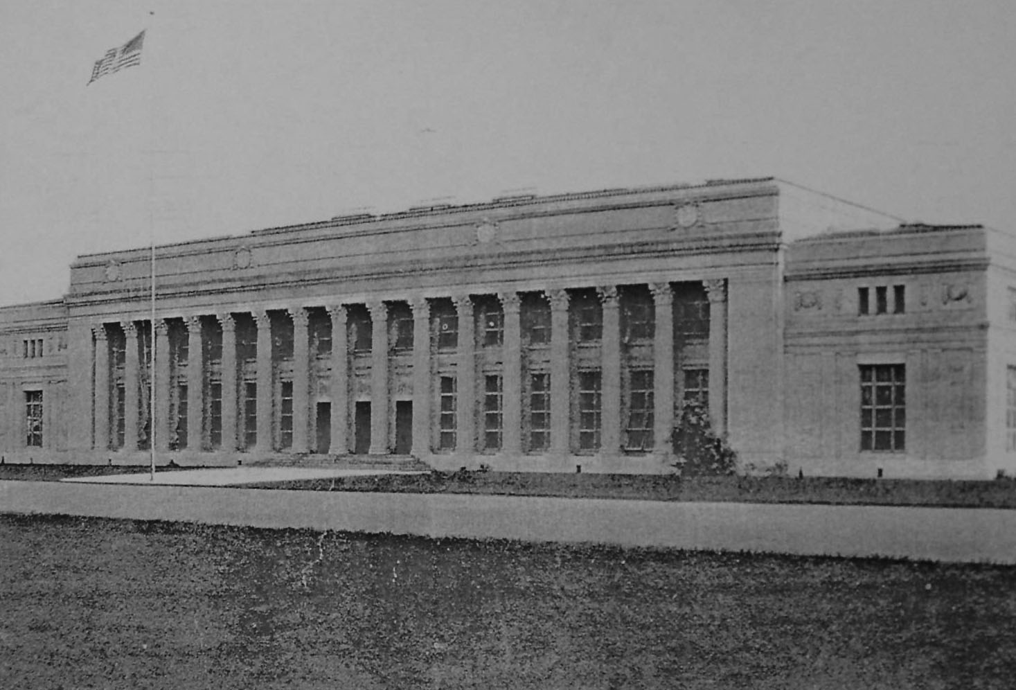
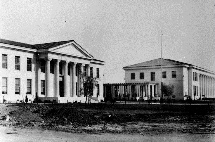
| (1916)#* - View showing the newly completed Classic Greek-style building at Owensmouth High School (later Canoga Park High School) located on Topanga Cyn Blvd. |
Historical Notes On September 11, 1916, Owensmouth High started the school year with a new building and a new location. The new structure was located near the softball field on the present-day Canoga Park High School campus. It was designed in a Beaux-Arts Neoclassical architectural style, unusual for a small town two years old.*^ |
 |
|
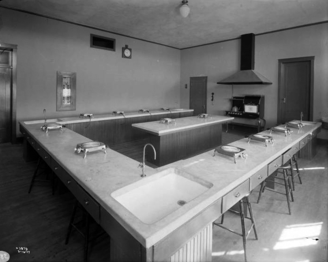
| (1917)#* – View showing a cooking classroom at Owensmouth High School with hotplates on the benches and electric range up-front. |
 |
|
| (1916)*^*^ - On September 11, 1916, Owensmouth High started the school year with a new building and a new location. |
Historical Notes The school originally opened October 4, 1914, as Owensmouth High School (located at the Owensmouth Elementary School sight), making it the oldest high school in the west San Fernando Valley. It later moved to its current locattion (as seen above) in 1916.*^ In 1929 a fire partially destroyed the building seen above and it was soon replaced with two new structures. |
 |
|
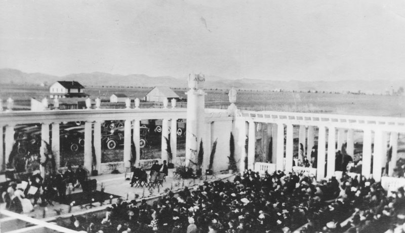
| (ca. 1918)*^*^ - This rear view of Owensmouth High shows its famous Greek Theatre. |
Historical Notes The Greek Theatre was located on the backside of the school's main building erected in 1916, near the softball field on the current campus. The theatre was used for plays, graduations and various school and community events. |
 |
|
| (1918)* - A crowd fills the Greek Theatre to see an orchestra perform. Note the cars parked behind the theatre and also all the open land in the distance. |
Historical Notes While the original school was demolished in 1929, the Greek Theater remained into the 1950s when it too was demolished to make room for the P.E. field. |
 |
|
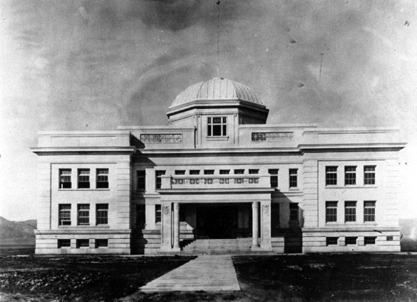
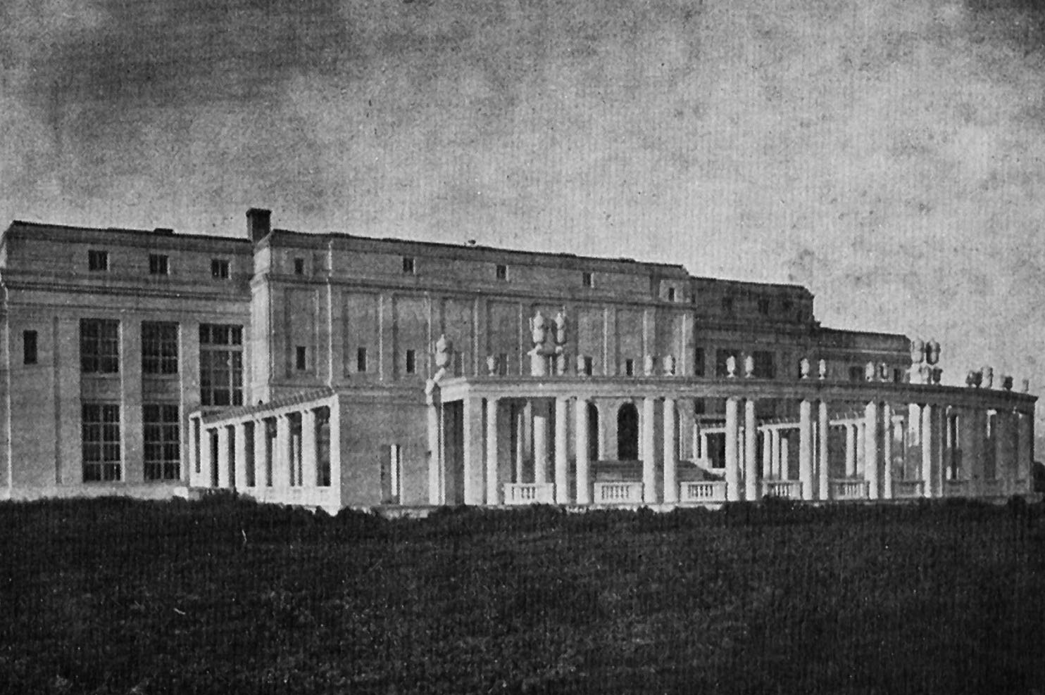
| (1931)* - View showing the newly rebuilt Owensmouth High School (now renamed Canoga Park High School). The two neoclassic-style structures, connected by an arcade, replaced the 1916-built school destroyed by fire two years earlier (1929). |
Historical Notes The school's name was changed in 1931, after the community of Owensmouth changed its name to Canoga Park. Among the school's features were a Coast Redwood grove planted in 1936 just north of the football field. Also, the classic Greek outdoor theater (out of view), built in 1916, was still part of the School until 1953. |
 |
|
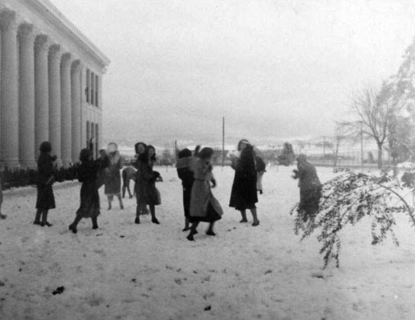
| (1932)#^*^ – View showing a snowball fight in front of Canoga Park High School (Owensmouth High prior to 1932) on January 15, 1932. Topanga Canyon Boulevard is on the right with vast stretches of open land in the background. |
Historical Notes Over the years, Canoga Park has seen snow a few times. The Canoga Park High School website states that the high school has seen snow in these years: 1915, 1923, 1932, 1941, 1949, 1957 and 1989. |
 |
|
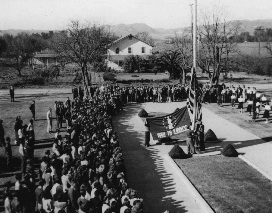
| (1942)#^*^ – View looking west showing the flag raising in front of Canoga Park High School, December 7, 1942; on the first anniversary of the bombing. Also seen in the photo is the house and property belonging to the George Thomason family across the street on Topanga Cyn Blvd. Photo from CPHS archives. |
 |
|
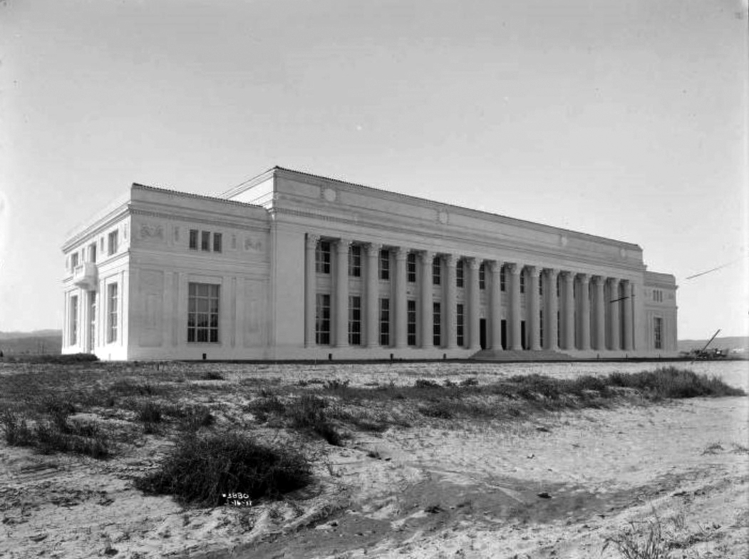
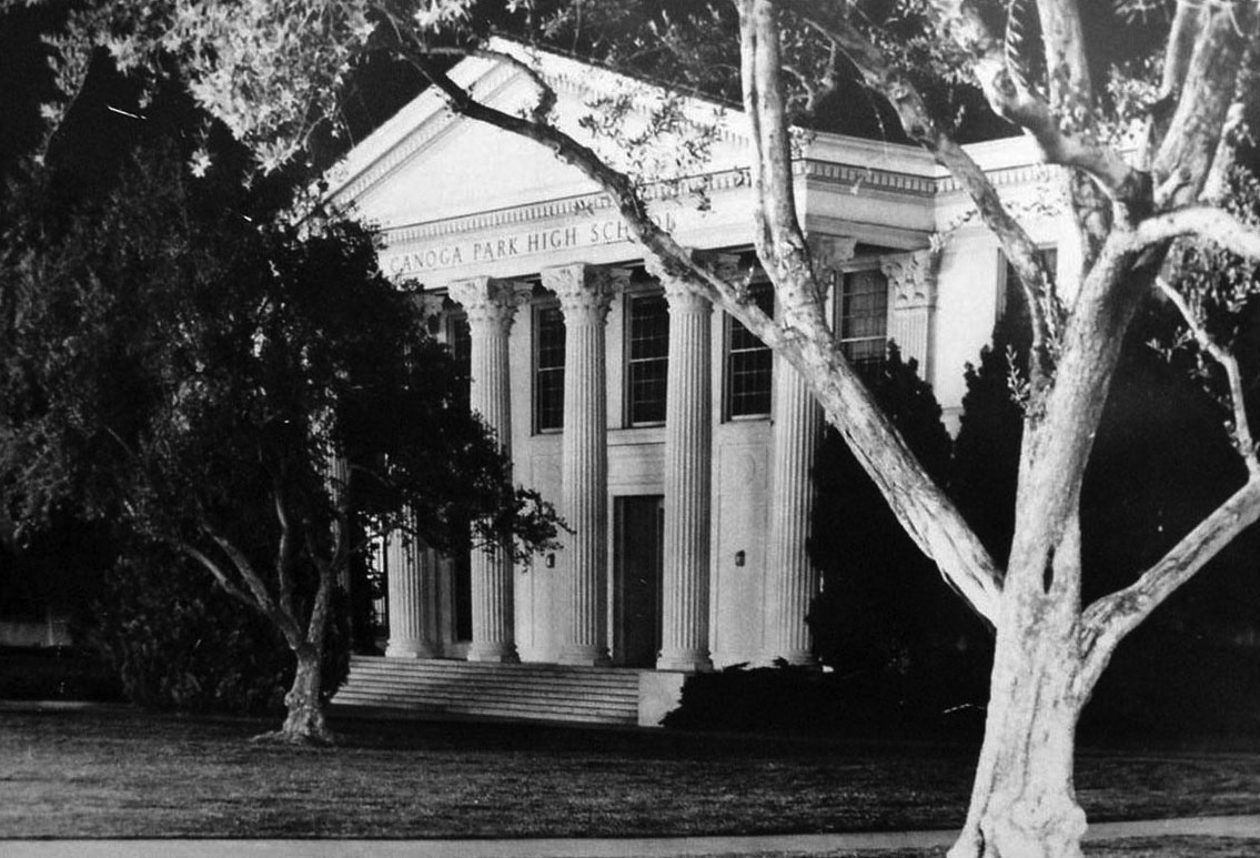
| (1968)*^*^ - View showing the front entrance to Canoga High School with it beautiful neoclassical tall columns. This building sustained damage during the Sylmar earthquake and was demolished in 1975. |
Historical Notes CANOGA is the oldest high school in the west San Fernando Valley. It opened with 14 students and 2 teachers on October 4, 1914, when it was originally named Owensmouth High School. |
 |
|
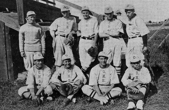
| (1916)*^*^ - The Owensmouth High School Baseball team of 1916. |
Historical Notes In 1916, the Owensmouth Baseball team lost all their games but one. They had no coach! Track and Field was the only other sport offered to the boys that year.*^*^ Click HERE to see more Early Views of Baseball in L.A. |
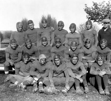 |
(1924)^ - Owensmouth High School football team in 1924.
|
 |
|
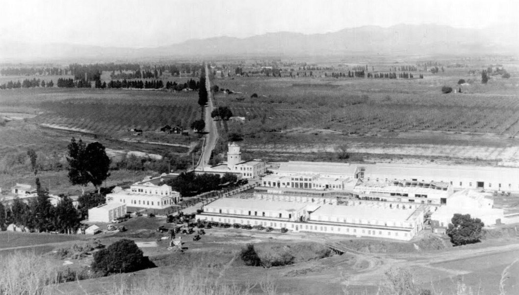
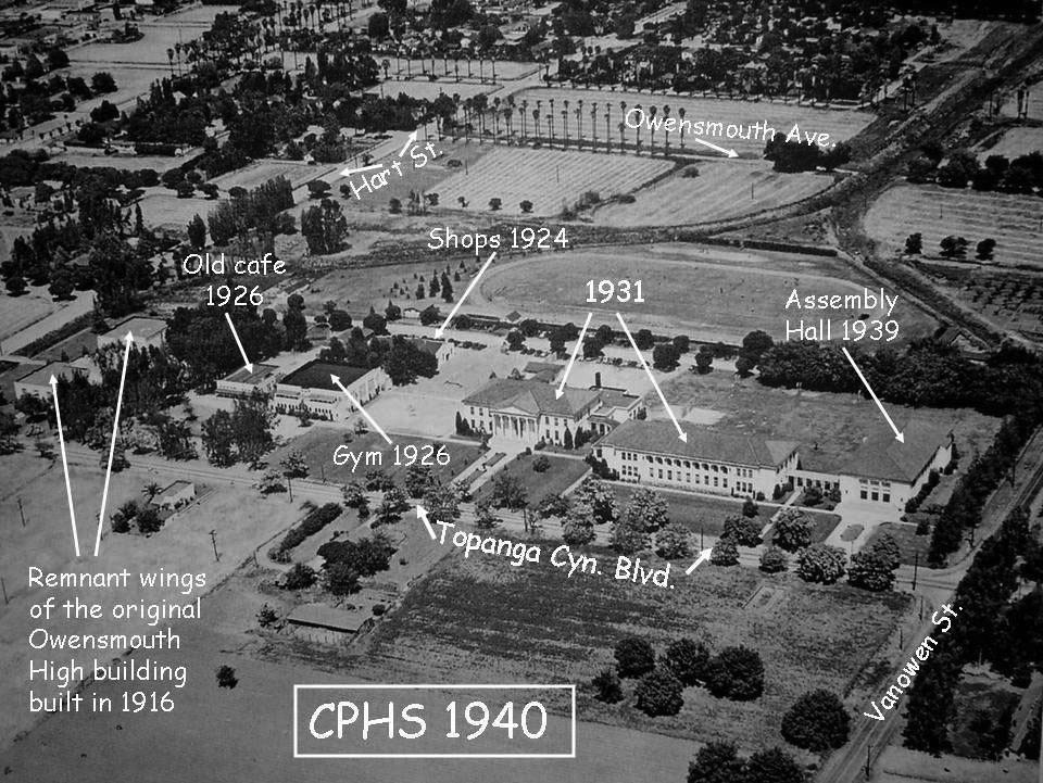
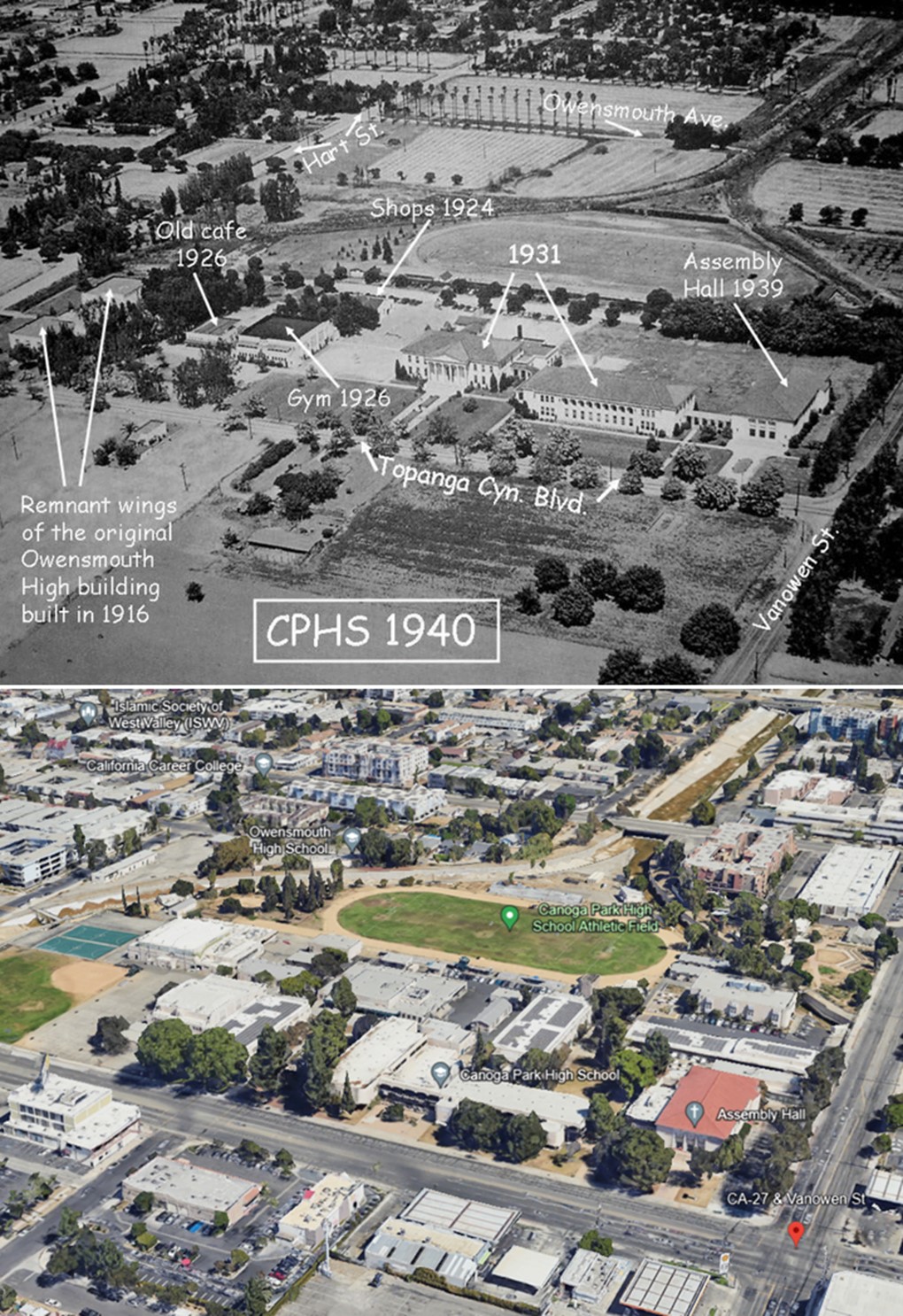
| (1940)*^*^ – Aerial view of Canoga Park High School and surrounding area. The photo has been annotated to show street names, building names and date of construction. |
 |
|
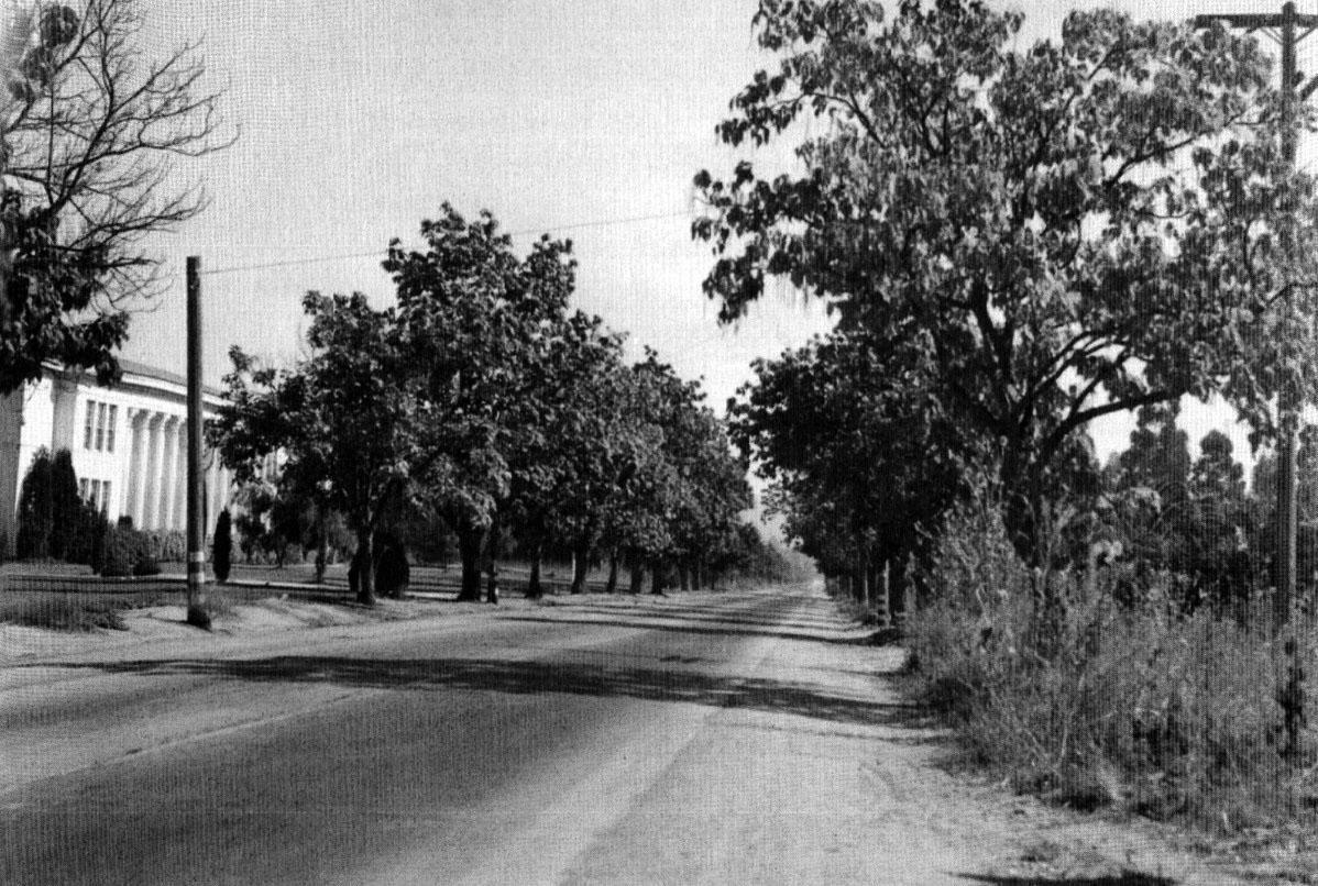
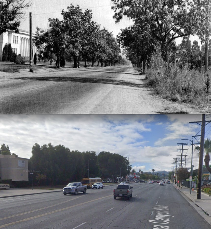
| (ca. 1948)* – View looking south on Topanga Canyon Boulevard in front of Canoga Park High School. The trees to the right is where Topanga Car Wash and In-N-Out Burger exist today. |
Historical Notes In 1934 E. Yale Waterman, a former teacher at the school, planted redwood grove near the site to honor the school and civic organizations.* |
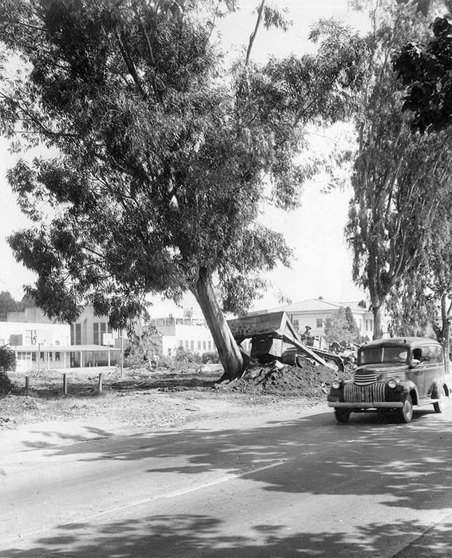 |
|
| (1954)* – “They paved paradise and put up a parking lot…” - A bulldozer rips out a eucalyptus tree along Topanga Canyon Boulevard on September 16, 1954 to make room for a student parking lot at Canoga Park High School. Valley Times Collection |
Then and Now
 |
|
| (1948 vs 2021)* - Looking south on Topanga Canyon Blvd toward Vanowen St. |
Then and Now
 |
|
| (1940 vs 2022)* - Canoga Park High School and surrounding area with the intersection Topanga and Vanowen at lower right. |
Canoga Park High School and Headwaters of the LA River
 |
|
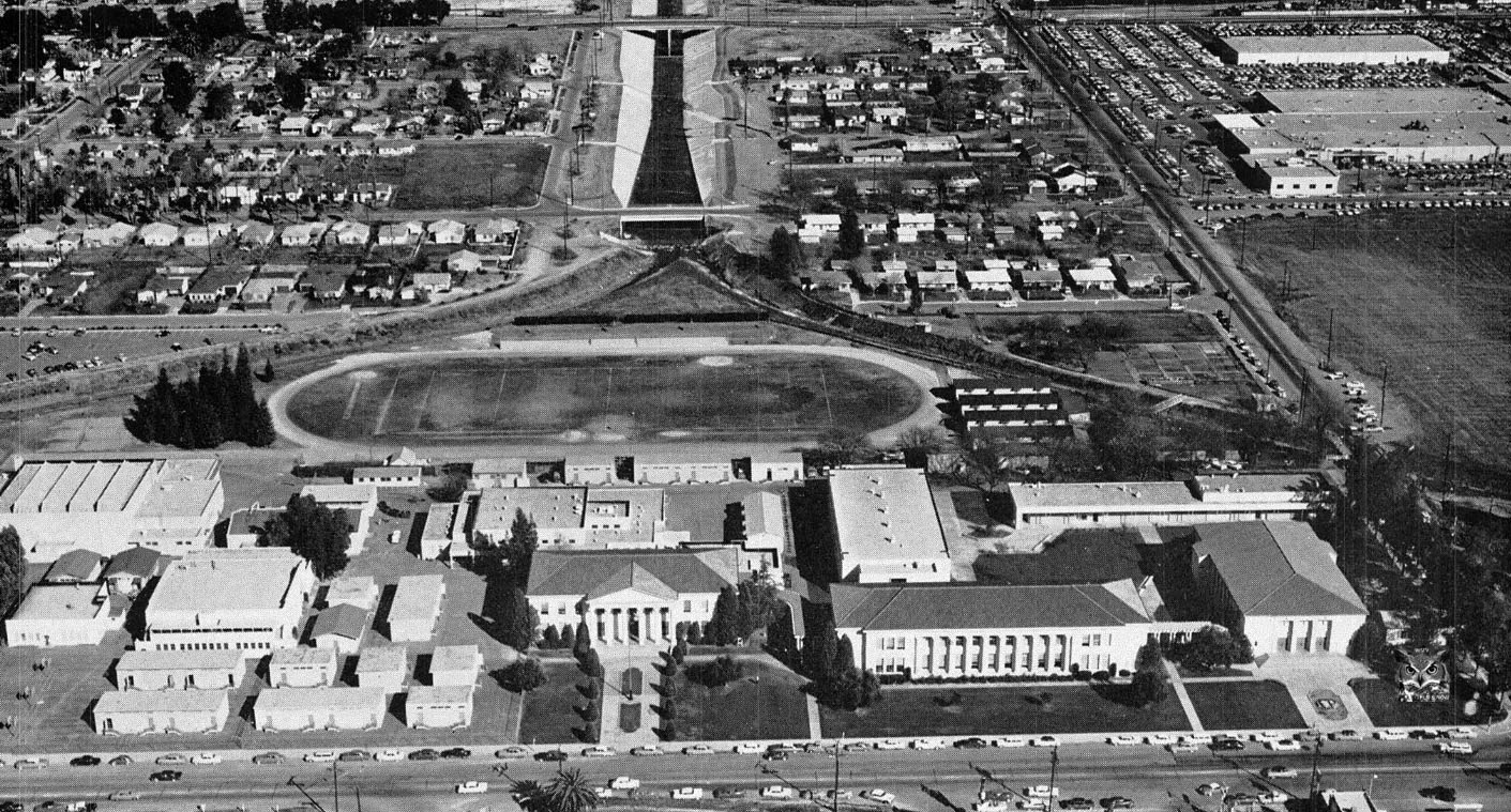
| (1959)* – Aerial view looking east showing Canoga Park High School in the foreground. The LA River at the east end is modern, with concrete walls. Bell Creek and Arroyo Calabasas, the two creeks that enclose the school and form the headwaters of the river, still have the rural look. |
Headwaters of the Los Angeles River at Canoga Park High School
 |
|
| (2011)**** - View looking west showing the intersection of the Arroyo Calabasas (left) and Bell Creek (right), aka the headwaters of the Los Angeles River. The Canoga Park High School football field is seen in the background. |
Historical Notes The Los Angeles River begins just beyond the Canoga Park High School football field, at the confluence of Bell Creek and Calabasas Creek, which flow down from the Santa Susana and Santa Monica Mountains. The river flows southeast, joined by Santa Susana, Browns, Dayton, Chatsworth, Limekiln, Wilbur, Aliso, Woodley, Pacoima and Burbank creeks, that drain the mountains ringing the Valley. |
* * * * * |
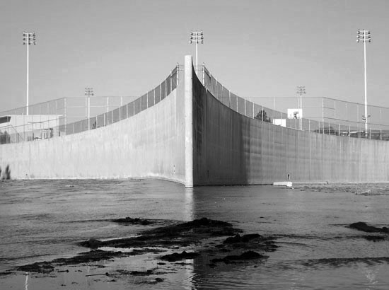
River Power House (Studio City)
 |
|
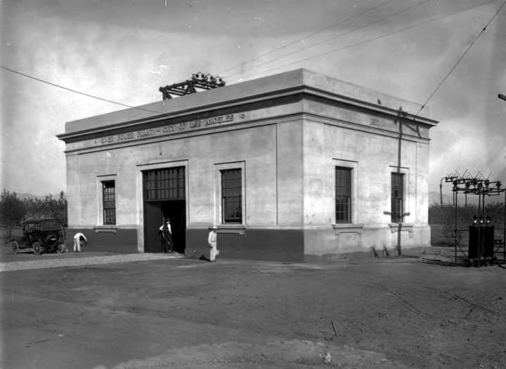
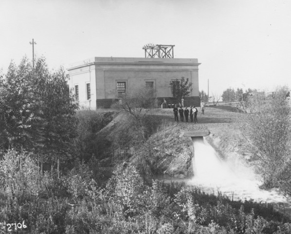
| (1917)** - View showing painters putting the finishing touches on River Power Plant located on the north side of the Los Angeles River with the south end of the building toward the stream and the main entrance toward the west. |
Historical Notes Built in 1917 and beginning operation on Dec 22 of that year, the reinforced concrete building was erected by the Bureau of Power and Light, located in Studio City near the corner of Diaz Avenue and Ventura Blvd along the Los Angeles River. The plant cost $120,000 and created 4000 watts of electrical energy. In 1937, Diaz Ave was renamed Coldwater Canyon Ave. |
 |
|
| (1917)** - View showing City officials posing in front of the hydroelectric power plant. |
Historical Notes Water was channeled to the Los Angeles River and sent to the Buena Vista pumping plant in Elysian Park. From Elysian Park, the water could be sent to either east Los Angeles or to the Franklin Canyon Reservoir and then into the west side water system.** |
.jpg) |
|
| (1938)** - View showing H. E. Thompson closing the control valves at the River Power House. Click HERE to see more Early Views of Power Generation. |
* * * * * |
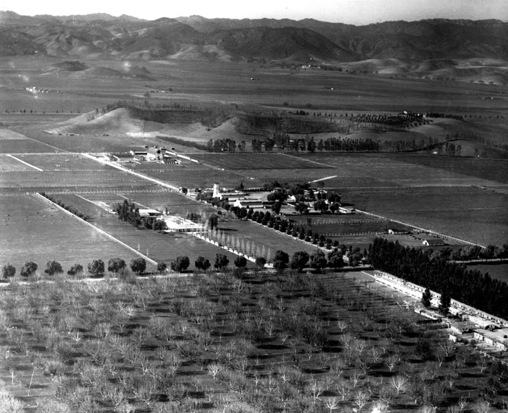
San Fernando Valley (1920s)
.jpg) |
|
| (ca. 1924)* - Detailed map of the San Fernando Valley as it appeared in the mid-1920s. Note that Mulholland Skyline Drive (later Mulholland Highway) is under construction. Also four community names are shown that do not appear on today’s maps (l to r): Girard, Owensmouth, Zelzah, and Lankershim. |
Historical Notes Skyline Drive was renamed Mulholland Highway in December, 1924. The town Girard was founded in 1923 and named after its developer, Victor Girard Kleinberger. By 1941, the community was renamed Woodland Hills. Owensmouth was named for the new Owens River aqueduct's terminus/mouth in the northern valley, that opened in 1913. It was renamed Canoga Park in 1931. Zelzah Avenue was part of the 19th-century wagon route from San Fernando to the Hawk Ranch, which became the town of Zelzah (a Biblical name for "oasis," or "watering place in the desert"). In 1929 the name was changed to North Los Angeles. In 1938, the name changed again to Northridge Village and promptly shortened to Northridge. The town of Lankershim was named after its founding family. It was first named Toluca before being renamed Lankershim in 1896 and finally North Hollywood in 1927.*^ Click HERE to see more SFV Communities Name Origins. |
 |
|
| (1924)#^*^ – Aerial view looking toward the northwest San Fernando Valley. The intersection of Sherman Way and Winnetka is at lower center-left. Sherman Way has the palm trees. Today, Sutter Middle School (built in 1949) is located at the northeast corner, right where the crop field is shown. |
 |
|
| (ca. 1920)* - Aerial view of Van Nuys circa 1920. Vast stretches of farmland can be seen surrounding the small but growing community of Van Nuys, especially toward the northwest (upper part of photo). |
 |
|
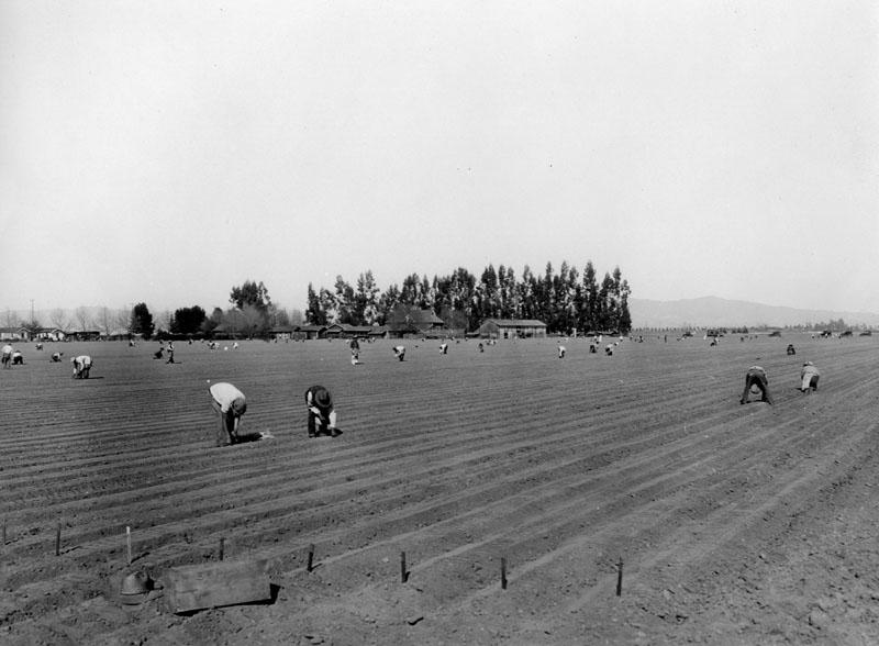
| (1920)* - Planting onions on the Petit Ranch in the San Fernando Valley near Van Nuys on February 3, 1920. Several dozen workers are visible bent over the plowed dirt field. Most appear to be men and wear hats. Several buildings are visible amongst trees in the background, while mountains can be seen in the distance. Several wooden stakes can be seen in the ground in the foreground. Two hundred acres were planted in onions. |
Historical Notes Stanley Norris Petit, known for his pioneering efforts in ranch operations and aviation in the San Fernando Valley, and his father William Justin Petit, owned and operated Encino Rancho, the largest single parcel of property in the Valley before the Sepulveda Basin and Birmingham Hospital (now Birmingham High School) were built. After subdividing the ranch, Petit Avenue--which runs across the Valley to Encino--was named for the elder Petit.^^* |
 |
|
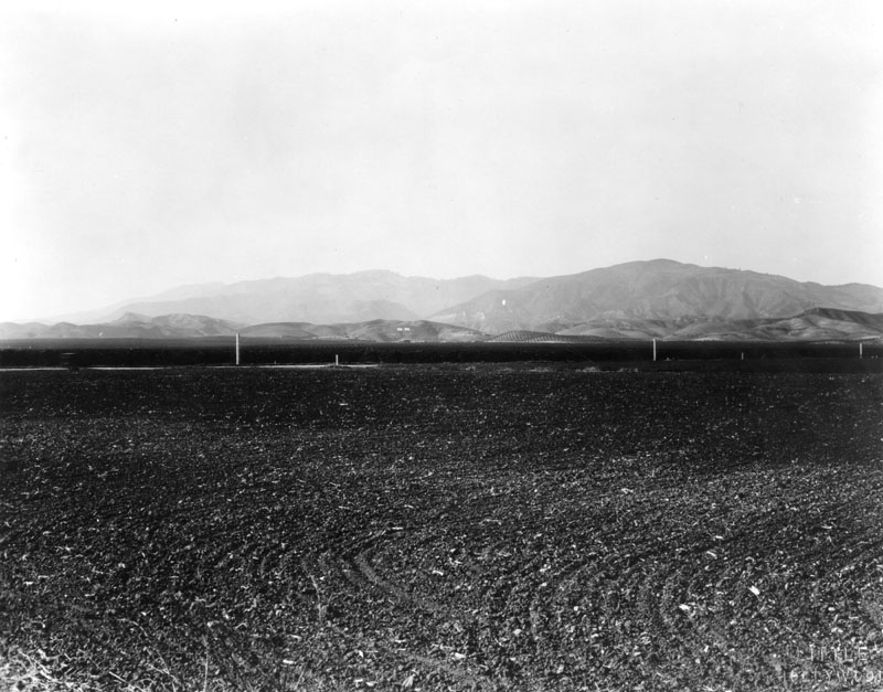
| (ca. 1920)* - Panoramic view of a plowed field in the San Fernando Valley near Chatsworth. |
 |
|
| (ca. 1920)* - View looking southwest at Ventura Boulevard and Firmament Avenue in Encino. |
Historical Notes The largest hill here is actually, what was once called, Sherman Peak (in Encino), but the peak doesn't exist any longer. The house (forefront) is believed to be that of 'Edna & J. W. Maddrill', that resided at 15530 Ventura Blvd. in the early 1920's.* |
| (1920)* - Ventura Blvd. viewed from south of Ventura and west of Lankershim Blvd., still showing agricultural use of the land. |
Historical Notes Ventura Boulevard is the oldest continuously traveled route in the Valley. Laid out to follow a poriton of the Spanish settlers' famed El Camino Real, it has been known as Camino de las Virgenes, U.S. highway 101 and Ventura Road. Lankershim Boulevard was named for the town of Lankershim (first called Toluca, now North Hollywood) and its founding family. Isaac B. Lankershim grew wheat on a wide swath of the Valley floor.^* Click HERE to see more SFV Street Name Origins. |
 |
|
| (ca. 1920)* - Early view of the produce fields in the San Fernando Valley looking north. Mission Point ('Peak') can be seen in the background. |
Historical Notes Mission Point, also known as "Mission Peak" by some locals, is a spur of Oat Mountain. At an elevation of 2,771 ft., it is the second highest peak of the Santa Susana Mountains after Oat Mountain. Newhall Pass lies just to the east, separating the Santa Susana and San Gabriel mountain ranges.*^ |
 |
|
| (ca. 1922)* – Aerial view looking south toward Ventura Boulevard which runs horizontally near the center of the photo. In the upper right Encino Reservoir can be seen and about center-left is the Rancho Los Encinos. |
Historical Notes Encino (Spanish for evergreen or holm oak) is a hilly district of the San Fernando Valley. Specifically, it is located in the central portion of the southern San Fernando Valley and on the north slope of the Santa Monica Mountains. It derives its name from the Rancho Los Encinos (Ranch of the Evergreens), a parcel of land given to three Mission Indians by the Mexican government following its secularization of the California missions beginning in 1834. Rancho Encino was established in 1845.*^ |
Encino Reservoir
 |
|
| (ca. 1921)* - Aerial view looking southwest showing the Santa Monica Mountains, Santa Monica Bay, and in the foreground on the Valley side of the mountains, Encino Reservoir. |
Historical Notes Encino Reservoir was constructed in 1921 to provide and store water for the fast growing San Fernando Valley. |
.jpg) |
|
| (1921)** – Aerial view looking north over the Santa Monica Mountains Showing the wide-open San Fernando Valley with Encino Reservoir in the foreground. |
 |
|
| (2002)* - View of Encino Reservoir, looking north from Mulholland Drive. Nestled at the foot of the Santa Monica Mountains, the open reservoir is located opposite from an abandoned Nike Missile Base. Times Photo dated March 23, 2002. |
Historical Notes Encino Reservoir, which was originally constructed in 1921, is currently no longer in service but continues to hold water for fire and emergency purposes. |
Rómulo Pico Adobe (aka Ranchito Rómulo and Andrés Pico Adobe)
 |
|
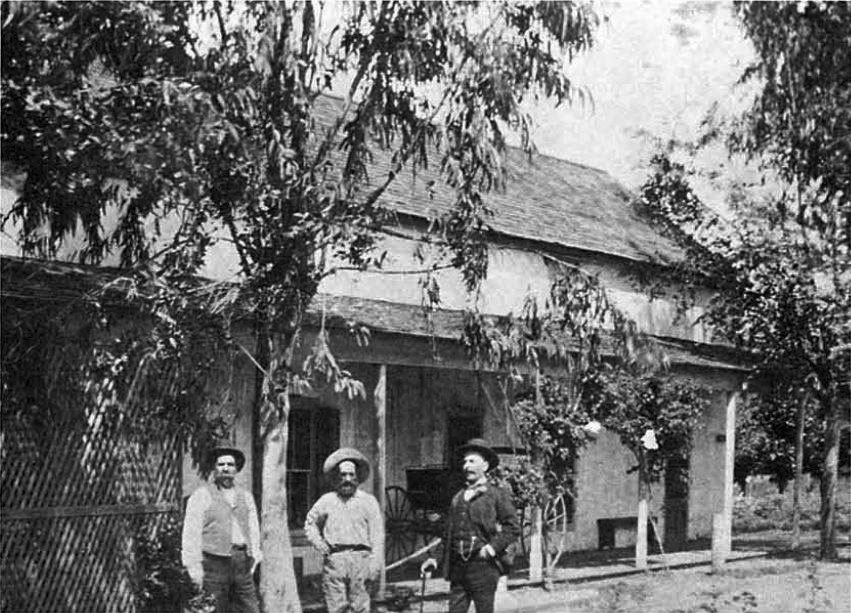
| (ca. 1876)+++# – View showing Rómulo Pico standing in front of his home. Rómulo was the son of Andrés Pico, and he lived here with his wife Catarina (Rómulo is at right). |
Historical Notes Rómulo Pico Adobe, also known as Ranchito Rómulo and Andrés Pico Adobe, was built in 1853 and is the oldest adobe residence in the San Fernando Valley. It is also the second oldest adobe residence in the City of Los Angeles. Located in Mission Hills, the Rómulo Pico Adobe is a short distance from the San Fernando Mission (Mission San Fernando Rey de España).*^ |
 |
|
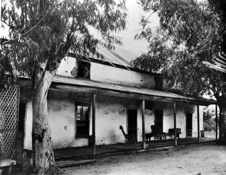
| (ca. 1920)^ - Exterior view of the home of Andrés Pico (brother of Pio Pico) located near the San Fernando Mission at 10940 Sepulveda Boulevard in Mission Hills. |
Historical Notes Located on Sepulveda Boulevard in Mission Hills, the original part of the Rómulo Pico Adobe was actually built in 1834 by Tongva-Fernandeño, Tataviam-Fernandeño, and Chumash-Ventuaño Native Americans (Indians) from the San Fernando Mission. The original purpose of the structure is unknown, though the adobe was located in the center of the Mission's orchards and surrounding vineyards.*^ Click HERE to see more in Early Views of the San Fernando Mission. |
 |
|
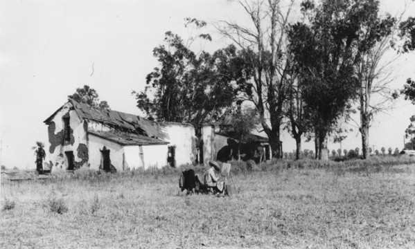
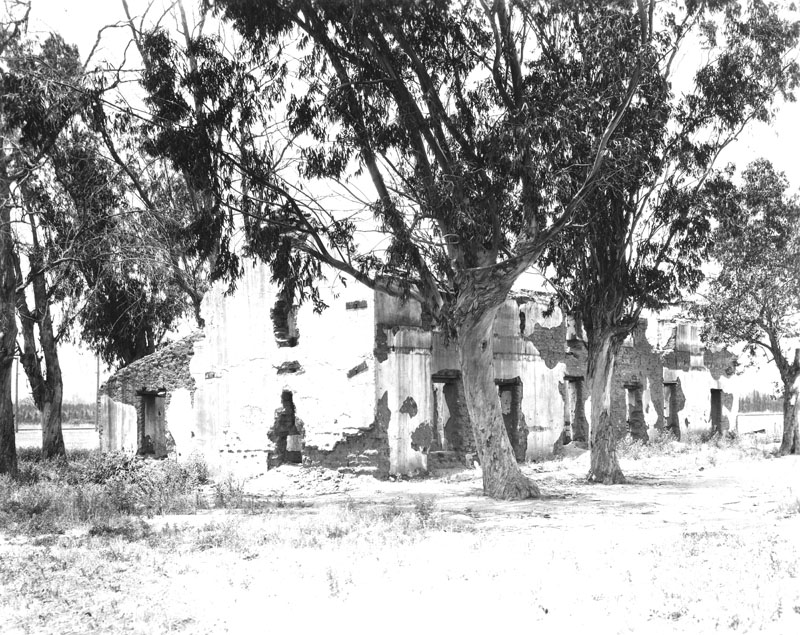
| (1927)^ - The Andrés Pico Adobe (also known as Rómulo Pico Adobe) before its restoration. The artist in the foreground is Claude A. Whisman, a Los Angeles police officer, who was recovering from a gun shot wound. His painting is on display in the Adobe. |
Historical Notes The adobe was lived in by the Pico family until the 1890s when it fell into disrepair. In 1930, Dr. Mark Harrington, curator of the Southwest Indian Museum and a famous archeologist, purchased the adobe, renovated it and lived there until the 1940s.^ |
 |
|
| (1932)+++# – The Andrés Pico Adobe after it was restored by Mark Raymond Harrington who was the curator of archaeology at the Southwest Museum from 1928-1964. Photo Credit: West Valley Museum/CSUN Oviatt Library |
Historical Notes The San Fernando Valley Historical Society saved the adobe from destruction in the 1960s and it now houses the collection of the Mark Harrington Library. The property also houses the Lankershim Reading Room.^ |
 |
|
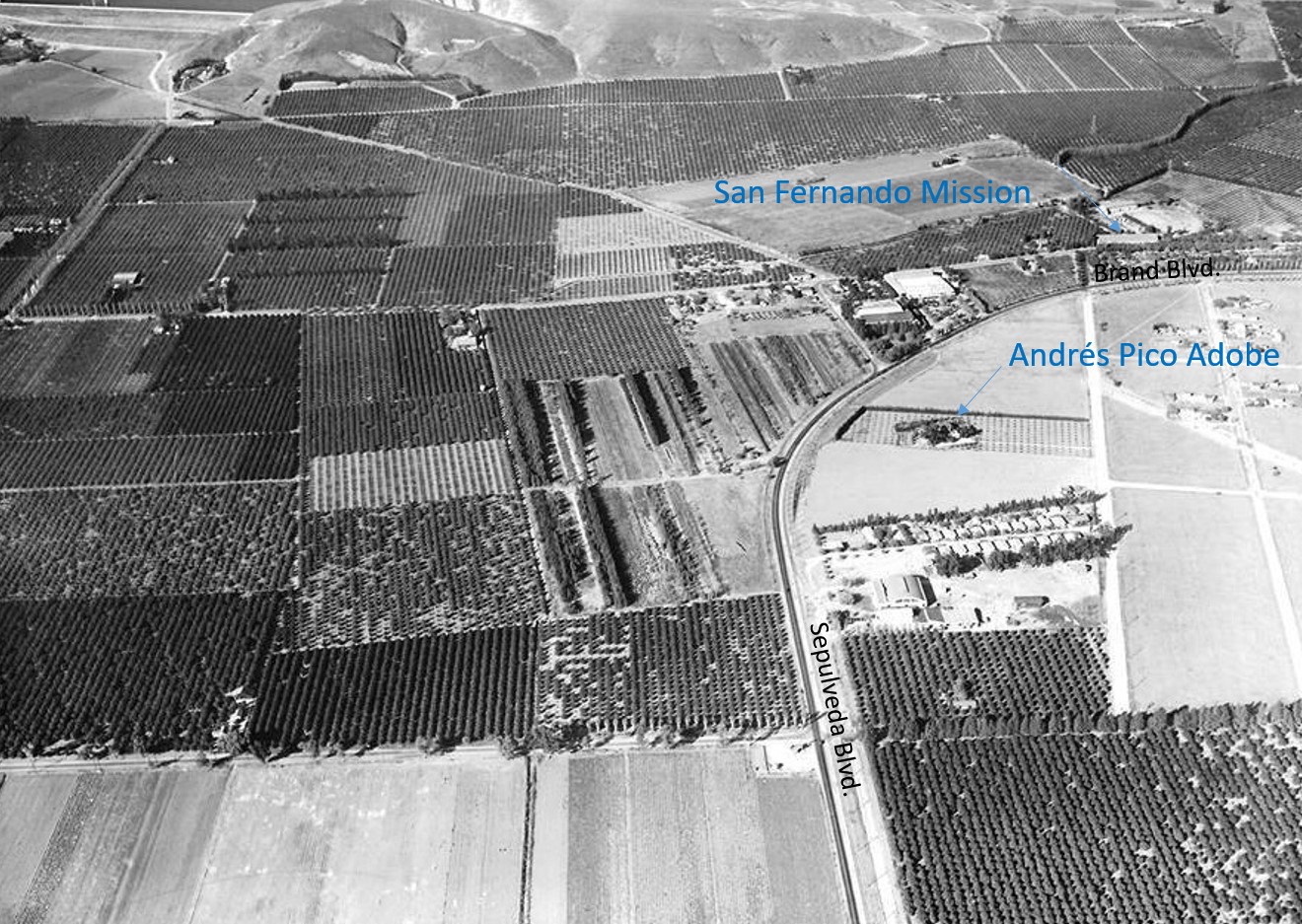
| (1935)^.^ - Aerial view looking north showing Sepulveda Boulevard running along tracks as it curves into Brand Boulevard. To the right of the curve is the Andrés Pico Adobe. In the upper-right can also be seen the San Fernando Mission. Orange and lemon groves can be seen throughout the area. |
Historical Notes Located on Sepulveda Boulevard in Mission Hills, the original part of the Rómulo Pico Adobe was actually built in 1834 by Tongva-Fernandeño, Tataviam-Fernandeño, and Chumash-Ventuaño Native Americans (Indians) from the San Fernando Mission. The original purpose of the structure is unknown, though the adobe was located in the center of the Mission's orchards and surrounding vineyards.*^ Click HERE to see more in Early Views of the San Fernando Mission. |
 |
|
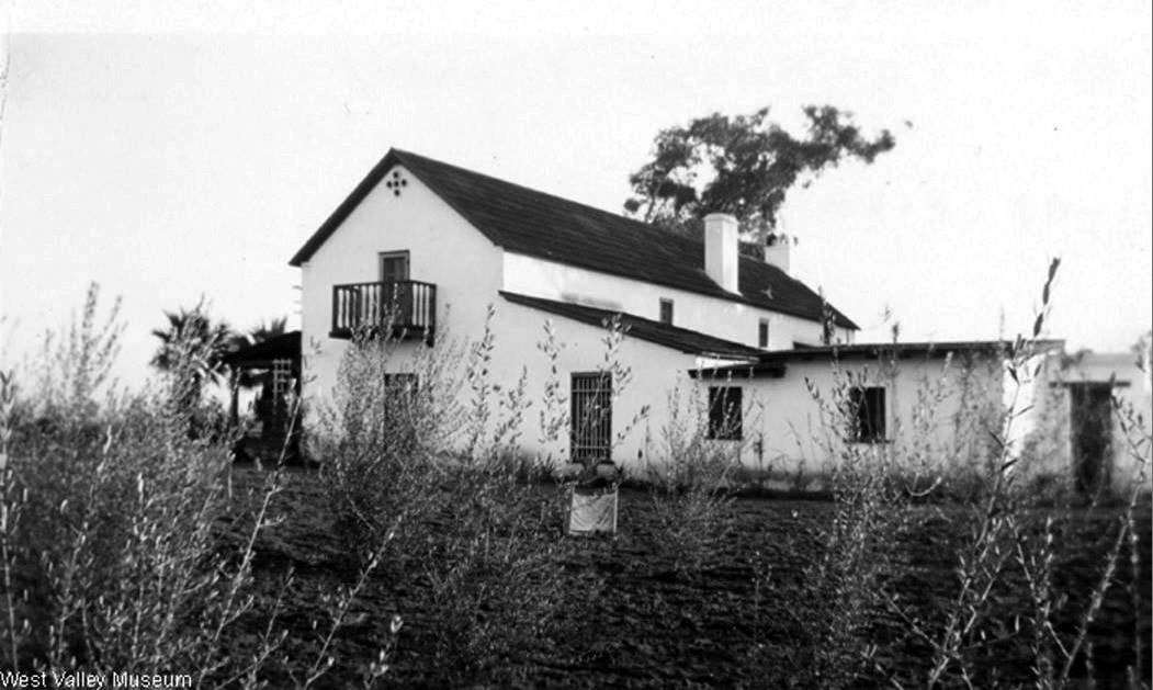
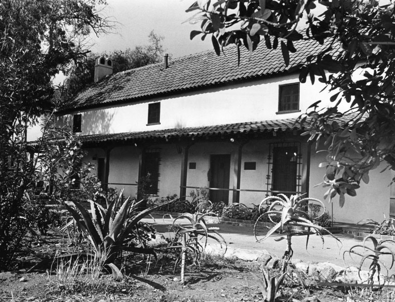
| (1957)* - Exterior view of the home of Andrés Pico in Mission Hills. |
Historical Notes In 1962, the Rómulo Pico Adobe (Rancho Rómulo) was dedicated as Los Angeles Historic-Cultural Monument No. 7 (Click HERE to see complete listing). |
 |
|
| (1965)* - Exterior of the 160-year-old Rómulo Pico Adobe at 10940 Sepulveda Boulevard in Mission Hills about the time it was purchased by the Valley Historical Society. |
Historical Notes In 1966 the adobe was listed in the National Register of Historic Places. It also has been designated as California Historical Landmark No. 362 (Click HERE to see California Historical Landmarks in L.A.). |
Topanga Canyon
 |
|
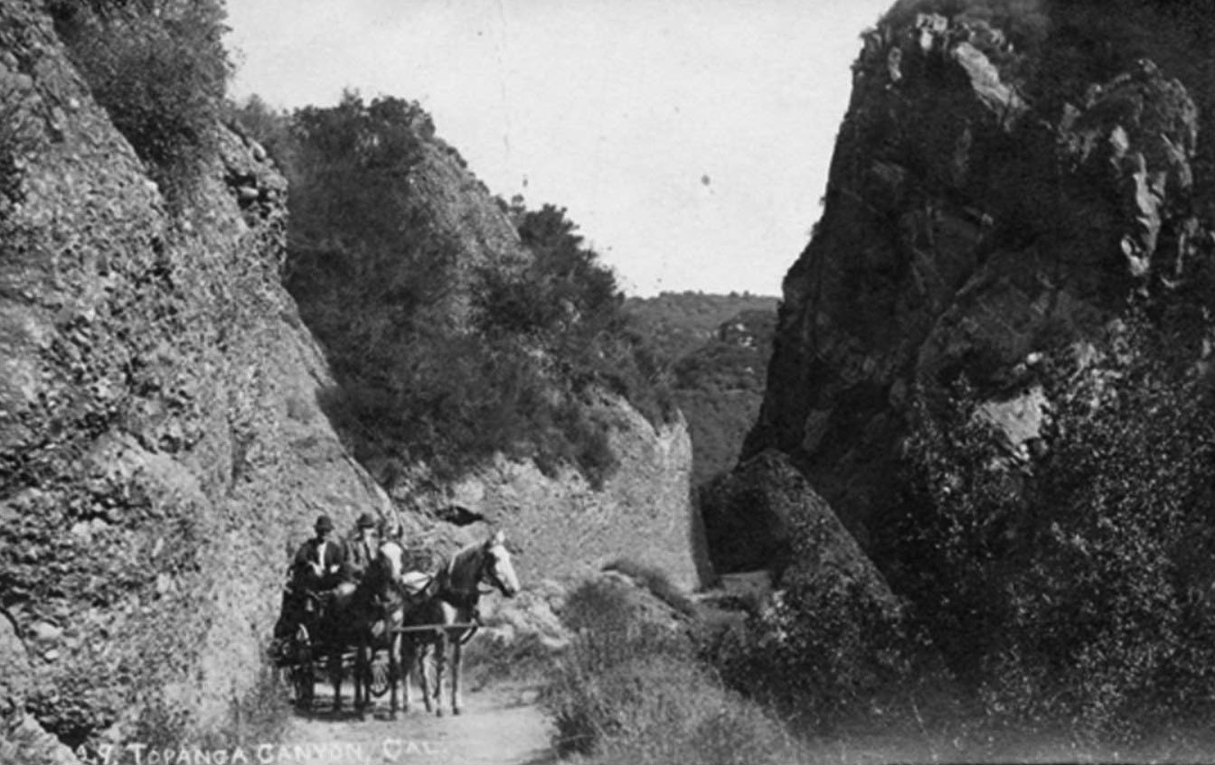
| (1909)^ - A photographic postcard of Topanga Canyon showing the grade above the spring in 1909. Jack Woods and stage with Joe Robinson driving. |
Historical Notes Jack Woods, a pioneer stage and mail driver, built what is thought to be the oldest inhabited structure in Topanga Canyon. The stone cabin on Old Canyon property was later the Frederick Mezet ranch and winery. Since then, the property was bought and sold about ten times. Its owners and tenants included John Bonnell, a real estate developer who subdivided a portion of the property, which he named Topanga Park and was later known as Bonnell Park or Bonnell Flats. Rock star Neil Young was a 1960s tenant. His famous three-day party there resulted in the arrest of Young, as well as Eric Clapton, and led to the breakup of Young’s group, Buffalo Springfield.* |
 |
|
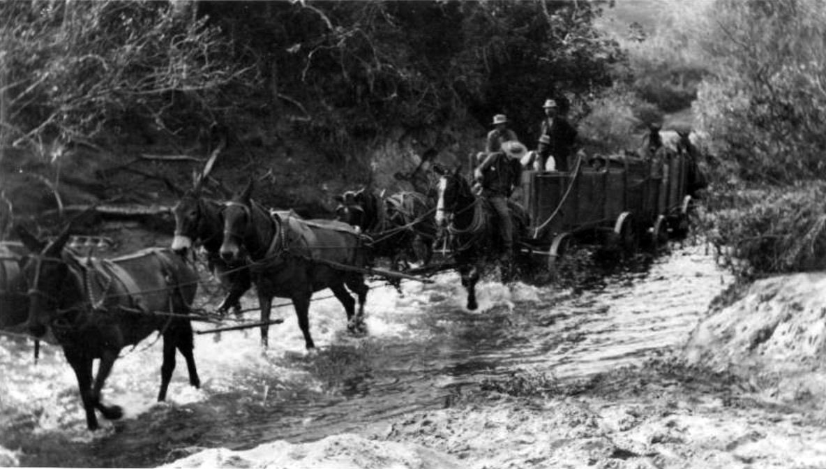
| (ca. 1913)* - After a day of building roads in Topanga, contracted mule and wagon teams followed the creek bed to the beach. |
Historical Notes Topanga is the name given to the area by the Native American indigenous Tongva tribe, and may mean "a place above". It was the western border of their territory, abutting the Chumash tribe that occupied the coast from Malibu northwards. Bedrock mortars can be found carved into rock outcroppings in many locations.*^ |
Topanga Canyon Road
 |
|
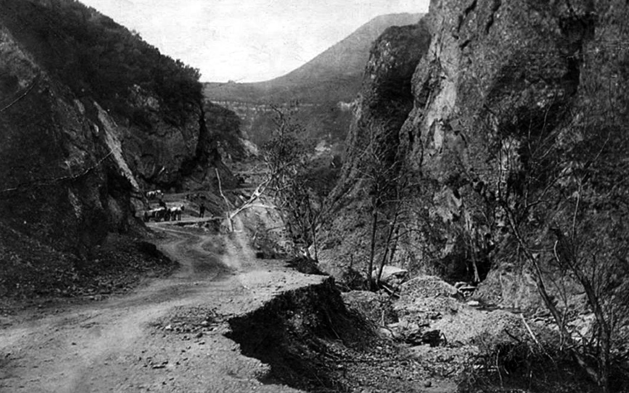
| (Early 1900s)#^*^ – View of Topanga Canyon Road under construction. Photo credit: Laura B. Gaye, from her book "Land of the West Valley." |
Historical Notes Topanga was first settled in 1839 by the Trujillo and Cheney families. Much later, during the 1920s, it gained popularity with the denizens of Hollywood. As an ideal getaway not far from urban conveniences, it was the perfect site for weekend cottages, which actors and other industry people built there at the time. |
 |
|
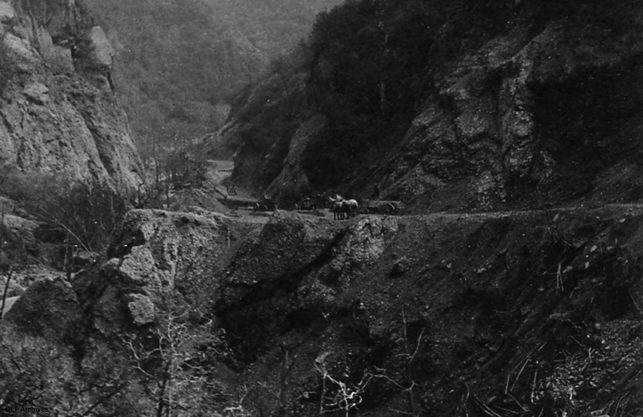
| (1910s)* – View showing the rugged Topanga Canyon Road before any railing. Note the horse-drawn wagon sharing the road with early model cars. |
 |
|
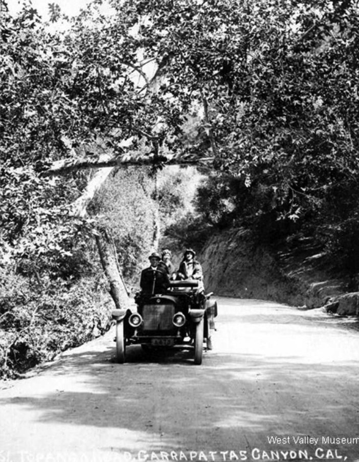
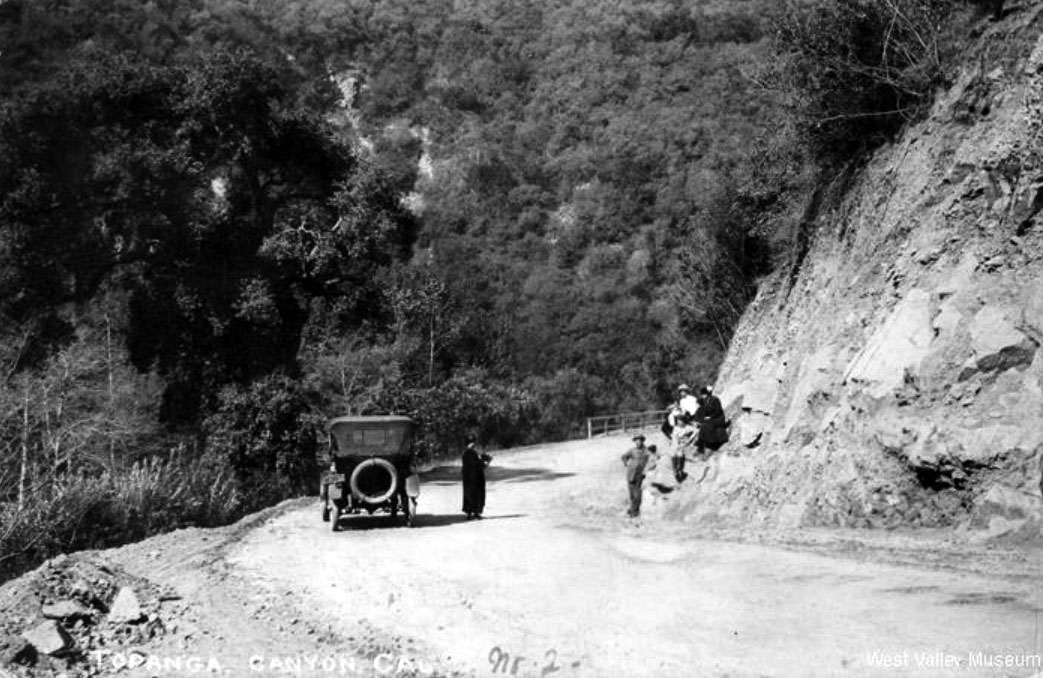
| (ca. 1914)#^ - Travelers on Topanga Canyon Road near Garrapattas Canyon. Photo Courtesy: West Valley Museum |
 |
|
| (ca. 1915)^ - Family outing in Topanga Canyon. Photographer: H. F. Rile. Photo courtesy of West Valley Museum. |
 |
|
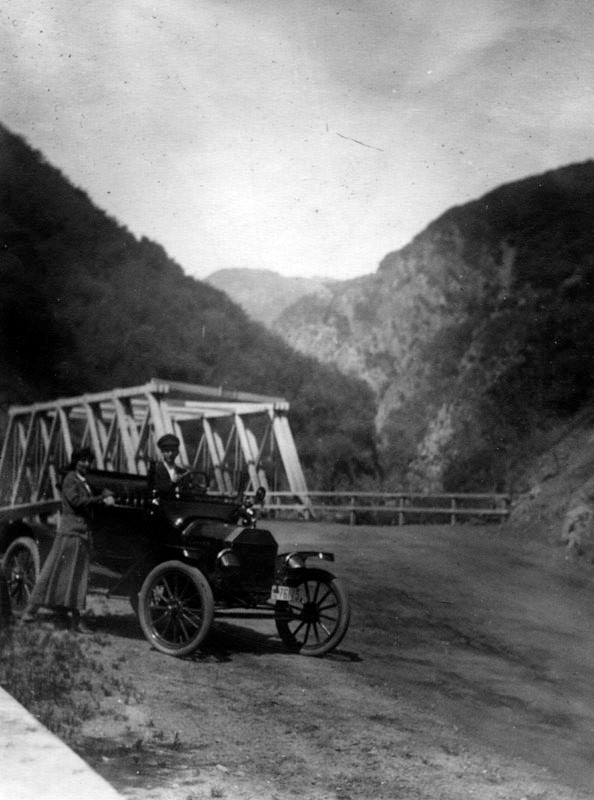
| (ca. 1915)* – View showing a couple posing for the camera with their Ford Model T on Topanga Canyon with newly constructed bridge seen behind them. |
Historical Notes The location of this photo is about two miles up the canyon from Topanga State Beach. The bridge in the photo, along with a handful of others, was built across Garrapata Creek when the road opened up for automobile traffic in 1915. Click HERE to see this same bridge in 1938 on the cover of a December 1938 California Highways publication. |
 |
|
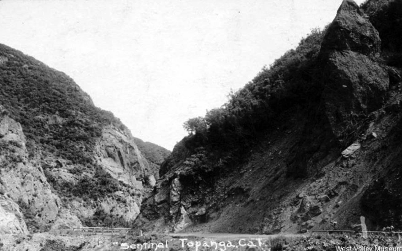
| (ca. 1920)^ – Postcard view showing Sentinel Rock (visible at upper right corner), also known as Pyramid Rock, overhanging Topanga Highway. Concern for the safety of passing motorists on the highway led to the removal of this landmark by demolition in the late 1920s. This postcard is postmarked February 20, 1920. |
 |
|
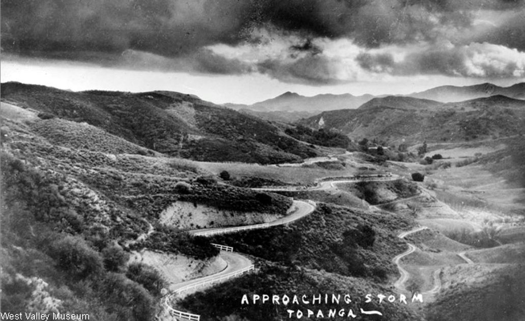
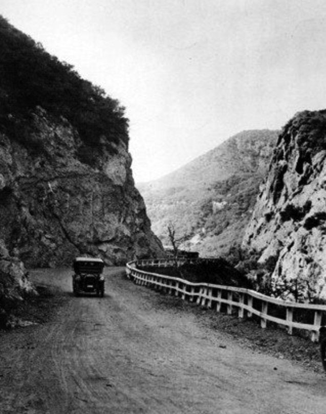
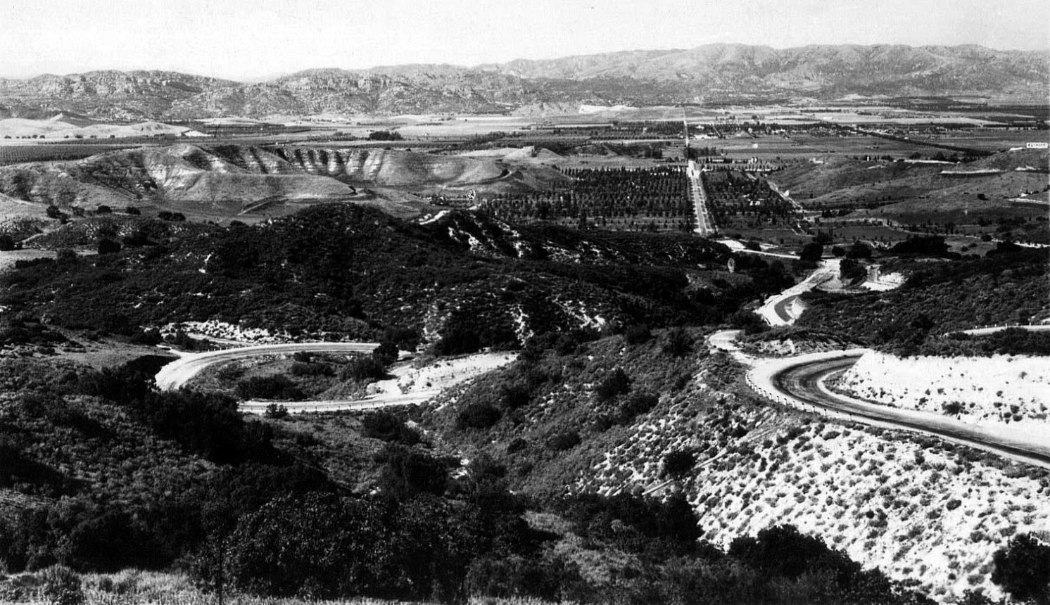
| (1921)^ – Panoramic view showing Topanga Canyon Road winding its way through the Santa Monica Mountains. Clouds gather above as a storm approaches. |
 |
|
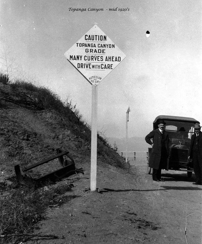
| (1920s)^ – Two men stop there car in front of a sign on Topanga Canyon Drive. Sign reads: CAUTION – Topanga Canyon Grade – Many Curves Ahead – Drive with Care - Auto Club of So. Cal. |
Historical Notes The first road through Topanga Canyon opened in 1915. The road was an adventure to drive, with a few hundred turns to navigate before arriving at the other end. In 1925, officials began studying how to alter the road for easier travel, with actual restructuring occurring in 1930. |
 |
|
| (ca. 1920s)*^*# – View showing an early model car making its way up an unpaved Topanga Canyon Road. |
Topanga Canyon Summit
 |
|
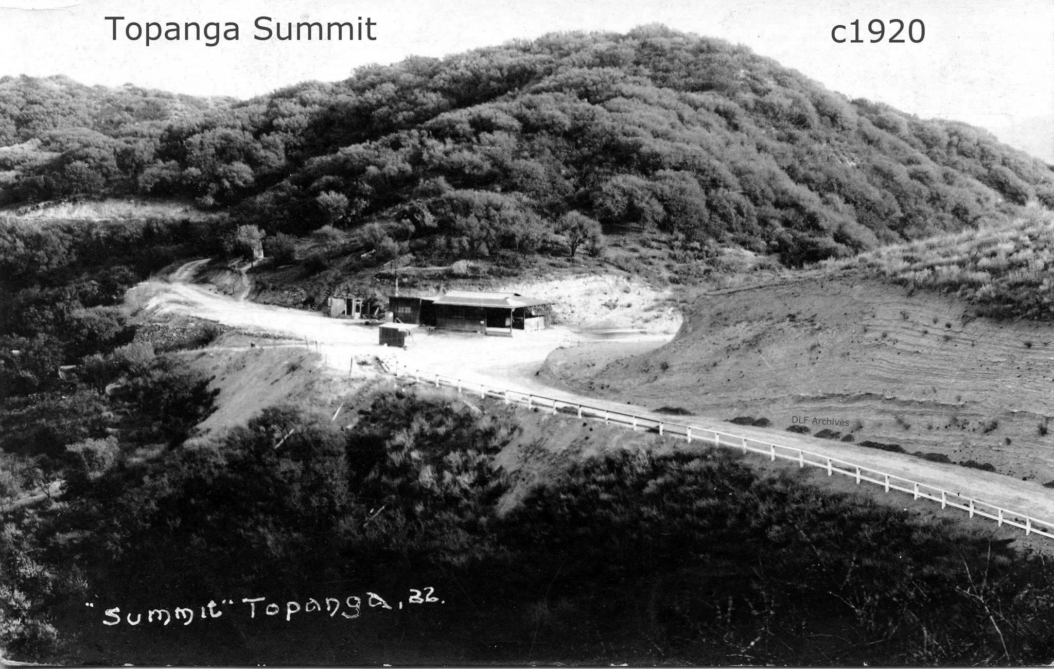
| (ca. 1920)* – Postcard view showing Topanga Summit. At center stand several buildings, possibly including a food stand. |
 |
|
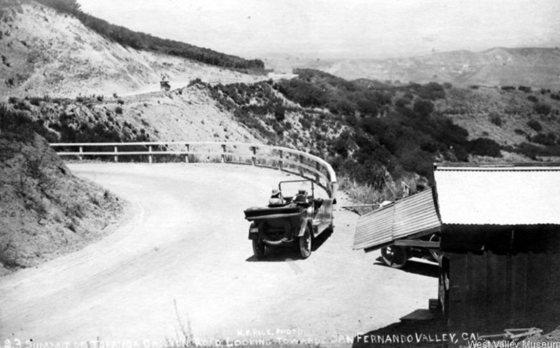
| (1924)* – View looking southerly at the Topanga Summit. Cars are lined up along the railing to get a good view of the San Fernando Valley. |
 |
|
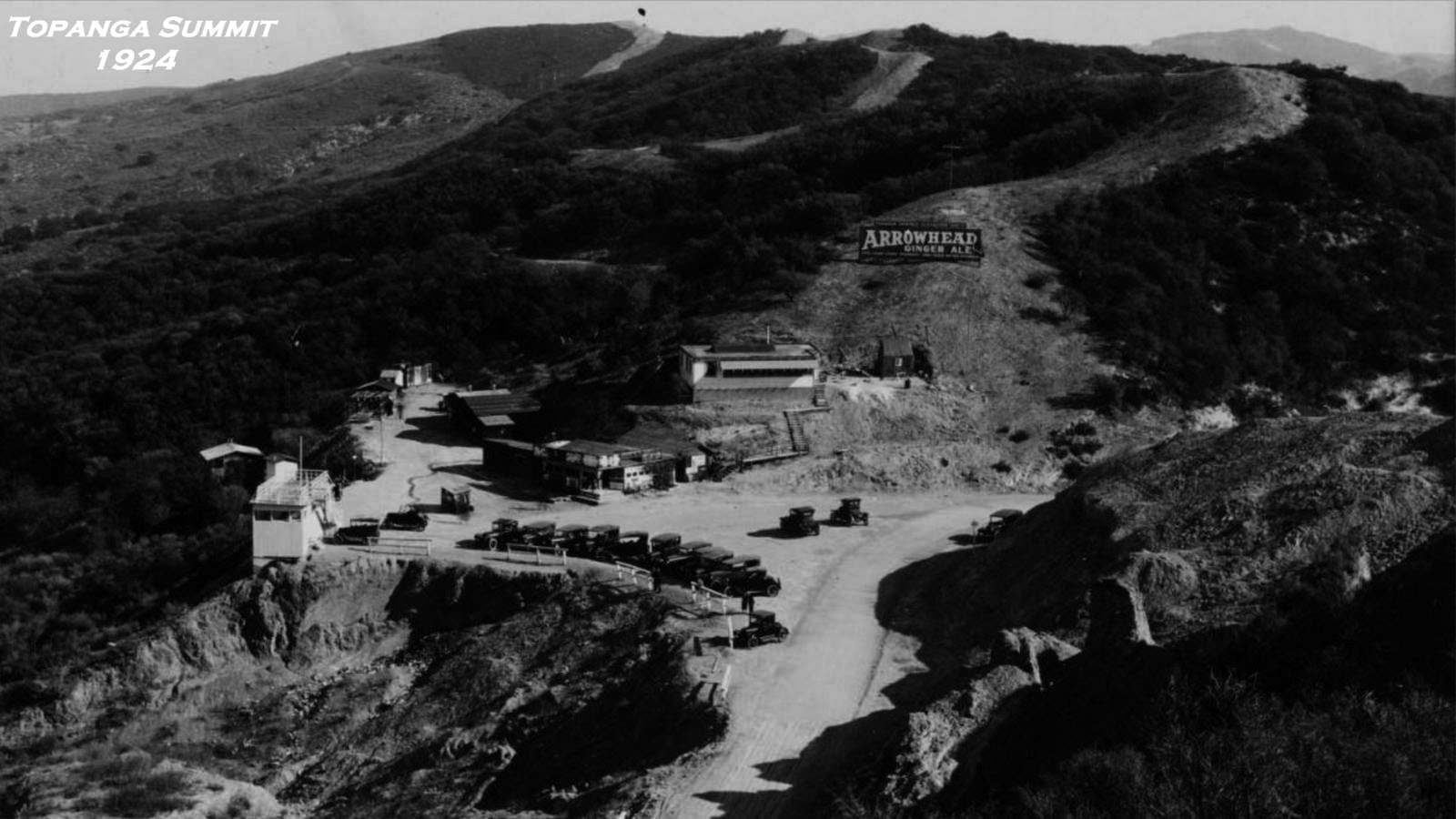
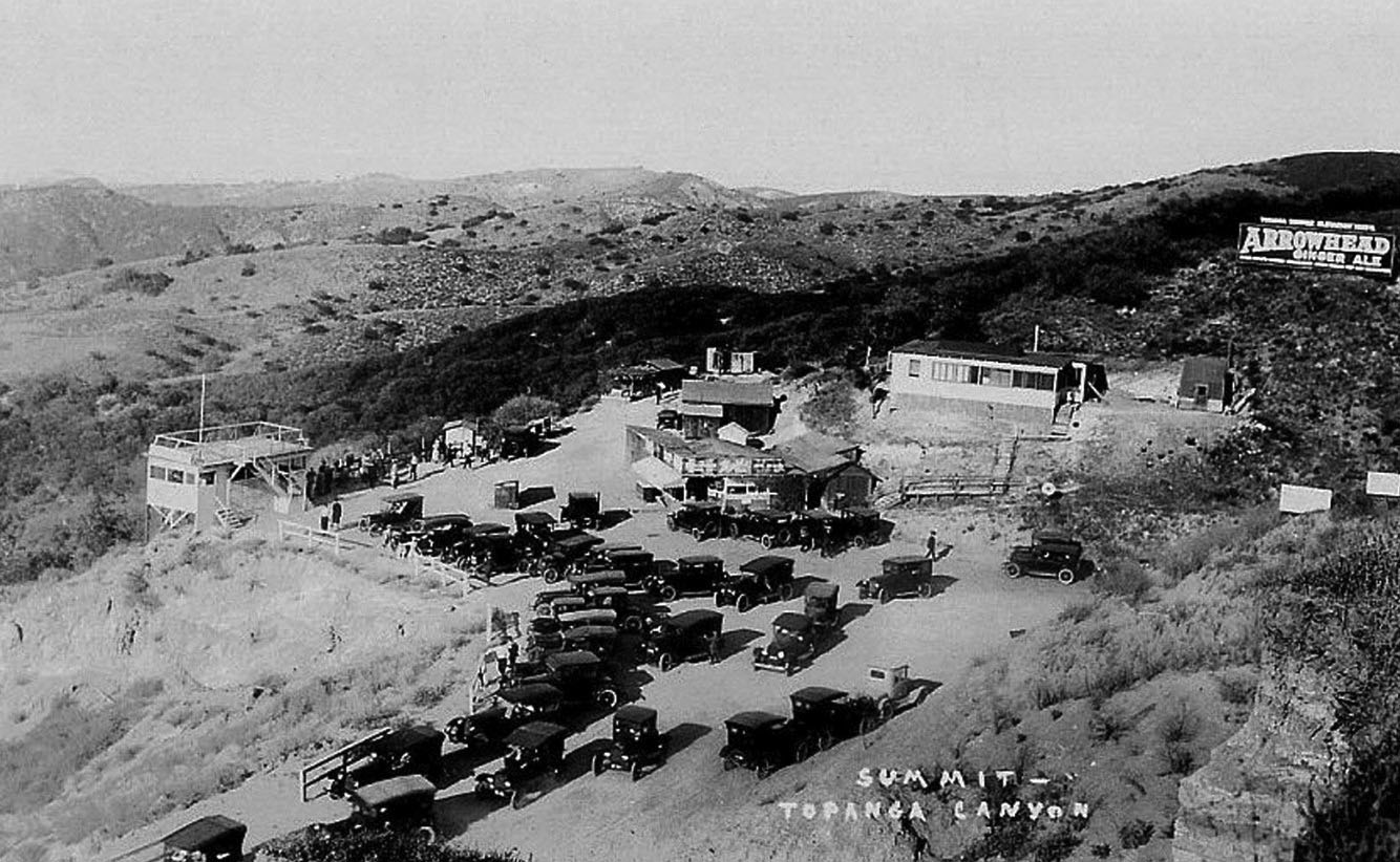
| (ca. 1920)^*^*^ – View showing a full parking lot at the Topanga Canyon Summit. To the left is a two-level structure with a viewing platform on top. At right is a large billboard perched on the hillside reading: “Arrowhead Ginger Ale”. At center stand several buildings, including a food stand. |
 |
|
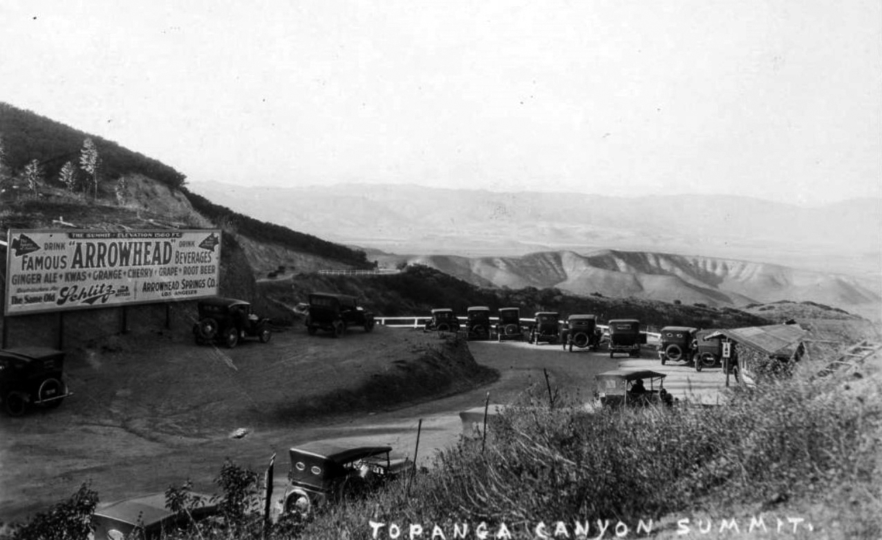
| (ca. 1920)* - Image showing automobiles parked at the Topanga Canyon Summit, with a view of the San Fernando Valley. A sign at left reads "The summit elevation 1560 ft." and "Drink famous Arrowhead beverages... Distributed for the same old Schiltz in brown bottles. Arrowhead Springs Co., Los Angeles." |
 |
|
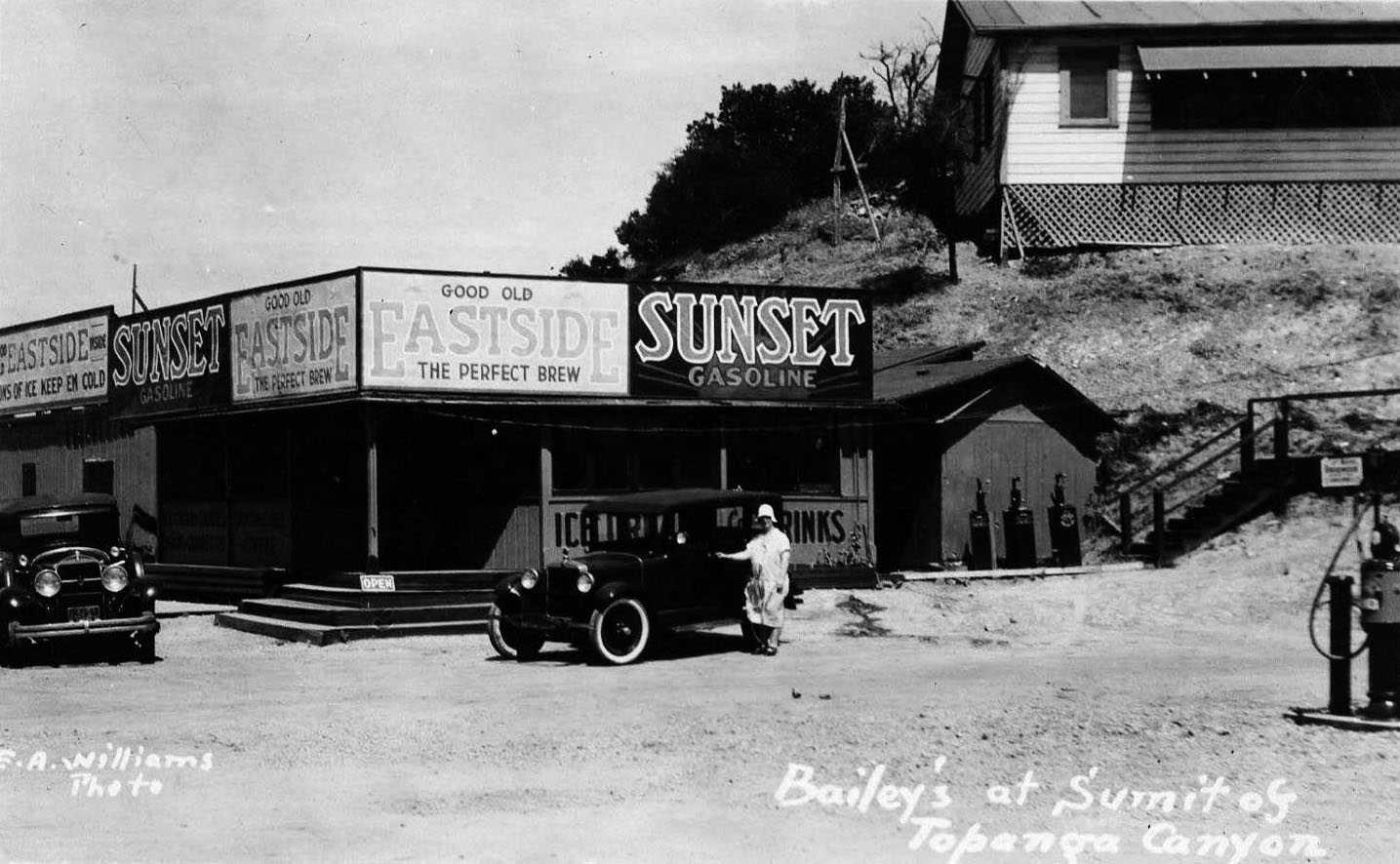
| (1920s)* – Postcard view showing Bailey’s at Summit of Topanga Canyon serving “Good Old Eastside – The Perfect Brew”. |
Historical Notes Eastside was a Los Angeles beer in the early 1900s, brewed by the Los Angeles Breweing Company (later Eastside Brewing Co.). It was called Eastside because the brewery was located on the east side of the Los Angeles River. Click HERE to see more. |
 |
|
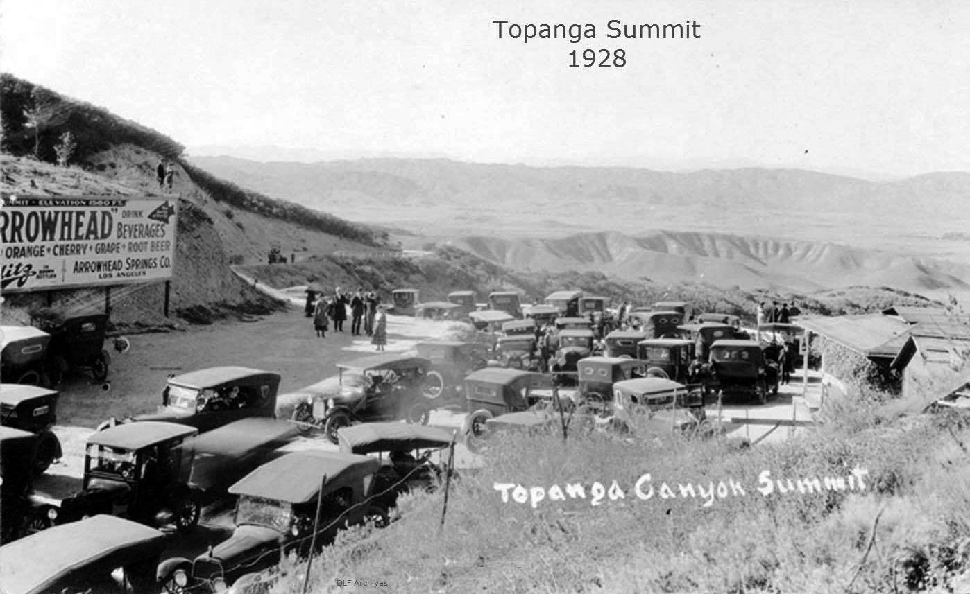
| (1928)* – Topanga Summit without hardly a parking spot to be had. The refreshments stand is to the right. |
 |
|
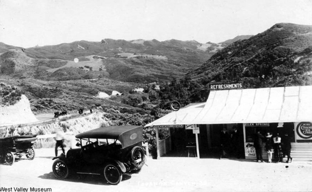
| (ca. 1920)#^ - View of a food stand in Topanga Canyon with large sign on the roof reading: “Refreshments”. The sign above the front counter reads “Glen Spring” and the type of ice cream they're selling is called “Crescent Ice Cream”. |
 |
|
| (ca. 1920)#^ - Postcard view showing two people sitting in a car at the Summit of Topanga Canyon Road looking out towards the San Fernando Valley. |
 |
|
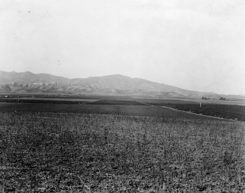
| (ca. 1914)^ – Birdseye view of San Fernando Valley from near Topanga Canyon Road. The wide, flat valley is in the distance at center and is divided into many large farm plots. A small orchard is visible at center and a road cuts through the valley at left. |
 |
|
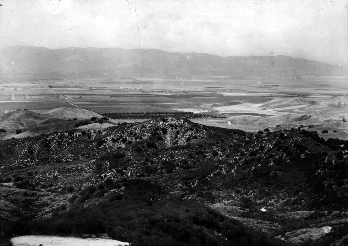
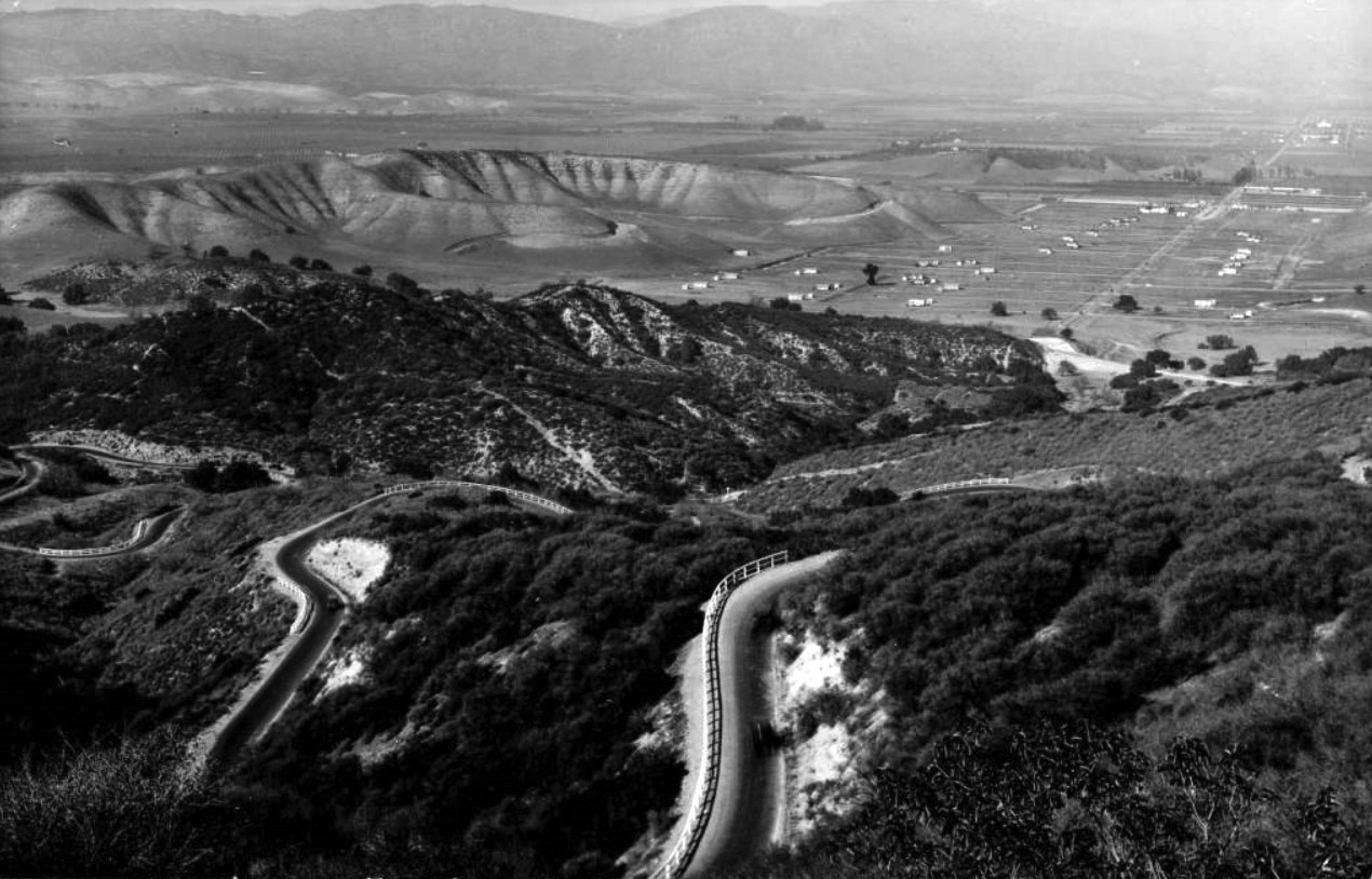
| (ca. 1920)^ - Panoramic view showing the San Fernando Valley from the Topanga Summit. Wide open spaces are seen below with little or no development. |
 |
|
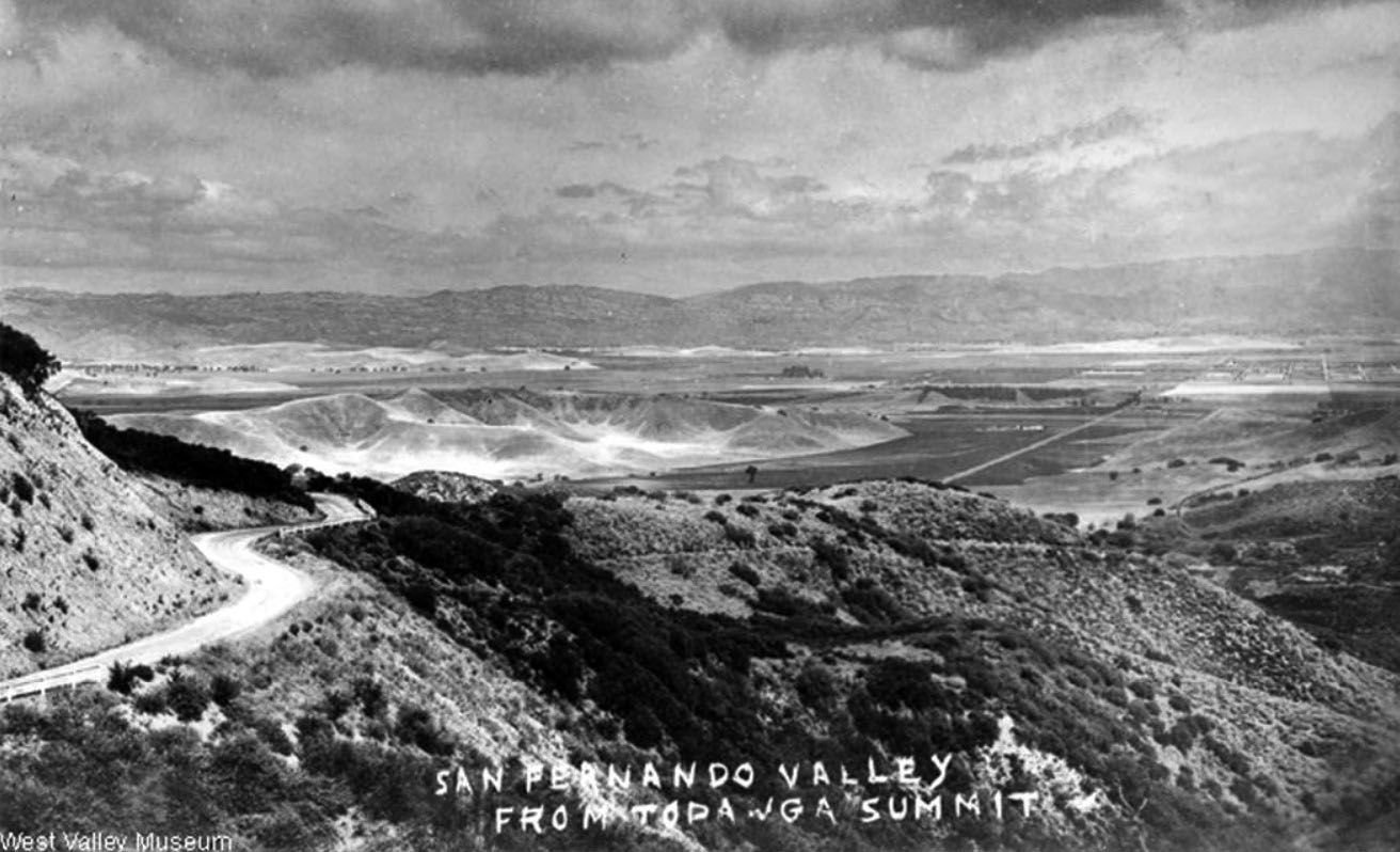
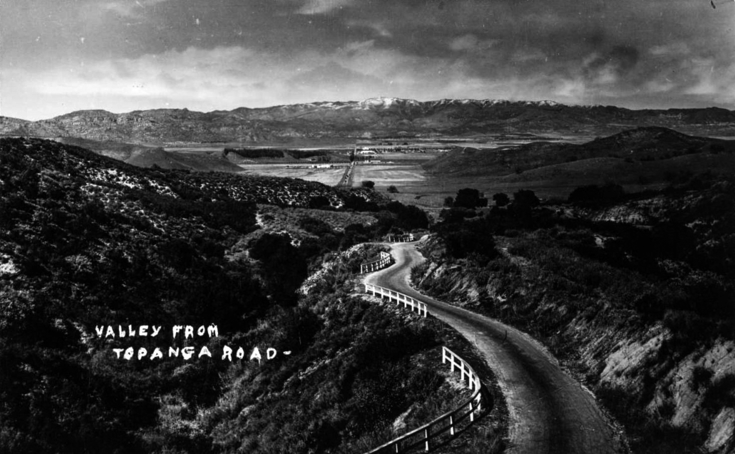
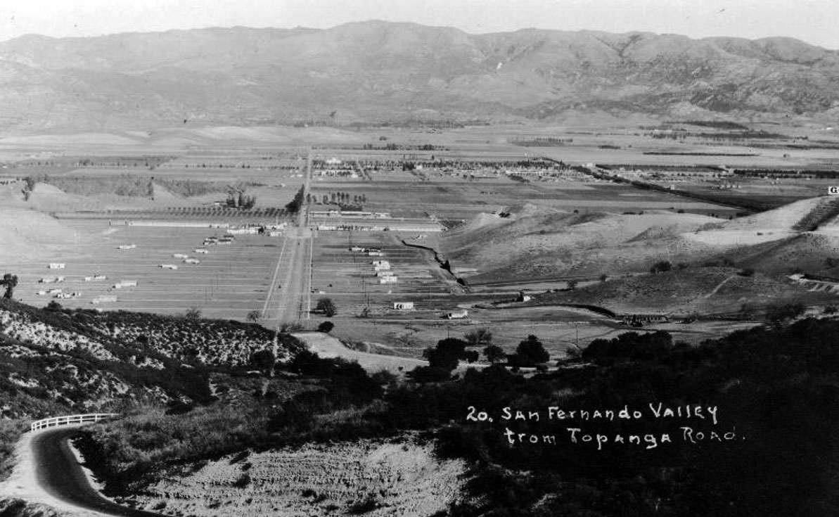
| (ca. 1920)* – View of the San Fernando Valley as seen from Topanga Canyon Road with little or no development down below. |
Girard (now Woodland Hills)
 |
|
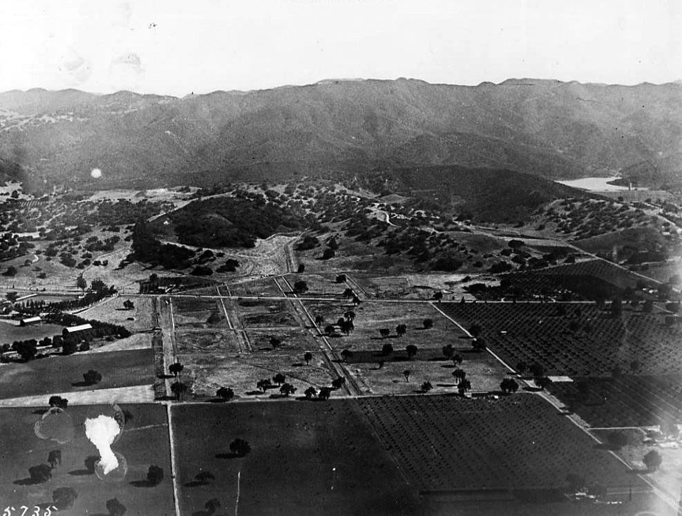
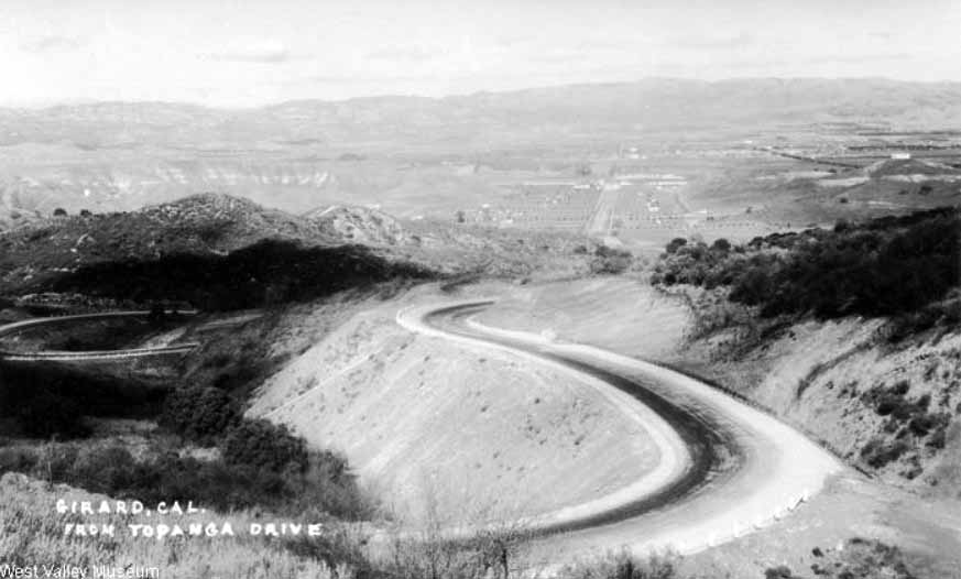
| (ca. 1922)#^ - View of the San Fernando Valley from Topanga Canyon Drive showing some early signs of development in what was then known as the town of Girard (now Woodland Hills). |
Historical Notes Victor Girard Kleinberger bought 2,886 acres in the area from Chandler's group and founded the town of Girard in 1922. He sought to attract residents and businesses by developing an infrastructure, advertising in newspapers, and planting 120,000 trees. His 300 pepper trees forming an arch over Canoga Ave. between Ventura Boulevard and Saltillo St. are Los Angeles Historic-Cultural Monument #93 in 1972. The community of Girard was eventually incorporated into Los Angeles, and in 1945 it became known as Woodland Hills.*^ |
 |
|
| (1922)* - View of Girard and Owensmouth in the West San Fernando Valley, looking north from the summit of Topanga Canyon Highway. The canyon road leads to the San Fernando Valley, showing houses and trees in an open landscape. The town called Girard became present-day Woodland Hills. Ernest Marquez Collection |
 |
|
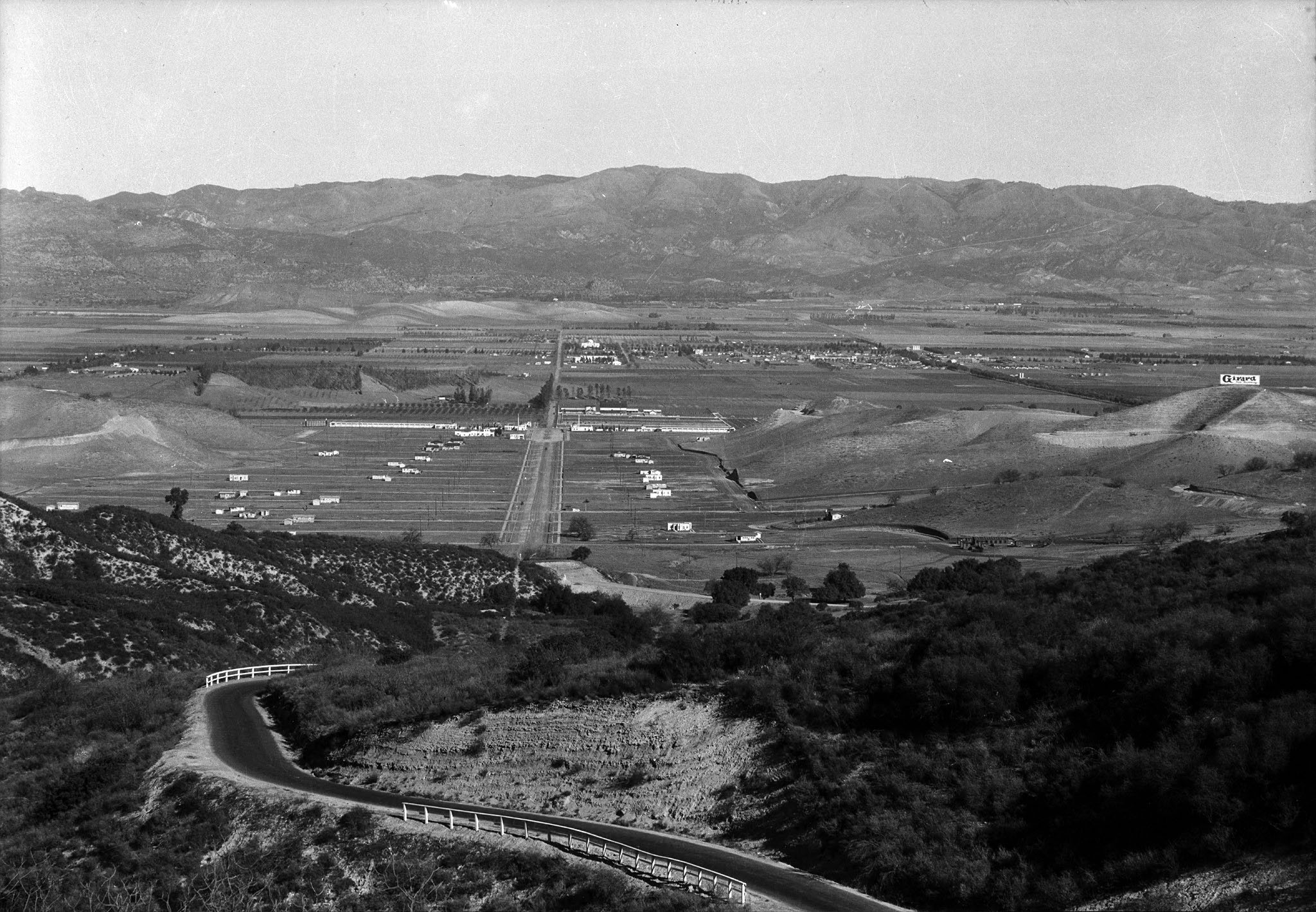
| (ca. 1922).^ - View looking out toward the San Fernando Valley with Topanga Road in the foreground. In upper-right can be seen a very large sign on top of a hill (Chalk Hill). The sign reads “Girard”. Photo C.C. Pierce. |
Historical Notes The town Girard was founded in 1923 and named after its developer, Victor Girard Kleinberger. By 1941, the community was renamed Woodland Hills. |
 |
|
| (ca. 1922)* - Closer view of the San Fernando Valley from Topanga Road. Photo taken in the early stages of Girard's development. |
 |
|
| (1924)^ - Aerial view looking north on Topanga Canyon Boulevard, Girard (later Woodland Hills). The intersection of Ventura Blvd and Topanga Cyn can be seen at upper-center where the road widens and has a center median. Brant Ranch is at upper-right. |
 |
|
| (1924)^ - Same as previous photo but annotated to show street names. Courtesy of Bill Klea |
 |
|
| (late 1920s)#^# – Postcard view of Girard and the San Fernando Valley from Topanga Canyon Road. Note the hundreds of new trees at upper center-right that Victor Girard planted for his new development. |
Historical Notes Victor Girard is credited for planting more than 120,000 sycamores, eucalyptus, fir pine, and pepper trees across the townsite for which Woodland Hills would later be named for. #*#* Click HERE to see more in Early Views of Girard. |
 |
|
| (ca. 1920s)* - Aerial view of Owensmouth just north of Girard (now Woodland Hills/Warner Center) looking northwest. Brant Ranch is seen at center of photo. Oxnard Street runs diagonally from lower-right to upper-left. Tree-lined Canoga Avenue runs from left to right in the foreground. |
Historical Notes The area was originally named Owensmouth by Los Angeles Suburban Home Company's general manager, Hobart Johnstone Whitley, with a real estate salesman's exaggeration that it was the new mouth of the Owens River, after the Los Angeles Aqueduct would be completed the next year. The town was founded on March 30, 1912, and the Suburban Home Company contracted with the Janss Investment Company, to sell properties.*^ |
Owensmouth
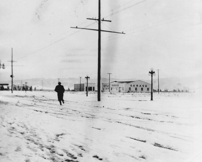 |
|
| (ca. 1915)* - View showing a man walking/running through the snow on Sherman Way in Owensmouth (later Canoga Park). An automotive garage/service station and other structures can be seen in the background. |
 |
|
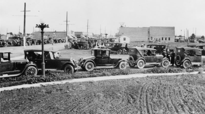
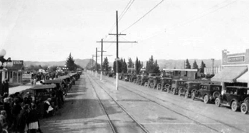
| (1920)* - View of the intersection of Owensmouth and Sherman Way in Owensmouth (later renamed Canoga Park) showing crowded street during the San Fernando Valley Fair and Market. |
Historical Notes The event seen above was the first annual San Fernando Valley Fair and Market that took place on September 15-18, 1920 in commemoration of what the aqueduct has done for the San Fernando Valley. There were horticultural and industrial exhibits to wow the crowds with lots of news clippings about it. Per the Van Nuys News (9-17-20 – Page1), the management of the fair gave a reception in the Owensmouth HS auditorium Sept 15 1920. Sept 17th was designated "San Fernando Day". |
 |
|
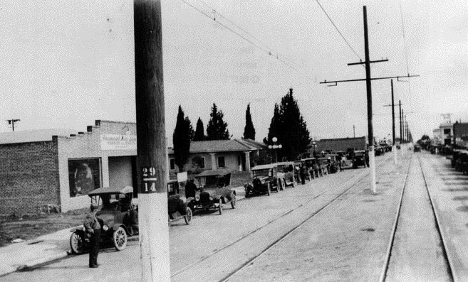
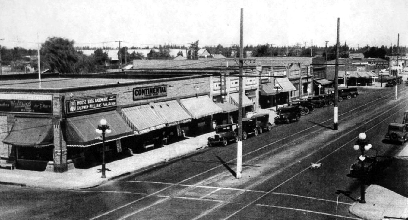
| (ca. 1920s)* - Sherman Way, divided by railroad tracks and a power pole line, in "downtown Owensmouth" in the early 1920's. |
Historical Notes A well-thought pre-development scheme brought Pacific Electric streetcars and an all-purpose highway (Sherman Way) out all the way from Hollywood through Cahuenga Pass, through the previously subdivided Van Nuys (1911). Highlighting the "opening day barbecue" was the display of the "Owensmouth Baby", a race car that could go up and down the paved Sherman Way at the incredible speed of 35 mph—as you could do—in an age without pavement or speed limits.*^ |
 |
|
| (1924)^ - Sherman Way in Canoga Park looking west with a crowd of people, rows of cars, telephone poles and streetcar tracks visible. |
Historical Notes Owensmouth, as the junior San Fernando Valley city to Van Nuys, promoted itself with the "baby" motif—using storks in their advertisement—the "baby city" of the Valley. And Owensmouth remained a very small community.*^ |
 |
|
| (1920s)##^* - Panoramic view of Sherman Way showing two sets of rails and a power pole line running down the center of the street. Note the ornate streetlights located on the intersection corners in the foreground.. Click HERE to see more in Early LA Streetlights. |
Historical Notes The lack of an independent water supply made annexation to the City of Los Angeles inevitable, and on February 26, 1917 Owensmouth joined with its larger neighbor. The name was changed to Canoga Park in 1930. It is believed to be named after Canoga, New York, which derived its name from the Native American village "Ganogeh". Eventually, the area's zoning was rural/agricultural and its industry was small farms involved in production of fruits, vegetables, melons, some livestock, horses, movie/television studio and stunt location work. |
Zelzah (later Northridge)
 |
|
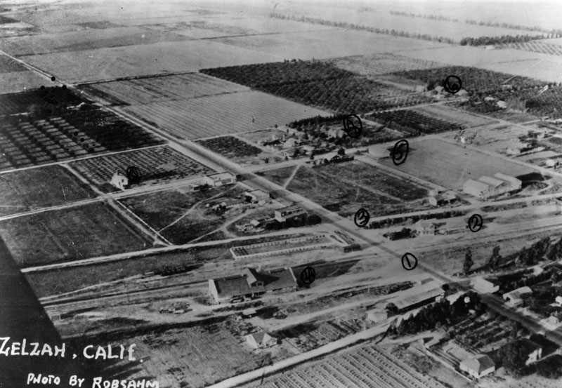
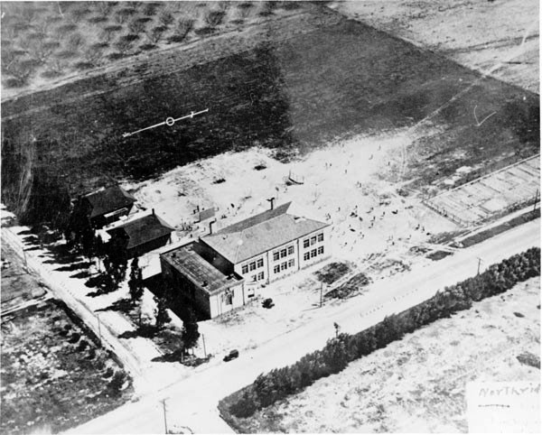
| (1918)* - Aerial view of Northridge, then known as Zelzah, in 1918. Number one is Reseda Boulevard, number two is the Southern Pacific Depot, number three is Parthenia Street, number four is the Zelzah School, and number five is the Clubhouse, the community's meeting hall. |
Historical Notes Parthenia Street was named for Miss Parthenia Staton of Lafayette Park, Calif. in 1916, when it opened between Van Nuys Blvd. and Kester Ave. Kester Ave was named for Kester Ranch, a major wheat-growing concern—part of the Lankershim-Van Nuys empire—from the 1870s to 1909.^* Reseda was named after a fragrant North African yellow-dye plant, Reseda odorata, whose English name is mignonette and which grows in hot, dry climates—replaced Marian as a designation for a stop on the Pacific Electric interurban railway running along Sherman Way. The name "Reseda" was given first to a siding on a branch of the Southern Pacific Railroad in the south San Fernando Valley. Zelzah Avenue was part of the 19th-century wagon route from San Fernando to the Hawk Ranch, which became the town of Zelzah (a Biblical name for "oasis," or "watering place in the desert"). In 1929 the name was changed to North Los Angeles. In 1938, the name changed again to Northridge Village and promptly shortened to Northridge.*^ Click HERE to see more SFV Street Name Origins. |
 |
|
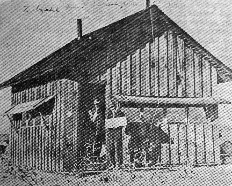
| (1911)^x^ – View showing two men standing in front of the first school in Zelzah (later Northridge, 1938), located on Canby Avenue and Rayen Street. Originally this building was a bunkhouse and later turned into a schoolhouse. |
 |
|
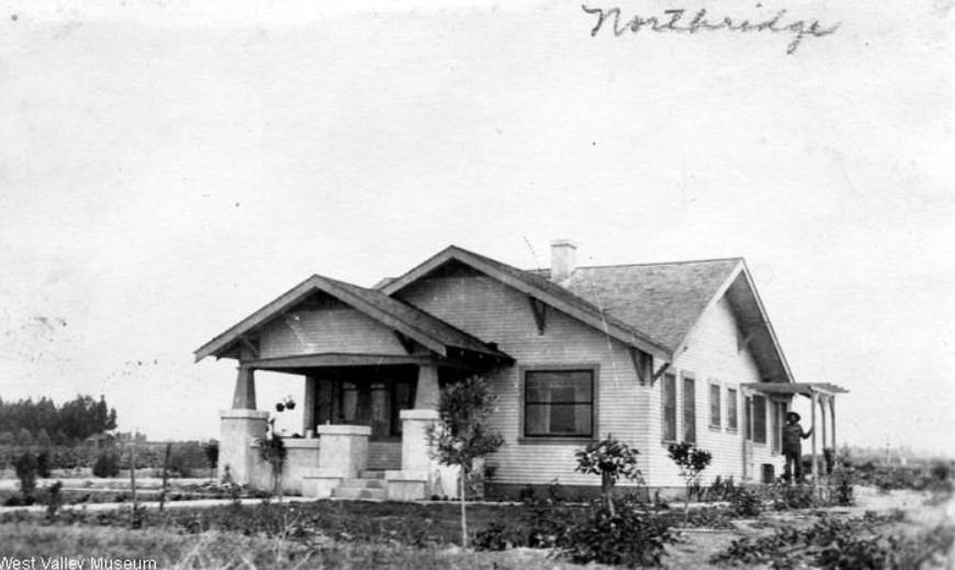
| (1918)#^ - Man standing on the side porch of a house in Zelzah (now Northridge). |
Historical Notes The above photo appeared on the front side of a postcard mailed by the owner of the house in 1918. See next photo for the reverse side of postcard. |
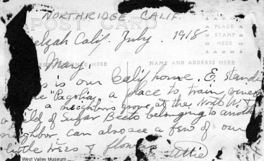 |
|
| (1918)#^ - Back side of postcard signed by "Attie". See previous photo for the front side of postcard. |
 |
|
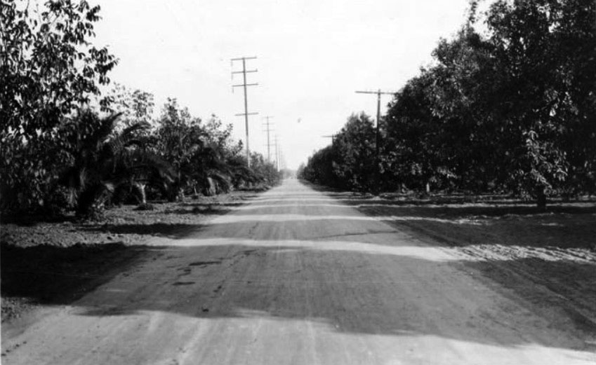
| (1921)#^ - Chatsworth Boulevard in Zelzah (later, Northridge. Fruit orchards are visible on both sides of the road. Photograph taken by Automobile Club of Southern California surveyor to show the condition of the roads. |
Historical Notes Chatsworth Boulevard was a dirt road that ran from the City of San Fernando all the way to the town of Chatsworth Park located at the west end of the San Fernando Valley. It followed present-day Chatsworth Street and Zelzah Avenue, then continued west on Devonshire Street to Santa Susana Avenue (Now Topanga Cyn Blvd). |
 |
|
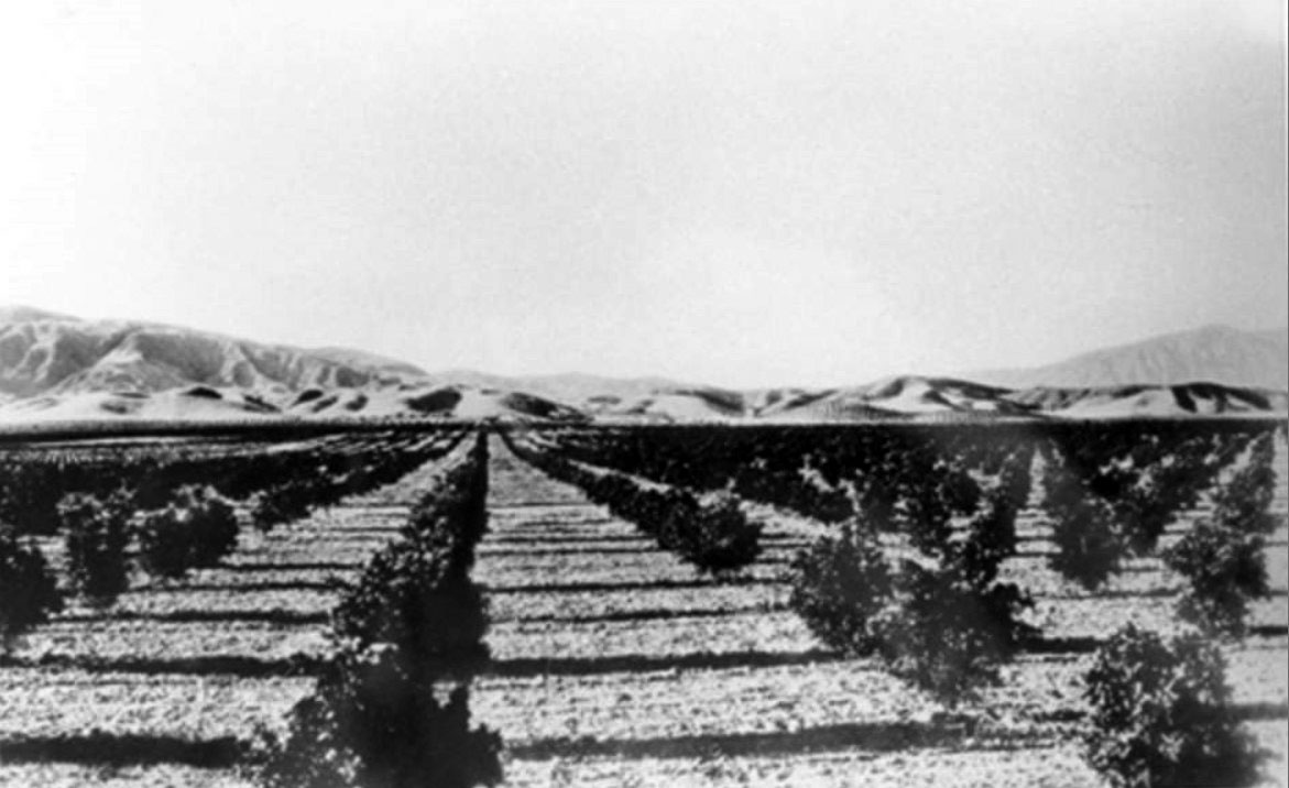
| (ca. 1920)^ - View of orchards in the San Fernando Valley. |
 |
|
| (1925)#^ - Tilling the soil on the Halverson farm. The Halverson farm was located in Zelzah (now Northridge) and was part of the land of the future campus of the California State University, Northridge (CSUN). |
 |
|
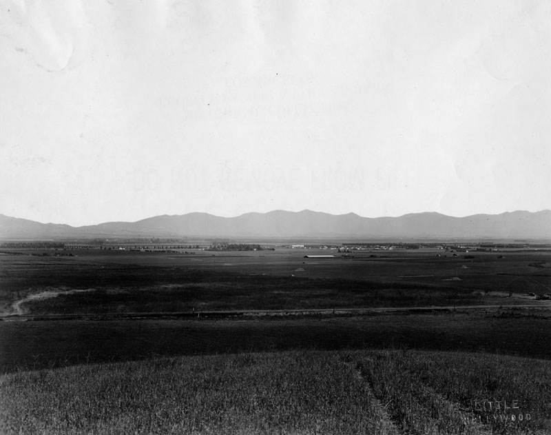
| (1925)* - Panoramic view looking north across the San Fernando Valley toward the community of Zelzah (now Northridge). |
Historical Notes Francis Marion ("Bud") Wright, an Iowa farm boy who migrated to California as a young man, became a ranch hand for Senator Porter and later co-developer of the 1,100-acre Hawk Ranch, which is now Northridge land. Wright continued to farm the land with Colonel Henry Hubbard from 1887 until 1910, when it was sold for subdivision to the Valley Farms Company. Before the first small farm homes had been sold, Bud Wright's wife, Emily Vose Wright, a deeply religious woman, had christened the development Zelzah, a Biblical name for "oasis," or "watering place in the desert." Zelzah became a Southern Pacific depot town at the Henry Hubbard & "Bud" Wright Hawk Ranch.*^ |
 |
|
| (1927)^ - The Zelzah Elementary School in an aerial photograph. The school was located at 9036 Reseda Boulevard. Nordhoff Street is visible to the left (east) of the school and Reseda Boulevard is visible in the foreground (south). |
Historical Notes Zelzah Grammar School opened in 1914, one year after the Los Angeles Aqueduct was completed. The citizens of Zelzah formally voted for annexation to the City of Los Angeles and Owens River water rights in 1915. William Mulholland, engineer of the mammoth project, lived nearby and maintained one of many large rancho tracts remaining from the Spanish, Mexican, and Californio land grant days.*^ |
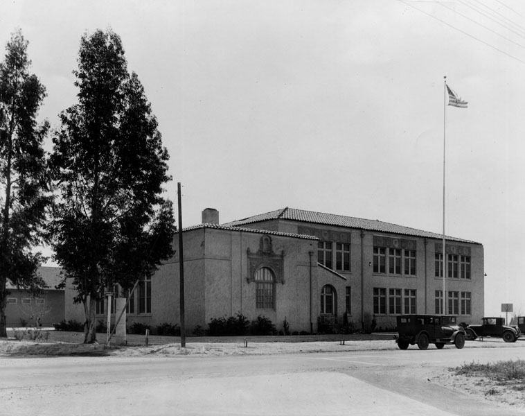 |
|
| (ca. 1920s)* - Close-up view of Zelzah Elementary School located at the southeast corner of Reseda and Nordhoff. |
Historical Notes Nordhoff Street was named for famed 19th-century health seeker and writer Charles Nordhoff. Hired by Southern Pacific rail baron Henry Huntington in 1873, journalist Charles Nordhoff wrote the book California for Health, Pleasure and Residence. Click HERE to see more SFV Street Name Origins. |
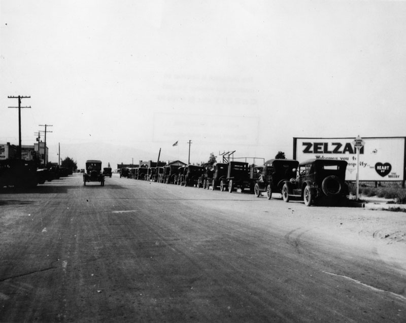 |
|
| (ca. 1920s)* - View of Reseda Boulevard, the main street of Reseda. The community was originally known as Zelzah. The signboard on the right reads: ZELZAH Welcomes you to ........Prosperity, in the HEART of the VALLEY. |
Historical Notes A water source at the intersection of Parthenia St. and Reseda Blvd. served as the watering hole and gathering place for the Gabrielino Indians and later the Spanish who established Missions in the area. The area, fed by underground streams, was very fertile and soon a development christened "Zelzah," a Biblical name for oasis, became important. #*^ Zelzah Acres became the name of one of those early housing tracts carved from the former enormous Rancho Ex-Mission San Fernando lands joining nearby towns of Chatsworth Park, Lankershim, Owensmouth, San Fernando and Van Nuys. Through the 1920s, Zelzah grew up, linked to Los Angeles by annexation, water, city government taxes, and transportation. A group of citizens joined forces and on July 1, 1929, christened this post office and train depot North Los Angeles, a name they considered more suitable and more memorable.*^ |
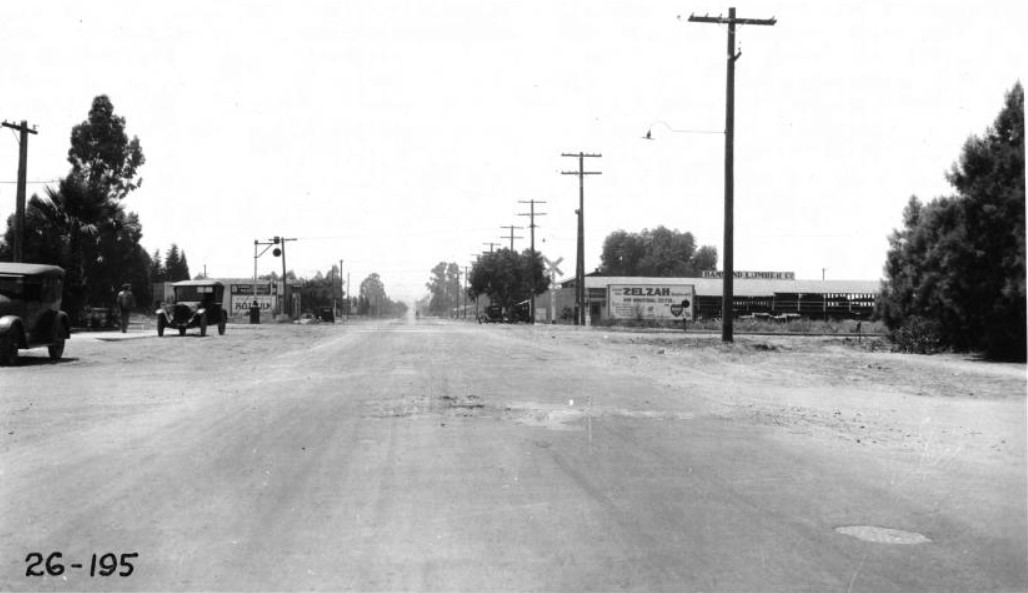 |
|
| (1926)^^ - Panoramic view of the grade crossing of Reseda Avenue (later Blvd.) with S.P. Main Line at Zelzah (soon to be Northridge), looking south from north side of tracks. Camera appears to be situated in or near the intersection with Eddy/Parthenia Street. Pacific Electric Railway operates double track. Sign on the building at right-center reads: “Hammond Lumber Co.” |
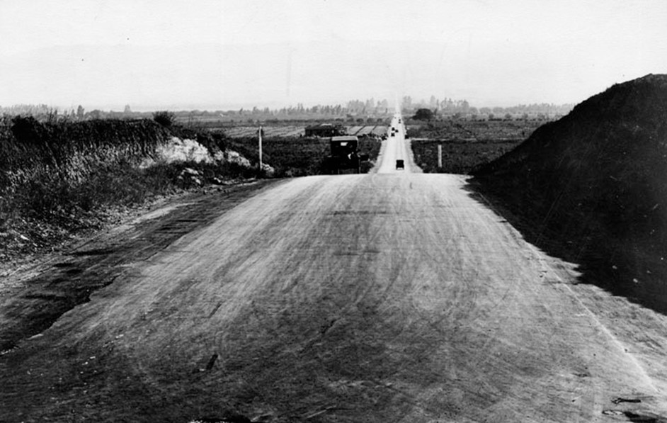 |
|
| (1929)* - Reseda Boulevard looking south from Devonshire Street, in the early 1920s. The community grew on land that was once part of the Hawk Ranch. It's first name became Zelzah. The name then changed to North Los Angeles for a short period of time and then changed again to Northridge. |
Historical Notes At the suggestion of Carl Dentzel, a local resident and director of the Southwest Museum in Los Angeles, North Los Angeles became "Northridge Village" and was promptly shortened to Northridge. The sign on the depot was changed again, and the new name became permanently affixed on Oct. 1, 1938.*^ |
Then and Now
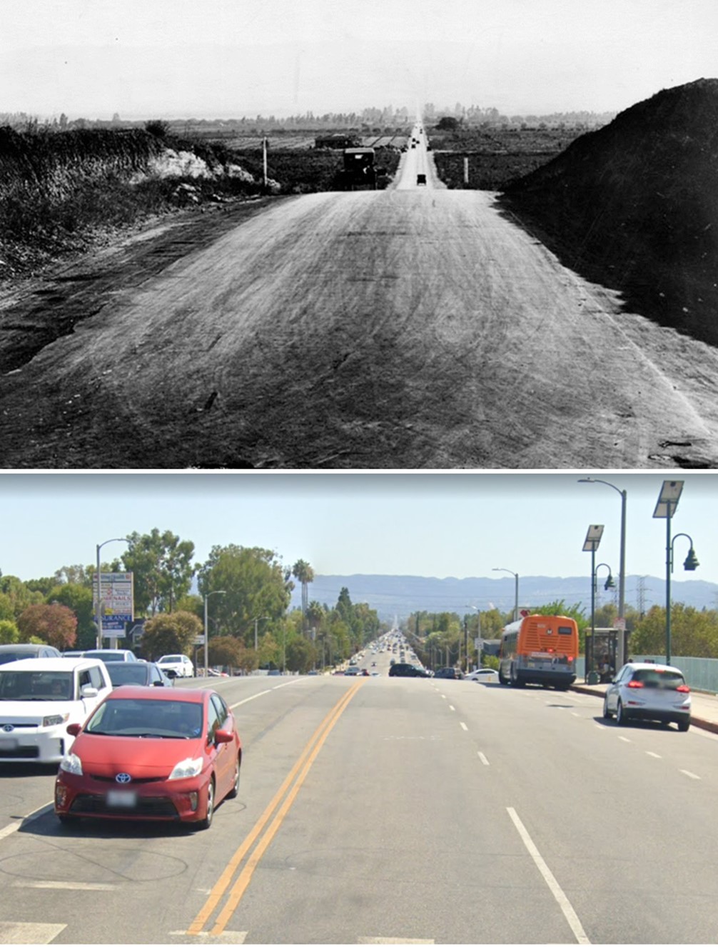 |
|
| (1929 vs. 2022)* - Reseda Boulevard looking south from near Devonshire Street. |
Click HERE to see a Northridge Historical Images Virtual Tour. ^#^# |
Cahuenga Pass
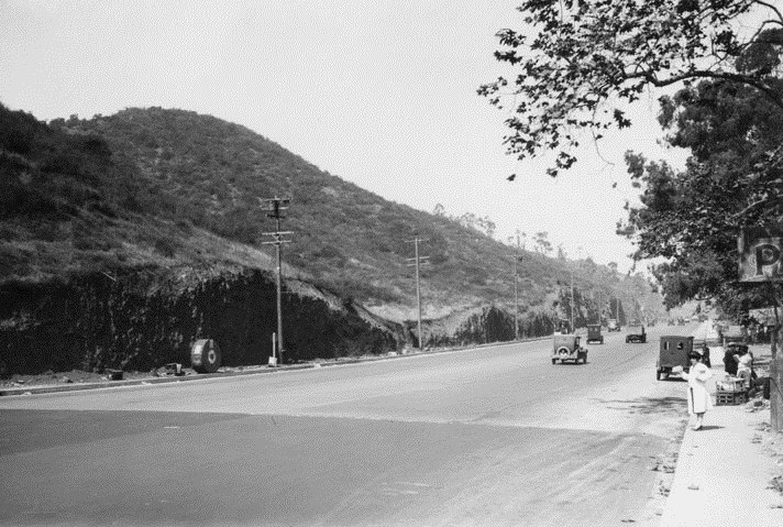 |
|
| (ca. 1920)** - A view of the broad highway on Cahuenga Pass - the lowest through the Santa Monica Mountains - that connects the Los Angeles Basin to the San Fernando Valley. The hills are truncated where they were excavated for the road bed. A street vendor is setup on the curb and although the utility poles are standing, the electric cables have not been strung. A roll of cable sits next to a pole, left. Click HERE to see more photos of Early Power Distribution. |
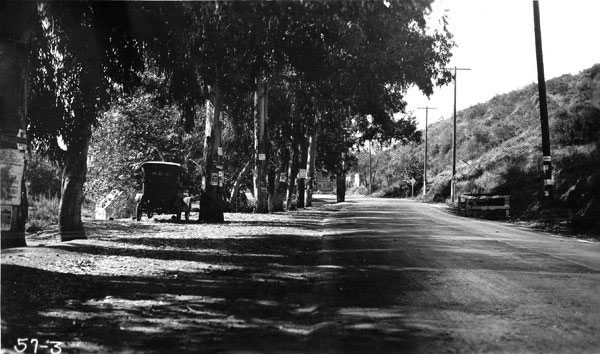 |
|
| (1921)**^^ - View of the highway through the Cahuenga Pass. A car is seen parked under a Eucalyptus tree on the side of the road. Most of the trees appear to have posters attached to them. |
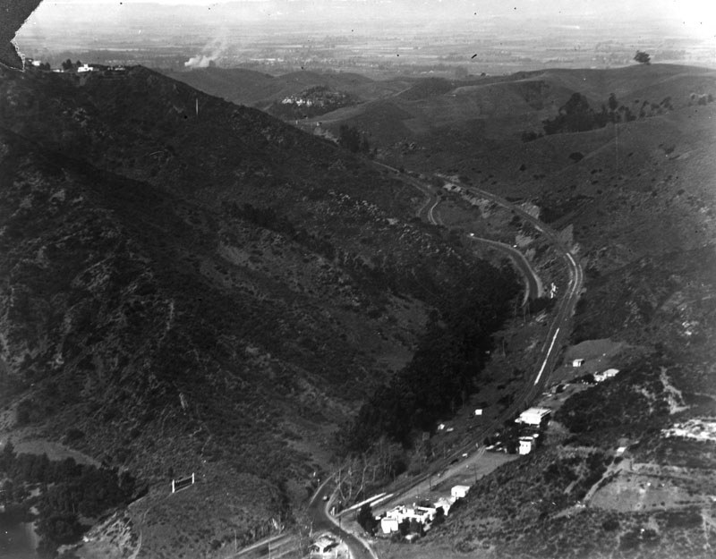 |
|
| (1922)* - Aerial view of Cahuenga Pass with the San Fernando Valley in the background. |
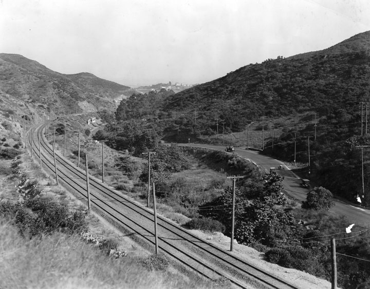 |
|
| (1922)* - View of Cahuenga Pass looking east towards Hollywood. On the left are the railroad tracks, and paralleling them on the right is the road for cars. |
Mulholland Highway
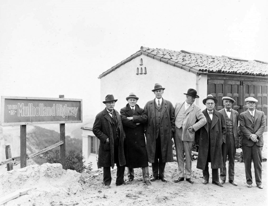 |
|
| (1920s)* - William Mulholland (far left), Moses Sherman (2nd from left), Harry Chandler (center) and a group of men posing next to a "Mulholland Highway" sign while out examining the nearby Mulholland Dam site. |
Historical Notes This winding ridgeline road in the Santa Monica Mountains was dedicated in honor of William Mulholland, the water engineer who designed the Los Angeles Aqueduct, on Dec. 27, 1924. Originally dirt and called Mulholland Highway, the name was changed to Mulholland Drive in 1939. Portions of the original road remain unpaved. ^Moses Sherman served on the water board while he also participated in plans to develop the San Fernando Valley, which became the outlet point for the Los Angeles Aqueduct. Sherman's double role has been the source of conspiracy theories with regard to the aqueduct. |
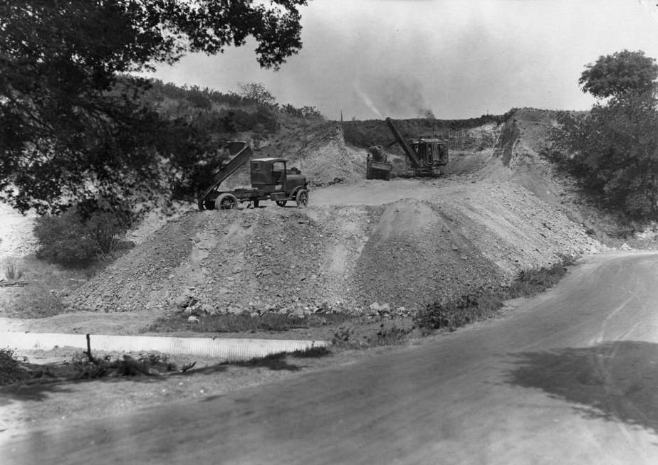 |
|
| (ca. 1924)* - Construction of Mulholland Highway at Topanga Canyon Boulevard in Girard (now called Woodland Hills). |
Historical Notes Mulholland Drive has its origins in 1921 as a scenic drive, with the “working name” of Skyline Drive, engineered by DeWitt Reaburn. The scenic drive was engineered in small sections, with work actually beginning at several points along the route simultaneously. The road was originally planned to encompass a right of way of 200 feet and intended to be 20 miles long, taking a mere two years to complete. For reasons, some to honor Mulholland, but mostly to use his stature and accomplishments to silence opposition, the most traveled scenic highway conceived as Skyline Drive became Mulholland Highway.* |
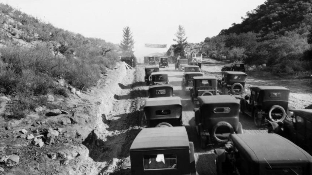 |
|
| (1924)* - View showing over a dozen early model cars clustered at the opening of the Mulholland Highway. Three rows of early automobiles make their way up the hill and through the mountains on the Mulholland Highway. Rocks and scrub vegetation cover the slopes to either side, a parked car and a wooden platform visible to the right, just off the road. At the peak of the hill, a banner is hung between two trees. |
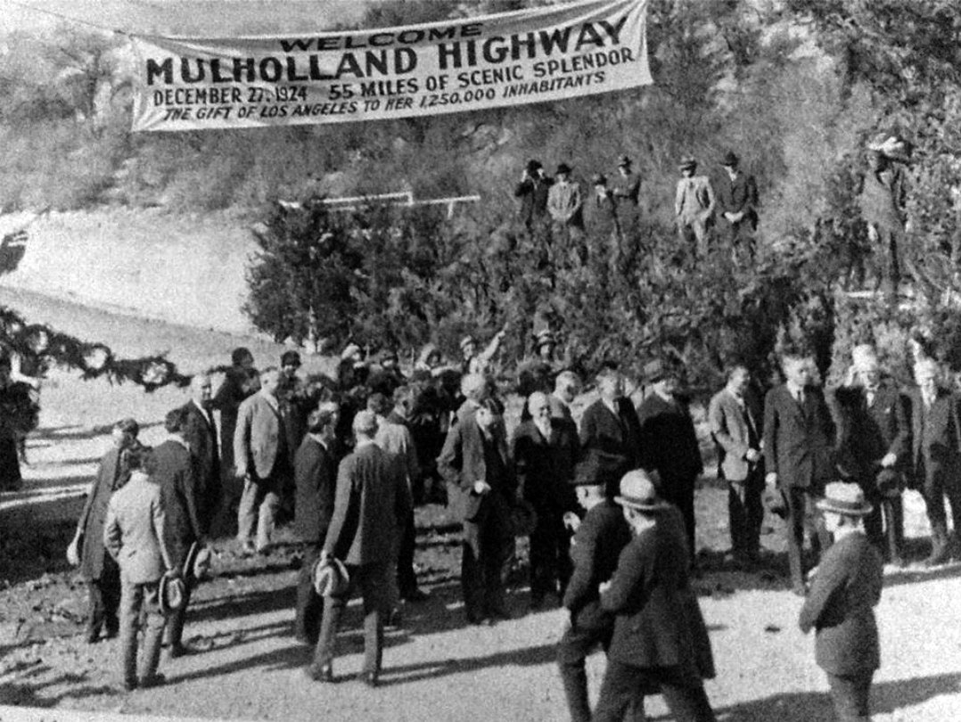 |
|
| (1924)* – Close-up view showing dignitaries assembling near a banner which reads: Welcome Mulholland Highway - December 27, 1924 – 55 Miles of Scenic Splendor – The Gift of Los Angeles to her 1,250,000 Inhabitants |
Historical Notes On the morning of the opening (Dec 27), William Mullholland dedicated the road with, what else, a bottle of aqueduct water. (Being prohibition, he couldn't use champagne). |
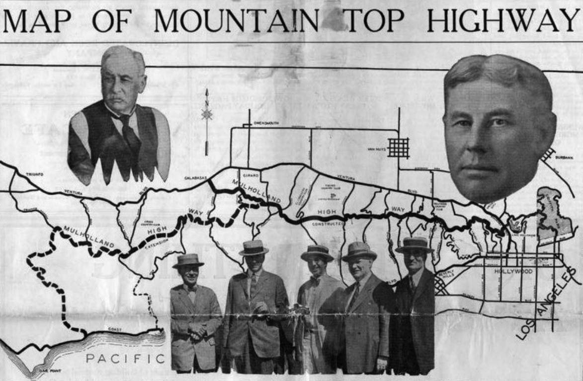 |
|
| (1924)^ – Map of the Mulholland Highway when first opened. Girard News |
Historical Notes When it officially opened on December 27, 1924, Mulholland Highway was 24 miles long - the solid line, running from Cahuenga Pass to Calabasas. The dotted line shows what was still to be constructed, Topanga Summit to the Ocean. Originally the road was of gravel surface treated with oil. |
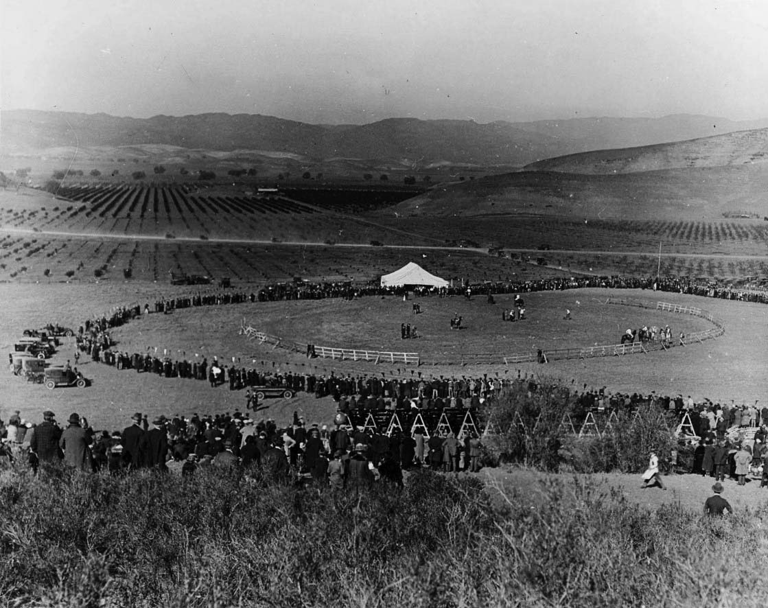 |
|
| (1924)^ – To celebrate the opening of Mulholland Highway, Tom Mix directed this rodeo with a company of rough riders performing in Calabasas. Photo dated Dec 27, 1924, from the Ernest Marquez Collection. |
Historical Notes An article in the Oxnard Press Courier provides additional details of the event: “The first part of the festival program will be held at Calabasas, beginning at 11 o’clock, when a wild west performance and rodeo will be staged by the world’s greatest riders and ropers under the direction of Tom Mix. Other novel features are being arranged for this part of the celebration, which will include one of the most spectacular aerial demonstrations ever witnessed in this state, with more than 50 military and civilian airplanes participating. Hair-raising flying stunts will be performed and the military planes from Clover Field and San Diego will engage in battle manoeuvers and combat demonstrations.” |
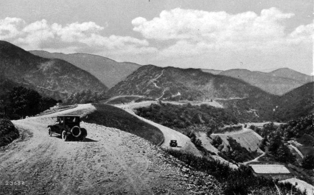 |
|
| (ca. 1924)^ – Postcard view showing two early model cars near the intersection of Mulholland Highway (later Drive) and Franklin Canyon. |
Historical Notes Curving ingeniously through the eastern Santa Monicas, the Mulholland Drive motorway once brought a heavy slew of Angelenos into the Valley. In the early 1970s, however, 5,000 local activists successfully prevented the cement paving of most of that stretch. To this day, that section is known as 'Dirt Mulholland', and is only open to cyclists and pedestrians. From the famous Mulholland Bridge east, Mulholland Drive completes its creator's vision, and winds through the affluent Hollywood Hills to Mulholland Drive's easternmost terminus at Cahuenga Boulevard, near Universal Studios, until again becoming an unpaved footpath to Griffith Park. The paved road begins again east of Topanga Canyon Boulevard at Santa Maria Road. Shortly thereafter, the thoroughfare splits into Mulholland Drive and Mulholland Highway. Mulholland Drive terminates at U.S. Highway 101 (the Ventura Freeway), where it becomes Valley Circle Boulevard. Mulholland Highway continues to the southwest until it terminates at State Route 1 (PCH) in Leo Carrillo State Park at the Pacific Ocean coast and the border of Los Angeles and Ventura counties.* |
Then and Now
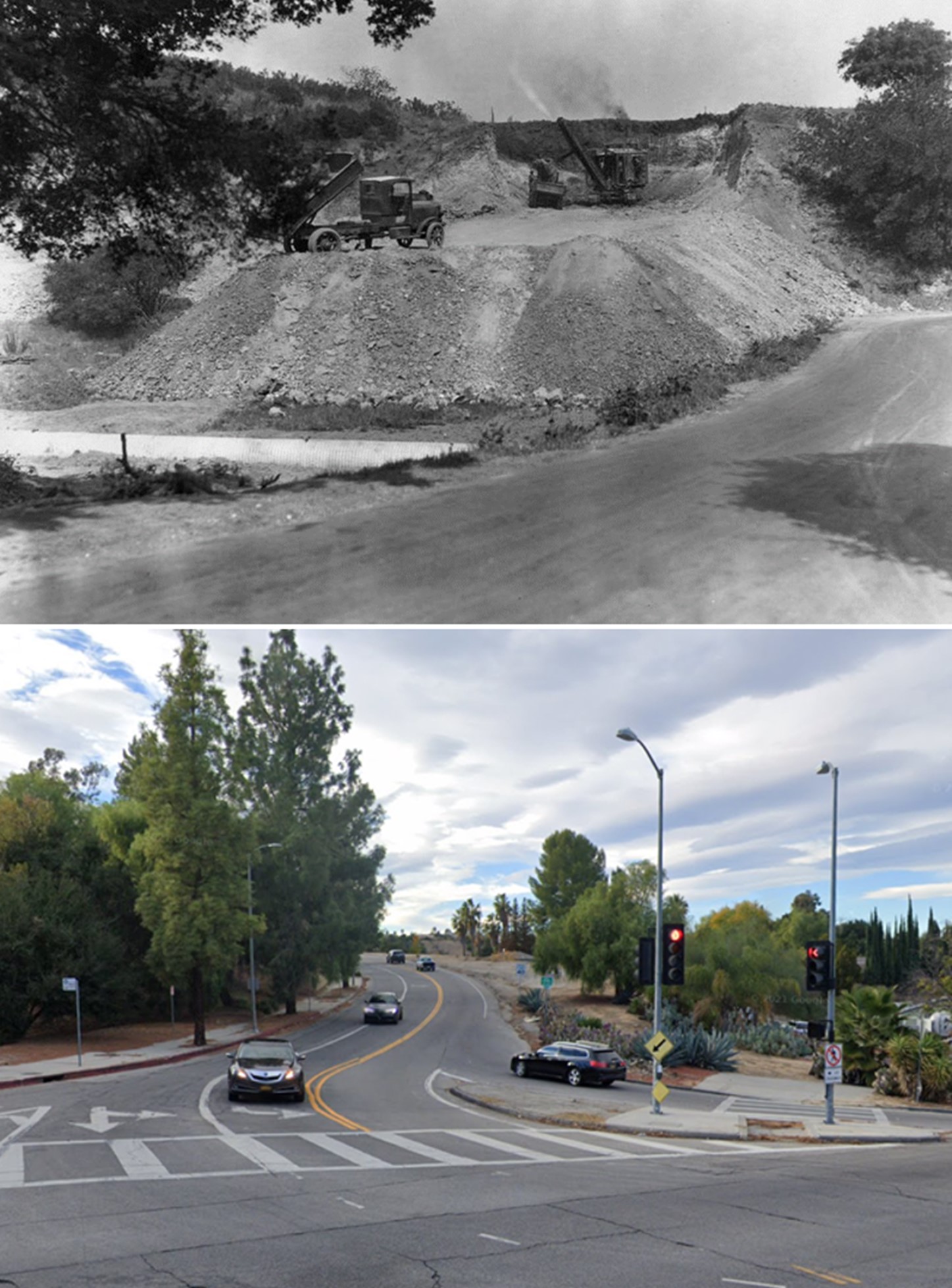 |
|
| (1924 vs 2020)* – Looking west on Mulholland Drive at Topanga Canyon Blvd. Note: Most of Mulholland Highway was renamed Mulholland Drive in 1939. |
Click HERE to see more in Mulholland Monuments |
* * * * * |
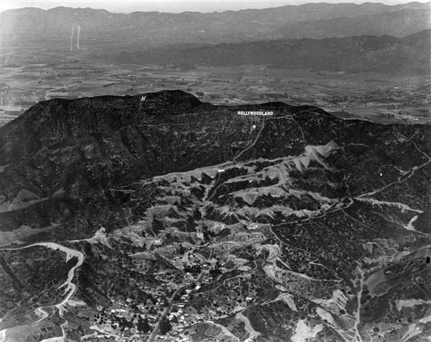 |
|
| (ca. 1920s)**^*- Aerial view of the Hollywoodland Sign showing the newly developed land in the foreground. Beyond the Hollywood Hills can be seen the vast amount of open space and farmland of the San Fernando Valley. The HOLLYWOODLAND sign sits below Mt. Lee. Another sign ( just the letter 'H') is seen to the left on top of Mt. Cahuenga. |
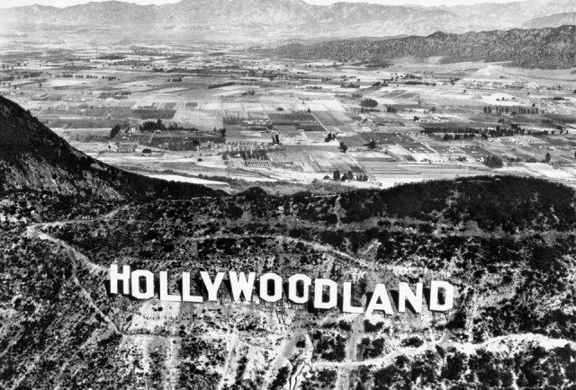 |
|
| (ca. 1924)*^ - Aerial view overlooking the Hollywood Hills and HOLLYWOODLAND sign into Burbank in the east San Fernando Valley. Farmland and open fields can be seen throughout. |
Historical Notes Real estate developers Woodruff and Shoults called their development "Hollywoodland" and advertised it as a "superb environment without excessive cost on the Hollywood side of the hills". They contracted the Crescent Sign Company to erect thirteen letters on the hillside, each facing south. Each letter of the sign was 30 feet wide and 50 feet high, and the whole sign was studded with some 4,000 light bulbs. The sign would flash in segments; "HOLLY," "WOOD," and "LAND" would light up individually, before lighting up entirely. Below the Hollywoodland sign was a searchlight to attract more attention. The sign was officially dedicated on July 13, 1923.*^ |
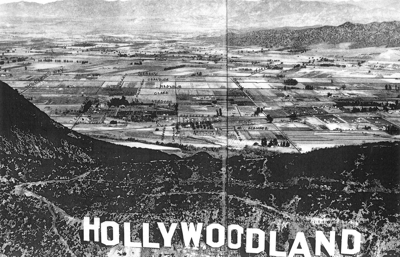 |
|
| (ca. 1924)*#^# - Same view as previous photo but blown up to show details with street names annotated. Note the vast amount of famland and open fields. |
Click HERE to see more in Early Views of Hollywood |
Sunland - Tujunga
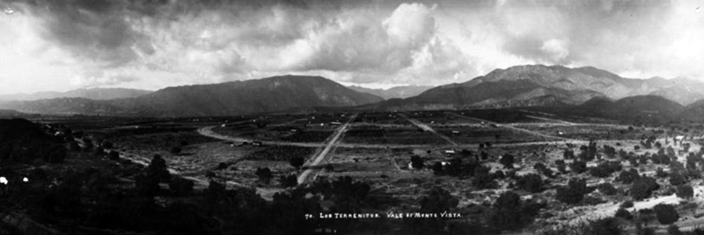 |
|
| (1914)#^ - Panoramic view showing the area called Los Terrenitos - Vale of Monte Vista, currently Tujunga. |
Historical Notes In the early 1900s, the area now known as Tujunga was undeveloped land, the former Rancho Tujunga. In 1913, William Ellsworth Smythe, working alongside M.V. Hartranft (they had purchased the land together), formed a Utopian community called Los Terrenitos— Spanish for The Little Landers. Smythe was the leader of the Utopian Little Landers movement and had already established colonies in Idaho and San Ysidro, California. He advocated the principle that families settling on an acre or two of land could support themselves and create a flourishing community.*^ |
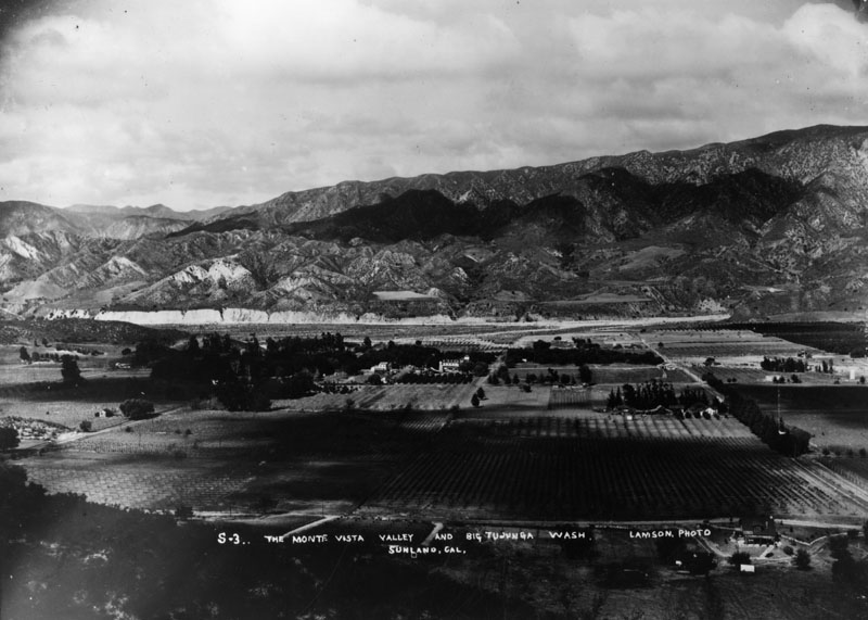 |
|
| (ca. 1920s)* - Panoramic view of Sunland showing the Monte Vista Valley and Big Tujunga Wash. |
Historical Notes Generally thought to be a part of the San Fernando Valley, Sunland-Tujunga is actually located in a valley of its own --the Tujunga Valley — which opens into the northern edge of the larger San Fernando Valley. Also known as The Rock, the towns lie on a large bedrock close to 2,000 feet above sea level with mountain ranges on both sides.* |
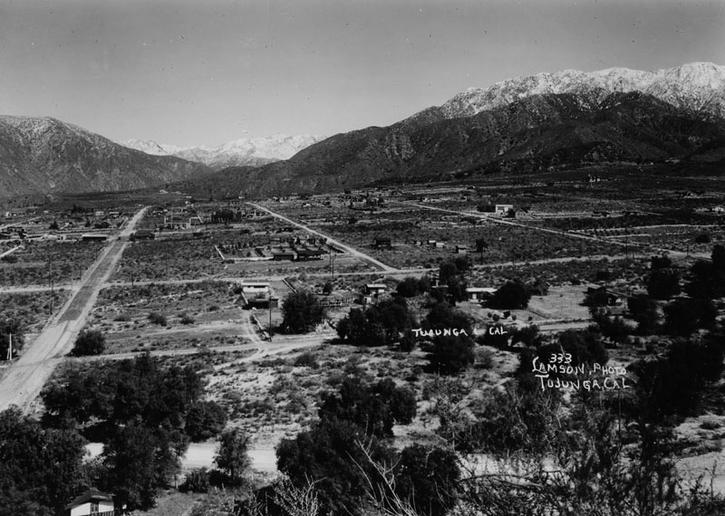 |
|
| (ca. 1920s)* - An overview of Tujunga from a nearby hillside, looking towards the snowcapped San Gabriel Mountains. |
Historical Notes Sunland and Tujunga were originally home to the Tongva people. In 1840 the area was part of the Rancho Tujunga Mexican land grant, but later developers marked off a plot of land known as the Tejunga Park, or the Tujunga Park, Tract. The name Tujunga is assumed to have meant "old woman's place" in the extinct Tongva language, where Tuhu "old woman" is a term for Mother Earth in Tongva mythology.*^ |
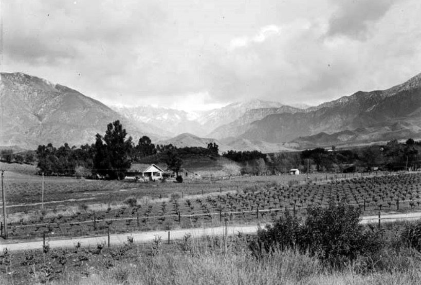 |
|
| (ca. 1930)#^ - Farmland, perhaps a vineyard, near Tujunga. The San Gabriel Mountains are seen in the background. |
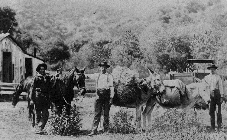 |
|
| (ca. 1910)* - A farm at the corner of Haines Canyon and Tujunga Canyon Boulevard. Men in suspenders and hats, some with holster and gun, stand beside a saddled horse and donkeys loaded with bags and hay. |
Historical Notes The above print was reproduced in 1955 for an article in the Herald Examiner. Photo caption read "Farming was hardly worthwhile. The land was poor. If you dug out stones to build a home or barn, there wasn't enough dirt to fill up the hole."* |
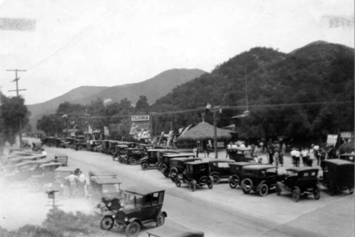 |
|
| (1924)*^^^ - Independence Day Celebration on July 4, 1924 at the Garden of the Moon Park and Campgrounds in Tujunga. |
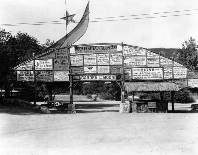 |
|
| (1925)*^^^ - View of Garden of the Moon Park and Campgrounds in Tujunga. The grounds were located at Foothill & Commerce Avenue. |
Historical Notes The "Moon Festival of the Tujungans" was sponsored by the American Legion (Monte Vista Post 250) as well as other Tujunga businesses and establishments.*^^^ |
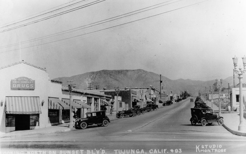 |
|
| (ca. 1925)* - A view up Commerce Avenue in Tujunga. This is looking north from Foothill Blvd. The picture was originally labeled as "looking north on Sunset Blvd. Tujunga, Calif." |
Historical Notes The first election for Tujunga to be consolidated with Los Angeles was held on February 15, 1927. In heavy rain, voters turned down the idea by a vote of 594 to 354. A second election held in March 1930 also resulted in defeat for annexation, "by a large majority." The third and final election in January 1932, however, resulted in a favorable vote to join Los Angeles, even though the actual transfer was delayed by inaction of state authorities. Tujunga finally joined the city on March 8, 1932. Sunland was annexed to the city of Los Angeles effective August 4, 1926.*^ |
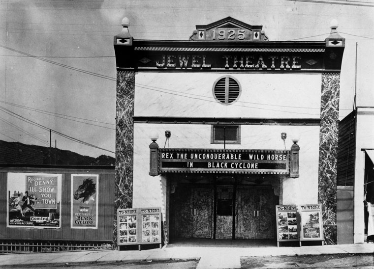 |
|
| (ca. 1925)* - The Jewel Theater which was built in 1925. It was possibly the first theater in Tujunga and was located on Commerce Street. Now showing: Rex the Unconquerable Wild Horse in Black Cyclone. |
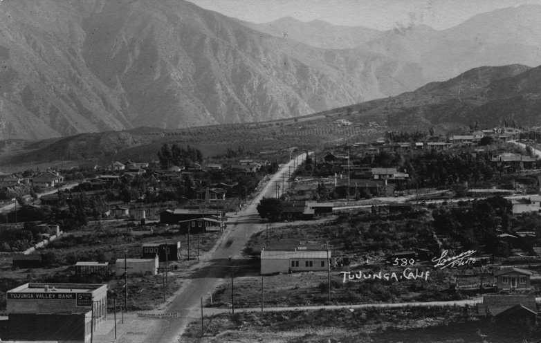 |
|
| (ca. 1920)#** - View of Tujunga looking north toward the San Gabriel Mountains. The Tujunga Valley Bank stands at lower left on Sunset Boulevard, now Commerce Avenue. |
.jpg) |
|
| (1926)^^ - Birdseye view of Sunset Boulevard, now Commerce Avenue, in Tujunga, looking north toward the San Gabriel Mountains. The paved lanes of Sunset Boulevard run through the center of the image, lined sparsely on both sides by one- and two-story commercial buildings. Automobiles are parked to each side of the street, while a few others drive along it. Visible buildings include the "Tujunga Valley Bank", a hardware store, and a store bearing the sign "The Sunset Fair". Greeley Street intersects Sunset Boulevard in the lower right corner of the image; Michigan, now Foothill Boulevard, sits one block south (beyond the image). |
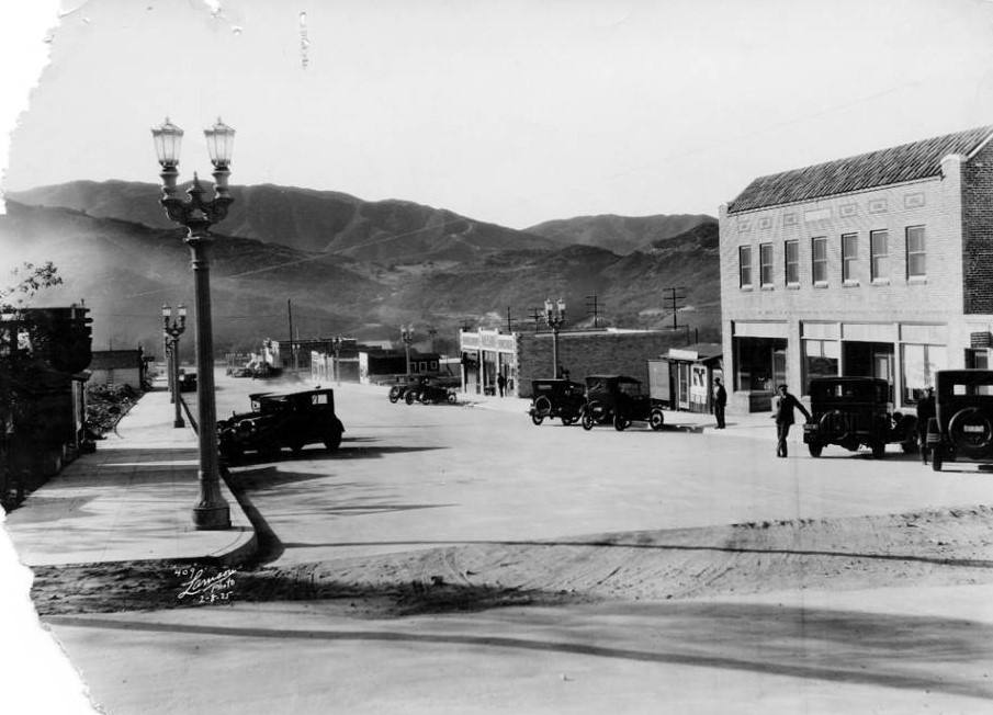 |
|
| (1925)^ – View of the business district, looking south on Commerce Avenue towards the Verdugo mountains. The cross street is Valmont. At this time only the business district streets were paved. Originally Commerce Avenue was called Sunset and Valmont was originally called El Centro. On the right is the Breidt Building and next to it is a real estate office. |
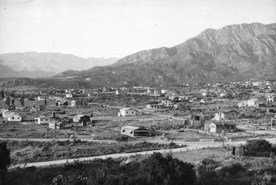 |
|
| (ca. 1928)#** - View of the residential area of Tujunga, looking north. Many small houses are scattered sparsely throughout an expanse of land that sits at the foot of a mountain. The majority of the houses are frame houses, though one in the right centerground is made of stone. Orchards are visible on the distant foothills to the left of the image. Several mountains sit in the background. |
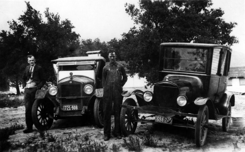 |
|
| (ca. 1928)* - Two men posing by their cars in Sunland. |
Historical Notes Clarence, center, and his friend Odgen, a coworker at the Claycraft pottery factory, with their cars. Clarence's car is a Model T. He could coast most of the way from his home in the town of Tujunga down Tujunga Canyon Boulevard past Verdugo City and through Glendale via Verdugo Road to work at San Fernando Road and Fletcher Drive, in Los Angeles.* |
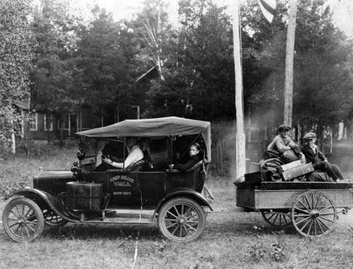 |
|
| (ca. 1920s)^ - Car and trailer filled with camping gear and boys from the YMCA at Camp Miller in Tujunga. |
Bolton Hall
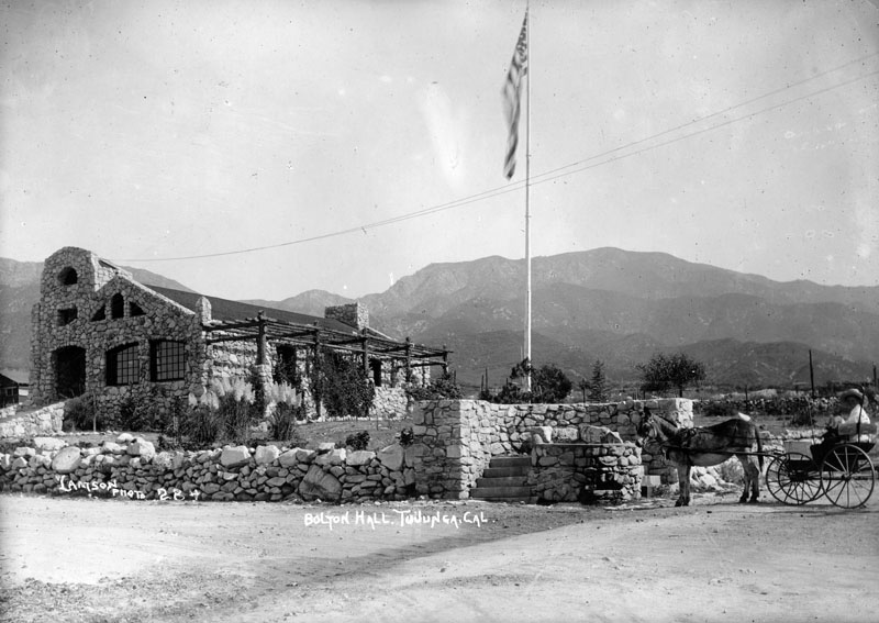 |
|
| (ca. 1920s)* - Photograph taken from Commerce St. looking east at the exterior of Bolton Hall in Tujunga. |
Historical Notes Bolton Hall was built in 1913 by George Harris, a self-described "nature builder, rock mason and stone sculptor. He first named it "Bolton Hall Hall," after Bolton Hall (1854–1938), a New York City progressive activist and proponent of the back-to-the-land movement. Harris urged that the 3,000-square-foot hall be built solely of native materials, and selected a design that he said borrowed nothing from European architecture. Harris and the Terrenitos community built the hall using granite chunks and stones from nearby fields and hillsides and from the Tujunga Wash. Stones were placed in position in the structure based on the positions in which they settled after falling from a cliff. |
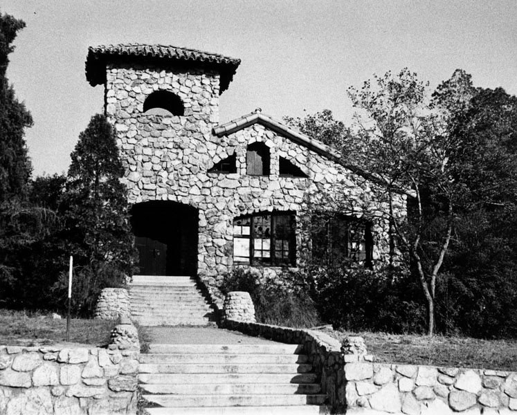 |
|
| (n.d.)* - Exterior view of Bolton Hall, built in 1913 as part of the Little Lands Colony in Tujunga, and used for church services, town meetings, weddings and other social occasions. |
Historical Notes When Bolton Hall opened in August 1913, the Los Angeles Times reported that it marked the "awakening of the Vale of Monte Vista" (the former name of Sunland): First settled nearly thirty years ago, the valley has shown more life in the past six months than in all its previous history. Los Terrenitos, the settlement of "'little-landers," has made wonderful progress since its inception, five months ago, about 200 families having purchased land, not all of whom are yet on the ground. But enough are here to make it a beehive of industry. The dedication of "Bolton Hall" last Saturday aroused much enthusiasm among the "little-landers." The Times also reported that Bolton Hall was "built to stand for ages," and it has survived the 1971 Sylmar and 1994 Northridge earthquakes without a scratch. During the hall's early years, it hosted community meetings patterned after those held in old New England town halls. Over the next decade, it was used for church services, musical performances, lectures, motion picture shows, the Women's Club, dances and pot-luck suppers. It also was the site of the San Fernando Valley's second public library. In 1962, Bolton Hall at 10116 Commerce Avenue was designated Los Angeles Historic-Cultural Monument No. 2 (Click HERE to see complete listing). |
Chatsworth
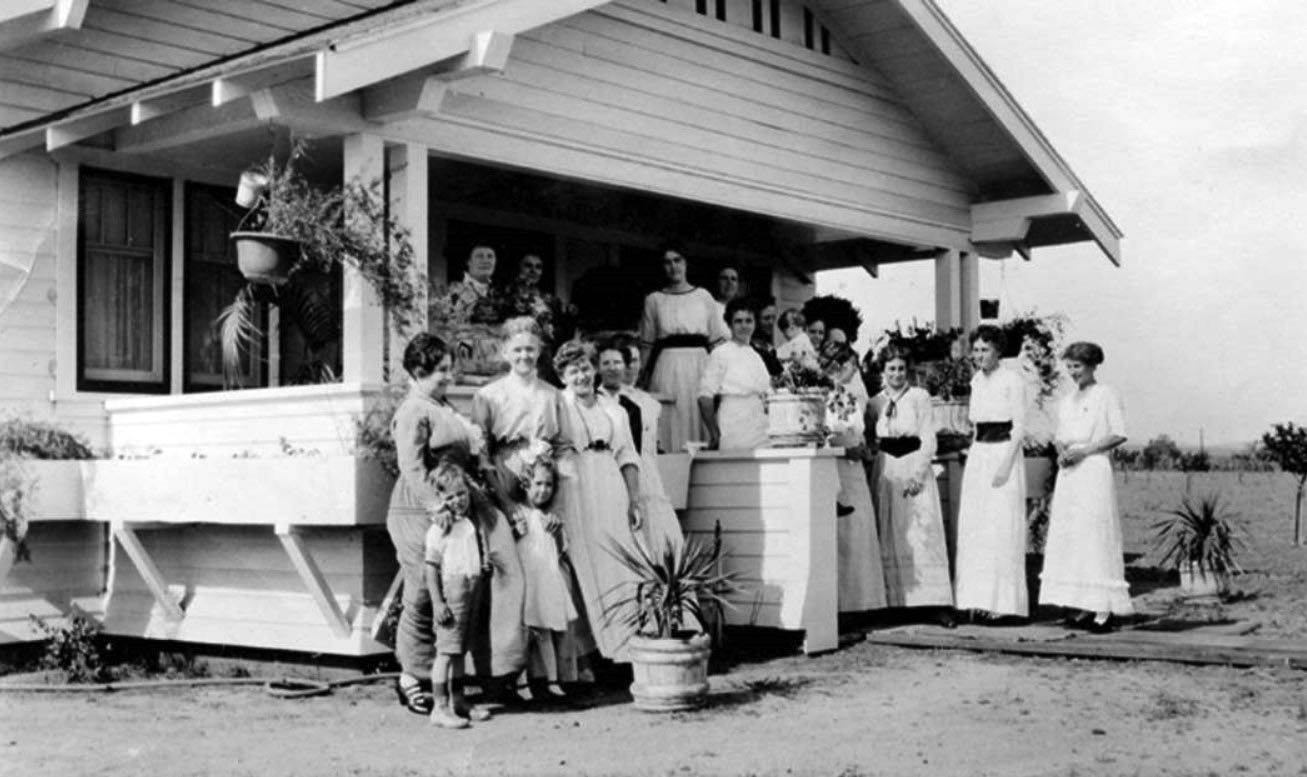 |
|
| (1921)^ - Organizers of the Women's Club at Mrs. Hageman's home, February 14, 1921. Grace Hageman brought together this group of 24 women. They were subsequently known as the Women's Community Club of Chatsworth. |
Historical Notes The Women’s Community Club of Chatsworth hoped to improve the area through their good works such as sewing for needy families and the Red Cross. They funded their work by private donations and benefits such as their 50 cent "Plate Lunch" events. Their slogan was: "Bite off more than you can chew, and chew it; Plan more than you can do, then do it; Hitch your wagon to a star, sit tight, and there you are." |
* * * * * |
Chatsworth Reservoir
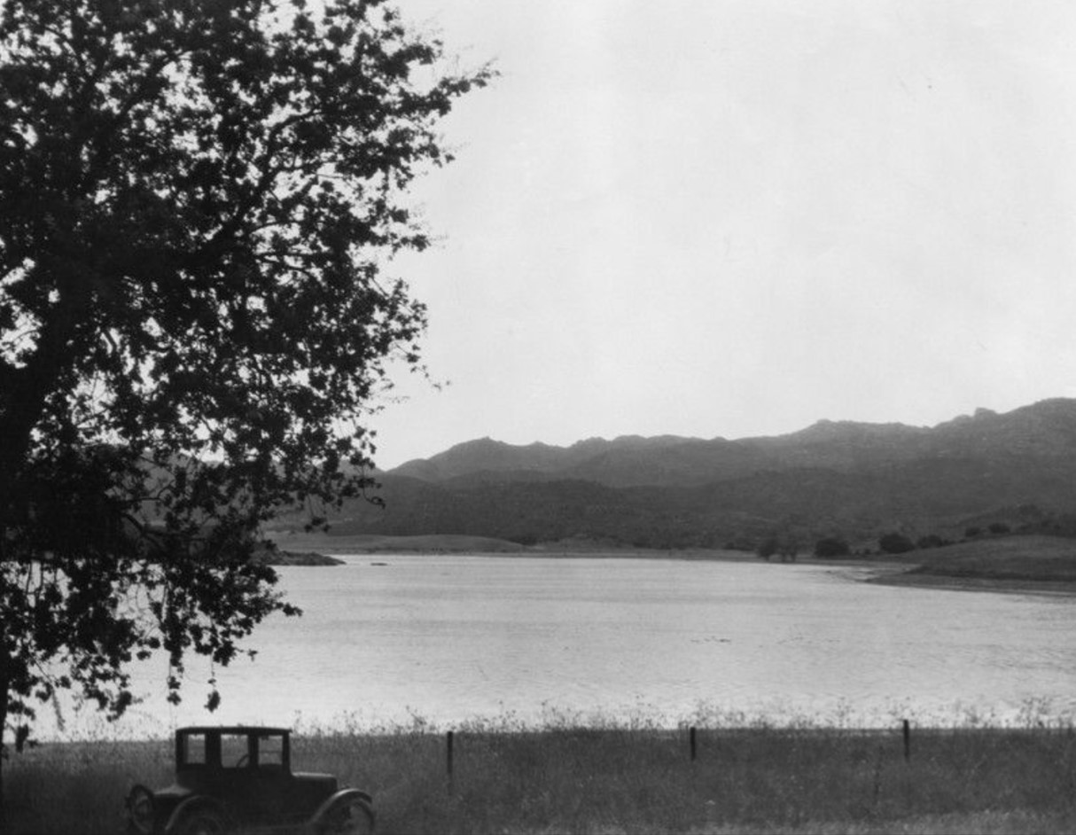 |
|
| (ca. 1925)* - View showing an early model car parked on the edge of the Chatsworth Reservoir in the Northwest San Fernando Valley. |
Historical Notes Chatsworth Reservoir was placed in service in 1919 at a time when the San Fernando Valley was a sparsely populated agricultural area. The reservoir has two earthfill dams which provided an initial capacity of 7,400 acre-feet and a high water elevation of 884.3 feet. Click HERE to see Construction of the Chatsworth Reservoir. |
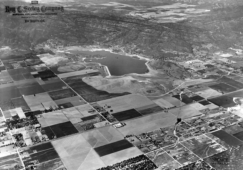 |
|
| (ca. 1930s)* - Aerial view northwest across Chatsworth Reservoir to the Simi Valley. The intersection of Roscoe and Topanga Blvds. can be seen in the center-left of the photo. |
Historical Notes For many years Chatsworth Reservoir served as the principal water storage facility in the western San Fernando Valley, serving the irrigation needs of agriculture. At various times during this period, improvements to the reservoir were constructed to increase its capability to provide the required water supply. The most significant improvement occurred during 1930 and 1931 when the dams were partially reconstructed to increase the high water level of the reservoir 5 feet to elevation 889.3 feet and the capacity to 9,840 acre-feet. As the area served by Chatsworth Reservoir was subdivided and developed to meet the demands for increased housing, the character of the West San Fernando Valley changed from an agriculture to urban setting. This transition gradually changed the requirements for Chatsworth Reservoir and its storage was increasingly used to supply residential and domestic drinking water, emergency requirements and continued agriculture uses. |
 |
|
| (ca.1930s)* - Aerial view looking northwest showing the Chatsworth Reservoir with the Simi Hills and the eastern part of Simi Valley seen in the distance. Roscoe Blvd and Topanga Cyn Blvd are highlighted and seen at lower center-left of photo. |
Historical Notes The Chatsworth Reservoir served as the primary water storage facility for the western part of the San Fernando Valley from 1919 until after the Sylmar earthquake in 1971. |
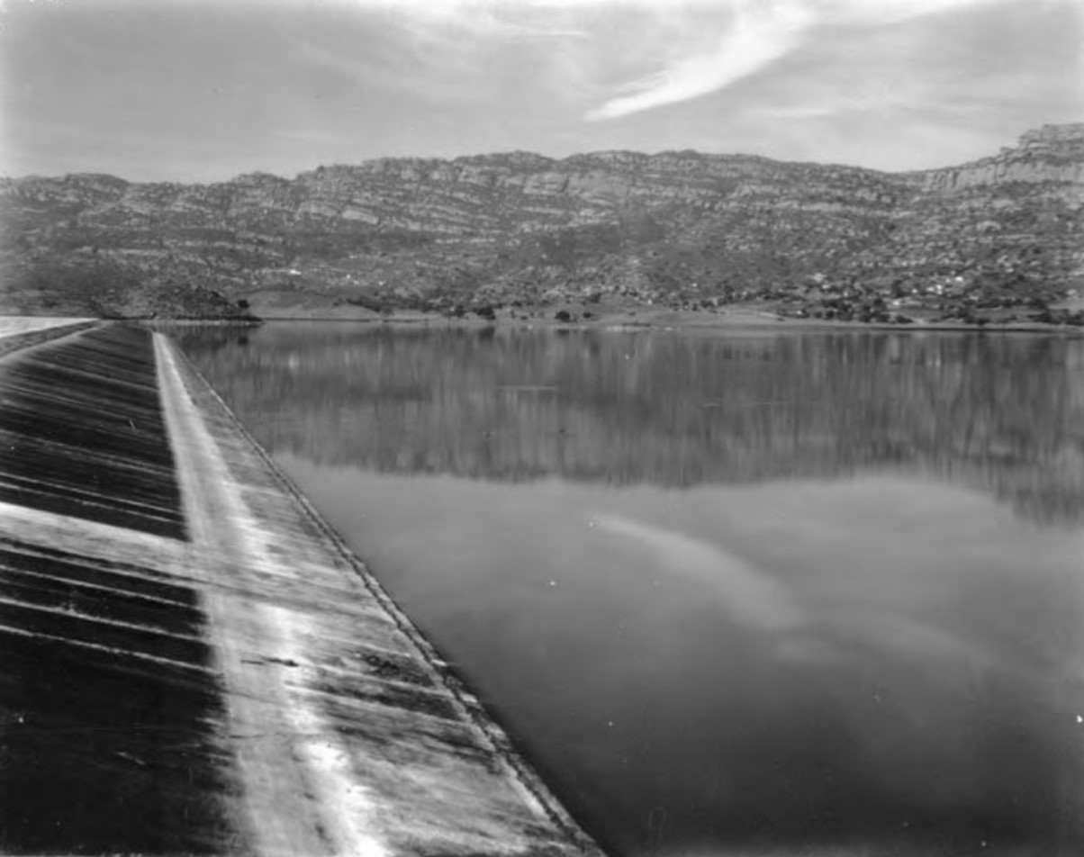 |
|
| (1930s)* - View showing the Chatsworth Reservoir and one of its two cement-lined dams with the Simi Hills seen in the background. |
Historical Notes After the Sylmar Earthquake of 1971 the reservoir was placed out-of-service and permanently retired. Since then, 150 acres has been handed over to Rec. and Parks for recreational use. Another 30 acres has been converted to an ecology pond for the habitat of migratory birds.* Click HERE to see more Early Views of the Chatsworth Reservoir. Also, click HERE to see more Early L.A. Water Reservoirs. |
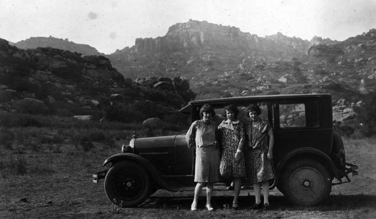 |
|
| (1928)^ - Jessie, Mill & Winsome with Homer Halverson's automobile at the base of the Simi Hills in Chatsworth |
Historical Notes Click HERE to see more Early Views of the Chatsworth Reservoir. |
* * * * * |
Brant Ranch
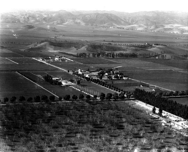 |
|
| (1924)* - Aerial view of Owensmouth just north of Girard (now Woodland Hills/Warner Center) looking northwest. Brant Ranch is seen at center of photo. Oxnard Street (Burbank Blvd?) runs diagonally from lower-right to upper-left. Tree-lined Canoga Avenue runs from left to right in the foreground. |
Historical Notes In 1910, Otto F. Brant (along with Gen. H. G. Otis, Gen. M. H. Sherman, H. J. Whitley, and Harry Chandler) was one of the five original investors in the Suburban Home Company (aka The Syndicate). Each of the major partners put up $100,000. In return Brant took 850 acres of land at Ventura and Topanga Canyon Boulevards, later to be known as the Brant Rancho, where his son created a model ranch for the world’s largest pure-bred Guernsey dairy herd of dairy cattle. |
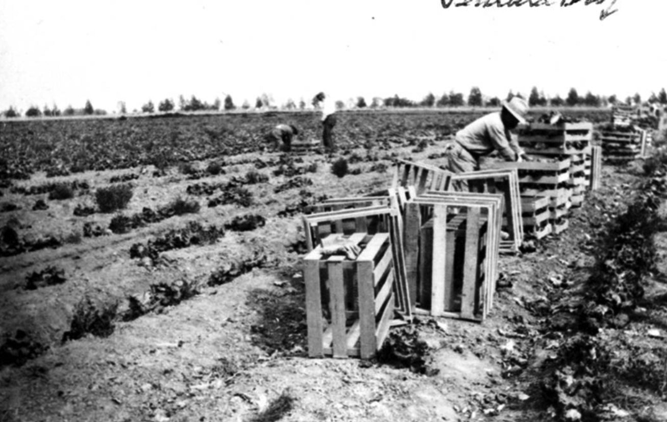 |
|
| (1913)^ – View showing workers harvesting cabbage on Brant Ranch. The ranch was located in Girard, south of Ventura Boulevard. This is noted in the upper right hand corner of the image with an arrow. Raymond Bayly is shown in the foreground. Photo Courtesy: Beverly Daic Taber. |
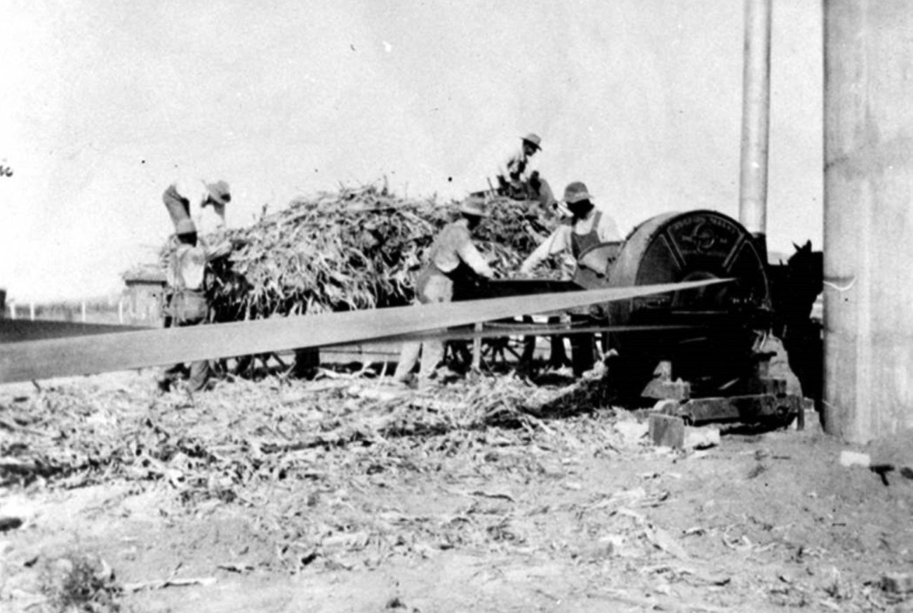 |
|
| (1913)^ - Grinding green corn at the Brant Ranch, Woodland Hills/Girard. Joe Daic is visible on the back of the wagon. Photo Courtesy: Beverly Daic Taber. |
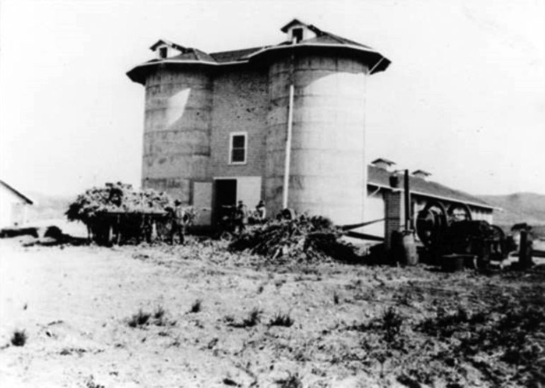 |
|
| (1913)^ - View of silos at Brant Ranch, Woodland Hills/Girard, 1913. Located on the mountain south of Chalk Hill visible in background. |
Historical Notes D. O. Brant was the manager and one of the owners of the Brant Rancho, breeders of registered Guernsey cattle.#^ |
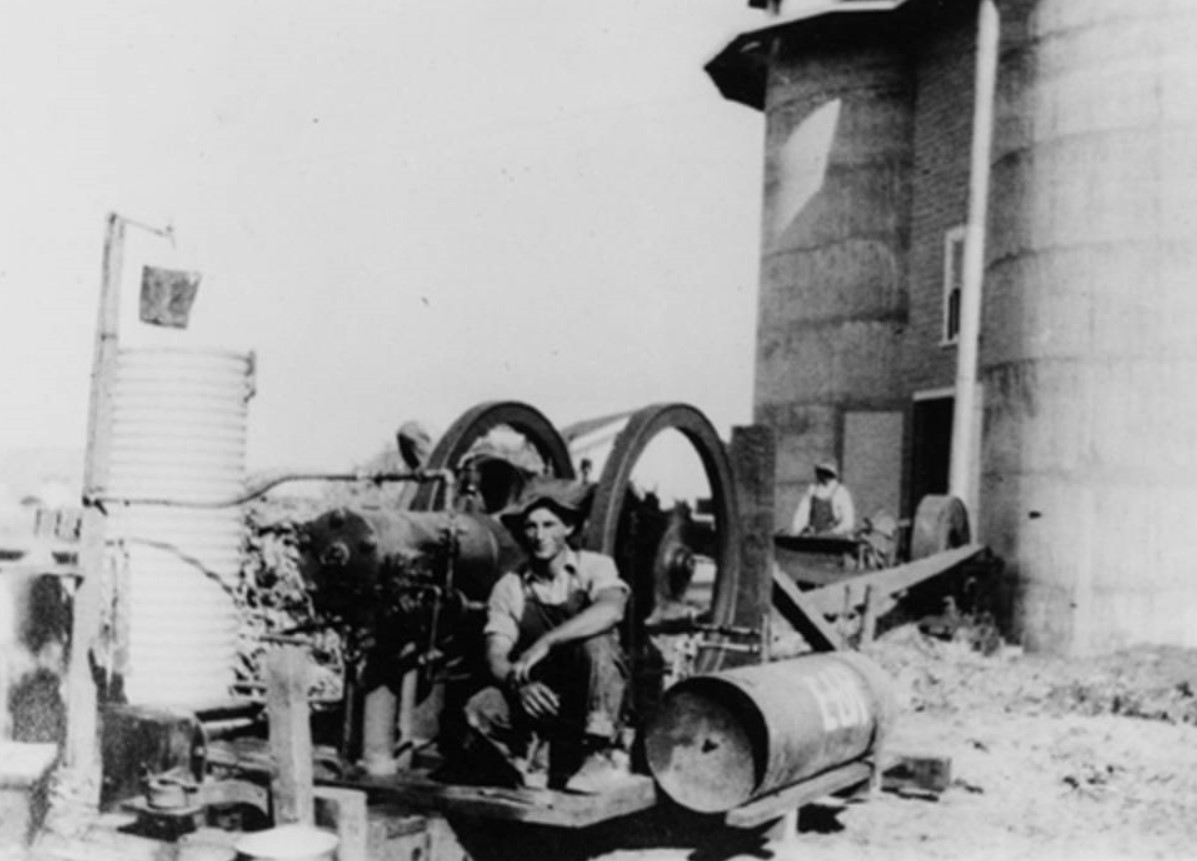 |
|
| (1913)^ – View showing Joe Daic in front of the water pump and silos on the Brant Ranch, Woodland Hills/Girard. |
 |
|
| (1913)^ - The cook's wagon on Brant Ranch, Woodland Hills/Girard, with the harvester crew. Joe Daic is visible sitting on steps. The man at the right is holding a bottle of wine or whiskey (?). |
Girard (Woodland Hills)
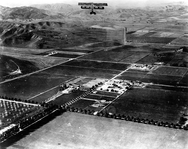 |
|
| (1924)* - Aerial view of of Girard (now Woodland Hills/Warner Center) looking southwest. Brant Ranch sits at the center of the photo. The intersection of Canoga Avneue and Oxnard Street (Burbank Blvd?) is at lower center-left, with Oxnard running diagonally from lower-left to upper-right. Ventura Boulevard runs from left-center to top-center (Calabasas). |
Historical Notes TIn 1922, Girard Kleinberger bought 2,886 acres in the west San Fernando Valley and founded the town of Girard. He sought to attract residents and businesses by developing an infrastructure, advertising in newspapers, and planting 120,000 trees. His 300 pepper trees forming an arch over Canoga Ave. between Ventura Boulevard and Saltillo St. are Los Angeles Historic-Cultural Monument #93 in 1972 (Click HERE to see the LA Historic-Cultural Monuments List).*** |
 |
|
| (1924)^^ – View of Victor Girard, left, surveying the hillside and making plans for his new West San Fernando Valley development. |
Historical Notes Victor Girard Kleinberger was a land huckster with big dreams. Born in Kentucky, he began his sales career peddling Persian rugs -- fakes, of course -- door to door. Girard's modus operandi was to shove the rolled-up rug into the door frame (thus preventing the door from being slammed shut on him) and begin coughing profusely -- all the while mumbling about tuberculosis and priceless rugs. It was a ruse that apparently worked, and by 1899, with his fortune already made, the 18-year-old Girard (he had dropped his last name) headed west to Los Angeles, where he branched out into other enterprises, including real estate.*## |
|
|
| (1924)^ - Aerial view looking north on Topanga Canyon Boulevard, Girard (later Woodland Hills). Brant Ranch can be seen at upper-right. |
Historical Notes Girard (later to become Woodland Hills) is seen in the later stages of subdividing, paving and installation of utilities. Topanga Canyon Boulevard runs away from the camera from lower right to the middle distance with the residential streets radiating left and right. First street at the bottom is Dumetz Road and then, in order, Providencia, San Miguel, De La Osa, Velicata, Lopez, Celes, Martinez, Galvez, De La Guerra, Crespi, Avenue San Luis, Del Valle, Costanso and finally Ventura Boulevard with the Girard real estate buildings built east and west along the boulevard. Road that skirts the base of the hill on the right is Don Pio Drive and on the left is San Feliciano Drive.##^ |
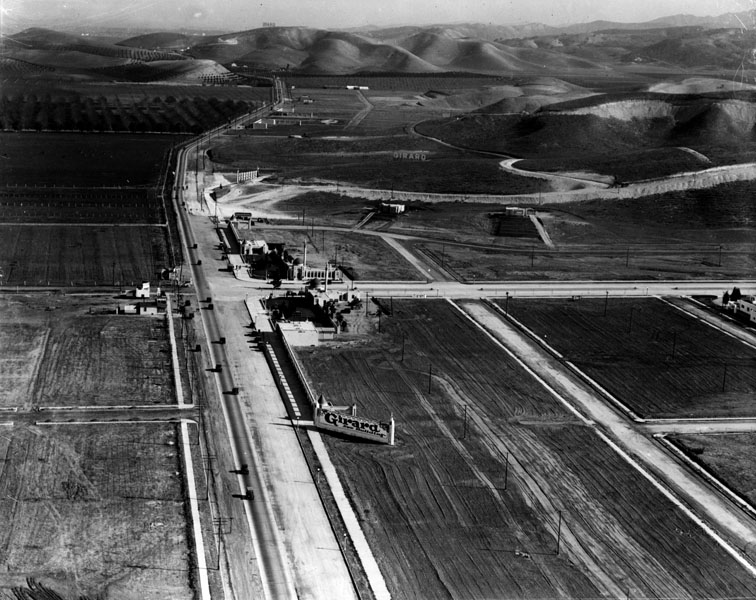 |
|
| (ca. 1924)* - View looking east on Ventura Boulevard. This is the intersection of today's Ventura Boulevard and Topanga Canyon Boulevard (center-left), in the real estate development of Girard. |
Historical Notes In 1924 Victor Girard opened a real estate office on what is now Topanga Canyon and Ventura Boulevard and built a mosque-like gate to his 2886-acre subdivision named Girard. He graded the streets, set aside land for parks and schools, and planted thousands of trees.* |
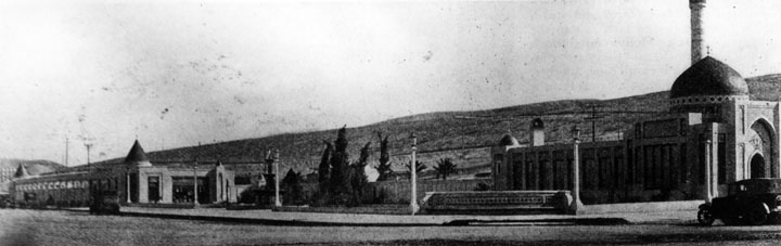 |
|
| (ca. 1924)* - Exterior view of the Islamic-influenced Real Estate Syndicate Building in Girard, which later came to be known as Woodland Hills. |
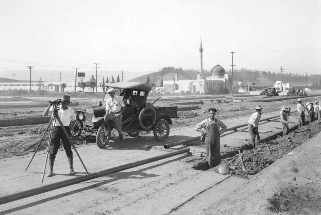 |
|
| (ca. 1924)* – View is looking north on Topanga Canyon Boulevard toward Ventura Boulevard. Workers lay pipe for the Southern California Gas Company. Girard Development offices can be seen on the southwest corner of Ventura and Topanga Blvds. |
Historical Notes In 1923, when Girard was building his town (later re-named Woodland Hills), he and a team of engineers designed a plan to lay the pipes starting in Mission Acres, and running through Reseda, Zelzah, Weeks Colony, Owensmouth, and ending at Girard. This proposal was presented to So Cal Gas, which determined that the job would cost $153,000. The West End Improvement Assn, assisted by Girard, raised $60,000 to defray the costs so that the project could begin. |
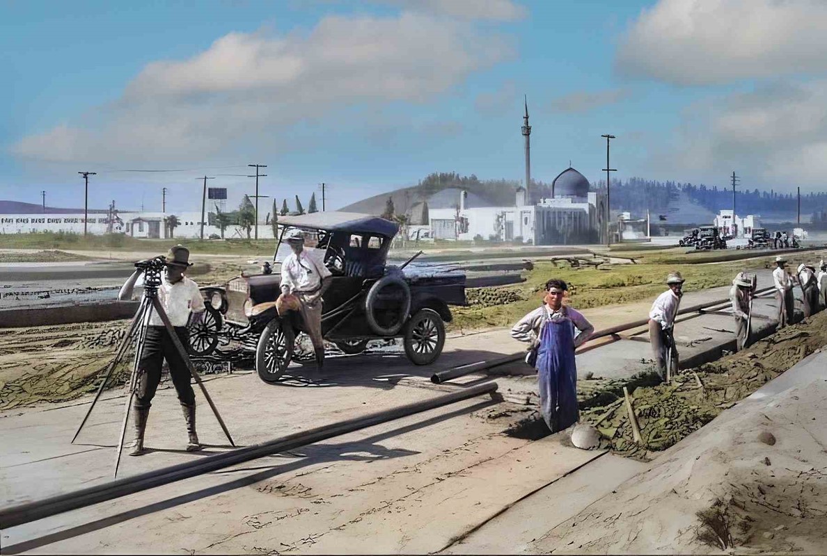 |
|
| (1924)* - Southern California Gas Company workers lay gas lines on Topanga Canyon Boulevard for the new development in the town of Girard (later Woodland Hills). View is looking north with the mosque-style building located at the SW corner of Ventura and Topanga. (AI image enhancement and colorization by Richard Holoff) |
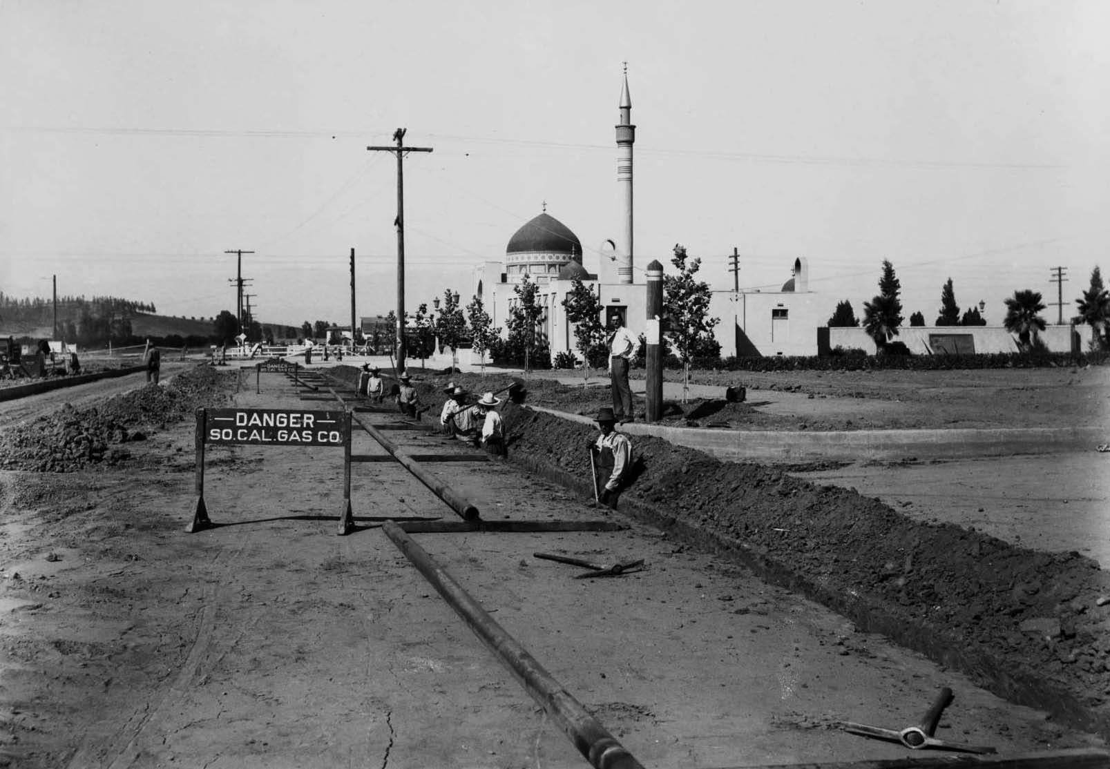 |
|
| (ca. 1924)* – View looking north showing Southern California Gas Company workers laying gas mains toward one of the two mosque-like buildings for the new Girard development located on the southeast corner of Topanga and Ventura Blvds. Photo from the Ernest Marquez Collection |
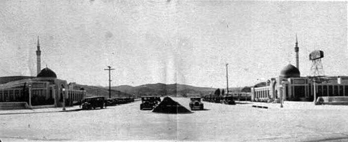 |
|
| (ca. 1925)#^*^ - View looking south on Topanga Canyon Boulevard at Ventura Boulevard. Source: Snapshots in Time |
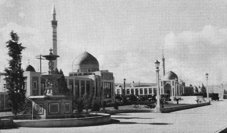 |
|
| (ca. 1924)*^^^ - View of the Mosque-like buildings constructed by Victor Girard Kleinberger to promote his new real estate housing development located near the intersection of Ventura and Topanga Canyon. |
Historical Notes The neighborhood was founded in 1923, named after Victor Girard Kleinberger, developer and founder. The new town was heavily promoted while bus tours from Los Angeles to the new town were offered.*^^^ |
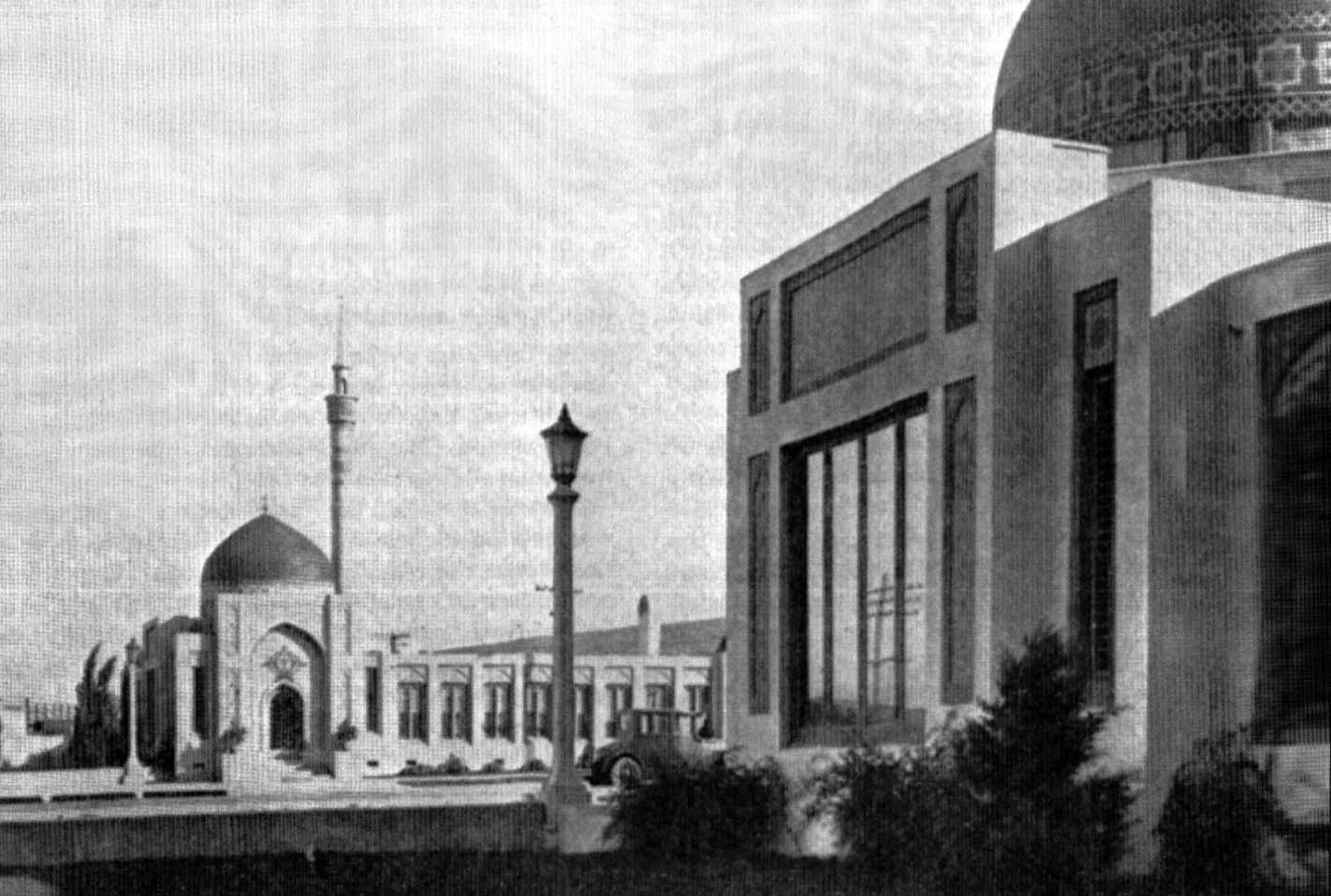 |
|
| (ca. 1925)#^*^ – Closer view showing the mosque-like gateway to Girard located on the south side of Ventura Blvd at Topanga Blvd. |
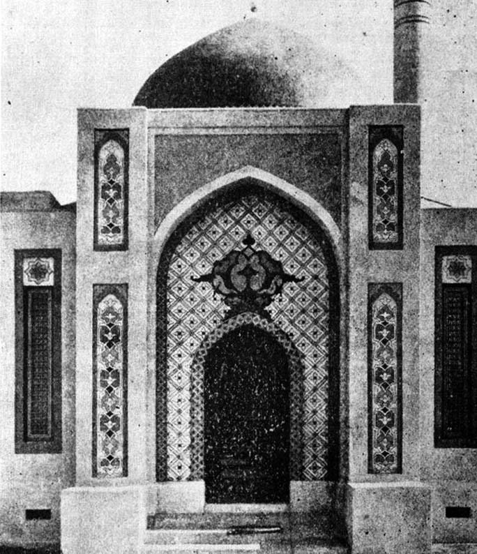 |
|
| (ca. 1924)#^*^ - Close-up view showing the beautiful Moorish Architecture of the front entrance to the Girard development administration building. |
Historical Notes This was the first commercial building to be built in the town of Girard (now Woodland Hills). It is now replaced by a gasoline station on the southeast corner of Ventura and Topanga Canyon boulevards. Click HERE to see contemporary view. |
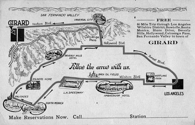 |
|
| (ca. 1924)*#^# - Map showing route of the promotional 80 Mile Tour offered by Victor Girard. |
Historical Notes Girard offered a free lunch and organized bus shuttles on a sightseeing tour that included, among other things, a stop at his new town. #*#* |
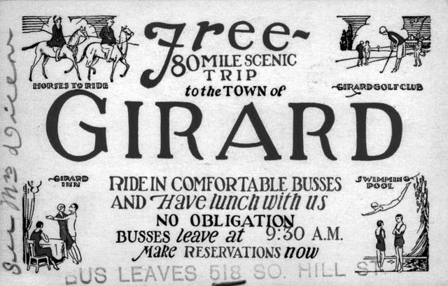 |
|
| (ca. 1924)^^ - A Ticket for one of Girard's bus tours to his new town of “Girard”. |
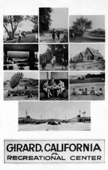 |
(1924)#^ - Postcards advertising the recreational activities of Girard.
|
Historical Notes The town of Girard officially opened in 1923 with an advertising blitz. Newspaper ads and pamphlets distributed in train depots and hotels across the region promoted the new town's location and the soon-to-be developed amenities. #*#* |
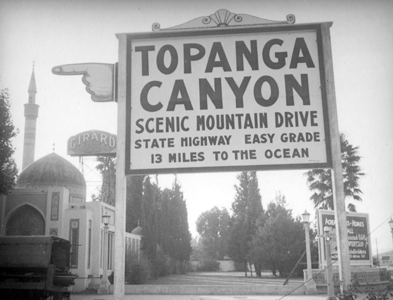 |
|
| (1937)* - A sign in front of the minaret and rooftop dome of Girard encourages the traveler to visit Topanga Canyon on a "scenic mountain drive, state highway, easy grade, 13 miles to the ocean." Topanga Canyon Boulevard (now State Highway 27) still enters Topanga Canyon at Woodland Hills and ends at the Pacific Coast Highway. |
Historical Notes Although Girard Kleinberger's early efforts were criticized as providing only a dubious facade of economic activity (local lore has it that in order to attract development he erected false store fronts on Ventura Boulevard, for which he spent time in jail), the Girard Golf Course completed in 1925 continues to operate today as the Woodland Hills Country Club, and his scheme was ultimately successful in attracting interest in the community.*^ |
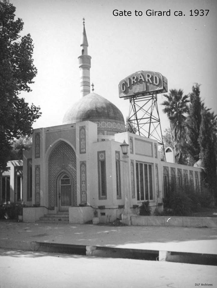 |
|
| (ca. 1937)#^*^ – Close-up view showing the mosque-like Gate to Girard as it appeared on Ventura Boulevard circa 1937. A bulb light sign built on scaffolding lets everyone know they have arrived to Girard. |
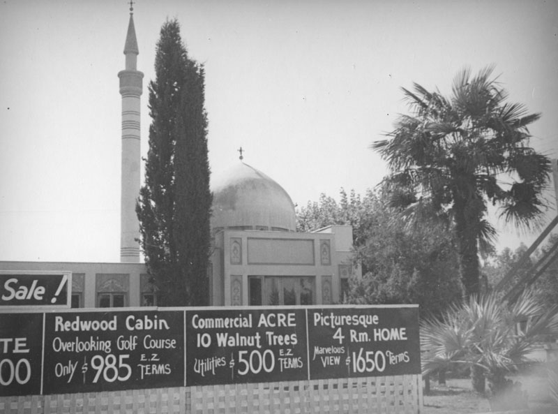 |
|
| (ca. 1937)* - The mosque like gatehouse, complete with minaret, rooftop dome, and tiled facade, can be seen behind signs advertising a sale for anyone wanting to buy into the community of Girard. The bargain is a commercial acre with 10 walnut trees and utilities for $500. A redwood cabin overlooking the golf course is just under a thousand and "E.Z terms" are available. The most luxurious, a four room home with a mountain view, goes for $1650. Interestingly there is a Palm tree on one side of the building and a Cyprus on the other accommodating all arboreal tastes. |
Historical Notes Girard is credited for planting more than 120,000 sycamores, eucalyptus, fir pine, and pepper trees across the townsite for which Woodland Hills would later be named for. #*#* |
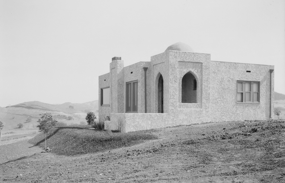 |
|
| (1920s)^^ - View of one of Girard's Moorish-style houses. The houses were scaled on the small side. |
Historical Notes Would-be buyers could purchase an undeveloped parcel for as little as $500, or choose from a small selection of houses that would be constructed on the lot of their choice. With an advertised "marvelous view," $1,625 bought a four-room house that could be designed in the Moorish style Girard loved so much. However, the most common pick was a small cabin that sold for $985. Sometimes placed on lots as small as 50 by 125 feet, the cabins were in line with Girard's standards and thus constructed with cheap materials and wooden foundations that sat directly on the ground. #*#* |
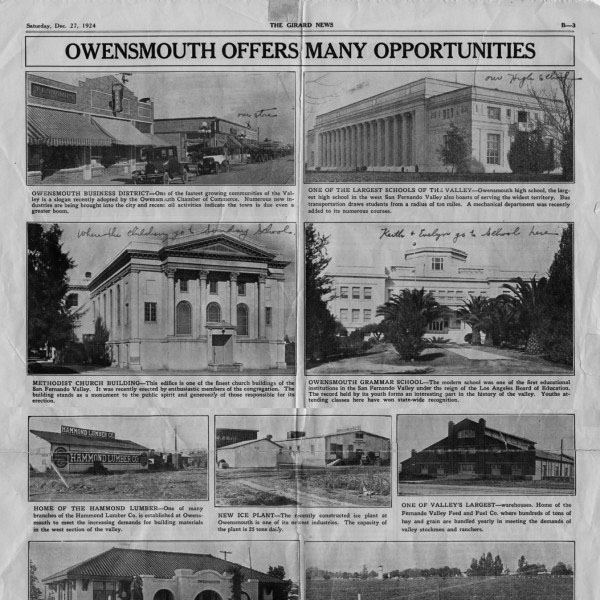 |
|
| (1924)^ - Girard News Newspaper serving Girard (now called Woodland Hills), San Fernando, Van Nuys, Lankershim, Reseda, Owensmouth, Chatsworth, Rio Vista, Pacoima, Zelzah, Weeks Colony and other cities. Supplement to the paper focusing on particular cities. |
Historical Notes Unbeknownst to many of the buyers, Girard and his Boulevard Land Company added a lien on every lot in his town to help pay for all the improvements, forcing the residents to repay the funds at a later date. After the 1929 Stock Market Crash many of the residents were confronted with the debt that Girard incurred on their behalf. Many simply left—by 1932 there were only 75 families remaining. Girard and the Boulevard Land Company faced a slew of lawsuits, most of which accurately contended the company had misrepresented the land it was selling. Unable to sell the heavily taxed 1,350 acres it still possessed, the Boulevard Land Company eventually folded. #*#* |
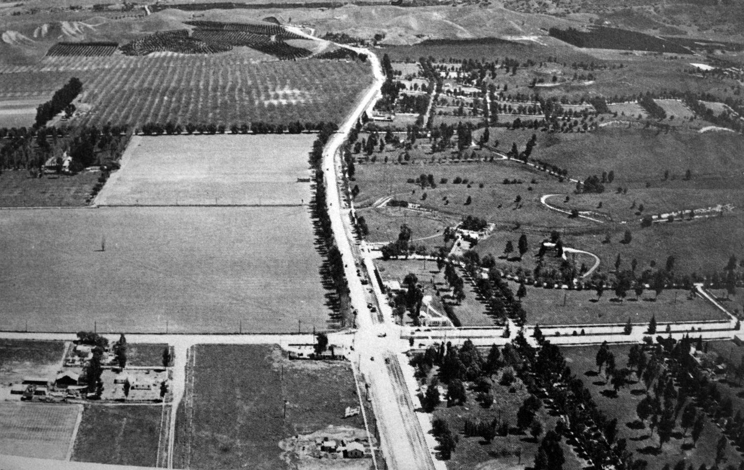 |
|
| (late 1930s)#^*^ – Aerial view looking east on Ventura Boulevard at Topanga Boulevard. |
Historical Notes By 1941, the community was renamed Woodland Hills. Also, in the 1940s, Harry Warner of the Warner Bros. Studio, bought 1,100 acres in the area for a horse ranch and named it Warner Ranch. The modern Warner Center commercial zone is named for Harry and features high-rise buildings, hotels, and shopping centers.*^ |
Before and After
|
|
.jpg) |
|
| (ca. 1924)* vs. (late 1930s)#^*^ - Comparative view showing the changes in the town of Girard over a dozen plus years. |
Ventura and Glade
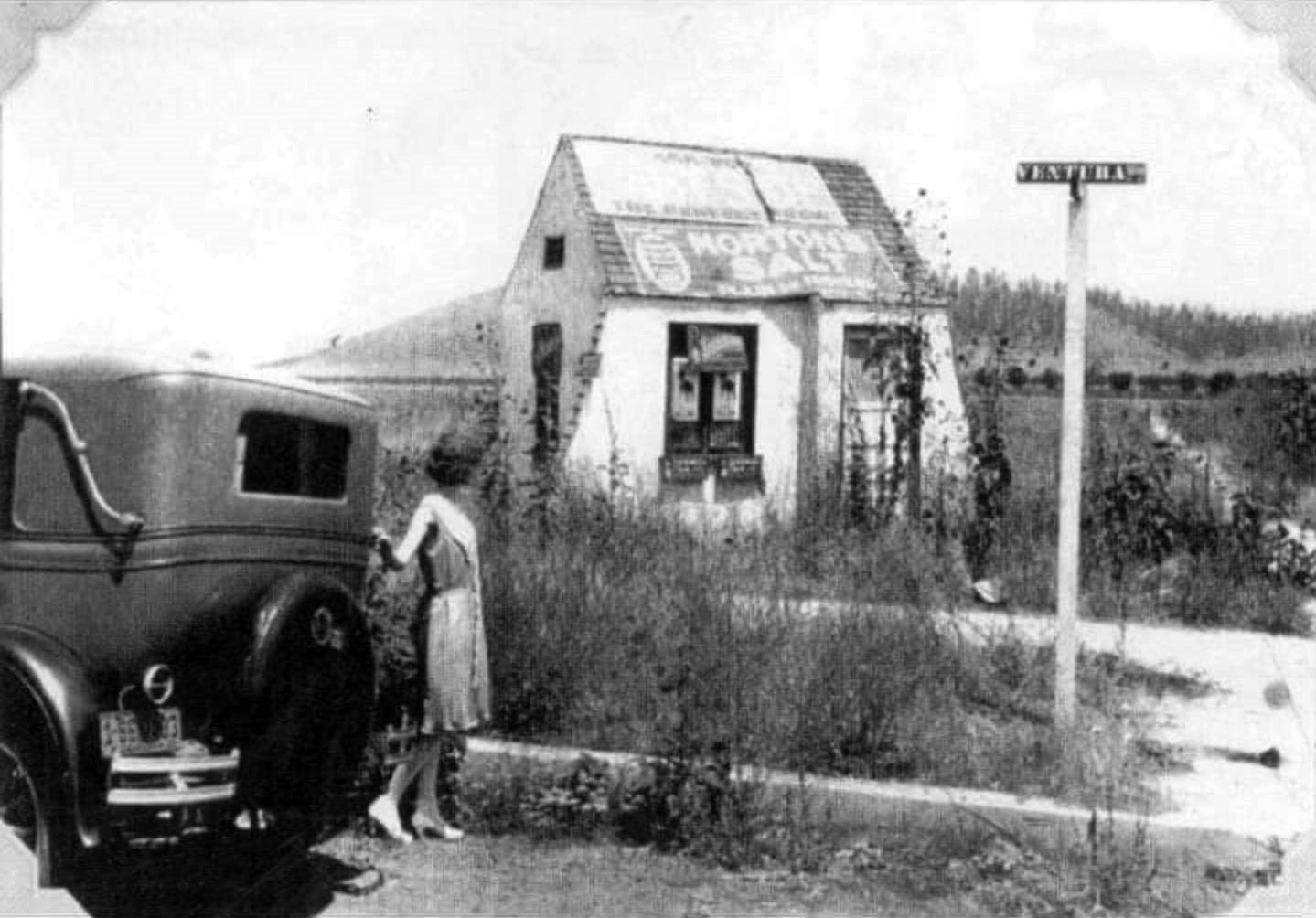 |
|
| (1927)^ – View showing a woman standing by an early model car in front of a small cottage-like structure located on the NW corner of Ventura Boulevard and Glade Avenue. |
Historical Notes This little cottage at the corner of Ventura Blvd and Glade Ave was built in 1927. Most recently it was a coffee shop and outdoor cafe called The Secret Garden. Before that it was a gift shop called Dove Hill. As of 2023 the little cottage structure was still there. Click HERE for contemporary view. |
 |
|
| (1927)^.^ – Aerial view showing the little cottage building seen in previous photo standing on the NW corner of Ventura Blvd and Glade Ave. Photo courtesy of Dan Fields. |
Then and Now
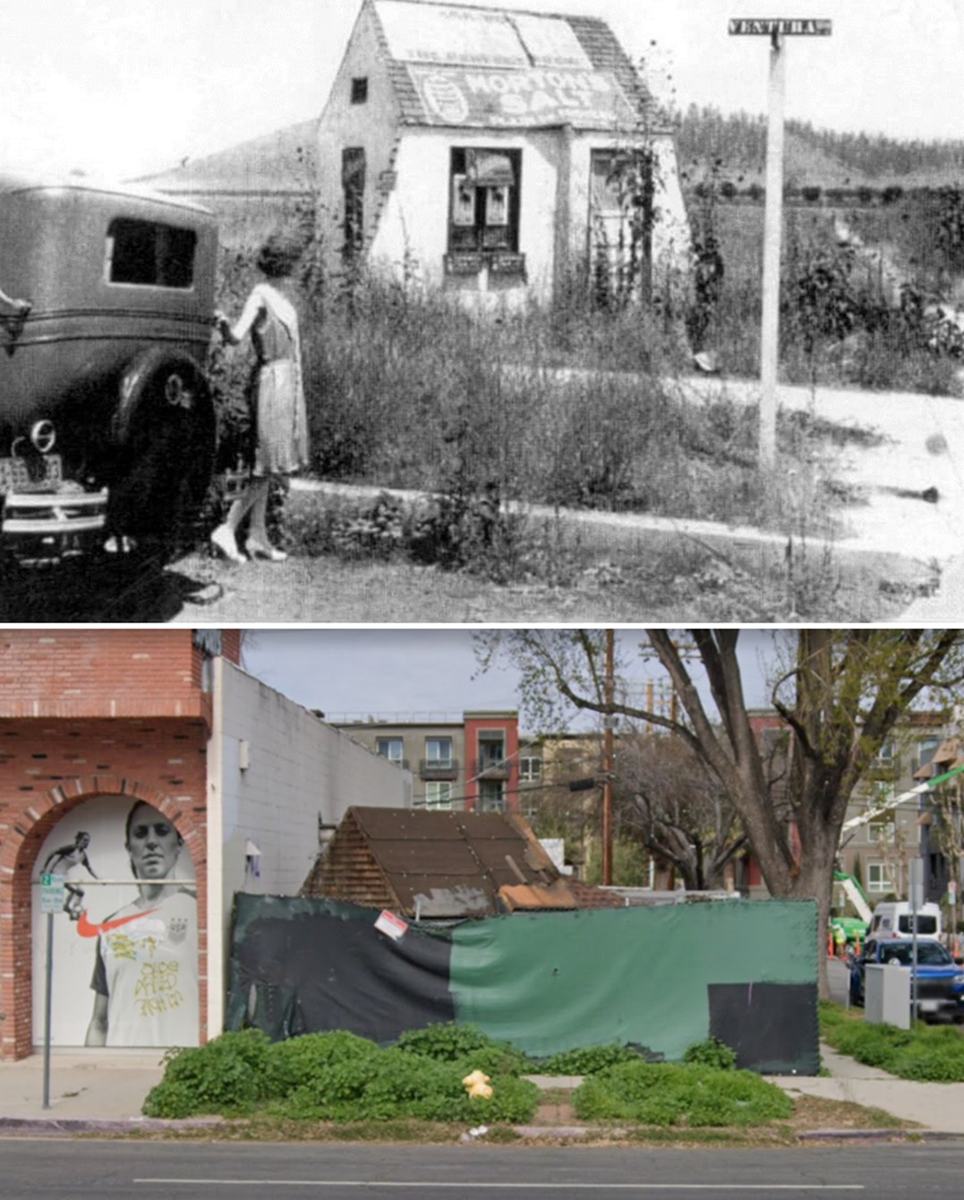 |
|
| (1927 vs 2023)* – Looking at the NW corner of Ventura Boulevard and Glade Avenue in Woodland Hills. This little cottage has stood at the same corner for almost a century. |
* * * * * |
Girard (later Warner Ranch)
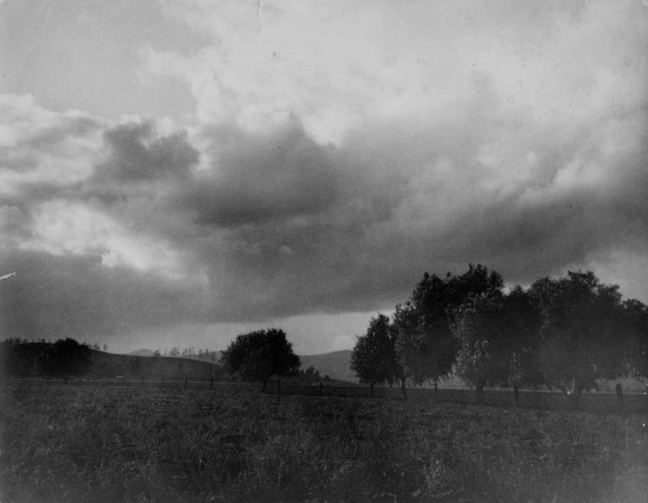 |
|
| (1930s)^ – View showing the town of Girard in an area that would become Warner Ranch and later Warner Center, Woodland Hills. |
Historical Notes During the 1940s, Harry Warner of Warner Bros. acquired over 1,000 acres of land in what was then Girard. Called the Warner Ranch, he built his home there and raised thoroughbred horses on the surrounding property. A portion of this land is now the Warner Center in Woodland Hills.^ Click HERE to see more Early Views of Warner Ranch. |
* * * * * |
Weeks Poultry Colony
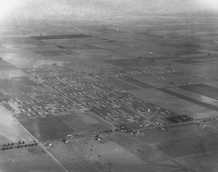 |
|
| (1925)* - Aerial view looking northeast showing the Weeks Poultry Community in Owensmouth (later Winnetka), founded by Charles Weeks as a utopian colony. The intersection at lower left is Sherman Way and Mason Avenue. |
Historical Notes In 1916, Charles Weeks established the "Weeks Poultry Colony," also known as Runnymede, on land near his Palo Alto farm in Northern California. With a heavily promoted motto of "one acre and independence," Mr. Week’s experimental utopian community grew quickly, housing 400 families by 1922. Adding to the success of the colony was his monthly magazine publication called Intensive Little Farm which attracted new buyers to the area and kept the area thriving for years, peaking at over 1,000 citizens by the mid-1920s. In 1923, Weeks moved out of Northern California and engaged himself in actively promoting a new colony in Owensmouth. He had been invited to the San Fernando Valley by the Los Angeles Chamber of Commerce in 1920 to establish a series of one-acre farms in the area that would emulate the success of his Los Altos "poultry colony." The colony Mr. Weeks created eventually developed into a small farming community, which actively engaged in uplifting the spirit of its members, and aided in the social, intellectual and artistic enlightenment of the region.^ |
.jpg) |
|
| (1927)* - Aerial view looking northwest showing the Weeks Poultry Community. The intersection at lower-right is Sherman Way and Winnetka Avenue. The large empty lot on the northeast corner is today the home of Sutter Middle School. |
Historical Notes Weeks, the 50-year-old philosopher-entrepreneur, began building his egg-based Eden along Sherman Way, a wide boulevard lined with palms and roses. It was the only paved road in the West Valley. A trolley called "Big Red" ran down its center and made daily round-trips to Los Angeles. "Each man must create his own little world," Weeks liked to say. "None that others prepare for him will ever satisfy." The Valley community of Owensmouth was the ideal place for little-world building, Weeks argued. Its soil was rich, there was abundant water because of the Owens Aqueduct and nearby Los Angeles was a ready and growing market for the settlers' eggs. Weeks disseminated his philosophy of collective self-reliance in a widely distributed magazine called "Intensive Little Farms" and in a book he sold by mail for $1. He described the Valley project with characteristic confidence as "the greatest economic work of the age, bringing peace of mind, health of body and an abundant living to thousands bound in slavery by wage-earning and too much business." ^^^ |
.jpg) |
|
| (1925)* - Aerial view looking southwest showing the one-acre farms located in the Weeks Poultry Community. The intersection at lower-right is Winnetka Ave and Saticoy St. |
Historical Notes By 1923, Weeks sold the first acre of his Colony to Jenja Beckman of Los Angeles, when the lots went for $1,250. By the end of the year, 41 families had established their acre plots in the tract bounded by Winnetka and Oso avenues and Leadwell and Lanark streets.......The Weeks Colony became a Valley institution, listed on maps and well known in the surrounding towns. Weeks deeded five acres at Winnetka and Roscoe Boulevard to the city for an elementary school (later becoming Winnetka Elementary School). The colony grew to more than 500 families and had its own egg co-op, warehouse, and packing plant. #^# |
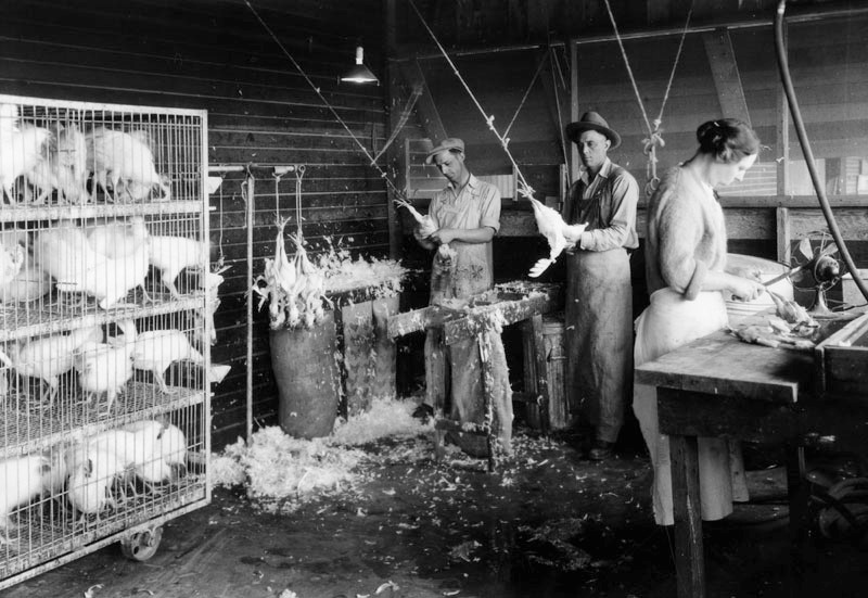 |
|
| (1927)* - Workers plucking chickens at Weeks Poultry Ranch, also known as the Charles Weeks Poultry Community. |
Historical Notes Charles Weeks established new methods of raising poultry, concentrating birds into coops. Previous to this time, it was a commonly accepted farming practice to raise chickens in large, space consuming, chicken runs. The "Weeks Poultry Method" of raising poultry in compact houses became so successful that visitors from all over the world began arriving at Mr. Weeks' farm to study and learn his method.^ |
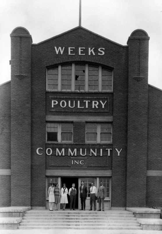 |
|
| (1927)* – View showing a group of people posing in front the Weeks Poultry Community, Inc. office building located at 21228 Sherman Way, Owensmouth (later Winnetka). |
Historical Notes Unfortunately, the Great Depression and the dramatic downturn of the Los Angeles economy drastically affected both the Owensmouth and Runnymede communities. By 1932, many of the farms faced bankruptcy and Mr. Weeks himself lost almost everything. With the failure of the poultry colonies, Mr. Weeks relocated to Florida, where he lived out the remainder of his life growing papayas, raising fishing worms and skin diving. Many of the colony’s residents also fled facing dire economic situation and a lot of the homes were abandoned. Some remained, though, and became longtime residents. Those that stayed behind renamed the neighborhood Winnetka in 1934, after Weeks' former hometown, Winnetka, Illinois. Also, Runnymede Street was named after Weeks' first poultry farm in Northern California. Charles Weeks died in Florida in 1964 but the impact of his communal experiment can still be seen in some areas of both Palo Alto and Winnetka.^ |
* * * * * |
Tarzana - Casa Mil Flores
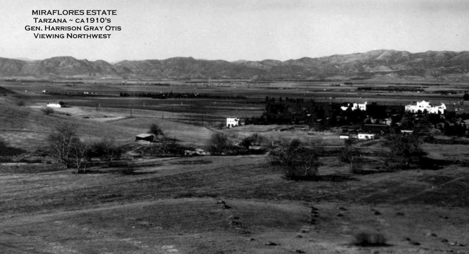 |
|
| (1910s)^ – View looking northwest showing a wide open San Fernando Valley with very little development. The buildings seen on the right are part of the “Mil Flores Estate” belonging to Harrison Gray Otis. In the distance Oat Mountain is seen above the main house and Stony Point is visible in the center. |
Historical Notes The area was purchased in 1909 by the Los Angeles Suburban Homes Company. LA Times founder and publisher General Harrison Gray Otis invested in the company and also personally acquired 550 acres in the center of modern-day Tarzana.*^ |
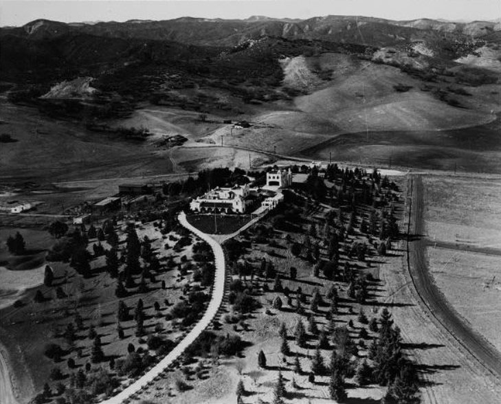 |
|
| (ca. 1920s)#* - Aerial view looking south of “Casa Mil Flores”, Harrison Gray Otis' Spanish-style home in southwest corner of the San Fernando Valley in what is now known as Tarzana. Main house and driveway, visible in center of photo, and other ranch buildings are along a hilltop, surrounded by trees. Valley and mountains in background. |
Historical Notes The Mil Flores Estate was described as ‘A magnificent dwelling of the most modern hollow tile and concrete construction built on a commanding knoll a half mile back from the highway (Ventura Blvd.), from which one of the finest and most comprehensive views of the entire valley is had.' The residence was built by General Otis, publisher of the Los Angeles Times, and was occupied by him as a home at the time of his death (1917). In 1919, Edgar Rice Burroughs (creator of the Tarzan character) purchased the ranch from the Estate of Harrison Gray Otis. General Otis called the ranch “Rancho del Cabrillo” and the home he constructed on the Southerly hill fronting along present day Tarzana Drive, he called “Casa Mil Flores.” The roughly 100 acre Burroughs or Tarzana Tract ran from present day Ventura Boulevard to Tarzana Drive and was bounded by Mecca Avenue and Avenida Oriente. The Tract was possibly recorded as early as 1921. Burroughs was busy in 1922 trying to promote the sale of lots of the tract. #^* Burroughs also sold 120 acres to found the El Caballero Country Club. |
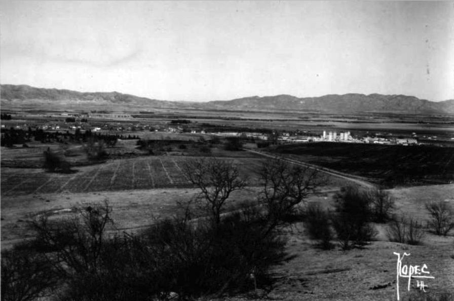 |
|
| (ca. 1920s)#* - View looking north towards the San Fernando Valley floor from near the “Casa Mil Flores”. The silos (center-right of photo) are milk storage tanks at the Adhor Milk Farm, located near Ventura Blvd. between Reseda and Lindley. |
Historical Notes The community was not officially named Tarzana until the Post Office was established in 1930. The Women’s Club, however, may have referred to the community by that name after taking a vote for a community name and then asking Burroughs permission to use it, which he gleefully granted in 1927.*^ |
Adohr Milk Farm
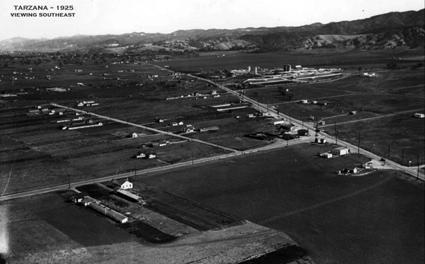 |
|
| (1925)* – Aerial view looking southeast showing the intersection of Reseda and Ventura boulevards at center-right. Adohr Farms can be seen in the distance at Lindley Avenue and Ventura Boulevard (upper center-right). |
Historical Notes The corner of Ventura Boulevard and Lindley Avenue in Tarzana was once the Adohr Milk Farm. However, the land was part of a cattle ranch empire owned by a Southern California family who later established the city of Malibu. |
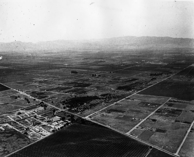 |
|
| (1925)* - Aerial view of Lindley Avenue at Ventura Boulevard showing orchards as well as Adohr Stock Farm at the lower left of the photo. The view is looking northwest. |
Historical Notes In 1892, Frederick Hastings Rindge bought the original Spanish land grants that made up Rancho Malibu Topanga Sequit. Rindge's land purchases spanned more than 17,000 acres along the coast toward Ventura County and several miles inland over the Santa Monica Mountains into the San Fernando Valley. Rindge’s daughter, Rhoda, married Merritt Adamson and together they started the successful Dairy Farm. |
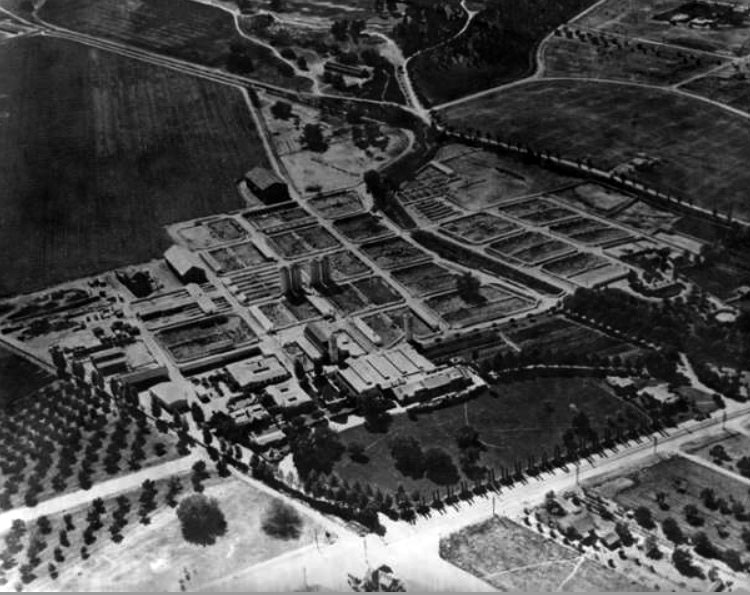 |
|
| (ca. 1930s)#^ - Aerial view of Adohr Farms looking southwest over the intersection of Ventura Blvd. and Lindley Ave. Ventura Blvd. runs diagonally from bottom-center to lower-right of photo. |
Historical Notes In 1916, Merritt and Rhoda Adamson established a dairy farm on the north slopes of the Santa Monica Mountains. To honor Rhoda, Adamson named the farm "Adohr"--his wife's name spelled backward. Adohr Farms became famous for having one of the largest herds of Guernsey cattle in the world.^^^ |
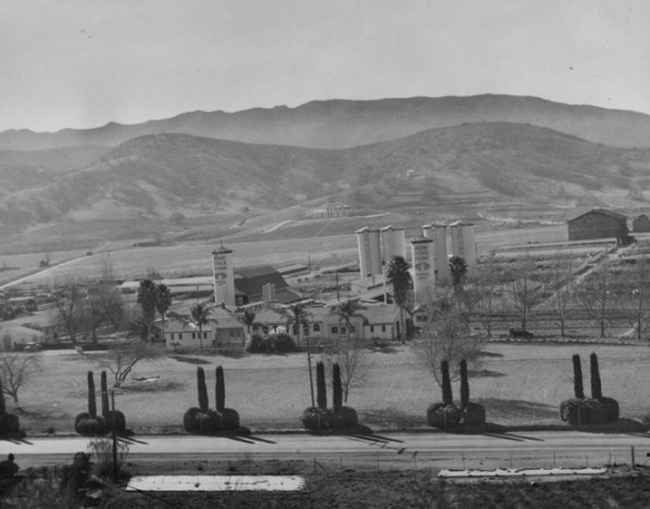 |
|
| (ca. 1930s)^ - View looking north of Adohr Farms. The main street running left to right is Ventura Blvd. Lindley Ave can be seen in the center-left of photo. |
Historical Notes During the Depression, the Adamsons were forced to sell most of their land to pay creditors. However, the milk farm kept the family solvent. |
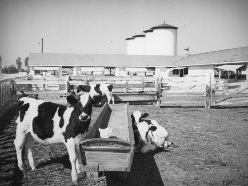 |
|
| (ca. 1930s)* - A spotted calf stands staring straight into the camera while shyer siblings lie in the shade of the empty looking trough at the Adohr Milk Farm. Beyond the corral lie the milking barns and four storage tanks of milk. |
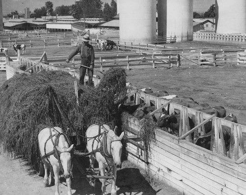 |
|
| (ca. 1930s)^ - Feeding the Guernsey dairy cattle at Adhor Milk Farms. |
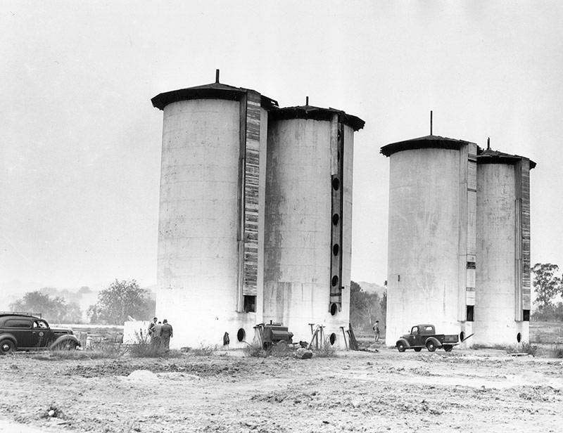 |
|
| (1948)* - View showing four 60-foot, concrete silos on the Adohr Milk Farms located at 18000 Ventura Boulevard. Photo date: October 14, 1948. |
Historical Notes In 1948, the land was sold by Merrit H. Adamson, head of the Adohr Milk Farms, to builders who planned to demolish the 31-year-old landmarks and divide the land into parcels for construction of low-cost housing for veterans.* |
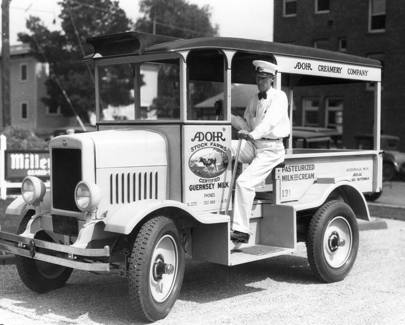 |
|
| (1931)* - A driver/milkman for Adohr Creamery Company, sits at the wheel of his delivery truck. |
Historical Notes The Adohr dairy moved to Camarillo in 1947. Adamson's son, Merritt Jr., eventually sold the dairy operation to the Southland Corp. in 1966. |
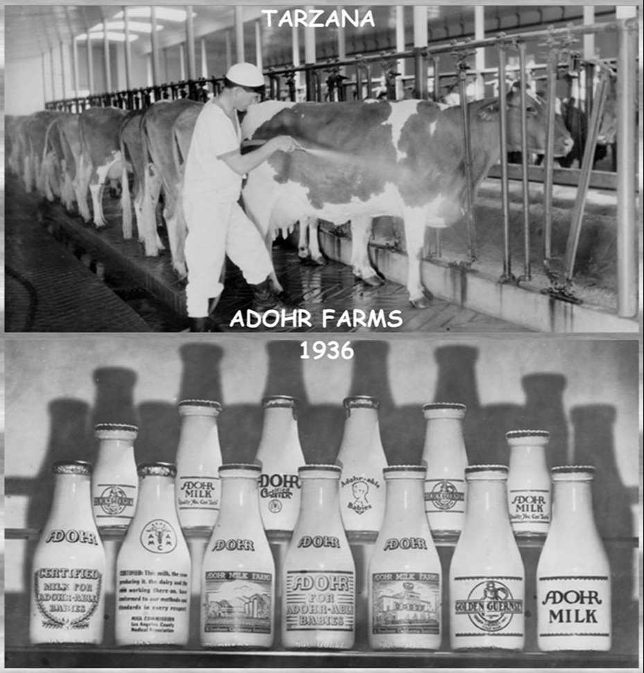 |
|
| (1936)* - Adohr Milk Farms located at 18000 Ventura Boulevard. |
* * * * * |
 |
|
| (n.d).*#^# - View of the original Tarzana branch of the L. A. Public LIbrary (Exact location and date unknown?) |
Click HERE to see more Early Views of Tarzana |
Hollywood Country Club
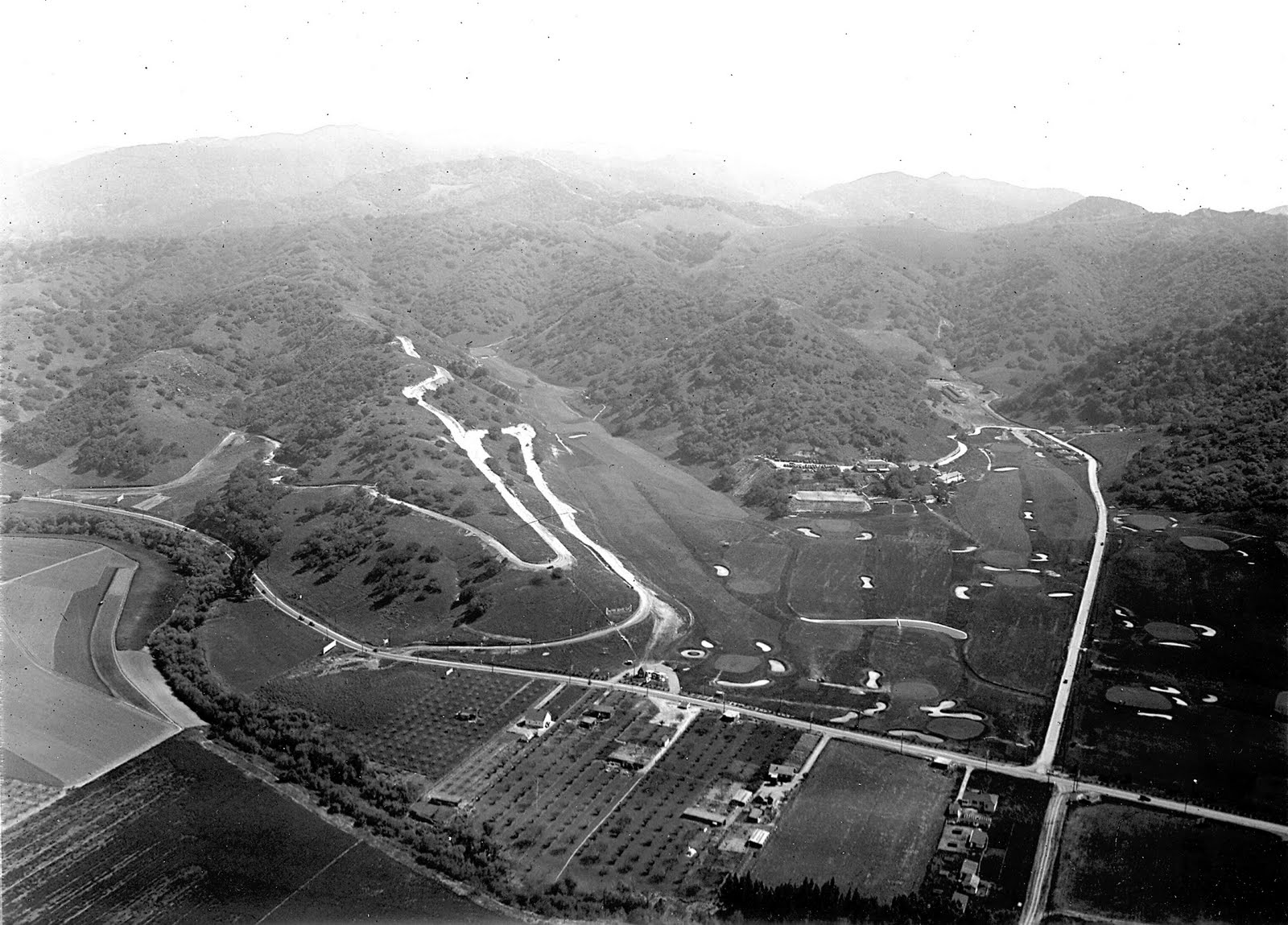 |
|
| (1925)^^# - View looking south over the intersection of Ventura Boulevard and Coldwater Canyon showing the Hollywood Country Club and adjoining areas in Studio City. |
Historical Notes In the mid-1920s, the Hollywood Country Club opened for golf and other forms of recreation. Several film stars of the era were investors.^^# |
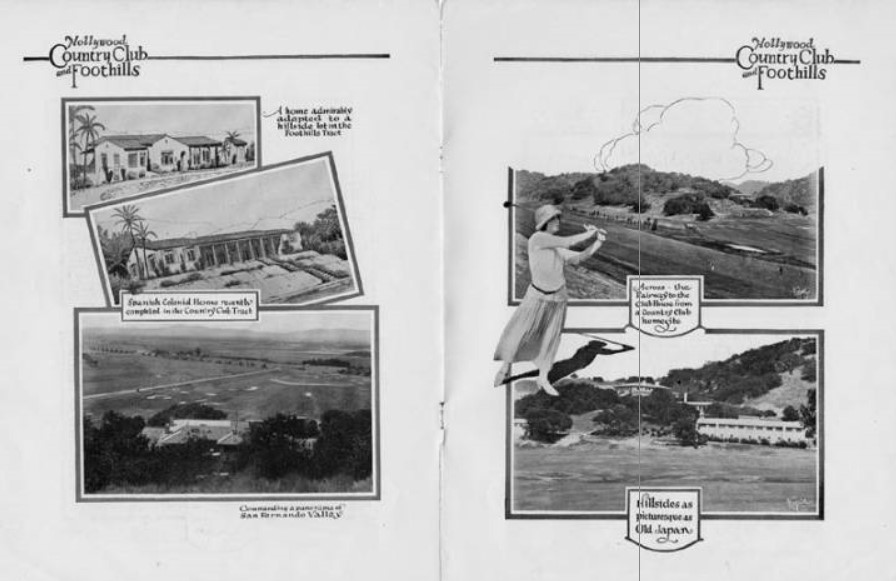 |
|
| (ca. 1925)^ - Brochure for the Hollywood Country Club and Foothills subdivisions in what is now Studio City. It is from the Merrick & Ruddick, Inc. Real Estate Company. |
Historical Notes In 1937, the Harvard School for Boys took over the closed country club.^ |
* * * * * |
Twin Lakes Park, Chatsworth
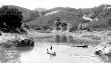 |
(ca. 1926)^ - One of the lakes in Twin Lakes Park, Chatsworth.
|
Historical Notes Twin Lakes was built as a resort around two man-made lakes circa 1920, in a canyon just above Chatsworth.^^^* |
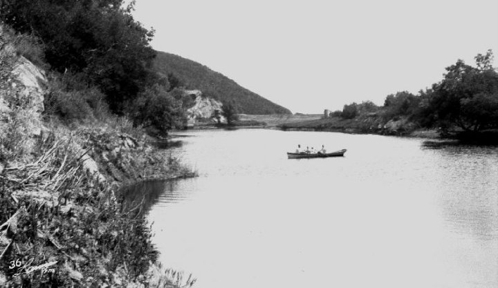 |
|
| (ca. 1920s)^^^* - View of several people in a boat in the middle of a lake at Twin Lakes Park. |
Historical Notes Twin Lakes Park was a privately owned planned community where one could buy a home, a mountain retreat, or a membership in the park (to use the facilities). In the 1920s and 1930s the community consisted of approximately 500 acre park, two fully stocked lakes, a country club, and picnic areas. There was room for 5,000 homes. Prices ranged from a one hundred dollar camp site to a twenty-five thousand dollar estate. Robert B. Stacy-Judd was the architect who designed and built the destinctive Mayan observation building on one of the lakes.^ |
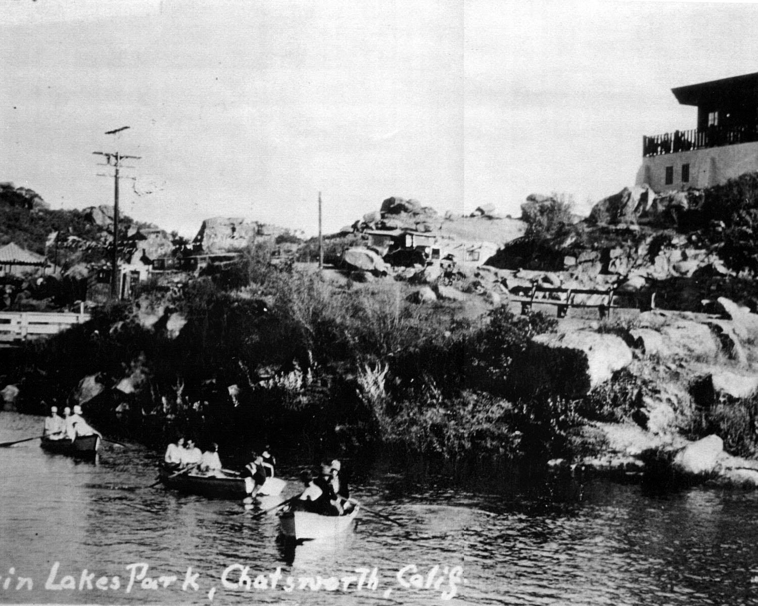 |
|
| (1920s)^# - View showing three boats filled with people in upper Twin Lakes. The Mayan Observation Building is at upper right and the dam with guardrail is at left. |
Historical Notes Promoted as a retreat for the weekend, season, or holiday, 750 lots were subdivided from the George W. Haight ranch, and somewhere between 400 to 500 parcels were sold in the 1920s.^# |
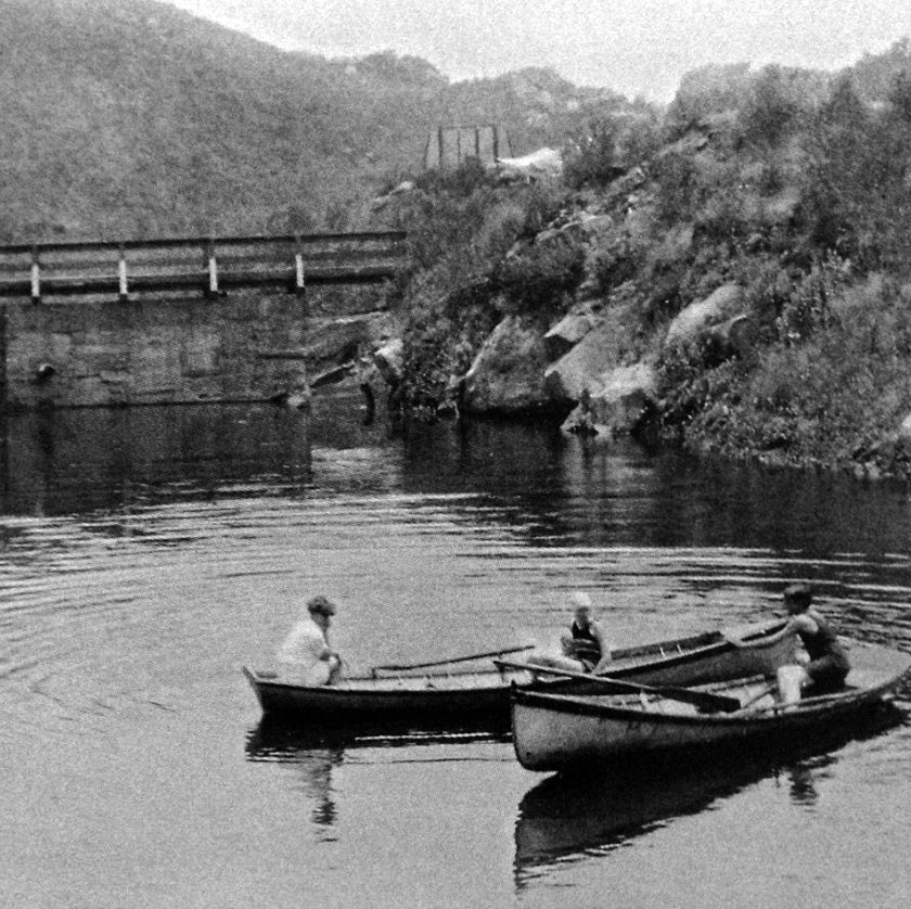 |
|
| (1930s)#^*^ - View showing three women in two row boats enjoying the day on one of the Twin Lakes located in Chatsworth. A dam is seen in the background. |
Historical Notes The upper lake dammed up Devil Canyon creek, and was named Raymond Lake in the sales brochure. George W. Haight’s son was named Raymond.^# |
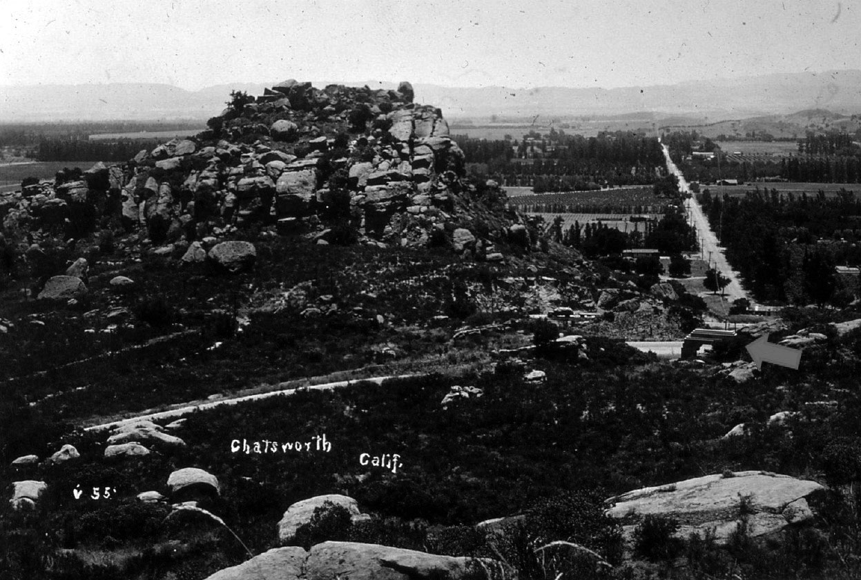 |
|
| (1933)^# - View of Stoney Point looking south. Twin Lakes Park Entrance Archway on Mayan Road is identified with an arrow at center-right. |
 |
|
| (ca. 1937)* - Back view of the Twin Lakes Park Entrance Archway over Mayan Road, looking toward Santa Susana Pass Road. |
Historical Notes Mayan Road was accessible from Santa Susana Pass Road before the continuation of Topanga to the 118 freeway in the 1970’s.^# |
 |
|
| (1937)^# - Front view of the Twin Lakes Park Entrance Archway, located 80 feet north of Santa Susana Pass Road. |
Historical Notes Remnants of the dams can still be found in the arroyos around the community of Twin Lakes, north of the Simi Valley Freeway between Topanga Canyon Boulevard and Canoga Avenue.* |
* * * * * |
Please Support Our CauseWater and Power Associates, Inc. is a non-profit, public service organization dedicated to preserving historical records and photos. Your generosity allows us to continue to disseminate knowledge of the rich and diverse multicultural history of the greater Los Angeles area; to serve as a resource of historical information; and to assist in the preservation of the city's historic records.
|
More Historical Early Views
Newest Additions
Early LA Buildings and City Views
History of Water and Electricity in Los Angeles
* * * * * |
References and Credits
* LA Public Library Image Archive
^ CSUN Oviatt Library Digital Archives
#^San Fernando Valley History Digital Library - CSUN Oviatt
** DWP - LA Public Library Image Archive
^* The Valley Observied: Street Name Origins; Timeline of Valley History
^# Chatsworth Historical Society
*# Mojave Desert.net: Remi Nadeau
***Los Angeles Historic - Cultural Monuments Listing
*^^Nuestra Señora la Reina de los Ángeles - losangelespast.com
*^*California Historical Landmarks Listing (Los Angeles)
^^^LA Times: Adohr Spelled Succes for the Adamsons; LA Times: Building the LA Aqueduct; Charles Weeks Colony
^^*LA Times: Stanley Norris Petit
*##LA Times: Dig Into History You'll Find Snake Oil..Victor Girard Kleinberger
*#*Project Restore: Van Nuys City Hall
^*^Topanga Canyon History - LA Magazine
*#^LA World Airports - History of Van Nuys Airport
^^#The Museum of the San Fernando Valley
**#Tumblr.com: LA History - Leonis Adobe
^#*Photo of the Northeast San Fernando Valley ca.1950 - Laurie Burns
^*#North Hollywood-Toluca Lake Patch: History of the Laurel Canyon and Valley Plaza Mall
#**California State Library Image Archive
#*^Northridgevision.org: Zelzah
#^#San Fernando Valley Blog: Porter Hotel; San Fernando Valley View from Topanga Cyn Drive; Charles Weeks Colony
^^^*San Fernando Valley Relics: valleyrelics.com: Twin Lakes; Universal Studios Tour Opening Day
**^*Retronaut - Hollywoodland Sign
**^^KCET: LA Flood of 1938: Cement the River's Future; When L.A.'s Most Famous Streets Were Dirt Roads
*^*^Canoga Park High School Home Page
*^*#Facebook.com: Classic Hollywood-Los Angeles-SFV
^^*#Topanga: Neighborhood Profile
^*#^Studiotour.com
*#^*Los Angeles County Library: City of San Fernando; 1920 San Fernando Valley View from Topanga Road; Topanga Mule Team
*#^#Forum.skyscraperpage.com: Tarzana LIbrary; Aerial of Burbank and Hollywoodland Sign; Girard Tour Map; Universal City
#*#*LA Curbed: How a Visionary Scoundrel Created Woodland Hills in the 1920s
#^#*Canyon News: Mulholland HIghway
^#^#Northridge Historical Images Virtual Tour - Bruce Russell
##^*Facebook.com: Canoga Park 100th Anniversary
*^^^San Fernando Valley Historic Society/Facebook.com: Girard; Sun Valley; Westinghouse Electric Range; Farmer in Early SFV; Garden of the Moon Park and Campground; Moon Festival
*^^# Flickr.com - Floyd B. Bariscale Photostream: Faith Bible Church
***# BoomCalifornia.com: Witness to a Hanging
+++# Facebook: San Fernando Valley Historical Society
^*^# Official 1913 LA Aqueduct Program: Shirley Gonzales, Morris D. Olney
#*** Pinterest - California and DailyBreeze.com
#^*^ Facebook.com: West San Fernando Valley Then And Now
#^^^ City of Calabasas: cityofcalabasas.com
#*^^ A History of the San Fernnando Valley: lahistoryarchive.org
##*^ Calisphere: University of California Image Archive
****#Entertainment Designer: The History of Universal Studios
***^#Daily News: Universal City Turns 100 Years Old
^^*^^Facebook.com: Garden of Allah Novels
^*^*^Facebook.com - Bizarre Los Angeles
*^ Wikipedia: Sherman Oaks; Isaac Van Nuys; Encino; Tarzana; Campo_de_Cahuenga; Cahuenga Pass; Chatsworth; Panorama City; Santa Susana Field Laboratory; North Hollywood; Canoga Park; Woodland Hills; Reseda; Orcutt Ranch; Granada Hills; Andrés Pico; Moses Sherman; Van Nuys; Henry Kaiser; Charles Maclay; San Fernando Valley; Mission Point; Hughes Aircraft; Domonique Amestoy; Winnetka, Los Angeles; City of San Fernando; Canoga Park High School; Ventura Freeway; Hollywood; Hollywood Freeway; Los Angeles Valley College; Bolton Hall; Sunland-Tujunga; City of San Fernando; Zelzah - Northridge; Rómulo Pico Adobe; Faith Bible Church; Universal City;; Tarzana; Calabasas; Hollywoodland Sign; Mulholland Drive/Highway; Lankershim Boulevard
< Back