Early Los Angeles Historical Buildings (1900 - 1925)
 |
|
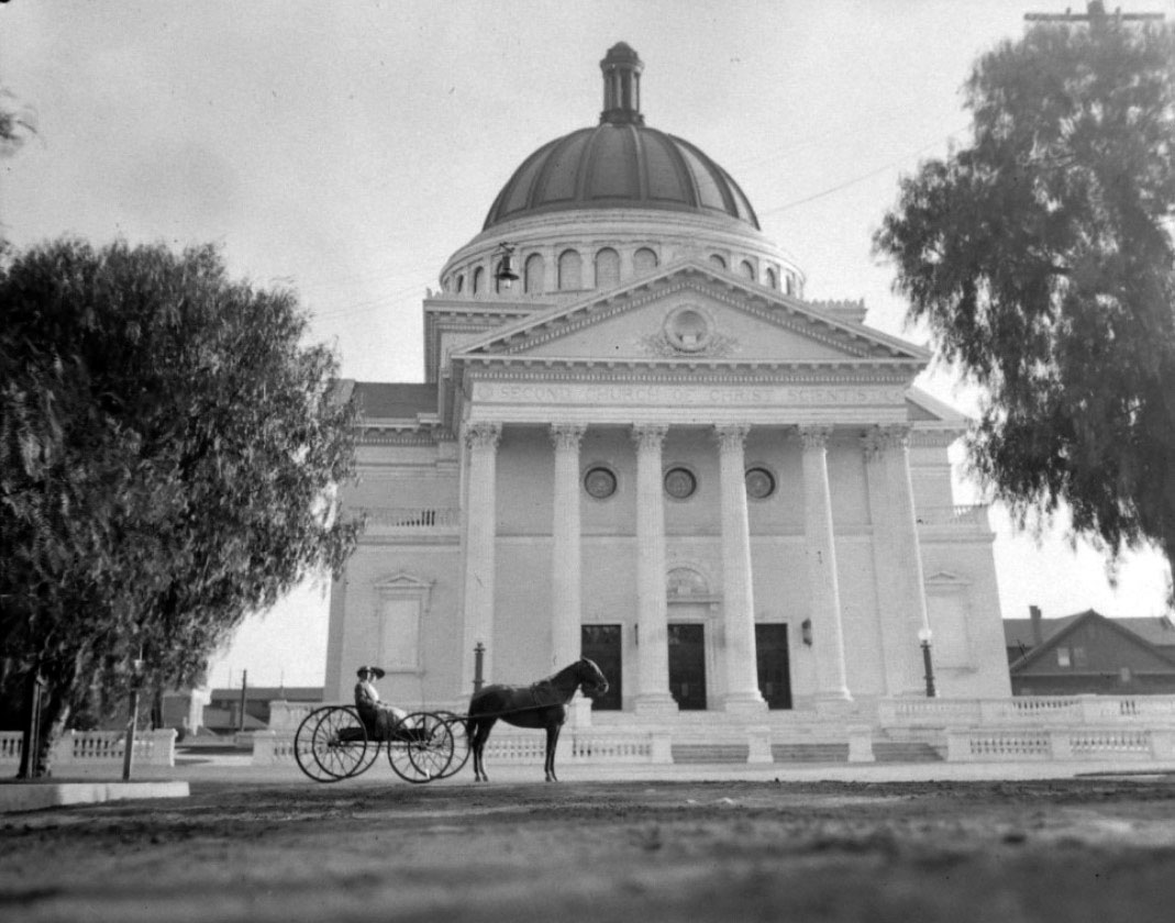
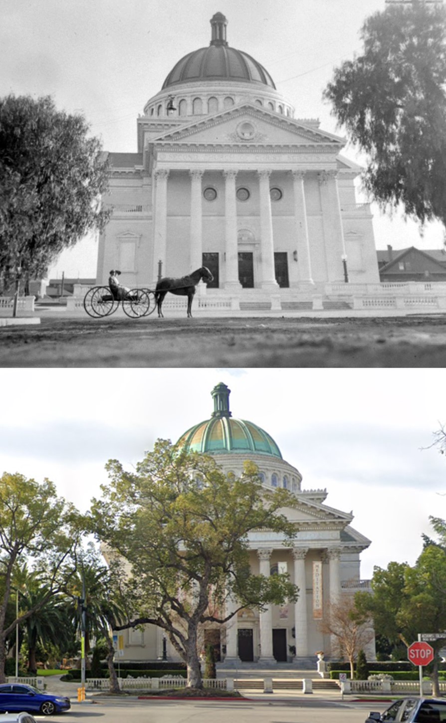
| (ca. 1910)* – A man and woman in a horse-drawn buggy are stopped in front of the Christian Science Church (aka Second Church of Christ Scientist) located at 948 West Adams Boulevard. |
Historical Notes Built in 1910, the Beaux Arts/Italian-Renaissance style building was designed by Alfred Rosenheim (who also designed the Cameo Theater in 1910 and the Globe Theater in 1913, both on Broadway in downtown Los Angeles.* Rosenheim is also responsible for other Los Angeles landmarks, including the nearby Britt Residence, Hamburger’s Department Store, Clune’s Broadway Theatre Building, and the Hellman Building, all of which are LA Historic-Cultural Monuments. |
 |
|
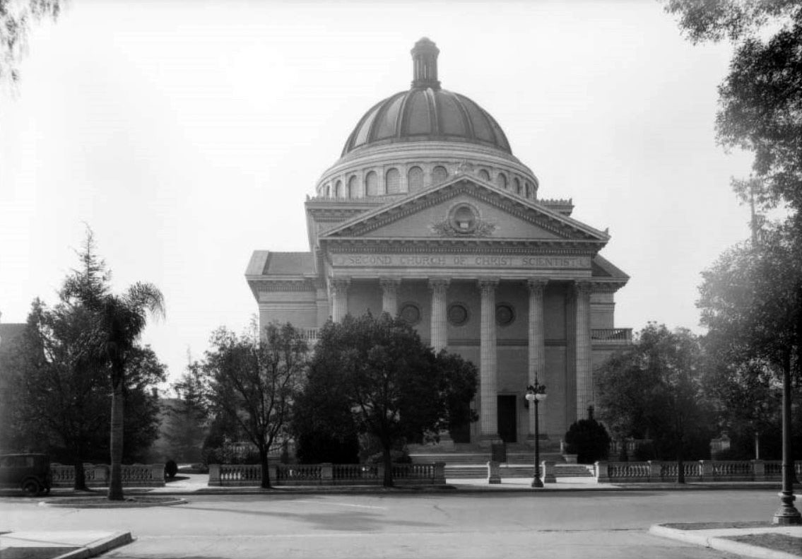
| (ca. 1928)^ - View looking south on Portland Street toward Adams Boulevard. The Second Church of Christ Scientist is seen on the other side of Adams Boulevard at the T-intersection. |
Historical Notes The Church of Christ, Scientist was founded in 1879 in Boston, Massachusetts, by Mary Baker Eddy, author of Science and Health with Key to the Scriptures, and founder of Christian Science. The church is widely known for its publications, especially The Christian Science Monitor, a weekly newspaper published internationally in print and online.^* Six-globe streetlights (Llewellyn "Chester" Lamps) as seen above were installed in the West Adams district beginning in 1903. |
 |
|
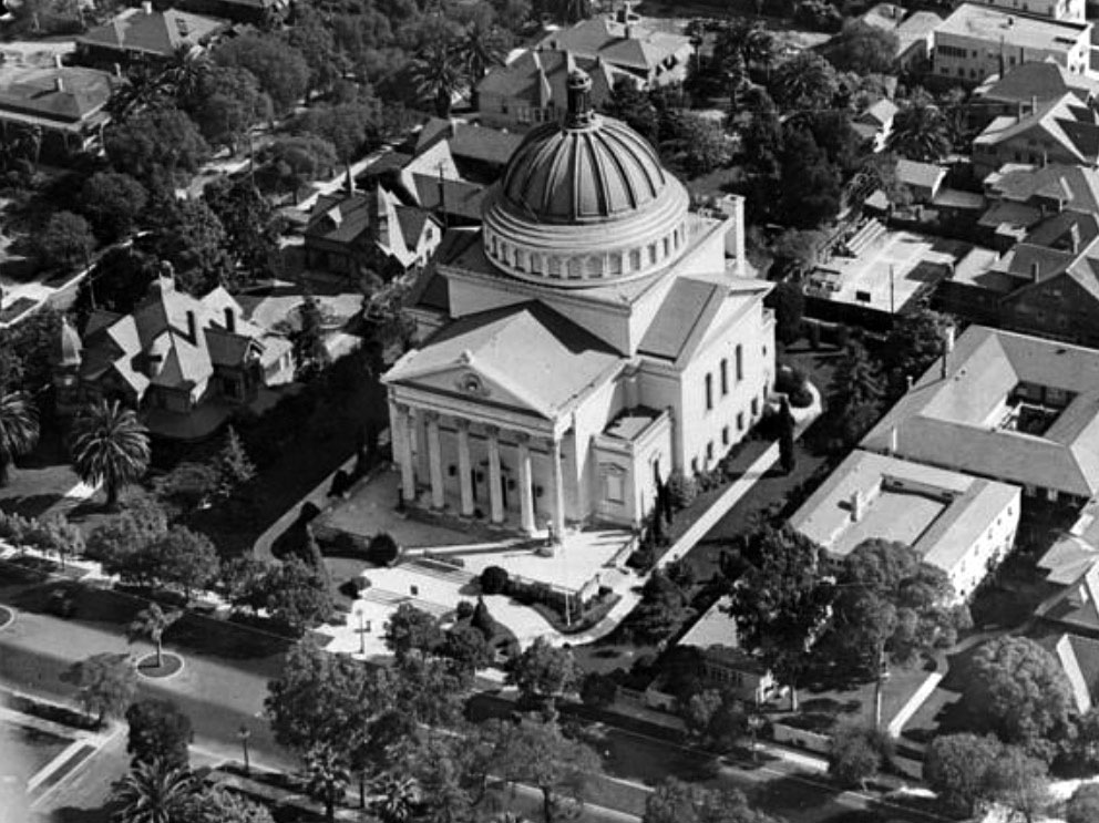
| (ca. 1928)^* – Aerial view showing the Second Church of Christ Scientist on Adams Boulevard at the end of Portland Street. |
Historical Notes The North University Park and Exposition Park Walking Tour brochure describes the architecture of the church as follows: "this Italian Renaissance-style church, with its six magnificent Corinthian columns, evokes the grandeur of the Pantheon. Engineer Albert C. Martin constructed the church's huge copper-clad dome, then the world's largest poured concrete dome. Study the rich details of the exterior decorations, made of white terra cotta ornamentation." The columns are forty feet tall, and the dome, which is seventy feet in diameter, was constructed through a complex design of concrete girders and steel trusses. The church seats more than 1000.^* |
 |
|
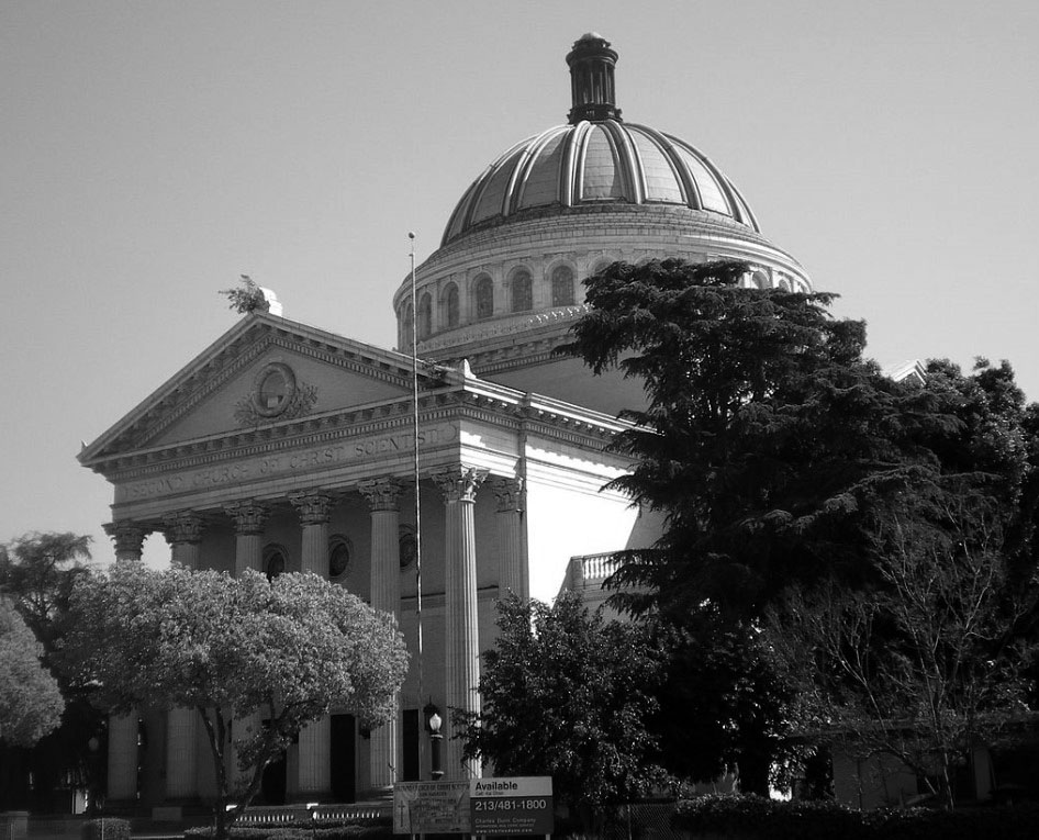
| (2008)* – View showing the Second Church of Christ Scientist at 948 W. Adams Boulevard as it appeared in 2008. The church is fenced off and for sale. |
Historical Notes In 1968 the building was declared LA Historic-Cultural Monument No. 57 (Click HERE to see complete listing). It was also placed on the National Register of Historical Places in 1987. In late 2009, the Church property was sold to the non-profit Art of Living Foundation. It was restored and is used as a community center, speaking and music venue, and is a center for the Foundation's service work and breathing, meditation, and other programs. While the Art of Living Foundation has been active in Southern California since the late 1980s, it officially opened in this location on April 14, 2010.* |
Then and Now
 |
|
| (1910 vs. 2022)* – The 1910-built Beaux Arts/Italian Renaissance style building was designed by famed architect Alfred Rosenheim as a Christian Science Church. It is located at 948 West Adams (at Portland Street) and currently serves as home to the Art of Living Foundation. |
* * * * * |
Bryson Apartments
 |
|
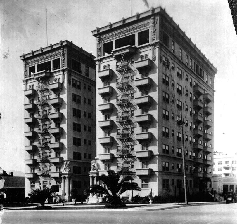
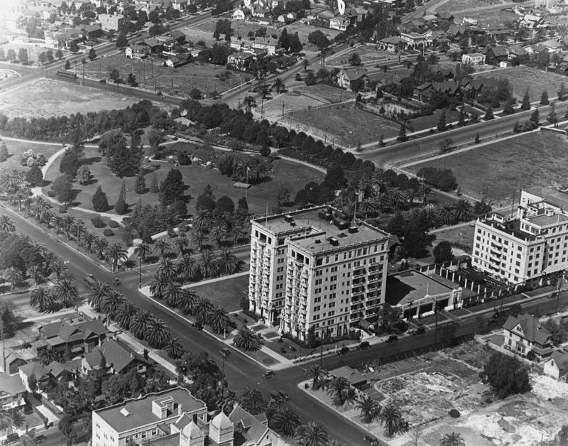
| (ca. 1913)* – View showing the 10-story Bryson Apartments located at 2701 Wilshire Boulevard. |
Historical Notes The Bryson opened in January 1913 as the newest thing in elegant Los Angeles apartment living. The Los Angeles Times proclaimed the Bryson by far the largest and finest apartment house on the Pacific Coast and on one of the most sightly corners in the fashionable Wilshire-Westlake district. The Bryson's ninety-six apartments featured mahogany woodwork, tile floors in the bath and kitchen, and a built-in cedar chest in each dressing room. Living rooms doubled as bedrooms, with hideaway wall beds in each unit. |
 |
|
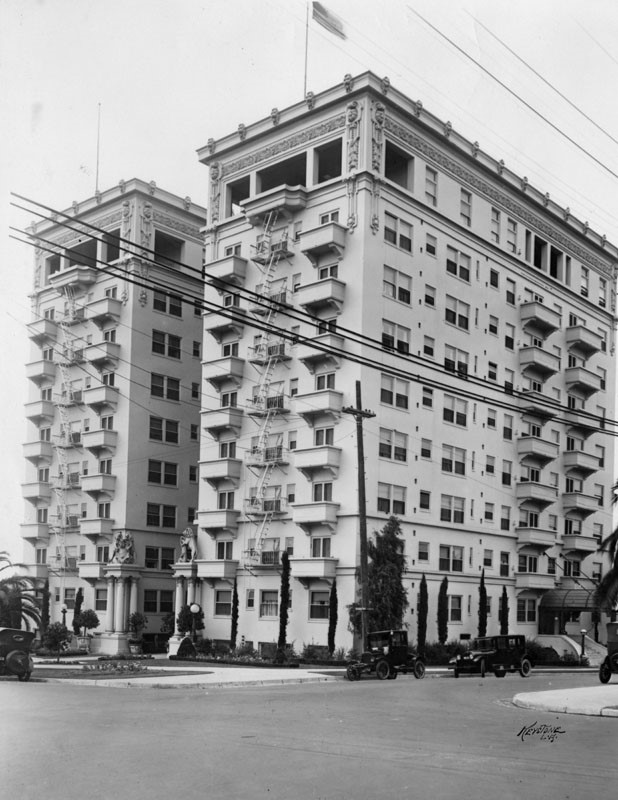
| (ca. 1920)* – Exterior view of the Bryson Apartments located on the N/W corner of Wilshire and Rampart boulevards. Note the lion sculptures at the entrance. |
Historical Notes Developer Hugh W. Bryson believed in constructing affordable large scale residential developments filled with beauty and taste. Born in Memphis, Tennessee, August 1, 1868, ambitious Bryson strove for excellence from a young age. After graduating from high school, he worked as clerk for a cotton brokers, working in banking, and selling real estate, before arriving in Los Angeles in 1902. Bryson joined leading contractor, F. O. Engstrum Co., and within a few years, married the owner’s daughter, Blanche. He was named a general manager and director of the company in 104, focusing on major projects. Recognizing the large migration of East Coast and Midwest residents to sunny LA, Bryson began financing and his own projects under his Concrete Appliances Company.^ |
 |
|
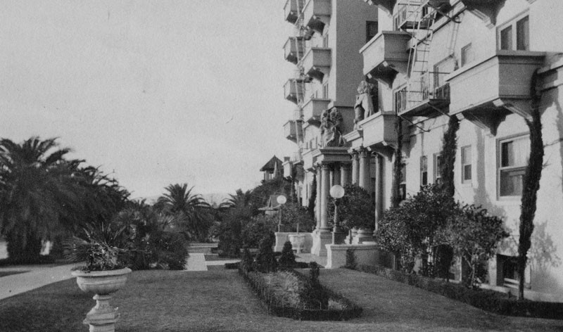
| (ca. 1920s)* – Close-up view showing the entrance to the Bryson Apartments. |
Historical Notes From the beginning, Bryson’s hyperbolic publicity played up the special quality of the building including its classical style entrance, gardens, and fountain. Conveniences and amenities included a ground floor power plant, elevators, staff residences, vacuum and telephone hook-ups in every suite, hot/cold water and steam heat for every apartment, along with maid service. The building contained all luxuries and comforts of a personal residence without maintenance, in a way, an early example of a condominium building. |
 |
|
| (ca. 1920)* - Aerial view looking down at Lafayette Park (previously Sunset Park). Three large apartment buildings can be seen: lower left, Hershey Arms; center, The Bryson on the northwest corner of Wilshire and Rampart Boulevards; and right, Rampart Apartments on the southwest corner of 6th Street and Rampart Boulevard. |
 |
|
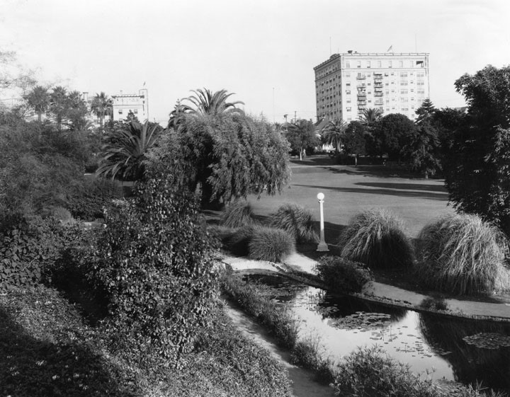
| (1926)* – View of Lafayette Park, originally named Sunset Park, showing a small pond with footpath in the foreground, the lawn in the middle and the Bryson Apartments. in the background. The Rampart Apartments are seen to the left. |
 |
|
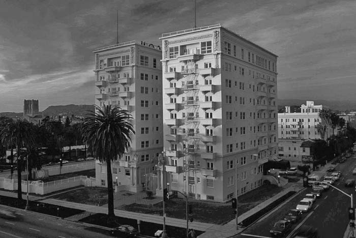
| (2010s)^ – View looking northwest showing the Bryson Apartments at Wilshire and Rampart. The First Congregational Church, 540 S. Commonwealth, is on the left. On the right can be seen the Rampart Apartments on the southwest corner of 6th Street and Rampart Boulevard. |
Historical Notes Actor Fred MacMurray owned the Bryson for many years, and the building has appeared in numerous films. A placard at the locked entry gate refers interested location scouts to the building's Hollywood agent. |
 |
|
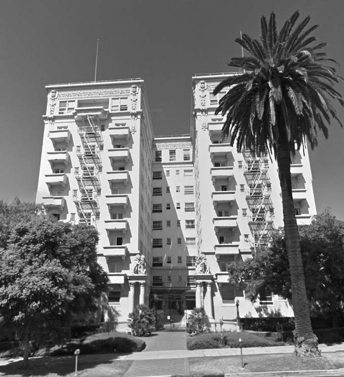
| (2015)* - Google street view showing the Bryson Apartment Building, 2701 Wilshire Boulevard. |
Historical Notes The 1914 Beaux Arts style Bryson Apartment Hotel was designed by architects F. Noonan and C. H. Kysor. The building was listed on the National Register of Historic Places in 1983 and was designated Los Angeles Historic-Cultural Monument No. 653 in 1998. Click HERE to see complete listing. Since an award-winning restoration by the Los Angeles Housing Partnership in 2001, the Bryson has served as low-income housing.^ |
* * * * * |
Haggarty Mansion (aka Castle York)
 |
|
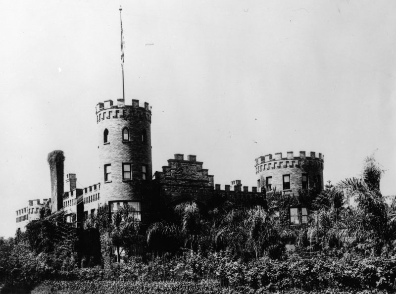
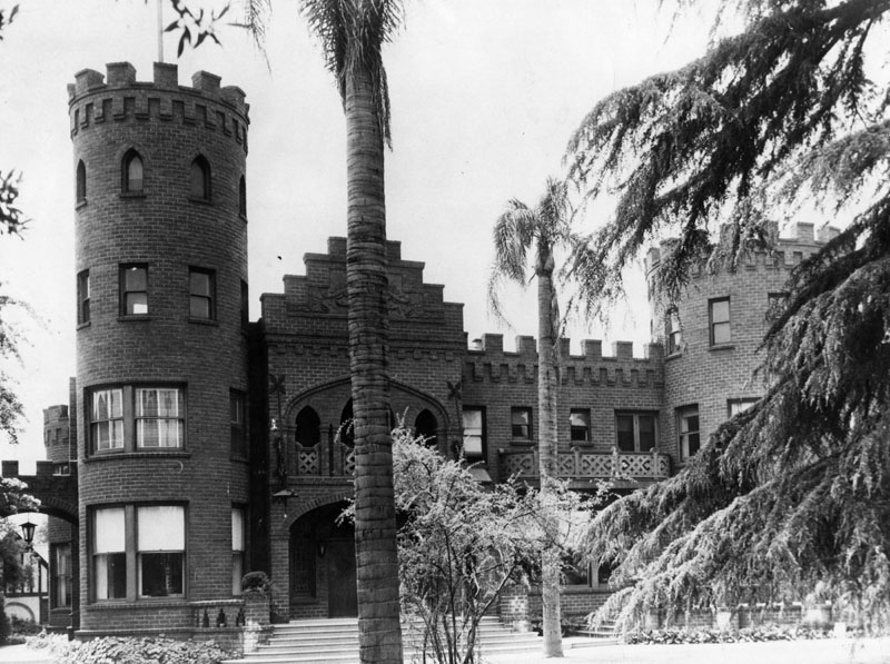
| (ca. 1915)* - Exterior view of the J. J. Haggarty Mansion, otherwise known as Castle York, was located at 3330 W. Adams Blvd. in the fashionable West Adams section of Los Angeles. |
Historical Notes The J. J. Haggarty Mansion, otherwise known as Castle York, was located at 3330 W. Adams Blvd. in the fashionable West Adams section of Los Angeles. The Castle York, of Norman Gothic architecture, was built at a cost of $100,000. Frontage was of 125 feet on south side of Adams and extended back to a depth of 500 feet. Structure itself was 92x91 feet in size. A tower planned after one of the famous towers of Windsor castle, stood forty feet in height and twenty feet in diameter rising at the northwest corner of the building. A second tower, twelve feet in diameter and fifty feet high, at the northeast corner, was copied after a famous castle in Yorkshire.* |
 |
|
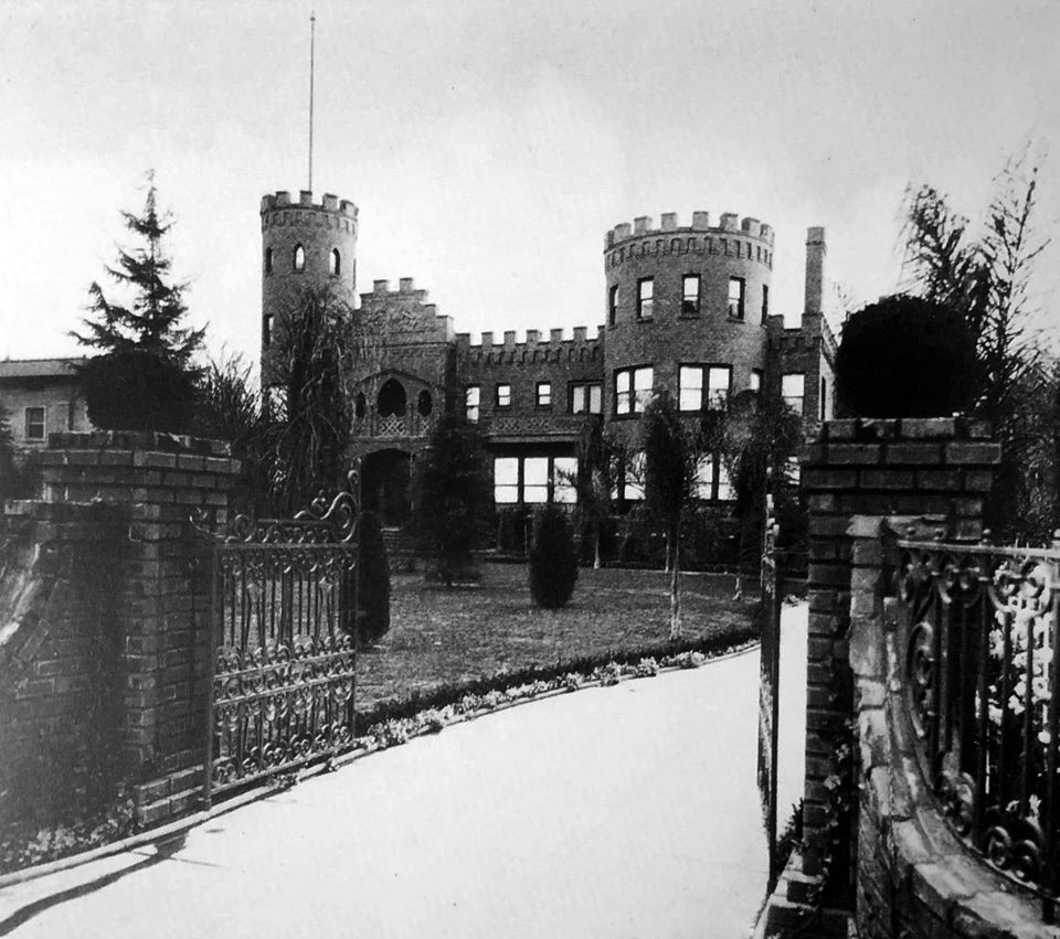
| (1915)^.^ - View showing Castle York, built by JJ Haggarty, as seen from W. Adams Blvd. |
Historical Notes After arriving in the U.S. in 1887 from his native land of England, John Joseph Haggarty worked as a buyer for several gament department stores in Missouri and Minnesota. In 1902 the promise of Southern California appealed to him and Haggarty relocated to Los Angeles. He immediately became associated with Jacoby Brothers as buyer and manager of their garment department. In a little over three years, he built up a tremendous business in his particular line and saved enough money to go into business for himself on a small scale.^ |
 |
|
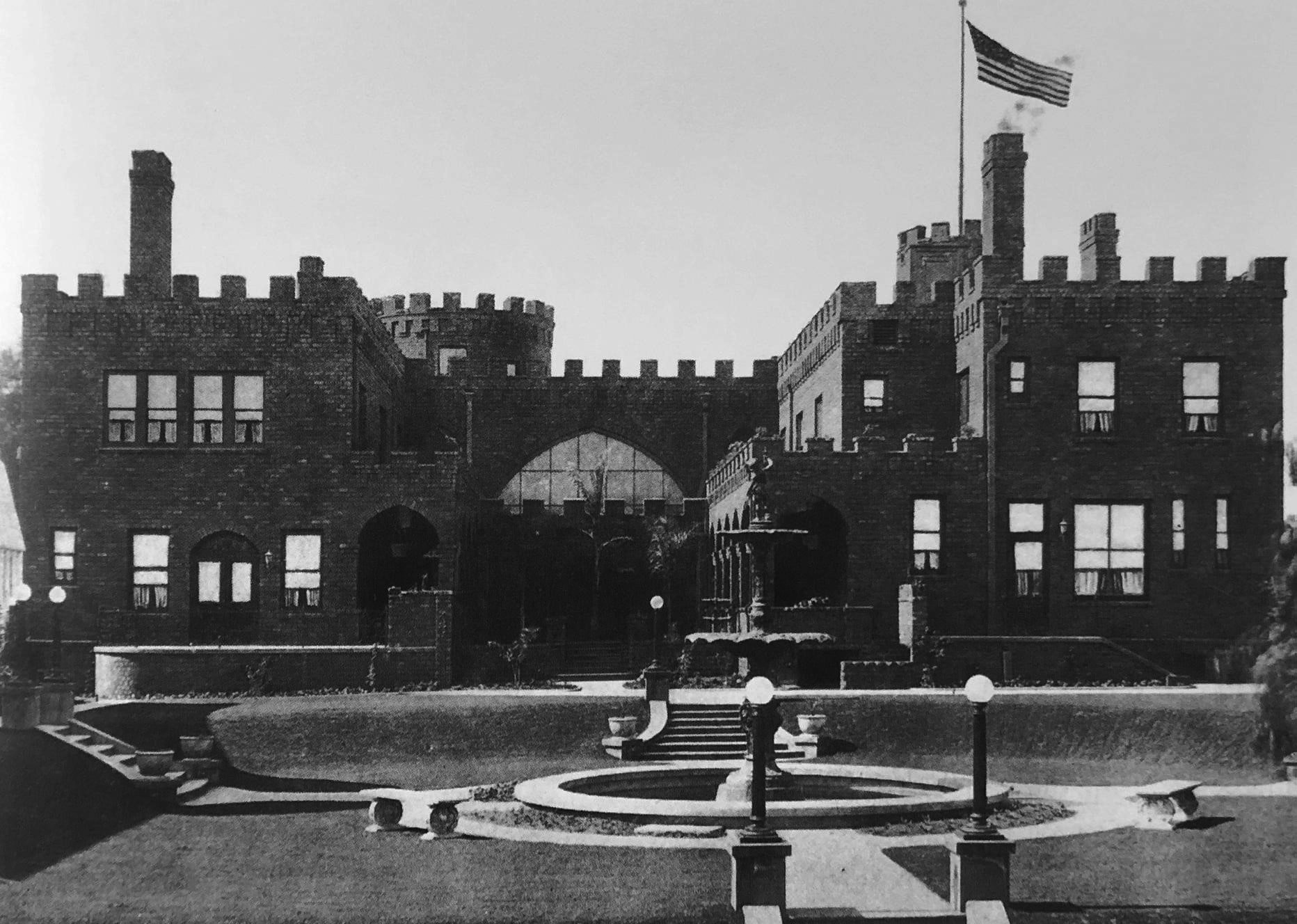
| (1915)^.^ - Castle York as seen from the rear with sunken garden and fountain seen in foreground. |
Historical Notes Haggarty secured a building on Broadway, in the center of the Los Angeles business district, and there laid the foundation for one of the most successful businesses in the commercial history of the city. He called his store the New York Cloak and Suit House, an incorporated institution, in which he was President and chief stockholder. The business was started on a comparatively small investment, but within a short time it had leaped to a leading position in the business life of the city. He also purchased a controlling interest in another large house known as the Paris Cloak and Suit House. He would later open the high-end department store that would carry his name, J.J. Haggarty.^ |
 |
|
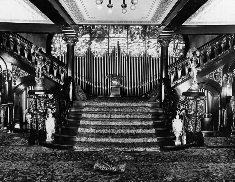
| (n.d.)* - Interior view of the J.J. Haggarty residence also known as the "Castle”. |
Historical Notes The interior of J. J. Haggarty's Castle consisted of a living room, organ loft, dining room, billiard room, sixteen bedrooms, servants' quarters, kitchens, pantries and china closets, along with numerous porches, balconies, gardens, and barns.* |
 |
|
| (ca. 1930s)* - Exterior view of the J.J. Haggarty residence (the "Castle") as it appeared circa 1930s, fronted by several palm trees. Location: 3330 W. Adams Boulevard. |
Historical Notes The Castle was located at the foot of Fourth Avenue, where the Holman United Methodist Church parking lot is now. It suffered a major fire in 1951. The main building was torn down in 1971. |
* * * * * |
Darby Hotel (Currently the Grace Apartment Hotel)
 |
|
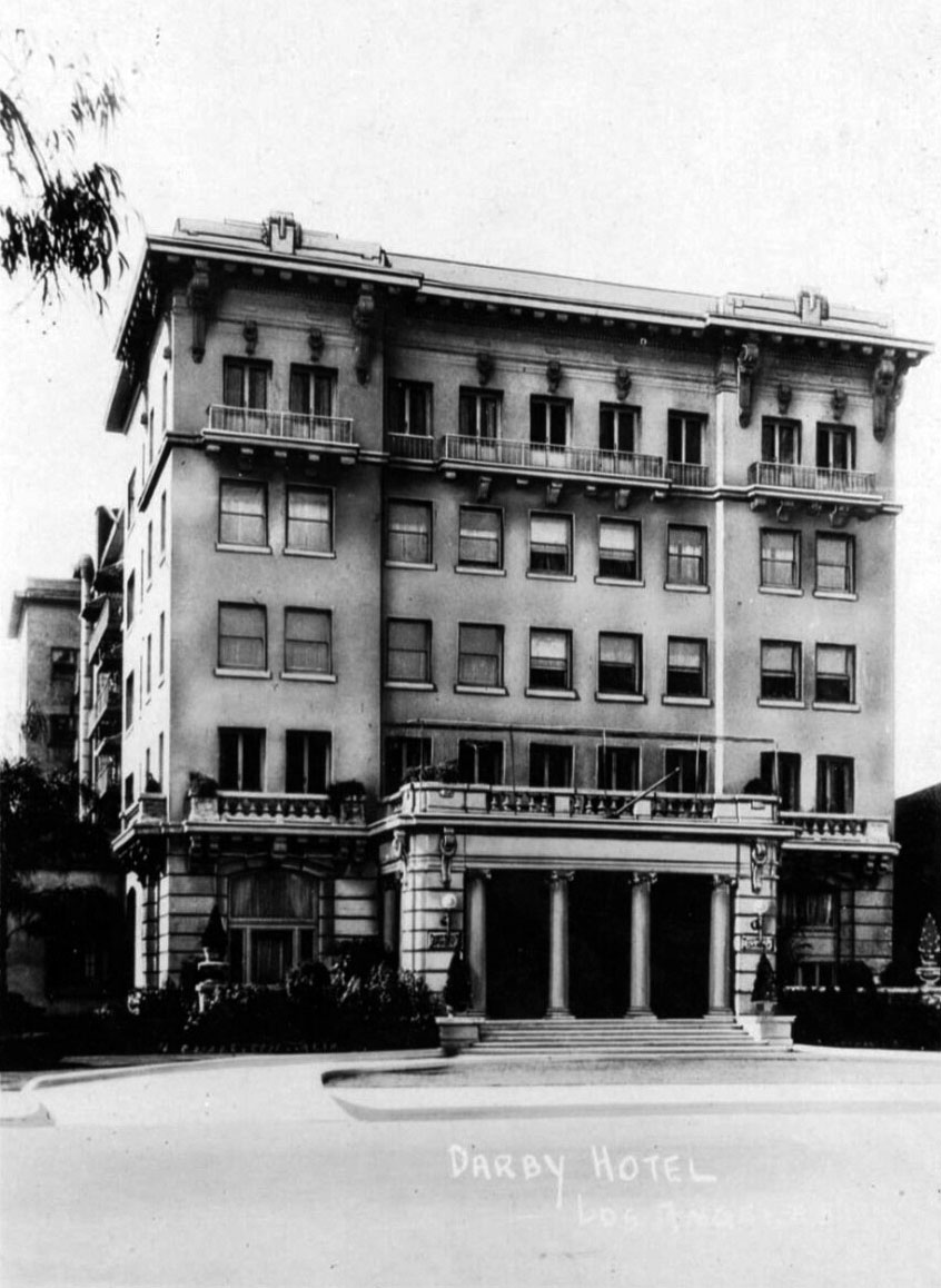
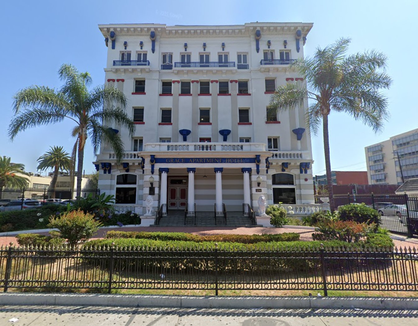
| (ca. 1920s)* - Exterior view of the Darby Hotel located on the south side of Adams east of Grand Ave. |
Historical Notes In 1909, altering the neighborhood permanently, real estate developer Wesley C. Clark, picked up his house at 234 Adams and trucked it one block to 340 W. Adams. Clark immediately redeveloped the vacated lot with a five-story, 70-foot-high apartment building named the Darby, after his mother's family, which stands today as the Grace Apartment Hotel.^ |
 |
|
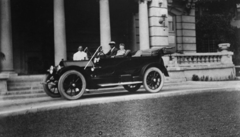
| (1920s)* - Standing behind the car is Ray I. Matthews. In the car is Charles Blodgett & 1 other person. They are in front of the Darby Hotel, built by Blodgett, a black contractor. Presently this building is known as the Grace Apartments |
Historical Notes The Darby's architect was John C. Austin. The "old family residence" at 234 W. Adams, owned by Wesley C. Clark, was moved to 340 W. Adams, where it remained until at least 1950. |
 |
|
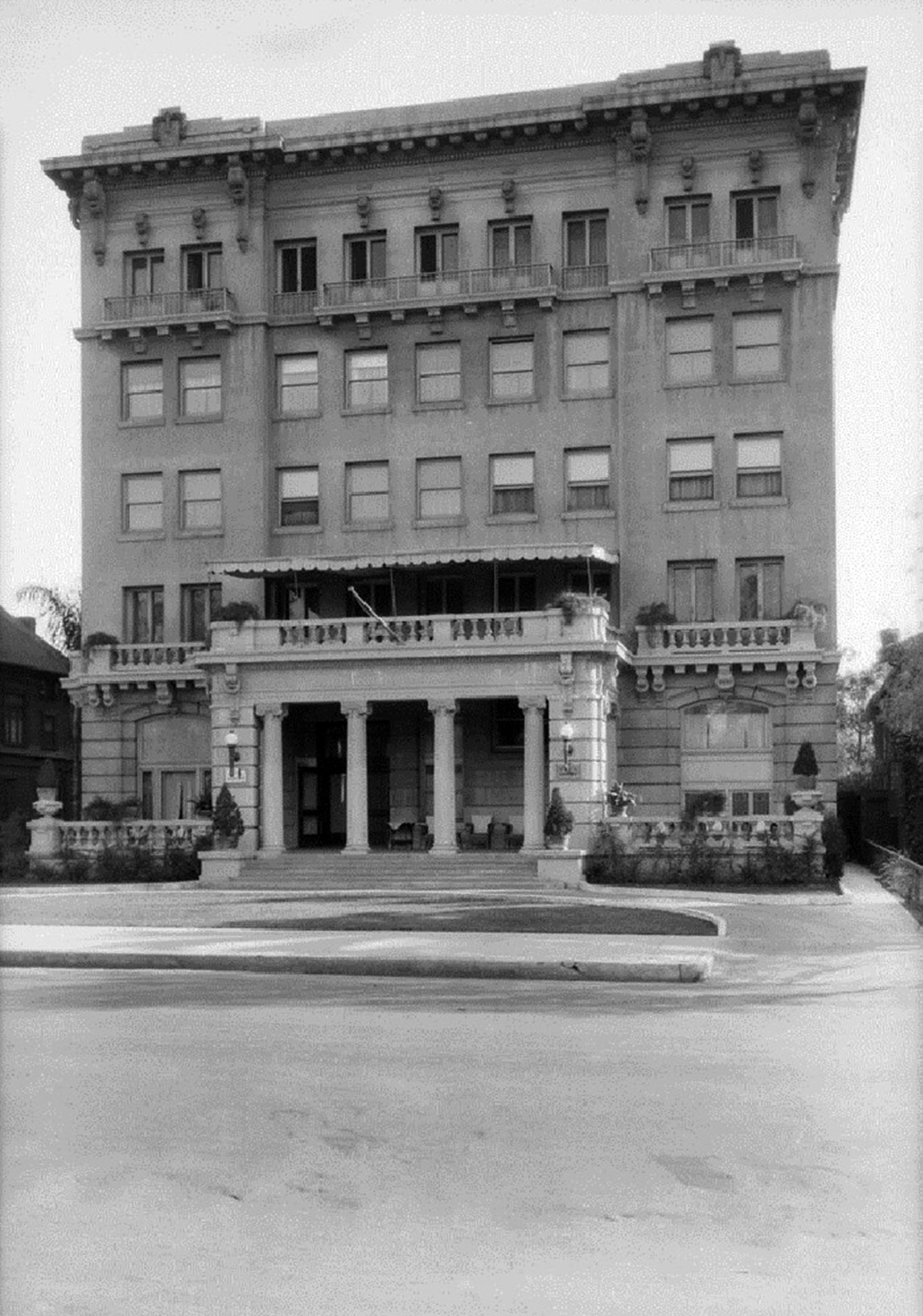
| (ca. 1930s) – The Darby Hotel, located at 234 West Adams Boulevard (near Grand). Photo Dick Whittington. |
Historical Notes While Wesley Clark's Hotel Darby was strictly genteel, its bulk and transient nature were harbingers of change in West Adams from a thoroughfare of expensive single-family residences to one of boarding establishments from which the affluent would have fled in force by the Depression.* |
 |
|
| (2021)* – Contemporary view of the Grace Apartment Hotel located at 234 W. Adams. |
Historical Notes At some point between 1943 and 1950, the name changed to the Grace Apartment Hotel. The front has lost some windows but gained some ornamental detail.* |
 |
|
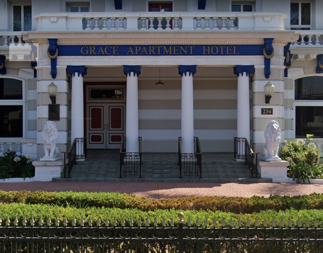
| (2021)* – Close-up view of the Grace Apartment Hotel (originally Darby Hotel). |
* * * * * |
Barlow Sanatorium
 |
|
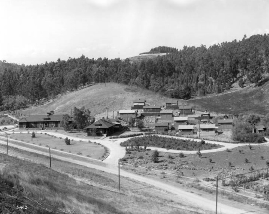
| (1915)^ - Panoramic view of the Barlow Sanatorium in its early days, Elysian Park. The sanatorium is comprised of a dozen cottages at right. At center, several small single-story buildings are visible. To the far left, is the main 13-room infirmary building. Roads circle around the compound and allow access to the main road. Surrounding grasslands, lawns, and courtyards are well maintained. Utility poles line the main road. Thick forests of trees are visible in the hilly background. |
Historical Notes In 1902 Dr. Barlow founded The Barlow Sanatorium "to care for the indigent tuberculous of Los Angeles county; those who have been residents of the county for one year and who are in no condition for active work." He and his wife had spent many days driving around the Los Angeles area in their horse-drawn carriage until they discovered what looked like the ideal location. It was 25 acres of untouched meadowland set among the rolling hills next to the city-owned Elysian Park on Chavez Ravine Road. The site turned out to be more ideal for the purpose than was initially apparent. The configuration of the hills in the area is such that clean air always sweeps across Barlow's land, even when Los Angeles itself is plagued with smog - a fortunate climatic quirk that met the fresh air needs of the patients. Dr. Barlow purchased the 25 acres from J. B. Lankershim for $7,300. He convinced Lankershim to donate back $1,000 of the purchase price, received $1,300 from Alfred Solano, who with his wife (Marion Barlow's remarried mother) would become legendary supporters of the institution, and chipped in the balance of $5,000 himself. In addition to his practice and his sanitorium, Dr. Barlow was professor of clinical medicine at the Los Angeles Medical Department of the University of California and was dean of the school from 1908 to 1914. In 1906 he established the Barlow Medical Library at Los Angeles to aid people of limited means to obtain a medical education and in 1934 donated the property and volumes to the Los Angeles County Medical Society.*^^# |
 |
|
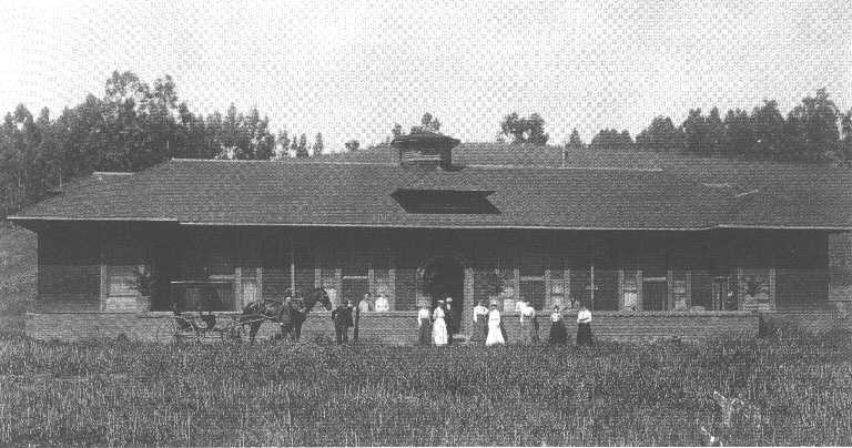
| (ca. 1903)*^^# - View showing about a dozen people and one horse-drawn wagon in front of the thirteen room permanent cottage, designed to become Barlow's future infirmary for the more advanced cases. It was contributed by Mr. and Mrs. Alfred Solano. Later, a sixty-foot passage-way would connect it with the administration building. |
Historical Notes In 1903, the original hospital of the Barlow Sanatorium was a permanent cottage with 13 rooms, two baths and 12 patient beds. It was built with donations from Mr. and Mrs. Alfred Solano, and was consequently named the Solano Infirmary. In September 1925, the Solano Infirmary burned down. Thankfully, no one died. In 1927 Alfred's wife, Mrs. Ella Brooks Solano, provided for the creation of a new infirmary, the Ella Brooks Solano Infirmary, a building that is still in use as the main hospital today.^* |
 |
|
| (ca. 1903)*^^# – View of the Administration Building, donated by Mrs. W. Jarvis Barlow. It was one of the first four structures that constituted the newly opened Barlow Sanitorium. |
Historical Notes Originally tuberculosis patients lived in tent cottages in order to be constantly exposed to free flowing air. As time went on permanent cottages were added to the campus by various donors. The style of these cottages reflected the popular trends of Los Angeles of the time. The architecture of the bungalows is in the California bungalow style. During World War I many servicemen contracted tuberculosis and were sent to the Barlow Sanatorium. Because of this the Los Angeles Chapter of the American Red Cross built and furnished four four-room cottages for military patients, some of which are still in use today.^* |
 |
|
| (2009)^* – View of the Barlow Respiratory Hospital Guild House in Elysian Park at 2000 Stadium Way, near Dodger Stadium. |
Historical Notes The Guildhouse was originally the "Men’s Help" quarters, where the men working in the hospital would live. In 1975 the old building was converted into a gift and plant shop. This was funded by the Barlow Guild, a large group of ex-patients dedicated to philanthropy, and the Guildhouse opened in April of that year. Originally a tuberculosis sanatorium, Barlow Respiratory Hospital, today is a long-term acute care facility that specializes in respiratory diseases and also treats related secondary ailments. The hospital treats approximately 750 patients a year and sets the national benchmark in ventilator weaning at nearly 50%.^* In 1990, Barlow Sanitorium was deisgnated Los Angeles Historic-Cultural Monument No. 504 (Click HERE to see complete listing). |
* * * * * |
Southwest Museum
 |
|
| (1914)#^** - View showing the Southwest Museum during the time of its construction. The Los Angeles Railway (LARy) W Line can be seen in the foreground. |
Historical Notes Perched on the hills of the Arroyo Seco, the Southwest Museum opened its doors to the public in 1914. It was Los Angeles’ first world-class museums that had an immense collection of Native-American and Pre-Columbian artifacts (collected by Charles Lummis during his travels throughout the Southwest and South America) that rivaled anything in the U.S. #^ |
 |
|
| (1914)#^ - Aerial view of the Southwest Museum shortly after it opened. |
Historical Notes Charles Fletcher Lummis was an anthropologist, historian, journalist, and photographer who created the Southwest Society, which was the western branch of the Archaeological Institute of America. He gained the support of city leaders, and with the financial backing of attorney Joseph Scott and opened the Southwest Museum in 1907. The museum moved from Downtown Los Angeles to its current location in Mt. Washington in 1914, and has been there ever since.^* |
 |
|
| (ca. 1915)* - The Southwest Museum, viewed through trees from the street below, sits on top of the hill at 234 Museum Drive on Mt. Washington. The main building is flanked by two towers. At the bottom of the hill is the Casa Adobe (not visible in this angle). |
Historical Notes The 1914 building was designed by architects Sumner P. Hunt and Silas Reese Burns. Later additions to the museum include the Caroline Boeing Poole Wing of Basketry (completed 1941), by architect Gordon B. Kaufmann, and the Braun Research Library (1971), by architect Glen E. Cook.^* |
 |
|
| (1931)###^ – Postcard view showing early model cars parked next to the tunnel entrance of the Southwest Museum. |
Historical Notes Due to its steep incline and lack of a driveway, a Mayan-inspired entrance was constructed on Museum Drive, which made the Museum accessible via a tunnel and elevator. Set into the walls of the portal tunnel are dioramas illustrating various ways of Native American life. |
 |
|
| (n.d.)* - Southwest Museum exterior showing the ornate Art Deco style tunnel entrance at the bottom of the hill. |
Historical Notes In January 2016, an exhibition of contemporary artwork opened in the building's tunnel entrance. |
 |
|
| (2015)^* - View showing the Southwest Museum as it appears today. |
Historical Notes The museum occupies 17 acres overlooking Sycamore Grove on the northwest side of the Arroyo Seco Valley. It was dedicated as LA Historic-Cultural Monument No. 283 in 1984 and became part of the Autry National Center in 2004. The Southwest Museum was also added to the National Register of Historic Places on March 11, 2004. |
 |
|
| (2019)^.^ - View of the Southwest Museum as as seen from the Gold Line train. Photo by Howard Gray |
Historical Notes The building is now owned by the Autry National Center and houses an archaeological research center, an extensive collection of local historical artifacts, and the Braun Research Library, which contains all of Lummis' writings. #^ |
* * * * * |
Majestic Theatre
 |
|
| (ca. 1910s)* – View showing a bicycle parked by the curb in front of the Majestic Theatre located at 845 South Broadway. |
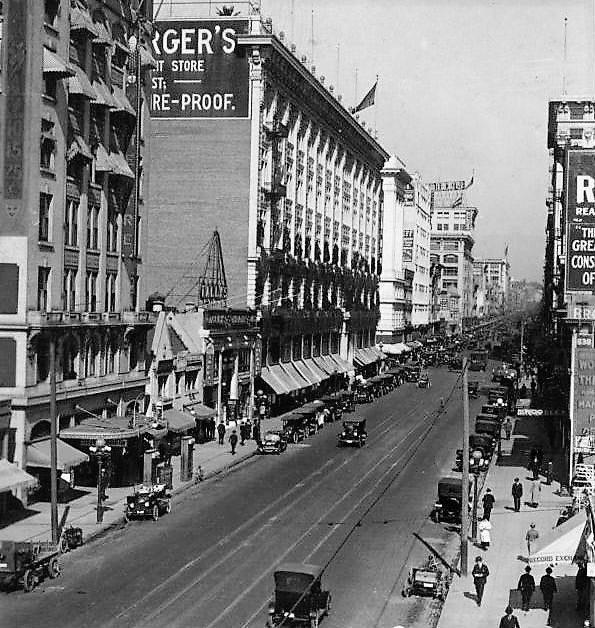
Historical Notes Opened on November 23, 1908 as Hamburger's Majestic with Oliver Morosco as lessee. Morosco was earlier the tenant of the Burbank Theatre on Main St. and in 1913 would move up the street to the Morosco Theatre, a building now known as the Globe. The opening attraction at the Majestic was a Shubert production of "The Land of Nod." Morosco liked the Majestic name as he had a half interest in a successful theatre called the Majestic in San Francisco. Architects Abraham M. Edelman and Leo W. Barnett of the firm Edelman & Barnett designed the building. Edelman also designed the Belasco/Follies on Main St. and the Empress Theatre, right behind it, on Spring. He was also involved in early phases of the Shrine Auditorium project. Structural engineering for the Majestic was by the firm of Mayberry & Parker. F.O. Engstrum was the contractor.^ |
 |
|
| (ca. 1910s)* - Interior view of the Majestic Theater at 845 South Broadway with scaffolding under the auditorium ceiling and the top of the proscenium. A man is seen standing on the scaffolding while working on the ceiling. |
Historical Notes Dutch artist Antoon Molkenboer was responsible for the Majestic's proscenium mural as well as decorations elsewhere in the theatre and its basement cafe. Molkenboer's mural above the proscenium was titled "Cast of Characters" and portrayed sixteen figures in a scale larger than life.^ |
 |
|
| (1913)* - View toward the Majestic facade and, adjacent to Hamburger's Department Store, Tally's New Broadway Theatre. In the lower right the Woodley Theatre is under construction. It opened in September 1913 and in 1920 got renamed the Mission. Note that the Majestic still didn't have a vertical sign. |
 |
|
| (ca. 1916)* – View looking north on Broadway towards 8th Street showing the Majestic Theatre at left. Also seen is Tally's New Broadway Theatre just south of Hamburger's Department Store which located the SW corner of Broadway and 8th Street. |
 |
|
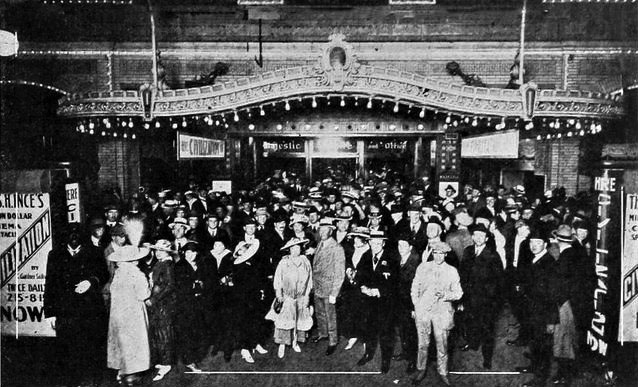
| (1916)^.^ - View showing a crowd gathered for the April 17 opening of the Thomas Ince film "Civilization." |
Historical Notes Civilization is a 1916 American pacifist allegorical drama film produced by Thomas H. Ince, written by C. Gardner Sullivan and Edward Sloman, and directed by Ince, Reginald Barker and Raymond B. West. The story involves a submarine commander who refuses to fire at a civilian ocean liner supposedly carrying ammunition for his country's enemies. The film was a big-budget spectacle that was compared to both Birth of a Nation and the paintings of Jean-François Millet. The film was a popular success and was credited by the Democratic National Committee with helping to re-elect Woodrow Wilson as the U.S. President in 1916. The film was also one of the first to depict Jesus Christ as a character in a motion picture, leading some to criticize the depiction as in "poor taste." Civilization is sometimes viewed as one of the first anti-war films. In 1999, it was selected for preservation in the United States National Film Registry by the Library of Congress as being "culturally, historically, or aesthetically significant".* |
 |
|
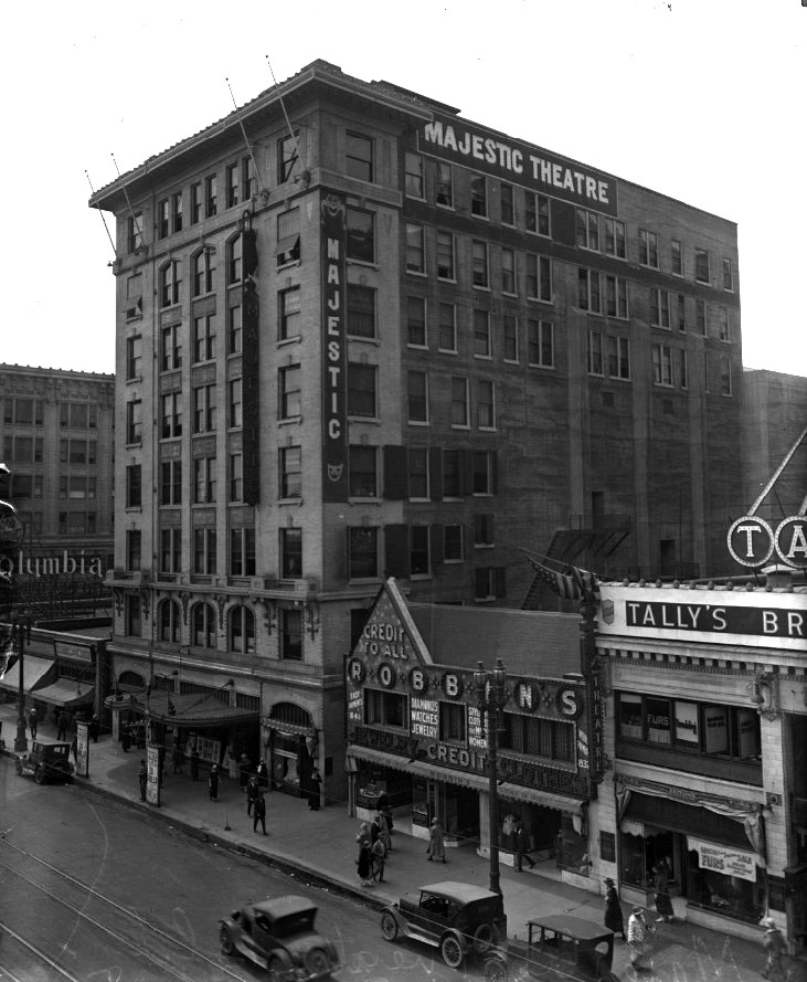
| (ca. 1920)*^ - View looking southwest showing the Majestic Theatre at 845 S. Broadway. Tally's New Broadway Theatre is seen on the right. |
Historical Notes Originally leased by Oliver Morosco, the 1700-seat Majestic quickly became the preferred home-away-from-home to many national touring musical and dramatic productions from Broadway. Future silent film star Ramon Navarro’s first show biz job was as an usher there. In 1910, the Majestic was the local performance venue of choice for a versatile, LA-based stage performer named Lon Chaney, later dubbed “The Man of a Thousand Faces". * |
 |
|
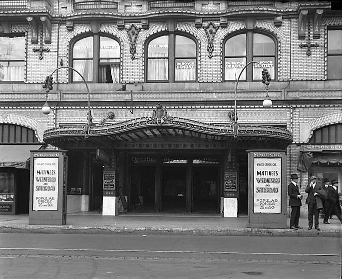
| (1920)* - An entrance view with posters advertising the Wilkes Stock Co. in "The Country Cousin" with Evelyn Varden and Edward Everett Horton. The production opened in January. Note the dentists’ offices on the 2nd floor. |
Historical Notes In April 1913, during the Majestic’s opening night of the Kolb and Dill show, managed by famous actor Lon Chaney, his wife, Cleva, attempted suicide, ingesting mercury dichloride and running onstage from the wings. She survived but was never able to sing again. The scandal forced Chaney out of live theater and into silent films. There he specialized in creating such fearsome characters as Quasimodo in The Hunchback of Notre Dame and the Phantom in The Phantom of the Opera. Chaney divorced Cleva; his son subsequently took on the name Lon Chaney, Jr. On the verge of making a successful transition into talking pictures, Lon Chaney died on August 26, 1930, of a bronchial hemorrhage. Meanwhile, the bad publicity resulting from Cleva’s suicide attempt knocked the Majestic out of favor with mainstream touring acts from Broadway. In 1926, the Majestic partnered with Orange Grove Theatre (later the Grand) in the presentation of risqué vaudeville and burlesque shows. Over the next half-dozen years, the theater was subjected to constant police raids for violation of the city’s Indecent Show ordinance. It was forced to close in 1931, when a police raid results in a number of patrons being trampled.. * |
 |
|
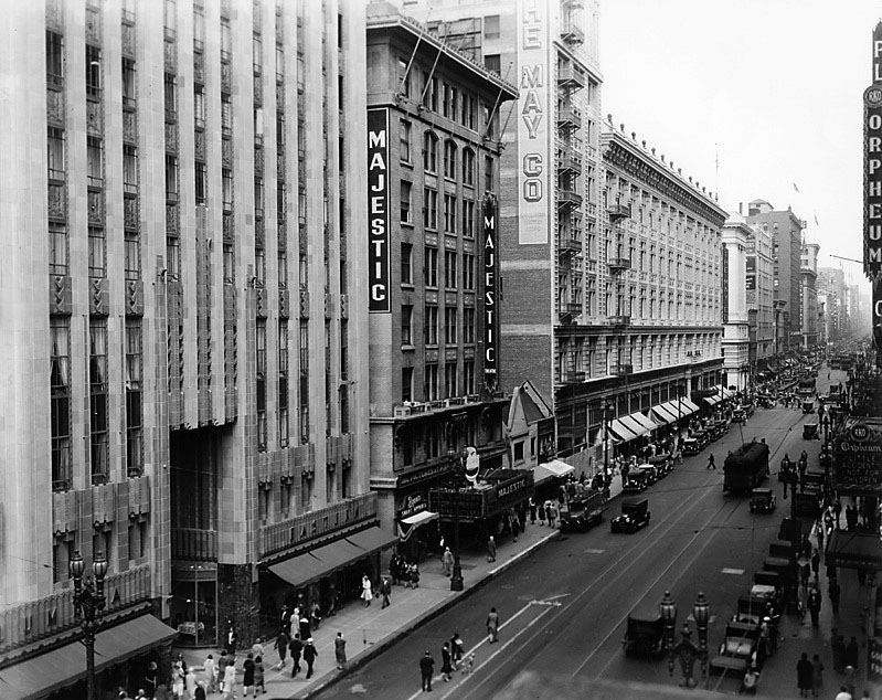
| (1930)* – View of Broadway looking north from 9th Street with the Majestic Theatre seen at center. The newly opened Eastern Columbia Building is on the left. The Majestic is running "Top Speed" with Joe E. Brown, an August release. Just beyond, note that Tally''s Broadway is no gone. The The May Company was still working on the storefronts of the addition on the Tally's site. At the Orpheum Theatre (on the right) it's "Little Accident," a July release with Douglas Fairbanks, Jr. and Anita Page. |
Historical Notes In 1933, the Majestic was demolished to make way for a parking lot, which eventually becoame the three-story garage that stands on the site today. Click HERE for contemporary view. |
* * * * * |
Quinn's Superba Theatre
 |
|
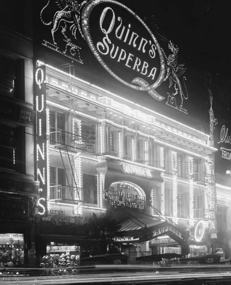
| (1915)*^^ - The dazzling facade of Quinn’s Superba Theater at night, 518 South Broadway. |
Historical Notes The theatre was opened on July 30, 1914 by pioneer theatreman John A. Quinn. Earlier (1909 or 1910) Quinn had moved from Arizona and leased the Ideal Theatre (134 S. Spring St.). This was followed by a partnership with G.H. McLain that acquired the Bijou (553 S. Main St.) and the Banner (456 S. Main St.). By the end of 1910 the partners had split with Quinn retaining the Banner. In 1911 Quinn took over the Garrick Theatre (former Hyman Theatre) at 8th & Broadway. In 1912 Quinn was running Tally's (833 S. Broadway) and was later involved on Broadway in the Rialto Theatre (1917).**^ |
 |
|
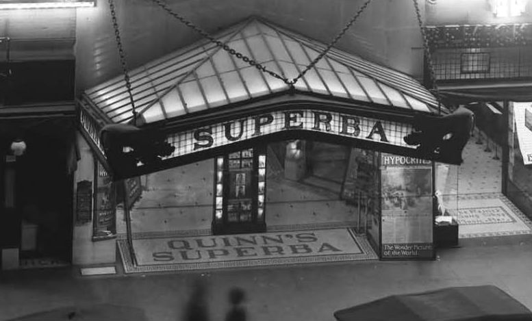
| (ca. 1915)**^ - Close-up view of the Quinn's Superba Entrance, 518 South Broadway in Los Angeles. |
Historical Notes With the opening of the Superba, this block on Broadway then had a cluster of four major theatres: Quinn's Superba, Clune's Broadway, Pantages and Tally's New Broadway .**^ |
 |
|
| (ca. 1915)* - Exterior view of the front of Quinn's Superba Theatre, with a view down the street where signs can be seen for the Pantages Vaudeville. |
Historical Notes Quinn’s Superba Theatre was located on the site where the Roxie Theatre is today on Broadway in Downtown Los Angeles. It was next to Clune's Broadway (later Cameo) and the Pantages.^^^* The Pantages Theatre (1910), Clune's Broadway (1910), and Quinn's Superba (1914), along with the 1911 Orpheum Theatre (now the Palace) and Tally's New Broadway (1910), put Broadway on the map as the new entertainment street in Los Angeles. |
 |
|
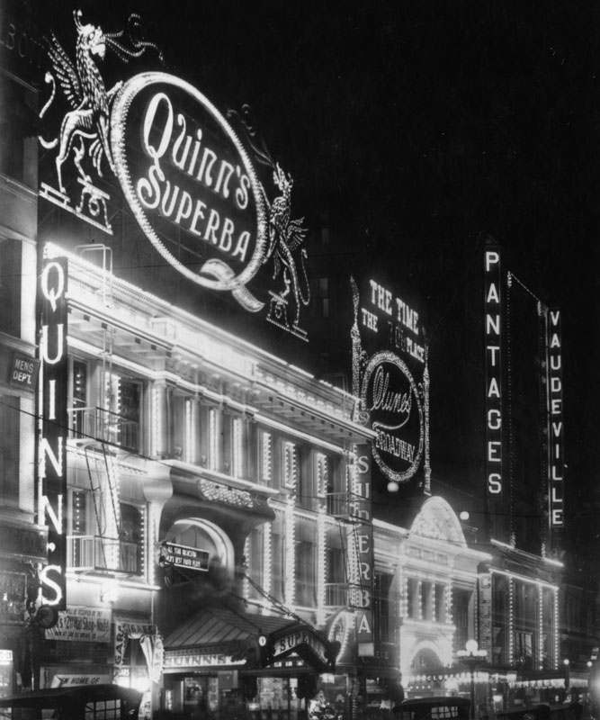
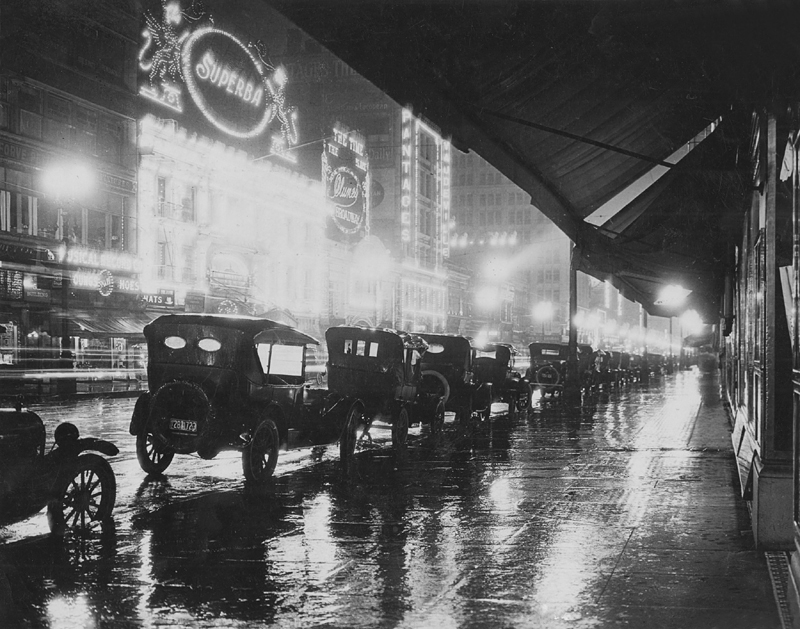
| (1920)^* - A rainy night image looking south on Broadway between 5th and 6th streets. Across the street can be seen Quinn's Superba, Clune's, and the first Pantages Theater. |
Historical Notes The Superba Theater was later sold and converted to a coffee house before being razed in 1931 to make way for the Roxie, which was the last theater built on Broadway.*^^ |
* * * * * |
Pantages Theatre (1st Pantages)
 |
|
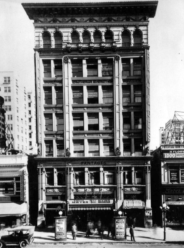
| (ca. 1917)* – View showing the first Pantages Theatre, located at 534 S. Broadway in Downtown Los Angeles. Clune's Broadway Theatre is seen on the left. |
Historical Notes Designed by Morgan & Walls, this theater opened on September 26, 1910 as a vaudeville theatre for Alexander Pantages. After Pantages moved to his new theater at 7th and Hill streets in 1920, this theater was renamed Dalton's. Eight years later, it was renamed Arcade in honor of the popular Arcade Building. In the 1940s it was known as the Telenews and the Teleview. It has been closed since 1992.* |
 |
|
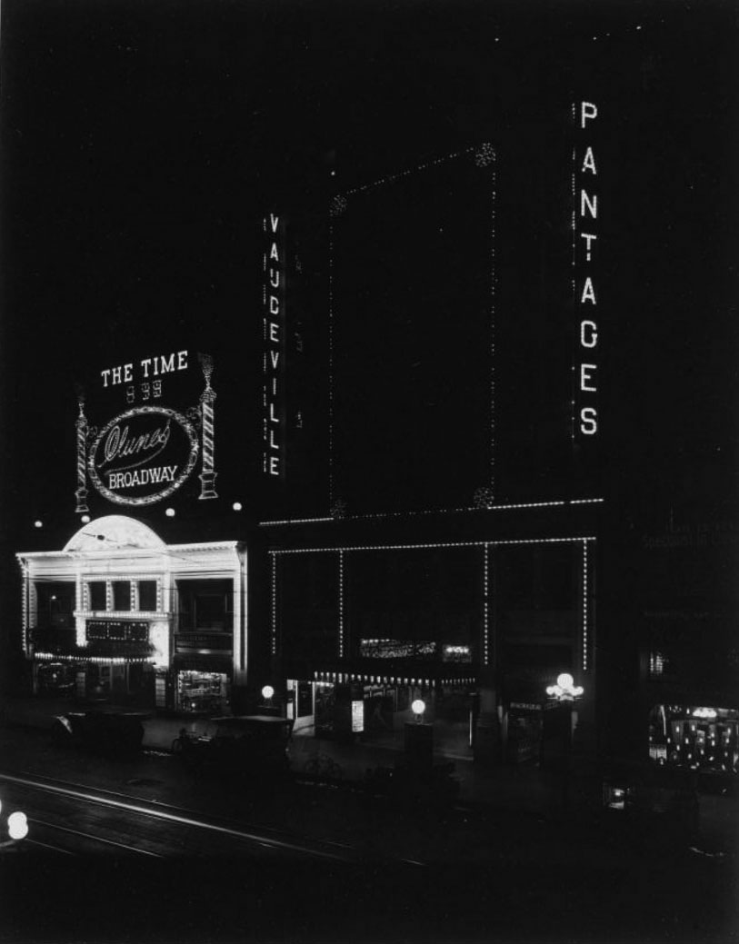
| (1913)*^*# – Night view showing the Pantages Theatre all lit up with the Clune's Broadway Theatre on the left. |
|
|
| (ca. 1915)* - View looking at the east side of Broadway between 5th and 6th streets, showing the Quinn's Superba, Clune's, and the first Pantages Theater. |
Historical Notes The Pantages Theatre (1910), Clune's Broadway (1910), and Quinn's Superba (1914), along with the 1911 Orpheum Theatre (now the Palace) and Tally's New Broadway (1910), put Broadway on the map as the new entertainment street in Los Angeles. |
 |
|
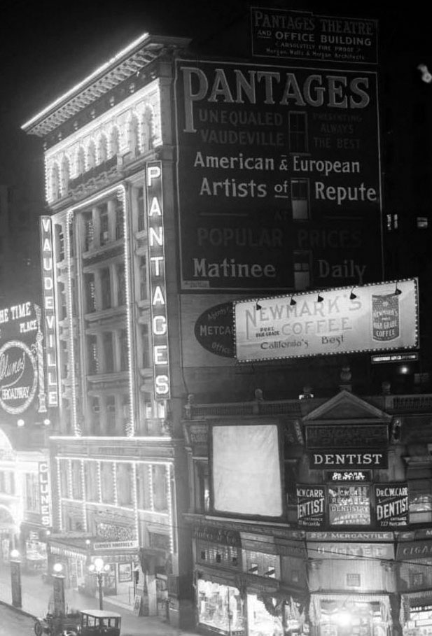
| (1916)*^*# - Night view of the Pantages Theatre at 534 N. Broadway. The building with the dentist office on the right is where the Arcade Building would be built in 1924. |
Historical Notes After Pantages Theatre moved to its new location at 7th and Hill streets in 1920, this theater was renamed Dalton's. Eight years later, it was renamed Arcade in honor of the popular Arcade Building. |
 |
|
| (ca. 1924) – Postcard view looking north on Broadway from near 6th Street showing from right to left: the Arcade Building (built in 1924), Dalton’s Theatre (previously Pantages Theatre), Clune's Broadway Theatre, and Quinn's Superba Theatre. |
 |
|
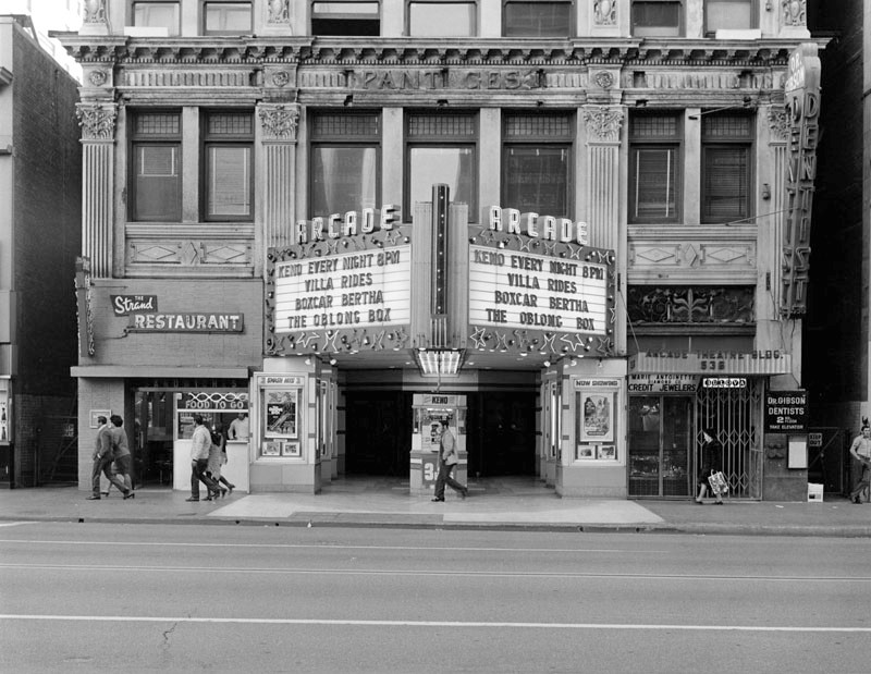
| (1983)* – View of the Arcade Theatre, formerly the 1st Pantages Theater. The marquee advertises Keno every night. Next door is the Strand Restaurant and the Marie Antoinette Diamond Company Credit Jewelers, in the Arcade Theater Building. Dr. Gibson Dentist is on the second floor. |
Historical Notes In 1928 the theatre was given the name Arcade to capitalize on the popularity of the Arcade Building nearby. The current marquee is on the building dates from around 1935 when S. Charles Lee did a facade renovation. |
* * * * * |
Clune's Broadway Theatre (later Cameo Theatre)
 |
|
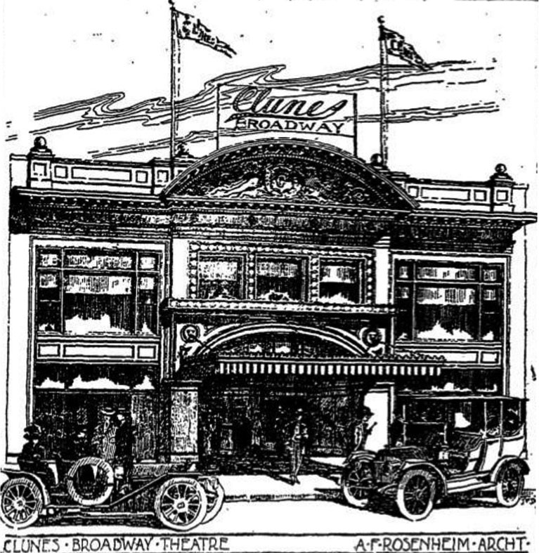
| (ca. 1910)++^ – Sketch showing the Clunes Broadway Theatre located at 528 S. Broadway. Los Angeles Times, July 17, 1910. |
Historical Notes Architect: Alfred F. Rosenheim, a leading Los Angeles architect, who became the first president of the LA chapter of the American Institute of Architects. Among other projects, Rosenheim had done the Arrow Theatre (inside Hamburger's Department Store (1908) and later did the Morosco/Globe (1913). The theatre was built on a lot owned by Eva Fenyes, a Pasadena resident with fingers in a number of theatrical interests, including once having D.W. Griffith shoot a film on her estate. W. H. Clune (Billy) was a pioneer exhibitor and filmmaker. The Clune Studios in Hollywood at Melrose and Bronson still exists -- known today as the Raleigh Studios. ++^ |
 |
|
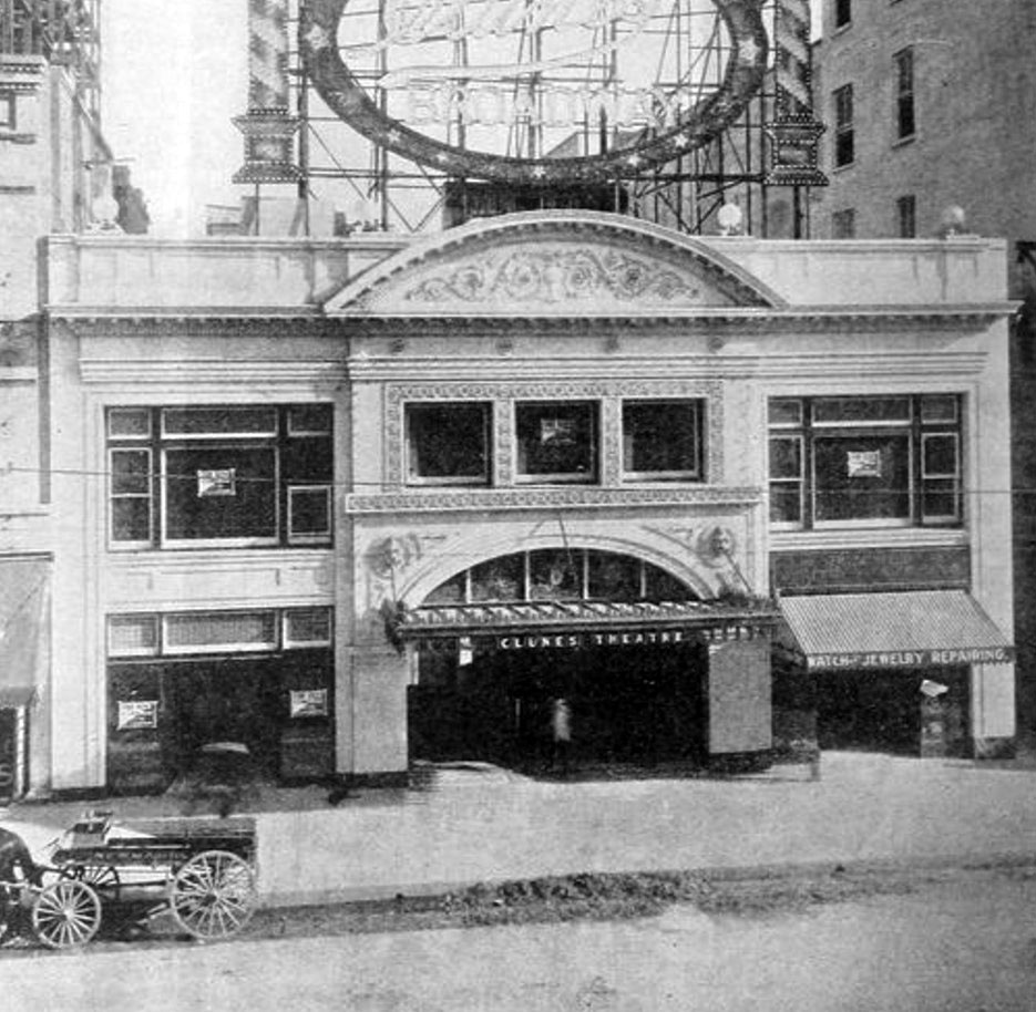
| (1910)^^^* – View showing Clune’s Broadway Theatre shortly after it was completed with horse-drawn wagon parked in front. “For Rent” signs are still on the windows of one of the storefronts adjacent to the theater entrance and the upstairs offices. |
Historical Notes Opened as Clune’s Broadway Theatre October 10, 1910, it was an original nickelodeon theatre and is a rare example to survive today almost unaltered. Its operator William H. (Billy) Clune was an early pioneer film producer and exhibitor. Architect Alfred F. Rosenheim designed a Beaux-Arts interpretation of Italian Renaissance Revival style. Its original roof-top electric sign and ‘digital’ clock were Downtown landmarks for many years. In 1921 it was equipped with a Wurlitzer organ Style 185, Opus 397. In 1925 until 1926 it was operated by Universal Pictures chain and renamed Cameo Theatre. In the late-1920’s it was operated by H.L. Gumbiner (who soon was to build the Tower Theatre and Los Angeles Theatre further along South Broadway) who replaced the sign and clock with a large 24-sheet billboard. ^^^* |
 |
|
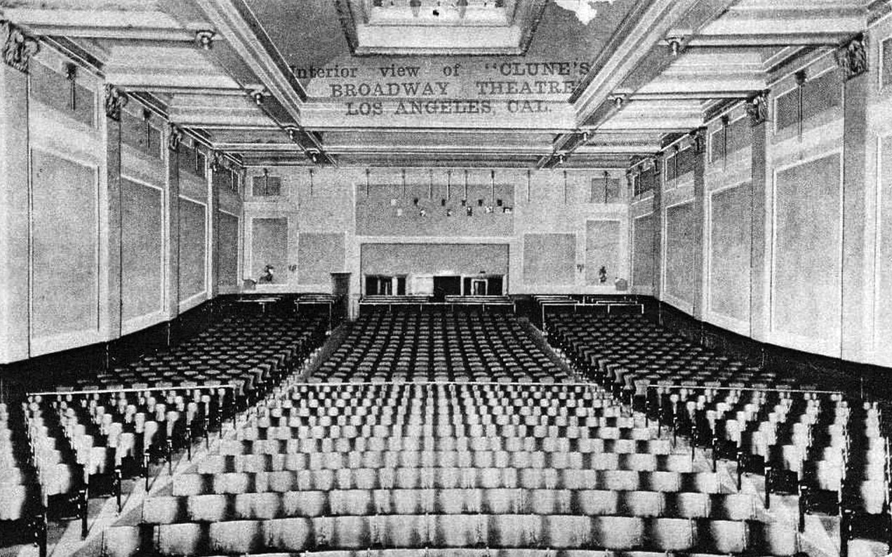
| (ca. 1910s)++^ – Postcard view showing the interior of Clune’s Broadway Theatre. |
Historical Notes The interior of the building was specifically designed as a ‘picture playhouse’ and had decorations which featured marble, plaster, leaded glass and a profusion of electric lights. A 1912 ad for Clune's boasted "When one speaks of low-priced theater attractions the name CLUNE comes first to the mind because it is an uncontested fact that the CLUNE THEATERS in Los Angeles and Pasadena set the pace in these popular public attractions." ++^ |
 |
|
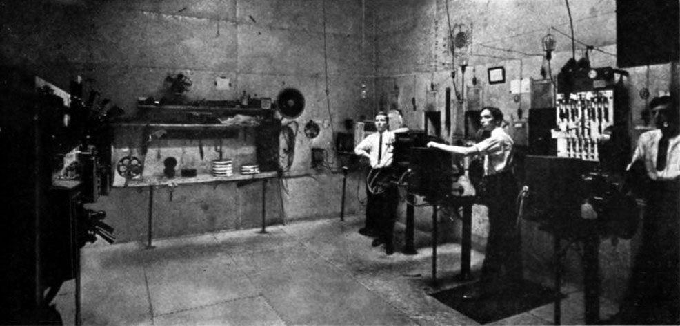
| (1911)++^ - A photo of the Clune's projection booth from Moving Picture World in 1911. Note the open front switchboard on the booth's front wall. |
Historical Notes The Clune's Broadway had an orchestra of 10 pieces to accompany the films. |
|
|
| (ca. 1915)* - View looking at the east side of Broadway between 5th and 6th streets, showing the Quinn's Superba, Clune's Broadway, and the first Pantages Theatre. |
Historical Notes The 1910 Pantages Theatre, 1910 Clune's Broadway, and 1914 Quinn's Superba, along with the 1911 Orpheum Theatre (now the Palace) and 1910 Tally's New Broadway, put Broadway on the map as the new entertainment street in Los Angeles. |
 |
|
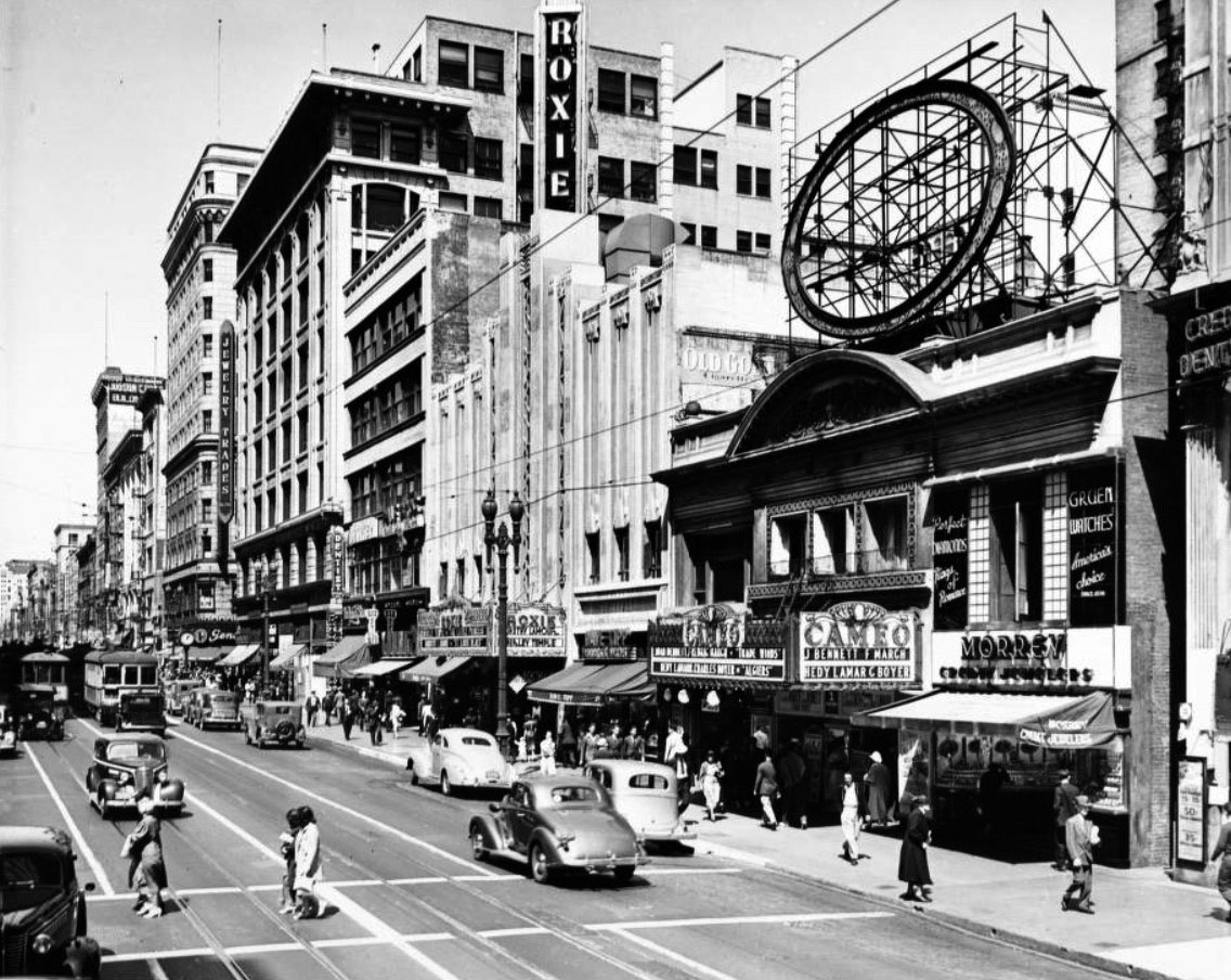
| (1939)^ – View looking north on Broadway with the Cameo Theatre (previously Clune’s Broadway Theatre) seen on the right. Further north is the Roxie Theatre which was built in 1931 on the same site as Quinn's Superba Theatre. |
Historical Notes In 1925 until 1926 Clune’s Broadway Theatre was operated by Universal Pictures chain and renamed Cameo Theatre. The Clune’s Broadway Theatre's original roof-top electric sign and ‘digital’ clock were Downtown landmarks for many years. In 1921 the theatre was equipped with a Wurlitzer organ Style 185, Opus 397. In the late-1920’s it was operated by H.L. Gumbiner (who soon was to build the Tower Theatre and Los Angeles Theatre further along South Broadway) who replaced the sign and clock with a large 24-sheet billboard. ++^ |
 |
|
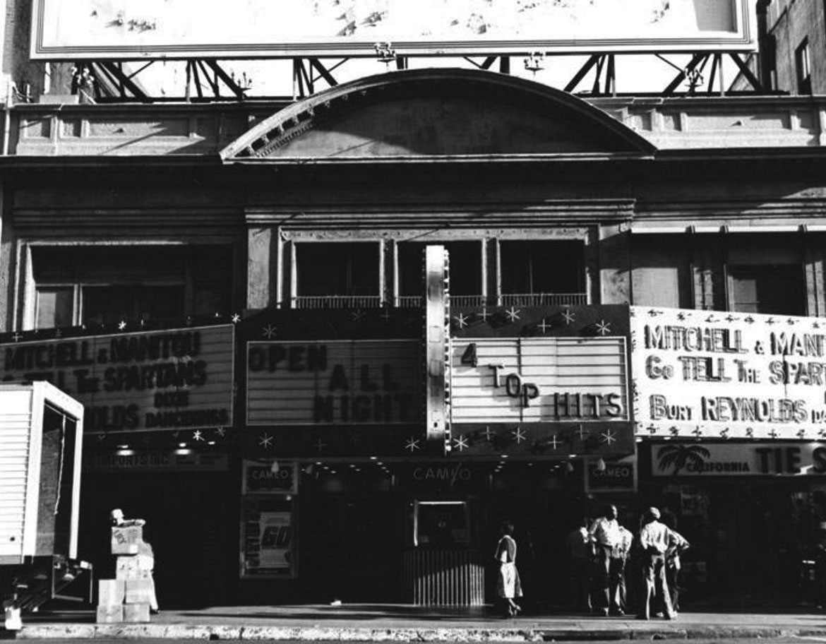
| (1978)^*# - View showing the front of the Cameo Theatre, now open all night, at 528 S. Broadway. Photo by Tom Zimmerman. Click HERE to see contemporary view. |
Historical Notes Minor alterations were carried out by architect Simeon Charles Lee in 1949. In 1987 it was repainted and redecorated by the then owners Metropolitan Theatres. In its later years it was screening Kung-Fu and exploitation films and was closed in 1992. It was the longest continually operating movie theatre in California at that time. The front entrance has been converted into retail use, while the auditorium is used for storage. ^^^* In 1991, the Cameo Theatre (formerly the Clune's Broadway Theatre) was designated LA Historic-Cultural Monument No. 524. Click HERE to see complete listing. |
* * * * * |
Paramount-Famous-Lasky Corporation West Coast Studios
 |
|
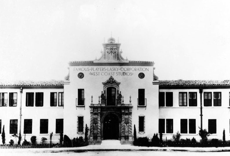
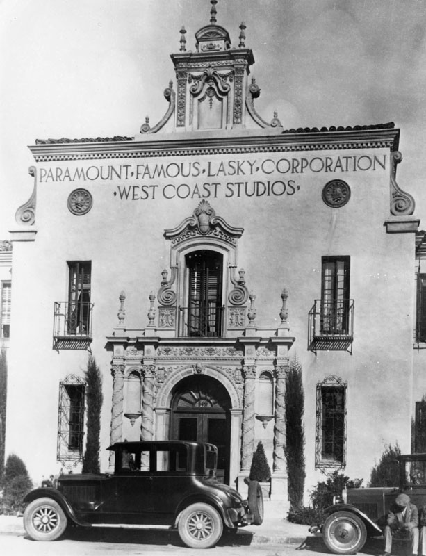
| (ca. 1916)* - Entrance to the Famous Players-Lasky Corporation West Coast Studios located at 5555 Melrose Avenue before Paramount was added. |
Historical Notes Paramount Pictures dates its existence from the 1912 founding date of the Famous Players Film Company. Founder Hungarian-born Adolph Zukor, who had been an early investor in nickelodeons, saw that movies appealed mainly to working-class immigrants. With partners Daniel Frohman and Charles Frohman he planned to offer feature-length films that would appeal to the middle class by featuring the leading theatrical players of the time (leading to the slogan "Famous Players in Famous Plays". By mid-1913, Famous Players had completed five films, and Zukor was on his way to success. In 1916, Zukor maneuvered a three-way merger of his Famous Players, the Lasky Company, and Paramount. The new company Lasky and Zukor founded, Famous Players-Lasky Corporation, grew quickly, with Lasky and his partners Goldwyn and DeMille running the production side, Hiram Abrams in charge of distribution, and Zukor making great plans. Famous Players-Lasky and its "Paramount Pictures" soon dominated the business.^* |
 |
|
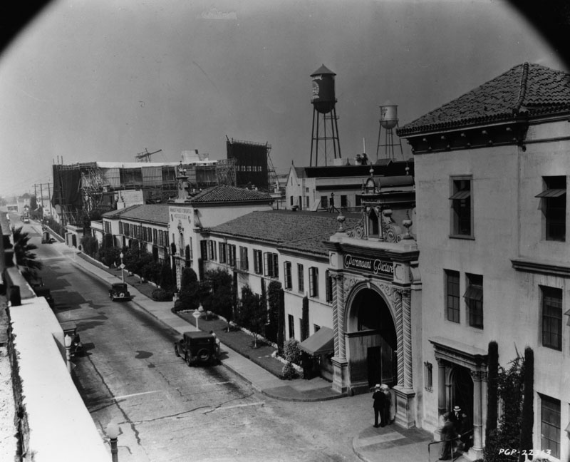
| (ca. 1930s)* - View of the Paramount-Famous-Lasky Corporation West Coast Studios building. |
Historical Notes Zukor signed and developed many of the leading early stars, including Mary Pickford, Marguerite Clark, Pauline Frederick, Douglas Fairbanks, Gloria Swanson, Rudolph Valentino, and Wallace Reid. With so many important players, Paramount was able to introduce "block booking", which meant that an exhibitor who wanted a particular star's films had to buy a year's worth of other Paramount productions. It was this system that gave Paramount a leading position in the 1920s and 1930s, but which led the government to pursue it on antitrust grounds for more than twenty years.^* |
 |
|
| (1936)* - View looking west on Melrose Avenue showing the Paramount Studios corporate office building at center-left and one of the entrance gates in the foreground. |
Historical Notes Paramount films emphasized stars; in the 1920s there were Swanson, Valentino, and Clara Bow. By the 1930s, talkies brought in a range of powerful new draws: Miriam Hopkins, Marlene Dietrich, Mae West, W.C. Fields, Jeanette MacDonald, Claudette Colbert, the Marx Brothers (whose first two films were shot at Paramount's Astoria, New York, studio), Dorothy Lamour, Carole Lombard, Bing Crosby, band leader Shep Fields, famous Argentine tango singer Carlos Gardel, and Gary Cooper among them. In this period Paramount can truly be described as a movie factory, turning out sixty to seventy pictures a year. In 1933, Mae West would also add greatly to Paramount's success with her suggestive movies She Done Him Wrong and I'm No Angel. However, the sex appeal West gave in these movies would also lead to the enforcement of the Production Code, as the newly formed organization the Catholic Legion of Decency threatened a boycott if it was not enforced.^* |
 |
|
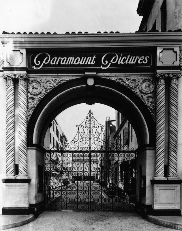
| (1957)* - View of the ornate entrance to Paramount Studios in Hollywood. |
Historical Notes Paramount is the fifth oldest surviving film studio in the world behind Universal Studios, Nordisk Film, Pathé, and Gaumont Film Company. It is the last major film studio still headquartered in Hollywood.^* |
* * * * * |
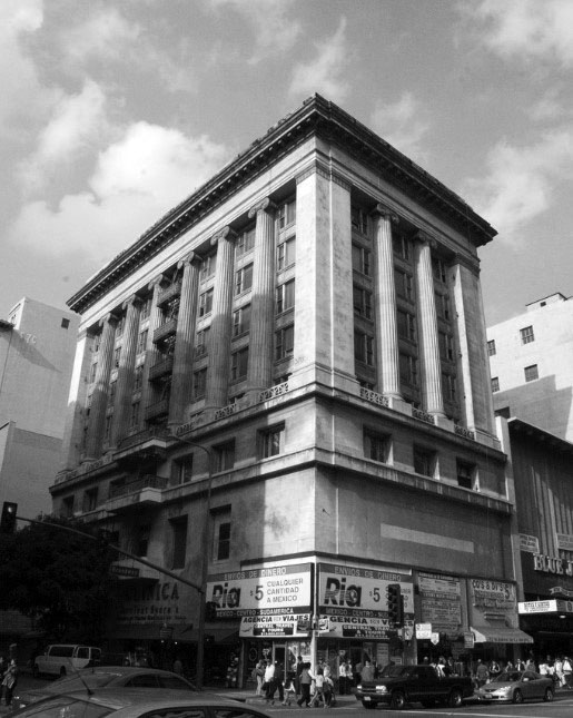
Merritt Building
 |
|
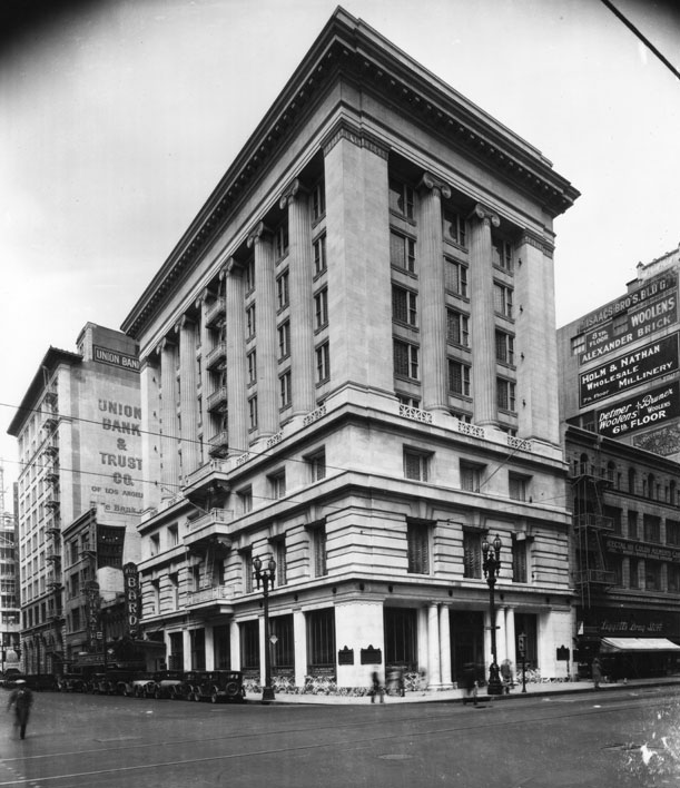
| (1916)#^* – View of the Merritt Building located at 8th and Broadway in downtown Los Angeles. |
Historical Notes Hulett C. Merritt, described by the Dec. 11, 1910 Los Angeles Herald as a "millionaire and financier" in an article about the planned Merritt Building in downtown Los Angeles. At the time, Merritt was pushing city leaders to waive building height restrictions from 180 feet to 233 feet. Merritt is reported as saying he would scrap plans for the Italian Renaissance-style monument to his family unless he was allowed the height variance, otherwise "its beauty will be marred and I want to build for the artistic value more than for any profit I may get out of it." Originally from Minnesota, Merritt had sold his interests in the Merritt - Rockefeller syndicate in 1891 for more than $81 million. When the Merritt Building opened in 1915 it looked quite nice. Merritt’s request to construct a 23-story edifice was turned down by the City Council. He scaled back his plans and ended up with a ten-story design that set a rendition of Minerva's Temple on top of a three-story base.*^#* |
 |
|
| (1931)* - View of the northwest corner of 8th Street and Broadway showing the Merritt Building. The Pan American Bank of California is housed in the building with the Union Bank & Trust Co. in the tall building to the left on 8th St. |
Historical Notes The Merritt Building housed various retail stores on its ground floor and offices above, with the top floor set aside for Mr. Merritt himself.*^#* |
 |
|
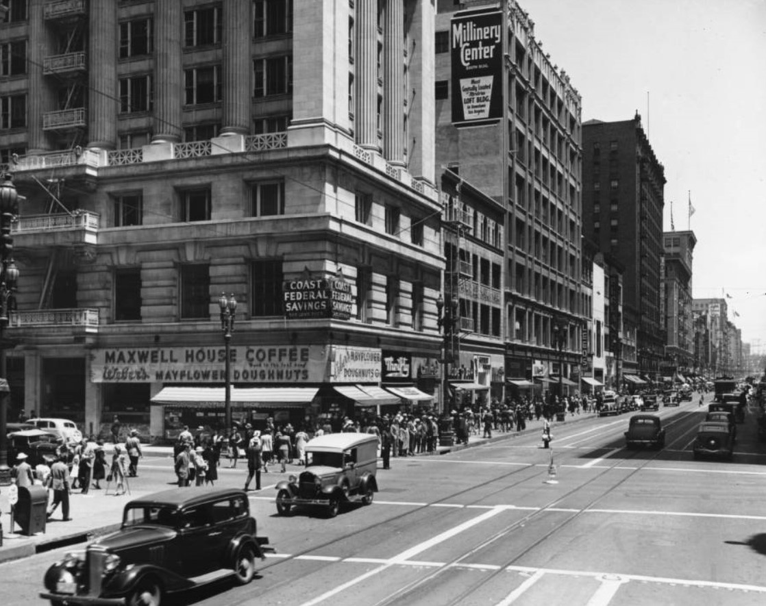
| (1939)^ – View looking north on Broadway at 8th Street showing the Merritt Building on the NW Corner. On the ground floor can be seen Maxwell House Coffee with Mayflower Doughnuts and Thrifty. Sign on corner of building reads Coast Federal Savings. |
 |
|
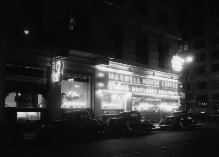
| (1930s)* – Night view showing cars parked in front of the Merritt Building. Store sign advertises Maxwell House Coffee. |
 |
|
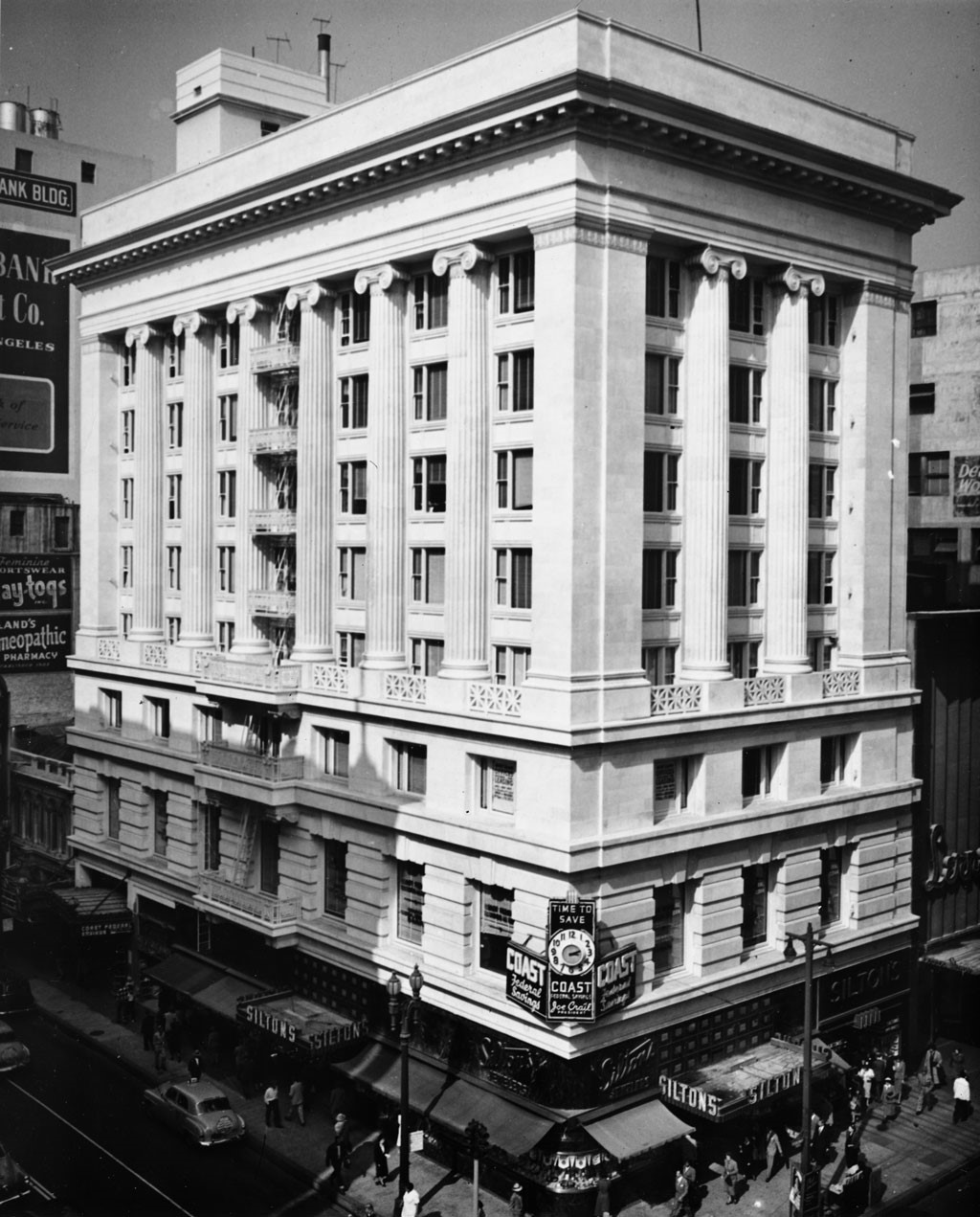
| (ca. 1957)^ – View of the Merritt Building which houses Siltons, located on the northwest corner of 8th Street and Broadway in downtown Los Angeles. The clock on the building reads "Time to save" an ad for Coast Federal Savings. On the left side of the photo, a couple of billboards can be seen on the next building, including an ad for the Burbank Company, and one for a homeopathic pharmacy. The building was later occupied by Home Savings and Loan Office. |
Historical Notes In 1957, the Merritt Building would see a change. Home Savings & Loan Association had bought the building in December of 1956 and had plans for a redesign. They took out many of the building's lower windows and created an ornate entrance on Broadway. The view above is the building before the change. The new look was designed by artist Millard Sheets, the man responsible for the look of many Home Savings branches over the years (later Washington Mutuals).*^#* |
 |
|
| (2006)*^#* - View of the Merritt Building from ground level across the street as it appears today (2006). |
* * * * * |
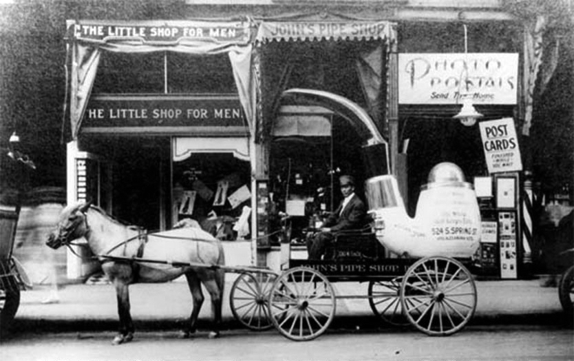
John's Pipe Shop
 |
|
| (ca. 1916)*^ - View showing a man sitting on a horse-drawn carriage parked at the curb in front of John’s Pipe Shop at 524 S. Spring Street in the heart of downtown Los Angeles. In the back of the carriage is an oversized pipe with writing on its side advertising the shop. |
Historical Notes John’s Pipe Shop was open for decades, starting in 1908 and lasting well into the 1980’s. They had pipes made for them by European companies, one of which was Comoy’s. Their “Exclusive Brands” included Wilshire, Rosemore, Extra, Fairmont, Silvermont and Avalon. There were two shops, one at 524-524 1/2 S. Spring Street and the other at 6725 Hollywood Blvd. To further advertise his goods, “John” had a little cart in the shape of a meerschaum pipe, drawn by a diminutive pony, which paraded the streets of Los Angeles, frequently giving away samples of new tobacco, as well as cards containing the name and address of his shop.*^ |
* * * * * |
 |
|
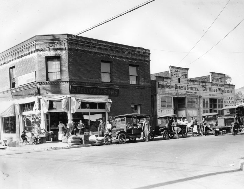
| (1917)* - View of the southeast corner of New High and Ord streets, showing the fronts of S. Peluffo's stores, founded in 1894. This is the location of a former Sonora Town brothel. |
Historical Notes One store is on the ground floor of a two-story, brick building. The other store, a one-story, wooden structure, is next door. The storefront advertises California wines as well as imported and domestic groceries. The store's telephone number is prominently displayed. Early automobiles, one a Peluffo delivery car, and a truck are parked in front and pedestrians, customers and drivers are all posing for the camera. Two children, one on a tricycle and the other in a toy car, are playing while a watchful adult shops. Sacks and cartons of merchandise lie at the curb.* |
* * * * * |
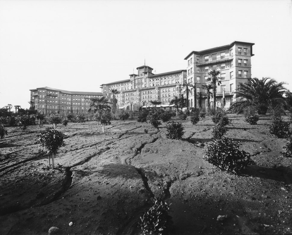
Huntington Hotel (Pasadena)
 |
|
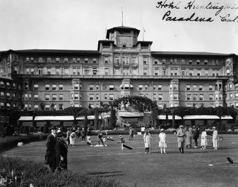
| (ca. 1917)**# - Exterior view of the rear of the Huntington Hotel in Pasadena, showing the newly landscaped gardens. |
Historical Notes The Huntington Hotel was built in 1906 by General Wentworth, a Civil War veteran, and designed by Charles Frederick Whittlesey in Spanish Mission Revival-style. It opened in February 1907 as the Hotel Wentworth, but closed its doors after its first season. It was purchased by Henry E. Huntington in 1911 and reopened in 1914 as The Huntington Hotel after redesign by the architect Myron Hunt. The hotel remained under Huntington's management until 1918.^* |
 |
|
| (ca. 1920)* - Exterior view of the Huntington Hotel in Pasadena. Guests are playing on the famous obstacle golf course in front of the hotel. |
Historical Notes California's first outdoor Olympic-size swimming pool was added in 1926, when the hotel, formerly a winter resort, began opening year-round. The hotel was later owned by Stephen W. Royce, who sold it to the Sheraton Corporation in 1954. It was subsequently renamed The Huntington Sheraton.^* |
Click HERE to see more in Early Views of Pasadena |
* * * * * |
Hollywood Fire/Police Station
 |
|
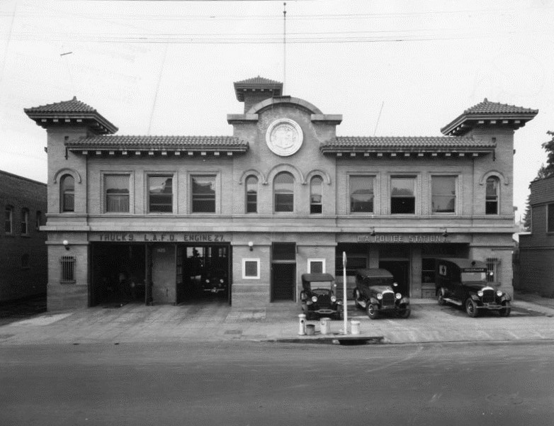
| (1916)* - Exterior view of the L.A.F.D. Fire Department, Engine 27, and the L.A. Police station, sharing the same building at 1629 Cahuenga Avenue in Hollywood. |
 |
|
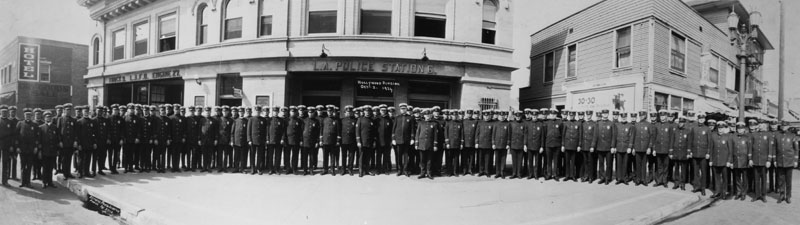
| (1924)* - Police officers stand on the street outside of the Hollywood police station, Division 6, located at 1629 Cahuenga Avenue, just north of Selma Avenue. Neighboring businesses, a hotel (left) and a shoe shop (right), are also captured in the image. |
Click HERE to see more Early Views of Hollywood |
* * * * * |
Cahuenga Branch Library
 |
|
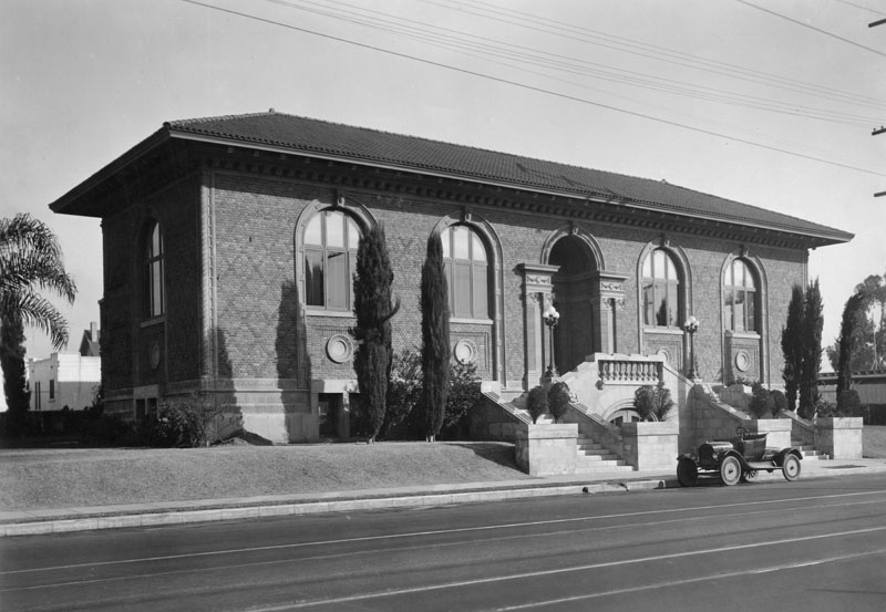
| (ca. 1916)* - Exterior view of Cahuenga Branch of the Los Angeles Public Library, located at 4591 Santa Monica Boulevard. It opened in 1916 and was intended, at the time, to serve a community of workers in the then nearby orange and avocado groves and wheat fields. |
Historical Notes Cahuenga Branch is the third oldest branch library in the Los Angeles Public Library system. Located at 4591 Santa Monica Boulevard in the East Hollywood section of Los Angeles, it was built in 1916 with a grant from Andrew Carnegie. Architect C.H. Russell designed this Italian Renaissance style building. He was also associated with Norman F. Marsh in building the Venice canals.^* One of three surviving Carnegie libraries in Los Angeles, it has been designated as Historic-Cultural Monument No. 314 and listed in the National Register of Historic Places. Click HERE to see the complete list of LA Historical Cultural Monuments. |
* * * * * |
Metro-Goldwyn-Mayer Studios
 |
|
| (1916)* - Exterior view of the Triangle at Metro-Goldwyn-Mayer Studios, located at 10202 Washington Boulevard in Culver City. A Richfield gasoline truck is seen in front of the columned building. |
Historical Notes In 1924, movie theater magnate Marcus Loew had a problem. He had bought Metro Pictures Corporation (founded in 1916) and Goldwyn Pictures (founded in 1917) to provide a steady supply of films for his large theater chain, Loew's Theatres. However, these purchases created a need for someone to oversee his new Hollywood operations, since longtime assistant Nicholas Schenck was needed in New York to oversee the theaters. Loew addressed the situation by buying Louis B. Mayer Pictures on April 16, 1924. Because of his decade-long success as a producer, Mayer was made a vice-president of Loew's and head of studio operations in California, with Harry Rapf and Irving Thalberg as heads of production. For decades MGM was listed on movie title cards as "Controlled by Loew's, Inc."^* Click HERE to see more Early Views of Metro-Goldwyn-Mayer Studios. |
* * * * * |
Bureau of Power and Light Distribution Station
 |
|
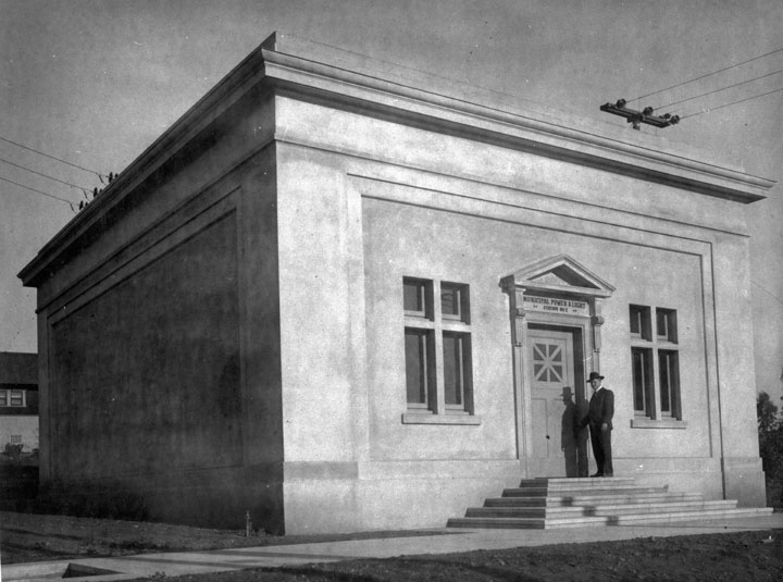
| (1916)** - LA Bureau of Power and Light (now DWP) Distribution Station No. 2 - Electric power was distributed to residents in the Highland Park-Garvanza areas of Los Angeles in 1916 from this Distributing Station located at 225 N. Avenue 61. |
Historical Notes In 1916, the first electrical energy sold and distributed by the Los Angeles Bureau of Power and Light was obtained from the Pasadena municipal system. Things would change quickly, though. In 1917, the San Francisquito Canyon Power Plant No. 1 was completed. It harnessed the energy from water running down the recently completed LA Aqueduct and generated enough power to meet the needs of the fast growing City of Los Angeles. There was also enough excess power that now could be sold back to the City of Pasadena (Click HERE to see more in Electricity on the Aqueduct). The first operator at Distribution Station No. 2 was B. F. Goodwin. |
 |
|
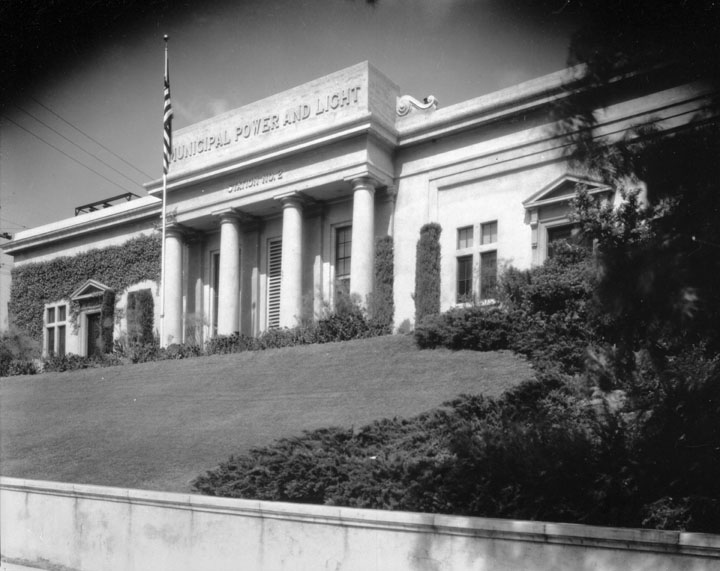
| (ca. 1920s)** - View of Distribution Station No. 2 after it was expanded. The sign on the front face of building now reads Municipal Power and Light. The Los Angeles Department of Water and Power went through six names changes since the Water Department was established in 1902. Click HERE to see Name Change Chronology of DWP. |
Historical Notes On April 21, 1962, Distribution Station No. 2 was designated Los Angeles Historical-Cultural Monument No. 558 (Click HERE to see complete listing). |
* * * * * |
San Francisquito Power Plant No. 1
 |
|
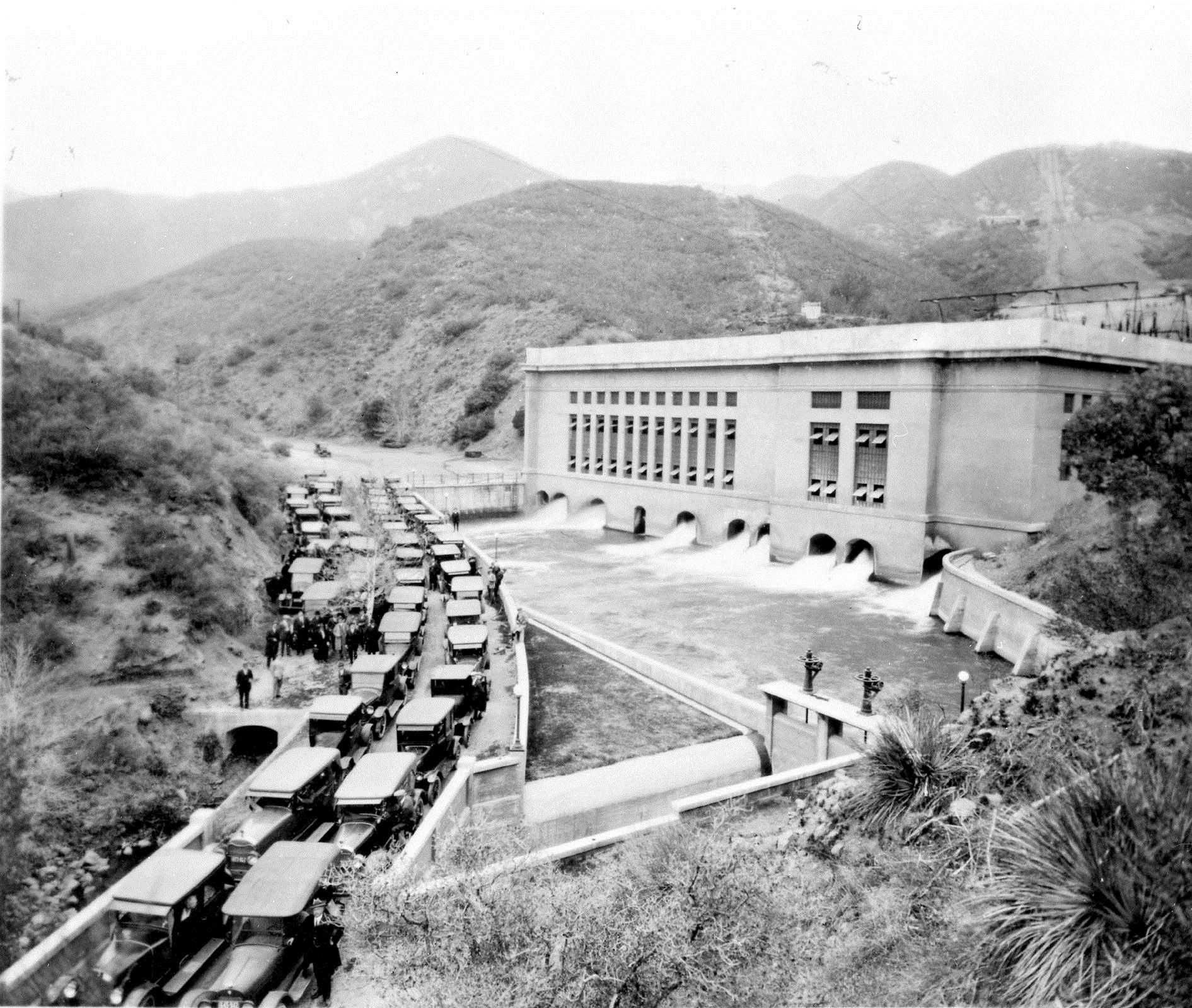
| (1917)** - Opening of the San Francisquito Power Plant No. 1 on March 18, 1917. Construction of the plant began six years earlier in 1911. |
Historical Notes On March 18, 1917 the San Francisquito Power Plant No. 1, Unit 1 was placed in service and energy was delivered to Los Angeles over a newly constructed 115 kV transmission line. The 200 kilowatts generated by Unit 1 were the first commercial kilowatts generated by the Los Angeles Bureau of Power and Light. The LA Bureau of Power and Light now had a source of low cost electricity and more than enough power to meet the City's needs. It would sell its excess San Francisquito generated power to Pasadena over two newly constructed 34 kV lines between the two cities. By 1917, World War I had forced the price of fuel oil to rise making the new lower cost hydroelectric power extremely desirable. |
Click HERE to see more in Early Power Generation |
* * * * * |
Church of the Open Door (Bible Institute - Biola University)
 |
|
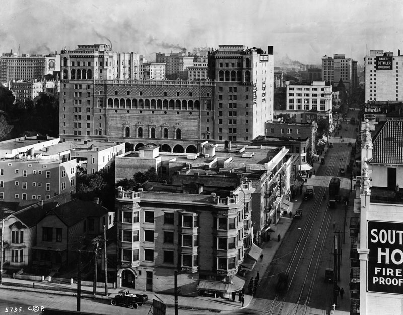
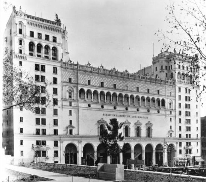
| (1916)* - View looking east along 6th Street from Flower Street. Large structure on Hope Street is the Church of the Open Door/Bible Institute. |
Historical Notes Biola University was founded in 1908 as the Bible Institute Of Los Angeles by Lyman Stewart, president of the Union Oil Company of California (subsequently known as Unocal and later purchased by the Chevron Corporation), Thomas C. Horton, a Presbyterian minister and Christian author, and Augustus B. Prichard, also a Presbyterian minister.^* In 1912, the school appointed R. A. Torrey as dean, and in 1913 began construction on a new building at the corner of Sixth and Hope St., in downtown Los Angeles, which included a 3,500-seat auditorium, two large neon signs on top of the building proclaiming "Jesus Saves", and a set of eleven bells on which hymns were played three times each day.^* |
 |
|
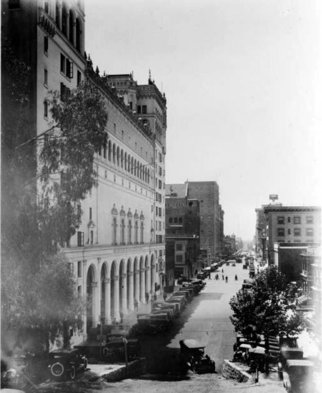
| (ca. 1920)^ - View of Hope Street looking south from the future site of the Los Angeles Central Library. The Church of the Open Door/Bible Institute is seen standing tall on the left. |
Historical Notes The Central Library was built between 1924 and 1926 on the site once occupied by the State Normal School (which evolved into UCLA). |
 |
|
| (1924)##+ – Postcard view of the Bible Institute of Los Angeles looking north on Hope Street with the State Normal School (1831-1924) seen in the background. |
Historical Notes The State Normal School was demolished in 1924 to make room for the Los Angeles Central Library (completed in 1926). |
 |
|
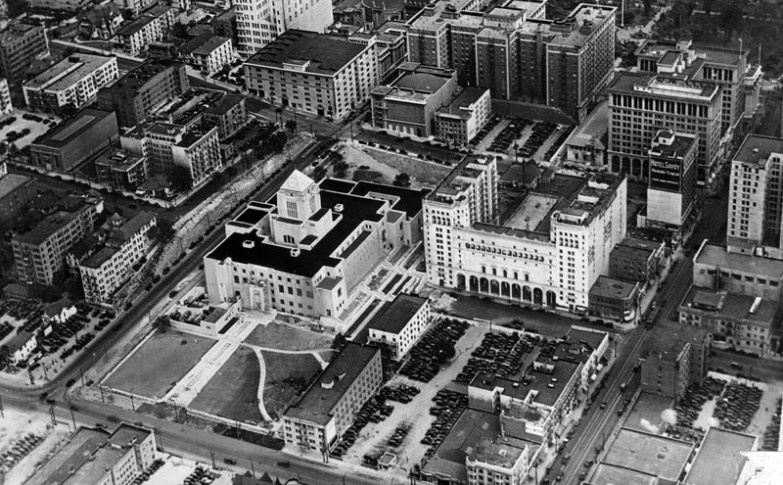
| (ca. 1926)* - Aerial view showing the area surrounding the newly completed Central Library. The Bible Institute stands at 555 S. Hope Street, adjacent to the library. |
Historical Notes Originaly financed by Union Oil magnate Lyman Stewart, the Bible Institute Church was to be strictly non-denominational, though Evangelical. Stewart also founded the Pacific Gospel Mission (now the Union Rescue Mission) in 1891.^* |
 |
|
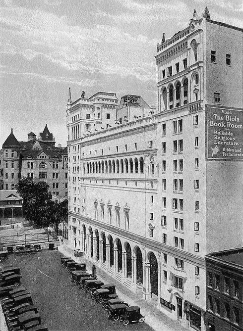
| (1926)^ - Exterior view of the Bible Institute as seen from the front of the Central Library's South entrance. The light-colored building has two bookend towers and a row of archways across its center. The name of the institute appears over the entryway. |
Historical Notes The Bible Institute building was designed by Walker & Vawter in Renaissance Revival style and had an auditorium that seated 3,500. It was flanked by two thirteen-story dormitories. A large 1935 neon sign which says, "Jesus Saves," sits at the top of the building. The building was constructed in 1915 and demolished in the late 1980s after the church moved to Glendora (1985).* |
 |
|
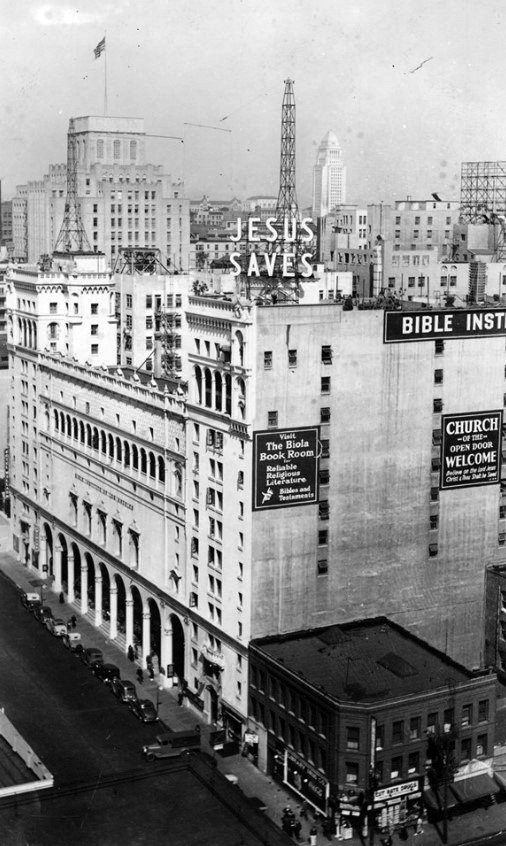
| (ca. 1939)^.^ - Bible Institute of Los Angeles (6th & Hope). Photo E.F. Mueller. |
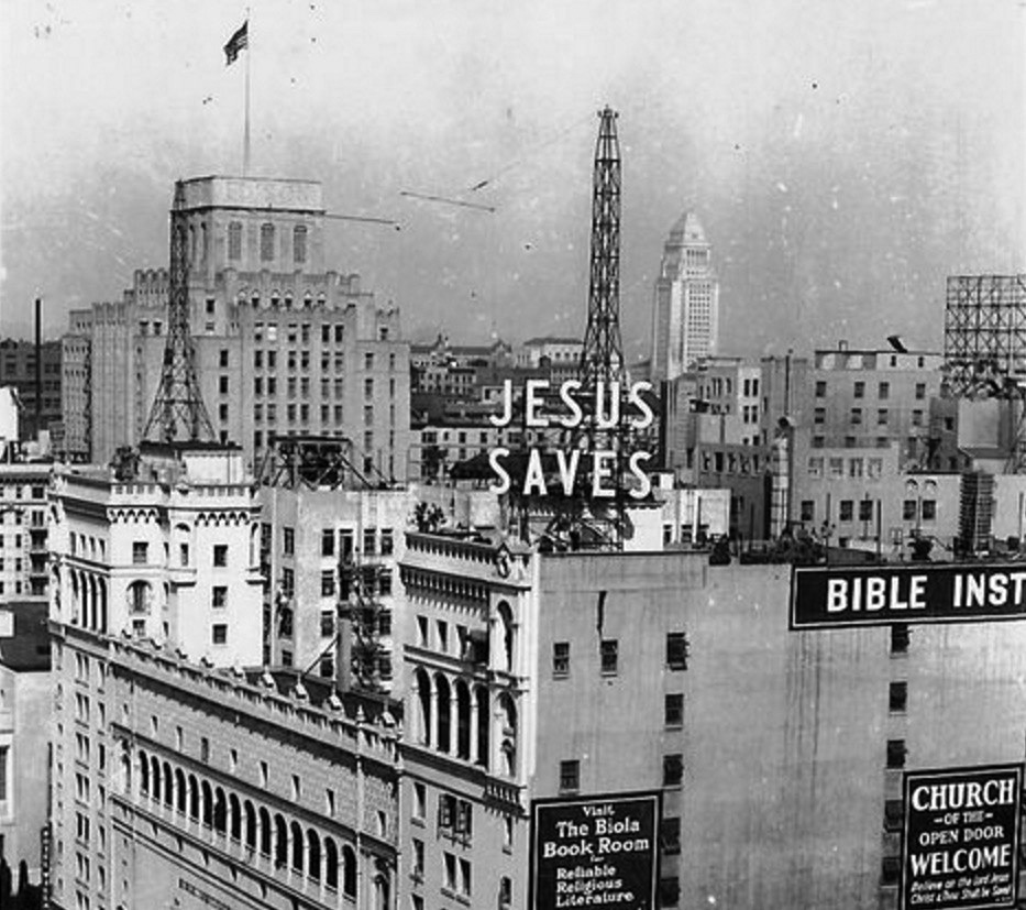 |
|
| (ca. 1939)##+ – Rooftop view looking northeast showing the Bible Institute from the corner of Hope and 6th streets. In the distance can be seen the Edison Building (top left) and City Hall (top center-right). Note the two radio towers on top of the Bible Institute building. |
 |
|
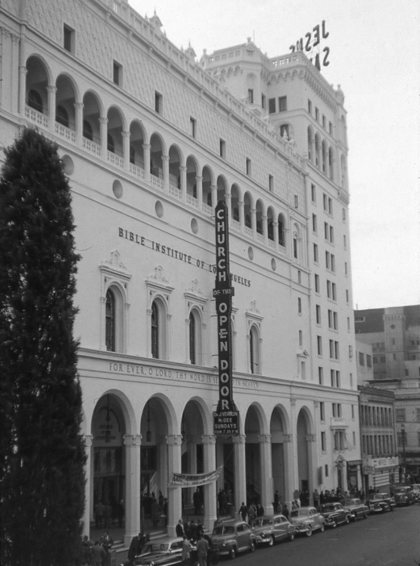
| (1950)**# - View looking southeast showing the front of the The Bible Institute of Los Angeles (Church of the Open Door) on Hope Street as seen from the Central Library . |
 |
|
| (1980)* - Exterior view of Church of the Open Door (The Bible Institute), at 555 South Hope Street, with Central Library (West entrance) and parking area (presently the Maguire Gardens) in the foreground. |
Historical Notes Despite efforts led by the late William Eugene Scott to prevent the building from being sold to developers and to have the building saved as a historic landmark, the building could not be saved because it was so damaged in the 1987 Whittier Narrows earthquake that it was declared unsafe and the cost of repairs deemed prohibitive. The historic "Jesus Saves" sign from the original building can now be seen atop the Los Angeles University Cathedral. It was relocated there by the late William Eugene Scott, the owner of the building at the time of earthquake, who took it with him when his church relocated following the earthquake.^* |
* * * * * |
 |
|
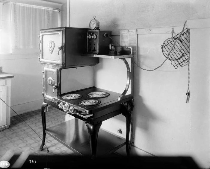
| (ca. 1917)*^*# - THE LATEST IN KITCHEN APPLIANCES. Westinghouse Electric range (with iron in upper corner and an electric timing device) at a home in Van Nuys.*^^^ |
Historical Notes In 1917, Westinghouse introduced its first all-electric kitchen range. It advertised its new ranges as follows: These are full size cooking ranges for domestic use, and have reached their high perfection in convenience and economy through many years of experimenting and experience. In addition to the cleanliness, safety, saving in food, and general desirability of cooking with electricity, they have the further advantage of saving a great deal of care, trouble and expense by the aid of the Westinghouse exclusive economical features of full automatic control by attached clock and thermostats.*#*^ |
* * * * * |
Breed Street Shul
 |
|
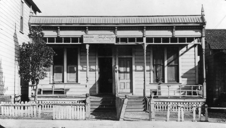
| (1917)* - Talmud Torah Synagogue was located in a smaller wooden building about the size of a single story apartment house at 114 Rose Street in Boyle Heights. |
Historical Notes Congregation Talmud Torah Synagogue (also known as Breed Street Shul) is in the Boyle Heights section of Los Angeles. It was the largest Orthodox synagogue in the western United States from 1915 to 1951, and is listed in the National Register of Historic Places. The Congregation began in Downtown Los Angeles in 1904 but moved to Boyle Heights in 1913 as large numbers of Jews settled there. In 1915, a wood-framed building was dedicated for use as a school and chapel and became known as the "Breed Street Shul." The Jewish population grew from a few hundred in 1910 to 10,000 in 1930.^ |
 |
|
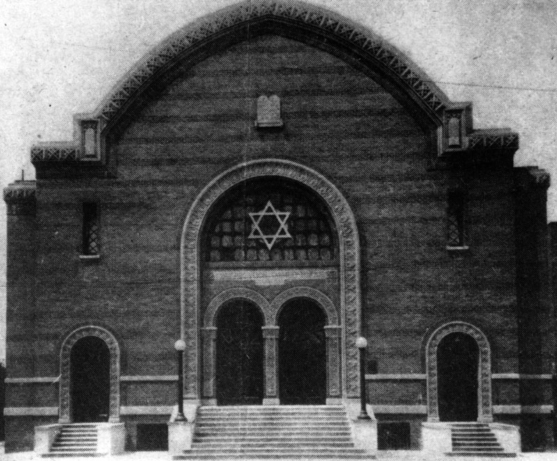
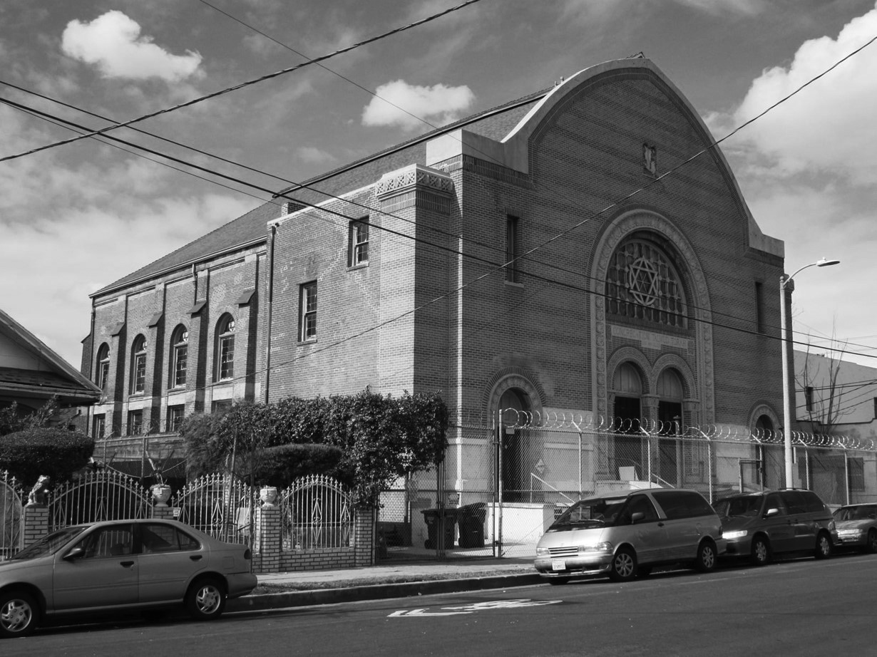
| (ca. 1920s)* - Exterior view shows the entrance of the Talmud Torah Synagogue, located at 247 N. Breed St. in Boyle Heights. |
Historical Notes As the size of the Talmud Torah congregation grew, a new synagogue was built, designed by the architectural firm of Edelman and Barnett. The original wood structure was moved to the back of the lot to make room for the new brick structure which opened in 1923. The new synagogue was built from unreinforced masonry with veneer brick and cast stone embellishments on the facade. The facade includes alternating bands of dichromatic brickwork, "dense prickly foliage carving, other organic motifs and Stars of David in bas relief cast stone detail.^ |
 |
|
| (2021)* - Breed Street Shul as it appears today, with barbed-wird fence surrounding it. |
Historical Notes The main brick building was vacated in the mid-1980s due to seismic retrofit requirements. Services were moved to the original wooden structure at the rear of the lot for several years, by 1996 services ceased at Breed Street Shul, and the buildings have been vacant since that time In 1988, the building was designated as Los Angeles Historic-Cultural Monument No. 359 (Click HERE to see complete listing). The building fell into disrepair in the 1990s, the City of Los Angeles foreclosed on the property after recording an assessment for barricading and protection. In 1998, Hillary Clinton visited the Shul as part of her Save America's Treasures campaign. In July 2000, the City quitclaimed the property to Breed Street Shul Project, Inc., a subsidiary of the Jewish Historical Society of Southern California. The organization plans to rehabilitate the buildings as a county museum, educational and cultural center. It was listed on the National Register of Historic Places in 2001..^ |
 |
|
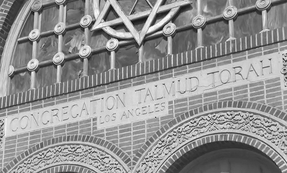
| (2021)* - Detailed view of the facade over main entrance of the Talmud Torah Synagogue, located at 247 N. Breed St. in Boyle Heights. |
Historical Notes The century-old Breed Street Shul in Boyle Heights is getting a new lease on life thanks to millions in dollars championed by California’s Jewish and Latino lawmakers to renovate the historic landmark. Nearly $15 million in state funding was announced on August 10th, 2021 to transform the historic, cultural monument into a multipurpose space and highlight the rich and diverse immigrant history of the Latino and Jewish communities in the Boyle Heights neighborhood.* |
* * * * * |
Ville de Paris Department Store (later B.H. Dyas Co.)
 |
|
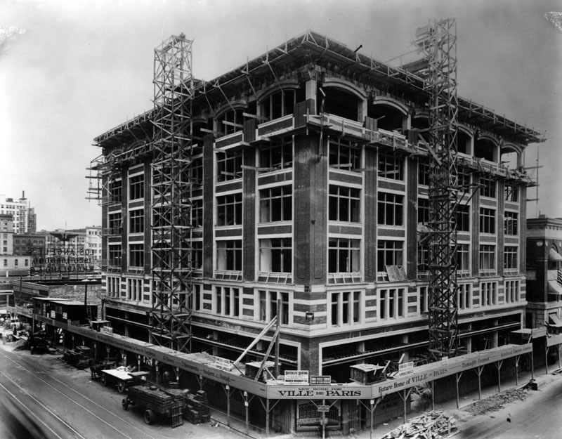
| (1917)* - Construction of the Ville de Paris department store at the corner of 7th and Olive. The store later became B. H. Dyas Co. |
Historical Notes Bernal H. Dyas was born in New York in 1883 and his family wound up in Los Angeles in 1907. In 1919 he purchased Los Angeles’s largest department store, Ville de Paris, at Seventh and Olive Streets and it became the home of the B. H. Dyas Company with 21,000 square feet of floor space.*#** |
 |
|
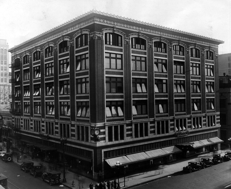
| (1931)* - Exterior of B. H. Dyas Co. store at Seventh and Olive streets, the second and fifth floors of which have been remodeled. |
Historical Notes The Seventh and Olive street store, referred to as a “sportsman’s paradise” included a rifle range, handball court, and log cabins. At the time, B. H. Dyas Company was the largest west of Chicago. In 1928, Dyas opened a second store in Hollywood, however, the company could not survive the effects of the Depression.*#** |
* * * * * |
Rosslyn Hotel
 |
|
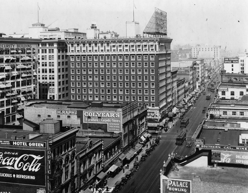
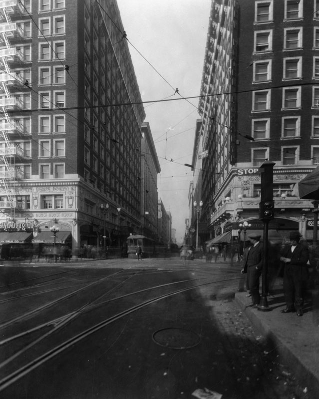
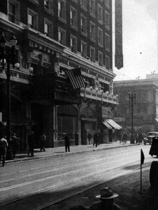
| (1917)* - View looking north on Main Street near 6th Street. The Rosslyn Hotel with the large sign on roof is on the northwest corner of Fifth and Main Streets (451-459 South Main Street). |
Historical Notes In 1913 the Rosslyn Hotel constructed its new building at the northwest corner of 5th and Main Streets, a major expansion of the hotel from its earlier home on Main Street between 4th and 5th Streets. The Hotel Rosslyn has a history unique in all of the city of Los Angeles. Once the tallest building in LA, the 12-story Rosslyn boasted in it's large rooftop sign as being the "Fireproof Million Dollar Hotel." At that time, the area around Main Street was truly the center of Los Angeles. Through the teens and twenties, the financial, commercial, and entertainment center of Southern California was based in Downtown Los Angeles, and the Rosslyn Hotel was one of its premier destinations. |
 |
|
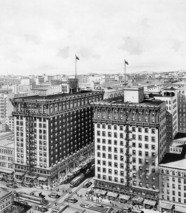
| (ca 1923)* - Rendering as seen from the air of the Rosslyn Hotel and Annex, also showing neighboring buildings. |
Historical Notes In 1923, as a result of the prosperity enjoyed by the Rosslyn and the surrounding district, the Rosslyn Annex was built across 5th Street, and today is still called the Rosslyn Hotel. The two buildings were connected by an underground marble tunnel, portions of which survive to this day. |
 |
|
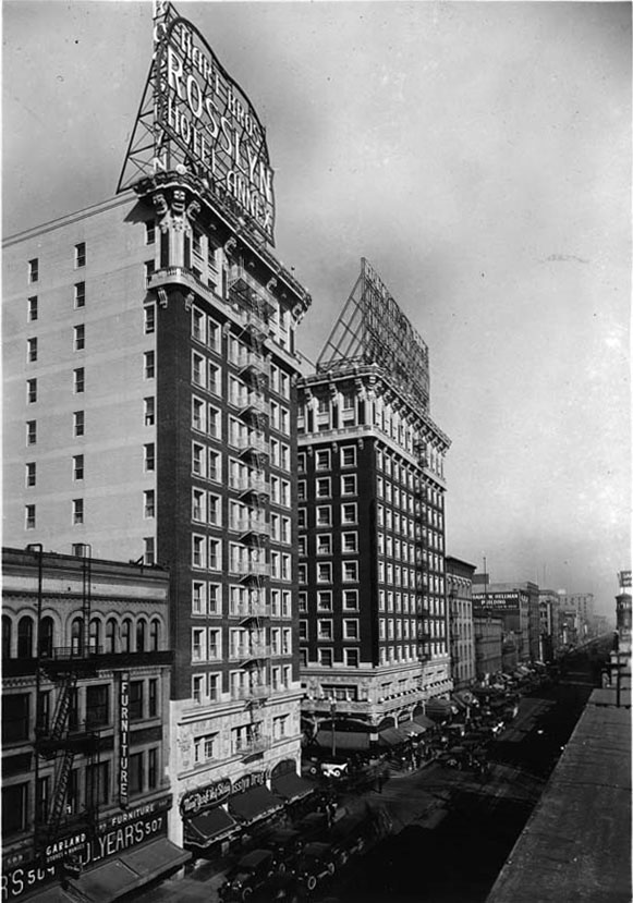
| (ca. 1923)^*# - View looking north on Main Street showng the Rosslyn Hotel and Rosslyn Annex shortly after they were built on the intersection with 5th Street. |
Historical Notes The Hotel Rosslyn Annex was built in 1923 across the street from the original 800-room Rosslyn Hotel built in 1914. Designed as a twin, both were topped by mammoth glowing signs featuring the names surrounded by a heart, the shape acknowledging the Hart brothers who owned the hotels.^* |
 |
|
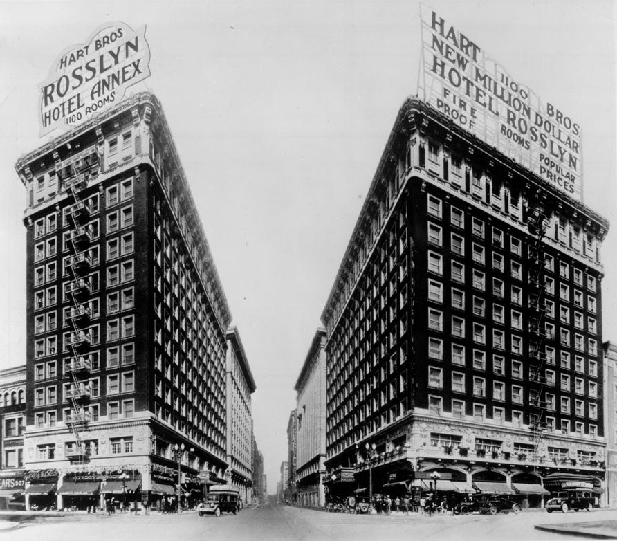
| (1924)* - View looking west on 5th Street at Main Street showing both the Hotel Rosslyn and Hotel Rosslyn Annex with their massive roof-mounted signboards. |
Historical Notes Both buildings were designed by architect John Parkinson, who was one of the most prolific architects in Downtown Los Angeles, responsible for much of the area's finest architecture, including Union Station, Bullock's Wilshire, the Title Guarantee Building, the Continental Building, the Alexandria Hotel, the Los Angeles Athletic Club, Security Bank (now the Los Angeles Theatre Center), the Los Angeles Memorial Coliseum, and Los Angeles City Hall. |
 |
|
| (1930)* - View of looking west on 5th Street at Main Street showing the Rosslyn Hotel and Annex on the west side of Main. |
 |
|
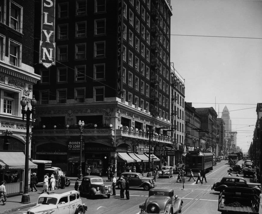
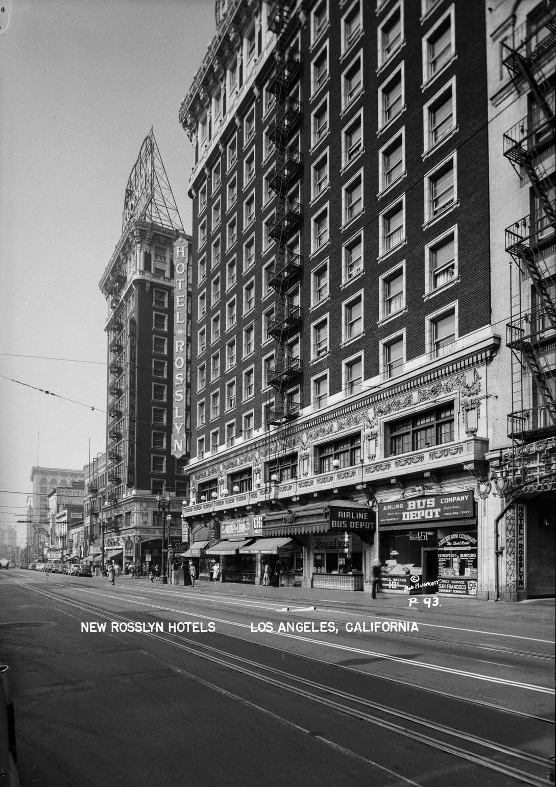
| (1939)^ - View looking north on Main Street at 5th Street. The two Hotel Rosslyn buildings are on the southwest and northwest corners. Several of the legible signs read: United Cigars, "Money to Loan", All-American Lines Bus Depot, Turquoise Room, and Hotel Barclay. City Hall can be seen in the distance. |
 |
|
| (1940s)* - View looking north on Main Street at 5th Street. The two Hotel Rosslyn buildings are on the southwest and northwest corners. |
 |
|
| (1940s)* - View looking south on Main Street at 5th Street. |
 |
|
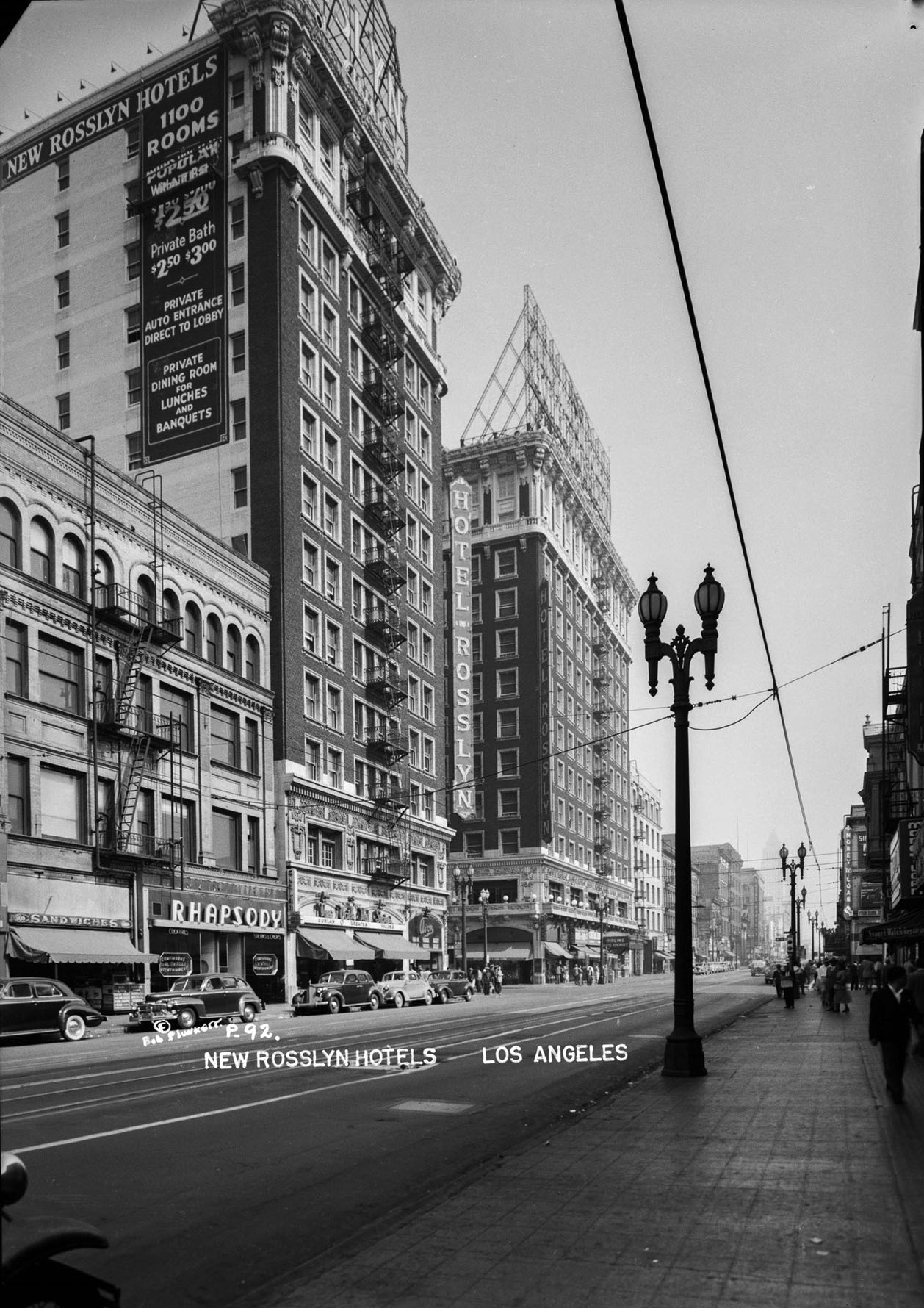
| (1940s)^ - Close-up view showing the entrance to the Rosslyn Hotel as seen from across Main Street. |
Historical Notes The New Rosslyn went into decline and closed in 1959. It reopened in 1979 as two hotels, the Rosslyn on the south side, and the Frontier on the north side. |
Then and Now
|
|
 |
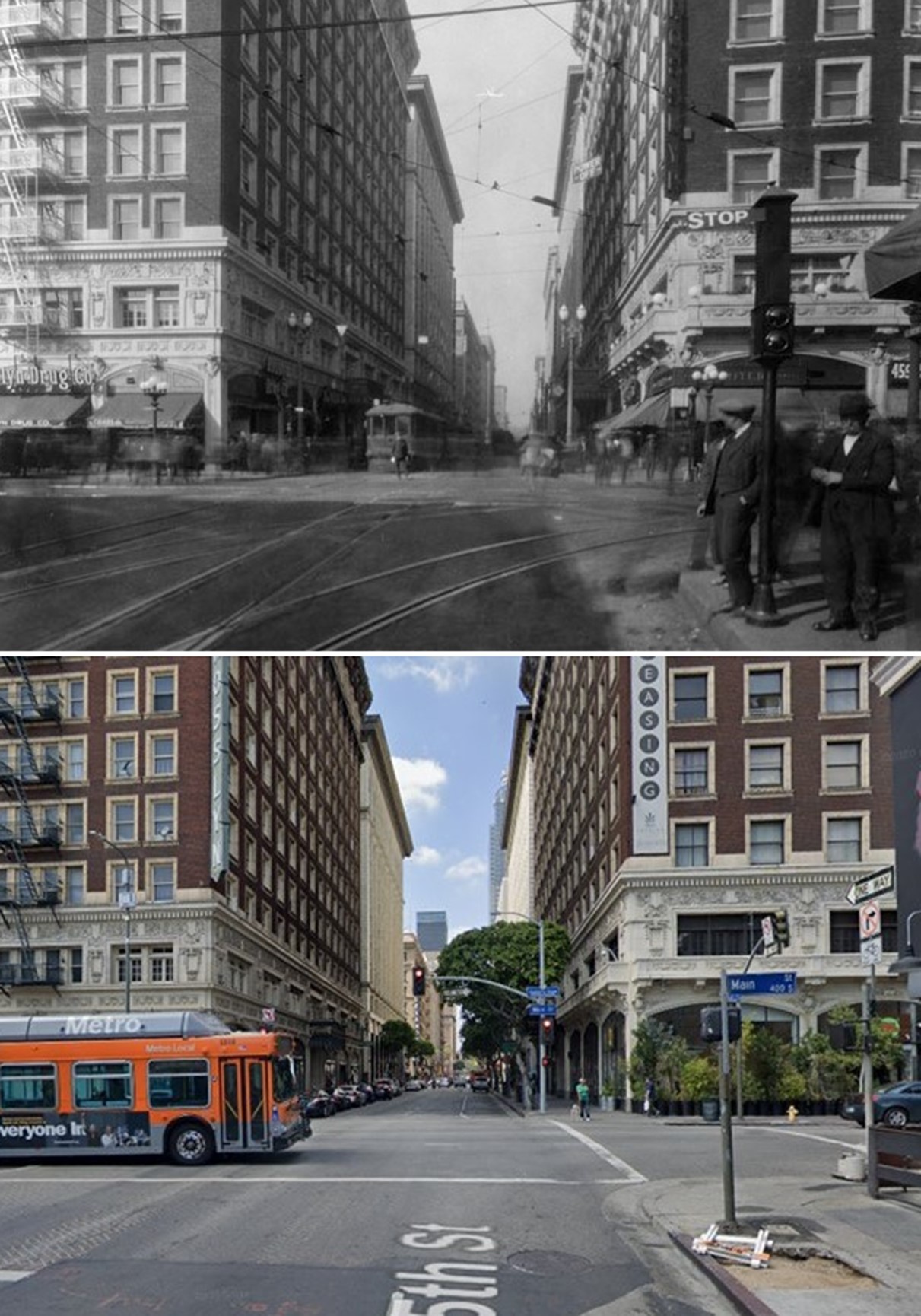
| (1930 vs.2018)* - Rosslyn Hotel and Annex at 5th and Main streets. |
Then and Now
 |
|
| (1930 vs 2019)* - Looking west on 5th Street at Main Street showing the Rosslyn Hotel and Annex. |
 |
|
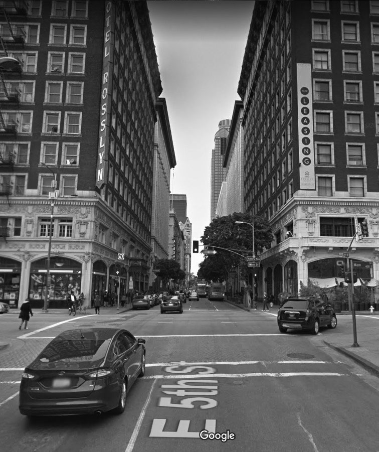
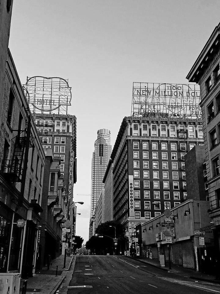
| (ca. 2018)^ - View looking west on 5th Street toward Main Street showing the Rosslyn Lofts (formerly the Rosslyn Hotel and Annex) as they appear today. The U.S. Bank Tower and Gas Company Tower are seen in the background. Photo courtesy of James J. Chun |
Historical Notes Despite its once-celebrated status in the downtown hotel industry, as the character of the neighborhood began to change, so did the Rosslyn. It went dark for some years before the Frontiera family purchased it in the late 1970s, renaming it the Frontier. The family’s leadership and support were instrumental in fostering the art gallery scene that is now a staple of the area. Renamed the Rosslyn Lofts in 2006, it currently provides both market-rate lofts and low-income housing.* |
 |
|
| (2020)^ - View looking at the Rosslyn Hotel and Annex (Rosslyn Lofts) as seen from the window of a nearby building. Photo by Kelly Wine |
Historical Notes Both the Hotel Rosslyn and Hotel Rosslyn Annex are topped by mammoth glowing signs featuring the names surrounded by a heart, the shape acknowledging the Hart brothers who owned the hotels.* |
 |
|
| (2019)^ – Close-up view of the iconic Rosslyn Hotel roof-mounted sign. Photo by Howard Gray |
* * * * * |
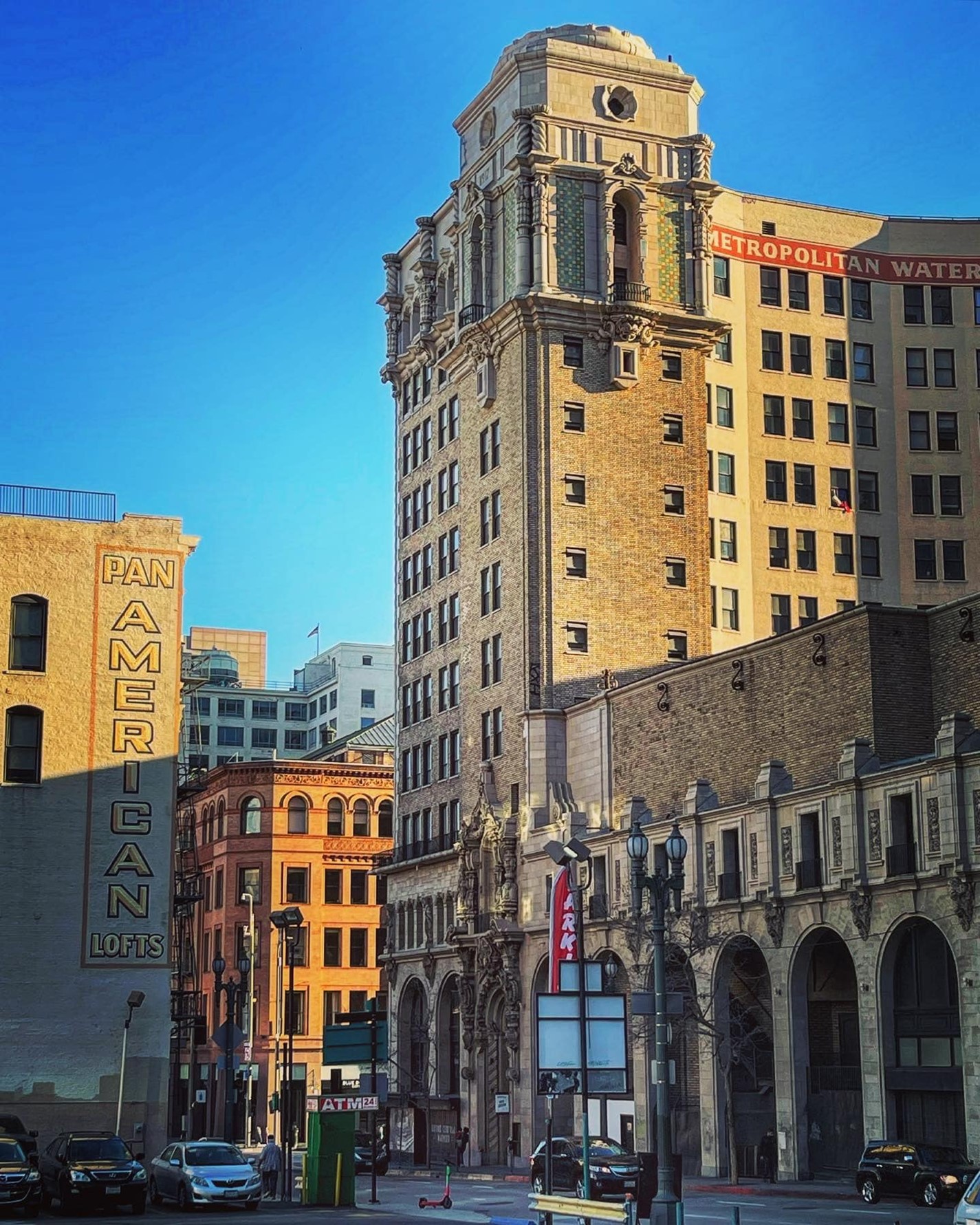
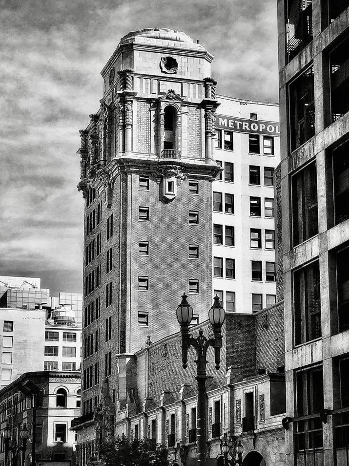
Million Dollar Theatre (aka Grauman's Theatre, aka Edison Building and later MWD)
 |
|
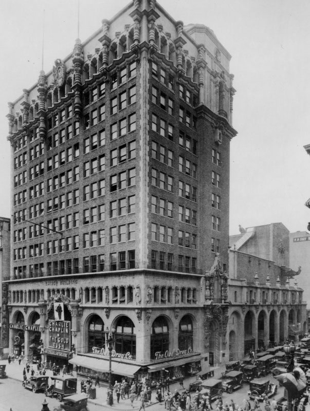
| (1917)#^* – View showing the Million Dollar Theatre under construction on the corner of 3rd Street and Broadway. Photo Date: 9-7-17 |
Historical Notes The Million Dollar Theater at 307 S. Broadway in downtown Los Angeles is one of the first movie palaces built in the United States. It opened in February 1918. It is the northernmost of the collection of historical movie palaces in the Broadway Theater District and stands directly across from the landmark Bradbury Building.* |
 |
|
| (1918)* - Exterior view of a building on the corner of Third Street and Broadway was the home of Edison, Grauman's Theater - later to become the Million Dollar Theater - and the Owl Drug Company. Showing at the theater is a film with William S. Hart, "Shark Control," and a comedy by Sennet. |
Historical Notes The Million Dollar was the first movie house built by entrepreneur Sid Grauman. Grauman was later responsible for Grauman's Egyptian Theatre and Grauman's Chinese Theatre, both on Hollywood Boulevard, and was partly responsible for the entertainment district shifting from downtown Los Angeles to Hollywood in the mid-1920s.* |
 |
|
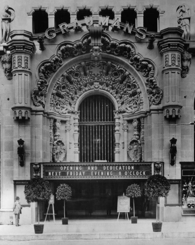
| (1918)* - View of the original marquee and main entrance of the Grauman's Theater (later Million Dollar Theater), located at 307 S. Broadway. |
Historical Notes Among the famous names who attended the opening night were: Jesse L. Lasky, Thomas Ince, Mack Sennett, Hal Roach, Cecil B. DeMille, D.W. Griffith, Mary Pickford, Douglas Fairbanks, Charlie Chaplin and Roscoe ‘Fatty’ Arbuckle.* |
 |
|
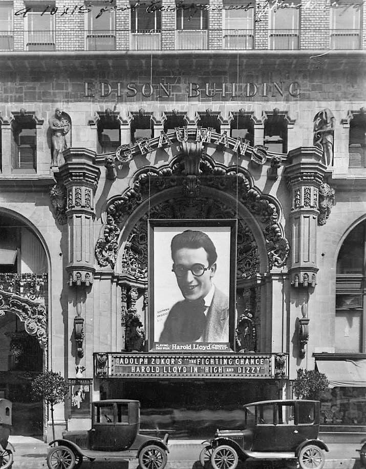
| (1920)^.^ - View showing the front entrance to the Grauman's Theater (later Million Dollar Theater) now showing the comedy film High and Dizzy starring Harold Lloyd. Note the sign above Grauman's reads 'Edison Building'. |
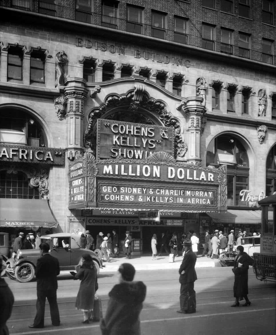
Historical Notes The initial tenant of the office building was the Edison Co. Later the Metropolitan Water District occupied the office building. |
 |
|
(1931)* - Million Dollar Theatre located at 307 S. Broadway in Downtown LA. It was one of the first movie palaces built in the United States. |
 |
|
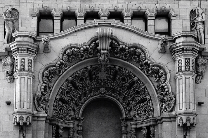
| (2012)^ - View of the ornate Churrigueresque front entry facade of the Million Dollar Theater. The lavish exterior terra-cotta ornamentation by Joseph Mora includes bison heads, longhorn skulls and allegorical figures representing the arts. |
Historical Notes Sculptor Joseph Mora did the elaborate and surprising exterior Spanish Colonial Revival ornament, including bursts of lavish Churrigueresque decoration, multiple statues, longhorn skulls and other odd features. The auditorium architect was William L. Woollett, and the designer of the twelve-story tower was Los Angeles architect Albert C. Martin, Sr. (also designed the Liberty Theatre).* |
 |
|
| (ca. 1925)* - View looking at the SW corner of Third Street and Broadway showing the Million Dollar Theater building. The marquee indicates that Charlie Chaplin's 1925 film Gold Rush is playing at the theater. |
 |
|
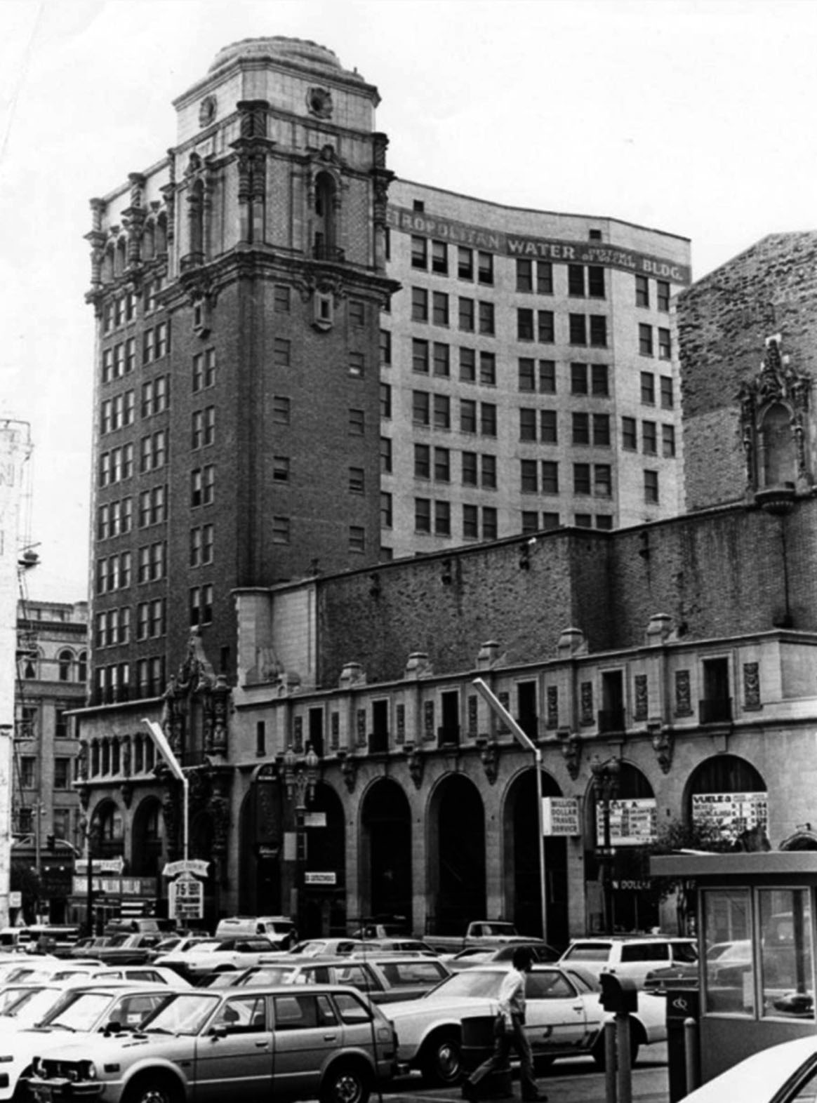
| (1982)* - View looking at the Million Dollar Theater building and former headquarters of the Metropolitan Water District of Southern California, located at 307 So. Broadway as seen from the Third Street side. |
Historical Notes For many years the office building housed the headquarters of the Metropolitan Water District of Southern California. The building also housed the Municipal Water Department of the City of Los Angeles, predecessor to the Los Angeles Department of Water and Power (DWP) as well as housing offices of William Mulholland. |
 |
|
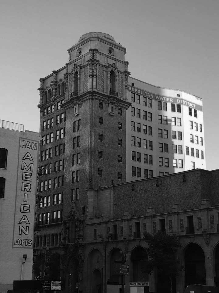
| (n.d..)^ – Closer view showing the backside of the Million Dollar Theater from 3rd Street. William Mulholland’s office was on the top floor, southwest corner when the building was occupied by the Municipal Water Department (prior to Metropolitan Water District). |
Historical Notes After serving as the home of a Spanish-speaking church for some years, as of 2006 the Million Dollar theater was empty, although the office building had been recently renovated and converted to residential space. In February 2008, the theater re-opened, once again showing live Spanish theatre. It continues to draw large crowds, and there are plans to begin screening major motion picture premieres.* |
 |
|
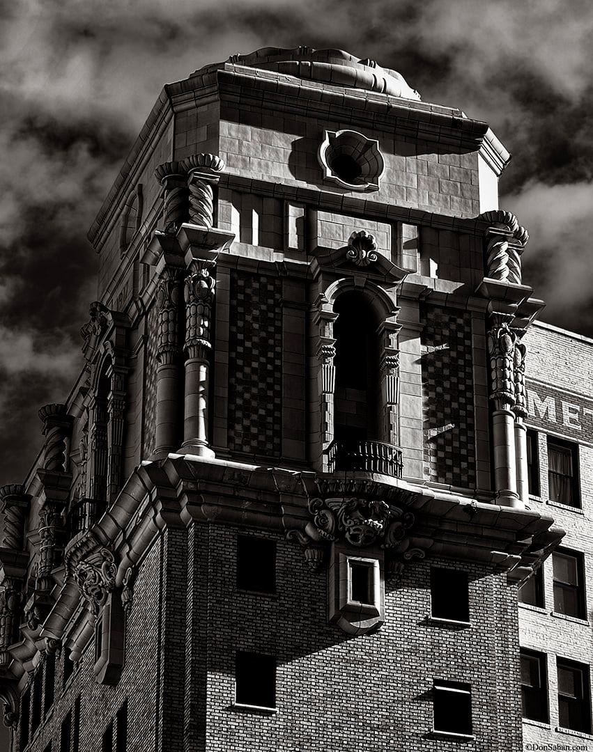
| (2021)^ – Close-up view of the top of Metropolitan Water District Building (aka Million Dollar Building) with its ornate Churrigueresque-style design. Photo by Don Saban |
Historical Notes The twelve-story building was designed by Albert C. Martin, Sr., one of the most important architects in Los Angeles at the time and founder of one of the city’s most prominent architectural firms. The exterior of the building exemplifies the elaborate Churrigueresque (chur-rig-ur-esk) style, named after the eighteenth-century Spanish church architect and sculptor Jose de Churriguera, whose designs favored this type of architectural embellishment.* |
 |
|
| (2022)^ - Million Dollar Theater as seen from 3rd Street. The building also housed the Municipal Water Department of the City of Los Angeles, predecessor to the Los Angeles Department of Water and Power (DWP) as well as housing offices of William Mulholland. The Bradbury Building can be seen across the street (SE corner of Broadway and 3rd). |
 |
|
| (2022)^ - Million Dollar Theater as seen from 3rd Street (aka Grauman's Theatre, aka Edison Building and later MWD Building). Located on the SW corner of Broadway and 3rd Street. Photo by Carlos G. Lucero |
* * * * * |
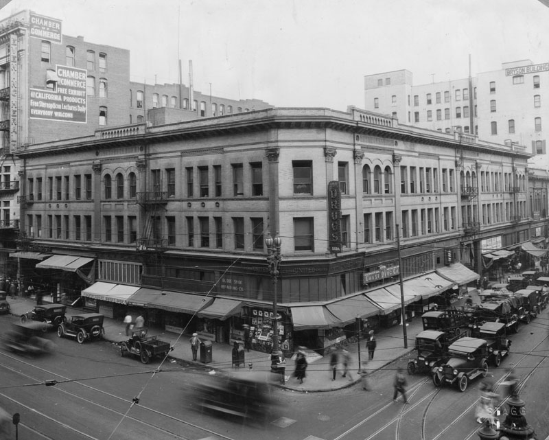
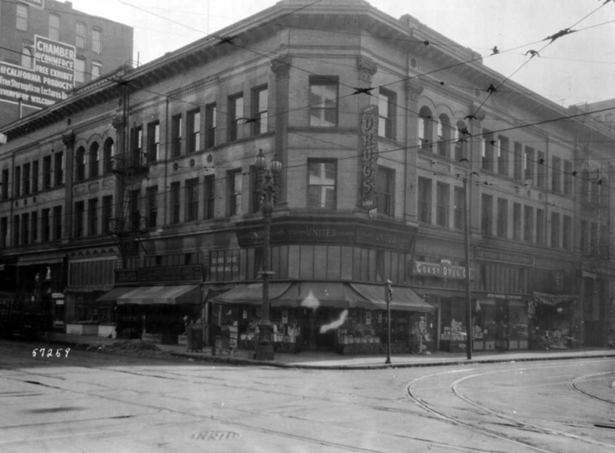
Hellman Building (2nd and Broadway)
 |
|
| (1918)* - Exterior view of the Hellman Building in 1918, located on the northeast corner of 2nd Street and Broadway. Coast Drug Company is on the first floor, along with several small shops. |
 |
|
| (1922)* - View showing the Hellman Building located on the NE corner of 2nd and Spring. |
Historical Notes In 1957 it was owned by the L.A. Times who demolished it in March 1959. In the 1980's this corner held the Times Mirror garage. Building architects, Morgan & Walls. |
* * * * * |
Foy Residence
 |
|
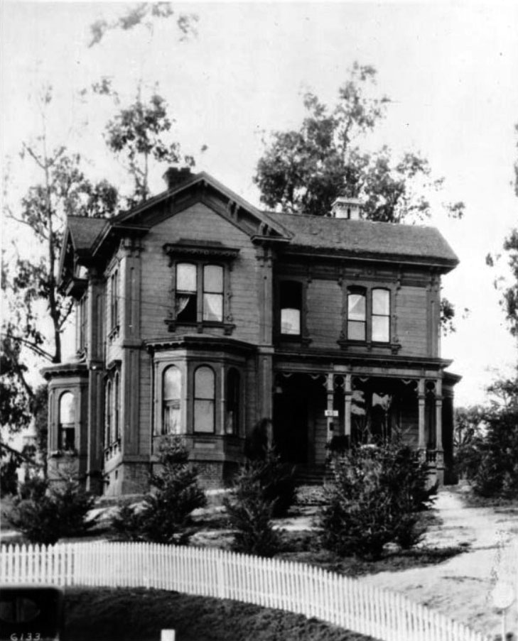
| (ca. 1918)^ - Close-up view of the Foy residence on the northwest corner of Figueroa Street and 7th Street. The two-story house features several cant windows, a covered porch, walls constructed of shingled wood, and two chimneys jutting above the inclined roof. Short trees cover the yard surrounded by a picket fence and taller trees are seen in the background. "651", the house's street address, is displayed on a placard on a post in front of the house. |
Historical Notes In 1872, Samuel Calvert Foy purchased the property from Los Angeles Mayor Thomas Foster for $1,000. Foy moved to Los Angeles in 1854 and operated a successful harness business at 217 Los Angeles Street, which was the oldest business establishment in the city at the time of his death. Foy also served as the city's Chief of Police for a time. He built the Foy House at the corner of Grasshopper (now Figueroa) and 7th Streets in either 1872 or 1873, and it was there that Foy and his wife, Lucinda Macy Foy, raised their son and four daughters. The house was reportedly "the first three-story building in the city." At the time the Foys built their house, the site was considered to be "way out in the country." Foy's daughter, Mary Foy, was the city's first woman librarian from 1880-1884, a leader in the California Women's suffrage movement, a leader of the Democratic Party, and the first woman to be a member of one of the major parties' national committees.^* Today, the Wilshire Grand Hotel is located at this site. |
 |
|
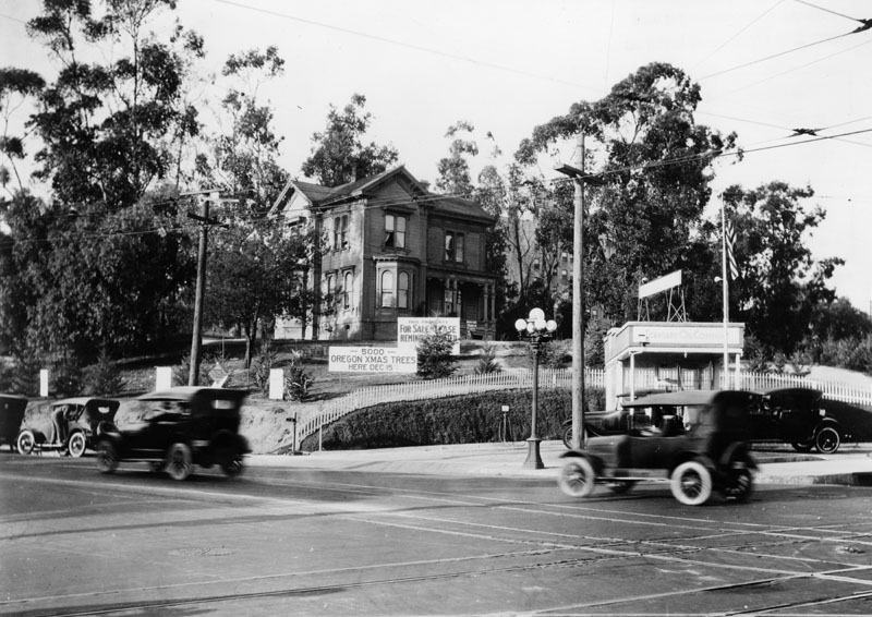
| (1919)* - View looking toward the northwest corner of Figueroa and 7th streets showing the Samuel Calvert Foy property on December 20, 1919. The lot is being used to sell Christmas trees with a large sign reading: 5000 Oregon Christmas Trees Here Dec. 15. Another large sign reads: FOR SALE or LEASE. A small Standard Oil Company gas station is on the corner, next to a multi-globe street light. |
Historical Notes In December 1919, the Foy family sold the property for a consideration reported to be approximately $600,000. At the time of the property's sale in 1919, the new owner announced its plan to start construction immediately of a six- or seven-story structure on the site at a cost of $450,000. Though there are varying accounts as to the exact date, the Foy House was moved to its second site on 631-633 South Witmer Street, just north of Wilshire Boulevard and across from Good Samaritan Hospital.^* |
 |
|
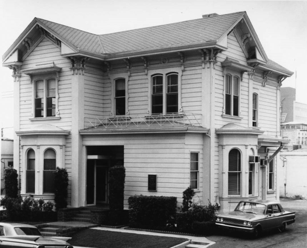
| (1960s)^ – View showing the historic Samuel Calvert Foy home at 631 S. Witmer Street (near the Good Samaritan Hospital). |
Historical Notes In December 1992, the house was moved to its third location at 1337 Carroll Avenue. The Foy House was the seventh house to be moved to Angelino Heights, the first and largest historic preservation zone in the City of Los Angeles. |
 |
|
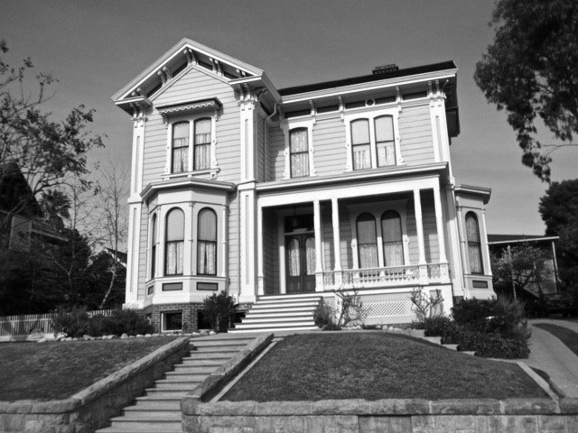
| (ca. 2012)#+ – View showing the 1872-built Foy House at its third location, in the Angelino Heights Historic Preservation Overlay Zone at 1337 Carroll Avenue. |
Historical Notes The current owner has faithfully reconstructed elements lost during the multiple moves, such as the exterior window canopy. The sky-blue paint on the porch ceiling is typical of Victorian homes; some say this treatment discourages birds from nesting by mimicking the sky. |
 |
|
| (1919 vs 2022)* - Looking at the Foy Residence at its original location in 1919, near the NW corner of Figueroa and 7th Street in DTLA. Bottom photo shows the same house at its current location at 1337 Carroll Avenue (3rd location). Note the Xmas Tree sale sign in front, the small gas station on the corner, and the ornate 5-globe streetlight in the early photo. |
Historical Notes The Foy House is listed as Los Angeles Historic-Cultural Monument No. 7 (Click HERE to see complete listing). |
* * * * * |
Southern Pacific River Station
 |
|
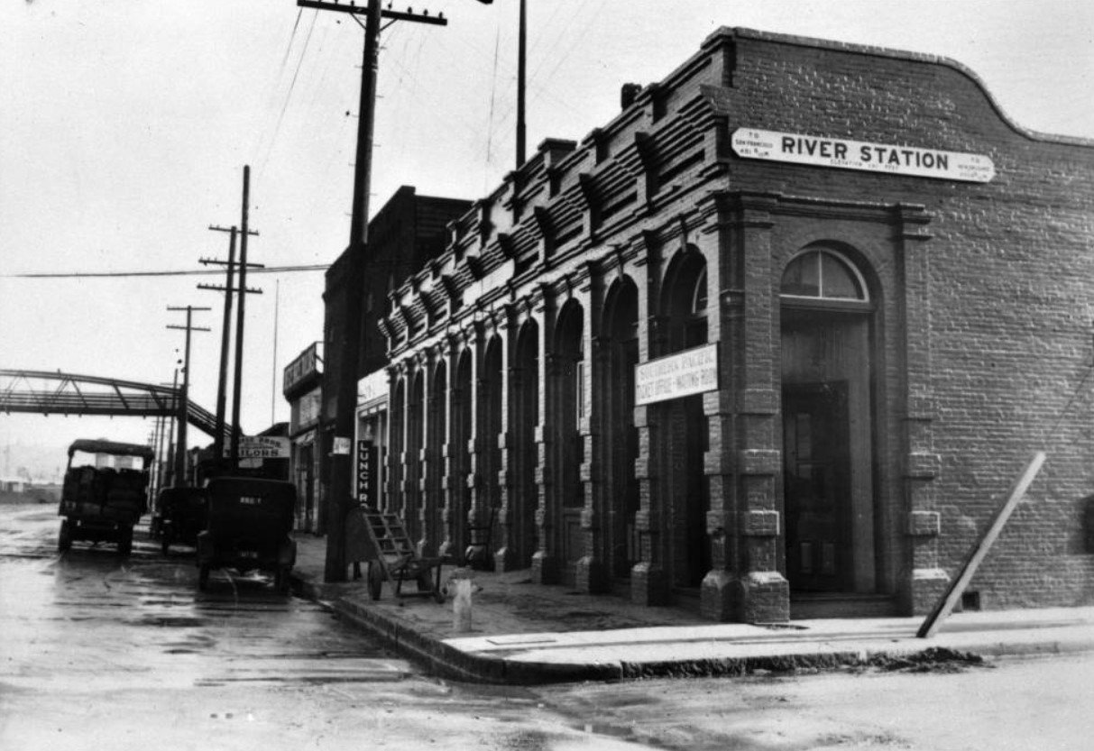
| (ca. 1919)^ - View showing the Southern Pacific River Station on San Fernando Road. The station was Los Angeles' first Southern Pacific station and was built in 1887. The Southern Pacific River Station was located at 1501 San Fernando Street. San Fernando Street was renamed North Spring Street sometime in the 1910s, and the new address for the River Station was 1500 North Spring Street. |
Historical Notes Though the River Station welcomed many of those drawn by the land boom of the mid-1880s, its location came to be seen as less than ideal. It was surrounded by the Southern Pacific's freight yards and, as the city's Anglo population shifted south of the historic plaza into the new central city, it was situated far from many passengers' ultimate destinations. Later depots, beginning with the Southern Pacific's Arcade Station, would be located to the south. #^ |
* * * * * |
St. Elmo Hotel
 |
|
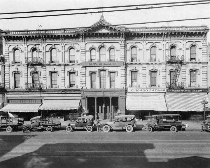
| (1920)* - St. Elmo Hotel was first named Lafayette Hotel and renamed the Cosmopolitan. Here the hotel is viewed from across the street, with a line of cars parked at the curb in front of the various ground floor businesses. |
* * * * * |
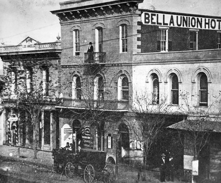
Bella Union Hotel
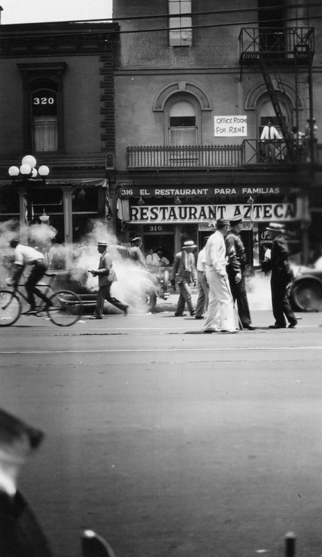 |
(ca. 1920)* - View of a busy North Main Street in front of the Azteca Restaurant as seen from across the street. The restaurant is located on the street floor of the old Bella Union Hotel. A sign on the second floor reads: Office Room For Rent.
|
Historical Notes Constructed in 1835, the Bella Union Hotel has a long, rich history. It served as the County Courthouse until October 1851, and in 1860 was the location of a champagne fete celebrating the connection of San Francisco and Los Angeles by telegraph.^ |
 |
|
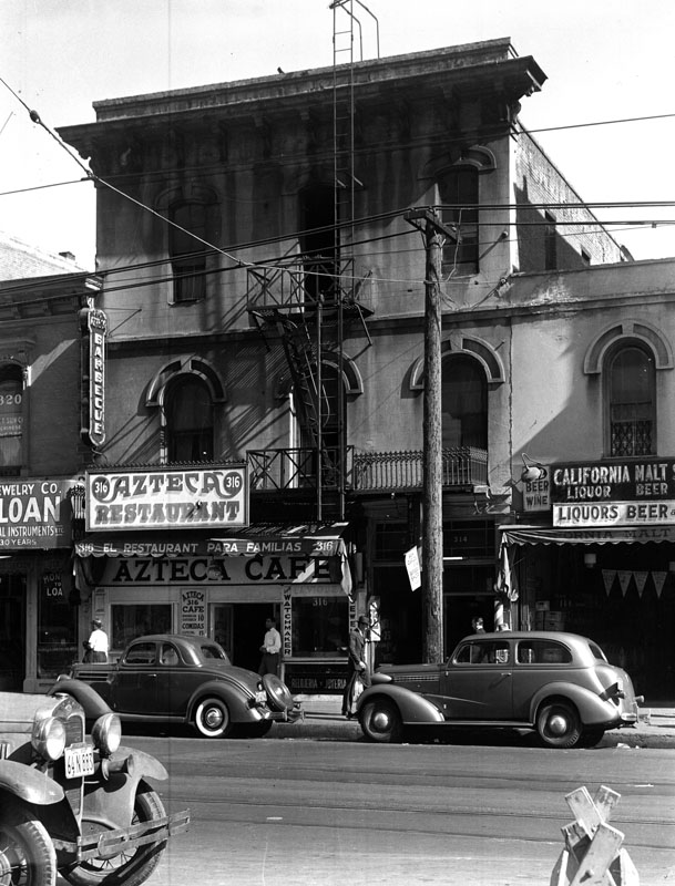
| (1939)* - Exterior view of the old Bella Union Hotel, located at 314 North Main Street. Taken on May 4, 1939, the hotel had become a shadow of its former self. |
Historical Notes The Bella Union Hotel is considered to be the first hotel in Los Angeles. The building no longer exist, however the site it stood on was designated California Historical Landmark No. 656 (Click HERE to see more in Califronia Historical Landmarks in LA). Below is what the hotel looked like in the 1860s. |
 |
|
| (ca. 1867)* - The Bella Union at 314 N. Main St. later became the St. Charles Hotel. To the left is the original home of Farmers and Merchants Bank, later merged into Security Pacific Bank. Standing on the balcony is Mrs. Margarita Bandini Winston, owner of the hotel. |
Click HERE to see more in Early LA Buildings (1800s) |
* * * * * |
Federal Building and Post Office
 |
|
| (ca. 1910)* - Photo of a sketch showing the Los Angeles Civic Center Federal Building and Post Office, northwest corner of Temple Street and Main Street (former site of the Downey Block). |
 |
|
| (ca. 1910)* - View showing Temple Street at the junction of Spring and Main Streets. The newly constructed Federal Building and Post Office is seen at the northwest corner of Temple and North Main streets across the street from the International Bank Building. An early open car and a trolley car are seen on the street. |
 |
|
| (ca. 1920)^ - Exterior view the old Federal Building and Post Office on the corner of Temple Street and Main Street. Pedestrians can be seen walking near the base of the structure, while several early automobiles are parked at right. Three streetcars can be seen in the foreground at center. Note the beautiful streetlights surrounding the building. |
Historical Notes Constructed between 1906 and 1910, the five-story Romanesque building housed the post office, U.S. District Court, and various federal agencies, but it soon proved inadequate. |
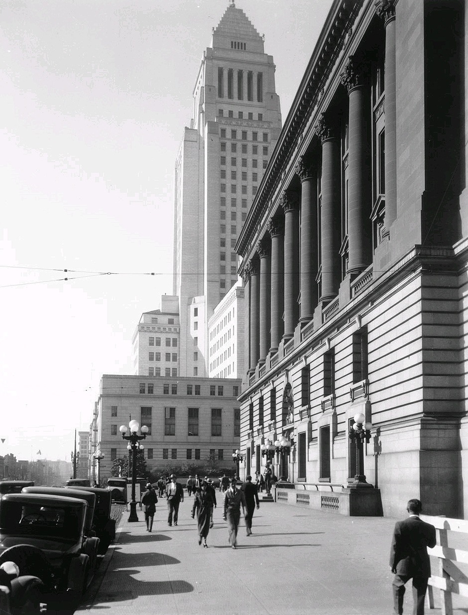 |
|
| (1931)**# - Looking south on Main Street across Temple at the old Federal Building/Post Office and City Hall. Ornate 5-lamp streetlights can be seen in front of the Federal Building (Click HERE to see more in Early Streetlights of LA). |
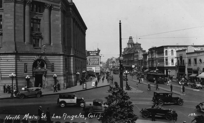 |
|
| (1932)^*# - Postcard view of North Main Street as seen from the base of Los Angeles City Hall at Temple Street. The entire 300 block of N. Main Street, from Baker Block to the Ducommun Building, can be seen here. The old Federal Building and Post Office stands on the northwest corner. |
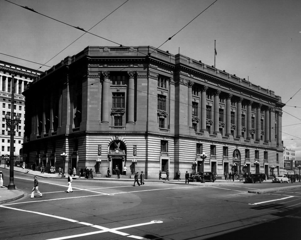 |
|
| (ca. 1930s)^ - A later view the old Federal Building and Post Office on the corner of Temple Street and Main Street. A portion of the new Hall of Justice (built 1928) can be seen at left. |
Historical Notes The population of Los Angeles grew rapidly in the early part of the twentieth century, and a larger building was needed to serve the courts and federal agencies. The Federal Building was razed in 1937 to clear the site for the existing U.S. District Courthouse. |
* * * * * |
Automobile Club of Southern California
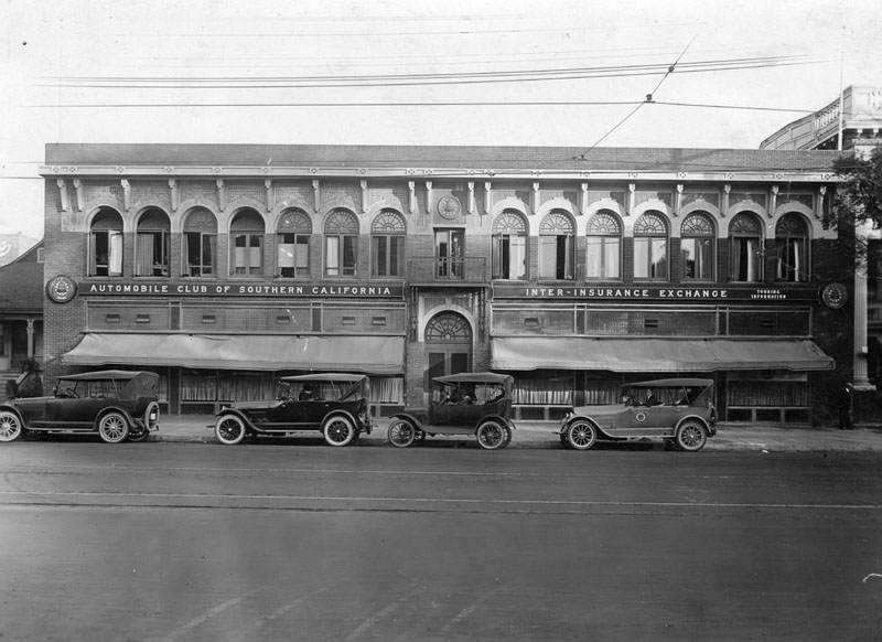 |
|
| (ca. 1920)* - Exterior view of the first location of the Automobile Club of Southern California, located at 1344 South Figueroa Street. One of the cars parked outside the entrance belongs to the Auto Club's Insurance Department. Pacific Electric train tracks are visible in the foreground. |
Historical Notes The Automobile Club of Southern California, one of the nation's first motor clubs dedicated to improving roads, proposing traffic laws, and improvement of overall driving conditions, was founded on December 13, 1900 in Los Angeles. The Auto Club was responsible for producing state road maps, as well as posting thousands of porcelain-to-steel traffic signs throughout the state to create a uniform signing system - which it continued to do until the task was taken over by the State of California in the mid-1950s.* |
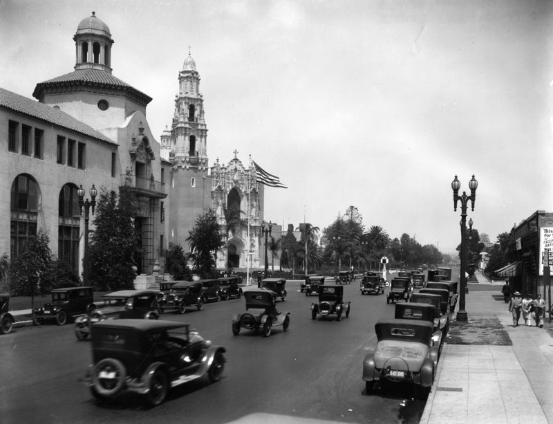 |
|
| (1926)* - Figueroa Street looking northwest toward West Adams Boulevard. On the left is the Automobile Club of Southern California and St. St. Vincent Catholic Church. |
Historical Notes The building pictured here originally served as the Auto Club's main office. It was built between 1922-1923 by architects, Sumner P. Hunt, Silas R. Burns, and Roland E. Coate in the Spanish Colonial Revival style. Today, this building serves as the Los Angeles district office, but the administrative offices are now located in Costa Mesa.* |
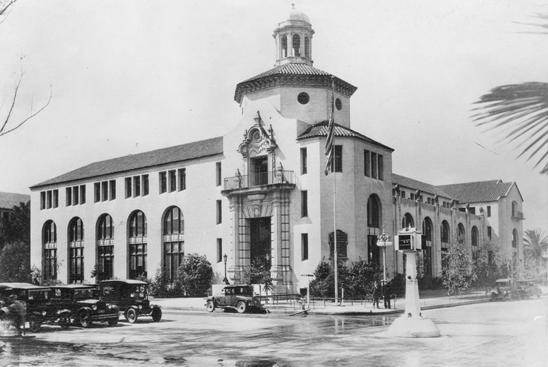 |
|
| (1930)* - Exterior view of the Automobile Club of Southern California, located at 2601 S. Figueroa St. on the southwest corner of Adams and Figueroa. Three cars can be seen waiting for the traffic signal (located in the center of the intersection) to change. |
Historical Notes The Automobile Club of Southern California, one of the nation's first motor clubs dedicated to improving roads, proposing traffic laws, and improvement of overall driving conditions, was founded on December 13, 1900 in Los Angeles. The Auto Club was responsible for producing state road maps, as well as posting thousands of porcelain-to-steel traffic signs throughout the state to create a uniform signing system - which it continued to do until the task was taken over by the State of California in the mid-1950s.* The Automobile Club Building was designated LA Historic-Cultural Monument No. 72 (Click HERE to see complete listing). |
* * * * * |
USC
 |
|
| (1920s)* - Exterior view of Bovard Hall, U.S.C.'s Administration building. Note the arch over the entrance and windows, the architectural designs on the building and carved statues on the tower. Students may be seen coming and going in front of the hall. |
Historical Notes George Finley Bovard Administration Building was dedicated the week of June 19, 1921. John Parkinson, architect. The building cost $620,000, the organ in the auditorium cost $35,000.*^# |
 |
|
| (ca. 1920s)* - Interior view of Bovard Auditorium at U.S.C. Building was built in 1920-21, in neo-gothic elements of interior contrast with northern Italian Romanesque Revival style, designed by architects John and Donald Parkinson. |
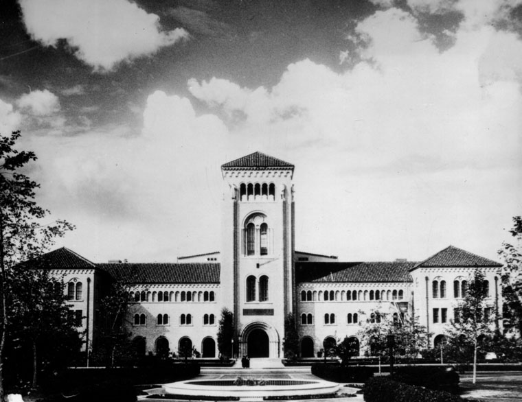 |
|
| (ca. 1920s)* - Exterior view of the front entrance of Bovard Hall at U.S.C. Building contains Bovard Auditorium, seating 2000 persons, offices of administration and various headquarters of the Trojan's 24 schools and colleges. |
Click HERE to see more in Early Views of U.S.C. |
* * * * * |
Lanfranco Building
 |
|
| (ca. 1920)* - Exterior view of the Lanfranco Building circa 1920. Stores include White Front Clothing Store, Hatchen Jewelry, New Sanitary Hat and Suit Cleaners, A. Mathieu French Delicacies, and K. & D. Furniture Co. On the second floor are the offices of Dr. Underwood, whose signs are totally in Spanish. |
* * * * * |
Finkle Building
 |
|
| (ca. 1920)* - Finkle Building, 316 South Spring Street, Los Angeles, California about the year 1920. Stores include a hardware and supply store, Kirk's Military Shop, and a Kosher restaurant. |
* * * * * |
Hollenbeck Hotel
 |
|
| (ca. 1920)* - The Hollenbeck is seen standing regally on the southwest corner of Spring and Second behind some trolley lines crossing in front and extending down the streets. Cars can be seen in the street and some people. A drug store now occupies the street level corner of the building. Hotel architect, Robert B. Young. |
* * * * * |
Temperance Temple
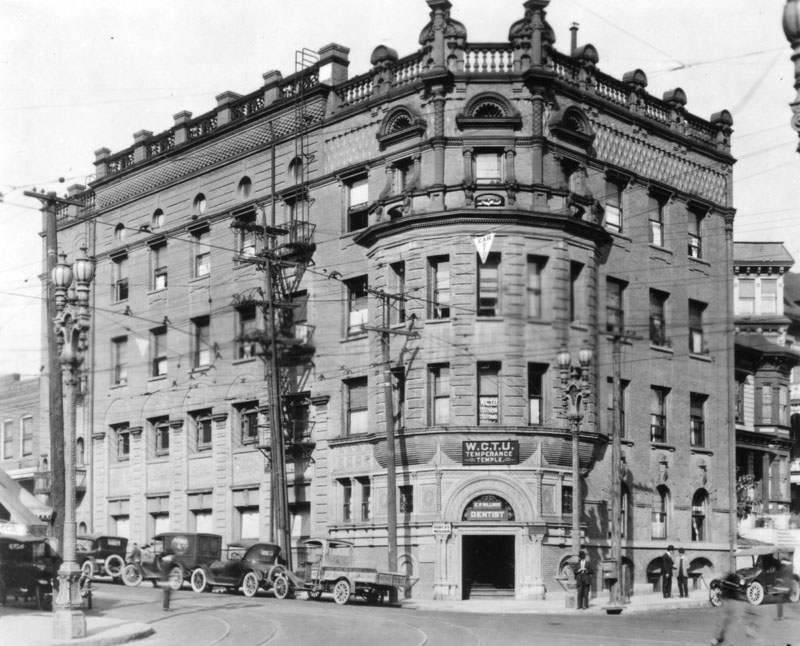 |
|
| (ca. 1920)* - View of the Temperance Temple of the Women's Christian Temperance Union (WCTU), located at 301 N. Broadway at Temple Street. |
Historical Notes The Women's Christian Temperance Union (WCTU) stands for the complete abstinence from alcohol, tobacco, and all harmful drugs and protection of the home. As the membership of the WCTU grew throughout the U.S, a call went out from May Gould, a resident of Los Angeles, to Frances Willard to organize a local group in Southern California. On September 20 and 21, 1883, the first State Convention was called and the WCTU of Southern California was organized at the First Presbyterian Church, 2nd and Fort (now Broadway) Streets, Los Angeles. This temple was dedicated in 1889 after money had been donated for its construction in 1886. The Frances E. Willard Home For Girls was housed on the 4th floor from its inception in 1919 until 1933, when the Long Beach Earthquake severely damaged the building. The County of Los Angeles took the site by eminent domain and constructed a power plant where the venerable Temperance Temple once stood in 1947. When the Temple was completely razed in 1950, its corner stone was presented to the WCTU.* |
* * * * * |
Garnier Block
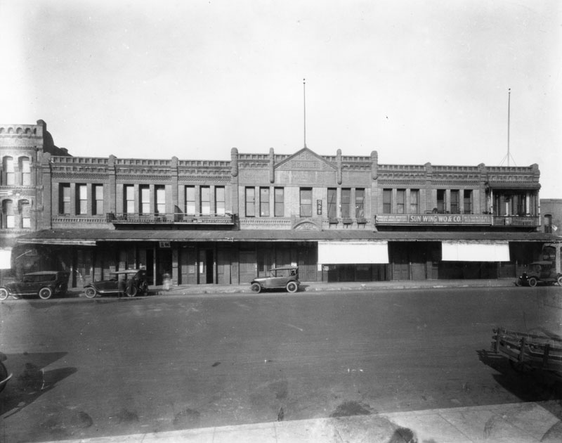 |
|
| (ca. 1920)* - P. Garnier is chiseled in the stonework of the Garnier Block at 415 N. Los Angeles Street. The building was used by Chinese merchants at the time of this photograph. |
Historical Notes The Garnier Building was built in 1890, by Philippe Garnier, a French settler who arrived in Los Angeles in 1859 at the age of eighteen. Philippe Garnier and his brothers, Eugene, Abel, and Camille, owned the 4,400 acre Rancho Los Encinos in the San Fernando Valley where they raised sheep. Despite losing a considerable sum of money in the wool market crash in 1872, the Garniers were financially well off and remained influential in local commerce. Philippe Garnier served as a bank director on the Board of the Farmers and Merchants Bank from 1879 to 1891 and is believed to have constructed several other buildings in Los Angeles.^#^^ |
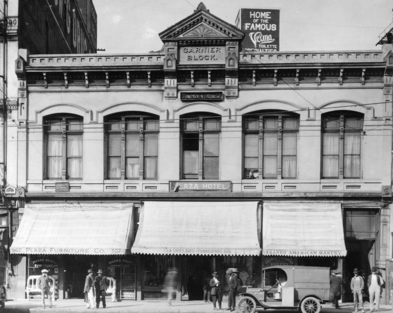 |
|
| (ca. 1920)* - Garnier Block, formerly known as the Plaza House had shops on the ground level and the Plaza Hotel on the second floor. A short distance to the right (out of view) sits the Old Plaza Firehouse. |
Historical Notes The Garnier Building was designed primarily for Chinese commercial tenants. It is the oldest building in Los Angeles exclusively and continuously inhabited by Chinese immigrants from the time of its construction in 1890 until the State took it over in 1953. The building was the headquarters of major Chinese American organizations and housed businesses, churches, and schools. It was an important structure in the original Los Angeles Chinatown.^#^^ |
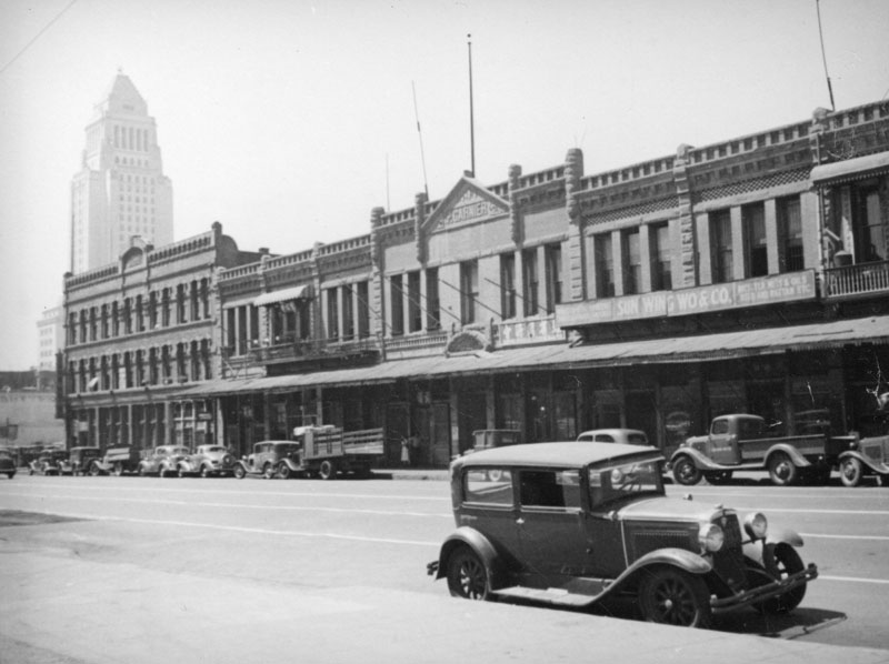 |
|
| (ca. 1930s)* - View of Garnier Block with City Hall in the background. Photo by Herman Schultheis. |
Historical Notes The construction of the #101 Freeway (Hollywood Freeway) took away everything to the left of (south of) the Garnier Building, an area referred to as the Jennette Block. The Old Plaza Firehouse is to the right of the Garnier Building.* |
Click HERE to see more Early Views of the LA Plaza |
* * * * * |
Jennette Block
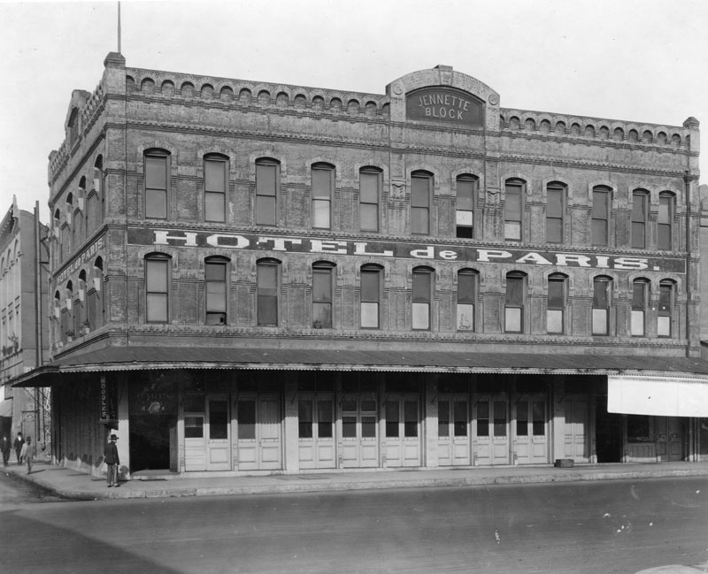 |
|
| (ca. 1920)* - Exterior view of the Jennette Block on the northwest corner of Los Angeles and Arcadia Streets, with the Hotel del Paris on the second floor. |
Historical Notes The Jennette Block sat adjacent (south of) the Garnier Block. It, along with part of the Garnier Block, was demolished to make room for the #101 Freeway.* The Jennette Block was built circa 1888 and the Garnier Building in 1890.* |
* * * * * |
Temple Block
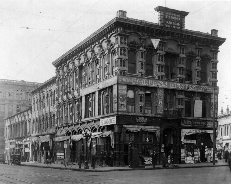 |
|
| (ca. 1920)* - Temple Block, junction of Main, Spring and Temple streets; Spring Street at left, Main Street at right, Temple Street in foreground. Photograph shows a large commercial building with sign on top reading: "INTERNATIONAL STEAMSHIP AND RENTAL TICKET OFFICE" and another sign on the middle facing reading: "PAINLESS DENTISTRY". |
Historical Notes In 1827, Jonathan Temple moved to the Pueblo de Los Angeles, where he opened the pueblo's first store, a business he operated for almost thirty years. Temple was also one of Los Angeles’ first developers, constructing such landmarks as the original Temple Block and the Market House, which later served as city and county administrative headquarters, contained the county courthouse, and featured the first true theater in southern California. He also served as the first alcalde (or mayor) of Los Angeles after capture of the pueblo by the United States during the Mexican-American War and served on the first American-period common (city) council. Temple Street was developed by Johnathan Temple as a modest one-block dirt lane in the 1850s.^* Temple Block was razed to make room for the current City Hall, built in 1928. |
* * * * * |
Sunbeam Theatre (Highland Park)
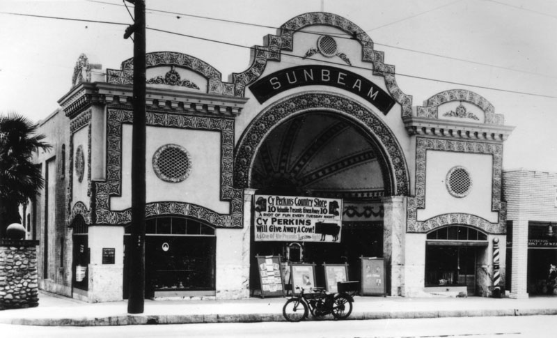 |
|
| (ca. 1920)* - Exterior view of the Sunbeam Theater in Highland Park, with a sign advertising a promotion by Cy Perkins Country Store. The theater, located at 5722 N. Figueroa Street (previously Pasadena Avenue), was designed by A. Lawrence Valk. |
Historical Notes The Sunbeam Theatre was a 1296 seat theater built in 1914. It was purchased by the owners of the Highland Park Theater and closed to remove competition. After that it was re-purposed for a variety of businesses. In the late 1980s, part of it was utilized by the theater group Outback Theater. The space is still occasionally used for events.***^ |
* * * * * |
Crocker Building & Copp Building
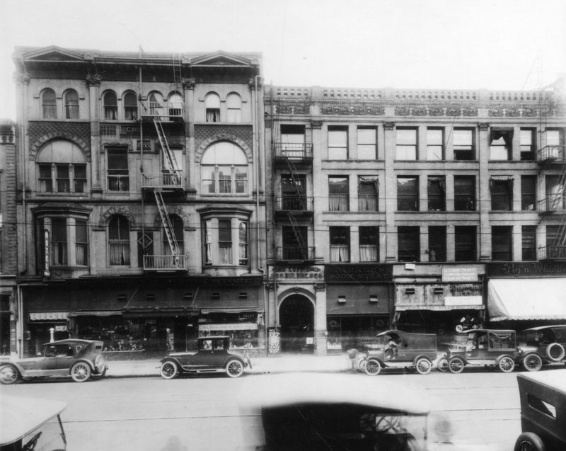 |
|
| (ca. 1920)* - East side of Broadway between 2nd and 3rd Streets around 1920. On the left, Crocker Building, 212 S. Broadway; on the right, Copp Building, 218 S. Broadway. A number of automobiles are parked along the street in front of the various shops and stores. |
Newell and Gammon Building
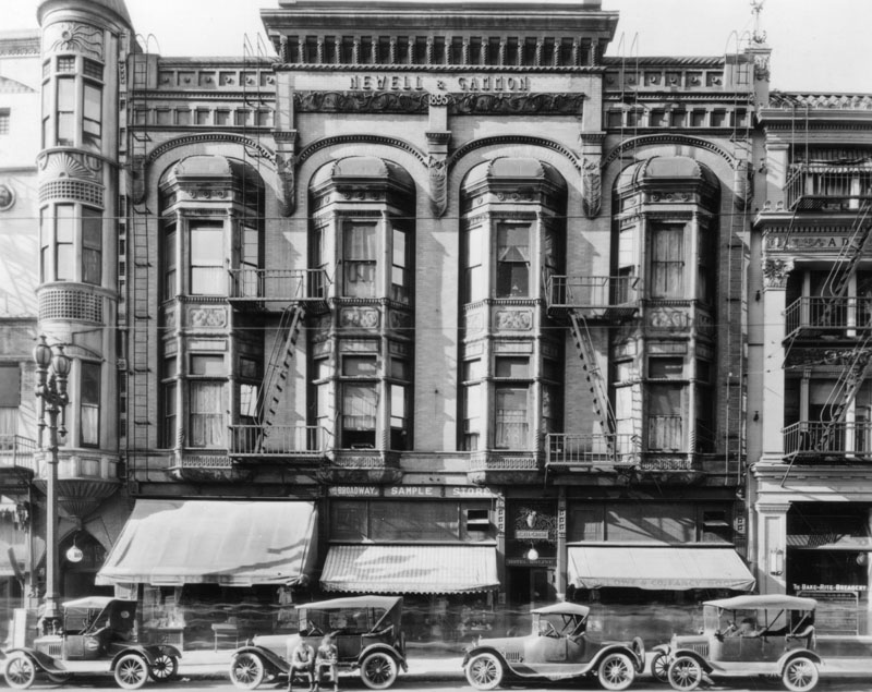 |
|
| (ca. 1920)* - Newell and Gammon Building, 131 South Broadway. Two men are sitting on a car's runner board. |
* * * * * |
Toonerville Trolley Sandwich Shop
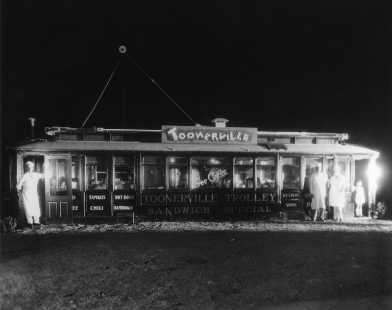 |
|
| (1920)* - View of the Toonerville Trolley sandwich shop located at 1635 W. Manchester Avenue. Sign reads: 'Sandwich Special' and 'Free Coffee' |
Historical Notes In the 1920s, as the automobile was becoming the default way to get around Los Angeles, buildings and structures in the area became more unique, often resembling the merchandise or services they hawked. These “hey-you-can’t miss-me!” buildings (referred to as Novelty or Programmatic Architecture) were made to pull automobile drivers right off the road. Click HERE to see more examples of Programmatic Architecture. |
* * * * * |
Wrigley Residence (Catalina Island)
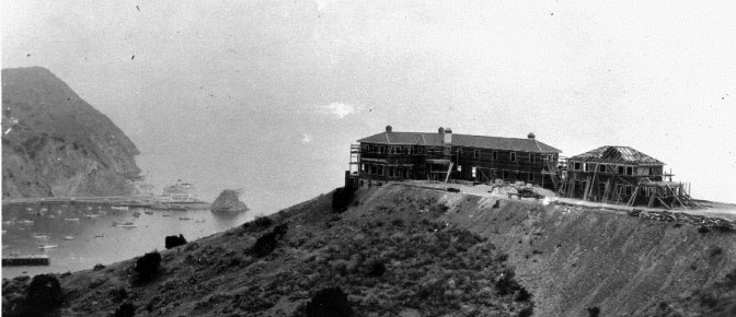 |
|
| (1919)**#^ – View of the Wrigley residence under construction on top of Mt. Ada, overlooking Avalon Bay. In the distance is Sugarloaf Point and a new casino located on the spot where “Big" Sugarloaf once stood. |
Historical Notes First built as the vacation home of William Wrigley Jr., Mt. Ada was constructed in 1919 and finished in 1922. Wrigley reportedly chose this particular location for its unsurpassed views of Avalon Bay with magnificent surroundings and because it received the first sunlight of the morning and the last sunlight of the late evening.**#^ |
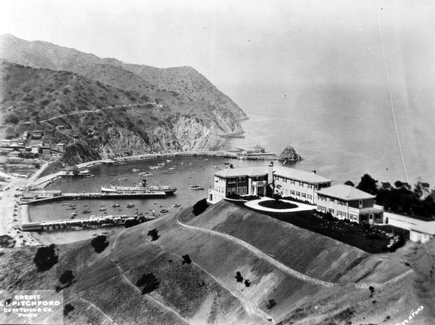 |
|
| (ca. 1922)^ - Birdseye view of Avalon Bay with the William Wrigley house in the foreground. The house can be seen on a steep hill in the foreground at right and is a large, two-story building with dark grass all around. The hillside at left is sparsely covered with small, thick trees. The harbor can be seen in the background at left. A large steamship can be seen at a dock, while many smaller vessels are moored in the harbor. “Little” Sugarloaf rock can be seen in the background at center next to Avalon’s first Casino, right where “Big” Sugarloaf rock once stood. |
Historical Notes The Wrigley home was designed and built by David M. Renton, general manager of the Santa Catalina Island Company at the time. Renton, who was influential in the early development of Catalina Island, also managed construction of the Catalina Casino Ballroom and was known for the development of Craftsman-style homes in Pasadena, among many other local projects.**#^ |
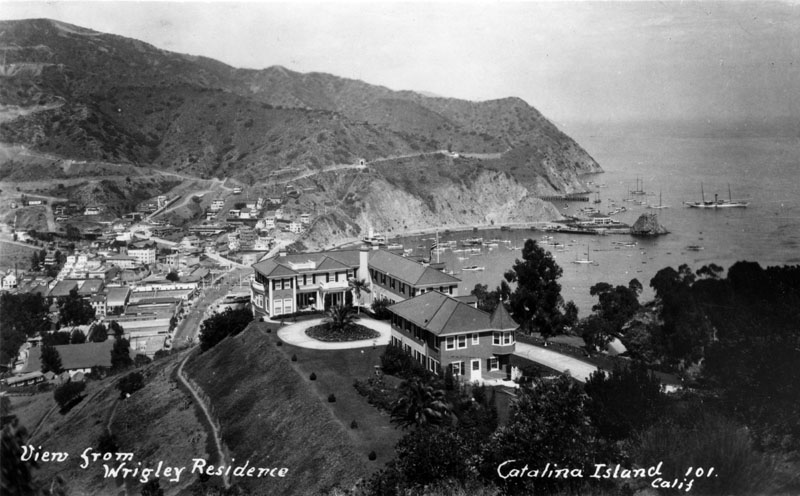 |
|
| (1920s)* - View of William Wrigley's beautiful two-story, L-shaped home resting atop a grassy hill, overlooking Avalon and beyond. Small houses as well as various tourist-oriented businesses, office buildings and several larger apartment complexes are nestled in the hills. The first Catalina Casino, Sugarloaf Casino, and numerous small boats are visible at the edge of the bay on the right, surrounded by the sea on three sides. |
Historical Notes The home stood 350 feet above the ocean and provided expansive views of Avalon Bay, the town of Avalon itself, and the mainland off in the distance. The Wrigleys reportedly made two annual visits to Catalina Island in the summer and winter, with each visit lasting between four and ten weeks. Many distinguished guests of that time period enjoying visiting with the Wrigley family, including Herbert Hoover, Calvin Coolidge, and the Prince of Wales.**#^ |
.jpg) |
|
| (n.d.)* - View showing the stairway leadig to William Wrigley's house on top of Mt. Ada (named after Mrs. Wrigley). The sprawling residence boasts numerous windows, each facing magnificent views of the island, several dormers, a number of balconies, and lush landscape. |
Historical Notes After Mr. Wrigley’s death in 1932, Mrs. Wrigley continued to visit their treasured home regularly until 1947 when she suffered a stroke. She died in 1958 and the property was then managed by the Santa Catalina Island Company and occasionally used for meetings and events by local organizations. In 1978, the property was donated to the University of Southern California and was used by the University as a conference center for the next several years.**#^ |
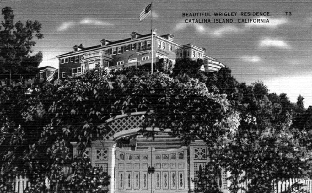 |
|
| (n.d.)**#^ - Postcard view of the Wrigley Residence on Mt. Ada, Catalina. Built between 1922-24 and designed by David M. Renton. |
Historical Notes In 1985, the home was leased to its present operators and became The Inn on Mt. Ada. The residence was carefully restored in an effort to bring the property up to current building standards and to provide the amenities of a luxurious inn. Many celebrities have stayed at the Inn including Barbara Streisand, Molly Ringwald, and Billy Zane. The most requested suite is the two-room Grand Suite which includes a private terrace. Mt. Ada is open to the public every December for the Catalina Island Museum’s Annual Open House. The home was placed on the National Register of Historic Places in 1985.**#^ |
Click HERE to see more in Early Views of Catalina |
* * * * * |
Please Support Our CauseWater and Power Associates, Inc. is a non-profit, public service organization dedicated to preserving historical records and photos. We are of the belief that this information should be made available to everyone—for free, without restriction, without limitation and without advertisements. Your generosity allows us to continue to disseminate knowledge of the rich and diverse multicultural history of the greater Los Angeles area; to serve as a resource of historical information; and to assist in the preservation of the city's historic records.
|
For more Historical Los Angeles Views click one of the following:
For Other Historical Views click one of the following:
See Our Newest Sections:
To see how Water and Electricity shaped the history of Los Angeles click one of the following:
Water:
Power:
* * * * * |
References and Credits
* LA Public Library Image Archive
**DWP - LA Public Library Image Archive
*^Oviatt Library Digital Archives
^^ Daily Breeze: Los Angeles Motordome
+^Flickr.com: City Project: El Pueblo de Los Angeles
*# LA Times: Hollywood Castles and Curious Cures
+#Urban Diachrony: East side of North Main Street south of Arcadia Street
#+LA Architecure Tours: Carroll Avenue
#^ KCET: Southwest Museum of the American Indian; Lost Train Depots of LA
^^*Early Downtown Los Angeles - Cory Stargel, Sarah Stargel; Los Angeles Trust and Savings Bank
*^#Publicartinla.com - Bovard Hall
#^*Huntington Digital Library Archive
^*#California State Library Image Archive
^##Library of Congress: Los Angeles Herald
***Los Angeles Historic - Cultural Monuments Listing
*^*California Historical Landmarks Listing (Los Angeles)
*#^The Department Store Museum: J. W. Robinson's
^#*Historic Hotels of Los Angeles and Hollywood (USC - California Historic Society): St. Elmo Hotel; Tally's Broadway Theatre
*^^Nuestra Señora la Reina de los Ángeles: losangelespast.com
**#Noirish Los Angeles - forum.skyscraperpage.com; Engine Company No. 23; Westmoore Hotel; J.W. Robinson Store; Bible Institute of Los Angeles
+#+Southern California Arcthitectural History
+++Facebook.com – Los Angeles Heritage Railroad Museum
++^Historic Los Angeles Theaters: Clune's Broadway Theatre/Cameo Theatre
**^Historical LA Theatres: The Philharmonic Auditorium; Downtown Theatres; Mason Theatre; Trinity Auditorium; Quinn's Superba; Liberty Theatre
***^Highland Park - amoeba.com
*^^^San Fernando Valley Historical Society/Facebook.com: Westinghouse Electric Range
^^^*Cinema Treasures: Quinn's Superba Theatre; LIberty Theatre; Cameo Theatre
^^^+Los Angeles Housing Partnership
^+^+The Daily Mirror: Bryson Apartments
^***West Adams Avenues Blogspot
^^**Flickr.com: Bonfilio Residence - Floyd B. Bariscale; Million Dollar Theater - Ryan Vaarsi
*^*^Big Orange Landmarks: Los Angeles Athletic Club
*^*#Huntington Digital Library Archive
*^^#The Barlow Sanitorium - barlowgenealogy.com
^#^^El Pueblo de Los Angeles Historical Monuments; Garnier Building
*#*^Openlibrary.or: Westinghouse Automatic Electric Range
*^#*Blogdowntown.com: Merritt Building
**##History of the Rosslyn Hotel
*#**B. H. Dyas Co.
^##*Los Angeles Fire Department Historical Archive
*##^Flickr.com: Michael Ryerson
^*^#Facebook.com - Bizarre Los Angeles
#^*^Facebook.com: Photos of Los Angeles
#+++Yahoo.com: Beverly Hills Hotel
^^^#California Hospital Medical Center Foundation
#^**Flickr.com: Metro Library and Archive
#^^#Beforeusc.com: Church of Christ, Scientist
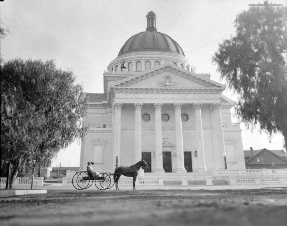
###^Pomona Public Library Poscard Collection
^*^*^Denver Public Library Image Archive
^***^Facebook.com: Garden of Allah Novels
**^**Los Angeles City Historical Society
^* Wikipedia: Leonis Adobe; Occidental College; Beverly Hills; Beverly Hills Hotel; Huntington Hotel; Bank of Italy; Van de Kamp's Holland Dutch Bakeries; Rose Bowl Stadium; Los Angeles Memorial Coliseum; Farmers and Merchants Bank of Los Angeles; Los Angeles Biltmore Hotel; Jonathan Club; Los Angeles Plaza Historic District; St. Vincent Church; The Benevolent and Protective Order of Elks; Park Plaza Hotel; YMCA; San Pedro; Venice; Subway Terminal Building; St. Vincent Hospital; Los Angeles Herald-Examiner; Cahuenga Branch Library; Foy House; Frederick Hastings Rindge House; Los Angeles High School; MGM; Breed Street Shul; Natural History Museum of Los Angeles County; Jonathan Temple; Highland Park Masonic Temple; Egyptian Theatre; Phineas Banning; Eagle Rock; Hollywood Masonic Temple; Sawtelle Veterans Home; Downtown, Los Angeles; Robinson's Department Store; International Savings & Exchange Bank Building; Quinn's Superba Theatre; Million Dollar Theater; Los Angeles Athletic Club; Harris Newmark; Fire Station No. 23; Church of the Open Door; Lyman Stewart; Biola University; Paramount Studios; Fremont Hotel; Barlow Respiratory Hospital; Shrine Auditorium; Second Church of Christ, Scientist 2008/1928; Hotel Rosslyn Annex; Plaza Substation
#mediaviewer/File:Second_Church_of_Christ_Scientist.JPG)
< Back