Mulholland: Pay Roll Town of the San Fernando Valley
.jpg) |
|
| (ca. 1912)^^ - Photographic reproduction of original map showing subdivision of Mulholland between Burbank/Tejunga Creek and Fernando/San Fernando Reservoir. In addition, maps shows surrounding communities of Chatsworth, Van Nuys, Glendale, Hollywood, Marian, Owensmouth, La Canada. |
Historical Background A simple photo album showing the development of the town of Mulholland, California, illustrates the giddy boosterism of San Fernando Valley land and agricultural developers at the turn of the century. “Mulholland: The Pay Roll Town of the San Fernando Valley” came to the State Library with no known provenance or exact date, but what is known is that the town was indeed named after William Mulholland, in honor of his innovative solution to the water problem.^* |
 |
|
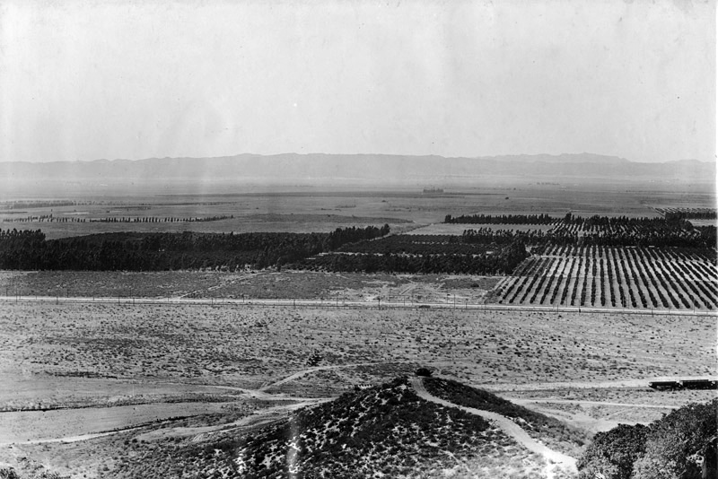
| (ca. 1912)^^ - Birds Eye view showing the townsite of Mulholland as seen from the top of the Pacoima Hills. |
Historical Notes The town was laid out to conform with the newly laid railroad. Large spacious and expensive two-story homes made their appearance, as the early planners had established building restrictions against anything of a lesser nature. The first concrete sidewalks and curbs were laid and were to remain the only ones in the velley for many years. The town was enjoying a prosperous births in those early boom days. The Southern Pacific chose it as a site for a large brick passenger station, one of the finest on the line. But it, like the large hotel, the big two-story school building, and many commercial buildings, was to be torn down within a few years as the boom days receded. The early pioneers had frowned upon industry, which eventually resulted in the people turning from the exclusive suburb which they had set up to establish new homes closer to their employment. The great flood of 1891 practically obliterated Pacoima. Growth ot this area ceased. The land owners turned to farming the land. Many found this too difficult a task. Little did they know that this section would later grow into a rich farming area when experts learned to what the soil is adapted and where water is plentiful. Judge Widney, a trustee of the Maclay Rancho Water Company, attempting to revive prosperity in 1912, renamed Pacoima “Mulholland.” This name lasted only one year.^^ Not much is known about why the Mulholland name only lasted for one year. It could have been that William Mulholland did not approve of his name being used for private development. |
 |
|
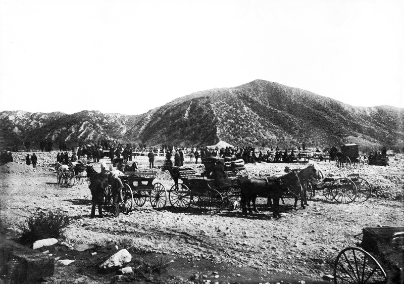
| (ca. 1912)^^ – View showing the excursion at Mulholland (later Pacoima) at the celebration of the completion of the dam. |
Historical Notes Pacoima Submerged Dam was built across Pacoima Creek in San Fernando Valley to create an underground reservoir. It was constructed by digging down to bedrock and included two gathering wells.^^ |
 |
|
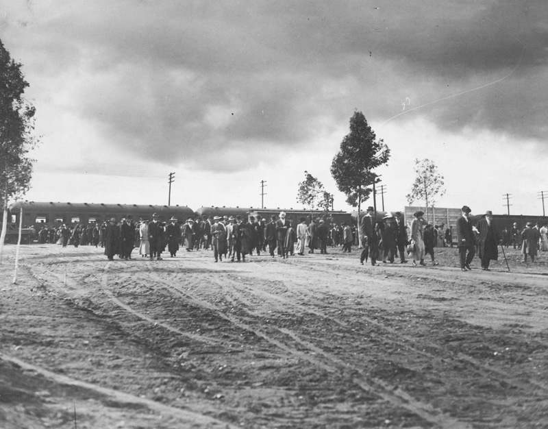
| (ca. 1912)^^ - Crowds of people disembark a train at the new Mulholland Townsite. |
 |
|
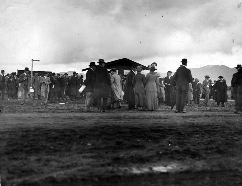
| (ca. 1912)^^ - Opening sales day at the new Mulholland Townsite. |
 |
|
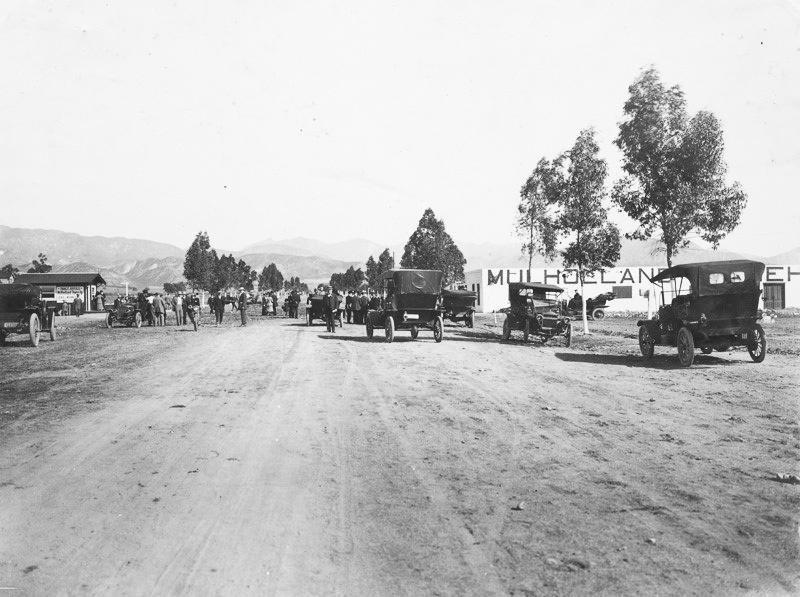
| (ca. 1912)^^ - View looking north at the new Mulholland Townsite. The sales office is seen at center-left. The sign on the building wall on the right reads “Mulholland Warehouse“. |
 |
|
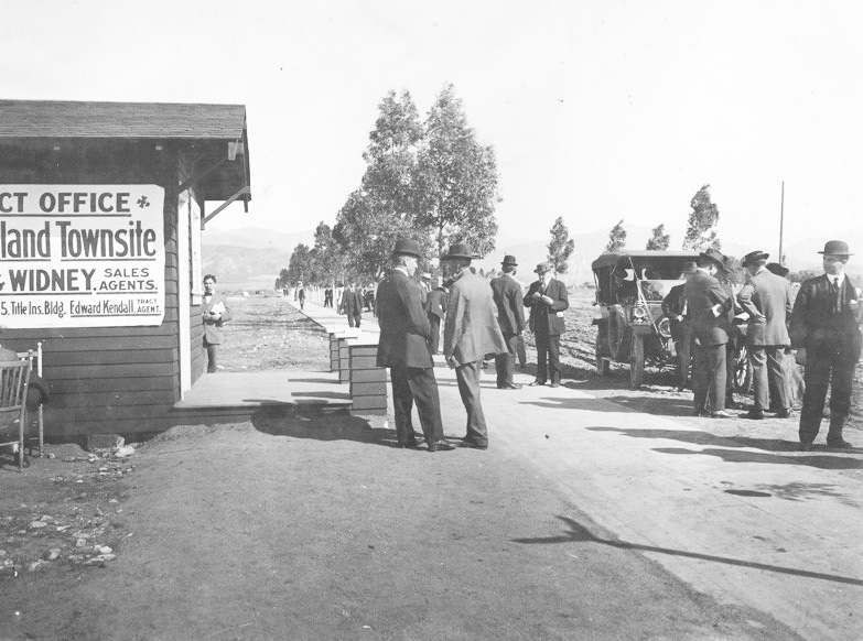
| (ca. 1912)^^ - A group of men stand in front of the Lenz & Widney Tract Office at the Mulholland Townsite. |
Historical Notes Walter M. Lenz and Robert J. Widney were sales agents for the project to develop the town of Mulholland and Mulholland Hills in the San Fernando Valley. The project developed by Mulholland Development Company, opened to public Nov. 10, 1912. |
* * * * * |
References
^^California State Library Image Archive
^*California State Library Foundation - Bulletin
< Back
Menu
- Home
- Mission
- Museum
- Mulholland Service Award
- Major Efforts
- Board Officers and Directors
- Positions on Owens Valley and the City of Los Angeles Issues
- Legislative Positions on
Water Issues
- Legislative Positions on
Energy Issues
- Recent Newsletters
- Historical Op Ed Pieces
- Membership
- Contact Us
- Search Index