Mulholland and the Colorado River Aqueduct
 |
|
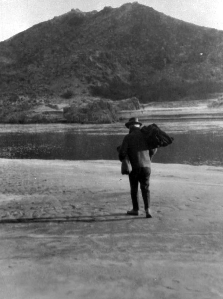
| (1923)* - William Mulholland, with pack on back, starts a great survey. Photo Courtesy of MWD |
From LADWP's Historical Archives
September 1929 - Back in the fall of 1923, a small party headed by Chief William Mulholland, set out for the Colorado River. In the party besides the Chief were H. A. Van Norman, now general manager of the Department; Mr. Bayley, George Read and Harry Thayer. They left Boulder Canyon in a small boat and for four days rowed downstream ending their journey at Parker, Arizona.
REPEATS HISTORY – On October 29, 1923, when William Mulholland slung a blanket over his shoulder and struck out toward the bank of the Colorado River, he was about to start a project that would make history and repeat history.
Eighteen years before he had started a survey journey over desert sands and into the High Sierras. Out of that trip grew the famous Owens River Aqueduct, which he started in 1908 and finished in 1913, bringing water to the parched throats of Los Angeles residents and doing more than anything to establish Los Angeles as the Metropolis of the West.
When Owens River Aqueduct water came tumbling into the San Fernando Valley in November of 1913, Los Angeles confidently believed it had solved its water problem for many years to come. The Aqueduct is capable of meeting the needs of 2,000,000 persons, and in those days only the most sanguine of boosters could conceive of a Los Angeles with a population of more than 2,000,000.
But now, less than ten years later, we find the builder of the Owens River Aqueduct, once more rolling up his blankets and setting forth to find additional water for his city.
Much water has coursed down the bed of the muddy river since that day six years ago. One hundred and thirty men have traversed the hot desert country as far east as central Arizona, as far south as the Mexican border, and north into Utah, carrying transits, plane boards and other surveying equipment to map the river region and the possible routes of an aqueduct.
A staff of 52 men have been at work for the past two years in the Los Angeles offices, inking maps and sheets and collating data to be assembled for use of engineering experts who will be named by the Metropolitan Water District to make a final decision as to the most practicable and feasible route to carry water from the Colorado River to Los Angeles and other cities in Southern California.
In their surveys, the Department engineers mapped four possible routes the Aqueduct may take. These are the Blythe Route with a total length of 260 miles; Bridge Canyon Gravity Route, 372 miles; Black Canyon Route, 343 miles, and the Picacho Route, 242 miles. They vary in elevation at the intake from 250 feet at Picacho to as high as 1990 feet a Bridge Canyon. Each one of these routes has innumerable variations. There are also several other possible intake sites in addition to those specifically mentioned. For the information of the general public and for future engineering study, Department engineers have constructed a huge relief map giving every topographical feature of the Aqueduct region – area of 50,000 square miles. The building of this map was in itself a task of some magnitude. It was made in 22 sections and was produced by the use of lavers of fiber board cut out by jig-saw to produce the actual contours of the terrain.
A crew of expert draftsmen and cutters worked for eight months making the map. Approximately 237,000 separate pieces of fiber board were cut out and fixed in place. It measures 27 feet from eastern to western borders and 25 feet from its northern to southern limits. It covers approximately 625 square feet and weighs 8,000 pounds. The map journeyed to Washington, where it was viewed by Congressmen, U. S. Senators, and other government officials, before being returned to Los Angeles, where it is now on view on the eighth floor of the Hill Street building of the Department.**
* * * * * |
References
* DWP - LA Public Library Image Archive
< Back