Early Los Angeles City Views (1900 - 1925)
Historical Photos of Early Los Angeles |
 |
|
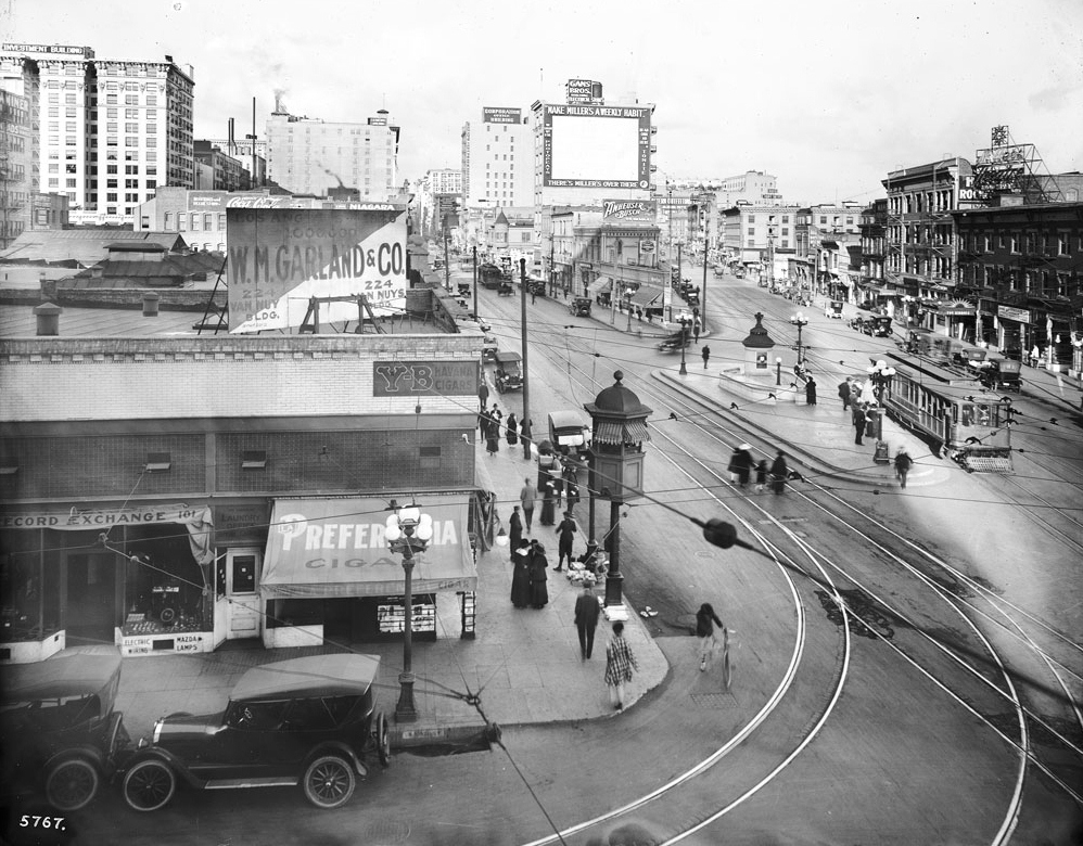
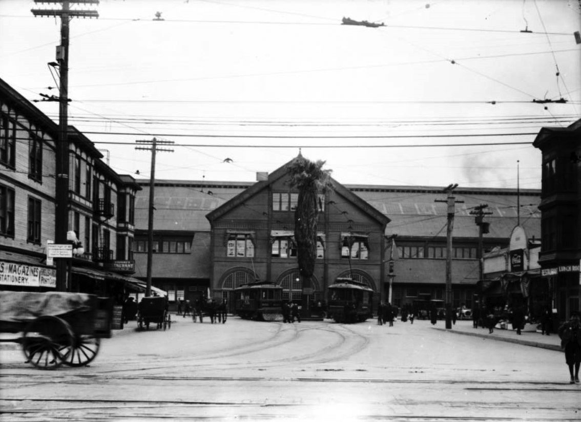
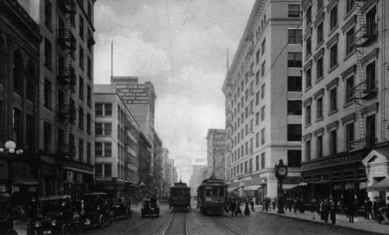
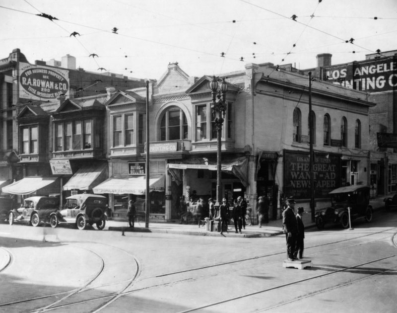
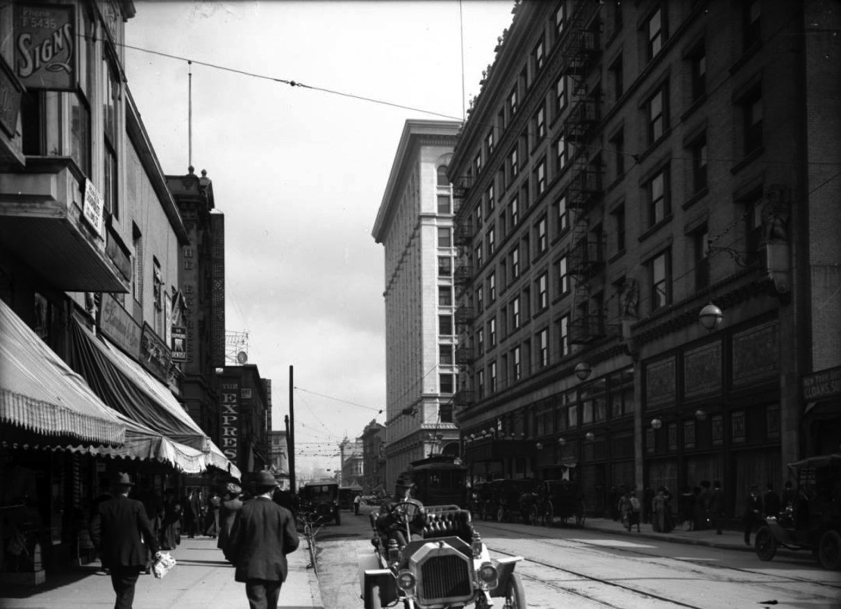
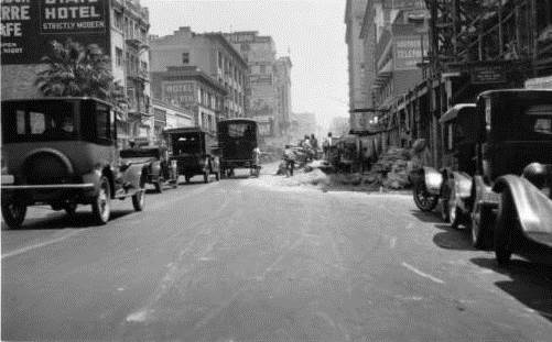
| (ca. 1917)^^ - Intersection of Main, Spring, and 9th streets in downtown Los Angeles circa 1917. Note the elevated kiosk at the corner. |
Historical Notes Elevated booths were used by the Los Angeles Railway and the Yellow Cars as a switchman’s tower to control the flow and path of streetcars through the intersection. |
 |
|
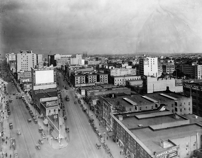
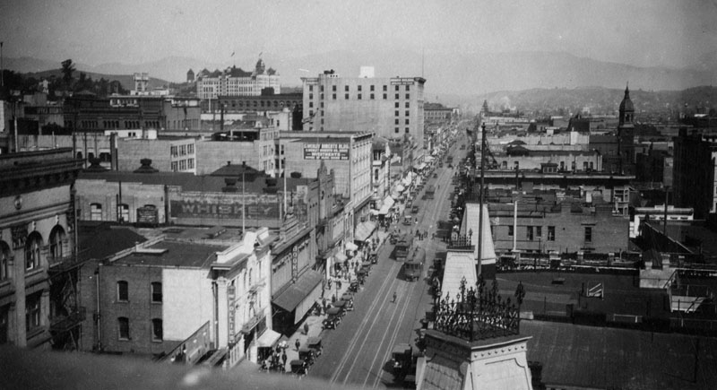
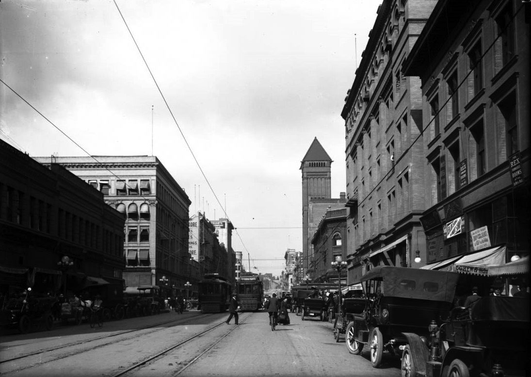
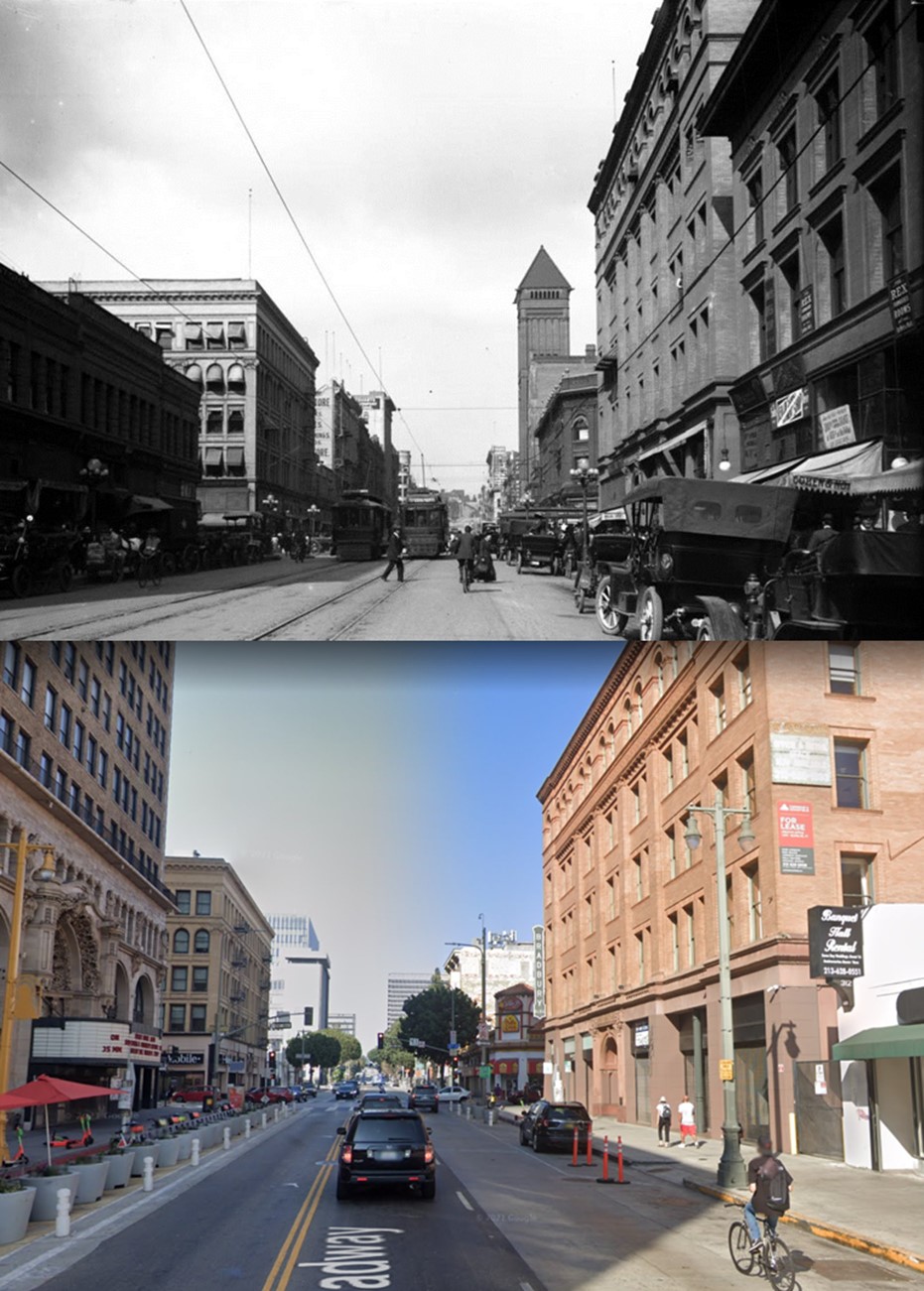
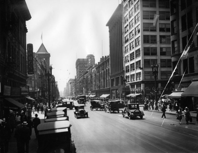
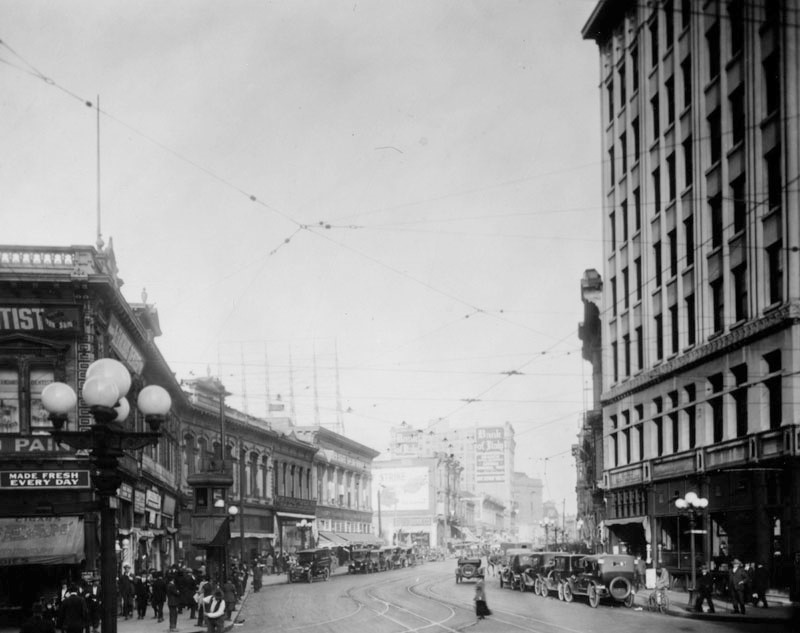
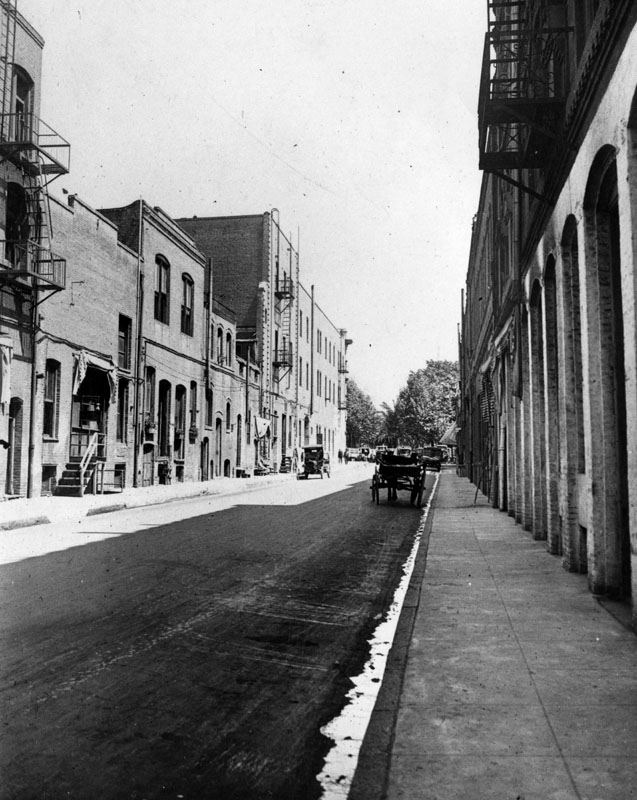
| (1917)^ - Looking north up Spring Street (left) and Main Street (right) from 9th Street in downtown Los Angeles. |
Historical Notes The junction of Main, Spring, and 9th streets became one of the most photographed intersections because of its configuration. Click HERE to see more. |
 |
|
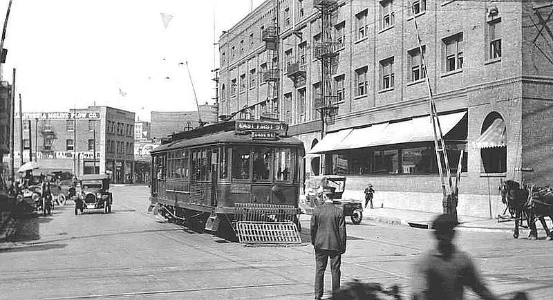
| (ca. 1918)*^ - The Los Angeles Railway's P Line trolley crossing Alameda Street at 1st Street in Little Tokyo as it heads for Boyle Heights in circa 1918. |
Historical Notes The Los Angeles Railway (also Yellow Cars, LARy, latterly Los Angeles Transit Lines) was a system of streetcars that operated in central Los Angeles and the immediate surrounding neighborhoods between 1901 and 1963. The company carried many more passengers than the Pacific Electric Railway's 'Red Cars' which served a larger area of Los Angeles. The system was purchased by railroad and real estate tycoon Henry E. Huntington in 1898 and started operation in 1901. At its height, the system contained over 20 streetcar lines and 1,250 trolleys, most running through the core of Los Angeles and serving such nearby neighborhoods as Echo Park, Westlake, Hancock Park, Exposition Park, West Adams, the Crenshaw district, Vernon, Boyle Heights and Lincoln Heights. |
 |
|
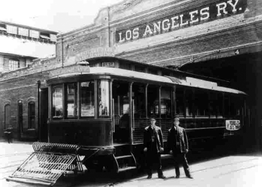
| (ca. 1909)* – View showing a Los Angeles Railway streetcar at the MTA Division 1 located on Central Avenue between 6th and 7th streets. This site is still in operation. |
Historical Notes The original address for the site was 648 South Central Avenue, but was later changed to 1130 East Sixth Street. Today the division operates hundreds of natural gas powered Metro buses for the Gateway Cities Service Sector. |
 |
|
| (ca. 1914)* - View looking east on Fifth Street as it ends at the Southern Pacific Railroad Arcade Depot on Central Avenue. Two streetcars are parked in front of the railroad building on tracks that intersect with more tracks in the foreground. Several horse-drawn vehicles are visible, as well as many pedestrians making their way along the sidewalks that border the streets. The ‘Arcade Depot Palm’ is seen standing near the center of the building. |
Historical Notes The Arcade Station was the second station built by Southern Pacific in Los Angeles (and first one built primarily for passenger service). Built in 1889 and used until 1914 when it was replaced by larger SP Central Station. It was demolished shortly thereafter. Amazingly, the original Arcade Depot Palm is still alive. It was replanted at a location in front of the Los Angeles Coliseum where it stands today. It along with the Longstreet Palms are considered to be the oldest trees in the City of Los Angeles. Click HERE to see more on the Arcade Depot and the old Arcade Depot Palm. |
* * * * * |
Court Flight
 |
|
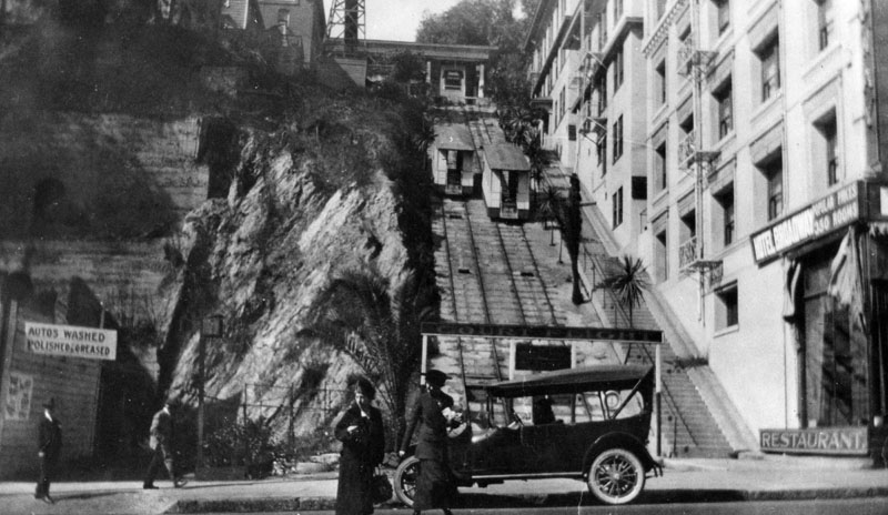
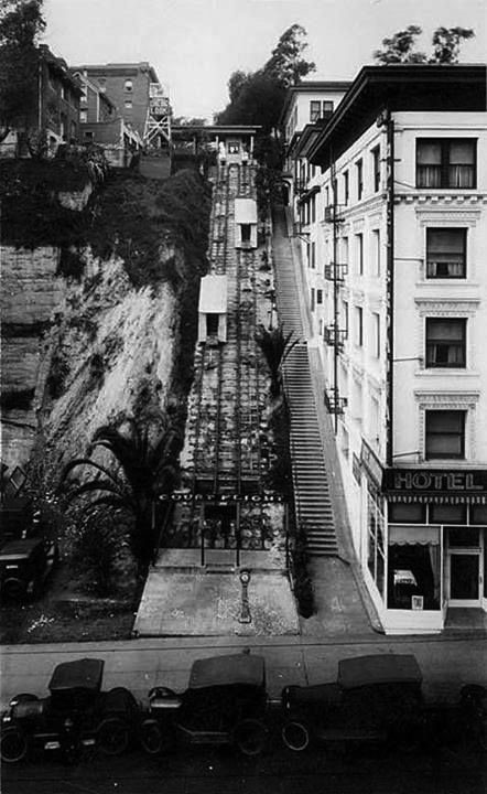
| (ca. 1920)^ - View showing two women attempting to cross the street in front of Court Flight Cable Railway. In the background can be seen the Court Flight's two cable cars passing each other on the tracks. To the right is a restaurant on the ground level of the New Hotel Broadway. On the left, behind the two men on the sidewalk, is a sign that reads: "AUTOS WASHED, POLISHED, & GREASED". |
Historical Notes Opened on September 24, 1905, Court Flight was built by Attorney R. E. Blackburn of the McCarthy real estate firm and Samuel G Vandegrift. It along with Angels Flight (built in 1901) were constructed to serve the wealthy residents of Bunker Hill. |
 |
|
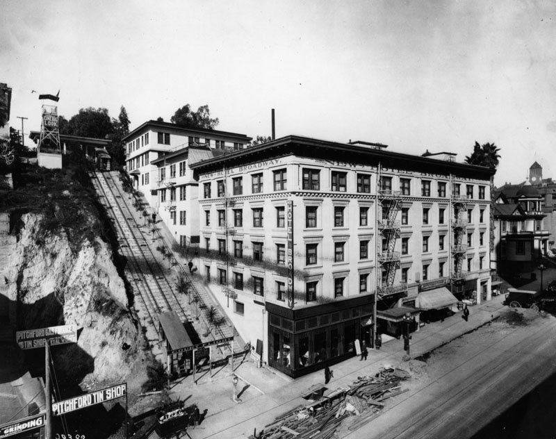
| (ca. 1920)^ - Court Flight Cable Railway, located next to the New Hotel Broadway, located at 205 North Broadway, opposite the Hall of Records and County Courthouse. Construction material can be seen stacked on the curbside. |
Historical Notes Unlike Angels Flight, Court Flight was entirely double tracked, using a pair of thirty-inch gauge counterbalanced cars, and ran for a distance of 180 feet up a 42 per cent grade between Broadway and Court Streets, in the middle of the block between Temple and First Streets. |
 |
|
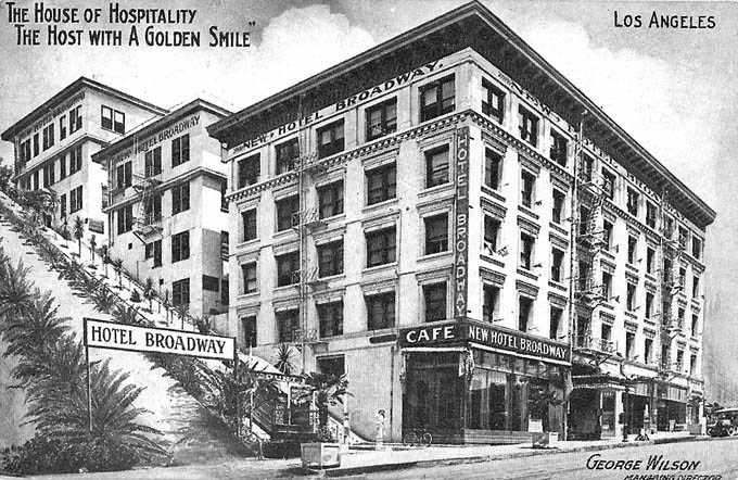
| (1916)* - Postcard view of the New Hotel Broadway adjacent to Court Flight. Card reads: "The House of Hospitality, The Host with A Golden Smile" - George Wilson, Managing Director. |
 |
|
| (ca. 1920s)* – View looking down toward Court Flight showing two cable cars about to pass each other. The Hotel Broadway is seen on the right. Note the observation tower in the upper-left. |
 |
|
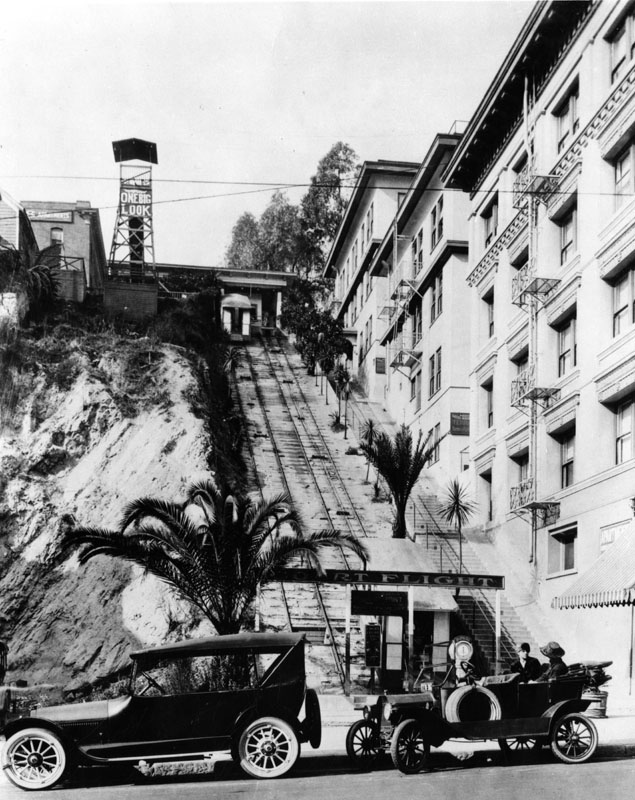
| (1920s)^ - Cars parked in front of Court Flight Cable Railway on North Broadway at Court Street. An observation tower can be seen at the top of the hill. Sign on tower reads: "ONE BIG LOOK". |
 |
|
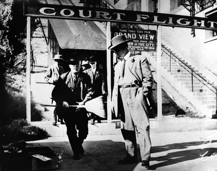
| (ca. 1920)^ – View showing passengers disembarking Court Flight at its base. Sign behind the man in foreground reads: "TAKE THIS CAR FOR GRAND VIEW". |
Historical Notes The funicular operated for 39 years, but World War II spelled its doom. Low ridership depressed profits, and the railway struggled to find engineers and conductors in the wartime labor market. In 1943, unable to keep the line profitable, owner Annie Vandegrift closed Court Flight. It would never reopen. Click HERE to see more Early Views of Court Flight (1930+) |
 |
|
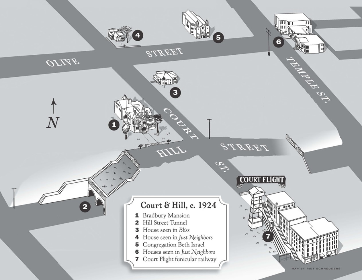
| (ca. 1924)* - Map of Bunker Hill showing Court Flight in the lower right and the Hill Street Tunnels at the center. Map by Piet Shreuders. |
Historical Notes Click HERE to see more Early Views of the Hill Street Tunnels. |
 |
|
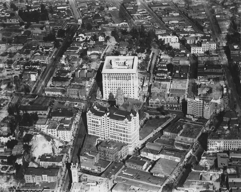
| (1924)^ - Aerial view looking north up Main, Spring and Broadway Streets from a point just over 1st Street. Both Court Flight Cable Railway and Hotel Broadway can be seen at lower center-left. |
Historical Notes In the above photo, the new Hall of Records (1910), the newer Hall of Justice (nearing completion here) and the old (1888) County Courthouse are seen in the center as is the Hancock Banning house on Fort Moore Hill, the Prudent Beaudry house on New High Street and the Court Flight funicular up Court Hill. Future city hall site is to the right. |
 |
|
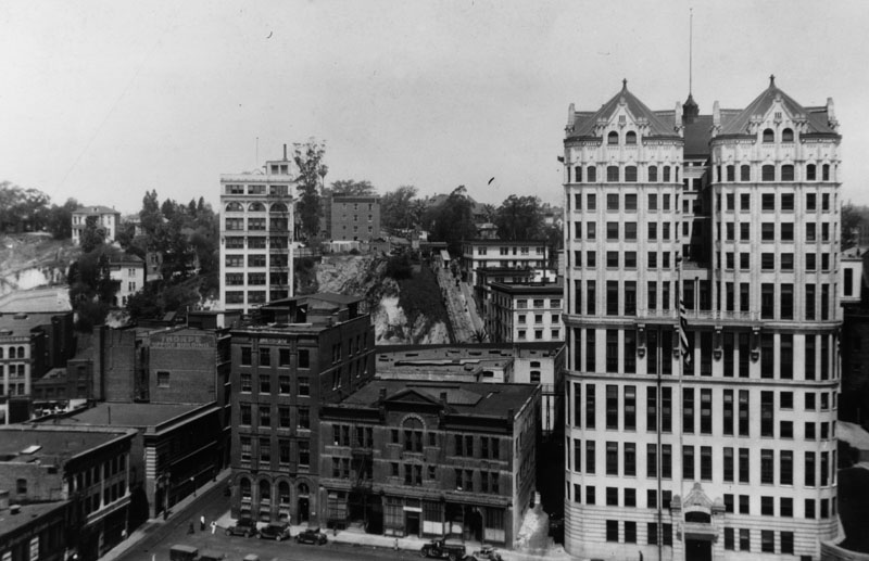
| (ca. 1927)^ - View looking west to the Hall of Records and other nearby buildings. Constructed between 1909 and 1911 to the cost of over a million dollars, the 12-story original Hall of Records at 220 N. Broadway was demolished in September, 1973. Court Flight can be seen in the background (center of photo). The 12-story building to the left of Court Flight is the Law Building (1926). |
 |
|
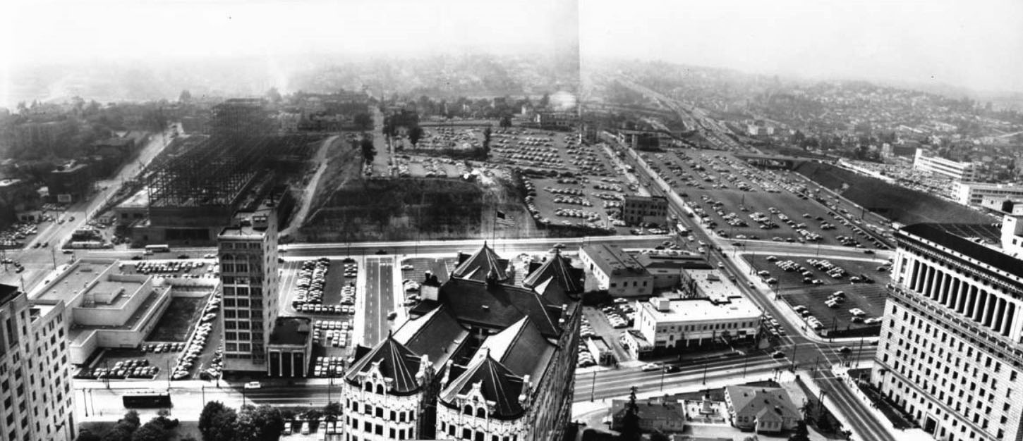
| (1956)* – Right panel of a panoramic photo taken from City Hall. The Law Building stands on the left with a carved-down Bunker Hill in the distance. On the right is the Hall of Records. |
.jpg) |
|
| (1956) – Left panel of a panoramic photo taken from City Hall looking toward Bunker Hill with the State Building on the left and Law Building at right. In the background is the Mosk Courthouse under construction. |
* * * * * |
Law Building
 |
|
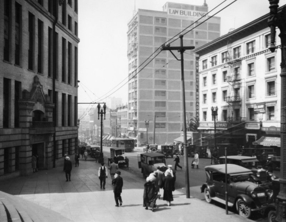
| (ca. 1926)* - Looking south on Broadway from in front of the Hall of Records toward the Law Building and the New Hotel Broadway with Court Flight in between these two buildings (out of view). |
Historical Notes The 12-story Law Building was built in 1926 just before the new City Hall went in. The Building was razed around 1970 to make room for Grand Park. |
 |
|
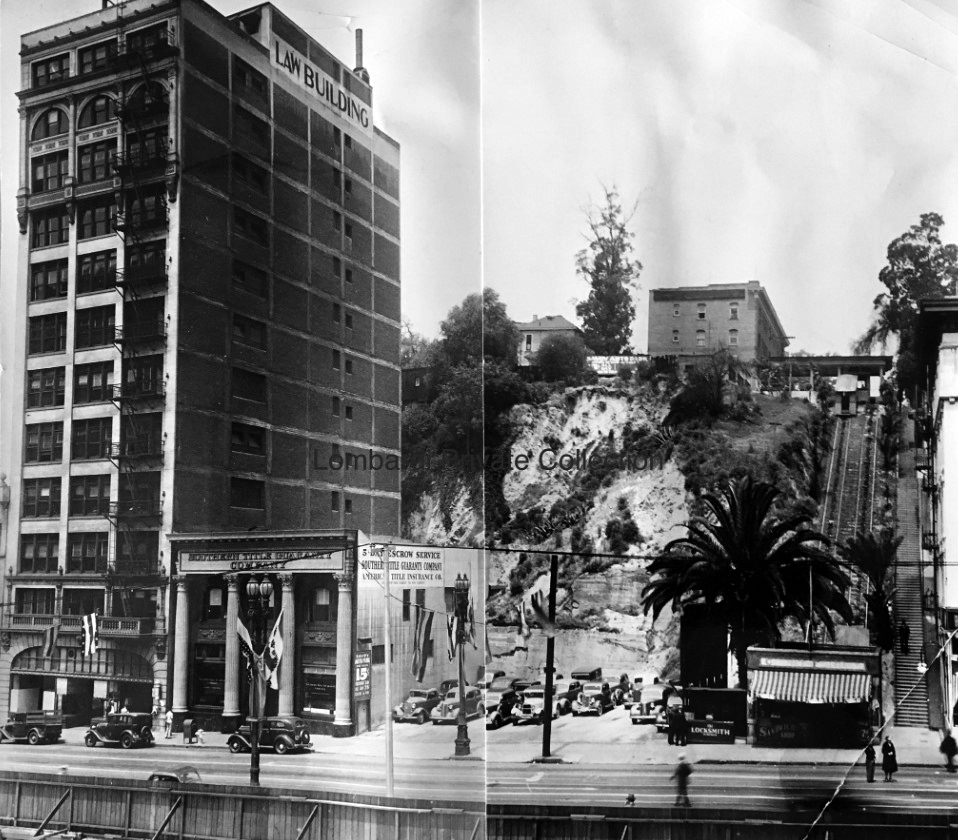
| (1930s)^ – View looking across Broadway toward Bunker Hill showing Court Flight on the right with the 12-story Law Building seen on the left. Lombardi Photo Collection. Today you would be looking at Grand Park toward the DWP Building. Click HERE for contemporary view. |
Historical Notes The City leased most of the offices in the Law Buildings for decades. In the basement was the Lombardi's Restaurant, which was there throughout the '60's. The Building was razed around 1970 to make room for Grand Park. |
 |
|
| (1951)* - Looking southwest across Broadway from in front of the Hall of Records. On the far left is a glimpse of the California State Building. |
Historical Notes Court Flight was located at far right. It was shut down in 1943. Click HERE to see more Early Views of Court Flight (1930+) |
 |
|
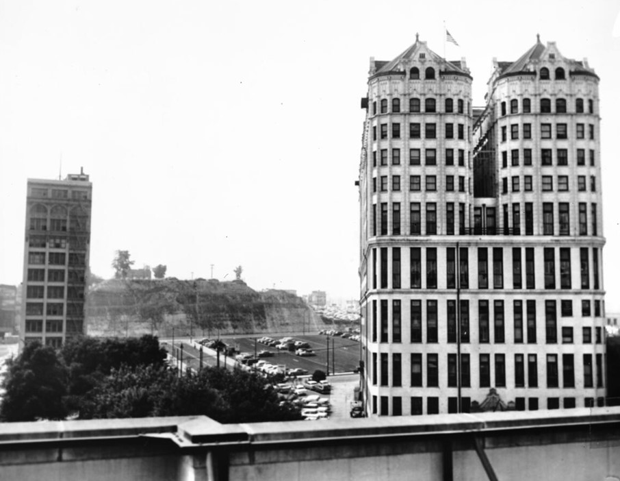
| (ca. 1951)* - View from City Hall on a smoggy day, showing the 12-story narrow Law Building (top left) on Broadway, adjacent to the former location of Court Flight. The Hall of Records stands prominently in the foreground. Bunker Hill is blanketed by parking lots, with the haze obscuring any sense of distance or clarity. |
 |
|
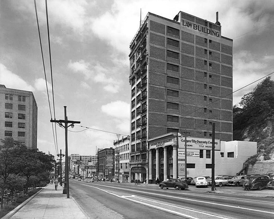
| (ca. 1953)* - Looking southwest across N. Spring Street (foreground), showing the California State Building on the left, the Law Building at 139 N. Broadway (right of center), and the old Hall of Records (right). All of these structures have been demolished. |
Historical Notes Law Building (1926 - 1970) California State Building (1931 - 1976) Hall of Records Building (1911 - 1976) |
 |
|
| (1956)** - Panoramic photograph composite taken from the City Hall tower, facing west to northwest towards Bunker Hill and Hollywood. Bunker Hill has been slightly shaved off to make room for the County Courthouse, which is under construction, as well as several parking lots. The Law Buildling is seen surrounded by parking lots. | Broad |
 |
|
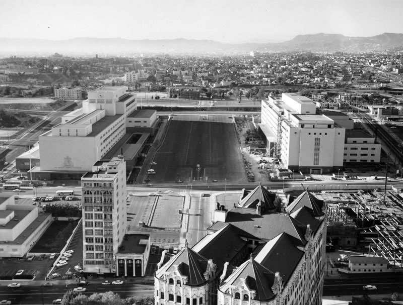
| (ca. 1960)^ - View looking n/w from City Hall toward Bunker Hill prior to construction of the GOB and Music Center. |
 |
|
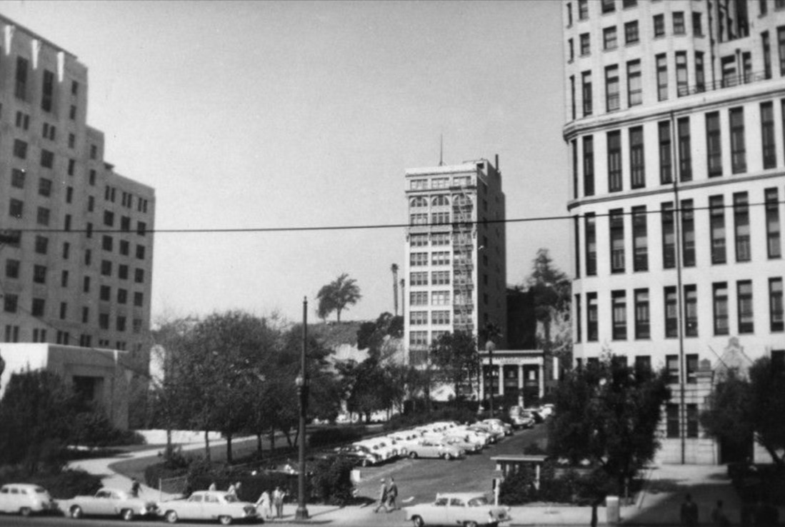
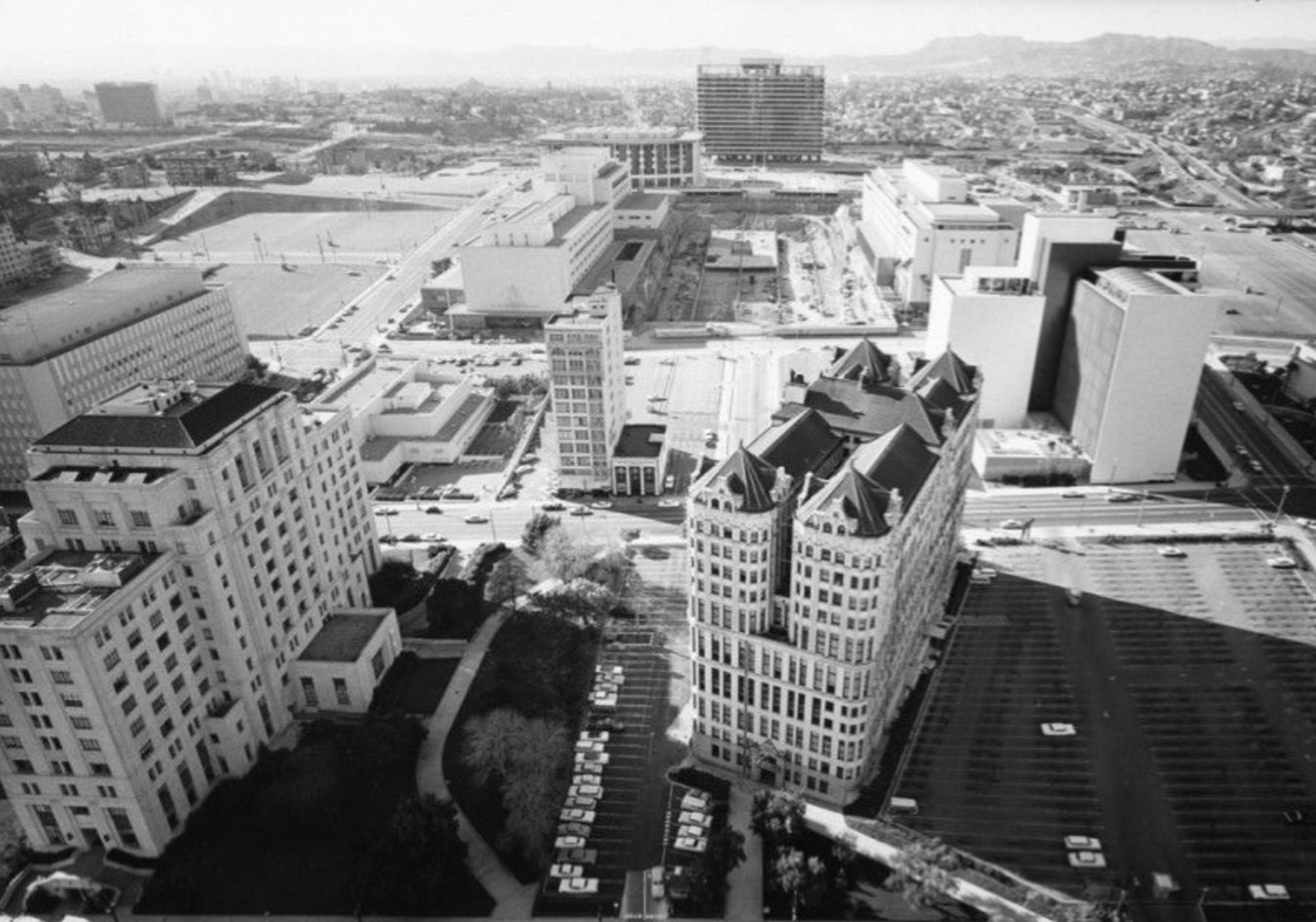
| (ca. 1963)^ – Looking down from City Hall toward a nearly completed GOB & Music Center with the Law Building standing almost like an island. The Law Buildng as well as the California State Building and County Hall of Records would be demolished over the next 13 years. |
Historical Notes Law Building (1926 - 1970) California State Building (1931 - 1976) Hall of Records Building (1911 - 1976) |
Before and After
 |
|
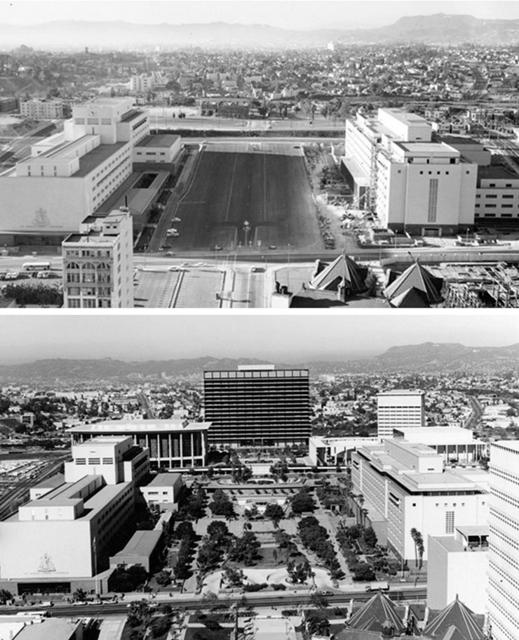
| (1960 vs. 1970) - Before and After |
* * * * * |
Victoria Park
 |
|
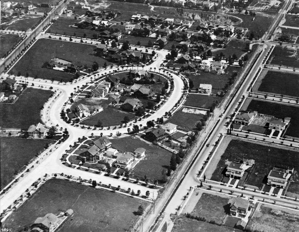
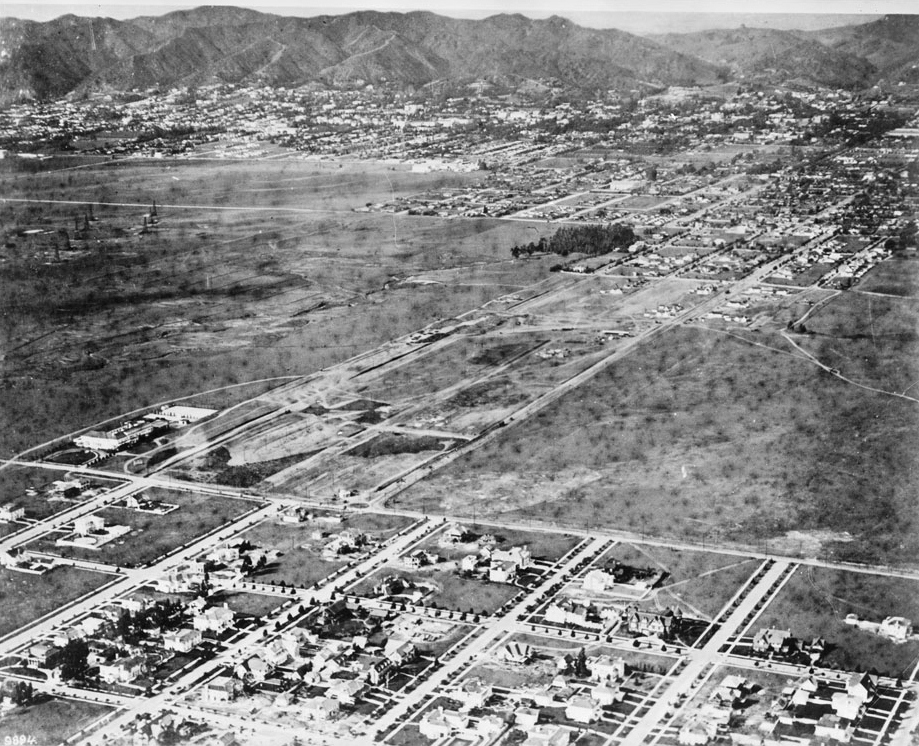
| (1918)^^ - Aerial view looking east. The intersection of Crenshaw and Pico is in the upper left corner of the photo; Crenshaw and Venice is in the upper right corner. |
Historical Notes Established in 1908 by ""nineteen substantial citizens" as an "exclusive residential enclave", the Victoria Park neighborhood is one of only two neighborhoods in the entire city of Los Angeles where the homes are arranged on a circular street. This design is based on the ideas of Frederick Law Olmstead, who felt that circular shapes would break up the usual linear look of urban areas. The area was intended to be upscale, e.g. the streetlights were custom-designed and registered with the city as the "Victoria Park Fixture." Click HERE to see the "Victoria Park Fixture" in Early Los Angeles Street Lights. |
 |
|
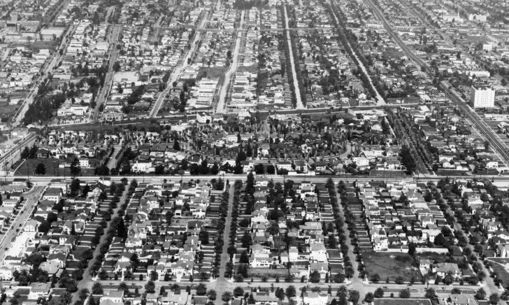
| (1940)^^ - Aerial view looking north of the Victoria Park area. |
Historical Notes Many of the homes in the Victoria Park neighborhood were built between 1910 and 1915 and serve as fine architectural examples of The American Arts and Crafts Movement. The area was intended to be all single-family homes, but was rezoned in the 1920s and some duplexes were built. The Holmes-Shannon House at 4311 Victoria Park Drive, built in 1911, was added to both the National Register of Historic Places and the list of Los Angeles Historic-Cultural Monuments in 2008 (No. 885); it is described as "a residential building designed in the Tudor-Craftsman style by a prominent firm and reflective of the development of Victoria Park." The Craftsman home at 4318 Victoria Park Place, built in 1912 was also designated a Los Angeles Historic-Cultural Monument (No. 654) in 1998. Click HERE to see complete listing. |
Windsor Square and Hancock Park
 |
|
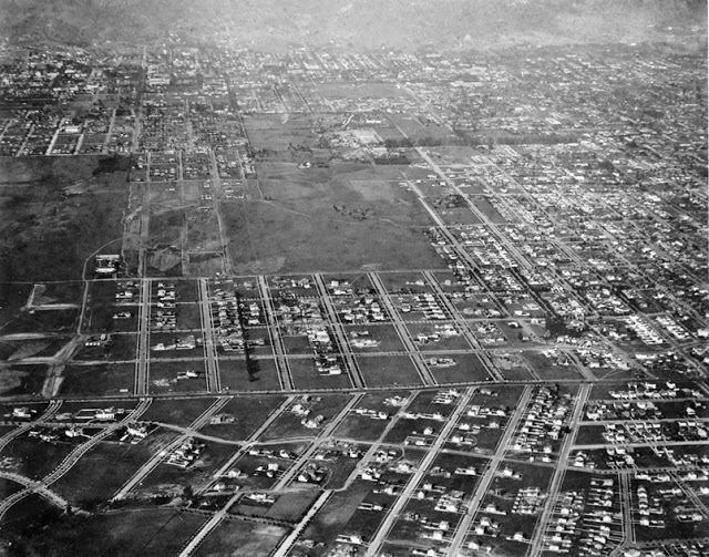
| (ca. 1918)^^ - Aerial view looking north showing Windsor Square and part of Hancock Park. |
Historical Notes Sometime between 1900 and 1910 a prominent financier named George A.J. Howard envisioned a beautiful tranquil park as a setting for family homes such as one sees in the English countryside in what was then an undeveloped and rural area about halfway between the city center (now Downtown LA) and the coast. Howard pushed the early city fathers to make his vision come true, and in 1911, Mr. Robert A. Rowan was able to initiate a unique residential development and called it Windsor Square. The development was constituted as a private square. Both the homes and the streets would be privately owned. At that time there were dense groves of bamboo in the area that needed to be destroyed before trees and gardens could be cultivated. Intervening walls or fences were discouraged so that one garden ran into another, creating a park-like setting. Windsor Square was the first area in the city to have the power lines below grade--an extraordinary innovation for 1911. |
 |
|
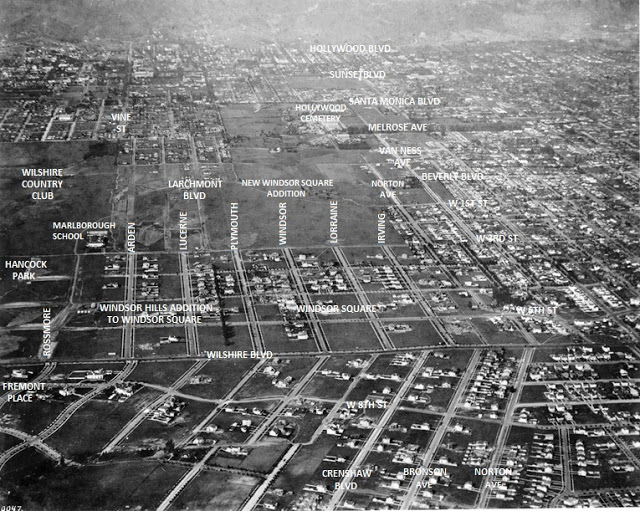
| (ca. 1918)^#^ - Same photo as above but with annotations. Windsor Square is at center of photo, while Wilshire Country Club and Hancock Park are to the west (left). The Marlborough School can be seen at the corner of 3rd Street and Rossmore (on the left). |
Historical Notes Windsor Square was later expanded to the north, east, and west. Today, Windsor Square runs from Wilshire to Beverly Boulevards, and from Arden Boulevard to Van Ness Avenue. This is inclusive of the one-block strip of Larchmont Village, between First Street and Beverly Boulevard. Windsor Square is often mistakenly called "Hancock Park," even by long-time residents. But in fact, Hancock Park is the neighborhood immediately to the west. Windsor Square's homes have the same historic value as in Hancock Park, but most of the homes are built on bigger lots. Many of the city's elite moved west to Windsor Square, including George Howard (his daughter still lives in his home on Windsor Blvd) and Norman Chandler, who took up lifelong residence with his wife Buffy on Lorraine Blvd. Oil magnate John Paul Getty bought a property on Irving Blvd. that is now Los Angeles's official mayor's residence. |
 |
|
| (ca. 1918)^^ - Aerial view looking northwest from 5th Street and Windsor Boulevard at Hancock Park and Hollywood. Third Street is visible running horizontally near the middle of the image, while at left is Marlborough School on Rossmore Avenue. The area north of Third Street on both sides of Rossmore is open fields for several blocks, and beyond the city in the background are large mountains. |
Historical Notes Hancock Park was developed in the 1920s by the Hancock family with profits earned from oil drilling in the former Rancho La Brea. The area owes its name to developer-philanthropist George Allan Hancock, who subdivided the property in the 1920s. Hancock, born and raised in a home at what is now the La Brea tar pits, inherited 4,400 acres, which his father, Major Henry Hancock had acquired from the Rancho La Brea property owned by the family of Jose Jorge Rocha.*^ Marlborough School is a private, all-girls, college-preparatory secondary school for grades 7th through 12th located at 250 South Rossmore Avenue in the Hancock Park neighborhood of Los Angeles. Marlborough was founded in 1889 by Mary Caswell and is the oldest independent girls' school in Southern California. |
 |
|
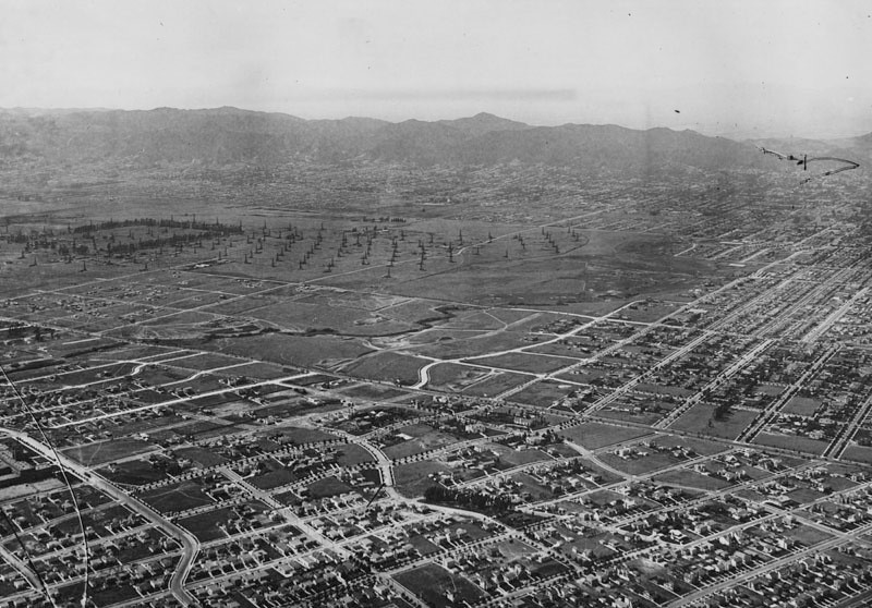
| (ca. 1918)^ - Aerial view looking northwest from Wilshire and Rossmore. Today, the Wilshire Country Club is situated just to the right (east) of the oil fields. |
Historical Notes The large square of undeveloped land showing two mounds (right of oil field) is El Arroyo del Jardin de los Flores, The Stream of the Garden of Flowers. The stream flowed from the location of today's Wilshire Country Club through Hancock Park, joining another creek that eventually drained to Ballona Creek near La Brea and St. Elmo Drive. The majority of this creek was piped and filled; a portion of it remains above ground at the Wilshire Country Club, and a creek running through Brookside Estates also shares this name. |
Hollywood
 |
|
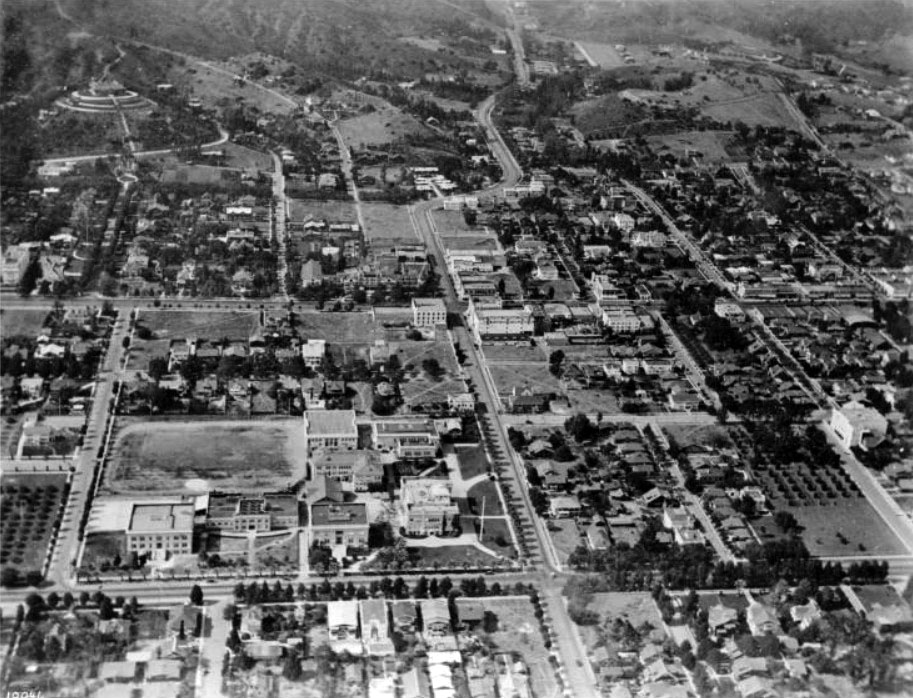
| (1918)^^ - Aerial view of Hollywood looking north. Highland Avenue runs straight up from center-bottom and then snakes its way to Cahuenga Pass. The intersection of Hollywood Boulevard and Highland Avenue is at center of photo. The Japanese estate and gardens of brothers Charles and Adolph Bernheimer is perched high on a hill in the upper-left corner. Hollywood High School is seen at lower center-left , on the northwest corner of Sunset Boulevard and Highland Avenue. |
 |
|
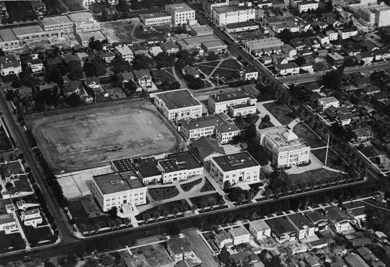
| (1921)^ - Aerial view of Hollywood High School and surrounding area in 1921. |
Historical Notes Hollywood High School with a student body of 2500 was three blocks from Charlie Chaplin's studio and six blocks from Mary Pickford's and Douglas Fairbanks' studios. The homes bordering the upper side of the campus were just condemned by the city to make room for additional buildings. The original 1905 building is on the bottom right, the Household & Fine Arts building is in the middle of the quadrangle, and the gymnasium is top, center. Click HERE to see more in Early Views of Hollywood (1850 - 1920) |
* * * * * |
Beverly Hills Speedway (aka Los Angeles Speedway)
 |
|
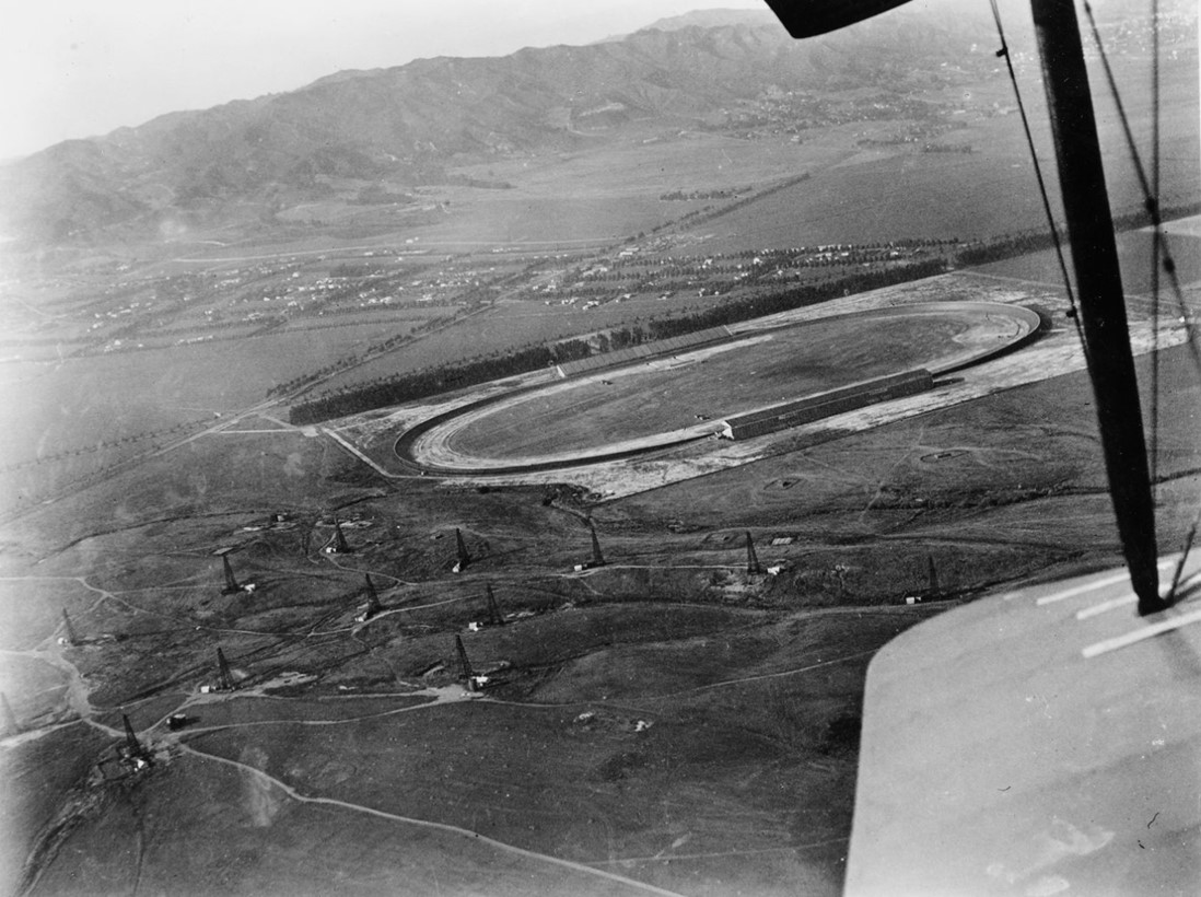
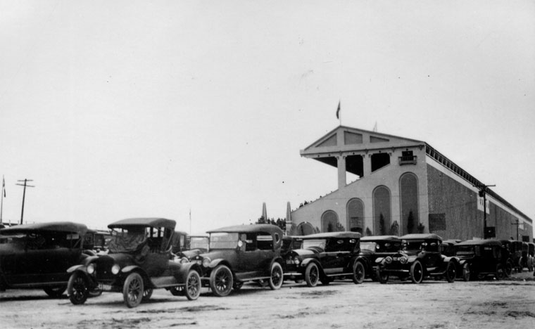
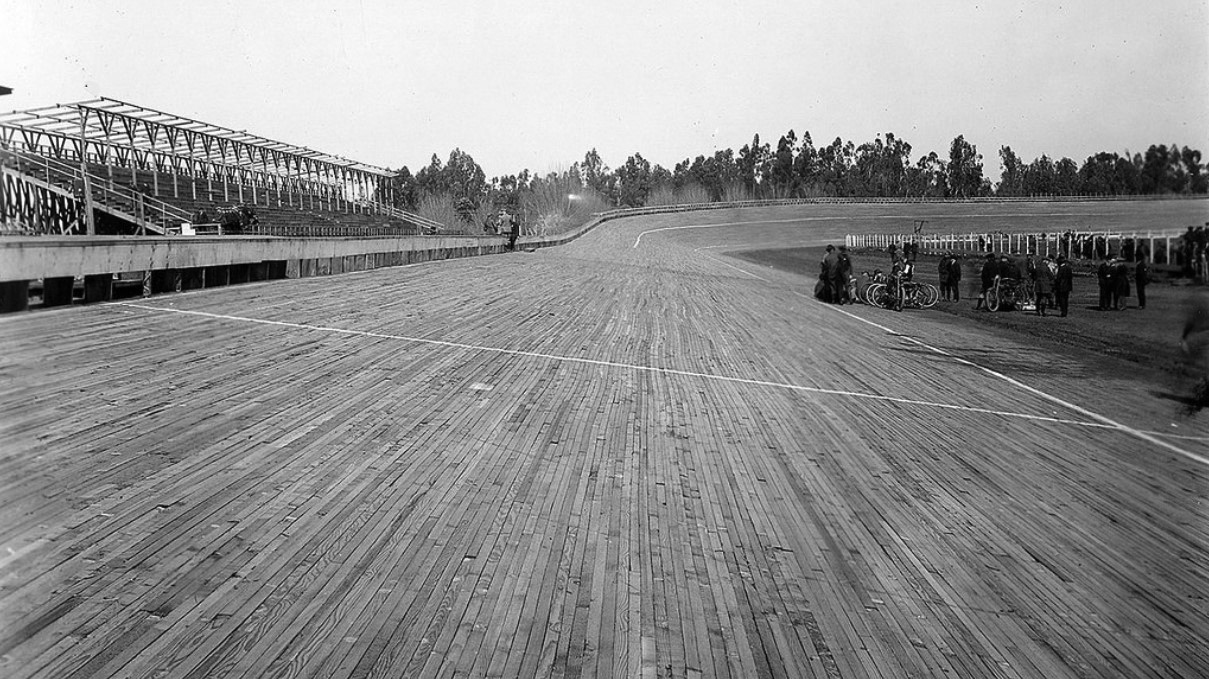
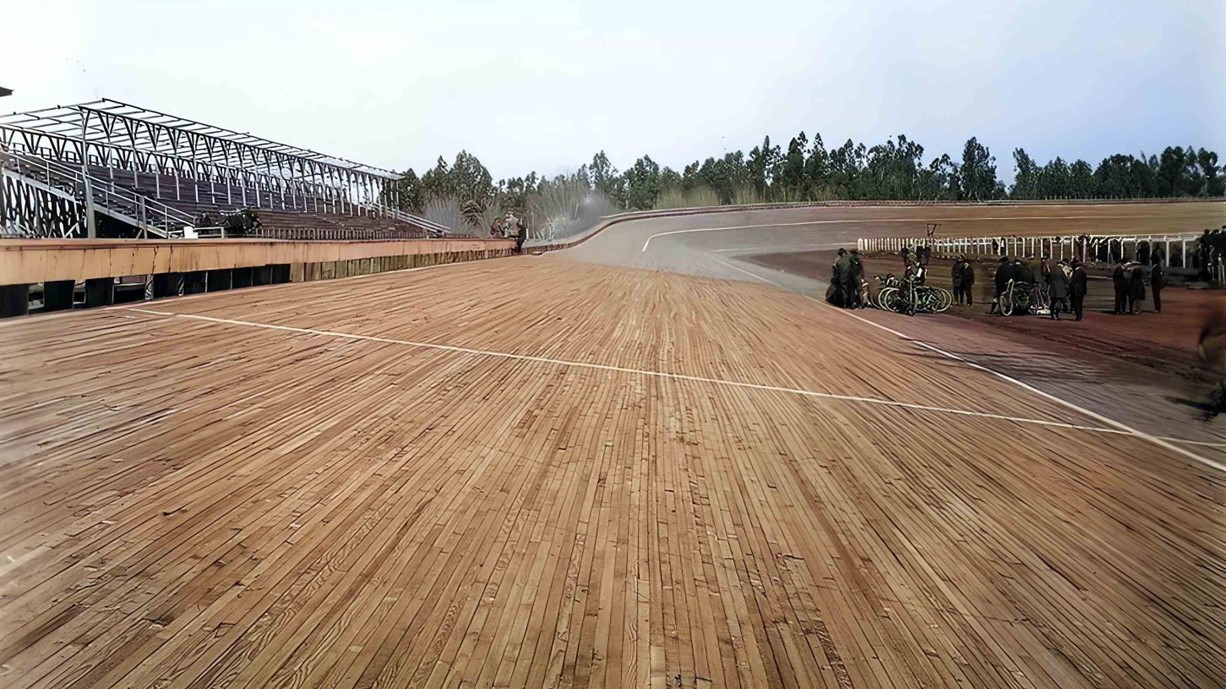
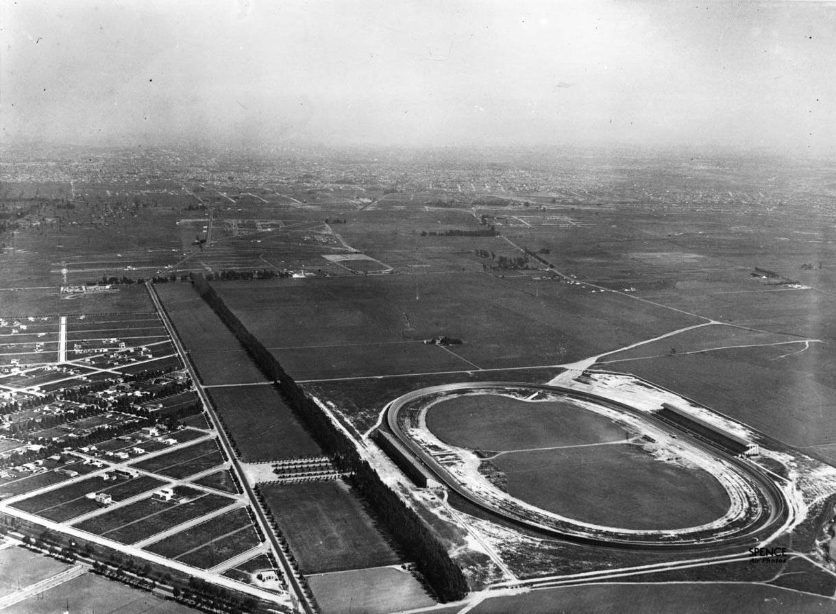
| (ca. 1919)* - Aerial view of the Beverly Hills Speedway, located just south of Wilshire Boulevard near its intersection with Santa Monica Boulevard. The tree-lined street above the speedway is Charleville Boulevard, one block south of Wilshire. Note the oil fields in the foreground. |
Historical Notes The Beverly Hills Speedway (also called the Los Angeles Speedway) was a 1.25-mile wooden board track for automobile and motorcycle racing in Beverly Hills. It was built in 1919 on 275 acres of land that includes the site of today's Beverly Wilshire Hotel, just outside of the "Golden Triangle". The site was bounded by Wilshire Boulevard, South Beverly Drive, Olympic Boulevard and Lasky Drive. |
 |
|
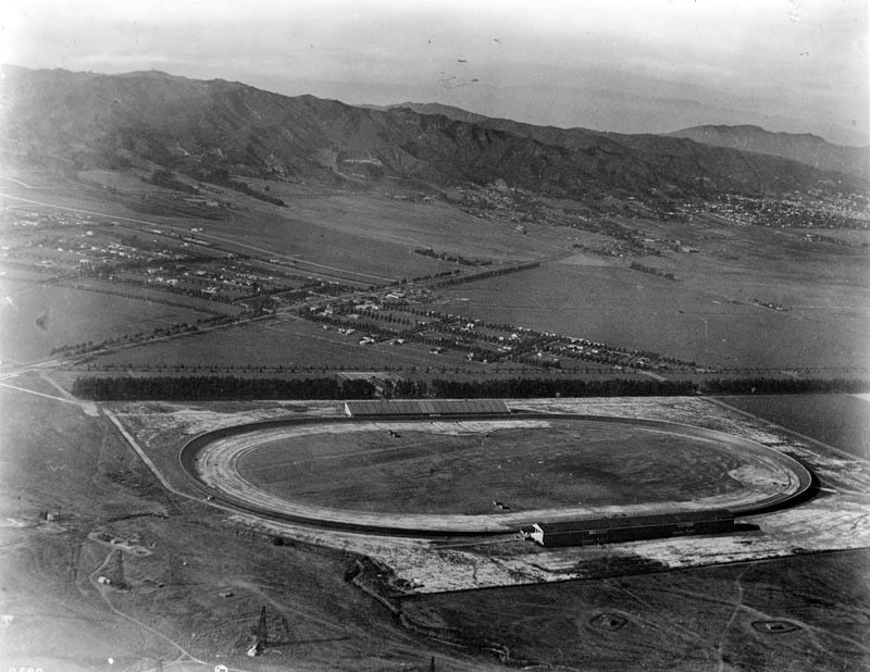
| (1919)^ - Aerial photograph of the Beverly Hills Speedway, located at Wilshire and Santa Monica boulevards. West Hollywood can be seen in the distance at upper-right. Note the oil wells in the left foreground. |
Historical Notes The new Speedway was built by Jack Prince and Art Pillsbury and was financed by a group of racers and businessmen that called itself the Beverly Hills Speedway Association. The track was the first in the United States to be designed with banked turns incorporating an engineering solution known as a spiral easement. |
.jpg) |
|
| (1919)^ - Aerial photo of the Beverly Hills Speedway located at Wilshire and Santa Monica Boulevards. |
 |
|
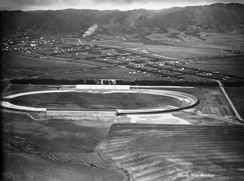
| (ca. 1919)* - Closer view of the Beverly HIlls Speedway located just south of Wilshire Boulevard near where it intersects with Santa Monica Boulevard (aka "Golden Triangle"). |
.jpg) |
|
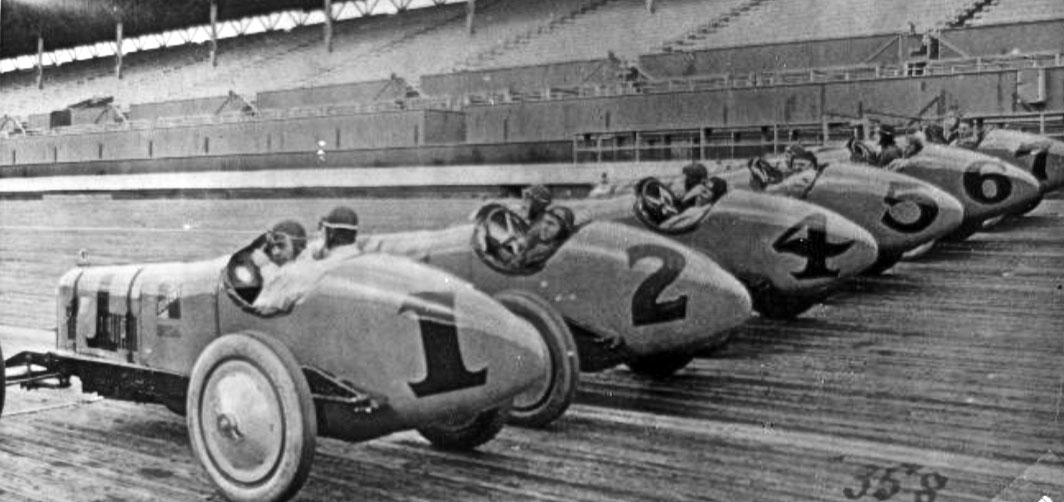
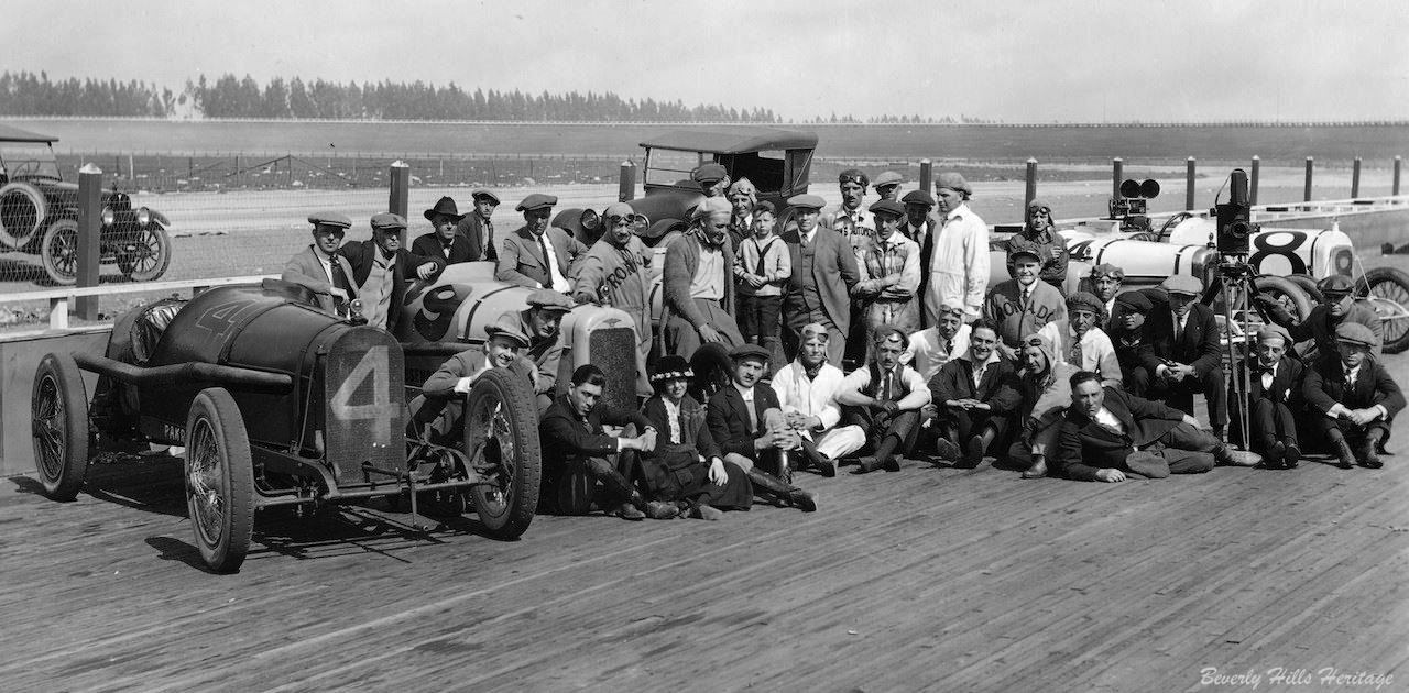
| (1919)^ - Early race cars are lined up at the Beverly Hills Racetrack. |
 |
|
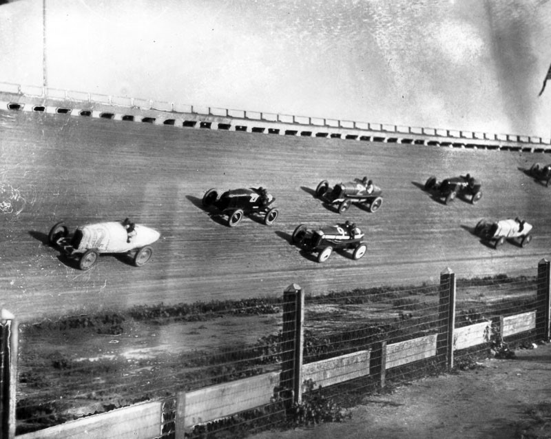
| (1919)^ - View showing race cars racing on the steep bank of the track at the Beverly Hills Racetrack. |
 |
|
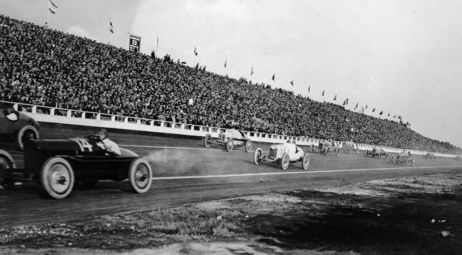
| (ca. 1919* - Panoramic view showing an automobile race at the Beverly Hills Racetrack. The early racecars are all open topped and the drivers are wearing leather helmets and goggles. The grandstand is packed with spectators. |
 |
|
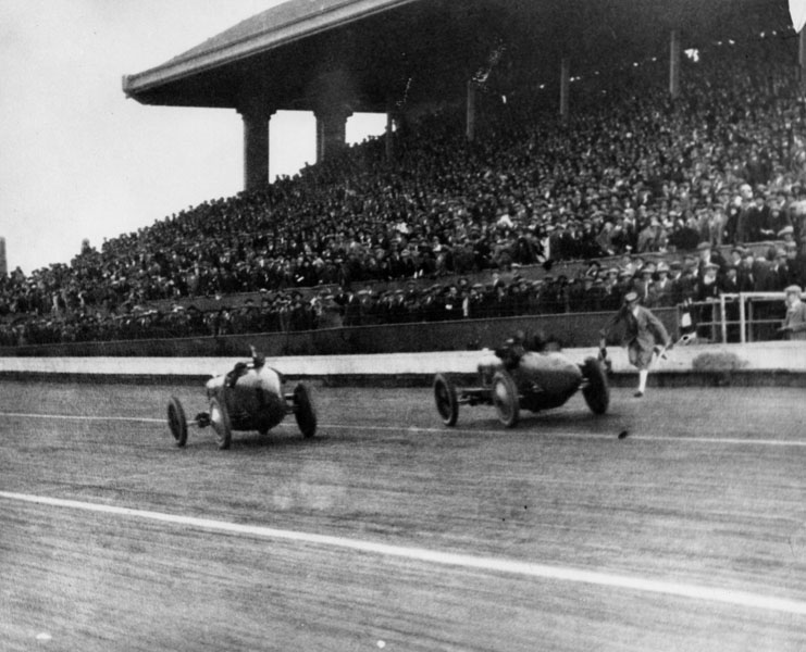
| (1919)^ - View of two race cars racing past the finish line at the Beverly Hills Racetrack. |
Historical Notes At the time, the wooden racetrack was ranked second in race quality only to the Indianapolis Motor Speedway. |
 |
|
| (1922)* - Durant Racing team, Beverly Hills Raceway . . . Harry Miller Designed and built. Cliff Durant was William Durant's son (General Motors President). He had the most highly funded team of the day with the best drivers. |
Historical Notes Many race cars had paint jobs that read Durant Racing on the sides. Durant was an American race car driver, the son of William C. Durant, a founder of General Motors who was also the co-owner and president of the Beverly Hills Speedway. Durant Drive in the City of Beverly HIlls was named after these Durants. |
 |
|
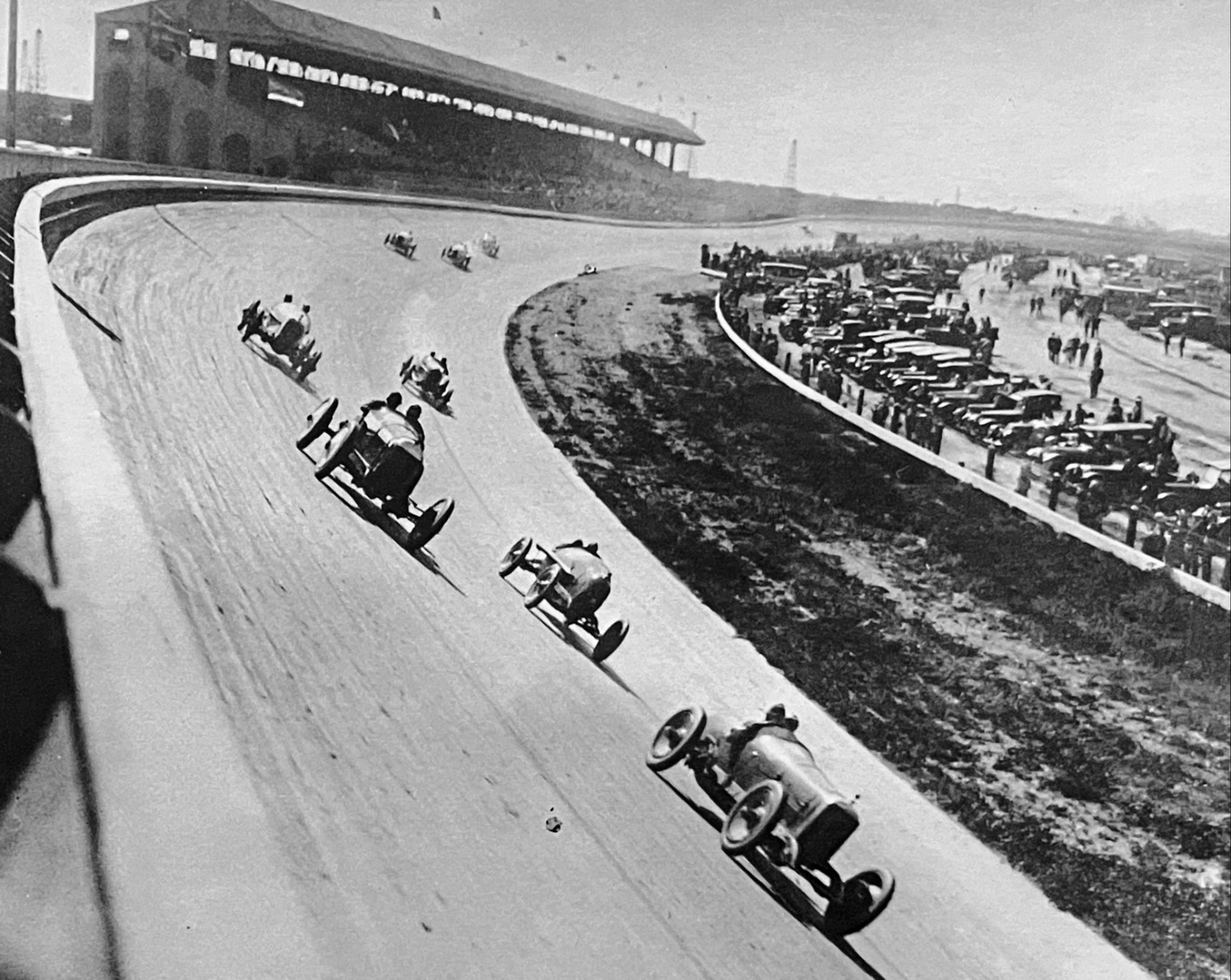
| (1920s)* - Race cars rounding the embanked curve a the speedway.. |
 |
|
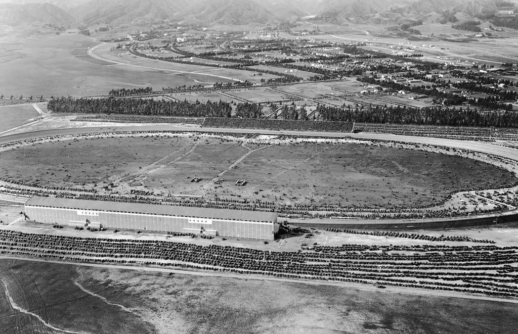
| (1922)* – Aerial view looking down at the Beverly Hills Speedway showing a full house at a racing event. Note the number of cars in the parking lot. Photo: Marc Wanamaker/Bison Archives |
Historical Notes The Speedway was a great success, not only for racing but also for events. In fact, sometimes the space was so well attended, the parking lots overflowed with cars. |
 |
|
| (1919)^ - View of cars parked next to the spectator stands of the Beverly Hills Racetrack. |
Historical Notes The Speedway operated for four years and attracted many historically significant competitors including Ralph DePalma, Jimmy Murphy, and Tommy Milton. It was also the site of a racing accident that killed National Champion and Indianapolis 500 winner Gaston Chevrolet in 1920. Gaston Chevrolet was the younger brother of Louis Chevrolet, who in 1911 co-founded the Chevrolet Motor Company. |
 |
|
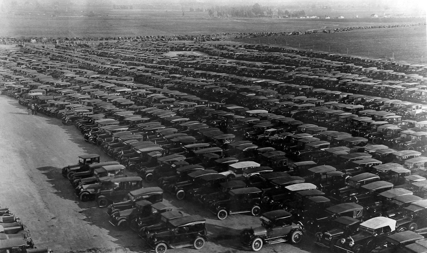
| (ca. 1919)* - View showing a filled to capacity parking lot at the Beverly Hills Speedway. |
 |
|
| (1919)* – View looking northeast showing cast and crew of the 1919 silent film “The Roaring Road” posing for the camera on the Beverly Hills Speedway track. |
Historical Notes The gigantic eucalyptus trees in the distance ran the length of what today would be Charleville Blvd., a street named for developer Walter G. McCarty's Irish roots. The trees created a natural wind and sound barrier for residential neighborhood north of Wilshire Boulevard, which within five years, would start to become the city's commercial triangle. |
 |
|
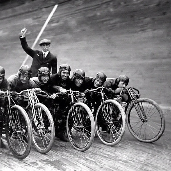
| (ca. 1921)* - Motorcycles line up and wait for the starting gun to go off. |
Historical Notes Motorcycle board track racing took place at the short lived Beverly Hills Speedway between 1920 and 1924. |
 |
|
(1921)* - A group of men stand next to several motorcycles on the inside of the banked track at the Fresno Speedway. |
Historical Notes There is no doubt that board track racing was an incredibly exciting event to witness. The motorcycles were capable of speeds over 100 mph and represented all the marques of the day. Manufacturers such as Harley-Davidson, Indian and Excelsior all had factory racing teams with custom built factory race bikes. |
 |
|
| (1921)* - A group of men stand next to several motorcycles on the inside of the banked track at the Fresno Speedway. AI image enhancement and colorization by Richard Holoff. Correction Note: This image was initially misidentified as depicting the Beverly Hills Speedway. While similar in appearance and constructed in the same year, this photograph actually shows the Fresno Speedway, which was located at the Fresno County Fairgrounds. |
 |
|
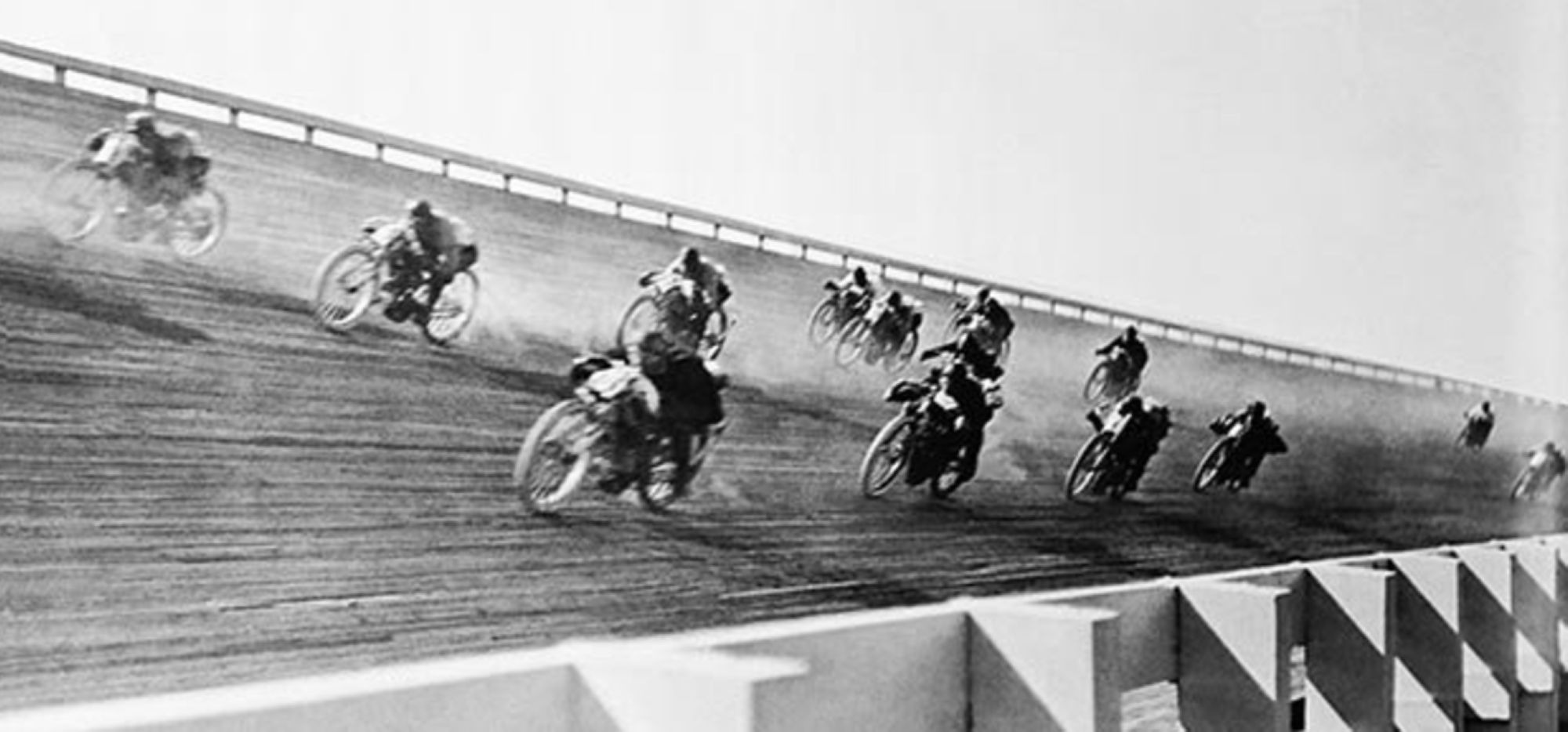
| (1920s)* - View showing motorcycle racers rounding the embanked curve a the speedway. |
Historical Notes Because the turns were severely banked, it allowed riders to reach speeds of more than 100 miles an hour. Crashes were frequent and horrific—riders who went down faced being impaled by splinters—and often fatal. |
 |
|
| (1921)* - Aerial view looking east on Wilshire Boulevard from where Santa Monica Boulevard intersects it. Vast open fields can be seen between the Beverly Hills Speedway and the City of Los Angeles. |
Historical Notes By the mid-‘20s, the sport began to lose its appeal. Perhaps the novelty wore off; certainly the carnage was appalling. Newspapers began referring to motordromes as “murderdromes,” and local governments closed some tracks. Race officials and the motorcycle manufacturers that sponsored racing teams tried to implement measures to slow down the bikes, but that went nowhere. By the early 1930s, board-track motorcycle racing had become a footnote in motorsport history. |
 |
|
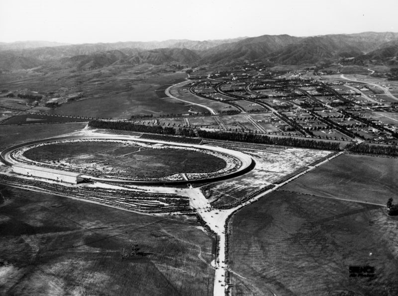
| (ca. 1921)^ - Aerial view looking northwest showing the Beverly Hills Speedway during an event. Note all the open, undeveloped land surrounding the speedway. |
Historical Notes It would soon become apparent that the racetrack wasn't as valuable as the land it was on. By the mid-twenties the track was dismantled to make way for new developments. |
 |
|
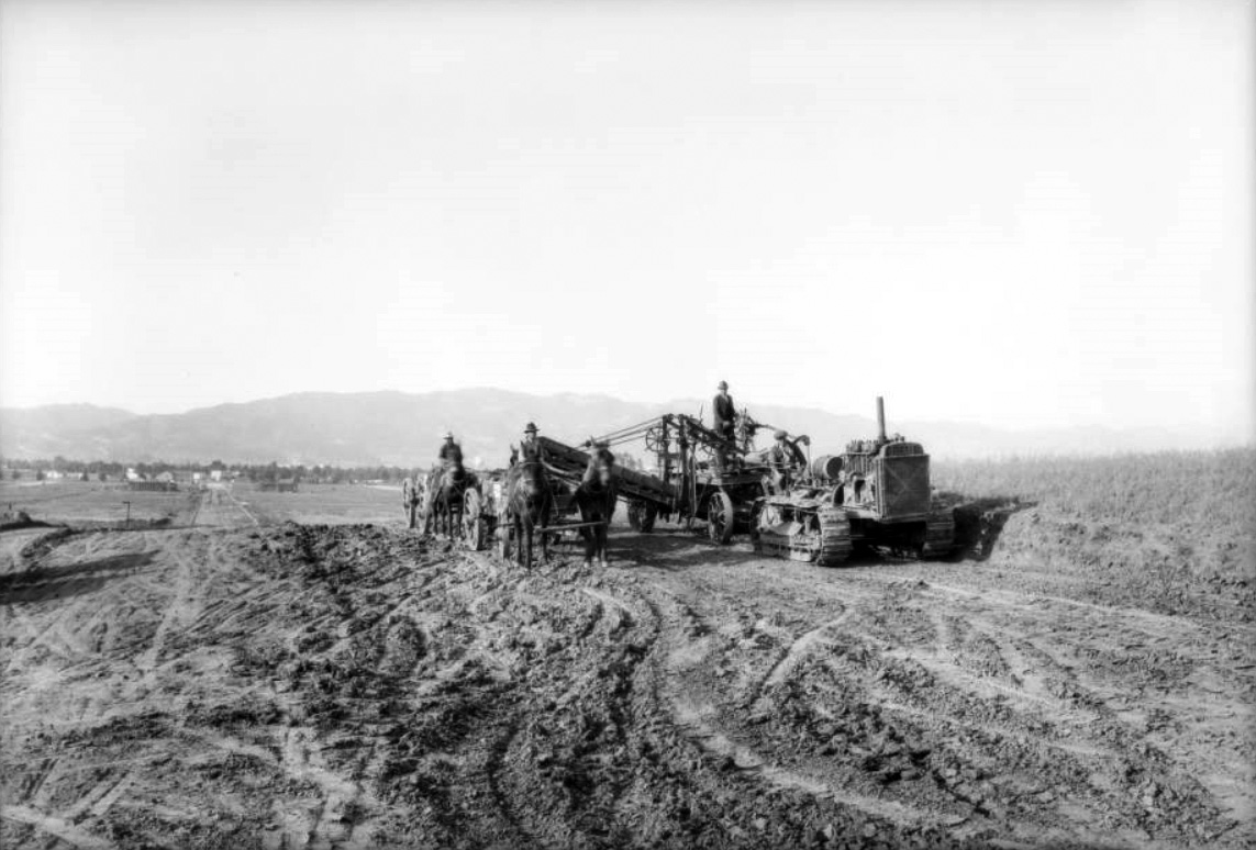
| (1925)^^ – View looking north showing the excavation of land south of where the Beverly Hills Speedway once stood. The new development, Beverly Hills Heights, is centered on South Beverly Drive and runs from where Olympic Boulevard is today up to Wilshire Boulevard. |
Historical Notes Click HERE to see more Early Views of Beverly Hills |
* * * * * |
Downtown LA
 |
|
| (1919)*^#^ – View looking northeast from the roof of the Million Dollar Theatre Building (3rd & Broadway). City Hall (226 S. Broadway) can be seen at center-left. The Orpheum Theatre (227 S. Spring), with its unique coned-shaped tower, is at right-center. |
Historical Notes The above photo was taken by G. Haven Bishop for Southern California Edison. They were the tenants of the building housing the Million Dollar Theatre – then known as the Edison Building. |
 |
|
| (1919)^ - View looking north on Main Street from the top of the Westminster Hotel (NE corner of Main and 4th streets). The tower of St. Vibiana's Cathedral (built in 1876) stands tall at upper-right. Streetcars can be seen running down the center of Main Street. |
 |
|
| (1924)* - This is the site of the former Los Angeles State Normal School, and future site of the lawn and gardens of the Central Library of the Los Angeles Public Library. The large building in the background is the Biltmore Hotel with the Biltmore Theatre senn in front of it on the southeast corner of 5th and Grand Avene. The large white building on the right is the Pacific Mutual Building. Note: the date on the LAPL image card is incorrectly identefied as 1919. |
Historical Notes The California State Normal School was a teaching college that was founded on May 2, 1862 in San Jose. In March 1881, after heavy lobbying by Los Angeles residents, the California State Legislature authorized the creation of a southern branch of the school to be built in downtown Los Angeles, which would train teachers for the growing population of Southern California. On August 29, 1882, the State Normal School at Los Angeles opened its doors, and in 1919 it became part of the "UC system" after moving to a larger campus on Vermont Ave., in Hollywood (the present site of L.A. City College). The University of California, Southern Branch would eventually come to be known as the University of California, Los Angeles. The L.A. Public Library would take the old Normal School site, which was located on 5th Street between Grand and Flower streets. Designed by architects Bertram G. Goodhue and Carlton M. Winslow, it would eventually be constructed between 1922-1926.^ |
Click HERE to see more in Early Views of the Normal School and UCLA |
* * * * * |
Broadway and 8th Street
 |
|
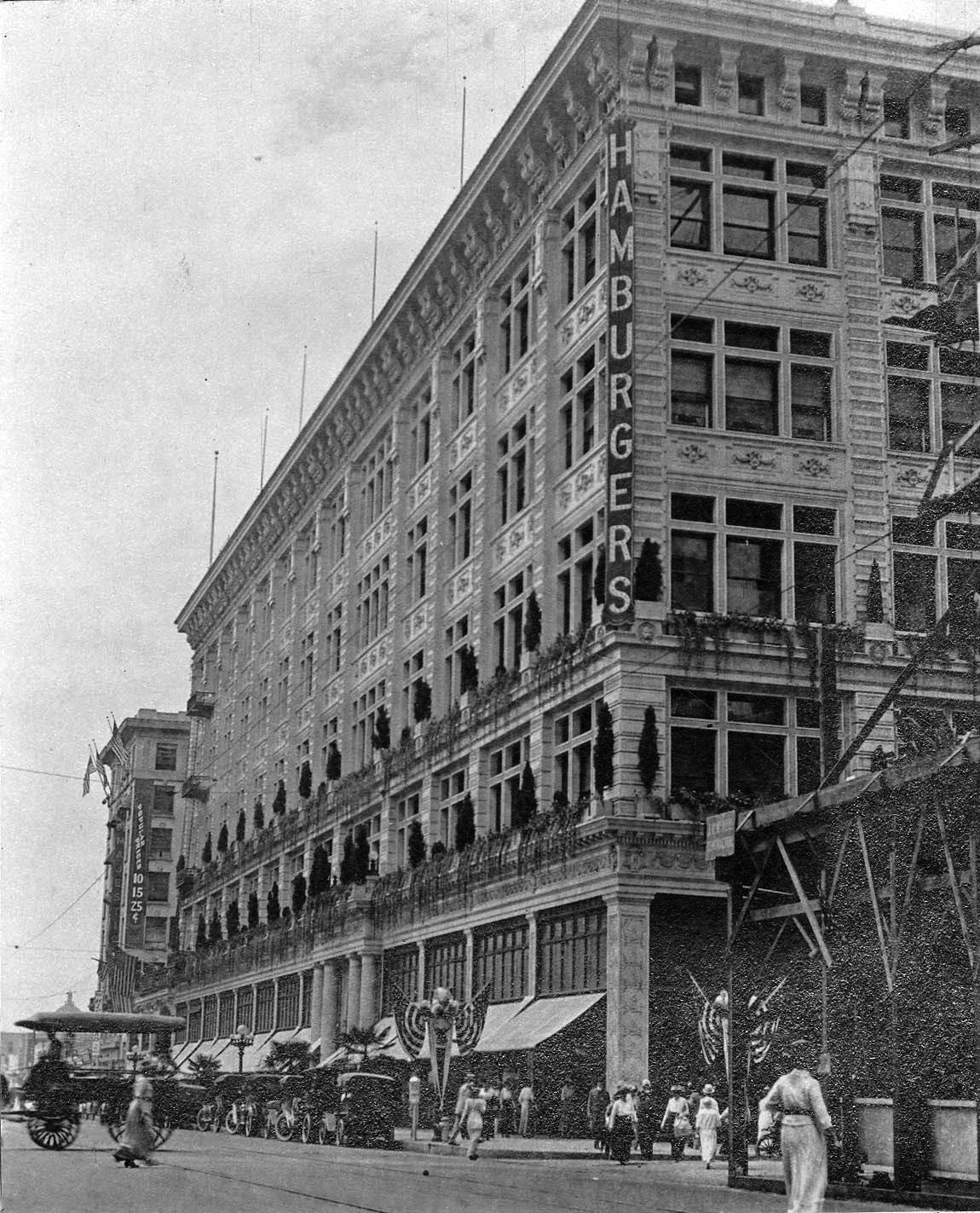
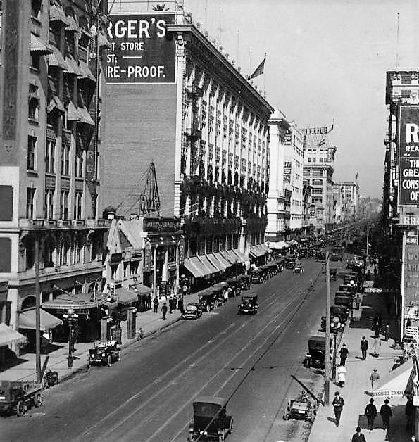
| (1915)^*#– View looking south on Broadway at 8th Street with the Hamburger's Department Store seen on the SW corner. Horse-drawn carriages, cars, and pedestrians share the busy street. The Majestic Theater is at left with a large banner on its side that reads: “Popular Priced: 10¢ – 15¢ – 25¢”. The new building going up on the right (NW corner) is the Merritt Building. |
 |
|
| (ca. 1915)^^ – View looking NW showing the Hamburger's Department Store (later May Company) located on the SW corner of Broadway and 8th Street. At left can be seen the Majestic Theater and Tally's New Broadway Theatre. |
 |
|
| (ca. 1916)^ – View looking north on Broadway towards 8th Street showing the Majestic Theater at left. Also seen is Tally's New Broadway Theatre just south of Hamburger's Department Store which located the SW corner of Broadway and 8th Street. |
Historical Notes In 1923, the Hamburger Department Store was acquired by May Company California. The Beaux Arts building was enlarged by Aleck Curlett in 1929 to accommodate more merchandise. |
 |
|
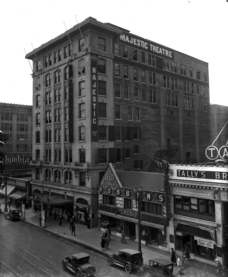
| (ca. 1920)*^ - View looking southwest showing the Majestic Theater at 845 S. Broadway. Tally's New Broadway Theatre is seen on the right. |
Historical Notes Originally leased by Oliver Morosco, the 1700-seat Majestic quickly became the preferred home-away-from-home to many national touring musical and dramatic productions from Broadway. Future silent film star Ramon Navarro’s first show biz job was as an usher there. In 1910, the Majestic was the local performance venue of choice for a versatile, LA-based stage performer named Lon Chaney, later dubbed “The Man of a Thousand Faces". * |
 |
|
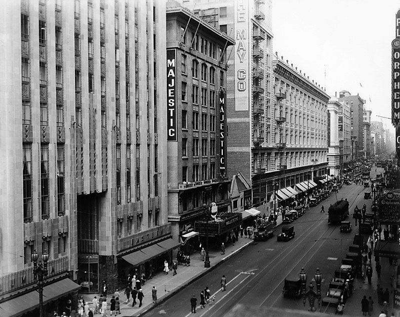
| (1930)* – View of Broadway looking north from 9th Street showing The May Company (previously Hamburger's) on the SE corner at 8th Street. Note that Tally''s Broadway Theater is now gone. The May Company was still working on the storefronts of its addition on the Tally's site. The Majestic Theater is seen at center with the newly opened Eastern Columbia Building on the left. The Majestic is running "Top Speed" with Joe E. Brown. Acorss the street, the Orpheum Theatre is playing "Little Accident," with Douglas Fairbanks, Jr. and Anita Page. |
* * * * * |
Broadway
 |
|
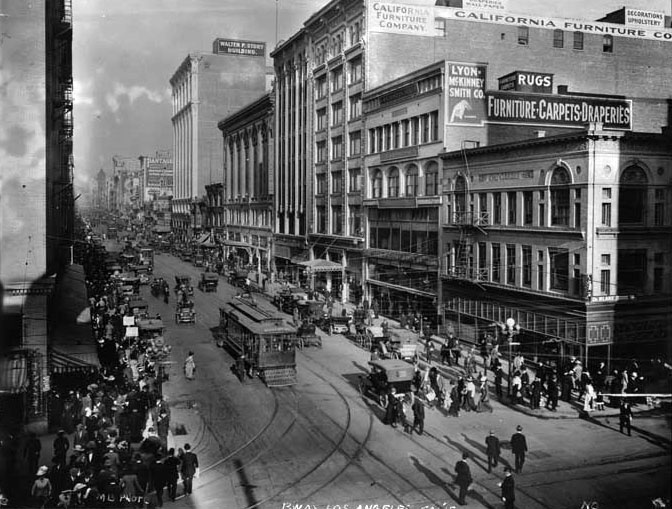
| (ca. 1918)^*# – Elevated view looking north on Broadway from 7th Street showing streetcars, automobiles, horse-drawn carriages and pedestrians; multi-story buildings include from distant left to right, Pantages Building at 536 South Broadway, Walter P. Story Building at 610 South Broadway, California Furniture Company at 644-646 South Broadway, and the Bullock's Building at Broadway and Seventh (NW corner) at extreme left. |
 |
|
| (1910s)#++ - View looking north on Broadway from Sixth Street. In the distance is the Broadway Central Building, which was the 400 block of South Broadway. It was constructed around 1906. |
 |
|
| (ca. 1918)^^ - View looking north on Broadway from below Third Street. The 1893-built Bradbury Building is at right, the 1888-built City Hall tower is visible near center, and the 1895-built Pan American Building (part of the original Irvine-Byrne Block) is on the left. |
Then and Now
 |
|
| (1918 vs. 2021)* – Looking North on Broadway toward 3rd Street where the two oldest buildings in Downtown Los Angeles stand today. Photo comparison by Jack Feldman. |
 |
|
| (ca. 1918)^^ - View looking east on Fourth Street at Broadway showing a busy intersection with many pedestrians crossing the street. |
 |
|
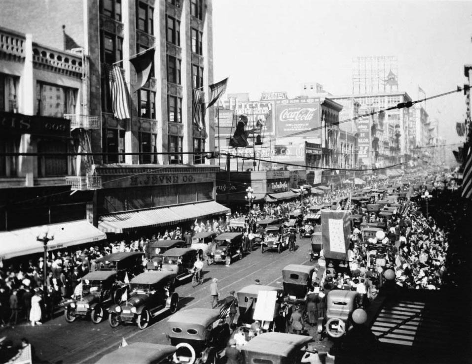
| (1918)^^ - Cars jammed on Broadway and 6th Street in a peace celebration of the war's end, November 11, 1918. |
Historical Notes World War I, also known as the First World War or the Great War, was a global war centered in Europe that began on July 28, 1914 and lasted until November 11, 1918. More than 9 million combatants and 7 million civilians died as a result of the war, a casualty rate exacerbated by the belligerents' technological and industrial sophistication, and tactical stalemate. It was one of the deadliest conflicts in history, paving the way for major political changes, including revolutions in many of the nations involved.*^ |
 |
|
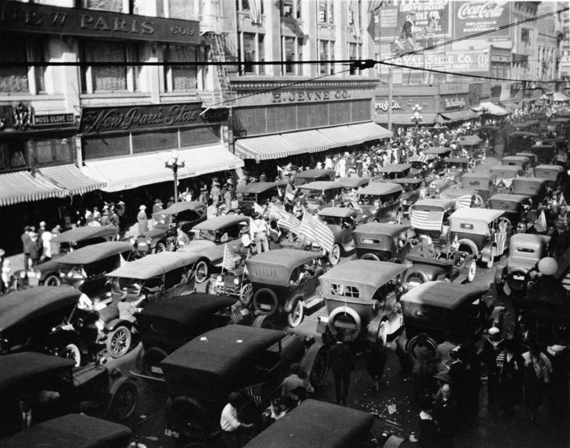
| (1918)^^ – Armistice Day celebration and traffic jam, 6th and Broadway in downtown L. A., November 11, 1918. |
Historical Notes Armistice Day (which coincides with Remembrance Day and Veterans Day, public holidays) is commemorated every year on 11 November to mark the armistice signed between the Allies of World War I and Germany at Compiègne, France, for the cessation of hostilities on the Western Front of World War I, which took effect at eleven o'clock in the morning—the "eleventh hour of the eleventh day of the eleventh month" of 1918. The date was declared a national holiday in many allied nations, to commemorate those members of the armed forces who were killed during war. An exception is Italy, where the end of the war is commemorated on 4 November, the day of the Armistice of Villa Giusti. In the Netherlands, Denmark and Norway World War I is not commemorated as the three countries all remained neutral.*^ |
 |
|
| (ca. 1920s)^ - A busy scene with pedestrians and city traffic in this view of Broadway and 5th looking north, showing the many retail stores that line the street. Hotel California, The Broadway, Edison building and California building are visible on the left side. Several trolleys have stopped in the middle of the road, cars line both sides of the street, and an overflow of pedestrians fill the sidewalks as far as the eye can see. Notice everyone wears hats - men, woman and children alike. |
* * * * * |
Broadway and 2nd Street
 |
|
| (ca. 1920)^ - View looking south on a near empty Broadway at 2nd Street. City Hall with its unique tower can be seen on the left at 226 S. Broadway. The tall building in the distance is the Million Dollar Theater Building (built in 1917). It is located on the SW corner of Braodway and 3rd. |
 |
|
| (ca. 1920)^ - Street view looking south on Broadway near 2nd St. On the near left corner (southeast) is Coast Drugs. On the far right corner (northwest) is The Owl Drug Co. Store. City Hall and the Million Dollar Theater Building can be be seen in the background. The dark building on the right (Second building south of 2nd St) is the Merchants Trust Company Building (207 S. Broadway). It would become the Municpal Water and Power Headquarters from 1921 to 1965. |
.jpg) |
|
| (ca. 1921)^ - View looking south on Broadway from near 2nd Street. The Municipal Water & Power Headquarters (207 S. Broadway) can be seen on the right. Note the people lined up along the curbs and the American Flags on the right. This could be the prelude to a 4th of July Parade. |
Historical Notes In 1921 the Department of Water and Power purchased the seven-story Merchants Trust Company Building at 207 South Broadway, which was to remain its main headquarters building for forty-four years. It is one of the 11 buildings the new DWP General Office Building (now known as John Ferraro Building) replaced in 1965. |
* * * * * |
Broadway and 1st Street
 |
|
| (1920)^ - Broadway and 1st Streets are seen from the southwest corner. A policeman stands on a box in the middle of the intersection to direct any traffic, including streetcars and cars. |
* * * * * |
Broadway and Temple Street
 |
|
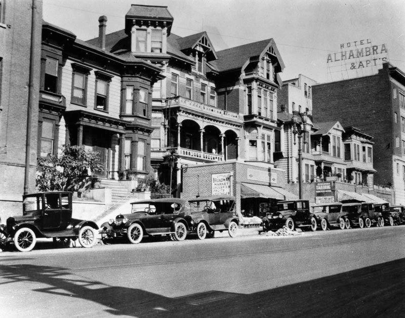
| (1920)^ – View showing cars parked in front of a row of houses on the west side of Broadway, north of Temple Street. Also shown is the Little Broadway Market and the Hotel Alhambra and Apartments Annex. The main Hotel Alhambra is located across the street on the east side of Broadway. The Broadway Tunnel is just north of the Alhambra Hotel (out of view). |
 |
|
| (1920s)^ – Business card for the Hotel Alhambra and Annex showing the south portal of the Broadway Tunnel with both hotel and annex sitting on opposite sides of Broadway. |
 |
|
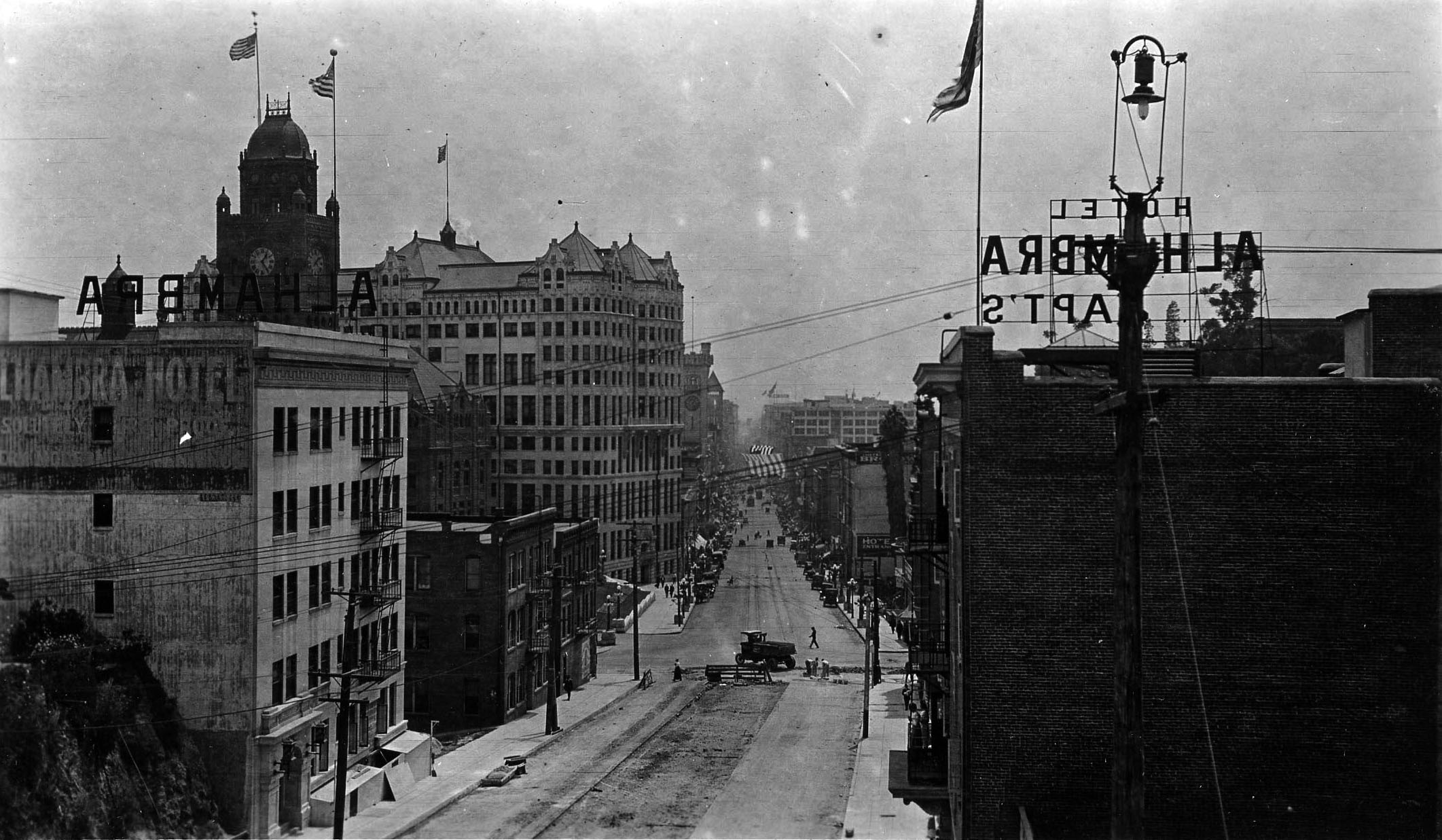
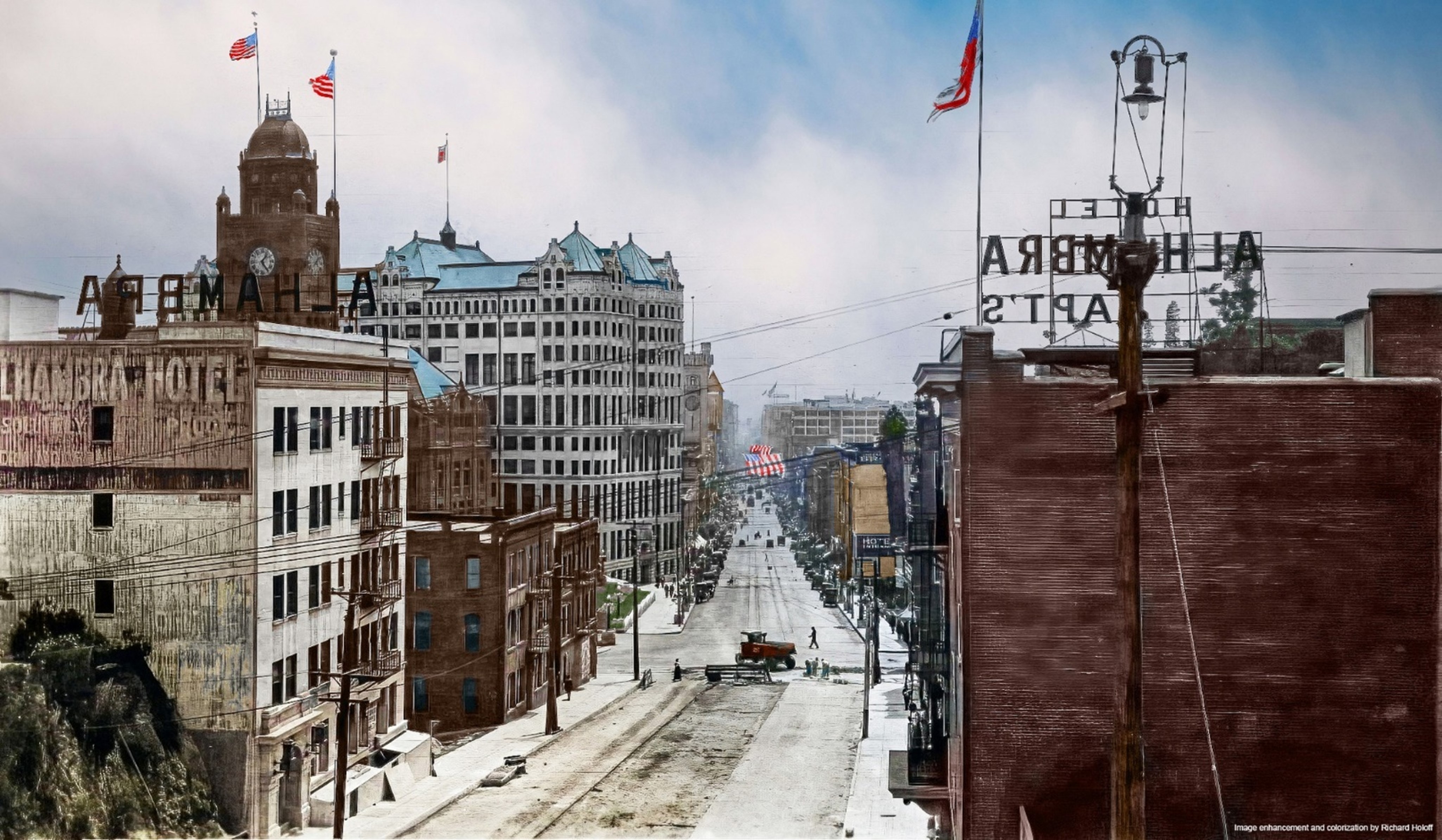
| (ca. 1920)^ – View looking south on Broadway from the top of the Broadway Tunnel toward Temple Street. The LA County Courthouse, Hall of Records, LA Times Building, and City Hall can all be seen in the background on the east side Broadway. The Alhambra Hotel stands on the left at its original location prior to being relocated closer to the tunnel. The hillside north of the Alhambra (lower-left) will soon be chiseled away and cleared to make room for the move. To the right stands the Hotel Alhambra & Apartments Annex. Note the interesting looking streetlight on the power pole to the right. Click HERE to see more in Early LA Streetlights. |
 |
|
| (ca. 1920)^ – View looking south on Broadway from the top of the Broadway Tunnel toward Temple Street. The LA County Courthouse, Hall of Records, LA Times Building, and City Hall can all be seen in the background on the east side Broadway. The Alhambra Hotel stands on the left at its original location prior to being relocated closer to the tunnel. The hillside north of the Alhambra (lower-left) will soon be chiseled away and cleared to make room for the move. To the right stands the Hotel Alhambra & Apartments Annex. Note the interesting looking streetlight on the power pole to the right. Click HERE to see more in Early LA Streetlights. Image enhancment and colorization my Richard Holoff |
 |
|
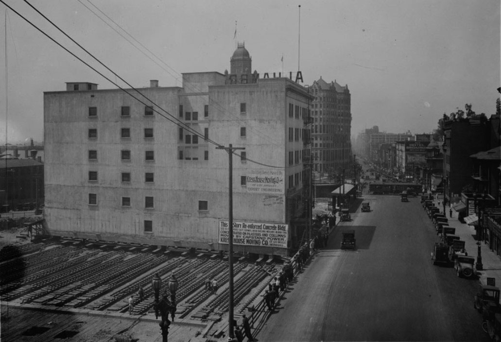
| (1924)^ - View looking south on Broadway from the top of the Broadway Tunnel on Fort Moore Hill. The LA County Courthouse can be seen in the distance on the southeast corner of Broadway and Temple Street. The large building at center is the Alhambra Hotel, just before it was moved one lot to the north to make room for the Hall of Justice. The six-story hotel rests on a series of metal girders and, in the foreground, workers can be seen near where the hotel will finally rest. The Alhambra Hotel Annex is situated across the street on the west side of Broadway (out of view). |
Historical Notes In 1924 the Alhambra Hotel was moved north up Broadway 122 feet towards the face of the Broadway Tunnel to make room for the Hall of Justice. The Kress House Moving Company was awarded a $63,770 contract to move the massive Alhambra Hotel. Dozens of parallel train tracks were positioned to move the hotel closer to the tunnel. |
 |
|
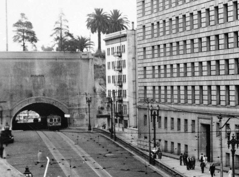
| (ca. 1925)^ – View showing the south portal of the Broadway Tunnel with the Hotel Alhambra (at new location) squeezed in between the tunnel and the newly constructed Hall of Justice (N/E corner of Broadway and Temple Street). |
Then and Now
 |
|
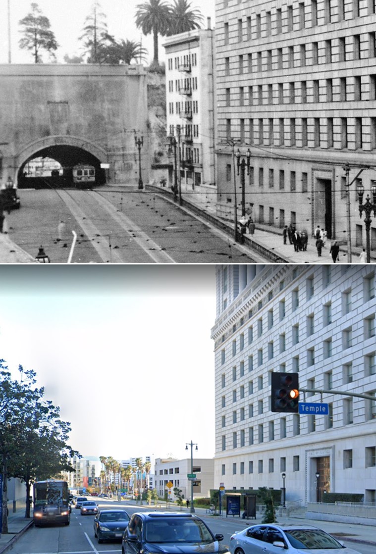
| (1925 vs 2022) – Looking toward what used to be the southern portal of the Broadway Tunnel as seen from Temple Street. |
* * * * * |
Spring and 1st Street
 |
|
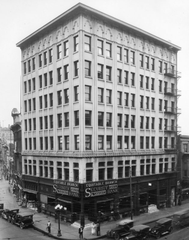
| (ca. 1920)^ – View looking north on Spring Street at First. Security Trust & Savings Bank on the right side of photo. Spring Street does appear to curve in those days, which it no longer does. |
 |
|
| (1920)^ - Exterior view of the Security Trust and Savings Bank on the northeast corner of First and Spring Streets, in the 7-story Equitable Building. |
Historical Notes In 1906, the seven-story Equitable Savings Bank replaced the Los Angeles National Bank building on the northeast corner of First and Spring streets. The building didn't last too long, being demolished in the late 1920s. The site today is the corner of the park next to City Hall. |
 |
|
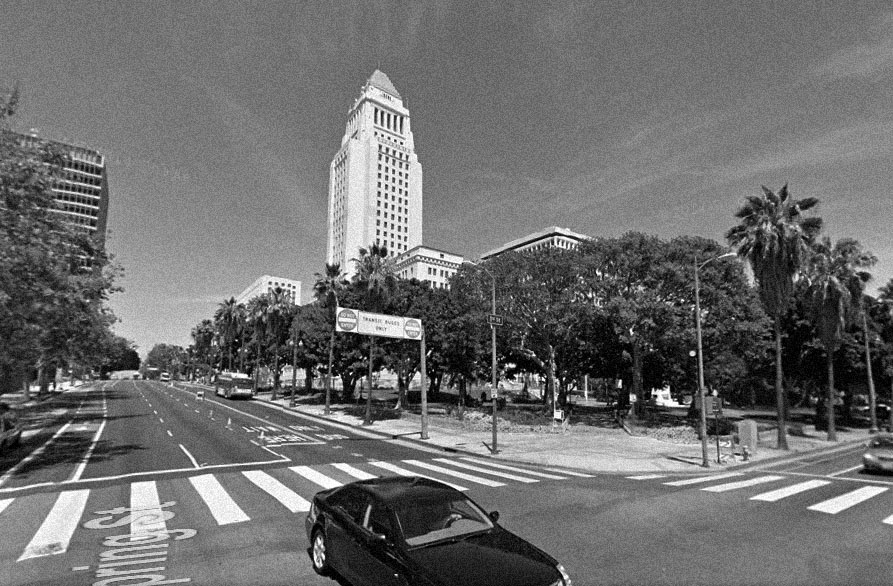
| (2014) – Google Street view looking at the northeast corner of Spring and First Streets where the Equitable Bank Building once stood, now a park next to City Hall. |
* * * * * |
Spring and 2nd Street (Looking North)
 |
|
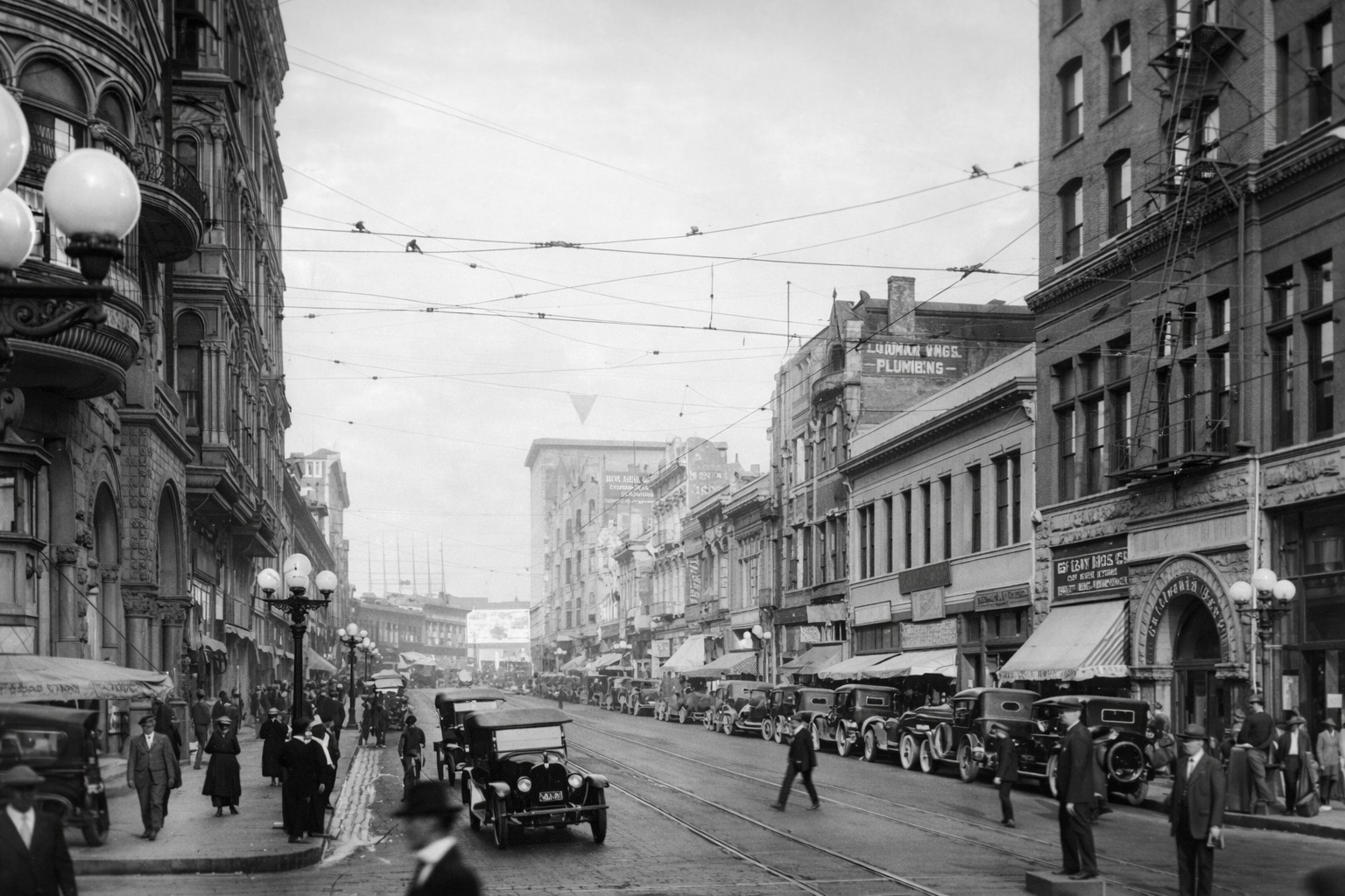
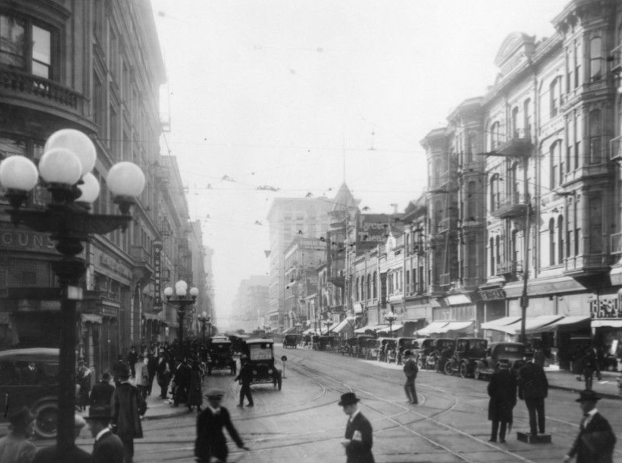
| (ca. 1920)* - View looking north on Spring Street at 2nd Street where a traffic cop stands on a soap box in the middle of the intersection directing traffic. The tallest building in the distance is the 7-story Equitable Building located on the northeast corner of Spring and 1st streets. |
Historical Notes By the late 1910s and early 1920s, Spring Street had become one of Los Angeles' busiest corridors, known as the city’s financial district. The presence of a traffic officer elevated above the street reflects the growing challenge of managing automobiles before the introduction of electric traffic signals. On the left is the Bryson Bonebrake Block on the northwest corner of Spring and 2nd. Completed around 1888, the building was commissioned by John Bryson Sr., a former mayor of Los Angeles, and George H. Bonebrake, a prominent banker. Designed by architects Joseph Carter Newsom and Samuel Newsom, the structure featured six stories plus a basement, interior courts for light and ventilation, and a lodge room on the top floor. Buildings like this helped define Spring Street as a center of commerce, banking, and professional offices during Los Angeles’ early boom years. |
 |
|
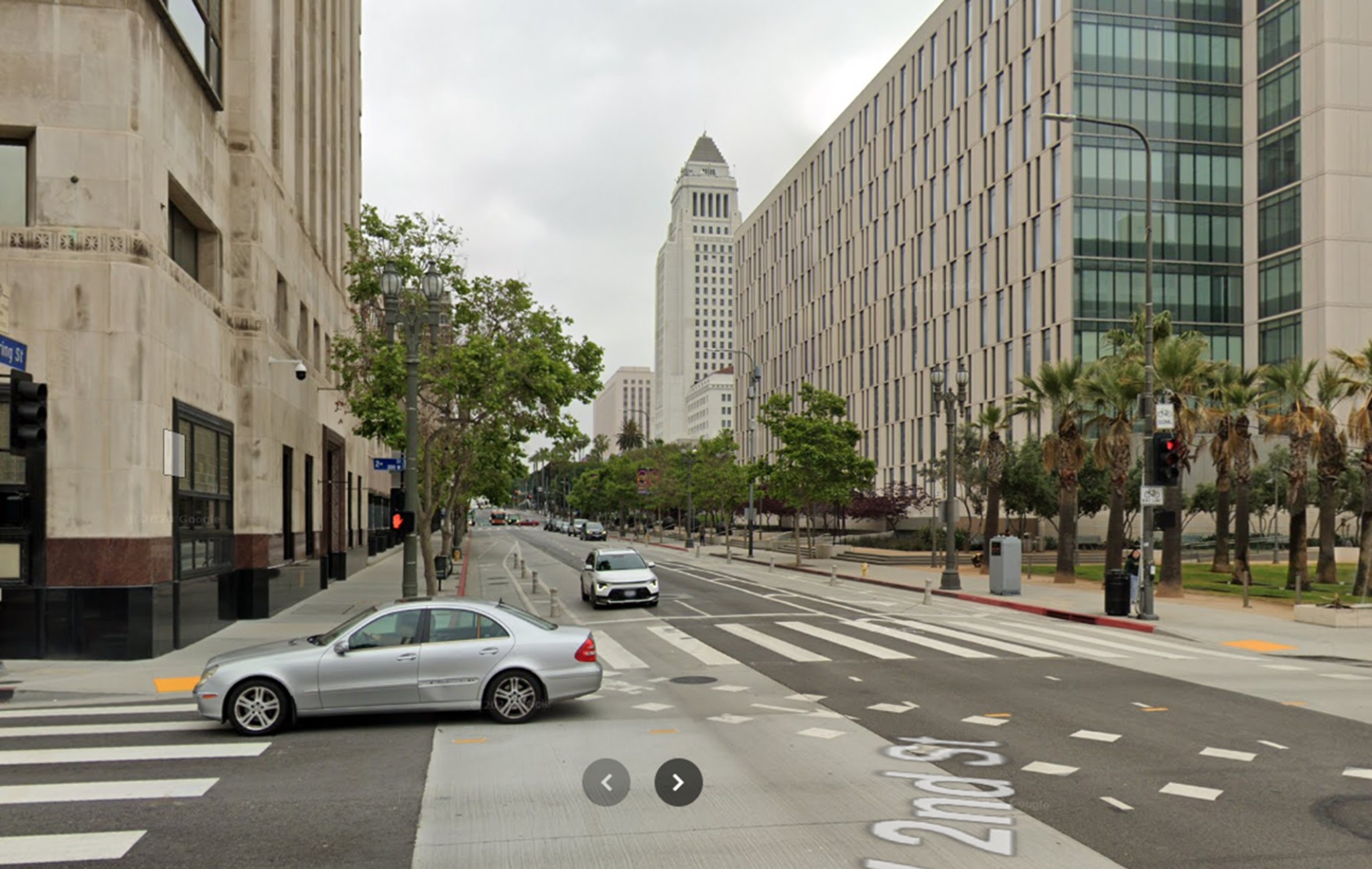
| (2024)* - Contemporary view looking north on Spring Street from 2nd Street. Los Angeles City Hall rises in the distance just north of 1st Street. |
Historical Notes Today, Spring Street retains its historic street grid, but its role has shifted from a financial center to a mix of civic, residential, and creative uses. City Hall, completed in 1928, now dominates the view and marks the northern transition from the old business district to the Civic Center. Most of the nineteenth century commercial blocks that once lined Spring Street have been replaced or repurposed, yet the street remains a key link between the historic core, City Hall, and the modern downtown skyline. |
Then and Now
 |
|
| (1920 vs 2024)* - Looking north on Spring Street from 2nd Street. Photo comparison by Jack Feldman. |
Historical Notes This comparison shows how the same intersection evolved from a dense commercial corridor filled with early automobiles and manual traffic control into a modern downtown street shaped by civic architecture and adaptive reuse. While the street alignment remains unchanged, the visual focus has shifted northward toward City Hall. What was once a tightly packed canyon of late nineteenth century buildings has opened into a broader civic landscape reflecting Los Angeles’ changing priorities and growth patterns. |
* * * * * |
Spring and 2nd Street (Looking South)
 |
|
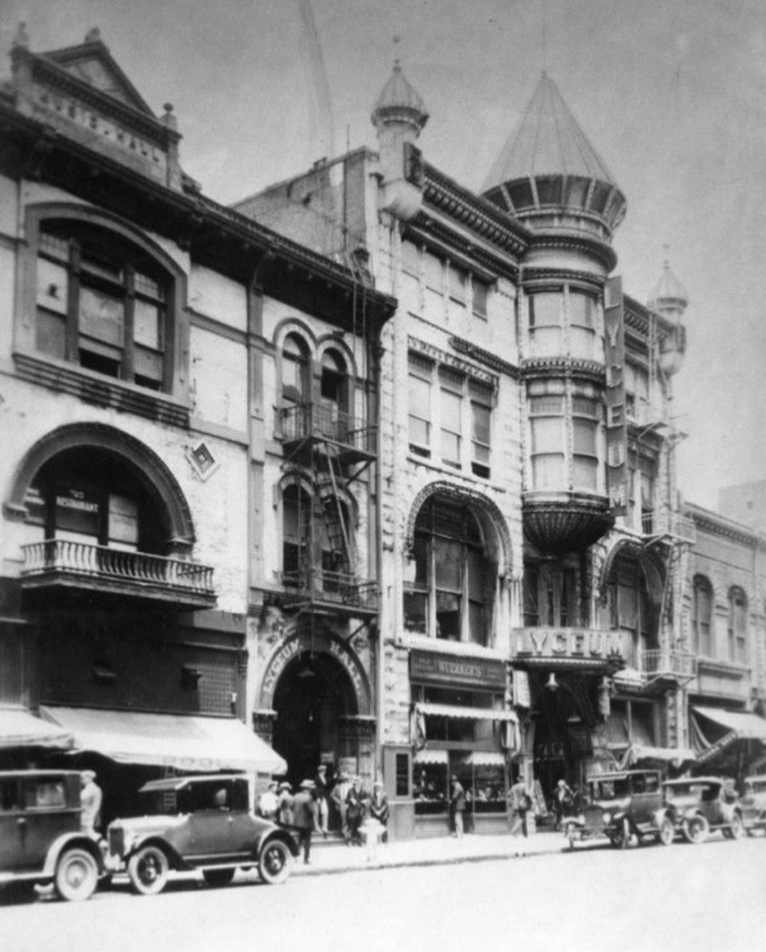
| (ca. 1920)* - View looking south on Spring Street at 2nd Street. The Hollenbeck Hotel is visible on the right, southwest corner. Further down the block is the Lyceum Theatre with its unique conical tower. At left stand the Wilcox Building, southeast corner. Note the ornate five-lamp streetlights lining both sides of the street. Click HERE to see more in Early LA Streetlights. |
Historical Notes Looking south, Spring Street reveals its role as both a commercial and entertainment corridor. The Hollenbeck Hotel was one of downtown's most prominent hotels, catering to travelers, businessmen, and theatergoers. The Lyceum Theatre, easily identified by its unusual tower, anchored a lively stretch of Spring Street that featured hotels, theaters, shops, and restaurants. The decorative multi-globe streetlights reflect early efforts by the city to beautify downtown streets while also improving nighttime visibility during the era of electric lighting. |
 |
|
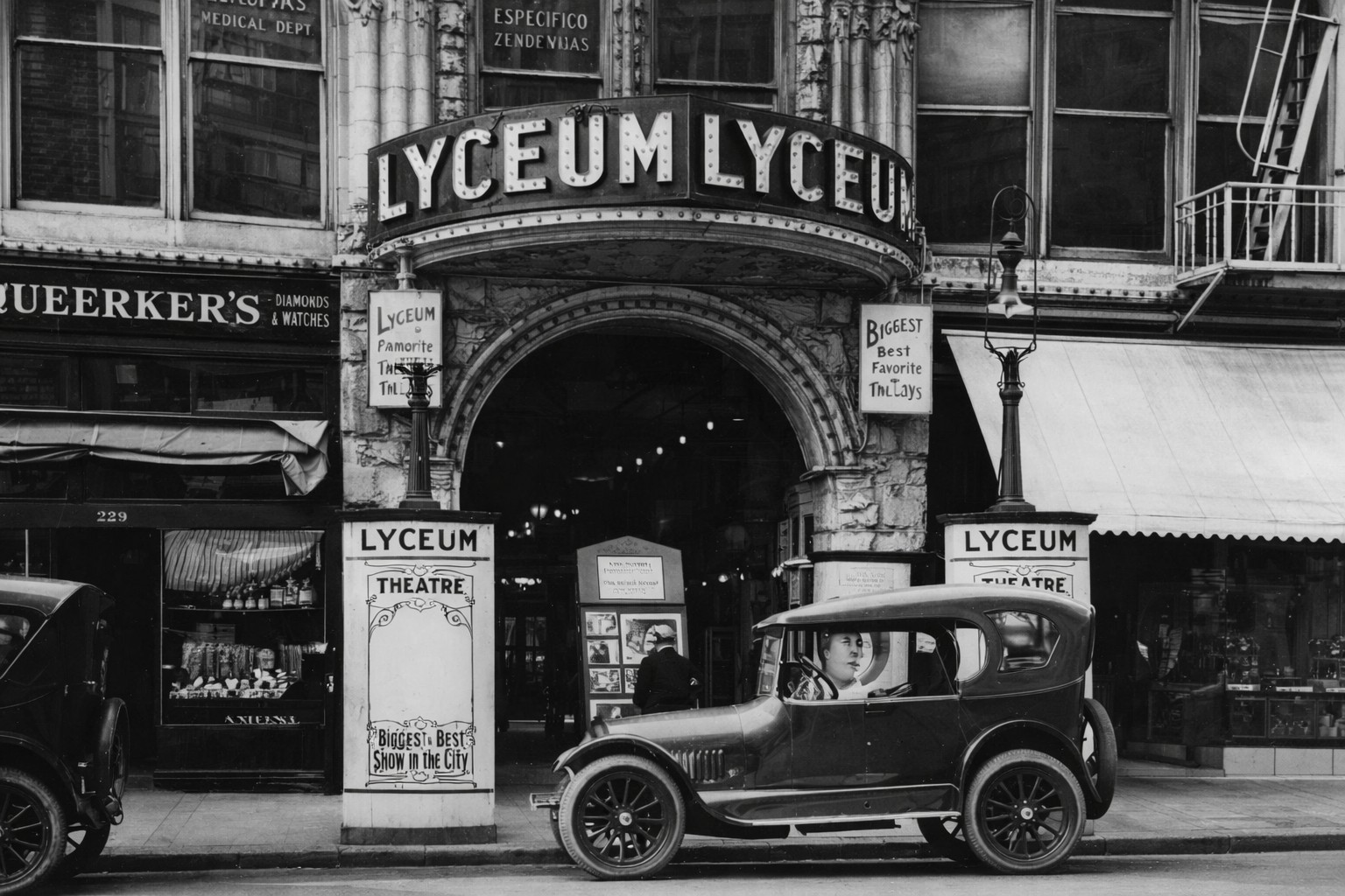
| (1920)^ - Exterior view of the Lyceum Theatre, the original Los Angeles Theater, which opened in 1888 and located at 227 South Spring Street. |
Historical Notes The Lyceum Theatre opened in 1888 as the Los Angeles Theatre and was built by William Hayes Perry. The building was known as the Perry Building and featured a Richardsonian Romanesque design with heavy stonework and rounded arches. In 1903, the theater became the Orpheum, serving as the second Los Angeles home of the Orpheum Circuit vaudeville shows. In 1911, the Orpheum moved to Broadway, and the Spring Street building later became known as Fischer’s Lyceum and then simply the Lyceum Theatre. By the mid 1910s, it remained an important venue for popular entertainment in the city. |
 |
|
| (1919)^ - View of an early model car parked in front of the entrance to the Lyceum Theatre on Spring Street. Signs in front read: "Biggest and Best Show in the City" and "America's Most Popular Family Theatre". |
Historical Notes By the late 1910s and early 1920s, the Lyceum Theatre had transitioned from live performances to motion pictures, reflecting a broader shift in public entertainment. Spring Street theaters increasingly catered to movie audiences drawn downtown by streetcars and the growing use of automobiles. In 1941, the Lyceum Theatre building was demolished and replaced by a parking lot, a fate shared by many early downtown theaters as land values, traffic demands, and urban priorities changed. |
* * * * * |
5th and Spring Streets
 |
|
| (ca. 1918)* – View looking east on 5th Street toward Spring Street with the Alexandria Hotel seen at right (SW corner). A man sits behind the steering wheel of an early model convertible. The large building on the SE corner of 5th and Spring is the Security Building. |
Historical Notes The Alexandria Hotel at 501 South Spring Street became Los Angeles’s first five-star luxury hotel when it opened on February 12, 1906. It also served as the city’s main social center from 1906 to the end of 1920. |
 |
|
| (1924)* - View looking west on 5th Street toward Spring Street showing the Security Building on the left (SE corner). In the distance stands the Alexandria Hotel (SW corner). |
* * * * * |
Broadway Theaters and Nightlife Between 5th and 6th Streets
 |
|
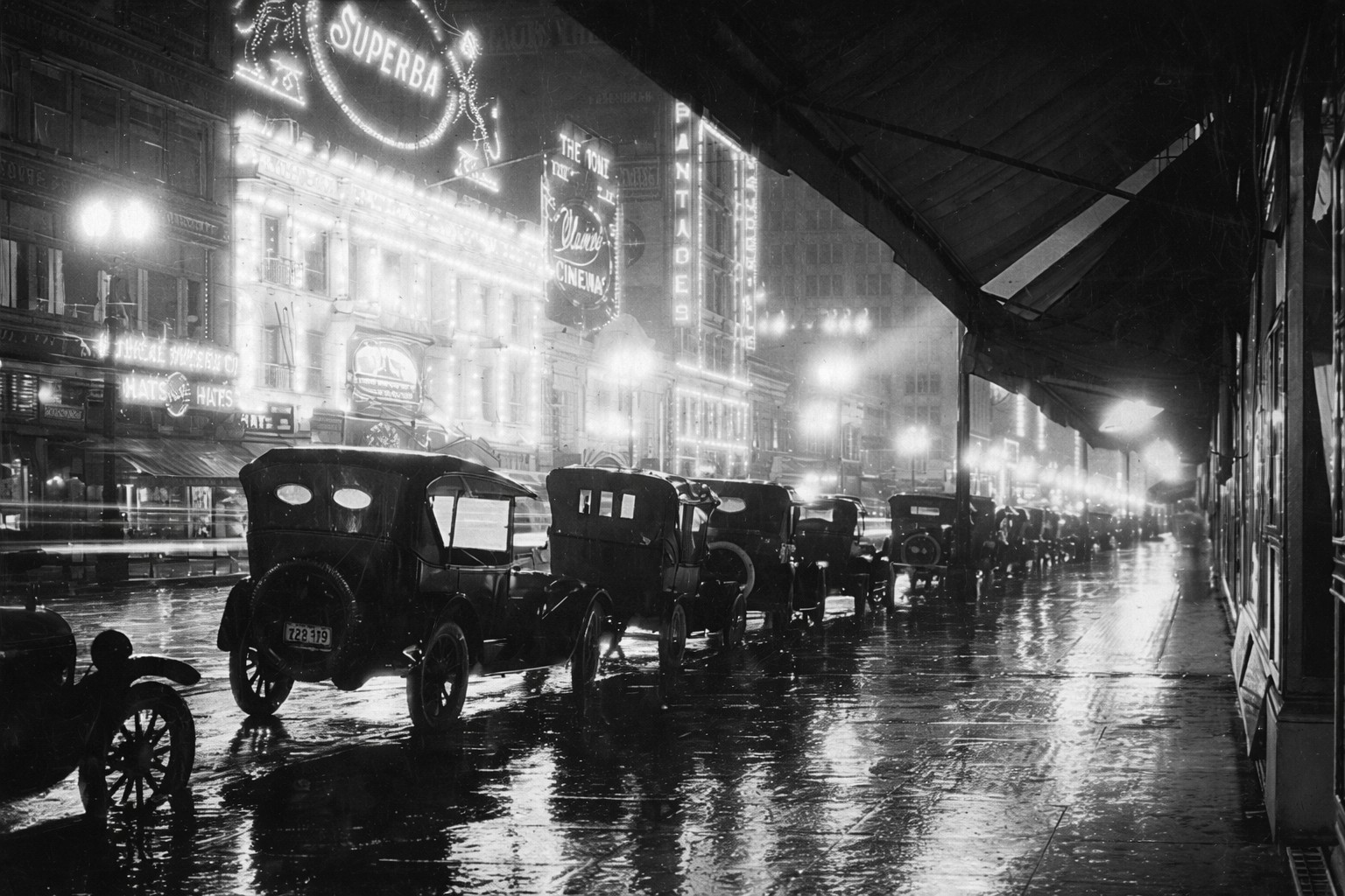
| (1920)* - Rainy night view looking south on Broadway between 5th and 6th Streets. Reflections from the wet pavement amplify the glow of the Superba Theatre’s marquee, capturing Broadway at its height as Los Angeles’s premier entertainment corridor. |
Historical Notes By the late 1910s and early 1920s, Broadway had become the undisputed heart of downtown Los Angeles nightlife. Lined with theaters, electric signage, and storefronts, the street drew thousands nightly, transforming what had once been a commercial artery into a spectacle of light, motion, and modern urban energy. Nighttime photographs such as this one highlight how illuminated marquees and neon signage turned Broadway into an outdoor stage, where the street itself became part of the theatrical experience. The Superba Theatre, prominently featured here, was a key contributor to this atmosphere. Its brilliant lighting and ornate façade reflected both technological progress and the city’s growing appetite for motion pictures and live entertainment. Rain-soaked streets intensified the effect, mirroring the glow of Broadway’s theaters and reinforcing the sense of excitement that defined the district during this era. |
 |
|
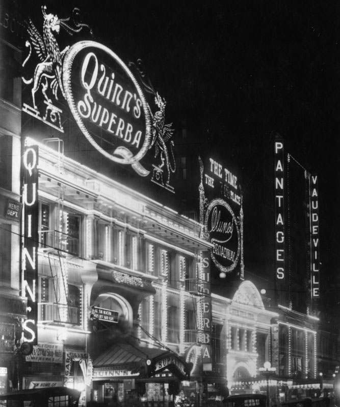
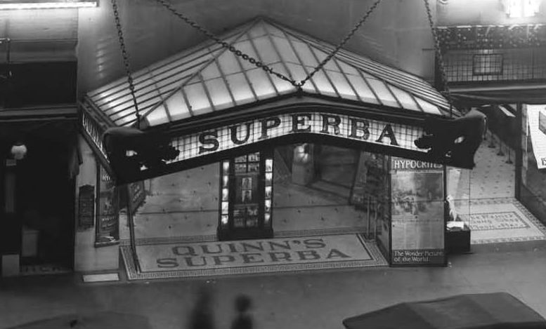
| (ca. 1915)* - Exterior view of Quinn’s Superba Theatre on Broadway, with the street stretching southward and signage visible for nearby theaters including the Pantages. |
Historical Notes The Superba Theatre opened on July 30, 1914, under the direction of pioneering theater operator John A. Quinn. Quinn arrived in Los Angeles from Arizona around 1909 and quickly established himself as a major figure in the city’s emerging entertainment industry. His early ventures included leasing the Ideal Theatre on South Spring Street, followed by partnerships that brought him control of the Bijou and Banner theaters on Main Street. By 1911, Quinn had taken over the Garrick Theatre at 8th and Broadway and soon expanded his influence along Broadway itself. He operated Tally's Broadway Theatre and later became involved with the Rialto Theatre, further cementing his role in shaping the city’s theatrical landscape. The Superba represented one of Quinn’s most ambitious projects, positioned among other major venues such as the Cameo and the Pantages, helping to establish this stretch of Broadway as a dense and competitive theater row. Visible down the block is signage for the Pantages Theatre, part of the expanding vaudeville circuit created by Alexander Pantages. By the mid 1910s, Pantages theaters were known for offering continuous vaudeville programs at popular prices, drawing large and diverse audiences. The close proximity of the Superba, Cameo, and Pantages illustrates how this section of Broadway evolved into one of the most densely concentrated entertainment districts in the nation, where multiple major operators competed nightly for the same crowds. |
 |
|
| (ca. 1915)* - Close-up view of the entrance to Quinn’s Superba Theatre at 518 South Broadway, showcasing its elaborate signage and architectural detailing designed to attract passing crowds. |
Historical Notes The Superba Theatre was designed to command attention from the sidewalk, using bold lettering, layered signage, and a richly detailed entrance to draw patrons inside. This approach reflected a broader trend along Broadway, where theaters competed visually as much as programmatically, each striving to outshine its neighbors. In later years, the Superba was sold and briefly converted into a coffee house, signaling changing entertainment patterns and economic pressures along Broadway. In 1931, the building was demolished to make way for the Roxie Theatre, which would become the last new theater constructed on Broadway before the district’s long decline. The site’s evolution from the Superba to the Roxie encapsulates the rapid cycles of growth, reinvention, and obsolescence that characterized Broadway’s theatrical golden age. |
* * * * * |
Macy Street Bridge
 |
|
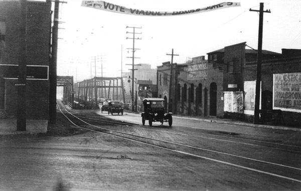
| (1923)** - View looking east showing the Macy Street Bridge over the Los Angeles River. A banner above the roadway reads: VOTE VIADUCT BONDS - APRIL 5. |
Historical Notes Over the years there have been several bridges connecting Macy Street with Brooklyn Avenue (previously Pleasant Avenue) in East Los Angeles. In fact, the first span over the Los Angeles River was a covered bridge, lit with kerosene lamps, built on this spot in 1870. Click HERE to see more on the 1st Macy Street Bridge. By 1923, you would cross the L.A. River at Macy on the metal truss bridge. While crossing, cars would have to contend with trains of both the Santa Fe (on the eastern side) and the Union Pacific (on the western), as the tracks for each were at the same grade as the bridge’s.* |
 |
|
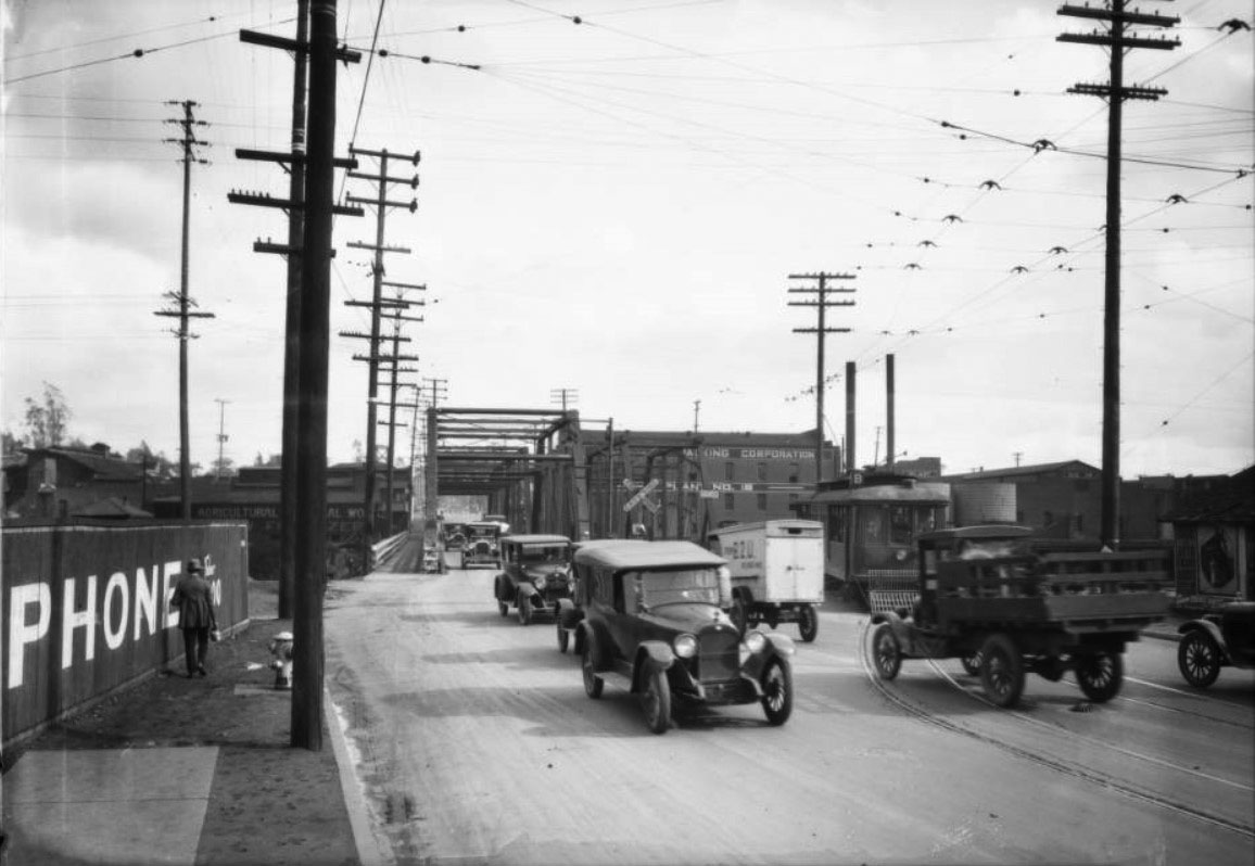
| (1925)^^ – View looking west showing cars, trucks, and streetcars sharing the road at the Macy Street Bridge. Today, Macy Street is Cesar Chavez Avenue. |
 |
|
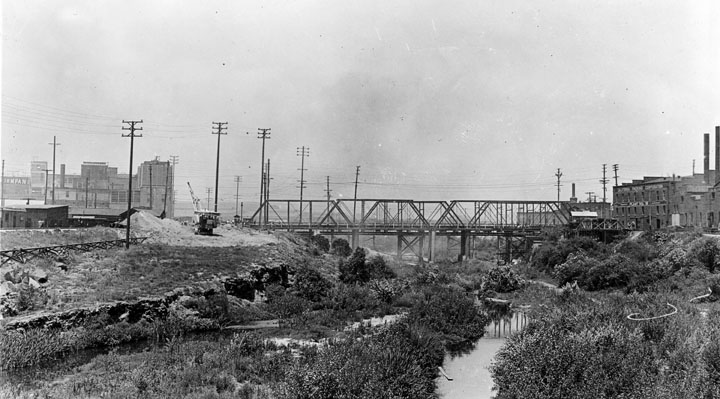
| (1925)^ - Profile view of the old Macy Street Bridge prior to its demolition. |
Historical Notes On April 5, 1923, the City's electorate voted for a $2 million bond issue to be put toward a new bridge initiative. The construction of the new Macy Street Viaduct eventually started in mid-1925.* |
 |
|
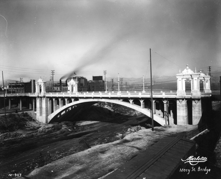
| (ca. 1926)* - Profile view of the new Macy Street Bridge, constructed 1925-26. |
Historical Notes The Macy Street Viaduct (Bridge) is the second bridge built during large bridge-building program in Los Angeles during the 1920s. The program started in 1923 with lobbyists pushing for the replacement of several of the city's outdated bridges and viaducts. The Macy Street truss bridge was problematic for motorists due to its narrow width and two railroad mainlines (the Santa Fe and Union Pacific) located on either side of the span. The new bridge formally opened on April 17, 1926. The bridge's Spanish Colonial elements are a nod to El Camino Real, the route of which Macy Street/Cesar Chavez Avenue follow. It is also why the bridge is dedicated to Father Junipero Serra. In 1995, Macy Street, which was named after Los Angeles pioneer Dr. Obed Macy, was changed to Cesar E. Chavez Avenue in honor of the former labor leader. So, too, was the name of the bridge changed.*^ Click HERE to see more Early Views of the Macy Street Bridge. |
* * * * * |
1st Street Bridge
 |
|
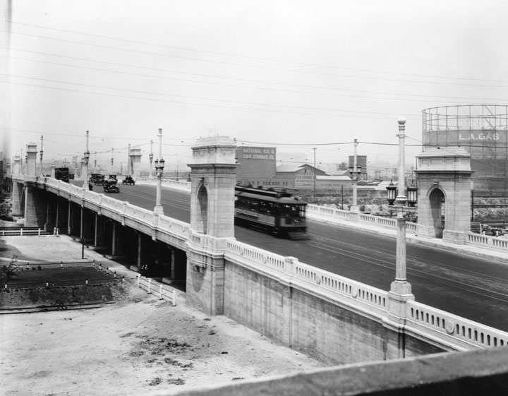
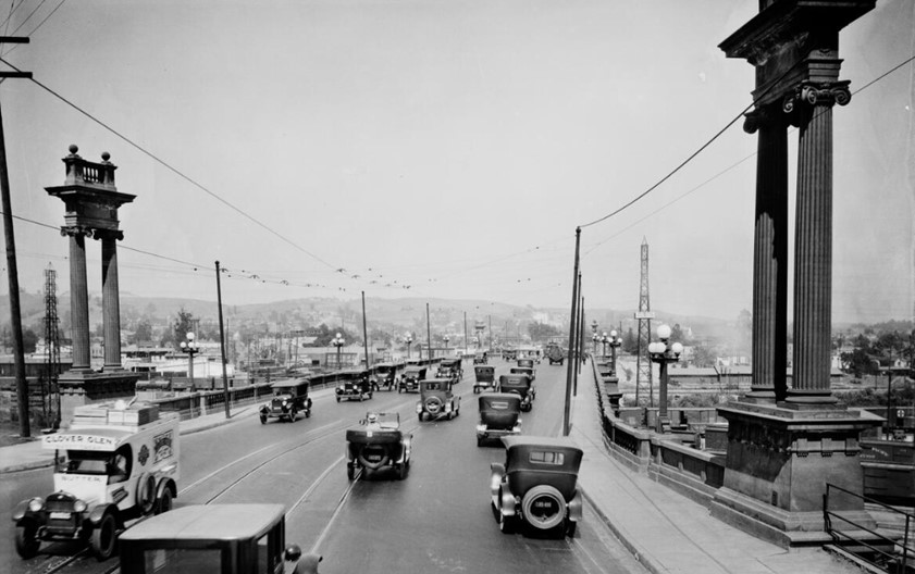
| (ca. 1929)^ - View of the 1st Street Bridge as a trolley and several cars drive across. On the other side of the bridge some businesses can be seen: National Ice & Cold Storage Co. and a large tank marked L.A. Gas. |
Historical Notes The First Street Viaduct opened in 1929, and is one of the series of classic Los Angeles River bridges designed by Merrill Butler. Special ornamentation was common on bridges constructed between 1900 - 1929. These poles serve two purposes: 1) to hold the decorative streetlight lantern and 2) to support the overhead for the Los Angeles Railway (LARy) streetcars that used this viaduct.^^ Click HERE to see more in Early Los Angeles Streetlights. |
.jpg) |
|
| (ca. 1930s)^ - 1st Street Bridge, viewed from below. Notice the dirt and grime on the facade right above the train tunnels. |
 |
|
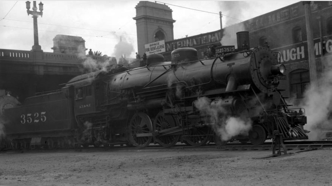
| (1933)### - View showing the Atchison, Topeka & Santa Fe (ATSF) locomotive, engine number 3525, engine type 4-6-2 passing under the 1st Street Bridge. |
Historical Notes The Santa Fe was a pioneer in intermodal freight service, an enterprise that (at one time or another) included a tugboat fleet and an airline (the short-lived Santa Fe Skyway). Its bus line extended passenger transportation to areas not accessible by rail, and ferryboats on the San Francisco Bay allowed travelers to complete their westward journeys to the Pacific Ocean. The ATSF was the subject of a popular song, Harry Warren & Johnny Mercer's "On the Atchison, Topeka and the Santa Fe", written for the film, The Harvey Girls (1946). The railroad officially ceased operations on December 31, 1996, when it merged with the Burlington Northern Railroad to form the Burlington Northern & Santa Fe Railway (later renamed BNSF Railway).*^ |
 |
|
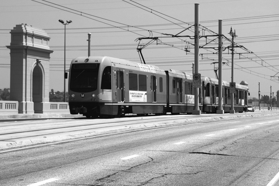
| (2012)^## - 435 MTA westbound on the First Street Bridge. |
Historical Notes The bridge was declared a historic-cultural monument in 2008, and the Gold Line extension, which runs down the middle of the bridge, opened the following year. |
* * * * * |
Buena Vista-Broadway Bridge
 |
|
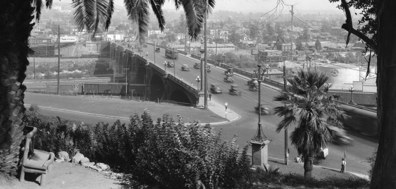
| (ca. 1924)* - View of the Buena Vista (North Broadway) Bridge over the Los Angeles River. |
Historical Notes In the early 1900s, a group of property owners in present-day Lincoln Heights organized as the East Side Improvement Association called for a bridge over the river at Buena Vista Street (now North Broadway). The association secured half the funding for the bridge from private sources, and, when the city refused to supply the other half, elected their own president to the city council. The Los Angeles Times threw its support behind the plan in 1908, urging the city to become the "Pontifex Maximus of the day" (a reference to the officer of the Roman Republic responsible for bridge building). The city soon agreed, and the concrete-arch bridge -- complete with miniature Roman temples and other neoclassical flourishes -- opened to traffic in 1911.**# |
 |
|
| (1927)#^ – Panoramic view looking east from Elysian Park showing the Buena Vista (North Broadway) Bridge spanning the Los Angeles River and the SP trackage coming out of the 'Cornfield' (out-of-frame to the right). |
Historical Notes The Buena Vista-Broadway Bridge is one of the oldest of the bridges crossing the Los Angeles River. Strategically, the bridge connects Lincoln Heights with Chinatown and gets heavy use as an alternative to the Pasadena Freeway. Culturally and historically, the over 100-year-old bridge has served as an important symbolic link connecting the Latino and Chinese communities as well as being a favorite passage to Elysian Park for generations of Eastside families.*## |
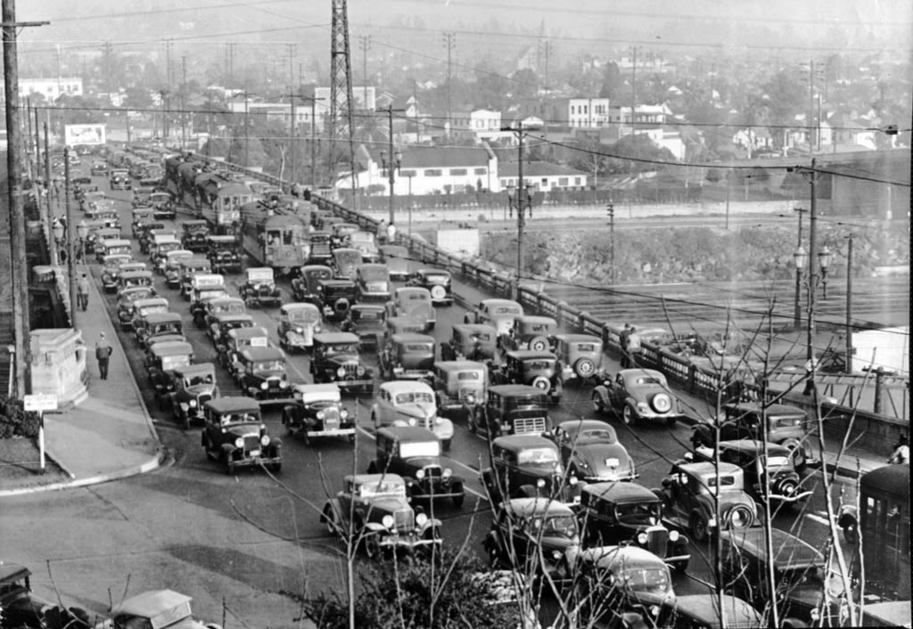 |
|
| (1937)^^ - View of a congested North Broadway bridge taken from the entrance to Elysian Park. Electric streetcars are in the midst of traffic. |
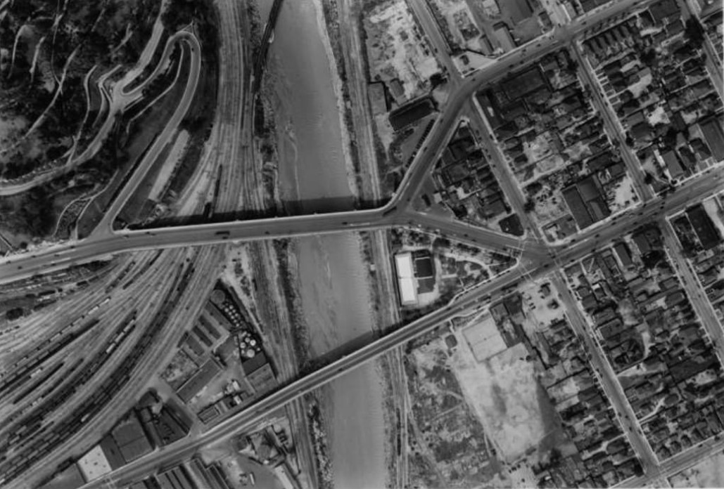 |
|
| (1938)#^ - Aerial view showing the N. Broadway and Spring St. Bridges corssing a swollen Los Angeles River with Elysian Park (upper left) and the SP Cornfield (also known in 1938 as the Bullring) railroad yard. Meadow Road and Park Row Drive wind up a steep slope into Elysian Park at left north of the railroad yard. |
Historical Notes 1938 saw unusually heavy rainfall with widespread flooding. Notice the river is still 'unimproved'. Click HERE to see more in Los Angeles River – The Unpredictable. |
 |
|
| (2000)+** - Wide-angle view of the Buena Vista-Broadway Bridge looking north shortly after it was retrofitted. |
Historical Notes The Buena Vista-Broadway Bridge underwent an 18 month, $20-million dollar renovation and seismic retrofitting that was completed in 2000.*## |
* * * * * |
Highland Park
 |
|
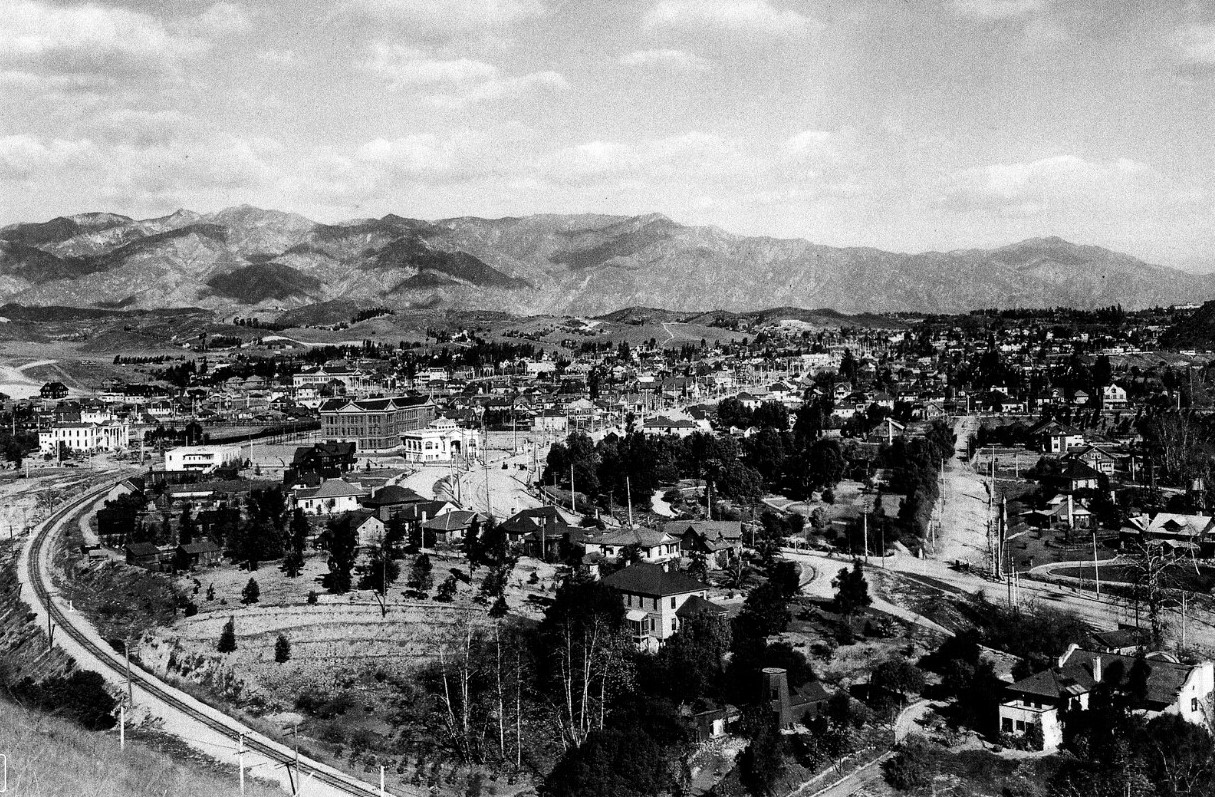
| (ca. 1905)* - Panoromic view of Highland Park looking towards the San Gabriel Mountains. |
Historical Notes The white building at center-left of the photo was once the Library building of the Occidental College Highland Park Campus in the early 1900s. |
 |
|
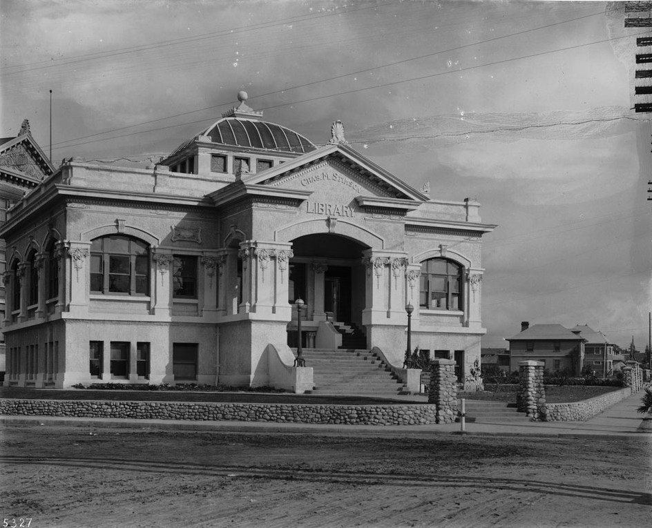
| (ca. 1908)^^ - Photograph of the Chas. M. Stimson Library, built in 1904 on the Occidental College Highland Park Campus. The two-story building has an extended porch where above it is a pediment displaying the name of the building. Multifoil tracery outline the windows the walls. Above the roof is a turret-like tower. A stone masonry wall creates a perimeter around the front yard. Heavy tracks line the dirt road in front of the building. |
Historical Notes After the College moved to its present campus in Eagle Rock in 1914 the Library building was used for a short time as a Los Angeles City Branch Library. The building has since been demolished.^^ |
 |
|
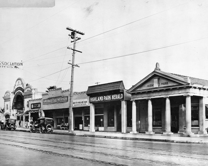
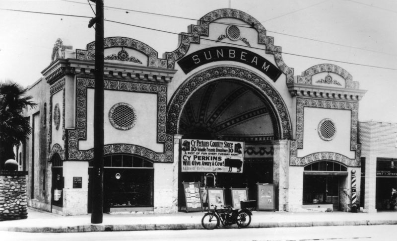
| (ca. 1920)^ - Pasadena Avenue (later North Figueroa Street) in Highland Park. The Sunbeam Theater is on the left, and Highland Park Herald newspaper office on the right. The theater, located at 5722 N. Figueroa Street, was designed by A. Lawrence Valk. |
Historical Notes The Sunbeam Theatre was a 1296 seat theater built in 1914. It was purchased by the owners of the Highland Park Theater and closed to remove competition. After that it was re-purposed for a variety of businesses. In the late 1980s, part of it was utilized by the theater group Outback Theater. The space is still occasionally used for events.*^^^ |
 |
|
| (ca. 1920)^ - Exterior view of the Sunbeam Theater in Highland Park, with a sign advertising a promotion by Cy Perkins Country Store. An early model motorcycle is parked in front of the theater. |
* * * * * |
LA Plaza Area
 |
|
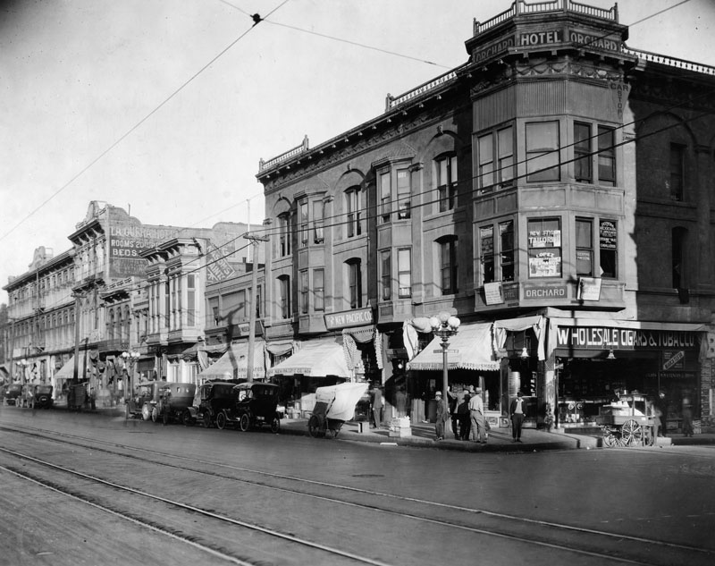
| (ca. 1920)^ - View of North Main Street at Arcadia Street in the Plaza area circa 1920. From left to right: Pico House, Merced Theater, Masonic Temple, and Hotel Orchard on the corner of Arcadia Street. Small shops are at street level, and cars are parked along the curb. Streetcar tracks are in the foreground. |
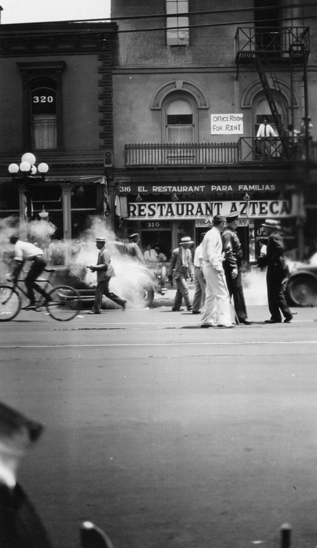 |
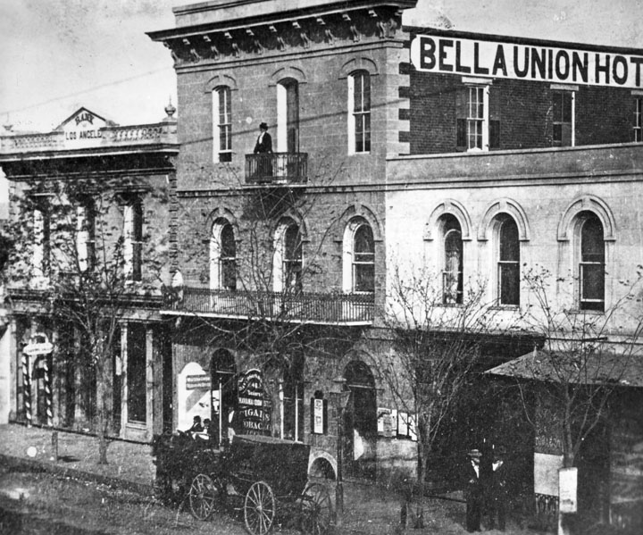
(ca. 1920)^ - View of a busy North Main Street in front of the Azteca Restaurant as seen from across the street. The restaurant is located on the street floor of the old Bella Union Hotel. A sign on the second floor reads: Office Room For Rent.
|
Historical Notes Constructed in 1835, the Bella Union Hotel has a long, rich history. It served as the County Courthouse until October 1851, and in 1860 was the location of a champagne fete celebrating the connection of San Francisco and Los Angeles by telegraph.^ |
 |
|
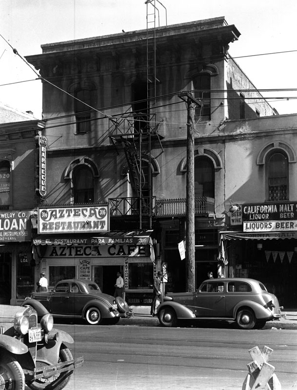
| (1939)^ - Exterior view of the old Bella Union Hotel, located at 314 North Main Street. Taken on May 4, 1939, the hotel had become a shadow of its former self. |
Historical Notes The Bella Union Hotel is considered to be the first hotel in Los Angeles. The building no longer exist, however the site it stood on was designated California Historical Landmark No. 656 (Click HERE to see more in Califronia Historical Landmarks in LA). Below is what the hotel looked like in the 1860s. |
 |
|
| (ca. 1867)^ - The Bella Union at 314 N. Main St. later became the St. Charles Hotel. To the left is the original home of Farmers and Merchants Bank, later merged into Security Pacific Bank. Standing on the balcony is Mrs. Margarita Bandini Winston, owner of the hotel. |
.jpg) |
|
| (ca. 1920)^ - View of the buildings on the east side of Los Angeles Street, in Chinatown. Address shown is 434 Los Angeles Street. |
 |
|
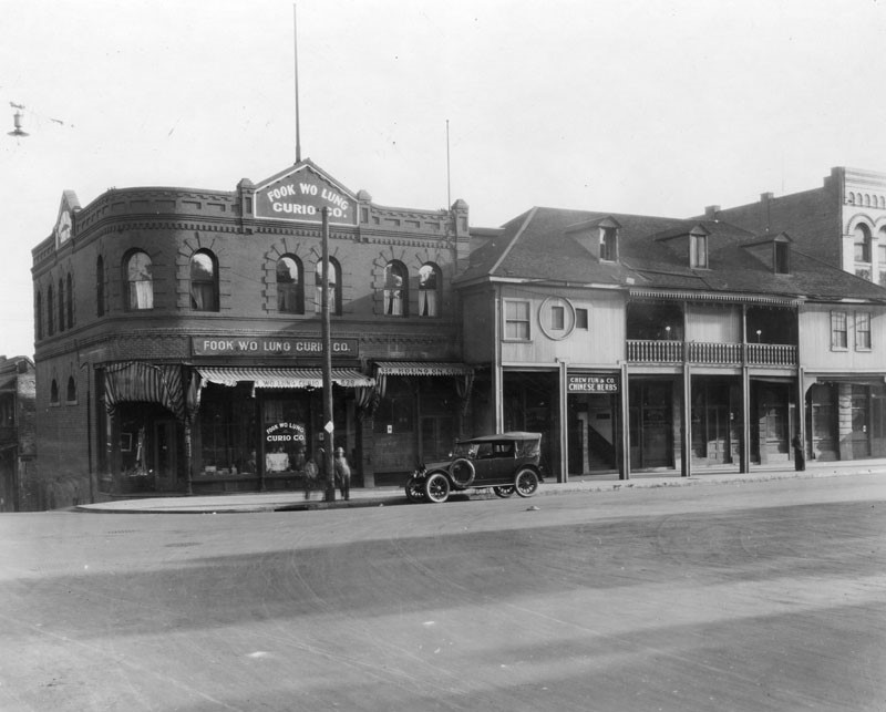
| (ca. 1920)^ - Shops on Los Angeles Street at Marchessault. Shown are the Fook Wo Lung Curio Co., at 526-528, next to Houng On Company, at 524, and Chew Fun and Company, Chinese herbs in the old Vincent Lugo Adobe at right. The LA Plaza is out of view to the right, on this side of Los Angeles Street. |
 |
|
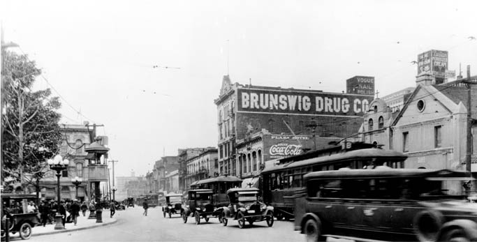
| (1920)*#^^ - View of Main Street, includes the Old Plaza Church and Brunswig Building (Brunswig Drug Company) on the right and the Plaza and Pico House on the left. Heavy traffic, antique cars and trolley cars. |
Historical Notes Note the elevated kiosk on the edge of the plaza to the left ot the photo. Elevated booths like these were used by the Los Angeles Railway and the Yellow Cars as a switchman’s tower to control the flow and path of streetcars through the intersection. Many of these were still standing well into the 1920s. |
 |
|
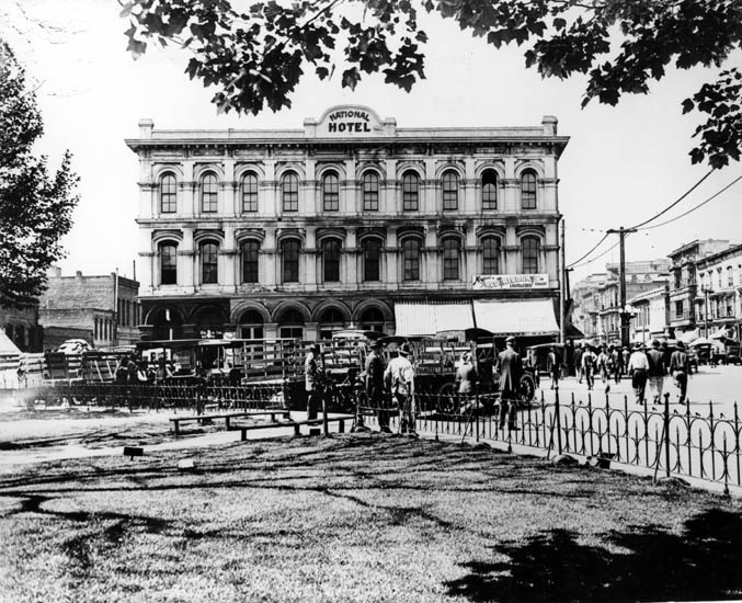
| (ca. 1920)*#^^ - View of the Pico House as the National Hotel from the Plaza circa 1920. |
Historical Notes In 1880, Pio Pico lost the hotel by foreclosure. From 1892-1920 the building was called the National Hotel.^#^^ |
 |
|
| (1921)^ - View of Sanchez Street, lined with brick buildings, looking north toward the Plaza in 1921. The first building at far left is the rear side of the Pico House and the rear side of the Merced Theater. |
Historical Notes Sanchez Street juts south from the plaza, opposite its more famous twin, Olvera Street, on the north side. It's just a block long, but it's seen a lot of history. In the 1880s and '90s, it was the scene of several crimes reported in The Times. Most involved the local saloons and Chinese gangs of the day, including the 1889 shooting death of the "Peruvian Princess," a woman whose tortured life took her from Lima to China to San Francisco and finally to her death in a Sanchez Street boarding house. In 1914 police fought protesters on Sanchez Street during the Christmas Riot. A member of the International Workers of the World, or Wobblies, was shot and killed.*^## |
 |
|
| (1920s)** - View looking south toward the L. A. Plaza on Olvera Street before improvement. On the left the Avila Adobe is seen. To the right is the Sepulveda House with a gas pump on its side. |
Historical Notes The Avila Adobe was built ca. 1818 by Don Francisco Avila, alcalde (mayor) of Los Angeles in 1810. Used as Commodore Robert Stockton's headquarters in 1847, it was repaired by private subscription in 1929-30 when Olvera Street was opened as a Mexican marketplace. It is the oldest existing house in Los Angeles. The Sepulveda House is a 22-room Victorian house built in 1887 in the East lake style. The original structure included two commercial businesses and three residences and fronts both Main and Olvera streets.*^ |
Click HERE to see more in Early Views of the Los Angeles Plaza |
* * * * * |
Downtown LA
 |
|
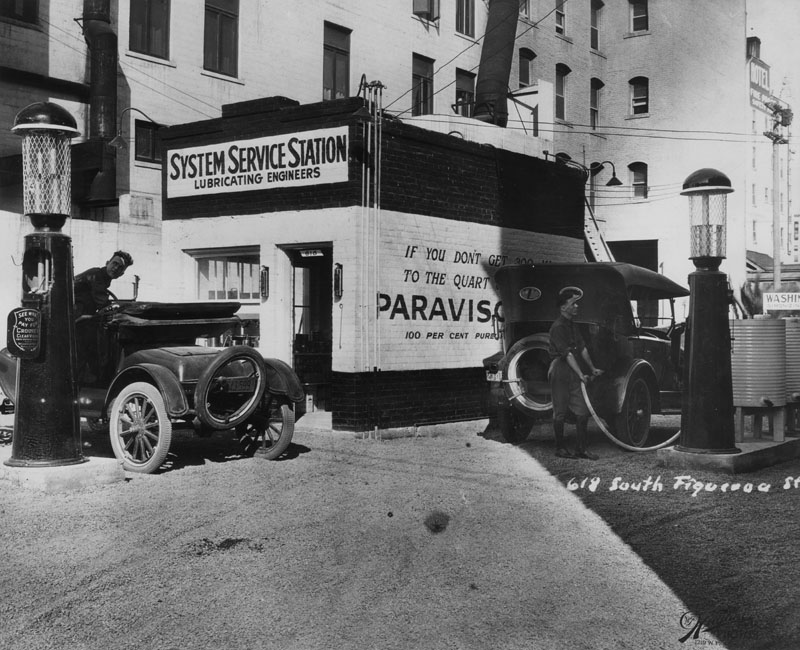
| (ca. 1920)^ - Two men are pumping gas into their cars from "Crouse Clear Vision: see what you pay for" pumps at the System Service Station at 618 South Figueroa St. One car, left, has its top down. Both cars have spare tires attached to the back. The small, brick, one-story service station is painted in three stripes with "Lubricating Engineers" under the station name and a painted advertisment for "Paravision" on the side. The service area is paved in gravel and far right is a partial sign for "Simonizing". Multi-storied buildings are directly behind the station and in the background, left, is a hotel advertized as "fire proof". |
Click HERE to see more Early Views of LA Gas Stations |
 |
|
| (ca. 1920)^ - Pedestrians and a traffic cop face off at the intersection of Hill and 8th St. According to the Union Bank & Trust clock, it's 1:30 in the afternoon. On the left, awnings from The Owl Drug Co., Van de Kamp's Bakery and Ted's Tie and Robe Shop shade the sidewalk. "Herberts Cafe" vertical sign edges the Jewelers Building, center. The Alhambra Theater in the Edward D. Silent Building advertises the "Love Doctor, a Talkie" in its marquee. Another vertical sign, this one for Birch and Smith Furniture Co., is just before the theater. |
 |
|
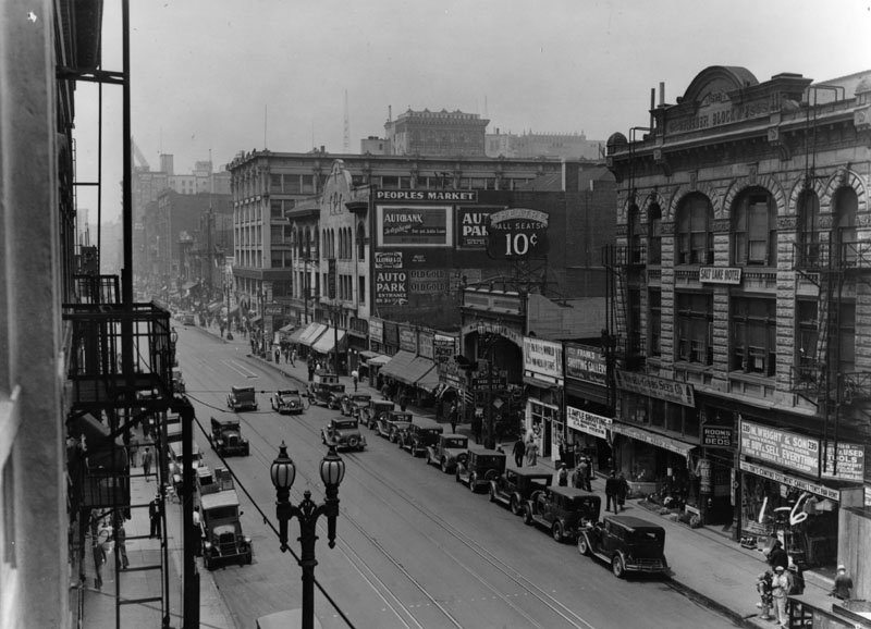
| (ca. 1920)^ - The Rueder Block No. 2, 1892, building houses the Salt Lake Hotel and various retail stores, such as Winsel Gibbs Seed Co. and M. Wright & Son, who claims "we buy & sell everything from a needle to a battleship". A shooting gallery, vaudeville theater (all seats 10 cents) and an auto park (entrance on 3rd) are some of the retail businesses active on this busy street. |
 |
|
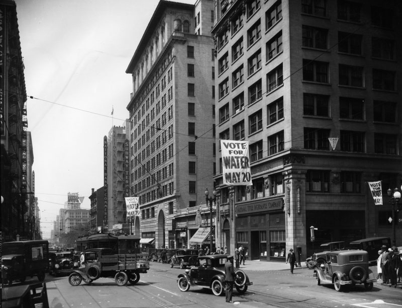
| (ca. 1925)^ - "Vote for Water, May 20" banners span Hill Street as a white-gloved cop waves traffic through Hill & 4th intersection. Buildings are: Pershing Square Building, left; Subway Terminal Building, center; National Bank of Commerce Building next to Subway. |
Historical Notes In 1913 the Los Angeles Aqueduct was completed and the City had a new source of water. L.A. proceeded to annex outlying communities attracted by the promise of an abundant water supply. The flurry of annexations began even before the aqueduct was complete. Between 1910 - 1930, The area of Los Angeles increases from 115 sq. miles to 442 sq. miles through annexations of surrounding areas (i.e. Hollywood is annexed in 1910, the San Fernando Valley is annexed in 1915). The City's population increased from 533,535 (1915) to 1,300,000 (1930).*^ |
Click HERE to see more in Water in Early Los Angeles |
 |
|
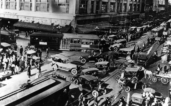
| (ca. 1920)^ - Streetcars, automobiles, horse-drawn carriages, and pedestrians clog the intersection of Broadway and 7th Street. |
Historical Notes Traffic jams in downtown Los Angeles started early in this century. This picture was taken sometime in the 1900's to 1920's, and already the trolleys, cars and horses and carriages are going every which way they can in the middle on the street. On the far (northwest) corner of Broadway is the Bullock's Dept. store.^ |
 |
|
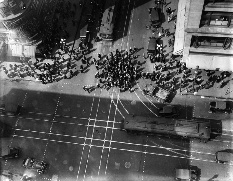
| (1920s)^ - A view of the intersection of 7th and Broadway taken from directly overhead showing throngs of people crossing the street. On the top left (southwest) corner is the Loew's State Theatre. |
Historical Notes Los Angeles' population continued to grow. By 1920 it was 576,700, an 81% increase over what it was 10 years earlier (319,200).*^ |
 |
|
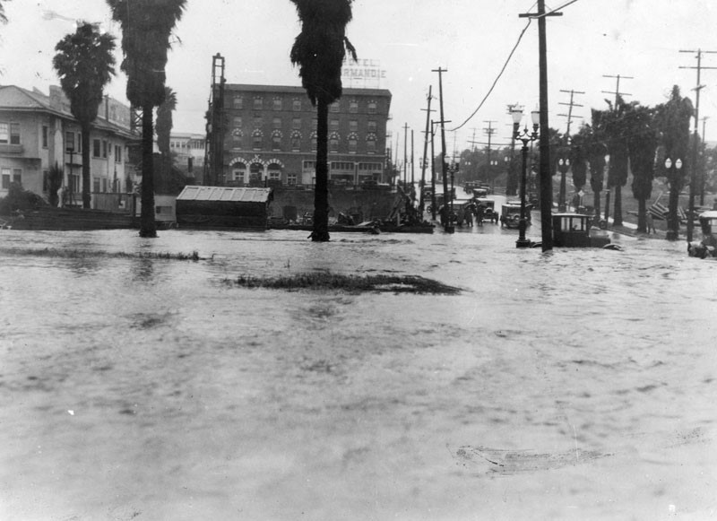
| (ca. 1922)^ - View of 6th Street and Mariposa Avenue, looking toward the Hotel Normandie, across a lake of water. |
 |
|
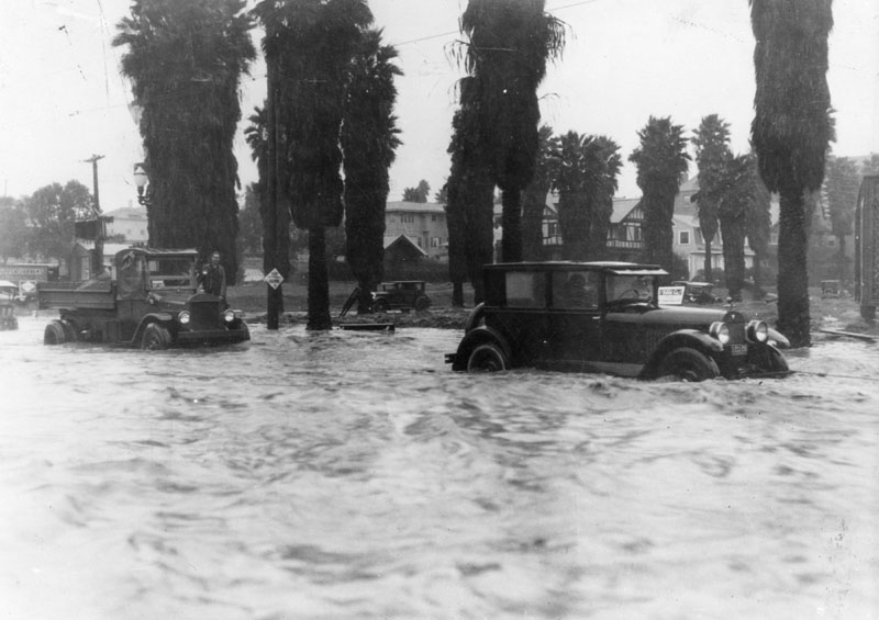
| (1920s)^ - Vehicles in the flooded intersection of 6th Street and Mariposa Avenue before the building of a storm drain. |
 |
|
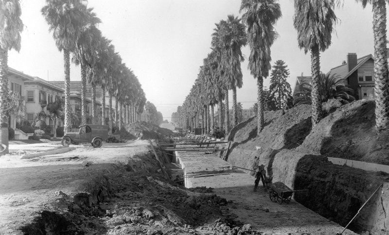
| (1927)^*^** – View showing the construction of a storm drain on Mariposa Avenue, looking north from Wilshire Boulevard. |
 |
|
| (ca. 1920s)^ - Panoramic view of the intersection of Olive and 7th Streets, looking south. At right is the building originally built as the Ville de Paris Department Store circa 1917, then remodeled in 1940 as the Merchandise Mart to accommodate various wholesale businesses. At left is the Los Angeles Athletic Club building. A number of streetcars, as well as cars, are on the street. |
 |
|
| (1922)^^ - View looking south on Olive between 7th and 8th streets. The new Pacific Telephone Co. building is under construction on east side of Olive Street. |
 |
|
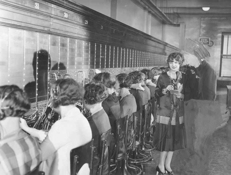
| (1930)*^^* - “Operator, may I help you". Before you had to press a zillion buttons to get through to a human, these women did it for you on a switchboard! View is of the switchboard at Pacific Telephone Company in Los Angeles located at 716 S. Olive Street. |
 |
|
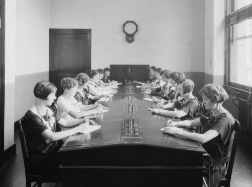
| (ca. 1925)^^ - Photograph of women operating the communication switchboard at The Broadway Department Store located on the corner of 4th and Broadway. |
 |
|
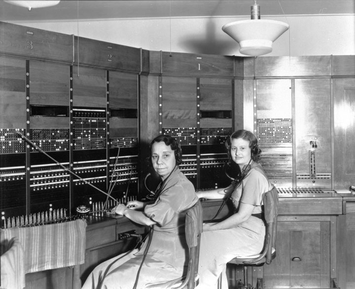
| (ca. 1930s)* - Early Telephone Exchange in the Bureau of Power and Light commercial building in downtown L.A., with telephone operators Alma McKnight (left) and Doris Scott (right). |
Click HERE to see more in Early Views of Commercial, Bureau of Power and Light (DWP) |
* * * * * |
San Fernando Valley
 |
|
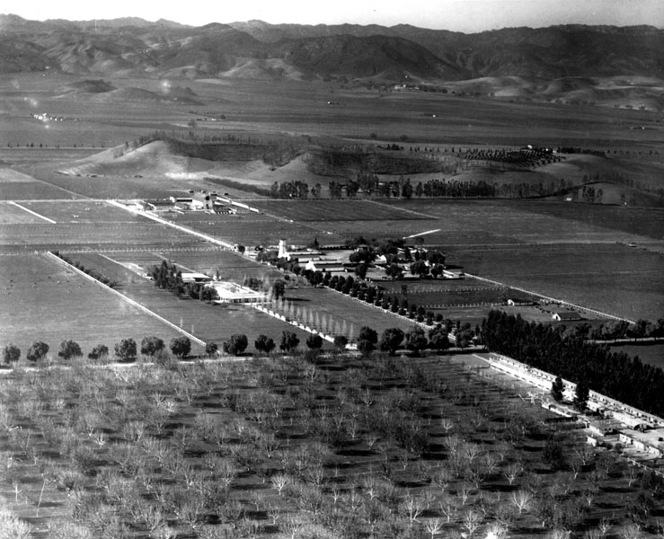
| (ca. 1920)^ - View of Ventura Boulevard in Sherman Oaks, in the San Fernando Valley. |
 |
|
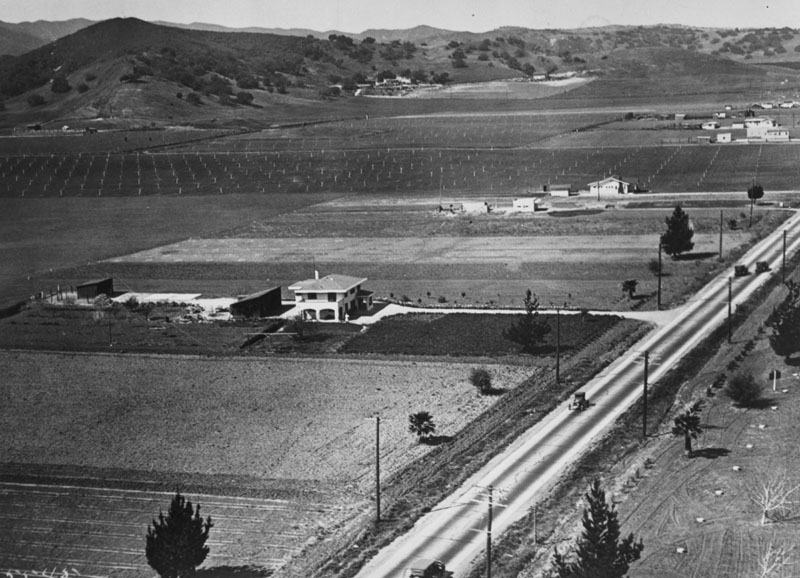
| (ca. 1920s)^ - Aerial view of farms and fields in Canoga Park in the San Fernando Valley. |
Click HERE to see more in Early Views of the San Fernando Valley |
* * * * * |
Inceville
.jpg) |
|
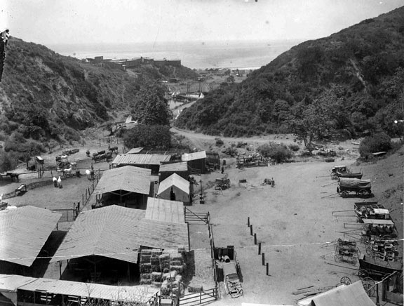
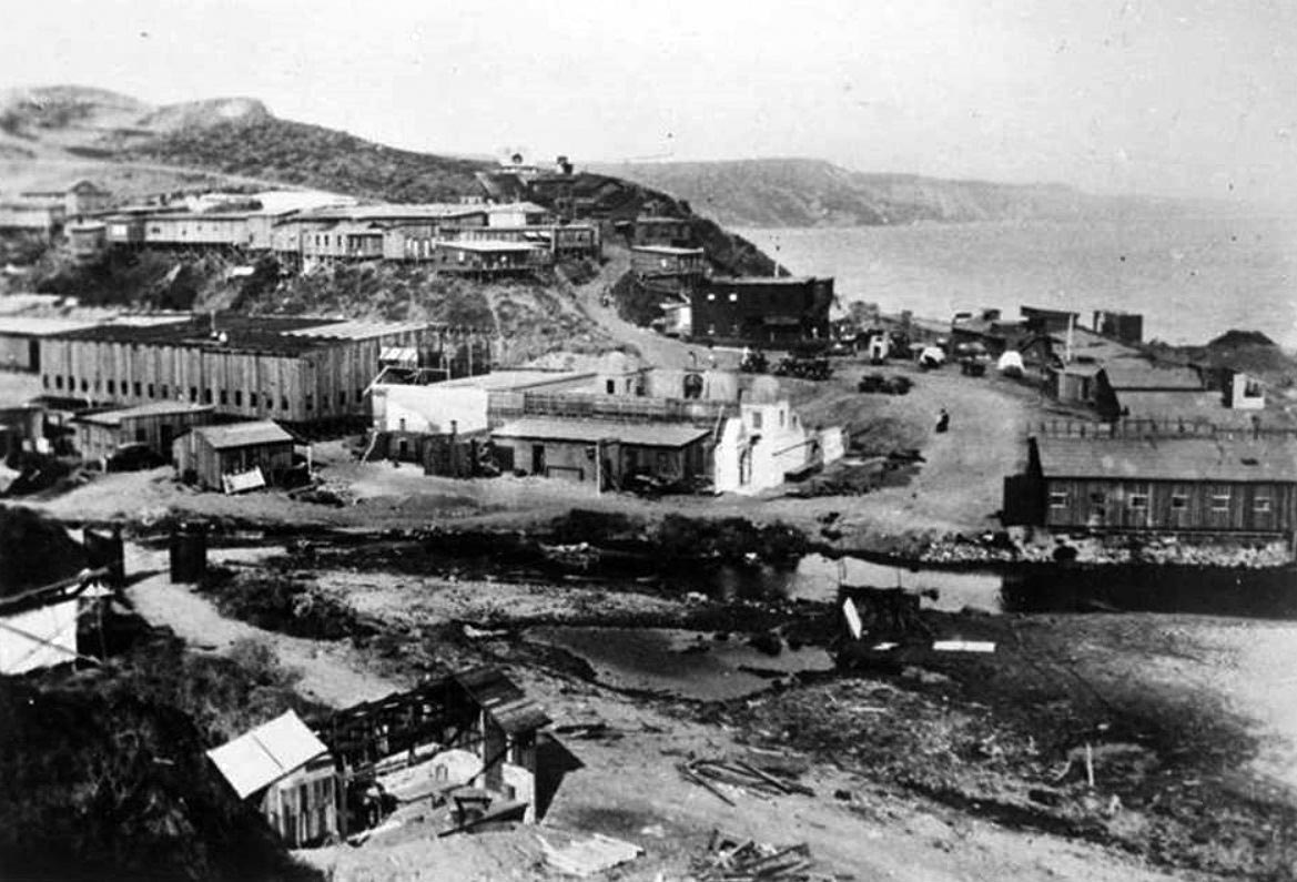
| (ca. 1915)#^# - View from the Palisades looking toward Malibu showing Inceville, the famed motion picture studio founded by Thomas Ince. |
Historical Notes In 1911, film director Thomas Ince created his Western film factory, "Inceville," which at its peak employed nearly 600 people.*^ |
 |
|
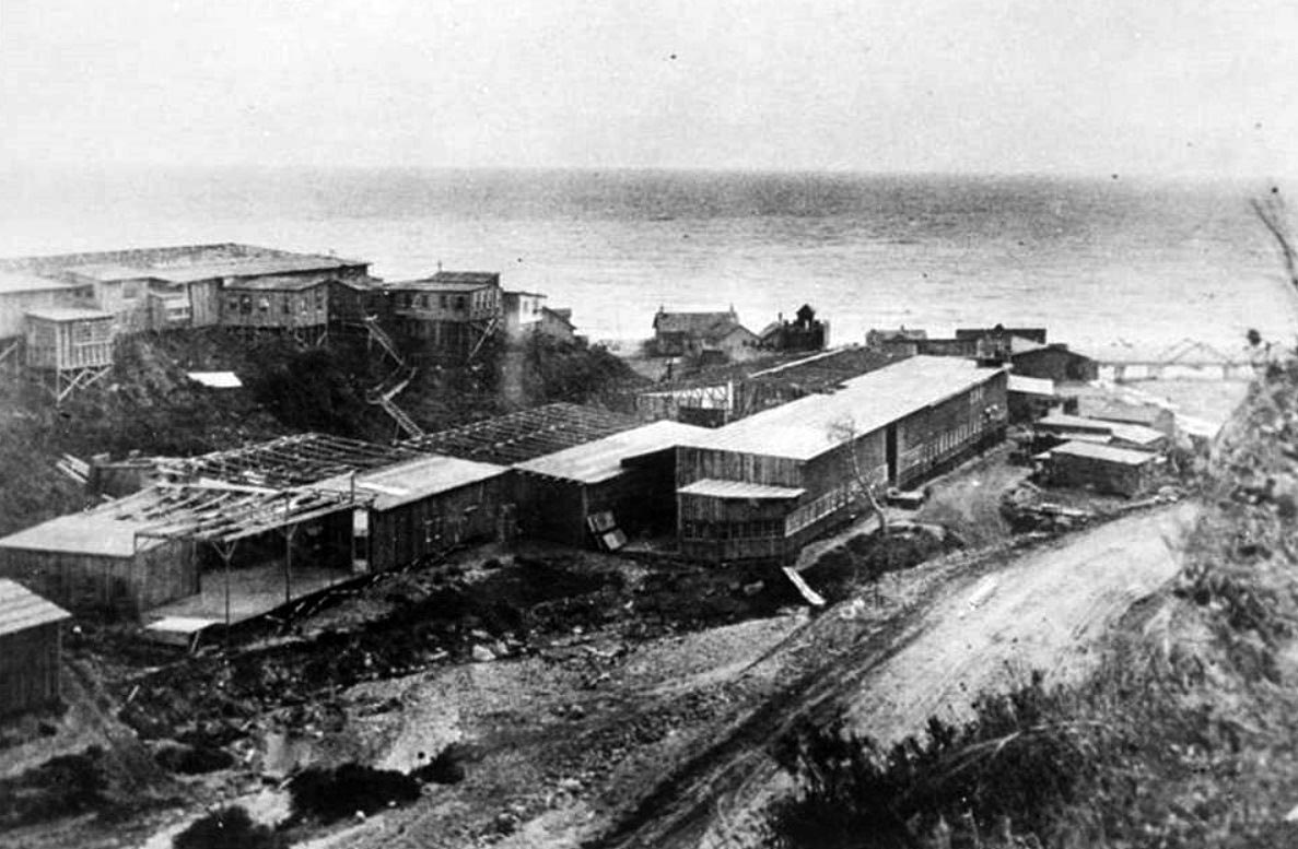
| (1915)^ - View of Inceville, on Sunset Boulevard (Santa Ynez Canyon) at the Pacific Ocean, where Ince Studios filmed location scenes. |
Historical Notes Ince leased 18,000 acres of land extending from the seashore up Santa Ynez Canyon and into the mountains for 7-1/2 miles. While he was building the frame-structured studio buildings, situated where Gladstone’s Restaurant is today, he also hired Miller’s 101 Ranch Wildwest Show, including many cowboys, animals and a Sioux Indian tribe, who set up their teepees on the property.^#^ |
 |
|
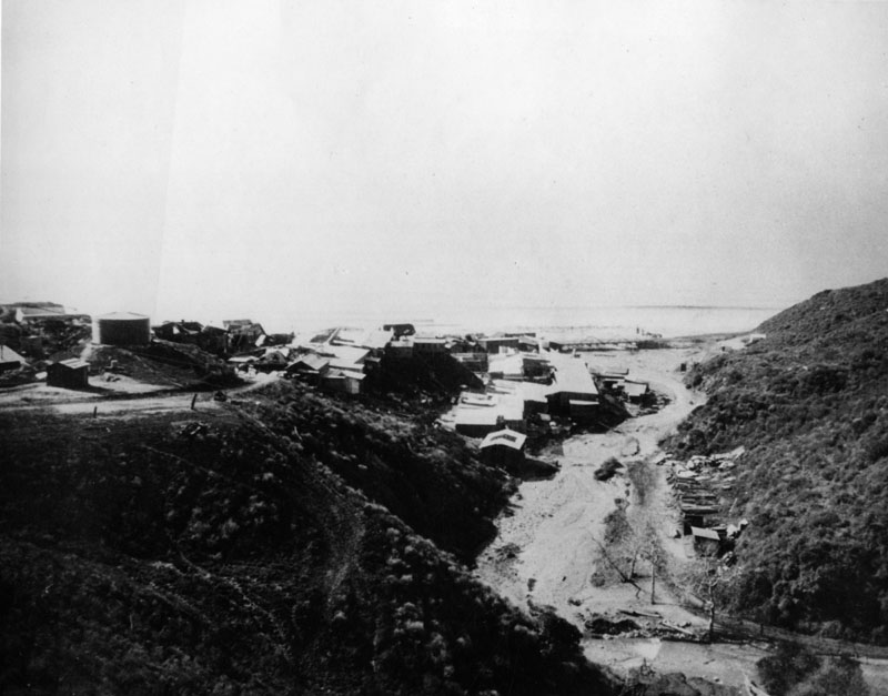
| (ca. 1916)^#^ - The mouth of Santa Ynez Canyon at the Pacific Ocean was once home of Inceville, an early 1900s film studio built by film director Thomas Ince. |
Historical Notes Most of the cowboys, Indians and assorted workmen lived at Inceville, while the actors came from Los Angeles and other communities as needed, taking the red trolley cars to the Long Wharf at Potrero Canyon, where buckboards conveyed them to the set. Ince lived in a house that overlooked Inceville, the location of Marquez Knolls today.^#^ |
 |
|
| (1916)#^# – View showing the Inceville Studios built by silent film producer Thomas H. Ince at the mouth of Santa Ynez Canyon. |
 |
|
| (1916#^# - Looking down Sunset Boulevard with a view of silent film producer Thomas Ince's Inceville Studios in Santa Ynez Canyon. |
 |
|
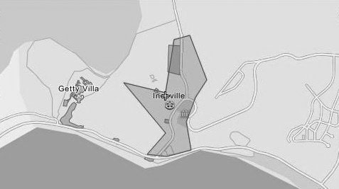
| (n.d.)*^ - Map showing the location of Incville relative to where Sunset and PCH are situated today. |
Historical Notes By 1916, Ince was supervising eight directors and releasing one five-reel picture (about 50-minute films) each week at an average cost of $40,000. His film ‘Civilization,’ which employed over 25,000 extras, was by far his most ambitious endeavor. The set for the mythical city stood alone on the barren hills, where Marquez Elementary School is today. It was built by 60 carpenters over a period of three months at a cost of $80,000 and was used for only 100 feet of film.^#^ |
 |
|
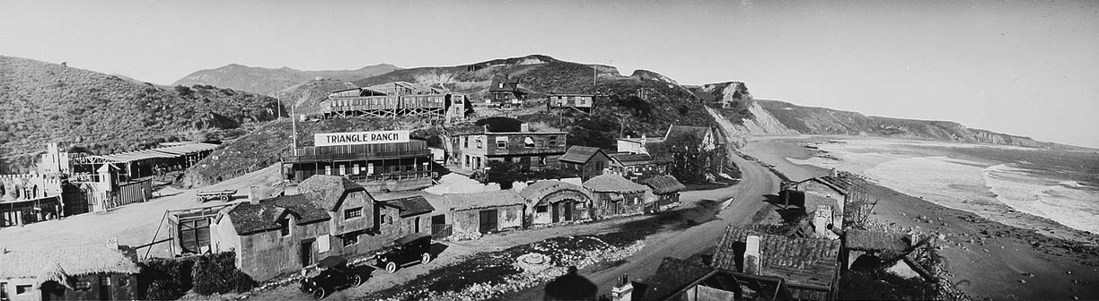
| (ca. 1916)*^ - View of houses and stage sets at Incville. Large sign on one of the buildings reads: Triangle Ranch. |
Historical Notes Incville's cost continued to rise as moviegoers enjoyed the more expensive feature films, which used five reels or more. Ince, through his alliance with Triangle, a production company founded by D. W. Griffith and Mark Sennett, built a new studio in Culver City to use for indoor movies, while retaining Inceville for outdoor locations and Westerns. Ironically, on January 16, 1916, a few days after opening of his Culver City studio, a fire broke out at Inceville, the first of many which would eventually destroy all of the dry frame buildings. That same year, Ince gave up on Inceville and sold it to Hart, who renamed it Hartville. Three years later, Hart sold the lot to Robertson-Cole, which continued filming until 1922.^#^ |
 |
|
| (ca. 1915)*^#^ - View showing a man standing on a bridge leading to Inceville Movie Studio village on the beach at Pacific Palisades in Santa Monica. A sign on the bridge reads "Take this newly completed scenic drive Santa Monica Los Angeles." |
* * * * * |
Please Support Our CauseWater and Power Associates, Inc. is a non-profit, public service organization dedicated to preserving historical records and photos. We are of the belief that this information should be made available to everyone—for free, without restriction, without limitation and without advertisements. Your generosity allows us to continue to disseminate knowledge of the rich and diverse multicultural history of the greater Los Angeles area; to serve as a resource of historical information; and to assist in the preservation of the city's historic records.
|
For more Historical Los Angeles Views click one of the following:
For Other Historical Views click one of the following:
See Our Newest Sections:
To see how Water and Electricity shaped the history of Los Angeles click one of the following:
Water:
Power:
* * * * * |
References and Credits
* DWP - LA Public Library Image Archive
^ LA Public Library Image Archive
^*The Valley Observed: Street Name Origins; Timeline of Valley History
*# blogdowntown: Third Street Tunnel
#* About.Com: History of Electric Vehicles
#+Facebook.com: Classic Hollywood/Los Angeles/SFV
#**U.S. Geological Survey Photographic Library
+**You-are-here.com: Buena Vsta-Broadway Bridge
+*^Daily Breeze: Redondo Beach's Endless Pier
+##Anna Sklar, Brown Acres - An Intimate History of the Los Angeles Sewers (Santa Monica, CA: Angel City Press: 2008). Original photos from the City of Los Angeles Archives/City of Los Angeles Bureau of Engineering.
++^Flickr.com: 2nd Street Tunnel
#*^Library of Congress: Brand Boulevard, ca. 1915
*##LA Times: Dig Into History You'll Find Snake Oil; Historic Bridge to Downtown Reopens; First Car Through Hill Street Tunnel; 2nd Street Tunnel Opens
^##Metropolitan Transportation Library and Archive
###Denver Public Library Image Archive
#^#Santa Monica Public Library Image Archive
#++Facebook.com: Los Angeles Streets and Boulevards
*#*Historical Los Angeles Theatres: The Philharmonic Auditorium; Downtown Theatre; Quinn's Superba; Lyceum Theatre
^#^Noirish Los Angeles - forum.skyscraperpage.com; Windsor Square Aerial; Victoria Park; LARy Driver; Inceville - Inceville - palipost.com; Redondo Beach
*^#LincolnHeightsLA.com: Legion Ascot Speedway
**#KCET - Lost Tunnels of Downtown LA; A Brief History of LA Bridges; When L.A.'s Most Famous Streets Were Dirt Roads; How Oil Wells Once Dominated Southern California's Landscape; Three Forgotten Incline Railways; A Brief History of Bridges in Los Angeles
*#^History of Hermosa Beach - Maureen Megowan
^#*City of Redondo Beach HIstory
^^*Early Downtown Los Angeles - Cory Stargel, Sarah Stargel
***Los Angeles Historic - Cultural Monuments Listing
**^Historicechopark.org: Echo Park Lake
^*#California State Library Image Archive
*^*California Historical Landmarks Listing (Los Angeles)
*^^Nuestra Señora la Reina de los Ángeles: losangelespast.com; Pinterest: losangelespast.com
^^^Aerofiles - US Aviation Firsts
***^Oviatt Library Digital Archives
^**^Pinterest: Splinters n Speed; Cars - Bertrand Lacheze; Beverly Boards Motorcycle Racing
*^^^Highland Park - amoeba.com
*^#^Huntington Digital Library Archive
^^^*Cinema Treasures: Quinn's Superba Theatre
^*^*Beverly HIlls Patch: The Beverly Hills Speedway
^#^^El Pueblo de Los Angeles Historical Monuments Listing
^^*#UCLA Library Digital Archive
^^^#Los Angeles Fire Department Historical Archive
*#^*USC Facebook.com
*#^^LAPL-El Pueblo de Los Angeles Historical Monument Photo Archive
*^*^Big Orange Landmarks: Cesar E. Chavez Avenue Viaduct
*^^*Vintage Los Angeles - Facebook: Pacific Telephone Switchboard
*^*#Santa Monica Beach Stories
^###Exposition Park History - Expositionpark.org
*^##LA Times: What's in a name? A family's history, Sanchez Street
*##*Chatsworth Historical Society
*#^#Flickr.com: Walking Over Santa Monica
^##^Glendale Historical Society
^#^*Facebook.com - City of Angels: Cyclone Racer
##^*Google Maps
##*^Ballona Blog
##++Facebook.com - Beverly Hills Heritage
^^^^Beverly Hills Board Track Racing
**^*# PlayaVistaProperties.com
^*^**Los Angeles City Historical Society
^*^*^Venice History: Roller Coasters and Carousels
*^*^*SantaMonicaPier.com
*^ Wikipedia: H.J. Whitley; Occidental College; Beverly Hills; Beverly Hills Hotel; Los Angeles Railway; Pershing Square; Broadway Tunnel: Isaac Van Nuys; Sawtelle; Port of Los Angeles; Tournament of Roses Parade; Angels Flight; Occidental College; Mt. Washington, LA; Broadway, LA; Hancock Park; La Brea Tar Pits; Los Angeles City Oil Field; Deadman's Island (San Pedro); Moses Sherman; Rose Bowl Game; Hollywood Hotel; Hollywood HIgh School; California Club; San Pedro; Salt Lake Oil Field - Gilmore Oil Field; Westwood; 2nd Street Tunnel; Hermosa Beach; Los Angeles Memorial Coliseum; Redondo Beach Pier; Redondo Beach; West Hollywood; Pacific Palisades; 1910 L.A. International Air Meet at Dominguez Hills; Hancock Park; Marlborough School; Beverly Hills Speedway; Santa Catalina Island; Palisades del Rey; Macy St. Bridge/Caesar Chavez Viaduct; Hollywood Bowl; Ford Model T; History of Los Angeles Population Growth; Quinn's Superba Theatre; Los Angeles Plaza Historic District; Windsor Square; Victoria Park; History of Santa Monica (Long Wharf); Marina del Rey; Glendale; World War I; Armistice Day; Atchison, Topeka and Santa Fe Railway; Hyperion Sewage Treatment Plant
< Back