Mystery History Answers (Oct. 2015)
Answer #1: Westlake Park (later MacArthur Park)
 |
|
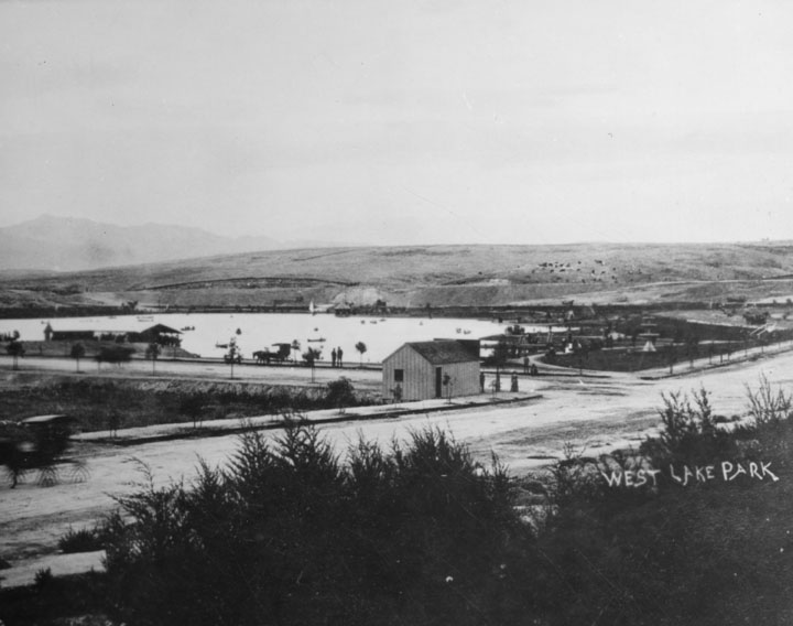
| (ca. 1880s)^* - Panoramic view looking northwest showing Westlake Park (now MacArthur Park) at the intersection of 7th and Alvarado streets. Alvarado runs diagonally from lower-left to center-right. The surrounding hills are devoid of homes and trees. |
Historical Notes The park, originally named Westlake Park, was built in the 1880s, along with a similar Eastlake Park, whose lake is artificial. Westlake Park was renamed MacArthur Park on May 7, 1942; Eastlake Park was renamed Lincoln Park. Originally Westlake Park and Eastlake Park (as well as Echo Park) were built as drinking water reservoirs connected to the city's systems of zanjas (small conveyance channels/trenches). When the city abandoned the non-pressurized zanja system for a pressurized pipe system, these smaller, shallow reservoirs located at low points no longer provided much benefit. They were then converted into parks.*^* |
 |
|
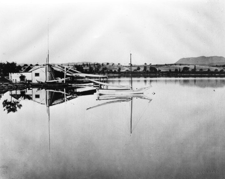
| (1880s)^* - View looking northwest showing Westlake Park and its boathouse with the Hollywood Hills in the background (top-right). |
 |
|
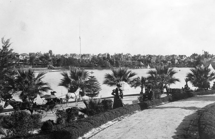
| (ca. 1895)^* - View of Westlake Park (now MacArthur Park) circa 1895. Transportation was still mostly by horse and carriage (lower left of picture) and ladies carried parasols to shade themselves from the sun. Multi-story homes fill the hill on the other side of the lake. A 150-foot tall streetlight stands in front of the row of homes. |
Historical Notes Wilshire Boulevard formerly ended at the lake on its west side, but in 1934 a berm was built for it to cross and link up with the existing Orange Street (which ran from Alvarado to Figueroa) into downtown Los Angeles. Orange Street was renamed Wilshire and extended east of Figueroa to Grand Ave. This divided the lake into two halves; the northern one was subsequently drained.*^* |
 |
|
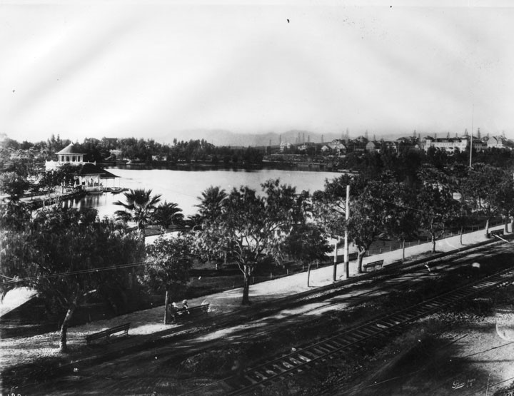
| (1907)^* - View looking northeast of Westlake Park (later McArthur Park) from 7th Street. A tree-lined walkway with benches is seen on the edge of the park. Trolley tracks run down an unpaved 7th Street. Oil derricks are seen in the hills across the lake. |
Historical Notes In 1890, Edward Doheny struck oil south of Angelino Heights and Echo Park, triggering the city’s first oil boom. Soon, hundreds of wells were pumping away in a wide belt stretching roughly south of Temple Street. For decades the wells would change the landscape of the City.*** Westlake Park was renamed MacArthur Park on May 7, 1942. Click HERE to see more Views of Westlake Park (MacArthur Park) in the 1920s + |
 |
|
| (ca. 2010)**** - View of MacArthur Park (formerly Westlake Park) with the Los Angeles Downtown skyline in the background. |
Historical Notes in 1972, MacArthur Park was designated city of Los Angeles Historic Cultural Monument #100. |
Answer No. 2: Echo Park
 |
|
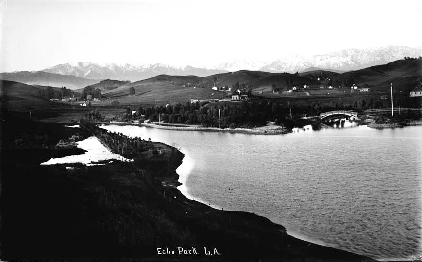
| (1895)^## - View of Echo Park with snow-capped peaks in the distance and rolling countryside all around. |
Historical Notes Echo Park Lake didn’t start out as a man-made lake. Instead, its earliest use by the city was as a reservoir, storing water in a section sometimes known as the city’s “West End.” In those years this area was thought of as the city’s west side.**# |
 |
|
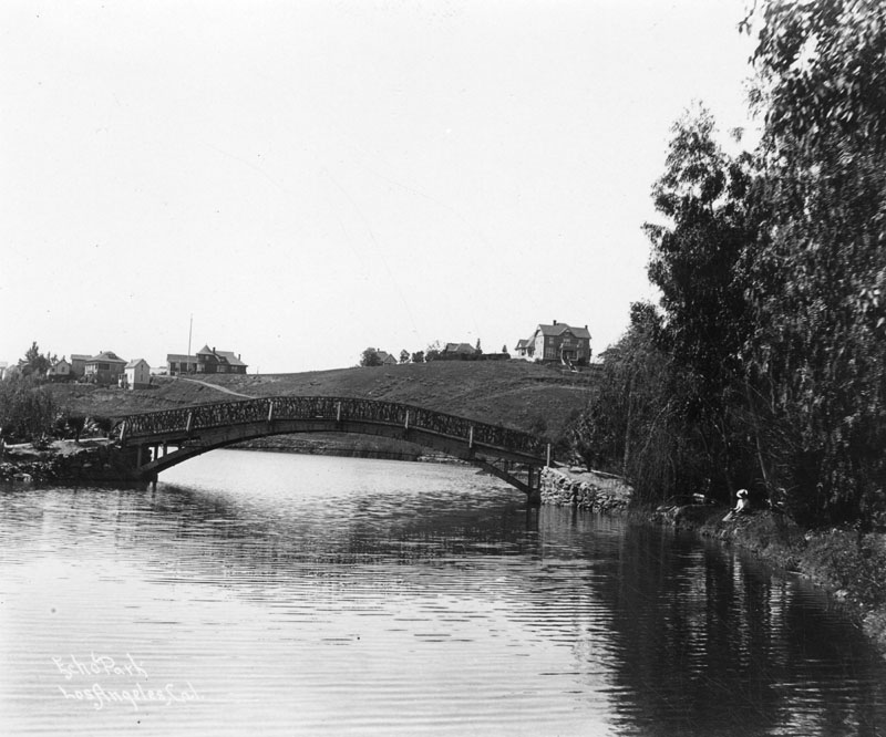
| (1900)* - Wooden bridge over Echo Park Lake as it looked at the turn of the century. Note the homes on the hillside behind the bridge and the woman with the hat relaxing alongside the lake. |
Historical Notes The Los Angeles Canal and Reservoir Co. formed Reservoir No. 4 in 1868. The company obtained the water by digging a ditch that sent water flowing from the Los Angeles River – in the area now known as Los Feliz – along a zigzag path that emptied into the reservoir.**# |
 |
|
| (ca. 1900)^* - View of a woman seated on a bench by Echo Park. Behind her can be seen two men standing by their bicycles on an ornate bridge. |
Historical Notes Legend says the lake got its name after workers building the original reservoir said their voices echoed off the canyon walls.**# |
 |
|
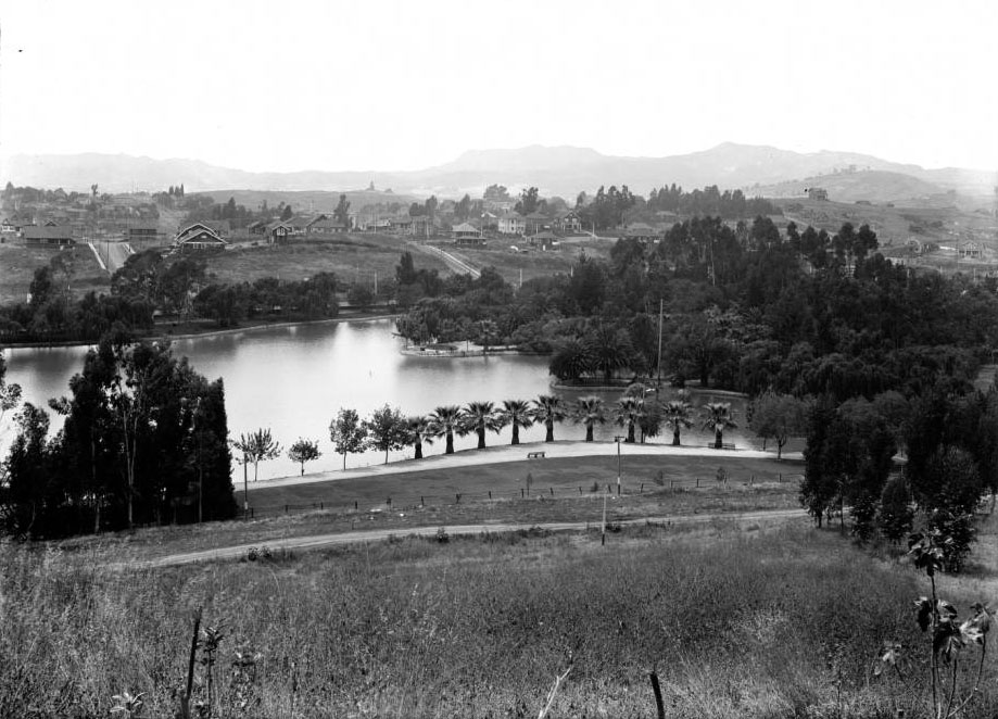
| (1911)#* - View of Echo Park looking northwest toward Hollywood. |
Historical Notes In the late 1880s, a carriage maker turned real estate developer, by the name of Thomas Kelley, teamed up with other investors to purchase about 70 acres that included Reservoir No. 4—what is now Echo Park Lake. Kelley and his business partners sold off pieces of what they called the Montana Tract to individuals who built the business district along Sunset Boulevard and the densely packed homes and apartments that surround Echo Park Lake.**# |
 |
|
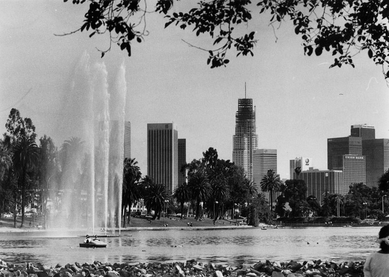
| (1989)^* - Panoramic view of Echo Park Lake on a bright sunny day. The city's skyline can be seen clearly in the background. |
Click HERE to see more Early LA Water Reservoirs |
* * * * * |
References and Credits
* DWP - LA Public Library Image Archive
^*LA Public Library Image Archive
^##California State Library Image Archive
**#Historicechopark.org: Echo Park Lake
*^*Wikipedia: MacArthur Park (Westlake Park)
***Theeastsiderla.com: Angelino Heights Oil Boom
****Pinterest.com: MacArthur Park w/Downtown Skyline;
< Back
Menu
- Home
- Mission
- Museum
- Mulholland Service Award
- Major Efforts
- Board Officers and Directors
- Positions on Owens Valley and the City of Los Angeles Issues
- Legislative Positions on
Water Issues
- Legislative Positions on
Energy Issues
- Recent Newsletters
- Historical Op Ed Pieces
- Membership
- Contact Us
- Search Index