Early Views of the San Fernando Valley
Historical Photos of the San Fernando Valley |
 |
|
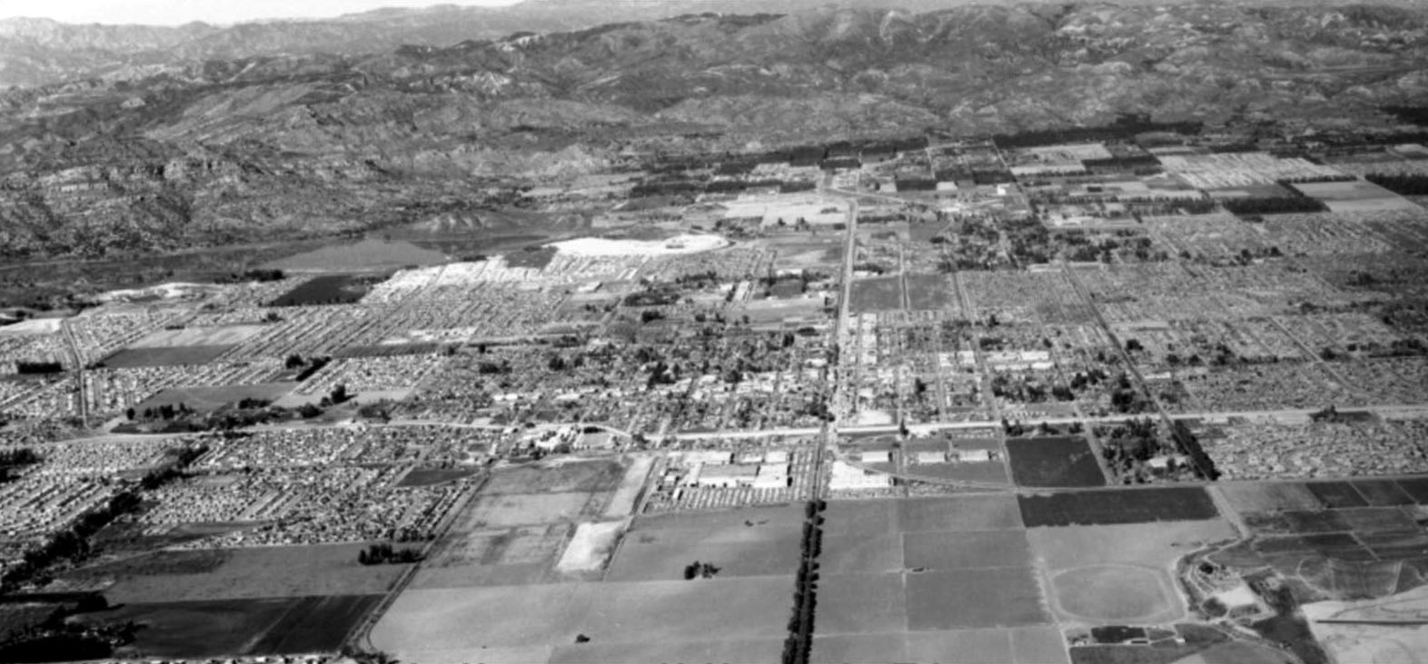
| (ca. 1962)* – Aerial view of the West San Fernando Valley looking north. Canoga Avenue runs down the middle of photo. Note all the undeveloped land in the foreground. Most of it was part of the Warner Ranch. Also note the tree-lined Canoga Avenue at lower center. Photo courtesy of Rich Krugel |
Historical Notes In the 1960s, the area that is now known as Warner Center in Woodland Hills was primarily the private horse ranch of Harry Warner, one of the Warner Brothers of Warner Bros. Pictures. The ranch encompassed around 1,100 acres of land. Some key events and developments in the 1960s: In 1967, the Harry Warner family donated 20 acres of land from the ranch that became Warner Center Park (also known as Warner Ranch Park). In 1968, 630 acres of the ranch land was sold to Aetna Life and Casualty for $30 million for long-term investment and development purposes. Aetna later brought in Kaiser as a joint venture partner. Initial development of the Warner Ranch land began in the Canoga Park portion between Victory Boulevard and Vanowen Avenue, with the opening of Topanga Plaza in 1964 as the first enclosed shopping mall in California. Aerospace companies like Rocketdyne and Litton Industries also built facilities on the land. |
 |
|
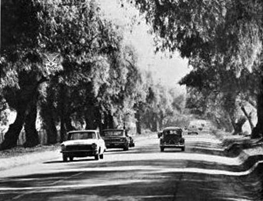
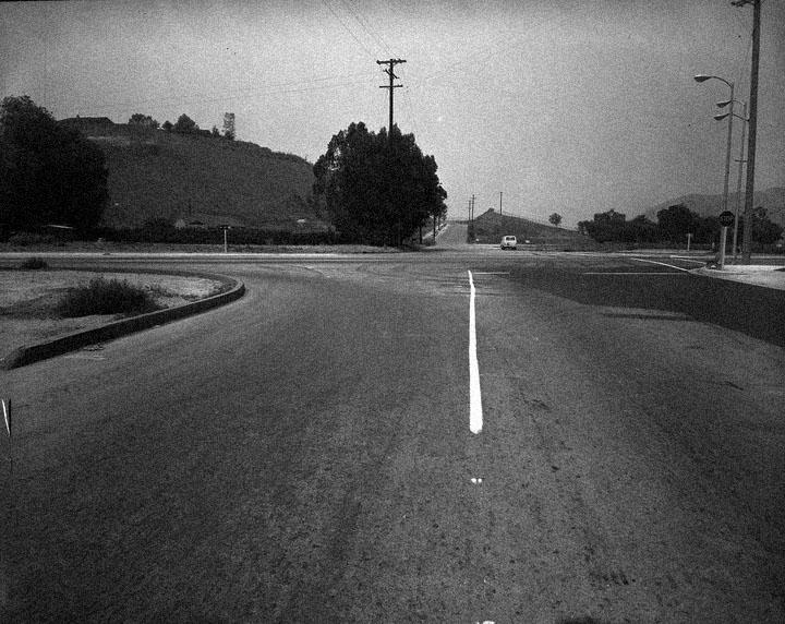
| (1964)* – View showing the pepper tree lined Canoga Avenue in Woodland Hills, between Victory and Ventura boulevards. |
Historical Notes A 1982 account in "The History of Woodland Hills and Girard" by Richard Cacioppo details how the original 1920s community of Girard came to be renamed Woodland Hills because of trees planted by developer Victor Girard. Girard marketed the arid 2,886-acre West Valley ranchland south of Ventura Boulevard as a weekend retreat for Los Angeles residents through his Boulevard Land Co. He realized it needed trees to have a real country look for potential buyers. Under Girard's plan, pepper trees were lined up along Canoga Avenue between Victory Boulevard on the north and Mulholland Drive on the south. When Warner Center was developed in the 1970s, the pepper trees between Victory and Ventura boulevards were chopped down to widen the two-lane street. ^^^ |
Litton Industries
 |
|
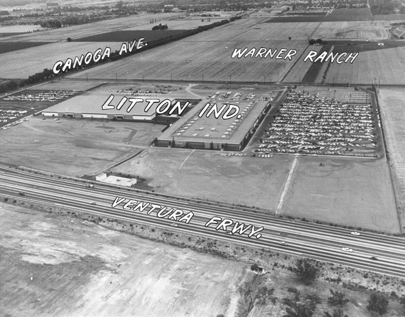
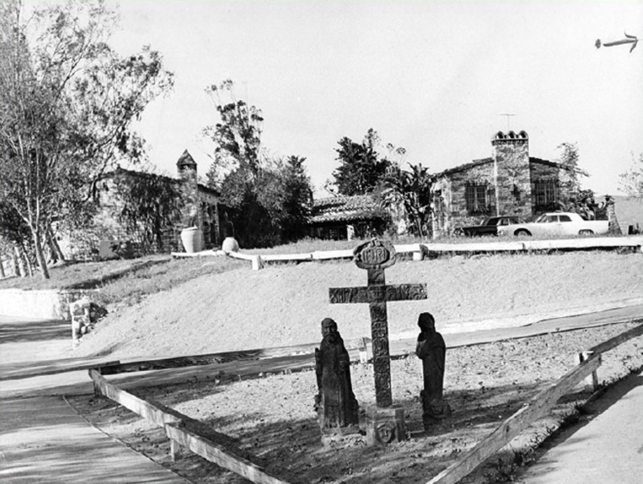
| (1961)* - Photograph caption reads: "Litton Industries will soon be joined by other firms in planned industrial complex". Photograph dated: Oct. 17, 1961 |
Historical Notes Named after inventor Charles Litton, Sr., Litton Industries was a large defense contractor. It started in 1953 as an electronics company building navigation, communications and electronic warfare equipment. They diversified and became a much bigger business, with major shipyards, etc., and even manufacturing microwave ovens. In 2001, Litton Industries was bought by Northrop Grumman Corporation. |
 |
|
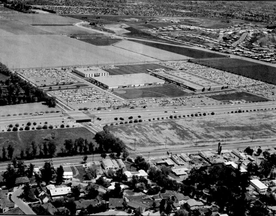
| (ca. 1962)^ - Aerial view looking northeast showing the Litton Guidance & Control Systems headquarters bounded by Canoga on the left (west), Burbank Blvd. (north), and Ventura Freeway (south). De Soto can be seen in the upper right of photo. |
Historical Notes Note the light traffic on the Ventura Freeway and the lack of any development between the freeway and Ventura Blvd., which itself was lightly developed back then along the south side and little more than a four-lane country highway. To the immediate left of the Litton property on the west side of Canoga Ave. stood the old Warner Ranch, often used in making movies. There were new housing developments on the east side of De Soto. Pierce College is to the north of the development and east of where De Soto eventually was put through, following the wash. Included on the Pierce property was the Warner House – on the knoll by the bend along the culvert east of where De Soto now runs. |
 |
|
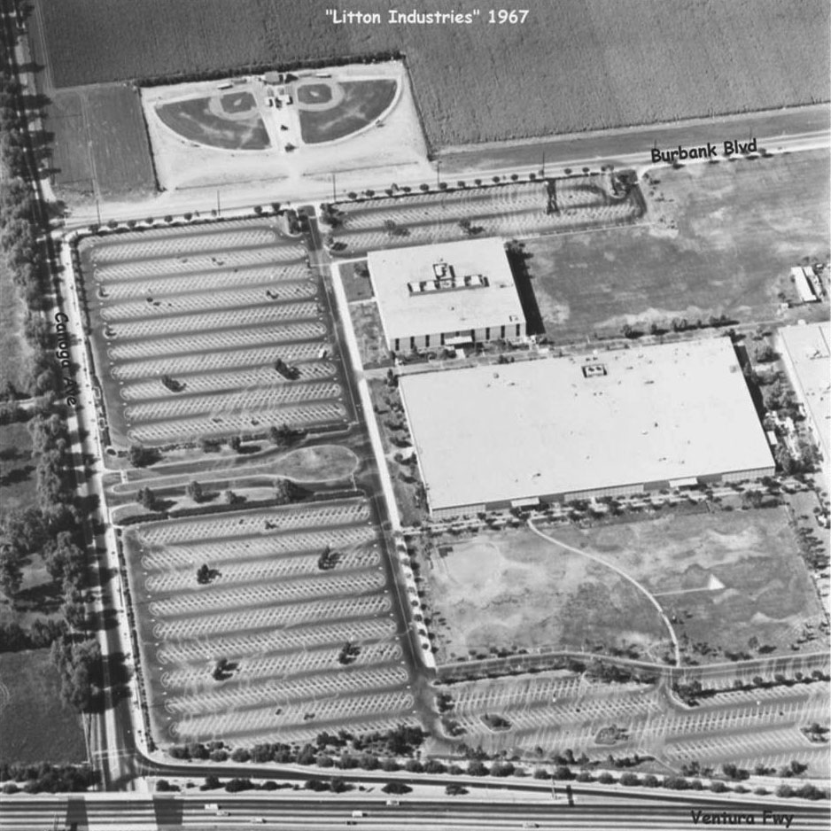
| (1967)^ – Aerial view showing a closer look at Litton Industries with street names annotated. Note the baseball fields north of Burbank Blvd. They were used by Sunrise Little League for years. |
Historical Notes By 1990, Litton Industries was a primary builder of large surface multi-mission combat ships for the US Navy. They were also providing much of the Navys overhaul, repair, modernization, ship design, and engineering as well, all for surface ships. By the early 1990s, Litton Industries was too large to manage as one unit. It split into separate military and commercial companies. The military arm continued to be called Litton Industries. The commercial business, which included oilfield services, business and automated assembly line operations, was renamed Western Atlas Inc. In April 2001, Northrop Grumman Corporation acquired Litton Industries for about 3.6 billion dollars. ##++ |
Then and Now
 |
|
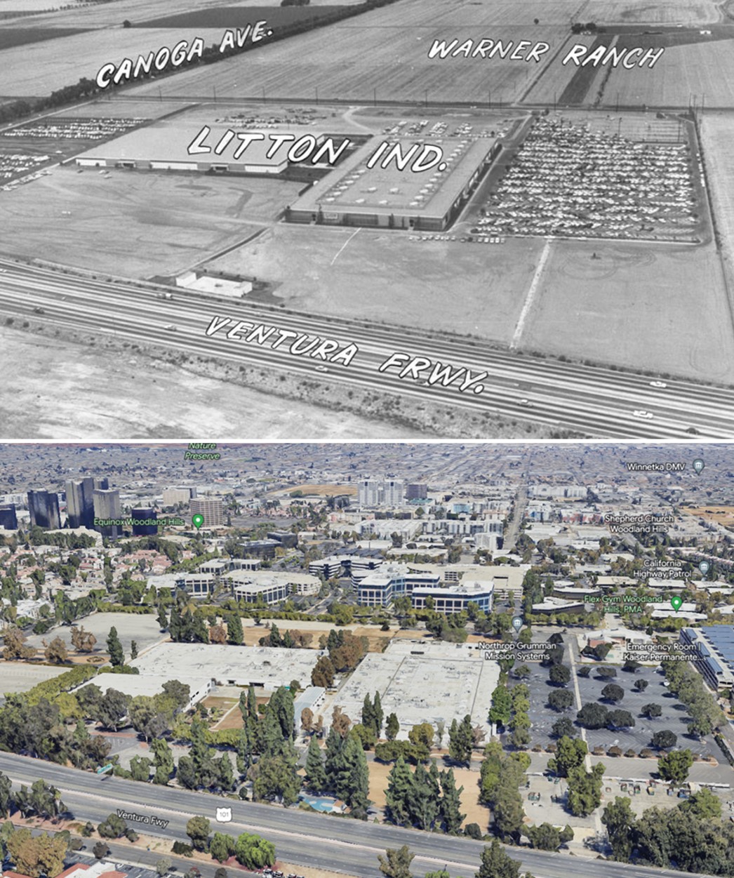
| (1961 vs 2022) – Litton Industries / Warner Center / Woodland Hills |
Farrell's Ice Cream
 |
|
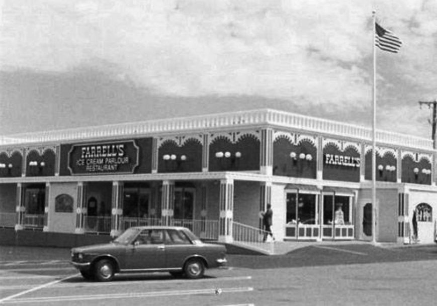
| (ca. 1970s)^ – View showing Farrell's Ice Cream Parlour Restaurant located at 10141 Reseda Blvd in Northrdige. Today, the Northridge Suit Outlet occupies this spot. Photo courtesy of the Museum of the San Fernando Valley. Click HERE to see contemporary view. |
Historical Notes Farrell's Ice Cream Parlour was started in Portland, Oregon, by Bob Farrell and Ken McCarthy in 1963. Farrell's became known for their offer of a free ice cream sundae to children on their birthday. The parlors had an early 1900s theme, with employees wearing period dress and straw boater hats, and each location featured a player piano.*^ |
 |
(ca. 1970s)^ - View looking north on Canoga Avenue showing a young man standing in front of the Farrell's Ice Cream Parlour's parking lot with the 101 Freeway on-ramp in the distance. Today, a Burger King stands near this location. Click HERE for contemporary view. |
|
 |
|
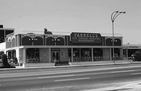
| (1978)* – Farrell’s Ice Cream Parlour on Van Nuys Boulevard in Van Nuys. Note the 3-headed streetlight in front of Farrell's. Van Nuys Boulevard was LA's brightest lit street in the 1970s (Click HERE to see more). |
Historical Notes In 1972, the Farrell's chain was purchased by the Marriott Corporation. By 1975, there were 120 Farrell's nationwide. Thereafter, sales dropped and most of the parlors were sold off in the 1980s. In 1982, Marriott sold the chain to a group of private investors. By 1990 almost all Farrell's locations had closed.*^ Seven Farrell's Restaurants still exist today, 6 in California and 1 in Hawaii. The closest one to the San Fernando Valley is located in Santa Clarita. |
Central San Fernando Valley
 |
|
| (1961)^ – Aerial view looking north along Sepulveda Boulevard (Then Hwy 7) showing central San Fernando Valley with no freeways in sight! Photo courtesy of Rich Krugel |
Kaiser Panorama City
 |
|
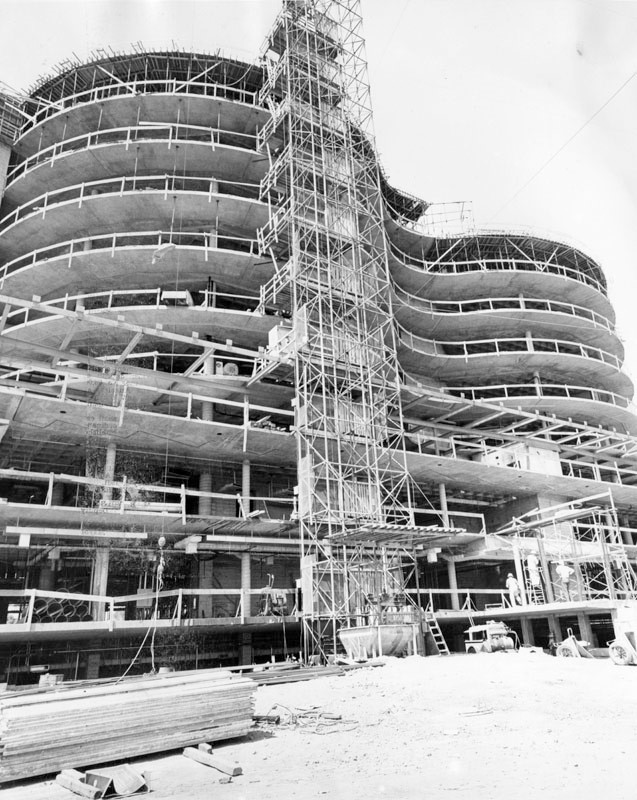
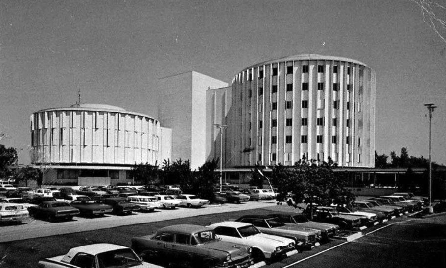
| (1961)* - Photograph article dated June 2, 1961 reads, "Binocular-shaped Kaiser Foundation Hospital is rapidly reshaping the skyline of Panorama City where it now towers 10 stories tall as vertical construction nears completion. The hospital will cost more than $6 million when completed. It is being built on a nine-acre site south of Roscoe boulevard on Woodman avenue at Cantara street." Photo from the Valley Times. |
Historical Notes In 1942, Henry Kaiser built a steel mill in Fontana to supply steel for the ships he was building to help America win the war. When he learned that his workers couldn’t get adequate health care, he built a hospital and medical offices right on the steel mill grounds. It was the first Kaiser Permanente facility in Southern California. The name Permanente came from Permanente Creek, which ran by Henry Kaiser's first cement plant on Black Mountain in Cupertino, California. |
 |
|
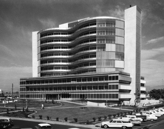
| (1962)## - Kaiser Panorama City opening day. View is looking northwest. Photo courtesy of Kaiser Pemanente |
Historical Notes The Panorama City Kaiser Hospital was completed in 1962 and featured two circular towers. Within the towers, the concept of "circles of service" was born. Later Kaiser Permanente hospitals retained the basic design but the "binocular" towers were enclosed in rectangles. |
.jpg) |
|
| (1963)*++ - View looking north showing Kaiser Permanente Hospital in Panorama City. Photo by Julius Shulman |
.jpg) |
|
| (1963)* - View looking northeast showing Kaiser Permanente Hospital in Panorama City. Photo Julius Shulman / Getty Research Institute |
.jpg) |
|
| (1963)* - View looking east showing Kaiser Permanente Hospital in Panorama City. Photo Julius Shulman / Getty Research Institute |
 |
|
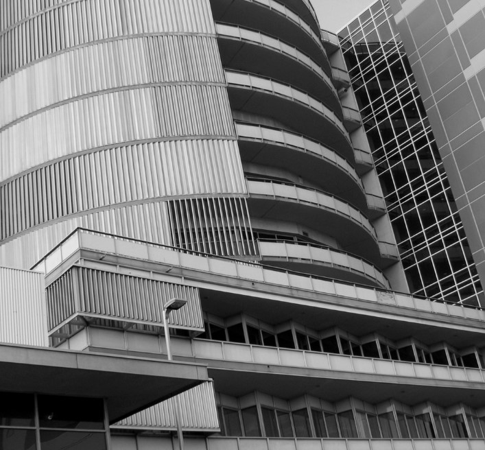
| (1962)* – Close-up view of Kaiser Permanente, Panorama City. |
Historical Notes In 2008, the 1962-built Kaiser Permanent Hopsital was razed and a new Hospital and Medical Center built. Click HERE for contemporary view. |
Valley Presbyterian Hospital
 |
|
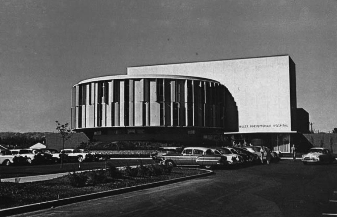
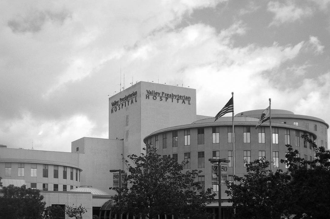
| (ca. 1958)* - Postcard view showing the Valley Presbyterian Hosipital in Van Nuys. Photo courtesy of Valley Relics Museum |
Historical Notes Built on a small plot of land in Van Nuys, Valley Presbyterian Hospital first opened to the community in 1958 with only 63 beds in a building designed by architect William Pereira.The facility specializes in maternal and child health, cardiac care, orthopedics, and critical care services.* |
 |
|
| (1974)*- View showing the Valley Prebyterian Hospital located at 15107 Vanowen Street, Van Nuys. |
Historical Notes In 1968, the hospital's seven-story Circle Tower was constructed, adding 180 beds. Today, the hospital has 350 beds and is one of the largest independent, nonprofit community hospitals in the San Fernando Valley.* |
 |
|
| (2008)^ - Close-up view of Valley Presbyterian Hospital located on Vanowen Street near Sepulveda Boulevard. Photo by 'Cbl62' / Wikipedia |
Historical Notes The Valley Presbyterian Hospital specializes in maternal and child health, cardiac care, orthopedics, and critical care services. Between 2006 – 2014, the Hospital was voted the "Best Medical Center" by the readers of the LA Daily News.* |
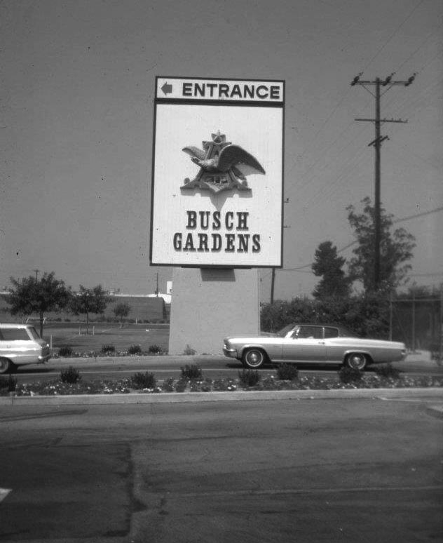
Busch Gardens
 |
|
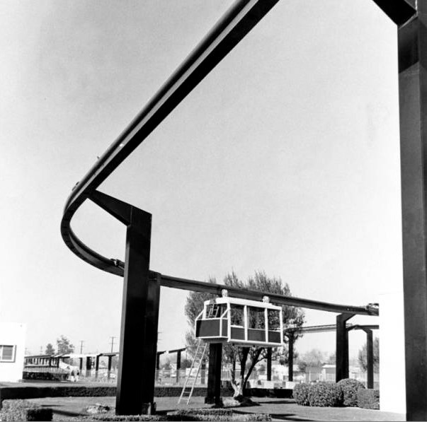
| (1963)* - Artist's conception of the Skyrail Tour, a 3,500-foot long, elevated project designed by Arrow Development Company, to be constructed at the Anheuser-Busch Inc. brewery in Van Nuys as part of a $3 million Busch Gardens development. |
Historical Notes In 1954 Anheuser-Busch opened a brewery in Van Nuys, California, followed by an updated version of Busch Gardens in 1966. By this time, the Busch Entertainment Corporation had already opened their Tampa Bay gardens in 1959, which was an admission free hospitality facility with a beer garden and bird sanctuary. In a similar fashion, Busch transformed a cabbage patch adjacent to the Van Nuys brewery into a tropical beer garden and bird sanctuary. |
 |
|
| (1960's)^** - View of what appears to be a Busch Gardens Sky Trolley being tested and fine-tuned prior to its official opening. |
 |
|
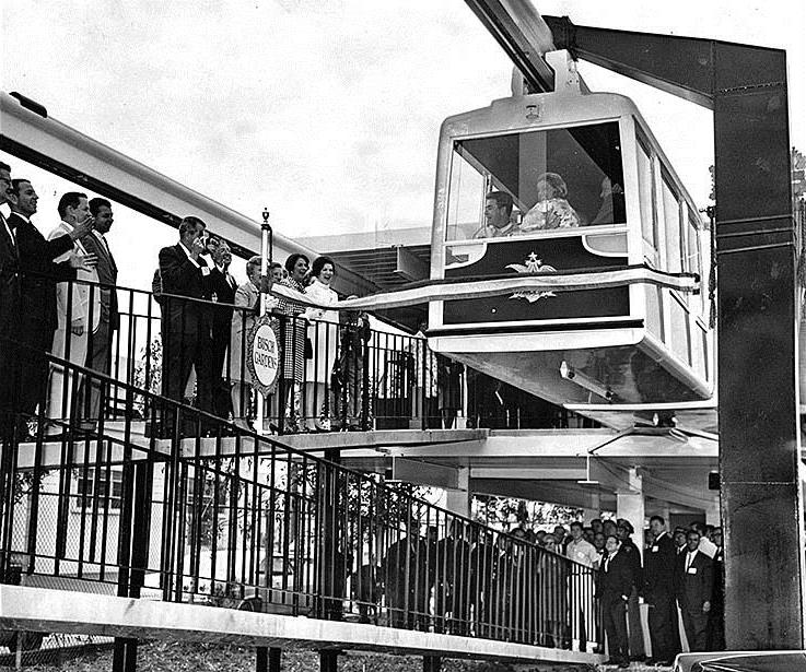
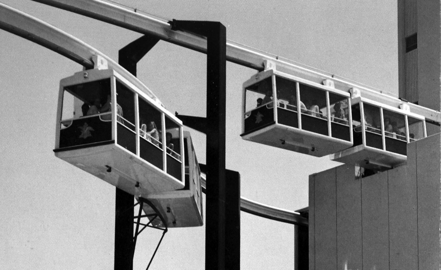
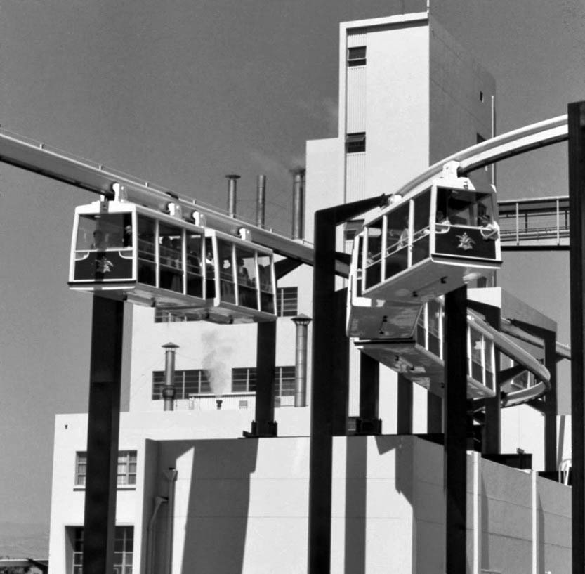
| (1966)*^# - View shows the Busch Monorail car moving forward at the ribbon cutting ceremony dedicating the new Busch Gardens in Van Nuys. |
Historical Notes On May 16, 1966, the first pair of cars, containing Busch and other dignitaries, snapped a ribbon as it began moving, and the dedication was official. In total, there were seven pairs of cars that would carry passengers on a 3,500-foot loop around the 17-acre Anheuser-Busch facility. |
 |
|
| (1960s)*#^ - Poscard view of the Monorails at Busch Gardens in Van Nuys. |
Historical Notes The Busch Gardens theme park featured a monorail that snaked around the facility and passed windows that gave passengers a look at the brewing process. |
 |
|
| (1960s)#^*^ – View looking up showing two fully-loaded monorails passing each other in front of the Busch brewery building. |
 |
|
| (1960s)* – View is looking west (towards Woodley) from inside the parking lot. Roscoe is on the right. The brown building in the background is the Busch Gardens warehouse and wardrobe dept (where employees changed into costumes). The white building behind that is the Keebler cookie plant. A 1965 2-door Chevrolet Impala is seen in front of sign. |
 |
|
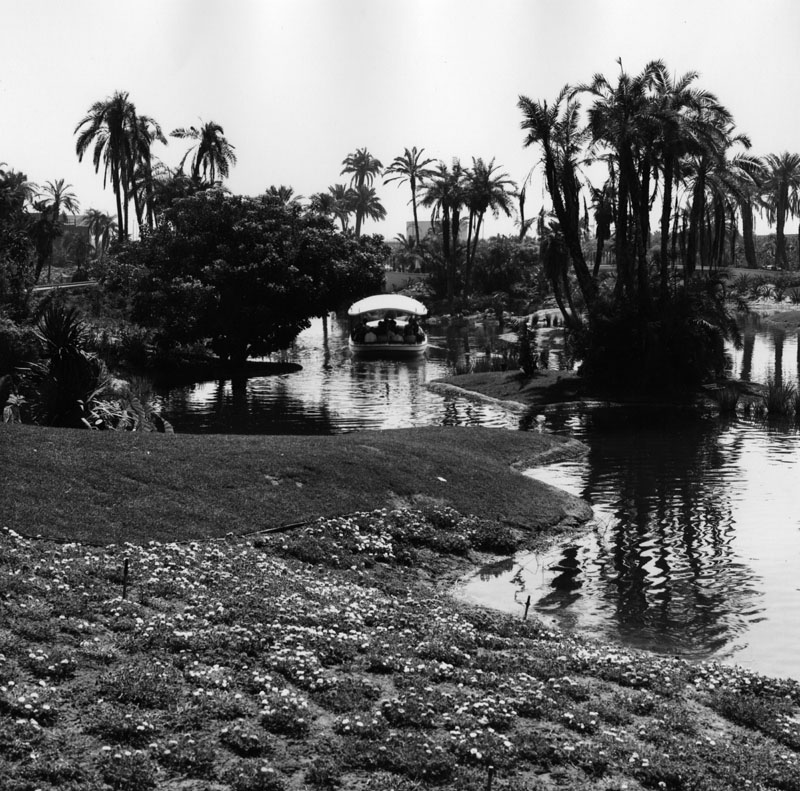
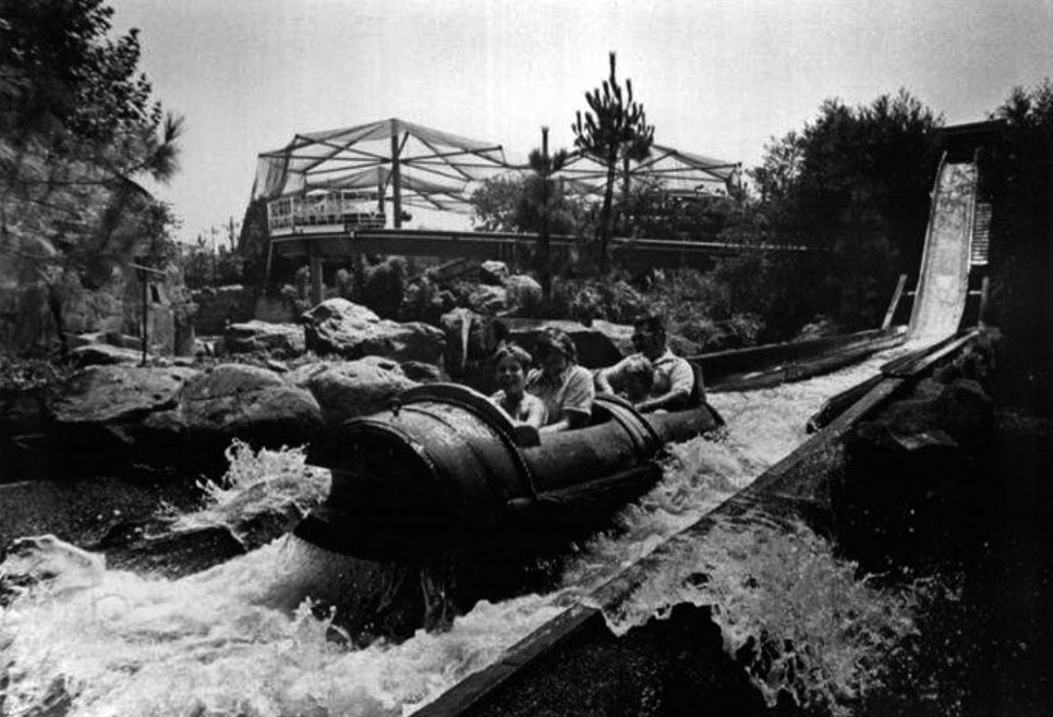
| (1960s)* - View of the amusement park boat ride inside of Busch Gardens. Busch Gardens was located next to the Anheiser-Busch brewery in Van Nuys, in the San Fernando Valley. |
Historical Notes Amongst the many activities provided for visitors were boat rides across a lagoon, a monorail, a log-flume ride, and a suspended trolley tour through the brewery; but perhaps the most popular attraction was the free beer. Once the park admission was paid, anyone of drinking age was allowed “two 10-ounce glasses of beer at each of the five pavilions.” |
.jpg) |
|
| (ca. 1970s)^^^* - Boat ride at Busch Gardens, Van Nuys. The Sky Trolley rail can be seen on the left. A beautiful waterfall is on the right. Photo courtesy of Valley Relics Museum |
Historical Notes In 1972 Busch Gardens would go through an expensive expansion that saw the addition of the log ride and other attractions of the like, and necessitated the construction of a pedestrian bridge and another monorail line to adjoin the original brewery property to the new section of the park. |
 |
|
| (1970s)* - Passengers line up as they prepare to board the Busch Gardens boat ride. |
Historical Notes By the mid-seventies attendance began to slow down and August Busch III decided to close the park in December of 1976. Busch Gardens reopened on January 5, 1977 as a bird sanctuary and boasted "1500 birds of some 180 different species,". Many wandered freely and some were viewable from the boat ride. Guests began their trip with a 15-minute tour of the brewing facility, with audio narration provided by Ed McMahon. But, that didn't last long. |
 |
|
| (1970s)#*^* – View of the Log Ride at Busch Gardens, Van Nuys, with the Bird Sanctuary seen in the background. |
Historical Notes The Van Nuys park closed permanently in 1979. Two other Busch Gardens, in Tampa, Fla., and Williamsburg, Va., are currently open. The company was liberal with its "free beer" policy, which extended to the brewery's employees. This, curiously enough, wasn't a problem until 1982, when one employee who imbibed on his break wound up hitting and killing a 16-year-old pedestrian when he drove off the lot. It took several years of discussions between the workers' unions and the brewery, but the free beer finally came to an end on May 1, 1986, and employees had to settle for two free cases a month instead of "beer breaks" they initially had in their contracts. |
* * * * * |
Sepulveda Pass
 |
|
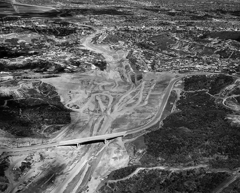
| (1957)^^ - Aerial view looking north toward Sepulveda Pass where construction of the San Diego (405) Freeway is underway. The section between Wilshire Blvd to Venice Blvd in Culver City is the next segment scheduled for construction. |
Historical Notes Construction of the 405 Freeway began in 1957 with the first section, mostly north of LAX Airport being completed in 1961. The section of the 405 that would connect western Los Angeles to the San Fernando Valley was part of a 12-mile, $20 million project, then the most expensive California highway project to date.*^ |
 |
|
| (1957)^^ - The San Diego Freeway makes its entry through the Santa Monica Mountains in 1957. The hill on the right is now the site of the Getty Center. |
 |
|
| (1957)^^ - View looking north showing construction of the 405 Freeway just south of Sepulveda Canyon. Sepulveda Blvd is on the right and the Sunset Blvd Bridge is in the distance. Courtesy of the Los Angeles Examiner Collection, USC Libraries |
 |
|
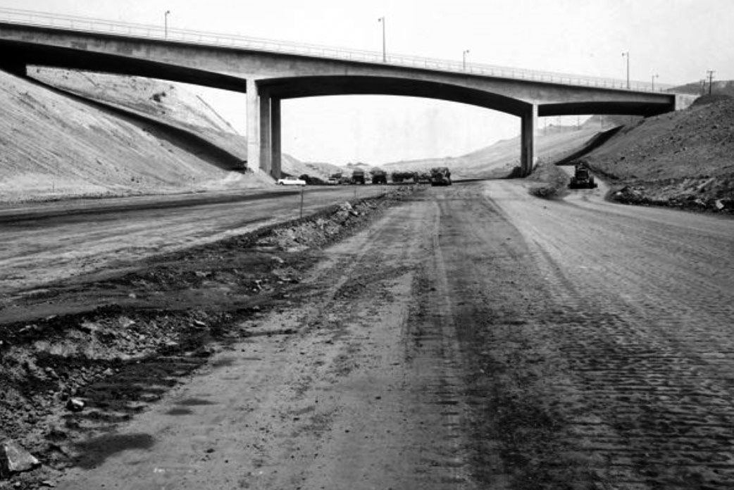
| (1960)* – Aerial view looking north toward the San Fernando Valley showing the newly completed Mulholland Drive Bridge. The Sepulveda Pass is chiseled out in preparation for the construction of the new 405 Freeway. Photograph Courtesy of California Department of Transportation |
 |
|
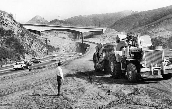
| (1961)^^^ - An aerial view looking south of the San Diego Freeway construction project shows the Mulholland Drive Bridge. Dirt is being dug from beneath the bridge and hauled to the San Fernando Valley for freeway fill. This bridge was constructed like no other, from the top down! Sepulveda Boulevard can be seen at center-left. |
Historical Notes This Mullholland Dr. Bridge was constructed like no other, from the top down. The bridge was completed over two years before the freeway that connected West L.A. to the San Fernando Valley would open.^*^* |
 |
|
| (1960)^ - View showing the bridge across the Sepulveda Pass the official day of its completion, April 4, 1960. |
Historical Notes On Monday, April 4, 1960, the same day the 1959 Academy Awards were held at RKO's Pantages Theatre in Hollywood, Peter Kiewit Sons Co. completed the Mulholland Drive Bridge across the Sepulveda Pass.^*^* |
 |
|
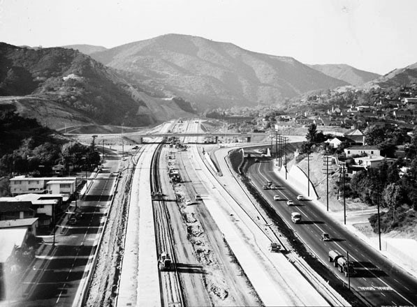
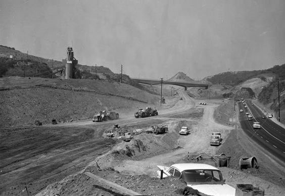
| (1960)* – View looking north showing the construction of the San Diego Freeway through Sepulveda Pass with a newly completed Mulholland Bridge in the distance and Sepulveda Boulevard on the right. Courtesy of the Los Angeles Times Photographic Archive. Department of Special Collections, Charles E. Young Research Library, UCLA. |
 |
|
| (1961)* – View looking north toward the Mulholland Dr. Bridge over a yet-to-be completed San Diego Freeway. Photo Courtesy of California Department of Transportation. |
 |
|
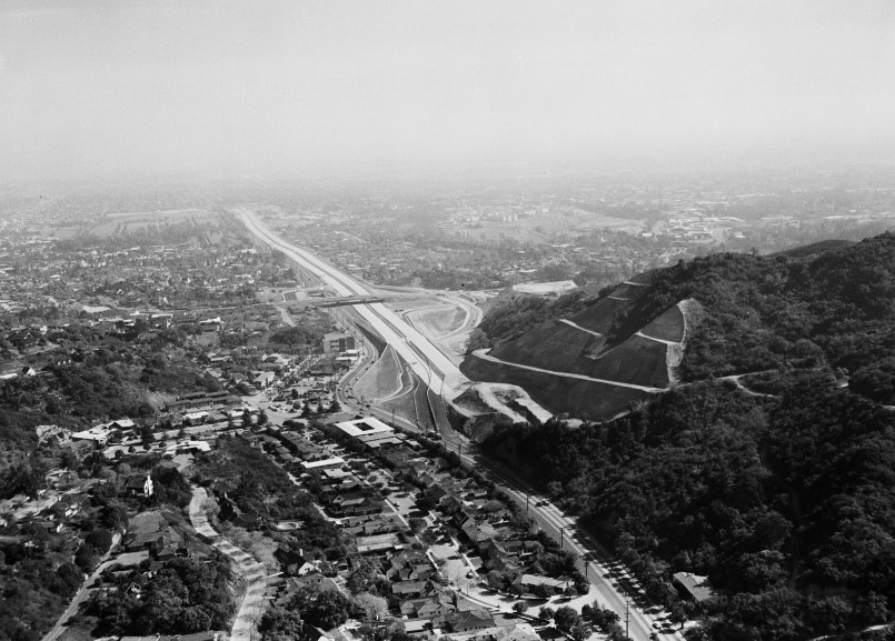
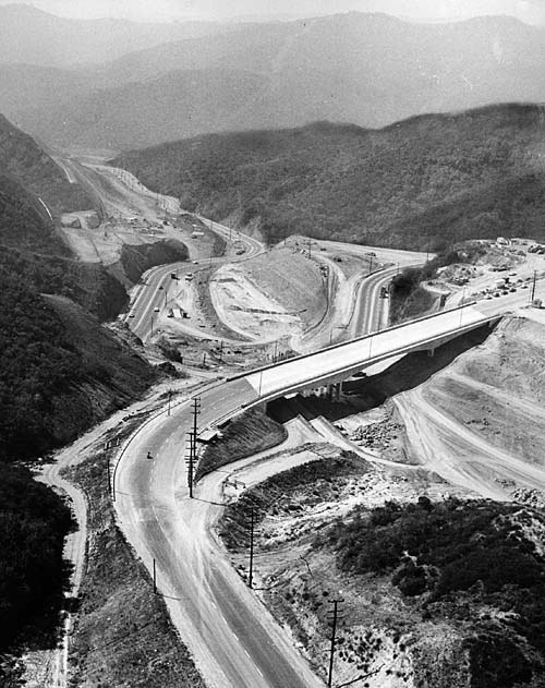
| (1962)* – View looking north through the Mulholland Dr. Bridge shortly after the completion of the Sepulveda Pass section of the San Diego Freeway (Dec, 1962). The San Fernando Valley is seen in the background. |
Then and Now
|
|
 |
|
| (1961 vs 2014) - View looking north toward the Mulholland Dr. Bridge. 2014 Photo by Dean Musgrove |
Historical Notes In 2012, 52 years after it was originally built, the Mulholland Dr. Bridge was demolished and reconstructed to accommodate the widening of the I-405 freeway. The new bridge was widened by approximately 10 feet and designed to the latest seismic standards.^*^* |
 |
|
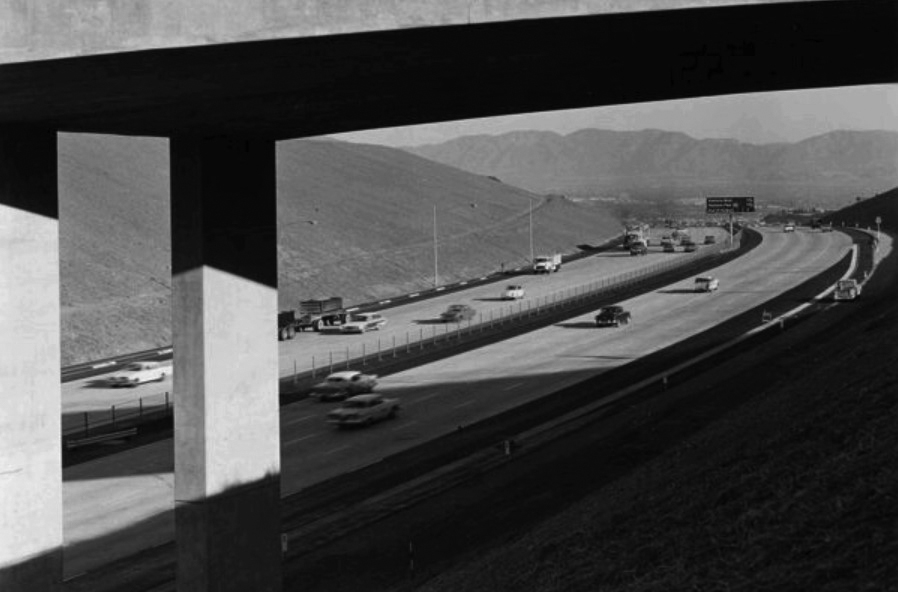
| (1962)^^^ - Six days after the Sepulveda Pass portion of the 405 Freeway opened, there's hardly a car in sight from the Sunset Boulevard bridge into the San Fernando Valley. Photo taken: Dec. 27, 1962 |
Historical Notes The freeway's congestion problems are legendary, leading to jokes that the road was numbered 405 because traffic moves at "four or five" miles per hour, or because drivers need "four or five" hours to get anywhere. Indeed, average speeds as low as 5 mph are routinely recorded during morning and afternoon commutes, and its interchanges with the Ventura Freeway (U.S. Route 101) and with the Santa Monica Freeway (Interstate 10) each consistently rank among the five most congested freeway interchanges in the United States.*^ |
.jpg) |
|
| (1962)* - View looking north toward the San Fernando Valley shortly after completion of the 405 Freeway (at the time just called San Diego Freeway).. |
 |
|
| (1962)* - View looking north toward the San Fernando Valley from the edge of the newly completed 405 Freeway. An early model Ford Rambler is seen on the left merging onto the freeway, having used the ramp at Sepulveda Boulevard and Fiume Walk in Sherman Oaks. Photo date: December 26, 1962. |
 |
|
| (ca. 1970s)* - Postcard view showing the 405 Freeway entering the San Fernando Valley. |
San Diego and Ventura Freeway Interchange
 |
|
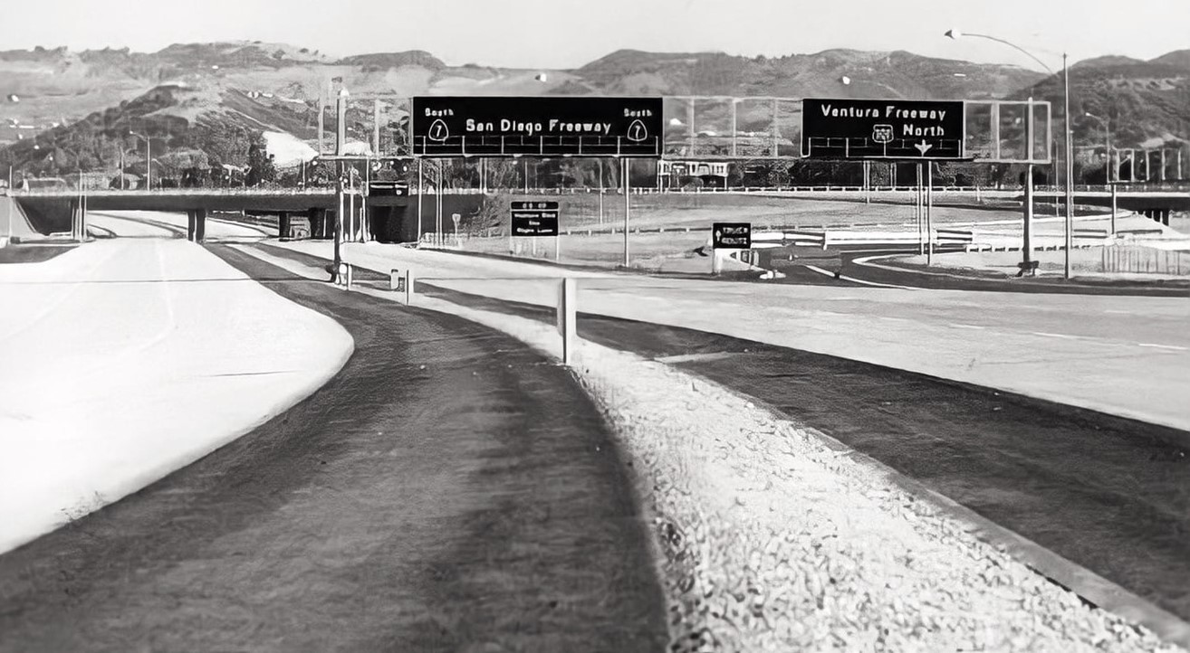
| (1958)* - Looking south on the San Diego Freeway (at the time CA-7) toward the interchange with the Ventura Freeway (CA-101). This photo was taken just days before the opening of the interchange (Valley Times Photo dated July 1, 1958). |
Historical Notes Construction of the 101 Freeway (Ventura Freeway) progressed in segments, beginning with the section linking Sepulveda Boulevard and Encino Avenue that opened in 1958.* |
 |
|
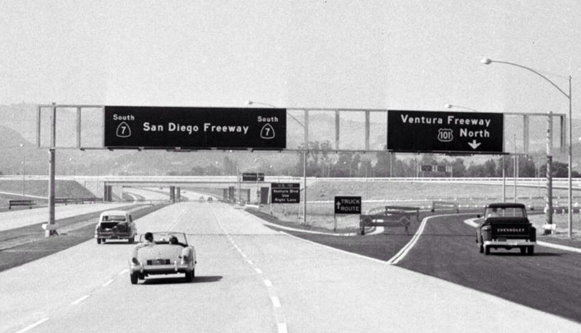
| (1961)^^ - Wide-angle view looking south on the San Diego Freeway at its junction with the Ventura Freeway shortly after it opened. What traffic congestion? Photo: Los Angeles Examiner Collection, USC Libraries |
Historical Notes Note the signage for SR-7 instead of I-405, which changed only a few years later. |
Cahuenga Pass
 |
|
| (ca. 1950)* - Aerial view of Hollywood, north of Sunset between Highland and Gower before the second section of the Hollywood Freeway was built (1954). The Hollywood Reservoir (middle right) is in the hills above Hollywood. There is a clear view of San Fernando Valley in the background. |
Historical Notes The Cahuenga Pass has long been a convenient shortcut between the San Fernando Valley and Los Angeles Basin. The first Southern Californians likely blazed a foot-trail millennia ago, and by the late 18th century the villagers of Cabueg-na or Kaweenga (the origin of the name "Cahuenga") near Universal Studios regularly trekked through the pass. In 1852, a steep wagon road replaced the old trail, and in 1911 the Pacific Electric stretched its interurban railway tracks through the pass. Any remnants of the pass' rustic character vanished in 1940, when the Cahuenga Pass Freeway -- one of L.A.'s first – opened. |
 |
|
| (1957)* - Aerial view of the Cahuenga Pass and Barham Bypass, gateway to the San Fernando Valley. |
Historical Notes The first segment of the Hollywood Freeway built was a one and a half mile stretch through the Cahuenga Pass. That segment opened on June 15, 1940. It was then known as the "Cahuenga Pass Freeway." Pacific Electric Railway trolleys ran down the center of this freeway until 1952. |
 |
|
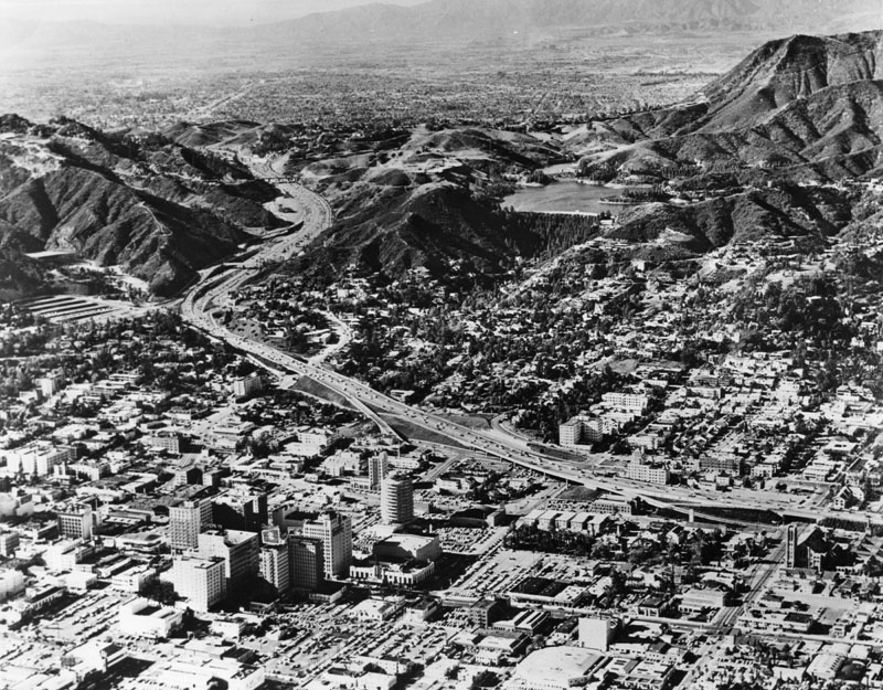
| (1960s)* - Aerial view of the Hollywood Freeway as it winds its way through Cahuenga Pass into the San Fernando Valley. The sprawling Valley can be seen in the background and Hollywood in the foreground. The large body of water in the upper right is the Hollywood Reservoir, now Lake Hollywood (Click HERE to see more in Early Views of the Hollywood Reservoir). |
Historical Notes The second section of the Hollywood Freeway that stretched from the San Fernando Valley to Downtown Los Angeles opened on April 16, 1954 at a cost of $55 million. |
Vineland Interchange
 |
|
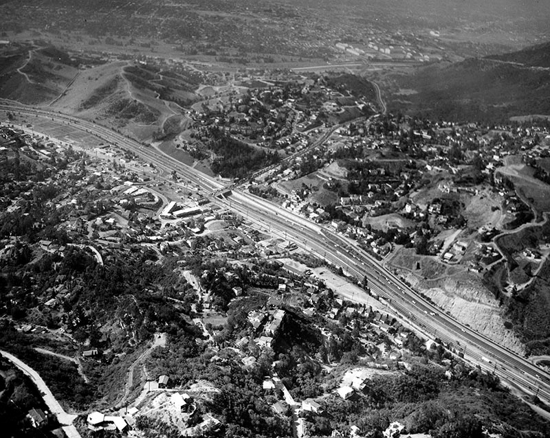
| (1957)* - View looking southeast of the Hollywood Freeway during construction at the point where it passes over Vineland Avenue. In the distance is Cahuenga Pass. |
Historical Notes The 101 Freeway from Ventura to its intersection with the Hollywood Freeway in the southeastern San Fernando Valley (the Hollywood Split) was built in the late 1950s and opened on April 5, 1960. East of the Hollywood Freeway intersection, it is signed as State Route 134 which was built by 1971. The Hollywood Freeway (Route 170) between the Ventura Freeway and the Golden State Freeway (Interstate 5) was completed in 1958. |
Then and Now
 |
|
| (1957 vs. 2023)* - Looking ESE at North Hollywood/Universal City on the US -101 Hollywood Freeway with Vineland Avenue in the foreground and Cahuenga Pass up ahead. Photo comparison and annotations by Gordon Ross. |
Historical Notes Since 1957, Universal City has experienced significant growth, primarily centered around the expansion of Universal Studios Hollywood. The establishment of the modern Universal Studios tour in 1964 marked the beginning of its transformation into a theme park. Additionally, the success of the theme park spurred commercial growth in the surrounding area, resulting in the development of hotels, restaurants, and retail spaces. |
 |
|
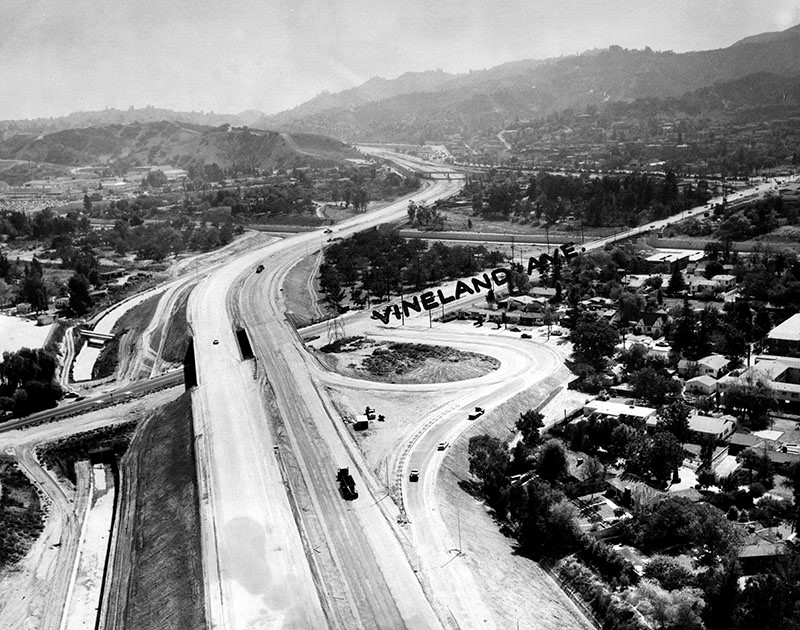
| (1958)* - Opening of new Hollywood Freeway link from Vineland to Moorpark. Photo date Feb 7, 1958 |
.jpg) |
|
| (1961)* – Photograph caption reads, "Ulcer bait: It's rush hour, and workmen are busy (right) - Photo taken at Vineland Interchange on Hollywood Freeway." Valley Times photo dated October 7, 1961. |
 |
|
| (1961)* - Photograph caption reads: "At Vineland interchange on Hollywood Freeway, traffic creeps Downtown from Valley at 8 a.m. Workmen appear at 'island' at right despite highway department order to halt work during rush hours." |
 |
|
| (1964)* - Photo caption dated November 9, 1964 reads, "Cars were jammed on the freeway this morning because of the long-awaited rain, as cautious work-bound drivers moved toward Los Angeles. Photo shows cars in Cahuenga Pass on the Hollywood Freeway driving bumper-to-bumper. Police reported a few fender-bending accidents." |
Ventura Freeway (West San Fernando Valley)
 |
|
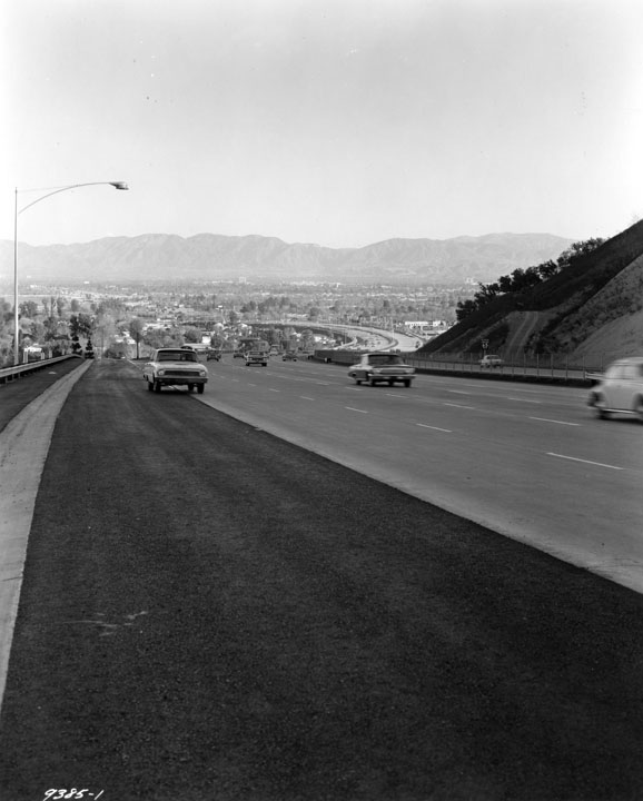
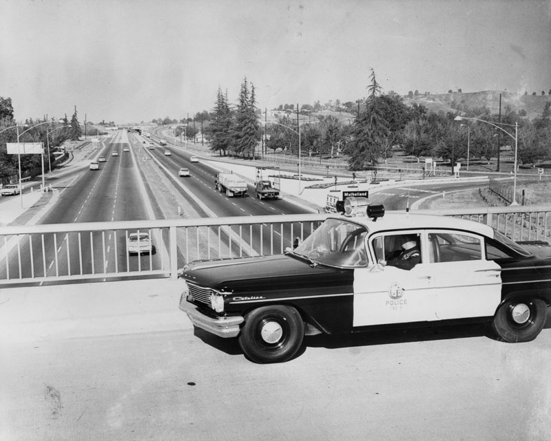
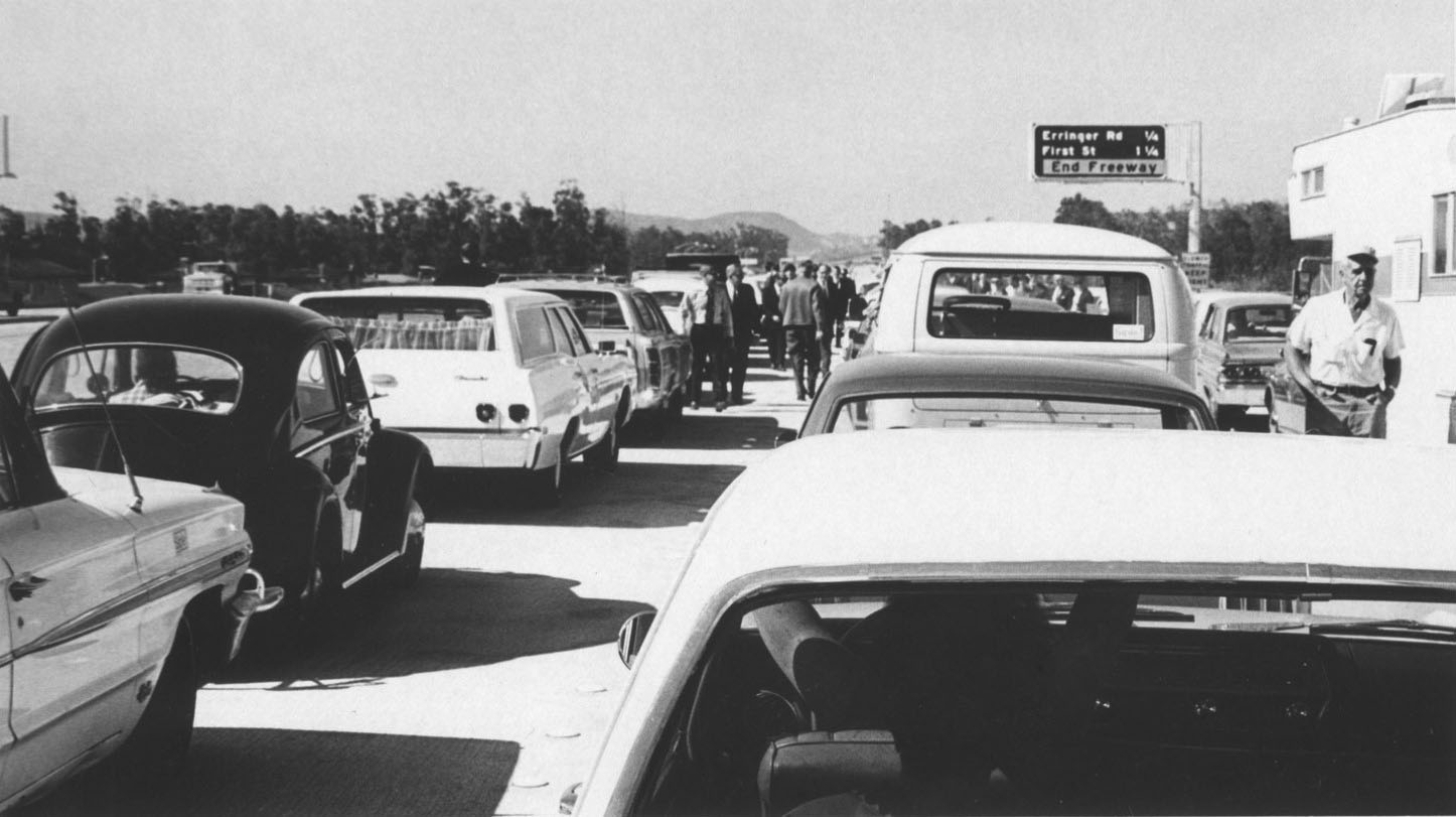
| (1960)* - View looking east from the Valley Circle overpass of the Ventura Freeway. Photo caption reads: "Under Watchful Eye. Motorists on new Ventura Freeway are now under constant surveillance by such special patrolmen as James Murphy, who sit in new high-speed West Valley police car. Specially equipped Pontiac is designed to bring "death" to speeding before speeders literally kill themselves." Freeway exit sign reads: Mulholland |
Historical Notes Known as the Freeway Flyers. They used suped-up Pontiacs and Oldsmobiles on the city freeways until the CHP took over patrol duties around 1968. The 101 Freeway from Ventura to its intersection with the Hollywood Freeway in the southeastern San Fernando Valley (the Hollywood Split) was built in the late 1950s and opened on April 5, 1960. East of the Hollywood Freeway intersection, it is signed as State Route 134 which was built by 1971. |
Pacoima
 |
|
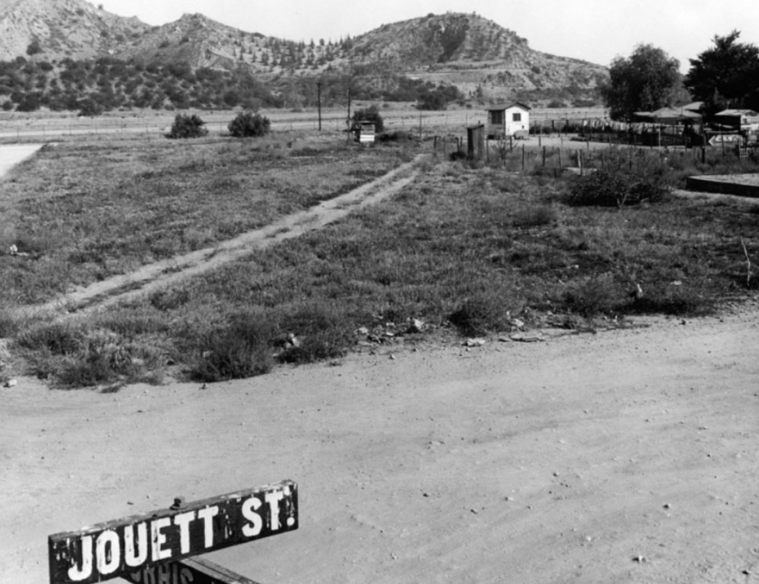
| (1950)* - View looking north from the intersection of Jouett Street and Norris Avenue in Pacoima. |
Historical Notes In 1887, Jouett Allen purchased under contract 1,000 acres of land between the Pacoima Wash and the Tujunga Wash. He chose the name that had long been applied to the beautiful canyon on the north and the “river” that flowed down from it. The land was purchased from the Maclay Rancho Water Co. which had taken over Senator Charles Maclay’s holdings in the Valley. Allen retained 500 acres for himself and subdivided the remainder in 1-acre tracts. From this the town of Pacoima was born. Pacoima was renamed 'Mulholland' in 1912 to take advantage of William Mulholland's popularity. It was hoped that the name change would give a boost to the area's development. But that only lasted for one year before the name reverted back to Pacoima. Click HERE to see more. By the 1950s, the rapid suburbanization of the San Fernando Valley arrived in Pacoima, and the area changed almost overnight from a dusty farming area to a bedroom community for the fast-growing industries in Los Angeles and nearby Burbank and Glendale, with transportation to and from Pacoima made easy by the Golden State Freeway. Pacoima is bordered by the Los Angeles districts of Mission Hills on the west, Arleta on the south, Sun Valley on the southeast, Lake View Terrace on the northeast, and by the city of San Fernando on the north.*^ |
 |
|
| (1954)* - Valley Times photograph caption dated March 6, 1954 reads, "Not too long ago this is the way motorists and pedestrians were forced to negotiate Pacoima Wash at Laurel Canyon Boulevard during storms. Then Valley progress stepped forward." Today, Pacoima Wash is cement lined and goes under Laurel Canyon near where the Golden State and 118 freeways meet. Click HERE to see a recent overhead view. |
Historical Notes Pacoima Wash is a major tributary of the Tujunga Wash, itself a tributary of the Los Angeles River, in the San Fernando Valley. The stream begins at Mount Gleason, 6,502 ft, in the western San Gabriel Mountains of the Angeles National Forest. The upper reaches, sometimes known as Pacoima Creek, flow through Pacoima Canyon as a rapid mountain stream. It then reaches the Pacoima Dam Reservoir in the western San Gabriel Mountains of the Angeles National Forest and proceeds south in a free-flowing stream alongside Pacoima Trail Road. Below the dam, it is generally known as the Pacoima Wash. From there, it joins several other unnamed streams that drain the nearby mountains, collecting at Lopez Dam. South of that dam, Pacoima Wash is encased in a concrete flood control channel, and travels south from Kagel Canyon in Sylmar though San Fernando, Pacoima, Mission Hills, Panorama City, and Van Nuys.*^ |
 |
|
| (1950s)^ – View looking northeast showing the intersection of Van Nuys Boulevard and San Fernando Road. Click HERE for contemporary view. |
Whiteman Airport (aka Whiteman Air Park, Pacoima)
 |
|
| (1960)* - View showing an airplane coming in for a landing at Whiteman Air Park located at San Fernando Road and Pierce Street in Pacoima. |
Historical Notes Whiteman Airport was founded as "Whiteman Air Park" in 1946 on a farm by pilot Marvin Whiteman Sr. as a non-tower controlled, private airport. Later Whiteman Manufacturing Co. was built on the airport's west side. In 1970 the airport was purchased by the County of Los Angeles. During the 1980s the name was changed to "Whiteman Airport", but it is still commonly referred to as "Whiteman Airpark" by old-time local pilots to this day.*^ |
 |
|
| (1963)* - Ground view showing Whiteman Air Park in Pacoima. The 'Air Park' did not have a control tower at the time. |
Historical Notes In 1988, an FAA-approved and funded control tower was installed in Whiteman Airport. |
Golden Valley Gun Club (Jessup Park, Pacoima)
 |
|
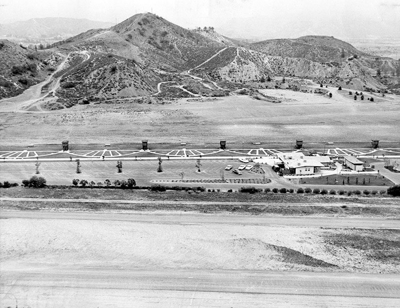
| (1962)* - View looking northeast showing the Golden Valley Gun Club located at 12651 Osborne Street in Jessup Park. The Whiteman Air Park is seen in the foreground. |
Historical Notes Golden Valley Gun Club, established in 1958, opened on May 7th 1960. It was located on the north corner of San Fernando Rd & Osborne St, adjacent to Whitman Airport. It had 14 trap and 9 skeet fields, with rifle and pistol range.* |
 |
|
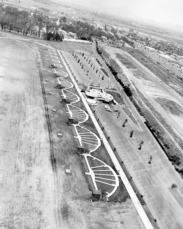
| (1962)* - Aerial view showing the Golden Valley Gun Club in Jessup Park* with the Whiteman Airport seen at far right. |
Historical Notes Jessup Park was named after Roger Wolcott Jessup. Roger and Marguerite Jessup founded Jessup Farms Dairy in 1919. It was located just north of Glendale. The dairy farm became the largest privately owned dairy in the United States at the time.* |
 |
|
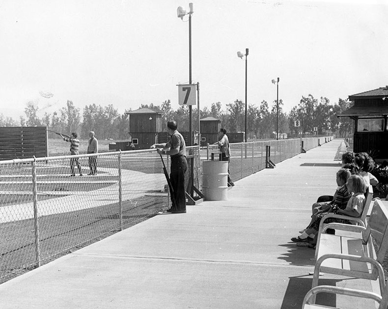
| (1960)* - Photo caption reads, "Shooters make use of range at Pacoima's new Golden Valley Gun Club located within Roger Jessup Park. Opened this year, the club provides trap and skeet facilities, a clubhouse and restaurant." |
Sylmar
 |
|
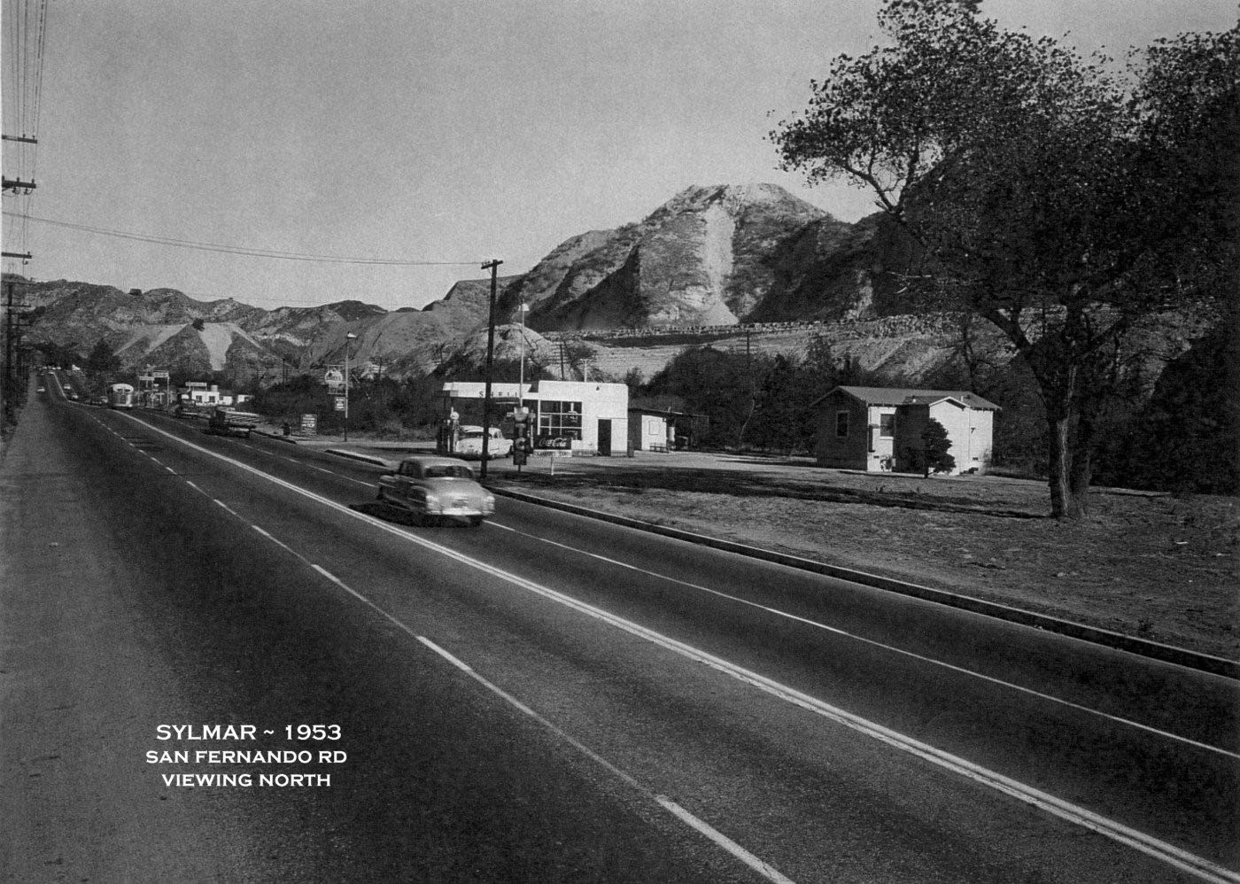
| (1953)^ – View looking north showing San Fernando Rd (US 99 & US 6 then). This was once the only way to head north out of the SFV. The I-5 Freeway is under construction in the background. A Shell Gas Station sits at approximately what is today, 14928 San Fernando Rd and the SPRR tracks are directly behind it. Another Gas Station is up the road a bit and was about where the Tunnel Station once was. On the road, as far as one can see, is where Sierra Hwy (US 6) begins by turning right over Weldon Canyon’s bridge. Photo courtesy of Southern California Regional Rocks and Roads |
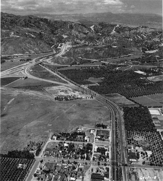 |
|
| (1954)^ – View looking north showing the transition from the Golden State Freeway to San Fernando Road. This is near the site of the I-5 / I-210 interchange today. Photo courtesy of Southern California Regional Rocks and Roads |
 |
|
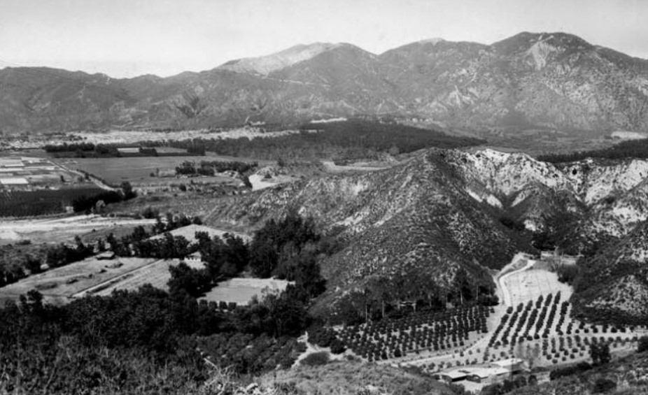
| (1957)* – Panoramic view from a spot near today's 210/118 Freeways. The photo was taken from the ridge flanking Lopez Canyon and shows the large ranch of Fritz Burns, Panorama City developer, with a new subdivision in the far background sweeping in from the San Gabriel Mountains. The charred area on the mountain top is above Olive View Sanitarium in Sylmar (Photo from the Valley Times). |
Historical Notes The Valley Times photo caption reads "People who prefer a rural way of life fled thickly-populated areas to develop canyons for home sites, only to discover their efforts to seek isolation were in vain. Agricultural acreage in the San Fernando Valley and nearby Santa Clara Valley dropped from 61,300 in 1945 to 35,000 in 1957." The Fritz Burns Ranch in the foreground has a colorful past that includes a reindeer herd, German POWs and silent films. Starting in the 1950s, the Burns Ranch was home to a reindeer herd that spent the Christmas season at Southern California shopping centers, including Panorama City. Dayle Hunter's family managed and lived at the ranch in the 1960's and '70s. The ranch is also known to have been a camp for a few of the 400,000 Axis prisoners of war held in the United States during World War II. Much of Sylmar was formerly known as San Fernando. The San Fernando prisoners are said to have been used as citrus workers. #^*^ D.W. Griffith owned the ranch before Burns and shot films there. The site of the Griffith Ranch is California Historical Landmark No. 716. |
Rancho Sombrero (Stetson Residence)
 |
|
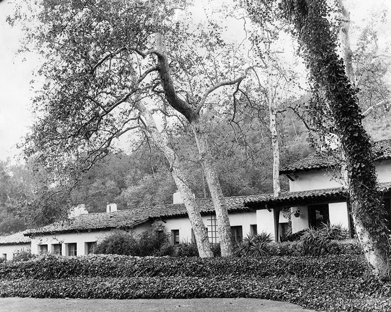
| (1958)* - The Spanish style ranch house of G. Henry Stetson, whose father invented the famous cowboy hat that bears the family name. The Sylmar property was purchased by Stetson in 1926. It consisted of 286 acres and was named Rancho Sombrero. |
Historical Notes Stetson sold the estate to the Mormon Church in 1958. Damaged by the 1971 earthquake, the house was razed and the church sold the property to a developer in 1978. A portion of the estates land was turned into Stetson Ranch Park. However, most of the land was developed into the Oakridge Mobile Home Park. The mobile home park was ravaged by the Sayre fire in November 2008 and 482 of the 600 homes burned to the ground.^ |
 |
|
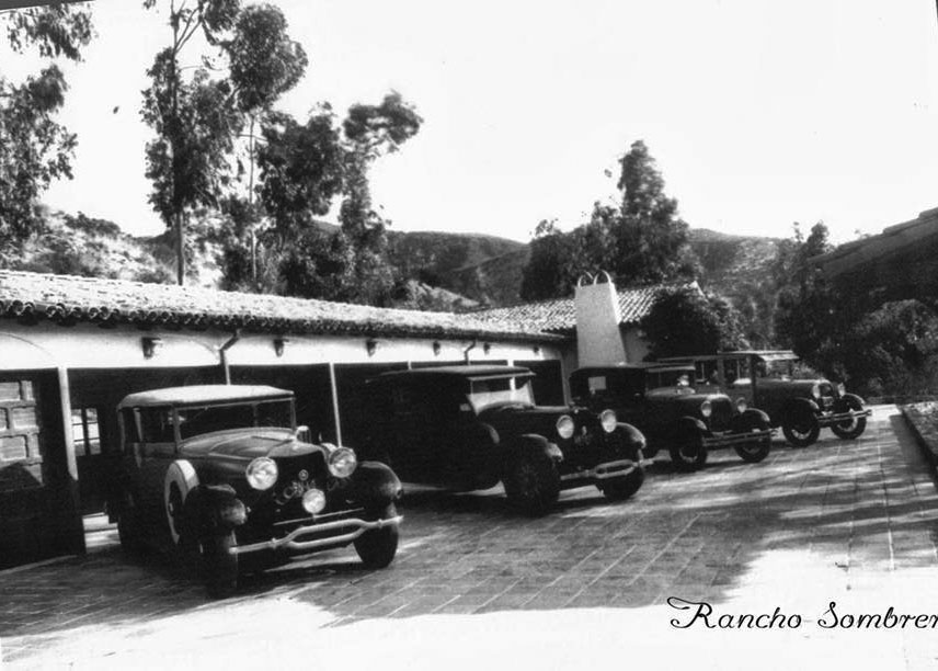
| (1930s.)^ - Four cars are parked in the driveway of Rancho Sombrero. |
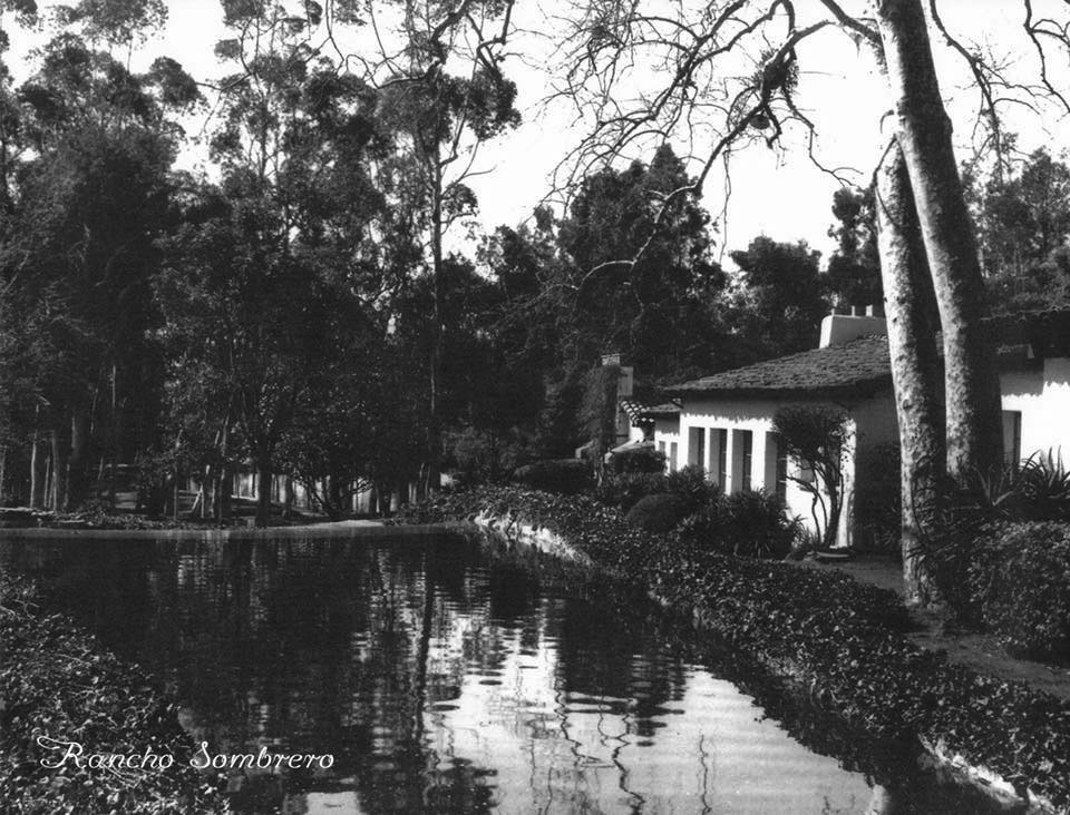 |
|
| (1930s)#^*^ - View showing the Rancho Sombrero with small lake adjacent to the house. Photo courtesy of San Fernando Valley Then and Now |
Laurel Drive-in (Pacoima)
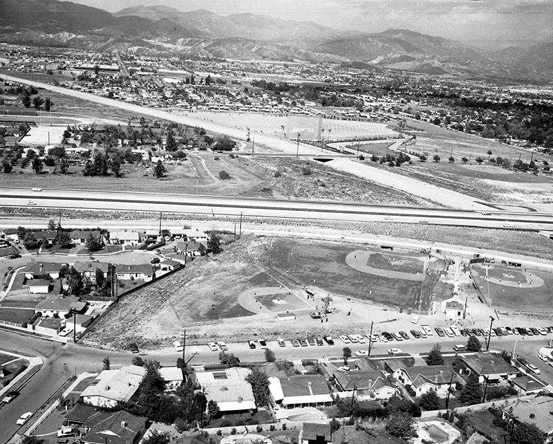
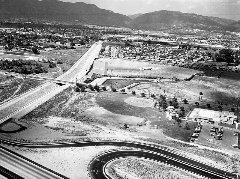 |
|
| (1964)* – Aerial view looking north showing the Laurel Drive-in in Pacoima. The Pacoima Wash can be seen vertically at left, as well as San Fernando High School's football field. The Golden State (5) Freeway is at the bottom left. |
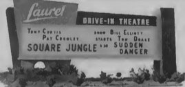 |
(1955)^ - Laurel Drive-In Theatre, located at 10770 Laurel Canyon Boulevard, Pacoima. Now showing a double feature: Square Jungle starring Tony Curtis and Pat Cowley and Sudden Danger starring Bill Elliott and Tom Drake. Photo: Cinema Treasures |
Historical Notes The Laurel Drive-in was operating by 1955. It was demolished in the early-1970’s to make way for the 118-Fwy. |
 |
|
| (1964)* – View looking east showing I-5 as it passes over Pacoima Wash. Adjacent to the wash is the Laurel Drive-in, demolished in 1970's to make room for the 118 (Simi Valley Freeway). It was situated very near where the 5 and 118 intersect today. Several baseball diamonds are seen in what was then called Paxton Park, renamed Ritchie Valens Park in 1994. |
Historical Notes In the 1990s Richard Alarcon, a Los Angeles City Council member who represented Pacoima, proposed changing the name of Paxton Park to honor Ritchie Valens. Hugo Martin of the Los Angeles Times said in 1994 that Alarcon proposed the rename so Pacoima residents will "remember Valens's humble background and emulate his accomplishments." The annual Ritchie Valens Fest, a festival, was created in 1994 to honor the renaming of the park.*^ |
Travel Town (Griffith Park)
 |
|
| (1964)* - Aerial view of Travel Town in Griffith Park, Ventura Freeway and the Los Angeles River. Photo by George Brich |
Historical Notes In the late 1940s, Charley Atkins, a Recreation and Parks employee, along with a handful of rail enthusiast friends, had the idea that a steam locomotive would make an attractive addition at the Griffith Park miniature railroad ride. The original intention of the Museum was to be a "railroad petting zoo," an opportunity for the children of Los Angeles to "imagineer" themselves as engineers. The City of Los Angeles Harbor Department had two little engines destined for scrap that seemed to fit the bill. The idea escalated as Atkins, with the enthusiastic support of former Recreation and Parks Department General Manager George Hjelte and Superintendent of Recreation William Frederickson, initiated contacts with major railroads in California to determine what equipment they might be willing to donate. At that time, the steam locomotive era was drawing to a close, and Atkins found a good response. Travel Town was formally dedicated on December 14, 1952. The concept of a combined transportation museum and recreation center blossomed, and wishes for donations were generously fulfilled. In 1965, Travel Town's exhibits were re-grouped, and the park re-dedicated.* |
 |
|
| (1948)* - Children riding the miniature train at Griffith Park's Travel Town while onlookers enjoy the view. |
 |
|
| (1967)* - Travel Town in Griffith Park (Herald Examiner Collection) |
 |
|
| (1970)* - Trolley cars from the 1880-1902 era at Griffith Park's Travel Town, a transportation museum, delight old and young. In foreground is part of an old steam locomotive. |
* * * * * |
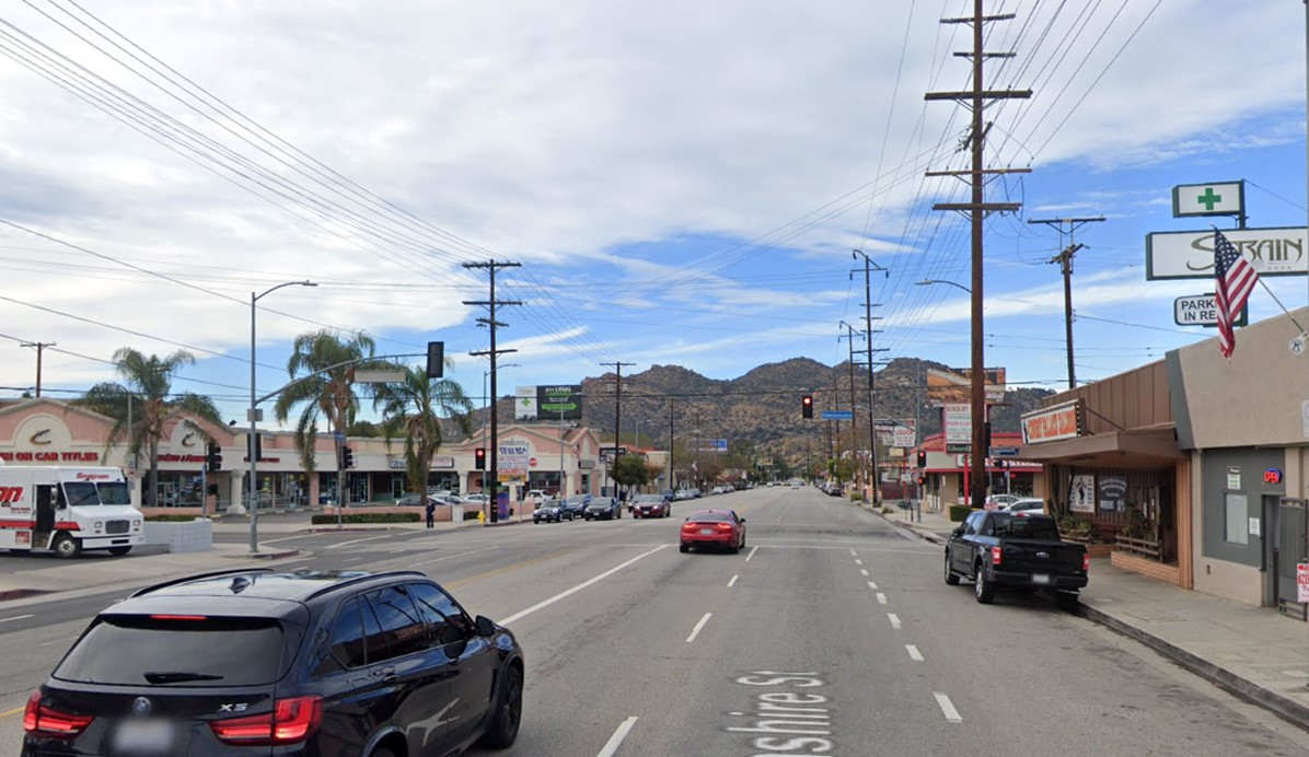
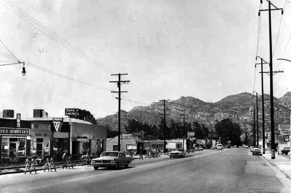
Devonshire Street (Chatsworth)
 |
|
| (ca. 1950s)* - Looking west on Devonshire Street towards Owensmouth Avenue in Chatsworth. Note the tall trees that appear to be in the center of the street. Photo: Los Angeles City Archives Department of Engineering |
 |
|
| (2018)* - Looking west on Devonshire Street towards Owensmouth Avenue in Chatsworth. |
Then and Now
 |
|
| Then and Now: Looking west on Devonshire Street towards Owensmouth Avenue in Chatsworth. Photo comparison by Trey Callaway* |
 |
|
| (1964)* – View looking west on Devonshire Street from Owensmouth Avenue toward the Santa Susana Mountains. |
Historical Notes A new high voltage power line (34,500 Volts) was installed on the north side of Devonshire in the early 1960s to provide for the load growth in the NW San Fernando Valley. |
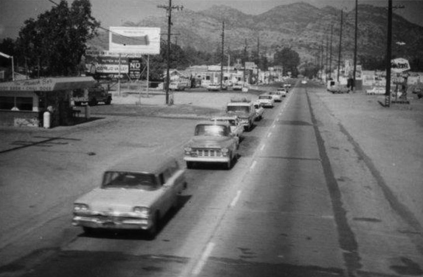
The Munch Box
 |
|
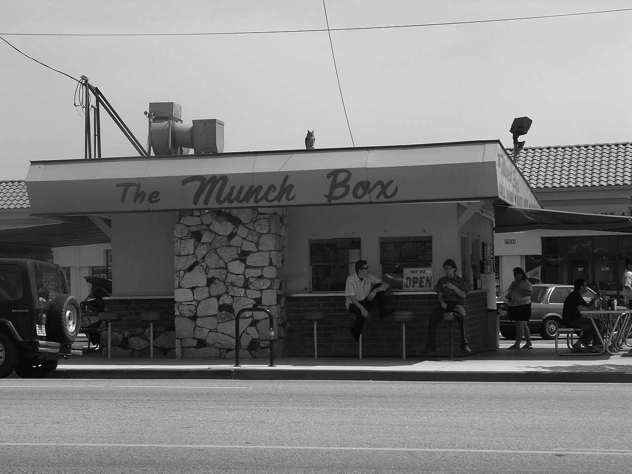
| (ca. 1960)* – View looking west on Devonshire toward Owensmouth from the railroad tracks. The Munch Box stands on the south side of the street at 21532 Devonshire Street. The first car in the left foreground is a 1959 Ford Ranch Wagon. |
Historical Notes Owned and operated by Buck Barker and family, The Munch Box is one of Chatsworth’s Historic-Cultural Landmarks. Buck’s Uncle John and Aunt Linda owned The Munch Box for the first 30 years, with Buck and his wife, Claire following in their footsteps. It has remained a family owned operation since its opening in 1956.^ |
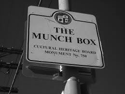 |
Historical Notes In 2003, The Munch Box became the first fast-food stand to be placed on the list of Historic-Cultural Monuments (No. 750). |
|
 |
|
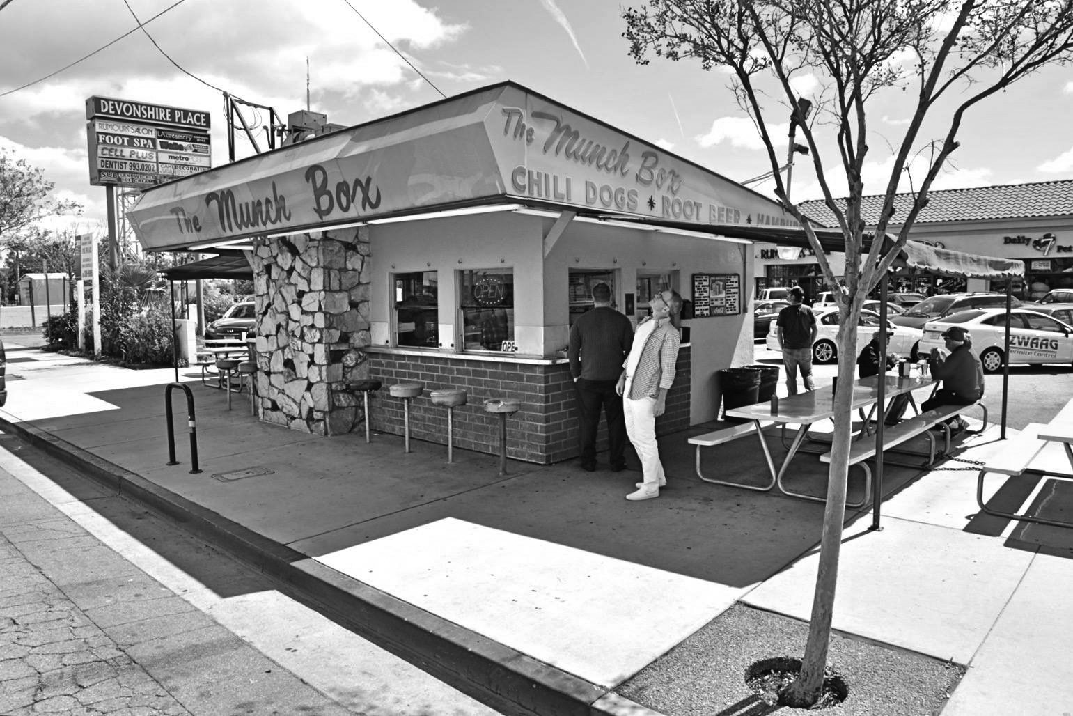
| (2009)^ – View showing The Munch Box with extended covered patio dining and original stools for seating in front. A new shopping center can be seen in the background. Photo courtesy of Chatsworth Historical Society |
Historical Notes Opened in 1956, the menu has remained basically the same with hickory burgers, mushroom burgers and chili dogs to name a few. Some things have changed over the years--root beer is no longer made on the premises and sold for 10 cents, but the root beer float is still the popular drink. The hitching post to tie up your horse used to be directly behind the building and is now gone.^ |
 |
|
| (2020)^– The Munch Box located at 21532 Devonshire Street in Chatsworth. The first fast-food stand to be placed on the list of LA Historic-Cultural Monuments (No. 750). Photo courtesy of William Lowden |
Historical Notes Huell Howser was invited to The Munch Box to see what sites Chatsworth has to offer. His program included an interview with Buck and his wife Claire discussing the history of the family. Still a meeting place and favorite place to drop by, The Munch Box also has been known to have antique car collectors gather to show off their 50’s style rides.* |
Stoney Point
 |
|
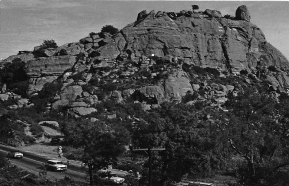
| (ca. 1960s)* - Postcard view looking northeast showing a two lane Topanga Highway at lower-left with Stoney Point in the background |
 |
|
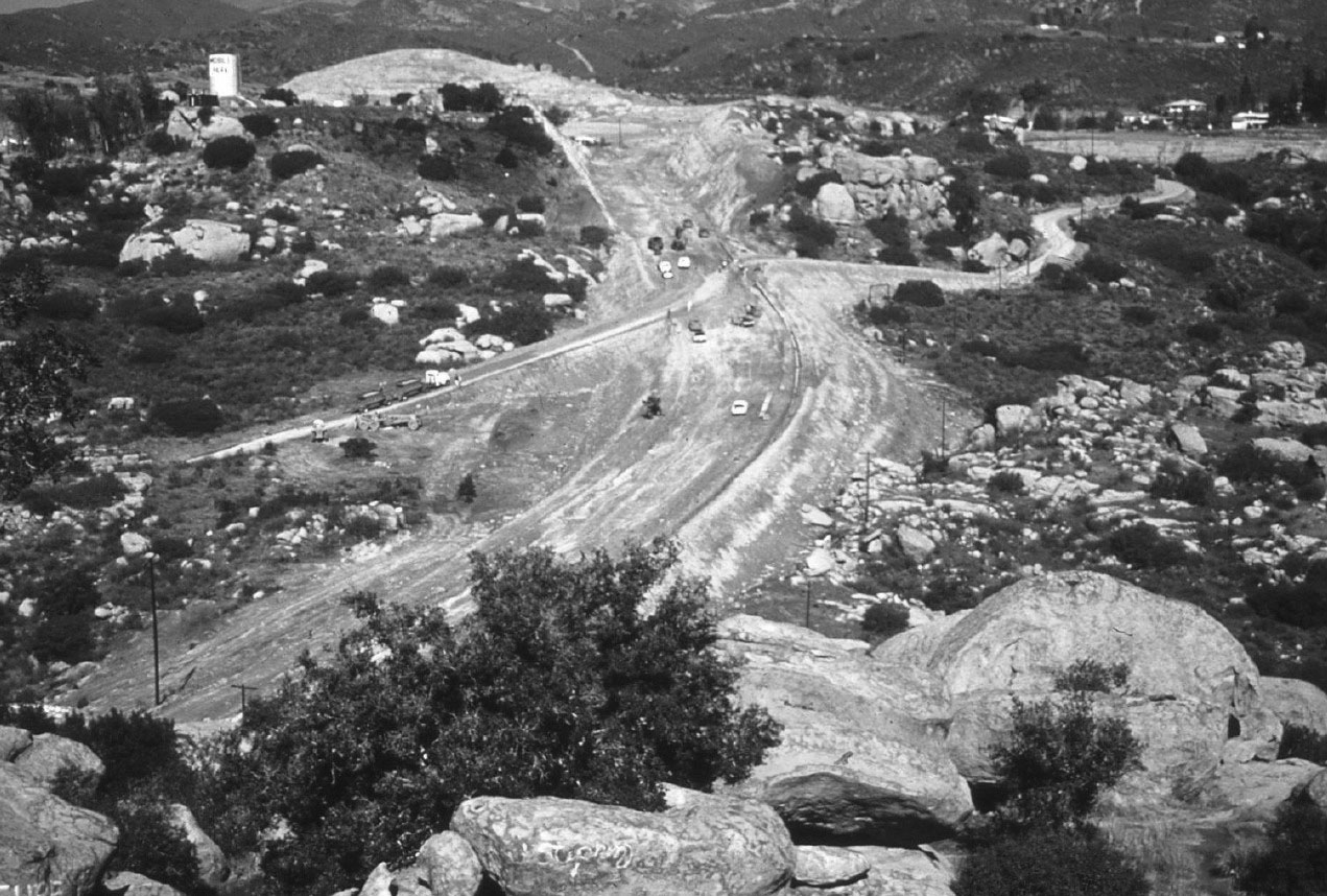
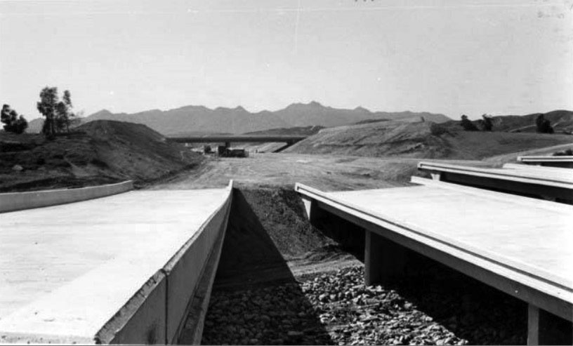
| (Early 1970s)^# - View looking north from the top of Stoney Point showing Topanga extension to the 118 freeway under construction. Note the freeway buildup to the upper right. Also note the water tank for the mobile home park at the upper left. |
 |
|
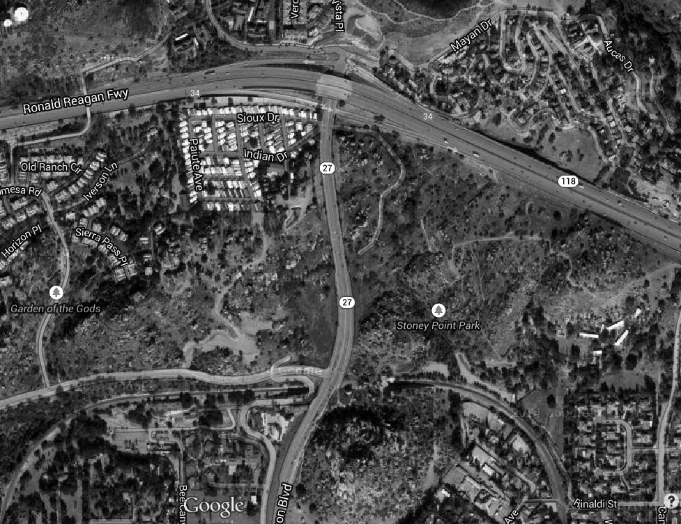
| (2014)#*^# – Google satellite view directly above Stoney Point (center-bottom), looking up toward where Topanga Canyon Boulevard (27) intersects with the 118 Freeway. Santa Susana Pass Road can be seen at lower left. |
 |
|
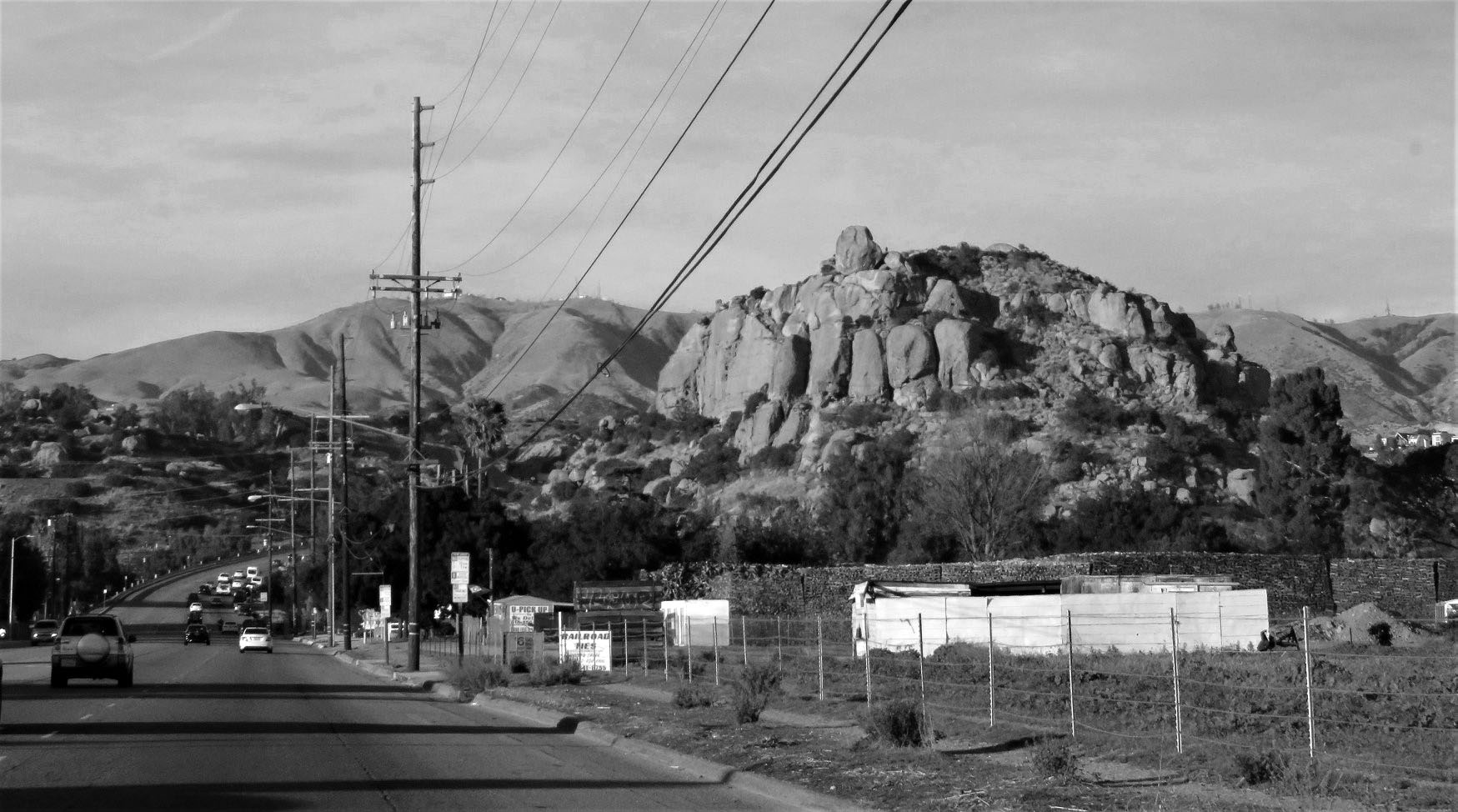
| (2017)^ – View looking north on Topanga Boulevard toward the 118 Freeway from just north of Chatsworth Street with Stoney Point seen on the right. |
Historical Notes Click HERE for More Early Views of Stoney Point. |
Simi Freeway (118)
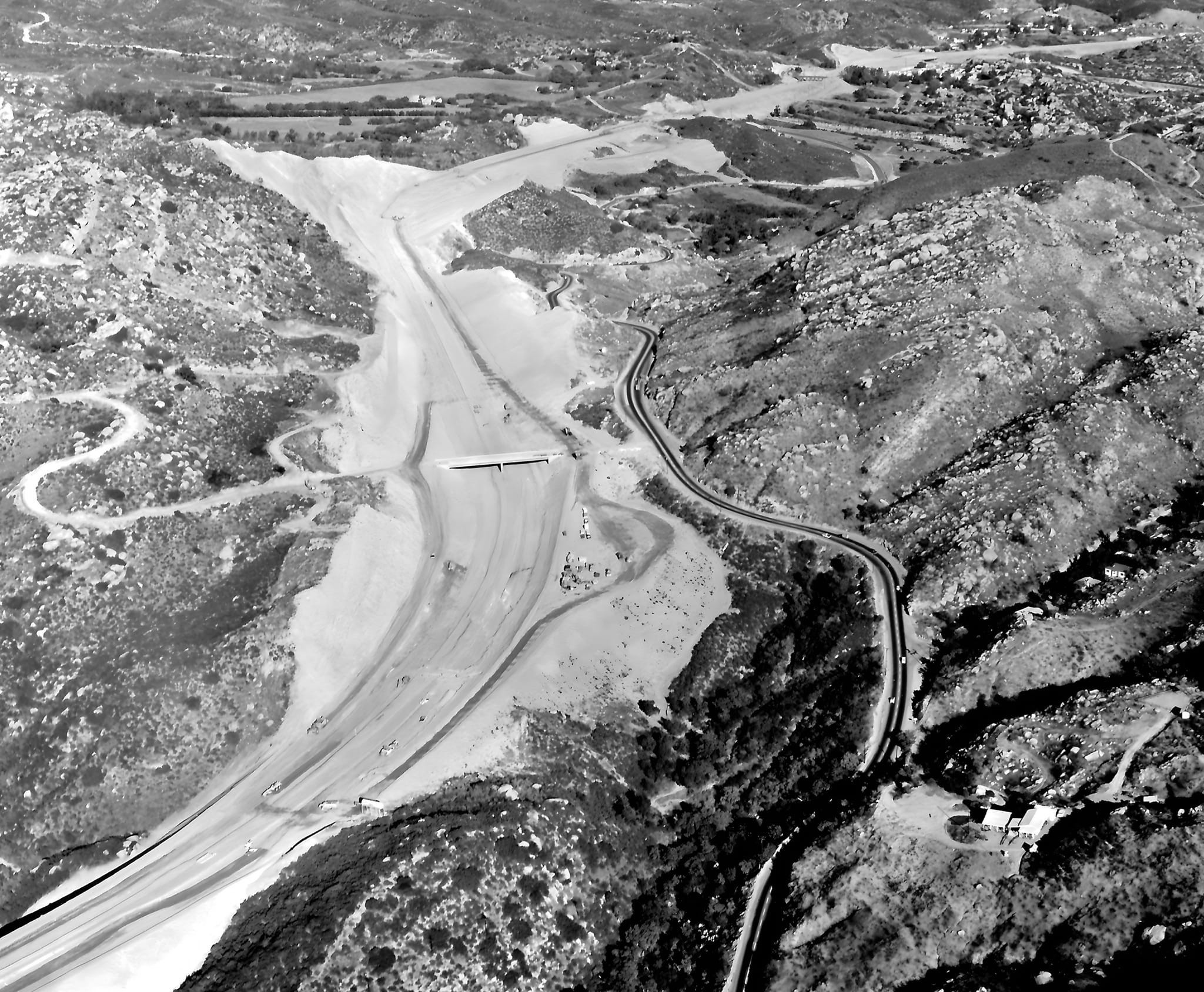
 |
|
| (ca. 1979)* - The Simi Freeway (118) construction moves ahead with the mammoth task of removing millions of yards of dirt from the final segment. This area is between Louise and Encino Avenues. |
Historical Notes Construction of the Simi Valley Freeway (118) began in 1968 and the last section of freeway opened in 1979. The segment of freeway between Balboa Boulevard and Tampa Avenue was one of the last freeway segments to be built in the Los Angeles area. Before the freeway was built, the route went through Simi Valley on Los Angeles Avenue and Keuhner Drive, then crossed into the San Fernando Valley on Santa Susana Pass Road. The eastern segment used Devonshire Street through the San Fernando Valley. During the 1932 Summer Olympics, it hosted part of the road cycling event. In December 1994, the portion of Route 118 constructed to freeway standards was renamed the Ronald Reagan freeway.* |
 |
|
| (1979)* - Aerial view showing the Simi Valley Fwy, now Reagan Fwy (CA-118), under construction at Balboa Blvd in Granada Hills. |
Historical Notes Prior to the freeway completion, westbound traffic had to get off the 118 at Balboa, drive down Rinaldi to Corbin, to Devonshire, to Desoto, and then North to the 118. When they closed the gap from Balboa to De Soto, most, if not all, of those bridges were built on the ground and the dirt excavated from underneath. |
 |
|
| (1968)* - Looking NE over Simi Valley Fwy (now Reagan Fwy CA-118) construction in Santa Susana Pass. Rocky Peak Rd OC in center; Santa Susana Rd at right. |
 |
|
| (1970)* - First Backup - Cars line westbound lanes of new Simi Valley-San Fernando Valley Freeway before opening-day procession begins. Two-mile extension of freeway was officially dedicated yesterday. Freeway will eventually link Santa Paula Freeway near Saticoy with Foothill Freeway near Sunland for total stretch of 47 miles. Photo Date: October 23, 1970. |
 |
|
| (1980s)* - View of the I-5 and I-14 interchange just north of the San Fernando Valley, also known as the Newhall Pass Interchange (officially Clarence Wayne Dean Memorial Interchange). In 1971, the Sylmar earthquake caused major damage to several of these bridges and in 1994, the Northridge quake caused more damage. |
Historical Notes A total collapse of the southbound Interstate 5 to northbound State Route 14 overpass occurred as a result of the February 9, 1971 Sylmar earthquake. This collapse resulted in the additional collapse of the intersecting southbound State Route 14 to southbound I-5 overpass (as this connector bridge was directly beneath the 5/14 overpass). Both bridges fell directly onto the southbound I-5 truck bypass. The interchange was rebuilt in 1973, with additional steel rebar reinforcement. The January 17, 1994 Northridge earthquake caused the southbound State Route 14 to northbound I-5 connector to collapse. It also caused the south 14 to south I-5 overpass to collapse directly onto the main I-5 freeway and the southbound I-5 truck bypass, nearly exactly as had happened in the 1971 Sylmar earthquake. The latter collapse caused the death of Los Angeles Police Department motorcycle officer Clarence Wayne Dean, who, while reporting to work, fell from a partially collapsed bridge when he was unable to stop in time. The interchange was later dedicated the Clarence Wayne Dean Memorial Interchange in his honor. The collapse also closed the Metrolink's Antelope Valley Line, which began operation to Lancaster soon after. The interchange was partially reopened on July 8, and completed in 1995 with additional reinforcing on the overpass support columns. |
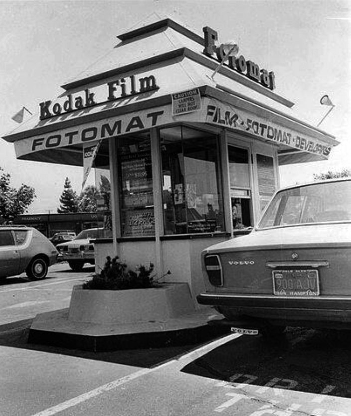
Fotomat Kiosks
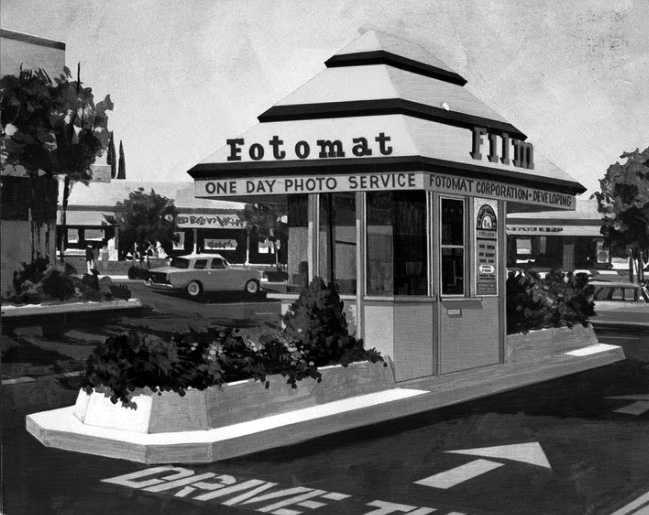 |
|
| (1970s)* – Postcard view of a Fotomat kiosk. This was a common sight in the parking lots of shopping centers throughout Southern California during the 1960s, 70s, and 80s. Photo courtesy of Web Urbanist |
Historical Notes Fotomat was a retail chain of photo development drive-through kiosks located in shopping center parking lots. Fotomat Corporation was founded by Preston Fleet in San Diego in the 1960s, with the first kiosk opening in Point Loma, California in 1965. At its peak around 1980 there were over 4,000 Fotomats throughout the United States, primarily in suburban areas. Fotomats were distinctive for their pyramid-shaped gold-colored roofs and signs with red lettering, usually positioned in a large parking area such as a supermarket or strip mall, as the Fotomat huts required a minimal amount of land and were able to accommodate cars driving up to drop off or pick up film. |
 |
|
| (1970s)* – View showing a 1969 Volvo 142 at a Fotomat kiosk drive-thru. Note the 1971 Gremlin parked in the background. Photo courtesy of Classic Hollywood/Los Angeles/SFV |
Historical Notes Photomat sold Kodak-brand film and other photography-related products, and offered one day photo finishing. They often hired female employees to work in the small buildings and called them "Fotomates." The Fotomate uniform was a royal blue and yellow smock top. Male employees were called "Fotomacs" and their uniform was a light blue polo shirt. The company's main product, overnight film development, was rendered noncompetitive by the late 1980s development of the minilab, which provided one-hour photo development and could be installed on-site without a large capital investment. |
Tampa and Parthenia
.jpg) |
|
| (1960)* - Looking north on Tampa Avenue at Parthenia Street in Northridge. |
Then and Now
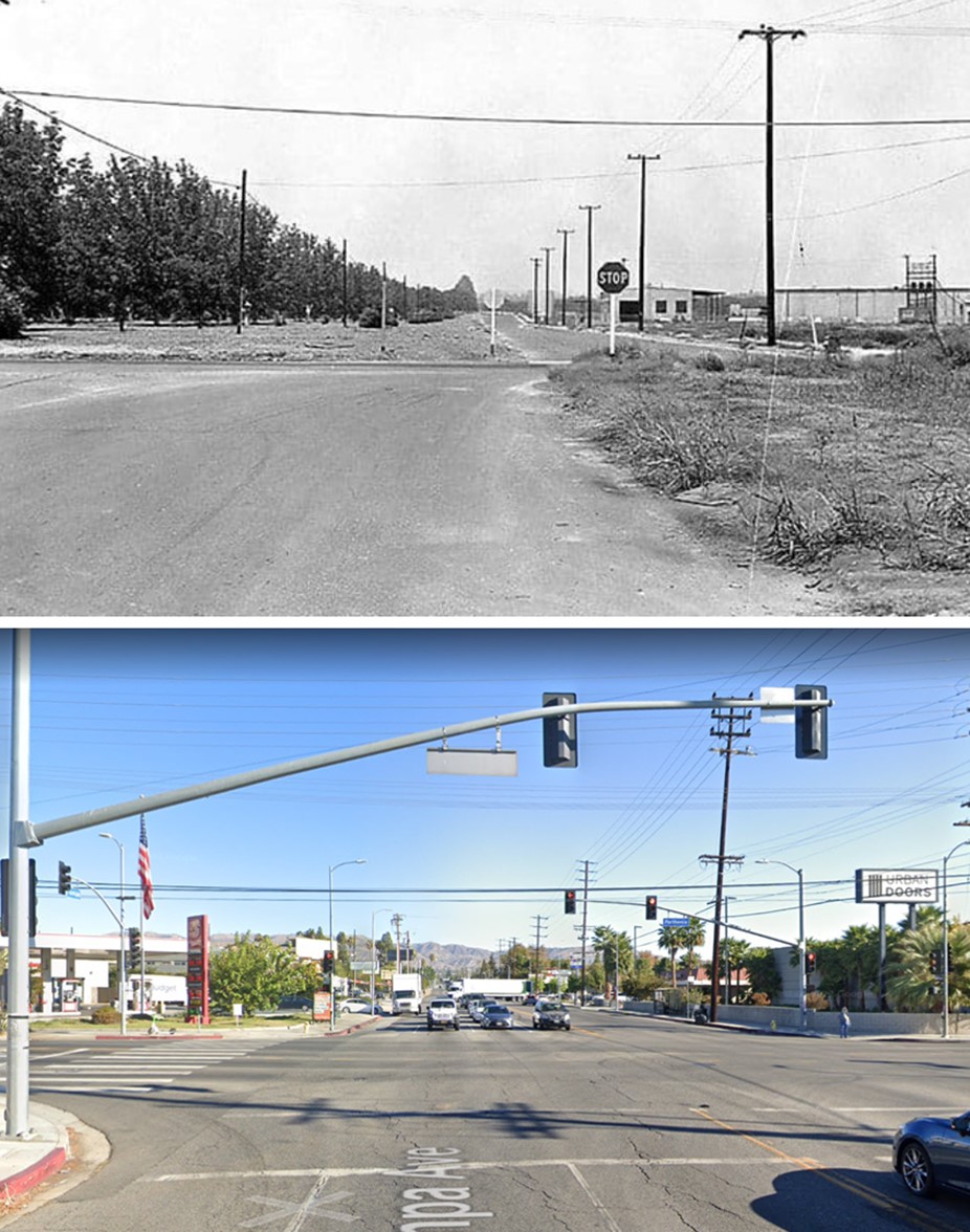 |
|
| (1960 vs. 2022)* - Looking north on Tampa Avenue at Parthenia Street in Northridge. |
* * * * * |
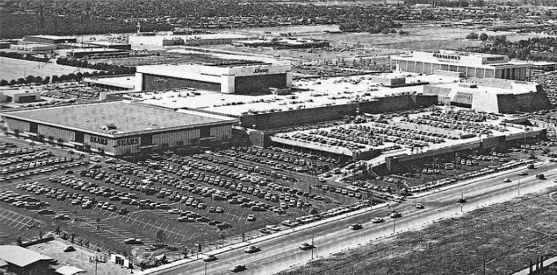
Northridge Fashion Center
 |
|
| (Early 1970s)* – View looking northwest of the Northridge Fashion Center. It opened in four phases, between September 1971 and April 1972. Upon its completion, it was the largest mall in Southern California. |
Historical Notes Northridge Fashion Center had been in the early stages of construction when the Sylmar quake hit on February 9, 1971. There was damage to structures being built, such as the Bullock's store. However, all compromised construction was soon rebuilt, with work proceeding as planned. Unfortunately, the Northridge temblor of January 17, 1994 caused severe damage to the mall. The Bullock's and Penney's stores collapsed, The Broadway and Sears suffered significant structural damage and two parking garages were leveled. However, the bulk of the mall proper was left fairly intact. The mall was closed for well over a year while repairs were made. Bullock's was rebuilt from the ground up and expanded to 200,000 square feet. The Broadway, Penney's and Sears were gutted and reconstructed. |
 |
|
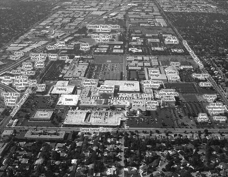
| (ca. 2012)* – View looking west showing the Northridge Fashion Center and surrounding area businesses. |
Historical Notes A second expansion of the Northridge Fashion Center was undertaken in 1997, with the north end of the structure completely reconfigured. The vacant Robinson's-Robinsons-May North was demolished and the empty Broadway building opened-up and made part of an outdoor concourse and plaza. New stores in the "Entertainment Expansion" included Borders, Cost Plus World Market, Bally's Health Club and On The Border Mexican Grill & Cantina. The focus of the expansion was the Pacific Theatres Northridge 10 multiplex, built on the site of the old Robinson's. The addition was formally dedicated in November 1998, increasing the GLA of the mall to 1,512,700 square feet. The retail roster now listed over one hundred and seventy stores and services. Dallas-based MEPC American Properties had the misfortune of acquiring Northridge Fashion Center just one month before it was nearly leveled by the 1994 earthquake. After investing over one hundred million dollars into its reconstruction and renovation, they sold the mall to Chicago-based General Growth Properties, in April 1998. |
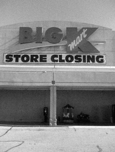 |
(2009)* – View of the front of the Kmart Store located on the southeast corner of Corbin and Plummer in Northridge. Sign reads: "Store Closing"
|
Historical Notes In 2011, the Kmart building was demolished to make room for a housing complex (Terrena Apartments) after standing on the corner of Corbin and Plummer for over 40 years. The Mulholland Orchard Co. occupied at least the area immediately west of the Northridge Mall to Corbin, between Nordhoff and Plummer. The Mulholland Home was the site of the late K-Mart, presently the Terrena Apartments. The grapefruit groves that were recently destroyed for Northridge Toyota's temporary lots and to the north, at the southwest corner of Shirley Ave and Prairie St, were planted by the Chief's son, Perry, circa 1916. The San Fernando Valley's last groves are at CSUN, O'Melviny Park and south to the Blvd, off Corbin. |
Winnetka Drive-in Theatre
 |
|
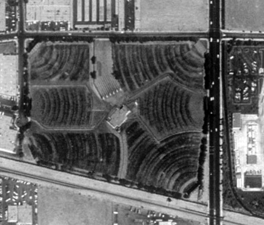
| (1980s)^**^ –Aerial view showing the Winnetka 6 Pacific Drive-In Theatre in Chatsworth, The drive-in was bounded by Winnetka Avenue (right), Oso Avenue (left), Prairie Street (top), and the Southern Pacific tracks (bottom). |
Historical Notes This was Pacific’s biggest drive-in for most of its life. It was built to cater for the expanding suburbs in the West San Fernando Valley. The Winnetka 4 (as it was in the 1970's) replaced the old Canoga Park drive-in on Canoga near Roscoe. By the 1980's Winnetka had expanded to 6 screens and was the drive-in powerhouse in the San Fernando Valley. If not for Pacific moving to more indoor multiplexes, the drive-in would still be open. The Pacific Stadium 21 now draws the same audience and more to hotdogs every night......indoors! #^*# |
Then and Now
|
.jpg) |
|
| (1980s)^**^ - Aerial view of the Winnetka 6 Pacific Drive-In, Chatsworth. | (2014)#*^# – Google satellite view of the Winnetka Pacific Theatres, Chatsworth. |
Historical Notes The Winnetka Drive-In was the last drive-in to be built (1976) and the last to close (1996) in the San Fernando Valley. |
 |
|
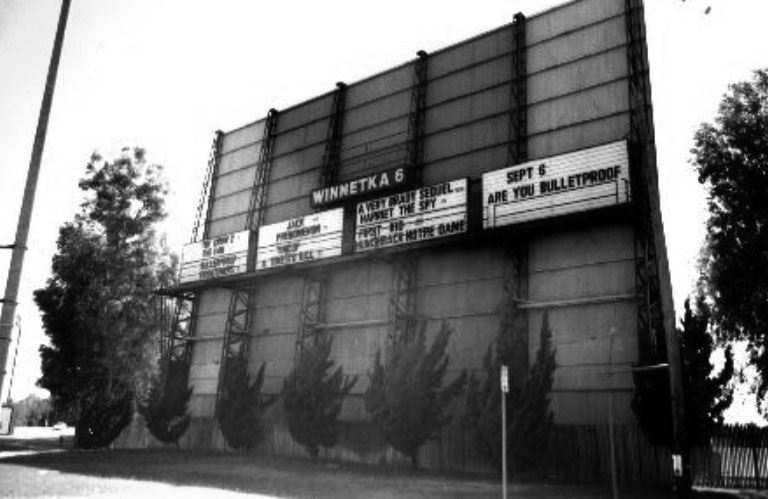
| (ca. 1996)#^*# – Outside view of the Winnetka 6 Drive-In, located at 20210 Prairie Street in Chatsworth. |
Historical Notes There was an elevated projection room at the center of the lot with a snack bar alongside. The staff used motorized golf carts to move around the site since it was so large. #^*# |
 |
|
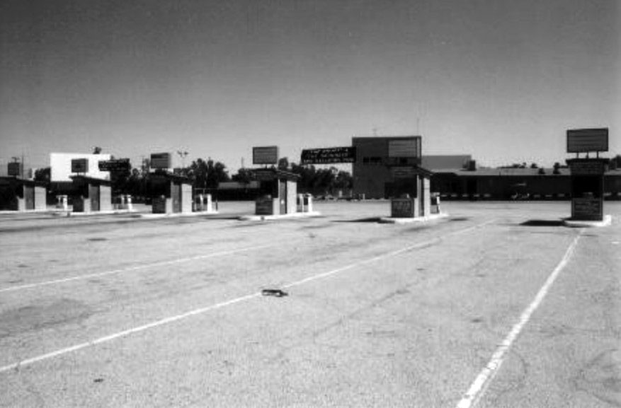
| (ca. 1990s)#^*# - View showing the six ticket booths at the Winnetka 6 Drive-In Theatre. |
Historical Notes You guessed it, six screens so six ticket booths! Boom gates helped ensure "runners" did not get in without paying. When big films played here all six boxes were open.#^*# |
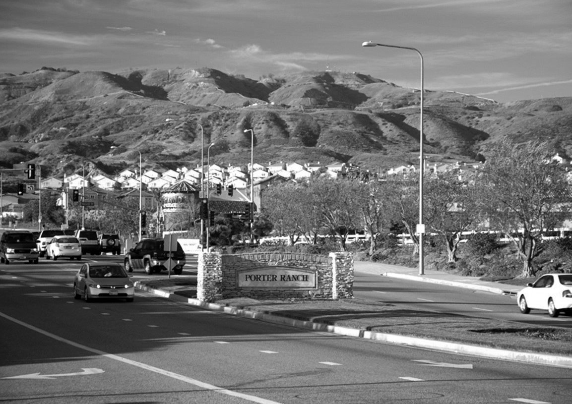
Porter Ranch
 |
|
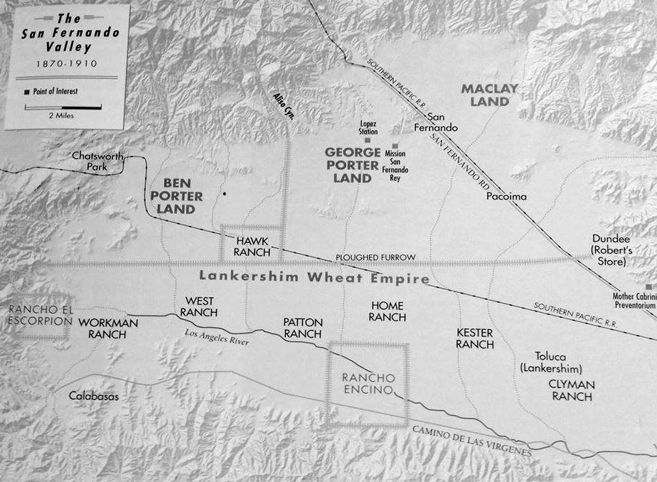
| (1900s)^ - A simplified map showing the division of land between 1870 and 1910 in the San Fernando Valley. At top can be seen the Ben Porter Land and George Porter Land, just west of Mission San Fernando Rey (San Fernando Mission). Map courtesy of William Flower |
Historical Notes George K. Porter owned a third of the northern valley west from the railroad line to Aliso Canyon (Zelzah Avenue from Granada Hills to Northridge). He was the first to initiate large-scale citrus growing in the valley, having planted a navel orange grove that reportedly stretched nearly three miles long. His cousin Benjamin owned 20,000 acres in the valley’s northwestern area. Because it was far removed from the railroad line, it was the least desirable section, and remained relatively undeveloped. |
 |
|
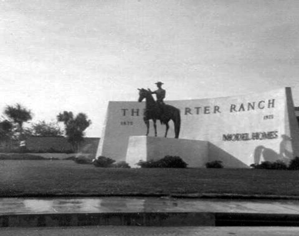
| (ca. 1975)^ – View showing the Porter Ranch welcome statue located on the corner of Tampa and Devonshire. Photo courtesy of Will Markland |
Historical Notes Benjamin Porter’s descendants decided to hold onto the ranch until the early 1960s. But this area was definitely still thought of as ranch land. During the late 1960’s and early 1970’s the unofficial entrance to Porter Ranch was even marked with two horse and rider statues. One was at the northwest corner of Tampa and Devonshire and the other was located at the northeast corner on Devonshire and Tunney. Rumor has it that many years later, one of the statues was found in a local trash dumpster. |
.jpg) |
(1970s)^ - Annual October Ritual, a pumpkin on head of the Porter Ranch welcome statue. Photo courtesy of Will Markland |
|
Historical Notes The Porter Ranch area eventually garnered the reputation of housing horse ranches for numerous celebrities and also served as a filming location for several major movie studios. In cinema history, Porter Ranch was most notable as the location of large portions of the famous film, E.T. the Extra-terrestrial, in 1982. There were a number of shots from the Steven Spielberg blockbuster where they featured views looking down on the Porter Ranch neighborhood that sits beneath the ridge in Palisades Park. Porter Ridge Park is also the sight of the park scene at the end of the movie. |
 |
|
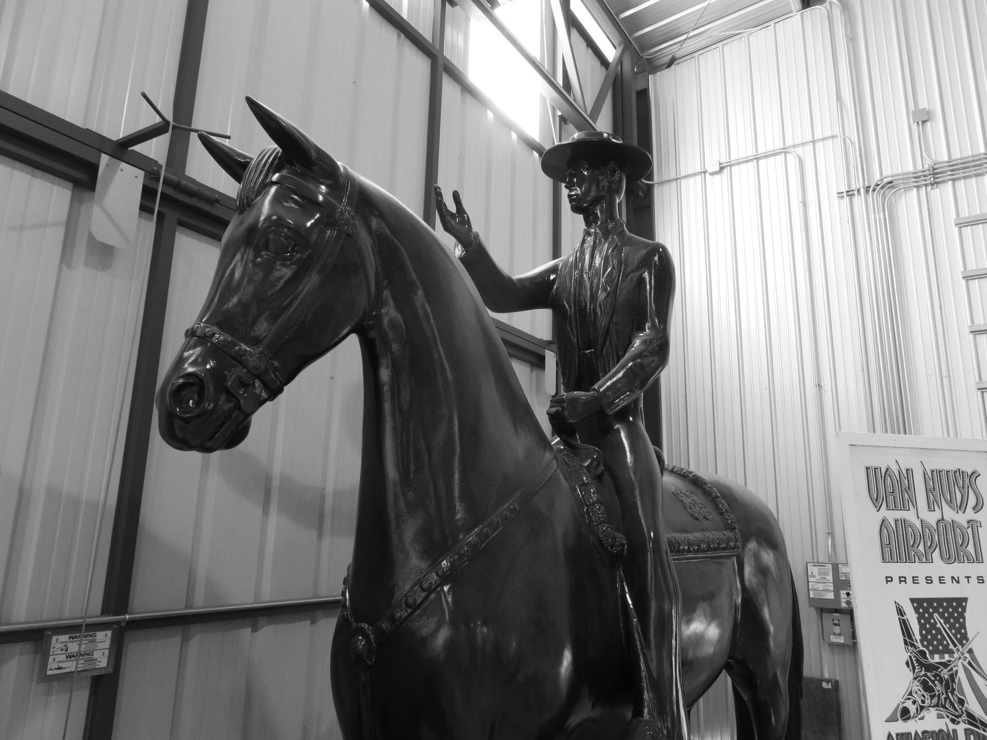
| (2018)^ - The Porter Ranch Welcome Statue now located at the San Fernando Valley Relics Museum, 7900 Balboa Blvd. Photo courtesy of Richard Flower |
 |
|
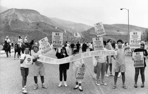
| (1989)* - Photo captions reads: ‘Members of PRIDE citizens' group staged a rally yesterday to protest overdevelopment in Porter Ranch area of the San Fernando Valley. They gathered at the site of a planned bridge across Aliso Canyon, which they fear will increase traffic in the rural area by providing a link between freeways and a proposed regional center, another project they oppose.’ Photograph dated August 19, 1989. |
Historical Notes In the late 80s, there was an attempt to connect Sesnon Boulevard, the road that flanks the north side of the neighborhood, to its counterpart across the Aliso Canyon, also named Sesnon, via a bridge to be named simply, the "Aliso Canyon Bridge". This plan never came to fruition due to demonstrations from the residents of Porter Ranch, the primary opponents of the bridge, who believed that connecting the road to the neighborhood across the canyon would bring "crime...drag racing, and drug dealing". Residents were also afraid of Sesnon becoming "a [highway] 118 alternate route", which would "send many cars through Porter Ranch". The bridge was never built. However, there is still evidence of the bridge seen from Sesnon heading east towards the canyon, the road (which is now closed off behind multiple guard rails) is visible heading towards the canyon just short of the bridge, and the counterpart is still visible on the west-bound side.^ |
 |
|
| (2010s)* - View looking north on Mason Avenue toward Rinaldi Street showing the Porter Ranch entrance sign at center medium. Photo courtesy of Toll Brothers |
Historical Notes New home building that eventually took place in the Porter Ranch area in the 1990s–2000s, including the Renaissance Summit development, was mired in controversy and Los Angeles politics in the late 1980s and early 1990s. Existing residents of the Porter Ranch area feared the increased traffic that would be brought by the planned building of an area commercial complex to service the new homes being built. Developments were also criticized for destroying the natural beauty of the brush and wild areas that inhabited the space before the houses were built. In 1990, the new 1,300-acre Porter Ranch development was approved by the City Council and became known as one of the biggest housing and commercial projects in Los Angeles’ history.*^ |
 |
|
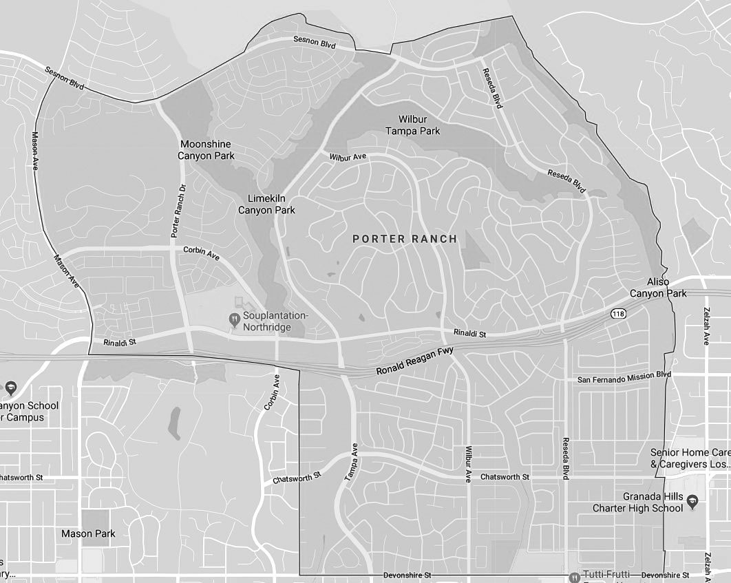
| (2018)^ – Google map showing Porter Ranch and its boundaries. |
Historical Notes To the north of Porter Ranch, just outside the city limits, there existed an abandoned oil field with 115 wells called Aliso Canyon storage facility. This became the second largest storage facility in the nation when it was re-purposed in the 1970s, with a capacity to hold 86 billion cubic feet of natural gas. On October 23, 2015, Southern California Gas Company workers discovered a leak in one of the wells at the Aliso Canyon natural gas storage facility, about three miles north of homes in Porter Ranch. The gas blowout began spewing 110,000 pounds of methane per hour. The blowout involved gas stored under pressure in an underground reservoir. By order of the Los Angeles County Dept of Health, the company relocated thousands of families from the Porter Ranch area; the Federal Aviation Administration established a temporary flight restriction over the leak site until March 2016. On December 15, the county of Los Angeles declared a state of emergency, and two days later it approved a plan to close two schools in the area. Officials estimated that the leak would take months to repair. On February 18, 2016, state officials announced that the leak was permanently plugged. The gas leak has been cited by experts and independent researchers as the largest in U.S. History. It was thought that residents had filed as many as 1,000 lawsuits. Los Angeles County filed criminal charges against SoCalGas for its failure to report the leak immediately. In 2018 SoCalGas agreed to payments of $119.5 million to several government entities over the incident. |
 |
|
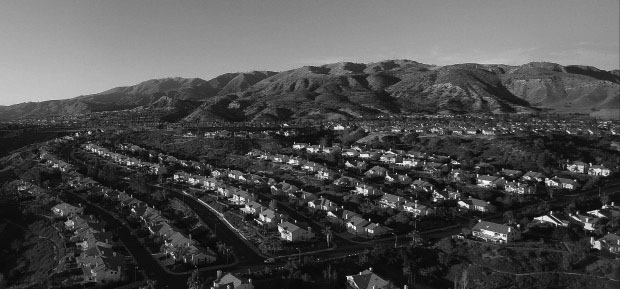
| (2016)* – View from above Porter Ranch neighborhood on a clear day. |
Historical Notes Fifty-one percent of Porter Ranch residents aged 25 and older had earned a four-year degree by 2000, a high percentage for the city. Also, Porter Ranch is rated the wealthiest neighborhood in the San Fernando Valley, with Encino ranked second. |
Chatsworth
 |
|
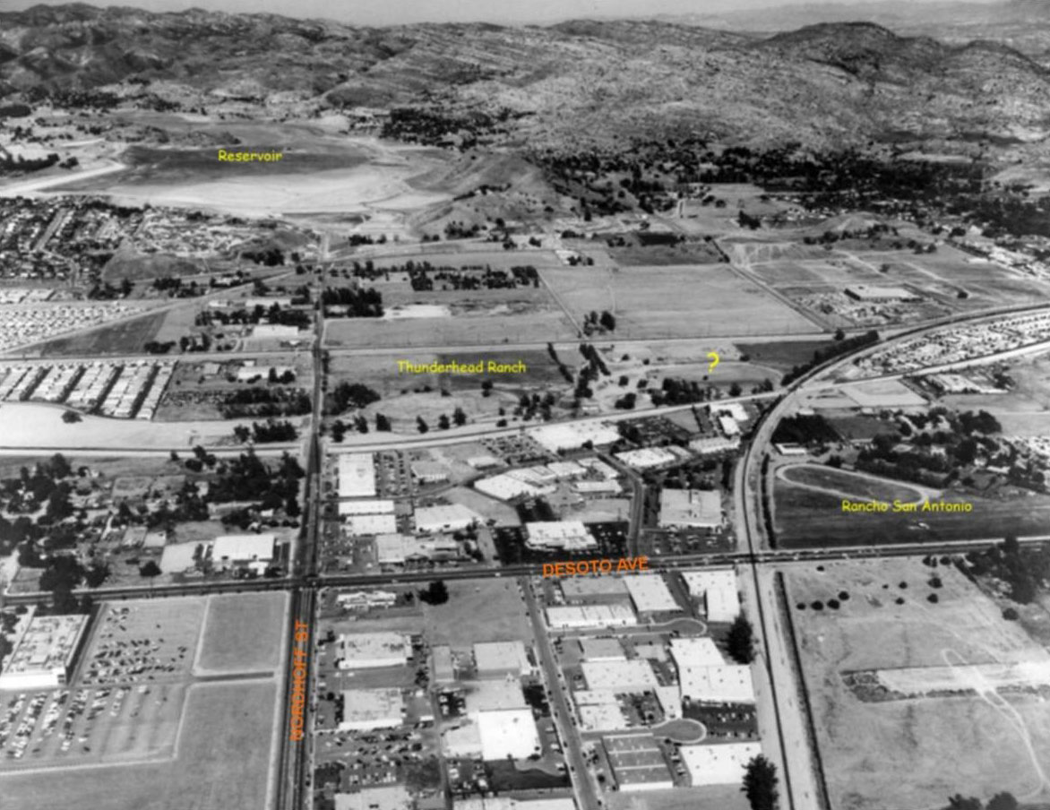
| (1971)* – Aerial view looking west over Nordhoff Street as it extends all the way to Chatsworth Reservoir, upper-left. The Thunderhead Ranch (center) and Rancho San Antonio (center-right) can also be seen. Photo courtesy of Rich Krugel |
 |
|
| (ca. 1969)* - View looking west at the intersection of Nordhoff Street at Topanga Canyon Boulevard. The empty lot on the southwest corner (upper-left) is now occupied by California Chicken Café. Chatsworh Reservoir is located on the other side of the hill in the distance. Photo courtesy of Valley Relics |
Then and Now
|
 |
|
| (ca. 1969)* - Intersection of Nordhofft St. and Topanga Canyon Boulevard, looking west. | (2014)* - Intersection of Nordhofft St. and Topanga Canyon Boulevard, looking west. |
Canoga Park
 |
|
| (1959)^ – View showing the Burroughs Union 76 Station located at 7560 Topanga Cyn Blvd – SE corner of Topanga and Saticoy; Winchell’s donuts was behind. Photo caption reads: Al Mead zooms up with Nancy Ignacio, and in the back seat Donna Zaretzka and Joe Hackett, to get gas from service man Bill Burroughs. |
Historical Notes Click HERE to see more Early Views of LA Gas Stations. |
 |
|
| (ca. 1969)* – View looking south on Topanga Cyn Boulevard at Saticoy Street with a Union 76 station seen on the SE corner and a Mobil station on the SW corner. Photo: Valley Relics Museum |
Historical Notes The Mobil station is now a mini-mart and the Union station is now a Walgreens, but that liquor sign near the SE corner still stands! |
 |
|
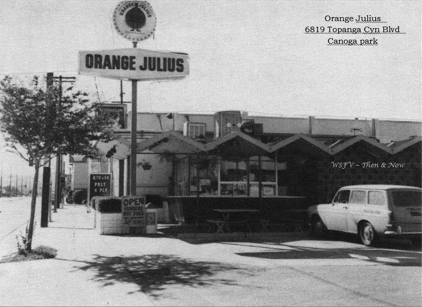
| (ca. 1974)^ - View looking north showing Orange Julius, located at 6819 Topanga Canyon Boulevard. Canoga Park High School is located across the street. |
Historical Notes The restaurant opened in early 1965, and was in business for almost 20 years. In 1984, a new sign was erected, with the owner being PCH burgers. The building was razed sometime between 1989 and 1994, and is now part of the car wash property. |
 |
|
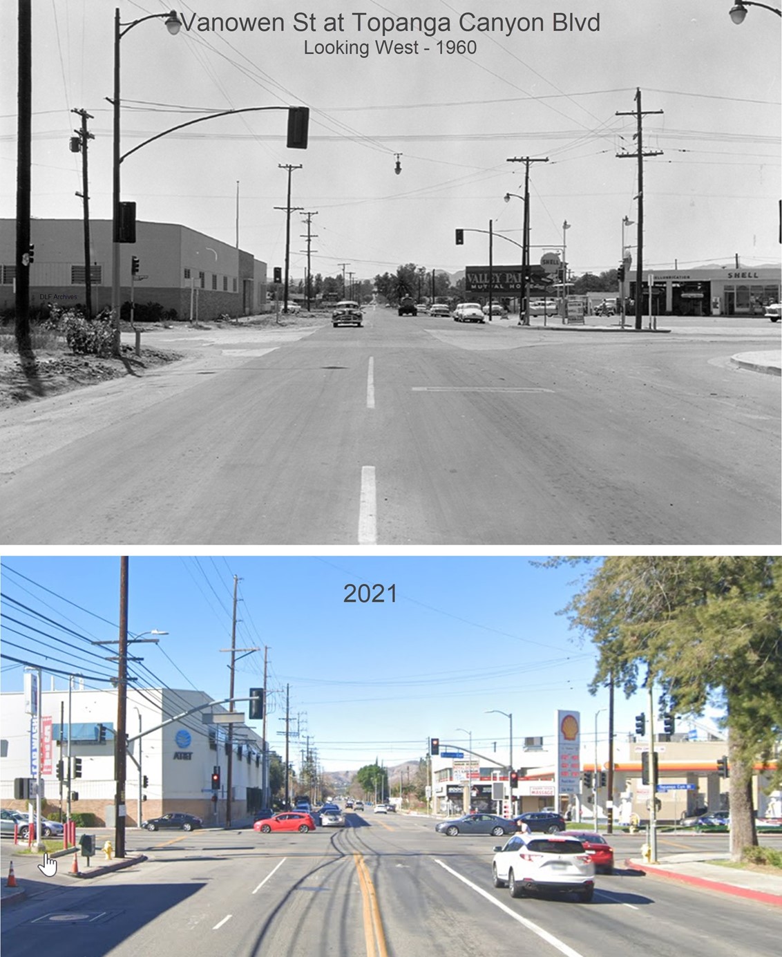
| (1960 vs. 2021)* - Looking West on Vanowen Street at Topanga Canyon Boulevard. Note the billboard advertising Valley Park Mutual Homes. |
 |
|
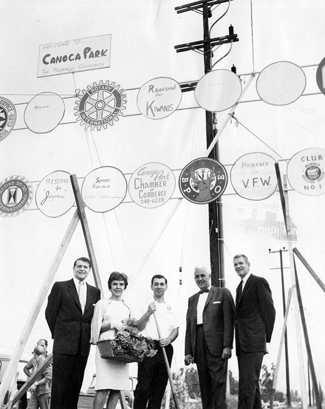
| (1965)* - Valley Times photo caption reads "Canoga Park residents recall happier 'pre-war' days before the boundary dispute between Woodland Hills and Canoga Park. Shown at dedication of the 'Welcome to Friendly Canoga Park' sign three weeks ago on friendly Topanga Canyon Boulevard and friendly Oxnard Street are, from left, Francis Lederer, Canoga Park's honorary mayor; Wilma Netz, Welcome Wagon hostess; Charles Bordonaro, president 20-30 Club; Russell Robertson, past exalted ruler of Elks Lodge 2190, and Harvey Parkinson, president of the Canoga Park Chamber of Commerce." Photo date: June 17, 1965 |
Lederer Residence
 |
|
| (n.d.)^ – View showing the Lederer Residence located at 23134 Sherman Way, home of famous actor Francis Lederer. Photo by Julius Schulman / Big Orange Landmarks |
Historical Notes Francis Lederer was a Czech-born film and stage actor with a successful career, first in Europe, then in the United States. Lederer has more than seventy credits on the IMDb. During the 1950s, he served as honorary mayor of Canoga Park. In 1934, Francis Lederer began design and construction, with the help of artisan builder John R. Litke, of his landmark residence and stables on the hilltop of a large 300-acre rancho at the west end of Sherman Way. The house is a blending of Mediterranean Revival style with Mission Revival style architecture in which the interior and exterior integral design, artisan work, and construction details are in a refined landmark quality. The rich building materials were chosen to make the finished buildings appear centuries old. The interior has imported original 14th and 15th century Italian Renaissance and Spanish Renaissance museum-quality art pieces, decorative arts elements, and furnishings. |
 |
|
| (1965)* – Valley Times photo with caption that reads “Entrance to Lederer home announces Spanish theme. Paintings and other art objects date back to 15th and 16th Century." Photo by George Brich, March 16, 1965. |
Historical Notes In 1978, the Lederer Residence and immediate environment was declared LA Historic Cultural Monument No. 204. A big factor in the residence’s historic monument declaration was the decorative and antique furnishings throughout the home. The city called the Lederer Residence “a distinguished example of Mission Style architecture in which interior and exterior detailing is of museum quality. The Spanish and Italian furnishings are of particular interest, dating back from the 14th century.” |
 |
|
| (2008)* - View showing the 1930s Lederer Residence, a Los Angeles Historic-Cultural Monument located at 23134 Sherman Way. |
Historical Notes Lederer also owned the stables across the street (now the Canoga Mission Gallery) which was also declared a Los Angeles Historic Cultural Monument in 1974. Both sites comprised a 300 acre ranch owned by Lederer. He was also the Honorary Mayor of Canoga Park during a good portion of his life prior to his death in 2000 at the age of 100. Lederer was a promoter of the West Valley especially Canoga Park where he helped establish the sister city program between Taxco, Mexico and Canoga Park in 1963. |
Canoga Mission Gallery
 |
|
| (1963)^x^ - STABLE TO ART CENTER - Actor Francis Lederer poses outside building on his estate formerly used as a stable. Lederer is preparing to turn the structure into a community art center for California and Mexican artists' works exhibits. |
Historical Notes The stables are in pure Mission Revival style and was designed by Francis Lederer with John R. Litke in the 1930s. It was built beside Bell Creek. Marion Lederer, his wife, transformed them into the Canoga Mission Gallery in the 1970s, which continues to the present day. In his later life, Lederer, who had become very wealthy, invested in real estate, especially in the Canoga Park community (renamed West Hills in 1987). He was active in local and Los Angeles civic affairs, philanthropy and politics. He served as Recreation and Parks Commissioner for the city of Los Angeles, received awards for his efforts to beautify the city and was the honorary mayor of Canoga Park for quite a time. He became involved with peace movements, taught acting, and was one of the founders of the American National Academy of Performing Arts in Los Angeles, and the International Academy of Performing Arts in Washington, D.C. In 2000, he was honored by the Austrian government with the Cross of Honor for Science and Arts, First Class. Lederer Avenue was named in his honor. |
 |
|
| (1964)* – Valley Times photo with caption that reads: "David Brockmann, left, and John Naftzger climb hill from new Canoga Mission Community Art Center in Canoga Park. Pair plans museum in building modeled after San Luis Rey Mission, donated by actor Francis Lederer." |
Historical Notes In 1967, the stables were transformed into a Mexican art gallery known as the Canoga Mission Gallery. In 1974, the Mission Revival-style building was declared LA Historic-Cultural Monument No. 135. |
 |
|
| (2008)^ - View showing the Canoga Mission Gallery located at 23130 Sherman Way, West Hills. Photo: Big Orange Landmarks |
Historical Notes Today the former stables, built in 1936 by actor Francis Lederer, houses an antique shop and hosts events. |
Shoup Ave
 |
|
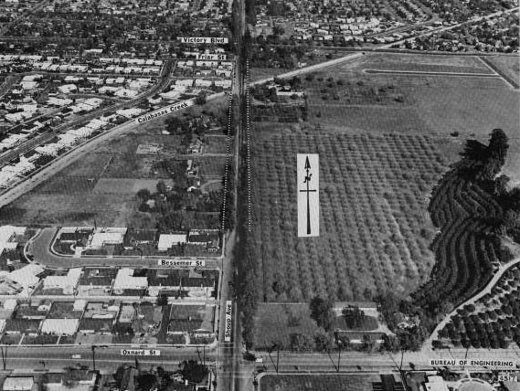
| (1965)^##^ - View looking north on Shoup Avenue between Oxnard Street and Victory Boulevard. The Calabasas Creek runs diagonally across Shoup. Today, the "Summit at Warner Center" occupies the land east of Shoup and north of Oxnard. |
Historical Notes Shoup Avenue was named after Paul Shoup, a vice president of the Southern Pacific Railroad and president of the Pacific Electric Railway Co. Oxnard Street was named for Henry T. Oxnard, sugar beet magnate in the Ventura County area. The name dates from 1916, when the Valley was developing into a major beet producer. Click HERE to see more SFV Street Name Origins. |
Sherman Way and Shoup Ave
 |
|
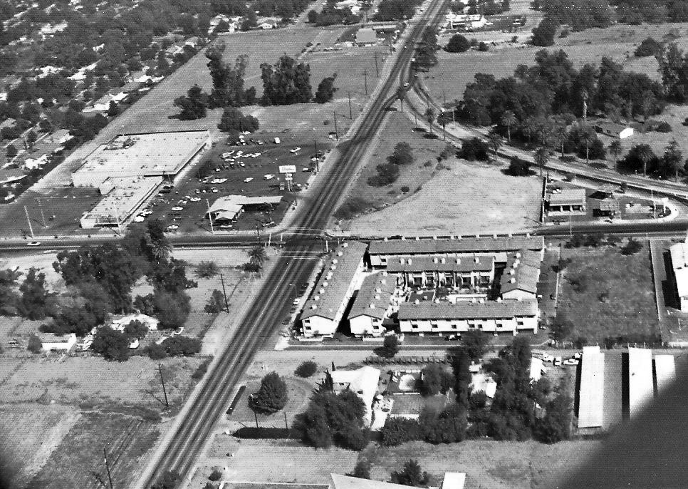
| (ca. 1972)#^*^ – Aerial view looking east on Sherman Way toward Shoup Avenue (center of photo) from above the Trafficanda Egg Ranch. Carlson Circle is at upper-right. Hughes Market is seen at center-left. Click HERE to see a contemporary view of the same area. |
Historical Notes On the right, where Carlson Circle merges with Shoup Avenue, you can see a gas station. This station lasted until the mid-70's when it became a 'Naugles' and about 1988 became a Del Taco. The reason Carlson Circle is curved is that Pacific Electric had plans for a streetcar line that would run from Topanga and Sherman Way all the way up to Shoup and Ventura Blvd. The line never went in. Just east of the Hughes Market (upper-left) is where the Roller Dome eventually was and later a health fitness center (Racquetball World then Spectrum and currently the Bay Club). |
 |
|
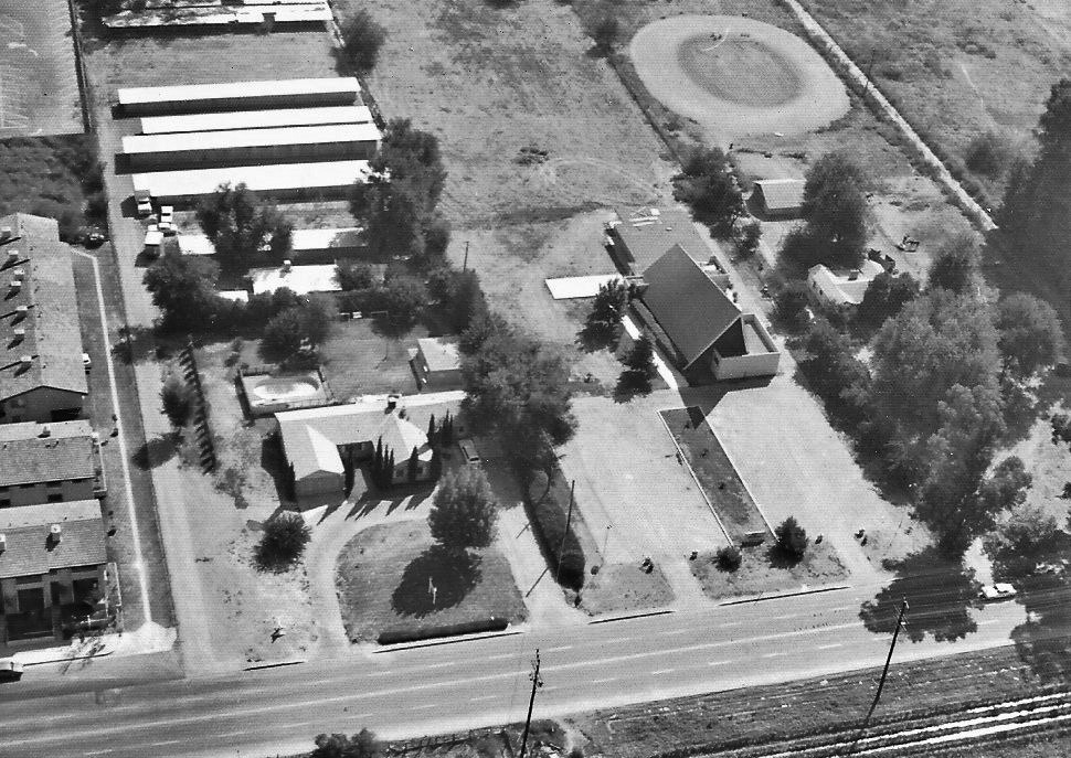
| (ca. 1972)#^*^ – Aerial view looking south showing Sherman Way, just west of Shoup Avenue. The property now is West Valley Christian Church. The church you see here (once the Nazarene church) is on the south side of Sherman Way. |
 |
|
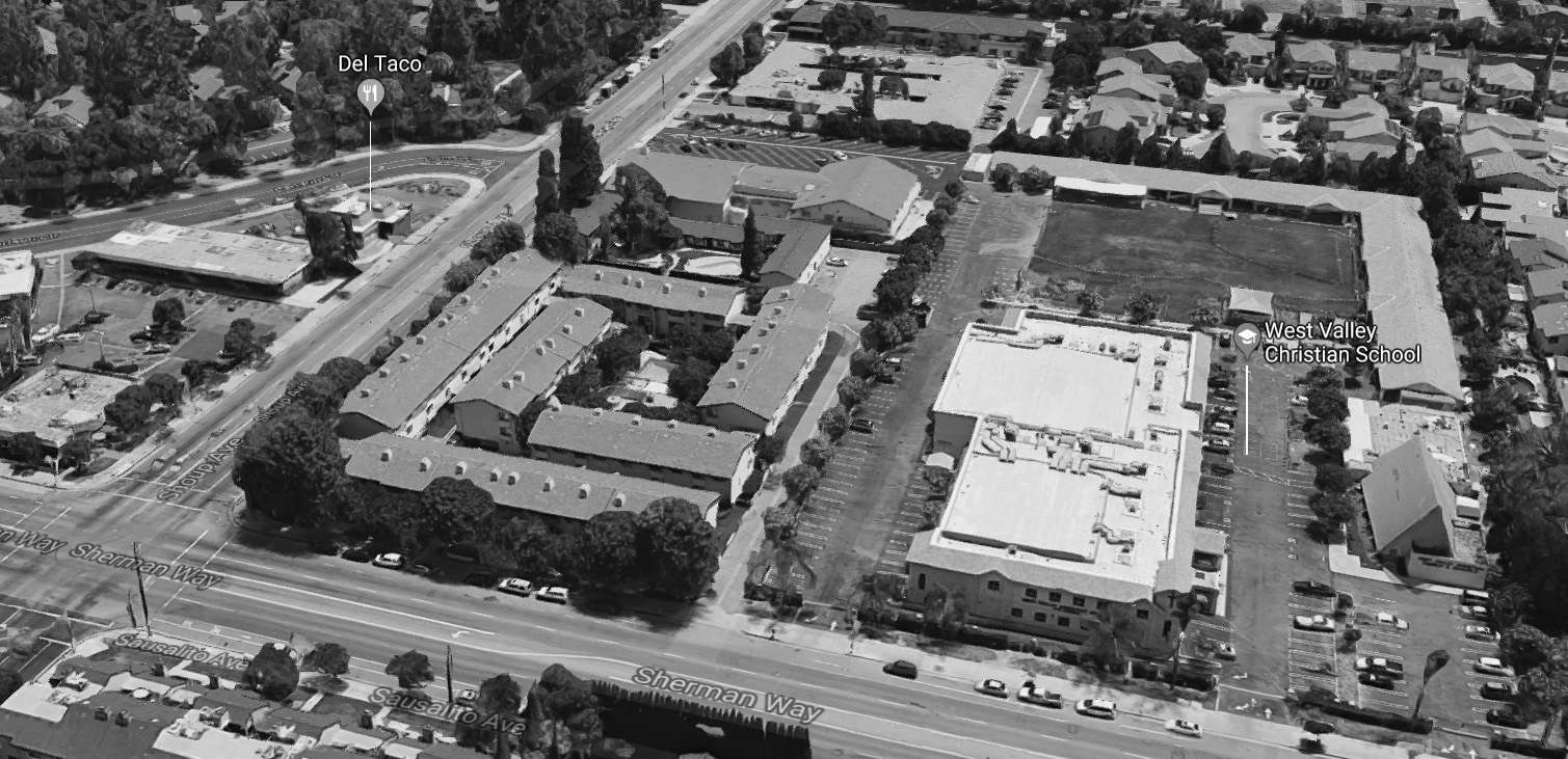
| (2019)* – Aerial view looking south showing the intersection of Sherman Way and Shoup Avenue (lower-left). West Valley Christian School is on the right. A Del Taco is seen on the left at the intersection of Carlson Circle and Shoup Avenue, where a gas station once stood. |
Warner Ranch
 |
|
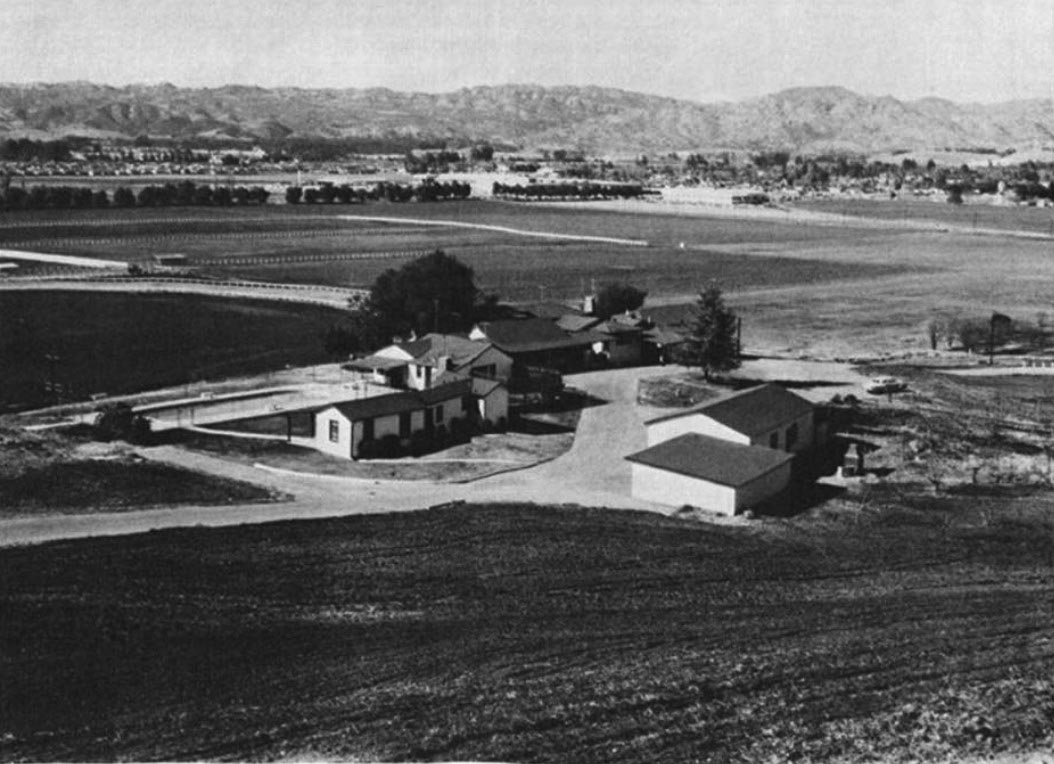
| (ca. 1958)#^*^ – View looking northwest showing Harry Warner’s home overlooking Warner Ranch near De Soto Ave and Oxnard Street. Rocketdyne's first completed building can be seen near the SPRR Curve (upper center-right). Then, still some Pepper Trees blocking view to the west side of Canoga where other buildings were built. |
Historical Notes Harry Warner, the eldest of the Warner Brothers, owned this land since the 1940s which he used as a horse ranch. In 1968, 630 acres of the land was sold to Aetna Life and Casualty for $30 million. Aetna acquired the land for long-term investment and development purposes, and later brought in Kaiser as a joint venture partner. Initially, tracts of the Warner Ranch land had been developed in pieces, such as the Topanga Plaza which opened in 1964 as the first enclosed shopping mall in California, or sold to users such as aerospace companies Rocketdyne and Litton Industries which built their facilities there. The Harry Warner family donated 20 acres of land in 1967 that became the Warner Center Park (also known as the Warner Ranch Park), located east of Topanga Canyon Boulevard between Califa Street and Marylee Street.*^ |
Then and Now
 |
|
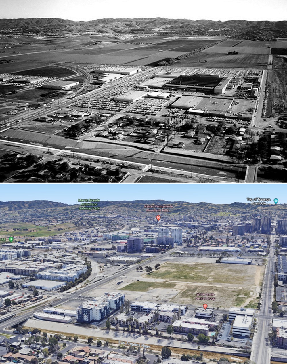
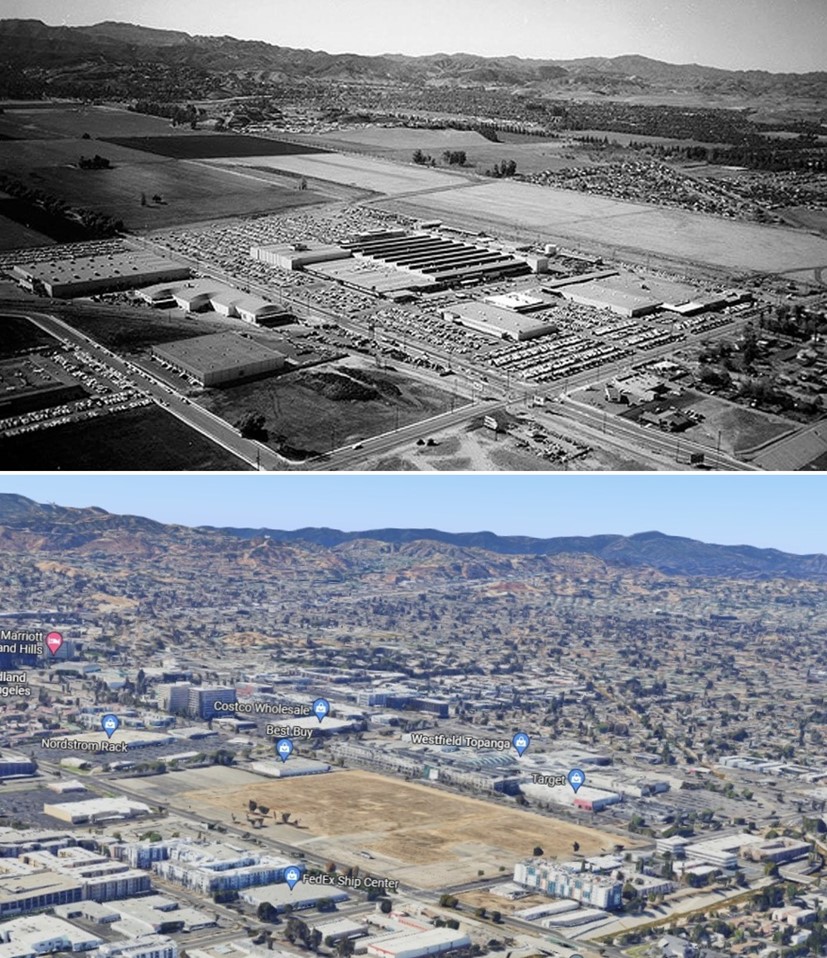
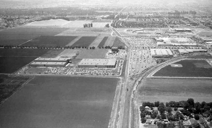
| (1960 vs 2022) – Aerial view looking southeast towards Warner Center. Canoga Ave is on the left running diagonally from lower left to upper right. Owensmouth is running away from the camera on the right. The headwaters of the LA River is seen at bottom. In earlier photo, the Rocketdyne facility is seen at center and Warner Center has yet to be developed. At center-right you'll notice that Topanga Plaza has not been built yet. Wouldn't be open for another 4 more years. |
Rocketdyne (Canoga Park)
 |
|
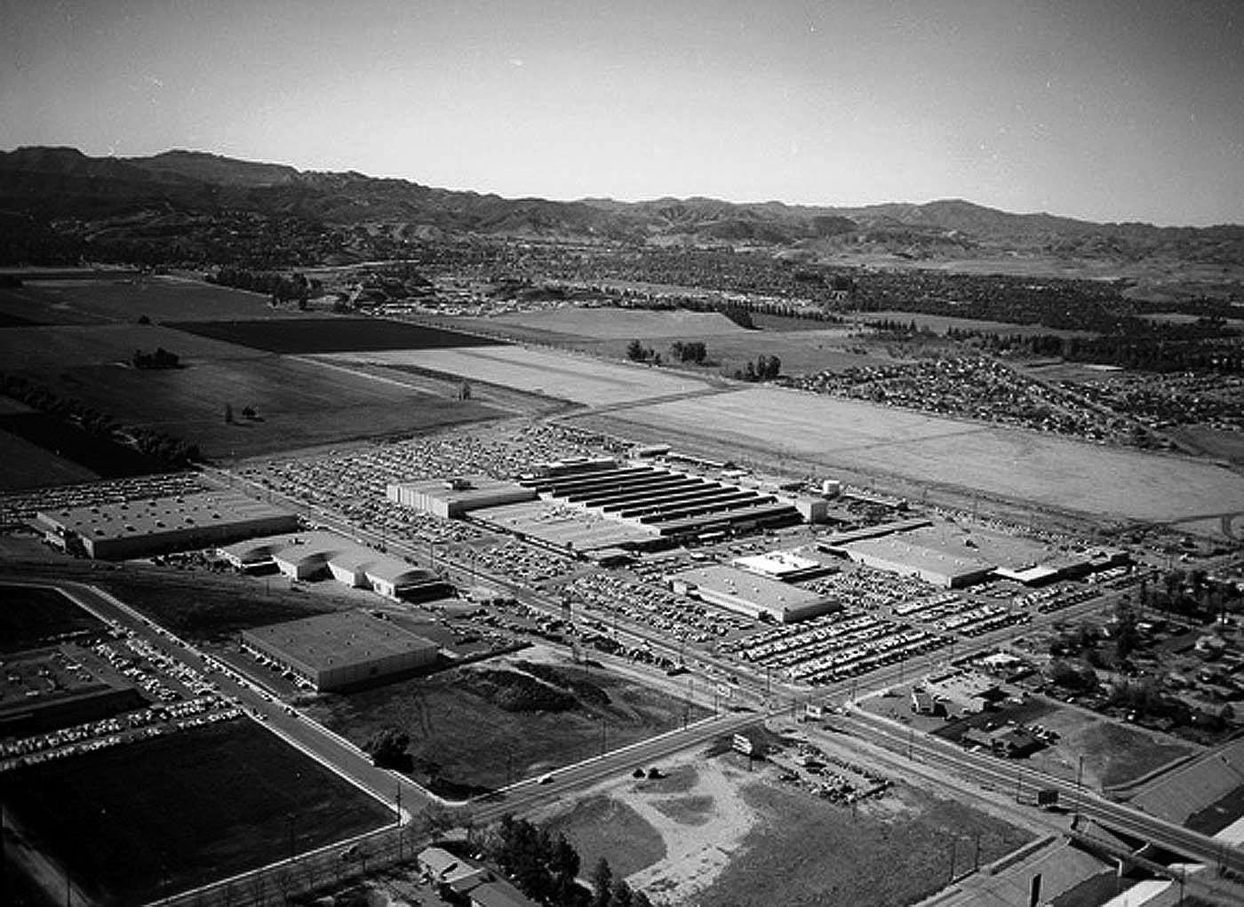
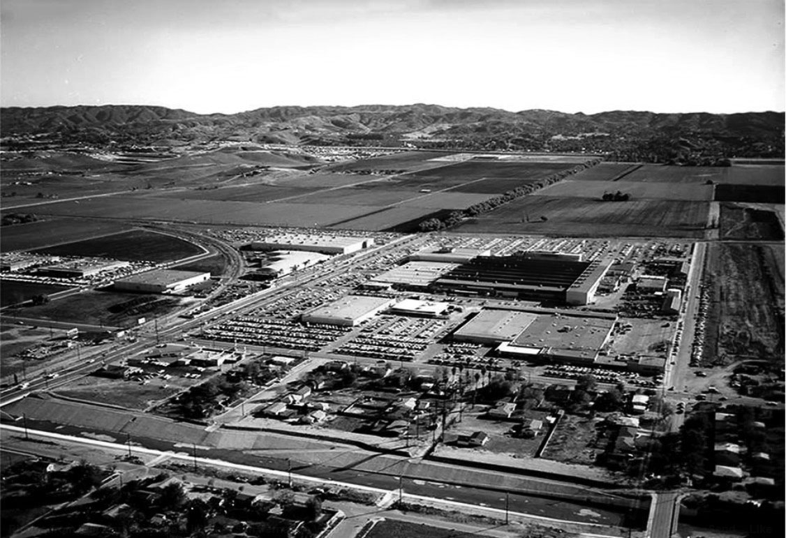
| (ca. 1958)* – Aerial view looking southwest toward Woodland Hills and Calabasas showing the Canoga Park Rocketdyne Plant. The intersection of Vanowen Street and Canoga Avenue is seen at lower center-right. The two large parcels of open land in the distance, between Owensmouth and Topanga Canyon Boulevard, are the future homes of the Topanga Plaza and Westfield Topanga and Village shopping centers. |
Historical Notes The 47-acre facility at 6633 Canoga Avenue, opened by North American Aviation in November 1955, helped propel America’s vaunted space program. The Aerojet Rocketdyne division is now located at 8900 De Soto Avenue in Chatsworth, which opened five years later. At its height in the mid-1960s, the Rocketdyne division employed more than 23,000 rocket scientists in Canoga Park, Chatsworth and its Santa Susana Field Laboratory above Simi Valley, site of booming rocket engine tests.* |
 |
|
| (1960)#^*^ – Aerial view looking southeast toward the Santa Monica Mountains. The Rocketdyne facility is seen at center of photo. Canoga Ave is on the left running diagonally from lower left to upper right. Owensmouth is the street running away from the camera on the right. If you look to the right, you'll notice that Topanga Plaza had not been built yet. Wouldn't be open for another 4 more years. Photo by: Alan Scott Crawford |
Historical Notes For more than 50 years, the massive Canoga Park manufacturing facility has played a central role to the U.S. space program. Workers there designed and built the engines used on the Saturn V rocket in the Apollo program, and then the main engines used on the Space Shuttle. * |
 |
|
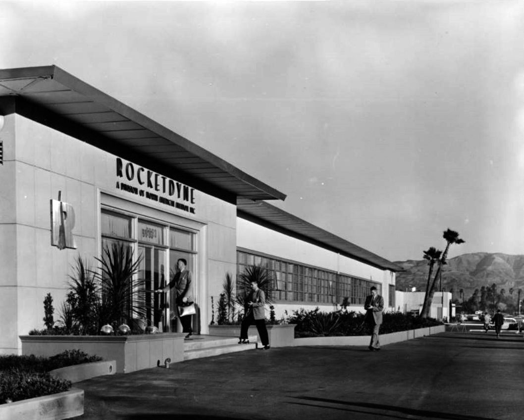
| (1960s)^ - View showing three men dressed in suits entering the headquarters building of Rocketdyne Company, 6633 Canoga Avenue, Canoga Park. Photoprint reads: "HQ building - Canoga Park, "a small residential and farming community in the west San Fernando Valley", main offices, ranch, developments and manufacturing of liquid, propellant rocket engines. |
Historical Notes A press release attached to the photo reads: 'High-thrust rocket engines for the arrived forces are designed, developed, and manufactured in this ultra-modern main plant of Rocketdyne, a division of North American Aviator, above. Located at Canoga Park in California's San Fernando Valley, the plant contains in addition to 316,000 square feet, engineering and warehousing facilities nearby. In the Santa Susana Mountains near Canoga Park is Rocketdyne's propulsion field laboratory, where the large, liquid-propellant rocket engines are static-fired in huge steel test stands. It is the free world's most extensive and advanced rocket research center.' ^^ |
 |
|
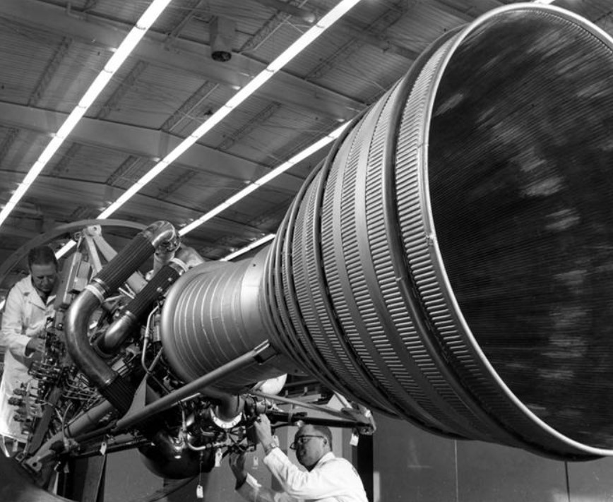
| (ca. 1960)* - Mechanics at work on a rocket engine at Rocketdyne in Canoga Park. Photo Rocketdyne Archives |
Historical Notes A related press release explains that the mechanics are making: "the final adjustments on an engine which will be used in the U.S. Army Jupiter intermediate range ballistic missile. The Jupiter IRBM will be deployed in operational use by units of the Strategic Air Command. It was an engine of the type shown which was called upon to furnish the powerful first-stage boost of the Army's space probe." |
 |
|
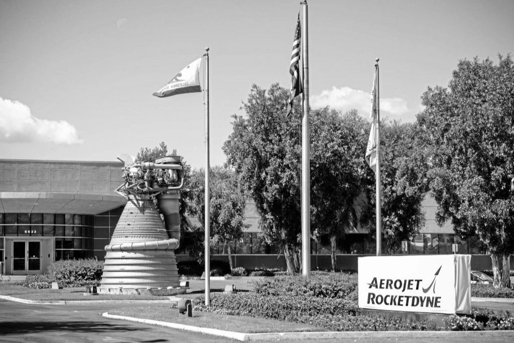
| (2013)* - View showing an F-1 rocket engine like those used to power Apollo missions to the Moon, in front of the Aerojet Rocketdyne facility in Canoga Park. The 18,400-pound engine, berthed since 1979 in front of the Canoga Avenue plant that produced it, is scheduled to be hauled to the company's De Soto Avenue site in 2015. Photo: David Crane / Daily News |
Historical Notes Rocket engines for aerospace and weapons were developed and manufactured by Rocketdyne (1955-2005), Pratt & Whitney Rocketdyne (2005-2013), and Aerojet Rocketdyne (2013-present) at the Canoga Park facility. At its loudest was its colossal F-1 liquid propellant rocket engine (seen above), the largest, most powerful single-nozzle, liquid fueled rocket ever made, according to NASA.*^ Of its 13 Apollo missions from 1967 to 1973, 24 astronauts escaped Earth’s orbit without a hitch, including a dozen who walked on the moon, using the Canoga Park built rocket engine. Some 98 F-1s were produced, including some 65 engines flown, according to NASA. One of them was the unused engine on Canoga Avenue resembling the Terminator in an antebellum hooped skirt, now owned by the Smithsonian Institution in Washington, D.C. * |
 |
|
| (1960)* - Aerial view looking west onto Rocketdyne Missile Division, Canoga Avenue. At the top left corner is the intersection of Victory and Topanga Canyon boulevards and the very large empty space at top of photo is the future home of the Topanga Plaza Mall. |
 |
|
| (1960)* - Aerial view looking northwest showing the Rocketdyne’s Canoga Park facility with the intersection of Victory and Canoga at lower right. At upper left can be seen the future home of the Topanga Plaza Mall (completed in 1964). |
Historical Notes In 2014, the entire Canoga Park Rocketdyne facility was sold to developers. Shortly after the sale, it was announced that a $3 billion project would be constructed on the 47-acre Rocketdyne site that will include a mix of commercial, residential and high-rise buildings forming almost their own mini-city. |
Then and Now
 |
|
| (1958 vs. 2022)* - Rocketdyne - Canoga Park |
Historical Notes Devolopment of the Rocketdyne Canoga Park plant site have been stalled. Community activism and legal actions have played a significant role in addressing the issues surrounding the site. Local residents and environmental organizations have been advocating for a thorough cleanup of the site and increased transparency in the process. Lawsuits have been filed against the responsible parties to ensure accountability and adequate remediation efforts. Efforts to address the environmental concerns and protect public health are ongoing, with continued monitoring, cleanup activities, and engagement from community stakeholders, government agencies, and environmental organizations. |
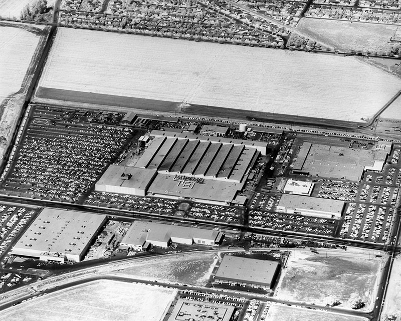
Topanga Plaza Mall
 |
|
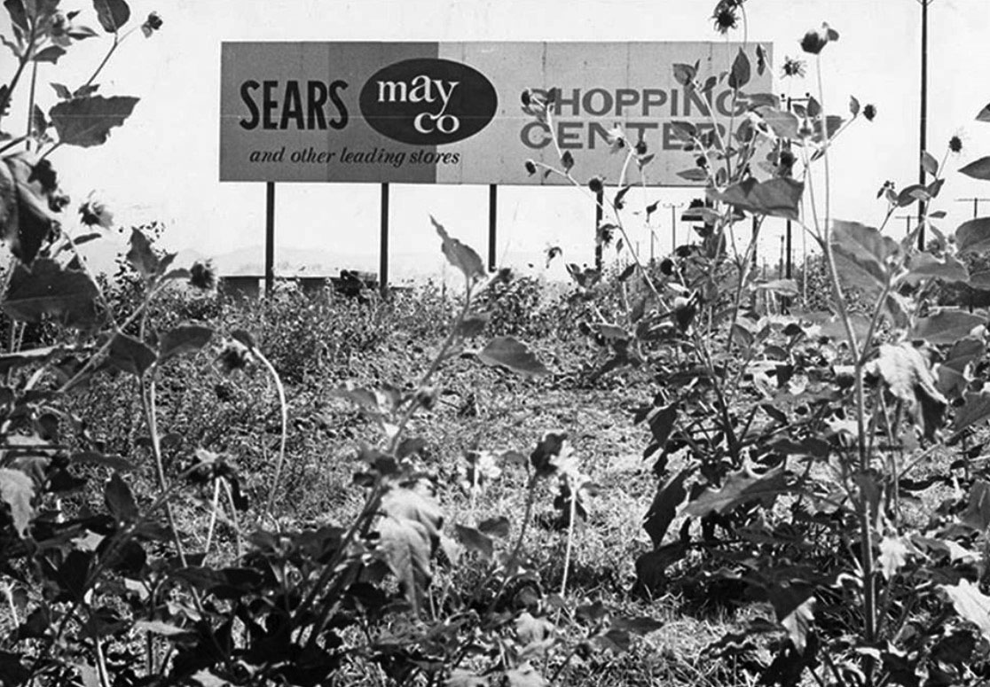
| (1960)* - Sign amidst sunflowers at Vanowen Street and Topanga Canyon Boulevard, announcing the coming of a new shopping center - Topanga Plaza. |
Historical Notes Ground was broken for the TOPANGA PLAZA project in February 1963. Topanga Plaza was conceived as one of California's first major enclosed shopping malls. This design approach was revolutionary at the time, as it provided a climate-controlled environment for shopping, protecting visitors from the elements and creating a more comfortable experience year-round. |
 |
|
| (ca. 1963)* - View looking west on Victory Boulevard toward De Soto. In the distance can be seen the Topanga Plaza Mall still under construction. |
Historical Notes Looking west on Victory, Desoto is the first street at the bottom of the picture going left to right. The curving road going off to the right is the railroad tracks that paralleled Victory (E & W) then curved up and paralleled Canoga (N & S) - now the Orange Line Busway. The road in the middle with trees along it going left to right is Canoga Ave. The trees in the upper right is Shadow Ranch Park and beyond that is where Fallbrook Square is going to be built....if you look at the hill on the upper-left side of this picture it’s the back of Woodland Hills Park on Shoup. The construction near the top middle-right is the Topanga Plaza Mall being built and the street just beyond it is Topanga Canyon Blvd. |
 |
|
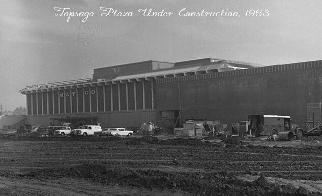
| (1963)* – View looking northeast as seen from Topanga Boulevard showing Topanga Plaza's new May Co. anchor store during construction. |
Historical Notes Topanga Plaza was conceived as one of California's first major enclosed shopping malls. This design approach was revolutionary at the time, as it provided a climate-controlled environment for shopping, protecting visitors from the elements and creating a more comfortable experience year-round. |
 |
|
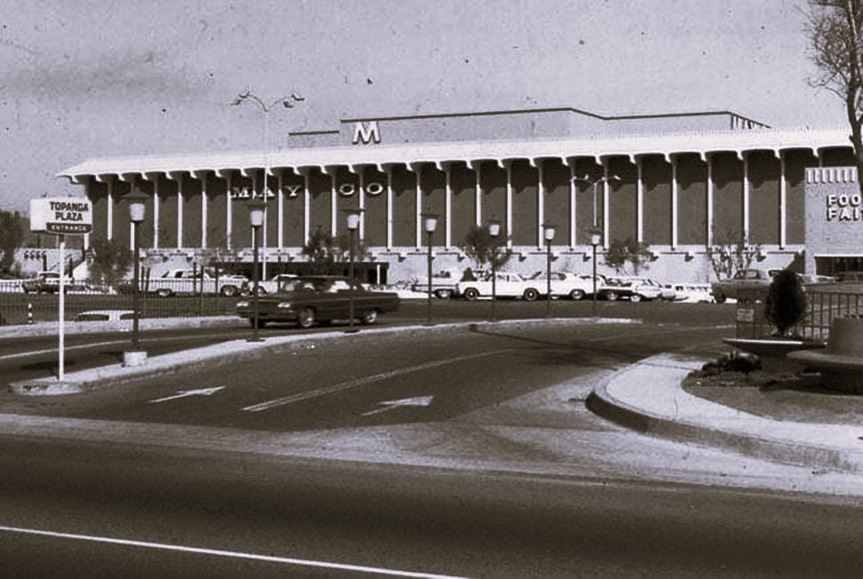
| (ca. 1964)* – Topanga Plaza's new May Co. anchor store shortly after its opening. Photo courtesy of Valley Relics Museum |
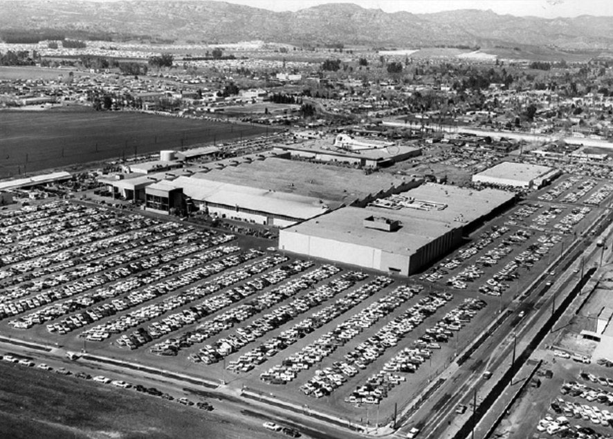
Historical Notes The original design incorporated three major anchor stores - May Company, Montgomery Ward, and The Broadway. These large department stores were strategically placed to draw customers and create foot traffic throughout the mall. |
 |
|
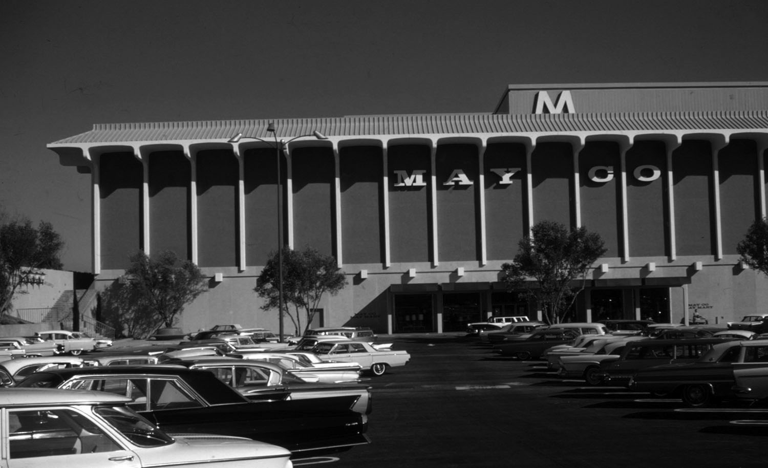
| (1964)^ – View showing a full parking lot in front of the newly completed May Company at Topanga Plaza Mall. Photo courtesy Gruen Associates |
Historical Notes The Topanga Plaza Mall would open on February 10, 1964 and become California's first enclosed shopping mall and also the first enclosed mall west of the Mississippi. It was originally anchored by The Broadway, May Company and Montgomery Ward. Nordstrom was added in 1983. |
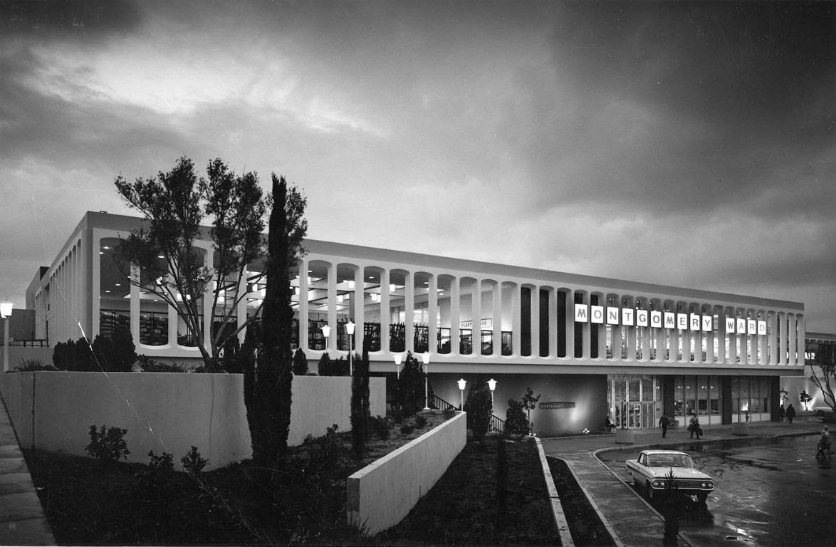 |
|
| (1964)^ – View showing the newly completed Montgomery Ward at the Topanga Plaza Mall. Montgomery Ward, The Broadway, and May Company were the three original anchor stores at the shopping mall. Photo courtesy of Gruen Associates |
Historical Notes Completed in 1964, Victor Gruen Associates provided planning, architecture, engineering and interior design services for Topanga Plaza. |
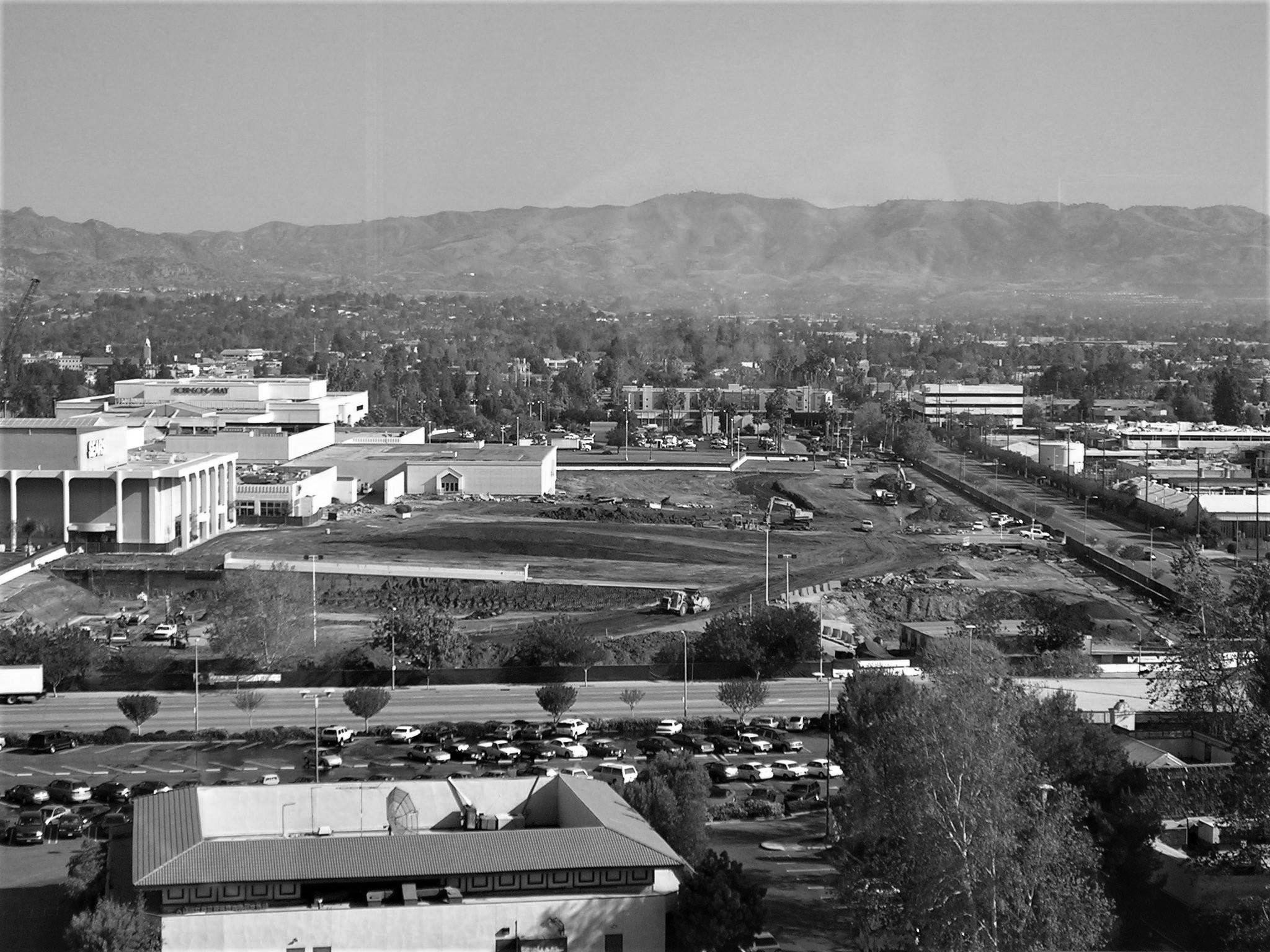 |
|
| (1990s)* – View looking north showing Topanga Mall after conversion from the original Topanga Plaza opened in 1964. Victory Boulevard runs across the lower part of the photo with Owensmouth seen on the right running away from the camera. The building at lower-left is the Mandarin Wok Restaurant. That site was still a wheat and barley field when the Topanga Theater opened in 1964, then the Topanga Amusuement Center south of there in 1965. The original Broadway store with it's shimmering yellow/gold colored stone panels was renamed and reconfigured a Sears store. The Robinsons-May was originally the May Company further north in the left distance. Other retails business were constructed, extending further into the parking lot in the middle of the picture. |
Historical Notes As the first enclosed shopping mall to open in southern California, Topanga Plaza was developed by Saint Louis-based May Centers, Inc. and built in the San Fernando Valley on a 58-acre tract, 25 miles northwest of the city center. The land parcel had been part of the Harry Warner Ranch. |
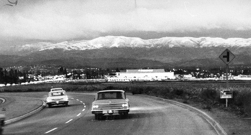 |
|
| (1964)* - Photo caption dated November 18, 1964 reads, "Oat Mountain and mountains above Chatsworth and Granada Hills were covered with a blanket of snow this morning following yesterday's storm which brought up to six inches of the white fluffy stuff down to the 1,000-foot level. This photo was taken from Woodland Hills aimed across the newly completed Topanga Plaza Shopping Center." |
Historical Notes The photo above was taken just north of Califa St headed toward Oxnard St with a clear view of The Broadway and Topanga Plaza. Today, the Marriott Hotel would be on the right and the Promenade after that. Note the sign for the T intersection -- that's for Oxnard St, the paved section ended at Topanga. |
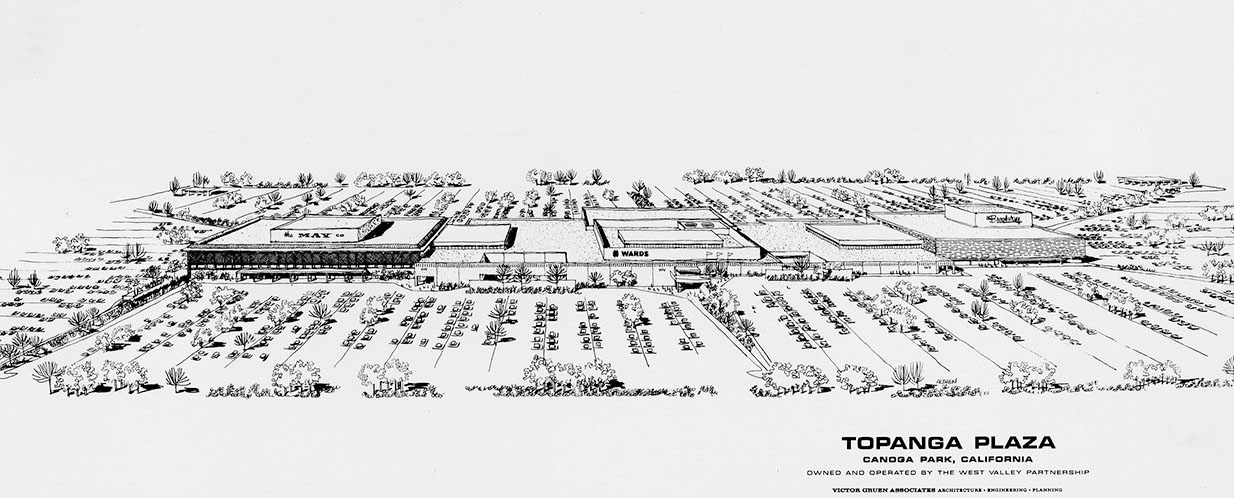 |
|
| (1960s)^ - Aritist rendition showing the Topanga Plaza Mall, Victor Gruen Associates Architects. |
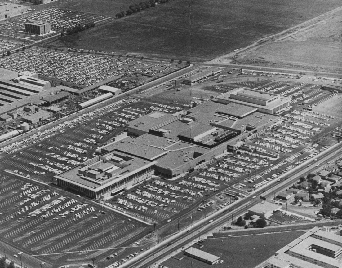 |
|
| (1964)* - Aerial view of the new Topanga Plaza Mall, looking southeast. Topanga Cyn. Boulevard runs diagonally from bottom-center to right-center of photo. The intersection of Victory and Owensmouth is at top-center. Large area of open undeveloped land can be seen south of Victory at top of photo. |
Historical Notes The original mall enveloped 727,100 leasable SF on two levels and housed 83 retailers. The first stores in business were the May Company, Montgomery Ward and The Broadway, serving as anchor stores for several decades. Charter tenants included Joseph Magnin apparel, Mullen & Bluett ladies’ apparel, Silverwood’s men’s and boys’ apparel, Lane Bryant, Kay Jewelers, Florsheim Shoes, Hardy Shoes, Frederick’s of Hollywood, Hudson’s Jewelers and Sutton Brothers Home Decorating. Topanga Plaza is now the modern-day Westfield’s Topanga shopping center.^ |
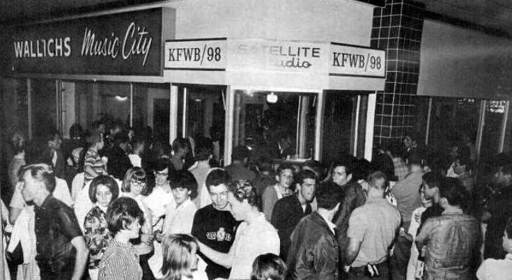 |
|
| (1964)* – Wallich’s Music City at the Topanga Plaza Mall. It originally had a radio broadcast booth (KFWB/98). |
Historical Notes In 1964, Wallich's famed Music City invited stars and the general public to the June 5 "star-packed party" celebrating the debut of the Music City at Topanga Plaza. Present were emcee Bill Ballance of KFWB, Bonanza's Lorne Greene, and Don Grady of "My Three Sons." Giveaways galore included a Magnavox *color* TV, Magnavox stereo, Audion home organ, a guitar, hundreds of record albums, and tickets to Jungleland. The original Wallichs Music City was located on the northwest corner of Sunset & Vine and operated from 1940 to 1978. Owner Glenn E. Wallichs had started Capitol Records, along with Tin Pan Alley songsmith Johnny Mercer and ex-Paramount movie producer Buddy De Sylva from a small office a little further south down Vine Street in 1942 and moved to larger offices above the store in 1946. After Capitol Records moved into The Capitol Tower in 1956 the offices become the home of Dot Records. Wallichs Music City was one of the first-known music stores to seal record albums in cellophane and put them in display racks for customers to browse. The racks were tabletop height trapezoid-shaped browser boxes (designed by Capitol Records' Frederick Rice) that allowed the covers they contained to be viewed like a card index without damaging the sleeves. The store was also the first to have demonstration booths for listening to records. |
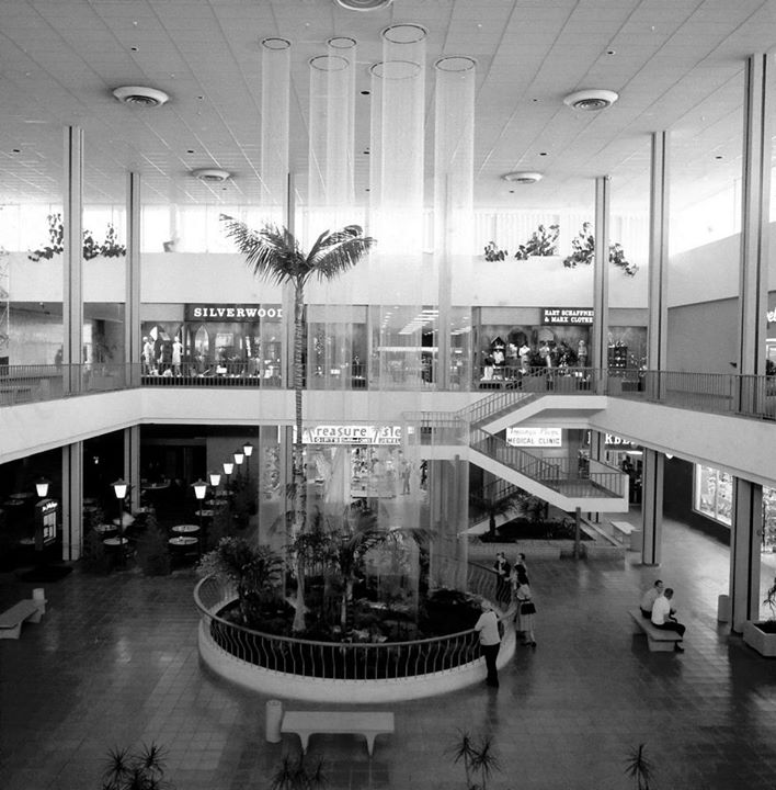 |
|
| (1964)*^^^ - Several people stand by rail observing the rain fountains at the new Topanga Plaza. |
Historical Notes From the 3-story ceiling, "raindrops" cascaded down columns of nylon monofilaments straight into a garden area and pond. It was located at the south end of, at the time, the world's largest two-level all-enclosed and air-conditioned mall shopping center.^ |
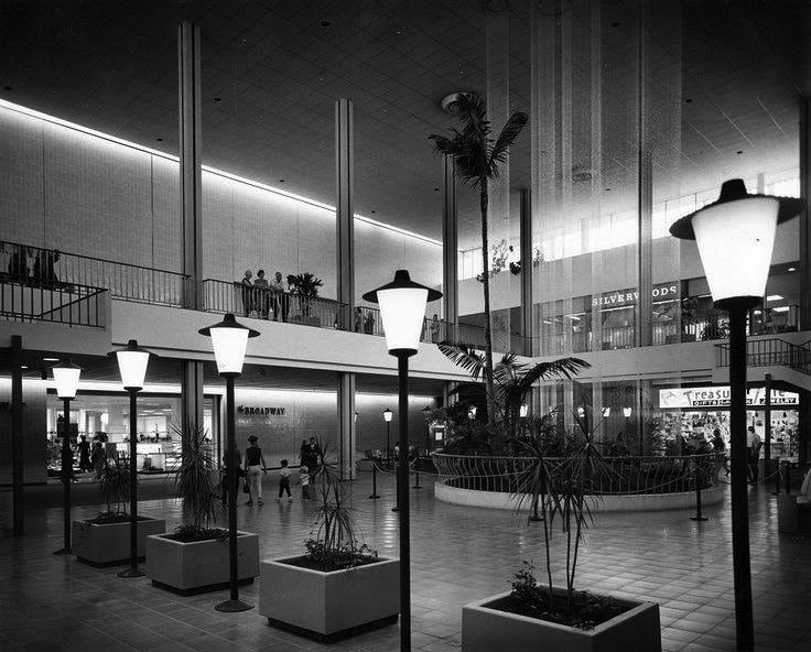 |
|
| (1960s)* - Lower level view of the “Rain Forest” Fountain with water droplets cascading down the string. The Broadway is seen at left. |
Historical Notes Deep sea diver, Merchant Marine officer, stuntman, and designer Vic Chatten of Torrance created the “Rain Forest” fountain. Unveiled in May 1964, the 55-foot spectacle featured 6 columns totaling half a million "raindrops" (65 gallons of glycerin) silently descending over 15 miles of monofilm. The “rain” would then go through receivers which, in turn, channeled to a pump where the fluid traveled up 3-stories to the top of the fountain. Each monofilm wire was fastened at the ceiling and kept taut with an 8-ounce weight below the base of the fountain. Chatten spent three decades perfecting his fountain system. A successful inventor, he created many other contraptions, including a reusable beer keg bung that was ultimately used by a major U.S. brewery. |
Topanga Plaza Ice Arena (later known as Ice Capades Chalet)
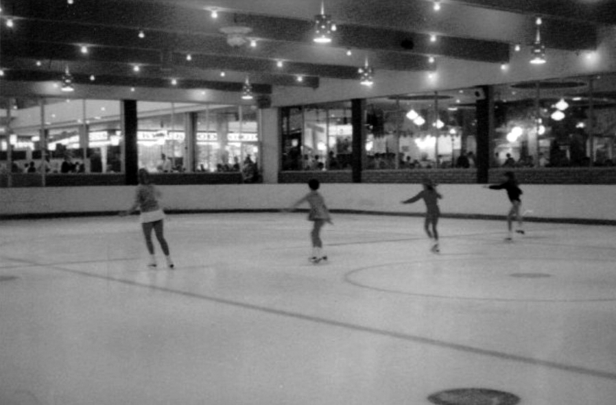 |
|
| (1970s)* – View showing potential future stars practicing at the Ice Skating Rink at Topanga Plaza. Little Known Fact: The Topanga Plaza Ice Arena, later known as Ice Capades Chalet, was a training ground for future stars. Notably, Tai Babilonia and Randy Gardner, a renowned pair skating duo, practiced there. They went on to become five-time U.S. national champions and won the World Figure Skating Championships in 1979. |
Historical Notes The Topanga Plaza Ice Arena opened in March 1965, about a year after the mall's inauguration. It was located on the mall's lower level, at the southeast corner of the structure, adjacent to the original food court. The ice skating rink quickly became a popular attraction, especially for younger people during hot summer days, drawing visitors from as far away as Hollywood. The rink was part of a larger entertainment complex within the mall, which also included features like the "Rain Fountain" ("Wonderfall") in the adjacent South Court, bird aviaries and a gazebo in the North Court, and the Terrace Restaurant overlooking the area from atop the May Company store. In 1966, Ice Capades, a traveling entertainment show on ice, purchased the skating rink at Topanga Plaza as part of their expansion into owning and operating permanent ice rinks, establishing their Chalet Division. The ice skating rink remained a fixture of the mall throughout the late 1960s and most of the 1970s. However, it closed in the late 1970s. |
 |
|
| (1974)* – Food court and skating rink at the Topanga Plaza Mall. Photo by Roy Hankey |
Historical Notes After its closure, the space was initially used for five inline stores in the early 1980s. Later, as part of a $16 million renovation in 1984, the space was transformed into the 15-bay Plaza Cafes Food Court. |
* * * * * |
Lytton Savings and Loan
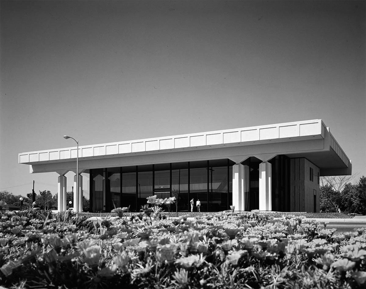 |
|
| (1966)* – View showing the Lytton Savings and Loan building located at 6633 Topanga Cyn Boulevard shortly after it was built, as seen from across the street in front of Topanga Shopping Center. Photo courtesy of Getty Research Institute |
Historical Notes Located at the corner of Topanga Canyon Boulevard and Kittridge Street, the 12,400 square foot contemporary design structure faced the recently-completed Topanga Plaza Shopping Center. The new building replaced the office located at Variel and Independence avenues which was opened in 1960. |
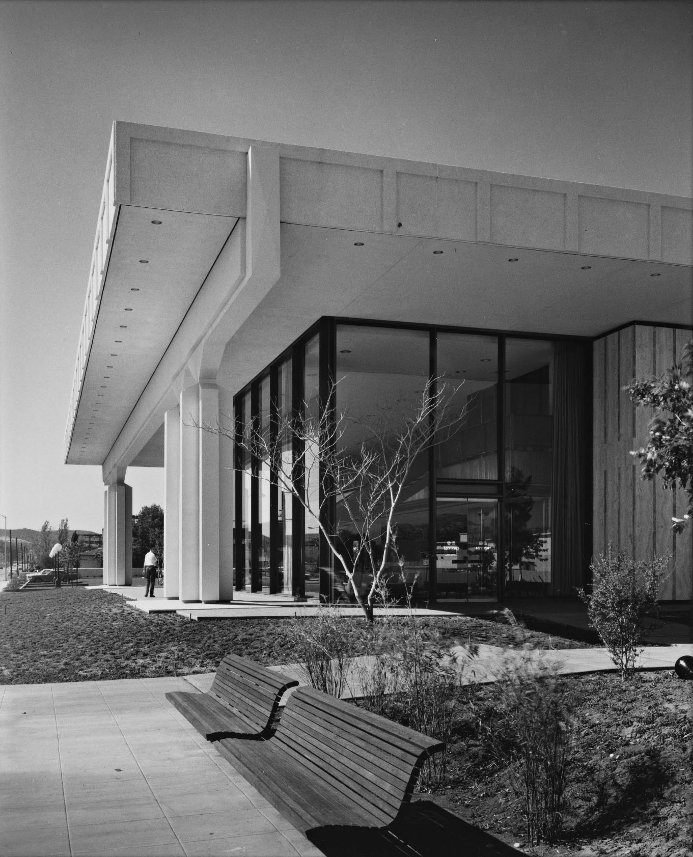 |
|
| (1966)* - View looking northwest showing the Lytton Savings and Loan building as seen from near the corner of Kittridge Street and Topanaga Canyon Blvd. Photo courtesy of Getty Research Institute |
Historical Notes The structure is a two-story concrete and glass pavilion with a roof supported by two massive concrete girders which, in turn, are supported by eight sculptured concrete columns of cruciform section. |
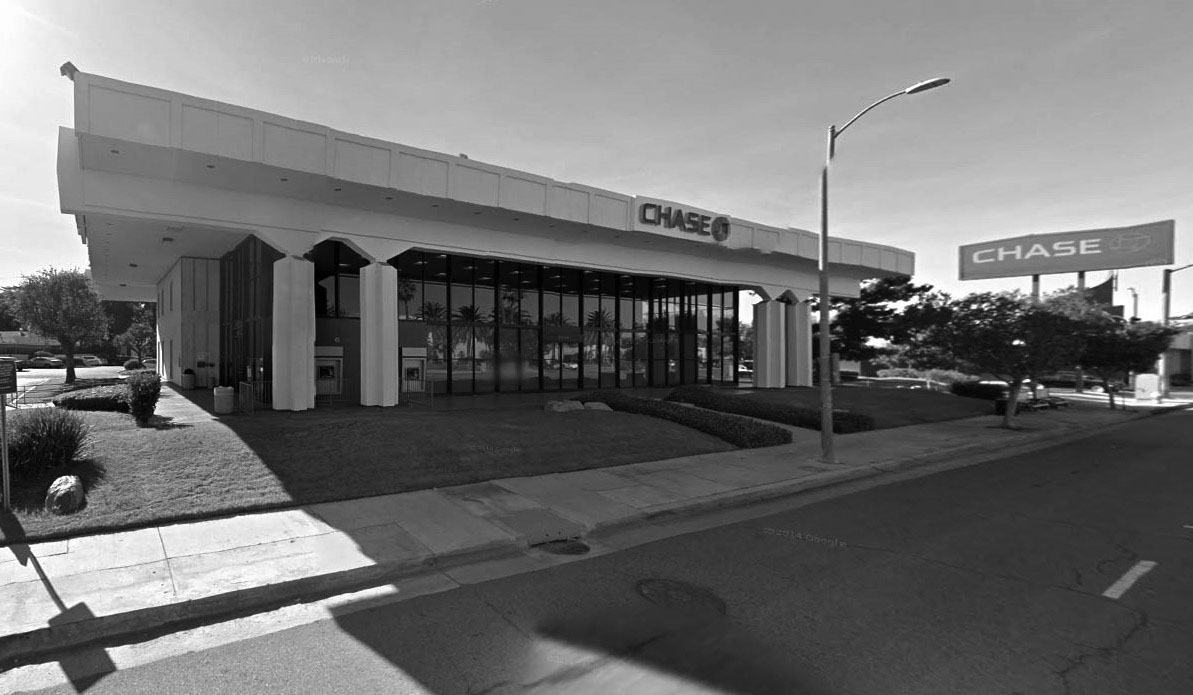 |
|
| (2015)#*^# - Google Street View showing the building as it appears today, a Chase Bank. Other than the ATM's on the left, the building looks the same as it did when first built in 1966. |
Sierra's and Mission Burrito Restaurants
 |
|
| (ca. 2010)*^ – View looking southwest showing Sierra’s Mexican Restaurant located at 6819 Canoga Avenue. Click HERE for contemporary view. |
Historical Notes Sierra's Restaurant started as "Ed Sierra's Spanish Cafe" in 1932 at 500 San Fernando Mission Blvd. During the 1930's Hollywood filmed many movies in the San Fernando Valley and for the most part the place to eat was Ed Sierra's Spanish Cafe. From the 1930's to the 60' many movie stars moved to the San Fernando Valley, so you never know who you might run into at Ed's Cafe. In the mid 60's Mr. Sierra sold the Cafe to his son-in-law, Gil Jaramillo. Mr. Jaramillo is the founder of Mission Brand Tortillas, which he later sold in the late 1970's, to pursue a new chapter in his life, serving the Valley with the finest quality Mexican cuisine at an affordable price. He changed the name to "Sierra's" and opened his second, larger restaurant in Canoga Park, which was previously the "Old Vic's" restaurant, just off the corner of Vanowen and Canoga Avenue.* |
 |
|
| (2010)* – View looking across a parking lot showing the front entrance to Sierra’s located on the NW corner of Canoga and Vanowen. |
Historical Notes Because Sierra’s was run by two generations including Mr. Sierra’s grandchildren, it claimed to be the oldest restaurant in the San Fernando Valley continuously operated by one family. Sierra's in Canoga Park was so successful it needed to be expanded three times since it's opening in 1969. |
 |
|
| (ca. 1975)^ - View looking at the NE corner of Vanowen Street and Alabama Avenue showing Mission Burrito located at 21425 Vanowen, Canoga Park. |
Historical Notes With the success of Sierra's, Gil and his wife Fay, realized the area was in need of a fast food restaurant, so in 1973, the Jaramillo's purchased "Gus's Chicken Shack" on the corner of Alabama and Vanowen Street. He ran this for about a year as a sandwich shop specializing in "dip" style sandwiches. The demand for Sierra's style Mexican food was so great and Sierra's had already reached its full capacity, that he then created "Mission Burrito", and the rest is history.* |
 |
|
| (2012)^.^ - Sierra’s Mexican Restaurant and Mission Burrito Canoga Park closing their doors on December 31, 2012. |
Historical Notes In 2013, Sierra's, the oldest family run restaurant in the San Fernando Valley, closed its doors as well as the doors of their adjacent Mission Burrito. Mission Burrito would soon be reincarniated in West Hills at 22744 Roscoe Blvd near Fallbrook Ave. There are currently several other Mission Burritos locations including: Woodland Hills, Simi Valley, and Moorpark. |
Topanga and Victory
 |
|
| (1975)* - Aerial view looking SE with the intersection of Topanga and Victory boulevards seen in the foreground (lower center-left). The large white building on the SE corner is the Topanga Theatre. South of the theater is the Topanga Amusement Center and south of there, on the other side of Erwin Street, is the Promenade Shopping Mall. |
Historical Notes The Promenade Shopping Mall originally opened in 1973 as a high-fashion shopping center, anchored by stores like J.W. Robinson's, Bullock's Wilshire, and Saks Fifth Avenue. Over the years, many of the anchor stores closed or left, including Robinson's, Bullock's, and Saks Fifth Avenue. By the 2010s, the Promenade had fewer than 10 stores remaining and was considered a "dead mall". In 2020, the Los Angeles City Council approved a plan by Unibail-Rodamco-Westfield to redevelop the Promenade site into a mixed-use development with hotels, offices, and over 1,400 new apartments. In 2022, the Promenade property was sold to an investor group led by Los Angeles Rams owner Stan Kroenke, who is expected to redevelop the site as part of a larger mixed-use project in the area. |
 |
|
| (2022)* - Aerial view of Woodland Hills and Warner Center looking SE with the intersection of Topanga and Victory boulevards seen at lower center-left showing how the entire area has developed over the years. |
Then and Now
 |
|
| (1975 vs 2022)* - Aerial view of Woodland Hills and Warner Center looking SE with the intersection of Topanga and Victory boulevards seen in the foreground (lower center-left). |
Historical Notes Warner Center in Woodland Hills, experienced significant development in the 1970s and 1980s: The area was originally the private horse ranch of Harry Warner, one of the Warner Brothers. In 1968, 630 acres of the land were sold to Aetna Life and Casualty for $30 million for long-term investment and development purposes. Aetna later brought in Kaiser as a joint venture partner. Initial development in the 1970s included the 34-acre Promenade Mall, which opened in 1973, as well as engineering facilities and headquarters for aerospace companies like Rocketdyne and Litton Industries. The 1.1 million square foot Warner Center Business Park and the 1.8 million square foot Warner Center Plaza, with its signature high-rise office buildings, were also built out during this period. In the 1980s, the Trillium office project consisting of twin 17-story towers was constructed. Real estate developer Robert Voit, in partnership with Robert Allison and New England Life Insurance Company, led much of the commercial development in Warner Center during this time. |
Topanga Amusement Center
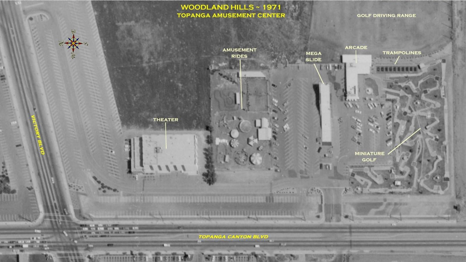 |
|
| (ca. 1971)* – Aerial View showing the Topanga Amusement Center in Woodland Hills. The intersection of Topanga Canyon Blvd and Victory Blvd is at lower-left. The amusement center (right) included a Driving Range, Arcade & Club House, Trampolines, Miniature Golf, Mega Slide and Amusement Rides. The building at center-left is the Topanga Theatre. Today, the entire block is occupied by the Westfield Village at Topanga. |
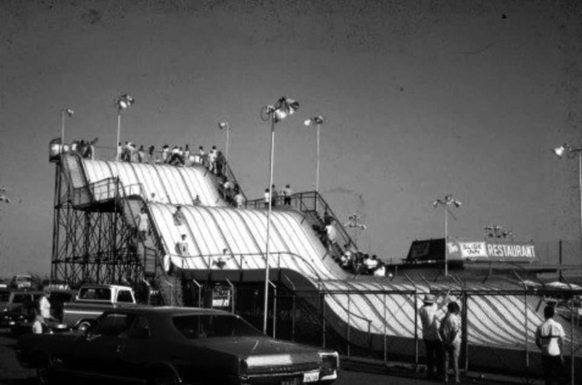 |
|
| (1970s)^.^ – Close-up view showing the Mega Slide (with those itchy gunny sacks) at Topanga Amusement Center. |
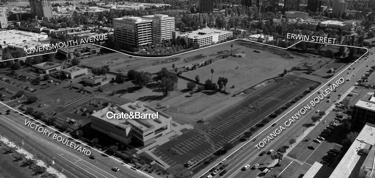 |
|
| (2010s)#^*^ - Aerial view looking southeast showing the future home of The Village at Westfield Topanga. |
Then and Now
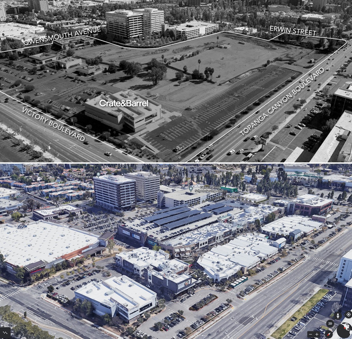 |
|
| (2010s vs 2022) - The Village at Westfield Topanga, Then and Now |
Topanga Theatre
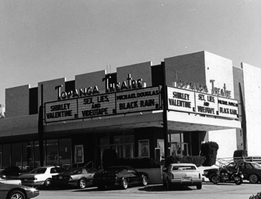 |
|
| (1989)#^*^ – View of the Topanga Theatre at 6360 Topanga Boulevard, located across the street from Topanga Plaza near the S/E corner of Topanga and Victory. |
Historical Notes The Topanga Theatre was opened as a single screen movie house in the 1960s. It was twinned in the early 80’s, triplexed in the early 90s. Pacific Theatres was the last chain to operate the Topanga, which became a second-run theatre in 1998 and closed altogether in early 2000. What killed the Topanga theatre was a 16 screen AMC multiplex opened one block away. In the same area there was also the GCC Woodland Hills Triplex, the UA Warner Center 6, the single screen Baronet and, down the road, the GCC Fallbrook 10. The former Topanga Theatre last housed a furniture store and was demolished in September 2007.^**^ The site currently is part of the Westfield Village at Topanga open-air mall. |
The Original Pizza Cookery
 |
|
| (2019)^ – View showing the front entrance to The Original Pizza Cookery at 6209 Topanga Canyon Blvd. (Photo by David Crane, Los Angeles Daily News/SCNG). |
Historical Notes The restaurant, opened in 1975 at a small plaza that now anchors Office Depot and See’s Candies, has old rustic walls made of wood and boards, vintage lamps and the sawdust covered floor. A former cook, born in New York, Jordan Klempner opened the restaurant after returning from the military and selling his house in Laurel Canyon for $10,000. It took him a year, though, to find the right spot. When he walked into the Woodland Hills’ location, it “hit” him that there was the right place. The restaurant became the instant hit.^. |
 |
|
| (2019)^ – Large front window in front of the Pizza Cookery where one can get a close-up view of the kitchen and, of course, the pizza ovens. |
Historical Notes After nearly 45 years of business, Woodland Hills’ The Original Pizza Cookery is closing its doors. Owner Jordan Kempner is moving (May 2019). A new location in Thousand Oaks is set to open in June 2019 near the Best Western Plus Thousand Oaks Inn at 75 W. Thousand Oaks Blvd. It will be able to host about 200 people.^ |
Warner Center
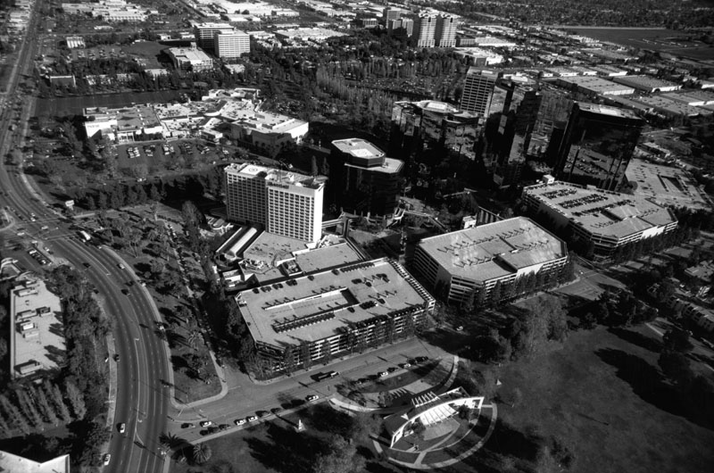 |
|
| (2002)* - An aerial view of office buildings at the Warner Center. On the left can be seen Topanga Canyon Boulevard as it winds its way up toward Chatsworth. Warner Center Park is at bottom of the photo. |
Historical Notes Warner Center is a master-planned business hub in the Valley that was named for Harry Warner of Warner Bros. Pictures, who had owned 1100-acre horse ranch in the 1940s. Robert Voit led the commercial development of the land after it was sold in the late-1970s. Warner Center was built to relieve traffic to and from downtown L.A., as well as generate jobs in the San Fernando Valley. At the band shell of Warner Park (visible in the foreground), sits the site of the Valley's "Concerts in the Park" series, which the Valley Cultural Center stages for free during the summer months. The concerts showcase everything from folk and rock to jazz and big band music.* |
Ventura Blvd
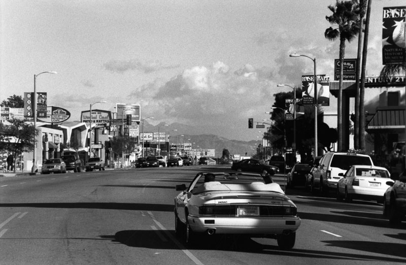 |
|
| (2002)* - Photograph taken on Ventura Boulevard looking west toward Oakdale Avenue in Woodland Hills. Numerous businesses line the street. Banners reading, "Baseball as America. Natural History Museum" can be seen hanging on each street lamp. In the forefront, the rear view of a white convertible Jaguar XJS as it drives away. |
.jpg) |
|
| (2014)^^^ – Panoramic view of the West San Fernando Valley looking north with Warner Center in the foreground and the Santa Susana Mounains in the distance. |
 |
|
| (2016)^ - Map showing the 38 communities located in the San Fernando Valley. |
Historical Notes In 1900, there was still less than 3,000 people in the whole San Fernando Valley. The Valley's population today is nearly 1.8 million, larger than every other U.S. city except New York, Chicago, Houston, and of course, the rest of Los Angeles. Today, there are 38 Communities within the San Fernando Valley covering an area of 225 square miles. Click HERE to see SFV Communities - Name Origins and History |
 |
|
| (2010)^x^ - Map showing the major streets of the San Fernando Valley. Little known fact: Most of the major east-west streets in the Valley are in alphabetical order going north to south: Chatsworth - Devonshire - Lassen - Nordhoff - Plummer - Roscoe - Saticoy - Sherman Way - Vanowen - Victory |
Historical Notes "If you want to know the history of the San Fernando Valley, read the street signs." - Bill Robertson, Director of L.A.'s Bureau of Street Services (2009) Click HERE to see Street Name Origins - SFV |
* * * * * |
Please Support Our CauseWater and Power Associates, Inc. is a non-profit, public service organization dedicated to preserving historical records and photos. Your generosity allows us to continue to disseminate knowledge of the rich and diverse multicultural history of the greater Los Angeles area; to serve as a resource of historical information; and to assist in the preservation of the city's historic records.
|
More Historical Early Views
Newest Additions
Early LA Buildings and City Views
History of Water and Electricity in Los Angeles
* * * * * |
References and Credits
* LA Public Library Image Archive
^ CSUN Oviatt Library Digital Archives
#^San Fernando Valley History Digital Library - CSUN Oviatt
**DWP - LA Public Library Image Archive
^*The Valley Observied: Street Name Origins; Timeline of Valley History
^#Chatsworth Historical Society; Chatsworth Nike Site; Munch Box
*#Mojave Desert.net: Remi Nadeau
***Los Angeles Historic - Cultural Monuments Listing
*^*California Historical Landmarks Listing (Los Angeles)
*^^Nuestra Señora la Reina de los Ángeles - losangelespast.com
^^^LA Times: Adohr Spelled Succes for the Adamsons; Mulholland Bridge; Panorama City; Getting the Skinny on a Tall Valley Landmark; Valley Newspapers of the Past; Schlitz Closure; Sunkist Growers
^^*LA Times: Stanley Norris Petit
*##LA Times: Dig Into History You'll Find Snake Oil..Victor Girard Kleinberger
+#^Facebook.com: Encino Velodrome
+**Valley Presbyterian Hospital History and Milestones
+^^Panorama City - Commercial Area Concept Plan
^++Los Angeles Conservancy: Sunkist Headquarters
++#Facebook.com: Photos of Los Angeles
##*Pinterest - California; Farrell's Ice Cream Parlour
#^#San Fernando Valley Blog: LA Federal Savings Building, North Hollywood; Van Nuys Blvd. Postcard, Valley Music Theatre
*#*Project Restore: Van Nuys City Hall
^*^Topanga Canyon History - LA Magazine
*#^LA World Airports - History of Van Nuys Airport
^^#The Museum of the San Fernando Valley
**#Tumblr.com: LA History - Leonis Adobe
^#*Photo of the Northeast San Fernando Valley ca.1950 - Laurie Burns
^*#North Hollywood-Toluca Lake Patch: History of the Laurel Canyon and Valley Plaza Mall; N. Hollywood Train Depot
*##*BellCanyon.com: Bell Canyon History
#^#^Granada Hills North Neighborhood Council: Granada Hills History
^*^*Metro.net: Mulholland Drive Bridge
*^*#Facebook.com: Classic Hollywood-Los Angeles-SFV
*^^^San Fernando Valley Historic Society/Facebook.com: JC Penney; California Bank; Devonshire Downs; Topanga Plaza Founain; Devonshire and Owensmouth; Sheep Crossing Roscoe; Log Ride / Busch Gardens
^**^Cinema Treasures: Rivoli-Capri Theatre; Reseda Drive-In Theatre; Van Nuys Driv-In Theater; Winnetka Drive-In; Topanga Theatre; Victory Drive-in; Holiday Theatre
***^Los Angeles Movie Palaces: Studio City Theater
**^^KCET: LA Flood of 1938: Cement the River's Future; Canoga Park at 100: A Brief History of the Birth of Owensmouth; When Cahuenga Pass Was Rustic; Before the 'Carmageddon': A Photographic Look at the Construction of 5 SoCal Freeways; Thematic Cartography and Mapping Los Angeles
**^#LA Times Framework: Busch Gardens Monorail; Woodland Hills Sheep
*^^#Flickr.com: Kaiser Panorama City; Coffee Dan's (Van Nuys)
++^^The Valley Economic Alliance
+++# Facebook: San Fernando Valley Historical Society
+++^Facebook: Here in Van Nuys
**#*EntertainmentDesigner.com: Busch Gardens
**#^San Fernando Valley Historical Society: Van Nuys Drive-in Theater
*^#^Northridge Fashion Mall Jobs
^^##Encino-Tarzana Patch: Valley Ice Skating Center
^##*Pinterest: Drive-in Speakers
^##^Pinterest: San Fernando Valley
*#^#Forum.skyscraperpage.com: Coffee Dan's
*##^City-Data.com: Ventura Boulevard
*#^*Los Angeles County Library: Agoura Hills
*#^^Big Orange Landmarks: Drive-ins Roared into LA Country
*#**Facebook.com: Museum of the San Fernando Valley; Busch Monorail
^***LosAngelesPast.com: Cahuenga Pass
^**#The Friends of Oakridge; theoakridgeestate.com
#**^Flickr.com: Bibiop – Northridge Fashion Center
#^**The Go Go's: Local Coffee Shops and Diners
#^*^Facebook.com: West San Fernando Valley Then And Now
#*^*The First 100 Years: umccp.org
#*^#Google Maps
#^*#Worldwide Drive-Ins: Winnetka 6
#*#^Pierce College - piercecollege.edu
#*##Daily News: Rocketdyne Canoga Park; Proposed $3B Project at Rocketdyne Site; Mulholland Bridge
+*##Restaurant-ing Through History: Ice Cream Parlors
##^^California State University Northridge History: csun.edu
##++Litton Industries Company History
+#+#CardCow.com: Hody's Coffee Shop
^###Northridge Fashion Mall History
^^***Water and Power Associates
^^^^*Mbcinfo.com: Joseph Schlitz Brewing Company
**^^^LA Movie Palaces: San Fernando Valley
*^^^^Pinterest: San Fernando Valley - My Home Sweet Home
*^^^#DWP - Water and Power Associates Historical Archives - Courtesy of Rex Atwell
^***^Pacific Electric San Fernando Valley Line - ERHA.org
^^^*San Fernando Valley Relics: Facebook.com; Leonis Ranch; Ventura and Woodman; Busch Gardens; Reseda Blvd; Victory Blvd in Woodland Hills; Van De Kamp's; Valley Plaza; Nordhoff St. and Topanga Cyn; Ventura and Van Nuys Blvd; Van Nuys and Oxnard; Van Nuys Aerial; Van Nuys Blvd, ca. 1940; I-5 and I-14 Interchange; Van Nuys Drive-in; Mobil Gas Station; Canoga Drive-In; Victory and Whitsett; Van Nuys Aerial; Budweiser/Anheiseur-Busch Sign; Ventura Blvd 1950s
*^ Wikipedia: Sherman Oaks; Isaac Van Nuys; Encino; Tarzana; Campo_de_Cahuenga; Cahuenga Pass; Chatsworth; Panorama City; Santa Susana Field Laboratory; North Hollywood; Canoga Park; Woodland Hills; Reseda; Orcutt Ranch; Granada Hills; Andrés Pico; Moses Sherman; Van Nuys; Henry Kaiser; Charles Maclay; San Fernando Valley; Mission Point; Hughes Aircraft; Domonique Amestoy; Winnetka, Los Angeles; City of San Fernando; Canoga Park High School; Ventura Freeway; Hollywood Freeway; Los Angeles Valley College; Kaiser Permanente; Van Nuys Assembly; Rancho El Escorpión; Topanga Plaza; Simi Valley Freeway (118); Newhall Pass Interchange; Litton Industries; West HIls; Devonshire Downs; CSUN; Television Set History; Shadow Ranch; Atlas Missile; Thrifty Drugs; Coast Daylight; Longs Drugs; Du-Par's Restaurant; Joseph Schlitz Brewing Company; Annheiseur Busch; Fotomat; Baskin-Robbins; Valley Presbyterian Hospital; Warner Center; Gemco; Valley Music Theatre; Westfield Fashion Square; Paxton Park (Ritchie Valens Park); Big Donut Drive-in; Randy's Donuts; Builders Emporium; AlliedSignal; North Hills; Pacoima; 1960 Presidential Election; Farrell's Ice Cream Parlour
< Back