Early Views of the San Fernando Valley
 |
|
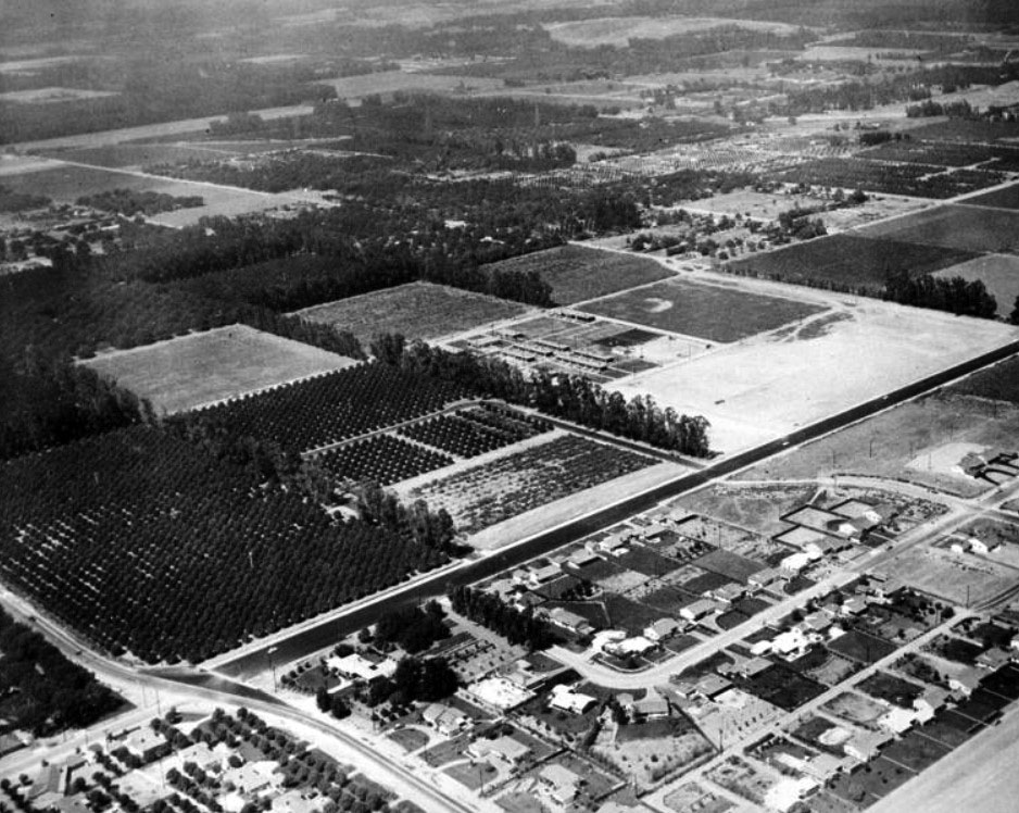
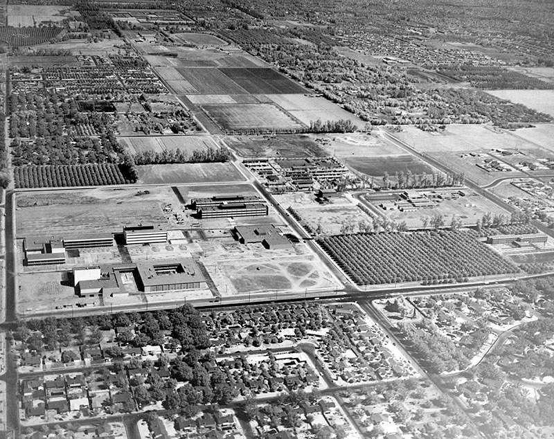
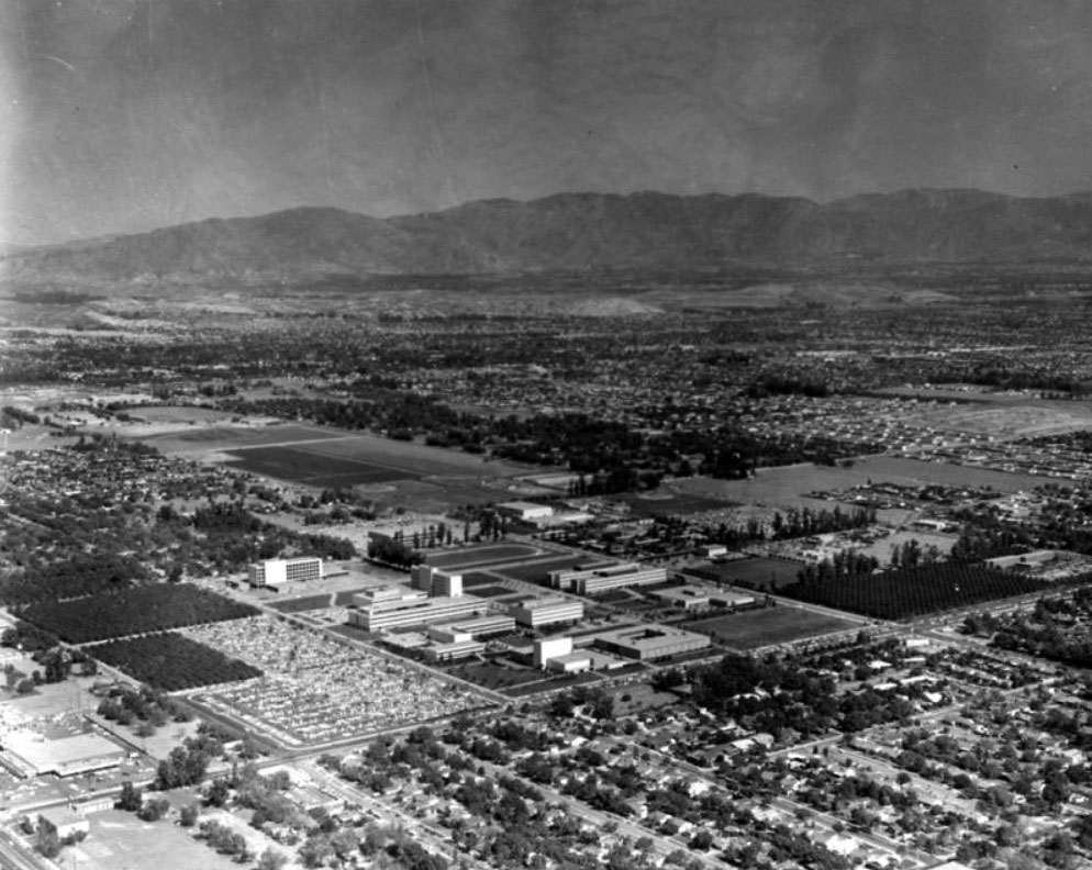
| (1956)* - Aerial view of Los Angeles State College, San Fernando Valley Branch (now CSUN), looking northwest. The intersection of Zelzah and Nordhoff is in the left foreground. |
Historical Notes In 1952, state officials had originally identified Baldwin Hills as the site of a satellite campus for Los Angeles State College (now Cal State Los Angeles). In reaction to the decision, Valley leaders organized to successfully overturn the legislation and to later ensure that a four-year college would be sited in the San Fernando Valley. On December 21, 1954, advocates for a Valley four-year college hosted 23 legislators for dinner at the Brown Derby on Wilshire Boulevard. Armed with demographic projections, they pitched the Valley as the only logical place for the next state college. The pitch worked. In 1955, state Assemblyman Judge Julian Beck sent the legislation for approval to pruchase land in the north San Fernando Valley for a new satellite campus to Los Angeles State College. |
 |
|
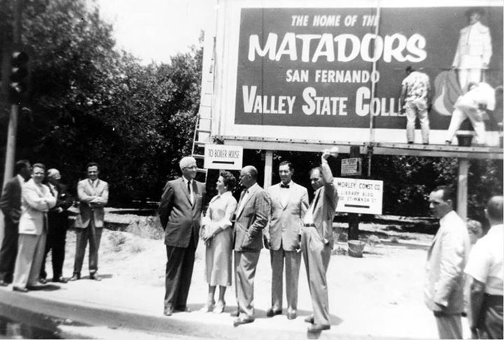
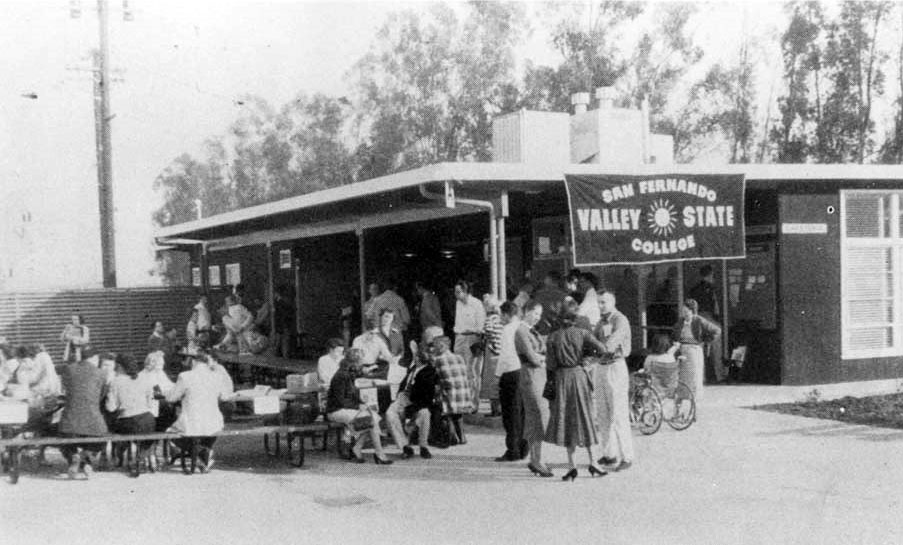
| (1958)^ - New sign in 1958 after Los Angeles State College separated from its parent institution and became San Fernando Valley State College (now CSUN) Pictured: Howard McDonald (President of L.A. State College), Ralph Prator (President of San Fernando Valley State College) and Delmar T. Oviatt (Dean of Instruction at San Fernando Valley State College). |
Historical Notes On July 1, 1958, the founding date of the present university, the institution became San Fernando Valley State College, with about 3,300 students and 104 faculty. On June 1, 1972, the college was renamed California State University, Northridge by action of the state Legislature and the Board of Trustees of the California State University. By September, 1958, enrollment reached 2,525 students and full-time in-state student fees were $29 per semester. |
 |
|
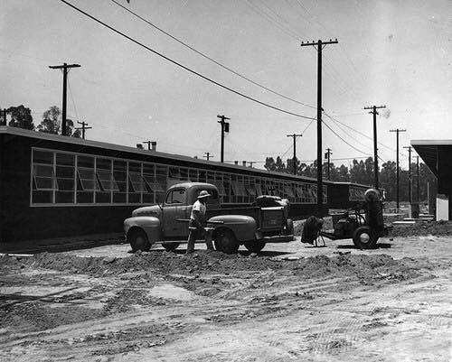
| (1950s)* – View showing construction work near bungalows at San Fernando Valley State College. |
 |
|
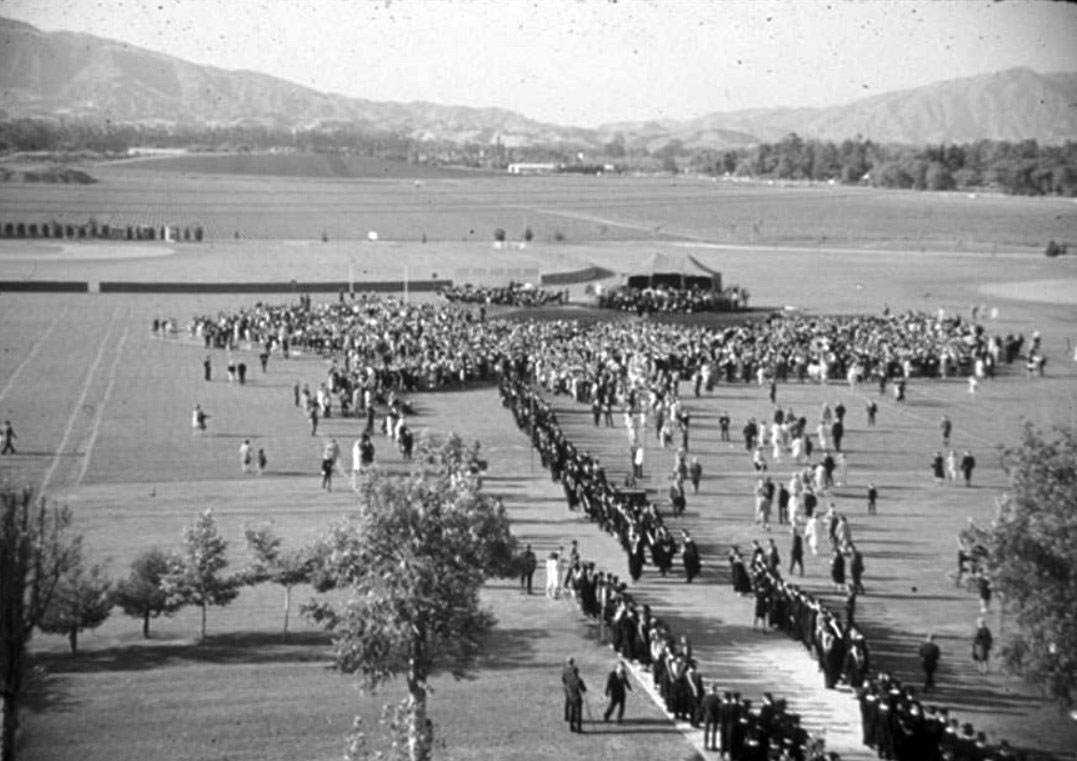
| (1959)^ – View of the first graduation at San Fernando Valley State College, June 12, 1959. |
Historical Notes On June 12, 1959, ninety students received their degrees on the SFVSC football field. This image shows the large expanse of empty land held by the college at this time; visible in the background is the Santa Susana mountain range. |
 |
|
| (ca. 1960)^ - Campus of San Fernando Valley State College (now CSUN), aerial view looking north. Nordhoff Hall, the Music Building on the left; Science buildings 1 and 2 and Bookstore Complex in the center. |
Historical Notes In 1959, the first permanent building, South Library was dedicated. In 1960, Construction was completed on the Speech-Drama and Fine Arts buildings, the later designed by famed architect Richard Neutra. |
 |
|
| (ca. 1960)* - An early student hangout at San Fernando Valley State College. Photo courtesy of CSUN |
 |
|
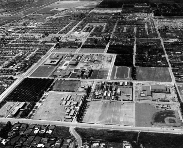
| (1961)^ - Aerial view looking west of the campus of San Fernando Valley State College (now California State University, Northridge). Science Buildings 1 and 2 are in the center; Music Building on the left; Zelzah Avenue in the foreground. |
Historical Notes In 1961, the Music Building was constructed with a 400-seat theatre. "Othello" is the first prodution. In Feb, 1961, enrollment passes 6,000. |
 |
|
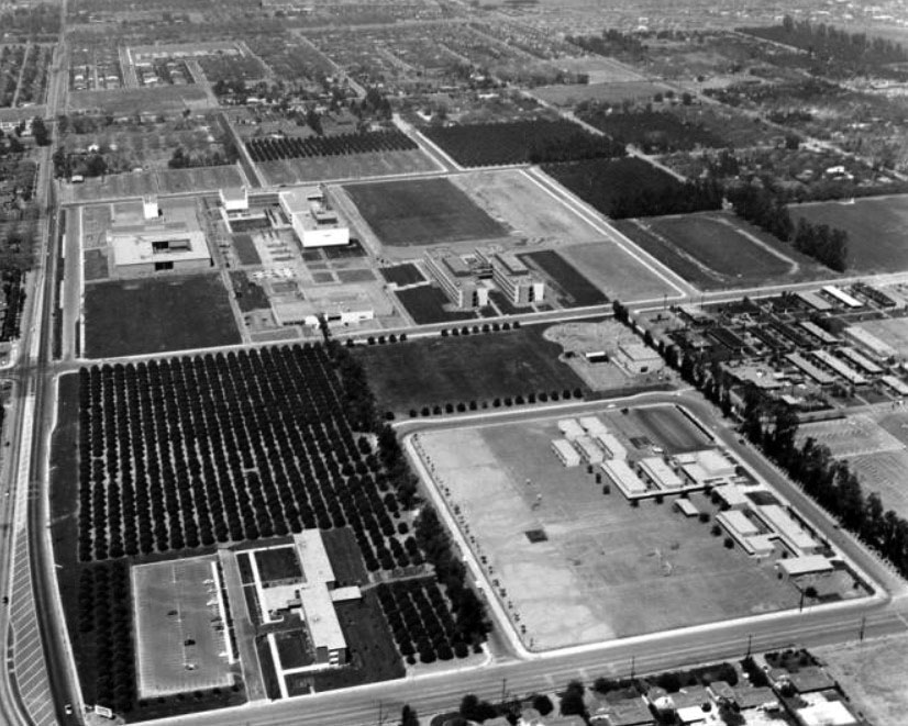
| (1962)^ - Campus of San Fernando Valley State College aerial view, looking west from above Zelzah Ave. Clockwise: Sierra Hall construction site, Science Buildings 1 and 2, Bookstore Complex, Music Building, Nordhoff Hall. |
Historical Notes By 1964, the Physical Education Building, the three-building Sierra Hall complex, the Administration Building, and the Engineering Building were completed as student enrollment reached 12,690. |
 |
|
| (1960s)* - Aerial view of San Fernando Valley State College (now CSUN) and surrounding area, looking northeast. |
Historical Notes In 1966, the era began of campus student protests against the Vietnam War, continuing through the early 1970s. In Fall of 1966, gubernatorial candidate Ronald Reagan gave a speech on campus. Also, Vice President Hubert Humphrey was heckled by anti-war protestors on his visit. |
 |
|
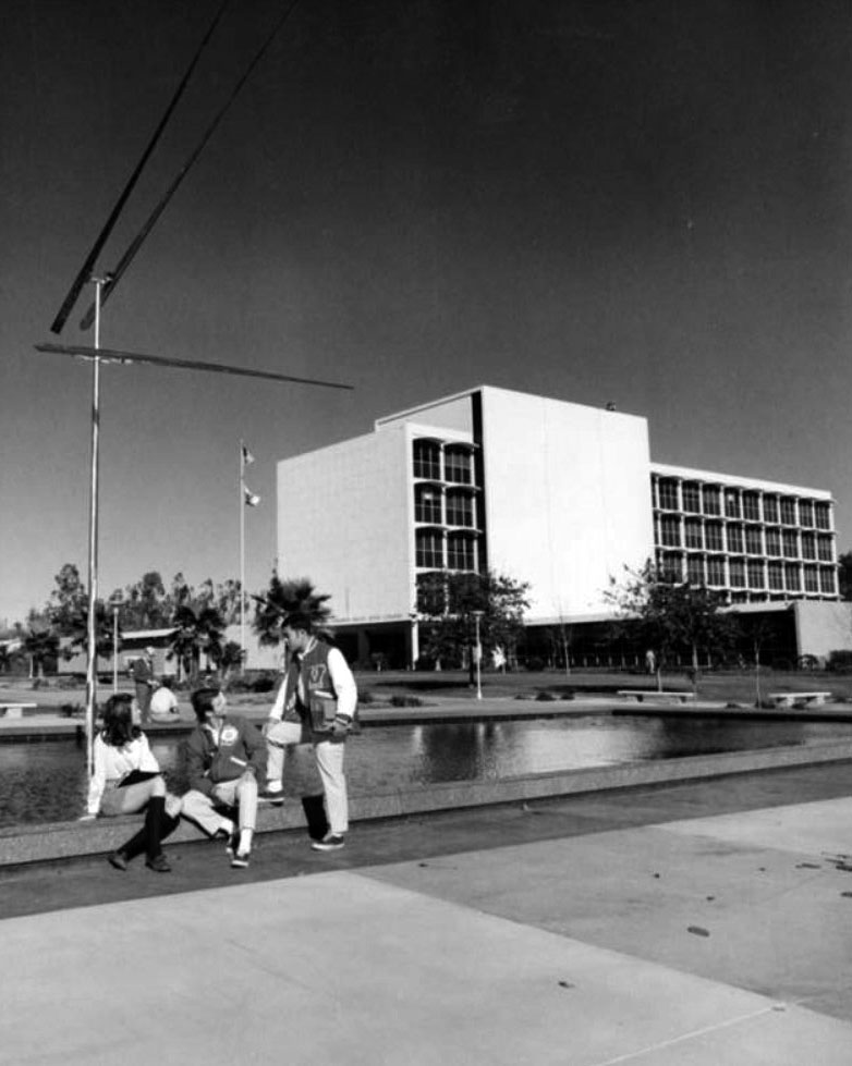
| (1968)* – View showing the San Fernando Valley State College (now CSUN) Administration Building (now Bayramian Hall). In the foreground are three Valley State students relaxing at the edge of the reflecting pool that once sat to the southwest of the building. The "Two up-Two down" kinetic sculpture by well-known artist George Rickey was installed in August 1968 and still stands in the same general area. |
Historical Notes In March, 1968, Presidential candidates Sen. Robert F. Kennedy and Sen. Eugene McCarthey drew a record 12,000 spectators during a visit to the campus. Student demonstrators burned draft cards; and rock singer Janis Joplin performed on campus. |
 |
|
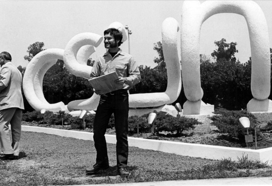
| (1970s)* – View showing the "CSUN" sculpture at the corner of Nordhoff Street and Zelzah Avenue, designed by graduate art student John T. Banks, and built in 1975. |
Historical Notes San Fernando Valley State College was officially named California State University, Northridge (CSUN) on June 1, 1971. |
* * * * * |
North Hills
 |
|
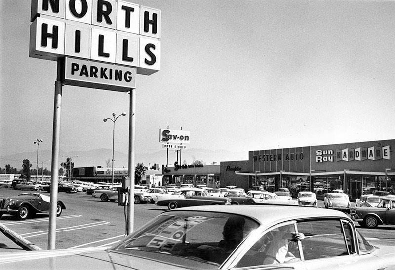
| (1960)* – Photo caption reads, "Acres of parking space available at new North Hills Shopping Center, Devonshire Street and Balboa Boulevard." Photo Credit: Valley Times - Sept. 30, 1960. Note tht the child in the back seat of the car is not wearing a seat belt. California’s seat belt law wasn't passed until 1986. |
Historical Notes North Hills was originally an agricultural community known as Mission Acres. After World War II, the newly developed suburban community was renamed Sepulveda until the 1990s. In 1992, residents of the western half of Sepulveda, west of the San Diego Freeway, voted to secede from the eastern section in order to form a new community named North Hills. Thereafter the value of properties east of the San Diego Freeway in Sepulveda fell. The City of Los Angeles eventually changed the name of remaining Sepulveda to North Hills also. The city then formed a new sub-neighborhood of "North Hills West" which begins west of the 405 freeway and goes to Bull Creek/Balboa and from Roscoe to Devonshire. The eastern section became the sub-neighborhood of North Hills East.*^ |
Valley Unitarian Universalist Church ("The Onion")
 |
|
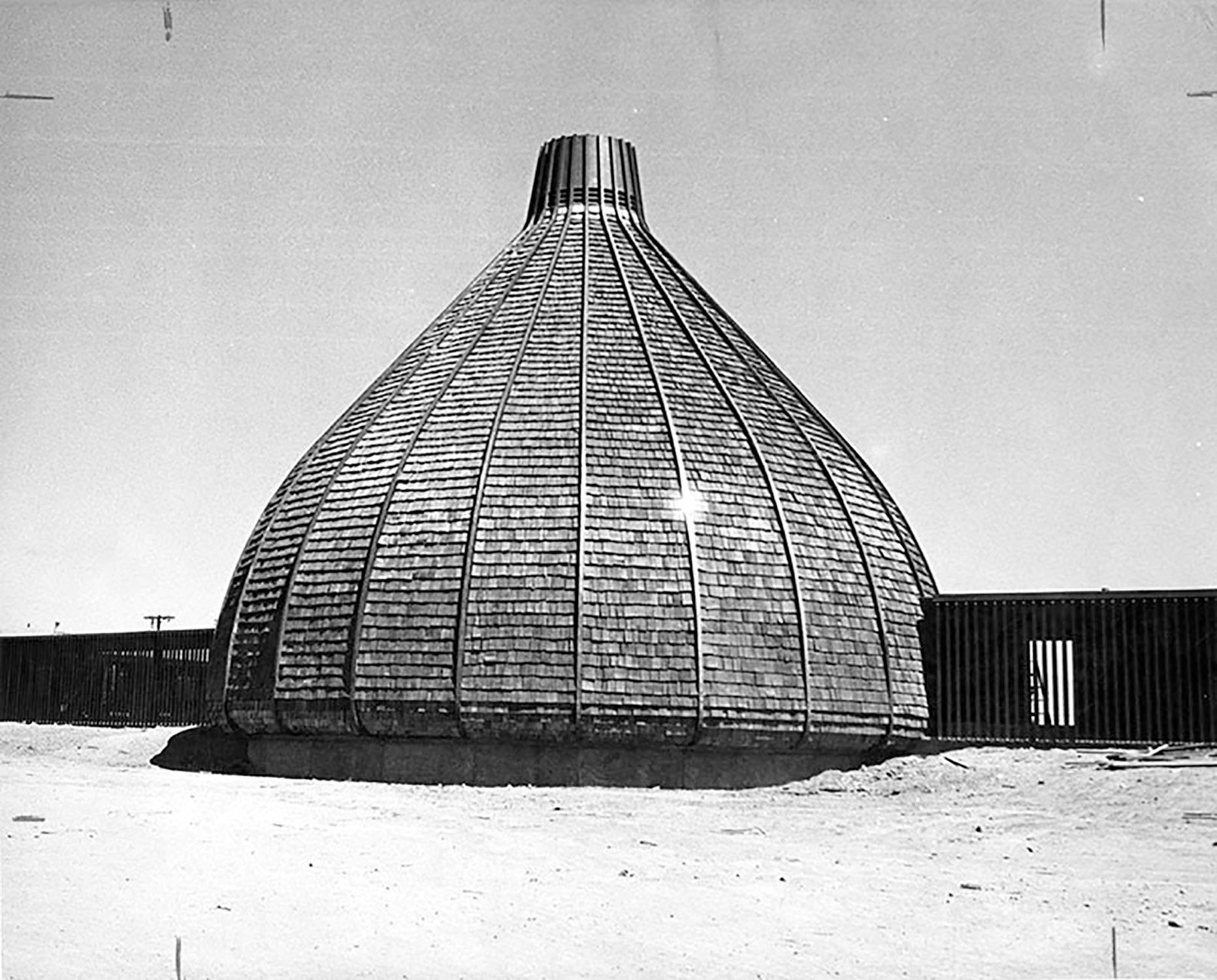
| (1964)* – View showing The Valley Unitarian Universalist Church (as it was called in the 1960s) shortly before it was completed, located at 9550 Haskell Avenue in Sepulveda (later North Hills). |
Historical Notes Designed by acclaimed architect Frank Ehrenthal, the building was completed in 1964. Its bizarre shape led to the nickname "The Onion." In addition to its church service, the building also operated as a nursery school, and held small theatrical performances. |
 |
|
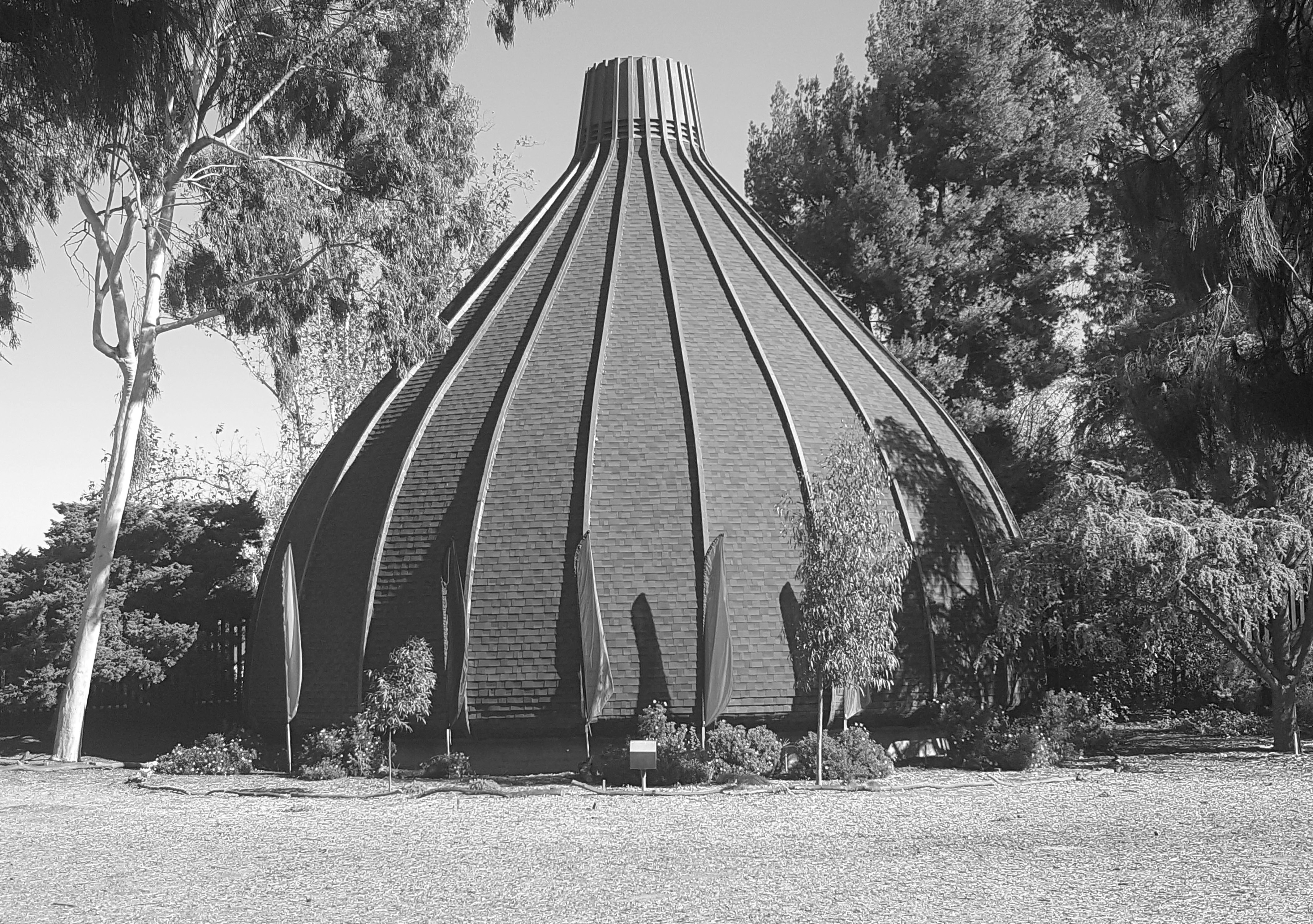
| (2015)^^*** – View showing "The Onion” in North Hills as it appears today. The building is currently home to the Sepulveda Unitarian-Universalist Society – A Liberal Religious Congregation. |
Historical Notes In 2010, the Sepulveda Unitarian Universalist Society Sanctuary was dedicated Los Angeles Historic-Cultural Monument No. 975. Click HERE to see complete listing. |
 |
|
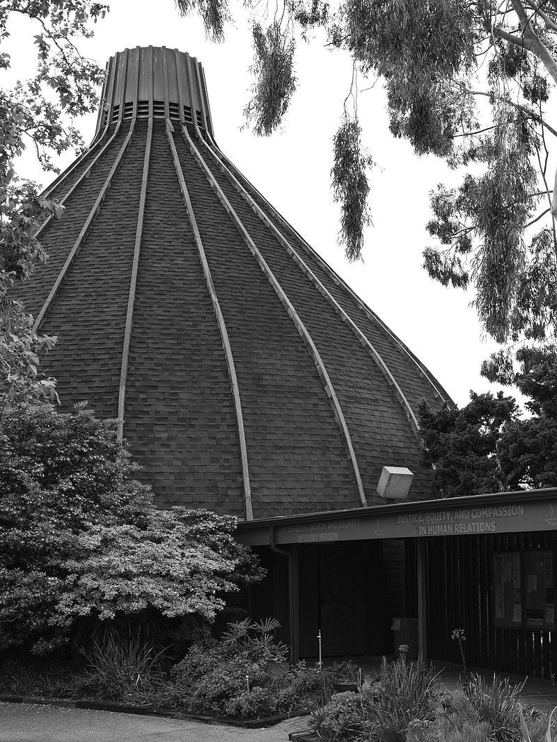
| (2016)*^ – View from the northeast showing the Sepulveda Unitarian Universalist Society Sanctuary ("The Onion"), located at 9550 N. Haskel Avenue in North Hills. Photo by Junkyandsparkel / Wikipedia |
Miracle Market
 |
|
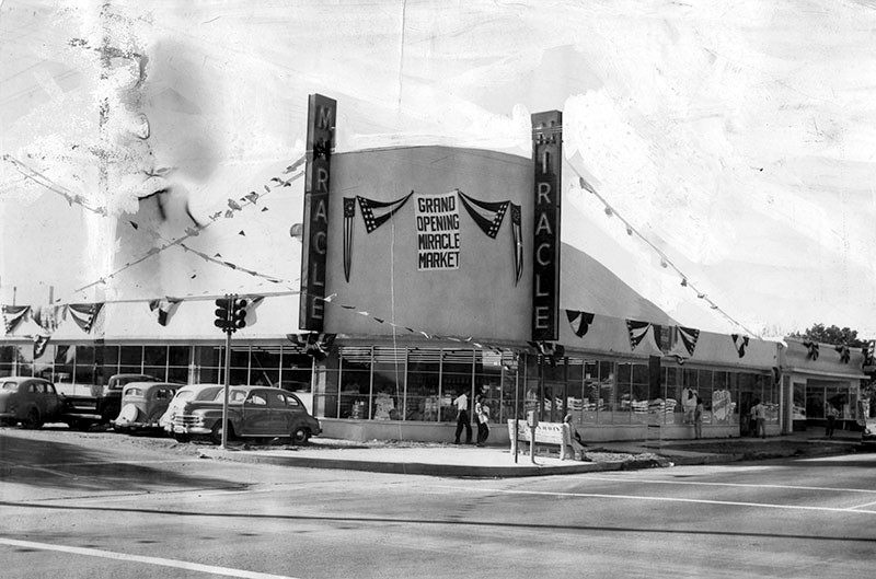
| (1950)* – View showing the Grand Opening of Miracle Market located on the northwest corner of Nordhoff Street and Sepulveda Boulevard (9101 Sepulveda Blvd). Today, this building is occupied by Sepulveda Laundry. Click HERE for contemporary view. |
Panorama Market
 |
|
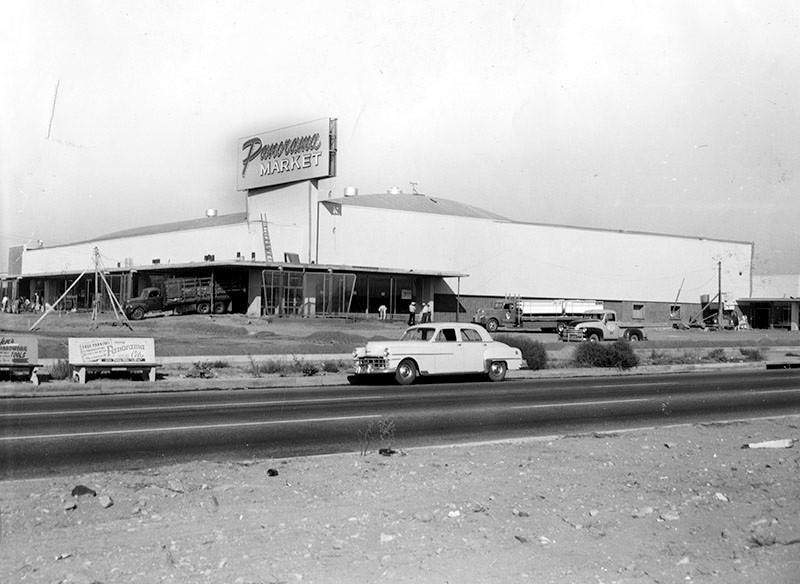
| (1954)* - View showing the construction of Panorama Market located on the northwest corner of Devonshire Street and Sepulveda Boulevard. |
Historical Notes Photo caption dated October 27, 1954 reads "Contractors are rushing to complete work on the new Panorama Market located at 10321 Sepulveda Blvd. at Devonshire Street. Company officials revealed today it will open during November. This new layout pictured above embraces 55,000 square feet of floor space and among its many features will be a free check cashing booth, free parking for hundreds of cars and unlimited one-stop shopping facilities at one of the most modern shopping centers with the latest innovations in the Southland. Ground for the project was broken last Spring. Arthur Froehlich is architect." |
 |
|
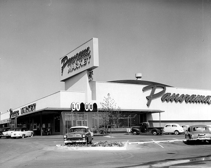
| (1957)* – View showing Panorama Market, 10321 Sepulveda Boulevard at Devonshire Street, Mission Hills. Today this is a Vons Market. Click HERE for contemporary view. |
Then and Now
 |
|
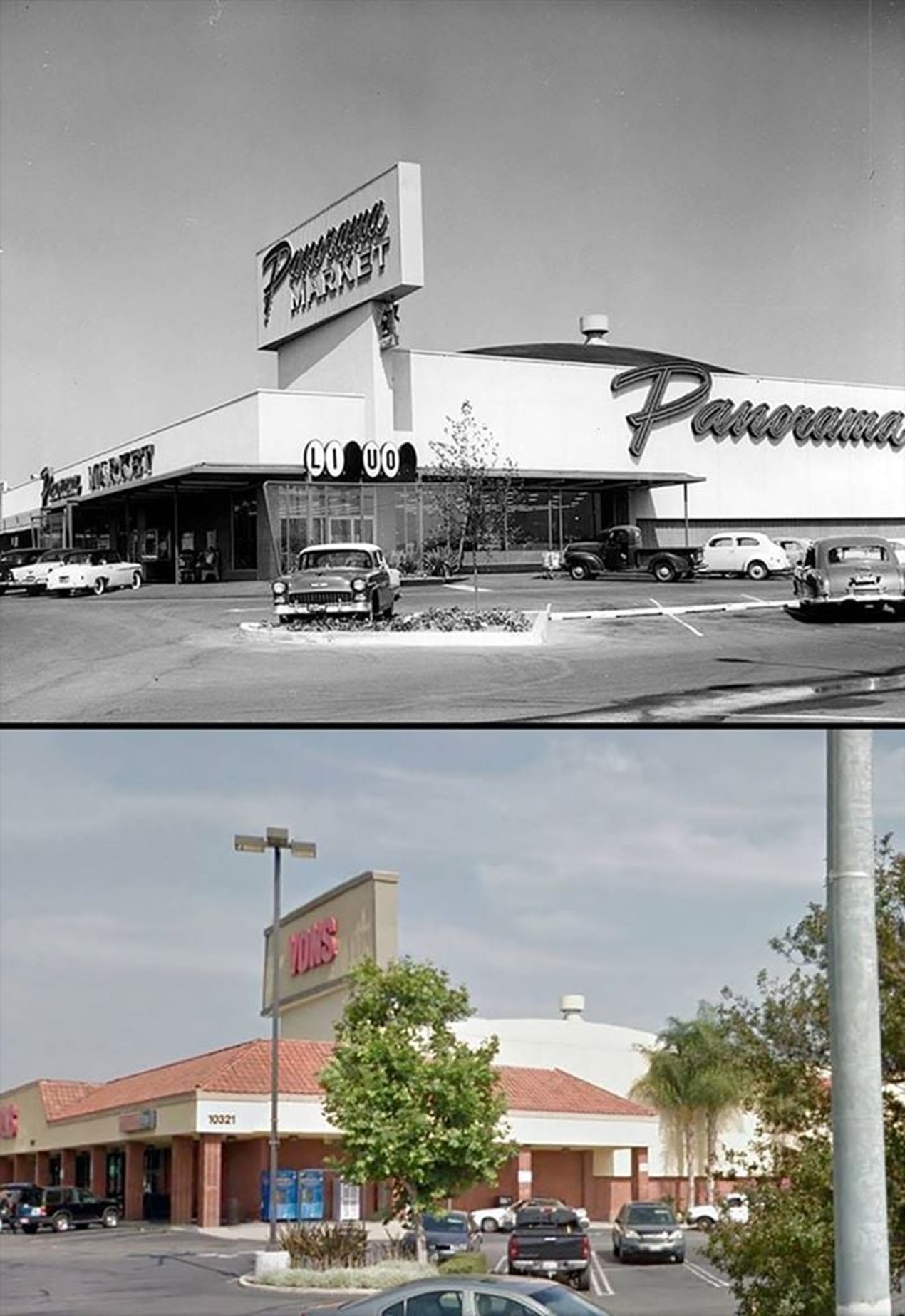
| (1957 vs 2010s)* - Panorama Market….Today a Von’s |
 |
|
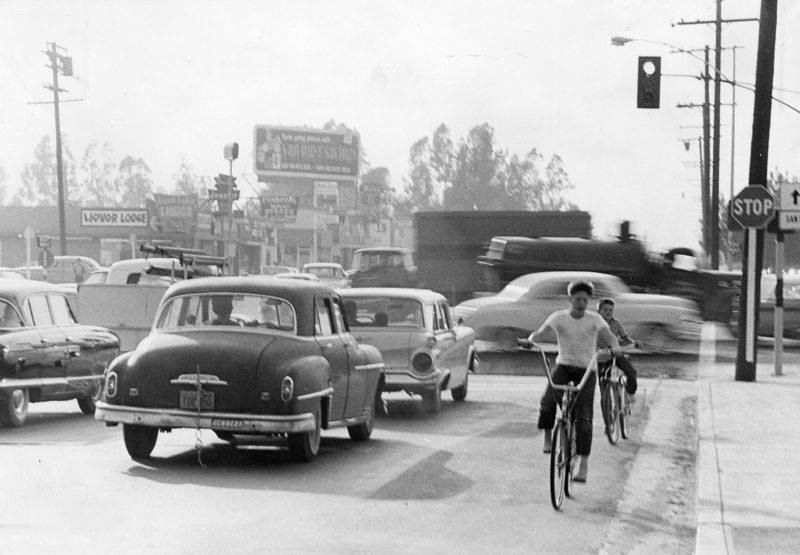
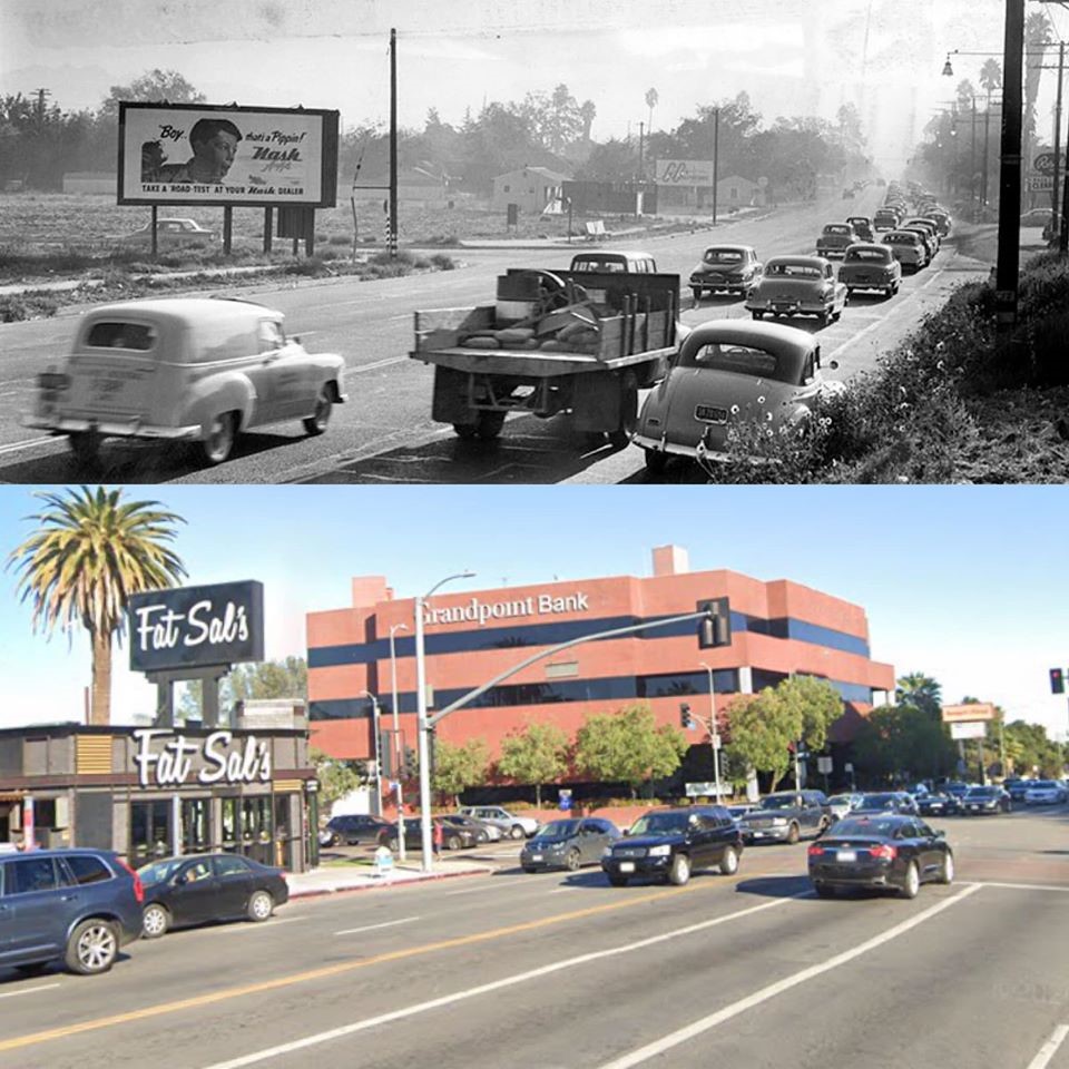
| (1961)* – View looking west on Devonshire Street at Sepulveda Boulevard showing two boys riding their bicycles against traffic near a very congested intersection. The intersection was named the "7th worst intersection in the Valley" according to accident numbers from 1959. Valley Times Collection - Click HERE for contemporary view. |
Tarzana
 |
|
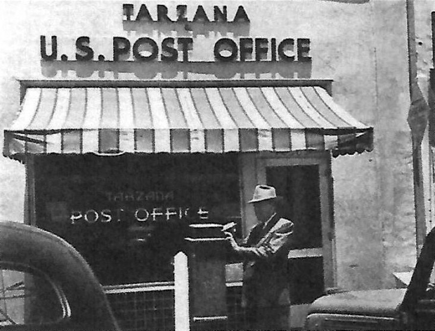
| (1930s)^.^ - View showing a man dropping a letter in a mail post box in front of Tarzana’s 1st Post Office located near the northwest corner of Reseda and Ventura. |
Historical Notes Tarzana’s first Post Office opened on December 12, 1930 in an 8ft. by 8ft. rear room of Holmquist’s grocery, Tarzana’s Red and White Market, with Mrs. E. L. Holmquist the then present Postmistress in charge. |
 |
|
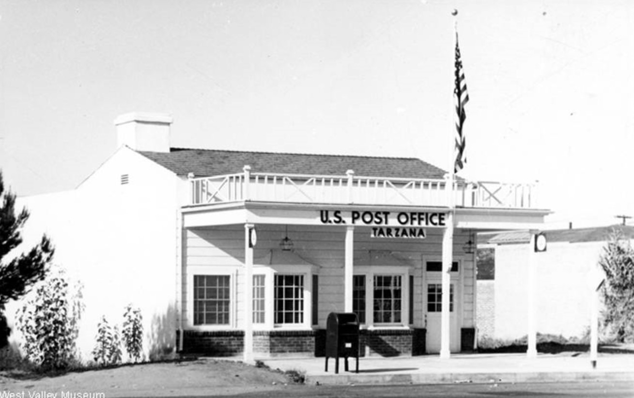
| (ca. 1940)^ – View showing the Tarzana Post Office located at at 5609 Yolanda Avenue. Click HERE to see contemporary view of new Post Office at same address. Photo courtesy of West Valley Museum |
Historical Notes August 2, 1937 marked the first day that RFD mail was delivered from the new Tarzana Post Office (seen above). 420 families on Rural Route No. 1, Tarzana began receiving their mail direct from their home post office, Tarzana and with the delivery came their home newspaper, The Tarzana Herald. |
 |
|
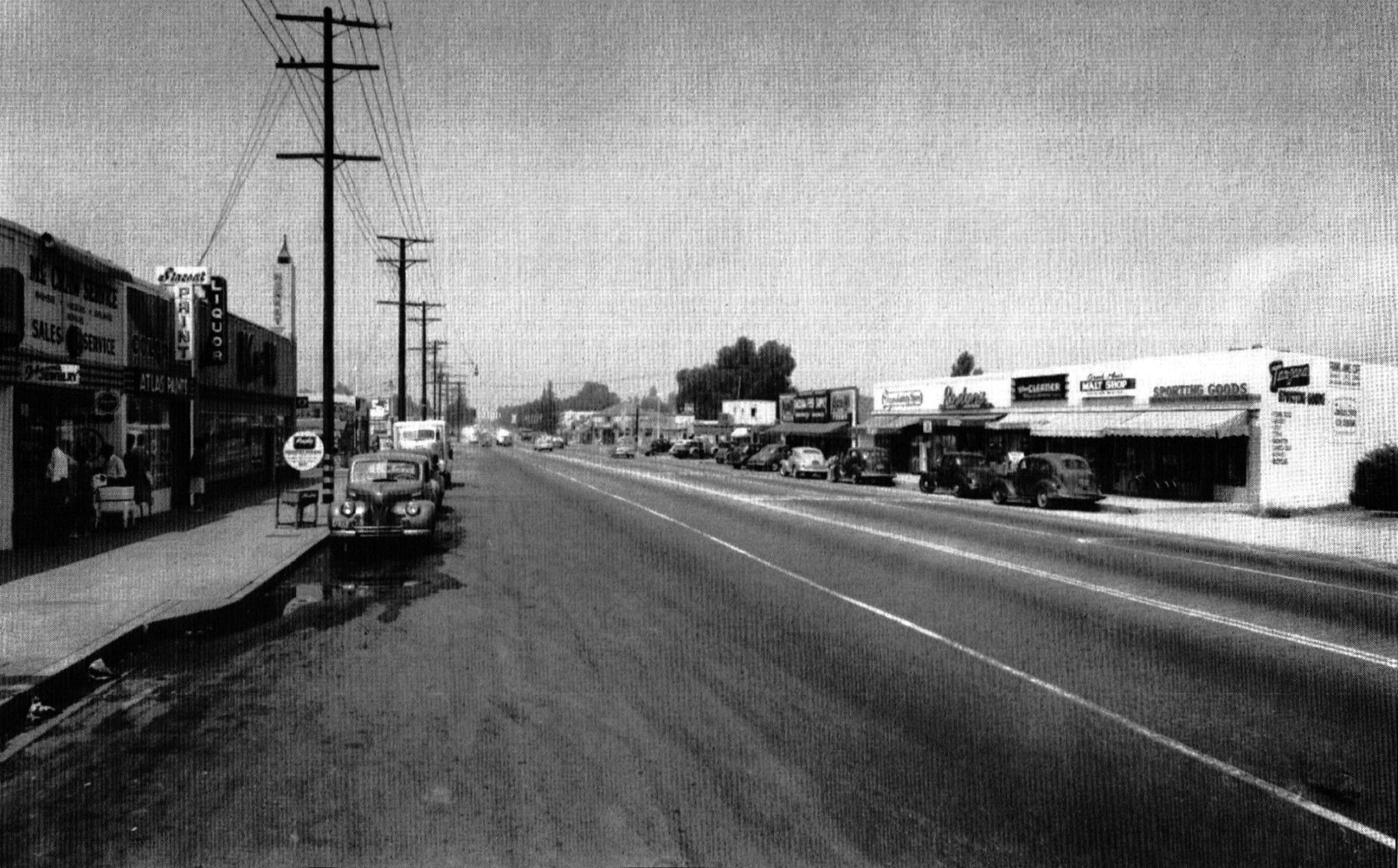
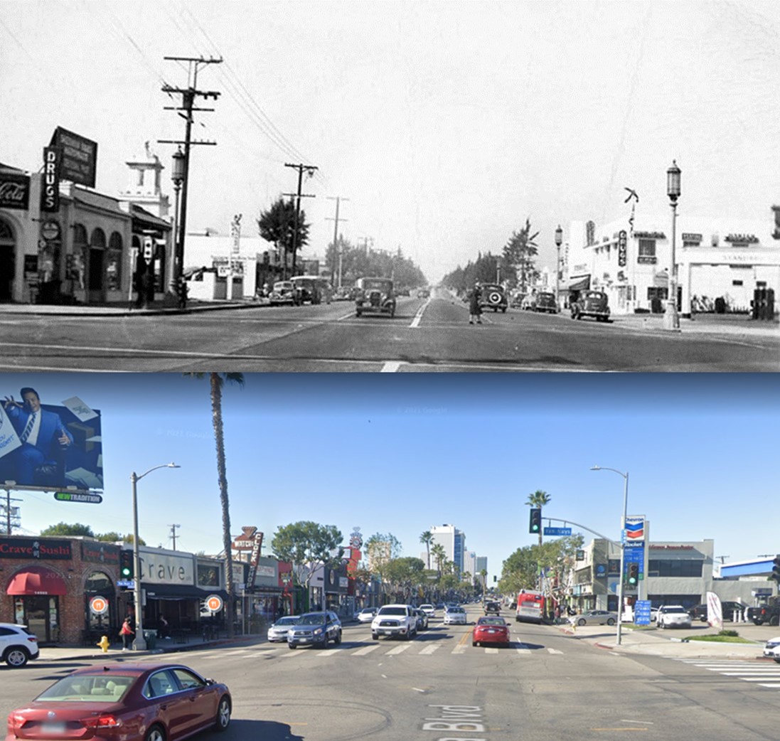
| (ca. 1948)^.^ – View looking east on Ventura Blvd towards Reseda Blvd. On the south side of the street were McCraw Appliance Service, Paint Store and K&M Market. On the north side were Tarzana Sporting Goods, Frank & Ann’s Café / Malt Shop, Village Cleaners, Roston’s Yardage, Tarzana Variety Store, and Tarzana Feed Supply. |
 |
|
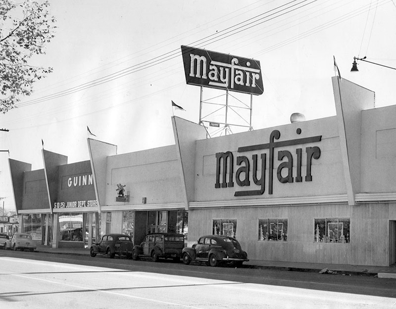
| (1950)* - View of Mayfair Market, located at 18632 Ventura Boulevard in Tarzana. Several automobiles can be seen parked along the street, in front of the supermarket. A small department store is visible adjacent to Mayfair Markets. |
Historical Notes They renamed these stores A & M Discount Foods (the A & M stood for Arden Mayfair). Once a large presence all over the west coast, there was only one Mayfair Market left by 2009. It was located in Hollywood. That same year the last remaining Mayfair was converted into a Gelson’s. |
 |
|
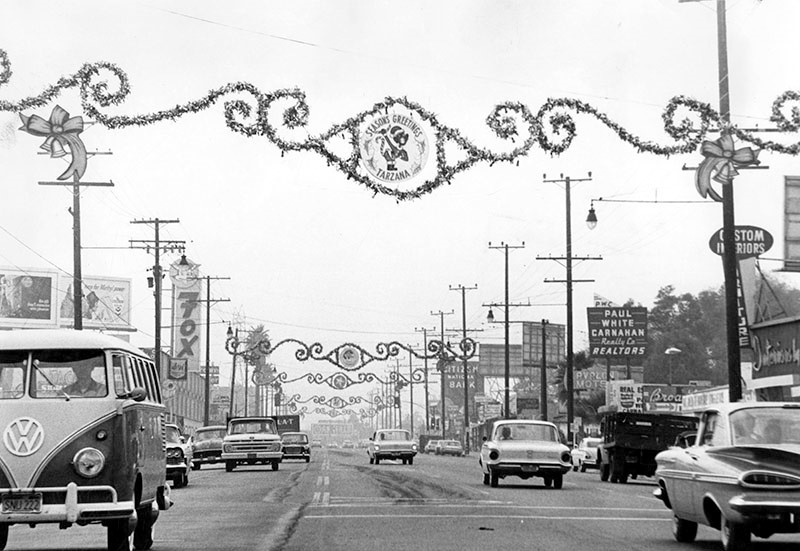
| (1962)* - Photograph caption dated December 18, 1962 reads, "Tarzana: between Mecca and Wilbur Ave. on Ventura Blvd." Visible signs include Custom Interiors Furniture, Paul White Carnaham Realty Co., Avalon Motel, pet shop, Citizens National Bank, Fox. |
Historical Notes According to the 2000 U.S. Census, the percentage of divorced men and women in Tarzana was among the county's highest. Some 9% of the residents were military veterans, considered high for the city of Los Angeles. The percentages of residents aged 50 and older were also among the county's highest.*^ |
 |
|
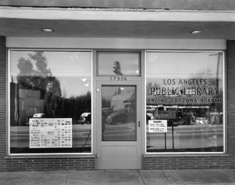
| (n.d.)* – View showing the original Encino-Tarzana Branch of the Los Angeles Public Library located at 17936 Ventura Boulevard in Tarzana. |
Historical Notes Today, Cafe Carolina occupies the building at 17936 Ventura Boulevard. Click HERE for contemporary view. |
Click HERE to see more Early Views of Tarzana |
Ventura and Balboa Blvds (Encino)
 |
|
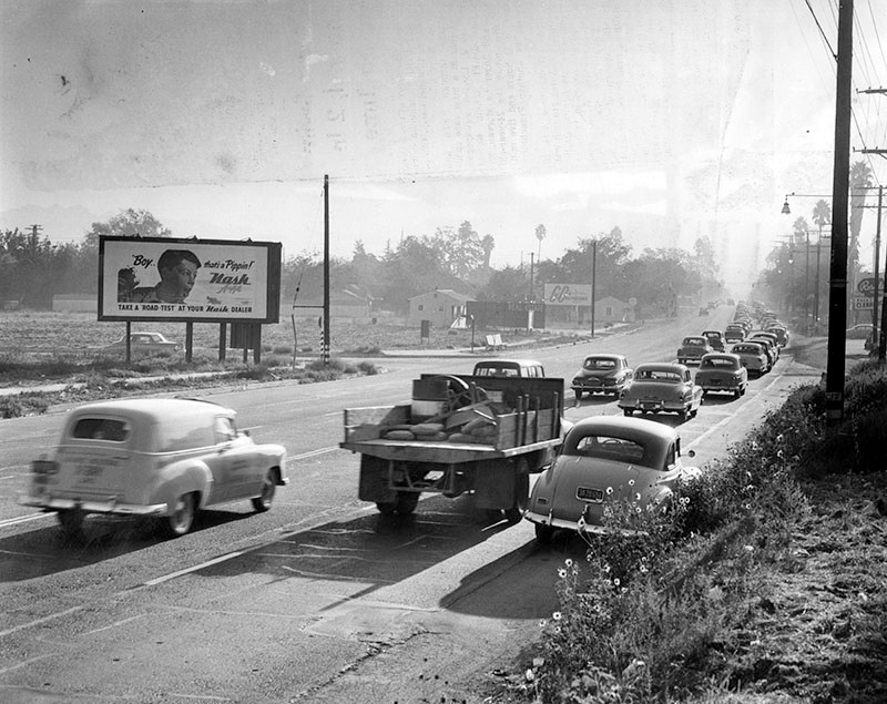
| (1953)* – View looking east on Ventura Boulevard from just east of Balboa Boulevard. |
Historical Notes Valley Times photo caption dated October 24, 1953 reads, "Seven a.m. saturation - This is view looking east on Ventura boulevard just east of the Big Squeeze bottleneck at Balboa Boulevard. Work-bound suburban residents are forced into two lanes, while two west-bound lanes are free of traffic. Suggested solution: Three-lane traffic eastbound in the mornings; three-lane traffic westbound in the evening." |
 |
|
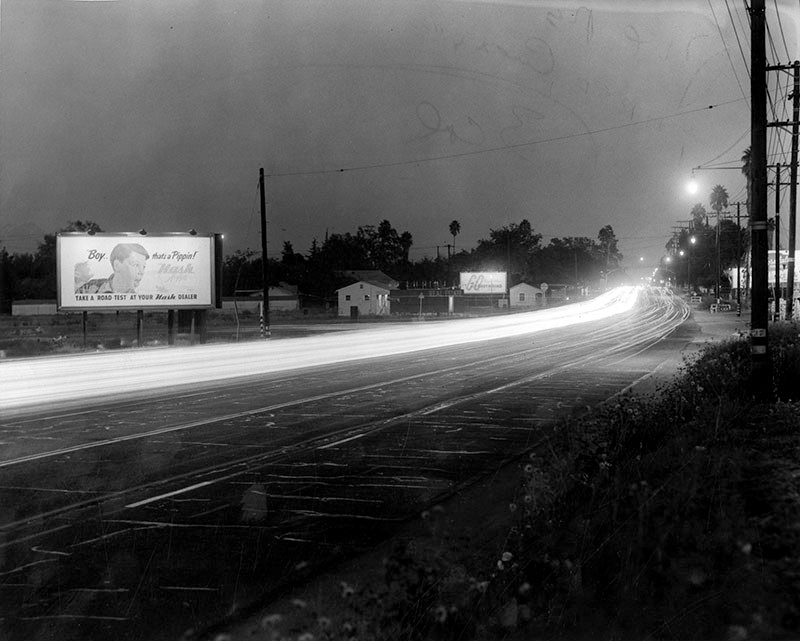
| (1953)* - Early morning view of Ventura Boulevard looking east from just east of Balboa Boulevard. Photo taken from the same spot as previous photo. Click HERE to see contemporary view. |
Historical Notes Photograph caption reads, "Five p.m. frustration - Picture taken from exactly the same spot as 7 a.m. Saturation illustrates reverse flow of home-bound residents, again forced into two lanes while two lanes at right carry little or no traffic. This photo is a time-exposure. Bright white streak is caused by endless line of headlights on cars moving westward." |
Then and Now
 |
|
| (1953 vs. 2019)^ - Ventura Blvd. looking East at Balboa Blvd. |
Los Encinos Historic State Park
 |
|
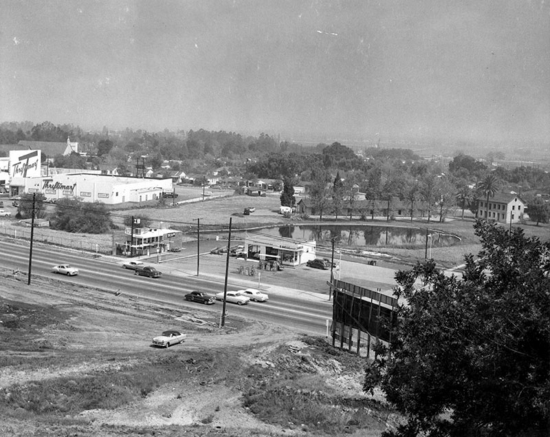
| (1957)* - Photograph caption dated June 1, 1957 reads "Overlooking monument. This photograph was taken from nearby hillside where an Indian village once was located. Ventura Boulevard is shown in foreground and beyond service station is Los Encinos Monument and Encino Pool, contrasting modern progress with early-day Valley life." Also pictured are a Thriftimart grocery store, a Shell service station, and a Mexican fast food restaurant. |
Historical Notes Vincent de la Osa Adobe, built in 1849 by Don Vicente De La Osa, was a favored stopping place for the numerous travelers on El Camino Real. It stands on land that is a part of the one-square-league Rancho El Encino granted in 1845 by Governor Pio Pico to three Indians, Ramon, Francisco, and Roque, whose interests were purchased by Don Vicente. Originally the land was under the jurisdiction of Mission San Fernando Rey founded in 1797 (Click HERE to see more). |
 |
|
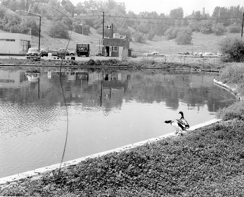
| (1957)* - View looking south across the Encino pool at Los Encinos State Park toward Ventura Boulevard. A sign on the building across the pond reads "Mexican fast food." |
Historical Notes Valley Times photo caption dated June 1, 1957 reads "Ducks enjoy Encino pool. Adorning monument grounds is this spring-fed pool, a Valley beauty spot. Stream carries 85-degree spring water to pond. Ducks flew there, liked it, stayed permanently." |
 |
|
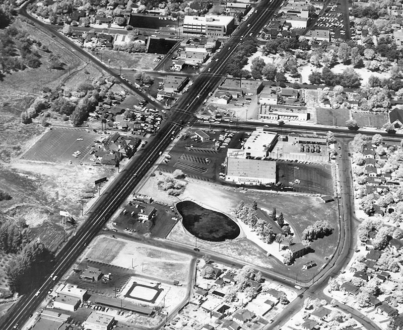
| (1960)* – Aerial view showing Los Encinos Historic State Park near the intersection of Ventura and Balboa boulevards (upper-center left). Thriftimart can be seen just west of the State Park (center of photo). |
Historical Notes Los Encinos State Historic Park, just northeast of the intersection of Balboa and Ventura Boulevards in Encino, was the hub of Rancho El Encino. This California rancho includes the original eight-room de la Ossa Adobe, the two-story limestone Garnier building, a blacksmith shop, a natural spring, and a pond. The natural spring provided a year-round source of water for the ancient, autonomous, village of Siutcanga. The village was home to Chumash, Tongva, and Tataviam people, who later were called "Fernandeños" by the Spanish due to the enslavement of these three groups to the San Fernando Mission. An excellent description of this village was recorded as part of the 1769 Portola Expedition. This Spanish expedition reached the San Fernando Valley and named it “El Valle de Santa Catalina de Bononia de Los Encinos” (The Valley of St. Catherine of Bononia of the Oaks).*^*^* The name Encino means "Oak"; Rancho Los Encinos - Ranch of Oak Trees" |
 |
|
| (2015)* – Google satellite view showing Los Encinos Historic State Park in Encino. |
Historical Notes Located along a significant travel route between Los Angeles and Santa Barbara, the property passed through many hands between the 1840s and the early 20th century. Today, the park contains exhibits related to the agricultural enterprises of Rancho El Encino’s various owners, including Mission Indian, Mexican Californio, French, and French Basque families.*^*^* Click HERE to see more Early Views of Rancho Los Encino. |
|
|
|
| (1960)* - Los Encinos Historic State Park and vicinity. | (2015)#*^# - Los Encinos Historic State Park and vicinity. |
Thriftimart (Encino)
 |
|
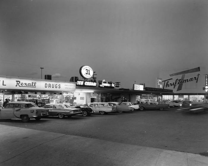
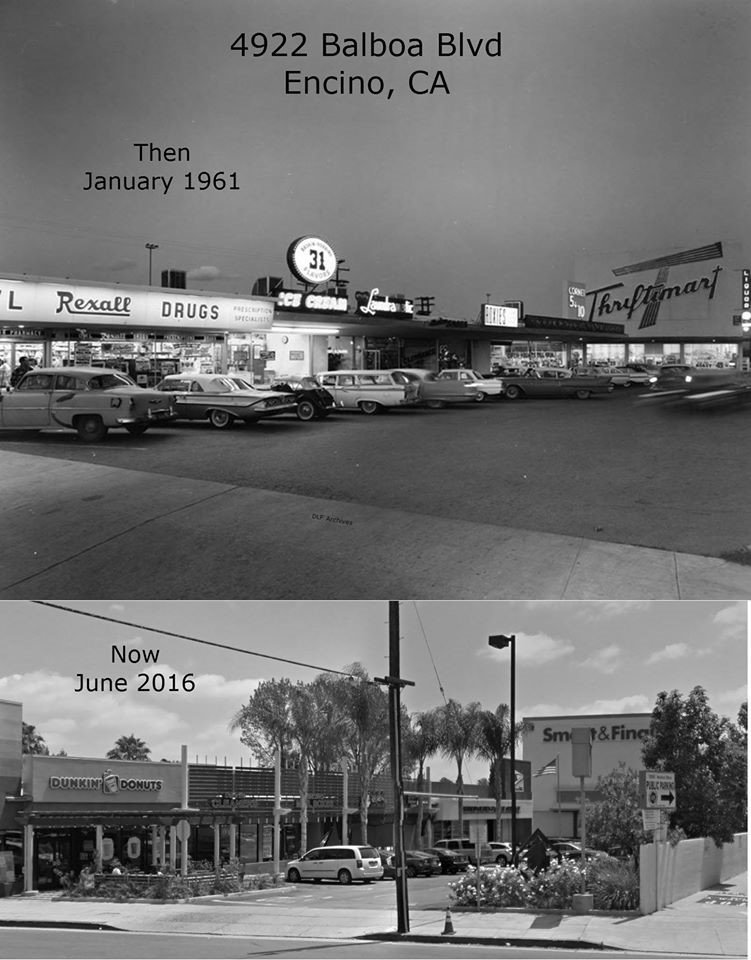
| (ca. 1961)^.^ – Rexall Drugs, Baskin Robins, and Thriftimart occupy a strip mall on the east side of Balboa north of Ventura Boulevard (4922 Balboa Blvd, Encino). Located just west of Los Encinos State Park, this shopping center still exists but has been given a face-lift. Today, a Dunkin Donuts occupies the space where Rexall use to be. Also, Thriftimart has been converted into a Smart and Final. Click HERE for contemporary view. |
Historical Notes Burning bright above the San Fernando Valley and L.A. Basin at dusk were the red, 40-foot tall "T's" - the iconic logo of the late, great Thriftimart supermarket chain. These gigantic signs emerged on the local landscape through the 50's and 60's. The company that would eventually be named Thriftimart, Inc. was created in 1930 when a group of former A&P managers headed by Roger Laverty, Sr. purchased a company called Fitzsimmons Stores, Ltd. (the name the company would bear until well into the 1950's). In its earlier years, the company grew through acquisitions, including the 9-store "Thriftimart" and the 17-store Roberts Markets chains in the 1940's. In 1955, the company purchased the Smart & Final Iris Company, which at the time was strictly a wholesale operation. By 1961, the company had over 60 stores and had renamed itself after its famous trademark.* |
Then and Now
 |
|
| (1961 vs. 2016)^ - 4922 Balboa Blvd in Encino. Aside from the store names and facades, not much has changed. Note that the Thriftimart is now a Smart and Final. Photo courtesy of Dean Fields. |
Historical Notes Thriftimart purchased Smart & Final in 1955 as its wholesale division. The Smart and Finals you see today were once Big T stores. By now most are remodeled and modern or a Safeway store such as the Canoga Park Big T, now West Hills Pavilions. The Rexall is Dunkin Donuts, Coronet 5 and 10 a Post Office. |
Queens Arms Restaurant (Encino)
 |
|
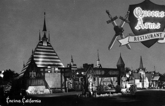
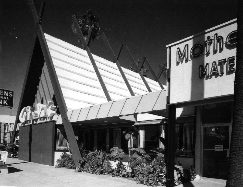
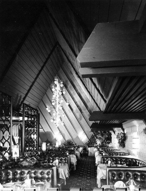
| (1960s)^.^ – Postcard view showing the Queens Arms Restaurant, located at 16325 Ventura Boulevard, Encino. |
Historical Notes The Queens Arms was a spectacular, Disneyland-like sight along Ventura Boulevard between Hayvenhurst and Libbit avenues. It was opened in 1956 by brothers Chris and John Skoby. The duo’s first restaurant was Skoby's Drive-in, located in Burbank. Skoby restaurants that followed included The King's Arms in Toluca Lake, The Queen's Arms in Encino and Blackbeard's, with locations in Newport Beach and on Maui. Skoby's only remaining restaurant, like the first, is simply named Skoby's, in Chatsworth. Chris Skoby, had planned the restaurant based on his visits to Europe during the 1940s, when he fell in love with the architecture. He found a designer who was active in the film industry. The main interior designer of the Queens Arms was Martin Obzina, who was a top art director for Alfred Hitchcock on many of his films. There was a full-size knight in armor in the foyer and elaborate Renaissance-themed murals on the walls.^ |
 |
|
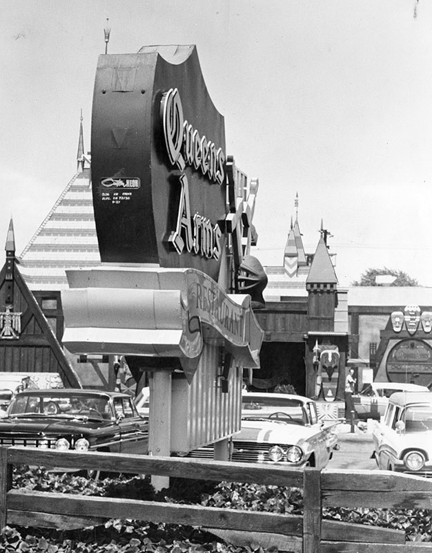
| (1960)* - Photograph caption dated September 14, 1960 reads, "Castle-like restaurant is one of many plush eating places along busy Ventura Boulevard. 'Royal' atmosphere is appropriate; the Valley was named after Ferdinand III of Spain." The address for the Queens Arms Restaurant is 16325 Ventura Blvd. |
Historical Notes Many celebrities dined at the Queens Arms during its heyday, including Encino residents Dick Van Dyke and Steve Allen. Many top-notch entertainers performed there as well, including Gary Lewis of Gary Lewis and the Playboys in 1974. In 1975 the Queens Arms closed its drawbridge for the final time, but actually lived on, for a short time, as the Spaghetti Castle, a family-oriented restaurant with cheaper fare that never really took off. The property was then taken over for several years by Terry York Chevrolet, which was next door on the corner of Hayvenhurst for many years. Today, a Ralphs Market stands on the site where the Queens Arms used to be. Click HERE for contemporary view. |
Horton Mansion
 |
|
| (1962)* – View showing the Encino home of actor Edward Everett Horton, located at 5521 Amestoy Avenue. It contained 17 rooms, 14 fireplaces, and a banquet hall. |
Historical Notes Edward Everett Horton had a long career in film, theater, radio, television, and voice work for animated cartoons. He began his stage career in 1906, singing and dancing and playing small parts in vaudeville and in Broadway productions. In 1919, he moved to Los Angeles where he began acting in Hollywood films. In 1925, Horton purchased several acres in the district of Encino and lived on the property at 5521 Amestoy Avenue until his death. He named the estate, which contained Horton's own house and houses for his brother, his sister and their respective families, Belleigh Acres. In the 1950s, the state of California forced Horton to sell a portion of his property for construction of the Ventura Freeway. The freeway construction left a short stump of Amestoy Avenue south of Burbank Boulevard and shortly after his death, the city of Los Angeles renamed that portion Edward Everett Horton Lane. Edward Everett Horton Lane ends at Burbank Boulevard, and begins in the shadow of the Ventura Freeway. On the other side of the boulevard is a bus stop also named for Edward Everett Horton, between bus stops at Aldea and Balboa. The borderline of Anthony C. Beilenson Park is directly across the street from the corner of Burbank Boulevard and EE Horton Lane. The opposite end of the lane leads to a foot bridge that overlooks the Ventura Freeway and ends up on the Amestoy Avenue side.*^ Scott Fitzgerald rented a two-story guest house on the property, 1938-39. Reflective of the devastation of the Great Depression, the author received his last royalty check while a Valleyite, $13.13. ^ |
Ventura and Sepulveda Blvds (Sherman Oaks)
 |
|
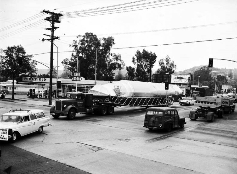
| (1958)^^ - View looking toward the southeast corner of Ventura and Sepulveda where a Richfield Service Station is located. A large truck carrying an Atlas missile is seen rounding the corner of Sepulveda onto Ventura Blvd. |
Historical Notes The Atlas, first tested in 1957, was the United States' first successful ICBM (Intercontinental Ballistic Missile). It launched the Mercury project space capsules and became the foundation for a family of successful space launch vehicles now built by United Launch Alliance. The Atlas rocket family is today used as a launch platform for commercial and military satellites, and other spacecraft.*^ |
 |
|
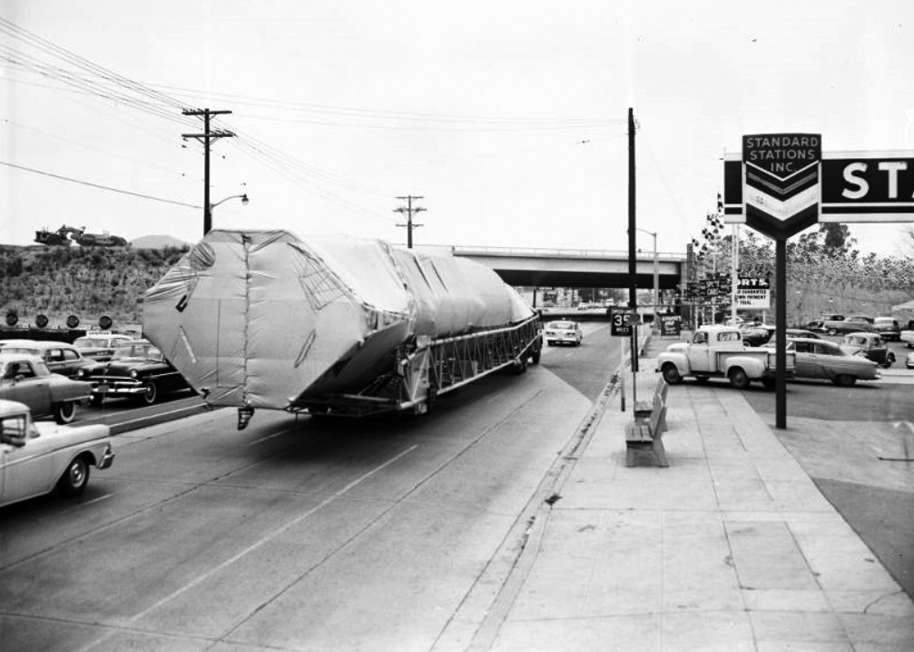
| (1958)^^ - View looking west on Ventura Boulevard showing the Atlas missile being transported toward the San Diego Freeway overpass (still under construction). A Standard Service Station is seen at right on the northwest corner of Ventura and Sepulveda boulevards. |
Historical Notes The San Diego Freeway, connecting the Westside with the San Fernando Valley, would not open until 1962.*^ |
Ventura Freeway
 |
|
| (1958)^ – Panoramic aerial view looking southeast over the Sepulveda Basin showing the San Diego and Ventura Freeway Interchange still under construction. |
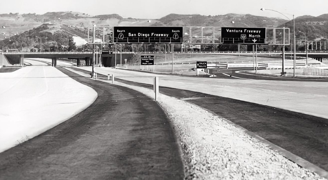 |
|
| (1958)* - Facing south at newly constructed San Diego Fwy (initially CA-7, now I-405) at Ventura Fwy (US-101) interchange. New 1.5 mile long freeway segment extended from Valley Vista Blvd to Burbank Blvd (Valley Times photo date July 1, 1958). |
 |
|
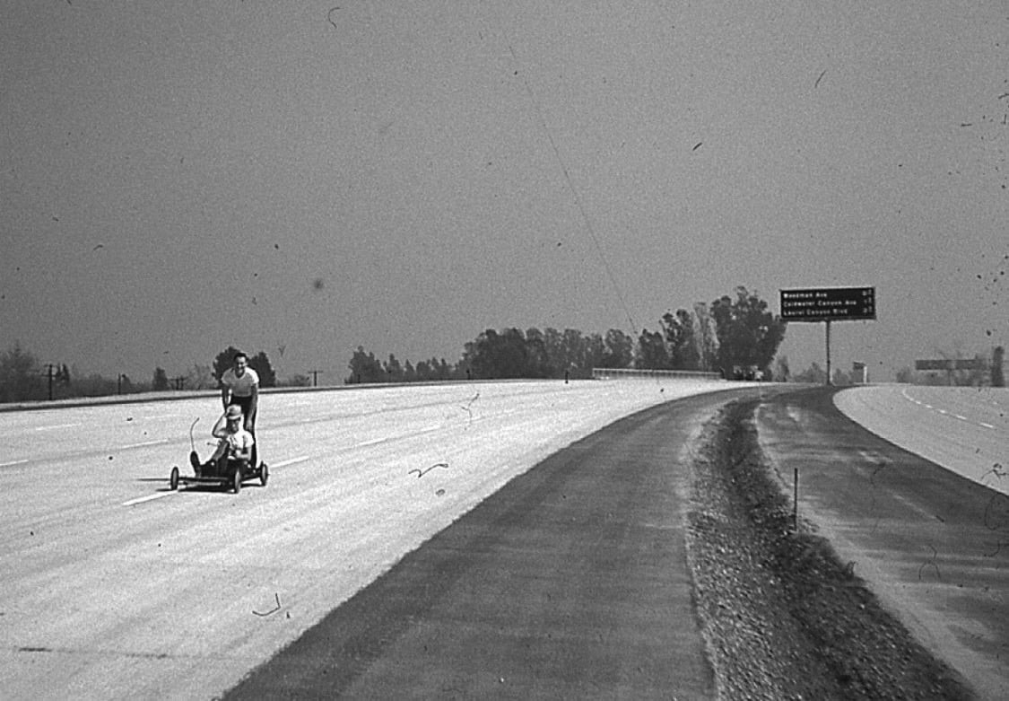
| (1960)* – Two boys are seen riding their go-kart on the unifnished Ventura Freeway. View is looking east with the sign in the background reading Woodman, Coldwater, and Laurel Canyon. |
 |
|
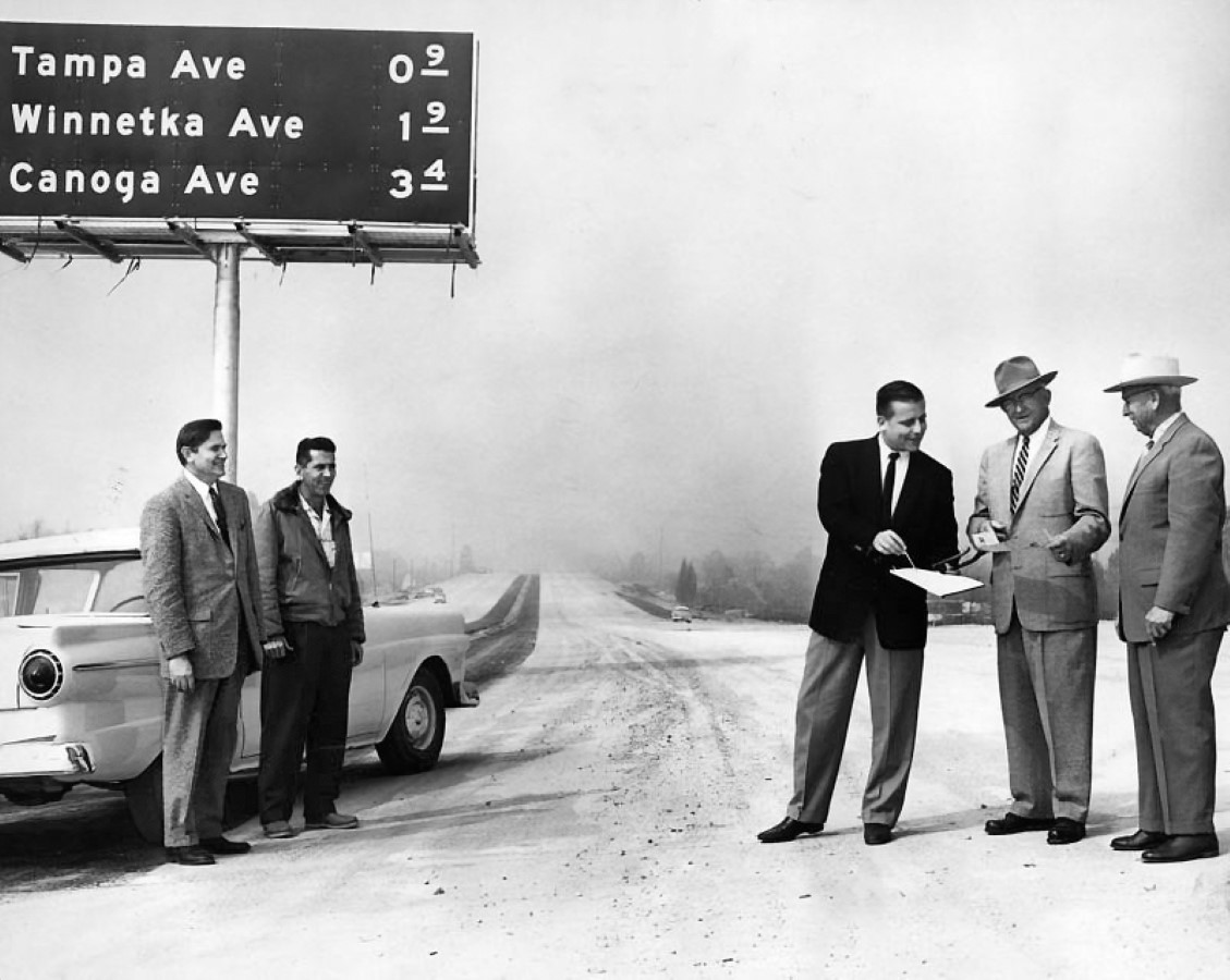
| (1960)*- Members of Valleywide Committee on Streets and Highways and officials from State Division of Highways check nearly completed NB section of Ventura Freeway (US-101) near Reseda Blvd bridge (Valley Times Collection). Photo date March 9, 1960 |
Historical Notes The portion of the Ventura Freeway signed as US 101 is signed as a north-south route by CalTrans despite the freeway's actual alignment being east-west. This is due to the fact that US 101 as a whole has a north-south alignment. The apparent inconsistency can be confusing to visitors, as the same freeway entrance can often be signed as "101 North" and "101 West." This is most common in the San Fernando Valley.* |
Studio City
 |
|
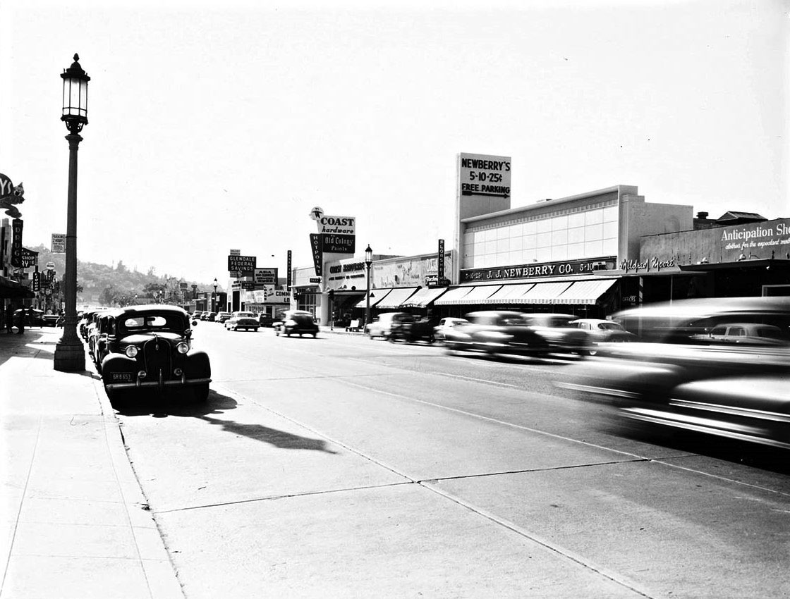
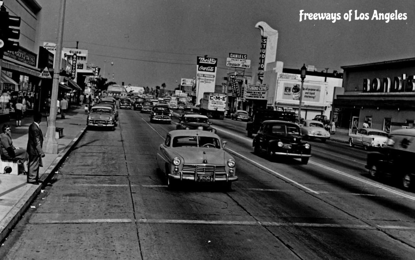
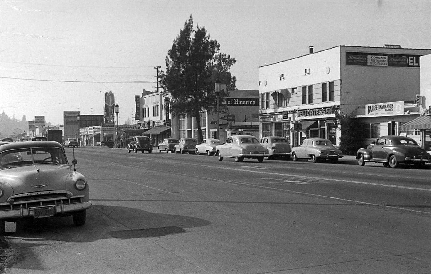
| (ca. 1950)* – View looking west on Ventura Boulevard in Studio City. Coast Hardware Store and J.J. Neweberry and Co. can be seen on the north side of the street. Photo by Julius Shulman. |
Historical Notes Ventura Boulevard is one of the primary east–west thoroughfares in the San Fernando Valley. It is one of the oldest routes in the San Fernando Valley as it was originally a part of the El Camino Real (the trail between Spanish missions). It was also U.S. Route 101 before the freeway (which it is parallel to for much of Ventura Boulevard's length) was built, and it was also previous signed as Business U.S. Route 101. |
 |
|
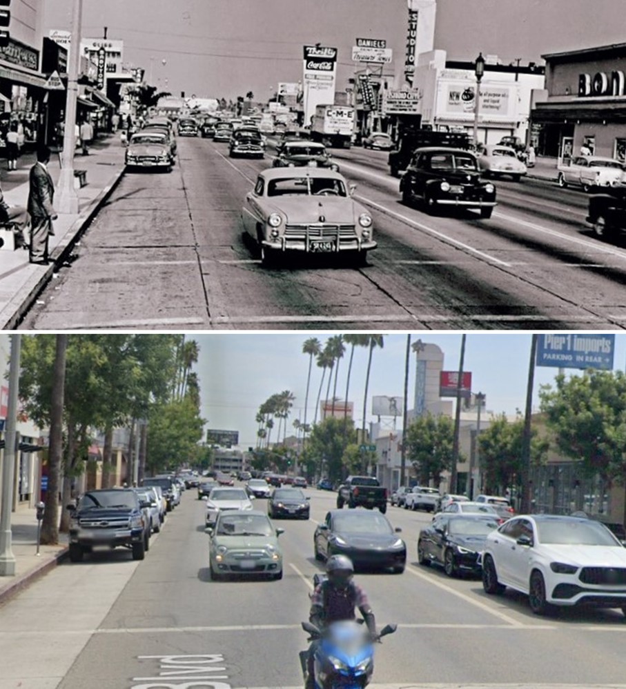
| (1954)* – View looking east on Ventura Blvd (US-101) toward Laurel Canyon Blvd in Studio City. Studio City Theatre can be seen in the distance on the right. Thrifty Drug Store is further back on the NW corner of Ventura and Laurel Canyon. |
Historical Notes Running 18 miles, Ventura Boulevard is the world's longest avenue of contiguous businesses. The Boulevard begins near Calabasas in Woodland Hills at an intersection with Valley Circle Boulevard, passes through Tarzana, Encino, Sherman Oaks, and finally in Studio City (where it intersects with Lankershim Boulevard) it becomes Cahuenga Boulevard, which then winds through Cahuenga Pass into Hollywood. It has always been the most concentrated location for mom and pop shops and small businesses in the Valley; nowadays it has pockets of housing, mini-malls, and shops, along with a wide assortment of businesses, schools, and other establishments. |
 |
|
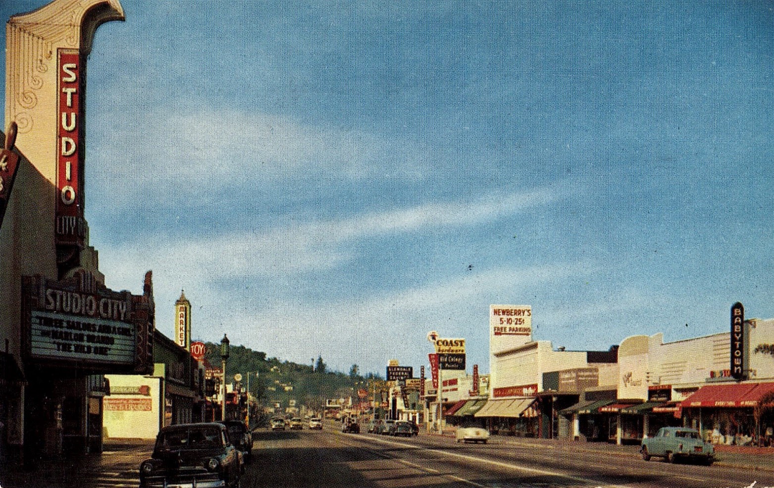
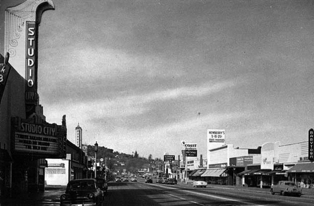
| (1950s)* – View looking west on Ventura Boulevard with the Studio City Theatre seen on the left. Some recognizable signs on the right (north side of Ventura) include: Coast Hardware Store, Newberry’s 5-10-25, and Babytown. Photo courtesy of Valley Relics Museum |
Historical Notes Opened in 1938, the Studio City Theater at 12136 Ventura Boulevarfd was operated by Fox West Coast Theatres and its successor companies. The last operator was Mann Theatres. It's been known as the Studio Theatre, the Studio City Theatre and the Fox Studio City. The theater closed in 1991. The interior is largely intact but has been converted into a Bookstar/Barnes & Noble bookstore. |
 |
|
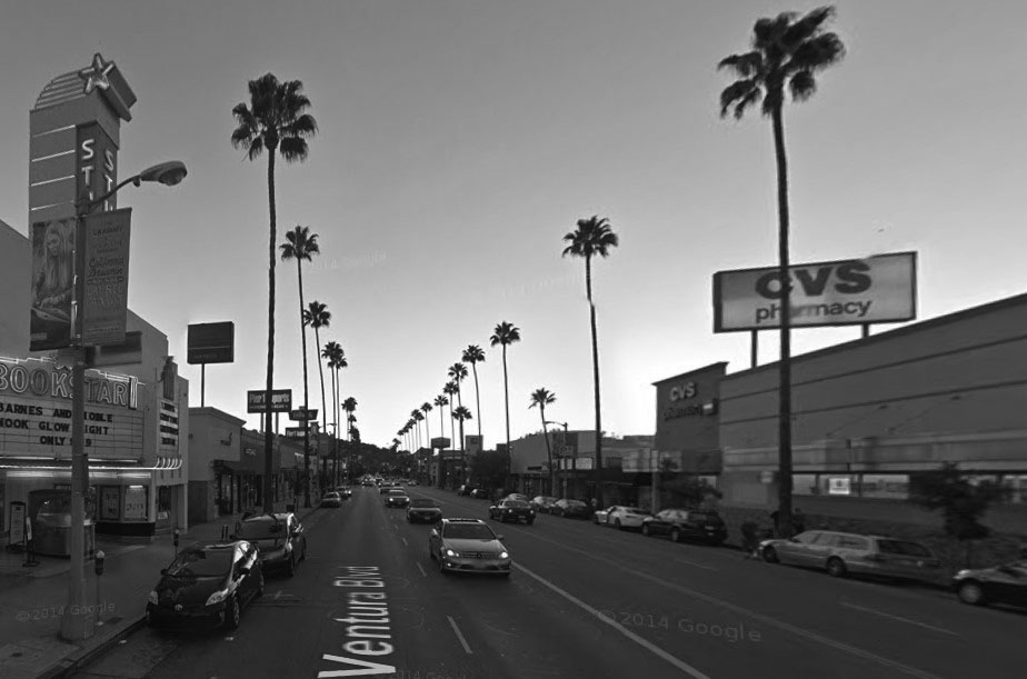
| (2014)* - Google street view looking west on Ventura Boulevard next to the Bookstar/Barnes & Noble bookstore at the old Studio City Theatre with CVS on the north side of the street. |
Then and Now
 |
|
|
| (1950s vs. 2014)* – Looking west on Ventura Boulevard, Studio City. |
Then and Now
 |
|
| (1954 vs 2022)* - Looking east on Ventura Boulevard at Vantage Avenue in Studio City. |
 |
|
| (ca. 1950)* – View looking west on Ventura Blvd. in Studio City from east of Laurel Canyon Blvd. Currie’s Ice Cream (large cone on top of building) can be seen in the distance, located on the N/W corner of Ventura Blvd and Laurel Canyon. |
Historical Notes People still fondly remember the Currie’s chain and its “mile-high cone” whose replica was often displayed billboard-style on roofs. The chain was started in 1927 by three brothers named Kuhns. After WWII they sold it to the Good Humor Company who later sold it to Lipton in the 1960s. In 1964 the chain opened its 87th store, in North Hollywood. Although Currie’s anticipated launching units in every community in Southern California, only three outlets were listed in the 1967 Los Angeles phone book and the chain had disappeared by the 1980s. |
 |
|
| (1954)* – Looking SE on Ventura Blvd towards Vineland Ave in Studio City. |
 |
|
| (1962)* – Night view looking west on a holiday-decorated Ventura Boulevard at Vantage Avenue. Visible signs include Sinclair Paints, Valley Lighting and Lamps, Doll House, marquee reading The Three Ks Dancing, Picture Framing, a bowling alley, Chevron gas station, Riding and Play Clothes, Valley Gem Shop, a record store. Valley Times photo. |
Historical Notes During the 1960s, Ventura Boulevard in Studio City was adorned with festive holiday decorations that contributed to its vibrant atmosphere. Large decorative bells, often illuminated with lights, were prominently displayed along the boulevard, particularly at key intersections. Local businesses joined in the celebration by decorating their storefronts with lights, garlands, and other festive ornaments, fostering a sense of community and attracting customers during the holiday season. |
 |
|
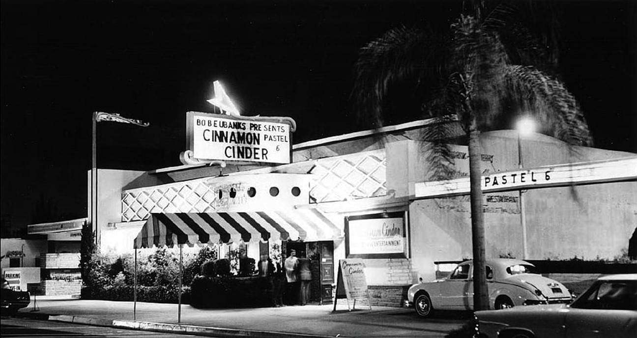
| (ca. 1962)* - "Cinnamon Cinder" Teenage Night Club located at 11345 Ventura Blvd., Studio City. Photo courtesy of Jan Fields |
Historical Notes In 1962, D.J. Bob Eubanks bought the first club on Ventura Blvd and ran it as the Cinnamon Cinder. The club served no alcohol and admission was $1.50. It was here on Aug. 23, 1964, that the Beatles gave a secret press conference before their Hollywood Bowl show. Like everywhere else the Beatles went, it was swarmed with hundreds of teenaged fans. The clubs success was attributed to stringent rules; No-one under 18 permitted. Single men past age 25 were discouraged from seeking entrance. Girls were not permitted if wearing capris or shorts (must wear skirts). Boys were barred if wearing t-shirts, sweatshirts, club or school jackets, levis or tennis shoes. |
 |
|
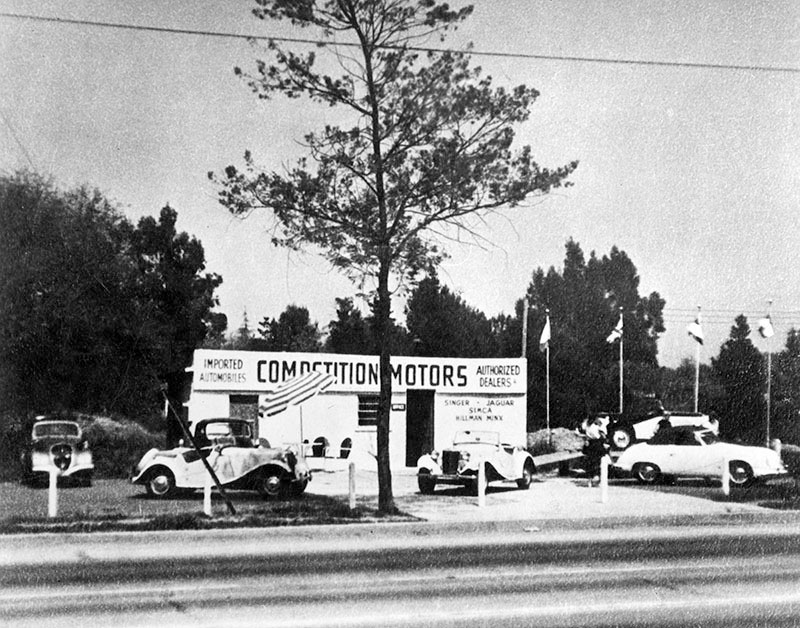
| (1963)* - Photo caption dated May 28, 1963 reads, "Competition Motors Distributors had its humble beginning in a two-car garage building at 11211 Ventura Boulevard in Studio City (top photo). Here John von Neumann, president of the Volkswagen distributorship, specializing in tuning racing cars. He also formed a Porsche Car Distributorship, Inc., a separate operation from the Volkswagen. Photo shows early Porsche at right..." |
Historical Notes A shopping center (Studio City Place) now exists where Competitive Motors once stood. Click HERE for contemporary view. |
 |
|
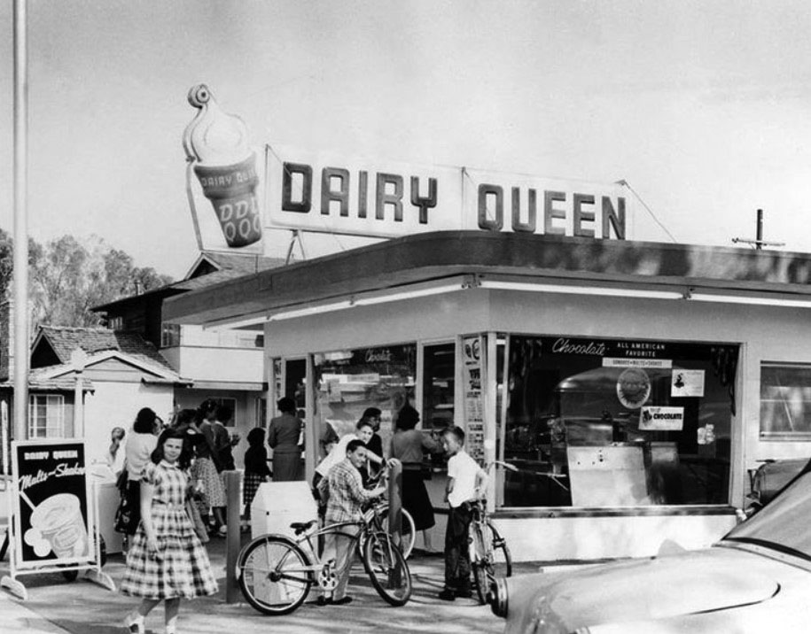
| (1957)* - Opening day in 1957 at the Dairy Queen located at 11334 Moorpark Street (at the southwest corner of Bakman Ave) in Studio City, now the site of the Girasol Restaurant. Click HERE to see contemporary view. |
Historical Notes The concept of soft serve was developed in 1938 by John Fremont McCullough and his son Bradley. They partnered with ice cream shop owner Sheb Noble to open the first Dairy Queen in Joliet, Illinois, in 1940. |
 |
|
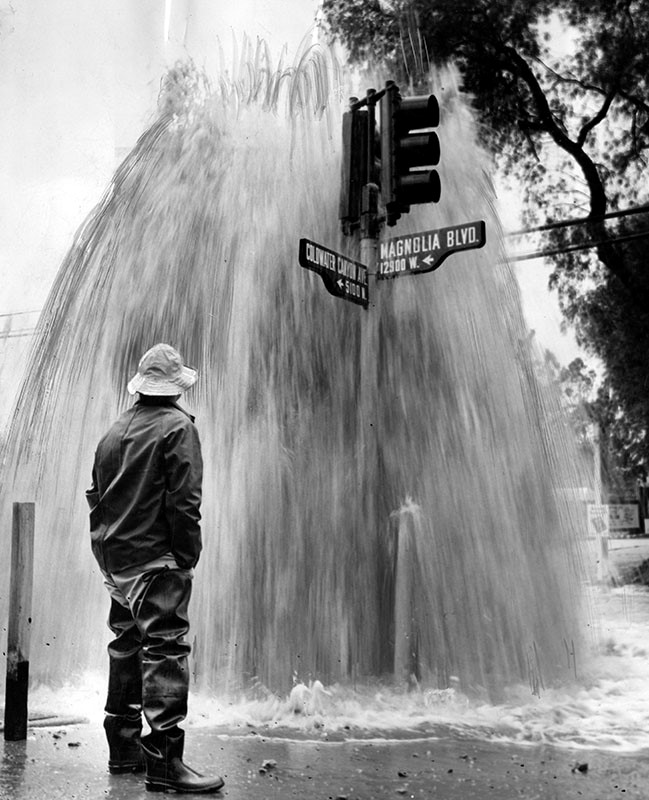
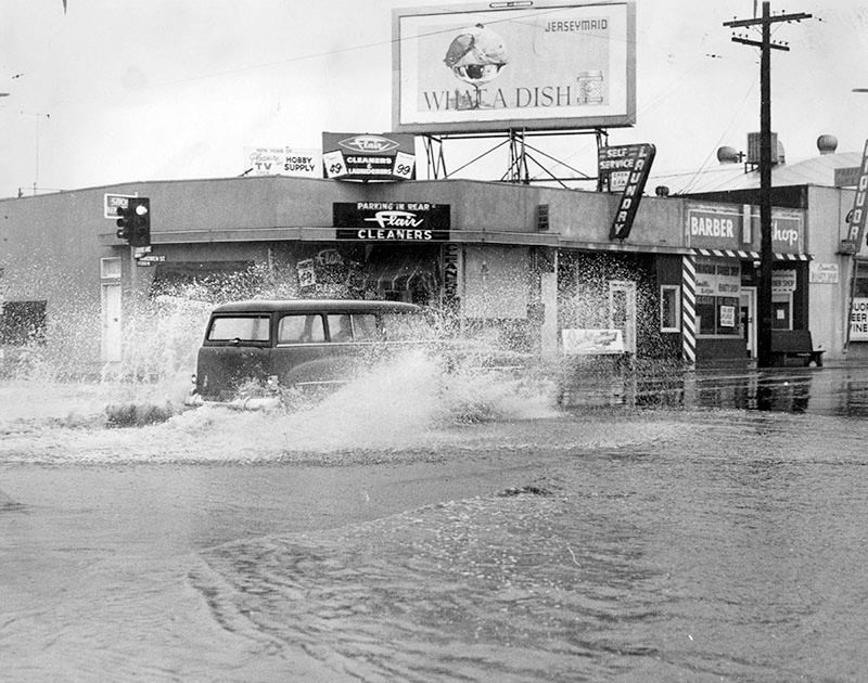
| (1956)* - Photo caption reads: "Water and Power Department employee Vic Pollard stands at the wettest spot in the Valley today, corner of Coldwater Canyon Ave. and Magnolia Ave., North Hollywood. A 150-ft. water spout poured from fire hydrant sheared by motorist whose car skidded on the rain-slick pavement. Driest spot in the Valley was the surrounding four-mile area where household water was shut off for several hours as workmen repaired the damage." Valley Times |
Little Brown Church in the Valley (Studio City)
 |
|
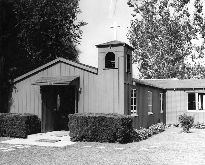
| (1957)* - Valley Times photo caption reads, "Little Brown Church in the Valley, 4418 Coldwater Canyon, Studio City, enjoys country atmosphere near busy thoroughfare. About 100 persons fit comfortably in the 20 x 40 foot sanctuary. Church is non-sectarian in 'attitude and spirit.'" |
Historical Notes The Little Brown Church in the Valley, a diminutive sanctuary in Studio City surrounded by multistory apartment buildings, has hosted more than 23,000 weddings. But it's probably best known as the site of the union between Ronald Reagan and Nancy Davis on March 4, 1952. * The Little Brown Church still stands today. Click HERE for contemporary view. |
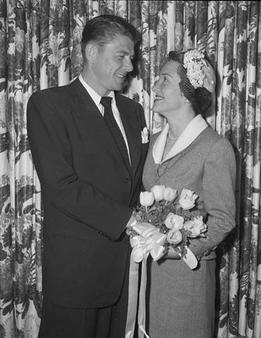 |
(1952)* - Ronald Reagan and Nancy Davis on their wedding day - March 4, 1952. It was the 1,761st marriage ceremony performed in the Little Brown Church in Studio City. | |
Historical Notes ◆ 40th President of the United States (1981 – 1989) |
 |
|
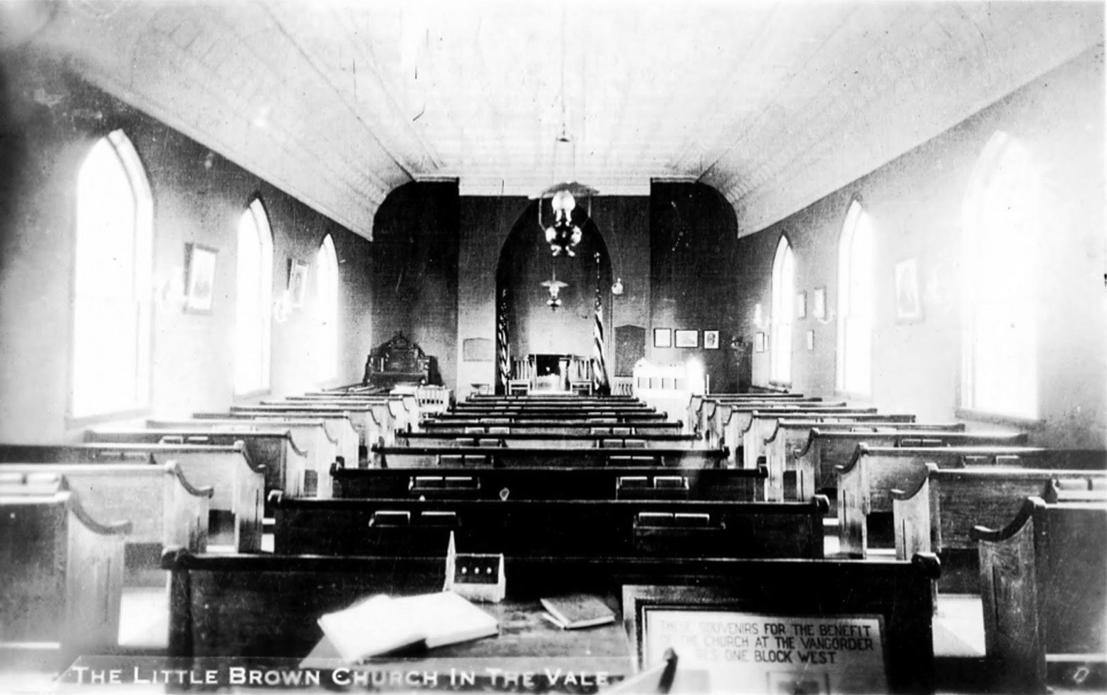
| (1939)* – Postcard view showing the interior of The Little Brown Church in Studio City. Photo Courtesy: Gary Fredburg |
Historical Notes The Little Brown Church in the Valley, a tiny Protestant chapel, was built alone by the Rev. John H. Wells in the late 1930s. |
 |
|
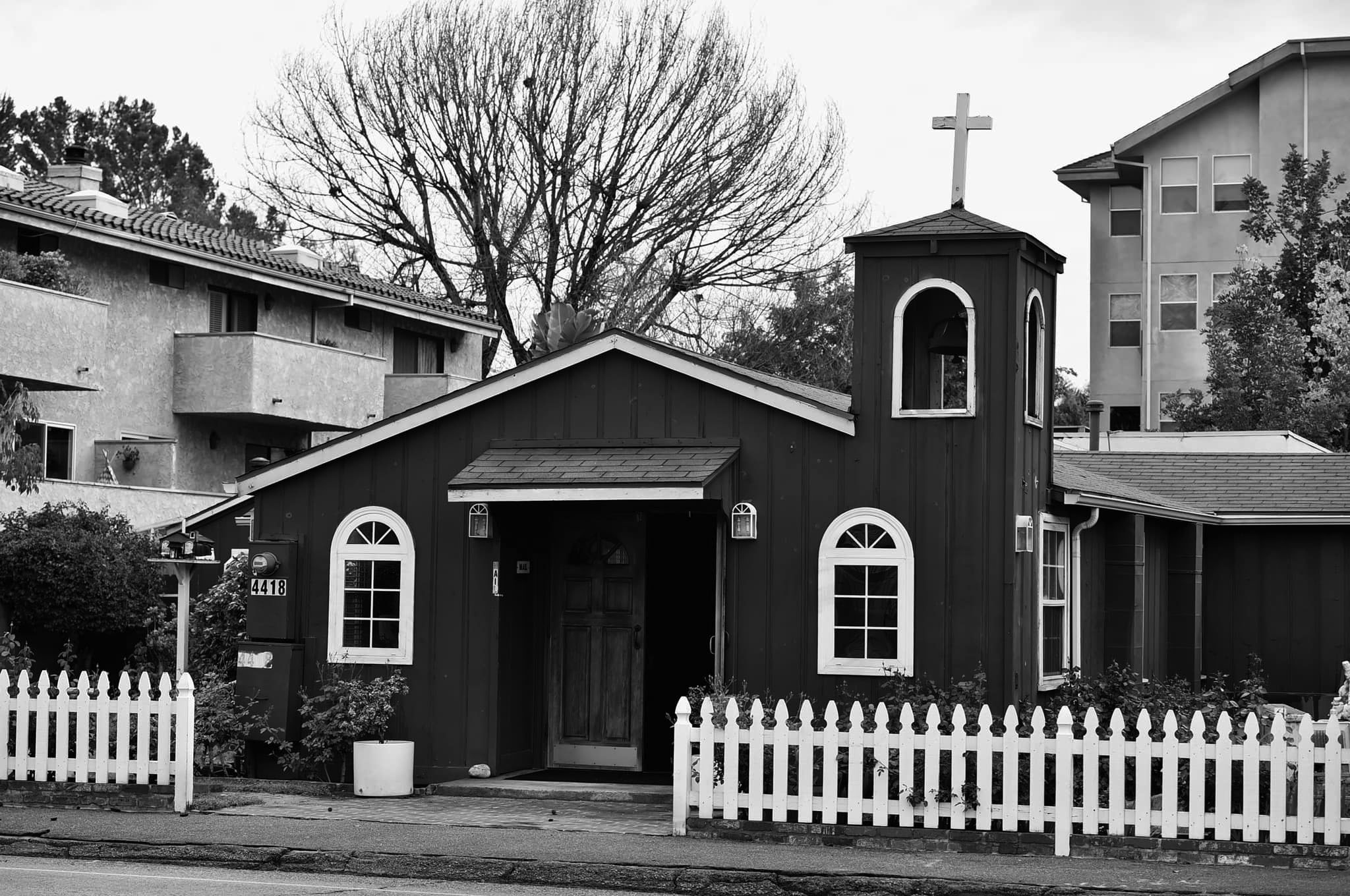
| (2021)* - The “Little Brown Church in the Valley”……Coldwater Canyon in Studio City |
Historical Notes Today, the historic structure located at 4418 Coldwater Canyon is primarily a wedding site but still houses a small and devoted congregation. The wedding place of President Ronald Regan and his wife Nancy, the modest chapel has been host to many celebrity marriages. |
Bullock's Fashion Square (now Westfield Fashion Square)
 |
|
| (1959)* - Photograph caption dated October 6, 1959 reads, "Bullock's New Site -- Shown above is aerial view of the San Fernando Valley site of Bullock's, Inc., proposed facility. Purchased from McKinley Home for Boys, location is bordered on north by Riverside Drive, on south by Ventura Freeway, on west by Hazeltine Avenue and on east by Woodman Avenue. Coldwell Banker and Co. represented both parties in transaction." |
Historical Notes Original property of McKinley Home for Boys lists a Van Nuys address. This site on which the Bullock's Fashion Square was built is actually part of Sherman Oaks. Conditions of the transaction required that the property be rezoned for commercial use. The McKinley Home for Boys built a new facility in San Dimas, Calif.* |
 |
|
| (1964)* - View showing the Bullock's Fashion Square (today Westfield Fashion Square), located at 14006 Riverside Drive, with the Ventura Freeway in the foreground. |
Historical Notes Originally anchored by Bullock's from 1962, Sherman Oaks Fashion Square added The Broadway, and I. Magnin department stores in 1975. In 1988-1990, the outdoor mall was enclosed and double-decked with a Mediterranean theme. In 1994, the mall suffered serious damage from the Northridge earthquake. In 1996 Bullock's was converted into Macy's. The Broadway later became Bloomingdale's--the result of Federated Department Stores buying out Carter Hawley Hale Stores, parent company of The Broadway. The Westfield Group acquired a half-interest in the shopping center in 2002, and renamed it "Westfield Shoppingtown Fashion Square", dropping the "Shoppingtown" name in June 2005.*^ |
Sunkist Building
 |
|
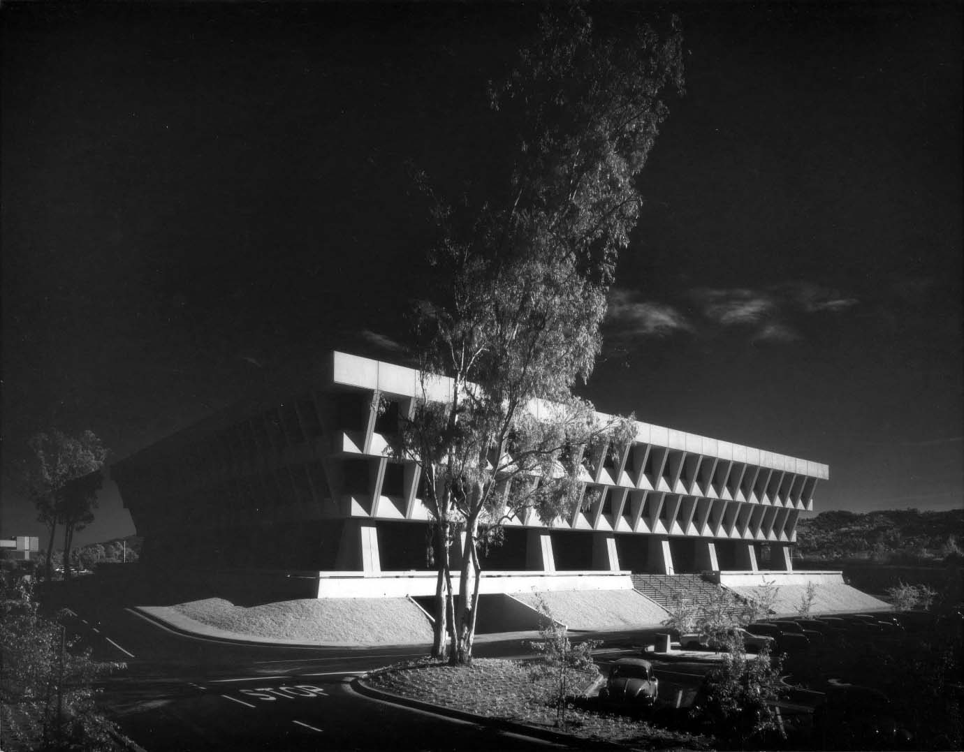
| (1970)* – View showing the newly constructed Sunkist Building located at 14130 Riverside Drive in Sherman Oaks.\. Photo by Julius Shulman |
Historical Notes When citrus marketing company Sunkist moved into its new Sherman Oaks building in 1970, it left an Art Deco office tower in downtown Los Angeles for a homecoming of sorts; the San Fernando Valley was once partially covered with citrus groves, which were removed to make way for housing tracts after World War II. No matter that the orange trees were no more at the time of its construction—the building looks a little bit like an orange crate, inverted and set upon angled concrete columns. ^++ Click HERE to see the Sunkist downtown headquarters between 1935 and 1970. |
 |
|
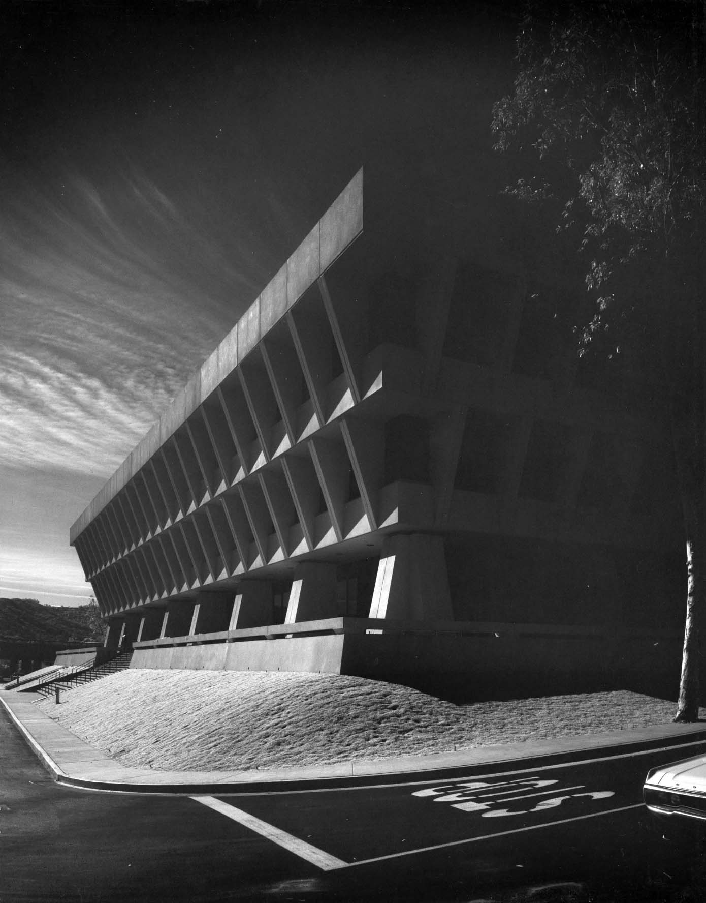
| (1970)* – Close-up profile view showing the Sunkist Building with its inverted pyramid design. Photo by Julius Shulman / Getty Research Institute |
Historical Notes The Sunkist Building was designed by A. C. Martin and Associates, a firm with a long and storied history in Los Angeles. In the late 1960s, the firm was busy changing the look of downtown with its Corporate International-style skyscrapers. For Sunkist, A. C. Martin created a low-rise but unquestionably monumental Late Modern-style building of reinforced concrete with recessed windows. It is shaped somewhat like an inverted pyramid, colossally wide at the top and tapering in at the base so it appears to balance on concrete legs. |
 |
|
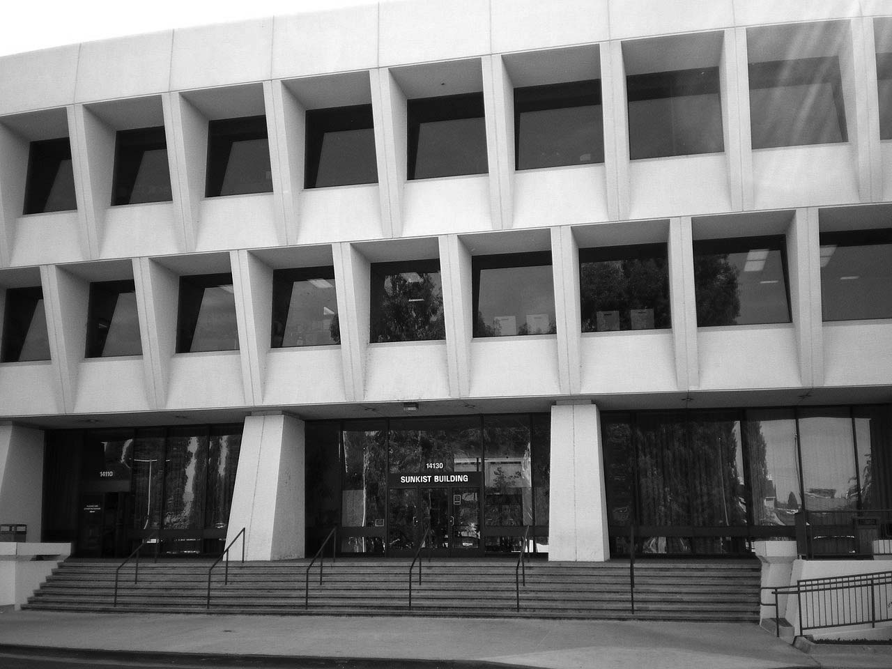
| (2008)* – View showing the front entrance to the Sunkist Building on Riverside Drive in Sherman Oaks. Photo by 'Cbl62' / Wikipedia |
#/media/File:Sunkist_Building.JPG)
Historical Notes For 35 years the building was headquarters for the giant Sunkist growers' cooperative that was organized 100 years ago. Pioneer William Wolfskill planted the seeds of what was to become Sunkist Growers in the 1840s. Many of the fortune-seekers who flocked to California during the Gold Rush developed scurvy because fresh fruit was not widely available. As word spread that citrus fruits could prevent the disease, demand skyrocketed. Soon lemons sold for $1 each. When the arrival of the railroad in Los Angeles in the 1890s made possible the fast shipment of perishable fruit to the East, the orange industry became firmly established. During the depression of 1893, a group of 60 local growers formed a cooperative to advertise and market their crops. That group reorganized in 1905 to become the California Fruit Growers' Exchange. In 1908, when growers began casting about for a trademark to set their fruit apart, admen came up with "Sunkissed." It was quickly shortened to "Sunkist." A few years later, the slogan, "California for Wealth, Oranges for Health," was coined. ^^^ In September 2014, Sunkist relocated its headquarters to the Valencia neighborhood of Santa Clarita. As of 2014 there has been a plan for a massive development to be built around the Sunkist Building which would add residential, commercial and retail space to the iconic structure. |
Coffee Dan's (Van Nuys)
 |
|
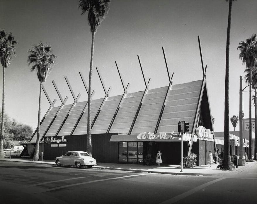
| (ca. 1957)* - View looking at the southeast corner of Van Nuys Boulevard and Kittridge Street showing Coffee Dan's. Photograph by Julius Shulman / Getty Research Institute |
Historical Notes Built in 1957, Coffee Dan's in Van Nuys was designed by Architect William Krisel of the firm Palmer and Krisel. The history of Coffee Dan's dates back to 1935 when it was founded by Dan Evans in Pasadena. The restaurant quickly gained popularity for its cozy atmosphere, friendly service, and delicious food. |
 |
|
| (ca. 1957)* - View of Coffee Dan's located at 6576 Van Nuys Boulevard, SE corner of Van Nuys and Kittridge. Photograph by Julius Shulman |
Historical Notes Coffee Dan's Restaurants became known for its all-day breakfast menu, offering a wide variety of breakfast dishes, including pancakes, waffles, omelets, and freshly brewed coffee. The chain also served lunch and dinner options, featuring American comfort food classics such as burgers, sandwiches, salads, and hearty entrees. Today, the SE corner of Van Nuys and Kittridge is occupied by a mini mall with a 7-11 and an El Pollo Loco. Click HERE for contemporary view. |
 |
|
| (ca. 1957)^ - Interior view of Coffee Dan's in Van Nuys. I'll have the apple pie and a cup of coffee. Photograph by Julius Shulman |
Historical Notes Over the years, Coffee Dan's expanded its presence, opening several locations throughout California and other states. The restaurants were often designed with a distinctive mid-century modern aesthetic, featuring retro decor and cozy booths, creating a welcoming environment for families and friends to gather. |
Kinney Shoes (Van Nuys)
 |
|
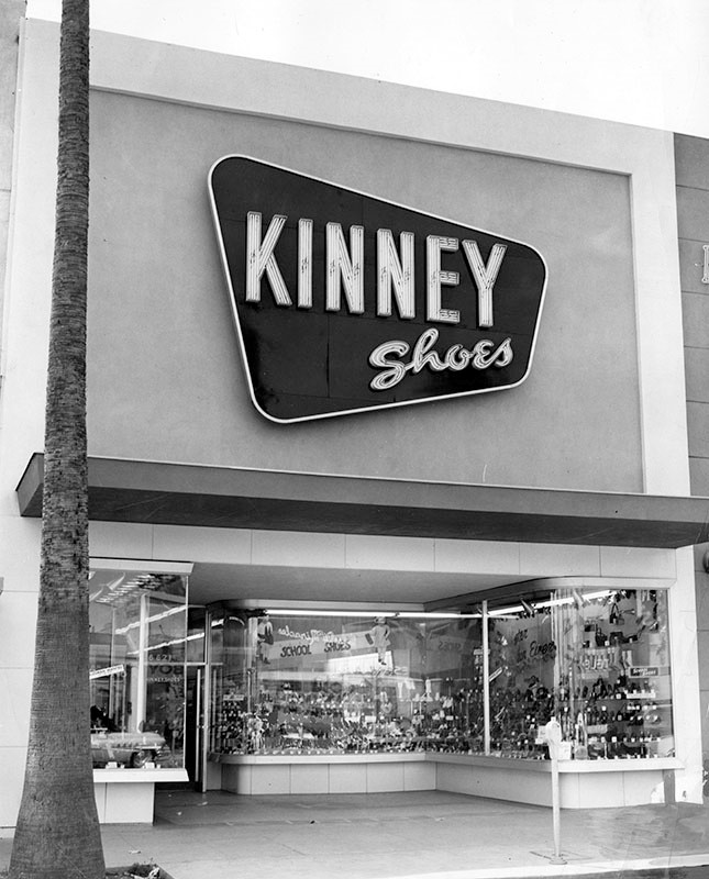
| (1954)* - View showing Kinney Shoes store located at 6621 Van Nuys Blvd. Today, two temporary signs (in Spanish) hang above the storefront. Click HERE for contemporary view. |
Historical Notes Kinney Shoes was the largest family chain shoe retailer in the United States at the beginning of 1936, with 335 stores operating nationwide. In 1963, the G.R. Kinney Company was sold to F.W. Woolworth. The firm was renamed the Kinney Shoe Corporation and continued as a fully owned subsidiary of Woolworth. The company continued operating throughout the 1960s and 1970s with divisions named Stylco (1967), Susie Casuals (1968), and Foot Locker (1974). In 1998, the Venator Group, Woolworth's successor, announced that Kinney's 467 shoe stores and 103 Footquarters stores would close. The Foot Locker division, started in 1974, continues to this day, with Venator changing its name in 2001 to Foot Locker. Foot Locker also maintains the trademarks of the Kinney and Woolworth brands.*^ |
Van Nuys
 |
|
| (1960)* - Aerial view of Van Nuys, looking north from about Oxnard Street. Wide street running north-to-south is Van Nuys Boulevard. Van Nuys City Hall is clearly seen in the center of the photo. |
Historical Notes The 1960s saw further expansion of Van Nuys' residential areas, with more tract housing and apartment complexes being built to accommodate the increasing population. The architectural styles of the homes ranged from traditional to modern, reflecting the changing tastes and trends of the time. The community remained family-oriented, with a strong emphasis on education and a sense of community pride. Schools in Van Nuys continued to play a central role in the lives of residents, and families were actively involved in school-related activities and events. |
 |
|
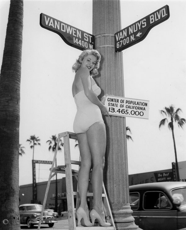
| (1960)* - Miss Van Nuys on a step ladder holds up sign, reading: Center of population, State of California, 13,465,000, at the intersection of 14,400 W. block of Vanowen Street and 6,700 N. block of Van Nuys Blvd., Sept. 1960. |
Historical Notes The advent of three new industries in the early 20th century – motion pictures, automobiles, and aircraft spurred urbanization and population growth. World War II production and the subsequent postwar boom accelerated this growth so that by 1960, the valley had a population of well over one million. Los Angeles continued to consolidate its territories in the San Fernando Valley by annexing the former Rancho El Escorpión for Canoga Park-West Hills in 1959, and the huge historic "Porter Ranch" at the foot of the Santa Susana Mountains for the new planned developments in Porter Ranch in 1965.*^ Van Nuys Boulevard was renamed from North Sherman Way as the main boulevard in the town of Van Nuys, which got its name from longtime Valley wheat farmer Isaac Newton Van Nuys. Vanowen Street - coined because it was the direct route across the Valley between the towns of Van Nuys and Owensmouth.^* |
 |
|
| (1960s)* - Looking north on Van Nuys Boulevard at Victory Boulevard with the Fox Van Nuys Theatre seen on the left (6417 Van Nuys Blvd). Photo courtesy of Valley Relics Museum |
Historical Notes During the 1960s, the commercial district along Van Nuys Boulevard continued to thrive. The boulevard was bustling with activity, with a wide range of shops, restaurants, and entertainment venues. Shopping centers, such as the Van Nuys Fashion Square, provided residents with convenient access to various retail options. |
 |
|
| (1965)^ – View looking north on Van Nuys Boulevard at Kittridge Street toward Vanowen with palm trees lining both sides of the street. “I and Joy” Bagels can be seen on the right. Note the 1965 Buick Riviera at left. |
Historical Notes The automobile culture remained strong in Van Nuys during the 1960s. The community's wide streets and ample parking continued to accommodate the growing number of cars owned by residents. Car ownership was seen as a symbol of status and freedom, and cruising along Van Nuys Boulevard remained a popular pastime. |
 |
|
| (1961)* - Photograph caption dated March 3, 1961 reads, "Cars whiz through the Valley's most dangerous intersection. Victory and Sepulveda boulevards listed 22 collisions." |
Historical Notes During the 1960s, Van Nuys, like many other areas in Los Angeles, experienced significant traffic congestion. The population was growing rapidly, leading to an increase in the number of vehicles on the road and subsequently contributing to traffic congestion. |
 |
|
| (1962)* - View of flood at the northeast corner of Vanowen Street and Louise Avenue, in Van Nuys (now Lake Balboa). The photo caption reads, "Automobile splashes through deep water in a West Valley intersection. Heavy rains meant stalled cars, no school, wet pedestrians and cleaning bills." Valley Times photo, dated 2/9/1962. |
Historical Notes Van Nuys experienced occasional flooding in the streets during the 1960s. It was susceptible to flooding due to heavy rainstorms and the region's limited drainage infrastructure. On November 2, 2007, the City Council of Los Angeles approved a motion renaming a larger portion of Van Nuys to Lake Balboa, including this intersection. Click HERE for contemporary view of the NE corner of Vanowen and Louise. |
Schlitz Brewery
 |
|
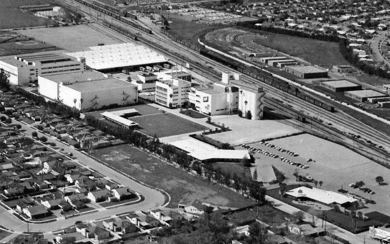
| (ca. 1960s)^^^^* – Aerial view showing the Schlitz Brewery adjacent to the railroad tracks, Van Nuys. |
Historical Notes Schlitz opened its state-of-the-art 35-acre brewery at 7321 Woodman Avenue in Van Nuys in 1954.^^^^* The Joseph Schlitz Brewing Company was based in Milwaukee, Wisconsin, and once the largest producer of beer in the United States. Its namesake beer, Schlitz, was known as "The beer that made Milwaukee famous" and was advertised with the slogan "When you're out of Schlitz, you're out of beer". Schlitz first became the largest beer producer in the US in 1902 and enjoyed that status at several points during the first half of the twentieth century, exchanging the title with Anheuser-Busch multiple times during the 1950s.*^ |
 |
|
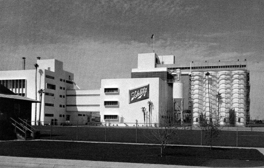
| (1975)^^# – Profile ground view showing the Schlitz Brewery, Van Nuys. |
Historical Notes The company was founded by August Krug in 1849 but acquired by Joseph Schlitz in 1858. Schlitz was bought by Stroh Brewery Company in 1982 and subsequently sold along with the rest of Stroh's assets to the Pabst Brewing Company in 1999. Pabst now produces Joseph Schlitz Brewing Company's former flagship brands including Old Milwaukee and Schlitz beer.^^^^* Intense competition within the beer industry and a declining share of the Western market helped force the closure of the Van Nuys brewery in 1990.^^^ |
* * * * * |
North Hollywood Federal Savings
 |
|
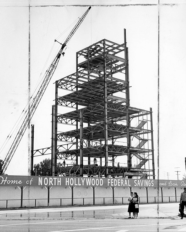
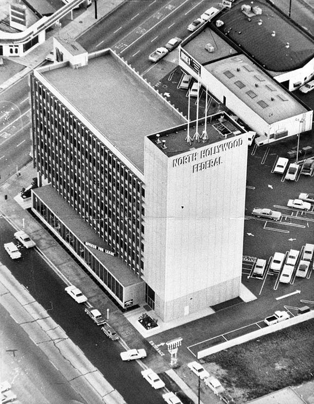
| (1960)* – Valley Times photograph caption dated May 25 1960 reads, "Steel framework of the largest office building ever erected in San Fernando Valley, reaches the eight story mark. Shown here is about half the steel skeleton for North Hollywood Federal Savings and Loan Association's new home office at Riverside Drive and Lankershim Boulevard. Giant crane at left hoists individual steel girders weighing as much as five tons." |
 |
|
| (1961)* - Photograph article dated April 4, 1961 partially reads, "A new dimension is being added to the San Fernando Valley - height. This is highlighted today with the completion of the area's first skyscraper by North Hollywood Federal Savings and Loan Association. North Hollywood Federal's structure stands as a towering monument to this new era at the corner of Lankershim Boulevard and Riverside Drive. The modern facility rises eight stories and contains 73,810 square feet of floor space to add new prominence to the North Hollywood business district." North Hollywood Savings building is the tallest structure completed in the Valley to date. |
Historical Notes Today, the 36-story 10 Universal City Plaza Building in Universal City (built in 1980) is the Valley’s tallest building. |
 |
|
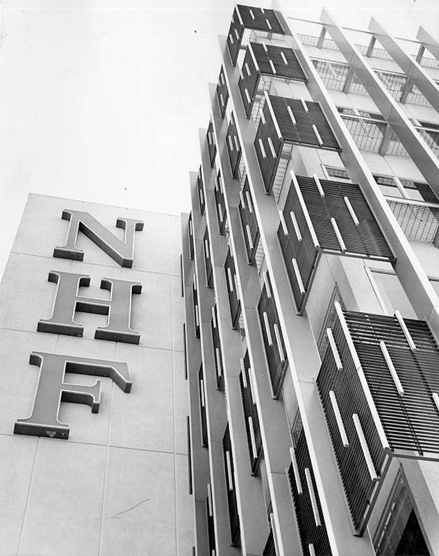
| (ca. 1962)* – Aerial view showing the North Hollywood Federal Savings and Loan, located at 4455 Lankershim Blvd. and the corner of Riverside Drive adjoining Ventura Freeway in North Hollywood. A large sign reading "Offices for lease" can be seen atop a portion of the building. Today the building is occupied by Chase Bank. Click HERE for contemporary view. |
 |
|
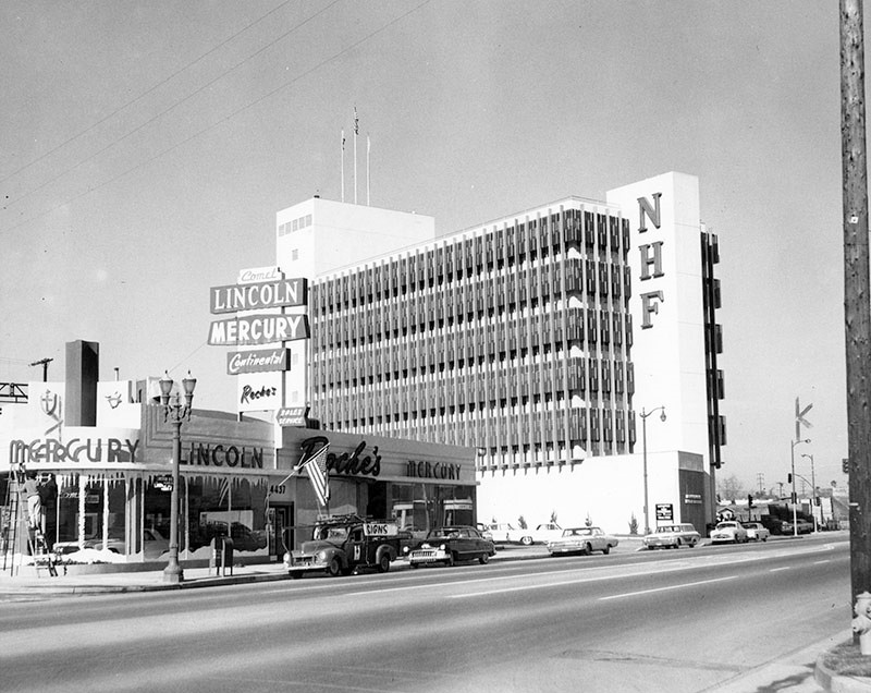
| (1961)* – Street view showing the North Hollywood Federal Savings and Loan Association building, looking at the block between Landale St. and Riverside Dr. A man can be seen painting the windows of the Comet, Lincoln, Mercury, Continental, Roche's automotive building on the corner. Today, that building is occupied by North Hollywood Toyota and the NHF building is occupied by Chase Bank. Click HERE for contemporary view. |
Hody's Coffee Shop and Drive-in
 |
|
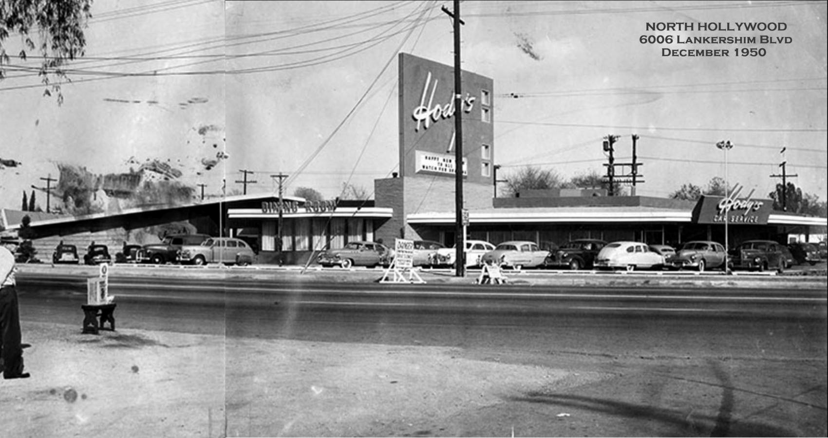
| (1950)^ - Photograph caption reads: "This is the new $400,000 Hody’s Restaurant at 6006 Lankershim Blvd - Unique interior finishing and decorations, including Sequoia Room, called outstanding in modern restaurant design." Photo courtesy of Rich Krugel |
Historical Notes In 1949, restaurateur Sidney Hoedemaker of the Pig 'n' Whistle - Melody Lane chain founded Hody's Restaurant Inc. Hoedemaker's restaurants were all about service, efficiency, cheerfully and courtesy. One was always greeted with a smile. Hody's was a family restaurant. Kid's would get a kid's clown menu that could be worn on their face. |
 |
|
| (1961)^ – Night view showing Hody’s Coffee Shop and Drive-In located at 6006 Lankershim Boulevard in North Hollywood. |
Historical Notes By 1969 there were 8 Hody restaurants in Southern California. The most famous Hody's was located on the N/W corner of Hollywood and Vine. Click HERE to see more. |
North Hollywood Television
 |
|
| (1950)* - Valley Times photo caption reads "Marty Faust and Rod Boutelle, co-owners of North Hollywood Television store, prepare to deliver another TV set to one of their customers. After three years of operation the store is one of the largest retail television stores in Valley." The store was located at 11413 Moorpark Street in North Hollywood. |
 |
|
| (1955)* - Rod Boutelle, right, owner of North Hollywood Television, helps load a Packard-Bell color TV set on delivery truck as he prepares to observe his seventh anniversary at his North Hollywood location, Moorpark at Tujunga. Assisting him is Ralph Voit, service manager." |
Historical Notes Packard Bell was founded in 1933, in Los Angeles. It had a reputation for making excellent radios and supplied electrical equipment to the government during World War-II. It got into the television marketplace in 1948 and remained there until the company was sold in 1974.* The first national color broadcast (the 1954 Tournament of Roses Parade) occurred on January 1, 1954. |
Tommy's Restaurant (North Hollywood)
 |
|
| (1975)^ – View showing Tommy's Restaurant (not the hamburger chain) located at 6343 Vineland Ave, North Hollywood. Photo courtesy of Keith Hart |
Historical Notes Established in 1947, this restaurant, owned by brothers Tommy and Bill Seletos stood the test of time, and stayed here for a few decades. It was a popular local spot, remembered for steak & potatoes, and its Red Carpet Cocktail Room, which was added in 1962. The building today is occupied by a car rental agency. Click HERE for contemporary view. |
Drive-in Church Service (North Hollywood)
 |
|
| (1965)* - View showing a Drive-In Church Service at 11919 Oxnard Street in North Hollywood. |
Historical Notes The Emmanuel Lutheran Church’s Summer Sunday Drive-In Service started around 1948 and was touted by the church as the first of its kind in the U.S. Over the span of a couple of decades, the service started at 8:15 a.m. The average number of attendees were around 200 with many children still clad in their pajamas and adults wearing casual clothes. Ushers would go from car-to-car with their offering baskets.^ |
Lankershim and Victory
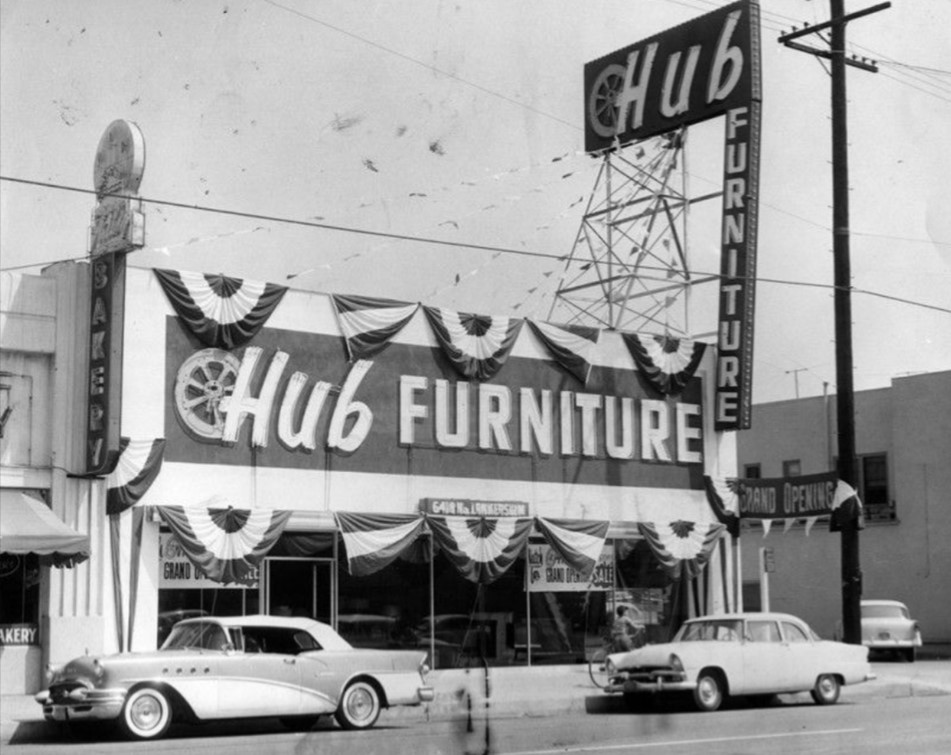
| (1961)* - View looking north on Lankershim at Victory in North Hollywood. Several furniture stores can be seen including Hub Furniture on the right and Halls' Furniture on the left (NW corner). Note the 1959 Chevrolet Impala coupe at right. |
 |
|
| (1956)* - Photograph caption dated May 20, 1956 reads, "Hub opens North Hollywood store - Newest addition to chain of Hub Furniture Stores is this one at Lankershim and Victory boulevards in North Hollywood. It features complete line of modern, maple and provincial furniture from leading factories throughout country." |
 |
|
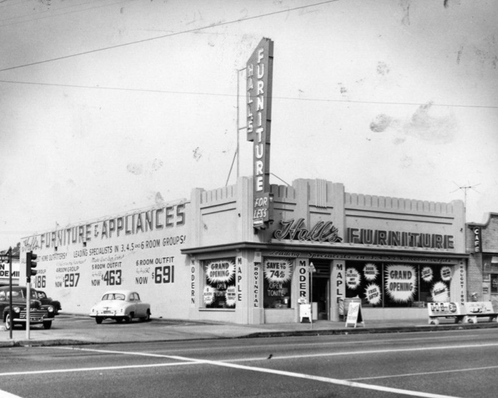
| (1955)* - Photograph caption dated October 1, 1955 reads, "A four-day grand opening celebration is going on this weekend at Hall's Furniture and Appliance Co. store at Lankershim and Victory boulevards, North Hollywood. Owners Harry Hall and David A. Fryer are giving away door prizes, free gifts and refreshments to all Valley visitors." |
 |
|
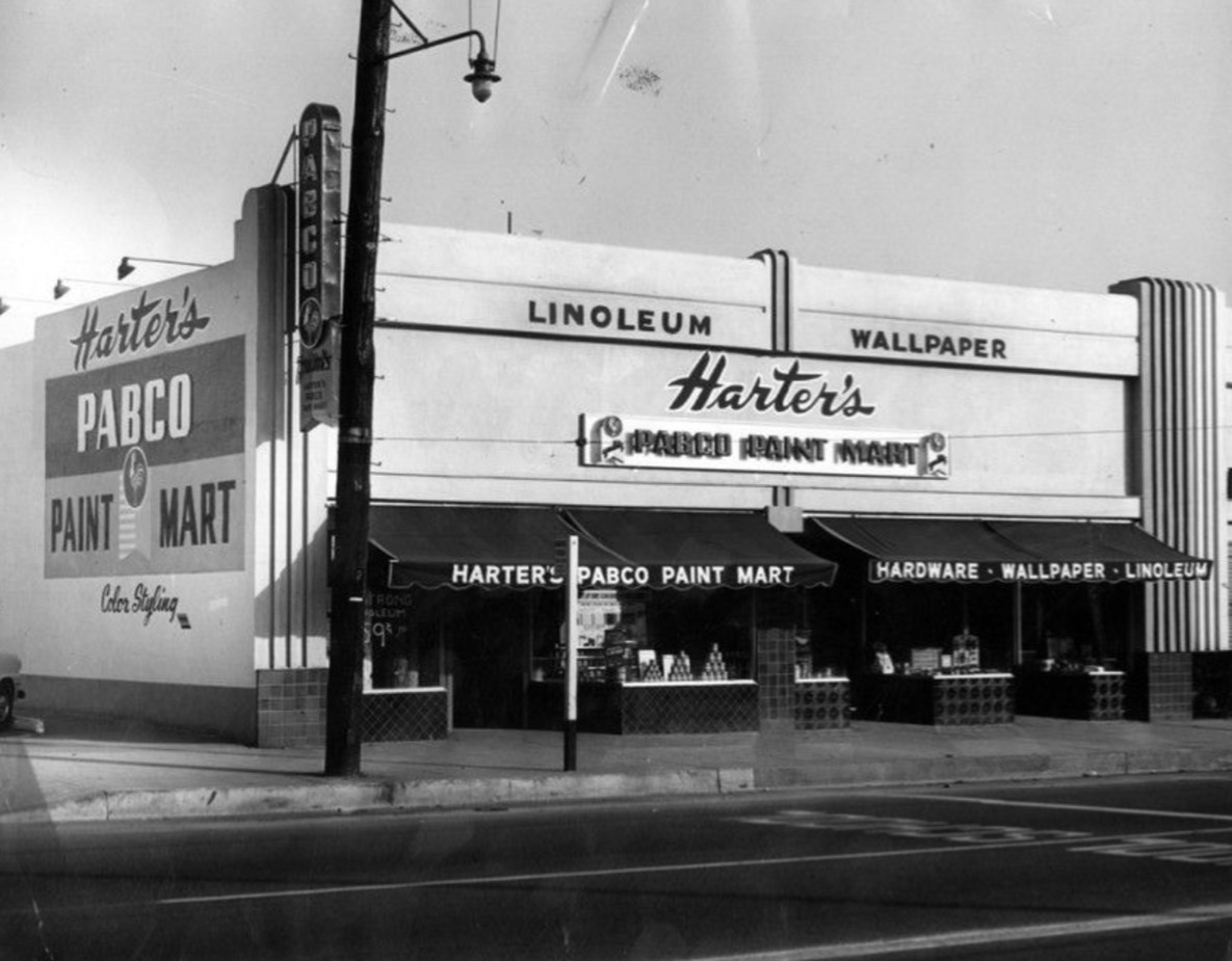
| (1950)* - Photograph caption dated January 31, 1950 reads, "The Paraffine Co., manufacturers of Pabco Paints, announces its award of a 'Pabco Paint Mart' franchise to Harter's of 6428 Lankershim Blvd. (between Victory and Hamlin), in Victory Center. Harter's Pabco Paint Mart is independently owned and operated by Morris F. Harter, Sherman Oaks builder and real estate man, and his son, Glenn Harter. Both father and son have a wide experience in the paint and hardware field, having formerly owned and operated the Sherman Oaks hardware store for five years. Glenn Harter will manage the new store which will stock a complete line of Pabco Paints and Craftsmen finishes as well as a complete stock of builders' hardware, wallpaper and linoleum. The store is one of the largest of its kind in the Valley." |
Then and Now
| Then and Now - Looking north on Lankershim at Victory in North Hollywood. Photo comparison by Trey Callaway* |
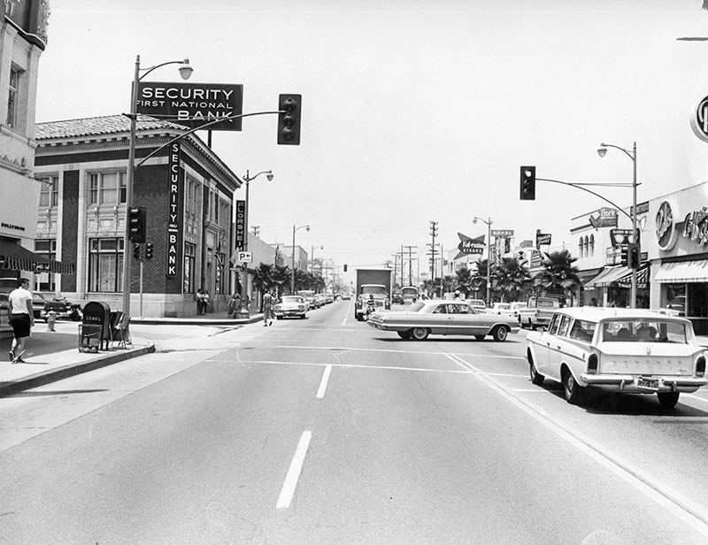
Lankershim near Weddington
| (1964)* - View looking north on a well-decorated Lankershim Boulevard during the holiday season. On the left ahead can be seen the El Portal Theatre. Also seen is the Security-First National Bank located on the NW corner of Lankershim and Weddington. |
 |
|
| (1965)* - View looking north on Lankershim Blvd at Weddington St in North Hollywood. A 1963 Chevrolet Impala Coupe is making a left turn onto Lankershim Blvd while a Rambler station wagon is stopped at the light. You can see Bob's Coffee Shop on the right and the Security-First National Bank on the left (now The Federal Bar). |
Historical Notes The bank building on the northwest corner is on property that was once the Fred Weddington homestead. The Weddington family established the Bank of Lankershim in 1910 which later became part of the Security Pacific chain. The same bank building is now occupied by the Federal Bar restaurant. |
Then and Now
| (1965 vs 2018)* - Looking north on Lankershim Blvd at Weddington St in North Hollywood with the El Portal Theatre out of view on the left. |
Victory Drive-in Theatre
 |
|
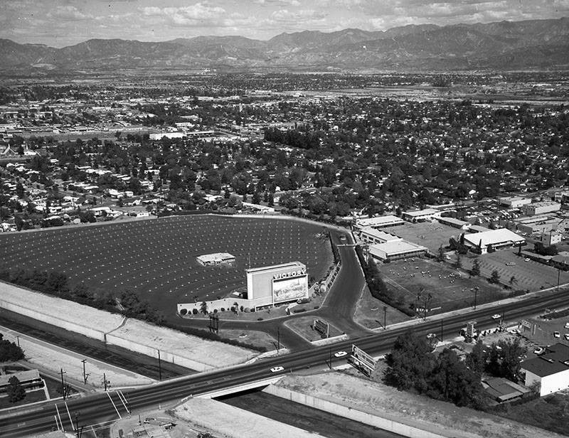
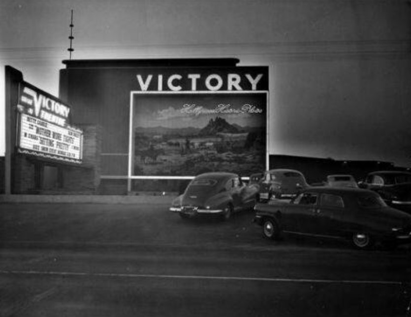
| (1964)* – View looking northeast of the Victory Drive-in located at 13037 Victory Boulevard in North Hollywood. Victory Boulevard can be seen crossing the Tujunga Wash. |
 |
|
| (1950)*^*# – View showing a line of early model cars waiting to get into the Victory Drive-in Theatre in North Hollywood. |
Historical Notes Opened in 1949, the Victory Drive-in was designed by William Glenn Balch also known for several other drive-ins in the late 1940s including the one located in Van Nuys. The Victory had a capacity for 650 cars and was operated by Pacific Theatres. Many of the Drive-ins that Balch’s firm designed had large murals painted on the screen towers. Victory Drive-in was torn down and replaced with the Victory Plaza Shopping Center. Today the center includes LA Fitness, Vallarta Market, CVS Pharmacy, and Subway Restaurant. |
Reseda Drive-in Theatre
 |
|
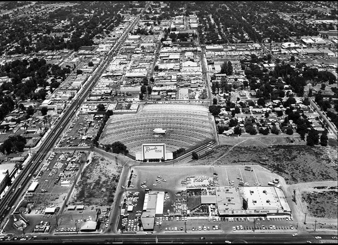
| (1962)* - View looking north of Reseda Boulevard from above Vanowen Street. The Reseda Drive-In Theater is seen on the right just east of Reseda Blvd. |
Historical Notes The Reseda Drive-In was opened on April 7, 1949 by Pacific Drive-In Theatres. It was located just north of Vanowen and east of Reseda Blvd. The theater lasted till the mid-1970’s when it was torn down. The site today is occupied by the Mid-Valley Athletic Club and an industrial park. In 1968, the Reseda Drive-In played host for the location of Peter Bogdanovich’s movie “Target”, staring Boris Karloff.^**^ |
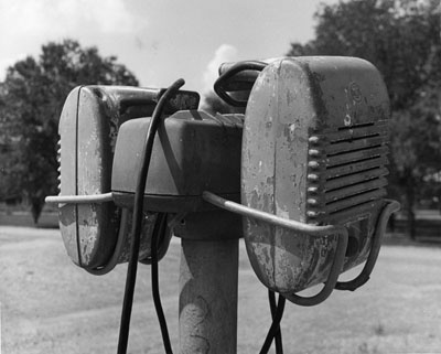 |
(n.d.)^##* - Window-mounted drive-in speakers...one for your car...one for the car on the other side of you. Later systems would transmit the signal through your AM radio.
|
Historical Notes The outdoor theaters reached the zenith of their popularity during the 1950s. Piling the kids in the car made for a cheap family night out, and drive-ins were a favorite hangout for teens who'd recently gotten driver's licenses. The activities of the teenagers prompted another nickname for drive-in theaters — "passion pits." *#^^ |
Vanowen and Tampa
 |
|
| (1973)* - Looking east on Vanowen Street at Tampa Avenue. |
Then and Now
 |
|
| (1973 vs 2022)* - Looking east on Vanowen Street at Tampa Avenue. |
Pump Room Restaurant
 |
|
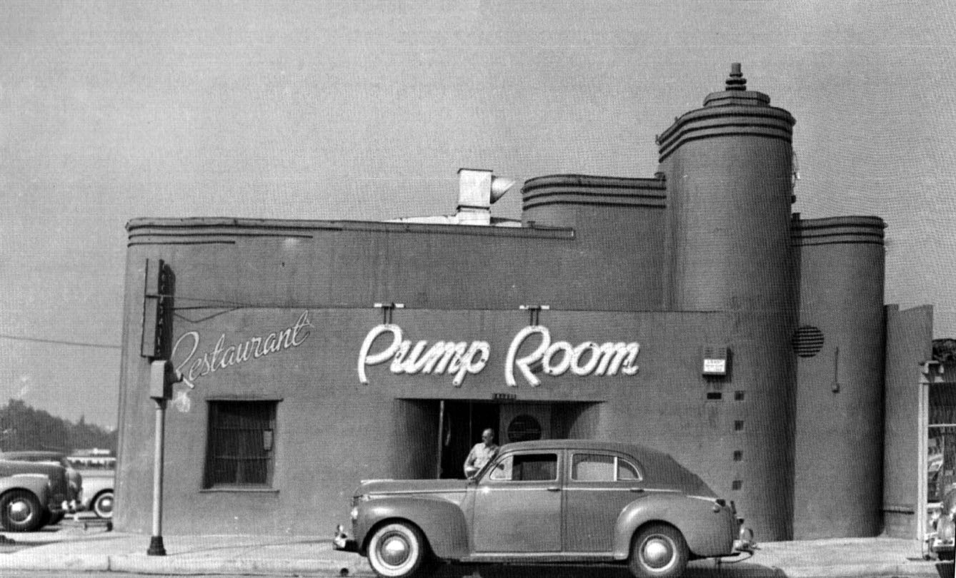
| (ca. 1945)^ – View showing an early model car parked in front of the Pump Room Restaurant, located at 14445 Ventura Boulevard in Sherman Oaks. A man is seen exitng the restaurant. Photo courtesy of Keith Hart |
Historical Notes In early 1945, Roy Harlow opened a restaurant at 14445 Ventura Blvd, near Van Nuys Blvd, which he named the Pump Room, inspired by the Pump Room in Bath, England. In 1948, Harlow moved the restaurant to 13003 Ventura Blvd, just west of Coldwater Cyn Blvd. For many years, the Pump Room was a popular Valley restaurant, patronized by local residents for parties and meetings. Celebrities and sports stars were often seen here. In a quote from a 1953 news article, “hardly a day goes by without seeing a flock of Rams football players, Hollywood Stars and Los Angeles Angels baseball players in the café." In 1954, Harlow sold the business, leased the premises to the purchaser for ten years, and granted to the purchaser the right to use the name "Pump Room" during the term of the lease. In 1956, this purchaser sold the business and another party operated the business until either late 1956 or early 1957 when the premises were abandoned and closed for a short period of time. Harlow, as landlord, repossessed the premises early in 1957. About this time Harlow found some partners named Bob Waterfield, Bob Kelley, and Don Paul (all sports stars) and re-opened the restaurant in April of 1957. The Pump Room appears to have closed around 1978. In June of 1979, Ali Rabbani opened the Marrakesh at this location. #^*^ |
* * * * * |
_1948.jpg) |
(1948)^ – View showing the intersection of Greenleaf Street and Van Nuys Boulevard in Sherman Oaks after a snow storm. The large snow-covered tree stands on the SW corner. Click HERE for contemporary view. |
|
Historical Notes Click HERE to see more views of Snow in the San Fernando Valley. |
* * * * * |
Ventura and Hazeltine (Sherman Oaks)
 |
|
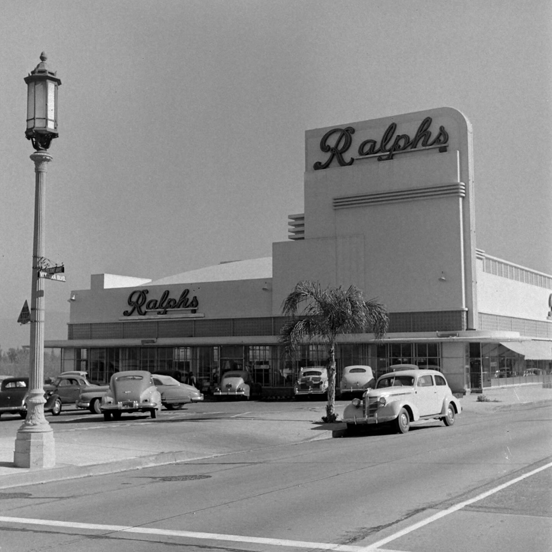
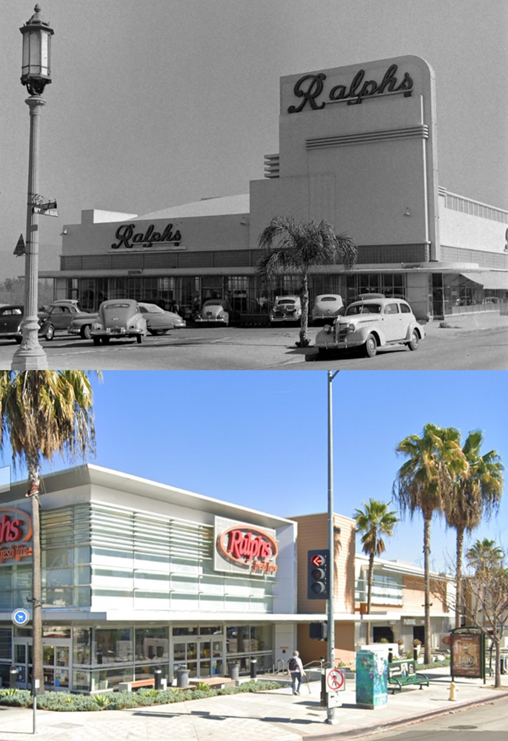
| (1948)* - The Sherman Oaks Ralphs at Ventura & Hazeltine (NE corner). Photo by J.R. Eyerman for LIFE Magazine |
Historical Notes When Ralphs opened this store in 1941, it was the company’s 31st location in Los Angeles County. They still operate in this space today, but the building photographed was irreparably damaged in the Northridge earthquake in 1994, and rebuilt soon after. That version was then torn down around 2013 and rebuilt as the larger, more state-of-the-art Ralphs that stands today. |
Then and Now
 |
|
| (1948 vs 2023)* - The Sherman Oaks Ralphs at Ventura & Hazeltine (NE corner). |
Ventura and Van Nuys Boulevards (Sherman Oaks)
 |
|
| (Early 1940s)* - View looking west on Ventura Boulevard at Van Nuys Blvd in Sherman Oaks. A Standard Service Station is seen on the right (NW corner). Photo courtesy of Valley Relics Museum |
 |
|
| (ca. 1955)* - View looking west from the SE corner of Van Nuys and Ventura boulevards. The Standard Station on the NW corner still exists today. Click HERE to see contemporary view. |
 |
|
| (ca. 1959)* - Looking west on Ventura Boulevard toward Van Nuys Boulevard, showing heavy traffic, telephone poles and garish billboards. |
Then and Now
 |
|
| (1940s vs 2021)* - Looking west on Ventura Boulevard at Van Nuys Boulevard. |
Ventura Freeway and Van Nuys Boulevard
 |
|
| (1961)* - Looking north from the Ventura Fwy (US-101) at Van Nuys Blvd in Sherman Oaks; LA River Bridge is at center. (DOH D7 Archives photo, courtesy of Arturo Salazar) |
Then and Now
 |
|
| (1961 vs. 2021) - Looking north on Van Nuys Blvd from the Ventura Fwy (US-101). |
Wil Wright's Ice Cream (Sherman Oaks)
 |
|
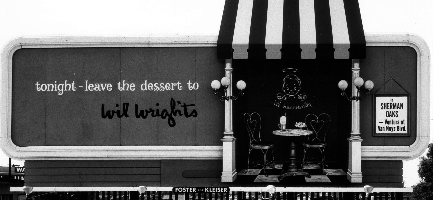
| (1961)* – Foster and Kleiser Billboard reads “tonight – leave the dessert to Wil Wright’s in Sherman Oaks – Ventura at Van Nuys Blvd.” Duke Library Image Archive |
Historical Notes The slogan 'It's Heavenly!' defined the chain of Wil Wright's fancy, old-style ice cream parlors. The Sherman Oaks location on Ventura Boulevard was a '60s legend. Wil Wright’s was a chain of ice cream parlors that dotted the Southern California landscape up until the mid-seventies. In addition to the Sherman Oaks location, they could be found in Beverly Hills (corner of Beverly Drive and Charleville), Westwood Village (corner of Glendon and Lindbrook), West Hollywood (Sunset Strip), Pacific Palisades (San Vicente), among other spots. They were the perfect place to take a date after the movie. The delicate pink and red decor and little marble tables and wire-frame chairs made you feel like you were seated inside a Valentine’s Day card. |
 |
|
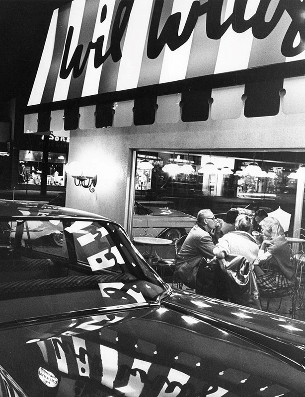
| (ca. 1960)* - Customers at Wil Wright’s Ice Cream Parlor, located on the NW corner of Ventura and Van Nuys boulevards in Sherman Oaks. |
Historical Notes Sometime in the early '70s, after Wil Wright's tried to add a full menu to compete with the success of Farrell's Ice Old Time Ice Cream Parlors—which were popular with kids and families and had a similar theme to Wil Wright's—the high-end parlor closed, leaving a legacy of rich, buttery tasting ice cream and marvelous macaroons in its wake.^ |
Casa de Cadillac
 |
|
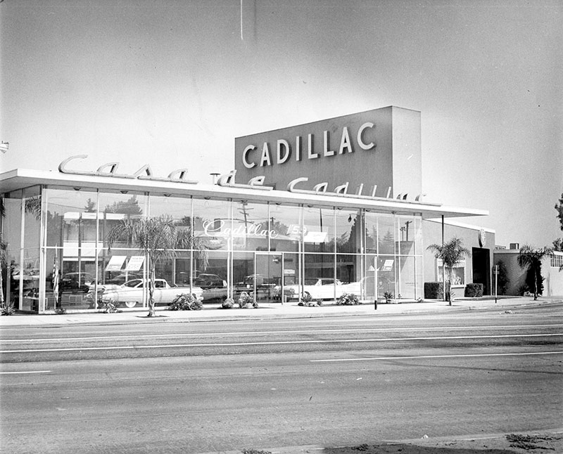
| (1958)* – View showing Casa de Cadillac, located at 14401 Ventura Boulevard in Sherman Oaks. |
Historical Notes Casa de Cadillac, a car dealership that has been in continuous operation on Ventura Boulevard since 1949, is a well-known landmark of San Fernando Valley Modernism. The building was designed by Randall Duell and Phillip A. Conklin to be Don Lee Cadillac's Valley dealer, and the name soon changed to Casa de Cadillac. Its corner once boasted four other "Casa" businesses, from gas station Casa de Petrol to roadside stand Casa Burger, but today only the dealership remains. Duell was a Hollywood set designer as well as an architect, and his Casa design is certainly cinematic: the showroom's double-height glass windows beckon passers-by to come check out a Cadillac, while the interior's polished terrazzo floor glistens in welcome and a massive vertical stucco slab rises above the roof to announce its brand in white neon block letters.^ Click HERE for contemporary view. |
Casa de Petrol Chevron Station
 |
|
| (1961)^ - Casa de Petrol located at 14325 Ventura Blvd, Sherman Oaks (NE corner of Ventura Blvd and Tyrone Ave), across the street from Casa de Cadillac. Click HERE to see more Early LA Gas Stations. |
Historical Notes This was where James Dean filled up his Porsche before later meeting his maker in a fatal car accident in 1955. Click HERE to see contemporary view. |
Peppermint Stick Club
 |
|
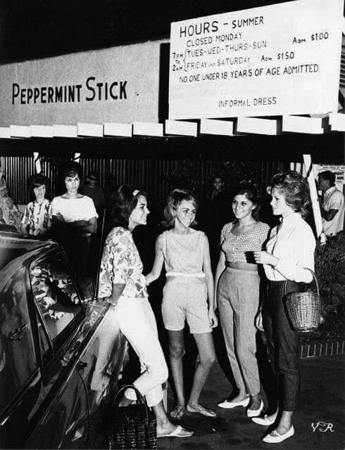
| (1962)* - The Peppermint Stick Club, located at 15463 Ventura Boulevard in Sherman Oaks, was a popular teenage non-alcoholic nightclub for teenagers. Photo by Julian Wasser. |
 |
|
| (1962)* - Chubby Checker playing the Peppermint Stick Club. |
Historical Notes Photograph caption dated November 29, 1962 reads "Re-opens 'Stick.'" The article partially reads "The king of the Twist, handsome Chubby Checker, helped re-open the redecorated 'young adults' night club, The Peppermint Stick, in Sherman Oaks." |
Van Nuys Blvd
 |
|
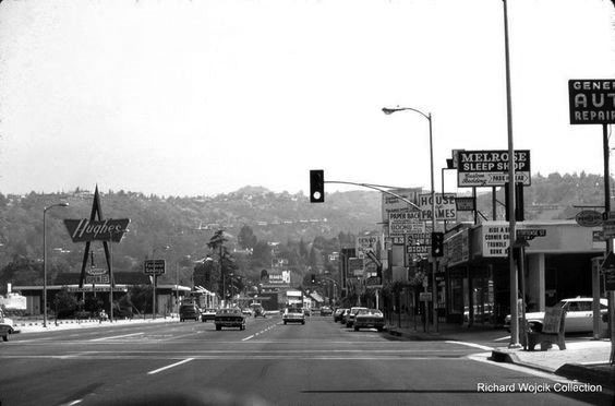
| (1975)^x^ - View looking south along Van Nuys Boulevard from just north of Hortense Street in Sherman Oaks. Photo Courtesy of Richard Wojcik. |
Historical Notes A Hughes Market was on the east side of the street in the Sherman Oaks Center. It later became a Ralphs and is now Gelson's. |
 |
|
| (1972)^ - View showing a modern looking Mobil Gas Station located on the corner of Burbank and Van Nuys boulevards. Full service was still offered here. Hughes Market is seen in the background. Photo by Richard McCloskey. Click HERE to see more Early Views of LA Gas Stations. |
Historical Notes Hughes Markets was privately owned and family-operated for 45 years. In the mid-1990s the company was acquired by Quality Food Centers, Inc., a Seattle, Washington-based supermarket chain (but kept the Hughes name). By the late-1990s, many Hughes store locations were sold to Ralphs, which soon was sold to Fred Meyer, before going to Kroger.*^ |
 |
|
| (1970s)^ – View looking southwest on Van Nuys Boulevard. Visible at center is 6211 Van Nuys Boulevard, known at that time as the Van Nuys Hotel. It is believed to have had such boarders as silent film star William S. Hart. This building dates from the 1910s and is still standing today. Click HERE to see contemporary view. |
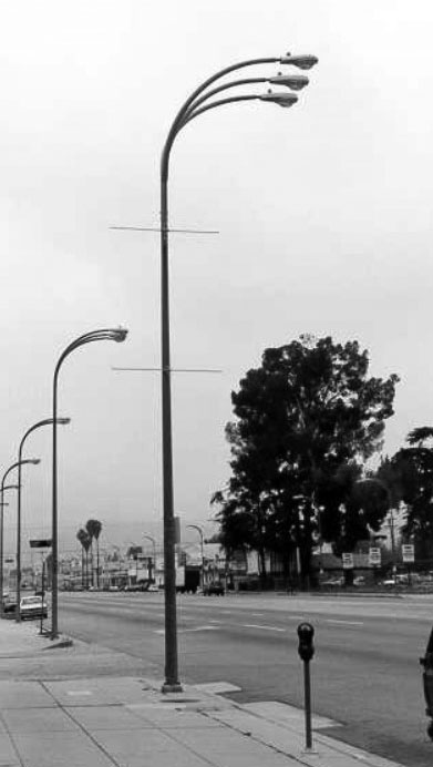 |
(1970s)^x^ - These forked three-arm streetlights were chosen in the early 1970's by representatives of the Van Nuys business community to light Van Nuys Boulevard and Magnolia Boulevard. Originally, 1,000 watt mercury vapor lamps were used to provide on average five foot-candles. This turned out to be too bright and too costly from an energy level. Today, these three-pronged electroliers can still can be seen on and around Van Nuys Boulevard. However, the luminaires today are 250 watt high-pressure sodium. |
Four 'n 20 Restaurant & Pie Shop
 |
|
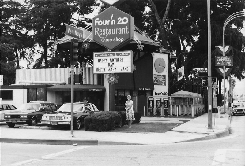
| (1978)** – View showing the Four ‘n 20 Restaurant & Pie Shop located on the northwest corner of Van Nuys Boulevard and Hatteras Street in Sherman Oaks. Today, this corner is occupied by a car dealership. Click HERE for contemporary view. Photo courtesy of David Burkin |
Historical Notes “Sing a song of sixpence, a pocket full of rye, four and twenty blackbirds, baked in a pie.” So goes the popular English nursery rhyme “Sing a Song of Sixpence.” From this rhyme came the name for a small chain of late 1960s restaurants called Four’n 20 Restaurant & Pie Shop. Like Marie Callendars, Four’n 20 featured pie, with a limited menu of soup, sandwiches, hamburgers, and salads. The chain was created by United Fruit Company in 1969, and was overseen by its Baskin-Robbins division. There were four restaurants in Los Angeles (Encino, Northridge, Sherman Oaks, and Valley Village), two in San Jose, and three in New York. |
 |
|
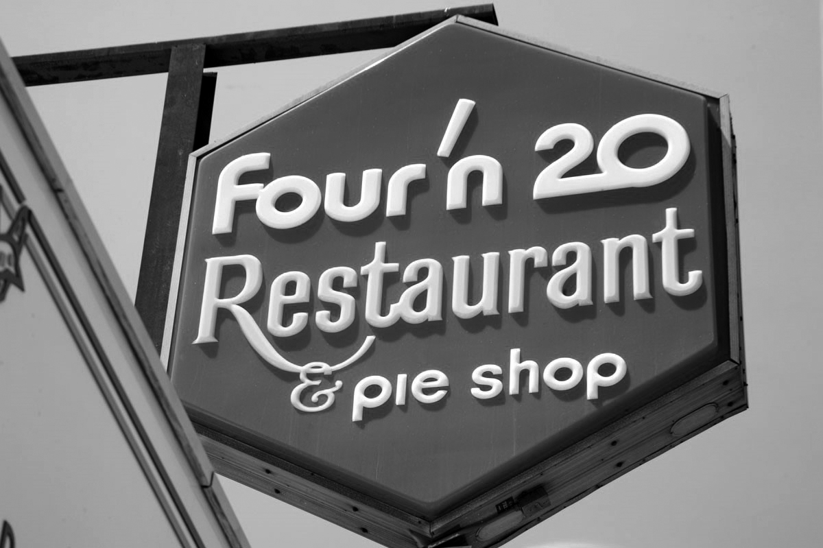
| (ca. 2017)** - Close-up view of the Four'n 20 sign at the 4723 Laurel Canyon location. |
Historical Notes None of the four original Los Angeles Four ‘n 20 buildings remain, though two of the restaurants relocated and each has incorporated original signage into their new locations: (1) 5530 Van Nuys Blvd., Sherman Oaks; (2) 4723 Laurel Canyon, Valley Village. |
Ventura Boulevard
 |
|
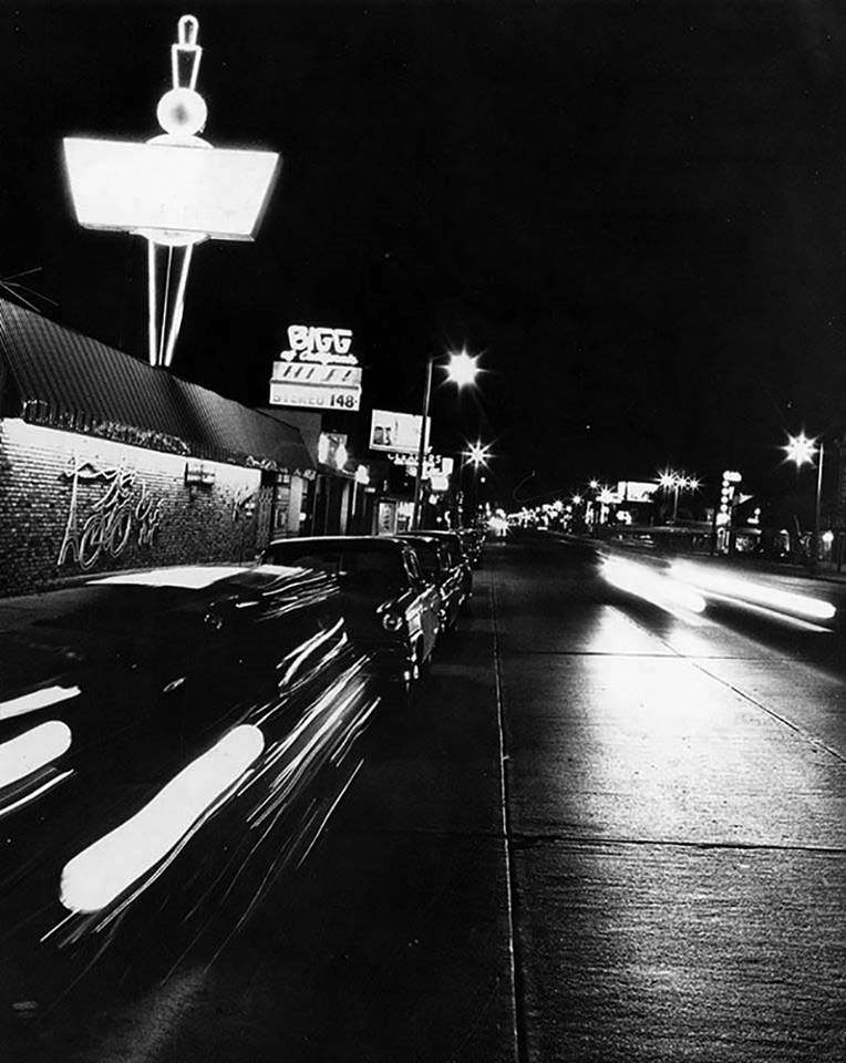
| (ca. 1960)* - Nighttime view looking east on Ventura Boulevard in Sherman Oaks/Van Nuys. Bigg of California’s at 13841 Ventura Boulevard is on the left. Click HERE to see contemporary view. |
 |
|
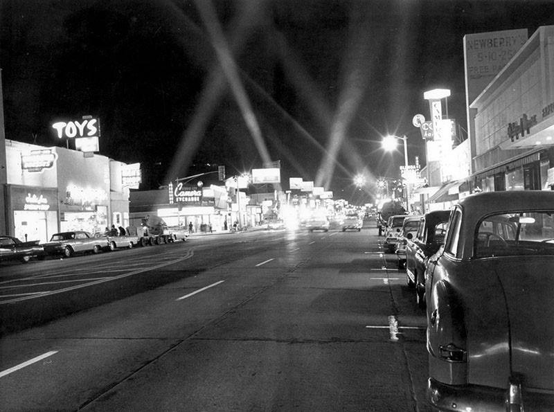
| (1962)* - Valley Times photo caption reads: It's Shopping Night on Ventura Boulevard! The Ventura Boulevard Merchants Association has declared May 2, 1962 "Shopping Night", with stores stretching the thoroughfare from Laurel Canyon to Fallbrook Avenue open until 9:00 p.m. |
Encino Velodrome
 |
|
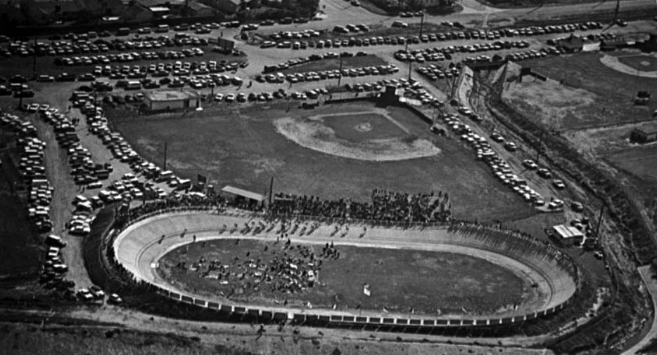
| (1960s)^ – Postcard aerial view showing the Encino Velodrome located near the intersection of Louise Avenue and Oxnard Street. |
Historical Notes The history of the Encino Velodrome began in 1953 when cycling enthusiasts George Garner, Bob Hansing, Jack Kemp and Charlie Morton started talking about building a new velodrome. Their original idea grew and through the help of friends, local businesses and the Corps of Engineers. Money and materials gradually came together allowing the track to be completed in time for the 1961 racing season. In 1963 the original asphalt surface was replaced with concrete and has remained as such to this day. |
 |
|
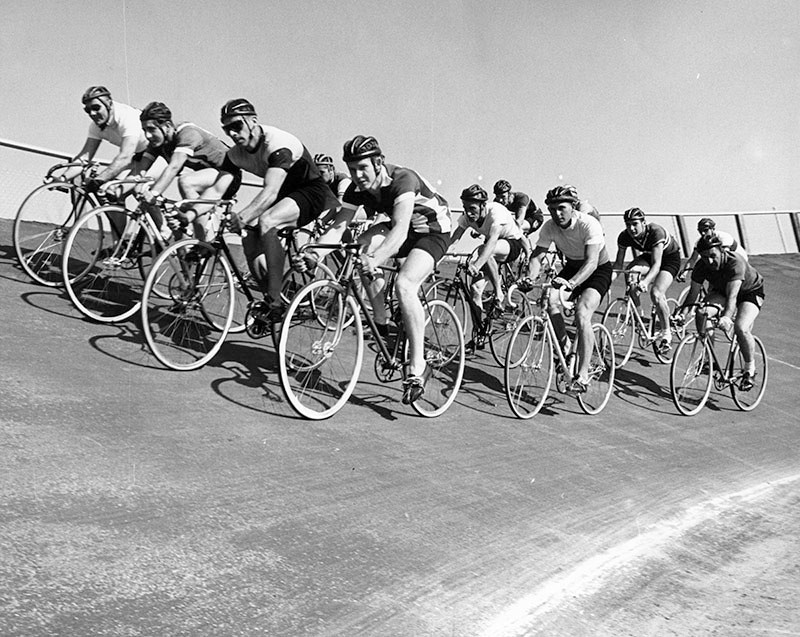
| (1961)* - Photograph caption dated May 18, 1961 reads "Bike racers bunch at start in sprint on banked, Olympic-sized Encino track. Pedal-pushers compete every Sunday on the $25,000 oval built by a bike club." The Encino Velodrome is located at 17301 Oxnard Street in Encino. |
Historical Notes The Encino Velodrome was selected to host the National Track Championships in 1965. The success of that single event paid for all prior construction costs. #+# |
 |
|
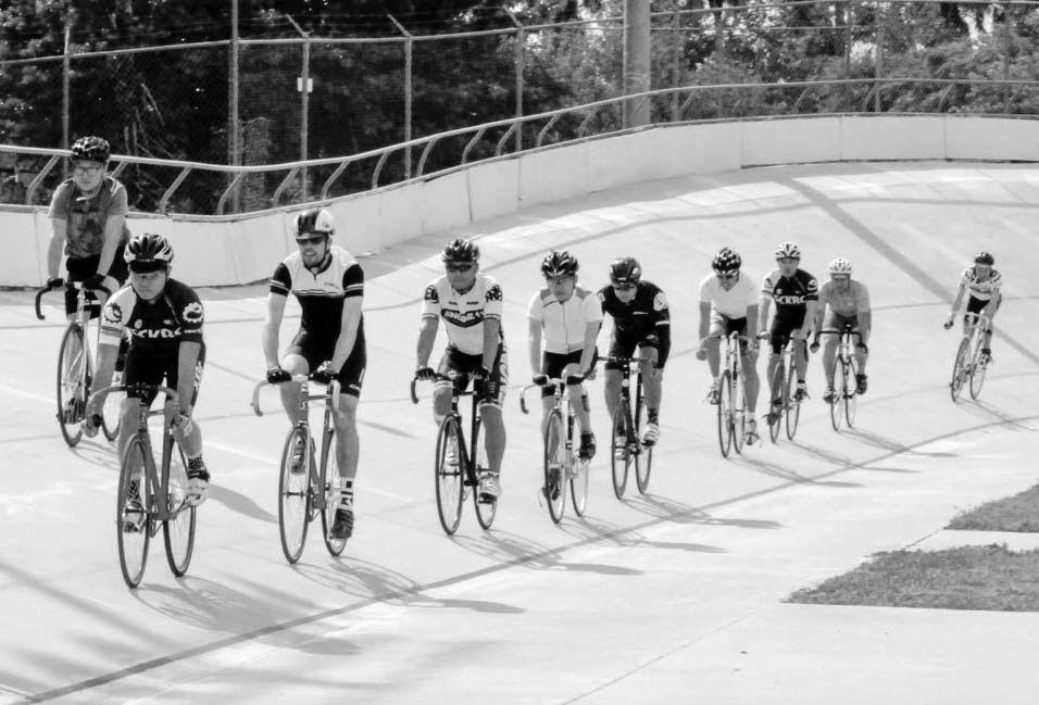
| (2014)^ – Panoramic view showing riders coming around the turn at Encino Velodrome. |
Historical Notes The oval track is 250 meters in length, has 28 degree banked turns and 15 degree straights. #+# |
Valley Ice Skating Center
 |
|
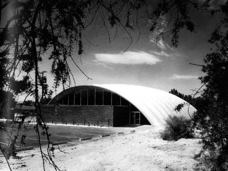
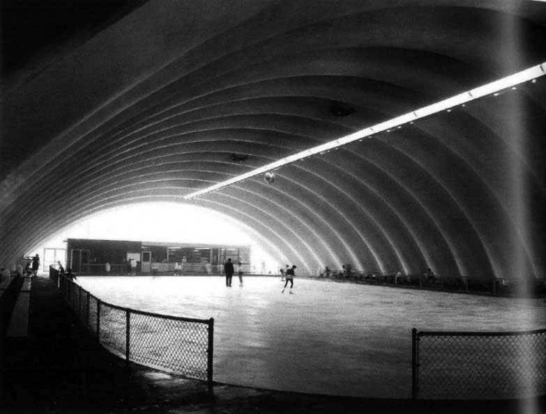
| (ca. 1960s)^ - View of the Valley Ice Skating Center located at 18361 Ventura Boulevard in Tarzana. |
Historical Notes The Valley Ice Skating Center was owned and operated by Ron and Sheila Priestly, both remarkable figure skaters and show performers of their time. Built in 1960, it was designed by Carl Maston mostly with the help of engineer Richard Bradshaw and had a dome shaped "clamshell" exterior. Maston had never done a project quite like a skating rink before but was knowledgeable of Bradshaw's previous work designing structures to span large spaces. The total construction cost for the completed building was $104,000. Bradshaw, not one to choose a box design when something more exciting could be done for the same price, came up with the creative design and construction process while Maston worked on the more straight-forward front and back elevations. The Tarzana Ice Rink went on to win a Los Angeles Chapter AIA Merit Award. ("Honor Awards Given by A.I.A." Los Angeles Times, October 16, 1960). ^ |
 |
|
| (ca. 1960s)^ – Interior view of the Valley Ice Skating Center in Tarzana. |
Historical Notes Owner and skating legend Ron Priestley served as president of the Tarzana Chamber of Commerce and he was an influential figure in the Ice Skating Institute of America (ISIA) which had been founded in 1959 to promote recreational skating. The Valley Ice Skating Center was demolished in the 1970s to make room for new development. Today, the land is occupied by the Tarzana Square Shopping Center. Click HERE for contemporary view. |
Reseda Municipal Center - Then
 |
|
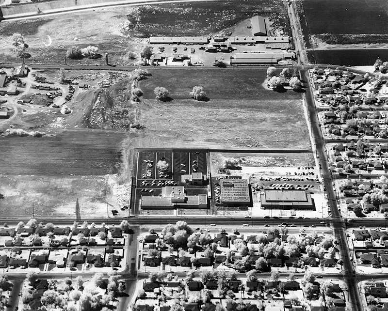
| (1960)* – Aerial view looing south showing the intersection of Vanowen Street (L to R) and Vanalden Avenue with the new Reseda Municipal Center located on the southeast corner. In front of the large parking area is the recently dedicated West Valley Police Building. Center is the West Valley Branch Library and at the right is the Municipal Center. |
Now
 |
|
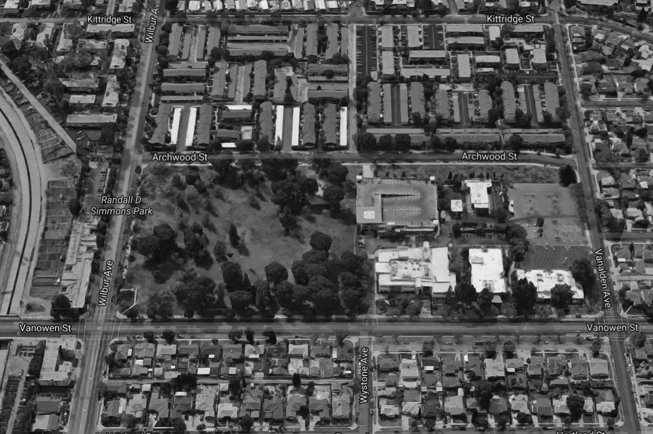
| (2016)* – Google aerial view showing the West Valley Municipal Center and surrounding area as it appears today. Randal D Simmons Park is on the left with the LA City Municipal buildings on the right. The complex includes: the West Valley LAPD Station, West Valley Regional Branch Library, and the LA City Council Offices. |
 |
|
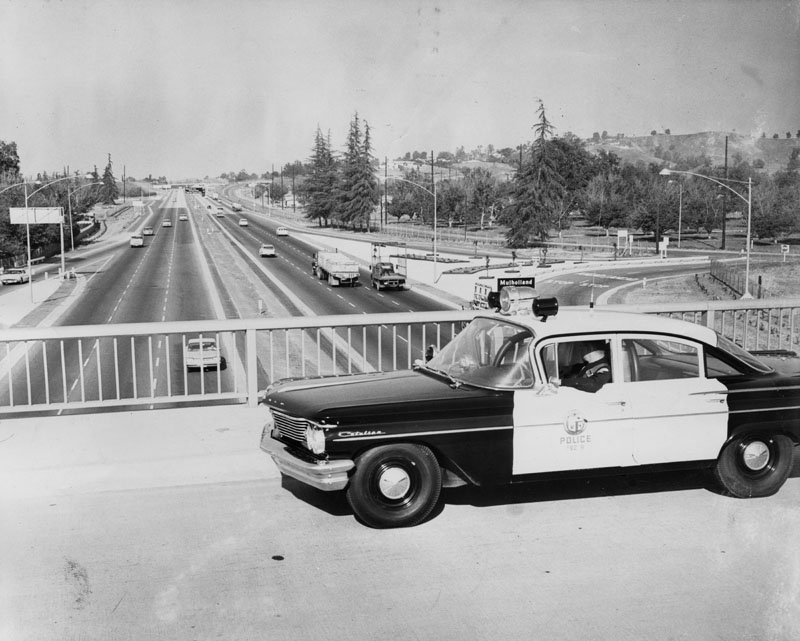
| (1960)* - View looking east from the Valley Circle overpass of the Ventura Freeway. Photo caption reads: "Under Watchful Eye. Motorists on new Ventura Freeway are now under constant surveillance by such special patrolmen as James Murphy, who sit in new high-speed West Valley police car. Specially equipped Pontiac is designed to bring "death" to speeding before speeders literally kill themselves." Freeway exit sign reads: Mulholland |
Historical Notes Known as the Freeway Flyers. They used suped-up Pontiacs and Oldsmobiles on the city freeways until the CHP took over patrol duties around 1968. The 101 Freeway from Ventura to its intersection with the Hollywood Freeway in the southeastern San Fernando Valley (the Hollywood Split) was built in the late 1950s and opened on April 5, 1960. East of the Hollywood Freeway intersection, it is signed as State Route 134 which was built by 1971. |
Ventura Boulevard
 |
|
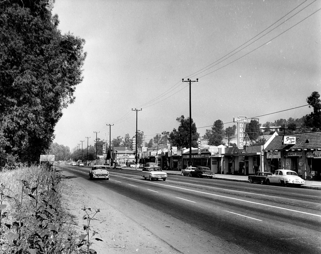
| (1962)* – View of Ventura Boulevard looking east from Topanga Canyon Boulevard. |
Historical Notes The above photo appeard in the Valley Times in 1962 with this caption: “The combination of country living and city convenience at Woodland Hills in the San Fernando Valley is demonstrated by this view of Ventura Boulevard on June 22, 1962. The view looks east from Topanga Canyon Boulevard.” |
 |
|
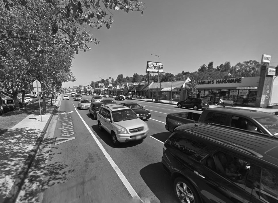
| (2015)* - Google street view looking east on Ventura Boulevard from near Topanga Canyon Boulevard. Franklin's Hardware Store can be seen across the street. |
Historical Notes Franklin's Ace Hardware has been a staple in the Woodland Hills community since 1952. It is a family-owned and operated hardware store, currently led by the third generation of the Kurzeka family. |
Then and Now
 |
|
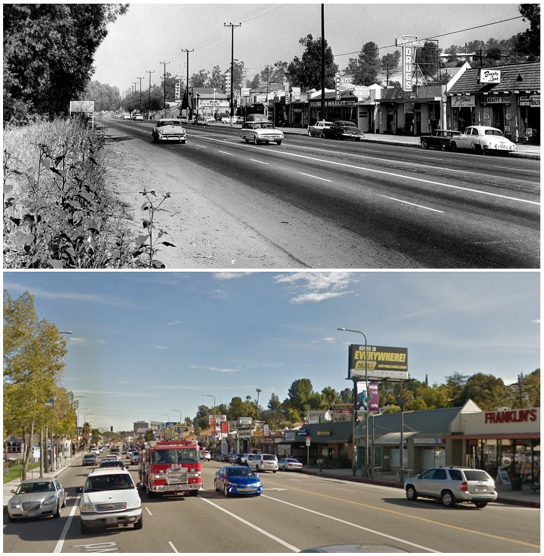
| (1962 vs 2017)*- Looking east on Ventura Boulevard from near Topanga Canyon Boulevard. Franklin's Hardware Store can be seen across on the right. |
Historical Notes LABS permit records indicate that the building on the right at 21936 Ventura Blvd started being used as a hardware store in 1968. Beauty products, a bar, TV Repair, Health foods and even a real estate office have all set up shop here prior to that time. Franklin Hardware likely started in another location and moved here. It was probably close to this one, because people have long associated the name with Ventura and Topanga. |
Chalk Hill (Ventura Boulevard)
 |
|
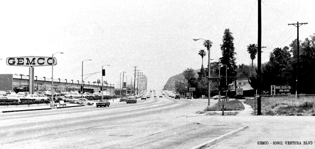
| (1960s)* – View looking east on Ventura Boulevard showing GEMCO at 20801 Ventura Boulevard with ‘Chalk Hill’ in the distance. Just up that hill were the restaurants Victoria Station and Charley Brown. Across the street on the right is the Ridgewood Military Academy located on the NE corner of Ventura Blvd and Kelvin Ave. Click HERE for contemporary view. |
Historical Notes Gemco was first established in Anaheim in October 1959. A year later, the company was purchased by Lucky Stores, which added the supermarket element and expanded Gemco into a chain. Business and profitability continued to be healthy for over 20 years until a series of unsuccessful leveraged takeover attempts from other companies were made on its parent company, Lucky Stores. Lucky, to avoid such hostile takeover attempts, eventually decided it was best to liquidate Gemco entirely. This liquidation occurred from September 1986 to November 1986. Target reopened in most of the former Gemco locations by the fall of 1987, having remodeled many of Gemco's former prime business locations into Target's bright red-and-white trade dress.*^ Click HERE to see more early views of Chalk Hill. |
 |
|
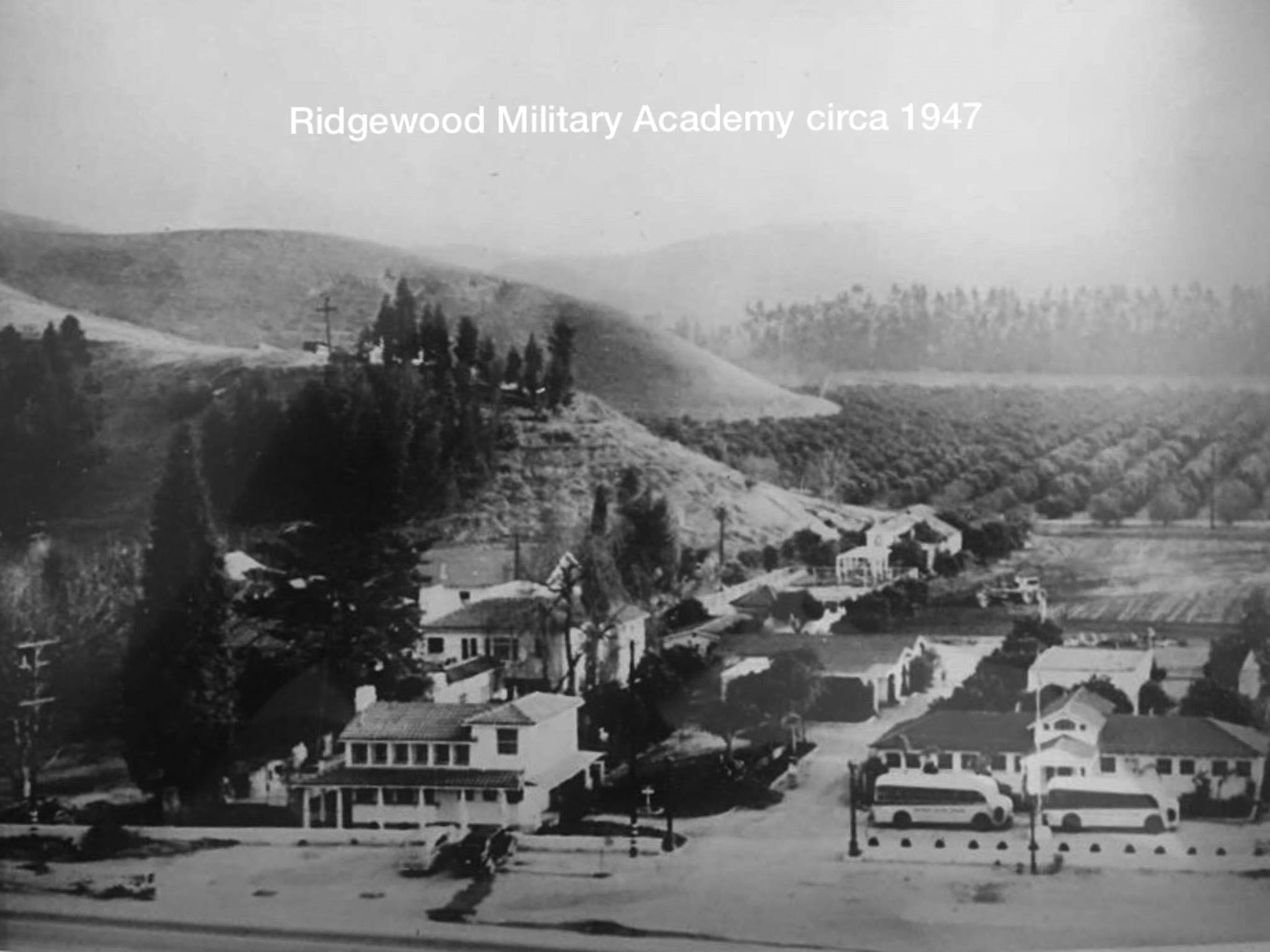
| (ca. 1947)^ – View showing Ridgewood Military Academy located at 20764 Ventura Boulevard. Kelvin Ave is out of view to the right. Chalk Hill can be seen on the left. Click HERE for contemporary view. |
Historical Notes Ridgewood Military Academy opened in 1942 and closed in 1981. |
 |
|
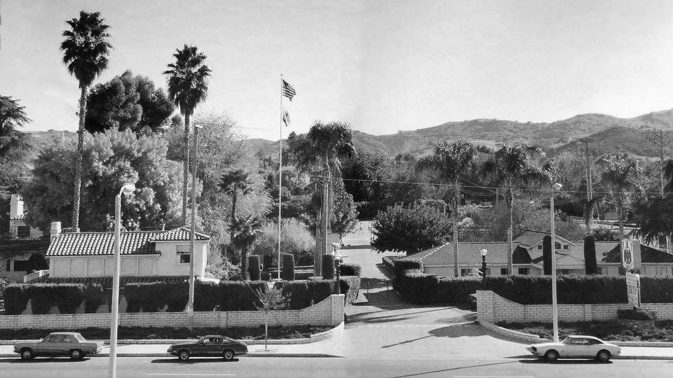
| (ca. 1980)^ – View looking south showing the front entrance to the Ridgewood Military Academy. |
Valley Music Theatre
 |
|
| (1963)* – View showing the Valley Symphony Orchestra on the site of the future Valley Theater Center at 20600 Ventura Boulevard in Woodland Hills. Musical star Janet Blair, flanked by two men, stands on a platform in the center. The photo was used to raise awareness (and money) for a new theater in the round, which was completed the following year. |
Historical Notes Photograph caption dated May 30, 1963 reads: “Here, on the south side of Ventura Blvd. between Winnetka and Canoga Aves., in Woodland Hills, is where the $1,000,000 theater-in-the-round will be built -- in time, it's hoped, for a 1964 start for the 20-week summer season of musical comedies with such already-committed stars as Miss Blair, Gordon and Sheila MacRae and John Raitt."* |
 |
|
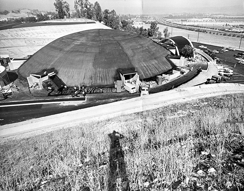
| (1960s)* - Aerial view showing the Valley Music Theatre on Ventura Boulevard between Winnetka and Canoga. |
Historical Notes The Valley Music Theater was built in 1963, as a concrete shell structure, by pouring a concrete 'dome' over a rounded hill of soil, then excavating the soil away. The theater project was backed by entertainers Bob Hope and Art Linkletter, along with Cy Warner. *^ |
 |
|
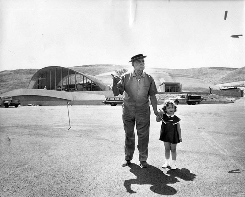
| (1964)* - Woodland Hills Honorary Mayor, Buster Keaton "hitching a ride" in front of the Valley Music Theater. Photo Credit: Steve Young-Valley Times - Los Angeles Public Library Collection |
Historical Notes The little girl is Melody Holland, the daughter of David Holland, who was the Director of Public Relations for the theater. This photo was taken in 1964 before the opening of "The Sound of Music." Mr. Keaton's last home was in Woodland Hills at 22612 Sylvan Street. **#^ |
 |
|
| (1964)* - Photograph caption dated July 6, 1964 reads, "Workmen are shown putting finishing touches on the Valley Music Theater, which presents its premiere performance Tuesday night when Janet Blair and John Myhers star in Rodgers and Hammerstein's 'The Sound of Music.' The $1.2 million concrete-domed structure occupies an 8.3-acre site at 20600 Ventura Blvd. in Woodland Hills. It seats up to 2,865 persons." |
 |
|
| (1964)* - Theater debut. Photograph caption dated July 8, 1964 partially reads, "Above, the setting sun catches members of the opening-night audience as they head for entrance of new Valley Music Theater." – Valley Times Collection |
Historical Notes The 2865-seat facility opened July 6, 1964 with The Sound of Music. The first year saw the theater mount 18 musicals, three comedies, a drama, as well as concerts with a combined audience of over 600,000.*^ |
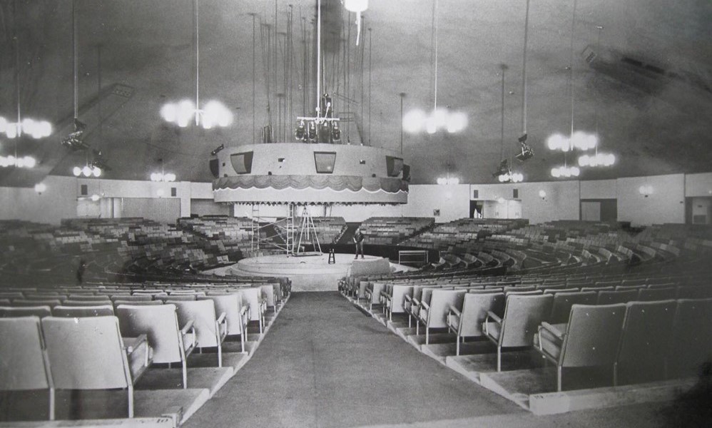 |
|
| (ca. 1965)* - Interior view of Valley Music Theater. This popular venue was located at 20600 Ventura Boulevard, on Chalk Hill, in Woodland Hills. |
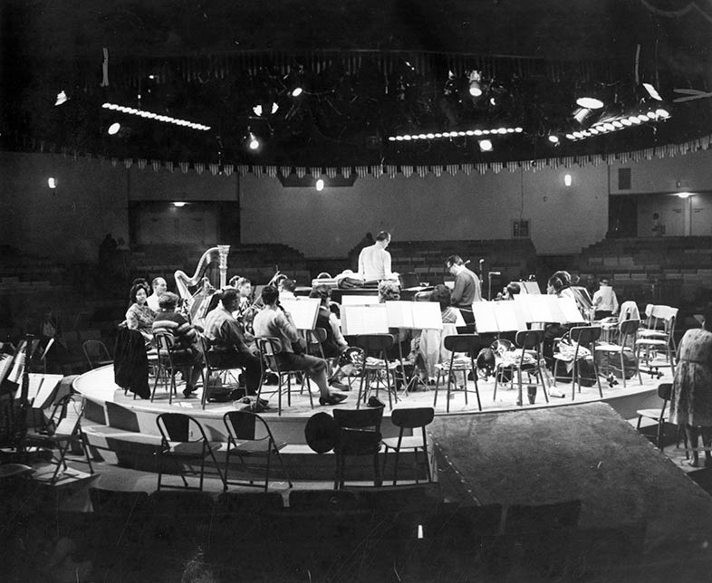 |
|
| (1965)* - Concert-in-round - Photograph caption dated February 25, 1965 reads, "The Valley Symphony's huge orchestra fills stage at Valley Music Theater as musical director James Swift, center, conducts and Steve Allen plays piano at rehearsal for nation's first theater-in-round concert tomorrow night." - Valley Times Collection |
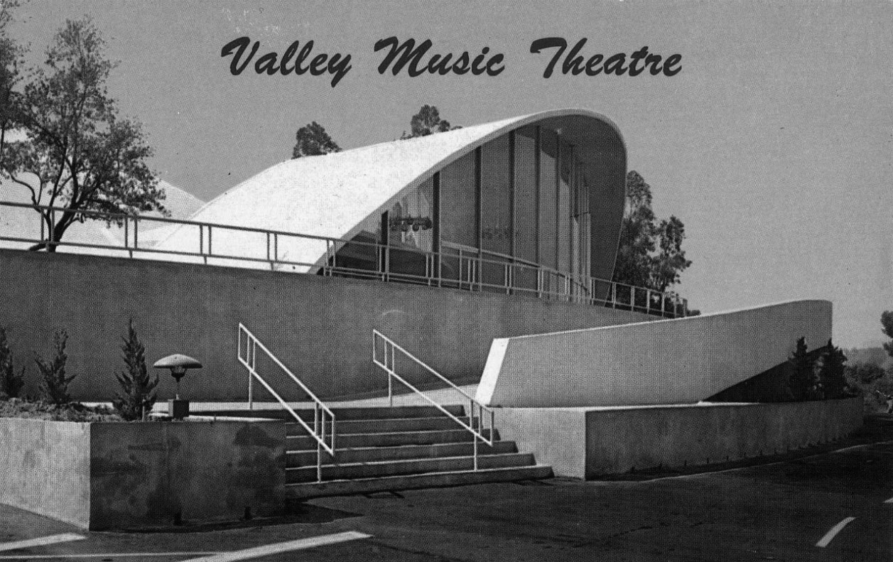 |
|
| (ca. 1960s)^ - View showing the Valley Music Theatre located at 20600 Ventura Boulevard in Woodland Hills. |
Historical Notes Among the performers who appeared at the Valley Music Theater were Sammy Davis Jr., Johnny Carson, Don Rickles, Woody Allen, Ray Charles, Art Linkletter, Robert Goulet, Mitzi Gaynor, Ike & Tina Turner, Peter, Paul & Mary, B.B. King, Lou Rawls, Three Dog Night, Jim Croce, and the Spiral Staircase. The Byrds, Buffalo Springfield, and The Doors appeared there together on February 22, 1967.*^ |
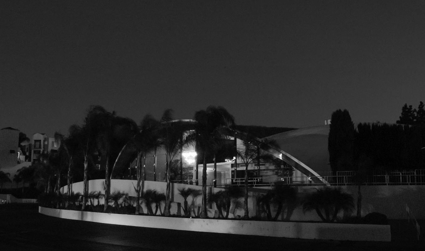 |
|
| (2004)*^ - The Valley Music Theater — formerly on Ventura Boulevard and Chalk Hill, in Woodland Hills. Photographed when it was an Assembly Hall of Jehovah's Witnesses. Photo by Scott Mayoral / Wikipedia |
Historical Notes By 1966 the theater began to fall on hard times. Over the years, the fare changed from legitimate theater, to rock concerts, to boxing matches, until in 1980 it became a Jehovah's Witness Regional Assembly Hall. By 2004, the church had outgrown the facility and sold the property, which it had bought for $1 million. *^ |
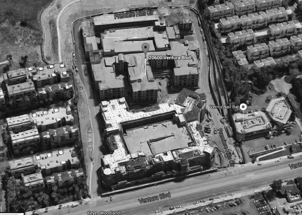 |
|
| (2015)* – Google Satellite View showing construction of the apartment complex (The Boulevard) where the Valley Music Center once stood, 20600 Ventura Boulevard. |
Historical Notes The Valley Music Center site at 20600 Ventura Blvd. now consists of an apartment complex and live + work lofts called "The Boulevard". |
Ramo-Wooldridge later Thomas-Ramo-Wooldridge (TRW)
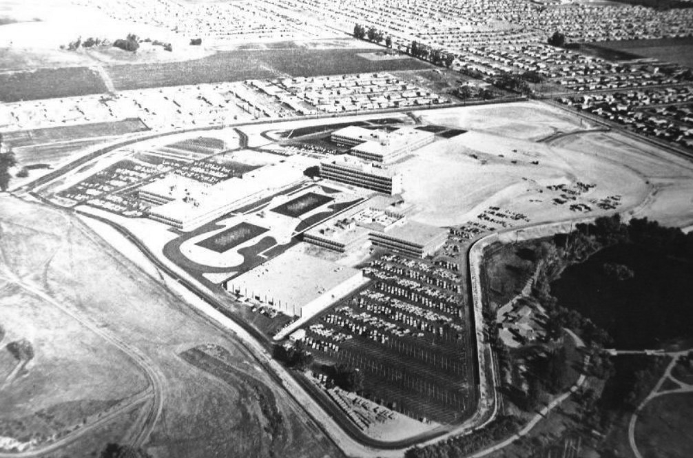 |
|
| (1959)^ – Aerial view looking southeast showing the new Ramo-Wooldridge Corporation (later TRW) facility in Canoga Park with Hidden Lake seen on the far right. The intersection at upper-right is Fallbrook and Roscoe, and the hill in upper-left is now Chase Park. |
Historical Notes Two Hughes engineers, Simon Ramo and Dean Wooldridge, had new ideas on the packaging of electronics to make complete fire control systems. Ramo and Wooldridge, having failed to reach an agreement with Howard Hughes regarding management problems, resigned in September 1953. They founded the Ramo-Wooldridge Corporation, later to join Thompson Products to form the Thompson-Ramo-Wooldridge Corporation based in Canoga Park (present day West Hills) with Hughes leasing space for nuclear research programs. The company became TRW in 1965, another aerospace company and a major competitor to Hughes Aircraft.^ |
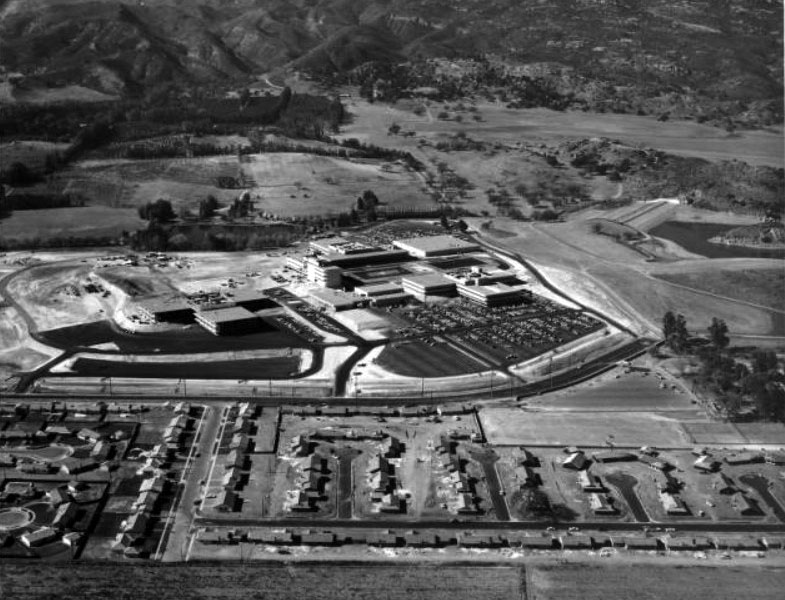 |
|
| (1959)^^ - Aerial view of the West San Fernando Valley (now West Hills). View is looking west toward the Ramo Woolridge facility with a portion of the Chatsworth Reservoir seen in the upper right. The main street running horizontally from left to right and then slightly curving up is Fallbrook Ave. The street at lower left running up from bottom is Eccles Street. |
Historical Notes Dean Wooldridge retired in January 1962 to become a professor at California Institute of Technology. Simon Ramo became president of the Bunker-Ramo Corporation in January 1964, jointly owned by TRW and Martin Marietta for the production of computers and monitors. Thompson Ramo Wooldridge officially became TRW Inc. in July 1965.^ |
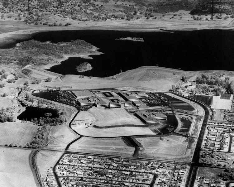 |
|
| (1960)* - Aerial view looking north toward Ramo-Wooldridge & Chatsworth residences. In the background is the Chatsworth Reservoir. The intersection at lower right is Fallbrook and Roscoe (now in West Hills). |
Historical Notes West Hills was originally part of Owensmouth (founded 1912) and renamed Canoga Park (1930). West Hills was formed in 1987 after homeowners on the western side of Canoga Park launched a petition drive a year earlier to form a new community. In an unusual move, the area's L.A. City Councilwoman, Joy Picus, polled Canoga Park residents, asking them if they would like to join the new community, to determine West Hills' boundaries. Today, West Hills is flanked on the north by the Chatsworth Reservoir, on the east by Canoga Park, on the south by Woodland Hills, on the southwest by Hidden Hills and on the west by Bell Canyon in Ventura County.*^ Click HERE to see more Early views of the Chatsworth Reservoir. |
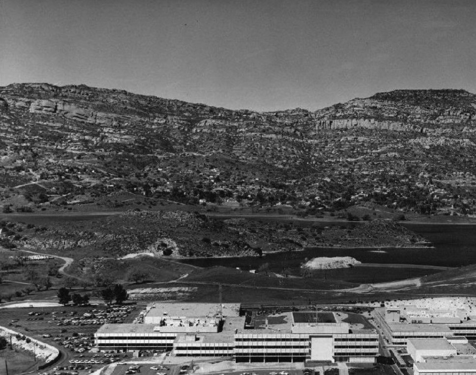 |
|
| (1960)^ - Aerial view looking north over the TRW facility toward Chatsworth Reservoir and the Santa Susana Mountains. |
Historical Notes Today, Corporate Pointe business park is located on the property originally developed in 1959 as the Thompson-Ramo-Wooldridge aerospace corporation's new headquarters and later used by Atomics International, Hughes Aircraft, and Raytheon for aerospace development advancements and nuclear research. |
Rocketdyne Field Laboratory (Simi Hills)
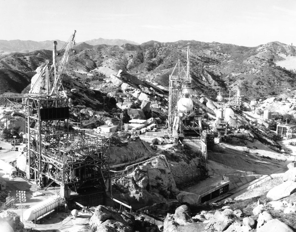 |
|
| (ca. 1960s)* - View of the Rocketdyne Field Laboratory located in the Simi Hills above the San Fernando and Simi Valleys. The laboratory is nestled in a canyon just northwest of the Chatsworth Reservoir. Two tall metal scaffolding structures with cranes on top can be seen, while several tanks sit on the rocky ground. |
Historical Notes Since 1947 the Santa Susana Field Laboratory location has been used by a number of companies and agencies. The first was Rocketdyne, originally a division of North American Aviation-NAA, which developed a variety of pioneering, successful and reliable liquid rocket engines. Some were those used in the Navaho cruise missile, the Redstone rocket, the Thor and Jupiter ballistic missiles, early versions of the Delta and Atlas rockets, the Saturn rocket family and the Space Shuttle Main Engine. The Atomics International division of North American Aviation utilized a separate and dedicated portion of the Santa Susana Field Laboratory to build and operate the first commercial nuclear power plant in the United States and for the testing and development of compact nuclear reactors including the first and only known nuclear reactor launched into Low Earth Orbit by the United States, the SNAP-10A. Atomics International also operated the Energy Technology Engineering Center for the U.S. Department of Energy at the site. The Santa Susana Field Laboratory includes sites identified as historic by the American Institute of Aeronautics and Astronautics and by the American Nuclear Society.* |
.jpg) |
|
| (ca. 1960)* - View of a rocket engine test at the Rocketdyne Field Laboratory in the Simi Hills. A related press release reads: "The isolated laboratory, the most extensive rocket research center in the Free World, is located high in the Santa Susana Mountains 35 miles northwest of Los Angeles. Thousands of pounds of thrust are developed by rocket engines which will power guided missiles for the Air Force, Army and Navy. Engines are anchored in huge steel and concrete test stands where they are 'static tested' to record their thrust and performance." |
Historical Notes During its years of operation widespread use occurred of highly toxic chemical additives to power over 30,000 rocket engine tests and to clean the rocket test-stands afterwards, as well as considerable nuclear research and at least four nuclear accidents, which has resulted in the site becoming seriously contaminated. A long process has been and is still ongoing to determine the site contamination levels and locations, cleanup standards to meet, methods to use, timelines and costs, and completion requirements - all still being defined, debated, and litigated.* |
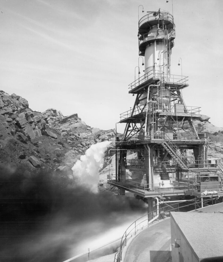 |
|
| (ca. 1955)* - Photoprint reads: "Battleship" tanks, which simulate the configuration of an Atlas ICBM, feed propellants to the engine being test fired at Rocketdyne's propulsion field laboratory in the Simi Hills. Stands like the one shown are capable of withstanding one million pounds' thrust, transmitting the enormous power of the Rocketdyne liquid propellant engines deep into bedrock. |
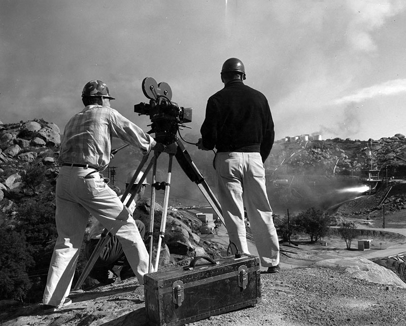 |
|
| (1963)* - View showing a film crew documenting a static rocket engine test at the Santa Susana Rocketdyne faciity. |
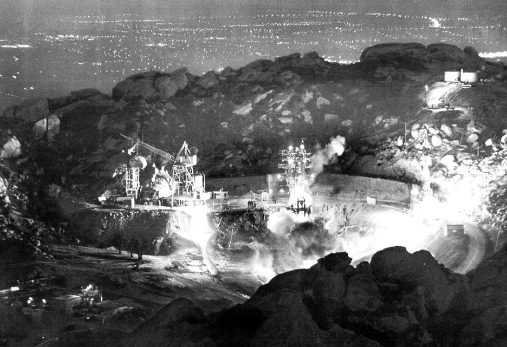 |
|
| (1961)* – Night time engine firing of Rocketdyne’s Santa Susana Field Lab, such as this test on May 21, 1961, regularly lit up the west end of the Valley and could be heard for miles. |
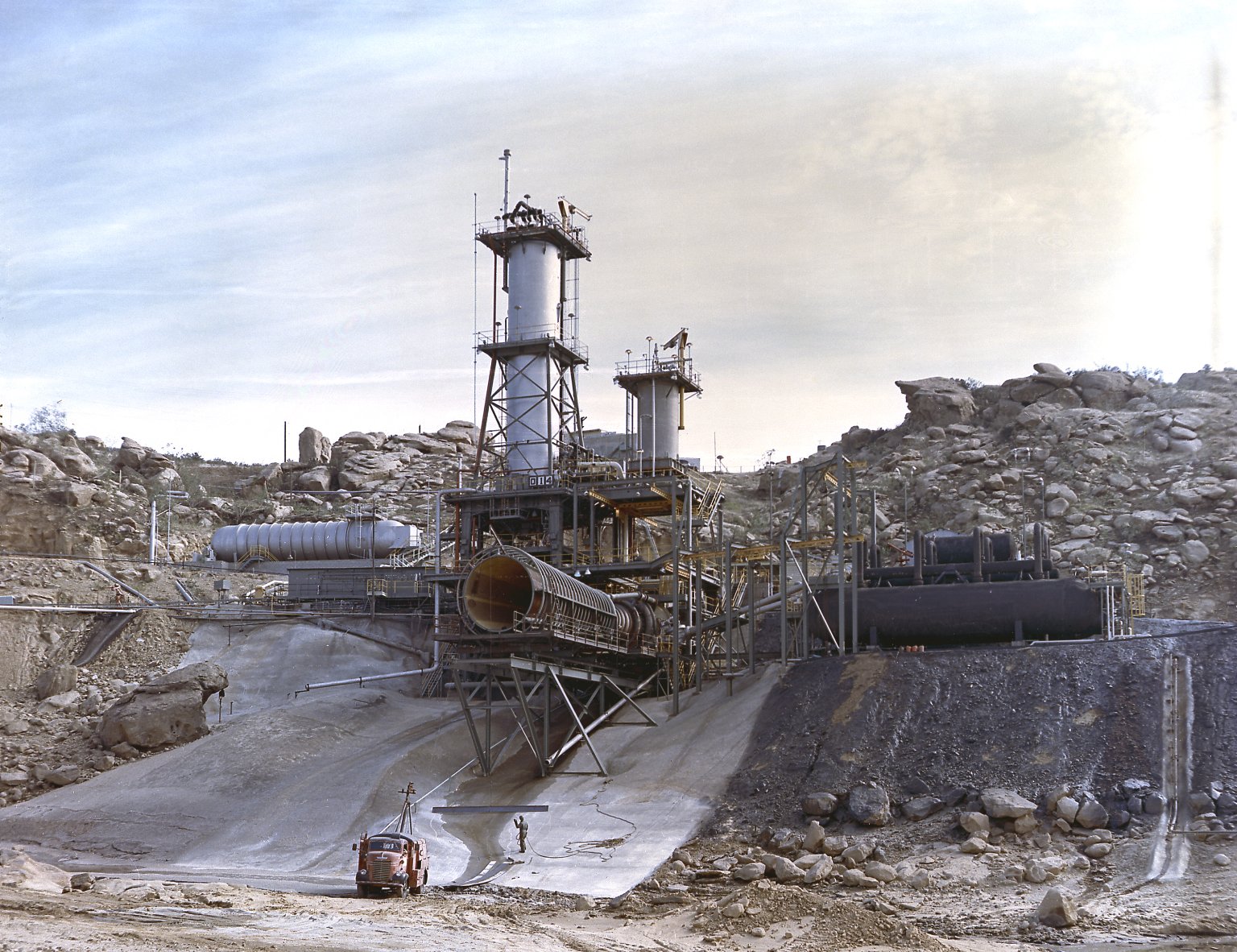 |
|
| (1962)* – View showing Rocketdyne's test stand for testing the J-2 engine in the Simi Hills above the San Fernando Valley. The J-2 engines were assembled and tested at Rocketdyne under the direction of the Marshall Space Flight Center. |
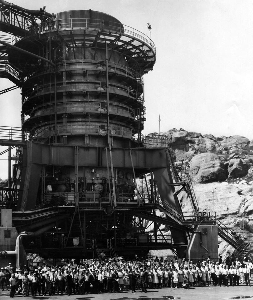 |
|
| (1960s)^ - Rocketdyne employees standing in front of the static rocket test stand for a photo op. |
Historical Notes In 1996, The Boeing Company became the primary owner and operator of the Santa Susana Field Laboratory and later closed the site. In 2005, Pratt & Whitney purchased Boeing's Rocketdyne division, but declined to acquire Santa Susana Field Laboratory site as part of the sale.* There are still many unresolved issues regarding cleanup of the Santa Susana Field Laboratory site. Boeing, NASA and DOE are in the process of moving forward on their cleanup plan. |
Canoga Park (1959+)
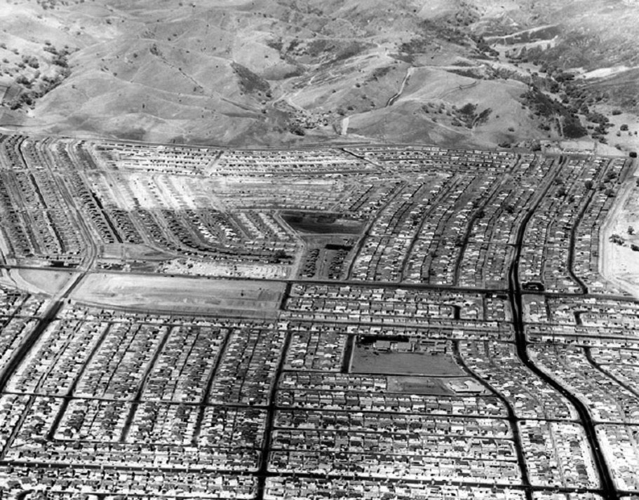 |
|
| (1960)* - Aerial view looking west above Canoga Park (now West Hills) showing hundreds of new homes pushing up against mountains in 1,133-acre Platt Ranch area. To right of picture, running away from the camera is Vanowen Street. Near lower- center right is Welby Way Elementary School. The large empty lot at center-left is now the Platt Village Shopping Center. Photo by Jon Woods/Valley Times Collection; Photo date: September 7, 1960 |
Canoga Park / West Hills - Then and Now
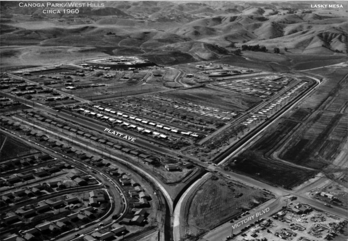 |
|
| (ca. 1960)^ – Aerial view looking southwest from above the intersection of Platt Avenue and Victory Boulevard, in the lower-right. Lasky Mesa can be seen in the upper right. At lower right can be seen the Platt Village Shopping Center under construction. Photo courtesy of Rich Krugel |
 |
|
| (2016)^ – Google Earth View looking southwest with the intersection of Platt Avenue and Victory Boulevard at lower-right. |
Epiphany Lutheran Church (Today, Garden Chapel)
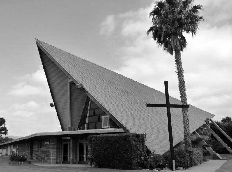 |
|
| (1959)^ - View showing the Epiphany Lutheran Church the year it was built, located at 7769 Topanga Cyn Blvd, Canoga Park. Photo courtesy Keith Hart |
Historical Notes This excellent example of a Mid-Century Modern ecclesiastical structure, designed by architect Edward Davies, with a soaring A-frame chapel sits south of Elkwood St, and is surrounded by the Green Thumb growing grounds. Epiphany Lutheran Church held its first service Dec 5, 1959 in the Canoga Park Elementary School auditorium. Five months later, the congregation moved to the Canoga Park Women's Club auditorium at 7401 Jordan Avenue. Ground was broken in May 1958 for the church’s own building, and the first service was held April 12, 1959. Over the years, the congregation grew, until the 1990’s, when membership began to decline. In 2000, a decision was made to merge Epiphany Lutheran with Evangelical Church of the Resurrection, also in Canoga Park. After the merger, the combined church was renamed Faith Lutheran, with church services being held at the Evangelical Church site. The Epiphany Lutheran site was renamed The Garden Chapel, and is used for weddings and other special events. #^*^ Click HERE to see contemporary view. |
Pappy's Restaurant and Country Squire Motel
 |
|
| (1965)* - The Grand Opening of Pappy's Restaurant and the 52-room Country Squire Motel on March 12, 1965 at 7625 Topanga Canyon Boulevard in Canoga Park. The motel featured a swimming pool and putting green. |
Historical Notes Pappy's started out as a pancake house and was a chain restaurant with 8 other locations stretching from Yuma, AZ to Portland, OR. The original Pappy's was opened in Santa Maria, CA in 1959. Jack Linkletter, son of TV personality Art Linkletter, helped set up the franchise. Eventually the owners felt the chain was stretched too far apart and they sold all but two of the restaurants, both of which are in Santa Maria. Today, it's a “2 Die For Sushi Restaurant" and “Super 8 Motel”. Click HERE for contemporary view. |
Holiday Theatre (Canoga Park)
 |
|
| (ca. 1961)^**^ – View showing the Holiday Theatre located at 8383 Topanga Canyon Boulevard, west side of Topanga n/o Roscoe Blvd. Billboard Reads: “Hills Bros. Coffee and Hostess Donettes Served – Admiral Color T.V. Given Away Free”. |
Historical Notes The Holiday Theater opened at Topanga & Roscoe in Canoga Park around 1961 and was a single screen theater. It became a Spanish theater and then a dollar theater before being closed in the 70's and turned into a hardware store. The architect was William N. Bonham and the contractor who built it was John P. Gilbert. #^*^ |
 |
|
| (1963)* – Photo caption reads: "The usherettes at Canoga Park's Holiday Theater are all dolled up in muu muus today for the opening of 'Diamond Head,' the drama of modern-day plantation life in Hawaii…” |
Historical Notes Today you will find a Lowe's Home Improvement store where the theatre once stood. |
Zodys (Canoga Park)
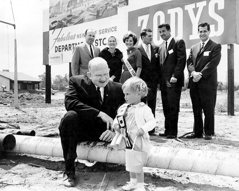 |
|
| (1962)* – View showing groundbreaking ceremonies for Zodys Discount Store located on the west side of Topanga Cyn Blvd. just south of Roscoe Blvd. The Wooden Shoe Cafe, 8240 Topanga Canyon Blvd., can be seen in the background. |
Historical Notes Valley Times photo caption dated May 17, 1962 reads "Break ground - Richard Wolfe, foreground, vice president and general manager of Zodys Quality Discount department Store, receives expert help from 2-year-old Janet Benson, Canoga Park, at groundbreaking ceremonies for new Zodys at Roscoe and Topanga Canyon Blvds., Canoga Park. Also participating are, from left, Howard Speer, Canoga Park Chamber of Commerce president; Mrs. Francis Lederer; Bonnie Gear, Miss Canoga Park; Francis Lederer, honorary Canoga Park mayor; James Liebman, Zodys developer, and Lee Freedman, Zodys vice president of store operations." Zodys was a chain of discount retail stores that operated from 1960 to 1986. The chain operated locations in California, Arizona, Nevada, New Mexico, and Michigan. By 1969 there were 19 stores. |
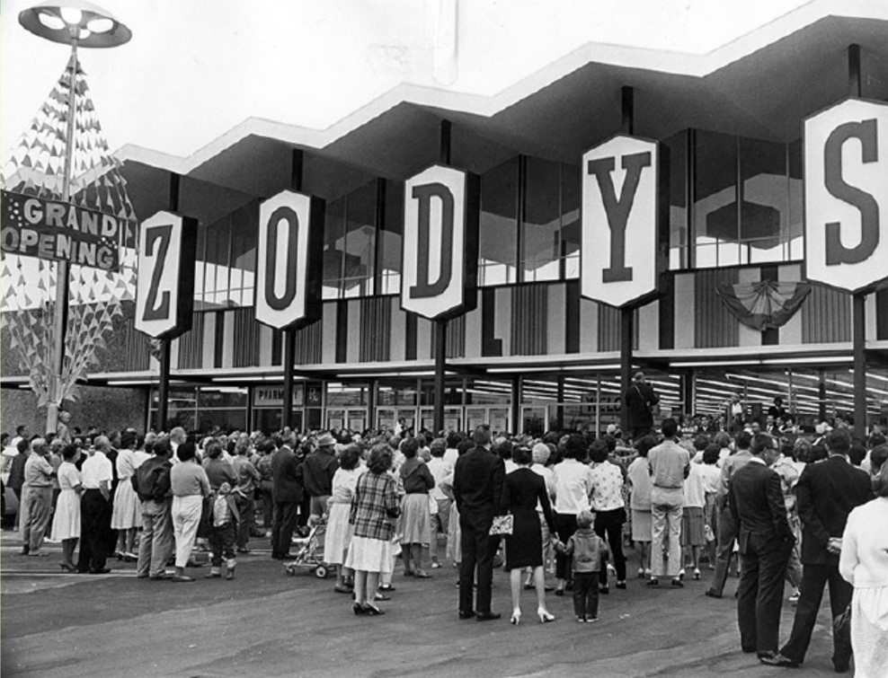 |
|
| (1962)* – Opening day at Zodys discount store on the 8200 block of Topanga Cyn Blvd. Today, a Ralphs Market (opened 1986) stands at this location. Photo date September 28, 1962 |
Historical Notes Photograph caption reads "Radio wave opens doors of Zodys in Canoga Park -Crowd surges at Zodys discount store at Topanga Canyon and Roscoe Blvds., in Canoga Park as doors swing open Thursday morning by means of a radio wave bounced off Mt. Wilson by a helicopter. Another Zodys in West Covina was opened simultaneously by the radio wave. The stores opened Thursday mark the fifth and sixth stores in the chain. A seventh Zodys will be opened in Burbank in December." Photo by Bob Martin/Valley Times Collection Bankrupt in the early 1980s, the parent company, then known as HRT Industries, began closing stores in 1984. The remaining Zodys stores in California were shuttered in March 1986 with many locations being sold to Federated Stores, the parent company of Ralphs supermarket chain, while other locations were purchased by HomeClub, a home improvement store chain. |
Chili Olé Restaurant
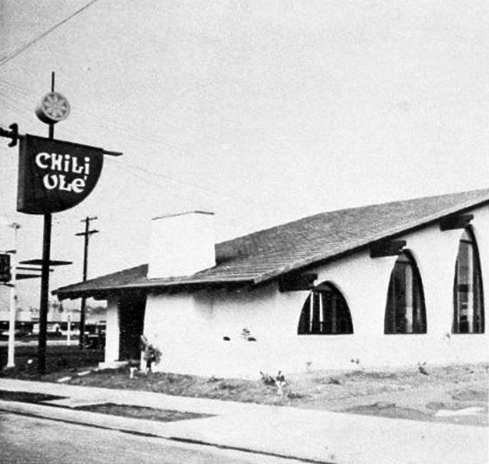 |
|
| (ca. 1966)* – View showing the short-lived Chili Olé Restaurant, located on the north side of Roscoe Blvd, two lots to the east of Topanga Cyn Blvd. |
Historical Notes In 1966, Chili Olé, a short-lived eatery near the corner of Roscoe and Topanga in Canoga Park, possibly one of L.A.'s first sports bars, opened specializing in chili. Its investors were from the sports world, including Pete Rozelle, then the Commissioner of Football. Despite its unique concept, Chili Olé didn't last the decade and was renamed The Jailhouse, then San Marcos, followed by a series of pizza joints, before the building eventually sat empty for many years. Giamela's was supposed to open in 2009 but the "opening" was "delayed" until about 2019. It never opened. |
 |
|
| (1968)* - Valley News cutout coupon dated August 2, 1968. |
 |
|
| (2024)* - A Starbucks now sits where the Chili Olé Restaurant was located in the late 1960s at 21929 Roscoe Boulevard, Canoga Park. |
Then and Now
 |
|
| (1966 vs 2024)* - The Chili Olé Restaurant, once located at 21929 Roscoe Boulevard, Canoga Park, is now the location of a Starbucks Coffee Shop. |
* * * * * |
Walker Dodge (Today, Dependable Dodge)
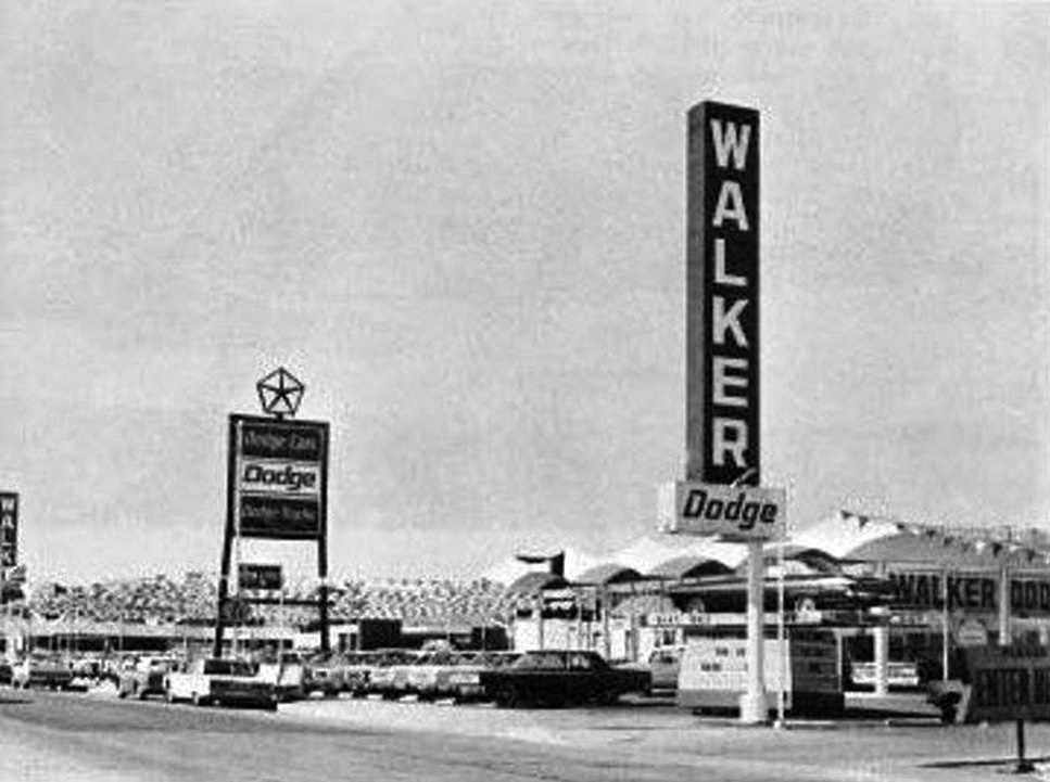 |
|
| (1964)^ – Photo caption reads: Walker Dodge, the Valley’s newest Dodge dealership, is located at the corner of Canoga Avenue and Roscoe Boulevard…A modern facility covering 5-1/2 acres---with the latest service equipment available and manned by expert factory-trained mechanics. Before you buy from us…inspect our dealership, look us over and get acquainted, because we want you to like us now and twenty years from now. Sincerely, Jay Walker, President. Photo courtesy of Keith Hart |
Historical Notes Mr. Walker wasn't around for 20 years, but the Dodge dealership was. It became Dependable Dodge in 1970, and is still there today. Behind the Dodge dealership was “The Big A” grocery store and catty corner was White Front. |
Canoga-Chrysler Plymouth Dealership
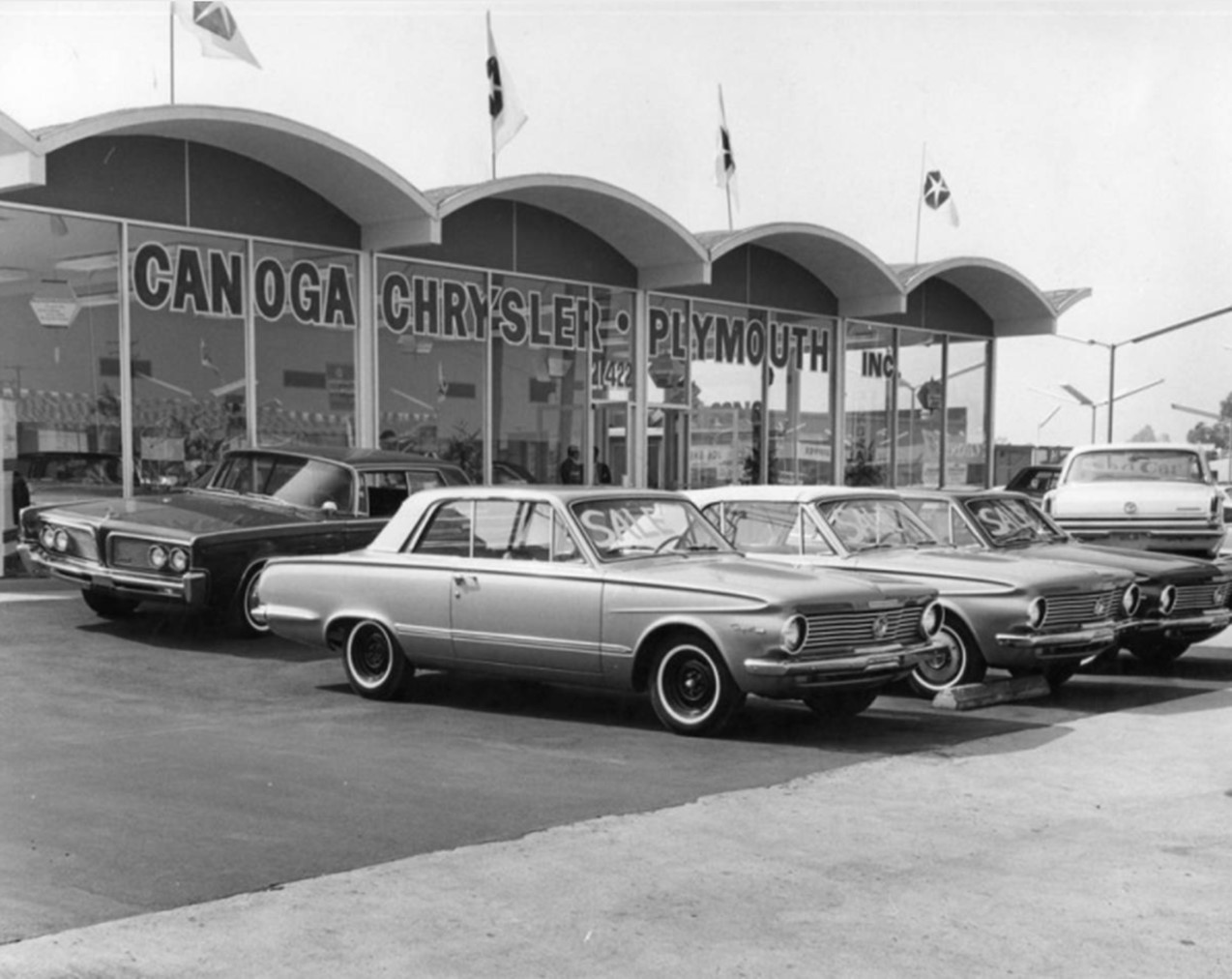 |
|
| (1964)* – Photograph caption dated October 27, 1964 reads "The architecture of the Canoga new Chrysler-Plymouth facility gives the agency building an imposing appearance." |
Historical Notes The Canoga-Chrysler Plymouth dealership, a Googie-style structure, was built in 1964. The building underwent renovation in 2013 and the curved concrete arches in the front of the building were removed. |
* * * * * |
Canoga Park Drive-in Theatre
 |
|
| (1961)* - Aerial view looking northwest, showing the Canoga Park Drive-In Theater at the bottom of the photo on the southwest corner of Canoga Avenue and Strathern Street. Lanark Park appears at the center left, with the Chatsworth Reservoir visible in the distance. When this picture was taken, Lanark Park was known as Orcutt Park. It was renamed Lanark Park in 1966, as noted below. |
Historical Notes The Canoga Park Drive-In, located at 21430 Strathern Street in Canoga Park, opened on April 13, 1960, with a capacity for 1,200 cars. Operated by Pacific Theatres, it featured its inaugural films "On the Beach" and "Noose for a Gunman." The drive-in thrived during the peak of outdoor movie theaters in the San Fernando Valley but ultimately closed its doors on September 18, 1977, with its final showings being "Final Chapter: Walking Tall" and "The Happy Hooker Goes to Washington." Following its closure, the drive-in was demolished and the site redeveloped into an industrial complex. Lanark Park: In 1930, Mary Logan Orcutt, wife of wealthy Union Oil executive William Warren Orcutt, advocated for changing the name of her West Valley neighborhood from Owensmouth to Canoga Park. Most government agencies agreed, but the Post Office initially held out. A letter to President Hoover helped resolve the issue, and the name officially changed on March 1, 1931. Mary Orcutt also played a key role in securing the land for Orcutt Park, named after her family. The Orcutt family's ranch, Rancho Sombra del Roble, built in 1926, was purchased by L.A.'s Department of Recreation and Parks in 1966. They renamed it Orcutt Ranch Park, which necessitated changing Orcutt Park's name to Lanark Park, after the street bordering the north. |
 |
|
| (1961)* - Aerial view looking west along Strathern Street from above Canoga Avenue and the SPRR tracks, which run left to right along the bottom of the photo. The Canoga Park Drive-In Theater is visible at the lower left on the southwest corner. |
Historical Notes Throughout the 1960s, the Canoga Park Drive-In thrived, becoming a social hub for moviegoers. Drive-ins offered a relaxed atmosphere that appealed to audiences looking for an alternative to traditional indoor theatres. They became popular date spots and family outings, reflecting the lifestyle of suburban America during this era. The drive-in experience was characterized by its blend of entertainment and social interaction, making it a cherished part of American pop culture. |
 |
|
| (1961)* - Aerial view of the Canoga Park Drive-In Theater on the southwest corner of Canoga Avenue and Strathern Street. Lanark Park, surrounded by trees, is visible at the center of the photo. Roscoe Boulevard runs diagonally from the right center to the top center. |
Historical Notes Like many drive-ins across the country, the Canoga Park Drive-In Theatre faced challenges that led to its closure on September 18, 1977. The rise of multiplex cinemas, increasing land values, and shifting entertainment preferences contributed to the decline of drive-in theatres. The closure of Canoga Park marked the end of an era for this iconic venue, encapsulating the broader story of drive-in theatres in mid-20th century America. The site is now an industrial complex housing a variety of businesses. |
 |
|
| (2023)* – Google Earth view looking northwest over the former site of the Canoga Park Drive-in, now an industrial complex. The drive-in operated for a brief 17 years, from 1960 through 1977. At the upper right, the former Chatsworth Reservoir is now a nature preserve. |
Historical Notes The Chatsworth Reservoir, constructed in 1919 as part of Los Angeles' water management system, played a crucial role in supplying water to the western San Fernando Valley for several decades. Initially developed under the supervision of William Mulholland, it was expanded in the 1930s but was ultimately decommissioned in 1972 after being deemed seismically unsafe following the San Fernando earthquake. In the 1990s, the area was transformed into the Chatsworth Nature Preserve, which was established to protect its diverse natural habitats and historical significance, including evidence of Native American use and a historic lime kiln. Today, the preserve serves as an important ecological site, supporting migratory birds and preserving a vital piece of Los Angeles' cultural and natural heritage. Click HERE to see more early views of the construction of the Chatsworth Reservoir. |
* * * * * |
Roscoe and De Soto
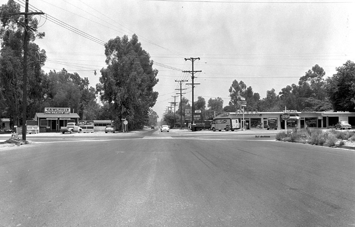 |
|
| (ca. 1957)* – View looking north on De Soto Ave at Roscoe Blvd. Cawlfield Reality is seen on the NW corner. |
Then and Now
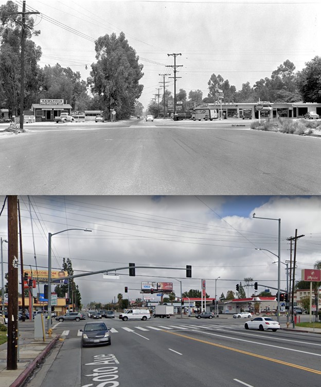 |
|
| (1957 vs. 2021)* – View looking north at the intersection of De Soto and Roscoe. |
* * * * * |
Sherman Way and De Soto
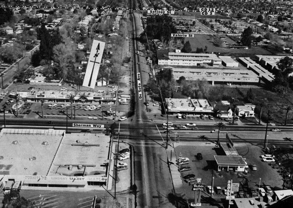 |
|
| (1961)* – View looking north at the intersection of De Soto and Sherman Way. |
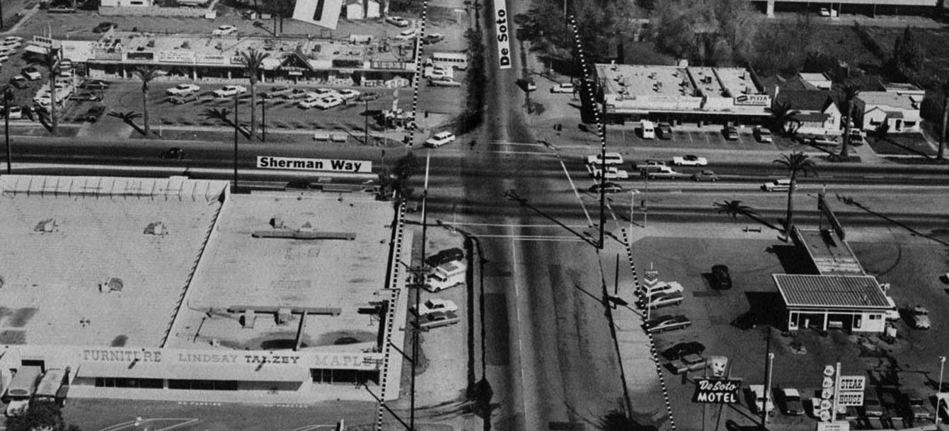 |
|
| (1961)* – Blow-up view of previous photo looking north on De Soto Avenue at Sherman Way. The dotted line along De Soto will be the new curb line once the street is widened to the 7-lane configurationhe that exists today. Legible signs include: Bruno’s, Darby’s, Guggie’s Nina’s Litle House of Italy, Lindsay-Tanzey Furniture and De Soto Motel. |
* * * * * |
Parkman Middle School (now Woodland Hills Academy)
 |
|
| (1959)* - View looking northeast at the intersection of De Soto Ave and Clark Street. Photograph caption dated September 24, 1959 reads, "New Junior High -- New Parkman Junior High School stands ready for its full load of students but awaits landscaper's touch to set it in background of cool, pleasant green shrubbery." |
Historical Notes Francis Parkman Middle School first opened its doors as a junior high school in 1959. Situated on a twenty-four acre site, the school was named for an American historian, Francis Parkman(1823-1893). In 2006, the school changed its name to Woodland Hills Academy. |
 |
|
| (2023)* – Looking towards the northeast corner of De Soto Ave and Clark Street, the current location of Woodland Hills Academy, originally known as Parkman Junior High School |
Historical Notes In 2006, Parkman Junior High School underwent a major transformation and was reborn as Woodland Hills Academy. This change was part of a school reform initiative aimed at addressing several challenges the school faced: Declining enrollment: By 2005-2006, the student population had dropped to around 800 students, down from nearly 1,500 in 2000. Low morale and academic performance: The school had a low API (Academic Performance Index) score. Loss of faculty and programs: The school was losing teachers and educational programs, including music. Competition: The school faced competition from nearby charter schools and high-performing LAUSD middle schools. |
Then and Now
 |
|
| (1959 vs 2023)* – Looking towards the northeast corner of De Soto Ave and Clark Street, now home to Woodland Hills Academy, originally known as Parkman Junior High School. |
Mason Ave Shopping Center (Mason and Lassen - Chatsworth)
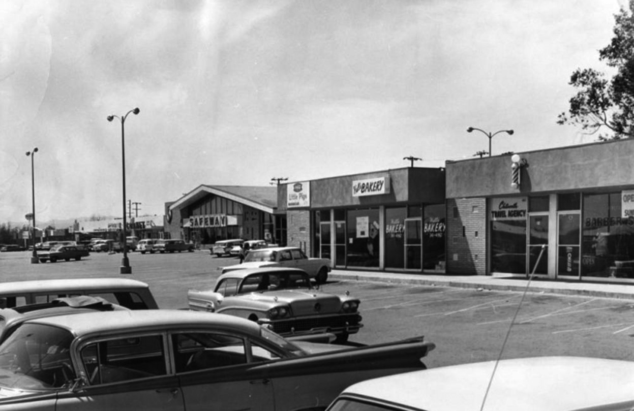 |
|
| (1964)* - Looking south from Lassen Street is the Mason Avenue Shopping Center. Storefronts seen in the photo are Cornet, Safeway, Little Pigs Barbecue, Hull's Bakery, Chatsworth travel agency and a barber shop. |
Historical Notes In 2019 most of the above buildings were razed to make room for a new shopping center ('Gateway'). MASON AVENUE was named for Azubeth H. Mason in 1917. LASSEN STREET was named for the Northern California county where Lassen National Park is located. Click HERE to see more in Street Name Origins – SFV. |
Cinema Theatre - Chatsworth (Mason and Devonshire - SE Corner)
 |
|
| (1966)^ - View showing Chatsworth High School Marching Band and Majorettes performing at the grand opening of the Cinerma Theatre located at 10124 Mason Avenue, Chatsworth. |
Historical Notes This long-defunct venue was once the key occupant of a shopping center on the southeast corner of Devonshire Street and Mason Avenue. It was opened as the Cinema Chatsworth on June 29, 1966 with Gregory Peck in “Arabesque”. It was operated by a variety of franchises throughout its lifetime—including the Century Theatres, Loews and General Cinema chains. By the early-1990’s, it was shut down and converted into retail space. |
* * * * * |
Please Support Our CauseWater and Power Associates, Inc. is a non-profit, public service organization dedicated to preserving historical records and photos. Your generosity allows us to continue to disseminate knowledge of the rich and diverse multicultural history of the greater Los Angeles area; to serve as a resource of historical information; and to assist in the preservation of the city's historic records.
|
More Historical Early Views
Newest Additions
Early LA Buildings and City Views
History of Water and Electricity in Los Angeles
* * * * * |
References and Credits
* LA Public Library Image Archive
^ CSUN Oviatt Library Digital Archives
#^San Fernando Valley History Digital Library - CSUN Oviatt
**DWP - LA Public Library Image Archive
^*The Valley Observied: Street Name Origins; Timeline of Valley History
^#Chatsworth Historical Society; Chatsworth Nike Site; Munch Box
*#Mojave Desert.net: Remi Nadeau
***Los Angeles Historic - Cultural Monuments Listing
*^*California Historical Landmarks Listing (Los Angeles)
*^^Nuestra Señora la Reina de los Ángeles - losangelespast.com
^^^LA Times: Adohr Spelled Succes for the Adamsons; Mulholland Bridge; Panorama City; Getting the Skinny on a Tall Valley Landmark; Valley Newspapers of the Past; Schlitz Closure; Sunkist Growers
^^*LA Times: Stanley Norris Petit
*##LA Times: Dig Into History You'll Find Snake Oil..Victor Girard Kleinberger
+#^Facebook.com: Encino Velodrome
+**Valley Presbyterian Hospital History and Milestones
+^^Panorama City - Commercial Area Concept Plan
^++Los Angeles Conservancy: Sunkist Headquarters
++#Facebook.com: Photos of Los Angeles
##*Pinterest - California; Farrell's Ice Cream Parlour
#^#San Fernando Valley Blog: LA Federal Savings Building, North Hollywood; Van Nuys Blvd. Postcard, Valley Music Theatre
*#*Project Restore: Van Nuys City Hall
^*^Topanga Canyon History - LA Magazine
*#^LA World Airports - History of Van Nuys Airport
^^#The Museum of the San Fernando Valley
**#Tumblr.com: LA History - Leonis Adobe
^#*Photo of the Northeast San Fernando Valley ca.1950 - Laurie Burns
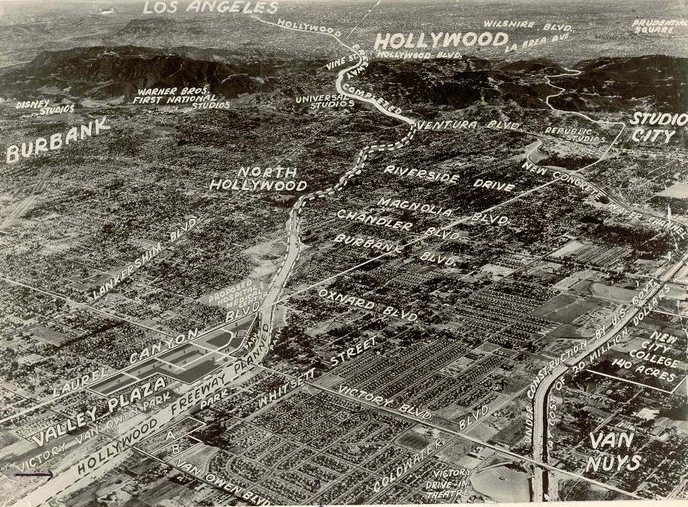
^*#North Hollywood-Toluca Lake Patch: History of the Laurel Canyon and Valley Plaza Mall; N. Hollywood Train Depot
*##*BellCanyon.com: Bell Canyon History
#^#^Granada Hills North Neighborhood Council: Granada Hills History
^*^*Metro.net: Mulholland Drive Bridge
*^*#Facebook.com: Classic Hollywood-Los Angeles-SFV
*^^^San Fernando Valley Historic Society/Facebook.com: JC Penney; California Bank; Devonshire Downs; Topanga Plaza Founain; Devonshire and Owensmouth; Sheep Crossing Roscoe; Log Ride / Busch Gardens
^**^Cinema Treasures: Rivoli-Capri Theatre; Reseda Drive-In Theatre; Van Nuys Driv-In Theater; Winnetka Drive-In; Topanga Theatre; Victory Drive-in; Holiday Theatre
***^Los Angeles Movie Palaces: Studio City Theater
**^^KCET: LA Flood of 1938: Cement the River's Future; Canoga Park at 100: A Brief History of the Birth of Owensmouth; When Cahuenga Pass Was Rustic; Before the 'Carmageddon': A Photographic Look at the Construction of 5 SoCal Freeways; Thematic Cartography and Mapping Los Angeles
**^#LA Times Framework: Busch Gardens Monorail; Woodland Hills Sheep
*^^#Flickr.com: Kaiser Panorama City; Coffee Dan's (Van Nuys)
++^^The Valley Economic Alliance
+++# Facebook: San Fernando Valley Historical Society
+++^Facebook: Here in Van Nuys
**#*EntertainmentDesigner.com: Busch Gardens
**#^San Fernando Valley Historical Society: Van Nuys Drive-in Theater
*^#^Northridge Fashion Mall Jobs
^^##Encino-Tarzana Patch: Valley Ice Skating Center
^##*Pinterest: Drive-in Speakers
^##^Pinterest: San Fernando Valley
*#^#Forum.skyscraperpage.com: Coffee Dan's
*##^City-Data.com: Ventura Boulevard
*#^*Los Angeles County Library: Agoura Hills
*#^^Big Orange Landmarks: Drive-ins Roared into LA Country
*#**Facebook.com: Museum of the San Fernando Valley; Busch Monorail
^***LosAngelesPast.com: Cahuenga Pass
^**#The Friends of Oakridge; theoakridgeestate.com
#**^Flickr.com: Bibiop – Northridge Fashion Center
#^**The Go Go's: Local Coffee Shops and Diners
#^*^Facebook.com: West San Fernando Valley Then And Now
#*^*The First 100 Years: umccp.org
#*^#Google Maps
#^*#Worldwide Drive-Ins: Winnetka 6
#*#^Pierce College - piercecollege.edu
#*##Daily News: Rocketdyne Canoga Park; Proposed $3B Project at Rocketdyne Site; Mulholland Bridge
+*##Restaurant-ing Through History: Ice Cream Parlors
##^^California State University Northridge History: csun.edu
##++Litton Industries Company History
+#+#CardCow.com: Hody's Coffee Shop
^###Northridge Fashion Mall History
^^***Water and Power Associates
^^^^*Mbcinfo.com: Joseph Schlitz Brewing Company
**^^^LA Movie Palaces: San Fernando Valley
*^^^^Pinterest: San Fernando Valley - My Home Sweet Home
*^^^#DWP - Water and Power Associates Historical Archives - Courtesy of Rex Atwell
^***^Pacific Electric San Fernando Valley Line - ERHA.org
^^^*San Fernando Valley Relics: Facebook.com; Leonis Ranch; Ventura and Woodman; Busch Gardens; Reseda Blvd; Victory Blvd in Woodland Hills; Van De Kamp's; Valley Plaza; Nordhoff St. and Topanga Cyn; Ventura and Van Nuys Blvd; Van Nuys and Oxnard; Van Nuys Aerial; Van Nuys Blvd, ca. 1940; I-5 and I-14 Interchange; Van Nuys Drive-in; Mobil Gas Station; Canoga Drive-In; Victory and Whitsett; Van Nuys Aerial; Budweiser/Anheiseur-Busch Sign; Ventura Blvd 1950s
*^ Wikipedia: Sherman Oaks; Isaac Van Nuys; Encino; Tarzana; Campo_de_Cahuenga; Cahuenga Pass; Chatsworth; Panorama City; Santa Susana Field Laboratory; North Hollywood; Canoga Park; Woodland Hills; Reseda; Orcutt Ranch; Granada Hills; Andrés Pico; Moses Sherman; Van Nuys; Henry Kaiser; Charles Maclay; San Fernando Valley; Mission Point; Hughes Aircraft; Domonique Amestoy; Winnetka, Los Angeles; City of San Fernando; Canoga Park High School; Ventura Freeway; Hollywood Freeway; Los Angeles Valley College; Kaiser Permanente; Van Nuys Assembly; Rancho El Escorpión; Topanga Plaza; Simi Valley Freeway (118); Newhall Pass Interchange; Litton Industries; West HIls; Devonshire Downs; CSUN; Television Set History; Shadow Ranch; Atlas Missile; Thrifty Drugs; Coast Daylight; Longs Drugs; Du-Par's Restaurant; Joseph Schlitz Brewing Company; Annheiseur Busch; Fotomat; Baskin-Robbins; Valley Presbyterian Hospital; Warner Center; Gemco; Valley Music Theatre; Westfield Fashion Square; Paxton Park (Ritchie Valens Park); Big Donut Drive-in; Randy's Donuts; Builders Emporium; AlliedSignal; North Hills; Pacoima; 1960 Presidential Election; Farrell's Ice Cream Parlour
< Back