Early Los Angeles Historical Buildings (1800s)
Historical Photos of Early Los Angeles |
 |
|
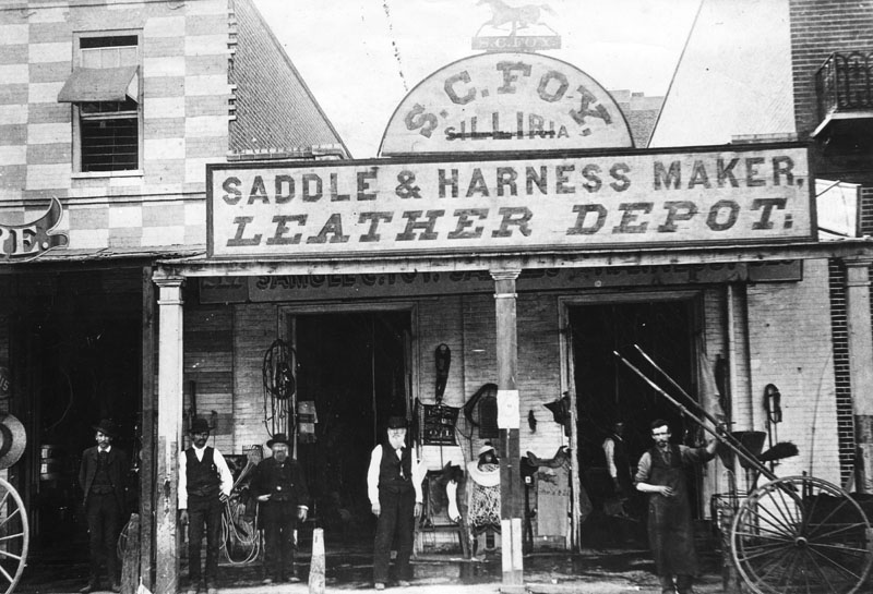
| (1860s)* - View showing the S. C. Foy saddlery shop, housed in a one-story, brick building with a portico. The store sign reads "Saddle & Harness Maker, Leather Depot" and has a silhouetted prancing horse on top. Tack and saddles are displayed on the front and several men are posing for the camera. |
Historical Notes Samuel Calvert Foy moved to Los Angeles in 1854 and operated a successful harness business at 217 Los Angeles Street, which was the oldest business establishment in the city at the time of his death. He also served as the city's Chief of Police for a time. In 1872, Foy built a house at the corner of Grasshopper (now Figueroa) and 7th Streets. The house was reportedly "the first three-story building in the city." At the time the Foys built their house, the site was considered to be "way out in the country." Foy's daughter, Mary Foy, was the city's first woman librarian from 1880-1884, a leader in the California Women's suffrage movement, a leader of the Democratic Party, and the first woman to be a member of one of the major parties' national committees. |
* * * * * |
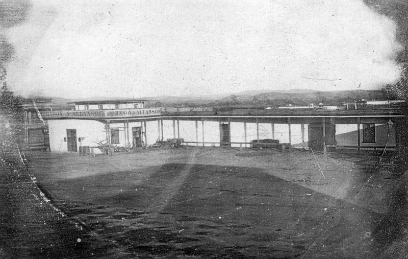
Arcadia Block
 |
|
| ( 1870s)* - View showing Don Abel Stearns' Arcadia Block, the first brick business building in Los Angeles, later demolished for the #101 Freeway. To its left is the Samuel C. Foy Building. Numerous horse-and-buggies are parked in front. |
Historical Notes In 1829 Abel Stearns came to Monterey, California, then settled in Pueblo de Los Angeles, present day Los Angeles. He obtained a concession to build a warehouse in San Pedro. Later, he established a stagecoach route connecting San Pedro Bay with the Los Angeles pueblo. In 1831, he built a three-story flour mill on North Spring Street, Los Angeles. Soon Stearns became one of the most prominent and influential Californian citizens of the pueblo. Abel Stearns represented Los Angeles under American military rule, 1848-1850. He was a delegate to the 1849 California Constitutional Convention, representing the district of Los Angeles; later he was California State Assemblyman, and a Los Angeles County Supervisor and Los Angeles City Councilman.*^ In 1858, Stearns constructed a two-story business block on Los Angeles Street nearby and called it Arcadia Block after his young bride, Arcadia. |
 |
|
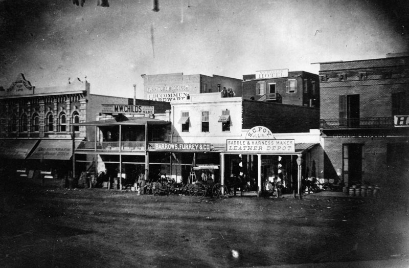
| (1870s)* - View of the west side of North Los Angeles Street, between Commercial and Arcadia streets. The Samuel C. Foy Leather Depot stands in the center-right. In the far left is one of the first two-story buildings built in Los Angeles, by I.W. Hellman in 1870. |
Historical Notes Isaias Wolf Hellman built one of Los Angeles' first two-story building in Arcadia Block. Hellman was a German-born American banker and philanthropist, and a founding father of the University of Southern California. On September 1, 1868, Hellman and Temple founded Hellman, Temple and Co., the fledgling city’s second official bank. In 1871, Hellman and John G. Downey, a former governor of California, formed the Farmers and Merchants Bank, which became Los Angeles' first successful bank. Hellman lent the money that allowed Harrison Gray Otis to buy the Los Angeles Times and Edward Doheny and Charles Canfield to drill for oil. Hellman was also a major landowner in Southern California and his holdings included numerous city lots and vast swaths of former rancho land. In 1871, he and a syndicate bought the 13,000-acre Rancho Cucamonga. In 1881, Hellman and members of the Bixby family purchased the 26,000-acre Rancho Los Alamitos (now home to Long Beach and Seal Beach). He also purchased the Repetto Ranch (now Montebello) with Harris Newmark and Kaspare Cohn. Hellman and Downey also bought up swaths of Rancho San Pedro from the Dominguez family. Hellman also owned much of Boyle Heights with William H. Workman. At his death in 1920, Hellman was considered the leading financier of the Pacific Coast. His son (I.W. Jr.) and grandson (Isaias Warren Hellman) later became presidents of Wells Fargo Bank; and the Union Trust Company was merged with Wells Fargo after his death. His original Farmers and Merchants Bank would later merge with Security First National Bank. |
 |
|
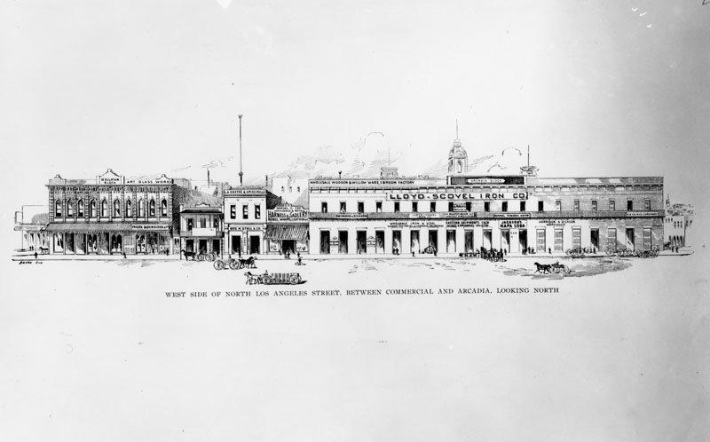
| (1896)* - An artist's drawing of the west side of North Los Angeles Street, between Commercial and Arcadia, looking north. Arcadia Block, on the right, is on the southwest corner of Los Angeles and Arcadia Streets. The three towers of Baker Block can be seen in the background. The Hellman Building is on the left, then Samuel C. Foy Building, Wholesale & Retail Harness & Saddlery at 315 North Los Angeles Street. The tall pole seen at center-left is actually one of Los Angeles' First Electric Streetlights. It was 150-feet tall and located on Main Street. |
* * * * * |
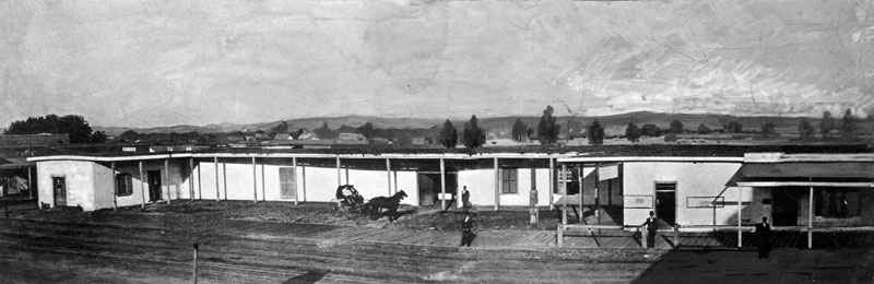
Abel Stearns Adobe
 |
|
| (1857)* - View of Abel Stearns adobe known as "El Palacio", located on the southeast corner of Main and Arcadia streets. Stearns purchased the land from Francisco O'Campo and built his adobe. He gradually expanded the adobe from 1835-1838, and the home eventually became U-shaped with a wide-open cobblestone court, and contained a grand ballroom at least 100 feet long. At the time, it was the largest and most magnificent house in the pueblo, which the natives gave the name of "El Palacio de Don Abel", or simply "El Palacio". It became the site of the Baker Block in 1878. |
Historical Notes In 1829 Abel Stearns came to Monterey, California, then settled in Pueblo de Los Angeles, present day Los Angeles. He obtained a concession to build a warehouse in San Pedro. Later, he established a stagecoach route connecting San Pedro Bay with the Los Angeles pueblo. In 1831, he built a three-story flour mill on North Spring Street, Los Angeles. Soon Stearns became one of the most prominent and influential Californian citizens of the pueblo. |
 |
|
| (1857)* - Panoramic view of Abel Stearns adobe known as "El Palacio", located on the southeast corner of Main and Arcadia streets; four men stand scattered in the area, and two others sit in a horse-drawn carriage. Stearns purchased the land from Francisco O'Campo and built his adobe, gradually expanding the home over the years until it took on the proportions of a mansion - which the natives gave the name of "El Palacio de Don Abel", or simply "El Palacio". |
Historical Notes Abel Stearns represented Los Angeles under American military rule, 1848-1850. He was a delegate to the 1849 California Constitutional Convention, representing the district of Los Angeles; later he was California State Assemblyman, and a Los Angeles County Supervisor and Los Angeles City Councilman. In 1842 Stearns bought the 28,000-acre Rancho Los Alamitos between the Los Angeles and the harbor. However, there was a drought between 1862 and 1864 which was said to have resulted in the death of 50,000 cattle on Stearns land alone. Stearns mortgaged the rancho to Michael Reese, who then purchased it at a sheriff's sale and Reese's estate then sold it to John W. Bixby. |
 |
|
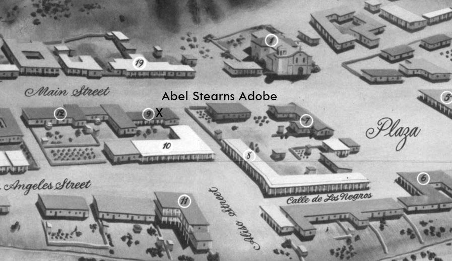
| (ca. 1850)* - Photo of a sketch showing the LA Plaza and surounding area as it appeared in 1850. The Abel Stearns Adobe is located on the southeast corner of Aliso and Main streets and is marked with an X and the No. 9. The map is based on the 1849 Ord Survey. |
Historical Notes In 1878, the Baker Block would be built on the same site as the Stearns Adobe. |
 |
|
| (1871)* - View looking northeast at the intersection of North Main Street and Arcadia Street (previously Aliso Street). On the right (southeast corner) stands the residence of the wealthy merchant, trader, and government official, Don Abel Stearns. A number of low-lying adobe and brick buildings are seen in this panoramic view. |
Historical Notes The Abel Stearns residence was a virtual mansion at the time, with fourteen beautifully-decorated rooms. It was the social center of the pueblo. Later it became the site of the Baker Block. In 1872, the section of Aliso Street between Main and Los Angeles streets was renamed Arcadia Street. |
 |
|
| (1875)* - View looking east at the Abel Stearns adobe, with an orchard directly behind it, located on the southeast corner of Main and Arcadia (formerly Aliso) streets. Note how the adobe has been expanded since 1857 as shown in the previous photos. |
Historical Notes In 1858, Abel Stearns constructed a two-story business block on Los Angeles Street nearby and called it Arcadia Block. It was named after an important person in his life - his wife. Arcadia Bandini, born in 1823, was the daughter of prominent ranchero Juan Bandini. She came to be regarded as one of the most beautiful belles of Los Angeles and was just 14 when she married 40-year-old Abel Stearns, who had come west from Massachusetts and acquired Southern California's largest land-cattle empire. Stearns built a home for his bride one block south of the Plaza--the community's central gathering area--and the house, called El Palacio (as seen above), became the social hot spot. In 1872, one year after his death, Arcadia Street was dedicated in honor of Stearn's wife, Arcadia. |
* * * * * |
LA Plaza and Early Water Reservoir
 |
|
| (ca. 1858)* - This is the earliest known close-up photograph of the Los Angeles Plaza. There is a square main brick reservoir in the middle of the Plaza, which was the terminus of the town's historic lifeline: the Zanja Madre ('Mother Ditch'). The reservoir was built in 1858 by the LA Water Works Company. |
Historical Notes The site of the Plaza today is not the original location. It is the second, third, or maybe even the fourth. One of the earlier plots is believed to be around where the current Pershing Square sits. It’s also thought that at least one of the first three was washed away in a flood. The current Plaza dates from as early as 1815. When early settlers arrived at the Los Angeles River by way of Mission Road, they picked as a nearby gathering point a huge sycamore (upper right-center of photo) that gave them shelter and became a landmark, "El Aliso." That Spanish word for sycamore was later used to name the road carved out near the river (Aliso Street in 1854). |
.jpg) |
|
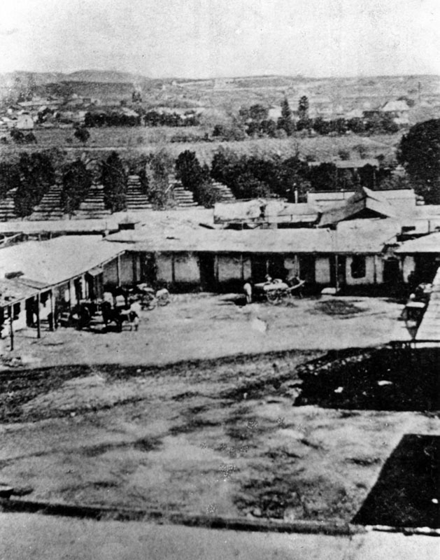
| (ca. 1860)* - One of Los Angeles' first water reservoirs was the brick structure shown in the center of the Plaza. The adobe directly behind was owned by Augustin Olvera. The 3-story building behind was the Sisters of Charity Hospital.* Click HERE to see more Early LA Water Reservoirs. |
Historical Notes In 1857, the city granted William Dryden a franchise to deliver water to homes through a system of wooden pipes beneath the streets. Dryden incorporates the Los Angeles Water Works Company and then erects a forty foot water wheel to lift water from the Los Angeles River to the city's main ditch, the Zanja Madre. He then constructed a large brick and wood storage tank (as seen above) in the center of the City Plaza to better manage the city’s water supply. Click HERE to see more in LA's Early Water Works System. |
 |
|
| (ca. 1869)* - Photograph of the Los Angeles Plaza and the entrance to Wine Street looking north from the Pico House. The Avila Adobe is visible on Wine Street (renamed Olvera Street in 1877). The Olvera Adobe can also be seen on the right. |
Historical Notes Don Francisco Avila, a wealthy cattle rancher and one-time Mayor of the pueblo of Los Angeles, built the Avila Adobe in 1818. The Avila Adobe, presently the oldest existing residence within the city limits, was one of the first town houses to share street frontage in the new Pueblo de Los Angeles. |
 |
|
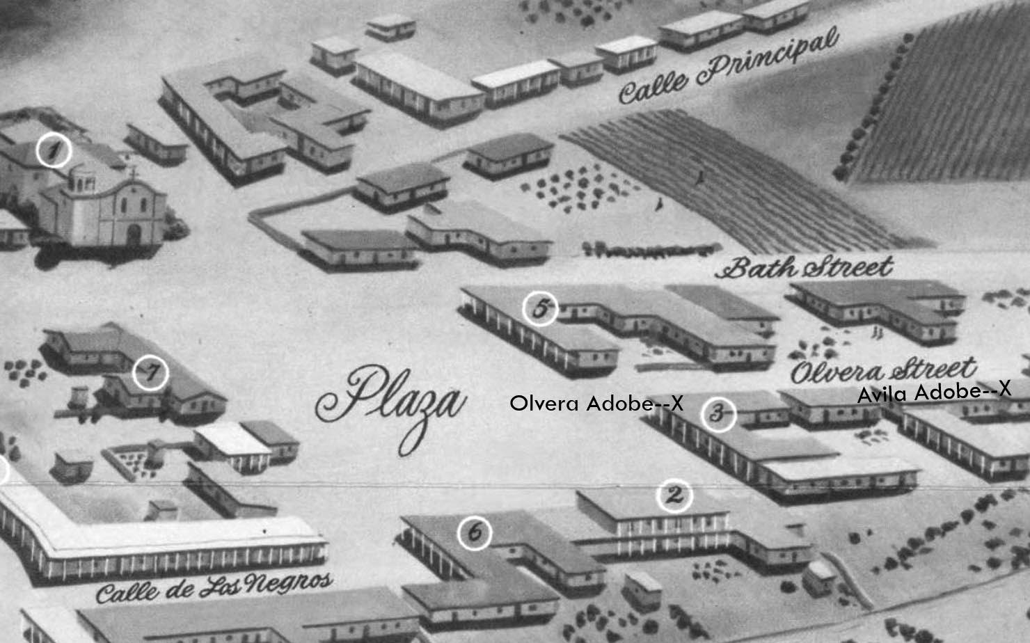
| (1850)* - Map view looking northwest showing the LA Plaza and surrounding area as it appeared in 1850. To the right can be seen Olvera Street (Wine Street until 1877) at its intersection with the Plaza, with both the Olvera Adobe and Avila Adobe locations marked with an X. The Plaza Church is in the upper left corner. |
* * * * * |
Plaza Church (Mission Nuestra Senora de La Reina de Los Angeles)
 |
|
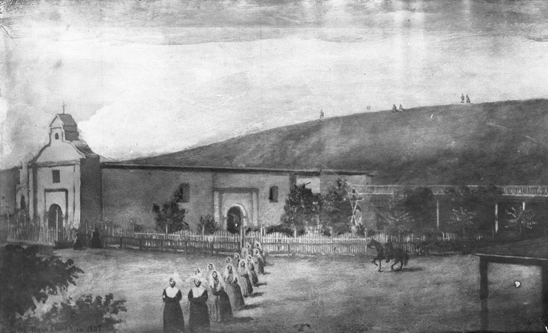
| (1857)* - Drawing by a pupil at the Sisters’ School showing the Plaza Church with a procession of nuns in the foreground, a picket fence enclosing the grounds, and a rider passing on Main Street. |
Historical Notes Founded as a chapel (asistencia) in 1784 to serve the pueblo, the parish known as the “Church of Los Angeles” placed a new cornerstone on August 18, 1814, under Fray Luis Gil y Taboada. The completed parish church—built of adobe with brick trim—was dedicated on December 8, 1822, the Feast of the Immaculate Conception. From its earliest years it anchored religious life at the Plaza and is among the city’s oldest continuously used sacred sites. |
 |
|
| (1860)* - Lithograph view of the Plaza Church façade from Benjamin Nayer’s diary. |
Historical Notes The 1822 church became the pueblo’s principal parish. In 1861 it was largely rebuilt, reusing adobe and brick from the earlier structure, and titled La Iglesia de Nuestra Señora de los Ángeles; Reina (“Queen”) came into common usage soon afterward. Locals long called it “La Placita” or simply “Plaza Church.” |
* * * * * |
1860s–1870s – Victorian Influence on the Rebuilt Church
 |
|
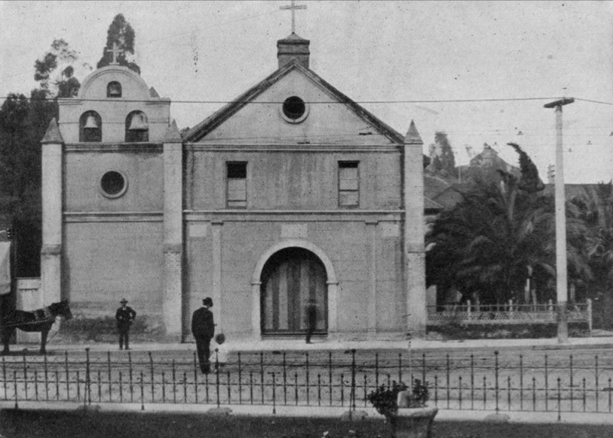
| (1870s)* - Plaza Church with fenced yard and shade trees; horse-drawn carriages stand along Main Street. |
Historical Notes The original 1822 front had a three-bell campanario (bell gable). After the 1861 rebuilding, an open, gazebo-like bell tower replaced the gable—an unusual Victorian flourish on an adobe parish. Around 1901 the tower was removed and a three-bell gable was reinstated, recalling the earlier profile. |
 |
|
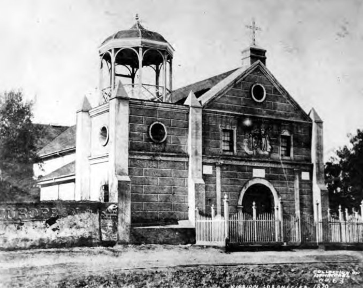
| (1870)* - “Old Plaza Church” with its gazebo-like rooftop tower; the bare hills beyond include Chavez Ravine, future site of Dodger Stadium. |
Historical Notes During the 1861 rebuilding of the Plaza Church, the parish introduced this distinctive octagonal, gazebo-like bell tower to replace the original mission-style bell wall. The new feature reflected the mid-19th century’s taste for Victorian embellishment. The surrounding hills, then mostly barren, would later become home to neighborhoods such as Chavez Ravine and Elysian Park. |
 |
|
| (1870)* - Close view of the church’s three-tiered front with corner buttresses and the octagonal, gazebo-like bell stage above. |
Historical Notes This view highlights the transition from the simple adobe façade of the early church to a more ornate, European-influenced style. The tall corner buttresses, spire-like finials, and wood-framed bell structure signaled both the growth of the city and the parish’s desire to modernize its appearance. Despite its stylistic change, the church remained the spiritual center of Los Angeles’ Catholic community. |
.jpg) |
|
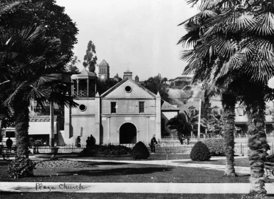
| (ca. 1871)* - Looking across the landscaped Plaza toward Plaza Church and the Cape House Restaurant; Fort Moore Hill rises in the distance. |
Historical Notes Fort Moore Hill (earlier Fort Hill) commanded the pueblo and briefly held a U.S. Army earthwork during the Mexican–American War (1847–1848). Much of the hill was later removed for civic projects and, by mid-20th century, freeway construction. |
* * * * * |
1880s – Streetcars and Urban Growth
 |
|
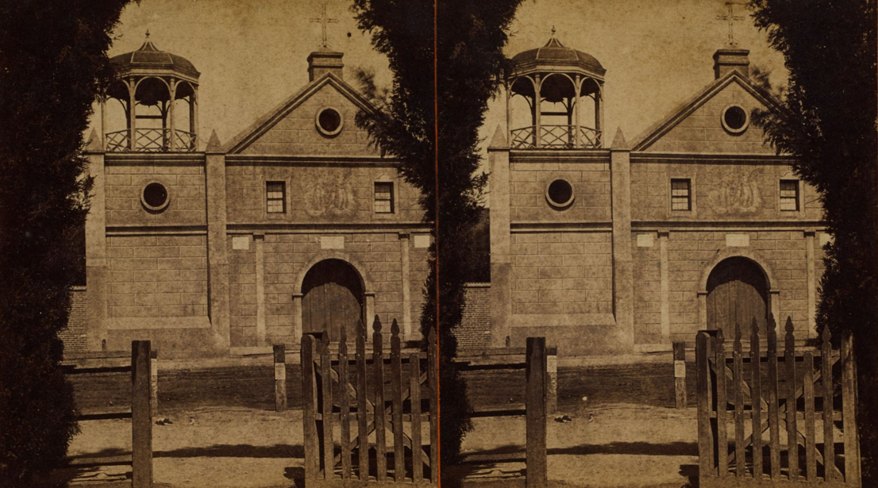
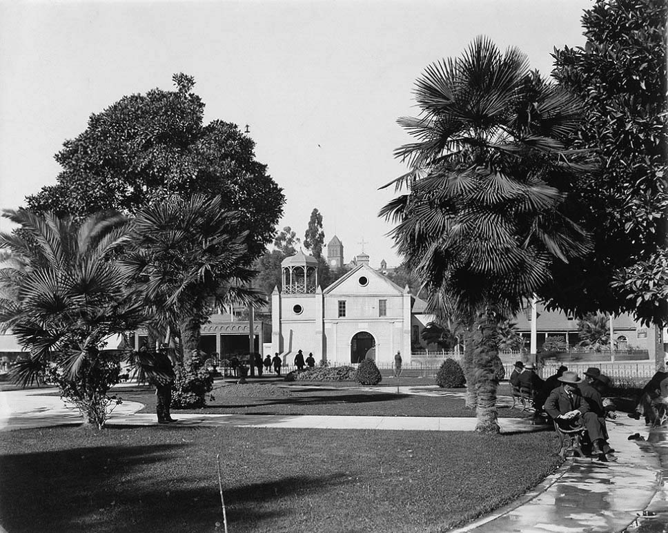
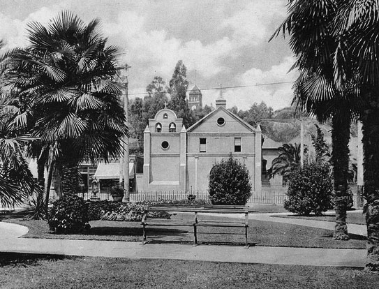
| (ca. 1884)* – Stereoscopic view of Plaza Church (“La Placita”) from the Plaza with a picket fence in the foreground. Ernest Marquez Collection. |
Historical Notes By the 1880s, Plaza Church was firmly established as “La Placita,” serving a growing and diverse downtown population. Horse-drawn carriages and new street improvements reflected the Plaza’s gradual shift from frontier outpost to urban center. The picket fence seen here enclosed the churchyard and helped protect the grounds from the bustling activity of Main Street. |
 |
|
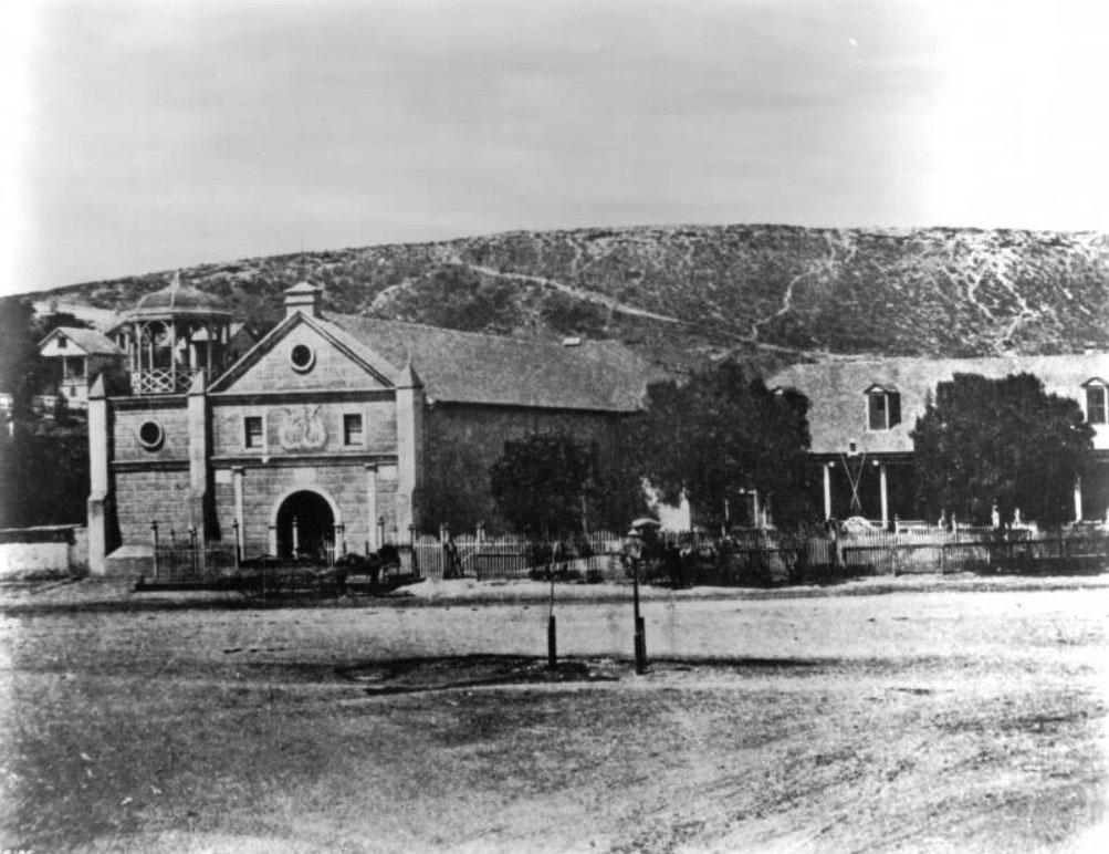
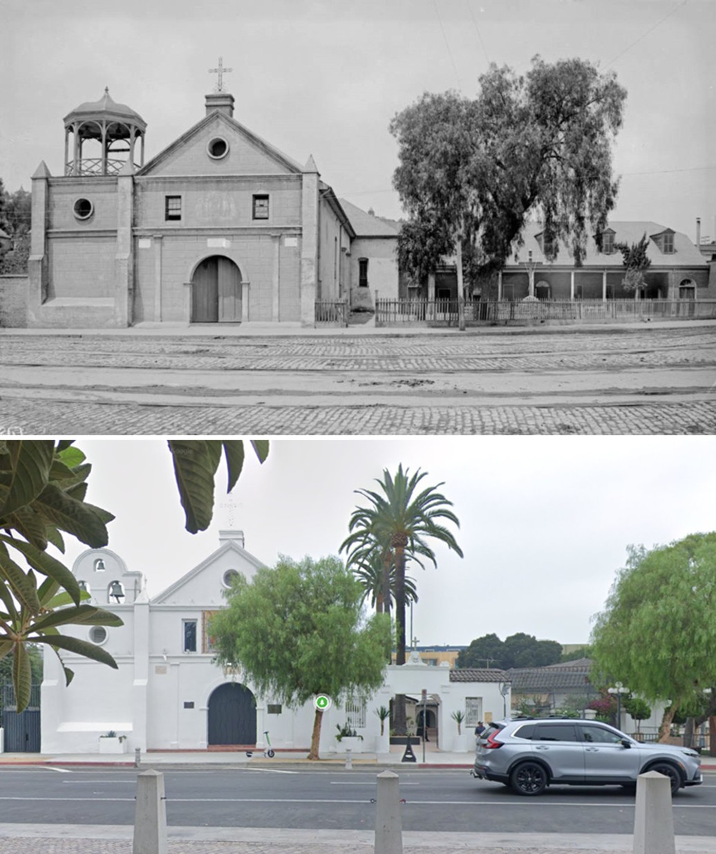
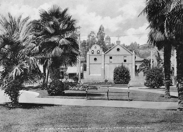
| (1885)* - Plaza Church with adjoining parish buildings; streetcar tracks run along cobbled Main Street. (Parish church—never a mission.) |
Historical Notes Although often mistaken for a mission, the Plaza Church was never part of the California mission chain. It functioned instead as a parish church, administered by clergy from Mission San Gabriel. By the mid-1880s, streetcar tracks connected the Plaza to emerging districts such as Temple Street and Spring Street, linking old Los Angeles to its expanding suburbs. |
.jpg) |
|
| (ca. 1885)* - Panoramic front view showing the open octagonal cupola left of the ridge cross; wood fence and streetcar tracks along Main. |
Historical Notes This photograph captures the busy urban setting developing around the church. The open cupola housed the church bells and served as a local landmark visible from much of downtown. The cobbled street and electric trolley infrastructure foreshadowed the modern transportation network that would soon redefine the Plaza area. |
 |
|
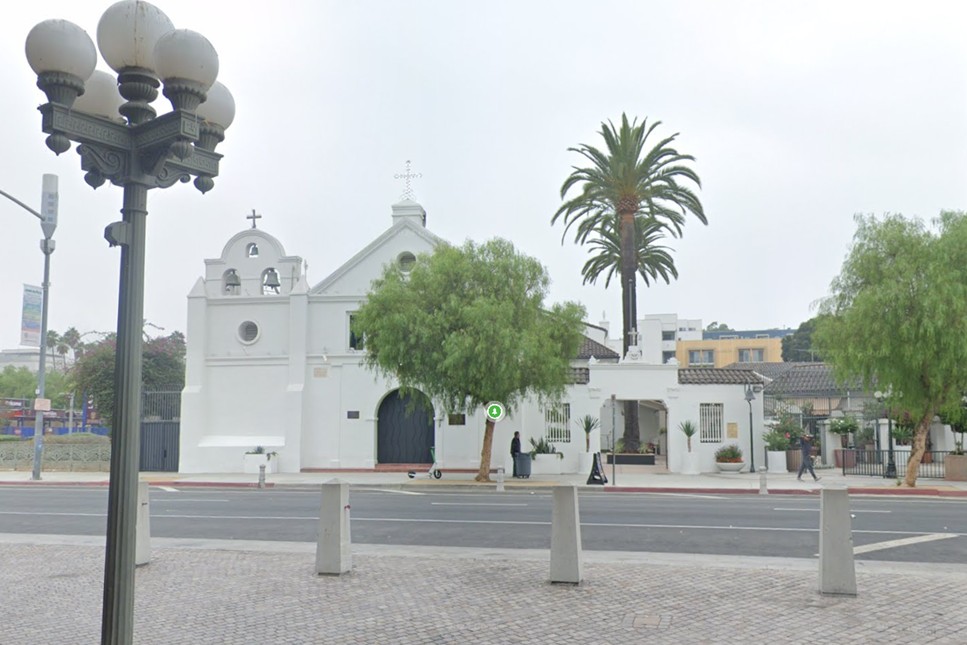
| (2024)* – Contemporary view from the Plaza: the gazebo-like tower is long gone; a three-bell campanario once again crowns the façade. |
Historical Notes Today, the restored bell gable recalls the church’s early 19th-century appearance. Modern preservation efforts have stabilized the adobe walls and restored traditional features while maintaining the building as an active parish. The Plaza itself, now part of El Pueblo de Los Ángeles Historical Monument, serves as a cultural and historical centerpiece celebrating the city’s origins. |
Then and Now
 |
|
| (1885 vs. 2024)* – From the Plaza, across Main Street. The Victorian gazebo-like tower seen in 1885 was replaced around 1901 by a bell gable that recalls the pre-1861 front. Photo comparison by Jack Feldman. |
Historical Notes Post-1861 photos show the unusual open tower that gave La Placita a late-19th-century silhouette. Around 1901 the parish removed it and installed a three-bell gable to restore a Spanish-Colonial character. By the 1910s, fresh plaster and circular oculi further updated the front, reflecting routine maintenance while nodding to earlier forms. |
 |
|
| (ca. 1887)* - Exterior view of Plaza Church seen from the plaza, across the street. A trolley can be seen on the right side of the photo. In the background can be seen the Banning House sitting on top of Fort Moore Hill. |
Historical Notes Plaza Church began as an asistencia of Mission San Gabriel (the 1784 chapel phase), but Los Angeles’ parish church was never elevated to full mission status. Mission clergy alternated service between San Gabriel and the pueblo chapel until a dedicated parish took root. |
 |
|
| (1894)* - Looking north from the Pico House toward Plaza Church; a woman and child stand at the entry. (Parish church; never a mission.) |
Historical Notes The pueblo’s formal name—El Pueblo de Nuestra Señora la Reina de los Ángeles del Río de Porciúncula—endures in the parish title. The 1822 church is widely regarded as Los Angeles’ oldest church in continuous use. |
* * * * * |
1900s–2000s – Restoration and Continuity
 |
|
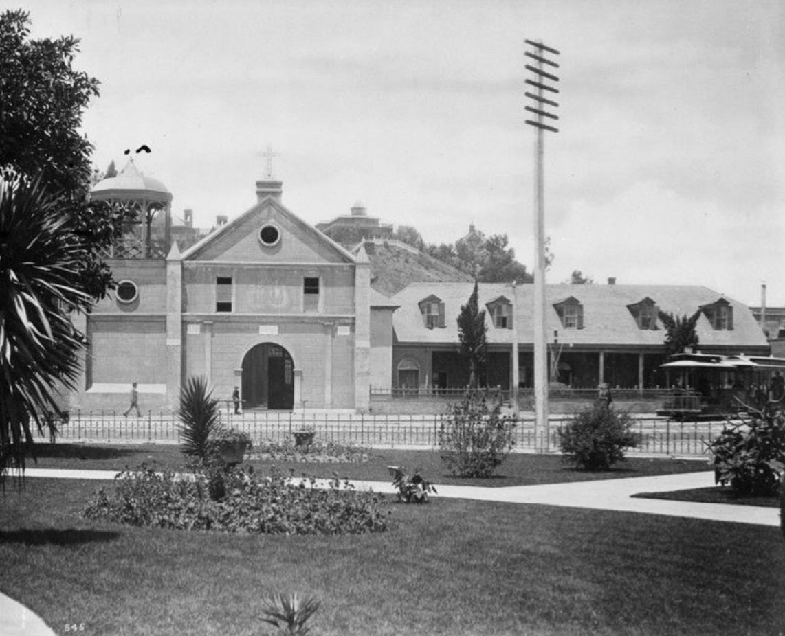
| (ca. 1900)* - View of the Old Mission Church from across the LA Plaza. Several men are seen relaxing on the Plaza's benches. In the background on top of Fort Moore Hill stands Los Angeles High School. |
Historical Notes The new Los Angeles High School (seen behind the Plaza Church) replaced the original 1872 structure that once stood atop Poundcake Hill. The new campus atop Fort Moore Hill was completed in 1891, and Los Angeles High School moved in. It was an imposing building for its time, constructed partly on the former site of Fort Moore Hill Cemetery—the first Protestant cemetery in Los Angeles. One of the school’s mottos, “Always a hill, always a tower, always a timepiece,” reflected its proud, elevated setting. |
 |
|
| (ca. 1900)* - One of the last views with the gazebo-like tower; within a year or so the parish reinstated a three-bell campanario. The clock tower of Los Angeles High School can be seen in the background. |
Historical Notes This would be one of the last photos taken of the Plaza Church with its gazebo-like tower. It would soon be replaced with a "bell wall" similar to the one it had prior to 1861. |
 |
|
| (ca. 1901)* - Front view of the Old Mission Church with its newly installed "bell wall", similar to the one it had prior to 1861. There is a clear view of Los Angeles High School (2nd location, built in 1891) up on Fort Moore Hill and its relative relationship to the Plaza and the Plaza Church. |
Historical Notes The newly restored bell gable reflected a conscious return to the church’s colonial roots after years of modification. The reinstated three-bell façade echoed the appearance of the 1822 original, symbolizing a renewed appreciation for Los Angeles’ Spanish and Mexican-era architecture during a time when much of the old pueblo was being transformed. From Main Street, the alignment of Plaza Church and Los Angeles High School shows the compact civic heart of early 20th-century Los Angeles. |
Before and After
|
 |
| (1900 vs 1901)* - “Gazebo Tower” to restored “Bell Gable.” |
Historical Notes The transition from the elaborate 1861–1900 tower to the simple “bell wall” marks one of the earliest local preservation efforts to restore a historic structure’s original character. Parish records indicate that community members and clergy wanted the church to better reflect its mission-era appearance, in keeping with growing civic pride in the city’s Spanish heritage. |
 |
|
| (ca. 1901)* - View of the 'Old Plaza Mission' (Plaza Church) with its new 3-bell gable. A man and child can be seen crossing the street heading toward the church. |
Historical Notes By 1901, the “Old Plaza Mission,” as it was then often called, had reclaimed much of its earlier simplicity. Its three bells were rehung in arched openings above the main entrance, a configuration still seen today. The image of a man and child crossing Main Street toward the church captures the scale of the building before the surrounding neighborhood became heavily commercialized. |
 |
|
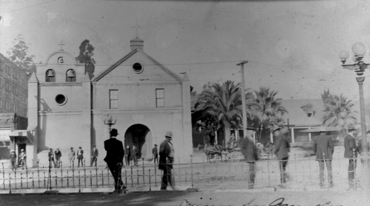
| (ca. 1902)* - View showing a group of well-dressed men standing on the edge of the LA Plaza and also across the street in front of the Old Plaza Church. There is a horse-drawn wagon parked by the curb near the church with a streetcar passing by. |
Historical Notes The early 1900s brought new vitality to the Plaza area. Streetcars shared the road with horse-drawn wagons, while merchants and parishioners filled the sidewalks. Plaza Church continued to serve as both a spiritual and social anchor for residents, many of whom were of Mexican and Italian descent. Despite modernization, its adobe walls remained a physical reminder of the pueblo’s beginnings. |
 |
|
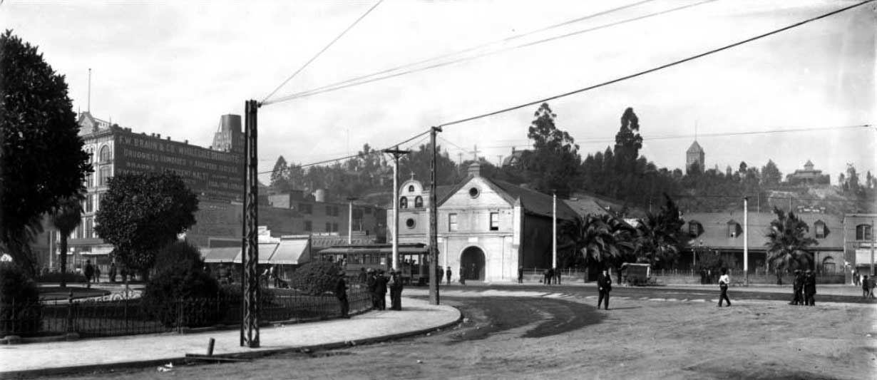
| (ca. 1905)* - Panoramic view of the Los Angeles Plaza, looking west. The F.W. Braun Building, Plaza Catholic Church, and shops along Main Street are visible in the background. Men are sitting, standing or moving about near the church, plaza and along Main Street. An electric streetcar is passing on Main Street carrying about a dozen passengers. Rocks and other forms of debris litter the dirt road. Utility lines and utility poles run along the streets. |
Historical Notes By 1905, Main Street had been electrified, and trolley lines ran directly in front of the Plaza Church. The F. W. Braun Building, visible nearby, housed one of the city’s early pharmaceutical and chemical firms. The juxtaposition of new brick commercial buildings and the aging adobe church epitomized Los Angeles’ rapid shift from frontier town to modern metropolis. |
* * * * * |
1910s – The Old Church in a Modernizing City
 |
|
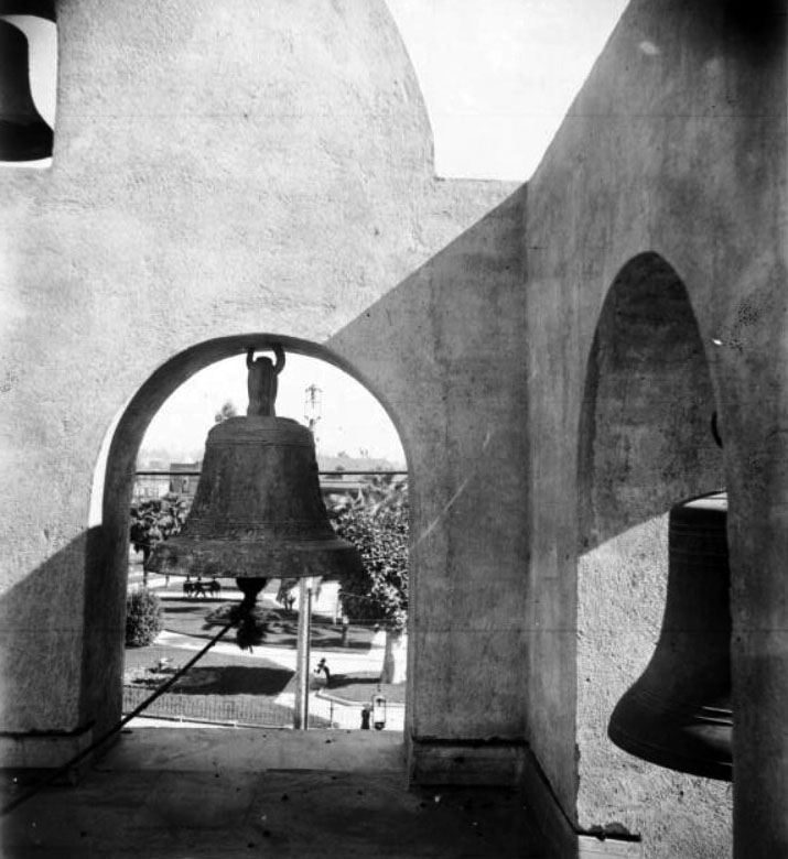
| (ca. 1910)* - View of the bells in the Los Angeles Plaza Church tower. Through one of the tower openings can be seen sidewalks, trees and people in the Plaza. |
Historical Notes The Plaza Church bells were cast by Paul Revere’s apprentice, George Holbrook. The church, located at 535 North Main Street, is the oldest religious structure in Los Angeles. Originally built as a simple adobe by Franciscan padres with the labor of local Indigenous people, it was completed in 1822 and has remained in continuous use ever since. Later additions included the tile mosaic of The Annunciation (1981) by artist Isabel Piczek, ornate gold-leaf interior decoration, and wrought-iron detailing. |
 |
|
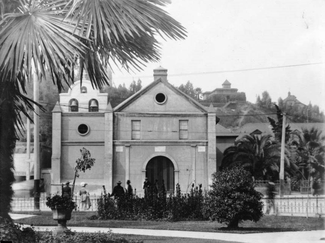
| (1910s)* - View of the Old Plaza Church, showing what appears to be a new bell gable. Four churchgoers are seen behind a wrought-iron fence in front of the chapel. In the background on top of Fort Moore Hill can be seen the Banning House. |
Historical Notes During this decade, the church’s façade received fresh plaster and minor architectural repairs, including new round window openings (oculi) and decorative trim. The wrought-iron fence and gates were added to protect the churchyard from the growing flow of traffic and streetcar activity on Main Street. The area behind the church, including Fort Moore Hill, remained largely residential until the late 1930s. |
 |
|
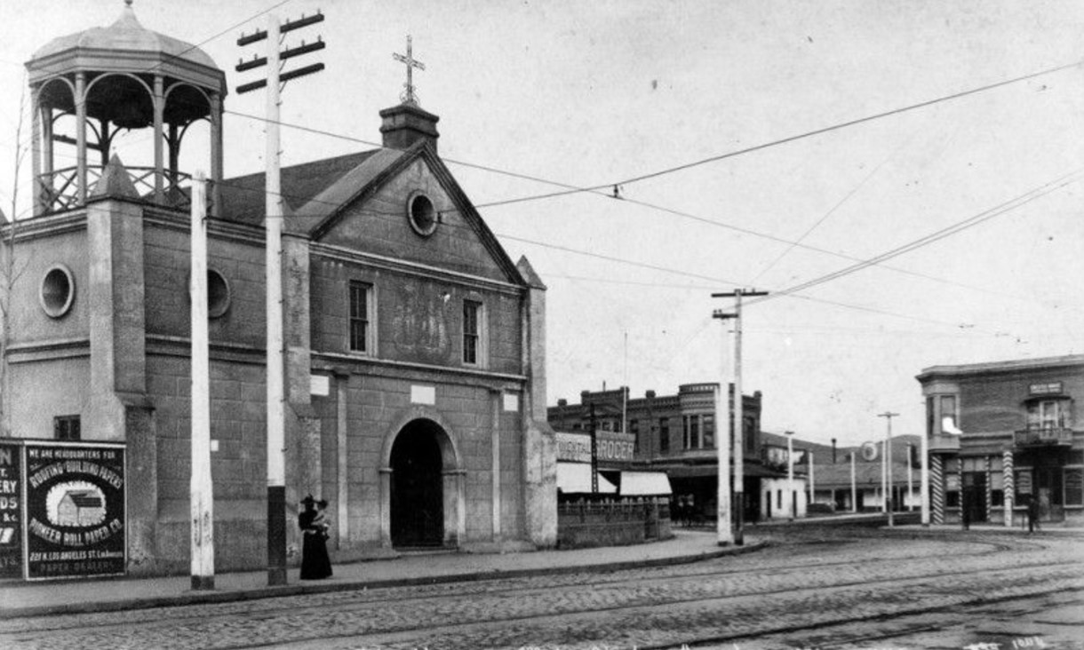
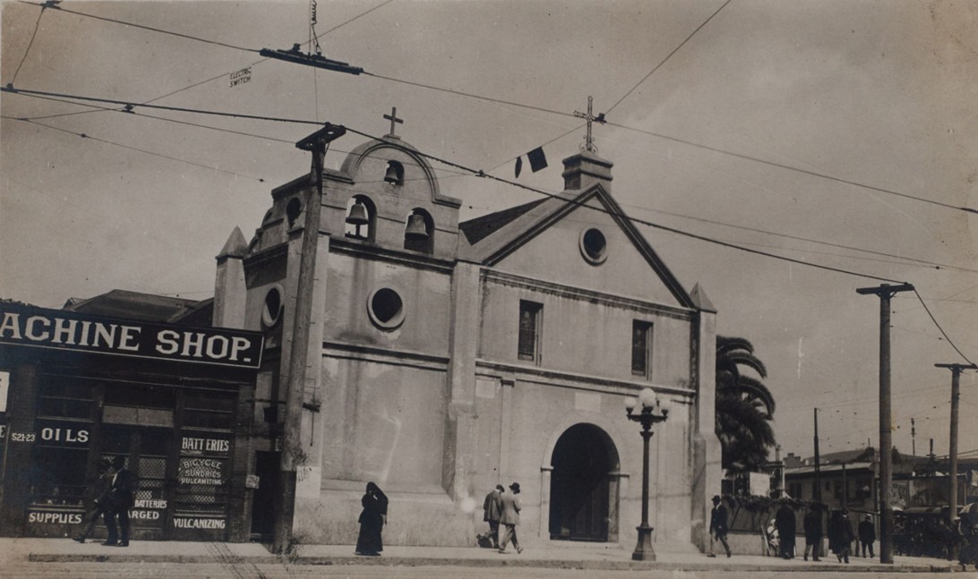
| (1915)* – View of the Plaza Church (La Iglesia de Nuestra Señora la Reina de los Ángeles) on North Main Street, with a small machine shop next door advertising “Oils,” “Batteries,” and “Bicycle Sundries.” Electric trolley wires crisscross overhead, a streetlight stands at the corner, and pedestrians pass by—capturing a moment when old Los Angeles met the modern age. |
Historical Notes By 1915, Plaza Church stood as a relic of old Los Angeles amid a fully urbanized downtown. Next door, a small machine and bicycle shop at 521–523 N. Main symbolized the city’s technological age—advertising oils, batteries, and vulcanizing services. Overhead trolley wires, streetlights, and pedestrians reflected a city rapidly moving forward. The shop likely stood on ground once part of the church’s early burial yard, long since built over after burials were moved to Calvary Cemetery. Beneath the signs of progress, traces of the city’s earliest days remained—while the church itself continued to bridge Los Angeles’ colonial past with its industrial present. |
* * * * * |
1920s – City Hall Rises
 |
|
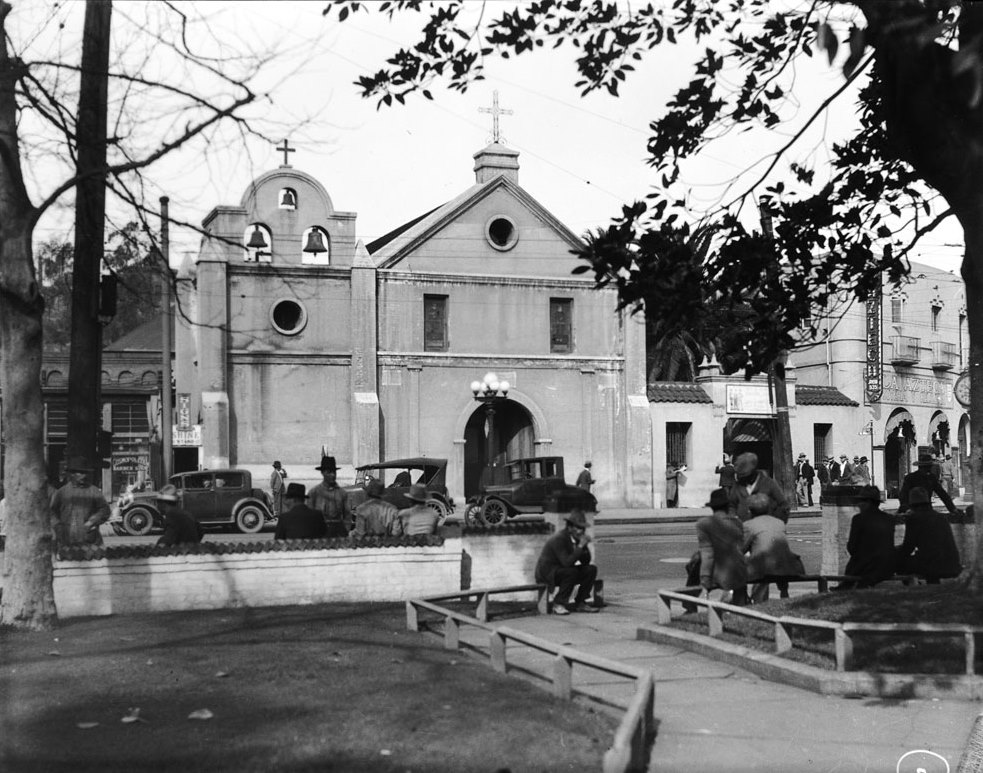
| (ca. 1920s)* - View of the front of the Old Plaza Church as seen from the L.A. Plaza across the street. Early model cars are seen parked in front of the church. Though City Hall would soon rise just beyond the Plaza, this view captures the quiet dignity of the church before the skyline forever changed. |
Historical Notes With automobiles replacing trolleys and wagons, the Plaza area entered a new era of transformation. Though many nearby adobe structures had disappeared, Plaza Church remained an active parish serving the largely Mexican-American community that now lived around Sonoratown. Its continued use helped preserve the religious and cultural traditions that had defined Los Angeles for over a century. |
 |
|
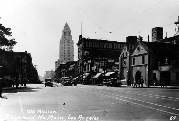
| (ca. 1928)* - View looking south on Main Street showing the newly constructed City Hall standing in the background (corner of Temple and Main streets) with the Brunswig Building and Old Plaza Church at right. |
Historical Notes By the late 1920s, Los Angeles City Hall towered above the Plaza, symbolizing the city’s emergence as a major metropolis. The Plaza Church—dwarfed yet dignified—stood as a counterpoint to the vertical modernism of City Hall, embodying continuity amid change. The Brunswig Building and Plaza House beside it remain among the few surviving 19th-century structures from this once-vibrant civic center. |
 |
|
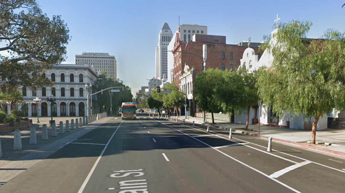
| (2021)* - Contemporary view looking south on Main Street from in front of the Los Angeles Plaza, with the Old Plaza Church visible on the right. Notable buildings from left to right include the Pico House, City Hall East, City Hall, the Federal Courthouse, the Vickrey/Brunswig Building, and the Plaza House. |
Historical Notes In this modern view, the Plaza Church remains one of the last visible links to the city’s earliest days. Though surrounded by monumental civic structures such as City Hall, City Hall East, and the Federal Courthouse, it continues to anchor the El Pueblo de Los Ángeles Historical Monument. The Brunswig Building and Plaza House beside it have been preserved as part of ongoing efforts to maintain the architectural legacy of 19th-century Los Angeles. |
Then and Now
 |
|
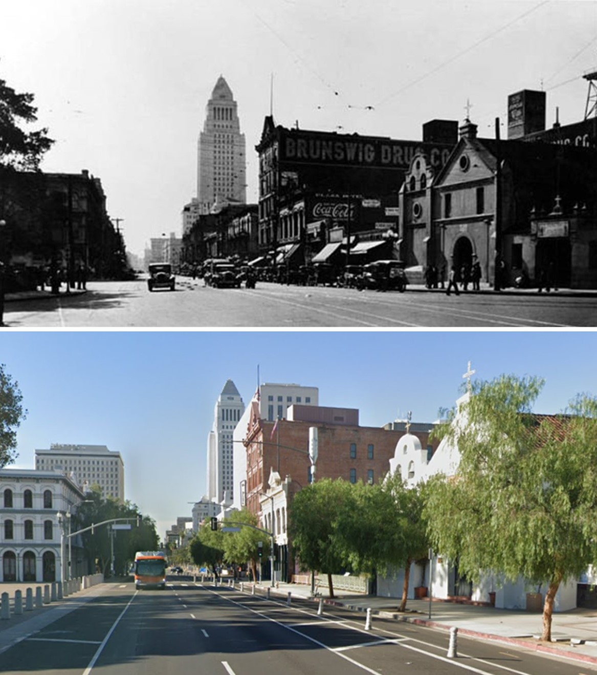
| (1928 vs. 2021)* – Looking south on Main Street from in front of the Los Angeles Plaza, with the Old Plaza Church visible on the right. Most of the buildings seen in the 1928 photo still stand today. The only additions visible in the contemporary photo are the Federal Courthouse (1940) and City Hall East (1969). Photo comparison by Jack Feldman. |
Historical Notes Nearly a century separates these views, yet much of the historic Plaza area endures. The Pico House, Plaza Church, and adjacent 19th-century commercial buildings remain intact, while City Hall continues to dominate the skyline. Additions such as the Federal Courthouse (1940) and City Hall East (1969) reflect the city’s mid-century civic expansion. Together, they chart Los Angeles’ evolution from a compact pueblo to a sprawling metropolis. |
* * * * * |
1930s–1940s – Transition and Preservation
 |
|
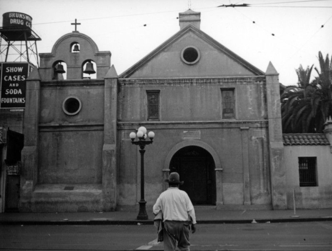
| (ca. 1937)* - A man is crossing Main Street directly outside of La Plaza Church. Signage on a water tower (upper left) promotes the nearby "Brunswig Drug Co." Photo by Herman J. Schultheis |
Historical Notes This photo, taken by Herman J. Schultheis, shows the Plaza Church in the late 1930s, when the area still served as a hub for small businesses and working-class residents. The “Brunswig Drug Co.” sign on the rooftop tank identifies the nearby pharmaceutical firm that occupied the adjoining building. Despite surrounding modernization, La Placita retained its original mission-style simplicity and remained an active parish serving the local Mexican-American community. |
 |
|
| (ca. 1941)* - View of the Plaza Church from the roof of the Pico House with N. Spring Street at the right and the Villa Cabrini orphanage (grounds of the J.W. Robinson Mansion) upper left. Clear shot of the Bozanni Motors building (former PE terminal) at N Broadway and Sunset Boulevard. |
Historical Notes By the 1940s, the Old Plaza Church stood as one of Los Angeles’ defining landmarks—founded in 1814, rebuilt in 1861, and still resonating with the city’s Spanish and Mexican heritage. The surrounding area, however, had been transformed by the construction of the 101 Freeway, which isolated the Plaza from the civic center. Yet La Placita remained a living parish and cultural anchor for the immigrant community that surrounded it. |
 |
|
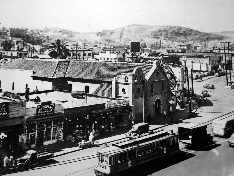
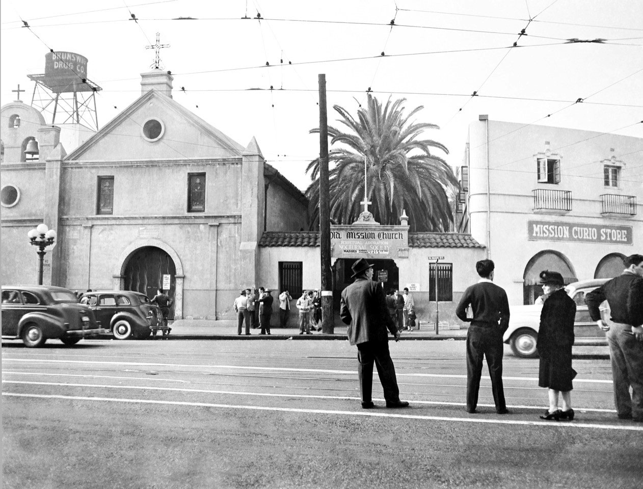
| (ca. 1945) - People stand by the tracks as they wait for the next streetcar with the Old Plaza Church seen across the street. The Mission Curio Store (souvenir shop) is on the right. Photo courtesy of Roy Koch in honor of his father (also Roy Koch) who took this picture shortly after WWII. |
Historical Notes By the mid-1940s, streetcars still ran along Main Street, bringing commuters past the historic Plaza Church each day. The Mission Curio Store across the street catered to visitors seeking souvenirs from “Old Los Angeles.” The end of World War II brought major demographic changes to the downtown area, but La Placita continued to serve as both a parish church and a cultural gathering place for generations of Angelenos. |
Then and Now
 |
|
| (1945 vs. 2015)* – Looking across Main Street toward the Plaza Church from the Los Angeles Plaza. Photo comparison by Jack Feldman. |
Historical Notes Over seventy years separate these two views, yet the Plaza Church remains remarkably unchanged. The disappearance of streetcars, the introduction of automobile traffic, and the preservation of nearby buildings such as the Brunswig Building and Pico House illustrate how the Plaza transitioned from a commercial crossroads to a protected historic district. |
* * * * * |
1940s–1970s – Historical Recognition and Renewal
 |
|
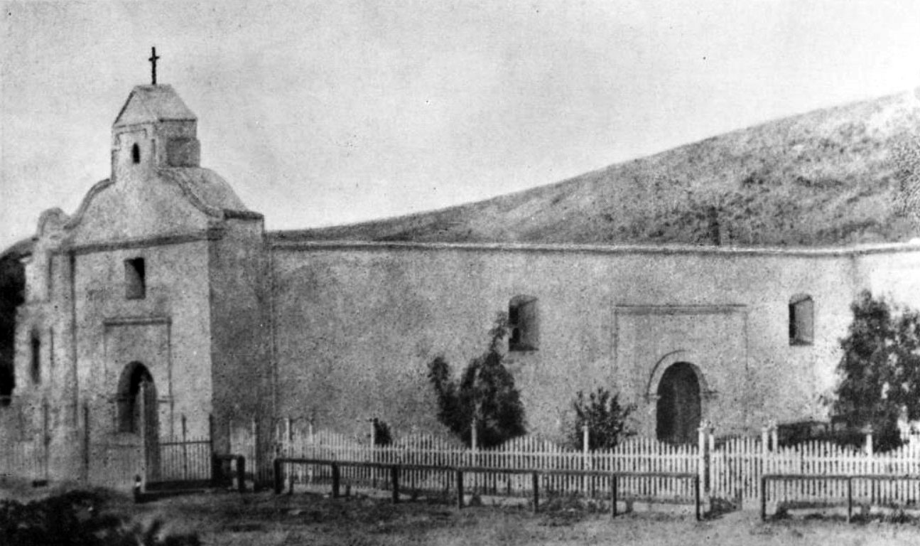
| (1940s)* - View showing the main facade of the "Old Plaza Church" as seen from the Plaza. |
Historical Notes The older part of the building is seen here with the three bells; the church was expanded and the plaza was added much later, which includes a hall and rectory. It was dedicated as California Historic Landmark No. 144. |
 |
|
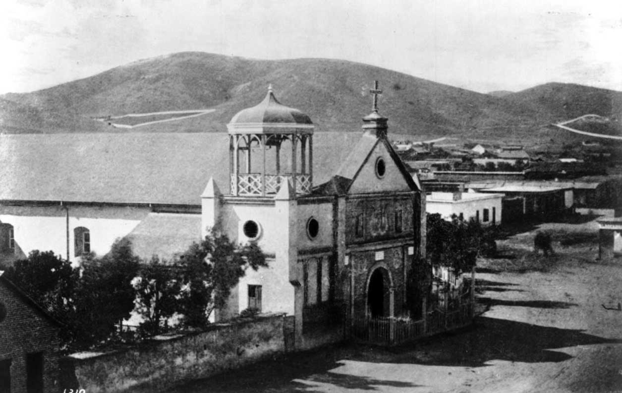
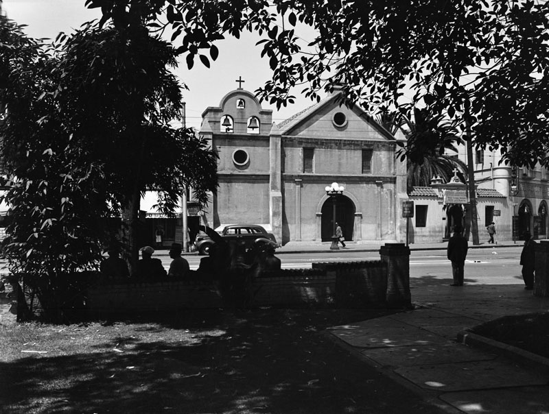
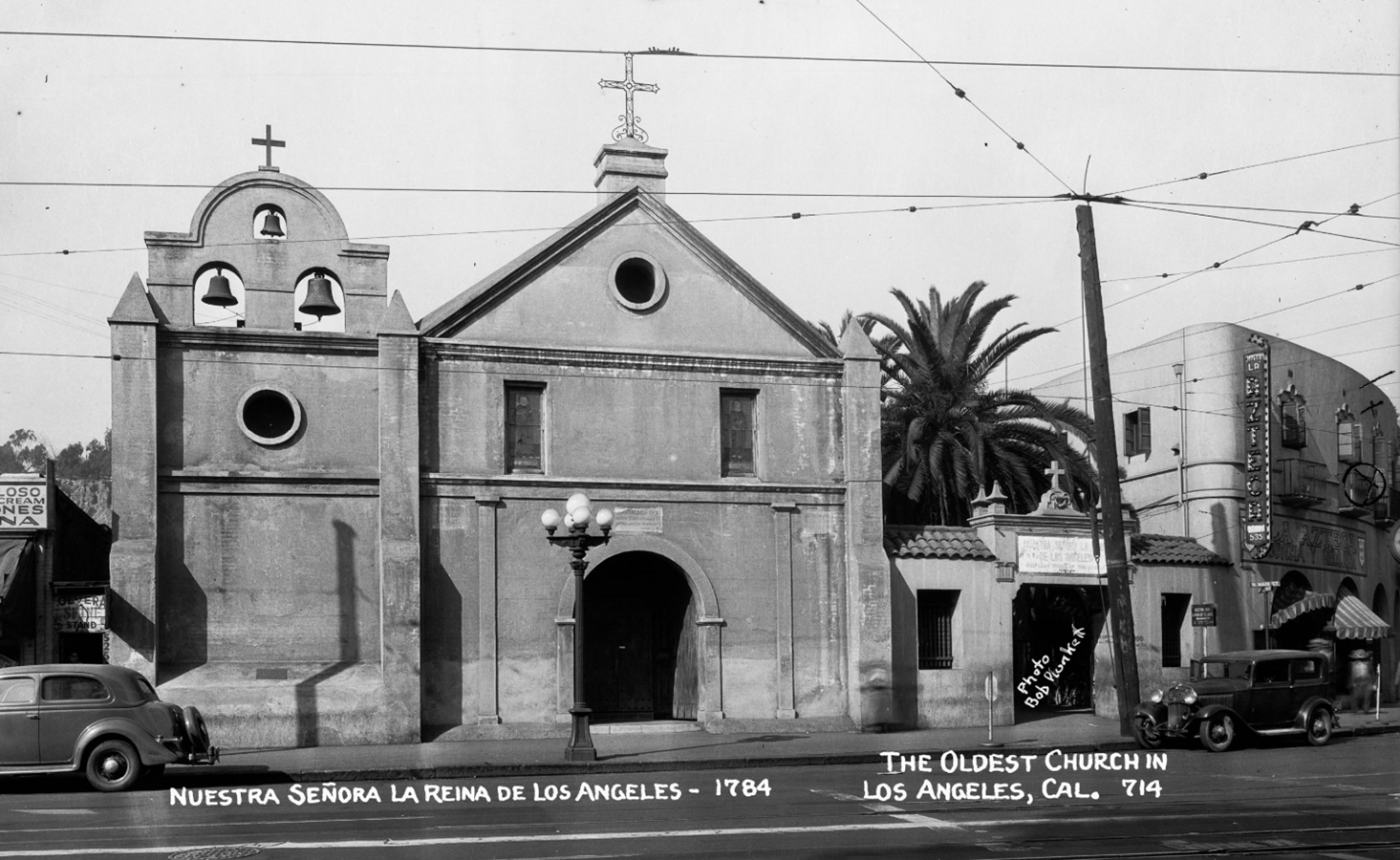
| (1940s)* - Image of the Plaza Church, also known as Our Lady Queen of the Angels or La Iglesia Nuestra Señora de los Angeles, on North Main Street. Photo by Bob Plunkett from the Ernest Marquez Collection. |
Historical Notes This 1940s photograph captures the historic Plaza Church (Nuestra Señora la Reina de Los Ángeles), founded in 1784 and considered the oldest church in Los Angeles. Located on North Main Street near the Los Angeles Plaza, the church's adobe structure and three-bell façade reflect its Spanish colonial roots. Visible to the right is the Azteca Theater, a popular venue for Spanish-language films that served the local Mexican-American community. Streetcar wires and vintage automobiles hint at the era’s urban rhythm. Though much around it has changed, the church remains an enduring landmark within the El Pueblo de Los Ángeles Historical Monument. |
 |
|
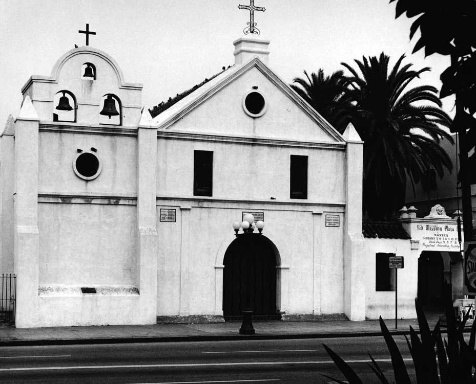
| (1970s)* - View showing the Old Plaza Church as it appeared in the 1970s. |
Historical Notes By the 1970s, the Old Plaza Church had been incorporated into the newly established El Pueblo de Los Ángeles Historical Monument (1953). Restoration efforts focused on preserving the adobe walls and mission-style façade. As one of the city’s first three Historic-Cultural Monuments and a California Historical Landmark (No. 144), it continued to serve as both parish and cultural hub, hosting processions and celebrations honoring Los Angeles’ Spanish and Mexican roots. |
 |
|
| (1970s)* - View showing the Old Plaza Church as it appeared in the 1970s. |
Historical Notes The 'Old Plaza Church' was one of the first three sites designated as Historic Cultural Monuments by the City of Los Angeles, and has also been designated as a California Historical Landmark No. 144. Click HERE to see the complete listing of California Historical Landmarks in L. A. Click HERE to see more in Early Views of the LA Plaza. |
* * * * * |
Then and Now – Linking the Centuries
 |
|
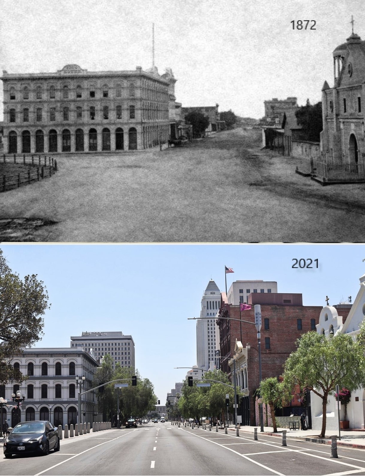
| (1872 vs 2021)* – Looking south on Main Street from in front of the LA Plaza. Three buildings still exist today: The Pico House and the Merced Theatre on the left, and the Plaza Church on the right. In the distance of the early photo can be seen the Temple Block, current site of Los Angeles City Hall. Photo courtesy of Mark Frazier. |
Historical Notes Nearly 150 years separate these two views of Main Street, yet three landmarks still bridge the past and present—the Pico House, Merced Theatre, and Plaza Church. In the 1872 image, Temple Block can be seen in the distance, occupying the site where Los Angeles City Hall now stands. Together, these enduring structures trace the city’s evolution from a dusty frontier settlement to the vast urban center that surrounds the Plaza today. |
* * * * * |
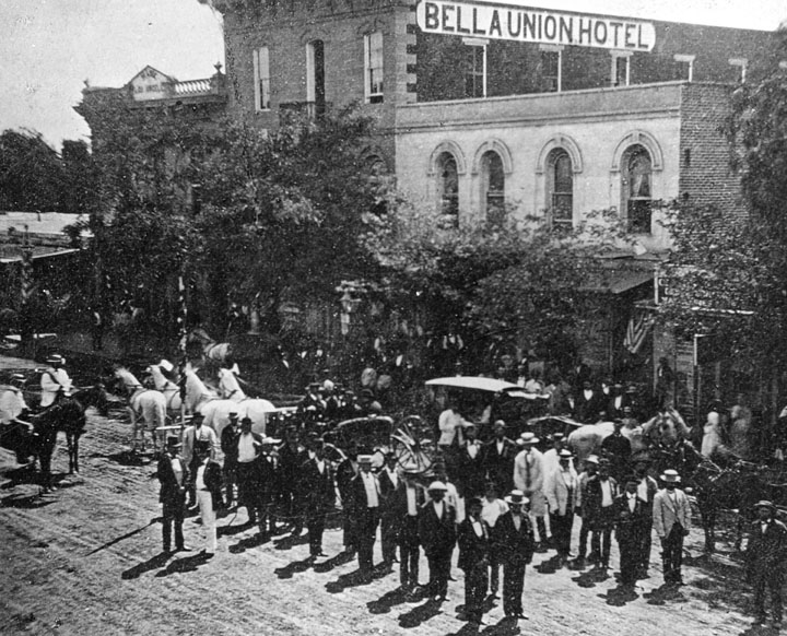
Bella Union Hotel (later Clarendon and then St. Charles Hotel)
 |
|
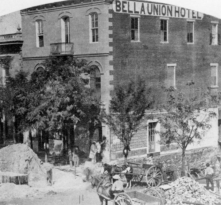
| (1865)* - The Bella Union Hotel which later became the St. Charles. This is a view of two sides of the hotel in which the front is mostly obscured by trees. Mounds of dirt and debris from construction lie in front and to the side of the building. |
Historical Notes The Bella Union Hotel was considered the first hotel in Los Angeles. It became the Clarenden in 1873 and the St. Charles in 1875. Constructed in 1835 as the home of Isaac Williams, a New England merchant who moved to Los Angeles three years earlier, the one story adobe became the last capitol of Alta California during the Mexican era when Governor Pio Pico purchased it for his office. After the conquest of Los Angeles by American forces in 1847, the building was used by Lt. Archibald Gillespie, who commanded the occupying forces. Later it housed American troops, and after they left, it became a saloon. By early 1850, the building was operating as the Bella Union Hotel. Later that year, it became the county's first courthouse and beginning in 1858, it was the region's transportation hub. The Overland Mail Company operated by John Butterfield (the founder of American Express) rented space for a station until it built new quarters in 1860 at Second and Spring--the present location of Mirror Building. The Wells, Fargo and Company also had their office here and Phineas Banning operated coaches to Wilmington and San Bernardino from the hotel. |
 |
|
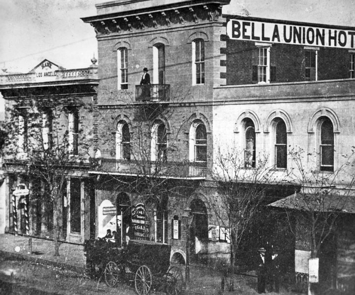
| (ca. 1867)* - The Bella Union at 314 N. Main St. later became the St. Charles Hotel. To the left is the original home of Farmers and Merchants Bank, later merged into Security Pacific Bank. Standing on the balcony is Mrs. Margarita Bandini Winston. |
Historical Notes Dr. J.B. Winston was one of the owners of the Bella Union Hotel. His wife, Mrs. Margarita Bandini Winston (seen on the balcony), was the sister of Arcadia Bandini Baker. #* |
 |
|
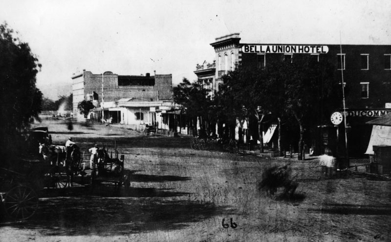
| (ca. 1870)* - View of North Main Street taken after erecting Pico House, but before completion of Merced Theater. The Bella Union Hotel can be seen at right-center of photo. |
 |
|
| (1871)* - A 4th of July parade on North Main Street of the Veterans of the War of 1812. Men are seen in two lines standing in the street, horses and carriages waiting and people on the sidelines. The Bella Union Hotel in the background is partially obscured by trees. |
Historical Notes The area in front of the the Bella Union Hotel was long used as a social and political center.* |
 |
|
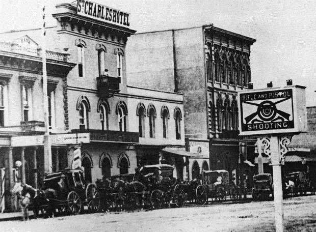
| (ca. 1875)* - Exterior view of the St. Charles Hotel, originally the Bella Union Hotel. Horses and buggies are lined up along the street. In the foreground a sign reads, “Rifle and Pistol Shooting,” a reminder that Los Angeles was a Western frontier town. |
Historical Notes The Bella Union Hotel became the Clarenden in 1873 and the St. Charles in 1875. |
 |
|
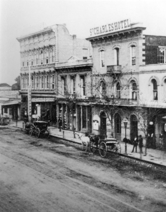
| (1880)* - View showing the St. Charles Hotel, originally the Bella Union Hotel. To the left (north) stands the Farmers and Merchants Bank (previously the Pico Building). Further north is the 3-story Grand Central Hotel, built in 1876. |
Historical Notes Located on the east side of the historic 300 block of North Main Street, the Bella Union Hotel building lasted until the 1940s when the entire block was demolished to make way for the extension of Aliso Street. Today, the Hollywood Freeway (Route 101) runs under where LA's first hotel once stood. The Bella Union Hotel (Claredon/St. Charles) site was designated as California Historical Landmark No. 656. |
Click HERE to see more in Early Views of the Historic 300 Block of N. Main Street |
* * * * * |
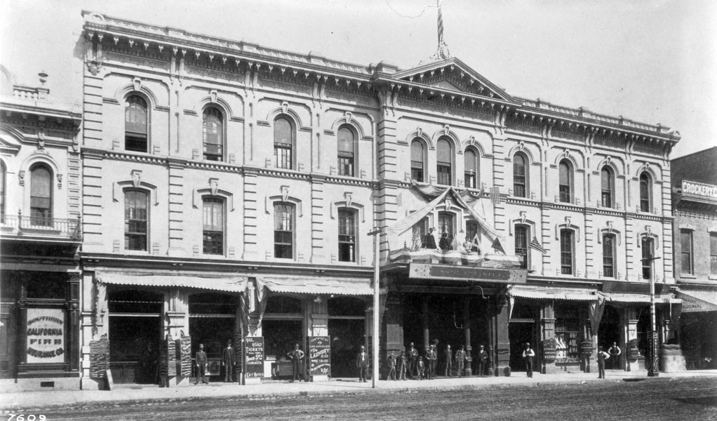
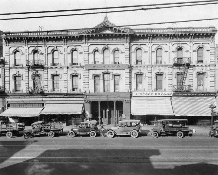
Lafayette Hotel (later Cosmopolitan and St. Elmo)
 |
|
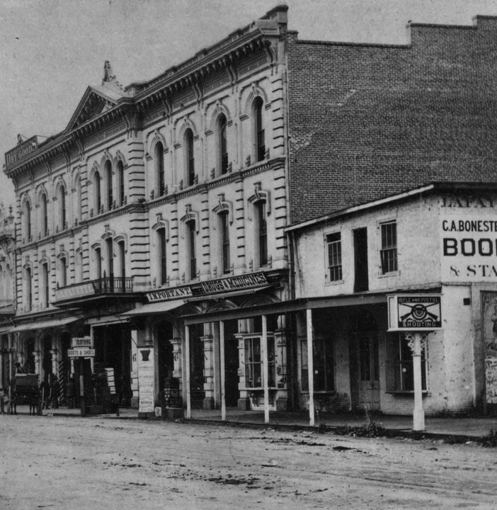
| (ca. 1870s)* - View of the La Fayette Hotel, located on the west side of Main Street opposite of the St. Charles Hotel. The same "Rifle and Pistol Shooting" sign can be seen here but from a different angle. |
Historical Notes The Lafayette Hotel was built sometime in the early 1850s. The second city hotel after the Bella Union (the U.S. Hotel was the third), it was renamed the Cosmopolitan Hotel and then became the St. Elmo. The Lafayette was located on Main Street near Temple, and in the 1870s was known as the best hotel in Los Angeles.*#* |
 |
|
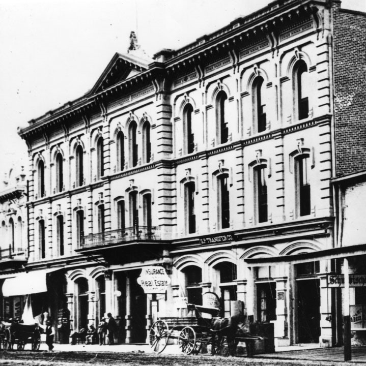
| (ca. 1880)* - Closer view of the La Fayette Hotel. Several men sit and stand in front of the hotel entry way. The street is unpaved and two horses and carriages are seen in front of the building, one near the "Insurance and Real Estate" sign. |
Historical Notes The Lafayette Hotel became the "Cosmopolitan" circa 1882.* |
 |
|
| (1882)* - View looing north on Main Street, with the Downey Block on the left, followed by the second location of the Farmers and Merchants Bank from June 15, 1874, to October 29, 1883, followed by the Cosmopolitan (previously Lafayette) Hotel. On the right is the Ducommun Building, Bella Union-Clarendon-St. Charles Hotel, Pico Building (the first home of Farmer's and Merchants Bank), the Grand Central Hotel, and the Baker Block (with towers). |
 |
|
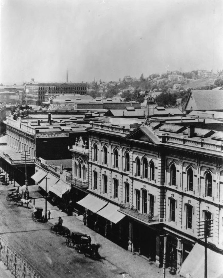
| (ca. 1888)^^* - View looking southwest the west side of Main Street. The Cosmopolitan Hotel (formerly the Lafayette Hotel; subsequently the St. Elmo Hotel) can be seen in the lower right corner. The Downey Block, on the northwest corner of Main and Temple streets, is seen at center-left. There are several horse-drawn vehicles parked on the street in front of the buildings. |
 |
|
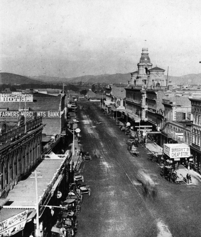
| (ca. 1890)^## – View looking north on Main Street showing the Cosmopolitan Hotel at left. |
 |
|
| (ca. 1890)^^* - View showing the front of the Cosmopolitan Hotel on Main Street. Note that the people standing on the sidewalk and front balcony appear to be posing for the photographer. |
 |
|
| (1920)* - View showing the St. Elmo Hotel (formerly the LaFayette and Cosmopolitan). Here the hotel is viewed from across the street, with a line of cars parked at the curb in front of the various ground floor businesses. |
* * * * * |
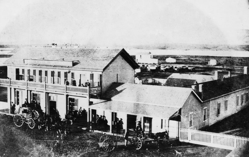
Wilmington Exchange Building
 |
|
| (ca. 1865)* - View of the Wilmington Exchange building, hotel and stage station to Los Angeles before the railroad on Canal Street (now Avalon Boulevard). In the front of the hotel is a 4-horse stagecoach with passengers. |
Historical Notes In 1863, the Wilmington Exchange Hotel was built and was the first hotel in Wilmington. Phineas Banning’s first Wilmington home was the single-story building attached to the hotel (as seen above).^**^ Banning also owned a stagecoach line with routes connecting San Pedro to Salt Lake City, Utah and to Yuma, Arizona, and in 1868 he built a railroad to connect San Pedro Bay to Los Angeles, the first in the area.^* |
Click HERE to see more in Early Views of San Pedro and Wilmington |
* * * * * |
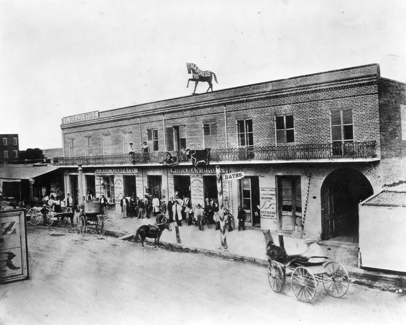
Workman Brothers Saddlery
 |
|
| (1868)* - View of Workman Brothers Saddlery shop located in a two story, brick commercial building on Main Street between Commercial and Reguena. The shop has J.B. Saunders retail store on one side and a bathing emporium on the other. A large silhouetted sculpture of a prancing horse sits atop the building. |
Historical Notes The first marriage in Los Angeles city history in which both persons had "Anglo" surnames was in September 1845, of William Workman's daughter Antonia Margarita Workman to Pliny Fisk Temple (Francisco P. Temple or F.P.T ). The Temples had eleven children, eight living into adulthood. William Workman and John Rowland organized the first wagon train of permanent eastern settlers, which arrived in Southern California on November 5, 1841. Together they owned and developed the 48,790-acre La Puente Rancho. Workman began this adobe home in 1842 and remodeled it in 1872 to resemble a manor house in his native England. He also established 'El Campo Santo,' this region's earliest known private family cemetery.^* The Workman home and family cemetery have been designated California Historical Monument No. 874. Click HERE to see more California Historical Landmarks in LA. |
* * * * * |
Temple Block
 |
|
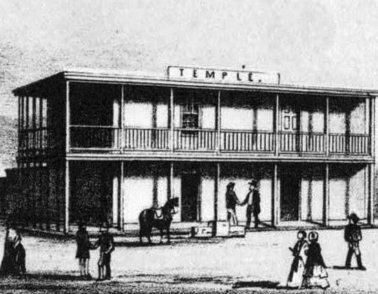
| (ca. 1850s)*^# - Sketch of John Temple’s original two-story adobe at the intersection of Spring, Main and Temple, which became known as Temple Block. |
Historical Notes In 1827, Jonathan Temple moved to the Pueblo de Los Angeles, where he opened the pueblo's first store, a business he operated for almost thirty years. Temple Street (Los Angeles) was developed by him as a modest one-block dirt lane in the 1850s.^* |
 |
|
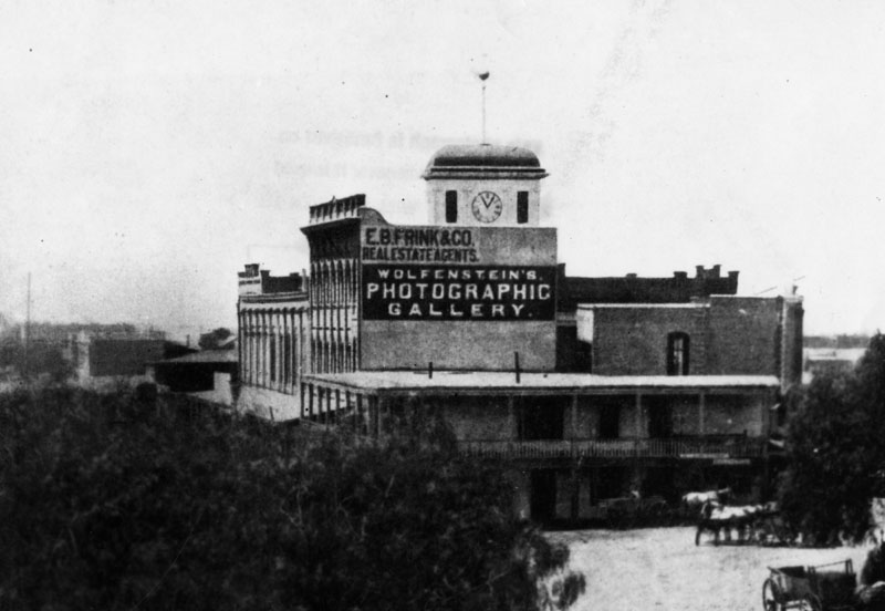
| (ca. 1872)* - Temple Block exterior view looking south toward Temple Street from some point on the Main Street side of the buildings. John Temple's original two-story adobe can be seen as part of the Temple Block. |
Historical Notes The view above shows John Temple's 1858 Clocktower Market/Courthouse building and the first three buildings on the rest of Temple block. The original Temple Block structure is the two-story adobe at front (see previous photo) at the intersection of Spring, Main and Temple. It was demolished by FPF Temple ("Tempelito"), John's half-brother, to build the new Temple Block building in 1871. "Temple Block" seems to be used to identify all of these buildings and also, only the one in front, facing the intersection (whether the old adobe Temple Block or the new Italianate Temple Block).^*# |
 |
|
| (n.d.)^^* - Temple Square (Temple Block) appears at the bottom-center of this photograph of a model of old Los Angeles. John Temple's 1858 Clocktower Market/Courthouse building is also identified. This would become the future site of the current City Hall. |
 |
|
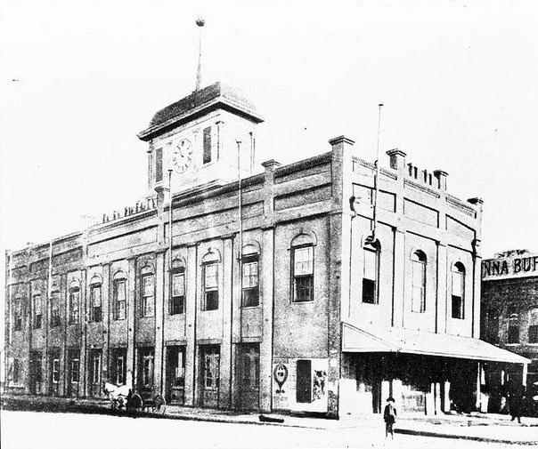
| (1858)^^ - Photograph of an exterior view of the old City Hall building in Los Angeles. The two story building is long and narrow and has rows of large windows. A small cupola with a clock sits on the roof. |
Historical Notes Jonathan Temple was one of Los Angeles’ first developers, constructing such landmarks as the original Temple Block and the Market House, which later served as city and county administrative headquarters, contained the county courthouse, and featured the first true theater in southern California. He also served as the first alcalde (or mayor) of Los Angeles after capture of the pueblo by the United States during the Mexican-American War and served on the first American-period common (city) council. In 1849, after Los Angeles was ordered by California's military governor to conduct a survey, but couldn't pay for the work, Temple paid for the Ord Survey out of his own funds, and then was repaid by the sale of lots created in the survey.^* |
 |
|
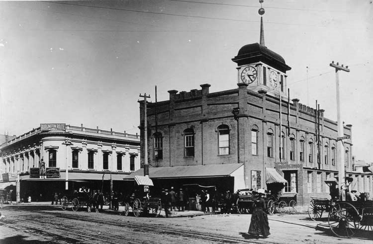
| (1860s)* - Three men stand at the top of the stairs in front of the old County Courthouse. This was actually LA's 5th courthouse location. |
Historical Notes The County Courthouse, which later became the Bullard Block, stood on the site of the new City Hall. It became the seat of government in the early American period.* |
 |
|
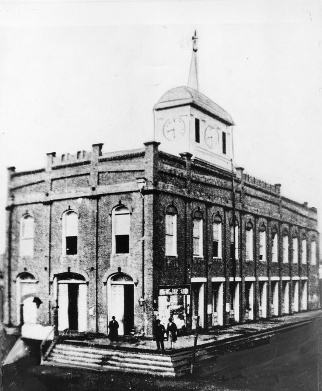
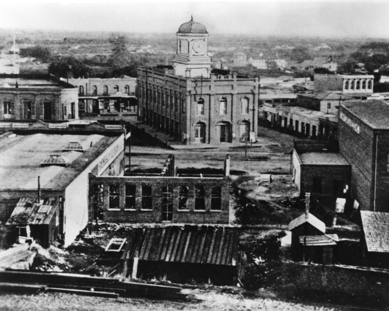
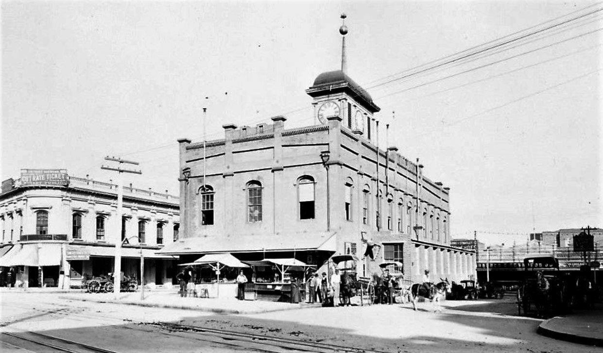
| (ca. 1869)* - The old County Courthouse, originally built by John Temple in 1858 as a marketplace and theater. |
Historical Notes The first floor of the building was used as a marketplace for a number of years, and the second floor was the first theater in Los Angeles. The building was briefly occupied by Los Angeles City Hall in 1861, but was mostly used by the County as a courthouse between 1861 -1891. The County leased the building for 8 years before purchasing it for $25,000 in 1869. |
 |
|
| (ca. 1869)* - Closer view (same photo as above) of the Clocktower Courthouse. Originally built by John Temple in 1859 for a city market. It was leased to the county in 1861 and then purchased by the county in 1869. |
Historical Notes Famous pioneer lawyers and judges used the courtrooms of this building, which gave way in 1891 to the Red Sandstone Courthouse . Witnesses and attorneys, rather than crowd into the stuffy courtrooms of this Courthouse, sat in the shade of the building or in some office nearby, while waiting their turn. At the right moment the bailiff poked his head out of a window and yelled for the man wanted—calling the name three times at the top of his voice and with “esquire” appended. #^^# |
 |
|
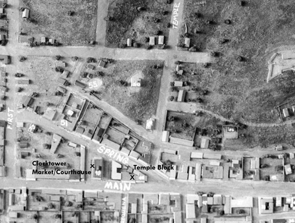
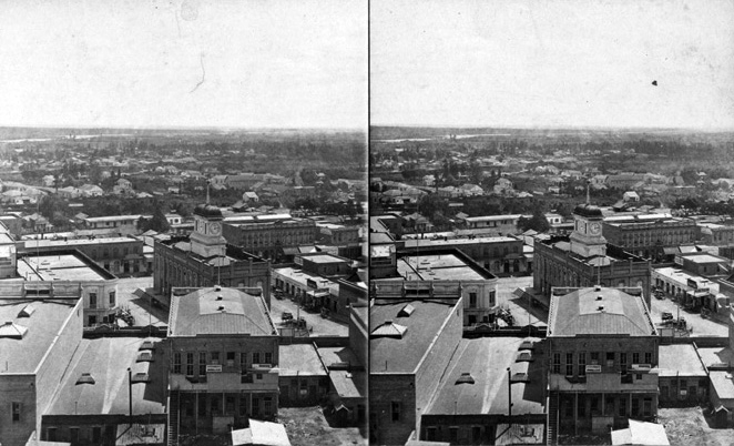
| (1869)#^ - View looking east at the old LA County Courthouse located in the Temple Block. It was the County's 5th courthouse location. Market Street ran between Main and Spring on the north side of the Clocktower Courthouse building, and Court Street did the same on the south side. |
|
Through more than 150 years the county has used at least eight buildings as its county courthouse. All have been situated within a mile of each other in downtown Los Angeles south of the original plaza in what has for the past 80 years been called the Civic Center. ◆ The first county courthouse was in the adobe Bella Union Hotel, where court was held in rented rooms from 1850 to 1852. |
 |
|
| (1876)* - View toward the old Courthouse built by John Temple for market and theater, looking east. Spring Street is on the west, Main on the east, and Market on the north and Court on the south. |
 |
|
| (ca. 1881)^## - Stereoscopic view of the old Courthouse and surrounding buildings. The building was occupied as a court between 1861 and 1891. The LA river can be seen in the background. Note: Temple Block would become the site of today's City Hall. |
 |
|
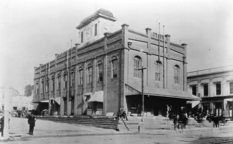
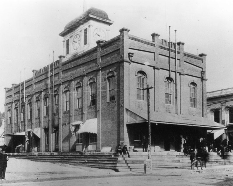
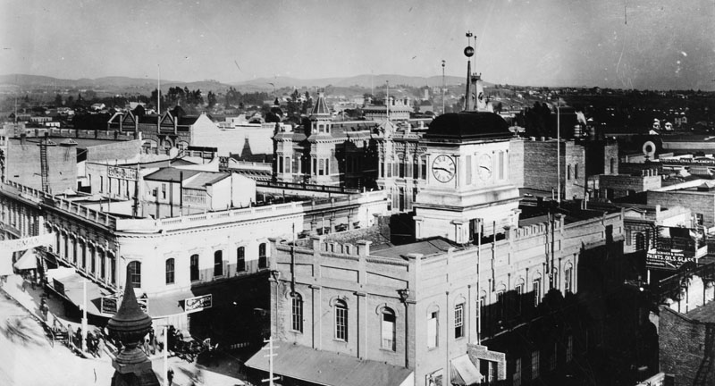
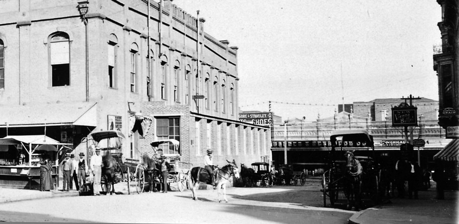
| (1885)* - View showing the Temple Block with clock-tower, home of the Los Angeles County Courthouse. Further back are two three-story Victorian-style buildings: the Amestoy Building and the United States Hotel located at the intersection of Main Street and Requena Street (later Market Street). The intersection of Market and Spring streets is at lower left. |
 |
|
| (1880s)* – View looking northeast showing the Los Angeles County Courthouse with its clock tower. The corner of the courthouse closest to the camera is on the southwest corner of Spring and Court streets. |
 |
|
| (1891)* – View looking toward the Temple Block from Spring Street with Court Street on the right and Market Street at left. Main Street can be seen in the distance on the right. |
 |
|
| (1891)* – Blow-up view of previous photo showing Court Street looking east toward Main Street as seen from Spring Street. A young man is seen on a donkey in the middle of the street while several horse-drawn wagons are parked along the curb. |
 |
|
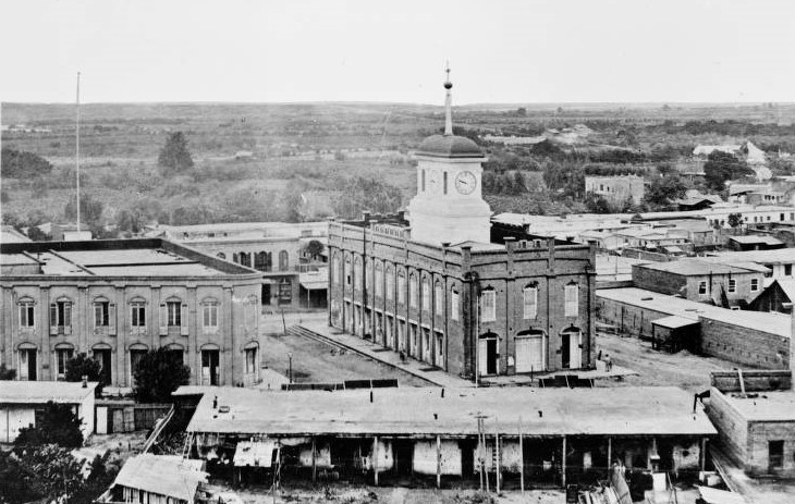
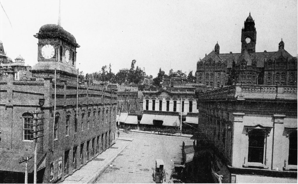
| (ca. 1891)* - View of Market Street looking west from the cupola of the United States Hotel, soon after the construction of the New Courthouse on Poundcake Hill (background). The old market and Courthouse of Temple Block can be seen at left. |
Historical Notes The Bullard Block (Building) would replace the old Clocktower County Courthouse (NE corner of Spring and Court streets) in the late 1890s. Today, City Hall stands at this location. Click HERE to see 'From Temple Block to City Hall' |
* * * * * |
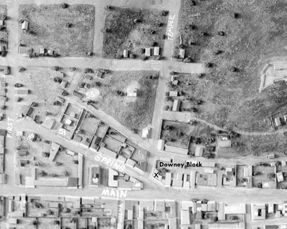
Downey Block
 |
|
| (ca. 1870)* - Stereographic card showing an unpaved Temple Street, looking west from Main Street. In the right foreground is the Downey Block located on the northwest corner. |
Historical Notes Construction on the Downey Block began in 1869 and was completed by 1871. The two-story brick building was developed by former California governor John Gately Downey, who became a major real estate investor and co-founder of Farmers and Merchants Bank. The structure symbolized the city’s transition from adobe to modern brick construction and became a central hub for commerce, banking, and civic life in early Los Angeles. |
 |
|
| (n.d.)* - Downey Block was located on the northwest corner of Main and Temple streets, highlighted at the bottom-center of the above model of old Los Angeles. |
Historical Notes The intersection of Main, Spring, and Temple Streets formed what was known as Temple Square, the bustling heart of 19th-century Los Angeles. The Downey Block stood at a strategic location and housed dozens of businesses, helping anchor the city’s commercial core. |
 |
|
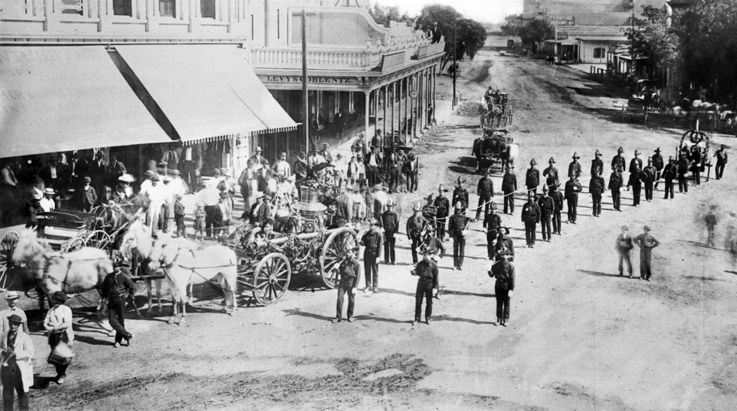
| (1871)* - First civic parade in L.A., July 4, 1871. Twenty-six volunteer firemen arranged in two lines of thirteen trail the horse-drawn cart which holds the pressurized water pump. This view is looking north at the intersection of Main, Spring and Temple streets with the Downey Block seen on the left. |
Historical Notes The Downey Block served as a backdrop to many civic events, including this early parade, one of the first large public celebrations in Los Angeles. The photo reflects the centrality of the block to public life and the emergence of the city’s civic identity. |
 |
|
| (ca. 1871)* - North Main Street, looking north from Temple with the Downey Block on the N/W corner (left). In the upper right stands the Bella Union Hotel, considered the first hotel in Los Angeles. A multitude of horse-drawn wagons are seen in the congested foreground. |
Historical Notes By the early 1870s, the Downey Block was already surrounded by other key structures like the Bella Union Hotel. It played a major role in turning Temple Square into a transportation and commerce hub, served by horse-drawn wagons and, by 1874, streetcars. |
 |
|
| (ca. 1871)* - A closer view of the corner of Main and Spring Streets, looking north from Temple Street, showing the Downey Block. Several horse-drawn vehicles are on the street as well as pedestrians milling around. |
Historical Notes This image captures the everyday bustle around the Downey Block, with pedestrians, carriages, and shop signage visible. The angled footprint of the building at the convergence of three streets made it a recognizable urban landmark. |
 |
|
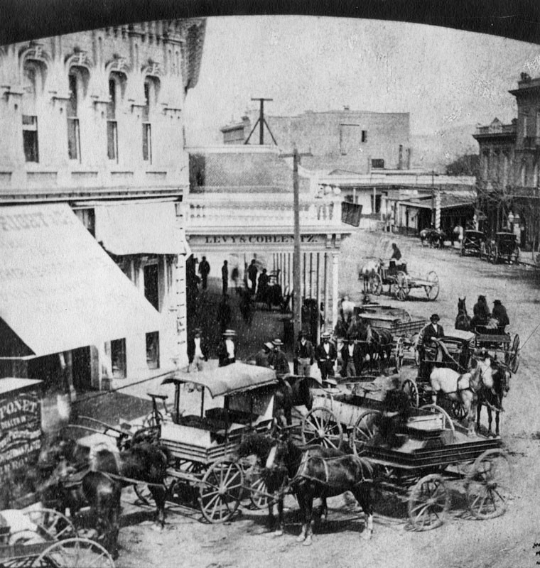
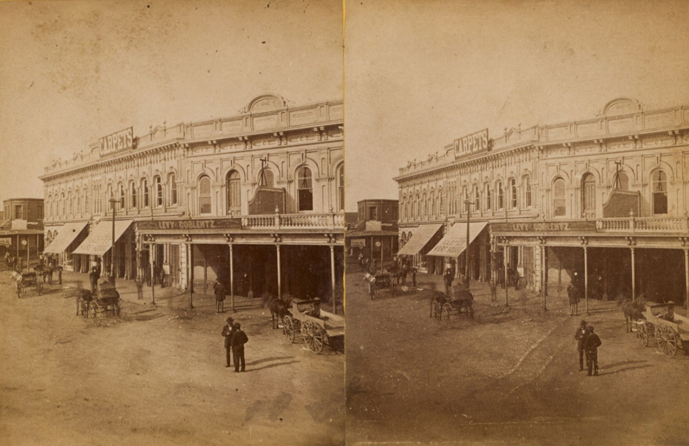
| (ca. 1875)* – Stereoscopic view of the northwest corner of Temple and Main Streets in early downtown Los Angeles, showing the prominent Downey Block. The Italianate-style building, with its slightly irregular footprint following the curve of Main Street, features visible signage including “CARPETS” and “LEVY & COBLENTZ – Wholesale Dealers in Wines and Liquors,” listed at 71 Main Street in the 1875 Los Angeles city directory. Additional signs such as “I.O.O.F.” and “New York Millinery Store” can be seen on adjacent buildings. The unpaved street, horse-drawn wagons, and figures in 19th-century attire capture the texture of the growing frontier town. |
Historical Notes The Downey Block housed various prominent businesses including Levy & Coblentz’s liquor wholesaling at 71 Main Street. Its Italianate styling with arched second-story windows and commercial signage typified the commercial architecture of the time. |
 |
|
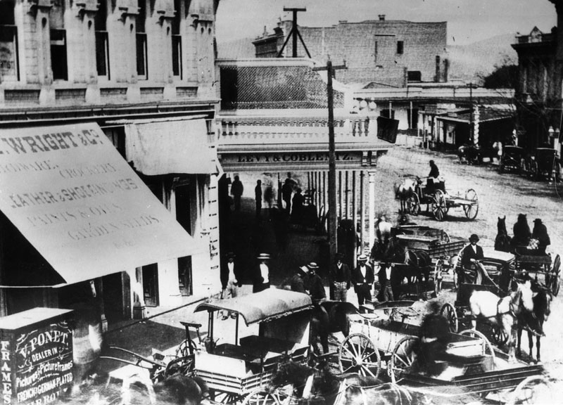
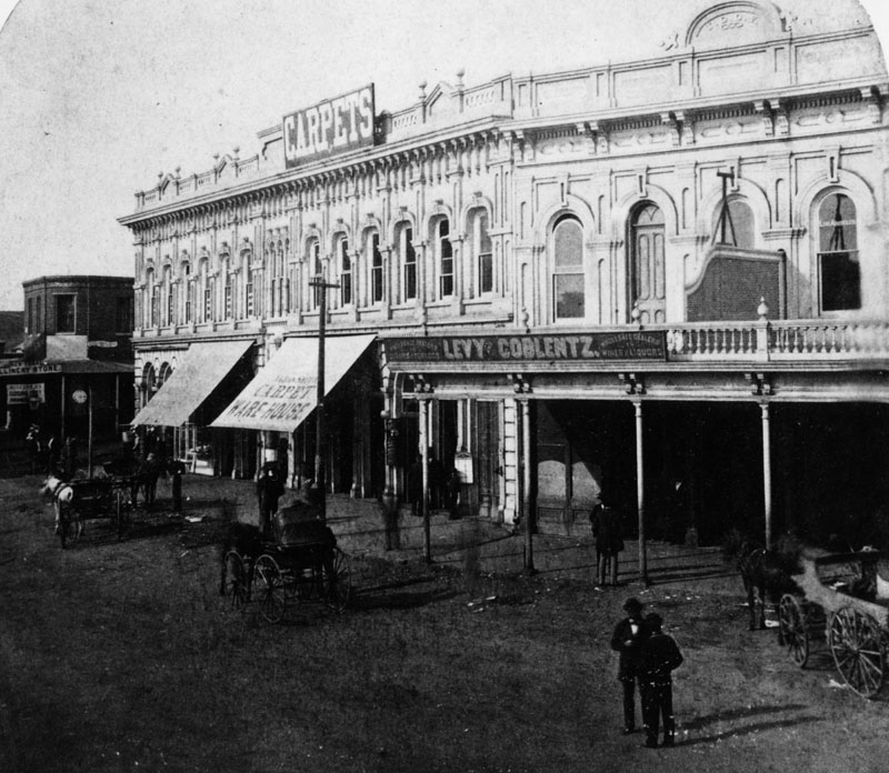
| (ca. 1875)* - View showing the North Main Street side of the Downey Block. Two well-dressed men are standing on the dirt road in front of the building. |
Historical Notes The presence of professional attire and diverse storefronts highlights the Downey Block’s status as a place of commerce and upward mobility in post-Civil War Los Angeles. |
 |
|
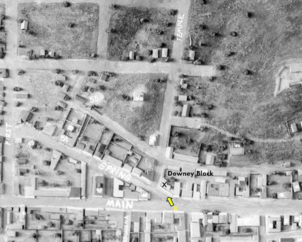
| Model of downtown Los Angeles in the 1870s, showing the camera’s location and direction from the 1875 photo above, as well as the position of the Downey Block at Main and Temple Streets. |
Historical Notes Spring Street originally intersected with Main at Temple. This unique three-way junction was the focal point of early city life. The alignment was later changed when City Hall was built in 1928, erasing Temple Square as it once existed. |
Then and Now
 |
|
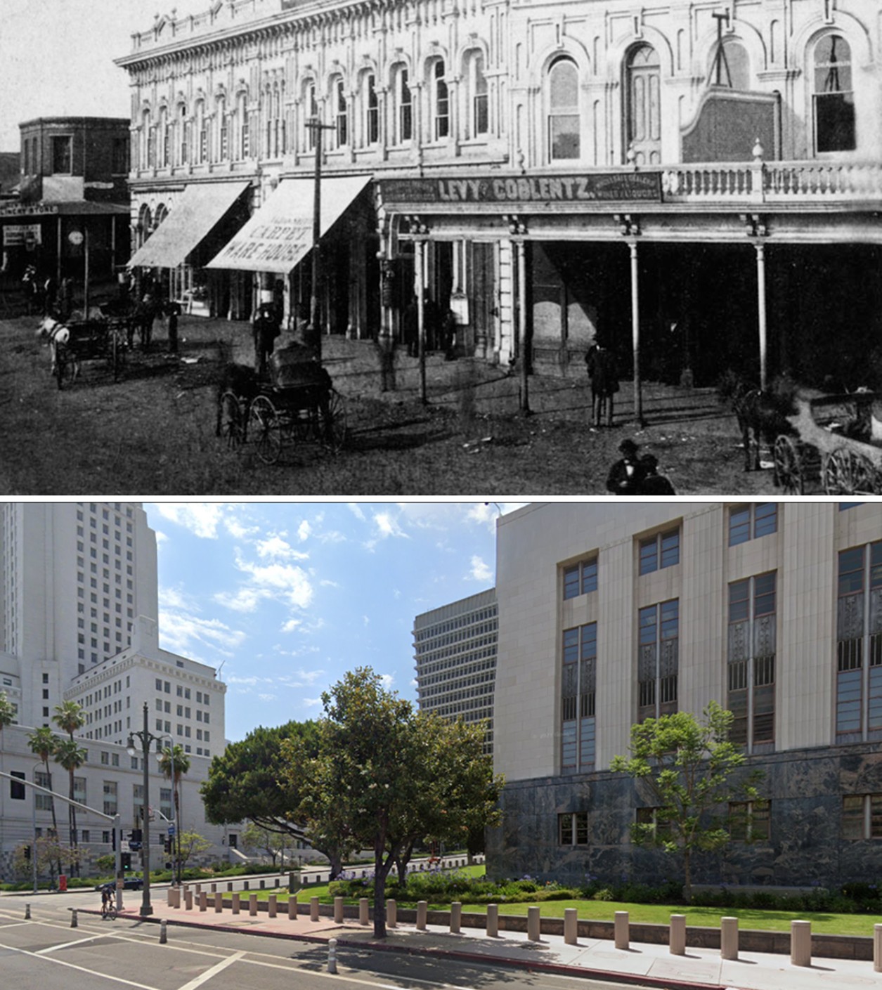
| (1875 vs. 2021)* – View of the northwest corner of Main and Temple Streets. The historic Downey Block once stood here; today, the site is occupied by the U.S. Courthouse Building in downtown Los Angeles. Photo comparison by Jack Feldman. |
Historical Notes The Downey Block was demolished in 1904. In its place rose the 1910 Federal Building and Post Office, later replaced in 1940 by the current U.S. Courthouse and Post Office Building, which still stands today—directly across the street from L.A. City Hall. |
 |
|
| (1870s)* - View looking northeast from the top of Poundcake Hill showing the Downey Block (center) at Temple and Main streets. The building with the pitched roof in the foreground is St. Athanasius Episcopal Church. Acroos the street is the Temple Street Stables (lower-left). Also seen is the Temple Block at center-right. The Los Angeles River runs horizontally across the top of the photo and the wide street at upper left is Aliso Street where the 101 Freeway runs today. |
Historical Notes The photo shows the proximity of the Downey Block to key institutions like St. Athanasius Episcopal Church and the Temple Block. It captures the city before its major street grid and civic center transformations. |
 |
|
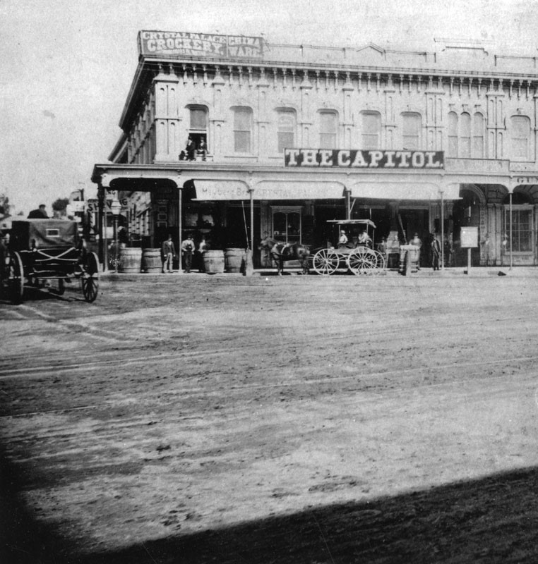
| (1880s)* – View of the Downey Block located on the northwest corner of Temple and Main streets as seen from the front of Temple Block. The two-story building has a large sign over the portico that reads: THE CAPITOL. Two men are sitting on the window ledge at upper left-center below another sign that reads: Crystal Place Cookery - China Ware. A horse and buggy is parked in front of the building while another appears to be moving west on Temple. |
Historical Notes The sign “THE CAPITOL” above the portico indicates one of the many businesses housed in the Downey Block. By this time, the building was home to restaurants, crockery shops, and offices, underscoring its continued importance in city life. |
 |
|
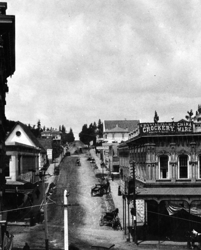
| (ca. 1884)* - View of an unpaved Temple Street, looking west as seen from the second floor of the Temple Block on Main Street. Horse-drawn carriages and wagons are parked along the street. In the right foreground is the Downey Block, housing the Crystal Palace, wholesale and retail sellers of crockery and china ware. Behind it is the Temple Street Stables. At left-center with ptiched roof and circular window is the St. Athanasius Episcopal Church located ate the southwest corner of Temple and New High streets. Poles strung with electric/telephone wires are seen in the foreground. |
Historical Notes In the foreground, the Crystal Palace advertised crockery and china ware from the Downey Block. The image reveals the mix of retail and civic life, with nearby churches, stables, and early telephone or electric poles indicating urban modernization. |
 |
|
| Model of downtown Los Angeles in the 1870s, highlighting the camera’s location and direction as seen in the photo above. Note: At the time, Spring Street intersected with Main Street. It wasn’t until the construction of today’s LA City Hall in 1928 that Spring Street was realigned to run parallel to Main Street. |
Historical Notes The model shows the spatial relationship between the Downey Block and the rest of the old city, giving modern viewers a better understanding of how Temple Square functioned as a civic and commercial nexus. |
Then and Now
 |
|
| (1884 vs. 2022)* – Looking west on Temple Street at Main Street. Note how much Poundcake Hill in the background has been leveled over the years. Photo comparison by Jack Feldman. |
Historical Notes The change in elevation and street configuration over time has obscured Temple Square's historical layout. The Downey Block's legacy is now mostly preserved through historic photos and comparative analysis. |
 |
|
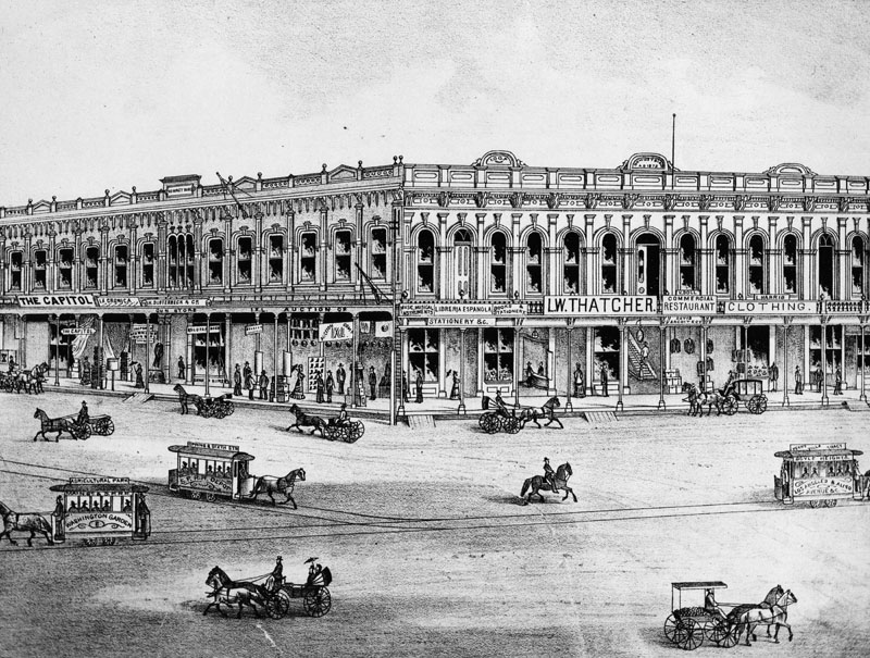
| (ca. 1880s)* - Drawing of the Downey Block on the northwest corner of Main and Temple Streets. Various horse-drawn vehicles are seen on the street, including horse cars to Agricultural Park/Washington Garden, Spring & 6th Streets/S.P.R.R. Depot, and Boyle Heights/Los Angeles and Aliso Avenue/Perry Villa Tract. |
Historical Notes This illustration includes signage for horse-drawn rail lines and business names such as The Capitol, La Crónica, H. Sloterbeck & Co. gun store, Librería Española, and the Los Angeles Public Library, which operated in the second-floor rooms from 1873 to 1889. |
 |
|
| (1887)* - View of the Downey Block showing a multitude of horse-drawn carriges and wagons that are 'parked' along the curb. |
Historical Notes The heavy presence of wagons and patrons in front of the Downey Block underscores its ongoing status as a center for trade and transport into the late 1880s. |
 |
|
| (ca. 1889)* - A parade on Main and Temple streets, looking north, in front of the Downey Block. Crowds of spectators flood the street but make way for a horse-drawn carriage escorted by police officers holding sabers. More spectators look from the second-story balcony. |
Historical Notes The above photo provides a good view of the 300 block of North Main Street which was an important part of Los Angeles history as early as the mid-1800s. It was considered the uptown commercial heart of the old city and was always buzzing with activity. Click HERE to see more in Early Views of the Historic 300 Block of N. Main Street Also seen above is the City's new 150-foot tall electric light pole, first put into service in 1882. Click HERE to see more in Early Los Angeles Streetlights. |
 |
|
| (1891)* - View looking west from the corner of Spring and Temple streets with the Downey Block at right (N/W corner of Main and Temple). The Temple Block is on the left behind the two men leaning on their bicycles and the LA County Courthouse (built in 1891) is in the distance (S/E corner of Broadway and Temple). |
Historical Notes By the early 1890s, new civic structures like the LA County Courthouse were rising nearby, signaling a shift away from the Downey Block’s central role as downtown expanded southward and westward. |
 |
|
| (1900)* – View looking northwest showing the Downey Block on the northwest corner of Main and Temple streets. There is a streetcar in the street in front of the building at right, and several pedestrians can be seen as well. |
Historical Notes Even into the 20th century, the Downey Block remained fully occupied, with a mix of dentists, retail, and professional offices visible on the storefronts and upper windows. |
 |
|
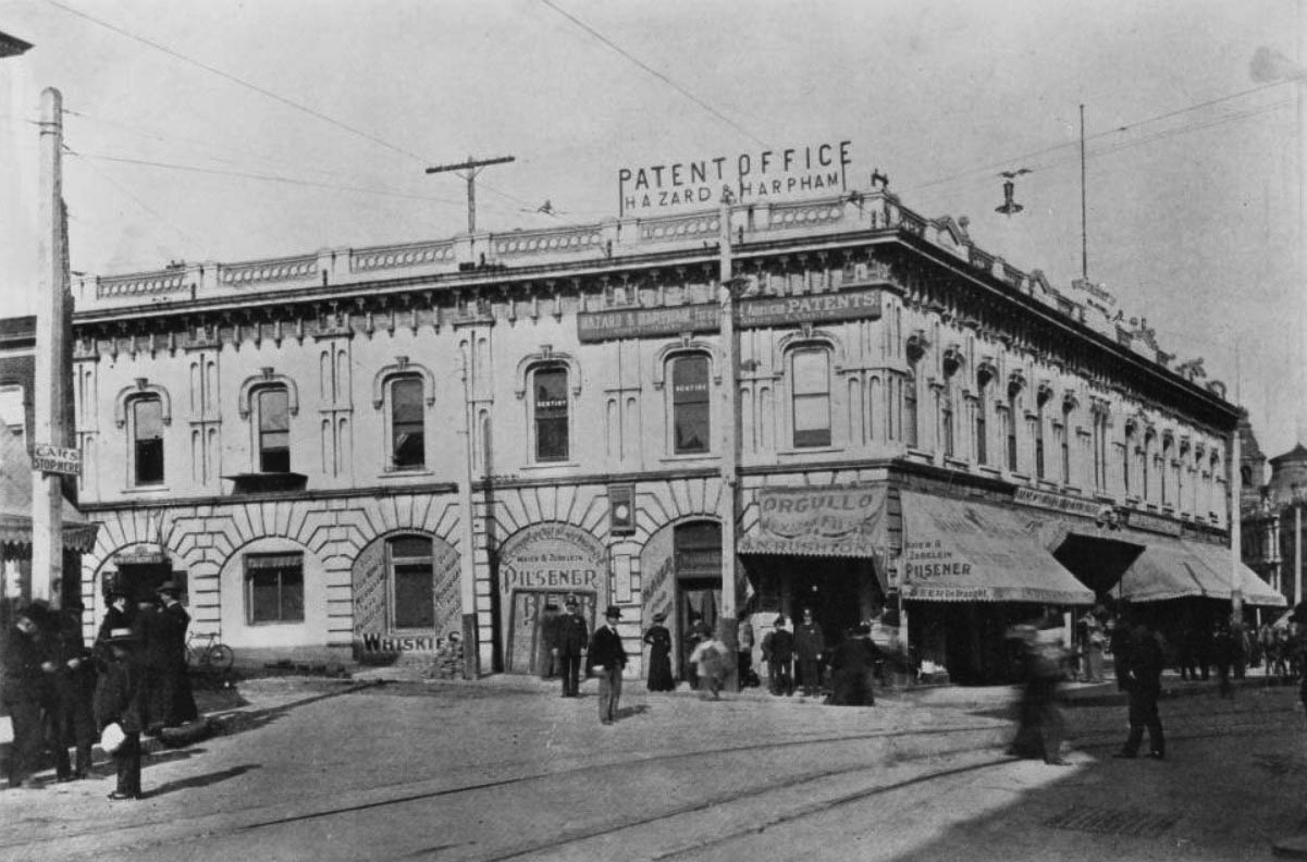
| (ca. 1904)* – View looking north showing the Downey Block on the corner of Spring Street and Temple Street. Men and women stand along the sidewalks and in the street in front of the Romanesque Downey Block, a building which houses several commercial interests; The Hazard and Harpham Patent Office advertises on the top floor, while signs on the bottom floor advertise all types of alcoholic beverages. |
Historical Notes Visible signage includes the Hazard and Harpham Patent Office and various liquor and cigar vendors. The building remained vital up until its demolition but was increasingly seen as outdated compared to newer civic structures. |
 |
|
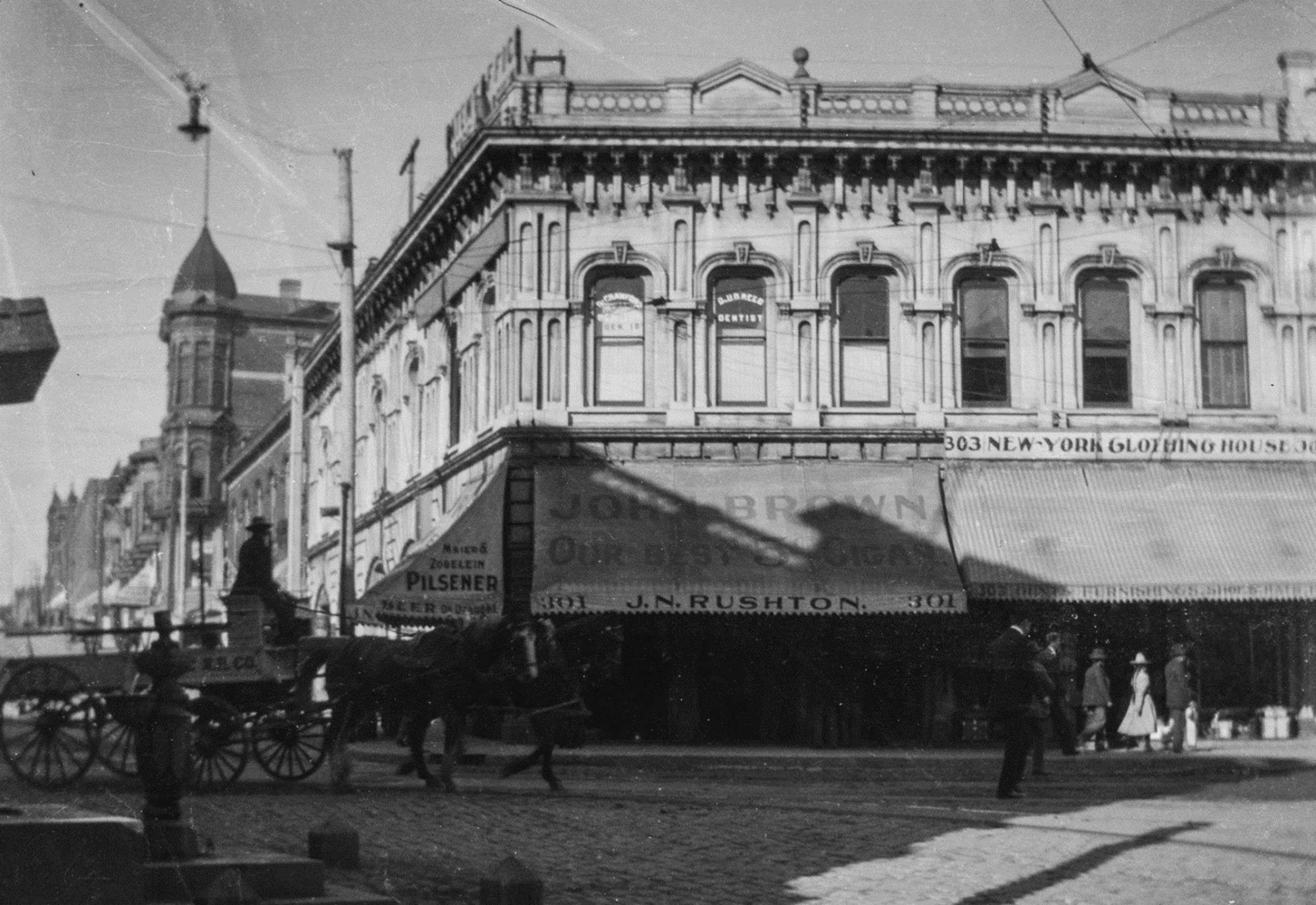
| (ca. 1904)*- Image of the corner of Temple Street and Main Street in downtown Los Angeles showing the Downey Block building, with cobblestone streets and horse-drawn wagon. View is looking west with Temple Street on the left. The fountain in the left foreground stands in front of the Temple Block. The awnings and windows of the Downey Block storefronts have signs including: "Dr. Crawford, Dentist" "Dr. U.D. Reed, Dentist" "Maier & Zobelein Pilsener, Beer on Draught" "John Brown Our Best 5 Cigar... 301 J.N. Rushton" at 301 N. Main Street, and "303 New-York Clothing House." The edge of Hazard and Harpham Patent Office can be seen attached to upper floor of building in upper left of image. Photo from the Ernest Marquez Collection. |
Historical Notes The photo captures the wide array of businesses and offices in the Downey Block shortly before its demolition in 1904. In its place rose the 1910 Federal Building and Post Office, later replaced in 1940 by the existing U.S. Courthouse and Post Office Building. |
* * * * * |
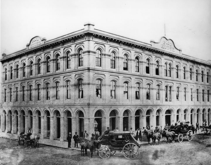
Pico House
 |
|
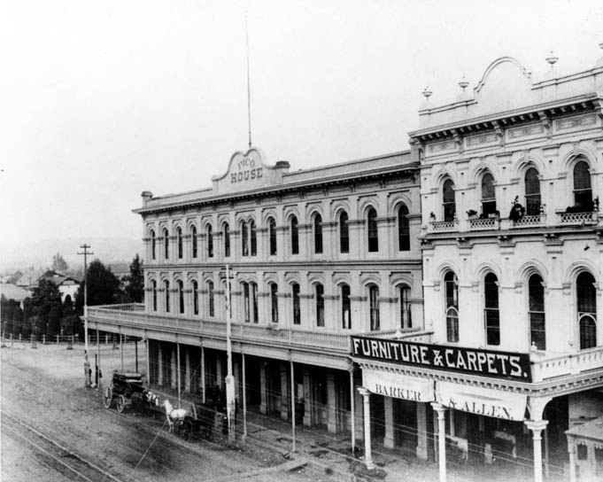
| (1869)^^* - View showing the Pico House, Masonic Temple and the Plaza area from a hill overlooking Spring Street and Main Street, Los Angeles, December 1, 1869. In the foreground is a community of small houses. Just beyond the community is the Pico House, which faces Main Street. The Plaza is to the left of the Pico House. The Masonic Temple (or Hall) stands several buildings to the right of the Pico House. A majority of the buildings in view are residential houses. |
Historical Notes Pío de Jesús Pico (May 5, 1801 – September 11, 1894) was the last Governor of Alta California (now the State of California) under Mexican rule. In 1868, he constructed the three story, 33-room hotel, Pico House (Casa de Pico) on the old plaza of Los Angeles, opposite today's Olvera Street. In 1821 Pico set up a tanning hut and dram shop in Los Angeles, selling drinks for two Spanish bits (US 25 cents). His businesses soon became a significant source of his income. By the 1850s Pico was one of the richest men in Alta California. In 1850 he purchased the 8,894-acre Rancho Paso de Bartolo, which included half of present day Whittier. Two years later, he built a home on the ranch and lived there until 1892. It is preserved today as Pio Pico State Historic Park. Pico also owned the former Mission San Fernando Rey de España, Rancho Santa Margarita y Las Flores (now part of Camp Pendleton), and several other ranchos for a total of over one half-million acres, or 800 mi². |
 |
|
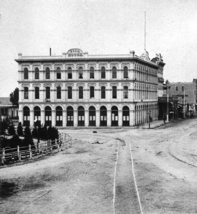
| (1876)* - Panoramic view of the Los Angeles Plaza in 1876. The Pico House is the prominent 3-story white building at the center of the photo. The LA River can be seen in the background. |
Historical Notes At the time of its opening in 1870, it was the most lavish hotel in Southern California. Even before 1900, however, it began a slow decline along with the surrounding neighborhood, as the business center moved further south. After decades of serving as a shabby flop house, it was deeded to the State of California in 1953, and is now a part of El Pueblo de Los Angeles State Historic Monument. It is used on occasion for exhibits and special events.^* |
 |
|
| (1875)* - The Pico House, built by Pio Pico 1869-70. Several men are standing on the sidewalk while a stage coach and two other horse-drawn wagons are parked in front of the hotel. |
Historical Notes The Pico House was designated California Historical Landmark No. 159 (Click HERE to see more in California Historical Landmarks in Los Angeles). |
 |
|
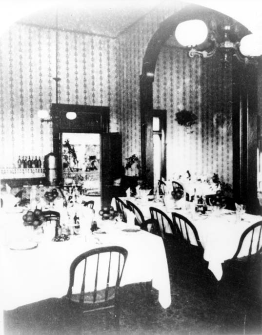
| (late 1800s)**#^ - View of the Pico House dining room circa late 1800s. |
 |
|
| (1878)* - The Pico House, sometimes called "Old Pico House" was built by Pio Pico in 1869-70. Seen here from the Main St. entrance of the Plaza. The road in front and to the side of the building is dirt, and a set of tracks runs down the middle. |
.gif) |
|
| (n.d.)*#^ - Map of Historic Sites in and near the Plaza Area. The Pico House sits on the southeast corner of Main and Republic, across from the Plaza. |
Historical Notes Map of Historic Sites in and near the Plaza Area. On this map, streets which no longer exist are shown in a light grey, and/or labeled in italics. The approximate locations of the 101 freeway and its ramps are shown in a darker grey. Buildings which no longer exist are outlined with dotted lines.*#^ Click HERE to see more in Early Views of the LA Plaza |
* * * * * |
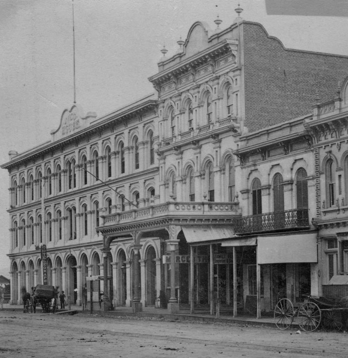
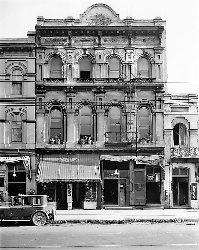
Merced Theater
 |
|
| (1870s)* - The Merced Theater sits between the Pico House, and the Masonic Lodge. This was the "first business block on Main Street". |
Historical Notes The Merced Theatre, erected in 1870 on North Main Street next to the Pico House, was the first building built expressly for theatrical purposes in Los Angeles. It was built by William Abbot, a cabinetmaker, and named in honor of his wife Merced Garcia. The theater was built in an Italianate style and operated as a live theater from 1871 to 1876. When the Woods Opera House opened nearby in 1876, the Merced ceased being the city's leading theater. Eventually, it gained an "unenviable reputation" because of "the disreputable dances staged there, and was finally closed by the authorities."* |
 |
|
| (ca. 1876)* - Main Street and Plaza showing the Pico House, the Merced Theater, and the Masonic Lodge. The first gas works can also be seen in the foreground; the tanks were built in 1867, the Pico House and Merced Theater in 1870 and the Masonic Lodge in 1865. |
 |
|
| (ca. 1878)^^* - View of Main Street looking south. A horse-drawn wagon with two men in it is parked in front of the Pico House near the Merced Theatre on the left. The road is unpaved and a streetcar track runs down the middle. Both sides of the street are lined with imposingly large buildings. At center on the left side of the street is an especially big building topped by three prominent towers (Baker Block ). Most of the other buildings are somewhat Romanesque, with large columns and archways dominating their facades. Click HERE to see more in Early Views of the Historic 300 Block of N. Main Street. |
 |
|
| (1890s)* - View of Main Street looking northeast. The Plaza, Pico House, and Merced Theater are visible. A sign in front of theater reads “Barker & Allen, Furniture & Carpets.” A stagecoach and horse-drawn wagon are parked in front of the Pico House. |
 |
|
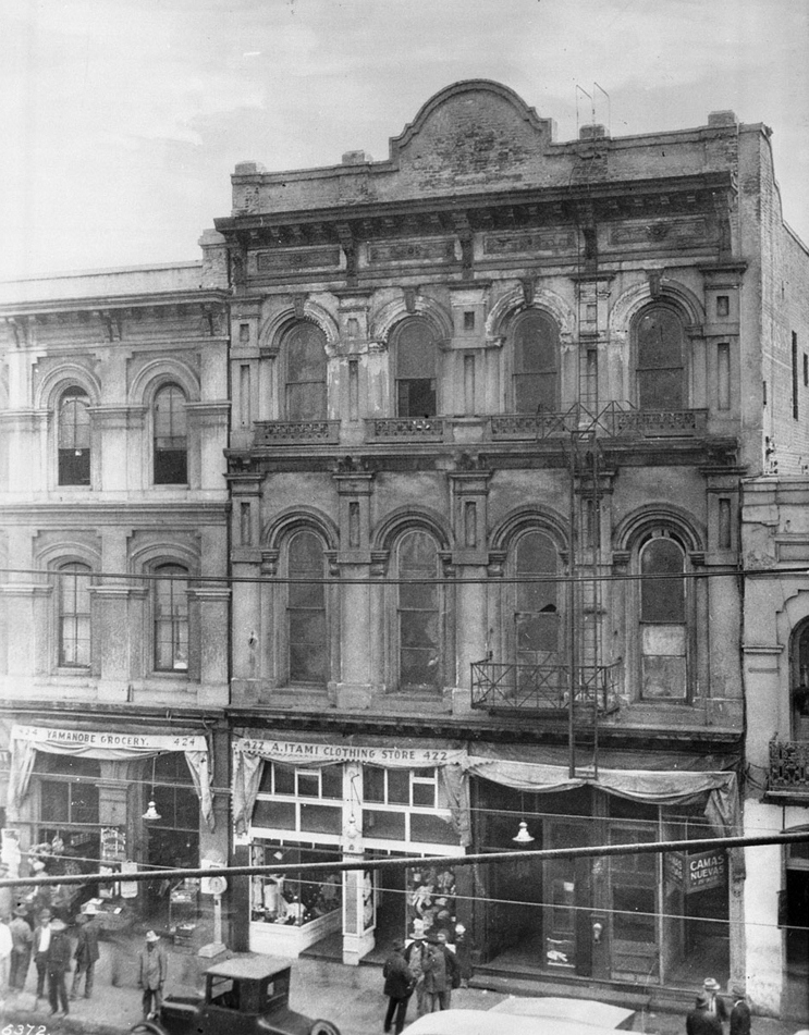
| (ca. 1909)* - Photograph of the Teatro Mercedes (or Merced Theatre). Below the Romanesque architecture of the three-story building, a crowd of pedestrians stand in front of the Japanese shops at ground level which read "A. Itami Clothing Store" and "Yamanobe Grocery". An early model automobile is partially visible in the foreground. |
Historical Notes The Merced Theater, completed on December 31, 1870, opened its first professional engagement on January 30, 1871. It was "used later as an Armory, then again as a Fire Engine house". |
 |
|
| (1920s)* - View of the Merced Theater as seen from across the street with commercial stores seen on the ground level. |
 |
|
| (late 1920s)* – The Merced Theater is wedged between the Pico House and the Masonic Hall. |
 |
|
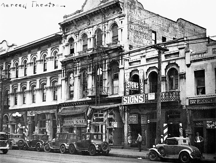
| (ca. 1945)* - Exterior view of front of the Merced Theater and businesses to the left and right down the street. Signs can be seen for a barber shop, a shoe shop, the Tom Hotel and others. To the left of the Merced is a portion of the Old Pico House. |
Historical Notes Even by the time of the Historic American Buildings Survey in 1937 the upper floors had been altered repeatedly. At the time of that survey the theatre space was used as a hotel/rooming house. |
 |
|
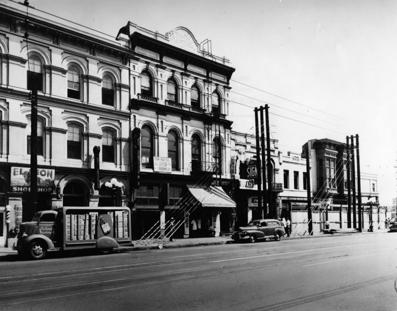
| (1968)* - View showing the front of the Merced Theatre. At the very top reads, "1st L.A. Theater Mercedes." On the left is the Pico House. Photo by William Reagh |
Historical Notes The facade was restored in the 60s and additional work was done in an 80s "restoration." The 80s work included a seismic retrofitting, new electrical service, and sprinkler and alarm systems. Ductwork was installed but evidently not any heating or cooling equipment. Over a period of 20 years, the City spent approximately $11 million stabilizing the buildings on the block. The Merced building has been vacant for decades due to lawsuits brought by an unhappy developer and other problems.* |
 |
|
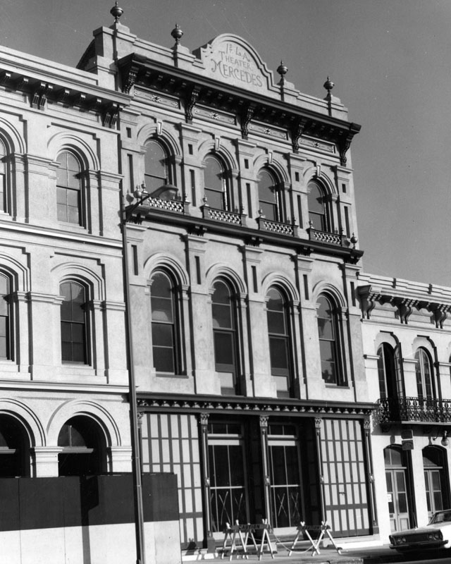
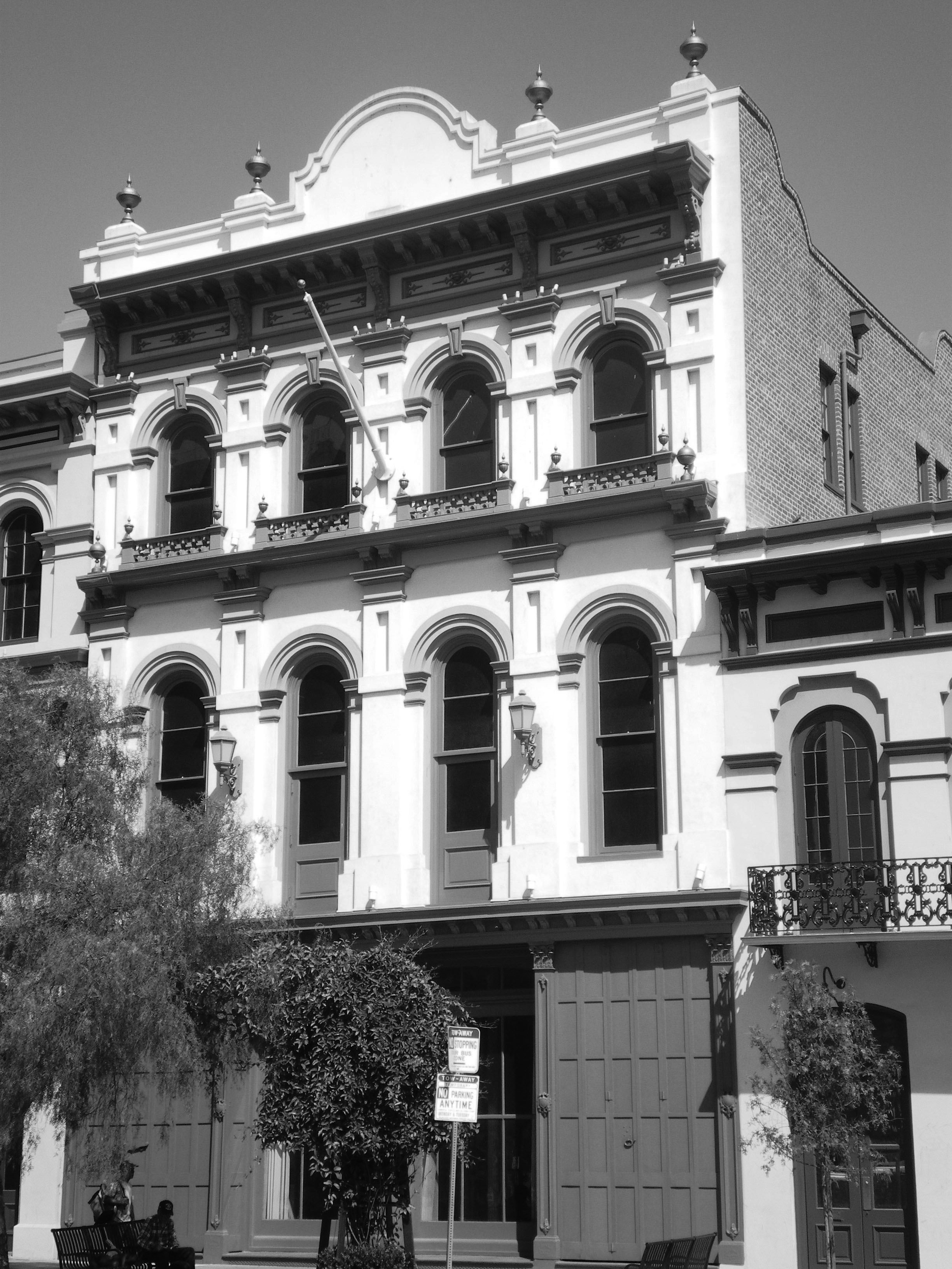
| (2008)* - Merced Theater — in the Los Angeles Plaza Historic District. Built of brick in the Victorian Italianate style, in 1870. |
Historical Notes Ezra F. Kysor designed the Italianate theater, built in 1870 by William Abbott and named for his wife. It opened on January 30, 1871 and is the oldest surviving theater in Los Angeles.* The Merced Theatre was dedicated as California Historical Landmark No. 171. |
 |
|
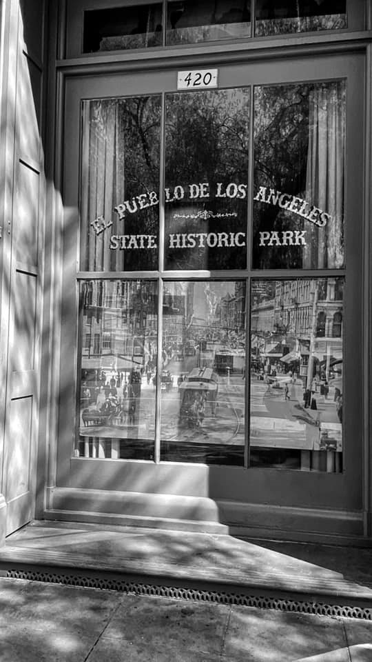
| (2021)^ – Window adjacent to front entrance of the Merced Theater located at 420 N. Main Street in El Pueblo de Los Angeles State Historic Park. Photo by Carlos G. Lucero |
Historical Notes Click HERE to see more in Early Views of the LA Plaza |
* * * * * |
.jpg) |
|
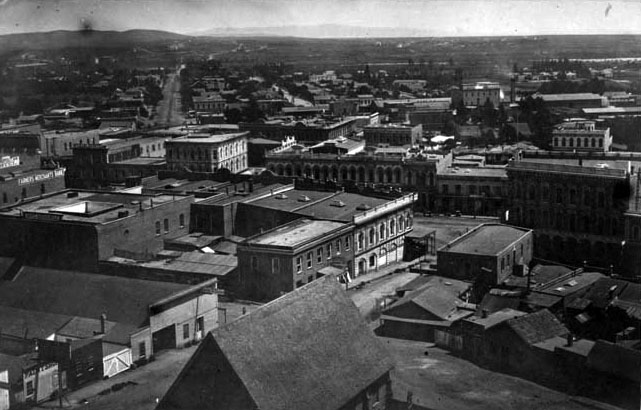
| (1868)^^* - Left panel of a panoramic photograph/sketch of downtown Los Angeles looking east from Bunker Hill with each property annotated and listed at top. The photographer, S. A. Rendall, can be seen standing in his own photo (#14). |
Historical Notes The above photo was taken from a section of Bunker Hill called "Poundcake Hill", the future site of the old Los Angeles High School (1873) and later the location of Los Angeles' second County Court House (1891). It was this time that Los Angeles began growing faster than anywhere in the country. By 1870, the City's population increased to 5,730, a 350% jump from when it was incorporated as a municipality in 1850. By 1900, LA's population would mushroom to over 100,000 people.^* |
.jpg) |
|
| (1868)^^* - Right panel of a panoramic photograph/sketch of downtown Los Angeles looking east from Bunker Hill with each property annotated and listed at top. The location of the camera was at the top of a hill called ‘Poundcake Hill’ the future site of Los Angeles High School (1873) and the 2nd L.A. County Court House (1891). |
Historical Notes S. A. Rendall, the photographer of the amazing panoramic photo seen above, is mentioned in a 1911 publication titled: OUTPOST – Preserving Historical Data by W. S. Broke. “Remembering that no city in the United States has had a rate of growth commensurate with that of Los Angeles, the preservation of historical data becomes of pressing importance. Much of the photographic material illustrating the early life of the city has been preserved but as far as can be ascertained little of this immediately available for all comers. … There does not appear to have been any systematic attempt to preserve photographs of the city prior to the early 80s. The late S. A. Rendall, whose children now reside in Los Angeles, was a photographer who did much toward preserving the appearance of the early Los Angeles—the city of the ‘60s and ‘70s. What has become of most of his negatives is not known, although they would be of immense historical value were they now available. Perhaps the best thing that he left behind is a bird’s eye view of Los Angeles taken in 1868 from the site of the present court house. This photograph is the property of George W. Hazard, who has it covered by copyright, and who has it on sale. It is a remarkable photograph in every way.” |
* * * * * |
Los Angeles High School (1st Location)
 |
|
| (1873)* - Old Los Angeles High School, looking east from the hill on North Broadway at Court Street. The Temple block stands to the right of the school. Broadway, first known as Fort Street, was cut through the bushes in the foreground. |
Historical Notes Construction on Los Angeles' first public high school, (the Jesuit Loyola High School is older) began on July 19, 1872, at the former site of Central School on what was then known as Poundcake Hill, at the southeast corner of Fort Street (later Broadway), which the front of the school faced, and Temple Street, with the back of the school to New High Street (later Spring Street). The name of the school has led to some confusion due to its evolving role in early Los Angeles education. Initially, it was established as Central School, serving as an elementary school. As the city's educational needs grew, four rooms within the building were allocated for secondary education, which led to the formation of Los Angeles High School, the first public high school in the city. Despite this distinction, the school building continued to be referred to by both names—Central School for its original function and Los Angeles High School for its role in secondary education. This dual usage contributed to historical inconsistencies in naming references. |
 |
|
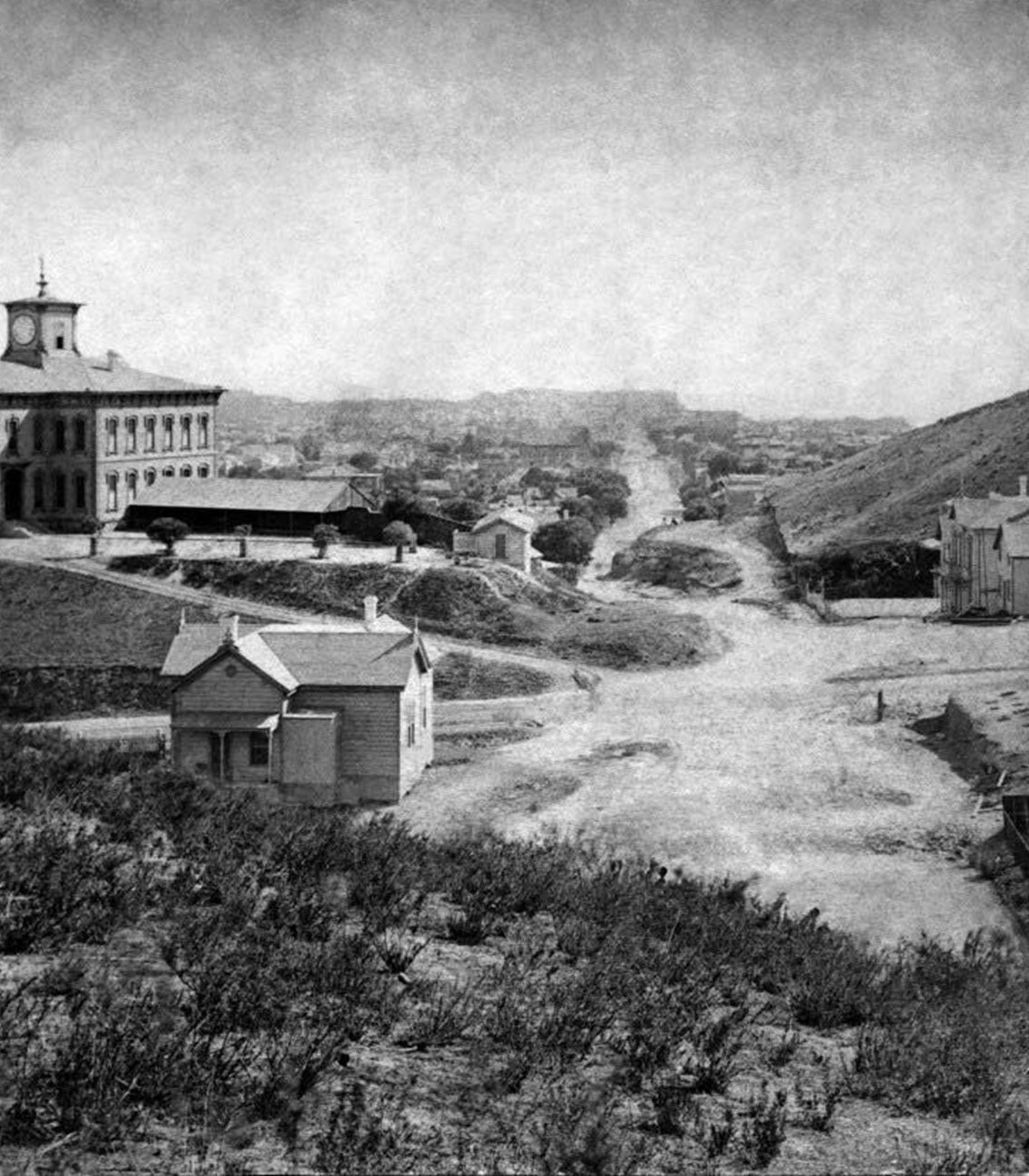
| (ca. 1875)* - View looking northwest from Main and 1st streets. Los Angeles High stands tall on top of "Poundcake Hill" in the distance. |
Historical Notes Los Angeles High School was one of the architectural jewels of the city, and was strategically placed at the summit of a hill, the easier to be pointed to with pride. One of the school's long standing mottos is "Always a hill, always a tower, always a timepiece." |
 |
|
| (1875)* - Looking south on Fort Street (now Broadway) showing Los Angeles High School as seen from Fort Moore Hill. Source: Henry T. Payne stereographic photograph. |
 |
|
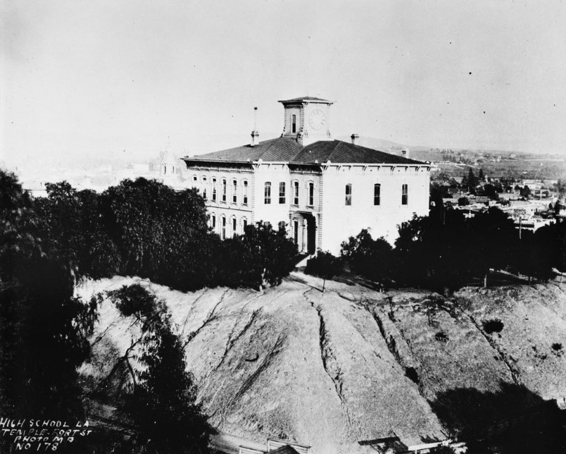
| (ca. 1878)* - View looking southeast showing Los Angeles High School at Temple and Fort Street on Poundcake Hill. In the haze just to the left of the school building you can just make out the clock tower of the Temple Block. |
Historical Notes The two-story wooden structure was so big and grand, the finest school south of San Francisco at that time, with classic lines and a tower with a clock in it, that people traveled from miles around to see it. The teachers liked the wide corridors, walnut banisters, generous windows and the transoms over the doors. |
 |
|
| (ca. 1870s)* - View showing the first Los Angeles High School on Poundcake Hill. A horse can be seen standing by a fence in the left foreground. |
Historical Notes The schoolhouse was completed at a cost of $20,000, in 1873. Nearby, in succession, was the Court House, the City Hall, the Jones-Lindley Market and the Post Office. The first principal was Rev. Dr. William T. Lucky (1821–1876) and the first graduating class, in 1875, consisted of seven students. The name of the school has led to some confusion due to its evolving role in early Los Angeles education. Initially, it was established as Central School, serving as an elementary school. As the city's educational needs grew, four rooms within the building were allocated for secondary education, which led to the formation of Los Angeles High School, the first public high school in the city. Despite this distinction, the school building continued to be referred to by both names—Central School for its original function and Los Angeles High School for its role in secondary education. This dual usage contributed to historical inconsistencies in naming references. |
 |
|
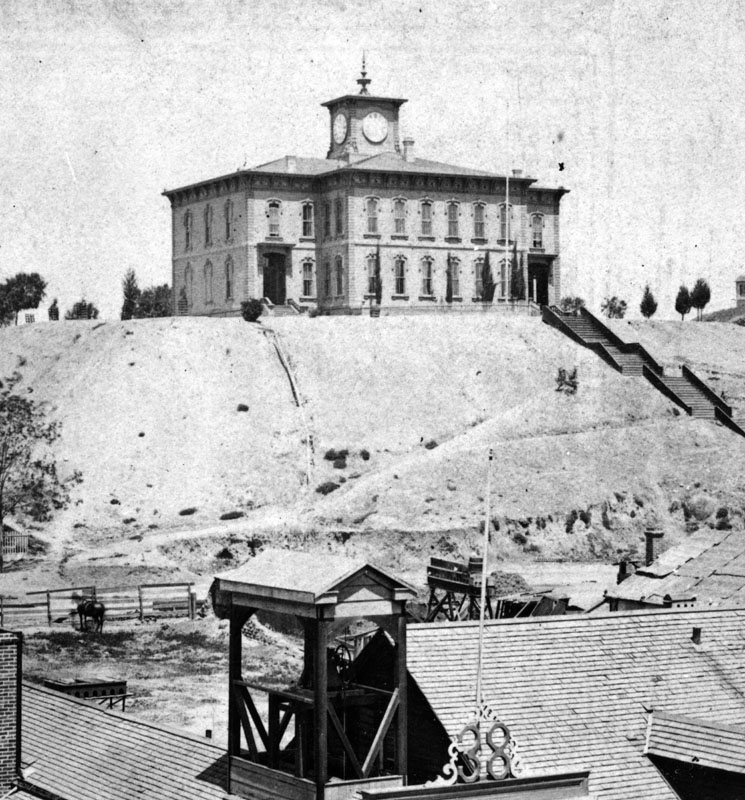
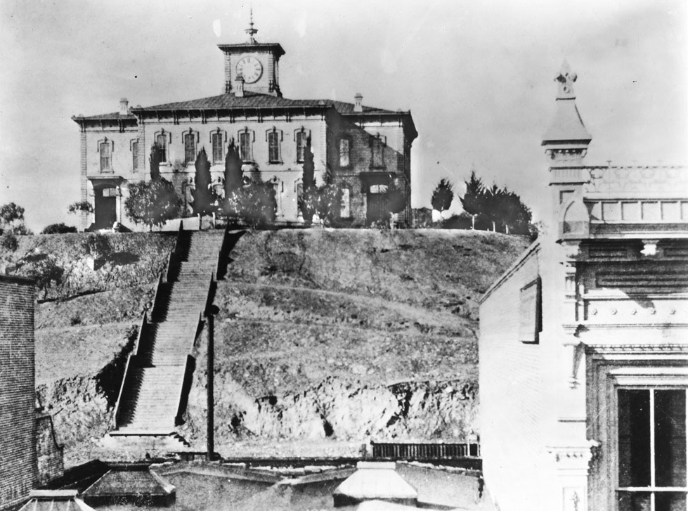
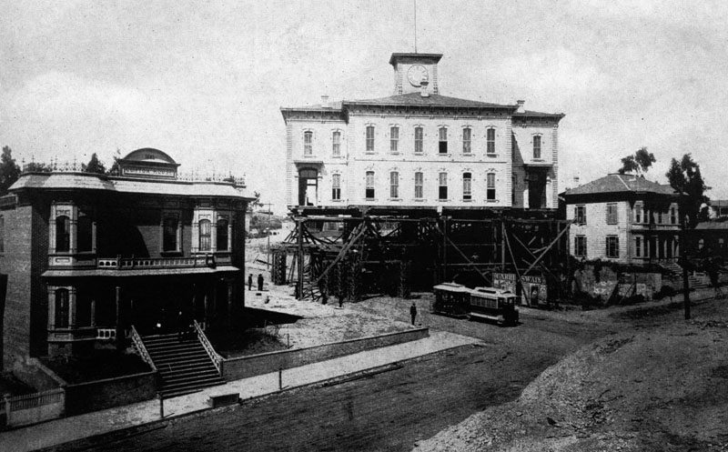
| (ca. 1880)* - View of Los Angeles High School from Temple Street sitting on top of 'Poundcake Hill'. A long flight of stairs can be seen going from the bottom of the steep hill to the top. |
Historical Notes In 1886, the decision was made to move the high school building to Sand Street (later California Street, now part of the Hollywood Freeway), just to the west of North Hill Street and below the south side of Fort Moore Hill, in order for the Los Angeles County Courthouse to be built on Poundcake Hill. The contractor, Mr. Hickam, said he could do the job with scaffolding, rollers, horses and workmen. But his bid turned out to be too low. He lost a considerable amount of money because of his elaborate preparations, including the high wooden trestle which carried the building over the intersection of Temple and Fort Street. |
 |
|
| (1886)* - View showing the Los Angeles High School building being moved over to Temple Street as a couple of people look on. A man standing at the corner of Temple and Broadway (formerly Fort Street) watches a double trolley traveling by, and two people can be seen exiting the Clifton House on the left. |
Historical Notes During the process of moving, the contractor managed to get the schoolhouse halfway up Temple Street when he ran out of money and left it right in the middle of the street. It was there for a good while. They jacked it up on scaffolding high enough for the Temple Street street cars to run under it. |
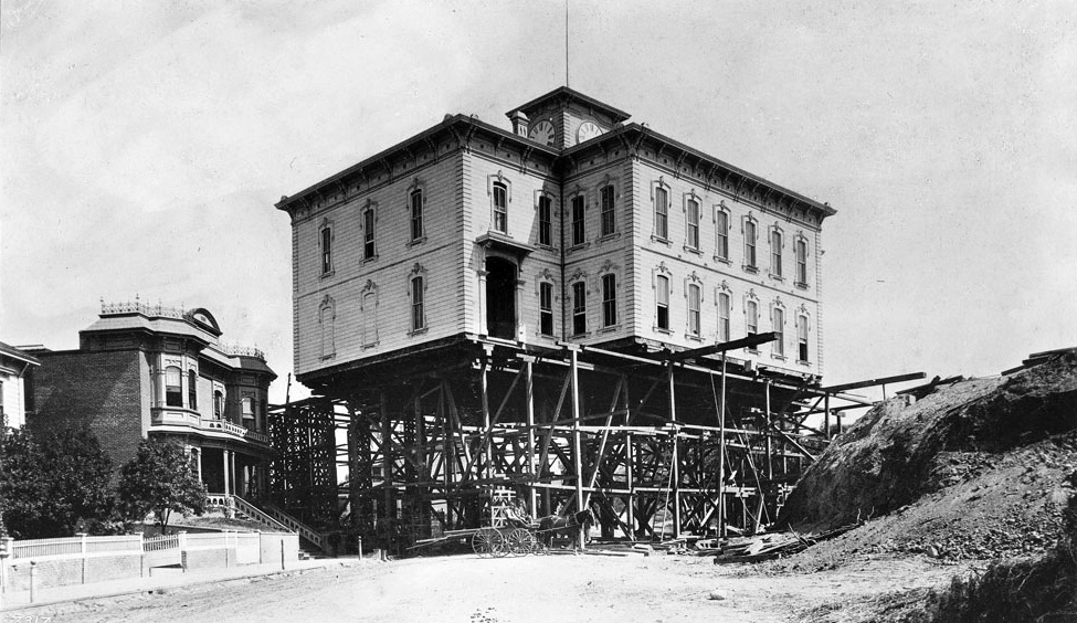 |
|
| (1886)* - Los Angeles’ first high school moved across the street from Poundcake Hill to clear space for a new county courthouse when it got stuck in the process due to the contracting running out of money. A horse-drawn wagon can be seen in the foreground. |
Historical Notes For a while, the building remained where the contractor crew left it, while a new grander high school was built atop Fort Moore Hill. |
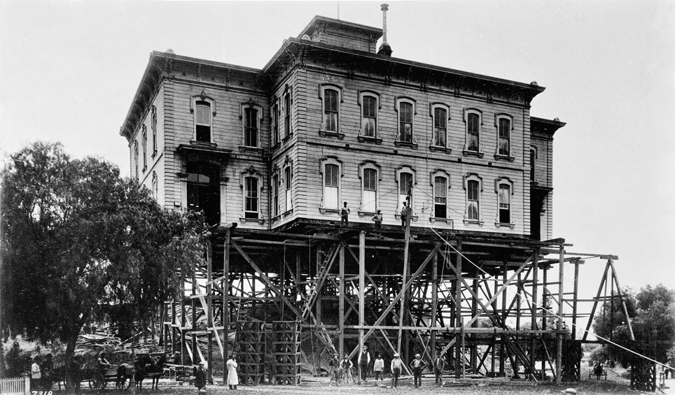 |
|
| (1886)* - Close-up view showing the Old Los Angeles High School building perched high above the street on scaffolding near the intersection of Temple and Broadway. The contractor left the structure in this state after cost overuns caused him to give up. |
Historical Notes Finally, they got the school building moved up to its new location on Sand Street, where Los Angeles High School students and faculty remained until the second high school, bigger and grander than the first, was built a few years later on top of Fort Moore Hill. |
Then and Now
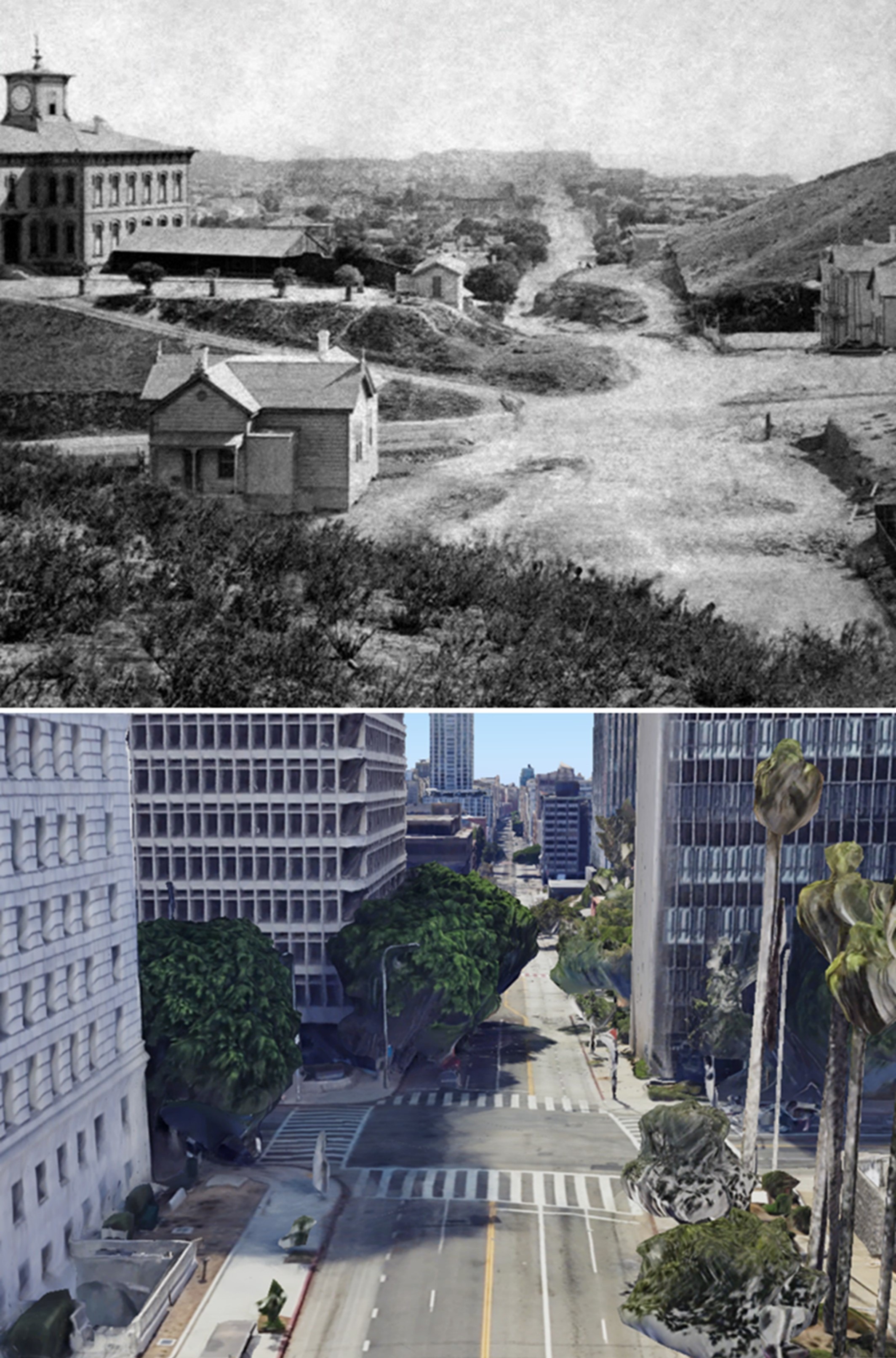 |
|
| (1875 vs 2023)* – Looking south on Broadway (originally Fort Streeet) at Temple Street. Los Angeles’ first public High School (LA High School) once stood near the SE corner as seen above (upper-left corner). In 1886 the high school was moved to a new location to make room for the construction of the LA County Courthouse. The courthouse would be torn down in 1936 and replaced by single story courthouse bungalow buildings. In 1972 the Criminal Courts Building later renamed the Clara Shortridge Foltz Criminal Justice Center would be constructed on the site (seen here on the SE corner). Photo comparison by Jack Feldman. |
Historical Notes The original view was taken from Fort Moore Hill, which was later leveled. The current view is a Google Earth perspective from approximately where the top of Fort Moore Hill once stood. |
* * * * * |
Los Angeles High School (2nd location)
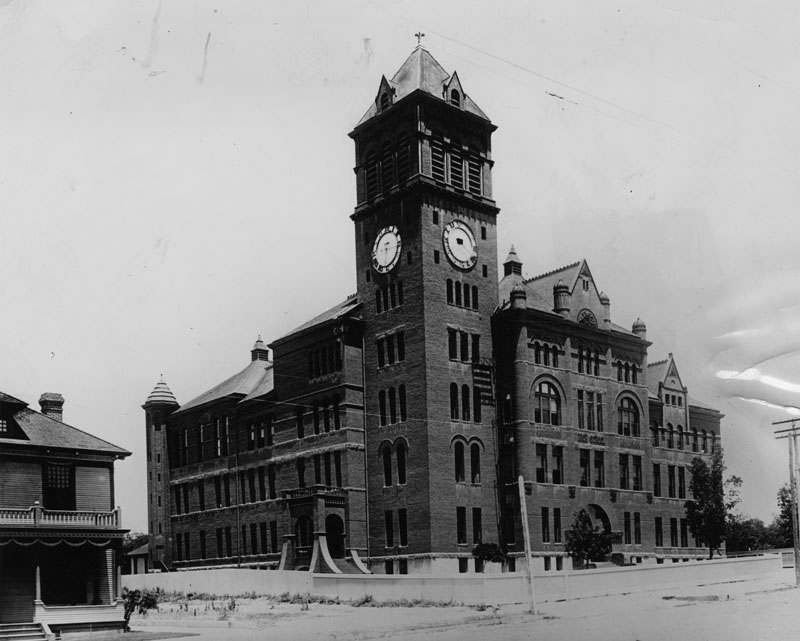 |
|
| (1890)* - A view showing the newly constructed Los Angeles High School at its new location on Fort Moore Hill. |
Historical Notes Completed in 1891, the new Los Angeles High School replaced the original one that was built in 1872, at the former site of Central School on what was then known as Poundcake Hill, at the southeast corner of Fort Street (later Broadway). |
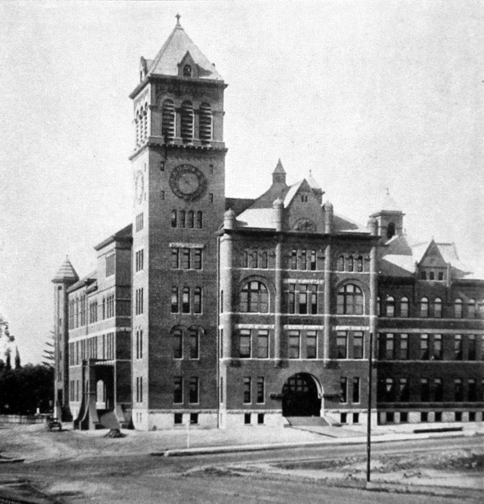 |
|
| (1890)* - Close-up view showing the front of Los Angeles High School shortly after it was completed, located on the conrer of Castelar and Rock streets. |
Historical Notes The new school was built at Castelar and Rock streets (North Hill Street and Fort Moore). The four-story red brick building had 40 rooms for its 400 students. It was the second Los Angeles High School to be built. |
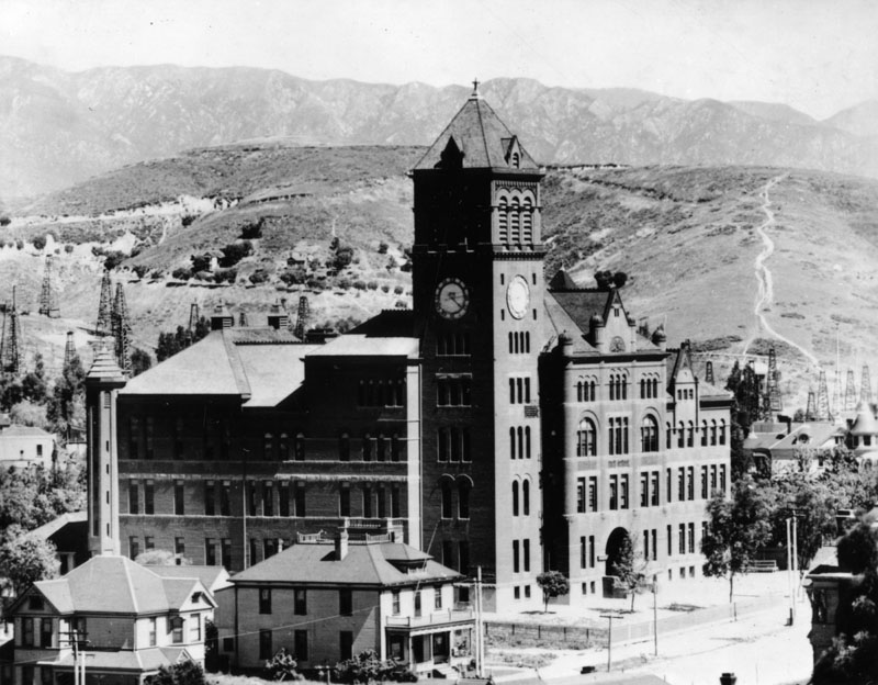 |
|
| (ca. 1901)* - View of Los Angeles High School, located on north Hill Street between California and Bellevue. Oil derricks, part of the Los Angeles Oil Field++, can be seen in the hills behind the school and to the left. |
Historical Notes The new Los Angeles High School building was enormous, especially for that time period. It was built on part of the site of the abandoned Fort Moore Hill Cemetery, the first Protestant cemetery in Los Angeles, which was spread over the slopes of the hill. ++Discovered in 1890, and made famous by Edward Doheny's successful well in 1892, the Los Angeles City Oil Field was once the top producing oil field in California, accounting for more than half of the state's oil in 1895. In its peak year of 1901, approximately 200 separate oil companies were active on the field, which is now entirely built over by dense residential and commercial development. |
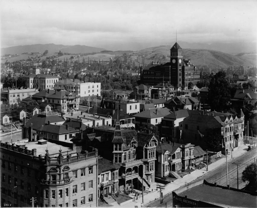 |
|
| (ca. 1905)* – Panoramic view looking northwest from the LA County Courthouse. Los Angeles High School stands tall in the background on Fort Moore Hill. The Temperance Temple building is seen in the lower-left located on the northwest corner of Temple and Broadway. The Broadway Tunnel is out of frame at right-center. |
Historical Notes Early buildings commissioned to house the Los Angeles High School were among the architectural jewels of the city, and were strategically placed at the summit of a hill, the easier to be pointed to with pride. One of the school's long standing mottos is "Always a hill, always a tower, always a timepiece." |
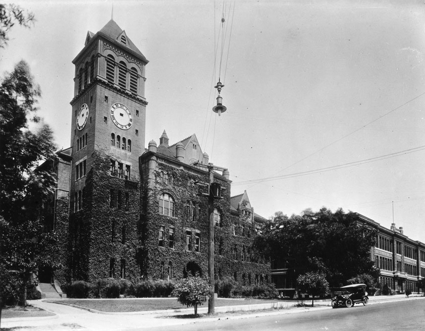 |
|
| (ca. 1910)* - View of Los Angeles High School, overgrown with vines. At left, the vines stop on the clock tower just beneath the clock, whose hands are missing. At right, a lone automobile is parked along the sidewalk near a second, three-story building. |
Historical Notes In 1917, Los Angeles High School moved to its current location at 4650 Country Club Drive (now West Olympic Boulevard), which incidentally is not on a hill. |
* * * * * |
Los Angeles High School (3rd location)
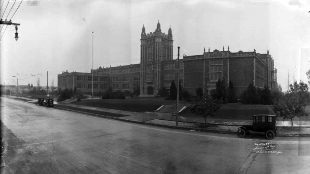 |
|
| (1924)* - View showing Los Angeles High School at its third location, built in 1917 and located at 4650 Country Club Drive (now Olympic Boulevard). The main building is three and a half stories, while the wings perpendicular to the street are two and a half stories, and the central tower is five or six stories. The street is empty except for three parked automobiles. |
Historical Notes In 1917, Los Angeles High School moved to its current location at 4650 Country Club Drive (now West Olympic Boulevard). Olympic Boulevard was originally named 10th Street for most of its length, except for a couple of shorter stretches, one of which was named Country Club Drive. In 1932, the entire length of the street, from East L.A. to Santa Monica, was renamed Olympic Boulevard for the Summer Olympics being held in Los Angeles that year. |
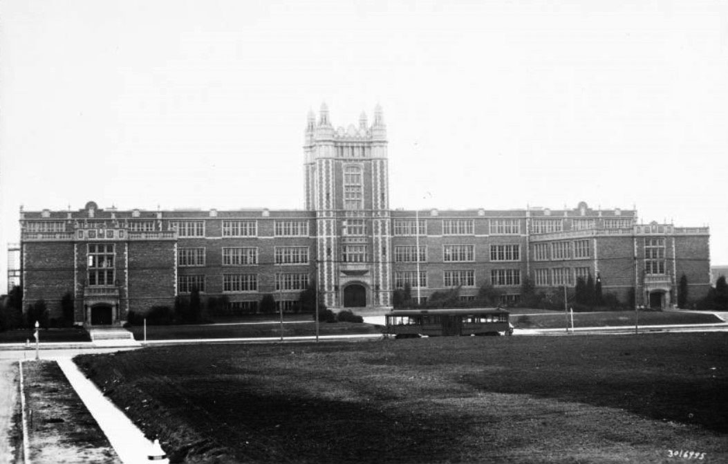 |
|
| (ca. 1925)* - View of Los Angeles High School with streetcar in front, as seen from what appears to be an empty lot across the street. The four-story brick building of the high school is shown at a distance in three sections: the main section of the building runs the width of the image and does not extend past four stories. At the center of this, a section of tower houses the main entrance, capped at its four corners by minarets. It adds an extra story. The third section is pictured at the far right and extends perpendicularly from the main building. It is three stories tall. |
Historical Notes To honor the graduates and under-graduates of the school who took part in the World War, in 1922 the students voted to buy the acreage across the street, a plot of ground approximately 315 by 350 feet, to be used as a memorial park. In 1923, the land was purchased by the student body and alumni association of Los Angeles High School, and deeded to the City of Los Angeles in commemoration of twenty alumni who died in World War I. Six years later, the city gave the Los Angeles Public Library the right to establish a branch on the site. In 1930, a library opened in the park (LA Public Library - Memorial Branch). The students of Los Angeles High School commissioned a stained glass window with the names of the twenty alumni and an inscription stating hope for peace among nations. The window, designed by the renowned Judson Art Studio, was inspired by those in the Parliament Building. |
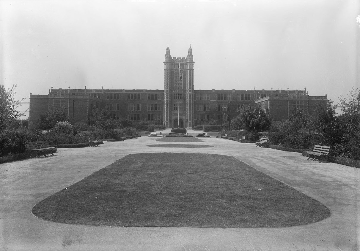 |
|
| (1933)* – Rear view of Los Angeles High School looking north. Photo: by Adelbert Bartlett |
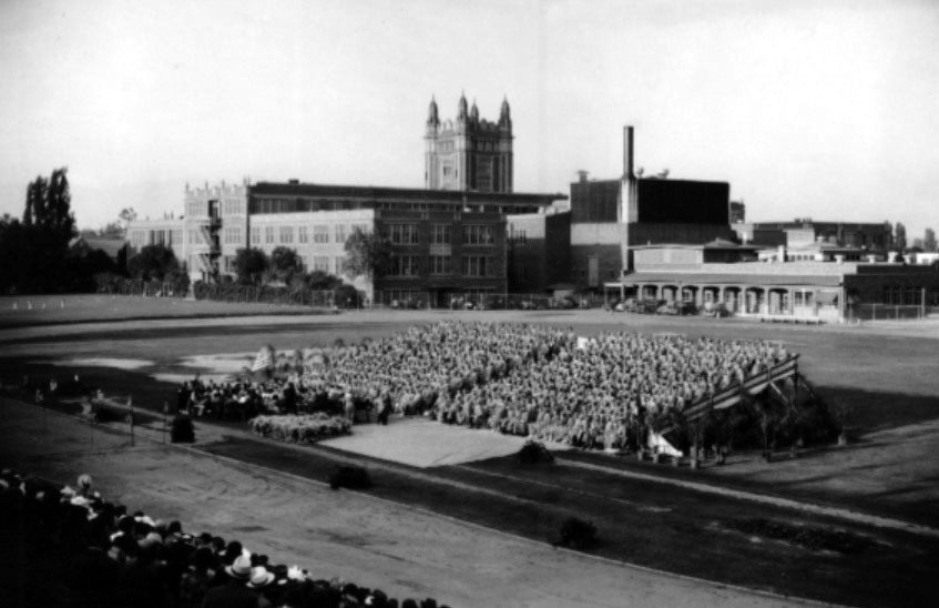 |
|
| (1940)* - South view of Los Angeles High School, with graduating class of 1940 in foreground, 4650 W. Olympic Boulevard. |
 |
|
| (2006)* - Los Angeles High School logo. |
Historical Notes Team Name: Romans Colors: Blue and White |
* * * * * |
St. Athanasius Episcopal Church
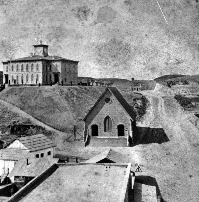 |
|
| (ca. 1874)^^* - View showing Los Angeles High School atop Poundcake Hill and St. Athanasius Episcopal Church (center), widely thought to be the first Protestant house of worship in Los Angeles. |
Historical Notes Built in 1864, St. Athanasius was the first Episcopal church in the City of Los Angeles. It was situated on the northeast corner of Poundcake Hill at Temple and New High Streets.^^* |
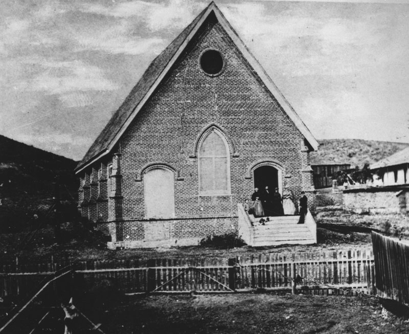 |
|
| (1879)* - Exterior view of St. Athanasius Episcopal Church showing several people standing by the front doorway. |
Historical Notes Caption on the photograph reads, "Photograph of Saint Athanasius Episcopal Church the first Protestant house of worship erected in Los Angeles in 1864. On S.W. corner of Temple and New High Streets. Rev. & Mrs. Messenger standing in doorway of the church." |
|
|
| (1870s)^## - View looking northeast from the top of Poundcake Hill, where Los Angeles High School was located, showing the Downey Block (center) at Temple and Main streets. The building with the pitched roof in the foreground is St. Athanasius Episcopal Church. Acroos the street is the Temple Street Stables (lower-left). Also seen is the Temple Block at center-right. The Los Angeles River runs horizontally across the top of the photo and the wide street at upper left is Aliso Street where the 101 Freeway runs today. |
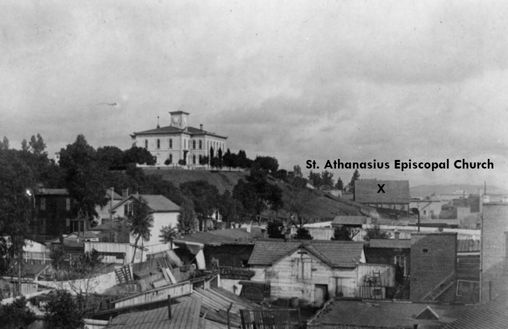 |
|
| (ca. 1883)* - View looking north showing Los Angeles High School on Poundcake Hill, taken from 1st and Spring Streets. Also seen is the profiile of Saint Athanasius Episcopal Church, marked with an X. |
Historical Notes At time of the above photo, St. Athanasius Episcopal Church had been renamed St. Paul's Church (1881).* |
|
|
| (ca. 1884)* - View of an unpaved Temple Street, looking west as seen from the second floor of the Temple Block on Main Street. Horse-drawn carriages and wagons are parked along the street. In the right foreground is the Downey Block, housing the Crystal Palace, wholesale and retail sellers of crockery and china ware. Behind it is the Temple Street Stables. At left-center with ptiched roof and circular window is the St. Athanasius Episcopal Church located at the southwest corner of Temple and New High streets. Poles strung with electric/telephone wires are seen in the foreground. |
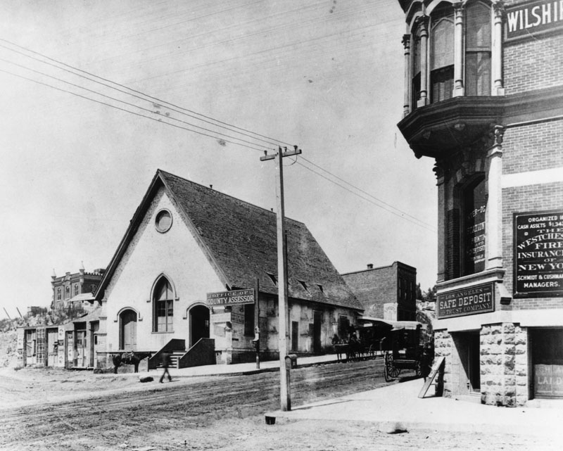 |
|
| (ca. 1884)* - Exterior view of the Los Angeles County Assessor's office, known originally as St. Athanasius Episcopal Church (St. Paul's), located on the southwest corner of Temple and New High Street. Built in 1864, St. Athanasius was the first Episcopal church in Los Angeles. |
Historical Notes In 1883, the church building was sold to Los Angeles County, and a new St. Paul's Church was built where the Biltmore Hotel now stands at Pershing Square.* |
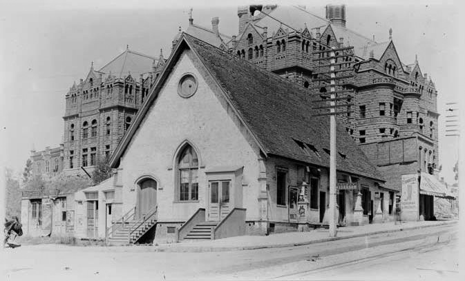 |
|
| (1891)^*# - View of the same building (originally the St. Athanasius Episcopal Church) shortly before its demise, with a clockless County Courthouse in the background. |
Historical Notes The original 1860s-era bell from St. Athanasius lives on at the Church of the Epiphany at 2808 Altura Street in Lincoln Heights. |
* * * * * |
Antonio Maria Lugo Adobe
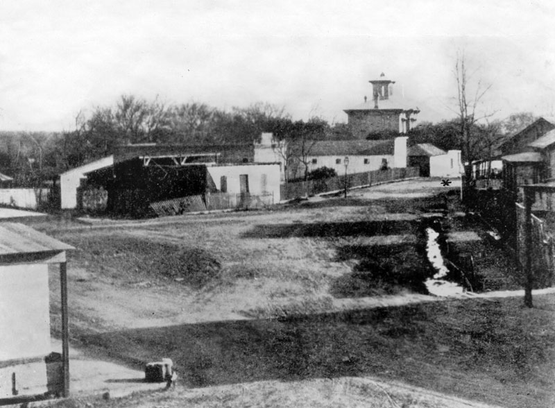 |
|
| (ca. 1875)* - Early view showing the Antonio Maria Lugo adobe, built in 1820, and located at San Pedro near 2nd Street. The Lugo adobe is indicated by a star (middle right). The large towered building seen in the center distance is the Wallace Woodworth residence. |
Historical Notes In 1810, when Antonio Maria Lugo was 35 years old and a corporal in the Spanish army stationed in Santa Barbara, he requested and was given his first land grant, the grant that included Bell Gardens. Shortly thereafter, he became mayor of Los Angeles. |
.jpg) |
|
| (ca. 1885)* - Exterior view of the home of Don Antonio Mario Lugo located on San Pedro Street, near Second Street, Los Angeles. |
Historical Notes The Don Antonio Mario Lugo adobe was built in 1820. The single-story house has extended roof supported by beams at about every ten feet. A wooden fence encloses the perimeter to the right of the house. Trees are visible in the background. Picture file card reads: "1st house with wood floor?" |
* * * * * |
Los Angeles and Independence Railroad Depot
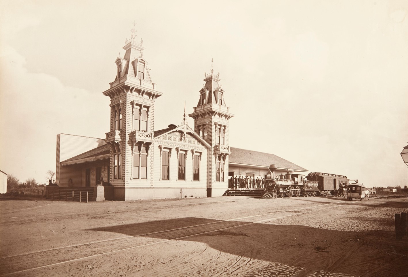 |
|
| (ca. 1877)* – The Los Angeles and Independence Railroad Depot, located at San Pedro and 5th Streets in downtown L.A., served as the eastern terminus of the 16.67-mile railroad line that extended to the Santa Monica wharf. Photo by Carleton E. Watkins. |
Historical Notes The Los Angeles and Independence Railroad Company was incorporated in January 1875 with Francisco P. Temple, John P. Jones, Robert S. Baker, T. N. Park, James A. Pritchard, J. S. Slauson, and J. U. Crawford, as directors. Col. Crawford was the engineer and general manager. The 16.67 miles of track between Los Angeles and Santa Monica were privately built without government subsidies or land grants, all in a little over ten months - primarily using 67 Chinese laborers imported for the task. Right-of-way between Los Angeles and Santa Monica was given by local ranchers who were anxious to have access to a railroad. The line opened October 17, 1875, with two trains a day running between Santa Monica and Los Angeles; the fare was fixed at $1.00 per trip, freight at $1.00 per ton. |
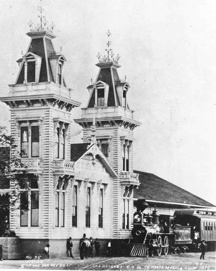 |
|
| (1875)^ - View of a steam locomotive in front of the Los Angeles and Independence Rail Road Terminal at Fifth Street and San Pedro Street. Two lavishly decorated brick towers extend from the main building to either side of its entrance. |
Historical Notes The wood Victorian building has two three-story square towers with wrought iron work at their apexes, with dormer windows in the roofs of the towers and small decorative balconies on the second-story windows. A statue of a sphinx stands guard (on the left) next to several doors at the head of a wide set of stairs on the left side of the building (out of view). |
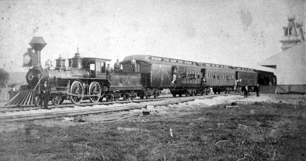 |
|
| (1876)^ – View showing Locomotive No. 1 and passenger cars of the Los Angeles and Independence Railroad on train tracks next to the railroad's terminal at Fifth Street and San Pedro Street in Los Angeles. The train is full of passengers and is about to leave for Santa Monica. |
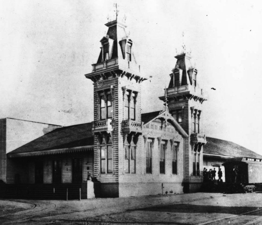 |
|
| (ca. 1877)^ – Exterior View of the Los Angeles and Independence Railroad Depot, San Pedro Street and Fourth Street, south of Fifth Street. A group of about six people are gathered on the platform near the end of a rail car (one is on the car) on the right side of the building. |
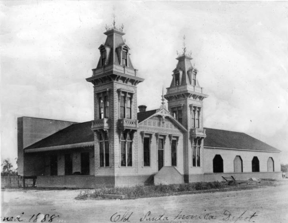 |
|
| (1888)* - View showing the Los Angeles and Independence Rail Road Terminal at Fifth Street and San Pedro Street. Writing at bottom of photo reads: “Old Santa Monica Depot” |
Historical Notes The railroad line, which extended to Santa Monica, was taken over by Southern Pacific, and the station was destroyed by fire in November, 1888. The right-of-way was purchased by Los Angeles Metro in 1990 and is now used for the Expo Line light rail line. Click HERE to see more on the Los Angeles and Independence Railroad. |
* * * * * |
LA's 1st Masonic Lodge
|
|
| (1870s)* - View showing (from L to R): the Pico House, Merced Theater, and the Masonic Lodge. This was the "first business block on Main Street". |
Historical Notes Los Angeles Lodge No. 42 is the first Masonic Lodge established in Los Angeles, and the second oldest in all of Southern California after San Diego Lodge No. 35.+## |
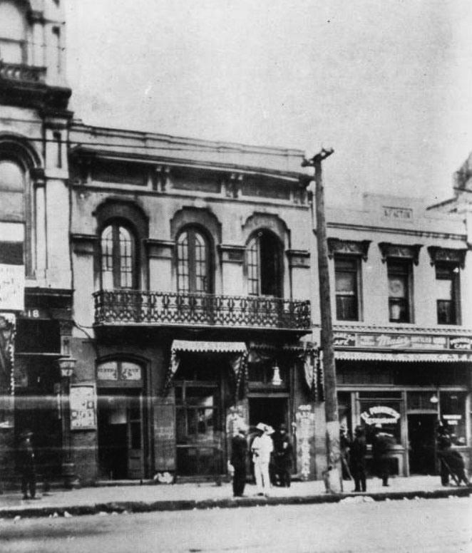 |
|
| (ca. 1885)^^*– View showing the first Masonic Lodge in Los Angeles, located at 416 ½ North Main Street. The lodge building is a two-story structure with a second floor balcony. There are three large French doors on the second story that open onto the balcony. The first floor has two doors flanking an awning covered window. Several pedestrians are standing in small groups on the sidewalk in front of the lodge. |
Historical Notes The first Lodge building was completed in 1858, and is where the Mason’s meeting place until 1868.+## |
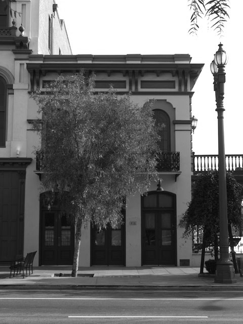 |
|
| (ca. 2006)+## - View showing the Old Lodge Building on Main Street as it apears today. |
* * * * * |
McDonald Block
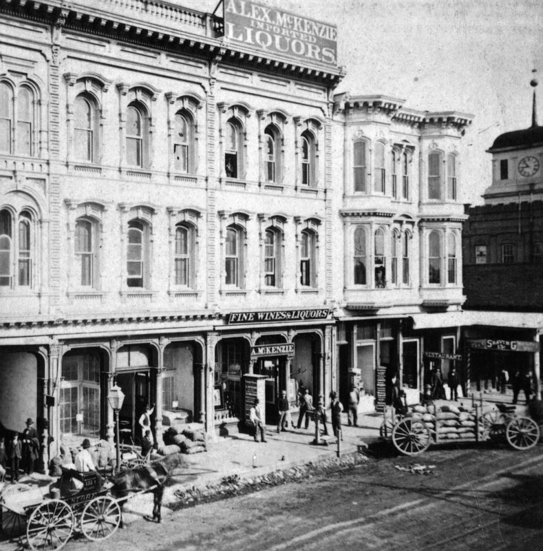 |
|
| (1876)* - Main Street between 1st and Court, Old McDonald Block, showing Alex McKenzie liquor store. John Temple's old courthouse building with its clock tower can be seen on the right. |
Historical Notes The first organizational meetings of the Los Angeles Athletic Club (LAAC) were held in the law offices of Judson, Gillette, and Gibson on the second floor of the old McDonald Block on Main Street in 1880. James B. Lankershim was the first president of the LAAC. He later became a leading developer of the downtown business district. |
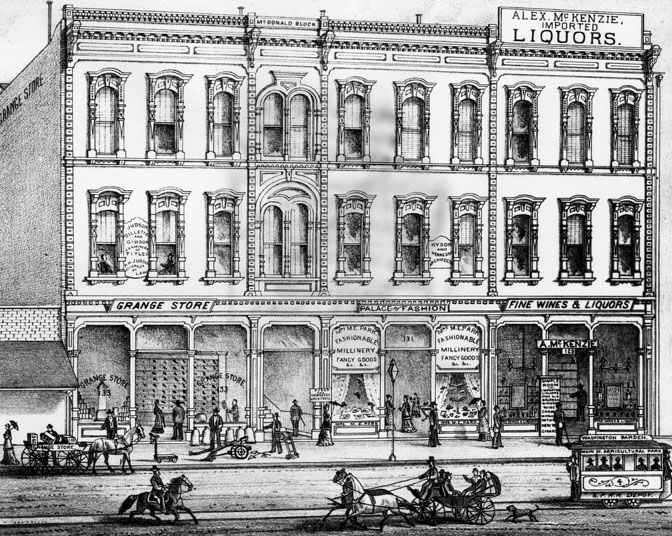 |
|
| (1880)* - Lithograph of McDonald Block building on Main Street. |
* * * * * |
Arcadia Block
|
|
| (1896)* - An artist's drawing of the west side of North Los Angeles Street, between Commercial and Arcadia, looking north. Arcadia Block, on the right, is on the southwest corner of Los Angeles and Arcadia Streets. The three towers of Baker Block can be seen in the background. The Hellman Building is on the left, then Samuel C. Foy Building, Wholesale & Retail Harness & Saddlery at 315 North Los Angeles Street. The tall pole seen at center-left is actually one of Los Angeles' First Electric Streetlights. It was 150-feet tall and located on Main Street. |
Historical Notes The Arcadia Block, located on the southwest corner of Los Angeles Street and Arcadia Street in early Los Angeles, was a significant structure in the city's history. Constructed between 1858 and 1859, it was the first all-brick commercial building in Los Angeles, marking a departure from the traditional adobe structures of the time. The building was commissioned by Abel Stearns, a wealthy cattle rancher and one of the earliest Anglo-American settlers in Southern California. He named the building after his wife, Arcadia Bandini de Stearns. |
|
|
| ( 1870s)* - View showing Don Abel Stearns' Arcadia Block, the first brick business building in Los Angeles, later demolished for the #101 Freeway. To its left is the Samuel C. Foy Building. Numerous horse-and-buggies are parked in front. |
Historical Notes In 1829 Abel Stearns came to Monterey, California, then settled in Pueblo de Los Angeles, present day Los Angeles. He obtained a concession to build a warehouse in San Pedro. Later, he established a stagecoach route connecting San Pedro Bay with the Los Angeles pueblo. In 1831, he built a three-story flour mill on North Spring Street, Los Angeles. Soon Stearns became one of the most prominent and influential Californian citizens of the pueblo. Abel Stearns represented Los Angeles under American military rule, 1848-1850. He was a delegate to the 1849 California Constitutional Convention, representing the district of Los Angeles; later he was California State Assemblyman, and a Los Angeles County Supervisor and Los Angeles City Councilman. In 1858, Stearns constructed a two-story business block on Los Angeles Street nearby and called it Arcadia Block after his young bride, Arcadia. |
|
|
| (1870s)* - View of the west side of North Los Angeles Street, between Commercial and Arcadia streets. The Samuel C. Foy Leather Depot stands in the center-right. In the far left is one of the first two-story buildings built in Los Angeles, by I.W. Hellman in 1870. |
Historical Notes Isaias Wolf Hellman built one of Los Angeles' first two-story building in Arcadia Block. Hellman was a German-born American banker and philanthropist, and a founding father of the University of Southern California. On September 1, 1868, Hellman and Temple founded Hellman, Temple and Co., the fledgling city’s second official bank. In 1871, Hellman and John G. Downey, a former governor of California, formed the Farmers and Merchants Bank, which became Los Angeles' first successful bank. Hellman lent the money that allowed Harrison Gray Otis to buy the Los Angeles Times and Edward Doheny and Charles Canfield to drill for oil. Hellman was also a major landowner in Southern California and his holdings included numerous city lots and vast swaths of former rancho land. In 1871, he and a syndicate bought the 13,000-acre Rancho Cucamonga. In 1881, Hellman and members of the Bixby family purchased the 26,000-acre Rancho Los Alamitos (now home to Long Beach and Seal Beach). He also purchased the Repetto Ranch (now Montebello) with Harris Newmark and Kaspare Cohn. Hellman and Downey also bought up swaths of Rancho San Pedro from the Dominguez family. Hellman also owned much of Boyle Heights with William H. Workman. At his death in 1920, Hellman was considered the leading financier of the Pacific Coast. His son (I.W. Jr.) and grandson (Isaias Warren Hellman) later became presidents of Wells Fargo Bank; and the Union Trust Company was merged with Wells Fargo after his death. His original Farmers and Merchants Bank would later merge with Security First National Bank. |
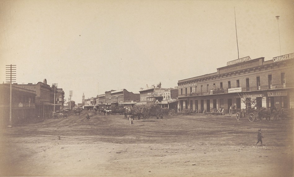 |
|
| (ca. 1890)* - View looking south on Los Angeles Street showing hay wagons, commercial buildings lining street. At right is the Arcadia block building housing the Los Angeles Printing Co., broom factory. |
Historical Notes The Arcadia Block building was the first business brick building in Los Angeles. The Arcadia Block became a symbol of commercial progress in Los Angeles and housed various businesses over the years, including Harris Newmark and Company, a wholesale grocery and drug merchant. It also featured Stearns's Hall on the second floor, which served as a venue for theatrical and political events. |
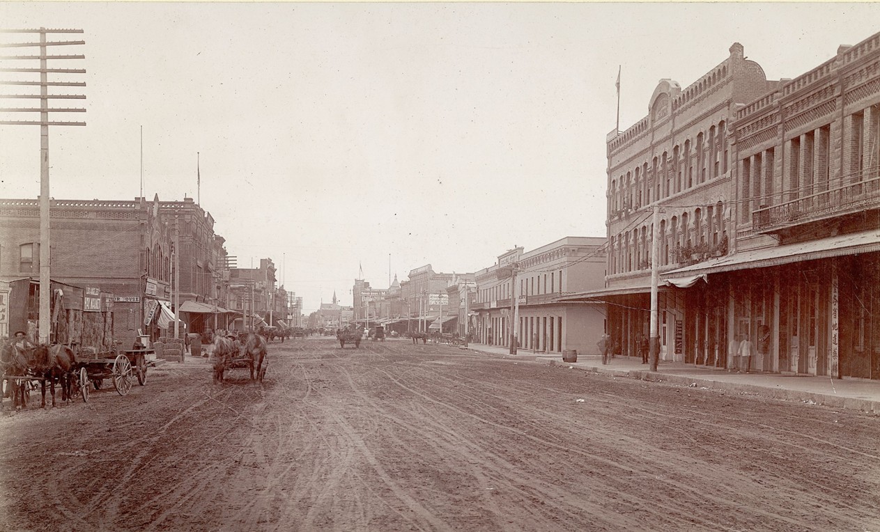 |
|
| (ca. 1895)* - View looking south on Los Angeles Street toward Arcadia Street. The Arcadia Block is seen on the SW corner with the Jennette Block and Garnier Block seen on the right. |
Historical Notes In the 1860s, a severe drought affected Stearns's ranching operations, leading to financial difficulties. Consequently, the Arcadia Block was sold at a sheriff's auction in 1867. Over the years, the building continued to host different enterprises, such as the Waterhouse and Lester Company, which dealt in vehicle and garage supplies. |
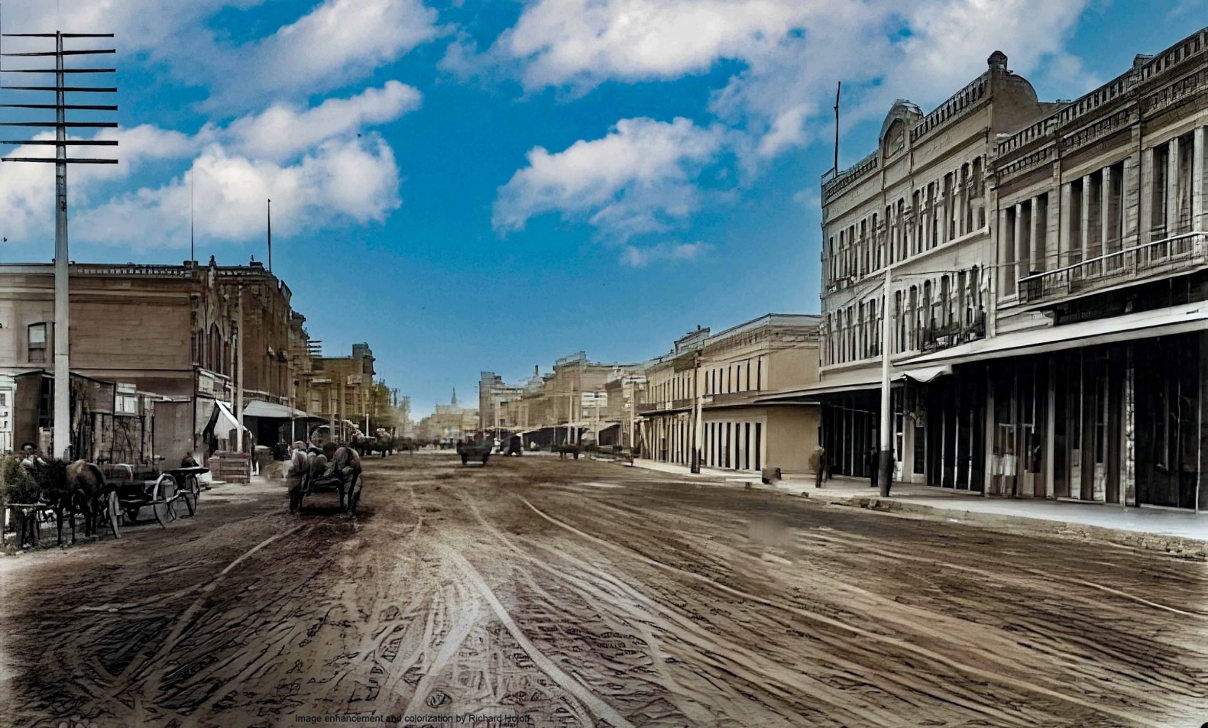 |
|
| (ca. 1895)* - View looking south on Los Angeles Street toward Arcadia Street. The Arcadia Block is seen on the SW corner with the Jennette Block and Garnier Block seen on the right. Image enhancement and colorization by Richard Holoff |
Historical Notes On the right stood three historic buildings: the lighter-colored, two-story Arcadia Building; the three-story Jennette Building just to the right of it; and the two-story Garnier Building further north. The Arcadia Building was demolished in 1927, and its site became a parking lot, remaining so until the construction of the 101 Freeway through downtown in the 1950s. At that time, both the Jennette Building and the southern half of the Garnier Building were also demolished to make way for the new freeway and the widening of Arcadia Street. The majority of the Garnier Building survived and remains today as the Chinese American Museum. |
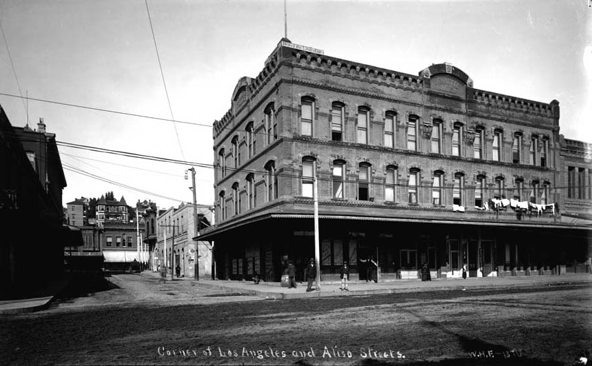 |
|
| (ca. 1895)* - Looking west on Arcadia Street from Los Angeles Street with Fort Moore Hill in the background. The three story Jennette Building is on the northwest corner of Arcadia and Los Angeles Streets with Sanchez Alley running directly behind it up to the Plaza at Republic Street. The edge of the Arcadia Block can be seen on the left (southwest corner). Photo is mismarked - Aliso Street did not extend beyond Los Angeles Street. This is looking west on Arcadia Street toward Fort Moore Hill. |
Historical Notes The section of Aliso Street seen above was renamed Arcadia Street in 1872. |
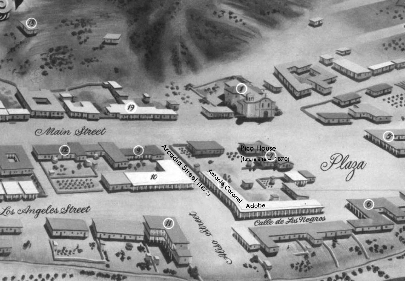 |
|
| (1850)* - Map view looking northwest showing the LA Plaza and surrounding area as it appeared in 1850. The intersection of Aliso Street (later Arcadia) and Calle de Los Negros is seen at lower center-right with the Antonio Coronel Adobe on the northwest corner. The building on the southwest corner (marked with the number 10) would be replaced by the Arcadia Block in 1858. |
Historical Notes The Pico House (center-right) wasn't built until 1870. The section of Aliso Street seen above was renamed Arcadia Street in 1872. |
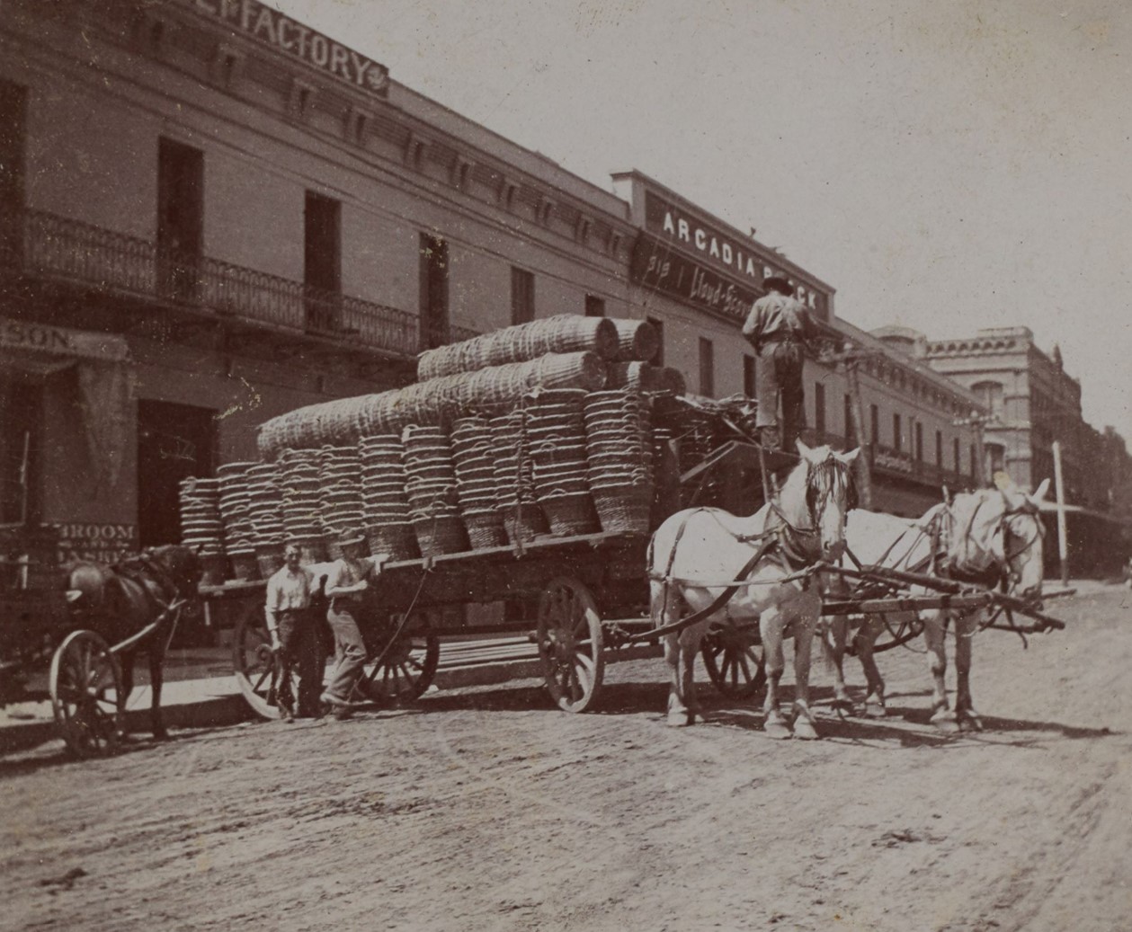 |
|
| (ca. 1900)* - A horse-drawn wagon carrying straw baskets is parked along North Los Angeles Street in front of the Arcadia Block building, located at the southwest corner of Arcadia Street. Visible are the Lloyd-Scovel Iron Company sign at 319 N. Los Angeles and a partially obscured sign for the Harrison & Dickson broom and basket factory at 317 N. Los Angeles to the left. In the distance, the three-story Jennette Building stands at the northwest corner of Los Angeles and Arcadia Streets. Photo from the Ernest Marquez Collection. |
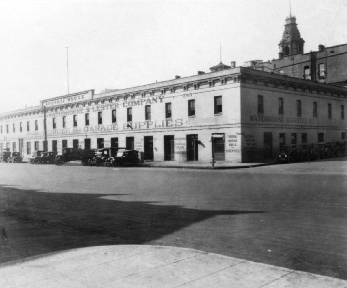 |
|
| (1920s)* - View of cars parked in front of the Arcadia Block on the southwest corner of North Los Angeles and Arcadia Streets, where the Waterhouse & Lester Company, Vehicle and Garage Supplies, is located. The top of the Baker Block, located on Main Street, can bee seen at upper-right. |
Historical Notes One of the most notable features of the Arcadia Block was its proximity to the Los Angeles City Hall site. In the late 1920s, as Los Angeles underwent rapid urban development, the new City Hall was being constructed just a few blocks away. By 1927, the steel framing of the City Hall tower could be seen rising behind the Arcadia Block, symbolizing the transformation of the city. |
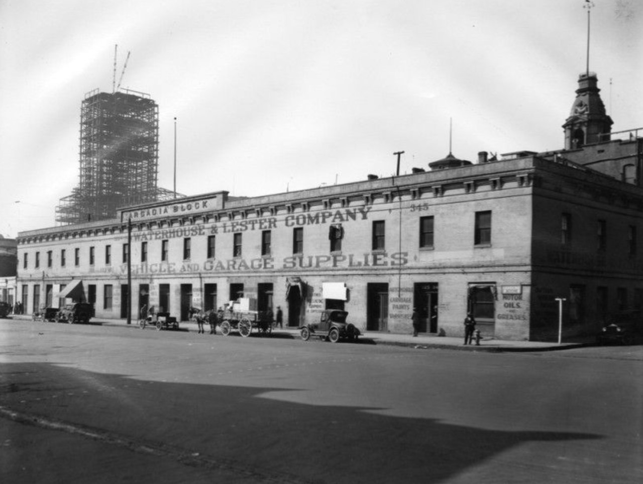 |
|
| (1927)* – View looking southwest from the corner of Los Angeles and Arcadia Streets, showing the Arcadia Block with the steel framing of Los Angeles City Hall under construction in the background and the top of Baker Block at the upper right. This photo is one of the last taken of the Arcadia Block before its demolition later that year. |
Historical Notes The Arcadia Block stood as a reminder of Los Angeles's early days until its demolition in May 1927. Its removal was seen as a loss of one of the last pre-Civil War structures in the city, representing the rapid modernization and transformation of Los Angeles during that period. Following its demolition, the site of the old Arcadia Block became a parking lot, remaining so until the construction of the 101 Freeway through downtown in the 1950s |
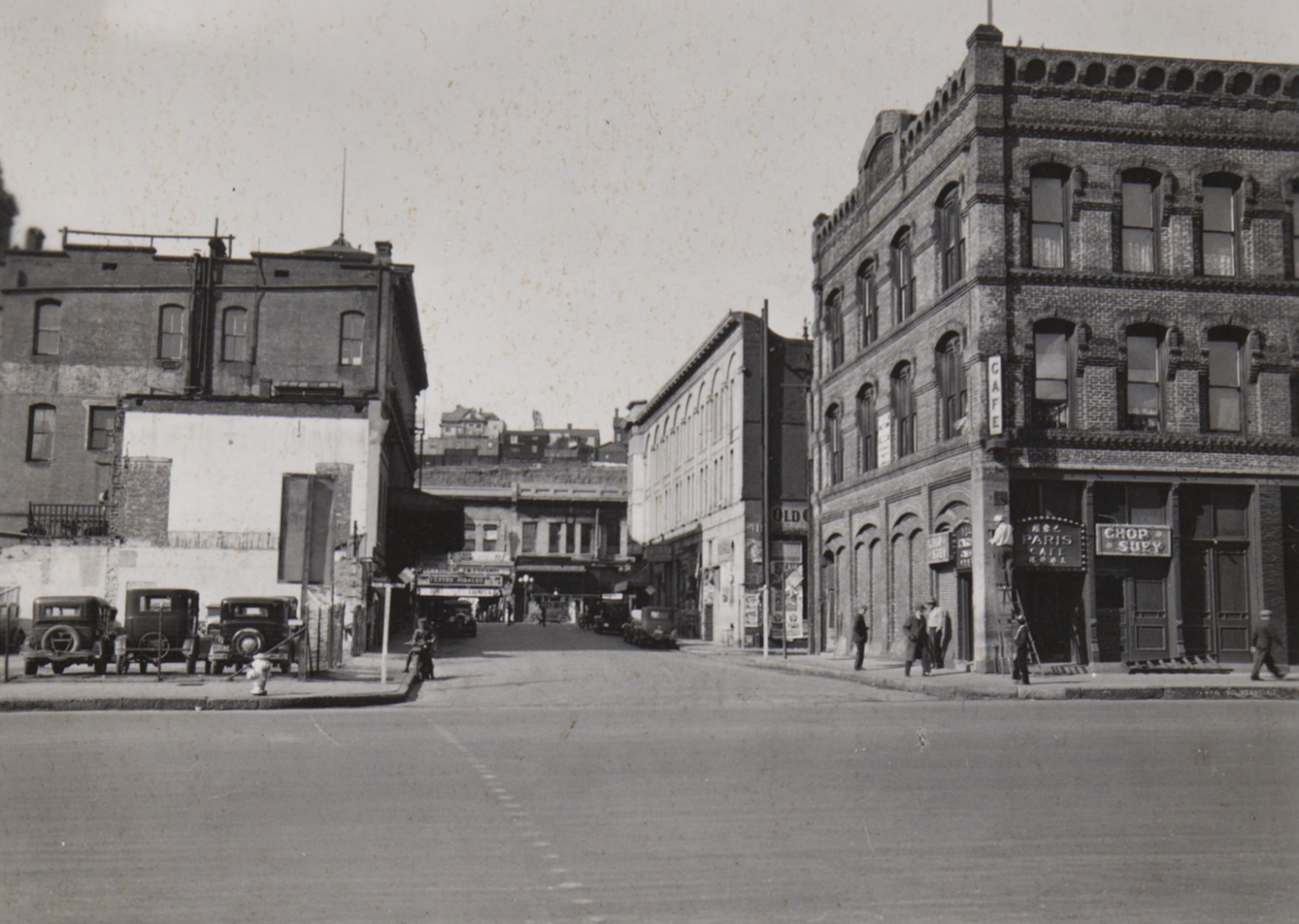 |
|
| (1933)* – Looking west on Arcadia Street from Los Angeles Street toward Fort Moore Hill. The Arcadia Block, on the left, is now a parking lot. On the right, at the northwest corner, stands the three-story Jennette Building, with Sanchez Alley running directly behind it to the Plaza. By the 1950s, the Jennette Building and everything south of Arcadia Street, along with most of Fort Moore Hill, would be removed to make way for the 101 Freeway. |
Historical Notes The construction of the 101 Freeway removed the Jennette Block, leaving the Garnier Building to its north. The Jennette Block was built around 1888, and the Garnier Building followed in 1890. |
 |
|
| (1970s)* - View from City Hall looking down toward the 300 block of N. Los Angeles Street, where the Hollywood Freeway (U.S. Route 101) now runs beneath the former site of the Arcadia Block. |
Then and Now
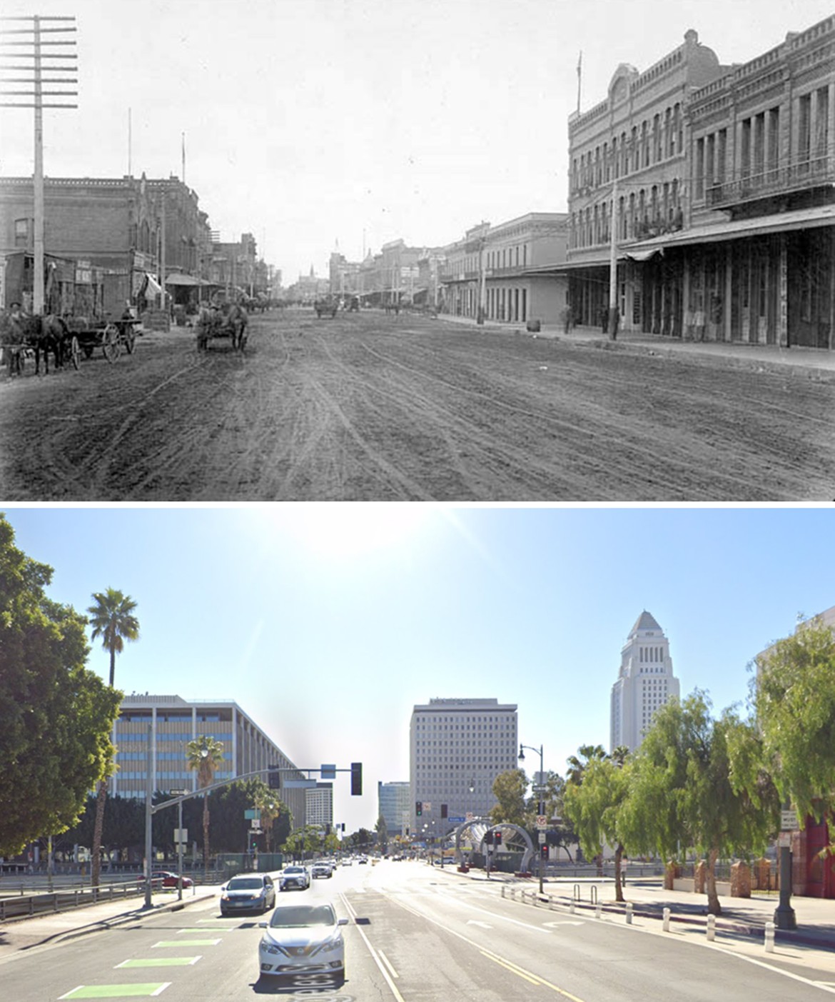 |
|
| (1895 vs. 2023)* – A ‘Then and Now’ comparison looking south on Los Angeles Street toward Arcadia Street. In the 1895 photo, three historic buildings stood on the right: the lighter-colored, two-story Arcadia Building; the three-story Jennette Building just to the right of it; and the two-story Garnier Building further north. The Arcadia Building was demolished in 1927, and the site became a parking lot until the construction of the 101 Freeway through downtown in the 1950s. During that time, the Jennette Building and a portion of the southern end of the Garnier Building were also demolished to make way for the freeway and the widening of Arcadia Street. The remaining and larger portion of the Garnier Building was preserved and now houses the Chinese American Museum. Photo comparison by Jack Feldman. |
Historical Notes In the 1950s, less than half of the Garnier Building was demolished to accommodate the construction of the Hollywood Freeway and the widening of Arcadia Street. Although a significant portion—specifically the southern part—was removed, the majority of the historic structure survived. Today, the remaining section of the Garnier Building stands as an important cultural landmark and houses the Chinese American Museum, preserving its legacy as a central hub for Los Angeles’ Chinese American community. |
Then and Now
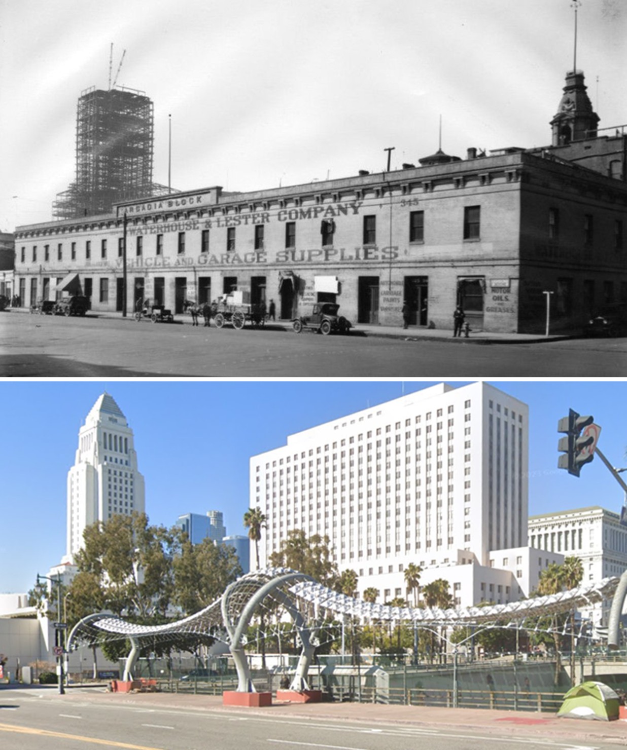 |
|
| (1927 vs. 2023)* – A ‘Then and Now’ comparison showing the Arcadia Block on the 300 block of N. Los Angeles Street. The Hollywood Freeway (U.S. Route 101) now runs beneath the site of this former historic landmark. Photo comparison by Jack Feldman. |
Historical Notes The Arcadia Block, located at the southwest corner of Arcadia and Los Angeles Streets in downtown Los Angeles, was demolished in May 1927. This historic building, constructed between 1858 and 1859, was one of the last pre-Civil War structures in the city and was razed to make way for new development during a period of rapid urban transformation. Following its demolition, the site of the old Arcadia Block became a parking lot, remaining so until the construction of the 101 Freeway through downtown in the 1950s. |
* * * * * |
Baker Block
 |
|
| (1880)* - Photograph of a lithograph of the Baker Block on the southeast corner of Main Street and Arcadia Street. The three-story building is a large rectangular building with short towers on the corners and massive domed tower at center. The building is Victorian style, with large arched windows on all three levels. |
Historical Notes The above lithograph was from Thompson and West's History of Los Angeles County, published in 1880. |
 |
|
| (1880)* - Built on the former site of the residence of Abel Stearns, the Baker Block was prominent in Los Angeles. The telegraph office has a sign at the corner of the building. |
Historical Notes The ornate three-story Baker Block was completed in 1878 by Colonel Robert S. Baker. Located at the north end of the 300 Block of N. Main Street, Baker Block was long considered the best thing in town and an early microcosm of city life. Offices for lawyers, physicians and businessmen were on the second floor and on the top floor were the City's most costly and fashionable apartments. As a point of interest, Colonel Robert Baker married Abel Stearn’s widow, Arcadia Bandini de Stearns, in 1874 (three years after Stearn’s death in 1871). The Baker Block was built on the same site as the Stearns Adobe four years later. |
 |
|
| (1880s)* - View looking southeast from Fort Hill, with the Baker Block seen on the southeast corner of Main and Commercial Streets. The Los Angeles River is visible in the distance at the upper left. Photo from the Ernest Marquez Collection. |
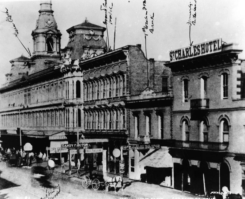 |
|
| (ca. 1880)* - View of North Main Street. Baker Block is on the left and the St. Charles Hotel, formerly the Bella Union Hotel, is on the right. |
Historical Notes At the time of its completion, Baker Block was reputedly the largest and most expensive structure to have been built south of San Francisco. Among other achievements, it is also believed to have been Los Angeles’ first steel-framed building, and it's first to have tiled floors. |
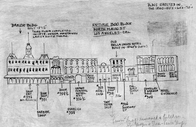 |
|
| (n.d.)* - Drawing of North Main Street, showing the location of the businesses in the entire 300 block, starting with the Baker Block on the left. The Baker Block was built in stages starting in the late 1840s through 1875. |
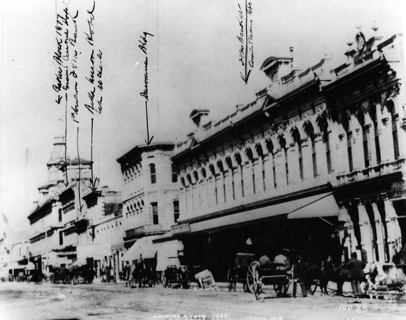 |
|
| (1882)* - View looking north on Main Street with buildings annotated. The Farmers and Merchants Bank opened October 29, 1882 in the Hellman Building. First National Bank, formerly Commercial Bank, was in the building on the right. The Baker Block is at the far left and the Ducommun Building can be seen at center-left of photo. |
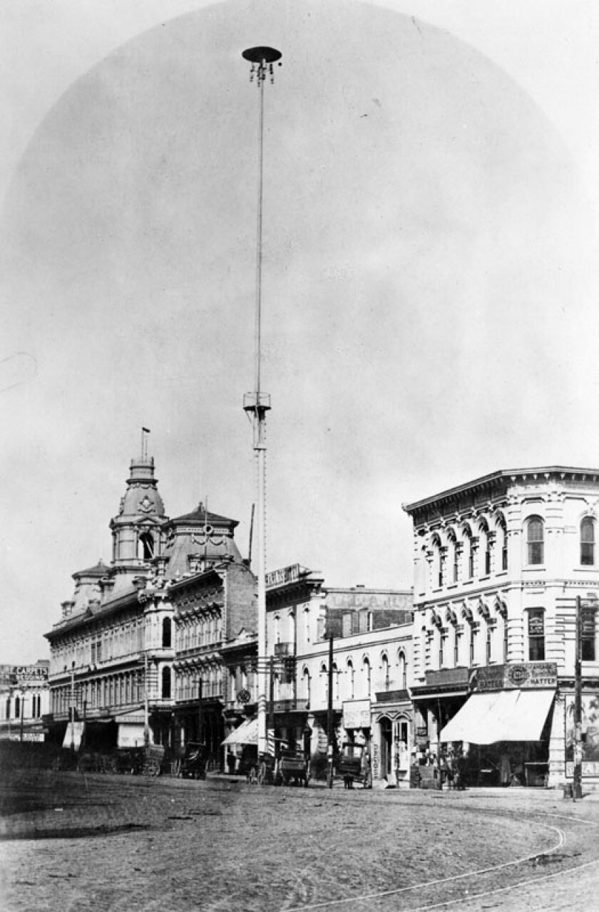 |
|
| (ca. 1882)**- One of the first of seven electric street lights installed in the City of Los Angeles at Main Street and Commercial Street in 1882. It stood 150 feet tall. Baker Block is on the left and the Ducommun Building on the right. |
Historical Notes Each of the 150-foot-high masts carried three carbon-arc lamps of three thousand candle-power. All seven lamps and a small power plant to provide the electricity were installed by C. L. Howland in 1882. In 1883, Howland and others formed the Los Angeles Electric Company.** Click HERE to see more in Early Los Angeles Street Lights. |
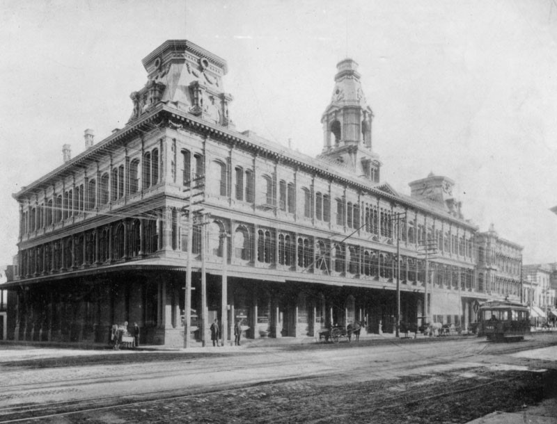 |
|
| (ca. 1890s)* - View looking southeast showing the Baker Block on the corner of North Main and Arcadia streets. |
 |
|
| (ca. 1920)* - View showing the Baker Block, located at 342 North Main Street at the corner of Arcadia Street (far left). |
.jpg) |
|
| (ca. 1930)* - Aerial view as seen from City Hall showing the Baker Block located at the north end of the historic 300 Block of N. Main Street. |
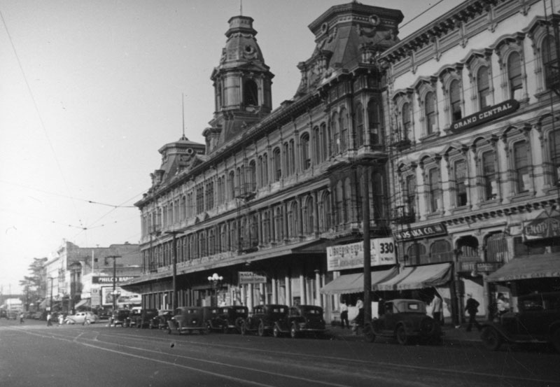 |
|
| (ca. 1930s)* - Looking across N. Main Street (foreground) towards the French Second Empire style Baker Block, on the southeast corner at Arcadia Street (lower left), and the Grand Central Hotel (right). Photo by Herman Schultheis. |
Historical Notes The Baker Block had lost much of its luster by the turn of the century, and by the time it was purchased by Goodwill Industries in 1919, it was all too clear that its days were numbered. As cruel fate would have it, the faded landmark was slated to give way to one of the most mundane projects in the 1930 Civic Center plan: a two-block extension of Aliso Street from Los Angeles Street to Broadway. |
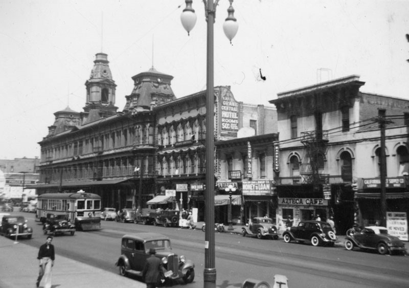 |
|
| (ca. 1940)* - View looking northeast showing the Baker Building (Block) and other buildings on the 300 Block of N. Main Street shortly before their demoliton. |
Historical Notes Despite plans to relocate the structure for another purpose, the city purchased the Baker Block from Goodwill in 1941 and demolished the building a year later. U.S. Route 101 now runs beneath where these buildings once stood. |
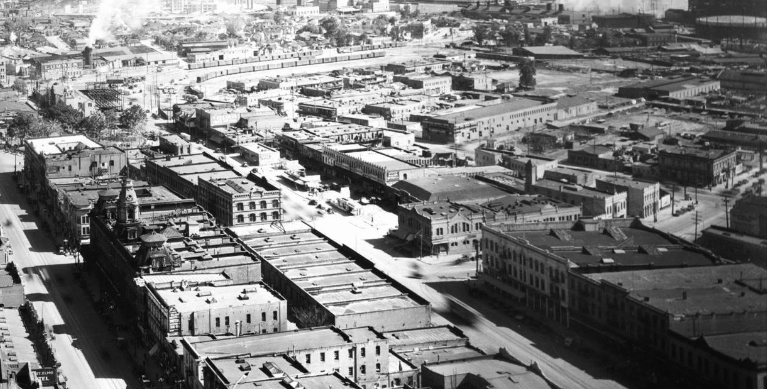 |
|
| (ca. 1930)* - View looking northeast from City Hall showing the old part of Los Angeles including the LA Plaza and Chinatown. At left can be seen the ornate Baker Building with its three towers located on the historic 300 block of N. Main Street. Los Angeles Street runs diagonally from lower-right to upper-left. Aliso Street runs from Los Angeles Street at center east and then turns diagonally up. Union Station wasn't completed until 1938 and would be located in the upper right of photo. |
Historical Notes In 1942, Baker Block and all the buildings on the 300 Block of N. Main Street were demolished to extend Aliso Street from Los Angeles Street to Broadway. Several years later the Hollywood Freeway (Route 101) would be constructed over this new Aliso Street extension. |
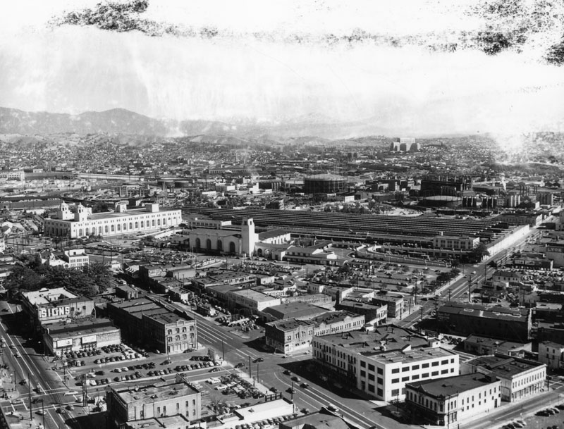 |
|
| (ca. 1951)* - Aerial view of Los Angeles near the Plaza after extension of Aliso Street. Union Station is seen at center and the LA Plaza at left-center. The 300 Block of N. Main Street, where the Baker Block once stood, is at lower left. It now consists of mostly parking lots and, of course, the new Aliso Street extension. |
Historical Notes In the early 1950's, the Hollywood Freeway (U.S. Route 101) would be constructed in line with Aliso Street. |
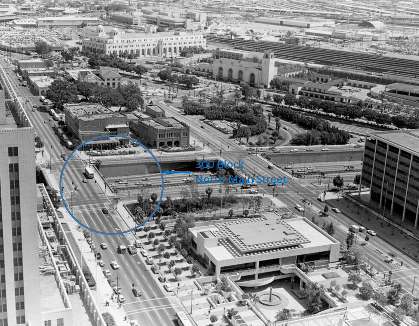 |
|
| (1970s)* - View from City Hall looking down toward the 300 Block of N. Main Street. The Hollywood Freeway (U.S. Route 101) now runs beneath where the Baker Block once stood. |
Historical Notes The Hollywood Freeway through downtown was opened in 1954. |
Then and Now
 |
|
| (1880s vs 2023)* - Looking southeast from Fort Moore Hill, the ornate Baker Block once stood on the southeast corner of Main and Arcadia Streets. Today, the 101 Freeway runs beneath the site of this historic building. |
Historical Notes The Baker Block was a significant historical building in Los Angeles, constructed in 1878 by Colonel Robert S. Baker and noted for its Second Empire architectural style and status as the city's first steel-framed building. Once considered the finest commercial establishment south of San Francisco, it housed various retail shops, offices, and upscale apartments. However, by the late 1930s, its prominence had diminished, leading to its purchase by Goodwill Industries and eventual demolition in 1942 to make way for the US 101 freeway, which opened in 1954. This transformation marked a significant shift in the urban landscape of Los Angeles, erasing a notable piece of its history. |
Then and Now
.jpg) |
|
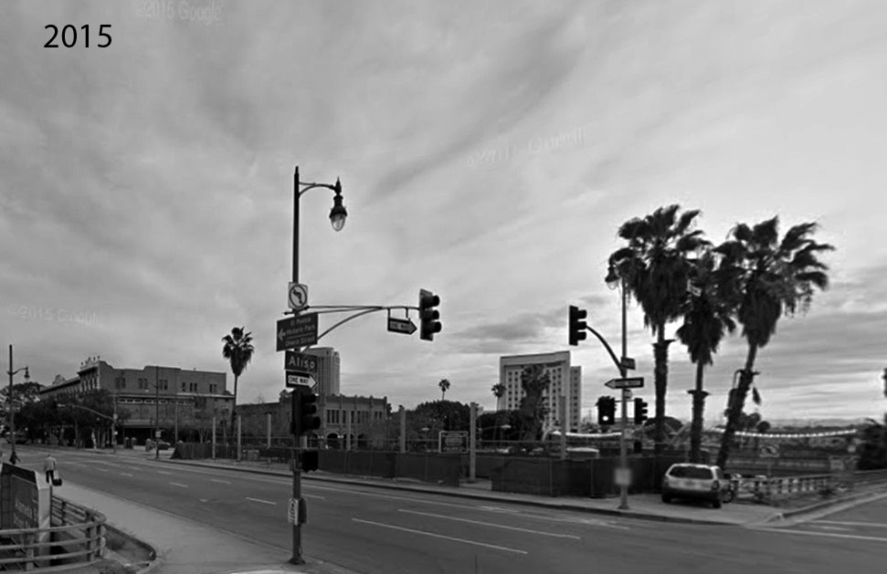 |
* * * * * |
Please Support Our CauseWater and Power Associates, Inc. is a non-profit, public service organization dedicated to preserving historical records and photos. Your generosity allows us to continue to disseminate knowledge of the rich and diverse multicultural history of the greater Los Angeles area; to serve as a resource of historical information; and to assist in the preservation of the city's historic records.
|
For more Historical Los Angeles Views click one of the following:
For Other Historical Views click one of the following:
See Our Newest Sections:
To see how Water and Electricity shaped the history of Los Angeles click one of the following:
Water:
Power:
References and Credits
**DWP - LA Public Library Image Archive
* LA Public Library Image Archive
*# Mojave Desert.net: Remi Nadeau
#* Ancestory.com - Margarita Bandini Winston
#^ Huntington Digital Library Archive
^# KCET - The Lost Hills of Downtown Los Angeles
+^Old Los Angeles and Environs blogspot
*+ The Jews of Los Angeles: Urban Pioneers
#**OUTPOST – Preserving Historical Data by W. S. Broke
#++National Geographic: California Before the Stars Arrived
++#Flickr.com
**^LA Fire Department Historical Archive; Belmont Hotel Fire
^##California State Library Image Archive
^^#The Museum of the San Fernando Valley
*^#CSULB - A Visit to Old LA: Hamburger Dept. Store; Main Street
^**UCLA-DWP Library Collection: Map of the City of Los Angeles as it Appeared in 1850
^*#Noirish Los Angeles - forum.skyscraperpage.com; Temple Block; Melrose and Richelieu Hotels; Hollenbeck Residence
***Los Angeles Historic - Cultural Monuments Listing
*^*California Historical Landmarks Listing (Los Angeles)
*#^Picture Gallery of Los Angeles History
*#*Historic Hotels of Los Angeles and Hollywood (USC - California Historic Society): Bella Union Hotel; Belmont Hotel; U.S. Hotel
##* Boston Public Library: Flickr.com
###Denver Public Library Image Archive
^***Homestead Museum: Workman and Temple Family
^**^Wilmington Historic Society
*^^*Los Angeles Past: Temple and Main Streets, Los Angeles - Then and Now
^^**Flickr.com - Floyd B. Bariscale Photostream: Dodson Residence
*^**Paradise Leased: Arcadia Hotel
**^*Santa Monica Beach Stories
**^^Boyle Heights History Blog: Hollenbeck Park
^#*^LA Times: Amestory Building; Don Antonio Maria Lugo
^**#LMU Digital Collection: Arcadia Hotel
^^*#Jewish Museum of the American West: Jacoby Brothers
**#^LAPL-El Pueblo de Los Angeles Historical Monument Photo Archive
*#^#Los Angeles Athletic Club History
^#*^LA Times: Newmark Fountain
*#^^A House for Equal Justice - Judge Elizabeth R. Feffer
#^*#Urban Diachrony: East side of North Main Street south of Arcadia Street
#^^#Los Angeles County Bar Association: Courthouse Clock
^##^Los Angeles Downtown News.com: A True Soap Opera
##^*Publicartinla.com: Bella Union Hotel Site
#***LAUSD.net; LA Memorial Library
#*^*Photos of Vintage Los Angeles: Facebook.com
#*^^Flickr.com: Views of Los Angeles
^* Wikipedia: Abel Stearns; Pío Pico; Workman-Temple Family; Jonathan Temple; Los Angeles Herald-Examiner; Charles Maclay; Los Angeles High School; Cathedral of Saint Vibiana; John Edward Hollenbeck; Foy House; Isaias W. Hellman; Isaac Newton Van Nuys; Wells Fargo; Los Angeles Plaza Historic District; Harrison Gray Otis; Harris Newmark; Los Angeles Athletic Club; The Church of Our Lady the Queen of Angels; Los Angeles and Independence Railroad; Phineas Banning; UCLA; History of UCLA; Garvanza, Los Angeles; Highland Park; Ozro W. Childs; Ducommun; James H. Dodson Residence; Domingo Amestoy; History of Los Angeles Population Growth; Spring St. School; Fort Moore; Los Angeles High School; Harris Newmark
< Back