Early Views of Hollywood (1850 - 1920)
Historical Photos of Early Hollywood |
 |
|
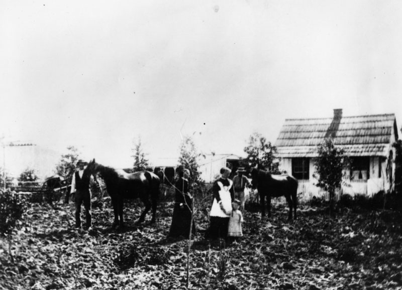
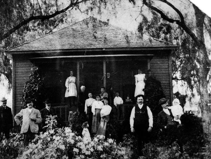
| (1860)* - View of the Duin residence, a small ranch house at Western and Lemon Grove Avenues in Hollywood. Two women and a child as well as two men with their horses pose for the camera at the ranch. |
Historical Notes In 1853, one adobe hut stood in Nopalera named for the Mexican Nopal cactus indigenous to the area. By 1870, an agricultural community flourished in the area with thriving crops of many common and exotic varieties. The area was known to these residents as the Cahuenga Valley, after the pass in the Santa Monica Mountains immediately to the north (Cahuenga is the Spanish name for the Tongva village of Kawengna, meaning place of the mountain). Soon thereafter, land speculation led to subdivision of the large plots and an influx of homeowners. |
 |
|
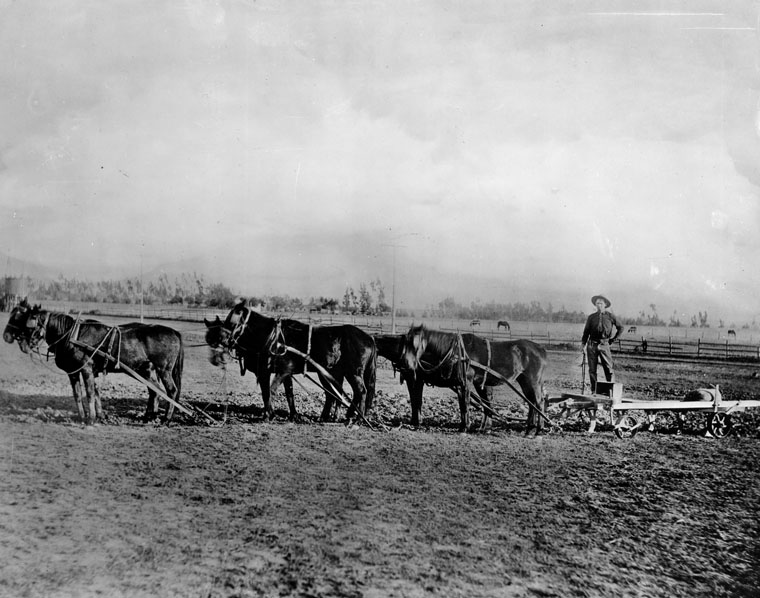
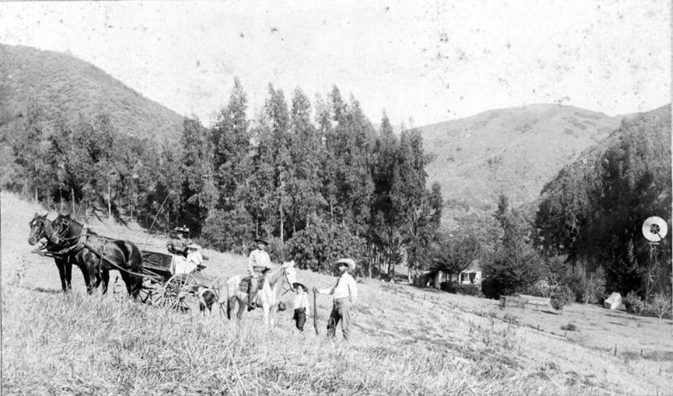
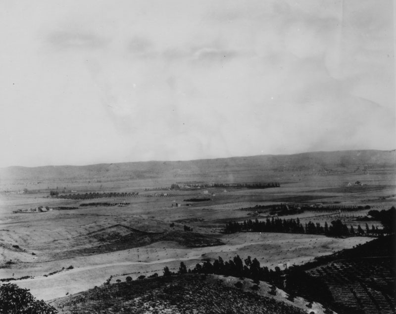
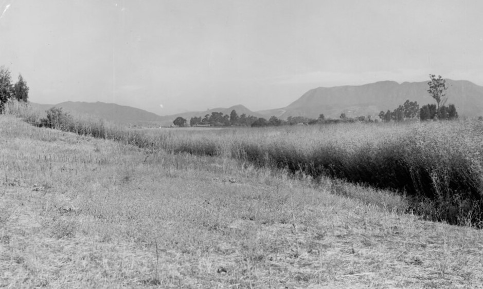
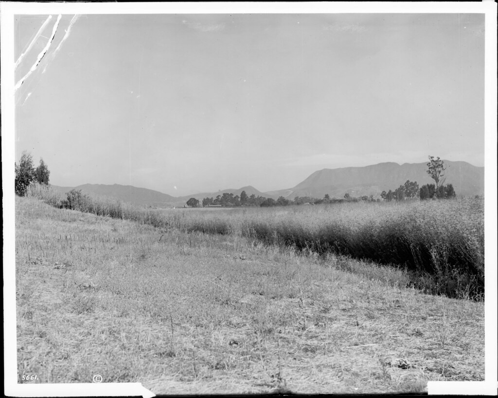
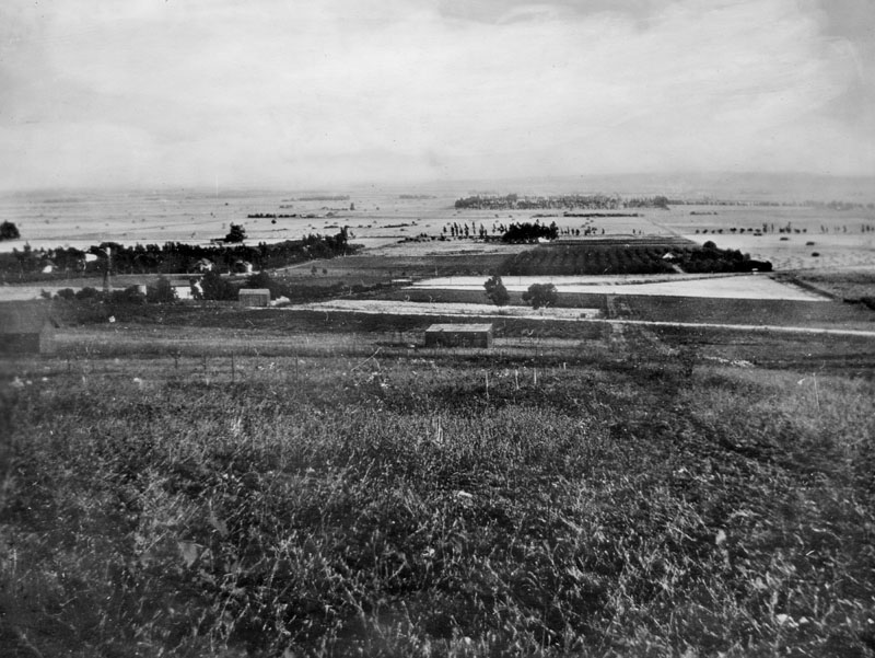
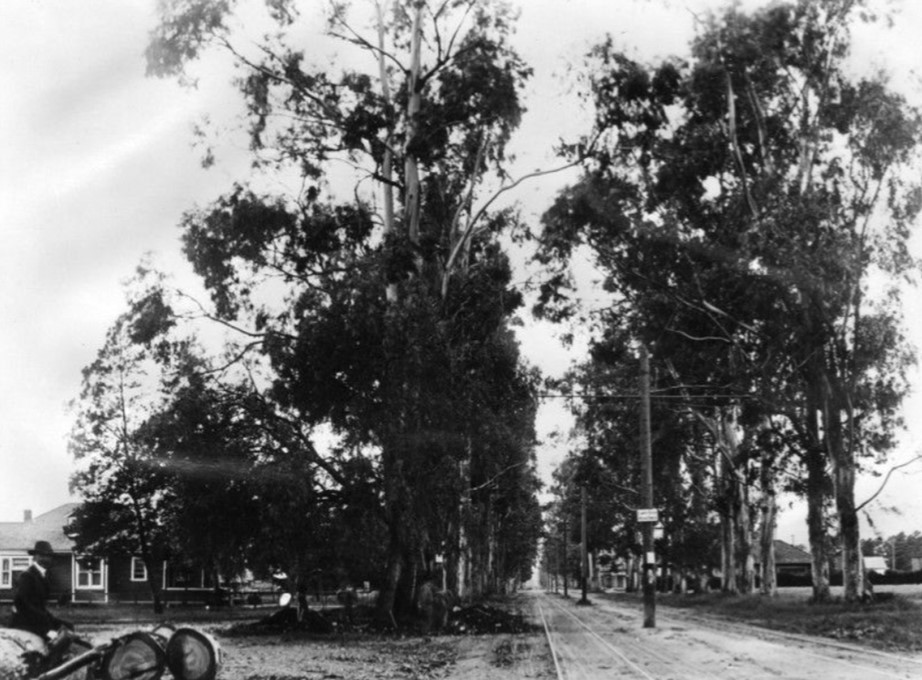
| (ca. 1874)* - Farmer Dennis Sullivan cultivates land near present-day Vermont Avenue, where Los Angeles City College now stands. The site was also home to UCLA before the university relocated to Westwood. View is looking north toward the Hollywood Hills. |
Historical Notes Today, Vermont Avenue effectively marks the eastern end of Hollywood. It starts in Griffith Park at the Greek Theatre in the Los Feliz neighborhood as a one-lane divided road (it is known as Vermont Canyon Road north of this point) and at the intersection with Los Feliz Boulevard, it widens to a two-lane road. Vermont Avenue passes to the east of the Barnsdall Art Park at the intersection with Hollywood Boulevard and the Children's Hospital of Los Angeles at Sunset Boulevard. |
 |
|
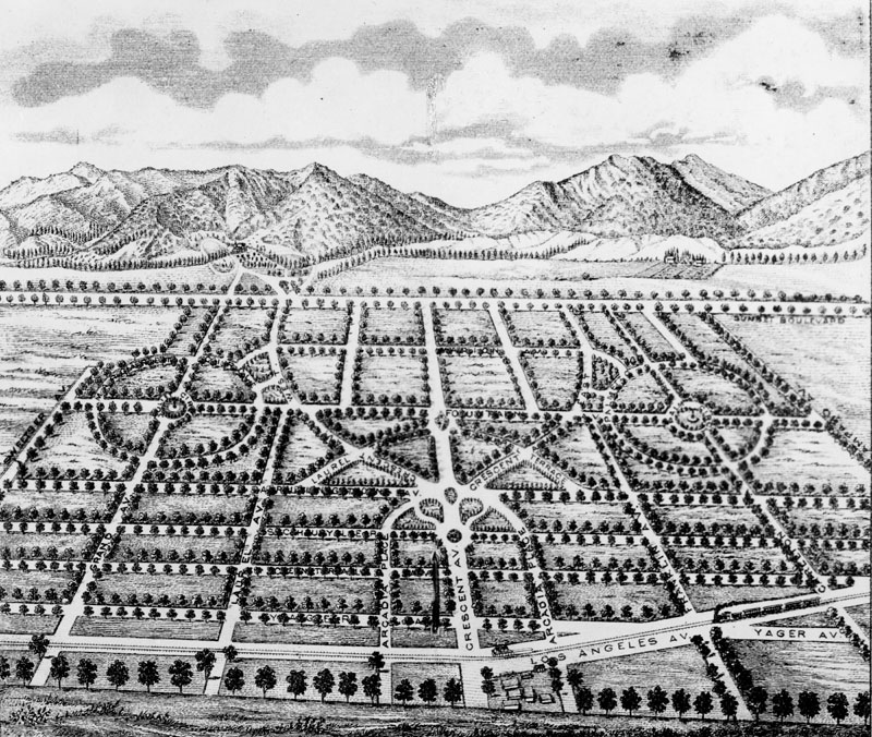
| (1877)* - "Birdseye view" drawing of an 1877 land promotional plan for a community to be known as Cahuenga, "the model suburb of Los Angeles, eight miles from the city, eight miles from the sea." Its northernmost street is Sunset Boulevard. |
Historical Notes The new community of Cahuenga was never built as shown above, with circular streets, etc., but some of its street names were later used elsewhere in the Hollywood area. |
 |
|
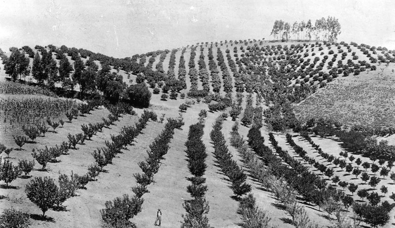
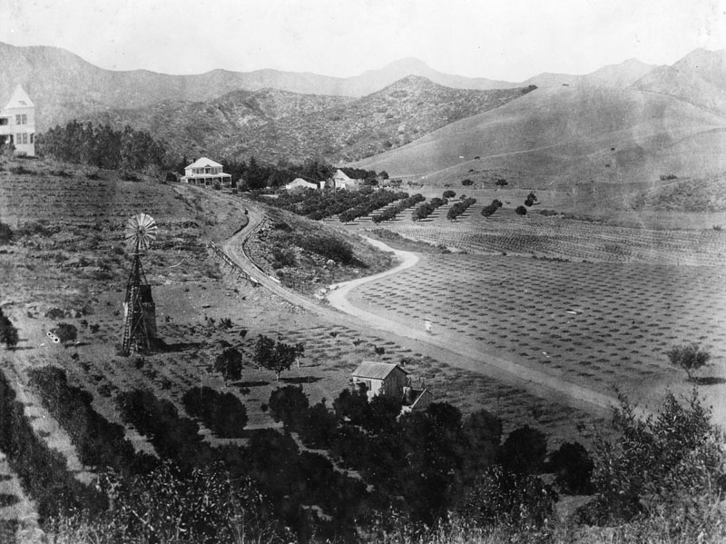
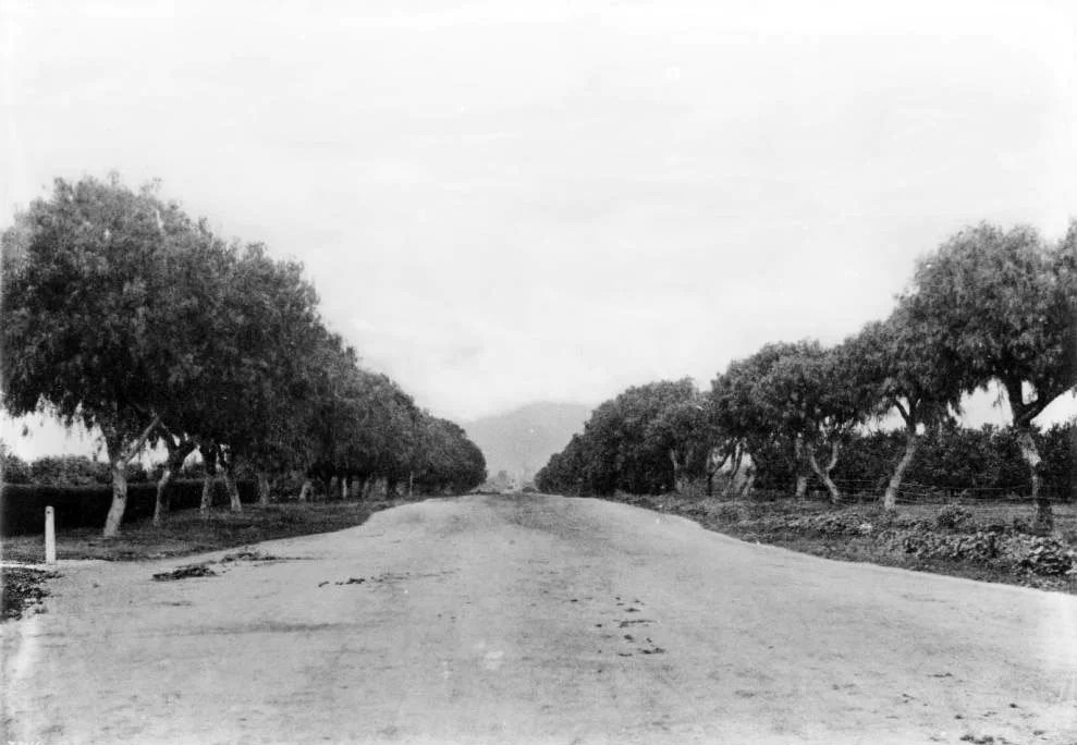
| (1880)* - View of the many orange trees that line the hills (later Krotona Hill), located near Gower and Beachwood Drive, in Hollywood. A man can be seen standing in the orange groves. |
Historical Notes In 1911, the Theosophical Society of Krotona established a colony on the above land located just north of the J.B. Rapp farm. The hill began to be known as Krotona Hill. |
 |
|
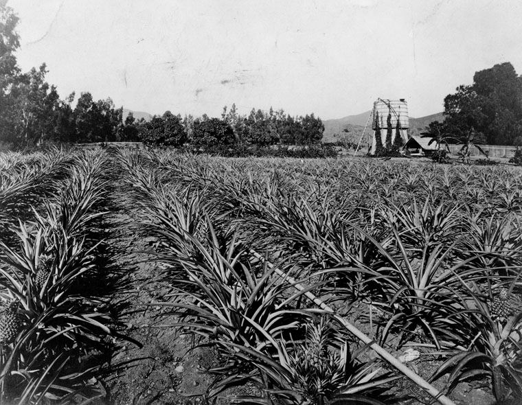
| (ca. 1880)* - View of J. B. Rapp's pineapple orchard located at Franklin and Beachwood, in Hollywood. |
Historical Notes J.B. Rapp began as a lemon grower but expanded into more exotic fruits–dates, avocados and pineapples, among others. Although it is likely that these fruits had their origins on local ranchos, Rapp was among the first to grow them commercially. At a time when oranges and lemons were rare delicacies for most Americans, pineapples and avocados must have caused a sensation. Hollywood’s frost-free climate made the cultivation of these crops possible. |
* * * * * |
Cahuenga Pass
 |
|
| (1882)* - Before roads and rail lines were built traveling through the Cahuenga Pass was by wagons and horses or on foot. This picture was taken at the summit. There is a saloon concealed among the trees. |
Historical Notes The Cahuenga Pass connects the Los Angeles Basin to the San Fernando Valley and is the lowest pass through the mountains. |
.jpg) |
|
| (1882)* - View of the summit of Cahuenga Pass with a saloon, Cahuenga Tavern, situated between the tall eucalyptus trees. |
Historical Notes Cahuenga is the Spanish name for the Tongva village of Kawengna, meaning place of the mountain. |
 |
|
| (n.d.)* - View of Cahuenga Tavern, also known as Eight Mile House, situated between eucalyptus near the summit of Cahuenga Pass. |
Historical Notes In the 1870s, a primitive hotel -- named the Eight Mile House because Los Angeles was eight miles down the road -- rose among a stand of eucalyptus trees inside the canyon. |
 |
|
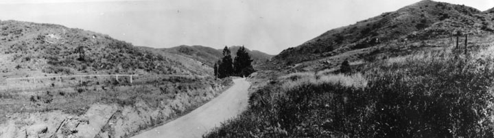
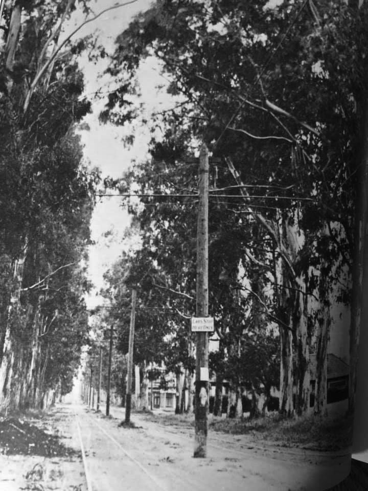
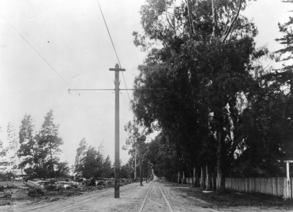
| (n.d.)* - View of early Cahuenga Pass. The road runs around and through a cultivated area. Click HERE to see more Early Views of Cahuenga Pass |
Historical Notes As late as 1914, filmmaker Cecil B. DeMille rented a wooden cabin in the pass as his home. He rode daily into his studio on horseback -- with a revolver on his hip. |
* * * * * |
Six Mile House (Sunset and Gower)
 |
|
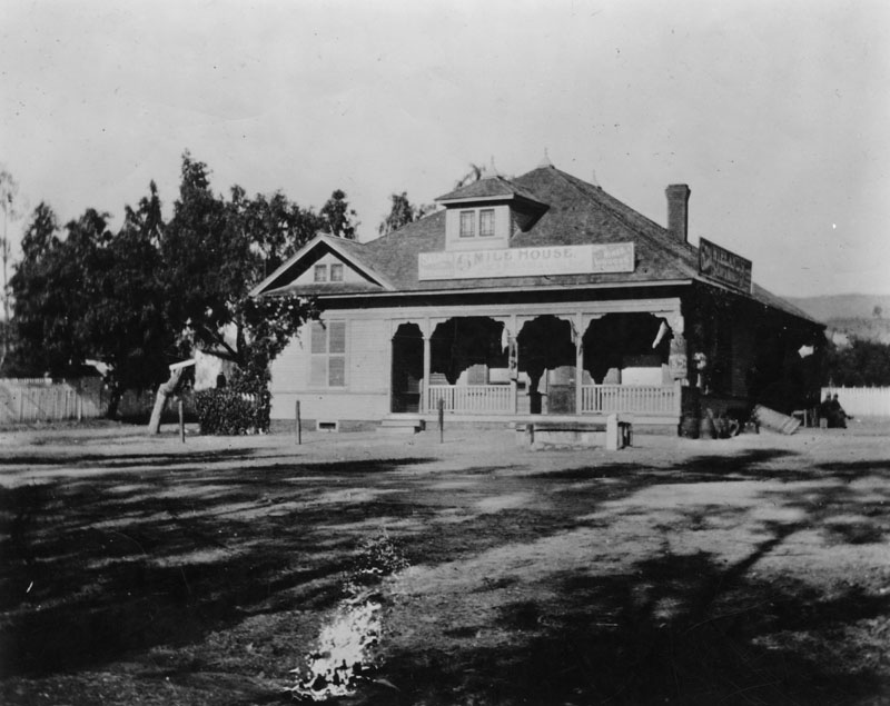
| (ca. 1885)* - Exterior view of Six Mile House, a bar offering wines and liquors, located on Sunset Blvd. at Gower Street in the 1880s. Just six miles from Los Angeles, it was a stopping point for 20-mule teams coming out Sunset Blvd. into the San Fernando Valley. |
Historical Notes Sunset Boulevard was dedicated in 1888. Earlier called Bellevue Street--and with some small sections called Short, Bread and Marchessault streets (after Mayor Damien Marchessault)--it started on U.S. Sen. Cornelius Cole's hill in what is now Hollywood, which afforded a fine view of the sunset over the Pacific. By 1937, 11 streets in Hollywood were named after the Cole family. Gower Avenue was dedicated in 1893. Named because it ran along the west side of the ranch belonging to George T. Gower. California's first films were made on the corner of Gower and Sunset Boulevard in 1911. |
 |
|
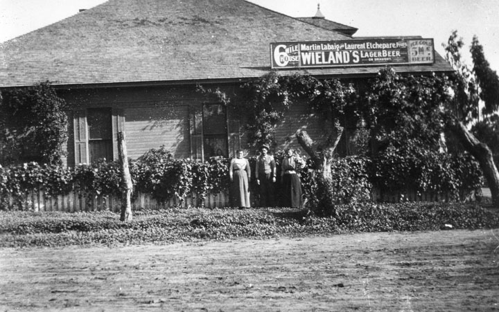
| (Early 1900s)* - Two women and a man pose at the side exterior of the Six Mile House Hotel. A sign on the roof reads "Martin Labaig and Laurent Etchepare, proprietors", and ice cold beer is advertised at 5 cents a pop. |
Historical Notes The description above comes from the LAPL image libarary. Gregory Paul Williams in his book The Story of Hollywood states that this business’ actual name was La Baig’s Casa Cahuenga (commonly referred to as the Six-Mile House). It was on the northeast corner of Sunset and Gower. Frenchman Martin La Baig convinced Harvey Wilcox to sell his French friends The Blondeaus 5 acres across Gower Ave from him. The Blondeaus built their home there in 1887, and in 1889 they built an additional to turn it into The Blondeau Tavernl. |
 |
|
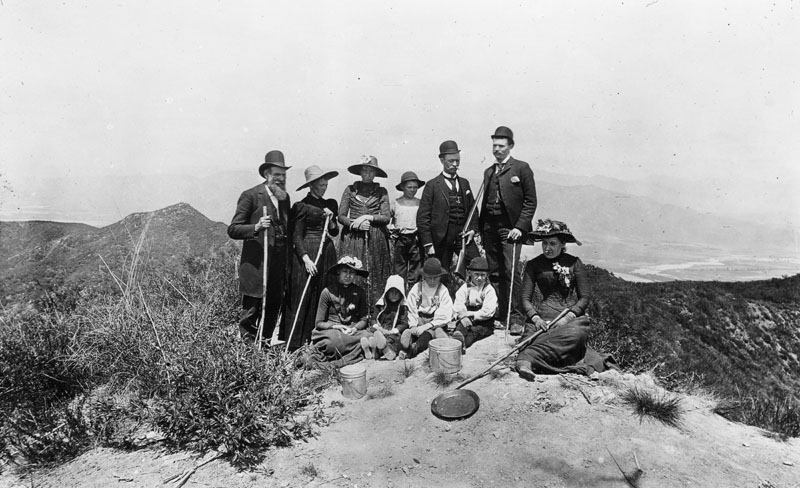
| (ca. 1885)* - A group of people is seen on Mount Hollywood, having climbed it. Some are holding walking sticks, and one man holds a gun. Three children are seated on the ground, with two women. Metal buckets and a pan are also on the ground. In the background, a river flows on the flat land below. The people are formally dressed, as was the custom at the time. |
* * * * * |
Cahuenga Valley Township School
 |
|
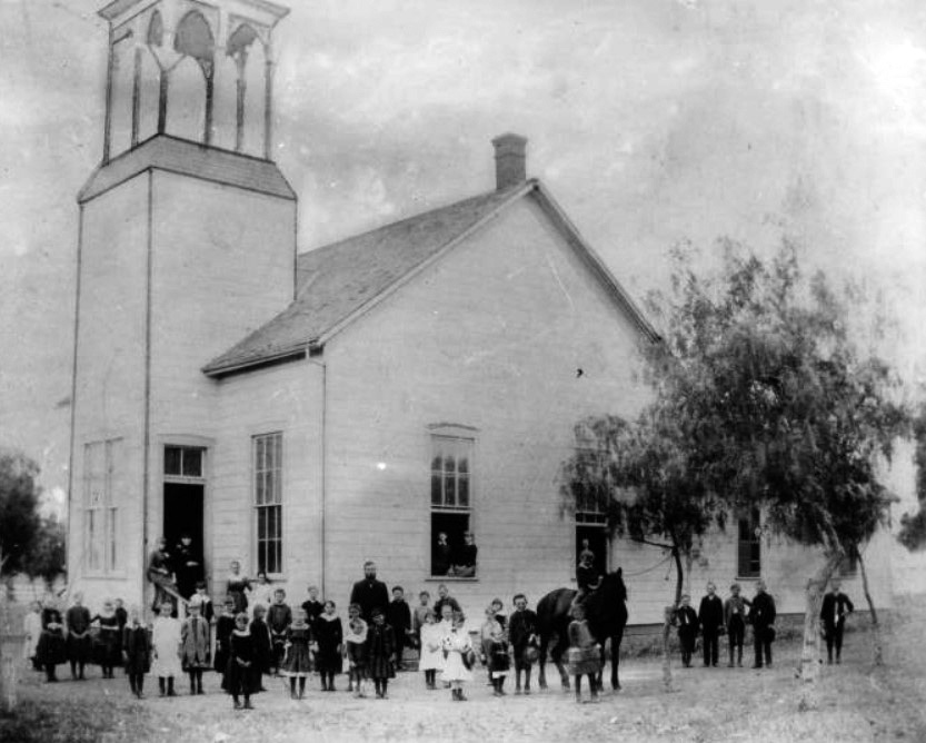
| (ca. 1884)* - Group portrait of the students at Cahuenga Valley Township School posing in front of the school with a horse. The schoolhouse is a wooden building with a tall bell tower at left and a brick chimney at center. There are five wood-framed windows along the perimeter of the building, and an open doorway is visible at left. |
Historical Notes Cahuenga Valley Township School in 1884 had a limited student body and faculty. Some reports noted that the horse in the photo was used to bring students to and from school, just like the "big yellow buses" of today. |
 |
|
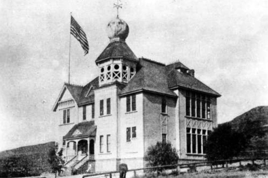
| (ca. 1887)* - Head of Vermont Avenue - Photograph of an exterior view of the old Los Feliz school in Cahuenga Valley, later Hollywood. The building is a two-story wood building with a large tower at center. The top level of the tower is an open deck, and the roof of the tower is onion-shaped. A tall flagpole stands on the roof at left and a large flag flies from it. The main entrance to the school is at left and consists of a stairway leading up to a covered porch. The windows of the school are tall and rectangular, and they are very close together at right. There is a hill in the background, and a low wooden fence is in the foreground. |
* * * * * |
Early Hollywood
 |
|
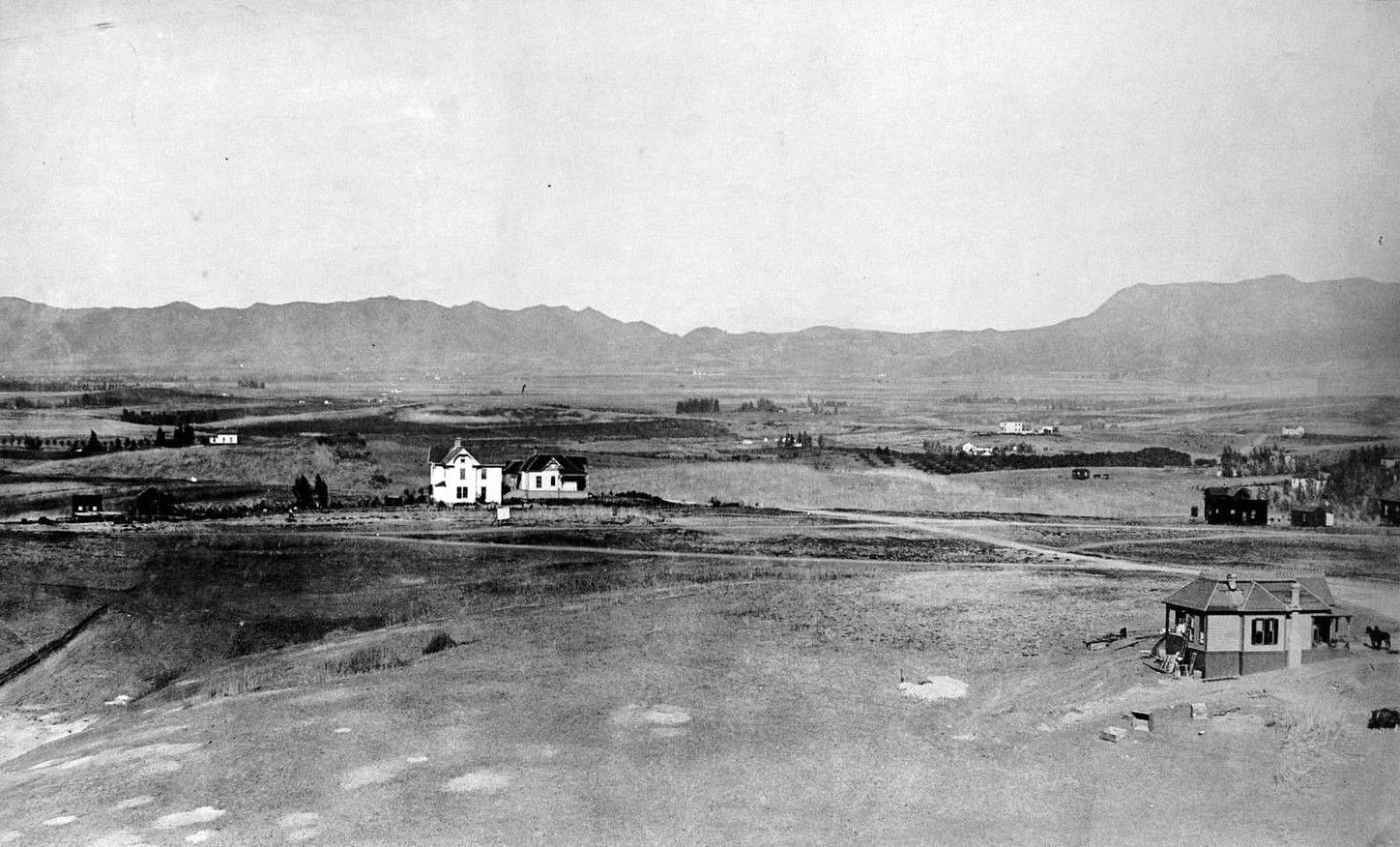
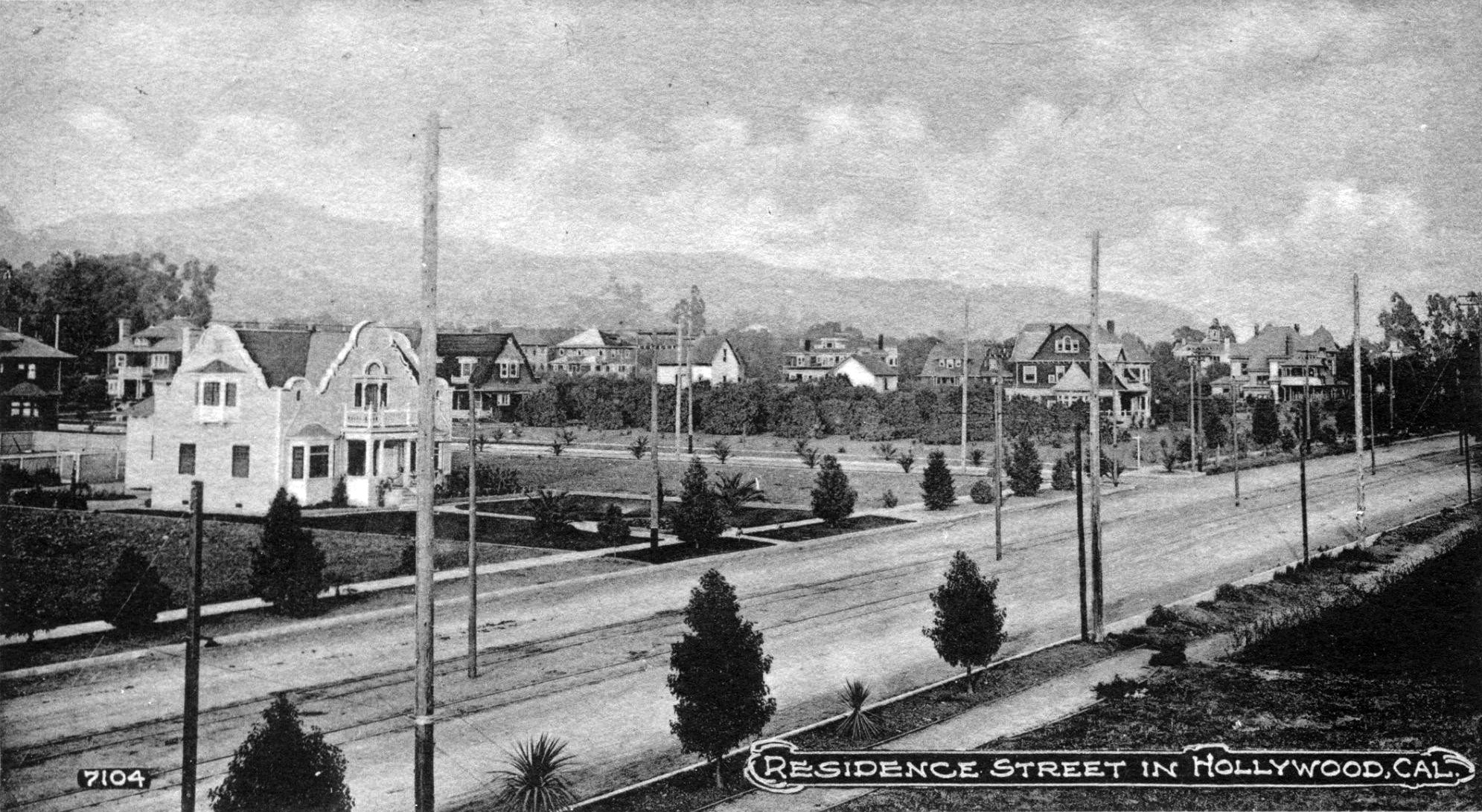
| (ca. 1886)* - View looking north from the Belmont Hotel on Crown Hill (where the old Belmont High School stands today) showing the Hollywood Hills in the background. Note the vast open space between downtown and the hills. |
 |
|
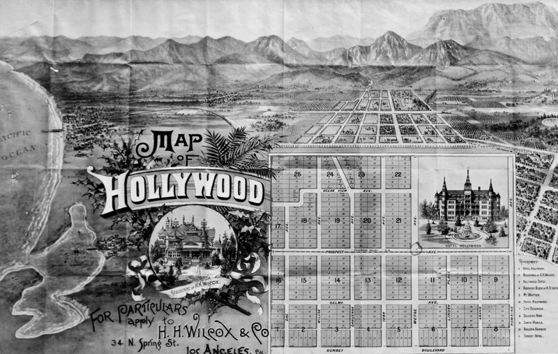
| (ca. 1887)* - Drawing of the first map of Hollywood, issued by real estate agent H.H. Wilcox in 1887. Tracts and lots are numbered on the map. The Hotel Hollywood inset never was built as shown. Wilcox' residence is another inset. His office was located at 34 North Spring Street, where people could inquire for particulars concerning the development. Various other sites are listed at right and numbered accordingly on the map. Railroad routes are also included. At left is the Pacific Ocean. |
Historical Notes Harvey Henderson Wilcox, the first subdivider of Hollywood, used as its name the suggestion made by his wife, Daeida. They had purchased 160 acres in 1886, which they subsequently subdivided and sold. (Prospect Avenue was the original name for Hollywood Blvd., and Weyse Avenue was the original name for Vine Street.) The name Hollywood was originally coined by H. J. Whitley, the "Father of Hollywood". Whitley arranged to buy the 500-acre E. C. Hurd ranch and disclosed to him his plans for the land. They agreed on a price and Hurd agreed to sell at a later date. Before Whitley got off the ground with Hollywood, plans for the new town had spread to General Harrison Gray Otis, Mr. Hurd's wife, Mrs. Daeida Wilcox, and numerous others through the mill of gossip and land speculation. A 2ND version about the naming of Hollywood: “Regarding H.J. Whitley’s coining the name, Whitley's great-granddaughter Gaelyn Whitney Keith invented this story out of whole cloth. (She wrote a "biography" of Whitley that reads like a romance novel.) Loads of old newspapers very clearly place H.J. Whitley in North Dakota throughout 1886-1887. He later moved to Oklahoma and didn't come to L.A. until 1894 – seven years after the Wilcoxes named Hollywood. So the whole story of Whitley trying to buy 500 acres from E.C. Hurd in 1886, then the Wilcoxes stealing the "Hollywood" name before Whitley could close the deal, is bunk, blarney, B.S. It's shameful that Ms. Keith has spread this lie around the internet, just to sell her book.” |
 |
|
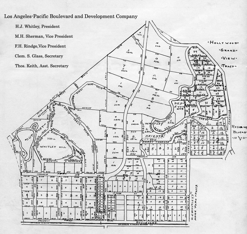
| (ca. 1880s)* - Original 480 acre map of H.J. Whitley's property developed by his company, Los Angeles Pacific Boulevard and Development Company. Highland Avenue runs through the center of the property. The square at the lower right hand corner is the Whitley Estate and was not part of the Grand View development. Courtesy of the Whitley Family |
Historical Notes In the mid-1880s, H.J. Whitley arrived in Southern California. He was well known as a land developer and many tried to follow on his coattails. As president and major shareholder of the Los Angeles Pacific Boulevard and Development Company, he orchestrated the building of the Hollywood Hotel, the opening of the Ocean View Tract and construction of a Bank which were located on the corners of Hollywood Boulevard and Highland. Besides his land developments, Whitley was also the President of the National Loan & Trust Company, Guthrie, Oklahoma, Vice President of Home Savings Bank, President of First National Bank of Van Nuys, State Bank of Owensmouth and Bank of Lankershim; General Manager of the Los Angeles Suburban Homes Company, principal in the Bank of Hollywood, The Whitley Land Company and owner of the H.J. Whitley Company jewelry store. |
 |
|
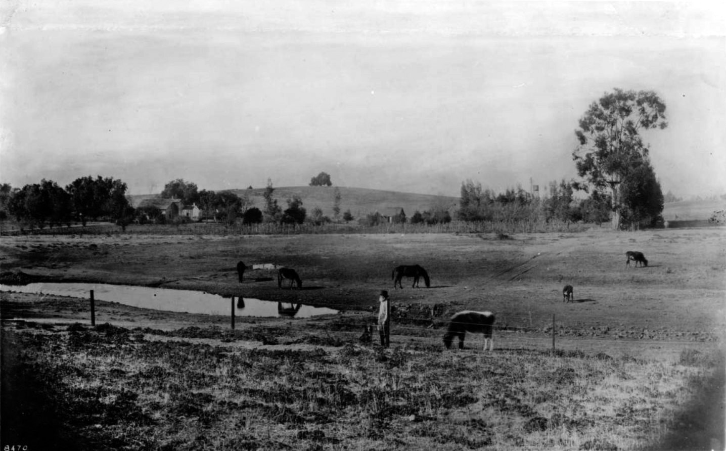
| (ca. 1894)* – View of the Ireby Barrow Ranch looking north. Boundaries of the ranch were: Beverly Boulevard (then Temple Street) on the south, Rosewood Avenue on the north, Vermont Avenue on the east, and Normandie on the west. Cahuenga Valley School (now Normandie) was just beyond the left house in the photograph. Horses and cattle graze near a pond. A bearded man and his dog stands next to the wire fence in the foreground. The man appears to be holding a rifle. |
Historical Notes The Barrow family moved from Illinois to California in 1880 and purchased land with boundaries of Beverly Boulevard on the south, Rosewood Avenue on the north, Vermont Avenue on the east and Normandie on the west. |
* * * * * |
Cahuenga Valley Railroad (1887)
 |
|
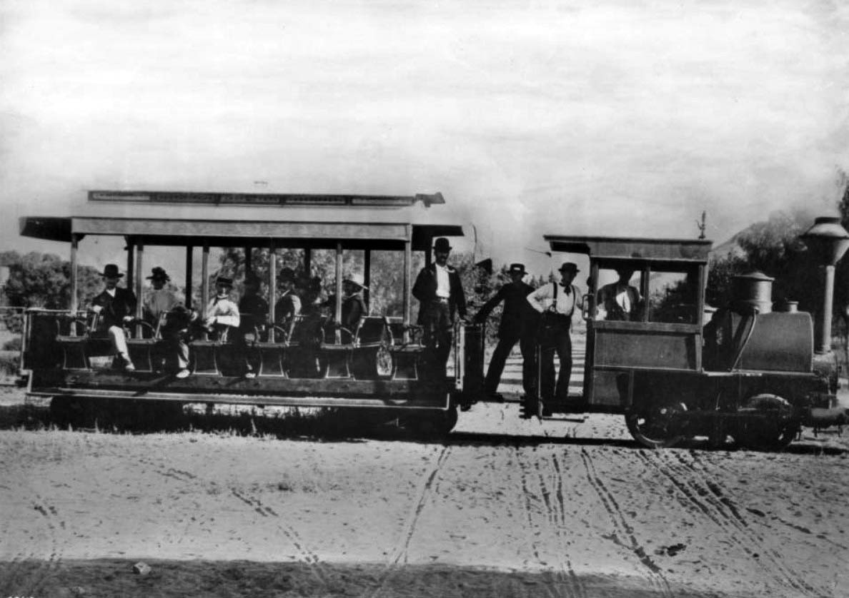
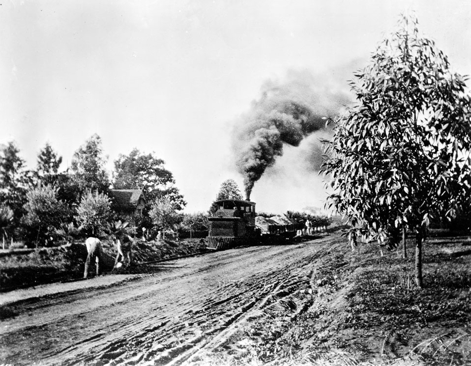
| (ca. 1888)* - Photograph of the first train on the Cahuenga Valley Railroad to Hollywood. A small steam engine and one passenger car are pictured. Seven people are visible in the passenger car, one in the engineer's quarters and three on the running board between cars. The terrain around the train is unpaved, yet has what appears to be wagon tracks marked into it, perpendicular to and intersecting the train tracks. Sparse vegetation is visible in the background, and at the extreme right background, the beginning of a mountain. Photograph is taken at Prospect Avenue (later Hollywood Boulevard) and Wilcox Avenue.* |
Historical Notes The beginnings of a railroad which would link Los Angeles with far off Cahuenga Valley occurred on January 11th, 1887 when James McLaughlin obtained a franchise to build a steam dummy line connecting to the 2nd Street Cable Railroad at Diamond (Beverly Boulevard) and Texas (Belmont Avenue) Streets. The line would extend north along Texas to Temple and then westward to the Los Angeles City Limits at Hoover Street and beyond. The Cahuenga Valley Railroad line utilized what was colloquially known as the "Dummy line," featuring cable cars with wooden chairs for passenger seating. This relatively modest transportation system nonetheless played a transformative role in opening the Cahuenga Valley to development and connecting it with the expanding city of Los Angeles. |
 |
|
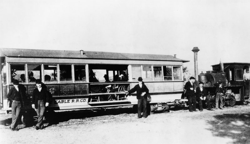
| (ca. 1890)^ - In this photo the Cahuenga Valley Railroad line cable car is also called the "Dummy line." Note the inside of the cable car is actually hollow with wooden chairs being used for sitting. |
Historical Notes The diminutive steam train would begin its journey to Cahuenga Valley from Diamond (Beverly Boulevard) and Texas (Belmont Avenue). Leaving the city limits, the little train wandered west across open fields eventually finding County Road where it turned north. County Road later became Western Avenue. Next stop, Coleville or Coles Crossing (later, Santa Monica Boulevard). At this point, the Cahuenga Valley line crossed the steam dummy line to Santa Monica. The train continued north to Prospect Avenue (Hollywood Boulevard) where the line turned west. That was called Grand Round. Today we know it as Hollywood and Western. Next stop, Midway (later called Bronson Avenue). The end of the line was at Prospect Avenue (Hollywood) and Wilcox. It was here that McLaughlin built himself a rather imposing “McMansion” on the northwest corner of that intersection. |
 |
|
| (ca. 1890s)* - The Cahuenga Valley Railroad, a steam railroad built in the 1880's to provide access to Hollywood. The locomotive and passenger car is shown on Hollywood Boulevard, then Prospect Avenue. |
Historical Notes Hollywood Boulevard was named Prospect Avenue from 1887 until 1910, when the town of Hollywood was annexed by the City of Los Angeles. After annexation, the street numbers changed from 100 Prospect Avenue, at Vermont Avenue, to 6400 Hollywood Boulevard. |
 |
|
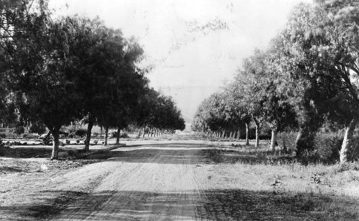
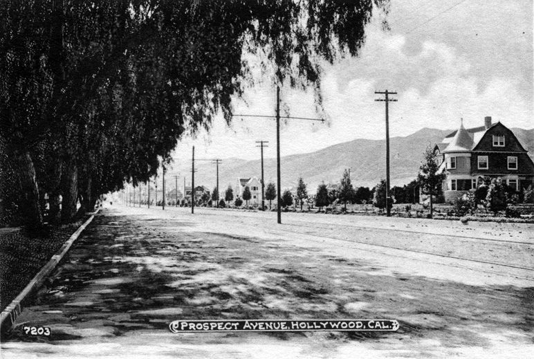
| (ca. 1890)* - Wilcox Ave. from south of Prospect Ave. (later Hollywood Blvd.) as an unpaved, tree-lined road. |
* * * * * |
Cahuenga Valley Railroad (1890s)
 |
|
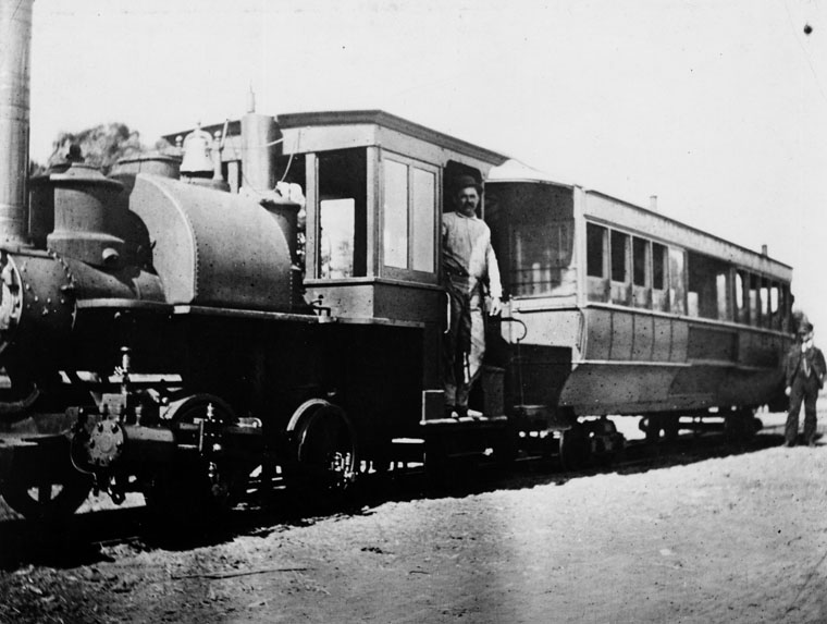
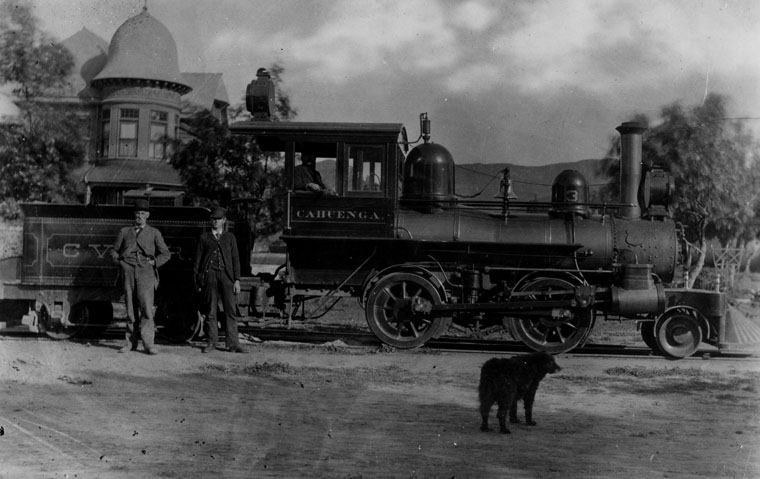
| (ca. 1893) – View of the Cahuenga Valley Railroad’s third and final locomotive, Cahuenga, shortly after its delivery from Porter Locomotive Works. The camera is facing north along Wilcox Avenue, with the locomotive resting on Prospect Avenue (now Hollywood Boulevard). At left stands the Queen Anne–style mansion of James McLaughlin, owner of the railroad. The house was later sold to E.C. Hurd, and then to Hobart J. Whitley, the influential developer of Whitley Heights and a charter member of Los Angeles' early business elite. One of the men standing beside the engine—most likely the one in the dark suit and hat—is believed to be James McLaughlin himself, captured here during a key moment in the brief but formative era of rail transit in early Hollywood. |
Historical Notes The Cahuenga Valley Railroad was established in the late 1880s, originally running from Diamond Street (now Beverly Boulevard) and Texas Street (now Belmont Avenue) westward to the city limits at Hoover Street, then continuing along County Road (later renamed Western Avenue). From there, the line extended north to Prospect Avenue (now Hollywood Boulevard) and west to Wilcox Avenue, where it terminated around 1888. In 1890, the railroad was sold to E.C. Hurd and S.E. Mattison, who extended the line west along Prospect Avenue to Laurel Canyon, helping open the surrounding area to residential development. At the same time, James McLaughlin—builder of both the railroad and one of Hollywood’s earliest grand homes—sold his elegant Victorian mansion at the northwest corner of Prospect and Wilcox to E.C. Hurd. The sale of both the railroad and the residence marked a transition point in Hollywood’s history, as large parcels of land began to give way to subdivision and suburban expansion. |
 |
|
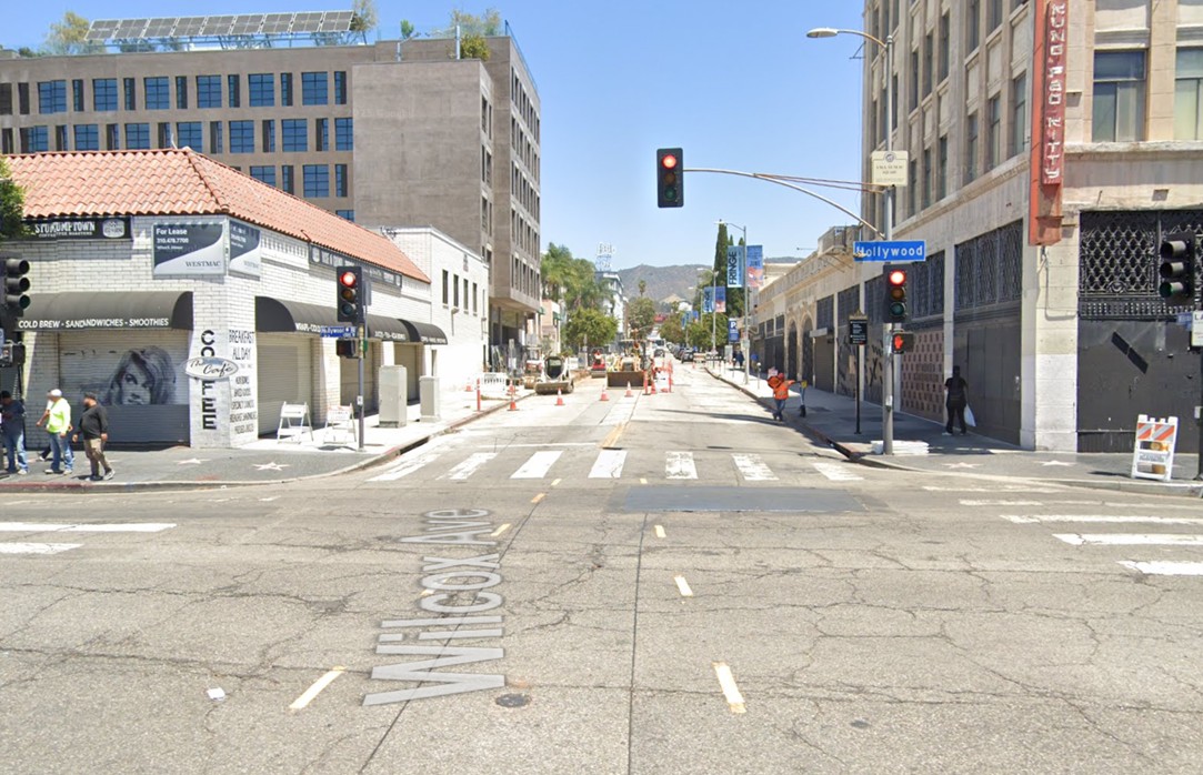
| (2024)* - Looking north on Wilcox Avenue at Hollywood Boulevard. |
Historical Notes Today, the intersection of Hollywood Boulevard and Wilcox Avenue is part of a global entertainment district known for its tourist appeal. It contrasts sharply with its modest beginnings as an agricultural stopover—and just as sharply with the glamorous peak of Hollywood’s Golden Age. Though still iconic, the area bears little resemblance to the elegance and charm it once radiated. |
Then and Now
 |
|
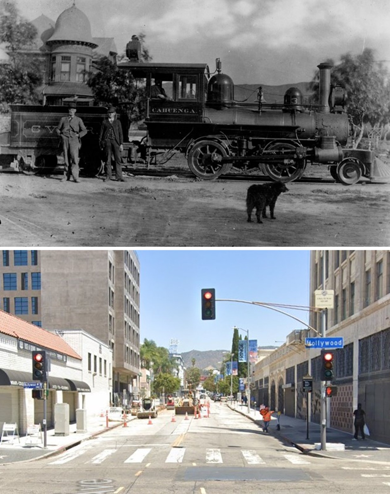
| (1893 vs. 2024)* - A 'Then and Now' comparison of Wilcox Avenue looking north from Hollywood Boulevard (originally Prospect Avenue). |
Historical Notes In 1893, the intersection of Hollywood Boulevard (then known as Prospect Avenue) and Wilcox Avenue was a quiet, rural crossroads surrounded by orchards, open fields, and minimal development. Though Harvey Wilcox had subdivided the land a few years earlier, settlement remained sparse, with few structures and limited infrastructure. Transportation was provided by the Cahuenga Valley Railroad, which extended west along Prospect Avenue and terminated at Wilcox, helping spur the area’s early growth. Today, the same intersection is a bustling urban hub and part of the world-famous Hollywood Walk of Fame. The area features dense mixed-use development, historic buildings like the Attie Building, and is supported by modern public transit including nearby Metro stations. Yet despite its fame and constant foot traffic, the intersection no longer reflects the elegance and charm of Hollywood’s Golden Age. Touristy and often overcrowded, the area is a far cry from both its pastoral beginnings and its cinematic heyday. |
 |
|
| (ca. 1898)* - View of workers grading the roadbed and installing streetcar tracks on Hollywood Boulevard. |
Historical Notes In 1890, E.C. Hurd and S.E. Mattison purchased the Cahuenga Valley Railroad from its original builder, James McLaughlin, and extended the narrow-gauge line west along Prospect Avenue (now Hollywood Boulevard) to Laurel Canyon, encouraging residential growth in the area. In May 1896, Hurd and Mattison sold the line to Moses Sherman and Eli P. Clark, operators of the Los Angeles Pacific Railway. The line was later incorporated into Henry Huntington’s expanding Pacific Electric system, which helped further transform Hollywood from a rural outpost into a connected suburban community. |
 |
|
| (ca. 1900)* - Exterior front view of the two-story Victorian Hollywood residence of H.J. Whitley who purchased it from E. C. Hurd one year earlier. Hurd was a member of the Cahuenga Valley Water Company in Hollywood. The beautiful mansion on the northwest corner of Pospect (later Hollywood) and Wilcox was originally built by James McLaughlin who also built the Cahuenga Valley RR. |
Historical Notes E. C. Hurd made his fortune from the mines of Colorado and invested it in a prime Hollywood tract. In May 1896, Hurd and Mattison sold the railroad line to Moses Sherman and Eli P. Clark, operators of the Los Angeles Pacific Railway. The line was later incorporated into Henry Huntington’s expanding Pacific Electric system, which helped further transform Hollywood from a rural outpost into a connected suburban community. |
 |
|
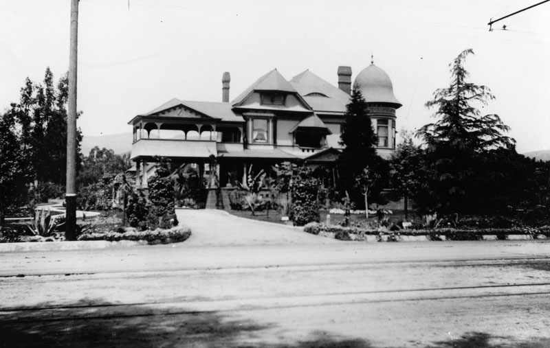
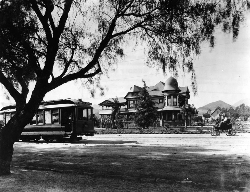
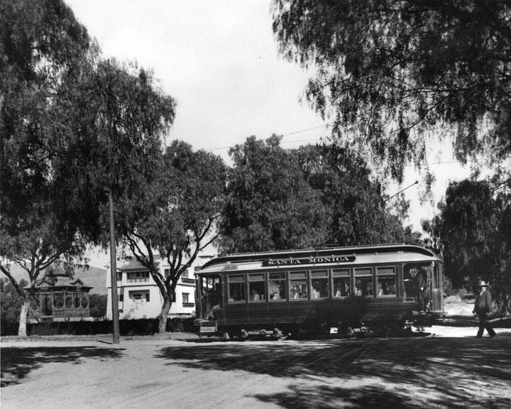
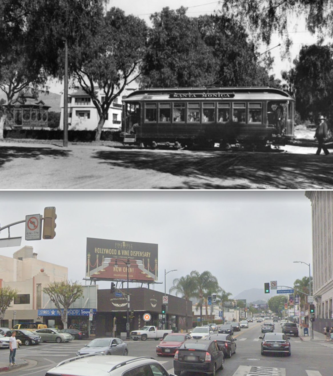
| (1900)* - Exterior front view of the Victorian style H.J. Whitley residence (previously the Hurd Residence) at 6594 Hollywood Blvd. at Wilcox Avenue. A streetcar, labeled Santa Monica, is on the street in front of the house. Also a couple are sitting in an open-air automobile, and the woman wears a lap robe. |
Historical Notes In 1899 the Hurd home was bought by farmer and banker H.J. Whitley, a director of the State Bank of Owensmouth. Known as the "Father of Hollywood," Whitley Heights is named for him. Streetcar service on Hollywood Boulevard began in the 1890s, initially provided by the Los Angeles Pacific Railway, a private electric railway company. This early service helped connect the then-rural community of Hollywood with growing neighborhoods to the east and south. Tracks were gradually extended westward along Prospect Avenue (renamed Hollywood Boulevard in 1910), reaching as far as Laurel Canyon by the turn of the century. On September 15, 1909, the Hollywood Line officially opened as part of the Los Angeles Pacific system, offering regular electric streetcar service between Downtown Los Angeles and Hollywood. In 1911, this system was absorbed into Henry Huntington’s Pacific Electric Railway, which expanded the service westward to Beverly Hills, West Los Angeles, and eventually the Santa Monica Bay. The introduction and expansion of electric streetcars on Hollywood Boulevard played a major role in transforming Hollywood from a quiet agricultural outpost into a thriving suburban and cultural center, drawing both residents and tourists and laying the groundwork for its future as a global entertainment capital. |
 |
|
| (ca. 1905)^ - View showing the northwest corner of Prospect (later Hollywood Blvd.) and Wilcox. In the foreground is a well-tended garden consisting of small pine trees, yucca trees, and patches of lawn. In the background at left, is the large Victorian mansion of banker H.J. Whitley. The two-story home consists of a covered balcony and cylindrical section with a rounded rooftop. In the extreme background at center, a group of large homes can also be seen. The Hollywood Hills stand in the background. |
Historical Notes Hollywood Boulevard was named Prospect Avenue from 1887 until 1910, when the town of Hollywood was annexed by the City of Los Angeles. After annexation, the street numbers changed from 100 Prospect Avenue, at Vermont Avenue, to 6400 Hollywood Boulevard. |
 |
|
| (ca. 1896)* - View showing the portrait of a family at their home on the southwest corner of Wilcox Avenue and Prospect Avenue (later Hollywood Boulevard). A man in a button-down shirt and a gardener's hat stands to the right on his family's lawn while three women sit and stand to the left of him. |
Historical Notes The following paragraph is taken from an article published in March 1937's Hollywood Magazine, entitled: "Hollywood Is Just a State of Mind." "As early-day residents or visitors trekked back to homes or inn, they always stopped at the front door, took down the inevitable feather duster that was hanging at the knob, and carefully dusted their shoes before they stepped over the sill! It was an old Hollywood custom - not to say an odd one. But very saving on carpets." |
 |
|
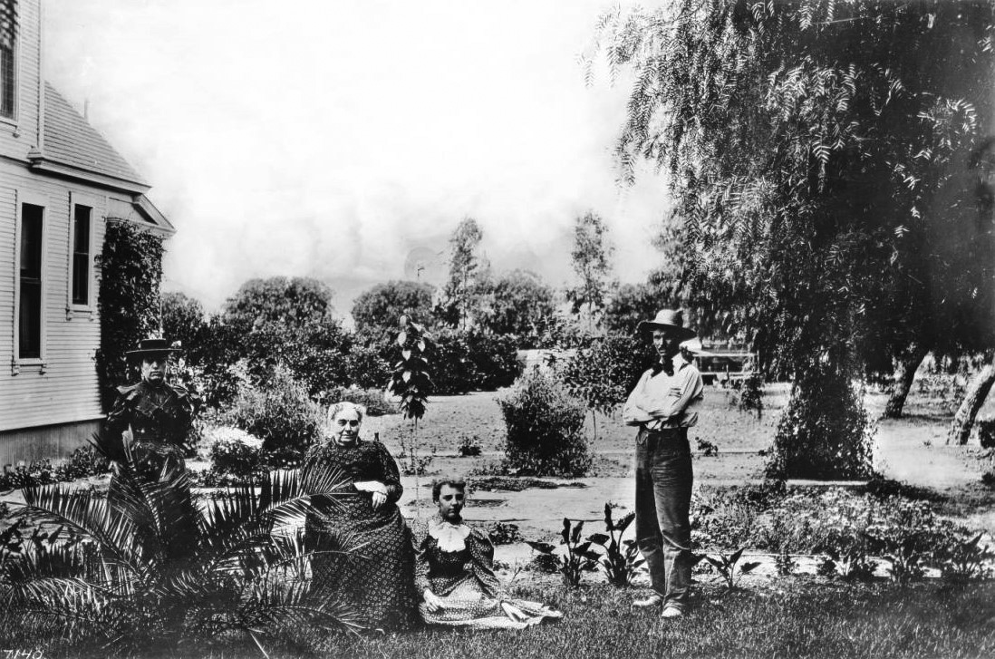
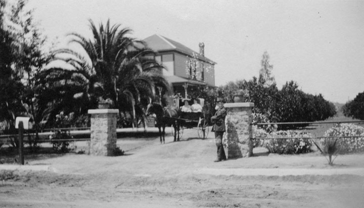
| (ca. 1895)* - A man stands near the entrance to his Hollywood property while two women ride in a horse-drawn carriage travel down the unpaved driveway to where is standing. A glimpse of a large orange grove is visible on the right. |
* * * * * |
Glen-Holly Hotel
 |
|
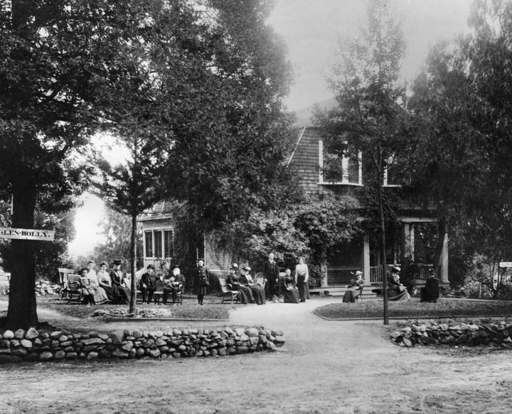
| (ca. 1895)* - People are seated in front of the Glen-Holly Hotel, at the corner of Ivar and Yucca Streets. The Hotel was run by C.M. Pierce and his wife (shown standing at right). |
Historical Notes The Glen-Holly Hotel was constructed in 1895 on Ivar Avenue at Yucca Street and is the 2nd hotel to be built in Hollywood (after the Sackett Hotel, 1888). It was built by Joakim Berg, a noted artist of the 1890s in the region. At its opening it had 20 rooms and one bath. A horse carriage called a tallyho took guests from downtown LA to the hotel. The original owner, Mr. Charles M. Pierce, also became the operator of the Los Angeles Pacific Railroad's Balloon Route in 1904, the line opened in September 1901. The hotel was a stop on the line going from downtown Los Angeles to West Los Angeles and the beaches on the west side. The Balloon Route used the hotel as lunch stop. D. L. Allen later took over management of the Glen-Holly Tavern. He added billiard hall, bowling alley, and livery service. It became a landmark of the area, though was later demolished. |
 |
|
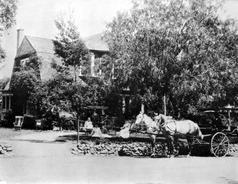
| (ca. 1900)* - View of the Glen-Holly Hotel on Ivar Street and Yucca Street in Hollywood. A carriage hooked to two horses stands with driver on the front yard of the two-story hotel behind it, which is mostly obscured by tree cover. A more personal horse-and-carriage stands closer to the main building, hooked to only one horse. On the lawn between the two carriages, four women sit, in chairs and on the ground, with a man standing behind them. Three out of the four of them are dressed in light clothing, while one of the women seated on chairs is dressed darkly. The man wears a dark suit and hat. Two empty rocking chairs sit in the driveway at left. The entrance to the hotel is demarcated by a short wall made of cobblestones, approximately a foot in height. The hotel building sports box windows on the second floor. |
* * * * * |
 |
|
| (ca. 1890)* – View showing the Bagnoli family in front of their home on an olive farm near what is now Sunset Boulevard and the Hollywood Freeway. |
Historical Notes The farm was started about 1890 and was located on Bagnoli Avenue (named after the family) which ran between Sunset and Carlton. By 1906 the family had returned to Firenze, Italy. The death of two sons in an accident made it impossible to maintain the farm. |
 |
|
| (ca. 1890)#^ - View of family members on a farm near Cahuenga Pass. On verso is written "Shoemaker Canyon." |
* * * * * |
Early Travel through Cahuenga Pass
 |
|
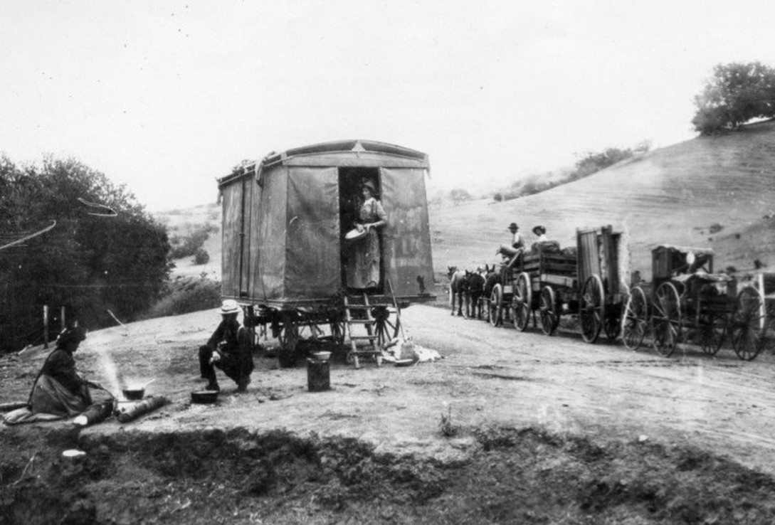
| (1892)* - Stopping to camp and cook along the journey through Cahuenga Pass. Before roads and rail lines were built, travel through the pass was by wagons and horses. |
Historical Notes During the 19th century, Cahuenga Pass saw significant development. By the 1850s, ox-carts and mule-teams were crossing the hills through the pass, and in 1858, the Butterfield Overland Mail Company stage made its first crossing. The 1870s brought the construction of the Pass Hotel, also known as Eight Mile House, which served as a toll station and store. |
 |
|
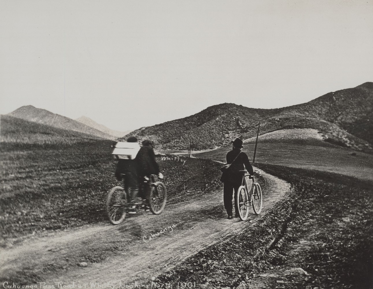
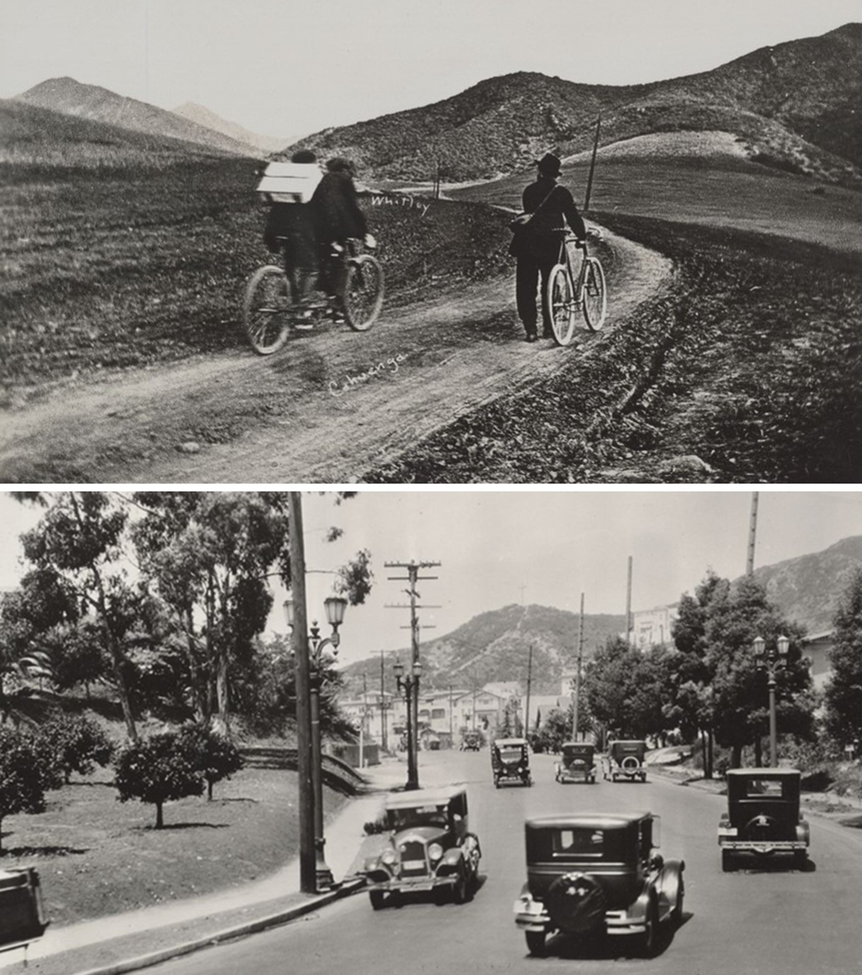
| (1901)* - Cahuenga Pass Road at Whitley looking northwest. Photo by C.C. Pierce |
Historical Notes Cycling through Cahuenga Pass around 1900 presented several challenges. The road was primarily designed for ox-carts, mule-teams making the terrain rough and uneven for cyclists. The road through the pass was continually widened to handle increasing traffic. In 1911, the Pacific Electric railway extended its tracks through the pass, and by 1920, traffic jams were common, prompting various improvement plans. |
 |
|
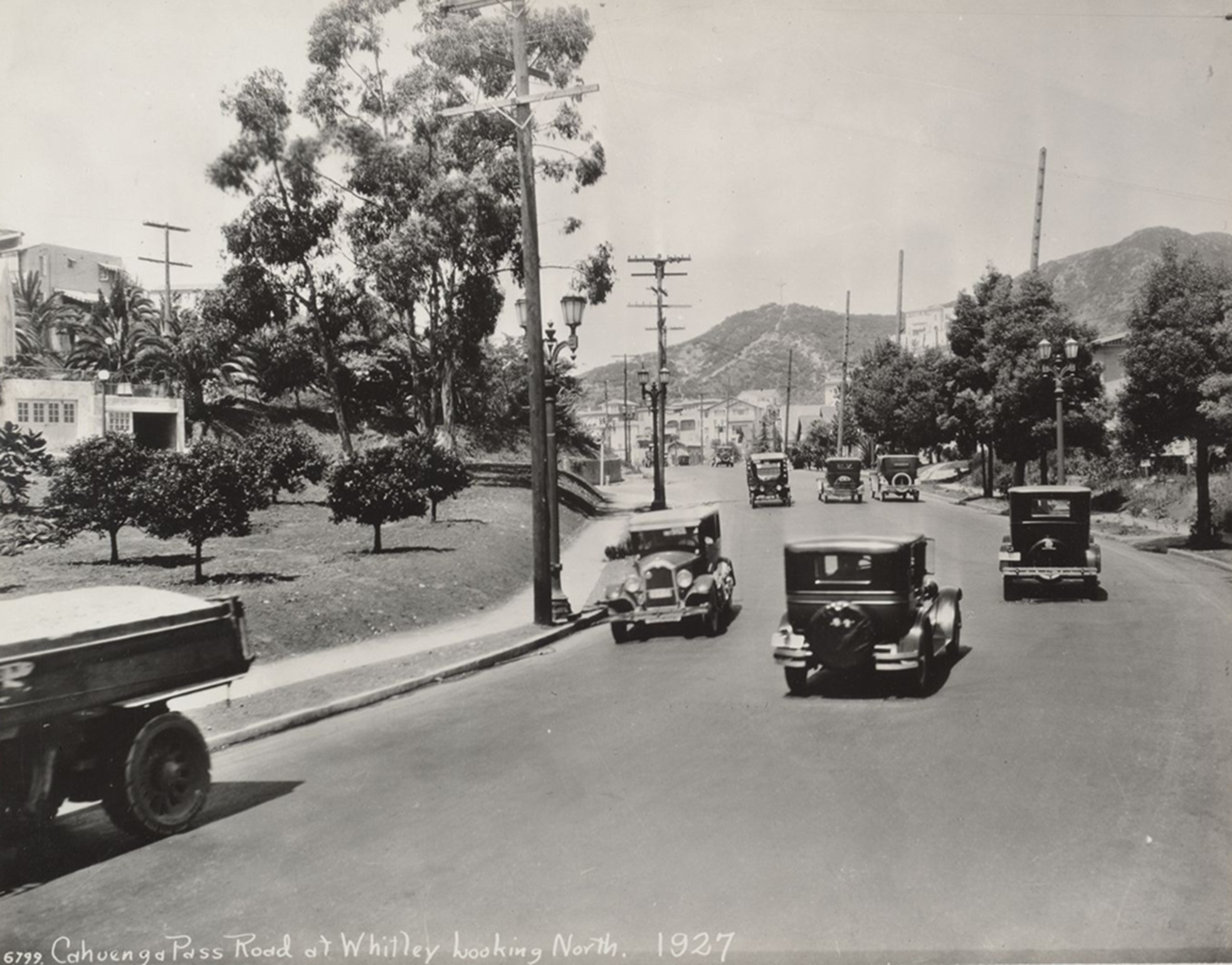
| (1927)* - Cahuenga Pass Road at Whitley looking northwest. Photo by C. C. Pierce. |
Historical Notes In 1925, the Los Angeles City Council passed Ordinance 51964, renaming Cahuenga Avenue to Cahuenga Boulevard. The ordinance justified the change by stating that Cahuenga was "a major highway, negotiating the historical Cahuenga Pass, which is the natural thoroughfare through the mountains from Hollywood to the San Fernando Valley." This renaming underscored the road's significance as a primary route connecting Hollywood to the San Fernando Valley, highlighting its essential role in the region's transportation network. |
 |
|
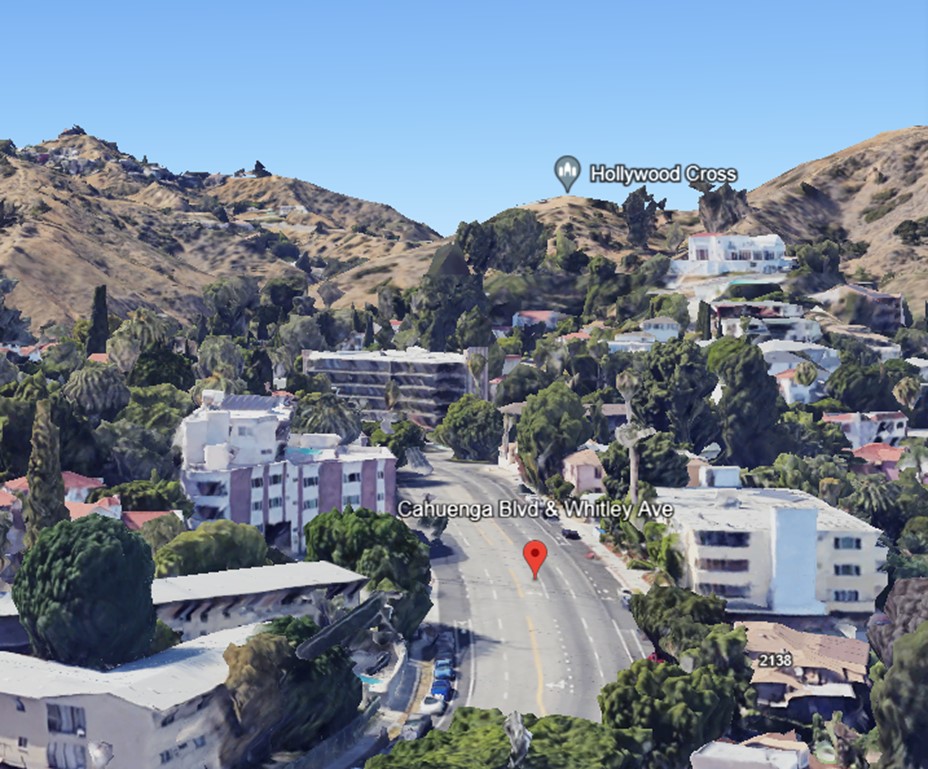
| (2022)* - Google Earth View looking northwest on Cahuenga Boulevard at Whitley Avenue. |
Before and After
 |
|
| (1901 vs. 1927)* – Looking northwest along Cahuenga Pass Road (now Cahuenga Boulevard) at Whitley in the Hollywood Hills. Over time, the road has been graded and lowered, but the ridgeline remains relatively unchanged. Photo comparison by Jack Feldman. |
Historical Notes Cahuenga Boulevard, originally known as Cahuenga Pass Road, has undergone significant transformations since its early days as a footpath through the Cahuenga Pass. In 1925, it was officially renamed from Cahuenga Avenue to Cahuenga Boulevard, reflecting its importance as a major thoroughfare connecting Hollywood to the San Fernando Valley. This change was part of a broader initiative to address growing traffic concerns in the rapidly expanding Hollywood area. |
Then and Now
 |
|
| (1901 vs. 2022)* - Looking northwest on Cahuenga Pass Road (now Cahuenga Boulevard) at Whitley in the Hollywood Hills. While the angles of the images differ and the road has been graded and lowered over time, the outline of the ridges has remained relatively unchanged. Photo comparison by Jack Feldman. |
Historical Notes Click HERE to see more Early Views of Cahuenga Pass. |
* * * * * |
Cahuenga Pass School
 |
|
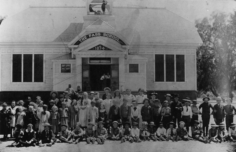
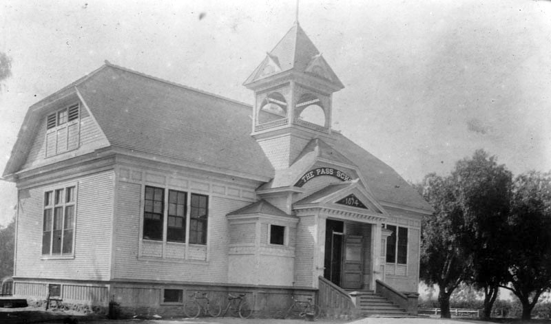
| (ca. 1894)* - Students of the Cahuenga Pass School in Hollywood pose for a class photograph outside of the newly completed school building. |
Historical Notes The Pass School was located at today's intersection of Sunset Boulevard and Gordon Street. The school was constructed in 1894 and contained three classrooms. |
 |
|
| (ca. 1895)* - Exterior view of the Cahuenga Pass School in Hollywood. Bicycles are seen parked in front. |
* * * * * |
 |
|
| (ca. 1895)* - A couple poses outside of the large colonial revival residence located on Carlos Avenue in Hollywood, identified as once having been the home of E. W. Twist. |
Historical Notes In 1916 this house became the first location of the Hollywood Studio Club, an organization and home designed to provide actresses with safety and security while they pursued their careers in Hollywood. |
* * * * * |
Mary Penman Moll House
 |
|
| (ca. 1895)* - Two women and a small child are shown on the porch of a two-story wooden farmhouse located at what is now near the corner of Hollywood and Highland, identified as once having been owned by Mary Penman Moll. A small water storage tower is visible just to the right of the home and in the background is a barn. |
Historical Notes Daniel Penman, Scottish stonemason from San Francisco owned twenty-eight acres at Prospect and Highland Avenues, on the south side of the street to La Brea, where he grew strawberries. Penman’s daughter, Mary Moll, lived in a farmhouse next to the strawberry field. She taught at the Pass School on Sunset Boulevard. After her husband’s death, she successfully subdivided the property over the next two decades. She built a commercial block at Hollywood and Highland and the Bonnie Brier housing tract. Mary Moll was a founder of the Hollywood Business and Professional Woman’s Club. She demolished her farmhouse (seen above) for a commercial building and built a craftsman-style house for herself farther west where the Roosevelt Hotel now stands (see next photo). |
 |
|
| (ca. 1895)* - The Moll House located at what is now near the corner of Hollywood and Highland. Mary Moll was a founder of the Hollywood Business and Professional Woman’s Club. (AI image enhancement and colorization by Richard Holoff) |
Historical Notes According to historian Gregory Paul Williams, author of the ‘The Story of Hollywood’, Mary Penman Moll, Hollywood’s first school teacher, owned a ranch near the corner of Hollywood and Highland next to a strawberry field. A prominent figure in early Hollywood real estate and civic circles, she is credited with petitioning fellow city leaders to change the name of Prospect Avenue to Hollywood Boulevard in 1910—over the fierce objections of her arch-nemesis Daieda Wilcox.* |
* * * * * |
Franklin and Highland
 |
|
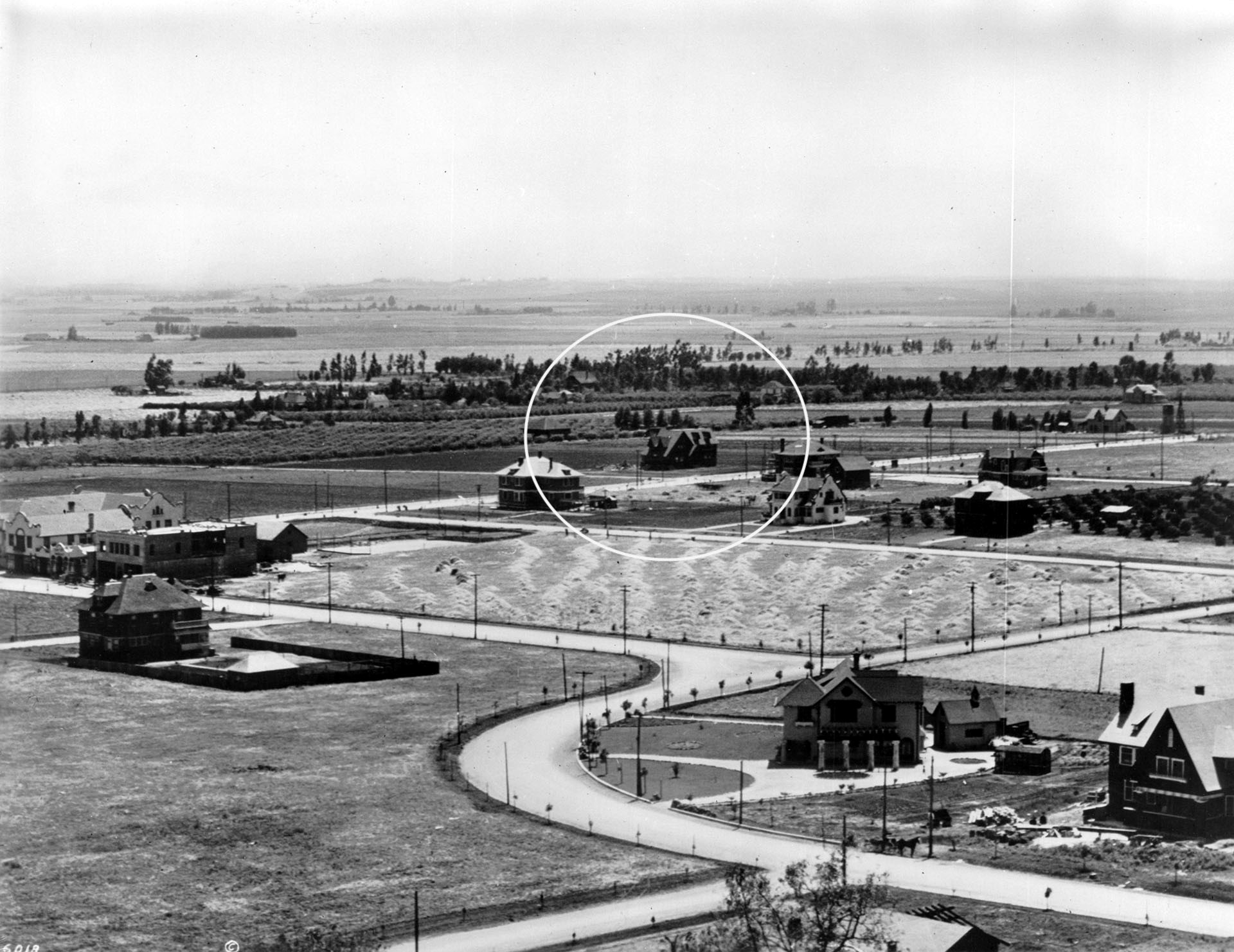
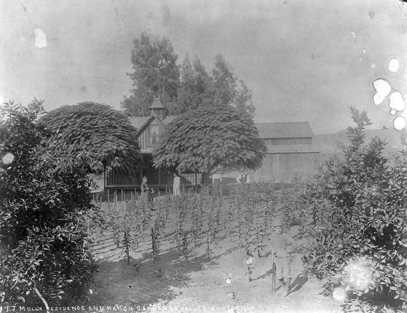
| (ca. 1905)* - View looking southwest showing the intersections of Franklin and Highland avenues. The house circled is Mary Penman Moll's Residence, her second, located on the SW corner of Orange Dr. and Prospect Ave (later Hollywood Blvd), where the Roosevelt Hotel stands today. See previous image for Moll's first residence. |
Historical Notes Mary Moll demolished her first house on the corner of Highland and Prospect (Hollywood Blvd) for a commercial building. She built her second house further west at 7002 Hollywood Blvd, where the Roosevelt Hotel now stands as seen above. Mary Moll’s donation of a strip of land through her property made Highland Avenue official. It was graded, but not paved, in 1901. Highland was the name of the local blacksmith’s wife, Highland Price, who lived with her husband near Fountain. As the first person buried in the Hollywood Cemetery when it opened in 1900, Mrs. Highland Price got a street named in her honor. |
 |
|
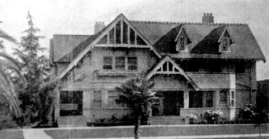
| (ca. 1910s)^ - View looking south showing the craftsman-style home of Mary Moll, located on the SW corner of Orange Drive and Hollywood Boulevard. This would be the site of the Roosevelt Hotel in 1926. |
 |
|
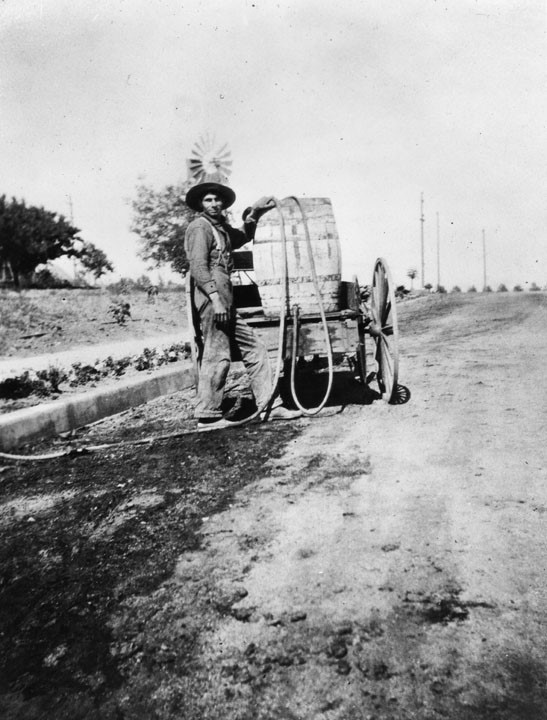
| (ca. 1895)* - Franklin Avenue at Vine Street, Hollywood. A man waters a crop with a hose extended from a water barrel mounted on a cart. A wind mill appears in the background. |
 |
|
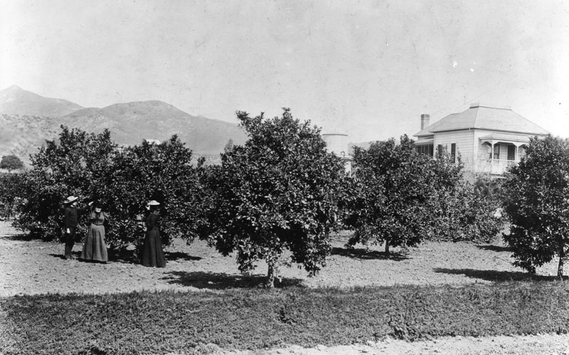
| (ca. 1895)* - Orange grove and ranch of Mrs. Wakeman located near Western and Hollywood Boulevard, in Hollywood. |
 |
|
| (1900)* - View Moll's residence and ranch located on the northwest corner of Sunset and Western. In the forefront, a young boy stands posed next to an orange tree. |
 |
|
| (1900)* - View Moll's residence and ranch located on the northwest corner of Sunset and Western. In the forefront, a young boy stands posed next to an orange tree. Image enhancement and colorization by Richard Holoff. |
 |
|
| (ca. 1900)* - View showing a young girl sitting under an umbrella tree. To the right, an older woman is sitting in a rocker with a young boy standing behind her. Orange trees are seen in the background. |
 |
|
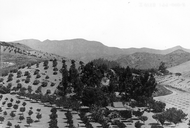
| (ca. 1893)* - Scenic view of a man standing in front of an orange grove on the future Krotona Hill. Several buildings sit on the hill in the background. |
Historical Notes Krotona Hill was named after the Greek school founded by Pythagoras. It was named by the Albert P. Warrington, head of the Theosophical Society settlement, and refers to the 11 acres of land he bought in 1911 west of Beachwood Canyon and north of Franklin Avenue, below where the Hollywood sign stands today, to create an Adyar utopian settlement. In 1924, because of the LA sprawl, the community moved to Ojai, where the Krotona School of Theosophy continues today. |
 |
|
| (1895)* - View looking up Gower and Beachwood from Krotona Hill. The road as seen above was established in the 1870s by Henry and George Claussen. It leads to a two-story home and farm buildings. Beachwood Drive now runs along the bottom of the canyon, and Gower Street runs up the hill by the windmill. |
Historical Notes Beachwood Dr. was named after Hollywood developer Albert H. Beach for whom Beachwood Canyon is also named after. The Canyon was originally known as Claussen Valley (after pioneer resident Henry Claussen). |
 |
|
| (ca. 1895)* - Closer view of Claussen's ranch including what would be known as Krotona Hill. |
 |
|
| (1896)* - Panoramic view of Hollywood looking northwest from Olive Hill (later Barnsdall Park). Prospect Avenue (later Hollywood Blvd) runs east-west at bottom and can be seen intersecting Edgemont near the left-center of photo. In the distance are the Hollywood Hills with Mt. Hollywood as the tallest peak. Los Feliz Boulevard is the most northerly road and runs east-west at the base of the mountains. |
Historical Notes Los Feliz Boulevard was dedicated in 1888. It was named after Rancho Los Feliz, a Spanish land grant issued to Cpl. Jose Vicente Feliz, who led the first non-Indian expedition to what became the Pueblo of Los Angeles. Feliz led 11 families here from Sonora, Mexico, in 1781. Most of Feliz's land was the Silver Lake area and the higher slopes of Griffith Park. Rancho Los Feliz sold in the 1850s for $1 an acre. |
 |
|
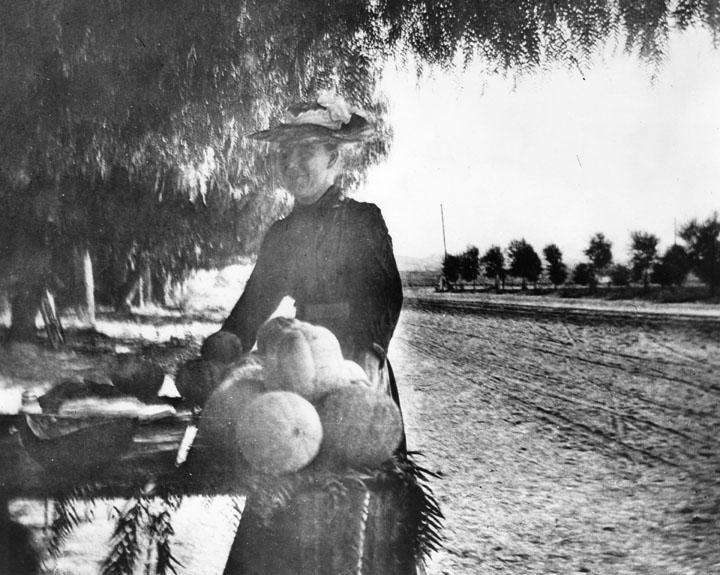
| (1896)* - Early view of Sunset Boulevard just west of Western Ave, looking north. In the foreground is a woman selling melons from a table. |
 |
|
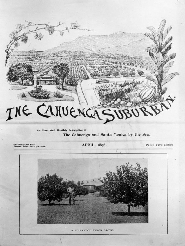
| (1896)* - Photograph of the front page of the Hollywood newspaper, "The Cahuenga Suburban," dated April, 1896. It includes an agricultural drawing and a photo of a Hollywood lemon grove. The drawing includes an electric railroad car and a close-up of various fruits and vegetables. Subtitled, "An Illustrated Monthly descriptive of The Cahuenga and Santa Monica by the Sea," the price is five cents or one dollar per year, 50 cents to eastern subscribers. Click HERE to see Early Views of Santa Monica. |
 |
|
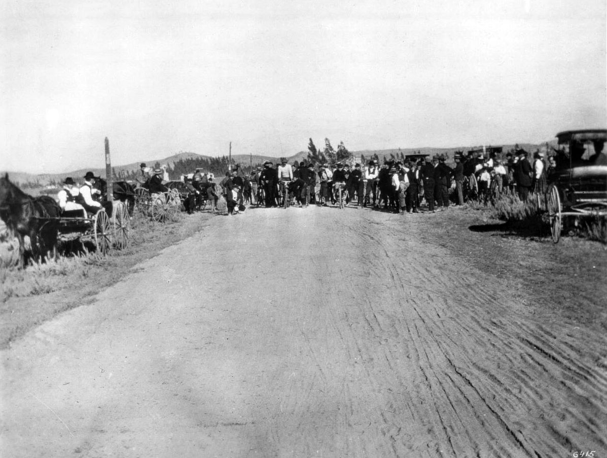
| (1896)* - Bicycle race on Western just north of Santa Monica Boulevard, 1896. |
Historical Notes Western Avenue, apart from Sepulveda Boulevard, is one of the longest north–south streets in Los Angeles. The name of the street is derived from its history as the westernmost border of Los Angeles before annexations in the early 20th century expanded the city. Western Avenue eventually ends north of Franklin Avenue in the Hollywood Hills. It swerves to become an east/west street, Los Feliz Boulevard, a major thoroughfare for Los Feliz. |
* * * * * |
 |
|
| (1898)^^ – Panoramic view of Hollywood from Vista Street to Franklin Avenue. A homestead with an uncleared field as well as some crop rows is visible beyond the tall grasses that dominate the foreground. Two light-colored buildings stand just behind them to the extreme right of the photograph, with a small stretch of tilled land behind them. Trees are scattered throughout the background. |
* * * * * |
Sackett Hotel – Hollywood’s First Hotel and Community Hub (1888–1910)
 |
|
| (ca. 1888)* – View of the Sackett Hotel shortly after its construction at the southwest corner of Cahuenga and Prospect (later Hollywood Blvd). The three-story Victorian structure, with its bay windows, mansard roof, and second-floor porch, was the first hotel in the Cahuenga Valley. A man, woman, and two children (likely members of the Sackett family) pose in front of the dirt road, with a horse-drawn carriage at right. A woman looks out from the upstairs balcony. |
Historical Notes Horace D. Sackett and his wife Ellen Minerva Sackett built the hotel in 1888 after purchasing the corner lots from Hollywood founder Harvey Wilcox. It was the first lodging establishment in the area and quickly became a multipurpose community center. Their daughter Mary Sackett helped establish Hollywood’s first post office at the site in 1897 and is often considered Hollywood’s first postmistress. The Sacketts also operated a general store on the first floor, serving travelers and local residents alike. |
 |
|
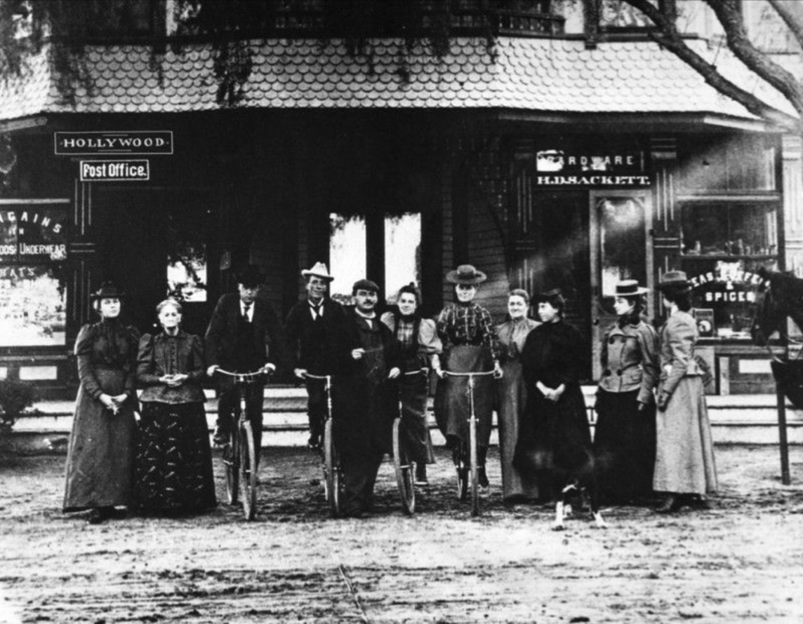
| (1898)* - The extended Sackett family in front of the Sackett Hotel, ten years after its construction. From left to right: Betsy Otis (Horace’s aunt), Ellen Sackett, cousin Lyman Hathaway, William H. Sackett, unknown, Mary Sackett (future postmistress), Zella Sackett (later married George Dunlap), unknown, Lilly (?), and Dora Miller. Two men and two women are seated on bicycles—signs of a growing, mobile community. |
Historical Notes By 1898, the Sackett Hotel had evolved into a key local hub offering lodging, groceries, hardware, and postal service. The building also housed Hollywood’s first general merchandise store, second only to a short-lived 1887 shop. The family grew fruits and vegetables in a back garden for sale in the store, and the site even hosted informal medical visits, community meetings, and horse stabling for guests arriving by rail. The post office had just been added to the hotel in 1897, further solidifying the location as Hollywood’s unofficial civic center. |
 |
|
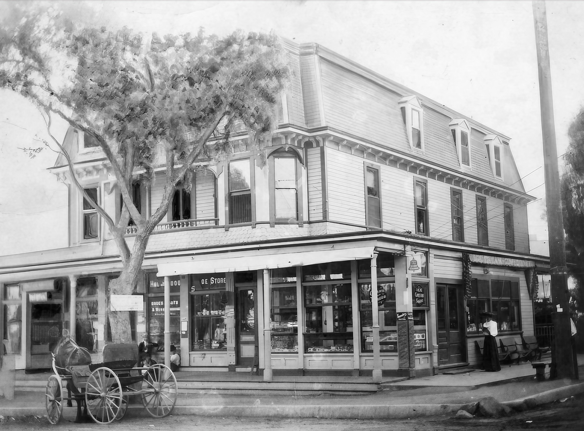
| (1899)* - Street-level view of the Sackett Hotel and Emporium at the southwest corner of Cahuenga and Hollywood Blvd. Visible on the first floor are the general store, a soda fountain, and the post office. A horse-drawn buggy is parked in front at left. Photo by C. C. Pierce. |
Historical Notes This 1899 photo captures the height of the hotel’s activity, as the Sackett family’s hotel served multiple functions: lodging, post office, general hardware store, and refreshment stop. With only dirt roads and limited infrastructure at the time, the Sackett Hotel stood as a symbol of permanence in a fledgling community. It was an essential stop for landseekers, merchants, and locals alike. |
 |
|
| (1899)* - Enhanced image of the Sackett Hotel and Emporium, offering a clearer view of the signage and storefronts. Signage for “Ice Cream Soda” and “Hardware” is visible, as is the awning shading the sidewalk. A buggy waits at the curb while a woman stands near the entrance. Photo by C. C. Pierce. |
Historical Notes This enhanced version highlights the commercial vibrancy of the site, showing more clearly the range of services offered. Horace Sackett’s store catered to settlers and travelers alike, offering practical goods and farm produce. It was also during this period that Mary Sackett served the community from behind the small postal counter inside. |
 |
|
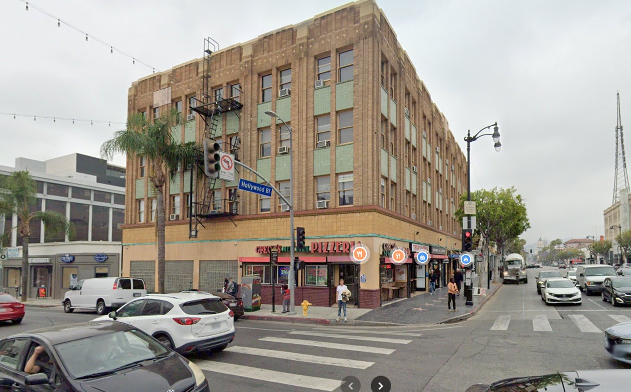
| (2022)* - Contemporary view of the southwest corner of Cahuenga and Hollywood Blvd. Today, the site is occupied by the Creque Building, built in 1911 on the footprint of the former Sackett Hotel. |
Historical Notes The original Sackett Hotel was closed in 1905 after competition from the nearby Hollywood Hotel and changes in the growing city. In 1910, the old wooden structure was demolished and replaced by a fireproof brick commercial building commissioned by J.P. Creque. The Creque Building initially housed the Hollywood National Bank and still stands today. |
Then and Now
 |
|
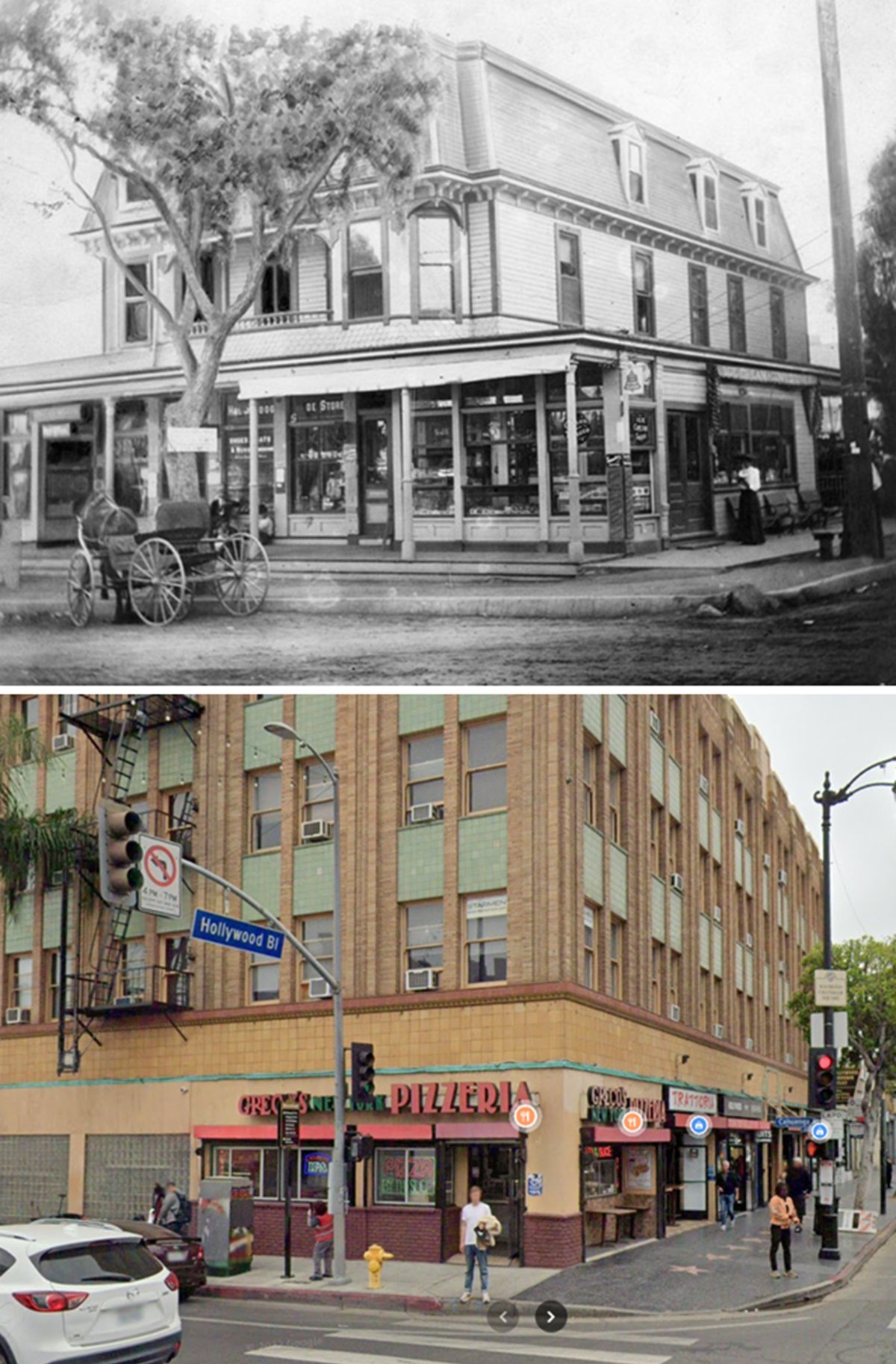
| (1899 vs 2022)* - 'Then and Now' comparison of the southwest corner of Cahuenga and Hollywood Blvd. The top image shows the Sackett Hotel as it appeared in 1899, with its three-story Victorian design and horse-drawn buggy out front. The bottom image shows the same corner in 2022, now occupied by the Creque Building. Comparison by Jack Feldman. |
Historical Notes This side-by-side through time (top: 1899, bottom: 2022) illustrates the transformation of a key Hollywood intersection. In 1888, the Sackett family built what became the area’s first hotel and multipurpose civic center. By 1910, the hotel was demolished and replaced by the Creque Building—reflecting Hollywood’s shift from rustic village to urban commercial center. The original corner was once home to lodging, the first post office, a hardware store, and community life. Today, that legacy survives only in photos and memory. Click HERE to see more on the Sackett Hotel. |
* * * * * |
Hollywood Panoramic
 |
|
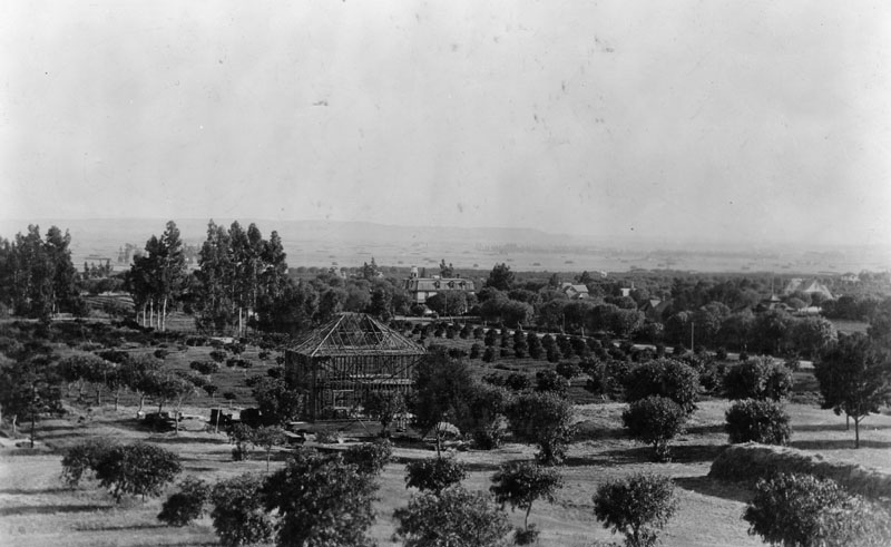
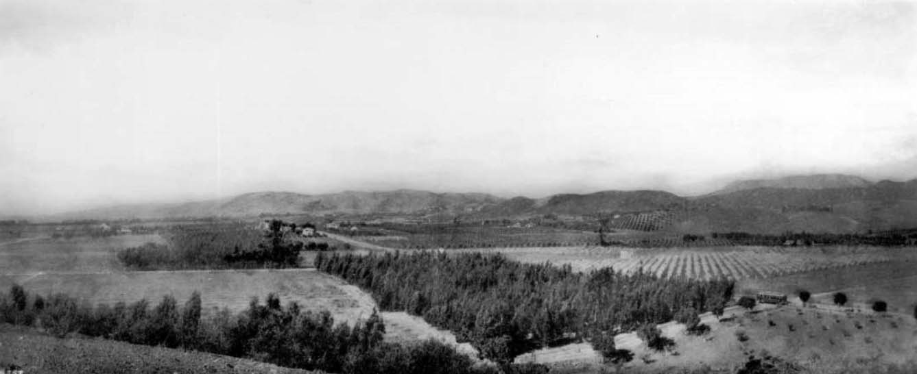
| (ca. 1898)* - Panoramic view of Hollywood in the time of Mr. Wilcox. The orchard in the foreground centers at the later intersection of Hollywood Blvd. and Cahuenga Avenue. A house is under construction. The Sackett Hotel is seen in the center of the photo. |
Historical Notes The Wilcoxes owned a 160-acre ranch named Hollywood, from Gower to Hudson and from Franklin to Sunset. |
 |
|
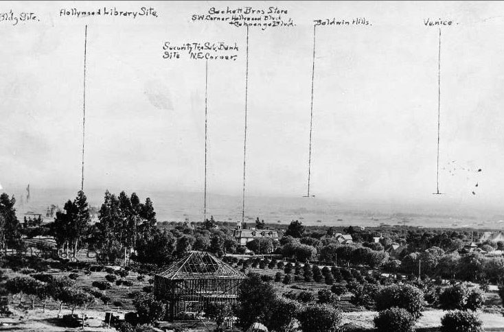
| (ca. 1898)^** - View of Hollywood with annotations. The Sackett Hotel is on the corner of Cahuenga and Hollywood Boulevard at center of photo. |
* * * * * |
Harper Ranch (Sunset and Laurel Canyon)
 |
|
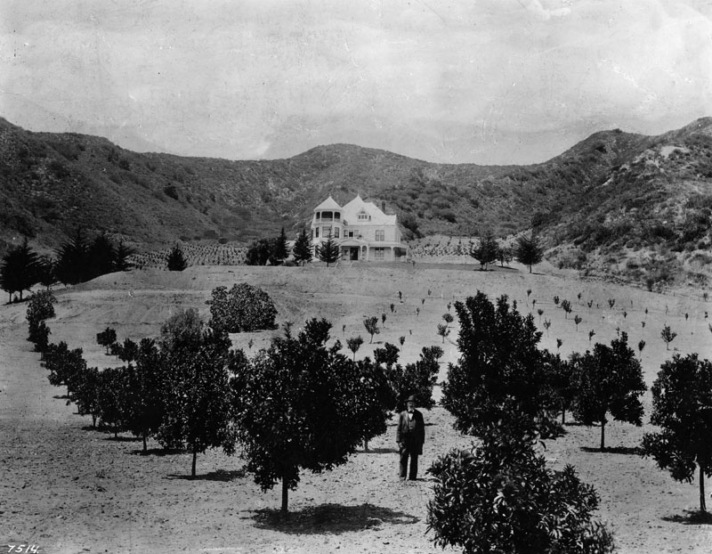
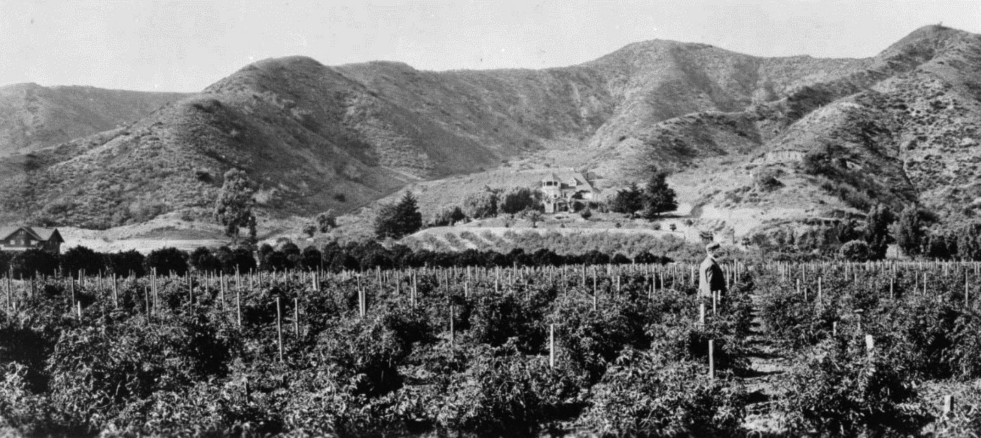
| (1898)* - Panoramic view of the Charles Harper Victorian home and property, standing at the entrance to Laurel Canyon in Hollywood. A man, perhaps Charles Harper, stands in the foreground. |
Historical Notes One of the earliest farming estates was owned by Charles F. Harper, and it dominated the entrance to Laurel Canyon. Harper was a Civil War veteran who immigrated to California and made his fortune in the hardware business. He owned a hardware store on Spring near Temple Street in downtown Los Angeles.* Harper retired in 1895 and moved to Hollywood, where he "enjoyed the evening of his days" on his 480-acre estate in Laurel Canyon. |
 |
|
| (1900)* - View looking east at the foothills of Hollywood showing the 3-story Harper House and Ranch near where Laurel Canyon is situated today. |
Historical Notes Harper Avenue in West Hollywood was named after the Harper family. |
 |
|
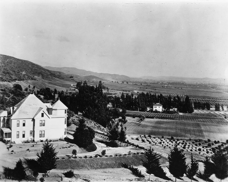
| (ca. 1905)* – Panoramic view shwoing the residence and land of Charles Harper located in the mouth of Laurel Canyon, West Hollywood. A man is walking through the agricultural fields. At left is a small house situated just past the row of trees near the base of the mountain. A short way up the mountain stands the Harper residence (center). The Victorian-style house is about three-stories tall. It features an octagonal tower, dormer windows, and steeply inclined roofs. |
Historical Notes The family called the 480-acre estate Cioela Vista but it is generally remembered today as the Harper Ranch. Charles Harper’s son, Arthur Cyprian Harper, who later inherited Cioela Vista, was elected mayor of Los Angeles in 1906. He was forced to resign in 1909, however, when he was threatened with a recall over corruption charges, including allegations he speculated on sugar and that he spent too much time in brothels. |
* * * * * |
Sunset Boulevard, Laurel Canyon, and Crescent Heights
 |
|
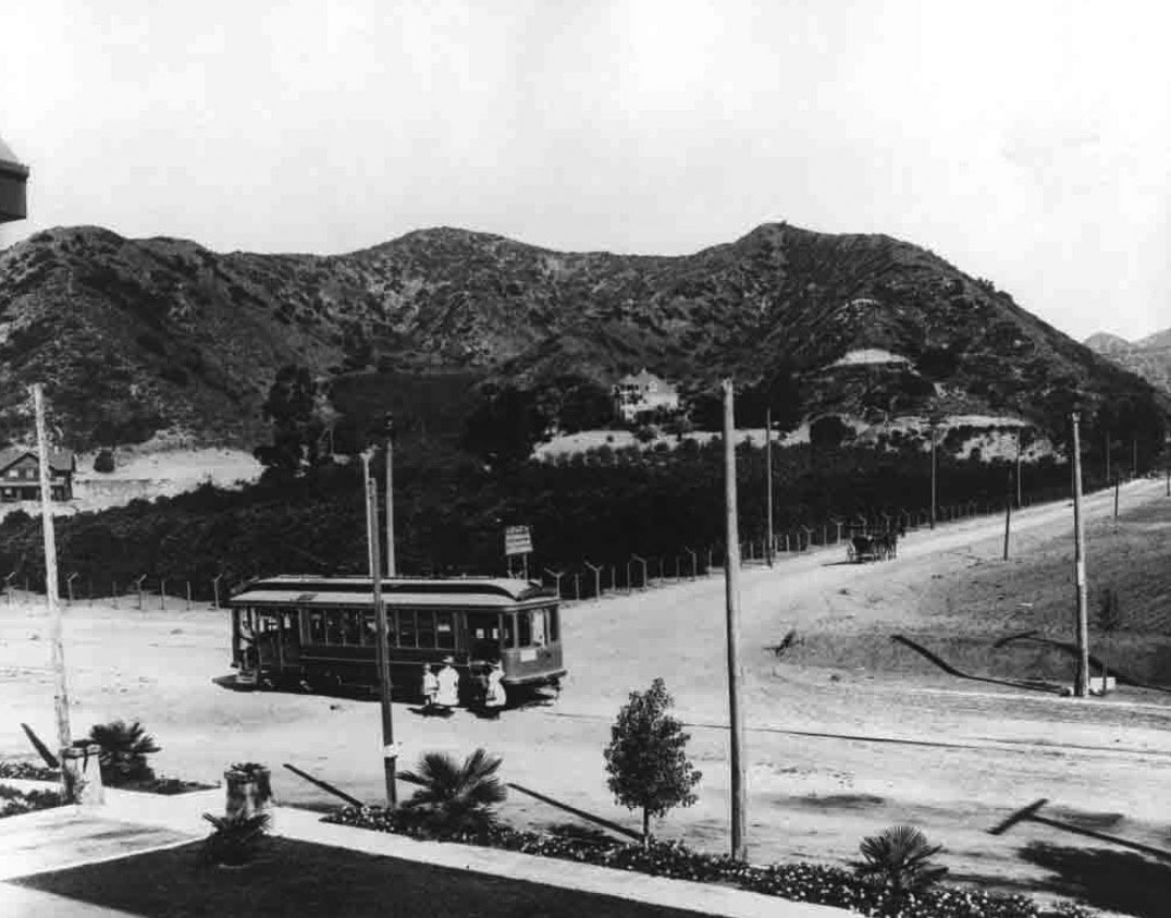
| (1908)* - A streetcar is shown stopped in the middle of Sunset Boulevard, boarding passengers, while a horse-drawn wagon heads north on Laurel Canyon. At the center of the photo can be seen Charles Harper’s 3-story Victorian home. |
Historical Notes In 1908, Sunset Boulevard and Laurel Canyon stood on the brink of major growth. The year before, a new dirt road, which would be named Laurel Canyon Boulevard, was built, giving much easier access to the area. That same year, the Lookout Mountain Park and Water Company was established, acquiring 280 acres on Lookout Mountain to create subdivisions, vacation properties, and ambitious projects like the Lookout Mountain Inn and Wonderland Park. While Sunset Boulevard had been around since the late 1800s, it was still evolving from a simple cattle trail into the famous road it is today. Developers like Charles Spencer Mann were drawn to the area and would soon introduce new transportation options, including the nation’s first commercial trolley bus line, which connected Sunset Boulevard with the top of Lookout Mountain Road. This era marked the beginning of Laurel Canyon’s shift from a quiet, rural area into a popular vacation and residential spot, paving the way for the lively community that would develop over the coming decades. |
 |
|
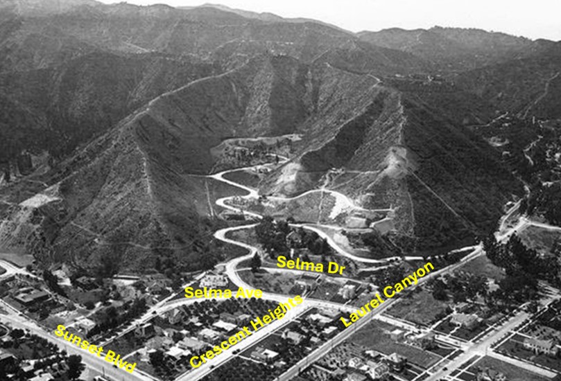
| (1923)* – Aerial view showing Laurel Canyon emerging from the Hollywood Hills and intersecting with Sunset Boulevard, which lies just out of view at the bottom center. Crescent Heights Boulevard runs parallel to Laurel Canyon, appearing to dead-end at Selma Avenue, but it actually continues into the canyon as the zigzag road visible in the image. In later years, Crescent Heights was realigned to converge with Laurel Canyon at Selma Drive. |
Historical Notes Crescent Heights was a pastoral 160-acre tract opened by Charles E. Norton and William H. Hay in 1905 on former Hay family property. At that time, nearby Fairfax Avenue was known as Crescent Avenue, making it fitting for this uphill tract to be called "Crescent Heights." The central road originally ran only between Sunset and Santa Monica Boulevards and temporarily borrowed Sunset’s name until 1913, when it officially became Crescent Heights Boulevard. In the 1920s, it extended further south to encompass additional subdivisions, including Carthay Circle, where Crescent Heights briefly changed names twice—to McCarthy Vista and Carrillo. To travel north from Crescent Heights to Laurel Canyon, one had to zigzag at Sunset Boulevard until the two boulevards were realigned in 1968.* |
 |
|
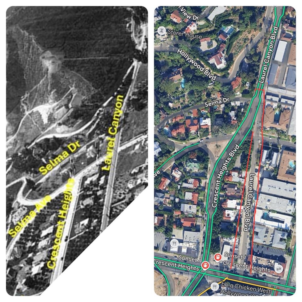
| (1923 vs 2024)* - Crescent Heights and Laurel Canyon before and after realignment, shown in a map and image comparison by Devon Brooks. |
 |
|
| (2024)* - Google Map showing the intersections of Sunset Boulevard and Crescent Heights Boulevard, as well as Sunset Boulevard and Laurel Canyon Boulevard. Note how Crescent Heights continues north past Sunset until it meets Laurel Canyon at Selma Drive. |
 |
|
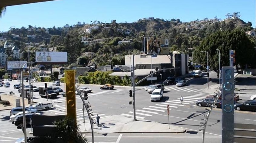
| (2021)* - Looking northwest at the intersection of Sunset and Crescent Heights from the 8000 Sunset Strip Shopping Center. |
Historical Notes Many people think that Crescent Heights Boulevard changes names to Laurel Canyon Boulevard at Sunset Boulevard, but that’s not the case. Crescent Heights actually continues past Sunset, merging with Laurel Canyon Boulevard at Selma Drive. From there, it takes on the name Laurel Canyon Boulevard as it winds through the Hollywood Hills. |
Then and Now
 |
|
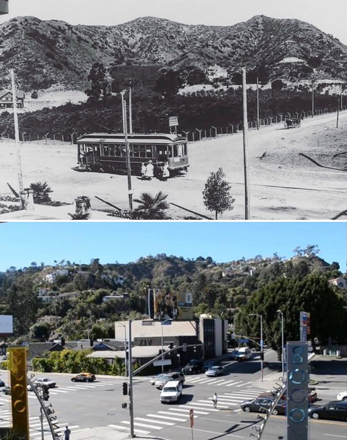
| (1908 vs 2021)* - Initially thought to depict the same intersection, this is not the case. The top photo shows Sunset and Laurel Canyon, while the bottom photo captures Sunset and Crescent Heights, located a short block west of Laurel Canyon. Today, Crescent Heights merges with Laurel Canyon two blocks north of Sunset at Selma Drive, continuing as Laurel Canyon through the Hollywood Hills. |
* * * * * |
 |
|
| (ca. 1900)* - View of Hollywood, looking south from what would become Krotona Hill. A large, two-story manor house stands on a hill to the left of the image with orchards arranged own the land beside and below it. In the background, at the bottom of the hill, a small farm cottage can be seen amidst the fields at center, along with a windmill that can be seen to the right. The orchards continue until they meet with the mountains in the background. |
* * * * * |
Paul de Longpré Residence
.jpg) |
|
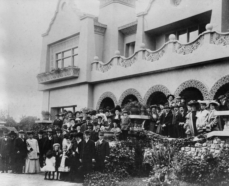
| (ca. 1898)* - Visitors walk through the extensive flower gardens at the Mission Revival/Moorish style Hollywood residence (background) of artist Paul de Longpré. Two men in the foreground appear to be wearing Shriner fezes, suggesting that a special event for the fraternal organization was taking place. The flower garden of the home, located on the west side of Cahuenga Blvd. at Hollywood Blvd., included at one time over 4,000 roses. The residence was a popular destination for tourists who enjoyed the beautiful home, de Longpré's personal art collection and the gardens. |
Historical Notes Perhaps the most famous Hollywood transplant of the time was Paul de Longpre, a French horticultural painter who arrived in Los Angeles with his family in 1889. After de Longpre discovered his ideal flowers growing in Hollywood, he met Daeida Wilcox, who was so anxious to attract culture that she gave him her homesite, three lots on Cahuenga just north of Prospect (later Hollywood Blvd.), for his estate. |
 |
|
| (1899)* - Visitors gather at the entrance of the Mission Revival/Moorish style Hollywood residence of artist Paul de Longpré. |
Historical Notes The mansion and gardens Paul de Longpre built not only drew Hollywood society but served as a lure for new property buyers and tourists. So many visitors came to see “Le Roi des Fleurs” that the P.E. Railway added a trolley spur on Ivar Avenue to deposit them closer to the estate. |
.jpg) |
|
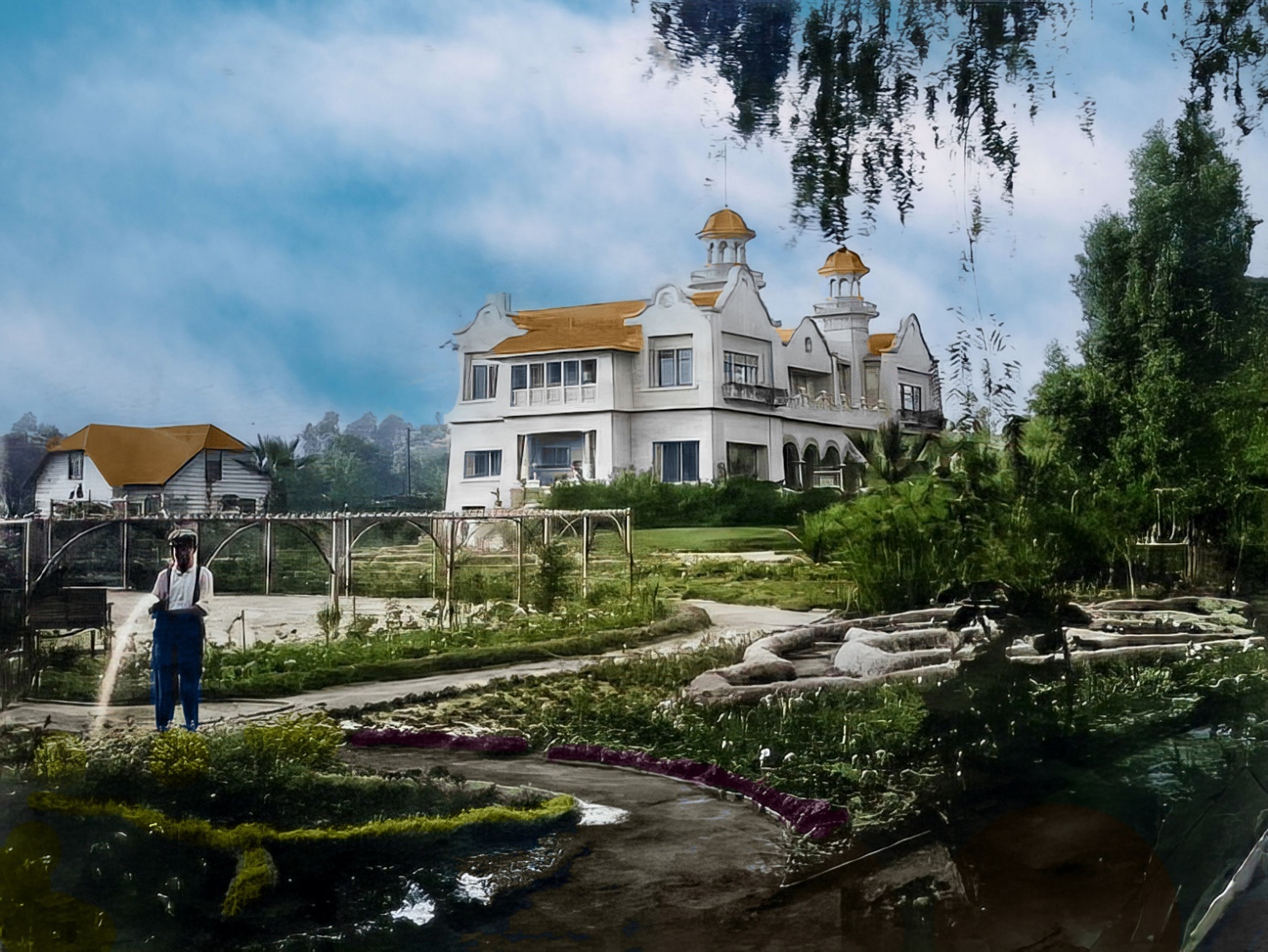
| (ca. 1905)* - View showing a man watering the garden in front of the Mission Revival/Islamic style Hollywood residence once owned by artist Paul de Longpré. The home was located on the west side of Cahuenga Blvd. just north of Hollywood Blvd. Photo by C. C. Pierce |
 |
|
| (ca. 1905)* - View showing a man watering the garden in front of the Mission Revival/Islamic style Hollywood residence once owned by artist Paul de Longpré. The home was located on the west side of Cahuenga Blvd. just north of Hollywood Blvd. Photo by C. C. Pierce; Image enhancement and colorization by Richard Holoff |
 |
|
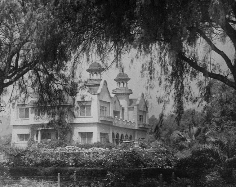
| (1907)* - View of the Hollywood residence and gardens owned by artist Paul de Longpré. The home was located on the west side of Cahuenga Blvd. at Hollywood Blvd. on property he obtained from Mrs. Wilcox Beveridge after he moved to Los Angeles in 1889. The French born artist desired the 65-foot-deep lots for a large flower garden. |
Historical Notes Tours of the house and gardens, along with prints of his floral paintings, supported the de Longpre family until the artist’s death in 1911. After his family returned to France, the house and gardens were demolished for their valuable real estate, and de Longpre’s paintings–romantic still-lifes of roses, orchids and the like–fell permanently out of fashion. |
 |
|
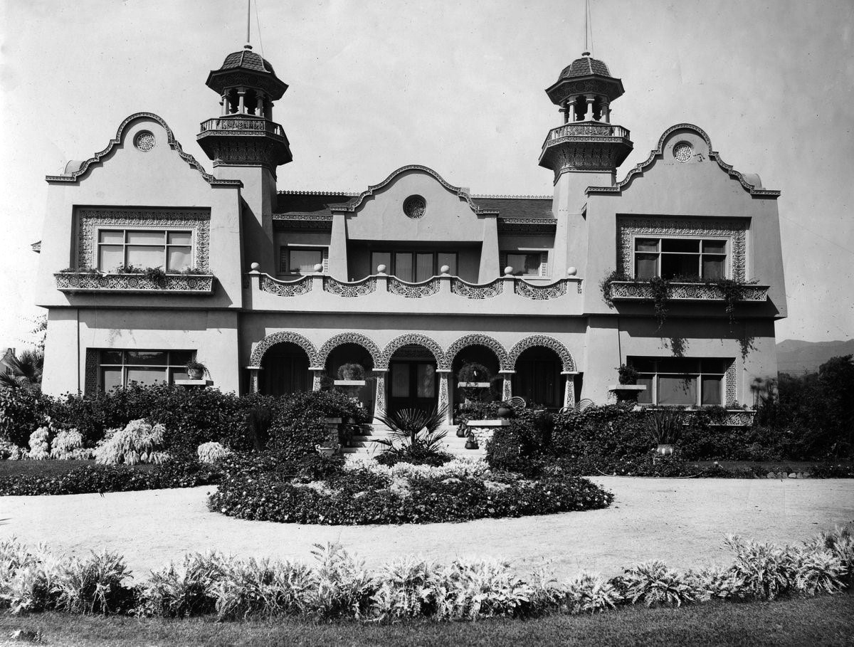
| (Early 1900s)* - Frontal view of the Mission Revival/Islamic style Hollywood residence and gardens owned by artist Paul de Longpré. |
Historical Notes The home was located on the west side of Cahuenga Blvd. at Hollywood Blvd. on property Longpré obtained from Mrs. Wilcox Beveridge after he moved to Los Angeles in 1889. The residence was a popular tourist destination for several years and was demolished in 1927. |
* * * * * |
Cahuenga and Prospect (later Hollywood Blvd)
 |
|
| (ca. 1900)* - View looking north on Cahuenga at Prospect (later Hollywood Blvd.) and a streetcar car with Santa Monica on its side. Paul de Longpré's residence can be seen on the NW corner. |
Historical Notes By 1900, the region had a post office, newspaper, hotel, and two markets along with a population of 500 people. Los Angeles, with a population of 102,479 lay 10 miles east through the vineyards, barley fields, and citrus groves. A single-track streetcar line ran down the middle of Prospect Avenue from it, but service was infrequent and the trip took two hours. The old citrus fruit-packing house was converted into a livery stable, improving transportation for the inhabitants of Hollywood.*^ |
Then and Now
 |
|
| (1900 vs 2022)* - Looking north on Cahuenga at Hollywood Boulevard (then Prospect). |
* * * * * |
 |
|
| (ca. 1900)* - Panoramic view of Hollywood taken from hills near Gower Street and Temple Hill Drive. Some recently-planted orchards are visible. |
 |
|
| (1900)* - View of the Hammel and Denker Ranch. Two men sitting in a horse-drawn carriage watch as workers pick peas in winter. |
Sunset Boulevard
 |
|
| (ca. 1900)* - View looking north on Normandie at Sunset Boulevard. |
.jpg) |
|
| (ca. 1900)* - Early view of Sunset Boulevard east of Beachwood Drive. Two little girls are standing in the middle of the wide dirt road with trees and a barn (?) in the background. Photograph also identified as Sunset Boulevard in 1906 looking east from Vine Street which crosses between buildings. |
* * * * * |
Colegrove
 |
|
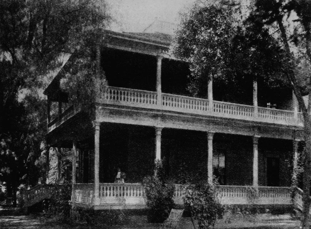
| (ca. 1886)* - View the residence of Senator Cornelius Cole, northwest corner of Santa Monica Boulevard and Gower Street. |
Historical Notes The town of Colegrove began as a 500-acre payment for a former U.S. senator's political influence. In the 1870s, the Hancock family needed help confirming its title to the sprawling Rancho La Brea. In return for the legal services -- and political connections -- of Cornelius Cole, a onetime friend of Abraham Lincoln's, the Hancocks deeded over to Cole a 500-acre tract in the rancho's northeastern corner. Cole subdivided the parcel, named the new settlement after his wife (born Olive Colegrove), and relocated his family to a house on the northwest corner of Santa Monica and Gower, even as he remained with his law practice in San Francisco. |
 |
|
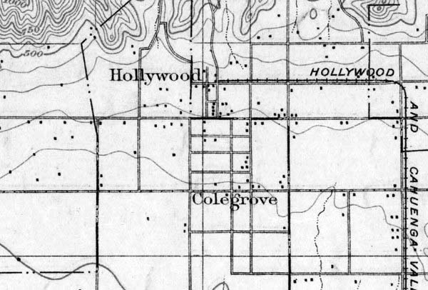
| (1900) – Topographic map showing Hollywood and Colegrove appearing as neighbors. On the right can be seen the Cahuenga Valley Railroad Line running up County Road (later Western Ave) and then turning west on Prospect (later Hollywood Blvd). The east-west street running down the center of the town of Colegrove, Colegrove Boulevard, would later become Santa Monica Blvd. Courtesy of the USGS Historical Topographic Map Collection. |
Historical Notes The Cahuenga Valley Railroad consisted of a steam train that would begin its journey to Cahuenga Valley from Diamond (Beverly Boulevard) and Texas (Belmont Avenue). Leaving the city limits, the little train wandered west across open fields eventually finding County Road where it turned north. County Road later became Western Avenue. Next stop, Coleville or Coles Crossing (later, Santa Monica Boulevard). At this point, the Cahuenga Valley line crossed the steam dummy line to Santa Monica. The train continued north to Prospect Avenue (Hollywood Boulevard) where the line turned west. That was called Grand Round. Today we know it as Hollywood and Western. Next stop, Midway (later called Bronson Avenue). The end of the line was at Prospect Avenue (Hollywood) and Wilcox. |
 |
|
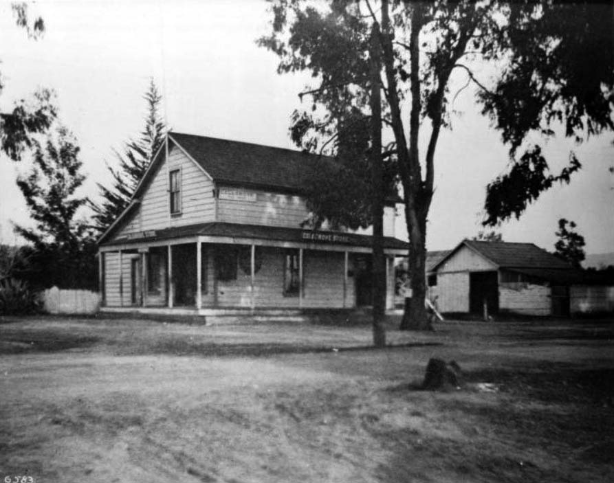
| (ca. 1900)* - The Colegrove general store and post office was located at the town's main intersection, today named Santa Monica and Vine. |
Historical Notes On Oct. 19, 1909, the town's residents voted 84-22 in favor of annexation. Colegrove -- along with other subdivisions in what was known as the Colegrove Addition -- became part of the city of Los Angeles. The following year, Hollywood joined Colegrove by consolidating with Los Angeles. Unlike Hollywood however, Colegrove soon lost its identity as a separate neighborhood. Prior to annexation, the town had referred to its main road as Colegrove Boulevard. But after annexation, Los Angeles insisted that the street be named Santa Monica Boulevard. |
 |
|
| (ca. 1900)* - View of Santa Monica Boulevard, looking east from Beachwood (formerly Colegrove) Drive. |
Historical Notes Colegrove was originally located in central Hollywood but it eventually stretched as east as Hoover Street and as south as 10th Street (today’s Olympic Blvd). There are several streets now named after the Cole family including: ◆ Barton Avenue -- Barton Jones, grandson of Cornelius Cole. |
* * * * * |
 |
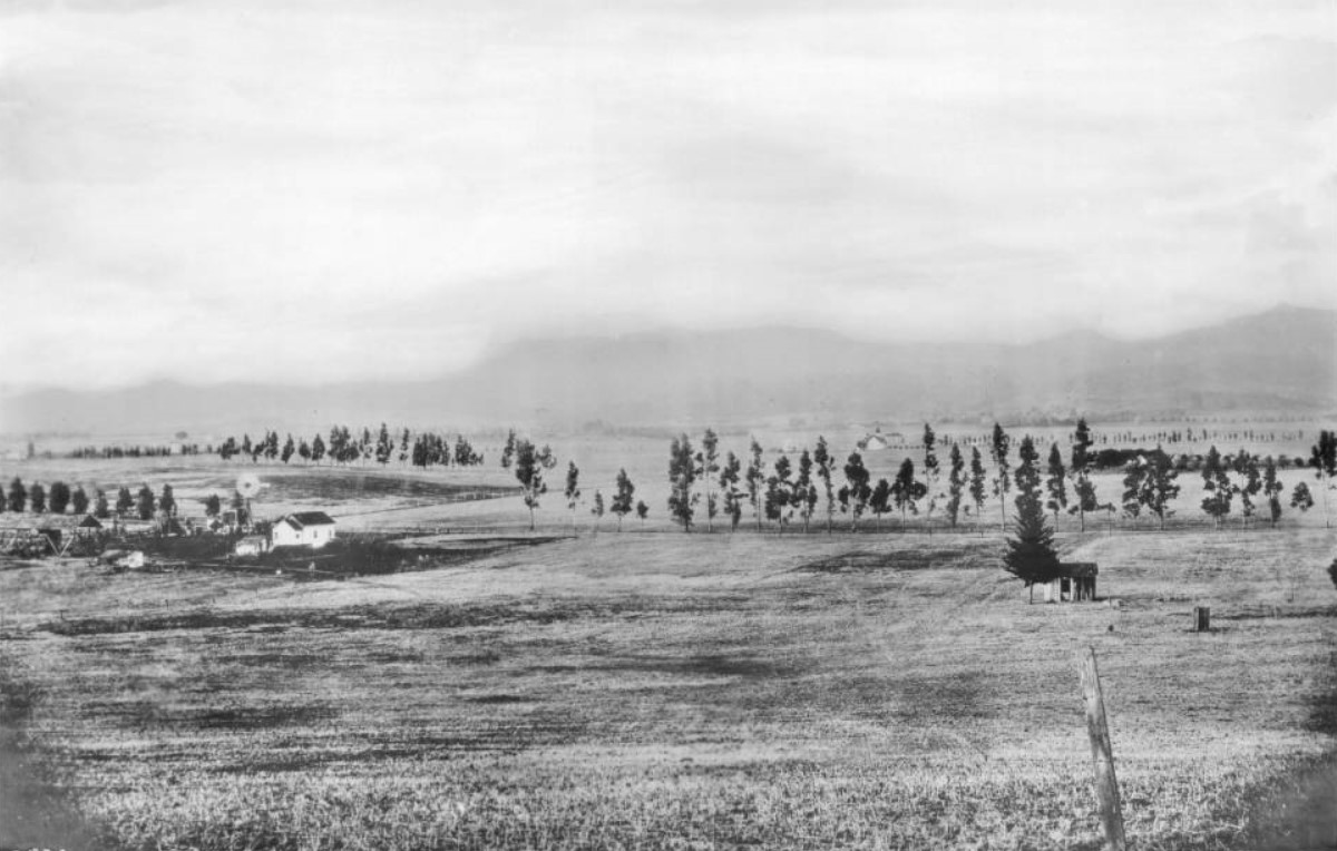
|
| (ca. 1900)* - Panoramic view of the Cahuenga Valley looking north from Prospect Hill, showing the property of G.J. Griffith, Hollywood. A rectangular patch of trees at center is flanked by cleared land to all sides. Just in front of it, to the right, a trollycar moves along the unpaved street, which is lined by small, rounded trees. Crop rows and mountains are visible in the distance. |
 |
|
| (ca. 1900)* - Two men stand on Olive Hill in Hollywood circa 1900. A panoramic view of Hollywood extends to the southwest across what later became Sunset Blvd. at the foot of the hill. Here we see the Prospect Park station, post office, and other buildings. Olive Hill was also known as the Mount of Olives. |
 |
|
| (ca. 1900)* - A panoramic view of Hollywood extends to the north toward the mountains from what would become Barnsdall Park, looking toward a later Hollywood Blvd. and Vermont Avenue area. |
 |
|
| (ca. 1900)* - Panoramic view of Hollywood looking north from Normandie Avenue and Melrose Avenue. A few lines of trees stripe the background along the fences that mark the property lines between two homesteads. In the center ground, a small, one-story house can be seen next to a windmill with a barn further left. On the same property, to the extreme right, a shack can be seen standing next to a lone tree. In the distance behind this shack, a similar homestead whose main building sports a spire can be seen, itself surrounded by a line of thin, young trees. A post, possibly a fence post, is visible in the extreme foreground at right. The Hollywood Hills are visible in the distance. |
Historical Notes The above farm is where the Hollywood Frwy crosses Melrose Avenue today. Just to the west and out of view is the location of the McCarthy Ranch. In 1887 E. A. McCarthy named Melrose Avenue after his hometown of Melrose, Mass. |
 |
|
| (1915)* - A view of the Hollywood Hills (part of the Santa Monica Mountains), taken near the present-day Paramount lot on Melrose Avenue. Photo, Courtesy of the USC libraries - California Historical Society Collection. |
 |
|
| (1900)* - Panoramic view of Hollywood in 1900, looking across empty space toward a farm and Weid Canyon beyond. The Hollywood hills are seen in the background. |
 |
|
| (1901)* - Undeveloped area of what is now Hollywood and Cahuenga Blvds. The little boy in the lower right of the photograph stands at what will be the northeast corner where the Security Trust & Savings Bank building is later built. |
 |
|
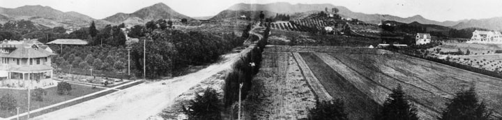
| (1901)* - Panoramic view of Hollywood looking southeast from near Vista Street and Franklin Avenue. The scene is largely agricultural. |
 |
|
| (1901)* - A man walks through a sweet pea field located at about Fairfax and Sunset, in West Hollywood. |
 |
|
| (1901)* - Fields, farm buildings and distant mountains mark the future site of Hollywood High School. Six and a quarter acres were purchased for the high school for $8,000 in 1904. |
 |
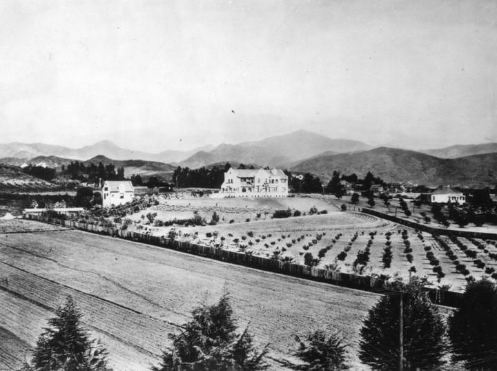
|
| (1902)* - Panoramic view of Hollywood, looking southeast from Laughlin Park at Franklin and Western Avenues in 1902. Numerous orchards are seen, with a few homes and farm buildings. |
Santa Monica and Western
 |
|
| (1902)* - Tree-lined, unpaved Santa Monica Blvd. at Western looking west in 1902. House on the left is on the southwest corner. A few houses are shown along with a man sitting on a log. Santa Monica Blvd., with a pole line running down its center, looking very narrow in comparison to how it looks today. Click HERE to see contemporary view. |
 |
|
| (ca. 1902)* – Closer view of Santa Monica Boulevard looking west from Western Avenue. Note the pole line running down center of street holding up streetcar wires. |
Santa Monica and Gower
 |
|
| (ca. 1905)* - View of an unpaved Santa Monica Boulevard, where it crosses Gower (foreground). Streetcar tracks running both east and west are visible in the center of the image. |
* * * * * |
Sunset and Fairfax
 |
|
| (1902)* - View looking East on Sunset Boulevard from Fairfax Avenue. Click HERE to see contemporary view. |
* * * * * |
First Grocery Store
 |
|
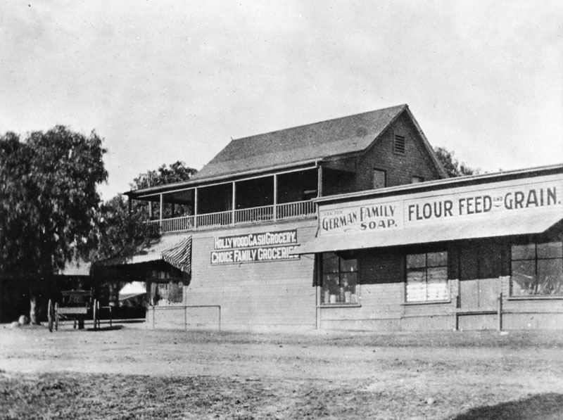
| (1903)* - This was Hollywood's first grocery store, established in the 1890s on the northwest corner of Sunset and Cahuenga. This two-story structure has a few signs on the side of the building which read, "Hollywood cash grocery", "Choice family groceries", "Ask for German family soap", and "Flour feed and grain". A horse and buggy are parked along the store entrance. |
Historical Notes The description above comes from the LAPL image libarary. Gregory Paul Williams in his book The Story of Hollywood identifies this as Jacob Muller’s (who had been the local meat delivery man) “Hollywood Cash Grocery,” which was Hollywood’s first meat market. He says it was located a little further East on Sunset between Ivar and Vine and dates this photo 1893.* |
.jpg) |
|
| (1903)* - A view of West Hollywood from the head of Cherokee Avenue. |
Historical Notes In August, 1903, a petition was submitted to the Los Angeles Board of Supervisors requesting the incorporation of the City of Hollywood. The election for city hood was held on November 14, 1903 with voting lasting until 5:00 PM. After all the ballots were counted, the vote was eighty-eight for incorporation and seventy-seven against. Hollywood became a city with geographic boundaries extending from Normandie on the east, to Fairfax on the west, and from the top of the Santa Monica Mountains on the north to DeLongpre and Fountain avenues on the south. |
 |
|
| (1903)* - Panoramic view of Hollywood, looking southwest from the Cherokee Avenue hill, above Highland Avenue in Whitley Heights. Numerous houses are seen, including that of artist Paul DeLongpre, the residence with two towers near the center of the photograph. It was located on the west side of Cahuenga Blvd. at Hollywood Blvd. |
 |
|
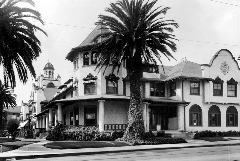
| (ca. 1902)^^ – View of Hollywood looking north from the future location of Hollywood High School, showing the Bonny Brae and Ocean View tracts. Prospect Avenue (later Hollywood Boulevard) runs horizontal across the center of photo with several buildings visible behind it. To the right is the Hollywood Hotel, shortly after it was constructed located on the N/W corner of Prospect and Highland (out of view). At center, Orchid Avenue runs north to the mountains away from Prospect Ave. |
Hollywood Hotel
 |
|
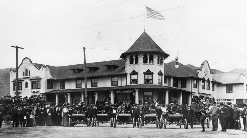
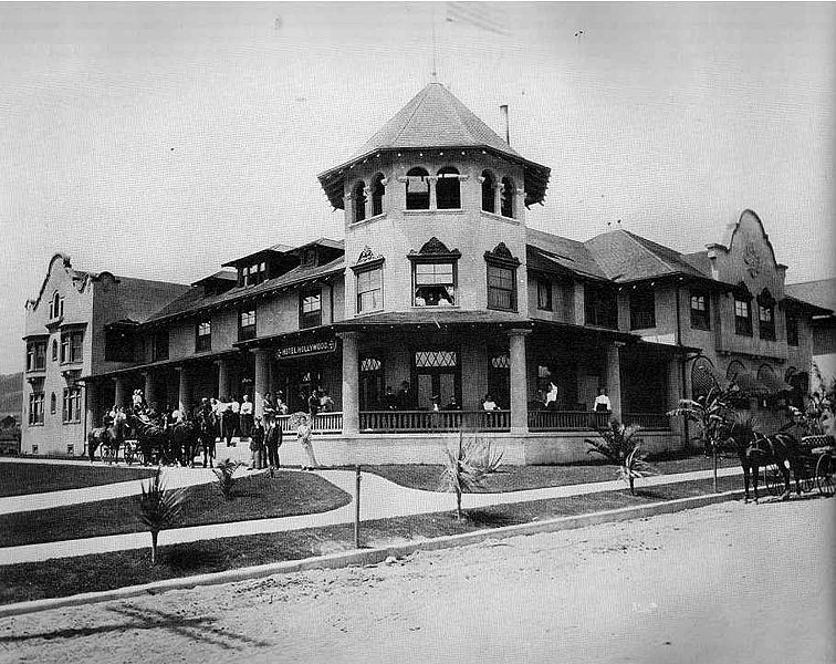
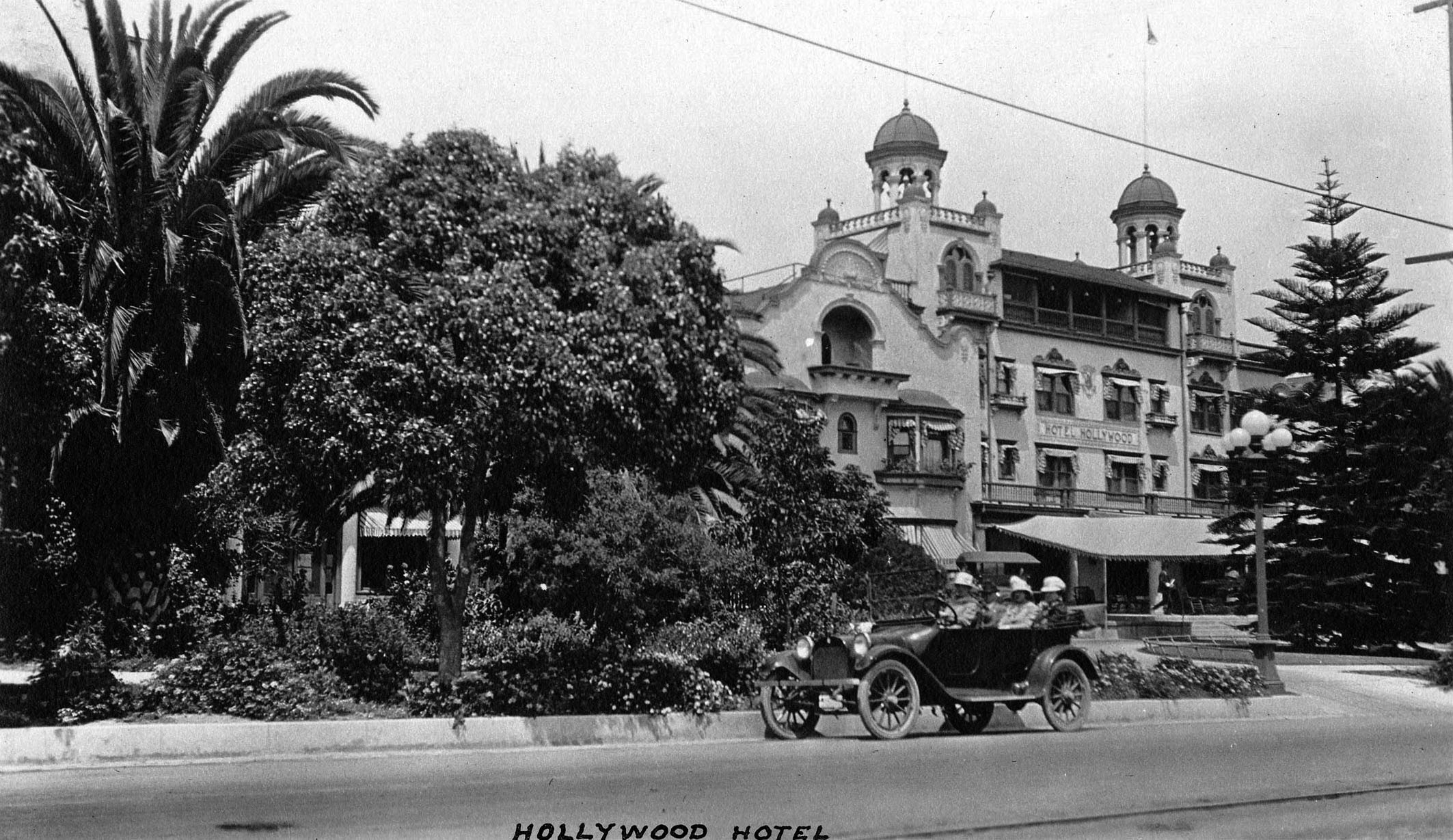
| (1903)* - View of the Hollywood Hotel at northwest corner of Prospect Ave. (later Hollywood Blvd.) and Highland Ave. showing a gathering of people, fronted by five identical open-air automobiles. Only the original portion of the hotel had been built at this time. Photo Date: April 26, 1903 |
Historical Notes The original 40-room Hollywood Hotel was built in 1902 at the NW corner of Hollywood and Highland. Today, this is the site of the Hollywood and Highland Center , the current home of the Academy Awards.* |
 |
|
| (1905)*^ - A closer view of the Hollywood Hotel. Guests can be seen standing on the front porch while horse-drawn wagons are parked in front of the hotel and along the curb of an unpaved Highland Avenue. |
Historical Notes The first section of the hotel was built by developer H.J. Whitley eager to sell residential lots among the lemon ranches then lining the foothills of the Santa Monica Mountains. Flanking the west side of Highland Avenue, the small stucco structure fronted on a dusty, unpaved road with pepper trees that would eventually become Hollywood Boulevard. Whitley was instrumental in the completion of the boulevard. Within less than three years he would be compelled to build an additional wing onto this elegant hotel.*^ |
 |
|
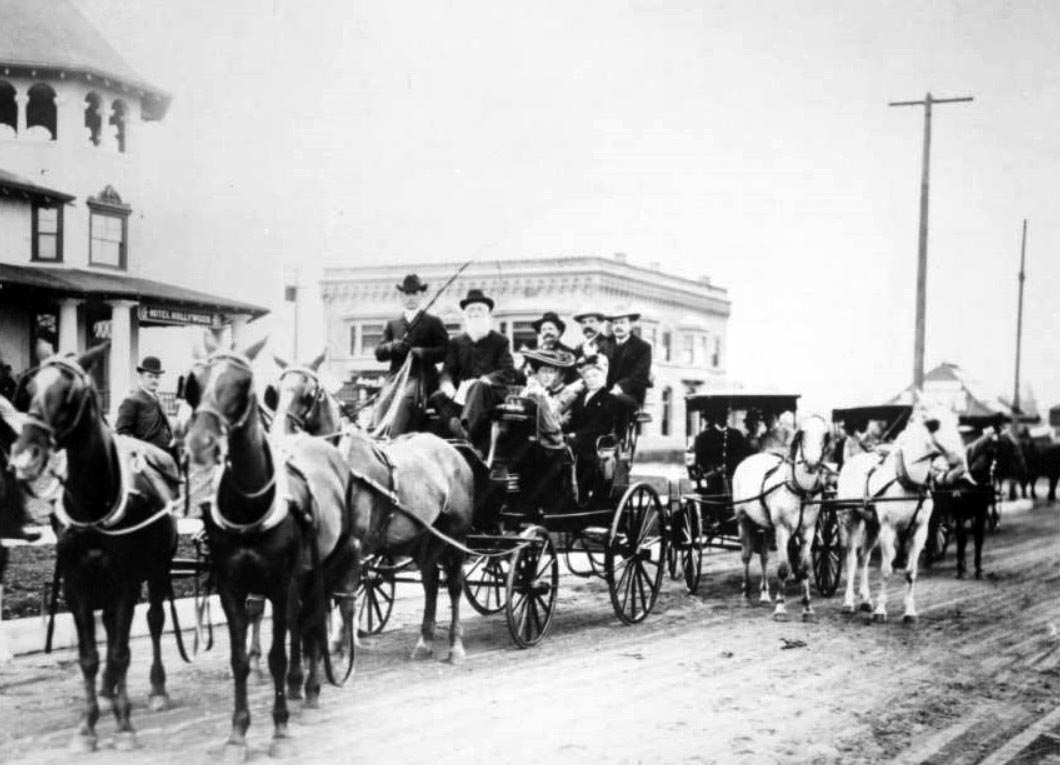
| (ca. 1904)^** – View of Eliza A. Otis, wife of Harrison Gray Otis, in horse-drawn carriage on dirt road with group of people; two ladies partially visible next to Eliza, three men in the rear of carriage and two men in front. The building to the left is the Hotel Hollywood located on the corner of Hollywood Boulevard and Highland Avenue. |
 |
|
| (1905)* - View of Hollywood Boulevard looking east from a point west of Highland Avenue. The large area on the right is a strawberry patch. A streetcar can be seen in the center of the photo in front of the Hollywood Hotel near the intersection of Hollyood and Highland. |
Historical Notes Soon after the Hollywood Hotel was opened, an eccentric millionaire spinster from Iowa, Almira Hershey, who was then staying in a hotel at Grand Avenue and 4th Street in Los Angeles, rode out to see the new hotel in Hollywood that was being advertised in the Los Angeles Times. She then became a guest; lured, the legend goes, by the cuisine, particularly the apple pie. She fell in love with the hotel and bought shares, eventually becoming sole owner.*^ |
 |
|
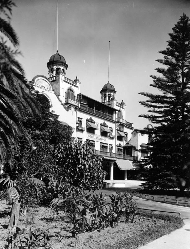
| (1905)* - View of the Hollywood Hotel in 1905 just after it was enlarged to cover the entire block. The original building can be seen on the right. |
Historical Notes The hotel was so successful that in 1905 a huge addition, which included a new entrance, chapel, ballroom, etc. and 125 guest rooms, was constructed running along Prospect Ave (later Hollywood Blvd.), stretching west to Orchid Avenue. The whole place, including the gardens took up three acres.^^^ |
 |
|
| (ca. 1905)*^*^– Postcard view of the Hollywood Hotel soon after its new addition. Prospect Avenue (later Hollywood Boulevard) is still unpaved. |
.jpg) |
|
| (ca. 1907)#** - View looking north from the field behind Hollywod High School. The Hollywood Hotel is seen on the north side of Prospect Avenue (Hollywood Boulevard). In the far background are the Hollywood Hills. |
 |
|
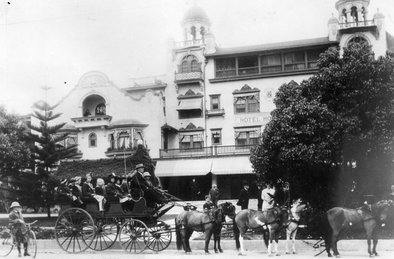
| (ca. 1910)* - Carriage drawn by six horses in front of the Hollywood Hotel. Thie is the year Prospect Avenue would become Hollywood Boulevard. |
Historical Notes Hollywood Boulevard was named Prospect Avenue from 1887 until 1910, when the town of Hollywood was annexed by the City of Los Angeles. After annexation, the street numbers changed from 100 Prospect Avenue, at Vermont Avenue, to 6400 Hollywood Boulevard.*^ |
 |
|
| (ca. 1915)^*# - View looking northeast showing a car full of people parked by the curb in front of the Hollywood Hotel. |
 |
|
| (ca. 1915)##^* - View showing a streetcar heading south on Highland Avenue in front of the Hollywood Hotel. In the background high on a hill sits the impressive Japanese Palace of brothers Charles and Adolph Bernheimer. |
Historical Notes In 1911, the Bernheimer brothers began construction of the hilltop mansion to house their priceless collection of Asian treasures. Hundreds of craftsmen were brought from the Orient to recreate the replica of a palace located in the “Yamashiro” province mountains near Kyoto, Japan. The Japanese palace sits 250 feet above Hollywood Boulevard and was completed in 1914.* |
 |
|
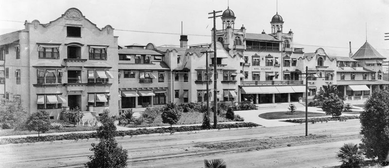
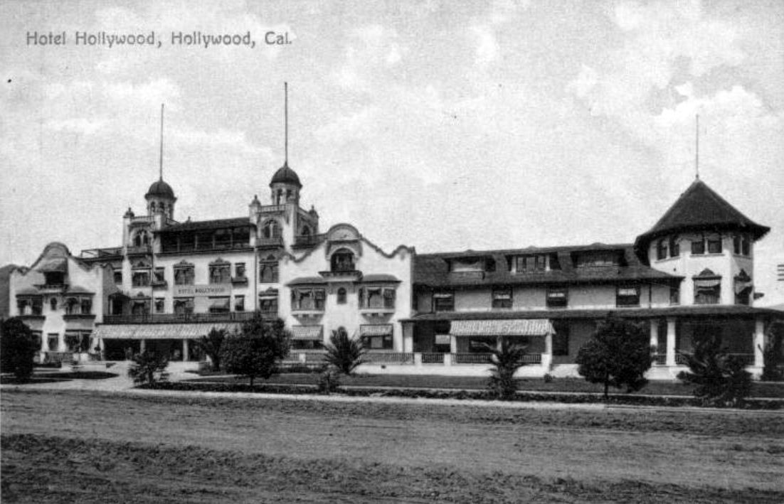
| (ca. 1920s)* - Corner view of the famous Hollywood Hotel, located on the north side of Hollywood Blvd, between Highland and Orchid Avenues. It shows a white, 2-story Spanish style structure with numerous windows throughout, a wrap-around porch, neatly manicured lawns, and several tall palms. A cupola can be seen peeking up from behind the arched façade on the left of the building. |
 |
|
| (ca. 1920)*^^ - View of the Hollywood Hotel circa 1920. Note how the trees have grown compared to previous photos. |
Historical Notes In 2001, the Hollywood and Highland entertainment complex, which includes the Hollywood and Highland Center, the current home of the Academy Awards, was constructed on the site.*^ |
* * * * * |
 |
|
| (ca. 1903)* - Vine Street headed north into the hills from Hollywood Boulevard. George Hoover’s home is on the far left and the Bartlett residence is at the right. The empty field in right foreground is now where the Equitable Building and Pantages Theatre stand. |
Historical Notes Prospect Avenue was the original name for Hollywood Blvd., and Weyse Avenue was the original name for Vine Street. Years passed before the intersection acquired its now-familiar name of Hollywood and Vine. Weyse Avenue was the first of the two roads to acquire a new name. After the failure of Weyse's hotel, the road was rebranded as Vine Street, an appellation inspired by the grapevines then growing just north of present-day Santa Monica Boulevard. Prospect Avenue did not become Hollywood Boulevard until the once-independent city of Hollywood consolidated with Los Angeles in 1910. Finally, Hollywood and Vine was on the map. #^^ |
 |
|
| (ca. 1905)* - Photograph of the residence of A.G. Bartlett on Hollywood Boulevard between Vine Street and Gower Street. A plowed field is separated from crop rows by a picket fence, behind which a mansion, next to which a windmill stands, is visible on a hill, overlooking the crops. To its left, steps with railing lead down the hill to a smaller house, possibly a barn. Beyond this property, divided by yet another fence, more houses can be seen in the distance in front of the mountains. |
 |
|
| (ca. 1904)*^^ – View looking west on Prospect Avenue (later Hollywood Boulevard) from near Wilcox Avenue. Note the streetcar tracks running down the center of the street. |
 |
|
| (1904)##^* – Postcard view looking northeast showing Prospect Blvd (later Hollywood Blvd) & Whitley. The Jane House, 6541 Prospect Blvd, can be seen in the center-right portion of the card. Whitley dead ends at a T-intersection at Prospect on the west side of the house. The Hurd Residence is also visible on the far right at Wilcox. Schrader Blvd (formerly Dae Ave) begins south of Prospect, and is out of frame, just east of Whitley. This photo was taken just east of Cherokee. |
 |
|
| (ca. 1905)^^ - View showing the northwest corner of Prospect (later Hollywood Blvd.) and Wilcox. In the foreground is a well-tended garden consisting of small pine trees, yucca trees, and patches of lawn. In the background at left, is the large Victorian mansion of banker H.J. Whitley (previously the Hurd Residence). The two-story home consists of a covered balcony and cylindrical section with a rounded rooftop. |
 |
|
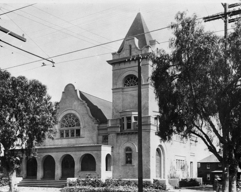
| (ca. 1905)* - View showing the first Hollywood Methodist Episcopal Church (Hollywood Memorial Church), located at the southeast corner of Hollywood and Vine (Prospect and Weyse avenues at the time). |
Historical Notes The intersection was known as Prospect and Weyse avenues when landowner Daeida Beveridge gave members of the German Methodist Church the southeast corner. Hollywood Memorial Church, with its four-story steeple, became a community landmark, according to historian Gregory Paul Williams' 2005 book, "The Story of Hollywood, an Illustrated History." *# The Mission Revival style German Methodist Church was demolished in 1923 to make way for a new high-rise building, the 12-story Taft Building. |
.jpg) |
|
| (ca. 1905)* - View looking east showing the German Methodist Church (1st Methodist Church in Hollywood), located on the southeast corner of Hollywood and Vine. Today the Taft Building stands at this location. |
Historical Notes A.Z. Taft, Jr. (1889-1941), who purchased the Hollywood Memorial Church for $125,000, tore it down, and commissioned the Taft Building. The church would be rebuilt at 1201 North Vine Street in 1923.*^ |
 |
|
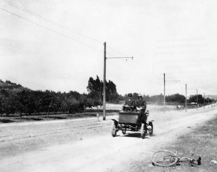
| (1904)* - Two passengers in an antique car are diving on an unpaved Hollywood Blvd. near Sunset Blvd. alongside street car tracks. |
 |
|
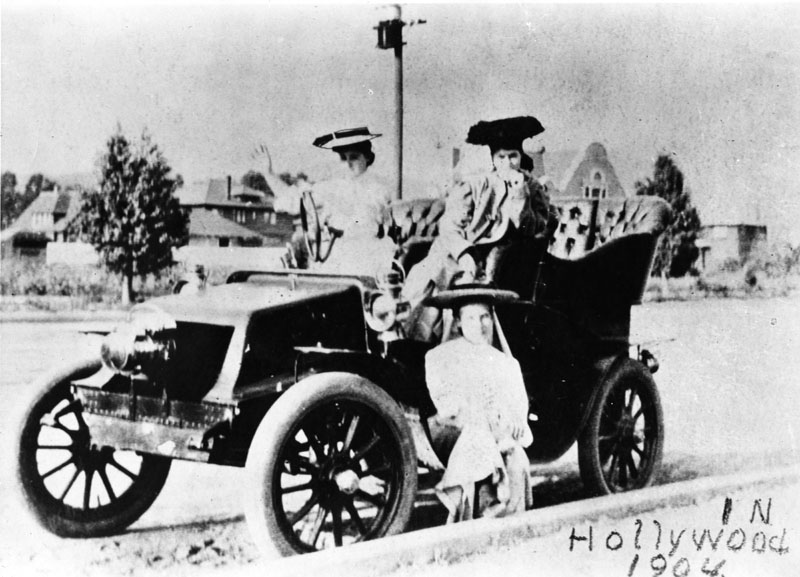
| (1904)* - Photograph taken of three ladies in a 1904 Oldsmobile at a loction west of Sunset Boulevard and Vine Street, Hollywood. |
 |
|
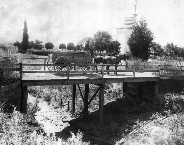
| (1904)* - View of a horse-drawn carriage crossing a bridge on Franklin Avenue near Bronson Street, Hollywood. A man sits at the helm of a large plank wagon with spoked wheels pulled across a wooden bridge by two horses. The riverbed underneath him is dry and overgrown with weeds. |
 |
|
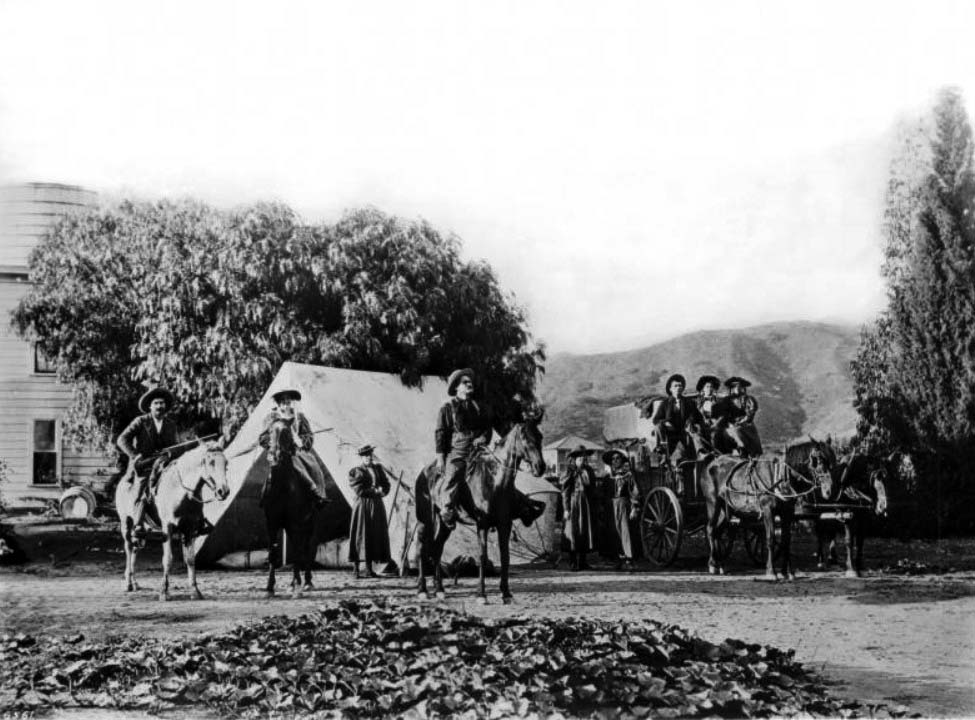
| (ca. 1905)^^ - Photograph of a group of campers on Franklin Avenue near Bronson Street in Hollywood. Nine campers, both male and female, stand outside the front of a house, a tent behind them. At left, a man and a woman both on horses, hold rifles across their laps. Next to them, a woman in a hat stands, in front of which a second man on a horse is centered, looking off into the distance. Two more women stand to the right of him, next to which three campers, two women and a man in a suit, are seated in a wagon drawn by two horses. |
Don Tómas Urquidez Adobe (1st House in Hollywood)
 |
|
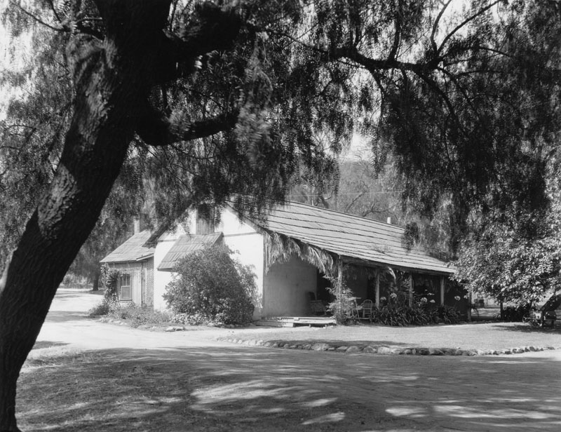
| (ca. 1905)* - Built by Don Urquidez in 1853 on an Indian burial ground, this adobe is located on the northwest corner of what is now Franklin and Sycamore. It is considered to be the first house built in Hollywood. |
Historical Notes The house itself, known as "The Outpost", was built in 1853 by Don Tornas Urquidez, at what is now 7061 Franklin Street. It was demolished in 1924.^^ |
 |
|
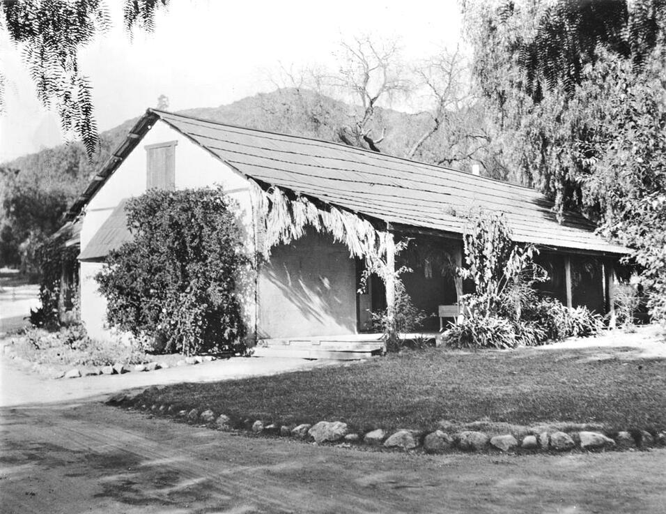
| (ca. 1905)^^ - Closer view of the Don Tómas Urquidez adobe, the first house in Hollywood. |
Historical Notes General Harrison Otis purchased the land and adobe, which he later renamed "Outpost," from Don Tómas Urquidez. During the years of Otis' ownership, "The Outpost" was a popular center for social gatherings for the general, his associates, and fellow veterans. This piece of real estate would change hands a number of times before becoming part of the Outpost Estates. In the early 1920s, Otis sold the property to Charles E. Toberman, who went on to develop the residential community of Outpost Estates.* |
Immaculate Heart College
 |
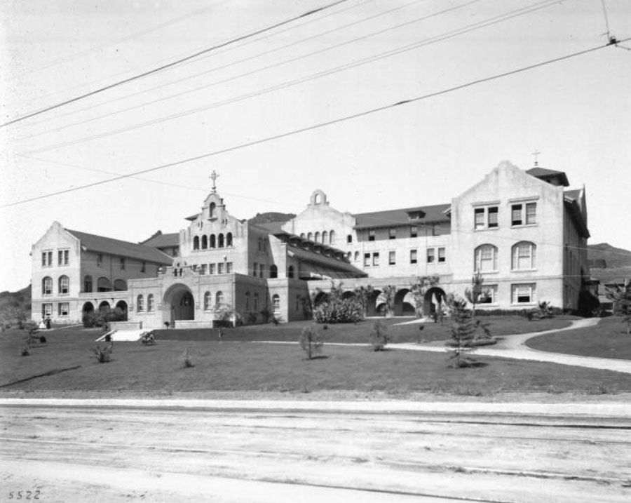
|
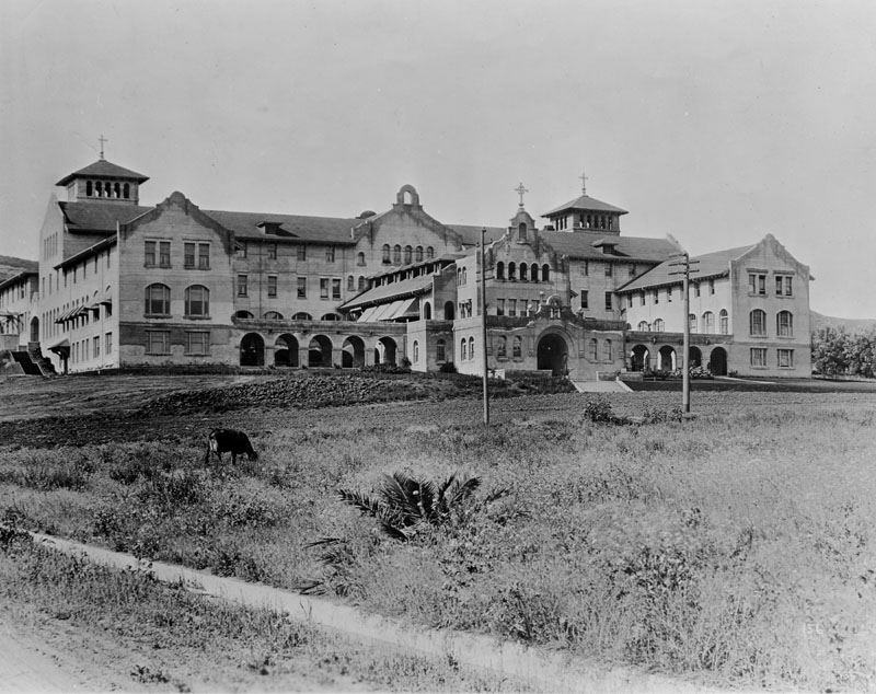
| (ca. 1905)* - The original Moorish/Mission Revival style building on the campus of Immaculate Heart College, located at 5515 Franklin Avenue in Hollywood. A cow can be seen grazing in the field in the foreground. |
Historical Notes In 1903 the Sisters of the Immaculate Heart of Mary purchased fifteen-acres in Hollywood on which to develop a school. Two years later on April 24, 1905 a ground-breaking took place for the first campus building (shown here), which included classrooms for high school and elementary school students, boarding facilities, as well as living quarters for the nuns.* |
 |
|
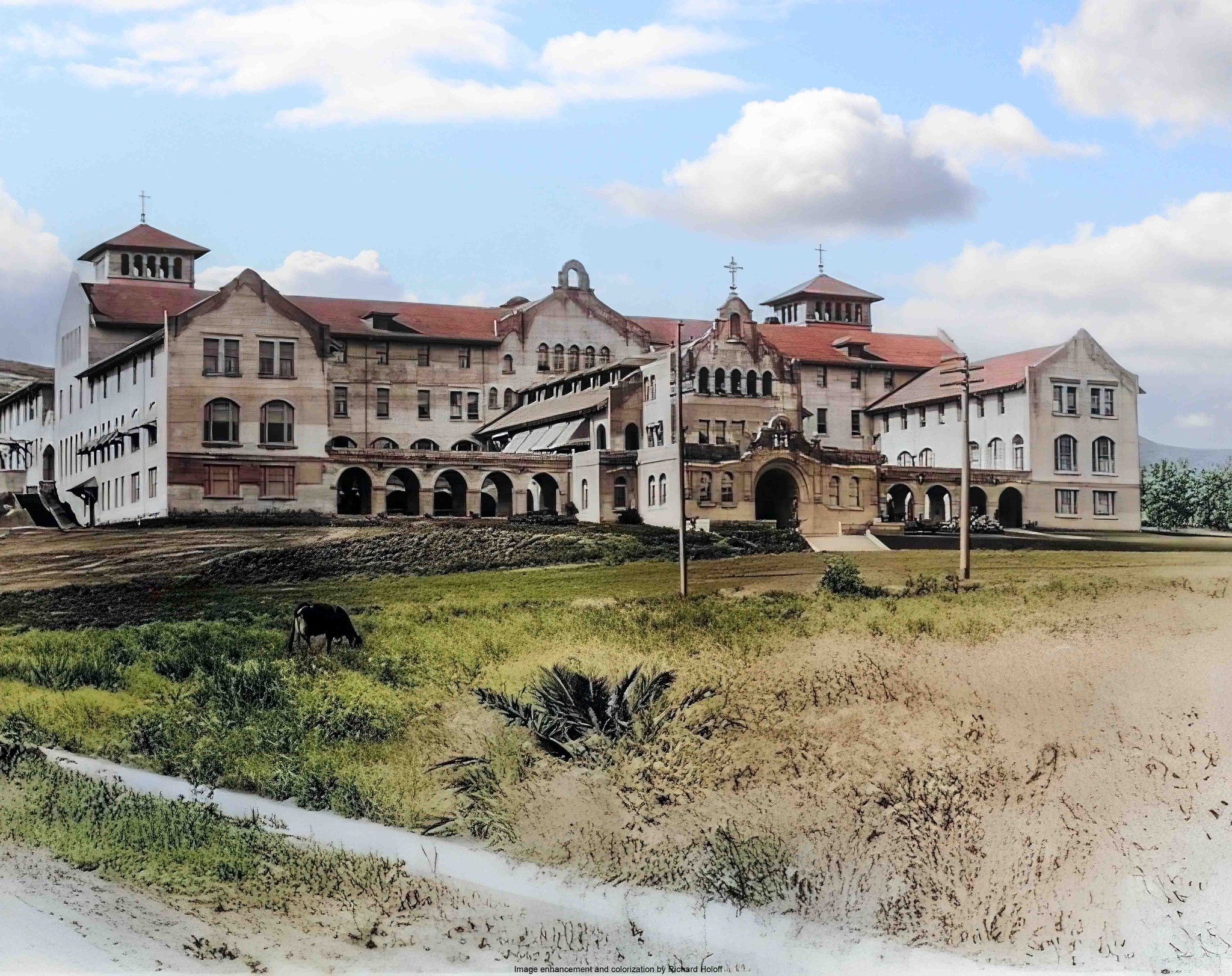
| (ca. 1905)* - The original Moorish/Mission Revival style building on the campus of Immaculate Heart College, located at 5515 Franklin Avenue in Hollywood. Image enhancement and colorization by Richard Holoff. |
 |
|
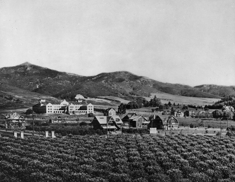
| (1905)^^ - View of the Immaculate Heart College, a Catholic girls school on Franklin Avenue at the head of Western Avenue, showing newly planted trees and lawn. The dirt road in the foreground is lined with streetcar rails. |
Historical Notes In 1905, when the school was officially founded, there were a total of 75 students and the curriculum included history, mathematics, Latin, physiology, Greek, French, Spanish, English, chemistry, physics, music, art, and drama.* |
 |
|
| (ca. 1907)* - View of the original campus of Immaculate Heart College, located at 5515 Franklin Avenue in Hollywood, as it appears in the early years of Hollywood when there were few homes (foreground) and large open spaces for agriculture, seen throughout this image. |
Historical Notes During this period, Western Avenue changed from a rutted wagon road to a major artery, Los Feliz from a cow path to a boulevard, and the surrounding olive and orange groves yielded first to California bungalows, then to apartment structures and business and industrial complexes. The school was originally called Immaculate Heart College, even though it began as a high school. The College portion opened in the following decade.^^ |
Arthur Letts Residence
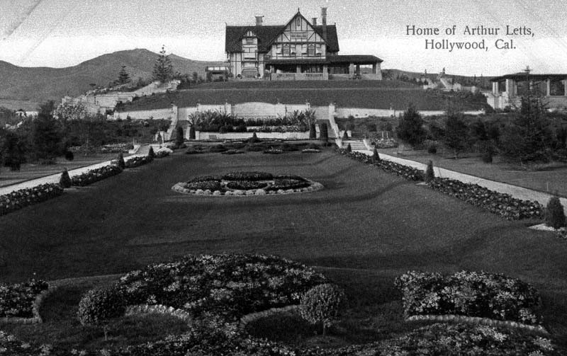 |
|
| (ca. 1905)* - Postcard view of the Tudor Revival Hollywood home and gardens of merchandiser Arthur Letts, located at 4931 Franklin Avenue, Hollywood. The residence was also known as the Holmby Mansion, the name loosely derived from Letts' hometown of Holdenby, England. |
Historical Notes Arthur Letts, Sr. was born in England. In 1882 he emigrated to Toronto, Canada, and found employment in a large dry goods store. When the Red River Rebellion broke out in the Northwest of Canada, he volunteered. He was awarded a silver medal and clasp for distinguished service, and a grant of land by the Canadian government. In the early 1890s he emigrated to the United States in Seattle, Washington and began retail employment in dry goods. Having little success, he then headed for L.A. in 1895. At the corner of Fourth and Broadway, then on the far southern edge of the downtown Los Angeles business district, the J. A. Williams & Co. Dry Goods Store had gone bankrupt. With the help of an influential friend, who was impressed with Letts’ knowledge of that type of business, a loan of $5000 was secured from the Los Angeles National Bank, and opened his business on February 24, 1896. He named the department store The Broadway.*^ |
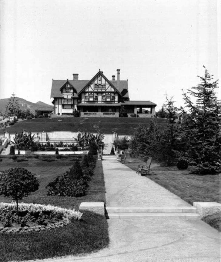 |
|
| (ca. 1905)^^ – View showing the three-story Letts residence. The house is situated on a hill and features dormer windows, cant windows, stone masonry walls, a covered porch, several chimneys and window awnings. An immaculate courtyard adorned with well-manicured lawns and gardens precedes the house. |
Historical Notes Arthur Letts knew real estate was great for investment in fast-growing Los Angeles. And with his significant access to capital, it was just a matter of time before he made one of his most significant purchases. In 1919 heirs to the Wolfskill Ranch (Rancho San Jose de Buenos Aires) were ready to sell, but they wanted cash. The former ranch consisted of over 3,200 acres, with an approximate border of Pico Blvd. on the south, L.A. Country Club on the east, Sunset Blvd. on the north, and I-405 on the west. Purchased for $2 Million, Arthur turned over development to his son-in-law Harold Janss' company, Janss Investment Co. The area south of Wilshire contained land reserved for movie studios. The townsite of Westwood was laid out, which by 1927 contained 4,000 people.^#^# He later also developed the westside residential community of Holmby Hills, loosely derived from the name of his birthplace, a small village in England called Holdenby.*^ Click HERE to see more in early views of UCLA and Westwood. |
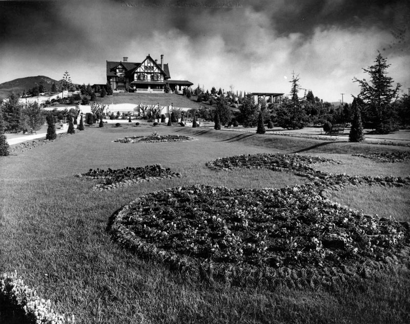 |
|
| (ca. 1905)* - Exterior view of the Tudor Revival Hollywood home and gardens of the Broadway Department Store founder Arthur Letts. |
Historical Notes Arthur Letts was also the 'behind the scenes' financial founder and owner of Bullock's department store, and put John Bullock from his The Broadway to direct this store. After Letts' death, Bullock and a group of investors purchased the store from the estate.*^ |
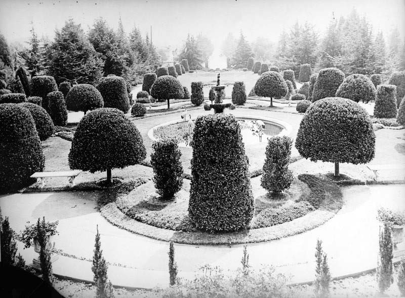 |
|
| (Early 1900s)* - A fountain in the garden of Arthur Letts' home, located at 4931 Franklin Avenue, Hollywood, in which crane statues are seen. The shrubs and trees are carefully manicured and set in a balanced design. |
Historical Notes The grounds of Los Feliz district, Hollywood estate Holmby House were formally laid out with wide variety of trees, shrubs, and flowers, and Letts’ cactus collection was known across the country. It was bound by Franklin Avenue, Vermont Avenue, Los Feliz Boulevard, and Laughlin Park. The gardens were open to the public for tours, with the Pacific Electric Railway stopping at it. It was his wish that the gardens be continued even after his death. Upon his death in May 1923, his wife, at the suggestion of son-in-law Harold Janss of Janss Investment Company (who lived at the back of the property), demolished the gardens and mansion in 1927 to subdivide and develop the land, and moved to a new residence in Holmby Hills. Henry E. Huntington purchased many of the rare specimen cacti for his Huntington Desert Garden at his estate and Huntington Library in San Marino.*^ |
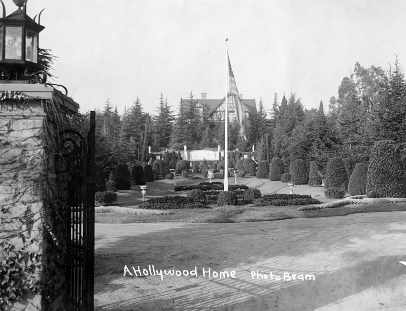 |
|
| (Early 1900s)* - View through the front entrance gates of the Tudor Revival Hollywood home and gardens of merchandiser and philanthropist Arthur Letts, located at 4931 Franklin Avenue. He was the founder of the Broadway Department Store and other ventures and later developed the westside residential community of Holmby Hills. |
Historical Notes In 1909, the estate was a stop on the Points of Interest for Hollywood tour, which also included Paul De Longpre's residence about a mile away. The Herald write-up in their Sunday magazine read: Arthur Letts' Mansion and Grounds - Immense country place. Large sunken gardens. A full acre of every known variety of cacti. Flowers in profusion. The largest coca plumosa drive in Southern California. Grounds open to visitors Thursdays.^#^# |
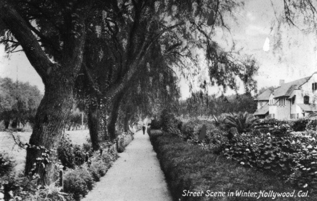 |
|
| (1905)^*^# - View of Prospect Avenue near Cahuenga in 1905. In 1910, Prospect Avenue became Hollywood Boulevard. |
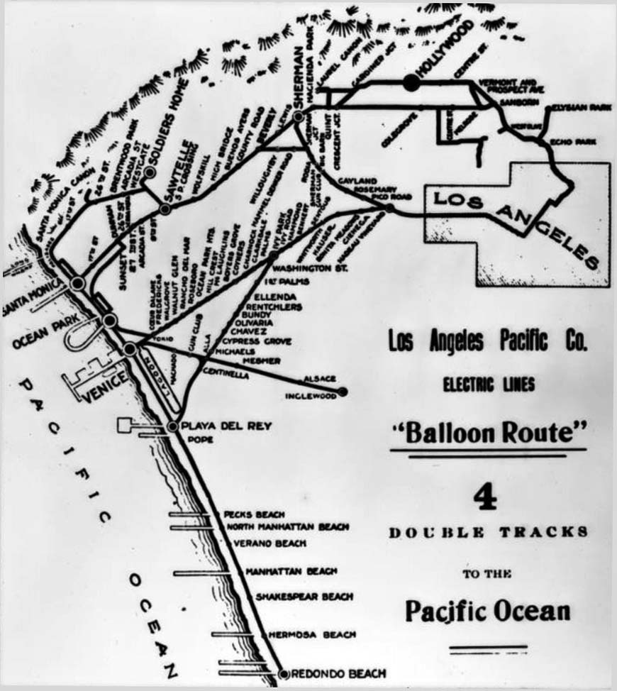 |
|
| (1910)^^ - Map of the Los Angeles Pacific Company Electric lines around Los Angeles, including the "Balloon Route" which would bring flocks of tourists to Hollywood. |
Historical Notes The Balloon Route Trolley trip was the featured route of the Los Angeles Pacific, opened in September 1901. The line ran from downtown LA through Hollywood, Santa Monica, Venice Beach, Redondo Beach and back to L.A. via Culver City. The lines stopped at beach resorts and included free entrance to some en-route stops attractions along the way, including: Sunset Boulevard, studio of painter Paul de Longpré, bean fields of Morocco in Beverly Hills, Sawtelle Veterans Home and Old Soldiers' Home in Sawtelle, Long Wharf, Camera Obscura at Santa Monica, Playa del Rey Pavilion for a fish dinner, Redondo's Moonstone Beach, Venice, and Palms - Culver City.*^ |
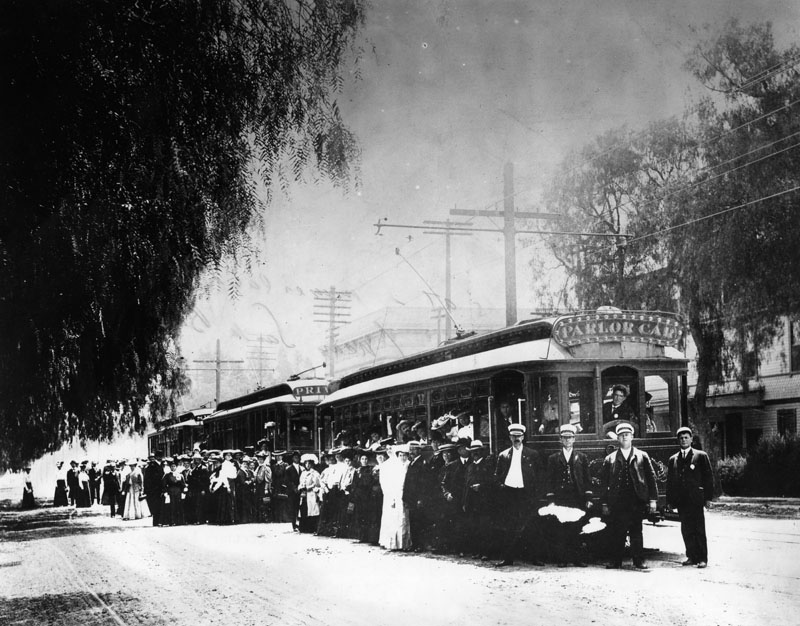 |
|
| (1905)* - Tourists visiting the famous De Longpre Art Gallery on Hollywood and Cahuenga Boulevards in 1905, traveling via electric cars. Sign on streetcar reads: PARLOR CAR |
Historical Notes The street car departed downtown LA at 9:30 am each day and returned to LA at 5:00 pm for the cost of $1.00. This excursions line was heavily advertised and thus became well known. The first car used was a Parlor car (#400), as the line became popular more cars were added. The owner of Hollywood's first Hotel, the Glen-Holly Hotel, operated the line for the LAP. In 1906 the PE took ownership and operation of the line.*^ |
Paul de Longpré Residence
|
|
| (ca. 1905)* - Exterior view of the Mission Revival/Islamic style Hollywood residence once owned by artist Paul de Longpré. The home was located on the west side of Cahuenga Blvd. at Hollywood Blvd and became a big tourist attraction. |
Historical Notes Perhaps the most famous Hollywood transplant of the time was Paul de Longpre, a French horticultural painter who arrived in Los Angeles with his family in 1889. After de Longpre discovered his ideal flowers growing in Hollywood, he met Daeida Wilcox, who was so anxious to attract culture that she gave him her homesite, three lots on Cahuenga just north of Prospect (later Hollywood Blvd.), for his estate.*** |
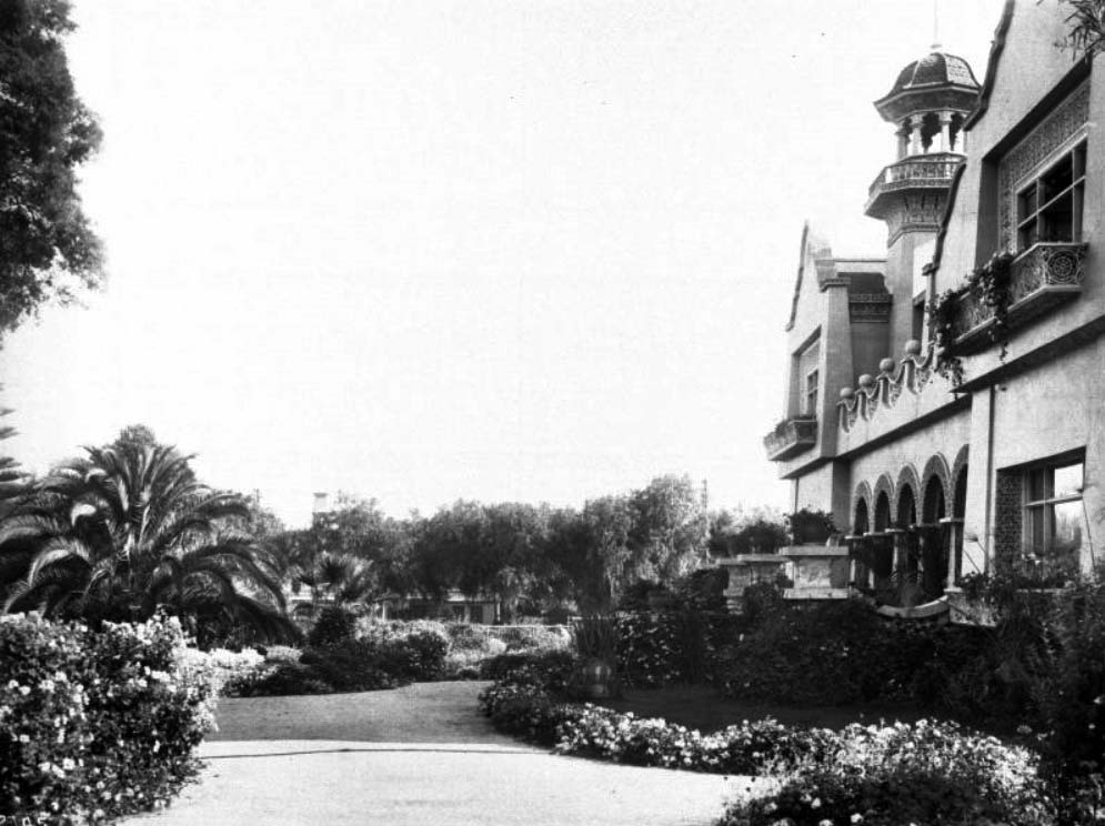 |
|
| (ca. 1905)^^ - View of Paul de Longpre’s residence and garden, Hollywood Boulevard and Cahuenga Avenue. The front of the two-story house, visible at right, includes a several balconies, an open tower, and a series of arches at the main entry. The well-cared-for garden and lawn abuts a paved area in the foreground. |
Historical Notes The mansion and gardens Paul de Longpre built not only drew Hollywood society but served as a lure for new property buyers and tourists. So many visitors came to see “Le Roi des Fleurs” that the P.E. Railway added a trolley spur on Ivar Avenue to deposit them closer to the estate.*** |
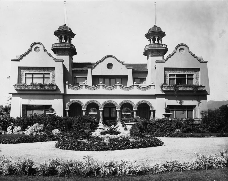 |
|
| (n.d.)* - Frontal view of the Mission Revival/Islamic style Hollywood residence and gardens owned by artist Paul de Longpré. |
Historical Notes The home was located on the west side of Cahuenga Blvd. at Hollywood Blvd. on property Longpré obtained from Mrs. Wilcox Beveridge after he moved to Los Angeles in 1889. The artist, who was born in Lyons, France, desired the 65-foot-deep lots for an extensive flower garden. The residence was a popular tourist destination for several years and was demolished in 1927.* |
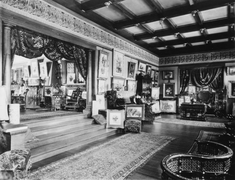 |
|
| (ca. 1905)* - Interior of the Mission Revival/Islamic style Hollywood residence and art gallery once owned by artist Paul de Longpré. Several of the artist's rose paintings are on display throughout the room shown here. The flowers depicted in the paintings came from his famed garden, which at one time consisted of approximately 4,000 roses. |
Historical Notes Tours of the house and gardens, along with prints of his floral paintings, supported the de Longpre family until the artist’s death in 1911. After his family returned to France, the house and gardens were demolished for their valuable real estate, and de Longpre’s paintings–romantic still-lifes of roses, orchids and the like–fell permanently out of fashion.*** |
|
|
| (1907)* - Exterior view of the Hollywood residence and gardens owned by artist Paul de Longpré. The home was located on the west side of Cahuenga Blvd. at Hollywood Blvd. on property he obtained from Mrs. Wilcox Beveridge after he moved to Los Angeles in 1889. The French born artist desired the 65-foot-deep lots for a large flower garden. |
Historical Notes If not for De Longpre Avenue, most Hollywooders today would not recognize his name, let alone his art.*** |
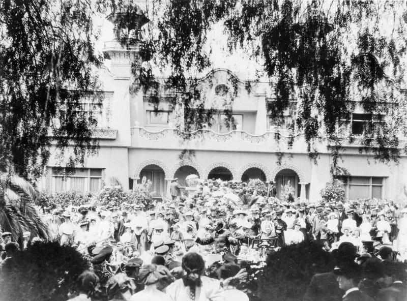 |
|
| (1909)* - A conductor leads a musical ensemble playing to a large crowd of visitors outside the Mission Revival/Moorish style Hollywood residence of artist Paul de Longpré. This well attended event celebrated the completion of the Hill Street tunnel in downtown. Click HERE to see more Early Views of the Paul de Longpré Residence. |
Historical Notes The home was located on the west side of Cahuenga Blvd. at Hollywood Blvd. on property Longpré obtained from Mrs. Wilcox Beveridge after he moved to Los Angeles in 1889. The residence was a popular tourist destination for several years. The increased property values in rapidly developing Hollywood resulted in demolition of the gardens by 1924, and the house in 1927.*^ |
Hill Street Tunnel
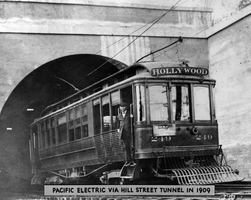 |
|
| (1909)* - Pacific Electric Railway Hollywood car via the Hill Street Tunnel soon after the tunnel's opening. Its sign says, "Beverly, Sawtelle, Ocean Park, Venice." |
Click HERE to see more on the opening of the Hill Street Tunnel. |
* * * * * |
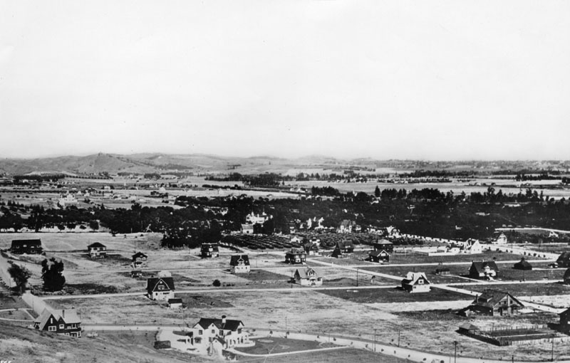 |
|
| (ca. 1905)* - Panoramic view of Hollywood circa the early 1900s, with scattered houses on the city blocks. In the center of the photo with two towers is the rear of the Paul DeLongpre residence at Hollywood and Cahuenga Boulevards. Highland Avenue is in the foreground. |
Historical Notes Highland Avenue was named after Highland Price, wife of Walter Price, the area’s blacksmith in the 1880s.+++ |
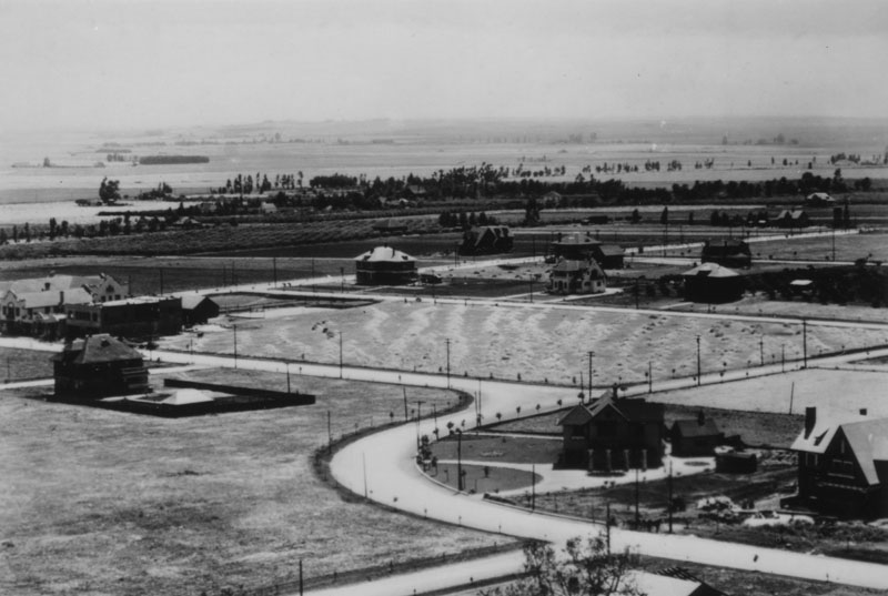 |
|
| (ca. 1905)* - Panoramic view of Hollywood, seen from Whitley Heights. A few houses are scattered about, and a winding street is seen. The curved configuration of Highland between the East and West sections of Franklin Ave still exists today. |
Historical Notes Whitley Heights is a residential neighborhood in the Hollywood district named for Hobart Johnstone "HJ" Whitley, the "Father of Hollywood". Whitley Heights was added to the National Register of Historic Places in 1982. In 1918, HJ Whitley commissioned architect A.S. Barnes to design Whitley Heights as a Mediterranean-style village on the steep hillsides above Hollywood Boulevard, and it became the first celebrity community. The neighborhood is roughly bordered on the north and east by Cahuenga Boulevard, on the west by Highland Avenue, and on the south by Franklin Avenue. It overlooks the tourist district of Hollywood, including the Hollywood Walk of Fame and Grauman's Chinese Theatre, and the Hollywood Bowl amphitheater. The neighborhood was bisected and some landmark homes destroyed when U.S. Route 101, a.k.a. the Hollywood Freeway, was built after World War II. Among Whitley Heights' many famous residents have been Rudolph Valentino, Barbara Stanwyck, W.C. Fields, Jean Harlow, Carole Lombard, William Powell, Tyrone Power, Ellen Pompeo, Gloria Swanson, Rosalind Russell, Judy Garland, and Marlene Dietrich.*^ |
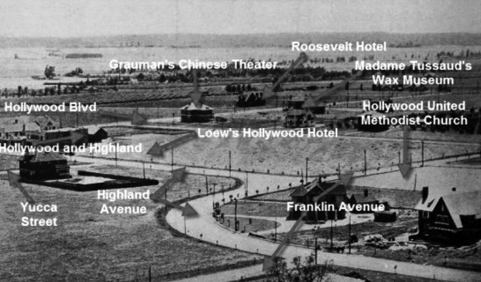 |
|
| (ca. 1905)#^** – Same image as above but annotated to show street names and significant building locations. |
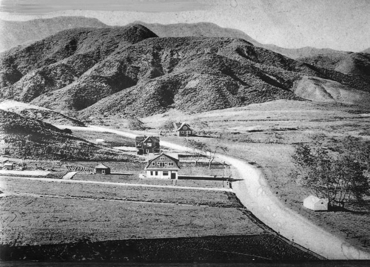 |
|
| (1906)* - Early view of Highland Avenue north of Hollywood Boulevard in 1906. Some buildings are visible with hills in the background. |
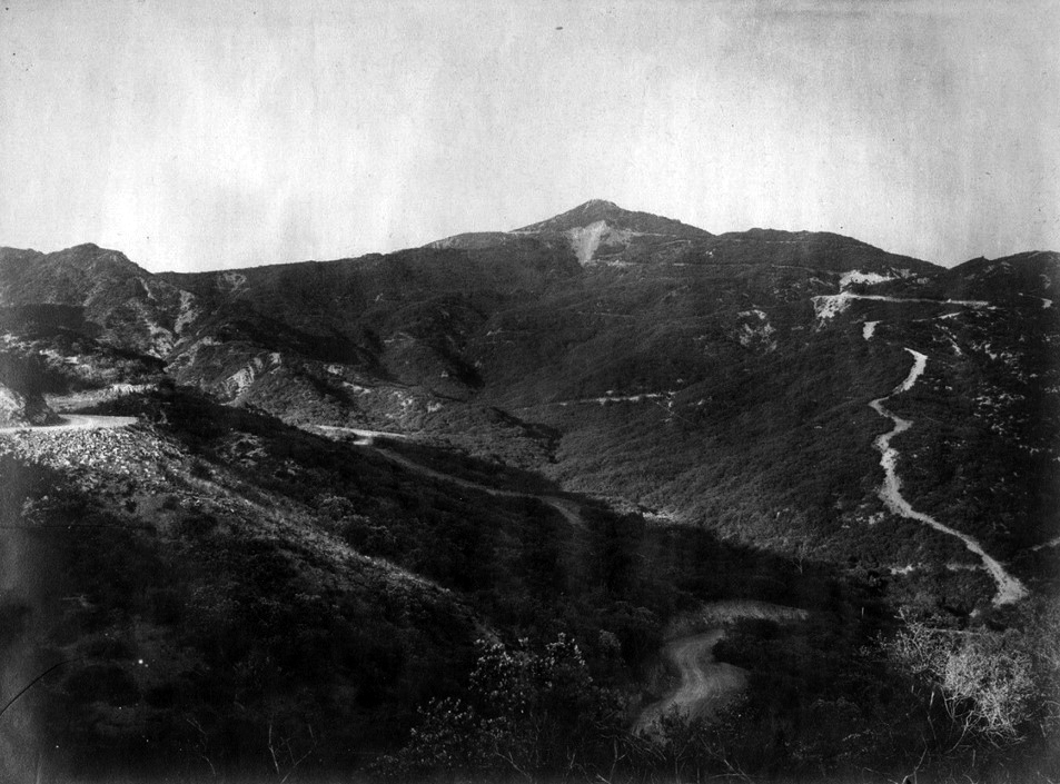 |
|
| (ca. 1900)^^^ - View of Mt. Hollywood with no houses. At an elevation of 1,640 feet, it is the tallest peak in Griffith Park. |
Western and Sunset
.jpg) |
|
| (1905)* - View of Western Avenue south of Sunset Boulevard. The ornamental house seen in the background belonged to the Hampton family. Four children, two boys and two girls, stand along the road (Western Avenue) posing for the camera with Mt. Hollywood seen in the background. Click HERE to see contemporary view. |
Historical Notes The highest peak in the background is Mt. Hollywood with an elevation of 1,657 feet. |
Then and Now
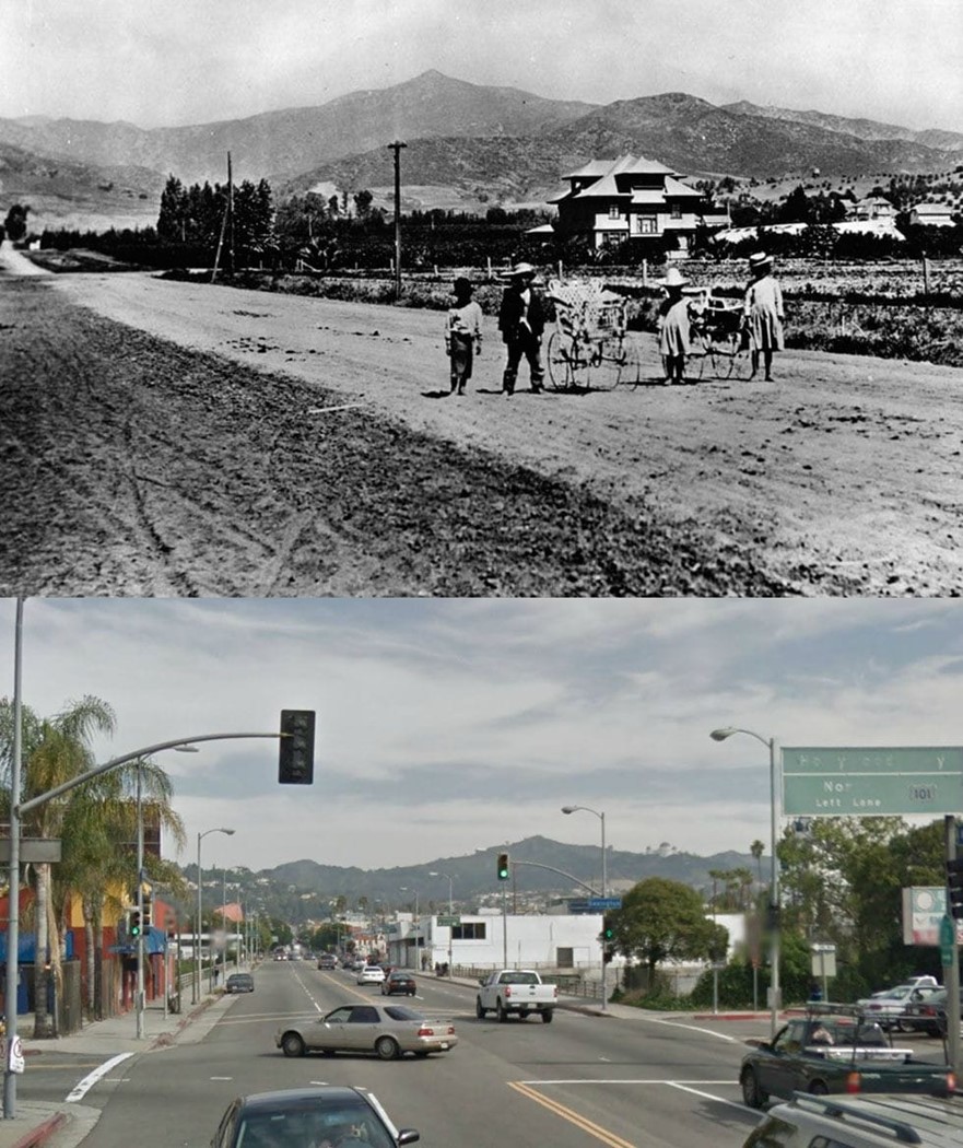 |
|
| (1905 vs. 2018) - View of Western Avenue south of Sunset Boulevard. |
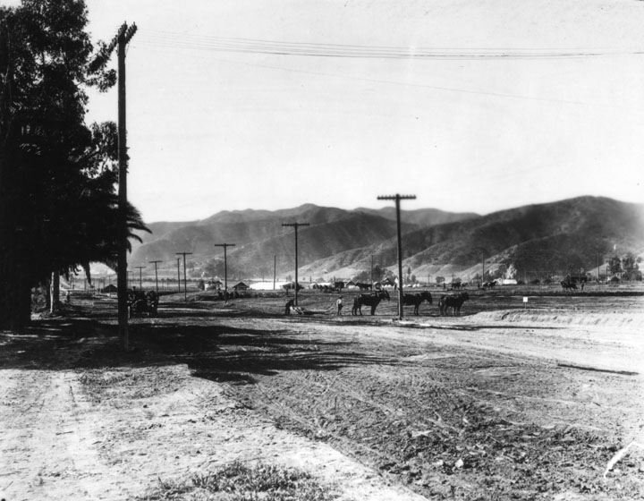 |
|
| (1905)* - Early view of Sunset Boulevard as a dirt road with real estate tracts being developed alongside. A team of horses (?) is seen in the middleground and low hills are in the background. |
 |
|
| (1905)* - Two horse drawn wagons are ready to pull away from the Nofziger Lumber Co. located on the south side of Hollywood Blvd. between Hudson and Cherokee. |
Hollywood High School
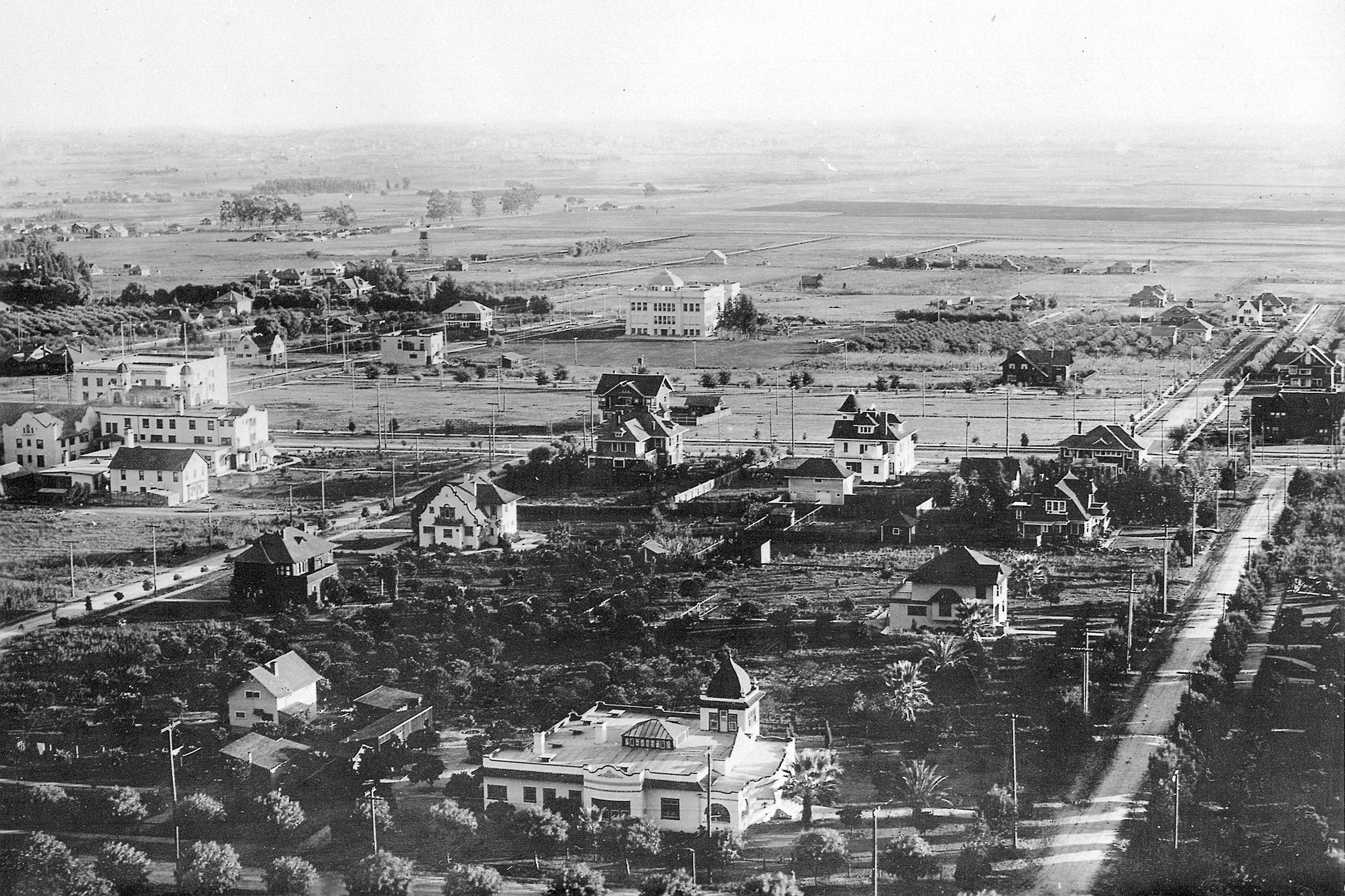 |
|
| (1906)* - View of Hollywood, looking south, showing Hollywood High School (at center), 1906, one year after it opened. Orchid Avenue is on the left while Orange Drive runs south, dog-legs at Hollywood, and then continues south again. Note the vast open land south of the school. |
Historical Notes In September 1903, a two-room school was opened on the second floor of an empty storeroom at the Masonic Temple on Highland Avenue, north of Hollywood Boulevard (then Prospect Avenue). Hollywood was incorporated as a municipality in November 1903 |
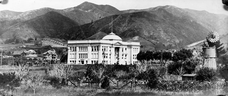 |
|
| (ca. 1905)* - Original building of Hollywood High School designed by Burnham and Bliesner in the "Ionic architecture" style. With two stories and a basement, it accommodated 400 students. |
Historical Notes The original school building (above) opened in 1905 and consisted of the consolidated school districts of Hollywood City, Laurel, Coldwater, Lankershim, Los Feliz, Cahuenga, and The Pass. In 1910, Los Angeles and Hollywood consolidated and the high school was turned over to the L.A. Board of Education.* Click HERE to see the complete list of Notable alumni.*^ |
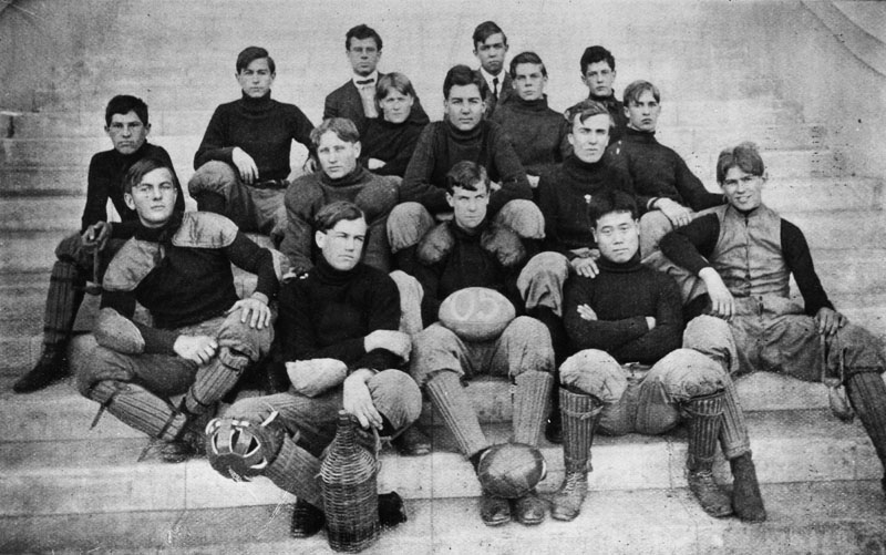 |
|
| (1905)* - The 1905 Hollywood High School Football team pose in their uniforms on the steps of the high school. A player holds a football with "05" painted on it. A glass bottle in a wicker holder is on the step in front of the team. The caption reads "Mr. Nevius and football team". |
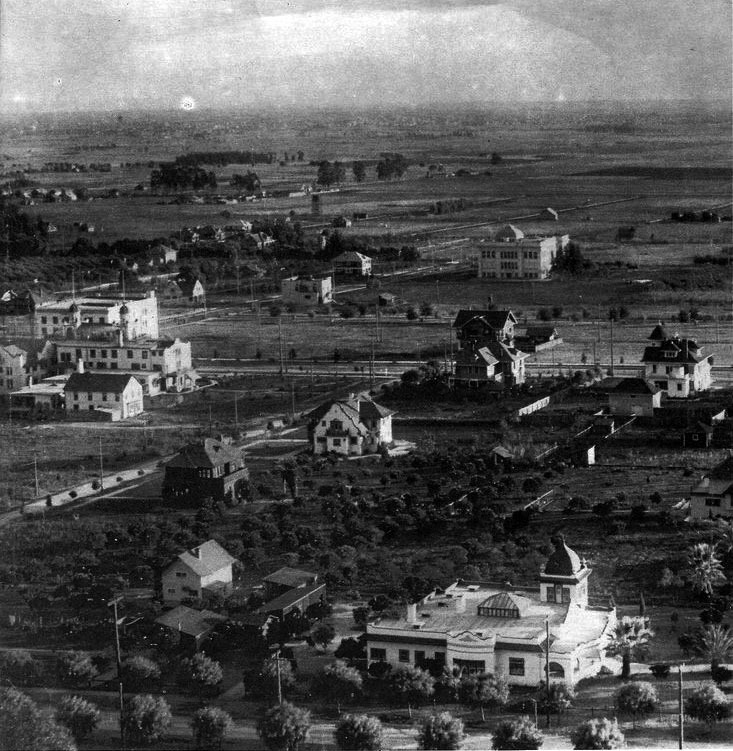 |
|
| (ca. 1905)^^^ – View looking southeast from Franklin Avenue toward the intersection of Hollywood Boulevard and Orchid Avenue (center of photo). The Hollywood Hotel is seen at center-left facing Hollywood Blvd. Hollywood High School, facing Highland, is at top center-right. |
Historical Notes The large house in the lower-right, southeast corner of Franklin Avenue and Orange Drive, still stands today. Although modified over the years, it now houses the The American Society of Cinematographers.^^^ |
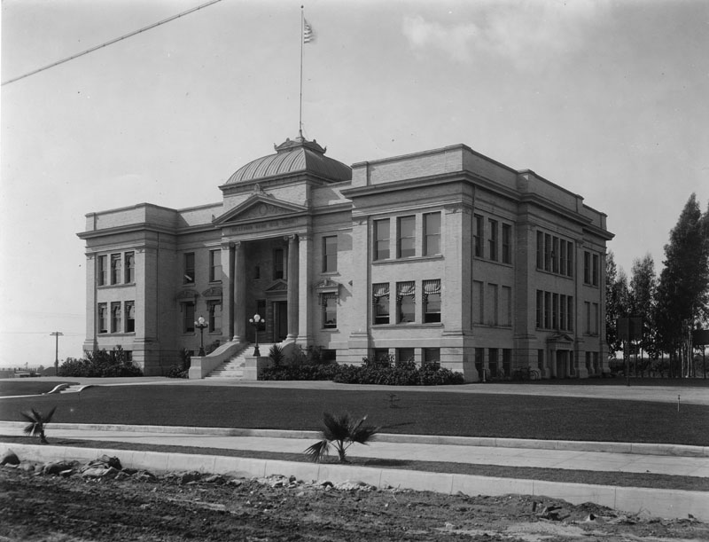 |
|
| (ca. 1905)* - Hollywood High School as seen from Highland Avenue (still a dirt road) shortly after the school was built in 1905. |
Historical Notes Hollywood High School was built on Sunset and Highland Avenue in 1905. In 1910, the school had its name changed to Hollywood Union High School. In 1924, the school changed its name again to Union High School. In 1940, the school had its name changed back to Hollywood High School and it was used for housing and feeding WWII soldiers.^^ |
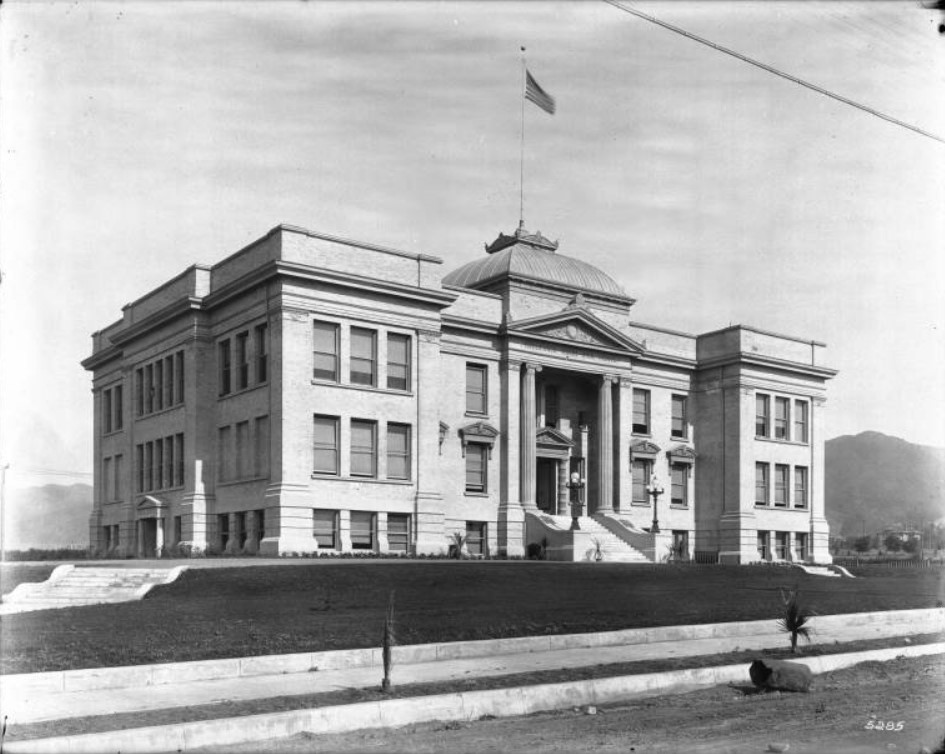 |
|
| (ca. 1905)^^ - Exterior view Hollywood High School looking northwest, with the Hollywood Hills in the background. The three-story building has a tall portico supported by proto-ionic columns where inside is smaller portico supported by two Doric order columns. Both porticos have decorated pediments. "Hollywood Union High School" is displayed below the pediment of the large portico. The façade of the building is symmetric. Two lampposts flank the stairs leading to the front entrance. A flagpole stands on top of the dome-like roof above the porticos in the center of the building. The lawn around the building is well manicured. Newly planted palm trees line the dirt portion of the sidewalk. Rocks and a large boulder lay on the dirt road in the foreground. |
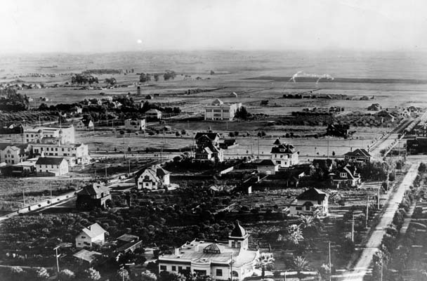 |
|
| (1906)*^ - View looking south of Hollywood showing Hollywood High School (at center), 1906, one year after it opened. Orchid Avenue is on the left while Orange Drive runs south, dog-legs at Hollywood, and then continues south again. Note the vast open land south of the school. |
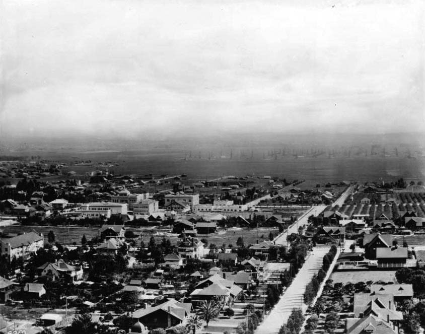 |
|
| (ca. 1913)^^ - Panoramic view of Hollywood looking south from the head of Orange Street. Note how many more structures have been constructed since the last photo was taken (see previous photo). Also, note how much Hollywood High School has expanded. It is now comprised of several buildings. In the distance can be seen numerous oil fields in the vicinity of the La Brea Tar Pits, near Wilshire and Fairfax. |
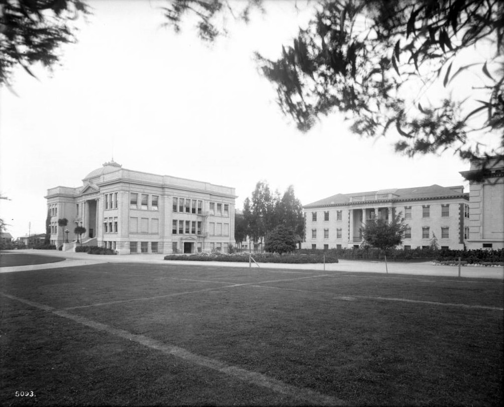 |
|
| (1916)^^ - View of the campus of Hollywood High School, located north of Sunset and West of Highland Avenue. Overlooking a well-groomed courtyard are two clearly visible buildings. The left building is the original school building built in 1905. It has embossed letters that reads "Hollywood Union High School" directly above its portico. A flight of stairs leads up to the portico. On the side of the building, there is a fire escape ladder near the side entrance. Two bicycles are leaned up against the wall near the side entrance. The right building has embossed letters above its portico, which reads "Household and Fine Arts”. |
Historical Notes The Hollywood High School campus was established on its current site in 1904. The original Administration / Classroom Building was completed in 1905, and the first major campus expansion campaign concluded in 1913.*^#^ |
* * * * * |
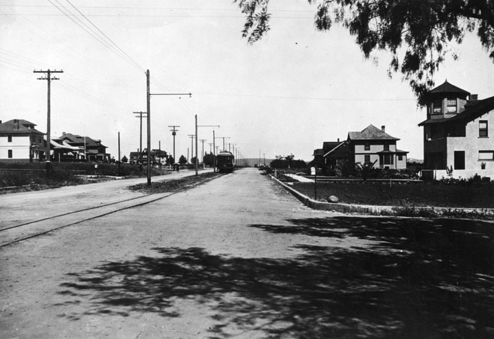 |
|
| (1905)* - Hollywood Blvd. looking east from Gower Avenue. There are residences to the left and right and a streetcar is seen in the middleground. Barely visible in the background are the Silver Lake Hills. |
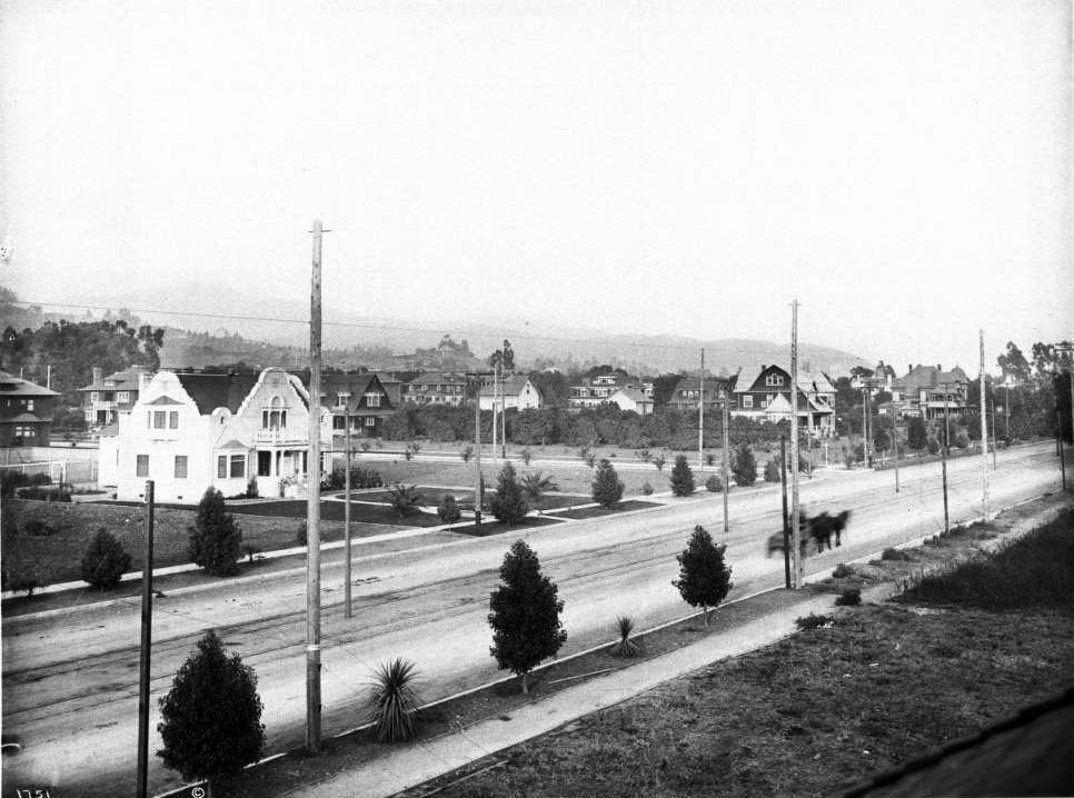 |
|
| (ca. 1905)^^ - View from a rooftop looking northeast along Prospect Blvd (later Hollywood Blvd) toward Whitley Ave, which dead ends at a T-intersection with Prospect. The Jane House, 6541 Prospect Blvd, can be seen at center-right directly above the horse-drawn carriage, on the east side of Whitley. The Hurd Residence is also visible on the far right at Wilcox Ave. Schrader Blvd (formerly Dae Ave) begins south of Prospect, and is out of frame, just east of Whitley. This photo was taken just east of Cherokee. |
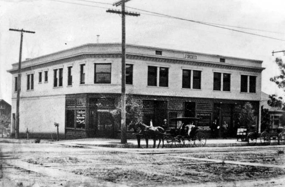 |
|
| (ca. 1905)^^ - View of the J.A. Grass Block, southwest corner of Hollywood Boulevard and Las Palmas Avenue. This was later the site of the Egyptian Theater. A horse-drawn carriage sits parked at the curb. Another carriage, without horses, is parked behind it. Streetcar rails are visible in the dirt street. |
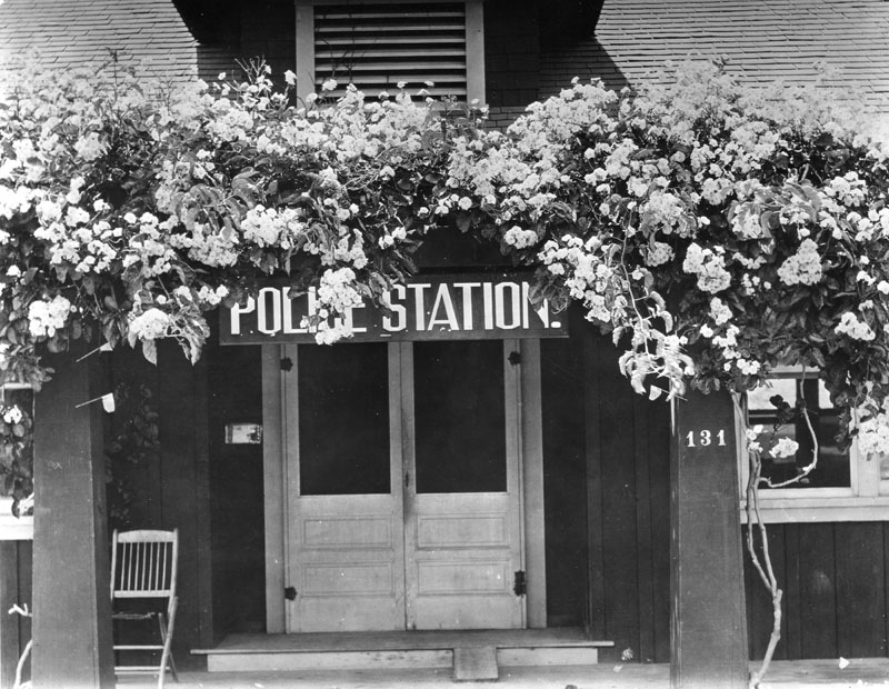 |
|
| (ca. 1906)* - View of the entrance to the Hollywood Police Station. The entrance is on the west side of Cahuenga Boulevard between Hollywood Boulevard and Selma Avenue* on what is now the 1600 block of Cahuenga. Two posts support a roof structure where vines with flowers and leaves grow abundantly. The address number "131" is visible on the right post. A sign, which reads "Police Station", is displayed above the double-door entrance, while a chair can be seen under the porch at left. |
Historical Notes *Selma Avenue was named after Selma Weid, daughter of Ivar Weid. Ivar Weid, one of the early pioneers and owner of the Weid Ranch, is given credit by some for coming up with the name “Hollywood”. Ivar Street is named after him. |
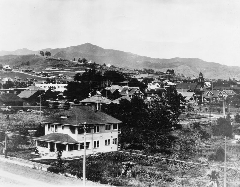 |
|
| (ca. 1906)* - Panoramic view of Hollywood looking northeast from the Hollywood High School campus. The highest peak in the distance is Mt. Hollywood. Large houses are seen throughout. A church building (Blessed Sacrament) can be seen at center right, which stood at the southwest corner of Prospect Avenue (Hollywood Blvd.) and Eulalia Street (now Cherokee). It later moved to Sunset Blvd. |
.jpg) |
|
| (1907)* - Panoramic view of Hollywood looking north from the Hollywood High School campus. A number of houses are seen as well as electric power poles. |
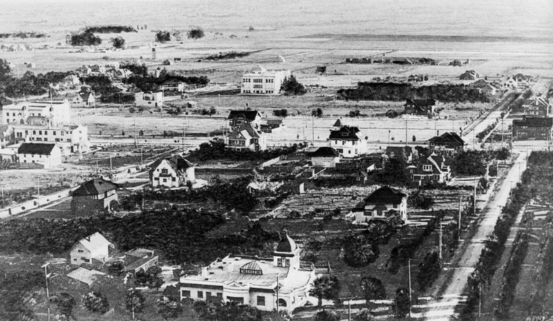 |
|
| (1907)* - Panoramic view of Hollywood looking southeast from Franklin Avenue near Orange Drive. Hollywood High School is in the center of the photo, facing Highland Avenue, with vacant lands beyond. The Hollywood Hotel is at left, facing Hollywood Blvd. Orchid Avenue is at left. Quite a few houses are seen, and electric power poles line the streets. (Some prints identify the date as 1905.) |
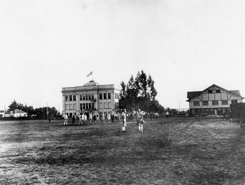 |
|
| (1909)* - Hollywood Union High School athletes, both baseball and track, are in their uniforms on the field in back of the high school. An English half-timbered style house is next to the school. |
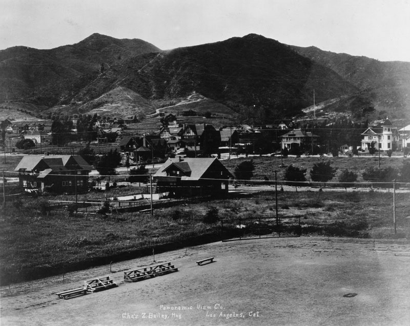 |
|
| (1908)* - Panoramic view of Hollywood, looking toward the hills from the Hollywood High School campus, the later site of the Roosevelt Hotel. An athletic field is in the foreground. A number of houses are seen, and electric power poles are visible. The Hollywood Hotel is out of view on the right. |
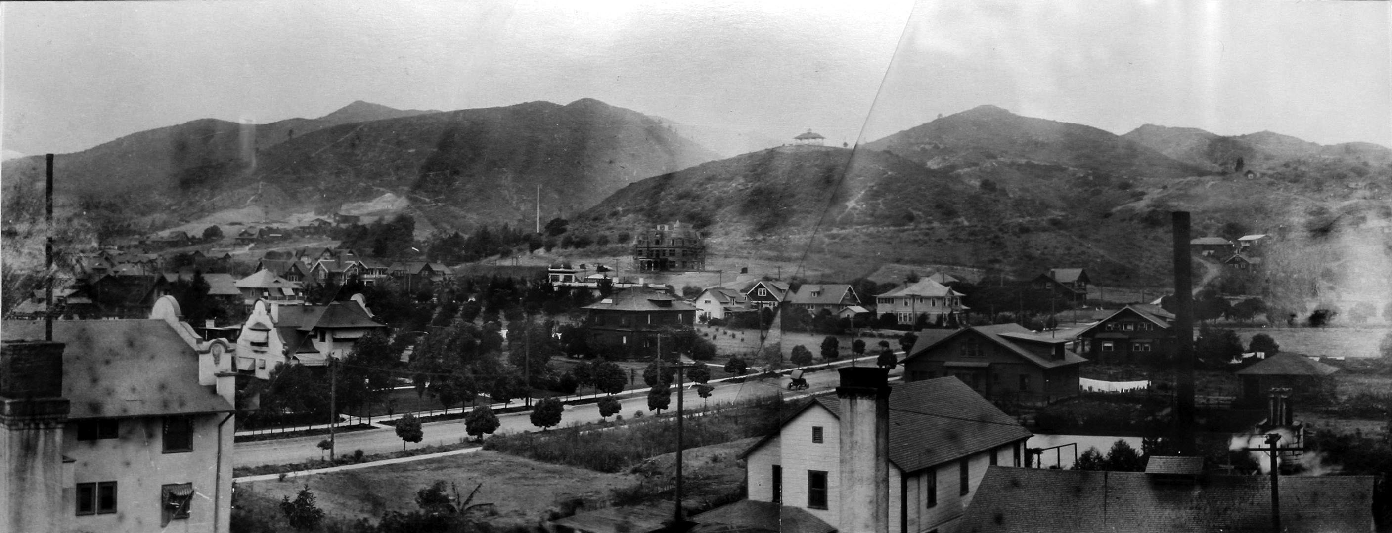 |
|
| (1909)^.^ – Panoramic view of Hollywood looking northwest as seen from the top of the Hollywood Hotel. The yet to be completed Lane Residence (aka Holly Chateau and currently the Magic Castle) is seen in the foothills just above Franklin Avenue at center-left. Orchid Avenue is the street that runs diagonally from bottom-left to middle-right (note the early model car). A large home sits on top of the hill behind the Lane Residence. It will soon be torn down to make room for the 1914-built Bernheimer Estate and Gardens (currently Yamashiro Restaurant). |
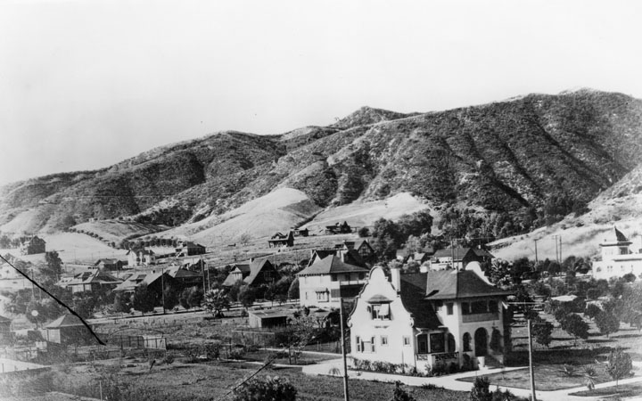 |
|
| (Early 1900s)* - Early view of Franklin and La Brea Avenues with residential buildings in the foreground and hills in the background. |
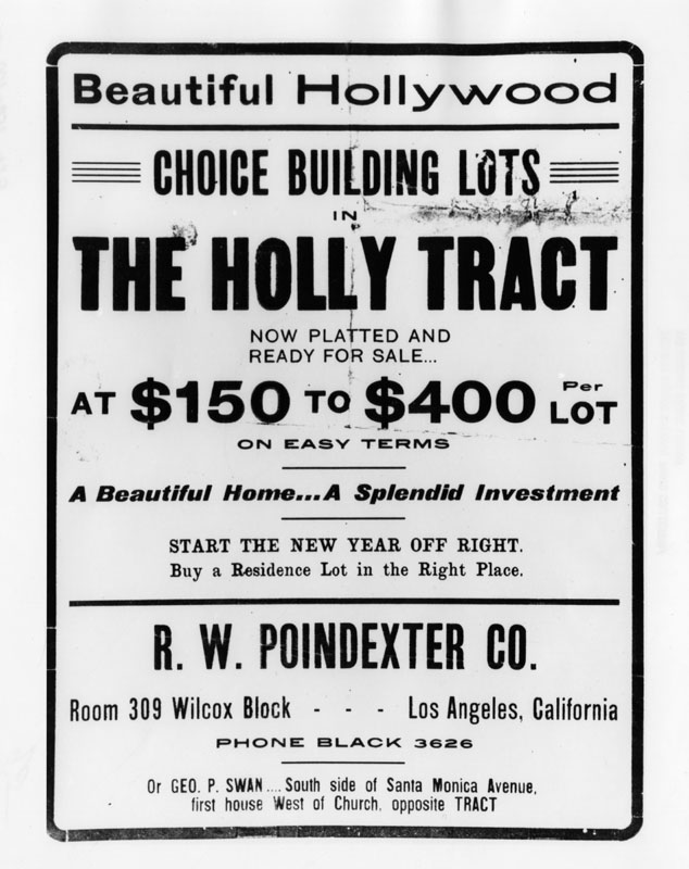 |
|
| (ca. 1908)* - A photo of a flyer advertising real estate: "Choice building lots in the Holly tract, now platted and ready for sale at $150 to $400 per lot." These residential lots are being sold by R.W. Poindexter Co. and George P. Swan. Their addresses are given on the flyer. Photo dated circa 1908. |
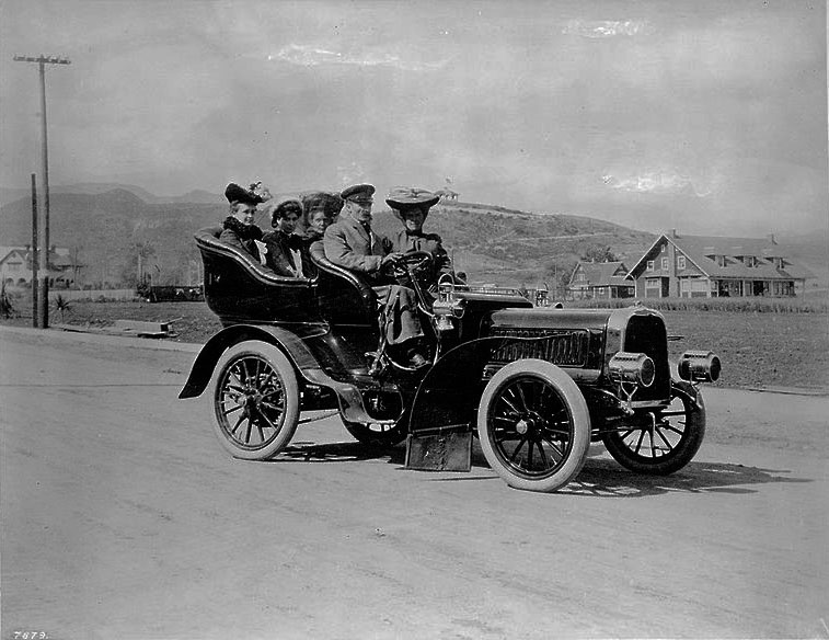 |
|
| (ca. 1909)^** – Motoring on Hollywood Boulevard, west of Highland. View shows a portrait of five people seated in a car with houses in background. |
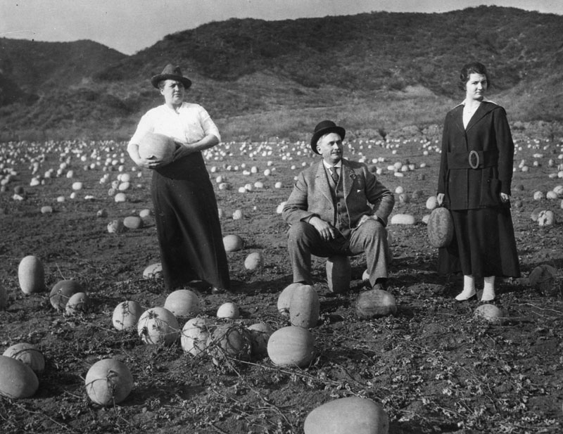 |
|
| (1918)* - View of a casaba field near the corner of Sunset and Harper, in West Hollywood. Two women are each holding a melon while a man sits on one. |
* * * * * |
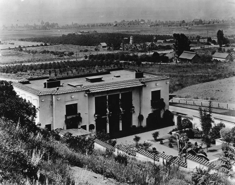 |
|
| (ca. 1910)* - Exterior rear view of the Spanish Revival Wattles Estate, looking southwest towards smaller homes, farms and orchards in Hollywood and what is now West Hollywood. |
Historical Notes The forty-nine acre estate known as the Wattles Estate included a mansion, known as "Jualita," and large formal garden and was developed by Gordon W. Wattles, a wealthy banker and railway company president from Omaha, Nebraska.* |
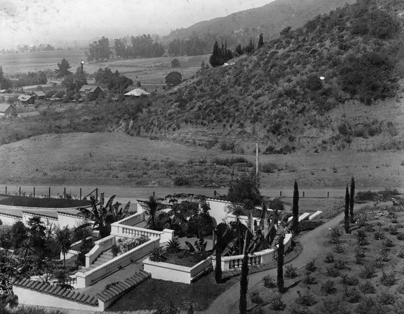 |
|
| (1909)* - Panoramic view of West Hollywood, showing a few houses and much open space in 1909, when much of the area was agricultural. The view is from the rear of Wattles Gardens. |
Historical Notes The home and garden are the work of architects Myron Hunt and Elmer Grey. The property was bounded on the south by Hollywood Blvd. and on the west by Curson Avenue and the east by Sierra Bonita Avenue. The rise of the property from the south to the foothills in the north was 1000 feet.* |
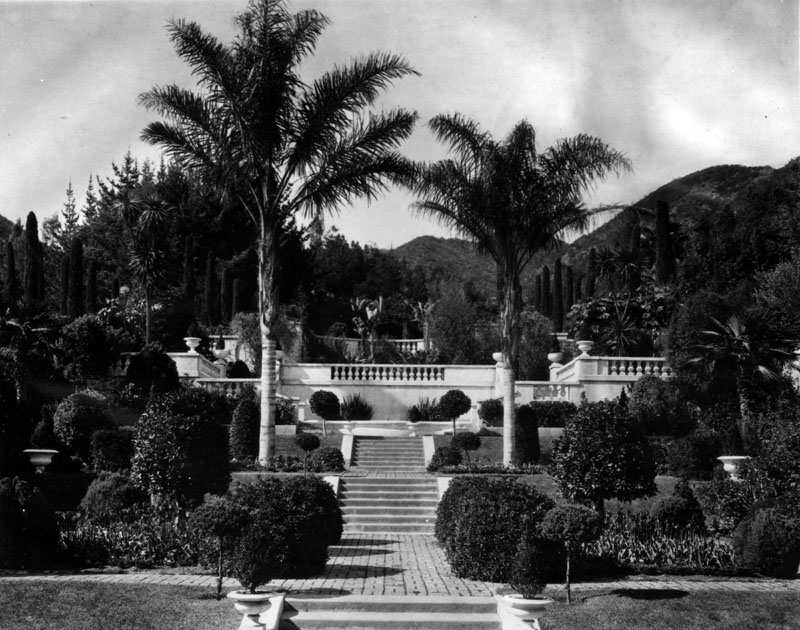 |
|
| (n.d.)* - View of the manicured and terraced garden of the Wattles Estate in Hollywood, looking towards the hillside. |
Historical Notes The gardens were later turned over to Hollywood Heritage, Inc., which rented the building for private functions, such as weddings and film shoots.* |
* * * * * |
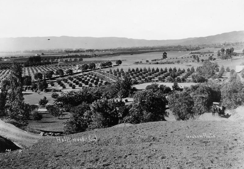 |
|
| (1909)* - Panoramic view of Hollywood in 1909, taken from Laughlin Park at Franklin and Western Avenues. Numerous orchards are seen, and a horse-drawn carriage is at right. |
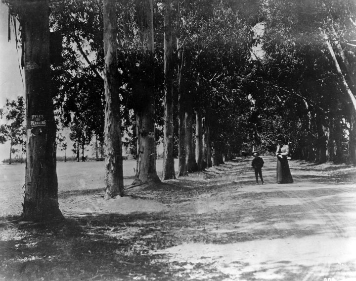 |
|
| (ca. 1900)* - View looking west on Melrose Avenue from Western Avenue. Trees were planted in the early 1880's and felled on the right side in 1922 and on the left side in 1923. |
Historical Notes Melrose Avenue was named by ranch owner E. A. McCarthy after his hometown of Melrose, Mass. The McCarthy Ranch occupied most of the area bounded by Western to Wilton and Melrose to Santa Monica Blvd.^*^ |
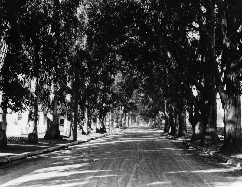 |
|
| (ca. 1910)* - Tree-lined Melrose Avenue at Western Avenue. Houses and street curbs can now be seen. This was a favorite street for horse and buggy rides on Sundays. |
Cahuenga Valley Lemon Exchange Building
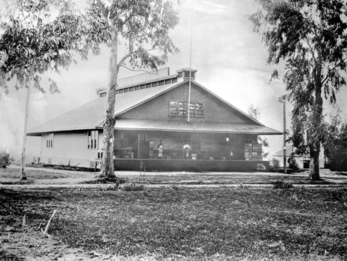 |
|
| (1910)^^ – View showing the Cahuenga Valley Lemon Exchange Building (originally Colegrove Lemon Exchange) on Santa Monica Boulevard at Cahuenga Avenue. Two men in aprons look off the back porch of the two-story depot, under the overhang of the roof, to which a lightning rod is attached. A tree with peeling bark is pictured in front at left, just behind the rail tracks that are visible beneath the sparse grasses on the ground. The men are surrounded by crates stacked along the porch. |
Historical Notes Before 1910, the above area was part of the town of Colegrove. In 1907 the Los Angeles Pacific Railway reached Colegrove, connecting the town with Los Angeles by electric trolley. As the town's population swelled, its vast lemon groves gave way to houses. But citriculture continued to sustain the town; in 1906, for instance, it was still home to 285 acres of lemon groves, and that year Colegrove Lemon Exchange dispatched some 17.4 million lemons to places like Minneapolis and Omaha in refrigerated railcars.*#^ |
Hollywood's First Store
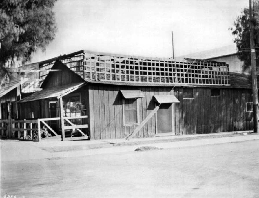 |
|
| (ca. 1910)^^ - Exterior view of the first store built in Hollywood, at the corner of Sunset Boulevard and Cahuenga Avenue. The store, built circa 1887, has exterior plank walls, a covered patio with railing visible at left on the narrow side of the house, and both a doorway and a window on the wide side shaded by small overhangs. The roof of the building is topped by a grid of wooden framework. Trees are visible in the background, and what appears to be a telephone pole is visible to the extreme right. A sidewalk runs the edge of both of the store's street-side walls. |
Historical Notes At one time the above building was also a Chinese laundry.* |
Sackett Hotel (First Hotel in Cahuenga Valley)
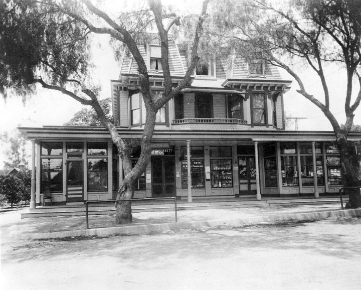 |
|
| (ca. 1905)* - View showing the Sackett Hotel, facing Cahuenga Blvd at the southwest corner of Hollywood Blvd. and Cahuenga. The hotel was built in 1888 by Horace Sackett. A post office was added in 1900, and the hotel stood until 1910 or 1911. |
Historical Notes Here the Sacketts ran the first hotel in the Cahuenga Valley and the second general merchandising establishment within the corporate limits of Hollywood. He also kept a few horses for his clientele and to work the blocks east and south of the store, where he had a garden to sell produce in his store. Due to competition from the new Hollywood Hotel, built two years earlier at the northwest corner of Prospect and Highland, Sackett closed his hotel in 1905. He sold the property to Henry Gillig, but it remained unoccupied for the next five years except for one store room on the first floor. Click HERE to see more Early Views of the Sackett Hotel. |
Creque Building (aka The Hollywood Building)
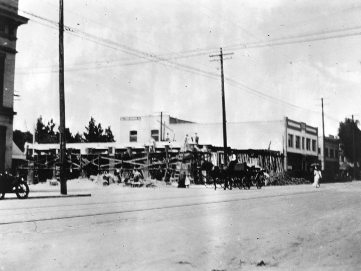 |
|
| (ca. 1911)* - View showing the construction of the Creque Building on the southwest corner of Hollywood Blvd. and Cahuenga, where the Sackett Hotel once stood. |
Historical Notes In 1910, J.P. Creque, one of the wealthiest men in Hollywood, bought the former Sackett Hotel property for $28,000 from the estate of Henry Gillig, who was now deceased. Creque razed the abandoned hotel and erected a fireproof two-story cream brick structure that cost approximately $30,000. +# |
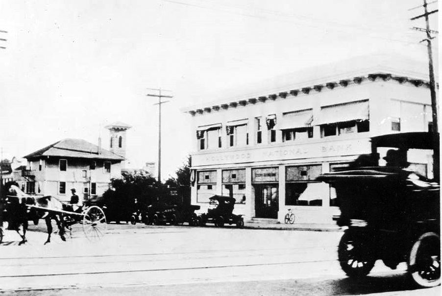 |
|
| (ca. 1911)^**- View of a completed Creque Building housing the Hollywood National Bank on the main floor (S/W corner of Hollywood Blvd. and Cahuenga). Horse-drawn wagon is seen on the left with early model cars parked in front of the new building and on the right. |
Historical Notes The Hollywood National Bank leased a portion of the new building; there were three other stores facing on Prospect. The second floor had offices with wide hallways and tile flooring. +# |
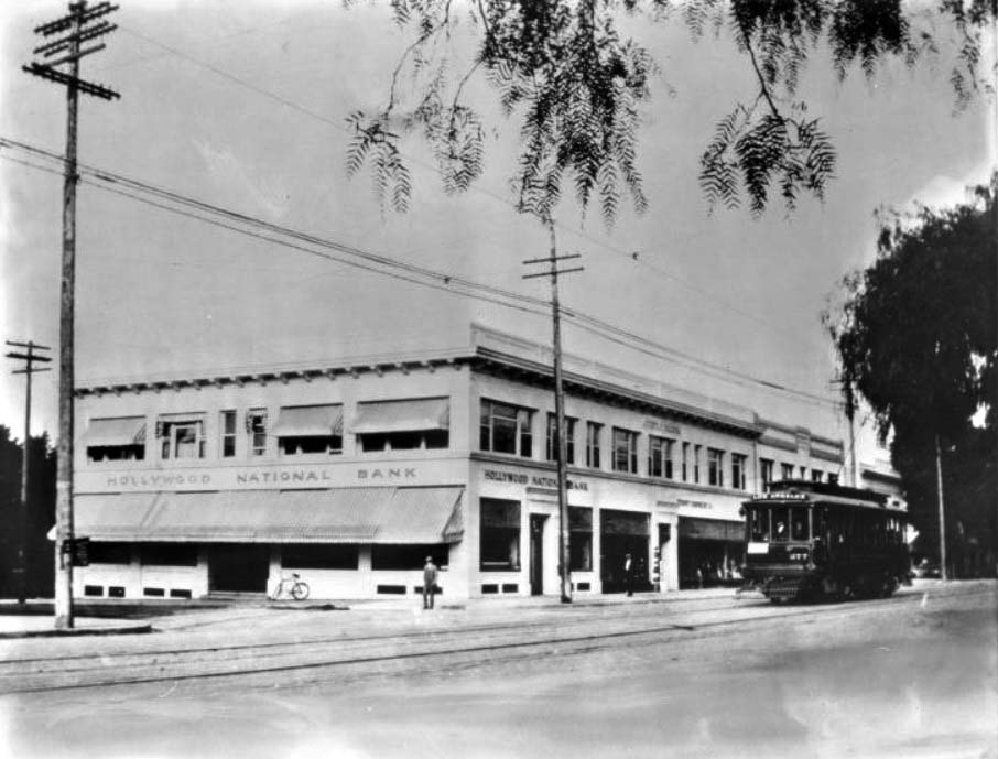 |
|
| (ca. 1911)^^ - View showing the Hollywood National Bank in the Creque Building (S/W corner of Hollywood and Cahuenga). The simple, two-story building has striped cloth canopies extending from most of the windows, both top and bottom, on the left side. A bicycle has been leaned against the outer wall. A man stands near it on the corner in front of the bank while at right, a cable-car makes its way across its tracks. |
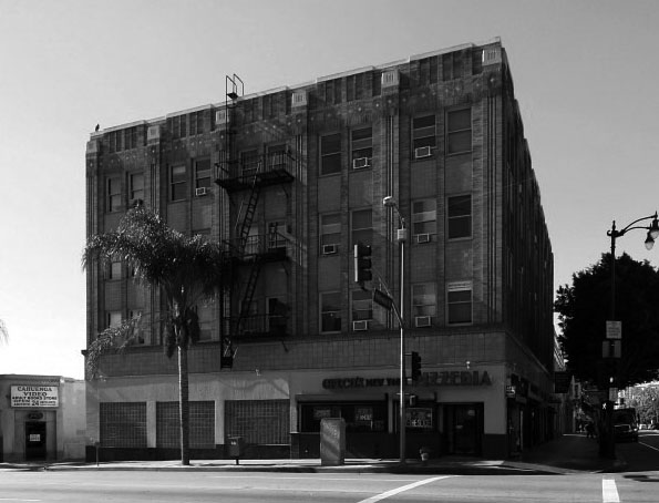 |
|
| (ca. 2016)*.* – View showing the Creque Building (6400-6408 Hollywood Blvd) located on the SW corner of Hollywood and Cahuenga, now a four-story building. |
Historical Notes In 1934, the Creque Building was enlarged by adding two stories and given its current Art-Deco brick-and-tile redesign. It is now called 'The Hollywood Building'. Click HERE for a more contemporary view. |
* * * * * |
Hollywood and Cherokee
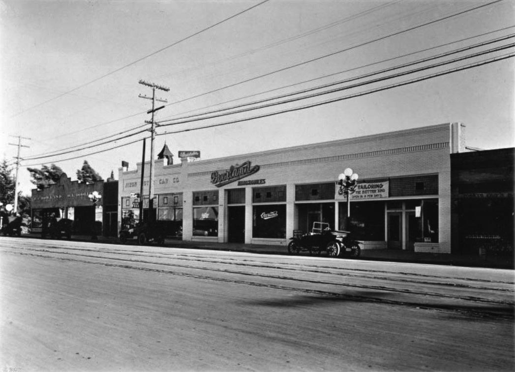 |
|
| (ca. 1912)^^ - View looking west on Hollywood Boulevard between Las Palmas Street and Cherokee Avenue. A row of long, adjacent one-story commercial buildings is pictured back off the unpaved road that cuts across the frame from left to right. Along the sidewalk, four early automobiles have been parked. At the center of the shops, "Overland Automobiles" is pictured, to the left of which is "Nixon Motor Car Co." and "F.C. Howland O.L. Doolittle". To the right, a tarp sign on the front of the commercial shop reads "[...] Tailoring. The better kind. Open in a few days". Street car rails can be seen embedded in the road close to the sidewalk. Utility poles line the street. In the background, a Catholic church can be seen beyond the shops. |
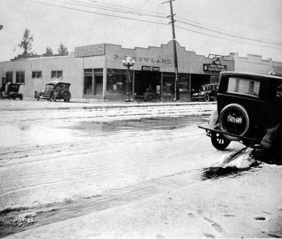 |
|
| (1921)^.^ - Snow on Hollywood and Cherokee. View is looking at the NE corner. Sign on the corner building reads “F. C. Howland”. |
* * * * * |
East Hollywood (Franklin and Los Feliz)
.jpg) |
|
| (ca. 1912)## - Left panel of a panoramic view of Hollywood looking southeast as seen from the Hollywood Hills. The large building in the foreground is the original campus of Immaculate Heart College, located at 5515 Franklin Ave. To the east (left) of the college can be seen Western Ave is it curves into Los Feliz Blvd, which runs from bottom toward the top of photo. Source: Library of Congress |
.jpg) |
|
| (ca. 1912)## – Right panel of a panoramic view of Hollywood looking southwest as seen from the Hollywood Hills. Franklin Ave runs from lower-left diagonally to upper-center of photo. Source: Library of Congress |
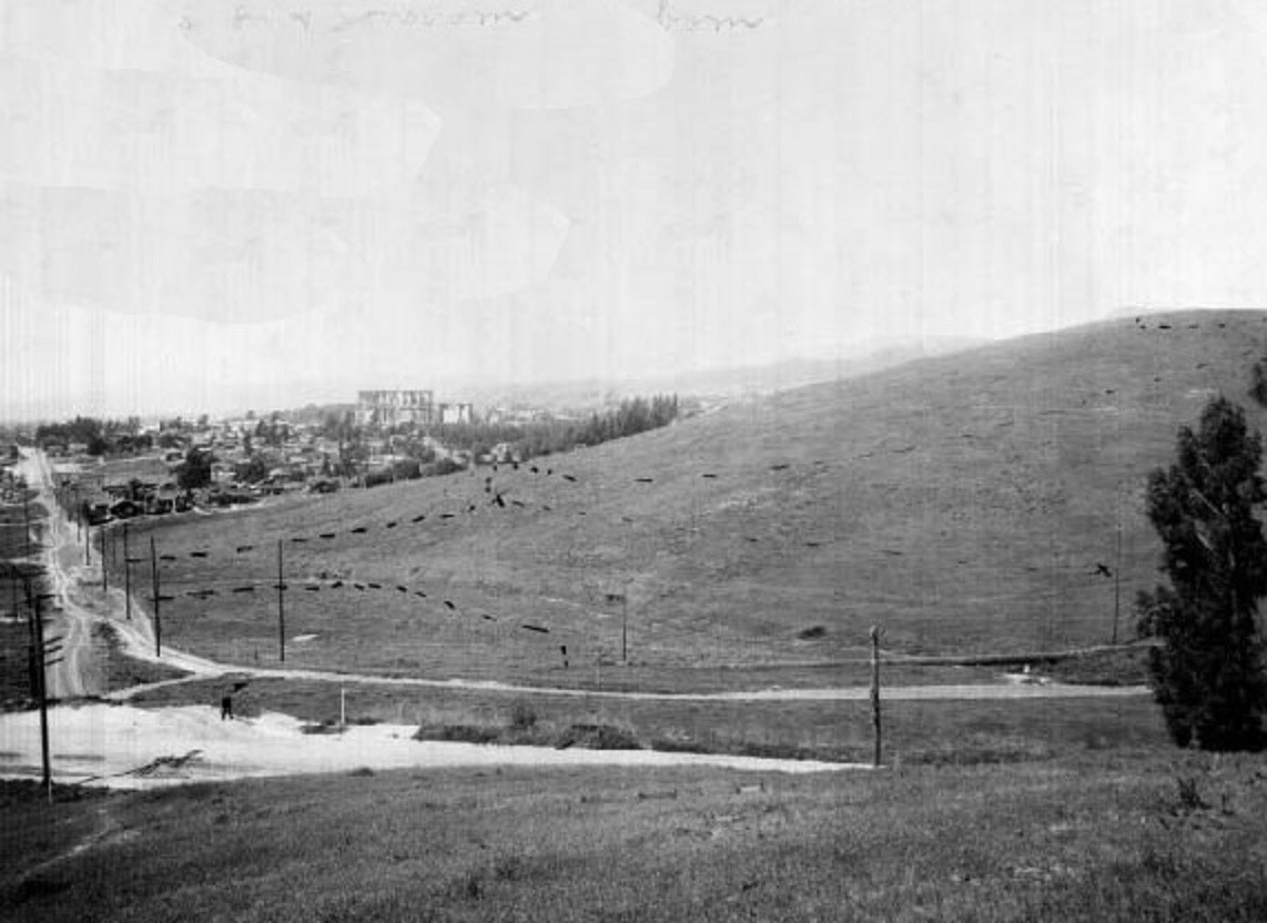 |
|
| (1917)* - View looking west along Fountain Avenue with the "Intolerance" set seen at center-left in the distance. The black marks on the hill indicate future streets. |
Historical Notes The Babylon set from D.W. Griffith's silent film "Intolerance", was built at the corner of Prospect Ave. & Talmadge St. in Franklin Hills near where Sunset Boulevard and Hollywood Boulevard meet. |
Hollywood and Vermont
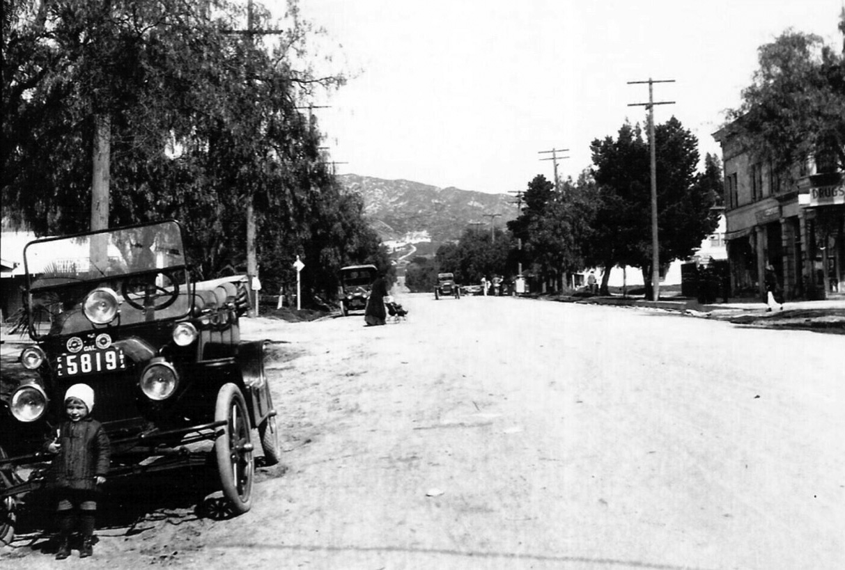 |
|
| (ca. 1914)^ – View looking north on Vermont Ave at Hollywood Blvd. Small child dressed for the cold weather stands in front of a Ford Touring car. There appears to be a drug store on the ground floor of the two story building on the NE corner (upper-right). The large white house we can see in the far background was the home of William Mead, the original developer of Los Feliz, located at 4533 Cockerham Drive. Though almost unrecognizably remodeled, the bones of the house remain standing at the foothill head of Vermont above Los Feliz. |
Historical Notes Source of photo is Ebay with the following comment: "This photo taken by my Grandmother about 1914 of my father (age 3 or 4) next the the family Ford Touring Car parked on Vermont Ave at Hollywood Blvd in front of his dad's store, viewing north on Vermont toward Griffith Park and the Hollywood Hills, Southern California. This and other photos were reprinted by my father in the early 1950s for local newspaper articles on the history of East Hollywood. This image is from one of a few sets of these original gelatin silver images he printed from the original negatives. The photos were taken by my grandparents between 1902 and 1918." |
Then and Now
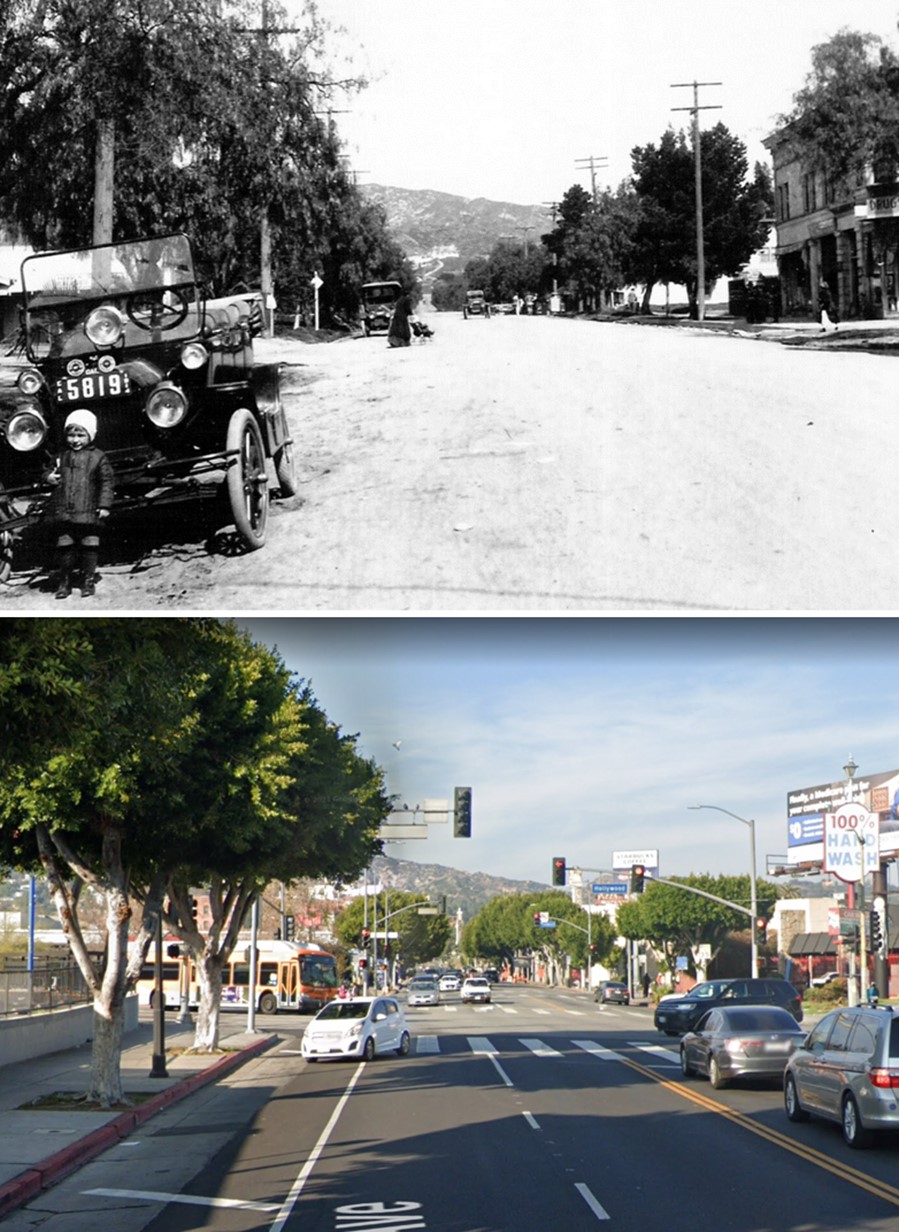 |
|
| (1914 vs. 2022)* – Looking north on Vermont Avenue at Hollywood Boulevard with the Hollywood Hills in the background.. |
* * * * * |
Nestor Film Company (also Christie Studios) - Hollywood's 1st Studio (Sunset and Gower)
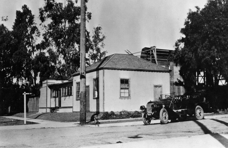 |
|
| (1912)* - View of the Blondeau Tavern building on the northwest corner of Sunset Boulevard and Gower Street. Behind the building can be seen the first motion picture stage in Hollywood. |
Historical Notes On October 27, 1911, Nestor Studios, established by David Horseley, opened the first movie studio actually located in the Hollywood area. It was at the Blondeau Tavern building on the northwest corner of Sunset Boulevard and Gower Street.*^ The Nestor Company leased the building for thirty dollars a month, and built the first Hollywood film stage ever on the site. It consisted of a wooden platform measuring twenty by forty feet, with large sheets of muslin hung on cross wires fifteen feet up to diffuse the natural light used for filming.^# |
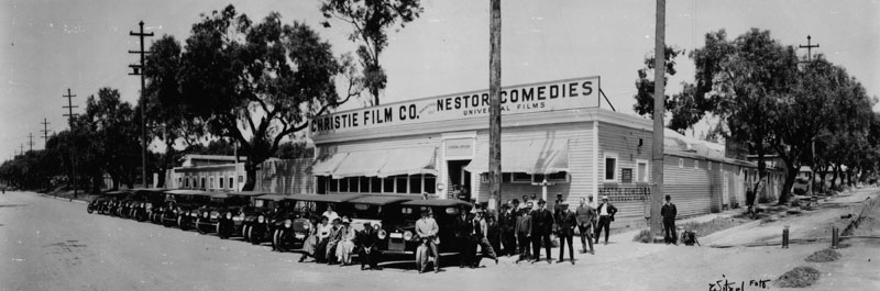 |
|
| (1913)* - The first motion picture studio in Hollywood was built by David Horseley for Christie Film Co. Automobiles are lined up at Sunset Blvd., with Gower Street at right. The sign above the building reads "Christie Film Co.", and "Nestor Comedies, Universal Films." |
Historical Notes Carl Laemmle, who formed Universal Pictures, absorbed the Nestor company and others in 1912. Director Al Christie continued to make many films at the expanded studio under the banner "The Christie Comedies" until the early 30s, when the facility became a rented lot. In 1936, the Nestor / Christie Studios were demolished to build the Columbia Square facility, which served as home of Los Angeles radio station KNX 1070AM, and television station KNXT Channel 2 (later renamed KCBS) until 2007. |
Then and Now
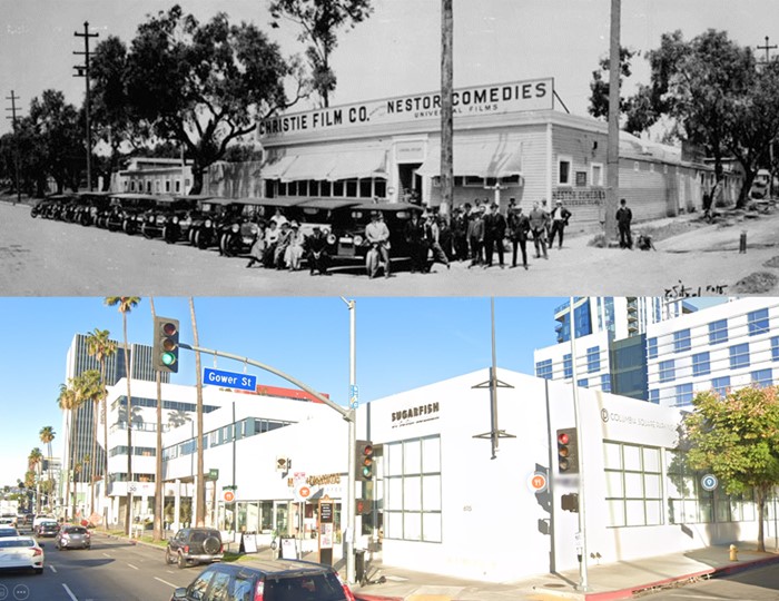 |
|
| (1913 vs. 2021) – NW corner of Sunset Boulevard and Gower Street. |
Historical Notes In 2014, Viacom leased most of the space in one of the new office buildings on the site, for the West Coast offices of its cable television networks, including MTV, Comedy Central, BET, TV Land and Spike TV. Columbia Square is now mixed-use residential and office space. |
Then and Now
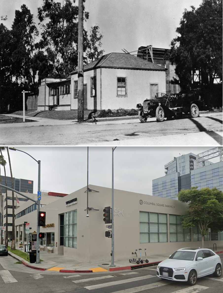 |
|
| (1912 vs 2022)* – Looking at the NW corner of Sunset and Gower. The top photo shows the Blondeau Tavern building, behind which can be seen the first motion picture stage in Hollywood. |
* * * * * |
Magic Castle (aka 'Holly Chateau' or Rollin Lane Residence)
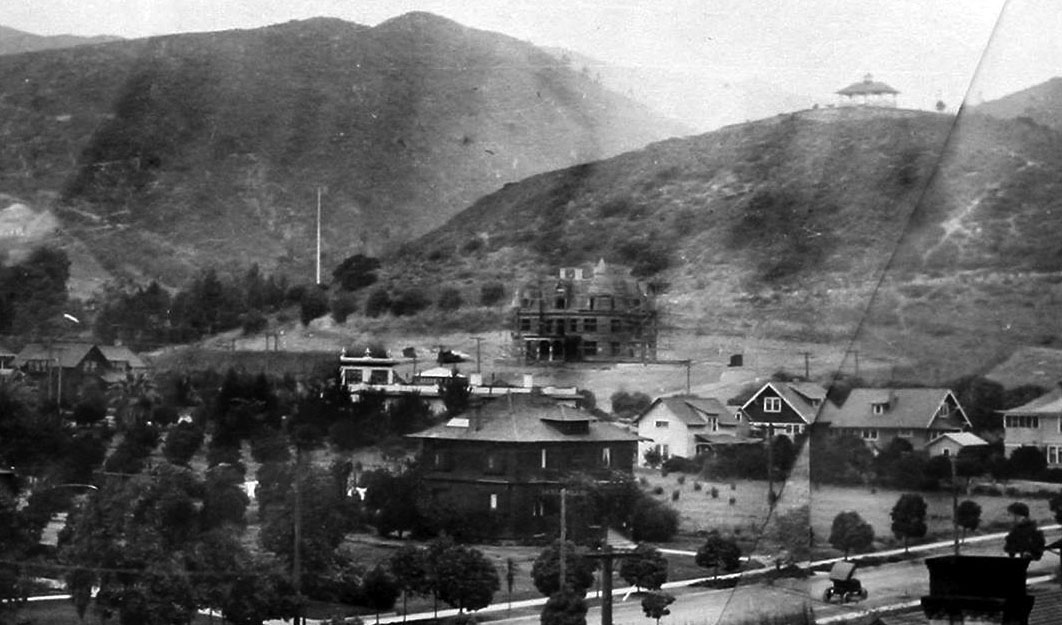 |
|
| (1909)^.^ - View looking northwest from a rooftop near the Hollywood Hotel showing the Rollin Lane house (aka Holly Chateau) under construction in the foothills just above Franklin Avenue. Orchid Avenue, with early model car on it, is seen at lower right. |
Historical Notes The Chateau-style residence was built in 1909 by banker, real estate developer and philanthropist, Rollin B. Lane. The house was designed by architects Lyman Farwell and Oliver Dennis and constructed as a near duplicate of the 1897 Kimberly Crest House and Gardens in Redlands, California that the architects had designed over a decade earlier.^ |
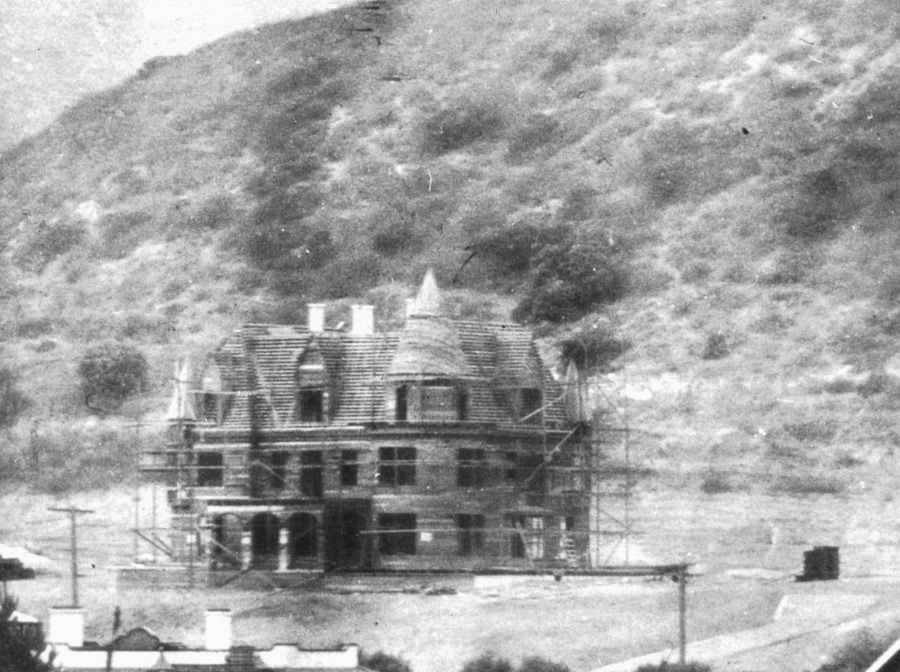 |
|
| (1909)* – Close-up view showing the Lane Residence under construction. Note how barren the hills are behind it. |
Historical Notes The Gothic Renaissance chateau (also referred to as “Holly Chateau”) sits in the middle of what is now historic Hollywood and was originally the personal residence of a wealthy banker, Rollin B. Lane. |
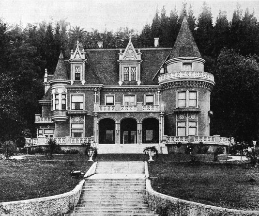 |
|
| (ca. 1910s)^x^ - View showing the 'Holly Chateau' built by Rollin Lane in 1909. This house became the Magic Castle in 1963. |
Historical Notes Rollin Lane was a very successful lawyer, banker and real estate investor who helped build Hollywood through property development and participation on the historic Hollywood Board of Trade. He also invested heavily in the early development of the nearby San Fernando Valley and in California’s San Joaquin Valley. ^ |
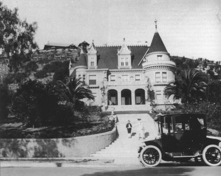 |
|
| (1920)* – A woman and a child stand on the stairs leading up to the Lane Residence. The house in the background on top of the hill is the famous Bernheimer Estate and Gardens (currently Yamashiro Restaurant). Note the early model car in the foreground. |
Historical Notes Katherine Lane (Rollin's wife) was a college graduate, published author, teacher and lecturer who worked to improve the quality of life in Hollywood through various community service organizations, even serving a term as president of the Woman’s Club of Hollywood. Later, working with the Los Angeles Chamber of Commerce and supported by a small army of volunteers, she promoted the planting of the landmark palm trees that line Wilshire Blvd., as well as hundreds of Japanese cherry trees in and around Griffith Park. ^ |
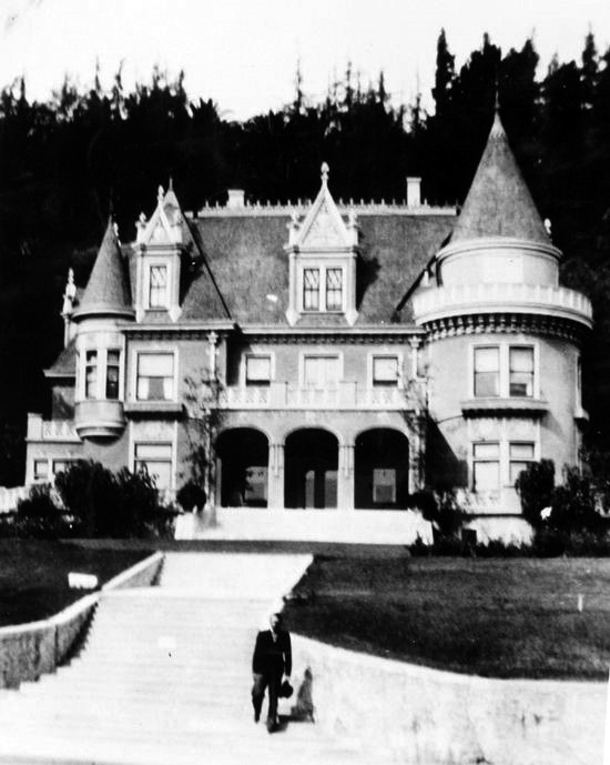 |
|
| (1936)^x^ – View showing a man walking down the front stairs of the Lane residence (aka Holly Chateau) built by Rollin B. Lane. Now home of the Academy of Magical Arts and the Magic Castle. |
Historical Notes Ownership of the building remained in the Lane family until 1955 when it was sold to Thomas O. Glover, whose family still owns the property. |
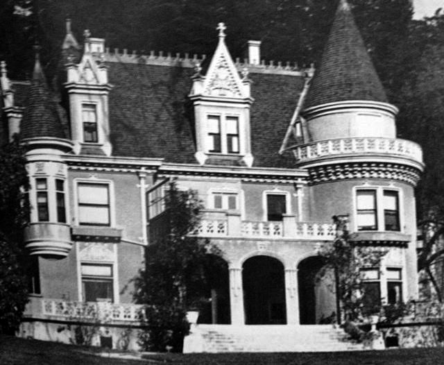 |
|
| (Early 1900s)^x^ – Close-up view of the Victorian-style Rollin B. Lane residence (aka Holly Chateau) located at 7001 Franklin Avenue in Hollywood. |
Historical Notes The Lanes named their home “Holly Chateau” and for thirty years, it was one of the most recognized addresses in Hollywood and a popular location for the area’s social elite. Hundreds of newspaper articles attest to the elegant and elaborate luncheons, teas and musicales held for artists, orphans, community leaders or world travelers, or to raise funds for one of Katherine’s many civic projects. ^ |
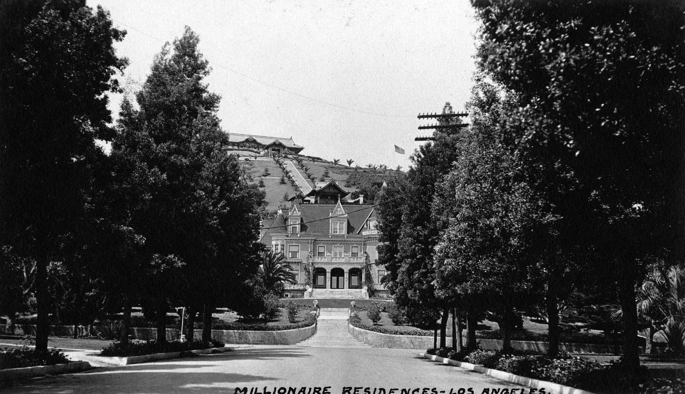 |
|
| (ca. 1915)^* – View looking north on Orange Drive showing the Rollin Lane residence (later Magic Castle) at the T-intersection with Franklin Avenue. The Bernheimer Estate and Gardens (built in 1914) is seen at the top of the hill in the background. |
Historical Notes The 1914 hilltop estate seen behind and above the Lane Residence was built to house the Bernheimers' priceless collection of Asian treasures. In order to have an authentic Japanese design, hundreds of skilled craftsmen were brought from Asia to recreate an exact replica of a palace located in the Yamashiro mountains near Kyoto, Japan. The original Bernheimer structure included a 10-room teak and cedar mansion, where carved rafters were lacquered in gold and tipped with bronze dragons. |
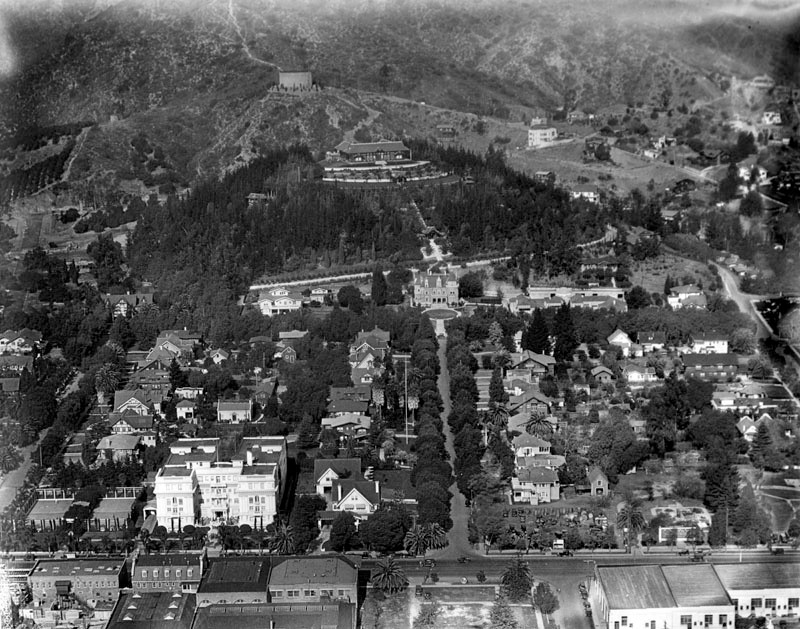 |
|
| (ca. 1924)* - Aerial view looking north on Orange Drive toward Franklin Avenue. The Rollin B. Lane Estate (now Magic Castle) is seen on the north side of Franklin at the end of the T-intersection (center of photo). Hollywood Boulevard runs horizontal in the foreground. The white building at lower-left is the Garden Court Apartments. The building at the top of the hill behind the Lane Estate is the Japanese estate and gardens of brothers Charles and Adolph Bernheimer (Bernheimer Estate and Gardens). |
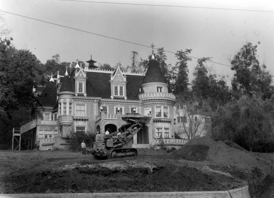 |
|
| (1962)* - Renovations for the Magic Castle begin. Photo courtesy of Academy of Magical Arts |
Historical Notes After the Lanes passed away in the 1940’s, the house was divided into a multi-family home. It then became a home for the elderly and was finally transformed into a maze of small apartments. By 1960, the fate of the building was uncertain. Then Milt Larsen met the owner, Thomas O. Glover. Milt was a writer on the NBC-TV show Truth or Consequences. His office was on the ninth floor of a Hollywood office building that overlooked the Lane residence. Milt’s late father, William W. Larsen Sr., was a renowned magician and had long dreamed of building an elegant private clubhouse for magicians. The Lane residence would become that club. In September 1961, Milt, his brother Bill (an accomplished magician, publisher of Genii Magazine and the Academy’s first President), Irene (Bill’s wife) and a crew of friends and volunteers began the task of returning this run-down apartment building to its glorious past. After months of scraping and sanding, the rich Victorian elegance began to resurface. The Magic Castle opened its doors on January 2, 1963. ^ |
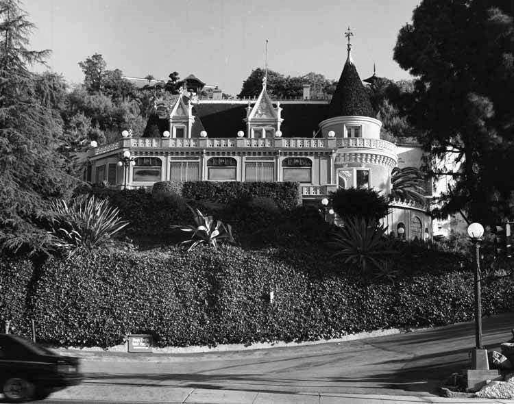 |
|
| (1981)* – View looking up from Franklin Avenue showing the Victorian-style "French Chateau" building known as Magic Castle, with turrets and architectural detailing and ivy-covered retaining wall in foreground. LAPL |
Historical Notes The Magic Castle was declared Los Angeles Historic-Cultural Monument No. 406 in 1989. |
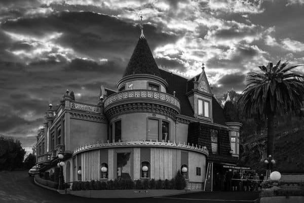 |
|
| (2020)* – Close-up view of Magic Castle showing a line of well-dressed patrons waiting to get in. Photo courtesy of Academy of Magical Arts |
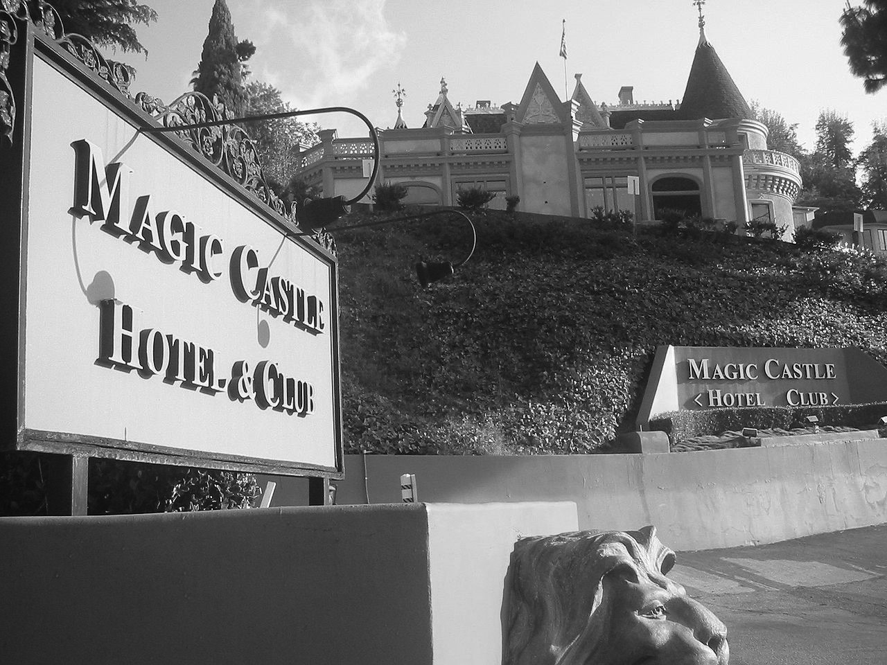 |
|
| (2007)^* - View showing the driveway entrance to the Magic Castle located at 7001 Franklin Avenue in Hollywood. Photo: Minnaert / Wikipedia |
Historical Notes Since 1963, the Magic Castle has been a nightclub for magicians and magic enthusiasts, as well as the clubhouse for the Academy of Magical Arts. It bills itself as "the most unusual private club in the world." |
Glengarry Castle
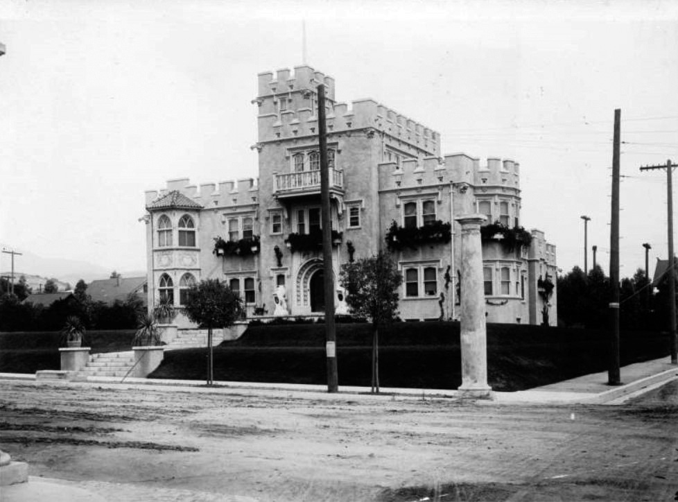 |
|
| (ca. 1912)^^ - View of Glengarry Castle, the residence of Dr. Schloesser in Hollywood. The three-story castle-like building can be seen at center with a tower visible on the roof at center. A balcony is visible on the third story, while a long staircase leads to the arched front entrance. Statues can be seen on either side of the archway, while grass is visible in the front yard. |
Historical Notes At the turn of the century, after striking it rich in the Nevada silver mines, Dr. Schloesser and his family moved to Hollywood, where the doctor built Glengarry, a copy of his wife's ancestral home in Inverness, Scotland. Soon this castle proved too small for his burgeoning social life and medical practice. So in 1912, he built Schloesser Terrace (Castle Sans Souci) on a three-acre plot across the street (NW corner of Argyle and Franklin avenues).*# |
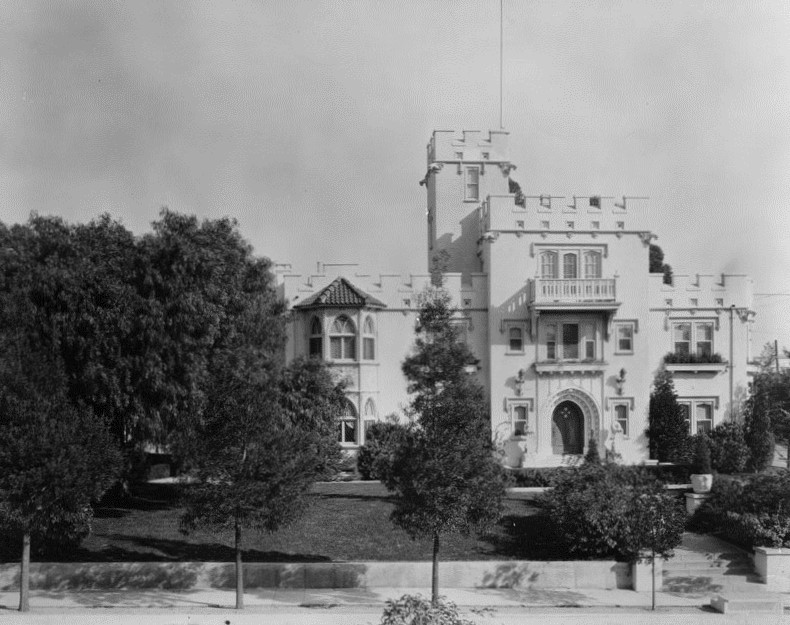 |
|
| (ca. 1913)* - The Glengarry Castle (also known as Schloesser Terrace) located on the eastern side of Argyle between Franklin Avenue and Dix Street in Hollywood. |
Historical Notes He was originally called Dr. Alfred Guido Rudolph Schloesser, but during World War I, due to anti-German sentiment, he changed it to Castles, a direct translation from the name Schloesser. |
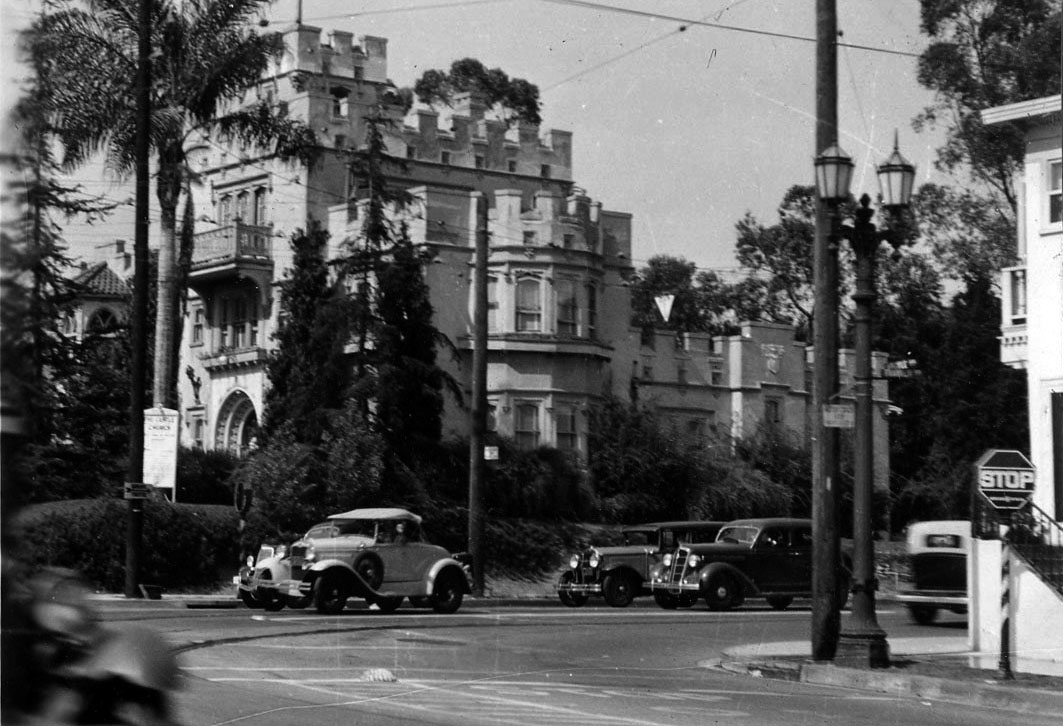 |
|
| (1934)*^^ - View showing Glengarry Castle located on the northeast corner of Franklin and Argyle avenues. |
Historical Notes The Glengarry Castle was demolished in 1959.* Click HERE for contemporary view of the NE corner of Franklin and Argyle. |
Then and Now
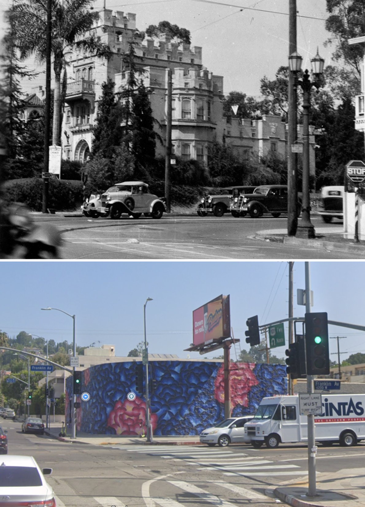 |
|
| (1934 vs 2022)* – Looking at the NE corner of Franklin and Argyle where the Glengarry Castle once stood. |
Castle Sans Souci
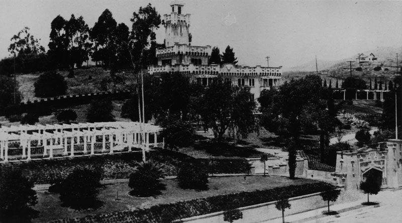 |
|
| (1913)* - The Castle Sans Souci, the mansion of Dr. A. G. Castles, located on the northwest corner of Franklin and Argyle avenues, across the street from Glengarry Castle |
Historical Notes Dr. Castles originally lived in Glengarry Castle (NE corner of Argyle and Franklin). But that 'home' soon proved too small for his burgeoning social life and medical practice. So in 1912, he built Castle Sans Souci on a three-acre plot across the street (NW corner of Argyle and Franklin). |
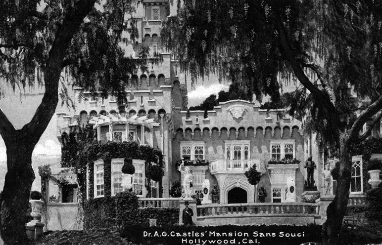 |
|
| (1921)^^^ – Postcard view of Dr. A. G. Castles’ Mansion Sans Souci, Hollywood. |
Historical Notes The Tudor-Gothic style castle contained twenty-three rooms and included a Baronial Hall and a Louis XV drawing room. Two lions made of Carrara marble, 144 years old, adorned the entrance to the castle, and also bear the Schloesser coat of arms. These lions formerly adorned the entrance to the palace of the last Doge of Venice.* |
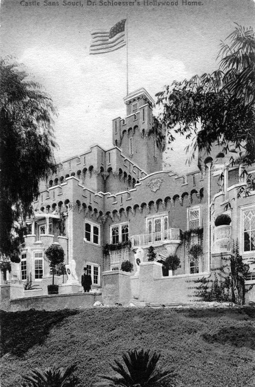 |
|
| (1920s)^^^ – Postcard view showing Castle Sans Souci, Dr. Schloesser’s (Dr. Castles) Hollywood home. |
Historical Notes He was originally called Dr. Alfred Guido Rudolph Schloesser, but during World War I, due to anti-German sentiment, he changed it to Castles, a direct translation from the name Schloesser. As an investment, the eccentric Dr. Castles, who always wore a frock coat, heavy makeup and top hat, tore down Sans Souci and built Castle Argyle Arms Apartments in 1928, attracting a new breed of royalty: movie makers. Guests there over the next two decades were to include Clark Gable, Howard Hughes, Ronald Reagan and Cecil B. DeMille.*# |
The Laurel Canyon "Trackless Trolley"
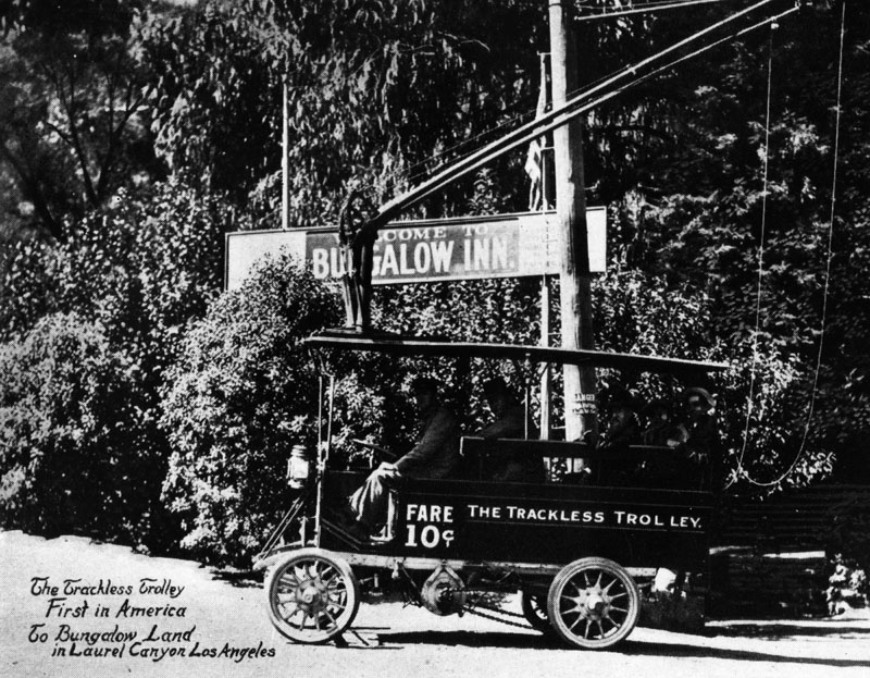 |
|
| (ca. 1912)* - A trackless trolley, "The First in America," traveling to and from "Bungalow Land" in Laurel Canyon, Hollywood. Fare was 10 cents. |
Historical Notes In 1912 Charles Mann, a realtor, and Richard Shoemaker, an engineer, introduced these trackless trolleys to stimulate land sales in Laurel Canyon. The trolleys operated from Sunset Blvd. to the Tavern at the junction of Laurel Canyon and Lookout Mt. Road.^^ Mann and his partners bought property along Laurel Canyon Boulevard and up in the hills. Some of the first tracts to be developed in the Lookout Mountain bowl were Bungalow Land and Wonderland Park, both of which were moderately priced with narrow lots and a network of interconnecting lanes and foot paths. #^* |
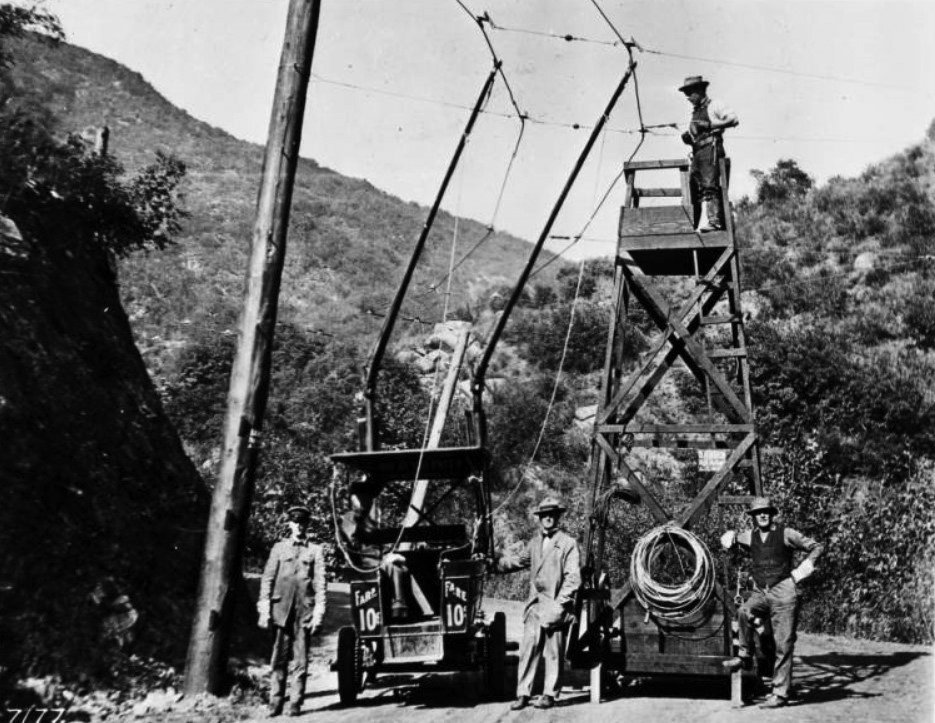 |
|
| (ca. 1912)#* - View showing a maintenance crew working on the overhead wires of the nation's first trackless trolley on Laurel Canyon. |
Historical Notes The trolley was actually a large automobile (1912 Oldsmobiles) converted to run on an electric engine connected to overhead wires, which frequently dislodged. It had an approximate 10-passenger capacity. After about 5 years of traveling up and down the treacherous narrow road, the poor old trolley buses fell apart. The overhead wires came down and the service was replaced by Stanley Steamers about 1915. **^* |
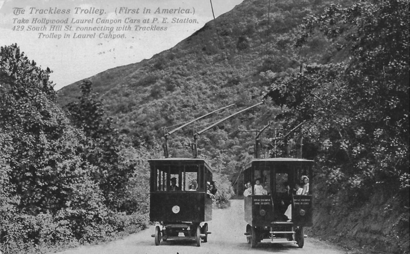 |
|
| (ca. 1912)* - View showing two trackless trolleys passing each other on Laurel Canyon. |
Historical Notes The trolley ran along Laurel Canyon's dirt road and connected Sunset Boulevard to the base of the current Lookout Mountain Avenue where there was a small inn. The Laurel Tavern served lunch to tourists and prospective customers of Mann's Bungalow Land properties. The ride cost 10¢. More adventurous travelers could continue up Lookout Mountain Avenue for a breathtaking view of Hollywood from the area around the current Appian Way.#* |
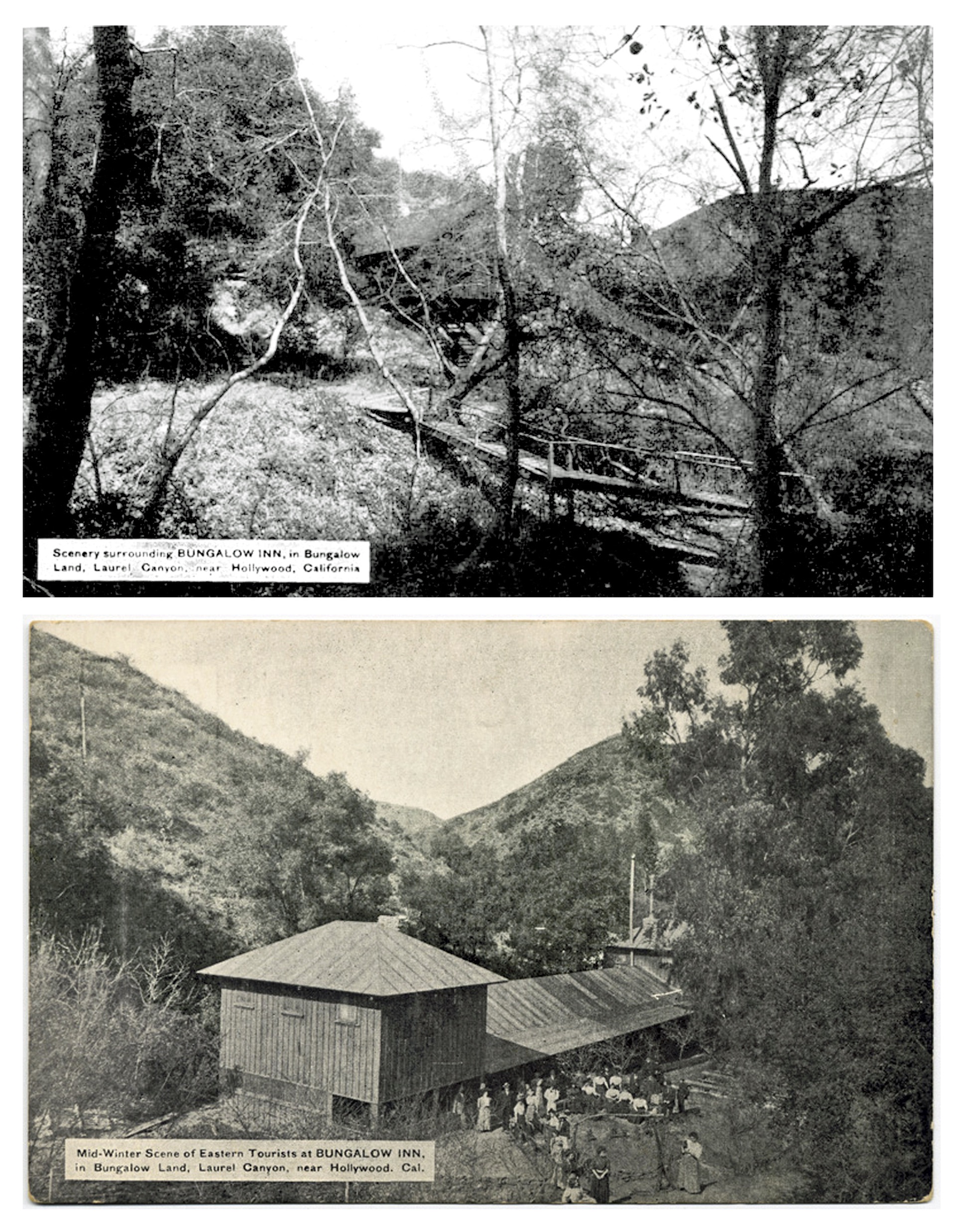 |
|
| (ca. 1912)* - View showing Charles Mann’s Bungalow Inn nestled in the lowland valley across a little spring fed stream near the present day intersection of Laurel Canyon Blvd and Lookout Mountain Avenue. |
Historical Notes By 1913, Mann began operating what was billed as the nation’s first trackless trolley, to ferry tourists and prospective buyers from Sunset Boulevard up to what would become the corner of Laurel Canyon Boulevard and Lookout Mountain Avenue. Mann built a massive tavern/roadhouse on that very same corner. Dubbed the Laurel Tavern, the structure boasted a 2,000+ square-foot formal dining room, guest rooms, and a bowling alley on the basement level. The Laurel Tavern, would later be acquired by Tom Mix, after which it would be known as the Log Cabin.*#*# |
Lookout Mountain Inn
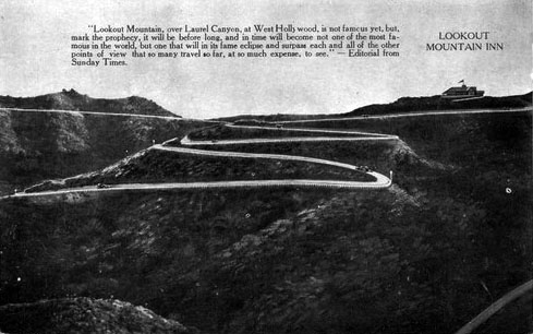 |
|
| (1913)^.^ – Caption reads: “Lookout Mountain, over Laurel Canyon, at West Hollywood, is not famous yet, but, mark the prophecy, it will be before long, and in time will become not one of the most famous in the world, but one that will in its fame eclipse and surpass each and all of the other points of view that so many travel so far, at so much expense, to see.” - Editorial from the Sunday Times |
Historical Notes In 1910, Charles Mann and his partners built a narrow road leading up to the crest of Lookout Mountain. Upon that crest they constructed a lavish 24-room inn with sweeping views of the city below and the Pacific Ocean beyond. The Lookout Inn featured a large ballroom, riding stables, tennis courts and a golf course, among other amenities. |
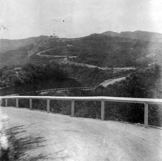 |
|
| (ca. 1913)#^* - View showing the road leading up to the Lookout Mountain Inn, also built by Charles Mann to promote his Laurel Canyon properties. |
Historical Notes After completing Laurel Tavern and Lookout Inn, two rather unusual structures anchoring an otherwise undeveloped canyon, Mann set about marketing the canyon as a vacation and leisure destination. The land that he carved up into subdivisions with names like “Bungalow Land” and “Wonderland Park” was presented as the ideal location to build vacation homes. But the new inn and roadhouse, and the new parcels of land for sale, definitely weren’t for everyone. The roadhouse was essentially a country club. Bungalow Land was openly advertised as “a high class restricted park for desirable people only.”^ |
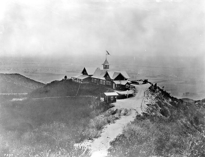 |
|
| (1916)* - View of Lookout Mountain Inn perched high on the Hollywood Hills. It offered spectacular views of the city below. In the distance can be seen oil wells, which makes this view looking south toward the Gilmore Oil Fields. |
Historical Notes Wide verandas on three sides of the main structure offered 270-degree views of the lowlands below and the ocean beyond. Guests, paid $15 per week for room and board. Charles Mann, the original developer of Laurel Canyon, is not the same Charles Mann who founded the real estate office at Kirkwood and Laurel Canyon Blvd, and there is no relation. Just a coincidence of history. |
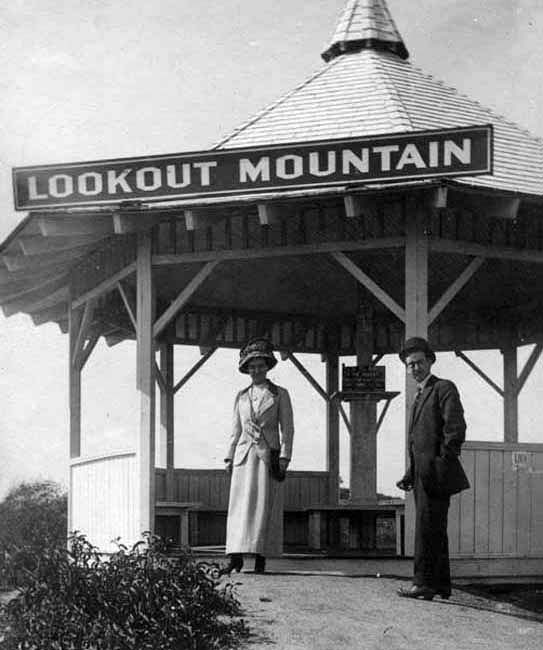 |
|
| (ca. 1916)#^* - Once at the top, visitors to the Lookout Mountain Inn could enjoy a broad view of the farmlands and oil fields stretching out to the ocean. |
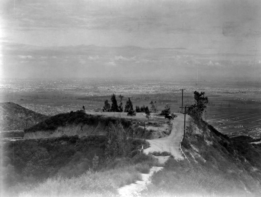 |
|
| (1920s)^^ - View looking down toward the top of a hill where Lookout Mountain Inn once stood. Two early model automobiles are seen parked on an unpaved parking area overlooking the city. Lookout Mountain Inn burned down in 1918. |
Historical Notes The Lookout Mountain Inn met a fiery end on October 26, 1918, after only eight years of business. A brush fire reportedly started by a group of boys cooking sausages in the foothills raced up the canyons and reduced the wooden structure to charcoal. It was never rebuilt. Today, a six-bedroom, 9,300-square-foot house occupies the site, its once-famous views hidden behind security gates and privacy walls.* |
 |
|
| (Early 1900s)^^^ - View looking southeast from Lookout Mountain towards Hollywood. If the camera were turned about 45 degrees to the right, we would be looking almost straight down La Cienega, which "points to" Lookout Mountain from West Hollywood and mid-Wilshire. |
Hollywood Fire Department and Police Station
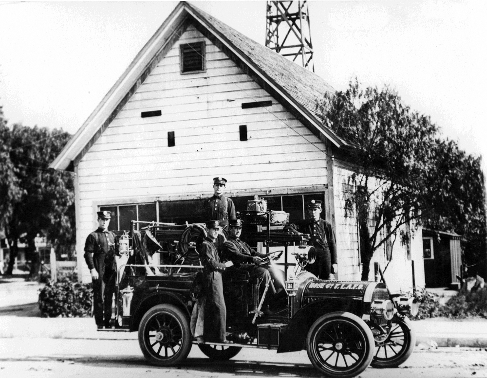 |
|
| (ca. 1910)^#* - View of the original Fire house of "City of Hollywood" as annexed in 1910, located at 1560 N. Cahuenga Blvd at Selma. |
Historical Notes After being taken over by L.A.F.D. it was designated Hose Co #7. The old building had originally been a church. When Eng. Co #27 was established in 1912, Hose Co #7 was abandoned. At the time of Annexation it was necessary to retain the former Hollywood Fire Chief (Joe Shill) to drive, as there was no one else at that time who could drive an automobile.^#* |
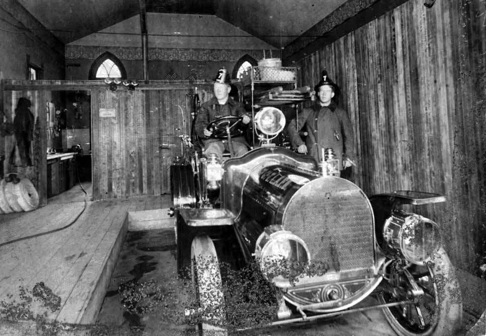 |
|
| (ca. 1910)^#* - Interior view of Fire Hose Co. #7 located on the southwest corner of Selma and Cahuenga in Hollywood. The building had once been used as a church. |
Historical Notes The vehicle above is a 1908 Tourist hose wagon built in Los Angeles. Later assigned shop number 35, this was the first LAFD motorized apparatus.^#* |
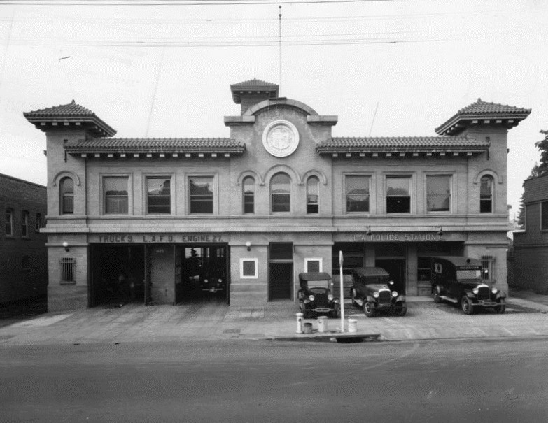 |
|
| (1916)* - Exterior view of the L.A.F.D. Fire Department, Engine 27, and the L.A. Police station, sharing the same building at 1629 Cahuenga Blvd in Hollywood. |
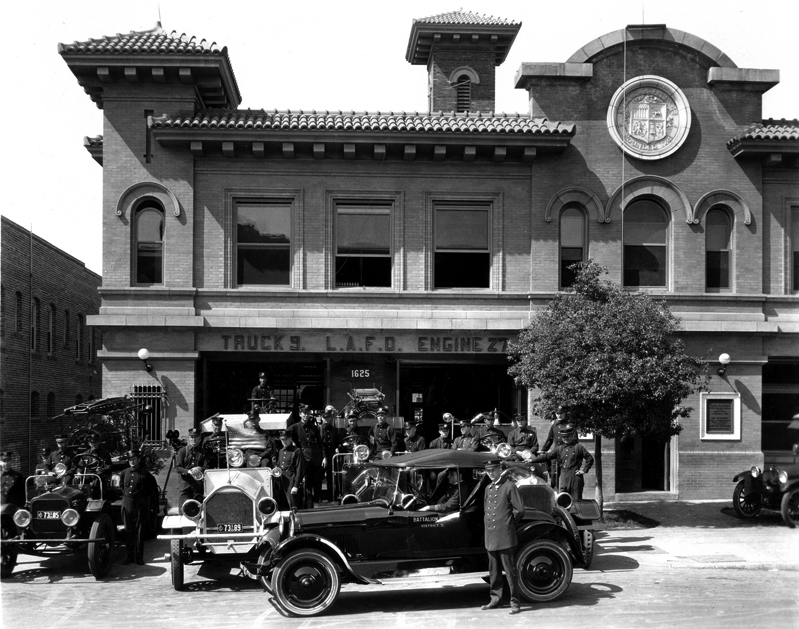 |
|
| (1923)^#* - View of firemen and equipment in front of the LAFD Engine 27 side of the 1629 Cahuenga Blvd building. The other side of the building was used as the Hollywood Police Station. |
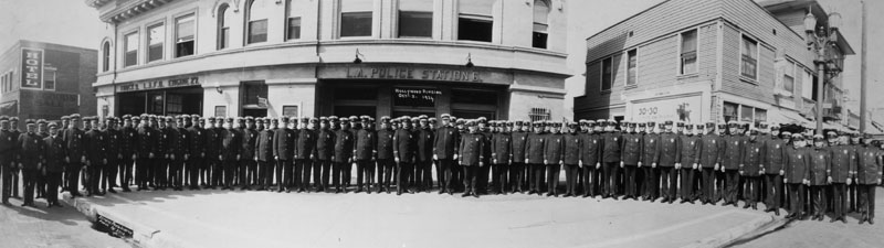 |
|
| (1924)* - Police officers stand on the street outside of the Hollywood police station, Division 6, located at 1629 Cahuenga Avenue, just north of Selma Avenue. Neighboring businesses, a hotel (left) and a shoe shop (right), are also captured in the image. |
* * * * * |
Cahuenga Branch Library
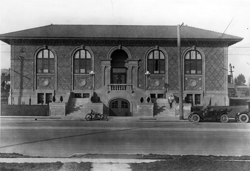 |
|
| (1916)* – View showing the Cahuenga Branch of the Los Angeles Public Library, located at 4591 Santa Monica Boulevard, with motorcycle and early model cars parked in front. |
Historical Notes The Cahuenga Branch Library was built with a $35,000 grant from Andrew Carnegie. Constructed in 1916, it was intended to serve a community of workers in the then nearby orange and avocado groves and wheat fields.* |
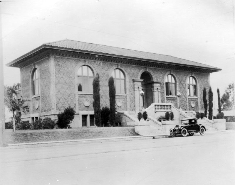 |
|
| (ca. 1920)* - View of the Cahuenga Branch of the Los Angeles Public Library, located on the northeast corner of Santa Monica Boulevard and Madison Avenue. |
Historical Notes The Italian Renaissance style building was designed by architect Clarence H. Russell (1874-1942), who also was associated with Norman F. Marsh in the building of Venice and its canals. The floor plan of the library was known as the “butterfly” type, containing two reading rooms, one on each side of a central entrance, desk, and stack room. The building contained 8,474 square feet of floor space on two floors. Besides the children’s and adult reading rooms, there were an auditorium, a room for children’s story hours, a staff room, and even an open air reading room.* |
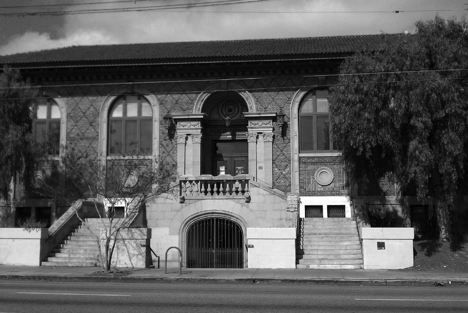 |
|
| (2014)#+ - Front view of the Cahuenga Branch as it appeared located at 45901 Santa Monica Boulevard. Click HERE to see a more contemporary view. |
Historical Notes The 1916-built Cahuenga Branch is the third oldest branch library in the Los Angeles Public Library system. It is one of three surviving Carnegie libraries in Los Angeles, the other two being the Vermont Square Branch and the Lincoln Heights Branch. In 1986, the Cahuenga Branch Library was designated as LA Historic-Cultural Monument No. 314. It is also listed in the National Register of Historic Places. Click HERE to see the complete list of LA Historical Cultural Monuments. |
* * * * * |
Paramount-Famous-Lasky Corporation West Coast Studios
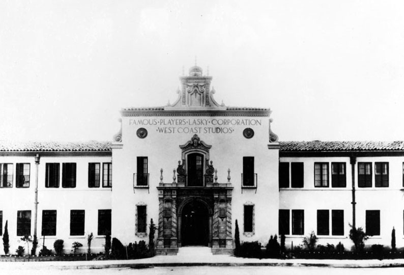 |
|
| (ca. 1916)* - Entrance to the Famous Players-Lasky Corporation West Coast Studios located at 5555 Melrose Avenue before Paramount was added. |
Historical Notes In 1916, Adolph Zukor maneuvered a three-way merger of his Famous Players, the Lasky Company, and Paramount. The new company Lasky and Zukor founded, Famous Players-Lasky Corporation, grew quickly, with Lasky and his partners Goldwyn and DeMille running the production side, Hiram Abrams in charge of distribution, and Zukor making great plans. Famous Players-Lasky and its "Paramount Pictures" soon dominated the business.*^ |
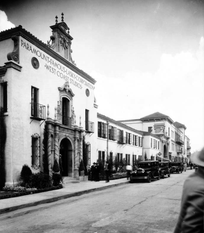 |
|
| (1930)^^ - View of the Paramount Famous Lasky Corporation Studios at 5451 Marathon Street in Hollywood. The main entrance is through an elaborately carved stone archway in the foreground at left, and a sign above the entryway bears the name of the studio. A line of dark vehicles is parked along the side of the street in front of the building, and many pedestrians can be seen as well. |
Historical Notes Zukor signed and developed many of the leading early stars, including Mary Pickford, Marguerite Clark, Pauline Frederick, Douglas Fairbanks, Gloria Swanson, Rudolph Valentino, and Wallace Reid. With so many important players, Paramount was able to introduce "block booking", which meant that an exhibitor who wanted a particular star's films had to buy a year's worth of other Paramount productions. It was this system that gave Paramount a leading position in the 1920s and 1930s, but which led the government to pursue it on antitrust grounds for more than twenty years.*^ Click HERE to see more Early Views of Paramount. |
* * * * * |
Beachwood Canyon Outdoor Theatre
.jpg) |
|
| (1916)## - Panoramic (Left Panel) view showing the Beachwood Canyon Outdoor Theatre being set up for a performance of Julius Caesar. |
Historical Notes In 1911, Albert Beach paved the way to the Hollywood Hills and named "Beachwood Drive" after himself. On May 16, 1916, Hollywood participated in the world celebration of William Shakespeare's 300th birthday. A star-studded performance of "Julius Caesar" was mounted in the huge outdoor natural amphitheater at the top of Beachwood Drive (where the Beachwood Market and Village is now). #*** |
.jpg) |
|
| (1916)## - Panoramic (Right Panel) view showing the Beachwood Canyon Outdoor Theatre being set up for a performance of Julius Caesar. |
Hollywood and Highland
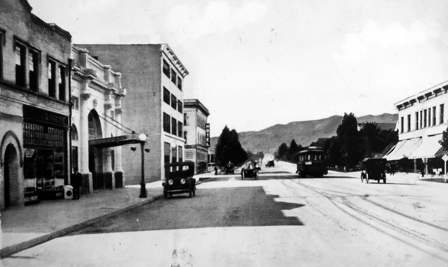 |
|
| (1914)* – Postcard view looking west on Hollywood Boulevard toward Highland Avenue. On the left can be seen an early model car parked by a streetlamp in front of the Hollywood Theatre (with canopy overhang). A streetcar can be seen at the intersection of Hollywood and Highland. |
.jpg) |
|
| (1915)* – View looking east on Hollywood Boulevard from near Highland showing the Hollywood Theatre with new building under construction to its right. |
Then and Now
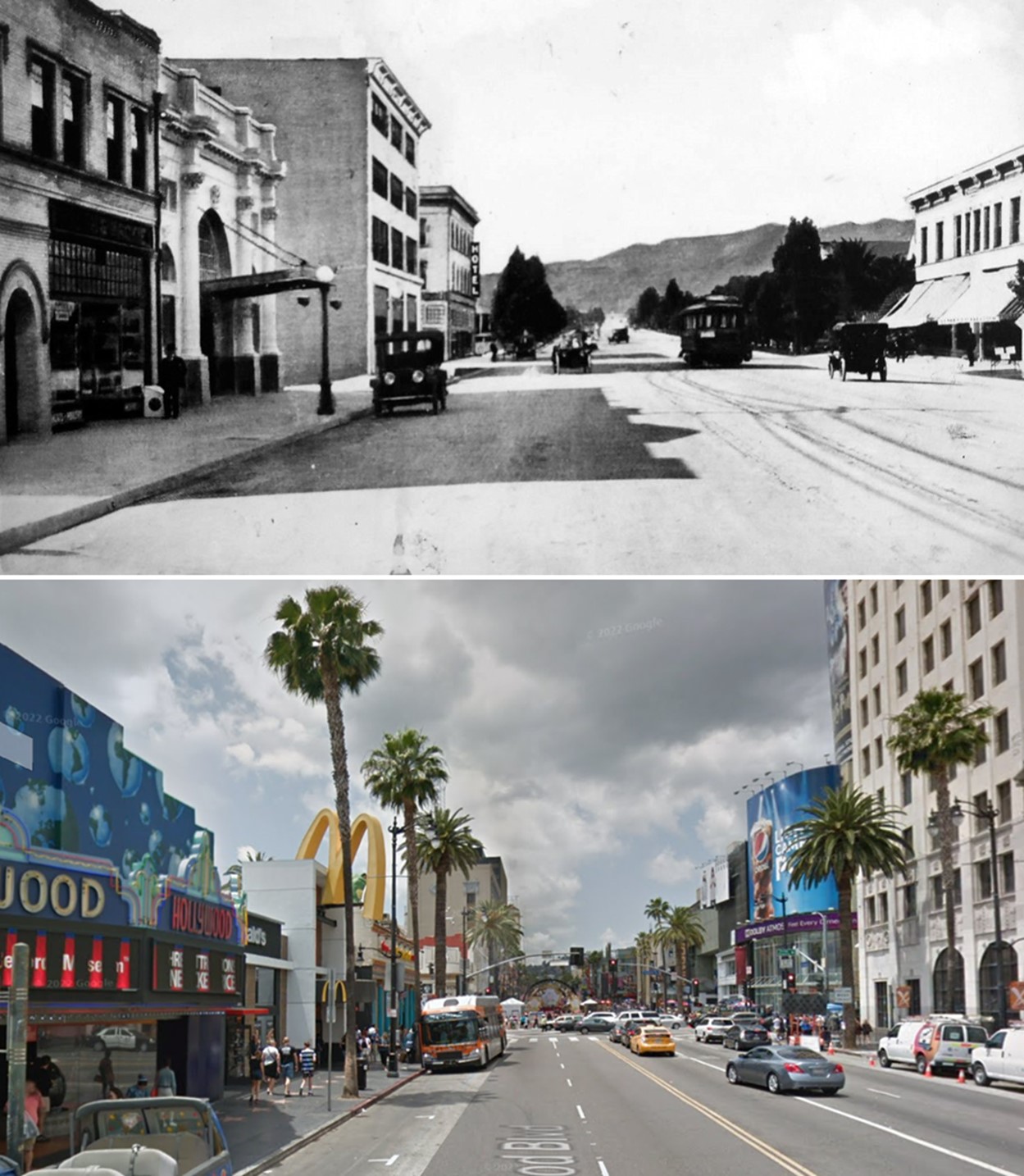 |
|
| (1914 vs 2016)* - Looking west on Hollywood Boulevard toward Highland Avenue with the Hollywood Theatre seen on the left. |
* * * * * |
Hollywood Theatre
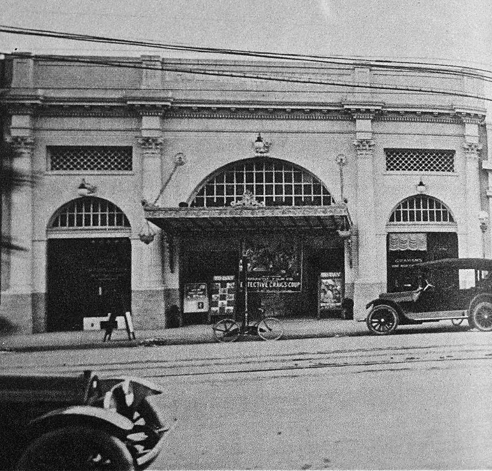 |
|
| (1914)* – Hollywood Theatre as seen from across the street with bicycle parked in front. The theatre is running "Detective Craig's Coup," a 1914 release with Francis Carlyle, Pearl Sindelar and Jack Standing. |
Historical Notes The former Hollywood Theatre was opened on December 20, 1913 as a silent movie palace in the rapidly emerging Hollywood Theater district. It was designed in a Romanesque style, by architects Kremple & Erkes. The facade had glazed brick. The lobby was in marble tile and the auditorium was decorated with Corinthian columns and a coffered ceiling. In September 1923, a Wurlitzer organ, Opus 697 was installed. |
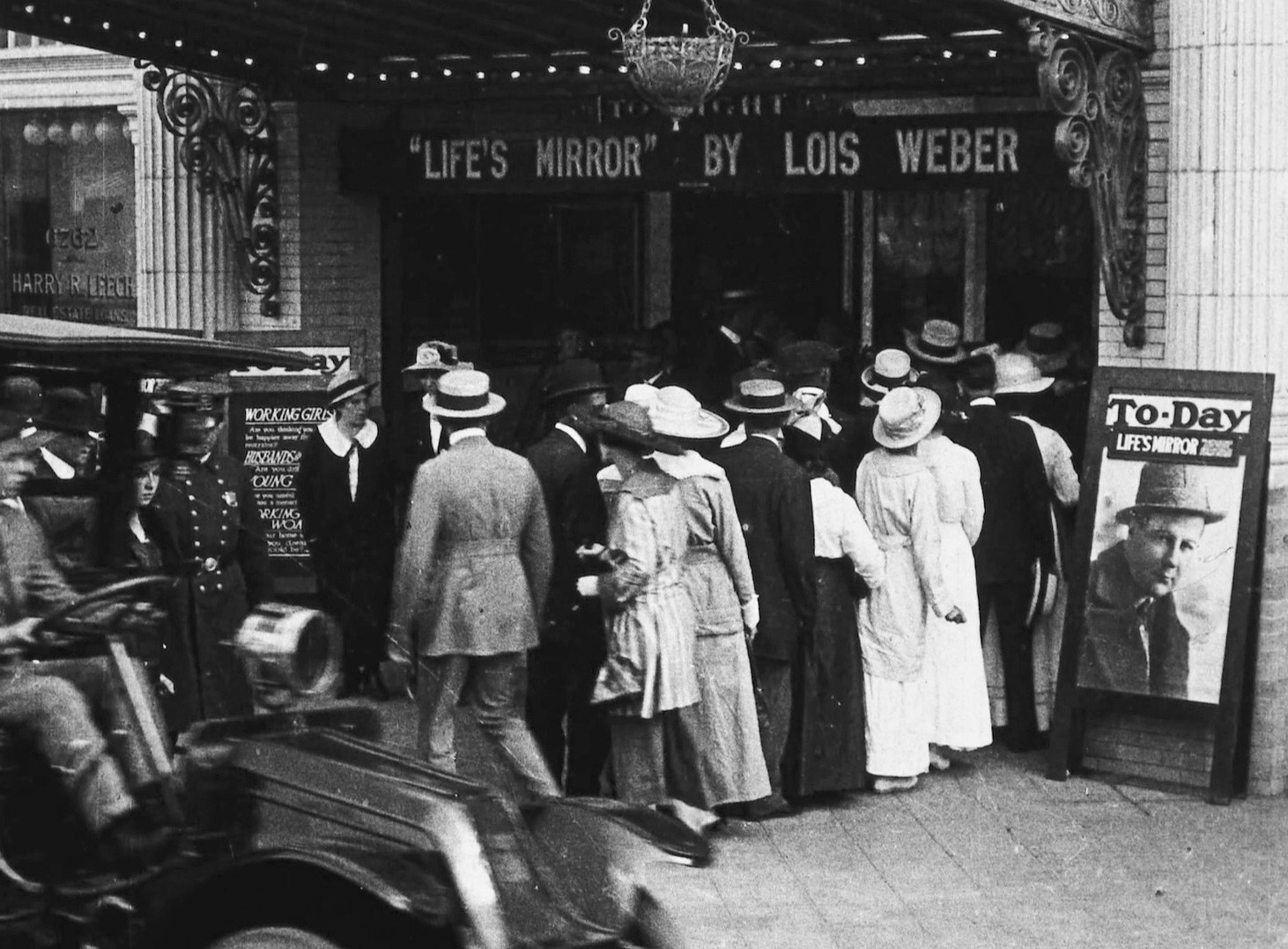 |
|
| (1916)* – View showing people standing in line in front of the Hollywood Theatre to see “Life’s Mirror” by Lois Weber. |
Historical Notes Opened in 1913, this was Hollywood's second theatre and had an initial admission price of 10 cents. The facade was of white glazed brick with marble tile in the lobby. The auditorium featured Corinthian columns and a coffered ceiling. The owner of the project was H.L. Lewis. The Idle Hour had been the first theatre to open in Hollywood, in late 1910 or early 1911. |
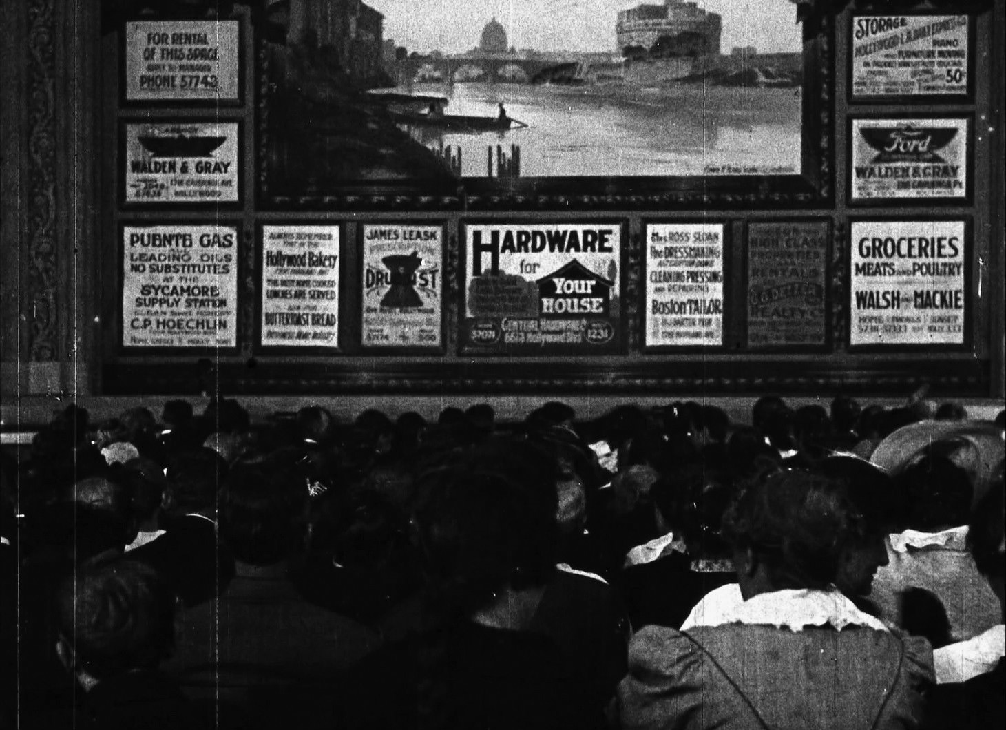 |
|
| (1916)* – Interior view of the Hollywood Theatre (6764 Hollywood Blvd) showing the act curtain from the movie “Idle Wives”. Note that the curtain we see is advertising Hollywood businesses. |
Historical Notes Idle Wives is a 1916 American silent drama film co-directed by Lois Weber and Phillips Smalley. The film was released by Universal Film Manufacturing Company. Surviving reels of the film are preserved at the Library of Congress. The film was released on DVD/Blu-ray in 2018. |
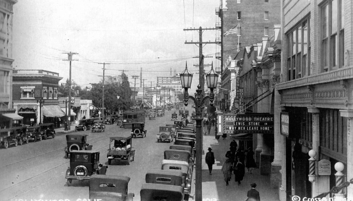 |
|
| (1924)* - Hollywood Boulevard looking east from near Highland. A movie called “Why Men Leave Home” is playing the Hollywood Theatre at 6764 Hollywood Blvd. It was a Louis B. Mayer Productions movie that came out in March 1924 (and starred Lewis Stone who would later play Mickey Rooney’s father in MGM’s Andy Hardy series.) The theater is still around...sort of. In the 1990s it became the venue for the Guinness Book of World Records. |
Historical Notes In 1936 the Hollywood Theatre got a renovation and redesign by S. Charles Lee where the original white brick façade was replaced with a deco version (see next photo). Note the beautiful two-lamp ornate streetlight in front of the theater. These were, and still are, called ‘Metropolitan’ streetlights. They were developed especially for Hollywood, but ultimately found their way onto the "best" streets of surrounding communities. The ‘Metropolitan’ is still quite common in Hollywood almost a century after they first appeared (Click HERE to see more). |
.jpg) |
|
| (1938)* - Exterior view of the Hollywood Theatre, located at 6764 Hollywood Boulevard. The marquee indicates that the films "Merrily We Live" and "Romance in the Dark" starring Constance Bennett are playing. The Hollywood Boulevard street car tracks are visible in the foreground. |
Historical Notes Designed originally in 1913 by architects Kremple and Erkes, the theater got a remodel in 1927 by Clifford Balch. Another renovation and redesign by S. Charles Lee occurred in 1936 where the original white brick façade was replaced with a deco version. The signage currently on the building is from that remodel. A final remodel took place in 1977. In the early 1990s, the theatre became a venue for the Guinness Book of World Records. |
* * * * * |
Iris Theatre
 |
|
| (1918)* - View of the Iris Theatre located at 6508 Hollywood Boulevard, Hollywood. Now showing: Charles Ray in "The Family Skeleton". |
Historical Notes The Iris Theatre opened in 1918, as the second theatre on Hollywood Boulevard. It was built by P. Tabor who employed architect Frank Meline, to design a Romanesque style theatre, with a brick façade. The distinction of being the first movie theater in Hollywood goes to the Idyl Hour Theater. Located at 6525 Hollywood Boulevard, it was established in either late 1910 or early 1911. During its first year the theater was little more than a converted store with chairs, a projector and a screen. The Idyl Hour Theater, whose name changed to the Iris Theater in 1913, moved to 6415 Hollywood Blvd. in 1914, and to a new 1000-seat theater at 6508 Hollywood Blvd. in 1918. |
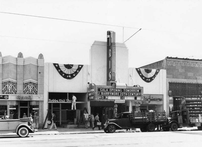 |
|
| (1934)* - The Iris Theatre at its new location, 6415 Hollywood Boulevard, pictured a day before its grand opening. |
Historical Notes The Iris theatre was redesigned by architect S. Charles Lee in July 1934 and was given an Art Deco style. Fox Theater took over in 1965, and they remodeled the Streamline Moderne facade in 1969 into what we still see today. |
* * * * * |
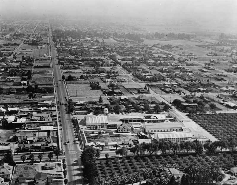 |
|
| (ca. 1917)* - Aerial view of Hollywood, looking south on Western. Two orchard fields are seen in the foreground. |
Historical Notes In 1917, a neighborhood survey was taken. The population was mostly white and blue-collar Anglo; of 2,017 families surveyed only 58 were immigrants or non-white (Black and Japanese). The area was residential, with single family homes predominating. Commercial activities were limited to small neighborhood business. However, the growing movie industry was present; the Fine Art Studios where, among other films, Intolerance was made, occupied the site of the present Safeway Market at Virgil and Sunset; Kalem Co. and Mabel Normand Studios were on Hyperion near Fountain, and the William Fox Studios on Sunset and Western Avenue. |
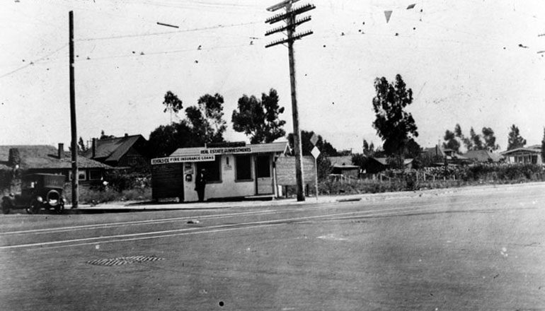 |
|
| (1919)* - Northeast corner of Santa Monica Boulevard and Western Avenue. S. Robinson & Co. real estate and investments office is located on the corner. A man with a dark suit and hat can be seen leaning against the building next to one of the widows. It appears that a small field of flowers is to the right, and houses in the background. A lone automobile is parked along Western Avenue. |
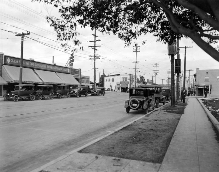 |
|
| (ca. 1920)* - Photograph of stores, shops and street traffic near intersection of Crescent Heights and Santa Monica Boulevard in West Hollywood. Sam Seelig Co.’s Crescent Heights Public Market on left. |
Historical Notes Sam Seelig Company was founded in April 1912 by Sam Seelig, who had come to California from Arizona in 1911. Seelig opened a single grocery store in Los Angeles at the corner of Pico and Figueroa streets. The chain had grown to 71 stores by 1922. After World War I, the firm became deeply indebted to its main grocery wholesaler, a firm owned by W.R.H. Weldon. In a swap of stock for debt, Weldon assumed control of the chain, leaving Seelig in charge of retail operations. Seelig then left the company in 1924 to enter the real estate business, forming Sam Seelig Realty. As a result of Seelig's departure, the company held a contest in 1925 to develop a new name, the result of which was Safeway. The original slogan was "an admonition and an invitation" to "Drive the Safeway; Buy the Safeway.” The point of the name was that the grocery operated on a cash-and-carry basis; it did not offer credit, as had been traditional for grocers. It was the "safe way" to buy because a family could not get into debt via its grocery bill (as many families did, especially during the Great Depression). By 1926, Safeway Stores had 322 stores centered in Southern California. |
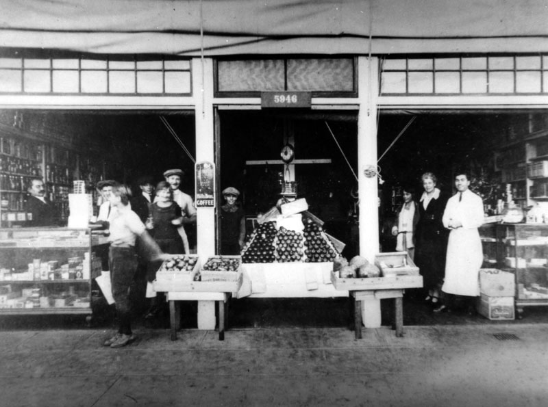 |
|
| (ca. 1919)* - Exterior view of the Linardos Bros. Market where customers are seen shopping. Two family employees are present in the image: Takis Linardos (left), who helps customers at the counter and John Linardos (right in white apron). The market is located at 5946 Sunset Boulevard in Hollywood. |
Historical Notes Coming from Greece, Alex Williams arrived in Hollywood in 1915; the same year, D.W. Griffith turned movies into motion pictures with The Birth of a Nation. Griffith made his movie at Triangle Studios at Sunset and Virgil. Alex Williams set up business with two brothers-in-law named Linardos at Sunset and Gordon, next to the Poverty Row studios. It wasn’t the movies, but The Linardos Brothers Market sold groceries to them along with anyone else in the neighborhood. |
.jpg) |
|
| (ca. 1919)* - Interior view of the well-stocked Linardos Bros. Market, located on Sunset Boulevard in Los Angeles, California. John Linardos, is standing behind counter. |
 |
|
| (ca. 1920s)* - A view of Hollywood Blvd., west from Vine St. Rails are in the middle of the street, cars parked at the curb and establishments along the street include W. P. Fuller Co., the Witzel Studio housing Hollywood Art Galleries and J. Van Den Akker Jeweler. |
* * * * * |
Hollywood High School
 |
|
| (1918)^^ - Aerial view of Hollywood looking north. Highland Avenue runs straight up from center-bottom and then snakes its way to Cahuenga Pass. The intersection of Hollywood Boulevard and Highland Avenue is at center of photo. The Japanese estate and gardens of brothers Charles and Adolph Bernheimer is perched high on a hill in the upper-left corner. Hollywood High School is seen at lower center-left , on the northwest corner of Sunset Boulevard and Highland Avenue. |
 |
|
| (1921)* - Aerial view of Hollywood High School and surrounding area. |
Historical Notes The school with a student body of 2500 was three blocks from Charlie Chaplin's studio and six blocks from Mary Pickford's and Douglas Fairbanks' studios. The homes bordering the upper side of the campus were just condemned by the city to make room for additional buildings. The original 1905 building is on the bottom right, the Household & Fine Arts building is in the middle of the quadrangle, and the gymnasium is top, center.* |
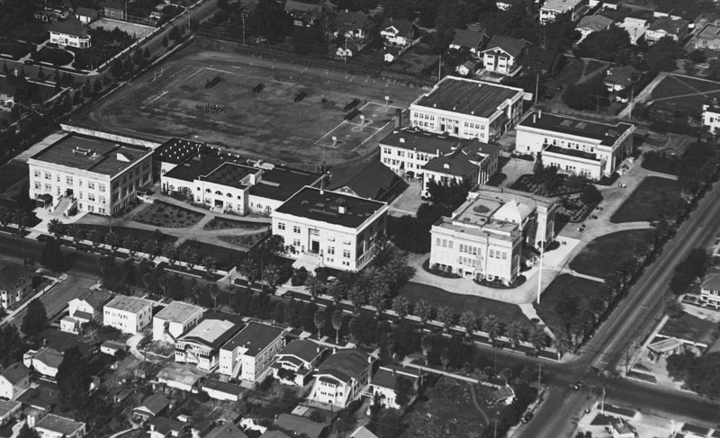 |
|
| (1922)* - An aerial view of Hollywood High School from the southeast. There is practice of some kind on the athletic field where two basketball courts have also been marked off. |
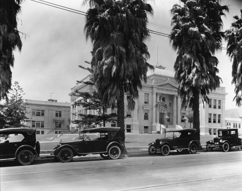 |
|
| (1920)* - A view of Hollywood High School campus, or quadrangle, looking northwest from Highland Ave. Cars are parked in front of fan palms that need to be trimmed. Yucca trees grow by the stairs leading to the entrance of the original 1905 building. "Hollywood Union High School" is chiseled over the entrance. |
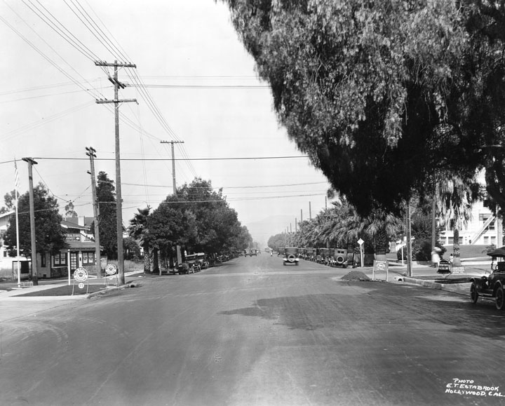 |
|
| (ca. 1922)* - Looking west from Sunset Boulevard where it meets Highland Avenue. Hollywood High School can be seen on the northwest corner to the right. |
Then and Now
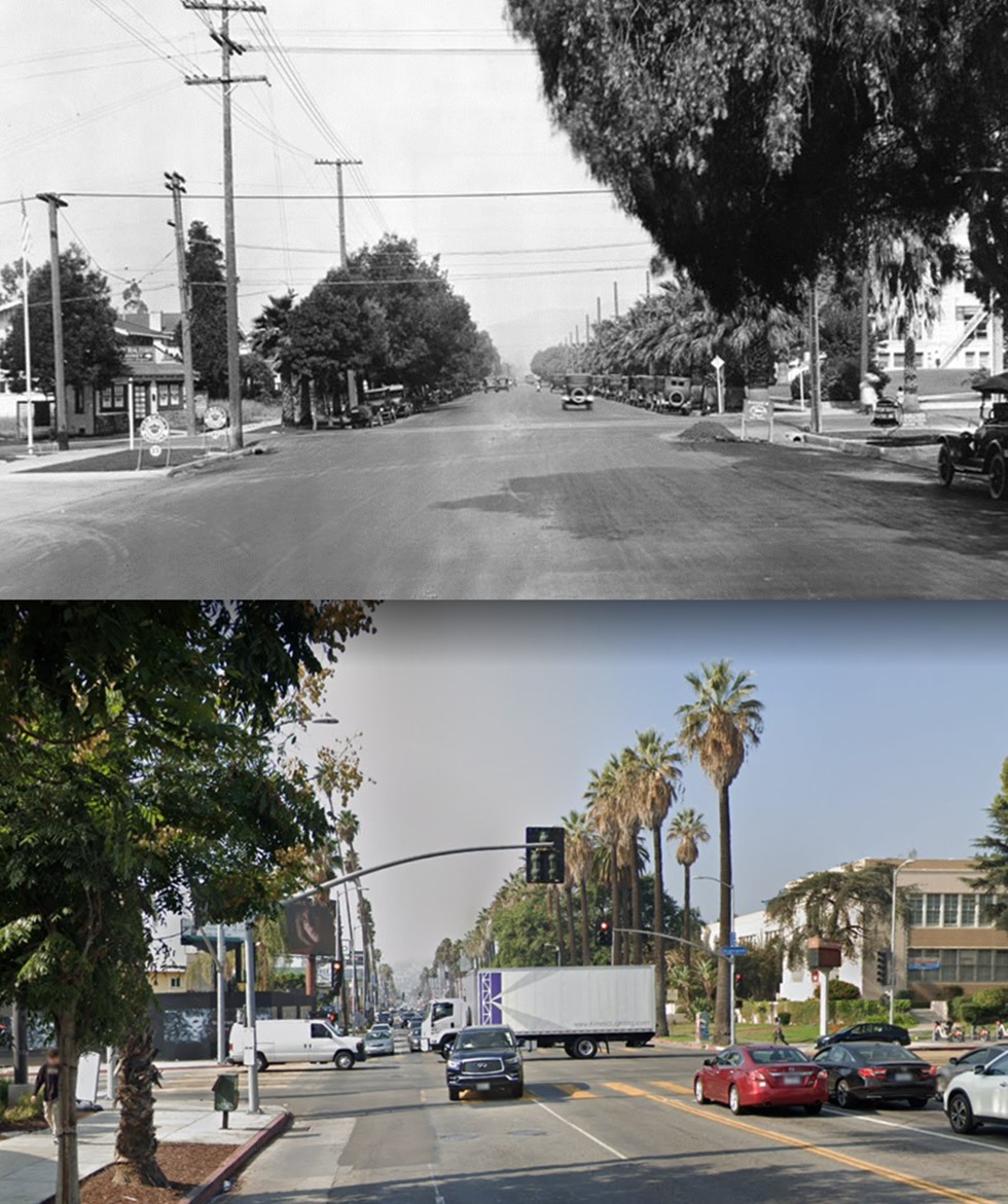 |
|
| (1922 vs. 2022)* - Looking west on Sunset Boulevard toward Highland Avenue with Hollywood High School seen on the right (NW corner). |
Click HERE to see more Early Views of Hollywood High School |
* * * * * |
La Brea Avenue
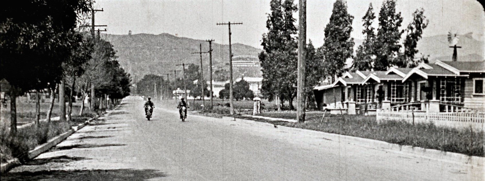 |
|
| (1919)* - Looking north on La Brea Ave from around Lexington Ave. The white building directly above the head of the motorcyclist on the right is the then-new Charlie Chaplin Studios at 1416 N. La Brea (now the Jim Henson Studios) which were built in 1918. And halfway up the hill at around the center of the image we can see the Bernheimer Estate, which went up in 1913 and is now the Yamashiro Japanese restaurant. |
Historical Notes The above photo is a still from a 1919 silent short called “Waiting at the Church”. |
Then and Now
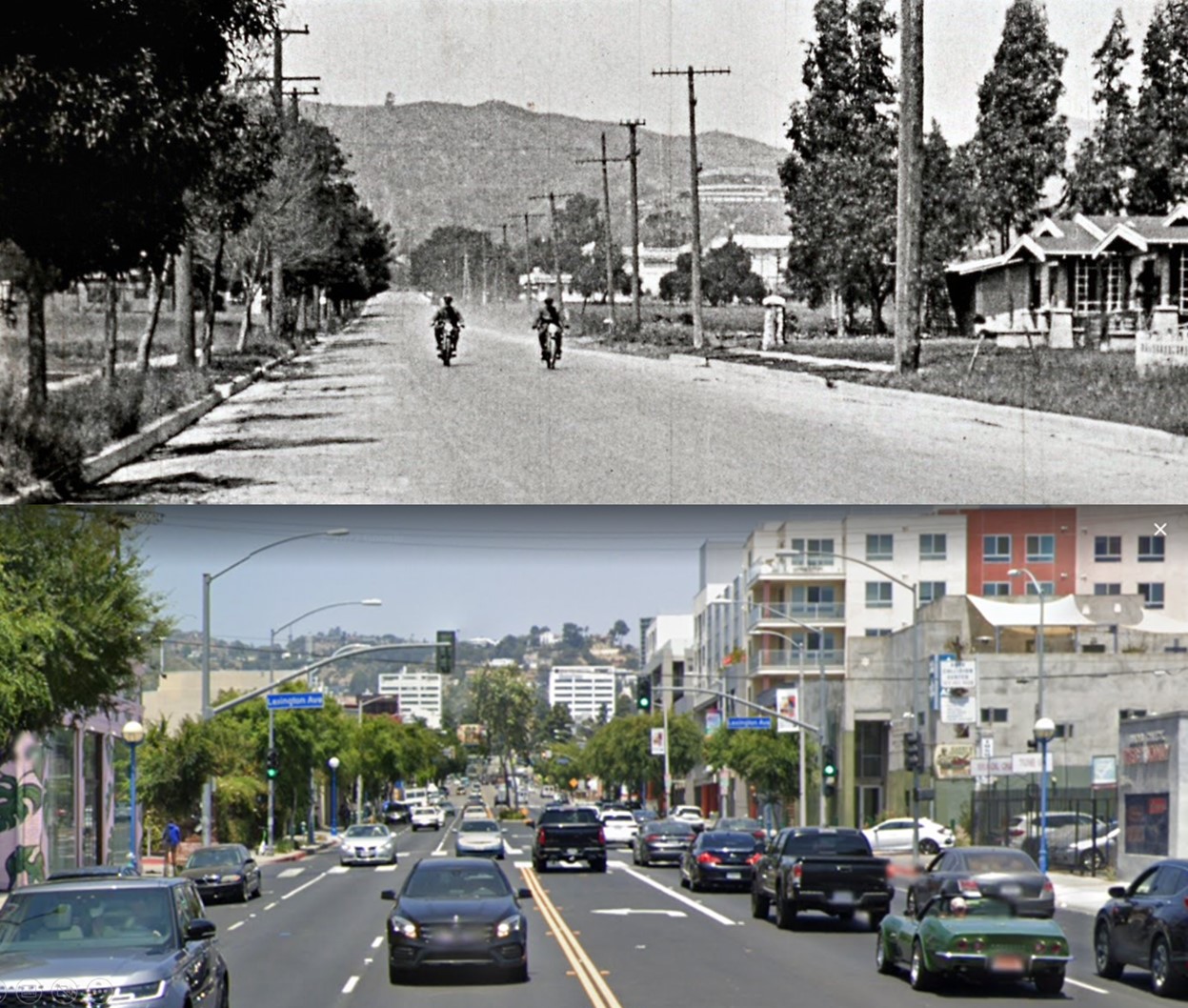 |
|
| (1919 vs 2022)* - Looking north on La Brea Ave from near Lexington Ave. |
* * * * * |
Early Hollywood and Hollywood Hills
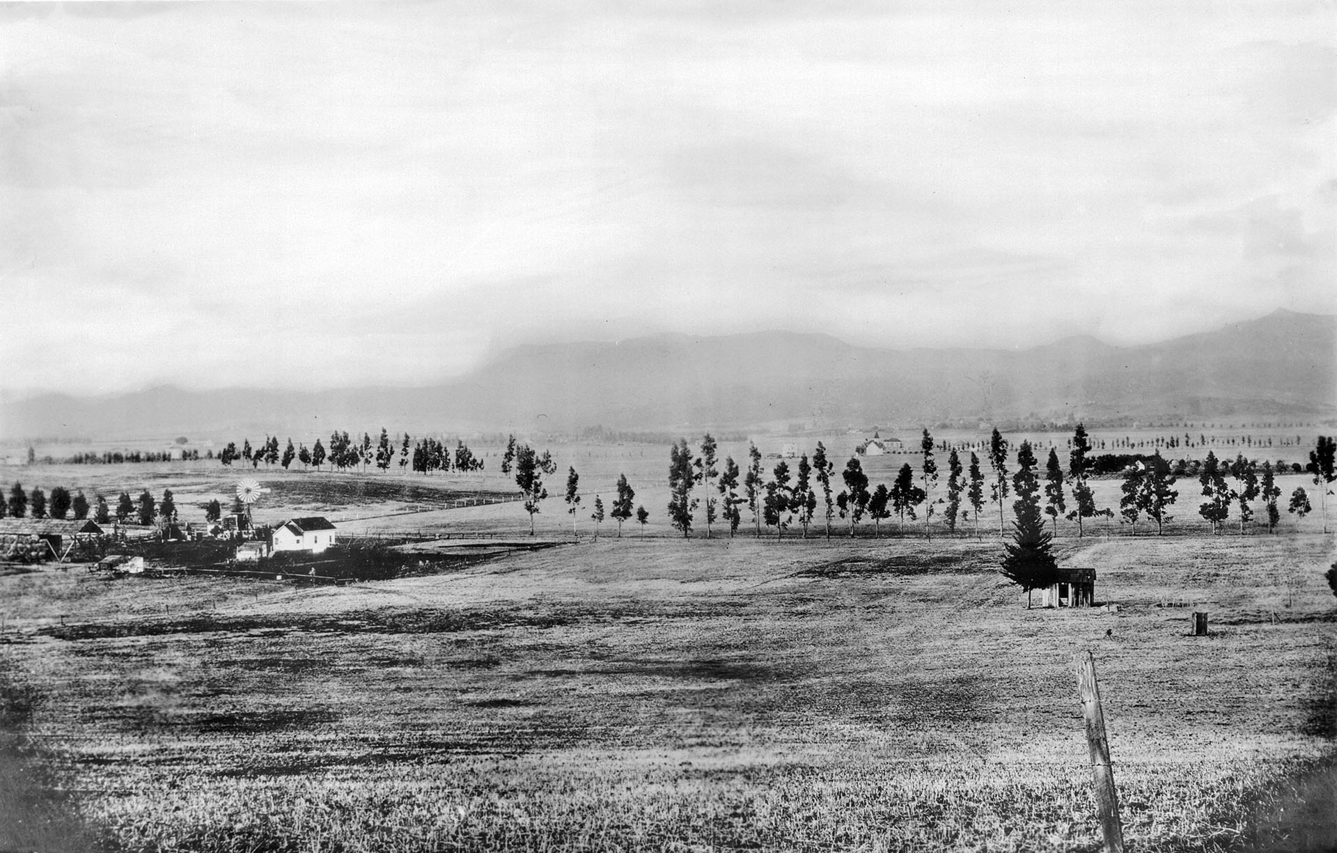 |
|
| (ca. 1900)* - Large rural area with a few houses and trees. The future site of Melrose and Normandie, 1906. Mt. Hollywood peak can be seen in the upper right of the photo. |
Historical Notes The above farm is where the Hollywood Frwy crosses Melrose Avenue today. Just to the west and out of view is the location of the McCarthy Ranch. In 1887 E. A. McCarthy named Melrose Avenue after his hometown of Melrose, Mass. |
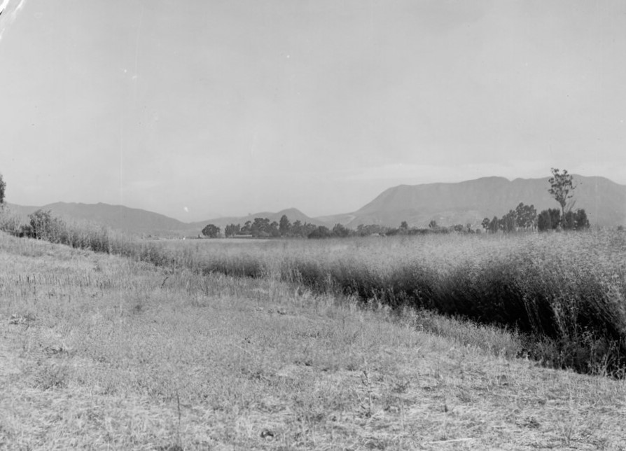 |
|
| (1915)* - A view of the Hollywood Hills (part of the Santa Monica Mountains), taken near the present-day Paramount lot on Melrose Avenue. Photo, Courtesy of the USC libraries - California Historical Society Collection. |
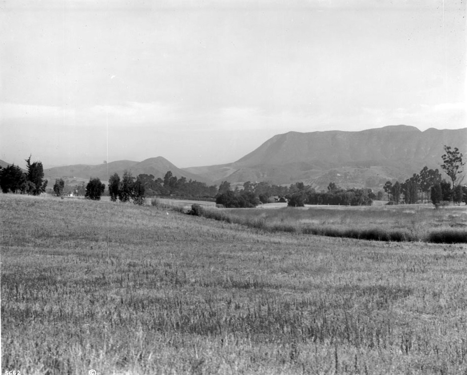 |
|
| (ca. 1915)^ - View from the E. A. McCarthy ranch showing the Hollywood Hills in the background. |
Historical Notes In 1896 Griffith J. Griffith donated over 3000 acres of Rancho Los Felis to the City of Los Angeles to create a public park in his name. Mount Hollywood, the highest peak of the park, rises to an elevation of 1640 feet. Griffith Park was declared Los Angeles Historic-Cultural Monument No. 942 in 2009 (Click HERE to see complete listing).* |
 |
|
| (ca. 1905)^ - View of the Cahuenga Peak near Hollywood, ca.1905. The lush mountain terrain looks like ripples (or waves) along the mountainside. Other mountain ranges are visible in the distance. |
 |
|
| (ca. 1938)* - Panoramic view of the Hollywood Hills showing Cahuenga Peak, Mount Lee, and the Hollywoodland sign in the distance. |
Historical Notes Howard Hughes acquired the Cahuenga Peak and surrounding acreage in the 1940 with plans to build a house for his love interest, actress Ginger Rogers. Rogers broke up their engagement, so the area was left undeveloped. In 2002, a group of Chicago-area investors named Fox River Financial Resources purchased the 138 acres parcel along the ridge including Cahuenga Peak from the Hughes Estate for $1,675,000 according to Los Angeles County property records. The investors considered constructing five luxury estates on the property. Los Angeles city officials said City Hall had received hundreds of letters pleading for the peak's protection, which prompted a campaign by city leaders and conservationists to raise $6,000,000 which they thought would be sufficient to buy Cahuenga Peak and turn it into an extension of nearby Griffith Park. On February 13, 2008, Chicago investment firm Fox River Financial Resources released plans to sell the property for $22 million. That same month, The Trust for Public Land launched the Save Cahuenga Peak campaign to purchase the land from the investment firm for $12.5 million. As part of the campaign they draped the Hollywood Sign so that it read "SAVE THE PEAK". On April 26 it was announced that the campaign was successful. Though funds came from many sources, including $1.7 million in public money, it was the final hour donations of $500,000 from The Louis Comfort Tiffany Foundation and Aileen Getty and $900,000 from Hugh Hefner that enabled the purchase. In July 2010, 100 acres around Cahuenga Peak was officially added to Griffith Park.*^ |
Then and Now
.jpg) |
.jpg) |
|
| (1905 vs 2013)* - - View of Mt. Lee |
 |
 |
|
| (1905) vs. (2013) |
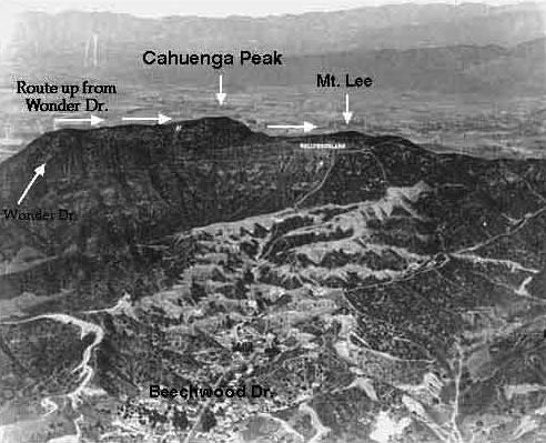 |
|
| (ca. 1920s)* - Aerial view of the Hollywood Hills annotated to show the mountain peaks in relationship to the Hollywoodland Sign. |
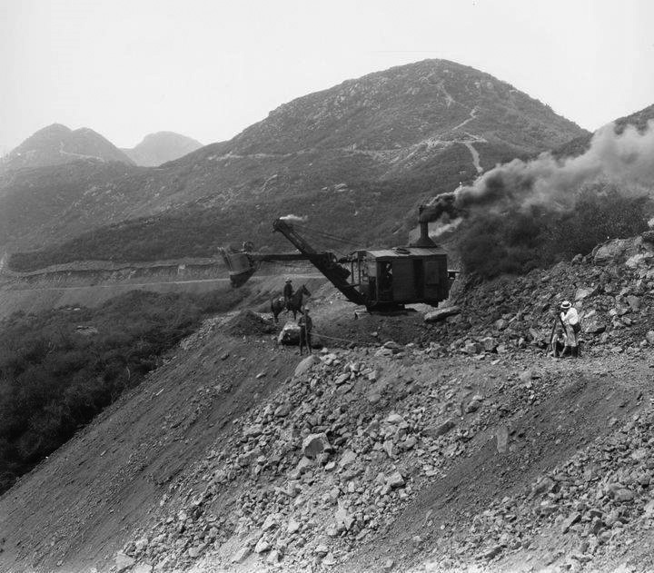 |
|
| (1923)* – View of the Hollywood HIlls being excavated showing a steam shovel, a couple of workers, and a man on a horse. These men are working for the Crescent Sign Company and are erecting a very large sign that will advertise a new hillside housing development called - HOLLYWOODLAND. |
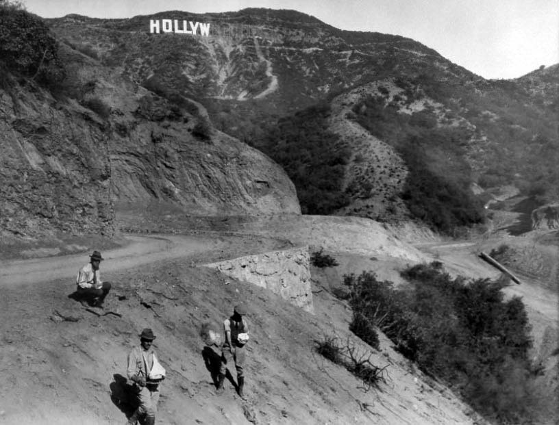 |
|
| (1923)* – View showing the HOLLYWOODLAND sign making her appearance on Mt. Lee. |
Click HERE to see more Early Views of HOLLYWOODLAND |
* * * * * |
Please Support Our CauseWater and Power Associates, Inc. is a non-profit, public service organization dedicated to preserving historical records and photos. Your generosity allows us to continue to disseminate knowledge of the rich and diverse multicultural history of the greater Los Angeles area; to serve as a resource of historical information; and to assist in the preservation of the city's historic records.
|
More Historical Early Views
Newest Additions
Early LA Buildings and City Views
History of Water and Electricity in Los Angeles
* * * * * |
References and Credits
* LA Public Library Image Archive
^*California Historic Landmark Listing (Los Angeles)
#*California Historical Society Digital Archive
#^San Fernando Valley History Digital Library - CSUN Oviatt
##Library of Congress: Beachwood Canyon Outdoor Theatre; 1912 Hollywood Panoramic
**Retronaut: Hollywoodland Sign
*# LA Times: Hollywood Castles and Curious Cures; Turning the corner at Hollywood and Vine
+# Hollywoodland: The Story of the Sacketts of Hollywood
^# Hollywood Lost and Found: Nestor Studio
***http://underthehollywoodsign.wordpress.com/tag/cahuenga-valley-railway/
*.* Greater Streets: Exploring the Walk of Fame - Heart of Hollywood
**^The Story of Hollywood: An Illustrated History by Gregory Paul Williams
*^^California State Library Image Archive
^**Huntington Digital Library Archive
**#E-Referate: History of Hollywood
++#Facebook.com: Photos of Los Angeles
+++Hollywood Street Name Origins
#**Vintage LA Photos - Facebook.com: Hollywood Hotel
#^^KCET: When the Cahuenga Pass Was Rustic; Hollywood & Vine
#*^Beachwoodvoice.com: The Cahuenga Valley Railroad
*^#Facebook.com - Great Photos from Los Angeles's Past
^*#Cinema Treasures: Iris Theatre
^#^Under the Hollywood Sign: Beachwood Cyn - Krotona Colony
^#*Los Angeles Fire Department Historical Archive
*^*Utopia in Hollywood - LA Times
*^*^Calisphere: University of California Image Archive
*#*#seeker401.wordpress.com: Laurel Canyon
*^^*Flickr.com - Daniel Pouliot
^*^#Facebook.com - Bizzare Los Angeles
*^#^Hollywood High School – National Register of Historic Places Application
^#^#Oldhomesoflosangeles.blogspot.com: Arthur Letts Holmby House
^##*Flickr.com: Michael Ryerson
#***The Story of Hollywoodland
#**#Facebook.com: Garden of Allah Novels, Martin Turnbull
#^**Pinterest.com: Old Hollywood
##^*Facebook.com: Classic Hollywood-Los Angeles-SFV
**^*Pacific Electric Historical Society
^^^Skyscraperpage.com: Iris Theatre; Lookout Mtn. View; Hollywood Hotel; 1905 Hollywood View; Mt. Hollywood; Chauenga Valley Railroad
*^ Wikipedia: Hollywood; Hollywood Athletic Club; Hollywood Bowl; Grauman's Chinese Theatre; Grauman's Egyptian Theatre; Pantages Theatre (Hollywood); The Greek Theatre; Whitley Heights; Hollywood Hotel; Hollywood HIgh School; Nestor Studios; Cahuenga Branch Library; Cahuenga Peak; Western Avenue; Cornelius Cole (Colegrove); Hollywood Boulevard; Paramount Studios; Laurel Canyon; Arthur Letts; Paul de Longpré; Balloon Route
< Back