Early Los Angeles City Views (1925 +)
Historical Photos of Early Los Angeles |
 |
|
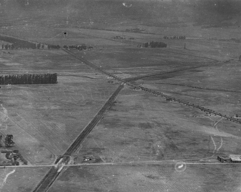
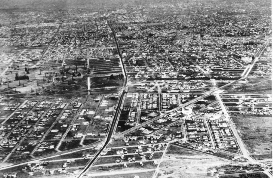
| (1922)* - Aerial view looking west showing the intersection of Wilshire Boulevard and San Vicente. Wilshire Boulevard is the tree-lined street seen in the center of the image. San Vicente runs diagonally (originally the San Vicente line of the Pacific Electric Railway) from lower left to center where it crosses Wilshire and turns northwesterly before heading up to Santa Monica Boulevard in West Hollywood (at the time known as the town of Sherman). Fairfax Avenue (also a dirt road) runs horizontally at bottom of photo. The large area to the south of San Vicente (lower-left) will become Carthay Center, home to the Carthay Circle Theatre. |
Historical Notes San Vicente Boulevard is named for the Rancho San Vicente y Santa Monica that had previously occupied the area. The road runs diagonally because it was originally the San Vicente line of the Pacific Electric Railway. Wilshire Boulevard was named for Henry Gaylord Wilshire (1861–1927), an Ohio native who made and lost fortunes in real estate, farming, and gold mining. In 1895 he began developing 35 acres of a barley field, stretching westward from Westlake Park for an elite residential subdivision, and donated to the city a strip of land 120 feet wide by 1,200 feet long for a boulevard, on the conditions that it would be named for him and that railroad lines and commercial or industrial trucking would be banned. The road first appeared on a map under its present name in 1895. At time of the above photo Fairfax Avenue north of Wilshire was called Crescent Avenue. |
 |
|
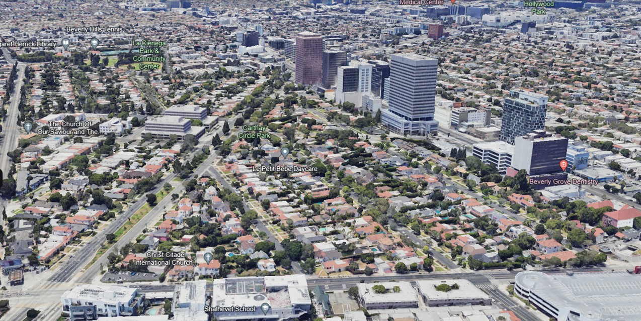
| (2022)* - Google Earth view looking west, showing the triangular piece of land bounded by Fairfax Avenue, San Vicente Boulevard, and Wilshire Boulevard, currently part of the Carthay Circle neighborhood. |
Then and Now
 |
|
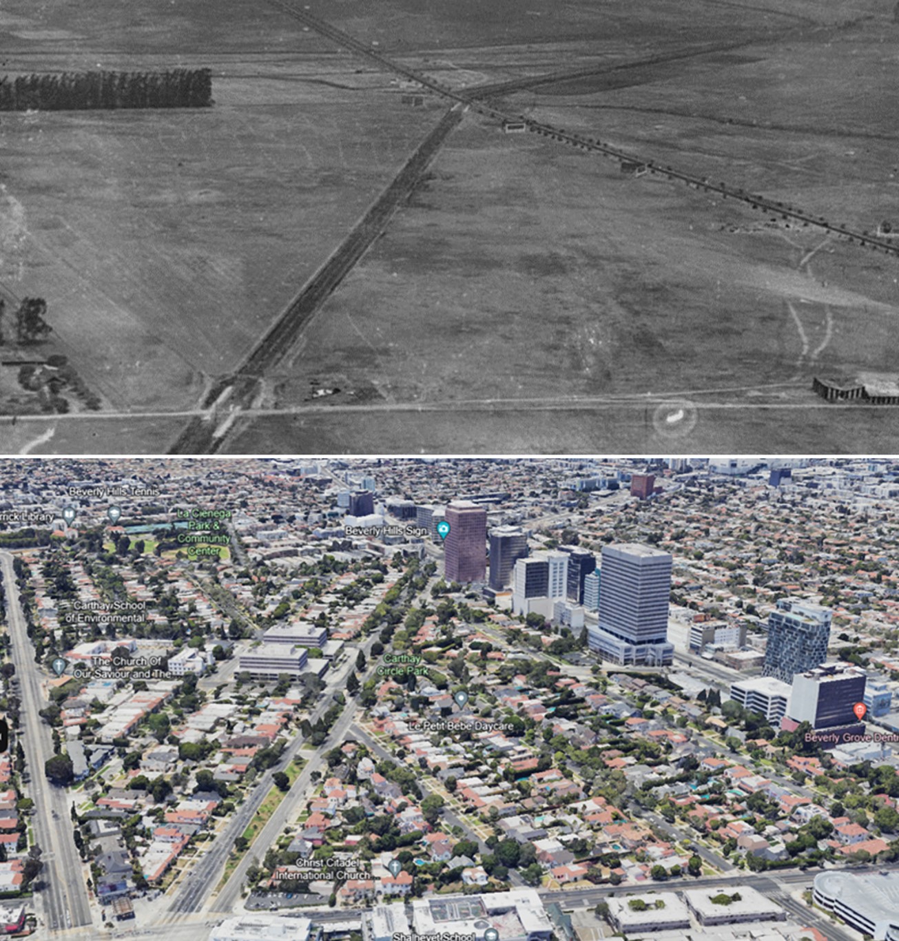
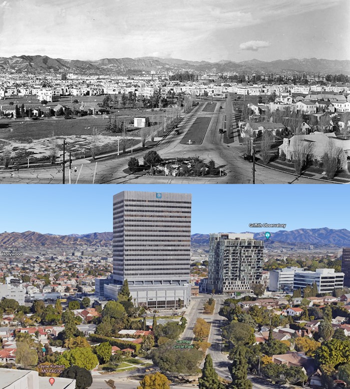
| (1922 vs 2022)* - Aerial view looking west, showing how the triangular piece of land bounded by Fairfax Avenue, San Vicente Boulevard, and Wilshire Boulevard, now part of the Carthay Circle neighborhood, has changed over 100 years. Fairfax Avenue runs horizontally at the bottom. The rest of the surrounding area has changed too! Photo comparison by Jack Feldman. |
 |
|
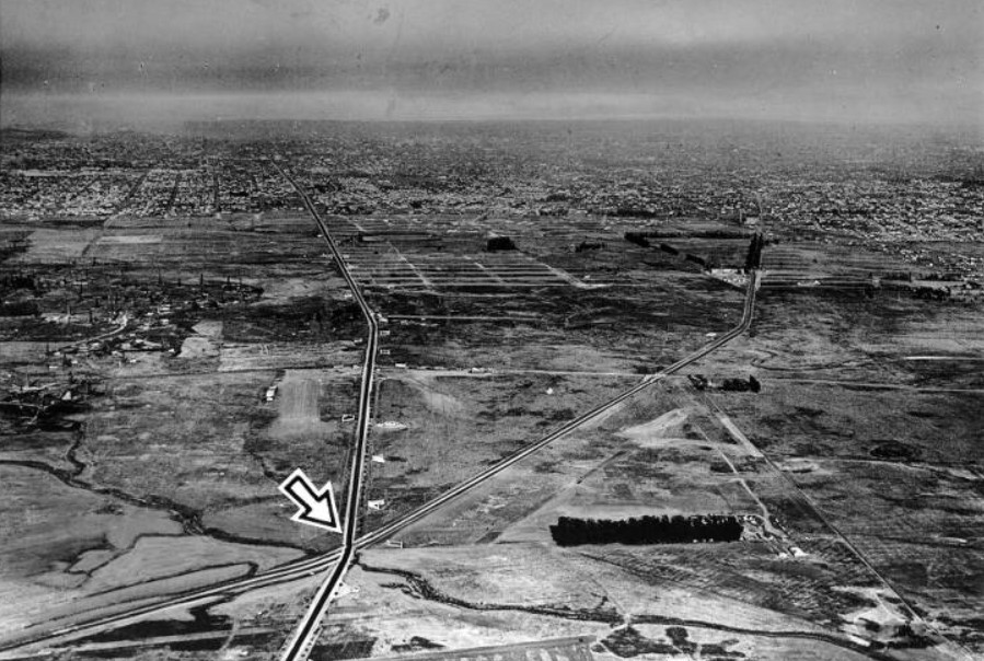
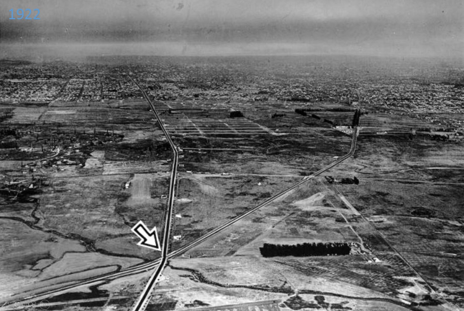
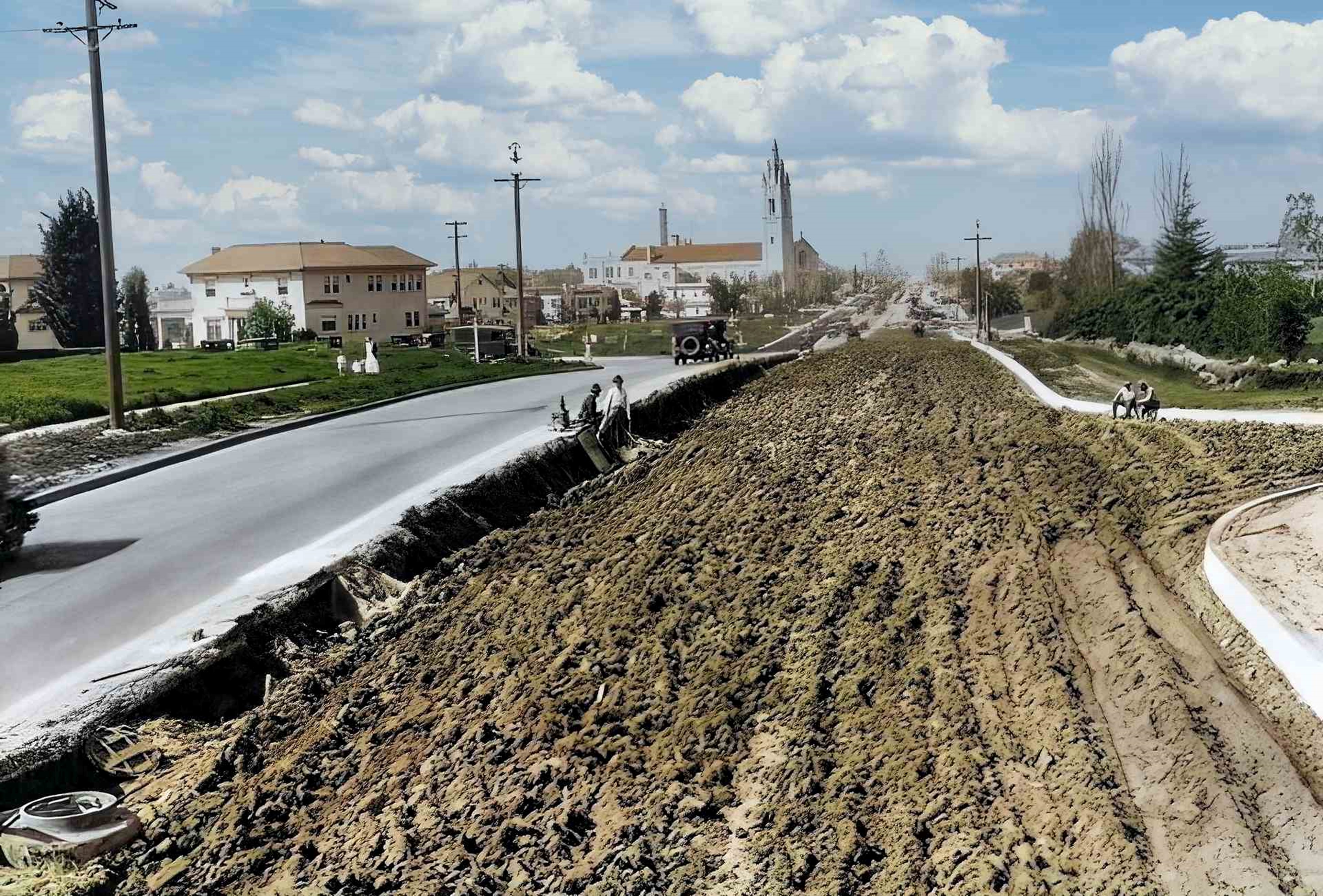
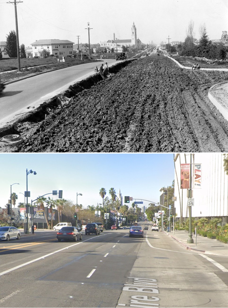
| (1922)* - Aerial photograph, looking east, showing the intersection of Wilshire and San Vicente boulevards. 10th Street (later Olympic Blvd) runs from lower right and parallels Wilshire Blvd. |
Historical Notes Olympic Boulevard was originally named 10th Street. In 1932, the entire length of the street, from East L.A. to Santa Monica, was renamed Olympic Boulevard for the Summer Olympics being held in Los Angeles that year. |
 |
|
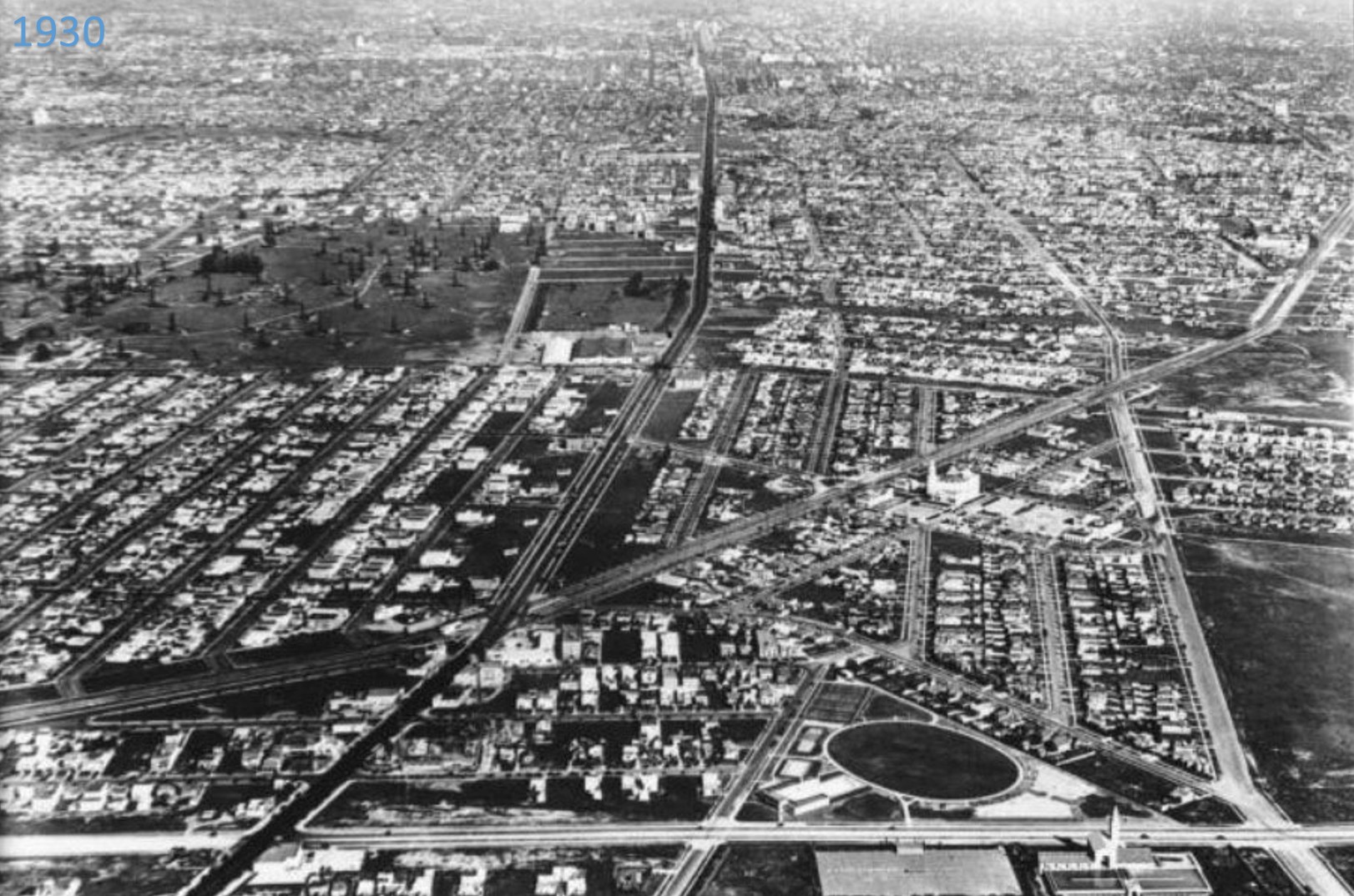
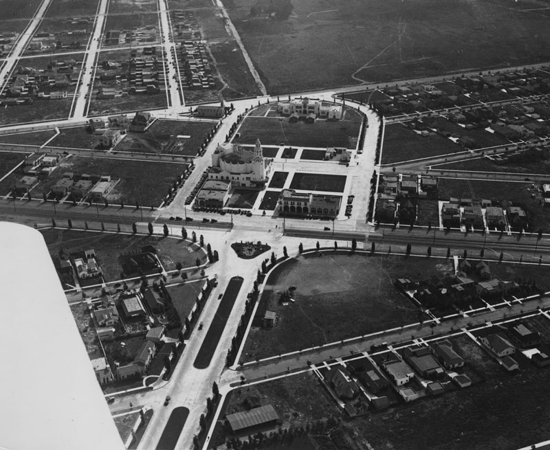
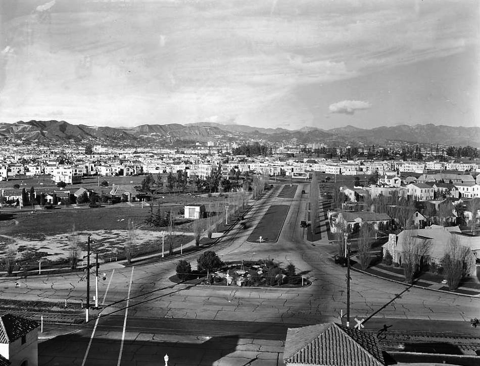
| (1926)* - Aerial view looking east at the intersection of Wilshire Boulevard and San Vicente Boulevard, August 6, 1926. Wilshire is at center and runs away from the camera while San Vicente runs from the lower-left corner to upper-right. The land around the two large streets is divided into small blocks by narrow residential roads, and countless small houses are filling the blocks. The only open land, seen at lower-right, will become La Cienega Park in 1928. The large white building at center-right is the Carthay Circle Theatre located between San Vicente and Olympic. |
Historical Notes In 1922, J. Harvey McCarthy began the development of an upscale residential district along the San Vicente Boulevard line of the Pacific Electric Railway, bounded by Wilshire Blvd. on the north, Fairfax Avenue on the east, Olympic Blvd (then 10th Street) on the south and Schumacher Drive on the west. McCarthy originally named the district Carthay Center (Carthay being a derivative of the developer's last name). The areas to the south of Olympic Boulevard remained undeveloped until 1933, when developer Spyros George Ponty built several hundred homes in two districts later named "South Carthay" and "Carthay Square". |
 |
|
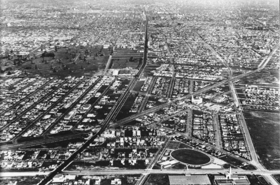
| (1930)* - Aerial view looking east above La Cienega Boulevard (runs horizontal at bottom of photo). The intersection of Wilshire and San Vicente is at lower-center left and Olympic Boulevard runs away from the camera at right. The triangular piece of land with oval-shaped field in its center is La Cienega Park. The La Cienega Municipal Pool sits at the corner SE corner of La Cienega and Gregory Way adjacent to the oval-shaped field. Across the street, at lower right, is the Beverly Hills Water Treatment Plant and reservoir. The large white building at center-right is the Carthay Circle Theatre. |
Before and After
 |
|
 |
Historical Notes Within a relatively short period of 8 years, the area surrounding the intersection of Wilshire and San Vicente boulevards would see dramatic changes. J. Harvey McCarthy's 1922 Carthay Circle development would be the catalyst to the region's explosive growth. |
Carthay Circle
 |
|
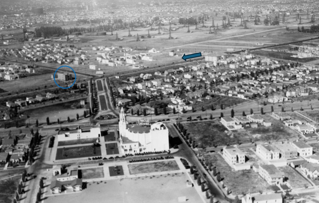
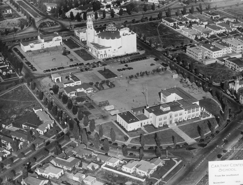
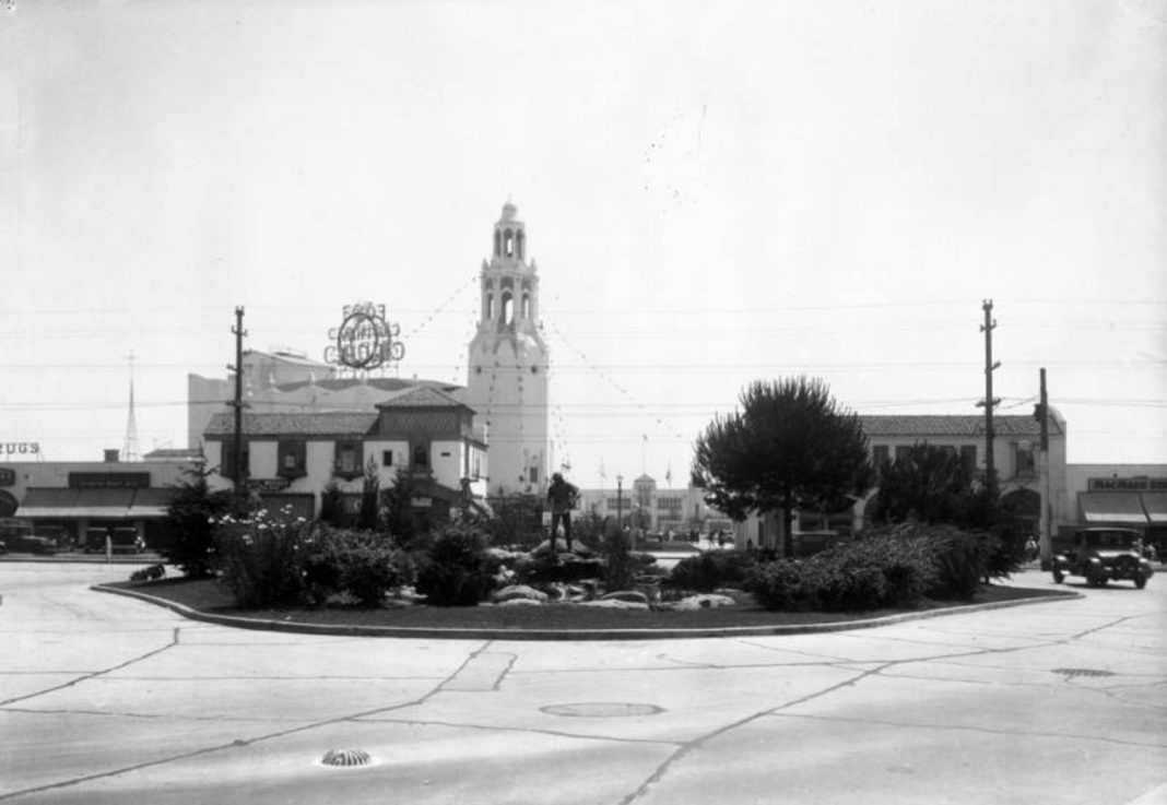
| (ca. 1927)* - Aerial view looking southwest showing Carthay Circle Theatre (center of photo) on San Vicente Boulevard. Further back behind the theatre, on Olympic Boulevard, stands Carthay Center Elementary School. |
Historical Notes The Carthay Circle Theatre was one of the most famous movie palaces of Hollywood's Golden Age. It opened at 6316 San Vicente Boulevard in 1926 and was considered to be developer J. Harvey McCarthy's most successful monument, a stroke of shrewd thinking that made a famous name of the newly developed Carthay residential district in the Mid-City West district of Los Angeles. |
 |
|
| (ca. 1927)* - Aerial view, looking northeast, of Carthay Circle Theatre on San Vicente Blvd with Olympic Bouevard seen at lower-right. In the background can be seen a large oil field located north of Wilshire Blvd. and east of Fairfax Ave. This is the area, just north of La Brea Tar Pits, where Arthur F. Gilmore found oil in the 1890s. Carthay Center Elementary School is at lower-left. |
Historical Notes Initially developed by Fox, it was called the Fox Carthay Circle Theater. The theater became better known than the development in which it was located, and this has led to confusion in the name of the area. The theater's name meant "the Circle Theater, by Fox, located in Carthay", but became incorrectly interpreted as "The Fox Theater, located in Carthay Circle." The misinterpretation has stuck, and now the region is more or less officially known as Carthay Circle, even as its theater namesake has been gone for half a century. |
Wilshire (West of Fairfax)
.jpg) |
|
| (ca. 1934)* - Looking west on Wilshire Boulevard from Fairfax Avenue. |
 |
|
| (ca. 1934)* - Looking west on Wilshire Boulevard from Fairfax Avenue toward a 3-story building located west of Crescent Heights. |
 |
|
| (ca. 1927)* - Aerial view looking down toward Wilshire Boulevard showing the same 3-story building identified in previous photo, located west of Crescent Heights. Also seen here is the vantage point from which the previous photo was taken and the same 3-story building circled. |
Then and Now
 |
|
| (1934 vs 2021)*- Looking west on Wilshire Boulevard from Fairfax Avenue. Photo comparison by Jack Feldman. |
Carthay Center Elementary School
 |
|
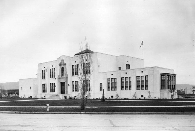
| (ca. 1927)^ – Close-up view of Carthay Center Elementary School located at 6361 Olympic Blvd. |
Historical Notes Carthay Center Elementary School opened in 1924 to serve Carthay Center, a subdivision in mid-city Los Angeles planned by developer Harvey J. McCarthy. The school was located just opposite the famous Carthay Circle Theater, which hosted such dazzling movie premieres as "Snow White," "The Wizard of Oz," and "Gone with the Wind." Although the theater was demolished in 1969, the beautiful school building was preserved and remains an architectural centerpiece of the neighborhood. ^ |
 |
|
| (1929)^ - Aerial view looking northeast showing Carthay Center Elementary School fronting Olympic Boulevard. Note that a new wing was added to the school building (see previous photo). Further back stands the Fox Carthay Circle Theatre. |
* * * * * |
 |
|
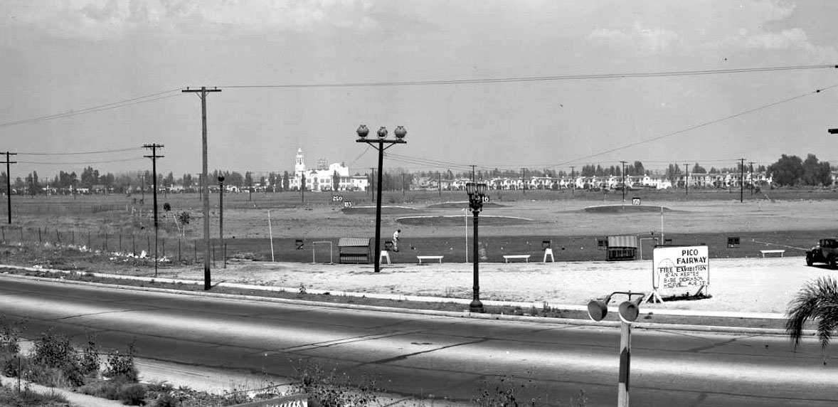
| (1933)^ – View looking northeast from the corner of La Cienega Blvd and Pico Blvd. That empty land was the Pico Fairway golf course—that sign on the right is advertising a free exhibition from "Babe" Didrikson, who was a famous all-around athlete who excelled at everything. And far off in the distance, the two large white buildings are the Carthay Center Elementary School and the Carthay Circle Theatre. |
 |
|
| (ca. 1929)* – View looking northeast from top of Carthay Circle Theatre where the shadow of its tower is seen down below across San Vicente. Two sets of streetcar tracks run down the center of San Vicente. Houses are visible in the residential area on the far side of the street, beyond which oil derricks are seen in the distance. |
 |
|
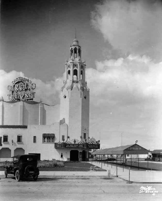
| (1927)**^* - Exterior view of the Carthay Circle Theatre as seen from acrossSan Vicente Boulevard. A late model car is parked at the curb. |
Historical Notes The Carthay Circle Theater provided the "circle" for which Carthay Circle has come to be named. The auditorium itself was shaped in the form of a perfect circle, extended vertically into a cylinder, set inside a square that fleshed out the remainder of the building. McCarthy's development was called Carthay—an anglicized version of his last name. The theater was called the Circle Theater for its unique floor plan.*^ |
McCarthy Vista / Carthay Circle Theatre
 |
|
| (ca. 1930)* – View looking northeast on McCarthy Vista toward the Hollywood Hills as seen from the top of the Carthay Circle Theater. Wilshire Boulevard is two blocks away. Oil derricks can be seen in the distance (upper-right). San Vicente Boulevard runs from left to right in the foreground. |
Historical Notes Originally named Carthay Center, Carthay Circle was developed as an upscale residential district in 1922 by J. Harvey McCarthy, who founded the 136-acre, mainly Spanish Revival, community. No two homes are alike due to the rule that all homes had to be designed individually by an architect, and notable designers such as Irving Gill, Paul Williams and Robert Byrd contributed to the neighborhood. It was one of the first neighborhoods in Los Angeles to have underground utilities.* |
Then and Now
 |
|
| 1930 vs. 2022 – View looking northeast down McCarthy Vista toward Wilshire Boulevard from above Carthay Circle Park. Photo comparison by Jack Feldman. |
 |
|
| (1930)* - Looking south from McCarthy Vista towards Henry Lion's 'Pioneer Fountain Group' statue; just beyond it, across San Vicente Boulevard, is the Carthay Circle Theatre. |
 |
|
| (1930s)* - A postcard image of the Carthay Circle Theatre with Henry Lion's sculpture of a prospector at center. |
Historical Notes Also known as the Daniel O. McCarthy Pioneer Fountain, or the Miner's Statue, this work, located in Carthay Circle across from the Carthay Theatre, honors the memory of the California Pioneers of '49.' The plaque reads, "This fountain is a memorial to the gallant pioneers of '49 of whom Daniel O. McCarthy, patriot, miner, leader, was an outstanding example. He was born Raleigh, N.C., August 24, 1830. Died Los Angeles, August 13, 1919. Through his newspaper The American Flag, San Francisco, he helped preserve California to the Union. This long useful life is a heritage of which the Golden State is justly proud.” Dedicated by Ramona Parlor 109 NSGW. Signature on miner: Henry Lion 1924,25.* |
 |
|
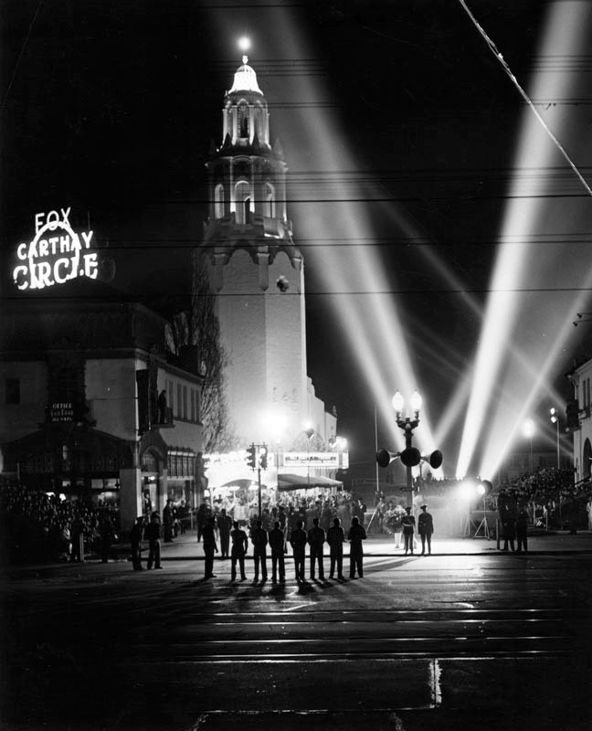
| (1930s)* - View of a premier night at the Carthay Circle Theater. Flood lights fill the sky. |
Historical Notes The Carthay Circle Theatre hosted the official premieres of some of the more notable films of the 1930s including: The Life of Emile Zola (1937), Romeo and Juliet (1936), Walt Disney's first animated feature length film Snow White and the Seven Dwarfs (1937) and Gone with the Wind (1939), among many others. For Disney's Fantasia (1940), the most elaborate audio system in use at the time, Fantasound, a pioneering stereophonic process, was installed at this theatre.^* |
 |
|
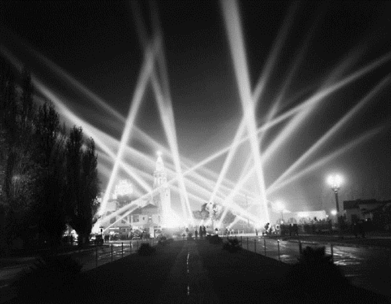
| (1941)* - View of the Fox Carthay Circle Theatre at night. Dozens of searchlights reach into the night sky at the premiere of Walt Disney's film. Crowds, seated in bleachers, wait for celebrities to arrive. |
Historical Notes The Carthay Circle Theatre was demolished in 1969. Today, two low-rise office buildings and a city park occupy its former site. Click HERE to see more early views of the Carthay Circle Theatre. |
* * * * * |
Pico-San Vicente Viaduct
 |
|
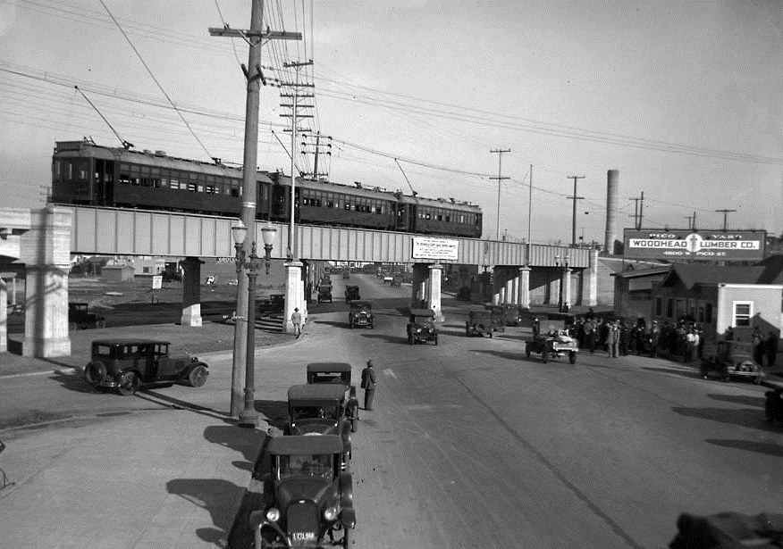
| (1927)^^ - View looking east on Pico Boulevard at San Vicente. The event taking place is the dedication of the new 1000-foot viaduct bridging Pico Boulevard. Three Pacific Electric Red Cars can be seen stopped on the new Pico Blvd. viaduct. |
Historical Notes On November 2, 1927, city and county officials, together with Pacific Electric executives, gathered for the opening ceremony of the Pico Boulevard Viaduct to be used by the PE Red Cars. The new viaduct replaced a very dangerous, at-grade crossing of the line with Pico Blvd. There is a banner hanging on the bridge over Pico, one can only guess that the banner was touting the safety aspects of the new span. |
 |
|
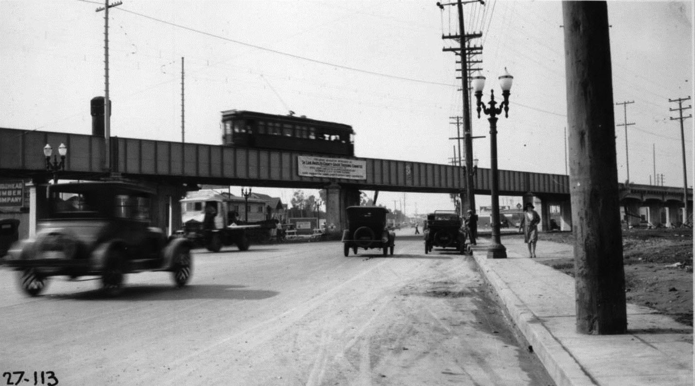
| (1927)^^ – View from the north side of Pico Boulevard east of viaduct looking west. A Pacific Electric Railway car on the viaduct is heading north. |
Historical Notes The importance of the great viaduct was short lived. After just 13 years as an important asset to the Santa Monica via Beverly Hills line, through service to Santa Monica was abandoned in about December of 1941. Thereafter, the viaduct served as a back door entry to the West Hollywood Car House and maintenance complex, and for rush hour service on the W. 16th Street local service.* |
 |
|
| (1940)^.^ - View looking east from Pico Blvd Viaduct showing traffic detour at Rimpau on acct of fire at Cooper Lumber Co. on 1-6-40. Eastbound traffic on Pico Blvd is being diverted north on Hudson Ave. Westbound traffic is being diverted north onto Rimpau Blvd. |
Historical Notes After 23 years of service, the rail service using the span was abandoned at the same time as the Venice Short Line in September of 1950. The viaduct would stand, unused, for another 14 years. Then in 1964 the mighty span that could have lasted more the 100 years was bulldozed away with none of the pomp and circumstance as its opening some 37 years before.* |
* * * * * |
 |
|
| (1935)*# - View looking south on La Cienega at Pico Boulevard showing a string of dual-lamp electroliers (streetlights) on both sides of the street. |
 |
|
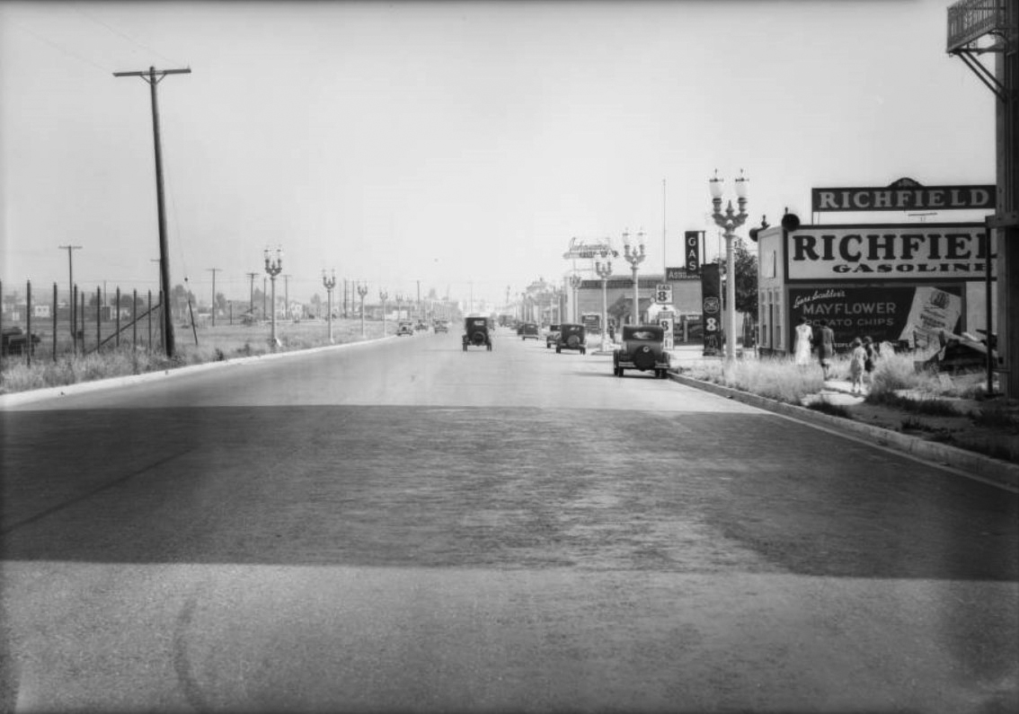
| (1931)*# - View looking south on Fairfax Ave at Drexel Ave showing a Richfield Gas Station on the northwest corner. Ornate two-lamp streetlights run along both sides of Fairfax. |
.jpg) |
|
| (1931)*# – Close-up view showing two women followed by two girls walking south toward the intersection of Fairfax and Drexel avenues. The Richfield Gas Station on the corner is selling regular gas for 8½ cents/gal, with Ethyl going for 11½ cents. Note the beautiful two-lamp streetlight on the corner. |
Click HERE to see more in Early Los Angeles Streetlights |
* * * * * |
Los Angeles City Market
 |
|
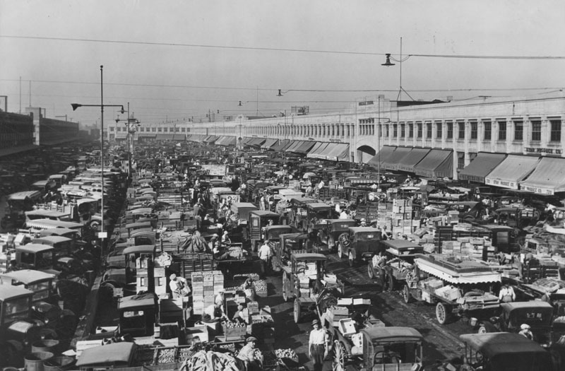
| (1927)^ - Buyers create a traffic jam at the Los Angeles wholesale produce market. Building on right is the wholesale terminal, built in 1918 on Pacific Electric Railroad property for shipping produce to out-of-state customers by railroad. |
Historical Notes Terminal Market, located at Seventh and Central, was constructed to provide a larger central marketplace for wholesale produce. Where previously the market was crowded with horses and buggies, this new site was designed to be large enough to accommodate automobile traffic.* |
 |
|
| (1920s)^ - Terminal Market (L.A. City Market) as seen in the circa 1920s. The entire center area consists of cars and at least one horse & cart, parked while people walk to or from the market area around the outside. |
Historical Notes In 1926, horses were legally prohibited on streets, making wagons an obsolete method for transporting produce. |
 |
|
| (1937)^ - Buyers are lined up at the Los Angeles wholesale produce market and wholesale terminal (L.A. City Market). |
Historical Notes Click HERE to see more on the history of Los Angeles City Market |
* * * * * |
Franklin Hills - Silent Movie "Intolerance"
 |
|
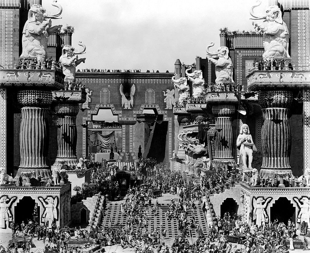
| (1916)* – View showing the Babylon set from D. W. Griffiths silent film Intolerance, built at the corner of Prospect Avenue and Talmadge Street in Franklin Hills near where Sunset Boulevard and Hollywood Boulevard meet. |
The Babylon set for Intolerance stood on open land in Franklin Hills, close to where Sunset Boulevard and Hollywood Boulevard meet. This part of East Hollywood had only scattered buildings at the time, which allowed Griffith to build a massive outdoor stage with towering walls, terraces, and statues. It became one of the most famous film sets ever created and gave the movie its unforgettable scale. Intolerance told four stories set in different periods of history, and the Babylon scenes were the most visually impressive. Thousands of extras worked here in huge crowd scenes that pushed the young film industry to its limits. The scale of the production made a strong impression on early audiences, even though the film did not earn back its cost during its first release. |
 |
|
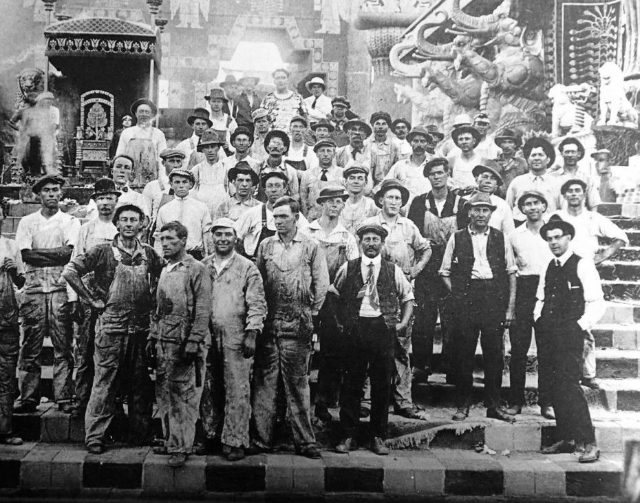
| (ca. 1916)* - Set construction crew, D.W. Griffith's "Intolerance", East Hollywood. |
Historical Notes The men in this photograph are the real construction workers who built the massive Babylon set for Intolerance. They were carpenters, plaster workers, and laborers employed by the production, and although they paused to face the camera for this picture, they are the same crew who assembled the wooden frames, plaster walls, stairways, and decorative details seen in the finished film. Studio photographers often asked workers to pose briefly for documentation or publicity, which explains the still and orderly look of the scene. The set was one of the largest ever attempted in early Hollywood, and the crew worked long days to keep up with D. W. Griffiths fast-changing plans. As the design grew, new platforms and terraces were added to support the huge crowd scenes that would later fill the screen. This construction site stood in what was then a largely undeveloped part of East Hollywood, making it possible for the production to spread out across an entire block. |
 |
|
| (1916)* – The Babylon set from the silent film Intolerance. |
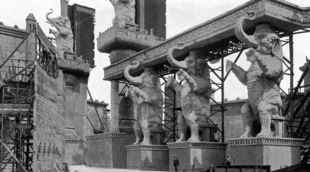
Historical Notes The finished courtyard was the heart of the Babylon story, with monumental stairways, massive columns, and large elephant statues overlooking the scene. Griffith staged the feast of Belshazzar and the fall of Babylon here, using thousands of extras in complex sequences that filled every part of the frame with movement. The set did not copy any single ancient building but blended styles to create a dramatic and exotic world. This design later inspired the central court of the Hollywood and Highland complex, which opened in two thousand one. The shopping center recreated the grand arches and elephant figures of the Intolerance set before many of them were altered or removed in later renovations. |
 |
|
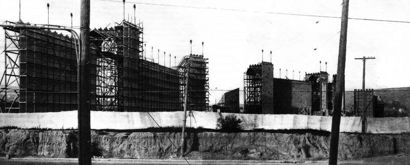
| (1915)* – View showing the construction site of D.W. Griffith’s massive Babylonian set used in his epic film, Intolerance (1916). Its address was around 4473 Sunset Dr. (the site of the current Vista Theatre), in the Franklin Hills area of Los Angeles. |
Historical Notes This early photo shows the set in its first stages, with wooden frames marking future walls and towers. The land near todays Vista Theatre was still mostly empty hillside, which made it possible to build such an enormous structure. Only a few streets and small buildings existed nearby, so the production was able to take over the entire block. The neighborhood around the site later became Franklin Hills, known for its steep streets, stairways, and the Shakespeare Bridge. In the early nineteen twenties the Babylon set was cleared away, and by nineteen twenty three the Vista Theatre was built on the same ground. Franklin Hills borders Los Feliz proper on the northwest and west; Silver Lake on the northeast, east, and southeast; and East Hollywood on the south. The area is residential, boasting very well-kept homes set on the hills east of Los Feliz Village. |
 |
|
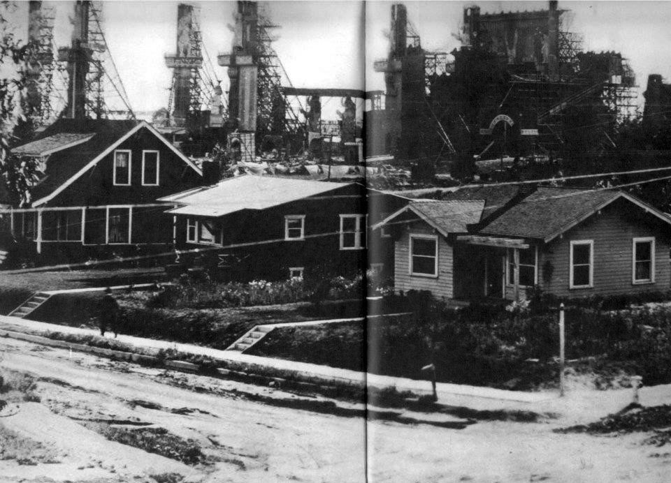
| (1916)* – D. W. Griffith directed Hollywood’s first blockbuster: “Intolerance.” The Babylon set was so vast (see next photo) that it had to be built on an entire block of empty land at the corner of Prospect Ave. & Talmadge St. (near where Sunset Boulevard and Hollywood Boulevard meet). |
Historical Notes This view shows how the Babylon set rose above the surrounding land like a separate city inside Los Angeles. Its tall walls and towers covered an entire block, leaving room in front for cameras, lights, and crowds of extras. The size of the set was unlike anything Hollywood had seen and became a symbol of early film ambition. Although Intolerance was praised for its artistry, it confused many audiences and cost far more than it earned. The financial loss placed heavy strain on the Triangle Film Corporation and on Griffith himself, who had used much of his own money to complete the film. |
 |
|
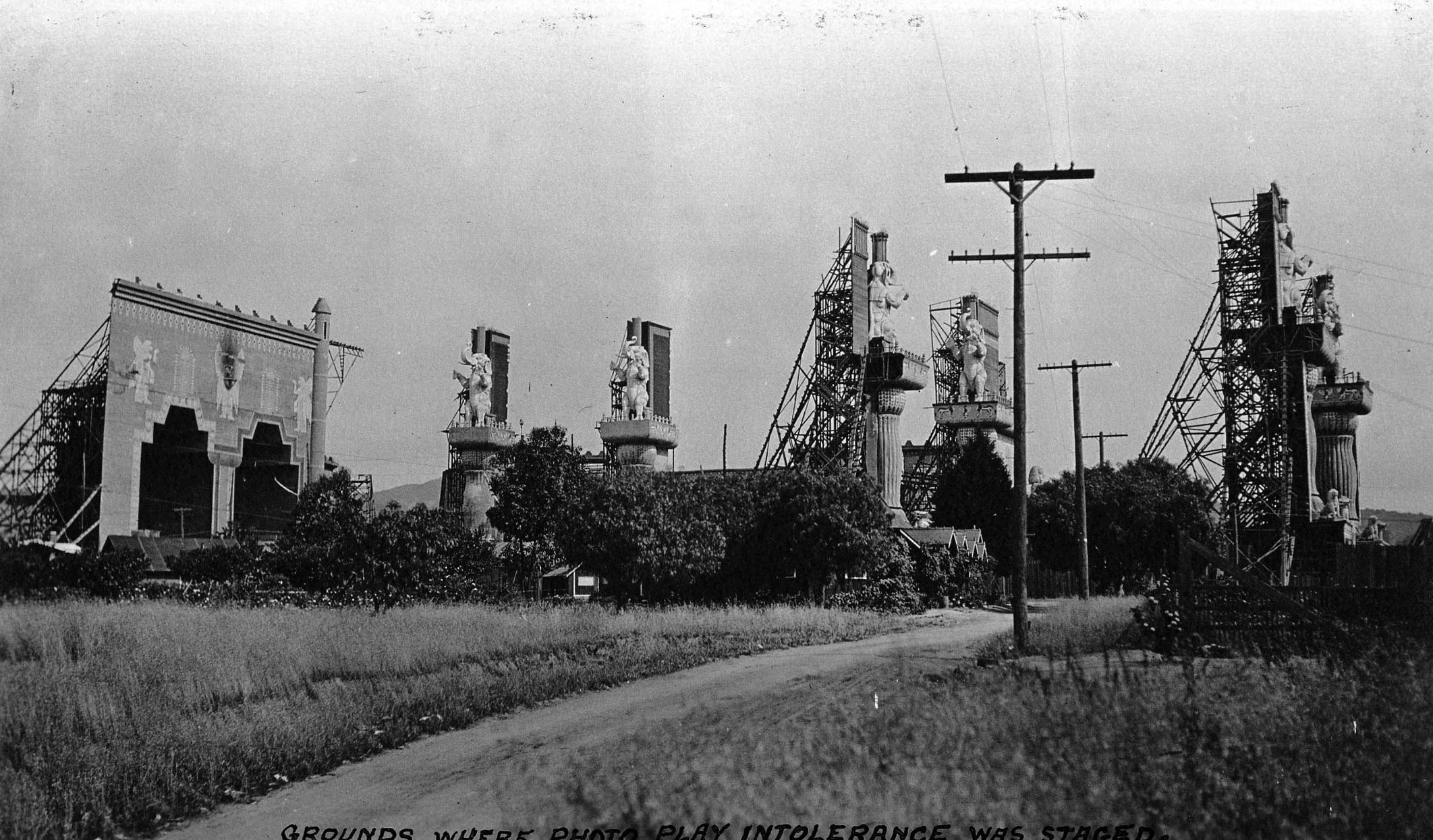
| (1916)* - View showing grounds where the movie Intolerance was filmed. After the movie had finished production, they just left the set where it was. It stood there for years abandoned and neglected. |
Historical Notes When filming ended, the giant set was left in place because tearing it down would have been costly and difficult. For a few years the abandoned arches and stairways stood above the empty lot, slowly weathering in the sun and rain. Visitors sometimes came to see the remains of what had already become a legendary film production. By the early nineteen twenties the set had mostly collapsed or been removed. The land was cleared and later developed, eventually becoming the site of the Vista Theatre. The story of the abandoned set became part of Hollywood history and remains a reminder of the early film industrys willingness to build entire worlds only to leave them behind. |
* * * * * |
Vitagraph Studio (today, Prospect Studios)
 |
|
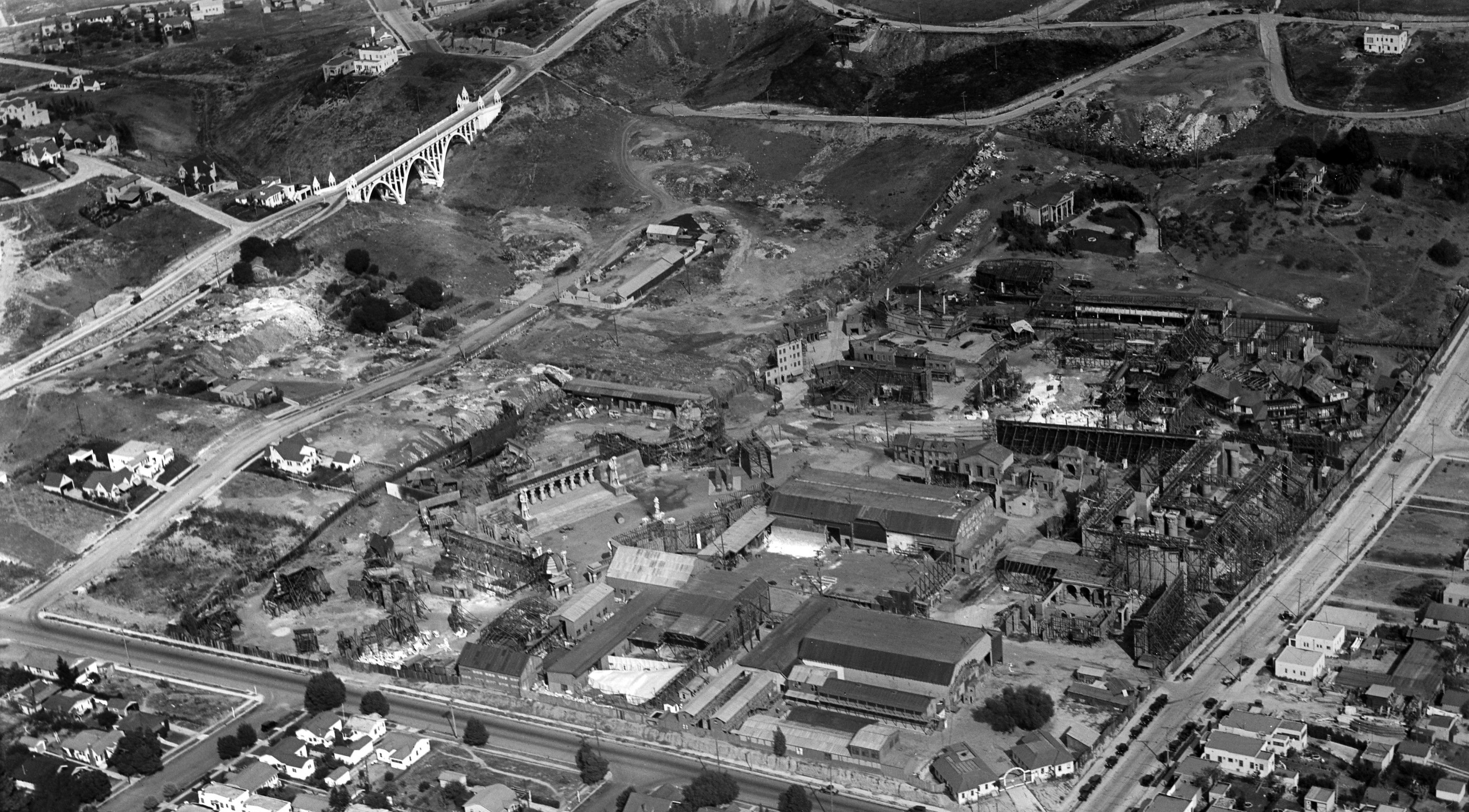
| (ca. 1926)**^ – Panoramic aerial view looking northeasterly showing the Vitagraph Studio (today, Prospect Studios) at the corner of Prospect and Talmadge Avenues (named in honor of silent screen star Norma Talmadge), just east of Hollywood. Prospect Avenue runs east-west and merges into Hollywood Boulevard as it heads west past Vermont Avenue. In the upper-left can be seen the newly built (1926) Shakespeare Bridge on Franklin Avenue. |
Historical Notes Opening in 1915 as The Vitagraph Studio, the original silent film plant included two daylight film stages, support buildings and many exterior film sets. In 1925, Vitagraph's founder Albert Smith sold the company to the Warner brothers. In 1927, the facility became The Warner East Hollywood Annex and was used for many large-scale films. Here, in 1927, Warner Bros. shot portions of the historical first sound film, The Jazz Singer, using the Vitaphone process which synchronized audio and picture. In 1948, the property was sold to the newly formed American Broadcasting Company, and the film lot was transitioned into the new world of television as the ABC Television Center. In 1996, ABC became part of The Walt Disney Company, the origins of which trace back to its first studio in Silver Lake. As the television and film industry entered the next millennium, the lot was renamed The Prospect Studios.^* |
Franklin Hills - Shakespeare Bridge
 |
|
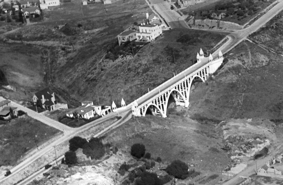
| (1932)* – Aerial view looking northeast of the community of Franklin Hills showing the Shakespeare Bridge, left-center, on Franklin Avenue. John Marshall High School can be seen in the upper-center, located at 3939 Tracy Street. |
Historical Notes Franklin Hills is home to the Shakespeare Bridge, a small 1926 built bridge on Franklin Avenue east of Talmadge Street that links Franklin Avenue between two tall, steep hills. To the east of the bridge begins the Franklin Hills public stairway system, which provides pedestrian linkages among the curvy streets, a series of 14 staircases originally built in the 1920s to provide hillside homeowners pedestrian access to the trolley lines below.^* John Marshall High School first opened its doors on January 26, 1931, with approximately twelve hundred students and forty-eight teachers. Joseph Sniffen, for whom the auditorium was named, served as the first Principal, while Hugh Boyd and Geraldine Keith acted as Marshall's first Vice-Principals. The football field was named in honor of Mr. Boyd, while the library was named for Mrs. Keith.^ |
 |
|
| (1926)**^- Aerial view showing a closer look at Shakespeare Bridge (Franklin Avenue Bridge) and the ravine it crosses. Located on Franklin Avenue east of Talmadge St., in the Franklin Hills neighborhood of Los Feliz. |
Historical Notes The ravine over which the bridge was built was once a perennial stream called Arroyo de la Sacatela. |
 |
|
| (1926)** – Ground view of the Shakespeare Bridge (Franklin Avenue Bridge) looking north as seen from the dry bed of the Arroyo de la Sacatela. |
 |
|
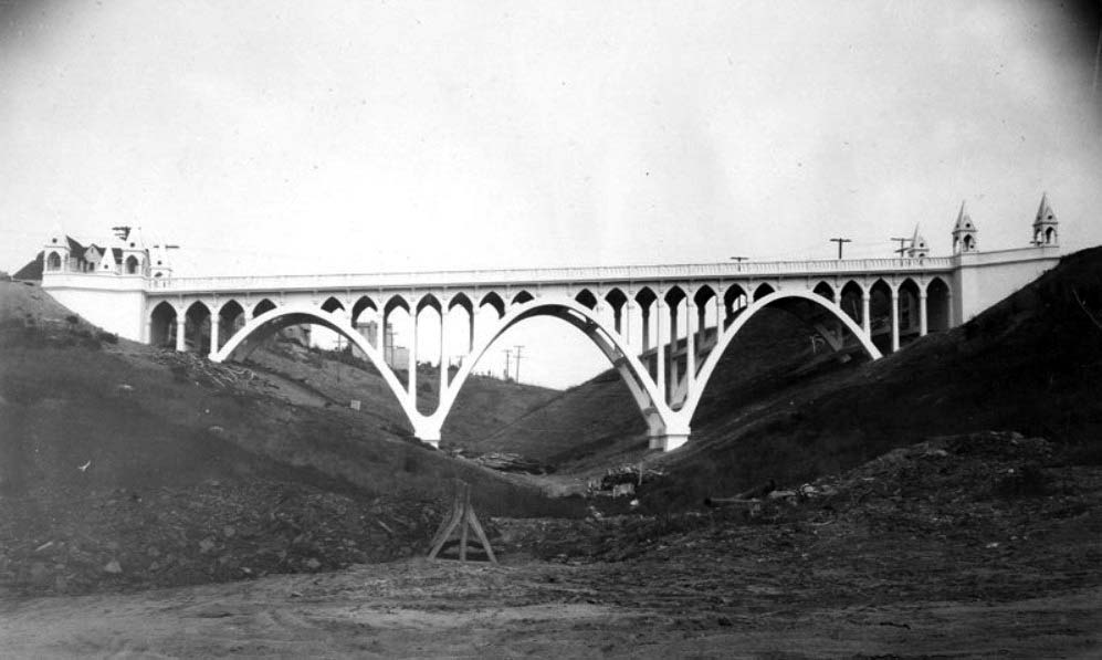
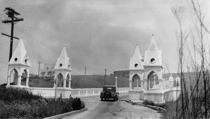
| (1926)^- View of the Shakespeare Bridge, originally known as the Franklin Avenue Bridge, still under construction. |
Historical Notes The Gothic-style Shakespeare Bridge was built in 1926 and designed by J.C. Wright of the City Engineer's Office. It is 30-feet wide and 230-feet long and is made of concrete.^ |
 |
|
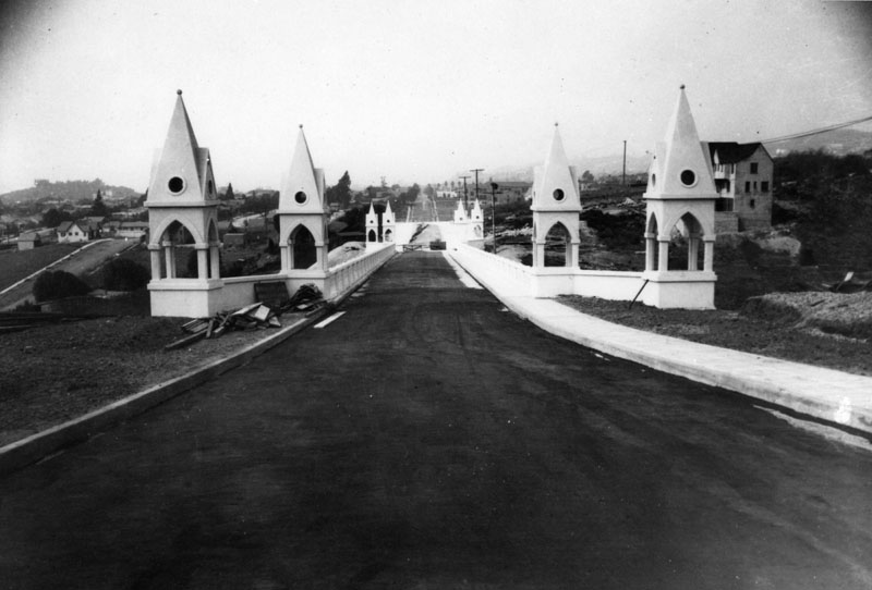
| (1928)*# – Street view showing an early model car as it begins to cross the Shakespeare bridge. The bridge is bookended by Gothic-style copula, four on each side. |
Historical Notes As for why it’s called the Shakespeare Bridge, that seems to be a mystery. It was originally known as the Franklin Avenue Bridge, but the name changed at some point, with most information pointing to a neighborhood council-type decision. |
 |
|
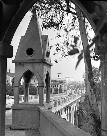
| (1956)* - View of the Shakespeare Bridge through one of its eight ornate Gothic copulas. |
Historical Notes The Shakespeare Bridge begins on Franklin Ave at St George Street, a little less than a mile east of Vermont Street in the Los Feliz or Franklin Hills area. Built in 1926 |
 |
|
| (1983)* - Cruising the Shakespeare Bridge. |
 |
|
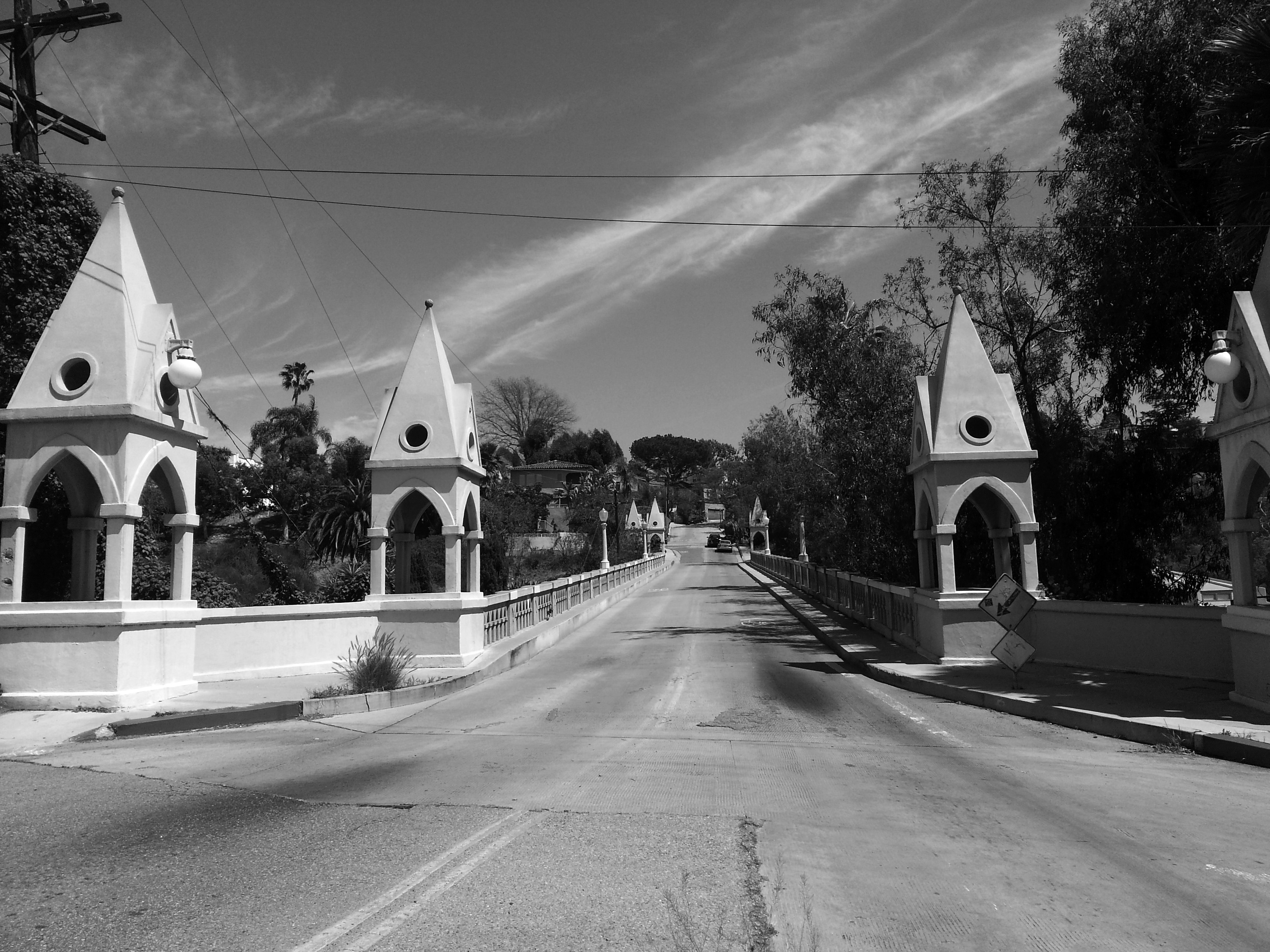
| (2014)#^** - View of the Shakespeare Bridge as it appears today. |
Historical Notes The bridge was rebuilt in 1998 after the Northridge earthquake due to concerns that the structure would not be stable in the even of an earthquake in the Franklin Hills area. As part of the seismic retrofit, the deck, sidewalks, and railings were removed and reconstructed using reinforced concrete. The expansion joints were also removed, so the bridge deck is now a one-piece structural diaphragm built to transfer all seismic forces into the abutment walls at either end of the bridge. All of the rebuilding was done in an effort to preserve the historic appearance of the bridge.^ |
.jpg) |
|
| (2021)* – Photo walk group enjoying the day on the beautiful Shakespeare Bridge, built in 1926. Photo by Paul Wright |
Historical Notes In 1974, the Shakespeare Bridge was designated Los Angeles Historic-Cultural Monument #126 (Click HERE to see complete listing). |
* * * * * |
Lorena Street and Fourth Street Bridge
 |
|
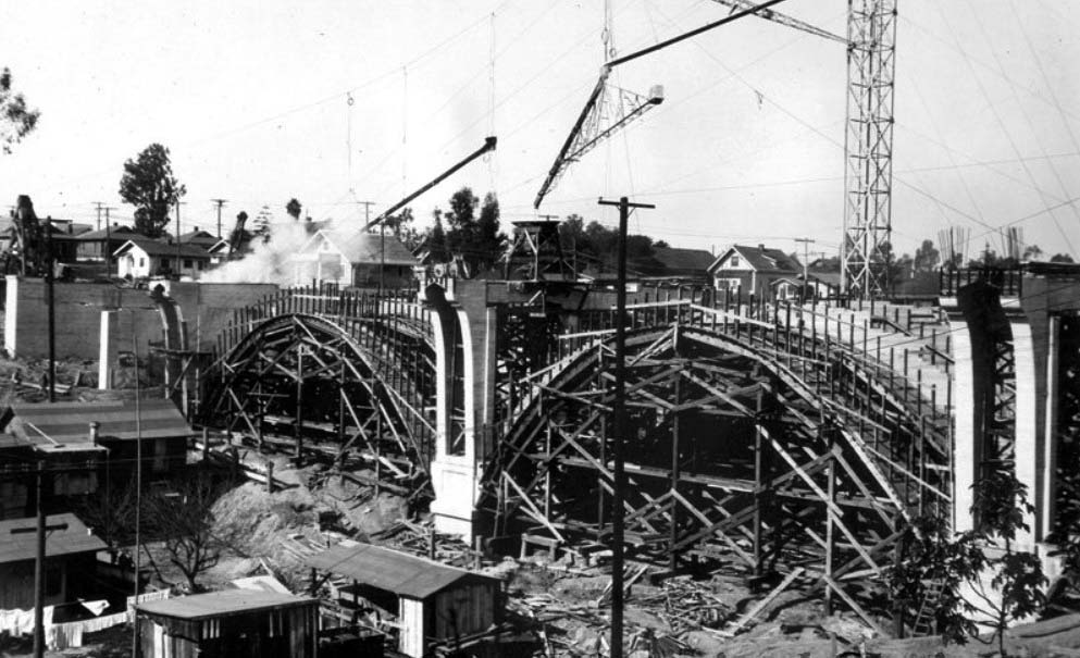
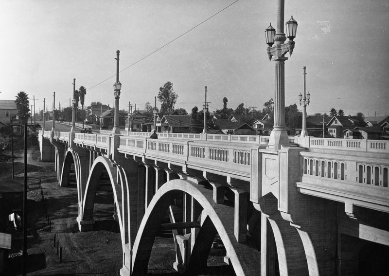
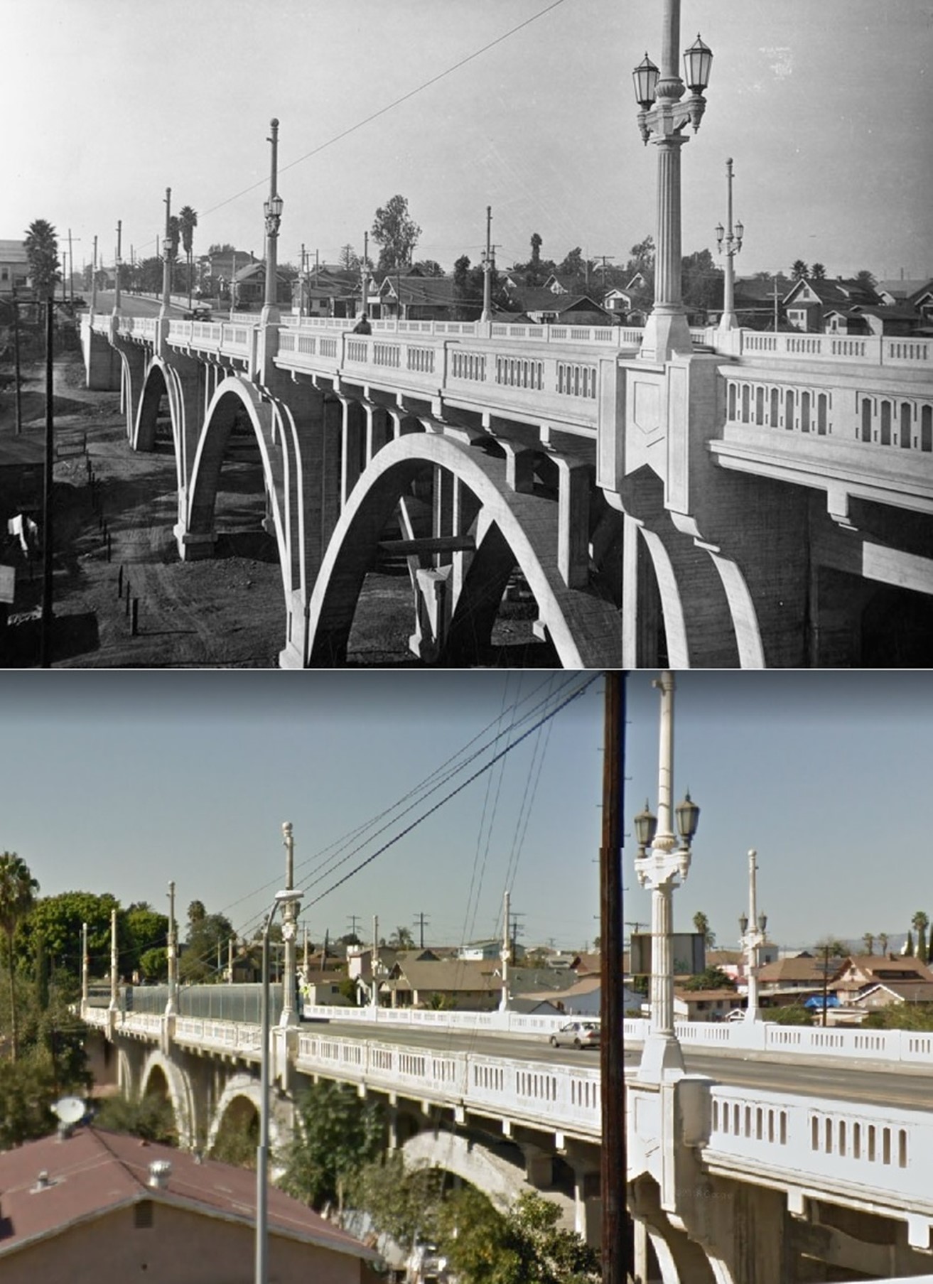
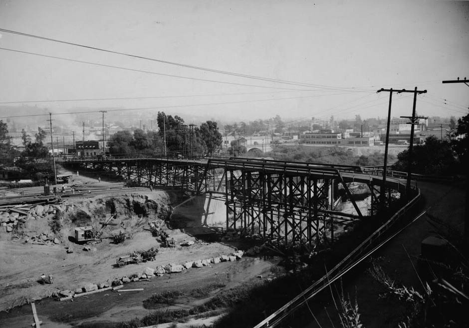
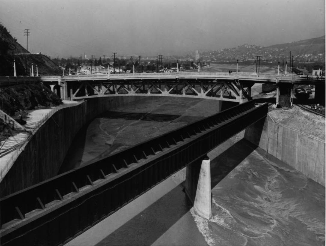
| (1928)**^** – View of the construction of the Lorena Street and Fourth Street Bridge showing the centering for two west arches from the east bank of Los Angeles River. |
Historical Notes The Fourth St. and Lorena St. Bridge was constructed in 1927-28 as a complex grade separation that assured the flow of traffic from Fourth Street downtown to East Los Angeles. The bridge is noted as an engineering achievement in catenary arch, reinforced concrete, bridge construction.^*# |
 |
|
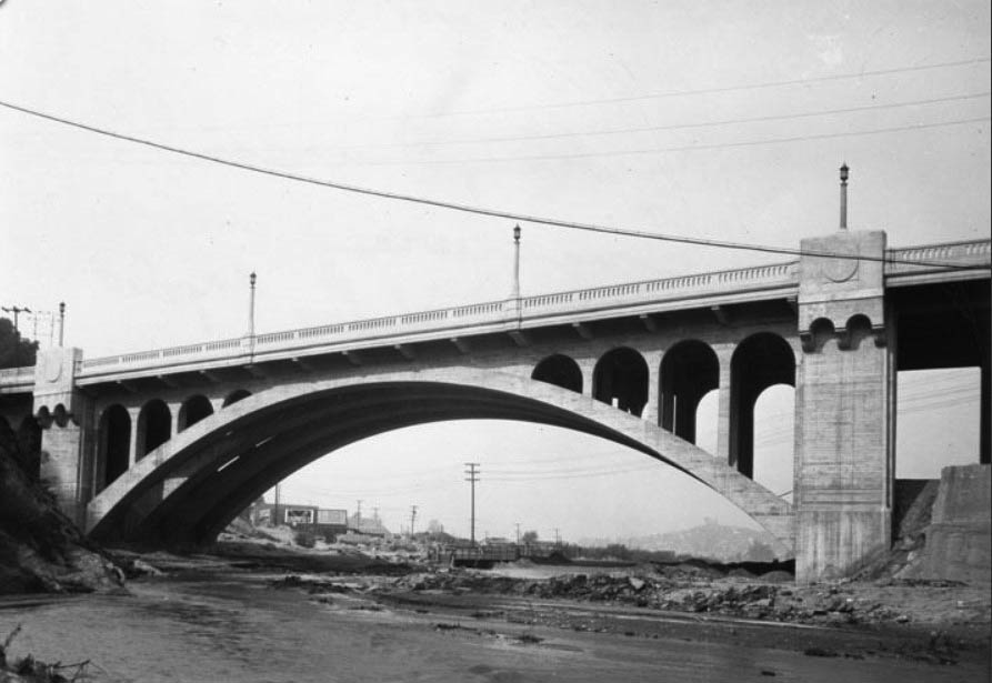
| (1928)^ - Looking westerly at the southern side of the 390' long open spandrel arch bridge located at Fourth and Lorena Streets in Boyle Heights, not long after in was built. The bridge is located in a residential neighborhood, as indicated by the various homes present in the background. |
Historical Notes In 1983, the Fourth and Lorena Street Bridge was dedicated LA Historic-Cultural Monument No. 265 (Click HERE to see complete listing). |
 |
|
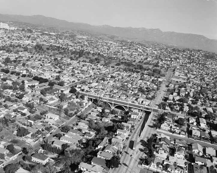
| (2001)^*# – Aerial view looking northwest at the 4th Street Bridge at Lorena Street. |
 |
|
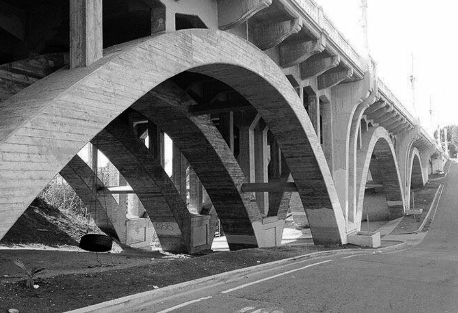
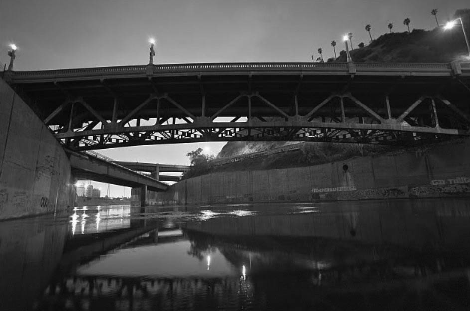
| (2010s)^.^ – View showing the usually unseen beautiful architecture in Boyle Heights - the underside of the Lorena - Fourth Street Bridge with its its ribbed compound arches. |
Historical Notes The 4th and Lorena Street Bridge-Built in 1928, is one of the few remaining catenary, or curved, arch bridges in the city. It is one of the most graceful of the open spandrel arch bridges designed in 1920’s. |
 |
|
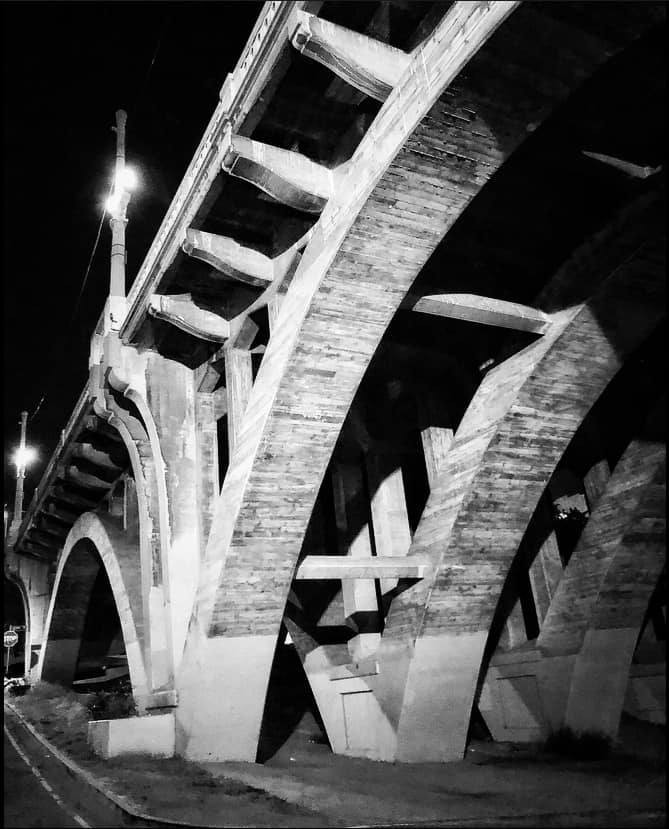
| (2022)* - Looking up toward the ornamental dual-lamp streetlights on top of the Fourth and Lorena Street Bridge from underpass. Photo by Carlos G. Lucero |
Then and Now
 |
|
| (1930s vs 2020s)* - Lorena and Fourth Street Bridge. Photo comparison by Jack Feldman. |
* * * * * |
Dayton Avenue Bridge (later Riverside-Figueroa Bridge)
 |
|
| ((1926)*# – View looking east showing the old 1903-built Dayton Avenue Bridge. A thin road starts beneath the trees of a hill in the right foreground and extends over the bridge at center before continuing to the left background. A murky stream flows beneath the bridge with jagged rocks separating the water from construction workers. A steam shovel is seen cutting into the hillside with horse-drawn wagons pulling the dirt away. |
Historical Notes Dayton Avenue (later N. Figueroa Street) has had four different bridges. The Riverside Drive-Dayton Avenue Bridge, first built in 1903, was replaced with a concrete one completed in 1928. In 1938, after heavy floods and the Elysian Park landslide, the Army Corps of Engineers built a replacement bridge with steel trussing, known as the Riverside Drive Bridge (Riverside-Figueroa Bridge). In 2008 eleven bridges were designated as Los Angeles Historic-Cultural Monuments including the Riverside-Figueroa Bridge #908, however, because of seismic safety issues, the bridge was once again replaced by a newer one in 2014. |
 |
|
| (1928)*# - Panoramic view of Lincoln Heights from Elysian Park, showing the newly constructed concrete Dayton Avenue Bridge. Also seen is the new Tujunga Parkway (later Golden State Freeway). |
Historical Notes This concrete bridge replaced the earlier Dayton Avenue Bridge built in 1903. The new bridge was later renamed the Riverside Drive-Dayton Avenue Bridge, alternately called the Riverside Drive-Figueroa Bridge, when Dayton Avenue was renamed North Figueroa as a continuation of original Figueroa Street.**^** |
 |
|
| (1928)+#* - View of the Riverside Drive-Dayton Avenue Bridge as seen from the LA River bed. |
 |
|
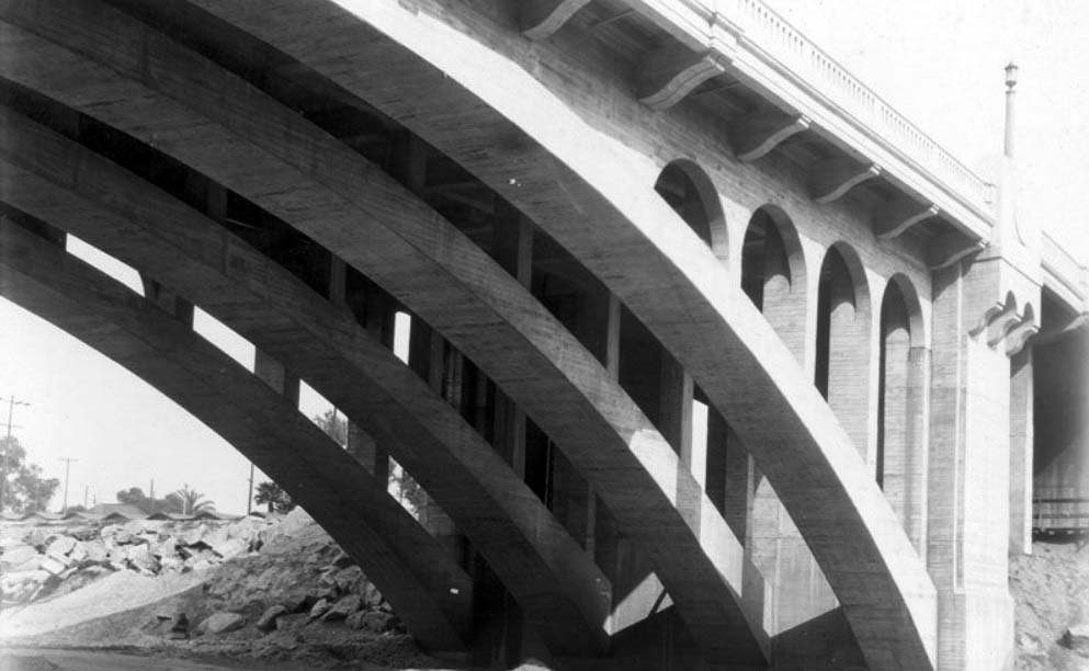
| (1928)**^** - Close-up view of the Dayton Avenue Bridge showing its arched ribs and easterly haunches, shortly after its completion. |
 |
|
| (1931)*# - Birdseye view looking west showng the Dayton Avenue Bridge and Railroad Bridge at lower right. The new Figueroa Street Tunnels (opened in 1931) and extension are also seen. Eventually a new bridge would connect Figueroa directly with Dayton Avenue, avoiding present V-shaped road. |
 |
|
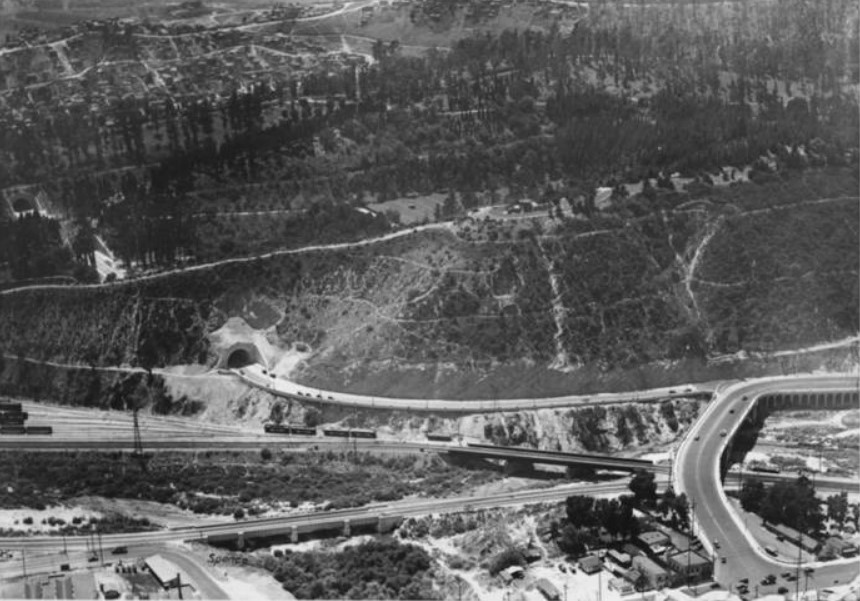
| (1938)^#^^ - View looking east showing the new North Figueroa Street Viaduct (bridge) as it passes over the Los Angeles River with the R.R. crossing at lower-right. The Dayton Avenue Bridge can be seen in the upper left. |
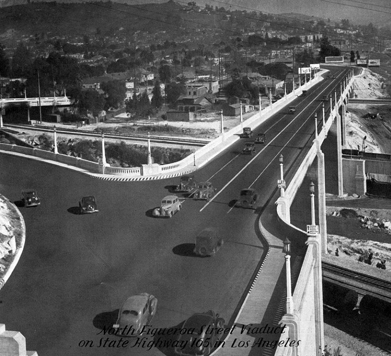
Historical Notes The N. Figueroa Street Bridge opened in 1937, providing a wider and direct Los Angeles River crossing than the Dayton Avenue Bridge. After passing over the river and San Fernando Road, it tied into Dayton Avenue (Figueroa Street) south of Avenue 26.^* |
 |
|
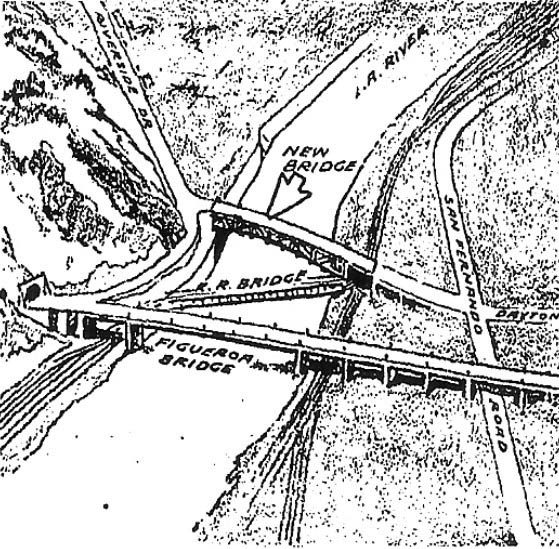
| (1938)#^** – Sketch showing the new Dayton Avenue Bridge, replacing the former one in a new alignment. |
Historical Notes The new (3rd) Dayton Avenue Bridge will now link Riverside Drive and San Fernando Road with a reach of about 700 feet, including approaches, over the Los Angeles River. It will have one 238-foot steel span directly over the river. |
 |
|
| (1938)*# – View looking north showing the 238-foot long steel span of the new (3rd) Dayton Avenue Bridge over a flooded Los Angeles River as seen from the new N. Figueroa Bridge. The Railroad Bridge running diagonally over the river is in the foreground. |
Historical Notes The new Dayton Avenue Bridge was built, by the Army Corps of Engineers. Though the deck of the bridge retains more-or-less the character of the earlier bridge, the graceful concrete arch below is replaced by a steel truss span. |
 |
|
| (ca. 2008)+++ - View looking south showing the 3rd Dayton Avenue Bridge (now Riverside Drive-Figueroa Bridge) with the RR Bridge and Figueroa Bridge in the background. Palm trees of the Dodger Stadium parking lot are seen at upper-right. |
Historical Notes In 2008, the Riverside-Figueroa Bridge that links Cypress Park and Elysian Valley was designated Los Angeles Historic Cultural Monument No. 908. |
 |
|
| (2013)+^^ - Aerial view looking northeast showing the Riverside-Figueroa Bridge with the Golden State (I-5) Freeway in the background. A new Riverside-Figueroa Bridge is being constructed to replace the old one. |
Historical Notes Due to safety concerns regarding the seismic fitness of the Riverside-Figueroa Bridge, the City Council decided it needed to be replaced. In 2011, the city began construction on the widened replacement bridge seen above. |
 |
|
| (2014)+^^ – View of the new replacement Riverside-Figueroa Bridge now open with traffic. The old bridge is seen at bottom. |
Historical Notes There was nearly a year-long effort to save the concrete and metal-truss bridge for use as a public space similar to the Hi Line in NY. However, the courts ruled in favor of the city and the last steel truss bridge to span the LA River would be demolished (2014). +^^ |
* * * * * |
Hollywood
 |
|
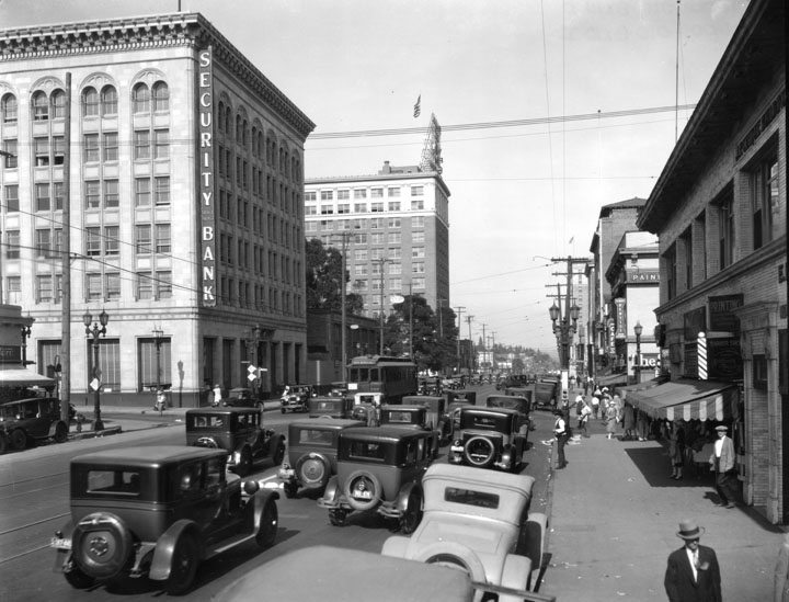
| (1928)^ - View of traffic traveling on Hollywood Blvd. at Cahuenga in 1928. The Security Trust & Savings Bank building is on the far left side of the photograph. |
 |
|
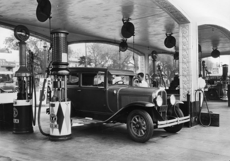
| (1928)^ - A customer gets full service at the gas pumps at Muller Bros. Service Station on Sunset Blvd. |
Historical Notes The Muller family is one of Hollywood’s pioneers. Jacob Muller came to Hollywood in 1893, establishing the first meat market in Hollywood, across from the present Cinerama Dome on Sunset Boulevard. He sold the market in 1907 and established the first ice company in Hollywood, selling that business in 1913. The family’s original house was built Sunset Boulevard at Ivar. This site later became the location of the RCA Building, built by the Muller Family in 1963. (currently the Los Angeles Film School Building). Jacob Muller’s sons, Walter and Frank, opened the Muller Bros. Service Station in 1920.^*^* Click HERE to see more Early LA Gas Stations. |
 |
|
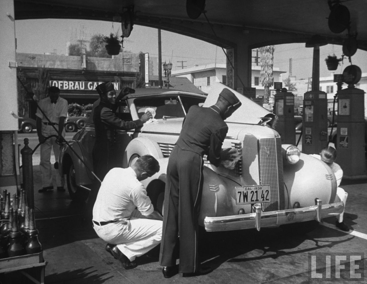
| (1938)**^ - View of what appears to be an Auburn Cord being attended to in "full service" at the Muller Brothers Service Station at 6380 Sunset Boulevard in Hollywood. |
Historical Notes The Muller Brothers Service Station was located on the south side of Sunset Boulevard on 4 acres, where the Cinerama Dome Theater is now located. Opened in 1920 by the Muller brothers, Walter and Frank, this became the largest service station in the world (including a large automobile supply center), employing 120 people by 1937. Celebrities, from Rudolph Valentino to Clark Gable, came by regularly to get gas or just work on their cars. In 1963 the site was sold for the Cinerama Dome Theatre, and, at that time, an eventual hotel.^*^* Click HERE to see more in Early Views of Hollywood (1920 +). |
* * * * * |
Wilshire Boulevard
 |
|
| (1927)^ - View looking west on Wilshire Boulevard showing street widening and paving work, not far from the intersection with Crenshaw Blvd. The Wilshire Congregational Church (later Wilshire United Methodist Church) can be seen in the distance at 4350 Wilshire Blvd. |
 |
|
| (1927)^ - View looking west on Wilshire Boulevard showing street widening and paving work, not far from the intersection with Crenshaw Blvd. The Wilshire Congregational Church (later Wilshire United Methodist Church) can be seen in the distance at 4350 Wilshire Blvd. Photo by C.C. Pierce; Enhancement and colorization by Richard Holoff. |
Then and Now
 |
|
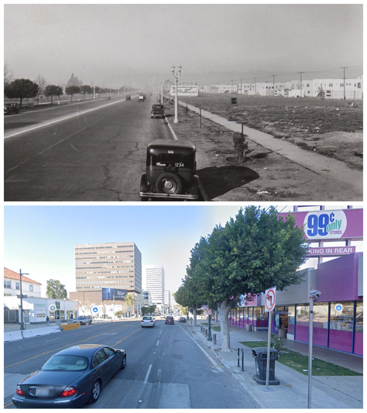
| (1927 vs 2017)* - View looking west on Wilshire Boulevard toward Crenshaw Blvd. The Wilshire Congregational Church (later Wilshire United Methodist Church) can be seen in the distance at 4350 Wilshire Blvd. Photo comparison by Jack Feldman. |
 |
|
| (1925)* – View looking across an unpaved Wilshire Boulevard showing the nearly completed Wilshire Congregational Church standing on the SW corner of Wilshire and Plymouth Blvds. |
 |
|
| (1920s)*# – View looking toward the south side of Wilshire Boulevard between Cloverdale Avenue and Cochran Avenue. The Dominguez-Wilshire Building (aka Myer Siegel & Co. Building) was constructed on this site in 1930. |
 |
|
| (1932)^ - An overview of Wilshire Boulevard, looking west. Visible on the left side of the picture is a high rise building labeled Myer Siegel & Co (the Dominguez Wilshire Building). Farther back on the street is the Wilshire Tower Building with the name Desmonds just visible on the top. |
 |
|
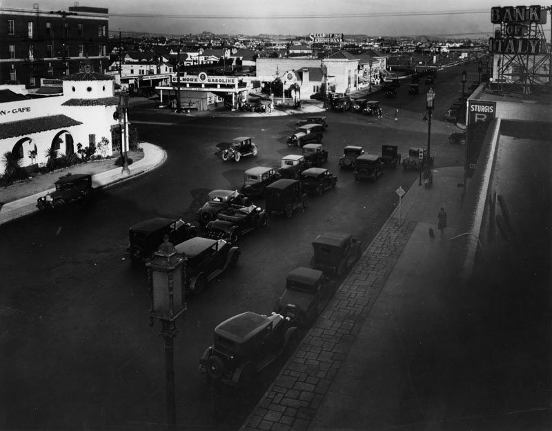
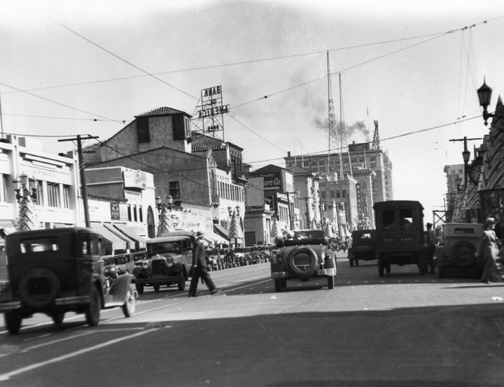
| (1928)^ - The intersection of Wilshire Blvd. and La Brea Avenue, looking east. The Dyas-Carleton Café (which opened in 1928) is seen on the N/W corner. Across La Brea, on the N/E corner, is a Gilmore Gas Station and the future site of the E. Clem Wilson Building (built in 1930) with a branch of Security Trust & Savings Bank behind it. At right is the Sturgis Radio Co. and the Bank of Italy. Some vacant lots are seen on Wilshire, and the afternoon sunlight is highlighting the scene. |
 |
|
| (1930)* - View looking east on Wilshire Boulevard as seen from the top of the newly built Dominguez-Wilshire Building, between Cochran and Cloverdale Avenues. The E. Clem Wilson Building can be seen on the N/E corner of Wilshire and La Brea. |
Historical Notes In the late 1930s the 1.5-mile stretch of Wilshire Boulevard between Fairfax and Highland Avenues would be named the Miracle Mile. Click HERE to see more Early Views of the "Miracle Mile". |
Wilshire and Kenmore
 |
|
| (1928)* - View looking east on Wilshire Boulevard from the Gaylord Apartments at Kenmore Avenue across the street from the Ambassador Hotel. The Immanuel Presbyterian Church, still under construction, sits east of the Ambassador Hotel on Berendo Street. |
Historical Notes In the distance can be seen the construction of Immanuel Presbyterian Church. This was their second location. The first one was located on the SE corner of Figueroa and Olympic. Modeled after French Gothic cathedrals, the Immanuel Presbyterian Church was designed by architect Chauncey Skilling. The building's stone-clad corner tower soars 205 feet above Wilshire, supported by a steel frame that allows for a strikingly spacious interior. |
 |
|
| (1980)* - View looking east on Wilshire Boulevard from in front of the Gaylord Apartments on Kenmore Avenue. Photo by William Reagh |
 |
|
| (2021)* – Looking east on Wilshire Boulevard from Kenmore Avenue. |
Then and Now
.jpg) |
|
| (1980 vs 2021)* – Looking east on Wilshire Boulevard from Kenmore Avenue. Photo comparison by Jack Feldman. |
* * * * * |
 |
|
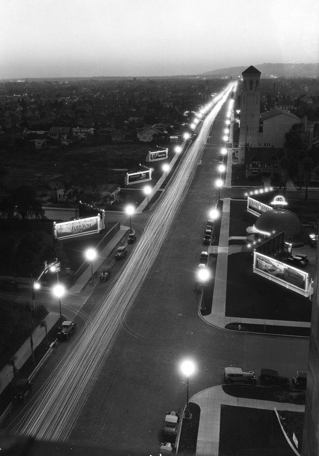
| (1928)*# - Aerial night view of Wilshire Boulevard looking west as seen from the Gaylord Apartments showing the original Brown Derby Restaurant at center-right. The building with the tall tower at upper-right is the Wilshire Christian Church. Note how well lit Wilshire is and the numerous signboards on both sides of the Boulevard. |
Historical Notes Wilshire Boulevard was designated by The Octagon Museum of the American Architectural Foundation as one of the 'Grand American Avenues' was decorated with this Wilshire Special pole and lantern for nearly six miles of its length. Approximately 100 poles still remain over the distance of about one-and-a-half miles. The original lanterns are solid bronze and stand 7½ feet tall from the base of the lantern to the top of the finial.^^# |
 |
|
| (ca. 1928)* – Postcard view looking east on Wilshire Boulevard from S. Bronson Avenue. At far left is the Los Altos Apartments at 4121 Wilshire. Up ahead is the Pellissier Building/Wiltern Theatre. Note the ornate streetlights along Wilshire (called Wilshire Specials). |
 |
|
| (1934)* - Wilshire Boulevard looking east at Crenshaw Boulevard. Note the beautiful streetlights that line both sides of the Boulevard.. |
Historical Notes Click HERE to see more in Early Los Angeles Street Lights |
* * * * * |
 |
|
| (1928)* – View looking northwest at the intersection of Beverly Blvd and N. Virgil Ave showing the 13-story American Storage Co. Building located at 3636 Beverly Blvd. At right, on the north apex of the intersection, is Jake’s Market Fountain Cafe where Venus Art and Flowers stands today. Click HERE to see contemporary view. |
 |
|
| (1928)* – View looking north on Beverly Boulevard at N. Virgil Avenue. American Storage Building on the left on Beverly Boulevard and Jake’s Market Fountain Cafe on the gore point between Beverly Boulevard and N. Virgil Avenue. Barkies Sandwich Shop can be seen in the background where Beverly intersects with Temple Street. |
 |
|
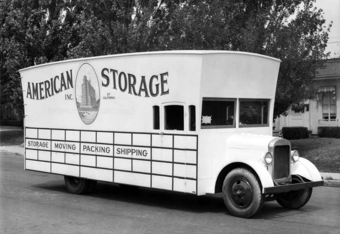
| (1928)* – View showing an American Storage truck. Sign on side reads: STORAGE - MOVING - PACKING -SHIPPING |
 |
|
| (1928)^ - View looking west at a divided Melrose Avenue, near Detroit St. (2 blocks w/o La Brea). The building on the right with flagpole in front is Melrose Elementary School. |
Hollywood
 |
|
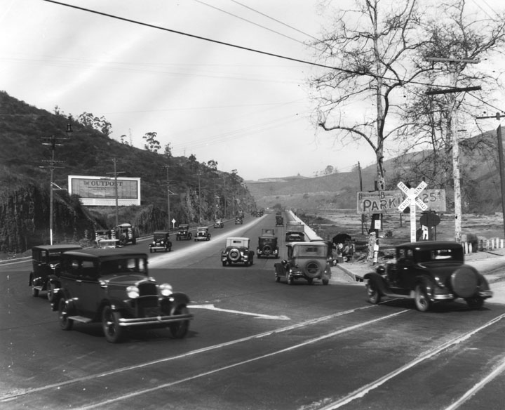
| (ca.1928)^ - Cars travel in both directions through the Cahuenga Pass near the Hollywood Bowl. The roadway through the Pass, the lowest through the Santa Monica Mountains, connects the Los Angeles Basin to the San Fernando Valley. The hills are truncated where they were excavated for the road bed. On the left, a large hillside billboard advertises the The Outpost development in the Hollywood Hills. A roadside vendor is setup near the Hollywood Bowl parking sign on the right. |
 |
|
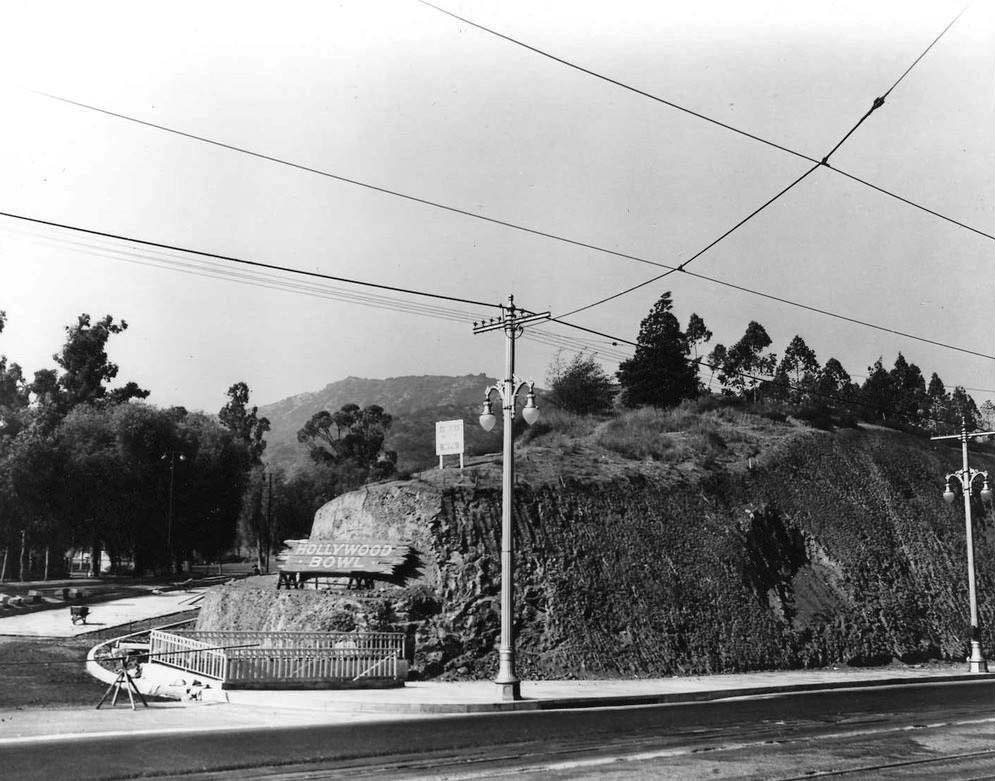
| (ca. 1930s)**## – View showing newly paved driveway at the entrance to the Hollywood Bowl, with large wooden sign on the dirt embankment. Click HERE to see more in Early Views of the Hollywood Bowl. |
 |
|
| (ca. 1928)^ - A view looking east of Hollywood Boulevard from the pedestrian level with cars both parked and moving down the street, a pedestrian crossing in the middle and various businesses. A radio tower with "KFWB" on it, and Christmas tree decorations along the sidewalk can be seen. |
Historical Notes KFWB's history goes back to 1925, when it was launched by Sam Warner, a co-founder of Warner Brothers. The station launched the careers of such stars as Ronald Reagan and Bing Crosby. The station was the first to broadcast the annual Rose Parade in Pasadena. The original KFWB studios and transmitter location were at the Warner Bros. Studios, which is now KTLA, at 5800 Sunset Boulevard. One of the two original towers still stands prominently out front. Due to RF interference getting into the movie studio's "talkies" sound equipment, the transmitter was moved in 1928 to the roof of the Warner Theater, now the Hollywood Pacific Theatre, at 6423 Hollywood Blvd. Eventually the studios were also moved to the Warner Theater. Those two towers are still there, as well.^* |
Click HERE to see more in Early Views of Hollywood |
* * * * * |
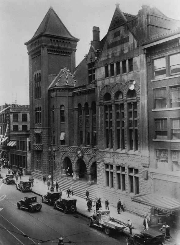
Civic Center
 |
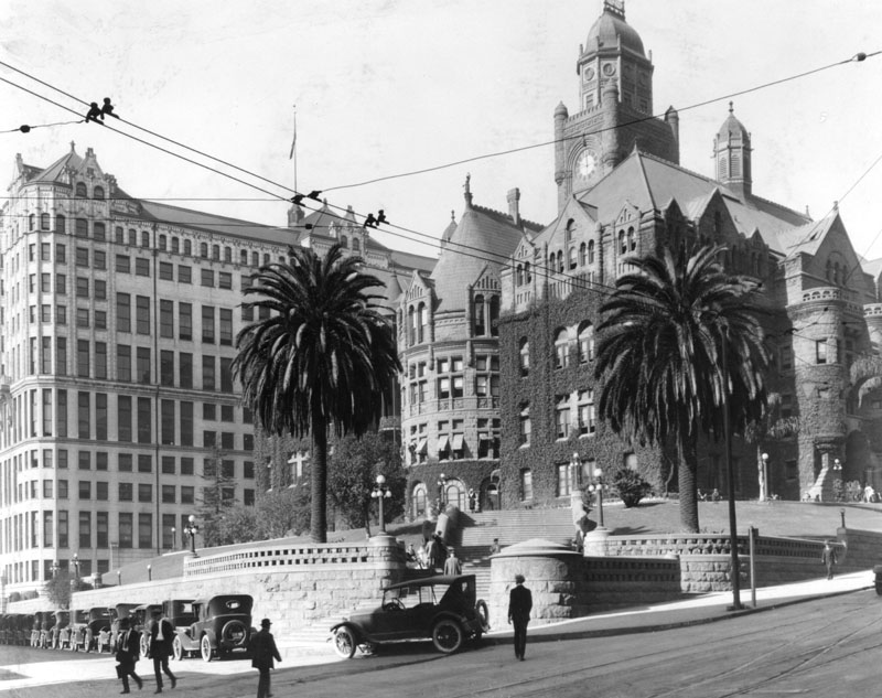
|
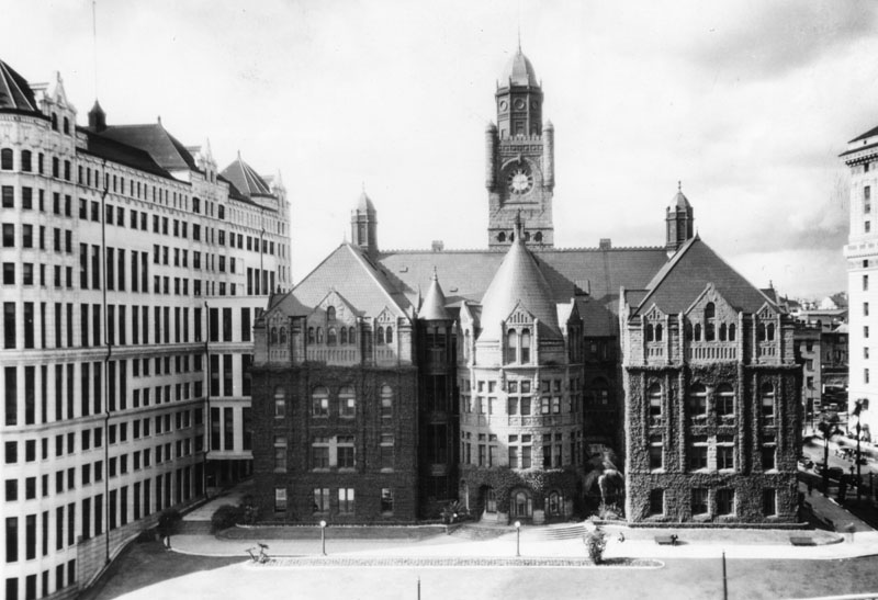
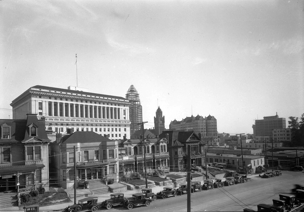
| (ca. 1925)^ - L. A. County Courthouse viewed from the east, with the Hall of Records on the left. The very edge of the Hall of Justice is barely visible on the right. |
 |
|
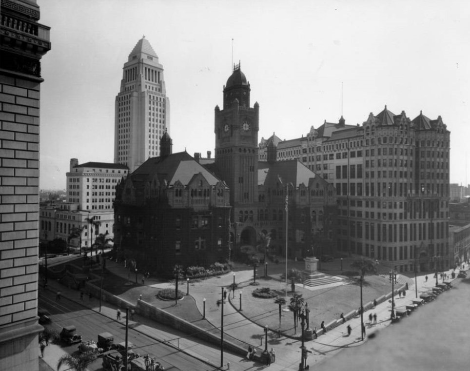
| (1927)^ - View is looking northwest toward three powerhouses: Hall of Records, County Courthouse, and Hall of Justice, which sit amid other equally important buildings in Downtown. An advertisement painted on the upper portion of a building (lower forefront) reads, "Los Angeles Daily Journal - official paper for City of and County of Los Angeles - Legal advertising". |
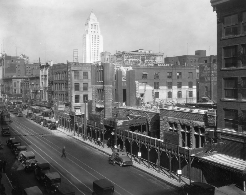
Construction of City Hall
 |
|
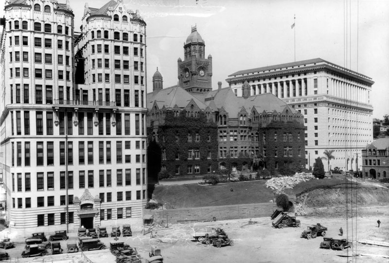
| (ca. 1927)^ - View is looking northwest toward three powerhouses: Hall of Records, County Courthouse, and Hall of Justice. The construction site of the new Los Angeles City Hall can be seen in the forefront. |
Historical Notes The Hall of Records was built in 1906 and demolished in 1973; the County Courthouse was built in 1891 and demolished in 1936; the Hall of Justice was built in 1922 by Allied Architects and is the only one of the three buildings still standing today.^ |
 |
|
| (1926)*# - View of the Los Angeles City Hall construction site. Across Spring Street in the center of the photo is the County Hall of Records and, to its right, the red sandstone County Courthouse. The LA Times Building tower can be seen at upper center-left. |
 |
|
| (1927)^ - Preparation of the site for construction of Los Angeles City Hall. Behind are the old County Courthouse and the Hall of Justice to its right. |
Historical Notes The new 28-story Los Angeles City Hall was replacing the old City Hall building located on Broadway between 2nd and 3rd Streets that had been government headquarters since 1889. That building had replaced a one-story adobe City Hall, formerly the old Rocha House, on the northeast corner of Spring and Court Streets.*^*^ |
 |
|
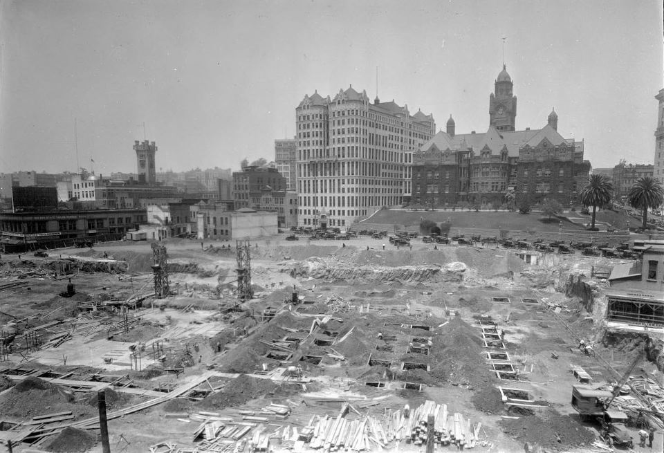
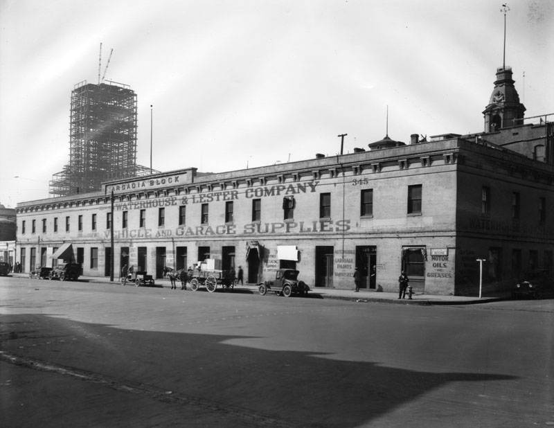
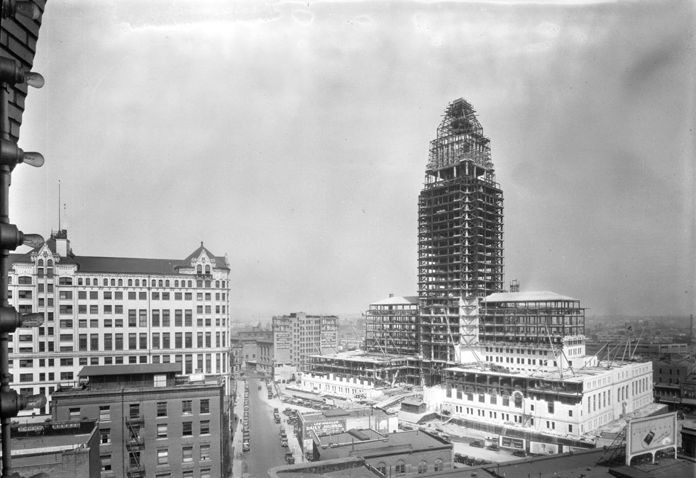
| (ca. 1927)*# – View showing steel griders going up in the early construction stages of the new City Hall. In the background, a multitude of warehouse-type buildings are visible, while at left, The Amestoy Building located at the intersection of North Main and Market streets can be seen. To its right, the U.S. Hotel is visible. Two very tall cylindrical “gas holders” (gas storage tanks) can also be seen at left. |
Historical Notes Temple Block, one of the earliest buildings in Los Angeles, is seen still standing at left center. The Old Courthouse occupied Temple Block between 1861 and 1891.* |
 |
|
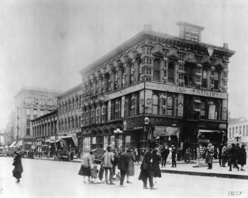
| (ca. 1926)^ - Temple Block as it appeared just one year before construction began on new City Hall. A group of people are seen crossing Main Street. The sign on the face of the Temple Block building reads: PAINLESS DENTISTRY. |
Historical Notes This site, at the intersection of Spring, Main and Temple, is where John Temple built his original two-story adbobe two-story adobe in the early 1800s. Jonathan Temple was one of Los Angeles’ first developers, constructing the original Temple Block and the Market House, which later served as city and county administrative headquarters, contained the county courthouse, and featured the first true theater in southern California. Temple Street carries his name.^* |
 |
|
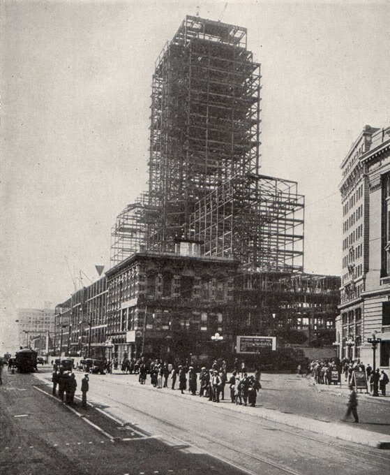
| (1927)*^^# - The last stand of the historic Temple Block. As the steel frame of the new City Hall neared completion the proud building, once dominant in the business and professional life of the city, was razed. |
 |
|
| (1927)^ - This photo faces east, and you can make out the central tower of the Baker Block behind it, and also the framework of LA City Hall under construction. Arcadia St. is the street on the right edge of the photo, across which lies the Jennette Block. |
Historical Notes Arcadia St. was just one block long, running between Main and Los Angeles Sts., and was named for Arcadia Bandini de Stearns Baker. She was first married to Abel Stearns, who built the Arcadia Block, and then after his death she married Robert Symington Baker, who built the Baker Block on the site of the former Stearns residence, a large and apparently lavish adobe (and he also co-founded Santa Monica, among other things). So both of the buildings that bordered the south side of Arcadia St. were built by Arcadia's husbands.**^ Click HERE to read more about Arcadia in Early Views of Santa Monica. |
 |
|
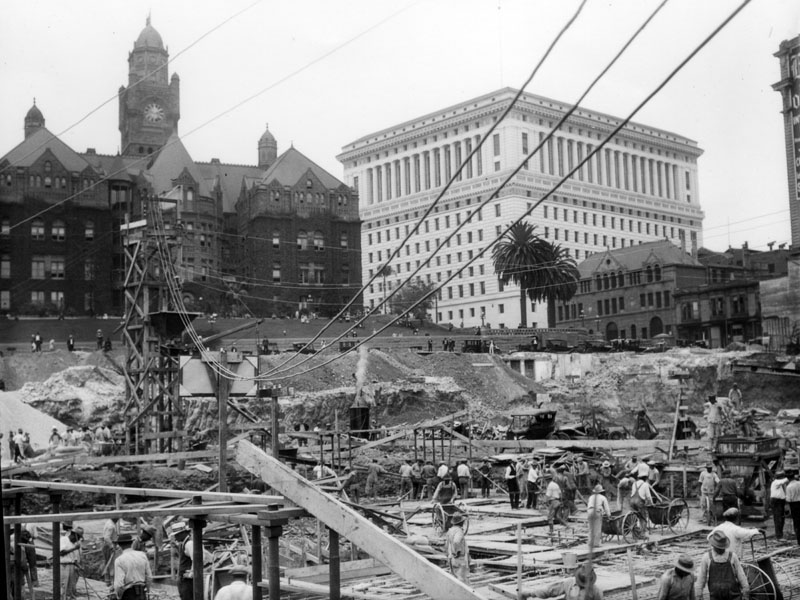
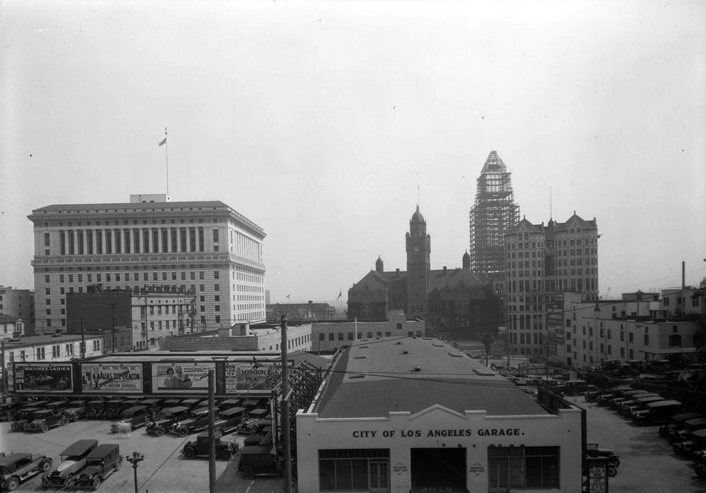
| (ca. 1927)*# - View of the City of Los Angeles garage. In the background from left to right can be seen the Hall of Justice, County Courthouse and Hall of Records. In the far background stands the steel framing for the new City Hall. |
 |
|
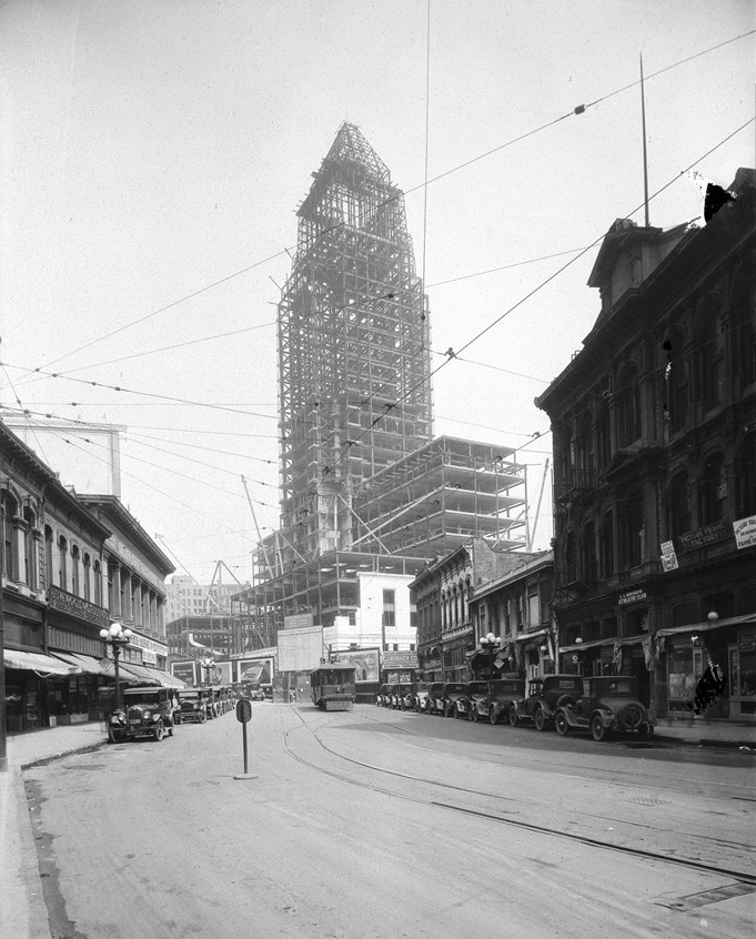
| (ca. 1927)*# - Another view showing the steel framing of City Hall as seen from the 300 block of N. Hill Street. |
 |
|
| (1927)*# - View of City Hall under construction, with steel framing complete. |
 |
|
| (1927)*# - View of City Hall looking northeast, still under construction but beginning to take form. |
 |
|
| (1927)**^**– View looking southeast at the Los Angeles Civic Center from near the intersection of Temple and Hill streets. City Hall, still under construction, stands tall behind (from L to R) The Hall of Justice, the Old County Courthouse, and the Hall of Records. Photo Date: 12/30/27 |
 |
|
| (1928)^.^ - Northwesterly view of the Los Angeles Civic Center, City Hall in the final stages of construction. The building on the far left, with the 'indentation' in the middle, was the 12 story Law Building, built in 1926. Photo C.C. Pierce |
 |
|
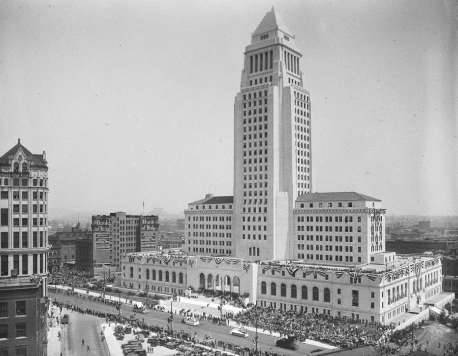
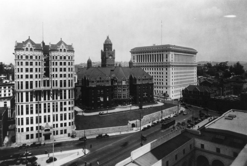
| (1928)**^** – View looking north toward the newly constructed City Hall Building the day of its opening ceremony. Banners hang from the building’s south fascia. Main Street is seen on the right. Photo Date: 4/26/1928 |
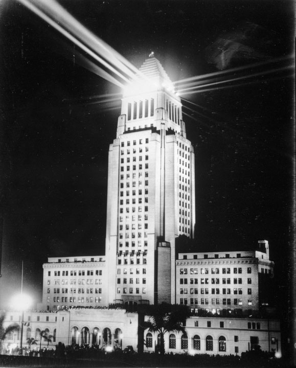
Historical Notes City Hall's distinctive tower was based on the purported shape of the Mausoleum of Mausolus and shows the influence of the Los Angeles Central Library, completed soon before the structure was started. An image of City Hall has been on Los Angeles Police Department badges since 1940.^* |
 |
|
| (1928)*# - View of Los Angeles City Hall decorated with banners for its opening ceremony. A crowd of people are gathered at the curb, bleachers are full of spectators, and a parade is in progress on Spring Street. Photo Date: 4/26/28 |
Historical Notes The big dedication, overseen by Sid Grauman and attended by an estimated 15,000 people, featured emceeing by Joseph Schenck and speeches by Mayor George E. Cryer and San Francisco Mayor James Rolph, Jr. After Rolph spoke, Irving Berlin sang, as did “Chief Yowlache, the Yakima Indian; Elsa Alsen, the grand opera singer; the Mexican chorus of Los Angeles, in costume; Virgil Johannson, and others." *^*^ |
 |
|
| (April 26, 1928)* - Opening Ceremony of the Los Angeles City Hall. |
Historical Notes April 26, 1928, was a day of thrills. On that date was thrown the new City Hall, a great white building towering 28 stories, and casting its shadow upon the historic spot where a century and a half before came a ragged and footsore procession, grubbed out standing room in the tangle of sage and cactus, and christened the spot “Queen of the Angels.” Past the impressive granite entrance rolled hour after hour a mighty host. There were National and State troops, cadet bodies from neighboring cities, marines, and bronzed and swaggering sailors, ex-soldiers and veteran organizations. Mounted and afoot, and on gorgeous floats, came groups of foreign-born, in gay and picturesque native costumes. The police and firemen made a tremendous showing, as did the departments of public parks, schools and libraries, water, power and harbor, the street and sanitary forces, those of the engineering and accounting departments – employees by the thousands. There was stirring music by bands and bands without number. Hour after hour the public stood rooted, amazed at the vastness of its own machinery of service and government. From the broad steps of the great building Mayor Rolph of San Francisco – like the good neighbor that he was, spoke with eloquence and feeling. President Coolidge, at the White House, touched a button that set aglow the Lindbergh Beacon, perched festivities roared. Los Angeles was opening one of the nation’s most beautiful and modern public buildings, on a site hallowed by a century and a half of historical association. The “city without a past,” that “has no memories, because it has nothing to remember,” was establishing anew its “capitol” on ground where it had governed itself in the days of the alcaldes and the ayuntamientos. Here it could commune with its Fathers while looking with Anglo-Saxon eyes into the future. This was possible, for does not the old Spanish proverb say that “the walls have ears”? Who knows but that from out a romantic past, the winds may carry to the great white tower the strum of guitars and the click of castanets at the Governor’s fandango; the creaking of Don Juan Temple’s ox carts; the vengeful shouts of Pico’s Vigilantes; the cheers of Hancock’s Boys in Blue; the song of paisanos laboring in Pryor’s orange groves; the laughter of children and the hum of bees under Vignes’ arbors? Do not the shades of all these mingle in the very shadow of the new yet ancient seat of City Government? Quien Sabe? ** |
 |
|
| (1925)* - Exterior view of L.A.'s third City Hall, located at Broadway, between 2nd and 3rd streets. Within three years of this photo, the old City Hall building would be torn down. |
Historical Notes Los Angeles’ thrid City Hall was erected in 1888 at 226-238 South Broadway. This grand Romanesque edifice of marble and red sandstone building stood for 40 years until 1928 when the present day City Hall was completed. On January 10, 1928 an auction of the furnishings and other items inside the structure was conducted on the front steps before the building was torn down later that same year. A new, larger City Hall had been built to replace this historic building that for so long was the seat of Los Angeles government.* |
 |
|
| (1928)^ - View showing the demolition of old City Hall building on Broadway with the new City Hall standing tall in the background. |
* * * * * |
Spring and Temple (Spring Street Realignment)
 |
|
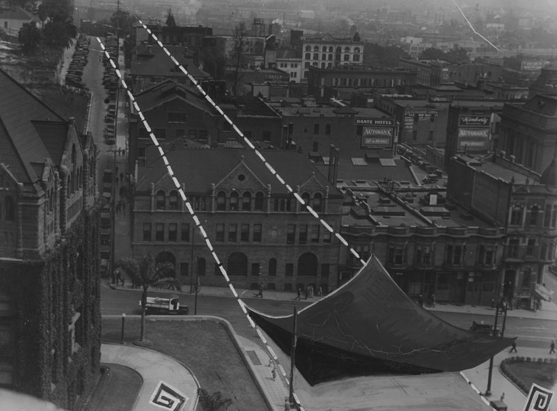
| (ca. 1928)^ - View looking northwest from City Hall toward the Hall of Records, County Courthouse and Hall of Justice. . Spring Street is in the foreground and dead ends at Temple (right-center). |
Historical Notes In this view, Spring Street still stops at Temple Street and has not yet been extended through the hill behind the buildings at right. This is the old layout that existed before the major re-grading of the early 1930s. The Los Angeles County Jail stands near the end of the “T” intersection, and the Hall of Records, County Courthouse, and Hall of Justice can be seen farther beyond. When City Hall opened in 1928, it stood on a realigned portion of Spring Street. The city soon decided that the street should not end at Temple, but continue north in a straight line. Within three years, all the buildings on the right side of this photo, including the jail, would be removed to make way for the new extension. |
 |
|
| (ca. 1928)^ - Panoramic view from City Hall looking northwest toward the County Courthouse, with banners hanging from its windows, and the new Hall of Justice. Spring Street dead-ends at Temple Street in the foreground, right where the old County Jail stands. |
Historical Notes This wide-angle view shows the last years of the old street pattern north of Temple. Spring Street comes to an abrupt stop, marked by the County Jail at the intersection. Beyond it are the County Courthouse and the Hall of Justice, which had just been completed. The city planned to replace this awkward dead end with a straight extension running toward the northern districts and Sunset Boulevard. To do so, engineers would remove the jail, cut through the lower portion of Fort Moore Hill, and open a new traffic corridor in line with the revised city grid created by the building of City Hall. |
 |
|
| (ca. 1928)^ – Street view looking north on Spring Street towards Temple Street where the Los Angeles County Jail stands at the end of the “T”- intersection. In 1931 Spring Street would be extended in a straight line north of Temple all the way to Sunset Boulevard eliminating most of the buildings seen here including the Los Angeles County Jail and all building behind it. |
Historical Notes Here Spring Street runs directly into Temple Street, with the county jail blocking any further travel north. This was a long-standing problem for traffic entering the area around the new City Hall. The steep rise of Fort Moore Hill behind the jail prevented any simple continuation of the street. Beginning in 1930, the city removed the jail and excavated part of the hill to create a wide, straight roadway that would carry Spring Street to Sunset Boulevard. The new alignment connected the Civic Center more efficiently with the communities to the north. |
Spring Street Extension
 |
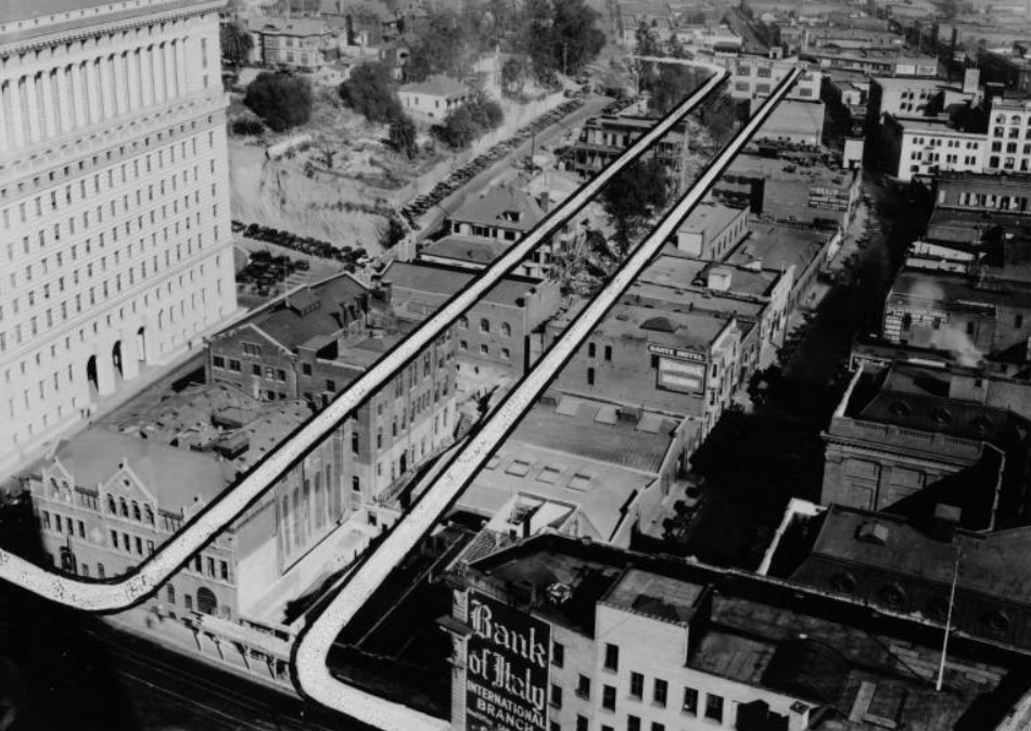
|
| (ca. 1928)^ - View looking north showing the proposed Spring Street extension that will cut through from Temple Street to Sunset Boulevard and create another traffic artery. The dotted lines mark the path of the extension the will eliminate Justicia Street that goes up the hill at left. The building first struck by the dotted lines is the old county jail. That just back of it is the old Hall of Justice. The building on the left is the Old County Courthouse. |
Historical Notes This view shows the dotted line marking the future path of Spring Street as it pushes through the hillside north of Temple. The first structure in the path is the old county jail. Behind it stands the earlier Hall of Justice, which would also be cleared away. Justicia Street, which once climbed the side of Fort Moore Hill, would disappear completely as the hill was graded down. The project was part of a larger effort to modernize the street grid north of the Civic Center. By carrying Spring Street straight through to Sunset Boulevard, the city hoped to relieve congestion and improve access to the growing neighborhoods to the north and northeast. |
 |
|
| (ca. 1928)* – View looking northwest from the top of City Hall showing the proposed extension of Spring Street from Temple Street to Sunset Boulevard with the Hall of Justice to the left, the old County Jaiil crossed by the line at lower-left, and the Bank of Italy (International Bank Building) at lower right. |
Historical Notes From this vantage point on City Hall, the dotted line can be seen cutting across the county jail and skirting the Hall of Justice. The Bank of Italy building sits to the right, marking the southern edge of the coming construction zone. Everything in the path of the dotted line would soon be removed. This was one of the most dramatic reshaping projects in early Los Angeles. The lower slope of Fort Moore Hill was carved away to create a level roadway. The extension became a major new artery leading toward the North Broadway and Sonoratown districts. |
 |
|
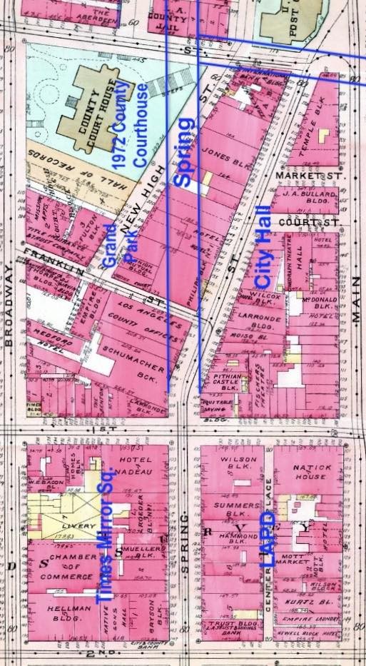
| (1927)* - Map comparing Spring Street’s original alignment with the new route created to clear space for Los Angeles City Hall. |
Historical Notes This map shows the old path of Spring Street compared with the new line required for the construction of City Hall. The building did not fit comfortably with the earlier alignment, so engineers shifted the street slightly east to match the official city grid. That adjustment encouraged the city to continue the straightened line north of Temple. By 1931 the extension reached Sunset Boulevard, replacing the earlier patchwork of narrow, crooked roads and removing older structures that no longer fit the modern Civic Center plan. |
.jpg) |
|
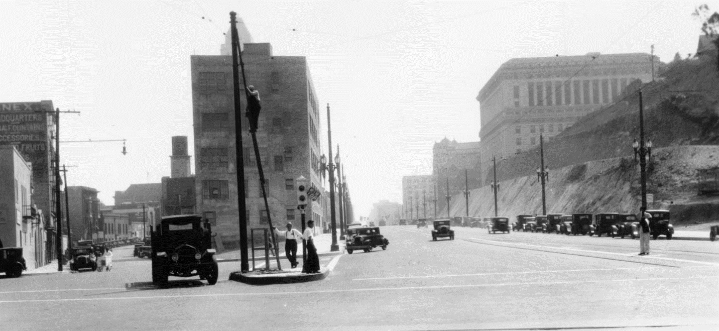
| (1931)* – View looking north showing the under-construction extension of Spring Street from Temple Street (just behind the camera) to Sunset Boulevard (just ahead at the light colored building with the small billboard on the roof). Streetcar tracks will be layed in the center section of the street. |
Historical Notes This photograph shows the new Spring Street taking shape as it cuts through the base of Fort Moore Hill. The streetcar tracks were placed in the center, and wide traffic lanes were added on either side. The work required removing the old county jail, the earlier Hall of Justice, and several homes that stood on the hillside. Once completed, the extension connected the Civic Center directly with the neighborhoods to the north. It also helped tie Spring Street into the new pattern of straightened roads and improved access routes that Los Angeles was building during the late 1920s and early 1930s. |
.jpg) |
|
| (ca. 1931)* - Birdseye view showing the completed Spring Street extension from Temple (lower-left) to Sunset (upper-right and out of view). |
Historical Notes The finished Spring Street extension can be seen running in a straight line from Temple Street toward Sunset. The broad new roadway replaced what had once been a tangle of smaller streets and steep hillside paths. Much of the lower part of Fort Moore Hill was removed to create the level grade. The extension quickly became an important north–south route, linking the Civic Center with the developing North Spring Street commercial and residential districts. |
 |
|
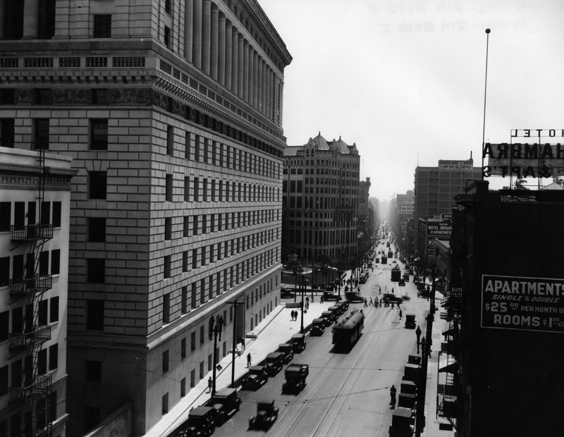
| (ca. 1931)* – Panoramic view looking south showing Spring Street from Sunset Boulevard. A man is seen climbing a pole that supports streetcar cables. Below him, a traffic light extends from the median between the two paved roads that extend into the distance. Beautiful ornate streetlights run up and down Spring Street that also support streetcar wire. The tip of new City Hall is seen directly above the man climbing the pole. The Hall of Justice is seen on the west side of Spring Street. |
Historical Notes This view looks down the newly completed extension toward City Hall, which is centered along the street’s straightened line. The ornate streetlights and the overhead wires mark the presence of streetcar service, which ran along Spring Street for decades. On the west side of the street stands the Hall of Justice, part of the expanding Civic Center complex. The new roadway tied these public buildings together and created a more formal and organized approach to downtown. |
Then and Now
 |
|
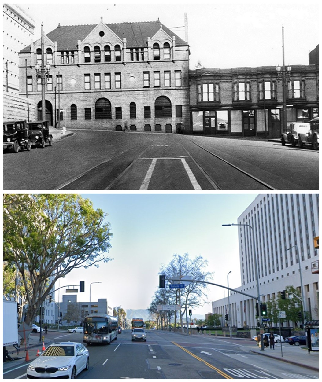
| (1928 vs 2023)* - Looking north on Spring Street at Temple Street. Photo comparison by Jack Feldman. |
Historical Notes The earlier image shows Spring Street ending abruptly at Temple with the county jail blocking further passage. In the modern view, the extension completed in 1931 continues north in a straight line, though the Hollywood Freeway now crosses beneath the street further up the hill. The transformation reflects the dramatic reshaping of both the street system and the landscape around Fort Moore Hill during the early twentieth century. |
Then and Now
 |
|
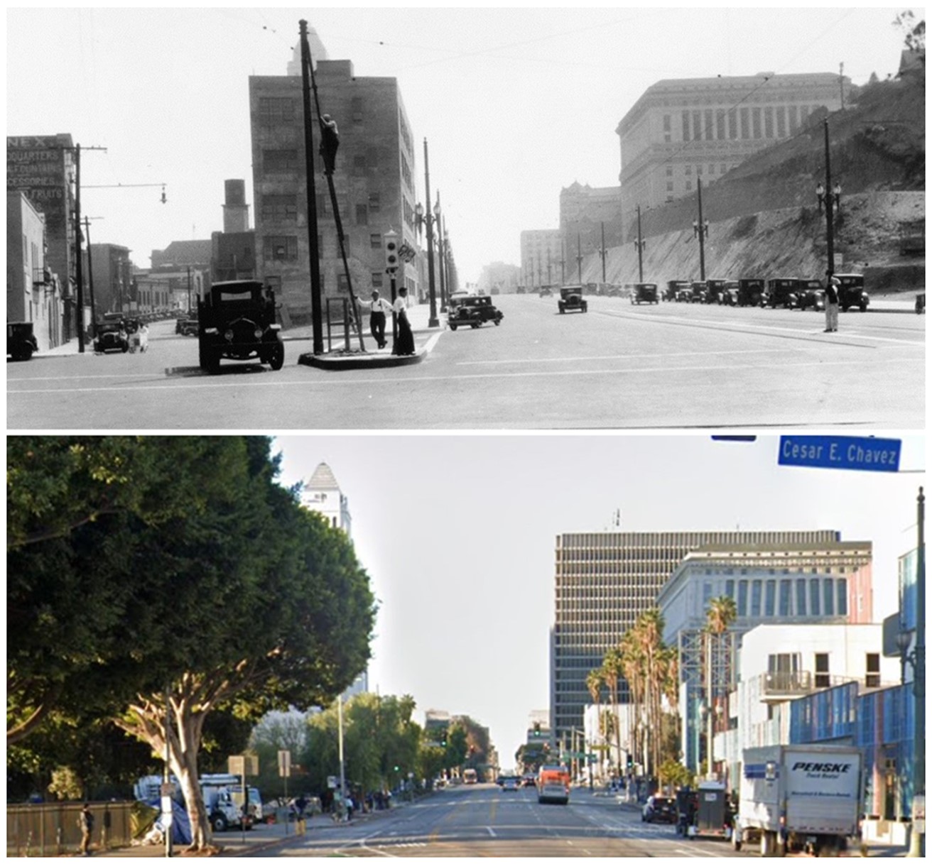
| (1931 vs 2022) – Looking south on Spring Street at Sunset Boulevard (today Cesar E. Chavez Boulevard). Photo comparison by Jack Feldman. |
Historical Notes In the 1931 view, the new Spring Street roadway has just been cut through the hillside and is still unlandscaped. The street now runs directly into the Civic Center with City Hall rising in the distance. In the modern photograph, the same corridor remains, though freeway construction and redevelopment have replaced most of the older buildings. These views show how the 1931 extension established the basic path that Spring Street still follows today, even though the surrounding neighborhood has changed greatly. |
 |
|
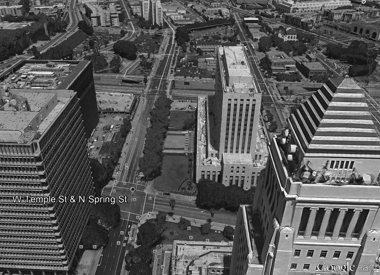
| (2015) - Google Earth view looking north showing Spring Street between Temple and Sunset. The Hollywood Freeway now runs under Spring Street half way between Temple and Sunset. What once was part of Fort Moore Hill (upper-left) has been completedly leveled (see previous photos). |
Historical Notes This contemporary aerial view shows the long straight section of Spring Street created during the 1931 extension. The Hollywood Freeway now occupies the middle of what was once part of Fort Moore Hill. Most of the original hill was cut down in stages from the 1930s through the freeway era of the 1950s. Only small remnants of the hillside survive today, but the alignment of Spring Street still reflects the large-scale grading of the early Civic Center improvements. |
* * * * * |
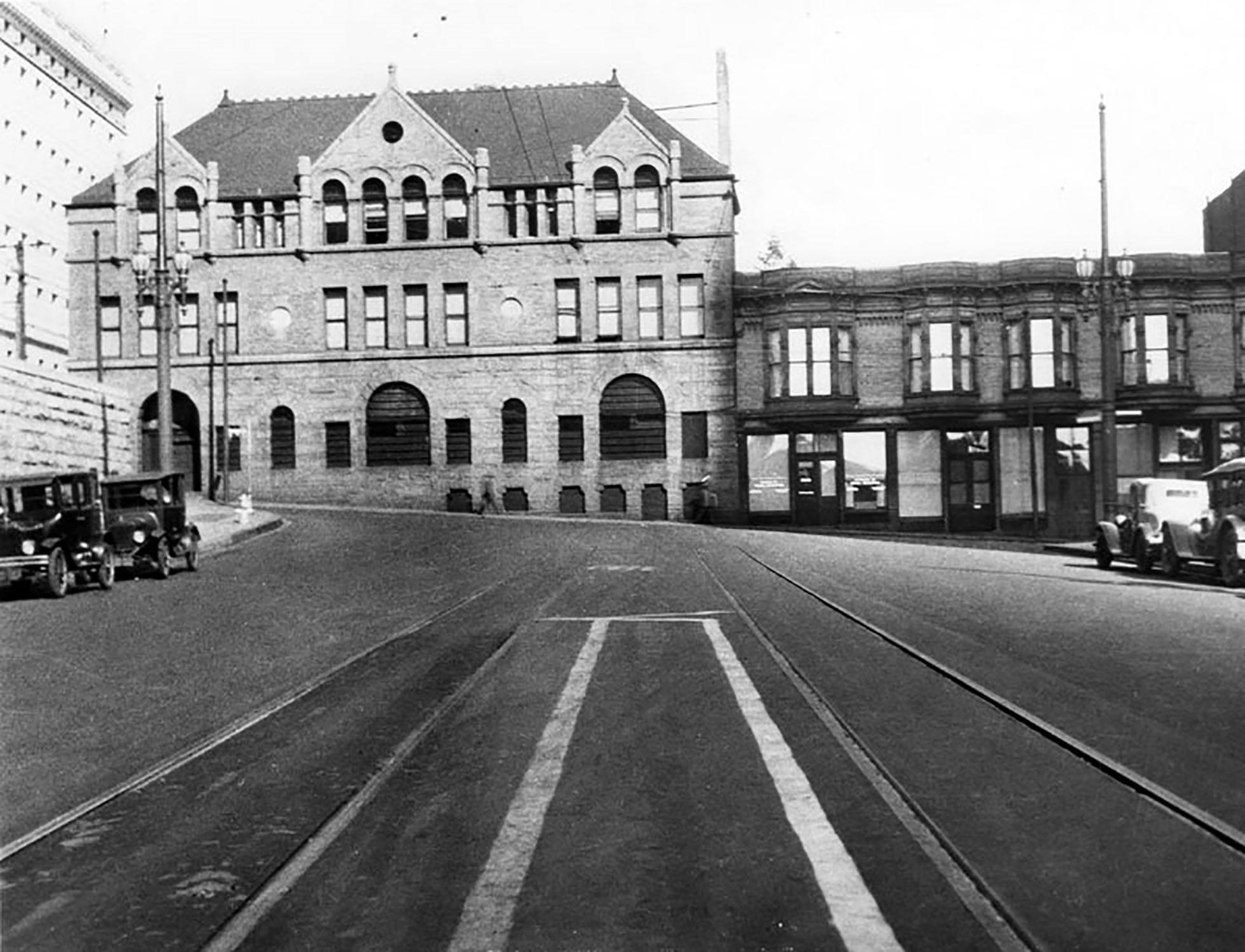
Broadway and Temple
 |
|
| (1928)^ - Broadway looking south toward Temple Street circa the 1920s. The Hall of Justice is seen on the left, after which is the Hall of Records. Sign to the right reads: APPARTMENTS $25 PER MONTH. |
 |
|
| (ca. 1930)^ - Cars parked on New High Street in front of the old County Courthouse. The Hall of Records is on the left. |
 |
|
| (1930)*# - View looking southeast at the intersection of Temple and Broadway. The old Courthouse stands at center with the Hall of Records to its right. City Hall towers above both in the background. |
Historical Notes The old LA County Courthouse was demolished in 1936. The Hall of Records stood until 1973. |
 |
|
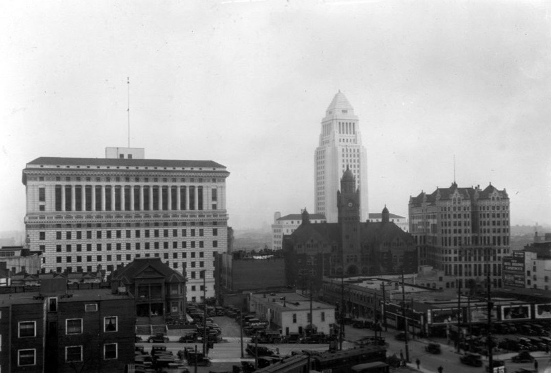
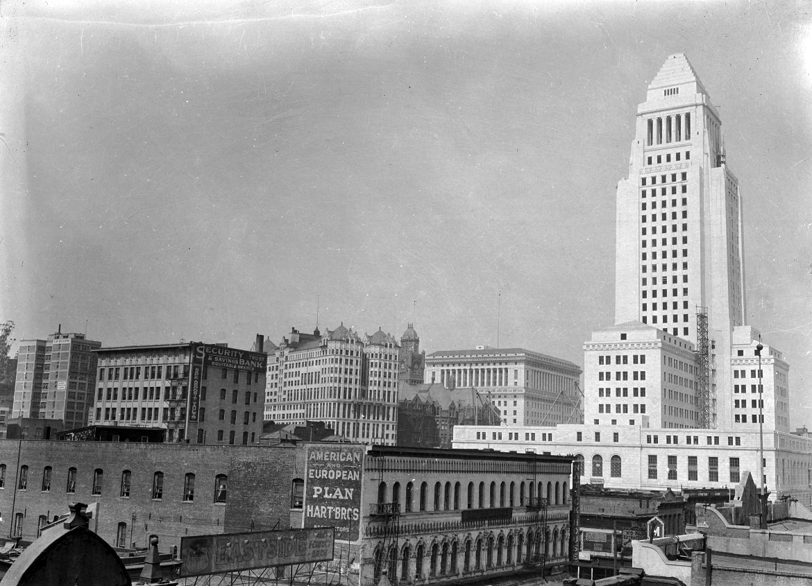
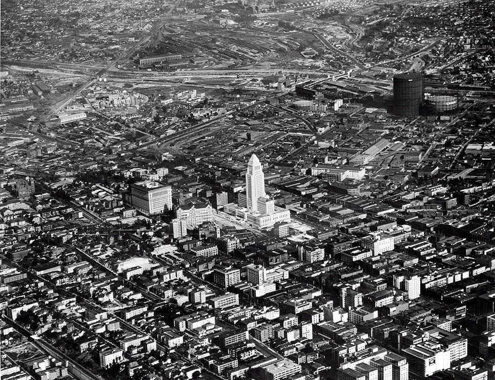
| (1928)^^ - Aerial view looking northeast of downtown on a crispy clear day. The new City Hall stands out as not only the brightest building in the civic center but also its tallest. |
Historical Notes Although there are dozens upon dozens of buildings, for decades no building in Los Angeles was allowed to exceed the height of City Hall, until 1957. It remained the tallest building in California from 1928-1964, at 28 stories tall (450 feet).^ |
 |
|
| (ca. 1928)^ - Aerial view of the Los Angeles Central Library, which is located on the southeast corner of S. Flower and W. 5th streets (lower left). The trio of connected buildings in the background (upper right) make up the Biltmore Hotel, and directly behind that is Pershing Square bounded by 5th, Hill, Olive, and 6th streets. The Church of the Open Door/Biola Institute is the large white building with arches on the right, and the Engstrum Hotel Apartment building is directly to the left of the library, on Bunker Hill. Numerous other buildings are visible as far as the eye can see. |
Historical Notes The Central Library building was constructed between 1922 and 1926. Originally named the Central Library, the building was first renamed in honor of the longtime president of the Board of Library Commissioners and President of the University of Southern California, Rufus B. von KleinSmid. The new wing of Central Library, completed in 1993, was named in honor of former mayor Tom Bradley. The complex (i.e., the original Goodhue building and the Bradley wing) was subsequently renamed in 2001 for former Los Angeles Mayor Richard Riordan, as the Richard Riordan Central Library.^* |
 |
|
| (1926)* – Panoramic view looking southeast from a parking lot located on the northeast corner of Flower and 5th streets showing the recently completed Central Library. Behind it and to the right is the Church of the Open Door/Biola Institute. Where the photographer is standing will later become the Bonaventure Hotel. |
Olive and 5th Street
 |
|
| (1928)^- Olive Street between 4th and 5th Streets, looking south toward Pershing Square and the Biltmore Hotel. Cars are seen, and a Savoy Auto Park is at right. Also at right is a small German-speaking church, the First German Methodist Episcopal Church (later United Methodist), founded in 1876. |
Then and Now
 |
|
| (1928 vs. 2021)* - Olive Street between 4th and 5th Streets looking south toward Pershing Square and the Biltmore Hotel. Photo comparison by Jack Feldman. |
 |
|
| (1928)*# – View of Hill Street looking north from Fifth Street. The highly-ornamented one-story building of the College Theatre can be seen to the left while pedestrians and automobiles navigate the street. Two men at the extreme right have gotten out of and are attending to their cars. Further down on the left, the Hill Street Terminal Market and the Hill Street Subway Terminal Building can be seen along with the John Luchenbach Building. |
Historical Notes The College Theatre was so named for its proximity to the nearby State Normal School on the block that is currently the site of the Los Angeles Central Library. The theatre located at 441 S. Hill Street was built in 1911 and demolished in 1929. Today, it is a parking lot.^^*# |
 |
|
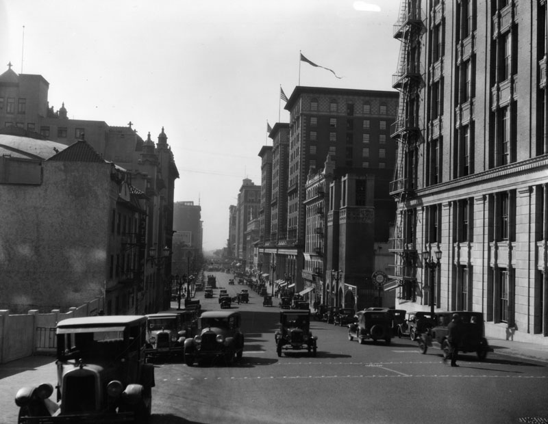
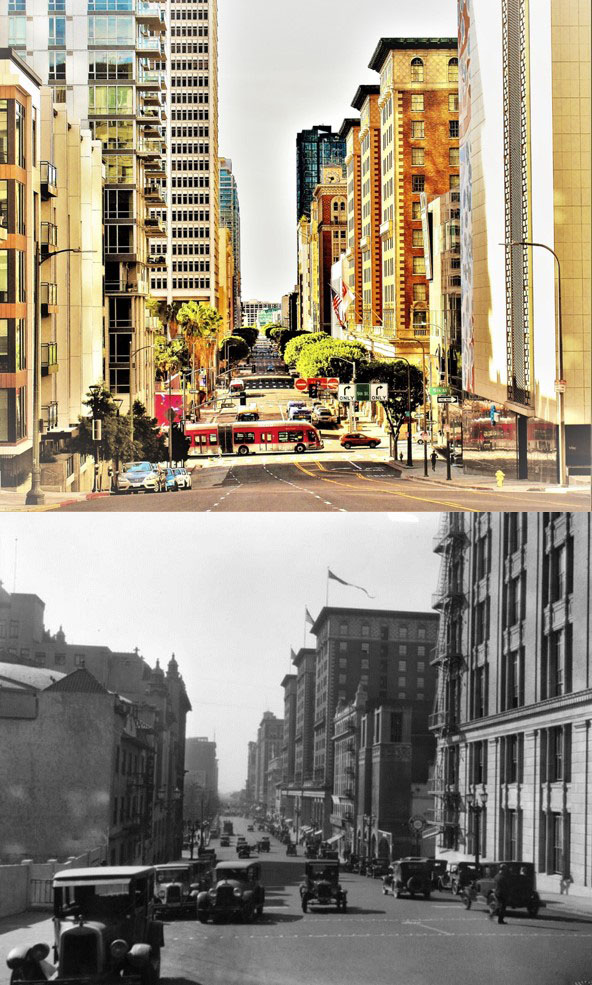
| (ca. 1928)*# - View of the intersection of South Figueroa Street and West 7th Street. Note the 5-bulb streetlight in the foreground. Click HERE to see more in Early Los Angeles Streetlights. |
Figueroa and 10th (later Olympic Blvd)
 |
|
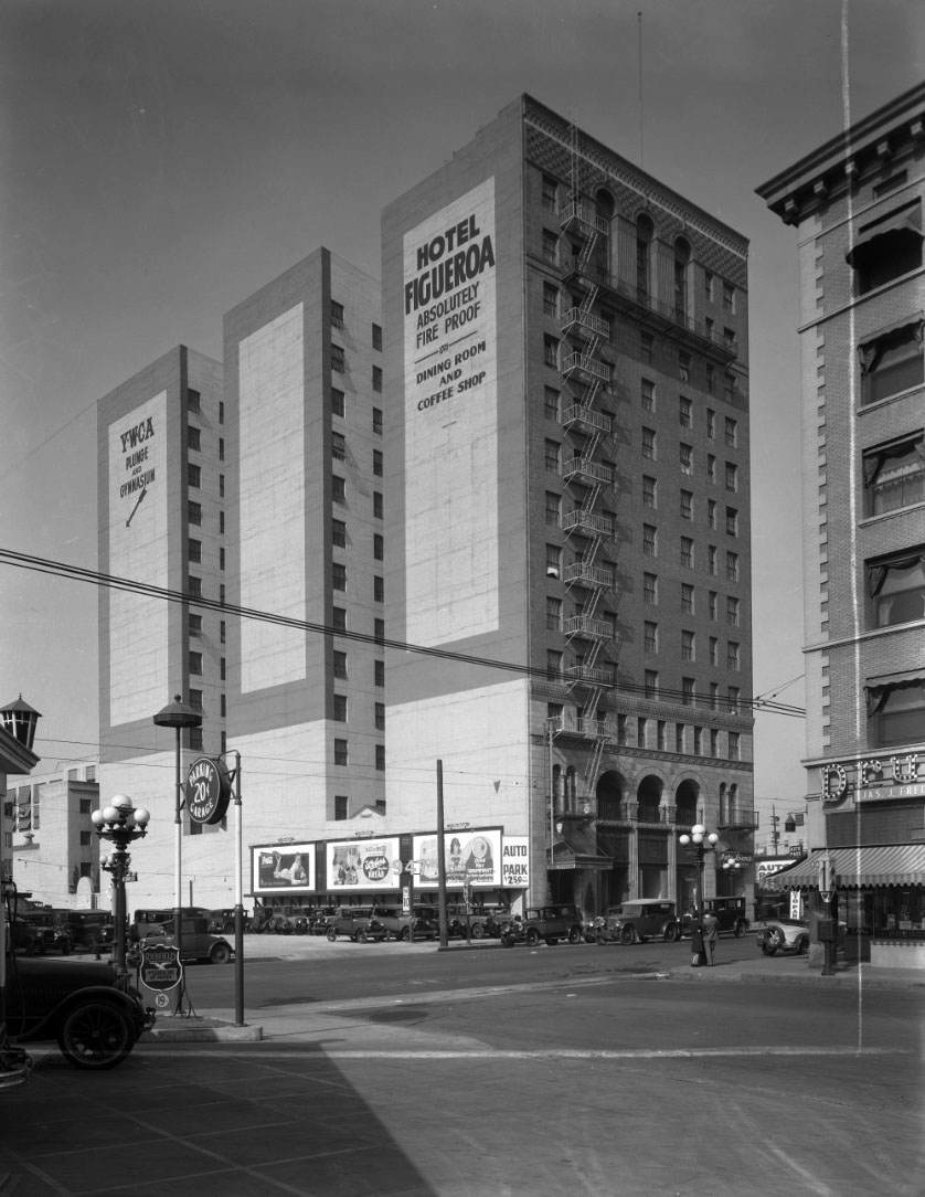
| (1925)^*# – View showing the Hotel Figueroa as seen from a gas station on the SE corner of Figueroa St. and 10th Street (later *Olympic Blvd). Signs on the side of the building read: ‘Hotel Figueroa - Absolutely Fire Proof’ and ‘YWCA – Plunge and Gymnasium’. Note the ornate 5-lamp streetlights. Click HERE for contemporary view. |
Historical Notes *Olympic Boulevard was originally named 10th Street. In 1932, the entire length of the street, from East L.A. to Santa Monica, was renamed Olympic Boulevard for the Summer Olympics being held in Los Angeles that year. |
 |
|
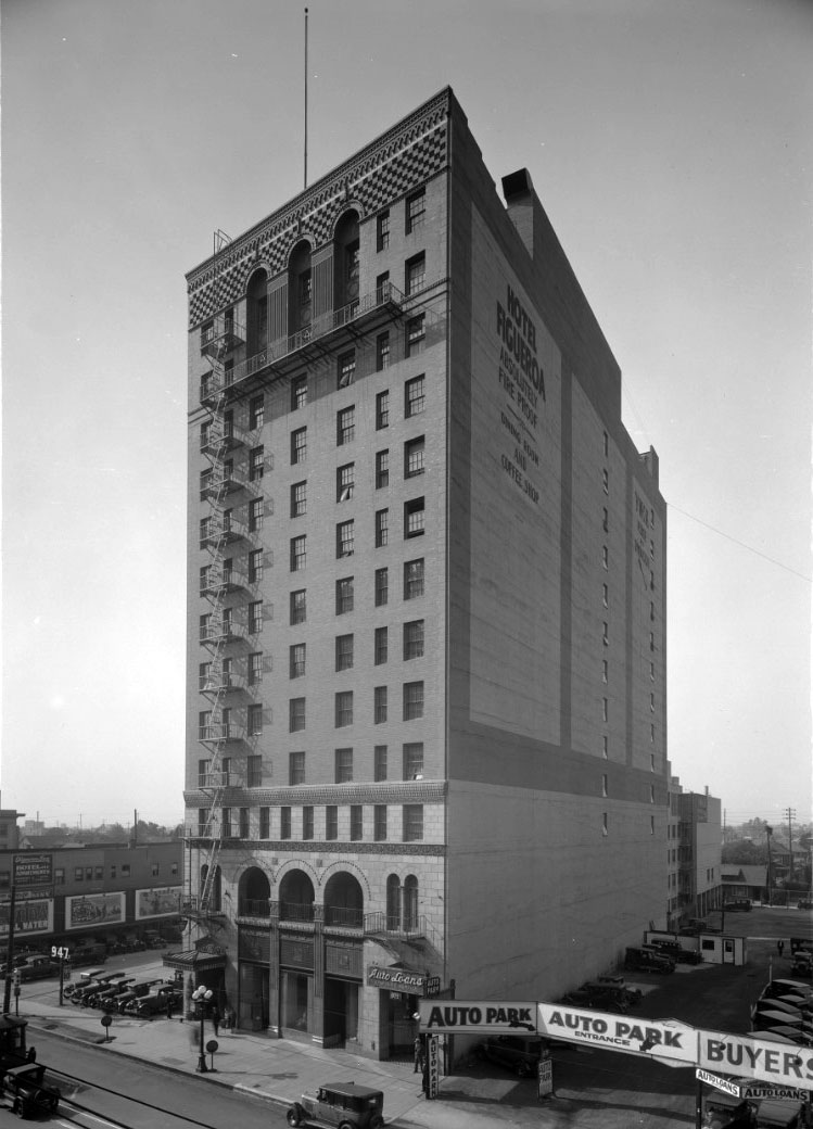
| (1925)^*# – View looking southwest showing the newly constructed Figueroa Hotel located at 941 So. Figueroa Street. The intersection of Figueroa and 10th streets is seen on the left. |
Historical Notes Built in 1925, Hotel Figueroa was the first hotel to be completely financed, owned and operated by women in the United States. The YWCA (Young Women’s Christian Association) hired architecture firm Stanton, Reed & Hibbard to design and build the hotel. The Spanish Colonial style of the hotel pays tribute to the city’s Spanish and Mexican heritage. Defining features include the elaborate coffered ceiling, sculpture columns, wrought iron finishes, and ornate floor tiles.^ |
.jpg) |
|
| (1931)^.^ – View looking north on Figueroa Street showing several women standing in front of Hotel Figueroa. Note the 5-globe streetlight in front of the hotel. Click HERE to see more. |
Historical Notes Originally the hotel only hosted travelling business women and their children. However, as effects of the Great Depression were becoming more severe, Hotel Figueroa started to accommodate men.^ |
 |
|
| (1926)* - View looking southeast across Figueroa Street showing the Friday Morning Club Building and Figueroa Playhouse. The Playhouse marquee reads: “Coming Pauline Frederick”. The church seen in the distance is the Immanuel Presbyterian Church, located on the southeast corner of what is now Figueroa Street and Olympic Boulevard. |
Historical Notes The Friday Morning Club (across the street from the Hotel Figueroa) was founded by abolitionist, suffragist, mother, and Los Angeles homemaker Caroline Severance in 1891, with 87 other women in the reading room of the Hollenbeck Hotel, then located at Second and Broadway. It became the largest women's club in California, with membership of over 1,800 women by the 1920s. Click HERE to see more. |
 |
|
| (ca. 1928)^ - View looking NE from the front of the Hotel Figueroa showing the Figueroa Playhouse located in the Friday Morning Club Building, 940 S. Figueroa. In the foreground a boy on a bicycle is hitching onto a truck. |
 |
|
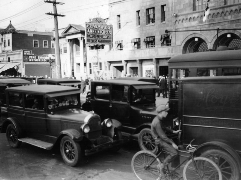
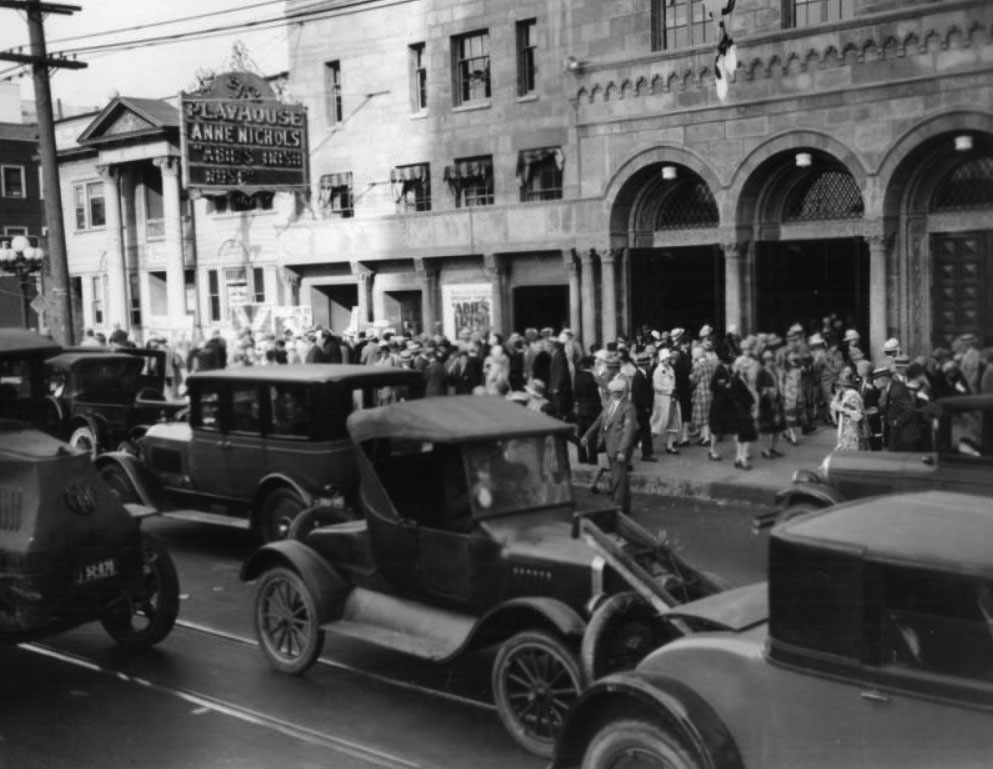
| (ca. 1928)^ - View showing a crowd of people in front of the Figueroa Playhouse. The marquee at upper-left reads PLAYHOUSE: "Anne Nichols Abie's Irish Rose." |
* * * * * |
Broadway and 4th Street
 |
|
| (1926)^ – View looking north on Broadway toward 4th Street with the Broadway Department Store seen on the left (SW corner). The Broadway Theater is on the right. |
 |
|
| (ca. 1926)*# - View looking north on Broadway toward 4th Street showing crowds of people window-shopping along the sidewalk next to Broadway Department Store. The Cummings building can be seen on the NW corner of Broadway and 4th (upper-right). |
Historical Notes Note the ornate dual-lamp streetlights that line both sides of Broadway. These were called "Broadway Specials". Click HERE to see more. |
 |
|
| (ca. 1926)*# - View of Broadway looking north from 4th Street. People crowd the streets as a trolley-car tries to pass. The Cummings building stands dominating much of the left side of the photo, advertising a number of things on its windows and marquees. |
 |
|
| (1928)*# – View looking north on Broadway from Fourth Street. The Broadway Central building is prominently visible in the left foreground of the street, while the Broadway Arcade Building is visible five buildings down among other highrises. |
Broadway and 7th Street
 |
|
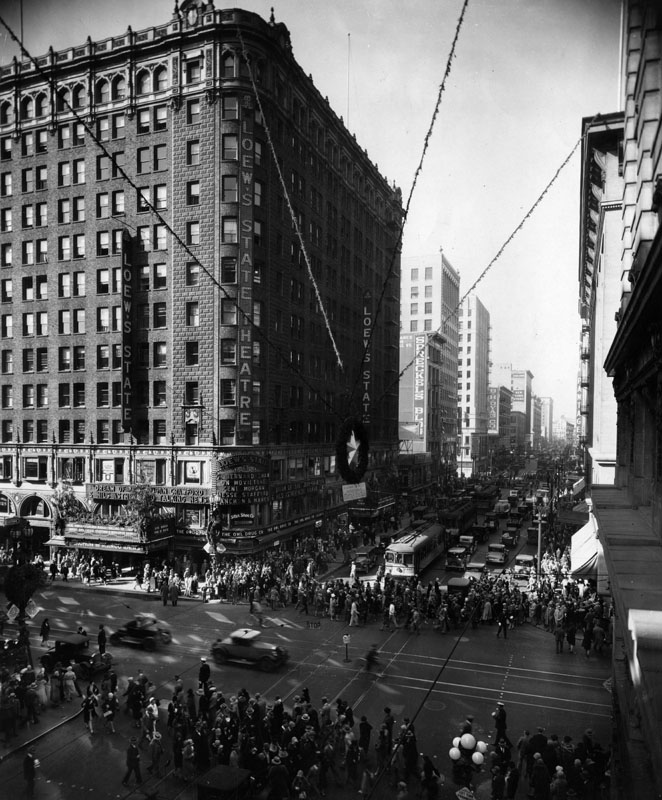
| (ca. 1928)^ - A view of the intersection of Broadway and 7th St., looking west on 7th. On the southwest corner is the Loew's State Theatre. Four wires can be seen holding up a star on the 7th St. side of the theater. The streets are crowded with cars and tolleys and pedestrians crossing. |
 |
|
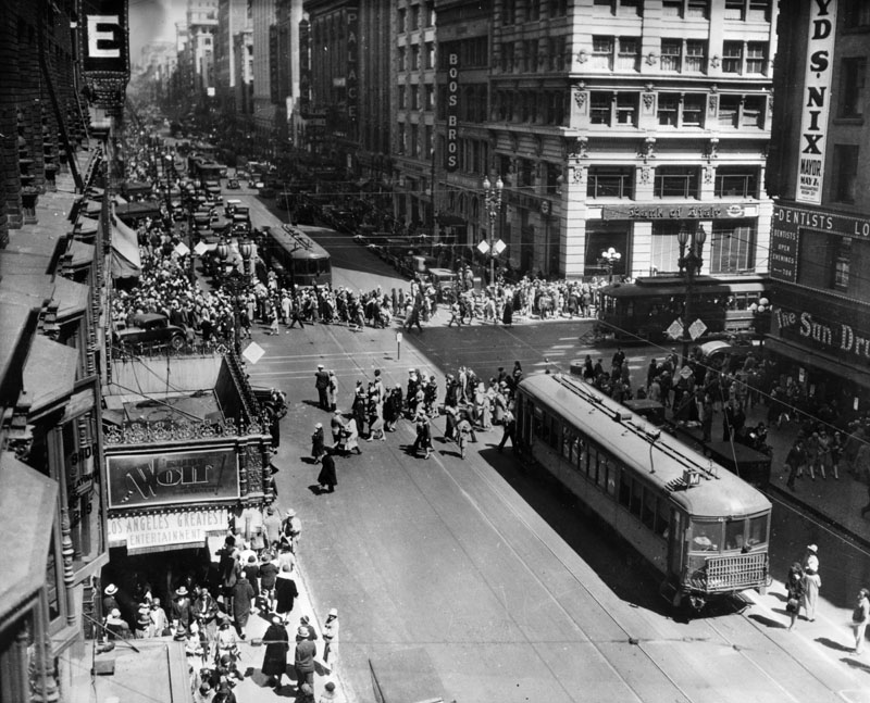
| (1928)^ - View looking north on Broadway at 7th Street with large crowds crossing the intersection. On the southeast corner is Sun Drug. Across the street on the northeast corner is Bank of Italy, later to become Bank of America. And on the left side (southwest) is Loew's State Theatre. |
 |
|
| (1929)^ - View looking north on Broadway over 7th St. On the right (east side) can be seen the Bank of Italy (later known as the Bank of America), Boos Bros. Cafeteria, and California Furniture Company. Farther north on the street one can also see the Mullen & Blett Clothing Co. sign on the side of a building and the Walter P. Story Building name on top of a site. |
* * * * * |
 |
|
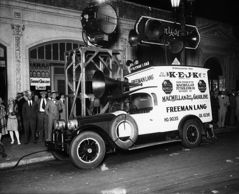
| (1928)^ - View of a car set up for broadcasting with microphones on the roof and above the driver's head. On the truck are the call letters of KEJK radio station of the MacMillan Petroleum Co., and the name Freeman Lang. |
Historical Notes Lang was the chief engineer of the station, which he founded in 1927 under the call sign of KRLO. He sold the station in February 1928 to Ernest J. Krause, who changed the call letters to fit his initials, KEJK. Just two months later, KEJK was sold to R.S. MacMillan Petroleum Company of Beverly Hills, which owned KEJK when this photo was taken. They would change the call letters on March 14, 1930, to KMPC to fit the company name.^ |
* * * * * |
Early Aviation
 |
|
| (1929)*# - Graf Zeppelin over Leimert Park area of Los Angeles, August 1929. |
Historical Notes The Zeppelin was a type of rigid airship pioneered by the German Count Ferdinand von Zeppelin in the early 20th century. It was based on designs he had outlined in 1874 and detailed in 1893. His plans were reviewed by committee in 1894 and patented in the United States in 1899. Given the outstanding success of the Zeppelin design, the term zeppelin in casual use came to refer to all rigid airships. Zeppelins were first flown commercially in 1910 by Deutsche Luftschiffahrts-AG (DELAG), the world's first airline in revenue service. By mid-1914, DELAG had carried over 34,000 passengers on over 1,500 flights. After the outbreak of World War I, the German military made extensive use of Zeppelins as bombers and scouts.^* |
 |
|
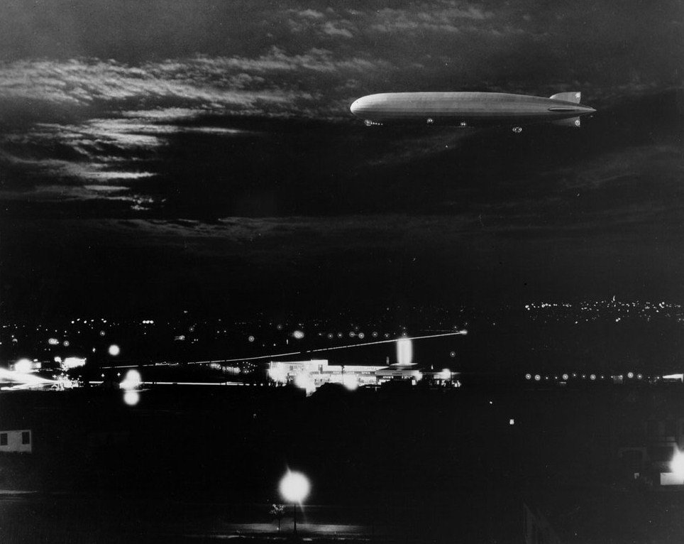
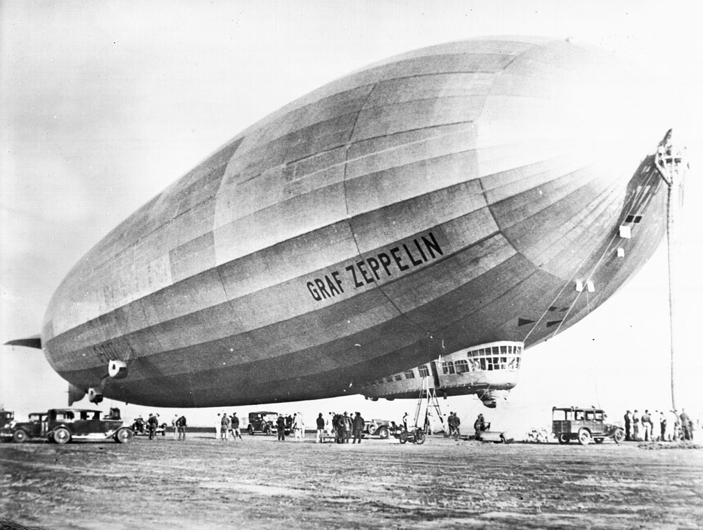
| (1929)*# - View of the 776-foot-long Graf Zeppelin docked at Mines Field, the present-day site of the Los Angeles International Airport. |
Historical Notes In 1929, Graf Zeppelin made perhaps its most famous flight; a round-the-world voyage covering 21,2500 miles in five legs from Lakehurst to Friedrichshafen, Friedrichshafen to Tokyo, Tokyo to Los Angeles, Los Angeles to Lakehurst, and then Lakehurst to Friedrichshafen again.^* |
 |
|
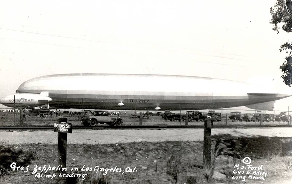
| (1929)*# - Photograph of the Graf Zeppelin and the small Goodyear pony blimp floating (or parked?) next to each other, 1929. The Graf Zeppelin is about ten times the size of the Goodyear blimp. Both the blimps are on the other side of the fence in the foreground. Several warning signs are posted up including a no-parking sign. |
Historical Notes In 1930, the Graf Zeppelin began regular transatlantic commercial flights. It had 20 sleeping berths for passengers and a crew of 36. Its first flight was in 1928, its last in 1937, after 590 total flights. The Graf Zeppelin was retired one month after the Hindenberg disaster.^* |
 |
|
| (1929)^## - Closer view of the Goodyear Blimp alongside the Graf Zeppelin showing the size disparity. |
 |
|
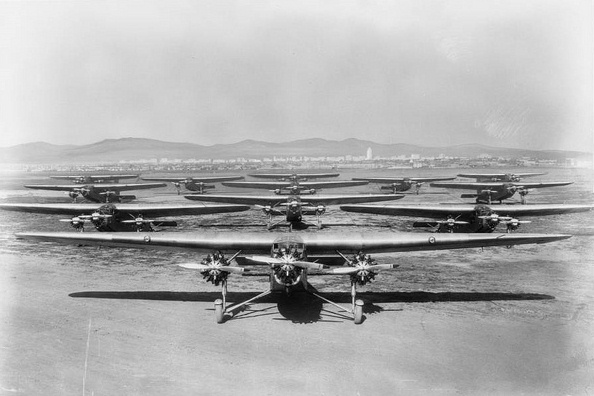
| (1929)^#^* - View of the Maddux Air Lines fleet at Mines Field. |
Historical Notes In 1927 Jack L. Maddux, an owner of a Los Angeles Ford and Lincoln car dealership, founded Maddux Air Lines. The airline’s inaugural flight was on September 22, 1927 when the airline’s Ford 4-AT Tri-motor carrying 12 passengers flew from San Diego to Los Angeles. This flight was to a small dirt landing strip that would later become Los Angeles International Airport, then Mines Field, although the landing strip, called Inglewood Site, was not suitable for the airline, and Jack Maddux chose instead Rogers Airport, with improved facilities, and later Grand Central Airport in Glendale. On August 26, 1929 a Maddux Tri-motor, along with other aircraft, escorted the famous LZ 127 Graf Zeppelin airship to Mines Field where it stopped during its around the world flight. Among the famous aviators who were involved with Maddux were Charles Lindbergh and Amelia Earhart. Maddux also had a publicity department that advertised the celebrities who flew with the airline. These included Will Rogers, who rode on the inaugural flight, and Hollywood actors Arthur Edmund Carewe and Dolores del Río.^* |
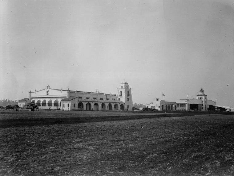 |
|
| (1930s)^ - Adminstration building in foreground and hangars in background at Mines Field (later to become the L.A. International Airport). |
Historical Notes In 1928, the Los Angeles City Council selected 640 acres (1.00 sq. mile) in the southern part of Westchester as the site of a new airport for the city. The fields of wheat, barley and lima beans were converted into dirt landing strips without any terminal buildings. It was named Mines Field for William W. Mines, the real estate agent who arranged the deal.^* |
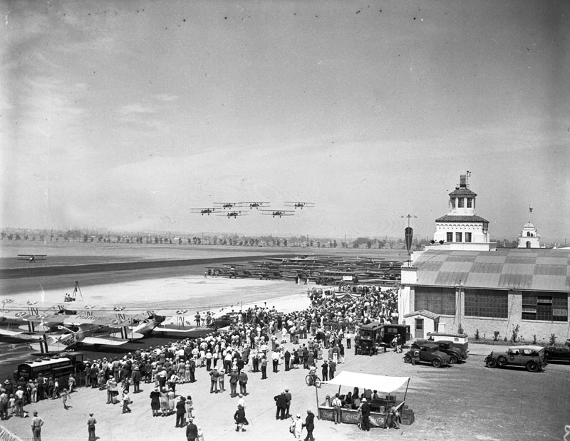 |
|
| (1930)^ - Dedication of Mines Field (later L.A. International Airport) watched by large crowd and with lots of planes flying overhead. |
Historical Notes Mines Field was dedicated and opened as the official airport of Los Angeles in 1930, and the city purchased it to be a municipal airfield in 1937. The name was officially changed to Los Angeles Airport in 1941, and to Los Angeles International Airport in 1949. The main airline airports for Los Angeles had been Burbank Airport (then known as Union Air Terminal, and later Lockheed) and the Grand Central Airport in Glendale. By 1940 most airlines served Burbank only; in late 1946 most airline flights moved to LAX, but Burbank always retained a few.^* |
Click HERE to see more in Aviation in Early Los Angeles |
* * * * * |
San Fernando Valley
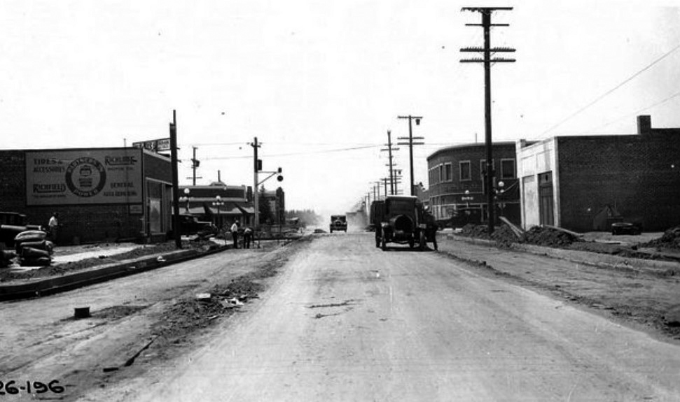 |
|
| (1926)****^ – View looking south on Reseda Boulevard toward the intersection with Sherman Way. The road appears to be in the process of being widened and paved. The Reseda State Bank building can be seen on the southwest corner of Sherman Way and Reseda. |
Historical Notes Reseda originated as a farm town named "Marian" (or "Rancho Marian") that appeared in 1912. Its namesake, Marian Otis Chandler, was the daughter of Los Angeles Times publisher Harrison Gray Otis, a director of the Los Angeles Suburban Homes Company. H J Whitley was the manager of the Los Angeles Suburban Home Company. The Western Division of the Pacific Electric Railway 'Red Cars Line' expedited development after the Los Angeles Aqueduct brought water to the City of Los Angeles in 1913. Soon, thereafter, Marian would be annexed by the City.*^ |
Then and Now
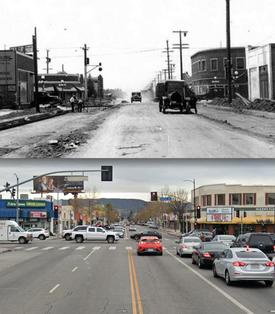 |
|
| (1926 vs. 2021)* - View looking south on Resdea Boulevard toward Sherman Way. Photo comparison by Jack Feldman. |
.jpg) |
|
| (1928)* - Reseda State Bank building at the southwest corner of Reseda Ave. and Sherman Way. Note the ornate streetlights on the corners. |
Historical Notes In 1920, Reseda was named after a fragrant North African yellow-dye plant, Reseda odorata, whose English name is mignonette and which grows in hot, dry climates—replaced Marian as a designation for a stop on the Pacific Electric interurban railway running along Sherman Way. The name "Reseda" was given first to a siding on a branch of the Southern Pacific Railroad in the south San Fernando Valley.*^ |
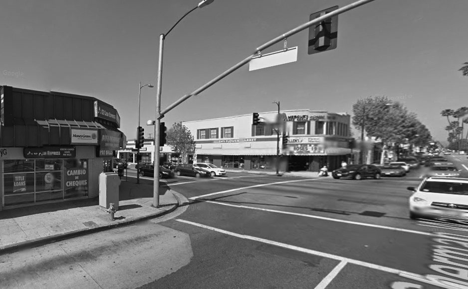 |
|
| (2014)#*^# - Google street view looking at the southwest corner of Reseda Blvd and Sherman Way. |
Then and Now
 |
.jpg) |
|
| (1928)^ - Southwest corner of Sherman Way and Reseda. | (2014)#*^# - Southwest corner of Sherman Way and Reseda. |
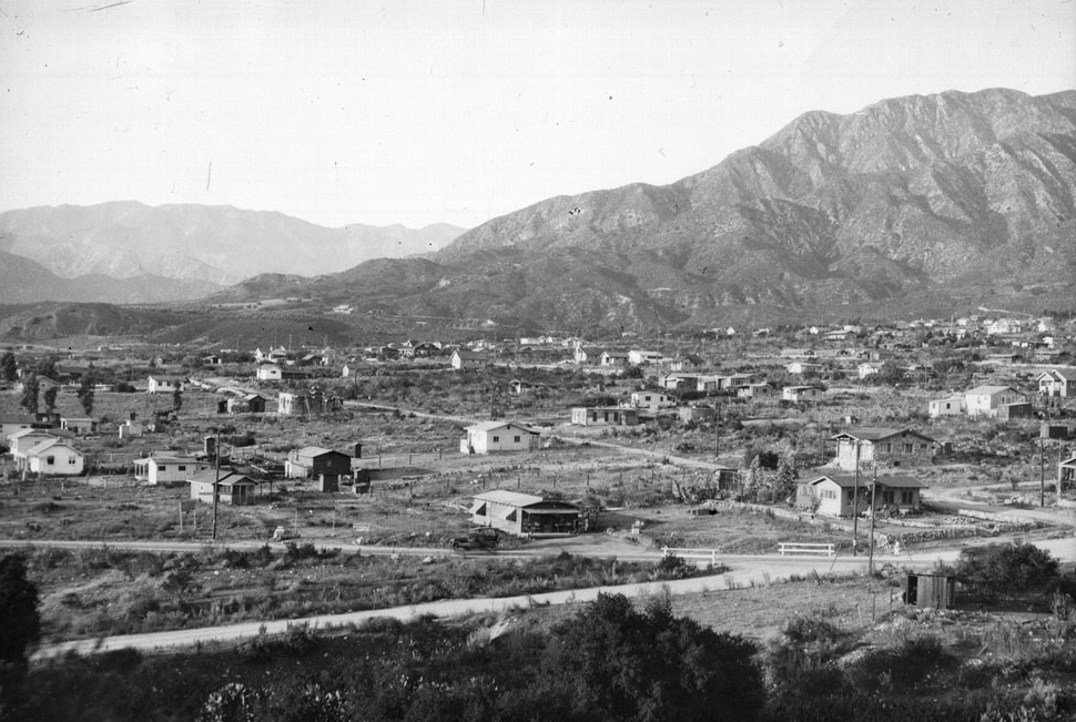 |
|
| (ca. 1928)#** - View of the residential area of Tujunga, looking west toward the San Fernando Valley, ca.1928. Many small houses are scattered sparsely throughout an expanse of land that sits at the foot of a mountain. The majority of the houses are frame houses, though one in the right centerground is made of stone. Orchards are visible on the distant foothills to the left of the image. Several mountains sit in the background. |
Historical Notes Sunland and Tujunga were originally home to the Tongva people. In 1840 the area was part of the Rancho Tujunga Mexican land grant, but later developers marked off a plot of land known as the Tejunga Park, or the Tujunga Park, Tract. The name Tujunga is assumed to have meant "old woman's place" in the extinct Tongva language, where Tuhu "old woman" is a term for Mother Earth in Tongva mythology. Tujunga's 1,500-foot elevation and geographic isolation from the San Fernando Valley and the Los Angeles Basin freed it from some of the air pollution that was a problem in many other parts of Greater Los Angeles. Because of this, it attracted many asthmatics early on. Coronet magazine once called Tujunga "the most healthy place in the world." In 1929, the Tujunga City Council set policy to establish zones where "sanitariums and other institutions for the care of tubercular patients" could be established. Tujunga was consolidated by the city of Los Angeles on March 8, 1932, but only after the third election.^* |
 |
|
| (ca. 1920s)*^ - Car and trailer filled with camping gear and boys from the YMCA at Camp Miller in Tujunga. |
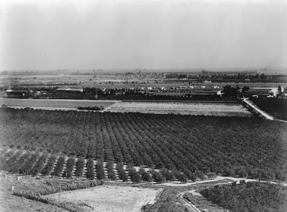 |
|
| (ca. 1930)*# - Birdseye view over an orchard on the Mission San Fernando, looking east from the Santa Susana Mountains towards the Cahuenga Pass. A wide swath of treetops can be seen spanning the width of the image, while other planted rows stand behind them. Still farther out, residential buildings are spaced out disparately over a large plot of flat ground. In the foreground, a cleared and unplanted patch of soil can be seen. |
 |
|
| (1930s)^*## - Map of the San Fernando Valley in the early 1930's. Several of the communities have changed names since this map was printed including Girard, North Los Angeles, and Granada. This was a time before freeways, and the pass through the Santa Monica Mountains, Sepulveda Pass, was still a dirt road. |
Historical Notes The community of Girard is identified in the center-left of photo near the intersection of the State Highway and Topanga Canyon. In 1945 it became known as Woodland Hills.^* Originally called Zelzah, the town that we call Northridge today was renamed North Los Angeles on July 1, 1929. In 1938, this area of the San Fernando Valley was renamed Northridge Village. Few evidences of the "village" remain.#^^# The community of Granada was founded in 1926. The “Hills” was added 15 years later in 1941.^* The Ventura Freeway would not be completed across the San Fernando Valley until 1960.^ |
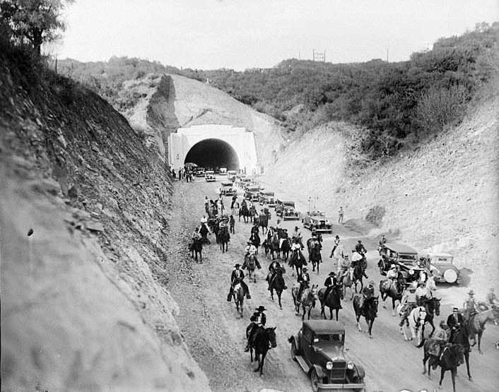 |
|
| (1930)^^ - View of a procession of cars, horses and wagons moving south through the new Sepulveda Boulevard tunnel following opening ceremonies. After eight years of road construction, the new tunnel connected the San Fernando Valley with West Los Angeles. |
Historical Notes The Sepulveda Tunnel opened on September 27, 1930. Until then, the Sepulveda Pass consisted of just a dirt road and some trails. Most of the traffic between the Valley and the city moved over Cahuenga Pass and narrow passages like Laurel Canyon and Beverly Glen.^^#* |
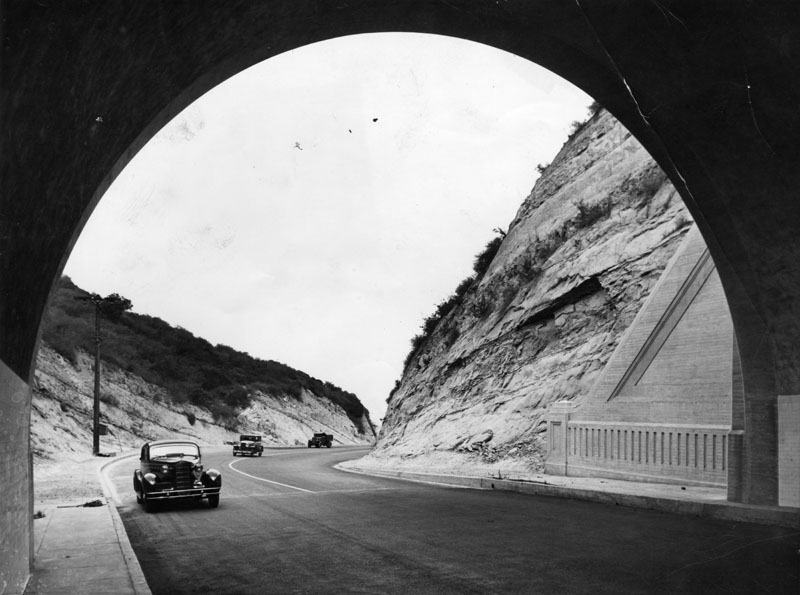 |
|
| (1935)^ - View of cars about to enter the Sepulveda Tunnel through the Santa Monica Mountains shortly after the dirt road was paved for the first time. This is part of the Sepulveda Highway connecting Ventura Blvd. to Sunset. |
Historical Notes Sepulveda Pass was paved and became a state highway route in 1935.^^#* |
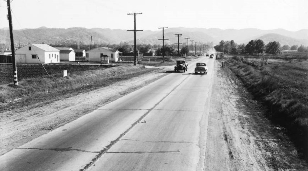 |
|
| (1939)*# – View of Sepulveda Boulevard looking south from Magnolia Boulevard before improvement. Sepulveda is at center and is a paved, two lane road with dirt shoulders. Wide ditches can be seen on both sides of the road, and several automobiles are driving on its surface. A collection of small wooden buildings can be seen at left, while at right is an open field. A line of utility poles runs parallel to the road at left. |
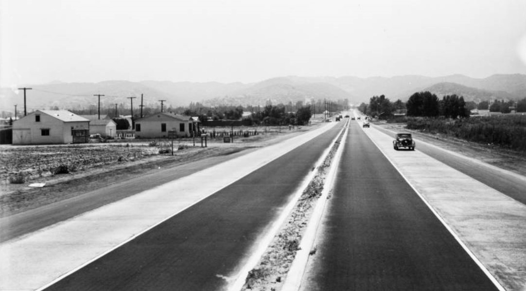 |
|
| (1940)*# - View of Sepulveda Boulevard looking south from Magnolia Boulevard after improvement, June 18, 1940. Sepulveda is at center and is now a six-lane road with a dirt divider in the middle. Note: The pole line has been removed. |
Click HERE to see more Early Views of the San Fernando Valley |
La Cañada Flintridge
 |
|
| (1927)^ - Panaromic view showing Crescenta Valley, the location of La Cañada Flintridge.
Crescenta Valley is located between the San Gabriel Mountains (background) and the Angeles National Forest. |
Historical Notes Prior to incorporation in 1976, La Cañada and Flintridge were two distinct communities. Flintridge was named after Republican Senator and developer Frank Putnam Flint.^ |
 |
|
| (n.d.)^ - View of La Cañada after a snow storm |
* * * * * |
Please Support Our CauseWater and Power Associates, Inc. is a non-profit, public service organization dedicated to preserving historical records and photos. We are of the belief that this information should be made available to everyone—for free, without restriction, without limitation and without advertisements. Your generosity allows us to continue to disseminate knowledge of the rich and diverse multicultural history of the greater Los Angeles area; to serve as a resource of historical information; and to assist in the preservation of the city's historic records.
|
For more Historical Los Angeles Views click one of the following:
For Other Historical Views click one of the following:
See Our Newest Sections:
To see how Water and Electricity shaped the history of Los Angeles click one of the following:
Water:
Power:
* * * * * |
References and Credits
* DWP - LA Public Library Image Archive
^ LA Public Library Image Archive
*^Oviatt Library Digital Archives
^^LA Times Photo Archive; New Viaduct for Red Car Line
#*MTA Transportation and Research Library Archives
#^California Historical Society Digital Archive
^*#Library of Congress: 4th Street Bridge
*^#Los Angeles Conservancy: LA Stock Exchange Building; Warner Bros.Theatre; Downtown Jewelry Exchange/Warner Bros. Theatre
*#*Westland.net: Venice History
+#*LA Curbed
+^^The Eastsider: Riverside-Figueroa Bridge
+++Photobucket
**#The California History Room, California State Library: William Reagh
^^#The George A. Eslinger Street Lighting Photo Gallery
^## Facebook.com: Photos of Time Travelers
^^*Early Downtown Los Angeles - Cory Stargel, Sarah Stargel
***Los Angeles Historic - Cultural Monuments Listing
*^*California Historical Landmarks Listing (Los Angeles)
*^^Nuestra Señora la Reina de los Ángeles: losangelespast.com
**^^Aerofiles - US Aviation Firsts
**##Facebook.com: Garden of Allah Novels – Martin Turnbull
**^*California State Library Image Archive
*^^*Pinterest.com: Bertrand Lacheze
*^*^Big Orange Landmarks: Los Angeles City Hall
^*^#Facebook.com - Bizarre Los Angeles
^^^*KCET.org: Three Forgotten Incline Railways; Lost Tunnels of Downtown LA; Figeuroa St. Tunnels
*^#^Huntington Digital Library Archive
*^^#Los Angeles Past: Temple and Main Streets, Los Angeles - Then and Now
^^*#Historical LA Theatres: Loew's State Theatre; Warner Bros.Theatre; College Theatre
*##^LAist.com: The Knott's Berry Farm You May Not Know
^#^*Noirish Los Angeles - forum.skyscraperpage.com; Broadway Tunnel
^#^^Flickr.com: Michael Ryerson
^#*#LA Magazine: When Knott’s Berry Farm Was Actually a Farm
#*#*Fairfax High School Home Page
#*#^Facebook.com - Los Angeles Theatres: Warner Bros. Downtown
#^#*San Diego Air & Space Museum Archive
^##^Online Archive of California (OAC): Bullock's Department Store Building
##**Franklin HIlls Residents Association
##^^Cinema Treasures: Warner Bros.Theatre
##^#Facebook.com: Classic Hollywood-Los Angeles-SFV
##*^Fourth Street Bridge Over Lorena Street
#^**Water and Power Associates
**^**Los Angeles City Historical Society
*^*^*Wehadfacesthen.tumblr.com
^^^^#A History of the Los Angeles City Market
**^ Forum.Skyscraperpage.com; 8th and Francisisco; Muller Bros. Service Station; Gilmore Aerial; Shakespeare Bridge; Prospect Studios; Gilmore Tanker Truck; Gilmore Station
^* Wikipedia: Hollywood Sign; Carthay Circle; Carthay Circle Theatre; Fairfax High School; Park La Brea; San Vicente Boulevard; Etymologies of place names in Los Angeles; Los Angeles Central Library; Broadway Tunnel; Pershing Square; Pacific Electric Railway; Gilmore Field; GilmoreStadium; Union Station; Westwood; 6th Street Viaduct Bridge; Figueroa Street Tunnels; Chavez Ravine; 2nd Street Tunnel; Hollywood Freeway; Los Angeles International Airport; Los Angeles City Hall; Wilshire Boulevard Temple; Egyptian Theatre; The Pig 'N Whistle; Sunland-Tujunga; Van de Kamp Bakery Building; Los Angeles County Art Museum; Los Angeles City Oil Field; Los Angeles City Hall; Lafayette Park; Signal Hill; Jonathan Temple; Bullock's; Broadway Theater District: Lowe's State Theater; Obadiah J. Barker; Los Angeles Plaza Historic District; Knott's Berry Farm; KFWB; Rose Bowl Stadium; Olympic Boulevard; Thomas Fairfax; Zeppelin; Los Angeles International Airport; Maddux Air Lines; Charles Lindbergh; Spirit of St. Louis; Hollywood Presbyterian Medical Center; Hollywood; Shakespeare Bridge; Franklin HIlls; John Marshall High School; Prospect Studios; History of Los Angeles; 1926 World Series; Broadway Tunnel
< Back