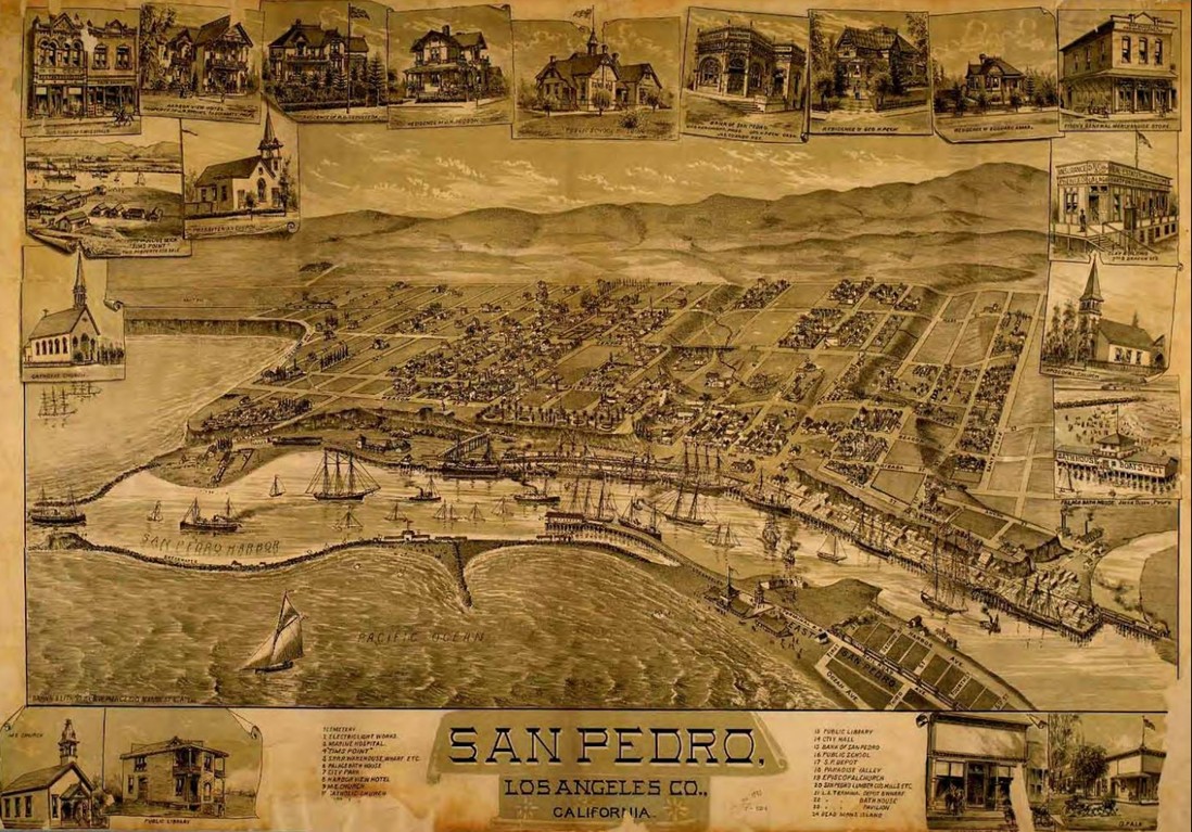
Early Views of San Pedro and Wilmington
Historical Photos of San Pedro and Wilmington |
Introduction |
Long before breakwaters, container terminals, and naval ships transformed the waterfront, the shores of San Pedro Bay were home to Native villages, cattle ranches, tidal marshes, and a handful of scattered landings where cargo was laboriously transferred between ships and shore.The harbor that would eventually become Southern California's gateway to the Pacific began as a shallow, windswept anchorage where geography often worked against commerce. Ships anchored offshore, goods moved by small boats, and muddy tidal flats made large scale development difficult.Yet the bay possessed one important advantage that visionaries such as Phineas Banning immediately recognized: location. Situated closer to the growing pueblo of Los Angeles than competing harbors, San Pedro offered the possibility of becoming the region's principal connection to the Pacific world.The photographs that follow trace the transformation of the harbor from Spanish exploration and Mexican ranchos to wharves, stage lines, railroads, and the beginnings of one of America's great maritime centers. |
* * * * * |
 |
|
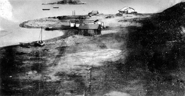
| (1850)* - The earliest known photographic view of what is now San Pedro Harbor, captured in a daguerreotype, a silver on copper process that predates glass plate photography. Deadman's Island, a small rocky outcrop that would later become one of the harbor's best known landmarks before being removed in 1928, appears in the background. |
| Historical Notes
In 1542, Spanish explorer Juan Rodríguez Cabrillo sailed into what he called the "Bay of Smokes," named for the fires of Native villages along the shore. The south facing bay was shallow and muddy, making it difficult to build wharves. Ships either anchored offshore and transferred goods by small boats or beached themselves at high tide. San Pedro was named for Saint Peter of Alexandria, whose feast day, November 24, matched the date Cabrillo entered the bay. Santa Catalina Island, visible offshore on clear days, was claimed for Spain the following day on the feast of Saint Catherine. Deadman's Island remained a familiar harbor landmark for generations before being removed during harbor expansion in the late 1920s. |
 |
|
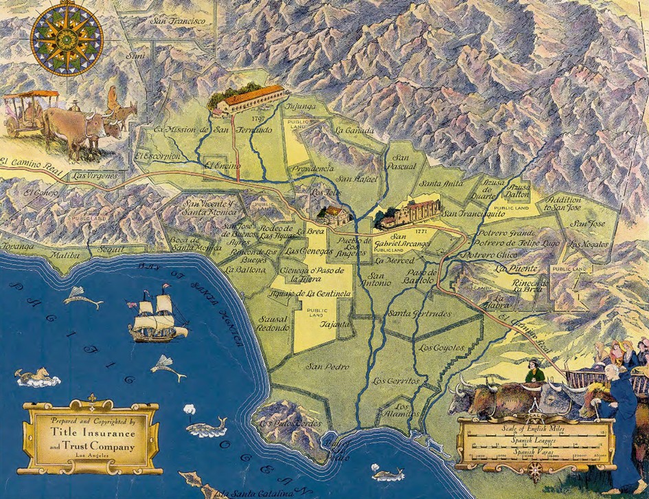
| (1919)* - Map showing Spanish and Mexican land grants in Los Angeles County, including Rancho San Pedro, a vast territory that once covered much of the harbor area and the land that would become many of the surrounding communities. |
| Historical Notes
Rancho San Pedro was one of the largest land grants in early Southern California. In 1784, the Spanish Crown granted more than 75,000 acres to Juan José Dominguez, a retired soldier whose land stretched from present day Compton south to the Palos Verdes Peninsula. Following Mexican independence, the rancho was re granted to the Dominguez family in 1822. Over time, disputes between the Dominguez and Sepulveda families over ownership boundaries lasted for decades before eventually dividing the land into smaller parcels that became modern cities and communities. |
 |
|
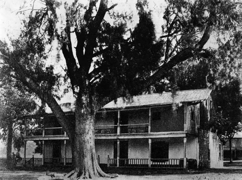
| (n.d.)* - Exterior view of the two story adobe home of Don Diego Sepulveda, built in 1853 on Channel Street in San Pedro. It is considered the first Monterey style two story adobe in Southern California. |
| Historical Notes
When this house was built, San Pedro was little more than a small landing with a pier, a handful of buildings, and muddy roads. In 1851, a young entrepreneur named Phineas Banning arrived in San Pedro and immediately recognized the potential for a major port and transportation center. During the following decades, Banning built wharves, roads, railroads, and shipping operations that transformed the harbor region. The site of the Sepulveda adobe was later designated California Historical Landmark No. 380. |
 |
|
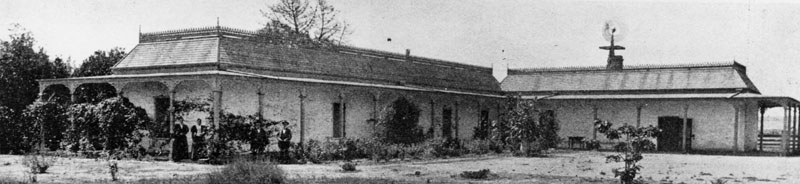
| (1800s)* - George H. Carson stands on the far right and Mrs. Carson on the far left at the Dominguez adobe. |
Historical Notes Mrs. Carson was the daughter of Manuel Dominguez, heir to Rancho San Pedro and one of the most influential figures in early Los Angeles. Dominguez served under Spanish, Mexican, and American rule and later became a delegate to California's Constitutional Convention in 1849. George H. Carson was a businessman and Mexican War veteran who married into the Dominguez family in 1857. After Manuel Dominguez's death in 1882, the estate was divided among his six daughters, linking the future of the rancho to families such as Carson, Del Amo, and Watson whose names still appear throughout the South Bay today. |
 |
|
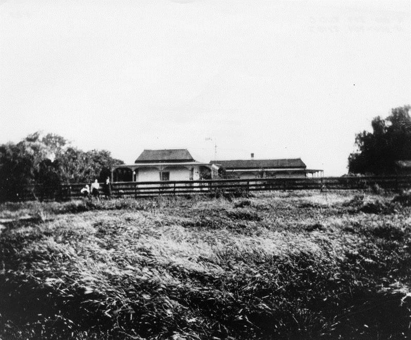
| (ca. 1800s)* - View of the Dominguez adobe near what would become Wilmington, with several people standing near the fence. |
| Historical Notes
In 1858, Phineas Banning purchased land from Manuel Dominguez and established a harbor settlement he initially called New San Pedro before later renaming it Wilmington after his hometown in Delaware. Wilmington quickly became the inland port for Los Angeles, connected to the outer harbor at San Pedro first by road and stagecoach and later by railroad. |
 |
|
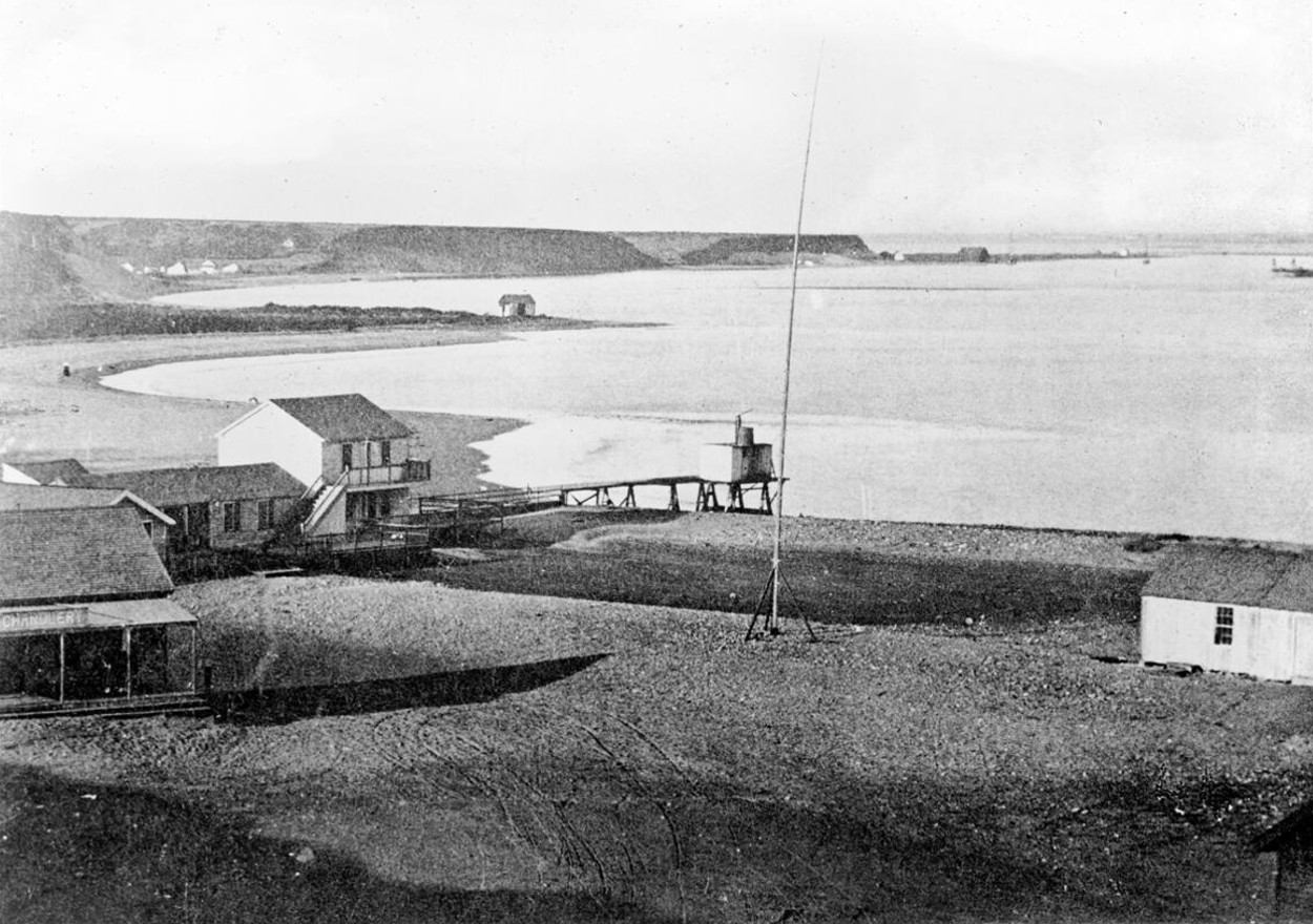
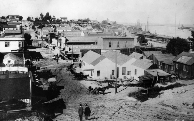
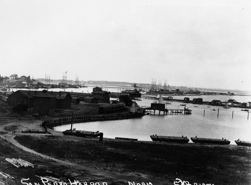
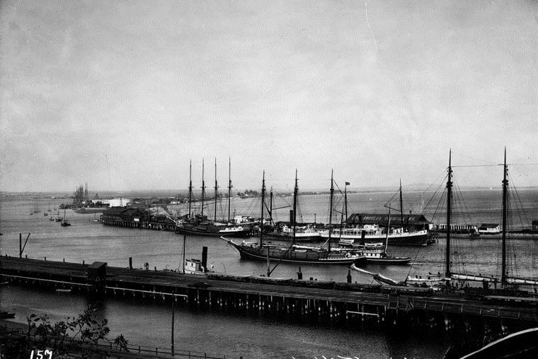
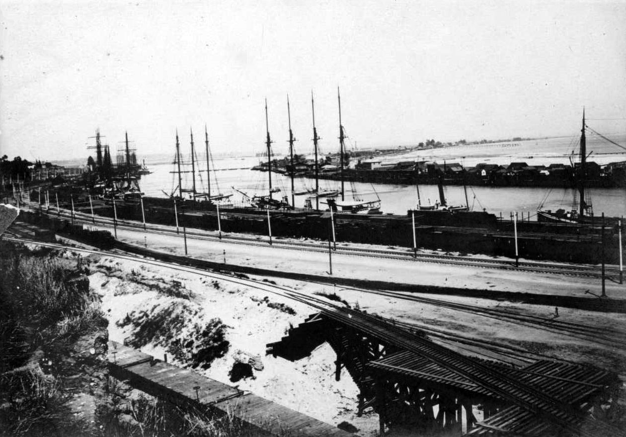
| (ca. 1871)* - View of Timm's Landing in San Pedro. A flagpole stands near the center of the image and a sign reading "Chandlery" can be seen on one of the nearby buildings. The original caption noted that "The town of San Pedro is nestled in the canyon at left." |
| Historical Notes
Before large scale harbor construction, the southern edge of Los Angeles was dominated by tidal flats and marshes. In 1852, Augustus W. Timms constructed a wharf and warehouse here, creating what many historians consider the first true port facility in the area. Timm's Landing served ships, stage lines, and freight operations for decades and later became known as Timms' Point. The site was designated California Historical Landmark No. 384. |
 |
|
| (1870s)* - View of San Pedro Harbor showing a ship aground near the shoreline. |
| Historical Notes
Early harbor conditions were often unpredictable. Ships frequently ran aground in shallow water and shifting tides. In some cases, vessels intentionally grounded in order to unload cargo using lighterage, a system in which goods were transferred to smaller boats and ferried ashore. The absence of a deep water channel severely limited trade and delayed Los Angeles' rise as a major port until federal harbor improvements began in the early twentieth century. |
 |
|
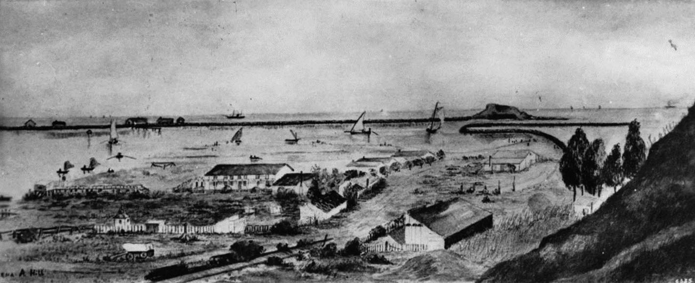
| (ca. 1875)* - Painting depicting Timms' Point, Terminal Island, and Deadman's Island before modern breakwaters and dredging reshaped the harbor. |
| Historical Notes
Small sailboats, wagons, sheds, and scattered buildings reveal a working waterfront still in transition. Deadman's Island rises offshore while early structures cluster along the shoreline. Images such as this provide a rare glimpse of Los Angeles Harbor before dredging, breakwaters, and industrial development permanently altered the landscape. |
 |
|
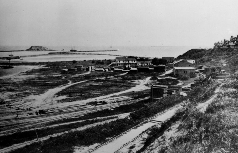
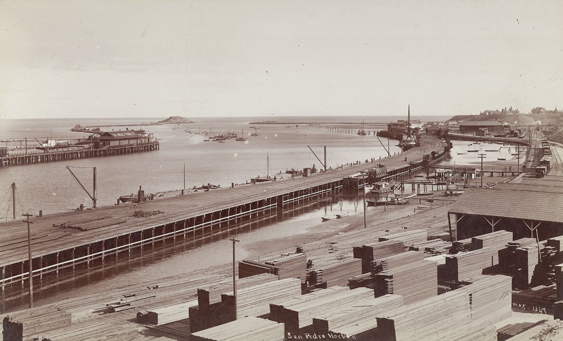
| (1876)* - View of San Pedro Harbor from Timms' Landing looking southeast. |
| Historical Notes
Lumber piles, rail tracks, and shoreline buildings reflect growing industrial activity along the waterfront. Deadman's Island remains visible in the distance. This period marked the transition from ranch based land use to transportation and shipping infrastructure. Within a generation, extensive harbor improvements would transform this quiet waterfront into one of the busiest ports on the Pacific Coast. |
 |
|
| (ca. 1870s)* - View of Timms' Point and Los Angeles Harbor. |
| Historical Notes
In 1857, the Dominguez family sold Phineas Banning land at the head of the slough northeast of San Pedro. Banning built wharves, warehouses, and steamship operations, turning Wilmington into the dominant shipping center of the bay. He also operated stage lines carrying passengers and freight between the harbor, Los Angeles, and inland destinations as far away as Arizona and Utah. |
 |
|
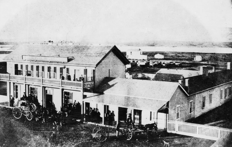
| (ca. 1865)* - View of the Wilmington Exchange Hotel and stage station on Canal Street. |
| Historical Notes
Built in 1863, the Wilmington Exchange Hotel was the town's first hotel and an important stop for travelers arriving at the harbor. The attached building served as Phineas Banning's first Wilmington residence. Long before the railroad arrived, stagecoaches operating from this station provided the primary connection between Los Angeles and its harbor. |
* * * * * |
The Los Angeles & San Pedro RailroadFirst Railroad in Southern California |
 |
|
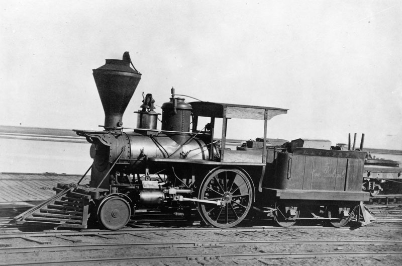
| (ca. 1868)* - Locomotive San Gabriel at Wilmington Harbor. |
| Historical Notes
The Los Angeles and San Pedro Railroad was the first railroad built in Southern California. Completed in 1869, the 21-mile line connected San Pedro Bay with Los Angeles and began service on October 26 of that year. The railroad was promoted by Phineas Banning to move freight quickly from ships at the harbor to the city. Before the railroad, goods were hauled by ox carts and wagons over rough roads. In 1873, the railroad was purchased by the Southern Pacific Railroad, securing the harbor’s long-term role in regional trade. |
.jpg) |
|
| (ca. 1870)* - View of the Los Angeles and San Pedro Railroad stopped at a station. |
| Historical Notes
The new railroad sharply reduced the cost of moving goods and passengers between the harbor and Los Angeles. Freight rates dropped, and travel time was cut from days to hours. Inbound dry goods were shipped to the city for six dollars per ton. Grain shipped out to the harbor cost two dollars and fifty cents per ton. A one-way passenger ticket between Los Angeles and the harbor cost one dollar and fifty cents. Harbor commerce more than doubled between 1869 and 1871. |
 |
|
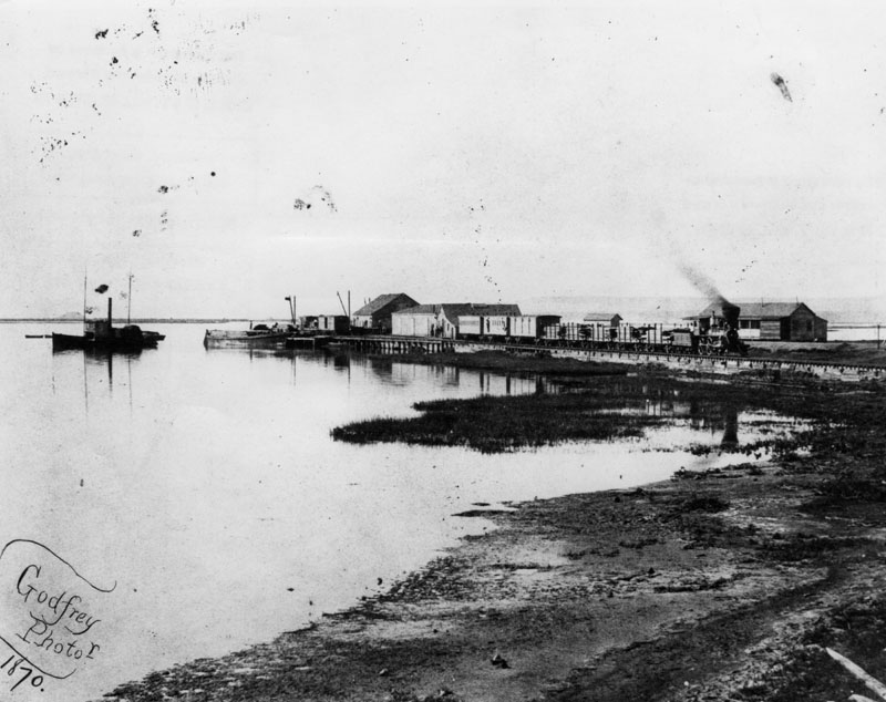
| (1870)* - View of Wilmington Harbor showing the Los Angeles and San Pedro Railroad along the waterfront. |
| Historical Notes
Despite the railroad, the harbor remained shallow and undeveloped. Large ships anchored offshore and transferred cargo by small boats and rafts. Lumber, badly needed for growing towns, was especially difficult to handle under these conditions. The railroad improved inland access, but true harbor growth required major changes to the shoreline and water depth. |
* * * * * |
Deadman’s Island and Early Harbor Improvements
 |
|
| (1873)* - View of Deadman’s Island showing houses and early harbor structures. |
| Historical Notes
By the late 1860s, Phineas Banning understood that three improvements were needed for San Pedro Harbor to succeed: a railroad, a breakwater, and a dredged channel. The railroad was completed in 1869. In 1871, Congress approved funding for a rock jetty extending from Rattlesnake Island toward Deadman’s Island. That same year, Banning dredged the Wilmington channel to a depth of ten feet, greatly improving shipping capacity. |
 |
|
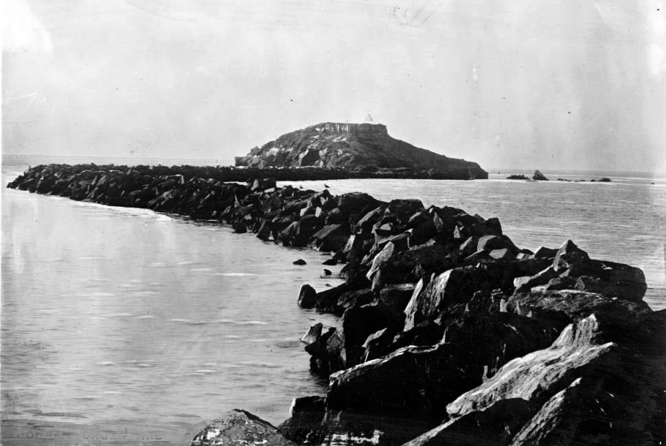
| (1870s)* - View of the San Pedro breakwater extending outward from Deadman’s Island. |
Historical Notes Deadman’s Island was one of two small islands near San Pedro. The other, Rattlesnake Island, later became part of Terminal Island. Rock breakwaters helped control tidal flows and reduce sediment buildup. Deadman’s Island itself was later dredged away in 1928 during large-scale harbor expansion. |
 |
|
| (1876)* - Workers building the Wilmington breakwater using horses to move heavy materials. |
Historical Notes Breakwater construction was labor-intensive and relied on animal power and manual labor. These early structures helped stabilize the harbor and protect shipping lanes from storms and flooding. The work laid the foundation for the modern Port of Los Angeles. |
* * * * * |
Wilmington as a Harbor Community
 |
|
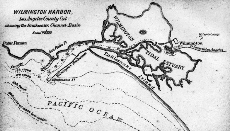
| (ca. 1880)* - Drawing of Wilmington Harbor showing the breakwater, channel, basin, and railroad tracks. |
| Historical Notes
This drawing shows Wilmington as a planned harbor town, with rail access, protected waters, and industrial facilities. Also shown is Wilson College, established in 1874. Wilson College was the first coeducational college west of the Mississippi River. It later relocated closer to Los Angeles and became the University of Southern California in 1880. |
 |
|
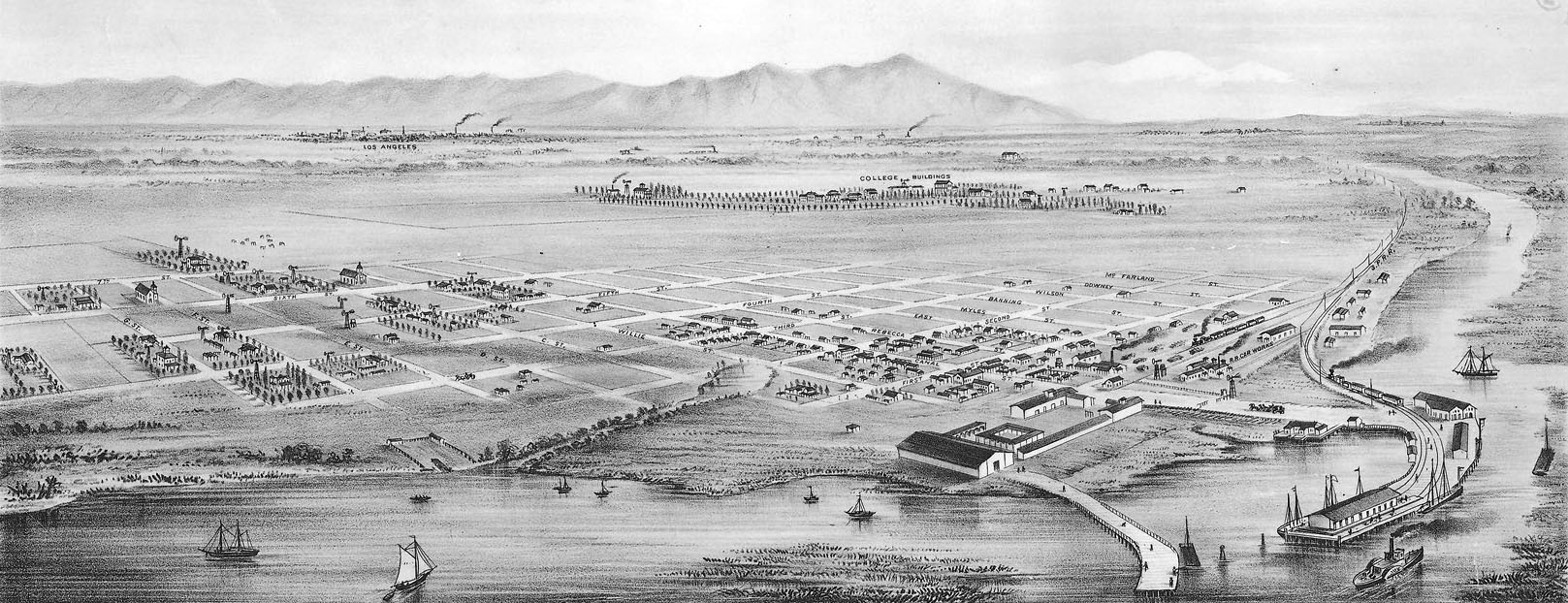
| (1877)* - Bird’s-eye view of Wilmington looking north toward the Sierra Madre Mountains. |
| Historical Notes
In 1873, the City and County of Los Angeles transferred ownership of the Los Angeles and San Pedro Railroad to the Southern Pacific Railroad, along with financial incentives, to ensure that Southern Pacific routed its lines through Los Angeles. This decision tied the region’s future growth to rail transportation and national markets. |
* * * * * |
Rancho San Pedro and the Dominguez Legacy
 |
|
| (ca. 1880)* - Drawing of Rancho San Pedro with a railroad line crossing the land. |
Historical Notes Rancho San Pedro was California’s first Spanish land grant. Issued in 1784 to Juan Jose Dominguez, the original grant covered 75,000 acres, including the entire Los Angeles harbor area. The land passed through generations of the Dominguez family and remains partly intact today through family-owned enterprises. Rancho San Pedro is designated California Historical Landmark No. 152 and is listed on the National Register of Historic Places. |
 |
|
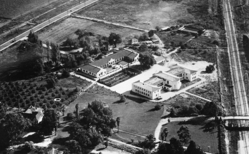
| (n.d.)* - Aerial view of the restored Dominguez adobe and the Claretian Seminary. |
Historical Notes After Manuel Dominguez died in 1882, the rancho was divided among his six daughters. Three family lines continued the legacy through the Carson, Del Amo, and Watson families. In 1922, land next to the family home was donated to the Claretian Missionaries. The adobe later served as a seminary and remains an important historic site. |
* * * * * |
Early Commerce and Military Presence
 |
|
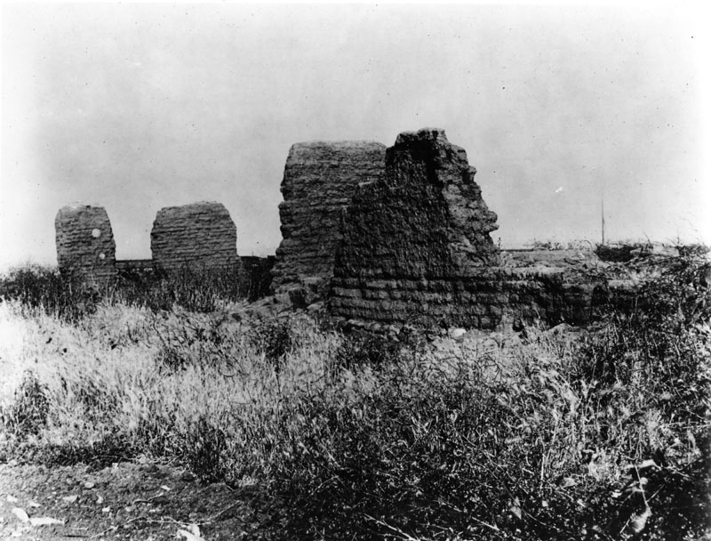
| (1900)* - Ruins of the Hide House, also known as Casa de San Pedro, at Fort MacArthur. |
| Historical Notes
Built in 1823, the Hide House was the first known commercial structure on San Pedro Bay. It stored cattle hides from nearby missions for trade. The building was later described by Richard Henry Dana in Two Years Before the Mast. Its presence marked the beginning of organized commerce at the harbor. |
 |
|
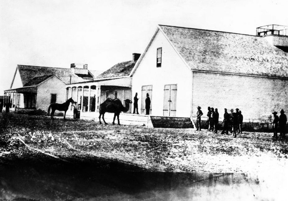
| (ca. 1865)* - Drum Barracks warehouse with camel used for military transport. |
Historical Notes During the Civil War, Phineas Banning provided land for Drum Barracks, the Union Army’s headquarters for Southern California. Established in 1862, the base supplied troops across the Southwest. Camels were briefly used to haul supplies before the experiment ended in 1863. |
 |
|
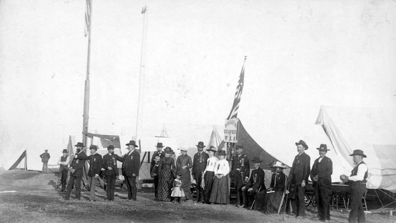
| (1889)* - Veterans encampment at Drum Barracks in Wilmington. |
Historical Notes Drum Barracks was named for Colonel Richard Coulter Drum, although he never visited the site. During the Civil War, thousands of soldiers passed through Wilmington, making it larger than Los Angeles at the time. The military presence helped stabilize and grow the harbor community. |
 |
|
| (ca. 1920)* - Surviving officers’ quarters at Drum Barracks. |
| Historical Notes
The remaining structure once housed officers and is now a museum. It is the only Civil War landmark in California and is designated both a California Historical Landmark and a Los Angeles Historic-Cultural Monument. |
* * * * * |
San Pedro Grows into a Town
 |
|
| (late 1800s)* - Unpaved road in San Pedro with horses and carriages. |
| Historical Notes
San Pedro remained largely unpaved well into the late 19th century. Roads were dusty in summer and muddy in winter, reflecting the town’s working harbor character. |
 |
|
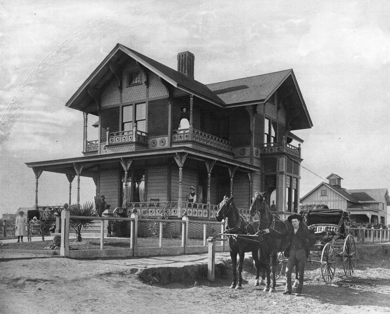
| (1880s)* - Home of James H. Dodson and Rudecinda Sepulveda. |
| Historical Notes
Built in 1881, this Victorian-style home was a wedding gift from the Sepulveda family. James Dodson served as a merchant and postmaster in San Pedro. |
 |
|
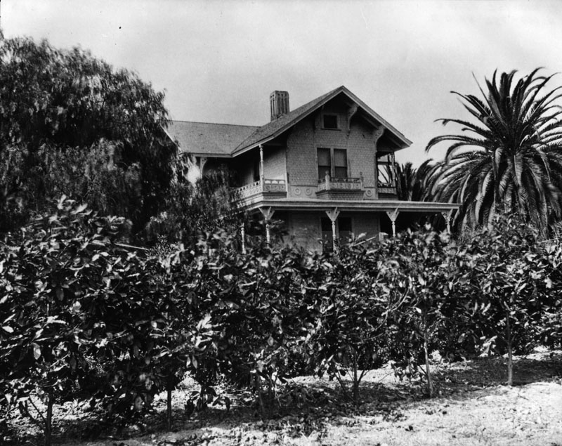
| (1890)* - Partial view of the Dodson residence. |
| Historical Notes
The Dodson home was later moved to 859 West 13th Street. It is designated Los Angeles Historic-Cultural Monument No. 147 and remains a private residence. |
* * * * * |
Everyday Life and Commerce in San Pedro
By the late 1800s, San Pedro had grown from a small landing into a busy harbor town. Boarding houses, hotels, real estate offices, and small businesses served sailors, dockworkers, merchants, and new residents. Many residents were recent arrivals drawn by shipping, fishing, and railroad work. Streets near the waterfront were active day and night, shaped by shipping schedules and seasonal trade.These images show everyday scenes rather than major events. Together, they document how daily life, local commerce, and harbor activity became closely linked as San Pedro developed into a permanent community tied to trade and transportation. |
 |
|
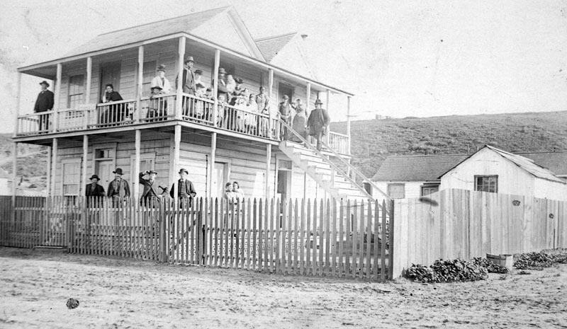
| (ca. 1890)* - Numerous people are seen outside of an unidentified two-story wooden building, which appears to be a boarding house or hotel, in San Pedro. |
 |
|
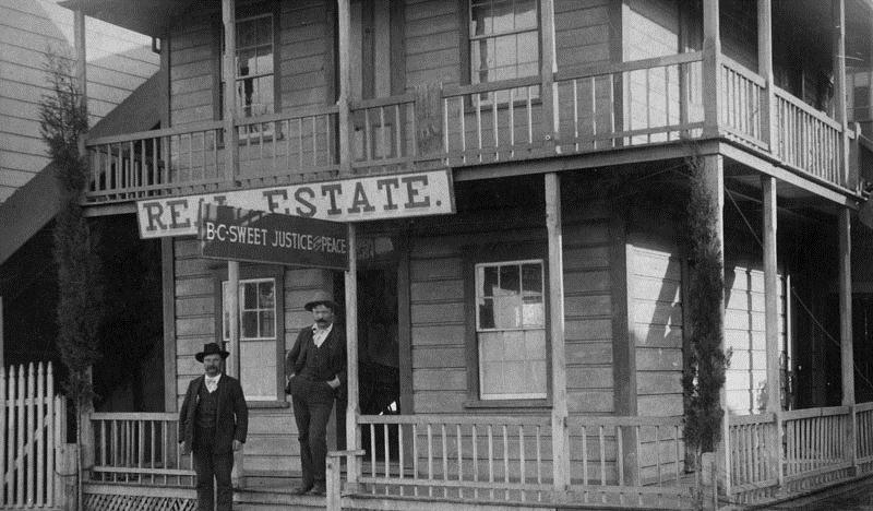
| (late 1800s)* - Two men are standing at the entrance of a real estate office in San Pedro. Additional sign above the entrance reads: B.C. Sweet, justice of the peace. |
 |
|
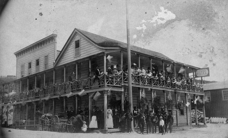
| (ca. 1898)* - Group portrait of people standing on the ground floor and along the balcony of the second floor of the San Pedro Hotel. Many flags are hanging around the hotel. A horse-drawn carriage is parked alongside the hotel. |
 |
|
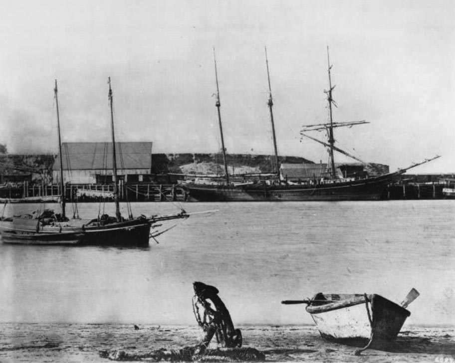
| (ca. 1885)* - View of San Pedro Harbor showing the shipping docks and, in the foreground, an orphaned anchor lying on the beach next to a rowboat. In the background are ships with their sails down, one of which is docked by the pier on the other side of the water. |
 |
|
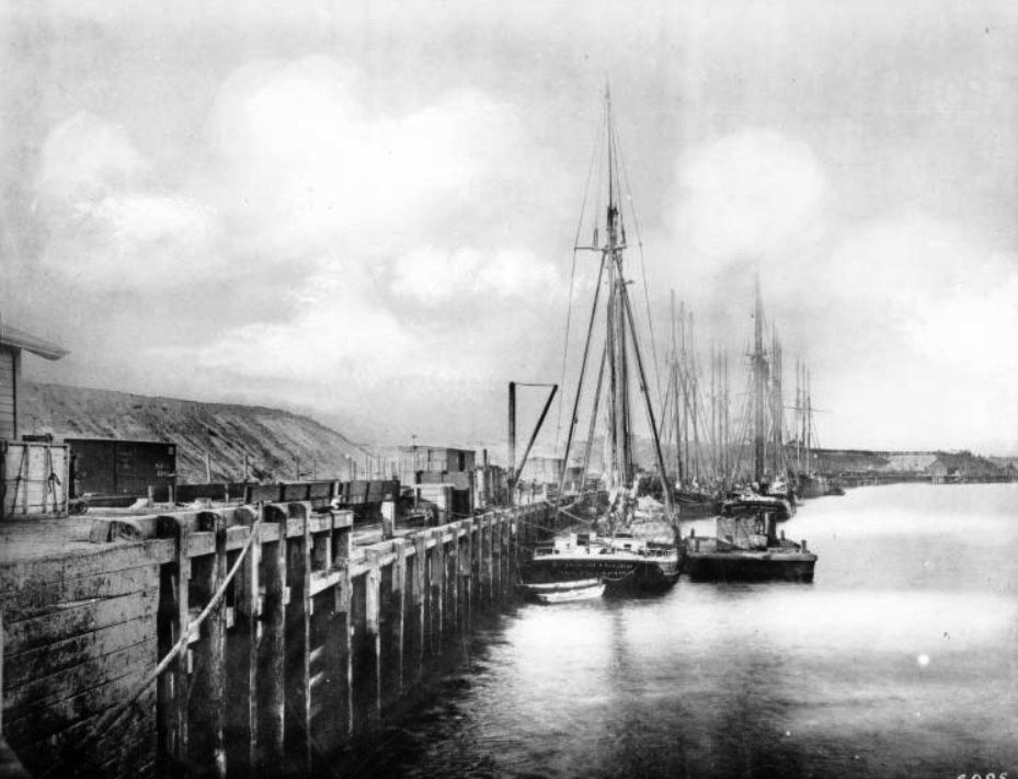
| (ca. 1885)* - Photograph of sailing ships tied up along the pier at San Pedro Harbor. The Eliza Miller from San Francisco is in the center. The ships are docked next to the pier in pairs and all of their sails are down. A Southern Pacific Railroad car is located on the pier to the left. |
 |
|
| (ca. 1890)* - Early view of San Pedro Harbor. Several ships can be seen anchored in the harbor. Train cars sit by a small wharf in the center of the photo. |
 |
|
| (ca. 1890s)* - Close-up view of a crowded San Pedro Harbor, showing several “Tall Ships” docked along the wharf. |
 |
|
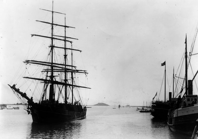
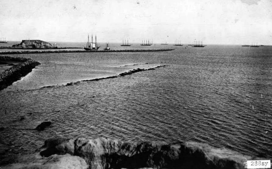
| (1885)^*- View of San Pedro Harbor showing two steam boats and a tall ship in the foreground with Deadman's Island seen in the distance. |
 |
|
| (1880s)* - Harbor filled with sediment after seasonal flooding. |
| Historical Notes
Seasonal floods carried sand and silt into the harbor, repeatedly clogging shipping channels. Between 1871 and 1893, two major breakwaters were built to control tidal flows. These structures scoured the harbor floor and created the main shipping channel still used today, allowing San Pedro to grow into a modern port. |
* * * * * |
Lumber in the HarborBuilding a Growing City |
 |
|
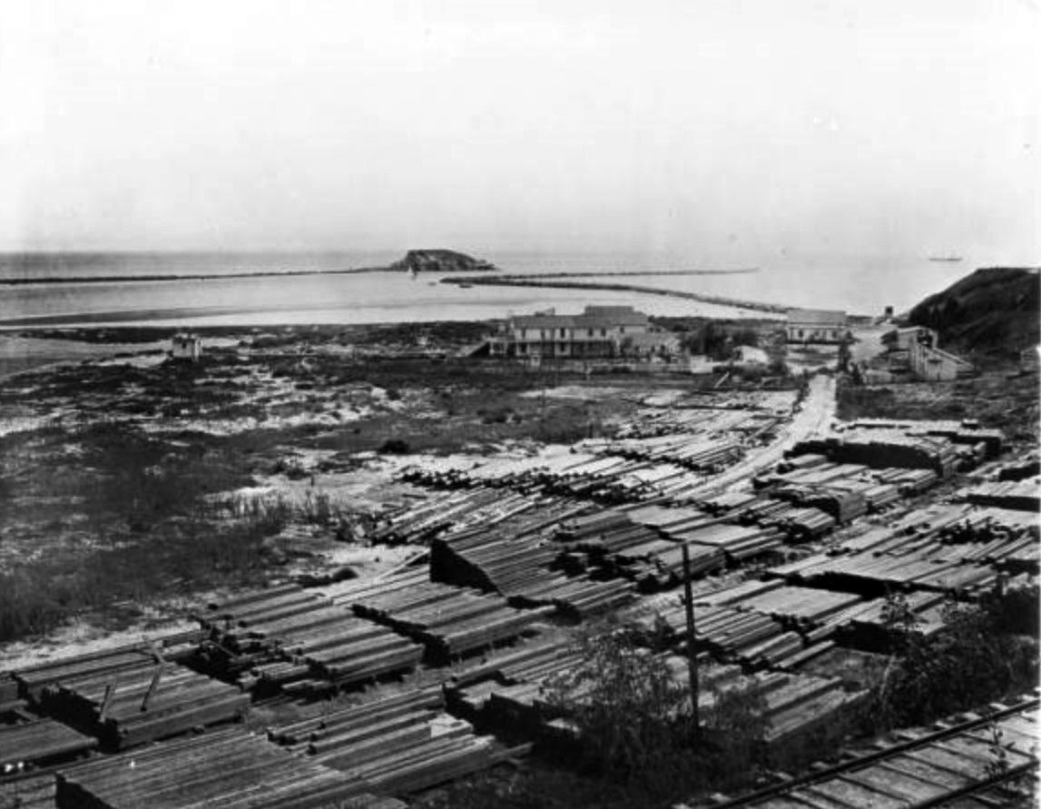
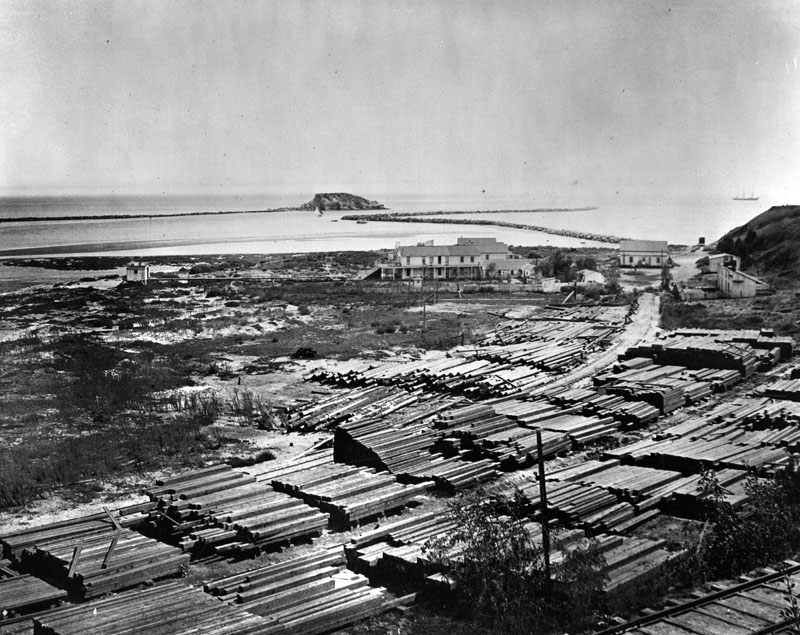
| (ca. 1876)* - View of Deadman’s Island and early breakwaters in the background. Stacks of lumber are stored in a waterfront lumber yard in the foreground. |
| Historical Notes
Lumber was one of the most important imports moving through San Pedro Harbor in the late 1800s. As Los Angeles expanded, demand for building materials increased rapidly. Most lumber arrived by ship from Northern California, Oregon, and Washington, then moved inland by rail and wagon. Much of this lumber passed directly through the harbor without long-term storage. Waterfront lumber yards became a common sight, and large storage areas were needed to keep up with steady arrivals from the Pacific Northwest. |
 |
|
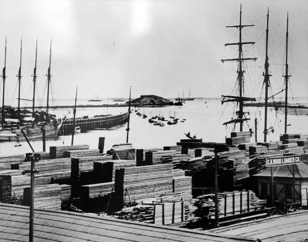
| (1880s)* - View of stacks of lumber sitting along the shoreline, waiting to be transported inland. |
| Historical Notes
Los Angeles grew at an unprecedented pace during the 1880s. Homes, businesses, warehouses, and rail facilities all required vast amounts of lumber. San Pedro Harbor adapted to meet this demand by expanding dock space and storage areas. Wood’s Lumber Company operated on land that later became the Ports O’ Call site, reflecting how early industrial uses shaped the modern harbor. |
 |
|
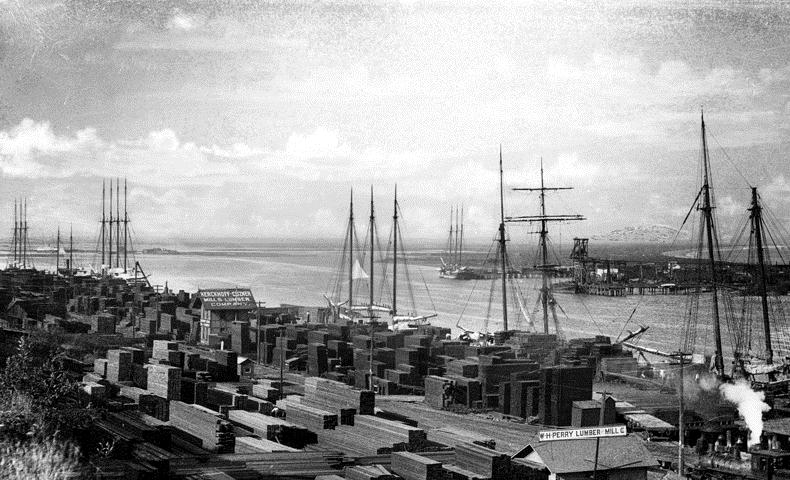
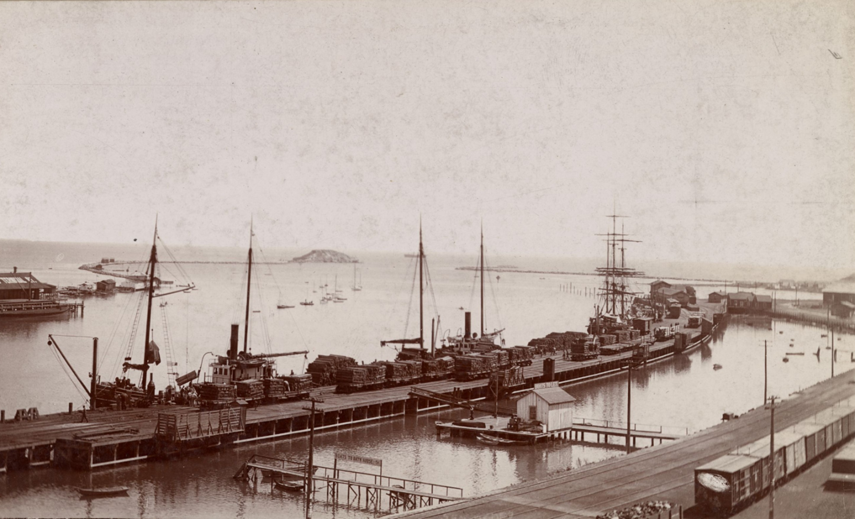
| (ca. 1888)* - Shipping activity at San Pedro Harbor with stacks of lumber visible along the waterfront. |
| Historical Notes
The scale of lumber imports was enormous. During just two months in 1887, more than twenty-five million board feet of lumber were unloaded at San Pedro Harbor. This steady flow of materials helped fuel the rapid construction of Los Angeles and surrounding communities. |
 |
|
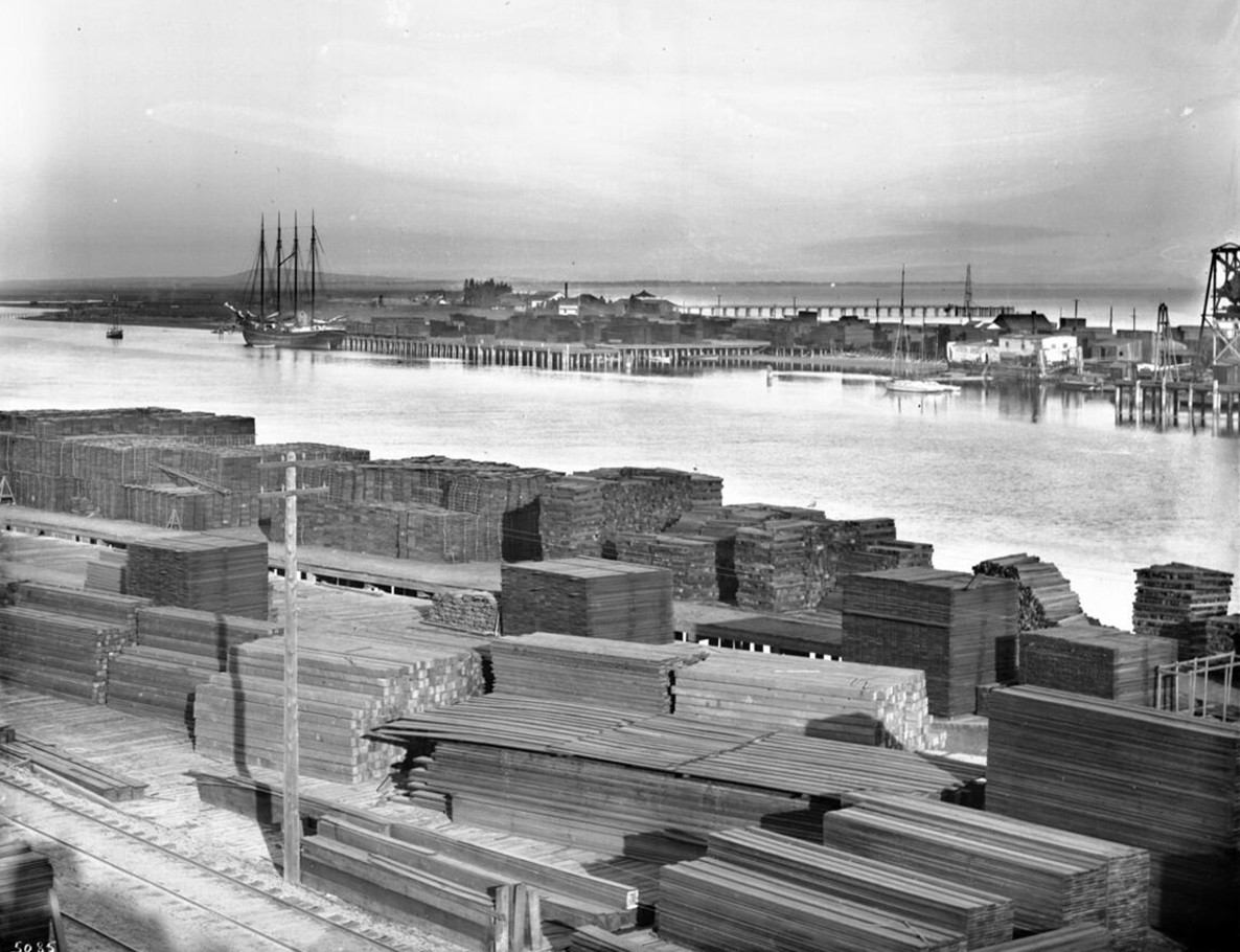
| (ca. 1899)* - View of the Inner Harbor and Terminal Island with lumber stored on both sides of the channel. Railroad tracks run alongside the stacks in the foreground. |
| Historical Notes
By the end of the 19th century, rail lines were fully integrated into harbor operations. Lumber could be transferred directly from ship to railcar, speeding delivery and reducing costs. Photographs from this period frequently show lumber stacked along the shoreline, underscoring its importance to the regional economy. |
 |
|
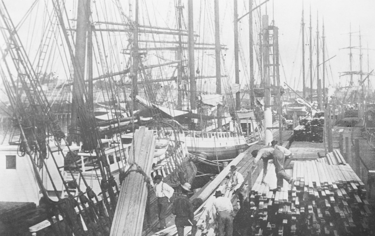
| (ca. 1896)* - Workers loading lumber on the wharf at San Pedro Harbor with ships moored along the dock. |
| Historical Notes
The lumber trade remained strong into the early 20th century and continued until the Great Depression. It played a central role in supplying materials for housing, commercial construction, and infrastructure as Los Angeles evolved from a frontier city into a major metropolis. |
* * * * * |
Tall Masts and Rail Connections
Ships, Trains, and the Working Waterfront
 |
|
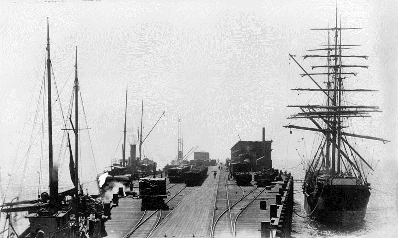
| (ca. 1890)* - View of Los Angeles Harbor showing a lumber ship navigating the channel. The Los Angeles Terminal Railway building is visible in the background, with railroad tracks along the docks. |
| Historical Notes
By the 1890s, San Pedro Harbor functioned as an integrated transportation hub. Ships carrying lumber docked alongside rail lines that moved cargo directly inland. After the death of Phineas Banning in 1885, his sons continued to promote harbor development. By that time, the port handled more than 500,000 tons of shipping annually. |
 |
|
| (ca. 1890)* - Railroad cars waiting as workers unload lumber from a ship onto rail carts at the harbor. |
| Historical Notes
Efficient transfer between ship and rail was essential to keeping construction costs low in Los Angeles. Lumber could move from vessel to railcar in a single operation, reducing handling time and labor. This efficiency strengthened San Pedro’s position as the preferred harbor for Southern California. |
* * * * * |
Santa Monica Long Wharf
San Pedro Harbor’s Early Competition
 |
|
| (ca. 1893)* - Aerial view of the Southern Pacific Mammoth Wharf, also known as the Santa Monica Long Wharf, with a train visible on the pier. |
| Historical Notes
In 1893, the Southern Pacific Railroad built the Santa Monica Long Wharf, calling it Port Los Angeles. At 4,700 feet long, it was the longest pier in the world and allowed trains to run directly to deep-water ships. This sparked a major political and economic battle over where Los Angeles’ main harbor should be located. Southern Pacific favored Santa Monica, while others argued for San Pedro Bay. |
 |
|
| (ca. 1893)* - View from the end of the Santa Monica Long Wharf looking toward shore. |
| Historical Notes
Opponents of the Santa Monica site argued that San Pedro Bay offered better natural protection and long-term expansion potential. Newspaper publisher Harrison Gray Otis and U.S. Senator Stephen White led the fight for a free public harbor at San Pedro. |
 |
|
| (1898)* - View of the business end of the Santa Monica Long Wharf. |
Historical Notes In 1897, the United States Congress selected San Pedro Bay as the official site for the Port of Los Angeles. Despite this decision, the Santa Monica Long Wharf remained the city’s primary port until 1903. The wharf is designated California Historical Landmark No. 881. Click HERE for more on the Santa Monica Long Wharf |
* * * * * |
The Free Harbor Fight and the Modern Port
 |
|
| (ca. 1880s)* - View of Los Angeles Harbor with lumber stacked on railroad cars alongside the channel. Breakwaters and Deadman’s Island are visible in the background. |
| Historical Notes
The Free Harbor Fight was resolved in favor of San Pedro in 1897 after a federal commission led by John C. Walker endorsed the site. With federal support secured, major breakwater construction began in 1899. San Pedro and Wilmington were later annexed to the City of Los Angeles in 1909, formally linking the harbor to the city it served. |
 |
|
| (ca. 1880s)* - Colorized view of Los Angeles Harbor showing lumber stacked on railroad cars along the channel. Breakwaters and Deadman’s Island are visible in the background. Image colorized by Richard Holoff. |
| Historical Notes
This colorized image highlights the scale and intensity of harbor activity during the late 19th century. Lumber shipments dominated the waterfront, with rail cars positioned directly beside the channel to speed transfer from ship to land transportation. Colorization helps modern viewers better understand materials, distance, and daily working conditions at the harbor. While the colors are interpretive, the underlying photograph accurately documents how railroads, lumber yards, and harbor improvements operated together as San Pedro developed into the primary port for Los Angeles. |
 |
|
| (ca. 1890s)* - Panoramic view of Los Angeles Harbor showing railcars on the wharf, yachts at anchor, and people walking along the waterfront. |
| Historical Notes
By the turn of the 20th century, San Pedro Harbor had emerged as a fully developed port. Railroads, shipping, and waterfront activity were tightly connected, setting the stage for the modern Port of Los Angeles. |
* * * * * |
Point Fermin Lighthouse
San Pedro, California
 |
|
| (ca. 1880)* - View of the Point Fermin Lighthouse near the edge of the coastal cliffs overlooking San Pedro Bay. |
| Historical Notes
Point Fermin Lighthouse was completed in 1874 and was the first lighthouse built to guide ships into San Pedro Bay. For years, ships entering the harbor had no fixed navigational aid and relied on local knowledge and clear weather. The lighthouse marked the growing importance of San Pedro as a shipping center for Southern California. Its location on the high cliffs made the light visible far out to sea. The lighthouse was built after long efforts by Phineas Banning and other local leaders, who pressed the federal government to improve navigation safety. Although the site and funding were approved earlier, disagreements and delays postponed construction for nearly twenty years. Point Fermin marks the southernmost point of the City of Los Angeles. The point was named by British explorer George Vancouver in 1793 in honor of Father Fermín de Francisco Lasuén, whom he had met earlier in California. Father Fermín de Francisco Lasuén later became the second president of the California missions and founded Mission San Fernando Rey de España. Though often overshadowed by his predecessor, he guided the mission system for a longer period and left a lasting mark on California history. |
 |
|
| (1903)* - Photograph of the lighthouse site on Point Fermin. The top of the lighthouse is just visible above the steep sea cliff. |
| Historical Notes
By the early 1900s, coastal erosion had begun to reshape the cliffs around Point Fermin. Photographs from this period show how close the lighthouse stood to the edge, emphasizing both its dramatic setting and the constant threat posed by wind and waves. Despite these conditions, the lighthouse continued to operate reliably for mariners entering San Pedro Bay. |
 |
|
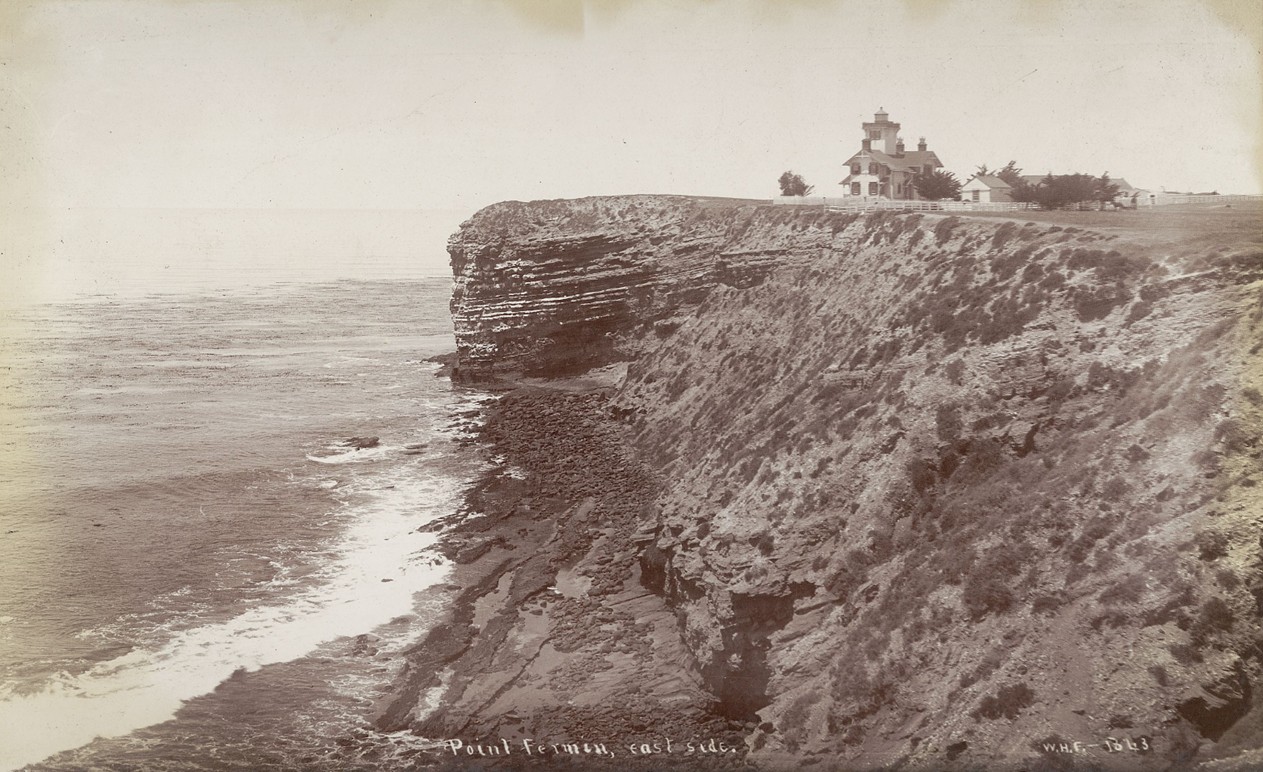
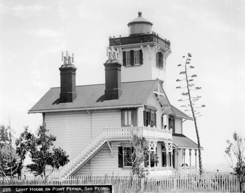
| (ca. 1888)* - View of the Point Fermin Lighthouse from the east side, showing the layered coastal bluff and the Victorian style structure. |
| Historical Notes
This view highlights the lighthouse’s wood frame construction and its relationship to the surrounding landscape. The steep, banded cliffs are a natural feature of the Palos Verdes Peninsula. The lighthouse was carefully positioned to balance visibility at sea with stability on land. |
 |
|
| (ca. 1880)* - Left panel of a stereoscopic photograph showing the multi story wood frame lighthouse surrounded by a white picket fence. |
| Historical Notes
Stereoscopic images like this were popular in the late nineteenth century and allowed viewers to experience scenes in three dimensions. The fence marked the lighthouse grounds and separated the keeper’s residence from grazing land and foot traffic. The structure served both as a navigational aid and as a family home for the lighthouse keepers. |
 |
|
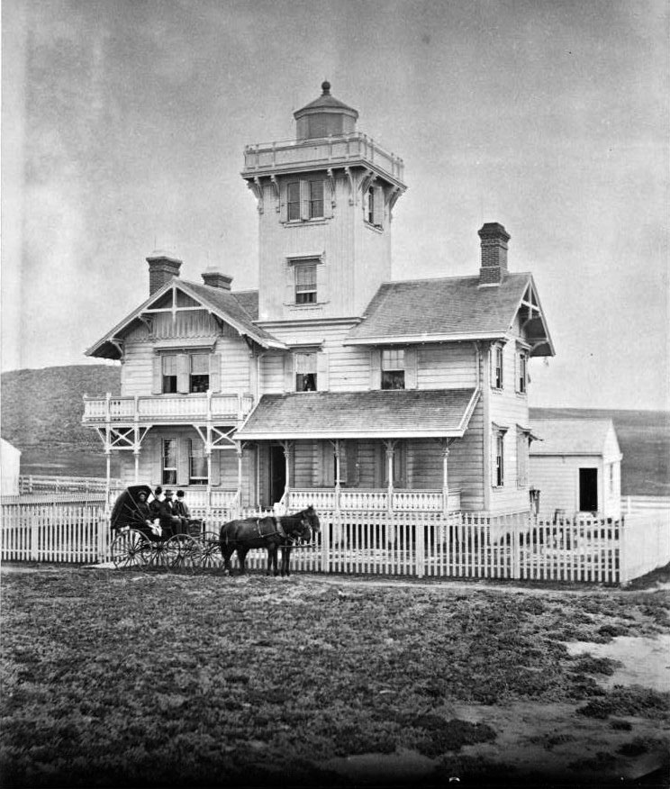
| (ca. 1875)* - View of the lighthouse shortly after completion. Four people sit in a horse drawn carriage in front of the white picket fence. |
| Historical Notes
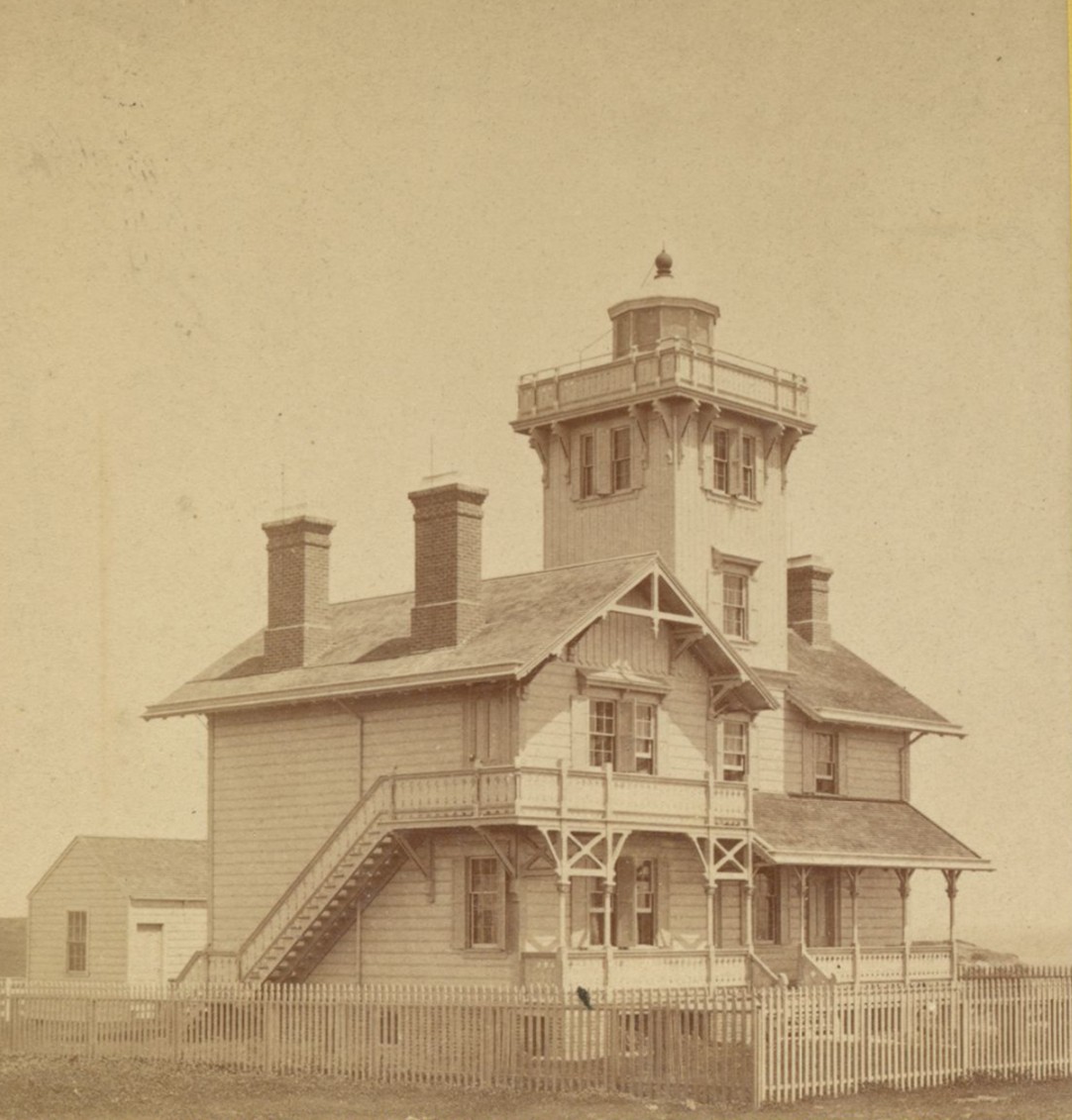
The Point Fermin Lighthouse was designed by Paul J. Pelz, a draftsman for the United States Lighthouse Board. The building reflects the Stick Style Victorian design, known for its simple decoration, gabled roofs, and visible wood details. Similar designs were used at East Brother Island Lighthouse and Hereford Inlet Lighthouse, both of which still stand today. |
 |
|
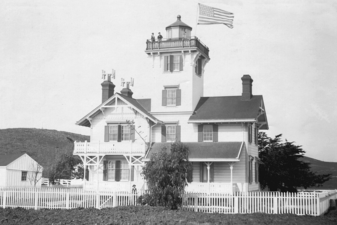
| (1890s)* - Exterior view of the Point Fermin Lighthouse with a keeper standing atop the tower beneath an American flag. |
| Historical Notes
This photograph shows the Point Fermin Lighthouse during its working years, when the light, lantern room, and gallery were fully intact and in daily use. The presence of a keeper on the tower highlights the hands on nature of lighthouse operations, which required constant maintenance, observation, and record keeping. Details such as the flag, gallery railing, and roofline help date the image to the late nineteenth century. During this period, the lighthouse served both as a navigational aid and a residence, with keepers and their families living on site while ensuring the light remained visible to ships entering San Pedro Bay. |
 |
|
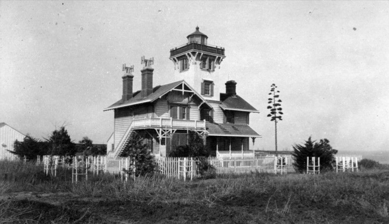
| (ca. 1890)* - Exterior view of the Victorian style lighthouse at 807 West Paseo del Mar on the Palos Verdes Peninsula. |
| Historical Notes
The lighthouse stands about thirty feet tall and rests on a brick foundation. Its wood frame was built using lumber milled from California redwood forests. The attached house provided living quarters for the keeper and family, who were responsible for maintaining the light, cleaning the lens, and recording weather and ship activity. |
 |
|
| (1890)* - Profile view of the lighthouse with trees and a picket fence surrounding the property. |
| Historical Notes
In 1941, shortly after the attack on Pearl Harbor, the light was turned off due to fears it could guide enemy ships or aircraft. The lantern room and gallery were later removed, and a small lookout structure was installed in their place. Locals referred to this temporary structure as the chicken coop. The lighthouse remained dark for decades during and after the war. |
 |
|
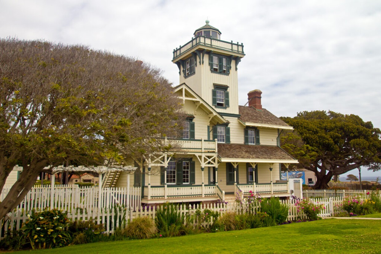
| (2021)* - Modern view of Point Fermin Lighthouse. Photo by Jeremy D’Entremont. |
| Historical Notes
The lighthouse was saved from demolition in 1972 and was listed on the National Register of Historic Places. A full restoration followed, including the reconstruction of the lantern room and gallery to match the original appearance. Today, it is the only surviving nineteenth century lighthouse in the City of Los Angeles. |
Then and Now
 |
|
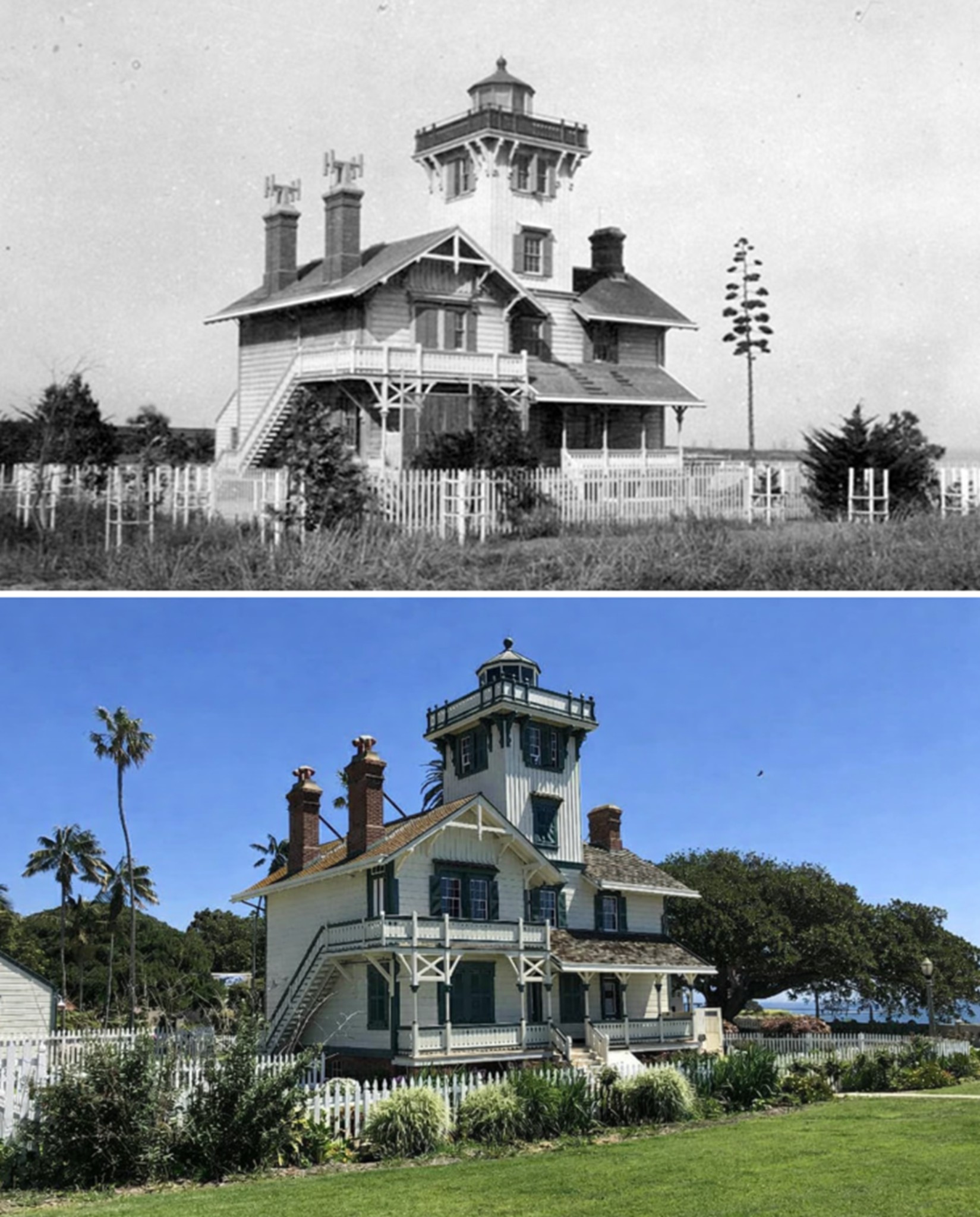
| (1890 vs. 2023)* - Then and now view of the Point Fermin Lighthouse in San Pedro, showing how the historic structure was restored to closely match its original nineteenth century appearance. Photo comaprison by Jack Feldman. |
Historical Notes This then and now comparison highlights the careful restoration of the Point Fermin Lighthouse and how little its appearance has changed since it was first built in the 1870s. After years of modification and decline, the lighthouse was restored so that its overall form, exterior details, and proportions reflect how it originally looked when guiding ships into San Pedro Bay. In 2002, the lighthouse was restored, retrofitted, and rehabilitated for public access using funds from the City of Los Angeles, the Port of Los Angeles, and the State of California. Historic photographs and original design details were used to reconstruct the lantern room, gallery, siding, and trim, allowing the building to closely resemble its original Victorian design. The lighthouse reopened to the public in 2003 and is managed by the Department of Recreation and Parks for the City of Los Angeles. Volunteers from the Point Fermin Lighthouse Society serve as tour guides and help maintain the site, ensuring that this landmark continues to look much as it did when first completed nearly 150 years ago. |
* * * * * |
Sound and Sight: Coastal Navigation at Point FerminWhistling Buoy and Lighthouse |
 |
|
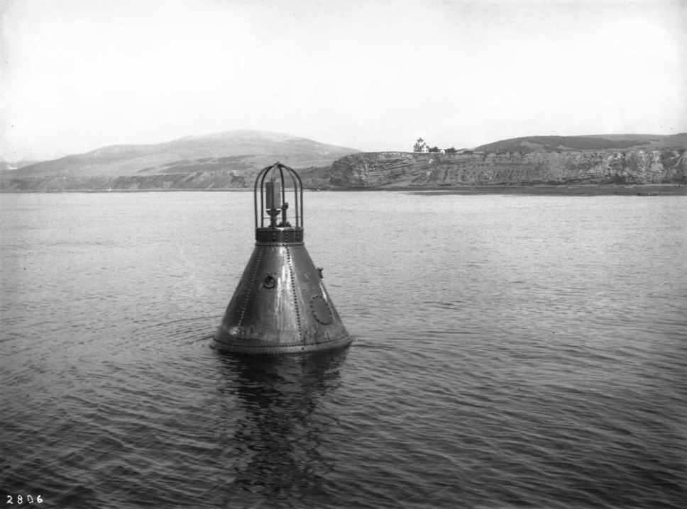
| (1900)* - Close-up view of a whistling buoy floating in calm waters off Point Fermin. The Point Fermin Lighthouse is visible atop the cliff in the background. |
| Historical Notes
Whistling buoys were an important part of late nineteenth-century coastal navigation, especially in fog or poor visibility. Powered by wave motion, the buoy produced a low, mournful sound that warned ships of nearby rocks and shorelines when visual landmarks were obscured. At Point Fermin, the buoy worked in tandem with the lighthouse, providing both audible and visual guidance to vessels approaching San Pedro Bay. Together, these aids helped reduce shipwrecks along a rugged and often fog-prone coastline. |
Point Fermin Cliffs and Lighthouse
 |
|
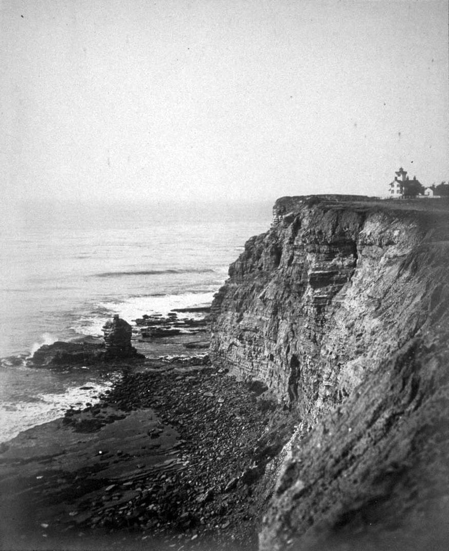
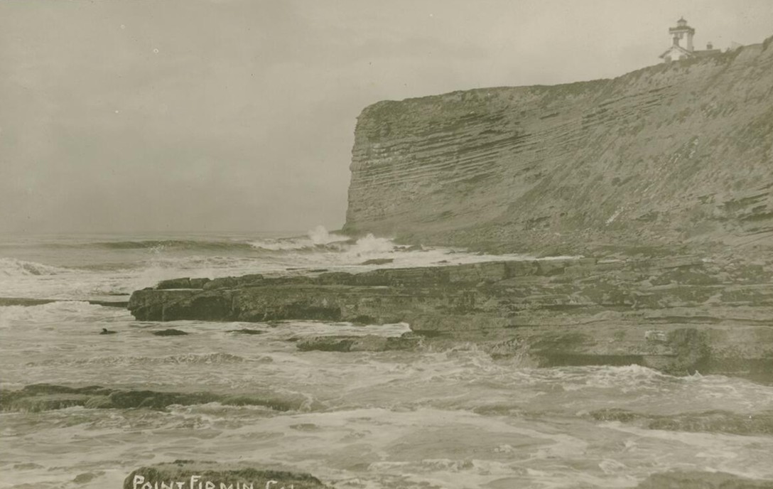
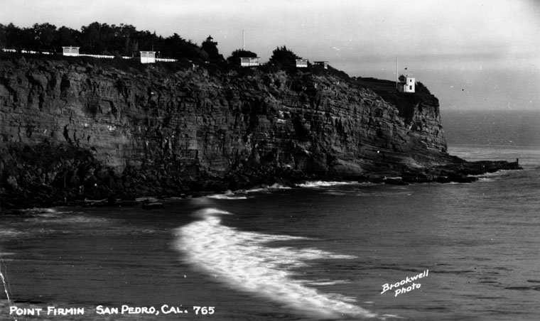
| (n.d.)* - Scenic view of the Point Fermin coastline in San Pedro, with the Point Fermin Lighthouse visible at the far right atop the coastal bluff. |
| Historical Notes
This image captures the dramatic cliffs of Point Fermin, where steep, layered bluffs meet the Pacific Ocean. The lighthouse appears in the distance near the cliff edge, illustrating how it was positioned to maximize visibility for ships approaching San Pedro Bay. Views like this emphasize the lighthouse’s relationship to the surrounding landscape rather than its architectural details. The rugged shoreline, wave action below, and exposed cliffs highlight the constant environmental forces that shaped both the site and the long-term challenges of maintaining a navigational aid in this location. Photographs and postcards of Point Fermin often balanced scenic appeal with subtle references to maritime safety, reinforcing the lighthouse’s role as a quiet but constant presence along one of Southern California’s most important coastal approaches. |
* * * * * |
Before the Port: San Pedro & Los Angeles Harbor(1885–1900) |
 |
|
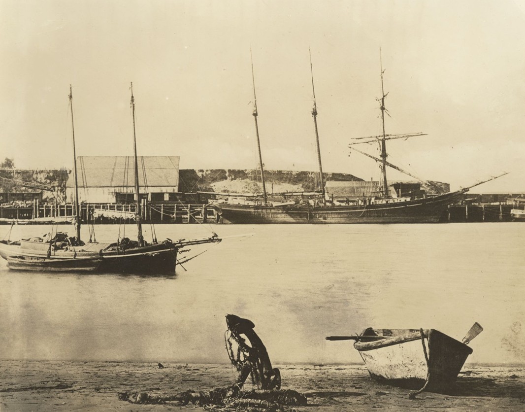
| (ca. 1885)* - A three-masted sailing ship is moored at the early San Pedro wharf. In the foreground, a small rowboat rests with oars visible, and a ship’s anchor stands upright in the sand. The scene shows the simplicity of harbor operations prior to any major infrastructure. Photo by C. C. Pierce. |
| Historical Notes
In the 1880s, San Pedro’s harbor remained largely undeveloped, relying on shallow-draft vessels and hand-loaded cargo. Deep water access was limited, which made transferring goods inefficient. This early image captures the modest scale of operations before federal investments began to reshape the harbor. |
An Improvised Harbor
 |
|
| (1893)* - This early map of San Pedro, drawn by Bruce W. Pierce, shows the town layout before major dredging and breakwater work began. |
| Historical Notes
This 1893 map shows San Pedro before its integration into the larger Los Angeles Harbor complex. At the time, shipping interests were vying for federal support to dredge the channel and construct protective breakwaters. The town’s strategic location near the Los Angeles basin made it a natural candidate for port development. |
 |
|
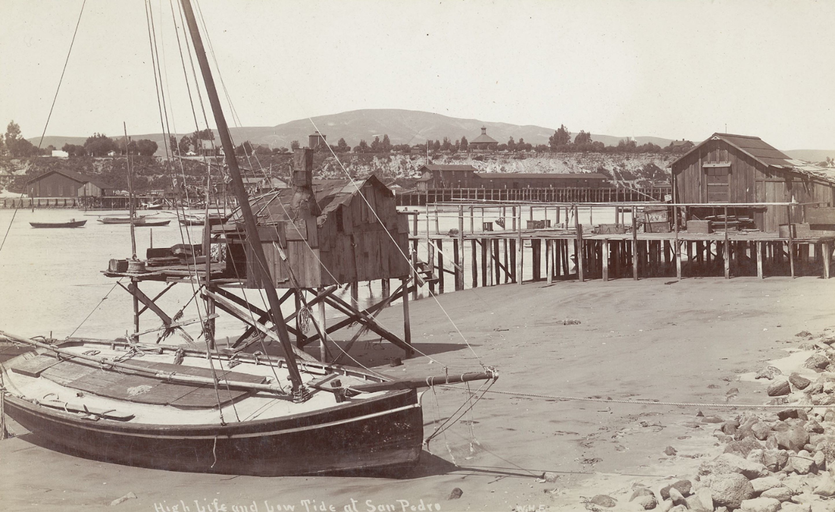
| (ca. 1890)* - Rowboats wait to ferry passengers to a nearby bath house. Signs reading “Boats to Let” reflect a mix of leisure and utility, while the storefronts and bluff behind hint at a town just beginning to grow. Photo from the Ernest Marquez Collection. |
| Historical Notes
In addition to freight activity, early San Pedro served as a modest seaside destination. Bath houses were popular in the 1880s–90s, and small boats ferried visitors from larger vessels or docks. These casual scenes would soon give way to more industrial waterfront development. |
 |
|
| (ca. 1890)* - Freight and Rail Activity at the Wharf. Freight operations in full swing along the San Pedro waterfront. Loaded pallets sit beside rail tracks, and small boats are docked along the wooden pier. |
| Historical Notes
By 1890, informal freight operations had begun integrating with rail systems. Before the Harbor Commission existed, several private companies extended tracks along the waterfront to connect with arriving ships. This marked the beginning of intermodal transport in San Pedro. |
 |
|
| (ca. 1895)* – Stacked lumber and rail tracks dominate the San Pedro wharf scene. These materials supported Los Angeles’s construction boom of the 1890s. Photo by William H. Fletcher. |
| Historical Notes
As Los Angeles expanded rapidly in the 1890s, lumber became the harbor’s most critical import. San Pedro served as a staging area for building materials shipped from the Pacific Northwest and offloaded directly into Southern California’s growing rail network. |
 |
|
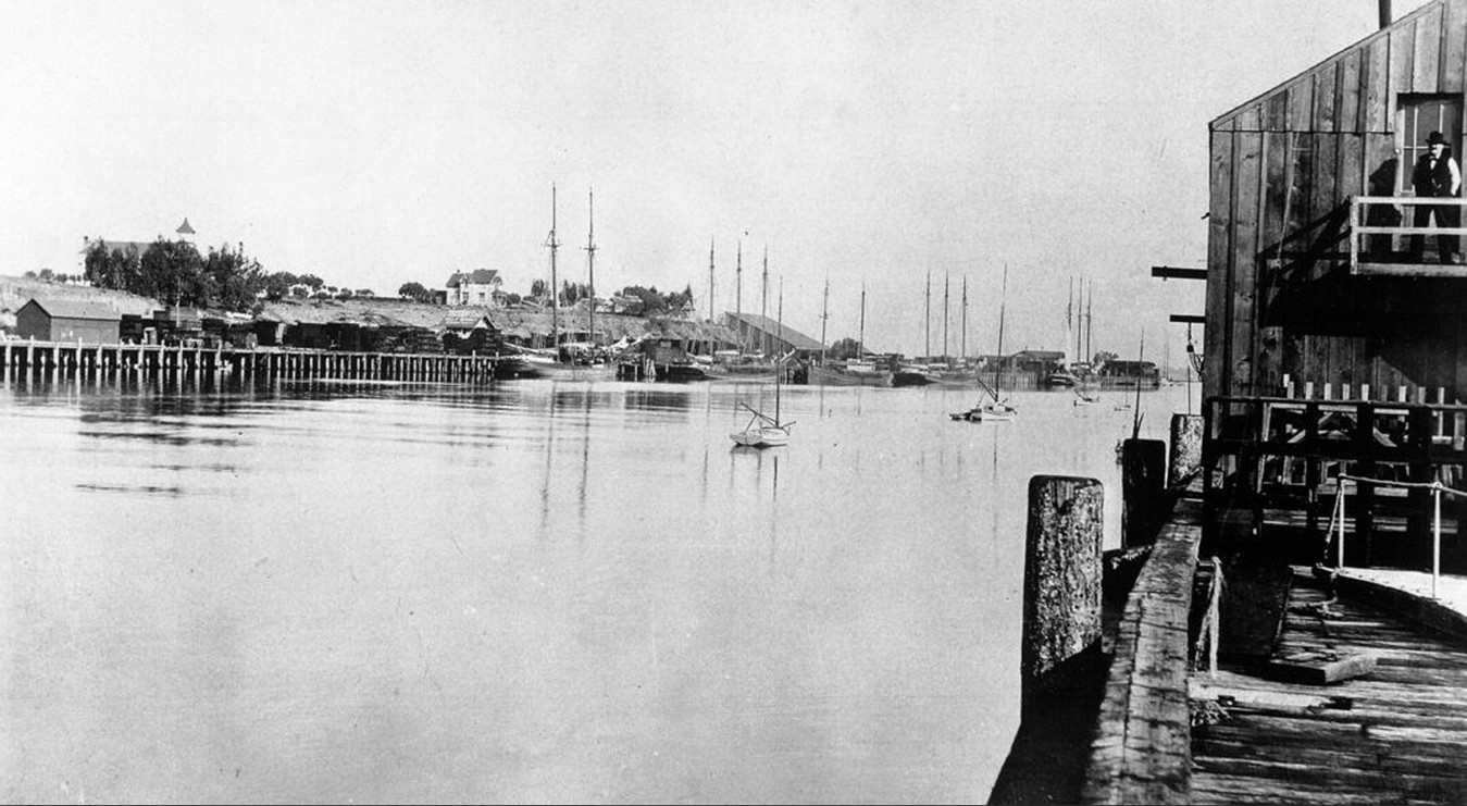
| (1895)* - A beached sailboat sits on the San Pedro shoreline during low tide. In the background: piers, simple buildings, and the bluffs lining the bay. Photo by William H. Fletcher. |
| Historical Notes
The unprotected coastline and lack of adequate piers often left smaller vessels stranded at low tide. Before breakwaters were built, tidal shifts and unpredictable surf posed constant threats to early shipping efforts in the harbor. |
A Harbor on the Verge of Transformation
 |
|
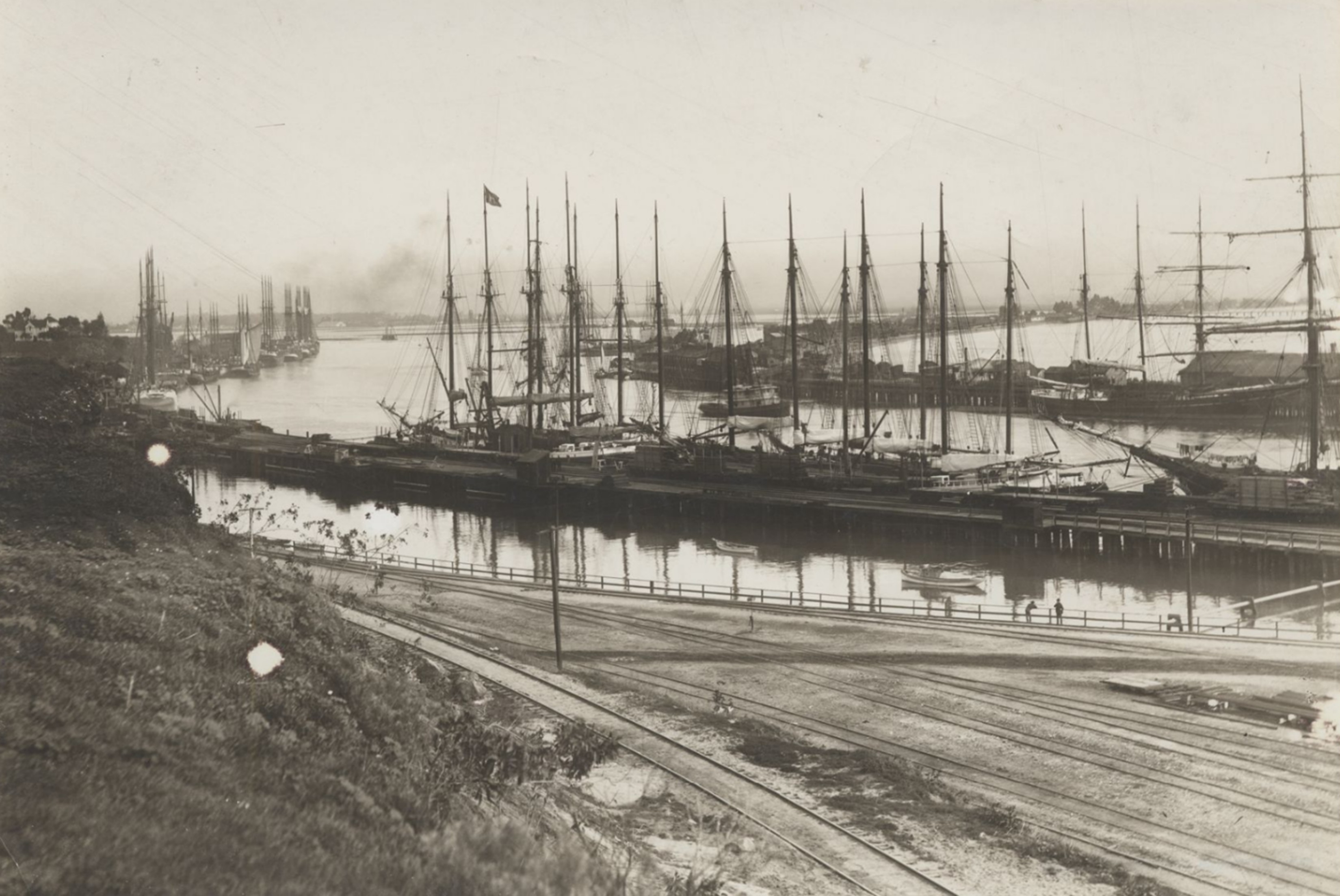
| (ca. 1895)* - An elevated view of the San Pedro waterfront reveals dozens of tall-masted ships along the docks, with rail tracks in the foreground. |
| Historical Notes
This view highlights the dense maritime traffic that defined the mid-1890s. Multiple tall ships are visible at anchor, while rail spurs run along the dock—evidence of the harbor’s growing importance in coastal shipping, especially before containerization. |
 |
|
| (ca. 1896)* - Photograph taken from Terminal Island shows San Pedro Harbor looking inland. The Knob Hill Hospital sits on the bluff to the left, and the cupola of the Clarence Hotel (later the Hotel San Pedro) can be seen in the distance. |
| Historical Notes
This perspective from Terminal Island shows Knob Hill Hospital and the Clarence Hotel overlooking the harbor. By the early 20th century, Terminal Island would evolve from a small sandbar into a major industrial and naval facility, thanks in part to harbor dredging efforts that began in 1899. |
 |
|
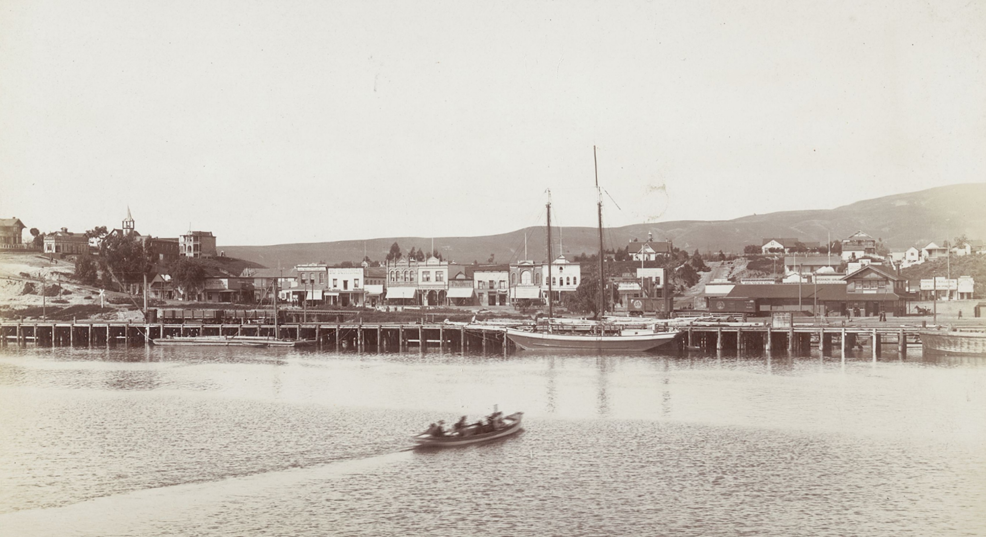
| (1897)* - View of waterfront. Shows main street and bordering buildings, wharf with railroad tracks. By 1897, San Pedro’s Main Street faced the growing harbor. Rail lines ran alongside the dock, supporting maritime commerce and industry. Photo by W. H. Fletcher. |
| Historical Notes
As the port town grew, Main Street developed into a modest commercial hub. Rail access directly to the water enabled faster transfer of goods and passengers—a critical step in securing San Pedro’s future as a competitive deep-water port. |
 |
|
| (1898)* - A vast quantity of lumber awaits transport at the San Pedro waterfront, a reflection of Los Angeles’s explosive building boom during the late 1890s. In the distance, a four-masted schooner is docked near Terminal Island. The harbor’s growing infrastructure—piers, rail spurs, and freight sheds—helped set the stage for its designation as the official Port of Los Angeles in 1907. Photo by C. C. Pierce. |
| Historical Notes
By 1898, the U.S. Army Corps of Engineers had begun initial work on dredging and constructing breakwaters. The scale of lumber shipments visible here reflects booming regional demand for housing and infrastructure—key forces that justified federal investment in a formal port. |
 |
|
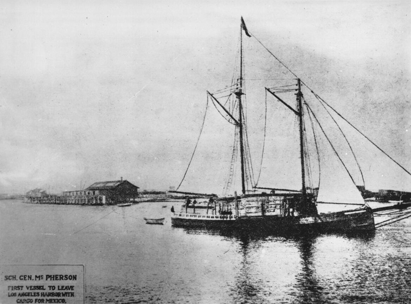
| (1898)* - The schooner General McPherson in full sail departs Los Angeles Harbor—the first vessel to carry cargo to Mexico from the newly functioning harbor. |
| Historical Notes
The General McPherson was the first vessel to leave Los Angeles Harbor with cargo bound for Mexico, symbolizing the beginning of international trade through San Pedro. This was a milestone in Los Angeles’s rise as a Pacific commerce hub, just prior to its designation as an official port in 1907. |
* * * * * |
A Working Harbor Takes Shape (1890s)
 |
|
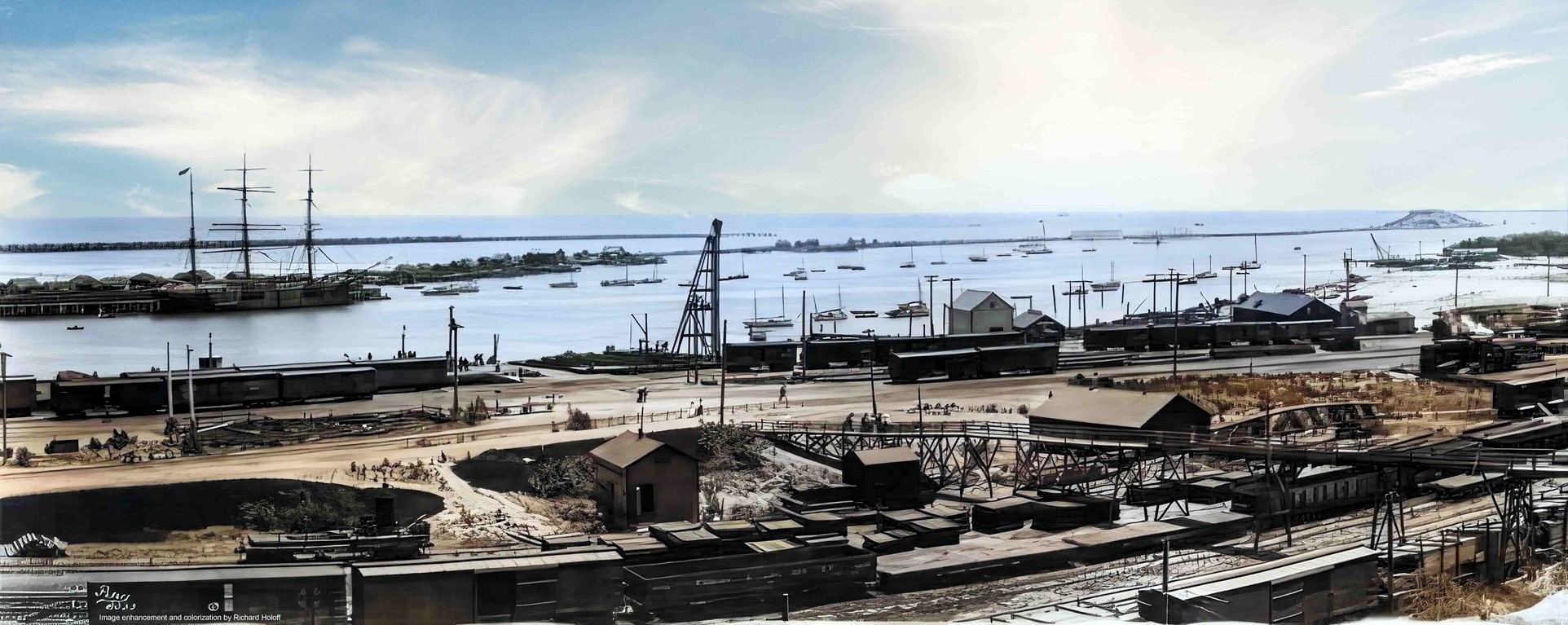
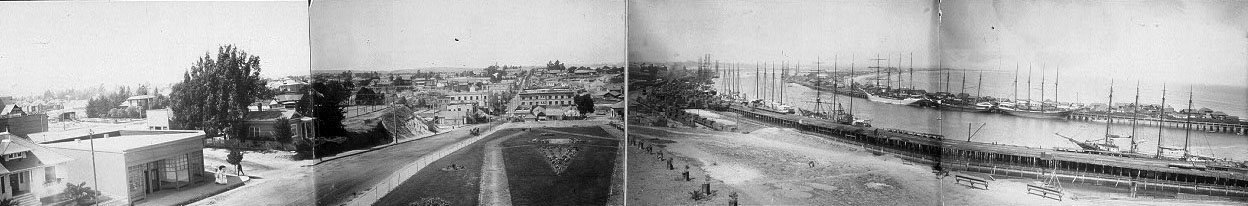
| (1890s)* - Panoramic view of San Pedro Harbor showing multiple vessels anchored offshore and along early wharves. This image was created by stitching together two Library of Congress photographs using Microsoft Image Composite Editor. |
| Historical Notes
By the 1890s, San Pedro Harbor was operating as a functional—though still evolving—commercial harbor. While deep-water access remained limited, the number of vessels visible here reflects a sharp increase in coastal shipping activity. Panoramic views such as this were often created to capture the growing scale of the harbor and to promote San Pedro’s importance as Southern California’s primary maritime gateway before the completion of major federal improvements. |
 |
|
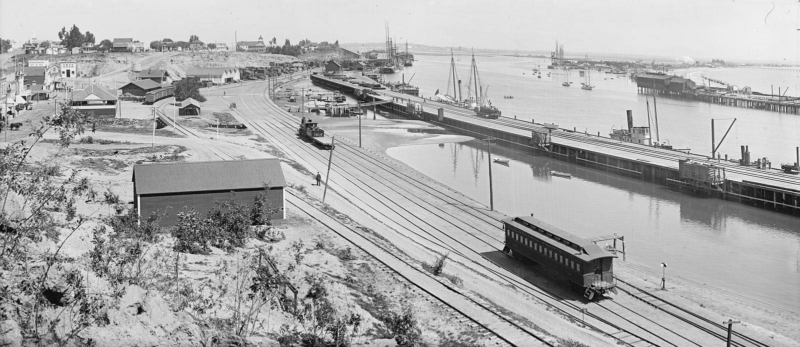
| (ca. 1900)* - View of Los Angeles Harbor at San Pedro showing a large vessel anchored alongside tracks of the Los Angeles Terminal Railway. A railroad passenger car is visible in the foreground. |
| Historical Notes
By the late 1890s, rail connections were firmly integrated into San Pedro’s harbor operations. The Los Angeles Terminal Railway provided a direct link between ships at the waterfront and inland destinations, allowing passengers and freight to transfer efficiently between rail and sea. This image illustrates one of the earliest fully coordinated rail-to-ship interfaces in the harbor, a crucial development that strengthened San Pedro’s case as the region’s permanent deep-water port. |
 |
|
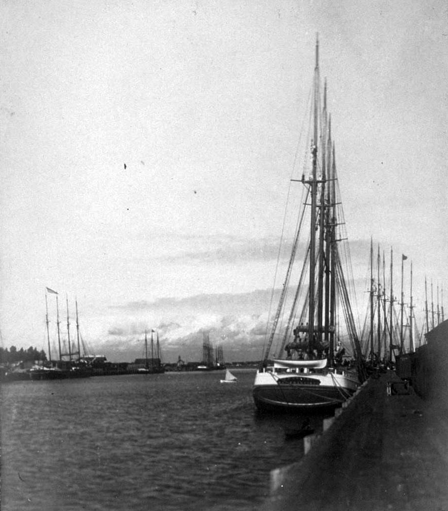
| (ca. 1900)* - Several tall-masted sailing vessels docked in San Pedro Harbor during a period of peak maritime traffic. |
| Historical Notes
Even as steam power expanded, tall-masted sailing ships continued to play a major role in Pacific trade at the turn of the 20th century. Lumber, coal, and general cargo moved through San Pedro aboard both sail and steam vessels. Scenes like this underscore the harbor’s transitional character, blending 19th-century maritime traditions with emerging industrial infrastructure. |
 |
|
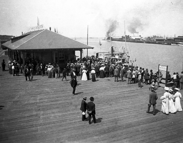
| (ca. 1899)* - Crowds gather along the San Pedro waterfront to observe the arrival of a vessel at Los Angeles Harbor. |
| Historical Notes
Public gatherings such as this were common during ship arrivals in the late 1890s, reflecting both civic pride and the growing economic importance of the harbor. By 1899, federal dredging and breakwater construction were underway, and San Pedro was increasingly recognized as Los Angeles’s principal maritime outlet. These moments marked the harbor’s transition from a regional shipping point to a port of national significance, formally designated as the Port of Los Angeles in 1907. |
* * * * * |
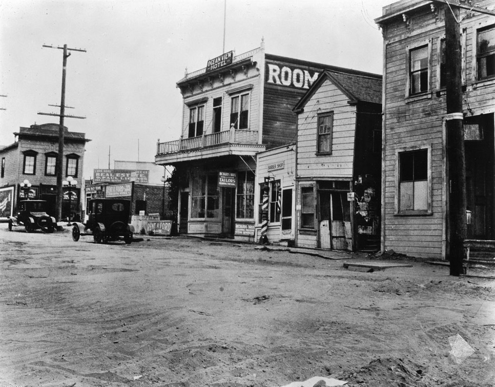
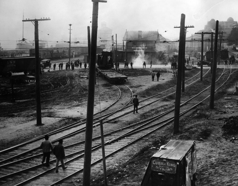
Front Street (now Avalon Boulevard)
 |
|
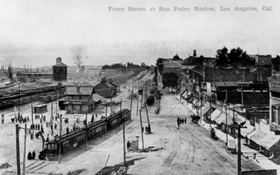
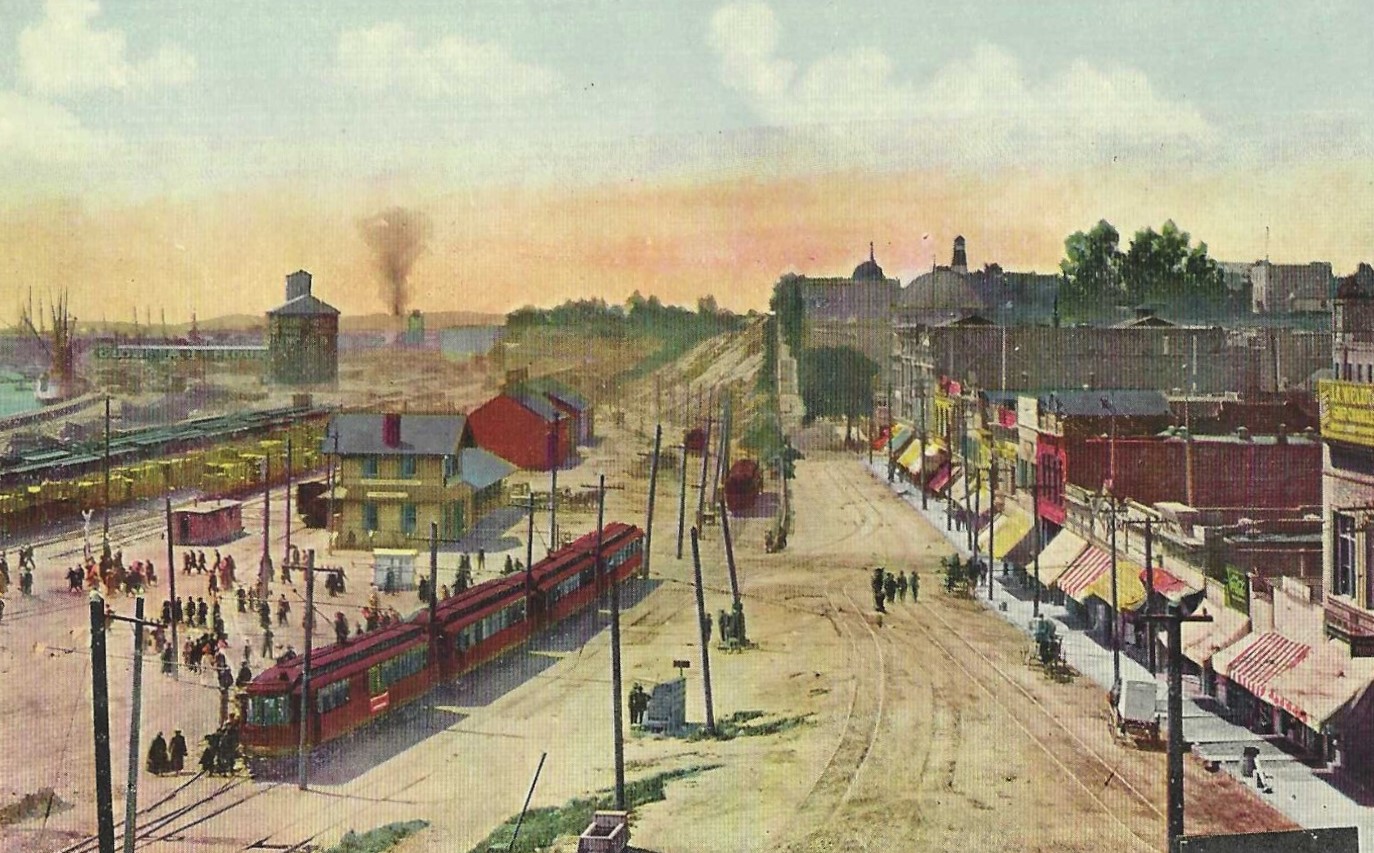
| (ca. 1900)* - Postcard view of Front Street (now Avalon Boulevard) at San Pedro Harbor showing a multitude of passengers disembarking from streetcars. Commercial storefronts can be seen acroos the unpaved road to the far right of the photo. |
Historical Notes The establishment of the Port of Los Angeles in the early 1900s spurred the development of San Pedro, and electric streetcars provided local transit services for workers and later military personnel. |
 |
|
| (ca. 1900)* - Postcard view of Front Street (now Avalon Boulevard) at San Pedro Harbor showing a multitude of passengers disembarking from streetcars. Commercial storefronts can be seen acroos the unpaved road to the far right of the photo. |
 |
|
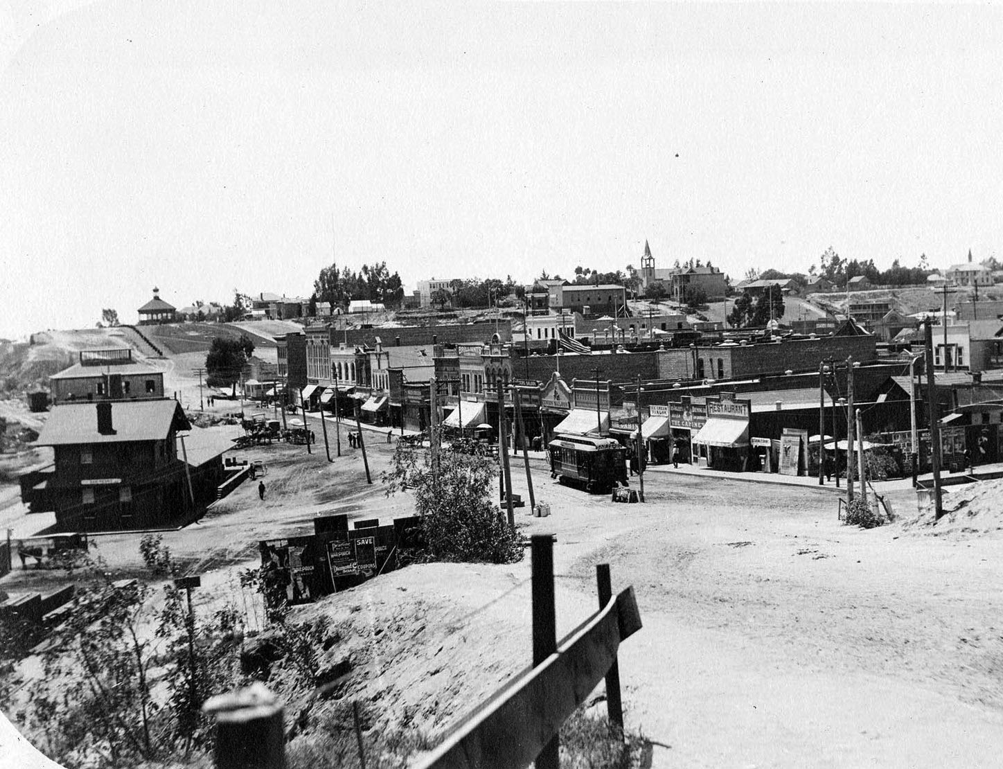
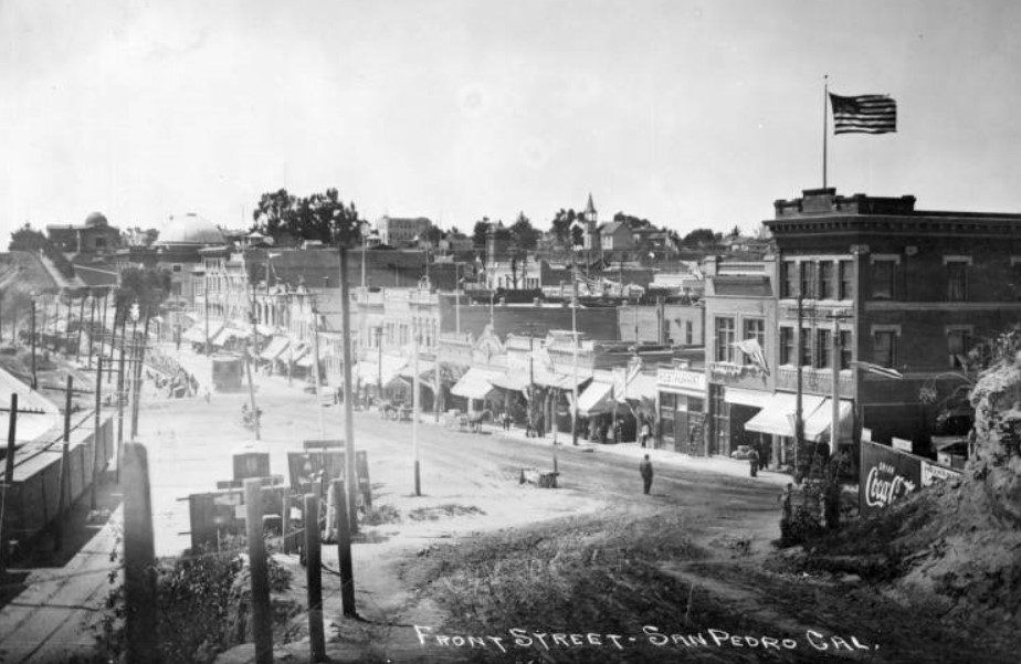
| (1904)* - View looking south on Front Street, from 4th. The gazebo atop the hill in the distance (center left) is sitting where the Carnegie Library would be built a couple years later, at 820 S. Beacon St. Photo from the California Historical Society |
Historical Notes Streetcar lines in San Pedro included the Front Street line, which ran from the Pacific Electric depot at Sixth and Palos Verdes to Point Firmin via Sixth and Pacific. |
 |
|
| (1904)* - View looking south on Front Street, from 4th. The gazebo atop the hill in the distance (center left) is sitting where the Carnegie Library would be built a couple years later, at 820 S. Beacon St. Photo from the California Historical Society. Image enhancement and colorization by Richard Holoff |
 |
|
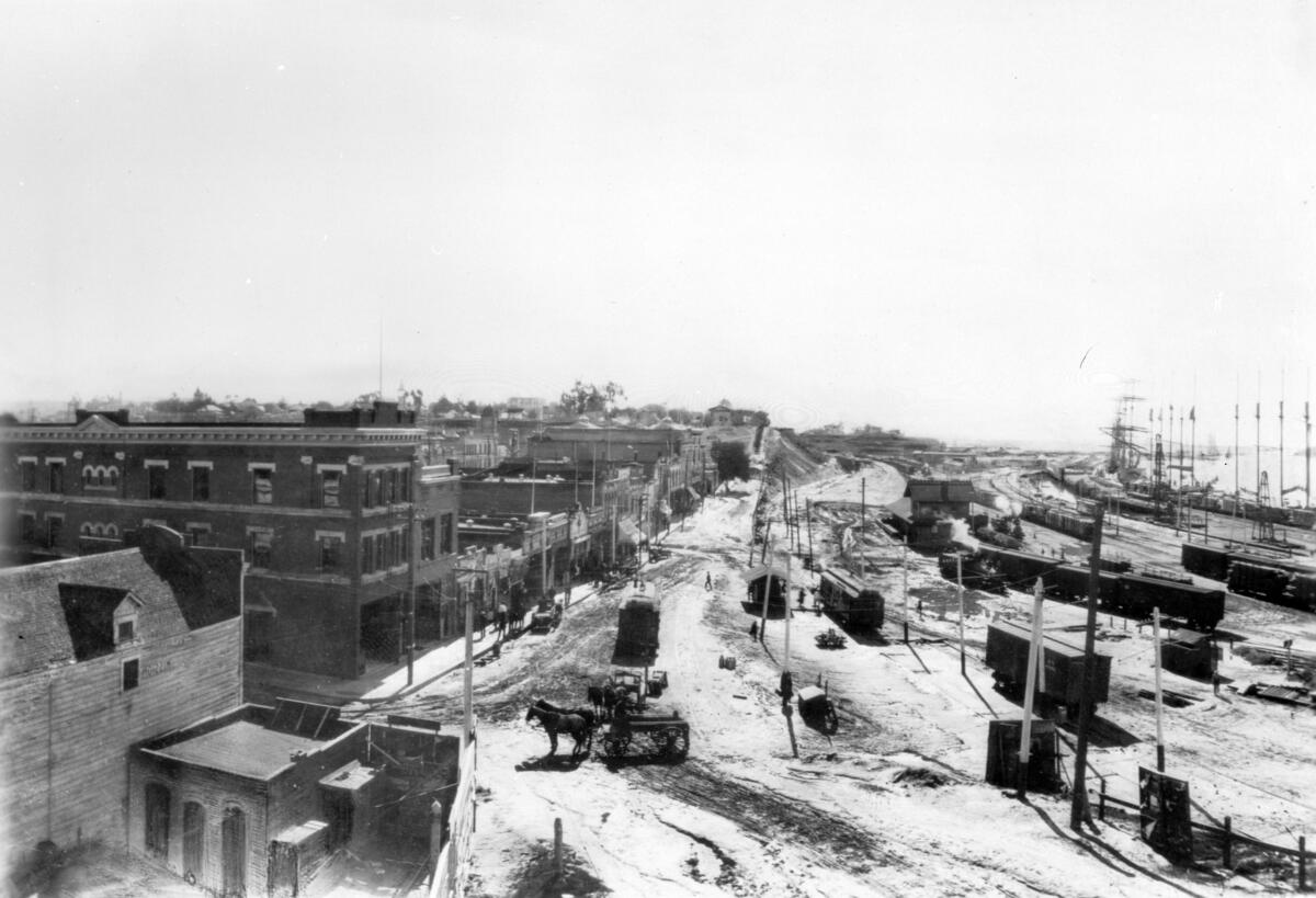
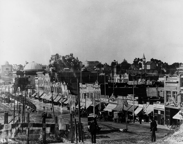
| (1905)* - Panoramic view of Front Street in the Port of Los Angeles. A horse-drawn carriage moves down the dusty, unpaved street perpendicular to the streetcar behind in front of which the silhouette of a man can be seen crossing. Parked rail cars sit in a yard to the right, while a row of commercial shopfronts of varying size line up end to end along the street to the left. A tall building in the lefthand foreground corner reads "Mission" on the side. Flagpoles line the harbor close to the water in the background at right. Photo by C.C. Pierce |
 |
|
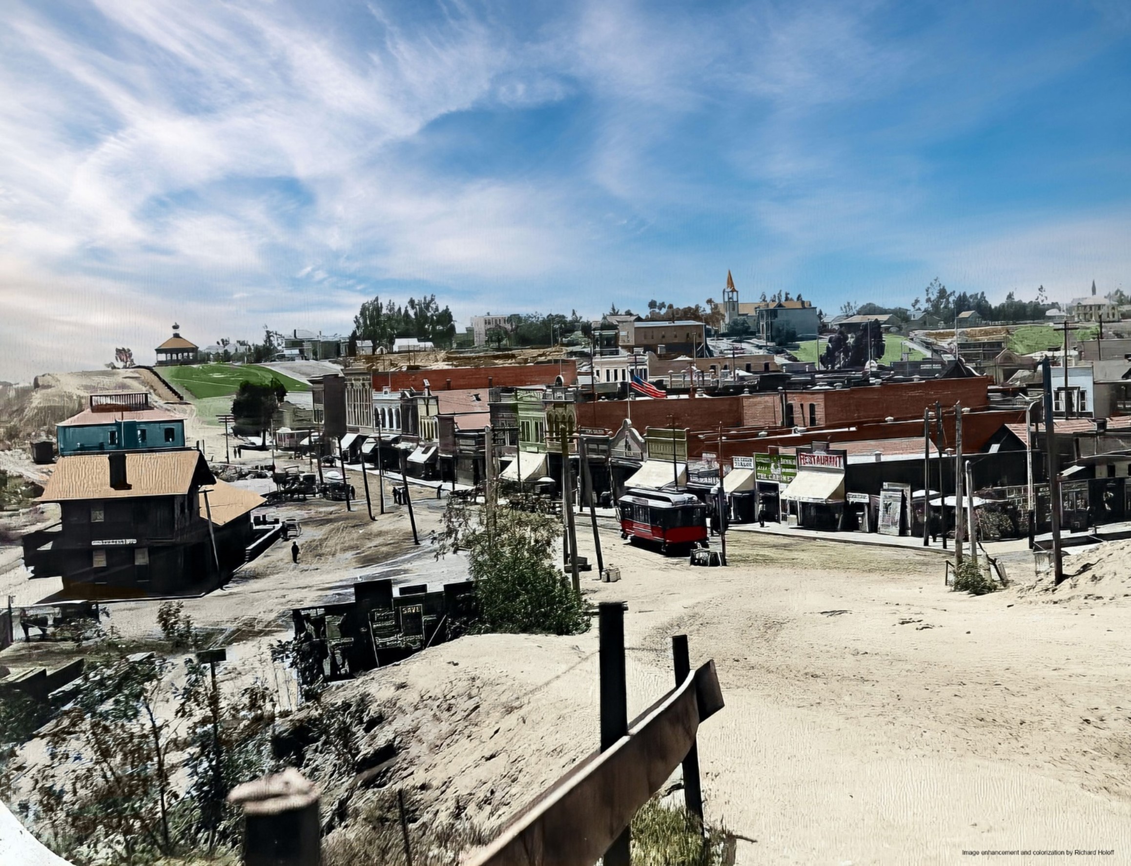
| (ca. 1906)* - View of Front Street looking south in San Pedro. A section of post-and-wire fence is pictured in the left foreground, guarding the edge of a steep incline that leads down into the unpaved Front Street. To the right of center, a man can be seen walking towards a side of the street lined with commercial buildings, while farther in the foreground at right, a billboard for Coca Cola can be seen. To the left, the tail end of a set of railroad cars can be seen behind a line of utility poles. The domed building of the Carnegie Library building can be seen on the hill in the distance, while farther in the foreground, a second domed building is City Hall.; Legible signs from left to right include: "Cannon's [...]", "Coasters Saloon", "M. Brown San Francisco Store", "Union Saloon", "Restaurant", "Emergency Hospital" and "Hotel Spokane". Photo by C.C. Pierce |
 |
|
| (1910)* - San Pedro waterfront looking south along Front Street from 4th Street. City Hall is the building with the large dome; the smaller dome belongs to the Carnegie Library building. |
Historical Notes The San Pedro Carnegie library seen above opened on June 5, 1906 and was located on the Public Plaza in San Pedro, with an entrance on what is now Harbor Boulevard, across from the San Pedro Main Post Office. The library building featured a distinctive gilded dome and temple-front design, and was known as "The Lady of Beacon Street". |
 |
|
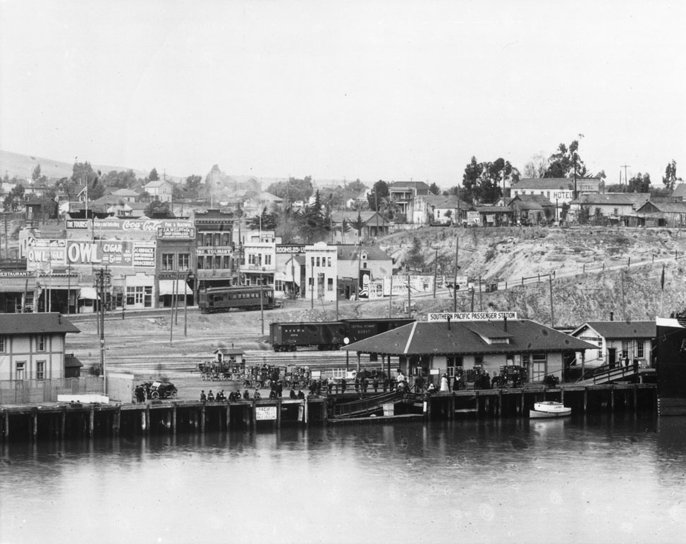
| (ca. 1913)* - View showing the Southern Pacific Passenger Station on the San Pedro waterfront. A Streetcar is seen at center-left on Front Street. |
Historical Notes Tracks on Front Street were abandoned around 1915 and the line was likely routed through to the Outer Harbor Line. |
* * * * * |
Free Harbor Jubilee
 |
|
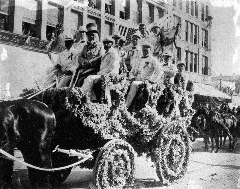
| (ca. 1899)* - Group of men ride in a decorated carriage celebrating Harbor Day in San Pedro. |
Historical Notes The Free Harbor Jubilee officially began on April 26, 1899, when President McKinley pushed a button in Washington, D.C. that signaled a barge 3,000 miles away in San Pedro to dump a load of large boulders into the sea, marking the beginning of the construction of the new port’s breakwater. |
 |
|
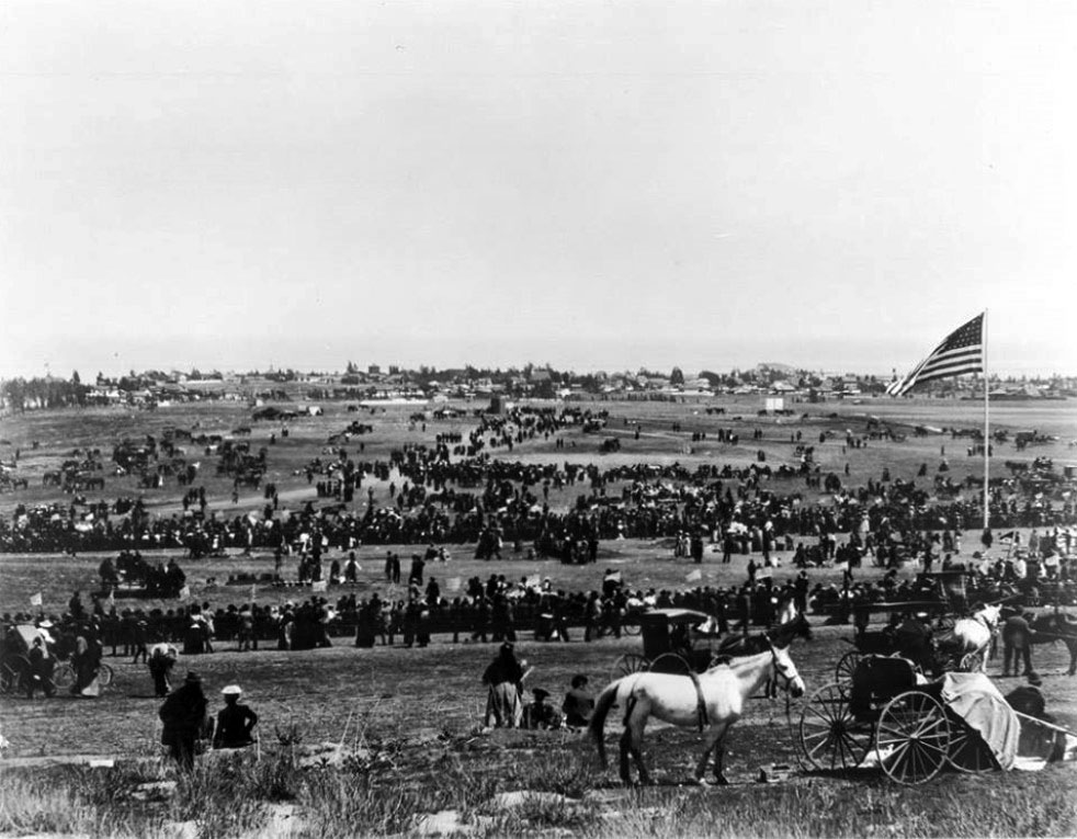
| (1899)* - The whole town came out to celebrate the Free Harbor Jubilee on April 26, 1899. |
Historical Notes The ceremony was the culmination of a 7-year battle that pitted two Southern California business titans against each other. At stake: the location of the official deep-water harbor for Los Angeles. San Pedro came out on top.* |
 |
|
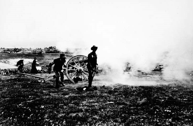
| (1899)#* - View of the firing of a cannon at the San Pedro Free Harbor celebration. |
* * * * * |
Banning Residence
 |
|
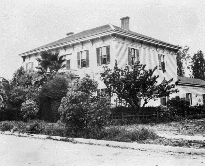
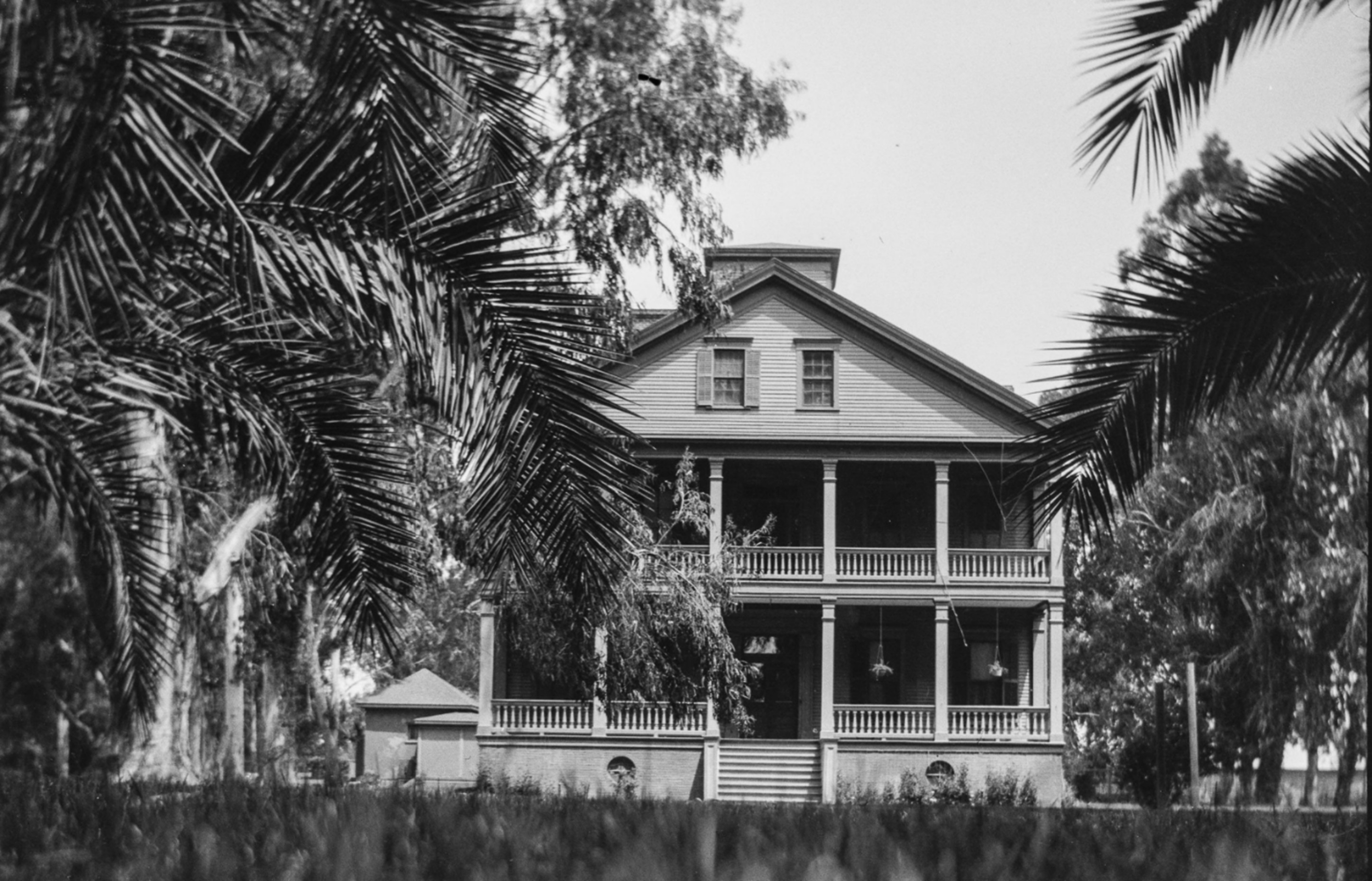
| (1890s)* – The home of Phineas Banning at 401 East M Street in Banning Park, Wilmington. Best as the founder of Wilmington, which he named after his birthplace in Delaware, Banning was also a successful entrepreneur who significantly contributed to the development of the Port of Los Angeles, earning him the title of "The Father of the Port of Los Angeles." Today, the Banning House operates as a museum. Photo by George Washington Hazard from the Ernest Marquez Collection. |
Historical Notes In 1864, Phineas Banning built this elegant Greek Revival home within sight of the harbor. It was one of the most impressive in the region – and still is. Here he enjoyed hosting visiting dignitaries and socializing with family and friends. Today the 23-room Banning Mansion and a surrounding 20 acre park are open to visitors. Phineas Banning (1830 – 1885) is known as "The Father of the Port of Los Angeles," he was one of the founders of the town of Wilmington, which was named for his birthplace. His drive and ambition laid the foundations for what would become one of the busiest ports in the world. Besides operating a freighting business, Banning operated a stage coach line between San Pedro and Wilmington, and later between Banning, California, which was named in his honor, and Yuma, Arizona. |
 |
|
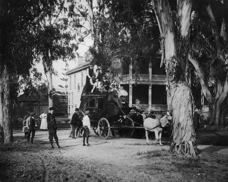
| (ca. 1900)* - Tree-shaded residence of Phineas Banning in Wilmington. In front is a mule-drawn coach piled high with people. |
Historical Notes Click HERE to see more early views of the Banning Residence. |
* * * * * |
 |
|
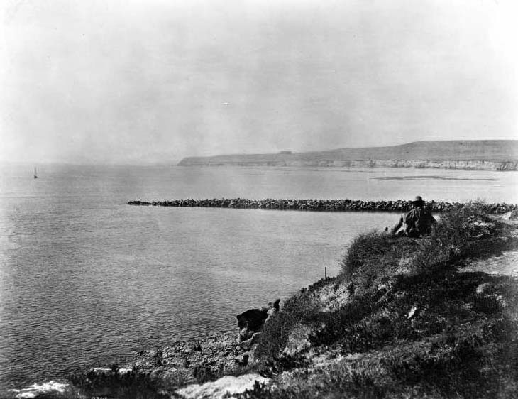
| (ca. 1900)* - View of a man sitting on the hillside of Dead Man’s Island looking north toward Pt. Fermin. Visible on the left is a ship approaching the breakwater. |
 |
|
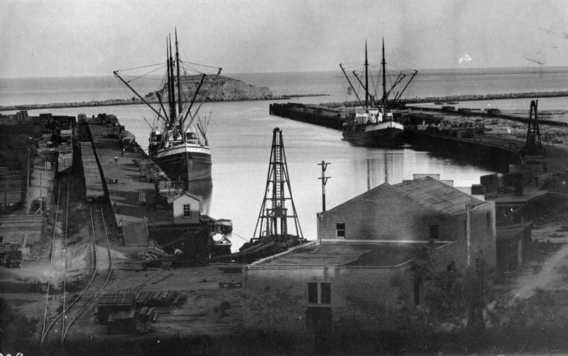
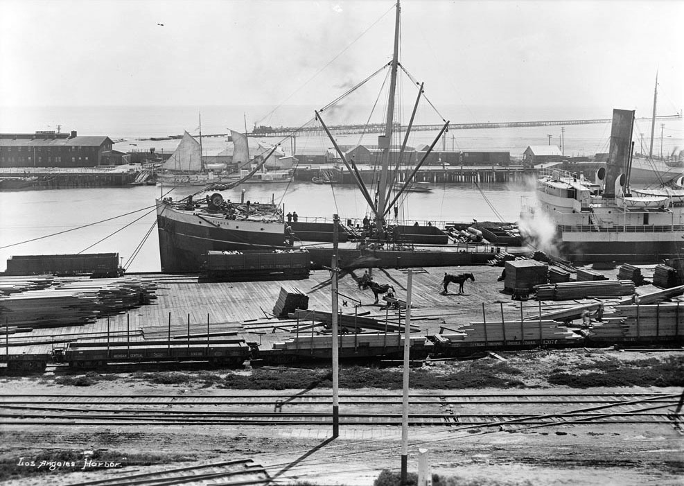
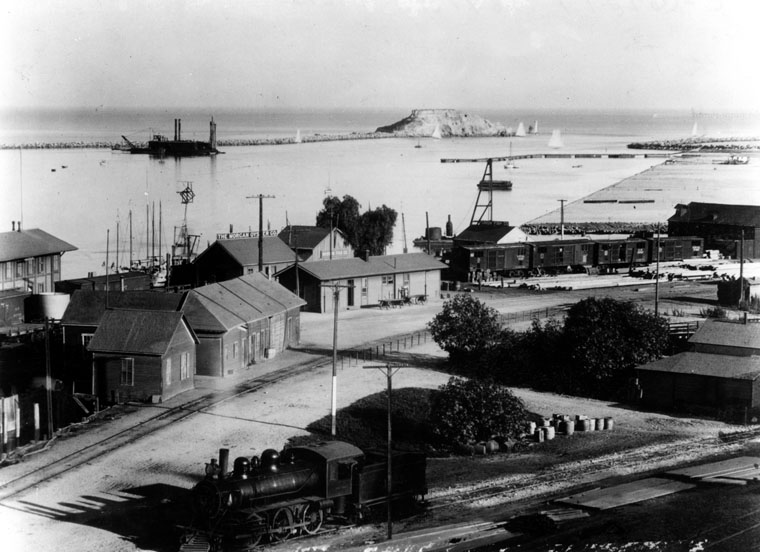
| (Early 1900s)* - View of L.A. Harbor showing fishing boats anchored in the harbor at San Pedro. Deadman's Island is behind. Railroad cars are on tracks at left, between stacks of lumber and the wharf. There are buildings in the foreground and a wharf circling around at right. In the near center is a dredge. |
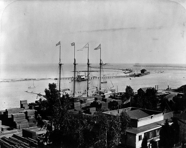
 |
|
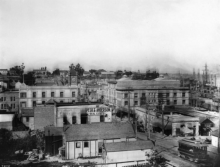
| (ca. 1903)^^ - Birdseye view of San Pedro looking north towards Wilmington from Beacon Street. A streetcar is in the lower right. The clock tower of the San Pedro Bank can be seen center-left. |
| (ca. 1903)^^ - Looking south on Beacon from Fifth Street circa 1903. Streetcar can be seen down the road. |
 |
|
| 1903)#* - San Pedro waterfront and Terminal Island panorama. In the foreground are the lumber docks and a sailing ship. |
 |
|
| (ca. 1903)#* - San Pedro Harbor docks are filled with tall ships. Lumber is stacked in the lumber yard near the tracks. Dead Man’s Island is seen in the distance. |
 |
|
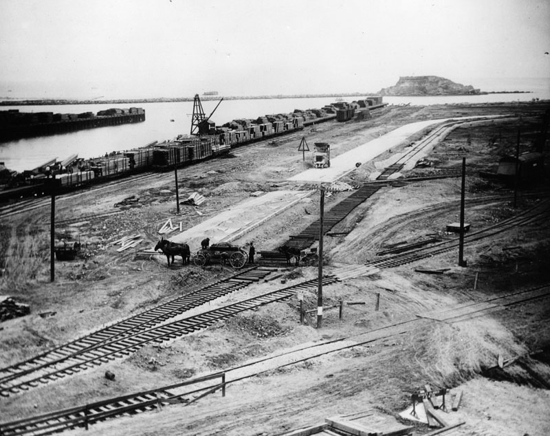
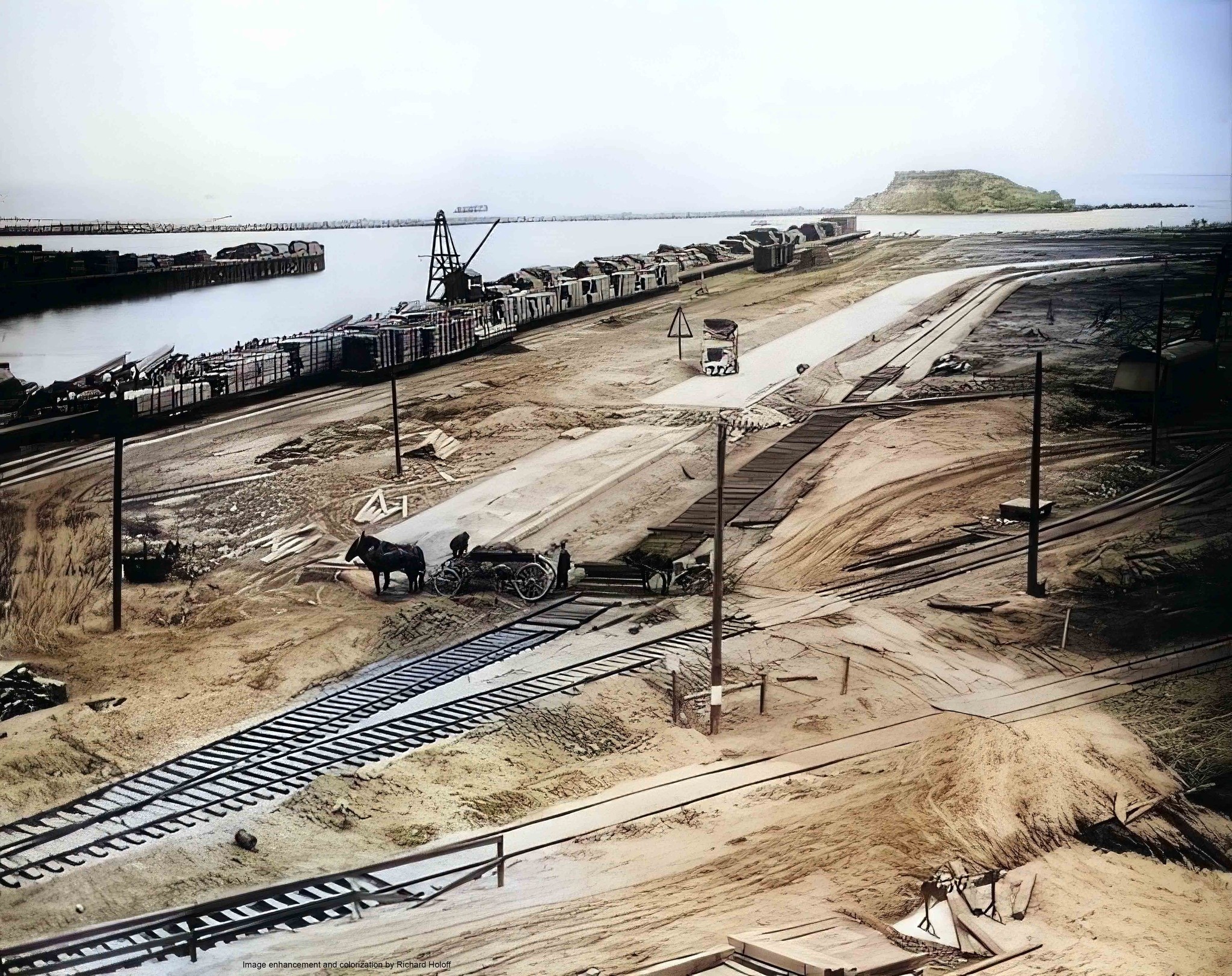
| (ca. 1903)^^ - Looking easterly up the main channel and showing the East San Pedro ferry landings. Two horses can be seen in the foreground by the lumber yard. Note the train on trestle in the background is holding rock for the new jetty construction. |
Harbor Breakwater (Constructed 1899-1911)
 |
|
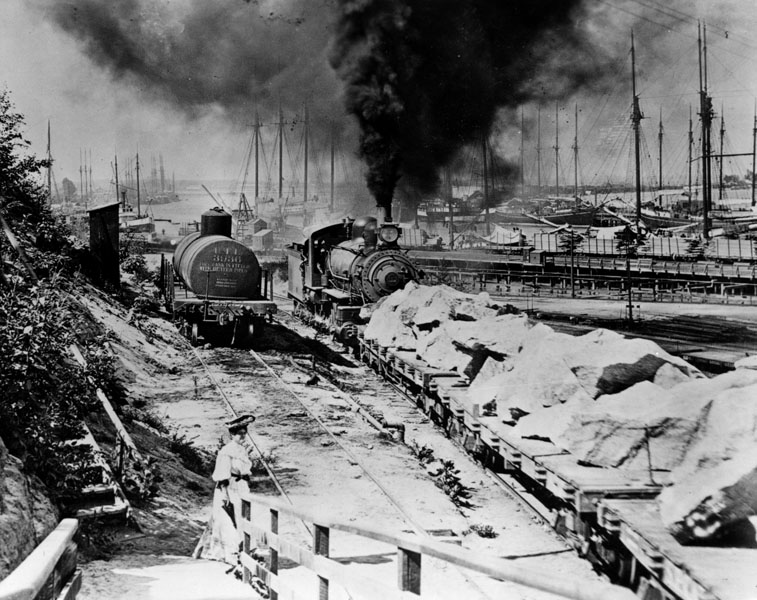
| (ca. 1904)* - A finely dressed lady stands in front of the railyard watching a train push a load of boulders to be used for construction of the harbor's new breakwater. |
 |
|
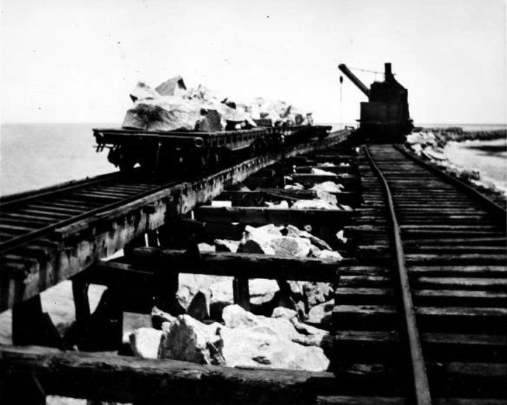
| (ca.1904)#*- Flat cars topped with rocks and railroad crane on trestles above the breakwater. |
 |
|
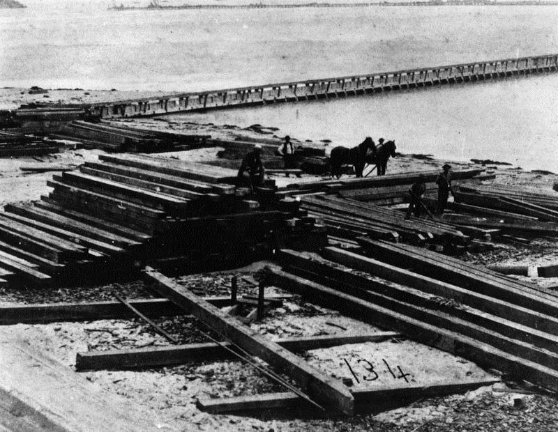
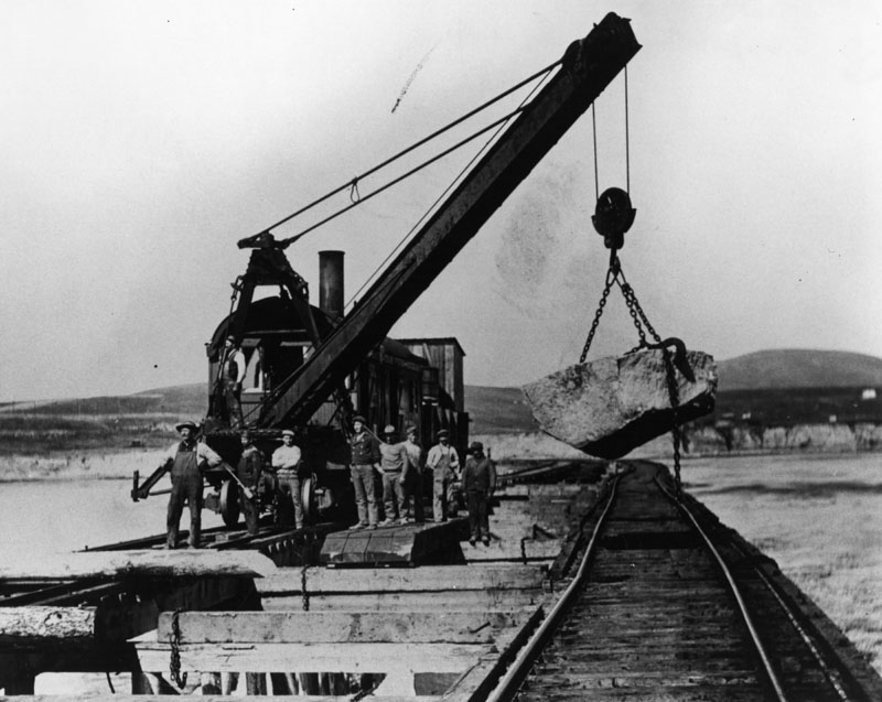
| (1904)* - Photo of workers building the breakwater in the San Pedro Harbor. Work was started in 1899. |
Historical Notes Most of the boulders used to construct the breakwater in San Pedro Harbor came from the mountains of west San Fernando Valley. Between 1898 and 1904, Southern Pacific was grading, cutting, and tunneling through the Santa Susana Mountains near Chatsworth Park as they establshed their new Coast Line connection from Ventura to Burbank. This provided San Pedro with an ample supply of boulders for their new breakwater. Click HERE to see more in Early Views of the San Fernando Valley. |
 |
|
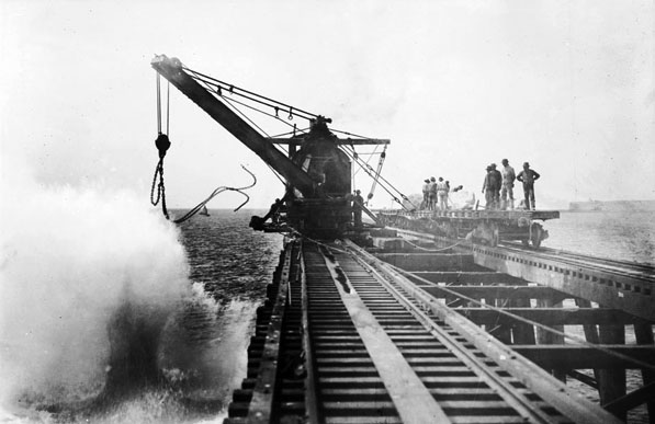
| (ca. 1900)^^ - Construction of the breakwater in San Pedro. |
Historical Notes Today, an 8.5 miles long breakwater stretches across most of the bay, with two openings to allow ships to enter the port areas behind it. The initial western section of the breakwater, called the San Pedro Breakwater, was constructed between 1899 and 1911 at San Pedro; the Middle breakwater was completed over the next twenty-five years, and the Long Beach breakwater was finished after World War II.*^ |
 |
|
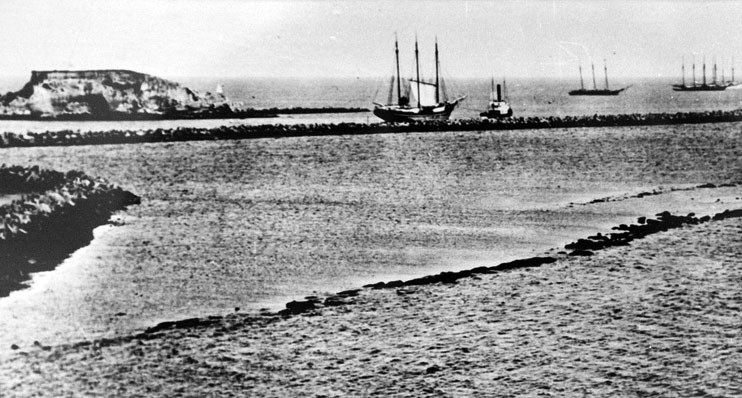
| (ca. 1905)^^ - View of the outer harbor at San Pedro, showing several sailing ships and Deadman's Island. Eleven tall wooden ships are visible in the distance. All have several masts, but none has any sails up. There is a small steam tug pulling one of the ships at left. At left, the small rocky top of Deadman's Island is visible, connected to the shore by a narrow rocky strip of land. A large breakwater cuts into the ocean from left, and the rocky shoreline is visible in the foreground. |
 |
|
| (1905)* - View looking over a portion of San Pedro, toward Deadman's Island, and the beginning harbor. Building at extreme left is the Southern Pacific depot. In the distance is a dredge at work along the breakwater. |
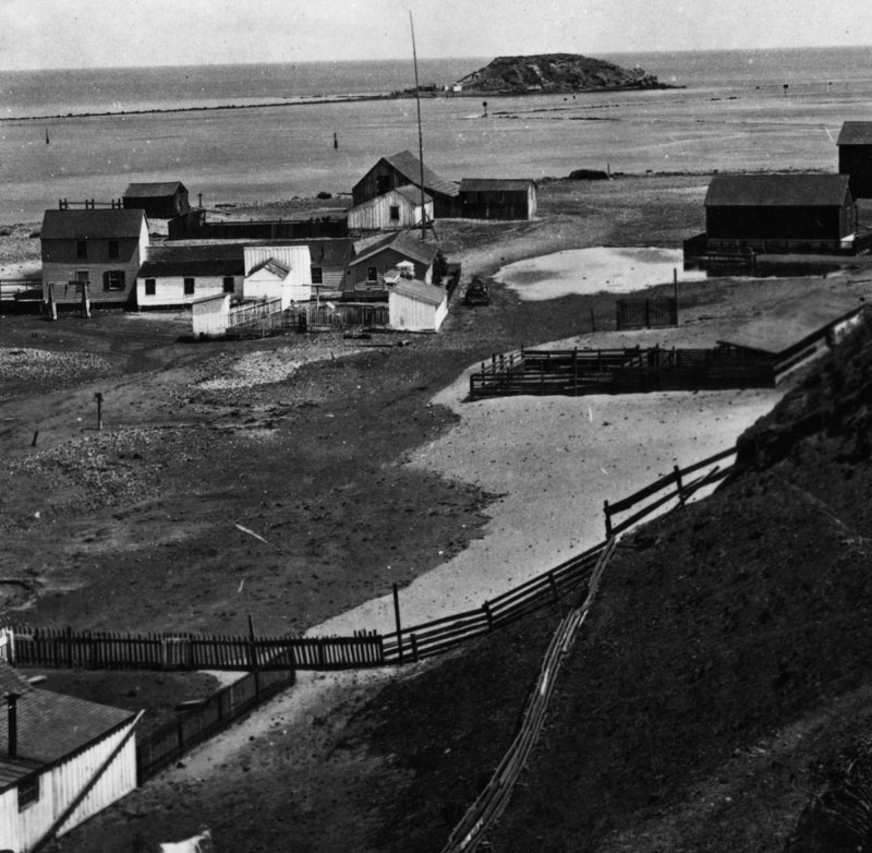
Historical Notes Deadman's Island was one of two islands near San Pedro in the 19th century. The land, sometimes referenced as Deadman's Island, Isla Del Muerto, and Reservation Point, was dredged away in 1928 as part of a harbor development effort. Rattlesnake Island, the other islet in the area, became Terminal Island.*^ |
 |
|
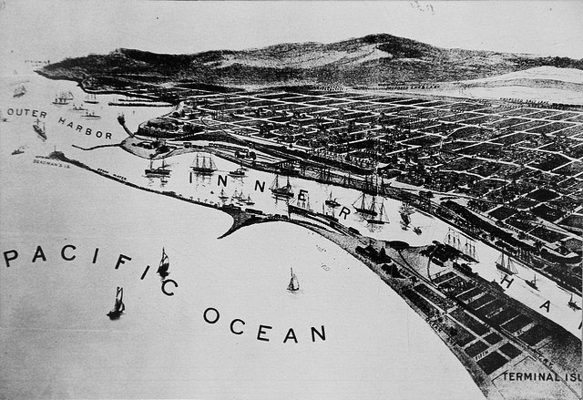
| (1905)#* - Photo of a lithograph of plan of San Pedro and its inner and outer harbors. |
 |
|
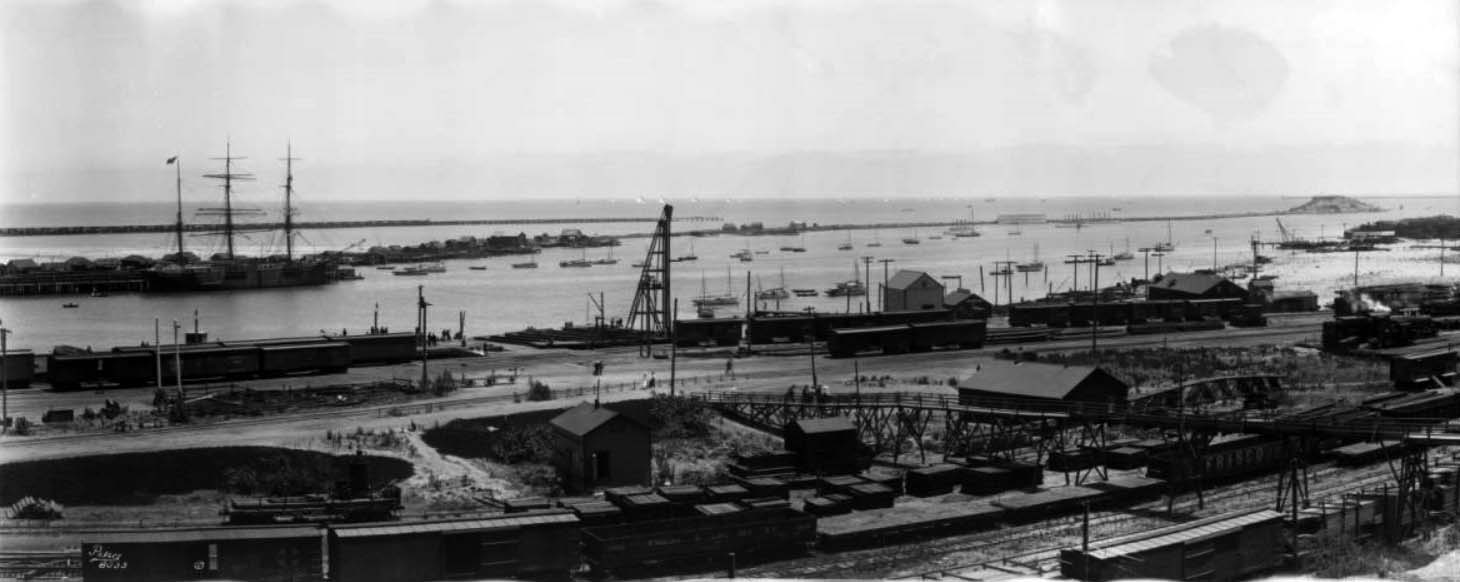
| (1905)* - A panoramic view of a part of the docks of Los Angeles Harbor in San Pedro. Railroad tracks run across the immediate foreground, as well as alongside the docks, and there are cargo and flatbed train cars on many of the tracks. There are two long breakwaters, one in the distance that is low and simple, and another closer to the shore that is lined with buildings. A three mast tall ship is docked at a pier along the inner breakwater. There are a couple dozen small sailboats anchored inside the breakwaters. |
 |
|
| (1905)** - A panoramic view of the Los Angeles Harbor in San Pedro. Photo by C.C. Pierce; Image enhancement and colorization by Richard Holoff. |
 |
|
| (1906)^^ – View showing the entrance to San Pedro Harbor with Terminal Island in the distance. Railroad tracks can be seen running along a wharf from the foreground at right into the distance at left. Note the rail bridge in the lower right. Several tall ships and a steamship are docked along the wharf at left. A section of the harbor curves around in a semicircular path in the background at left. |
 |
|
| (ca. 1907)^ - Panoramic postcard view showing people looking down toward the San Pedro Harbor. |
Wilmington Transportation Company
 |
|
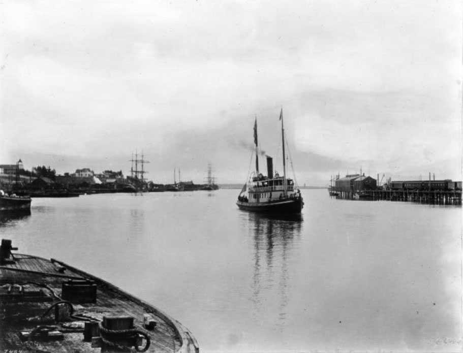
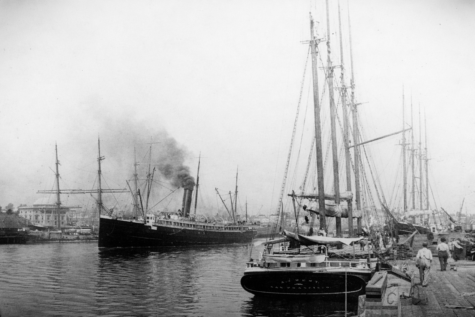
| (Early 1900s)^ – View showing the main channel of the Los Angeles Harbor. Both sides of the channel are lined with large, docked sailing vessels. Most of these have at least three masts, and both ships in the foreground on the left have four. There is a steam tugboat in the middle of the channel, traveling from the right side to the left. To the right of the tugboat is a small skiff occupied by two people. The Wilmington Transportation Company owned many of the steamboats that would transport passengers from San Pedro to Catalina. |
Historical Notes Wilmington Transportation Company (WTC) was founded in 1877 by the Bannings, and incorporated by Phineas Banning in 1884. In 1887, Santa Catalina Island owner George Shatto asked Captain William Banning to schedule one of his coastal steamers to make three weekly trips between Avalon and San Pedro to accommodate his vision of turning the island into a tourist destination. Banning’s Wilmington Transportation Company’s earliest vessels included the Cricket, Ferndale, Amelia, and Nellie. Each of these carried passengers between San Pedro and Avalon. In 1892 the Banning brothers, William, Hancock, and Joseph Brent, purchased the island for $128,740. WTC was deeded to the newly incorporated Santa Catalina Island Company, allowing the Bannings to enforce a monopoly of only WTC boats landing tourists on the island. With the success of WTC came the development of outside competitors.* |
 |
|
| (ca. 1905)^ – View of the Wilmington Transportation Company's steamboat "Falcon" in San Pedro Harbor. The boat, engaged in service to Catalina Island, is visible at center in the middle of the harbor. Harbor buildings are visible to the right, and town buildings are visible to the left. What is either a small dock, or the deck of a flat boat is visible in the lower left foreground. The boat itself sports a two-leveled cabin and two masts. People lean along the edges of the deck. |
Historical Notes The S.S. Falcon along with the S.S. Warrior played a significant role in Catalina Island’s early transportation history. They were an important part of the Wilmington Transportation Company fleet for many years. They carried hundreds of passengers across the channel to Catalina Island as well as freight and fresh water for the Island residents. |
 |
|
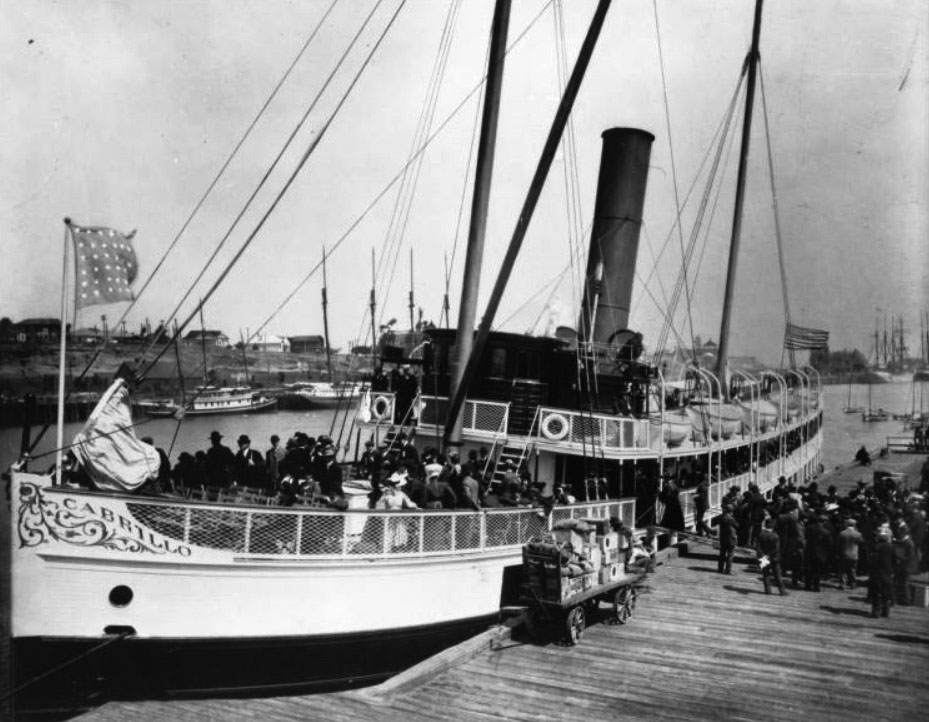
| (ca. 1904)^^ – View showing the Catalina passenger steamer S.S. Cabrillo loading passengers and freight alongside a Wilmington wharf in San Pedro. In addition to the prominent smoke stack rising from behind the pilothouse, the ship has two tall masts. A dark flag with light stars flies from the bow, and an American flag is on the stern. In the background there is one other unidentified steamer, along with numerous unidentified sailing vessels and several small sail fishing vessels. |
Historical Notes The S.S. Cabrillo, built at the Banning Company's shipyards at Port Los Angeles, was launched in 1904. Other vessels operated by the Banning Company were the gasoline screw Cricket, the gasoline screw Catalina, and the steam yacht Companero. |
 |
|
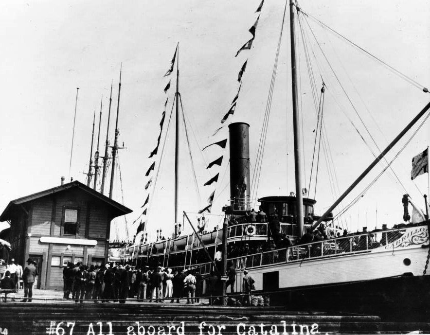
| (1907)^^ - View of Shriners boarding the S.S. Cabrillo steamboat ferry to Santa Catalina Island at the LA Harbor. |
Historical Notes After Phineas Banning passed away in 1885, the business was carried on by his three sons, William, Joseph Brent, and Hancock. The company purchased Santa Catalina Island, developed it as a resort and provided the ships for transportation. Wilmington Transportation Company, Santa Catalina Island Company, and Wilmington Development Company were subsidiary firms of the Banning Company. The company's real estate interests also grew and included land in Los Angeles, Pasadena, Newport Beach, as well as petroleum leases near Wilmington and Newport. The final dissolution of the company came in 1920 at the time of the death of Joseph Brent Banning. After this period, business papers are in the names of William Banning or Hancock Banning individually. Click HERE to see more in Early Views of Catalina |
* * * * * |
San Pedro City Hall
Temporary Quarters and an Independent City
 |
|
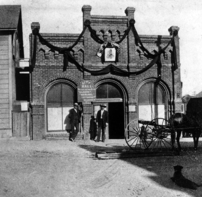
| (1900)* - Los Angeles city clerk O. C. Abbott (left) and Ben Baker stand outside the San Pedro City Hall, housed at the time in a rented building on Beacon Street between 4th and 5th Streets. |
| Historical Notes
At the turn of the twentieth century, San Pedro was an independent city, and its municipal offices were often located in leased or temporary buildings. This modest structure served as City Hall during a period of rapid growth driven by harbor activity and expanding rail connections. In 1906, the City of Los Angeles annexed the Harbor Gateway, a long and narrow strip of land linking the city to the coast. Three years later, in 1909, Los Angeles annexed San Pedro and the neighboring town of Wilmington. The unusual shape created by these annexations is still visible on city maps today and reflects Los Angeles’s effort to secure control of a deep water port. |
* * * * * |
San Pedro City Hall No. 2
A Purpose Built Civic Center 1905 to 1908
 |
|
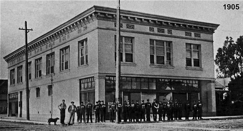
| (1905)* - City officials and residents pose in front of San Pedro’s new City Hall, which also housed police and fire department headquarters. |
| Historical Notes
This building served as San Pedro’s City Hall from 1905 to 1908. It was constructed in 1905 at the northwest corner of 11th Street and Palos Verdes Street. The mayor at the time was Edward Mahar, who lived only one block south of the site. The building functioned as City Hall for just three years. Following San Pedro’s consolidation with Los Angeles in 1909, civic operations moved to a new and larger City Hall on Beacon Street. The structure still stands today and is now home to the City Hall Market and the Alhambra Bar. |
 |
|
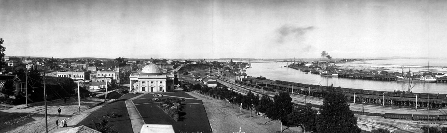
| (ca. 1904)*– Panoramic view showing Beacon Street on the left and the harbor with tall ships on the right. The San Pedro City Hall built in 1909 would later rise at the end of the park in the foreground. |
| Historical Notes
This view captures San Pedro just before its annexation by Los Angeles. The open parkland in the foreground would soon give way to civic construction, reflecting the town’s transition from an independent port community to part of a growing metropolitan city. |
* * * * * |
San Pedro City Hall
Beacon Street Era 1909 to 1928
 |
|
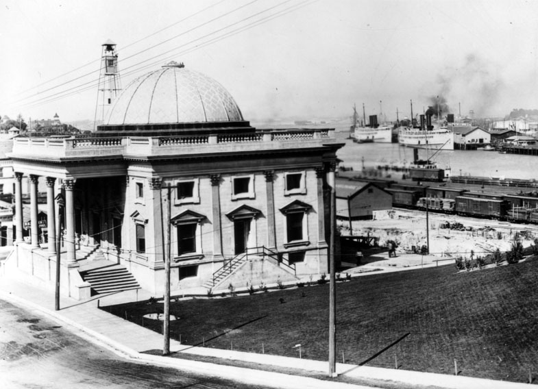
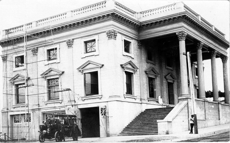
| (ca. 1909)* - View showing San Pedro City Hall on Beacon Street between Wall and 5th Streets, with rail yards and Los Angeles Harbor visible in the background. |
| Historical Notes
This Classical Revival style City Hall was completed in 1909, the same year San Pedro was annexed by the City of Los Angeles. Designed by Pasadena architect F. E. Allen, the building featured a symmetrical façade, prominent columns, and formal proportions meant to project stability and civic authority. Costing approximately forty thousand dollars, it symbolized San Pedro’s expanded civic role within Los Angeles and the city’s long-term commitment to controlling the harbor. |
 |
|
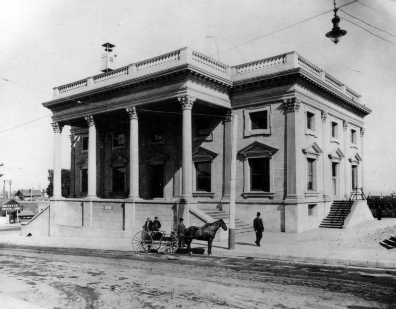
| (ca. 1909)* - Front view of San Pedro City Hall on Beacon Street. A horse drawn wagon is parked along the unpaved street. |
| Historical Notes
Beacon Street remained largely unpaved at the time this photograph was taken. The mix of horse drawn wagons and early infrastructure reflects the transitional nature of San Pedro during its early years under Los Angeles governance. |
 |
|
| (ca. 1909)* - Side view of San Pedro City Hall showing firemen posing in front of their new fire engine and station. |
| Historical Notes
After annexation in 1909, fire protection services in San Pedro were reorganized under the Los Angeles Fire Department. Hose Company No. 6 was incorporated into the City Hall building at 630 Beacon Street, placing civic administration and emergency services under one roof. |
 |
|
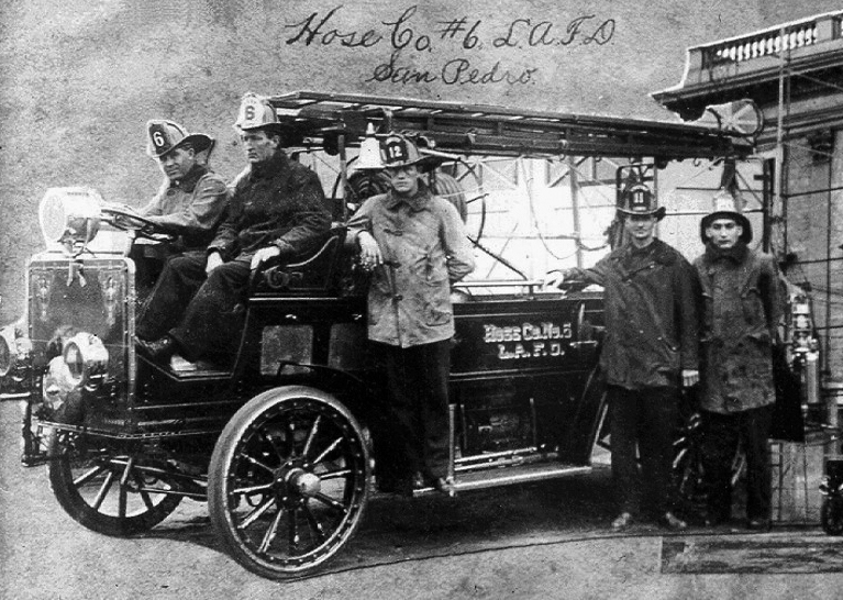
| (ca. 1909)* - Close up view of Hose Company No. 6 of the Los Angeles Fire Department beside their new station at San Pedro City Hall. |
| Historical Notes
San Pedro’s first volunteer fire company was formed in 1889. Over the years, fire services moved several times as the city grew. In August 1909, Hose Company No. 6 was officially organized at the new City Hall on Beacon Street. In 1915, it was reorganized as Engine Company No. 36 and relocated nearby on Beacon Street. |
 |
|
| (ca. 1910)* - Postcard view looking down Beacon Street with San Pedro City Hall on the right. Horse drawn wagons and an early automobile share the street. |
| Historical Notes
This scene illustrates everyday life in San Pedro during the early years following annexation. Traditional horse drawn transportation coexisted with early automobiles as the city adjusted to rapid growth and modernization. |
 |
|
| (ca. 1910)* – View along Beacon Street looking toward San Pedro City Hall, showing the surrounding civic district during the early years following annexation. |
| Historical Notes
This view looks along Beacon Street toward San Pedro City Hall during the early years following annexation by the City of Los Angeles. The Classical Revival City Hall stands prominently at right, while unpaved streets, utility poles, and modest commercial buildings reflect a town still transitioning from a port community to a fully integrated city district. Images like this show how civic government, daily life, and harbor activity were closely connected in San Pedro during the early twentieth century. |
 |
|
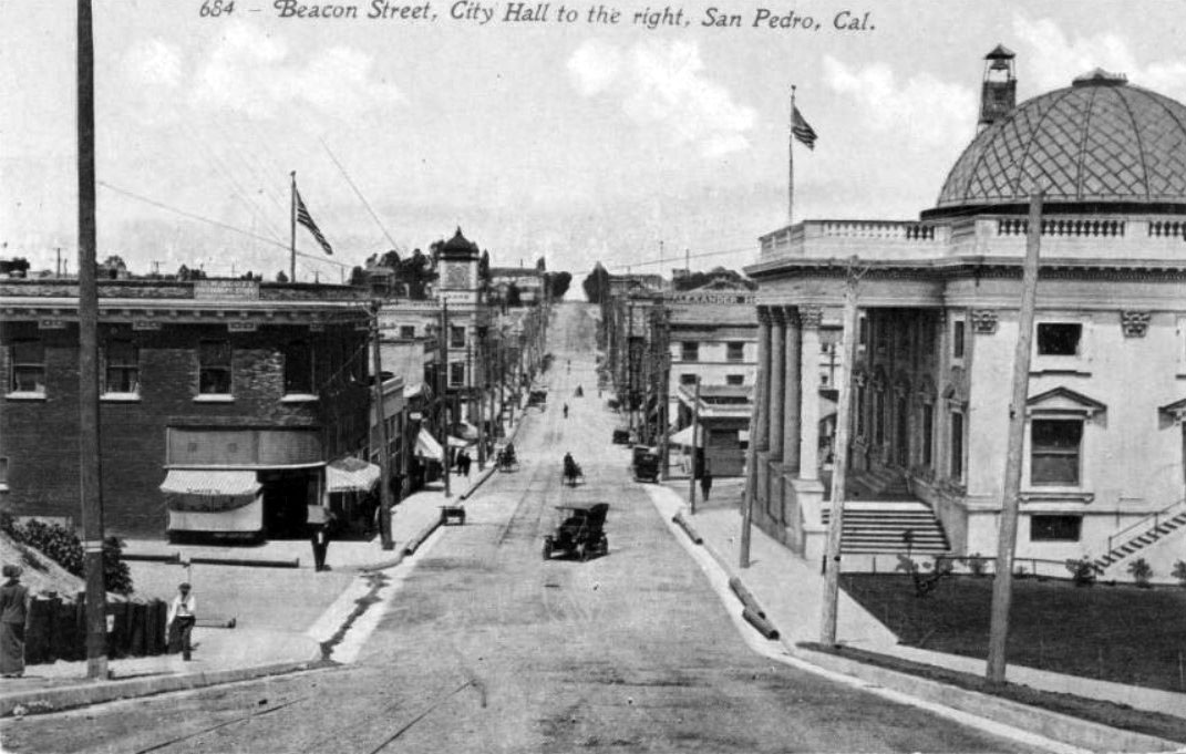
| (1909)* – Left panel of a panoramic view showing San Pedro with City Hall at left and the harbor at right. |
| Historical Notes
The City Hall stood prominently along Beacon Street, visually linking civic government with the harbor that had driven San Pedro’s growth and importance to Los Angeles. |
.jpg) |
|
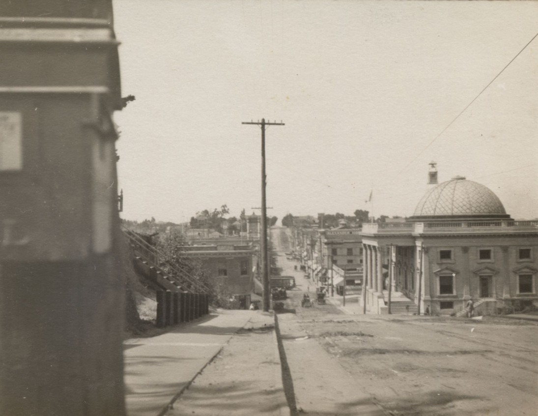
| (1909)* – Right panel of the same panorama showing San Pedro Harbor with Deadman’s Island at right. |
| Historical Notes
Deadman’s Island was a well known landmark in San Pedro Harbor and would later be removed during harbor expansion. Views such as this emphasize the close physical relationship between city government and port operations. |
 |
|
| (1910)* - Steam ferry and sailing freighters in Los Angeles Harbor at San Pedro. The new City Hall is visible in the background at left. |
| Historical Notes
By the early 1910s, San Pedro City Hall overlooked an increasingly busy harbor. The building remained in use until 1928, when it was demolished to make way for the present San Pedro City Hall and Municipal Building. Click HERE to see more on San Pedro's current City Hall and Municipal Building. |
* * * * * |
Great White Fleet
 |
|
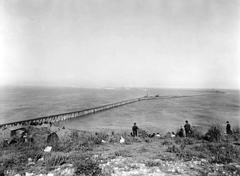
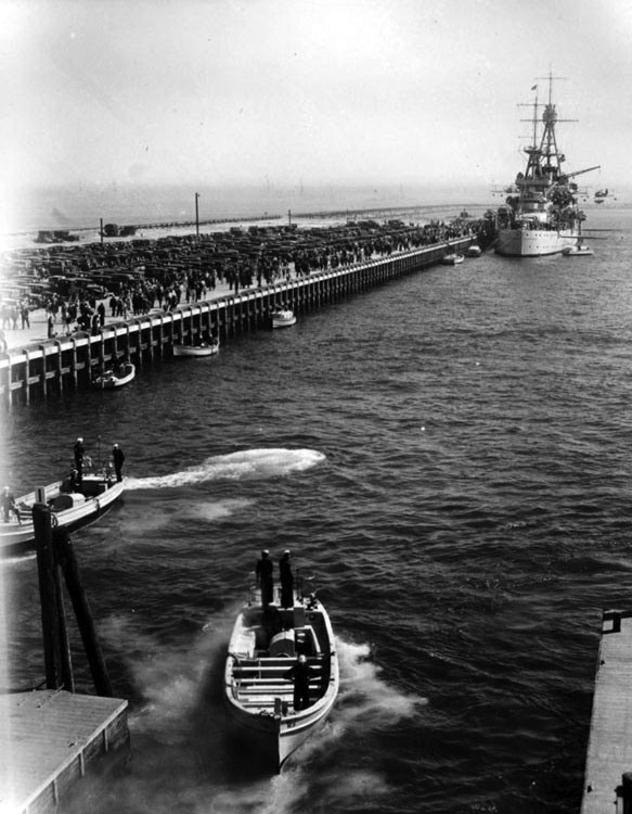
| (1908)^^ - Photograph of spectators watching the "Great White Fleet" enter the Los Angeles Harbor, April 1908. Spectators crowd the base of the breakwater to get a better view of the ships, as they will soon pass the area and head towards the piers. |
Historical Notes The U.S. Atlantic Battle Fleet, nicknamed the Great White Fleet, debuted on the world stage during the Spanish-American War and was one of the markings of President Theodore Roosevelt's "Big Stick" diplomacy.^^ |
 |
|
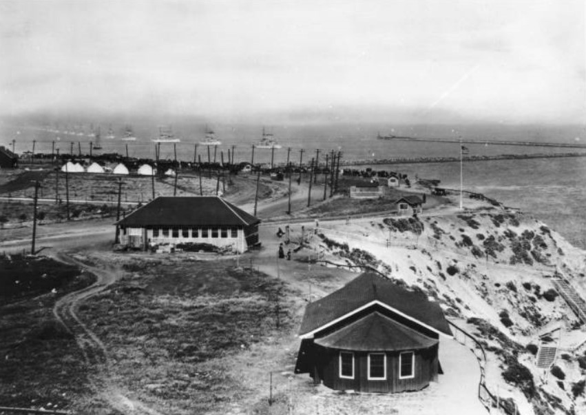
| (1908)^^ - Photograph of the America's Great White Fleet passing the San Pedro breakwater to enter Los Angeles Harbor. Beach houses are visible scattered along the side of a winding road lined by utility poles, while the United States Atlantic Battle Fleet steams across the harbor in formation. The breakwater is visible to the right, in front of some wooden steps built as a way to climb the dunes. |
Historical Notes From December, 1907 to February, 1909 the US Atlantic Fleet steamed around the world on a mission of 'Gunboat Diplomacy'. The ships, commonly known as the 'Great White Fleet' due to their white-painted hulls, called in ports the world over, impressing foreign dignitaries with the appearance of great power. The entire affair was designed to impress, and everything was done to make sure the fleet's appearance was perfect. The ships, however, were not all they appeared to be. HMS Dreadnought had been in commission for a year, effectively rendering all the US ships obsolete. Two of the ships had such severe mechanical problems that they could not complete the cruise, and two more were obsolete and unfit for battle. It was great show, but the military value of the fleet was questionable.^^ |
.jpg) |
|
| (1908)* - Groups of people on shore, watch as the "Great White Fleet" enters the L.A. Harbor. The tressle for the breakwater is in the foreground. Breakwaters can be seen in the background (right side). |
 |
|
| (1908)^x^ - Visitors line up in San Pedro to tour a US Navy battleship, one of a number of war vessels of the Great White Fleet, which circumnavigated the globe between 1907 and 1909. |
Historical Notes This was the last great hurrah for the age of white ships, buff masts and high diplomacy on the high seas. As soon as the ships returned from the cruise they were stripped of their fancywork and much of their bridgework, painted gray, and had their pole masts replaced by functional but unsightly cage masts.^^ |
* * * * * |
.jpg) |
|
| (1909)* - Local school kids stand along an unpaved Pacific Avenue waving Americal flags as President Taft and his motorcade drive by. |
Historical Notes On August 28, 1909, San Pedro and Wilmington were annexed into Los Angeles and became Los Angeles Harbor. On October 9,1909, President Taft visited San Pedro to see the harbor and to see the land which would become Fort MacArthur. His motorcade went down Pacific Avenue and the local school kids stood along the unpaved road and waved American flags. Taft was the only Sitting President to visit San Pedro. |
| (ca. 1907)^^ - Photograph of Spectators watching a bicyclist on Beacon Street, between Fifth Street and Sixth Street looking east. The lone cyclist occupies the dirt street which is lined with a sparse crowd of onlookers standing in front of the commercial facades. A man watches from a balcony. One legible sign reads "Restaurant". |
| (ca. 1905)^^ - View of Beacon Street looking north. The sign on the building on the left reads “GEO. H. PECK & CO. REAL ESTATE”. The building with the clock tower in the background is the San Pedro Bank Building. |
| (1910)^*^* – View of Beacon Street with American flags seen throughout in what appears to be 4th of July. Streetcars share the street with horse-drawn wagons. |
| (1910)^^ - Beacon Street in San Pedro looking north. Horse-drawn carriages can be seen throughout. A man crosses the street and walks towards the San Pedro Bank Building with its prominent clock tower |
 |
|
| (1910s)^^ - View of Front Street (the site of 'new' City Hall) in San Pedro, Los Angeles. |
 |
|
| (1910)* - View of the Southern Pacific freight yard and depot looking south from 4th Street and Harbor Boulevard in San Pedro. |
 |
|
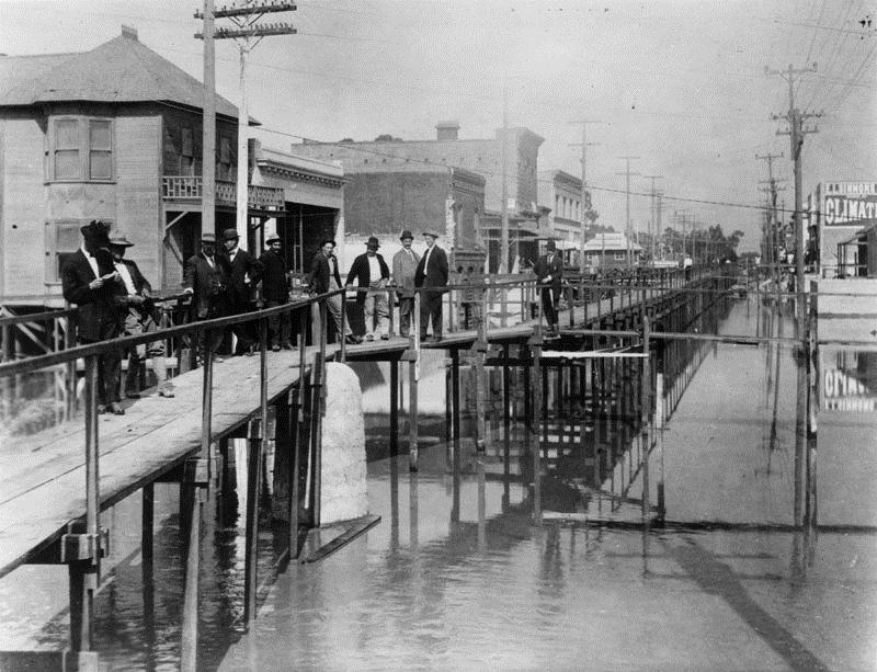
| (ca. 1911)* - Elevated boardwalk over water runs along a street on the waterfront. Mud from dredging the harbor was used to elevate the land along the waterfront. |
Historical Notes “Wilmington streets have all been renamed. Well, not all, but almost all of them have been renamed. And Canal Street is the most obvious. Because Canal Street was literally a canal. The buildings were built up high, they were on stilts because this was a mud flat and it flooded all the time. So they ended up filling in the street so that when you look at it now, the buildings that are there, some of the old buildings, the first floors are now the basements." Canal Street is gone. It's now known as Avalon Boulevard.^*# |
 |
|
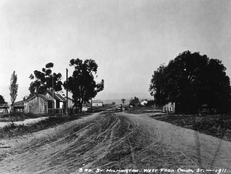
| (1911)* - View of Third Street west from Canal Street (now Avalon). A horse-drawn wagon can be seen down the unpaved road. |
.jpg) |
|
| (1911)* - View of Canal (now Avalon Blvd.) and 3rd Streets in Wilmington. St. John's Episcopal Church is seen on the right. A railroad track cuts across the foreground. |
 |
|
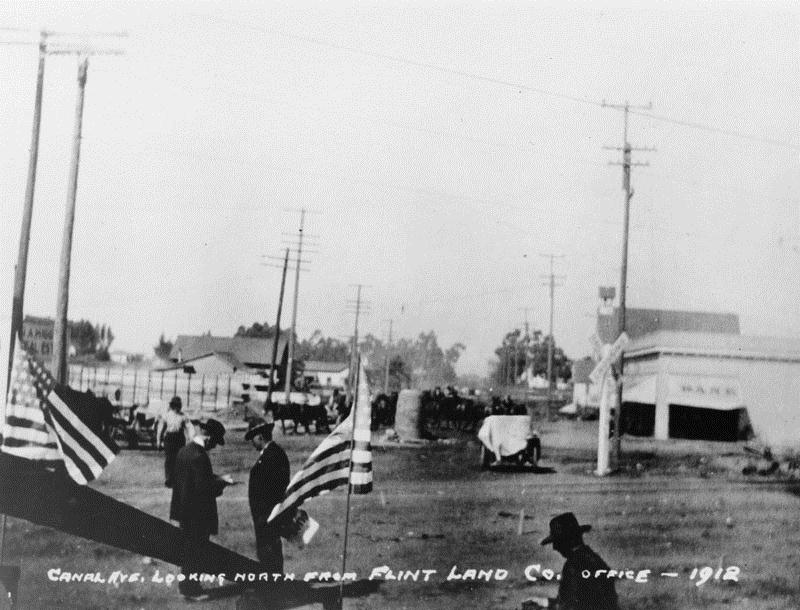
| (1912)* - Canal Ave (now Avalon Blvd), Wilmington, looking north from the Flint Land Co. office. |
 |
|
| (ca. 1900)^^ – View of Canal Street (later renamed Avalon Boulevard) looking toward C Street from south of D Street. There is a long, low wooden building at right with a covered porch held up by rectangular posts with a sign for the W. S. Moore Real Estate. To the far right is the Wilmington Chamber of Commerce. |
 |
|
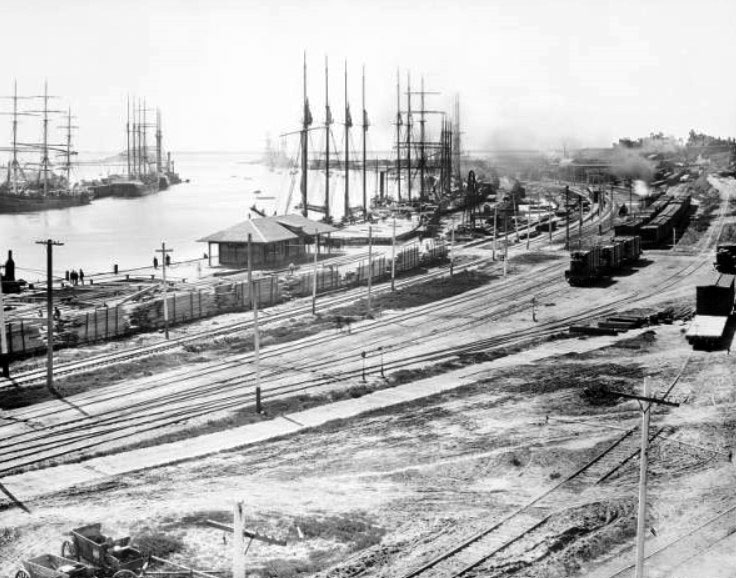
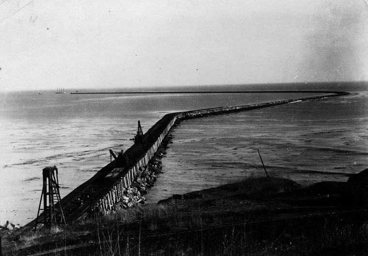
| (ca. 1910s)* - Breakwaters at San Pedro which is 9,250 feet in length. |
Historical Notes Between 1911 and 1912 the first 8,500-foot section of the breakwater was completed, and the Main Channel was widened to 800 feet and dredged to a depth of 30 feet to accommodate the largest vessels of that era.*^^ |
 |
|
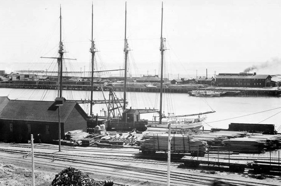
| (ca. 1910s)* - View of a large four masted ship anchored alongside a lumber dock at L.A. Harbor. Breakwaters and Deadman's Island can be seen in the background. |
Historical Notes Over the years the harbor would see additional improvements and expansions: In 1912 the Southern Pacific Railroad completed its first major wharf at the port. In 1913, the Los Angeles Angels Lighthouse was constructed at the end of the breakwater. During the 1920s, the port passed San Francisco as the west coast's busiest seaport. In the early 1930s a massive expansion of the port was taken with the construction of a breakwater three miles out that was over 2 miles in length. In addition to the construction of this outer breakwater an inner breakwater was built off of Terminal Island with docks for sea going ships and smaller docks built at Long Beach.*^ |
* * * * * |
Please Support Our CauseWater and Power Associates, Inc. is a non-profit, public service organization dedicated to preserving historical records and photos. Your generosity allows us to continue to disseminate knowledge of the rich and diverse multicultural history of the greater Los Angeles area; to serve as a resource of historical information; and to assist in the preservation of the city's historic records.
|
More Historical Early Views
Newest Additions
Early LA Buildings and City Views
History of Water and Electricity in Los Angeles
* * * * * |
References and Credits
* LA Public Library Image Archive
**DWP - LA Public Library Image Archive
*#South Bay Daily Breeze: San Pedro’s Bascule Bridge; The Free Harbor Day Jubilee
#^Flickr: History of San Pedro Harbor and Terminal Island
#* Huntington Digital Library Archive
#^^California State Library Image Archive
#^*Library of Congress Image Archive: 1909 Panorama with City Hall: 1919 U.S. Naval Fleet
#*^Facebook.com - San Pedro's Original Website, San Pedro.com
#**Flickr.com: Michael Ryerson
*#*KCET - Inventing LA: Port of Los Angeles; L.A.'s First Railroads Connected the Region to the Global Economy; Why Is SoCal's Harbor Split Between Two Cities?
*^*California Historic Landmark Listing (Los Angeles)
^^*S.S. Avalon and S.S. Catalina
**^Wilmington Historic Society
**#History of San Pedro: Maureen Megowan
*^#Avalon: cawreckdivers.org.com
^*#Avalon Boulevard: publicradio.org
*^^Port of Los Angeles: portoflosangeles.org
^**LA Times: Japanese Evicted from Terminal Island; Framwork: The Vincent Thomas Bridge
^^#SanPedro.com: Fishing Industry
^#^LA Metro Transportation Image Archive
^#*Los Angeles Fire Department Historical Archive
*#^Vincent Thomas Bridge - Facts and Figures
*^*^The Banning Compnay: socialarchive.virginia.ed
*^^*Pacific Eelecfric in San Pedro/Wilmington
^**^The Historical Society of Southern California
****Pamona Public Library’s Frasher Foto Postcard Collection
***^San Pedro and Los Angeles Harbor History
***#WPA in LA: The New Deal in Los Angeles 1933-43
**^#Archive.org: Perspective View with Landsat Overlay, Los Angeles Basin
^*^*Pinterest: Cars - Bertrand Lacheze; Beaon Street, 1910
^*^#Facebook.com - Bizzare Los Angeles
^^**Flickr.com - Floyd B. Bariscale Photostream: Dodson Residence; Fireboat No. 2 and Firehouse No. 112
*^^^Los Angeles Maritime Museum
^^^#Dominguez Rancho Adobe Museum
*##*Portoflosangeles.org: Prot History
^#^^Calisphere: University of California Image Archive
^#^#Press Reference Library, Volume 2 (Google eBook)
*#*#Benjamin Wilson
*#^#Sirensofchrome.com: Rumble Seat
*^##OAC - Online Archive of California
^^##LAist: A Park a Day: Point Fermin Park, San Pedro
#**^LA County Library Image Archive
#^*^Port of Long Beach Blogspot
#*^*Los Angeles City Historical Society
#*#^LAParks.org: Cabrillo Bath House
^* Noirish Los Angeles - forum.skyscraperpage.com; San Pedro Harbor; 1885 Harbor; 1905 City Hall; Vincent Thomas Bridge; Wilmington Storage and Towing Co.; 5th Street Landing
*^ Wikipedia: San Pedro; Wilmington; Deadman's Island (San Pedro); Phineas Banning; Daguerreotype; Drum Barracks; Los Angeles Terminal Railway; Santa Catalina Island; S.S. Catalina; Cord Automobile; Banning High School; Wilmington Oil Field; San Pedro High School; Ford Model T; Pt. Fermin Light; Padre Fermín Lasuén; San Pedro Bay; James H. Dodson Residence; Vincent Thomas Bridge; S.S. Monterey; Los Angeles Harbor Lighthouse; S.S. Yale; Juan Rodríguez Cabrillo; World Cruise Center; Volkswagon Beetle; Chichibu Maru; Wilmington Transportation Company
< Back