Early Los Angeles City Views (1925 +)
| Historical Photos of Early Los Angeles |
 |
|
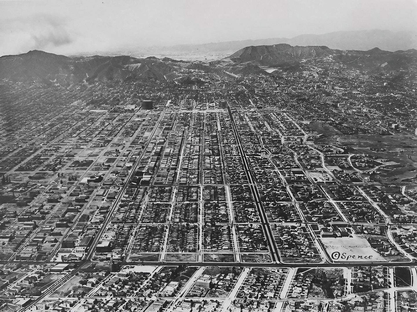
| (1929)* - Aerial view looking north toward the Hollywood Hills, with the intersection of Wilshire and La Brea visible at the lower left. The white inverted pyramid at the upper right is the Mulholland Dam, with the Hollywood Reservoir behind it.". Undeveloped land, middle right side of photo is the Arroyo del Jardin de los Flores, The Stream of the Garden of Flowers. |
Historical Notes The Arroyo del Jardin de los Flores was a stream that flowed from the location of today's Wilshire Country Club through Hancock Park, joining another creek that eventually drained to Ballona Creek near La Brea and St. Elmo Drive. The majority of this creek was piped and filled; a portion of it remains above ground at the Wilshire County Club, and a creek running through Brookside Estates also shares this name. Third square on right bottom (dark looking ravine), possibly the continuation of Arroyo del Jardin de los Flores. |
 |
|
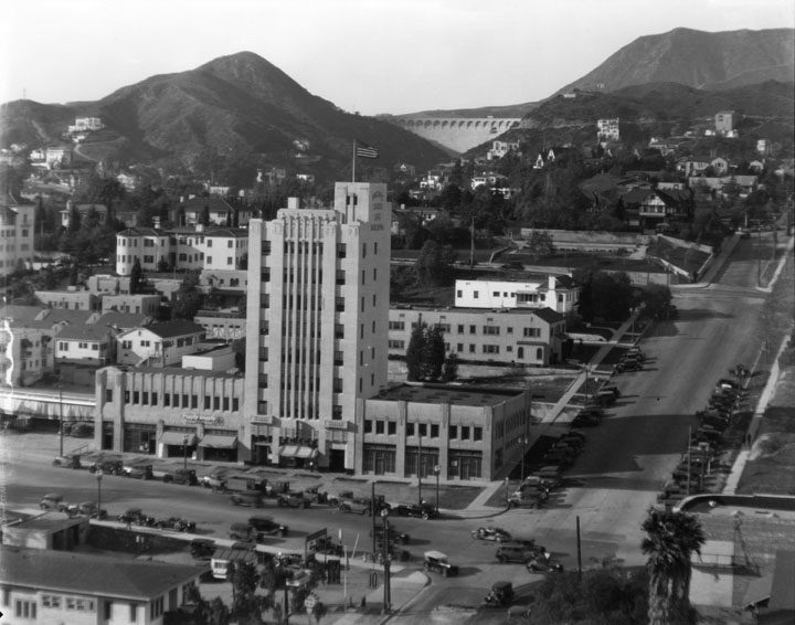
| (1929)* - Panoramic view of Hollywood and its surrounding areas. Partial view of the Hollywood Playhouse at 1735 N. Vine Street, is in the lower left corner of this photo. A tall building with several storefronts, upper right hand corner, is the Pacific States Life Building. The Mulholland Dam is in the far background (upper-right). |
Historical Notes The Hollywood Dam was constructed between 1923 and 1924 to create the Hollywood Reservoir for Los Angeles' water supply. The dam's history took a dramatic turn after the catastrophic failure of the similarly designed St. Francis Dam in 1928, which raised serious safety concerns. In response, the reservoir's water level was permanently lowered, and between 1933 and 1934, a massive earthwork project effectively concealed the dam from public view, making it appear like a natural hillside. |
 |
|
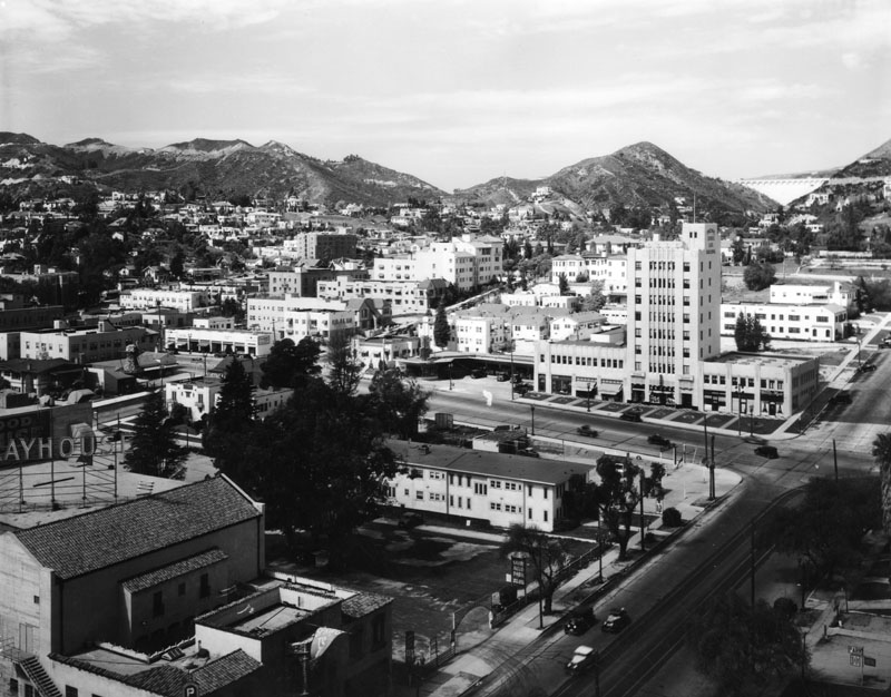
| (ca. 1928)* - Looking towards the Art Deco style Pacific States Life Building (now Yucca Vine Tower), located at 6305 Yucca Street. To the left is a Piggly Wiggly market and the Mulholland Dam is visible in the upper center. |
Historical Notes The Pacific States Life Building, now known as the Yucca-Vine Tower, is a notable Art Deco landmark in Hollywood, constructed in 1929 as the headquarters for Mountain States Life Insurance Company. Designed by architect Henry L. Gogerty, it is one of Hollywood's earliest skyscrapers, standing eight stories tall and contributing to the development of the Hollywood-Vine commercial district. Over the years, it has housed various significant tenants, including Gene Autry's Western Music Publishing and the Hollywood Anti-Nazi League, and has appeared in numerous films and TV shows, such as "The Day After Tomorrow" and classic series like "Mission: Impossible." Recently, preservation efforts led by the Art Deco Society of Los Angeles have aimed to designate the building as a Historic Cultural Monument, with the Cultural Heritage Commission voting unanimously to recommend this status to the Los Angeles City Council in April 2024. |
 |
|
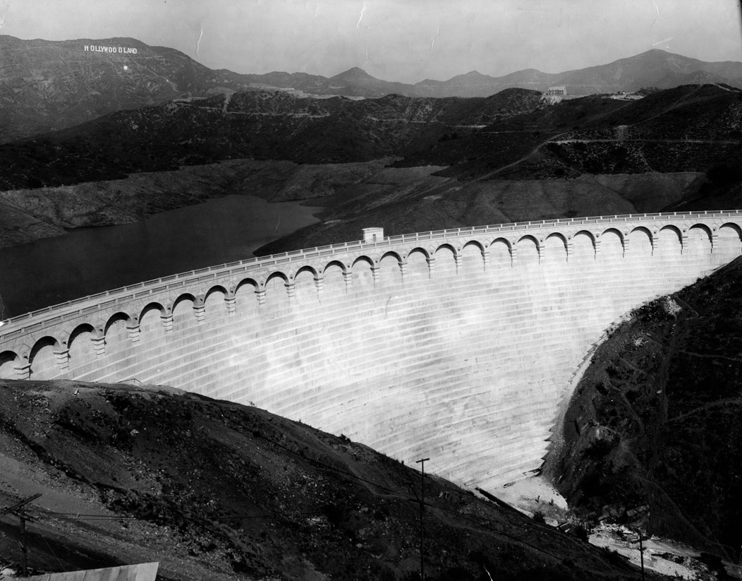
| (1929)* - Front view of Mulholland dam in the Hollywood Hills, the most beautiful of a score of storage basins in Los Angeles' water system. The HOLLYWOODLAND sign can clearly be seen in the background. |
Historical Notes Click HERE to see more on the Mulholland Dam and Hollywood Reservoir |
 |
|
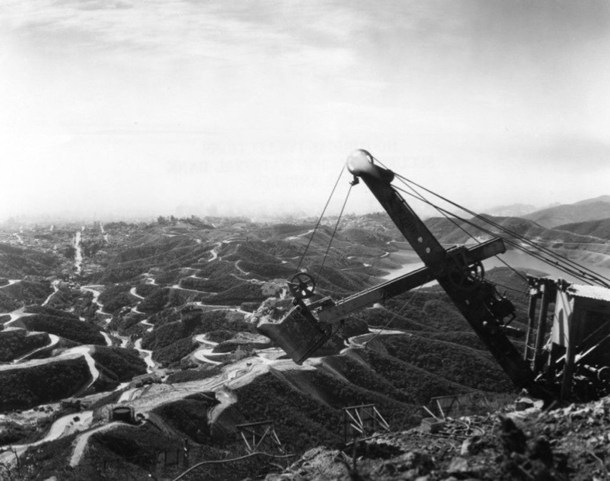
| (ca. 1929)* - An overview of the hills with a Mulholland Dam and Hollywood Reservoir off on the right, partially hidden by the steamshovel setting at the top of the near hill. |
 |
|
| (ca. 1929)* - Panoramic view of Hollywood and West Los Angeles, as seen from Mt. Lee. Lake Hollywood (Hollywood Reservoir) and “Hollywoodland” is in the foreground. |
 |
|
| (1928)* - View of Hollywood looking south from the head of Highland Avenue near Franklin Avenue. Automobiles navigate the unlined road that curves to the right through residential Hollywood. A street sign reads: "Caution Speed Limit 15 Miles". |
 |
|
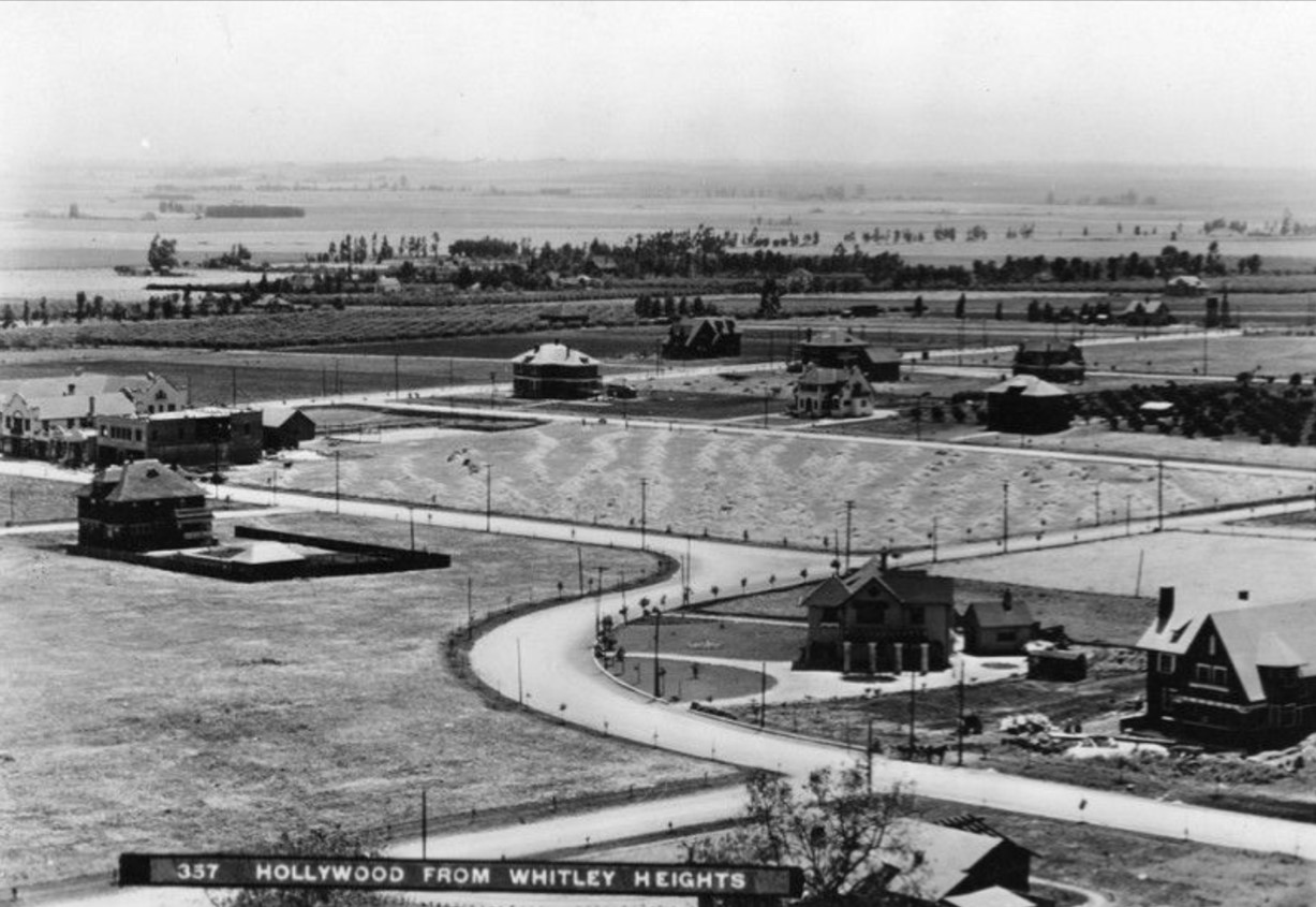
| (ca. 1903)* - Panoramic view of Hollywood from Whitley Heights circa 1903, looking southwest from Highland and Franklin Avenues 25 years earlier. The curved configuration of Highland between the East and West sections of Franklin Ave still exists today. The larger structure, seen on the left side of the photo, is the famous Hollywood Hotel. It is situated on the Northwest corner of Hollywood Blvd. and Highland Ave. Today, this is the site of the Hollywood and Highland Center, the current home of the Academy Awards. |
Before and After
.jpg) |
|
|
| (1903 vs 1928)* - Highland at Franklin Ave looking southwest. |
 |
|
| (1929)* - An early picture of Hollywood looking northeast from Santa Monica Boulevard and Highland Avenue. |
Historical Notes See more in Early Views of Hollywood (1850 - 1920) and (1920 +) |
* * * * * |
Los Angeles City Hall
 |
|
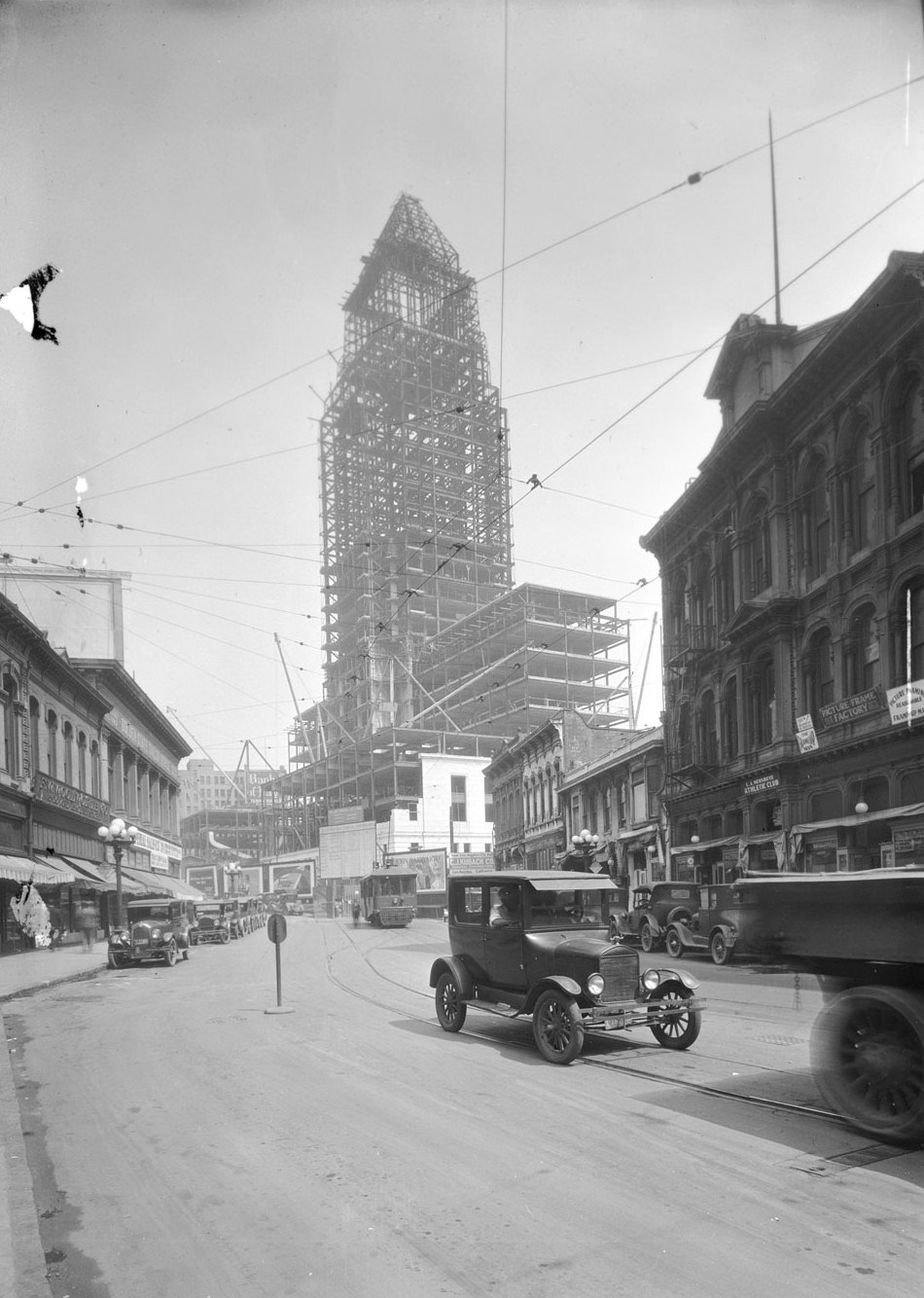
| (1927)* - View shows the construction of City Hall with its steel framing nearly completed. Early model cars and a streetcar are seen in the foreground. |
Historical Notes The new 28-story high-rise was replacing the old 1888-built City Hall located on Broadway between 2nd and 3rd Streets. That building had replaced a one-story adobe City Hall, formerly the old Rocha House, on the northeast corner of Spring and Court Streets. |
 |
|
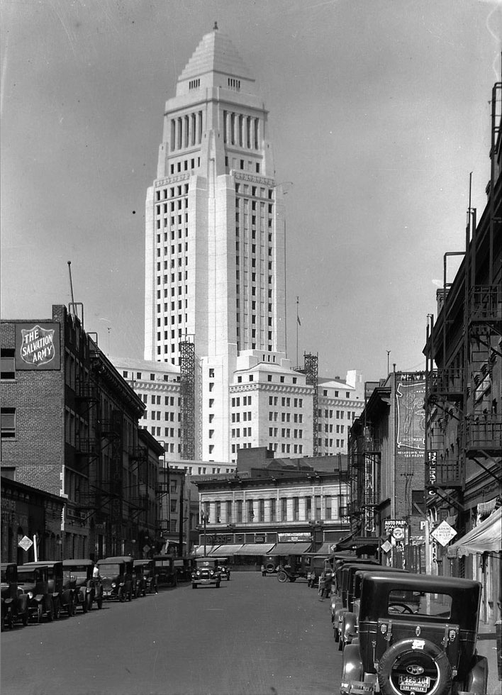
| (1928)* - View showing the nearly completed City Hall building as seen from Weller Street (now Onizuka Street, Little Tokyo). Metal scaffolding can be seen in place near the base of the tower. On the left can be seen the Salvation Army. |
Historical Notes For most of the 20th century, the hotels, boarding houses, and apartment blocks along the single block of Weller Street housed hundreds of Little Tokyo’s down and out. During the interwar years, the Salvation Army maintained its primary hotel for poor industrial workers at 127 Weller Street, visible on the left of the top photograph. After waves of Japanese families began returning to Los Angeles from internment camps after the war, many of the old buildings served as homes for those needing temporary lodging, and eventually, for those with nowhere else to go.* Click HERE to see more in Early Views of Weller Street. |
 |
|
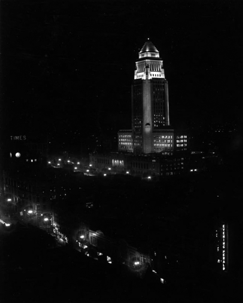
| (1928)* – Night view showing Los Angeles City Hall in downtown Los Angeles. The LA Times Building on the N/E corner of Broadway and 1st Street can be seen at left, with the lighted sign "Times." Neon sign at lower-right reads: "Evening Herald". |
Historical Notes The following historical timeline lists the buildings used by City Council, also known as City Hall, since 1850, when Los Angeles was incorporated as a municipality: ◆ 1850 - 1853 - used rented hotel and other buildings for City meetings ◆ 1853 - rented adobe house (aka Rocha Adobe) on Spring Street - across from current City Hall (now parking lot for Clara Shortridge Foltz Criminal Justice Center). The buliding was shared with the County who used it as a Court House. ◆ 1861 - moved into John Temple's Clocktower Market Building, but only stayed for less than a year before the County Court House moved-in ◆ 1861 - 1884 - relocated back to the Rocha Adobe and stayed for over 20 years ◆ 1884 - 1888 - moved to new City Hall Building at South Spring Street and West 2nd Street (site of current Los Angeles Times Building) ◆ 1888 - 1928 - moved to new Romanesque Revival Building on 226-238 South Broadway between 2nd Street and 3rd Street; demolished in 1928 and now site of parking lot between LA Times Parking structure and 240 Broadway. ◆ 1928 - moved to current City Hall Building |
 |
|
| (1929)^ - View of the western facade of Los Angeles City Hall facing Spring Street, in the distance. The old Los Angeles Times newspaper building with a clock tower is located on the right, and houses are visible on the hill. |
 |
|
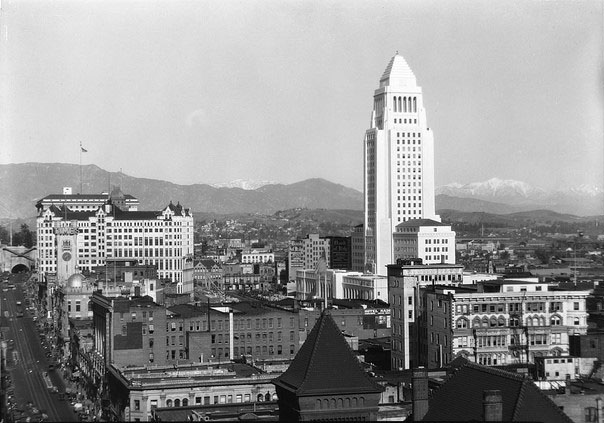
| (1929)* - The tall, white City Hall building can be seen towering above every other building in downtown, at middle right. Many other buildings can be seen clustered around Los Angeles City Hall, and a view of the San Gabriel Mountains can be seen in the distance. The Broadway Tunnel and the old LA Times Building can be seen to the center-left of the photo. |
Historical Notes The Broadway Tunnel was a tunnel under Fort Moore Hill, downtown, extending North Broadway (formerly Fort Street), at Sand Street (later California Street), one block north of Temple Street, northeast to the intersection of Bellevue Avenue (later Sunset Boulevard, now Cesar Chavez Avenue), to Buena Vista Street (now North Broadway). The tunnel was closed in 1949, and was demolished for the construction of the Santa Ana Freeway. The route cut through Fort Moore Hill and made it necessary for a Broadway overpass to be built across the freeway and the old tunnel site. |
 |
|
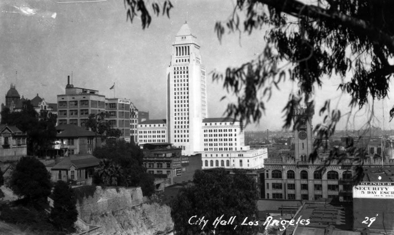
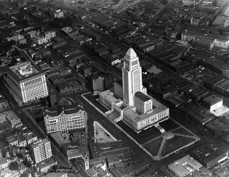
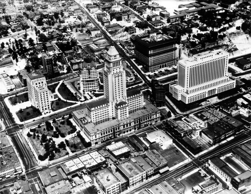
| (ca. 1929)^ - Aerial view of the Civic Center, looking northeast toward City Hall, across from the Hall of Records on the left, above which is the old County Courthouse and across the street the Hall of Justice. |
Historical Notes At 28 stories and 454 feet high, the Los Angeles City Hall was the tallest building in Los Angeles from its completion in 1928 to 1964. |
 |
|
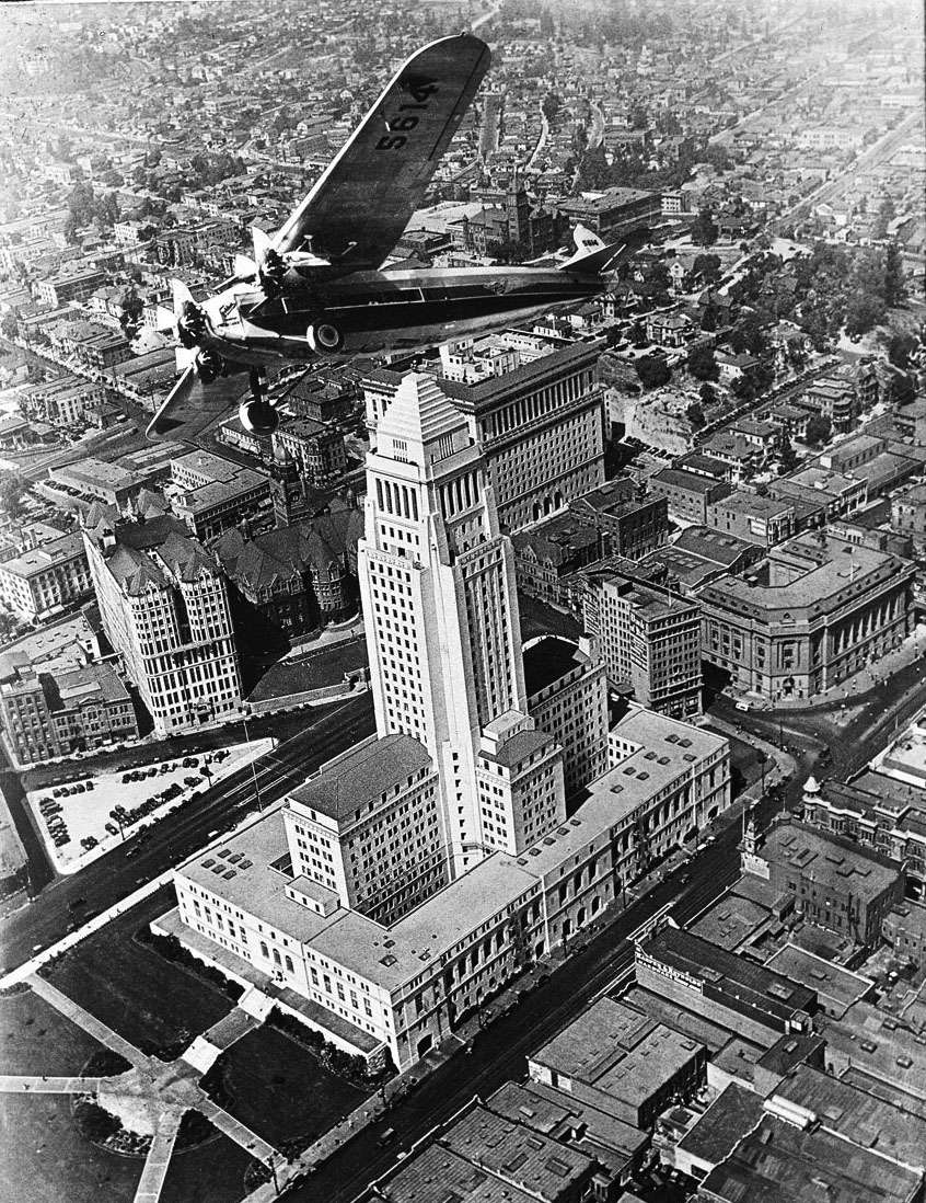
| (ca. 1929)* - View of a Fokker F.10 buzzing over City Hall circa 1929. Click HERE to see more in Aviation in Early L.A. Note the triangular parking lot on Spring Street, to the left. |
 |
|
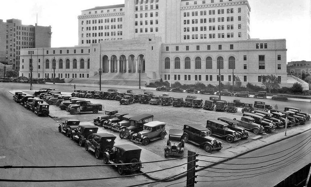
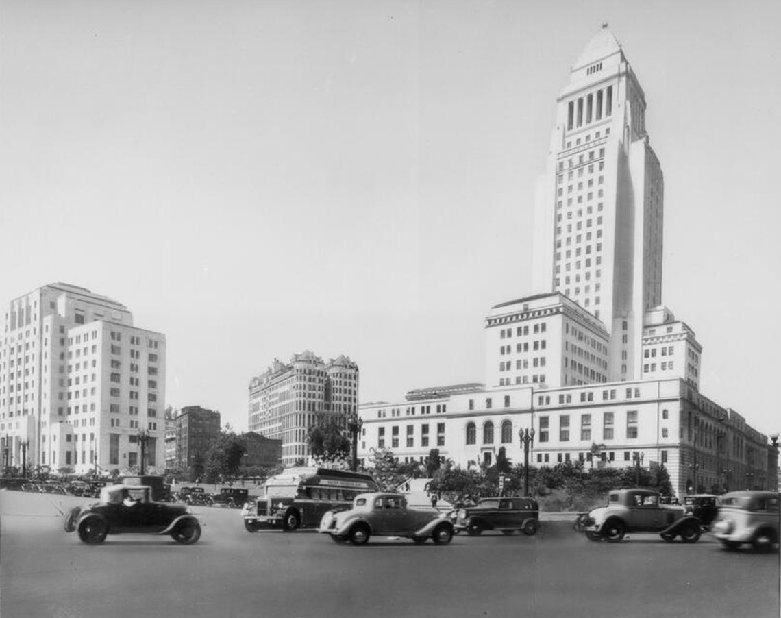
| (1931)^ – View showing a full parking lot in front of City Hall on Spring Street. The view is from the intersection of New High Street (to the left) and Court Street (to the right), both of which no longer exist today. |
* * * * * |
Los Angeles Civic Center
 |
|
| (1935)* – Los Angeles Civic Center. Only one building seen above still stands today. Photo by Dick Whittington |
 |
|
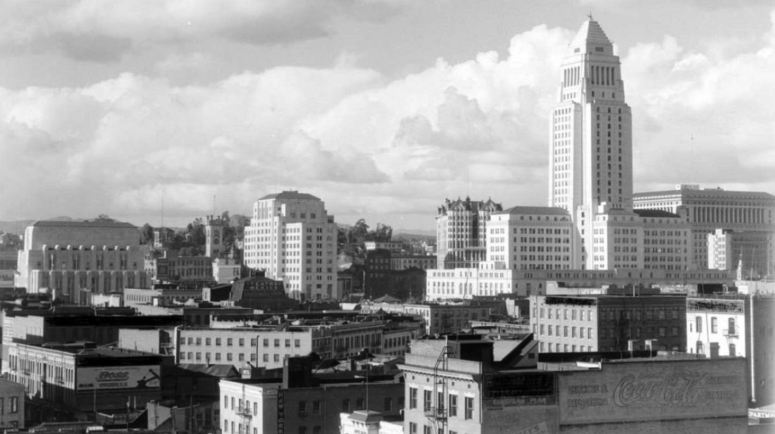
| (ca. 1935)* – View looking northwest showing several prominent buildings of the Los Angeles Civic Center skyline including (l to r): LA Times Building (1935 ), LA Times Building (1912), California State Building (1931), Hall of Records (1908), City Hall (1928), and Hall of Justice (1925). |
 |
|
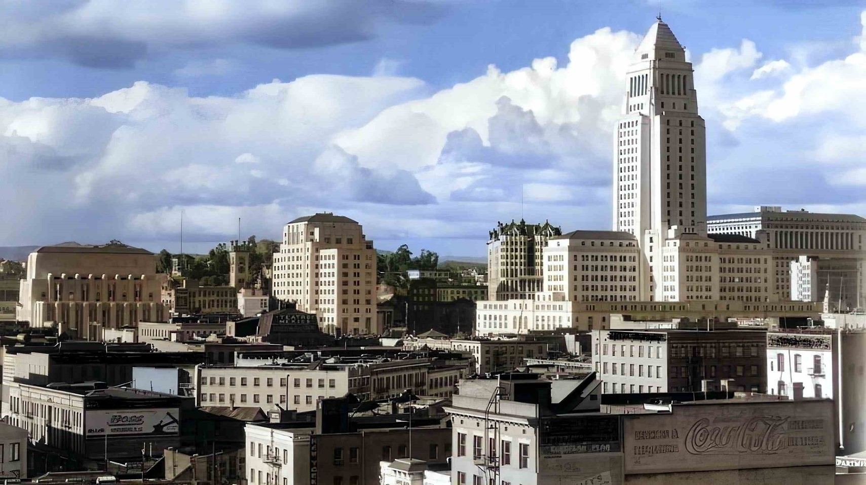
| (ca. 1935)* – Los Angeles downtown skyline. View is looking northwest toward Bunker Hill. (AI image enhancement and colorization by Richard Holoff) |
 |
|
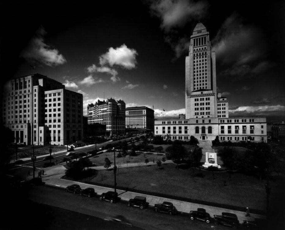
| (ca. 1940)^ - Aerial view of Los Angeles Civic Center with City Hall, 200 N. Spring St., as the focal point. To the right of City Hall is the Federal Courthouse and U.S. Post Office Building (1940). Across from (behind) City Hall is the Hall of Records with the California State Building to its left. At top center-right is the Hall of Justice which is next to a partially graded hill that still contains houses on top. |
Historical Notes Click HERE to see more photos of the construction of City Hall |
* * * * * |
Temple and Broadway
 |
|
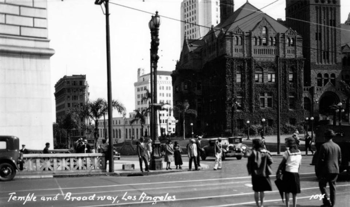
| (ca. 1930)^*^# - View looking southeast at the corner of Temple and Broadway. Several people are waiting to cross Broadway. The LA County Courthouse is seen at right. Behind it stands City Hall, and to the left in the background is the Old International Bank Building. |
.jpg) |
|
| (1932)* – View looking at the intersection of Temple and Broadway as seen from the N/W corner, with City Hall, the LA County Courthouse, and the Hall of Records in the background. |
.jpg) |
|
| (1932)* – View looking toward the southwest corner of Temple Street and Broadway from the front of the Hall of Justice. In the foreground, a woman appears to be setting up a fruit stand (crates of fruit). In the distance (center-left) can be seen the Hotel Broadway, which is adjacent to Court Flight. |
.jpg) |
|
| (1932)* – Closer view looking south on Broadway from the N/E corner of Temple and Broadway. From left to right can be seen the Old County Courthouse, the Hall of Records, and the Hotel Broadway. |
 |
|
| (ca. 1932)* – View looking northwest from the Hall of Justice steps showing the Women's Christian Temperance Union Building (WCTU) on the northwest corner of Broadway and Temple Street. Legible signs include: Mora's Original Grill, Inc., 233-235 N. Broadway, "Spaghetti and Ravioli Dinners a Specialty", 3 Bail Bond Agencies, and Christie's Coffee Shop, 225 N. Broadway. |
.jpg) |
|
| (1932)* – View looking north on Broadway at Temple Street. From left to right can be seen the WCTU Building, the Broadway Tunnel, and the Hall of Justice. |
.jpg) |
|
| (1932)* – View looking east on Temple Street from the front of the County Courthouse. The WCTU Building is seen across the street on the N/W corner of Temple and Broadway. |
* * * * * |
1st and Spring
 |
|
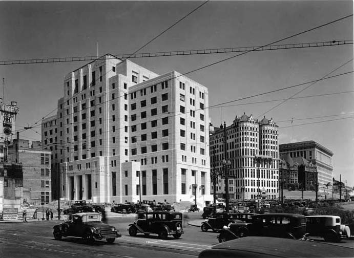
| (1931)* – View looking toward the northwest corner of 1st and Spring streets showing the new State Builiding under construction with the LA Times Building on the left and the Hall of Records Building to the right. |
Historical Notes The Times building seen above is the third Times building. It was built on the same site as the second building after that was blown up in 1910. It co-existed with the State Building for several years until the Times moved into their 4th and current home, and then it was torn down about 1938. |
 |
|
| (1931)**^* - View looking toward the northwest corner of 1st and Spring. Five of the more famous buildings in Downtown L.A. history can be seen. They are (left to right): the Old LA Times Building, the State Building (still under construction), the Hall of Records, the L.A. County Courthouse, and the Hall of Justice (the only one still standing today). The new City Hall stands to the right of photo (out of view). |
Historical Notes The State Builiding was completed in 1931 at a cost of more than $2 million. It was dedicated the day before the opening of the 1932 Olympics in a ceremony that featured Amelia Earhart.*# |
 |
|
| (ca. 1931)*# – View facing south showing from left to right: State Building, County Hall of Records, Hall of Justice, and City Hall. At left is the intersection of 1st and Spring streets. Photo by “Dick” Whittington |
Temple and N. Main
 |
|
| (ca. 1930)*# - Birdseye view looking north-east showing North Main Street as seen from City Hall. The large building in the foreground is the old Federal Building and Post Office (N/W corner of N. Main and Temple streets). The LA Plaza is seen at center of photo. Also, the historic 300 block of N. Main Street is in clear view at lower center-right. |
 |
|
| (1932)**^* - Postcard view of North Main Street as seen from the base of Los Angeles City Hall at Temple Street. The old Federal Building and Post Office stands on the northwest corner.The entire 300 block of N. Main Street, from Baker Block to the Ducommun Building, can be seen here. Further down Main Street is the Pico House, the LA Plaza and Olvera Street. |
Olvera Street
 |
|
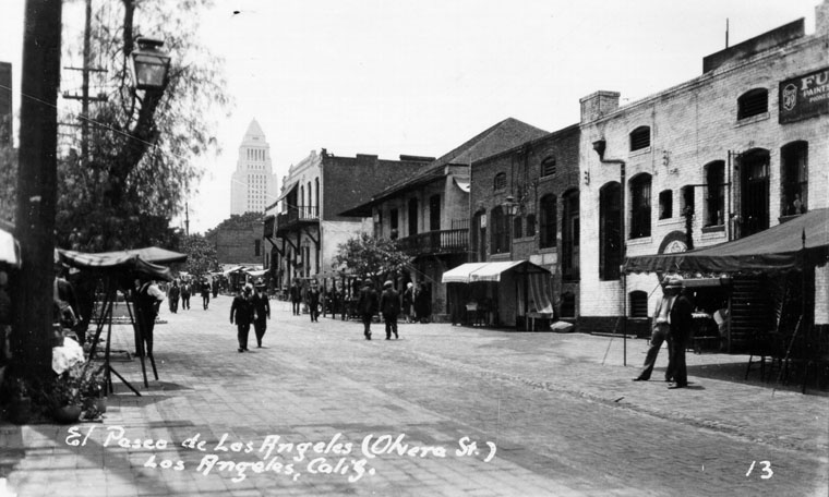
| (ca. 1930)^ - Late afternoon view of Olvera Street with City Hall in the background. |
Historical Notes In 1930, through the efforts of activist Christine Sterling, the Plaza-Olvera area was revived with the opening of Paseo de Los Angeles (which later became popularly known by its official street name Olvera Street). As a tourist attraction, Olvera Street is a living museum paying homage to a romantic vision of old Mexico. The exterior facades of the brick buildings enclosing Olvera Street and on the small vendor stands lining its center are colorful piñatas, hanging puppets in white peasant garb, Mexican pottery, serapes, mounted bull horns, oversized sombreros, and a life-size stuffed donkey. Today, Olvera Street attracts almost two million visitors per year.^* |
 |
|
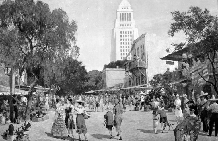
| (ca. 1930)^ - A painting by Chris Siemer of Olvera Street, with L.A. City Hall in the background. The painting was created for display for the L.A. Chamber of Commerce. The Plaza-Olvera Street site was designated as a California State Historic Landmark in 1953. |
 |
|
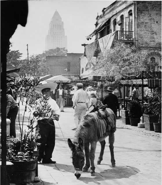
| (1930s)*#^^ - Hino Josa leading a donkey. View toward City Hall-looking at Sepulveda House, donkey on Olvera Street. The Sepulveda House fronts both Olvera and Main streets. |
Historical Notes The Sepulveda house was once the private home of one of the most powerful families in early Los Angeles. The Sepulveda House was built by Eloisa Martinez de Sepulveda in 1887, at a time when all predictions were that the population boom of the 1880s would last. However, Señora Sepulveda's hopes for Main Street were not fulfilled and by 1900 the area around her house was mostly industrial. Since the turn of the 20th century, Sepulveda House has been a bordello, a tearoom and the USO canteen during World War II.^* |
Click HERE to see more in Early Los Angeles Plaza |
* * * * * |
West L.A. and Beverly Hills
 |
|
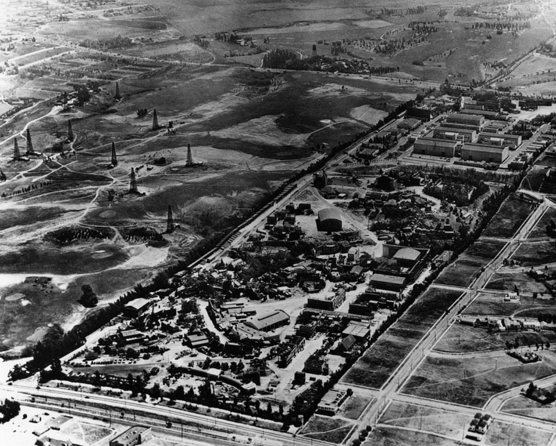
| (ca. 1928)^ - Aerial view looking south from Santa Monica Blvd to Pico Blvd. Motor Ave can be seen making a T-junction with Pico at the south end of the Fox Studios. The Rancho Country Club is on either side of Motor Ave. |
Historical Notes The eastern portion of Rancho Country Club became Hillcrest Country Club. The western section became Cheviot Hills Park/Rancho Park Recreation Center. Fox Hills Drive on the Janss Westwood Hills Tract runs parallel with Fox Studios to the west. Beverly Glen is out of shot further west. To the east is the Beverly Hills oil field, which still exists as a single, multi-well drilling platform on the Beverly Hills High School campus. |
 |
|
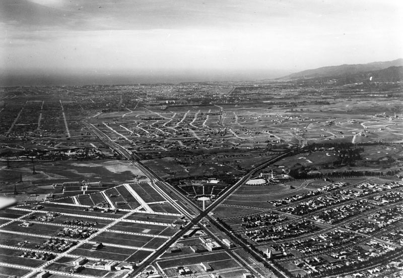
| (1928)^ - Aerial view, looking west, showing where Santa Monica and Wilshire boulevards intersect. Beverly Hills High School can be seen at center-left. The Good Shepherd Catholic Church is at lower center-right on Santa Monica Boulevard.. |
 |
|
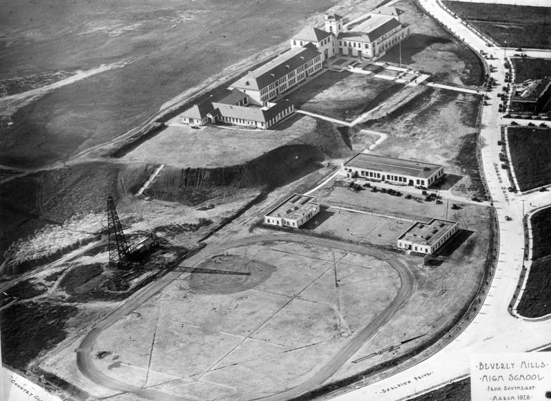
| (1928)^ - Aerial view showing Beverly Hills High School located at 241 Moreno Drive. Note the oil derrick adjacent to the track field. |
Click HERE to see more Early Views of Beverly Hills. |
* * * * * |
Westwood
 |
|
| (1927)^ - Aerial view of Westwood on November 1, 1927, looking north of Wilshire Boulevard between Beverly Hills and UCLA. The intersection of Wilshire Boulevard and Beverly Glen is at the lower center. |
 |
|
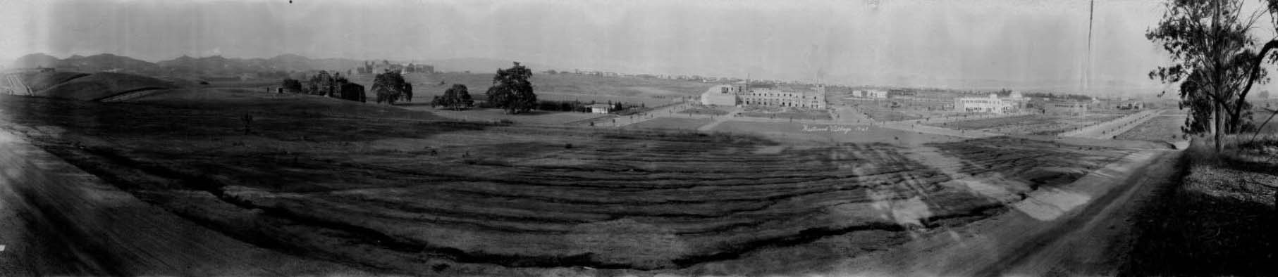
| (1929)*^#^ - A panoramic view of Westwood, in Los Angeles. The area in the foreground is mostly open fields, but beyond that Westwood Village is under construction. There are several tree-lined streets laid out, but only a few large buildings are under construction. There are numerous houses in the distance beyond that, and the beginnings of the University of California, Los Angeles, campus in the distance on the left. Writing in white in the center of the image reads "Westwood Village 1929." |
Historical Notes Westwood and UCLA were developed on the lands of the historic 'Wolfskill Ranch', a 3,000-acre parcel that was purchased by Arthur Letts, the successful founder of the Broadway, and Bullock's department stores, in 1919. Upon Arthur Lett's death, his son-in-law, Harold Janss, vice president of Janss Investment Company, inherited the land and developed the area and started advertising for new homes in 1922.^* |
 |
|
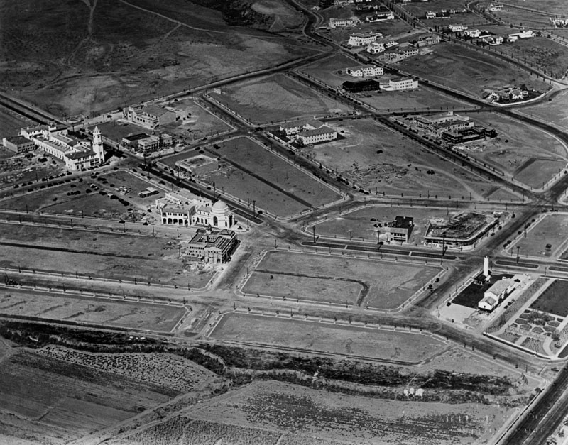
| (1929)* - Aerial close-up view of Westwood Village, showing the beginning of development but a great deal of open space still exists. Janss Dome can be seen at center-left. Wilshire Boulevard is at lower-right. |
Historical Notes Westwood Village was created by the Janss Investment Company, run by Harold and Edwin Janss and their father, Peter, in the late 1920s as an autonomous shopping district and headquarters of the Janss Company. Its boom was complemented by the boom of UCLA (which selected the Westwood Hills as its new home in 1926), developed as a shopping district not just for the residents of Westwood but also for the university.^* |
 |
|
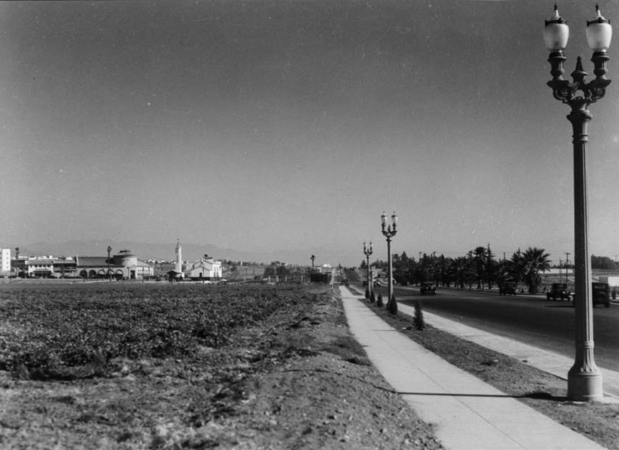
| (ca. 1930)*^#^ - View looking east along the sidewalk adjacent to Wilshire Boulevard towards the new Westwood Village development. To the left can be seen the new Ralphs Market with its prominent rotunda. Note the ornate streetlamps running down Wilshire Blvd. Click HERE to see more Early LA Streetlights. |
Click HERE to see more in Early Views Westwood |
* * * * * |
UCLA
 |
|
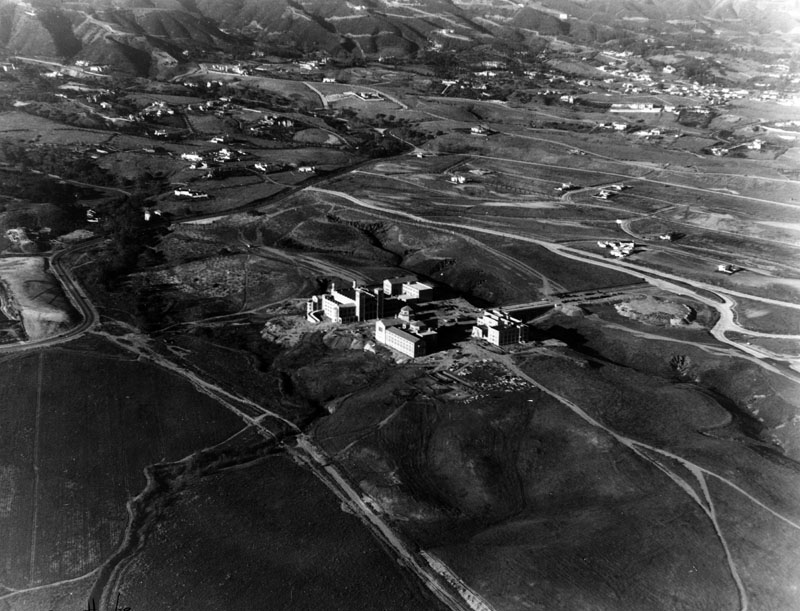
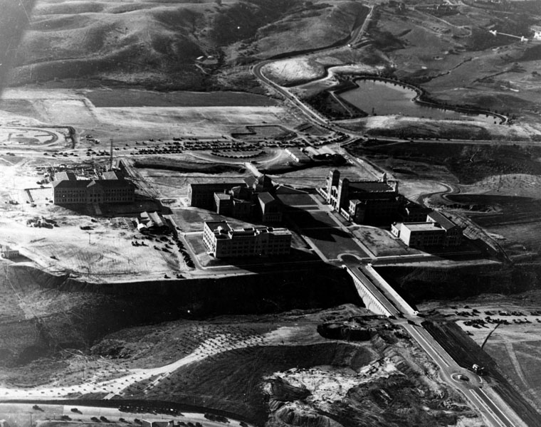
| (1929)^ - Aerial view of UCLA's Westwood campus while the campus was under construction in 1929, looking from Beverly Boulevard. Large homes can be seen to the north and east of the campus. |
Historical Notes In 1919 UCLA obtained university status and became the Southern Branch of the University of California, located at 855 N. Vermont Avenue. In 1927 the name was changed to the University of California at Los Angeles. On May 31, 1929 the university opened its new campus in Westwood on land sold for $1 million dollars. In 1958, the name changed slightly again when the "at" was dropped, and became simply University of California, Los Angeles or UCLA.^ Even before it was situated on the Vermont campus, UCLA was evolving from another school, California State Normal School, founded in 1881. Click HERE to see more in Early Views of UCLA. |
 |
|
| (1929)^ - An aerial view of the new U.C.L.A. Westwood campus, looking west, as construction was completed in 1929. Buildings from left to right: Moore Hall, then called the Education Building, left; Physics Building, foreground center; Powell Library, back center; Royce Hall, back right; and Haines Hall, far right. The main campus quadrangle appears at the center. In the foreground is Arroyo Bridge which connected the campus to Hilgard Avenue. The gully which the bridge crossed was filled-in after World War II. |
 |
|
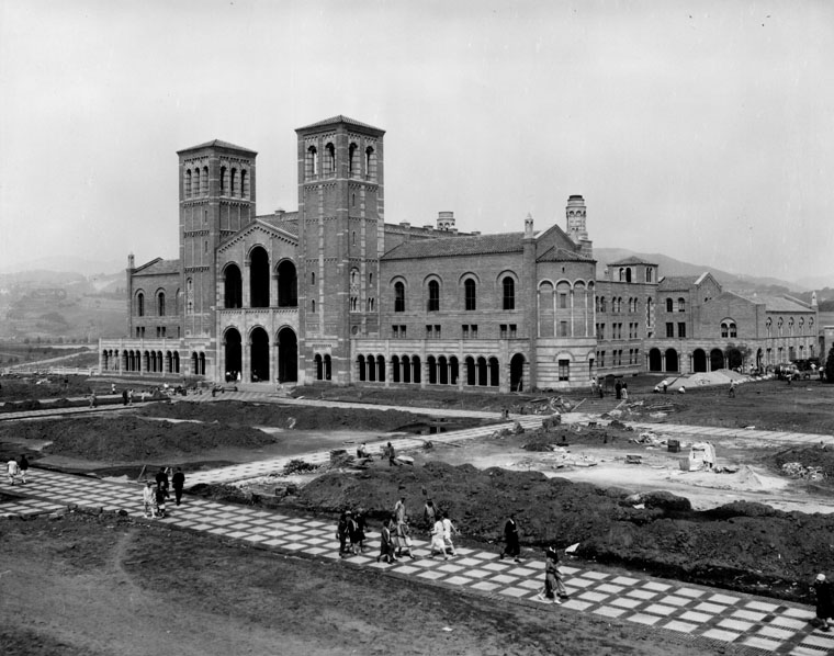
| (1929)^ - Opening Day on the new U.C.L.A. Westwood campus, September 20, 1929. Construction activity continued while classes began. The area shown is the original campus quadrangle. View above shows students walking along the pathway. Royce Hall, in the background, was built 1928-29 in a northern Italian Romanesque Revival style. |
 |
|
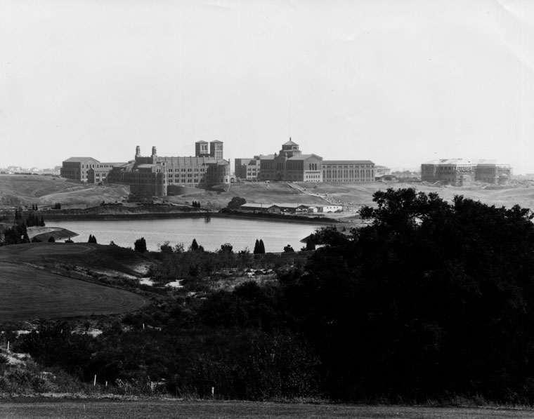
| (1930)^ - A panoramic view of the UCLA Westwood campus, shortly after it opened. View is looking from the golf course of the Bel-Air Country Club. The body of water shown is the Sawtelle Reservoir. The twin towers of Royce Hall may be seen in the middle of this photo. |
 |
|
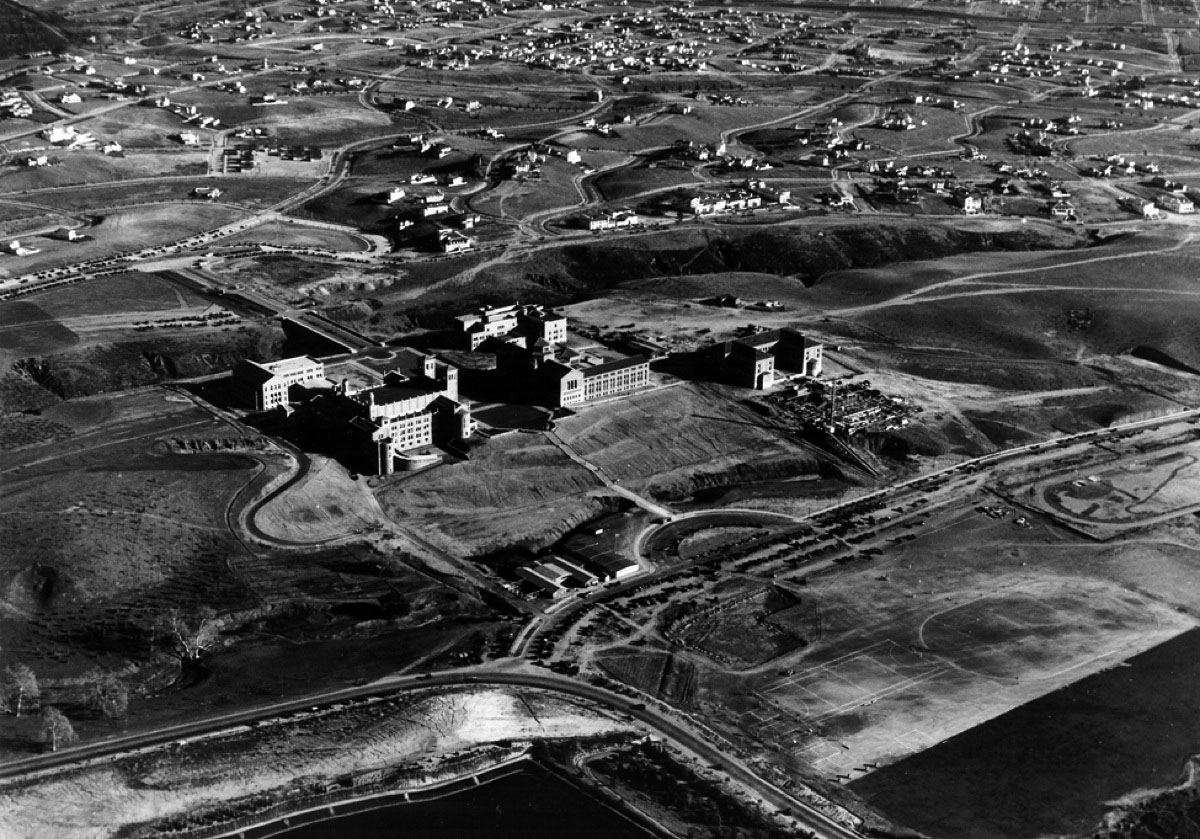
| (1930)^***- Aerial view of UCLA showing the full range of residential development to the southeast of campus. There is a clear view of the bridge and gully, later filled in, between the campus and the community to the east. |
.jpg) |
|
| (1929)^ - View looking at Arroyo Bridge which connects Hilgard Avenue to the main campus quadrangle at the U.C.L.A. Westwood campus. |
Historical Notes In May 1927, ground was broken at UCLA’s new Westwood campus and the first priority was to construct a bridge to cross the deep arroyo. The bridge was necessary for transporting construction supplies over the ravine that divided the east and west parts of the site. In the summer of 1947, the gully was filled to increase the amount of useable property on the campus. Today, the bridge’s arches remain hidden underground at Dickson Plaza.^*^*^ |
Click HERE to see more in Early Views of UCLA and Westwood |
* * * * * |
Santa Monica Bay
 |
|
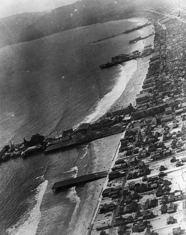
| (Late 1920s)^ - Aerial view all along the coast of Venice and the whole Santa Monica Bay area. At least 6 or 7 piers can be seen extending out into the ocean. |
 |
|
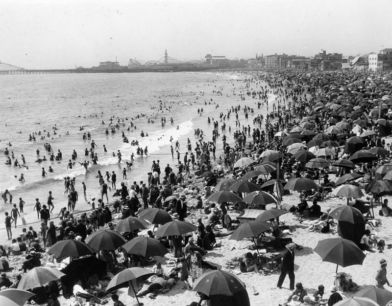
| (ca. 1920s)^ - View looking north of a very crowded shoreline at Ocean Park Beach in Santa Monica. |
 |
|
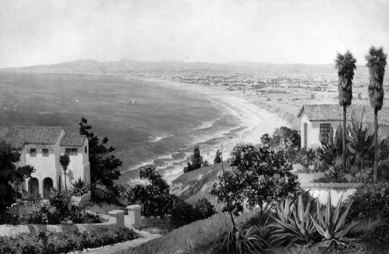
| (ca. 1930)^ - View of the coastline along Pacific Coast Highway looking north to Santa Monica, Pacific Palisades and Malibu. This is a photograph of a Chris Siemer painting created for a display by the L.A. Chamber of Commerce. |
Historical Notes Click HERE to see more in Early Views of Santa Monica |
* * * * * |
Malibu
 |
|
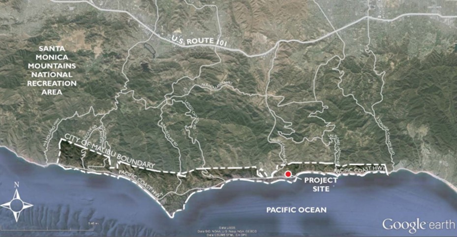
| (2015)* - Google Map showing City of Malibu boundaries. |
Historical Notes Before 1929, the Malibu area had limited accessibility with only a few roads leading into it. However, a significant turning point occurred when the state won a court case, paving the way for the construction of the iconic Pacific Coast Highway. This development opened up new possibilities for the region. In 1926, a pivotal moment in Malibu's economic history unfolded with the establishment of a small ceramic tile factory by Mary K. Rindge. This factory became a cornerstone of the local economy, employing over 100 workers and contributing to the community's growth. The Malibu tile produced by the factory gained immense value and popularity, attracting businesses and Los Angeles residents to venture into the area. The year 1929 marked the construction of the Adamson House, colloquially known as the "Taj Mahal of Tile." This Spanish-style house, situated within Malibu Lagoon State Beach park, showcased intricate tile designs and became a testament to the craftsmanship of the time. Fully adorned with early Malibu tile, the Adamson House is now recognized as a California Historical Landmark, preserving the cultural and architectural heritage of the region. The onset of the Great Depression in 1932 had a profound impact on Malibu, leading to the demise of numerous businesses, including the once-thriving tile factory. The economic downturn prompted affluent individuals, including tycoons like William Randolph Hearst, to seize the opportunity to acquire vast stretches of Malibu real estate. As a result, these wealthy investors, capitalizing on the depressed property market, purchased significant portions of land. Post-Depression, individuals like Hearst played a crucial role in shaping the current landscape of Malibu, establishing the neighborhoods that define the area today. The echoes of this historical evolution can still be witnessed in the cultural and architectural richness that characterizes Malibu. |
* * * * * |
Malibu Trading Post
 |
|
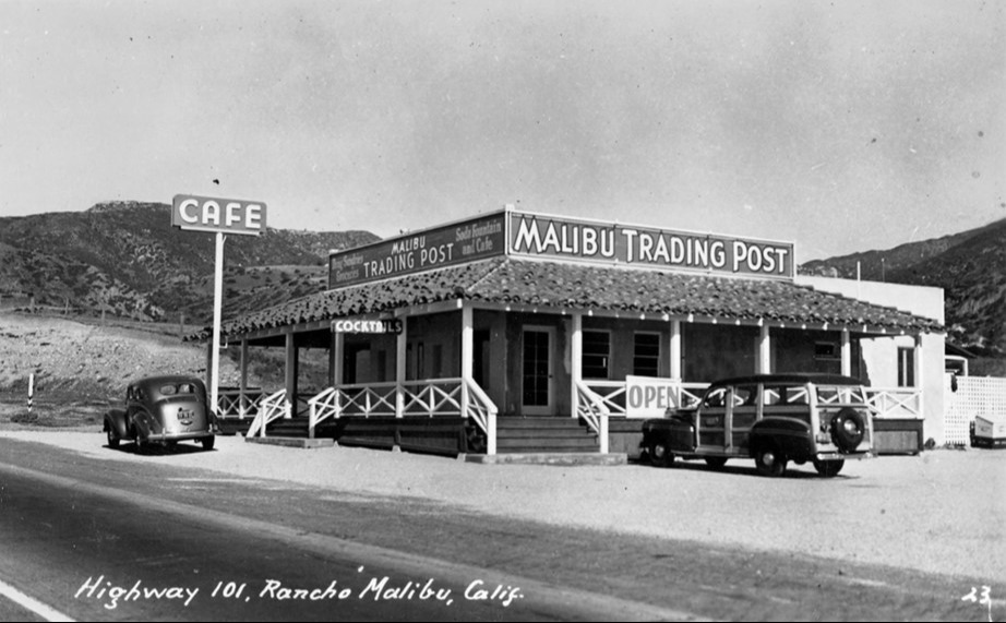
| (1940s)* - Postcard view showing the Malibu Trading Post, in western Malibu at Trancas Road and what is today the Pacific Coast Highway. |
Historical Notes The Malibu Trading Post post was located along the 101 near Trancas Canyon Road, and was operated by Harry Canfield who started it with Malibu local Art Jones around 1930. Fifteen years later, it seemed to become a very popular lunch spot for beachgoers, as they suddenly started advertising in all the papers, and business remained good up until it burned down in 1949. |
 |
|
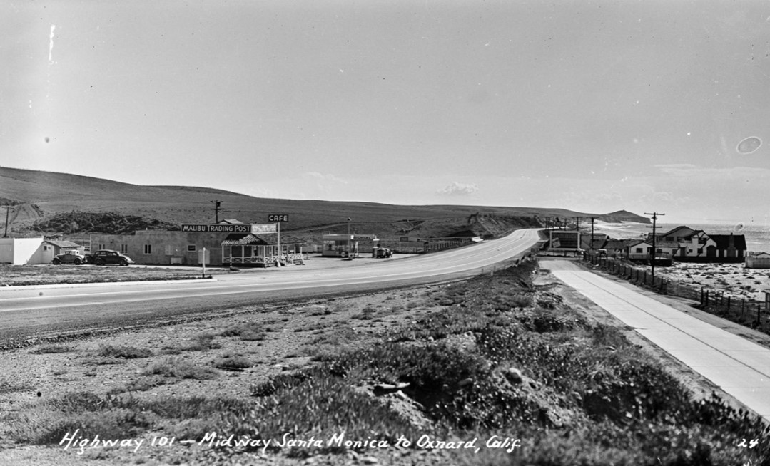
| (1940s)* - Looking south towards Point Dume on Roosevelt Highway (later Pacific Coast Highway) at Trancas Canyon near Broad Beach showing the Malibu Trading Post on the left. On the right is Zuma Beach. |
Historical Notes Malibu Trading Post burned down in 1949. It was replaced by the Trancas Restaurant and today is also the location of a Starbucks. |
 |
|
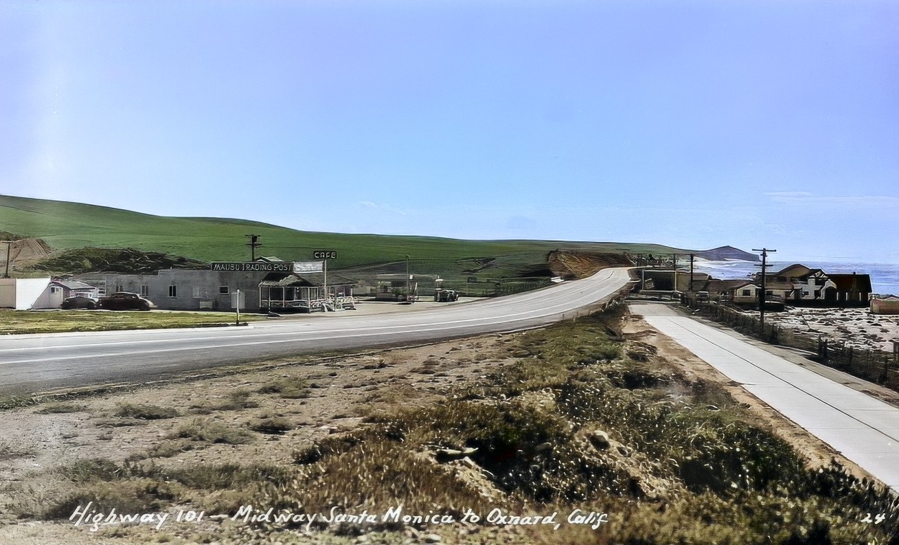
| (1940s)* - Looking south towards Point Dume on Roosevelt Highway (later Pacific Coast Highway) at Trancas Canyon near Broad Beach showing the Malibu Trading Post on the left. On the right is Zuma Beach. Image enhancement and colorization by Richard Holoff. |
 |
|
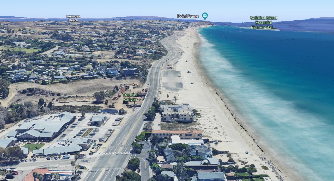
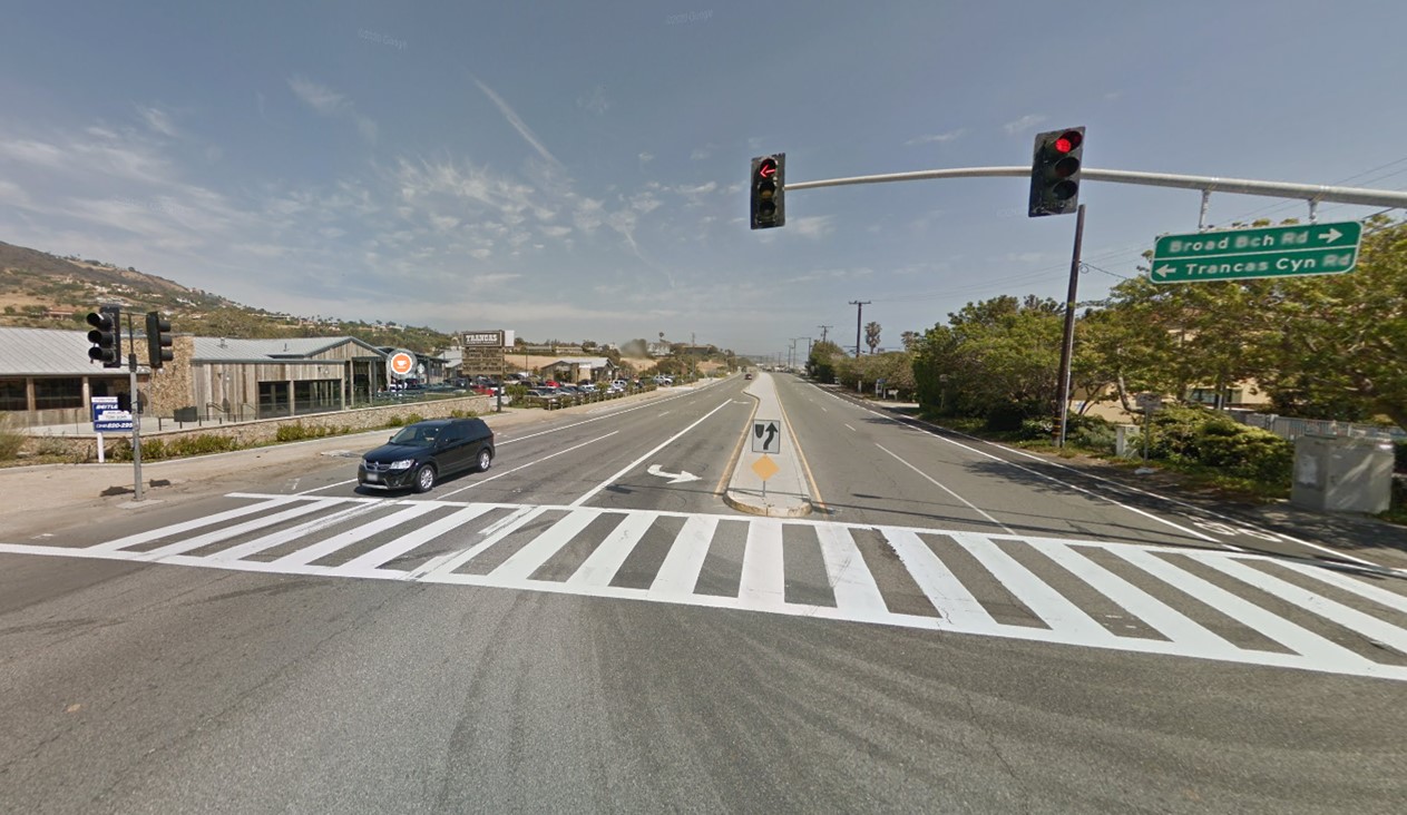
| (2022)* – Elevated view from abovde the intersection of PCH and Trancas Cyn Rd toward Point Dume. |
 |
|
| (2016)* - Pacific Coast Highway at Trancas Cyn Rd showing where the Malibu Trading Post once stood (left) today the site of Trancas Market and a Starbucks. |
* * * * * |
Malibu Country Store
 |
|
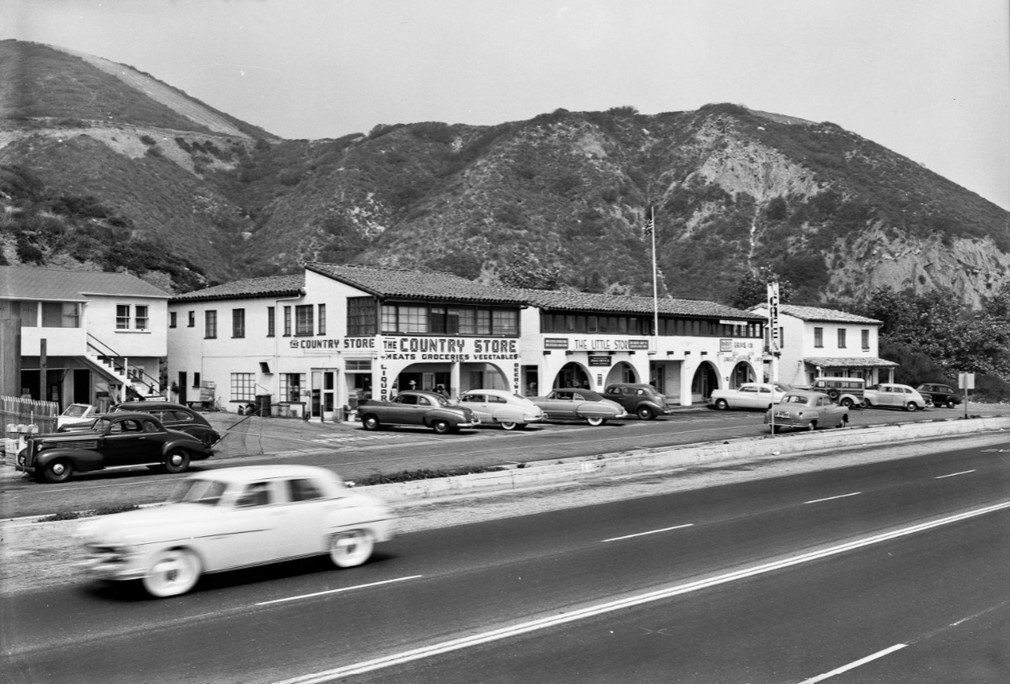
| (1950)* – The Country Store located at 21237 Pacific Coast Highwary in Malibu. Next door neighbors include The Little Store, a Post Office, and a coffee shop. Photo by Bob Plunkett |
 |
|
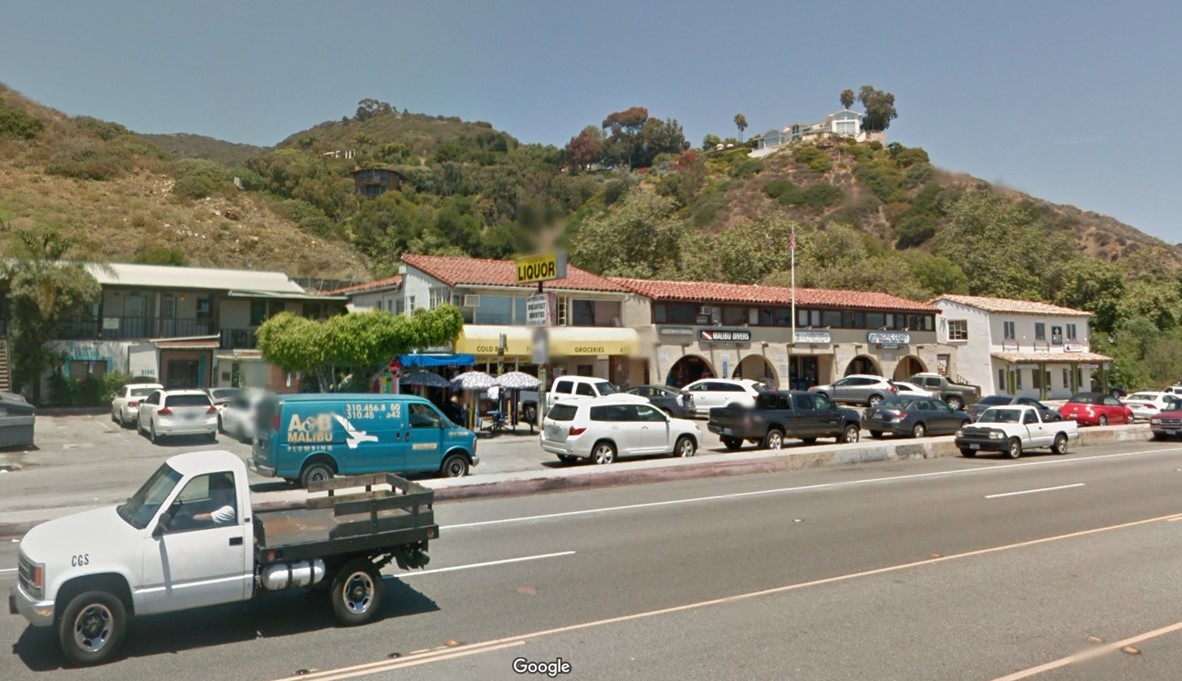
| (2012)* – The Country Store with a new sign reading Country Liquor located at 21237 Pacific Coast Highwary in Malibu. |
 |
|
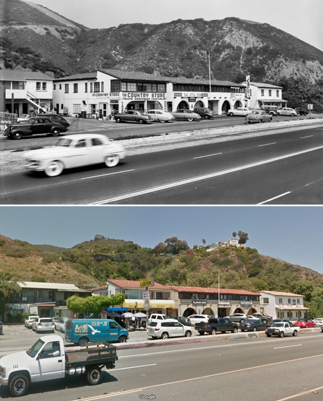
| (1950 vs. 2012)* – The Country Store with a new sign reading Country Liquor located at 21237 Pacific Coast Highwary in Malibu. Photo comparison by Jack Feldman. |
* * * * * |
Malibu Movie Colony (now Malibu Colony)
 |
|
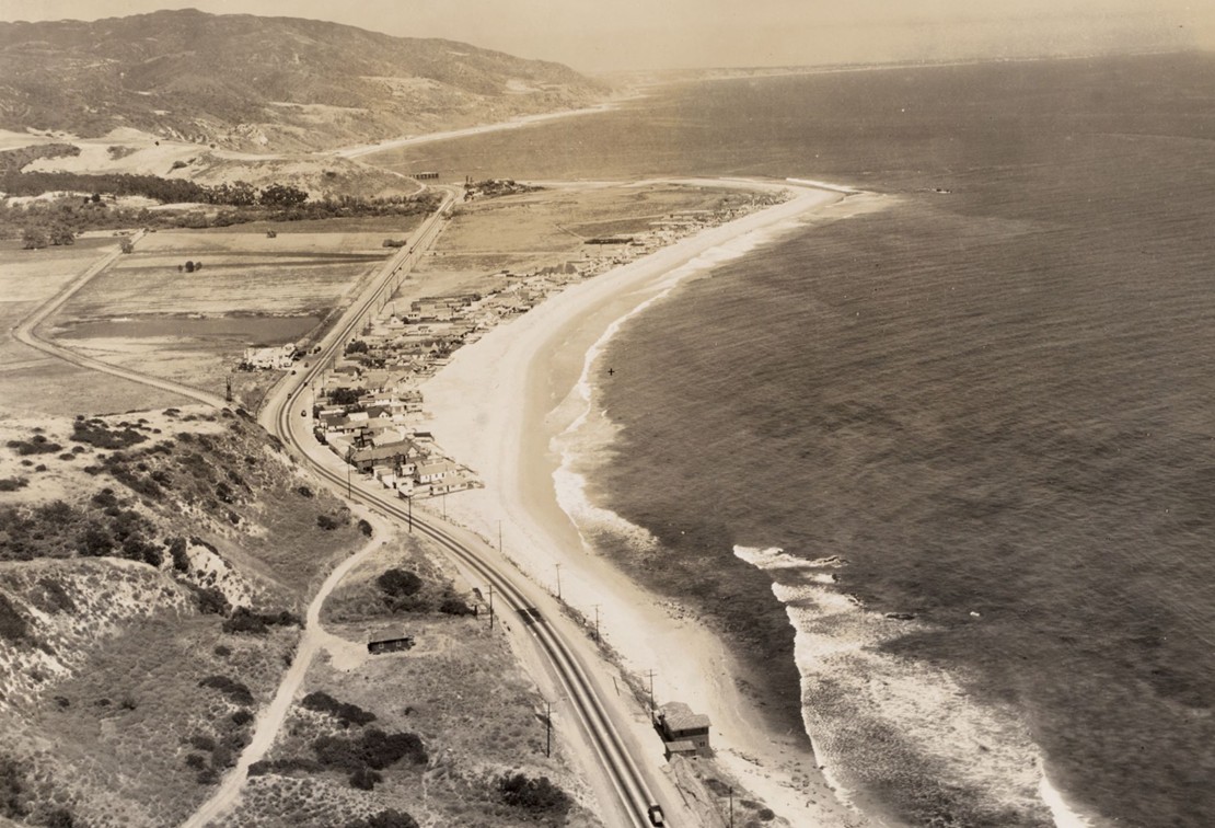
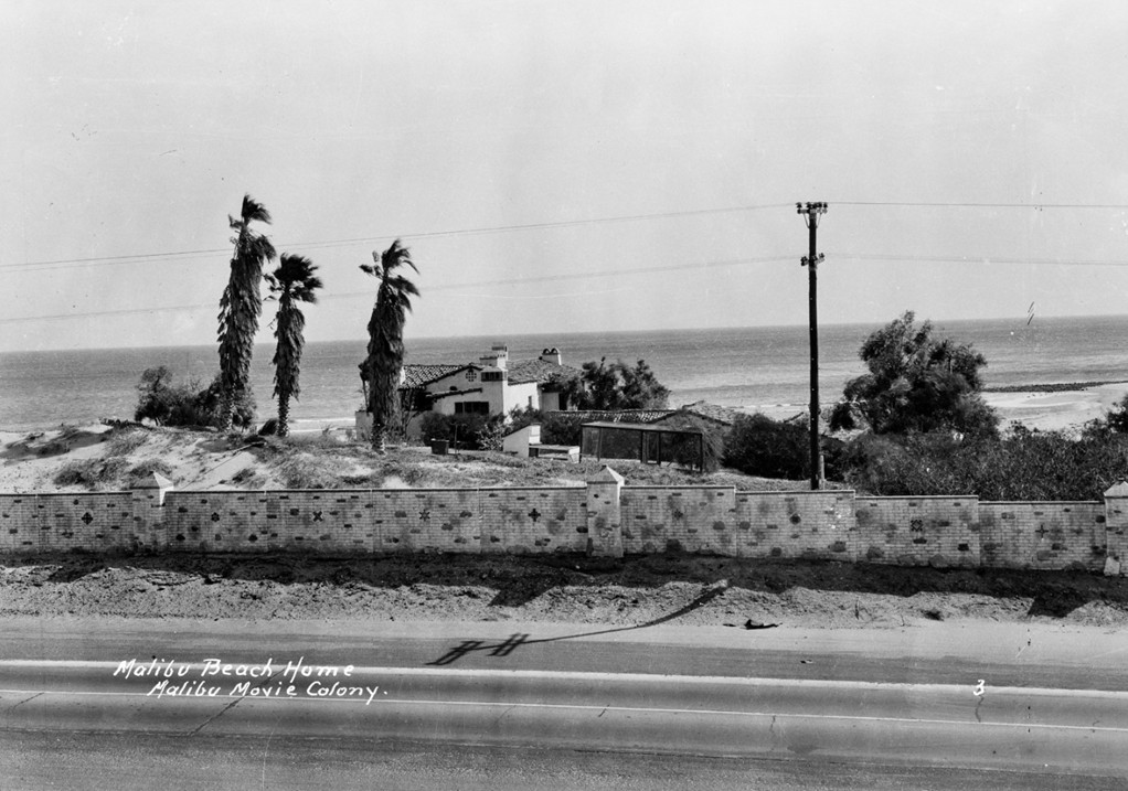
| (ca. 1928)* – Image of the Roosevelt Highway (later Pacific Coast Highway) and houses in an area known as the "Motion Picture Colony" along the beach in Malibu. Photo by Adelbert Bartlett from the Ernest Marquez Collection. |
Historical Notes Malibu Movie Colony began in the late 1920s when the widow of an oil and electric company magnate, May Rindge (“Queen of the Malibu”), owned all 27 miles of a then almost-unreachable and deserted coastline. Finding herself in financial trouble after lengthy legal battles, she decided to rent space on one secluded mile to Hollywood celebrities. It was instantly dubbed the Malibu Movie Colony. The studios loaned out set designers to construct shacks where folks like Clara Bow, Ronald Colman, Barbara Stanwyck, and many more could enjoy privacy, a place to conduct their illicit liaisons, and have some athletic fun. There is still a photograph along the wall of the first tennis court built there, of Charlie Chaplin, Douglas Fairbanks, and Mary Pickford, racquets in hand. |
 |
|
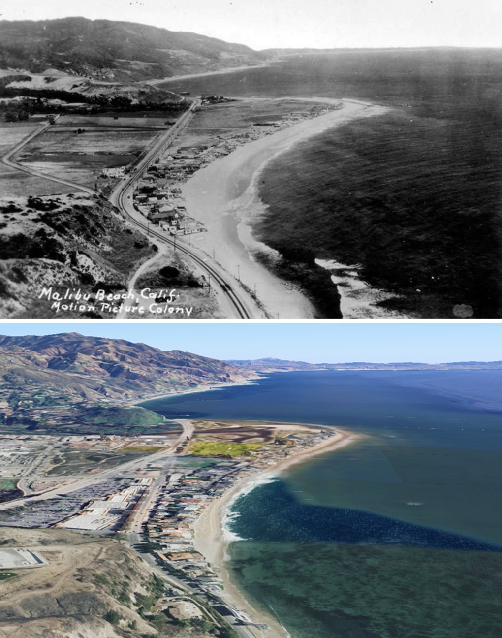
| (1932)* – Aerial view of Malibu Movie Colony (now Malibu Colony), looking along the curve of the beach. Roosevelt Highway runs past a handful of beachfront cottages, with the Malibu Lagoon and Malibu Pier visible in the distance. The area remains mostly undeveloped, with open fields and rugged hills surrounding the small community. |
Historical Notes By the mid-1930s, Rindge allowed the stars to actually purchase their homes, which, as the decades moved on, grew more and more expansive (though most houses were, and remain, on 30-foot lots). The stars kept coming: Bing Crosby, Gary Cooper, Merle Oberon. Eventually, the musical world invaded, with former singer turned producer Peter Asher hosting everyone from Joni to James for all-day sing-alongs. Neil Diamond owned for a long time, Ronnie Wood rented, as did Linda Ronstadt, who jogged the beach with her boyfriend, Gov. Jerry Brown. Even rapping rivals Shug Knight and Tupac Shakur rented one year…at the same time. |
 |
|
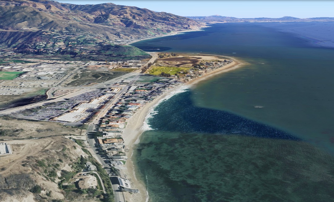
| (2025)* - Google Earth view looking down at Malibu Colony, Malibu Colony Road, and Pacific Coast Highway. The Malibu Lagoon is visible at the top center, with the Malibu Pier just behind it. |
Historical Notes Originally known as the "Malibu Movie Colony," the community gradually became known simply as "Malibu Colony" during the mid-20th century, as its identity expanded beyond its Hollywood roots. Today, Malibu Colony refers to a gated beachfront enclave located just west of Malibu Lagoon and the Malibu Pier, along Pacific Coast Highway. Homes line Malibu Colony Road, which runs parallel to the beach, bordered by Malibu Lagoon to the east and a cul-de-sac near Malibu Bluffs Park to the west. Malibu Colony remains one of Southern California’s most historic and exclusive coastal communities. |
 |
|
| (1932 vs. 2025)* –A ‘Then and Now’ comparison of Malibu Movie Colony (now Malibu Colony), showing the curve of the Malibu coastline with the Malibu Lagoon at top center and the Malibu Pier just behind it. Over time, Roosevelt Highway (now Pacific Coast Highway) was widened and realigned slightly inland, while Malibu Road, closer to the beach, retained its original path serving the beachfront homes. Photo comparison by Jack Feldman. |
* * * * * |
Adamson House
 |
|
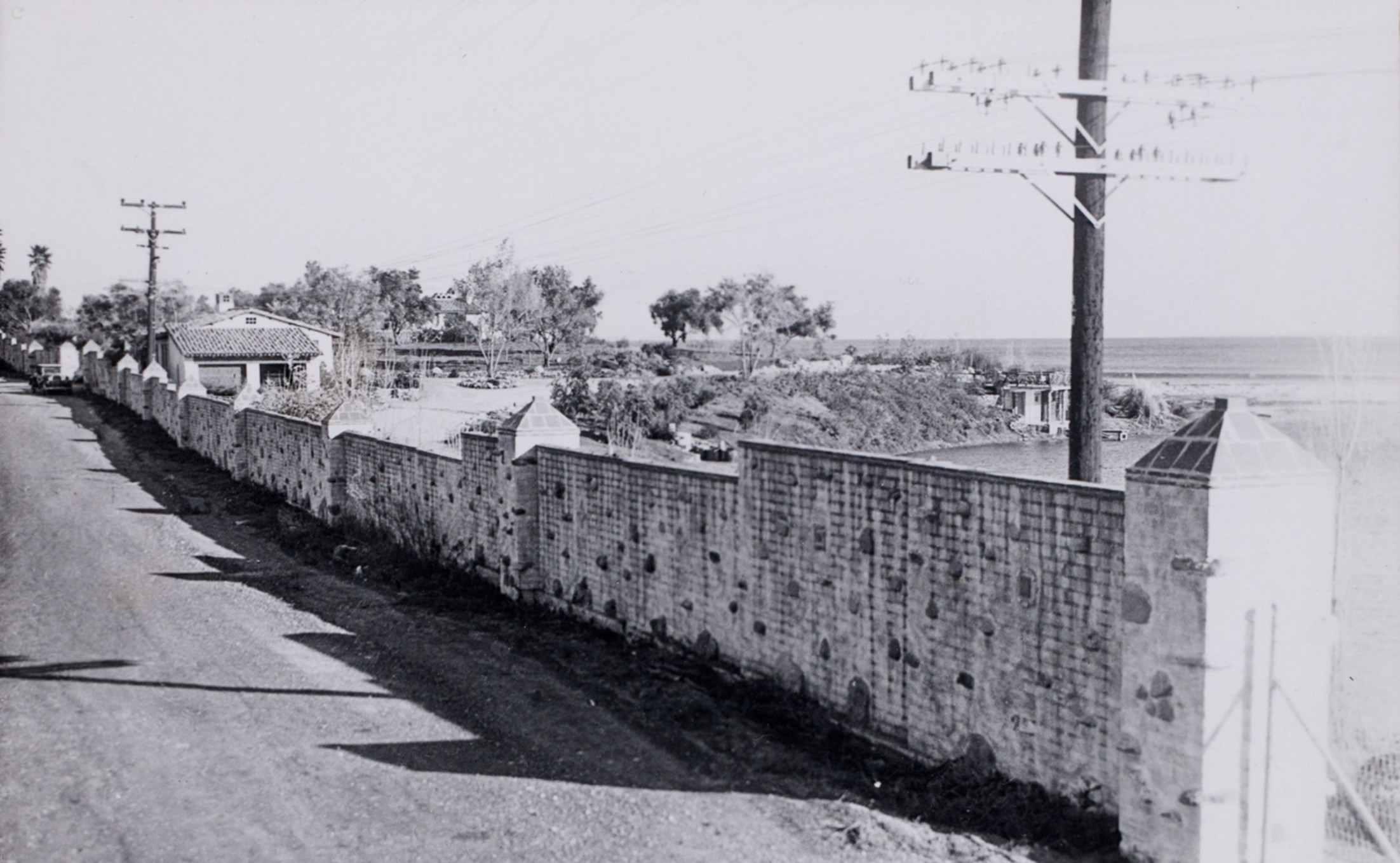
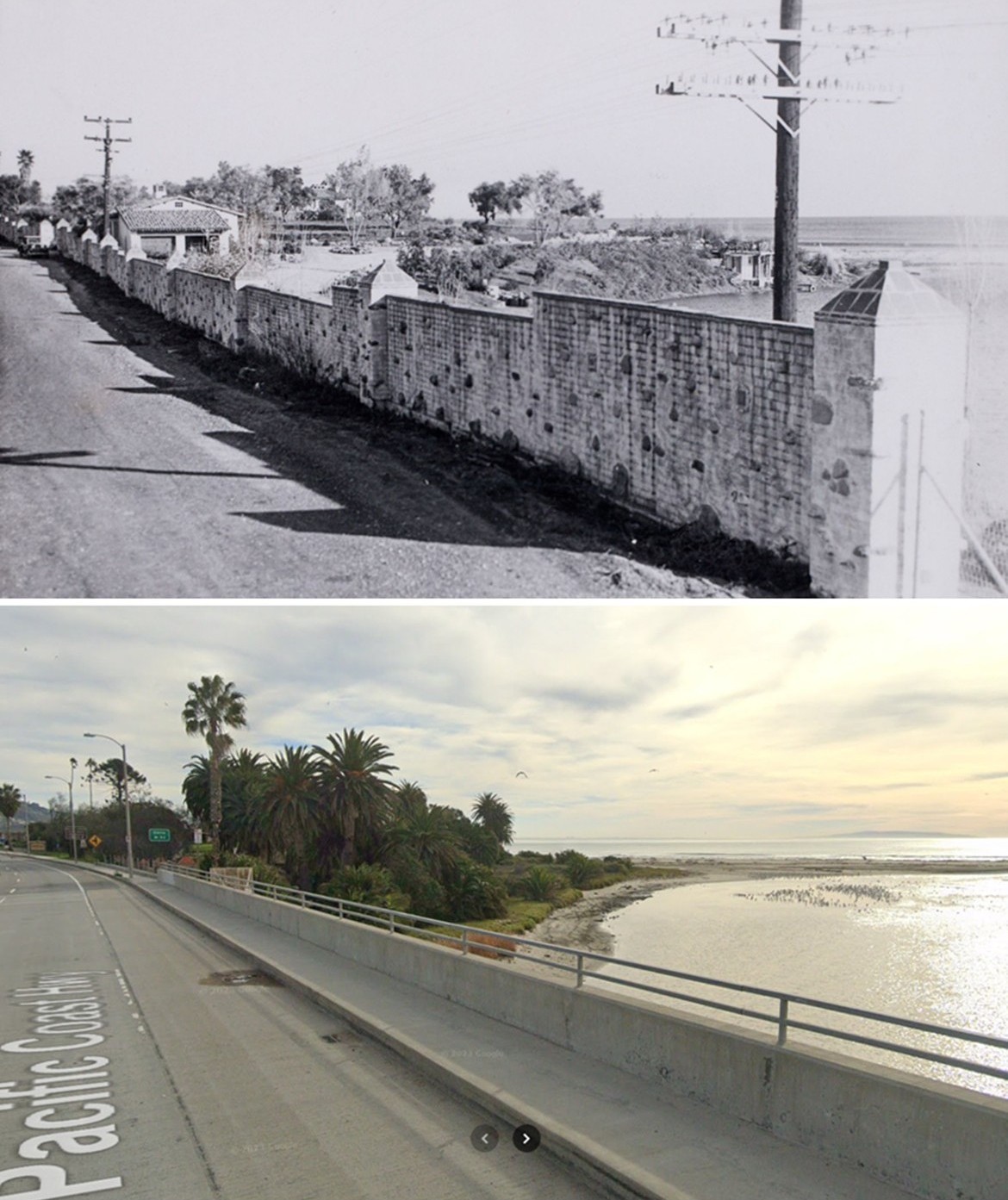
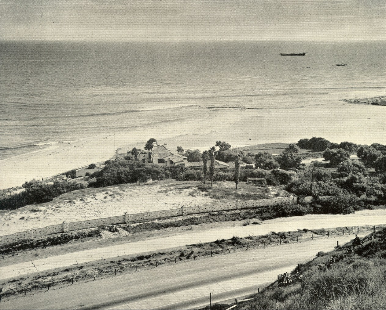
| (1931)* - View along the hand-laid brick and tile perimeter wall of the Adamson House estate in Malibu. Built just two years earlier, the wall defined the property’s original coastal boundary. The Roosevelt Highway runs alongside, with the Pacific Ocean visible at right. Much of the surrounding land has since been lost to erosion—worsened by disrupted sediment flow from Malibu Creek, largely due to the Rindge Dam and adjacent infrastructure. Photo by Adelbert Bartlett from the Ernest Marquez Collection. |
Historical Notes The Adamson House estate was established in 1929 by Merritt Huntley Adamson and Rhoda Rindge Adamson, daughter of Malibu founders Frederick Hastings Rindge and May Knight Rindge. The brick and tile perimeter wall, built from hand-laid materials crafted at the family’s Malibu Potteries factory, marked the estate’s original coastal edge. At the time, Roosevelt Highway (dedicated 1929) had only recently opened as a scenic coastal route. Today, erosion has claimed much of the land once shielded by this wall—a process intensified by reduced sediment supply from Malibu Creek, largely due to the construction of Rindge Dam upstream in 1926. |
 |
|
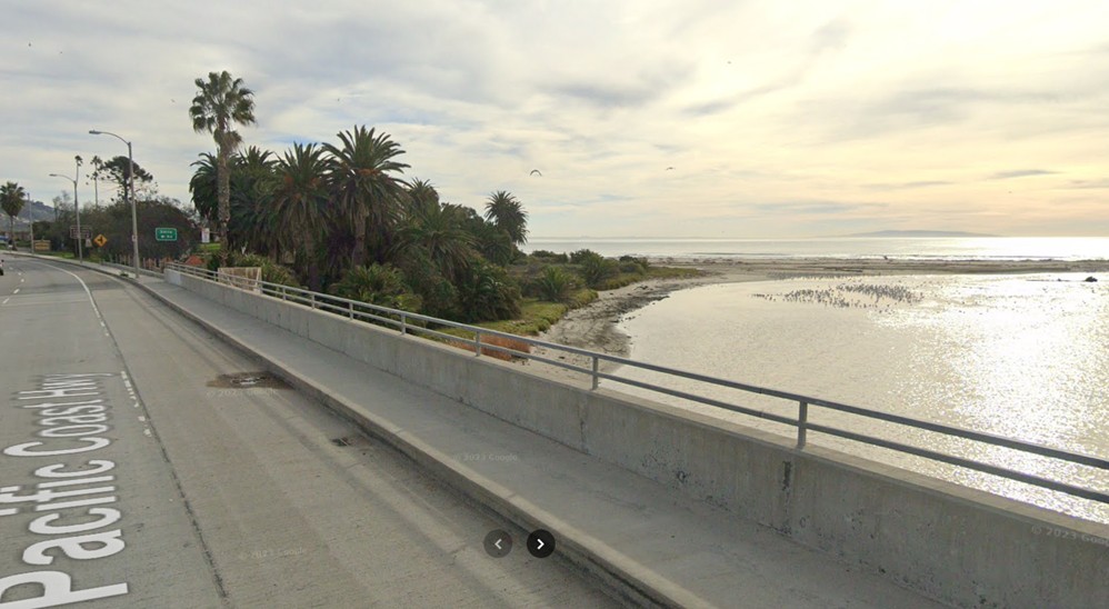
| (2023)* – Contemporary view of Pacific Coast Highway crossing Malibu Creek, with the Adamson House nestled among the palms to the left. |
Historical Notes Today’s Pacific Coast Highway spans Malibu Creek near its outlet to the ocean. The Adamson House remains nestled in a now-narrowed strip of land between the lagoon and beach. Over the past century, coastal erosion and environmental changes—including the restriction of natural sediment flow due to upstream dams and realigned roads—have significantly altered the shoreline. Despite this, the Adamson House stands preserved as a California State Historic Park and is listed on the National Register of Historic Places for its architectural and cultural significance. |
Then and Now
 |
|
| (1931 vs. 2023)* – A ‘Then and Now’ comparison of Roosevelt Highway (now Pacific Coast Highway) as it passes by the Adamson House in Malibu. The images highlight how the Adamson House property has lost considerable land and historic landscape features due to ongoing coastal erosion. This problem has been exacerbated by the disruption of natural sediment flow from Malibu Creek—primarily due to the Rindge Dam—and possibly by changes in local infrastructure, including the highway bridge. Photo comparison by Jack Feldman. |
Historical Notes This visual comparison underscores nearly a century of environmental transformation at Malibu’s historic coastline. The Roosevelt Highway in 1931 ran closer to the beach and the Adamson House, while the modern Pacific Coast Highway has been widened and realigned. Sediment deprivation—largely due to the Rindge Dam on Malibu Creek and compounded by infrastructure like bridges and roads—has hastened erosion, narrowing the estate’s original footprint. Once expansive lawns and gardens have been replaced by reinforced sea walls and coastal defenses. |
 |
|
| (1930s)* – View of the Spanish Colonial Revival beach house built for Malibu Ranch superintendent Merritt Huntley Adamson and his wife Rhoda Rindge Adamson—daughter of Frederick Hastings Rindge and May Knight Rindge—at 23200 Pacific Coast Highway in Malibu. Photographed from Roosevelt Highway (later Pacific Coast Highway), the scene includes the estate’s distinctive brick wall, swaying palm trees, and the Pacific Ocean beyond. Photo by Bob Plunkett from the Ernest Marquez Collection. |
Historical Notes This 1930s photo captures the Adamson House shortly after its construction. Designed in the Spanish Colonial Revival style by architect Stiles O. Clements, the house was lavishly decorated with locally made Malibu tiles and featured extensive beachfront gardens. The Rindge family, who once owned all 13,000 acres of Rancho Malibu, fiercely resisted public access to the coast. Ironically, Roosevelt Highway—visible here—was constructed through their property following years of legal battle, paving the way (literally and figuratively) for Malibu’s future development. |
 |
|
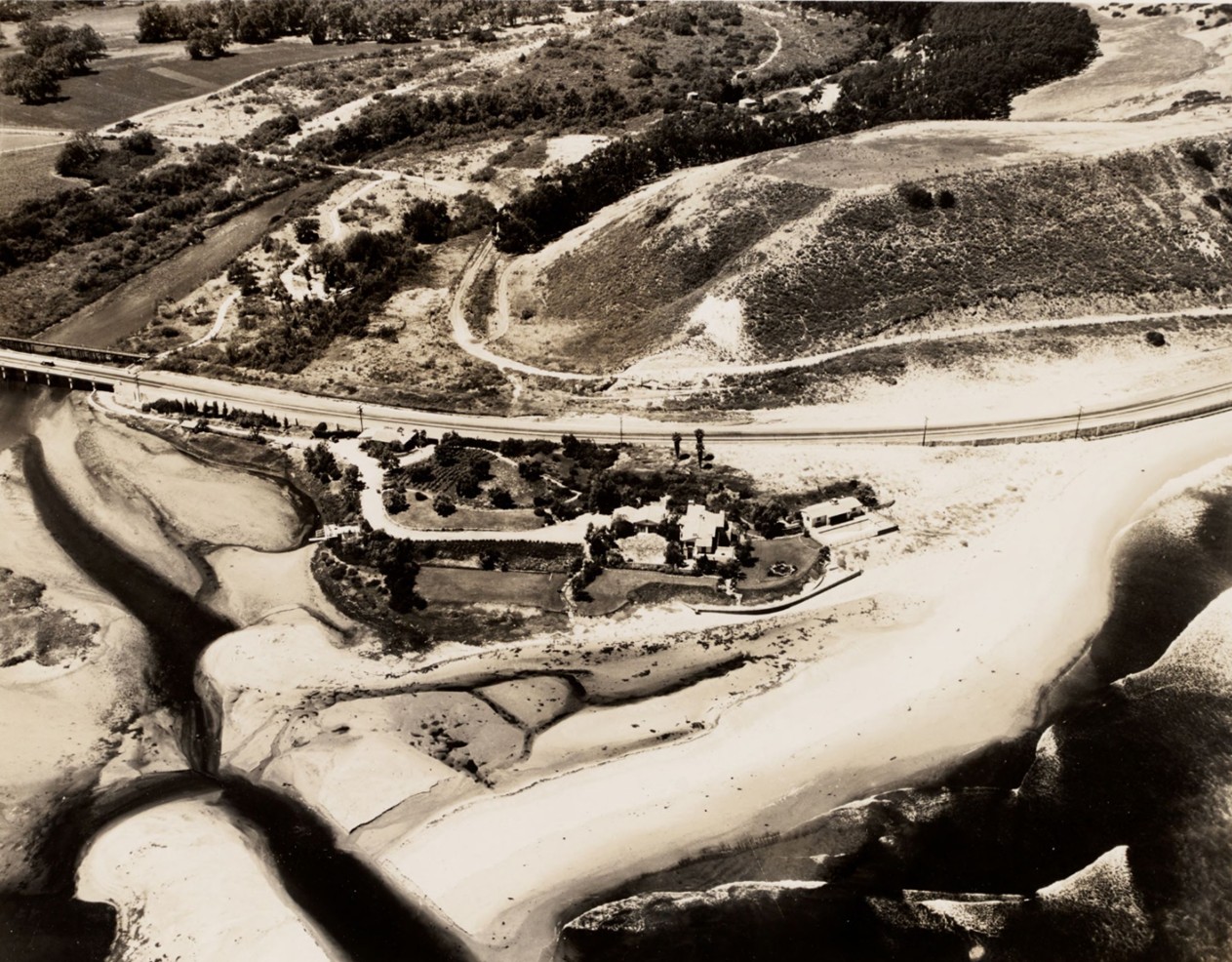
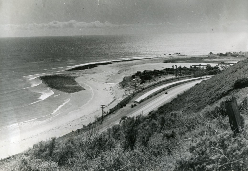
| (1932)* - Aerial view of the Malibu Lagoon at left and the Adamson House at 23200 Pacific Coast Highway in Malibu, California, built for Malibu Ranch superintendent Merritt Huntley Adamson and Rhoda Rindge Adamson (the daughter of Frederick Hastings Rindge and May Knight Rindge). Photo by Fairchild Aerial Surveys from the Ernest Marquez Collection. |
Historical Notes This aerial perspective captures a mostly undeveloped Malibu coast just a few years after the completion of the Adamson House. The photo shows Malibu Creek’s natural delta feeding into the Pacific—long before channelization and the sediment-starving effects of the Rindge Dam drastically reshaped the lagoon. The Adamson estate, originally encompassing 13 acres, included gardens, stables, and beachfront structures. Much of this land has since been lost or repurposed, with the house itself surviving as a preserved cultural landmark. |
 |
|
| (1937)* – Looking down at the Adamson House, the Spanish Colonial Revival beach residence of the Rindge-Adamson family, nestled among trees just inland from the beach. In front of the property runs the last remaining strip of the original Roosevelt Highway, with the newly constructed Highway 101 (now Pacific Coast Highway) in the foreground. Photo: Malibu Historical Photograph Collection / Pepperdine Image Archive. |
Historical Notes This 1937 image documents a key moment in coastal infrastructure change. The curved road in the foreground is the newly constructed Highway 101 (renamed Pacific Coast Highway in 1941), which bypassed the older Roosevelt Highway alignment seen nearer the coast. This shift required further grading of Vaquero Hill and rerouting traffic inland. The Adamson House, surrounded by dense foliage, sat between these two roads—its access and ocean frontage increasingly compromised by state transportation needs and ongoing erosion. |
 |
|
| (ca. 1940)* – View from the bluffs overlooking Vaquero Hill and Adamson Point at the mouth of Malibu Creek (now the Malibu Lagoon), with Malibu Colony in the background. The Adamson House—the Spanish Colonial Revival beach residence of the Rindge-Adamson family—appears nestled among trees beside the last remaining strip of the original Roosevelt Highway. The newer Highway 101 (now Pacific Coast Highway) curves prominently in the foreground. Surfrider Beach is visible at left. Photo: Malibu Historical Photograph Collection / Pepperdine Image Archive. |
Historical Notes By 1940, Malibu's shoreline was already changing. This view from the bluffs shows Vaquero Hill, Adamson Point, and the Malibu Lagoon before major channelization projects began. The Adamson House, still ringed by its iconic tile wall, lies just inland from Surfrider Beach. In the background is Malibu Colony, one of the earliest planned beach communities, which evolved from leased lots once controlled by the Rindge family. This image captures a rare moment when Malibu retained much of its original natural topography before postwar development accelerated. Malibu Lagoon State Beach wasn’t established until 1951, and the name “Surfrider Beach” didn’t catch on until the late 1950s surf craze sparked by Gidget. |
 |
|
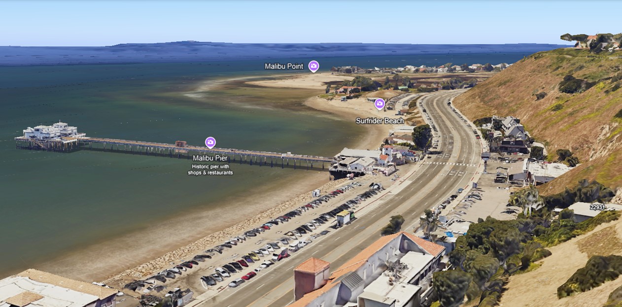
| (2025)* - Google Earth view of Malibu Point (formerly Adamson Point), site of the historic Adamson House, with Surfrider Beach in the foreground and Malibu Pier extending into the Pacific at left. |
Historical Notes At center is the historic Adamson House, now surrounded by mature trees and dramatically narrowed beachfront. Below it, Pacific Coast Highway curves along the base of Vaquero Hill, once the site of the original Roosevelt Highway. The expansive wetlands of the Malibu Lagoon stretch inland, with the Malibu Colony visible in the background. Once a contested stretch of private coastline, this area now blends historic preservation, state parkland, surf culture, and ecological restoration. |
Then and Now
 |
|
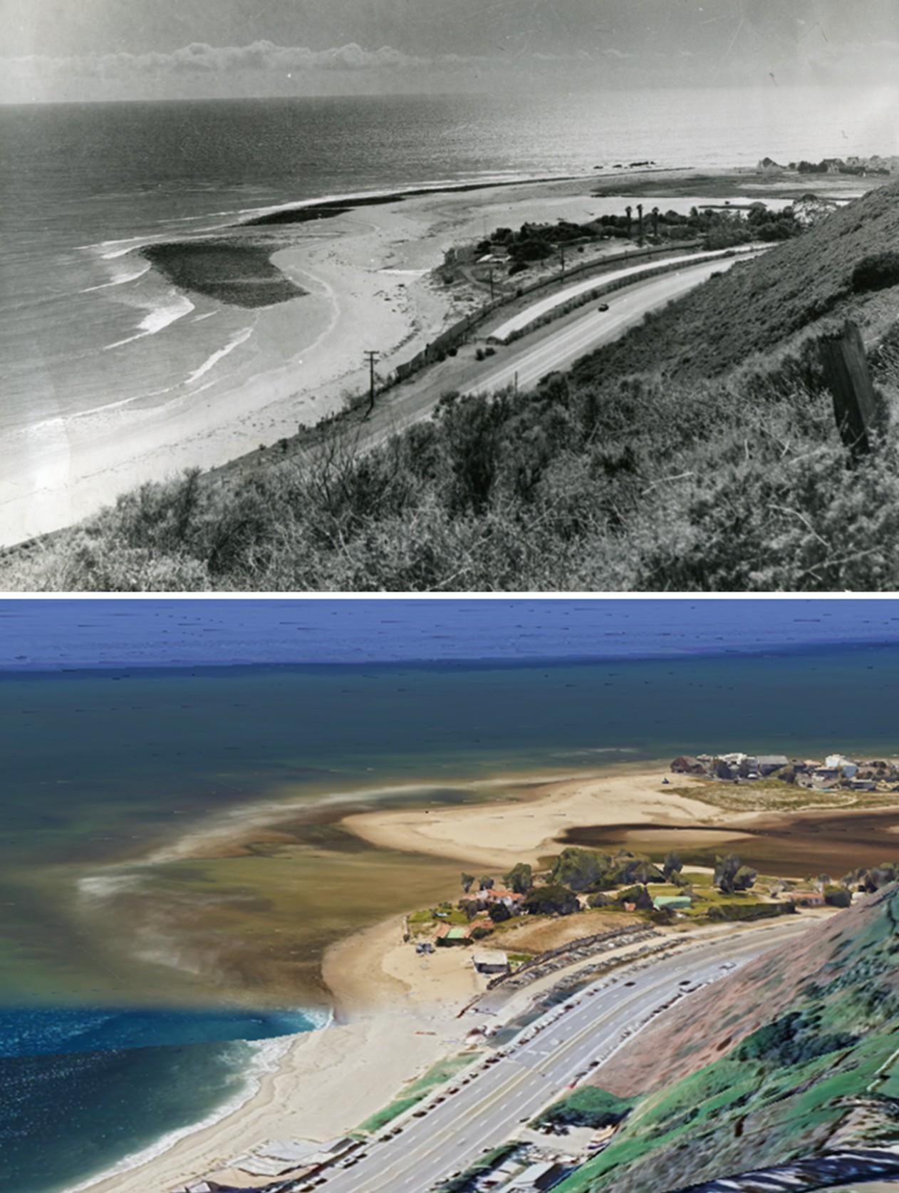
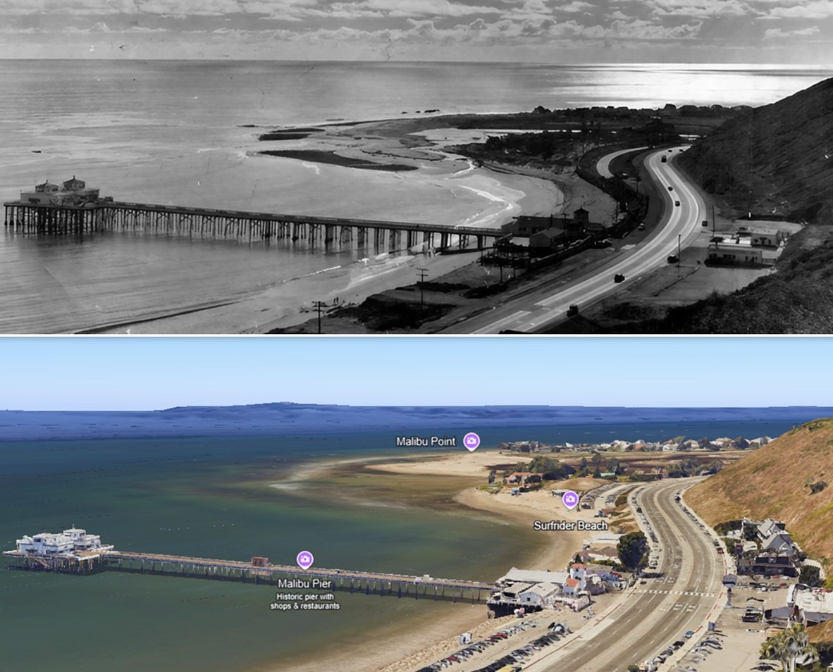
| (1940 vs 2025)* - Malibu Point (Adamson Point), Then and Now. Photo comparison by Jack Feldman. |
Historical Notes A sweeping visual comparison of Malibu’s iconic coastline shows how much has changed—and how much remains. In the 1940 view, the historic Adamson House sits near open dunes and a meandering Malibu Creek flowing into the Pacific. Surfrider Beach had yet to earn its name, and Malibu Lagoon was still a natural, tidal estuary. Fast forward to 2025: the area is now home to the Malibu Lagoon State Beach, the world-renowned Surfrider Beach, and a fully developed Malibu Colony. The coast has narrowed, the creek channelized, and sediment patterns altered—but the silhouette of the land still tells the same story. One of the most significant transformations visible in this comparison is the evolution of Malibu’s coastal highway system. The original Roosevelt Highway, completed through Malibu in 1929, hugged the coastline and passed directly between the Adamson House and the beach. In the late 1930s, a new, straighter alignment was constructed slightly inland as part of Highway 101, which became the Pacific Coast Highway (PCH) in 1941. As traffic increased and the shoreline shifted, the original coastal route was gradually abandoned. A curved, dead-end segment of that original Roosevelt Highway still survives today just south of the Adamson House—cut off from through traffic but still visible as a remnant of early highway planning along Malibu’s fragile edge. |
* * * * * |
Malibu Pier
 |
|
| (ca. 1908)* – View of the Malibu Pier, originally completed in 1905 by Frederick Hastings Rindge as a private shipping wharf for the Malibu Rancho. By this time, construction was underway on the Rindge family's Hueneme, Malibu and Port Los Angeles Railway, with tracks being extended directly to the pier. The scene shows stacks of lumber and rail materials at the base of the wharf, indicating active integration of the pier into the private rail system used to transport goods and supplies to and from the remote coastal property. Photo by George W. Hazard from the Ernest Marquez Collection. |
Historical Notes The Malibu Pier was originally built in 1905 to support the operations of Frederick Hastings Rindge's Malibu Rancho. Hides, grains, fruit, and other agricultural products were shipped from the pier either directly or by transfer to larger vessels. Building materials and other Rancho necessities arrived at the pier. The Rindge private railroad, used for freight movement within the ranch, had a terminus near the pier. The Hueneme, Malibu and Port Los Angeles Railway was incorporated in 1903 by Frederick Hastings Rindge as a strategic move to prevent the Southern Pacific Railroad from using eminent domain to build a line through his Malibu ranch. After Rindge’s death in 1905, his widow, May K. Rindge, took over the project, becoming one of the first female railroad presidents in California. Despite the challenging terrain, she oversaw the construction of a 15-mile standard-gauge railroad along the Malibu coast, which was completed in 1908 at a cost of $1 million. The railway served primarily to transport ranch products, such as grains and hides, to the Rindge’s private wharf-now Malibu Pier-for shipment. |
 |
|
| (1910)* - View over Carbon Mesa toward Malibu Pier and Malibu Lagoon beyond. Point Dume can be seen in the distance and the railway warehouse (car barn) is just visible near the foot of the pier. Photo by Bob Plunkett |
Historical Notes The railway’s existence successfully blocked Southern Pacific from building a parallel coastal route, but ultimately, May Rindge lost a prolonged legal battle against county and state road construction. By 1921, a county road was built through the ranch, and in 1929, the Roosevelt State Highway (now Pacific Coast Highway) was constructed, condemning much of the railroad’s right-of-way. The railway ceased operations in the 1920s, with some rails later repurposed for the Malibu Dam and others sold for scrap. The corrugated steel car barn, built near the pier at 22917 Pacific Coast Highway around 1908 to store and maintain the railway’s rolling stock, survived long after the trains stopped running; it was later leased to various retail businesses before being demolished in 1983. The Rindge railway and its car barn remain enduring symbols of the family’s efforts to preserve Malibu’s seclusion and resist outside development. |
 |
|
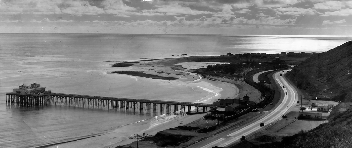
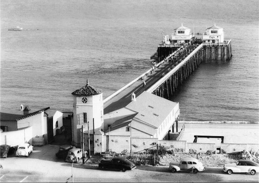
| (ca. 1937)* - View looking down at Malibu Pier from the bluffs. The remnants of the Malibu Potteries factory is visible just up the beach from the pier. This body of water is known as Kellers Shelter. |
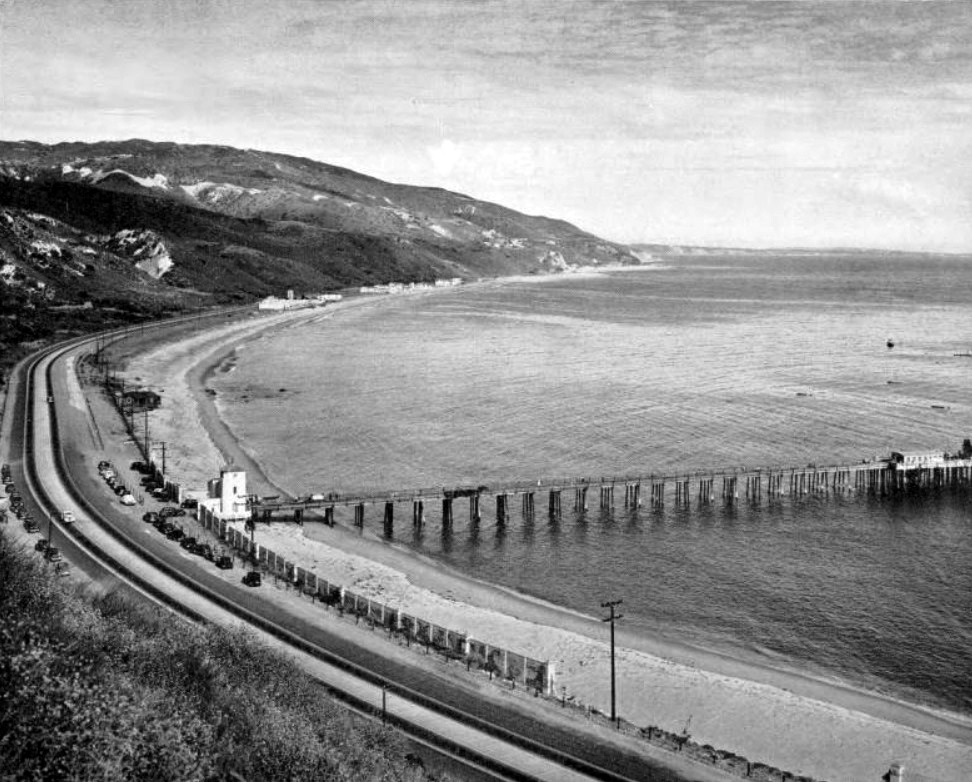
Historical Notes In 1934, the pier was opened to the public for pier and charter fishing. Fishermen were also shuttled back and forth from the pier and the barge Minnie A. Caine anchored a mile off shore. After the bankruptcy of Marblehead Land Co. (the Rindge's land operation) in 1936, the Malibu Pier was taken over by bondholders who had helped finance Malibu development. The pier was extended to its current 780-foot length, and the first small bait and tackle shop building was constructed at the ocean end by 1938. |
 |
|
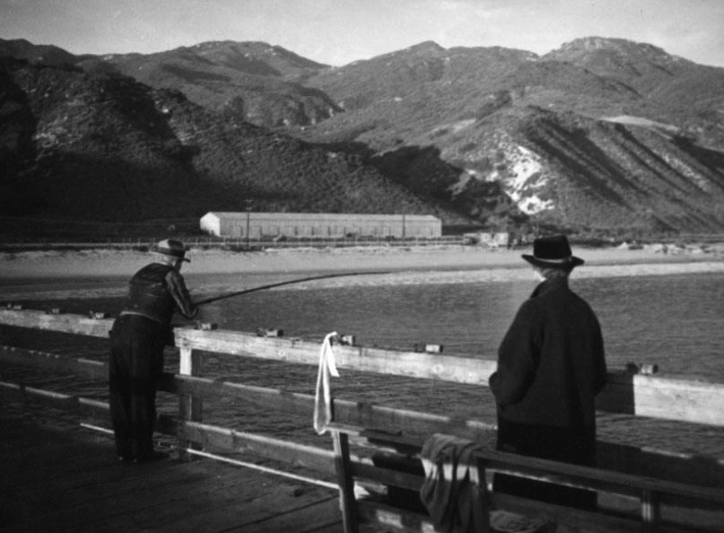
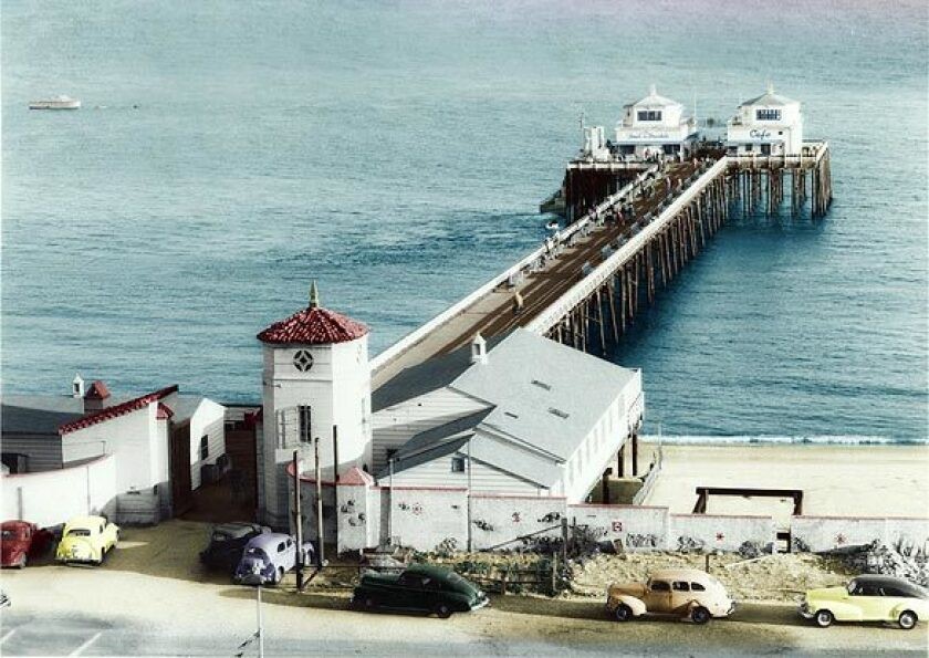
| (1937)* – View showing two people enjoying the day on Malibu Pier. In the background can be seen the beach and the Rindge Ranch train shed (aka Engine Barn for the Hueneme, Malibu & Port Los Angeles Railroad) south of the pier. Photo by Herman Schultheis |
Historical Notes The pier opened to the public in 1934. Big stars including Buster Crabbe and Cesar Romero were among those who fished for halibut and barracuda from a barge anchored offshore. After the Rindges' land-development venture, Marblehead Land Co., went broke in 1936, bondholders took over the pier and extended it to its current 780-foot length. |
 |
|
| (2015)* – Same view 78 years later showing a slightly different landscape. |
Then and Now
 |
|
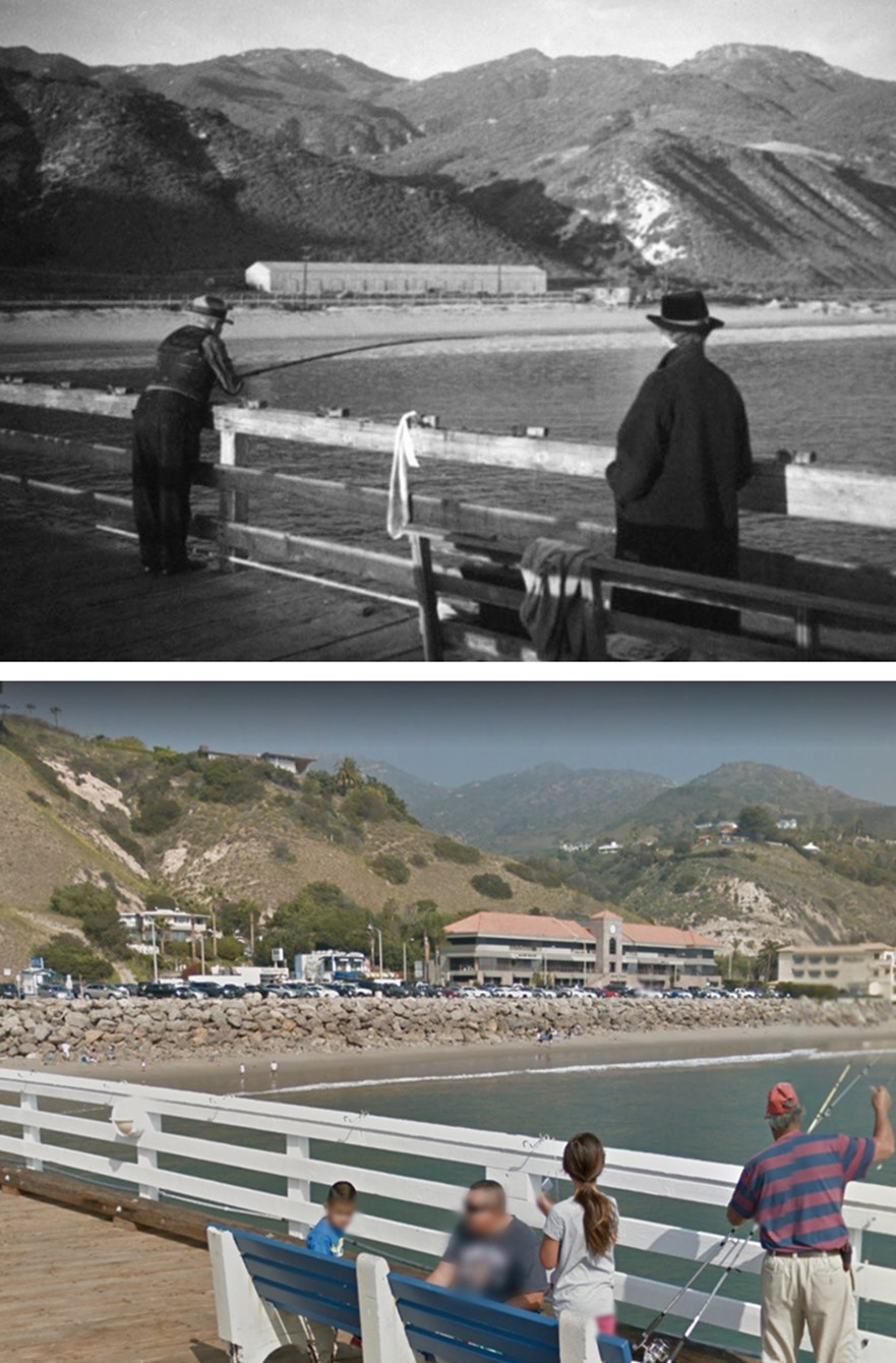
| (1937 vs. 2015)* - A 'Then and Now' comparison showing a man fishing off the Malibu Pier. Photo comparison by Jack Feldman. |
Historical Notes The long, white building in the earlier photo is the Engine Barn for the Hueneme, Malibu & Port Los Angeles Railroad. It is often mistaken for May Rindge's ill-fated Malibu Potteries Tile Works Building which was located further south where Nobu Restaurant is today. |
 |
|
| (ca. 1946)* – Panoramic view of Malibu Pier from the bluffs, looking southwest over Malibu Colony. The pier, recently reconstructed after severe damage from a 1944 storm, now features its iconic twin structures at the end, giving it its modern-day appearance. Across Pacific Coast Highway, the Fiddler's Inn and a Texaco gas station are visible. |
Historical Notes During World War II, the pier served as a U.S. Coast Guard lookout until a storm in the winter of 1943-44 demolished much of the structure. Businessman William Huber then bought it for $50,000 and rebuilt it. After the war, he constructed the twin buildings at the seaward end for a bait-and-tackle shop and restaurant. Roosevelt Highway was renamed Pacific Coast Highway near the Malibu Pier in 1941. |
 |
|
| (2019)* - Google Earth view looking southeast showing Malibu Pier as seen from above the bluffs. |
Then and Now
 |
|
| (1946 vs 2019)* - Panoramic view of Malibu Pier from the bluffs, looking southwest toward Malibu Point with PCH seen on the right. Photo comparison by Jack Feldman. |
 |
|
| (1940s)* - Looking down at Malibu Pier. LA Times Photo |
Historical Notes The Malibu Pier, an iconic landmark with a rich history, was originally built in 1905 to support the operations of Frederick Hastings Rindge's Malibu Rancho. It was used to ship agricultural products and building materials to and from the property. In 1934, it opened to the public for pier and charter fishing, and after World War II, it became a popular spot for sports fishing and social gatherings. The pier has undergone various transformations over the years and is now known for its exceptional restaurants, shopping, and as a tourist attraction, offering stunning views of the coast. Today, it continues to attract fishermen, birders, surfers, and visitors from around the world, serving as a cherished historical landmark and a symbol of Malibu's past. |
 |
|
| (1940s)* - Looking down at Malibu Pier in color. LA Times Photo |
* * * * * |
Beach Life in Malibu - Surfrider Beach
 |
|
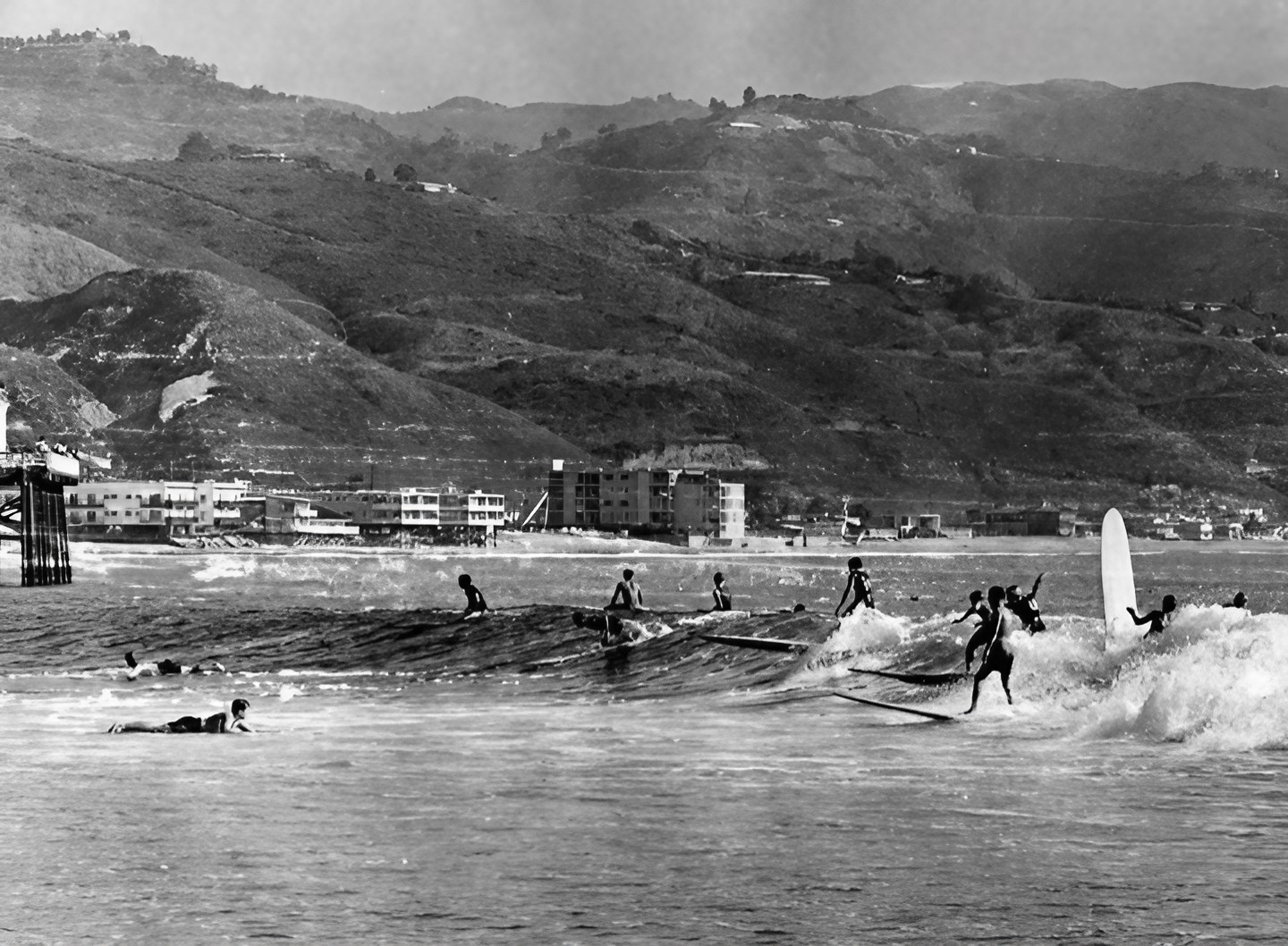
| (1966)* - Surfers enjoying the waves at Surfrider Beach, with the tip of Malibu Pier visible on the left. |
Historical Notes Since the 1920s, pioneering surfers had been going to great lengths to ride the three legendary point breaks at Surfrider Beach. Swim club lifeguard Tom Blake, with his friend Sam Reid alongside him, is considered by many to have been the first to catch a Malibu wave in 1926. By the early 1950s, Surfrider Beach was the domain of a small, rag-tag group of surfing pioneers who could be found in the waves from the early morning to late at night. |
 |
|
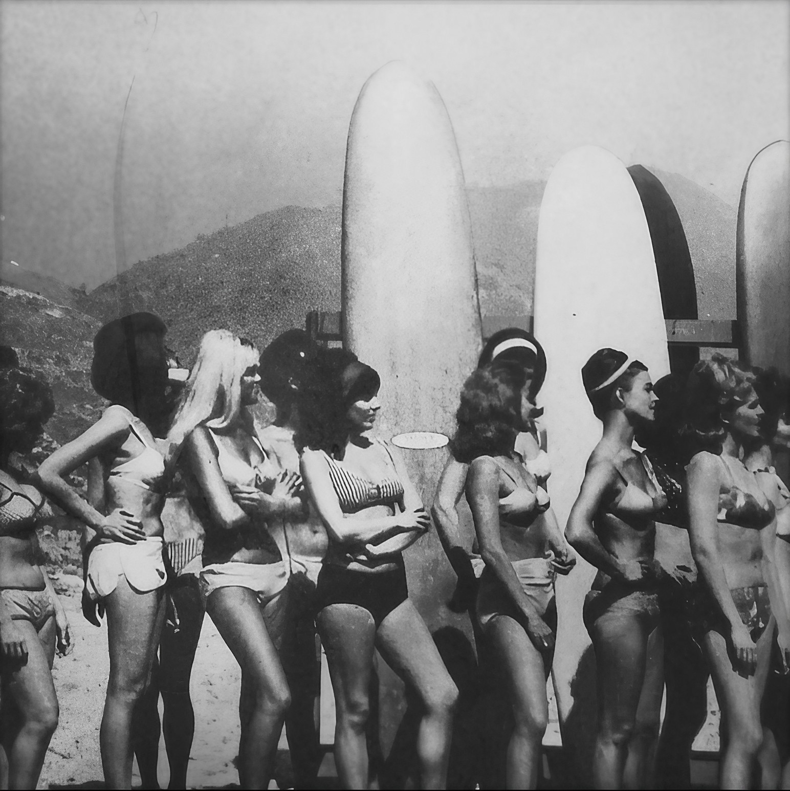
| (1960s)* - A lineup of Malibu bathing beauties in front of surfboards at Surfrider Beach |
Historical Notes Surfrider Beach, also known as Malibu Lagoon State Beach, became a legendary surfing destination due to its exceptional waves, particularly at First Point. The beach's unique shoreline configuration, formed by sediment from Malibu Creek, created ideal conditions for the evolving surfboard designs of the era. By the late 1950s and throughout the 1960s, Surfrider Beach had established itself as the epicenter of surf culture. It became synonymous with longboard surfing and beach gatherings, fostering a vibrant community that gave rise to modern surf culture, including its distinctive lifestyle, fashion, and attitude. |
 |
|
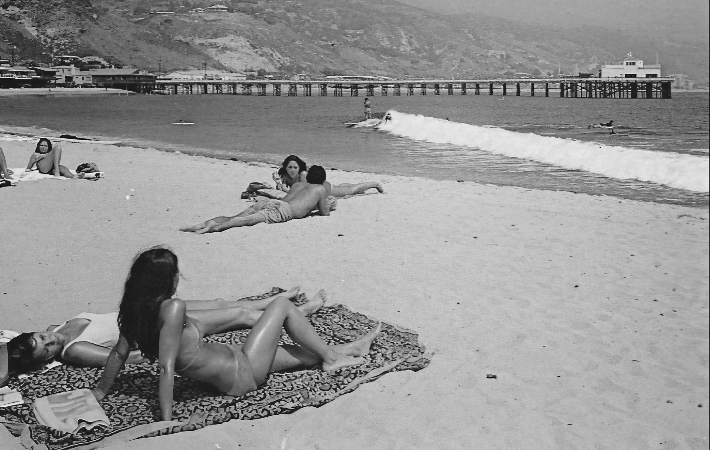
| (1960s)* - A day at the beach in Malibu. Life is good! |
Historical Notes The Malibu surf scene of the 1960s had a significant influence on popular culture, inspiring iconic beach movies like "Gidget" (1959), which was based on real Malibu surfers. It also played a key role in popularizing surf music through bands like The Beach Boys, showcasing the Southern California lifestyle to the mainstream. Malibu's beaches became a symbol of the California dream, drawing surfers and spectators alike from around the world. |
* * * * * |
Malibu Sports Club Restaurant (later Alice's Restaurant)
 |
|
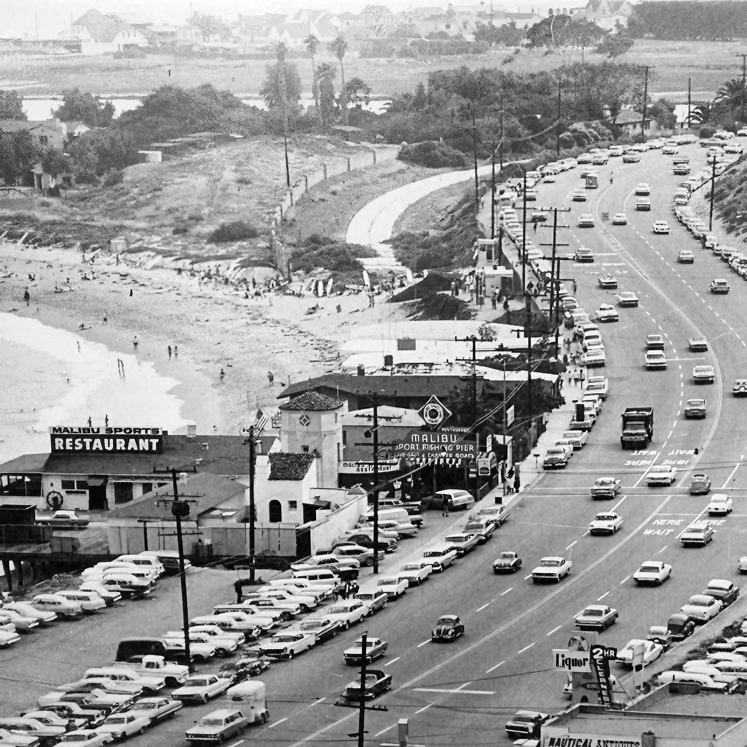
| (1960s)* – View showing Malibu as it appeared in the 1960s with the Malibu Sports Club Restaurant (later Alice’s Restaurant) seen on the pier. |
Historical Notes The Malibu Beach Sports Club Restaurant opened in 1956 and lasted until 1969. Alice's Restaurant opened in the same spot in 1972 and it last until 1994. |
 |
|
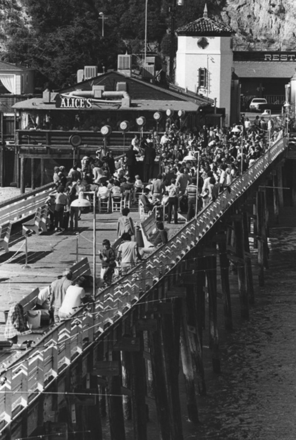
| (1984)^ - View of Malibu Pier, where a large crowd has gathered for a special event at Alice's Restaurant. In the foreground, anglers are seen fishing off of the pier. |
Historical Notes Alice's Restaurant on the Malibu Pier, named for the Arlo Guthrie song, opened in 1972, during the height of the hippy era. The easy-going, eclectic restaurant replaced the more formal Malibu Beach Sports Club Restaurant, and endured for nearly 25 years. |
 |
|
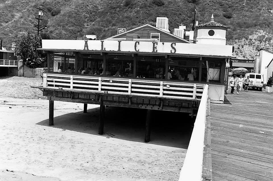
| (1980s)* - Alice's Restaurant on Malibu Pier. |
* * * * * |
PCH and Web Way
 |
|
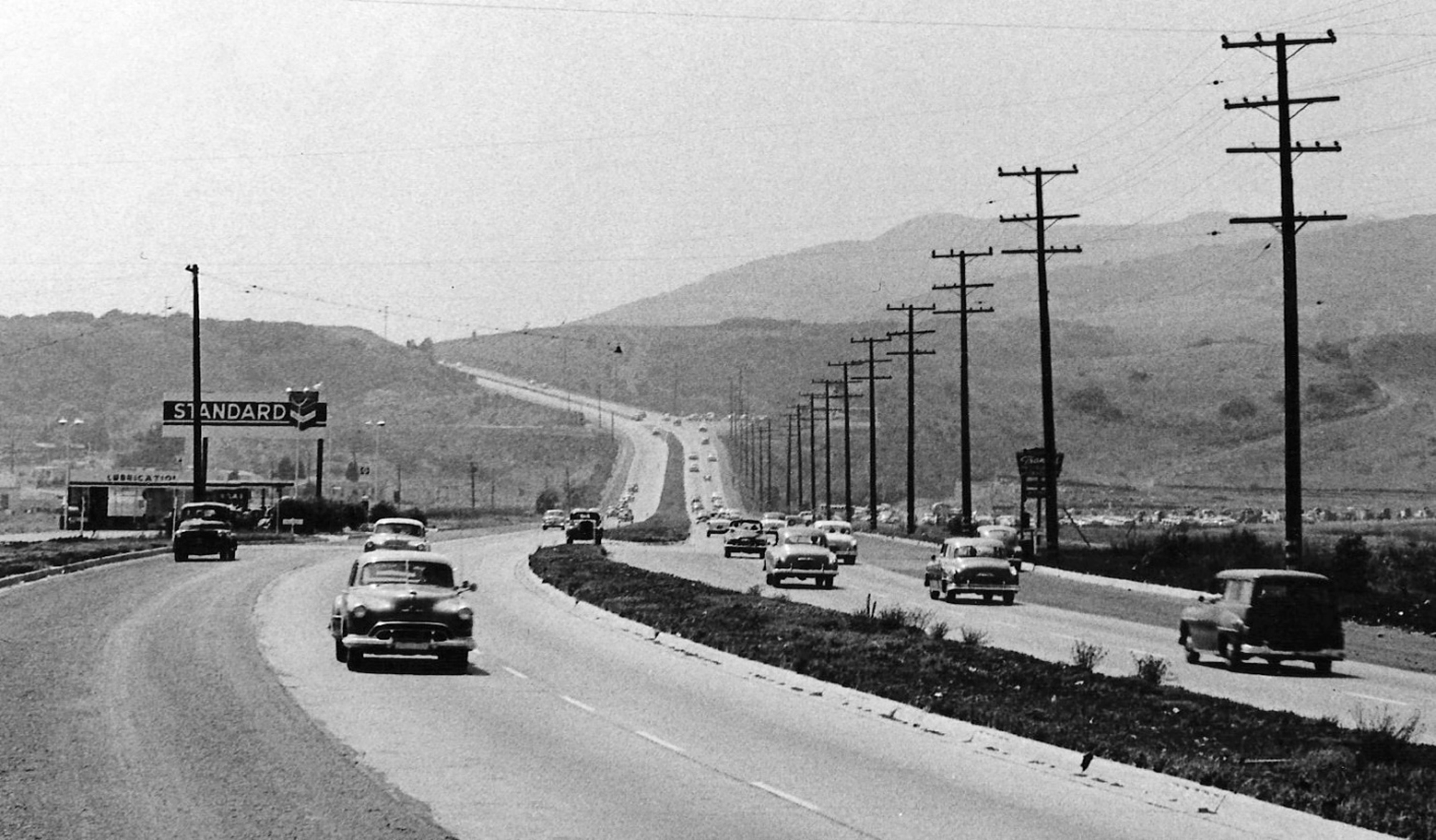
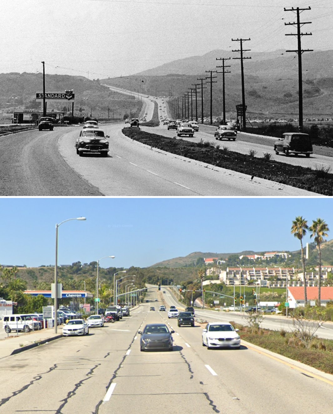
| (1953)* - PCH looking toward Web Way showing a Standard gas station on the SE corner. Photo courtesy of Arturo Salazar |
 |
|
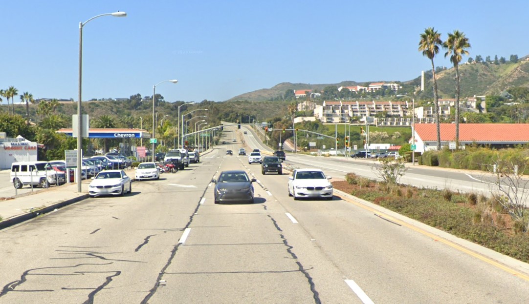
| (2023)* - PCH looking toward Web Way showing a Chevron gas station on the SE corner. Pepperdine University can be seen in the distance (upper-right). |
Then and Now
 |
|
| (1953 vs 2023)* - PCH (then US-101 Alt, now PCH CA-1) looking toward Web Way in Malibu. Pepperdine University can be seen in the upper right in the current image. The campus wasn’t built until the 1970s. Photo comparison by Jack Feldman. |
* * * * * |
Carbon Beach
 |
|
| (ca. 1948)* - Pacific Coast Highway shortly after it was widened to four lanes along Carbon Beach in Malibu. Some of the local businesses of the late 1940s seen here include the Malibu Beach Motor Hotel, Frank Kerwin's Seacomber restaurant ("America's Tropical Show Place"), and, on the beach side, the Colony Cafe. The perspective is from a bluff overlooking the Malibu Pier (out of frame). |
 |
|
| (2019)* - Google Earth Viiew showing Pacific Coast Highway and the Malibu coastline along Carbon Beach. |
Then and Now
 |
|
| (1948 vs 2019)* - Pacific Coast Highway (CA-1) and the Malibu coastline along Carbon Beach. Photo comparison by Jack Feldman. |
* * * * * |
Big Rock Beach Cafe
 |
|
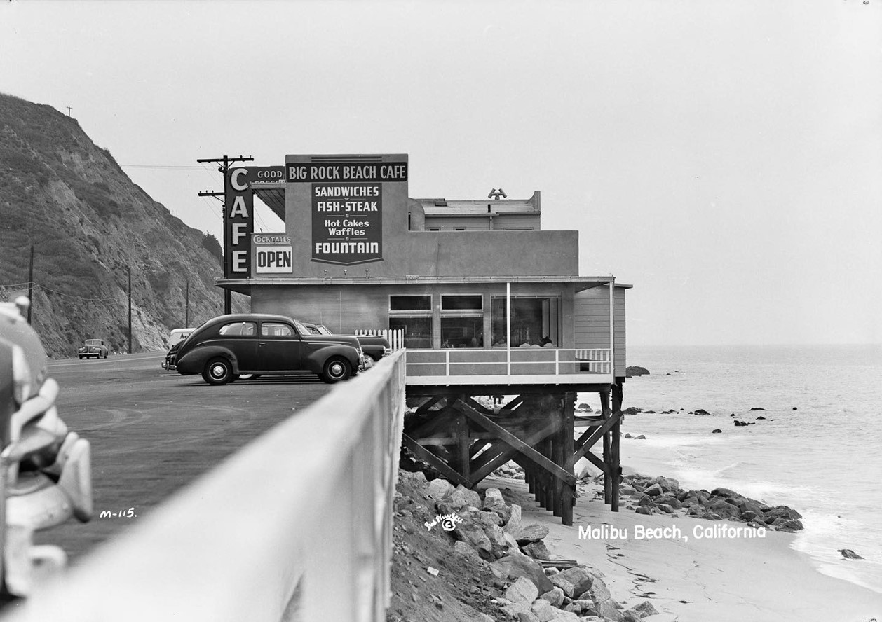
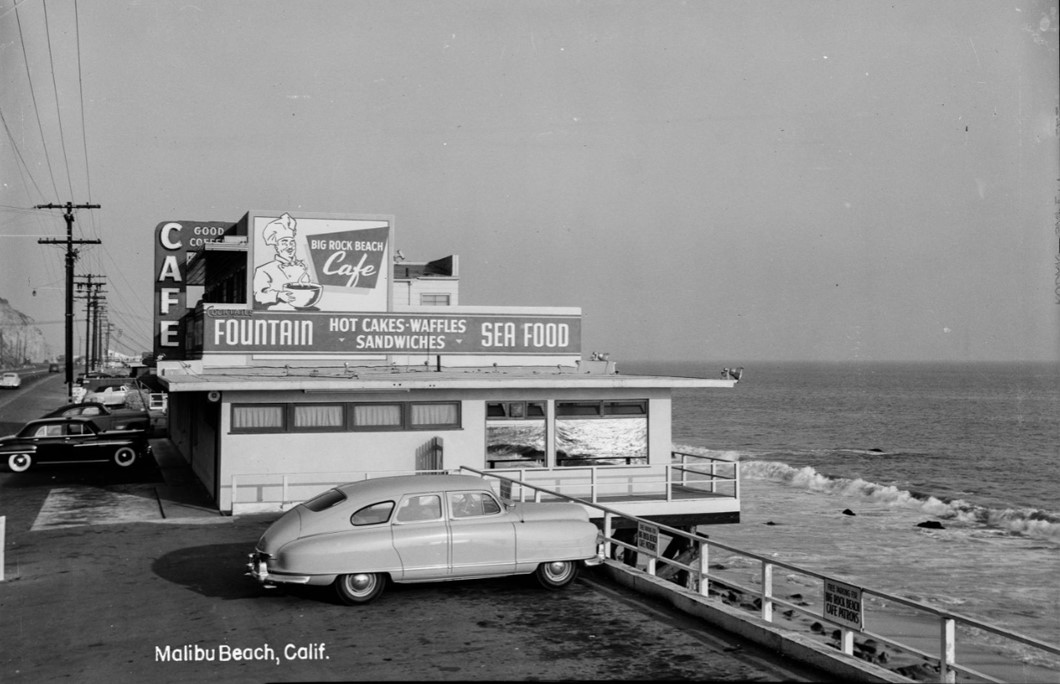
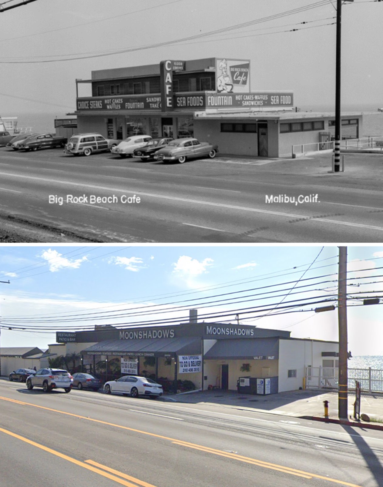
| (ca. 1949)* - Looking at the Big Rock Beach Cafe located at 20356 Pacific Coast Highway in Malibu. Today this is the site of Moonshadows Restaurant. Photo by Bob Plunkett |
Historical Notes The Big Rock Beach Cafe--later known as Canfield's Big Rock Cafe--occupied the Moonshadows location on the Pacific Coast Highway, between Big Rock Drive and Las Flores Canyon. It was owned by Harry Canfield, whose Malibu Trading Post Cafe--at the other end of Malibu--burned down in 1949. This photo postcard shows an eastern-looking view of the Cafe before the later expansion of the restaurant's "Poop Deck."* |
 |
|
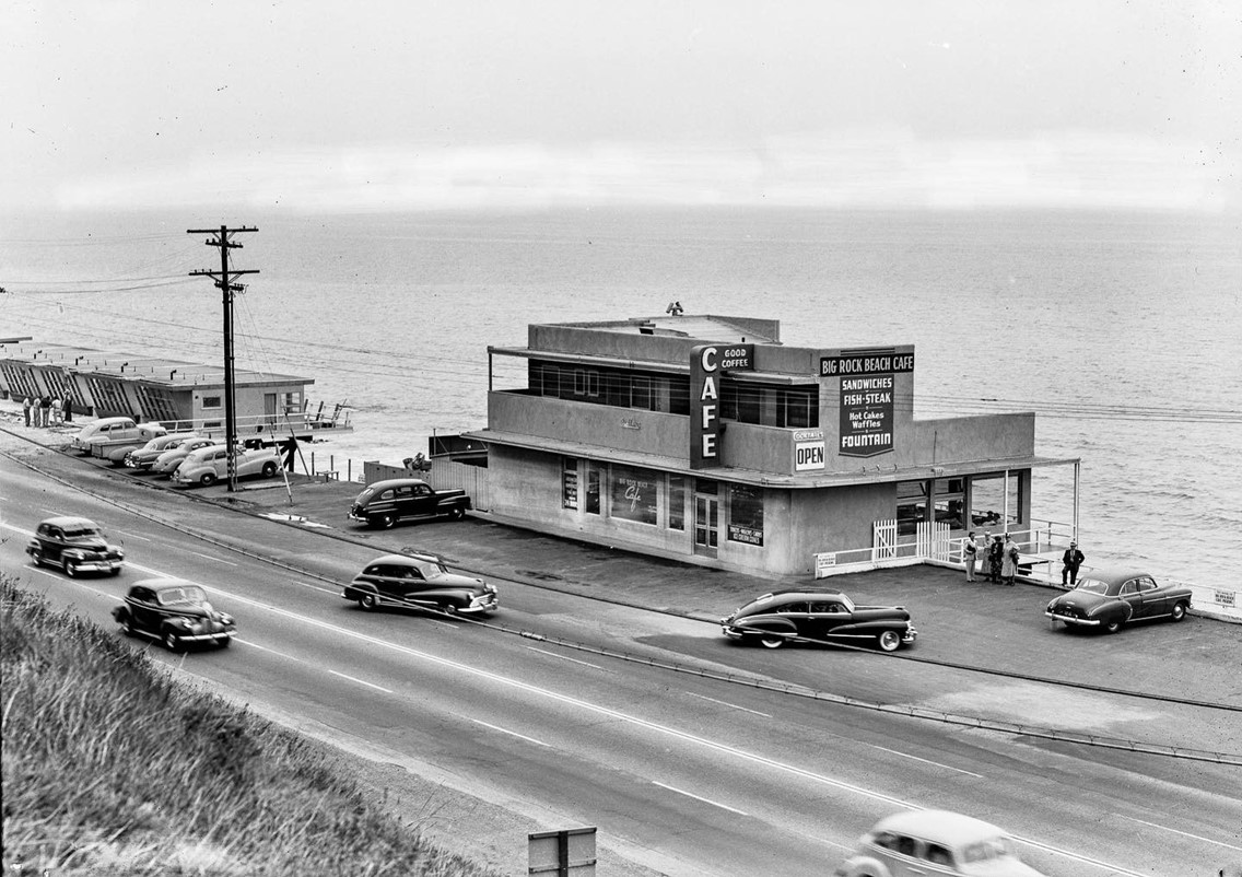
| (ca. 1949)* - Looking down at the Big Rock Beach Cafe from the hillside on PCH. Photo by Bob Plunkett |
\ |
|
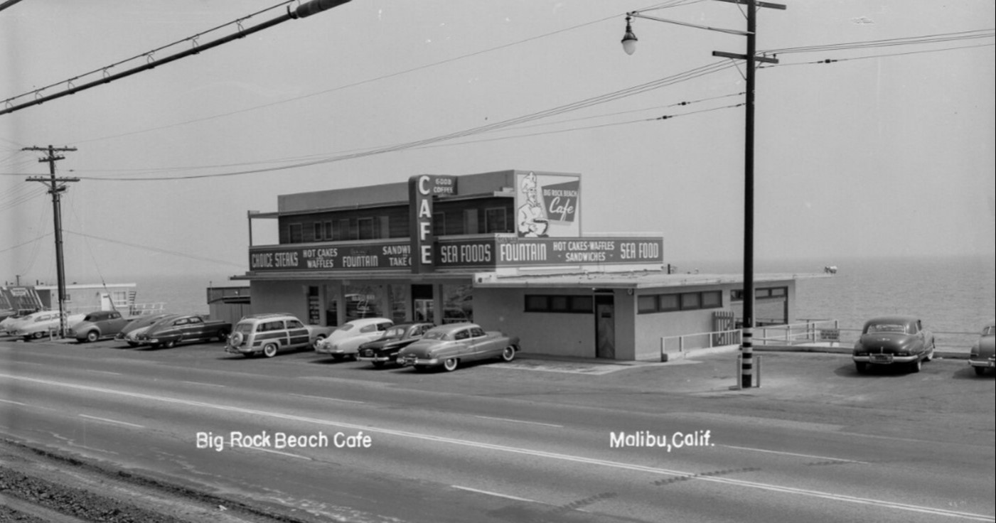
| (1950s)* – Postcard view showing the Big Rock Beach Cafe with cars parked in front on PCH including a “woodie” station wagon. A sign painted on the north side of the building shows a picture of a chef in a chef's hat and reads "Big Rock Beach Cafe sandwiches, hot cakes, waffles, fountain, seafood." Photo by Bob Plunkett |
 |
|
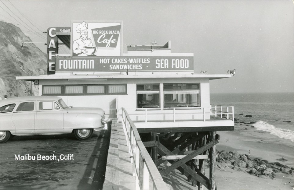
| (ca. 1953)* - Postcard view of the Big Rock Beach Cafe in Malibu with a 1949 Nash Rambler parked in the side parking lot. Photo by Bob Plunkett |
 |
|
| (ca. 1953)* - Postcard view of the Big Rock Beach Cafe in Malibu with a 1949 Nash Rambler parked in the side parking lot. Photo by Bob Plunkett |
 |
|
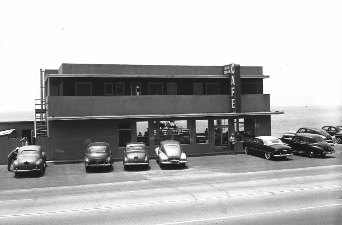
| (1950s)* - Front view of the Big Rock Beach Cafe showing a near full parking lot. Photo by Doug White |
 |
|
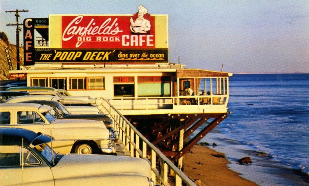
| (1950s)* - Canfield's Big Rock Cafe. Photo by Wayne L. Wilcox |
Historical Notes Big Rock Café burned down. Mooshadows, for years one of the best restaurants in Malibu, was built in 1966 on the same piling foundation that originally supported the Big Rock Cafe built in 1949. |
\ |
|
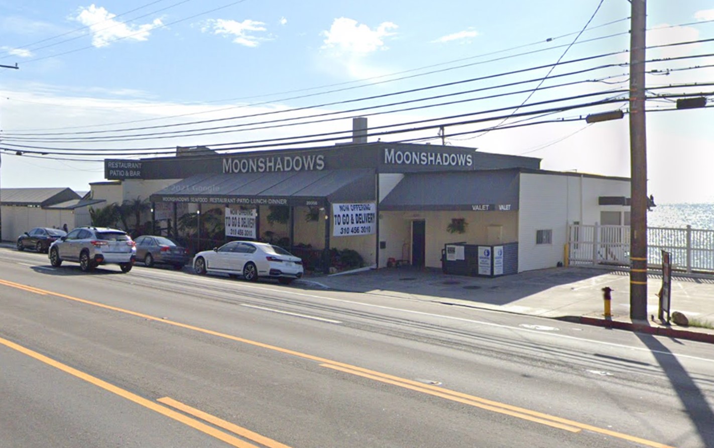
| (2021)* - Moonshadows Restaurant located where the Big Rock Beach Cafe once stood (20356 Pacific Coast Highway). |
Then and Now
\ |
|
| (1950 vs 2021)* - Big Rock Beach Cafe, today the site of Moonshadows Restaurant in Malibu. Photo comparison by Jack Feldman. |
* * * * * |
Malibu Coastline - Corral Beach
 |
|
| (1930)* - Roosevelt Highway future US 101A/CA 1 now Pacific Coast Highway approaching Corral Beach in Malibu. Photo from the Errnest Marquez Collection. |
Historical Notes Corral Beach in Malibu has been a popular coastal spot since the 1930s, when photos first captured its appeal to beachgoers. Once part of the Rindge family’s holdings, the area reflects Malibu’s long struggle between development pressures and efforts to preserve open land. In 1963, the Los Angeles Department of Water and Power proposed building a large nuclear power plant in nearby Corral Canyon, using seawater for cooling. Local residents, environmentalists, and celebrities opposed the plan, citing earthquake risks and safety concerns. By 1970, the project was abandoned, and the controversy helped fuel the environmental movement that shaped Malibu’s protected coast and mountains. Click HERE to learn more about the proposed—but never built—Corral Canyon Nuclear Power Plant. |
 |
|
| (2023)* - Contemporary view of Corral Beach in Malibu. |
Historical Notes Corral Beach is less crowded compared to other Malibu beaches due to limited parking, contributing to its appeal as a quiet retreat. Its natural beauty, recreational opportunities, and proximity to hiking trails make it a favored spot for locals and tourists alike seeking a genuine California coastal experience. |
* * * * * |
Malibu Coastline - Big Rock
 |
|
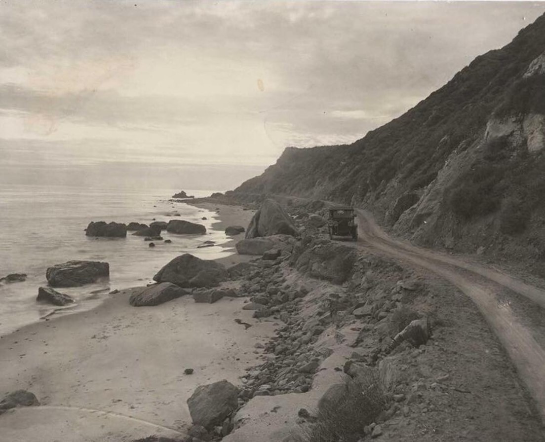
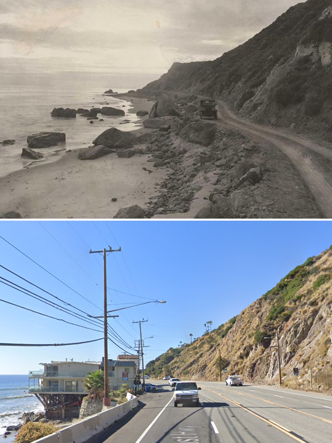
| (ca. 1912)* - Coastline of Santa Monica Bay between Malibu and Palisades. |
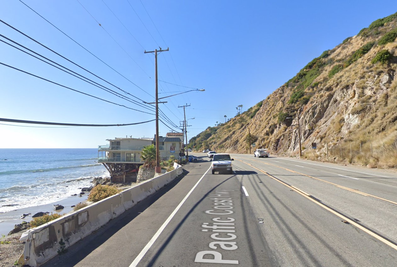
Historical Notes The “Malibu Road” to Las Flores canyon opened to the public by a court order in 1909. The photo is looking at the Big Rock rock/point, from about 1/4 mile east ("south"). Some people think it looks a bit like Carbon Pt because the sharp ridge line was still there -- However, it got snarfed off, first in the 1920's when the two-lane Roosevelt Highway got made, then more during the expansion to four lanes. There is no other surf zone rock between SM and Mugu that has that same profile and size. |
 |
|
| (2023)* – Looking up Pacific Coast Highway towards Big Rock in Malibu. |
Historical Notes The sharp ridge at the point is no longer there. It got cut off, first in the 1920's when the two-lane Roosevelt Highway got made, then more during the expansion to four lanes. |
Then and Now
 |
|
| (1912 vs 2023)* – Looking up Pacific Coast Highway towards Big Rock in Malibu. Photo comparison by Jack Feldman. |
* * * * * |
Malibu Coastline - La Costa Beach
 |
|
| (1910s)* - A landscape view of the coastline and Beach Road (which later became part of the Pacific Coast Highway) in Malibu, featuring La Costa Beach in the foreground and the Malibu Pier visible in the distance. From the Ernest Marquez Collection. |
Historical Notes La Costa Beach, recognized by some as Malibu's first neighborhood, has a history that dates back to the financially reckless Roaring '20s. Originally part of the Topanga Malibu Sequit Rancho owned by May Rindge, the land was sold in 1926 to real estate developer Harold G. Ferguson. Rindge made this sale to cover her mounting legal expenses from a lengthy battle over the construction of the Pacific Coast Highway on her property. Ferguson had grand plans for La Costa, but financial constraints during the Depression era led to the repossession of the property by Rindge’s Marblehead Land Co., which eventually went bankrupt. Despite these setbacks, the charm of the beachside locale continued to attract residents and visitors, contributing to its development and allure over the years. |
 |
|
| (2019)* – Google Earth view of La Costa Beach in Malibu as it appears today. |
Then and Now
 |
|
| (1910s vs. 2019)* - A landscape view of the coastline and Beach Road (now Pacific Coast Highway) in Malibu, showing La Costa Beach in the foreground and the Malibu Pier visible in the distance. Photo comparison by Jack Feldman. |
* * * * * |
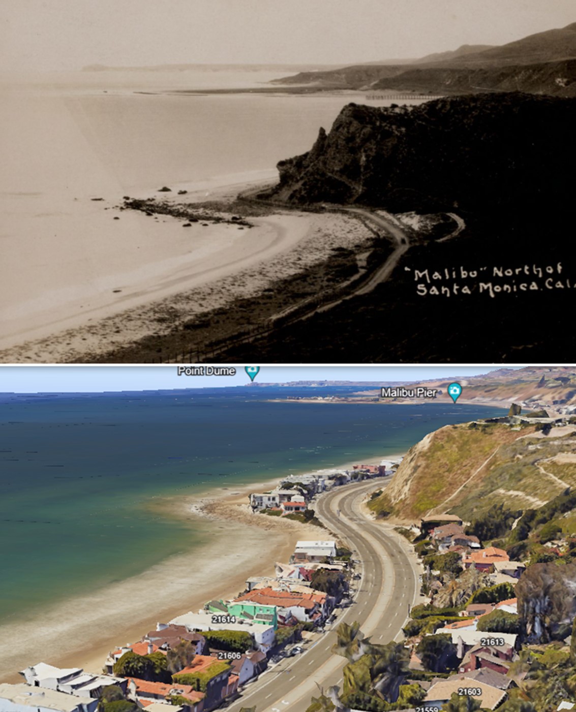
Malibu Coastline (Near Las Flores)
 |
|
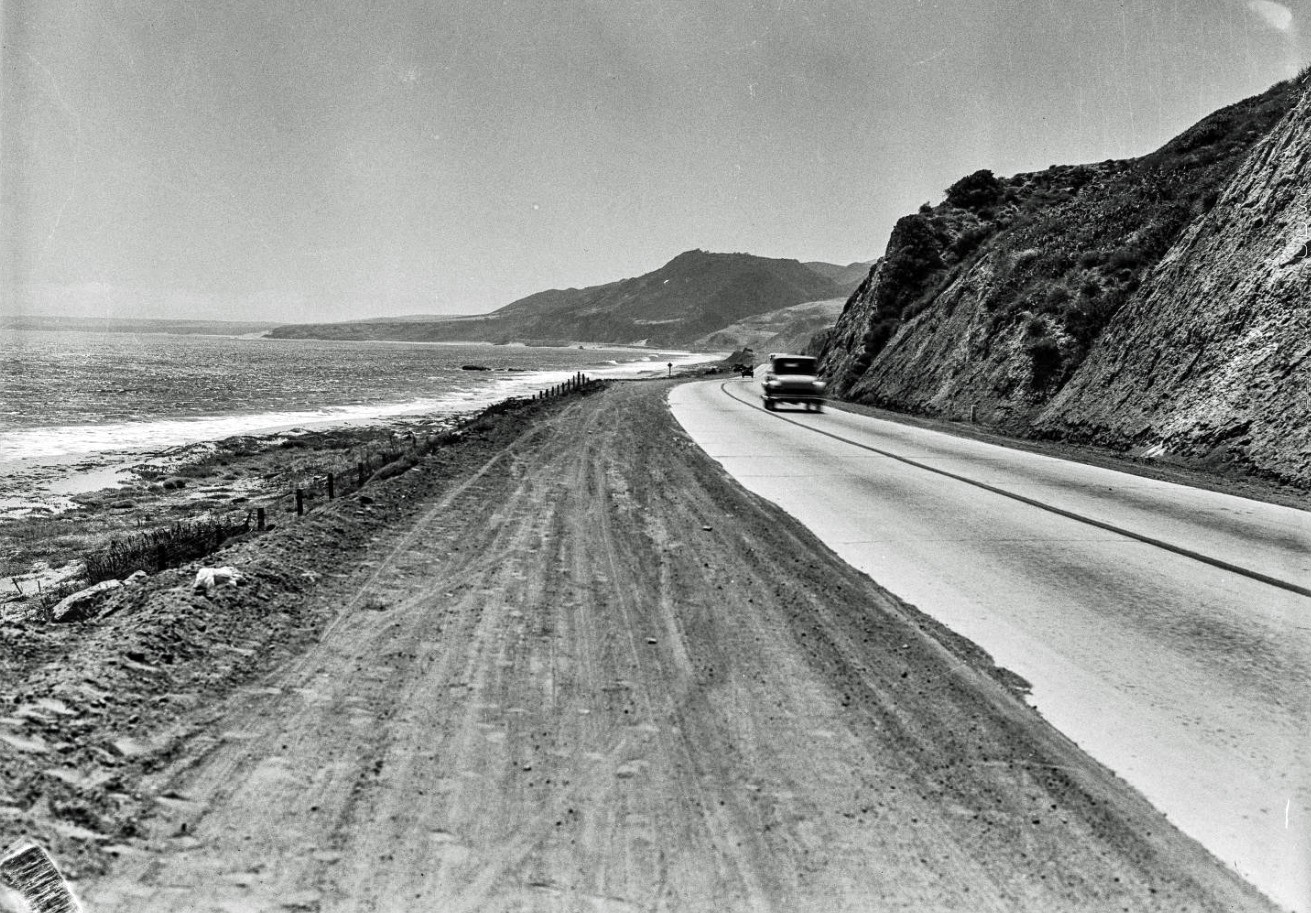
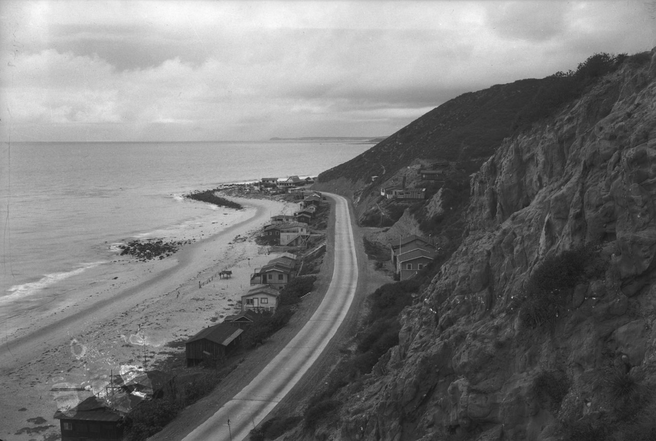
| (ca. 1912)* - Coastline of Santa Monica Bay near Las Flores Canyon in Malibu, before the road was paved. |
Historical Notes This coastline dirt road would become Roosevelt Highway and later Pacific Coast Highway. The Malibu segment of the Roosevelt Highway was the last to open, and was completed on June 29, 1929. |
 |
|
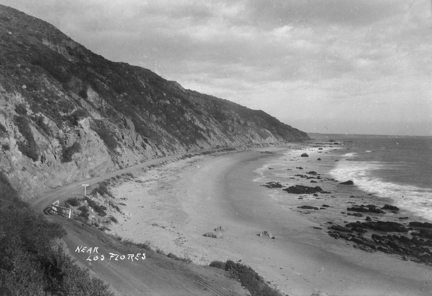
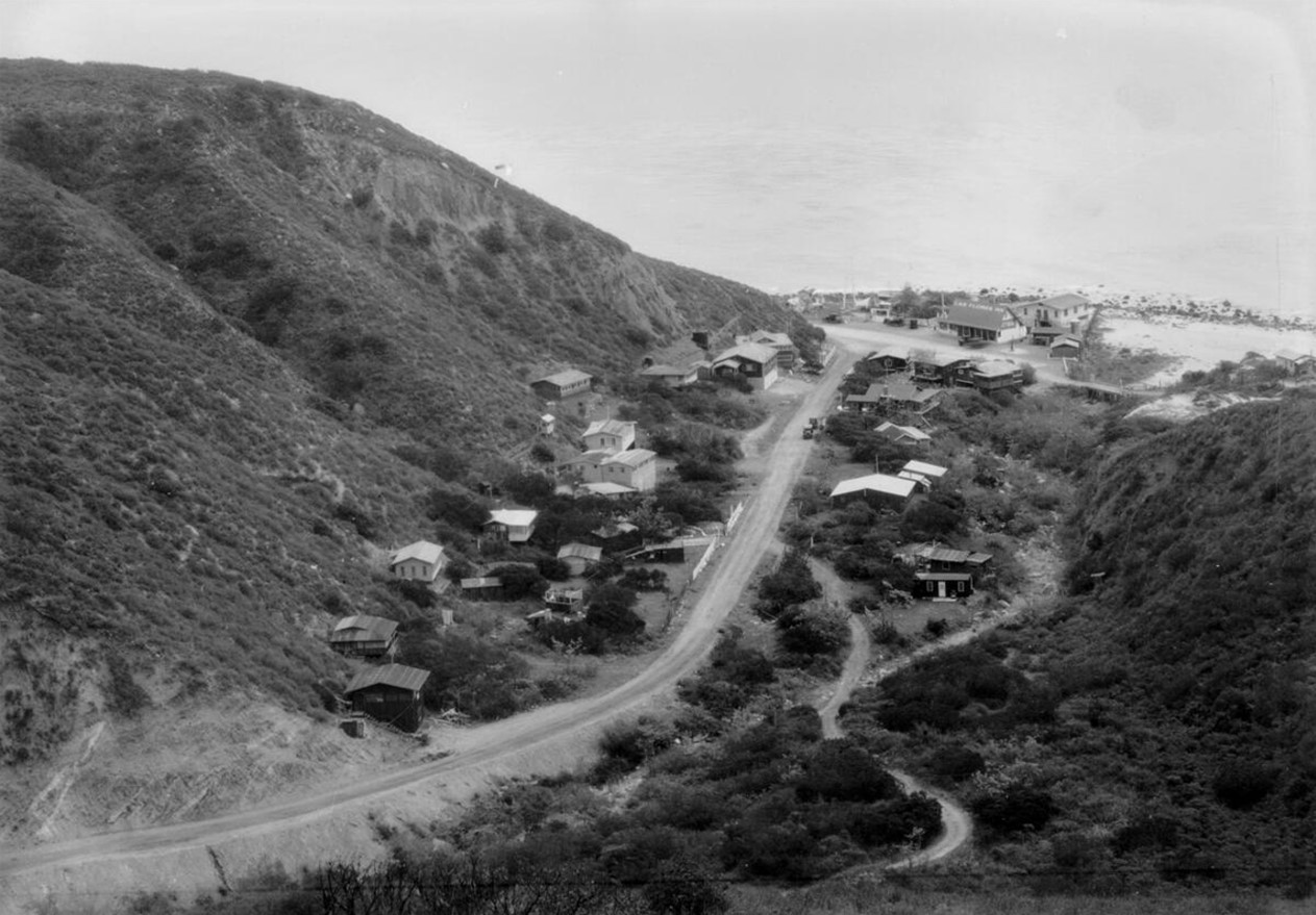
| (ca. 1920)* - View of beach houses along the California coast near Las Flores Canyon in Malibu. Note the stilts beneath the wooden houses and there are also few houses on the cliffs to the left. |
Historical Notes The Malibu segment of the Roosevelt Highway was the last to open, and it was completed 1929. It was renamed Pacific Coast Highway (State Route 1) in 1941. |
Then and Now
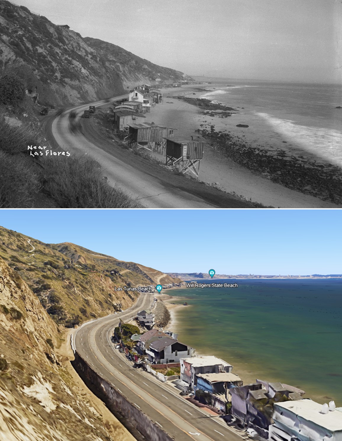 |
|
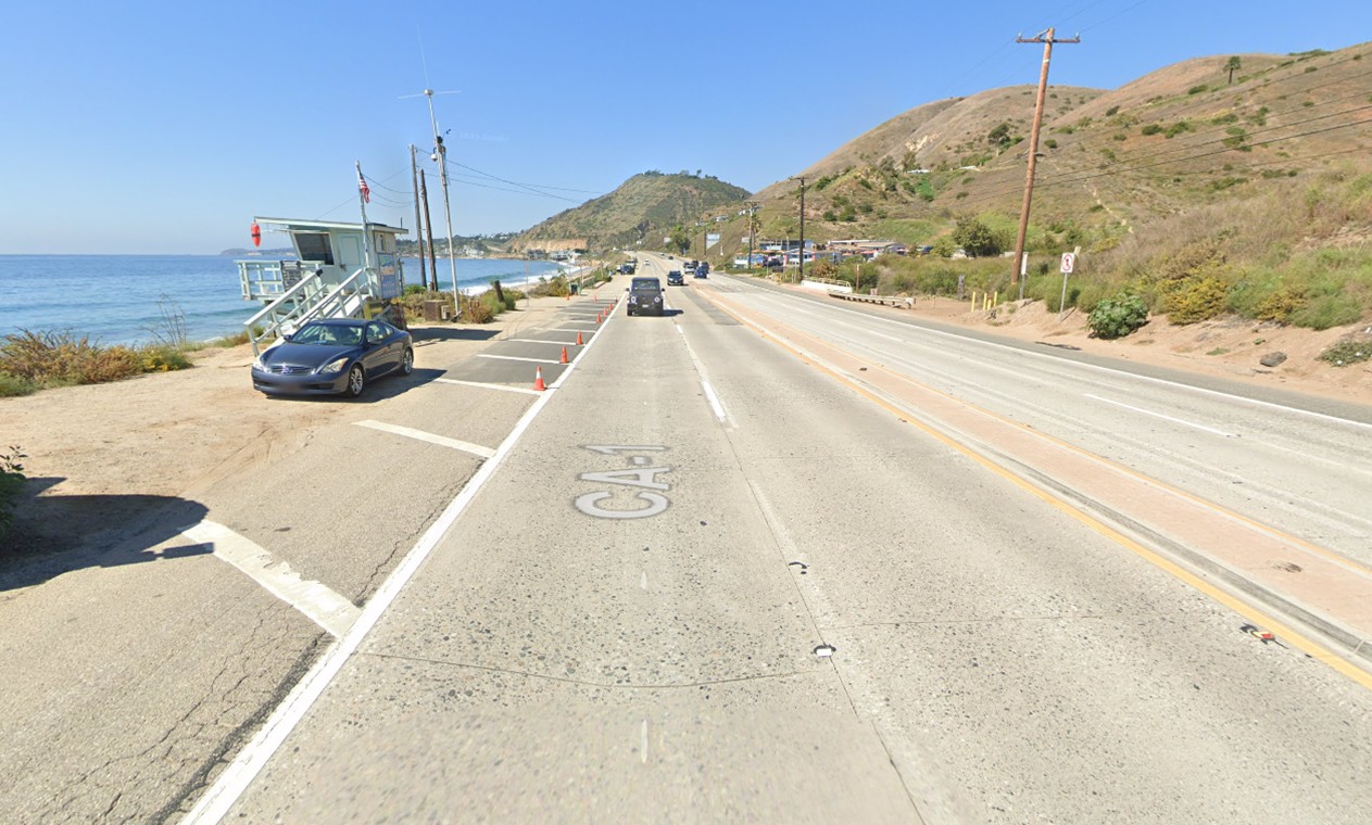
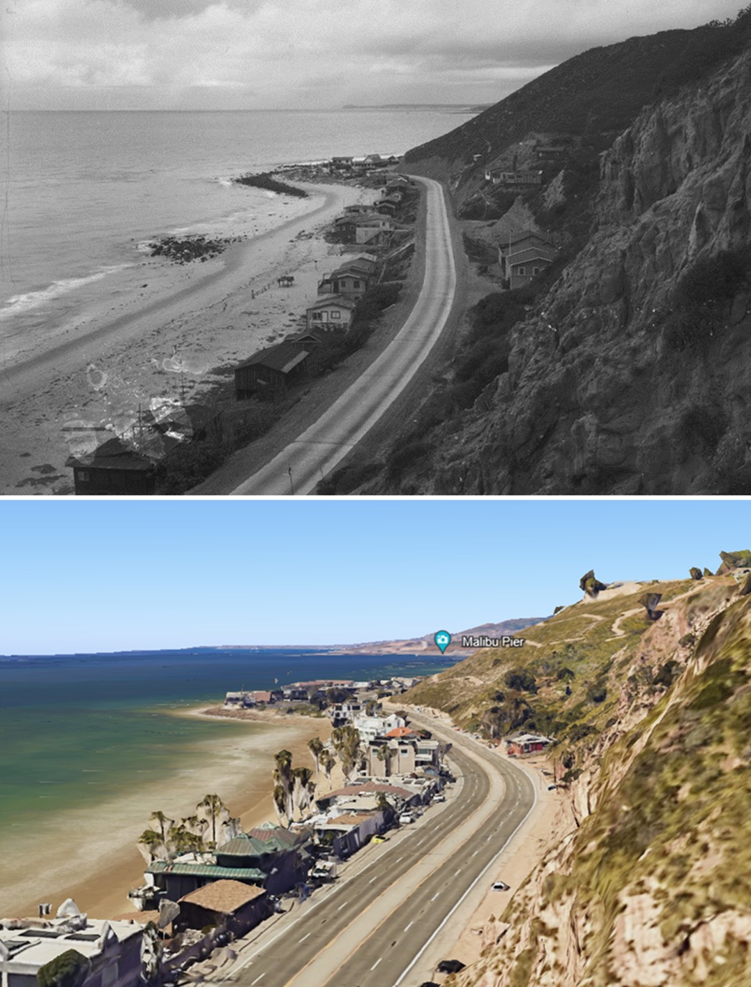
| (1920 vs 2019)* – Pacific Coast Highway, Malibu. View is looking toward Santa Monica from near Las Flores Canyon. Photo comparison by Jack Feldman. |
 |
|
| (ca. 1915)* - View of the Malibu coastline just east of Las Flores Canyon. The Las Flores Inn is the last building in the distance. Beach houses line the shore, and a few are also located on the slope side of the highway. Point Dume is visible in the far distance. |
Historical Notes The Las Flores Inn was located at the intersection of the coast highway* and Las Flores Canyon Road, just east of the guarded Rindge Ranch fence (which prevented westward development beyond Las Flores Canyon Road at this time). *The Roosevelt Highway, which later became the Pacific Coast Highway (PCH), was built through Malibu and opened in 1929. The highway was part of a 1,400-mile road that traced the western margin of the United States. The Malibu segment of the Roosevelt Highway was the last to open, and it was completed on June 29, 1929. |
Then and Now
 |
|
| (1915 vs 2019)* - View of the Malibu coastline just east of Las Flores Canyon. The Las Flores Inn is the last building in the distance in the early photo, today site of Duke's Malibu Restaurant. Beach houses line the shore, and a few are also located on the slope side of the highway. Point Dume is visible in the far distance. Photo comparison by Jack Feldman. |
* * * * * |
Las Flores Inn and Las Flores Canyon
 |
|
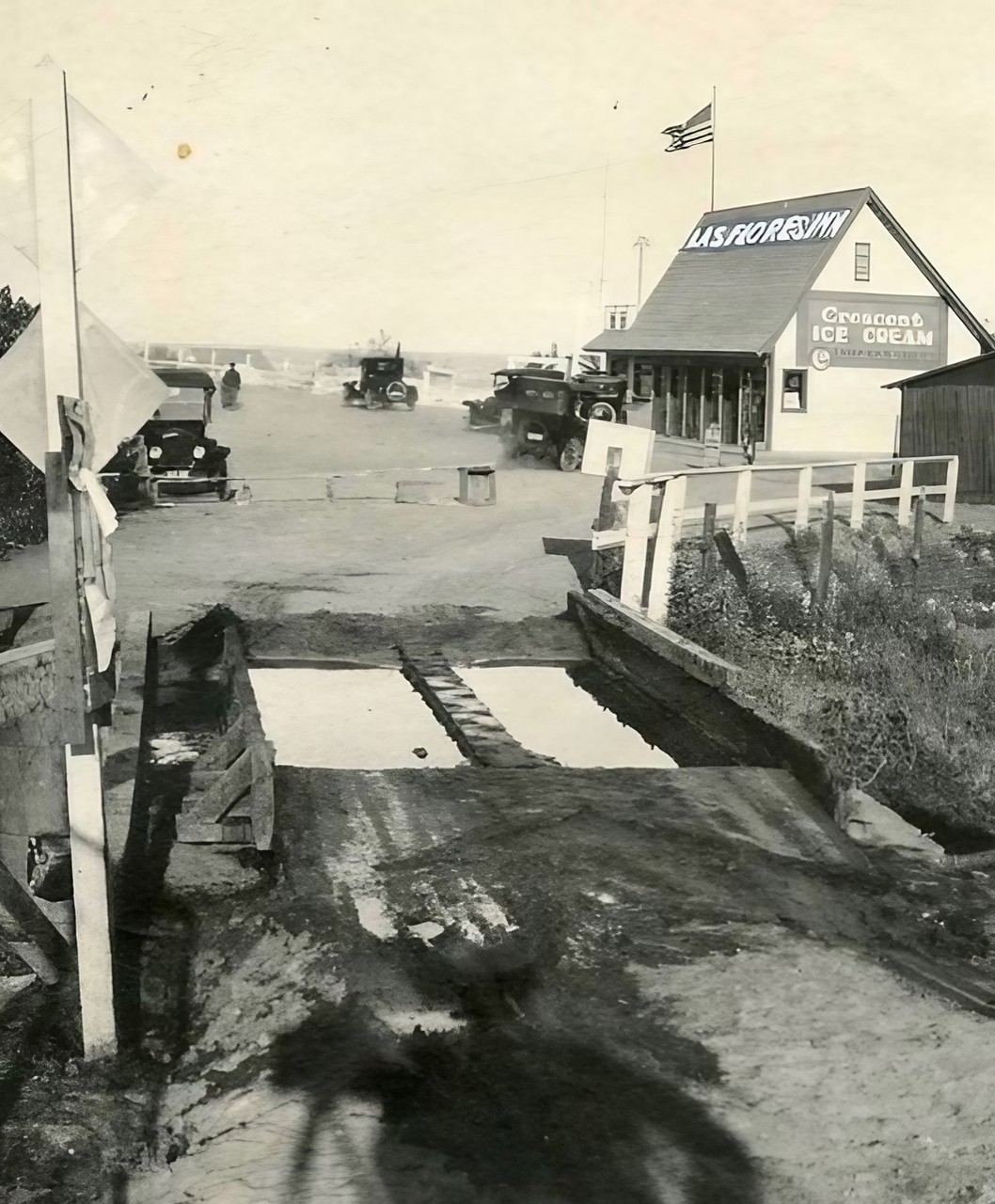
| (1912)* – A view toward the road emerging from Las Flores Canyon, intersecting with the coast road near the Las Flores Inn. The eastern gate of Rindge Rancho Malibu is visible along the coast road at Las Flores Creek. |
Historical Notes In 1912, the coastal infrastructure in the area was still in its early stages of development. The main coast route came to an abrupt end at Las Flores Canyon, and would remain incomplete until the late 1920s. Near the Las Flores Inn, a modest dirt road branched off from the main thoroughfare, traversing a rocky stream bed. This rudimentary road network reflected the area's rural character at the time. It wasn't until the late 1920s that the Roosevelt Highway, now known as the Pacific Coast Highway, was finally completed, significantly improving transportation along the coastline and connecting previously isolated areas. |
 |
|
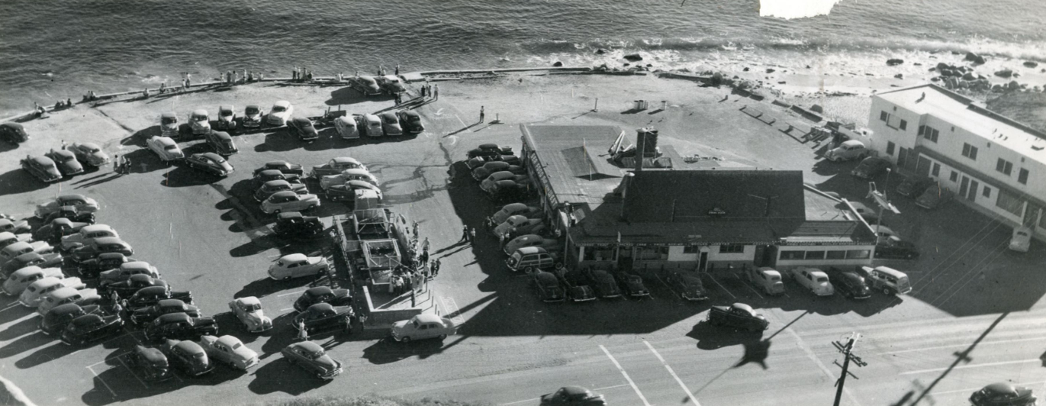
| (1910s)* – May Rindge's Las Flores Gate: The gate was reportedly guarded by her armed cowboys, with pits filled with disinfectant to sanitize car tires and prevent the spread of disease to her secluded Malibu Ranch cattle. Today, the site of the Las Flores Inn is home to Duke's Malibu. In the foreground, you can see the shadow of the photographer and his tripod-mounted camera. Photo courtesy of Federico Hill. |
Historical Notes In the early 1900s, the Las Flores Gate was a crucial element in the history of Rindge Ranch and the development of Malibu. Frederick Hastings Rindge, who purchased the vast Rancho Topanga Malibu Sequit in 1892, installed the gate at Las Flores Canyon in 1894 to maintain control over his property. After his death in 1905, his wife, May Rindge, took over management and fiercely defended the family's land through legal battles, including preventing the Southern Pacific Railroad and public roads from cutting through the ranch. She also fought against the construction of the Pacific Coast Highway. |
 |
|
| (1910s)* - May Rindge's Las Flores Gate: The gate was reportedly guarded by her armed cowboys, with pits filled with disinfectant to sanitize car tires and prevent the spread of disease to her secluded Malibu Ranch cattle. Today, the site of the Las Flores Inn is home to Duke's Malibu. In the foreground, you can see the shadow of the photographer and his tripod-mounted camera. Photo courtesy of Rob Wlodarski. |
Historical Notes May Rindge’s battles delayed public access to Malibu, preserving its natural beauty for years but at significant financial cost, ultimately leading her to explore ventures like Malibu Potteries and the Malibu Movie Colony. Though the Pacific Coast Highway was eventually built, the Las Flores Gate remains a symbol of the Rindge family's efforts to shape Malibu’s development and reputation as an exclusive, secluded area. |
 |
|
| (1915)* - Las Flores Inn on the coast road, Malibu. This later became Malibu Sea Lion and today is Duke’s Malibu restaurant. Photo by C.C. Pierce |
Historical Notes The inn was located at the intersection of the Pacific Coast Highway and Las Flores Canyon Road, just east of the guarded Rindge Ranch fence (which prevented westward development beyond Las Flores Canyon Road at this time). |
 |
|
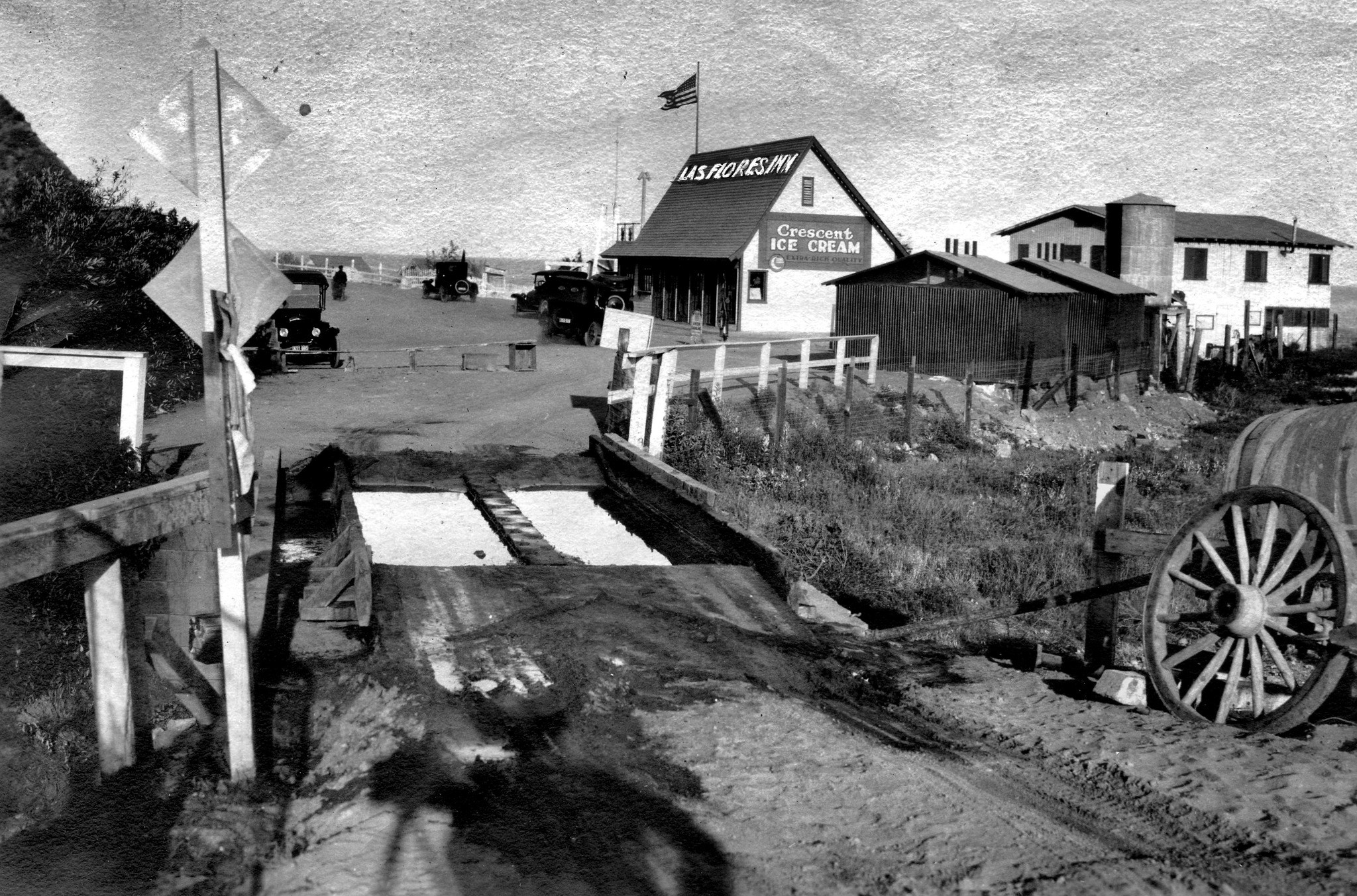
| (1915)* - Las Flores Inn at the intersection of PCH (Roosevelt Highway) and Las Flores Canyon Road, now serving Crescent Ice Cream and Maier Select on Draught. |
Historical Notes The Las Flores Inn would later become the Malibu Sea Lion, which went through several iterations on this spot over the ensuing decades--due to either expansion or fire. In 1996, it became Duke's Malibu restaurant. Roosevelt Highway (later Pacific Coast Highway) was so name in 1929. |
 |
|
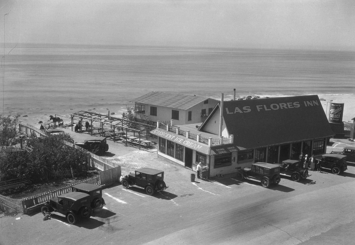
| (ca. 1930)* - Postcard view showing the Las Flores Inn, one of the earliest establishments in the Malibu area serving as a last stop for travelers before the original Rancho Malibu gates at Las Flores Canyon. The Inn's famous seal tank is visible in the parking lot on the left. |
 |
|
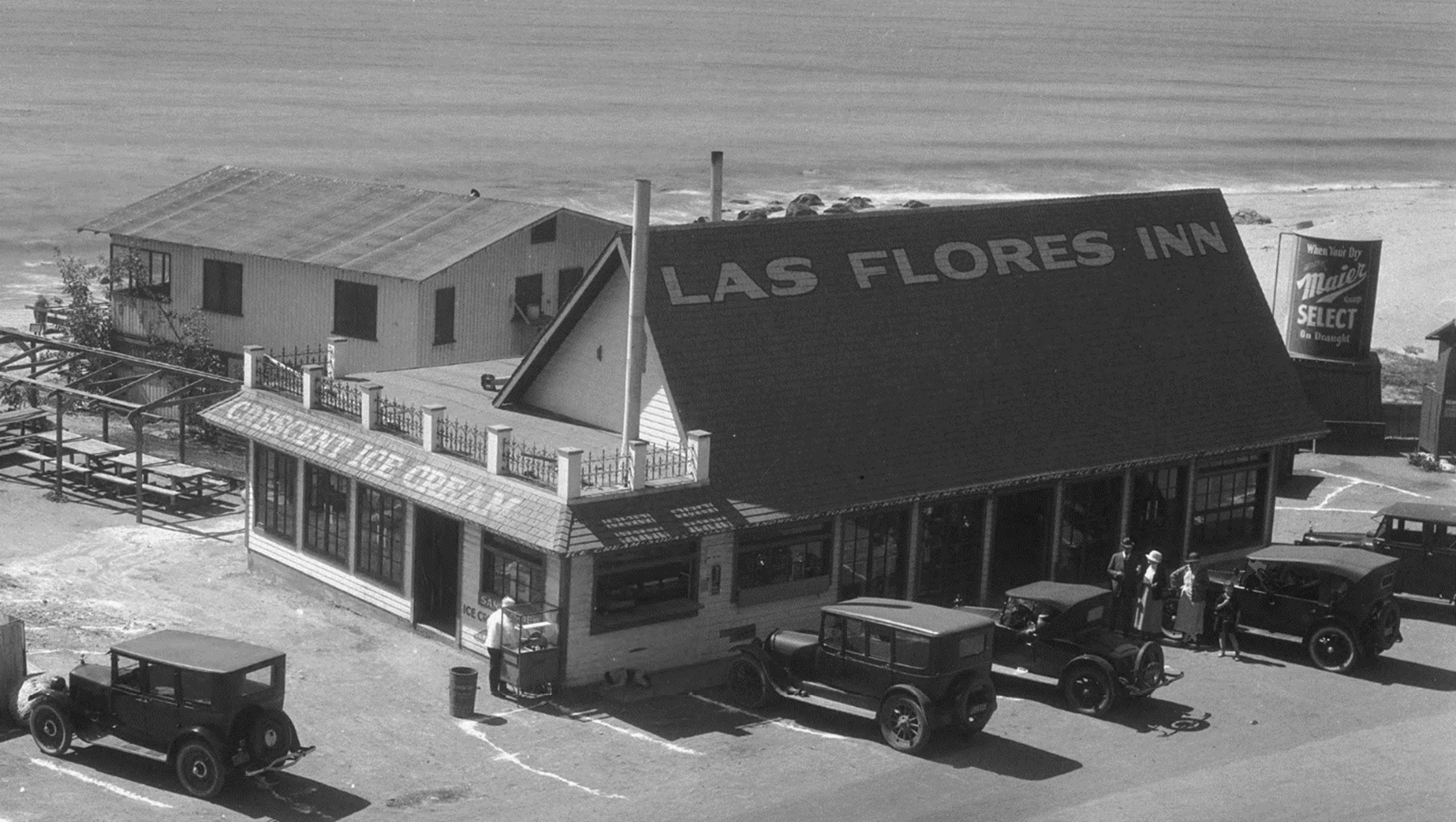
| (1940s)* - Las Flores Inn restaurant on PCH in Malibu. The Inn's famous seal tank is visible in the parking lot. |
Historical Notes The Las Flores Inn, a legendary seafood restaurant on the Pacific Coast Highway, is seen here in its original--but expanded--form in the late 1940s, shortly after it was purchased by proprietor Chris Polos. Polos kept the Inn's seal tank (seen here center-left), and barking seals greeted patrons as they parked their cars. The named changed to The Sea Lion Inn in the early 1950s, and went through several iterations on this spot over the ensuing decades--due to either expansion or fire. In 1996, this site opened as Duke's Malibu restaurant. |
 |
|
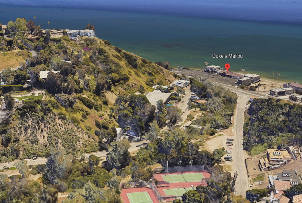
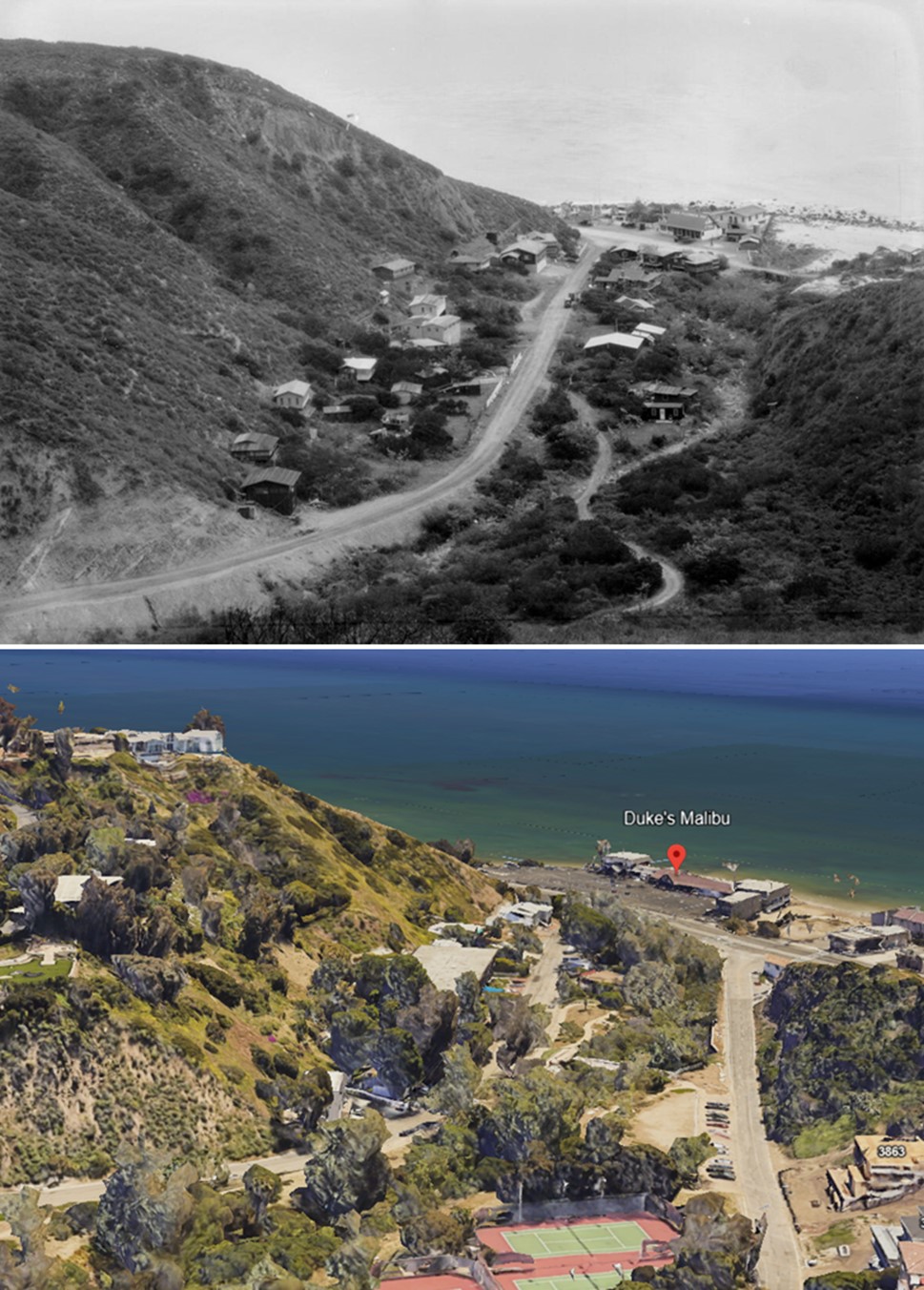
| (2019)* – Google Earth view showing the intersection of Las Flores Canyon Road and Pacific Coast Highway, where Duke’s Restaurant now stands, once the site of the historic Las Flores Inn. |
Then and Now
 |
|
| (1912 vs 2019)* – View looking down toward Las Flores Canyon Road, where it meets the coast road (today PCH) near the Las Flores Inn (the present-day site of Duke’s Restaurant). Photo comparison by Jack Feldman. |
* * * * * |
Topanga Creek and Lagoon
.jpeg) |
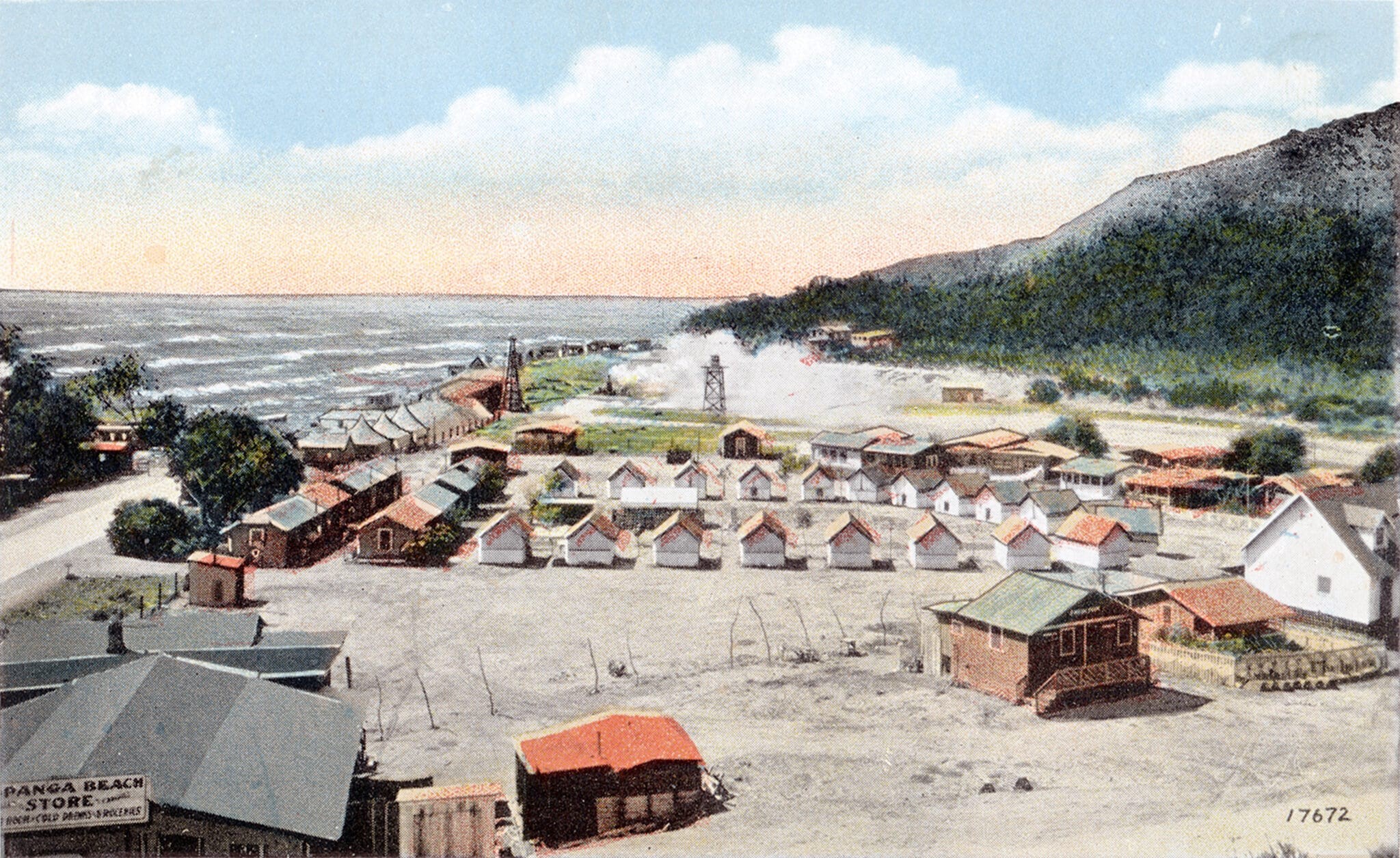
|
| (1910)* - An unpaved road curves into Topanga Canyon, with two cars parked along its edge and a cluster of automobiles visible on the far side of Topanga Lagoon. A wooden trestle bridge, just out of view to the right, provided passage over the creek where the lagoon transitioned into the creek channel. Today, a four-lane Pacific Coast Highway runs along the former dirt road, crossing directly over the lagoon to the other side. |
Historical Notes The bridge over Topanga Lagoon and Topanga Creek has a history spanning nearly a century, with early bridges including a wooden trestle from the early 1900s and a 1923 bridge that was widened in 1929. The current 80-foot-long bridge, built in 1933, significantly altered the lagoon's landscape, reducing it from 30 acres to just 1 acre. Planned restoration efforts as of 2024 aim to expand the lagoon to 7-10 acres and replace the existing bridge with a 460-foot-long structure, improving habitat, public access, and coastal resilience. |
 |
|
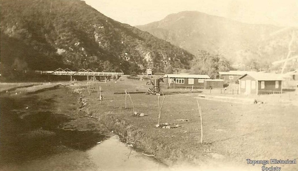
| (ca. 1930)* – The first bridge spanning Topanga Lagoon and Topanga Creek. Photo courtesy of the Topanga Historical Society. |
Historical Notes A 1923 bridge, 240 feet long, was built by the State to keep the road in line with the coast. It was contracted to two companies, Greene and Lemore, who plowed through Cooper’s Camp (the earliest version of the Topanga Ranch Motel) and added an underpass to a bathhouse on the beach. The contractors also paved over a Native-American burial mound that hadn’t been properly studied. Their road is still in use as the access to the lifeguard station. After Malibu opened, and the highway was completed to Ventura in 1929, the bridge was widened from 20 to 40 feet. |
 |
|
| (ca. 1930)* – Postcard view showing Cooper's Camp at the edge of the Topanga Lagoon. The Rust family's house is on the far right. Photo courtesy of the Randy Young Collection. |
Historical Notes Established in 1919 by Archie Miller Cooper, Cooper's Camp began as a beach campground with tent cabins and a dance pavilion to accommodate the growing number of recreational visitors to Topanga Beach. In 1920, cabins were added to host a summer camp for classical musicians. By 1928, the camp transitioned into the Topanga Beach Auto Court under the management of J.C. McGray, signaling the start of a more permanent settlement in the area. In 1923, the construction of Roosevelt Highway (now Pacific Coast Highway) dramatically transformed the area around Cooper's Camp, the early version of Topanga Ranch Motel. The highway plowed through the camp, and in 1933, a realignment required the motel to be relocated. It was raised on fill and moved back about 170 feet, changing the layout of its cabins from a ring to a triangle. Houses behind the motel were removed during this process. The 1933 project also altered Topanga Lagoon, replacing the original bridge with a 79-foot span box culvert bridge and adding 25 feet of fill at the abutments. These changes reduced the lagoon habitat to less than an acre, surrounded by steep banks. |
 |
|
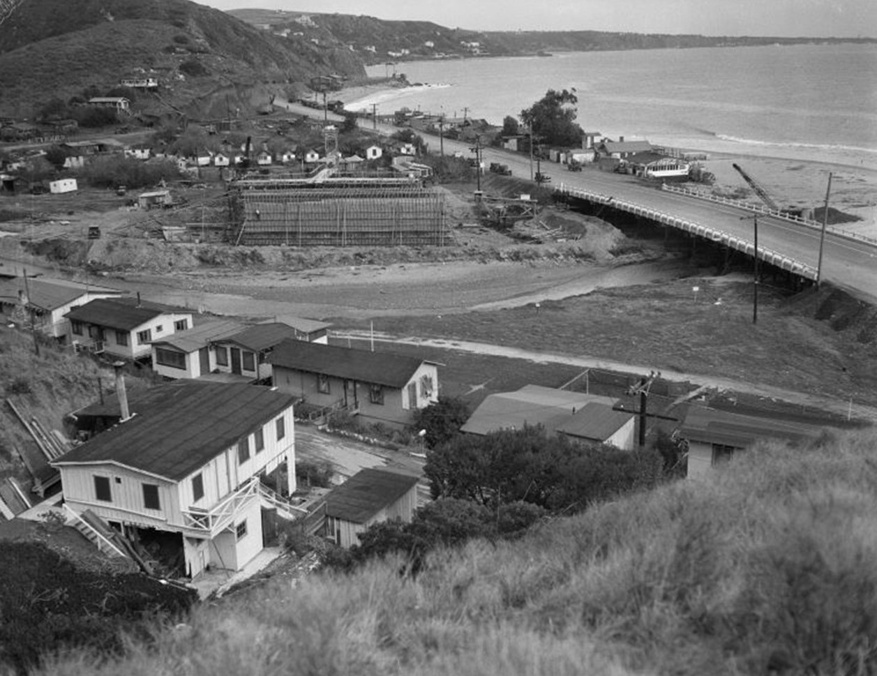
| (1933)* – Bird's-eye view of Roosevelt Highway (later Pacific Coast Highway), showing the bridge over Topanga Creek and the construction of a new, wider bridge underway on the left. |
Historical Notes The bridge visible above on the right, built in 1923, spans 240 feet and was constructed by the state to align the road with the coastline. Contracted to Greene and Lemore, the project cut through Cooper’s Camp (the earliest version of the Topanga Ranch Motel) and included an underpass to a beach bathhouse. Unfortunately, the contractors also paved over a Native American burial mound that had not been properly studied. This road still serves as access to the lifeguard station. After Malibu opened and the highway was extended to Ventura in 1929, the bridge was widened from 20 to 40 feet. |
.jpg) |
|
| (1933)* – View showing Roosevelt Highway (later Pacific Coast Highway), including the present bridge over Topanga Creek and the new bridge under constructin in the center beyond two rows of small cabins. |
Historical Notes The 1933 bridge, seen here under construction, dramatically altered the area's topography. Instead of disposing of an estimated 800,000 cubic yards of construction fill, the dirt was dumped into the lagoon, raising the ground level by 20 feet. This permanently changed the creek's outflow, leading to long-lasting issues. |
 |
|
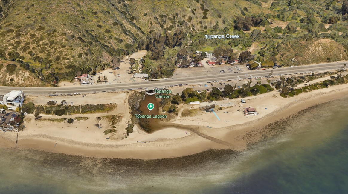
| (2019)* - Google Earth view looking down at the Topanga Lagoon and PCH bridge that crosses the Topanga Creek. Topanga Canyon Boulevard is to the right, out of view. |
Historical Notes The 1933 bridge project altered the Topanga Lagoon, replacing the original bridge with a 79-foot span box culvert bridge and adding 25 feet of fill at the abutments. These changes reduced the lagoon habitat to less than an acre, surrounded by steep banks. |
 |
|
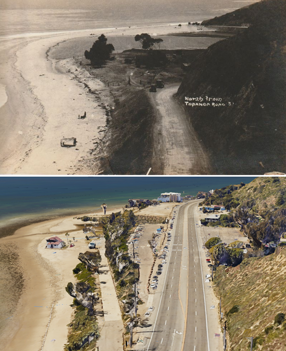
| (1910 vs 2019)* - A view looking northwest reveals the dramatic transformation of the approach to Topanga Creek. What was once a dirt road is now the four-lane Pacific Coast Highway. The hillsides on the right were shaved down to accommodate the wider roadway. The construction of the 80-foot-long bridge over the creek in 1933, barely visible here, significantly altered the lagoon’s landscape, reducing it from 30 acres to just 1 acre. Photo comparison by Jack Feldman. |
Historical Notes Planned restoration efforts as of 2024 aim to expand the lagoon to 7-10 acres and replace the existing bridge with a 460-foot-long structure, improving habitat, public access, and coastal resilience. |
* * * * * |
Oil Fields of Marina del Rey (Part of the Venice Oil Field) |
In the early 20th century, the coastal lands between Playa del Rey and Venice looked very different from today. What is now Marina del Rey and the Ballona Wetlands was once a mix of marshland, sand dunes, and open shoreline, with Ballona Creek winding its way to the Pacific.That landscape changed dramatically in 1929, when oil was discovered just inland from the Venice canals. Almost overnight, derricks spread across the area, transforming the quiet coastal zone into one of California’s most active oil fields. For a time, the beaches south of Venice were lined with drilling rigs, pipelines, and service roads, creating a striking contrast between industry and the ocean.Over the decades that followed, oil production declined, the wells were capped, and the land was reshaped once again. The former oil fields and wetlands were ultimately redeveloped into Marina del Rey, now the largest man-made small craft harbor in North America, marking one of the most dramatic coastal transformations in Los Angeles history. |
 |
|
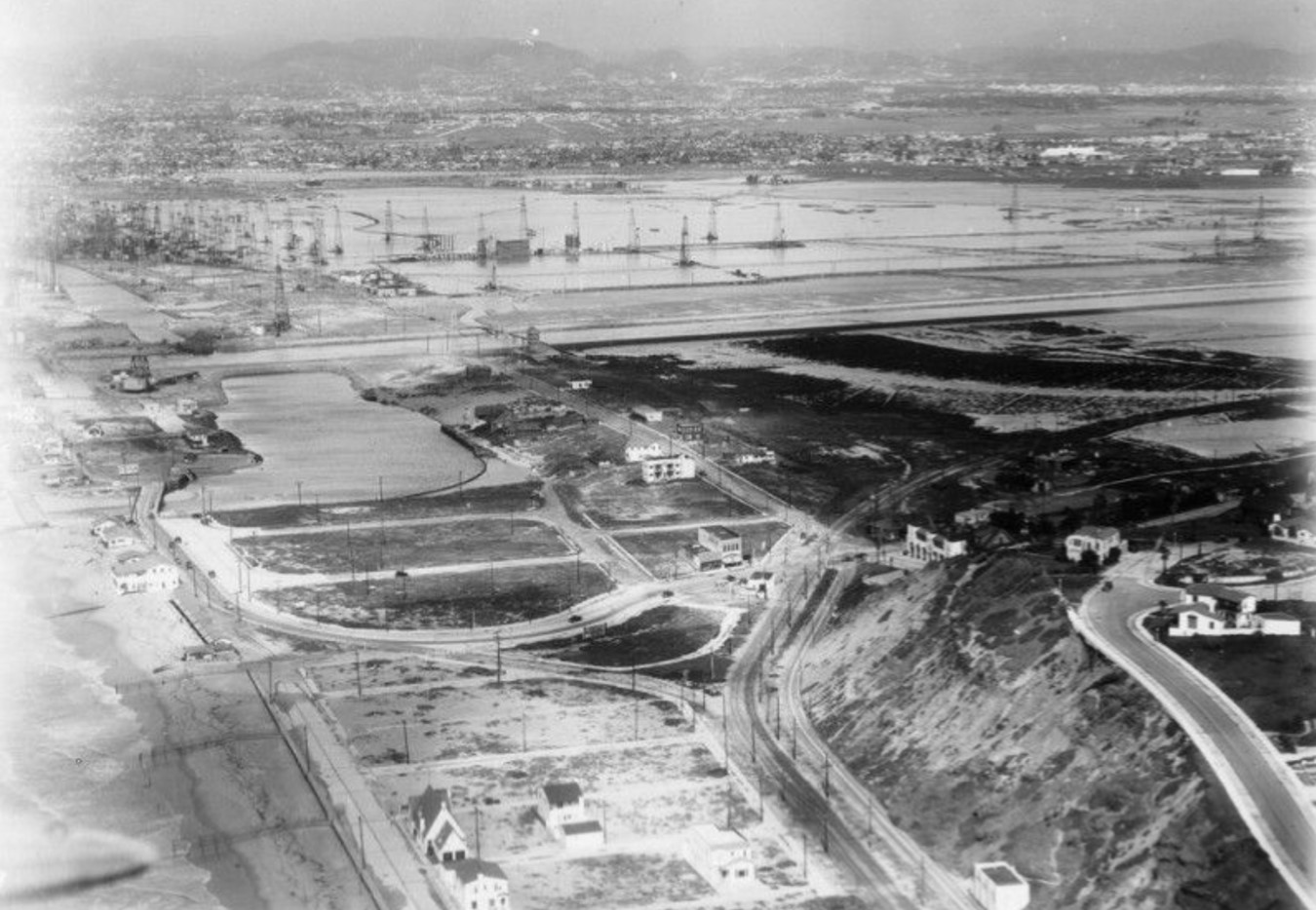
| (ca. 1930)* - Aerial view from above Playa del Rey looking north toward the Venice Oil Field, located just south of Venice. The area in the top right is now known as Marina del Rey. |
Historical Notes Ever since the legendary oil tycoon Edward L. Doheny and his partner, Charles A. Canfield, struck oil west of downtown Los Angeles in 1892, extracting petroleum from the land beneath Southern California has been a major part of the Southern California economy and its landscape. That included the beach areas as well. The Ohio Oil Company struck oil on December 18, 1929, just east of the Grand Canal in Venice. This discovery came at a critical time, as Venice was struggling economically during the Great Depression. The initial well produced an impressive 3,000 barrels of oil per day from a depth of 6,199 feet. News of the discovery spread rapidly, triggering an "oil fever" among residents. On January 9, 1930, a crowd of 2,000 people gathered at City Hall, demanding rezoning to allow for oil drilling. The Los Angeles city planners lifted the drilling ban on January 28, 1930, but initially restricted drilling to areas south of Washington Street. |
 |
|
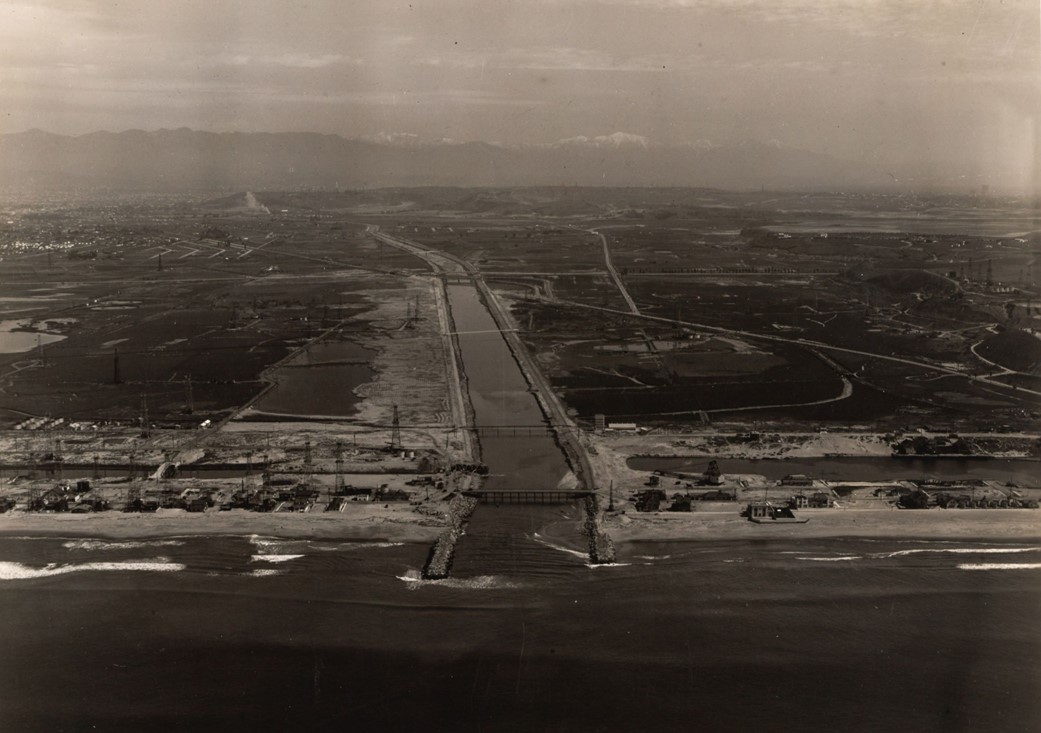
| (1938)* - Aerial view of the coastline centered on Ballona Creek, lined with concrete walls, as it empties into Santa Monica Bay near Marina del Rey. Oil rigs are visible on the beach and inland, along with bridges crossing Ballona Creek. Photo from the Ernest Marquez Collection. |
Historical Notes The Venice Oil Field expanded rapidly. By June 1930, it was producing $75,000 worth of oil per week. By September 1930, 50 wells were in operation, and by 1931, the field had become the fourth most productive in California, with 340 wells in use. At its peak, it reportedly produced nearly 47,000 barrels of oil per day. Ballona Creek, a 9-mile waterway, was converted into a concrete-lined flood control channel in the 1930s, with about 7 miles lined to protect the growing city from floods. The creek drains a 130-square-mile watershed and empties into the Pacific Ocean at the Ballona Wetlands Ecological Reserve, near Marina del Rey, where the last couple of miles remain unlined. While effective for flood control, the concrete lining has caused ecological issues and carries urban pollutants. Ongoing revitalization efforts aim to improve water quality, restore ecology, and create recreational opportunities, balancing flood protection with environmental and community needs. Click HERE to see more on Ballona Creek and Marina del Rey. |
 |
|
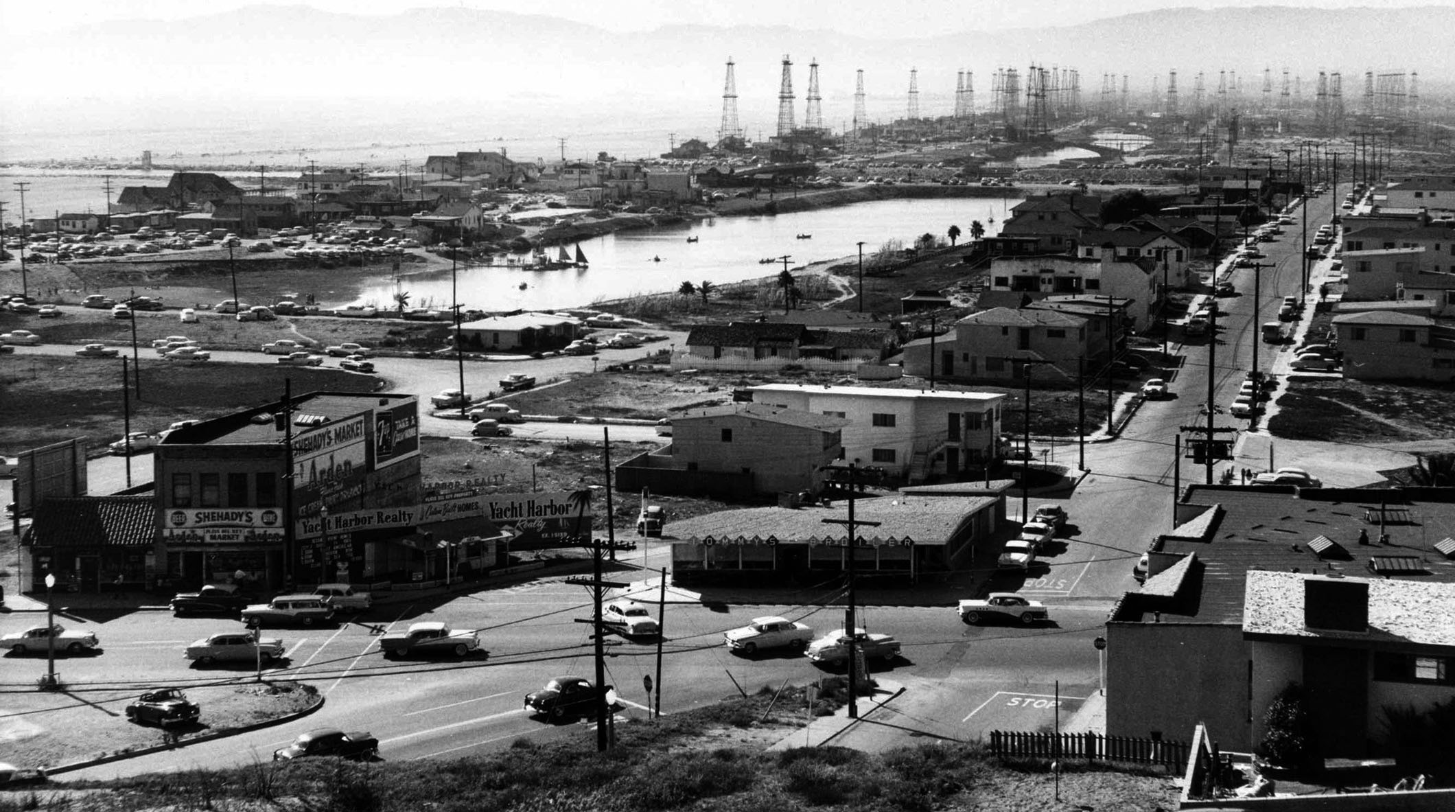
| (1950s)* – View looking toward the Venice Oil Field from Playa del Rey. Signs for Shehady's Market and Yacht Harbor Realty are visible on the building to the left. The intersection of Vista del Mar and Culver Boulevard is at the lower right, with Vista del Mar Boulevard extending away from the camera. The large body of water in the center is the Del Rey Lagoon. |
Historical Notes Del Rey Lagoon is a 14-acre municipal park in the Playa Del Rey neighborhood of Los Angeles. The main feature of the park is a 6-acre lagoon, which measures about 1,250 feet long and 350 feet wide and was once part of the Ballona Creek estuary system. Today, the lagoon provides a habitat for various waterfowl, including bufflehead ducks, great blue herons, and coots. The park also has a variety of recreational facilities, such as lighted baseball fields, basketball courts, and a playground for children. Del Rey Lagoon has a rich history that dates back to the late 19th century. It has served many purposes over the years, from hosting crew races to being next to a racetrack in the early 1900s. However, the lagoon has experienced significant environmental changes due to urban development and flood control measures, transforming it from a salt marsh into a recreational lagoon. Click HERE to see more Early Views of the Playa del Rey Lagoon. |
 |
|
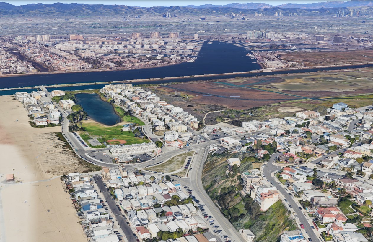
| (2024)* – Google Earth view looking north from above Playa del Rey toward Marina del Rey and the Ballona Creek channel. |
Historical Notes Marina del Rey, completed in 1965, is the largest man-made small craft harbor in North America, developed from the Ballona wetlands through a collaboration between the federal government and Los Angeles County. Initially envisioned as a commercial harbor in the early 20th century, the project shifted to a recreational marina in the 1950s due to the rising popularity of boating. Built with about $36 million in public funds, it features over 4,600 boat slips and has grown into a vibrant community with upscale hotels, restaurants, and recreational facilities. Despite early storm damage, Marina del Rey has become a premier destination for boating, water sports, and waterfront entertainment. The Venice Oil Field, once a prominent feature of the Venice Beach landscape, saw its final days in the early 1990s. While the majority of oil wells had been capped by 1972, signaling the decline of oil production in the area, the last remaining wells persisted near the Venice Pavilion until the turn of the decade. In 1991, the Los Angeles Times reported that the final oil wells on Venice Beach were being capped, with only 10 wells remaining at that time. This marked the culmination of the oil field's depletion, which had begun decades earlier. By the early 1990s, the Venice Beach oil field was officially considered depleted, and the last oil derricks were removed from the landscape, bringing an end to nearly a century of oil extraction in this coastal area of Los Angeles. Del Rey Lagoon in Playa del Rey, originally a natural saltwater marsh within the Ballona wetlands, became a popular recreation spot in the early 20th century as part of Playa del Rey’s seaside resort development. Despite the discovery of oil in the nearby Venice Oil Field in the 1920s, the lagoon remained a local attraction, with efforts to preserve it as a public space. Today, the lagoon serves as a community park with walking paths, picnic areas, and wildlife habitats, reflecting both its recreational past and natural significance. |
Then and Now
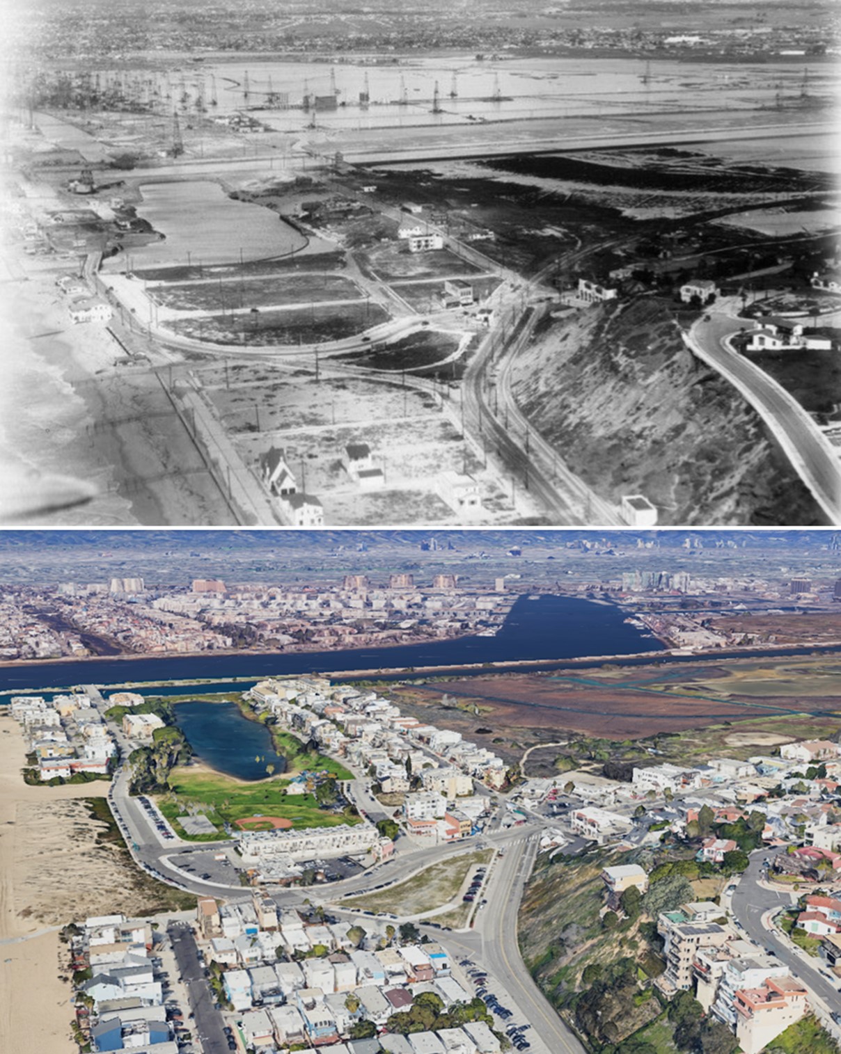 |
|
| (1930 vs 2024)* – Looking north from above Playa del Rey toward Del Rey Lagoon, the Ballona Creek channel, and Marina del Rey, illustrating how the area has evolved over nearly a century. Photo comparison by Jack Feldman. |
| Historical Notes
The modern view looks north from above Playa del Rey toward Marina del Rey and the Ballona Creek channel. In the early 1930s, this same area presented a very different scene, with rows of oil derricks stretching across the low coastal land just inland from the beach. What had once been marshes and open shoreline quickly became an active oil field, with wells, pipelines, and service roads dominating the landscape during the height of production. Today, that industrial setting has been completely replaced. Marina del Rey, completed in 1965, occupies much of the former wetlands and oil field, its harbor filled with thousands of boat slips and lined with residential and commercial development. Ballona Creek, now confined within a concrete flood control channel, continues to empty into Santa Monica Bay, offering one of the few remaining visual clues to the area’s original geography. |
* * * * * |
Venice and Del Rey Oil Field |
From 1930s Oil Boom to Marina Peninsula Beach Community |
The Venice and Del Rey Oil Field represents one of the most dramatic transformations in the history of Los Angeles. When oil was first struck in Venice in 1930, the news spread like wildfire. Almost overnight, a quiet beach community found itself at the center of a petroleum bonanza that would last for decades and leave a permanent mark on the landscape of the western Los Angeles coast.The oil field stretched along the shoreline south of Venice, reaching as far as Ballona Creek to the south and spreading eastward into the area that would later become Marina del Rey. Derricks rose from the sand, from residential streets, and even from the public beach and shallow ocean waters. The scene was unlike anything previously seen along the Southern California coast: a forest of wooden towers crowding out canals, homes, and ocean views from one end of the peninsula to the other.By 1931, the Venice and Del Rey Oil Field had become the fourth most productive oil field in the entire state of California. The wealth it generated attracted investors and workers from across the region, but it came at a steep price. Pollution fouled the beaches, the canals, and the air. The very community that had once prided itself on its canals and ocean breezes now lived in the shadow of industrial equipment and the constant smell of crude oil. It would take decades before the last well was finally capped and the area began its slow transformation into the marina and beach community it is today. |
The 1930s Oil Boom |
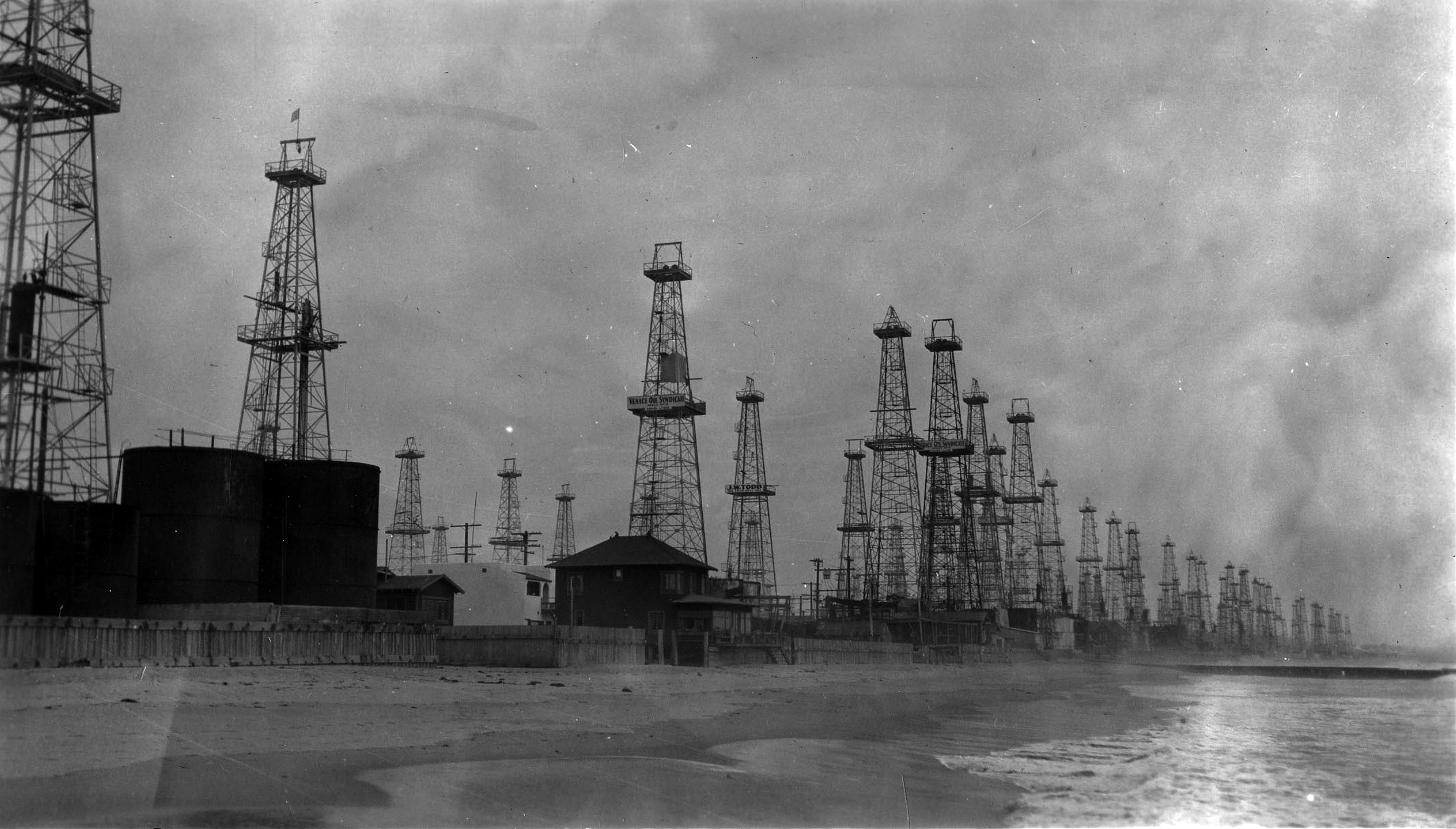 |
|
| (1930s)* – View showing numerous oil wells along the shoreline south of Venice that extended south to Ballona Creek and east towards what is now Marina del Rey. William M. McCarthy Photograph Collection. |
Historical Notes When oil was discovered on the Venice Peninsula in 1930, the rush to drill was immediate and intense. Within just one year, 148 oil wells were pumping more than 40,000 barrels of oil every single day. The sudden arrival of the oil industry transformed a sleepy beach town into a boomtown almost overnight. New jobs appeared, money flowed in, and investors from across Southern California scrambled to stake their claim on this stretch of coastline. The boom came with a heavy cost that was impossible to ignore. Oil spills fouled the beaches, derricks crowded out homes, and the air grew thick with fumes. Residents who had come to Venice for its canals and ocean breezes found themselves living next door to an industrial operation. The environmental damage spread through the surrounding neighborhood and onto the public beaches, changing the character of Venice in ways that would take a generation to undo. |
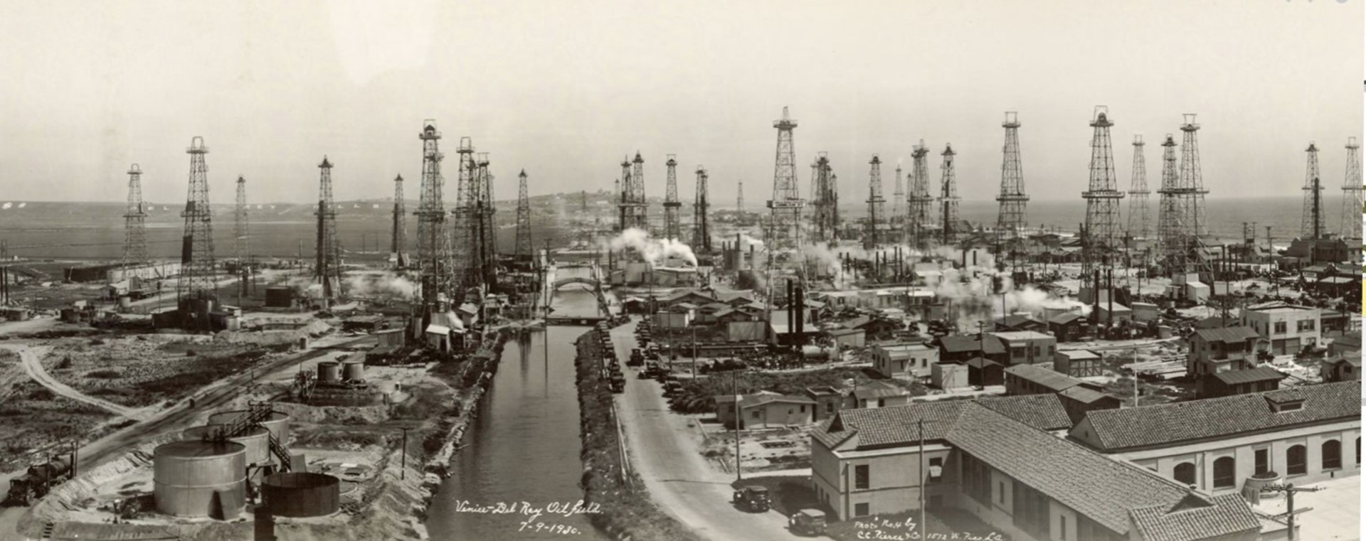 |
|
| (1930)* - View looking south from near Washington Street (now Washington Boulevard) of oil derricks of the Venice and Del Rey Oil Field. Canal, houses, storage tanks and streets with automobiles. "Del Rey Hills" is seen in large letters on hills in background. Photo from the Ernest Marquez Collection. |
Historical Notes This photograph captures the full spectacle of the Venice oil boom from a vantage point near what is today Washington Boulevard. Looking south, the viewer sees a landscape dominated by wooden derricks rising above canals, homes, and parked automobiles. In the background, the words "Del Rey Hills" stand out in large lettering on the hillside, a reminder that real estate developers were still promoting the area even as it filled with industrial equipment. Despite the pollution and disruption that came with oil production, Venice pressed forward with drilling because the financial rewards were simply too great to resist. The field had become a powerhouse of petroleum output, and few residents or investors were willing to walk away from those returns, no matter the environmental consequences. |
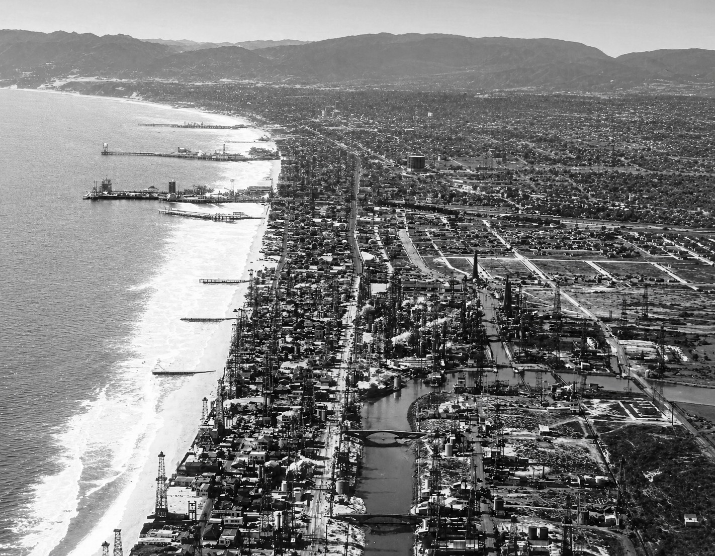 |
|
| (ca. 1930)* – Aerial view looking north along the coastline, showing the Venice and Del Rey Oil Fields located south of Venice, extending eastward into what is now Marina del Rey and southward to Ballona Creek. |
Historical Notes Seen from the air, the true scale of the Venice and Del Rey Oil Field becomes clear. The oil field stretched from its northern boundary near Washington Street (now Washington Boulevard) all the way south to Ballona Creek, and it pushed eastward into the low lying wetlands that would eventually become Marina del Rey. Derricks lined the beach at the western edge and even extended out over the water itself, standing on platforms erected directly on the public shoreline. The boundaries of the oil field were never fixed in place. As older wells ran dry, new ones were drilled to replace them, and the field slowly shifted and expanded over time. The aerial view also reveals how closely the oil operation was packed in among existing homes and streets, a reminder that residential life and industrial drilling coexisted in an uneasy relationship throughout the boom years of the 1930s. |
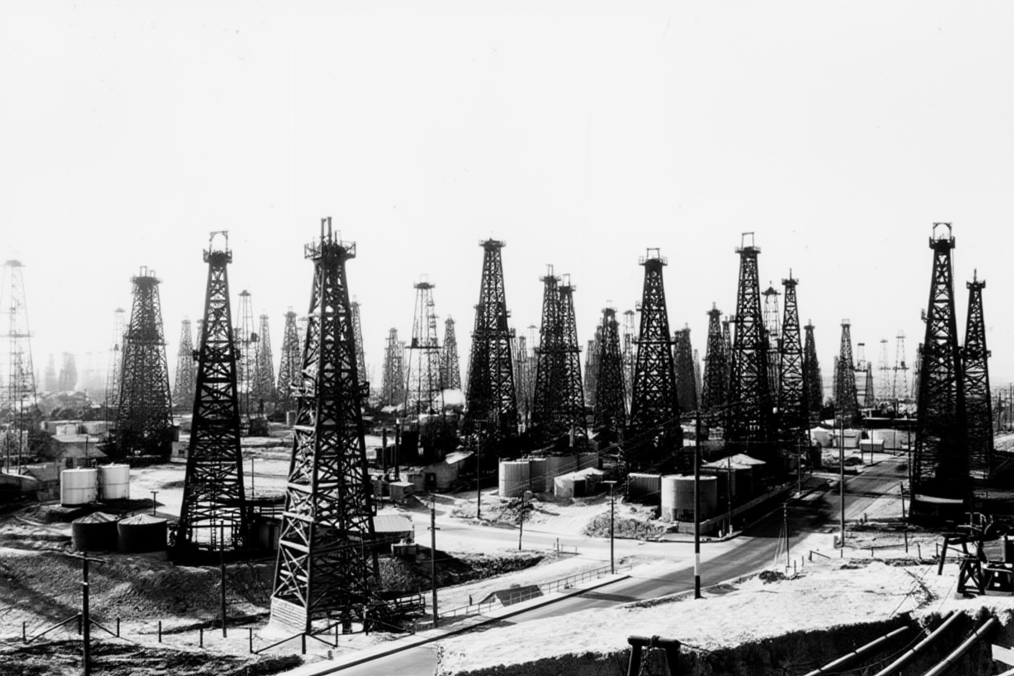 |
|
| (ca. 1930)^ - View of the Venice Oil Field, located south of Venice, and extending into what is now Marina del Rey. |
| Historical Notes
This ground level view gives a sense of the sheer density of the Venice Oil Field at its height. Derrick after derrick fills the frame, standing on what was then open coastal land that would later be developed into the neighborhoods and marina that exist today. The image captures a moment when oil production was the defining activity of this stretch of the Los Angeles coast, shaping its sights, sounds, and smells for miles in every direction. By the end of 1942, the Venice Oil Field had pumped more than 47 million barrels of crude oil in total. Production had fallen to roughly 688 barrels per day by then, yet the derricks and equipment remained fixtures of the landscape for years to come. |
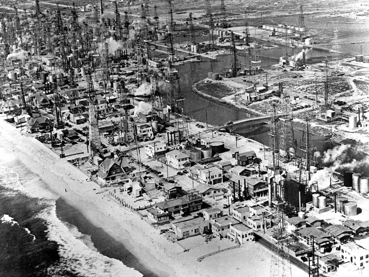 |
|
| (1930s)* – Aerial view of what is today the Marina Peninsula, showing oil derricks interspersed among homes adjacent to a canal. The upper right shows the area where Marina del Rey is situated today. |
Historical Notes This aerial photograph of what is now the Marina Peninsula captures the oil field at its most intrusive. Derricks rise among homes and crowd the edges of the canal that still separates the peninsula from the mainland today. The upper right of the image shows the open lowland that would eventually be dredged and shaped into Marina del Rey, one of the largest small craft harbors on the West Coast. Nothing about this industrial landscape hints at the quiet beach community it would become. The contrast between this image and the marina and homes that occupy the same ground today is almost impossible to process at first glance. The transformation was not quick or simple — it took the slow exhaustion of the oil field, decades of rising property values, and a major public works project to dredge Marina del Rey in the early 1960s before the peninsula finally became the residential and recreational destination it is today. |
Life Among the Derricks
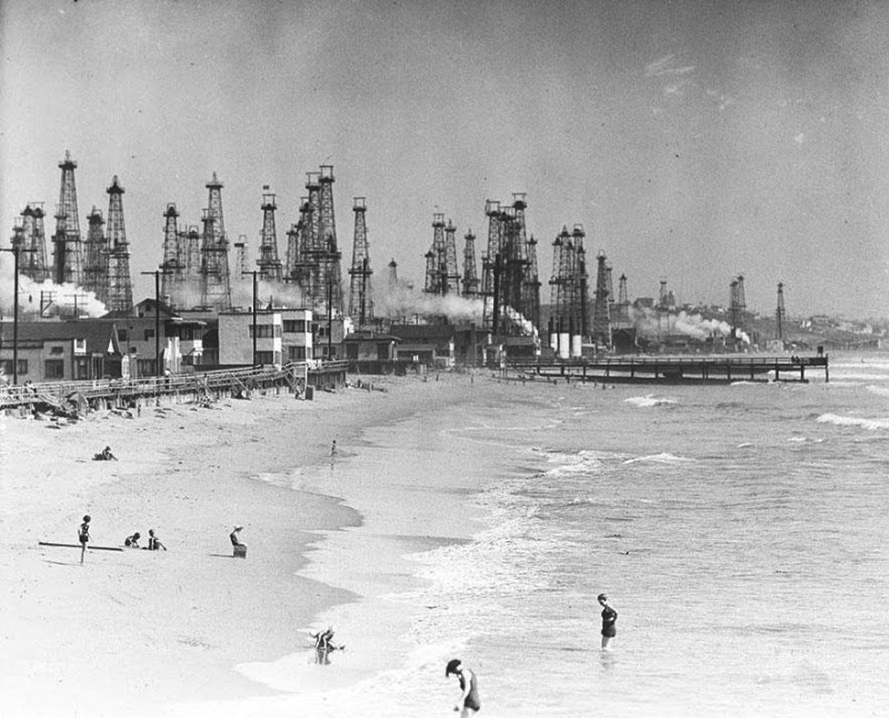 |
|
| (ca. 1930s)* - People frolic along the Playa del Rey beach in the Venice Peninsula. The skyline is dominated by oil derricks. |
Historical Notes Even at the height of the oil boom, Angelenos continued to flock to the beaches of the Venice Peninsula. This photograph captures a scene that seems almost contradictory today: families and beachgoers enjoying the sand and surf while a forest of oil derricks looms against the sky directly behind them. It is a vivid illustration of how completely the oil industry had taken over the landscape while daily life somehow continued around it. The resilience of the beach culture in Venice during these years is remarkable. Despite the noise, the smell, and the environmental damage caused by the oil field, residents and visitors refused to abandon the shoreline entirely. Venice had always drawn people with the promise of sun and ocean, and even hundreds of active wells could not completely extinguish that appeal. |
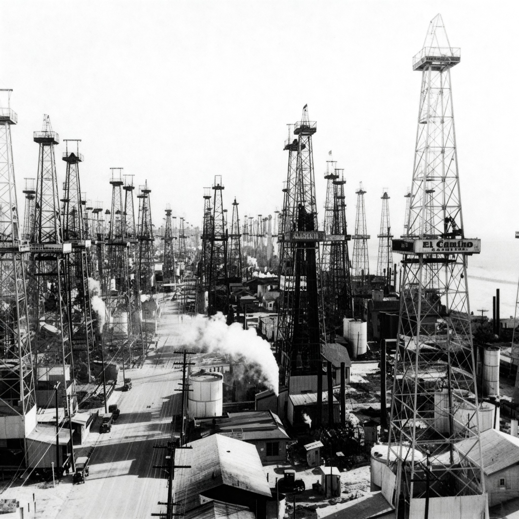 |
|
| (1930)* - Oil wells line both sides of the street south of Venice, in what is modern day Marina del Rey, sometimes called Playa del Rey. |
| Historical Notes
This street level photograph puts the oil boom into immediate human perspective. Wells crowd both sides of the road in an area that is now part of the Marina del Rey community, with derricks standing so close together that the street itself almost disappears between them. What had been residential avenues and beach access roads became industrial corridors almost overnight after oil was discovered in 1930. The area shown in this image was sometimes referred to interchangeably as Playa del Rey and Marina del Rey in its early years, reflecting the loose and overlapping place names of the era. Today Marina del Rey is a well defined harbor community, but in 1930 it was simply coastal lowland on the edge of Venice, suddenly transformed into one of the most active oil fields in the state of California. |
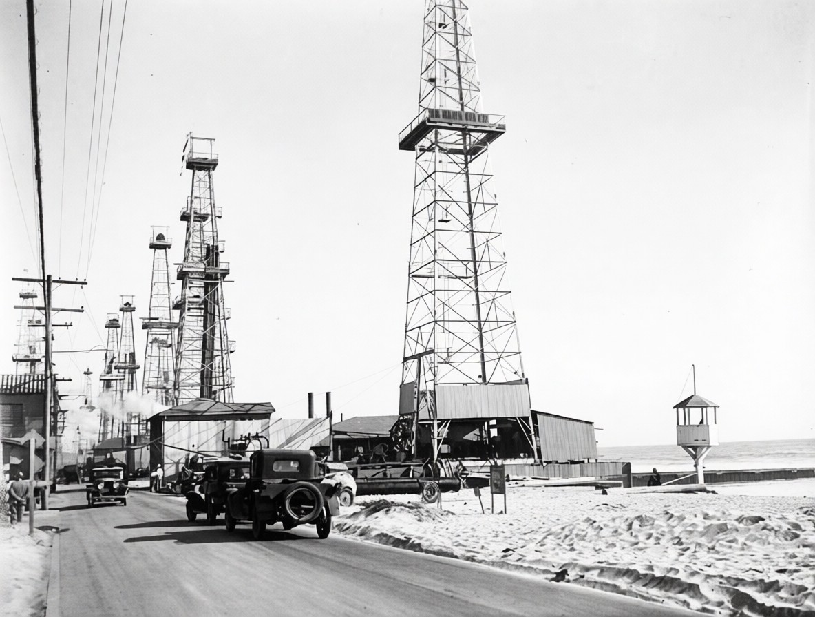 |
|
| (ca. 1930)* – View showing oil derricks located south of Venice and extending down to Ballona Creek and easterly to what is now Marina del Rey. Note the lifeguard kiosk at right. |
Historical Notes The presence of a lifeguard kiosk in this photograph is a striking detail. Even as oil derricks spread across the beach and into the water, Los Angeles County maintained beach safety operations along this stretch of shoreline. It is a reminder that the public beach never officially closed during the oil boom years, and that swimmers and sunbathers shared the coast with an industrial oil field at the very same time. By the late 1950s, the oil field had been dramatically reduced in scale. Only 64 derricks were still standing on the Venice Peninsula by 1959, and the last one was removed in 1962. Even then, the oil story was not fully over. Slant drilling continued from the beach into the 1990s, with operators angling wells underground to reach remaining deposits. The last of these wells, located near the Venice Pavilion, were finally capped in 1991. |
Decline and Cleanup
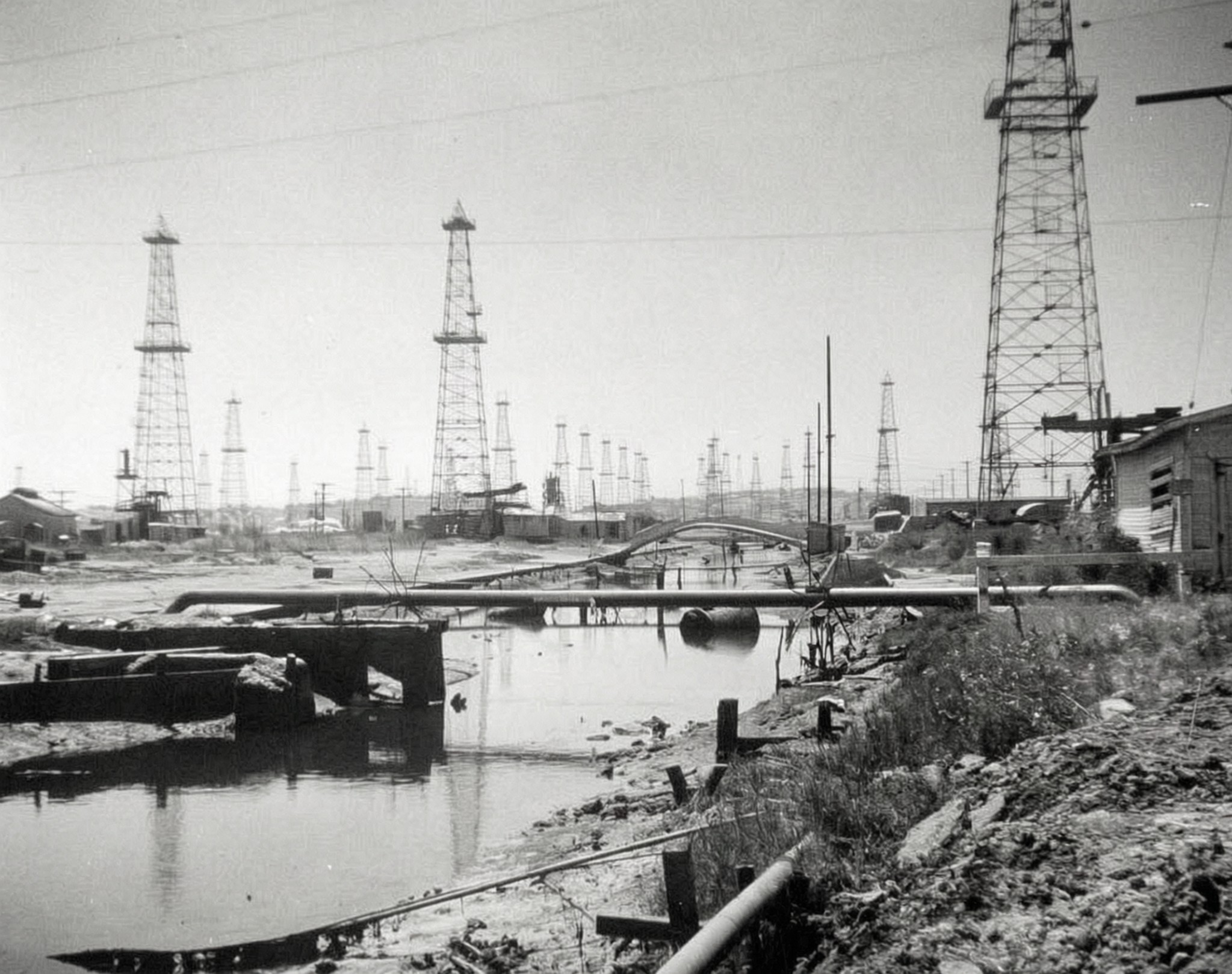 |
|
| (ca. 1950s)* - A view of Grand Canal in Venice with its tubes and pipes, surrounded by oil derricks. A foot bridge, in poor condition, appears in the distance. |
Historical Notes The famous canals of Venice, California were built in 1905 as a romantic tribute to the canals of Venice, Italy. By the time this photograph was taken in the 1950s, those same waterways had become tangled with the pipes, tubes, and equipment of the oil industry. The footbridge visible in the distance is in poor repair, reflecting the general neglect that had settled over the canal district as oil production dominated the area and the original vision of a resort community faded. As production declined through the 1940s and 1950s, the unsightly equipment that had once been seen as the source of great wealth began to look more and more like an obstacle to the community's future. Pressure grew to remove the derricks and restore the character of the neighborhood. |
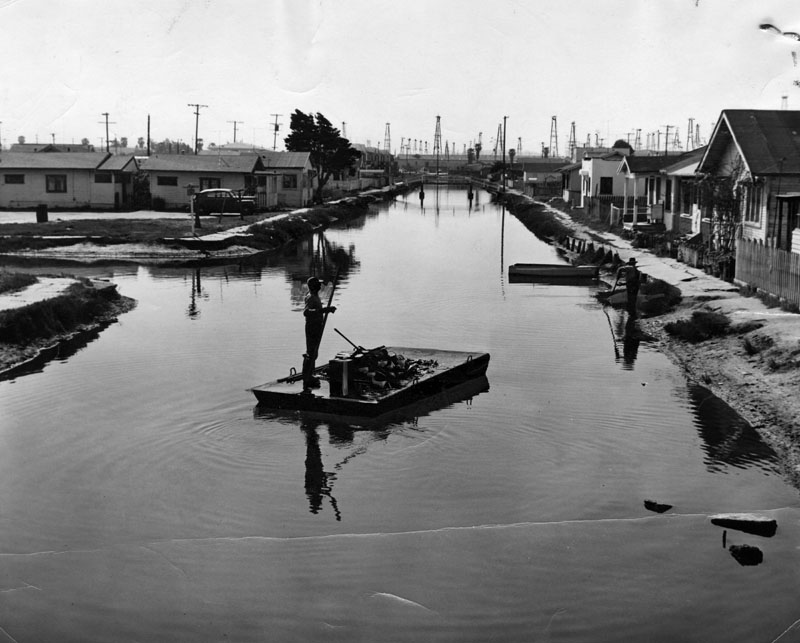 |
|
| (1953)* - View of debris in a canal and oil derricks in the background, on the Venice Peninsula. |
Historical Notes By 1953, the Venice oil field was clearly past its prime. This photograph shows a canal clogged with debris and flanked by aging derricks, a far cry from the glamorous beach resort that Venice had once aspired to be. The oil industry had extracted enormous wealth from this corner of Los Angeles, but it had left the landscape in a degraded condition that would take years of effort and investment to reverse. The gradual removal of the derricks gained momentum as property values in the area began to climb in the late 1950s and 1960s. By 1959, only 64 derricks remained on the Venice Peninsula. The last one came down in 1962. The remaining oil wells, mostly owned by the Graner Oil Company of Signal Hill, continued to pump small quantities of oil using equipment resembling grasshoppers, drawing a few dozen barrels each week. As land values rose through the 1970s, the remaining oil properties were sold or developed and the last of the wells were finally capped. |
|
|
| (1950s)* – View looking toward the Venice-Del Rey Oil Field from Playa del Rey. Signs for Shehady's Market and Yacht Harbor Realty are visible on the building to the left. The intersection of Vista del Mar and Culver Boulevard is at the lower right, with Vista del Mar Boulevard extending away from the camera. The large body of water in the center is the Del Rey Lagoon. |
| Historical Notes
This photograph from the 1950s shows the Venice and Del Rey Oil Field from the Playa del Rey vantage point, with Del Rey Lagoon visible in the foreground. Two business signs on the building at the left tell an interesting story about the era: Shehady's Market served the everyday needs of local residents, while Yacht Harbor Realty was already advertising the promise of a future marina community. Together they capture a moment when the old oil era and the coming marina era existed side by side. The intersection of Vista del Mar and Culver Boulevard anchors the lower right of the image, with Vista del Mar Boulevard stretching away into the distance. Del Rey Lagoon, the large body of water in the center of the photograph, is a natural coastal wetland that remains a feature of the Playa del Rey neighborhood today. By the time this image was taken, the oil field had been in decline for more than a decade, and the transformation of the surrounding area into a modern beach and marina community was already well underway. |
Today
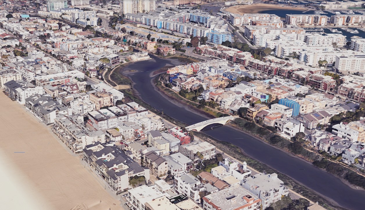 |
|
| (2024)* - Google Earth view of the Marina Peninsula and the Ballona Lagoon Bridge(Lighthouse Street Bridge) spanning the channel at Ballona Lagoon, which separates Marina del Rey from the ocean. Marina Peninsula Beach, known locally as Charlie Beach, appears in the lower left. |
Historical Notes Today the Marina Peninsula is a quiet residential strip of land tucked between the Pacific Ocean and the harbor of Marina del Rey. Although it is technically part of the City of Los Angeles, it is often thought of as an extension of Marina del Rey itself. This one mile stretch lies just south of Venice Beach and the Venice Fishing Pier. It offers a calmer, less crowded alternative to the more active beachfront to the north. Homes line Ocean Front Walk, and a local beach known as Charlie Beach provides a relaxed place to enjoy the water. A paved walkway with railings runs to the north jetty at the tip of the peninsula, offering views of both Marina del Rey Harbor and the Venice Pier. The Ballona Lagoon Bridge, visible in the image, spans the channel separating Marina del Rey from the ocean side of the peninsula. Nothing in this peaceful setting suggests that the ground beneath it once supported hundreds of oil derricks producing tens of thousands of barrels of crude oil each day. |
Then and Now
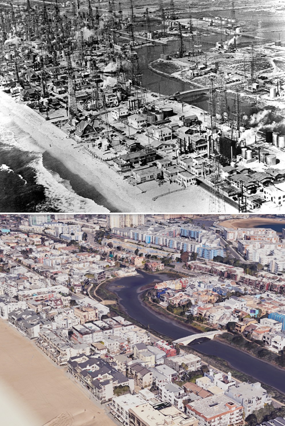 |
|
| (1930s vs 2024)* – Aerial view looking north over what is now the Marina Peninsula. The 1930s image shows oil derricks scattered among homes along the Ballona Lagoon. The Lighthouse Street Bridge, commonly known as the Ballona Lagoon Bridge, spans the lagoon in the lower right. Marina Peninsula Beach, known locally as Charlie Beach, appears in the lower left. Photo comparison by Jack Feldman. |
| Historical Notes
Few then and now comparisons in the history of Los Angeles are as dramatic as this one. The 1930s image shows the Marina Peninsula bristling with oil derricks, crowded between the Ballona Lagoon and the Pacific Ocean. The same geography in 2024 is still recognizable, but completely transformed into a residential neighborhood with beach access, a bridge crossing the lagoon, and no trace of the industrial operation that once dominated the landscape. This comparison captures the legacy of the Venice and Del Rey Oil Field in a single glance. More than 47 million barrels of crude oil were extracted from this ground, reshaping the coastline of western Los Angeles in the process. What stands here today—the beaches, the harbor, and the quiet streets of the Marina Peninsula—occupies the same ground where those derricks once stood. |
* * * * * |
First National Pictures (later Warner Bros.) |
When a group of independent theater owners joined forces in 1917 to challenge the dominance of Paramount Pictures, they set in motion a chain of events that would reshape the motion picture industry. Known as the First National Exhibitors Circuit, the organization was formed in direct response to block booking, a system that forced theaters to accept entire bundles of films in order to secure a few desirable titles. Led by Los Angeles theater pioneer Thomas Lincoln Tally and his partner J. D. Williams, 26 major first run theater chains combined their strength, creating a powerful nationwide network of more than 600 cinemas.First National moved quickly to secure its independence. Rather than relying on existing studios, it went directly to the industry’s biggest stars. Between 1917 and 1918, it signed Charlie Chaplin and Mary Pickford to the first million dollar contracts in film history. Within a few years, the company had transformed itself from a theater circuit into a full production studio. In 1926, it completed a state of the art facility on 62 acres of former farmland in Burbank, built in just 72 days and equipped with modern sound stages, a backlot, and employee amenities that reflected the growing scale of the industry.That independence would be short lived. The success of The Jazz Singer gave Warner Bros. both the financial strength and the technological edge to acquire First National in September 1928. The merger combined a powerful theater network with groundbreaking sound technology, accelerating the shift to talking pictures. For nearly a decade, the two companies maintained separate identities, with First National continuing to release films under its own name until its formal dissolution in 1936. The Burbank studio, however, remained and grew into Warner Bros. Studios, one of the most important production centers in Hollywood history.What began as a challenge to Hollywood’s most powerful studio quickly became part of that very system. The story of First National Pictures reflects an industry in transition, where theater owners, film stars, and studio executives competed for control during a period of rapid change. The images that follow trace that evolution, from the newly completed Burbank studio in 1926 to the enduring presence of Gate 2 on Olive Avenue. |
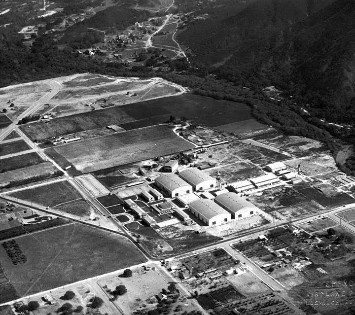 |
|
| (1926)* - Aerial view of the newly completed First National Pictures studio lot in Burbank, just one year after construction crews finished the 62-acre facility in a remarkable 72 days. Warner Bros. would purchase a majority interest in First National two years later, using profits from their landmark sound film The Jazz Singer. |
Historical Notes First National was born out of frustration. Independent theater owners across the country were tired of being forced to rent entire slates of mediocre films just to get the popular titles they wanted, a practice known as block booking. Thomas Lincoln Tally had been a force in Los Angeles entertainment since 1902, when he opened one of the city's first dedicated movie houses. The circuit he cofounded in 1917 united 26 of the country's largest first-run chains under one roof. First National wasted no time going after the biggest names in the business. Its million-dollar contracts with Charlie Chaplin and Mary Pickford, the first of their kind in the industry, proved that independent exhibitors could compete with the major studios on any terms they chose. By 1926, the organization had grown into a full production company with its own studio in Burbank, built on land that had once been part of the holdings of the famous horticulturist Luther Burbank. |
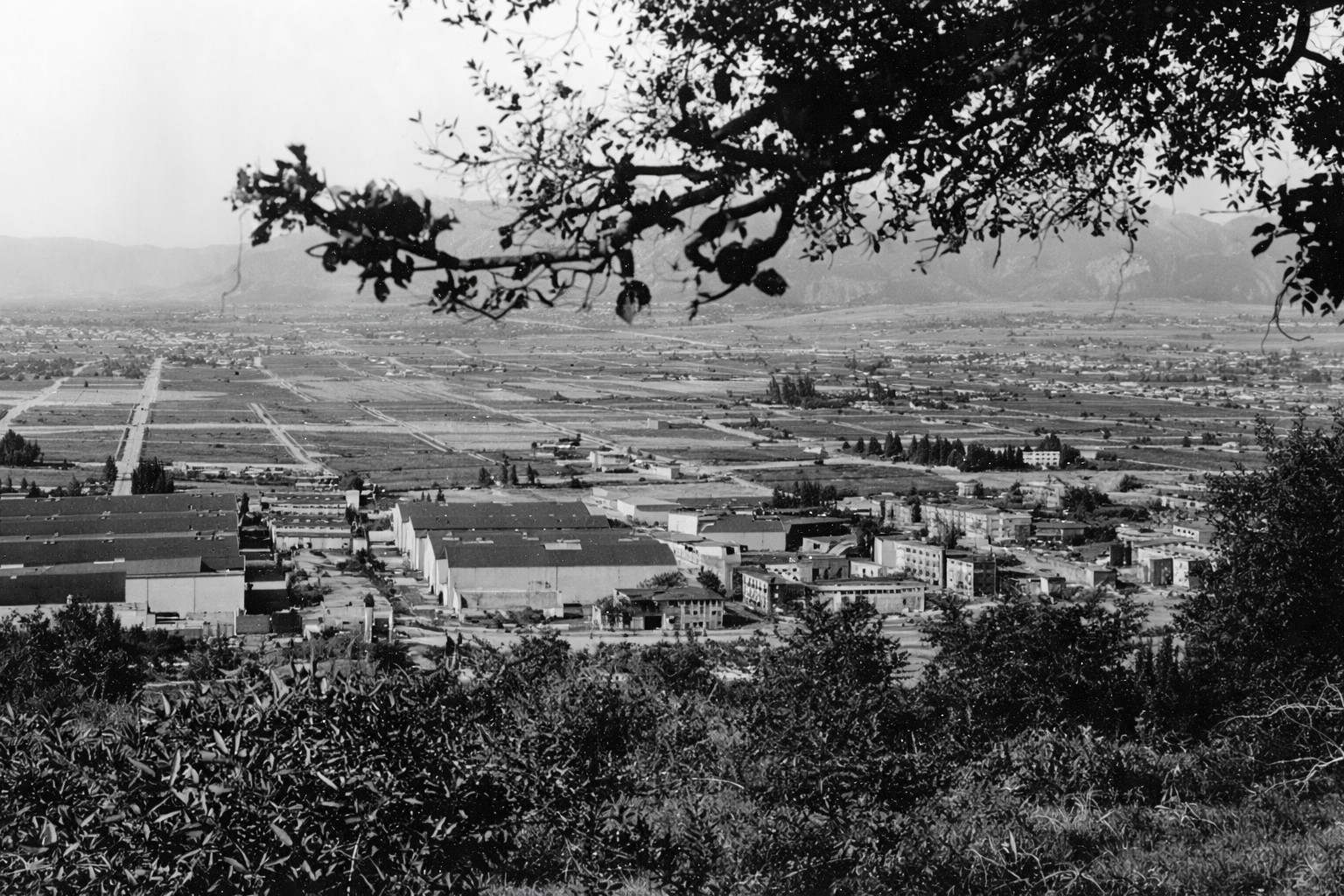 |
|
| (ca. 1928)* - Panoramic view of the First National Pictures studio and the surrounding Burbank area as seen from Griffith Park, taken around the time Warner Bros. completed its purchase of the company. The Los Angeles River is visible in the foreground, with the open landscape of the San Fernando Valley stretching into the distance. |
Historical Notes This panoramic view from the hills of Griffith Park captures how open and undeveloped the Burbank area still was in the late 1920s. The studio lot, visible in the middle distance, had been completed only a year or two before this photograph was taken. The Los Angeles River, visible in the foreground, ran largely uncontrolled at this time and was prone to serious flooding in wet years. It would not be lined with concrete until the late 1930s, after a series of devastating storms. The view also captures the beginning of a significant shift in the film industry, as Warner Bros. was in the process of absorbing First National and would soon make the Burbank lot the center of its operations. |
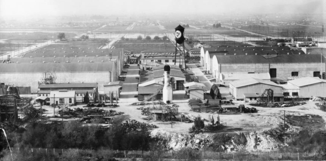 |
|
| (ca. 1928)* - A closer aerial view of the First National Pictures studio lot in the year Warner Bros. purchased a majority interest in the company. The studio's four original sound stages are visible along with the backlot behind them. Though Warner Bros. now held controlling ownership, First National continued to release films under its own name. |
Historical Notes Warner Bros. acquired a majority interest in First National in September 1928, one year after The Jazz Singer had generated a flood of new revenue. The purchase gave Warner Bros. something it needed badly: access to First National's nationwide chain of first-run theaters. In return, First National gained access to Warner's Vitaphone sound recording system. Despite the takeover, the two companies continued to operate as separate entities for years. Films produced at the Burbank lot were released under the First National banner well into the 1930s, with the studio specializing in modern comedies, crime dramas, and contemporary stories while Warner Bros. concentrated on musicals and prestige productions. Short subjects were handled by a third affiliated label, the Vitaphone Corporation. |
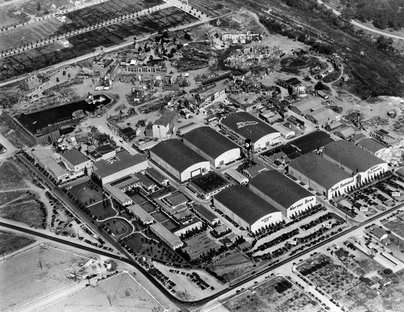 |
|
| (ca. 1929)* - Aerial view of the Burbank studio lot shortly after Warner Bros. purchased First National in 1928. The Warner Bros. name is already visible on the north stage, even as the lot was still commonly referred to as the First National studio. Stage 7 had not yet been constructed, and the backlot stretches out behind the main stages. |
Historical Notes On November 4, 1929, Fox Pictures sold its remaining interest in First National to Warner Bros. for ten million dollars, completing the transfer of control. The Burbank lot officially became the home of Warner Bros. and First National Pictures, with films carrying the combined banner 'A Warner Bros. First National Picture' for several years. Forty-five of the 86 Warner Bros. features released in 1929 alone were branded as First National pictures. |
 |
|
| (1928)* - Street view from Toluca Lake Avenue showing the First National Pictures studio on August 11, 1928, just weeks before Warner Bros. completed its purchase of the company. Warner Bros. would soon relocate its corporate offices from its Sunset Boulevard studio in Hollywood to this Burbank lot, which was larger and better suited to the demands of the sound era. |
| Historical Notes
August 1928 was the last full month First National operated as an independent company. Warner Bros. completed its majority purchase the following month. The Sunset Boulevard studio remained in active use through most of the 1930s, both for film production and phonograph recordings. A major fire in December 1934 destroyed 15 acres of the Burbank lot, which paradoxically accelerated the move away from Sunset Boulevard. By 1937, Burbank had become Warner Bros.' undisputed headquarters, a status it has held ever since. |
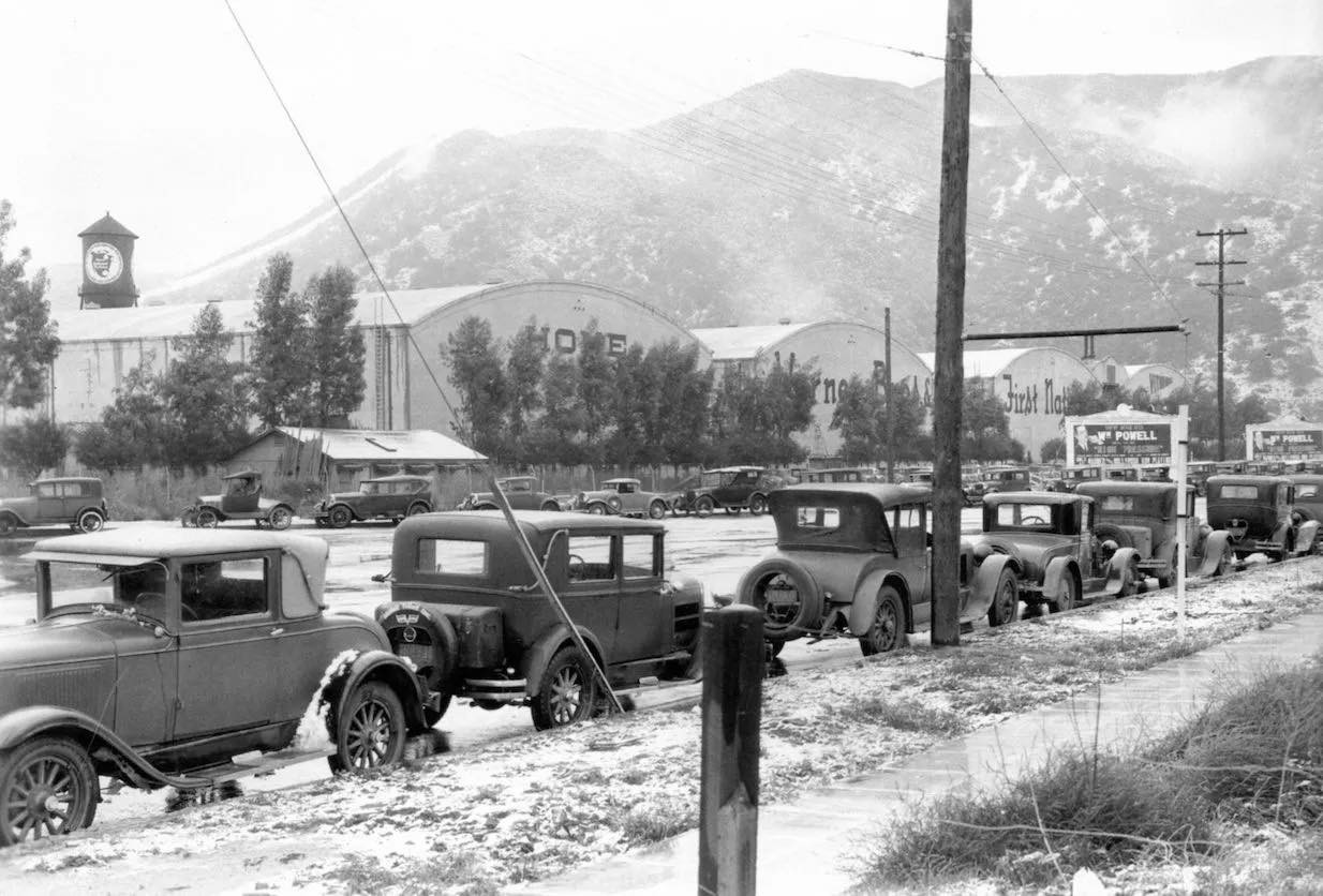 |
|
| (1932)* - Snow blankets Olive Avenue in front of the Warner Bros. studio on January 15, 1932, the morning after two inches fell on Burbank overnight. Though Warner Bros. had owned the studio since 1928, the signage on the water tower still read 'First National Pictures,' a reminder of the company's continuing separate identity under the Warner umbrella. |
| Historical Notes
Snow is a rare sight in the San Fernando Valley, and the two inches that fell on Burbank the night of January 14, 1932 must have caught everyone at the studio by surprise. At this point in time there was little advance weather forecasting, so the snow arrived with little warning. January 1932 placed the studio squarely in the depths of the Great Depression, a period that hit theater attendance hard across the country. The studio responded by producing films rapidly to keep cash flowing, while also developing the hard-edged social dramas and gangster pictures that became its signature. A close look at photographs from this era reveals that the water tower still carried the First National Pictures logo, even though Warner Bros. had been in operational control for several years. |
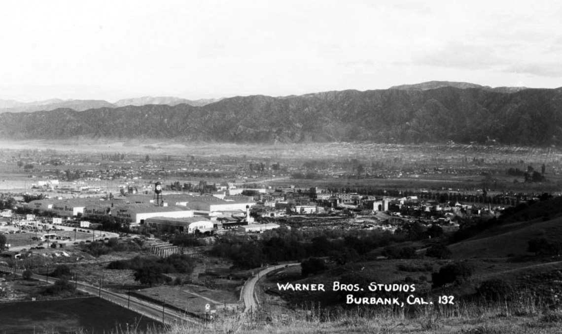 |
|
| (ca. 1934)* – Postcard view of the Warner Bros. Studios in Burbank, with a new bridge visible under construction at lower left. The bridge is believed to have been completed by 1935. Studios of this era regularly issued promotional postcards to impress exhibitors and attract talent. |
| Historical Notes
By 1934, Warner Bros. had been running the Burbank lot for six years and the studio was at the height of its early creative power. This was the era of Bette Davis, James Cagney, Edward G. Robinson, and Paul Muni, actors whose performances in films like I Am a Fugitive from a Chain Gang and Gold Diggers of 1933 gave Warner Bros. a distinctly urban, socially aware identity. A devastating fire in December 1934 would destroy 15 acres of the facility and spark a new round of construction. The expansion that followed transformed the lot from a converted First National studio into a purpose-built Warner Bros. operation. |
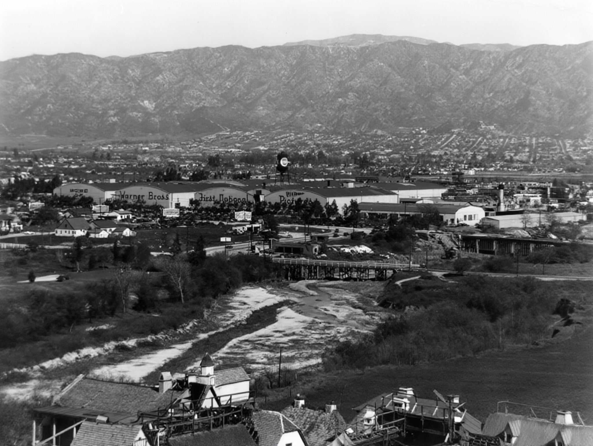 |
|
| (ca. 1935)* - Aerial view of the Warner Bros. Studios in Burbank, with the words 'Home of Warner Bros. First National Pictures' painted on the sound stage facades. The Los Angeles River runs dry in the foreground, its banks not yet lined with concrete. The bridges visible here had been completed in the years since the studio opened. |
| Historical Notes
The inscription 'Home of Warner Bros. First National Pictures' on the sound stage facades reflects the complex corporate arrangement that persisted through much of the 1930s. Even after Warner Bros. had absorbed First National operationally, the First National name remained a valuable brand. Half of the 60 features Warner Bros. announced for 1933 to 1934 were released under the First National label. The Los Angeles River visible in the foreground was still a natural, largely uncontrolled waterway at this date. Following devastating floods later in the decade, the Army Corps of Engineers would begin lining it with concrete, creating the channelized river that runs through the valley today. |
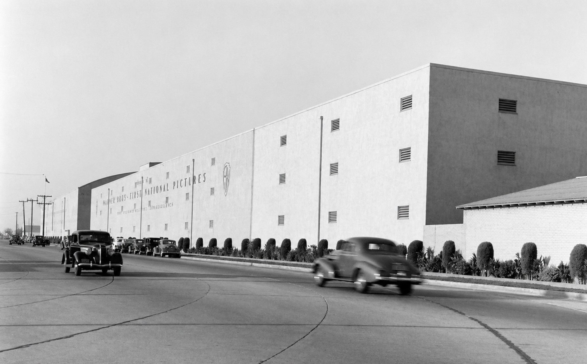 |
|
| (1936)* - The Warner Brothers First National Pictures Studios on Olive Avenue in Burbank, photographed in the final year the First National name appeared on studio releases. By the end of 1936, the First National Pictures corporation would be formally dissolved and the Burbank lot would operate solely as Warner Bros. Studios. |
| Historical Notes
In July 1936, stockholders of First National Pictures, Inc., by this point primarily Warner Bros., voted to formally dissolve the corporation. A new tax law that allowed tax-free consolidations between corporations made the move financially attractive. After nearly 20 years as an independent force in the film industry, the First National name disappeared from theater screens. The Burbank lot continued to grow after the dissolution. Stage 22, built in 1937, was the last new stage constructed on the main lot for 60 years. That same year, Warner Bros. all but closed its original Sunset Boulevard studio, making Burbank its permanent home. The challenge to Paramount that Thomas Tally had launched two decades earlier had become something he could not have imagined: one of the most powerful studios in Hollywood. |
Then and Now
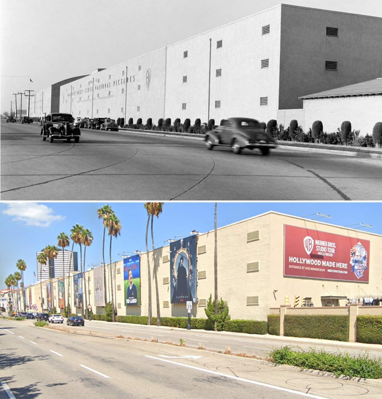 |
|
| (1936 vs. 2022)* — Then-and-now view of the Warner Bros. First National Pictures studio on Olive Avenue in Burbank. The dual name painted on the facade in the earlier photograph reflects the shared identity the studio maintained for nearly a decade after Warner Bros. acquired First National in 1928. By the time this photograph was taken, that name had only months left. Today the same wall carries a different message entirely: "Hollywood Made Here." Photo comparison by Jack Feldman. |
| Historical Notes
The building that appears in both photographs is essentially the same structure, separated by more than 85 years. In 1936, the words "Warner Bros. First National Pictures" on the facade represented the final chapter of a corporate arrangement that had kept two studio identities alive under one roof. That arrangement ended quietly the same year, when stockholders voted to dissolve the First National corporation and consolidate everything under the Warner Bros. name. The contemporary photograph tells the rest of the story without needing a word of explanation. Where the 1936 image shows a clean, spare facade with a single nameplate, the 2022 view is covered in the posters and promotions of a studio that has been making movies and television continuously for nearly a century. The billboard that now dominates the corner — "Hollywood Made Here" — is both a marketing slogan and an accurate statement of historical fact. |
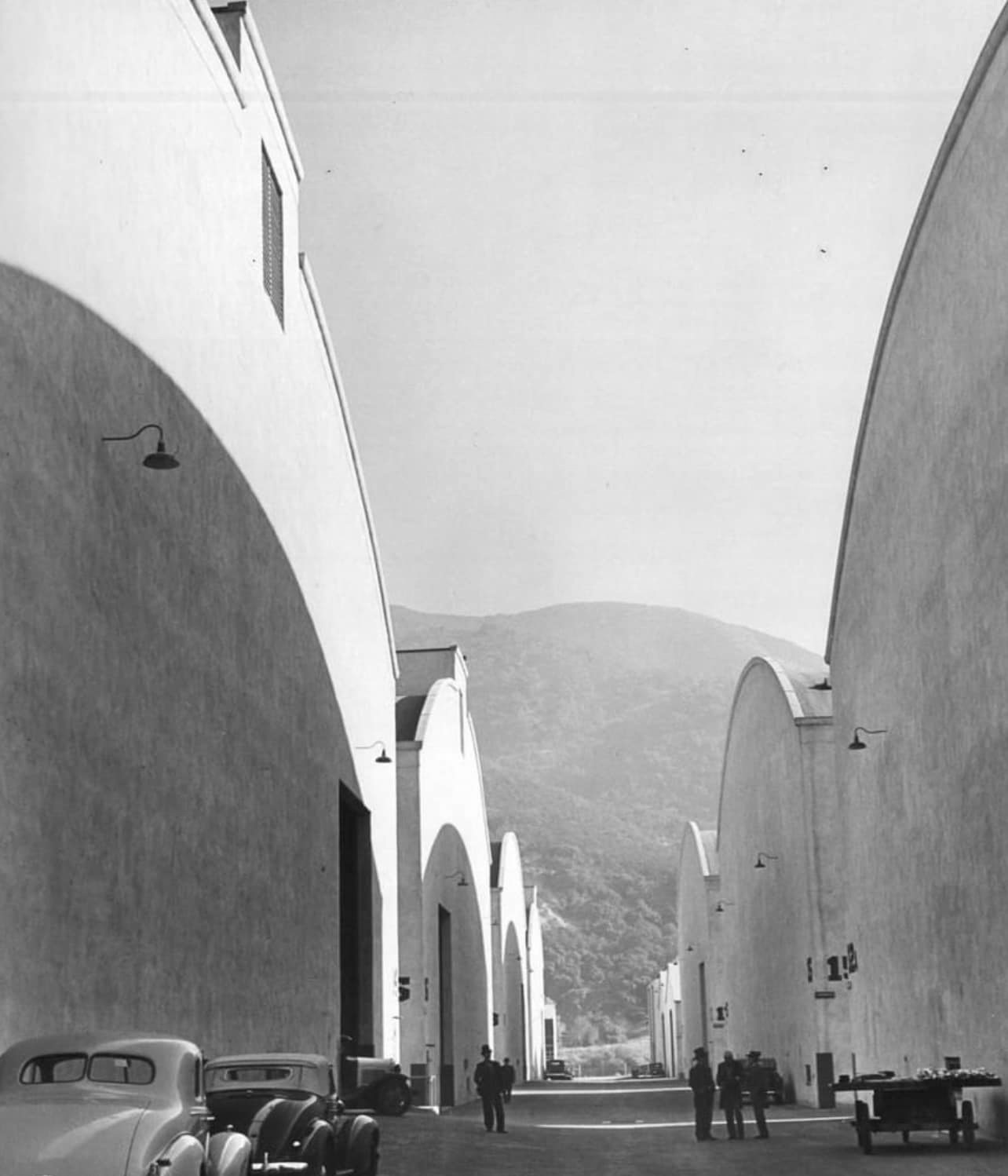 |
|
| (1937)* - The Warner Bros. Studios complex photographed by Margaret Bourke-White for LIFE magazine. Bourke-White was one of the four original staff photographers when LIFE launched in November 1936 and was among the most celebrated photographers of her generation, known for bringing an artist's eye to industrial and commercial subjects. |
| Historical Notes
Margaret Bourke-White was one of the founding photographers of LIFE magazine, which launched in November 1936. Her photograph of the construction of Montana's Fort Peck Dam appeared on the cover of that first issue. She was known for finding drama and beauty in industrial subjects, a quality that made her an ideal photographer for a studio lot assignment. By 1937 she was also documenting Depression-era poverty in the American South and covering international events for LIFE. A photograph of the Warner Bros. studio by Bourke-White is a small but meaningful intersection of two of the most influential American cultural institutions of the twentieth century: Hollywood and the golden age of photojournalism. |
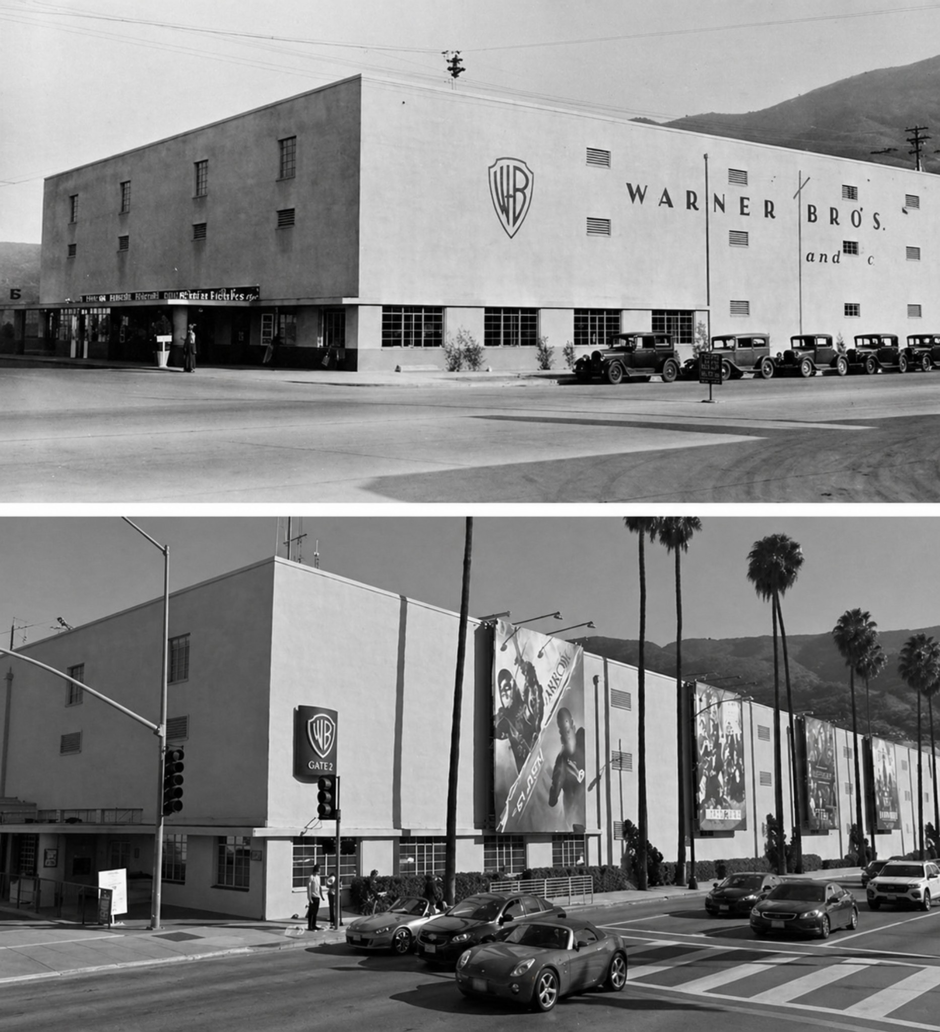 |
|
| (1930s vs 2018)* - Then-and-now comparison of Warner Bros. Gate 2 on Olive Avenue. The gate's classical architecture has changed remarkably little in nearly 90 years, making it one of the most visually consistent landmarks on a studio lot that has otherwise been continuously rebuilt and expanded. Photo comparison by Jack Feldman. |
| Historical Notes
Gate 2 on Olive Avenue has served as one of the main entrances to the Warner Bros. studio lot since the early years of the Burbank operation. Its enduring appearance, with ornate pillars and a guard booth that has barely changed in decades, has made it a destination for studio tour visitors and film history enthusiasts from around the world. The Warner Bros. Studio Tour Hollywood has offered public access to the lot in some form since 1973. It was renamed to align with the successful Warner Bros. Studio Tour London in Leavesden, having previously operated as the Warner Bros. Studios VIP Tour. Gate 2 is located at 4300 West Olive Avenue in Burbank. |
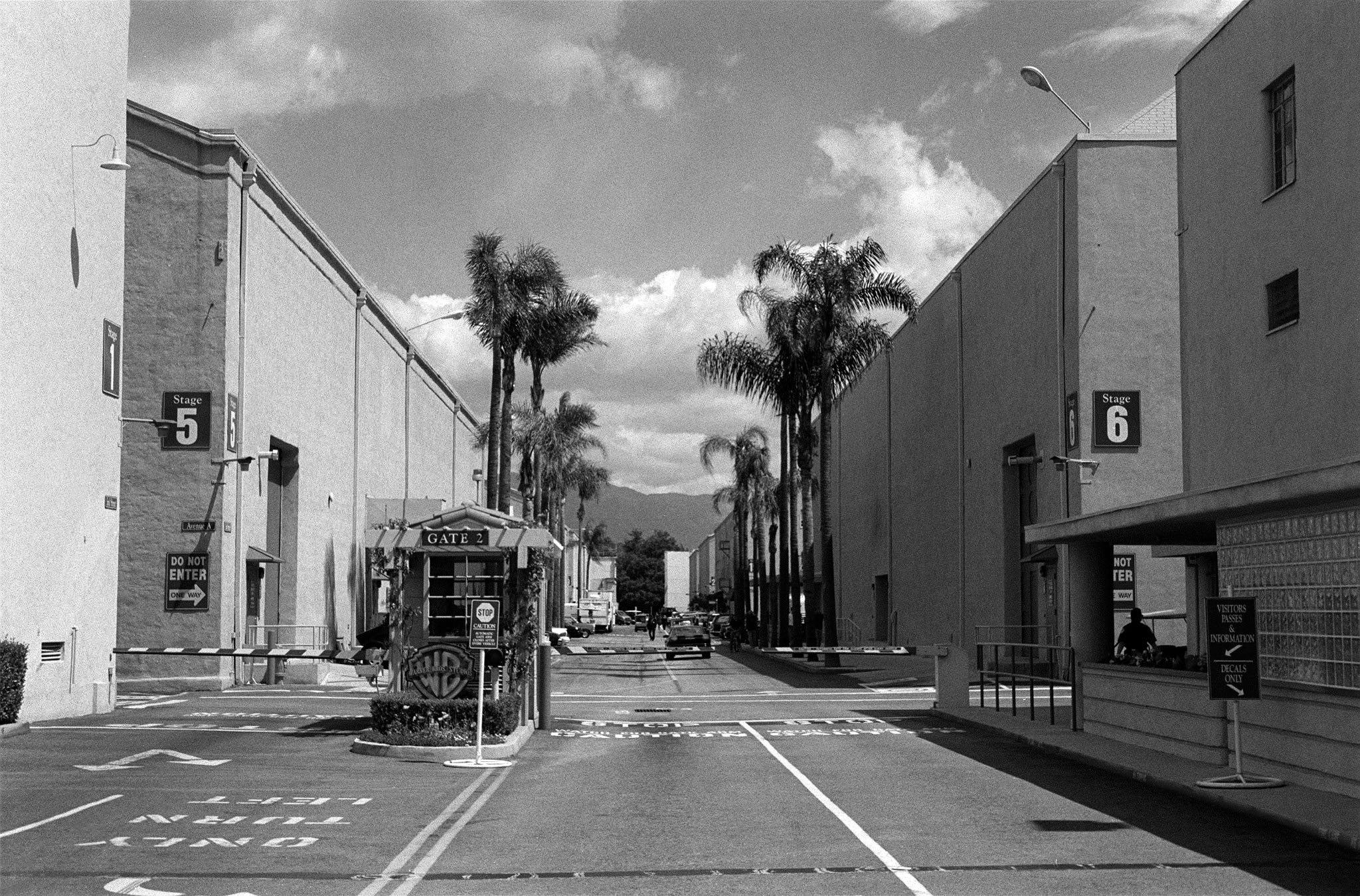 |
|
| (2012)* – Close-up view of Gate 2 at the Warner Bros. Studio Lot in Burbank. This entrance on Olive Avenue has welcomed filmmakers, stars, and visitors since the studio moved to Burbank in the late 1920s and serves today as the starting point for the Warner Bros. Studio Tour Hollywood. |
Historical Notes The Warner Bros. Studio Tour Hollywood offers visitors a behind the scenes look at one of the oldest working film studios in the world. The tour has grown considerably over the decades, incorporating working sets, interactive exhibits, and themed experiences tied to the studio's most recognizable franchises, including Harry Potter, the DC Universe, and the classic films of Hollywood's golden age. The Burbank facility today covers 110 acres, with 30 sound stages and a 20-acre backlot that can represent locations from a New York city block to a jungle. It stands on the same ground where First National Pictures built its lot in 1926, on farmland that was once open valley as far as the eye could see. |
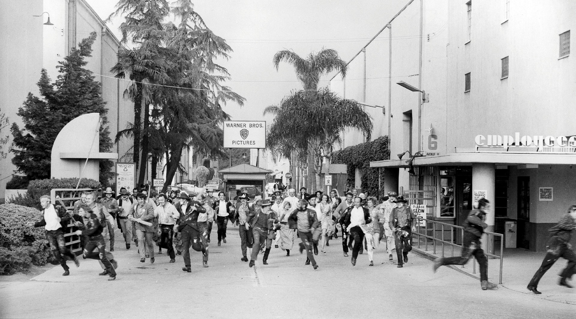 |
|
| (1974)* - A scene from Mel Brooks' Blazing Saddles filmed at Gate 2 of the Warner Bros. studio on Olive Avenue. In the film's celebrated finale, the action spills off the Western backlot set, bursts through the studio commissary, and pours out through this gate onto the streets of Burbank, as villain Hedley Lamarr hails a taxi and demands, 'Drive me off this picture!' |
| Historical Notes
Mel Brooks' Blazing Saddles was released by Warner Bros. on February 7, 1974, with its world premiere at the Pickwick Drive-In Theater in Burbank. Made for 2.6 million dollars, it grossed more than 119 million dollars at the box office and became one of the biggest comedy hits of its era. The American Film Institute ranked it number six on its list of the 100 funniest American films, and the Library of Congress selected it for preservation in the National Film Registry in 2006, citing it as a culturally and historically significant work. The deliberate use of the actual studio lot and Gate 2 as a filming location was central to the film's satirical design, collapsing the boundary between the story and the place where it was being made. |
Then and Now
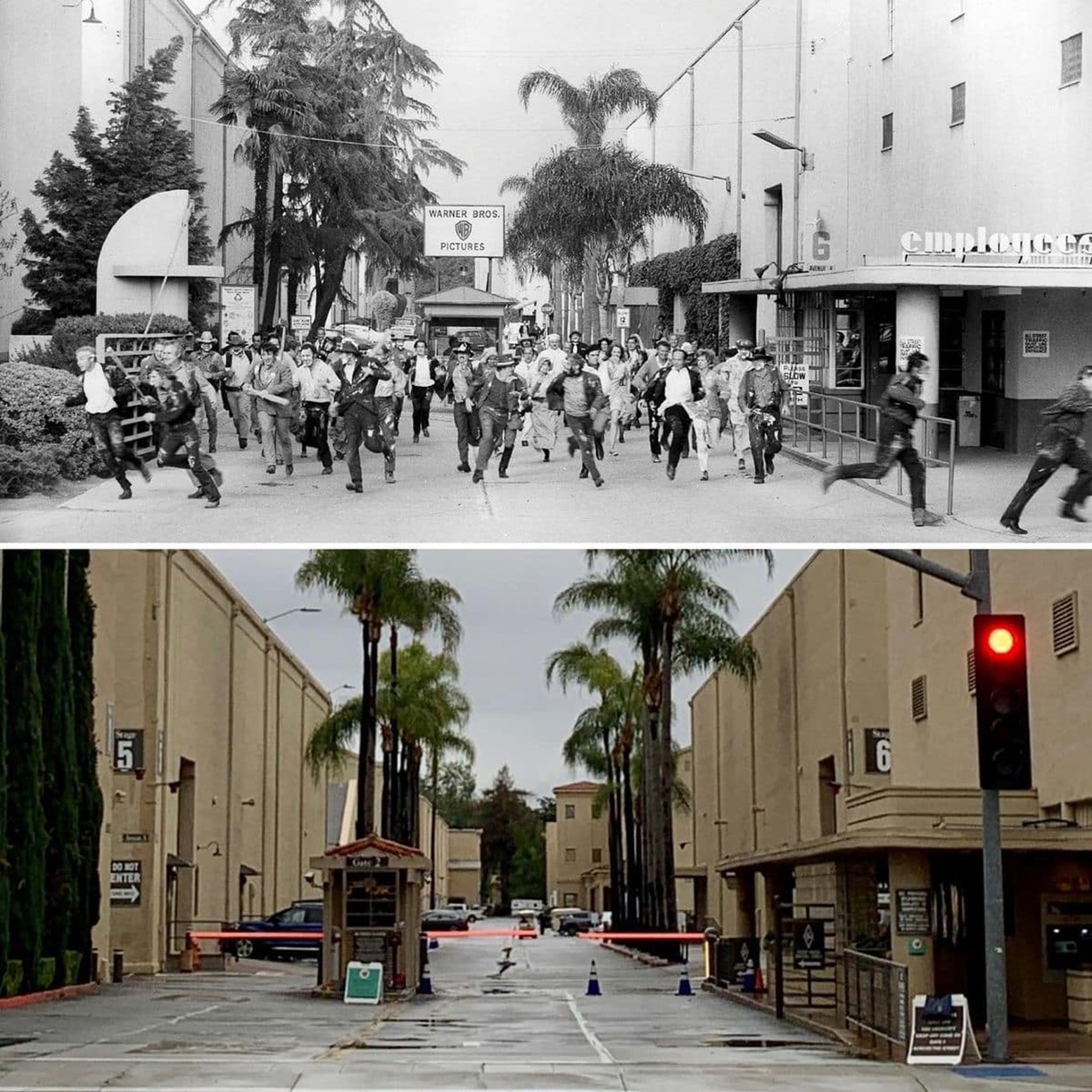 |
|
| (Then and Now)* - Then-and-now view of Gate 2 at Warner Bros. Studios on Olive Avenue in Burbank. The 'then' image comes from the filming of Blazing Saddles in 1974, showing the gate that appears in the film's famous fourth-wall-breaking finale. |
| Historical Notes
Then-and-now comparisons of studio gates are particularly compelling because they reveal how much has changed around a landmark while the landmark itself endures. Gate 2 has stood through nearly a century of Hollywood history, from the silent era productions of First National Pictures through the talkies revolution, the golden age, the television era, the blockbuster era, and into the age of streaming. That continuity is part of what makes the studio lot one of the most historically layered places in Los Angeles, a city that has too often torn down its past. The challenge that a Los Angeles theater man named Thomas Tally launched against Paramount in 1917 ultimately produced a studio that has outlasted nearly every rival and left its mark on the industry Tally set out to reform. The gate he never imagined stands on Olive Avenue still. |
* * * * * |
Downtown Los Angeles
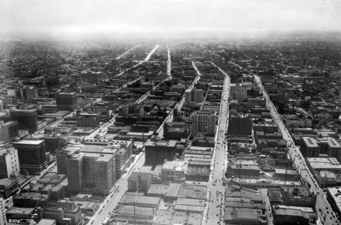 |
|
| (ca. 1925)* - Birdseye view of Los Angeles looking south from Sixth Street between Figueroa Street and Olive Street. Figueroa is pictured to the far right, angling off in the distance toward the left horizon. Progressing farther left, Flower Street is shown, the blocks between the two streets enclosing what appears to be mainly industrial warehouses or office buildings. The Hotel Ritz can also be seen on this strip, along with a parking lot near the foreground. In the blocks between Flower and the following Hope Street, the buildings for an unidentified hotel and an installation of the YMCA are visible. The next strip, held between Hope and Grand Street, the Union Oil building can be seen, along with the Hotel Trinity a little farther back. To the extreme left, between Grand Street and Olive Street, the Hotel Stillwell and the Walker building can be seen. |
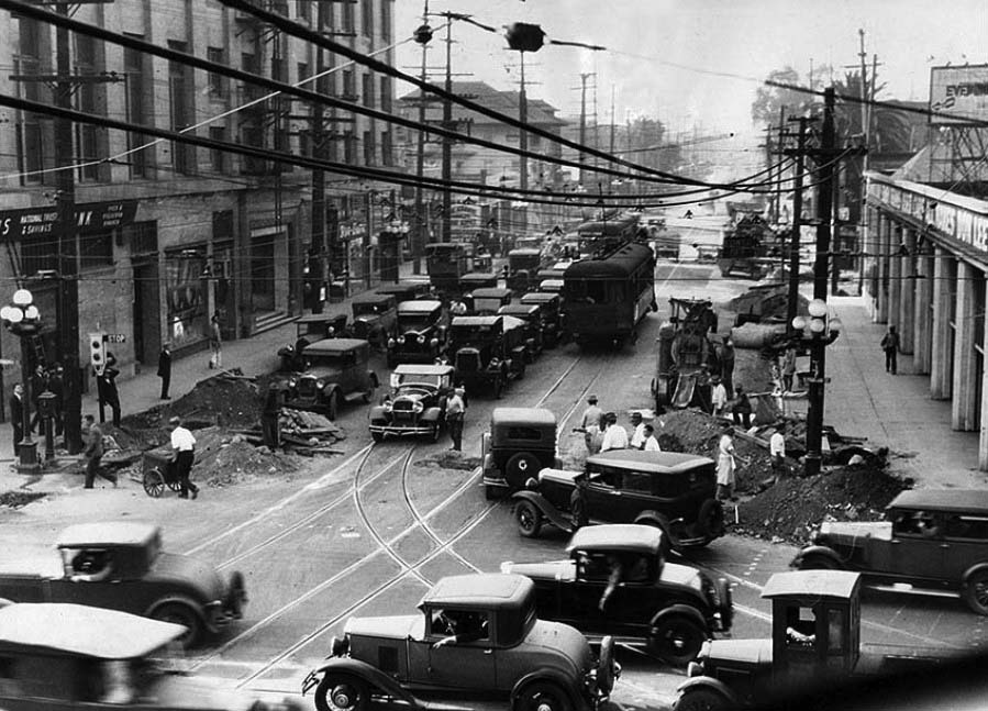 |
|
| (1930)* - View looking west on Pico Boulevard from Figueroa Street showing the traffic jam caused by road construction. |
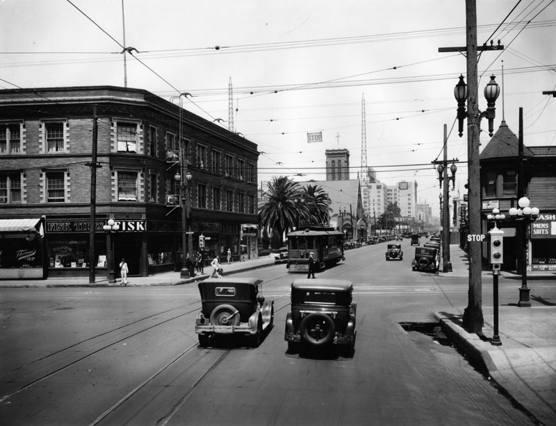 |
|
| (1929)^ - Intersection of Flower Street and Pico Boulevard, showing street traffic, churches, and various businesses. Notice the decorative street lighting fixtures and traffic stop. |
 |
|
| (1930s)^ - Flower Street looking north toward 8th Street. Los Angeles Gas and Electric Corporation is seen, as is Jean Hotel and Golden State Electric Co. |
* * * * * |
Wilshire Boulevard
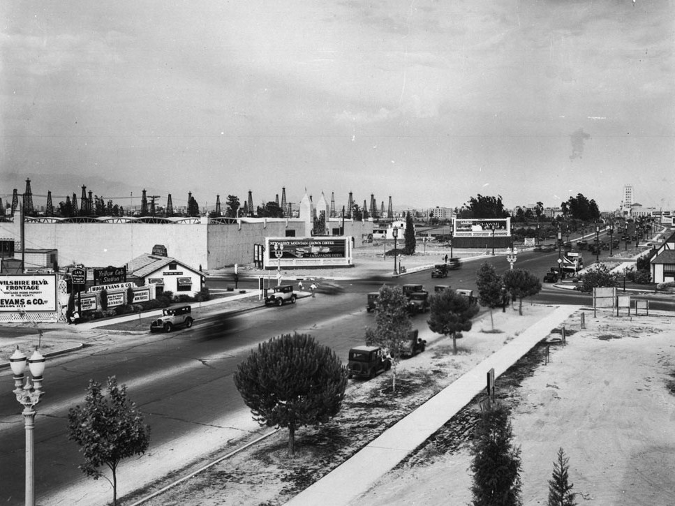 |
|
| (ca. 1929)*# - View looking east on Wilshire Boulevard toward its intersection with Fairfax Avenue. The northeast corner with the billboard is where the May Company Department Store would go about 10 years later. On the opposite corner where the little white house is, was once Rogers Airport, and would later become the iconic circular Simon's Drive-in restaurant. It is now the Johnies 50s diner. Oil wells are spread out where Park La Brea is now. |
Historical Notes In the late 1930s the 1.5-mile stretch of Wilshire Boulevard between Fairfax and Highland Avenues would be named the Miracle Mile. |
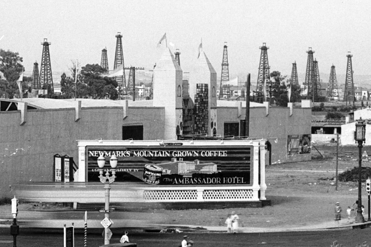 |
|
| (ca. 1929)*# – Close-up view of the northeast corner of Wilshire and Fairfax with an unusual shaped building located at the future site of the May Company Building. Signboard in the foreground reads “Newmark’s Mountain Grown Coffee Exclusively Served by the Ambassador Hotel”. Note all the oil derricks in the background. |
Historical Notes In the 1890s, dairy farmer Arthur F. Gilmore found oil on his land, probably in the vicinity of the La Brea Tar Pits. The field was named after the Salt Lake Oil Company, the first firm to arrive to drill in the area. The discovery well was spudded (started) in 1902. Development of the field was fast, as oil wells spread across the landscape, with drillers hoping to match the production boom taking place a few miles to the east at the Los Angeles City field. Peak production was in 1908. By 1912, there were 326 wells, 47 of which had already been abandoned, and by 1917 more than 450, which had by then produced more than 50 million barrels of oil. After this peak, production declined rapidly. Land values rose, corresponding to the fast growth of the adjacent city of Los Angeles, and the field was mostly idled in favor of housing and commercial development. The early wells were abandoned; many of their exact locations are not known, and are now covered with buildings and roads.^* |
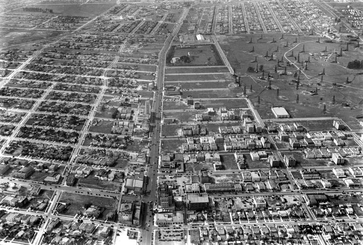 |
|
| (1930)^ - Aerial view looking west down Wilshire Boulevard from above Sycamore. The widest street visible, Wilshire, became known as the Miracle Mile, where most high rises were built through the years. The Salt Lake Oil Field is at right, La Brea Tar Pits in upper-center, and Carthay Circle Theatre in the upper left-center in the distance. |
 |
|
| (1930s)**^* - View looking north showing the Western Auto Supply Co building located at 5655 Wilshire Boulevard. A tall "Wilshire Special" streetlight stands on the corner (Wilshire and Hauser). In the distance also stands an oil derrick. |
 |
|
| (1929)^ - Ridgeley Drive and Wilshire Boulevard, showing the Wilshire Tower with Silverwoods on the ground floor. |
Historical Notes Wilshire Tower was the first Art Deco landmark tower on the street. Over the years stores such as Desmond's and Silverwoods occupied the ground floor while doctors and dentists had offices in the eight-story tower. Located at 5514 Wilshire Boulevard, the Zig-Zag Moderne building was designed by architect Gilbert Stanley Underwood and built in 1928.^ Note the ornate streetlights on Wilshire Boulevard, often referred to as 'Wilshire Specials'. Click HERE to see more in Early Los Angeles Streetlights. |
 |
|
| (ca. 1930)**^* - Close-up view of the intersection of Wilshire and Burnside looking sourtheast. |
Historical Notes Silverwood's was founded in 1894 by Francis Bernard ("Daddy") Silverwood, Los Angeles clothier, merchant, and businessman, originally from Canada, near Lindsay, Ontario. The first store was located at 124 South Spring St. in Los Angeles, and soon moved to larger quarters at 221 South Spring St. The flagship store was established in 1904 at Sixth & Broadway in downtown Los Angeles.^#*^ Hartmarx, one of the nation's largest clothing manufacturers and retailers, bought Silverwood's in 1941 and kept thee name. The Silverwood's chain of clothing stores folded in the 1990s.^* |
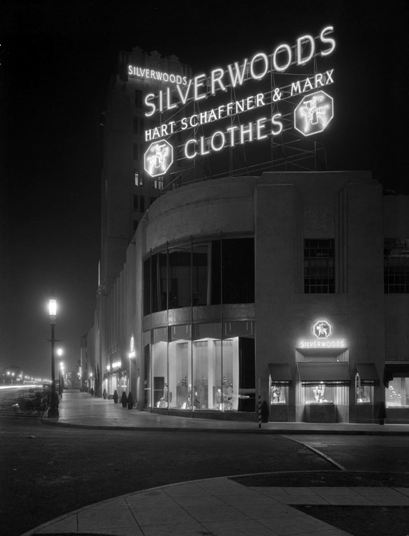 |
|
| (ca. 1930s)**^* - Looking east at the neon signage of the Silverwoods in the Wilshire Tower building. |
Historical Notes The Wishire Tower Building was declared Los Angeles Historic Cultural Monument No. 332 in 1987 (Click HERE to see complete listing). |
Wilshire and La Brea
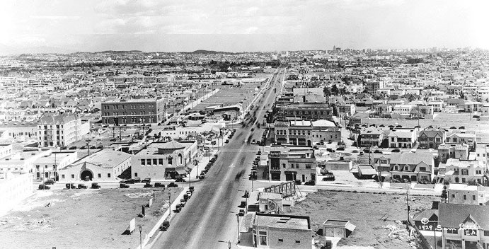 |
|
| (ca. 1929)^*# - View looking east along the Miracle Mile. The prominent brick structure (center-left) is the telephone switching center still is existence on La Brea Avenue just north of Wilshire. |
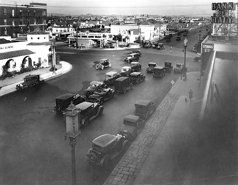 |
|
| (1928)^ – View looking east on Wilshire Boulevard toward La Brea Avenue. Note the Gilmore gas station on the northeast corner; the following year it would be demolished to make way for the E. Clem Wilson Building. The white building at upper left is the Dyas-Carleton Café, built in 1928. The Bank of Italy (sign upper right corner) would become the Bank of America. |
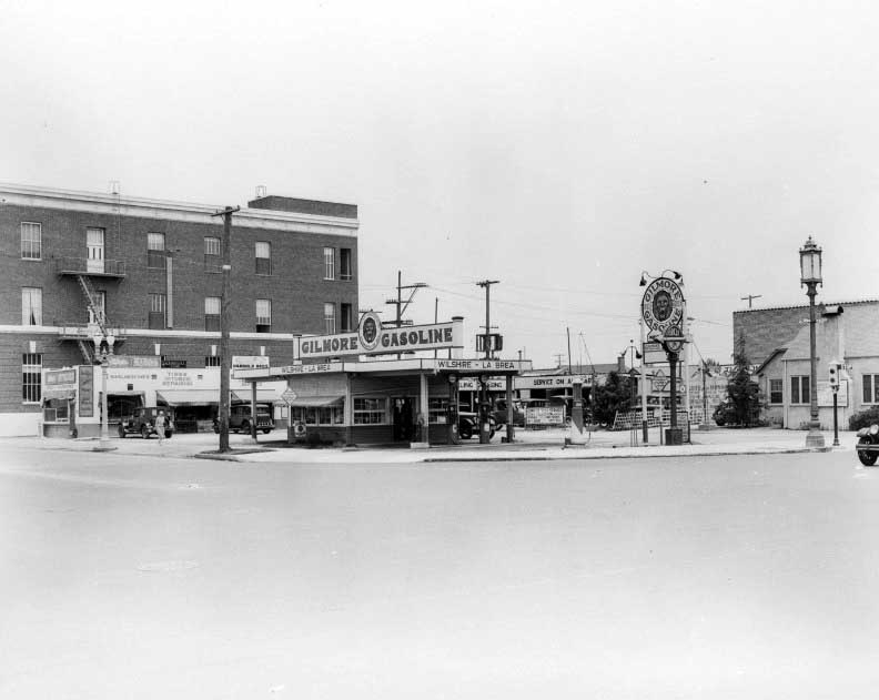 |
|
| (1928)*# – View of the Gilmore gas station on the northeast corner of Wilshire Boulevard and La Brea Avenue. The brick building on the left is the telephone switching center. Click HERE to see more Early Views of LA Gas Stations. |
Historical Notes The gas station was demolished the following year to make way for the construction of the E. Clem Wilson Building. The brick-clad building facing La Brea Avenue in the left background housed an office and switching station for the Southern California Telephone Company, completed in 1925 to serve the city’s western neighborhoods. It was enlarged from three to five floors in 1942 and given a complementary Art Deco facade by architects John and Donald Parkinson. It continues to operate today under the ownership of AT&T. #^+ |
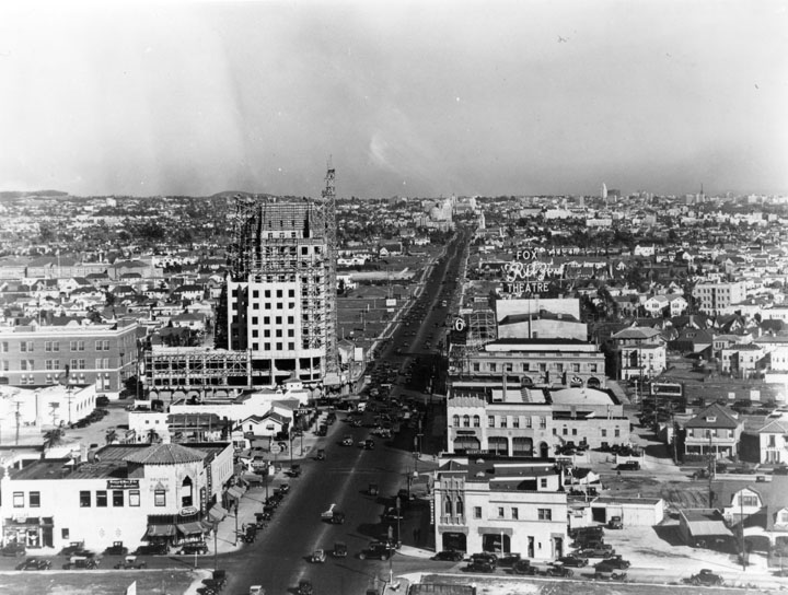 |
|
| (1930)^ - Wilshire Boulevard looking east from Tower Building west of La Brea in 1930. The Ritz Theatre is visible on the right. The new high rise E. Clem Wilson Building on the northeast corner of La Brea and Wilshire is under construction. |
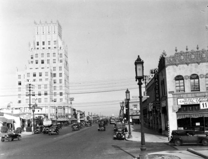 |
|
| (1932)*# – View looking west on Wilshire Boulevard from Detroit Street. Ornate streetlight lanterns called “Wilshire Specials” line both sides of boulevard (See Early LA Streetlights). The E. Clem Wilson Building is seen in the distance. |
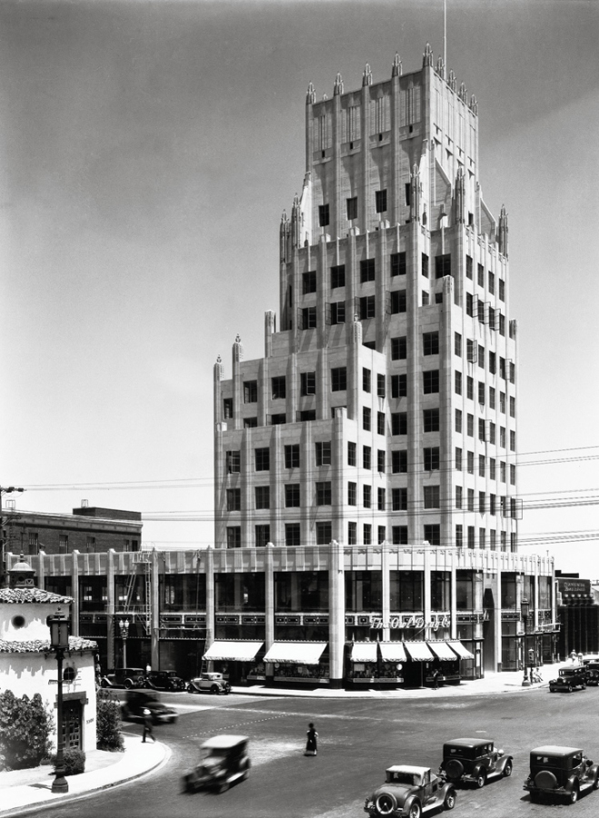 |
|
| (ca. 1930)*^^ - View of the intersection of Wilshire and La Brea. The new E. Clem Wilson Building is seen standing on the northeast corner. An Owl Drug store occupies the ground floor on the corner. |
Historical Notes Built in 1929 - 1930, the E. Clem Wilson Building was designed by architects Meyer and Holler in Art Deco (Zigzag) Moderne style. It is also known as the Wilson Building. Corporate names that adorned the Wilson Building included (in chronological order): General Insurance, Mutural of Omaha (until 1990), Asashi, and Samsung.^ |
 |
|
| (1931)^ – View showing the intersection of Wilshire Boulevard and La Brea Avenue with the Fox Ritz Theatre on the southeast corner. Note the double-deck bus on the left. |
Historical Notes The Fox Ritz Theatre at 5214 Wilshire Boulevard (S/E corner of Wilshire and La Brea) was designed by architect Lewis A. Smith. The 1600-seat theatre opened in 1926 and was demolished in 1977.^ |
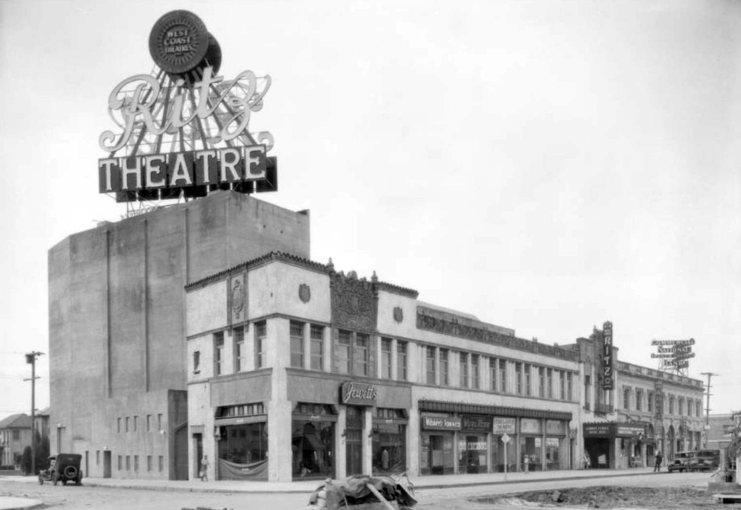 |
|
| (1926)^ – View looking at the southwest corner of Wilshire and Sycamore showing the Ritz Theatre. Opened in 1926, it joined the Fox theatre chain soon thereafter. The theatre building was on the south side of Wilshire and occupied the block between La Brea and Sycamore. |
.jpg) |
|
| (ca. 1929)^ - Looking west along Wilshire Boulevard at La Brea Avenue. The Ritz Theatre is on the left; on the right the Security-First National Bank Building (the first Art Deco structure on the Miracle Mile) is under construction. The The E. Clem Wilson Building (1930 - N/E corner of La Brea and Wilshire) has yet to be constructed. On the N/W corner can be seen the Dyas-Carleton Café. |
.jpg) |
|
| (ca. 1931)^.^ – View looking west toward the Fox Ritz Theatre as seen from Mansfield Avenue. The newly constructed E. Clem Wilson Building can be seen at right on the NE corner of La Brea and Wilshire. The Four Star Theatre would shortly be going up on the empty lot at left. |
 |
|
| (ca. 1933)^.^ – View looking east on Wilshire Boulevard from near La Brea Ave. The brand-new Four Star Theatre at 5112 Wilshire (between Orange Dr. and Mansfield Ave.) can be seen at center-right. Most striking to the eye is the wide strip of empty land across the street from the theater. The theater is showing “The Match King” (1932) and “He Learned About Women” (1933). |
 |
|
| (ca. 1932)*^# – View looking southeast showing the Four Star Theatre located at 5112 Wilshire Boulevard. |
Historical Notes This theatre at the corner of Wilshire and Mansfield opened in 1932 as one of several theatres commissioned by United Artists and Fox West Coast Theatres. It was designed by the renowned firm of Walker and Eisen, with Clifford Balch as architect. The theatre reopened in 1933 as the Four Star Theatre. |
 |
|
| (1937)^ – View looking west on Wilshire Boulevard from in front of the Four Star Theatre. Also visible in this picture are the E. Clem Wilson Building, a neon sign for the Examiner want ads and, just to the right of the sign, a Simon's Drive In (5171 Wilshire Boulevard). "Wilshire Special" streetlights line both sides of the boulevard. |
 |
|
| (ca. 1939)^ - View showing the Simon’s drive-in restaurant, located at 5171 Wilshire Boulevard, with a sign for Halsco out front on the lawn. Nearby are a sign which encourages passers-by to “Read Examiner Want Ads,” the offices for Mutual of Omaha in the E. Clem Wilson Building (upper left, later Samsung), located at 5217 Wilshire Boulevard, and two Wilshire Lanterns (left). |
Historical Notes At one time Simon's Drive-Ins dominated the Southern California drive-in restaurant craze. The Simon brothers had operated a chain of successful dairy lunch counters in downtown Los Angeles, and in 1935 decided to capitalize on the growing car culture of Los Angeles by opening auto friendly locations in the emerging commercial centers of Wilshire Boulevard, Sunset and Ventura Boulevards. #^* Click HERE to see more Early Views of LA Drive-in Restaurants. |
* * * * * |
Vermont and 4th Street
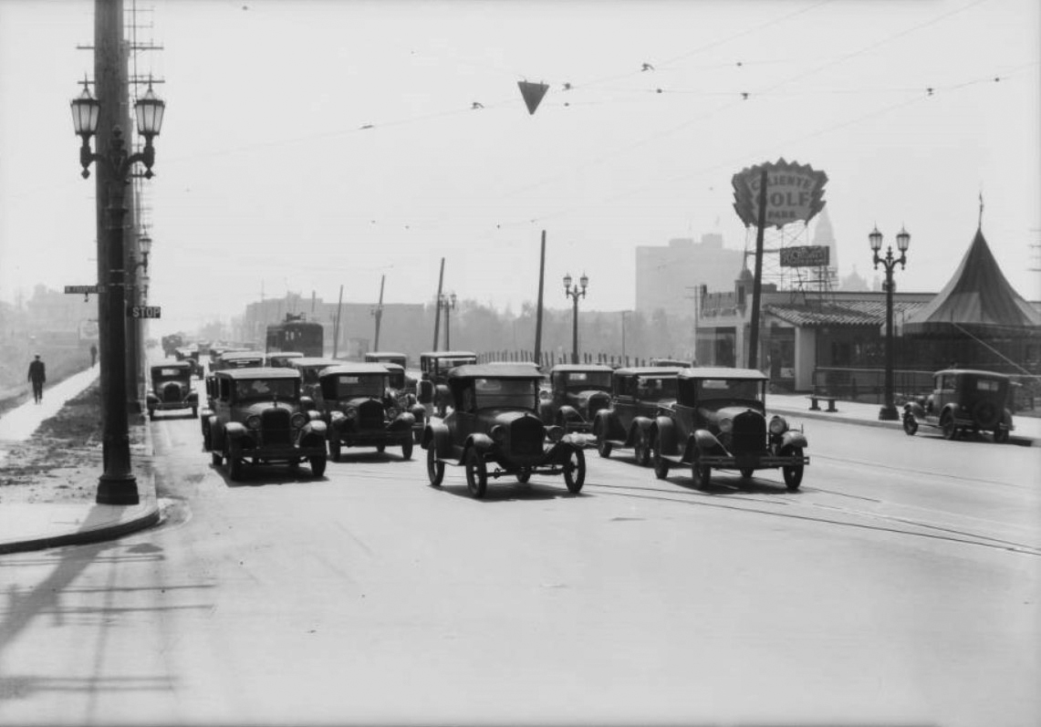 |
|
| (1931)* – View looking south on Vermont Avenue at Fourth Street. Cars are stopped at the intersection with traffic signal indicating “STOP”. Caliente Golf Park is seen on the west side of Vermont. |
.jpg) |
|
| (1931)* – View showing the same intersection (Vermont and 4th) as in previous photo, but here a woman is seen heading toward a stopped streetcar in the middle of the street. The traffic signal just changed to “GO”. |
* * * * * |
Wilshire and Vermont |
The intersection of Wilshire Boulevard and Vermont Avenue offers a rare, almost complete record of Los Angeles' transformation in the early twentieth century. Within a single decade, this corner evolved from one of the city's most refined residential addresses into a fully developed commercial and automobile-oriented corridor. Large homes lined both streets, and the corner itself was dominated by Villa Madama, a 23-room Italian Renaissance Revival mansion built in 1909 for Ida Hancock, the widow of Major Henry Hancock. Architect John C. W. Austin modeled the residence on the Villa Medici in Florence, giving the building an air of European elegance that matched the ambitions of the Hancock family and the boulevard they helped shape. The family's Hancock Park subdivision, developed from former Rancho La Brea lands, would eventually give its name to the entire surrounding district.By the 1930s, the residential character of this stretch of Wilshire was giving way to commerce. The grand homes were sold or demolished, replaced by banks, department stores, and the kind of businesses that catered to a growing, automobile-oriented city. That transformation is visible across the images on this page, which document the corner from 1930 through 1940 — a decade that saw Villa Madama razed, the Cole House replaced by a luxury department store, and a celebrated Moorish-style service station serve a generation of motorists before it too was swept away by the relentless pace of change on Wilshire Boulevard. Few locations along Wilshire illustrate this transition as clearly or as completely. |
The Corner of Wilshire and Vermont |
The northeast corner of Wilshire Boulevard and Vermont Avenue was, in 1909, the site of one of the most ambitious private residences ever built in Los Angeles. Villa Madama, commissioned by Ida Hancock Ross and designed by architect John C. W. Austin, rose on a three-quarter-acre lot purchased from Clara Shatto. Austin, who would go on to design the Griffith Observatory, Los Angeles City Hall, and the Shrine Auditorium, based the 23-room mansion on the Villa Medici in Florence, filling the interior with a Music Salon, Dining Room, Reception Hall, and Library finished to the standard of a European palazzo. After Ida Hancock Ross died in 1913, her son George Allan Hancock moved in with his wife Genevieve and remained there for more than two decades.The surrounding block reflected the same ambitions. Louis Maurice Cole, a prominent Los Angeles businessman connected to the Hellman banking family through his wife Frida Hellman, built a large residence at 3240 Wilshire Boulevard, next to Switzer's department store at the corner of New Hampshire Avenue. The Villa Florist shop operated from the corner of the Hancock property, and Bullock's Wilshire opened two blocks east in 1929. But the pressures of commerce were building. Allan Hancock demolished Villa Madama in 1938, donating several of its rooms for preservation at the University of Southern California's Allan Hancock Foundation Building. The following year, the Cole House was torn down to make way for I. Magnin, one of the most elegant department stores on the West Coast. |
The 1930 view below captures the intersection at the moment just before its transformation. |
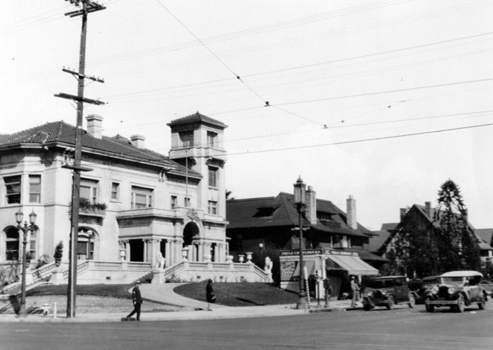 |
|
| (1930)* - View of the northeast corner of Wilshire Boulevard and Vermont Avenue showing a neighborhood of large two-story homes. The 23-room Italian Renaissance Revival mansion Villa Madama, designed by architect John C. W. Austin in 1909, is seen at left. The Villa Florist, a floral shop operated from the corner of the Hancock property, is visible at center. |
Historical Notes Villa Madama was commissioned in 1908 by Ida Hancock Ross, widow of Major Henry Hancock, and completed in 1909 on a lot purchased from Clara Shatto at the northeast corner of Wilshire and Vermont. Architect John C. W. Austin based the design on the Villa Medici in Florence, creating a 23-room Italian Renaissance Revival mansion with elaborately finished interior rooms including a Music Salon, Dining Room, Reception Hall, and Library. After Ida Hancock Ross died in March 1913, her son George Allan Hancock moved in and remained until 1938, when he donated the property to the University of Southern California. Four of the mansion's principal rooms were dismantled and reinstalled in the Allan Hancock Foundation Building at USC, completed in 1941. The rest of the mansion was demolished. John C. W. Austin, born in Oxfordshire, England in 1870, moved to Los Angeles in 1895 and became one of the city's leading architects. His other major works include Los Angeles City Hall, the Griffith Observatory, and the Shrine Auditorium. He served as president of the Los Angeles Chamber of Commerce in 1930 and received its first Achievement Award in 1949. |
Then and Now
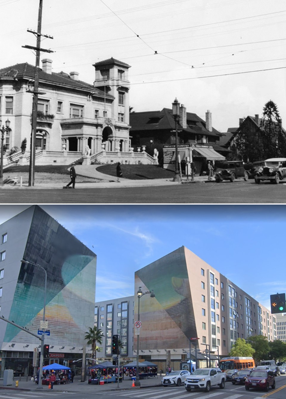 |
|
| (1930 vs. 2018)* - Seen top and bottom: the northeast corner of Wilshire Boulevard and Vermont Avenue. The upper image from 1930 shows Villa Madama and the residential character of the block; the lower image from 2018 shows the same view after nearly nine decades of commercial development. Photo comparison by Ray Durlav. |
| Historical Notes
This then-and-now comparison captures the full arc of change at the northeast corner of Wilshire and Vermont over nearly nine decades. In 1930, the intersection was still dominated by large residential properties, with Villa Madama anchoring the corner. By 2018, the block had been entirely remade by waves of commercial development that began in the late 1930s and continued through the postwar decades. The Metro D Line's Wilshire/Vermont station, which opened in 1996, now sits just below the intersection, one of the busiest transit hubs in the system. |
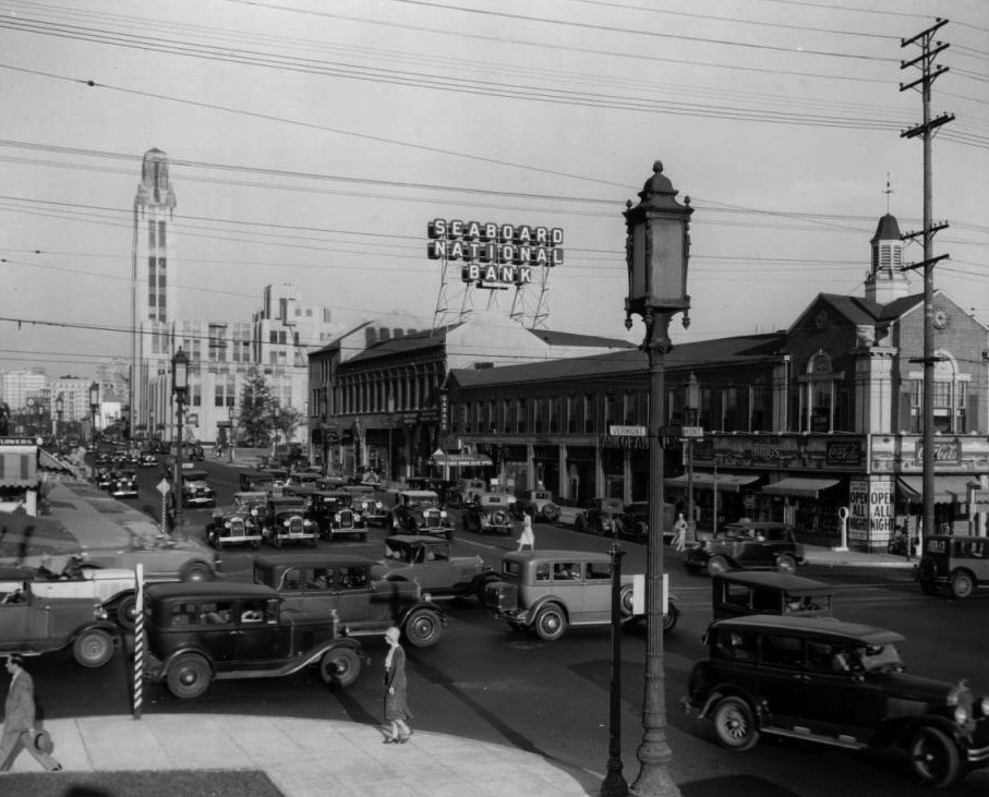 |
|
| (ca. 1936)* – View looking east on Wilshire Boulevard from Vermont Avenue. The Villa Florist is at left. Seaboard National Bank, designed by Walker and Eisen, is visible on the south side of Wilshire, with Bullock's Wilshire visible two blocks further east at Westmoreland Avenue. |
| Historical Notes
By the mid-1930s, Wilshire Boulevard east of Vermont had developed into one of the most commercially active stretches in Los Angeles. Seaboard National Bank had relocated to its new Walker and Eisen-designed building at the northwest corner of Wilshire and Shatto Place, replacing an earlier Wilshire Boulevard location. Bullock's Wilshire, which had opened in 1929 at the corner of Wilshire and Westmoreland two blocks east, was visible in the distance and had already become the anchor of the corridor's luxury retail identity. Allan Hancock permitted the Villa Florist to operate from the corner of the Hancock property during these years, a signal that even the city's most prominent residential addresses were beginning to accommodate commercial use. |
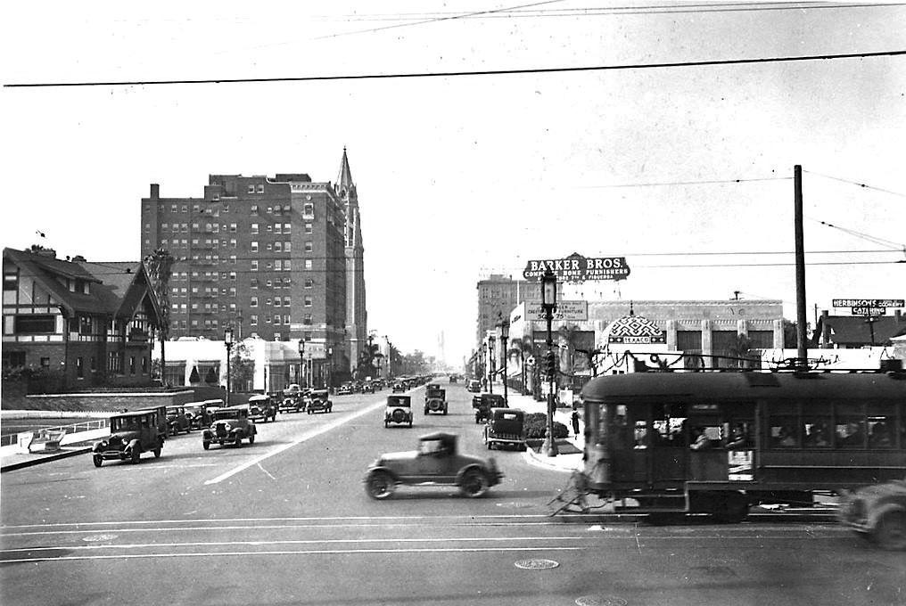 |
|
| (1932)* – View looking west on Wilshire Boulevard at Vermont Avenue showing a Pacific Electric streetcar and an automobile at the intersection. The tiled dome of the Calpet/Texaco service station is visible on the northeast corner of Wilshire and New Hampshire. The large Tudor Revival house at left is the Cole residence at 3240 Wilshire Boulevard. In the distance are the 12-story Talmadge Apartments and, behind them, the Immanuel Presbyterian Church at Berendo Street. |
| Historical Notes
Pacific Electric streetcars operated along Wilshire Boulevard until 1950, when the line was replaced by bus service. The Talmadge Apartments, visible in the distance, were named for the Talmadge sisters — Norma, Constance, and Natalie — major film stars of the silent era who maintained strong ties to Los Angeles. The Immanuel Presbyterian Church at Berendo Street, which still stands today as a Los Angeles Historic-Cultural Monument, was designed by Allison and Allison and completed in 1929. The Cole House, which stood at 3240 Wilshire Boulevard, would be demolished in the late 1930s to make way for the I. Magnin store. |
Then and Now
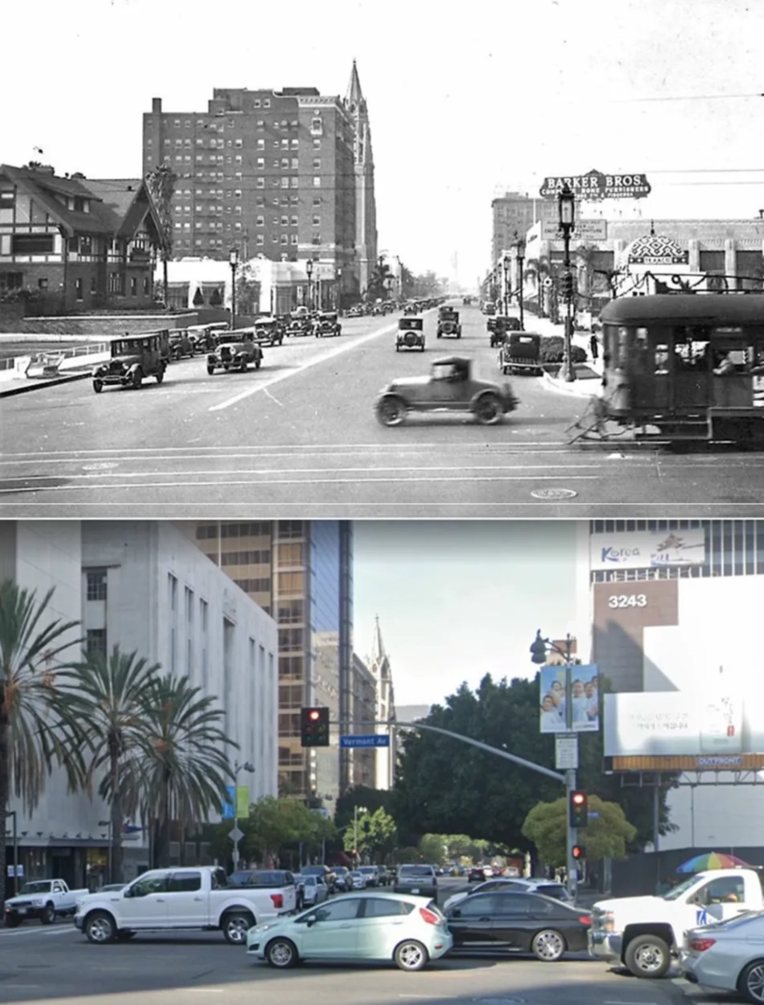 |
|
| (1932 vs. 2020)* - Seen top and bottom: the view looking west on Wilshire Boulevard at Vermont Avenue. The upper image from 1932 shows the Cole House at left and the tiled Calpet/Texaco station dome in the distance; the lower image from 2020 shows the same corridor after decades of commercial redevelopment. Photo comparison by Jack Feldman. |
| Historical Notes
This east-to-west view across the 1932 and 2020 images reveals how completely the residential fabric of this section of Wilshire Boulevard was remade over eight decades. The Cole House, the dominant structure at left in the 1932 view, was gone by 1939. The Calpet/Texaco service station dome visible in the distance was demolished in the mid-1950s. Today the same corridor is lined with mid-rise commercial buildings, and the intersection is served by the Metro D Line subway station that opened beneath Wilshire and Vermont in 1996. |
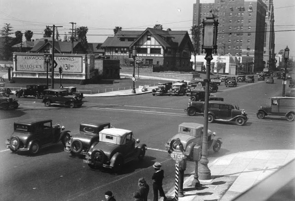 |
|
| (ca. 1936)* - View looking west on Wilshire Boulevard from Vermont Avenue. A Bullock's Wilshire advertisement billboard occupies the southwest corner. The Cole House is visible at upper center, and the Talmadge Apartments and Immanuel Presbyterian Church at Berendo Street are visible in the distance. Roberts Bros. Drive-in was located just out of frame to the left. |
| Historical Notes
The Bullock's Wilshire billboard occupied a southwest corner lot that had been vacant since the Lacy house was moved to Windsor Square in 1924. Bullock's, which had opened its landmark store two blocks east in 1929, used the prominent corner for advertising as commercial activity along the boulevard intensified. Roberts Bros. Drive-in, a popular sandwich restaurant just off the frame to the left, reflected the growing appetite for automobile-oriented dining that was reshaping Los Angeles commerce in the mid-1930s. |
 |
|
| (1939)* – View looking south at the Roberts Bros. Sandwich Drive-in near the southwest corner of Wilshire and Vermont. A sign out front advertises a fried oyster sandwich for 25 cents. The Cole House stood just out of frame to the right, on the site where I. Magnin would open that same year. |
| Historical Notes
Roberts Bros. was among the many drive-in sandwich and food stands that appeared along Wilshire Boulevard and other major Los Angeles thoroughfares in the 1930s, serving the growing number of motorists who moved through the corridor daily. The automobile-oriented dining format was particularly suited to Wilshire, which had been planned from its earliest days as a boulevard for private cars rather than streetcars. At 25 cents, a fried oyster sandwich at Roberts Bros. was modest by the standards of the luxury retailers a few blocks in either direction, reflecting the mix of commerce that characterized the Vermont corridor during this transitional decade. |
 |
|
| (1930s)* – The Cole House at 3240 Wilshire Boulevard, seen adjacent to Switzer's department store on the southwest corner of Wilshire and New Hampshire Avenue. The house was demolished in the late 1930s to make way for the I. Magnin store, which opened on the site in 1939. |
Historical Notes Louis Maurice Cole, a prominent Los Angeles businessman, was connected by marriage to the Hellman banking family. His wife, Frida Hellman, was the sister of Marco Hellman of 3350 Wilshire and of Amy Hellman Aronson of 3325 Wilshire. The firm of Edelman and Barnett designed all three Hellman family residences on the boulevard. Cole was active in Los Angeles civic affairs and business circles throughout the 1910s and 1920s. After Cole's death, the family property at 3240 Wilshire was sold and subsequently cleared for the I. Magnin construction. Switzer's department store at the adjacent corner of New Hampshire was known for its elaborately finished interior and rear motor court, designed to accommodate the automobiles of its clientele. Despite its reputation, Switzer's was later demolished and the site redeveloped. |
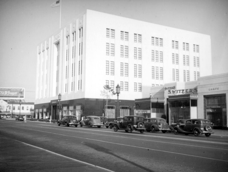 |
|
| (ca. 1939)* - View looking east on Wilshire Boulevard toward New Hampshire Avenue, showing the newly completed I. Magnin store at 3240 Wilshire on the site of the former Cole House. Switzer's department store at 3250 Wilshire is visible to the right. |
| Historical Notes
The I. Magnin store at 3240 Wilshire Boulevard opened on February 11, 1939. Designed by Myron Hunt, architect of the Ambassador Hotel, the five-story building was constructed at a cost of three million dollars, clad in white marble with black granite trim at street level. The store operated entirely on electricity and was fully air-conditioned, unusual features for the time. The Los Angeles Conservancy later described the design as a work that a contemporary reviewer called a "symphony of beauty." I. Magnin specialized in couture fashion and operated at this location until 1990, when it closed following a merger with Bullock's department stores under Federated Department Stores ownership. The building reopened after the 1992 civil unrest as the Korean-oriented Wilshire Galleria. The replacement of the Cole House with I. Magnin marked the definitive end of Wilshire's residential era at this intersection. |
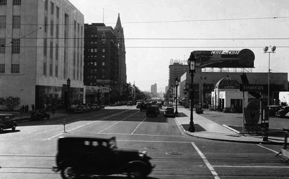 |
|
| (1939)* – View looking west on Wilshire Boulevard from Vermont Avenue. The newly opened I. Magnin store is visible at left, having replaced the Cole House at 3240 Wilshire that year. The tiled dome of the Calpet/Texaco service station is visible across the street on the southeast corner of Wilshire and New Hampshire Avenue. |
| Historical Notes
The opening of I. Magnin in 1939 placed two of the most architecturally distinguished retail buildings in Los Angeles within a few blocks of each other on Wilshire Boulevard — Bullock's Wilshire at Westmoreland, and I. Magnin at New Hampshire. Together they defined the stretch of Wilshire between Vermont and Westmoreland as the preeminent luxury shopping address in the city during the 1940s and into the 1950s. Both stores ultimately came under the same ownership through Federated Department Stores, and both closed in the early 1990s, victims of suburban migration and the economic disruption that followed the 1992 civil unrest. |
The Calpet and Texaco Service Station |
Among the most distinctive buildings ever constructed on Wilshire Boulevard, the California Petroleum Corporation's flagship service station opened at the northeast corner of Wilshire and New Hampshire Avenue in January 1927 with all the pomp of a Hollywood premiere. Designed with a Moorish Revival dome, mosaic tile ornamentation, and a separate rear building housing tire service, auto washing, and a small café, the station was marketed by Calpet as "California's finest super service." The two-day opening ceremony featured a live orchestra, a full-page advertisement in the Los Angeles Times, and film stars including Buster Keaton, Norma Talmadge, and Constance Talmadge greeting customers alongside Calpet Girls dressed in Tunisian costume.The Texas Company, known as Texaco, acquired Calpet in 1928 and continued to operate the station under its own brand until the mid-1950s. When it was finally demolished, the site was replaced in 1956 by a modernist office building constructed for the Pioneer Savings and Loan Association. The building later became home to bank tenants through the 1980s and today serves as the Consulate General of the Republic of Korea in Los Angeles. The Calpet station is remembered as one of the most distinctive lost buildings on Wilshire Boulevard. |
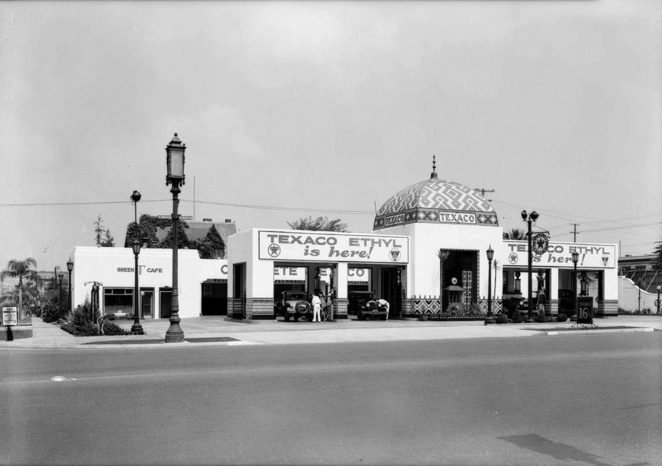 |
|
| (1930s)* – The Calpet/Texaco service station on the northeast corner of Wilshire Boulevard and New Hampshire Avenue, seen across from the Cole House. The station's Moorish Revival dome and mosaic tile ornamentation were among the most distinctive architectural features on Wilshire Boulevard during the 1930s. The Green T Café is visible at left. |
Historical Notes The California Petroleum Corporation service station at the northeast corner of Wilshire and New Hampshire opened on January 23, 1927, following a two-day ceremony that attracted film stars and drew extensive coverage in the Los Angeles Times. Architect Roland E. Coate designed the station's Moorish Revival cashier's hall, which featured a domed roof ornamented with decorative mosaic tile and a ladies lounge furnished with Venetian mirrors and upholstered seating. A separate rear structure housed an automatic washing and polishing unit, tire and battery service areas, an accessory shop, and a small café. Station attendants wore white shirts, bow ties, and maroon jackets with riding breeches, while Calpet Girls greeted customers at the pumps in Tunisian costume. The Texas Company acquired Calpet in 1928 and operated the station under the Texaco brand until its demolition in the mid-1950s (Click HERE to see more). |
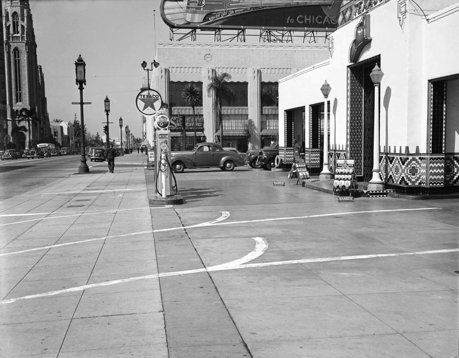 |
|
| (1940)* - View looking west on Wilshire Boulevard from the sidewalk in front of the Calpet/Texaco service station at New Hampshire Avenue. The I. Magnin store, which had opened the previous year across the street, is visible to the right. |
Historical Notes By 1940, the northeast corner of Wilshire and New Hampshire had become one of the most photographed service station sites in Los Angeles, a reflection of how completely the Calpet/Texaco station had established itself as a Wilshire Boulevard landmark. The station's Moorish dome and tile work were frequently cited in accounts of the boulevard's architecture, and the building appears in numerous press photographs of the corridor from the 1930s and early 1940s. In 1956, the site was cleared and replaced by a six-story modernist office building constructed for Pioneer Savings and Loan Association, designed with an adjacent parking lot to serve the suburban bank clientele that had replaced the automobile-oriented visitors of the station's heyday. The building has served as the Consulate General of the Republic of Korea in Los Angeles since the late 1980s. Click HERE to see more in the Early Views of LA Gas Stations Section |
* * * * * |
Compton
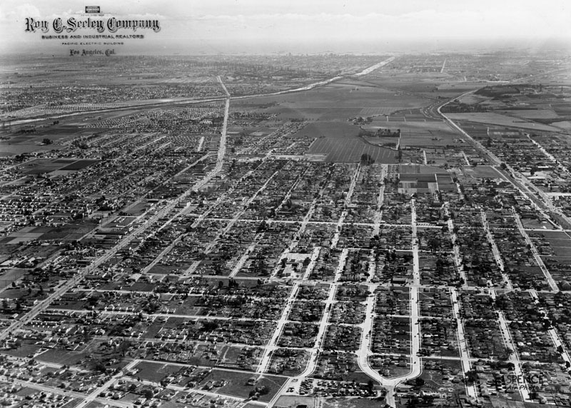 |
|
| (ca. 1930s)^ - An aerial view of the City of Compton, looking south to Long Beach. Long Beach Boulevard is at left, and Alameda Street is at right. Photo taken by Spence Air Photos |
Historical Notes Spence Air Photos was a one-man company ~ photographer, "Robert Earl Spence". He began shooting aerials in 1918. In the 1920s he had numerous clients hiring him to shoot homes and businesses. Spence would shoot images at an angle, not straight down, showing many additional building details. Spence was not a pilot, he hired an airplane pilot to fly him overhead while he leaned out from the cockpit with a bulky camera to get angled shots of the landscape. His method captured the details of the homes and their surroundings all the way to the horizon. He continued to photograph homes for 50 years. In 1971, Spence retired and donated his collection of 110,000 negatives to the University of California Geography Department. He passed away in 1974. At UCLA, the Spence Collection is part of The Benjamin and Gladys Thomas Air Photo Archives. Click HERE to see more Early Views of Compton. |
* * * * * |
Downtown Los Angeles
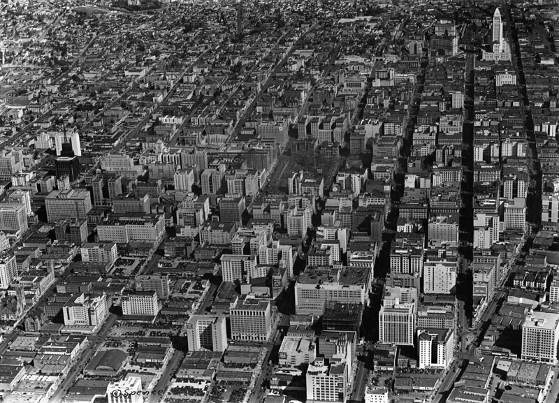 |
|
| (1930)^ - Aerial view of Downtown Los Angeles looking north on a clear day. Pershing Square is in the center of the photograph, the Los Angeles Central Library tower is visible two blocks to the left, and City Hall is visible on the upper right. |
Historical Notes Although there are dozens upon dozens of buildings, for decades no building in Los Angeles was allowed to exceed the height of City Hall, until 1957. It remained the tallest building in California from 1928-1964, at 28 stories tall (450 feet).^ |
 |
|
| (1927)^ – View looking at the northwest corner of 5th Street and Grand Avenue showing a full parking lot. The Ayers Apartments are on the right and the Barrone (later Engstrum Hotel Apartments) in the background left. |
Historical Notes The Ayers Apartments will be demolished with the construction of the Edison Building in 1930-31 and the Baronne, originally the Westonia, will change it's name one last time and become the Engstrum Hotel Apartments.^#^^ |
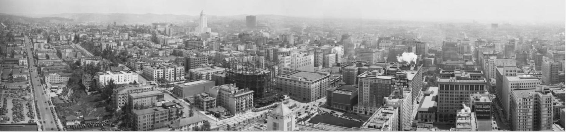 |
|
| (1930)*# - Panoramic view of downtown showing the Los Angeles skyline as it appeared in 1930. City Hall, built in 1928, is the tallest building in the horizon. The building under construction at center-left is the Edison Building located on the northwest corner of Grand Avenue and 5th Street. The pyramid-shaped tower of the Central Library is in the center-foreground. |
Historical Notes In 1930, Los Angeles' population was 1,238,048. This was more than double its population just 10 years earlier (576,700).^* |
 |
|
| (ca. 1930)^ - View of the Civic Center looking northeast from 5th Street at Hope, across Central Library. A new Edison Building is under construction on 5th and Grand, next to which are the Engstrum Hotel Apartments. City Hall is in the background, to the right of Bunker Hill. |
Historical Notes In 1939, Southern California Edison (SCE) and the Los Angeles Department of Water and Power (DWP) completed negotiations on the division of territory between the two utilities. SCE would supply the unincorporated areas within Los Angeles County and all other municipalities except for Pasadena, Glendale, and Burbank, while the DWP became the sole electrical service provider for the City of Los Angeles. Click HERE to see more in First Electricity in Los Angeles. |
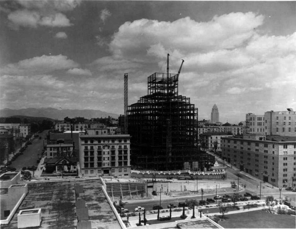 |
|
| (1930)* - View looking north of the Edison Building under construction at the corner of 5th Street and Grand Avenue. |
Historical Notes The above photo was taken from the roof of the Central Library, the still under-construction Edison Building is taking shape. Next door to the left is the handsome, symmetrical Engstrom Apartment Hotel and on the corner of Hope Street is a single family residence and behind it the Pierce apartments which will soon give way to the Engsrtrum's need for on site parking. Up Hope Street the white Barbara Worth Apartments shown on the left. |
 |
|
| (1930)^ - View shows the Southern California Edison Company Building in the final stages of constrution. |
Historical Notes Located on the corner of Fifth Street and Grand Avenue the building opened on March 20, 1931 as the Southern California Edison Company corporate headquarters.* The Edison Company Building was one of the first all-electrically heated and cooled buildings constructed in the western United States. Now known as One Bunker Hill, the Art Deco building located at 601 W. 5th Street was designed by James and David Allison.^ |
* * * * * |
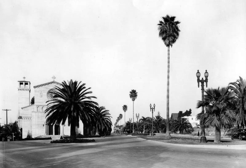 |
|
| (1931)^ – View looking north from 5th Street on Occidental Boulevard in the Westlake area. The Precious Blood Roman Catholic Church is seen on the left behind a palm tree. |
Historical Notes The church building stands on a v-shaped corner of Occidental Blvd. and Hoover St. This one of the archdiocese's architectural gems, showing a beautiful rose window above the main entrance. It was dedicated in November 1926. The Italian Romanesque structure has three rose windows that offer a dim and religious life. Twelve large stained glass windows, six yellow windows and the Stations of the Cross Mosaics are over the nave. |
* * * * * |
Wilshire and Normandie
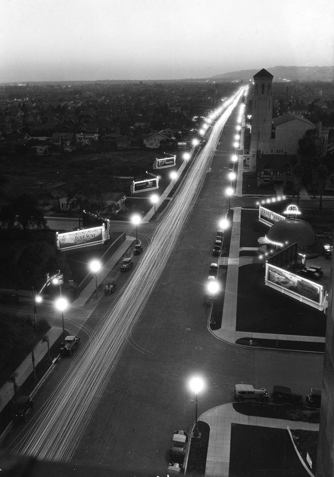 |
|
| (1928)*# - Night view showing a well lit Wilshire Boulevard looking west toward Normandie Avenue as seen from the Gaylord Apartments. The original Brown Derby restaurant is visible on the right. The Wilshire Christian Church (NE corner of Wilshire and Normandie) can also be seen in upper right. |
 |
|
| (1929)^ - A view looking east on Wilshire Boulevard toward Normandie showing a painted arrow on the street telling traffic to "Slow - Crossing". On the right side is the Estrada's Spanish Kitchen Restaurant, and on the left side is the Wilshire Christian Church. On past the church is the Gaylord Apartment Building. |
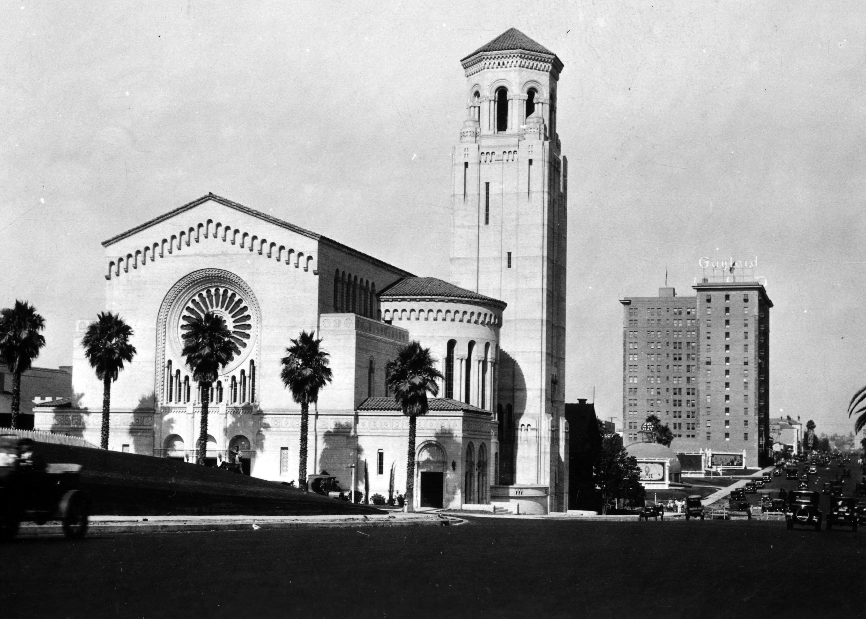 |
|
| (1928)^#^ – View looking east showing the Wilshire Christian Church on the NE corner of Wilshire and Normandie Ave. In the distance can also be seen the Original Brown Derby Restaurant and the Gaylord Apartment Building. |
Historical Notes Wilshire Christian Church was the first church on Wilshire Boulevard in 1911. The church property on the northeast corner of Wilshire and Normandie was donated by the Chapman Brothers, owners of Chapman Park Market, whose historic building remains nearby on Sixth Street. In 1927 the original church was replaced by this Northern Italian Romanesque style structure with a 200-foot tower, designed by Robert H. Orr. |
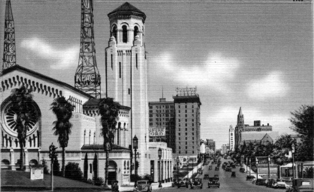 |
|
| (ca. 1935)##^* – Postacard view looking east on Wilshire Boulevard near Normandie. The Wilshire Christian Church (NE corner of Wilshire and Normandie) is to the left and in the distance can be seen the Gaylord Apartment Building. Directly on the other side of the church stands two radio transmitting towers belonging to the KFAC Radio Station. |
Historical Notes The Gaylord Apartment Hotel was named after Henry Gaylord Wilshire, who founded the famous boulevard; the 14-story building officially opened its doors in 1924. The entire area near the Gaylord became the site of New York style apartment buildings, and many film stars lived in these elegant high rises. Among them were the Ambassador, Asbury, Langham, Fox Normandie, Picadilly, and Windsor. In the mid-sixties, the Gaylord Apartment Hotel was converted into a charming apartment community.^ |
Click HERE to see Wilshire and Normandie in the 1950s |
Wilshire and Western
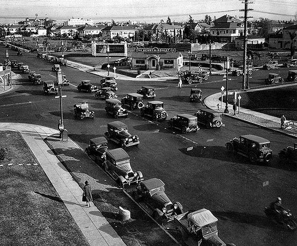 |
|
| (1929)**^ - View showing traffic at the intersection of Wilshire Boulevard and Western Avenue. The offices of real estate developer Henry de Roulet are seen on the southeast corner. This would become the future site of the Pellissier Building and Wiltern Theatre. |
Historical Notes In the 1920s, the atmospheric rise of automobile ownership within the city, coupled with Wilshire Boulevard's emergence as a commercial corridor and the development of Western Avenue as a fashionable residential street, transformed the intersection into a recurring traffic jam. In 1928, the city traffic commission recorded nearly 75,000 automobiles and double-decker buses passing through Wilshire and Western on one particular day, making the intersection the nation's busiest, according to the commission's own reckoning. Chronic congestion inspired traffic engineers to innovate. In 1922 they experimented with a traffic circle that, because of the intersection's small size, only bottlenecked traffic. Two years later they installed some of the city's first automated traffic signals at the crossroads. ^^^* |
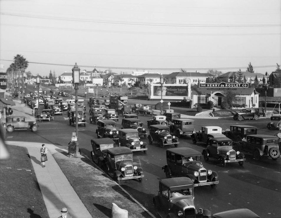 |
|
| (ca. 1929)*# - View looking southeast at the interesection of Wilshire and Western, already showing signs of being one of the busiest intersections in Los Angeles. |
Historical Notes Developer Henry de Roulet described the intersection as one of the busiest in the world. In 1930-31 he would build the Wiltern Theater and Pellisser Building complex at southeast corner. The buildings are now on the U.S. National Register of Historic Places.**^ |
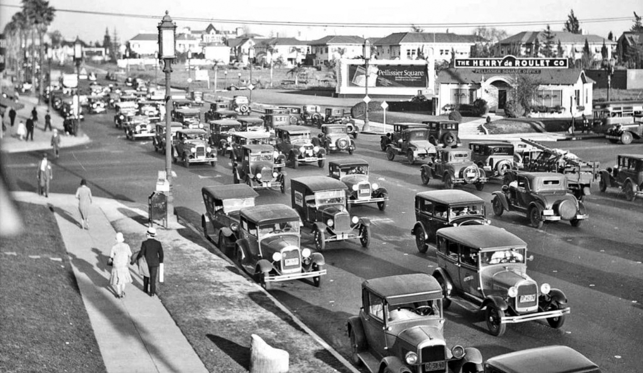 |
|
| (ca. 1929)*# – View showing the intersection of Wilshire & Western, the busiest intersection in Los Angeles at the time. The billboard corner is the future Pellissier Building/Wiltern site. |
 |
|
| (1929)^^ - Close-up view of the southeast corner of Wilshire and Western, future home of the Pellissier Building and Wiltern Theatre. |
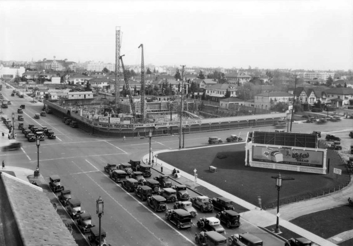 |
|
| (1931)*# – View showing the Pellissier Building and Warner Bros. Western Theatre (now Wiltern Theatre) in the early stages of construction at the southeast corner of Wilshire Boulevard and Western Avenue. Construction began in November 1930. |
Historical Notes In 1882, Germain Pellisier, a 33-year-old immigrant from the French Alps, purchased the Southern Pacific's 156-acre tract on the intersection's southeast corner for $3,200. At first Pellissier opened a sheep ranch on his new property, but he was less interested in the land for wool production than as a long-term investment; the foresighted Pellissier believed that a growing Los Angeles would soon spill over its city limits and reach his quarter-section of wilderness. Events soon proved him right. In April 1885, the Los Angeles County board of supervisors designated one of the roads passing by his tract a county highway, bestowing on it the name Western Avenue. (The other road would later be named Sixth Street before becoming Wilshire Boulevard in 1897.) Pellissier shut down his sheep ranch, and, when Southern California's wild land boom arrived in 1887, parceled out part of his tract, which eventually became known as the Pellissier Square subdivision. By 1905, land that Pellissier had bought for $20.50 per acre was selling for $2,700. ^^^* |
.jpg) |
|
| (1931)*# - The Pellissier Building’s steel framing is almost complete, SE corner of Wilshire and Western |
Historical Notes Developer Henry de Roulet, who had grown up not far from the building's site on the former sheep ranch, named the building after his visionary grandfather, Germain Pellissier. ^^^* |
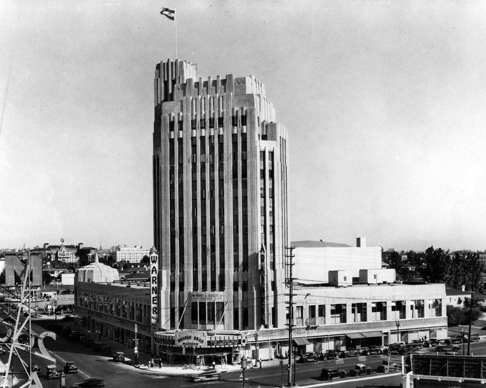 |
|
| (1931)*^# – View of the Pellissier Building and Warner (later Wiltern) Theatre shortly after completion. |
Historical Notes Completed in 1931, the Wiltern was designed by architect Stiles O. Clements of Morgan, Walls & Clements, the city’s oldest architectural firm. |
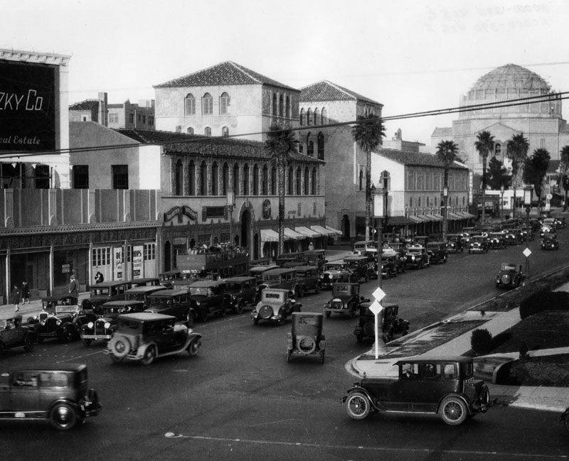 |
|
| (ca. 1930)^ - View of Wilshire Blvd. looking east near Western Avenue circa 1930. The buildings at left in Art Deco and Spanish Colonial Revival styles hold various shops and offices. Amid the cars is a double-decker open-air bus labelled "Wilshire. Beverly Hills." In the background is the domed Wilshire Boulevard Temple at Hobart Boulevard. |
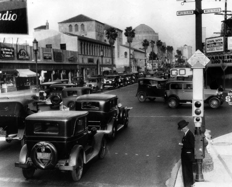 |
|
| (1931)++# - View of traffic at the intersection of Wilshire Boulevard and Western Avenue, looking east. This was then the busiest intersection in Los Angeles.
|
.jpg) |
|
| (ca. 1930)^ - Exterior view of Wilshire Boulevard Temple, at 3663 Wilshire Boulevard at Hobart Blvd. People are seen on the steps, and cars are parked on the streets. |
Historical Notes Wilshire Boulevard Temple, founded in 1862 as Congregation B'nai B'rith, is the oldest Jewish congregation in Los Angeles. One of the country’s most respected Reform congregations, Wilshire Boulevard Temple's magnificent sanctuary, with its famous dome and Warner Murals, is a City of Los Angeles Historic Cultural Monument and is listed on the National Register of Historic Places.^* |
_1932.jpg) |
|
| (ca. 1939)^ - Another view of the Wilshire Boulevard Temple, at 3663 Wilshire Boulevard at Hobart Blvd. People are seen on the steps in front of the temple. |
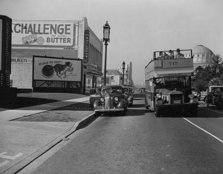 |
|
| (1930s)^ - A double deck Los Angeles Motor Coach, no. 717, passes parked cars on Wilshire near Ardmore. Note the advertisements on the building to the left--for butter and for ale. The Wilshire Boulevard Temple can be seen in the background. |
Historical Notes Los Angeles Motor Bus Company was formed in 1923 as a joint venture between both the Pacific Electric Railway and Los Angeles Railway to institute a comprehensive new motor bus service for major arteries in the rapidly expanding metropolis. The even numbered buses belonged to Los Angeles Railway and the odd numbered buses belonged to Pacific Electric Railway.#* |
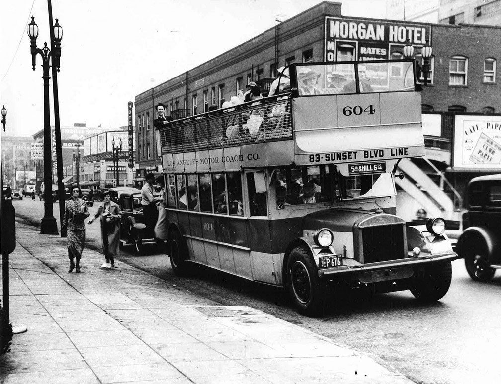 |
|
| (ca. 1932)#* - Los Angeles Motor Coach double-deck bus, no. 604. The Morgan Hotel, 629 W. 8th Street, can be seen in the background. |
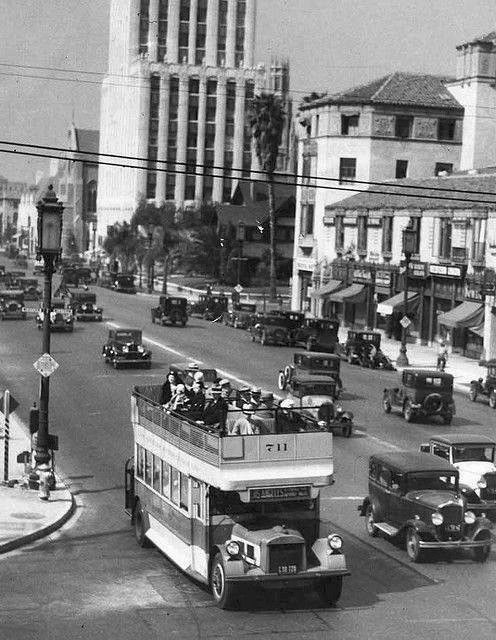 |
(ca. 1931)+# – View showing a double-decker, open-topped Los Angeles Motor Coach Bus heading east through the intersection of Western and Wilshire boulevards. The tall building in the distance is the Wilshire Professional Building (3875 Wilshire Blvd). |
|
Historical Notes Wilshire has an interesting distinction, it was the only street that was banned by the City of Los Angeles from having street rail on it. The elites of early 20th century Los Angeles who built their mansions in the area were the region's first "NIMFYs" (Not in My Front Yard). The clanging bells and masses who rode streetcars were not welcomed on Wilshire, but buses were. #* |
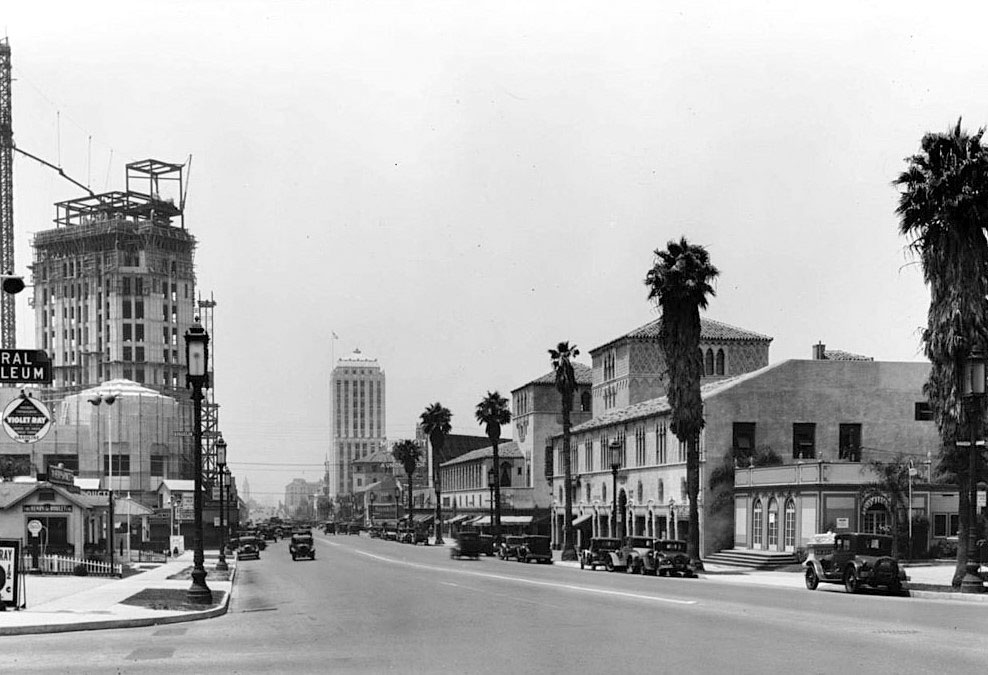 |
|
| (1931)+# – View looking west on Wilshire Boulevard showing the new Pellissier Building under construction on the S/E corner of Wilshire and Western. The Pellissier houses the magnificent Wiltern Theater which at the time it opened was designed as a vaudeville house and called the Warner Brothers Western Theater. The tall building in the distance is the Wilshire Professional Building, built in 1929. |
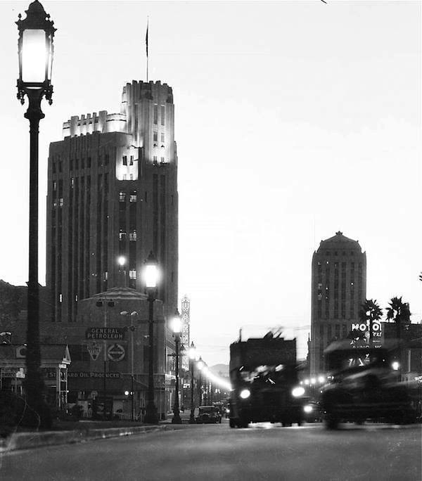 |
|
| (1931)*# – View looking west on Wilshire Boulevard during evening rush hour with double-decker bus seen heading towards the camera. The Pellissier Building and Warner Theatre (now Wiltern Theatre) are now complete. The Wilshire Professional Building is on the right and further back. |
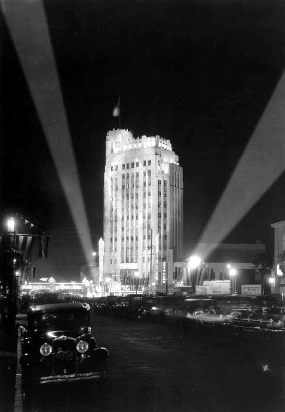 |
|
| (1931)*# - The Pellissier Building and Warner Theatre (now Wiltern Theatre). The above view shows the opening night of the Warner Brothers Western Theatre on the corner of Wilshire Boulevard and Western Avenue, Oct. 7, 1931. |
Historical Notes Originally built in 1931, the Wiltern was designed by architect Stiles O. Clements of Morgan, Walls & Clements, the city’s oldest architectural firm. The Wiltern Theatre was originally designed as a vaudeville theater and initially opened as the Warner Brothers Western Theater, the flagship for the theater chain. Quickly closing a year later, the theater reopened in the mid-1930s and was renamed the Wiltern Theatre for the major intersection which it faces (Wilshire Boulevard and Western Avenue.)^* Both the Wiltern Theatre and the Pellissier Building have been named to the National Register of Historic Places and declared a Los Angeles Historic-Cultural Monument by the City of Los Angeles (No. 118). Click HERE to see complete listing. |
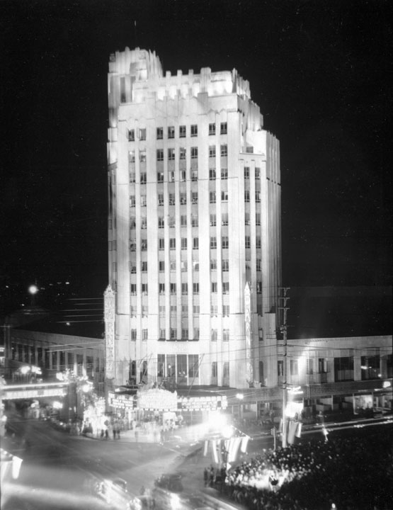 |
|
| (1931)* - A closer view of the Pellissier Building and Warner Theatre on opening night. |
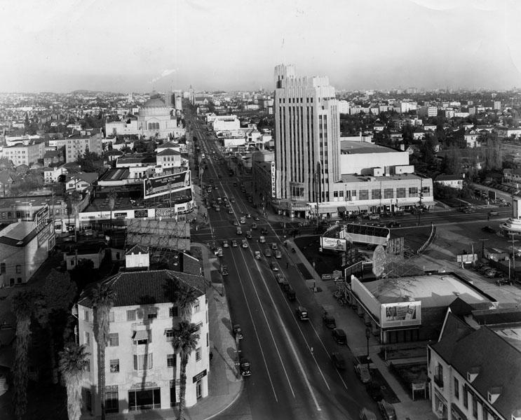 |
|
| (ca. 1931)^ - Looking east down Wilshire Boulevard from Ingraham Street. Various structures, including the Wiltern and the Wilshire Boulevard Temple, as well as numerous billboards can be seen. |
Historical Notes Many structures seen above, including the Churrigueresque style commercial building at 3771 Wilshire Boulevard (across from the Wiltern) have since been demolished.^ |
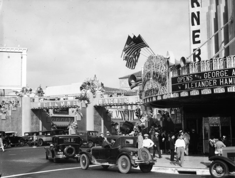 |
|
| (1931)^ - Outside view of the Art Deco style Warner Bros. Western Theater, at the time of its 1931 opening. |
Historical Notes The Wiltern Theatre opened its doors on Oct. 7, 1931, as the Warner Theatre -- part of Warner Bros.' chain of first-run movie houses -- with a screening of Alexander Hamilton, starring George Arliss. A brass band played, as movie stars and other stylish guests walked the temporary "Bridge of Stars" across Wilshire Boulevard to the theater's front doors. The bridge was decorated with lights and flowers.*## |
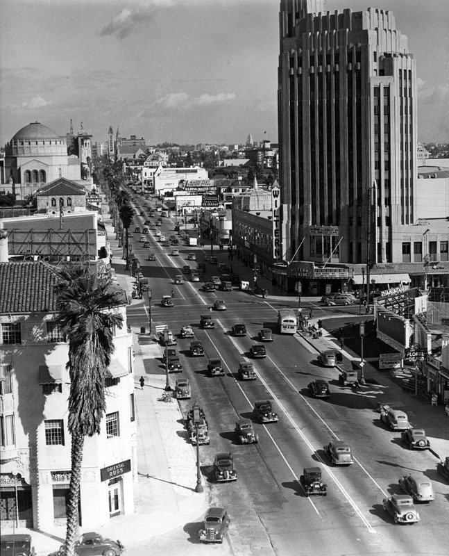 |
|
| (ca. 1930s)^ - View of Wilshire Boulevard, looking east toward Western Avenue with the Wiltern Theatre (previously Warner Bros. Western Theater) on the right side. In the background is the domed Wilshire Boulevard Temple (formerly the B'nai B'rith Temple), at 3663 Wilshire Blvd and Hobart. The Art Deco and Spanish Colonial Revival style buildings visible on the left hold various shops and offices. |
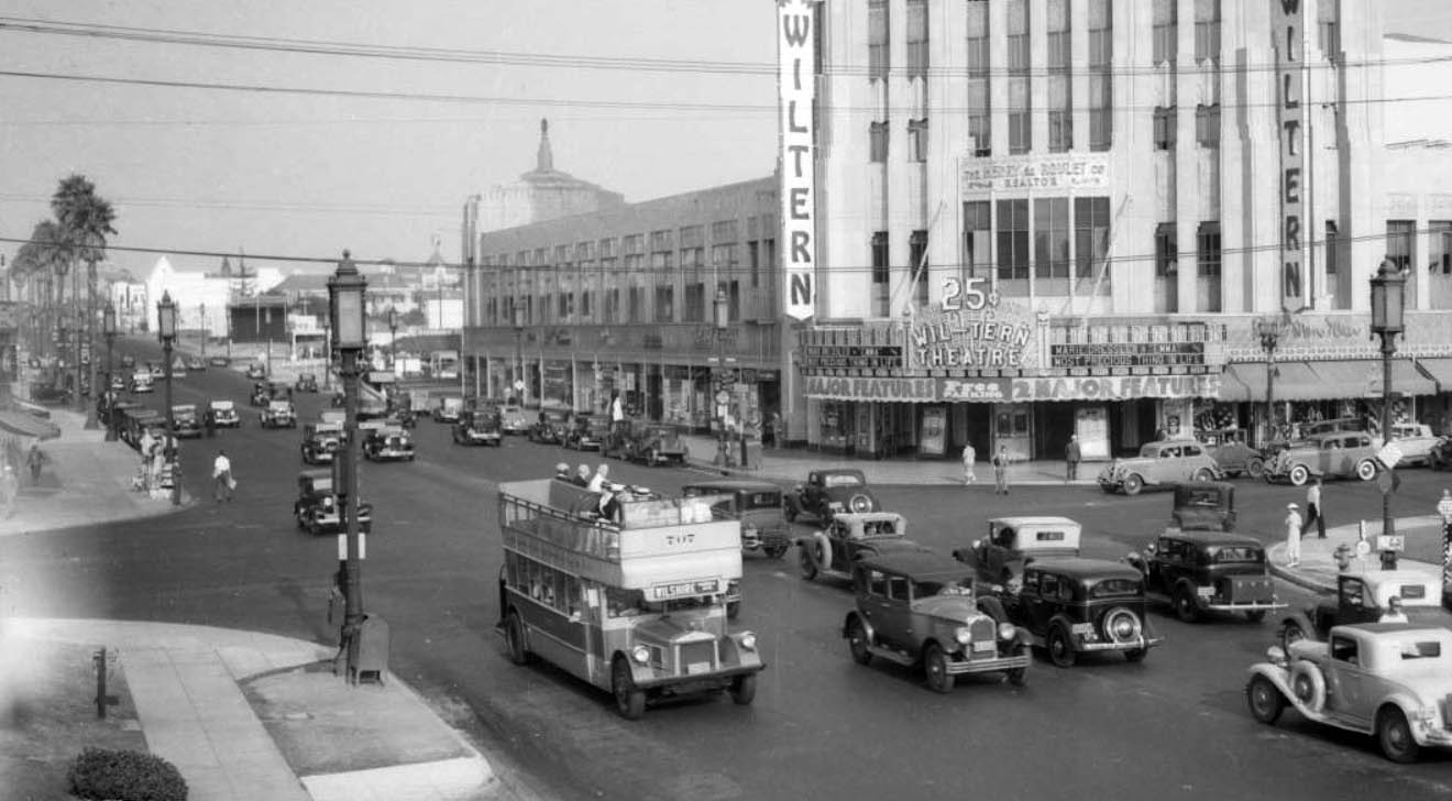 |
|
| (ca. 1934)*# - Panoramic view looking east on Wilshire Boulevard at Western Avenue. The intersection is full of cars and a double-decker bus. The Wilshire Theatre stands on the southeast corner with a large sign in front: “25 cents for Two Major Features” |
Historical Notes Wilshire has an interesting distinction, it was the only street that was banned by the City of Los Angeles from having street rail on it. The elites of early 20th century Los Angeles who built their mansions in the area were the region's first "NIMFYs" (Not in My Front Yard). The clanging bells and masses who rode streetcars were not welcomed on Wilshire, but buses were. #* |
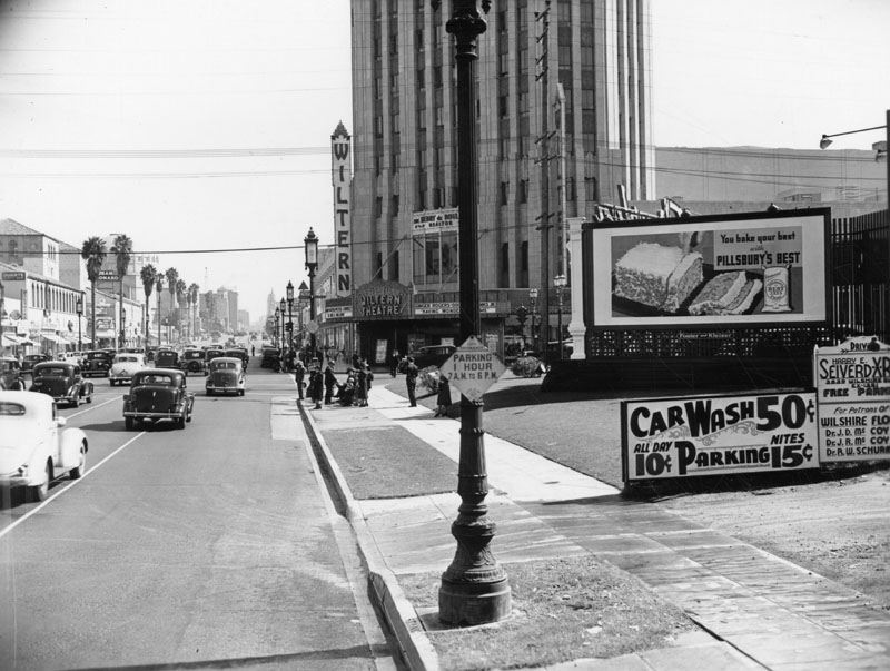 |
|
| (1938)^ - View of Wilshire Boulevard on October 18, 1938, looking east, toward Western Avenue; the Wiltern Theater can be seen. To the right of photo is a sign reading CARWASH 50 cents and 10 and 15 cent parking. |
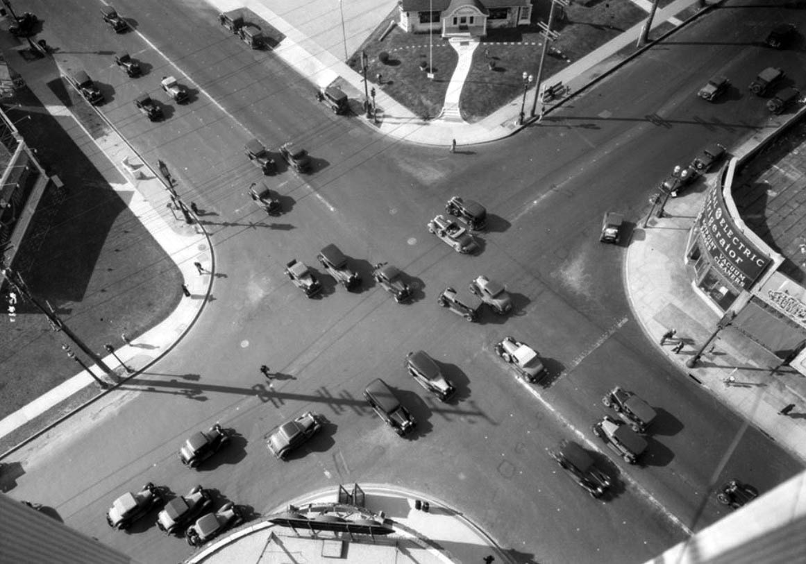 |
|
| (1933)*# - View looking over the intersection of Western Avenue and Wilshire Boulevard from on top of the Pellissier Building (location of the Wiltern Theatre). |
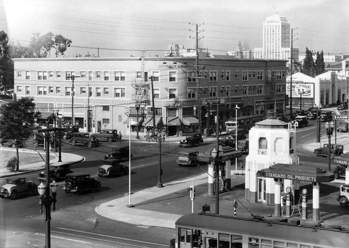 |
|
| (1931)*# – View looking northwest showing a Standard Gas Station located on the southeast corner of Western Avenue and 8th Street. Note the Art-deco tower structure at center of gas station. The large building across the street is the Beverly Arms Building. In the distance can be seen the 13-story Wilshire Professional Building. Click HERE to see more Early LA Gas Stations. |
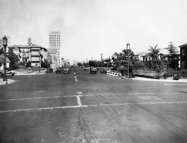 |
|
| (1929)^ - Looking east down Wilshire Boulevard where it crosses Wilton. Several homes are seen on both sides of the street, and in the background on the left is the newly completed Wilshire Professional Building, designed by Arthur E. Harvey. |
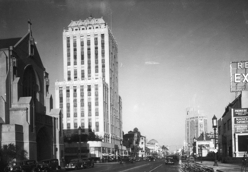 |
|
| (ca. 1932)^ - View of the Wilshire Professional Building, looking east on Wilshire Boulevard. On the left is a partial view of the St. James' Episcopal Church. In the background can be seen both the Wilshire Boulevard Temple and the Pellissier Building. |
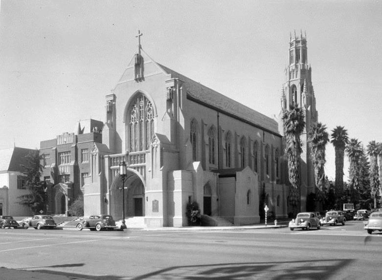 |
|
| (ca. 1935)^ - Exterior view of St. James' Episcopal Church, located on Wilshire Blvd. and St. Andrews Place, taken from across Wilshire Boulevard. A line of palms are seen on St. Andrews Place. |
Historical Notes The Gothic revival style church was designed by Benjamin C. McGougall and is considered to be one of the finest examples of Gothic Revival architecture in Southern California.^ |
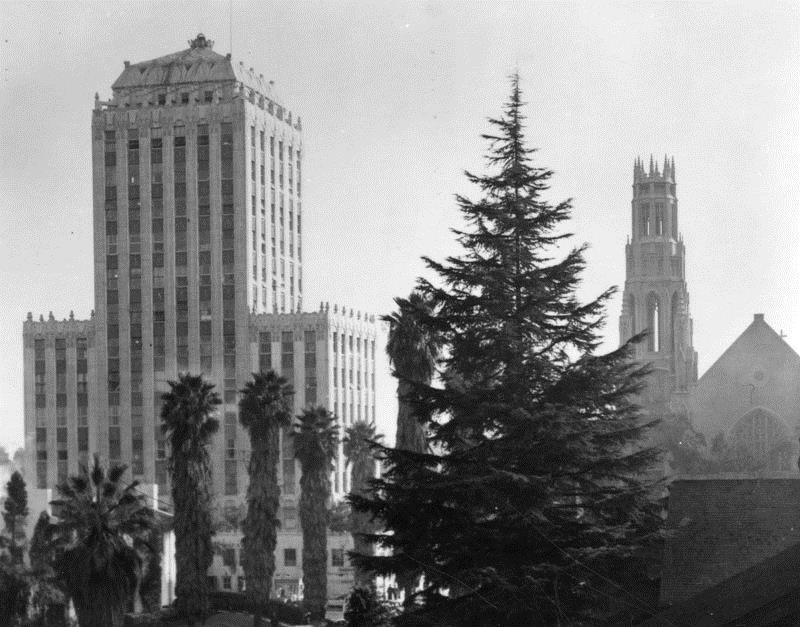 |
|
| (1937)^ - View of the Wilshire Professional Building on Wilshire and St. Andrews Place and St. James' Episcopal Church on the right. |
Historical Notes The Gothic revival style church was designed by Benjamin C. McGougall in the 1920s and the art deco office building at 3875 Wilshire Boulevard was designed by architect Arthur E. Harvey and built in 1929.^ |
* * * * * |
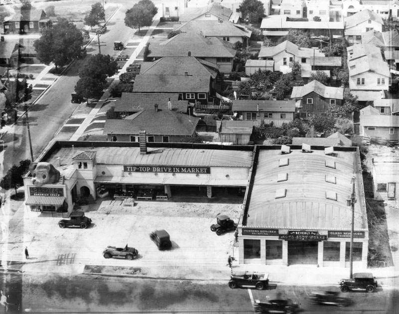 |
|
| (1929)^ - Aerial view of an early "mini mall" at 3649 Beverly Boulevard, consisting of Barkies Sandwich Shops, which features a puppy's head on the roof and paws by the entrance. Also shown are the Tip-Top Drive in Market and a bodyshop. |
Historical Notes Barkies Sandwich Shops was a 1920s Los Angeles restaurant chain, featuring a larger than life mascot named “Ponderous Pup.” These types of shops were an early precursor to the mini-mall idea. |
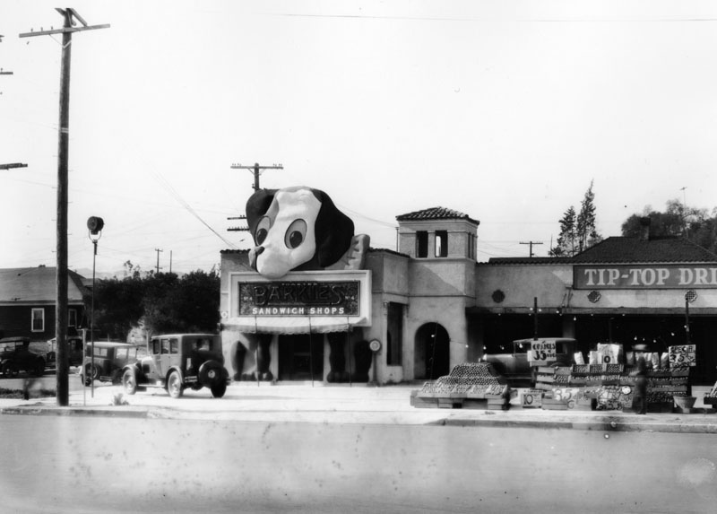 |
|
| (1930)^ - Closer view of Barkies Sandwich Shops located on the northeast corner of Vermont and Westmoreland Ave. A larger than life image of a mascot named the 'Ponderous Pup', graces the entrance way with his head on the roof and paws on either side of the door, a huge sign hanging from his mouth which reads: "Toasted Barkies Sandwich Shops, No. 4"; and on the right of the photo, Tip-Top Drive In Market. Crates of oranges, grapefruit, lemons, and other fruit have been placed next to the sidewalk, giving cars enough space to drive between those and the market entrance. |
Historical Notes In the 1920s and 30s, as the automobile was becoming the default way to get around Los Angeles, buildings and structures in the area became more unique, often resembling the merchandise or services they hawked. These “hey-you-can’t miss-me!” buildings (referred to as Novelty or Programmatic architecture) were made to pull automobile drivers right off the road. Click HERE to see more examples of Early Los Angeles Programmatic Architecture. |
* * * * * |
Sonora Town
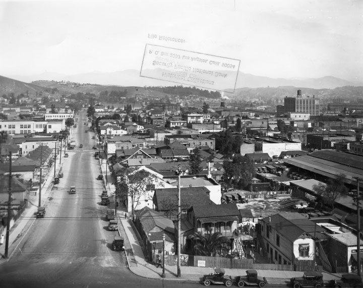 |
|
| (1930)^ - View of Sonora Town as seen from Fort Moore Hill, looking north on Castelar Street (now Hill Street). |
Historical Notes The part of the city called Sonora Town was an old adobe village north of the Plaza and Church of Our Lady, Queen of the Angels. It was Los Angeles' first Mexican quarters, or barrio. The area was named for the numerous miners and families who came from Sonora, Mexico, and may have still been around in the 1930s. Now it is Los Angeles' Chinatown District. Click HERE to see more Early Views of Sonora Town. |
* * * * * |
Pershing Square
 |
|
| (ca. 1930)*# - Panoramic composite photo looking northwest showing Pershing Square and surrounding area. Recognizable buildings include (l to r): the Biltmore Hotel, Philharmonic Auditorium, and the California Club, located on the N/W corner of 5th and Hill streets, on the right. |
 |
|
| (1930)^ - View looking northwest toward Pershing Square from the corner of 6th and Hill streets. The Pacific Mutual Building is seen in the distance on the left. The Biltmore Hotel is on the right. |
Historical Notes In 1867, St. Vincent's College, present day Loyola Marymount University, was located across the street, and the park informally became called St. Vincent's Park. In 1870, it was officially renamed Los Angeles Park. In 1886 it was renamed 6th Street Park, and redesigned with an "official park plan" by Frederick Eaton, later the mayor. In the early 1890s it was renamed Central Park, which it was called for decades. In November 1918, a week after Armistice Day ended World War I, the park was renamed Pershing Square, in honor of Gen. John Joseph "Black Jack" Pershing. |
 |
|
| (ca. 1930)* – Panoramic composite photo looking west over Pershing Square showing the Pacific Mutual Building (left) and the Biltmore Hotel (right) on Olive Street between 5th and 6th streets. Both buildings are still standing today. |
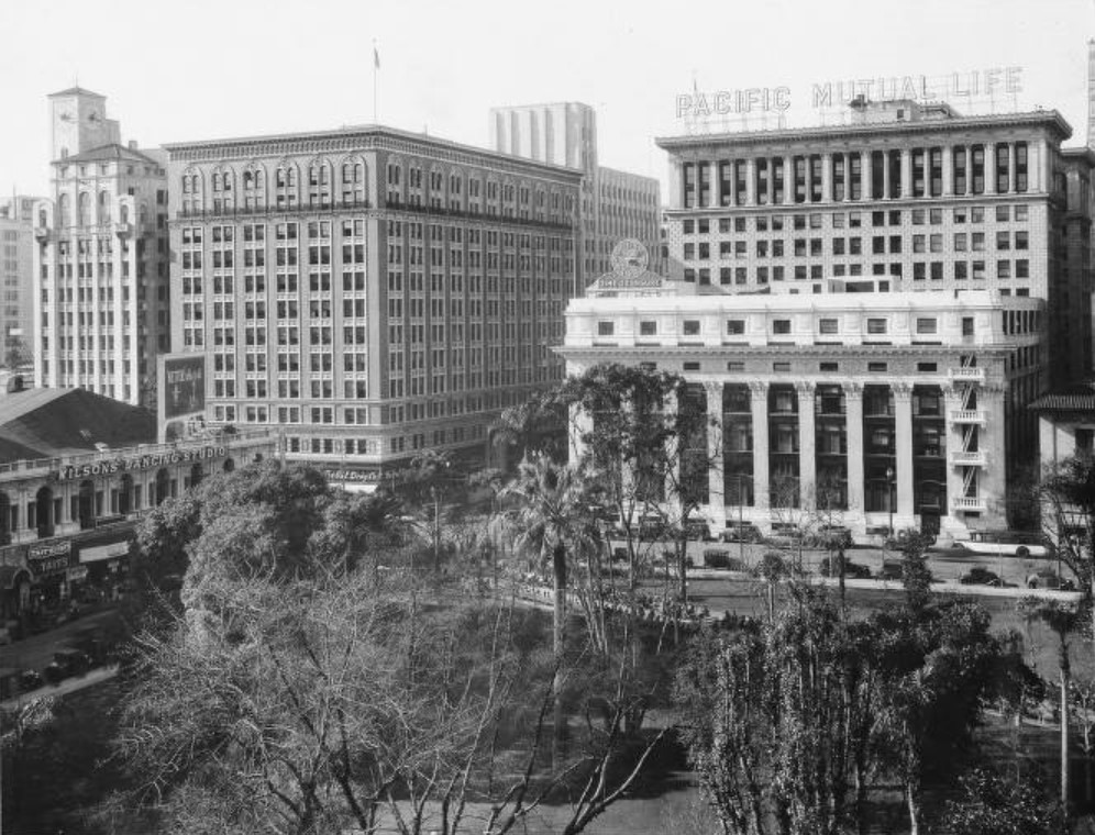 |
|
| (ca. 1930)* - View looking southwest toward the intersection of Olive and 6th streets with the Pacific Mutual Building stand on the N/W corner. Click HERE to see more Early Views of Pershing Square (1950 +). |
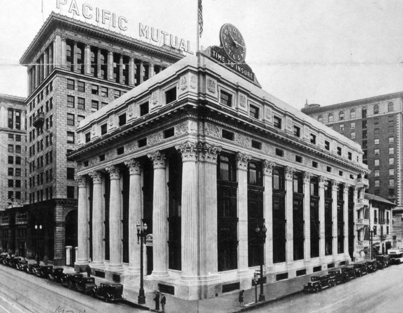 |
|
| (1931)^ - Exterior view of the Pacific Mutual Building. 6th Street is on the left and Olive Street on the right. |
Historical Notes The Pacific Mutual Building, located at 523 W. 6th Street, are actually three interconnected buildings built between 1908 and 1929. The original structure was designed and built between 1908-1912 by John Parkinson and Edwin Bergstrom. The original structure has seen many changes over the years: a North Side addition was built in 1916 by William J. Dodd; a twelve-story structure was built in 1921 by William J. Dodd and his associate William Richards; the Garage Building was added in 1926 by Schultze and Weaver; and the West Side addition was erected in 1929 by Parkinson and Parkinson. The building underwent Moderne remodeling in 1936 by Parkinson and Parkinson. The Pacific Mutual Building is still there today, but the facade of the building on the corner has been modernized. It is listed as Historic-Cultural Monument No. 398 (Click HERE to see complete listing). |
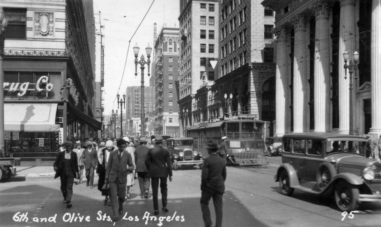 |
|
| (ca. 1930)^#^^ - View looking west on 6th Street at Olive. Pedestrians are seen crossing Olive while streetcar and autos are moving along 6th Street. The Pacific Mutual Building is seen at right on the northwest corner of the intersection. Note the beautiful streetlights. |
Then and Now
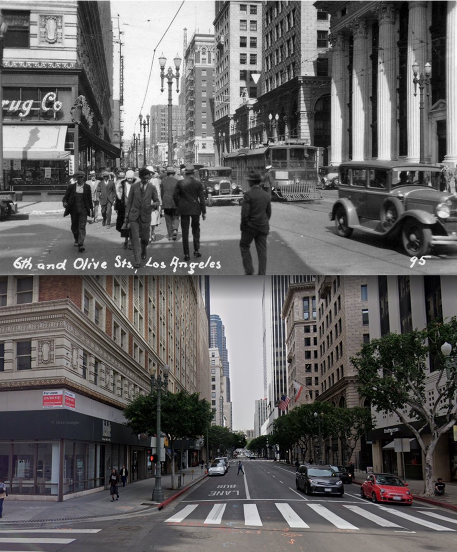 |
|
| (1930 vs. 2022)* - Looking west on 6th Street at Olive Street. Photo comparison by Jack Feldman. |
* * * * * |
Downtown Los Angeles - 1930s
 |
|
| (ca. 1930)* - A classic view of downtown Los Angeles looking north from the roof of the Washington Building at the southwest corner of Spring Street and Third Street. The iconic City Hall, built in 1928, rises above all surrounding buildings. Other notable structures include the 3rd LA Times building with its distinctive "castle-like" clock tower on the northeast corner of Broadway and 1st Street (upper center-left). Further back is the Gothic Revival-style Hall of Records, with the top of the clock tower of the Old County Courthouse visible directly behind it. In the foreground, the Lyceum Theatre stands out with its unique conical tower. The sign painted on the side of the theater reads: "Hear every word / 15¢ / Lyceum Theatre / Our sound is incomparable." Of all the buildings mentioned, City Hall is the lone survivor. |
Historical Notes LA Times 3rd Building (1912 – 1938) Hall of Records Building (1911 – 1973) LA County Courthouse (1891 – 1936) Lyceum Theatre Building (1888 – 1941) Los Angeles City Hall (1928 - Today) |
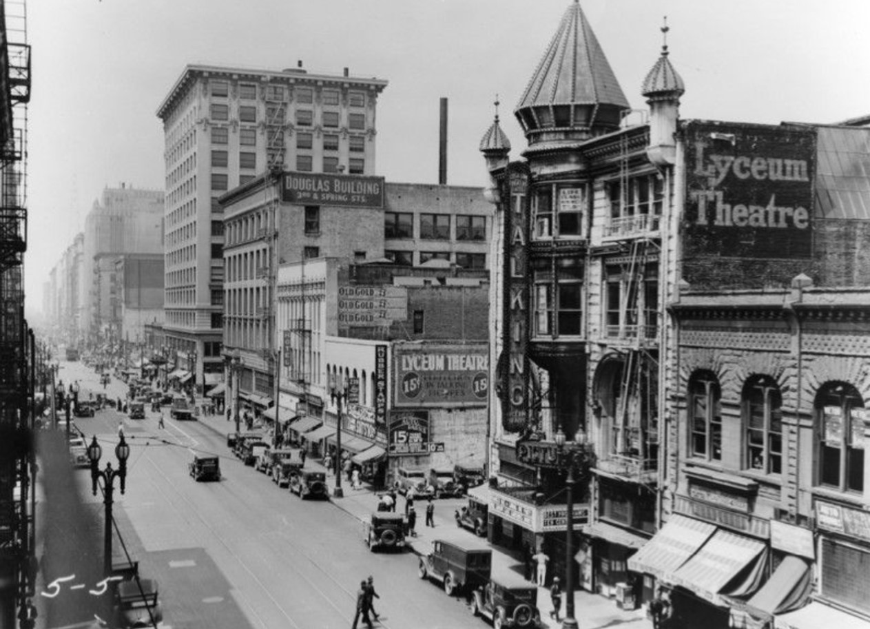 |
|
| (ca. 1930)* - Looking south on Spring Street toward 3rd Street, with the Douglas Building located on the northwest corner. The ornate Lyceum Theatre is seen on the right, featuring a large vertical sign hanging from the front of the building that reads "TALKING." |
Historical Notes Designed as an office building by James and Merritt Reid, the Douglas Building was completed in 1898. The Lyceum Theatre, located at 227 S. Spring Street, was designed by J. Lee Burton and opened in 1888 as the Los Angeles Theater. It later became the 2nd Los Angeles Orpheum Theatre, and when it closed in 1941, it was known as the Lyceum Theatre. All of the structures seen from the Douglas Building to the right have been demolished. |
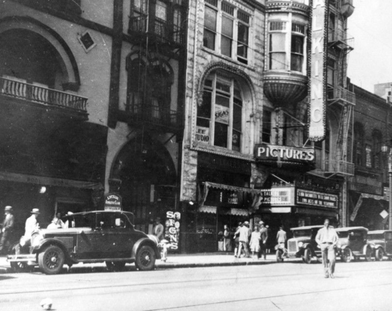 |
|
| (1935)* - Side view of the Lyceum Theatre located at 227 S. Spring Street. Signboards in front of building read "Talking Pictures". |
Historical Notes By the early 30s the Lyceum Theatre was exclusively a movie theatre. In 1941, the building was demolished to make way for a parking lot. |
Spring and 4th Street
.jpg) |
|
| (ca. 1930)* - Spring Street looking south at 4th Street. Angelus Hotel and Bank of Italy are on the southwest corner. Also shows Dan Parker, United Cigars, cars and pedestrians. |
Historical Notes The Angelus Hotel was built in 1901 by G.S. Holmes (also the proprietor of The Knutsford Hotel in Salt Lake City, Utah). Advertised then as the tallest building in Los Angeles, the hotel consisted of two, seven-story buildings joined by a central structure with a lobby, dining rooms, meeting rooms and other shared facilities, including a central court yard on top. The Bank of Italy was founded in San Francisco, in 1904 by Amadeo Giannini. It grew by a branch banking strategy to become the Bank of America, the world's largest commercial bank with 493 branches in California and assets of $5 billion in 1945. |
 |
|
| (ca. 1930)* - View looking south on Spring from 4th Street, with the Bank of Italy and the Angelus Hotel at right. They were demolished in 1956 for a parking lot. Next to them is the Title Insurance Co. building. Pedestrians, automobiles and trolleys are seen. What stands out are the exterior fire escapes on the Angelus Hotel. |
Historical Notes Fire Escapes date back to the turn of the 20th century, when fire safety became a major concern and building owners were required by law to provide fire escape routes in their new property. The fire escape invention seemed to be a simple and cost-efficient way to address this requirement. As far as a patented fire escape, the first credited person for such an invention was Anna Connelly in 1887. She invented the exterior staircase, used specifically for a fire escape. Many companies saw advantages to using this system and decided to incorporate that patent into their own buildings. These exterior staircases were cheap to build and could be added to the existing construction very easily, without the need to restructure the walls. |
Hill and 7th Street
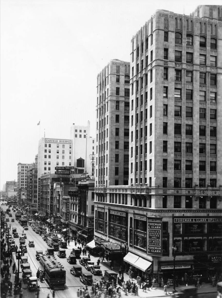 |
|
| (ca. 1930)*# - Birdseye view of Hill Street, looking south from Seventh Street. A large group of pedestrians are seen crossing Hill Street. |
Historical Notes Hill Street is at left and is crowded with both vehicle and pedestrian trafic. At center and right are several large buildings, including the Garfield Building and the RKO Theatre, which was formerly the Hill Street Theatre and part of the Orpheum Circuit. A very tall skyscraper is in the foreground at right and legible signs include, "Scott Bros", "Furs", "Foreman & Clark", "Upstairs from coast to coast", "Cost to coast Foreman & Clark World's Largest Makers and Retailers of Men's Clothes", "Gifts for Mother", "Mothers Day May 11th". |
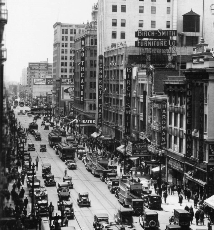 |
|
| (ca. 1930)*# - Close-up view of Hill Street, just south of Seventh Street. Hill Street is crowded with an assortment of automobiles, buses, streetcars, and also pedestrians on the sidewalks. |
Historical Notes Several large buildings can be seen, including the Garfield Building and the RKO Theatre, which was formerly the Hill Street Theatre and part of the Orpheum Circuit. Legible signs include, from left to right, "Professional Courses in [...] Secretarial Training", "Belasco Theatre", "Hotel", "RKO Theatre", "Herbists Café", "Garfield Building", "Birch Smith Furniture Co.", "Alhambra Bill Haines Marie Dressler", "Hardman Piano", and "Coffee Dan's". |
Broadway
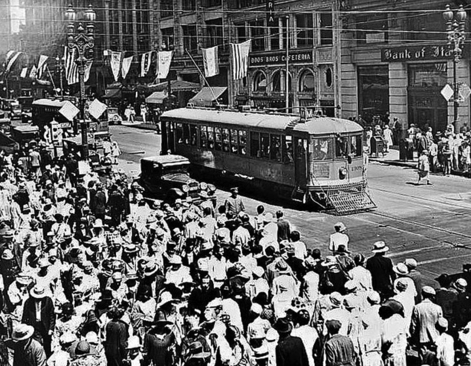 |
|
| (1930)#* – View showing a very busy Broadway with a LARy streetcar in the middle of the street. Banners and flages are seen suspended from overhead wires in the background. |
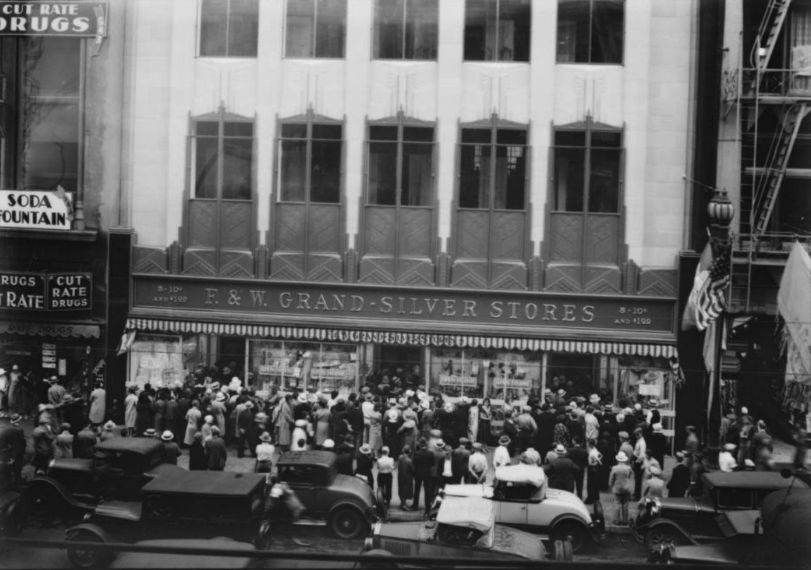 |
|
| (1931)*# – View showing a crowd at the opening of the F. & W. Grand-Silver Stores located at 537 South Broadway. Note the American Flag draped around the streetlight at right. |
Historical Notes The 1931-built Art-Deco building seen above was designed by architects Percy A. Eisen and Albert R. Walker, whose Downtown Los Angeles credits include the Fine Arts Building and the James Oviatt Building. It originally housed an outpost of the household goods business F&W Grand Silver Stores. In the middle of the century it held a Hartfield’s Department Store. More recently, the structure served as an office building. Click HERE for contemporary view. |
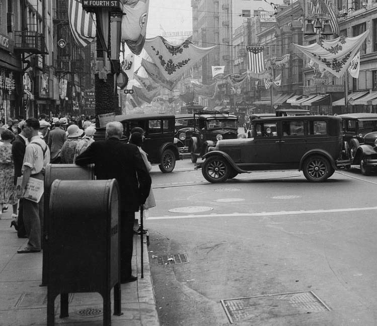 |
|
| (1931)^#^^ – Street view looing south on Broadway from 4th Street. Banners are seen suspended from wires between the buildings in celebration of Fiesta Week. |
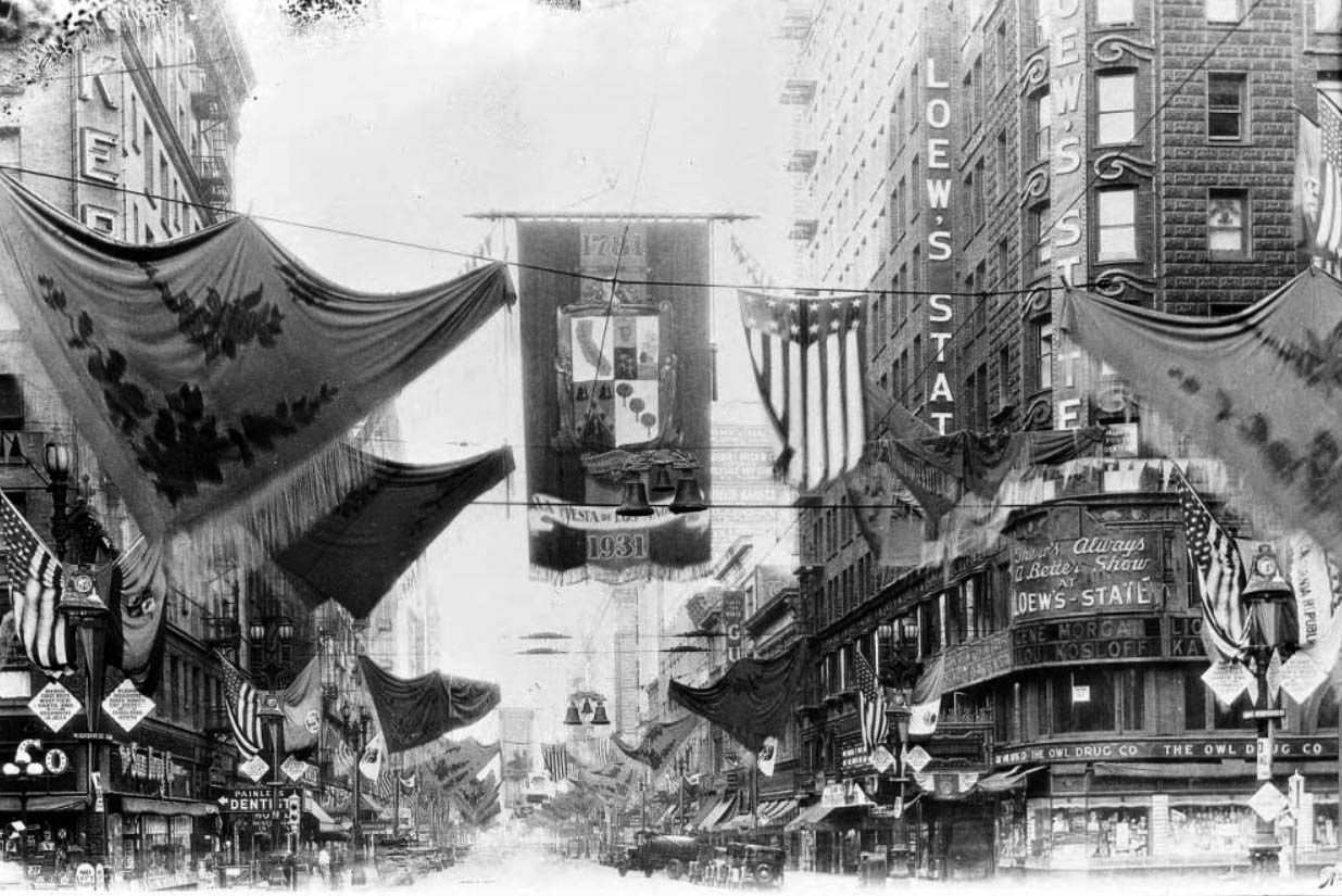 |
|
| (1931)*# – View looking south on Broadway from 7th Street showing the elaborate decorations for Fiesta Week (November 1931). Overhead, flags and bells are suspended from wires between the buildings with four American flags hanging from the streetlight posts at each corner of the intersection. Loew's State Theatre is at the S/W corner. |
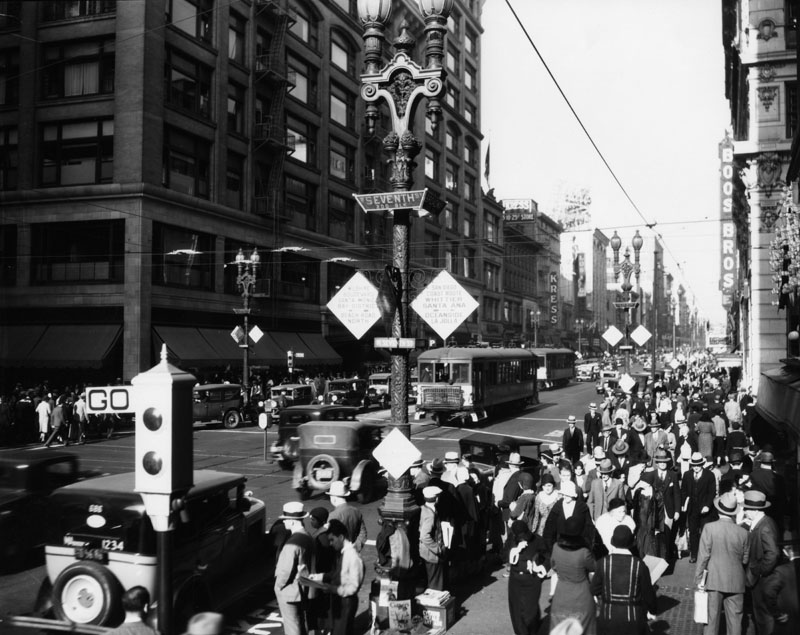 |
|
| (1930)^ - The streets are very crowded with people, cars and trolleys at the intersection of 7th and Broadway where the traffic sign says "GO". The view is looking norh on Broadway. On the right is the sign for Boos Bros. Cafeteria. On the left is the Bullock's department store and further up the street is Kress dime store. Note the ornate lamp poles with traffic information signs on each corner. |
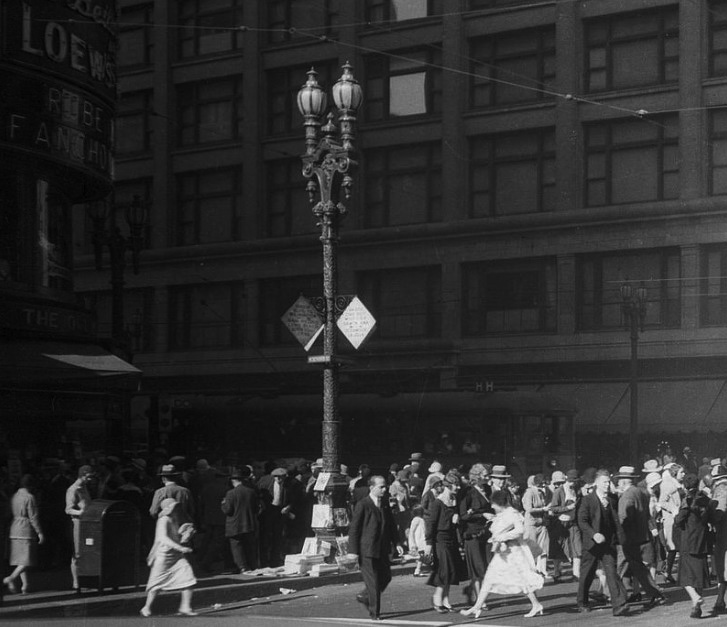 |
|
| (1930)^#^^ - View showing throngs of people at the intersection of Broadway and 7th Street with the Loew's Theatre at left. Note the tall ornate two-lamp streetlight on the corner. |
Historical Notes The ornate streetlight seen above is also referred to as the 'Broadway Rose'. It was so named for the distinctive climbing rose design on the post. The Broadway Rose only appeared on Broadway. |
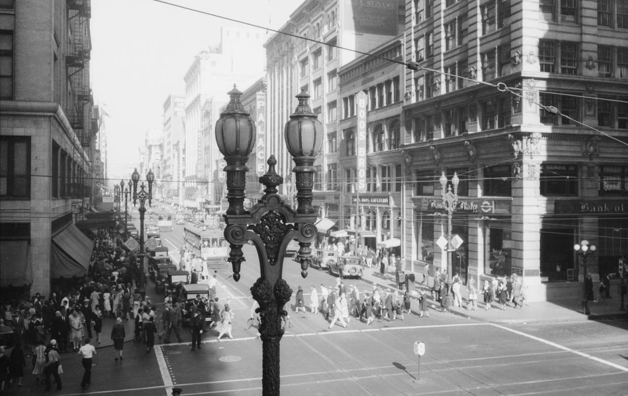 |
|
| (1930)*# – View looking north on Broadway at 7th Street showing the beautiful 2-lamp Streetlamps running up and down Broadway. Click HERE to see more Early Views of Los Angeles Streetlights |
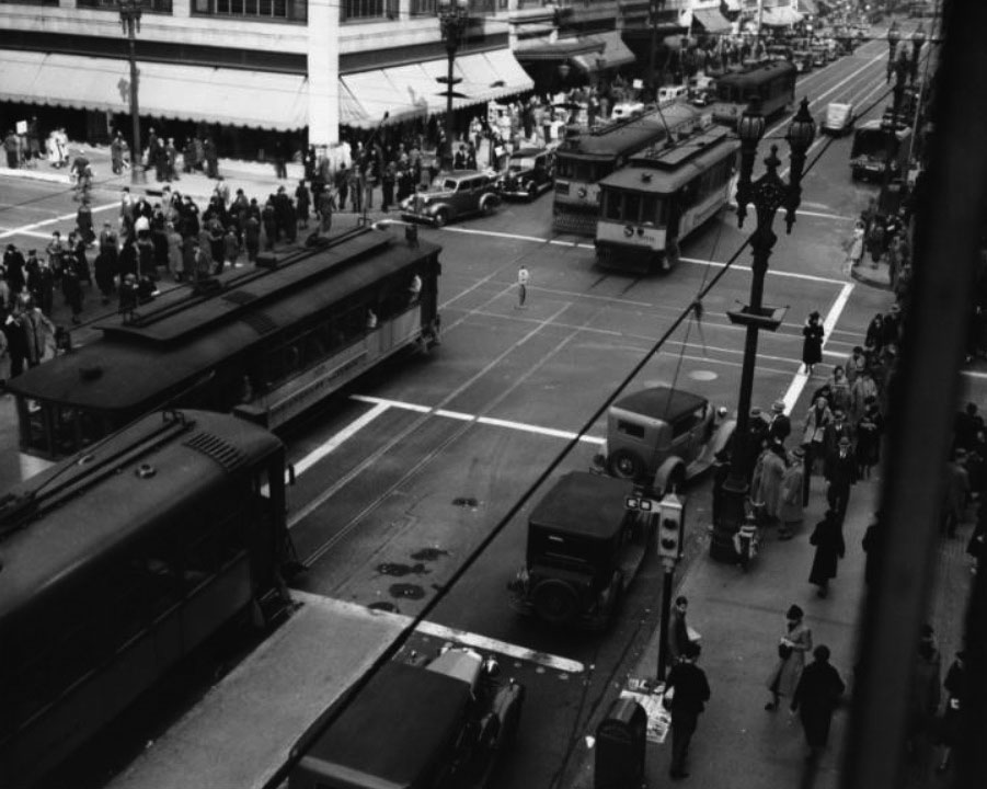 |
|
| (1930)*# - View of the intersection of Broadway and 7th Street, crowded with pedestrians and Los Angeles Railway cars. |
Historical Notes Seventh Street and Broadway was a busy junction for the Pacific Electric Railway, with southbound cars leaving on the San Diego Coast Route, stopping at Whittier, Santa Ana, Oceanside, and La Jolla. Westbound trains along Wilshire Boulevard head towards the Santa Monica Bay District and Beach Road North.*# |
Click HERE to see more Early Views of Broadway and 7th Street (once LA's Busiest Intersection). |
Broadway and 8th
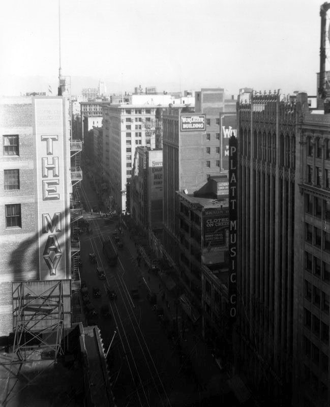 |
|
| (ca. 1927)^ - Rooftop view looking north towards the intersection of Broadway and 8th Street with the May Company Building seen at left. On the east side of Broadway can be seen the Orpheum Theatre Building (partial view on the right), Platt Music Company Building and the Wurlitzer Building. |
Historical Notes The tallest buildings seen above were all 13-stories which was the legal limit in those days. There was a 150’ height limit until as late as 1957. Also, the first floor usually encompassed a 2nd floor mezzanine, so that there was never a 13th floor. The Platt Music Company Building was constructed in 1927 and designed by architects Walker + Eisen who also designed the Wurlitzer Building just up the block at 818 S. Broadway. The same firm also designed the Beverly Wilshire Hotel in Beverly Hills.^ |
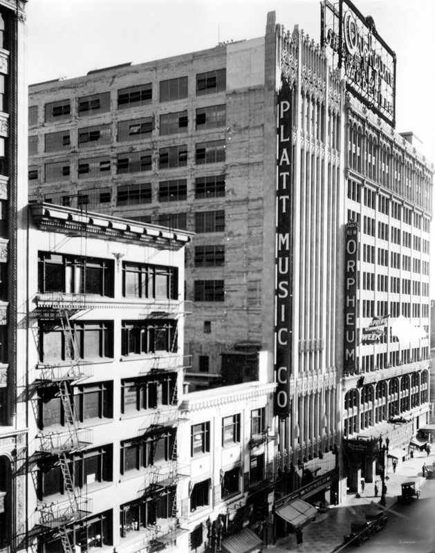 |
|
| (ca. 1927)^ - View looking southeast at the 800 block of Broadway showing two 13-story buildings (tallest in the city at the time): the Platt Music Company Building and the Orpheum Theatre Building. Both have large vertical signs on the corner edge of the buildings. |
Historical Notes The Orpheum Theatre at 842 S. Broadway opened on February 15, 1926 as the fourth and final Los Angeles venue for the Orpheum vaudeville circuit. Earlier Orpheum theatres in downtown Los Angeles included: ◆ 110 S. Main St. -- Grand Opera House was the home of Orpheum vaudeville from 1894 to 1903. ◆ 227 S. Spring St. -- The Los Angeles Theatre, later called The Lyceum, was known as the Orpheum from 1903 to 1911. ◆ 630 S. Broadway -- Now the Palace Theatre -- this was the Orpheum between 1911 and 1926. |
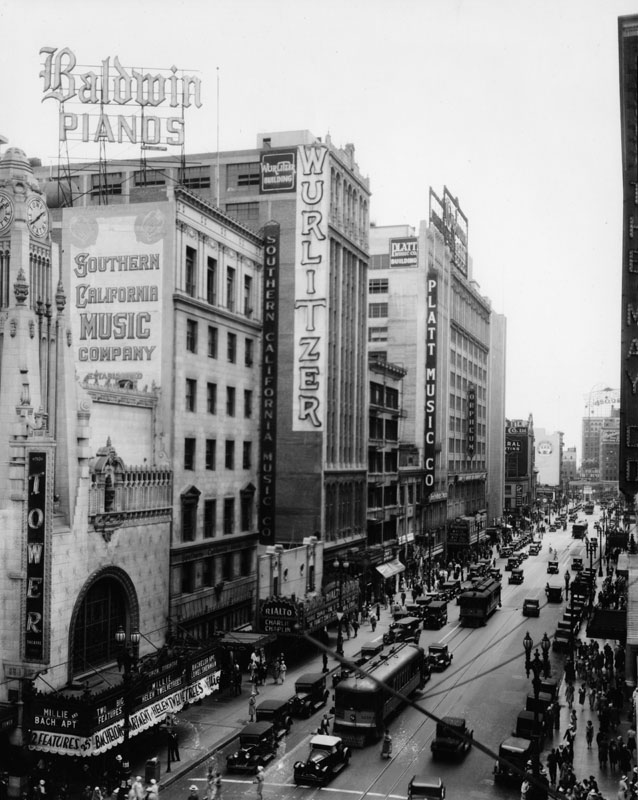 |
|
| (ca. 1927)^ - View looking south on Broadway from 8th Street, showing the (left to right): Tower Theatre, Southern California Music Company, Wurlitzer Building, Rialto Theater, Platt Music Company Building, and the Orpheum Theatre. A very large and prominent Baldwin Pianos sign sits on top of the Southern California Music Co. Building. |
Historical Notes The 13-story Wurlitzer Building, built in 1924, was was billed as "the world's largest music house" (Click HERE to see more). |
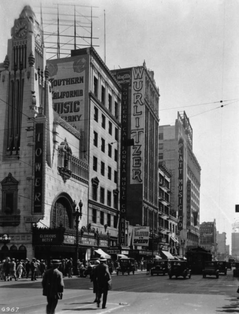 |
|
| (1928)*# – Street view looking south on Broadway at 8th Street showing the Tower Theatre at the end of the street to the left (S/E corner), its clock tower reading approximately thirty-nine minutes after two o'clock, behind which the Southern California Music Company Building, Wurlitzer Building, Platt Music Company Building and the New Orpheum can be seen, respectively. Automobiles, pedestrians and a cable-car navigate the street to the right. |
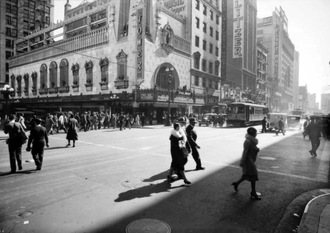 |
|
| (1931)*# - View looking toward the Tower Theatre at 8th and Broadway. Traffic is stopped as people cross the intersection in all directions. Several well known buildings can be seen in the distance including: Wurlitzer Building, Platt Music Company Building and the New Orpheum. Photo by Dick Whittington |
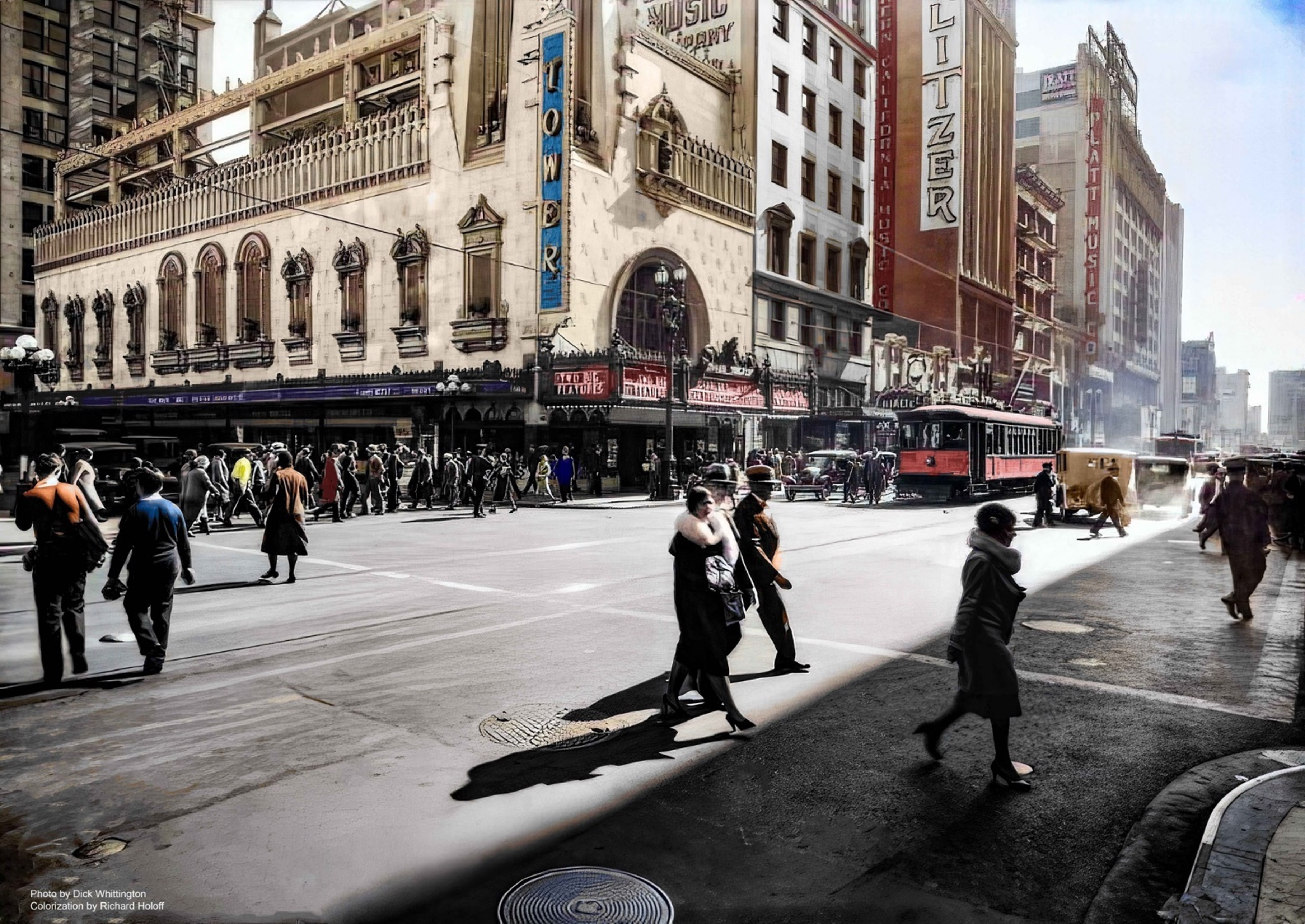 |
|
| (1931)^^ - View looking toward the Tower Theater at 8th and Broadway. Traffic is stopped as people cross the intersection in all directions. Photo by Dick Whittington; Image enhancement and colorization by Richard Holoff |
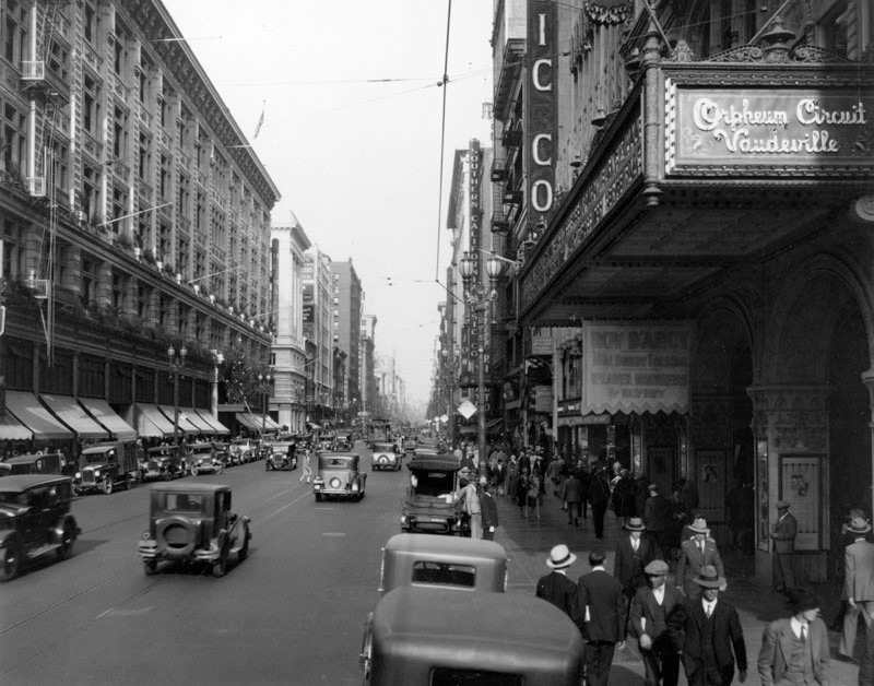 |
|
| (1930)^ – View looking north on Broadway toward 8th Street, showing the Orpheum Theatre on the right, and the May Company Building on the left. Pedestrians fill the sidewalks and cars fill the streets. |
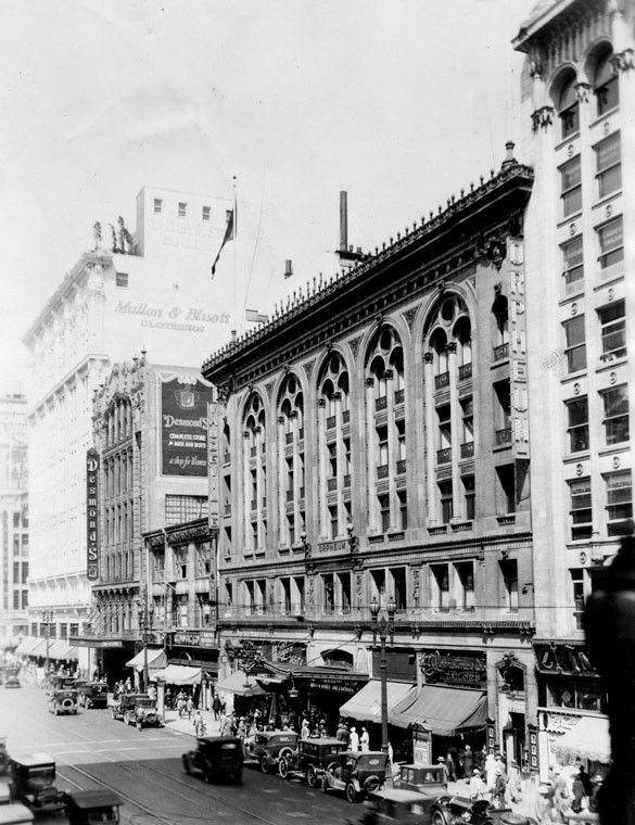 |
|
| (1933)^ – View looking north on the 600 block of Broadway with the 3rd Orpheum Theatre at center. To its left is Schaber's Cafeteria, Desmond's Building, and the Walter P. Story Building (home to the Mullen and Bluett Store), located on the SE corner of Broadway and 6th Street. |
Broadway and 10th (later Olympic)
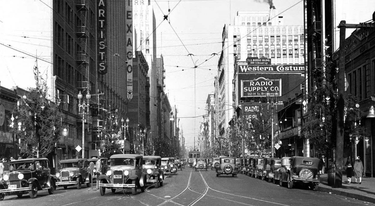 |
|
| (ca. 1930)*# – View looking north on Broadway from just north of 10th Street (later Olympic Boulevard*). The United Artists Theater Building is at left along with the Texaco Building. On the right is the L.L. Burns Building and Radio Supply Co. The streets are aligned with dual-lamp streetlights and Christmas trees. |
Historical Notes *In 1932, the entire length of the 10th Street, from East L.A. to Santa Monica, was renamed Olympic Boulevard for the Summer Olympics being held in Los Angeles that year.^* |
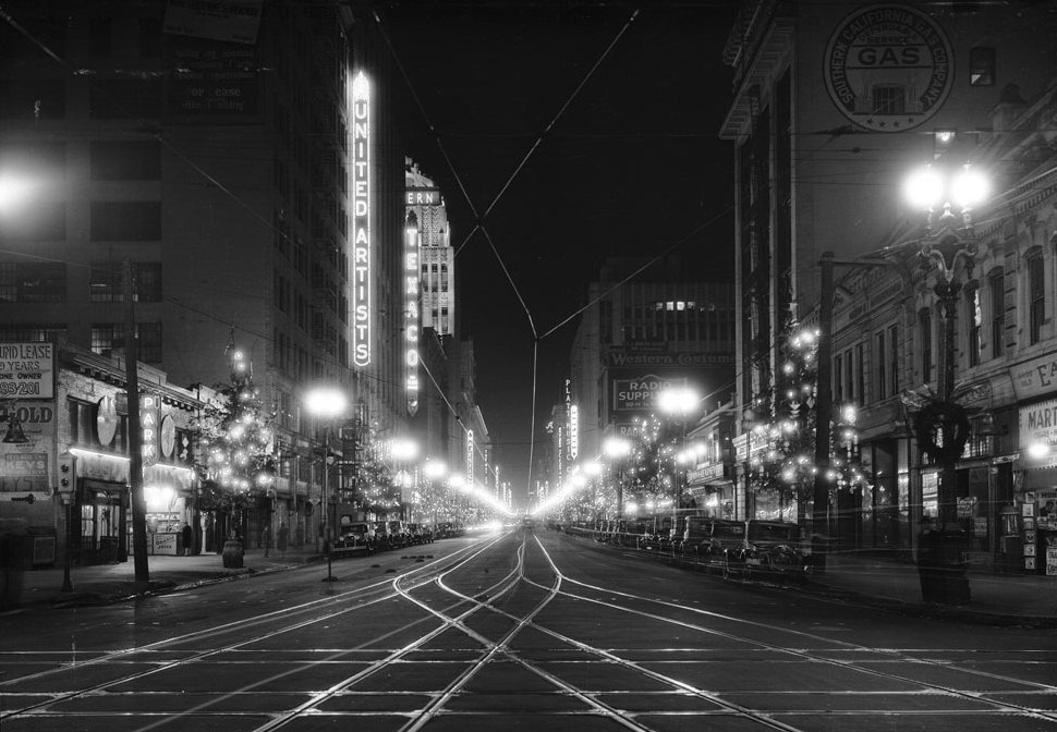 |
|
| (1930)*# – Night view looking north on Broadway from 10th Street (now, Olympic Boulevard). The street is illuminated by streetlights, electric signs, and lights on the Christmas trees. |
 |
|
| (ca. 1952)* – Looking north on Broadway from Olympic Boulevard (originally 10th Street). |
* * * * * |
Broadway and 9th
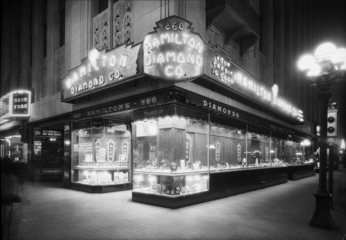 |
|
| (1930)*^^ - A 5-lamp ornate streetlight and the Hamilton Diamond Co. store lighting help illuminate the northeast corner of Broadway and 9th Street. |
Click HERE to see more Early LA Streetlights |
.jpg) |
|
| (1929)**^** – View looking at the east side of Main Street showing the Liberty Theatre bookended by the Harris Hardware Company and the Gray Hotel. |
Historical Notes The Liberty Theatre was described at length in a Moving Picture World article: The 'Liberty' is one of the city's eight first-class moving picture theaters. The selection of the theater site was chosen with exceptionally good judgment. The theater is located in the heart of the business district at 266-68 South Main Street, near the intersection of Third and Main Streets.^^*# |
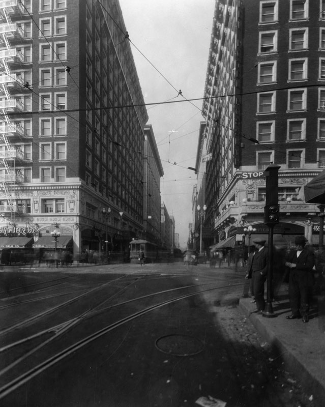 |
|
| (1930)^ - View of looking west on 5th Street at Main Street showing the Rosslyn Hotel and Annex on the west side of Main. Various buildings and storefronts such as the Rosslyn Drug store and the United Cigar Store can also be seen. Two men are standing near a traffic signal which reads: STOP. |
* * * * * |
Gasometers of Early LA (aka "Gas Holders" or "Gas Tanks")
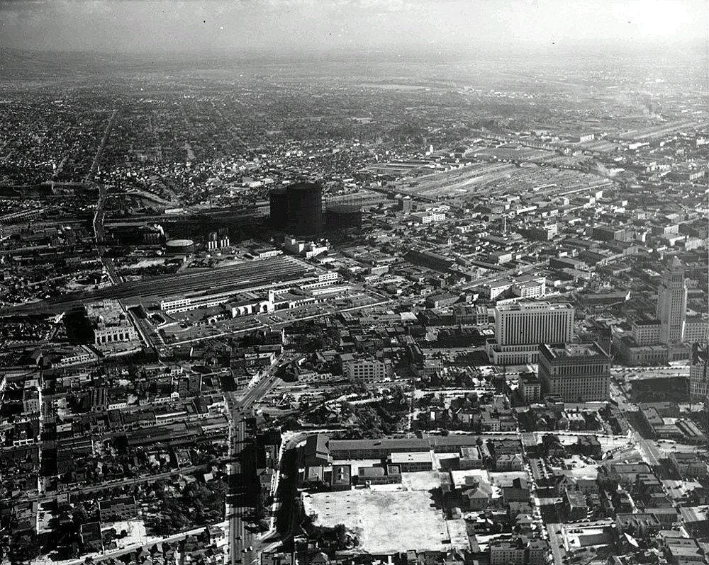 |
|
| (ca. 1939)**^ - Aerial view looking southeast across Fort Moore Hill. The recently completed (1938) Union Station is in view at left-center of photo. Just to the southeast of Union Station, across Aliso Street, can be seen two very large natural gas tanks known as "gas holders" (aka gasometers). |
Historical Notes The huge tanks seen above were known as "gas holders" (aka gasometers), and helped supply natural gas to the city. They rose or sank in height depending on the amount of gas being stored. The gas holders were in fact laughably large and towered over their surroundings. When one gas holder was built in 1906 its 210 foot height was 35 feet greater than the tallest building in Los Angeles. * |
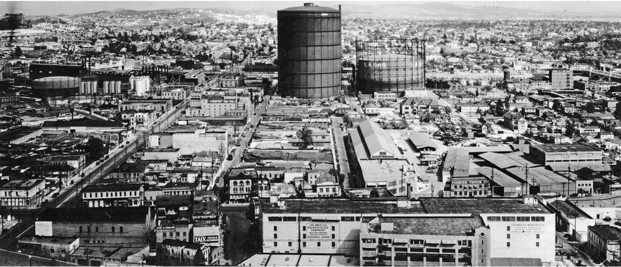 |
|
| (ca. 1930)*# - Panoramic view looking east from the City Hall tower. What stands out is the enormously large gas tank owned by the LA Gas and Electric Corporation. The street on the left running diagonally is Aliso, where the 101 Freeway (Hollywood Freeway) is located today. |
Historical Notes The above 300-foot tall gas holder or silo (aka gasometer) was located at the corner of Ducommon and Center, east of the Civic Center. It was built in 1912 by the LA Gas and Electric Corp. and it's not clear when it was torn down. Shots of Downtown up through 1960 seem to show these structures in the background.#^^* |
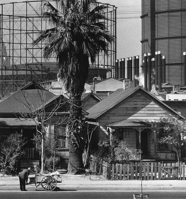 |
|
| (ca. 1930s)^.^ - Mission Road looking across the L.A. River from Boyle Heights toward two very large “Gasometers” built in 1912 by the LA Gas and Electric Corp. A man is seen leaning over in front of a wagon (lower-left) and City Hall can also be seen (upper-left). |
Historical Notes In 1936 Los Angeles city voters approved a charter amendment authorizing the Bureau of Power and Light to issue revenue bonds in the amount of $46 million and purchase the electric system of Los Angeles Gas and Electric Corporation, the last remaining privately-owned system in LA. Click HERE to see more in Los Angeles Gas and Electric Corporation. In 1937, the Gas component of Los Angeles Gas and Electric was sold to what is now Southern California Gas Company.*^ |
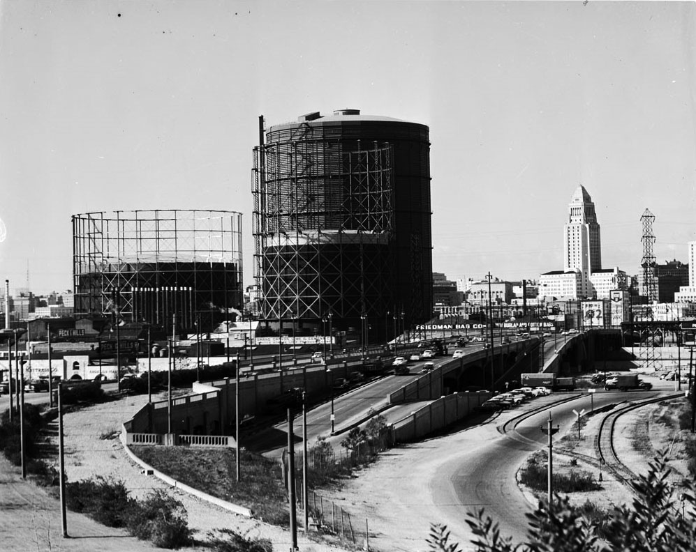 |
|
| (ca. 1950)*# - View looking west on Aliso Street toward the Civic Center. Three extremely large natural gas holders stand in proximity to the Friedman Bag Company and Brew 102, with City Hall in the background. This photo was taken just a couple of years prior to the construction of the 101 Freeway where Aliso Street is seen above. |
Historical Notes If you lived in Los Angeles in the 1950s you would be familiar with the two prominent features of the skyline (excepting the fact there was no skyline). The City Hall of course was the tallest building and the most identifiable but the other dominant structures were the storage tanks (also called gasometers) of the Los Angeles Gas Company. The L.A. Gas Company supplied natural gas to Southern California from a distribution center located just east of downtown. This was in an industrial area next to Union Station and became known as the gas works. By the 1960s the tanks were no longer needed as new pipelines from gas fields of West Texas could meet all demands. The tanks were removed at great relief to fire officials who worried about the potential disaster with these tanks near downtown.* |
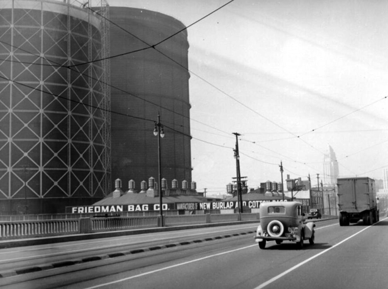 |
|
| (ca. 1940s)^ - An early model car and truck are seen here driving across Aliso Street bridge (later the 101 Frwy) leading to downtown. To the left also are natural gas storage tanks (gasometers). City Hall can be seen in the distance, and a company making burlap and cotton bags is located to the left of the bridge (Friedman Bag Co.). |
Historical Notes The last section of the 101 Freeway (aka Hollywood Frwy) through Downtown Los Angeles was completed in 1954. It ran in line with what used to be Aliso Street. Click HERE to see Before and After images. |
* * * * * |
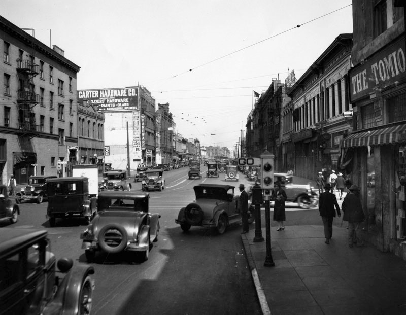 |
|
| (1931)^ - View of Los Angeles Street, looking north from 1st Street. Many automobiles are travelling on this busy road and also parked along the curbs. The semaphore traffic signal on the corner reads: “GO” |
Historical Notes Los Angeles installed its first automated traffic signals in the 1920s. These early signals, manufactured by the Acme Traffic Signal Co., paired "Stop" and "Go" semaphore arms with small red and green lights. Bells played the role of today's amber or yellow lights, ringing when the flags changed—a process that took five seconds. |
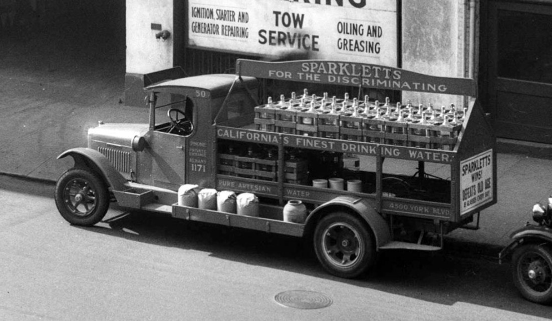 |
|
| (1931)^#^^ – View showing a Sparkletts delivery truck in the 200 block of S. Los Angeles Street. Sign on truck reads: “Sparkletts for the Discriminating”. Click HERE to see more on the Sparkletts Water Bottle Corp. |
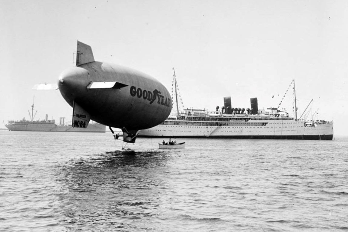 |
|
| (1931)*# - Transferring mail from an ocean liner to the Goodyear Blimp in the Los Angeles Harbor. Click HERE to see more in Early Views of San Pedro and Wilmington. |
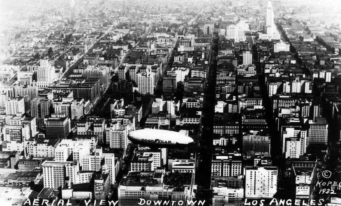 |
|
| (1932)**^ - Aerial view looking north up Broadway. The Goodyear blimp is hovering over downtown Los Angeles and City Hall is seen in the distance. Click HERE to see more in Aviation in Early Los Angeles. |
 |
|
| (ca. 1932)^#^^ – Composite panoramic view looking north on Wall Street from 9th Street. City Hall can be seen in the distance. |
* * * * * |
Please Support Our CauseWater and Power Associates, Inc. is a non-profit, public service organization dedicated to preserving historical records and photos. We are of the belief that this information should be made available to everyone—for free, without restriction, without limitation and without advertisements. Your generosity allows us to continue to disseminate knowledge of the rich and diverse multicultural history of the greater Los Angeles area; to serve as a resource of historical information; and to assist in the preservation of the city's historic records.
|
For more Historical Los Angeles Views click one of the following:
For Other Historical Views click one of the following:
See Our Newest Sections:
To see how Water and Electricity shaped the history of Los Angeles click one of the following:
Water:
Power:
* * * * * |
References and Credits
* DWP - LA Public Library Image Archive
^ LA Public Library Image Archive
*^Oviatt Library Digital Archives
#*MTA Transportation and Research Library Archives
#^California Historical Society Digital Archive
+#Facebook.com: Garden of Allah Novels
+++Photobucket
+^^The Eastsider: Riverside-Figueroa Bridge
+#+Pinterest - California and DailyBreeze.com; Mid Century Hollywood
#^^Picturetrail.com: KCET - Angels Flight
*^#Los Angeles Conservancy: LA Stock Exchange Building; Park La Brea; Warner Bros.Theatre; Downtown Jewelry Exchange/Warner Bros. Theatre; Wiltern Theatre and Pellissier Building
^#^Pacific Electric Railway Historical Society - Alan Weeks Collection
*#*Westland.net: Venice History
^#*Metro.net: Mulholland Drive Bridge
**#The California History Room, California State Library: William Reagh
^*#Library of Congress: Panoramic View of Civic Center; Macy Street Viaduct; 4th Street Bridge
^^#The George A. Eslinger Street Lighting Photo Gallery
*##LA Weekly - Warner Bros. Theatre; The Wiltern Theatre
^## Facebook.com: Photos of Time Travelers
+##MartinTurnbull.com: Fairfax and Wilshire
+#*LA Curbed
+**Los Angeles' Bunker Hill - Alta Visa Apartments
^^+How Stuff Works: Chevrolet Impala
++^Mentalfloss.com: 12 Postcard Locations Then and Now
++*Historic Los Angeles Wilshire Boulevard when it was Residential
++#Facebook.com: Photos of Los Angeles
#**Pinterest - California and DailyBreeze.com
#*^Theatlantic.com: AP Photo - George Patton
#^*This Moderne Life: Simon's Drive-In
##*Boston Public Library: Flickr.com
^^*Early Downtown Los Angeles - Cory Stargel, Sarah Stargel
^^^Los Angeles Orthopaedic Hospital
***Los Angeles Historic - Cultural Monuments Listing
*^*California Historical Landmarks Listing (Los Angeles)
*#^Forum.Skyscraperpage.com: Arroyo Seco Library; Westwood-Life Magazine; Japanese Internment; 8th and Francisisco; Bob's Airmail Service Station; 1932 Downtown Aerial; North Los Angeles Street; May Co. Building; Cahunega and Highland Intersection ca1937
*#^^LAPL-El Pueblo de Los Angeles Historical Monument Photo Archive
**** Pinterest.com: Los Angeles Dodgers; Vintage Los Angeles: Aerial Westwood - Rancho Park; Los Angeles and Hollywood; MacArthur Park w/Downtown Skyline; Gilmore Self-Service Gas Station; Sawtelle and National; Bullock's Delivery Truck
^^^^Depaul.edu: Night Train 55
**^^Aerofiles - US Aviation Firsts
**#^Vincent Thomas Bridge - Facts and Figures
*^*^Big Orange Landmarks: Los Angeles City Hall
***^Pomona Public Library Digital Archive: Bob's Airmail Service Station
^*^*HollywoodHeritage.com: The Muller Family Foundation
*^^*Pinterest.com: Bertrand Lacheze
^^**Pinterest.com: Vintage California
^^*^Restaurantwarecollectors.com: Angelus Hotel
*##*Pinterest.com: Trucks, Pick-Ups, and Gas Stations
***#I Love Los Angeles But...: Sontag Drug Store
*#*#Abandoned & Little-Known Airfields – Paul Freeman
#*#*Fairfax High School Home Page
#*^*GenDisaster.com: Long-Beach Double Pier Collapse
^***UCLA Library Digital Archive
*^^^Art Deco in Mono
*^^Nuestra Señora la Reina de los Ángeles: losangelespast.com
*^^#Los Angeles Past: Temple and Main Streets, Los Angeles - Then and Now
**^*California State Library Image Archive
*^#*Westcoastfireescapes.com: Fire Escape History
^*#*History of Los Angeles Group
^*^#Facebook.com - Bizarre Los Angeles
^*#^Studiotour.com
*^#^Huntington Digital Library Archive
^#^*Noirish Los Angeles - forum.skyscraperpage.com; Broadway Tunnel
**^#Vintage Los Angeles: Facebook.com; Wilshire Blvd - Westlake Theater; Intersection of Main, Spring, and 9th Street; Gilmore Stadium and Field; Town House; Cruising Hollywood Blvd; Attractions and Amusement Parks
^#^#S.S. Avalon and S.S. Catalina
^^*#Historical LA Theatres: Loew's State Theatre; Warner Bros.Theatre; Lyceum Theatre; Broadway Downtown Theatres; College Theatre; Liberty Theatre
^##^Online Archive of California (OAC): Bullock's Department Store Building
*^*#The Los Angeles River: Historic Bridges
^^##Pacific Electric Railway Historical Society
^^#*LA Observed: Dedication of theSepulveda Tunnel; Decommissioned Street Cars; Bunker HIll, 1964
**##Blogdownton: State Building
*^##OAC - Online Archive of California
^*##Flickr- Old Los Angeles Postcards: LA Coliseum
*#^#Life.time.com: Stoked-Life Goes Surfing
^##*Pinterest: Bygone Los Angeles
^#**Facebook.com - City of Angels Brown Derby; Cyclone Racer; Los Feliz Bridge
*###Consolidated Steel, Long Beach and Wilmington
*#*^Historic Hotels of Los Angeles and Hollywood (USC - California Historic Society); U.S. Hotel
*#**Flickr-Los Angeles in Good Light - Ron Reiring
^###The Historical Marker Database: Stephen M. White Statue
*##^LAist.com: The Knott's Berry Farm You May Not Know; Harbor Freeway, 1969; Century Plaza Hotel
^#*#LA Magazine: When Knott’s Berry Farm Was Actually a Farm; Beverly Park Ponyland
**#*Santa Monica via Beverly Hills Line - uncanny.net
#**#California State University Northridge History: csun.edu
#^^#The Museum of the San Fernando Valley: Northridge Train Depot
#^*#Flickr.com: Paul Bajerczak
#^#^Los Angeles: Portrait of a City
#^#*San Diego Air & Space Museum Archive
#*#^Facebook.com - Los Angeles Theatres: Warner Bros. Downtown
##**Franklin HIlls Residents Association
##^*Calisphere: University of California Image Archive
##^^Cinema Treasures: Warner Bros.Theatre; Olympic Drive-In
##*^Fourth Street Bridge Over Lorena Street
##*^Port of Los Angeles: portoflosangeles.corg
##^#Facebook.com: Classic Hollywood-Los Angeles-SFV
###^Flickr.com: Metro Library and Archive
#^^*Blogdowntown.com: Gas Holders; Third Street Tunnel
#^**Water and Power Associates
#^*^Los Angeles River Railroads: Taylor Yard
#*^^Parks.ca.gov: Rio de Los Angeles State Park
^#^^Flickr.com: Michael Ryerson
****^Facebook.com: West San Fernando Valley Then And Now
*^*^*Wehadfacesthen.tumblr.com
*^^^^Los Angeles Maritime Museum
**^^^Facebook.com - San Pedro's Original Website, San Pedro.com
^^^**tumblr.com: John Ferraro Office Building; DWP Office Building
**^**Los Angeles City Historical Society
**#**LMU Digital Archive
#*#**Facebook.com: Beverly Park - L.A.'s Kiddieland
^*^**LAistory: The Pan Pacific Auditorium
^*^*^Alumni.ucla.edu: UCLA History - A Bridge to the Future
^^***Facebook.com: L.A. as Subject
^^^^#A History of the Los Angeles City Market
^^^*KCET.org: Three Forgotten Incline Railways; Welcome to L.A. River; How Oil Wells Once Dominated Southern California's Landscape; Four Level Interchange; Rainbow Pier; Construction of 5 Southern California Freeways; History of Baseball Stadiums; Beverly Park and Ponyland: 6th Street Bridge; Edendale Red Car Line; Lost Tunnels of Downtown LA; Before the 'Carmageddon': A Photographic Look at the Construction of 5 SoCal Freeways; Seventh and Broadway; L.A.'s First Freeways; KCET: From Wool Ranch to the Wiltern: A Brief History of Wilshire & Western
^^ LA Times: Photo Archive; An Oil Well on La Cienega; Mulholland Bridge; A Mountain of Red Cars; Spruce Goose; New Viaduct for Red Car Line; Demolition of Old Times Bldg; Flooding 1938; Huntington Beach Oil Derricks; Sepulveda Tunnel; Sunkist Bldg.; The Vincent Thomas Bridge; Hill Street Tunnels; Harbor-Santa Monica Freeway Interchange
**^ Noirish Los Angeles - forum.skyscraperpage.com; Westwood-Life Magazine; Selling Papers on Olive; Little Tokyo; La Cienega Oil Well; Hall of Justice; Bob's Airmail Service Station; California Federal Plaza Building; LA Fun Map; Downtown Aerial 1958; 1949 Construction of 101 Freeway; 1953 Harbor Freeway Construction; Wilshire Blvd, 1949; Muller Bros. Service Station; Pan Pacific Auditorium; Gilmore Aerial; Zephyr Room and Brown Derby Postcard View; Shakespeare Bridge; Prospect Studios; Aliso Before and After 101 Frwy; Gilmore Tanker Truck; Gilmore Station; North Figueroa Tunnels; Vincent Thomas Bridge; Hollywood Frwy Traffic Jam; 2012 Downtown Skyline; View from GOB; LA Times Building; Fairfax Ave 1937; Bonaventure Hotel Aerial; Fairfax and Wilshire 1939
^* Wikipedia: Hollywood Sign; Carthay Circle; Carthay Circle Theatre; Fairfax High School; Park La Brea; San Vicente Boulevard; Etymologies of place names in Los Angeles; Los Angeles Central Library; Broadway Tunnel; Pershing Square; Pacific Electric Railway; Gilmore Field; GilmoreStadium; Union Station; Westwood; 6th Street Viaduct Bridge; Figueroa Street Tunnels; Chavez Ravine; 2nd Street Tunnel; Hollywood Freeway; Los Angeles International Airport; Los Angeles City Hall; Wilshire Boulevard Temple; Egyptian Theatre; The Pig 'N Whistle; Sunland-Tujunga; Van de Kamp Bakery Building; Los Angeles County Art Museum; Los Angeles City Oil Field; Los Angeles Railway; Warner Bros. Downtown Theatre; Miracle Mile; Glendale-Hyperion Bridge; Zeppelin; Los Angeles City Hall; Los Angeles Biltmore Hotel; Farmers Market; Interstate 405; Lafayette Park; US Courthouse - Los Angeles; Los Angeles County General Hospital; Long Beach; Chevrolet Impala; Cord Automobile; Playa Vista; Signal Hill; University of Southern California; Harbor Frwy (Interstate 110); See's Candies; Hughes H-4 Hercules; Howard Hughes; History of Los Angeles Population Growth; Jonathan Temple; Olvera St.; Bullocks Wilshire; Los Angeles City Hall Lindbergh Beacon; Bullock's; Broadway Theater District: Lowe's State Theater; Obadiah J. Barker; May Company California; Dominguez-Wilshire Building; Little Tokyo; Ellison Shoji Onizuka; Japanese American Internment; Sepulveda House; Four Level Interchange; Los Angeles Plaza Historic District; Knott's Berry Farm; Hall of Justice; California Federal Bank; Century City; Harbor Freeway; Brown Derby; Bank of Italy; Silverwoods; Woodland Hills; Northridge; KFWB; Rose Bowl Stadium; Westwood; Westwood Village; UCLA; Maddux Air Lines; Olympic Boulevard; World War II; Thomas Fairfax; First National; Arroyo Seco Parkway; Zeppelin; Charles Lindbergh; Spirit of St. Louis; Hollywood Presbyterian Medical Center; Hollywood; Sheraton Town House; 2004 Los Angeles Skyline; LA's Oldest Palm Trees; Shakespeare Bridge; Franklin HIlls; John Marshall High School; Prospect Studios; Rio de Los Angeles State Park; History of Los Angeles; 1926 World Series; San Vicente Boulevard; Vincent Thomas Bridge; World Cruise Center; CSUN; Westwood; Westwood Village; UCLA; History of UCLA; Precious Blood Catholic Church; 1950s Americal Automotove Culture; Pershing Square; Salt Lake Oil Field; Century Plaza Hotel; Elysian Valley; Universal Studios; Huntington Park; Broadway Tunnel; Patriotic Hall; California Incline
< Back