Early Los Angeles City Views (1900 - 1925)
Historical Photos of Early Los Angeles |
 |
|
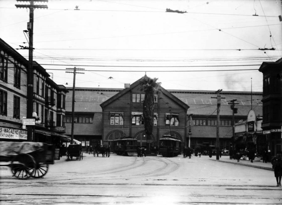
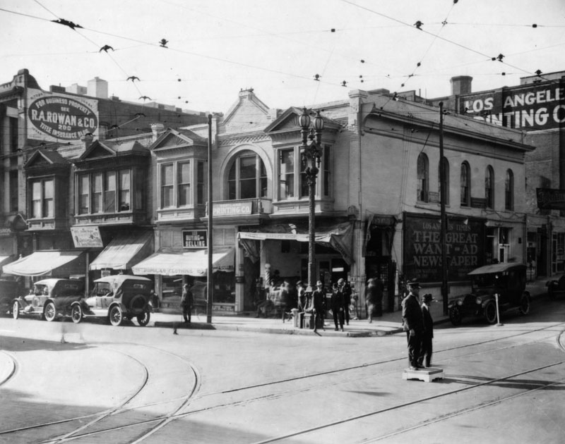
| (ca. 1917)^^ - Intersection of Main, Spring, and 9th streets in downtown Los Angeles circa 1917. Note the elevated kiosk at the corner. |
Historical Notes Elevated booths were used by the Los Angeles Railway and the Yellow Cars as a switchman’s tower to control the flow and path of streetcars through the intersection. |
 |
|
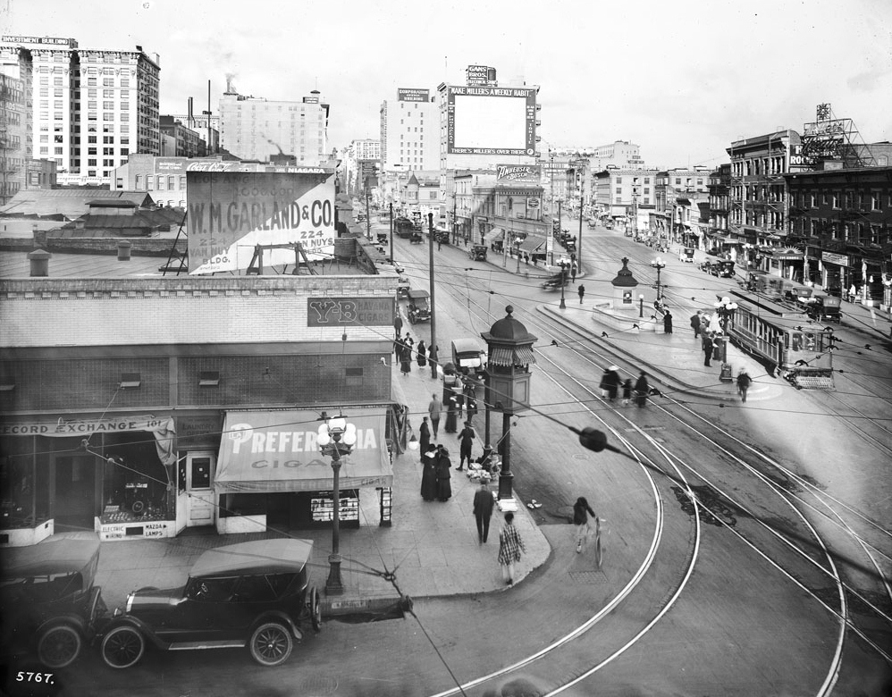
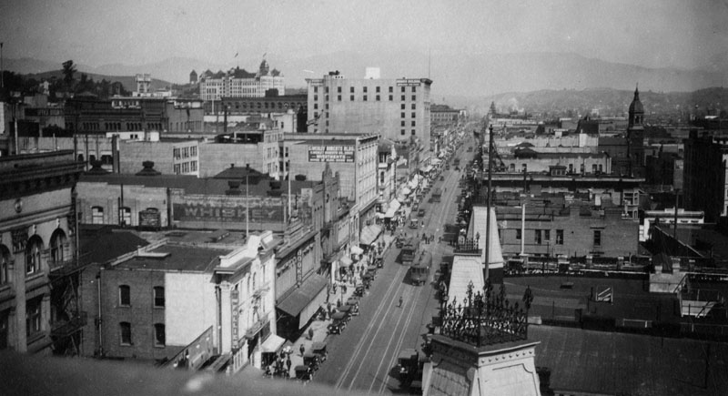
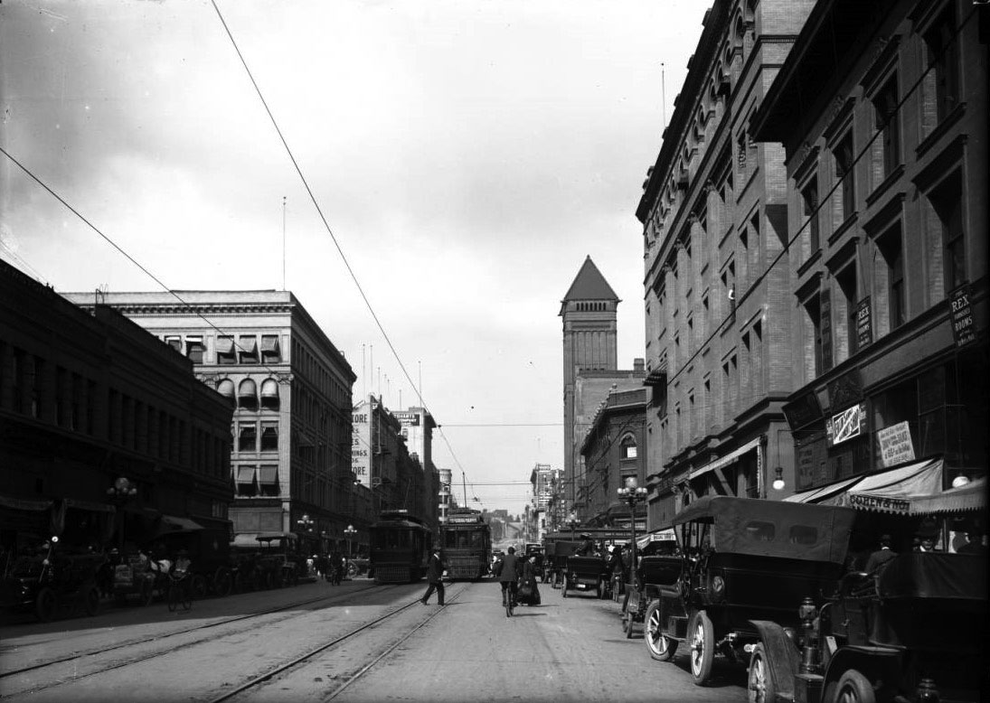
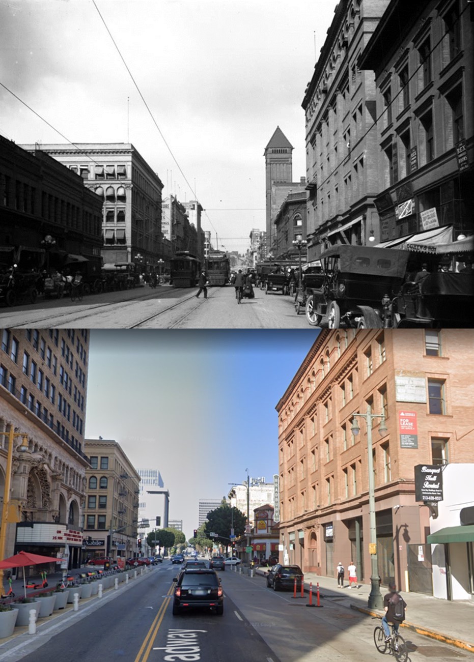
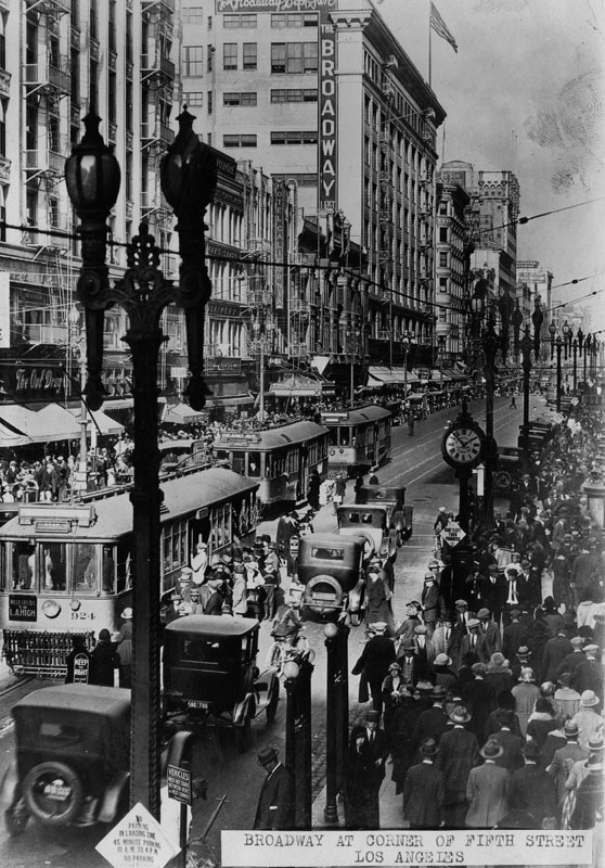
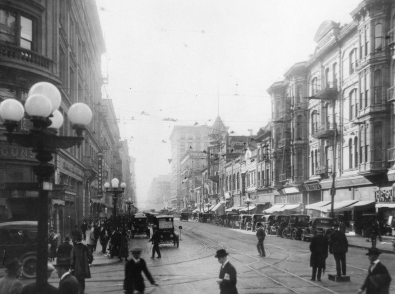
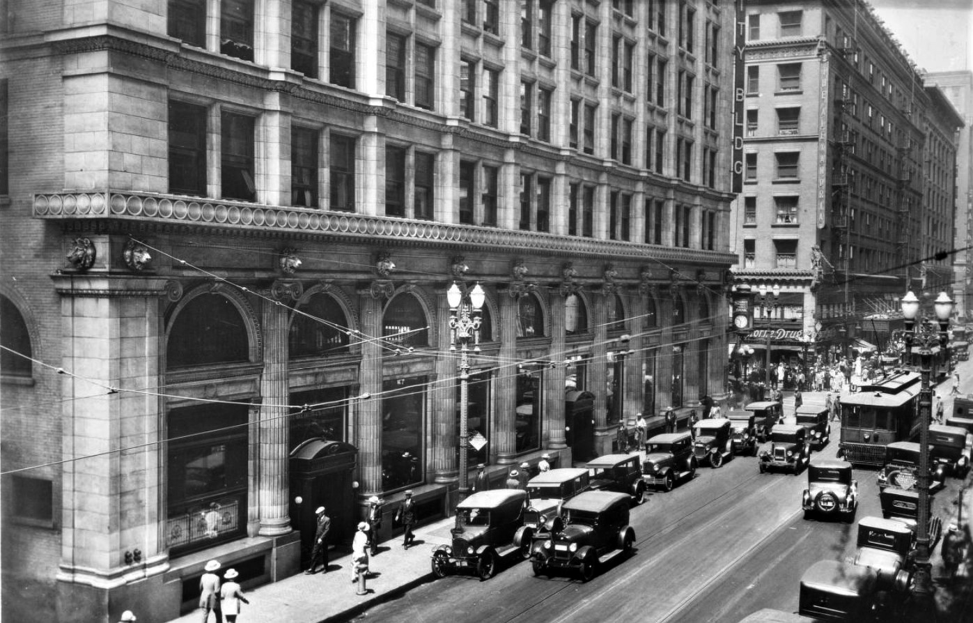
| (1917)^ - Looking north up Spring Street (left) and Main Street (right) from 9th Street in downtown Los Angeles. |
Historical Notes The junction of Main, Spring, and 9th streets became one of the most photographed intersections because of its configuration. Click HERE to see more. |
 |
|
| (ca. 1918)*^ - The Los Angeles Railway's P Line trolley crossing Alameda Street at 1st Street in Little Tokyo as it heads for Boyle Heights in circa 1918. |
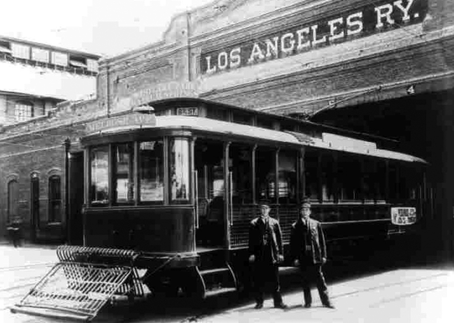
Historical Notes The Los Angeles Railway (also Yellow Cars, LARy, latterly Los Angeles Transit Lines) was a system of streetcars that operated in central Los Angeles and the immediate surrounding neighborhoods between 1901 and 1963. The company carried many more passengers than the Pacific Electric Railway's 'Red Cars' which served a larger area of Los Angeles. The system was purchased by railroad and real estate tycoon Henry E. Huntington in 1898 and started operation in 1901. At its height, the system contained over 20 streetcar lines and 1,250 trolleys, most running through the core of Los Angeles and serving such nearby neighborhoods as Echo Park, Westlake, Hancock Park, Exposition Park, West Adams, the Crenshaw district, Vernon, Boyle Heights and Lincoln Heights. |
 |
|
| (ca. 1909)* – View showing a Los Angeles Railway streetcar at the MTA Division 1 located on Central Avenue between 6th and 7th streets. This site is still in operation. |
Historical Notes The original address for the site was 648 South Central Avenue, but was later changed to 1130 East Sixth Street. Today the division operates hundreds of natural gas powered Metro buses for the Gateway Cities Service Sector. |
 |
|
| (ca. 1914)* - View looking east on Fifth Street as it ends at the Southern Pacific Railroad Arcade Depot on Central Avenue. Two streetcars are parked in front of the railroad building on tracks that intersect with more tracks in the foreground. Several horse-drawn vehicles are visible, as well as many pedestrians making their way along the sidewalks that border the streets. The ‘Arcade Depot Palm’ is seen standing near the center of the building. |
Historical Notes The Arcade Station was the second station built by Southern Pacific in Los Angeles (and first one built primarily for passenger service). Built in 1889 and used until 1914 when it was replaced by larger SP Central Station. It was demolished shortly thereafter. Amazingly, the original Arcade Depot Palm is still alive. It was replanted at a location in front of the Los Angeles Coliseum where it stands today. It along with the Longstreet Palms are considered to be the oldest trees in the City of Los Angeles. Click HERE to see more on the Arcade Depot and the old Arcade Depot Palm. |
* * * * * |
Court Flight
 |
|
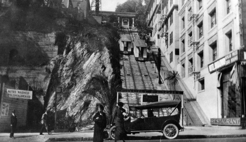
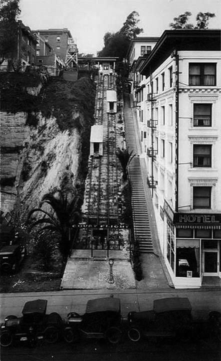
| (ca. 1920)^ - View showing two women attempting to cross the street in front of Court Flight Cable Railway. In the background can be seen the Court Flight's two cable cars passing each other on the tracks. To the right is a restaurant on the ground level of the New Hotel Broadway. On the left, behind the two men on the sidewalk, is a sign that reads: "AUTOS WASHED, POLISHED, & GREASED". |
Historical Notes Opened on September 24, 1905, Court Flight was built by Attorney R. E. Blackburn of the McCarthy real estate firm and Samuel G Vandegrift. It along with Angels Flight (built in 1901) were constructed to serve the wealthy residents of Bunker Hill. |
 |
|
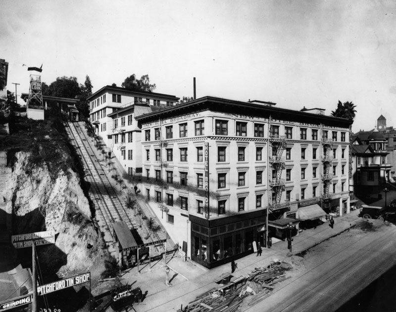
| (ca. 1920)^ - Court Flight Cable Railway, located next to the New Hotel Broadway, located at 205 North Broadway, opposite the Hall of Records and County Courthouse. Construction material can be seen stacked on the curbside. |
Historical Notes Unlike Angels Flight, Court Flight was entirely double tracked, using a pair of thirty-inch gauge counterbalanced cars, and ran for a distance of 180 feet up a 42 per cent grade between Broadway and Court Streets, in the middle of the block between Temple and First Streets. |
 |
|
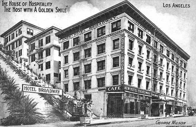
| (1916)* - Postcard view of the New Hotel Broadway adjacent to Court Flight. Card reads: "The House of Hospitality, The Host with A Golden Smile" - George Wilson, Managing Director. |
 |
|
| (ca. 1920s)* – View looking down toward Court Flight showing two cable cars about to pass each other. The Hotel Broadway is seen on the right. Note the observation tower in the upper-left. |
 |
|
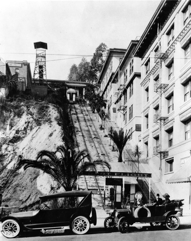
| (1920s)^ - Cars parked in front of Court Flight Cable Railway on North Broadway at Court Street. An observation tower can be seen at the top of the hill. Sign on tower reads: "ONE BIG LOOK". |
 |
|
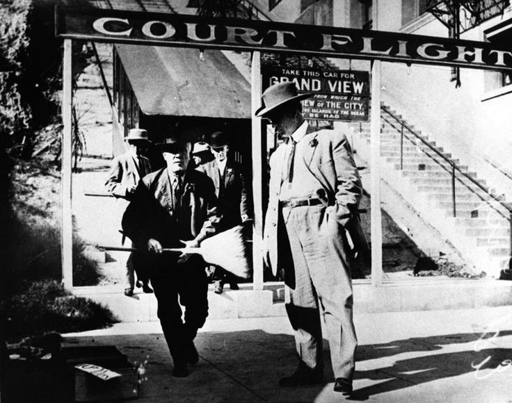
| (ca. 1920)^ – View showing passengers disembarking Court Flight at its base. Sign behind the man in foreground reads: "TAKE THIS CAR FOR GRAND VIEW". |
Historical Notes The funicular operated for 39 years, but World War II spelled its doom. Low ridership depressed profits, and the railway struggled to find engineers and conductors in the wartime labor market. In 1943, unable to keep the line profitable, owner Annie Vandegrift closed Court Flight. It would never reopen. Click HERE to see more Early Views of Court Flight (1930+) |
 |
|
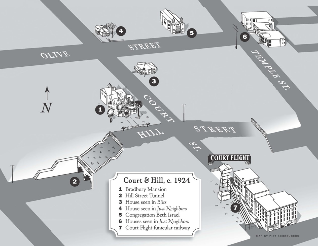
| (ca. 1924)* - Map of Bunker Hill showing Court Flight in the lower right and the Hill Street Tunnels at the center. Map by Piet Shreuders. |
Historical Notes Click HERE to see more Early Views of the Hill Street Tunnels. |
 |
|
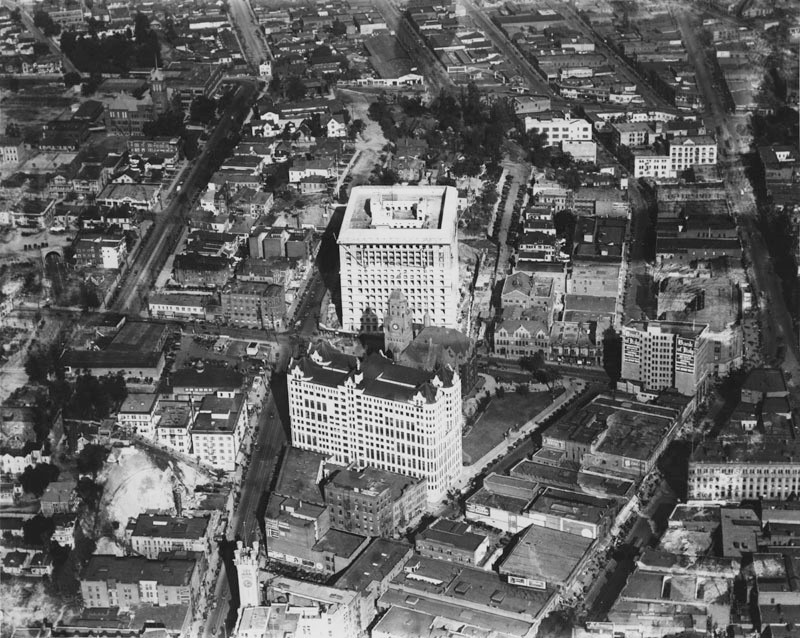
| (1924)^ - Aerial view looking north up Main, Spring and Broadway Streets from a point just over 1st Street. Both Court Flight Cable Railway and Hotel Broadway can be seen at lower center-left. |
Historical Notes In the above photo, the new Hall of Records (1910), the newer Hall of Justice (nearing completion here) and the old (1888) County Courthouse are seen in the center as is the Hancock Banning house on Fort Moore Hill, the Prudent Beaudry house on New High Street and the Court Flight funicular up Court Hill. Future city hall site is to the right. |
 |
|
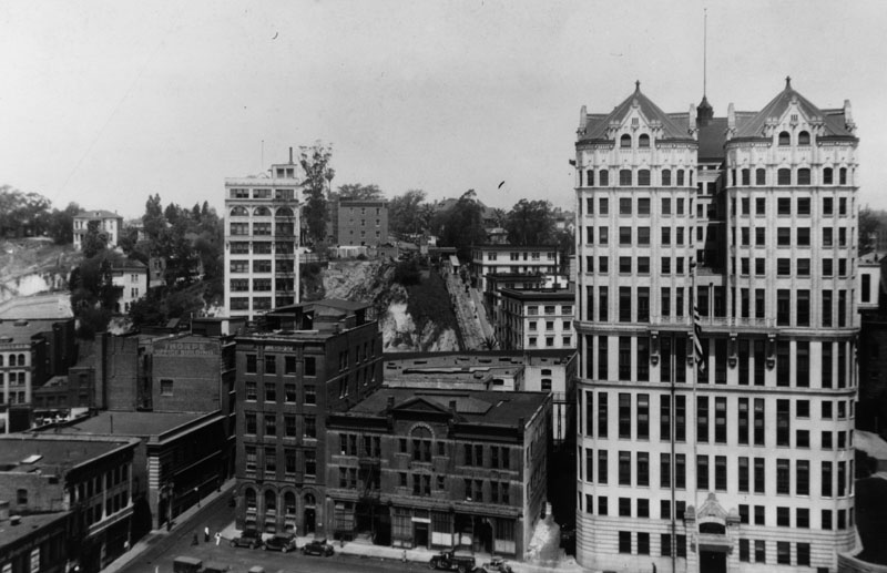
| (ca. 1927)^ - View looking west to the Hall of Records and other nearby buildings. Constructed between 1909 and 1911 to the cost of over a million dollars, the 12-story original Hall of Records at 220 N. Broadway was demolished in September, 1973. Court Flight can be seen in the background (center of photo). The 12-story building to the left of Court Flight is the Law Building (1926). |
 |
|
| (1956)* – Right panel of a panoramic photo taken from City Hall. The Law Building stands on the left with a carved-down Bunker Hill in the distance. On the right is the Hall of Records. |
.jpg) |
|
| (1956) – Left panel of a panoramic photo taken from City Hall looking toward Bunker Hill with the State Building on the left and Law Building at right. In the background is the Mosk Courthouse under construction. |
* * * * * |
Law Building
 |
|
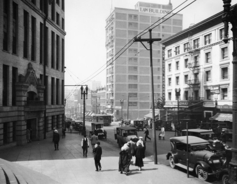
| (ca. 1926)* - Looking south on Broadway from in front of the Hall of Records toward the Law Building and the New Hotel Broadway with Court Flight in between these two buildings (out of view). |
Historical Notes The 12-story Law Building was built in 1926 just before the new City Hall went in. The Building was razed around 1970 to make room for Grand Park. |
 |
|
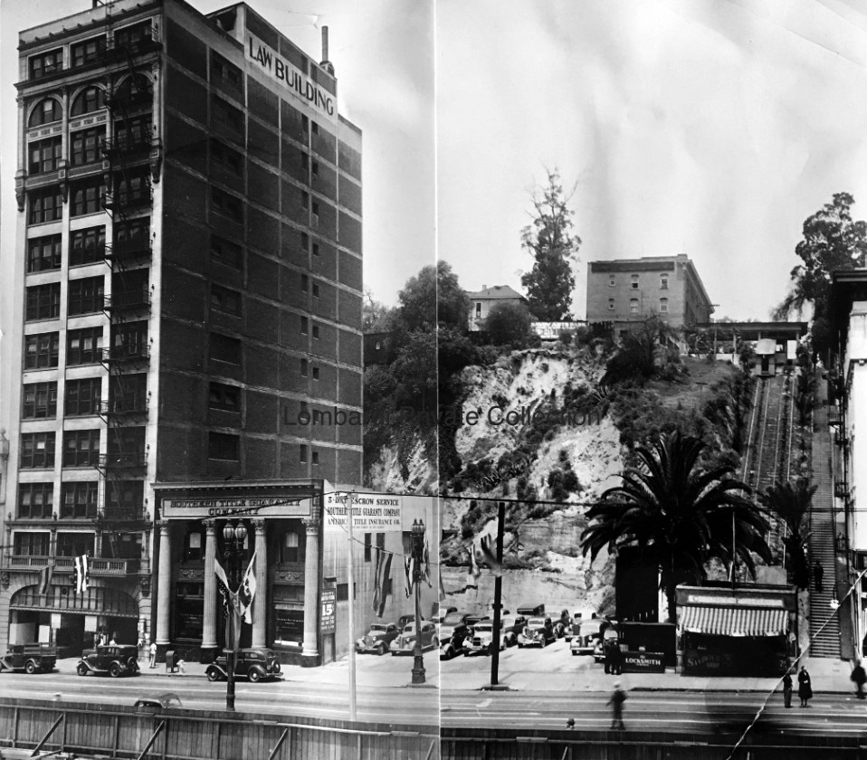
| (1930s)^ – View looking across Broadway toward Bunker Hill showing Court Flight on the right with the 12-story Law Building seen on the left. Lombardi Photo Collection. Today you would be looking at Grand Park toward the DWP Building. Click HERE for contemporary view. |
Historical Notes The City leased most of the offices in the Law Buildings for decades. In the basement was the Lombardi's Restaurant, which was there throughout the '60's. The Building was razed around 1970 to make room for Grand Park. |
 |
|
| (1951)* - Looking southwest across Broadway from in front of the Hall of Records. On the far left is a glimpse of the California State Building. |
Historical Notes Court Flight was located at far right. It was shut down in 1943. Click HERE to see more Early Views of Court Flight (1930+) |
 |
|
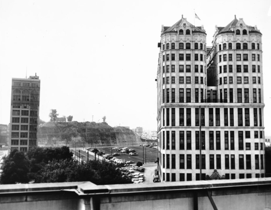
| (ca. 1951)* - View from City Hall on a smoggy day, showing the 12-story narrow Law Building (top left) on Broadway, adjacent to the former location of Court Flight. The Hall of Records stands prominently in the foreground. Bunker Hill is blanketed by parking lots, with the haze obscuring any sense of distance or clarity. |
 |
|
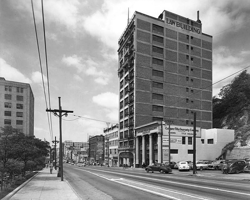
| (ca. 1953)* - Looking southwest across N. Spring Street (foreground), showing the California State Building on the left, the Law Building at 139 N. Broadway (right of center), and the old Hall of Records (right). All of these structures have been demolished. |
Historical Notes Law Building (1926 - 1970) California State Building (1931 - 1976) Hall of Records Building (1911 - 1976) |
 |
|
| (1956)** - Panoramic photograph composite taken from the City Hall tower, facing west to northwest towards Bunker Hill and Hollywood. Bunker Hill has been slightly shaved off to make room for the County Courthouse, which is under construction, as well as several parking lots. The Law Buildling is seen surrounded by parking lots. | Broad |
 |
|
| (ca. 1960)^ - View looking n/w from City Hall toward Bunker Hill prior to construction of the GOB and Music Center. |
 |
|
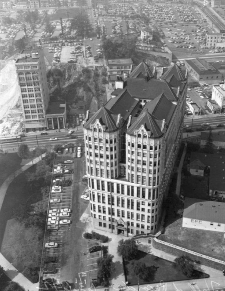
| (ca. 1963)^ – Looking down from City Hall toward a nearly completed GOB & Music Center with the Law Building standing almost like an island. The Law Buildng as well as the California State Building and County Hall of Records would be demolished over the next 13 years. |
Historical Notes Law Building (1926 - 1970) California State Building (1931 - 1976) Hall of Records Building (1911 - 1976) |
Before and After
 |
|
| (1960 vs. 1970) - Before and After |
* * * * * |
Victoria Park
 |
|
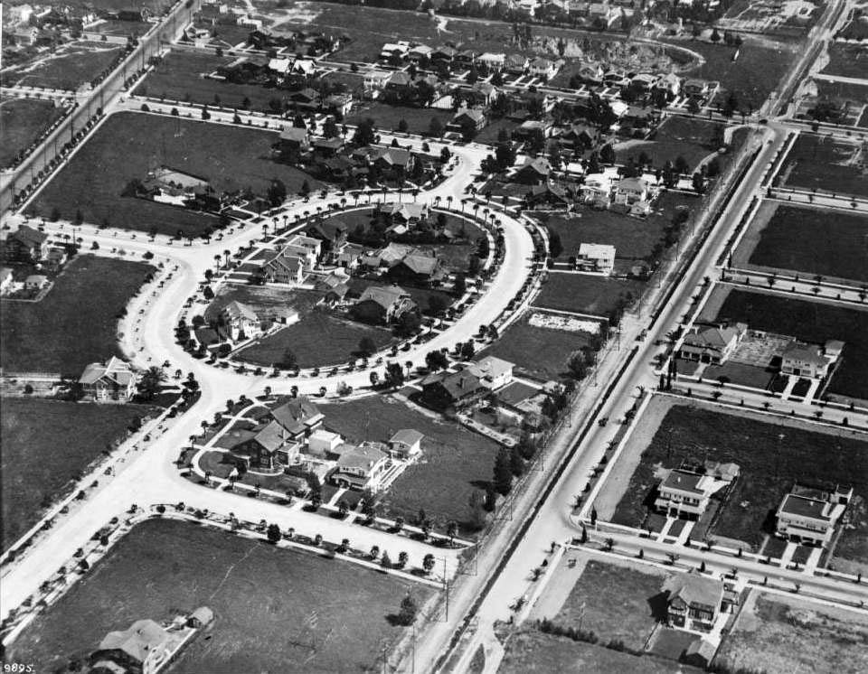
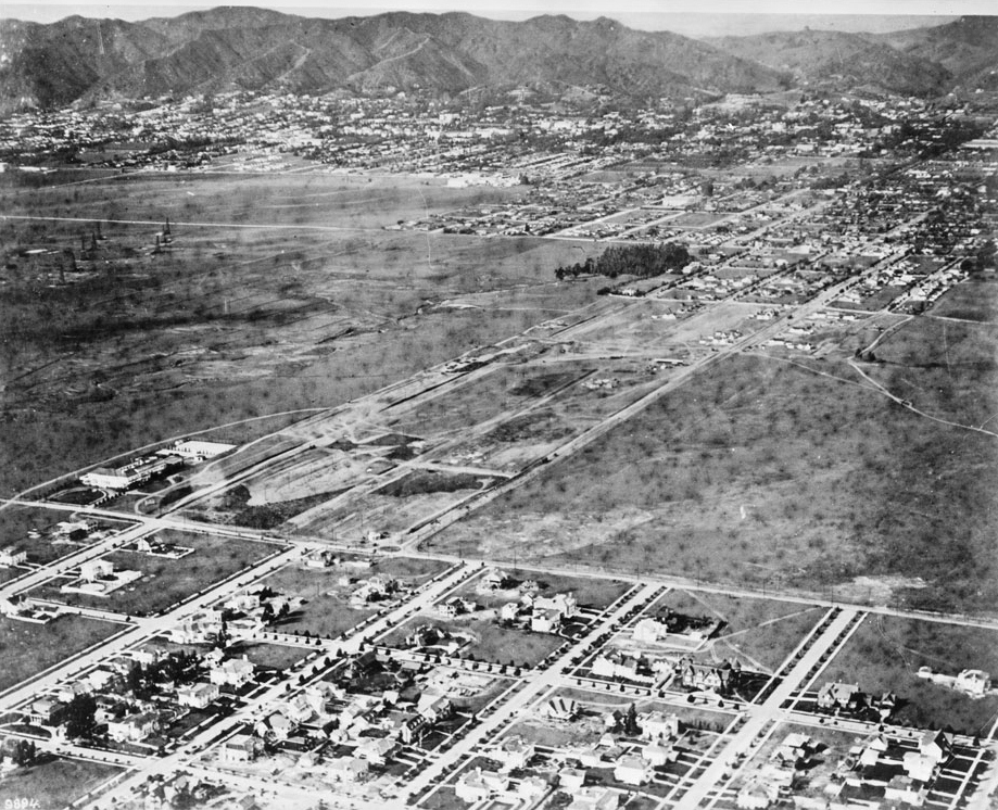
| (1918)^^ - Aerial view looking east. The intersection of Crenshaw and Pico is in the upper left corner of the photo; Crenshaw and Venice is in the upper right corner. |
Historical Notes Established in 1908 by ""nineteen substantial citizens" as an "exclusive residential enclave", the Victoria Park neighborhood is one of only two neighborhoods in the entire city of Los Angeles where the homes are arranged on a circular street. This design is based on the ideas of Frederick Law Olmstead, who felt that circular shapes would break up the usual linear look of urban areas. The area was intended to be upscale, e.g. the streetlights were custom-designed and registered with the city as the "Victoria Park Fixture." Click HERE to see the "Victoria Park Fixture" in Early Los Angeles Street Lights. |
 |
|
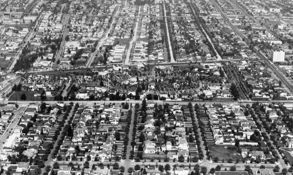
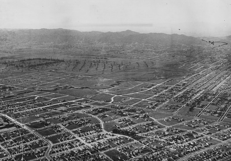
| (1940)^^ - Aerial view looking north of the Victoria Park area. |
Historical Notes Many of the homes in the Victoria Park neighborhood were built between 1910 and 1915 and serve as fine architectural examples of The American Arts and Crafts Movement. The area was intended to be all single-family homes, but was rezoned in the 1920s and some duplexes were built. The Holmes-Shannon House at 4311 Victoria Park Drive, built in 1911, was added to both the National Register of Historic Places and the list of Los Angeles Historic-Cultural Monuments in 2008 (No. 885); it is described as "a residential building designed in the Tudor-Craftsman style by a prominent firm and reflective of the development of Victoria Park." The Craftsman home at 4318 Victoria Park Place, built in 1912 was also designated a Los Angeles Historic-Cultural Monument (No. 654) in 1998. Click HERE to see complete listing. |
Windsor Square and Hancock Park
 |
|
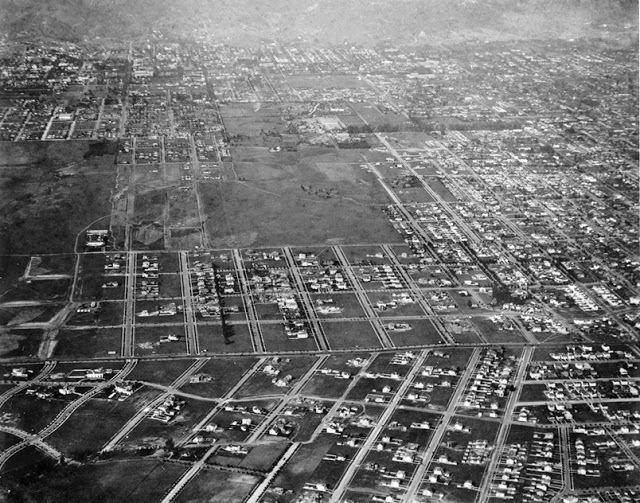
| (ca. 1918)^^ - Aerial view looking north showing Windsor Square and part of Hancock Park. |
Historical Notes Sometime between 1900 and 1910 a prominent financier named George A.J. Howard envisioned a beautiful tranquil park as a setting for family homes such as one sees in the English countryside in what was then an undeveloped and rural area about halfway between the city center (now Downtown LA) and the coast. Howard pushed the early city fathers to make his vision come true, and in 1911, Mr. Robert A. Rowan was able to initiate a unique residential development and called it Windsor Square. The development was constituted as a private square. Both the homes and the streets would be privately owned. At that time there were dense groves of bamboo in the area that needed to be destroyed before trees and gardens could be cultivated. Intervening walls or fences were discouraged so that one garden ran into another, creating a park-like setting. Windsor Square was the first area in the city to have the power lines below grade--an extraordinary innovation for 1911. |
 |
|
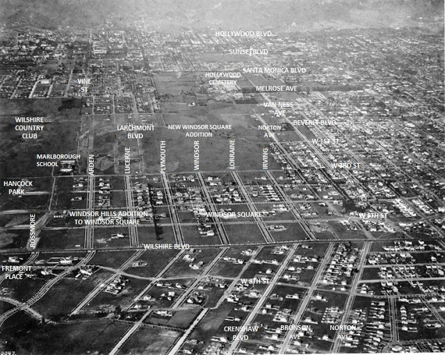
| (ca. 1918)^#^ - Same photo as above but with annotations. Windsor Square is at center of photo, while Wilshire Country Club and Hancock Park are to the west (left). The Marlborough School can be seen at the corner of 3rd Street and Rossmore (on the left). |
Historical Notes Windsor Square was later expanded to the north, east, and west. Today, Windsor Square runs from Wilshire to Beverly Boulevards, and from Arden Boulevard to Van Ness Avenue. This is inclusive of the one-block strip of Larchmont Village, between First Street and Beverly Boulevard. Windsor Square is often mistakenly called "Hancock Park," even by long-time residents. But in fact, Hancock Park is the neighborhood immediately to the west. Windsor Square's homes have the same historic value as in Hancock Park, but most of the homes are built on bigger lots. Many of the city's elite moved west to Windsor Square, including George Howard (his daughter still lives in his home on Windsor Blvd) and Norman Chandler, who took up lifelong residence with his wife Buffy on Lorraine Blvd. Oil magnate John Paul Getty bought a property on Irving Blvd. that is now Los Angeles's official mayor's residence. |
 |
|
| (ca. 1918)^^ - Aerial view looking northwest from 5th Street and Windsor Boulevard at Hancock Park and Hollywood. Third Street is visible running horizontally near the middle of the image, while at left is Marlborough School on Rossmore Avenue. The area north of Third Street on both sides of Rossmore is open fields for several blocks, and beyond the city in the background are large mountains. |
Historical Notes Hancock Park was developed in the 1920s by the Hancock family with profits earned from oil drilling in the former Rancho La Brea. The area owes its name to developer-philanthropist George Allan Hancock, who subdivided the property in the 1920s. Hancock, born and raised in a home at what is now the La Brea tar pits, inherited 4,400 acres, which his father, Major Henry Hancock had acquired from the Rancho La Brea property owned by the family of Jose Jorge Rocha.*^ Marlborough School is a private, all-girls, college-preparatory secondary school for grades 7th through 12th located at 250 South Rossmore Avenue in the Hancock Park neighborhood of Los Angeles. Marlborough was founded in 1889 by Mary Caswell and is the oldest independent girls' school in Southern California. |
 |
|
| (ca. 1918)^ - Aerial view looking northwest from Wilshire and Rossmore. Today, the Wilshire Country Club is situated just to the right (east) of the oil fields. |
Historical Notes The large square of undeveloped land showing two mounds (right of oil field) is El Arroyo del Jardin de los Flores, The Stream of the Garden of Flowers. The stream flowed from the location of today's Wilshire Country Club through Hancock Park, joining another creek that eventually drained to Ballona Creek near La Brea and St. Elmo Drive. The majority of this creek was piped and filled; a portion of it remains above ground at the Wilshire Country Club, and a creek running through Brookside Estates also shares this name. |
Hollywood
 |
|
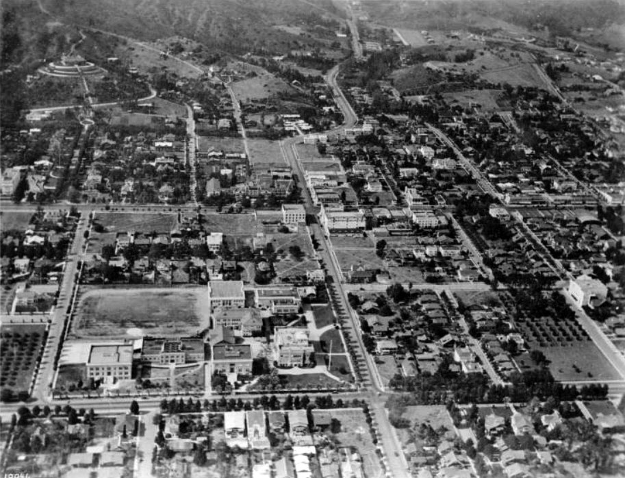
| (1918)^^ - Aerial view of Hollywood looking north. Highland Avenue runs straight up from center-bottom and then snakes its way to Cahuenga Pass. The intersection of Hollywood Boulevard and Highland Avenue is at center of photo. The Japanese estate and gardens of brothers Charles and Adolph Bernheimer is perched high on a hill in the upper-left corner. Hollywood High School is seen at lower center-left , on the northwest corner of Sunset Boulevard and Highland Avenue. |
 |
|
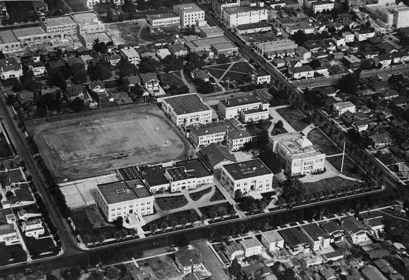
| (1921)^ - Aerial view of Hollywood High School and surrounding area in 1921. |
Historical Notes Hollywood High School with a student body of 2500 was three blocks from Charlie Chaplin's studio and six blocks from Mary Pickford's and Douglas Fairbanks' studios. The homes bordering the upper side of the campus were just condemned by the city to make room for additional buildings. The original 1905 building is on the bottom right, the Household & Fine Arts building is in the middle of the quadrangle, and the gymnasium is top, center. Click HERE to see more in Early Views of Hollywood (1850 - 1920) |
* * * * * |
Beverly Hills Speedway (aka Los Angeles Speedway)
 |
|
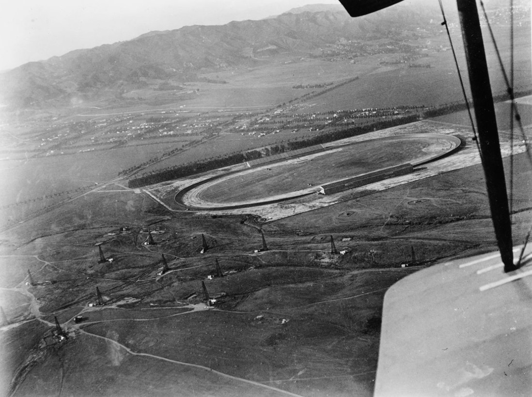
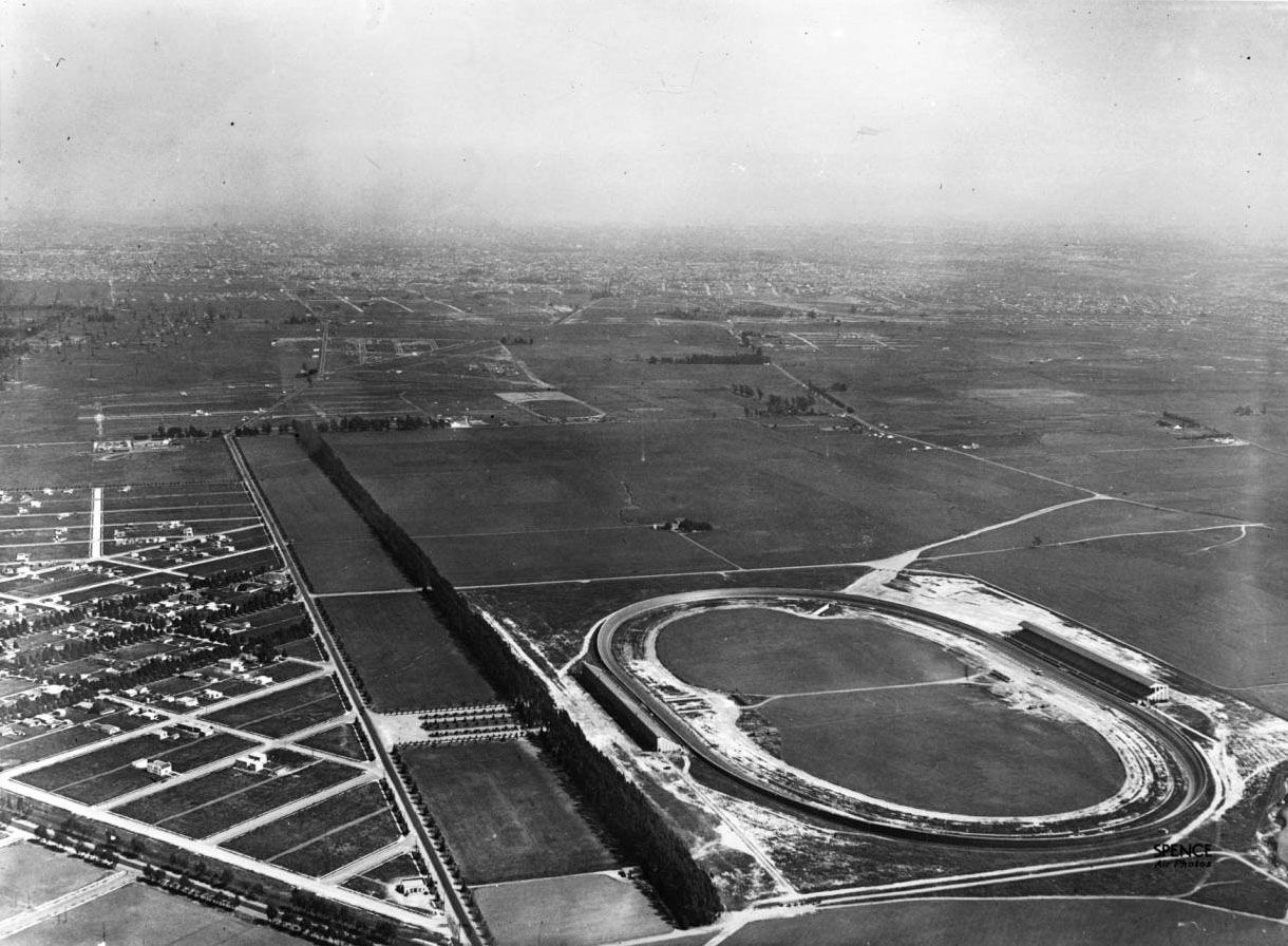
| (ca. 1919)* - Aerial view of the Beverly Hills Speedway, located just south of Wilshire Boulevard near its intersection with Santa Monica Boulevard. The tree-lined street above the speedway is Charleville Boulevard, one block south of Wilshire. Note the oil fields in the foreground. |
Historical Notes The Beverly Hills Speedway (also called the Los Angeles Speedway) was a 1.25-mile wooden board track for automobile and motorcycle racing in Beverly Hills. It was built in 1919 on 275 acres of land that includes the site of today's Beverly Wilshire Hotel, just outside of the "Golden Triangle". The site was bounded by Wilshire Boulevard, South Beverly Drive, Olympic Boulevard and Lasky Drive. |
 |
|
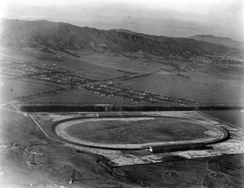
| (1919)^ - Aerial photograph of the Beverly Hills Speedway, located at Wilshire and Santa Monica boulevards. West Hollywood can be seen in the distance at upper-right. Note the oil wells in the left foreground. |
Historical Notes The new Speedway was built by Jack Prince and Art Pillsbury and was financed by a group of racers and businessmen that called itself the Beverly Hills Speedway Association. The track was the first in the United States to be designed with banked turns incorporating an engineering solution known as a spiral easement. |
.jpg) |
|
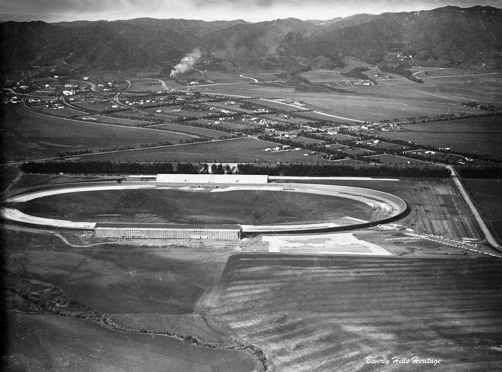
| (1919)^ - Aerial photo of the Beverly Hills Speedway located at Wilshire and Santa Monica Boulevards. |
 |
|
| (ca. 1919)* - Closer view of the Beverly HIlls Speedway located just south of Wilshire Boulevard near where it intersects with Santa Monica Boulevard (aka "Golden Triangle"). |
.jpg) |
|
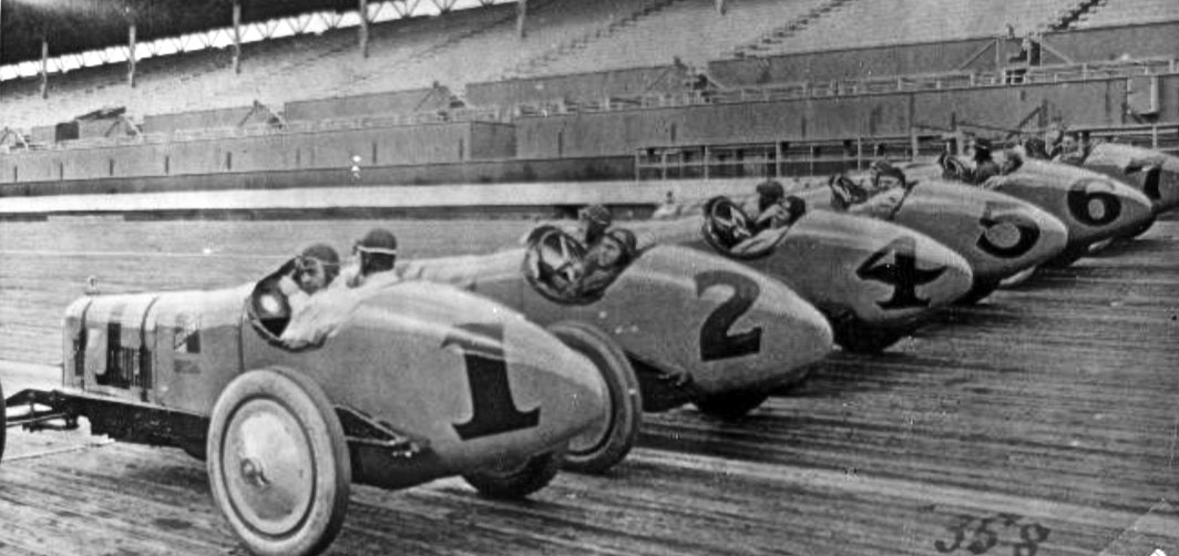
| (1919)^ - Early race cars are lined up at the Beverly Hills Racetrack. |
 |
|
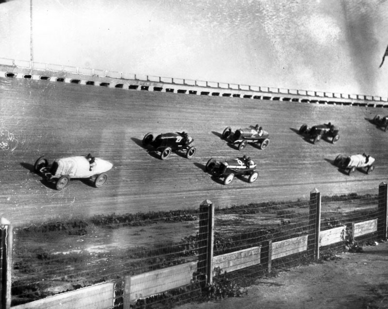
| (1919)^ - View showing race cars racing on the steep bank of the track at the Beverly Hills Racetrack. |
 |
|
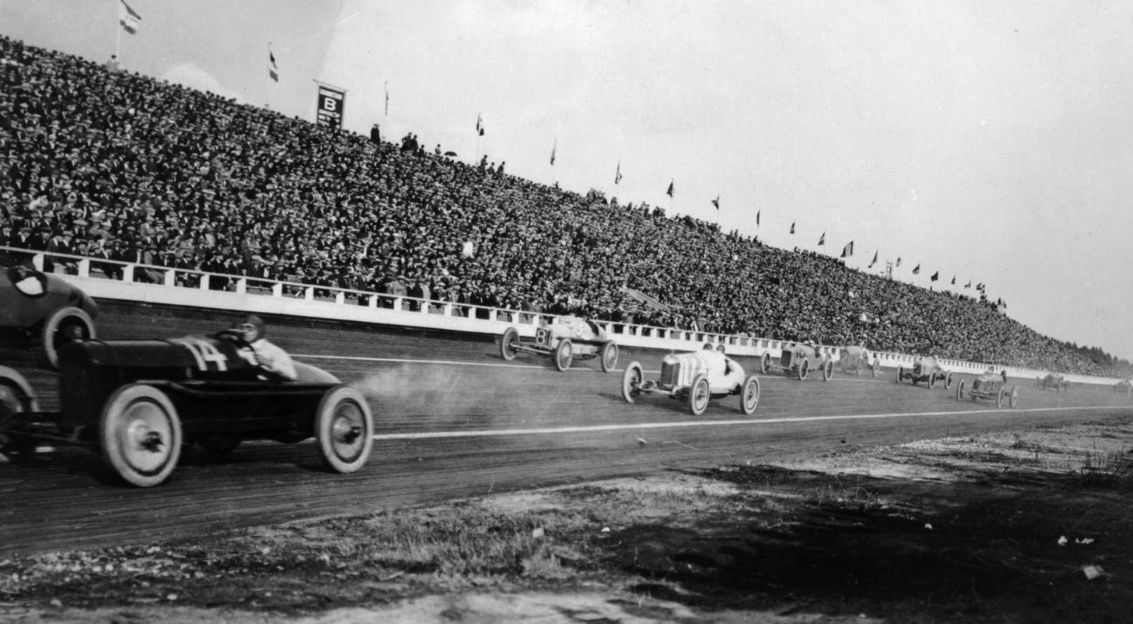
| (ca. 1919* - Panoramic view showing an automobile race at the Beverly Hills Racetrack. The early racecars are all open topped and the drivers are wearing leather helmets and goggles. The grandstand is packed with spectators. |
 |
|
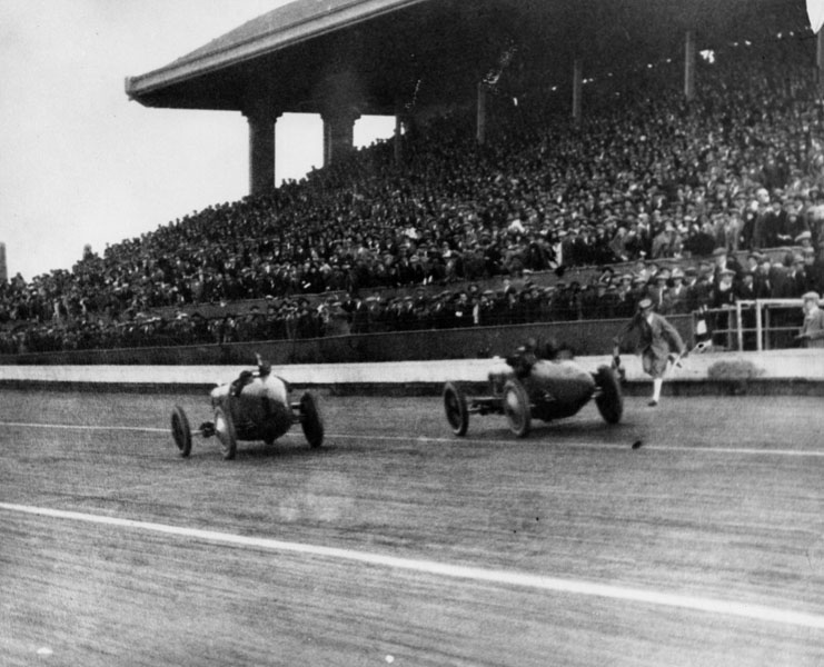
| (1919)^ - View of two race cars racing past the finish line at the Beverly Hills Racetrack. |
Historical Notes At the time, the wooden racetrack was ranked second in race quality only to the Indianapolis Motor Speedway. |
 |
|
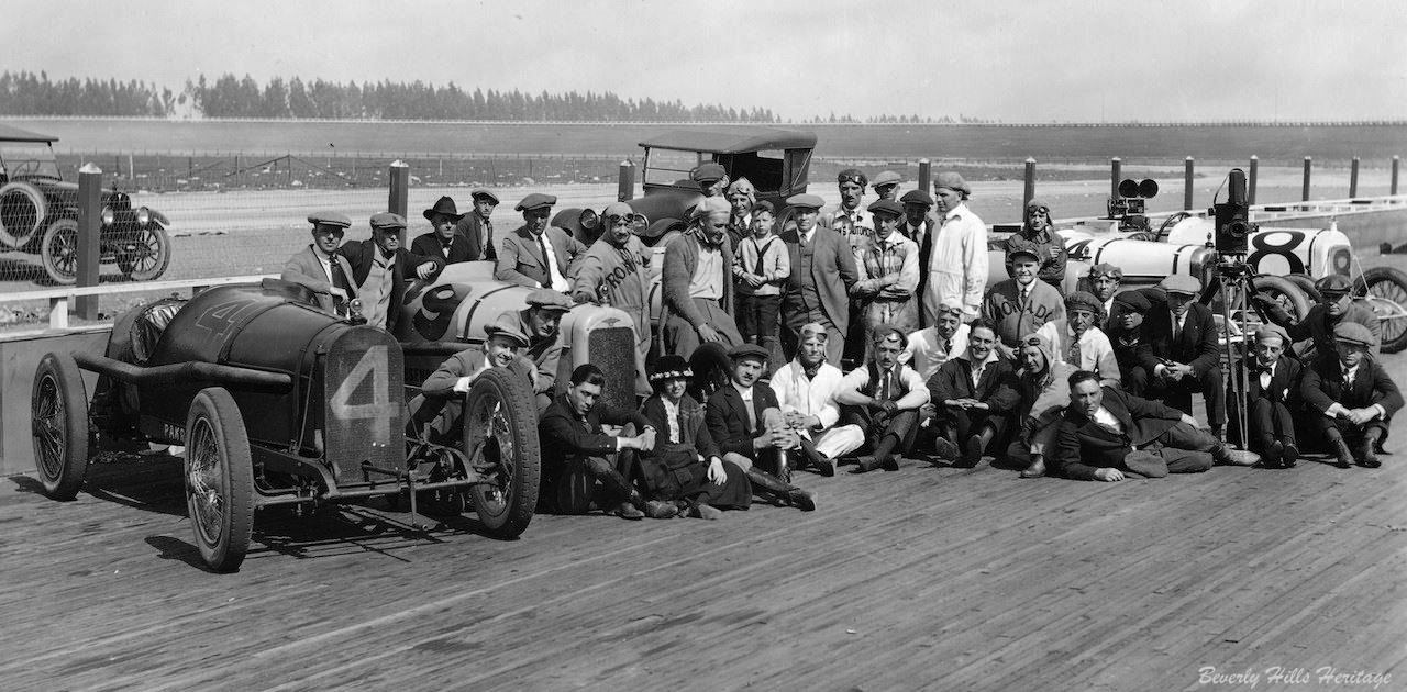
| (1922)* - Durant Racing team, Beverly Hills Raceway . . . Harry Miller Designed and built. Cliff Durant was William Durant's son (General Motors President). He had the most highly funded team of the day with the best drivers. |
Historical Notes Many race cars had paint jobs that read Durant Racing on the sides. Durant was an American race car driver, the son of William C. Durant, a founder of General Motors who was also the co-owner and president of the Beverly Hills Speedway. Durant Drive in the City of Beverly HIlls was named after these Durants. |
 |
|
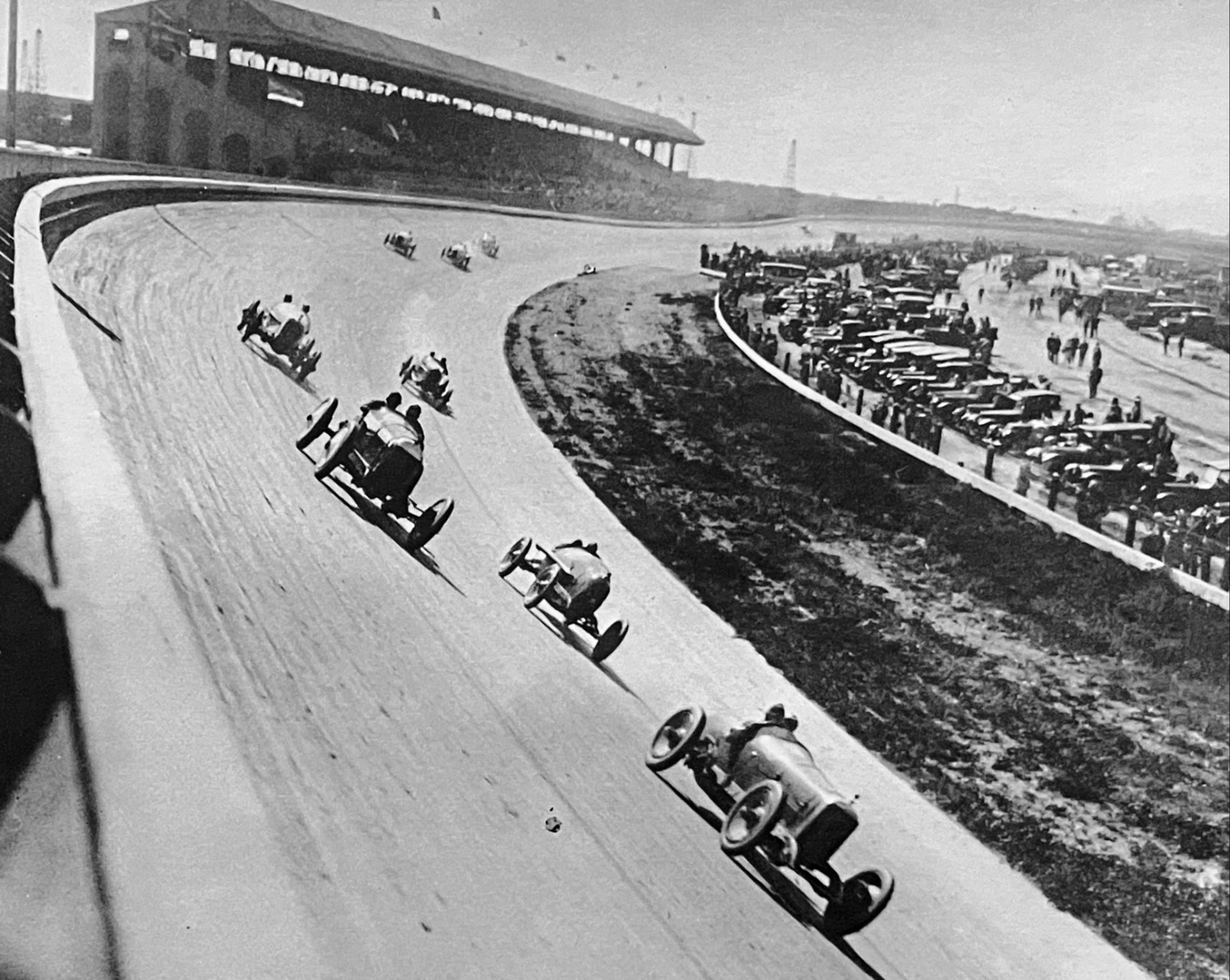
| (1920s)* - Race cars rounding the embanked curve a the speedway.. |
 |
|
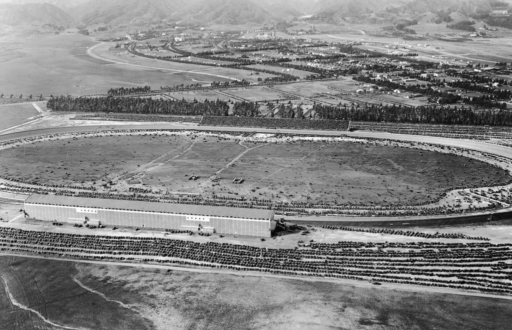
| (1922)* – Aerial view looking down at the Beverly Hills Speedway showing a full house at a racing event. Note the number of cars in the parking lot. Photo: Marc Wanamaker/Bison Archives |
Historical Notes The Speedway was a great success, not only for racing but also for events. In fact, sometimes the space was so well attended, the parking lots overflowed with cars. |
 |
|
| (1919)^ - View of cars parked next to the spectator stands of the Beverly Hills Racetrack. |
Historical Notes The Speedway operated for four years and attracted many historically significant competitors including Ralph DePalma, Jimmy Murphy, and Tommy Milton. It was also the site of a racing accident that killed National Champion and Indianapolis 500 winner Gaston Chevrolet in 1920. Gaston Chevrolet was the younger brother of Louis Chevrolet, who in 1911 co-founded the Chevrolet Motor Company. |
 |
|
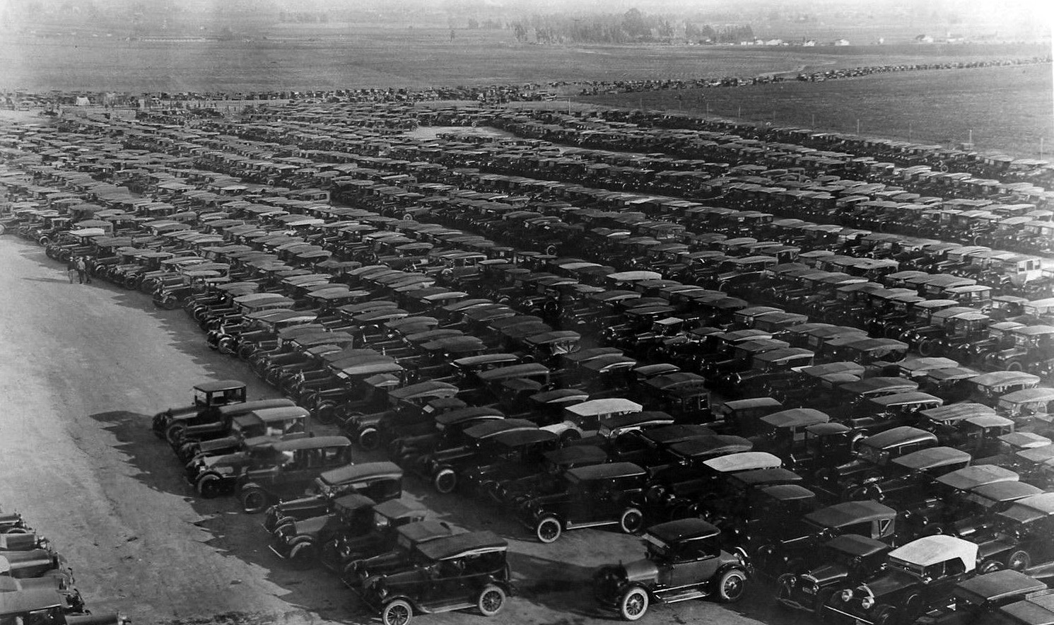
| (ca. 1919)* - View showing a filled to capacity parking lot at the Beverly Hills Speedway. |
 |
|
| (1919)* – View looking northeast showing cast and crew of the 1919 silent film “The Roaring Road” posing for the camera on the Beverly Hills Speedway track. |
Historical Notes The gigantic eucalyptus trees in the distance ran the length of what today would be Charleville Blvd., a street named for developer Walter G. McCarty's Irish roots. The trees created a natural wind and sound barrier for residential neighborhood north of Wilshire Boulevard, which within five years, would start to become the city's commercial triangle. |
 |
|
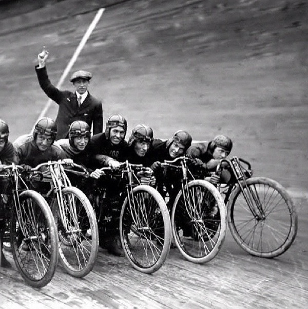
| (ca. 1921)* - Motorcycles line up and wait for the starting gun to go off. |
Historical Notes Motorcycle board track racing took place at the short lived Beverly Hills Speedway between 1920 and 1924. |
 |
|
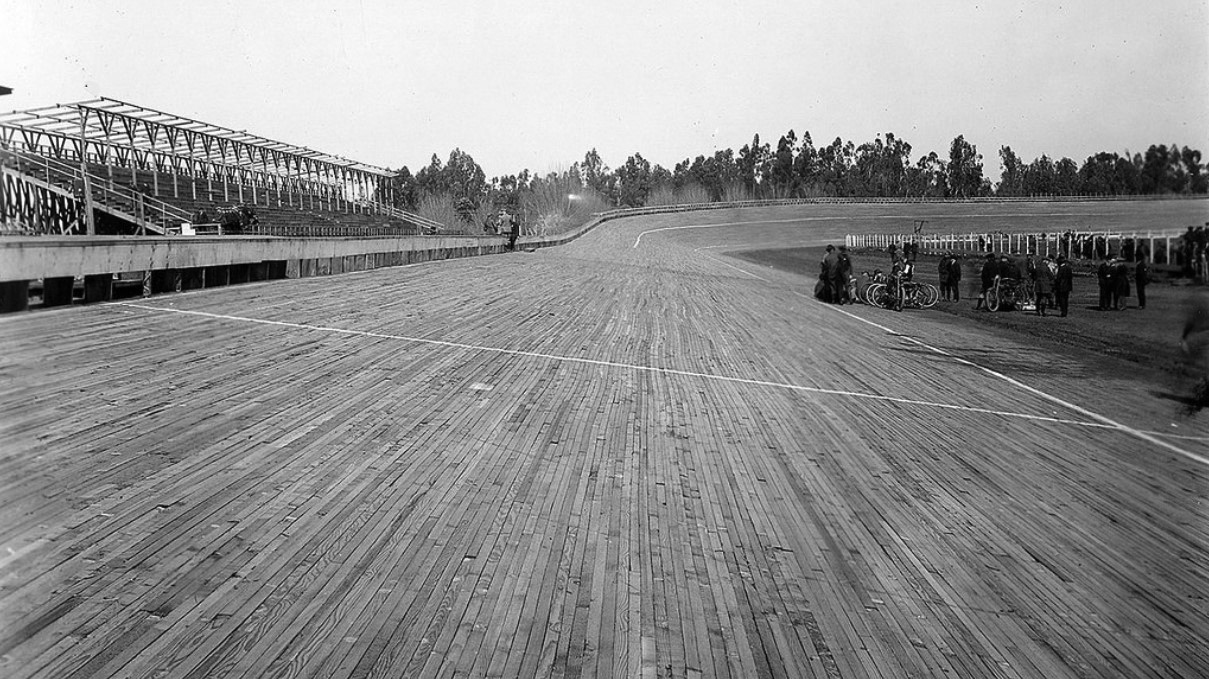
(1921)* - A group of men stand next to several motorcycles on the inside of the banked track at the Fresno Speedway. |
Historical Notes There is no doubt that board track racing was an incredibly exciting event to witness. The motorcycles were capable of speeds over 100 mph and represented all the marques of the day. Manufacturers such as Harley-Davidson, Indian and Excelsior all had factory racing teams with custom built factory race bikes. |
 |
|
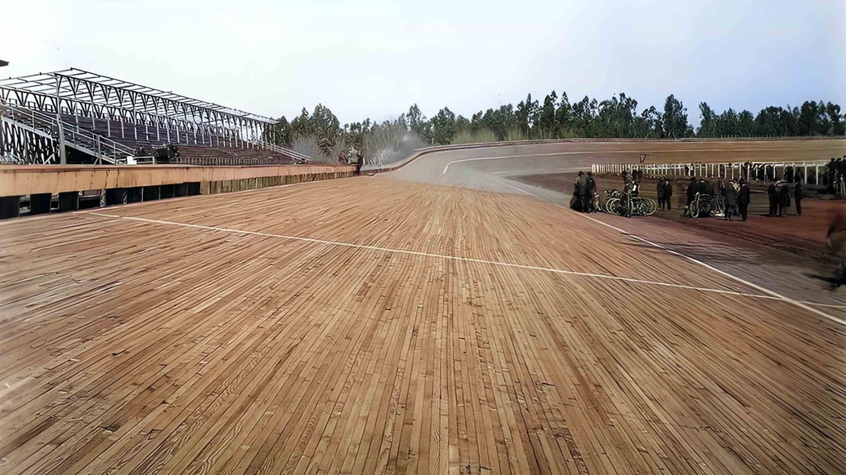
| (1921)* - A group of men stand next to several motorcycles on the inside of the banked track at the Fresno Speedway. AI image enhancement and colorization by Richard Holoff. Correction Note: This image was initially misidentified as depicting the Beverly Hills Speedway. While similar in appearance and constructed in the same year, this photograph actually shows the Fresno Speedway, which was located at the Fresno County Fairgrounds. |
 |
|
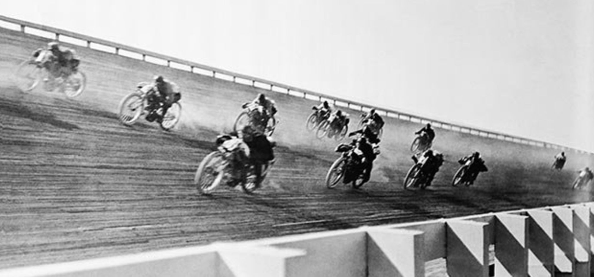
| (1920s)* - View showing motorcycle racers rounding the embanked curve a the speedway. |
Historical Notes Because the turns were severely banked, it allowed riders to reach speeds of more than 100 miles an hour. Crashes were frequent and horrific—riders who went down faced being impaled by splinters—and often fatal. |
 |
|
| (1921)* - Aerial view looking east on Wilshire Boulevard from where Santa Monica Boulevard intersects it. Vast open fields can be seen between the Beverly Hills Speedway and the City of Los Angeles. |
Historical Notes By the mid-‘20s, the sport began to lose its appeal. Perhaps the novelty wore off; certainly the carnage was appalling. Newspapers began referring to motordromes as “murderdromes,” and local governments closed some tracks. Race officials and the motorcycle manufacturers that sponsored racing teams tried to implement measures to slow down the bikes, but that went nowhere. By the early 1930s, board-track motorcycle racing had become a footnote in motorsport history. |
 |
|
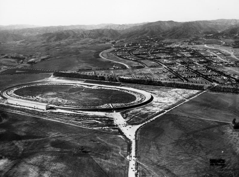
| (ca. 1921)^ - Aerial view looking northwest showing the Beverly Hills Speedway during an event. Note all the open, undeveloped land surrounding the speedway. |
Historical Notes It would soon become apparent that the racetrack wasn't as valuable as the land it was on. By the mid-twenties the track was dismantled to make way for new developments. |
 |
|
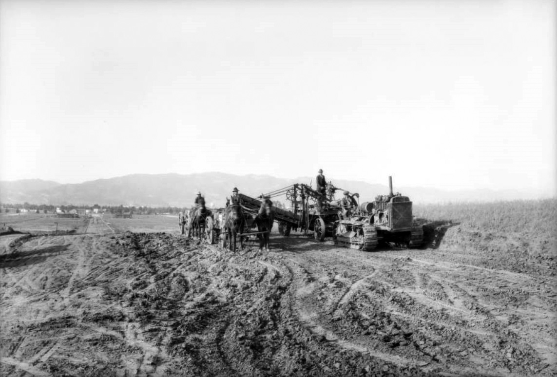
| (1925)^^ – View looking north showing the excavation of land south of where the Beverly Hills Speedway once stood. The new development, Beverly Hills Heights, is centered on South Beverly Drive and runs from where Olympic Boulevard is today up to Wilshire Boulevard. |
Historical Notes Click HERE to see more Early Views of Beverly Hills |
* * * * * |
Downtown LA
 |
|
| (1919)*^#^ – View looking northeast from the roof of the Million Dollar Theatre Building (3rd & Broadway). City Hall (226 S. Broadway) can be seen at center-left. The Orpheum Theatre (227 S. Spring), with its unique coned-shaped tower, is at right-center. |
Historical Notes The above photo was taken by G. Haven Bishop for Southern California Edison. They were the tenants of the building housing the Million Dollar Theatre – then known as the Edison Building. |
 |
|
| (1919)^ - View looking north on Main Street from the top of the Westminster Hotel (NE corner of Main and 4th streets). The tower of St. Vibiana's Cathedral (built in 1876) stands tall at upper-right. Streetcars can be seen running down the center of Main Street. |
 |
|
| (1924)* - This is the site of the former Los Angeles State Normal School, and future site of the lawn and gardens of the Central Library of the Los Angeles Public Library. The large building in the background is the Biltmore Hotel with the Biltmore Theatre senn in front of it on the southeast corner of 5th and Grand Avene. The large white building on the right is the Pacific Mutual Building. Note: the date on the LAPL image card is incorrectly identefied as 1919. |
Historical Notes The California State Normal School was a teaching college that was founded on May 2, 1862 in San Jose. In March 1881, after heavy lobbying by Los Angeles residents, the California State Legislature authorized the creation of a southern branch of the school to be built in downtown Los Angeles, which would train teachers for the growing population of Southern California. On August 29, 1882, the State Normal School at Los Angeles opened its doors, and in 1919 it became part of the "UC system" after moving to a larger campus on Vermont Ave., in Hollywood (the present site of L.A. City College). The University of California, Southern Branch would eventually come to be known as the University of California, Los Angeles. The L.A. Public Library would take the old Normal School site, which was located on 5th Street between Grand and Flower streets. Designed by architects Bertram G. Goodhue and Carlton M. Winslow, it would eventually be constructed between 1922-1926.^ |
Click HERE to see more in Early Views of the Normal School and UCLA |
* * * * * |
Broadway
 |
|
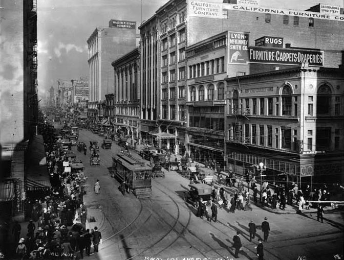
| (ca. 1918)^*# – Elevated view looking north on Broadway from 7th Street showing streetcars, automobiles, horse-drawn carriages and pedestrians; multi-story buildings include from distant left to right, Pantages Building at 536 South Broadway, Walter P. Story Building at 610 South Broadway, California Furniture Company at 644-646 South Broadway, and the Bullock's Building at Broadway and Seventh (NW corner) at extreme left. |
 |
|
| (1910s)#++ - View looking north on Broadway from Sixth Street. In the distance is the Broadway Central Building, which was the 400 block of South Broadway. It was constructed around 1906. |
 |
|
| (ca. 1918)^^ - View looking north on Broadway from below Third Street. The 1893-built Bradbury Building is at right, the 1888-built City Hall tower is visible near center, and the 1895-built Pan American Building (part of the original Irvine-Byrne Block) is on the left. |
Then and Now
 |
|
| (1918 vs. 2021)* – Looking North on Broadway toward 3rd Street where the two oldest buildings in Downtown Los Angeles stand today. |
 |
|
| (ca. 1918)^^ - View looking east on Fourth Street at Broadway showing a busy intersection with many pedestrians crossing the street. |
 |
|
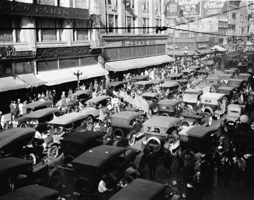
| (1918)^^ - Cars jammed on Broadway and 6th Street in a peace celebration of the war's end, November 11, 1918. |
Historical Notes World War I, also known as the First World War or the Great War, was a global war centered in Europe that began on July 28, 1914 and lasted until November 11, 1918. More than 9 million combatants and 7 million civilians died as a result of the war, a casualty rate exacerbated by the belligerents' technological and industrial sophistication, and tactical stalemate. It was one of the deadliest conflicts in history, paving the way for major political changes, including revolutions in many of the nations involved.*^ |
 |
|
| (1918)^^ – Armistice Day celebration and traffic jam, 6th and Broadway in downtown L. A., November 11, 1918. |
Historical Notes Armistice Day (which coincides with Remembrance Day and Veterans Day, public holidays) is commemorated every year on 11 November to mark the armistice signed between the Allies of World War I and Germany at Compiègne, France, for the cessation of hostilities on the Western Front of World War I, which took effect at eleven o'clock in the morning—the "eleventh hour of the eleventh day of the eleventh month" of 1918. The date was declared a national holiday in many allied nations, to commemorate those members of the armed forces who were killed during war. An exception is Italy, where the end of the war is commemorated on 4 November, the day of the Armistice of Villa Giusti. In the Netherlands, Denmark and Norway World War I is not commemorated as the three countries all remained neutral.*^ |
 |
|
| (ca. 1920s)^ - A busy scene with pedestrians and city traffic in this view of Broadway and 5th looking north, showing the many retail stores that line the street. Hotel California, The Broadway, Edison building and California building are visible on the left side. Several trolleys have stopped in the middle of the road, cars line both sides of the street, and an overflow of pedestrians fill the sidewalks as far as the eye can see. Notice everyone wears hats - men, woman and children alike. |
* * * * * |
Broadway and 2nd Street
 |
|
| (ca. 1920)^ - View looking south on a near empty Broadway at 2nd Street. City Hall with its unique tower can be seen on the left at 226 S. Broadway. The tall building in the distance is the Million Dollar Theater Building (built in 1917). It is located on the SW corner of Braodway and 3rd. |
 |
|
| (ca. 1920)^ - Street view looking south on Broadway near 2nd St. On the near left corner (southeast) is Coast Drugs. On the far right corner (northwest) is The Owl Drug Co. Store. City Hall and the Million Dollar Theater Building can be be seen in the background. The dark building on the right (Second building south of 2nd St) is the Merchants Trust Company Building (207 S. Broadway). It would become the Municpal Water and Power Headquarters from 1921 to 1965. |
.jpg) |
|
| (ca. 1921)^ - View looking south on Broadway from near 2nd Street. The Municipal Water & Power Headquarters (207 S. Broadway) can be seen on the right. Note the people lined up along the curbs and the American Flags on the right. This could be the prelude to a 4th of July Parade. |
Historical Notes In 1921 the Department of Water and Power purchased the seven-story Merchants Trust Company Building at 207 South Broadway, which was to remain its main headquarters building for forty-four years. It is one of the 11 buildings the new DWP General Office Building (now known as John Ferraro Building) replaced in 1965. |
* * * * * |
Broadway and 1st Street
 |
|
| (1920)^ - Broadway and 1st Streets are seen from the southwest corner. A policeman stands on a box in the middle of the intersection to direct any traffic, including streetcars and cars. |
* * * * * |
Broadway and Temple Street
 |
|
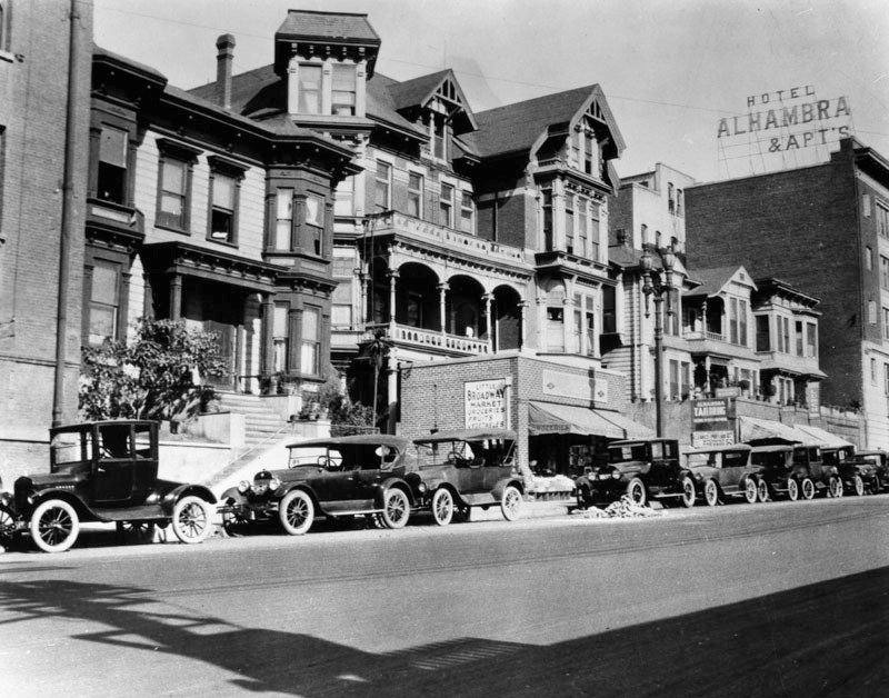
| (1920)^ – View showing cars parked in front of a row of houses on the west side of Broadway, north of Temple Street. Also shown is the Little Broadway Market and the Hotel Alhambra and Apartments Annex. The main Hotel Alhambra is located across the street on the east side of Broadway. The Broadway Tunnel is just north of the Alhambra Hotel (out of view). |
 |
|
| (1920s)^ – Business card for the Hotel Alhambra and Annex showing the south portal of the Broadway Tunnel with both hotel and annex sitting on opposite sides of Broadway. |
 |
|
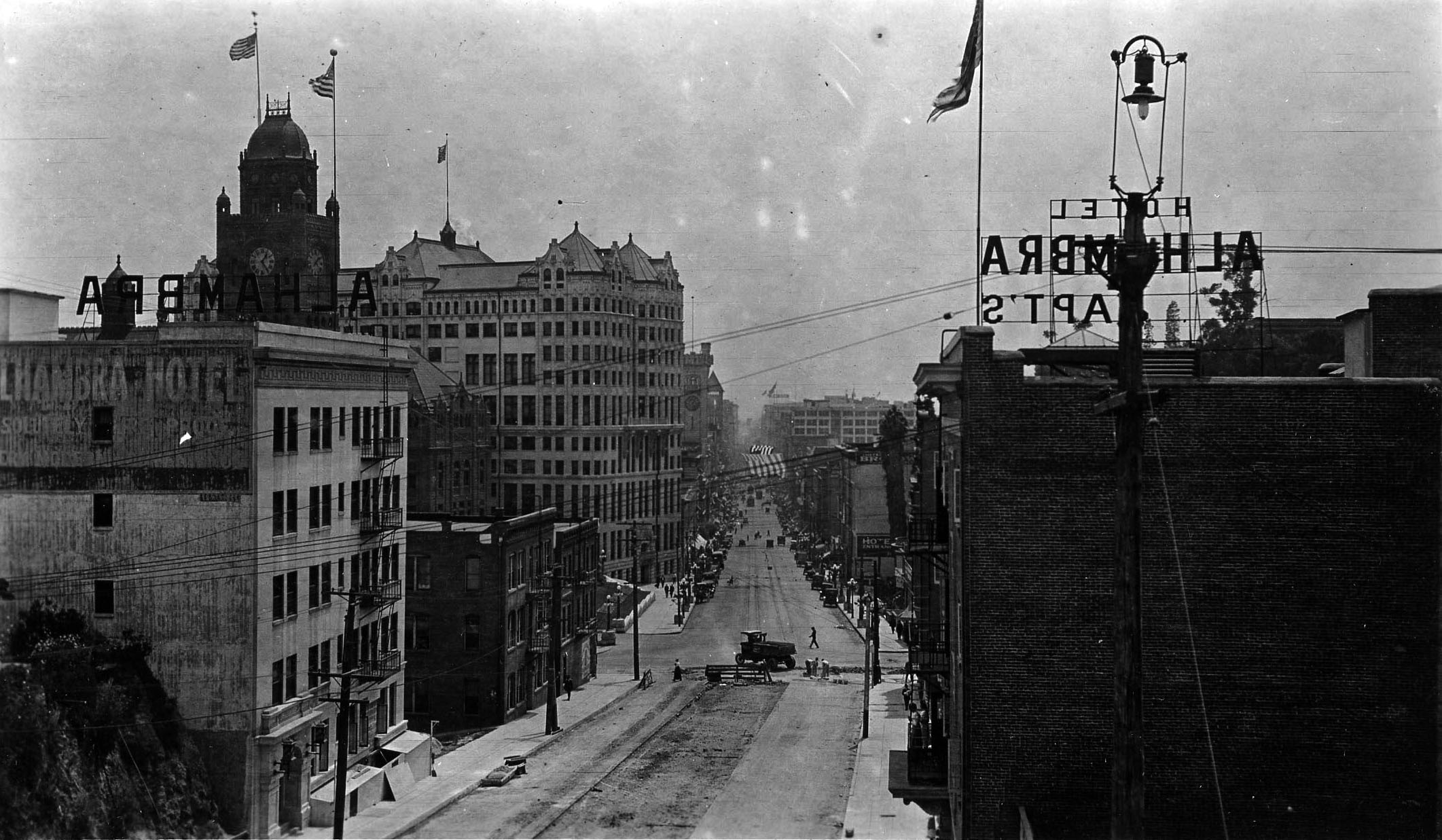
| (ca. 1920)^ – View looking south on Broadway from the top of the Broadway Tunnel toward Temple Street. The LA County Courthouse, Hall of Records, LA Times Building, and City Hall can all be seen in the background on the east side Broadway. The Alhambra Hotel stands on the left at its original location prior to being relocated closer to the tunnel. The hillside north of the Alhambra (lower-left) will soon be chiseled away and cleared to make room for the move. To the right stands the Hotel Alhambra & Apartments Annex. Note the interesting looking streetlight on the power pole to the right. Click HERE to see more in Early LA Streetlights. |
 |
|
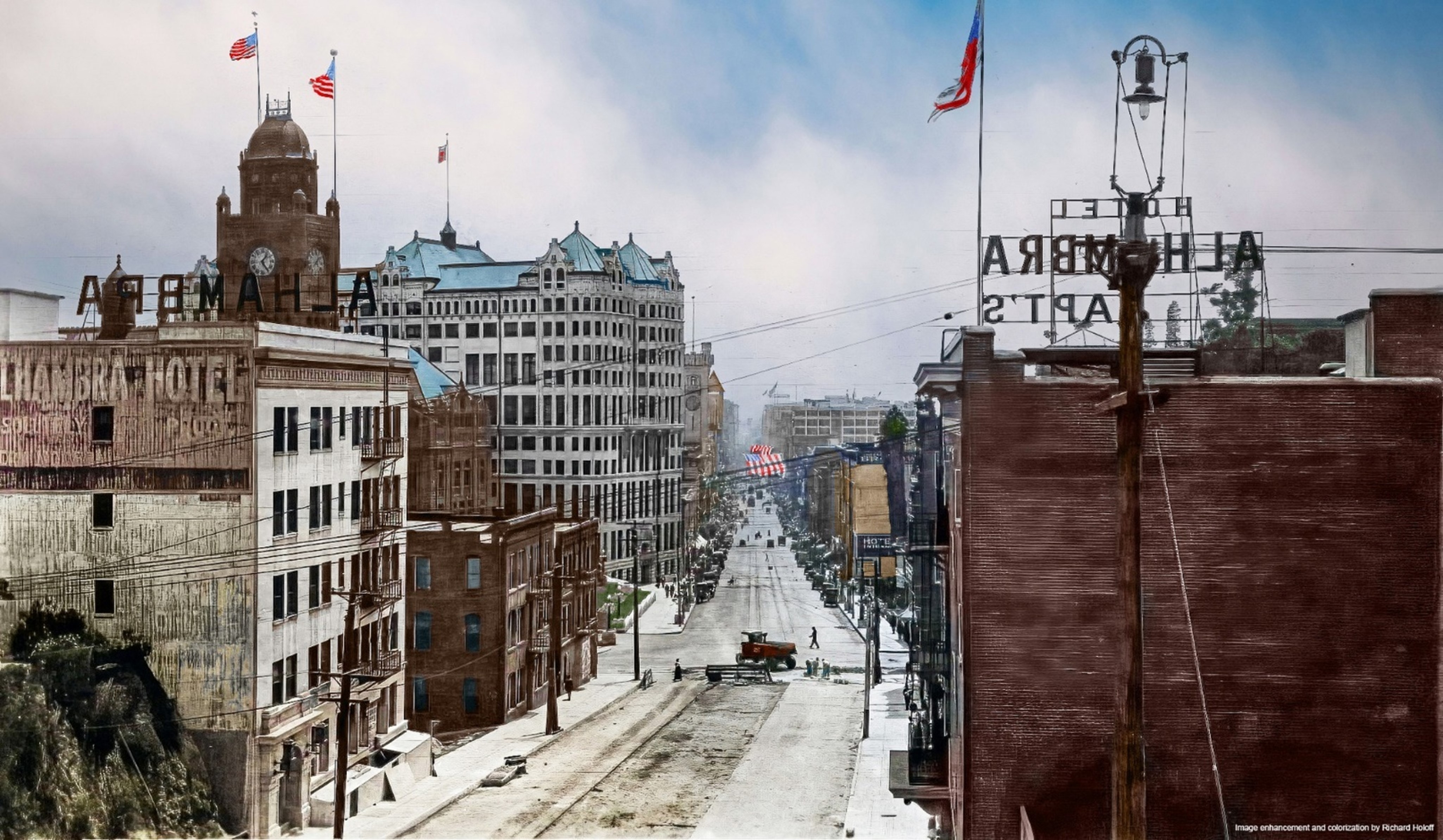
| (ca. 1920)^ – View looking south on Broadway from the top of the Broadway Tunnel toward Temple Street. The LA County Courthouse, Hall of Records, LA Times Building, and City Hall can all be seen in the background on the east side Broadway. The Alhambra Hotel stands on the left at its original location prior to being relocated closer to the tunnel. The hillside north of the Alhambra (lower-left) will soon be chiseled away and cleared to make room for the move. To the right stands the Hotel Alhambra & Apartments Annex. Note the interesting looking streetlight on the power pole to the right. Click HERE to see more in Early LA Streetlights. Image enhancment and colorization by Richard Holoff |
 |
|
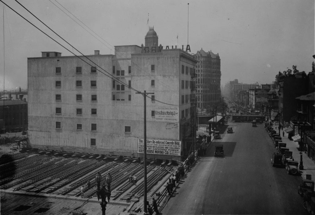
| (1924)^ - View looking south on Broadway from the top of the Broadway Tunnel on Fort Moore Hill. The LA County Courthouse can be seen in the distance on the southeast corner of Broadway and Temple Street. The large building at center is the Alhambra Hotel, just before it was moved one lot to the north to make room for the Hall of Justice. The six-story hotel rests on a series of metal girders and, in the foreground, workers can be seen near where the hotel will finally rest. The Alhambra Hotel Annex is situated across the street on the west side of Broadway (out of view). |
Historical Notes In 1924 the Alhambra Hotel was moved north up Broadway 122 feet towards the face of the Broadway Tunnel to make room for the Hall of Justice. The Kress House Moving Company was awarded a $63,770 contract to move the massive Alhambra Hotel. Dozens of parallel train tracks were positioned to move the hotel closer to the tunnel. |
 |
|
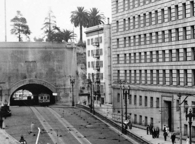
| (ca. 1925)^ – View showing the south portal of the Broadway Tunnel with the Hotel Alhambra (at new location) squeezed in between the tunnel and the newly constructed Hall of Justice (N/E corner of Broadway and Temple Street). |
Then and Now
 |
|
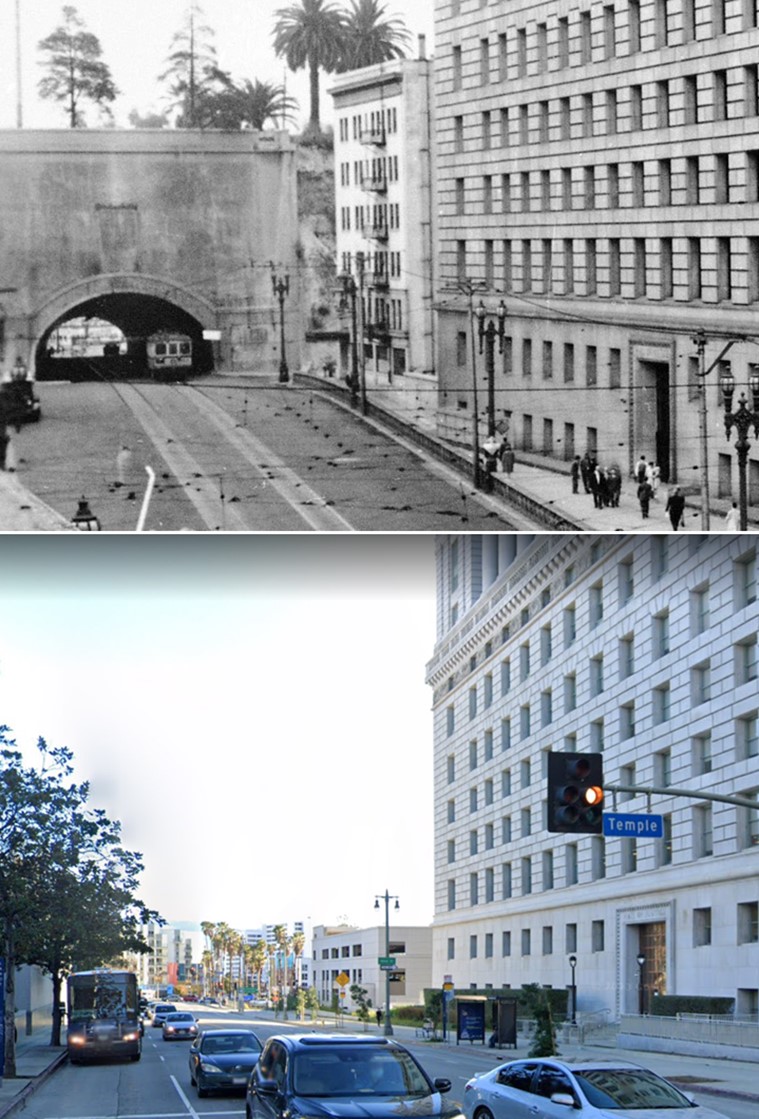
| (1925 vs 2022) – Looking toward what used to be the southern portal of the Broadway Tunnel as seen from Temple Street. |
* * * * * |
Spring and 1st Street
 |
|
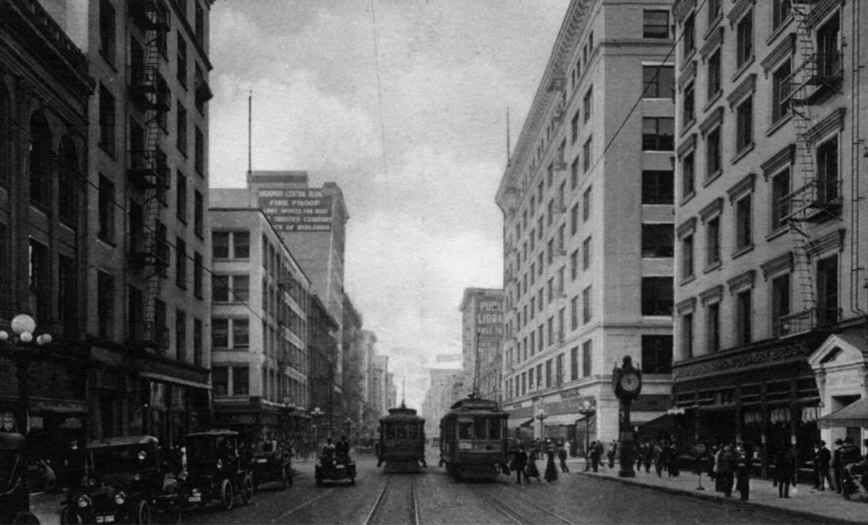
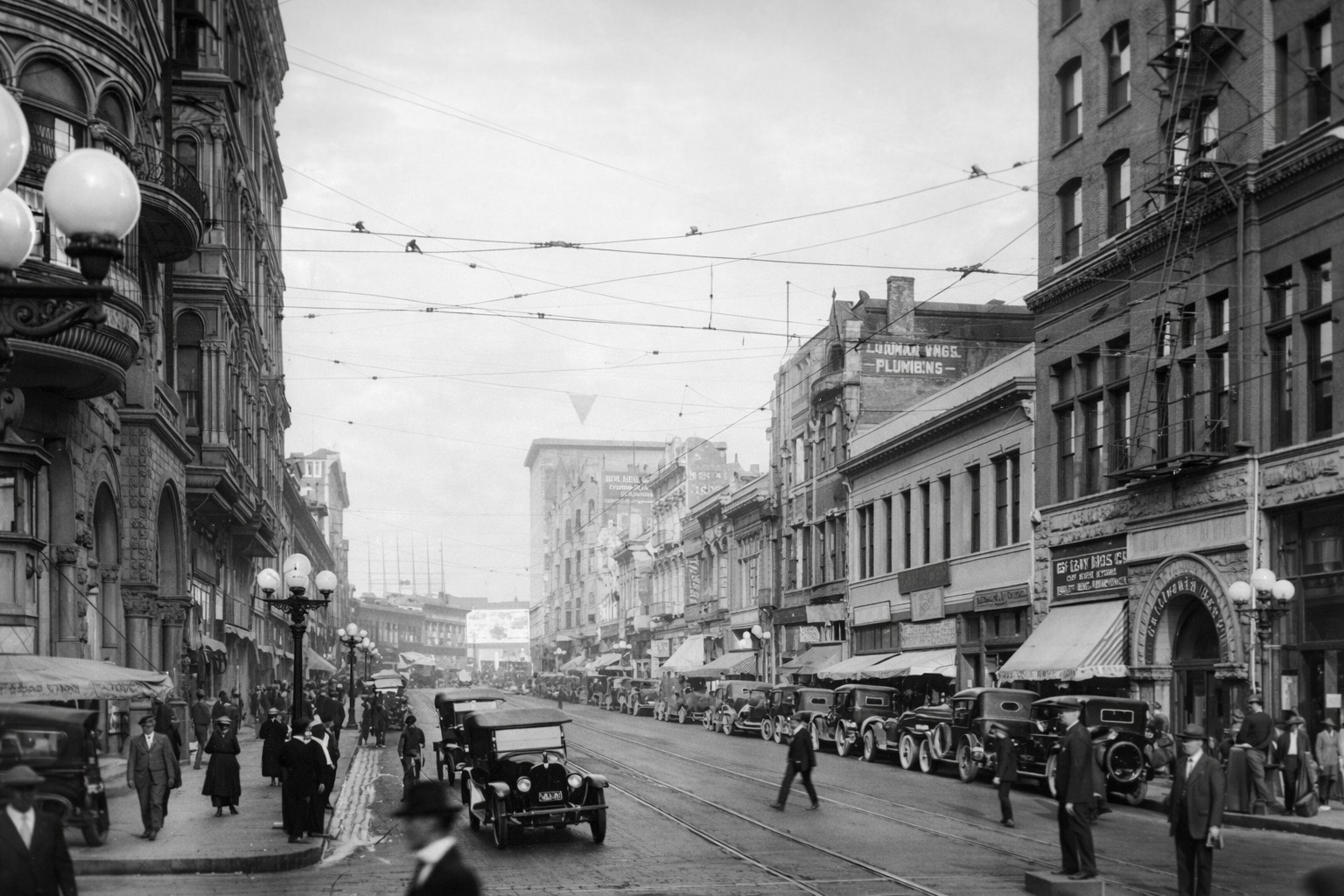
| (ca. 1920)^ – View looking north on Spring Street at First. Security Trust & Savings Bank on the right side of photo. Spring Street does appear to curve in those days, which it no longer does. |
 |
|
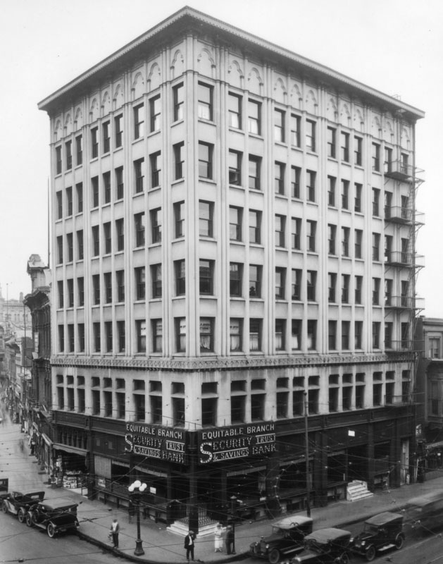
| (1920)^ - Exterior view of the Security Trust and Savings Bank on the northeast corner of First and Spring Streets, in the 7-story Equitable Building. |
Historical Notes In 1906, the seven-story Equitable Savings Bank replaced the Los Angeles National Bank building on the northeast corner of First and Spring streets. The building didn't last too long, being demolished in the late 1920s. The site today is the corner of the park next to City Hall.^ |
 |
|
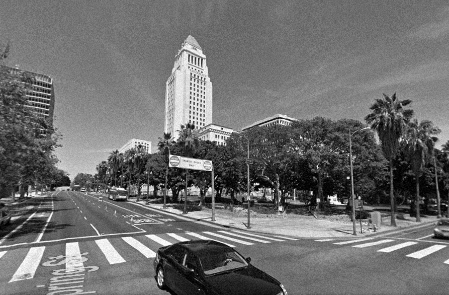
| (2014) – Google Street view looking at the northeast corner of Spring and First Streets where the Equitable Bank Building once stood, now a park next to City Hall. |
* * * * * |
Spring and 2nd Street (Looking North)
 |
|
| (ca. 1920)* - View looking north on Spring Street at 2nd Street where a traffic cop stands on a soap box in the middle of the intersection directing traffic. The tallest building in the distance is the 7-story Equitable Building located on the northeast corner of Spring and 1st streets. |
Historical Notes By the late 1910s and early 1920s, Spring Street had become one of Los Angeles' busiest corridors, known as the city’s financial district. The presence of a traffic officer elevated above the street reflects the growing challenge of managing automobiles before the introduction of electric traffic signals. On the left is the Bryson Bonebrake Block on the northwest corner of Spring and 2nd. Completed around 1888, the building was commissioned by John Bryson Sr., a former mayor of Los Angeles, and George H. Bonebrake, a prominent banker. Designed by architects Joseph Carter Newsom and Samuel Newsom, the structure featured six stories plus a basement, interior courts for light and ventilation, and a lodge room on the top floor. Buildings like this helped define Spring Street as a center of commerce, banking, and professional offices during Los Angeles’ early boom years. |
 |
|
| (2024)* - Contemporary view looking north on Spring Street from 2nd Street. Los Angeles City Hall rises in the distance just north of 1st Street. |
Historical Notes Today, Spring Street retains its historic street grid, but its role has shifted from a financial center to a mix of civic, residential, and creative uses. City Hall, completed in 1928, now dominates the view and marks the northern transition from the old business district to the Civic Center. Most of the nineteenth century commercial blocks that once lined Spring Street have been replaced or repurposed, yet the street remains a key link between the historic core, City Hall, and the modern downtown skyline. |
Then and Now
 |
|
| (1920 vs 2024)* - Looking north on Spring Street from 2nd Street. Photo comparison by Jack Feldman. |
Historical Notes This comparison shows how the same intersection evolved from a dense commercial corridor filled with early automobiles and manual traffic control into a modern downtown street shaped by civic architecture and adaptive reuse. While the street alignment remains unchanged, the visual focus has shifted northward toward City Hall. What was once a tightly packed canyon of late nineteenth century buildings has opened into a broader civic landscape reflecting Los Angeles’ changing priorities and growth patterns. |
* * * * * |
Spring and 2nd Street (Looking South)
 |
|
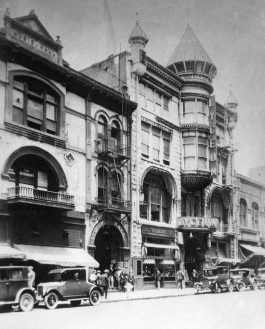
| (ca. 1920)* - View looking south on Spring Street at 2nd Street. The Hollenbeck Hotel is visible on the right, southwest corner. Further down the block is the Lyceum Theatre with its unique conical tower. At left stand the Wilcox Building, southeast corner. Note the ornate five-lamp streetlights lining both sides of the street. Click HERE to see more in Early LA Streetlights. |
Historical Notes Looking south, Spring Street reveals its role as both a commercial and entertainment corridor. The Hollenbeck Hotel was one of downtown's most prominent hotels, catering to travelers, businessmen, and theatergoers. The Lyceum Theatre, easily identified by its unusual tower, anchored a lively stretch of Spring Street that featured hotels, theaters, shops, and restaurants. The decorative multi-globe streetlights reflect early efforts by the city to beautify downtown streets while also improving nighttime visibility during the era of electric lighting. |
 |
|
| (1920)^ - Exterior view of the Lyceum Theatre, the original Los Angeles Theater, which opened in 1888 and located at 227 South Spring Street. |
Historical Notes The Lyceum Theatre opened in 1888 as the Los Angeles Theatre and was built by William Hayes Perry. The building was known as the Perry Building and featured a Richardsonian Romanesque design with heavy stonework and rounded arches. In 1903, the theater became the Orpheum, serving as the second Los Angeles home of the Orpheum Circuit vaudeville shows. In 1911, the Orpheum moved to Broadway, and the Spring Street building later became known as Fischer’s Lyceum and then simply the Lyceum Theatre. By the mid 1910s, it remained an important venue for popular entertainment in the city. |
 |
|
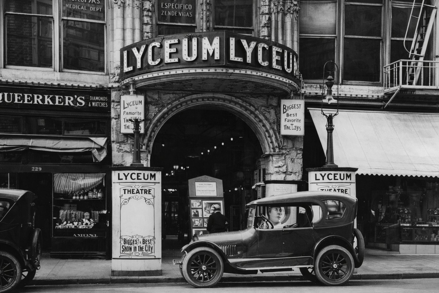
| (1919)^ - View of an early model car parked in front of the entrance to the Lyceum Theatre on Spring Street. Signs in front read: "Biggest and Best Show in the City" and "America's Most Popular Family Theatre". |
Historical Notes By the late 1910s and early 1920s, the Lyceum Theatre had transitioned from live performances to motion pictures, reflecting a broader shift in public entertainment. Spring Street theaters increasingly catered to movie audiences drawn downtown by streetcars and the growing use of automobiles. In 1941, the Lyceum Theatre building was demolished and replaced by a parking lot, a fate shared by many early downtown theaters as land values, traffic demands, and urban priorities changed. |
* * * * * |
5th and Spring Streets
 |
|
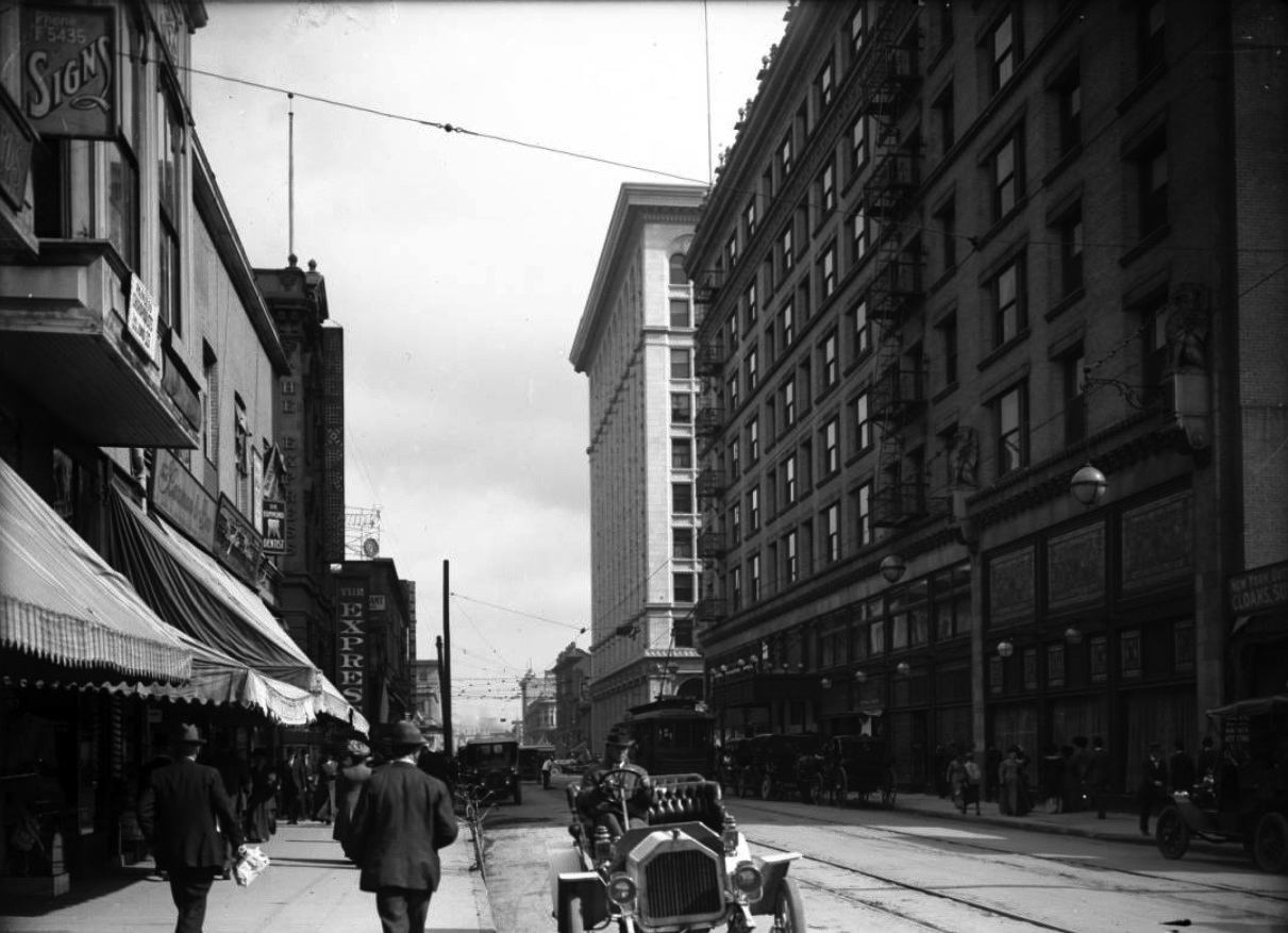
| (ca. 1918)* – View looking east on 5th Street toward Spring Street with the Alexandria Hotel seen at right (SW corner). A man sits behind the steering wheel of an early model convertible. The large building on the SE corner of 5th and Spring is the Security Building. |
Historical Notes The Alexandria Hotel at 501 South Spring Street became Los Angeles’s first five-star luxury hotel when it opened on February 12, 1906. It also served as the city’s main social center from 1906 to the end of 1920. |
 |
|
| (1924)* - View looking west on 5th Street toward Spring Street showing the Security Building on the left (SE corner). In the distance stands the Alexandria Hotel (SW corner). |
* * * * * |
Broadway and 5th Street
 |
|
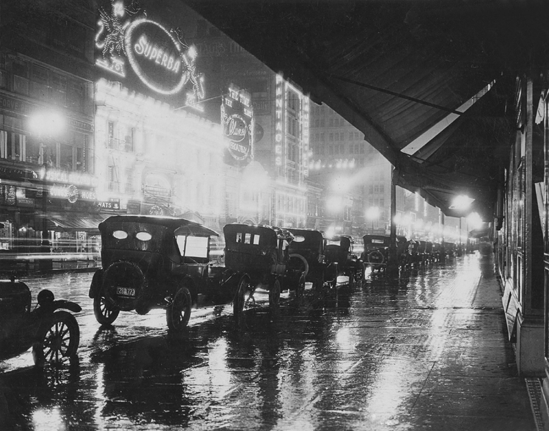
| (1920)*^ - A rainy night image looking south on Broadway between 5th and 6th streets. The dazzling Superba Theatre illuminates the wet pavement. |
Historical Notes The Superba theatre was opened on July 30, 1914 by pioneer theatreman John A. Quinn. Earlier (1909 or 1910) Quinn had moved from Arizona and leased the Ideal Theatre (134 S. Spring St.). This was followed by a partnership with G.H. McLain that acquired the Bijou (553 S. Main St.) and the Banner (456 S. Main St.). By the end of 1910 the partners had split with Quinn retaining the Banner. In 1911 Quinn took over the Garrick Theatre (former Hyman Theatre) at 8th & Broadway. In 1912 Quinn was running Tally's (833 S. Broadway) and was later involved on Broadway in the Rialto Theatre (1917). |
 |
|
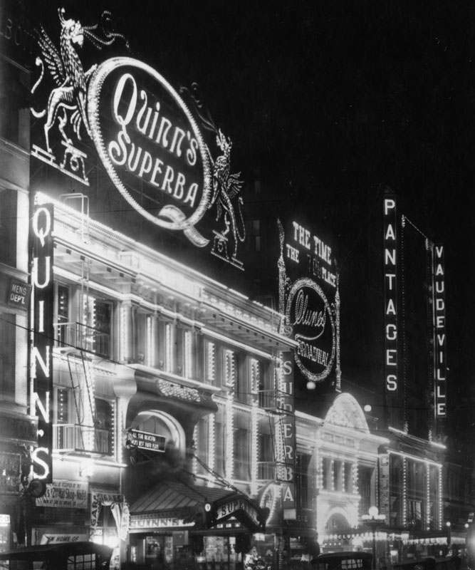
| (ca. 1915)^ - Exterior view of the front of Quinn's Superba Theatre, with a view down the street where signs can be seen for the Pantages Vaudeville. |
Historical Notes Quinn’s Superba Theatre was located on the site where the Roxie Theatre is today on Broadway in Downtown Los Angeles. It was next to the Cameo and the Pantages. |
 |
|
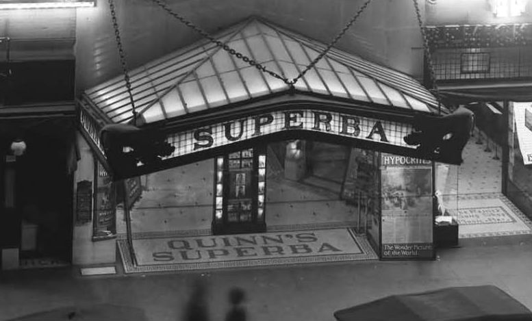
| (ca. 1915)*#* - Close-up view of the Quinn's Superba Entrance, 518 South Broadway in downtown Los Angeles. |
Historical Notes The Superba Theater was later sold and converted to a coffee house before being razed in 1931 to make way for the Roxie, which was the last theater built on Broadway. |
* * * * * |
Macy Street Bridge
 |
|
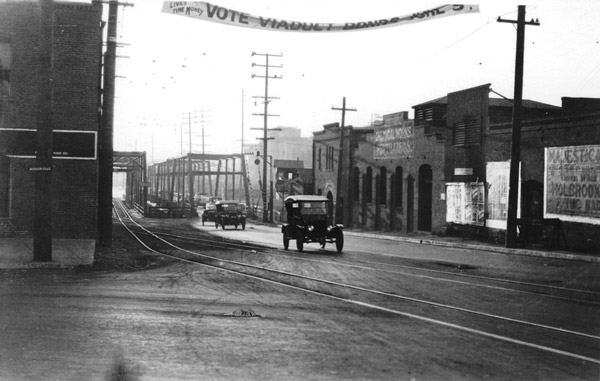
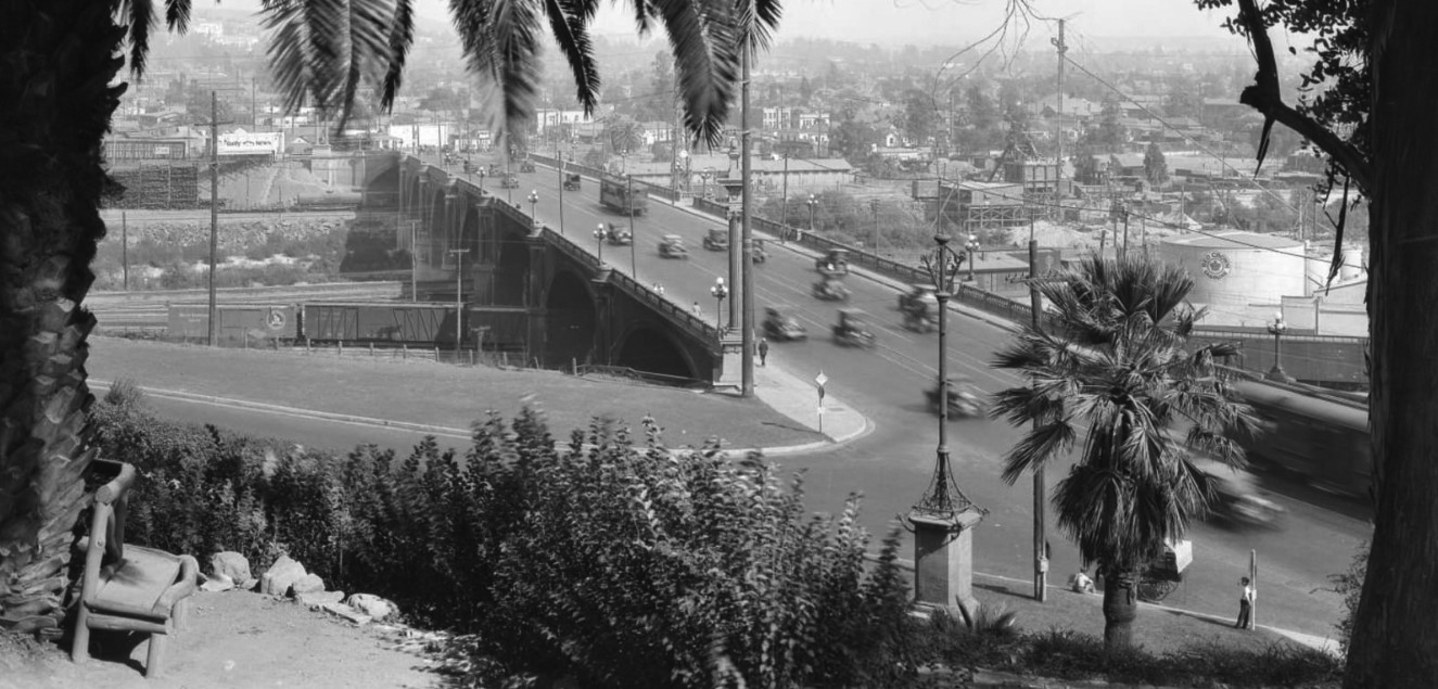
| (1923)** - View looking east showing the Macy Street Bridge over the Los Angeles River. A banner above the roadway reads: VOTE VIADUCT BONDS - APRIL 5. |
Historical Notes Over the years there have been several bridges connecting Macy Street with Brooklyn Avenue (previously Pleasant Avenue) in East Los Angeles. In fact, the first span over the Los Angeles River was a covered bridge, lit with kerosene lamps, built on this spot in 1870. Click HERE to see more on the 1st Macy Street Bridge. By 1923, you would cross the L.A. River at Macy on the metal truss bridge. While crossing, cars would have to contend with trains of both the Santa Fe (on the eastern side) and the Union Pacific (on the western), as the tracks for each were at the same grade as the bridge’s.* |
 |
|
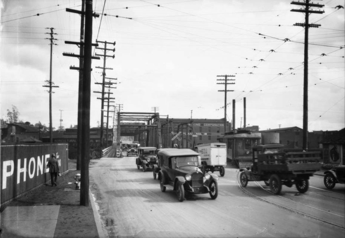
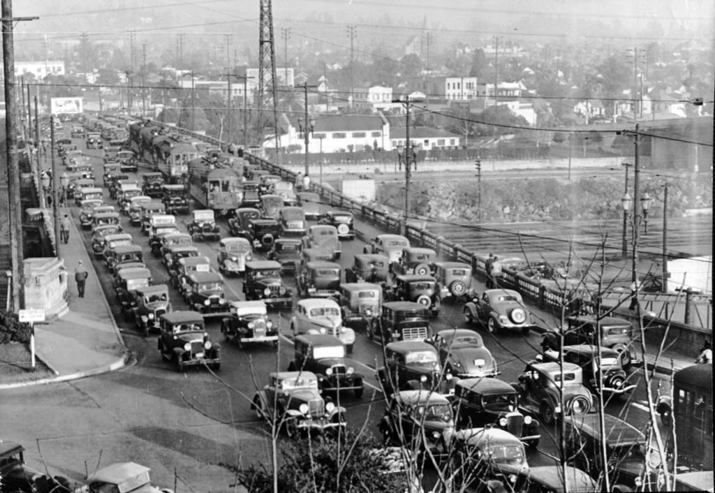
| (1925)^^ – View looking west showing cars, trucks, and streetcars sharing the road at the Macy Street Bridge. Today, Macy Street is Cesar Chavez Avenue. |
 |
|
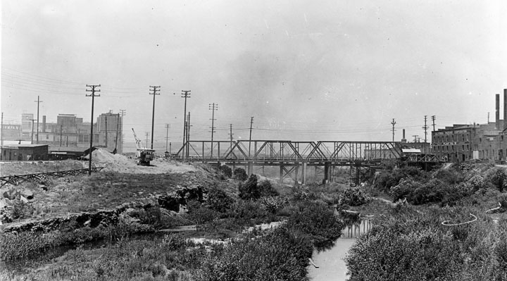
| (1925)^ - Profile view of the old Macy Street Bridge prior to its demolition. |
Historical Notes On April 5, 1923, the City's electorate voted for a $2 million bond issue to be put toward a new bridge initiative. The construction of the new Macy Street Viaduct eventually started in mid-1925.* |
 |
|
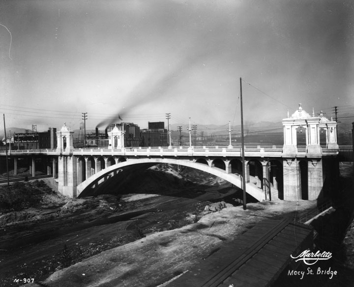
| (ca. 1926)* - Profile view of the new Macy Street Bridge, constructed 1925-26. |
Historical Notes The Macy Street Viaduct (Bridge) is the second bridge built during large bridge-building program in Los Angeles during the 1920s. The program started in 1923 with lobbyists pushing for the replacement of several of the city's outdated bridges and viaducts. The Macy Street truss bridge was problematic for motorists due to its narrow width and two railroad mainlines (the Santa Fe and Union Pacific) located on either side of the span. The new bridge formally opened on April 17, 1926. The bridge's Spanish Colonial elements are a nod to El Camino Real, the route of which Macy Street/Cesar Chavez Avenue follow. It is also why the bridge is dedicated to Father Junipero Serra. In 1995, Macy Street, which was named after Los Angeles pioneer Dr. Obed Macy, was changed to Cesar E. Chavez Avenue in honor of the former labor leader. So, too, was the name of the bridge changed.*^ Click HERE to see more Early Views of the Macy Street Bridge. |
* * * * * |
1st Street Bridge
 |
|
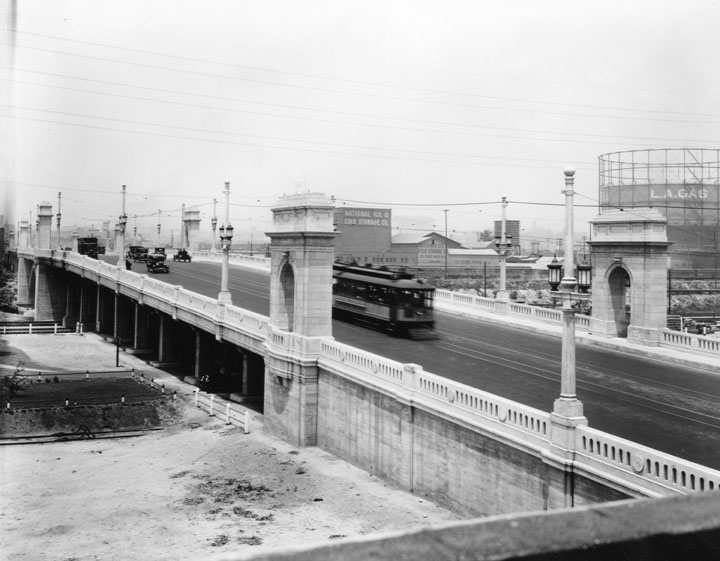
| (ca. 1929)^ - View of the 1st Street Bridge as a trolley and several cars drive across. On the other side of the bridge some businesses can be seen: National Ice & Cold Storage Co. and a large tank marked L.A. Gas. |
Historical Notes The First Street Viaduct opened in 1929, and is one of the series of classic Los Angeles River bridges designed by Merrill Butler. Special ornamentation was common on bridges constructed between 1900 - 1929. These poles serve two purposes: 1) to hold the decorative streetlight lantern and 2) to support the overhead for the Los Angeles Railway (LARy) streetcars that used this viaduct.^^ Click HERE to see more in Early Los Angeles Streetlights. |
.jpg) |
|
| (ca. 1930s)^ - 1st Street Bridge, viewed from below. Notice the dirt and grime on the facade right above the train tunnels. |
 |
|
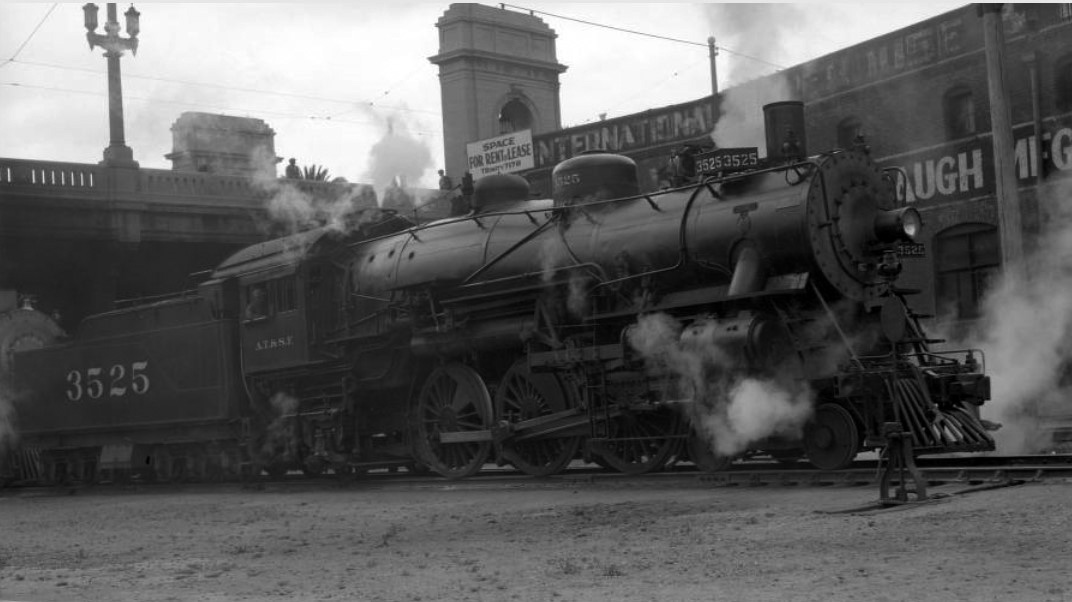
| (1933)### - View showing the Atchison, Topeka & Santa Fe (ATSF) locomotive, engine number 3525, engine type 4-6-2 passing under the 1st Street Bridge. |
Historical Notes The Santa Fe was a pioneer in intermodal freight service, an enterprise that (at one time or another) included a tugboat fleet and an airline (the short-lived Santa Fe Skyway). Its bus line extended passenger transportation to areas not accessible by rail, and ferryboats on the San Francisco Bay allowed travelers to complete their westward journeys to the Pacific Ocean. The ATSF was the subject of a popular song, Harry Warren & Johnny Mercer's "On the Atchison, Topeka and the Santa Fe", written for the film, The Harvey Girls (1946). The railroad officially ceased operations on December 31, 1996, when it merged with the Burlington Northern Railroad to form the Burlington Northern & Santa Fe Railway (later renamed BNSF Railway).*^ |
 |
|
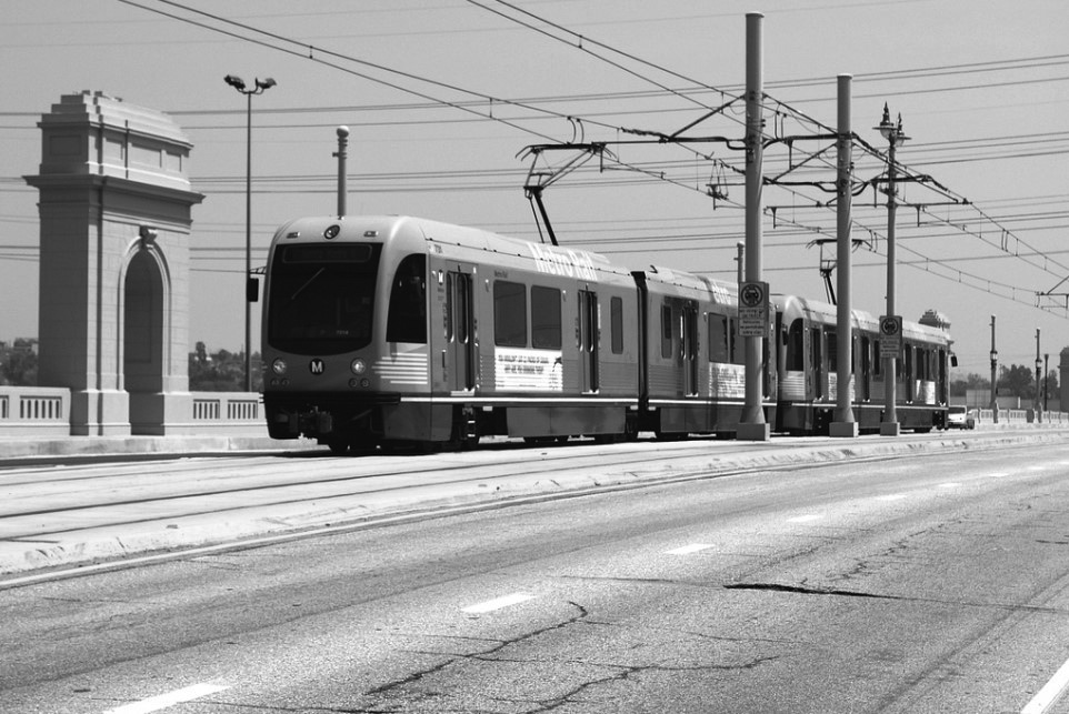
| (2012)^## - 435 MTA westbound on the First Street Bridge. |
Historical Notes The bridge was declared a historic-cultural monument in 2008, and the Gold Line extension, which runs down the middle of the bridge, opened the following year. |
* * * * * |
Buena Vista-Broadway Bridge
 |
|
| (ca. 1924)* - View of the Buena Vista (North Broadway) Bridge over the Los Angeles River. |
Historical Notes In the early 1900s, a group of property owners in present-day Lincoln Heights organized as the East Side Improvement Association called for a bridge over the river at Buena Vista Street (now North Broadway). The association secured half the funding for the bridge from private sources, and, when the city refused to supply the other half, elected their own president to the city council. The Los Angeles Times threw its support behind the plan in 1908, urging the city to become the "Pontifex Maximus of the day" (a reference to the officer of the Roman Republic responsible for bridge building). The city soon agreed, and the concrete-arch bridge -- complete with miniature Roman temples and other neoclassical flourishes -- opened to traffic in 1911.**# |
 |
|
| (1927)#^ – Panoramic view looking east from Elysian Park showing the Buena Vista (North Broadway) Bridge spanning the Los Angeles River and the SP trackage coming out of the 'Cornfield' (out-of-frame to the right). |
Historical Notes The Buena Vista-Broadway Bridge is one of the oldest of the bridges crossing the Los Angeles River. Strategically, the bridge connects Lincoln Heights with Chinatown and gets heavy use as an alternative to the Pasadena Freeway. Culturally and historically, the over 100-year-old bridge has served as an important symbolic link connecting the Latino and Chinese communities as well as being a favorite passage to Elysian Park for generations of Eastside families.*## |
 |
|
| (1937)^^ - View of a congested North Broadway bridge taken from the entrance to Elysian Park. Electric streetcars are in the midst of traffic. |
 |
|
| (1938)#^ - Aerial view showing the N. Broadway and Spring St. Bridges corssing a swollen Los Angeles River with Elysian Park (upper left) and the SP Cornfield (also known in 1938 as the Bullring) railroad yard. Meadow Road and Park Row Drive wind up a steep slope into Elysian Park at left north of the railroad yard. |
Historical Notes 1938 saw unusually heavy rainfall with widespread flooding. Notice the river is still 'unimproved'. Click HERE to see more in Los Angeles River – The Unpredictable. |
 |
|
| (2000)+** - Wide-angle view of the Buena Vista-Broadway Bridge looking north shortly after it was retrofitted. |
Historical Notes The Buena Vista-Broadway Bridge underwent an 18 month, $20-million dollar renovation and seismic retrofitting that was completed in 2000.*## |
* * * * * |
Highland Park
 |
|
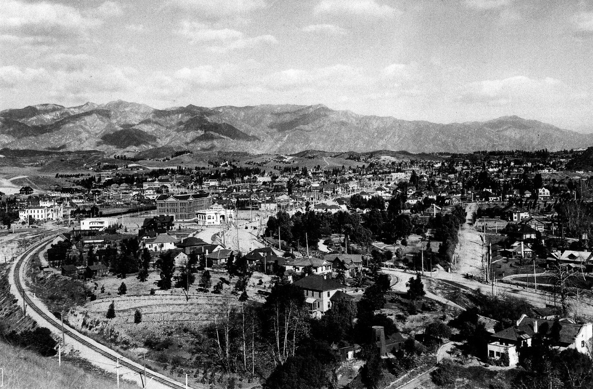
| (ca. 1905)* - Panoromic view of Highland Park looking towards the San Gabriel Mountains. |
Historical Notes The white building at center-left of the photo was once the Library building of the Occidental College Highland Park Campus in the early 1900s. |
 |
|
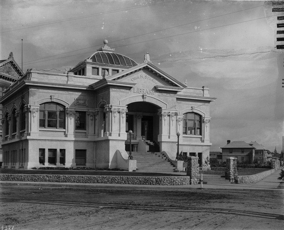
| (ca. 1908)^^ - Photograph of the Chas. M. Stimson Library, built in 1904 on the Occidental College Highland Park Campus. The two-story building has an extended porch where above it is a pediment displaying the name of the building. Multifoil tracery outline the windows the walls. Above the roof is a turret-like tower. A stone masonry wall creates a perimeter around the front yard. Heavy tracks line the dirt road in front of the building. |
Historical Notes After the College moved to its present campus in Eagle Rock in 1914 the Library building was used for a short time as a Los Angeles City Branch Library. The building has since been demolished.^^ |
 |
|
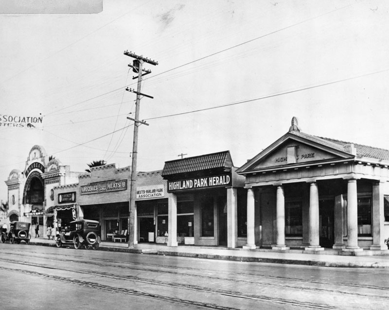
| (ca. 1920)^ - Pasadena Avenue (later North Figueroa Street) in Highland Park. The Sunbeam Theater is on the left, and Highland Park Herald newspaper office on the right. The theater, located at 5722 N. Figueroa Street, was designed by A. Lawrence Valk. |
Historical Notes The Sunbeam Theatre was a 1296 seat theater built in 1914. It was purchased by the owners of the Highland Park Theater and closed to remove competition. After that it was re-purposed for a variety of businesses. In the late 1980s, part of it was utilized by the theater group Outback Theater. The space is still occasionally used for events.*^^^ |
 |
|
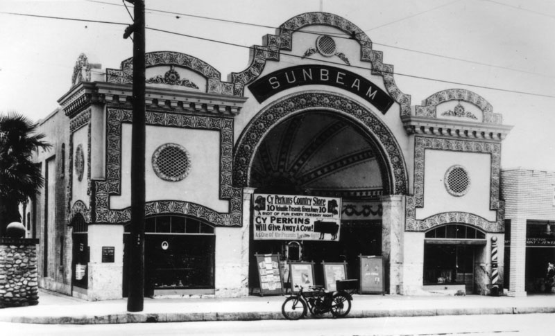
| (ca. 1920)^ - Exterior view of the Sunbeam Theater in Highland Park, with a sign advertising a promotion by Cy Perkins Country Store. An early model motorcycle is parked in front of the theater. |
* * * * * |
LA Plaza Area
 |
|
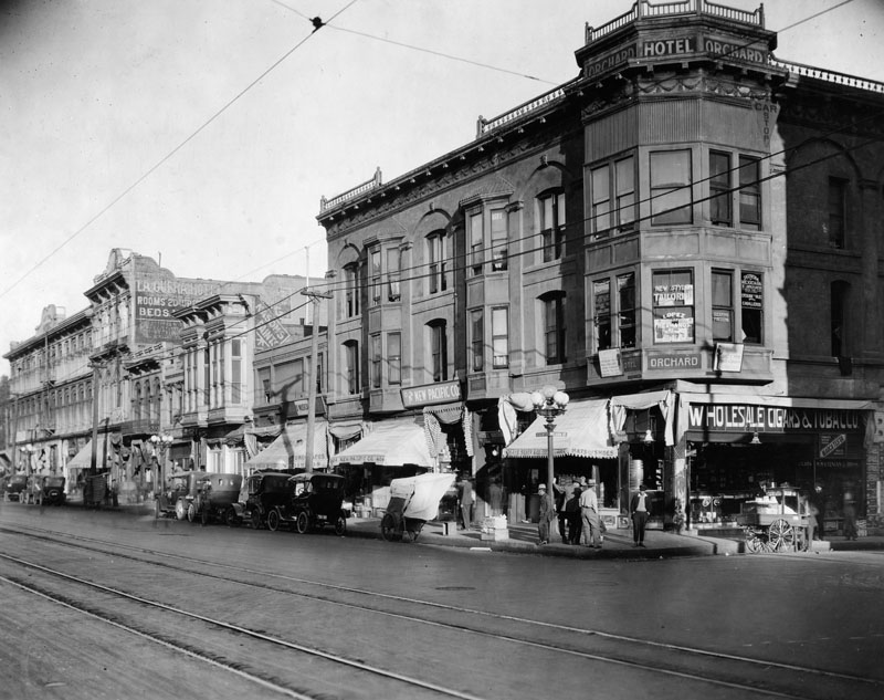
| (ca. 1920)^ - View of North Main Street at Arcadia Street in the Plaza area circa 1920. From left to right: Pico House, Merced Theater, Masonic Temple, and Hotel Orchard on the corner of Arcadia Street. Small shops are at street level, and cars are parked along the curb. Streetcar tracks are in the foreground. |
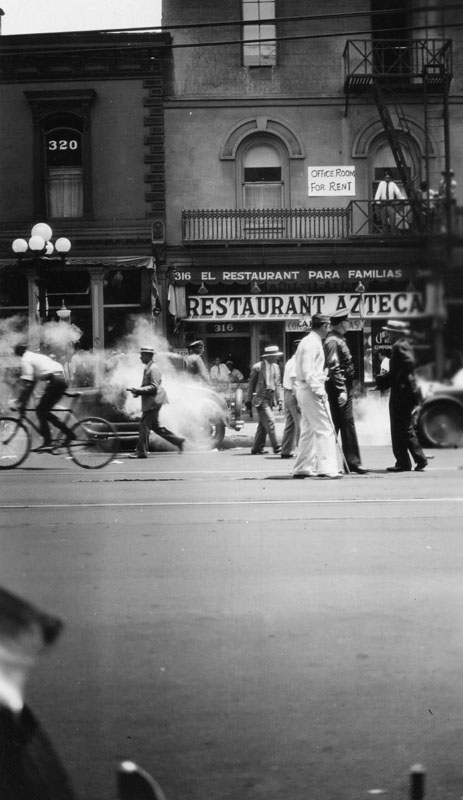 |
(ca. 1920)^ - View of a busy North Main Street in front of the Azteca Restaurant as seen from across the street. The restaurant is located on the street floor of the old Bella Union Hotel. A sign on the second floor reads: Office Room For Rent.
|
Historical Notes Constructed in 1835, the Bella Union Hotel has a long, rich history. It served as the County Courthouse until October 1851, and in 1860 was the location of a champagne fete celebrating the connection of San Francisco and Los Angeles by telegraph.^ |
 |
|
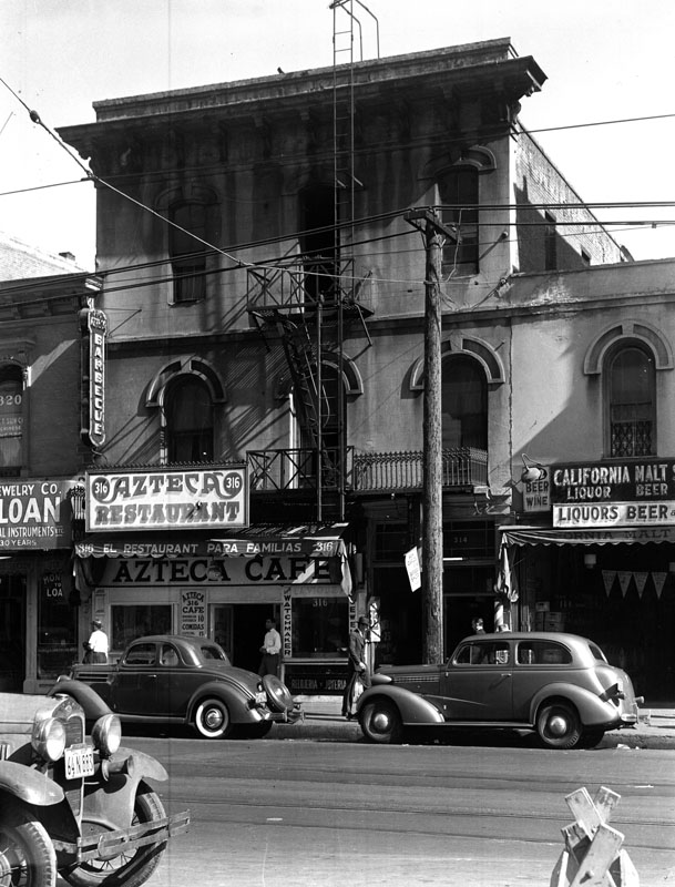
| (1939)^ - Exterior view of the old Bella Union Hotel, located at 314 North Main Street. Taken on May 4, 1939, the hotel had become a shadow of its former self. |
Historical Notes The Bella Union Hotel is considered to be the first hotel in Los Angeles. The building no longer exist, however the site it stood on was designated California Historical Landmark No. 656 (Click HERE to see more in Califronia Historical Landmarks in LA). Below is what the hotel looked like in the 1860s. |
 |
|
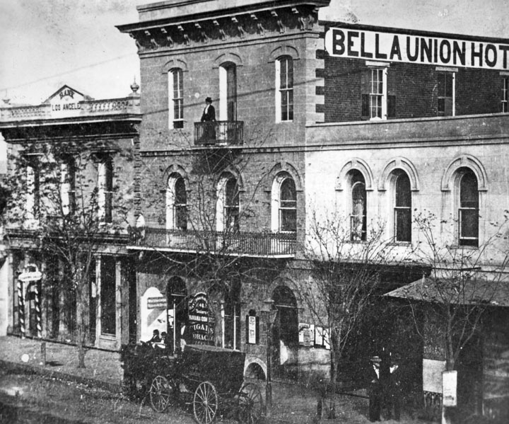
| (ca. 1867)^ - The Bella Union at 314 N. Main St. later became the St. Charles Hotel. To the left is the original home of Farmers and Merchants Bank, later merged into Security Pacific Bank. Standing on the balcony is Mrs. Margarita Bandini Winston, owner of the hotel. |
.jpg) |
|
| (ca. 1920)^ - View of the buildings on the east side of Los Angeles Street, in Chinatown. Address shown is 434 Los Angeles Street. |
 |
|
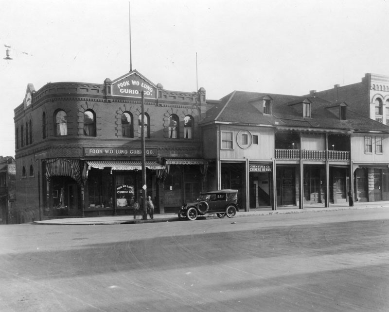
| (ca. 1920)^ - Shops on Los Angeles Street at Marchessault. Shown are the Fook Wo Lung Curio Co., at 526-528, next to Houng On Company, at 524, and Chew Fun and Company, Chinese herbs in the old Vincent Lugo Adobe at right. The LA Plaza is out of view to the right, on this side of Los Angeles Street. |
 |
|
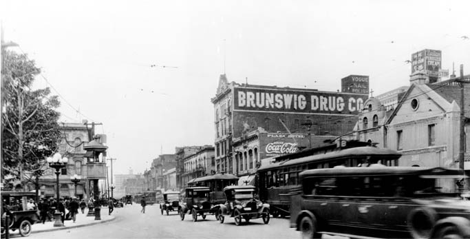
| (1920)*#^^ - View of Main Street, includes the Old Plaza Church and Brunswig Building (Brunswig Drug Company) on the right and the Plaza and Pico House on the left. Heavy traffic, antique cars and trolley cars. |
Historical Notes Note the elevated kiosk on the edge of the plaza to the left ot the photo. Elevated booths like these were used by the Los Angeles Railway and the Yellow Cars as a switchman’s tower to control the flow and path of streetcars through the intersection. Many of these were still standing well into the 1920s. |
 |
|
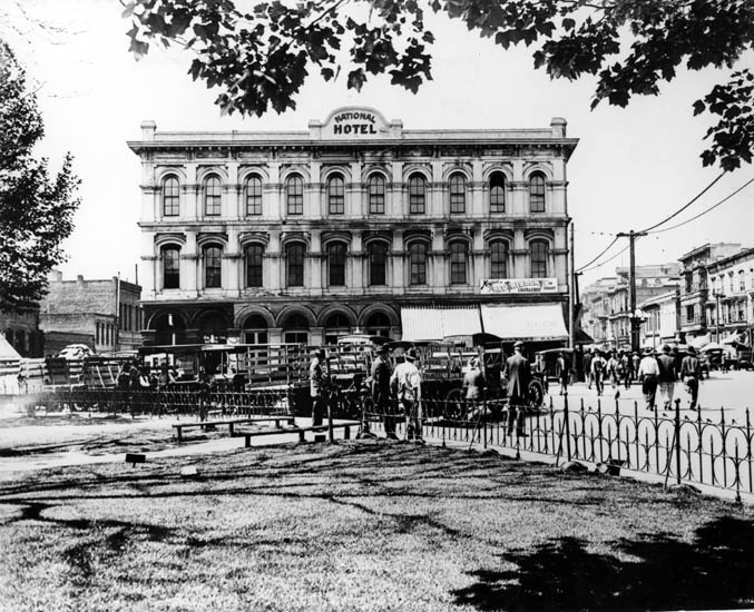
| (ca. 1920)*#^^ - View of the Pico House as the National Hotel from the Plaza circa 1920. |
Historical Notes In 1880, Pio Pico lost the hotel by foreclosure. From 1892-1920 the building was called the National Hotel.^#^^ |
 |
|
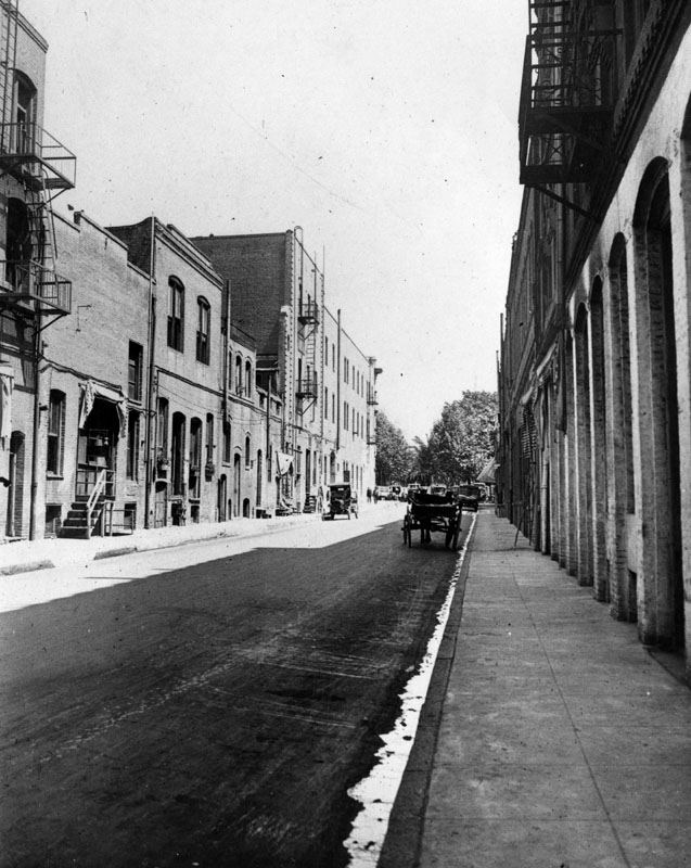
| (1921)^ - View of Sanchez Street, lined with brick buildings, looking north toward the Plaza in 1921. The first building at far left is the rear side of the Pico House and the rear side of the Merced Theater. |
Historical Notes Sanchez Street juts south from the plaza, opposite its more famous twin, Olvera Street, on the north side. It's just a block long, but it's seen a lot of history. In the 1880s and '90s, it was the scene of several crimes reported in The Times. Most involved the local saloons and Chinese gangs of the day, including the 1889 shooting death of the "Peruvian Princess," a woman whose tortured life took her from Lima to China to San Francisco and finally to her death in a Sanchez Street boarding house. In 1914 police fought protesters on Sanchez Street during the Christmas Riot. A member of the International Workers of the World, or Wobblies, was shot and killed.*^## |
 |
|
| (1920s)** - View looking south toward the L. A. Plaza on Olvera Street before improvement. On the left the Avila Adobe is seen. To the right is the Sepulveda House with a gas pump on its side. |
Historical Notes The Avila Adobe was built ca. 1818 by Don Francisco Avila, alcalde (mayor) of Los Angeles in 1810. Used as Commodore Robert Stockton's headquarters in 1847, it was repaired by private subscription in 1929-30 when Olvera Street was opened as a Mexican marketplace. It is the oldest existing house in Los Angeles. The Sepulveda House is a 22-room Victorian house built in 1887 in the East lake style. The original structure included two commercial businesses and three residences and fronts both Main and Olvera streets.*^ |
Click HERE to see more in Early Views of the Los Angeles Plaza |
* * * * * |
Downtown LA
 |
|
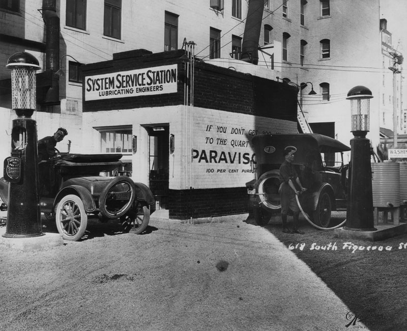
| (ca. 1920)^ - Two men are pumping gas into their cars from "Crouse Clear Vision: see what you pay for" pumps at the System Service Station at 618 South Figueroa St. One car, left, has its top down. Both cars have spare tires attached to the back. The small, brick, one-story service station is painted in three stripes with "Lubricating Engineers" under the station name and a painted advertisment for "Paravision" on the side. The service area is paved in gravel and far right is a partial sign for "Simonizing". Multi-storied buildings are directly behind the station and in the background, left, is a hotel advertized as "fire proof". |
Click HERE to see more Early Views of LA Gas Stations |
 |
|
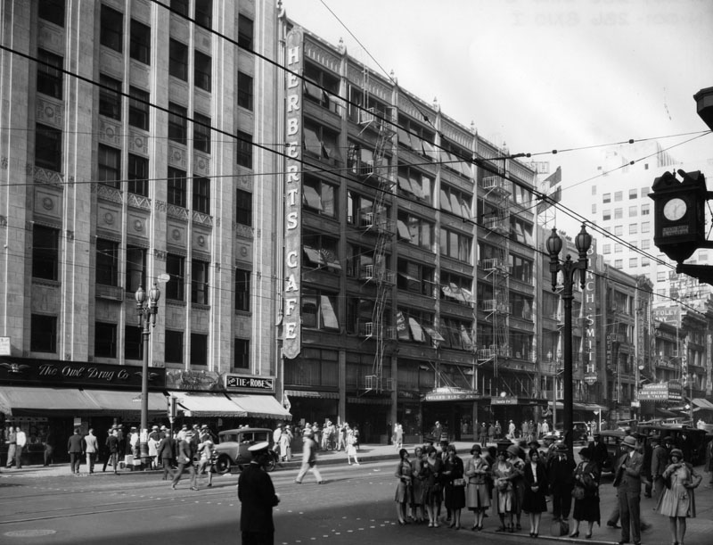
| (ca. 1920)^ - Pedestrians and a traffic cop face off at the intersection of Hill and 8th St. According to the Union Bank & Trust clock, it's 1:30 in the afternoon. On the left, awnings from The Owl Drug Co., Van de Kamp's Bakery and Ted's Tie and Robe Shop shade the sidewalk. "Herberts Cafe" vertical sign edges the Jewelers Building, center. The Alhambra Theater in the Edward D. Silent Building advertises the "Love Doctor, a Talkie" in its marquee. Another vertical sign, this one for Birch and Smith Furniture Co., is just before the theater. |
 |
|
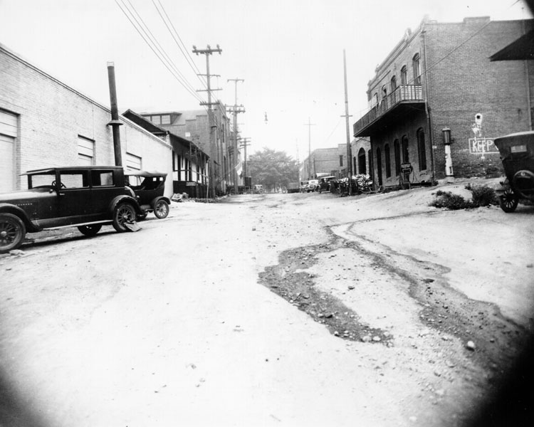
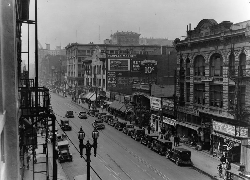
| (ca. 1920)^ - The Rueder Block No. 2, 1892, building houses the Salt Lake Hotel and various retail stores, such as Winsel Gibbs Seed Co. and M. Wright & Son, who claims "we buy & sell everything from a needle to a battleship". A shooting gallery, vaudeville theater (all seats 10 cents) and an auto park (entrance on 3rd) are some of the retail businesses active on this busy street. |
 |
|
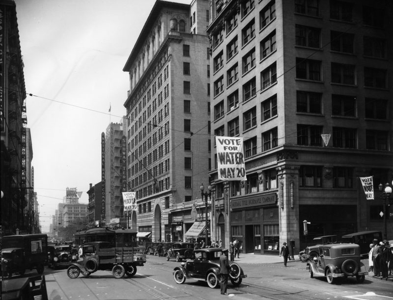
| (ca. 1925)^ - "Vote for Water, May 20" banners span Hill Street as a white-gloved cop waves traffic through Hill & 4th intersection. Buildings are: Pershing Square Building, left; Subway Terminal Building, center; National Bank of Commerce Building next to Subway. |
Historical Notes In 1913 the Los Angeles Aqueduct was completed and the City had a new source of water. L.A. proceeded to annex outlying communities attracted by the promise of an abundant water supply. The flurry of annexations began even before the aqueduct was complete. Between 1910 - 1930, The area of Los Angeles increases from 115 sq. miles to 442 sq. miles through annexations of surrounding areas (i.e. Hollywood is annexed in 1910, the San Fernando Valley is annexed in 1915). The City's population increased from 533,535 (1915) to 1,300,000 (1930).*^ |
Click HERE to see more in Water in Early Los Angeles |
 |
|
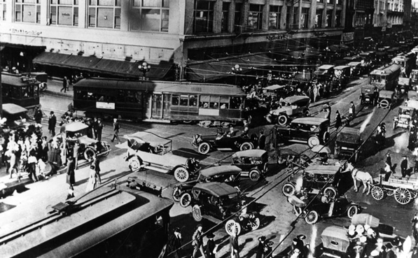
| (ca. 1920)^ - Streetcars, automobiles, horse-drawn carriages, and pedestrians clog the intersection of Broadway and 7th Street. |
Historical Notes Traffic jams in downtown Los Angeles started early in this century. This picture was taken sometime in the 1900's to 1920's, and already the trolleys, cars and horses and carriages are going every which way they can in the middle on the street. On the far (northwest) corner of Broadway is the Bullock's Dept. store.^ |
 |
|
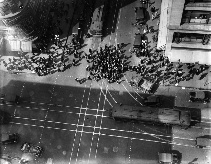
| (1920s)^ - A view of the intersection of 7th and Broadway taken from directly overhead showing throngs of people crossing the street. On the top left (southwest) corner is the Loew's State Theatre. |
Historical Notes Los Angeles' population continued to grow. By 1920 it was 576,700, an 81% increase over what it was 10 years earlier (319,200).*^ |
 |
|
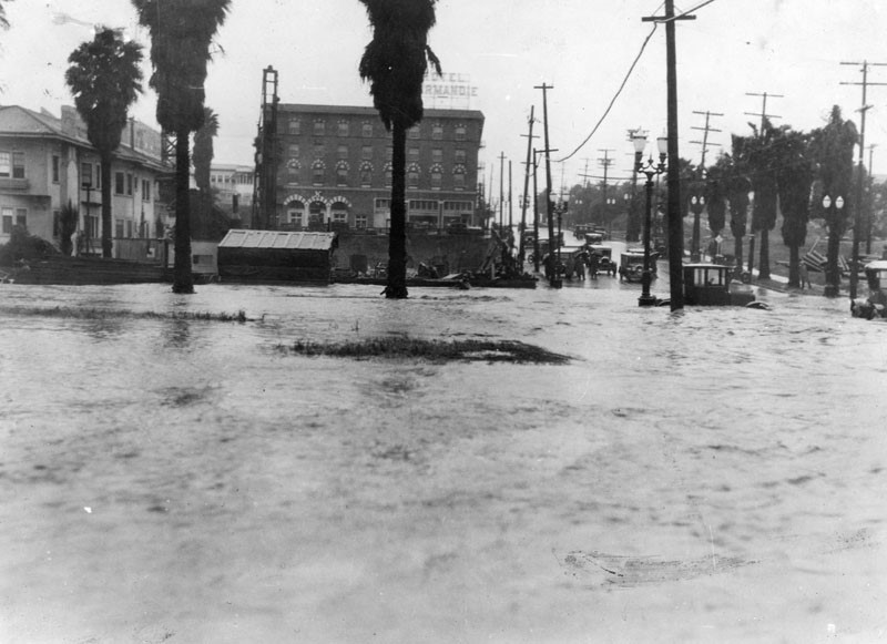
| (ca. 1922)^ - View of 6th Street and Mariposa Avenue, looking toward the Hotel Normandie, across a lake of water. |
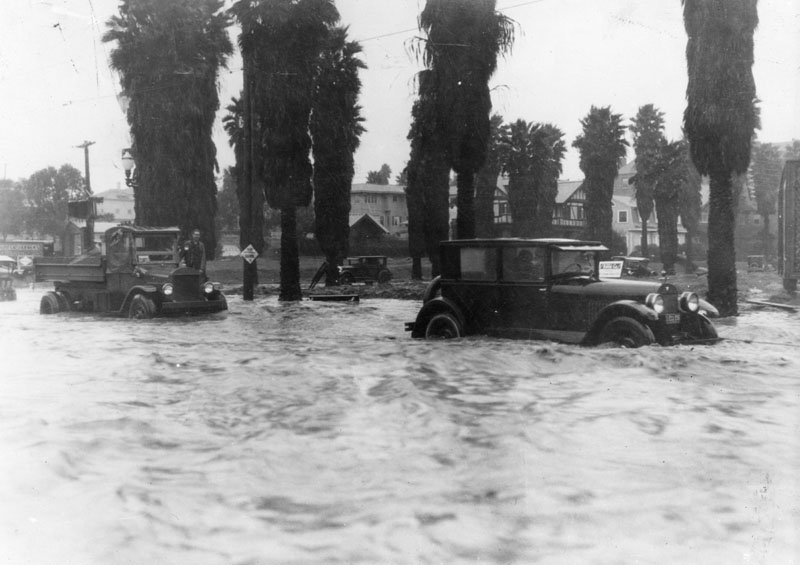 |
|
| (1920s)^ - Vehicles in the flooded intersection of 6th Street and Mariposa Avenue before the building of a storm drain. |
 |
|
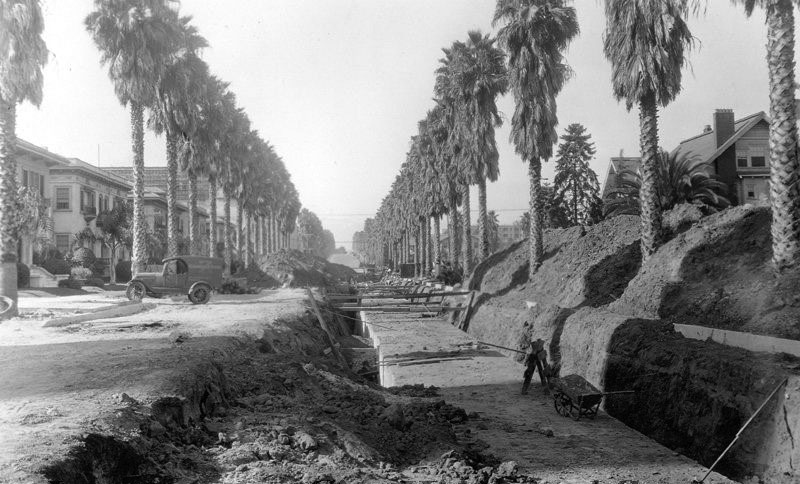
| (1927)^*^** – View showing the construction of a storm drain on Mariposa Avenue, looking north from Wilshire Boulevard. |
 |
|
| (ca. 1920s)^ - Panoramic view of the intersection of Olive and 7th Streets, looking south. At right is the building originally built as the Ville de Paris Department Store circa 1917, then remodeled in 1940 as the Merchandise Mart to accommodate various wholesale businesses. At left is the Los Angeles Athletic Club building. A number of streetcars, as well as cars, are on the street. |
 |
|
| (1922)^^ - View looking south on Olive between 7th and 8th streets. The new Pacific Telephone Co. building is under construction on east side of Olive Street. |
 |
|
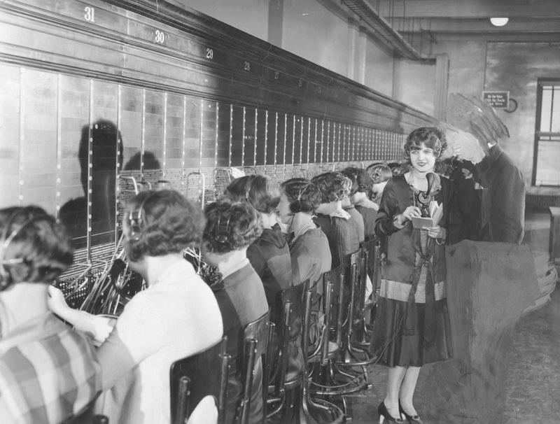
| (1930)*^^* - “Operator, may I help you". Before you had to press a zillion buttons to get through to a human, these women did it for you on a switchboard! View is of the switchboard at Pacific Telephone Company in Los Angeles located at 716 S. Olive Street. |
 |
|
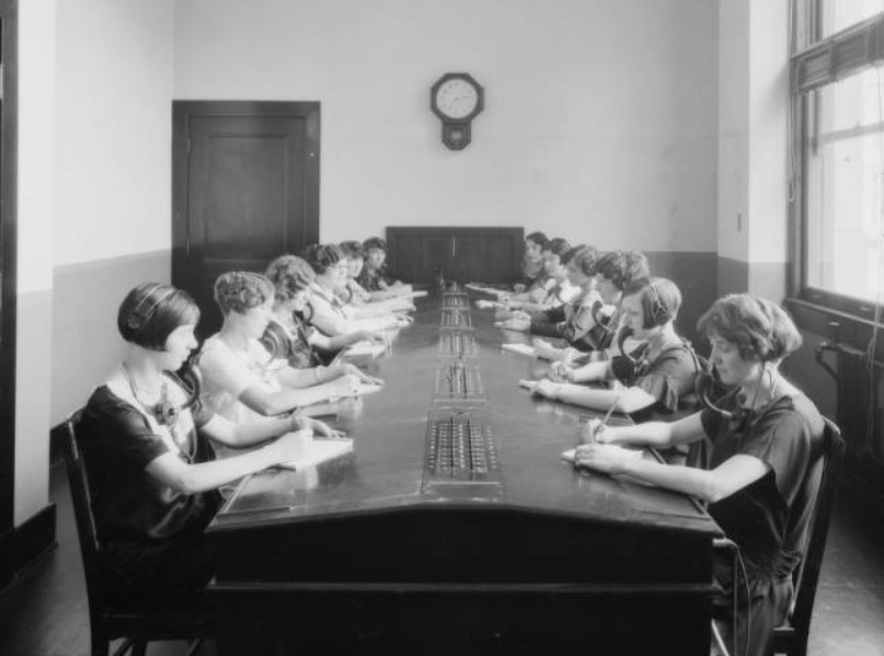
| (ca. 1925)^^ - Photograph of women operating the communication switchboard at The Broadway Department Store located on the corner of 4th and Broadway. |
 |
|
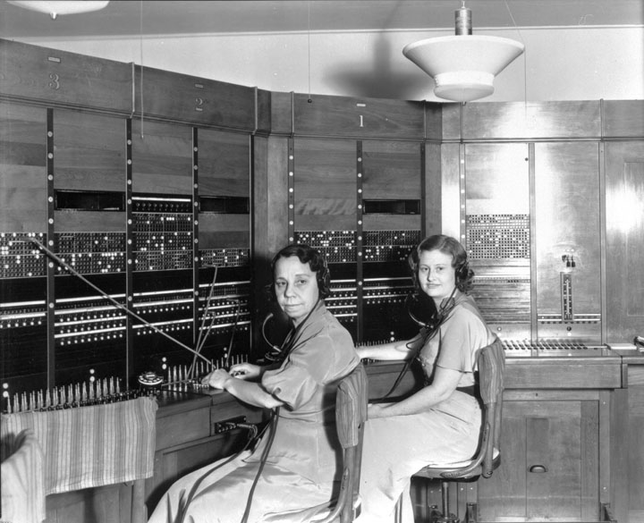
| (ca. 1930s)* - Early Telephone Exchange in the Bureau of Power and Light commercial building in downtown L.A., with telephone operators Alma McKnight (left) and Doris Scott (right). |
Click HERE to see more in Early Views of Commercial, Bureau of Power and Light (DWP) |
* * * * * |
San Fernando Valley
 |
|
| (ca. 1920)^ - View of Ventura Boulevard in Sherman Oaks, in the San Fernando Valley. |
 |
|
| (ca. 1920s)^ - Aerial view of farms and fields in Canoga Park in the San Fernando Valley. |
Click HERE to see more in Early Views of the San Fernando Valley |
* * * * * |
Inceville
.jpg) |
|
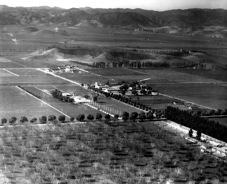
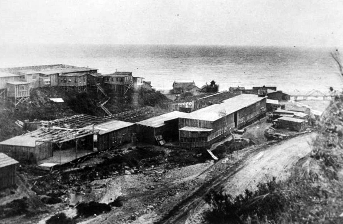
| (ca. 1915)#^# - View from the Palisades looking toward Malibu showing Inceville, the famed motion picture studio founded by Thomas Ince. |
Historical Notes In 1911, film director Thomas Ince created his Western film factory, "Inceville," which at its peak employed nearly 600 people.*^ |
 |
|
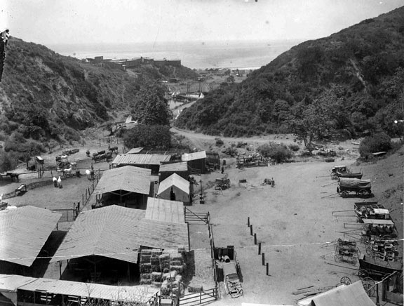
| (1915)^ - View of Inceville, on Sunset Boulevard (Santa Ynez Canyon) at the Pacific Ocean, where Ince Studios filmed location scenes. |
Historical Notes Ince leased 18,000 acres of land extending from the seashore up Santa Ynez Canyon and into the mountains for 7-1/2 miles. While he was building the frame-structured studio buildings, situated where Gladstone’s Restaurant is today, he also hired Miller’s 101 Ranch Wildwest Show, including many cowboys, animals and a Sioux Indian tribe, who set up their teepees on the property.^#^ |
 |
|
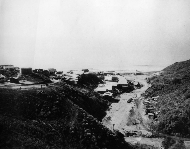
| (ca. 1916)^#^ - The mouth of Santa Ynez Canyon at the Pacific Ocean was once home of Inceville, an early 1900s film studio built by film director Thomas Ince. |
Historical Notes Most of the cowboys, Indians and assorted workmen lived at Inceville, while the actors came from Los Angeles and other communities as needed, taking the red trolley cars to the Long Wharf at Potrero Canyon, where buckboards conveyed them to the set. Ince lived in a house that overlooked Inceville, the location of Marquez Knolls today.^#^ |
 |
|
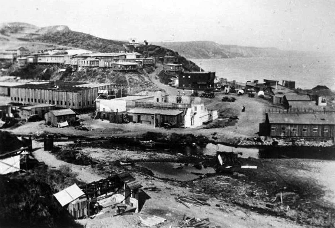
| (1916)#^# – View showing the Inceville Studios built by silent film producer Thomas H. Ince at the mouth of Santa Ynez Canyon. |
 |
|
| (1916#^# - Looking down Sunset Boulevard with a view of silent film producer Thomas Ince's Inceville Studios in Santa Ynez Canyon. |
 |
|
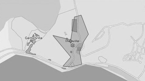
| (n.d.)*^ - Map showing the location of Incville relative to where Sunset and PCH are situated today. |
Historical Notes By 1916, Ince was supervising eight directors and releasing one five-reel picture (about 50-minute films) each week at an average cost of $40,000. His film ‘Civilization,’ which employed over 25,000 extras, was by far his most ambitious endeavor. The set for the mythical city stood alone on the barren hills, where Marquez Elementary School is today. It was built by 60 carpenters over a period of three months at a cost of $80,000 and was used for only 100 feet of film.^#^ |
 |
|
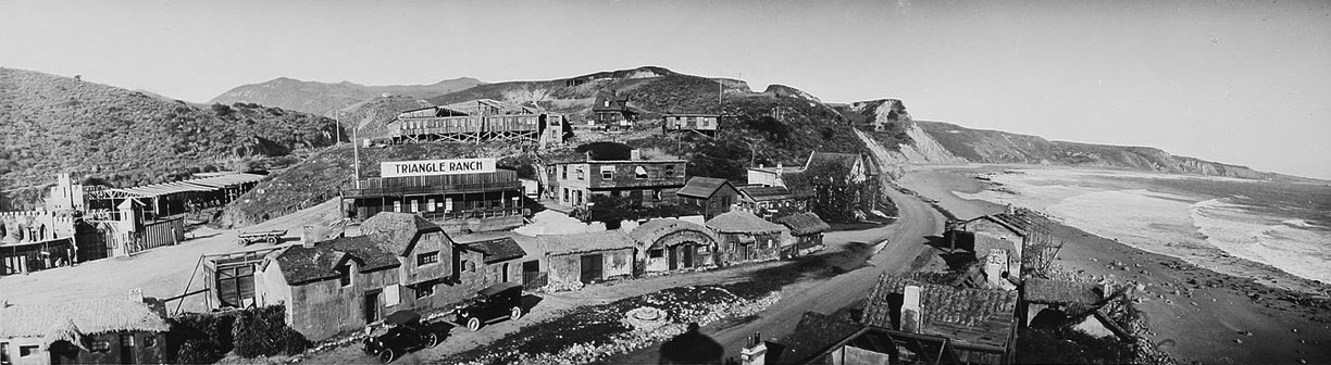
| (ca. 1916)*^ - View of houses and stage sets at Incville. Large sign on one of the buildings reads: Triangle Ranch. |
Historical Notes Incville's cost continued to rise as moviegoers enjoyed the more expensive feature films, which used five reels or more. Ince, through his alliance with Triangle, a production company founded by D. W. Griffith and Mark Sennett, built a new studio in Culver City to use for indoor movies, while retaining Inceville for outdoor locations and Westerns. Ironically, on January 16, 1916, a few days after opening of his Culver City studio, a fire broke out at Inceville, the first of many which would eventually destroy all of the dry frame buildings. That same year, Ince gave up on Inceville and sold it to Hart, who renamed it Hartville. Three years later, Hart sold the lot to Robertson-Cole, which continued filming until 1922.^#^ |
 |
|
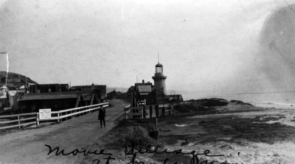
| (ca. 1915)*^#^ - View showing a man standing on a bridge leading to Inceville Movie Studio village on the beach at Pacific Palisades in Santa Monica. A sign on the bridge reads "Take this newly completed scenic drive Santa Monica Los Angeles." |
* * * * * |
Santa Monica Bay
 |
||
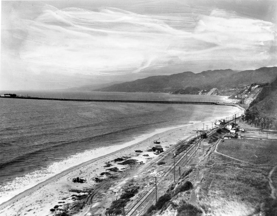
| (ca. 1912)^^ - View of Santa Monica Canyon and Long Wharf. The entrance to the Santa Monica Canyon is to the right. Railroad tracks and a pole line can be seen running parallel to the beach. The mountains along the Pacific coastline are visible in the distance. The long dock extends from the beach on the right to a large ship in the open ocean on the left. |
Historical Notes When the Southern Pacific Railroad arrived at Los Angeles, a controversy erupted over where to locate the city's main seaport. The SPRR preferred Santa Monica, while others advocated for San Pedro Bay. The Long Wharf was built in 1893 at the north end of Santa Monica to accommodate large ships and was dubbed Port Los Angeles. At the time it was constructed, it was the longest pier in the world at 4700 feet, and accommodated a train.*^ However, just a short four years after the Long Wharf's construction, San Pedro Bay was chosen over Santa Monica to be the main seaport of Los Angeles. The Long Wharf was demolished in 1920. |
 |
||
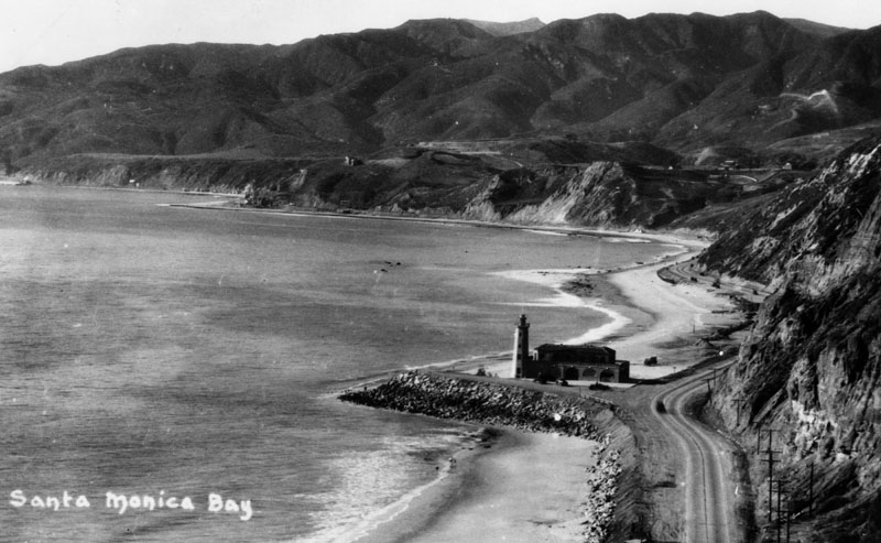
| (ca. 1927)^ - View of the Santa Monica Bay coastline, showing a lighthouse and bathhouse near the Pacific Palisades. The lighthouse stands at the spot where the Long Wharf used to extend out into the ocean. |
Historical Notes The Pacific Palisades lighthouse was built as a bathhouse with a working light in 1927. In the early 1930s the structure along with the beach was sold to Will Rogers and later the beach was given to the state of California and renamed the Will Rogers State Beach.^ |
 |
||
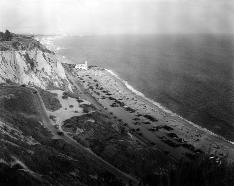
| (ca. 1920s)^ - Looking south along Roosevelt Highway, later renamed the Pacific Coast Highway (PCH), in Pacific Palisades. The highway runs parallel with the ocean where visitors enjoy the sun and surf. Visible in the distance, the landmark Lighthouse bathhouse that stood on Pacific Coast Highway at the point where the Santa Monica Mountains come down to the shore. In the far background can be seen a pier. |
Historical Notes In 1922, the Rev. Charles H. Scott and the Southern California Methodist Episcopal Church bought the land where Incville Studios was located. That same year Scott founded Pacific Palisades, envisioning an elaborate religious-intellectual commune. Believers snapped up choice lots and lived in tents during construction. By 1925, the Palisades had 100 homes. In one subdivision, streets were named for Methodist missionaries. The tents eventually were replaced by cabins, then by bungalows, and ultimately by multimillion-dollar homes.*^ |
 |
||
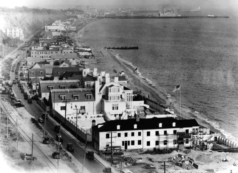
| (ca. 1920s)^ - Photo shows the buildings along the ocean front on Santa Monica beach. A continuous stream of cars can be seen as they travel along PCH. The pier and amusement park can be seen in the background. The large building with the numerous chimneys is Marion Davies' famous beach house. The guest house closest to the camera still exists. |
Historical Notes In the 1920s, William Randolph Hearst commissioned William Edward Flannery to construct a grand beach house for his longtime companion, actress Marion Davies. In 1926, architect Julia Morgan was hired to complete the design and oversee construction of the estate, which featured an ornate swimming pool, several houses, gardens and an opulent 110-room mansion. The beach house served as Davies’ primary residence from 1929 to 1942. In 1947, Davies sold the estate and it was converted into the Oceanhouse Hotel and Sand & Sea Beach Club. The main mansion was demolished in 1956, and the property was sold to the State of California in 1959. The Sand & Sea Club remained popular with regulars all the way through until the 1990s.*^*# |
 |
||
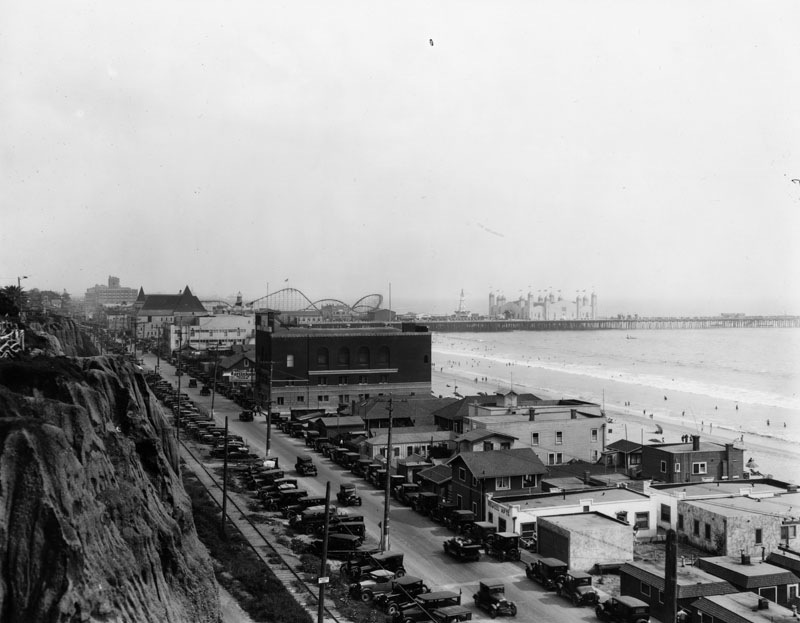
| (ca. 1920)^ - Hillside view of Santa Monica. The buildings, cars parked on both sides of the highway and Santa Monica beach can be seen. The amusement park and La Monica's ballroom on the pier is in the background. |
 |
||
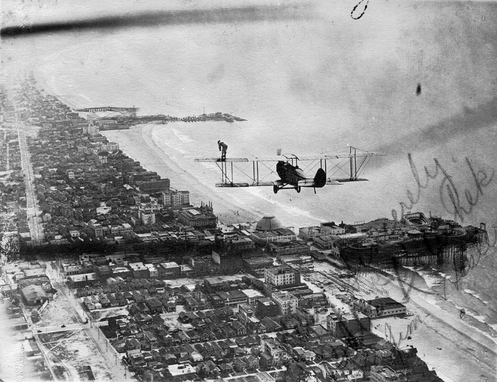
| (1918)*#^# - Walking over Santa Monica. Aerial view of a bi-plane flying over Santa Monica. A woman is standing on the wing looking down. Ocean Park Pier with its amusement park appears just below the plane and Venice Pier is seen in the distance. |
 |
||
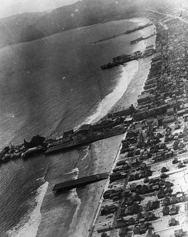
| (1920s)^ - Aerial view looking north all along the coast of Venice and the whole Santa Monica Bay area. At least 6 or 7 piers can be seen extending out into the ocean. Venice Pier and amusement park can be seen in the foreground. Ocean Park Pier, with its own amusement park, is the next pier over. Beyond that, the long pier at the top of the photo, is the Santa Monica Pier. It also had an amusement park. |
Historical Notes The Venice, Ocean Park and Santa Monica amusement piers were within a mile and one half of each other and they competed directly with each other for the tourist's entertainment dollars. Fourteen coasters were built there from 1904 to 1925.^*^*^ Click HERE to see more in Early Views of Southern California Amusement Parks |
 |
||
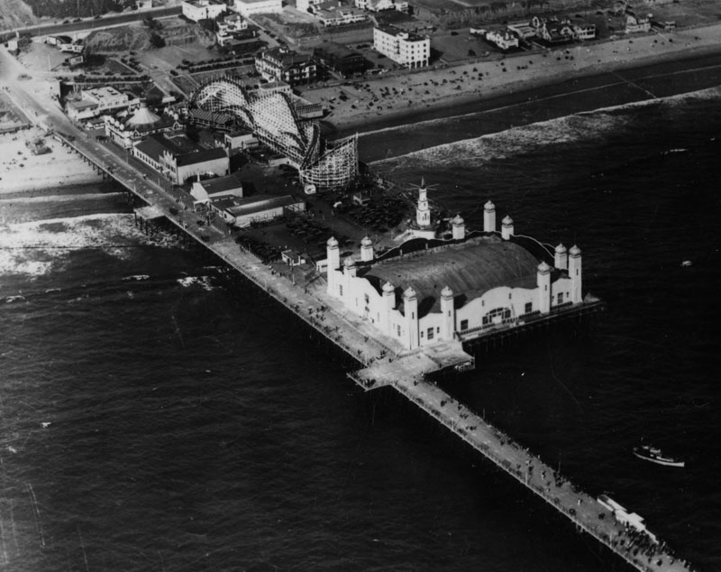
| (1924)^ - The Santa Monica Pier, with the La Monica Ballroom, captured from above. |
Historical Notes The Spanish and French Renaissance style La Monica Ballroom was designed by T.H. Eslick; it opened in 1924 and was demolished in 1963.^ More than 50,000 people attended the July 23, 1924 grand opening of the La Monica Ballroom, enough to cause the first traffic jam recorded in Santa Monica history. Its 15,000 square-foot hard maple floor and exquisite “submarine garden” interior made the La Monica the hottest ticket in town.*^*^* |
 |
||
| (1924)^ - Cars are parked outside the La Monica Ballroom on the Santa Monica Pier. |
Historical Notes The La Monica Ballroom was located at the end of the 1,600-foot long Santa Monica Pier. It was especially popular during the Big Band Era of the 1920s & 30s, up to 2,500 couples could kick up their heels in this grand ballroom located at the end of the Pier.*^*# It’s success was short-lived as the Great Depression effectively ended the dance hall days. By the mid-1930’s it became a convention center, lifeguard headquarters and, for a short interim period, the City Jail.*^*^* |
 |
||
| (ca. 1924)^ - View shows an Ocean Park, complete with wooden roller coaster, on the Santa Monica pier. Click HERE to see more in Early Views of Southern California Amusement Parks |
 |
||
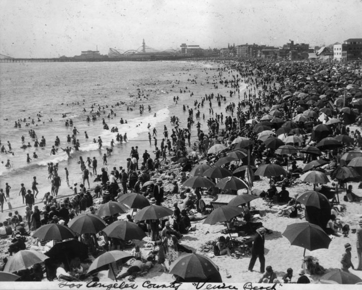
| (ca. 1925)^ - The ocean water is filled with people swimming or playing, and the beach is likewise filled with people and umbrellas (to keep off the sun). The view is looking north towards Ocean Park. |
Click HERE to see more in Early Views of Santa Monica |
* * * * * |
Playa del Rey
.jpg) |
|
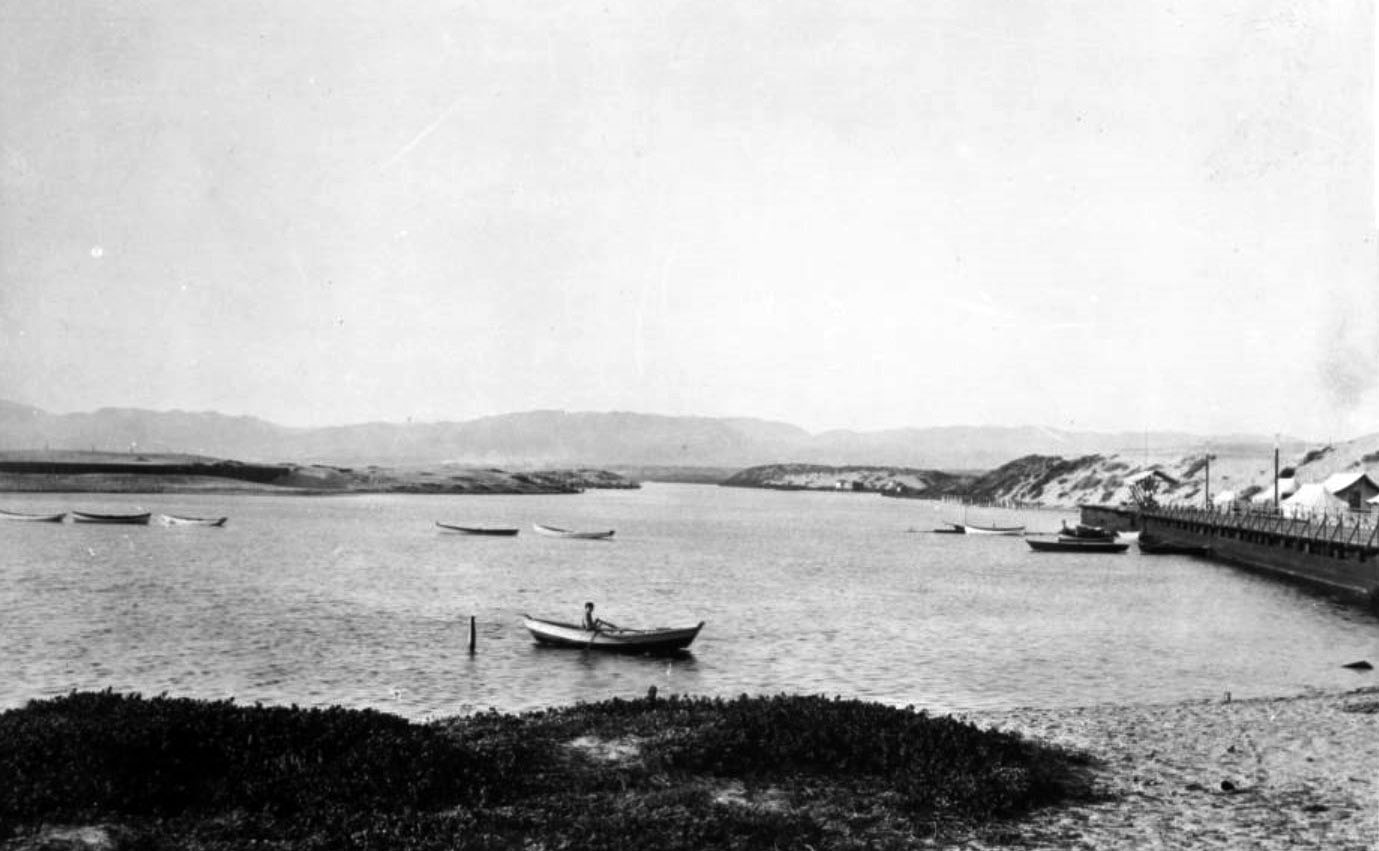
| (ca. 1902)*– View looking east showing a well-dressed man holding his shoes while standing knee deep in the Playa del Rey lagoon. |
Historical Notes The Playa del Rey area, located about two miles south of Kinney's Venice of America resort, was once, centuries ago, the mouth of the Los Angeles River. But after the river shifted course to begin emptying in Los Alamitos Bay in Long Beach, it left behind a sleepy lagoon more than two miles wide and one fifth of a mile wide with a trickle of fresh water flowing to sea along La Ballona Creek. |
 |
|
| (1902)^^ - Photoprint reads, “Quiet Waters and Quiet Days.” View from the south end of the Playa del Rey lagoon looking northward. About eight rowboats can be seen at anchor in the calm water. One person is rowing a boat in the foreground. The shoreline is visible on all three sides. Several of the boats are moored to a dock at right, behind which several structures, mainly tents, are visible. |
Historical Notes Playa del Rey, “The King’s Beach,” had rustic beginnings. In 1871, a man named Will Tell built a lodge at the unnamed area near a lagoon that existed where Ballona Creek emptied into the Pacific Ocean. It became a popular spot for hunters and fishermen until an 1884 storm wiped out the small resort.* |
 |
|
| (1902)^ - View looking south showing of the beach and lagoon at Playa del Rey on November 12, 1902. A sail boat and about a dozen row boats can be seen in the Playa del Rey lagoon. |
Historical Notes With the late 19th and early 20th Ballona hosted a slew of new businesses that, thanks to calamitous weather, endured a short though fruitful run. A German named Will Tell built a business at the mouth of Ballona where sportsmen could hunt from his small boats. His business soon washed away, but interest in the area continued to mount. In the 1880’s Moy Wix envisioned “Port Ballona” a plan that would link the ocean to a new two-mile Harbor. The Santa Fe Railway planned to follow; and while a passenger train was successful in transporting Angelinos to Port Ballona in 1887. Strong tides and winter rains inevitably washed away the wharf, putting an end to the grand project. |
 |
|
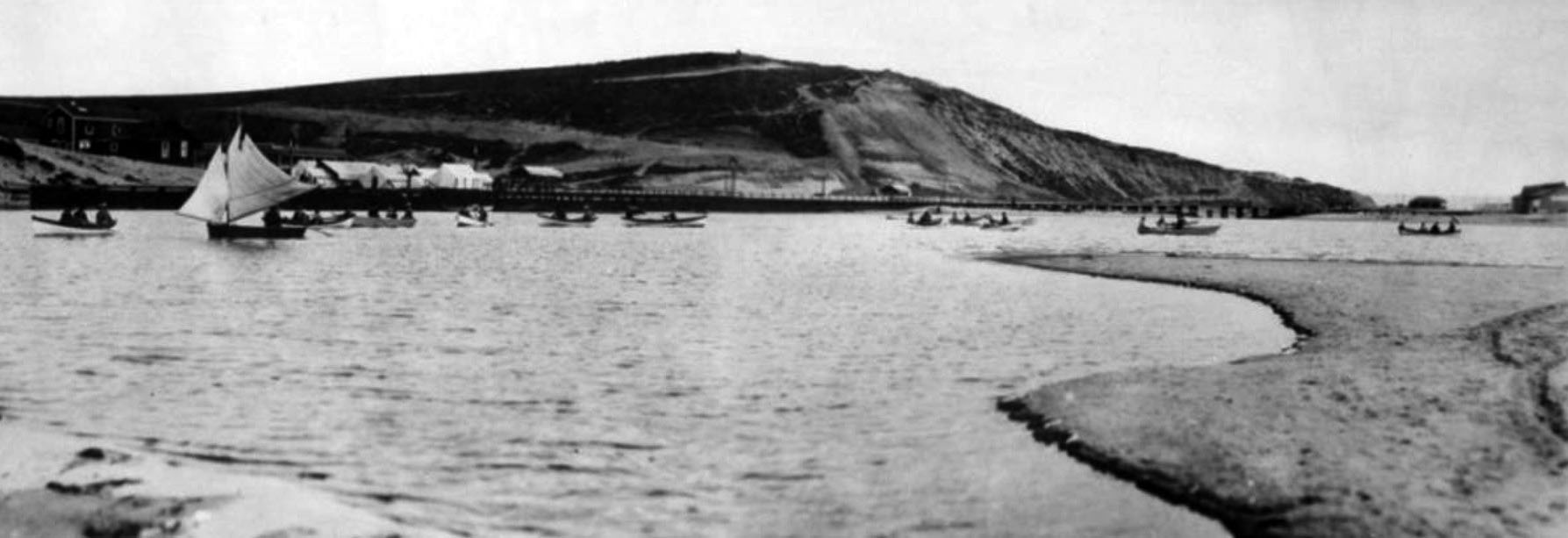
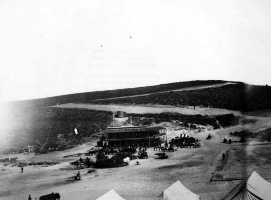
| (1902)^ – View looking south from the edge of the Playa del Rey lagoon showing tents in the foreground and a two story building (Hotel Playa) at the base of a hill. Horse-drawn wagons are seen in front of the hotel. Note the water tower on the hill. |
Historical Notes Henry Barbour of the Beach Land Company bought 1,000 acres of land in the area in 1902, and renamed it Playa del Rey. He announced plans to build a full-fledged resort there, based around the impending arrival of the Pacific Electric Railway “red car” system that eventually would link all the beach cities from Venice to Manhattan Beach. Construction on the various structures was well under way when the new Playa del Rey had its coming out party on July 16, 1902. Hundreds of potential buyers arrived on Santa Fe trains (the Pacific Electric had yet to be completed) to inspect Barbour’s work and potentially invest in housing lots in the area. About 100 lots were sold on the first day, for an approximate total of $150,000.* |
 |
|
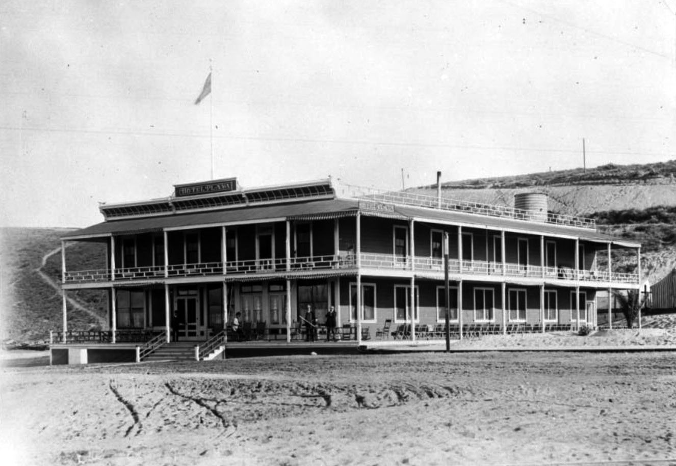
| (ca. 1905)^^ - Close-up view of the Hotel Playa in Playa del Rey. The two-story hotel has a wrap-around porch and balcony, and rows of large rectangular windows cover the perimeter of the building. |
Historical Notes The Hotel Playa was on Speedway Boulevard, (today called Culver Boulevard), at more or less the location of the modern Tanner’s Coffee Co. |
 |
|
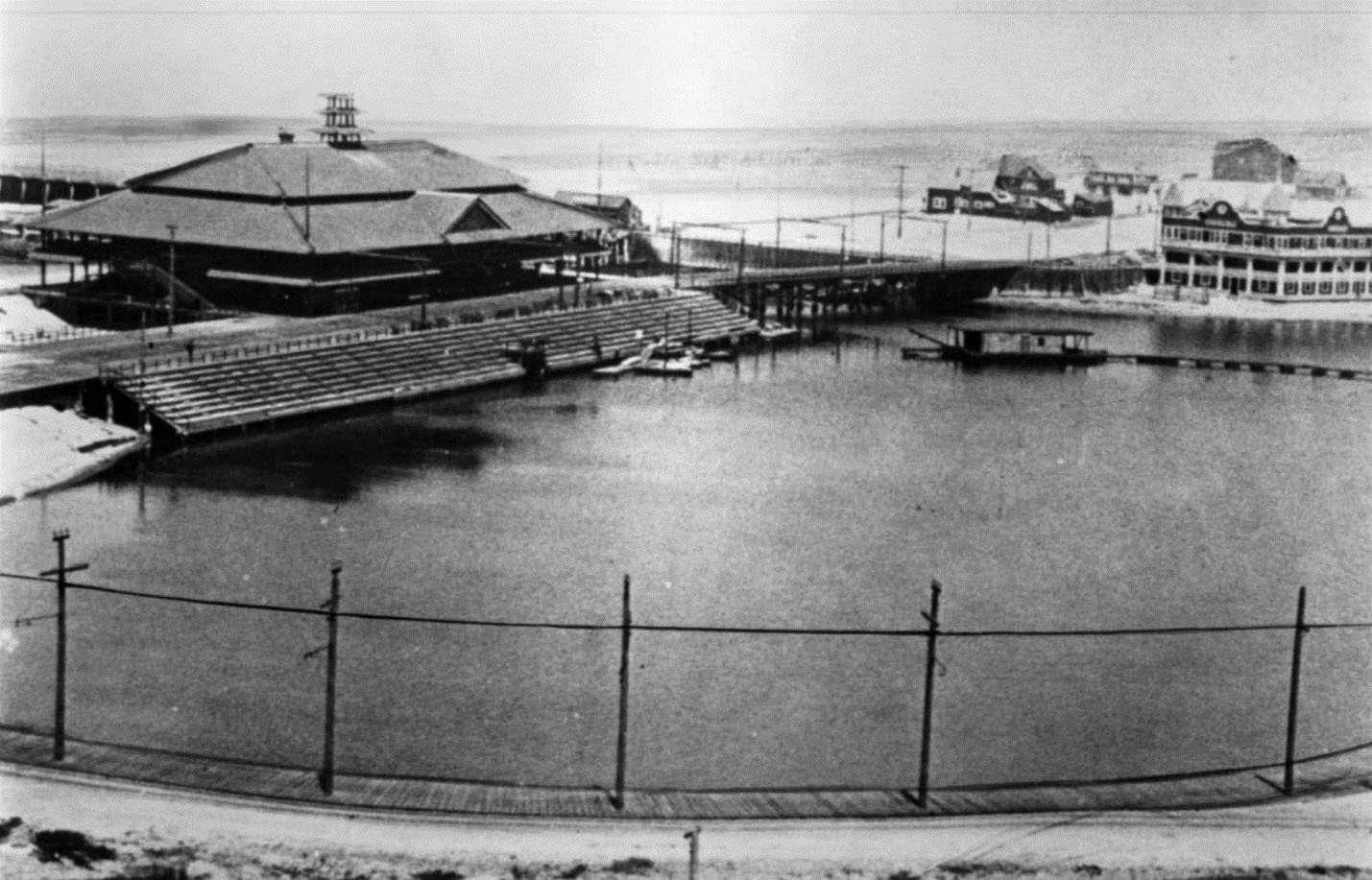
| (ca. 1908)^^ - A man is seen standing on the balcony of a large home looking down toward the Playa del Rey lagoon with the Del Rey Hotel, Playa Del Rey Pavilion and pier in full view. The lagoon is in the shape of a track & field, except the field is the lagoon. Inclined bleachers encircle the lagoon's waterline allowing people a spectacle view of the water activities that go on within the lagoon. |
Historical Notes With the completion of the Sherman and Clark owned Los Angeles Pacific electric trolley line, the 'Short Line,' to Los Angeles on October 19, 1902, hundreds began visiting the new resort. A pavilion and small hotel were eventually built in Oriental craftsman rather than Venetian style, around the lagoon in 1904. |
 |
|
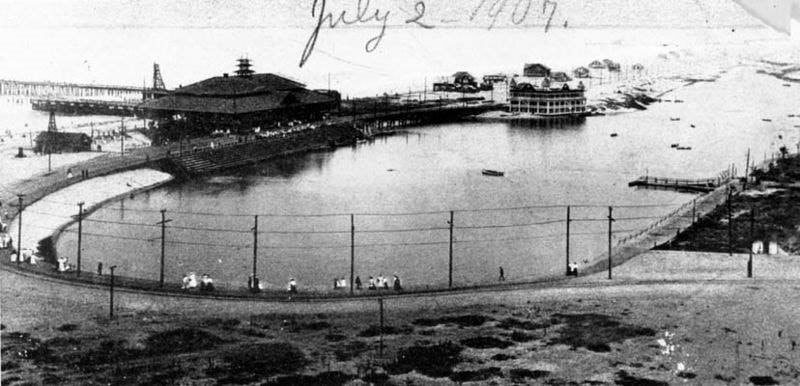
| (1907)^ - Closer view of the lagoon, pier, pavilion and hotel. July 2, 1907. (Courtesy of the California Historical Society Collection) |
Historical Notes The pavilion building opened with much fanfare on Thanksgiving Day in 1904, the same year that the resort got its own post office. Wooden boardwalks were constructed surrounded the lagoon, and a concrete bridge built across the lagoon was described as the longest one of its type at the time. Boat racing became extremely popular; a boathouse built near the ocean did a brisk business.* |
 |
|
| (ca. 1904)^^ – Photograph of the Playa Del Rey Pavilion and Del Rey Hotel. The hotel is in the background on the right side. The Japanese-craftsman style Pavilion is on the left, and in front of it are grandstands to watch boat races. In the foreground is the lagoon used as a race course; there is a barge and several small sailing vessels anchored in it. A bridge crosses a canal to connect the hotel and the pavilion near the center of the image. |
Historical Notes The company built an impressive three-story, $100,000 pavilion with restaurant and dining rooms, bowling alleys and dance floor. Sherman and Clark's Los Angeles Pacific Railway Company built the $200,000 Hotel Del Rey with fifty guests rooms. A boat-racing course was laid out and a grandstand and boathouse erected on shore. A bridge spanned the lagoon's ocean entrance and a 1200-foot long fishing pier was built nearby."^^ |
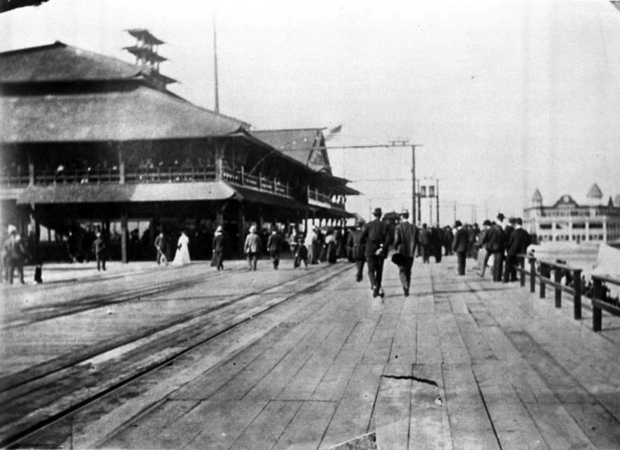 |
|
| (ca. 1908)^^ – View of the boardwalk in front of the Playa Del Rey Pavilion. The pagoda-style Pavilion is on the left of the image and towers over the wooden boardwalk below. There are many tourists crowding the boardwalk, down from Los Angeles on the Balloon Trolley trip. The Del Rey Hotel is visible in the background on the right. |
Historical Notes While Playa del Rey was considered a modest success in attracting day tourists, it proved to be Abbot Kinney's inspiration and served as an example of a resort that wasn't large enough in scope to attract investors or excite the public. Playa Del Rey flourished as a resort from 1902-1913. In 1905, a furnicular railway was built from the Playa del Rey beach to the top of the steep bluffs that surrounded it. Its two cars were nicknamed “Alphonse” and “Gaston.” In 1910, the Playa del Rey Motordrome, a wooden banked raceway track built for automobile and motorcycle racing, opened for business at the present-day intersection of Culver and Jefferson boulevards.. Many of the great auto racers of the day, including Barney Oldfield, raced at the Motordrome until its wooden structure caught fire and burned to the ground in 1913. In 1913, a fire destroyed the Playa del Rey Pavilion and the Del Rey Hotel, and the resort’s promise faded. However, the area’s appeal as a housing location continued. In 1921, the Palisades Del Rey development on the bluffs above the beach became a desirable location for homeowners. The Minneapolis real estate firm of Dickinson & Gillespie built houses there, and also developed the Surfridge tract just south of of Playa del Rey. Celebrities such as film director Cecil B. DeMille and actor Charles Bickford were among the area’s homeowners.* |
Surfridge (Playa del Rey, originally Palisades del Rey)
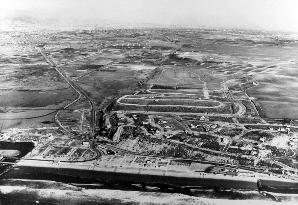 |
|
| (1921)** - Aerial view showing Playa del Rey, Bluffs and Playa Vista. The center-right area became Mines Field and later LAX. The beach area at bottom-right would become a new housing development called Surfridge. |
Historical Notes In 1921 the Minneapolis-based firm of Dickinson & Gillespie billed this stretch of coastline as "The Last of the Beaches". Situated between Venice and Hermosa beaches, it is now part of Playa del Rey.^ A southern portion of Playa del Rey became known as "Surfridge". Today, this area is bounded on the East by Los Angeles International Airport, on the north by Waterview and Napoleon streets, on the South by Imperial Highway, and on the West by Vista del Mar. The beach to the west of the area is Dockweiler State Beach.*^ |
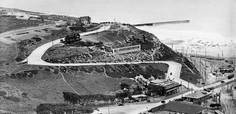 |
|
| (ca. 1920s)^ - On the winding road up the cliff, a billboard advertises the "Palisades del Rey" dream of a house by the beach. |
Historical Notes Surfridge was developed in the 1920s and 1930s as "an isolated playground for the wealthy." In 1925 the developer held a contest to name the neighborhood and awarded the $1,000 prize to an Angeleno who submitted the winning name. The Los Angeles Times wrote that Surfridge was chosen "due to its brevity, euphony, ease of pronunciation ... but above all because it tells the story of this new wonder city."*^ |
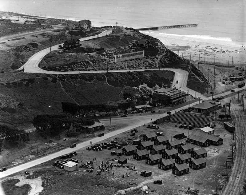 |
|
| (ca. 1920s)^ - Another view of the "Palisades del Rey" beach area. A grandstand is opposite the real estate office, bottom right. A picnic area to the left of the office is busy with an event. A pier extends past the breakwater. |
Historical Notes Salesmen pitched tents on the sand dunes and sold lots for $50 down and 36 monthly payments of $20. House exteriors could only be stucco, brick or stone; frame structures were prohibited. Development was slowed by the onset of the Great Depression, but in the early 1930s the wealthy began to buy lots to build large homes.*^ Palisades del Rey later becaome known as Playa del Rey. |
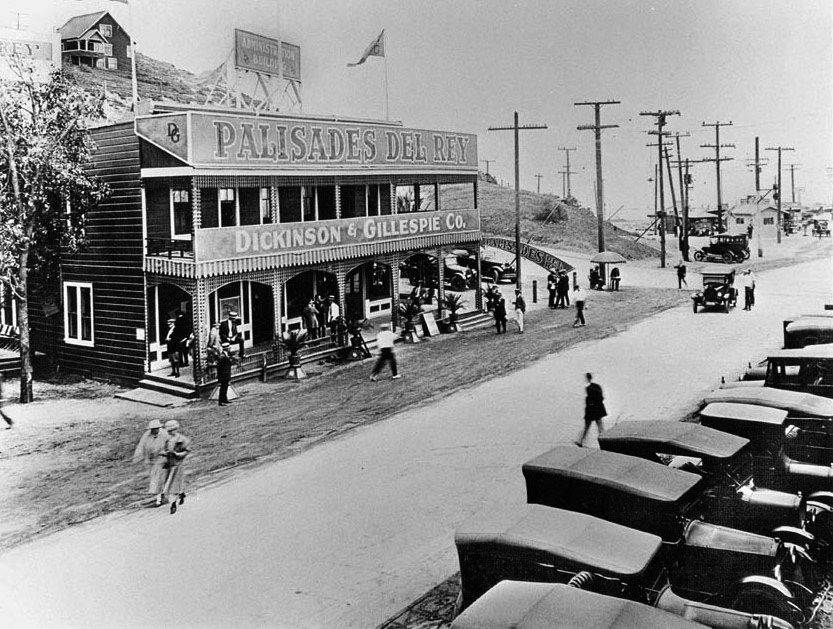 |
|
| (ca. 1920s)** – Close-up view showing the real estate building of Dickinson & Gillespie Co. on Culver Blvd. near Vista del Mar. They were promoting the new residential beach development of Surfridge. |
Historical Notes The Dickinson & Gillespie Co. real estate building was originally the Hotel Playa, built in 1902. It was on Speedway Boulevard, (today called Culver Boulevard), at more or less the location of the modern Tanner’s Coffee Co. ##*^ |
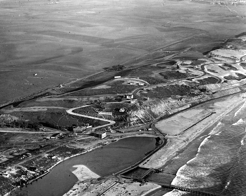 |
|
| (ca. 1920s)^ - Aerial view of Playa Del Rey lagoon (lower-left) and the area called "Surfridge". The Dickinson & Gillespie Co. real estate building can be seen at lower center-left. |
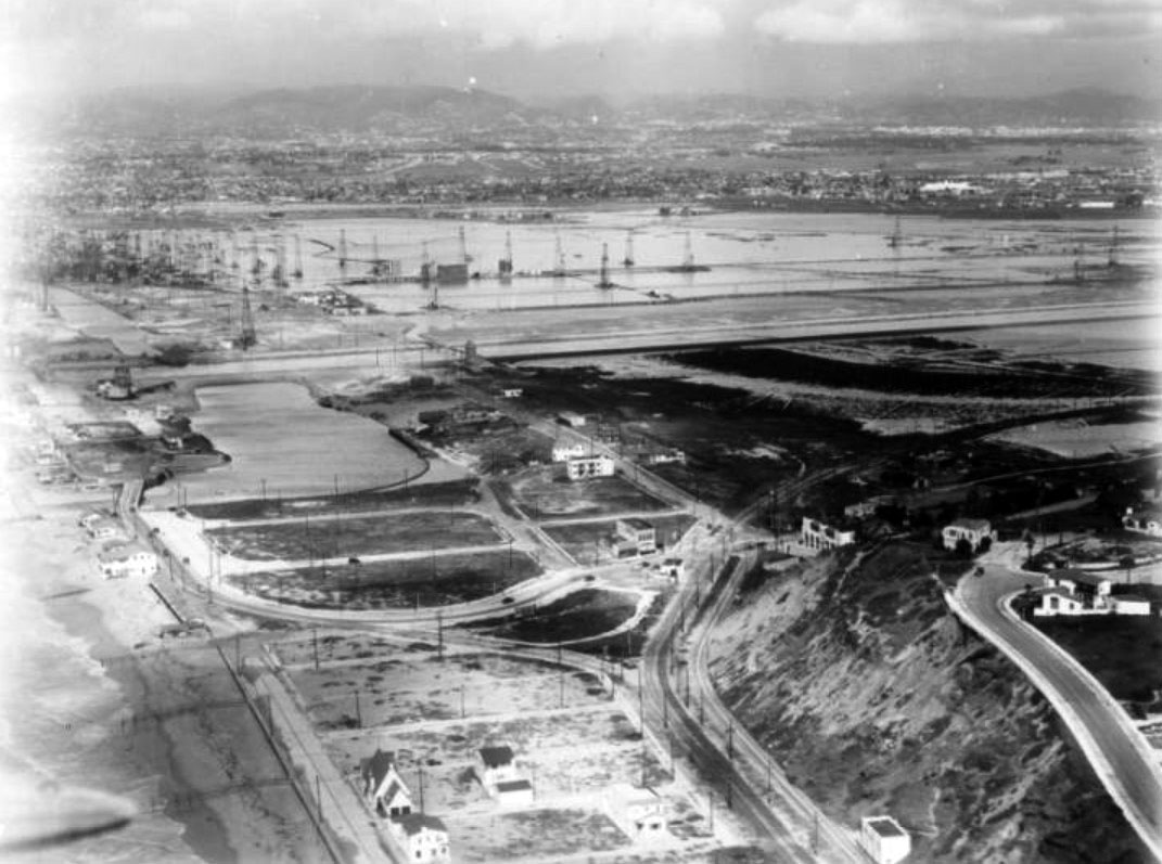 |
|
| (ca. 1929)^ – Aerial view looking north showing the Palisades del Rey/Surfridge area in the foreground. At center-left is the Playa del Rey lagoon and in the the distance can be seen the southern portion of the Venice Oil Field which would later become Marina del Rey. |
Historical Notes A small airfield opened to the east of Surfridge in 1928. It became a popular location for residents to see air shows. The growing number of commercial flights into Los Angeles following World War II meant a higher number of planes flying low over Surfridge. Many residents learned to co-exist with the noise from propeller planes, but jet engines were impossible to ignore.*^ |
Surfridge and the Jet Age
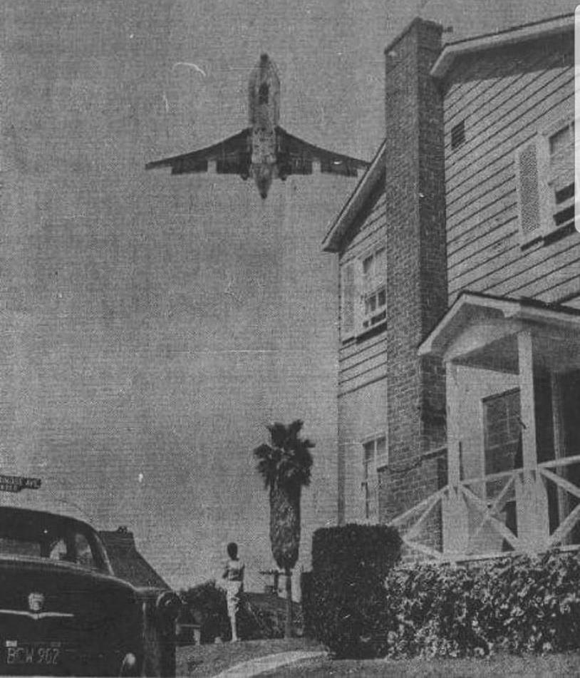 |
|
| (1960s)^ – A Boeing 727 departing from LAX flies over a house in the community of Surfridge. |
Historical Notes Ever since the beginning of the jet-age the area started to vanish due to the expansion of LAX by eminent domain. People who lived there were complaining about the jet noise and the jet engine soot that was landing on their properties.*^ |
 |
|
| (1960s)* - Aerial view over Surfridge (upper-right) showing the subdivision full of homes. That would soon change. |
 |
|
| (1985)*– View showing the area where middle class houses were condemned and leveled to make way for the westward expansion of Los Angeles International Airport. The beach is directly behind the camera. |
Historical Notes In the 1960s and 1970s, the Sufridge area was condemned and acquired by the City of Los Angeles in a series of eminent domain purchases to facilitate airport expansion and to address concerns about noise from jet airplanes. Homeowners were forced to sell their property to the City. Several homeowners sued the City and remained in their houses for several years after the majority of houses were vacated. Eventually all the houses were either moved or demolished.*^ |
 |
|
| (2004)*^ - The old Surfridge area sits vacant to the west of LAX, on the left side of photo. |
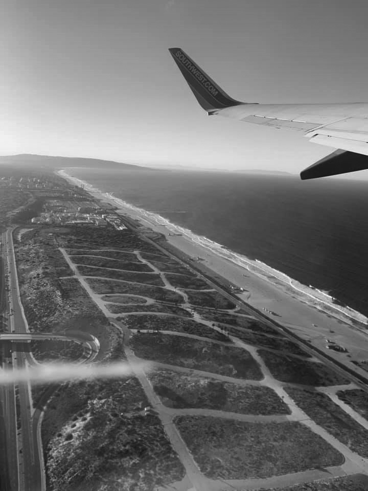 |
|
| (2020)^ - Aerial view looking down at what used to be the Surfridge community showing empty lots and abandoned roads. |
Historical Notes Today one can see only barbed-wire fences protecting vacant land and old streets where houses once sat. Recent LAX rejuvenation plans call for the city to finally remove the old streets that still line the empty neighborhood. The condemned areas of the community are now a protected habitat of the endangered El Segundo blue butterfly.*^ |
Dockweiler Beach
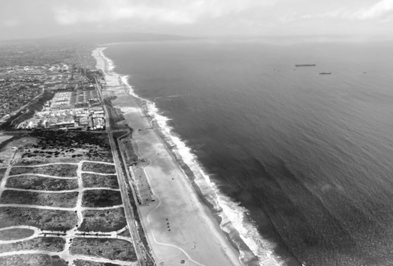 |
|
| (2021)* - Dockweiler State Beach and El Segundo as seen after taking off from Los Angeles International Airport (LAX). |
Historical Notes Dockweiler State Beach has 3.75 miles of shoreline. The 91-acre property was established in 1948. Originally part of Venice-Hyperion Beach State Park, it was renamed in honor of prominent early Angeleno Isidore B. Dockweiler in 1955. Although a unit of the California state park system, it is managed by the Los Angeles County Department of Beaches and Harbors. Part of the park is located directly under the flight path of the adjacent Los Angeles International Airport (LAX). |
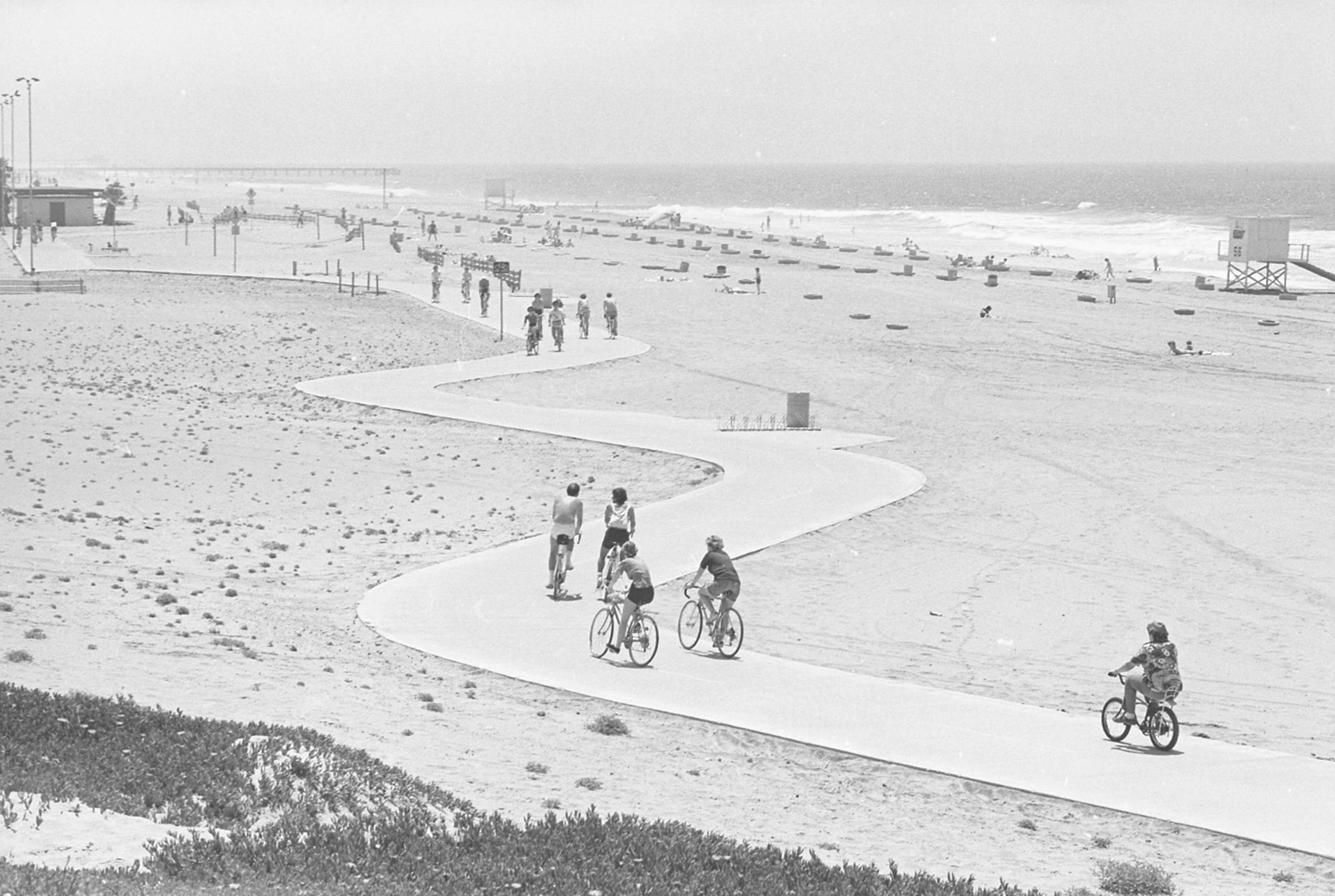 |
|
| (1976)* - Cyclists riding along the bike path at Dockweiler State Beach on a hazy day. |
Historical Notes The Dockweiler State Beach bicycle path is maintained by the Los Angeles Department of Transportation. It runs from Ballona Creek to the El Segundo city limit. This bicycle path connects to the Ballona Creek bicycle path at its northernmost point and is part of the 22-mile coastal Marvin Braude Bike Trail system.* |
 |
|
| (n.d)* - A KLM 747 jet takes off over Dockweiler Beach. |
Historical Notes Jetliners leave Los Angeles International Airport, passing a few hundred feet above the beach. |
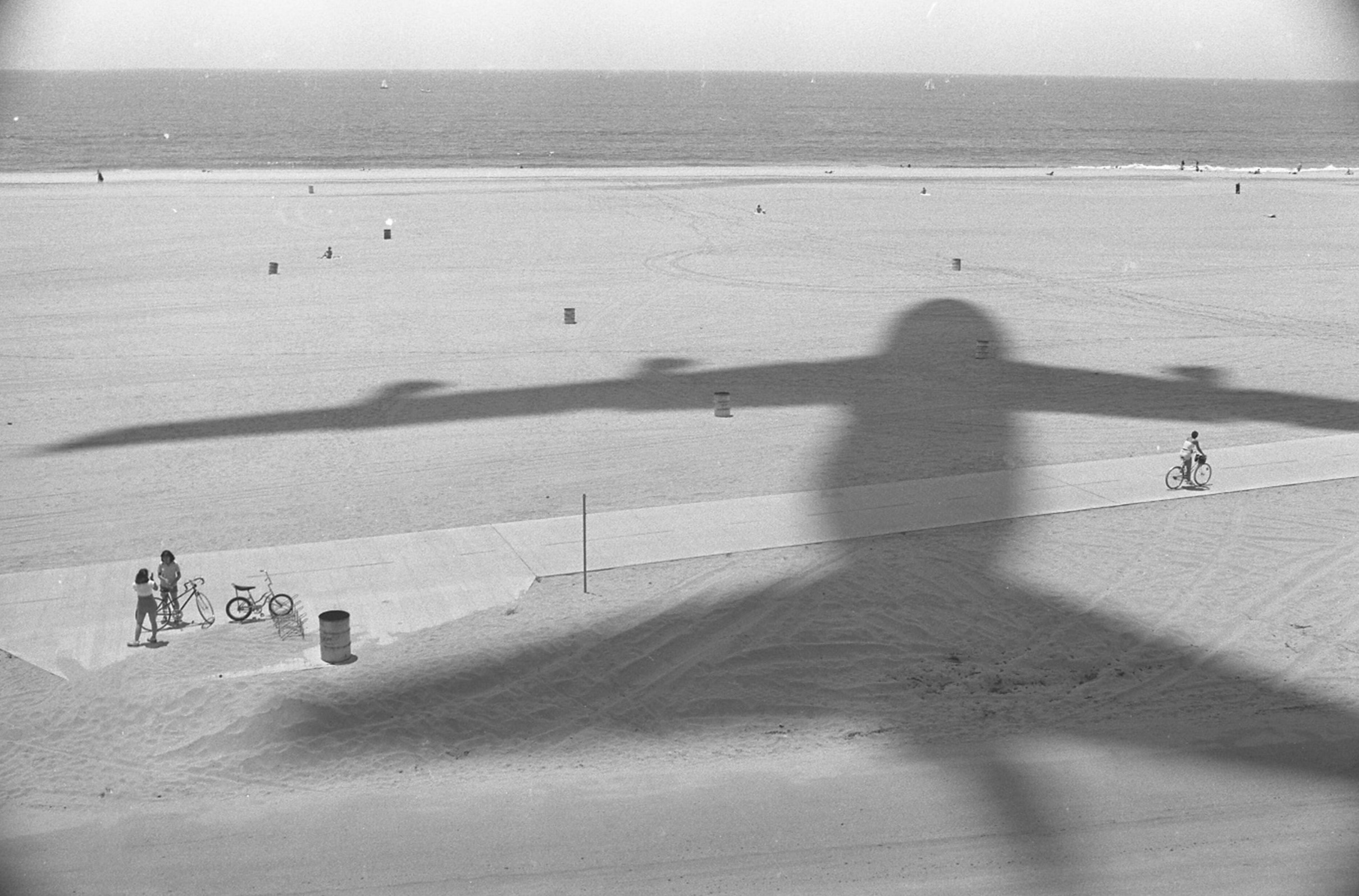 |
|
| (1979)* - Shadow of 747 jet flying over Dockweiler Beach south of Playa del Rey. The huge jetliners leave Los Angeles International Airport, passing a few hundred feet above the beach. |
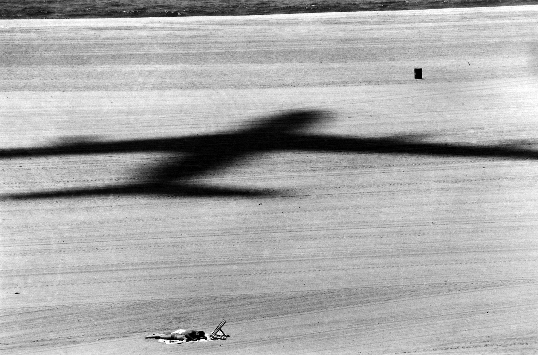 |
|
| (1970s)* - A quiet moment alone before the crowds come. |
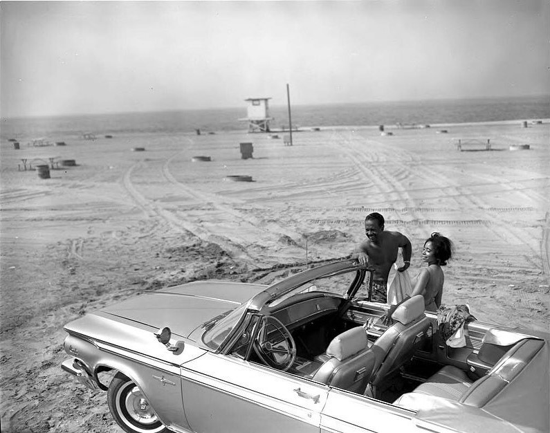 |
|
| (1963)* – Chrysler ad showing a young couple enjoying a day at Dockweiler Beach next to a new Chrysler 300 convertible. Photo by Charles Williams |
Historical Notes Chrysler was the first of the major American car companies to use black models in their advertising, starting with a 1957 ad campaign for the Plymouth convertible that appeared in Ebony Magazine. GM and Ford had also been advertising in Ebony at that time, but with the same ads they'd been using in every other magazine, usually featuring photos of white families. The simple shift in representation led to such a big increase in Chrysler-Plymouth sales that Studebaker started producing inclusive ads in 1959, with Ford and General Motors making similar changes in the early 1960s. Source: California State University, Northridge |
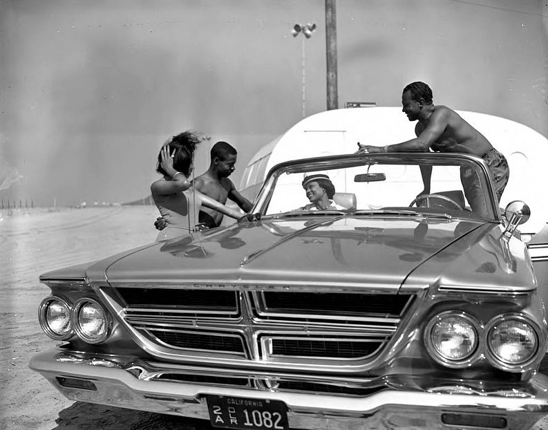 |
|
| (1963)* – Enjoying a day in the sun at Dockweiler Beach. Photo by Charles Williams |
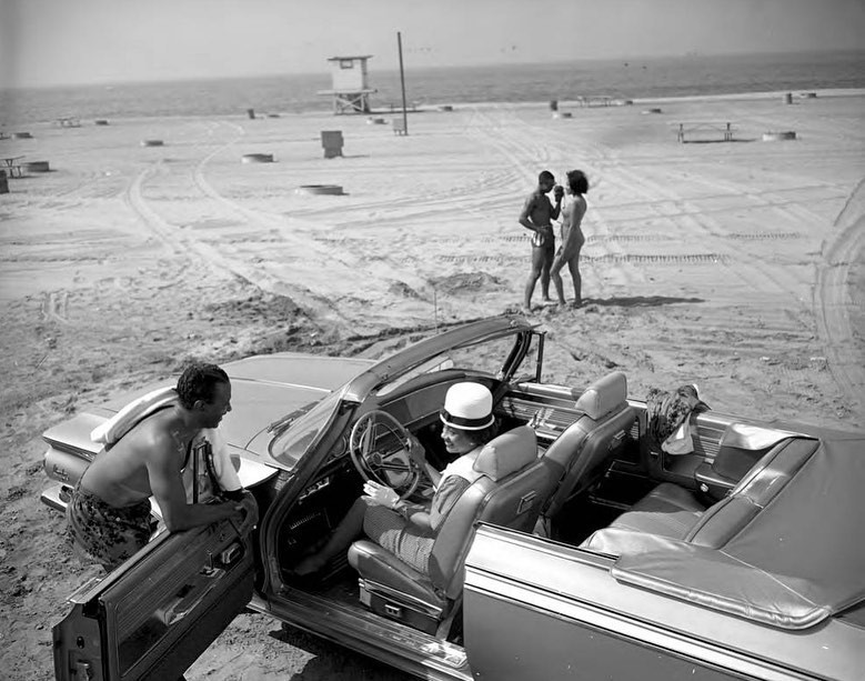 |
|
| (1963)* – Chrylser promotional photo taken at Dockweiler Beach. Photo by Charles Williams |
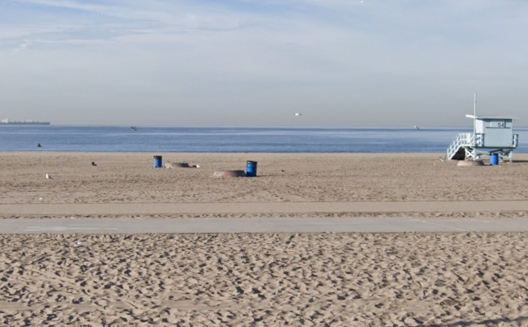 |
|
| (2022)* - Contemporary view of Dockweiler Beach. |
* * * * * |
Marina del Rey (and Ballona Creek)
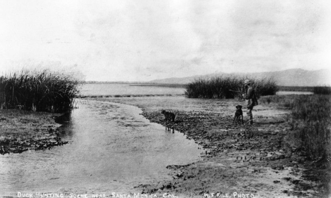 |
|
| (1890)* - Duck hunting in the Ballona wetlands near Santa Monica, in the area that would later become Marina del Rey. Photo by H. F. Rile |
Historical Notes In the late 19th century, the Ballona wetlands formed a vast estuarine ecosystem of salt marshes and freshwater ponds near the mouth of Ballona Creek. Popular with duck hunters, the area remained largely undeveloped, with seasonal flooding making permanent structures impractical. This image, captured by early photographer H. F. Rile, offers a rare glimpse into the pre-development ecology of what would later become Marina del Rey—then a remote and biologically rich marshland frequented only by outdoorsmen and a few settlers. |
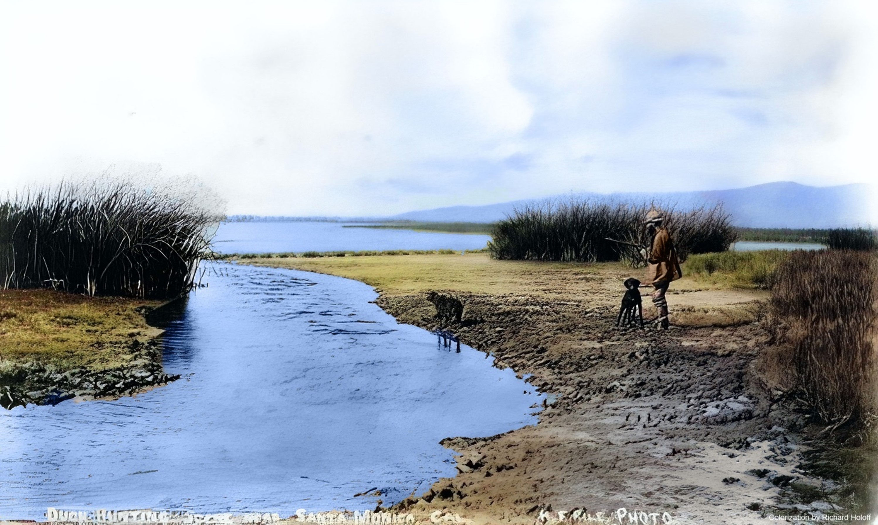 |
|
| (1890)* - Duck hunting near Santa Monica on the Ballona lowlands; now Marina del Rey. Photo by H. F. Rile; Image enhancement and colorization by Richard Holoff |
Historical Notes This colorized version of an original photo shows what the Ballona wetlands looked like before the area was changed forever. At the time, it was a quiet place visited by hunters and surrounded by nature. Birds migrated here by the thousands. It’s hard to imagine that this peaceful marsh would later become a busy harbor with homes, shops, and thousands of boats. |
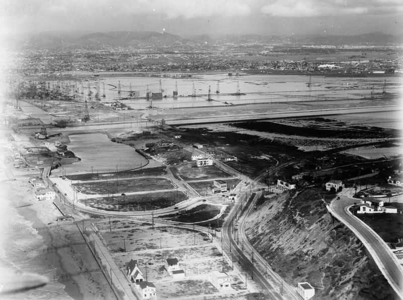 |
|
| (ca. 1929)^ - Aerial view of Marina del Rey, with oil wells prevalent on the other side of Ballona Creek. Surfridge is at lower right. |
Historical Notes By the 1920s, the area around Ballona Creek was full of oil drilling. After oil was discovered near downtown L.A. in 1892, people rushed to drill all over Southern California—even near the beaches. This photo shows how much of the land near Marina del Rey was used for oil wells. Because of this, plans to build a marina were delayed for many years. |
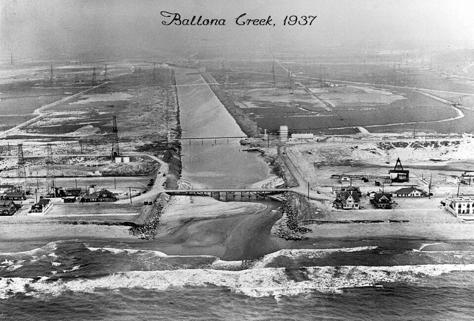 |
|
| (1937)* - View showing Ballona Creek as an enclosed flood control channel, before it was lined with concrete. The area at left would become Marina Del Rey. Photo Source: Marina del Rey Historical Society |
Historical Notes Originally, Ballona Creek was a natural stream that often overflowed during heavy rain. In the 1930s, Los Angeles started building flood control channels to stop the flooding. This photo shows the creek before those changes. After a major flood in 1938, the U.S. Army Corps of Engineers decided to line the creek with concrete, which allowed for future development—like Marina del Rey. |
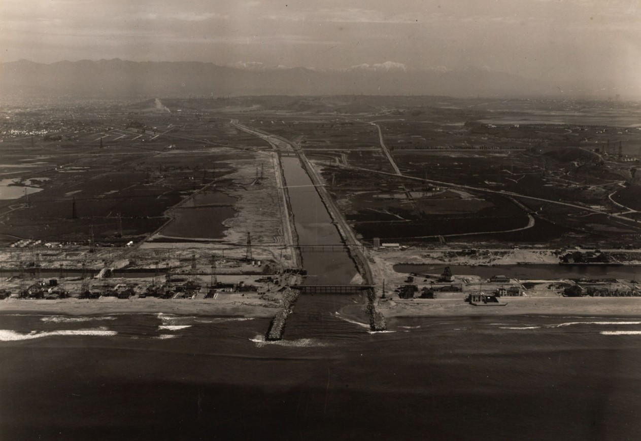 |
|
| (1938)* - Aerial view of the coastline centered on Ballona Creek lined with concrete walls as seen emptying into the Santa Monica Bay near Marina del Rey. Oil rigs and bridges are visible on the beach and inland. |
Historical Notes This photo shows Ballona Creek just after it was lined with concrete following the disastrous 1938 flood. Concrete walls helped control the flooding but also changed the natural environment. At the same time, oil drilling was still going strong near the beach. The image shows how industry, flood control, and coastal land use were starting to shape what would eventually become Marina del Rey. |
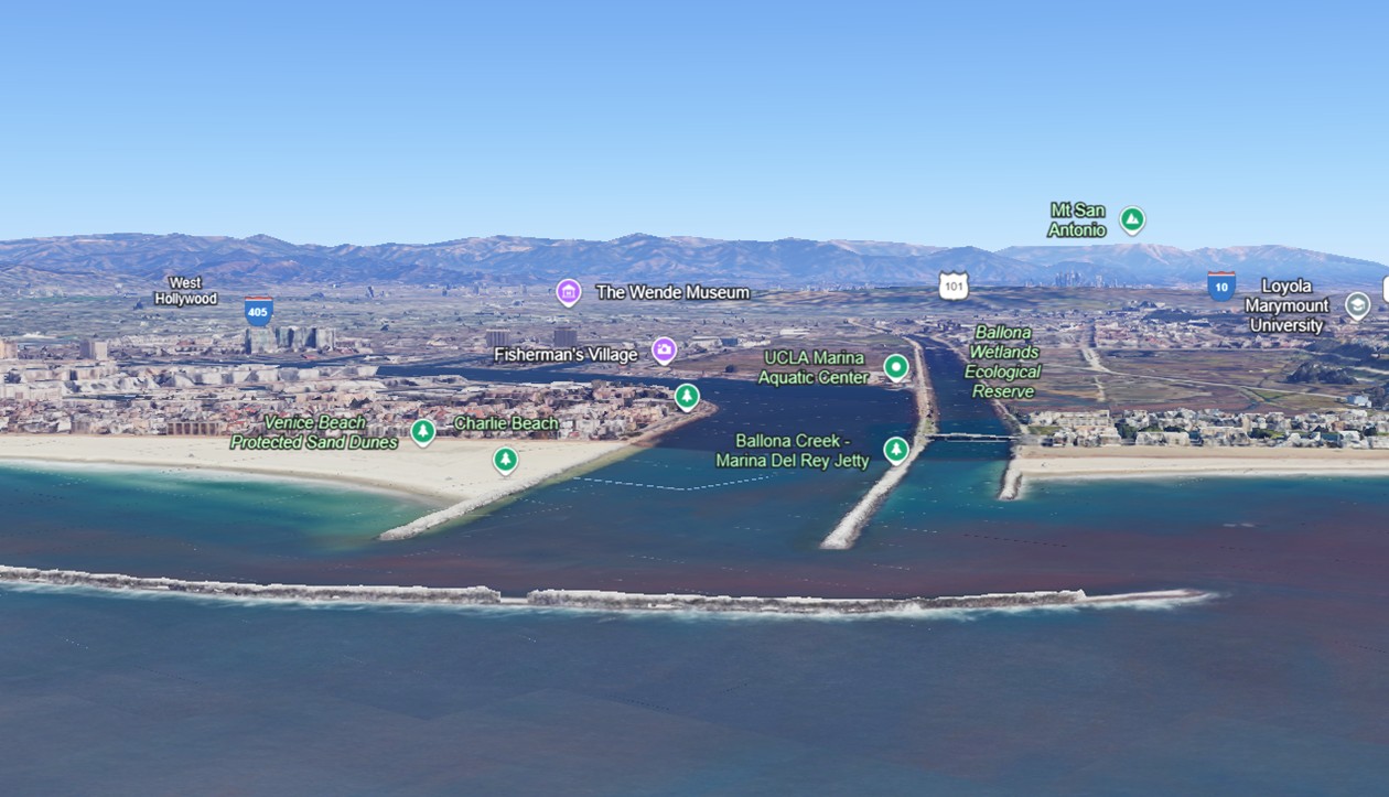 |
|
| (2022)* - Contemporary view of Ballona Creek, Marina del Rey, Playa del Rey, and surrounding area. |
Then and Now
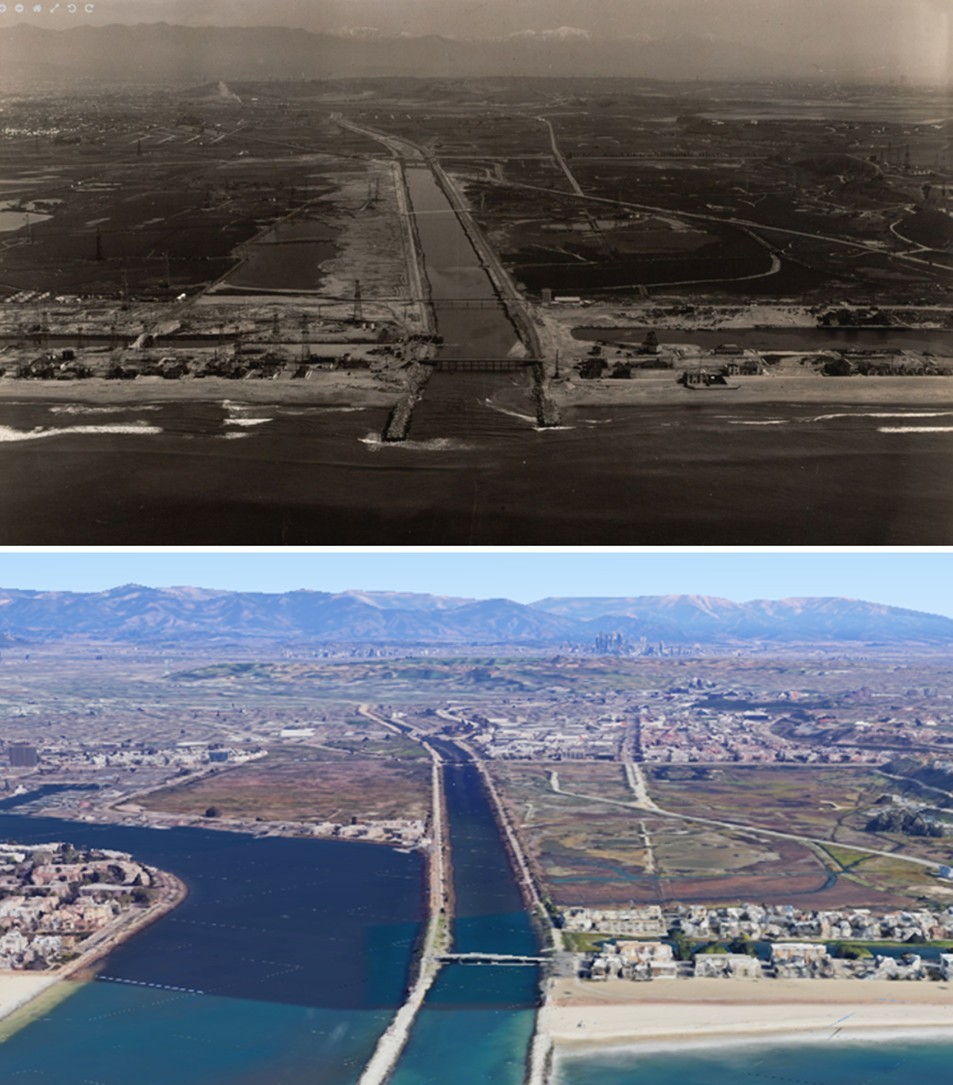 |
|
| (1938 vs. 2022)* – A ‘Then and Now’ aerial view of Ballona Creek looking northeast from the Pacific. Photo comparison by Jack Feldman. |
Historical Notes In 1938, the freshly channelized creek cut through a flat expanse dominated by oil wells, marshes, and scattered structures. By 2022, the landscape had transformed dramatically—what was once oil field and open wetlands is now Marina del Rey, one of the largest man-made small-craft harbors in the world, with Playa del Rey homes and restored wetlands visible at the bottom of the frame. |
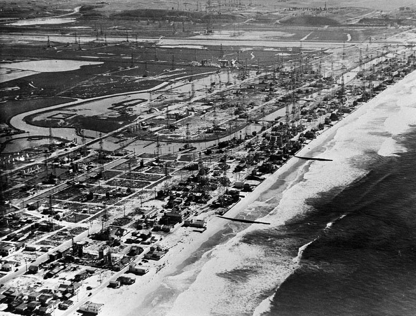 |
|
| (1938)* – Aerial view showing part of Venice Oil Field and Playa del Rey. The area at center would become today's well known Marina del Rey harbor. Ballona Creek can be seen running horizontally from left to right at top. |
Historical Notes Before Marina del Rey was built, this land was part of the Venice Oil Field. There were oil derricks throughout the area, even close to the beach. Although the idea of building a harbor here had been around for decades, oil drilling took priority. This photo shows what the area looked like before boats, apartments, and parks replaced the oil equipment. |
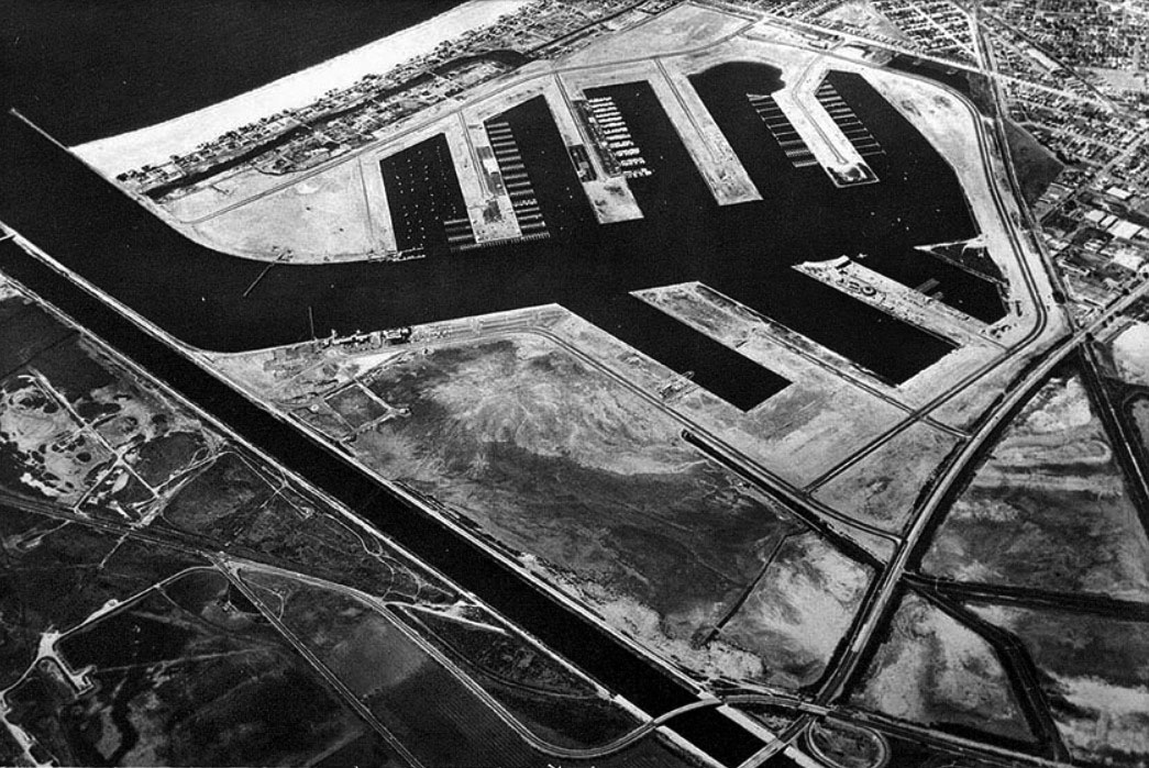 |
|
| (1964)* – Aerial view showing the Marina del Rey with its first boats docked. Ballona Creek runs diagonally from lower-center to upper-left. |
Historical Notes After years of planning and construction, Marina del Rey was finally completed in the early 1960s. It was funded by Los Angeles County and the federal government. This photo shows the first boats arriving at the docks. The area that was once marshland and oil fields had now become the world’s largest man-made small boat harbor. |
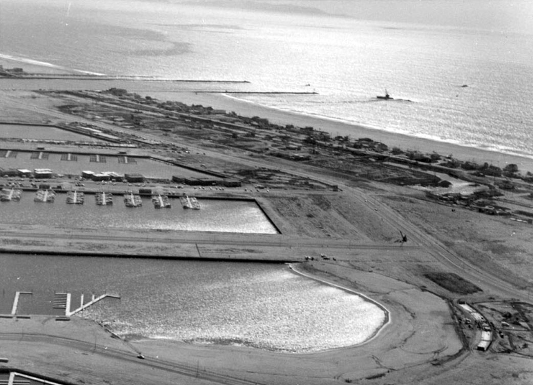 |
|
| (1965)* – View of Marina del Rey as it appeared in 1965 with the Inland Beach (Mother’s Beach) at lower right. |
Historical Notes By 1965, Marina del Rey was almost fully built. The small beach shown here, now known as Mother’s Beach, was created for families and children. But in 1962–63, strong winter storms caused major damage to the new marina. To protect it, a large breakwater was built at the entrance. This helped make the harbor safer for boats and more stable overall. |
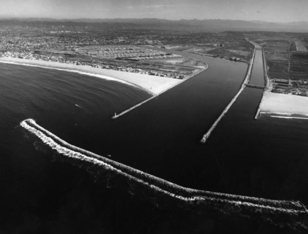 |
|
| (1968)* - Aerial view of Marina del Rey on October 16, 1968, showing the entrance to the marina and its new breakwater. |
Historical Notes The breakwater shown here was finished in the mid-1960s to protect the marina from ocean waves and storms. This 1968 photo shows the fully developed harbor, just a few years after it was officially opened in 1965. It had cost over $36 million to complete and quickly became a popular destination for boaters and tourists. |
Before and After
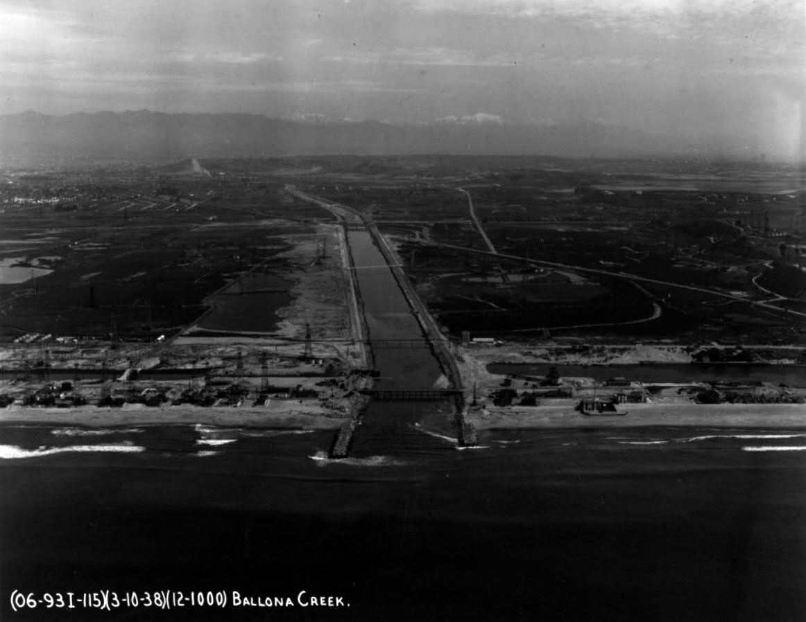 |
|
|
|
| (1938 vs. 1968) - Marina del Rey |
Historical Notes These two images—30 years apart—show just how much the area changed. In 1938, the land was mostly wetlands and oil fields. By 1968, it had been turned into a modern marina with docks, roads, and buildings. The comparison highlights how quickly Los Angeles County transformed natural spaces into urban centers in just a few decades. |
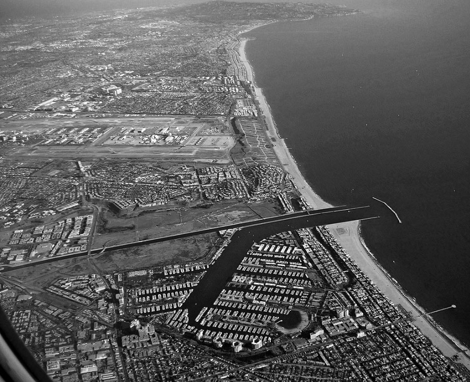 |
|
| (2007)* - Aerial view showing Marina del Rey and Ballona Creek looking south. |
Historical Notes By 2007, Marina del Rey had become a major hub for recreation and tourism. With thousands of boat slips, high-rise condos, and restaurants, it had completely replaced the original wetlands. However, the nearby Ballona Creek and remaining marshes were starting to get more attention from environmental groups who wanted to protect what was left of the area’s natural habitat. |
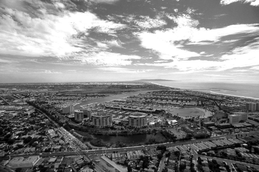 |
|
| (ca. 2012)* - Aerial view showing the Marina del Rey as it appears today. |
Historical Notes Today, Marina del Rey is a mix of public space, private homes, marinas, and parks. While most of the original wetlands are gone, parts of the Ballona Wetlands have been preserved and are being restored. This shows a shift in thinking—from changing nature to protecting it—while still enjoying all that the marina has to offer. |
* * * * * |
Hyperion Sewage Plant
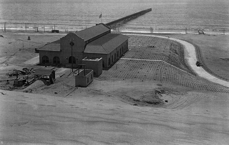 |
|
| (ca. 1925)* - Initial Hyperion Treatment Plant (primary treatment only). Note the "sewage pier" with outfall pipe. |
Historical Notes Until 1925, raw sewage from the city of Los Angeles was discharged untreated directly into Santa Monica Bay in the region of today's Hyperion Treatment Plant. With the population increase, the amount of sewage became a major problem to the beaches, so in 1925 the city of Los Angeles built a simple screening plant (seen above) in the 200 acres the city had acquired in 1892. |
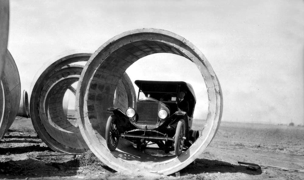 |
|
| (1920s)* - Concrete pipe for a segment of the North Outfall with a car inside. |
Historical Notes The North Outfall conveyed sewage to the early (primary) Hyperion Treatment Plant and ocean outfall. |
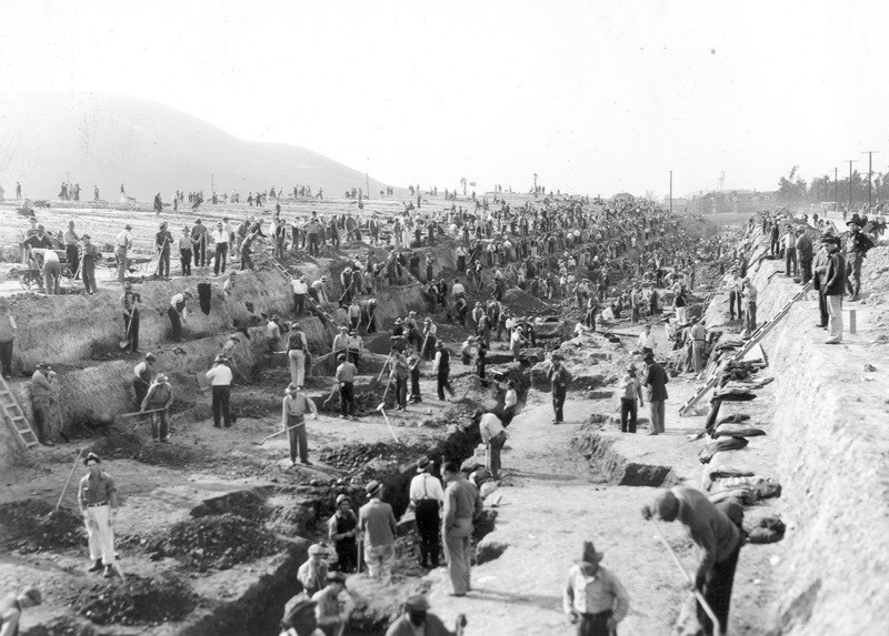 |
|
| (ca. 1937)* - View showing hundreds of workers moving sand behind the old Hyperion screening plant in preparation for a new sewage treatment plant planned by then City Engineer Lloyd Aldrich. |
Historical Notes Despite a $7 million grant from the federal government, only an experimental plant to handle a small amount of sewage was started and apparently was never actually placed in operation. |
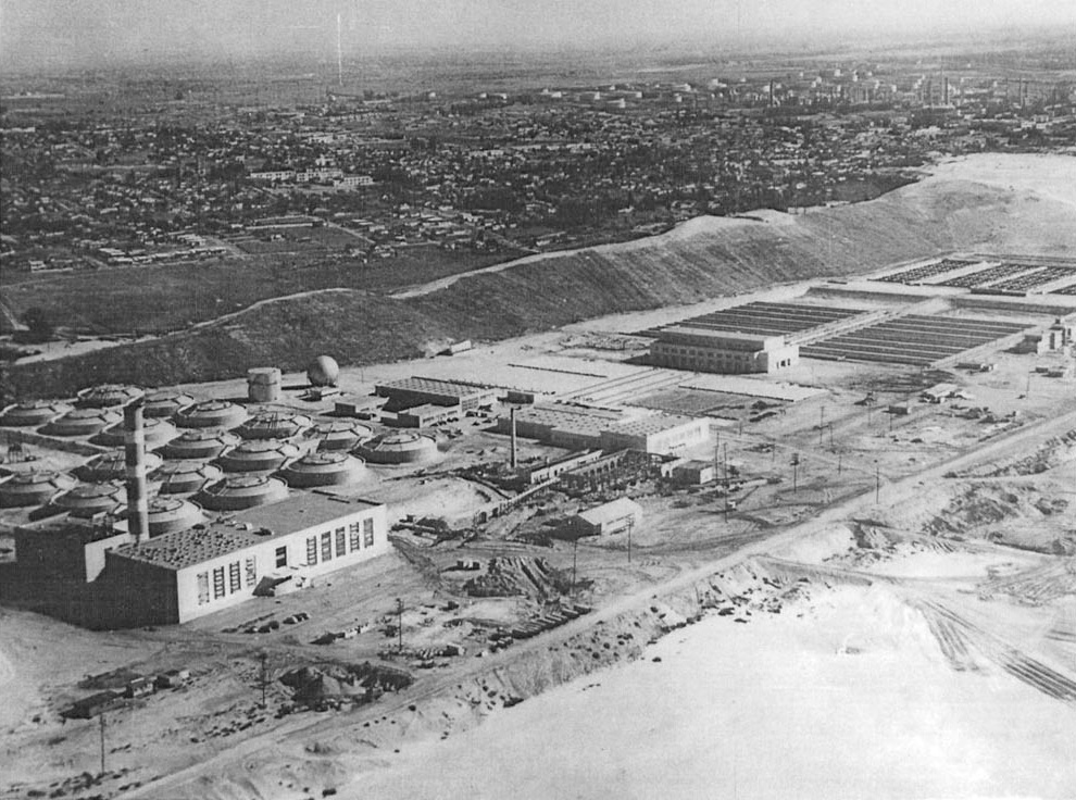 |
|
| (1952)* – View showing the Hyperion Sewage Treatment Plant located at 12000 Vista del Mar, Playa del Rey. |
Historical Notes Even with the screening plant, the quality of the water in the Santa Monica Bay was unacceptable, and in 1950 the city of Los Angeles opened the Hyperion Treatment Plant with full secondary treatment processes. In addition, the new plant included capture of biogas from anaerobic digesters to produce heat dried fertilizer. In order to keep up with the increase of influent wastewater produced by the ever growing city of Los Angeles, by 1957 the plant engineers had cut back treatment levels and increased the discharge of a blend of primary and secondary effluent through a five-mile pipe into the ocean. They also opted to halt the production of fertilizers and started discharging digested sludge into the Santa Monica Bay through a seven-mile pipe. Marine life in Santa Monica Bay suffered from the continuous discharge of 25 million pounds of wastewater solids (sludge) per month. Samples of the ocean floor where sludge had been discharged for 30 years demonstrated that the only living creatures were worms and a hardy species of clam. Additionally, coastal monitoring revealed that bay waters often did not meet quality standards as the result of Hyperion's effluent. These issues resulted in the City entering into a consent decree with the United States Environmental Protection Agency and the State of California to build major facility upgrades at Hyperion. In 1980, Los Angeles launched a massive sludge-out to full secondary program to capture all biosolids and keep them from entering the Bay. The sludge-out portion of the program was completed in 1987. |
* * * * * |
Hermosa Beach
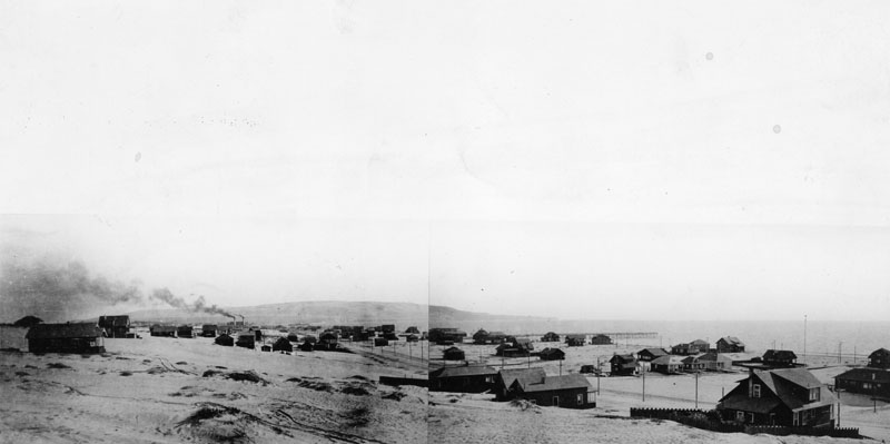 |
|
| (ca. 1904)^ - View of residential homes in Hermosa Beach with the Palos Verdes Peninsula seen in the background. Also seen is the Hermosa Beach Pier, built in 1904. |
Historical Notes Hermosa Beach was originally part of the 1884 Rancho San Pedro Spanish land grant that later became the ten-mile Ocean frontage of Rancho Sausal Redondo. In 1900 a tract of 1,500 acres was purchased for $35 per acre from A. E. Pomroy, then owner of the greater part of Rancho Sausal Redondo. Messrs. Burbank and Baker, agents, bought this land for Sherman and Clark who organized and retained the controlling interest in the Hermosa Beach Land and Water Company. The first city election for city officers was held December 24, 1906. On January 14, 1907, Hermosa Beach became the nineteenth incorporated city of Los Angeles County.*^ |
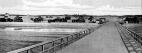 |
||
| (ca. 1904)+*^ – View showing the first Hermosa Beach Pier with houses in the background. |
Historical Notes The first Hermosa Beach Pier was built in 1904, two years before the city officially incorporated. Constructed out of wood, the 500-foot-long pier broke up and much of it floated out to sea during a violent storm in 1913. The strength of such winter storms along the west-facing South Bay beaches was the undoing of many such structures over the years, including various incarnations of the Redondo Beach pier, and had much to do with San Pedro’s victory in winning the battle to become Los Angeles’ official port in 1907. |
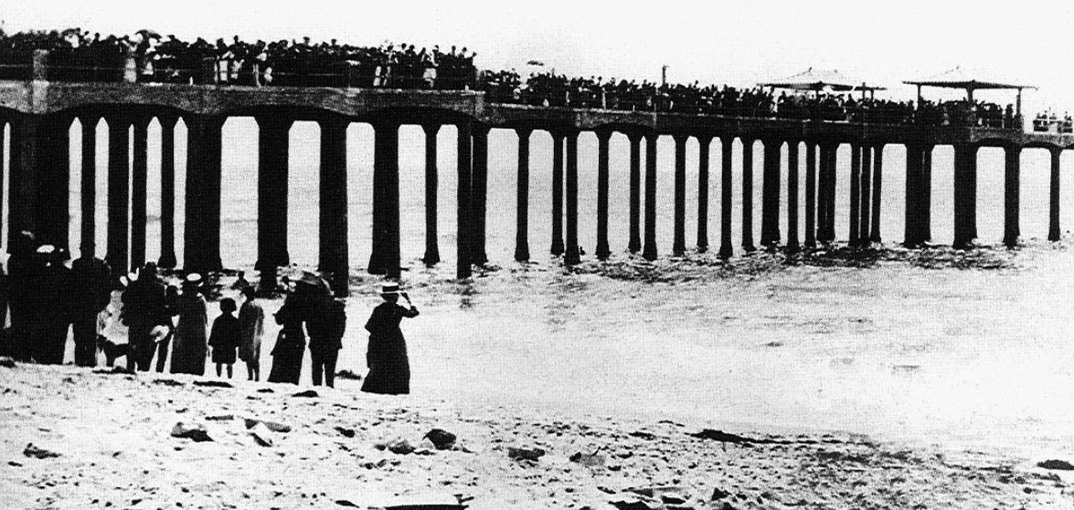 |
|
| (1914)^x^ – Crowds gather on the new concrete Hermosa Beach pier for its dedication. Photo: Hermosa Beach Historical Society. |
Historical Notes Hermosa Beach’s second pier was built in 1914. Constructed of concrete, the pier was 1,000 feet long and paved with asphalt its entire length. Small tiled pavilions were erected at intervals along the sides to afford shade for fishing and picnic parties. A bait stand was built eventually out on the end.*^ |
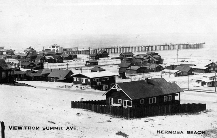 |
|
| (1914)^*# – Postcard view of Hermosa Beach and Pier as seen from Summit Avenue. |
Historical Notes Soon after the concrete pier was built in 1914, an auditorium building was constructed; it has housed various enterprises and at present the public rest rooms, the Los Angeles Life Guard Service, and the local branch of the Los Angeles County Public Library occupy rooms in the building. This pier is municipally owned. |
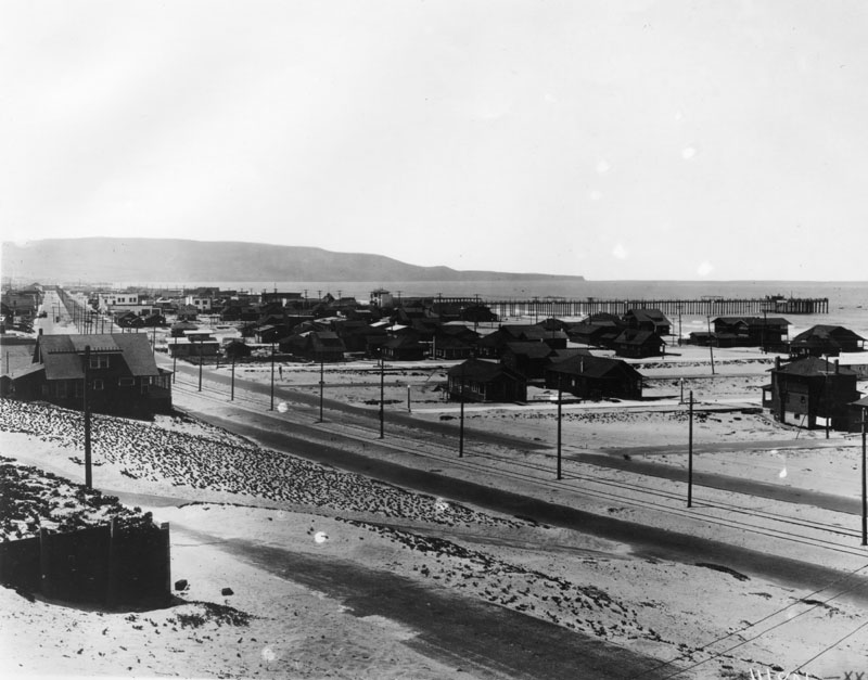 |
|
| (1918)^ - View showing Hermosa Beach as it appeared in 1918 with Palos Verdes Peninsula seen in the distance. Note the tracks and electric trolley lines that run along the beach. |
Historical Notes The Los Angeles Pacific Railway, a "trolley" system, was the first railway in Hermosa Beach, running the entire length of Hermosa Avenue on its way from L.A. to Redondo Beach. A few years later it was merged with most all other "trolley" companies in the region to form the new Pacific Electric Railway Company, informally called the Red Cars.*^ |
.jpg) |
|
| (1923)^ - Beachgoers enjoy the day at Hermosa Beach. Crowds of people relax under an umbrella on the sand, while others enjoy swimming or wading in the cool water. Building on the right is the Strand Bath House. |
The Strand
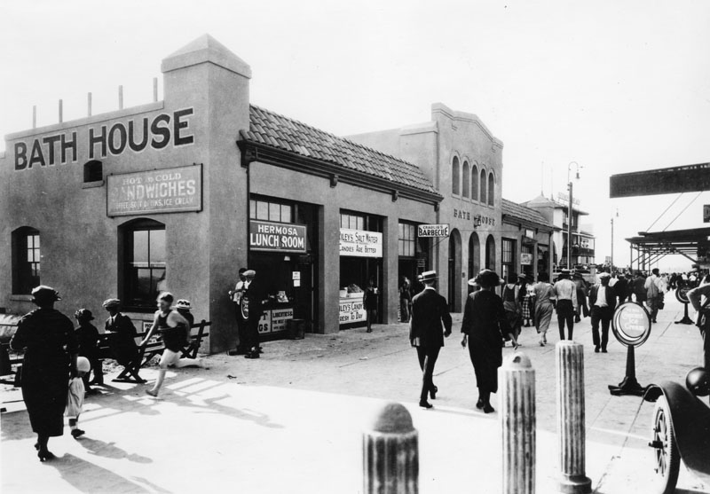 |
|
| (1923)^- View of the Bath House building located in Hermosa Beach. Several storefronts around the bathhouse are also seen. Some of them are: Hermosa Lunch Room, Riley's Salt Water Candies, Charlie's Barbecue and The Bath House. |
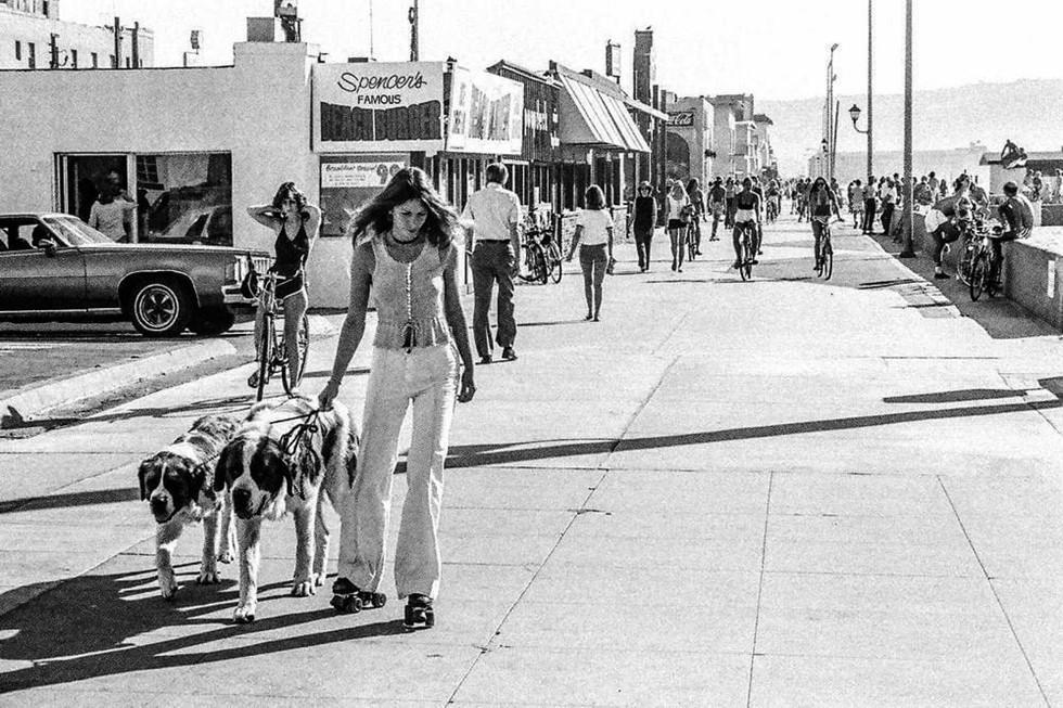 |
|
| (1970s)* - Along the strand in Hermosa Beach. |
Then and Now (1920s vs 1970s)
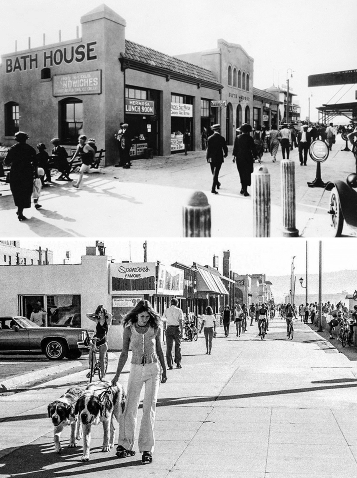 |
|
| (1920s vs 1970s)* – Hermosa Beach Strand |
Then and Now (1970s vs 2020s)
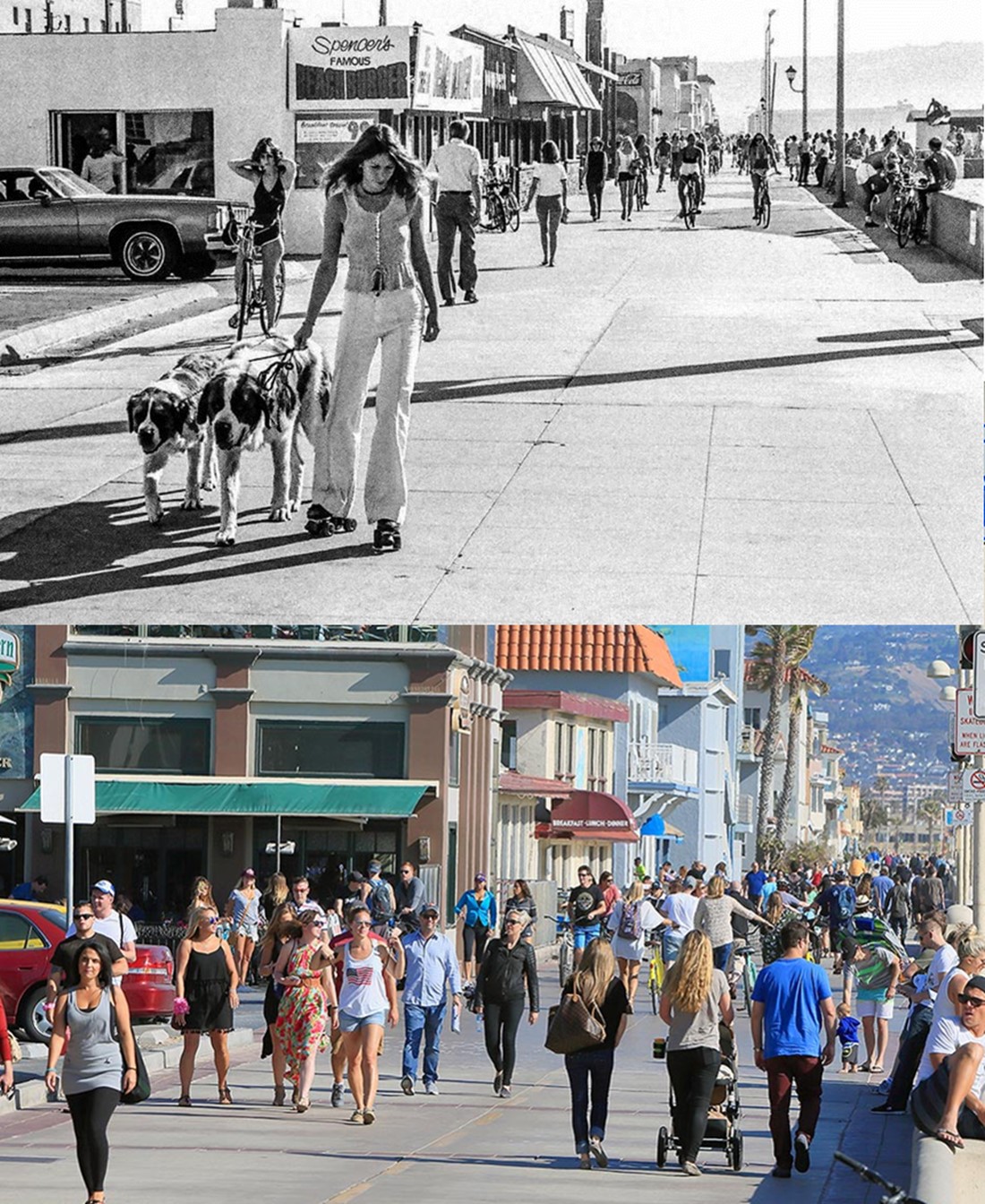 |
|
| (1970s vs 2020s)* – Hermosa Beach Strand |
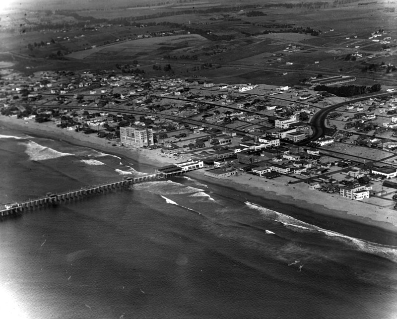 |
|
| (1924)^ - Aerial view is looking northeast at Hermosa Beach. The Surf and Sand Club is the large building left of the pier. Many dwellings can be see along the oceanfront with sparsely populated areas in the background. |
Historical Notes The Los Angeles Pacific Railway, a "trolley" system, was the first railway in Hermosa Beach, running the entire length of Hermosa Avenue on its way from L.A. to Redondo Beach. A few years later it was merged with most all other "trolley" companies in the region to form the new Pacific Electric Railway Company, informally called the Red Cars. The Santa Fe Railway was next through Hermosa Beach. It was seven blocks from the beach. The street that led to the tracks was called Santa Fe Avenue, but was later renamed Pier Avenue. There was no Santa Fe railway station for Hermosa, but Burbank and Baker built a railway platform on the west side of the tracks near Santa Fe Avenue, and later the Railroad Company donated an old boxcar to be used as a storage place for freight. In 1926, the Santa Fe Company built a modern stucco depot and installed Western Union telegraph service in it.*^ |
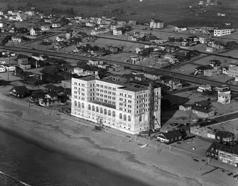 |
|
| (1924)^ - Aerial view of the Surf and Sand Club on the oceanfront of Hermosa Beach. Several residential homes are next to the club, and in the surrounding area. A Bath House can be seen in the lower right corner of photo. |
Historical Notes One of the most ambitious projects attempted in the city came in the mid-1920's with the opening of the above building, which later became the Hermosa Biltmore Hotel. The Hotel was located between 14th and 15th Streets on the Strand. In those days it was the headquarters for the Surf and Sand Club, and was run on a private club basis. A number of wealthy persons backed the project and for several years the building, a notable achievement in those days, was the showplace and social center of Hermosa. The private club idea proved to be a losing proposition, however, and a few years later the founders and owners sold out to the Los Angeles Athletic Club. This group, with better financing, attempted to run the property on more or less the same basis but finally sold out to hotel interests about 1930. During World War II, for a short time the building was taken over by the federal government and used as a youth training center. This property was torn down in the late 1960's for development, and is now the site of a public park.*#^ |
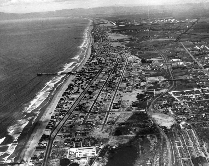 |
|
| (1925)^ - Aerial view of Hermosa Beach and part of Redondo Beach. The Hermosa pier may be seen in the center of this photo. The large white building at the bottom of the photo is a power plant built by Pacific Light and Power Corp. |
Historical Notes This Pacific Light and Power Company power plant was built in 1902 to provide electricity for the Pacific Electric Red Car system in Los Angeles and the surrounding Redondo Beach area. In 1917, Southern California Edison Co. (SCE) purchased Pacific Light and Power Company. In 1946, SCE constructed another power plant at the same site. Today a modified version of this new plant is owned and operated by AES.^ Click HERE to see more in Early Power Generation. |
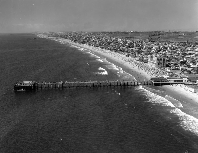 |
|
| (1932)^ - Aerial view of Hermosa Beach Pier. The Surf and Sand Club is the large building on the oceanfront. The dwelling density is already increasing, however the areas in the backround are still sparsely populated. |
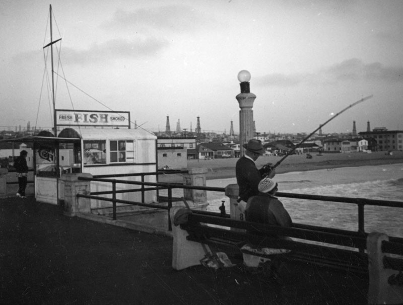 |
|
| (ca. 1937)^ - A man fishes off the pier at Hermosa Beach. A small stand in the background, sells fresh smoked fish. Oil derricks can be seen in the background. |
Click HERE to see more Early Views of the Hermosa Beach Pier. |
* * * * * |
Redondo Beach
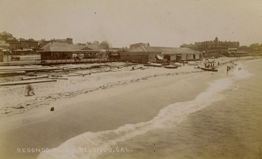 |
|
| (ca. 1896)* - Image of people, boats, and lumber on the beach with the Redondo Beach Hotel (also known as Hotel Redondo), on the hill at right, and a restaurant, boardinghouse, and market on Pacific Avenue in the background in Redondo Beach, California. Signs on the buildings read "Casino" and "John Weilands lager draught." A passenger train depot for the Santa Fe Railway is visible on the beach at right, with a locomotive and signs "Redondo" and "Santa Fe Route." Photo from the Ernest Marquez Collection. |
Historical Notes The transformation of Redondo Beach into a resort and port city began in the late 19th century. In 1889, the Redondo Beach Improvement Company purchased 433 acres of land from the Dominguez family. This land purchase laid the groundwork for the development of the city. In 1890, the Hotel Redondo opened, marking the beginning of Redondo Beach as a tourist destination. The hotel featured luxurious accommodations, an 18-hole golf course, and tennis courts. The city's location and the presence of a deep offshore canyon made it an ideal site for a port, which further boosted its economy. |
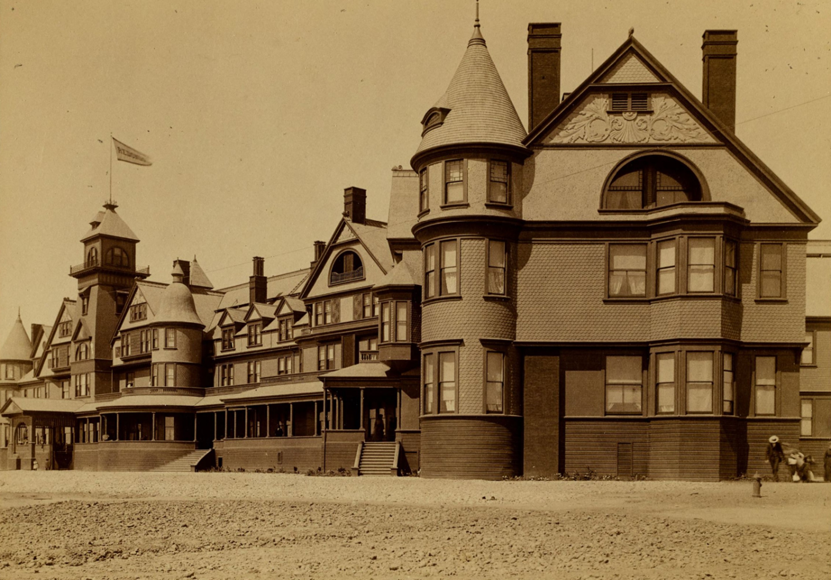 |
|
| (ca. 1890)* – View of the south side of the Redondo Beach Hotel, also known as Hotel Redondo. Photo from the Ernest Marquez Collection. |
Historical Notes The Hotel Redondo, a grand Victorian-style resort, opened in Redondo Beach on May 1, 1890. Situated on a 22-acre tract, it was designed to be a major tourist attraction, featuring 225 luxurious rooms and modern amenities for its time, including a bath on each floor. |
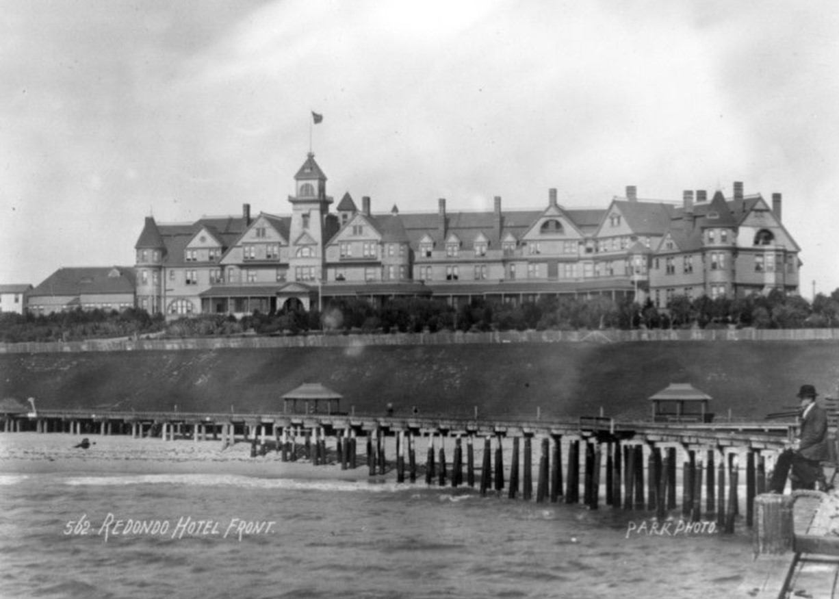 |
|
| (ca. 1890s)* – A man is seen standing on the pier in front of the Redondo Hotel. |
Historical Notes The hotel played a crucial role in establishing Redondo Beach as a premier tourist destination. It was part of a broader effort by developers to promote the area, which included building rail connections and developing the port facilities. The hotel attracted thousands of visitors, contributing significantly to the local economy. Despite its initial success, the hotel's fortunes declined as San Pedro Harbor developed and became the primary port for Los Angeles. The hotel closed in 1925, partly due to the economic impacts of Prohibition, and was sold for scrap lumber. |
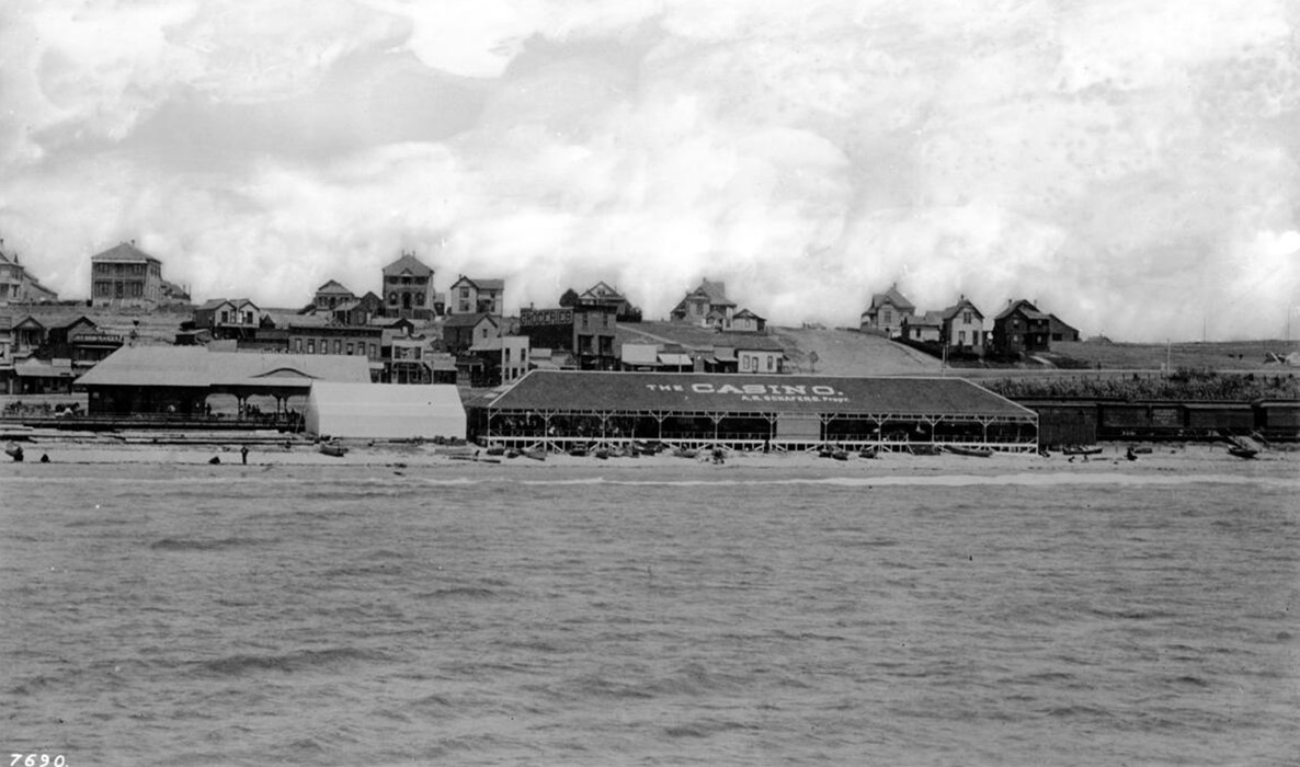 |
|
| (1890s)* - Photograph of Redondo Beach from its first pier, featuring the A.R. Schafers Casino. The ocean surf dominates the foreground, with the shoreline in the distance. The casino, an open-air pavilion, stands prominently at the center with its name displayed on the roof. To the left, a smaller beach pavilion, possibly a train depot, and a tent are visible, with train cars positioned behind to the right. In the background, shopfronts line Pacific Avenue, displaying signs, while the town's predominantly two-story Victorian houses are seen on the hillside. Small canoes rest on the sand in front of the casino. Visible signs include: "Santa Fe Route," "Restaurant," and "Groceries." |
Historical Notes In the early development phase from 1889 to the 1920s, three successive piers played crucial roles in facilitating industry and tourism. Wharf No. 1, constructed in 1889, served as a key point for transferring timber from ships to trains but was eventually destroyed by a storm. In 1895, Wharf No. 2 was built south of the original pier, featuring a Y-shaped design with railroad tracks on one prong. This pier supported fishing and tourism but was severely damaged by a storm in 1919 and later demolished for safety. Wharf No. 3, constructed in 1903 further south, continued to support the lumber industry until 1923. Following the expiration of Pacific Electric’s lease and the decline of the lumber industry, Wharf No. 3 was also demolished. |
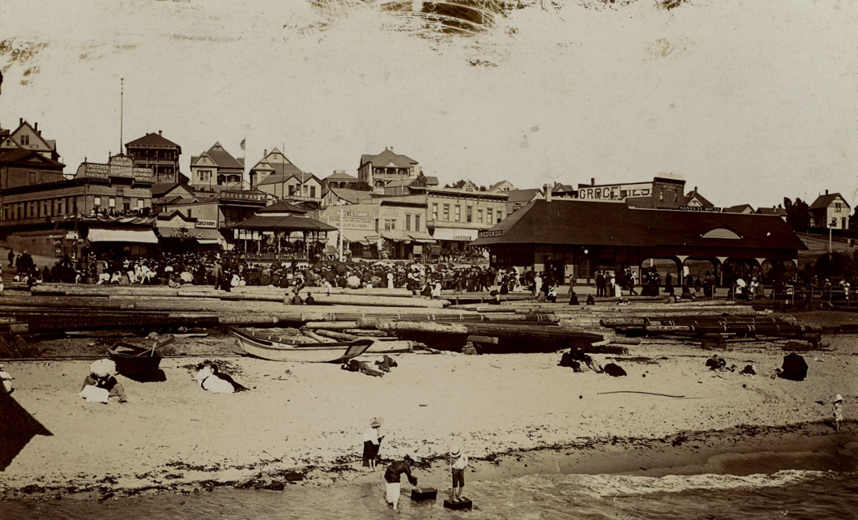 |
|
| (ca. 1890s)* - Image of a crowd of people gathered around a pagoda-style pavilion, with boats, and lumber on the beach and storefronts on Pacific Avenue for restaurants, boardinghouses, houses, and markets in the background in Redondo Beach, California. A passenger train depot for the Santa Fe Railway is visible on the beach at right, with the signs "Redondo" and "Santa Fe Route." Signs on the buildings include "Groceries, hardware, paints and oils, ship chandlery, gents furnishings goods, bathing suits, boots and shoes, fishing tackle," "Lunch Room," "Davis House," "Roach's Restaurant," "Seaside Market," and "W.A. Field." Photo from the Ernest Marquez Collection. |
Historical Notes In the 1910s, Redondo Beach was a bustling hub of activity, known for its vibrant recreational and commercial scene, making it a prominent destination in Southern California. The area’s economy was heavily supported by its multiple wharves, particularly Wharf No. 3, which was constructed in 1903. This pier played a crucial role in the lumber industry and remained operational until 1926, underscoring the importance of the waterfront to the region's economic development. |
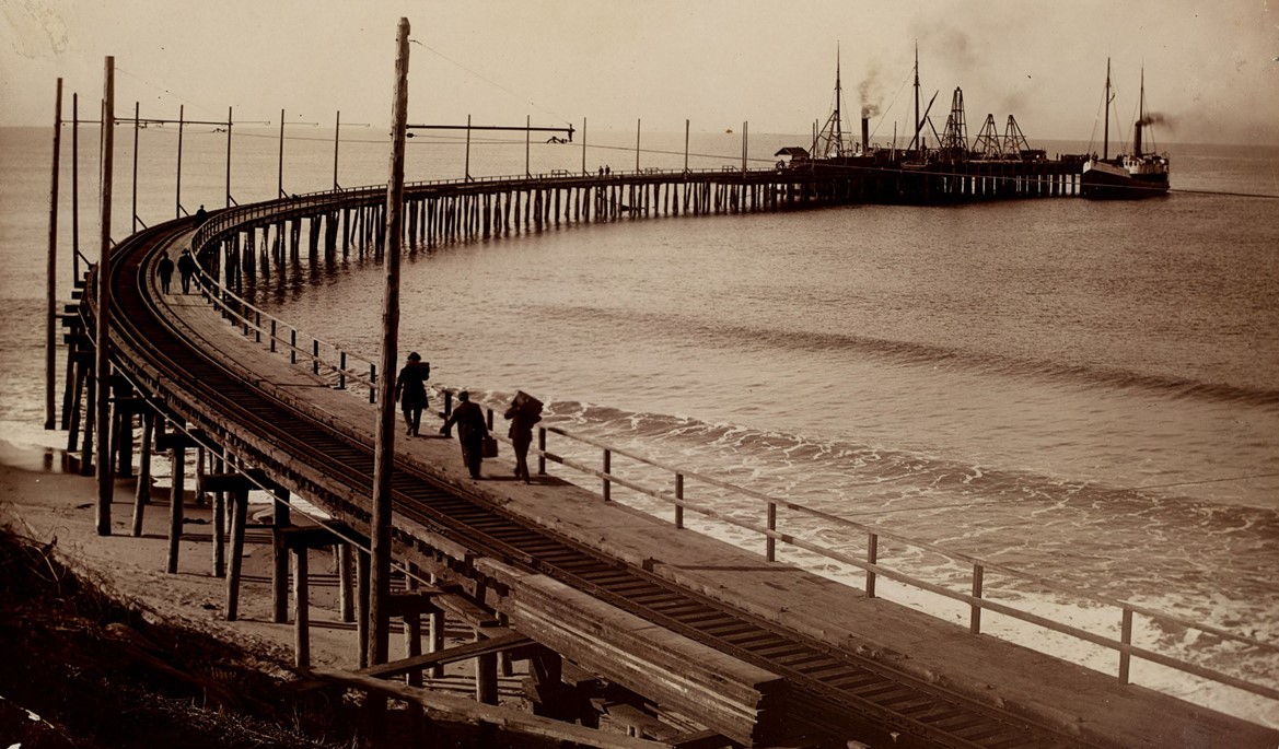 |
|
| (1910)* - Image of Redondo Beach Wharf with people and railroad tracks on the wharf in Redondo Beach. A couple of schooners are seen docked at the end of the pier. Photo from the Ernest Marquez Collection. |
Historical Notes During the late 19th and early 20th centuries, Redondo Beach had significant potential to become a major port, with efforts including the construction of multiple wharves to compete with the San Pedro harbor for freight activity. The presence of the Santa Fe railroad, which provided rail service to the piers, bolstered this ambition. However, several factors hindered Redondo Beach's development into a major port. Natural challenges, such as severe storms, frequently damaged the piers, undermining their reliability for commercial use. Additionally, economic shifts, including the decline of the lumber industry and changes in freight delivery patterns, diminished the commercial viability of the piers. Over time, the focus shifted from commercial to recreational uses, with the development of pleasure piers drawing tourists rather than freight. |
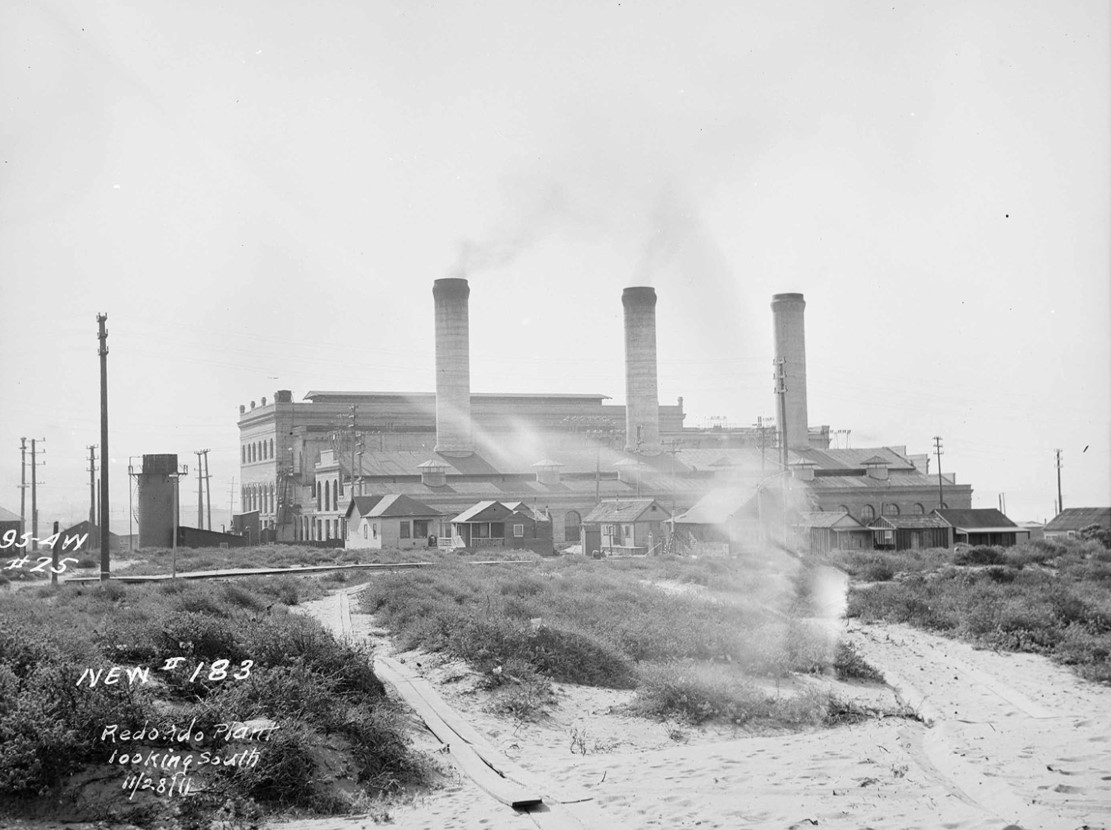 |
|
| (1911)* - Redondo Beach Steam Plant looking South. |
Historical Notes The Pacific Light and Power Corporation (PLPC), established by Henry Huntington in 1906, built a concrete-and-metal steam plant in Redondo Beach, strategically located for its access to clean water and local oil for fuel. This plant was crucial in powering Huntington's electric railway cars and by 1911, had doubled in size, becoming the fourth largest in the United States. However, by 1913, its output was replaced by other plants, and it was relegated to backup status. After Southern California Edison (SCE) acquired PLPC in 1917, the plant fell into disuse and was abandoned during the Great Depression. In response to post-World War II growth, SCE constructed a new generating facility on the site in 1948, which operated until 1987. In 1997, AES Southland Energy acquired the plant, modernizing it to meet contemporary energy needs. However, the facility has faced opposition from residents concerned about pollution, leading to plans to downsize and repurpose the land for non-industrial uses. Throughout its history, the Redondo Beach Steam Plant has evolved from a vital power provider to a facility grappling with environmental and community challenges. |
* * * * * |
Pacific Avenue, Redondo Beach |
Long before Redondo Beach became known for its modern waterfront and harbor, Pacific Avenue served as the heart of the city's commercial and transportation life. Running through the center of town and linking the waterfront with hotels, shops, rail service, and entertainment, the street became one of the defining corridors of early Redondo Beach.During the late 19th and early 20th centuries, visitors arrived by steam railroad, electric streetcar, horse drawn carriage, and eventually automobiles. Along Pacific Avenue they found bustling storefronts, resort hotels, real estate offices, amusement attractions, and access to one of Southern California's most popular coastal destinations.This section traces the evolution of Pacific Avenue and the surrounding waterfront through rare photographs and historical notes that document Redondo Beach's transformation from a growing seaside resort into a thriving coastal community. |
 |
|
| (1902)* – Businesses along Pacific Avenue in Redondo Beach, California, are depicted, with a streetcar on tracks and horse drawn wagons. Visible signs on the buildings include "The Columbia," "Bowling," "Rainier Beer," "The Pool Room," "Our House Saloon, Murphy Prop., Furnished Rooms, Tea Kettle Whiskey," "Fish Dinner," and "The Culler Co." A pagoda style pavilion and a passenger train depot for the Santa Fe Railway are seen at the far right, with houses visible on the hill in the background. Photo from the Ernest Marquez Collection. |
Historical Notes Pacific Avenue played a central role in the early development of Redondo Beach, serving as one of the city's principal commercial corridors during the late 19th and early 20th centuries. Founded in 1887, Redondo Beach quickly emerged as a popular seaside resort destination. Pacific Avenue became the heart of the waterfront district, lined with hotels, saloons, shops, restaurants, and recreational attractions that catered to both visitors and local residents. Electric railway service arrived in Redondo Beach in 1902, greatly improving access from Los Angeles and accelerating the city's growth. The line later became part of the expanding Los Angeles Pacific system before ultimately being absorbed into the Pacific Electric Railway network in 1911, strengthening Redondo Beach's connection to the region. |
 |
|
| (ca. 1905)* - Looking north on Pacific Avenue in Redondo Beach, with an electric streetcar, horse drawn wagons, and crowds of people in front of a real estate office. Signs on the storefronts read "Garland & Co.," "F.M. Phelps & Co. Real Estate," "Business Property Hart & Copps," "Billiards and Pool," and "Laundry." Photo from the Ernest Marquez Collection. |
Historical Notes By the first decade of the 1900s, Pacific Avenue had become one of Redondo Beach's busiest streets. Real estate offices, hotels, entertainment venues, and transportation services reflected the city's rapid growth during Southern California's early land boom era. Streetcars running along Pacific Avenue brought visitors directly into the downtown district, while horse drawn wagons and early automobiles continued to share the streets. Nearby attractions including the Redondo Pavilion and Santa Fe Railway Depot helped establish Redondo Beach as one of Southern California's leading coastal destinations. |
 |
|
| (ca. 1908)* – View looking south on Pacific Avenue at Emerald Street in Redondo Beach showing a Pacific Electric streetcar approaching the intersection with the Garland Hotel visible in the background. |
Historical Notes By the early 1900s, Pacific Avenue had become one of Redondo Beach's principal transportation and commercial corridors. The street served as part of the extensive Pacific Electric Railway system, whose famous "Red Cars" connected Redondo Beach with communities throughout Los Angeles County and helped establish the city as one of Southern California's most popular seaside destinations. This view captures a transitional period in Redondo Beach's growth when streetcars, early automobiles, and pedestrians shared the roadway while commercial development expanded around the downtown district. The Garland Hotel, visible in the background, was among the city's prominent landmarks and reflected Redondo's appeal as both a residential and tourist destination. Prominent in the left foreground is the English Block at the northeast corner of Pacific Avenue and Emerald Street. Constructed in 1893, the building became one of downtown Redondo Beach's recognizable early commercial structures and remained a local landmark for decades before being demolished in the early 1970s and replaced by later development. The dating of this photograph is supported by period evidence including a contemporary postcard view and architectural and commercial details visible within the scene that place it in Redondo Beach's early development era. |
 |
|
| (1923)* - Panoramic view of Redondo Beach as seen from the Garland Hotel. |
Historical Notes By the 1920s, Redondo Beach had evolved from a resort centered largely around rail excursions into a more established coastal community. Improved roads and increased automobile ownership gradually shifted how visitors arrived and experienced the city. Viewed from the Garland Hotel, this panorama captures Redondo Beach during a period of transition when tourism, local commerce, and residential growth continued to shape the waterfront and surrounding neighborhoods. |
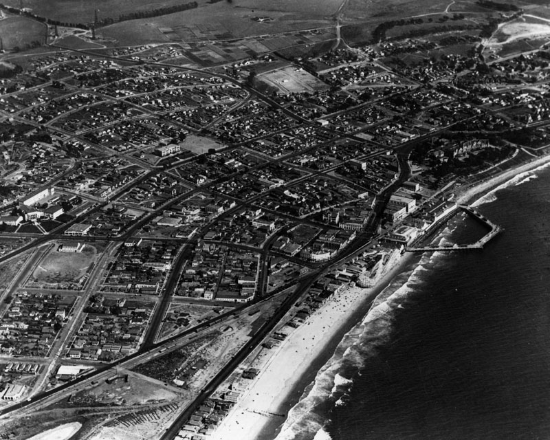 |
|
| (1924)^ - Aerial view of Redondo Beach showing its pleasure pier. |
Historical Notes During the 1910s and 1920s, Redondo Beach gradually shifted from industrial wharves toward recreational and tourism focused waterfront attractions. The Endless (later known as the Pleasure Pier) was a V shaped reinforced concrete structure built by George W. Harding for fishing and strolling. Despite its popularity, the pier was condemned for safety reasons in 1928. Captain Hans C. Monstad constructed the Monstad Pier in 1925, originally extending 300 feet and serving as a center for fishing and pleasure boat landings. It remains in use today. The Horseshoe Pier, completed in 1929 after demolition of the Pleasure Pier, became one of Redondo Beach's defining landmarks and remained a central community feature until it was destroyed by fire in 1988. Following the fire, the southern remnant remained open until a new concrete pier opened in 1995. |
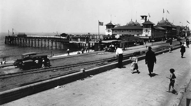 |
|
| (ca. 1925)* - View of Redondo Beach's Endless Pier as seen from the shoreline. |
Historical Notes Completed during the 1910s, the Endless Pier represented Redondo Beach's growing emphasis on recreation and tourism rather than commercial shipping. Built as a reinforced concrete structure extending into the ocean, the pier became a popular destination for walking, sightseeing, and fishing. Unlike the earlier industrial wharves that supported freight and maritime commerce, the Endless Pier reflected changing public tastes and the rise of leisure culture in Southern California. Visitors arriving by streetcar and automobile helped transform Redondo Beach into one of the region's most visited seaside communities during the 1920s. |
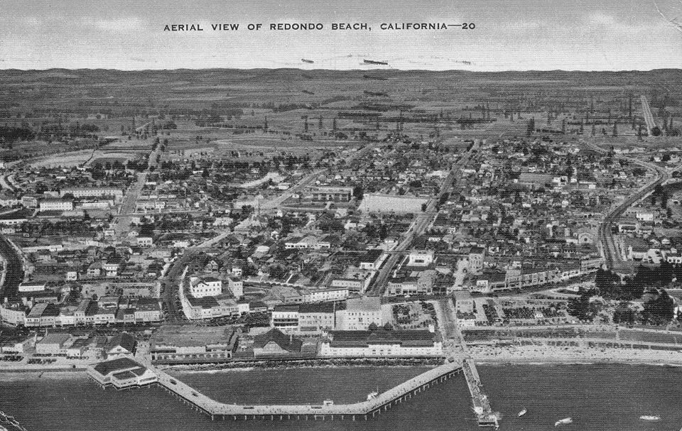 |
|
| (ca. 1920s)* - Aerial postcard view of Redondo Beach and the Endless Pier. Oil fields are visible in the distance. |
Historical Notes This aerial view captures the contrasting forces shaping Redondo Beach during the 1920s. Along the waterfront, hotels, beaches, pleasure piers, and recreational attractions drew visitors seeking the Southern California coastal experience. In the distance, oil development reflected another powerful economic force transforming the region. The coexistence of tourism and petroleum development became a defining characteristic of many Southern California coastal communities during this period, illustrating the rapid and often overlapping growth occurring throughout the Los Angeles area. |
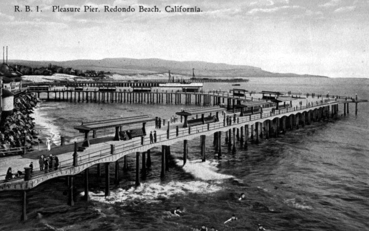 |
|
| (ca. 1920s)* – Postcard view looking south along the coast of Redondo Beach. Visitors stroll along the Endless Pier while swimmers enjoy the surf below. The Pavilion, Bath House, and Wharfs No. 2 and 3 can also be seen. |
Historical Notes By the 1920s, Redondo Beach had become one of Southern California's premier seaside destinations. Visitors arrived throughout the year to enjoy swimming, fishing, boating, dancing, and oceanfront recreation. The Pavilion and Bath House became iconic landmarks that helped define Redondo's identity as a resort community, while the surviving wharves reflected the city's earlier maritime roots. Scenes like this illustrate the transition from a working waterfront to a recreation focused coastline. |
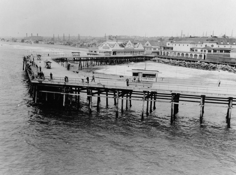 |
|
| (1937)^ - View of the main pier at Redondo Beach on May 27, 1937. Oil derricks can be seen in the background. |
Historical Notes Redondo Beach's pier evolved over several decades from a collection of independent wharves into a more unified recreational destination serving both residents and visitors. Storm damage, rebuilding efforts, and changing recreational needs continually reshaped the waterfront throughout the early 20th century. By the late 1930s, the pier had become one of the city's defining landmarks, offering fishing, boating, ocean recreation, and panoramic coastal views. The oil derricks visible in the distance reflect the continued influence of petroleum development across the South Bay region. |
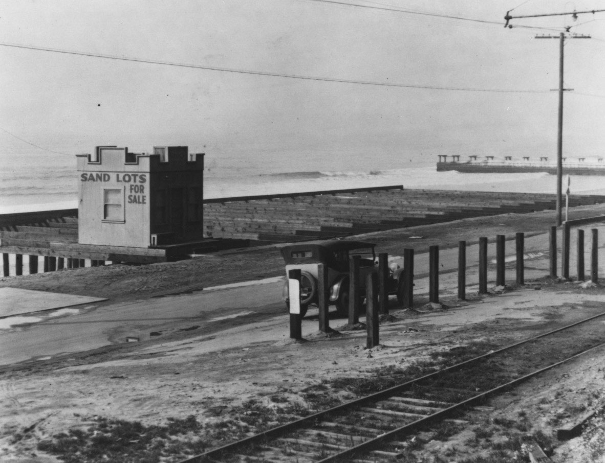 |
|
| (1930s)* – "Sand Lots for Sale" painted on the side of a real estate office in Redondo Beach. Streetcar tracks are visible in the foreground. |
Historical Notes Even during the 1930s, real estate remained closely tied to Redondo Beach's identity and continued development. Painted building advertisements such as this were a common marketing technique used to attract investors, businesses, and homebuyers seeking opportunities near the Southern California coast. The streetcar tracks visible in the foreground serve as a reminder that electric rail transit continued to influence development patterns and connect Redondo Beach with surrounding communities during a period when automobiles were becoming increasingly dominant. Scenes like this capture an important transitional period in the city's history, when older forms of transportation and traditional land promotion continued to coexist with the rapid modernization taking place across the Los Angeles region. |
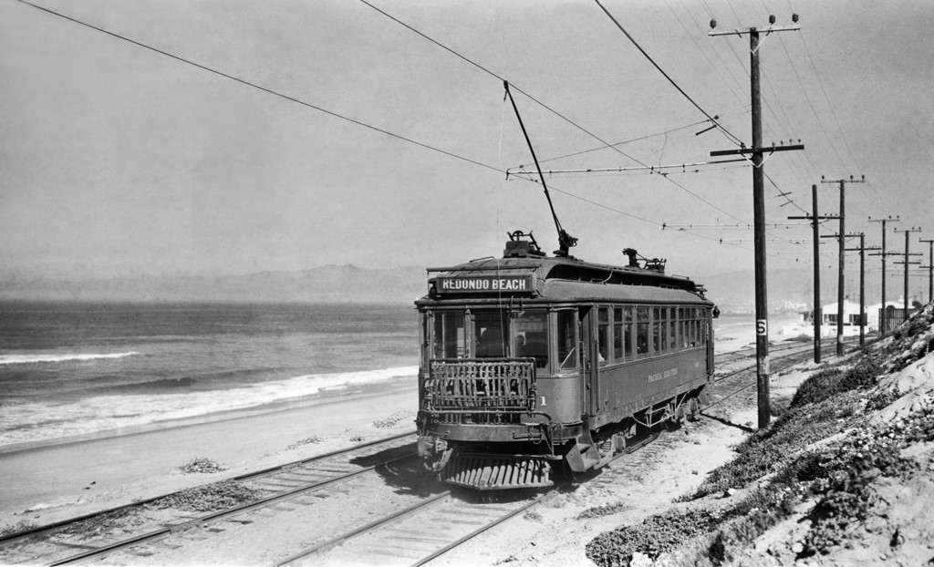 |
|
| (ca. 1930s)* - Redondo Beach trolley. Photo: Pacific Electric Railway Historical Society. |
Historical Notes Streetcars remained an important part of daily life in Redondo Beach well into the 1930s, providing reliable transportation for workers, residents, and beach visitors. Pacific Electric's extensive rail network helped make coastal communities more accessible and supported continued residential growth. As automobile ownership increased throughout Southern California, however, streetcar ridership gradually declined. Within a few decades, many of the region's once extensive electric railway lines would disappear. |
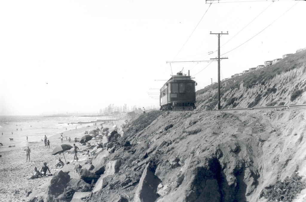 |
|
| (1939)* - A Redondo Beach via Del Rey streetcar climbs the grade above the shoreline while sun bathers enjoy the beach below. Parked automobiles line the bluff and oil derricks appear in the distance. |
Historical Notes This image captures several defining elements of Southern California at the end of the streetcar era: electric rail transportation, growing automobile use, expanding beach recreation, and industrial development existing side by side. By the late 1930s, Pacific Electric still provided an important connection between coastal communities and Los Angeles, but changing travel patterns increasingly favored the automobile. Within the following two decades, most of the famous Red Car lines serving the South Bay would be gone, marking the end of an era in regional transportation. |
* * * * * |
Hollywood Riviera Beach Club
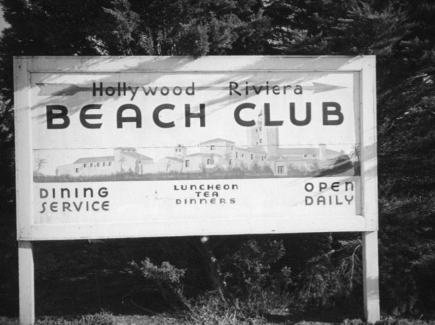 |
|
| (ca. 1937)* - Sign for the Hollywood Riviera Beach Club which features an architectural rendering and indicates that the originally private club was open for lunch and diner every day. |
Historical Notes The Hollywood Riviera Beach Club (1931-1958), designed by Mark Daniels, was located at what is now Miramar Park in Torrance Beach. It was designed as a private club for the original Riviera home owners. The beach club was destroyed by fire and the site was recognized as a Historic Landmark with a plaque by the Torrance Historical Society in conjunction with the Redondo Beach Historical Society. |
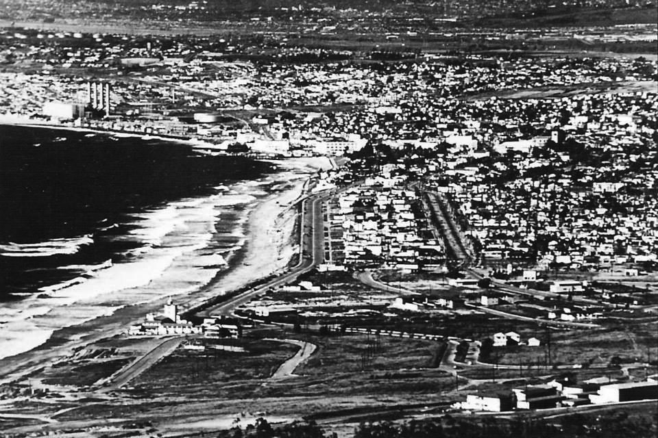 |
|
| (1930s)^ – View looking north from Palos Verdes toward Redondo Beach. At lower-left can be seen the Hollywood Riviera Beach Club which straddled the city limit between Torrance and Redondo Beach. |
Historical Notes Ground had been broken for the private Hollywood Riviera Beach Club on March 4, 1930. Clifford Reid, the developer who envisioned the Hollywood Riviera section of Torrance as a potential playground for the Hollywood elite when he began selling lots there for about $3500 each in 1928, saw the club as a central attraction whose glamorous image would lure homebuyers in to buy lots. It opened on June 27, 1931. Residents of the Hollywood Riviera development automatically became members of the club, though dues were required to use the pool and to attend special events held there. Reid’s plan to attract movie stars foundered on two shoals: the advent of the Depression, and the development’s anti-Semitic policies, which prohibited Hollywood elites such as Louis B. Mayer and Sam Goldwyn from owning property there. But the development’s spectacular location still attracted visits from the rich and famous, though only the late actress Rosemary DeCamp actually became a long-term resident there.* |
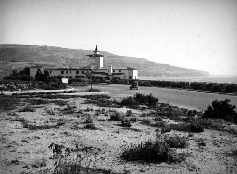 |
|
| (1930s)^ – View looking south showing the Hollywood Riviera Beach Club with the Palos Verdes Peninsula seen in the distance. Photo by Herman Schultheis |
Historical Notes Not long after Pearl Harbor, the military installed anti-aircraft guns in the hills by Torrance beach. The pounding of the ensuing target practice structurally damaged the club, which closed in 1942. It reopened after the war after Reid sold it, and its new owners made it a public club open to all. It had a successful run during the 1950s, though its image became decidedly less elegant and took on more of the atmosphere of a roadhouse than a swanky club. Since the club straddled the city limit between Torrance and Redondo Beach, the story has been told that imbibers would have to cross from one side of the tavern to the other to stay in compliance with each city’s liquor laws.* |
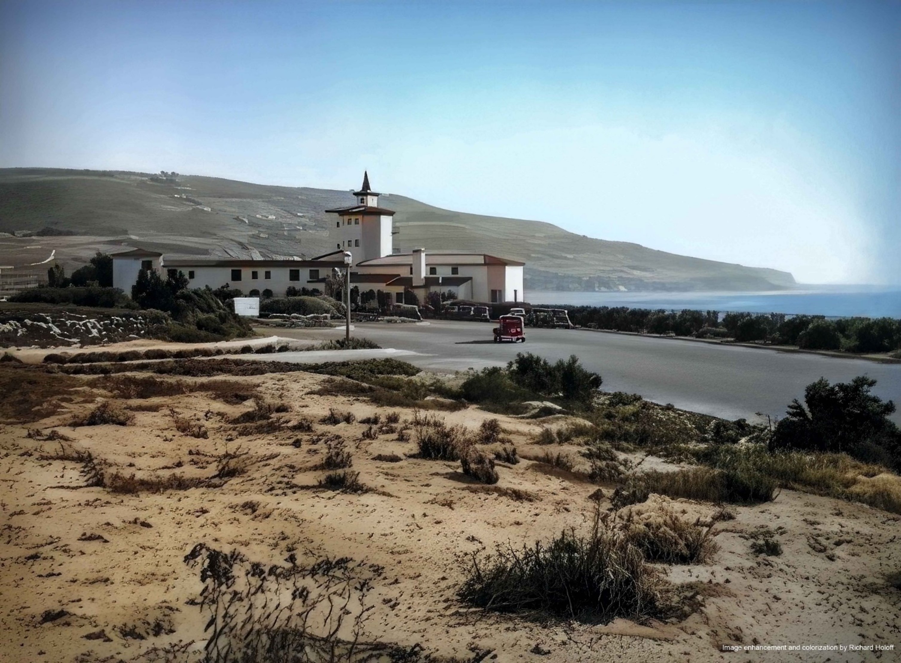 |
|
| (1930s)^ – View looking south showing the Hollywood Riviera Beach Club with the Palos Verdes Peninsula seen in the distance. Photo by Herman Schultheis; Image enhancement and colorization by Richard Holoff. |
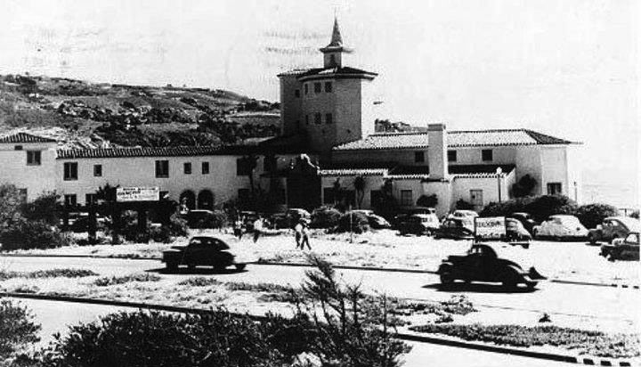 |
|
| (1940s)^ – Postcard view looking at the Hollywood Riviera Beach Club with Palos Verdes in the background. Writing on the postcard bottom (not seen) reads: “Riviera Beach Club, one of California’s most beautiful seaside resorts – REDONDO BEACH, CALIFORNIA” |
Historical Notes On the night September 25, 1958 a spectacular fire consumed the seaside resort. The club was a total loss. For years afterward, plans were made to re-develop the site. Even before the fire, Torrance and Redondo were trying to formulate plans to buy the club and convert it into a teen recreation center, but they had been unable to sort out the site’s tangled ownership situation. As early as 1964, the Sovereign Development Co. had proposed a plan to build a 16-story apartment complex on the site. That proposal was defeated in Aug. 1964, but similar attempts and proposals would be made throughout the rest of the 1960s, all of them opposed by Hollywood Riviera residents. In 1972 a Superior Court ruled that the property had been “dedicated by implication” to the public, and the property’s then-owner, Oscar Berk, could not build upon the property that he had purchased for $600,000. That ruling eventually led to the development of Miramar Park on the site. The small, beautiful park was dedicated by the City of Torrance on January 11, 1984. Surfers still refer to the section of Torrance beach below where the Hollywood Riviera Beach Club once stood as “Burnout Beach.” * |
* * * * * |
Palos Verdes Peninsula
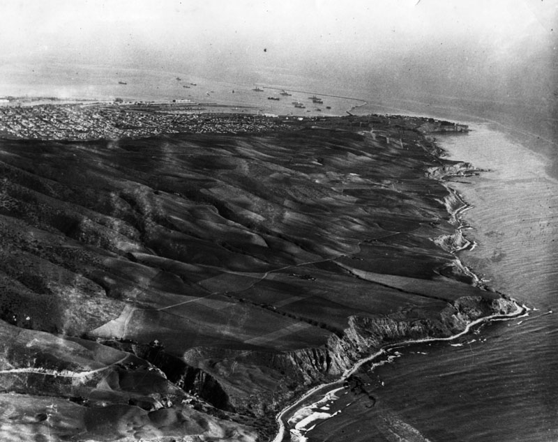 |
|
| (1924)^ - Aerial view of the Palos Verdes Peninsula, looking southeast towards Point Fermin. San Pedro Harbor can be seen in the background. |
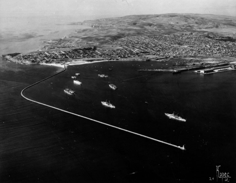 |
|
| (ca. 1924)^ - Aerial view of Point Fermin, Palos Verdes and hills, government breakwaters and the outer harbor. Ships can be seen in the harbor. |
* * * * * |
San Pedro Harbor (LA Harbor)
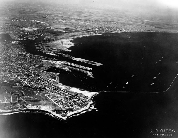 |
|
| (1929)^ - Aerial view of San Pedro, the LA Harbor, and the coastline. |
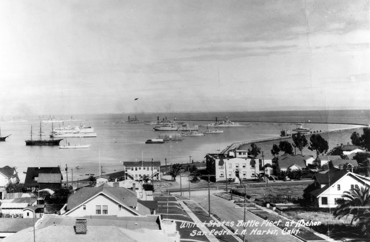 |
|
| (1926)^ - Panoramic photo of San Pedro Harbor in 1926. The United States Battle Fleet is anchored in the harbor. |
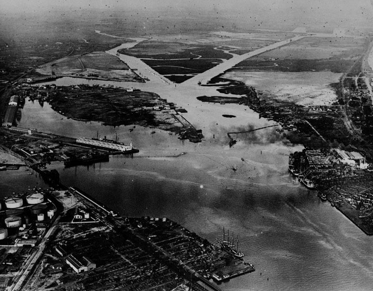 |
|
| (1921)^ - Aerial view of San Pedro Harbor in 1921. The port continued to expand and would become the busiest seaport on the west coast. |
Historical Notes During the 1920s, the Los Angeles Port passed San Francisco as the west coast's busiest seaport. In the early 1930s a massive expansion of the port was taken with the construction of a massive breakwater three miles out that was over 2 miles in length. In addition to the construction of this outer breakwater an inner breakwater was built off of Terminal Island with docks for sea going ships and smaller docks built at Long Beach.*^ |
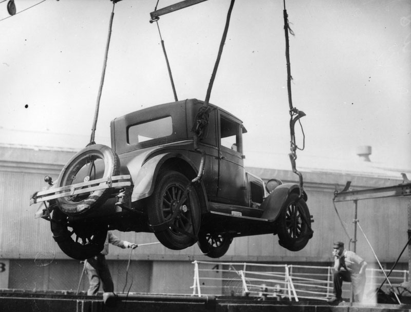 |
|
| (ca. 1920)^*^* - An early model auto is being loaded onto a ship in the San Pedro Harbor. |
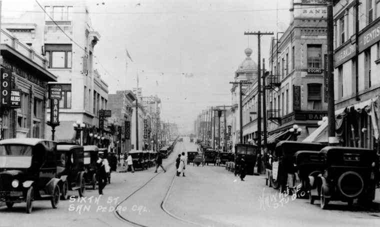 |
|
| (ca. 1920)^ - Scenic view of 6th Street in San Pedro. This street is a busy area with many retail stores on both sides of the street. There are two banks, two pool halls, a cafe, shoe store, drug store, a dentist, and even rooms for rent. Automobiles can be seen parked up and down the street. |
Click HERE to see more in Early Views of San Pedro and Wilmington |
* * * * * |
Long Beach
 |
|
| (ca. 1924)^^ – View looking south on American Avenue (later Long Beach Boulevard) in Long Beach. To the right, traffic seems to be backed-up while a bus in the distance makes a turn in front of a nearby highrise building. At left, the road appears to be relatively free, one lane of traffic moving by the parked cars at left and the streetcar tracks at center. A number of commerical buildings with canopy-shaded windows can be seen to either side, lining the blocks. |
Historical Notes The City of Long Beach was officially incorporated in 1897. The town grew as a seaside resort with light agricultural uses. Gradually the oil industry, Navy shipyard and facilities and port became the mainstays of the city. In the 1950s it was referred to as "Iowa by the sea", due to a large influx of people from that and other Midwestern states. Huge picnics for migrants from each state were a popular annual event in Long Beach until the 1960s.* |
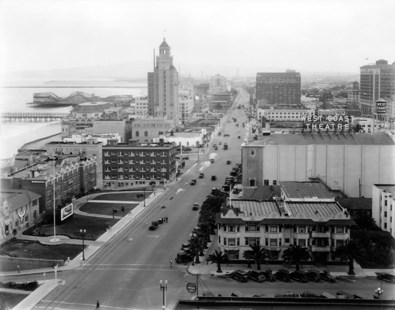 |
|
| (ca. 1920s)^ - Ocean Boulevard winds its way north following the shore in this aerial view of Long Beach. It passes the Municipal Auditorium at the end of Pine Avenue by the pier and The Pike amusement park just north of the auditorium. The roller coaster at the amusement park is on a pier that juts out into the ocean. |
Historical Notes The tall building topped by a cupola on the beach side of Ocean Boulevard is the Breakers Hotel. In front of and between the auditorium and the Breakers is the Capitol Theatre. The sign for the West Coast Theatre at 333 East Ocean Boulevard is visible on the facade of the large building, right. A sign for the theater is also on the water tower at the back. Several cars are parked at the front of the theater. The Robinson Hotel Apartments with its circular driveway is opposite the West Coast Theatre.^ |
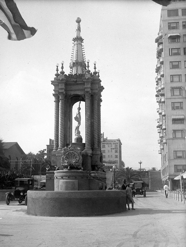 |
|
| (1926)* - The Victory Fountain was a new addition to the north end of the Pike at Chestnut Place in September 1926 in remembrance of World War I veterans. |
Historical Notes Designed by Edwardes Sproat, the Victory Fountain stood 45-ft. high and was equipped with electric lights that flashed in time to the water’s spray. At the top was a mirrored ball that reflected the lights at night. |
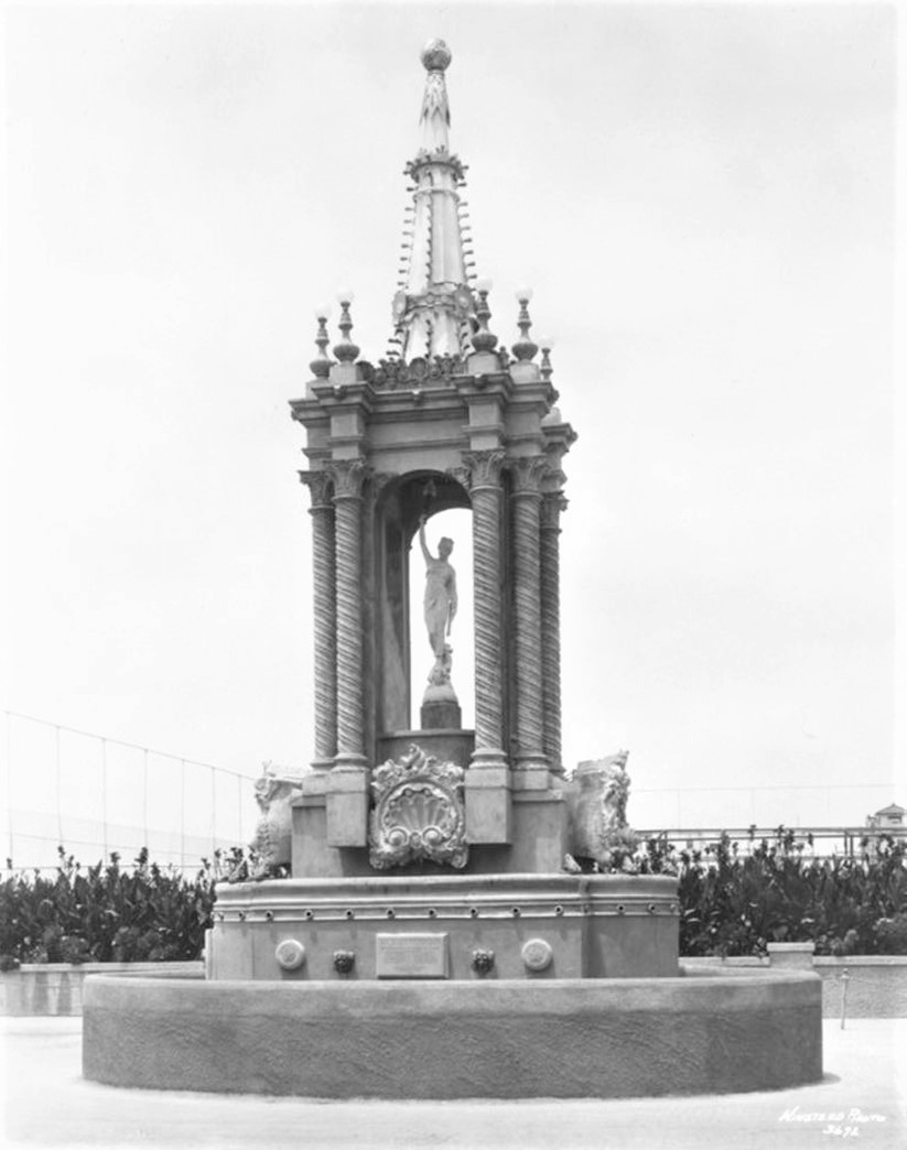 |
|
| (1926)* - Close-up view showing the Victory Fountain, located at the intersection of Chestnut Place near the "Walk of a Thousand Lights" attraction at The Pike in Long Beach. |
Historical Notes Designed by Edwardes Sproat and built by cement contractor S. W. Black, the fountain was dedicated to the American Legion in memory of those who fought in World War I. Financed by homeowners from West Long Beach, the 45 foot high memorial includes flasher lights of many colors and various sprays and cascades for water. A basement directly beneath the fountain included a 600 gallon storage tank and pumps. |
 |
|
| (ca. 1920s)^ - The Pike and Pleasure Pier, center, jut out into the ocean from the shore. The ornate bathhouse with its portico sits in the midway. Advertisements for the various attractions at The Pike are on the side of the pier underneath the roller coaster. Portions of the Virginia Hotel and its tennis courts are just beyond The Pike and breakwaters and ocean vessels are on the horizon. |
Historical Notes The Pike was the most famous beachside amusement zone on the West Coast from 1902 until 1969; it offered bathers food, games and rides, such at the Sky Wheel dual Ferris wheel and Cyclone Racer roller coaster. |
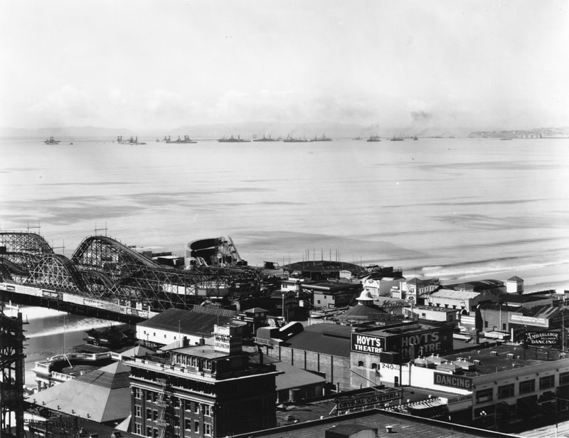 |
|
| (ca. 1920)^ - A view of The Pike amusement park in Long Beach. The roller coaster extends down the pier; underneath it is the Long Beach bath house. The Hotel Arlington is bottom, left. Next to the hotel is the Crystal Cafeteria and next to the cafeteria is the Ambassador ballroom dancing establishment. Hoyt's Theatre abuts the Ambassador. On the horizon are several naval or Coast Guard ships. |
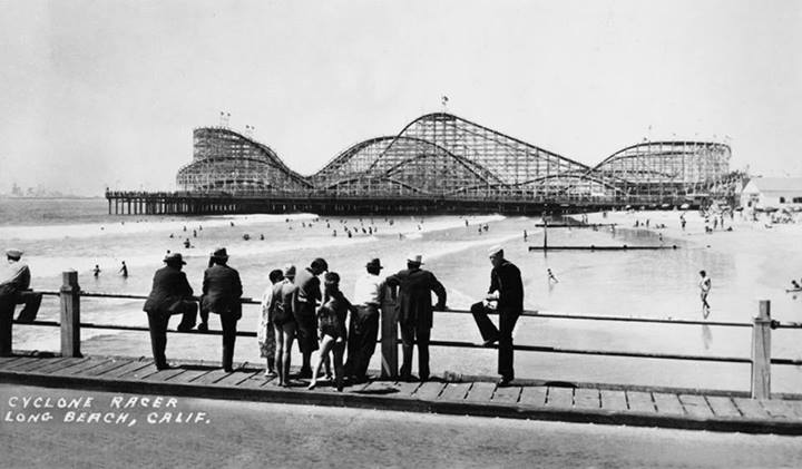 |
|
| (1930)^#^* - A group of people look across the beach toward the Cyclone Racer at the Pike Amusement Park. A lone sailor is looking in a different direction toward perhaps some different scenery. |
Historical Notes The Pike was most noted for the Cyclone Racer, a large wooden dual-track roller coaster, built out on pilings over the water. It was the largest and fastest coaster in the U.S. at the time. They called it 'racer' because there were two trains on two separate tracks that raced one another from start to finish.^ |
Click HERE to see more in Early Views of Southern California Amusement Parks |
* * * * * |
Downtown Los Angeles
 |
|
| (ca. 1918)^#*^ - View showing a service vehicle for the State Leather Co. at 414 S. Los Angeles Street. |
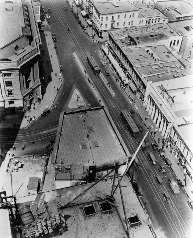 |
|
| (ca. 1920)^ - Aerial view looking north of the intersection of Main, Spring and Temple Streets, with Commercial Street in the upper right. Main extends from top to bottom of the photograph. In the center is the Temple Block. |
Historical Notes The U. S. Post Office is seen on the left. The Ducommun Building is on the northeast corner of Main and Commercial Streets. In the extreme upper right is the first of many buildings erected by Isaias W. Hellman, on the northwest corner of Los Angeles and Commercial Streets. On the southeast corner of Main and Commercial, being renovated, is the Hellman Building.^ |
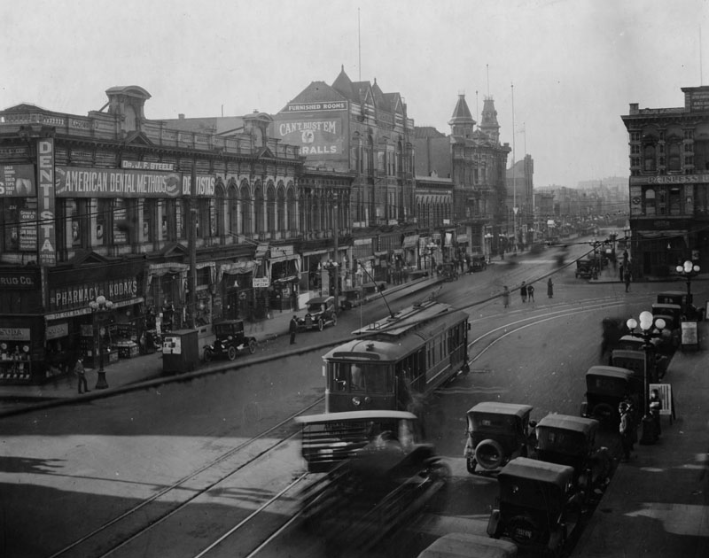 |
|
| (ca. 1920)^ - View looking south on Main Street. At left is the southeast corner of commercial Main Street; street car tracks bend at right, to Temple Street. The building at left is the former home of the Farmers and Merchants Bank. At upper-right can be seen one of LA's most historic blocks, Temple Block. This would become the location of today's City Hall. |
Historical Notes The Farmers and Merchants Bank was the oldest bank in Southern California from 1871 until 1956 when it was merged into the Security First National Bank of Los Angeles. Later, the Security First National Bank of Los Angeles became the Security Pacific National Bank and is now Bank of America. |
* * * * * |
Early LA Streetcars - Interior Views
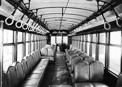 |
|
| (1920s)* - Interior view of an empty Los Angeles Railway (LARy) street car. Signs read: "Exit at Front" |
Historical Notes Early Los Angeles streetcars, including the Los Angeles Railway "Yellow Cars" and Pacific Electric "Red Cars," featured distinctive interior layouts that prioritized efficiency and passenger capacity. The Yellow Cars, which operated from 1895 to 1963, typically had forward-facing double seats arranged in rows on both sides of a central aisle, with hand grips on seat backs for standing passengers. The Red Cars, running from 1901 to 1961, offered a mix of forward-facing and side-facing bench seats, also with double seats along the center aisle in many models. Both systems shared common elements such as large windows for natural light, wooden or rattan-covered seats, overhead hand grips, and advertising displays above the windows. As streetcar technology evolved, newer models incorporated improved lighting, ventilation, and seating arrangements to enhance passenger comfort. These early streetcar interiors were designed to accommodate the growing transportation needs of Los Angeles during the first half of the 20th century, balancing practicality with the comfort of riders. |
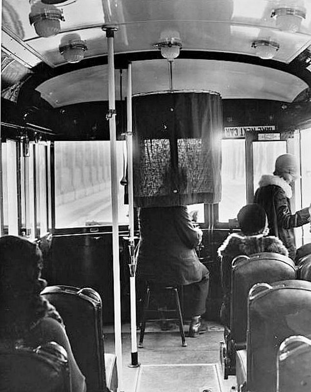 |
|
| (1920s)* - Interior view of a LARy streetcar showing the driver sitting on a stool with a partial curtain separating him from the passengers. |
Historical Notes The Los Angeles Railway (also Yellow Cars, LARy, latterly Los Angeles Transit Lines) was a system of streetcars that operated in central Los Angeles and the immediate surrounding neighborhoods between 1901 and 1963. The company carried many more passengers than the Pacific Electric Railway's 'Red Cars' which served a larger area of Los Angeles. The system was purchased by railroad and real estate tycoon Henry E. Huntington in 1898 and started operation in 1901. At its height, the system contained over 20 streetcar lines and 1,250 trolleys, most running through the core of Los Angeles and serving such nearby neighborhoods as Echo Park, Westlake, Hancock Park, Exposition Park, West Adams, the Crenshaw district, Vernon, Boyle Heights and Lincoln Heights |
 |
|
| (1920)* - Inside view of a Pacific Electric streetcar showing passengers and conductor. |
* * * * * |
Mercantile Place
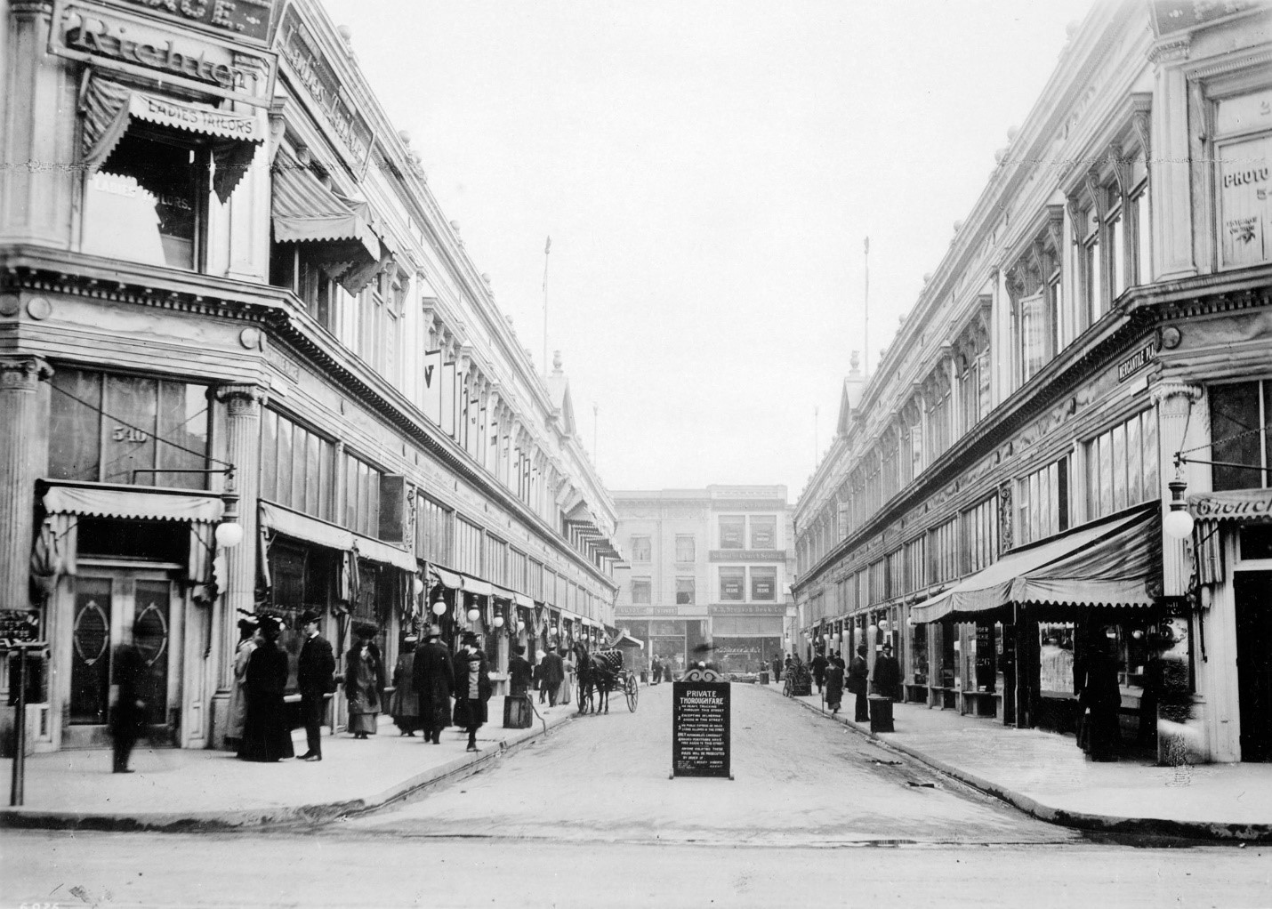 |
|
| (1907)* - A private, open-air shopping street, Mercantile Place stretched 325 feet between Spring and Broadway in downtown Los Angeles. Sign reads "Private Thoroughfare".. |
Historical Notes Long before the Grove, Third Street, or Universal CityWalk, Angelenos flocked to another open-air shopping promenade: Mercantile Place. This tiny, private street, which stretched between Spring and Broadway from 1904 to 1923, measured just 22 feet wide and was flanked by identical, two-story brick buildings, creating an intimate contrast to bustling downtown Los Angeles. Though it resembled a public street with its concrete sidewalks and paved road, Mercantile Place cut through privately owned land leased by developer C. Wesley Roberts in 1904. Roberts ingeniously solved the problem of how to make the central parcel useful—by cutting a street through it, he more than doubled the available storefront frontage from 240 to nearly 600 feet. |
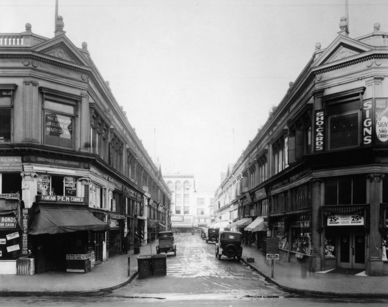 |
|
| (ca. 1920)^ - Mercantile Place, looking west from Spring Street, south of 5th Street. This was the site of Los Angeles' 1st elementary school, Spring Street Elementary School. |
Historical Notes Mercantile Place was planned to be "something entirely new in Los Angeles development"—a private shopping street under the aegis of C. Westley Roberts, who secured a ten-year lease from the Los Angeles School Board and bought the material of the old brick school building, which was to be demolished. |
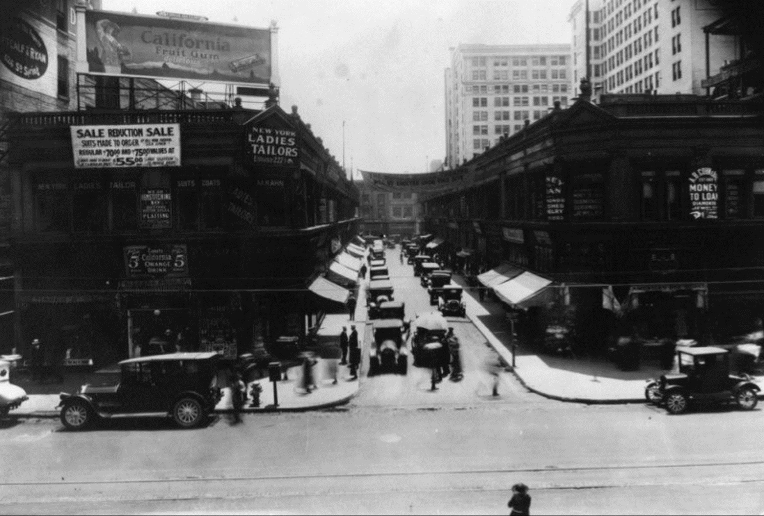 |
|
| (1920s)* – View looking east on Mercantile Place from Broadway. Various signs for stores and good are visible, among them "New York ladies tailors" store, and a billboard atop a building for "Adams California fruit gum. On the right hand side, is a sign for "A.B. Cohn, Money to Loan", established 1869. |
Historical Notes This walkway between two sets of buildings was razed in 1923, and the Mercantile Arcade Building was built in its place. The Arcade Building has entrances from Spring Street and from Broadway, and retains the feel of a passageway. |
Then and Now
 |
|
| (1910 vs 2020s)* - Mercantile Place, today the Mercantile Arcade Building. |
Broadway and Mercantile Place / Broadway and 6th
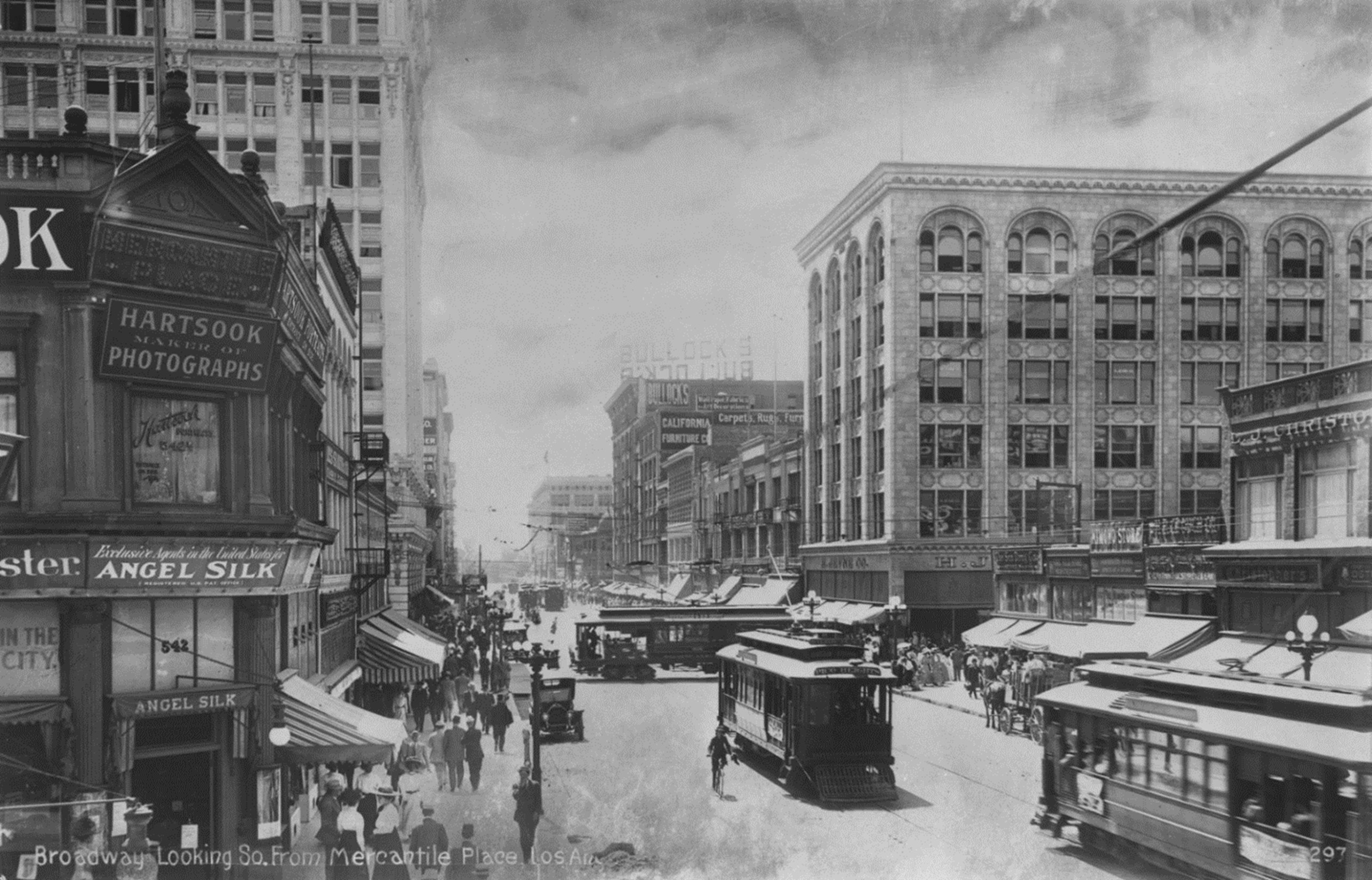 |
|
| (ca. 1910)* - Broadway Street, looking south toward 6th Street from Mercantile Place, showcasing busy sidewalks filled with pedestrians, streetcars, automobiles, and a horse-drawn wagon. In the distance, Bullock’s and the H.J. Jevne Building are visible, with various stores and shops including Hartsook and Angel Silk on the left and Christopher’s on the right. |
Historical Notes The area around Broadway and 6th Street was a bustling commercial district in the 1910s, with many retail stores, theaters, and other businesses. |
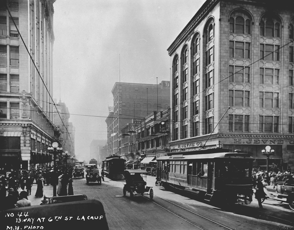 |
|
| (1915)* – Looking south on Broadway at 6th Street, with the H. Jevne Co. building on the southwest corner and Bullock's buildings further down the center. Streetcars and automobiles fill the street, while pedestrians walk along the sidewalk. |
Historical Notes H. Jevne & Company, founded by Hans Jevne in 1882, was a prominent grocer in early Los Angeles. In 1906-1907, the company constructed its flagship store at the southwest corner of 6th Street and Broadway, a building that still stands today next to the Los Angeles Theatre. This store, occupying all six floors of the building, was widely regarded as one of the finest grocery stores in the country, with some even calling it "the finest retail grocery store in the world" due to its equipment and high-end clientele. The store offered a wide selection of groceries, including imported delicacies and products from Jevne's native Norway, as well as liquors and cigars. It represented the pinnacle of H. Jevne & Co.'s success after decades of growth in Los Angeles and was a prominent fixture in downtown Los Angeles during the early 20th century. The store opened at this location in 1907 and operated until 1920, when H. Jevne & Co. closed the retail store to focus on its wholesale business. Today, the H. Jevne & Co. Building remains an important part of Los Angeles' architectural heritage. |
Hill and 5th Streets
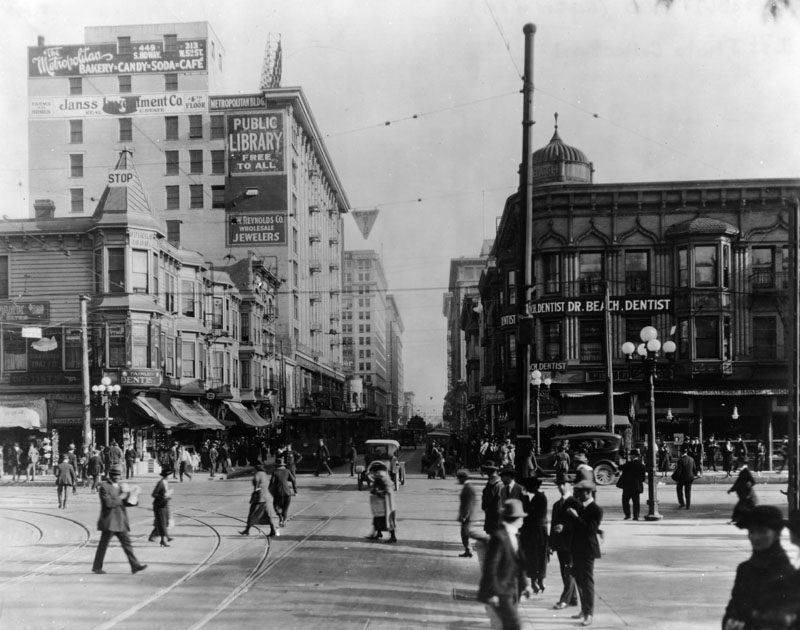 |
|
| (1920)^ - Looking east on 5th and Hill street. Several buildings such as the Spinks, Metropolitan and Bath Building can be seen. As well as several storefronts like Dr. Beach, Dentist. Many automobiles, pedestrians and street cars can be seen throughout the photo. Sign on building reads: "PUBLIC LIBRARY FREE TO ALL". |
Historical Notes Click HERE to see more Early Views of Hill and 5th Streets. |
Hill and 4th Streets
 |
|
| (ca. 1920)^ - A view east down busy 4th St. and its intersection at Hill in downtown Los Angeles. A crowd of pedestrians and autos wait to cross Hill. United Cigars, left, is below the fanciful Brighton Hotel. Center is the Grant Building with the Broadway Department Store opposite. The Teague Drug Co., opposite United Cigars, is below the Hotel Sherman. Other businesses include clothing stores, cafeterias, and dentists. |
Historical Notes Click HERE to see more Early Views of Hill and 4th Streets. |
Los Angeles County Courthouse
 |
|
| (1920)^ - View of the Los Angeles County Courthouse looking across Broadway from between buildings, an area being used as a parking lot. |
Historical Notes The building on the right is the 'New' Hotel Broadway and on the left is the Broadway Christian Church. The 'New' Hotel Broadway survived many, many years, the 'New' becoming ever more ironic. The church is about to be replaced by the Owl Drug Company which would, in its turn, survive until the CRA bulldozers and the coming of the Hollywood Parkway. The 1888 County Courthouse would be doomed in the Long Beach earthquake of 1933. |
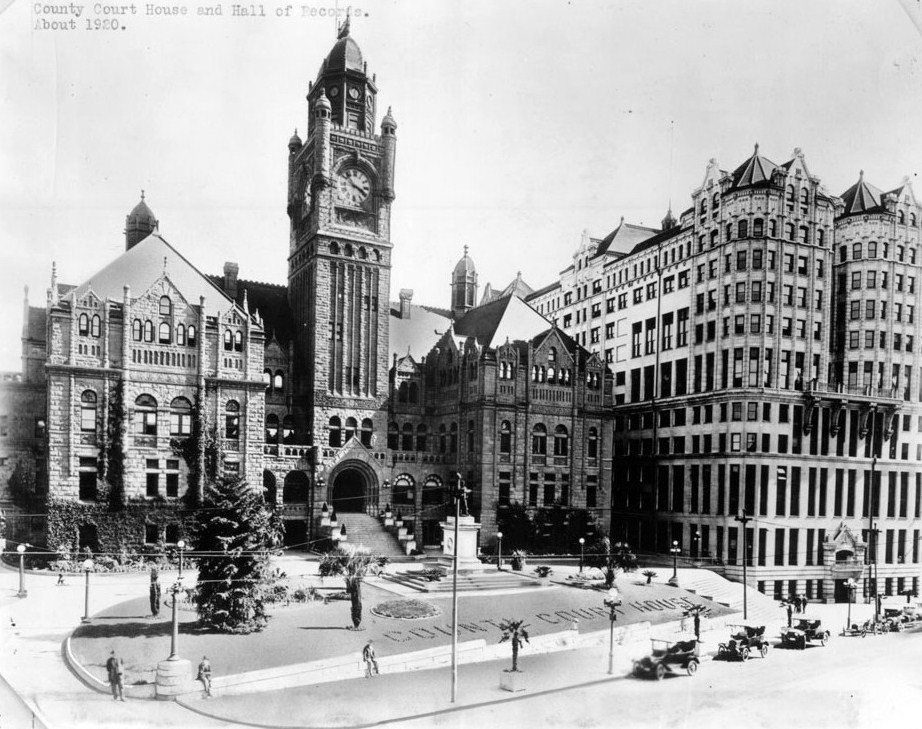 |
|
| (ca. 1920)^^ - View of the Los Angeles County Courthouse and Hall of Records. |
Historical Notes The LA County Courthouse was built in 1888-1891 at the old site of Los Angeles High School. The building was demolished in 1933. The Hall of Records was built in 1906 and demolished in 1973. |
* * * * * |
Los Angeles Early 1920s Video
 |
|
| (1920s)* - Click HERE to see a rare film of Los Angeles from the early 1920s, including scenes showing Downtown traffic, Pershing Square, Angels Flight, Hill Street Tunnels, LA Aqueduct, and LA/Belmont Oil Field. |
* * * * * |
Hill Street Tunnel
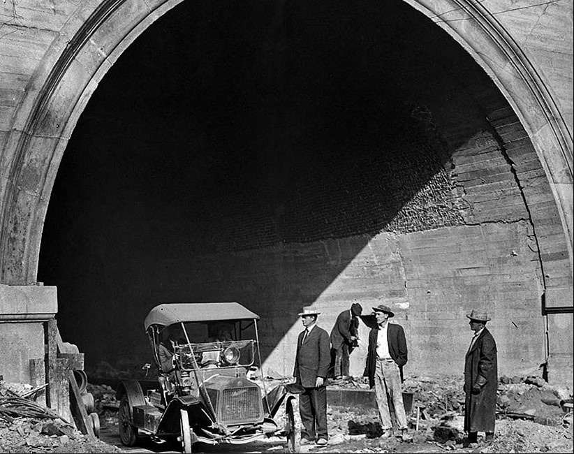 |
|
| (1913)* - Contractors drive a car out of the Hill Street tunnel at 1st Street, a few minutes after a steam shovel had removed the last foot of dirt. LA Times Photo – March 23, 1913 |
Historical Notes This tunnel was the second of twin bores through the northeastern section of Bunker Hill. The hill was also referred to as Court Hill. The tunnel connected Temple St. with 1st Street. |
 |
|
| (ca. 1920)^ - Looking south at Temple to the Hill Street Tunnel. It connects Hill Street from First to Temple. The right tunnel is for streetcar traffic (notice the tracks) and the left for automotive. A group of pedestrians in the median are peering into the tunnel. On the left at the bottom of the hill is a city garage with a poster urging "Vote Yes, Fire & Police pay increase!". |
Historical Notes The first of the two Hill Street Tunnels was bored through a part of Bunker Hill in 1909 by Los Angeles Pacific (a predecessor of Pacific Electric). It connects Hill Street from First to Temple. In 1913, the second tunnel (on the left) was bored for streetcar traffic. |
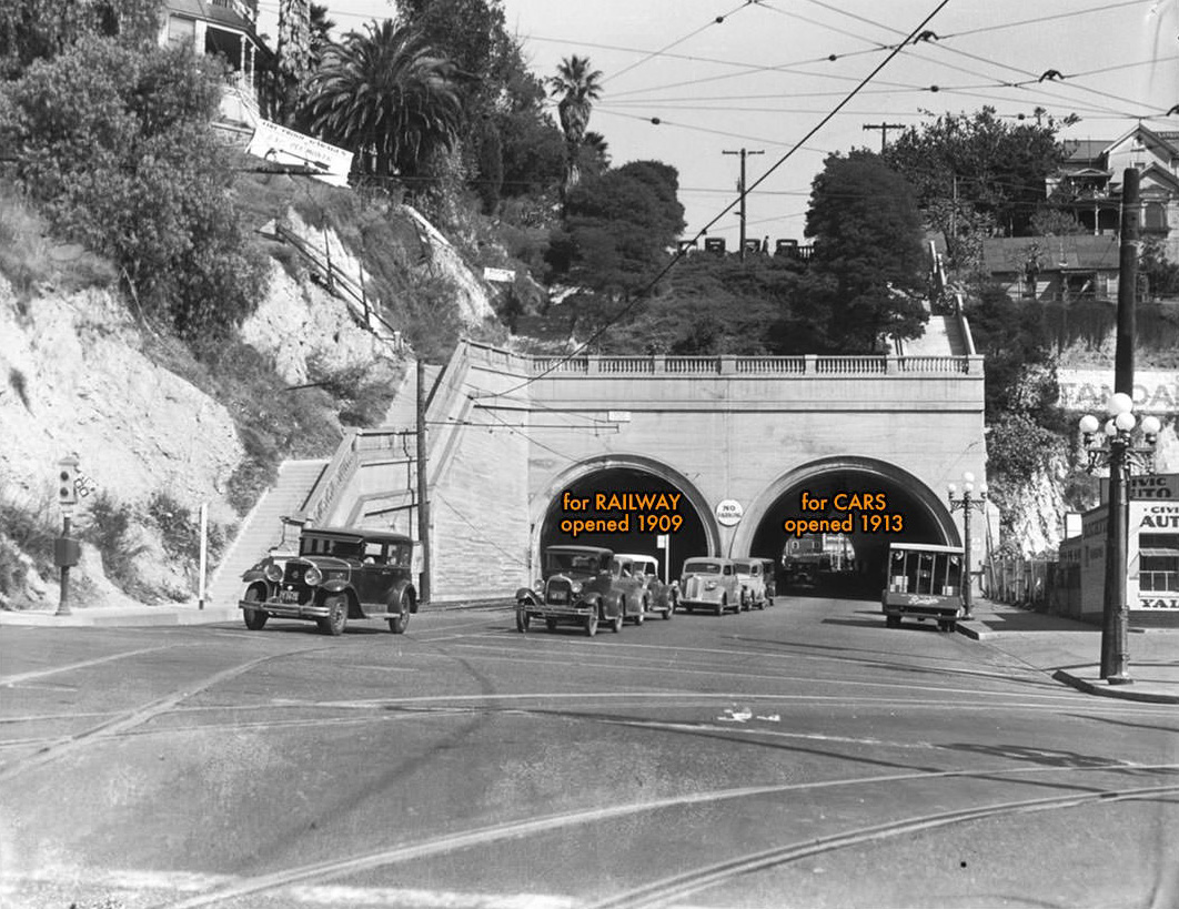 |
|
| (ca. 1923)* - View from the other side of the tunnel (south portal), at Hill Street and 1st looking north.^ |
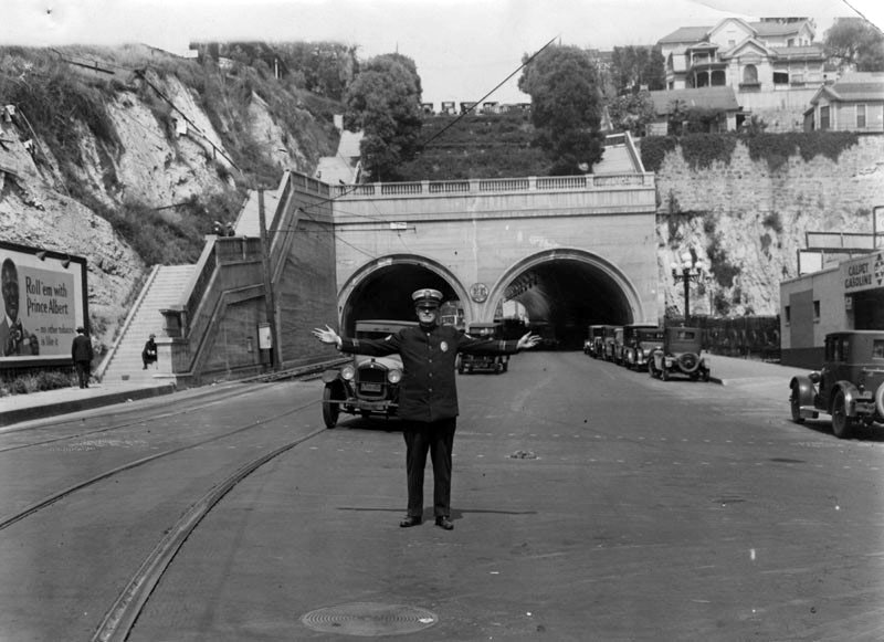 |
|
| (1928)* - Sergeant E.R. Gouldin directs traffic at the south portal of the Hill Street Tunnels at 1st Street. |
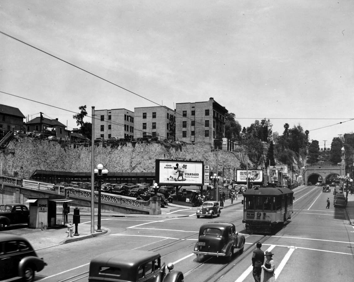 |
|
| (1930s)* – View looking north from the intersection of 2nd & Hill streets showing the Hill Street Tunnels in the distance. Photo Dick Whittington. |
|
|
| (ca. 1924)* - Map of Bunker Hill showing the Hill Street Tunnels between Temple and 1st Streets with Court Flight seen at lower right. Map by Piet Shreuders. |
Historical Notes Click HERE to see more Early Views of the Court Flight. |
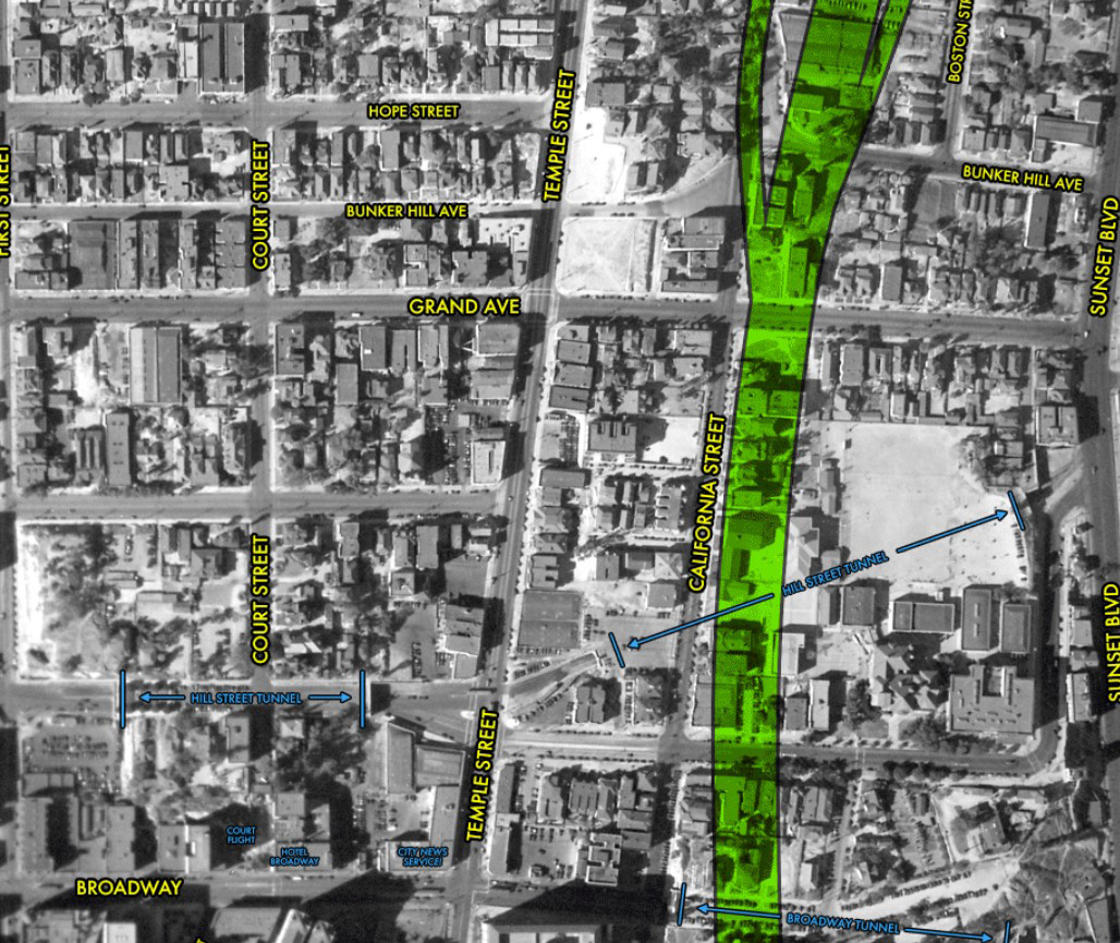 |
|
| (1933)* – Aerial view over Bunker Hill, Court Hill, and Fort Moore Hill, annotated to show the locations of both the Hill Street Tunnel and the Broadway Tunnel. The green shaded area is where the Hollywood Freeway would be constructed in the early 1950s. Photo Courtesy: Scott Charles |
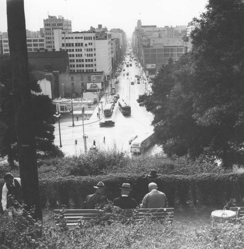 |
|
| (ca. 1940)* - Three elderly gentlemen socialize on a bench on top of the Hill Street Tunnel, looking south. The intersection seen below at street level is where 1st street (only partially visible) meets Hill Street. Cars and streetcars are seen traveling north and south. Photo by Ansel Adams |
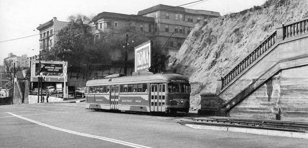 |
|
| (1949)* - View of a streetcar running inbound on the Hollywood Boulevard streetcar line, which runs through Court Hill in a tunnel. |
Historical Notes The Hill Street tunnels ran through a hill called Court Hill. Both Hill Street and Broadway had tunnels through Court Hill. In the photo above we're looking southwest towards First and Hill. First Street comes in behind the streetcar. At this point First Street is in a valley between Bunker Hill and Court Hill. The apartment houses in the center are on Bunker Hill. The hill at right is Court Hill. |
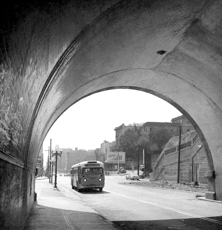 |
|
| (1953)* - The #11 Temple Street bus enters the Hill Street tunnel heading south.*^^ |
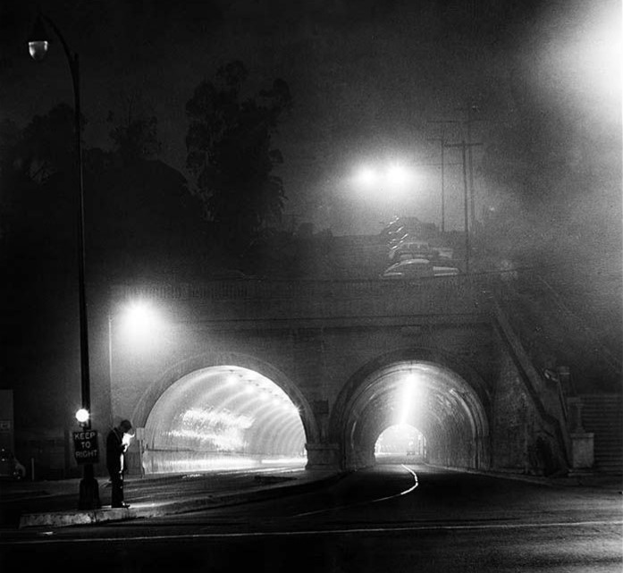 |
|
| (1954)* – Hill Street tunnels seen from Temple Street on a fogbound night. The tunnels connected Temple with 1st Street. Photo by the LA Times on Oct. 12, 1954 |
Historical Notes Within two months of the above photo, construction work to remove the tunnels and enlarge the Los Angeles Civic Center began. |
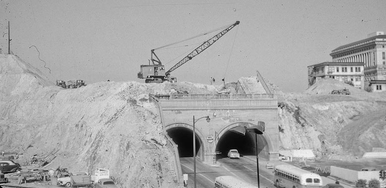 |
|
| (1954)* – Panoramic view showing the Hill Street Tunnels during early stages of demolition. Note that traffic is still flowing through the tunnels. |
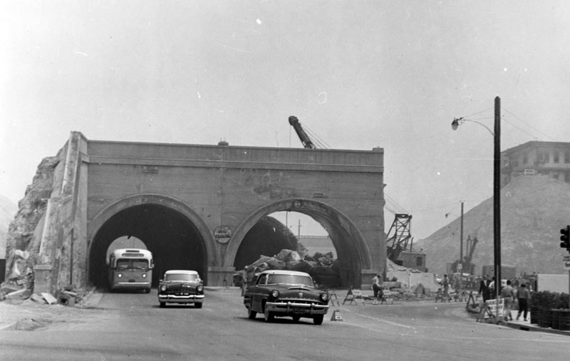 |
|
| (1955)^ - View of the side-by-side Hill Street tunnels, looking north from 1st Street. Two autos and a bus are exiting the left side tunnel, even though the entire surroundings have been demolished, in preparation for future buildings. |
Historical Notes The Hill Street tunnels and the hill above them were completely removed by June 1955 to make way for the current Los Angeles Civic Center. |
Then and Now
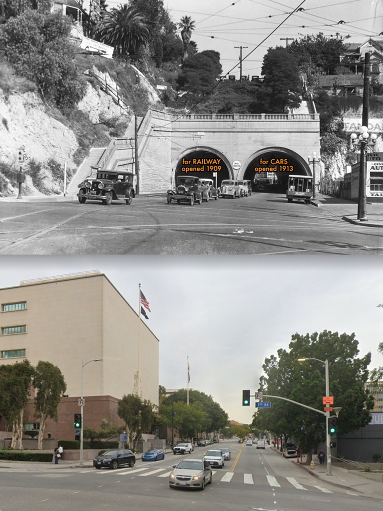 |
|
| (1923 vs 2023)* – Looking north on Hill Street at 1st Street, once the location of the Hill Street Tunnel. Note how much the hill has been shaved off. |
Historical Notes Click HERE to see the Construction and Opening of the First Hill Street Tunnel |
* * * * * |
From Agricultural Park to Exposition Park |
Long before the rose garden and the Coliseum, the 160 acres bounded by Figueroa Street and Exposition Boulevard served a very different Los Angeles. The Southern District Agricultural Society established Agricultural Park in 1872, setting aside the land as a fairground where the region's new farming class could exhibit livestock, produce, and farm equipment.The site made sense at the time. It sat just beyond the southwestern edge of the city, surrounded by open country, and was served by one of Los Angeles's first street railways, the Main Street and Agricultural Park Railroad, which began running horse-drawn cars to the park in 1875. Over the next four decades the park hosted agricultural fairs, thoroughbred horse races, camel and dog contests, some of the first bicycle competitions in Southern California, and eventually the earliest organized automobile speed runs in the region. By 1910 the racing era had ended. A new chapter was beginning, centered on museums, a rose garden, and civic ambition rather than betting windows and grandstand saloons. |
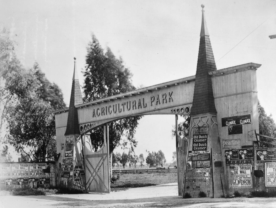 |
|
| (ca. 1910)* - The Wesley Avenue entrance to Agricultural Park, photographed shortly before the grounds were transformed into Exposition Park. The gate marked the boundary between the growing residential neighborhood and a place that had served Los Angeles as fairground, racetrack, and public gathering space for nearly four decades. |
Historical Notes The Southern District Agricultural Society purchased the 160-acre site in 1872 to promote commercial farming as the old rancho system gave way to American land ownership. Mortgage creditors foreclosed on the property in 1879, and the State of California acquired it in 1880. The City of Los Angeles annexed both Agricultural Park and the neighboring University of Southern California campus in June 1899, bringing them inside city limits for the first time. Civic advocates William M. Bowen and USC President George F. Bovard led the campaign that eventually transformed the grounds into a public cultural center, renamed Exposition Park in 1913. |
Fair Days |
Racing and gambling defined Agricultural Park's reputation, but they were never the whole story. The Southern District Agricultural Society founded the park to serve the region's farmers, and on fair days the grounds looked exactly as intended — families moving through livestock exhibits, tents pitched across the open fields, animals on display, and children exploring the grounds on foot and on bicycle. These quieter gatherings kept alive the park's original mission even as the racetrack and grandstand saloon drew the headlines and the reformers' complaints.The agricultural fairs attracted exhibitors from across Southern California who came to show prize livestock, seasonal produce, and horticultural specimens. For many visitors, particularly those who came with children, the fair was the park, a public space that belonged to the community in a way the racetrack and its gambling culture did not. It was this side of the park's identity that reformers pointed to when they argued the grounds could be reclaimed for a higher civic purpose. |
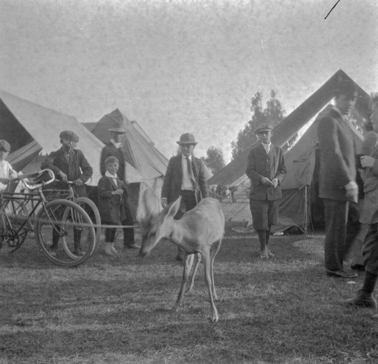 |
|
| (1900)* - Boys walk their bicycles through Agricultural Park while onlookers gather around a deer on a lead. Tents visible in the background suggest a fair or exhibition day. The image captures the park as the Southern District Agricultural Society originally envisioned it — a public fairground where families came to see animals, exhibits, and the open grounds. |
| Historical Notes
Agricultural Park served a dual identity throughout its history. On race days it was a gambling venue with a grandstand saloon and a packed hotel. On fair days it was a public fairground where families came to see livestock exhibits, horticultural displays, and novelties such as the deer shown here. The Southern District Agricultural Society had always intended the site to promote farming and agriculture in Southern California, and it was this original mission that reformers cited when they argued the grounds could be reclaimed for a higher civic purpose. |
The Racetrack |
The racetrack was the engine of Agricultural Park's daily life. Because the park sat outside city limits until 1899, gambling on races was beyond the reach of Los Angeles law enforcement, and operators took full advantage. The grandstand drew the crowds that made the park financially viable. A saloon operated underneath it, and a hotel in the park's interior catered to those who came for the races and not just an afternoon's entertainment. Horses dominated the early program, but the track also hosted dog races, camel races, and animal fights staged for gambling purposes, the last of which drew condemnation from anti-cruelty organizations. As the surrounding neighborhood developed and the University of Southern California opened across the street in 1880, pressure mounted on park operators. Officers who attended the meets could observe but had little authority over the gambling taking place. That changed when annexation brought the park inside city limits in 1899 — though the racing and betting continued for another decade before state law finally shut it down. |
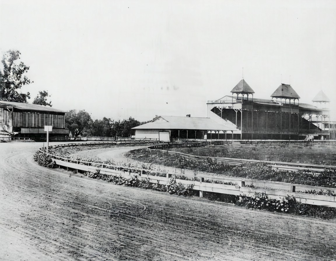 |
|
| (ca. 1900)* - A partial view of the Agricultural Park racetrack. The grandstand with its three open towers dominates the background; a smaller structure to the left may have served as a concession stand. This mile-long dirt oval hosted horse races, bicycle contests, and the first automobile speed runs in Southern California before being demolished around 1911. |
Historical Notes The grandstand shown here held a saloon on its lower level, one of the principal attractions for gamblers who came to the park for the races. The hotel that operated inside the park's grounds catered to racing enthusiasts who stayed overnight. Both structures were demolished after the state acquired the property in 1908 and reformers took control of the site. The grounds were eventually redesigned as part of the 1910 Exposition Park plan, which included the sunken garden to the north of the oval, designed by landscape architect Fred H. Howard. That garden became the Exposition Park Rose Garden, listed on the National Register of Historic Places in 1991. |
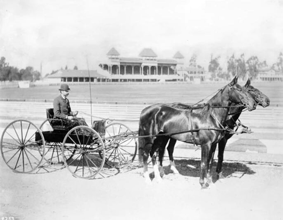 |
|
| (1895)* - Captain Pierce of the Los Angeles Police Department poses with his carriage and horse team during the Agricultural Park Horse Show. The grandstand and spectator seating are visible behind him. The park's location outside city limits at the time meant officers who attended had little authority to intervene. |
| Historical Notes
Horse shows at Agricultural Park ran alongside the race meets and drew a somewhat different crowd — one more interested in breeding stock and carriage horses than in wagering. The park's dual identity as both a legitimate fairground and a gambling venue made it a complicated target for reformers, who had to argue that the racing culture had overtaken the agricultural mission the site was founded to serve. Attorney William M. Bowen began his public campaign to annex and reform the park in 1898, one year after this photograph was taken. |
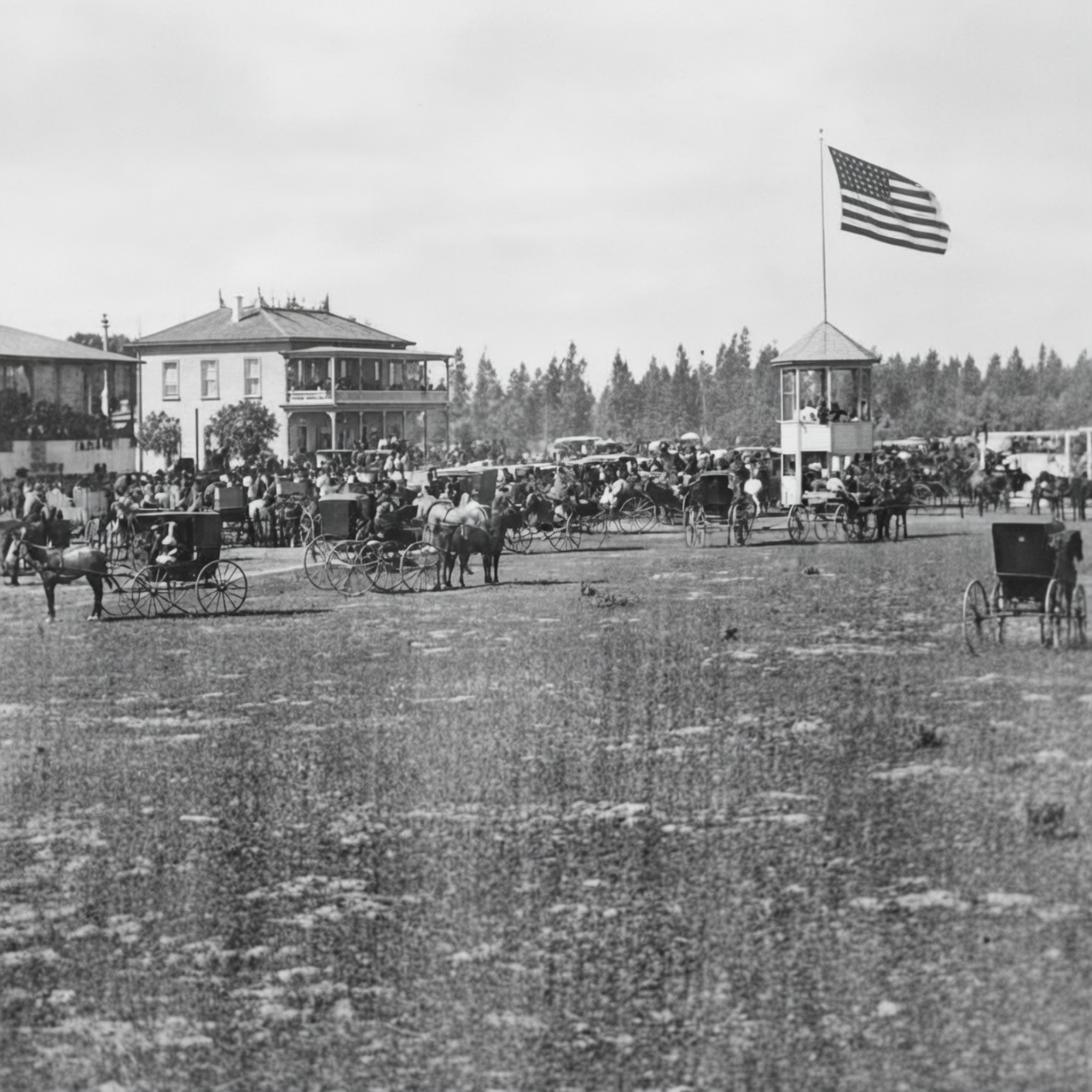 |
|
| (ca. 1895)* - Race day at Agricultural Park before 1900, with the Club House visible in the background. Crowds arrived on the Main Street and Agricultural Park Railroad, one of the city's first street railway lines, which ran horse-drawn cars directly to the park entrance. |
| Historical Notes
Race days at Agricultural Park drew spectators from across the city and beyond. In its early years the park offered horses, dogs, and camels on the oval, a combination that reflected the carnival atmosphere operators cultivated to maximize crowds and betting. California's Walker-Otis Law of 1909 banned racetrack gambling statewide, effectively ending horse racing at Agricultural Park and at venues across the state, including the original Santa Anita track in Arcadia, which closed the same year. |
The Bicycle Era |
By the late 1880s the bicycle had joined the horse as a fixture at Agricultural Park. Racing on two wheels had begun on the oval as early as 1883, using the same dirt track as the horse meets, but it was the arrival of the chain-driven safety bicycle in the late 1880s that turned cycling into a citywide movement. Organized clubs formed across Los Angeles, and the park's established grandstand and oval became their primary racing ground. The clubs were also central to the Good Roads movement, lobbying for paved streets at a time when most roads in the region were rutted dirt. The racers at Agricultural Park were in this sense making an argument about infrastructure as much as they were competing for prizes.The October 3, 1893 race meeting documented in several of the photographs below was among the most organized cycling events Southern California had yet seen. Teams arrived with uniforms, support men, and formal starting procedures. The 25-mile race drew entrants from the East Side Club, the Los Angeles Athletic Club, a squad from Riverside, and others. Prizes sometimes included pianos, a reflection of the sport's broad social appeal and the showmanship of the park's promoters. |
 |
|
| (1887)* - Members of the Los Angeles Bicycle Club at Agricultural Park, photographed by C.C. Pierce. This image predates the full cycling craze by several years, capturing a period when organized bicycle clubs were still a novelty in Southern California. Within a decade the park would host teams from across the region competing on its mile-long oval. |
| Historical Notes
The Los Angeles Bicycle Club was one of the earliest organized cycling groups in the city. The high-wheeled penny-farthing bicycles common in the early 1880s had given way by the late 1880s to the chain-driven safety bicycle, which was lower, more stable, and far more accessible to a general public. The change in technology drove a rapid expansion in both recreational cycling and competitive racing. By the early 1890s, Los Angeles had multiple active clubs competing at venues including Agricultural Park. |
.jpg) |
|
| (October 3, 1893)* - The mass start of the 25-mile bicycle race at Agricultural Park, photographed from the grandstand. Horse-drawn carriages parked on the inside of the track serve as a reminder that the oval still served the horse racing world on most days. |
Historical Notes The October 3, 1893 race meeting was one of the largest organized cycling events in Southern California to that point, drawing teams from across the region. The grandstand that regularly hosted horse racing crowds was filled for the occasion. Horse-drawn carriages visible inside the oval reflect the track's dual identity — still a horse racing venue on most days, but increasingly shared with the new sport of cycling throughout the 1890s. |
 |
|
| (October 3, 1893)* - Six members of the East Side Cycling Club at the start of the 25-mile race. From left, Fox, the mile champion, and Casey Castleman, third from left. A support man stands beside each cyclist, ready to steady the bicycle at the starting signal. |
| Historical Notes
The East Side Club was based in Boyle Heights and was among the most active cycling organizations in Los Angeles in the early 1890s. Club races at Agricultural Park were formal affairs, with each rider assigned a support man to hold the bicycle steady before the starting signal. The dark sash worn over the left shoulder identified East Side Club members on the starting line and in the grandstand crowd. |
 |
|
| (October 3, 1893)* - The Los Angeles Athletic Club Bicycle Team at the Agricultural Park race. Members include McAleer, the mayor's brother; Ray Faulkner of the city offices; Teddy Holbrook; and Will Jenkins. Their white uniforms with a dark diamond on the chest identify them as club competitors on the starting line. |
| Historical Notes
The Los Angeles Athletic Club, founded in 1880, was one of the city's most prominent civic organizations and fielded teams in multiple sports. The presence of the mayor's brother and a city department official among its bicycle team entrants reflects how thoroughly the cycling movement had penetrated middle- and upper-class Los Angeles life by the early 1890s. Athletic club racing at Agricultural Park carried a social dimension well beyond the sport itself. |
The Automobile Arrives |
The gasoline-powered automobile arrived at Agricultural Park in November 1903 with the force of a revelation. Barney Oldfield, already the most famous racing driver in America, staged a three-day event at the park featuring speed record attempts, match races, and exhibitions aboard a Winton Bullet. Dirt clods flew as much as forty feet in the wake of the machine, and the Los Angeles Times covered the spectacle with mock alarm, writing that Oldfield's attempt to commit suicide at Agricultural Park had resulted only in a compound fracture of the world's automobile record. He returned in December 1904 driving the Peerless Green Dragon and recorded a mile in 54 seconds on the same oval where horses had raced a generation before. The Automobile Club of Southern California, which organized the 1903 meet and kept a formal program with results recorded by hand in the margins, understood that racing was the most effective way to demonstrate the new technology to a skeptical public. Local competitors were drawn in as well, including oilman Frank Garbutt, who had watched harness races at the park since 1887 and arrived with a car he had designed and built himself. Spectators who watched a car cover a mile in under a minute went home converts. What began as exhibition and spectacle quickly evolved into organized competition, and by the end of the decade, full-scale endurance races were being held on the same oval. |
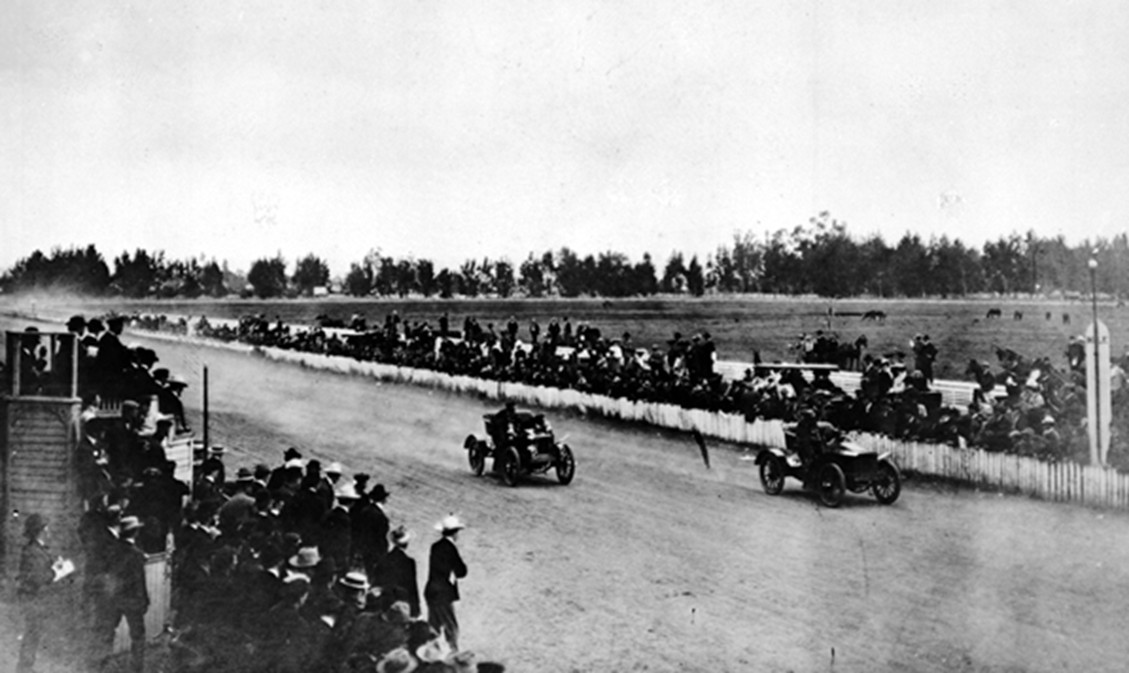 |
|
| (1903)* - A large crowd watches an automobile race at Agricultural Park, organized by the Automobile Club of Southern California. The club's original program from this meet survives with race results handwritten in the margins by a spectator keeping score, much like a baseball scorecard. |
| Historical Notes
Barney Oldfield had become the first person to drive a mile in one minute flat at the Indiana State Fairgrounds in June 1903. His November visit to Agricultural Park just months later brought that national celebrity to Los Angeles for the first time. On December 17, 1904, he set a track record of 54 seconds for the mile on the Agricultural Park oval, driving the eight-cylinder Peerless Green Dragon. The Automobile Club of Southern California, founded in 1900, was among the earliest automobile advocacy organizations in the country and used racing events at Agricultural Park to build public support for automobile-friendly road improvements throughout the region. |
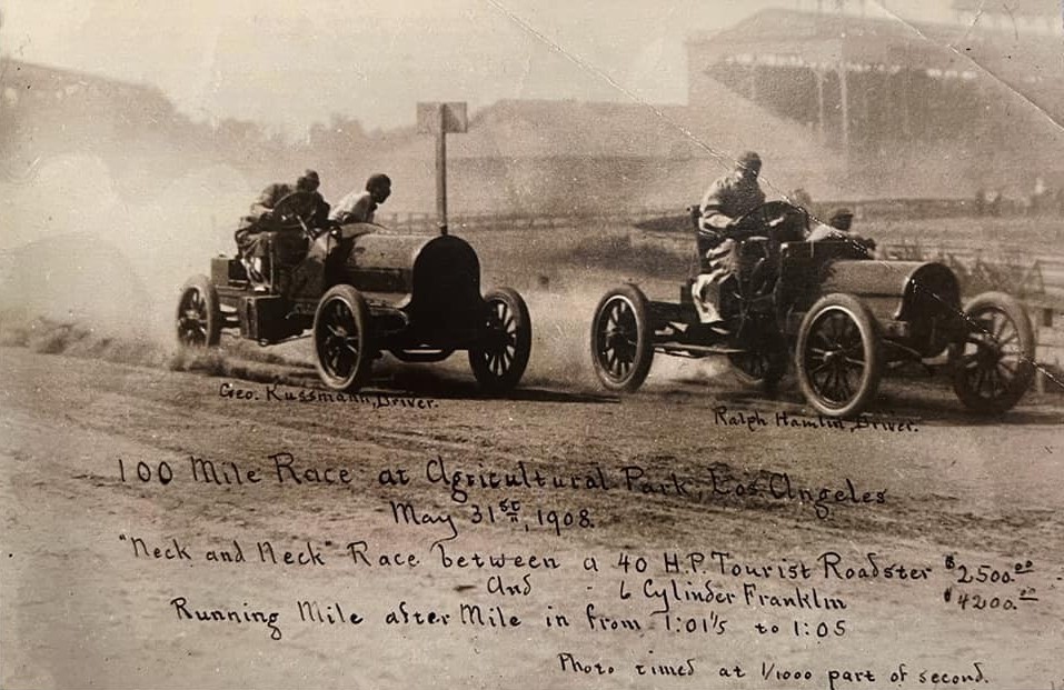 |
|
| (1908)* - Drivers compete in a 100 mile automobile race at Agricultural Park, capturing the transition from exhibition runs to organized competition. The image shows two early touring cars running neck and neck on the dusty oval, with the grandstand visible in the background. Photo from the Jim Miller Collection, courtesy of Gary Helsinger. |
Historical Notes By 1908 automobile racing at Agricultural Park had matured into organized competition, including endurance events such as the 100 mile race shown here. Drivers and machines were now tested not only for speed but for reliability over distance, reflecting the growing practical importance of the automobile. At the same time, the park itself was nearing the end of its racing era. The city had annexed the grounds in 1899 and outlawed gambling, but racing continued in diminished form. State acquisition in 1908 marked a turning point, and the following year California’s Walker Otis Law banned racetrack gambling statewide, removing the last economic incentive to maintain the track. The grandstand and related structures were soon demolished, clearing the way for the transformation into Exposition Park, formally dedicated on November 6, 1913. |
From Racetrack to Park |
California's 1909 ban on racetrack gambling removed the economic foundation on which the Agricultural Park oval had operated for three decades. A three-way agreement between the state, the county, and the city divided responsibility for the new grounds: the state would build an exposition building and an armory, the county would construct a museum of history, science, and art, and the city would maintain the grounds. Construction of the Natural History Museum began on December 17, 1910, and the park was formally renamed and dedicated as Exposition Park on November 6, 1913.The 1918 aerial photograph below shows the new park five years into its life as a public cultural center. The Natural History Museum, the Armory, and the Exposition Building frame the northern portion of the park, and between them the sunken garden, already laid out with its formal grid of walkways and circular center, occupies the ground directly north of the racetrack oval. The oval itself remained fully intact in 1918, its ellipse clearly visible in the center of the park. It was the Coliseum, breaking ground in December 1921 and opening in May 1923, that consumed the western and central portion of the oval, its elliptical bowl built within the old racetrack footprint. Where Barney Oldfield had once covered a mile in 54 seconds, 75,000 spectators would come to watch football — and in 1932, the Summer Olympic Games. |
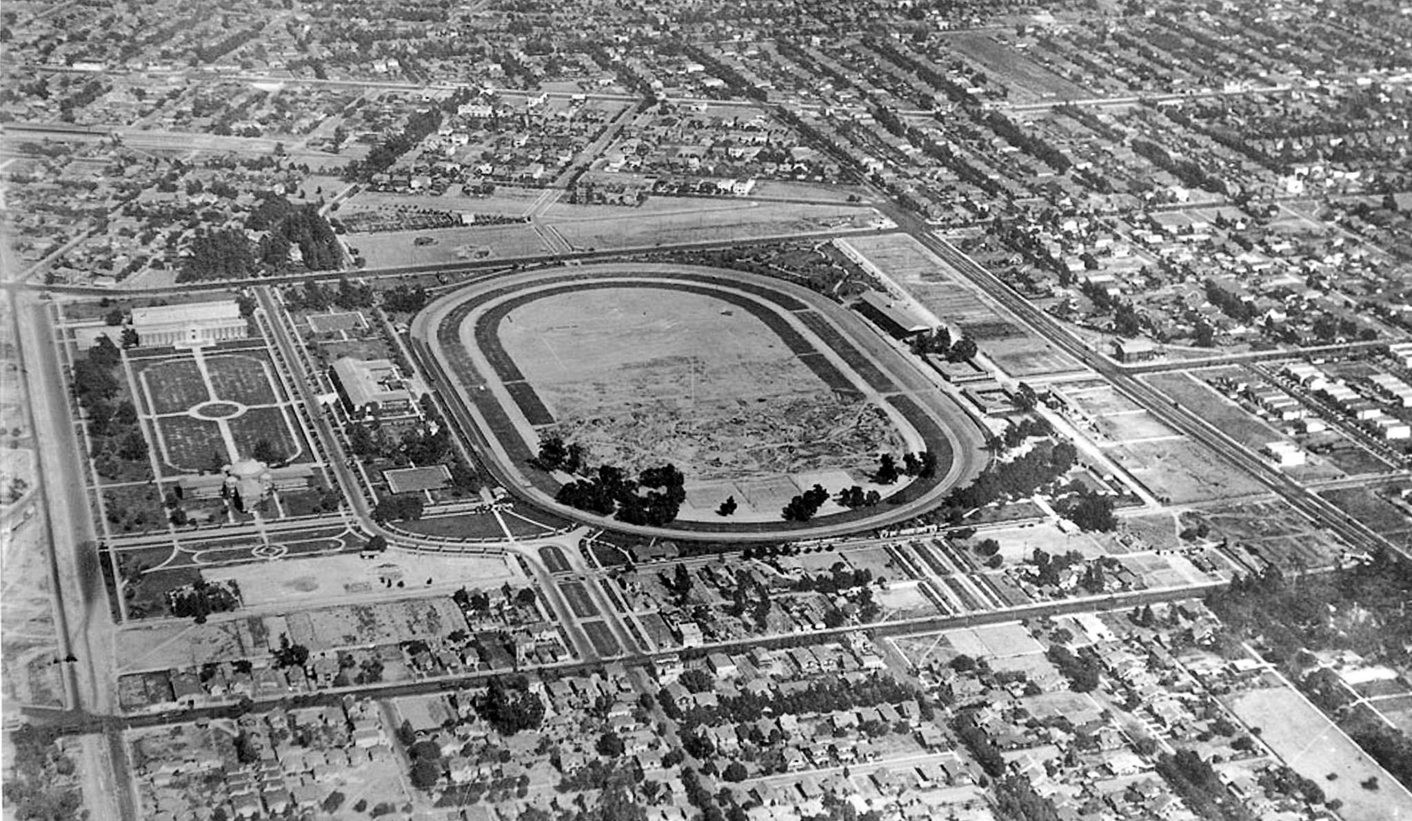 |
|
| (1918)* - An aerial view of Exposition Park five years after its formal dedication on November 6, 1913. The mile-long racetrack oval is clearly visible at center, still fully intact at the time of this photograph. To its north, framed on three sides by the Natural History Museum, the Armory, and the Exposition Building, the newly laid sunken garden is visible with its formal walkways and circular center. The Coliseum, built in 1923, was constructed within the western and central portion of the old racetrack footprint. The sunken garden to its north became the Rose Garden in 1928. |
| Historical Notes
The Natural History Museum building, designed by architects Frank Hudson and William Munsell in a blend of Spanish Renaissance, Romanesque, and Beaux Arts styles, was dedicated on November 6, 1913. The tripartite governance agreement between the state, Los Angeles County, and the City of Los Angeles established at that time still governs Exposition Park today. The Los Angeles Memorial Coliseum, completed in May 1923 and designed by architects John and Donald Parkinson, was built as a memorial to Los Angeles veterans of World War I and was constructed within the western and central portion of the old racetrack footprint. It was designated a National Historic Landmark in 1984 and has hosted the Summer Olympics in 1932 and 1984, with a third scheduled for 2028. The sunken garden, situated between the racetrack oval and the museum buildings to the north, was designed by landscape architect Fred H. Howard and laid out as part of the 1910 Exposition Park plan. Planted initially with grass and walkways, it was redesigned and rededicated as the Rose Garden in 1928. The full story continues in the next section. |
Then and Now
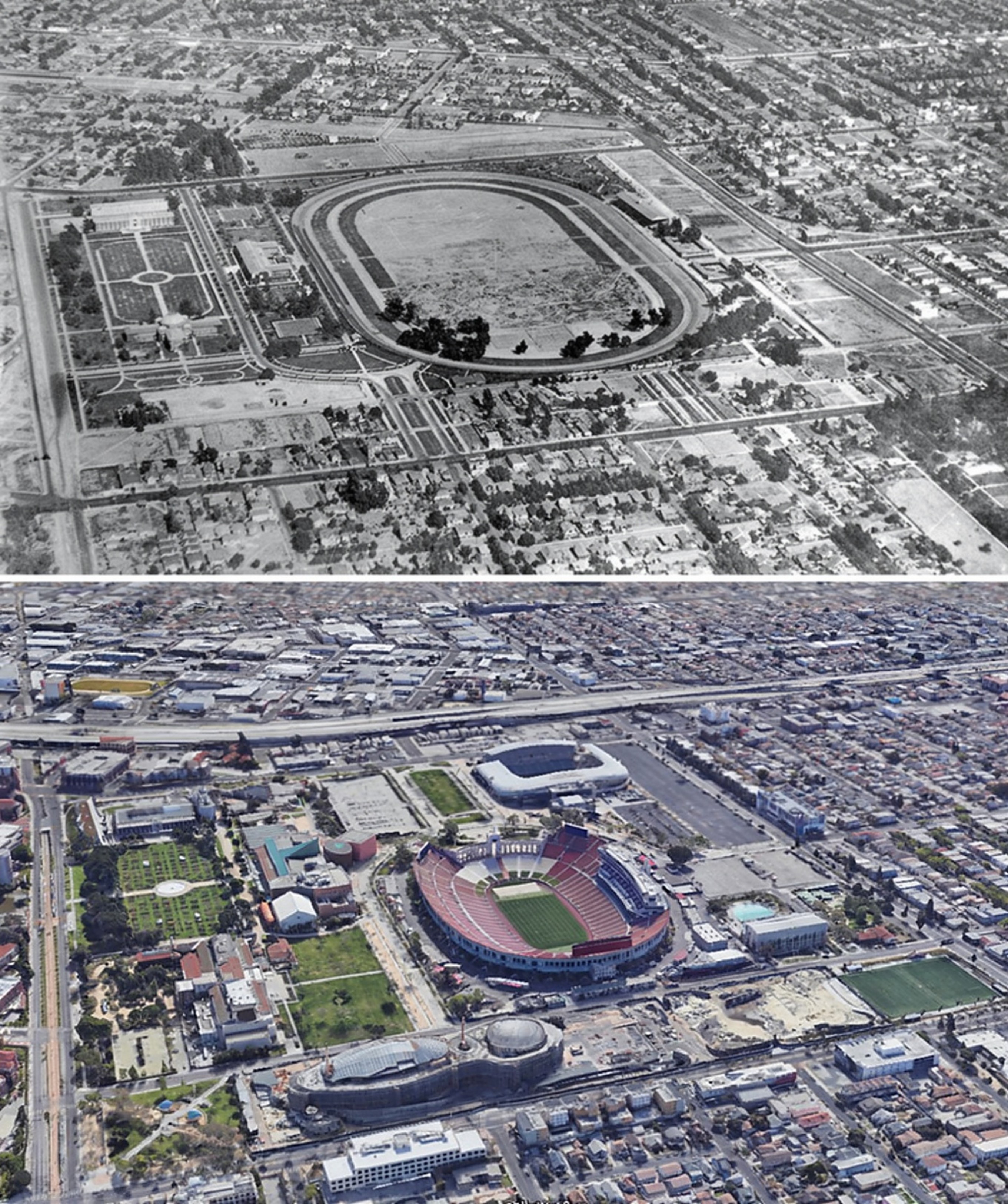 |
|
| (1918 vs. 2022) - Exposition Park Then and Now. Use the center of the sunken garden (left side of both images) as your reference point. The Coliseum now sits well within what was once a mile-long racetrack. Photo comparison by Jack Feldman. |
| Historical Notes
The Coliseum was built between 1921 and 1923 directly within the old racetrack footprint, its bowl occupying the same ground where Barney Oldfield had raced less than twenty years before. The oval that had defined Agricultural Park for three decades was gone within a decade of the 1918 photograph. The 2022 image shows what replaced it. The Coliseum now sits where the oval once ran, its elliptical bowl built within the western and central portion of the old racetrack footprint. The eastern portion disappeared into parking and surrounding streets. That the Coliseum itself is elliptical, echoing the shape of the track it replaced, is one of the more quietly satisfying continuities in the park's history. The sunken garden visible in its early unfinished state in the upper image became the Rose Garden in 1928 and was listed on the National Register of Historic Places in 1991. That transformation is the subject of the next section. |
* * * * * |
The Sunken Garden and the Rose Garden |
When the old Agricultural Park racetrack was cleared and Exposition Park took shape after 1910, the seven acres between the museum buildings were set aside for a formal public garden. For the first several years the space amounted to little more than a graded field with grass, a few trees, and walkways converging on a concrete circle at the center. Plans for a grand memorial fountain at that center point were announced at the 1913 dedication but never carried out, set aside when World War I began and other priorities took over. Through most of the 1910s the sunken garden was more plan than place. The transformation happened in stages. In 1915, the city proposed planting the beds with California wildflowers, including poppies, lupines, dahlias, and calendulas. In October 1921, the California Association of Nurserymen held a major horticultural exposition on the site, filling it with thousands of flowers, trees, and a new circular lily pond at the center. Many of those plantings stayed after the show closed. But the garden as it is recognized today did not take shape until 1926, when the city's Parks Department brought in rose experts George C. Robinson and Fred H. Howard, who had also designed the garden's original 1910 layout, to build what the Los Angeles Times called the world's finest public rose garden. The $15,000 project removed eight inches of topsoil across the entire site, replacing it with nutrient-rich soil and leaf mold brought from the canyons of Griffith Park. Workers laid 166 concrete-lined flower beds in four symmetrical quadrants, each anchored by a gazebo. Over 15,000 rose bushes, most donated by Southern California nurseries, were planted across the beds. The garden was completed in April 1928, remained the largest public rose garden in the country for 24 years, and has been operated by the Los Angeles City Department of Recreation and Parks ever since. It was listed on the National Register of Historic Places in 1991. |
The Early Sunken Garden |
The sunken garden went through several distinct phases before the roses arrived. In its earliest years after 1910, it was simply graded open ground, cut below the level of the surrounding walkways and left largely as grass with a central concrete circle. The park's 1913 dedication drew attention to the site's potential, but the World War I years delayed any serious development. By the early 1920s the garden finally had real flowers in it, thanks to the California Association of Nurserymen, whose 1921 show planted the space for the first time and introduced the central lily pond and fountain. Events like Pershing Day in January 1920 had already established the sunken garden as a gathering place even in its unfinished state, showing that Angelenos would embrace the space once it was properly planted.The photographs in this section document the garden during that transitional period, after the racetrack was gone but before the roses arrived, when the city was slowly discovering what the space could become. |
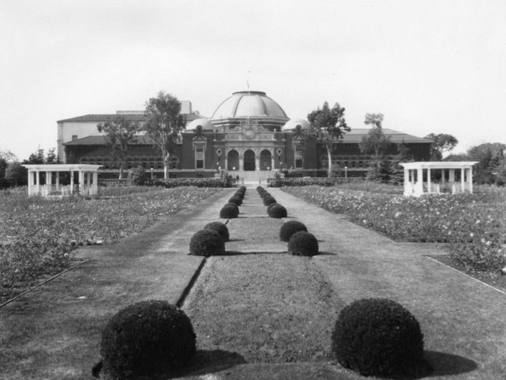 |
|
| (1920s)* – The sunken garden at Exposition Park, with the Natural History Museum visible in the background. Formal paths and walkways line the garden's central axis, flanked by planting beds and early garden structures. This view predates the 1926 rose garden redesign, when the space still reflected the plantings and lily pond installed for the 1921 California Association of Nurserymen horticultural show. |
Historical Notes The land seen here had been graded and laid out as part of the 1910 Exposition Park plan, with grass, pathways, and a circular concrete center. Through most of the decade the space sat largely unused, waiting for the civic will and funding to develop it. The 1921 California Flower Show and Horticultural Exposition was the first major use of the sunken garden for its intended purpose. The California Association of Nurserymen planted thousands of flowers and trees and installed a circular lily pond at the center. An electric fountain lit up the water at night during the event, and at the opening an orchestra played while performers danced traditional Spanish dances as visitors moved through displays of chrysanthemums, marigolds, and two acres of dahlias. Many of the show's plantings remained after the exposition closed, giving the garden its first real life as a planted space. |
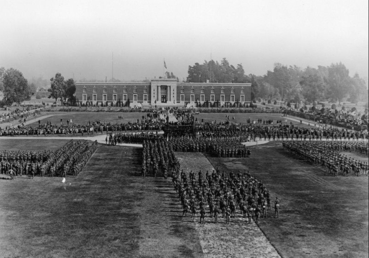 |
|
| (January 26, 1920)* - The sunken garden at Exposition Park on Pershing Day, with the State Armory Building in the background. At this date the garden was still in its early grass-and-pathway form, a year before the 1921 horticultural show would plant it with flowers and a central lily pond for the first time. |
Historical Notes Pershing Day marked the first anniversary of General John Pershing's return from World War I and was observed at public spaces across the country in January 1920. The event at Exposition Park reflected the park's growing role as a civic gathering place even before the sunken garden had been fully developed. The Armory Building visible here was designed by State Architect J.W. Woollett for the California National Guard 160th Infantry and was one of the four original anchor structures of the 1913 Exposition Park plan. It was later renamed the Wallis Annenberg Building for Science Learning and Innovation and now serves as the California Science Center's education annex. |
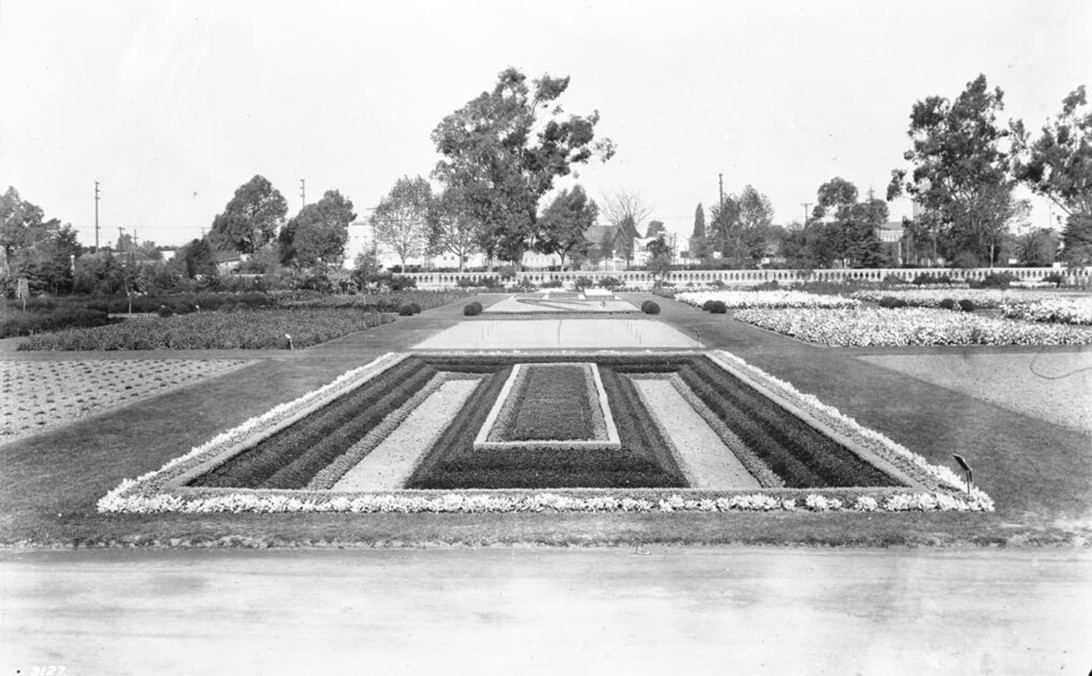 |
|
| (1925)* – The sunken garden planted with pansies and flowering beds, one year before the 1926 rose garden redesign began. The grid pattern of planting beds and grass walkways visible here foreshadow the formal layout that Fred H. Howard and George C. Robinson would adopt when they designed the rose garden the following year. The low concrete wall and perimeter trees mark the boundaries of the seven-acre site. |
Historical Notes By 1925 the sunken garden had evolved considerably from the grassy field of the early 1910s, with ornamental planting beds established following the 1921 horticultural show. The grid layout visible in this photograph was carried directly into the rose garden design that began the following year. To prepare the beds for roses, workers removed eight inches of existing topsoil from across the entire site and replaced it with nutrient-rich soil and leaf mold brought in from the canyons of Griffith Park, giving the roses the rich soil they needed to thrive. |
The Rose Garden |
By the mid-1920s, Los Angeles was a city in full expansion. The oil, aviation, and film industries were booming, the population had more than doubled during the decade, and civic leaders cared deeply about how the city looked to the rest of the nation. When the Parks Department announced in 1926 that it intended to build the finest public rose garden in the United States at Exposition Park, the Los Angeles Times applauded: no better demonstration could be made of the region's devotion to gardens and outdoor beauty, the paper wrote, than by placing the world's finest rose garden at the heart of its greatest city. The work matched the ambition. Rosarians Robinson and Howard designed 166 concrete-lined beds in four symmetrical quadrants, filled them with soil brought from Griffith Park, and planted more than 15,000 bushes representing over 100 varieties. The garden was completed in April 1928.It was an immediate success, drawing visitors from across the region and serving as a grand entrance corridor for the tens of thousands who came to the adjacent Coliseum for the 1932 Summer Olympics. Art deco lamp posts and concrete benches with Greek-style friezes were added to the garden's north entryway in 1932 in preparation for the Games. In 1936, Danish sculptor Thyra Boldsen donated four marble statues to the garden, one per quadrant, dedicated not to bravery and conquest as most public sculpture was but to love, life, and joy. The garden has remained largely unchanged in its layout since 1928 and continues to be visited by more than a million people a year. |
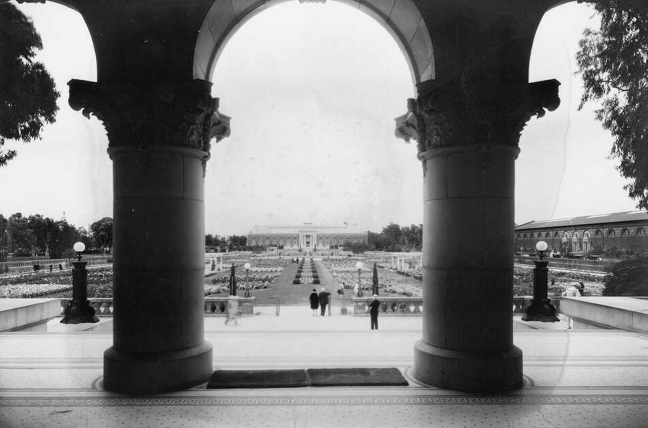 |
|
| (1929)* – The Exposition Park Rose Garden viewed through the grand arch of the Natural History Museum, one year after the garden's completion in April 1928. Formal flower beds, walkways, and pergolas stretch toward the Armory Building in the distance. At completion the garden held more than 15,000 rose bushes in 166 concrete-lined beds organized in four quadrants, each anchored by a white gazebo, making it the largest public rose garden in the United States. |
Historical Notes The rose garden opened in April 1928, timed to be in full bloom before the 1932 Olympics brought international visitors to the adjacent Coliseum. The Los Angeles Times had declared in 1926 that no better demonstration could be made of California's devotion to outdoor beauty than placing the world's finest rose garden at the heart of its greatest city. The garden held its position as the largest public rose garden in the country for 24 years. Danish sculptor Thyra Boldsen loaned four marble statues to the garden in 1936, one per quadrant, each honoring themes of love, life, and joy. They were reclaimed by a descendant in 1968. The All-America Rose Selection has donated its Rose of the Year to the garden annually since 1940. |
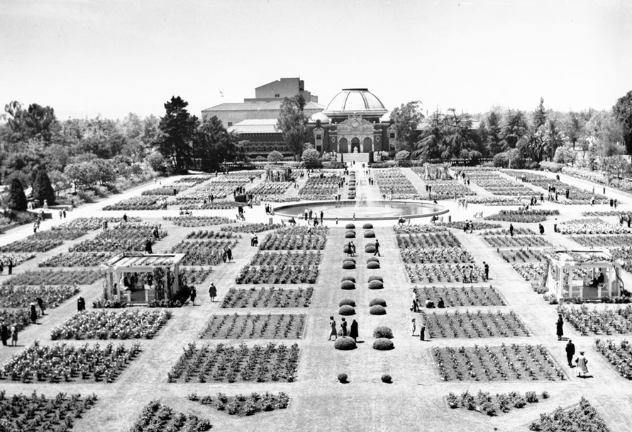 |
|
| (ca. 1950)* - A birdseye view of the Exposition Park Rose Garden from the Natural History Museum, with the Armory Building in the distance. Pedestrians move through the symmetrical grid of square rose beds. The central fountain shoots water into the air at center. By the 1950s the garden had become one of the city's most popular civic attractions, drawing thousands of visitors each year to the annual rose pruning demonstrations and summer photography days. |
Historical Notes The 1950s marked the rose garden's cultural peak. Annual pruning demonstrations held each January drew thousands of enthusiasts for panel discussions, how-to demonstrations on a large model rosebush, and appearances by a rose queen. By 1955 more than 3,000 people attended the event annually. Summer Camera Days brought amateur photographers to the garden each season with flowers, animals, and models in gardening clothes provided by the Parks Department. The garden survived a proposal by the NFL Raiders in 1980 to convert it into a practice field, and a second threat in 1986 when the Los Angeles Coliseum Commission proposed replacing it with a two-story parking garage. In both cases public opposition was swift and decisive. |
* * * * * |
The Rose Garden Fountain |
The fountain that stands at the center of the Exposition Park Rose Garden carries a history older than the roses themselves. Its story begins on November 6, 1913, the day Exposition Park was formally dedicated, the same day the city celebrated the opening of the Los Angeles Aqueduct, which had delivered Owens Valley water to the San Fernando Valley the day before. At the dedication ceremony, Senator John D. Works stepped to the platform in the sunken garden and, as he left, a jet of water shot thirty feet into the air from the concrete circle at the garden's center. It was a symbolic gesture, not a permanent structure. Water from the new aqueduct was pushed into the air as a public display. Plans were announced that day for a grand permanent fountain on the same spot, with a one-hundred-foot shaft flanked by sculptures representing California and the spirit of civic advancement. That monument was never built. World War I began, and the plans were shelved.The fountain that eventually found its permanent place at the center of the garden arrived more modestly. In 1921, the California Association of Nurserymen built a circular lily pond and fountain for their horticultural exposition on the site, and this became the garden's first lasting water feature. When Fred H. Howard redesigned the space as a rose garden in 1926, the fountain was retained and fitted with electric lights that changed color at night, making it one of the first illuminated public fountains in Los Angeles. The display became one of the garden's most popular attractions, visible from the museum buildings and park pathways after dark. The fountain has been operated continuously by the Los Angeles City Department of Recreation and Parks since 1928 and remains the visual anchor of the garden today, its jets still rising from the same concrete circle where Owens Valley water first made its symbolic appearance more than a century ago. |
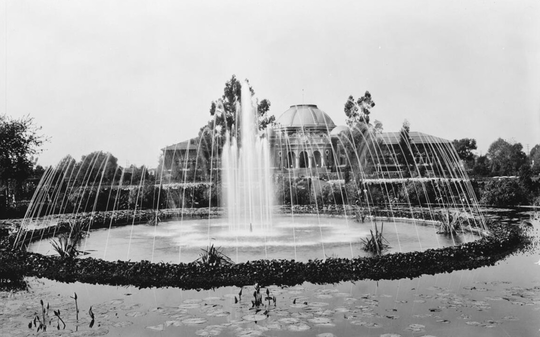 |
|
| (ca. 1925)* – The central fountain at Exposition Park, with arched water jets and a surrounding lily pond. The domed Natural History Museum rises above the hedged perimeter of the sunken garden in the background. This fountain and lily pond were installed by the California Association of Nurserymen for the 1921 horticultural exposition and remained as the garden's central feature when the rose garden redesign began the following year. |
Historical Notes The circular lily pond and fountain seen here were among the lasting contributions of the 1921 California Flower Show and Horticultural Exposition. When Fred H. Howard took on the rose garden design in 1926, he incorporated the existing fountain rather than replacing it, adding electric lighting that allowed the water display to continue into the evening hours — one of the first illuminated public fountains in Los Angeles. The Natural History Museum building visible in the background was designed by architects Frank Hudson and William Munsell in a blend of Spanish Renaissance, Romanesque, and Beaux Arts styles and dedicated on November 6, 1913. |
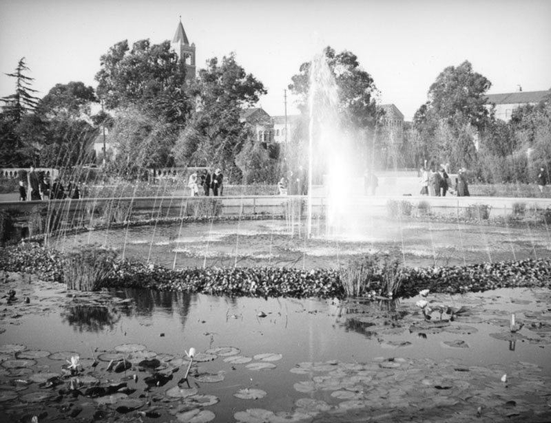 |
|
| (ca. 1937)* - Jets of water converge at the center of the Exposition Park Rose Garden fountain. The water display at this location dates to the park's dedication on November 6, 1913, when a jet of pressurized Owens Valley water was sent thirty feet into the air as a symbolic gesture marking the opening of the Los Angeles Aqueduct the day before. The permanent fountain installed in 1921 and refined in 1926 carried that symbolic connection forward. |
Historical Notes Senator John D. Works dedicated the water display at the 1913 opening ceremony, and as he left the platform a thirty-foot jet rose from the concrete circle at the garden's center. Plans for a grand permanent commemorative fountain, with a hundred-foot shaft and flanking sculptures honoring California and civic progress, were announced that day but never executed. Those plans reflected how confident Los Angeles felt in that moment. The aqueduct was done, Exposition Park was open, and the city saw itself on the edge of becoming one of the great cities of the world. For more on the opening ceremonies, see the Commemorative of the Official Opening of the Los Angeles Aqueduct and Exposition Park. Click HERE to see the Commemorative of the Official Opening of the LA Aqueduct and Exposition Park. |
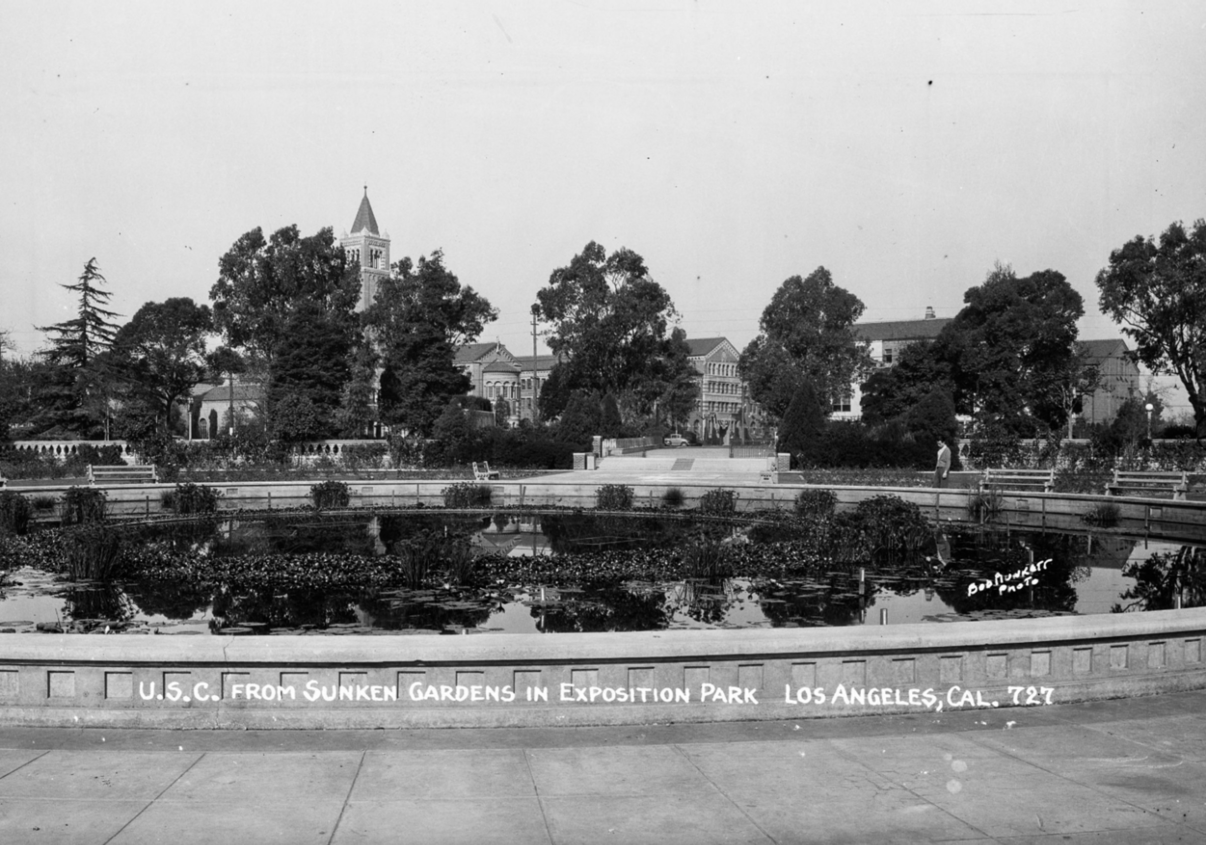 |
|
| (ca. 1930s)* - The lily-filled fountain at the center of Exposition Park's sunken garden, photographed by Bob Plunkett. In the distance, framed by trees and plantings, USC's Mudd Memorial Hall of Philosophy is visible just beyond the park's northern boundary. The formal rose beds and grassy walkways of the 1928 garden design are visible in the background. |
Historical Notes The lily pond at the fountain's base carried through every phase of the garden's development, from the 1921 horticultural show through the 1928 rose garden completion. The grand memorial fountain proposed at the 1913 dedication was never built, and the simpler fountain installed in 1921 became the garden's permanent water anchor. USC's Mudd Memorial Hall of Philosophy, visible in the background, was completed in 1930 and designed by architects Ralph Flewelling and Allison and Allison. It stands just north of the park boundary along Exposition Boulevard, directly across from the Natural History Museum. |
Then and Now
 |
|
| Seen top and bottom: the Exposition Park Rose Garden fountain in the 1930s and in 2014. The upper image shows the fountain during the garden's peak years, when the annual pruning demonstrations and summer Camera Days drew thousands of visitors each season. The lower image shows the same fountain more than eighty years later, its jets still rising from the same location where Owens Valley water first made its symbolic appearance on November 6, 1913. Click HERE to see the Commemorative of the Official Opening of the LA Aqueduct and Exposition Park. Photo comparison by Jack Feldman. |
Historical Notes The Rose Garden and its fountain have endured repeated threats to their existence over the decades. A proposal by the NFL Raiders in 1980 to convert the garden to a practice field was turned down. A 1986 plan by the Los Angeles Coliseum Commission to replace the garden with a two-story parking structure drew immediate public opposition and was defeated. The 1984 Summer Olympics had brought renewed investment to the park just two years earlier, with the city refurbishing the garden for the millions of visitors who passed through Exposition Park during the Games. The garden was listed on the National Register of Historic Places in 1991, giving it a level of formal protection it had not previously held. It remains one of the most visited public gardens in Southern California, with an estimated one million visitors each year. |
* * * * * |
🏛️ The Los Angeles Memorial Coliseum |
The Los Angeles Memorial Coliseum stands on ground that had already lived several lives before its construction. What began in 1872 as Agricultural Park, a fairground that evolved into a center for racing and public spectacle, was transformed after California's 1909 ban on racetrack gambling into a civic and cultural landscape known as Exposition Park. By the time of the 1918 aerial view, the mile-long oval remained intact, but its future had already shifted away from racing.That transformation accelerated in 1921, when Los Angeles leaders moved to construct a major stadium as a memorial to veterans of World War I. Designed by architects John and Donald Parkinson, the Coliseum was conceived not only as a place for sport but as a monumental civic structure, one that could anchor the growing city's cultural and ceremonial life.Construction began on December 21, 1921. In just over sixteen months, the elliptical bowl rose within the footprint of the former racetrack. When it opened on May 1, 1923, the Coliseum seated more than 75,000 spectators, immediately becoming the largest stadium in Los Angeles and one of the most prominent in the nation. |
From Racetrack Oval to Stadium Bowl |
The 1918 aerial shows the site at a turning point. The racetrack oval, once the defining feature of Agricultural Park, remained fully visible, even as the surrounding grounds had already been reshaped into a complex of museums, gardens, and public spaces.By 1922, that oval was being erased. Construction photographs show the Coliseum rising directly within the infield of the track, its form echoing the very shape it replaced. Rather than imposing a new geometry on the landscape, the designers built within it, preserving the ellipse while transforming its purpose.Where Barney Oldfield and other early drivers once raced against time, a new kind of spectacle took shape, one measured not in seconds but in crowds, ceremonies, and shared civic experience. |
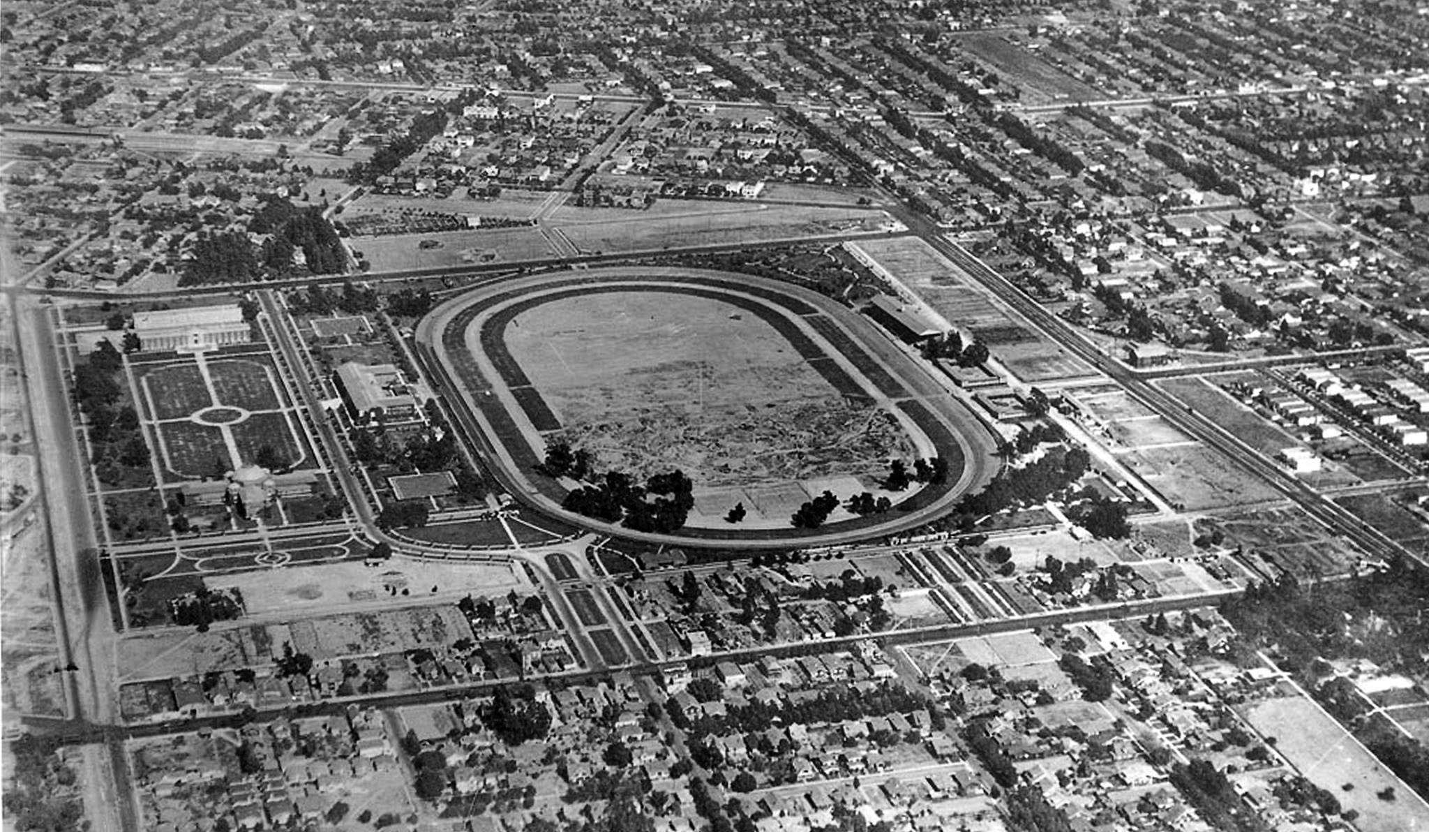 |
|
| (1918)* - An aerial view of Exposition Park five years after its formal dedication on November 6, 1913. The mile-long racetrack oval remains fully intact at center. To the north, the Natural History Museum, the Armory, and the Exposition Building frame the newly laid sunken garden with its formal walkways and circular concrete center. The Coliseum groundbreaking was still three years away. |
Historical Notes The Natural History Museum, designed by architects Frank Hudson and William Munsell in a blend of Spanish Renaissance, Romanesque, and Beaux Arts styles, was dedicated on November 6, 1913. The governance agreement established at that time between the state, Los Angeles County, and the City of Los Angeles still governs Exposition Park today. The sunken garden visible north of the oval had been graded and laid out as part of the 1910 Exposition Park plan, with grass, walkways, and a circular concrete center. It would not be seriously planted until the 1920s and would not become the Rose Garden until 1928. The International Olympic Committee selected Los Angeles as the host city for the 1932 Summer Olympics in April 1923, the same month the Coliseum was completed. The two events, arriving almost simultaneously, shaped the stadium's first decade in ways no one had fully anticipated. |
Engineering Speed and Scale |
The speed of construction remains notable. Built for $954,873, the original structure was completed in just over sixteen months. The design featured a continuous elliptical bowl open at the east end, where the peristyle would later become one of the Coliseum's most recognized architectural elements.The 1922 construction images show this rapid rise. The surrounding Exposition Park grounds, already anchored by the Exposition Building and the Museum of History, Science and Art (later the Natural History Museum), frame the emerging stadium within its broader civic setting. |
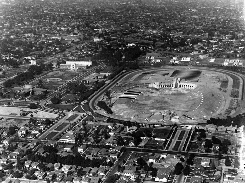 |
|
| (1922)^ - An aerial view of Exposition Park with the Coliseum under construction at right. At left, the sunken garden is surrounded by the state Exposition Building and the county Museum of History, Science and Art, later renamed the Natural History Museum. Workers excavated more than thirty feet below grade to set the playing field, using the removed soil to form the embankments that make up the bowl's outer walls. |
Historical Notes The Coliseum was commissioned in 1921 as a memorial to veterans of World War I and rededicated to veterans of all wars in 1968. The groundbreaking ceremony took place on December 21, 1921, with construction completed in just over sixteen months on May 1, 1923. John and Donald Parkinson, whose firm also designed Los Angeles City Hall, Union Station, and the Bullock's Wilshire Building, modeled the elliptical bowl on the Yale Bowl of 1914, the first bowl-style stadium in the United States. The field was excavated thirty-two feet below grade, with the removed soil used to build the surrounding embankments. The structure measures 1,038 feet long and 738 feet wide. Total construction cost was $954,873. |
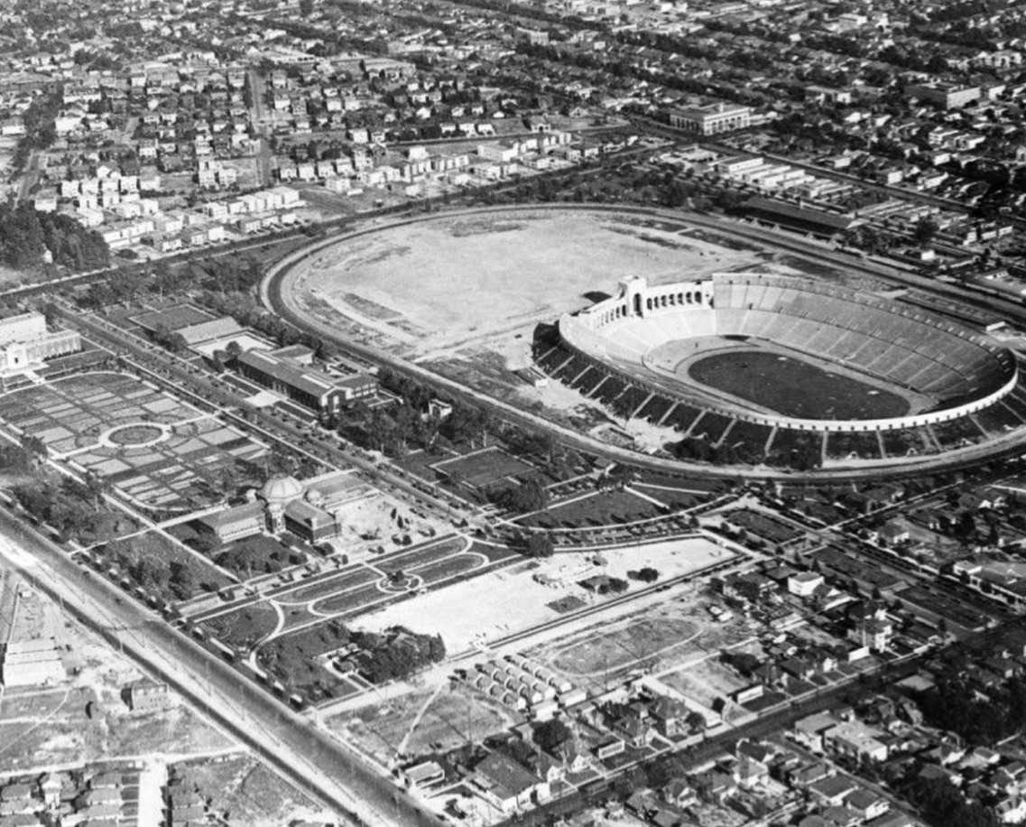 |
|
| (1922)* - A second aerial view of the Coliseum under construction, showing the elliptical concrete bowl taking shape within the old racetrack footprint. The surrounding residential streets and the USC campus to the north give a sense of the stadium's scale relative to the city around it. |
Historical Notes When the Coliseum opened in 1923, it was the largest stadium in Los Angeles, with a capacity of 75,144. The first event held there was not a sporting contest but the American Historical Review and Motion Picture Industrial Exposition, a month-long celebration of American history and the film industry that ran from July 2 to August 4, 1923, and drew more than 300,000 visitors. The first football game followed on October 6, 1923, when USC defeated Pomona College 23 to 7. |
Expansion for the World Stage |
The Coliseum's role expanded in preparation for the 1932 Summer Olympics. To accommodate the event, the stadium was enlarged in 1930, with additional rows and two tiers of tunnels raising capacity to more than 100,000 seats. The Olympic cauldron, still visible above the east end of the stadium, was installed at that time.
|
 |
|
| (2024)* - A contemporary aerial view of the Coliseum and Exposition Park. The grounds that were still a working racetrack in 1909 now hold the Coliseum, the Rose Garden, the Natural History Museum, the California Science Center, and the Lucas Museum of Narrative Art. A $315 million renovation completed in 2019 updated the stadium's seating, press facilities, and amenities while preserving its historic fabric. |
| Historical Notes
The $315 million renovation completed in 2019 was funded by the University of Southern California under a 98-year lease agreement signed in 2013, which also transferred long-term management of the Coliseum to the university. The project added new seating throughout, a south side press box and suite structure, loge boxes, and a rooftop terrace with views of the surrounding park and city. Seating capacity was set at 77,500. The renovation was designed by DLR Group and carried out in compliance with the Secretary of the Interior's Standards for Rehabilitation, given the stadium's status as a National Historic Landmark. The Lucas Museum of Narrative Art, visible in the contemporary image, is scheduled to open on September 22, 2026, on the south side of Exposition Park. Designed by architect Ma Yansong of MAD Architects, it occupies ground that was once the eastern edge of the Agricultural Park racetrack oval. When it opens it will complete a transformation of Exposition Park that began when the racetrack was cleared more than a century earlier. |
Then and Now
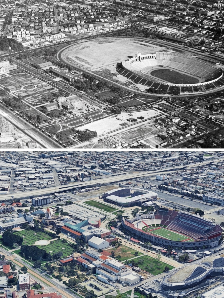 |
|
| (1922 vs. 2024)* - The Coliseum during construction and as it stands today. The elliptical shape of the bowl, set by architects John and Donald Parkinson in 1921, remains unchanged. The upper image shows the embankments still being formed from excavated soil. The lower image shows the stadium after its 2019 renovation, which brought seating capacity to 77,500. Photo comparison by Jack Feldman. |
| Historical Notes
The Coliseum's elliptical form was not an accident of its site. John Parkinson chose the shape deliberately, drawing on the Yale Bowl and on the ancient Roman amphitheater tradition, and built it within the western and central portion of the old Agricultural Park racetrack oval. The outer dimensions of the bowl, 1,038 feet long and 738 feet wide, made it the second most expensive stadium in the United States when it opened, behind only Yankee Stadium in New York. In 1930, with the 1932 Olympics awarded to Los Angeles, the stadium was expanded upward to seventy-nine rows and capacity was raised to more than 101,000. The Olympic cauldron added for the 1932 Games remains above the peristyle at the east end and is lit during every USC home game. The Coliseum hosted the Summer Olympics in 1932 and 1984 and will become the first stadium to host the Games three times when the 2028 Olympics open there. |
Continuity Within Change |
The then and now comparisons show one of the more interesting aspects of the Coliseum's history: the elliptical form of the stadium still traces the geometry of the racetrack that came before it. The sunken garden to the north, later redesigned as the Rose Garden, remains in place, connecting the park's early layout to its present form.The surrounding landscape has changed considerably. What were once open grounds and racetrack edges have given way to parking areas, museums, sports facilities, and dense residential streets. The Coliseum, once set within a largely open park, is now part of a much more active urban environment. |
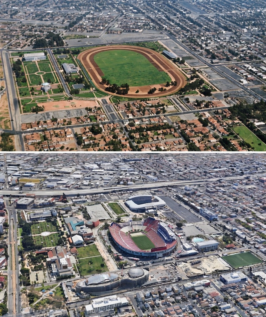 |
|
| (1918 vs. 2022)* – Exposition Park then and now. The center of the sunken garden on the left side of both images serves as the reference point. The mile-long racetrack oval visible in the upper image occupied the ground where the Coliseum now stands. The Rose Garden and the museum buildings to the north were already taking shape in 1918. Photo comparison by Jack Feldman. Original photo colorized by Rodolfo Rojas Patiño. |
Historical Notes The Coliseum was built between 1921 and 1923 directly within the old racetrack footprint, its bowl occupying the same ground where Barney Oldfield had raced less than twenty years before. The oval that had defined Agricultural Park for three decades was gone within a decade of the 1918 photograph. The Coliseum now sits where the oval once ran, its elliptical bowl built within the western and central portion of the old racetrack footprint. The eastern portion of the oval disappeared into parking and surrounding streets. That the Coliseum itself is elliptical, echoing the shape of the track it replaced, is one of the more quietly satisfying continuities in the park's history. The sunken garden visible in its early unfinished state in the upper image became the Rose Garden in 1928 and was listed on the National Register of Historic Places in 1991. That transformation is the subject of the next section. For a closer look at the Coliseum's construction, including ground level views of the arches, entranceway, and early seating structure, click HERE to see Early Views of the Los Angeles Memorial Coliseum Construction. |
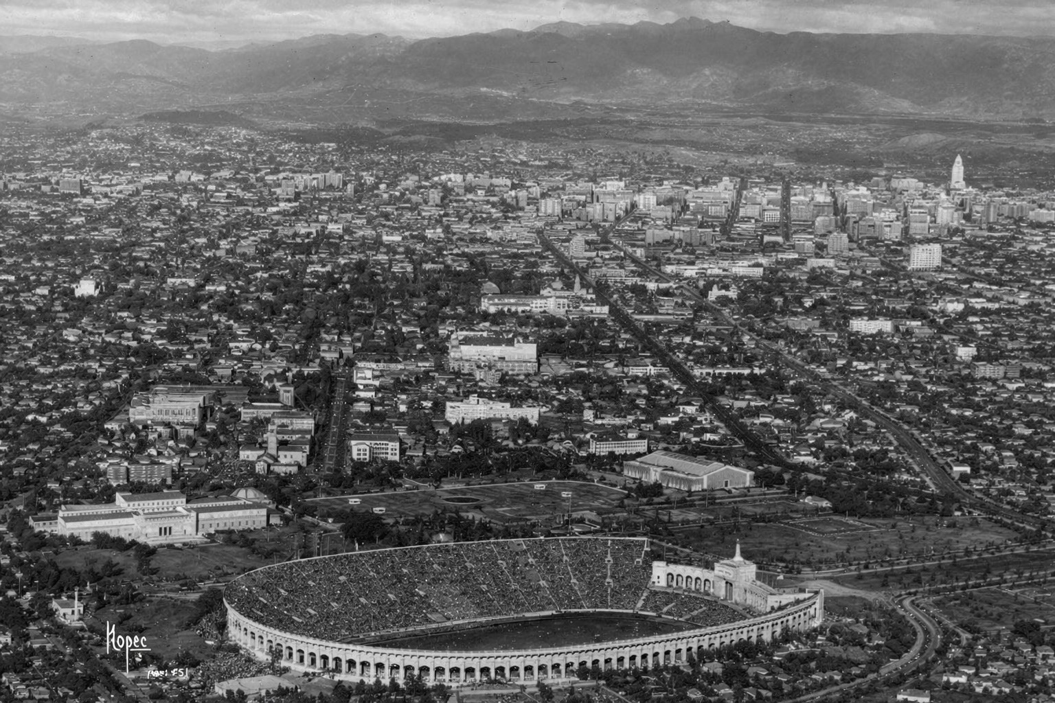 |
|
| (1932)* - Los Angeles looking north, photographed from the Goodyear airship during the 1932 Olympic Games. The Coliseum sits in the foreground. Between it and the downtown skyline, the University of Southern California campus is visible in the middle distance. |
Historical Notes The 1932 Summer Olympics opened at the Coliseum on July 30, 1932, before a crowd of more than 101,000. Athletes from 37 countries participated, and the Games drew an estimated 1.2 million visitors over their duration, roughly equal to the entire population of the City of Los Angeles at the time. The 1932 Games introduced several traditions that remain part of the Olympics today, including the use of an Olympic Village for visiting athletes, a three-tier medal podium, and the flying of winning nations' flags during award ceremonies.Click HERE to see more Early Views of the Los Angeles Memorial Coliseum during the Olympics. |
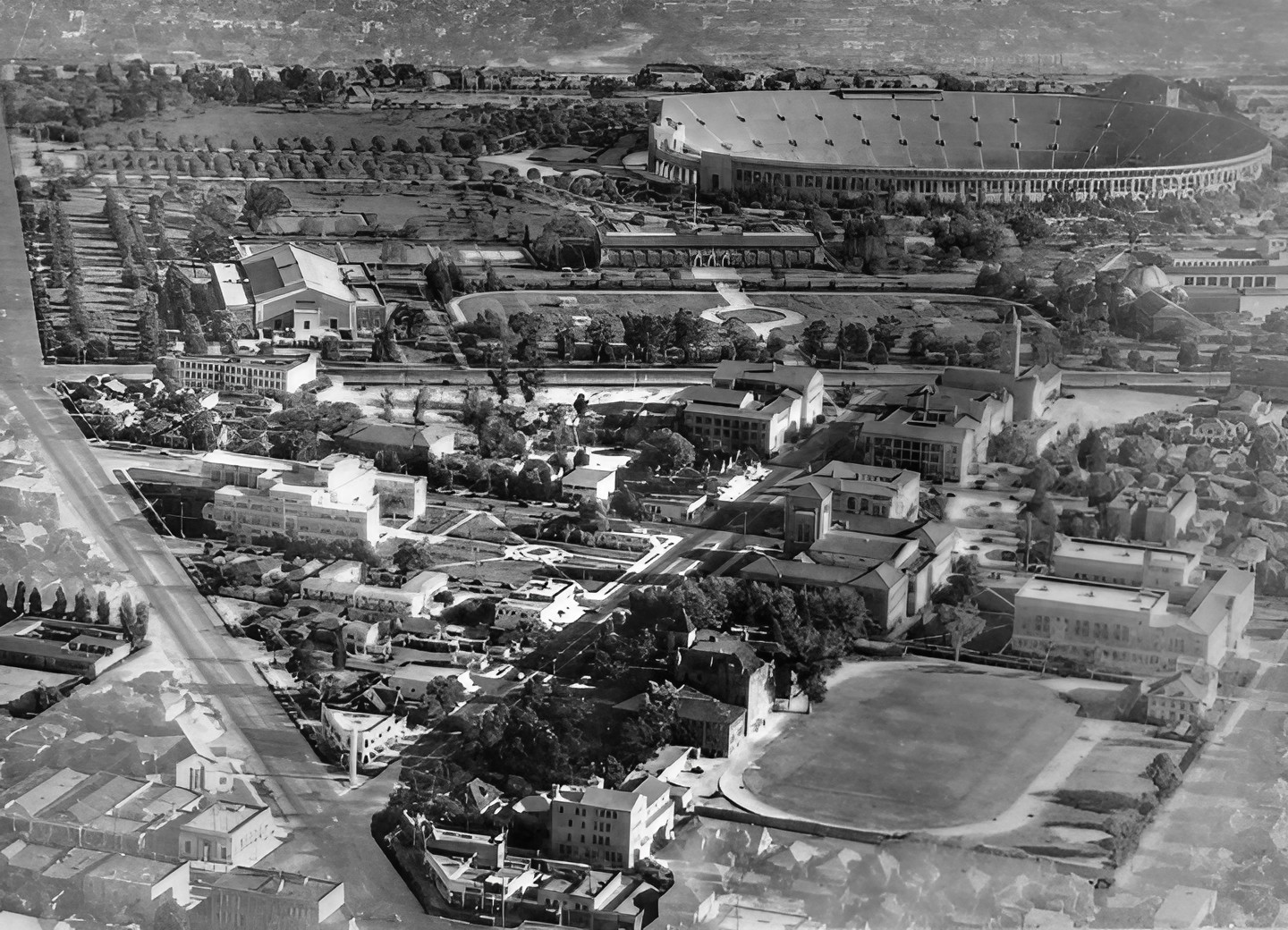 |
|
| (1930s)* - The University of Southern California campus in the foreground, with the Los Angeles Memorial Coliseum beyond. USC has played its home football games at the Coliseum since the inaugural game on October 6, 1923. |
Historical Notes USC agreed to play its home football games at the Coliseum when the stadium opened, a circumstance that contributed to the decision to build it where it was. The university took over long-term management of the Coliseum under a 98-year lease agreement in 2013 and funded the $315 million renovation completed in 2019. Click HERE to see more in Early Views of U.S.C. |
A Living Landmark Designated a National Historic Landmark in 1984, the Coliseum has served as more than a stadium. It has been a site of Olympic ceremonies, championship games, public gatherings, and civic commemoration. Originally dedicated as a memorial to World War I veterans and rededicated in 1968 to honor veterans of all wars, it remains both a working venue and a public monument. The images in this section, from racetrack days through construction, expansion, and present day views, document more than the evolution of a single structure. They trace the transformation of an entire landscape and the ways Los Angeles has redefined how public space is used and remembered over more than a century. |
* * * * * |
2nd Street Tunnel |
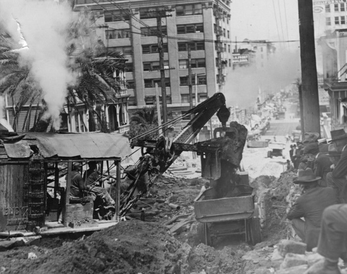 |
|
| (1921)* - Two men seated in the cabin of a Bucyrus backhoe operate the machine as steam rises from the top. One man holds onto the rope that leads to the pulleys. Another man operates the levers that dumps a mouthful of dirt into a dump truck. They are digging out Bunker Hill to construct the 2nd Street Tunnel. |
Historical Notes The 2nd Street Tunnel was built to relieve congestion on the earlier 3rd Street Tunnel. Construction actually began in 1916 but was stalled for five years by litigation. Steam shovels didn't begin tearing into the hillside until April 11, 1921. |
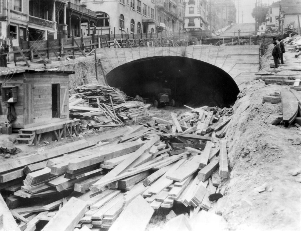 |
|
| (ca. 1921)* - Hill Street entrance to the 2nd Street tunnel under construction. A ditch filled with lumber stands in the foreground, quickly meeting an archway under which an automobile can be seen parked. A small workman's shack has been erected to the left, and scaffolding lines the street on the bridge above and the road leading up to it on the left side. Two men in suits stands amidst the building materials at the right side of the ditch. High rise buildings and an inclined street can be seen in the background. |
Historical Notes For a time, it seemed the tunnel would never open; it became the laughingstock of the city. But by July 25, 1924, workers had finally bored 1,502 feet through Bunker Hill’s shale and sandstone.* |
 |
|
| (1924)* - Grand opening of the 2nd Street Tunnel on July 25, 1924. A procession of dignitaries await the start of the parade while police on horseback maintain crowd control. |
Historical Notes Construction of the 2nd Street Tunnel began in 1916, and wasn't completed until 1924, with its formal opening on July 25 of that year. The distinctive white tiles, which give the tunnel its glow, came from Germany, which caused controversy at the time due to the legacy of World War I and protectionist feelings.^ |
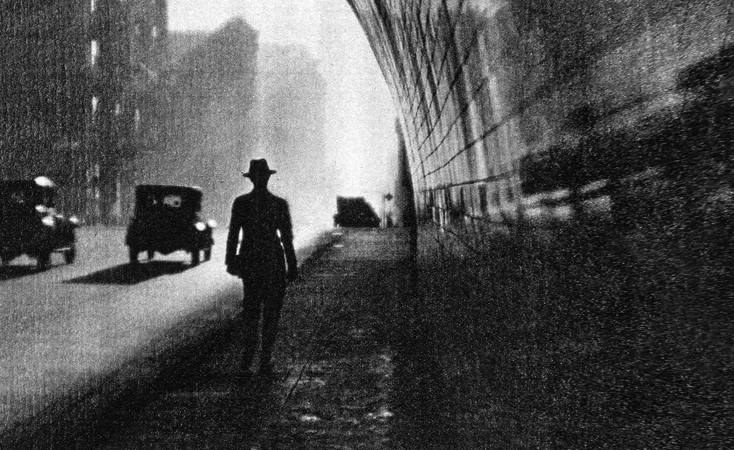 |
|
| (1930s)^ – Noir image showing a man wearing a hat walking through the 2nd Street Tunnel. |
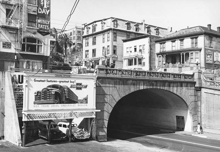 |
|
| (1950s)* - Close-up view of the east end of the 2nd Street Tunnel showing the deterioration of the neighborhood’s boarding houses and residential hotels. |
Historical Notes The last days of Bunker Hill: this view from the Second Street tunnel clearly shows the deterioration of the neighborhood’s boarding houses and residential hotels. The Hill would soon be scraped clean to make way for “redevelopment”. |
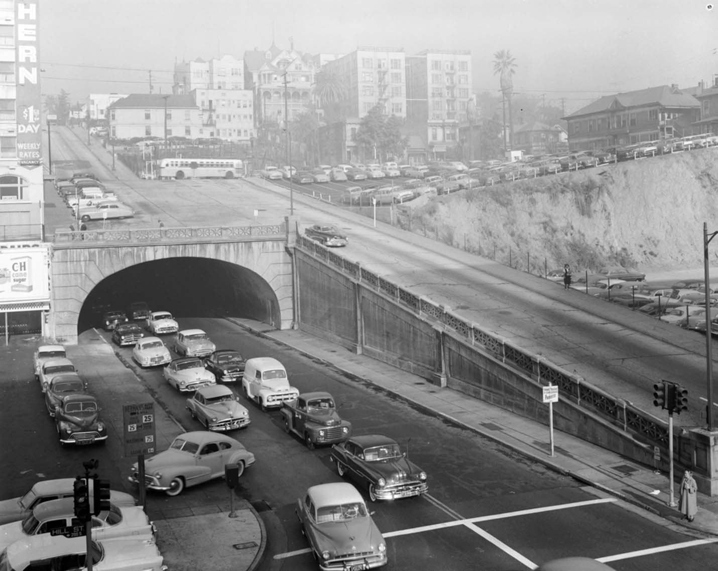 |
|
| (1950s)* – View looking at the eastern portal of the 2nd Street Tunnel showing a line of cars heading toward the civic center. Hill Street is in the foreground. |
.jpg) |
|
| (2017)* – Google street view showing the eastern portal of the 2nd Street Tunnel as seen from Hill Street. |
 |
|
| (2020)* – Eastern portal of the Second Street Tunnel. Photo by Carlos G. Lucero |
2nd Street Tunnel (Western Portal)
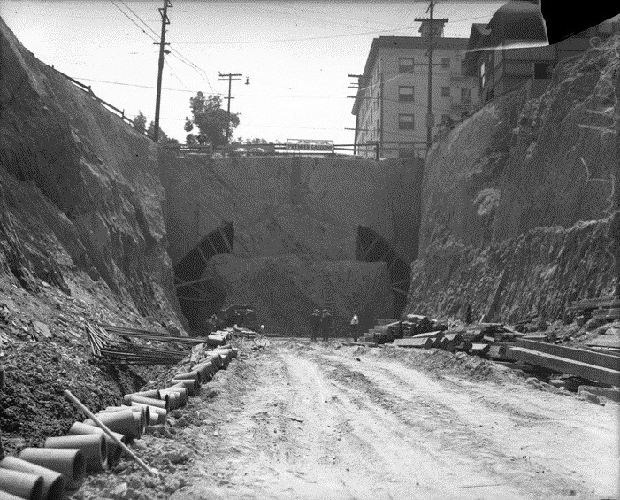 |
|
| (1921)* – View showing the 2nd Street Tunnel construction site before the boring of the tunnel, from the Figueroa Street side (Western Portal). The multi-story building at upper-right is the Stanley Hotel and Apartments. |
Historical Notes The above photo was published in the Aug. 22, 1921, Los Angeles Times with story claiming the tunnel would be finished in less than a year. The tunnel did not open for nearly three years. |
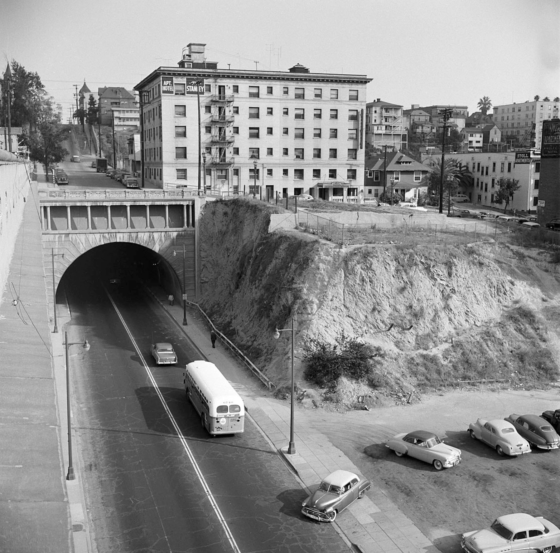 |
|
| (1950s)* - View looking east toward the west end of the 2nd Street Tunnel. The Stanley Hotel and Apartments stand above the tunnel on Bunker Hill. In the distance can be seen the dome of the Dome Hotel and Apartments on the SW corner of 2nd and Hill streets. Bunker Hill would soon be scraped clean to make way for “redevelopment”. |
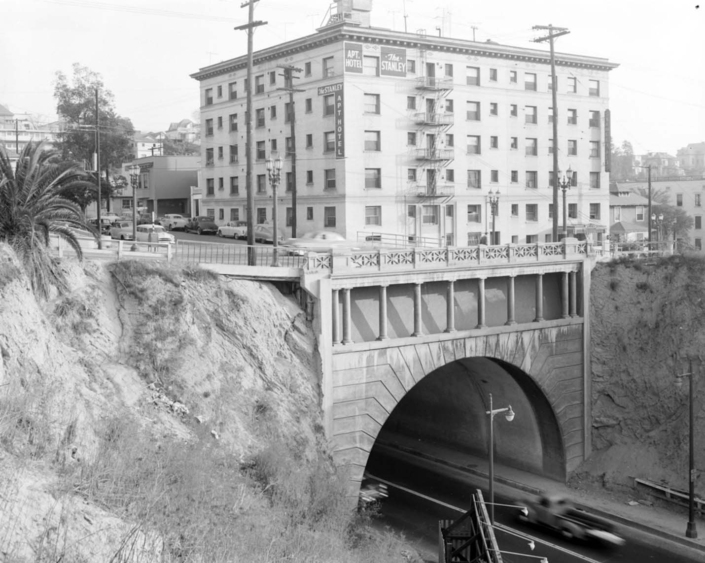 |
|
| (1950s)*++ – Close-up view showing the western portal to the 2nd Street Tunnel with the Stanley Hotel and Apartments above (demolished in 1966) for the redevelopment of Bunker Hill. |
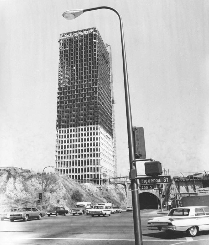 |
|
| (1968*– View looking east toward the west end of 2nd Street Tunnel as seen from the southwest corner of 2nd and Figueroa. Bunker HIll Tower (completed in 1968) is seen near the tunnel. |
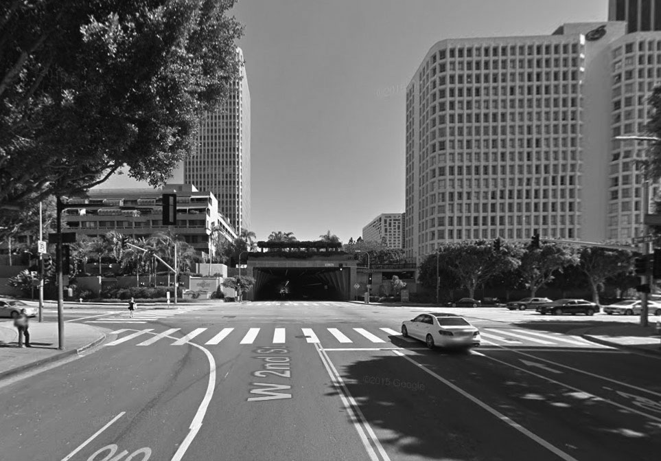 |
|
| (2015)* – Google street view showing the west end of the 2nd Street Tunnel as it appears today. |
 |
|
| (2012)* – View showing the west entrance of the 2nd Street Tunnel in downtown Los Angeles. Photo by Rian Long |
Historical Notes The tunnel's two entrances are very different in character – "the grittier east entrance and the glowing aperture of the west side, with flaring buttresses reminiscent of the shell of the Hollywood Bowl." The tunnel creates interesting light textures especially at night. It’s been frequently used as a backdrop in movies and even more frequently in car advertisements.^ |
 |
|
| (1978)* - Headlights bounce around on the tiled surface of the 2nd Street Tunnel in downtown Los Angeles during light rain. |
 |
|
| (2000)^ - As if straight out of a science fiction movie, cars seem to spill out of the darkness and into the spiral-like light of day. The photo was taken from inside the 2nd Street Tunnel, two pedestrians walking on the right side, and a row of ceiling lights that are spaced out through the entire tunnel are the only visible things inside this black hole. |
Historical Notes The 2nd Street Tunnel in Los Angeles is probably the most recognizable city landmark most Americans have never heard of. The tunnel — a 1,500-foot-long bore lined with white tile, like a bathroom that never ends — has been used as an exterior in dozens of films and TV shows, most famously in the sci-fi masterpiece “Blade Runner.” |
* * * * * |
Glendale
 |
|
| (ca. 1920)^ - Looking south at an intersection of Los Feliz Blvd. and San Fernando Rd. Various cars and trucks are traveling on the street. There are businesses on right side of the street some include: "Geo. V. Black prescription Druggist" and "Baker's Hardware". Information provided with the photograph states that Los Feliz Blvd. was formerly called Tropico Boulevard. |
Historical Notes Tropico was the name of the southern portion of Glendale, south of Windsor Road, between the late 1800s and 1918. The name "Glendale" had originated in the 1880s and was utilized north of Windsor Road. Political factions had divided the town in two. By the turn of the century, the commercial center of Tropico was at Central and San Fernando Road and its population was 700.^##^ |
 |
|
| (ca. 1920s)^ - A view of San Fernando Rd. looking north at an intersection of Los Feliz Blvd. Various cars and trucks have stopped at the intersection. There are businesses that run along both sides of the street some include: a drug store, a sports equipment store, the "Piggly Wiggly", "Tavern Buffet", "Glenwood Hotel" and a service station with gasoline pumps. |
 |
|
| (ca. 1920s)^ - View shows several automobiles travelling up and down the business section of Brand Boulevard, in Glendale. Note train stopped in the middle of the road to pick up and drop of passengers. |
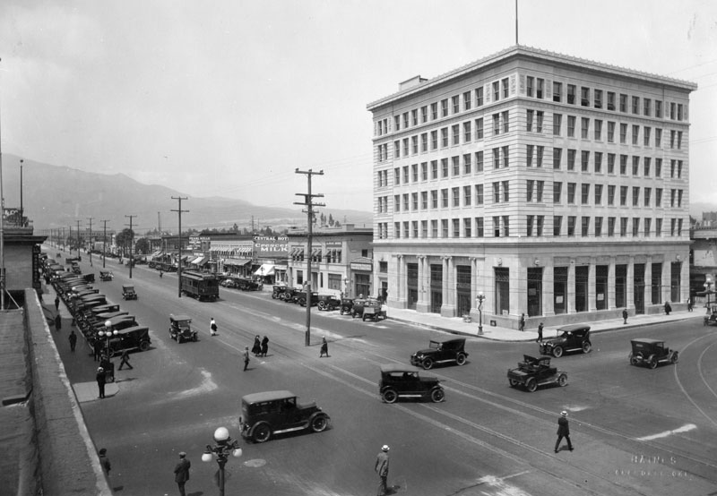 |
|
| (1924)^ - View of the corner of Brand and Broadway in Glendale. Note there are no street lights as pedestrians and automobiles cross the streets. Many businesses may be seen on both sides of the street including railroad tracks which run down the middle of this wide street. A large seven-story building is on the right. |
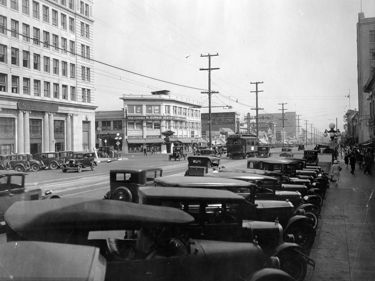 |
|
| (ca. 1920s)^##- Downtown Glendale, looking south on Brand Boulevard from Broadway. |
.jpg) |
|
| (1920s)^ - View of the Business Block on Brand Boulevard, in Glendale. The Palace Grand Theatre may be seen on the right. |
Historical Notes The Palace Grand Theatre was originally built and owned by Henry C. Jensen, who would later build the more palatial Raymond Theatre in Pasadena. The neo-classical building was designed by architect Robert G. Kitts. Construction on the Palace Grand began in August, 1914.^ |
Click HERE to see more Early Views of Glendale |
* * * * * |
Cahuenga Pass
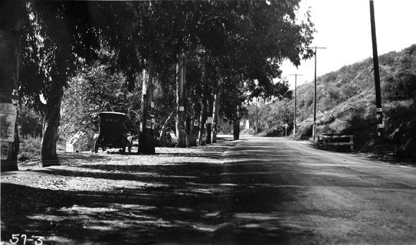 |
|
| (1921)**# - View of the highway through the Cahuenga Pass in 1921. A car is parked on the side of the road next to what appears to be a Eucalyptus tree. |
Historical Notes The Cahuenga Pass connects the Los Angeles Basin to the San Fernando Valley and is the lowest pass through the mountains. It was the site of two major battles, the Battle of Cahuenga Pass in 1831 (a fight between local settlers and the Mexican-appointed governor and his men, two deaths), and the Battle of Providencia or Second Battle of Cahuenga Pass in 1845 (between locals over whether to secede from Mexico. One horse and one mule killed) both on the San Fernando Valley side near present-day Studio City, and cannonballs are still occasionally found during excavations in the area. Along the route of the historic El Camino Real, the historic significance of the pass is also marked by a marker along Cahuenga Blvd. which names the area as Paseo de Cahuenga.^ |
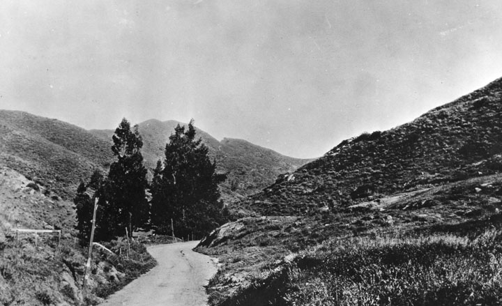 |
|
| (1882)^ - Before roads and rail lines were built, traveling through the Cahuenga Pass was by wagons and horses or on foot. This picture was taken at the summit. There is a saloon concealed among the trees. |
Click HERE to see more in Early Views of Cahuenga Pass |
* * * * * |
Hollywood Bowl
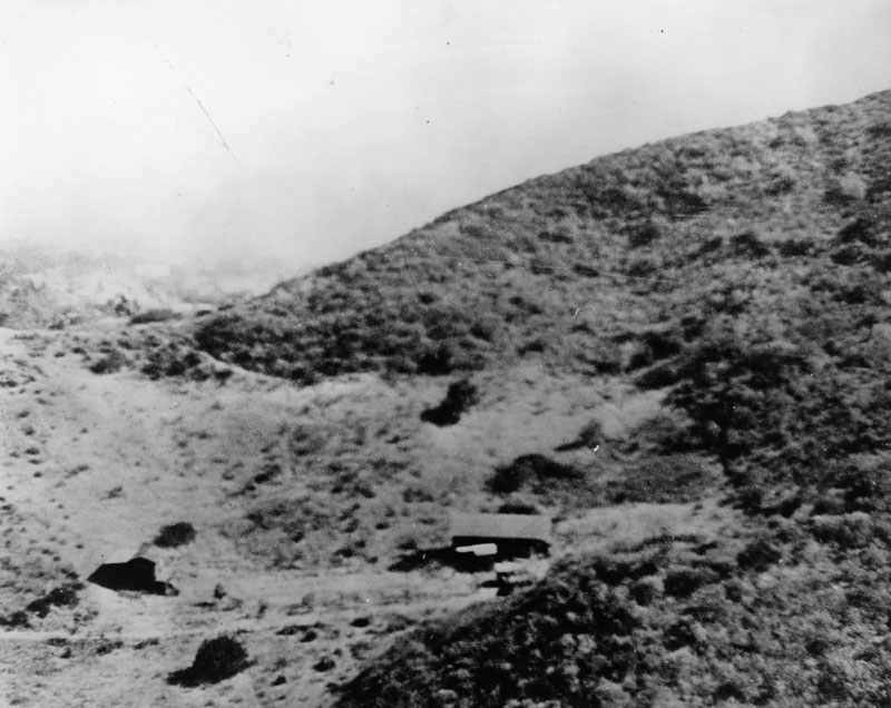 |
|
| (Early 1900s)^ - Site of present day Hollywood Bowl as it appeared at the turn of the century. |
Historical Notes The site of the Hollywood Bowl was chosen in 1919 by William Reed and his son H. Ellis Reed, members of the newly formed Theatre Arts Alliance who were dispatched to find a suitable location for outdoor performances.*^ |
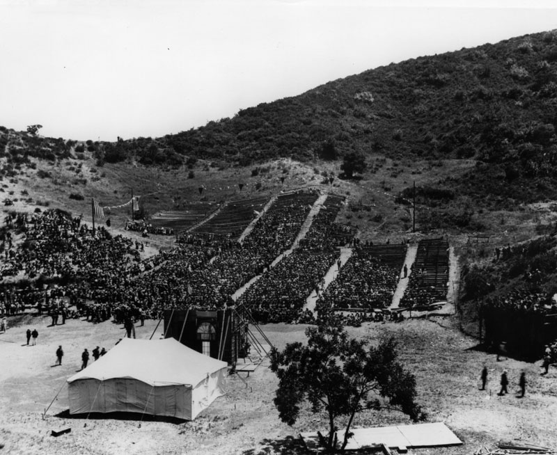 |
|
| (1922)^ - Rotary Club meeting held at the Hollywood Bowl prior to its official opening. |
Historical Notes At first, the Bowl was very close to its natural state, with only makeshift wooden benches for the audience, and eventually a simple awning over the stage. Not until 1926 did the Hollywood Bowl get permanent seating when a group known as the Allied Architects was contracted to regrade the surrounding, provide permanent seating and to construct a shell.*^ |
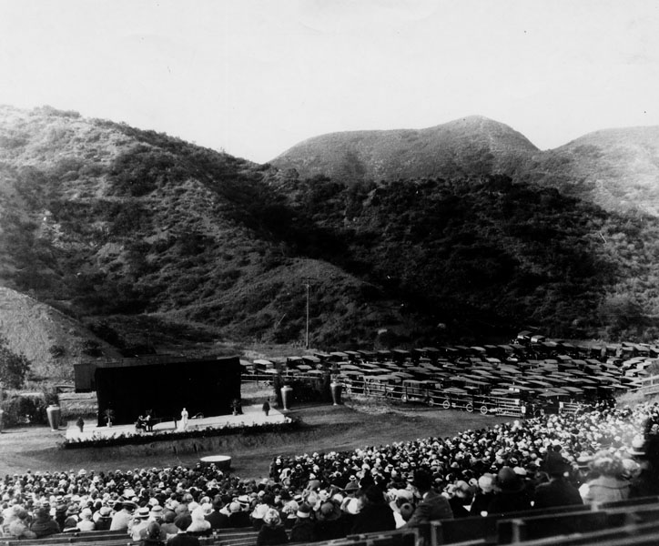 |
|
| (ca. 1922)^ - Concert by Rosa Paniella at the Hollywood Bowl. Note the full parking lot to the right of the stage. |
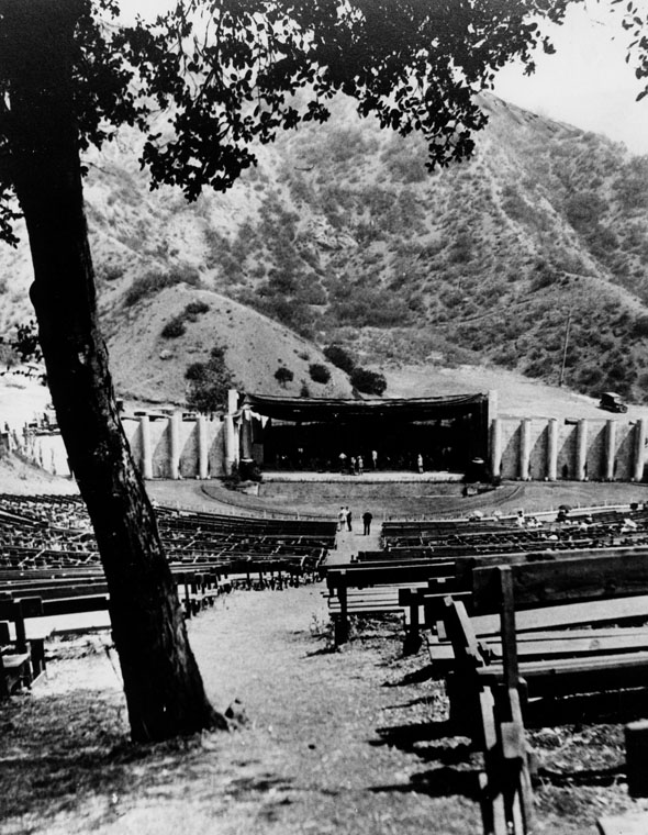 |
|
| (1922)^ - Hollywood Bowl at the first Symphony Under the Stars. This was the "Bowl's" official opening and was on the site of a natural amphitheater formerly known as the Daisy Dell. |
Historical Notes On July 11, 1922, with the audience seated on simple wooden benches placed on the natural hillsides of Bolton Canyon, conductor Alfred Hertz and the Los Angeles Philharmonic inaugurated the first season of music under the stars at the Hollywood Bowl. The Bowl was very close to its natural state, with only makeshift wooden benches for the audience, and eventually a simple awning over the stage. The Hollywood Bowl has been the summer home of the Los Angeles Philharmonic, since its official opening in 1922.*^ The price of admission was only 25 cents in 1922. |
Click HERE to see more in Early Views of the Hollywood Bowl |
* * * * * |
Please Support Our CauseWater and Power Associates, Inc. is a non-profit, public service organization dedicated to preserving historical records and photos. We are of the belief that this information should be made available to everyone—for free, without restriction, without limitation and without advertisements. Your generosity allows us to continue to disseminate knowledge of the rich and diverse multicultural history of the greater Los Angeles area; to serve as a resource of historical information; and to assist in the preservation of the city's historic records.
|
For more Historical Los Angeles Views click one of the following:
For Other Historical Views click one of the following:
See Our Newest Sections:
To see how Water and Electricity shaped the history of Los Angeles click one of the following:
Water:
Power:
* * * * * |
References and Credits
* DWP - LA Public Library Image Archive
^ LA Public Library Image Archive
^*The Valley Observed: Street Name Origins; Timeline of Valley History
*# blogdowntown: Third Street Tunnel
#* About.Com: History of Electric Vehicles
#+Facebook.com: Classic Hollywood/Los Angeles/SFV
#**U.S. Geological Survey Photographic Library
+**You-are-here.com: Buena Vsta-Broadway Bridge
+*^Daily Breeze: Redondo Beach's Endless Pier
+^^Facebook: Garden of Allah Novels
+##Anna Sklar, Brown Acres - An Intimate History of the Los Angeles Sewers (Santa Monica, CA: Angel City Press: 2008). Original photos from the City of Los Angeles Archives/City of Los Angeles Bureau of Engineering.
++^Flickr.com: 2nd Street Tunnel
#*^Library of Congress: Brand Boulevard, ca. 1915
*##LA Times: Dig Into History You'll Find Snake Oil; Historic Bridge to Downtown Reopens; First Car Through Hill Street Tunnel; 2nd Street Tunnel Opens
^##Metropolitan Transportation Library and Archive
###Denver Public Library Image Archive
#^#Santa Monica Public Library Image Archive
#++Facebook.com: Los Angeles Streets and Boulevards
*#*Historical Los Angeles Theatres: The Philharmonic Auditorium; Downtown Theatre; Quinn's Superba; Lyceum Theatre
^#^Noirish Los Angeles - forum.skyscraperpage.com; Windsor Square Aerial; Victoria Park; LARy Driver; Inceville - Inceville - palipost.com; Redondo Beach
*^#LincolnHeightsLA.com: Legion Ascot Speedway
**#KCET - Lost Tunnels of Downtown LA; A Brief History of LA Bridges; When L.A.'s Most Famous Streets Were Dirt Roads; How Oil Wells Once Dominated Southern California's Landscape; Three Forgotten Incline Railways; A Brief History of Bridges in Los Angeles
*#^History of Hermosa Beach - Maureen Megowan
^#*City of Redondo Beach HIstory
^^*Early Downtown Los Angeles - Cory Stargel, Sarah Stargel
***Los Angeles Historic - Cultural Monuments Listing
**^Historicechopark.org: Echo Park Lake
^*#California State Library Image Archive
*^*California Historical Landmarks Listing (Los Angeles)
*^^Nuestra Señora la Reina de los Ángeles: losangelespast.com; Pinterest: losangelespast.com
^^^Aerofiles - US Aviation Firsts
***^Oviatt Library Digital Archives
^**^Pinterest: Splinters n Speed; Cars - Bertrand Lacheze; Beverly Boards Motorcycle Racing
*^^^Highland Park - amoeba.com
*^#^Huntington Digital Library Archive
^^^*Cinema Treasures: Quinn's Superba Theatre
^*^*Beverly HIlls Patch: The Beverly Hills Speedway
^#^^El Pueblo de Los Angeles Historical Monuments Listing
^^*#UCLA Library Digital Archive
^^^#Los Angeles Fire Department Historical Archive
*#^*USC Facebook.com
*#^^LAPL-El Pueblo de Los Angeles Historical Monument Photo Archive
*^*^Big Orange Landmarks: Cesar E. Chavez Avenue Viaduct
*^^*Vintage Los Angeles - Facebook: Pacific Telephone Switchboard
*^*#Santa Monica Beach Stories
^###Exposition Park History - Expositionpark.org
*^##LA Times: What's in a name? A family's history, Sanchez Street
*##*Chatsworth Historical Society
*#^#Flickr.com: Walking Over Santa Monica
^##^Glendale Historical Society
^#^*Facebook.com - City of Angels: Cyclone Racer
##^*Google Maps
##*^Ballona Blog
##++Facebook.com - Beverly Hills Heritage
^^^^Beverly Hills Board Track Racing
**^*# PlayaVistaProperties.com
^*^**Los Angeles City Historical Society
^*^*^Venice History: Roller Coasters and Carousels
*^*^*SantaMonicaPier.com
*^ Wikipedia: H.J. Whitley; Occidental College; Beverly Hills; Beverly Hills Hotel; Los Angeles Railway; Pershing Square; Broadway Tunnel: Isaac Van Nuys; Sawtelle; Port of Los Angeles; Tournament of Roses Parade; Angels Flight; Occidental College; Mt. Washington, LA; Broadway, LA; Hancock Park; La Brea Tar Pits; Los Angeles City Oil Field; Deadman's Island (San Pedro); Moses Sherman; Rose Bowl Game; Hollywood Hotel; Hollywood HIgh School; California Club; San Pedro; Salt Lake Oil Field - Gilmore Oil Field; Westwood; 2nd Street Tunnel; Hermosa Beach; Los Angeles Memorial Coliseum; Redondo Beach Pier; Redondo Beach; West Hollywood; Pacific Palisades; 1910 L.A. International Air Meet at Dominguez Hills; Hancock Park; Marlborough School; Beverly Hills Speedway; Santa Catalina Island; Palisades del Rey; Macy St. Bridge/Caesar Chavez Viaduct; Hollywood Bowl; Ford Model T; History of Los Angeles Population Growth; Quinn's Superba Theatre; Los Angeles Plaza Historic District; Windsor Square; Victoria Park; History of Santa Monica (Long Wharf); Marina del Rey; Glendale; World War I; Armistice Day; Atchison, Topeka and Santa Fe Railway; Hyperion Sewage Treatment Plant
< Back