Early Los Angeles City Views (1925 +)
Historical Photos of Early Los Angeles |
.jpg) |
|
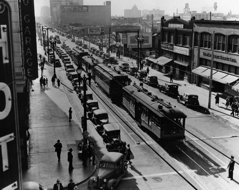
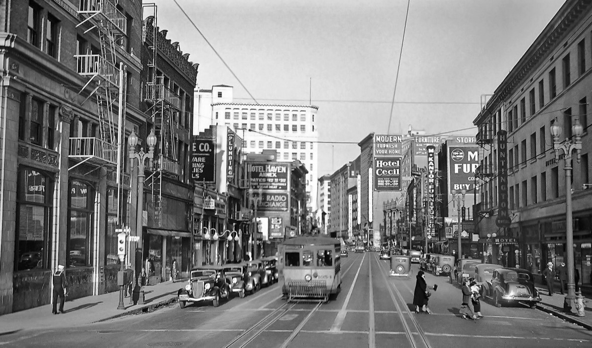
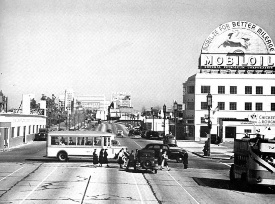
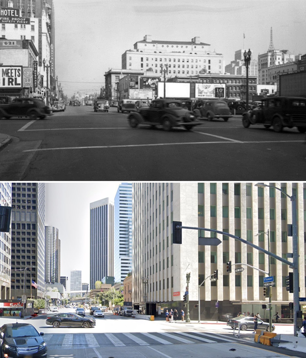
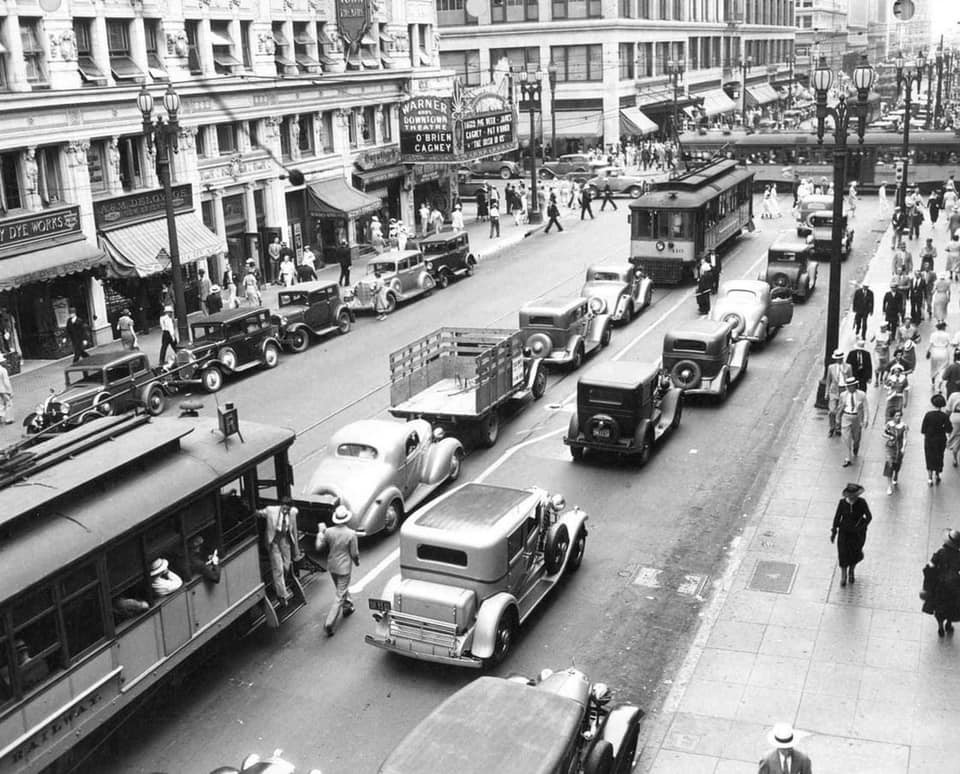
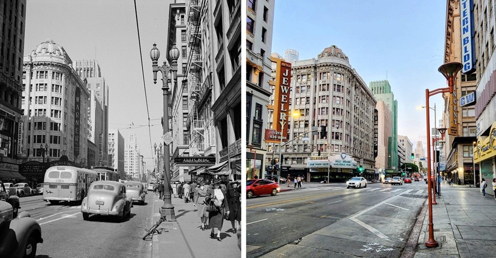
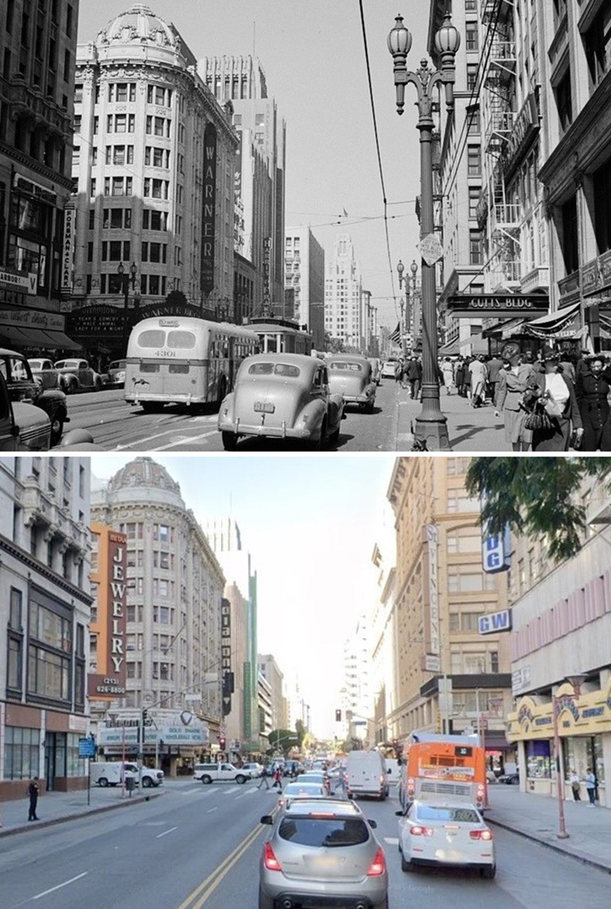
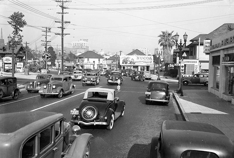
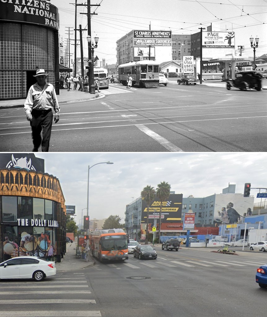
| (1930)^ - Looking north from 9th Street where Spring Street (left) and Main Street (right) split with elevated kiosk on the NW conrer. The streets are shown bustling with the activity of pedestrians, automobiles and streetcars. |
Historical Notes The junction of Main, Spring, and 9th streets became one of the most photographed intersections because of its configuration. Click HERE to see more. |
.jpg) |
|
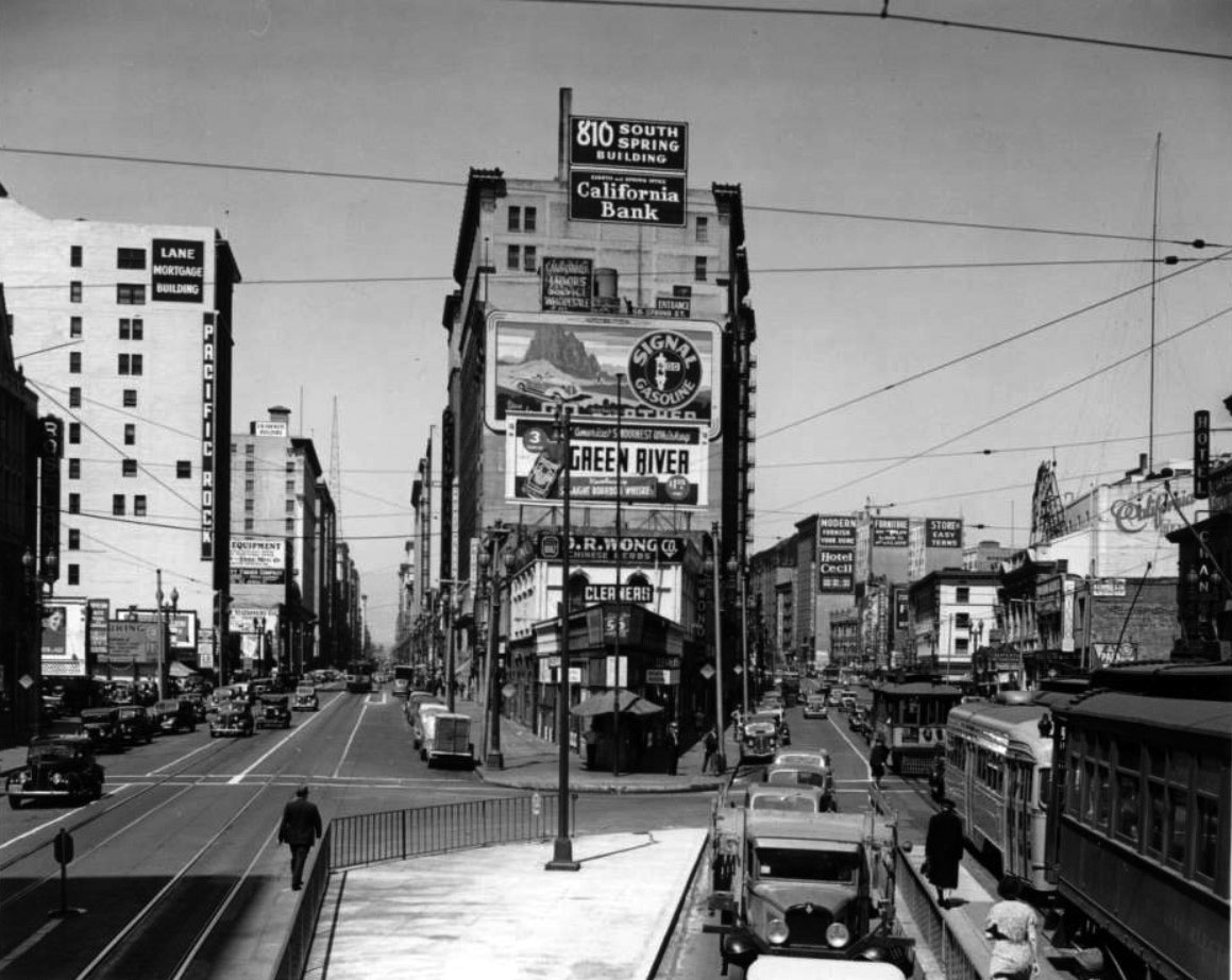
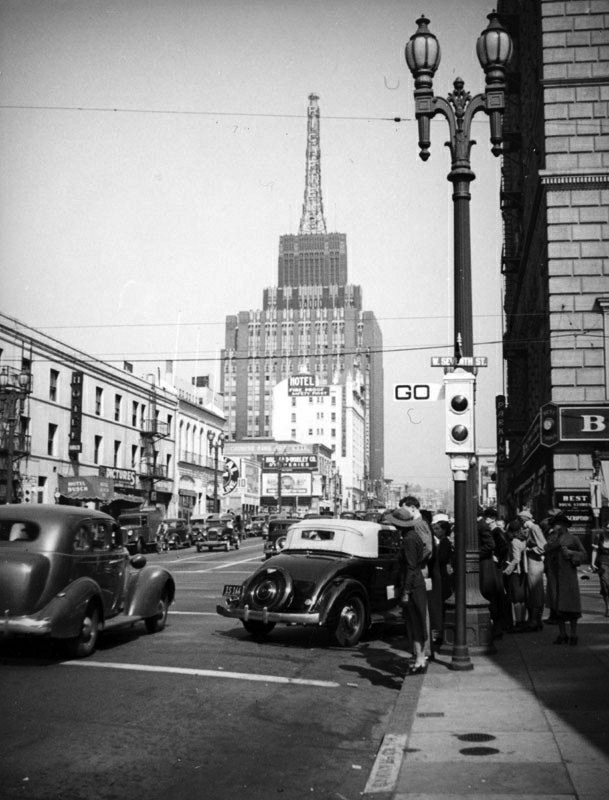
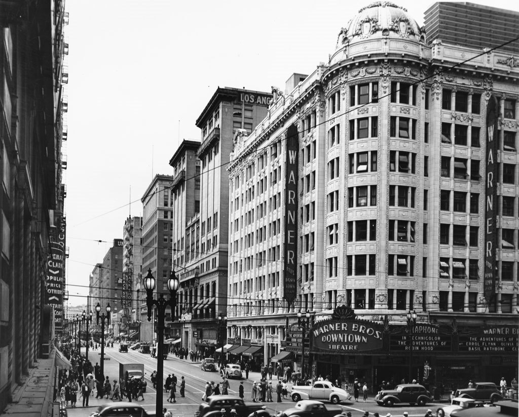
| (ca. 1937)^ - Close-up view of the kiosk on the conrer of 9th, Spring and Mains streets. A uniformed man sits in a booth on top of a pole in the foreground of this corner as pedestrians walk by underneath. Also note traffic signal with semaphore arms. Signs visible in the background include the Los Angeles City Club (833 South Spring) and the California Bank in the 810 South Spring Building. |
Historical Notes The traffic control booth perched above the street had an operator at the helm changing the traffic signals to help the flow of traffic necessary due to the complex configuration of tracks at the intersection. To get cars and commerce moving through the downtown business district, Los Angeles installed its first automated traffic signals in October 1920. These early signals, manufactured by the Acme Traffic Signal Co., paired “Stop” and “Go” semaphore arms with small red and green lights. Bells played the role of today’s amber or yellow lights, ringing when the flags changed—a process that took five seconds. |
 |
|
| (1938)* - Looking north at the point at which Main Street and Spring Street separate as trolleys cars and cars clutter the street. Note the island on the right. It enabled passengers to board the streetcars more safely. Click HERE to see more Early Views of the Intersection of Main, Spring, and 9th Streets. |
Historical Notes The Los Angeles Railway (LARy), was a system of streetcars in Los Angeles between 1895 and 1945. It operated on 3 foot, 6 inch (1,067 mm) narrow-gauge tracks and connected the city center to neighborhoods in about a six-mile radius of downtown. There were about 642 miles of track at its peak in 1924. The system was informally known as the “Yellow Cars,” similar to the Pacific Electric Railway’s “Red Cars” which served more outlying areas. |
 |
|
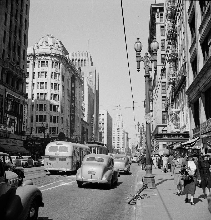
| (1938)**^ - View looking down Hill Street from the corner of 9th and Hill. Cars and streetcars are lined up as a policeman stands in the middle of the intersection waiting for the pedestrians to completely cross the street before redirecting traffic. |
Main and 8th Streets
 |
|
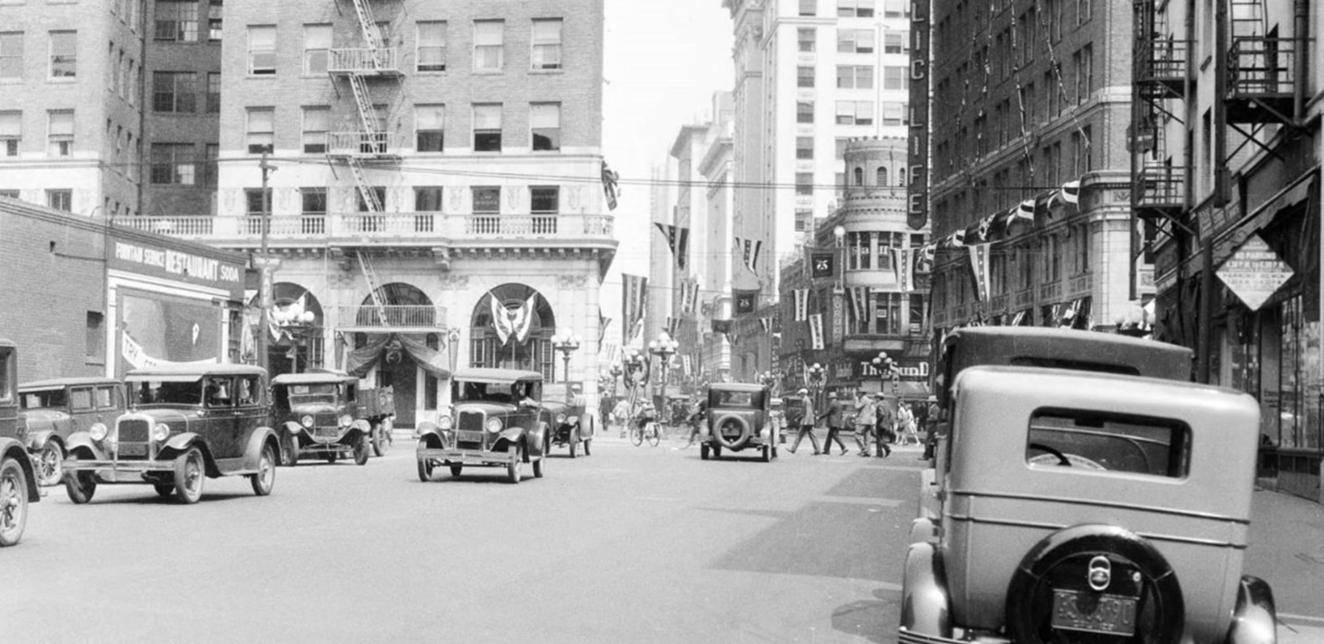
| (ca. 1930)* - Looking west on 8th Street toward Main Street. |
Then and Now
 |
|
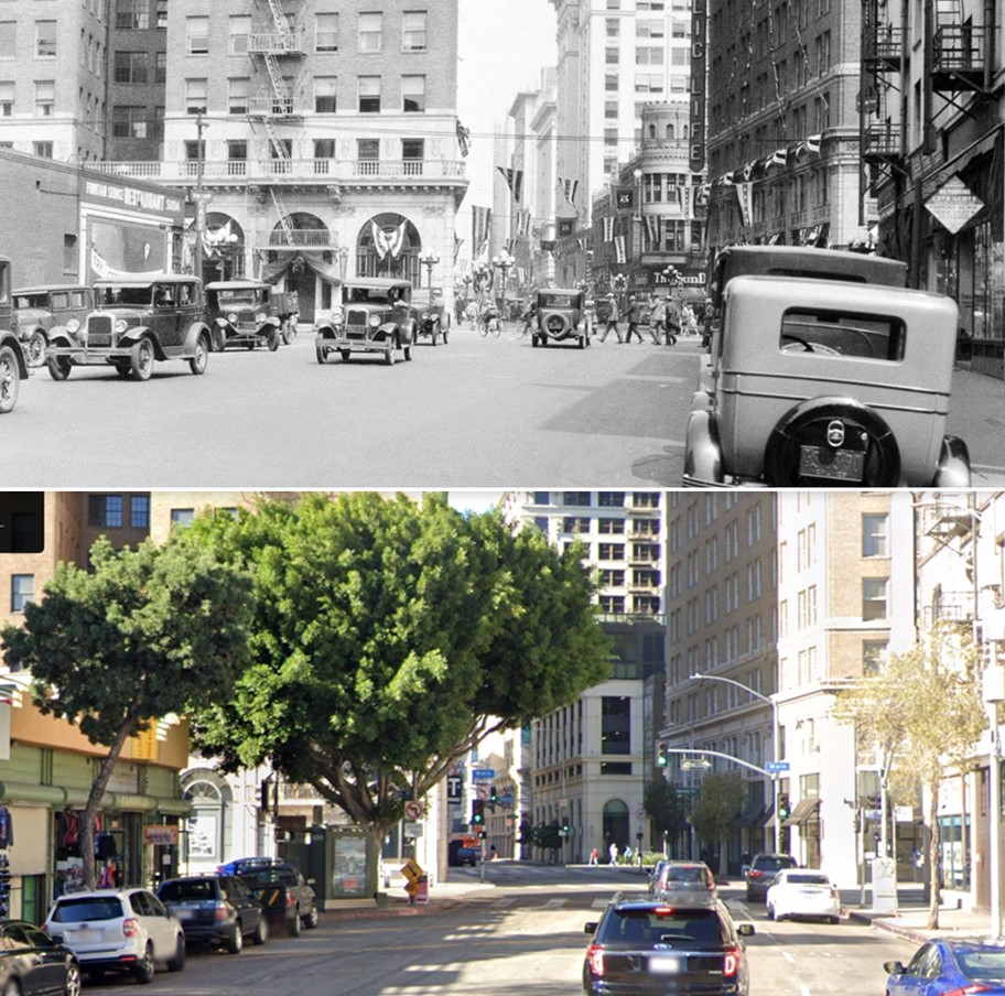
| (1930 vs 2020)* - Looking west on 8th Street toward Main Street. Photo comparison by Jack Feldman. |
.jpg) |
|
| (1938)* - View looking west on 8th Street at Main Street. |
 |
|
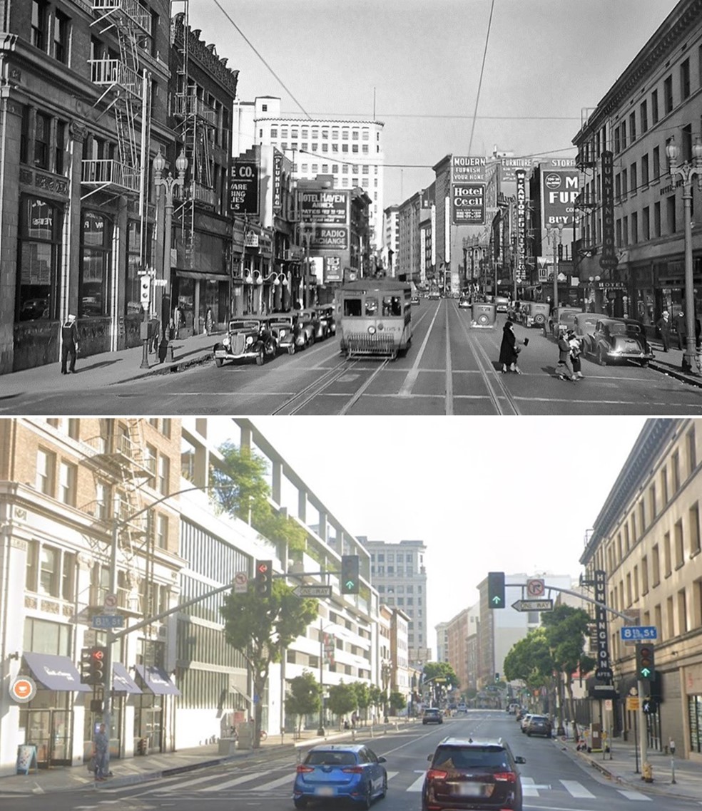
| (1938)* - View looking north on Main Street from 8th Street showing a Los Angeles Railway streetcar. The Cecil Hotel can be seen in the distance. |
Then and Now
 |
|
| (1938 vs 2022)* – Looking north on Main Street at 8th Street in DTLA.he distance. Photo comparison by Jack Feldman. |
Main and 12th Street
 |
|
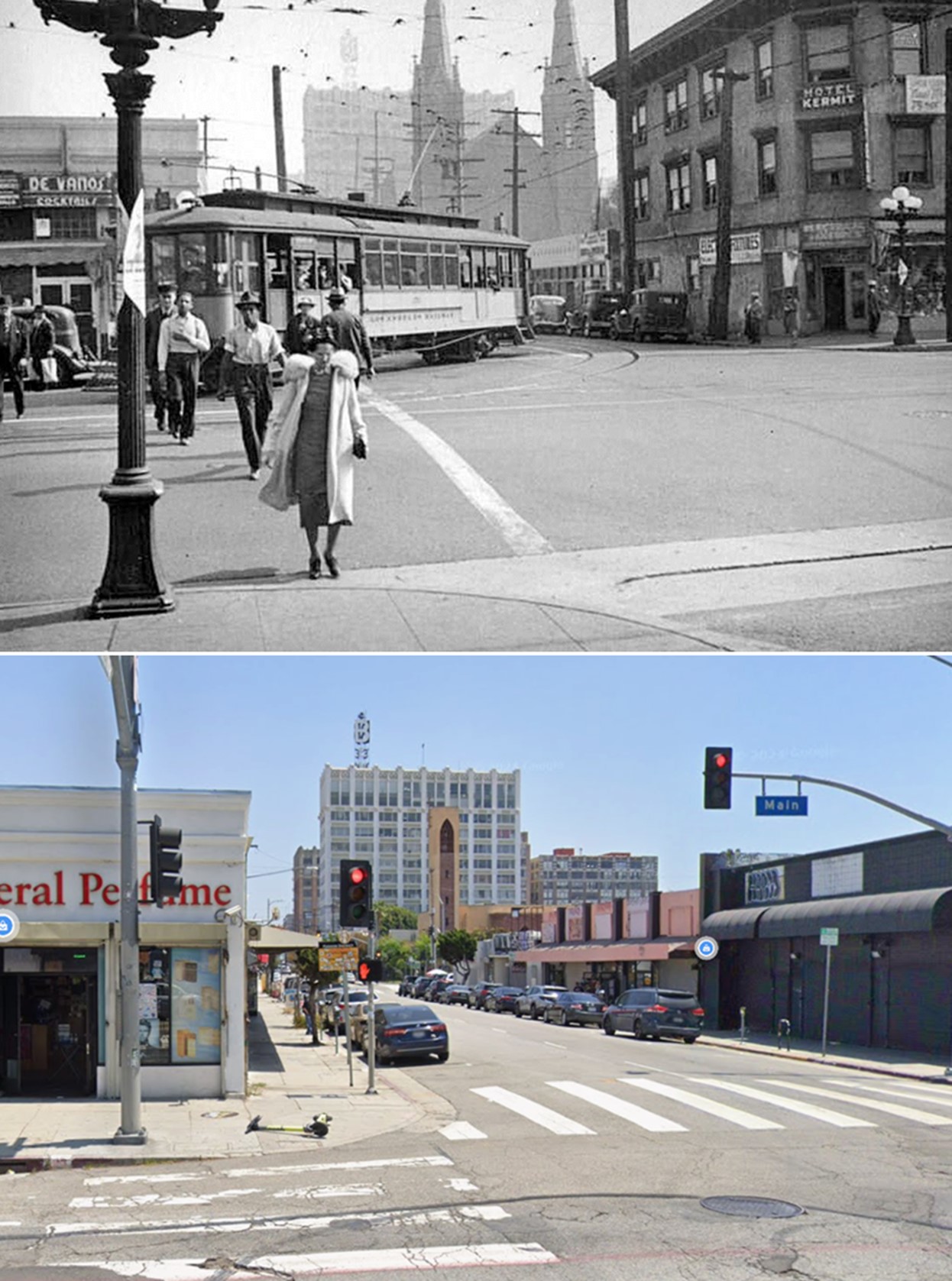
| (ca. 1937)* - View looking east on 12th Street at Main Street in downtown Los Angeles. A Yellow Car is turning right onto Main Street behind pedestrians crossing the street. The Gothic Revival St. Joseph Catholic Church at 218 E. 12th Street is seen in the distance, with the Bendix Building further back. Note the multiple globe streetlight on the left. This was the most common type of streetlight found in downtown Los Angels in the early 1900s. Click HERE to see more. Photo by Herman Schultheis |
Historical Notes St. Joseph's Church was founded by Franciscan friars in 1889 to serve German immigrants. In 1983, a fire destroyed the original neo-gothic structure. The Archdiocese of Los Angeles restored and redesigned the church between 1987-1992, with contributions from friars and lay co-workers. Salvaged remnants from the original church, including the baptismal font and altar screen, were incorporated into the new design. The interior features contemporary oil paintings by Franciscan Gino Piccooil, in the style of El Greco. Today, St. Joseph's primarily serves a largely Hispanic community. |
 |
|
| (2024)* - Looking east on 12th Street at Main Street in downtown Los Angeles. |
 |
|
| (1937 vs. 2024)* - Looking east on 12th Street at Main Street in downtown Los Angeles. Photo comparison by Jack Feldman. |
 |
|
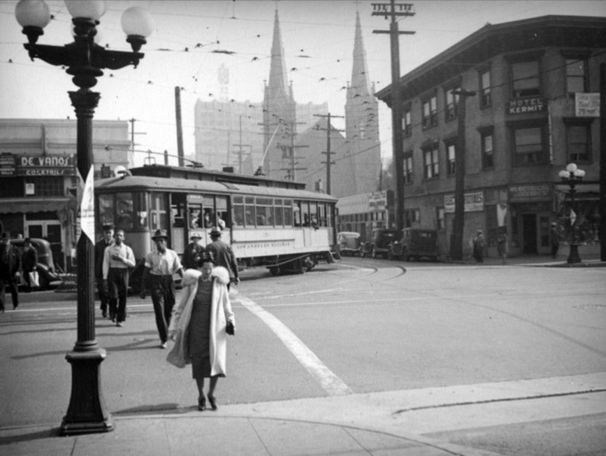
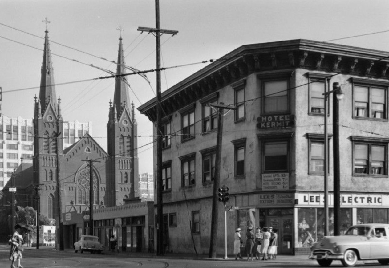
| (1957)* - The intersection of Main and 12th Street, with the Hotel Kermit, Lee's Electric, and St. Joseph's Church in view. Women stand in conversation on the corner. Photo by William Reagh |
Historical Notes St. Joseph's Church was founded by Franciscan friars in 1889 to serve German immigrants. In 1983, a fire destroyed the original neo-gothic structure. The Archdiocese of Los Angeles restored and redesigned the church between 1987-1992, with contributions from friars and lay co-workers. Salvaged remnants from the original church, including the baptismal font and altar screen, were incorporated into the new design. The interior features contemporary oil paintings by Franciscan Gino Piccooil, in the style of El Greco. Today, St. Joseph's primarily serves a largely Hispanic community. |
Hill and 4th Street
 |
|
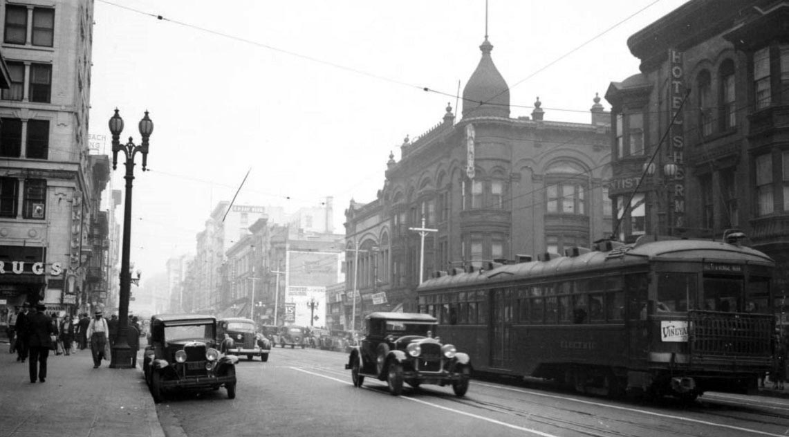
| (ca. 1938)* – Panoramic view looking north on Hill Street toward 4th Street showing a streetcar labeled “Hill St. and Venice Blvd” sitting on the tracks. The Hotel Sherman is seen on the right (S/E corner). The building across the street (N/E corner) with the onion-shaped dome is the Brighton Hotel. The building on the left (N/W corner) is the Black Building. |
Historical Notes The beautiful two-lamp streetlamps, commonly known as UM-1906's, are still seen in parts of Los Angeles today. Click HERE to see more. |
Then and Now
 |
|
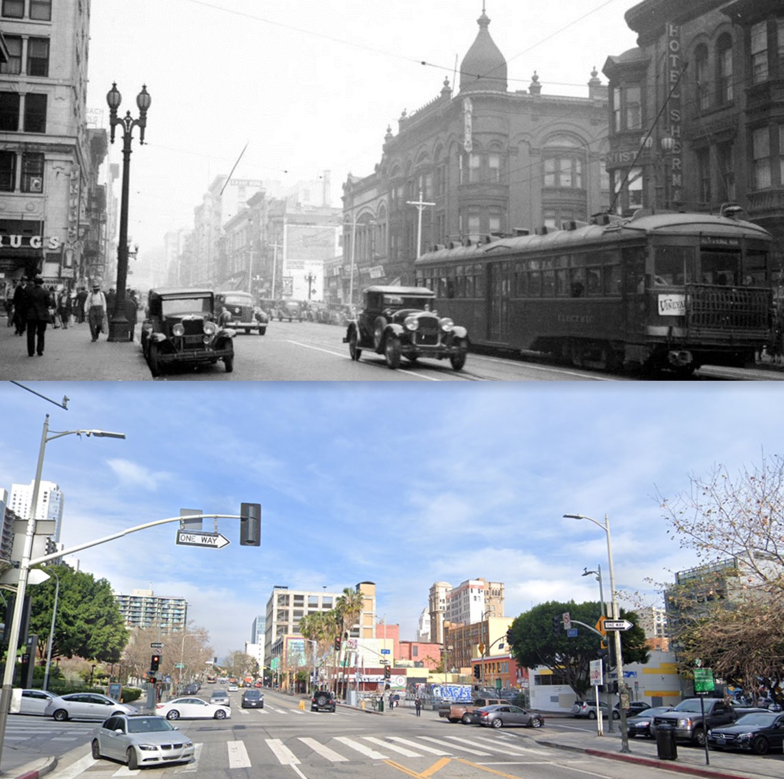
| (1938 vs. 2022)* – Looking north on Hill Street toward 4th Street. Photo comparison by Jack Feldman. |
Historical Notes Perhaps the most noticeable losses in this view are the buildings that occupied the intersection’s corners. The Black Building (1913) on the N/W corner; the onion-shaped domed building, the Brighton Hotel (c.1890) on the N/E corner; Hotel Sherman (c.1890) on the S/E corner; and the Callendar Building (c.1907) on the S/W corner, out of view. All four buildings were demolished sometime in the 1960s. Perenially starved for office space, the Los Angeles Department of Water and Power purchased the Wright and Callendar Building in 1946, and leased much of the Black Building in 1958. The towers were vacated in 1964 when the agency moved to its current Civic Center headquarters. It appears that both buildings were demolished shortly afterwards, and their block of Fourth Street was subsequently widened.* |
* * * * * |
Hill and 5th Streets
 |
|
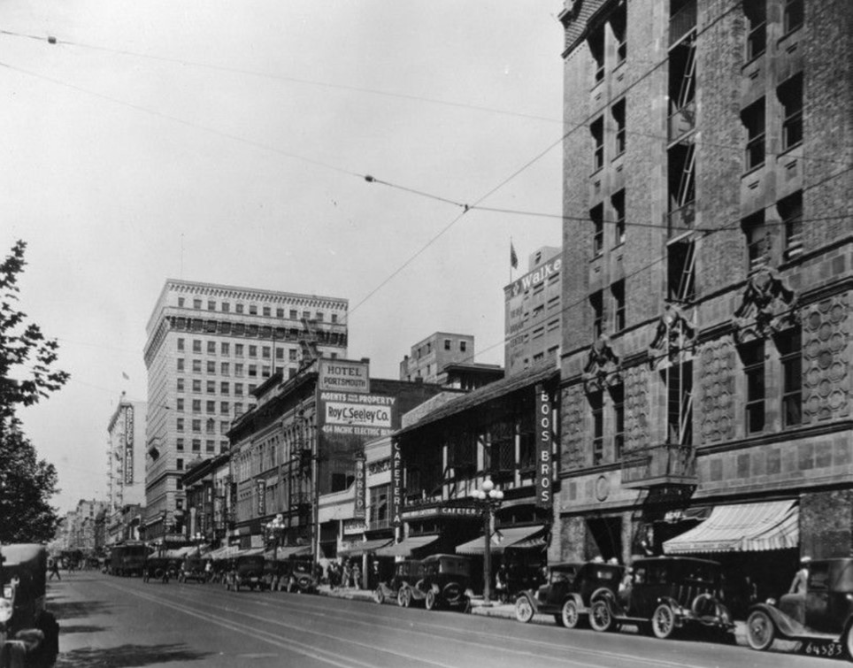
| (1930)* - Looking north on Hills Street between 5th and 6th streets. Several buildings and storefront can be seen including: Boos Bros. Cafeteria, Norco, and the Portsmouth Hotel. |
 |
|
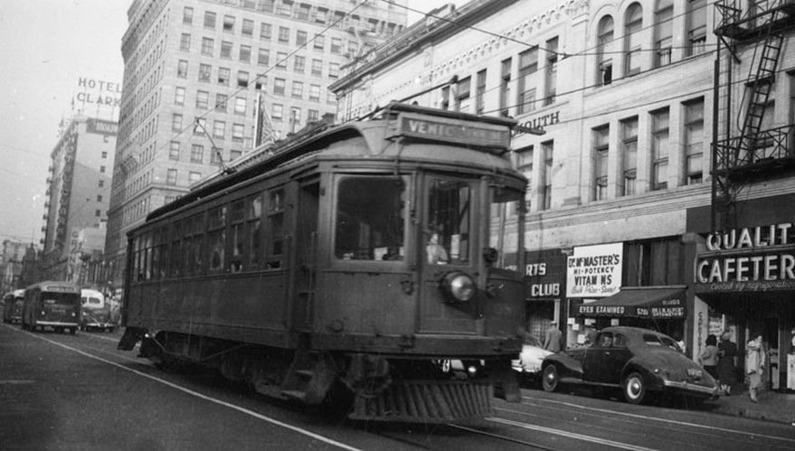
| (ca. 1945)^ - Venice is the destination for this Pacific Electric car as it passes in front of the Hotel Portsmouth on Hill St. In the distance is Hotel Clark. |
Historical Notes Pacific Electric carried increased passenger loads during World War II, when Los Angeles County's population nearly doubled as war industries concentrated in the region attracting millions of workers. There were several years when the company's income statement showed a profit, most notably during World War II, when gasoline was rationed and much of the populace depended on mass transit. At peak operation toward the end of World War II, the PE dispatched over 1000 trains daily and was a major employer in Southern California. |
 |
|
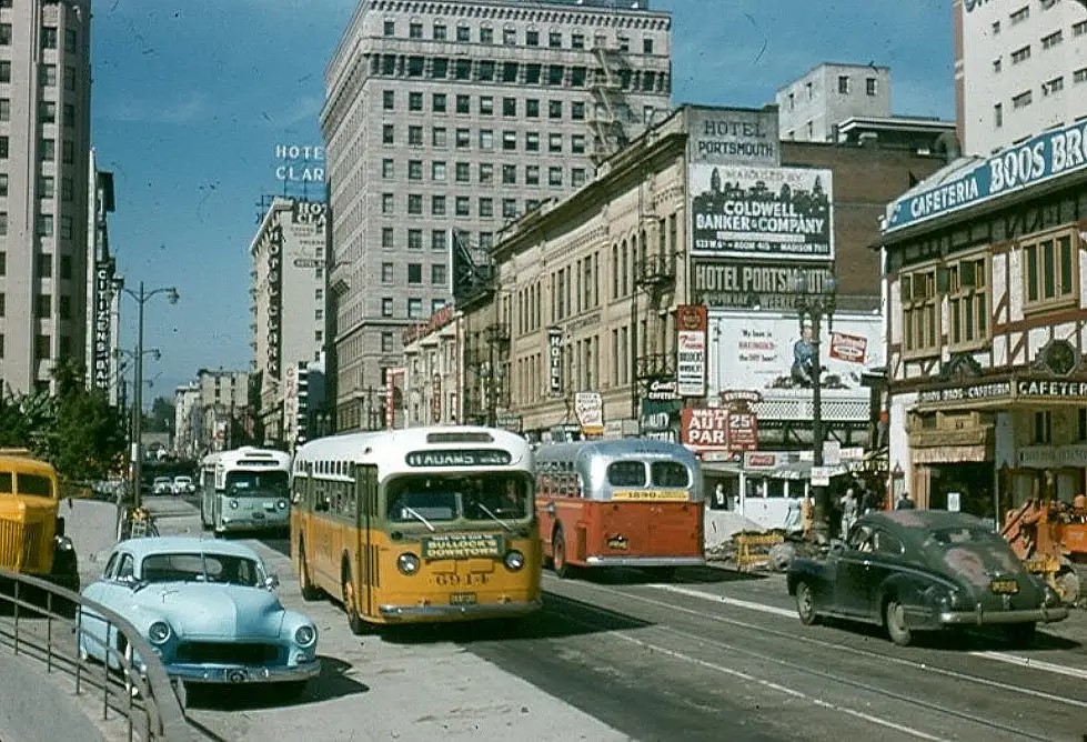
| (1954)* – Looking north on Hill Street toward 5th Street with the Boos Bros. Cafeteria on the right. METRO Library Archives |
* * * * * |
LA Motor Coach Co. (Double-Decker Buses)
 |
|
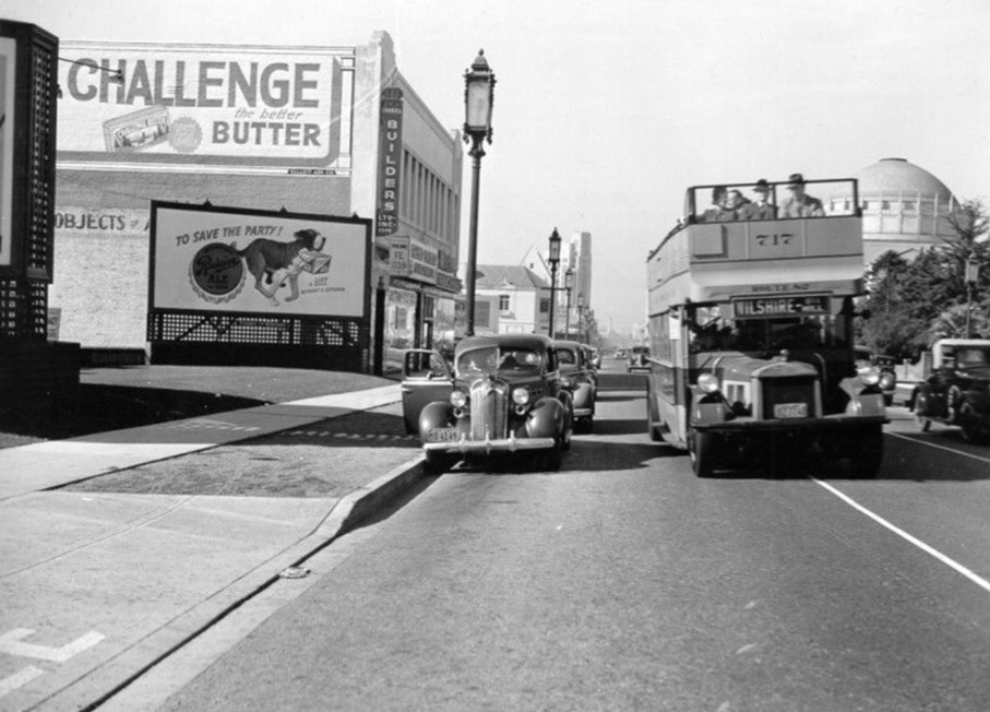
| (ca. 1938)* - A Los Angeles Motor Company double-decker bus passes parked cars on Wilshire Blvd near Ardmore Ave. Note the ads on the building to the left--for butter and for ale. |
Historical Notes Los Angeles Motor Bus (later renamed the Los Angeles Motor Coach Company) was a joint venture of Pacific Electric and Los Angeles Railway that existed from 1923 until 1949. It began in 1923 as Wilshire Boulevard's transit service from the MacArthur Park area to La Brea Avenue and was extended further down Wilshire as the service gained in popularity. Wilshire has an interesting distinction, it was the only street that was banned by the City of Los Angeles from having street rail on it. Henry Wilshire, when he began developing a 35-acre tract stretching west from Westlake (now MacArthur) Park for an exclusive subdivision, donated to the city an almost quarter-mile long strip of land for a boulevard, conditioned on its being named for him and with the following being banned: rail lines and trucking, heavy and industrial. He didn’t want to discourage the very wealthy prospective buyers he sought to attract. |
 |
|
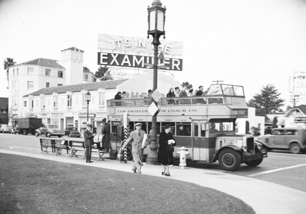
| (1937)* - This early type of motor coach transportation shows a double-decker bus; the upper deck filled with passengers. This is the Route 82 motor coach that travels from Wilshire to 5th and Hill. A very large marquee atop a building behind the coach reads: "It's in the Examiner", possibly making reference to the Herald Examiner newspaper. Photo taken at Wilshire and Western. |
 |
|
| (1930s)^ - Los Angeles Motor Coach Fageol Double-Deck Bus No. 604 on the Sunset Boulevard Line. View is looking west on 8th Street west of Grand Avenue with the Morgan Hotel in the background. |
 |
|
| (ca. 1935)* - Los Angeles Motor Coach Co. coach stopped at Hill Street between 5th and 6th Streets on the eastern edge of Pershing Square. This is the Route 82 motor coach that travels from Wilshire to 5th and Hill. A glimpse of the Biltmore Hotel can be seen in the background on the left, beyond the trees. |
 |
|
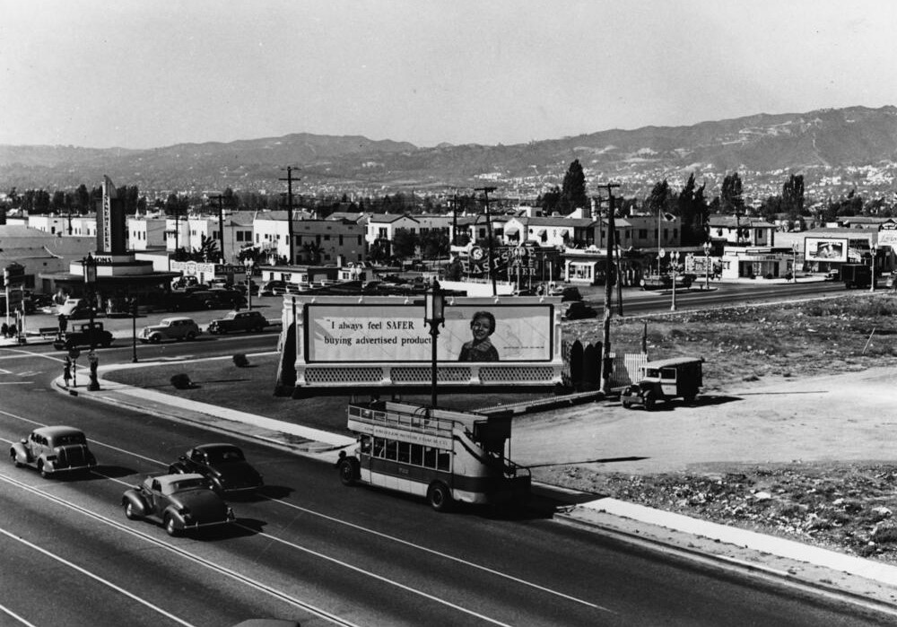
| (1938)* - A double-decker bus is parked by the curb near the intersection of Wilshire and Fairfax and the future site of May Co. Department Store. A large signboard reads: ‘I always feel SAFER buying advertixed products’. Simon's Drive-thru restauarant is see on the NW corner. |
 |
|
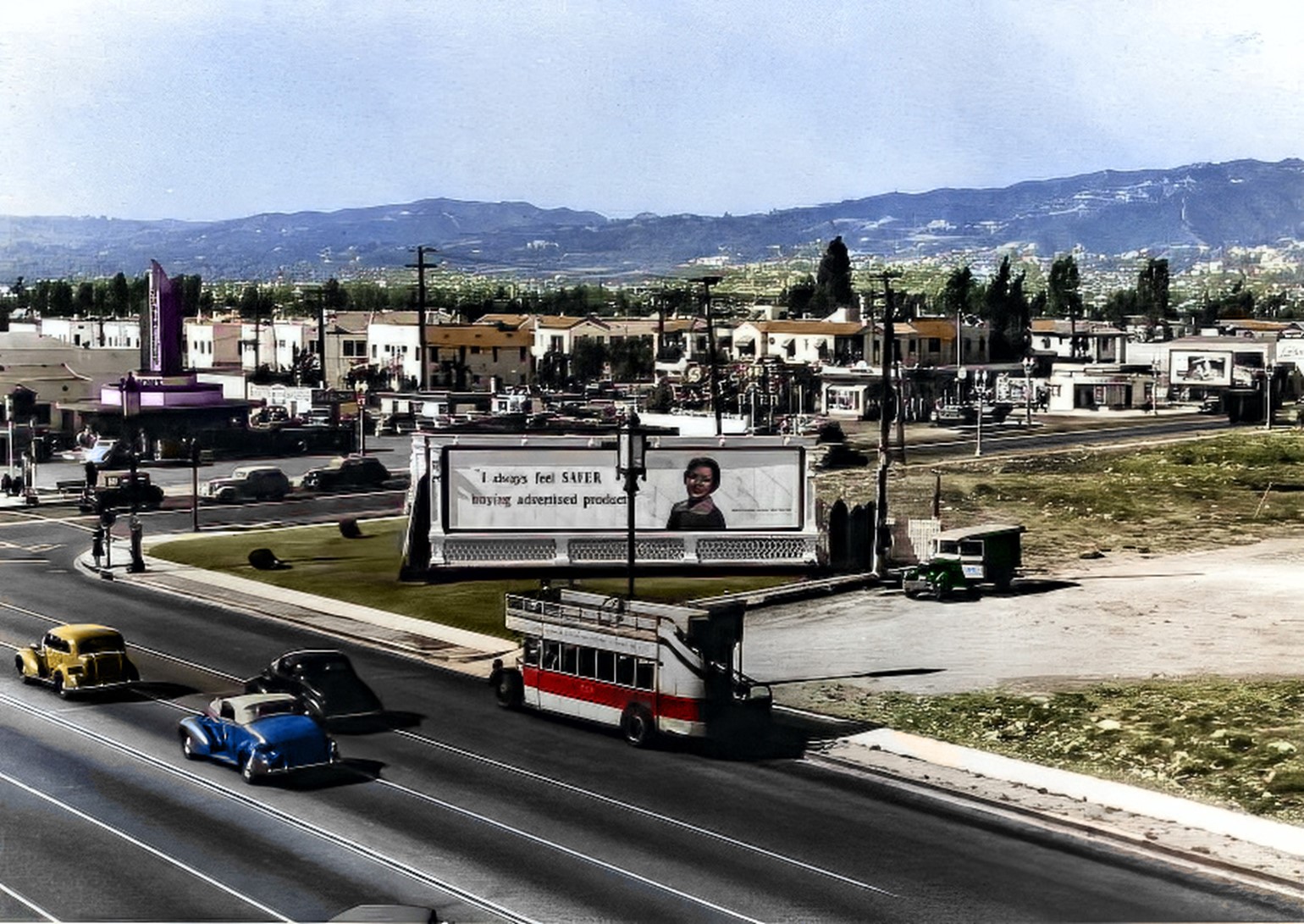
| (1938)* - A double-decker bus is parked by the curb near the intersection of Wilshire and Fairfax. Large signboard reads: ‘I always feel SAFER buying advertixed products’. Image enhancement and colorization by Richard Holoff |
 |
|
| (1938)* – View looking east on Wilshire Boulevard at Fairfax Avenue. At right is a double-decker bus on the Los Angeles Motor Coach Wilshire Line and crossing Wilshire is a bus on the Fairfax Avenue line. The building on the right with the rooftop Mobil Gas billboard is the 6030 Wilshire building (later the location of the A+D Museum). The building on the left (NE corner) will be torn down to make way for the May Company Building (built in 1940). Click HERE to see more in Early Views of the Miracle Mile. |
 |
|
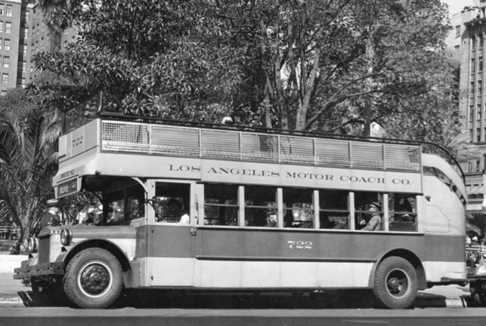
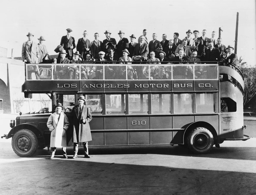
| (ca. 1920s)* - This double-decker bus no. 610 was part of the Los Angeles Motor Bus line, built by Fageol in 1924. |
Historical Notes The Los Angeles Motor Bus Company (later renamed the Los Angeles Motor Coach Company) ordered its first batch of double-deckers in 1924 mainly for their extra capacity. With 54-64 seats each (depending on the model), the buses could absorb the crowds huddled around bus stops along new, booming commercial corridors like Wilshire Boulevard. That made them attractive to the bus line’s joint owners, the Pacific Electric and Los Angeles railways, who used double-deckers as an alternative to building costly new trolley lines. And Angelenos loved them. Production companies often rented the yellow-and-red vehicles for film shoots. On summer evenings, young couples flocked to their upper decks for gentle breezes — and privacy. Bad weather did usually mean unused capacity, but the buses continued to dart down Wilshire and Sunset through the 1930s. Eventually, the popular buses went the way of the streetcars they replaced — though you can still find double-decked sightseeing buses cruising the city’s tourist districts.^ |
* * * * * |
Hollywood Hills
 |
|
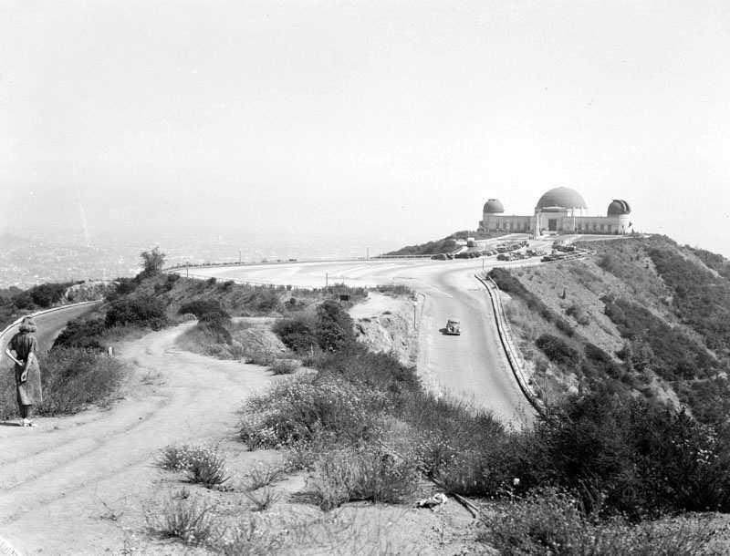
| (1937)^ - View of Griffith Observatory in Griffith Park, looking southeast with the city down below in the background. |
Historical Notes 3,015 acres of land surrounding the observatory was donated to the City of Los Angeles by Colonel Griffith J. Griffith on December 16, 1896. In his will Griffith donated funds to build an observatory, exhibit hall, and planetarium on the donated land. Construction began on June 20, 1933, using a design developed by architect John C. Austin based on preliminary sketches by Russell W. Porter. . The observatory and accompanying exhibits were opened to the public on May 14, 1935.^ |
.jpg) |
|
| (1939)^ - Looking up the palm tree-lined residential area of Normandie and Franklin Avenue. The Griffith Park Observatory can be seen in the far background in the Hollywood Hills. |
Historical Notes Architects John C. Austin and Frederick M. Ashley built the Observatory in 1935; it is located at 2800 E. Observatory Road in Griffith Park. Click HERE to see more in Early Views of the Griffith Park Observatory. |
* * * * * |
Griffith Park Merry-Go-Round
 |
|
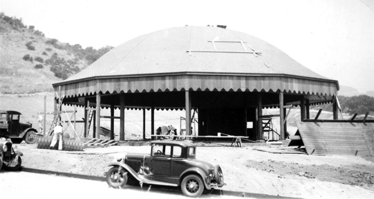
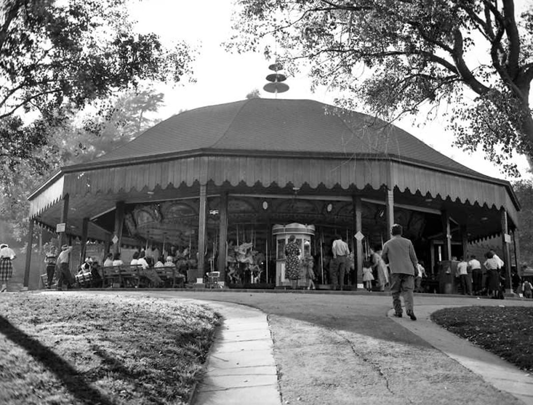
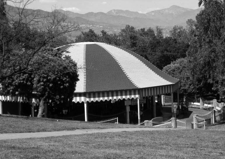
| (1937)^^ – Griffith Park Merry-Go-Round under construction with the new canopy shell already in place. |
Historical Notes In the early 1900s, Oliver Funk Davis, a master carpenter, took merry-go-rounds to carnivals and fairs throughout California. The machines were built by the Herschell-Spillman Company of North Tonawanda, New York. It was Davis and his family who brought the 1926 Spillman/Loof Carousel to Griffith Park. They built the beautiful building niched into the side of the hill as well. Oliver F., Ross R., and J. O. Davis, three generations. In addition to The Griffith Park Carousel, the Davis family are also responsible for the historic carousels at Balboa Park, San Diego; Tilden Park, Berkeley, CA; and instrumental in placing the carousel in Golden Gate Park, San Francisco.* |
 |
|
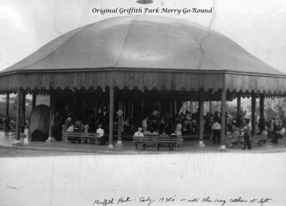
| (1940s)^.^ - A busy day at the Griffith Park Merry-Go-Round. Note the ring catcher at left. |
Historical Notes The Griffith Park Merry-Go-Round was built in 1926 by the Spillman Engineering Company. Commissioned by the Spreckels family, it was originally housed at the Mission Beach Amusement Center in San Diego but was moved to its current location in 1937. The merry-go-round is comprised of 68 hand-made horses, all of which jump, and a custom-built Stinson 165 Military Band Organ that plays more than 1,500 songs. It’s the only full-size Spillman carousel still in operation today.* |
 |
|
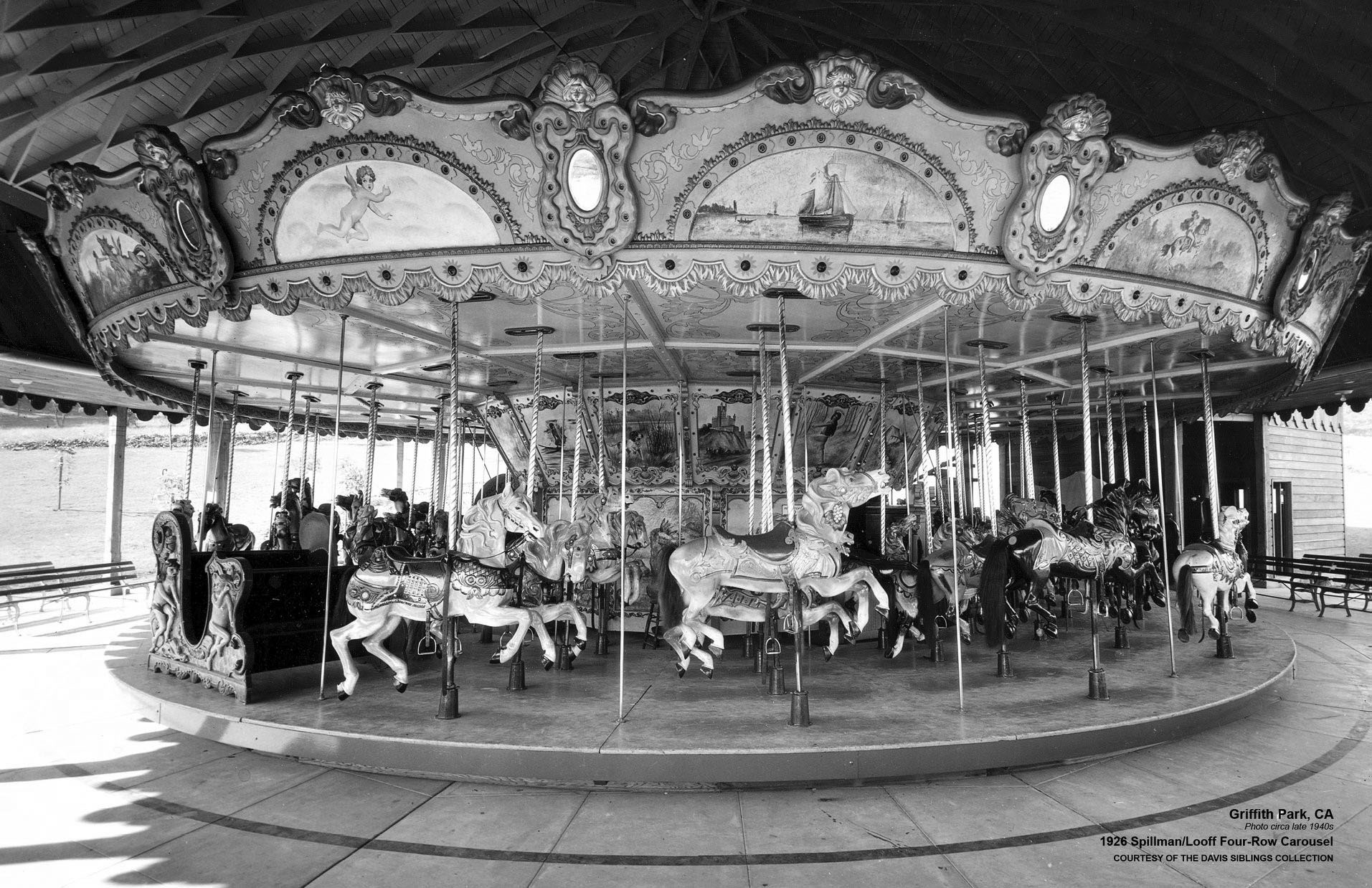
| (ca. 1940s)^.^ – Postcard view showing the 1926-built Spillman/Loof Four-Row Carousel at Griffith Park. Photo courtesy of the Davis Siblings Collection |
Historical Notes The small carousel, which is tucked away into a quiet corner of the park, served as Walt Disney’s inspiration for Disneyland. When his children were young, Walt, a Los Feliz denizen, took them to the merry-go-round on weekends. During one visit, while sitting on a bench watching his kids circle round and round, he was inspired to create a large scale gathering site that the whole family could enjoy. His dream was realized on July 17, 1955, when Disneyland opened to the public.* |
 |
|
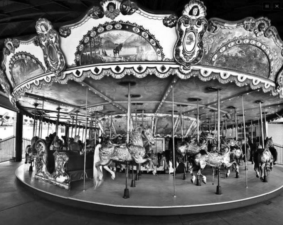
| (n.d.)^.^ – Close-up view of the Griffith Park Carousel which has become a popular filming location. |
Historical Notes Built in 1926, this iconic merry-go-round features 68 elaborately decorated horses & an organ. |
 |
|
| (1949)* - Seen here is a wide view of the merry-go-round at Griffith Park. Parents and family members watch from the side and wait on benches. |
Historical Notes Thanks to its nostalgic appeal, the Griffith Park landmark is a wildly popular filming location. One of its most famous appearances was in Teen Witch. In the 1989 cult favorite, the carousel is where newly-minted witch Louise Miller (Robin Lively) learns how to cast spells to create wind and rain. The Griffith Park Merry-Go-Round is also where Amilyn (Paul Reubens) turns Grueller (Sasha Jensen) into a vampire in Buffy the Vampire Slayer; where Julius and Vincent Benedict (Arnold Schwarzenegger and Danny DeVito, respectively) ride a carousel with their new wives and babies in Twins; and where Patrick Jane (Simon Baker) hypnotizes a young murder suspect in the episode of The Mentalist titled “Seeing Red.” The site has also popped up in the movies Maxie and Beautiful, episodes of MacGyver, CSI: NY, Rizzoli & Isles, Castle, Alias, Knots Landing, Beauty and the Beast, Law & Order: LA, Mod Squad, Melrose Place, House, and The Whole Truth, and in the music videos for Jessica Simpson and Nick Lachey’s song “Where You Are” and Demi Lovato’s “Don’t Forget.” The carousel and its surround area is a veritable filming institution.^ |
 |
|
| (2010s)** – View looking northeast showing the Griffith Park Merry-Go-Round which Los Angeles Magazine calls "a time machine, an art lesson, and a thrill ride all in one." Located at 4730 Crystal Springs Drive in Griffith Park. |
Historical Notes Anyone who’s visited the Griffith Park Merry-go-Round may have noticed a rather nondescript green bench off to one side, but if you were to look really close, you’d easily identify the man in the picture. Walt Disney would occasionally bring his daughters to ride the carousel and would patiently wait on the bench for the ride to finish. There are actually two benches… one still resides in the park, while the other resides at the Opera House lobby in Disneyland. Inspired by the Griffith Park carousel, Walt Disney wanted something similar for his new theme park: a carousel consisting of all jumpers. A park model Menagerie Carousel was purchased and moved to Disneyland in 1954.* |
* * * * * |
Hollywood
 |
|
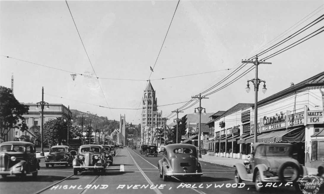
| (1937)*^## - Looking north on Highland Avenue near Sunset Boulevard. Hollywood High School can be seen at far left, and in the center distance are the Hollywood United Methodist Church and the Hollywood First National Bank Building.*^^ |
Historical Notes The thirteen story First National Bank Building with Gothic/Renaissance elements a la Art Deco is one of a handful of structures in the city that is adorned with gargoyles. It was the tallest building in Los Angeles from 1927 to 1932.^ |
 |
|
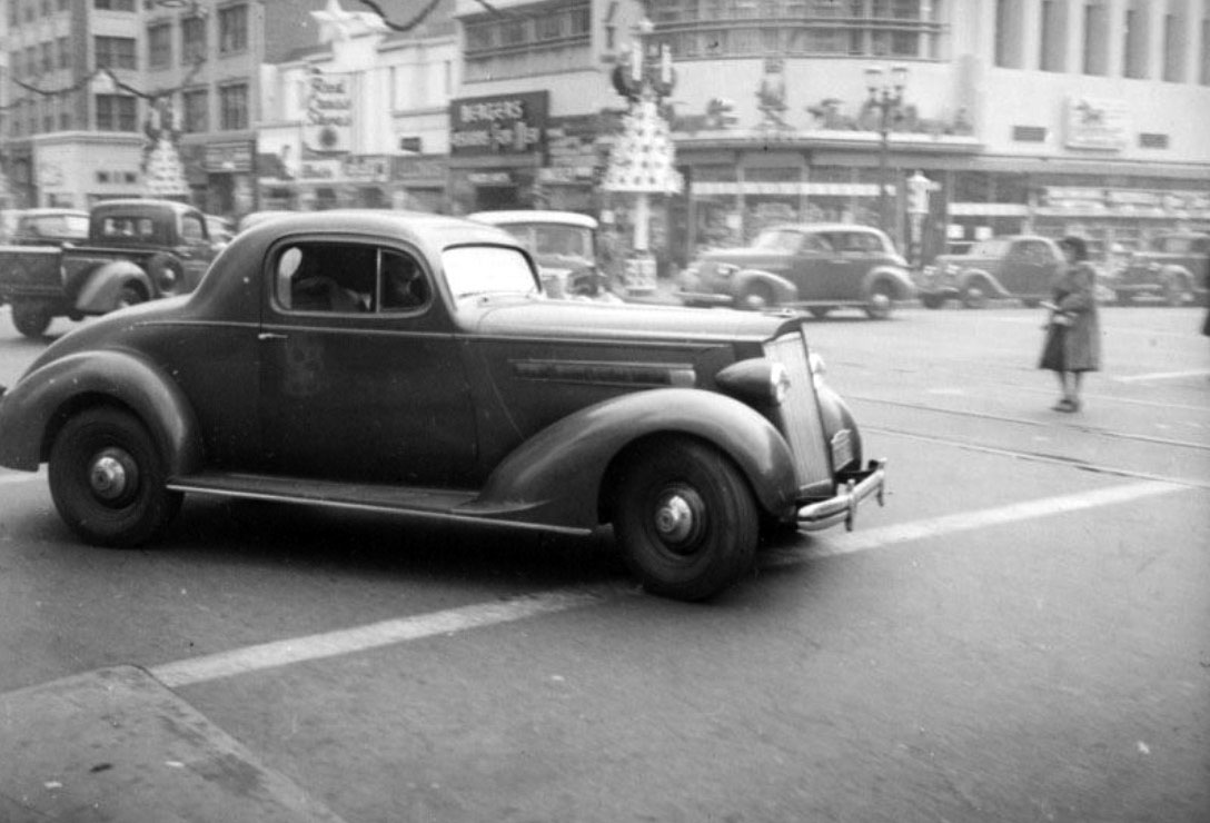
| (1937)^ - View showing a 1936 Packard 120 Straight Eight Coupe making a right turn onto Hollywood Boulevard from Cahuenga. Photo by Herman Schulteis |
Historical Notes Packard was an American luxury automobile marque built by the Packard Motor Car Company of Detroit, Michigan, and later by the Studebaker-Packard Corporation of South Bend, Indiana. The first Packard automobiles were produced in 1899, and the last in 1958. According to many people the introduction of the Packard 120 (seen above) was Packard's savior in the '30's during the final years of the Great Depression.^* |
.jpg) |
|
| (1937)^ - Hollywood Boulevard looking east from Sycamore Ave. In the background are First National Bank Building, the Roosevelt Hotel and the Chinese Theatre. First National Bank Building was designed by Meyer and Holler. |
 |
|
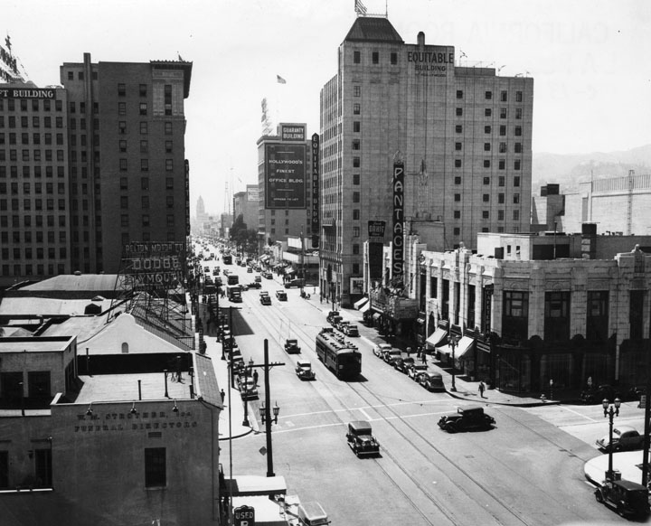
| (1937)^ - An aerial view looking west down Hollywood Blvd. from the intersection with Argyle Ave. On the left is the Strother Funeral Directors building, and beyond it a Dodge Plymouth motor car dealer, and past that, the Taft Building. Going down the right side of the street we see the Pantages Theatre, and beyond that the Equitable Building and then the Guaranty Building. |
Click HERE to see more in Early Views of Hollywood (1920 +) |
* * * * * |
Cahuenga and Highland
 |
|
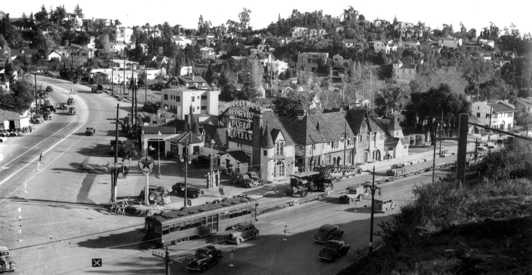
| (ca. 1937)*#^ - Panoramic view looking toward the southeast corner of Cahuenga (left) and Highland Ave (right). Streetcars and automobiles share the road at this busy intersection. A Texaco service station stands on the corner with the Hollywood Roosevelt Plaza Hotels behind it (Note: this hotel is not related to the famous Roosevelt Hotel on Hollywood Boulevard). |
Historical Notes This little nestle of buildings was known as the French Village. It was set on a triangular plot of land at the point where Highland Avenue and Cahuenga Boulevard converged as they entered the Cahuenga Pass. This puts it roughly across the street from the front entrance of the Hollywood Bowl. It opened in 1920, and throughout the 1920s, 30s, and 40s, the French Village was home to a revolving community of actors, writers, costume designers, dance instructors and singing coaches. #**# To relieve traffic congestion at this busy Cahuenga and Highland intersection, a tunnel was bored under Highland ca. 1937. A large construction boring tractor can be seen at center of photo. |
 |
|
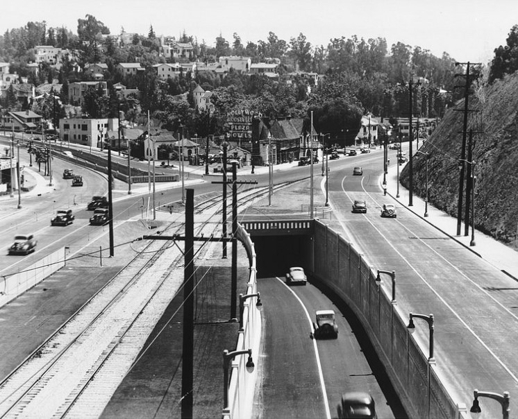
| (1938)*# - Looking southeast at Whitley Heights across the intersection of Cahuenga Boulevard shortly after the construction of the new underpass to Highland Avenue. The entrance to the Hollywood Bowl is just beyond the shoulder of the hill on the right. |
Historical Notes The seriously complicated solution to the traffic pattern was largely eliminated in the coming years through the realignment and widening of Caheunga.*^ |
 |
|
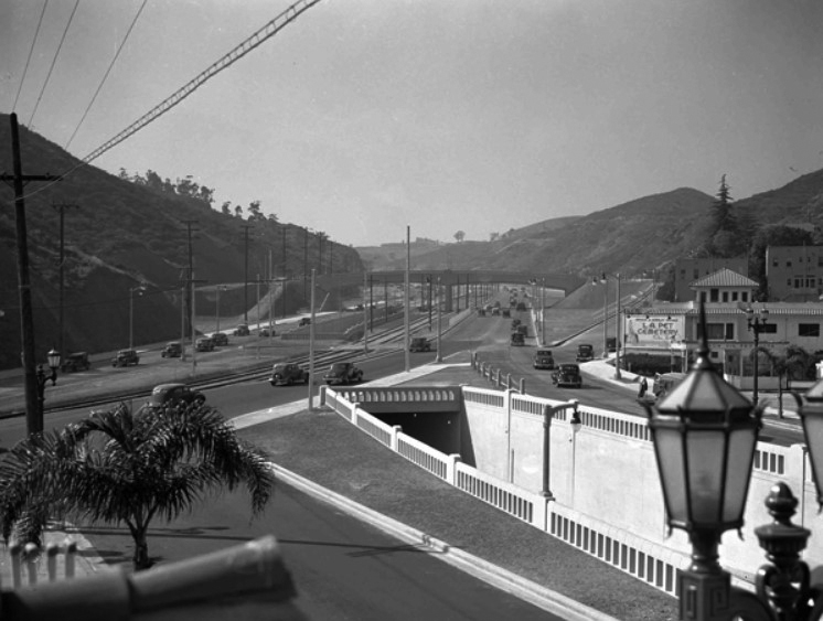
| ca. 1938)^^^* - View looking northwest showing Cahuenga Pass as it heads toward the San Fernando Valley. The tunnel at center-right (since closed) extended Highland Boulevard to the north, under the Freeway. The Hollywood Bowl is on left (out of view) on the other side of the freeway. |
Historical Notes This entire area would change pemanently with the construction of the Hollywood Freeway. The first segment of the Hollywood Freeway built was a two mile stretch through the Cahuenga Pass. That segment opened on June 15, 1940. It was then known as the "Cahuenga Pass Freeway." Pacific Electric Railway trolleys ran down the center of this freeway until 1952.*^ |
 |
|
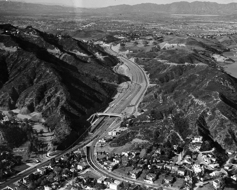
| (ca. 1951)^ - Bird's eye view of the Hollywood Freeway through the Cahuenga Pass, looking towards the Valley. The Cahuenga Tunnel under Highland Avenue can be seen at lower center-left. The "Muse of Music" Statue at the entrance to the Hollywood Bowl is visible just to the left of the tunnel as is part of the Hollywood Bowl shell (center-left). |
Click HERE to see more in Early Views of Cahuenga Pass |
* * * * * |
Westwood Village
 |
|
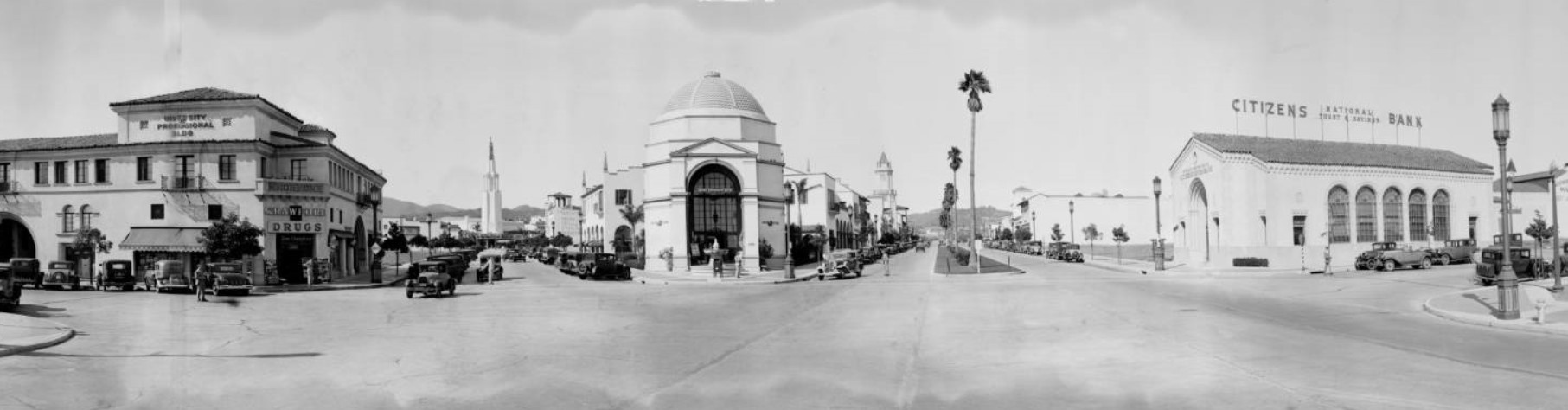
| (1932)*^#^ - A panoramic view of Westwood Village in Westwood, Los Angeles. The domed building in the center is the Janss Investment Corp., and the road to the right of it is Westwood. Left of that is the University Professional Building, with Crawford Drugs at the corner on the ground level. The spire down the street between Janss and the Professional building is the Fox Theatre. Across Westwood from Janss is the Citizens National Trust & Savings Bank. On the west side of Westwood in the background is the tower of the Holmby Building. The cross street is now Kinross Avenue, while the street leading to the theater is Broxton. |
 |
|
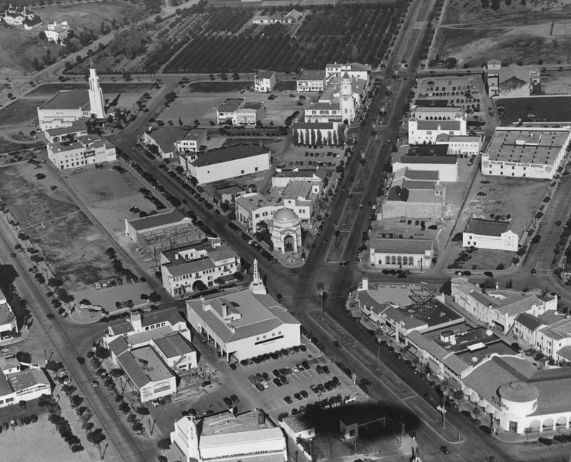
| (1936)^ - Aerial view of Westwood Village from a blimp. The Fox Theater is on the upper left, Ralphs lower right. At upper center is the Holmby Building, built in 1930 and designed by architect Gordon B. Kaufmann in California Mediterranean style as a retail and office building. It is located on Westwood Blvd. between Le Conte and Weyburn. |
Historical Ntoes Opening in 1929, the original design of Westwood Village was considered one of the most well planned and beautifully laid out of commercial areas in the nation. Harold Janss had hired major architects and instructed them to follow a Mediterranean theme, with clay tile roofs, decorative Spanish tile, paseos, patios and courtyards. Buildings located at strategic points, including theaters, used towers to serve as beacons for drivers on Wilshire Boulevard. Janss picked the first slate of businesses and determined their location in the neighborhood; the area opened with 34 businesses, despite the Great Depression, had 452 in 1939*^ |
 |
|
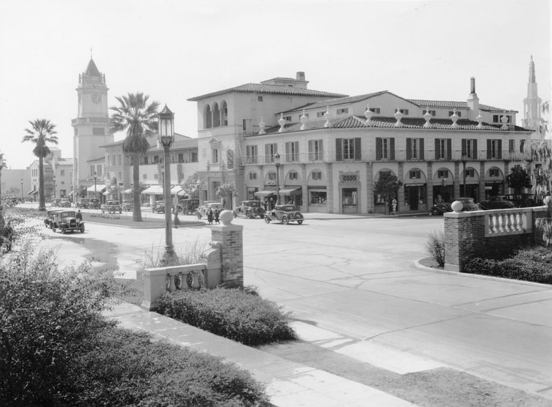
| (ca. 1937)^ - The intersection of LeConte Avenue and Westwood Boulevard, looking southwest. On the far side is the Holmby Building in Westwood Village. It is a retail and office building in the California Mediterranean style. |
 |
|
| (ca. 1937)^ - View of Westwood Boulevard, looking north from south of Wilshire Blvd. On the left, there are several gas and service stations, including a Richfield, Associated, Union 76, and Chevron. On the right are various stores, including a Ralphs supermarket. |
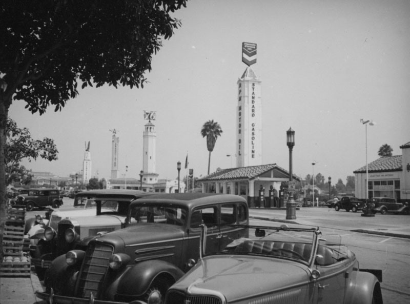 |
|
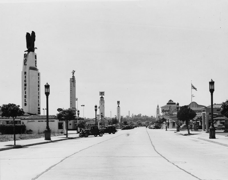
| (ca. 1938)^ - View of Westwood Village with four tall sign towers in a row, behind the parked cars. Each tower is used to advertise a different gas station, right to left: Standard, 76, Associated, and Richfield. Click HERE to see more Early Views of LA Gas Stations. |
 |
|
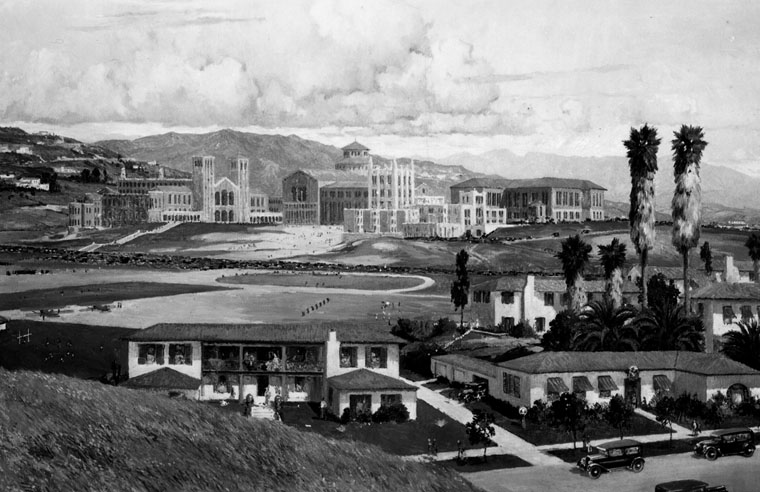
| (1937)^ - Early view of U.C.L.A.'s campus buildings from left to right: Men's gymnasium, built in 1932; Royce Hall, built in 1928-29; Janss Steps; and Powell Library, built in 1927-29. All buildings were constructed in a northern Italian (Lombard) Romanesque Revival style. |
 |
|
| (ca. 1930)^ - Panoramic view of the U.C.L.A. Westwood campus. This is a photograph of a Chris Siemer painting created for a display by the L.A. Chamber of Commerce. |
Historical Notes Click HERE to see more in Early Views of UCLA and Westwood |
* * * * * |
Flower and 6th Street
 |
|
| (1937)* - Cars fill the intersection of Flower Street and 6th Street, looking north. A few prominent structures are partially visible: the Southland Hotel (left), the Richfield Oil Company Building (upper left), the California Club (center), the Sunkist Building, and Church of the Open Door. |
 |
|
| (2019)* - Looking north on Flower Street at 6th Street. |
Then and Now
 |
|
| (1937 vs 2019)* - Looking north on Flower Street at 6th Street. Photo comparison by Jack Feldman. |
Flower and 7th Street
 |
|
| (1937)* – View looking north on Flower at 7th Street with the Richfield Oil Company Building (555 S. Flower St.) standing tall in the background. A dual-lamp streetlight stands behind an old-style traffic signal (semaphore). |
Historical Notes Los Angeles installed its first automated traffic signals in October 1920 at five locations on Broadway. These early signals, manufactured by the Acme Traffic Signal Co., paired "Stop" and "Go" semaphore arms with small red and green lights. Bells played the role of today's amber or yellow lights, ringing when the flags changed—a process that took five seconds. By 1923 the city had installed 31 Acme traffic control devices. Click HERE to see more early Los Angeles Semaphore Traffic Signals. |
Broadway and 9th Street
 |
|
| (1937)^ - Detailed view of a two-lamp ornate streetlight (UM 1906) on the Southwest corner of Ninth Street and Broadway. In the background is the sunlit Eastern Columbia Building (849 South Broadway) and further down the block the May Company (800 South Hill Street). |
 |
|
| (ca. 1938)*# - Nightime view of Ninth Street and Broadway showing Cristmas decorations hanging from the dual-lamp UM 1906 streetlights. |
Click HERE to see more in Early L.A. Streetlights |
Olive and 7th Street
 |
|
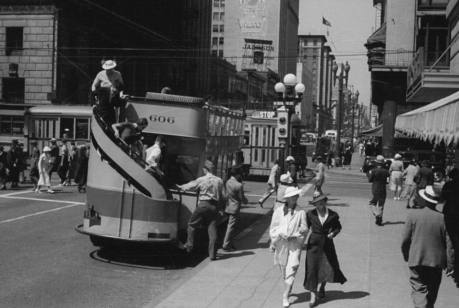
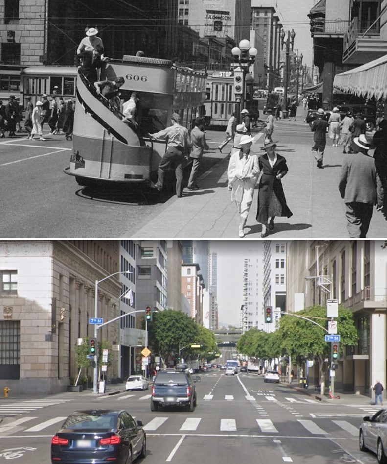
| (1937)^ – View looking north on Olive at 7th Street showing passengers disembarking from a double-decker bus No. 606. |
Historical Notes Los Angeles Motor Bus (later renamed the Los Angeles Motor Coach Company) was a joint venture of Pacific Electric and Los Angeles Railway that existed from 1923 until 1949. |
.jpg) |
|
| (1937)^ – View looking north showing a bus No. 1003 stopped at the southeast corner of Olive and 7th streets. |
 |
|
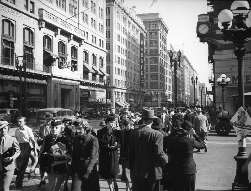
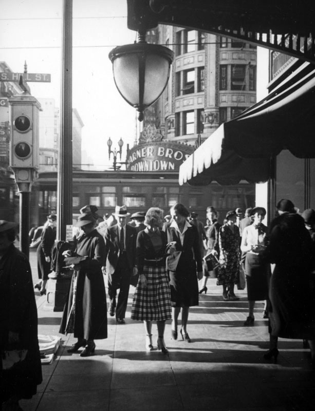
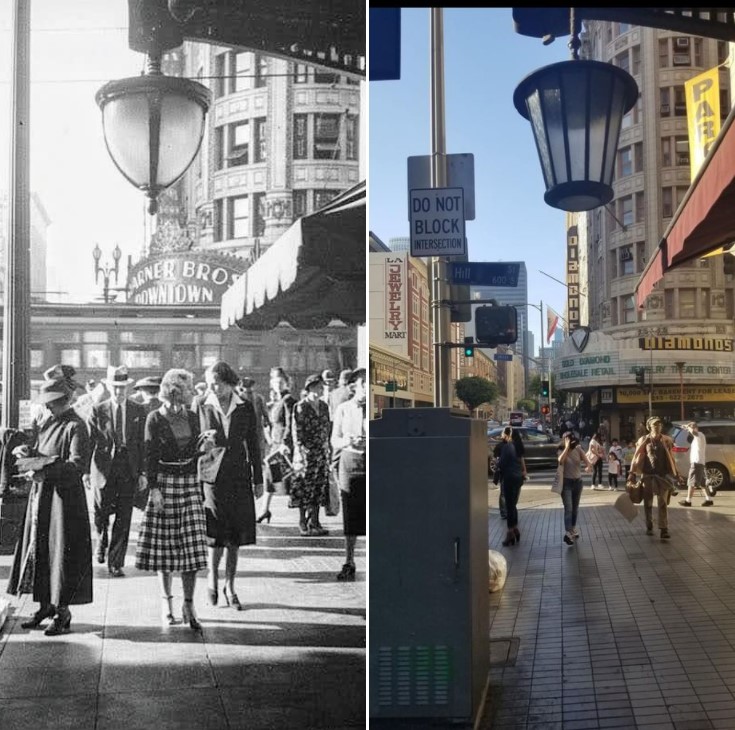
| (1937)^ - View looking east on 7th at Olive Street showing a very busy intersection. An overflow of pedestrians fill the sidewalks as far as the eye can see. Note the two different types of streetlights at the intersection. The 1911-built Los Angeles Athletic Club is on the left (NE corner) while the Warner Brothers Theatre is further east on the NW corner of 7th and Hill streets. |
Historical Notes The building on the left corner is the Los Angeles Athletic Club, located at 431 W. 7th Street. Built in 1911 by Parkingson & Bergstrom, this building was notable at the time for being the first in Southern California to have a swimming pool on an upper floor. Adjacent is the Warner Brothers Downtown Theatre (previously the Pantages Theatre), located at 401 W. 7th Street. It was designed by architect B. Marcus Priteca in the Greek revival style in 1919, and opened on August 16, 1920. On the right corner, the clock for Myer Siegel and Company department store reads 1:11 p.m. |
Then and Now
 |
|
| (1939 vs 2022)* - Times have changed! In 1939 we see streetcars, double-decker buses, and people walking. Today we see just cars. This is Olive Street looking north at 7th Street in DTLA. Photo comparison by Jack Feldman. |
Broadway and 7th Street
 |
|
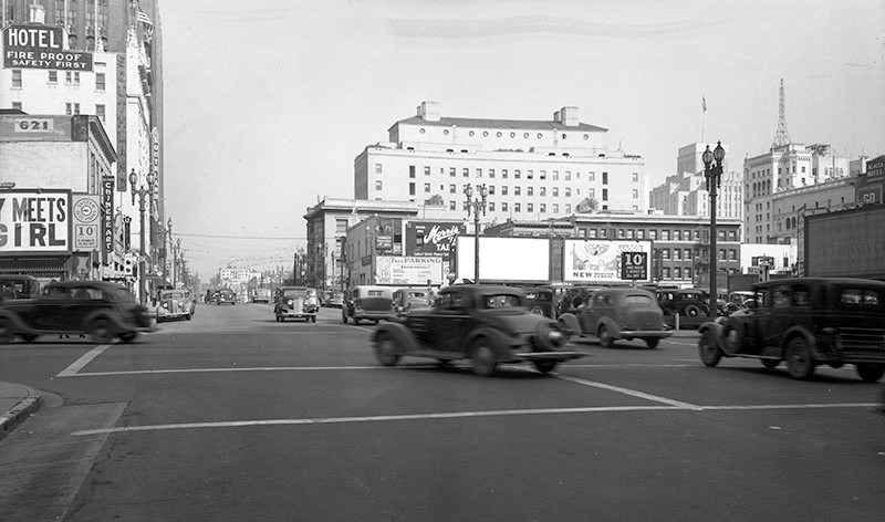
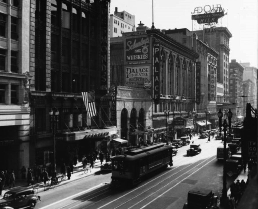
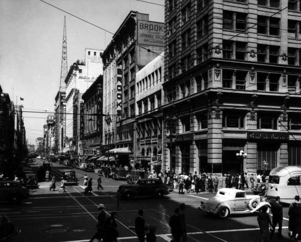
| (ca. 1937)*# – View looking south on Broadway between 6th Street and 7th Street. On the east side of Broadway can be seen Desmond's (616 South Broadway), Schaber's Cafeteria, the Palace Theatre (3rd Home of the Orpheum), Brooks, and the Haas Building at 219 West 7th Street. |
 |
|
| (1939)* - Looking north on Broadway from West 7th Street showing the Bank of America, Brooks, the Palace Theatre, Desmond's, Schaber's Cafeteria, Mullen & Bluett, and Roy's. |
 |
|
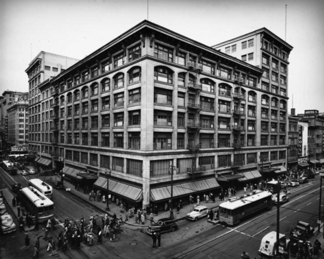
| (ca. 1939)* - Facing northwest at the corner of Broadway and West 7th Street showing Bullock's which extends all the way to Hill Street on the left. The Warner Brothers Theatre and the Los Angeles Athletic Club can be seen down 7th Street (on the left), while Bullock's, Le Roy's, and Kress can be seen on Broadway. To the left (out of view), on the soutwest corner of Broadway and 7th, stands Loew's State Theatre. |
 |
|
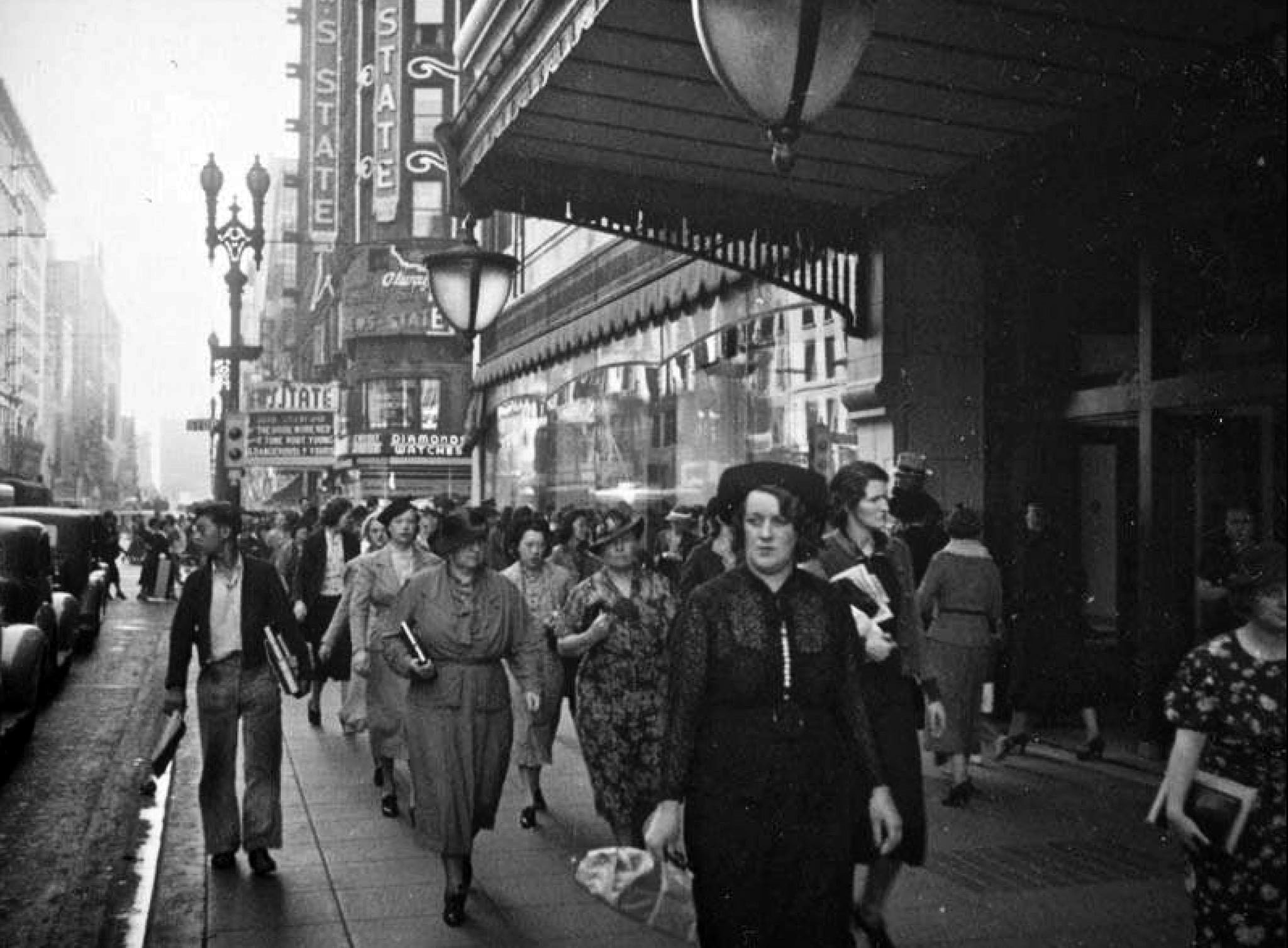
| (1937)^ - Crowds of people fill the sidewalks in front of the entrance to Bullock's in this view of Broadway looking south towards 7th Street. Further down the street is the blade sign for the Loew's State Theatre whose marquee advertises "The Bride Wore Red" starring Joan Crawford, Franchot Tone, and Robert Young, along with "Dangerously Yours." |
Hill and 7th Street
 |
|
| (ca. 1937)^ - A streetcar rushes by just as this shot is being taken so the bottom of the Warner Brothers Downtown Theatre is hidden but both signs are visible, as is an interesting hanging light and the crowds on the sidewalk in this view of Seventh looking west towards Hill Street. Bullock's is on the right and occupies the entire block along 7th Street up to Broadway. |
Then and Now
 |
|
| (1937 vs. 2021)* - 7th and Hill Streets in DTLA. Contemporary photo by Paul Wright |
 |
|
| (1936)* – View looking east on 7th Street toward Hill Street with the Warner Brothers Downtown Theatre seen on the NW corner. Two men dressed in suits are disembarking from a stopped streetcar at lower-left. |
Historical Notes Note the beautiful dual-lamp streetlights running down both sides of 7th Street. Some of these can still be found in select areas of downtown LA. Click HERE to see more. |
 |
|
| (ca. 1938)*# - View looking west on 7th Street at Hill. The impressive Warner Brothers Downtown Theatre Building is seen on the northwest corner. The Los Angeles Athletic Club sits just to the west of Warner Bros. on 7th Street. |
Historical Notes Warner Bros. Downtown Theatre - Vaudeville Theater and Movie Palace - Located at 401 W. 7th St (northwest corner of South Hill and West 7th St). Opening on August 17, 1920, it was originally called the Pantages Theatre, but was renamed Warner Bros. Downtown Theatre in 1930 after the Hollywood Pantages Theatre was opened. The exterior has an imposing domed corner tower, flanked by twin facades on 7th and Hill. Later in the 1960s, it was known as the Warrens Theatre. Today, the building houses a jewelry mart and most of the chairs have been ripped out to hold jewelry booths, and its Deco luster has worn to a dull throb. |
 |
|
| (1941)* - View looking north on Hill Street toward 7th Street with the Warner Theatre on the NW corner. Note the beautiful dual-lamp streetlights running down both sides of the street. |
Historical Notes Replacing the five-globe Llewellyn in Downtown Los Angeles and extending outward along several major streets, hundreds of dual-lamp electroliers (UM 1906's) seen above were installed in the mid 1920's. Click HERE to see more. |
Then and Now
 |
|
| Then and Now* - View is looking north on Hill Street at 7th Street. Photo comparison by Jack Feldman. |
Then and Now
 |
|
| (1941 vs. 2017)* - View looking north on Hill Street toward 7th Street with the Warner Theatre on the NW corner. Photo comparison by Jack Feldman. |
 |
|
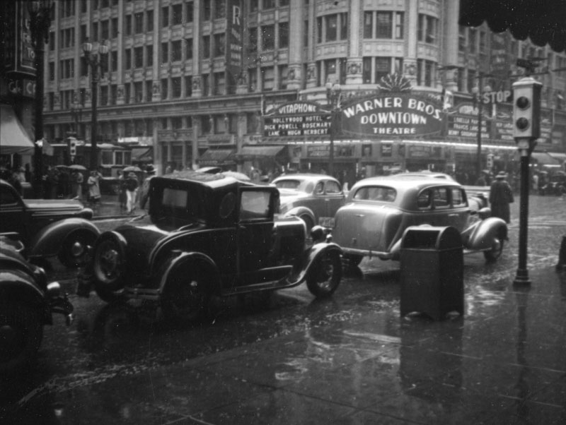
| (1938)^ - Cars battle the rain. The movie "Hollywood Hotel" which came out early in 1938 is playing at the Warner Brothers Downtown (previously the Pantages Theatre). Photo by Herman Schultheis. |
 |
|
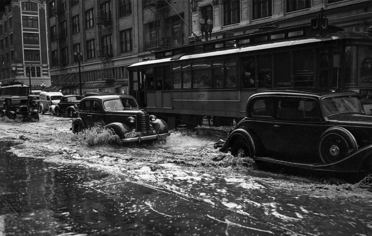
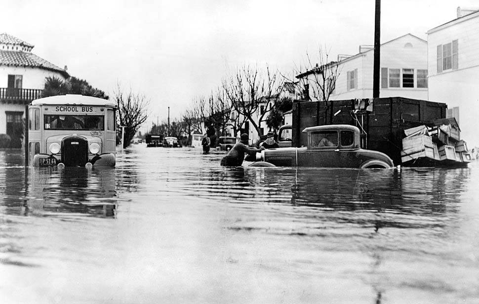
| (1938)* - Original photo caption reads: Drains could not keep up with rain filling streets in downtown Los Angeles - March 2, 1938. |
Historical Notes Between February 27 and 28, 1938, a storm from the Pacific Ocean moved inland into the Los Angeles Basin, running eastward into the San Gabriel Mountains. The area received almost constant rain totaling 4.4 inches from February 27-March 1. This caused minor flooding that affected only a few buildings in isolated canyons and some low-lying areas along rivers. Fifteen hours later on March 1, at approximately 8:45 PM, a second storm hit the area, creating gale-force winds along the coast and pouring down even more rain. The storm brought rainfall totals to 10 inches in the lowlands and upwards of 32 inches in the mountains. When the storm ended on March 3, the resulting damage was huge.^* Click HERE to see more in Flooding in Early Los Angeles. |
 |
|
| (1938)^ - Heading southeast on W. 8th Street toward Garland Avenue. |
* * * * * |
Westlake Area
 |
|
| (1938)*# - Aerial view looking north over Lafayette Park at Sixth Street and Hoover towards Silver Lake, Echo Park, and Westlake. In the foreground at center-left can be seen the First Congregational Church, and just behind it, at the v-shaped corner of Occidental Blvd. and Hoover Street, is the Precious Blood Catholic Church. |
 |
|
| (1931)^ – View looking north from 5th Street on Occidental Boulevard in the Westlake area. The Precious Blood Roman Catholic Church is seen on the left behind a palm tree. |
Historical Notes The church building stands on a v-shaped corner of Occidental Blvd. and Hoover St. This one of the archdiocese's architectural gems, showing a beautiful rose window above the main entrance. It was dedicated in November 1926.^* |
 |
|
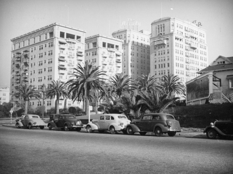
| (ca. 1930)^ - View of looking through Lafayette Park showing Wilshire Boulevard as it turns east toward Westlake Park (later MacArthur Park). The two tall buildings in the background are the Bryson Apartments and Arcady Apartments (later Royale Apartments) located at Wilshire and Rampart boulevards. |
 |
|
| (ca. 1937)^ - Cars park along the street by a sanitarium which was replaced by an office building in 1956. The Bryson and the Arcady apartment buildings can be seen in this view looking northeast on Lafayette Park Place towards Wilshire Boulevard. |
Historical Notes The 1927 Arcady Apartment Hotel, located at 2619 Wilshire Boulevard, later known as the Wilshire Royale Hotel, has been determined eligible for National Register status. The 1914 Beaux Arts style Bryson Apartment Hotel, located at 2701 Wilshire Boulevard, was designed by architects F. Noonan and C. H. Kysor. The building was listed on the National Register of Historic Places in 1983 and was designated Los Angeles Historic-Cultural Monument No. 653 in 1998.* |
* * * * * |
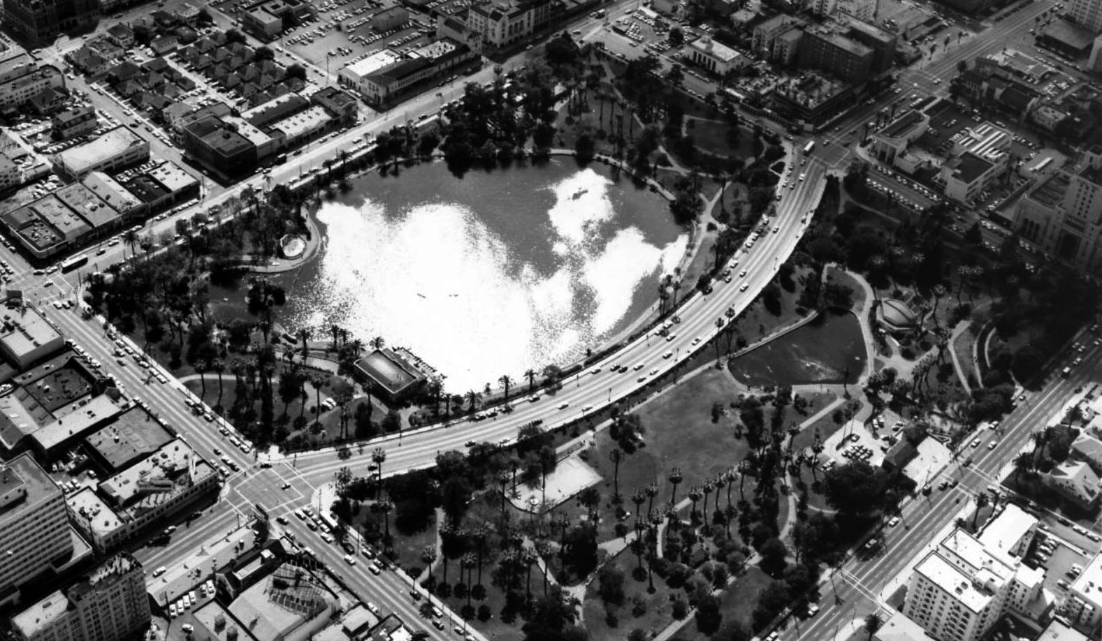
Westlake Park (Later MacArthur Park - 1942)
 |
|
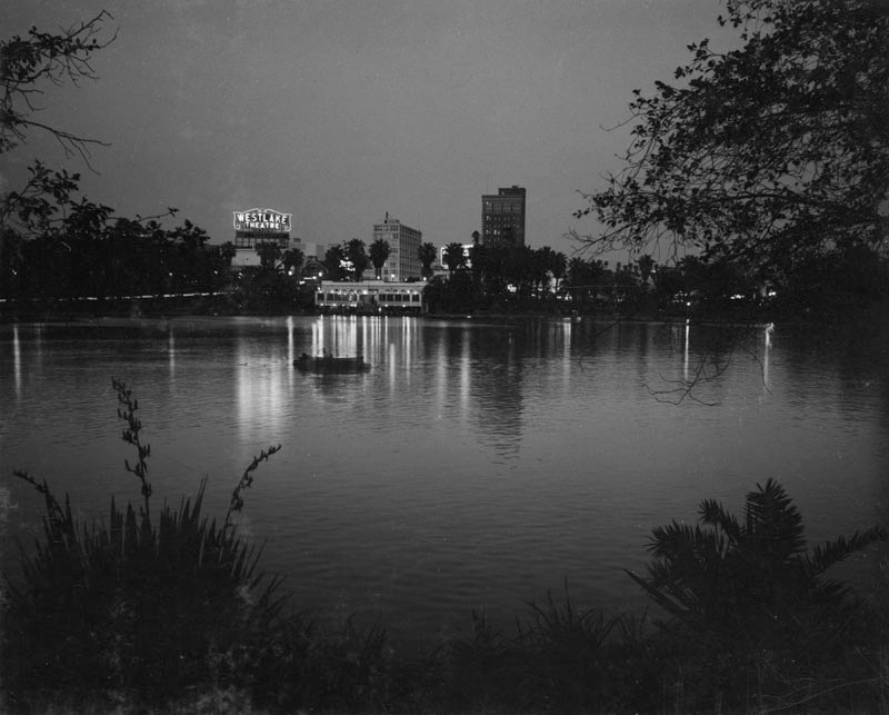
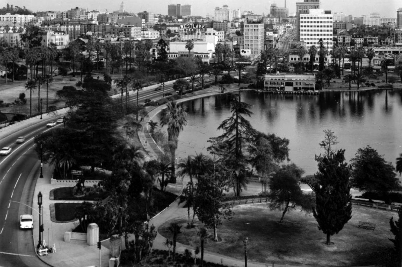
| (ca. 1930s.)^ - This nighttime view of Westlake Park's (MacArthur Park) artificial lake and boathouse, as well as several high-rise buildings in the background. Included is a building heralding the location of the Westlake Theatre. In the middle of the photo, a couple can be seen relaxing as their canoe floats across the lake, its surface giving a lovely reflection of the boathouse lights and surrounding area. |
Historical Notes MacArthur Park (originally Westlake Park) dates back to the late 19th century in the Westlake neighborhood of Los Angeles. In the early 1940s, it was renamed after General Douglas MacArthur, and later designated City of Los Angeles Historic Cultural Monument #100. The park was originally named for Henricus Wallace Westlake, a Canadian physician who had moved to Los Angeles around 1888, settled in the area and donated a portion of his property to the city for a park. In the mid-19th century the area was a swampland; by the 1890s, it was a vacation destination, surrounded by luxury hotels. In the early part of the 20th century, the Westlake neighborhood became known as the Champs-Élysées of Los Angeles.* |
 |
|
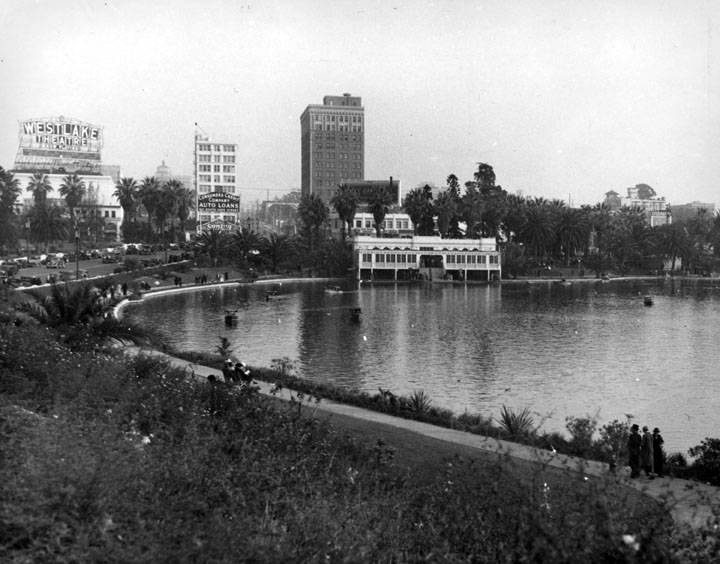
| (1937)^ - View of MacArthur Park, created in the 1880's under the name Westlake Park, was later renamed in honor of General Douglas MacArthur (1942). A few people are strolling around the lake. The boathouse is visible on the other side, as are several high rise buildings. Included is a building heralding the location of Westlake Theatre. |
Historical Notes The park, originally named Westlake Park, was built in the 1880s, along with a similar Eastlake Park, whose lake is artificial. Westlake Park was renamed MacArthur Park in May 7, 1942; Eastlake Park was renamed Lincoln Park. Both Westlake and Eastlake (as well as Echo Park) were built as drinking water reservoirs connected to the city's system, Zanja Madre. When the city abandoned the non-pressurized zanja system for a pressurized pipe system, these smaller, shallow reservoirs located at low points no longer provided much benefit and were converted into parks.* |
Then and Now
 |
|
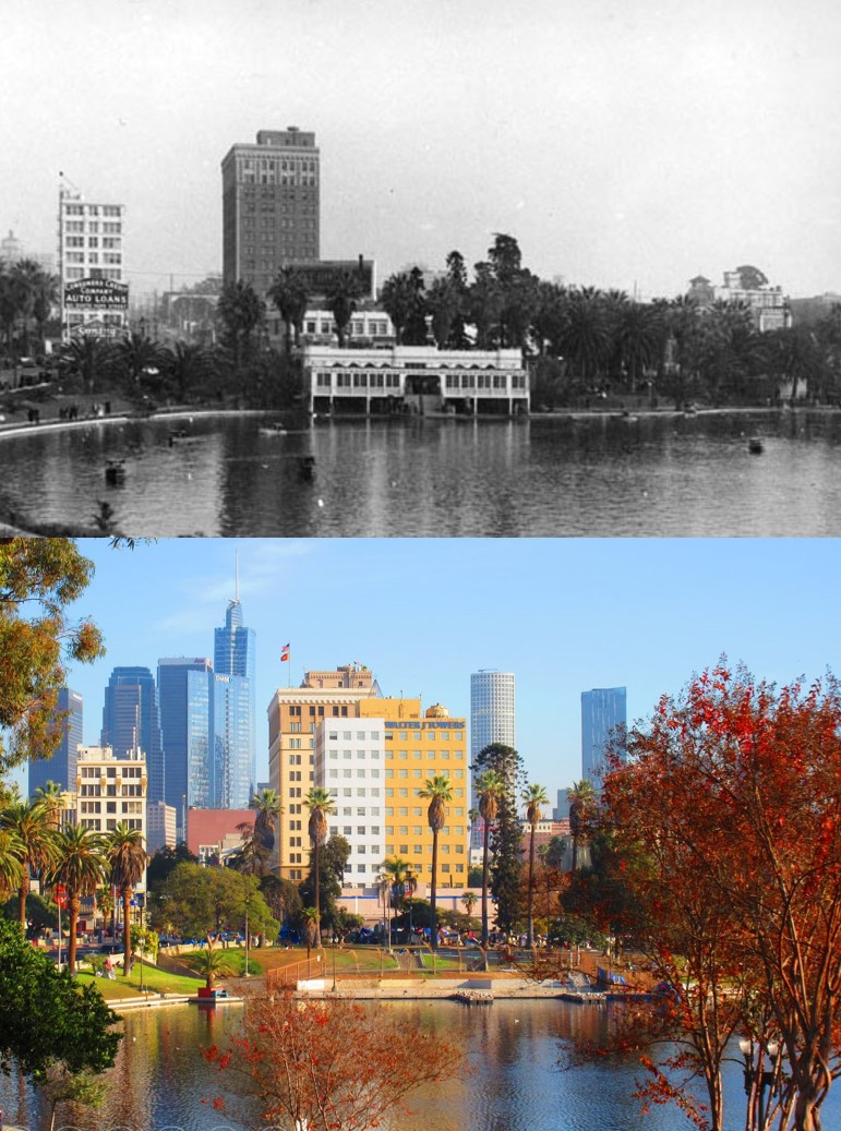
| (1937 vs. 2021)* – View of MacArthur Park looking east with the Downtown skyline in the background. Contemporary photo by Howard Gray |
 |
|
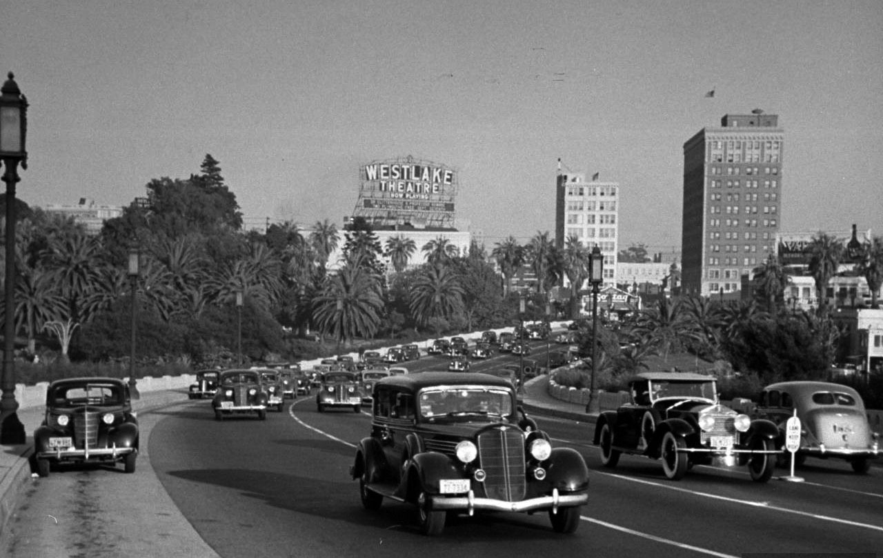
| (ca. 1940)*# – View facing east along Wilshire Boulevard towards Alvarado Street and the Westlake Theater with Westlake (later MacArthur Lake) seen at right. |
Historical Notes Wilshire Boulevard formerly ended at the lake, but in 1934 a berm was built for it to cross and link up with the existing Orange Street (which ran from Alvarado to Figueroa Streets) into downtown Los Angeles. Orange Street was renamed Wilshire and extended east of Figueroa Street to Grand Avenue. This divided the lake into two halves; the northern one was subsequently drained. From the 1940s, the lake featured the rental of electric boats, with the names of comic book animal characters.* |
 |
|
| (ca. 1940)##^* – Postacard view looking southeast showing Wilshire Boulevard as it crosses Westlake Park. The park was renamed MacArthur Park in 1942. |
 |
|
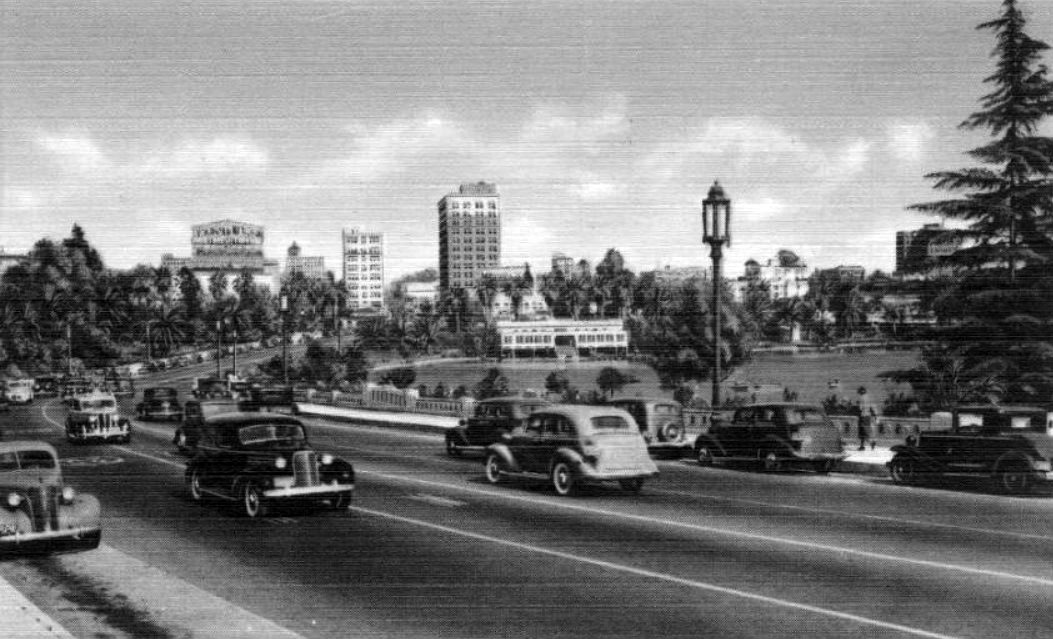
| (1938)^^ - View of Wilshire Boulevard as it passes through Westlake Park (later MacArthur Park). The Westlake Theatre Sign stands out in the background. |
Then and Now
 |
|
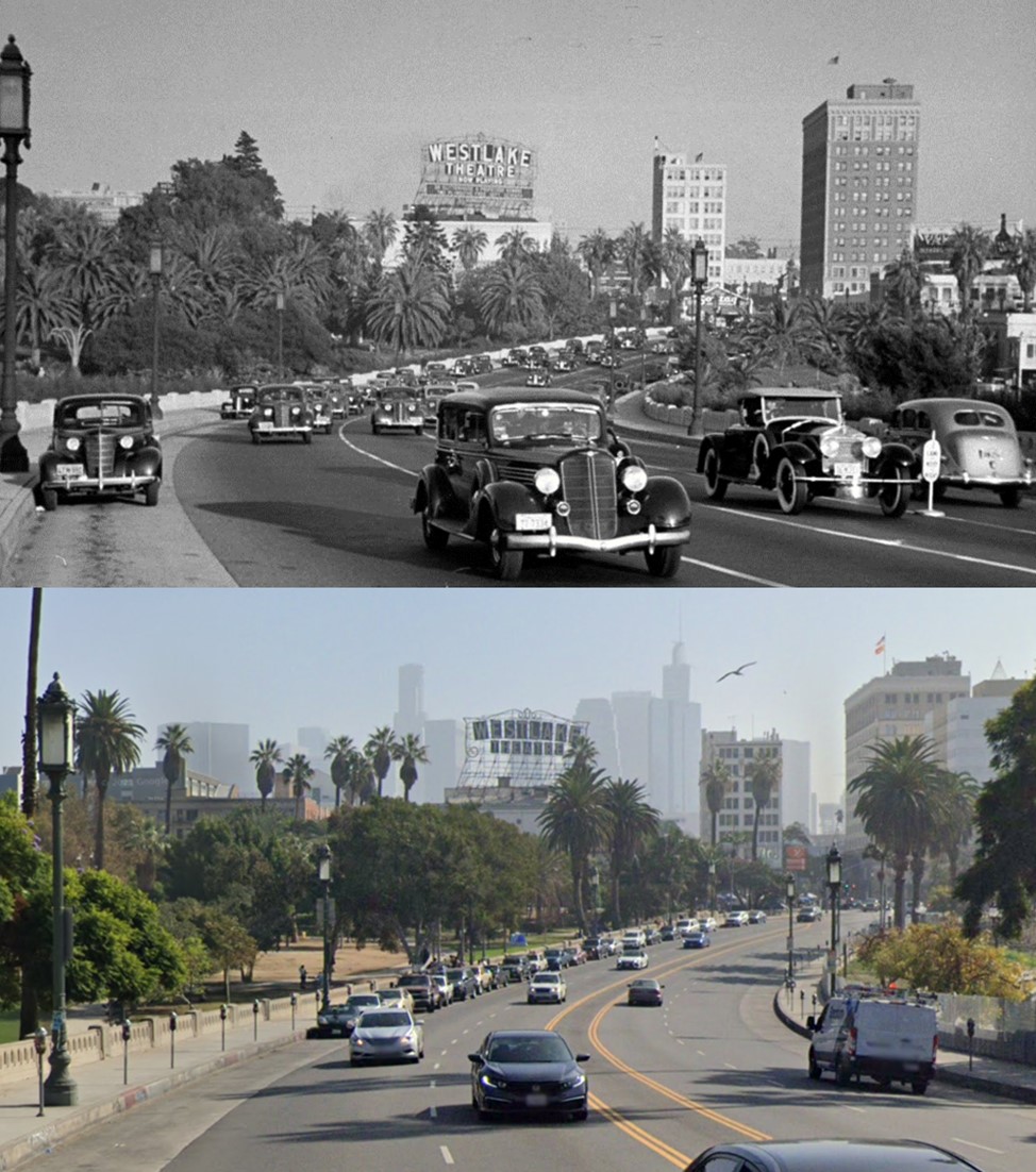
| (1938 vs. 2021) - View of Wilshire Boulevard looking East as it passes through Westlake Park (later MacArthur Park). The Westlake Theatre Sign stands out in the background. Photo comparison by Jack Feldman. |
 |
|
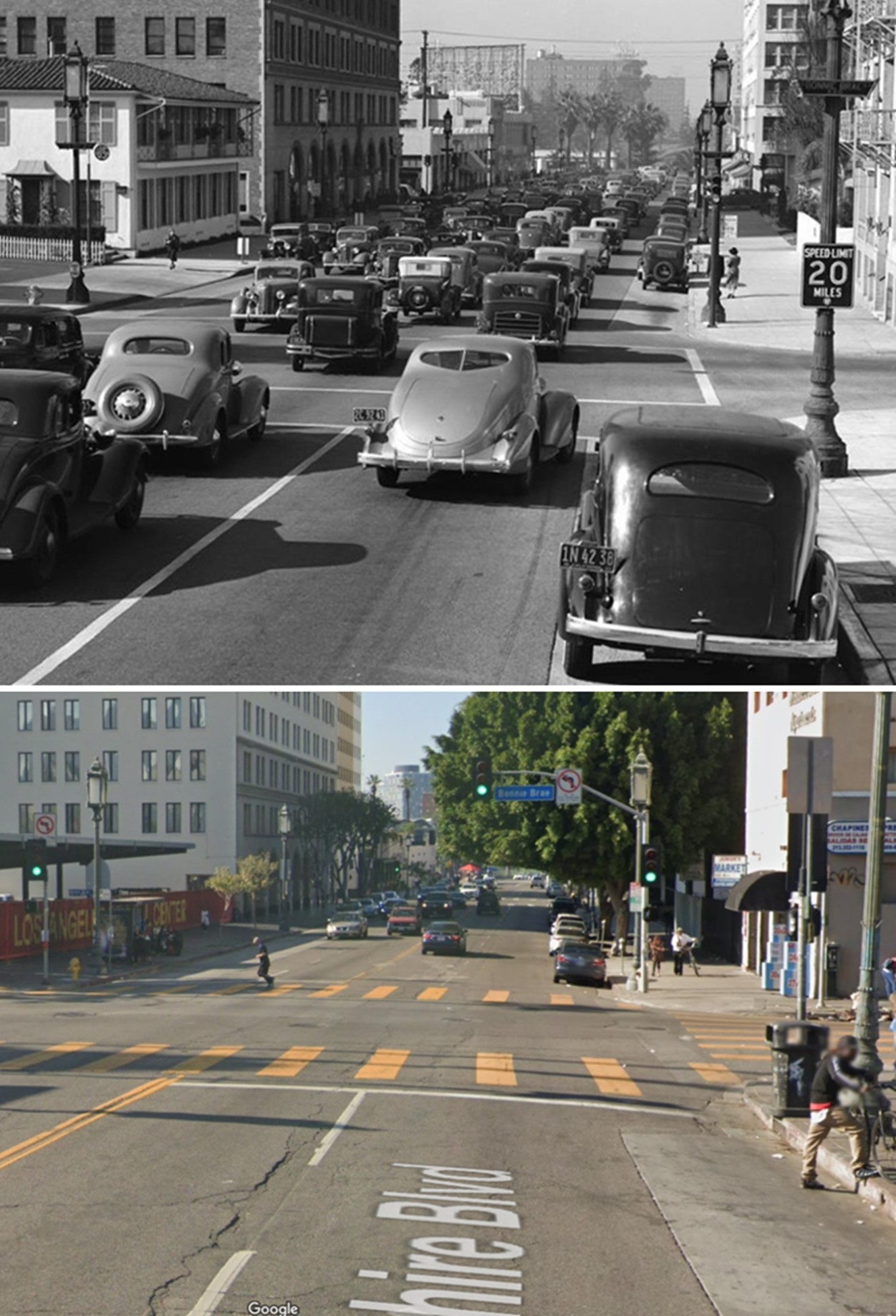
| (1937)* - Looking west on Wilshire Boulevard at Bonnie Brae towards MacArthur Park. The car in the middle with a split rear window is a 1936 Studebaker Dictator Driver. |
Then and Now
 |
|
| (1937 vs 2022)* - Looking west on Wilshire Boulevard at Bonnie Brae towards MacArthur Park. Note that the streetlights haven’t changed. Photo comparison by Jack Feldman. |
 |
|
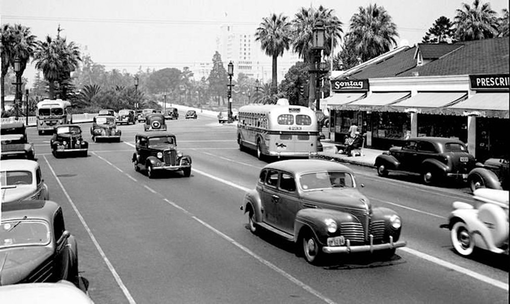
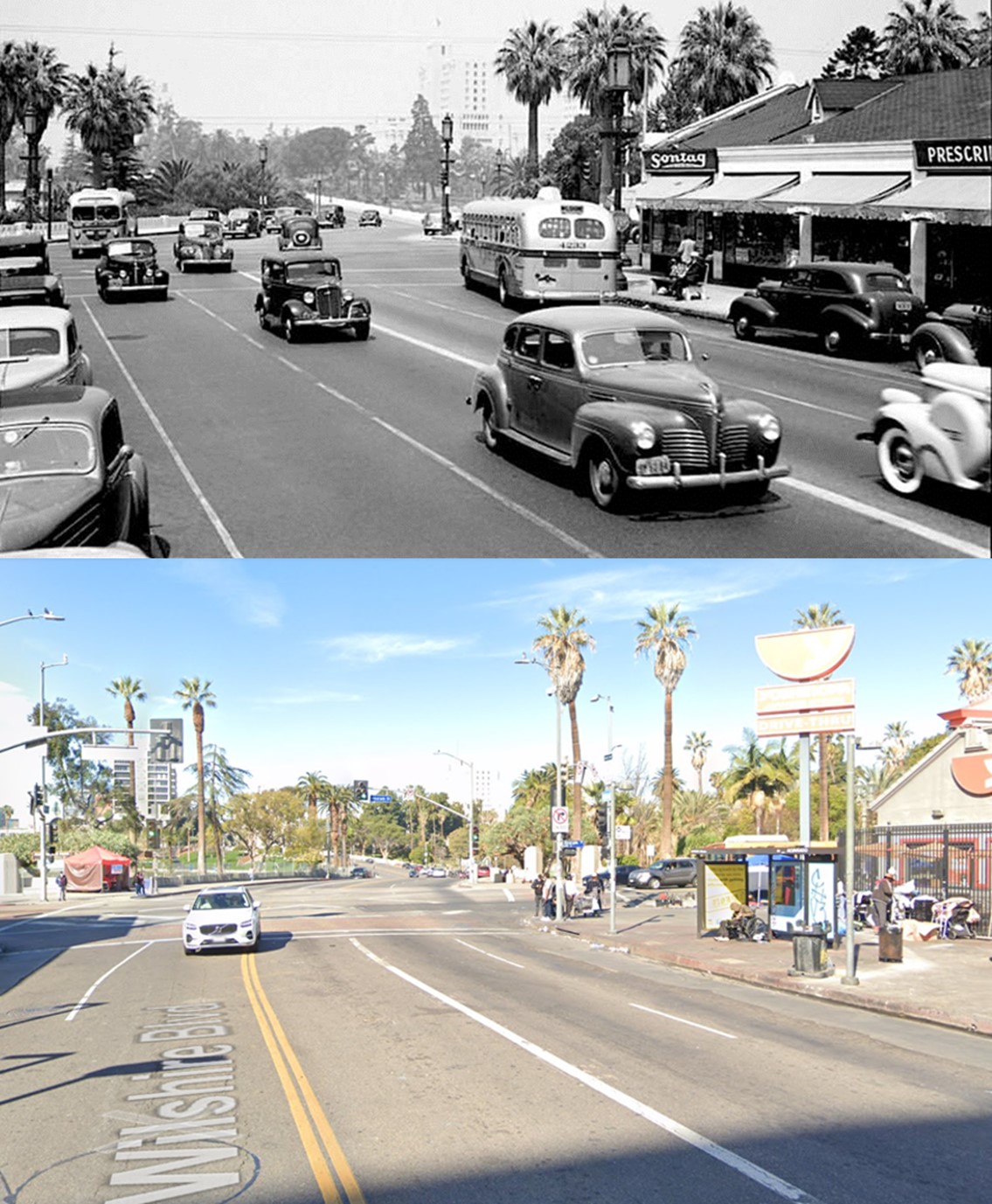
| (1940)* – Looking West along Wilshire toward Alvarado Street and Westlake Park (renamed MacArthur Park in 1942). On the right we can see a sign for Sontag Drug Store, which we don’t see any more but back then was a common sight in L.A. |
Then and Now
 |
|
| (1940 vs. 2022)* – Looking West on Wilshire Boulevard at Alvarado Street toward Westlake Park (renamed MacArthur Park in 1942). Photo comparison by Jack Feldman. |
 |
|
| (1958)*# – View looking southeast along Wilshire Boulevard, showing MacArthur Park Lake at right. The Westlake Theatre at 638 S. Alvarado can be seen in the distance. |
 |
|
| (1960)*# - Aerial view looking down at MacArthur Park. The Westlake Theatre on Alvarado Street can be seen at lower-left. Photo by Dick Whittington |
Click HERE to see more early views of MacArthur Park when it was call Westlake in the 1880s. |
 |
|
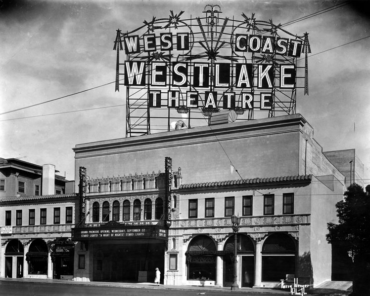
| (1937)* - Exterior view of the Spanish Baroque style West Coast Westlake Theatre, 638 S. Alvarado Street. |
Historical Notes The Westlake was operated as a first-run movie theater from 1926 until the 1960s. As the neighborhood's demographics changed, the theater was sold to Metropolitan Theatres Corp., which showed Spanish-language or Spanish-subtitled movies. In 1991, the building was sold to Mayer Separzadeh, who converted the theater into a swap meet. To protect the building from drastic changes, the building was declared Los Angeles Historic-Cultural Monument No. 546 in September 1991 (Click HERE to see complete listing). The theater was listed on the National Register of Historic Places in 2009. The theater was purchased by the Community Redevelopment Agency of the City of Los Angeles in 2008. The Redevelopment Agency announced plans to rehabilitate the theater as a venue for live theater, film, music and other performances.^* |
* * * * * |
Wilshire Boulevard
 |
|
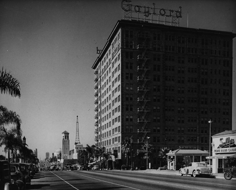
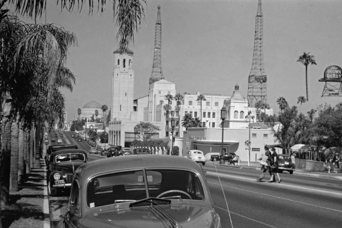
| (1938)*# – View looking west on Wilshire Boulevard showing the Gaylord Wilshire Apartments at Kenmore Avenue with Wilshire Christian Church and the KFAC radio transmitter seen in the distance. The Ambassador Hotel is just out-of-frame to the left. At lower-right is a Richfield Service Station and Sally's Home Made Candies. |
 |
|
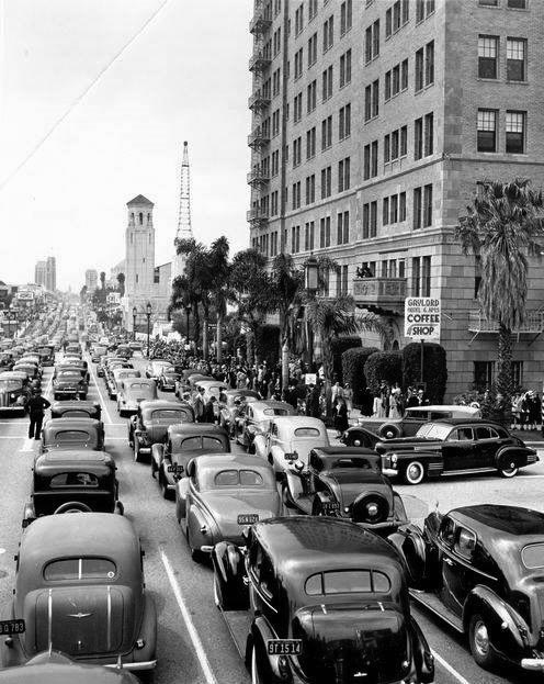
| (1941)+# – View looking west on Wilshire Boulevard at Kenmore Avenue showing cars lined up bumper to bumper as far as they eye can see. Photo was taken on Easter Sunday, immediately following the Miracle Mile Easter Parade. The three most identifiable buildings are: the Wilshire Christian Church, KFAC Radio transmitter tower, and the Gaylord Wilshire Apartments. |
 |
|
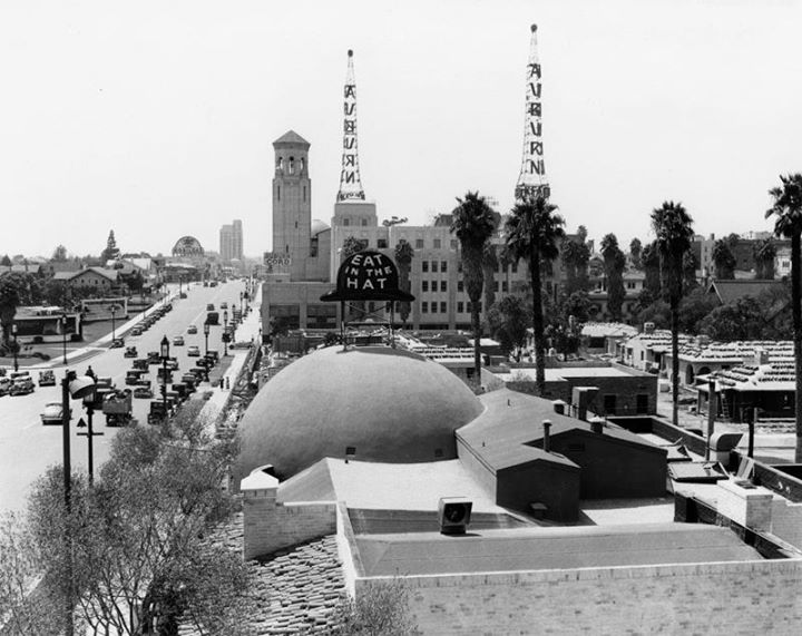
| (1940s)+## – View showing a stretch of Wilshire Blvd that the Ambassador Hotel (where the palm trees line the street) looked out on. We can see Brown Derby Restaurant, the Chapman Park Hotel bar—called the Zephyr Room. Beyond the Zephyr is the Cord-Auburn automobile dealership, and past that is the tower of the Wilshire Christian Church. Much farther down Wilshire is the dome of the Wilshire Temple, which Louis B. Mayer attended. And the foreground, we have a couple of jaywalking in the middle of Wilshire...and it looks like they’ve been shopping. |
 |
|
| (ca. 1938)^#** - Wilshire Boulevard, looking west near Alexandria, most likely taken from the Gaylord Apartments. The Brown Derby Restaurant can be seen in its new location. In the background stands the tower of the Wilshire Christian Church and the two transmitting towers of KFAC Radio Station. |
Historical Notes The Brown Derby chain was started by Robert H. Cobb and Herbert Somborn (a former husband of film star Gloria Swanson). Bob Cobb is known as the inventor of the California Cobb Salad. He was also part owner of the Hollywood Stars baseball team. The Brown Derby was moved in 1937 to 3377 Wilshire Boulevard at the northeast corner of Wilshire Boulevard and Alexandria Avenue, about a block from its previous location (and about a block north of the Ambassador Hotel).^* |
 |
|
| (ca. 1940)^ - Cars travel east down Wilshire Boulevard, where it crosses S. Alexandria Avenue (left), right outside the Brown Derby Restaurant. An original "Wilshire Lantern" street light is seen on the corner (Click HERE to see more in Early Los Angeles Street Lights). |
Historical Notes After being sold in 1975 and renovated, the Brown Derby Restaurant was finally replaced in 1980 by a shopping center known as the Brown Derby Plaza. The domed structure was incorporated into the third floor of the building and accommodates a cafe. A Korean mini-mall occupies the site today. The Brown Derby chain included restaurants in Hollywood, Beverly Hills, and the Los Feliz area. The Los Feliz Brown Derby at 4500 Los Feliz Blvd is the last remaining branch of the chain still extant and in operation.^* |
 |
|
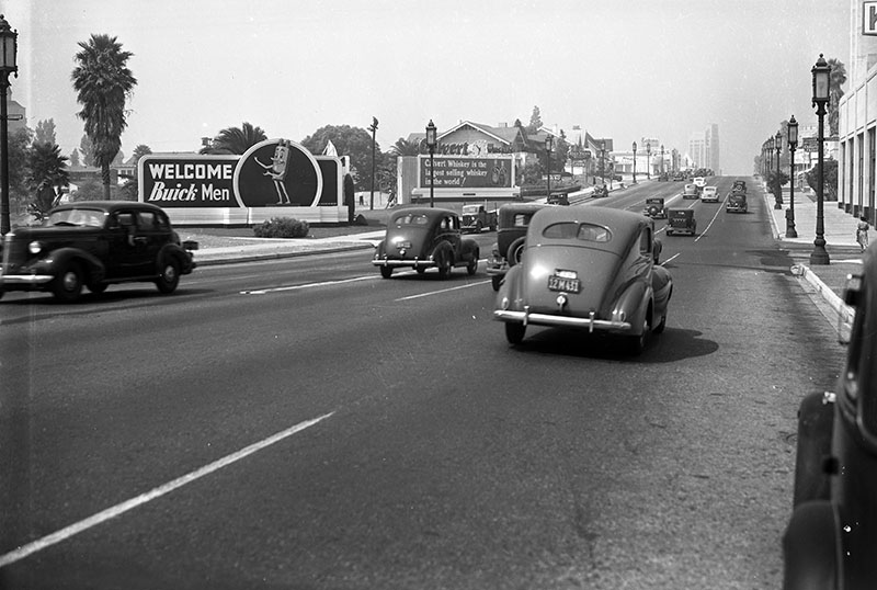
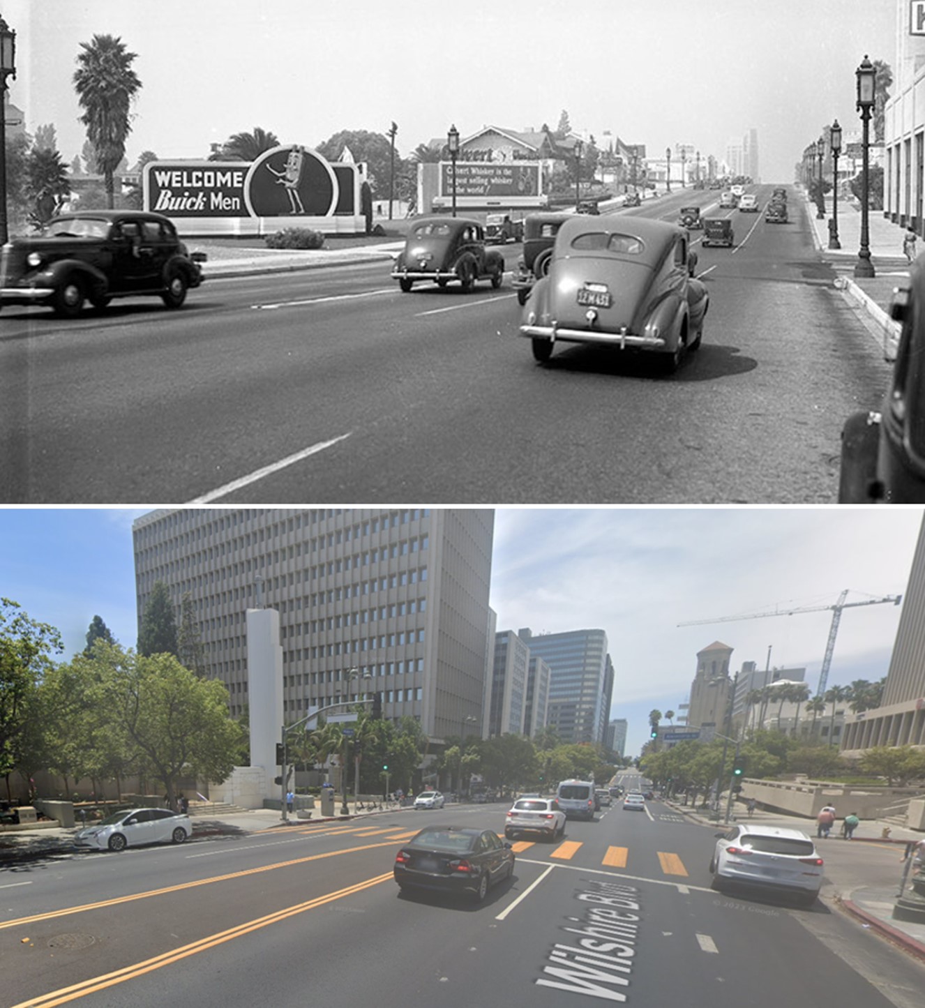
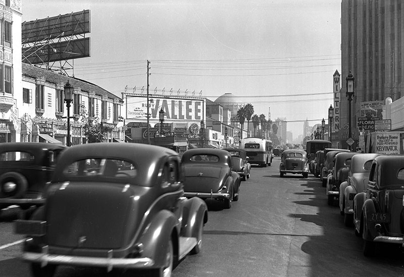
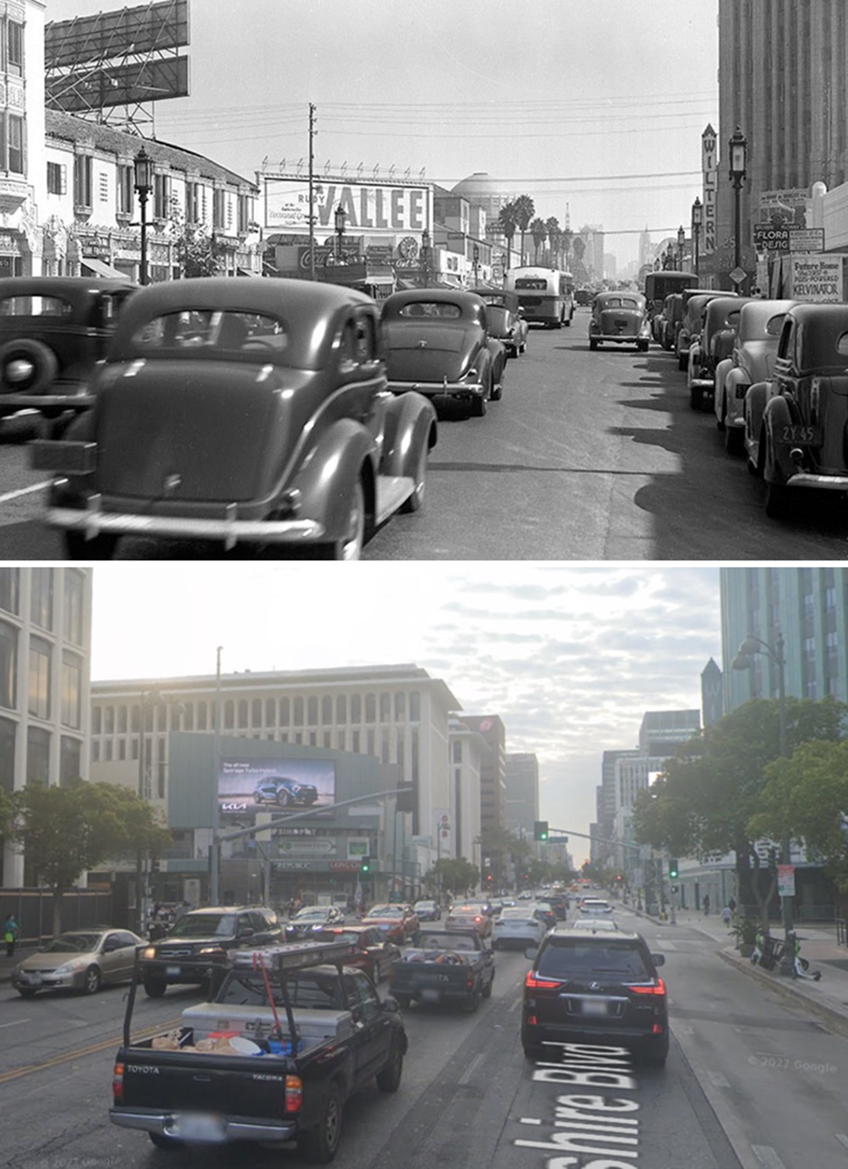
| (1939)^ - Looking west on Wilshire Boulevard toward Alexandria Avenue. Visible are billboards advertising Buick automobiles and Calvert Whiskey, as well as a few homes and commercial buildings; in the distance (upper right) is the Wiltern Theatre. |
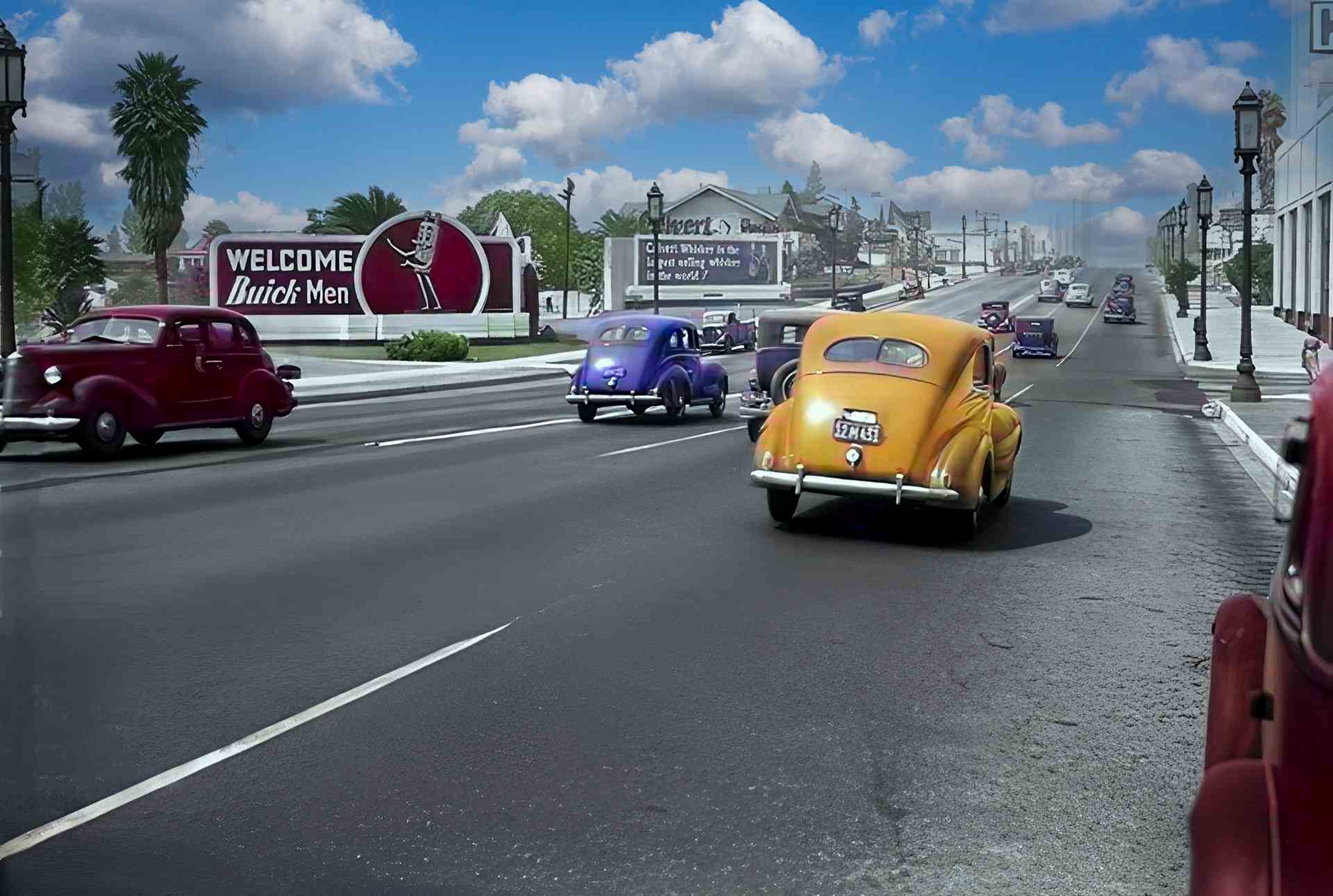 |
|
| (1939)^ - Looking west on Wilshire Boulevard toward Alexandria Avenue. Visible are billboards advertising Buick automobiles and Calvert Whiskey, as well as a few homes and commercial buildings; in the distance (upper right) is the Wiltern Theatre. Image enhancement and colorization by Richard Holoff. |
Then and Now
 |
|
| (1939 vs 2022)* - Looking west on Wilshire Boulevard toward Alexandria Avenue. Photo comparison by Jack Feldman. |
 |
|
| (1936)^ - Looking southeast across Wilshire Boulevard at Berendo Street towards Immanuel Presbyterian Church and the Talmadge Apartments. Further east is Bullock's Wilshire (far left). |
 |
|
| (ca. 1935)^ - View looking southwest showing the Immanuel Presbyterian Church on the corner of Wilshire Boulevard and Berendo Street. The building on the far left is the Talmadge Apartments, a Renaissance revival apartment house. |
 |
|
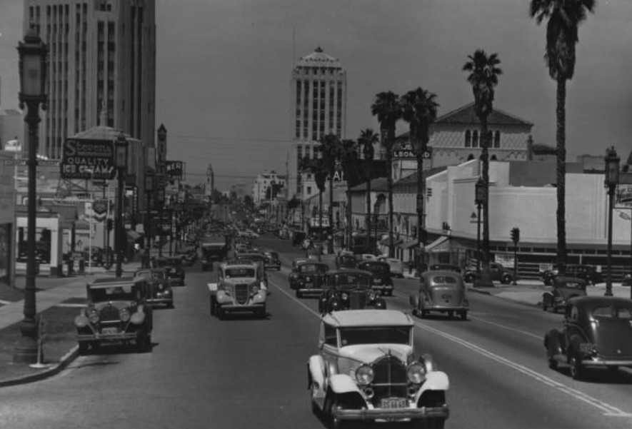
| (1938)*# - View of Wilshire Boulevard looking west from Hobart Boulevard past Steven's Quality Ice Creams, Jean Leonard Piano, Newberry's, and the Wiltern Theater at Western Avenue. |
* * * * * |
Wilshire and Western
 |
|
| (1937)^ - Looking east down Wilshire Boulevard from just west of where it crosses Western Avenue. Various businesses, including the Wiltern and the Pellisier Building, and billboards are seen throughout. |
Then and Now
 |
|
| (1937 vs 2022)* - Looking east on Wilshire Boulevard toward Western Avenue. Photo comparison by Jack Feldman. |
Historical Notes Click HERE to see more Early Views of Wilshire and Western when it was the busiest intersection in Los Angeles. |
* * * * * |
Western and 3rd Street
 |
|
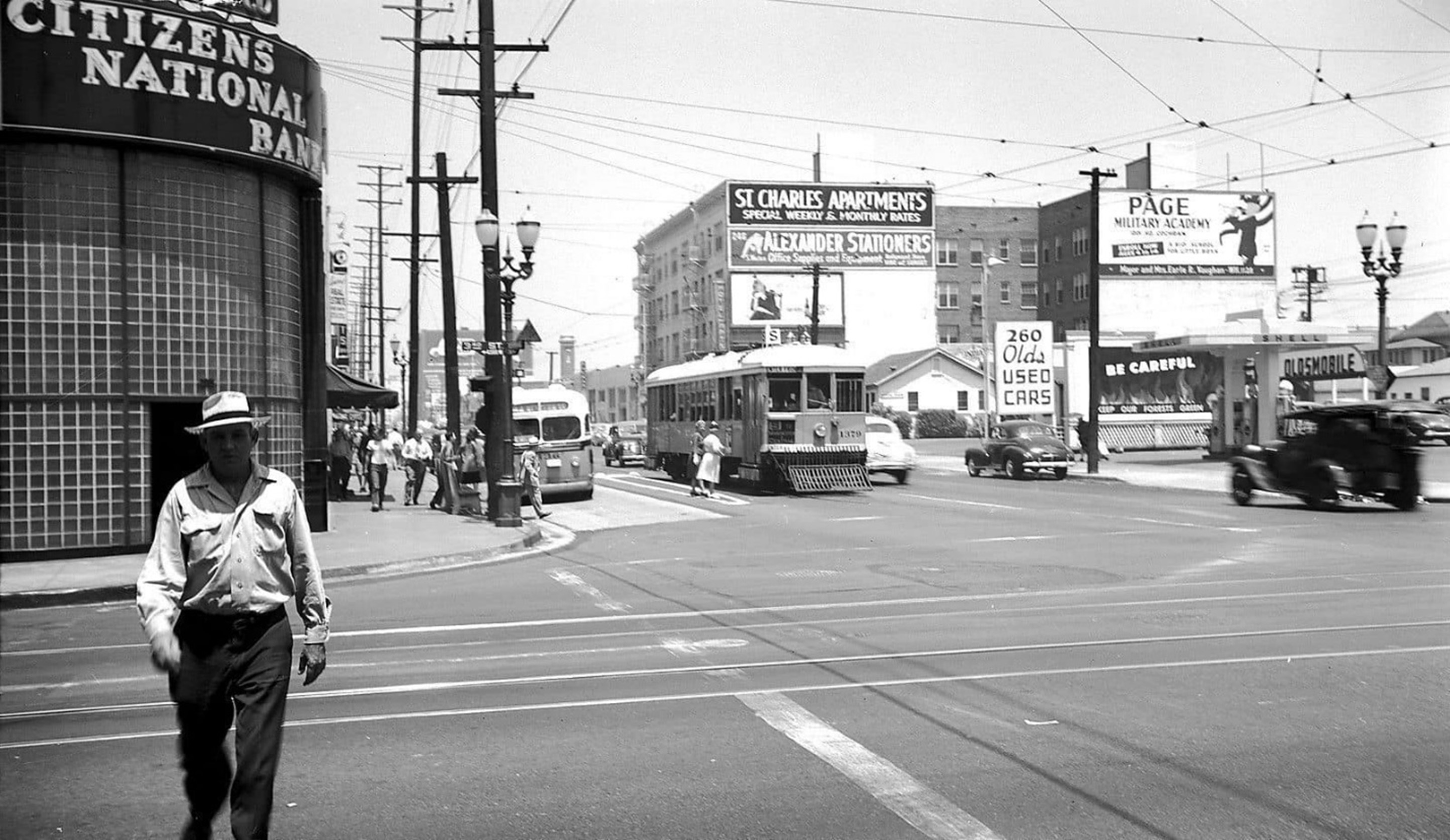
| (ca. 1940)* – Looking north on Western Avenue at 3rd Street. Photo: Metro Transportation Library and Archive. |
Historical Notes In the 1940s, the area around Western Avenue and West 3rd Street in Los Angeles was undergoing significant changes. Western Avenue was already a major thoroughfare, stretching over 28 miles from Griffith Park to San Pedro, and played a crucial role in the city's infrastructure. The film industry was a dominant force in the neighborhood, with studios like 20th Century Fox operating nearby. During World War II, these studios contributed to the war effort, with directors like Frank Capra using them for military-related projects. The area was transitioning from a residential community to a more urban environment, with public housing developments being built along the Western Avenue corridor to accommodate growing populations, including military families. This period marked a pivotal shift for the neighborhood, as it evolved into a busier, more diverse urban landscape influenced by the film industry, wartime activities, and urban development. |
 |
|
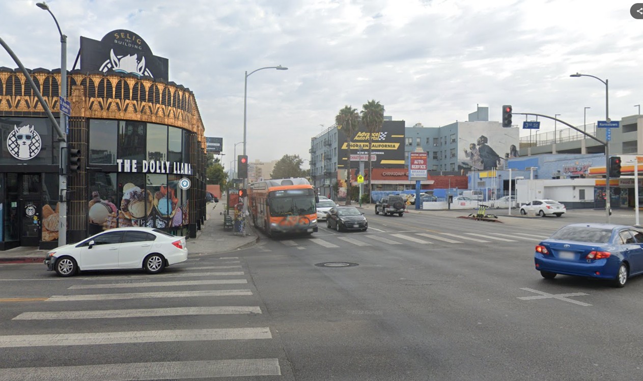
| (2022)* – Looking north on Western Avenue at 3rd Street in the heart of Koreatown. |
Historical Notes The intersection of Western Avenue and West 3rd Street in Los Angeles is situated in the vibrant heart of Koreatown, a densely populated and culturally rich neighborhood. This area is known for its diverse community, with a significant presence of both Asian and Latino residents, many of whom were born outside the United States. The neighborhood is bustling with activity around the clock, featuring a wide array of Korean restaurants, shops, and businesses that cater to its diverse population. |
Then and Now
 |
|
| (1940 vs. 2022)* – A ‘Then and Now’ comparison of Western Avenue looking north at 3rd Street, with the Selig Building on the northwest corner. In the earlier photo, note the streetcar alongside the bus—a sign of changing times. Photo comparison by Jack Feldman. |
* * * * * |
Kenmore Palms (500 Block of South Kenmore Avenue)
 |
|
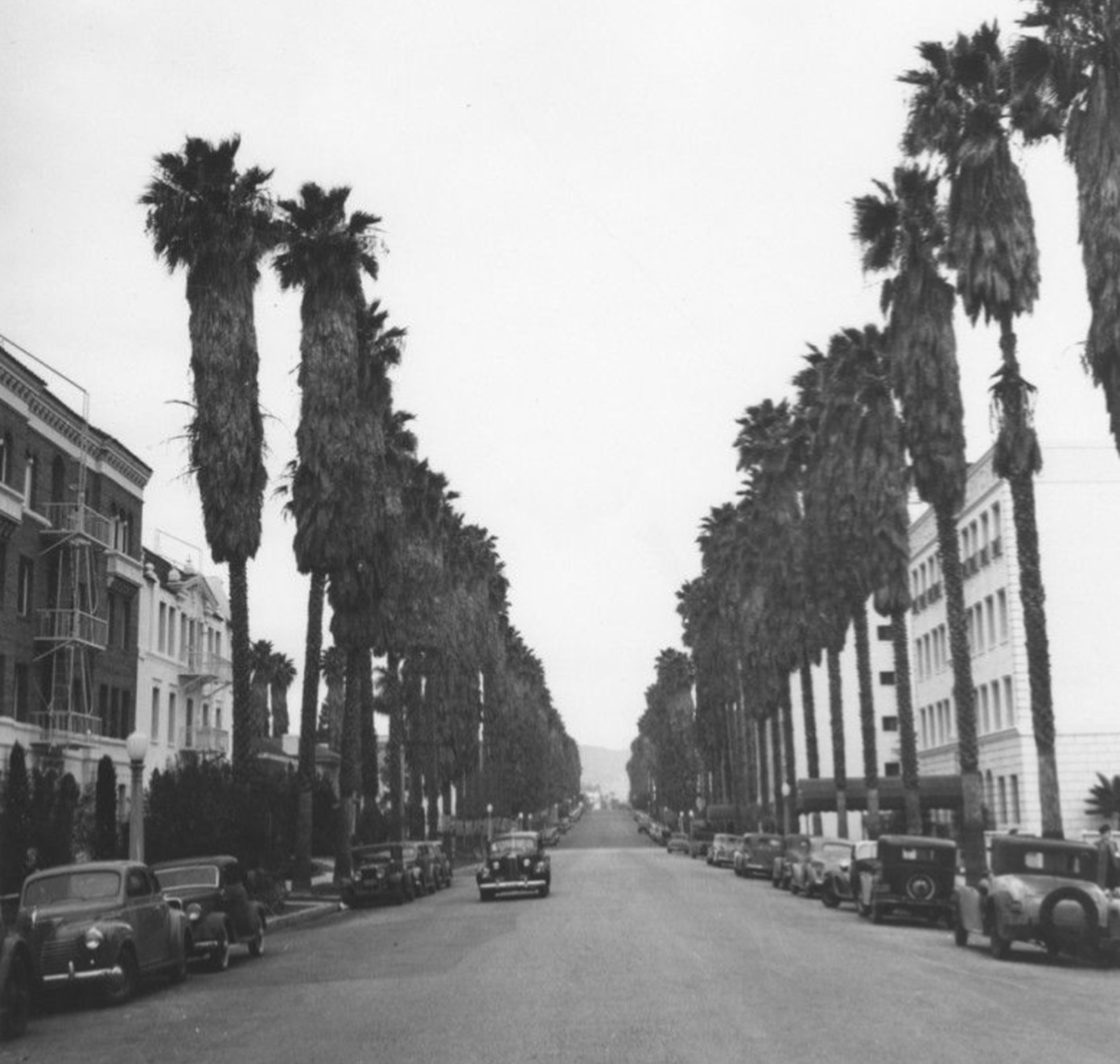
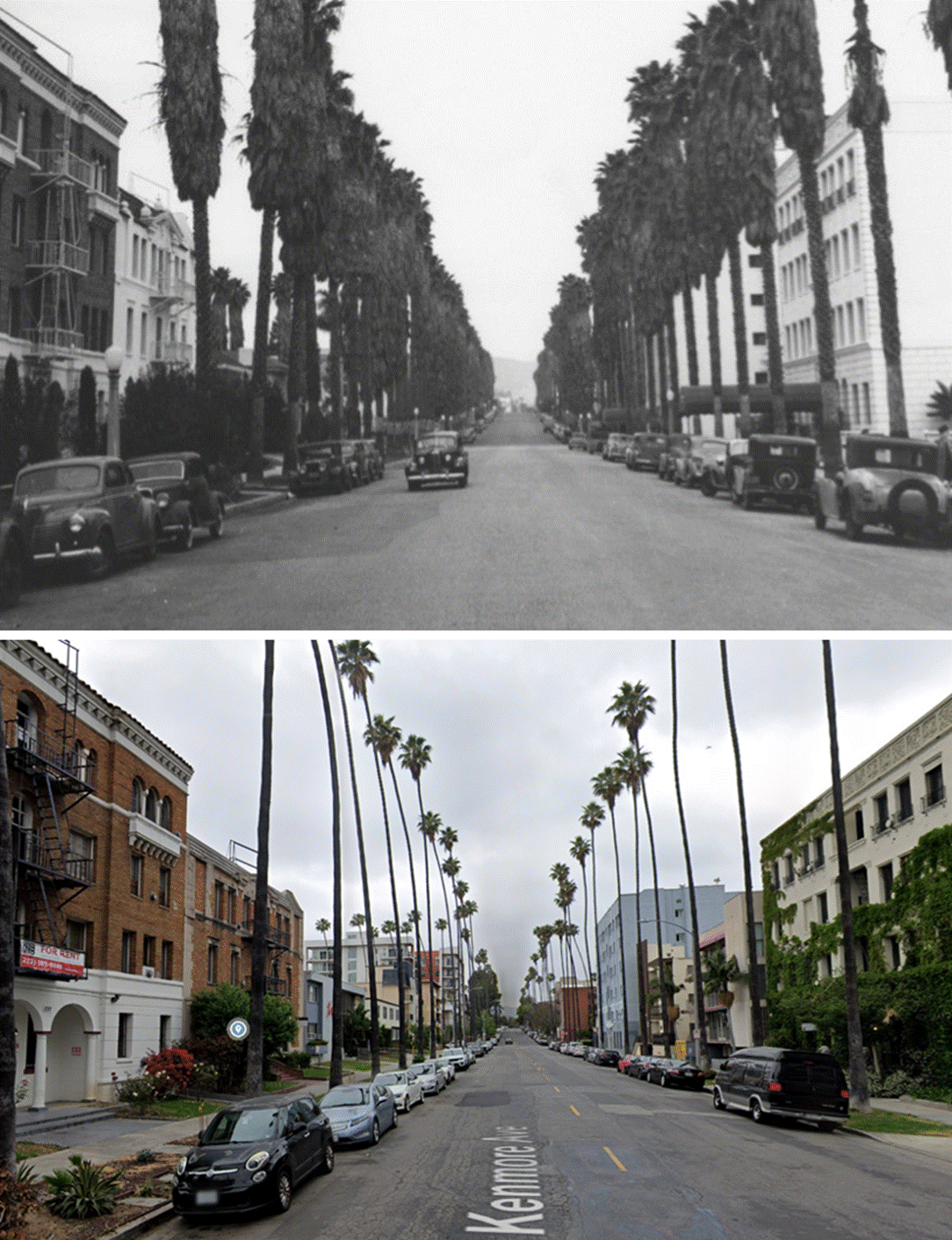
| (ca. 1940)* - A car travels south on palm-lined South Kenmore Avenue, approaching Sixth Street. On the left are apartment buildings at 537 S. Kenmore and 531 S. Kenmore, and on the right is a building at 530 S. Kenmore. Photo by Ansel Adams. |
Historical Notes Palm trees were commonly planted along streets like Kenmore Avenue during the early 1900s as part of the city’s beautification efforts, particularly in the 1910s and 1920s when Los Angeles underwent a major street tree-planting campaign. These trees became a defining feature of the city’s landscape, symbolizing its Mediterranean-like climate and rapid development. |
 |
|
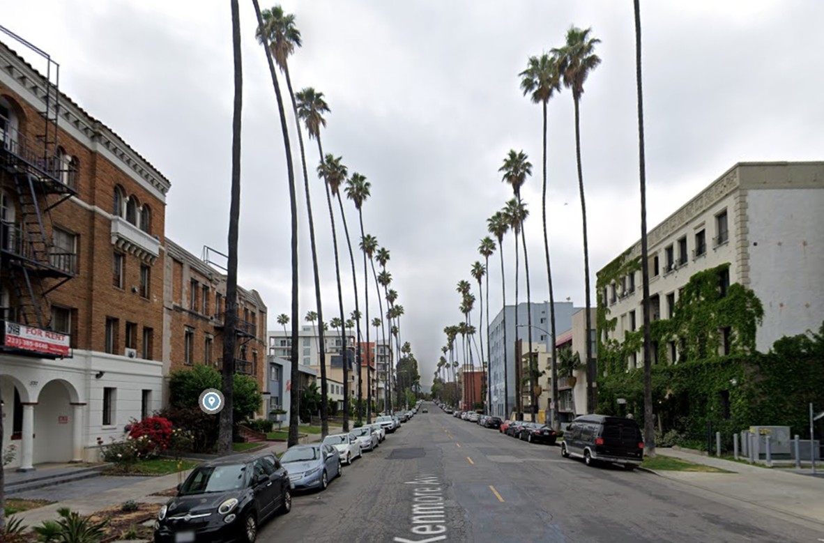
| (2024)* - Looking north on the 500 block of South Kenmore Avenue, showing towering palm trees lining the street. Compare with the previous image. |
Historical Notes As the mid-20th century progressed, the area transitioned from a primarily residential neighborhood to a more urbanized district with multi-story apartments and commercial buildings. By the 1970s and 1980s, the influx of Korean immigrants transformed the district into Koreatown, bringing a wave of new businesses, restaurants, and cultural institutions. Many of the original palm trees have remained, serving as a reminder of the neighborhood’s early development before its transformation into one of the most vibrant communities in Los Angeles. |
 |
|
| (1940 vs. 2024)* – A 'Then and Now' comparison looking north on the 500 block of South Kenmore Avenue in Koreatown, highlighting the growth of the palm trees over the years. Photo comparison by Jack Feldman. |
Historical Notes The palm trees in Koreatown, particularly along Kenmore Avenue, are Mexican fan palms (Washingtonia robusta), a common species in Los Angeles known for their tall, slender trunks and fan-shaped fronds. Many of these trees were planted in the early 20th century as part of a citywide initiative to beautify the city's streets. This suggests that some of the palm trees in Koreatown could be around 100 years old. However, the lifespan of these trees in urban environments is typically shorter than their natural lifespan of up to 500 years. |
* * * * * |
Angels Flight and Third Street Tunnel
 |
|
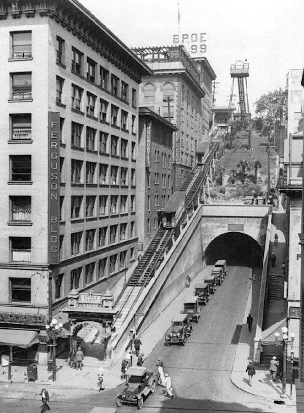
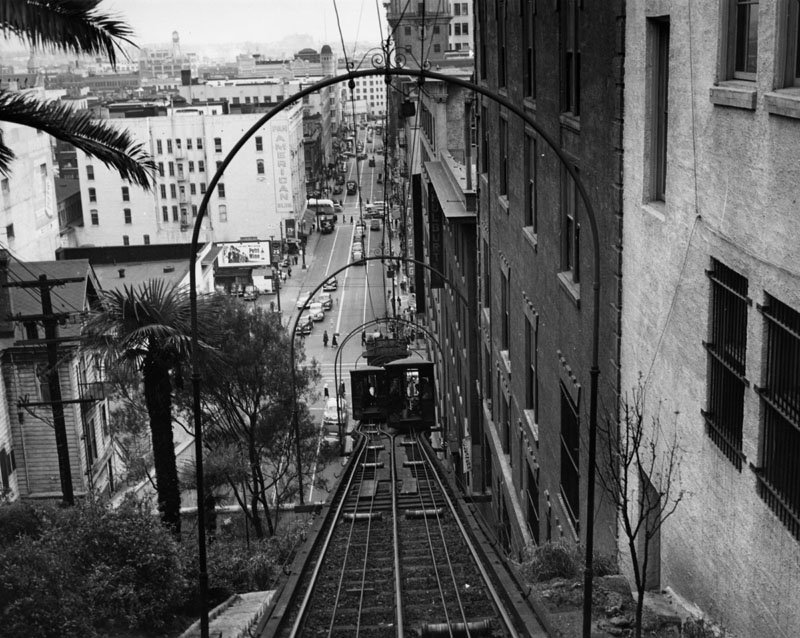
| (1934)* - The 3rd Street Tunnel and Angels Flight funicular were key transit links between downtown Los Angeles and Bunker Hill. Note the beautiful ornate streetlight on the right, known as the Winslow (Five-Globe Llewellyn Electrolier). |
Historical Notes Angels Flight and the Third Street Tunnel were significant landmarks in 1930s Los Angeles, representing the city's early efforts to overcome geographical challenges and facilitate urban growth. Angels Flight, a funicular railway inaugurated in 1901, provided a crucial transportation link between the downtown area and Bunker Hill. By the 1930s, it had become an integral part of daily life for many Angelenos, particularly workers commuting between the Downtown Historic Core and Bunker Hill. The railway's efficiency was remarkable, with estimates suggesting it had carried more passengers per mile than any other railway in the world during its first fifty years of operation. |
 |
|
| (1935)* - View looking west toward the Third Street Tunnel with Angels Flight to its left, at intersection of Hill and 3rd streets. |
Historical Notes The Third Street Tunnel, completed in 1901, ran beneath Bunker Hill and connected downtown Los Angeles with the expanding western parts of the city. By the 1930s, it had evolved into a heavily used thoroughfare for both pedestrians and automobiles, having been improved with paving, lighting, and sidewalks since its initial opening. Together, Angels Flight and the Third Street Tunnel symbolized Los Angeles' urban development and its ability to adapt to challenging topography. Their coexistence created an iconic Los Angeles scene, with Angels Flight running up the hill adjacent to the Third Street Tunnel, as captured in a 1934 photograph. These structures not only served practical transportation needs but also became emblematic of the city's growth and progress during the early 20th century, continuing to fascinate residents and visitors alike well into the 1930s and beyond. |
 |
|
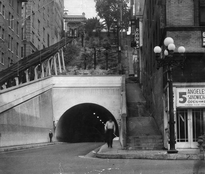
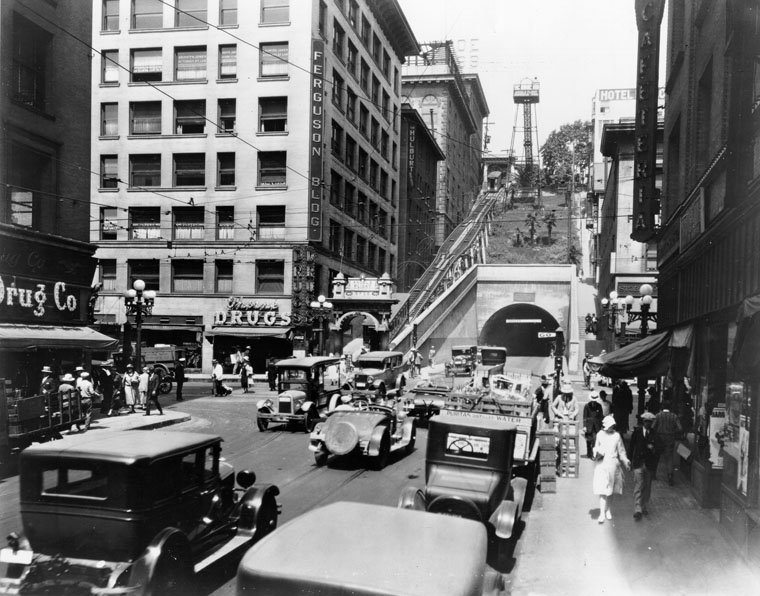
| (ca. 1937)^ - View looking west on 3rd Street toward Hill Street showing cars and pedestrians at the busy intersection. On the corner at the bottom of Angels Flight (beside the archway) is a drug store on the bottom floor of the Ferguson Bldg. The Angels Flight rail is still on wooden tressels. To the center-right is the Third Street Tunnel. |
 |
|
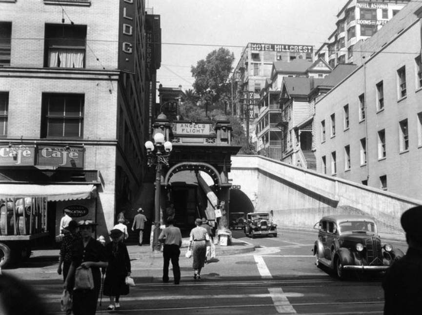
| (ca. 1939)* – View looking west showing pedestrians crossing Hill Street with Angels Flight and the Third Street Tunnel in the background. The Nevada Cafe is now at the bottom floor of the Ferguson Building at left. |
 |
|
| (ca. 1930s)^ - From the station at the top, a view straight down the track, with both cars at the mid-say point. Beyond is 3rd St. with cars and pedestrians. |
Historical Notes The funicular system of two counterbalanced cars called Olivet and Sinai (named for two mountains in the Bible) served to connect upscale Bunker Hill homes with downtown shopping areas below, moving up and down parallel tracks was an efficient means of transporting passengers along the steep grade between Third and Hill Streets and fashionable Bunker Hill. |
 |
|
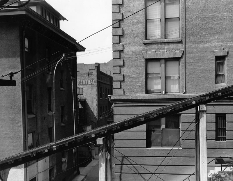
| (n.d.)^ - The track for the rail cars is seen in mid-air, from the side, with wooden braces holding it up in the air. The track here goes past commercial buildings. |
Historical Notes The ride lasted one minute and cost one cent. Over the years operations were transferred to other powers, tracks were re-laid, and the station house redesigned. However, the single-trip fare rose only once, in 1914, to five cents. |
 |
|
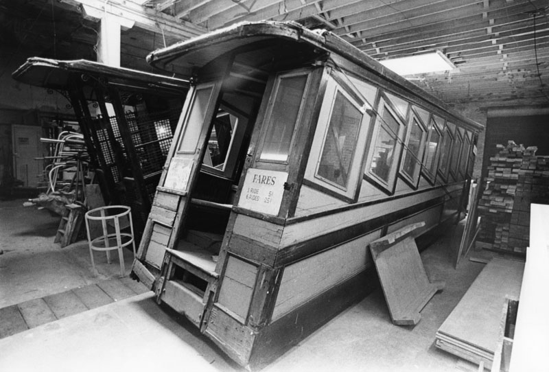
| (n.d.)* - The two Angels Flight cars, Olivet and Sinai, shown in storage. When Angels Flight - "the shortest railroad in the world" - first opened in 1901, there was only a small shelter at the top; in 1910, a larger and permanent depot was built. When the funicular was dismantled in the 1990s, the upper station was reconstructed at the California Plaza. |
Historical Notes In 1959 Angels Flight was destined for demolition as part of Bunker Hill Urban Renewal Project but loyal riders and enthusiastic supporters thwarted those plans, at least temporarily. During the next ten years the community of Bunker Hill changed dramatically as apartment houses were razed and residents dislocated by the redevelopment project. Ever decreasing numbers of commuters and tourists and lack of funding contributed to the inevitable. Even the designation of Historical Cultural Landmark could not save Angels Flight and she was dismantled in 1969. |
 |
|
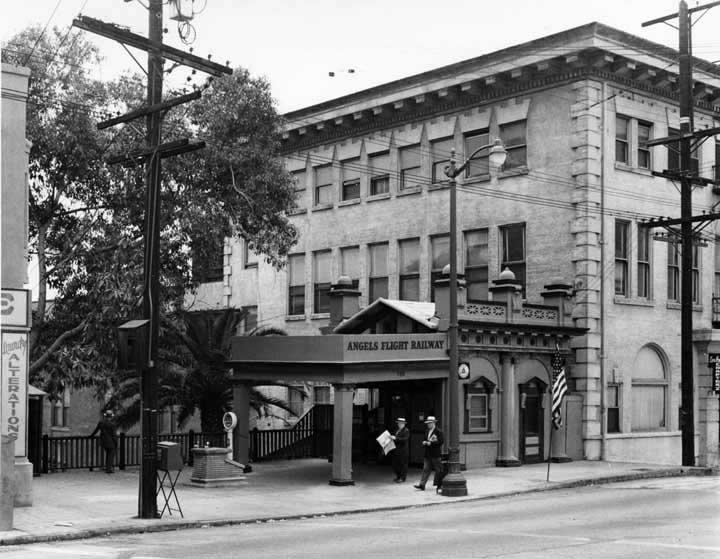
| (ca. 1950)* - View of the Angels Flight Terminal at the top of the hill. |
Historical Notes Angels Flight operated from 1901 until it was closed in 1969 when its location was redeveloped. The railway was relocated and reassembled at California Plaza in March of 1995, and closed again on February of 2001 after a serious accident resulted in the death of a passenger, and the injuries of seven others. The accident occurred when the ascending Sinai cable car suddenly reversed direction and uncontrollably accelerated downhill and struck the Olivet cable car near the lower terminus. The second funicular still exists and reopened in 2010. Angels Flight Railway was added to the National Register of Historic Places on October 13, 2000. |
Fore more early views of Angels Flight click the following: Angles Flight (1901+) and/or Angels Flight (1949+) |
* * * * * |
Los Angeles River
 |
|
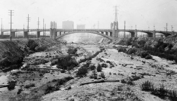
| (ca. 1930s)^ - View of an unpaved L.A. River pre-1938. The Fourth Street Bridge is seen in the background. |
Historical Notes Originally an alluvial river that ran freely across a flood plain, the Los Angeles River's 51-mile path was unstable and unpredictable with the mouth of the river moving frequently from one place to the other.^ |
 |
|
| (1938)*# - Aerial view of a flooding Los Angeles River at its confluence with the Arroyo Seco at the Southern Pacific Railroad and Figueroa Avenue bridges. The Figueroa Street Tunnels can be seen in the center of photo. |
Historical Notes Between February 27 and 28, 1938, a storm from the Pacific Ocean moved inland into the Los Angeles Basin, running eastward into the San Gabriel Mountains. The area received almost constant rain totaling 4.4 inches from February 27-March 1. This caused minor flooding that affected only a few buildings in isolated canyons and some low-lying areas along rivers. Fifteen hours later on March 1, at approximately 8:45 PM, a second storm hit the area, creating gale-force winds along the coast and pouring down even more rain. The storm brought rainfall totals to 10 inches in the lowlands and upwards of 32 inches in the mountains. When the storm ended on March 3, the resulting damage was huge.^* |
 |
|
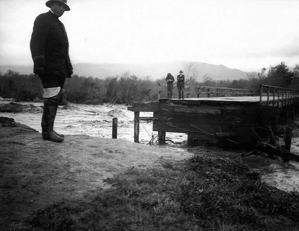
| (1938)^*^# – View of the Los Feliz Boulevard Bridge from Riverside Drive looking northeast shortly after half of it was destroyed by Los Angeles River flood waters. The Police Officer, left, is unknown. The man on the right is Van Griffith, son of Col Griffith J. Griffith, who gave Griffith Park to Los Angeles. |
 |
|
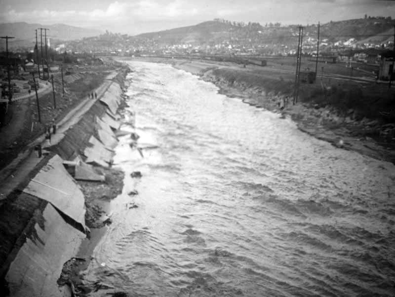
| (1938)^ - People walk along a cement path that seems to have snapped in half as the dirt below the concrete washed away in the flooded Los Angeles River. Trains and a small building, and part of Taylor Yard can be seen on the right. |
Historical Notes The great storm of March, 1938 flooded one third of the city of Los Angeles killing 115 people.^ |
 |
|
| (1938)^^ - Flooding in Southern California killed dozens. This bus became stuck at 43rd Place near Leimert Boulevard. |
 |
|
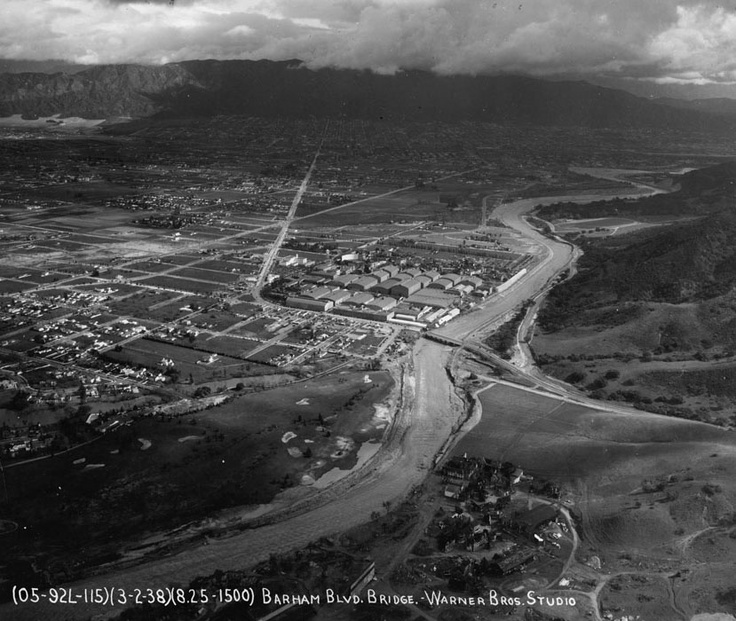
| (1938)^##* - An aerial view of Toluca Lake and Burbank as the waters of the Los Angeles River overflow its banks in March 1938. The Warner Bros. Studio is visible in the center of the picture. |
 |
|
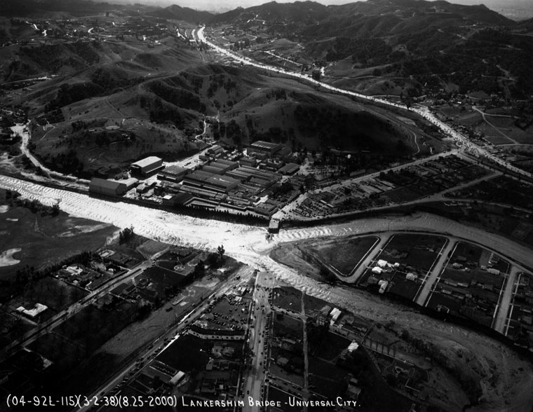
| (1938)^ - Aerial view of the Lankershim Bridge in Universal City, that was destroyed by flood waters. People gathered at the ends of the bridge to watch the waters rage past the now destroyed bridge. |
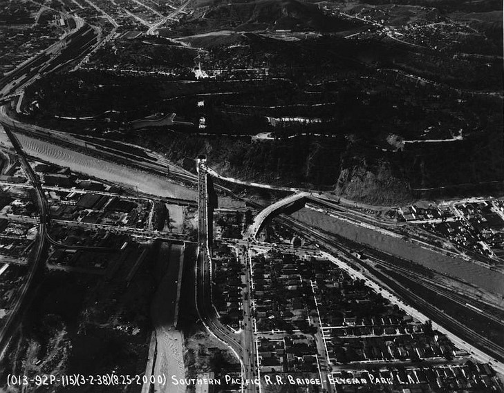
Historical Notes After the great storm of 1938, due to public outcry, the Army Corps of Engineers began the 20 year project to create the permanent concrete channel which still contains most of the of riverbed today. |
* * * * * |
Elysian Valley (aka Frogtown)
 |
|
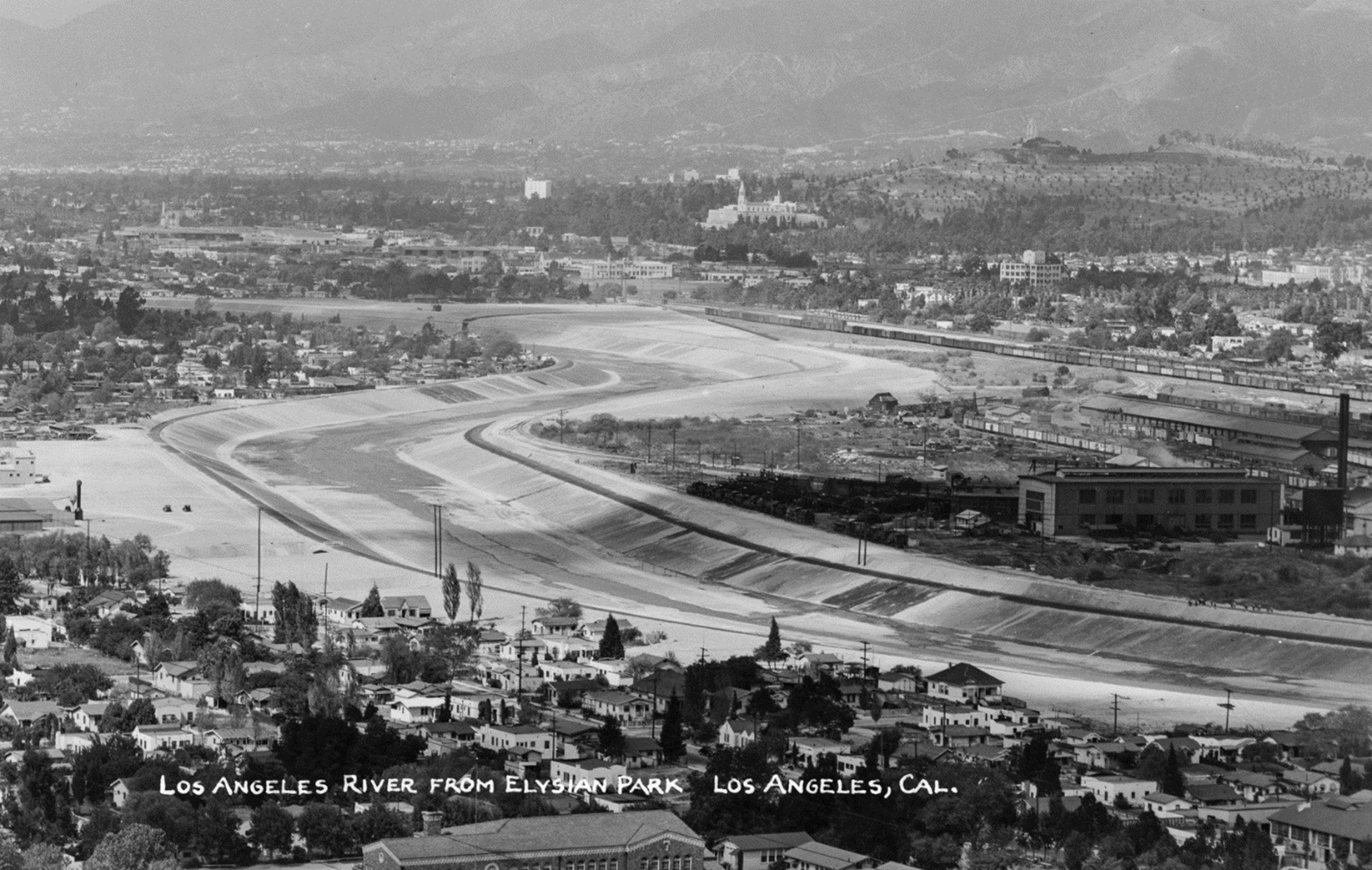
| (1940)* – View of a mostly unpaved L.A. River as it meanders through Elysian Valley (also known as Frogtown) with the Southern Pacific Railroad Yard (aka Taylor Yard) seen at center right. |
Historical Notes Elysian Valley is nestled between the Golden State Freeway and the Los Angeles River. It's a narrow strip of land approximately 3 miles long, bordered by the Los Angeles River on the north and east, Riverside Drive on the west, and Fletcher Drive on the northwest. This geographic isolation has played a significant role in shaping the neighborhood's character. The Los Angeles River has a long history of flooding, which led to significant engineering efforts to control its flow. In the late 1930s, the U.S. Army Corps of Engineers began stabilizing the river by constructing concrete walls to contain flood waters. Elysian Valley, commonly known as Frogtown, got its nickname due to the large number of amphibians that used to live there. From the 1950s to the 1970s, small amphibians—most likely Western Toads—would emerge from the Los Angeles River in such large numbers that they covered the streets, making it difficult for people to walk without stepping on them. These amphibians came out during rainy periods, sensing the increased moisture to breed in the river. Before the area became known as Frogtown in the 1930s, it had gone by other names, such as Gopher Flats and Little River Valley. While the term "frogs" is not biologically accurate, it became a community symbol. Some sources also suggest the name was influenced by a local gang. Although the amphibian population has significantly declined due to invasive species, urban development, pollution, and changes to the river’s flow, the name Frogtown is still an important part of the neighborhood’s culture and identity. |
 |
|
| (ca. 1941)* - Image of the newly concrete-lined Los Angeles River looking north from Elysian Park, with houses, the Southern Pacific Railroad's Taylor Yard (across the river at right, with railroad train cars visible), the tower of the Great Mausoleum of Forest Lawn cemetery in Glendale (at center) and mountains in the distance. Photo by Bob Plunkett from the Ernest Marquez Collection. |
Historical Notes Despite the channelization efforts, flooding remains a concern for areas along the Los Angeles River, including Elysian Valley. The concrete channel has been largely successful in managing flood risk, but there are still problematic reaches along the river where flooding remains a threat. Elysian Valley is notable for having one of the few unpaved sections of the Los Angeles River channel. Near Griffith Park through Elysian Valley, high groundwater levels prevent the channel bottom from being paved. This natural bottom section contributes to the area's unique ecosystem and flood management challenges. |
 |
|
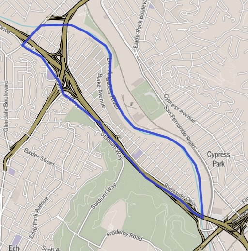
| (2013)* – Map showing the boundaries of Elysian Valley (Frogtown), located between the Los Angeles River and the 5 Freeway. |
Historical Notes Elysian Valley, also known as Frogtown (originally nicknamed as such for a glut of toads in the riverfront neighborhood) is bounded by the Los Angeles River on the north and east, Riverside Drive on the west and Fletcher Drive on the northwest. |
Then and Now
 |
|
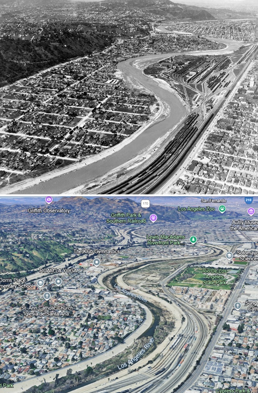
| (1940 vs 2023)* – A view of the Los Angeles River winding through Elysian Valley (also known as Frogtown), with the Southern Pacific Railroad Yard (formerly Taylor Yard) visible at center-right. Part of the former yard is now the Rio de Los Angeles State Park. Photo comparison by Jack Feldman. |
Historical Notes Taylor Yard closed in 1985, and portions of the former rail yard were remediated and opened in 2007 as Río de Los Ángeles State Park. Adjacent pieces include the 18-acre Bowtie (G1) parcel, managed by State Parks, and the 42-acre G2 parcel, purchased by the City of Los Angeles in 2017 for future habitat and restoration. The Taylor Yard Pedestrian and Bicycle Bridge, a striking orange structure, opened in March 2022, linking Elysian Valley to Cypress Park and Taylor Yard. This ties into the Glendale Narrows/Elysian Valley bike path, a roughly 7-mile segment that serves as a neighborhood “sidewalk.” Because the bed here stayed soft-bottom, native riparian habitat persists and has been the focus of small river-edge parks such as Lewis MacAdams Riverfront Park (formerly Marsh Park), Steelhead Park, and Egret Park. This corridor also sits inside the federally authorized LA River Ecosystem Restoration area, an 11-mile project from Griffith Park to Downtown that aims to restore natural hydrology and habitat while maintaining flood capacity. |
* * * * * |
Huntington Park
 |
|
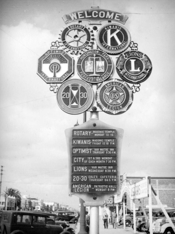
(ca. 1938)* – View showing a welcome sign to Huntington Park on Pacific Boulevard. It features the city seal and the emblems for many organizations including the Lions, Kiwanis, Rotarians, Optimists, 20-30 club and the American Legion. Photo by Herman Schultheis. |
Historical Notes Named for prominent industrialist Henry E. Huntington, Huntington Park was incorporated in 1906 as a streetcar suburb for workers in the rapidly expanding industries to the southeast of downtown Los Angeles. The stretch of Pacific Boulevard in downtown Huntington Park was a major commercial district serving the city's largely working-class residents, as well as those of neighboring cities such as Bell, Cudahy, South Gate, and Downey. |
* * * * * |
Catalina
 |
|
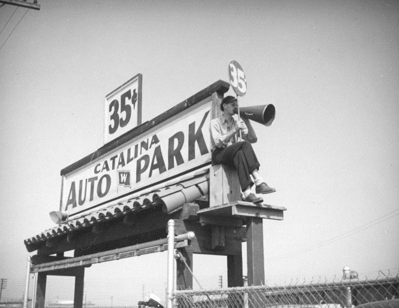
| (ca. 1938)^ - It costs 35 cents to use the auto park for the S. S. Catalina terminal at the Port of Los Angeles. A parking lot attendant sits with a megaphone by the sign. |
 |
|
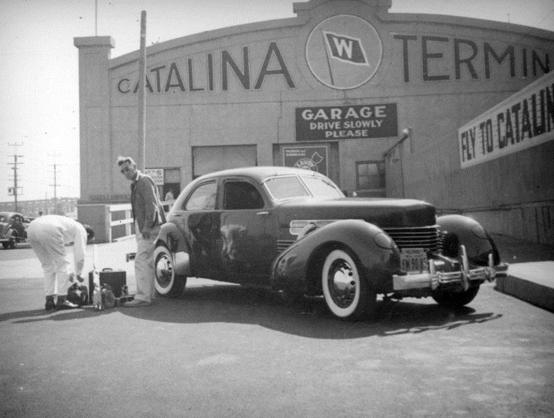
| (ca. 1938)^ - An employee assists a man unload his luggage from his car (1936/37 Auburn Cord 812 Westchester) which he has stopped in front of the garage at the Santa Catalina Island terminal at the Port of Los Angeles. A sign suggests flying to Catalina. |
Historical Notes Cord was the brand name of an American automobile company from Connersville, Indiana, manufactured by the Auburn Automobile Company from 1929 through 1932 and again in 1936 and 1937.^* |
 |
|
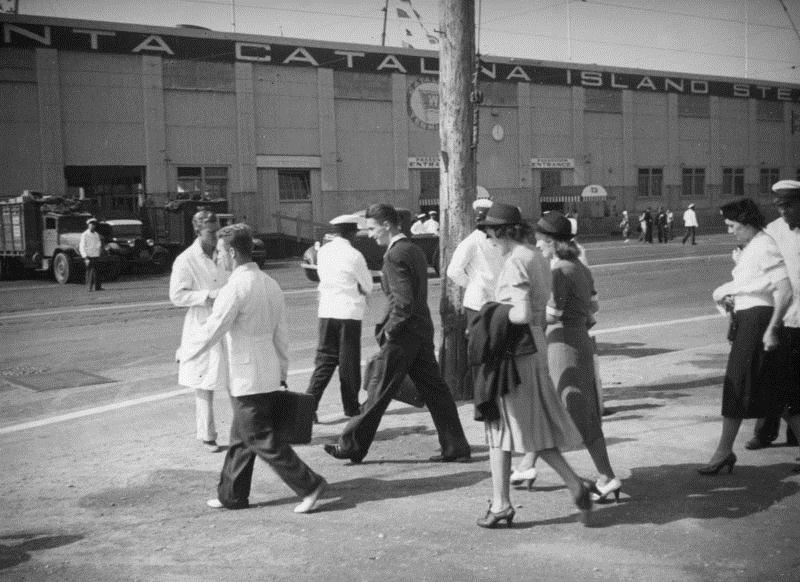
| (ca. 1938)^ - People walk across the street to get to the Santa Catalina Island terminal at the Port of Los Angeles. Canopies cover two passenger entrance doorways. |
Historical Notes This building, located at the end of Avalon Boulevard, is now the site of a 1995 community center called Banning's Landing (101 East Water Street).^ |
 |
|
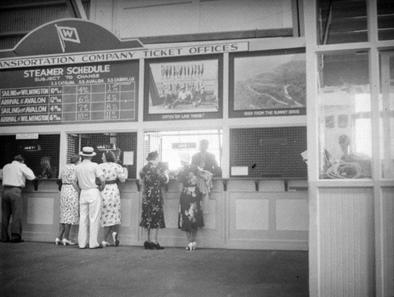
| (ca. 1938)^ - People stand at a line of ticket offices in the Santa Catalina Island terminal at the Port of Los Angeles. |
Historical Notes In the late 1920's tourist traffic to the Catalina Island was increasing at the rate of 20% annually. In July, August and September of 1929, the S.S. CABRILLO, S. S. AVALON and S. S. CATALINA carried a combined total of 500,000 passengers. The 3 ships offered a total of 5 sailings daily each way.^#^# |
 |
|
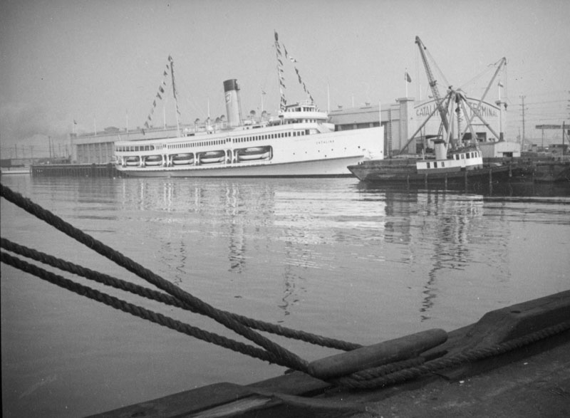
| (ca. 1938)^ - View of the S.S. Catalina docked at the Los Angeles Harbor. |
Historical Notes Commonly referred to as the Great White Steamer, the ship was specially built by William Wrigley to serve his Catalina Island as a passenger ferry. She was christened on May 23, 1924. During World War II, she was requisitioned for use as a troop carrier, but in 1946 she resumed her voyages to Avalon.*^* |
 |
|
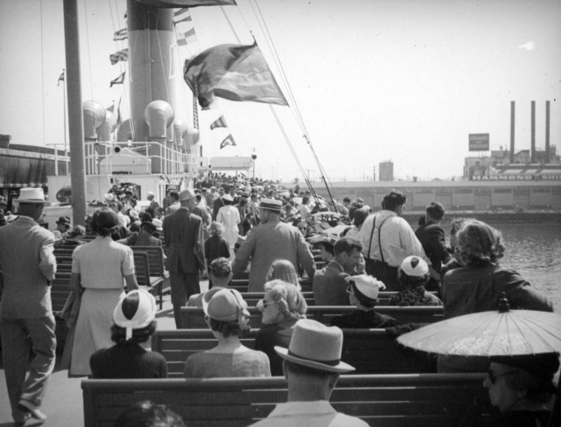
| (ca. 1938)^ - Some people stroll while others sit on board the S.S. Catalina. Hammond Shipping can be seen in the Port of Los Angeles on the right. |
Historical Notes Among the passengers were movie stars and famous athletes who laughed, danced and drank their way to the island "26 miles across the sea." The S.S. Catalina even hosted 2 United States Presidents at different times. In those days, passengers dressed for the crossing. Gentlemen wore jackets and ties and the ladies dresses and coats, with some carrying umbrellas to protect them from the sun.^#^# |
 |
|
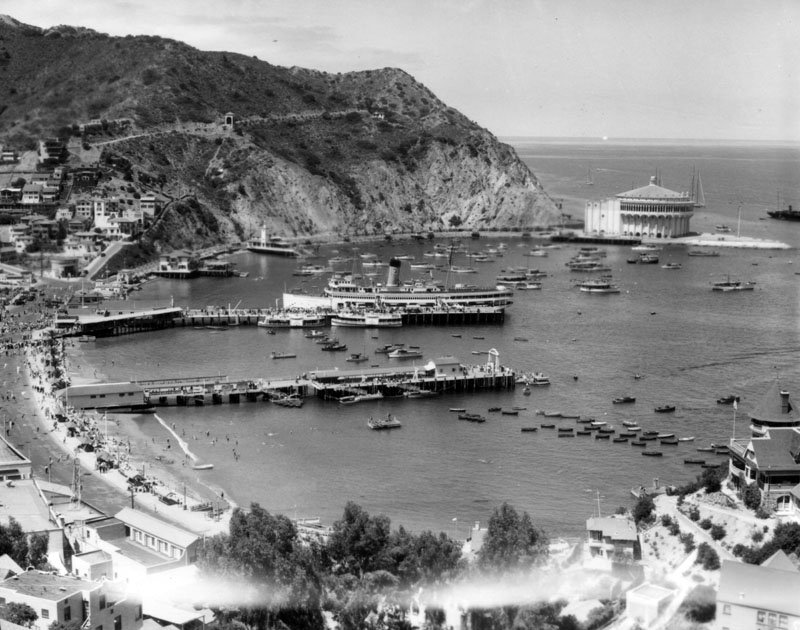
| (1920s)^ - View of Avalon Bay across Crescent Bay, on Santa Catalina Island as seen from a mountain top. The Catalina Casino, surrounded by the sea on three sides, is visible at the edge of the bay on the right along with several boats along with the S.S. Catalina, "The Great White Steamer". |
Historical Notes The S.S. Catalina has been recognized as a Historic-Cultural Monument, No. 213 (Click HERE to see the LA Historic-Cultural Monuments List) and also California State Historic Landmark No. 894 (Click HERE to see more California Historic Landmarks in LA). She was listed on the National Register of Historic Places in 1976. |
 |
|
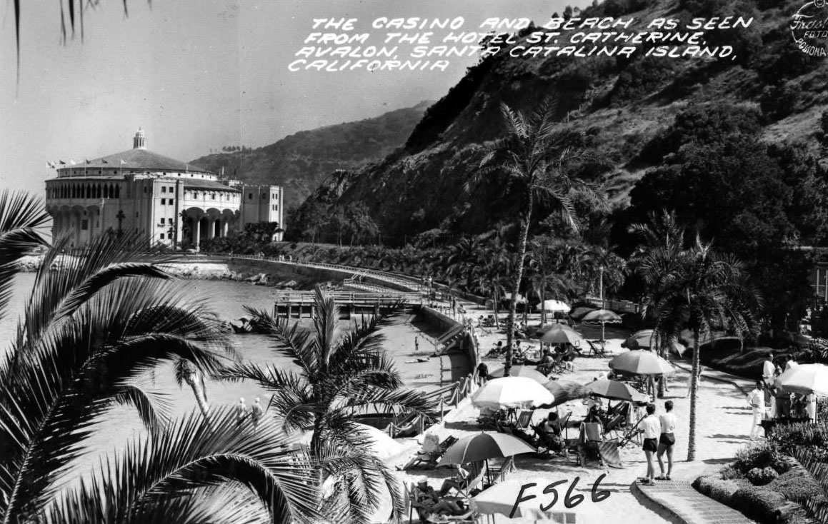
| (1938)##^* – Postcard view of the Casino and beach as seen from the Hotel St. Catherine in Descanso Canyon on Catalina Island. |
Click HERE to see more in Early Views of Catalina |
* * * * * |
Civic Center
 |
|
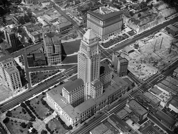
| (1938)^ - Aerial view of Los Angeles Civic Center with City Hall, 200 N. Spring St., as the focal point. A portion of the State Building can be seen on the left. To the right of City Hall is vacant land waiting for construction to begin on the new Federal Courthouse and U.S. Post Office Building. Across from City Hall is the Hall of Records. The Hall of Justice is next to a partially graded hill which still contains houses on top. |
 |
|
| (ca. 1935)^ - View looking southwest showing the old State Building with City Hall's shadow cast upon it. Bunker Hill can be seen in the background. |
Historical Notes The State Building was completed in 1931 at a cost of more than $2 million. It was dedicated the day before the opening of the 1932 Olympics in a ceremony that featured Amelia Earhart.**## |
 |
|
| (ca. 1940)*# - View looking toward the northwest corner of First and Spring streets showing the California State Building. Further north on Spring can be seen the Hall of Records and the Hall of Justice. Photo by Dick Whittington. |
Historical Notes The California State Building sustained damage in the 1971 San Fernando earthquake. In May of 1973 the state authorized an "orderly evacuation" after testing found the building unsafe. The empty building was torn down in early 1976.**## |
 |
|
| (ca. 1940)*^#^ – Postcard aerial view looking northwest showing City Hall and the Civic Center. The State Building and Hall of Records can be seen on Spring Street at center-left. The Hall of Justice, Federal Courthouse and U.S. Post Office Building (built in 1940), and International Bank Building are at center-right on Temple Street (to the right of City Hall). Bunker HIll at upper-left is still covered with residential buildings. |
 |
|
| (1943)+# – Night view looking west toward Bunker Hill as seen from the observation deck of City Hall with the LA County Hall of Records in the foreground. All the streets are lit up including Broadway (running left to right at bottom), Temple Street (right), and Court Street (running away from the camera at center). |
Broadway and Temple
 |
|
| (1937)^#^^ – View looking north on Broadway toward Temple. From left to right can be seen the Examiner sign, Broadway Tunnel under Fort Moore Hill, Hall of Justice, Stephen M. White Statue, and the steps to the LA County Courthouse. |
 |
|
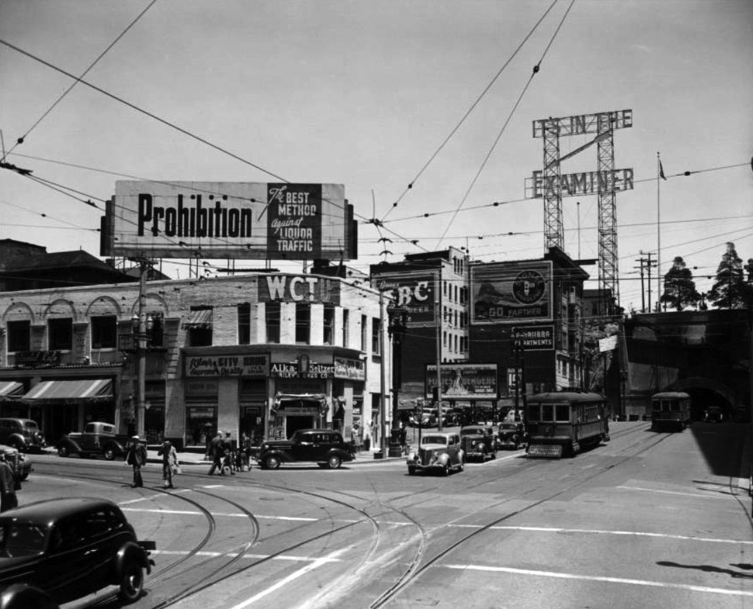
| (1939)*# – View looking at the northwest corner of Broadway and Temple Street showing the Women's Christian Temperance Union Building. Billboard on top of building reads: "Prohibition: the Best Method Against Liquor Traffic." Also shown: the Alhambra Apartments, Riley's Drug Company, and two Los Angeles Railway streetcars, one leaving and another one entering the Broadway Tunnel. Across the street on the N/E corner (out of view) stands the Hall of Justice. |
 |
|
| (ca. 1940)**^ - View looking north of the intersection of Broadway and Temple with the Hall of Justice located on the northeast corner. A streetcar is in the lower right. The Broadway Tunnel, which runs under Fort Moore Hill, is seen in the background. |
Historical Notes On June 2, 1949, the Broadway Tunnel was demolished for the construction of the 101 Freeway. The route cut through Fort Moore Hill and made it necessary for a Broadway overpass to be built across the freeway and the old tunnel site.*^ |
 |
|
| (ca. 1950)* - Looking north on Broadway toward Temple Street with the Hall of Justice seen on the NE corner. Note that the Broadway Tunnel is no longer there. |
* * * * * |
 |
|
| (ca. 1940)^ - View of Los Angeles City Hall looking east from the corner of Temple and Hill streets. A little market stands on the northeast corner with the Hall of Justice seen behind it one block to the east. Photo by Ansel Adams |
 |
|
| (ca. 1939)*# – View looking east on 1st Street toward the LA Times Building from above Hill Street. A Richfield Service Station is in the foreground on the northeast corner. Across the street stands Central Police Station, 318 West 1st Street, with police cars parked in front. |
 |
|
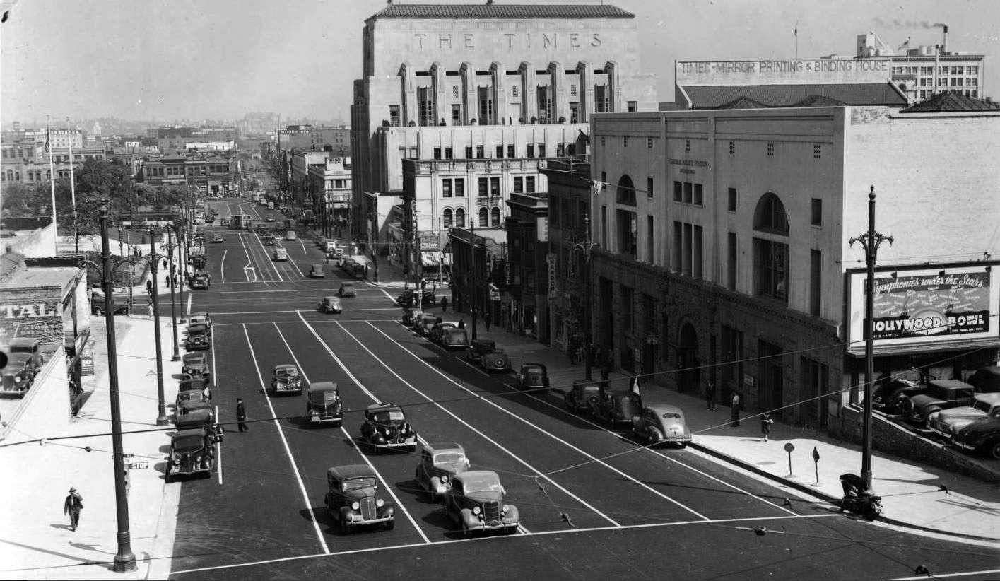
| (1939)*#^ – Panoramic view looking east on 1st Street from over Hill Street with the LA Times Building standing tall in the distance. On the right is the LA Police Department’s Central Division (demolished in 1956). 'Symphony under the Stars at the Hollywood Bowl'. |
 |
|
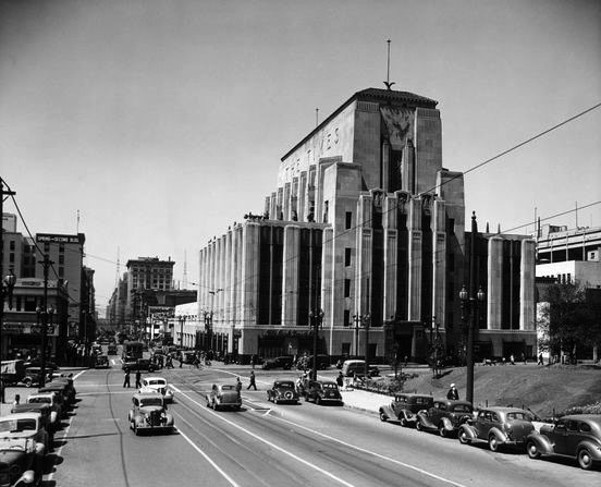
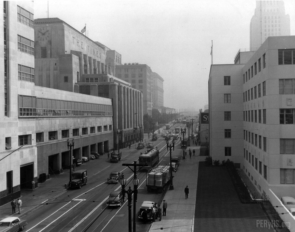
| (ca. 1939)**^ - View looking south on Spring toward 1st Street with the LA Times Building seen on the S/W corner. |
 |
|
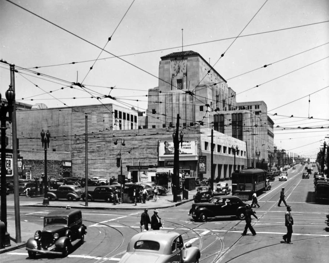
| (1939)*# - Spring Street looking northwest from 2nd Street showing Walts Auto Park on the NW corner. The LA Times Building can be seen in the background on the SW corner of Spring and 1st Street. |
Historical Notes The Times Building was originally completed in 1935. In 1948, a 10 story addition, Mirror Building, would be built at the northwest corner of Spring Street and 2nd Street, where the parking lot is seen above. |
 |
|
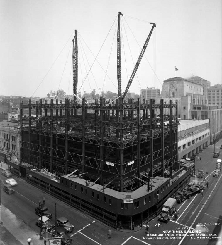
| (1947)**^ – View showing the Mirror Building (then called New Times Building) under construction, located at the NW corner of the Spring and 2nd streets. The 1935-built LA Times Building is seen on the right, SW corner of Spring and 1st streets). To the left is the Hellman Building (NE corner of 2nd and Broadway) which was demolished in 1959 to make way for the Times Mirror garage. |
Historical Notes When completed, the Mirror Building would be part of the Times Mirror Square complex consisting of five interconnected buildings, constructed in three phases between 1935 and 1973. Its most prominent features are the Gordon Kaufmann-designed Los Angeles Times Building and the Rowland Crawford-designed Mirror Building, both of which are located on the Spring Street side of the property. The property as it exists today was completed with the addition of the William Pereira-designed Times-Mirror Headquarters building in 1973, which was also joined by a six-story parking garage along the Broadway side of the block.^ Click HERE to see more Early Views of the Mirror Building. |
 |
|
| (ca. 1950)^.^ – View looking north on Spring Street from north of 2nd Street showing the massive Los Angeles Times Building and Mirror Building on the left. The top of City Hall can be seen in upper-right. Photo courtesy of the PACIFIC ELECTRIC RAILWAY HISTORICAL SOCIETY. |
* * * * * |
Weller Street (now Onizuka Street) in Little Tokyo
 |
|
| (1933)^ - Southeasterly overhead bird's-eye view of Little Tokyo from Los Angeles City Hall. The diagonal thoroughfare is Weller (now Astronaut Ellison S. Onizuka) Street, February 21, 1933. Photo Anton Wagner. |
Historical Notes For most of the 20th century, the hotels, boarding houses, and apartment blocks along the single block of Weller Street housed hundreds of Little Tokyo’s down and out. During the interwar years, the Salvation Army maintained its primary hotel for poor industrial workers at 127 Weller Street, visible on the left of the top photograph. After waves of Japanese families began returning to Los Angeles from interment camps after the war, many of the old buildings served as homes for those needing temporary lodging, and eventually, for those with nowhere else to go. |
 |
|
| (1939)* - View looking southeast down Weller Street (now Onizuka Street) and First Street in Little Tokyo as seen from City Hall. |
Historical Notes The original boundaries of Little Tokyo extended east and south of the present location, and covered approximately one square mile. The area was a magnet for immigrating Japanese until the Exclusion Act of 1924 halted any further migration. Shops were along First Street, and vegetable markets were along Central Avenue to the south. Japanese Americans were a significant ethnic group in the vegetable trade, due to the number of successful Japanese American truck farms across Southern California. |
 |
|
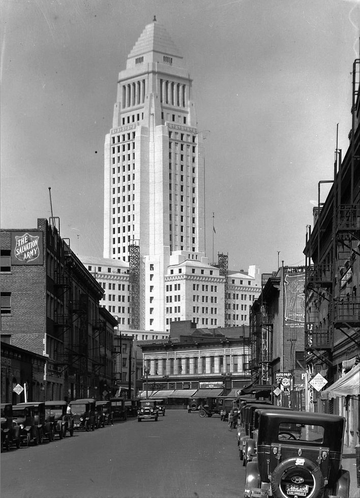
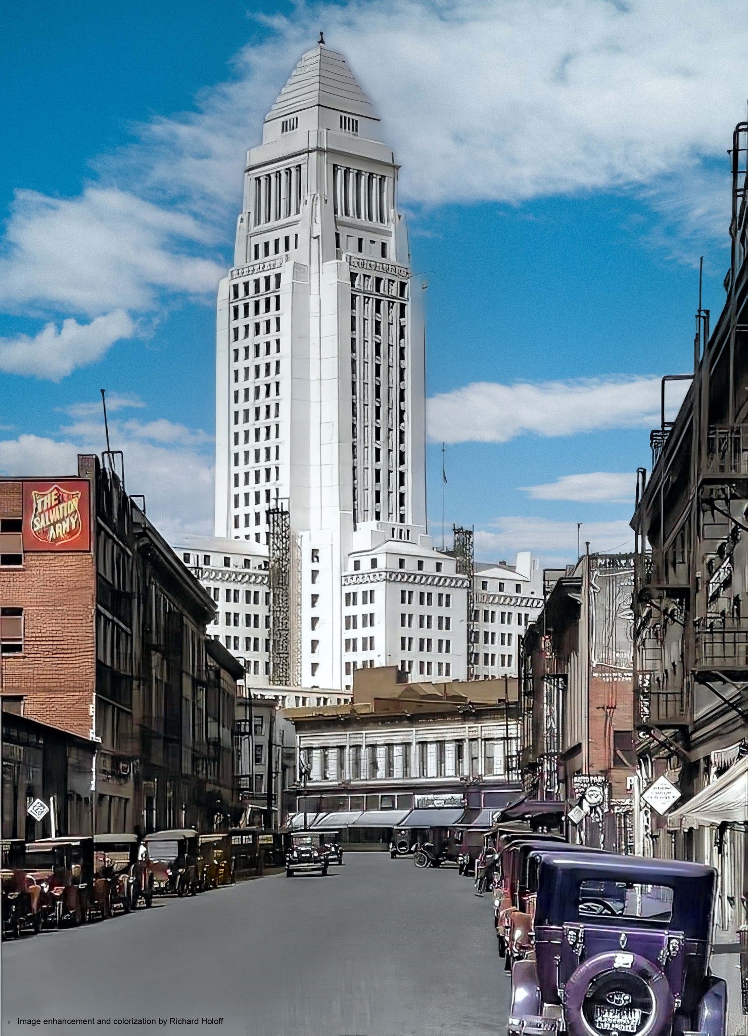
| (1928)* - View showing the nearly completed City Hall building as seen from Weller Street (now Onizuka Street, Little Tokyo). Metal scaffolding can be seen in place near the base of the tower. On the left can be seen the Salvation Army. |
Historical Notes When it opened its doors in 1928, the new Los Angeles City Hall was the tallest building in the city and undeniably beloved by its people—and they hadn’t even been inside yet. Indeed, more than a half-million people lined the streets to celebrate the dedication of the monolith that symbolized Los Angeles’s successful transition from West Coast outpost to world-class metropolis. |
 |
|
| (1928)* - View showing the nearly completed City Hall building as seen from Weller Street (now Onizuka Street, Little Tokyo). Metal scaffolding can be seen in place near the base of the tower. On the left can be seen the Salvation Army. Image enhancement and colorization by Richard Holoff. |
 |
|
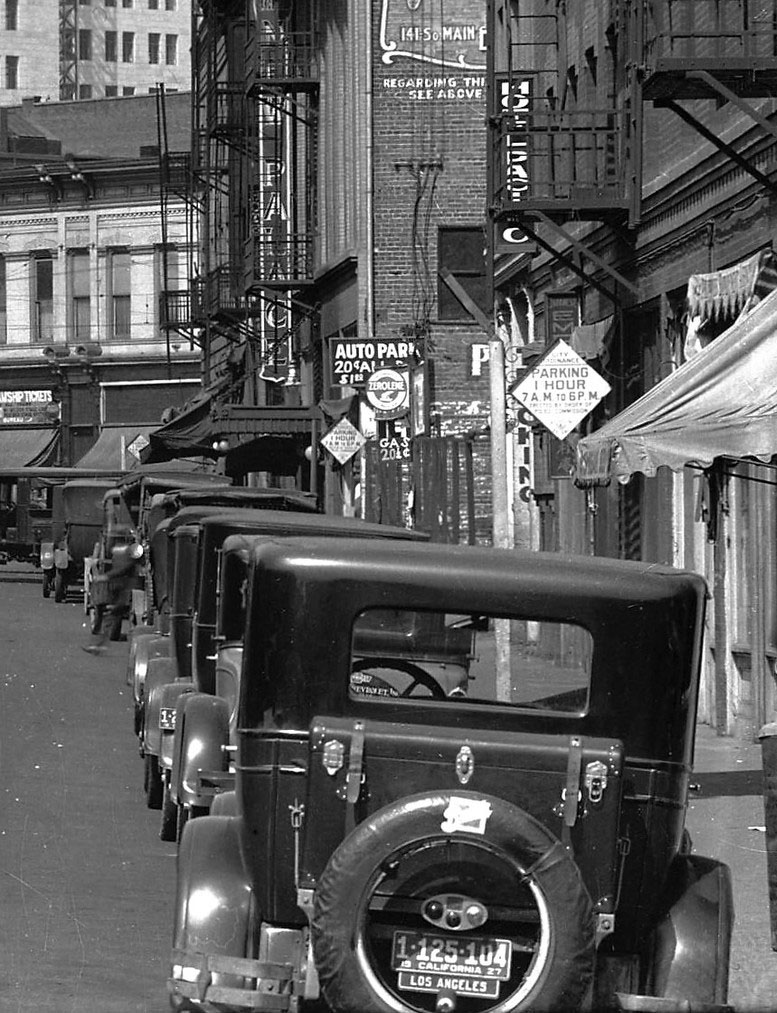
| (1928)* - Detail street view looking north on Weller Street toward First Street showing early model cars parked along the curb on the east side of the street. |
Historical Notes Urban renewal and redevelopment have all but destroyed any testament of the street’s history. All that has been preserved of old Weller Street is a single 3-story building at the intersection with First Street. Most buildings on the east (right) side of the street were destroyed in 1965 during the construction of the 16-story Kajima Building, the neighborhood’s first commercial skyscraper. The handful that remain, with their upper stories removed, bear little semblance to their former selves. |
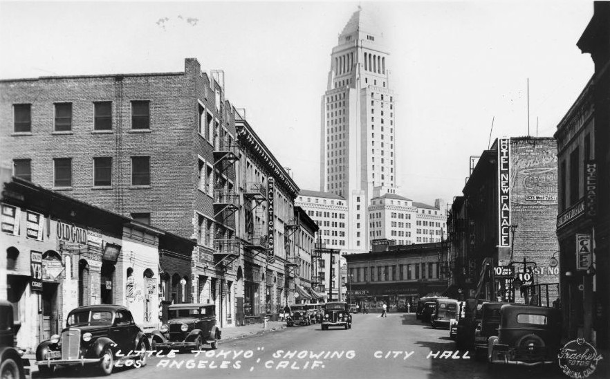 |
|
| (1938)**^ - Postcard view looking north on Weller Street in Little Tokyo from Second Street toward City Hall. The Salvation Army is seen on the left and the New Palace Hotel on the right at 118 Weller Street. |
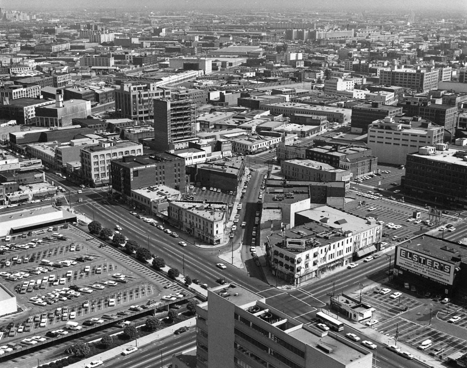 |
|
| (1965)* – View looking down from City Hall towards Weller Street and Little Tokyo. Photo by William Reagh |
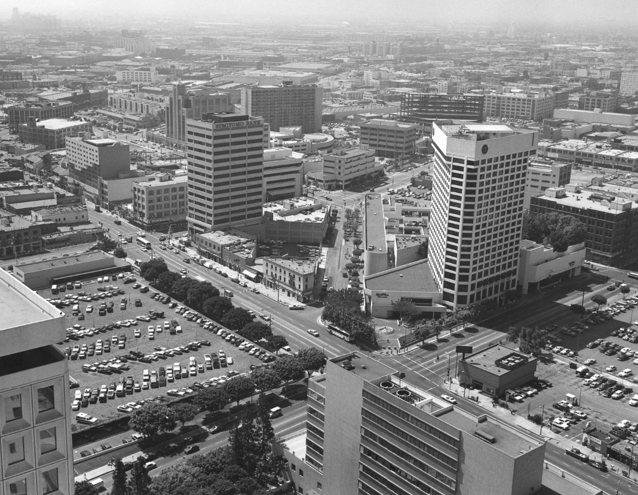 |
|
| (1988)* – View looking down from City Hall towards Weller Street and Little Tokyo. The new Weller Court Shopping Center can be seen on the west side of Weller Street. Photo by William Reagh |
Historical Notes The west side of Weller Street was fully demolished in 1977, replaced by an 88,000 square foot shopping center named Weller Court, opened in 1980. The development also closed most of the street to car traffic, largely removing it from downtown’s grid. |
Before and After
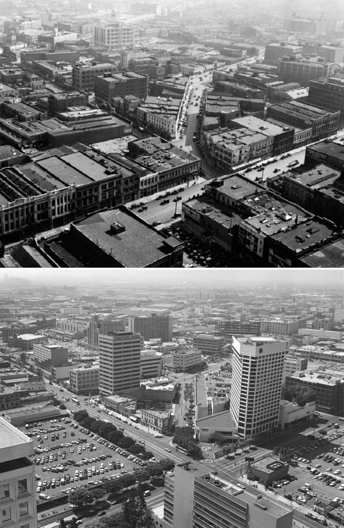 |
|
| (1933 vs 1988)^ - View looking down from City Hall towards Weller Street and Little Tokyo. |
Before and After
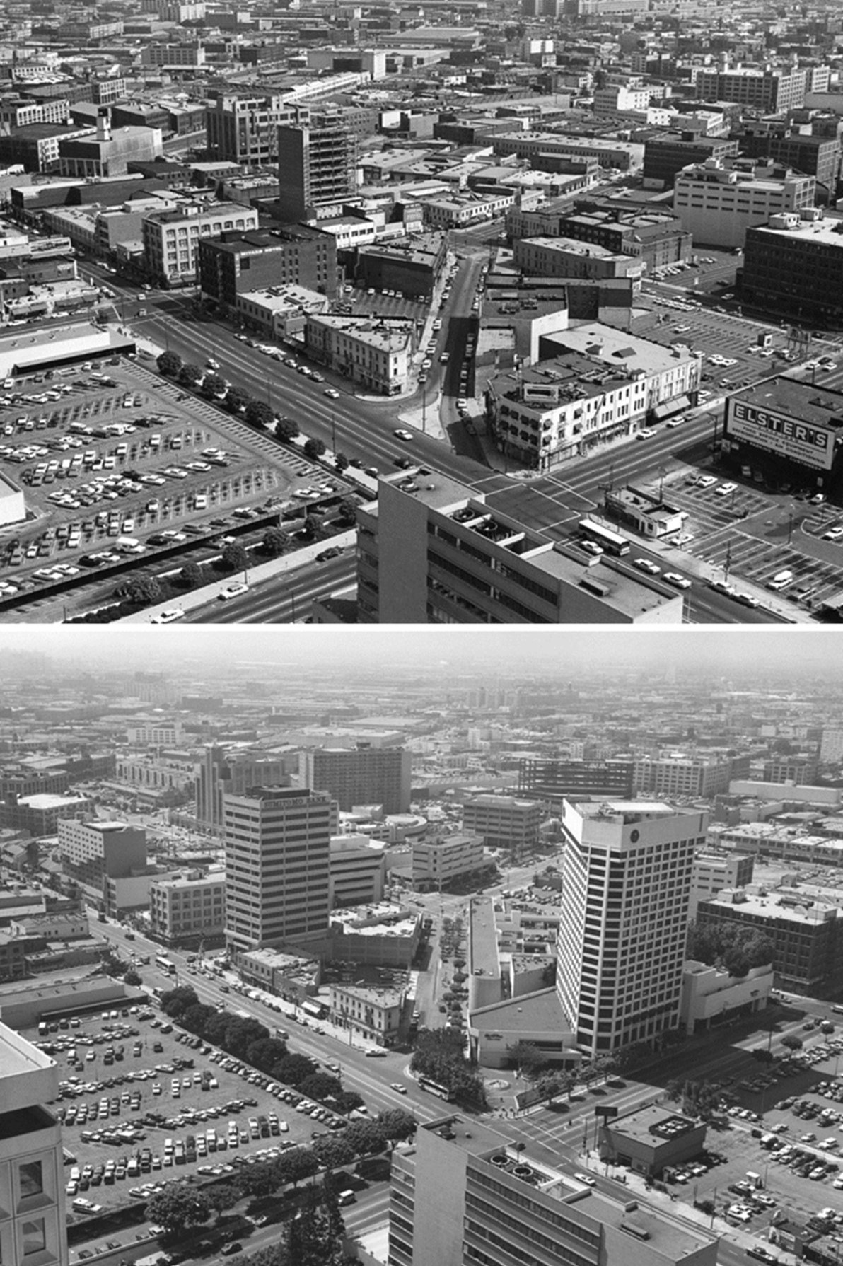 |
|
| (1965 vs 1988)* – View looking down from City Hall towards Weller Street and Little Tokyo. The 1980-built Weller Court Shopping Center can be seen on the west side of Weller Street. Photos by William Reagh |
Then and Now
 |
|
| (1965 vs 2022)* – View looking down from City Hall towards Weller Street (today Onizuka Street) and Little Tokyo. Photo comparison by Jack Feldman. |
Historical Notes Astronaut Ellison S. Onizuka Street, originally Weller Street, in Little Tokyo, was renamed to honor Ellison Onizuka, one of the astronauts who perished in the Space Shuttle Challenger disaster in 1986. |
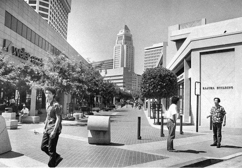 |
|
| (1986)^ - Same view almost 50 years later. The sign of Weller Court shopping mall can be seen on the left, and Kajima Building is on the right. In the center of the photo is Los Angeles City Hall. |
Historical Notes Little Tokyo is one of only three official Japantowns in the United States, all three of which are in California (the other two are in San Francisco and San Jose). Founded around the beginning of the 20th century, the area is the cultural center for Japanese Americans in Southern California. It was declared a National Historic Landmark District in 1995. In 1986, the community supported changing Weller Street to Astronaut E. S. Onizuka Street. Ellison Shoji Onizuka was an American astronaut from Kealakekua, Kona, Hawaii, who successfully flew into space with the Space Shuttle Discovery on STS-51-C, before losing his life to the destruction of the Space Shuttle Challenger, where he was serving as Mission Specialist for mission STS-51-L. He was the first Asian American to reach space. |
Then and Now
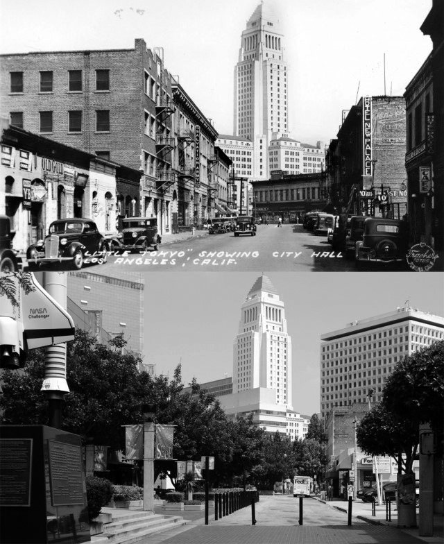 |
|
| (1937 vs. 2011)* - Weller Street (now Onizuka Street) in Little Tokyo. Photo comparison by Jack Feldman. |
Then and Now
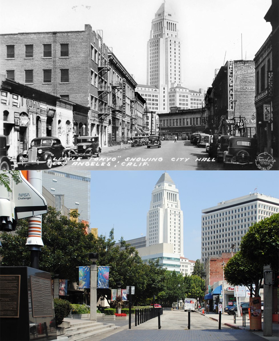 |
|
| (1937 vs. 2011)* - Weller Street (now Onizuka Street) in Little Tokyo. Photo comparison by Jack Feldman. |
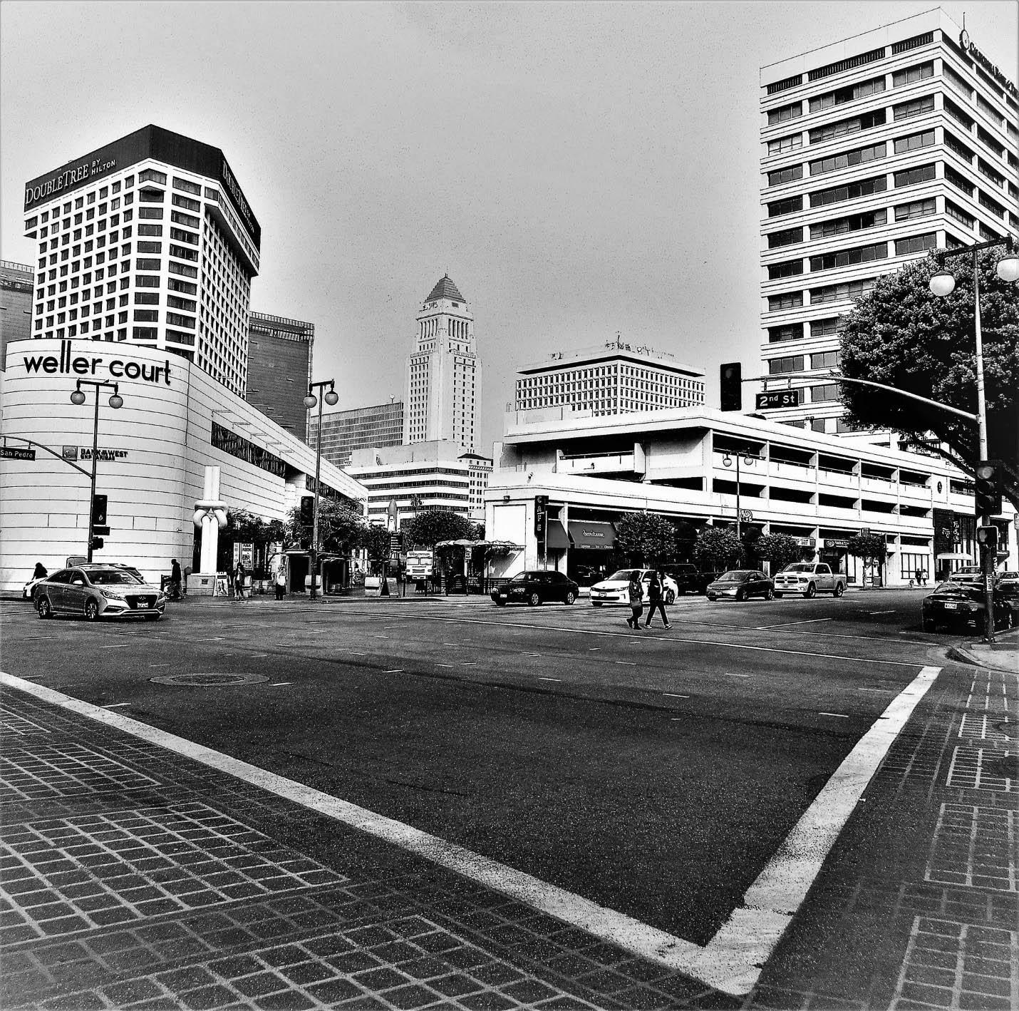 |
|
| (2020)^ - View looking north toward Ellison S Onizuka Street and City Hall from the intersection of 2nd and San Pedro streets. Photo by Howard Gray. |
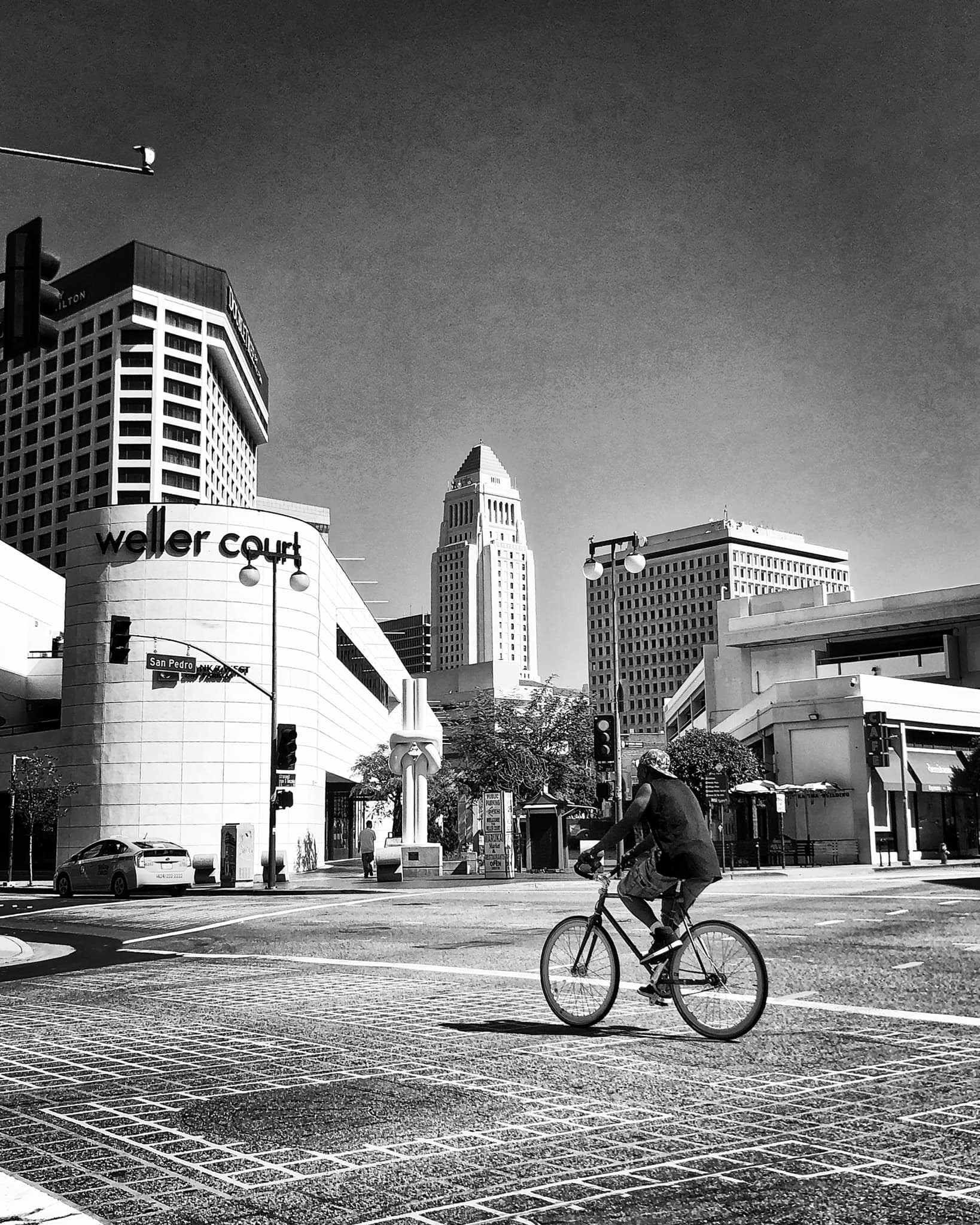 |
|
| (2021)^ - San Pedro St and 2nd St intersection looking towards Ellison S Onizuka Street. Photo by Carlos G. Lucero |
* * * * * |
Chinatown and Union Station
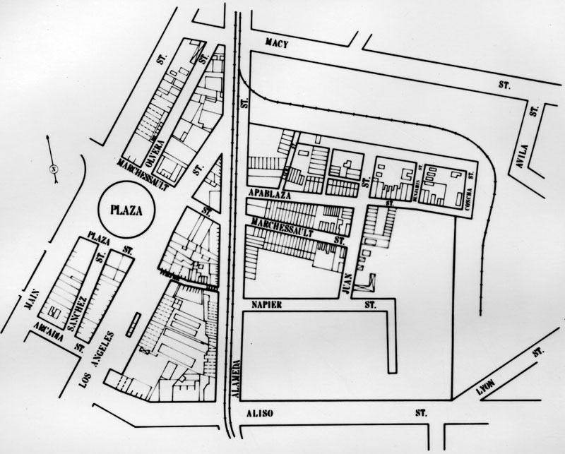 |
|
| (1920s)^ - Map of early LA with the Plaza seen just west of Alameda. East of Alameda is the older part of Chinatown that was relocated when the Union Station was built in the late 1930s. Union Station opened in May of 1939. |
Historical Notes Los Angeles' Union Station was built on the site of the city's original Chinatown, leading to the displacement of thousands of Chinese American residents and businesses in the 1930s. Here are the key details: In the late 19th century, a vibrant Chinese American community developed in downtown Los Angeles, centered around what is now the area of Union Station and the El Pueblo plaza. This "Old Chinatown" had businesses, residences, temples, and community organizations serving Chinese immigrants and families. However, by the 1920s, city leaders wanted to construct a new, grand railroad terminal in the area. Despite opposition from Chinatown residents, plans moved forward to demolish much of the neighborhood to make way for Union Station. In the 1930s, the demolition and evictions began, displacing several thousand Chinese American residents and businesses from Old Chinatown. The remaining sections were razed in the late 1940s and 1950s to build the 101 freeway through the area. |
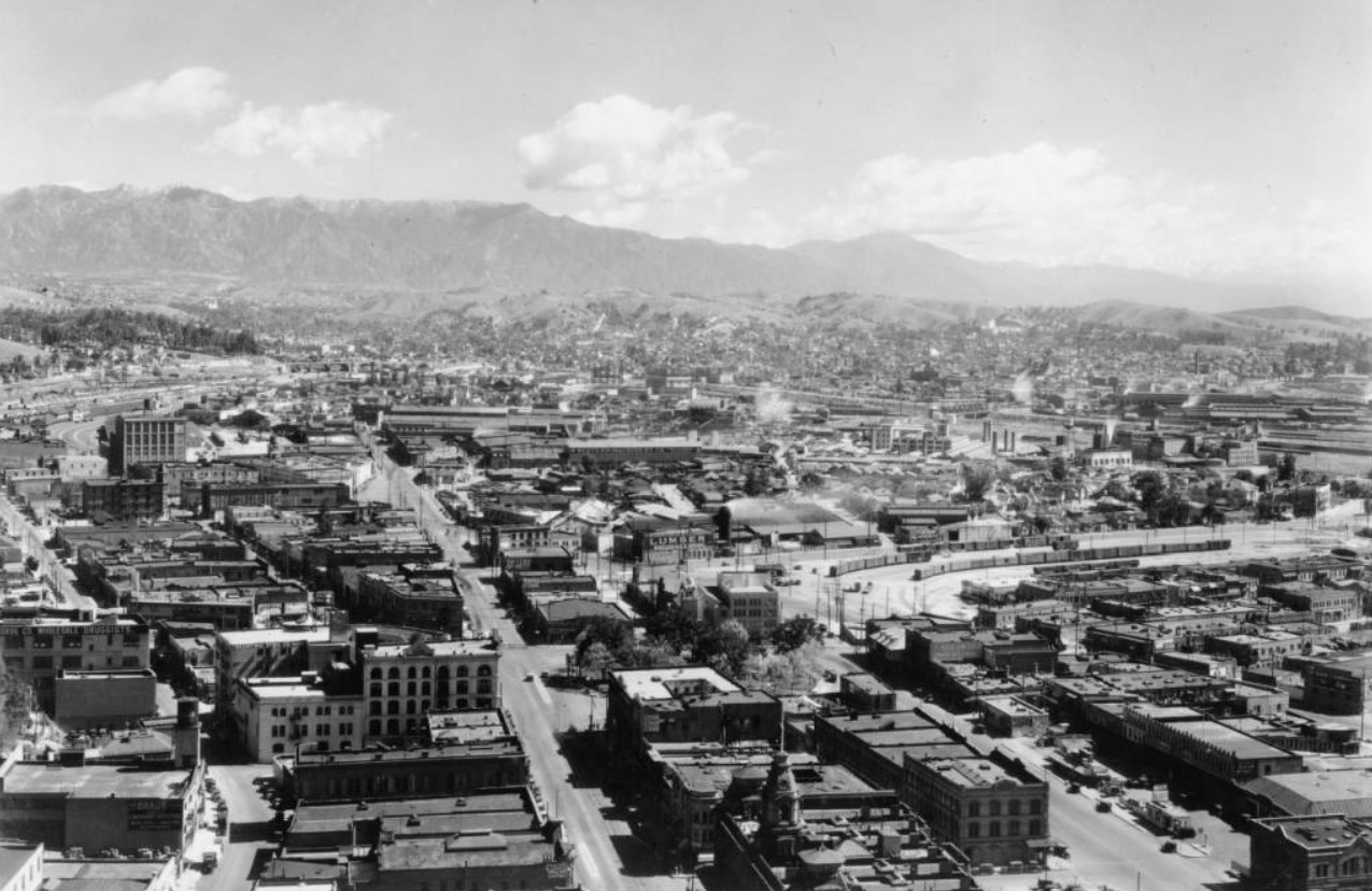 |
|
| (ca. 1930)* – View of the proposed site for Union Station construction. This is one of the oldest areas in the City, with the Los Angeles Plaza at center and Chinatown at lower right. Main Street is seen at lower center running towards the background. Baker Block is at lower center-right. |
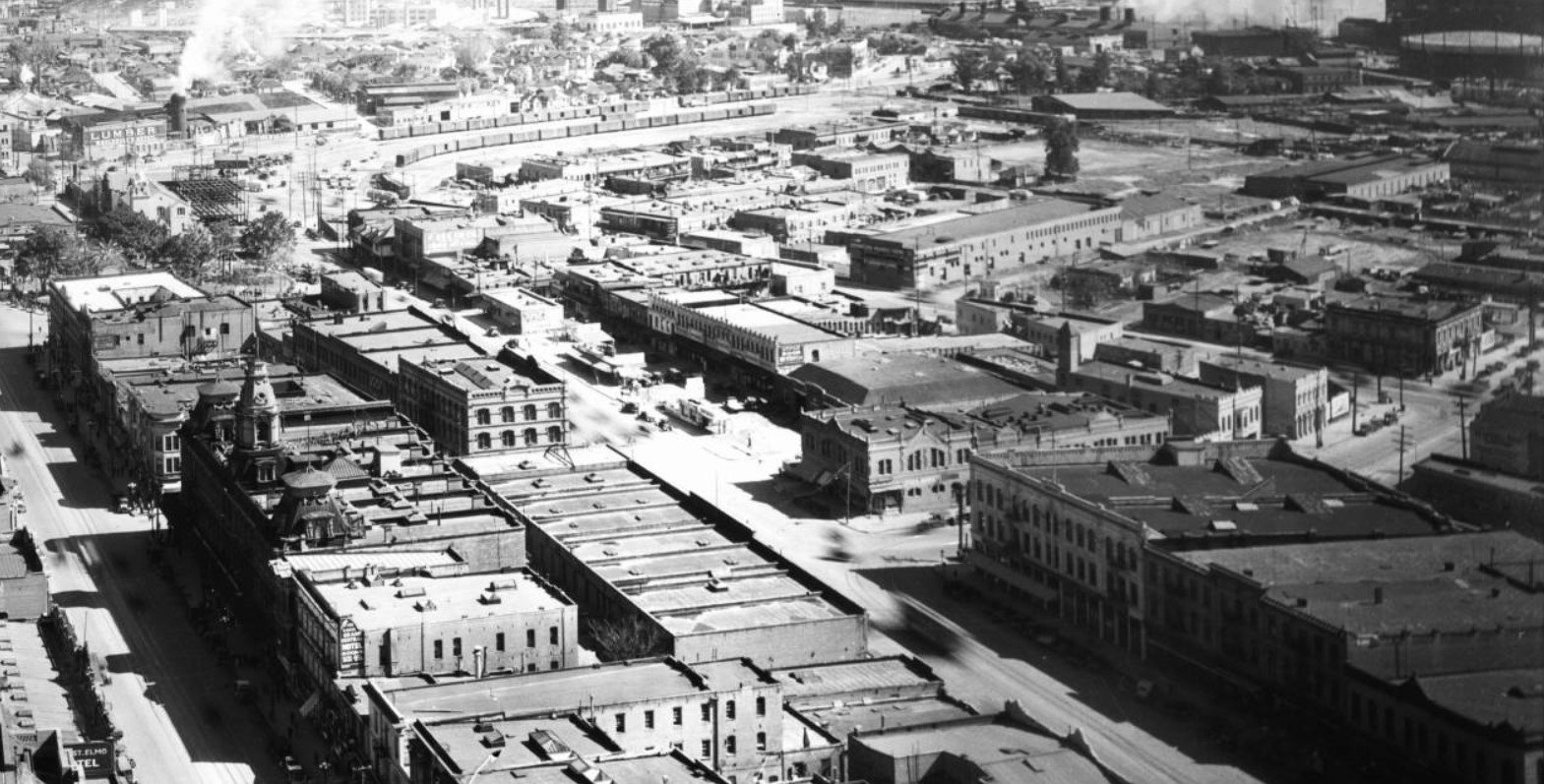 |
|
| (ca. 1930)* - View looking northeast from City Hall showing the old part of Los Angeles including the LA Plaza and Chinatown. At left can be seen the ornate Baker Building (aka Baker Block) with its three distinct towers located on the historic 300 Block of N. Main Street. Los Angeles Street runs diagonally from lower-right to upper-left. Aliso Street runs from Los Angeles Street, at center, east and then tunrs diagonally up. The propsed site of the new Union Station would be northeast of the intersection of Los Angeles and Aliso Streets. |
Historical Notes In 1926, a measure was placed on the ballot giving Los Angeles voters the choice between the construction of a vast network of elevated railways or the construction of a much smaller Union Station to consolidate different railroad terminals. The election would take on racial connotations and become a defining moment in the development of Los Angeles. The proposed Union Station was located in the heart of what was Los Angeles' original Chinatown. Reflecting the prejudice of the era, the conservative Los Angeles Times, a lead opponent of elevated railways, argued in editorials that Union Station would not be built in the “midst of Chinatown” but rather would “forever do away with Chinatown and its environs.” Voters approved demolishing much of Chinatown to build Union Station by a narrow 51 to 48 percent. |
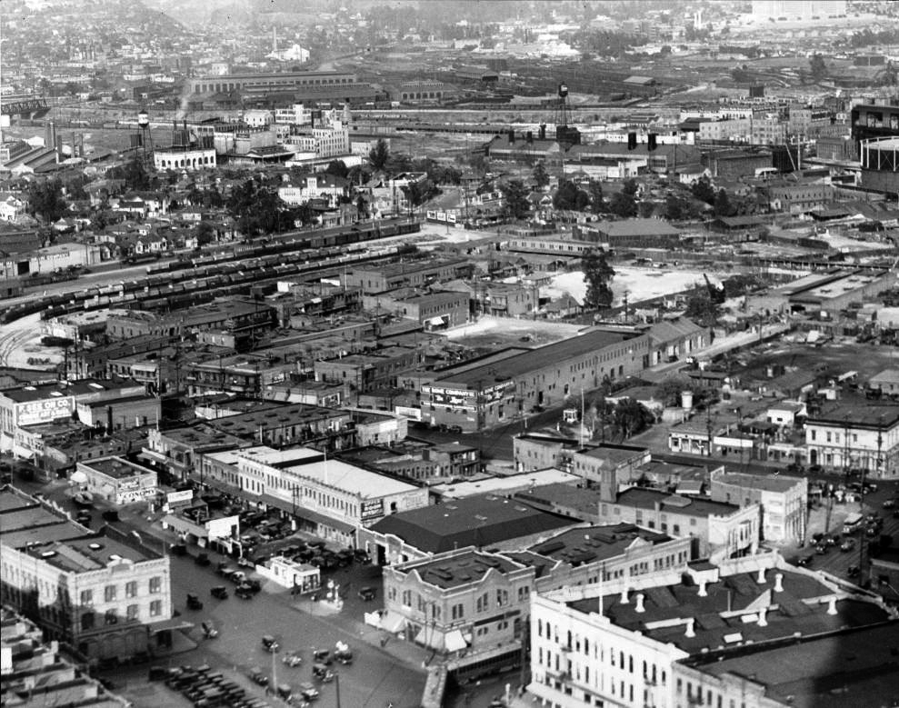 |
|
| (ca. 1931)* - View looking from the top of City Hall showing the Old Chinatown which would mostly be demolished to make room for Union Station. The two streets seen here are Los Angeles Street (lower-left) and Alameda Street (center). In the lower-right you can barely make out Aliso Street which runs diagonally. This is where the 101 Freeway was constructed, in line with Aliso Street. |
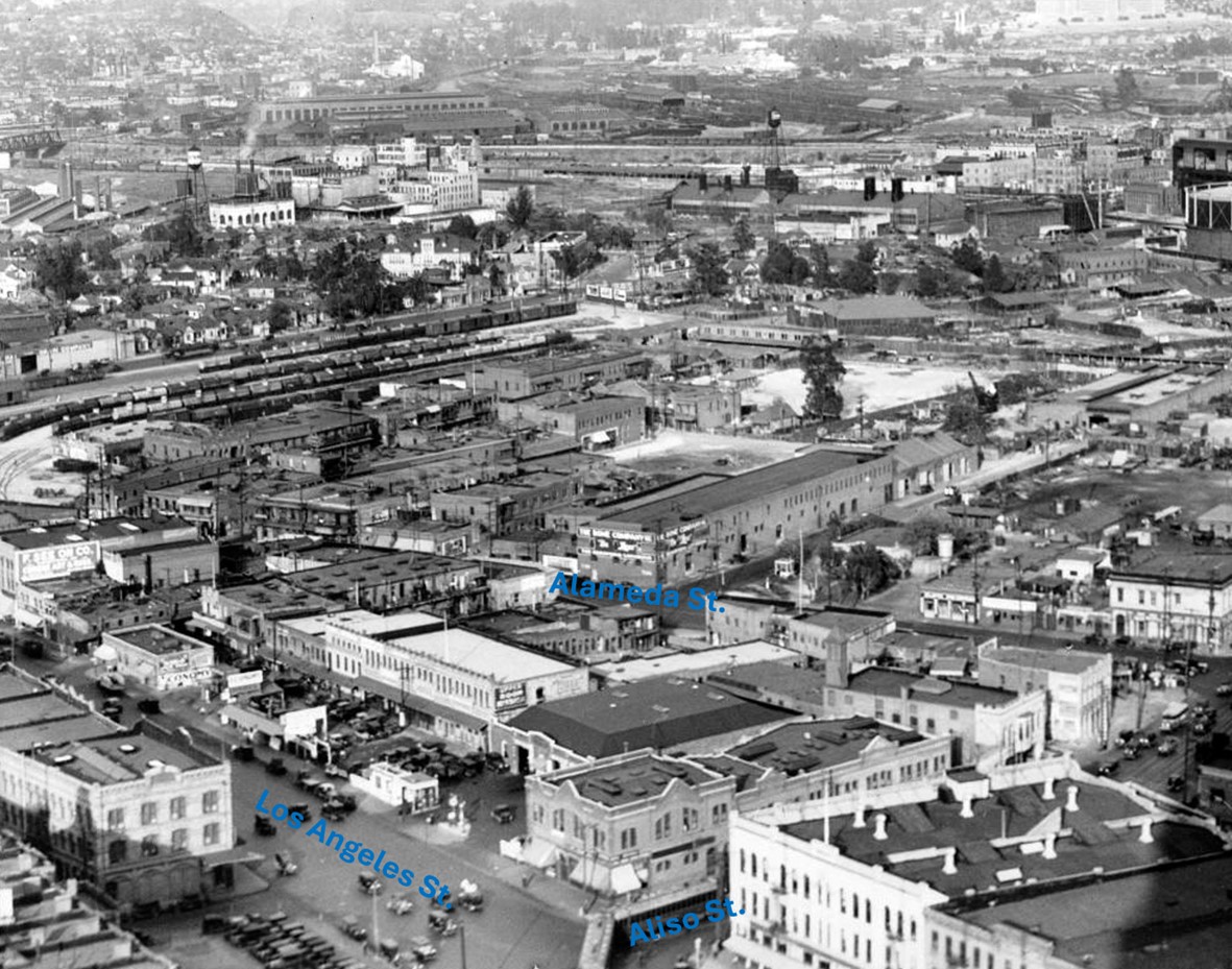 |
|
| (ca. 1931)* - Same as previous image but with street names annotated. View looking from the top of City Hall showing the Old Chinatown which would mostly be demolished to make room for Union Station. The two streets seen here are Los Angeles Street (lower-left) and Alameda Street (center). In the lower-right you can barely make out Aliso Street which runs diagonally. This is where the 101 Freeway was constructed, in line with Aliso Street. |
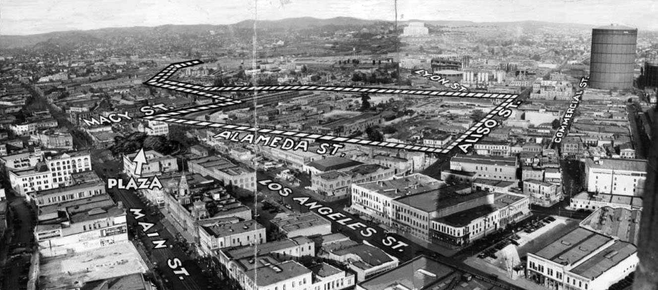 |
|
| (1933)* - Panoramic view showing the Los Angeles Plaza (arrow) and surrounding area including most of Chinatown. The photo has been annotated to delineate the boundaries of the proposed new Union Station. |
Historical Notes The above photo comes from the September 18, 1933 issue of the Los Angeles Herald Examiner. The article reads: "Chinatown faces extinction in Los Angeles with erection of the new Union Station on the Plaza site. The area enclosed by broken line will be occupied with tracks and the station. It includes most of Chinatown. Upper left hand line shows where trains enter station area from Southern Pacific bridge over Los Angeles River." |
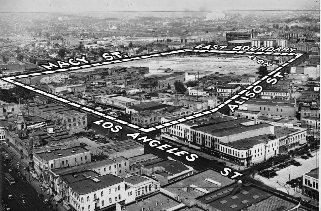 |
|
| (1934)*# - Caption reads: “Site of new Union Terminal (enclosed by lines), where dirt to be removed from Fort Moore Hill will be used for filling in. This great depot will serve all steam railroads entering Los Angeles. Chinatown is seen in foreground of station site." |
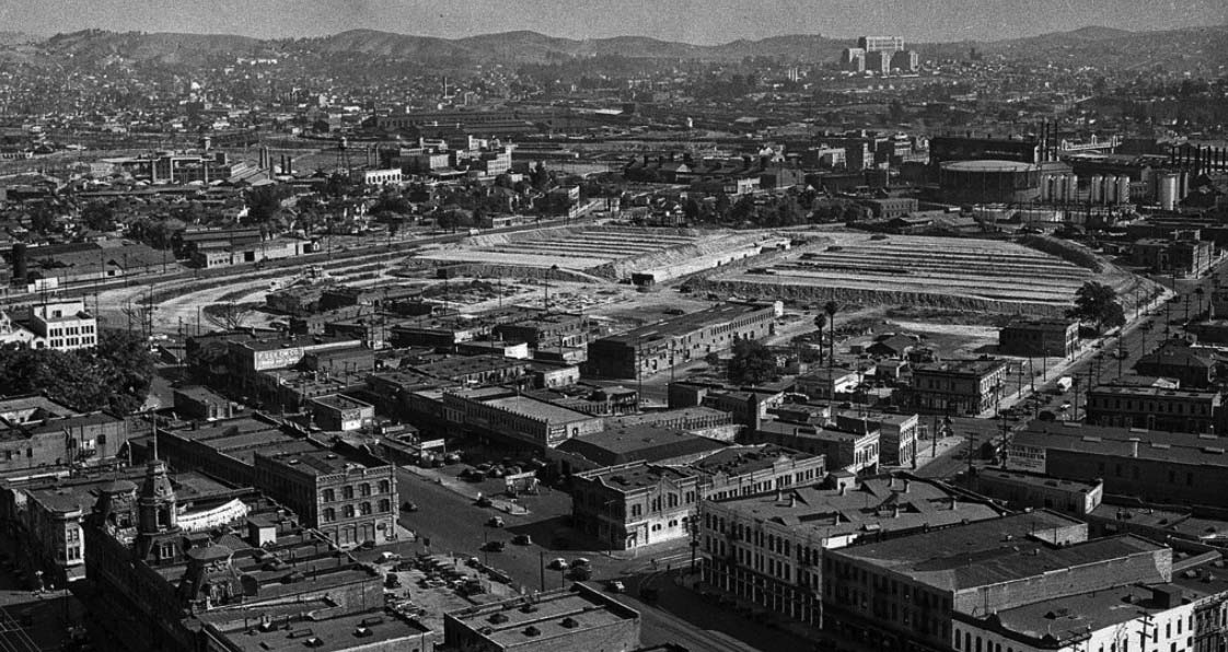 |
|
| (1935)^ - Looking northeast from City Hall tower. Chinatown disappears beneath the Union Station railhead. Baker Block lower left, County General Hospital looms background right. |
.jpg) |
|
| (1935)*# - View looking west across Lyon Street near its intersection with Aliso Street. The Union Station construction site is seen at center. Ridges in the area are fills, where tracks will be laid. In center, under construction, is the pedestrian tunnel to the tracks. Photo Date: August 19, 1935 |
Historical Notes By the early 1950s, the section of the 101 Freeway (Hollywood Freeway) that runs through downtown would go right through where Aliso Street is shown above, running diagonally away from bottom center of photo. |
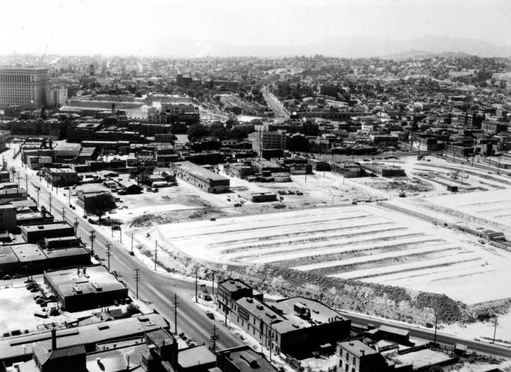 |
|
| (1935)*# - Panoramic view of the construction of Union Station looking northwest from the top of the Los Angeles Gas and Electric tank, August 27, 1935. The site of the terminal is at right and is a trapezoidal area full of graded dirt. The LA Plaza can be seen in the upper-center left. The Hall of Justice Building stands in the upper left. |
1938 Video of Chinatown & Union Station Construction
Click HERE to see footage near the present location of Chinatown as Union Station was being built on where the original Chinatown stood. |
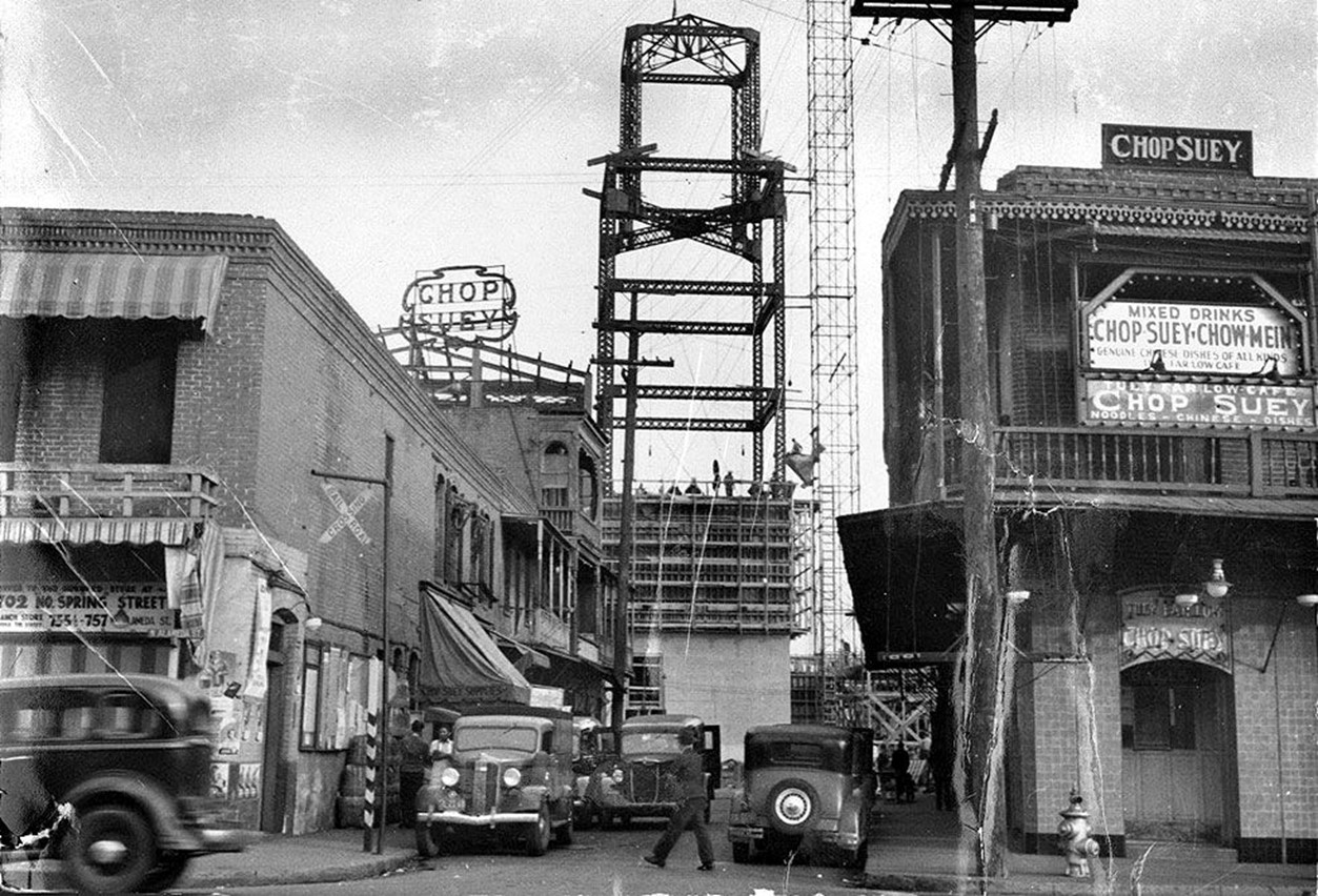 |
|
| (1938)* - Looking east on Marchessault Street from Alameda Street in Old Chinatown with the new clock tower of Union Station in the background. |
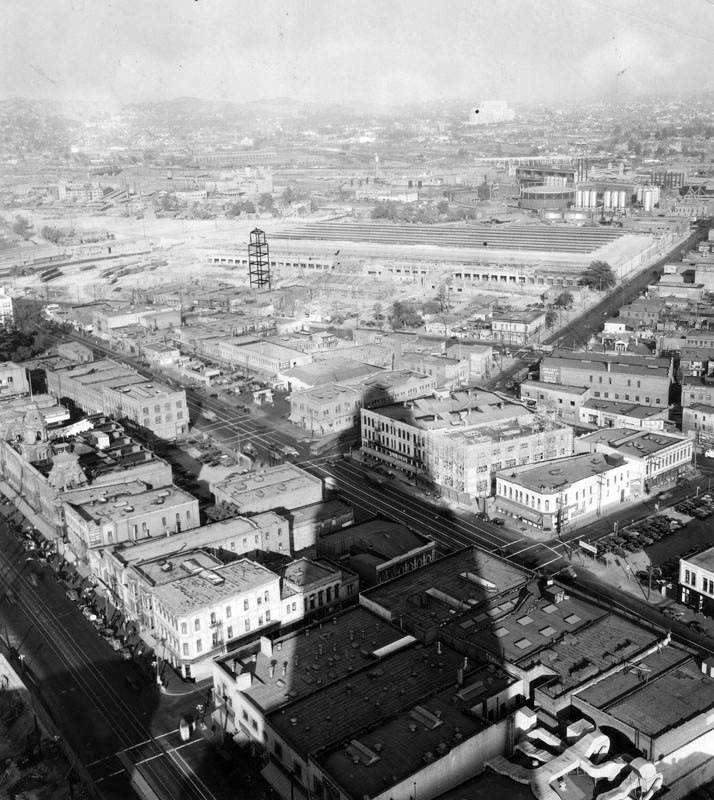 |
|
| (ca. 1938)^ - The shadow of the City Hall tower points to the steel framework of the new Union Station. |
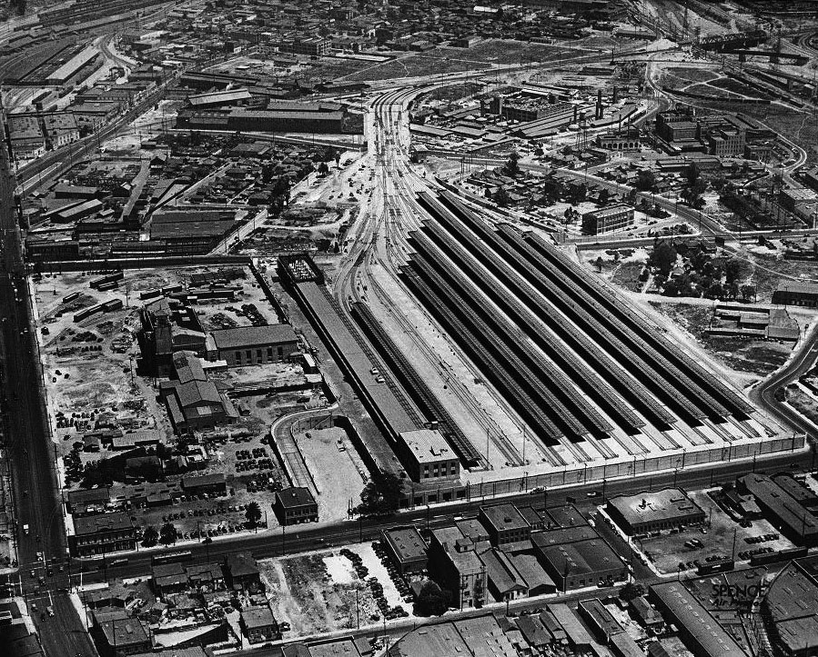 |
|
| (ca. 1939)*# - View looking north toward Union Station, still under construction. The main road going along the left side of the photo is Alameda Street. Aliso Street is at the southern end of the station near where the Hollywood Freeway is located today. |
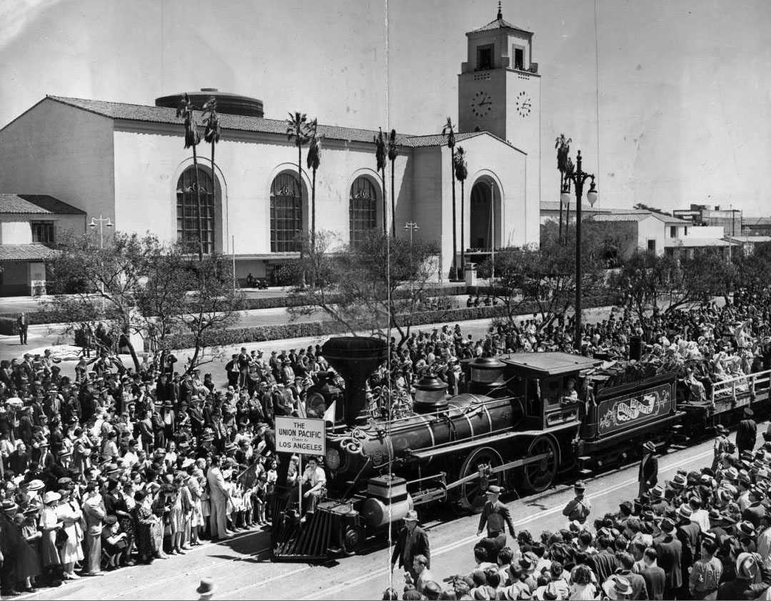 |
|
| (1939)*# - Crowds watch early model train while celebrating completion of the new Union Station located at 800 N. Alameda Street. |
Historical Notes Examiner clipping attached to verso, dated May 4, 1939: "Stirring awake memories that had slumbered for more than a century, railroad officials yesterday staged a colorful pageant of transportation that thrilled thousands of Angelenos for two hours. Gayly costumed ladies of the Gay Nineties -- and the years before -- rode stage coaches and horse cars and stuttering, slow-moving trains of another era. Derby-hatted, mustachioed gentlemen in tight coats pumped high-wheeled bicycles -- 'bone-crushers' they were known as in those days -- all to celebrate formal opening of the new Union Station, pictured in background as oldest Union Pacific train approaches the city's newest in beautiful architecture." |
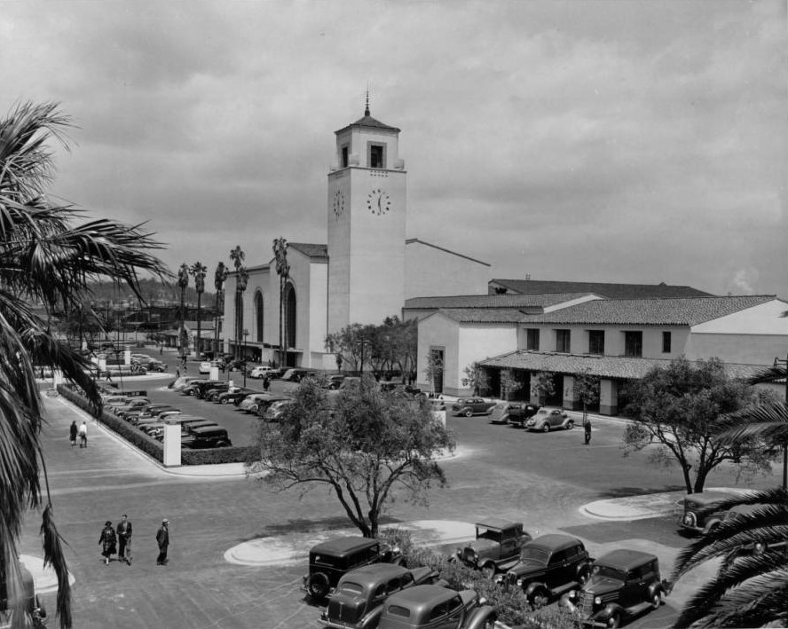 |
|
| (1939)*# – View showing Union Station from across its parking lot shortly after the train station's opening. Photo by "Dick" Whittington |
Historical Notes When Union Station was opened in May 1939, it consolidated remaining service from its predecessors La Grande Station and Central Station. It was built on a grand scale and became known as "Last of the Great Railway Stations" built in the United States. Union Station was placed on the National Register of Historic Places in 1980. It is also listed as Los Angeles Historic-Cultural Monument No. 101. |
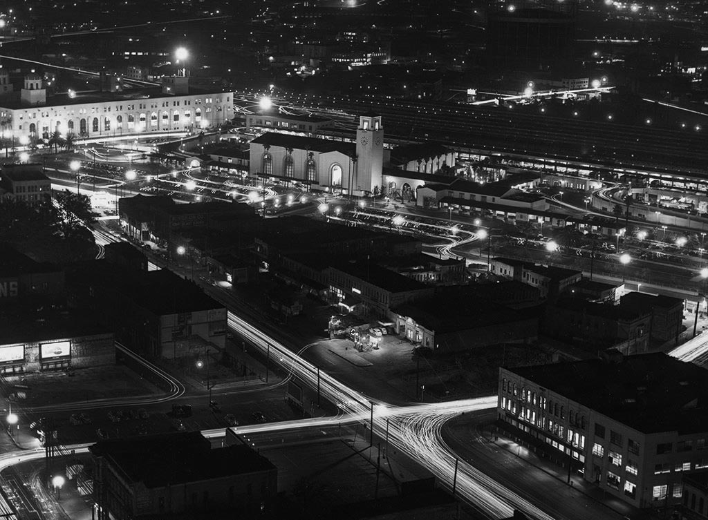 |
|
| (1939)* – Bird’s-eye night view showing a well-lit Union Station with full parking lot. Terminal Annex Post Office is seen in upper left corner. |
Historical Notes The intersection of Aliso and Los Angeles Streets is seen in the foreground. The 101 Freeway would be built along Aliso Street in the early 1950s. Click HERE to see more. |
Then and Now - Transformation of Old Chinatown into Union Station
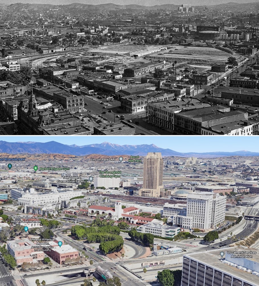 |
|
| (1935 vs. 2023)* – A view looking toward Union Station from near the top of City Hall. In the comparison, note how Old Chinatown has been replaced by Union Station and its surrounding developments. At the lower left, the 101 Freeway, which now follows the path of the old Aliso Street, cuts through the site where the historic Baker Block once stood. Photo comparison by Jack Feldman. |
Historical Notes The transformation of Old Chinatown in Los Angeles during the 1930s marked a pivotal moment in the city’s development, as the construction of Union Station led to the demolition of the historic neighborhood, displacing its residents and businesses. Reflecting broader urban renewal trends that prioritized infrastructure over heritage, the project sparked controversy but also resulted in the creation of a new, commercialized Chinatown near Broadway and Hill Street, while establishing Union Station as a vital transportation hub. |
Then and Now (Annotated)
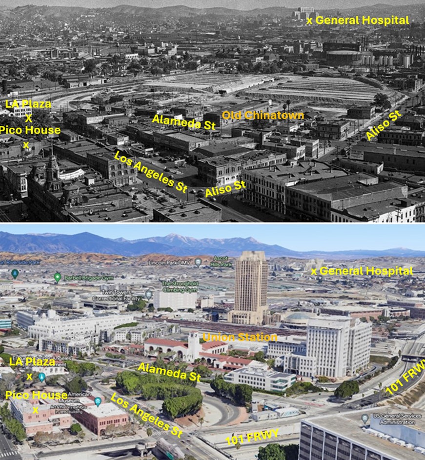 |
|
| (1935 vs. 2023)* – A view looking toward Union Station from near the top of City Hall. In the comparison, note how Old Chinatown has been replaced by Union Station and its surrounding developments. At the lower left, the 101 Freeway, which now follows the path of the old Aliso Street, cuts through the site where the historic Baker Block once stood. Photo comparison by Jack Feldman. |
Historical Notes Click HERE to see more on the Los Angeles Union Station |
* * * * * |
Main and Market Streets
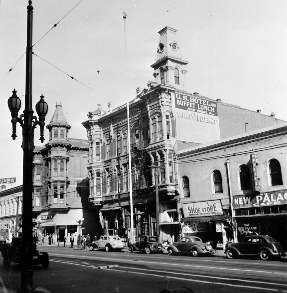 |
|
| (ca. 1937)*# - View of Main Street looking north toward Market Street. Two three-story Victorian-style buildings are pictured at center wedged between commercial shop fronts. The U.S. Hotel is closest to the foreground, while the Amestoy Building can be seen farther back. Both buildings feature a tower of sorts, the hotel's sprouting from the flat roof, the Amestoy Building's extending from a column of windows at its corner. The New Palace Cafe and a sign that reads "Shoe Store. Shoes for the whole family" can be seen at right. A sign to the left reads "Victor's". Cars are parked along the sidewalk. Street car cables are attached to the top of a streetlamp visible in the left foreground. |
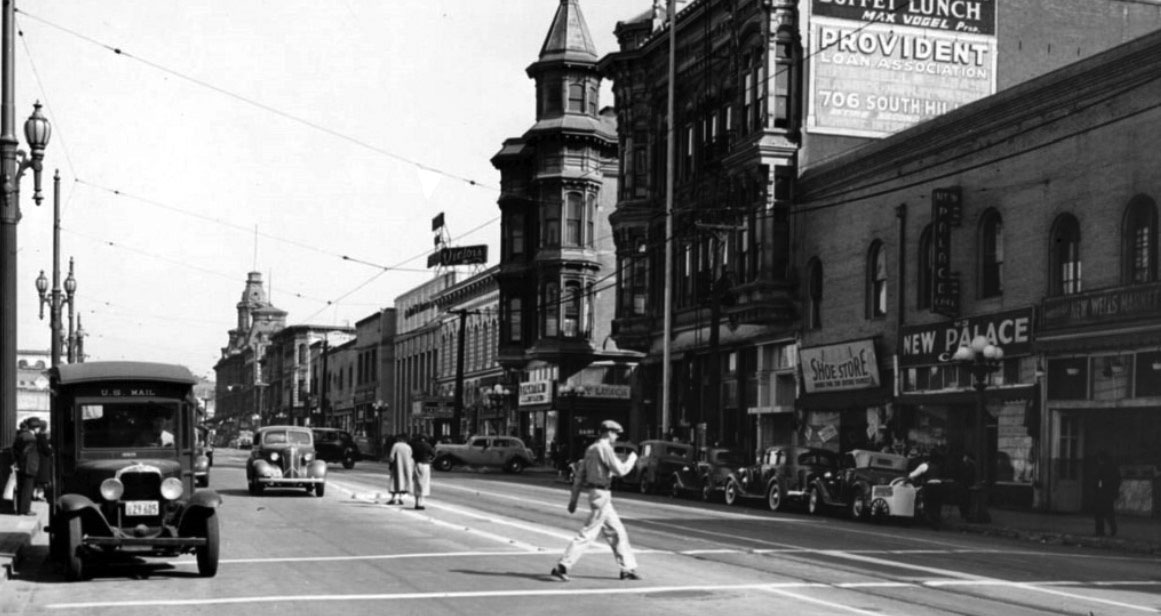 |
|
| (ca. 1938)*# – View looking north on Main Street from the east side of City Hall. Crosswalk in foreground leads directly into the police garage. Big, light colored taxi is pulling out of Market Street with the U.S. Hotel on the right on the SE corner and the Amestoy Building beyond the cab. Baker Block is visible up the street on the right. |
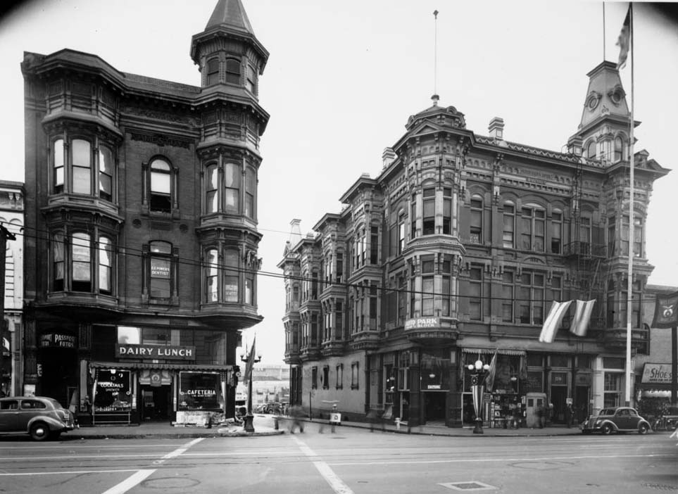 |
|
| (1939)*# - View looking East on Market Street from the front of City Hall across North Main Street, showing both the Amestoy Building (left) and the U.S. Hotel (right). |
Historical Notes The U.S. Hotel was built around 1863 and demolished in 1939. The Amestoy Building was built in 1887 and demolished in 1958. |
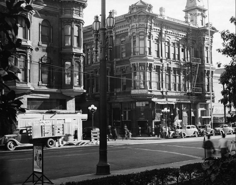 |
|
| (1939)^#^^ - View looking southeast across Main Street at Market Street as seen from the east lawn of City Hall with the Amestoy Building at left and the U.S. Hotel on the right. This photo was taken shortly before the U.S. Hotel was razed. |
* * * * * |
|
|
| (1938)^ - Aerial view of Los Angeles Civic Center with City Hall as the focal point. The Amestoy Building and U.S. Hotel can be seen at lower right. To the right of City Hall is vacant land waiting for construction to begin on the new Federal Courthouse and U.S. Post Office Building. Across from City Hall is the Hall of Records. The Hall of Justice is next to a partially graded hill which still contains houses on top. A portion of the State Building can be seen on the left. |
 |
|
| (1938)* - View looking south toward City Hall showing a man standing fearlessly on top of steel framing for the new Federal Courthouse and U.S. Post Office Building. The LA Times Building, built in 1934, is at lower right. Photo: Vintage Los Angeles. |
Historical Notes Shared by Lauren Frobisher Scanlon: “My grandfather, Frank McGuire built elevators. Here’s a pic of him on a building under construction across from Los Angeles City Hall ..sometime in the ‘30s’. I don’t know what the building was...” |
 |
|
| (ca. 1938)*# - View of downtown looking southwest from where Union Station sits today. The new Federal Courthouse and U.S. Post Office Building is under construction as seen between City Hall and the Hall of Justice. Alameda Street is in the foreground. |
Historical Notes The area in the extreme foreground is now Union Station. The street in front is Alameda Street, and those buildings ahead of Alameda were knocked down and are now landscaping and on ramps to the 101 Hollywood/Santa Ana Freeway. Old Chinatown started being demolished around 1933, and Union Station opened in 1939.**^ To the right-center of the photo is the Pico House in front of the LA Plaza which is out of view to the right. The old 1877-built Baker Block with it's distinctive three towers can be seen in the center of the photo just below the Federal Courthouse Building. The Baker Block would be demoished in 1942 to make room for the 101 Freeway. Click HERE to see more on the Baker Block. |
 |
|
| (1939)**^ - View of the Plaza with the LA downtown skyline in the background. From left to right stand City Hall, the Federal Courthouse still under construction (completed in 1940), the Hall of Records, and the Hall of Justice. The old Brunswig Building can also be seen on the other side of the Plaza across from the Pico House. Click HERE to see more Early Views of the Plaza of L.A. |
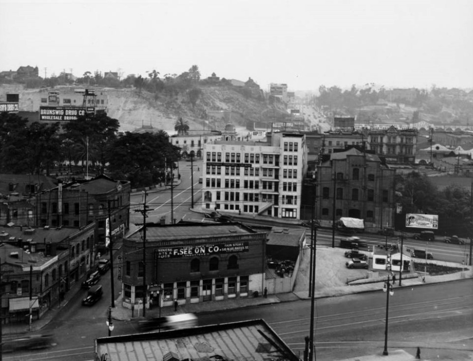 |
|
| (ca. 1939)*# - View looking up Marchessault Street with Alameda Street crossing at bottom and Los Angeles Street crossing at mid distance. The LA Plaza is at upper-center left. The old Water Department Building, now occupied by the F. See On Company, stands on the northwest corner of Marchessault and Alameda. |
Historical Notes In 1939, the first home of the Department of Water and Power was sold to the City to make way for the Civic Center development planned in connection with the new Union Passenger Depot. Located at the corner of Marchessault and Alameda Streets, directly across from the almost completed railroad station, the property was the main office of the municipal water works when the City bought out the private water companies operating here until 1902.** |
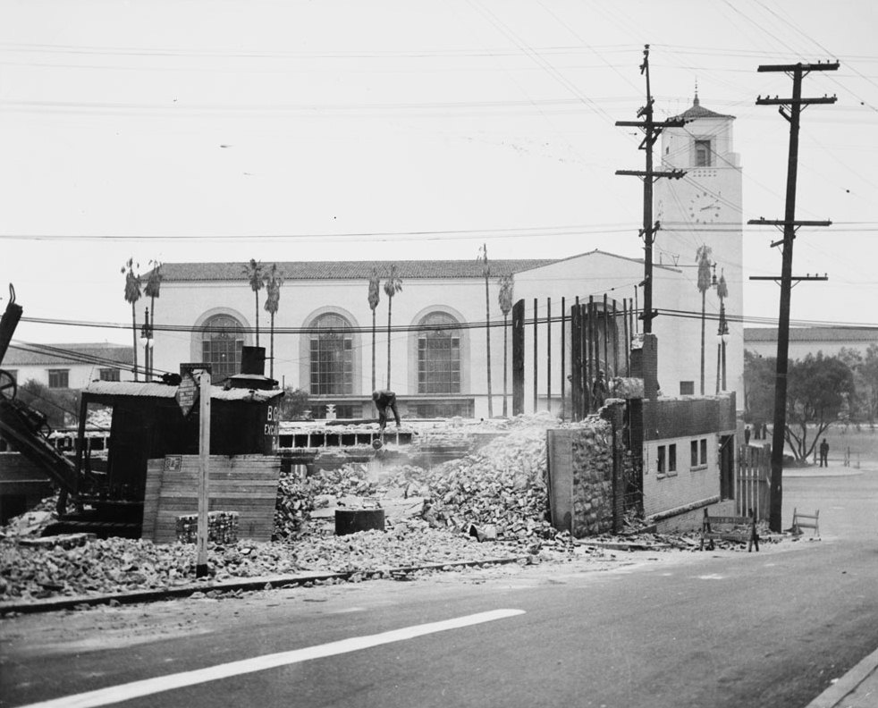 |
|
| (1939)*# - Photo caption reads: "Another Landmark Gives Way to Progress -- Photo shows wrecking yesterday of first home of the Department of Water and Power, recently purchased by the City, to make a wide approach by way of Marchessault Street to the new Union Station. With work being rushed, thousands of persons will occupy the site of this landmark on May 3, when the celebration's parade passes on Alameda Street. The old building was the main office of the municipal water works when the City bought out the private water companies operation here until 1902." |
Click HERE to see more in Water Department's Original Office Building. |
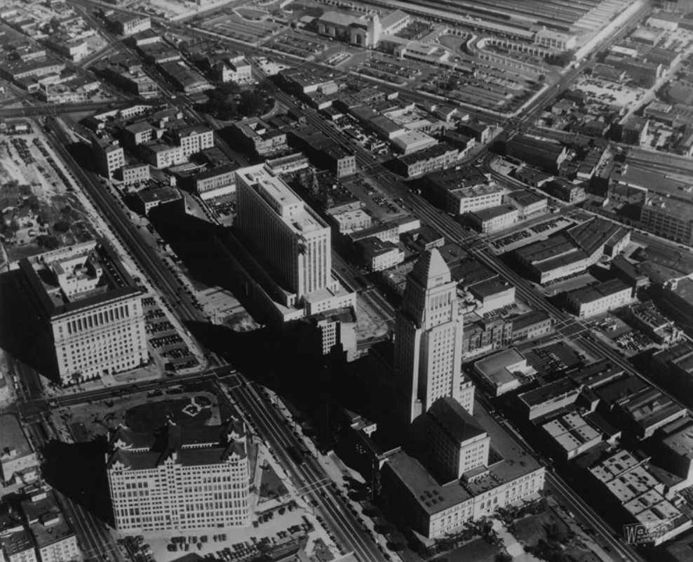 |
|
| (ca. 1940)*# - Aerial view of the Civic Center, Union Station and the LA Plaza. The Plaza is in the upper center-left of photo. The recently completed Union Station is at center-top and the new Federal Courthouse and U.S. Post Office Building is seen at center. The flattened lot of the where the old Water Department building once stood can be seen just to the northeast of the Plaza. |
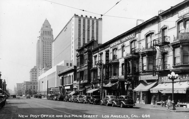 |
|
| (ca. 1940) - The new Federal Courthouse and U.S. Post Office Building near City Hall and old Main Street, circa 1940. The signs on some of the shops and offices are in Spanish. |
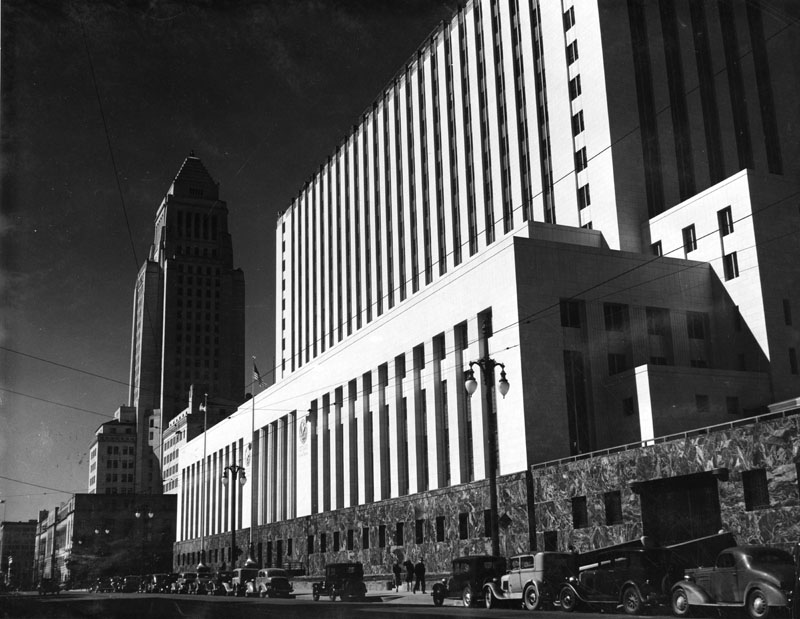 |
|
| (ca. 1940)^ - View of the Los Angeles Civic Center, showing Los Angeles City Hall and the Federal Courthouse and U.S. Post Office Building. Numerous cars can be seen parked along the curb. |
Historical Notes Built between 1937 and 1940, the United States Court House was the third federal building constructed in Los Angeles. The first, constructed between 1889 and 1892, housed the post office, U.S. District Court, and various federal agencies, but it soon proved inadequate. A larger structure was built between 1906 and 1910 at the corner of Main and Temple Streets. The population of Los Angeles grew rapidly in the early part of the twentieth century, and a larger building was needed to serve the courts and federal agencies. The second federal building was razed in 1937 to clear the site for the existing courthouse.*^ |
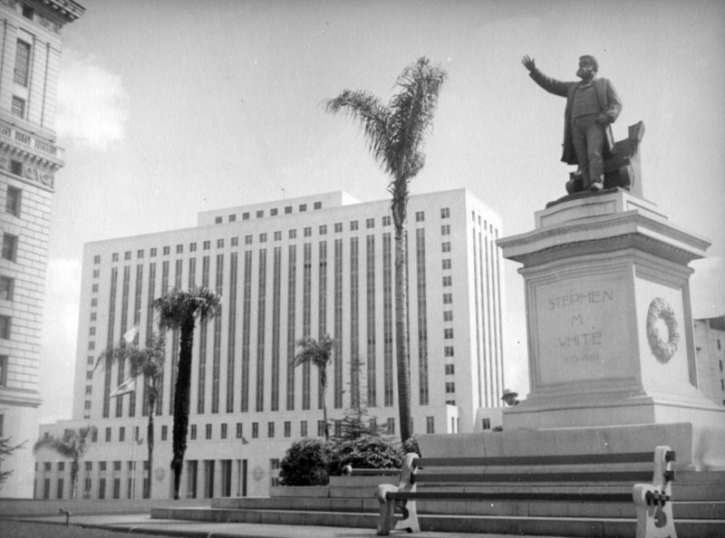 |
|
| (ca. 1940s)^ - Exterior view of the Federal Courthouse and U.S. Post Office Building, located at 312 N. Spring Street. The Stephen M. White Statue, which was previously located on the corner of Temple and Broadway on the lawn of the Hall of Records, is now on the corner of 1st and Hill outside the new courthouse, located at 1945 South Hill Street. |
Historical Notes Stephen M. White was elected Los Angeles County District Attorney in 1882, State Senator in 1886 and United States Senator in 1893. During his term in the United States Senate, Senator White’s most notable accomplishment was his successful leadership of the fight to create the Los Angeles Harbor in San Pedro as opposed to Santa Monica Bay, the site that was being advocated by powerful railroad interests. The statue of Stephen White was moved several times before finding a home in front of the new County (now Mosk) Courthouse in 1958. It would remain there for 30 years. In 1989, the statue was moved again to its present location, at the entrance to Cabrillo Beach off Stephen M. White Drive, overlooking the breakwater at the L.A. Harbor. Click HERE to see contemporary view. |
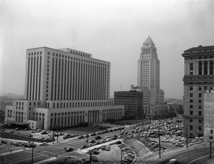 |
|
| (1949)^ - View of the Los Angeles Civic Center, showing the Federal Courthouse and U.S. Post Office Building as well as City Hall, as seen from Fort Moore. Numerous cars can be seen on the streets as well as in parking lots. |
.jpg) |
|
| (1940)^#^^ - Aerial view of Los Angeles looking northeast. The newly built Federal Courthouse (completed in 1939) is seen at upper-center next to City Hall. Also, Union Station (completed in 1938) is seen at upper-right. |
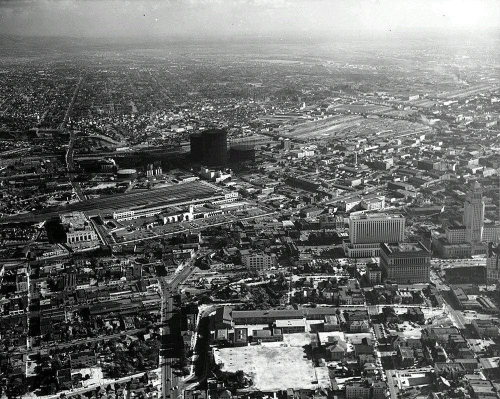 |
|
| (ca. 1939)**^ - Aerial view looking southeast across Fort Moore Hill. The recently completed (1938) Union Station is in view at left-center of photo. Just to the southeast of Union Station, across Aliso Street, can be seen two very large natural gas tanks known as "gas holders". |
Historical Notes The huge tanks seen above were known as "gas holders" (aka gasometers), and helped supply natural gas to the city. They rose or sank in height depending on the amount of gas being stored. The gas holders were in fact laughably large and towered over their surroundings. When one gas holder was built in 1906 its 210 foot height was 35 feet greater than the tallest building in Los Angeles. #^^* |
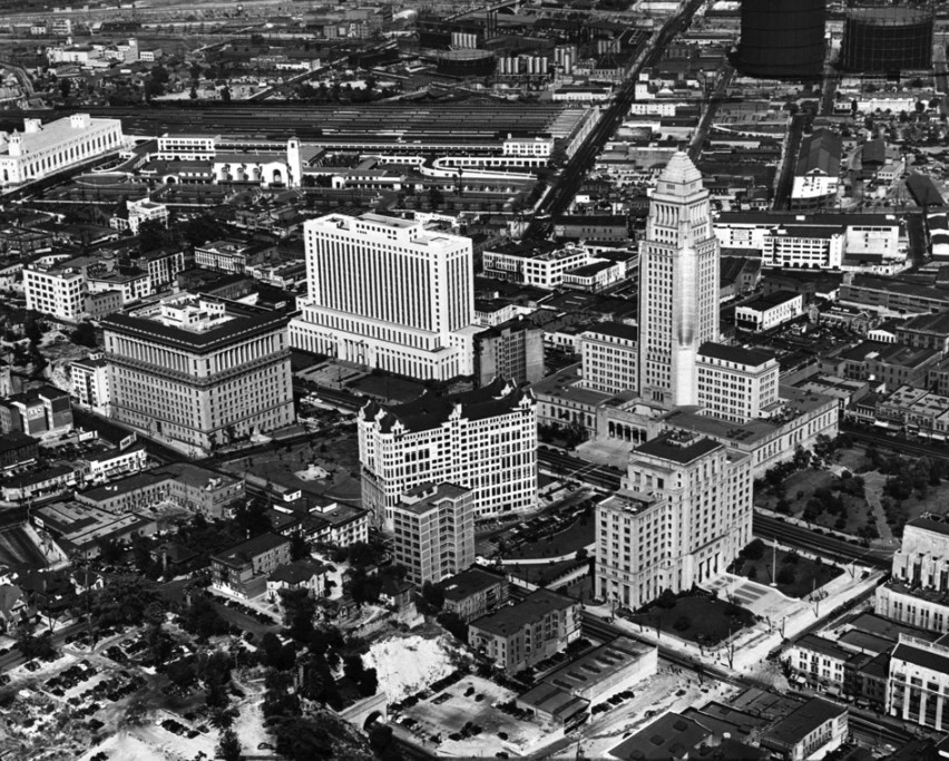 |
|
| (1940)^#^^ - Aerial view of the Civic Center and Union Station looking northeast. The large street running diagonally from center to upper-right center is Aliso Street, future path of the 101 Freeway (Hollywood Freeway). Note the two large gas holders (gasometers) in the upper right corner of photo. |
Historical Notes Later gas holders climbed higher and wider, reaching up to 300 feet tall (the equivalent of perhaps an 18 or 20 story building) and as large as to hold 10,000,000 cubic feet of gas. #^^* |
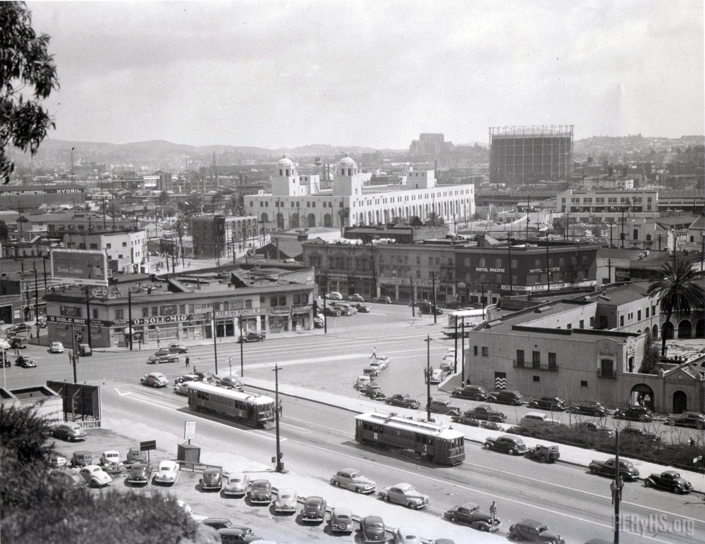 |
|
| (1940s)#++# – Panoramic View looking northeast showing a pair of LARy streetcars passing one another near the intersection of Spring and Sunset with the back of the Old Plaza Church at right and the Los Angeles Plaza further back (out of view). The Terminal Annex building with its twin towers as well as a very large gas tank are seen in the distance. |
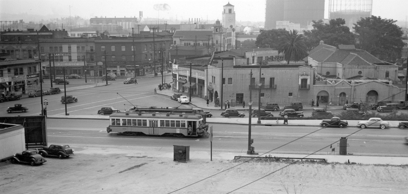 |
|
| (1940s)###^ – Panoramic view looking east at the intersection of Sunset and Spring with two LARy streetcars (side-by-side) in the foreground. Three large gas holders are seen at top-right with the Union Station tower at top-center. The back of the Old Plaza Church is at right with the Los Angeles Plaza (cluster of trees) directly behind it. |
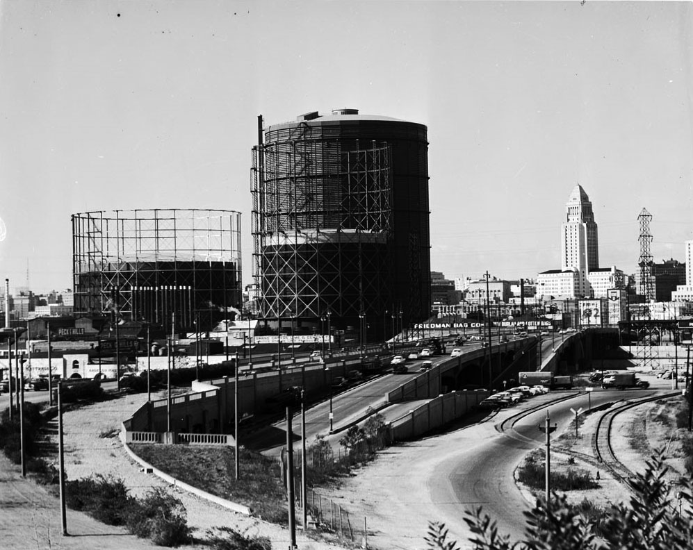 |
|
| (ca. 1950)*# - View looking west on Aliso Street toward the Civic Center. Three extremely large natural gas holders stand in proximity to the Friedman Bag Company and Brew 102, with City Hall in the background. This photo was taken just a couple of years prior to the construction of the 101 Freeway where Aliso Street is seen above. |
Historical Notes The largest of the three tanks seen above is a 300-footer that loomed over the corner of Ducommon and Center, east of the Civic Center. It was built in 1912 and it's not clear when it was torn down. Shots of Downtown up through 1960 seem to show these structures in the background. #^^* |
* * * * * |
West Hollywood
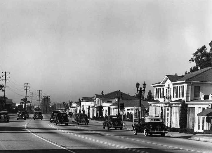 |
|
| (1939)^ - Sunset Strip looking north-west, west of La Cienega. Photograph taken on November 30, 1939. |
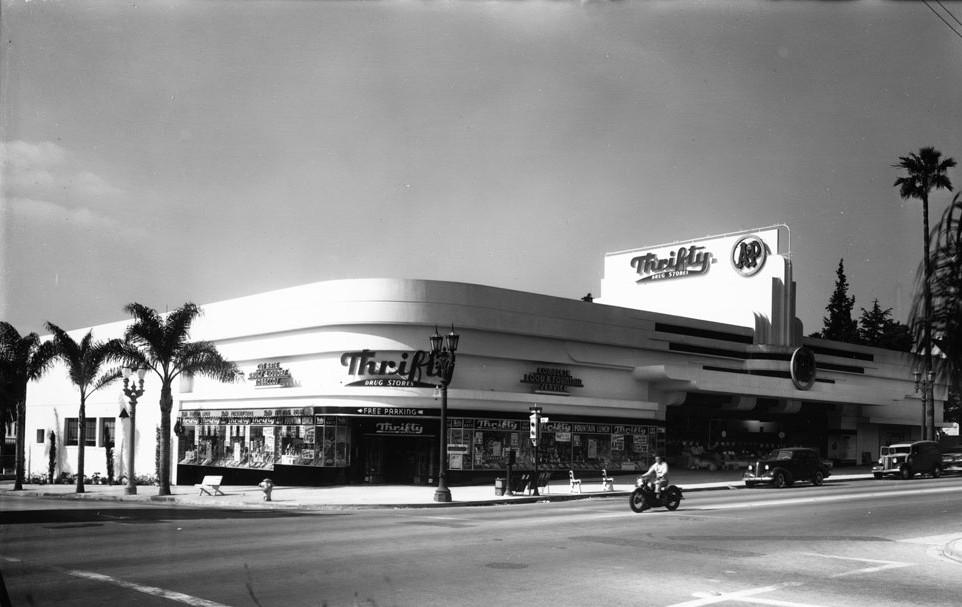 |
|
| (ca. 1940s)*# - Photograph of an exterior view of Thrifty Drug Store and A&P Market. The one-story Art Deco-style building is pictured on the southwest corner of Sunset Boulevard and Fairfax Avenue. At left, the sidewalk is lined by palm trees. In the right foreground, a motorcyclist makes his way past two parked automobiles. |
Click HERE to see more Early Views of West Hollywood |
* * * * * |
Universal Studios
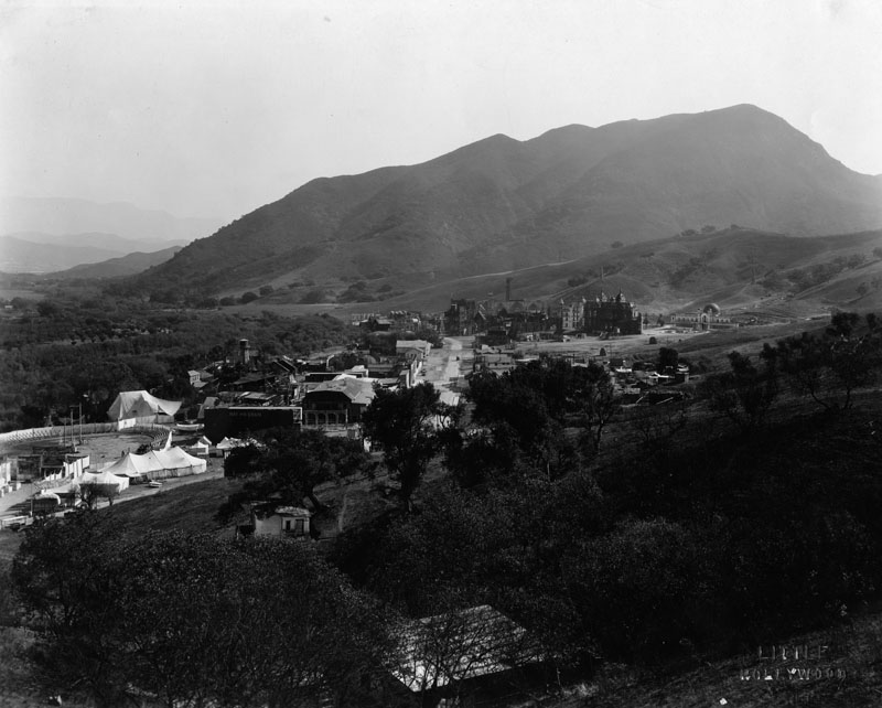 |
|
| (ca. 1930s)^ - View overlooking the studio lot of Universal Pictures Company with the Hollywood Hills in the background. |
Historical Notes In 1913, the same year the LA Aqueduct was completed, the Universal Company purchased 12,000 acres of land in the San Fernando Valley near the railroad station of Lankershim and about eight miles from Los Angeles.^*#^ A year earlier, on April 30, 1912, Carl Laemmle merged the Independent Motion Picture Company with five smaller companies to form the Universal Film Manufacturing Company. After visiting his newly acquired west coast operations of Nestor Studios and Nestor Ranch, he renamed the studio "Universal Studios" and the leased Oak Crest Ranch became the first "Universal City" in the San Fernando Valley. The first Universal/Nestor Ranch (Providencia Land and Water Development Company property Oak Crest Ranch) is presently the site of Forest Lawn Memorial Park (Hollywood Hills). In 1915, Universal moved its operations at the Hollywood/Nestor studio and Universal/Nestor Ranch to its new Lankershim Blvd. location before the official opening of Universal City (Lankershim Blvd).^* |
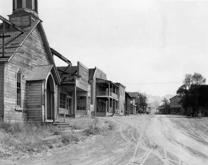 |
|
| (1939)^ - Ghost town street on the Universal movie lot. Along this famous street at Universal, the roaring life of the colorful West has been pictured in hundreds of thrilling films shown around the world. On this site practically every big western star in motion pictures got his start and played his greatest role. |
Historical Notes In 1915, Carl Laemmle invited members of the public to watch films being made at the Universal movie lot (in exchange for a 25 cents admission fee). A chicken lunch box was also available for a nickel; the first step towards the Universal Studios theme park we know today.^*#^ |
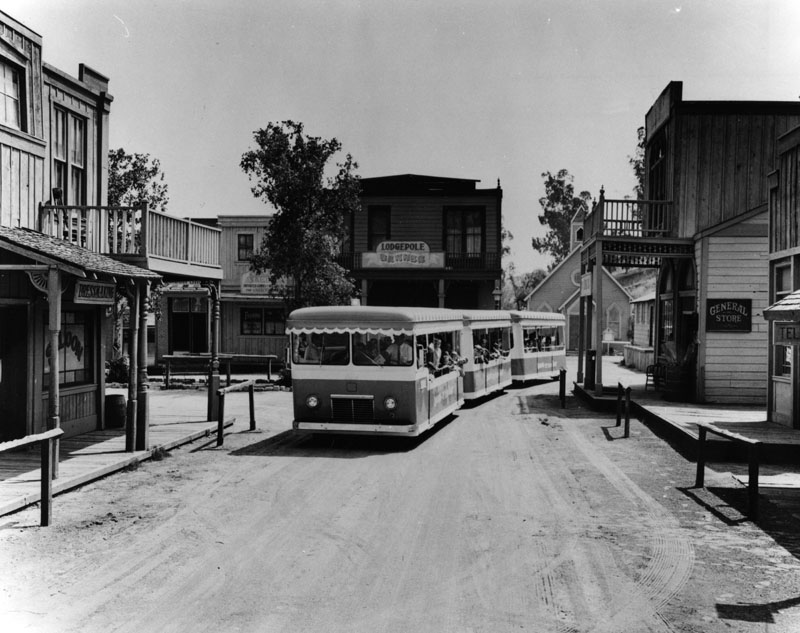 |
|
| (1970s)^ - A tour bus moves through the back-lot western sets of Universal Studios. |
Historical Notes Shortly after Music Corporation of America took over Universal Pictures in 1962, accountants suggested a new tour in the studio commissary would increase profits. On July 15, 1964, the modern tour was established to include a series of dressing room walk-throughs, peeks at actual production, and later, staged events. This grew over the years into a full-blown theme park. The narrated tram tour (formerly "Glamor Trams") still runs through the studio's active back lot, but the staged events, stunt demonstrations and high-tech rides overshadow the motion-picture production that once lured fans to Universal Studios Hollywood.^* |
Click HERE to see more Early Views of Universal Studios |
* * * * * |
Third and Fairfax Area
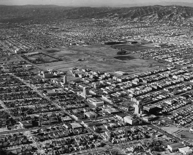 |
|
| (ca. 1939)^ - Aerial view looking northwest of the so-called Miracle Mile in Los Angeles along Wilshire Boulevard. The large open space is bounded by Fairfax on the west, Wilshire on the south, and Third Street on the north. The La Brea Tar Pits is the recangular piece of land in the upper left-center of photo. |
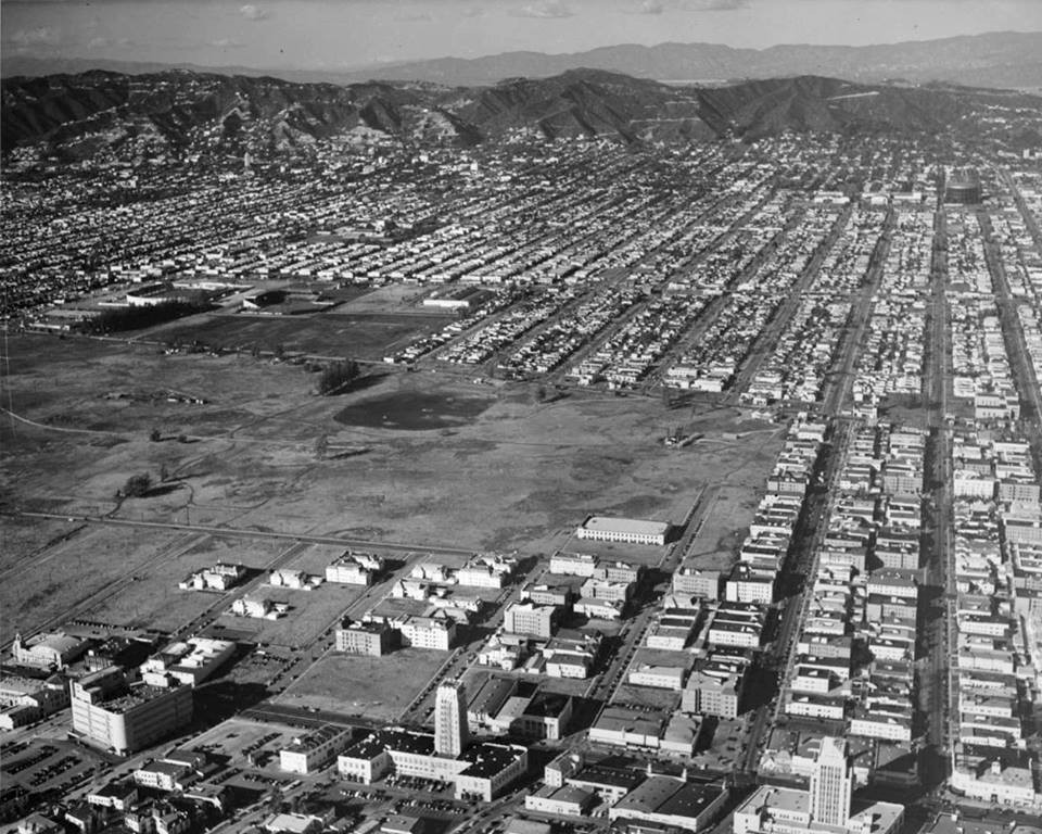 |
|
| (1940)^^*** – Aerial view looking in a northerly direction toward the Hollywood Hills and the Santa Monica Mountains. The intersection of La Brea and Wilshire is in the lower right-center. L.A.'s Miracle Mile runs along the bottom of photo. In the upper left-center can be seen two stadiums situated near Third and Fairfax in an area that would become Farmers Market. The large empty space at center would become Park La Brea. |
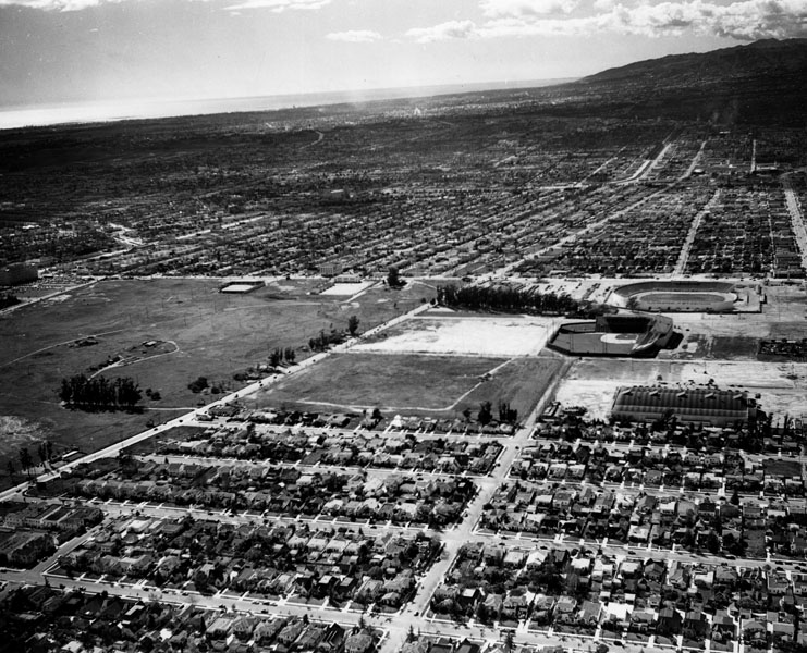 |
|
| (1939)^ - Aerial view of Hollywood Ball Park (Gilmore Field) and Gilmore Stadium looking southwest. This site later became Farmers Market and later The Grove shopping center, as well as CBS Television City. The Pan Pacific Auditorium can also be seen in this photo. It is the large building just below and to the right of the baseball stadium. |
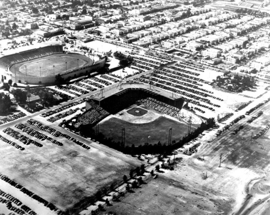 |
|
| (ca. 1939)^^^* – Aerial view looking northwest showing Gilmore Field. A baseball game is in progress and parking lots are close to full. An empty Gilmore Stadium stands in the background near Fairfax Avenue. Genesee Avenue runs diagonally from lower-left to right-center where it intersects with Beverly Boulevard. |
Hsitorical Notes Gilmore Field opened on May 2, 1939 and was the home of the Hollywood Stars baseball team until September 5, 1957. The ballpark was located on the south side of Beverly Boulevard between Genesee Avenue and The Grove Drive, just east of where CBS Television City is currently located. A couple hundred yards to the west was Gilmore Stadium, an oval-shaped venue built several years earlier, which was used for football games and midget auto racing. To the east was the famous Pan-Pacific Auditorium. Both facilities were built by Earl Gilmore, son of Arthur F. Gilmore and president of A. F. Gilmore Oil, a California-based petroleum company which was developed after Arthur struck oil on the family property. The area was rich in petroleum, which was the source of the "tar" in the nearby La Brea Tar Pits.^* |
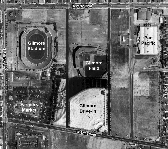 |
|
| (1948)**^ – Aerial view of the area bounded by Beverly, Fairfax, 3rd Street, and Gardner Avenue. The photo has been annotated and shows the location of Gilmore Stadium, Gilmore Field, Farmers Market, Gilmore Drive-In and the Pan Pacific Auditorium. |
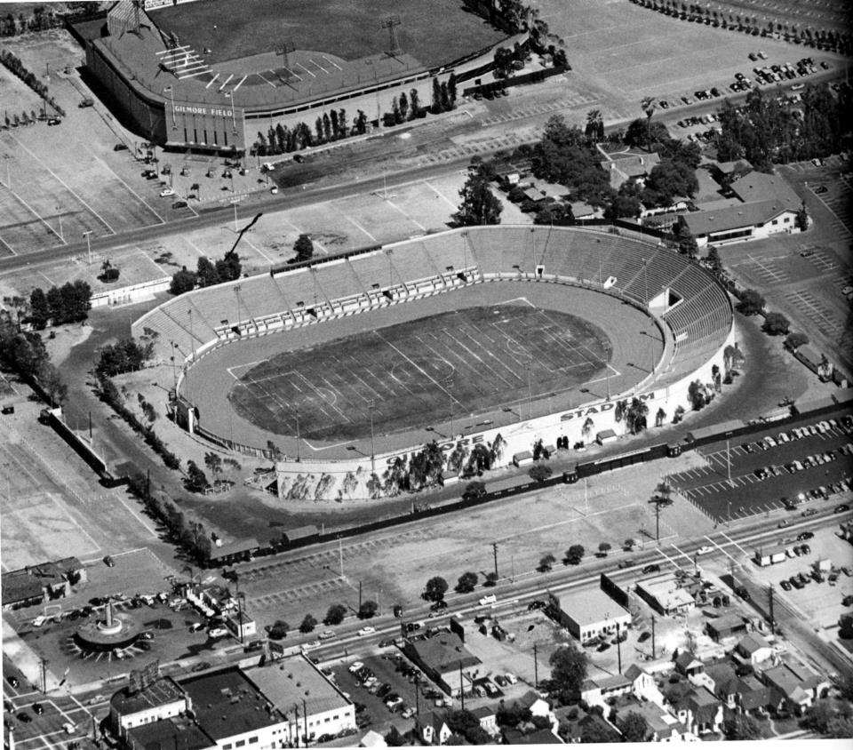 |
|
| (1949)* - View looking southeast of Gilmore Stadium (center) and Gilmore Field (top). The intersection of Fairfax Avenue and Beverly Boulevard is in the lower left of the photo. Herbert's Drive-in Restaurant can be seen on the southeast corner. Farmers Market is in the upper right. Photo Vintage Los Angeles. |
Hsitorical Notes Gilmore Stadium was used for American football games at both the professional and collegiate level. The stadium was the home of the Los Angeles Bulldogs, the first professional football team in Los Angeles. Gilmore Stadium was also the site of two 1940 National Football League (NFL) Pro Bowls. It was opened in May 1934 and demolished in 1952, when the land was used to build CBS Television City.^* |
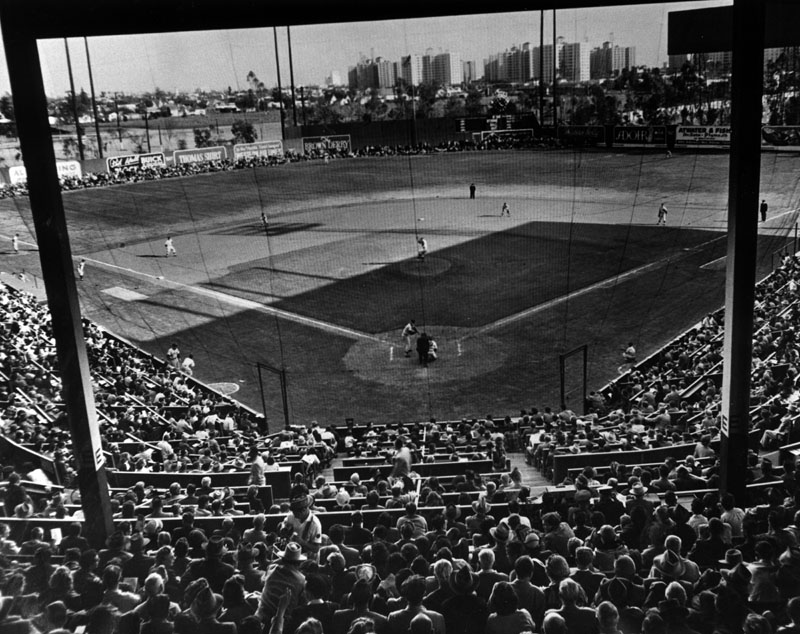 |
|
| (1951)^ - Major league All-Stars managed by Ty Cobb and Tris Speaker clashed at Gilmore Field, with the big-leaguers beating the Hollywood Stars, 4-3, for charity. Fans thrilled to Gus Zernial's two homers. This view is looking southeast toward Park La Brea Towers which can be seen in the distance. |
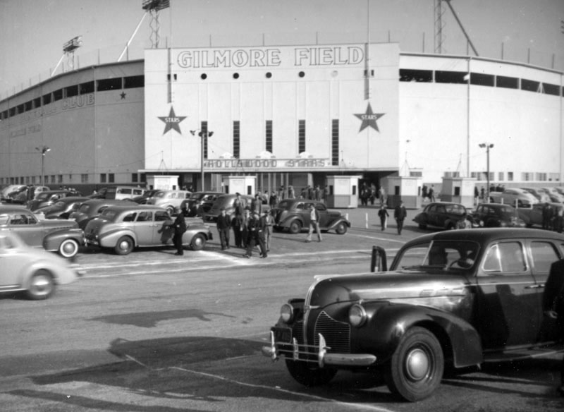 |
|
| (1940s)^ - View showing Gilmore Field (aka Hollywood Ball Park), located near the present-day Farmer's Market in the Fairfax District. This was home field for the Hollywood Stars. The parking lot appears full and there are clusters of people walking out of the main entrance. |
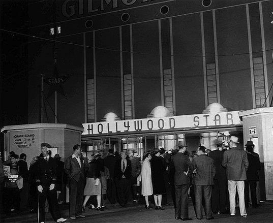 |
|
| (1940s)#** - Fans line up at front entrance to see the Hollywood Stars play a night game. |
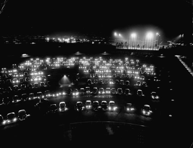 |
|
| (1949)*^^^ - Night view looking north showing three concurrent venues: Movies at the Gilmore Drive-In Theatre (foreground), Hollywood Stars home game at Gilmore Field (upper-right), and a football game at Gilmore Stadium (upper-left). |
Historical Notes In 1958, Gilmore Field was demolished to make room for an expansion by CBS Television City on the grounds where baseball was once played. |
Click HERE to see more in Baseball in Early L.A. |
* * * * * |
Fairfax Avenue
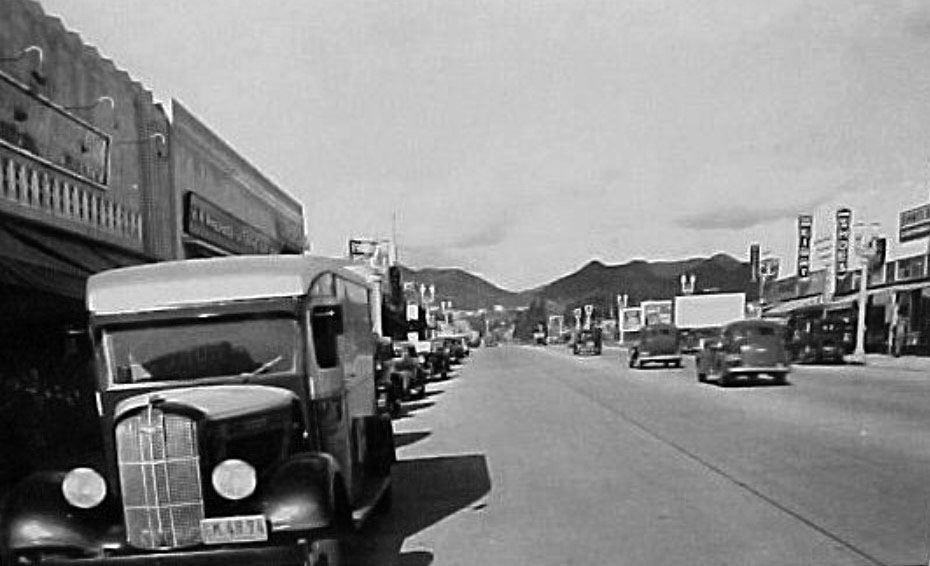 |
|
| (1937)**^ – View looking north on the 400 block of Fairfax Ave (between Rosewood and Oakwood). |
 |
|
| (2014)##^ – View looking north on the 400 block of Fairfax Ave (between Rosewood and Oakwood). The famous Canter's Deli is on the left at 419 N. Fairfax. |
Then and Now
|
|
|
| (1937)**^ – View looking north on the 400 block of Fairfax Ave. | (2014)##^ – View looking north on the 400 block of Fairfax Ave. |
Santa Anita Racetrack
 |
|
| (1934)^#^^ – View of a filled to capacity parking lot on Opening Day at Santa Anita Racetrack, December 25, 1934. |
Historical Notes The 'first' Santa Anita Racetrack was built on Elias Jackson ("Lucky") Baldwin's immense estate of "Rancho Santa Anita" and opened on December 7, 1907, but closed just two years later after horse racing was banned in California due to an anti-gambling bill that became law. In 1933, Hollywood director Hal Roach and San Francisco dentist Dr. Charles Strub formed the Los Angeles Turf Club and raised funds to build a new track. Designed in an Art Deco style by Gordon B. Kaufman, the "new" Santa Anita Park was opened on Tuesday, December 25, 1934 with an attendance of 30,077 visitors paying an admission price of .15 cents.^ |
 |
|
| (1935)^ - View from the back of the grandstands of the 'first' Santa Anita Handicap on February 23, 1935. |
Historical Notes The famed Santa Anita Handicap took place on February 23, 1935, just two months after the track opened. The Santa Anita Handicap instantly became one of the nation's top races because it offered a purse of $100,000, which at the time was a huge sum of money; the race became known as "The Hundred Grander". This Handicap (1935) was won by 7-year-old "Azucar" ridden by jockey George Woolf, with a time of 2.02.20.^ |
 |
|
| (1935)^ - A film crew shooting the horse races at Santa Anita Park with the San Gabriel Mounains in the background. |
Historical Notes The Santa Anita racetrack has seen some important events since its opening. The famous racehorse, Seabiscuit won the Santa Anita handicap in 1940.^ |
 |
|
| (1939)^ - View of the Santa Anita Racetrack paddock (foreground) and a packed parking lot (background). Large crowds of people can be seen walking across the pathways surrounding the paddock, as well as sitting on benches along the main entrance. The paddock area is where horses are 'assembled', saddled, and mounted before a race. |
Historical Notes Today, the 1,100-foot-long grandstand, which is a historic landmark, can accommodate 26,000 guests and is the original facade from the 1930s. The track infield area can accommodate another 50,000 or more guests. The Park also contains 61 barns, which house more than 2,000 horses, and an equine hospital. Santa Anita Racetrack is the oldest racetrack in Southern California, and is located at 285 W. Huntington Drive.^ |
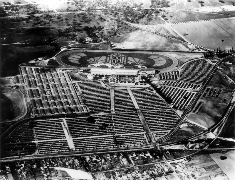 |
|
| (ca. 1939)^ - Aerial view of Santa Anita Race Track and vicinity, showing the enormous parking lot that is completely saturated with neatly lined automobiles, as well as the saddling paddock (middle gardens), Art Deco main building (with white roof), clubhouse (to the right), and stables (on the left). Homes can be seen in the foreground and plotted land is visible in the background. |
Historical Notes In 1942, racing at Santa Anita was suspended due to the Second World War and from 1942 to 1944, Santa Anita was used as a Japanese-American internment center; the racetrack reopened in 1945.^ |
 |
|
| (1958)^ - Aerial view of Santa Anita Park and Racetrack, located at 285 W. Huntington Drive in the city of Arcadia; view is looking south. The tree-lined street that curves from middle left to upper right is Huntington Drive. Campus Drive runs from upper left to upper right. Santa Anita Golf Course is visible at top left. The winding "thread" is the Arcadia Wash. |
Historical Notes In 1953, a downhill turf course was added, which added a distinctly European flair; during the 1960s, major renovations included a much-expanded grandstand as well as major seating additions; in 1974, the Westfield Santa Anita Mall was built on the site of the old barns and training track; was host to the 1984 Olympic equestrian events; and in 1997, Santa Anita Park was acquired by Meditrust Corp.; Meditrust then sold the track to Magna Entertainment Corp., which they still own to date.^ |
 |
|
| (2006)*^ - View showing the Art Deco entrance to Santa Anita's grandstands. Photo by Ellen Levy Finch |
Historical Notes The nearly 300 acre site contains numerous features and structures, in addition to the grandstand building, which are integrally linked to the history and significance of Santa Anita Park. These include the main track, track house, several stables, paddock, receiving and saddling barns, and east and south gates. Santa Anita Park played a pioneering role in the development of the California thoroughbred racing industry. The photographic documentation of the finish was first used at Santa Anita Park in the inaugural season of 1934-35. The “photo finish” is regarded as one of the great contributions of the park to the sport.^^ |
Japanese-American Internment
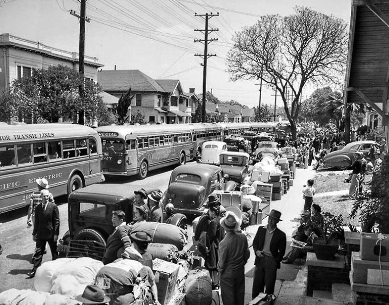 |
|
| (1942)^#^^ - The bus to perdition, 23rd Street and S. Vermont Avenue. |
Historical Notes Apr. 30, 1942: Busses line street at 23rd Street and Vermont Avenue waiting for group of 600 Japanese to be moved to the temporary internship camp at Santa Anita Race Track. This photo was published in the May 1, 1942, Los Angeles Times. View is looking east on 23rd Street with Vermont Avenue just behind the camera. |
 |
|
| (1942)* - Japanese Americans boarding buses destined for internment camps at First and Central, Little Tokyo. |
Historical Notes Temporary detention camps (also known as 'assembly centers') represent the first phase of the mass incarceration of 97,785 Californians of Japanese ancestry during World War II. Santa Anita Racetrack Park was one of the temporary camps. |
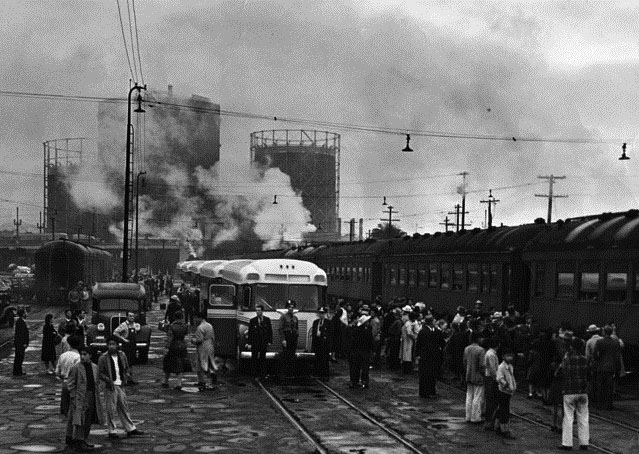 |
|
| (1942)^ - View showing Japanese men, women and children boarding trains and buses as they started their journey at the old Santa Fe station to Internment staging centers and/or camps including Santa Anita Racetrack Park. |
Historical Notes Pursuant to Executive Order 9066 signed by President Franklin D. Roosevelt on February 19, 1942, thirteen makeshift detention facilities were constructed at various California racetracks, fairgrounds, and labor camps. These facilities were intended to confine Japanese Americans until more permanent concentration camps, such as those at Manzanar and Tule Lake in California, could be built in isolated areas of the country. Beginning on March 30, 1942, all native-born Americans and long-time legal residents of Japanese ancestry living in California were ordered to surrender themselves for detention. |
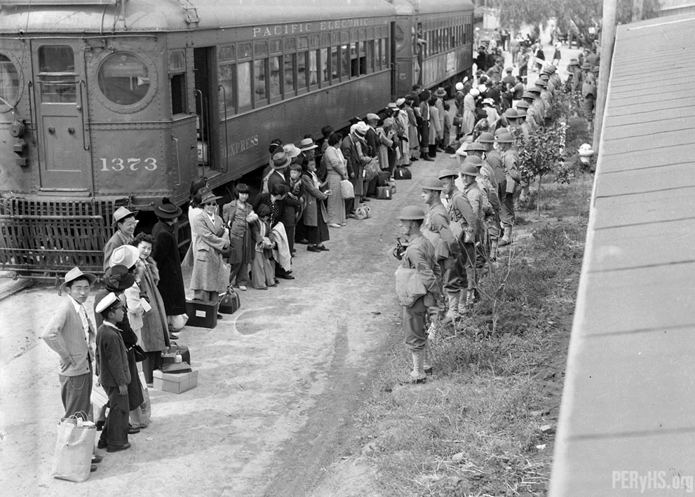 |
|
| (ca. 1942)**^* - Japanese Americans arrive at the Internment staging center at the Santa Anita Park racetrack. |
Historical Notes Santa Anita was the largest Assembly Center for the Japanese American internment in World War II. About 20,000 Japanese-Americans lived at the racetrack during 1942, in temporary housing in the stable area and in barracks constructed on the site’s parking lot. ^^ |
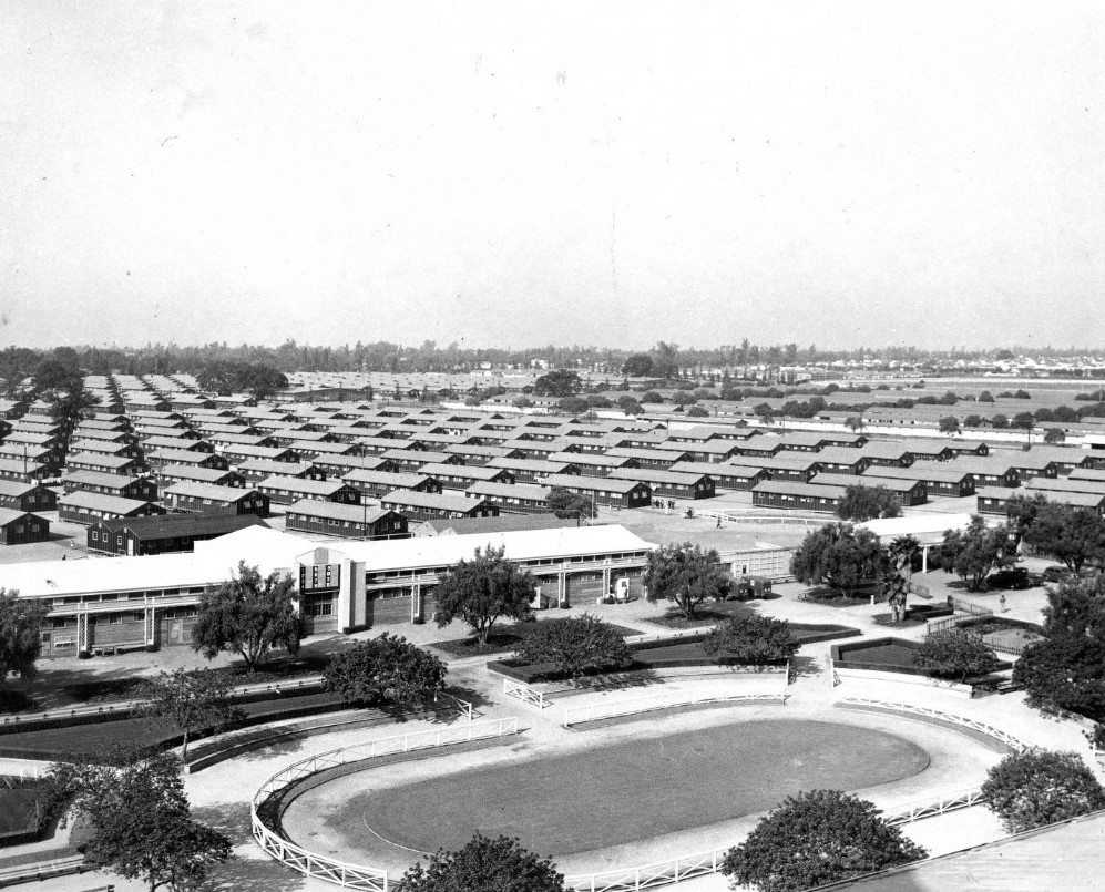 |
|
| (1942)^ - View showing the hastily built barracks at Santa Anita Racetrack Park used to intern over 20,000 Japanese Americans during World War II. |
Historical Notes Santa Anita was turned over to the Wartime Civilian Control Administration, the government body responsible for oversight of the temporary detention facilities, in March 1942, and army engineers soon after built 500 barracks on the parking lot and converted the horse stables and the area underneath the grandstand into residential "apartments." Inmates began arriving in April, most coming from the surrounding Los Angeles County, and the center's population soon topped 18,000, peaking at 18,719 by August of that year.*^ |
 |
|
| (1942)* – View showing a Japanese Internment guard tower at the Santa Anita Racetrack. Photo date: April 6, 1942. |
Historical Notes The Assembly Center remained open for seven months, and in the meantime, inmates took up jobs in camp at the camouflage net factory, the hospital or various administrative departments, and set up schools to ensure their children's education would not be interrupted. Transfer to War Relocation Authority camps began on August 26, 1942, when 901 inmates left for Poston, Arizona, and over the next month the remaining Japanese Americans were sent to Poston and several other camps. The Santa Anita Assembly Center closed on October 27, 1942.*^ |
* * * * * |
Sawtelle and National |
From Hollywood’s Dust Bowl Road to a Modern Westside Crossroads |
At first glance, this intersection looks like “anywhere USA,” but that is exactly why it mattered. In late 1939, filmmakers chose Sawtelle Boulevard at National Boulevard as a stand-in for the open road at the start of The Grapes of Wrath, a story about hardship, displacement, and the search for dignity during the Great Depression.Sawtelle itself grew as a Westside service center tied to the nearby National Home for Disabled Volunteer Soldiers (today’s West Los Angeles VA campus). Though close to the city, this area remained lightly developed into the 1930s, with open land and agricultural uses still common. That semi-rural character made it ideal for filmmakers seeking landscapes that felt far removed from urban Los Angeles. Within a generation, however, postwar growth transformed the corridor into the dense commercial artery we recognize today. |
 |
|
| (1939)* - Opening shot from THE GRAPES OF WRATH, looking south on Sawtelle Blvd at National Blvd. |
| Historical Notes
This image comes from the film’s opening sequence (shot in 1939, released in 1940) and shows Henry Fonda as Tom Joad walking alone down the center of the road. Only moments into the film, the empty roadway and distant horizon establish a mood of isolation before the story ever reaches Oklahoma. The location fits the film’s visual language perfectly: long sightlines, utility poles receding into the distance, and flat fields suggesting the edge of settlement. Hollywood frequently used the undeveloped margins of Los Angeles to represent distant places, and this Westside road convincingly became Depression-era America. The scene quietly connects Los Angeles to a national story of migration, struggle, and resilience. |
 |
|
| (2025)* - Google Street View looking south on Sawtelle Blvd at National Blvd. |
| Historical Notes
Today the same view is unmistakably West Los Angeles: a signalized, multi-lane street lined with businesses, signage, and steady traffic. Decades of suburban expansion and automobile-oriented development reshaped what was once open land into a fully urban corridor. Yet the “bones” of the scene still echo the past. The straight alignment, utility poles, and long perspective remain, reminding us that infrastructure often outlasts the landscapes around it. Where Tom Joad once walked an empty road, thousands now pass daily in one of the Westside’s busy commercial districts. |
Then and Now
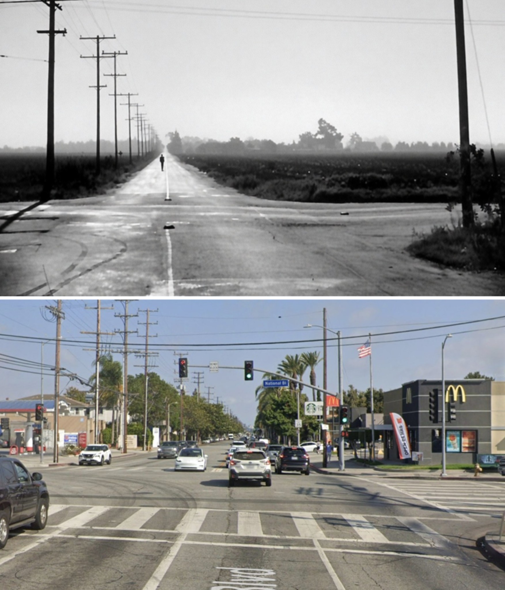 |
|
| (1939 vs. 2025)* - Looking south on Sawtelle Blvd from National Blvd. Photo comparison by Jack Feldman. |
| Historical Notes
Placed together, the images show a classic Los Angeles transformation: a quiet edge-of-town roadway evolving into a busy Westside crossroads. Open fields and distant tree lines have given way to storefronts, signals, and constant movement, while the roadway’s geometry still anchors the comparison. The pairing adds an unexpected cultural layer. The 1939 view is not just early Los Angeles — it is a Hollywood image used to introduce one of America’s most enduring Depression-era stories. This ordinary corner briefly became part of a national narrative about work, migration, and hope, making Sawtelle and National a small but meaningful footnote in both film and Los Angeles history. |
* * * * * |
* * * * * |
More Historical Early Views
Newest Additions
Early LA Buildings and City Views
History of Water and Electricity in Los Angeles
* * * * * |
References and Credits
* DWP - LA Public Library Image Archive
^ LA Public Library Image Archive
*^Oviatt Library Digital Archives
#*MTA Transportation and Research Library Archives
#^California Historical Society Digital Archive
+#Facebook.com: Garden of Allah Novels
+++Photobucket
+^^The Eastsider: Riverside-Figueroa Bridge
+#+Pinterest - California and DailyBreeze.com; Mid Century Hollywood
#^^Picturetrail.com: KCET - Angels Flight
*^#Los Angeles Conservancy: LA Stock Exchange Building; Park La Brea; Warner Bros.Theatre; Downtown Jewelry Exchange/Warner Bros. Theatre
^#^Pacific Electric Railway Historical Society - Alan Weeks Collection
*#*Westland.net: Venice History
^#*Metro.net: Mulholland Drive Bridge
**#The California History Room, California State Library: William Reagh
^*#Library of Congress: Panoramic View of Civic Center; Macy Street Viaduct; 4th Street Bridge
^^#The George A. Eslinger Street Lighting Photo Gallery
*##LA Weekly - Warner Bros. Theatre; The Wiltern Theatre
^## Facebook.com: Photos of Time Travelers
+##MartinTurnbull.com: Fairfax and Wilshire
+#*LA Curbed
+**Los Angeles' Bunker Hill - Alta Visa Apartments
^^+How Stuff Works: Chevrolet Impala
++^Mentalfloss.com: 12 Postcard Locations Then and Now
++#Facebook.com: Photos of Los Angeles
+++Facebook.com – Los Angeles Heritage Railroad Museum
#**Pinterest - California and DailyBreeze.com
#*^Theatlantic.com: AP Photo - George Patton
#^*This Moderne Life: Simon's Drive-In
##*Boston Public Library: Flickr.com
^^*Early Downtown Los Angeles - Cory Stargel, Sarah Stargel
^^^Los Angeles Orthopaedic Hospital
***Los Angeles Historic - Cultural Monuments Listing
*^*California Historical Landmarks Listing (Los Angeles)
*#^Forum.Skyscraperpage.com: Arroyo Seco Library; Westwood-Life Magazine; Japanese Internment; 8th and Francisisco; Bob's Airmail Service Station; 1932 Downtown Aerial; North Los Angeles Street; May Co. Building; Cahunega and Highland Intersection ca1937; Central Police Division
*#^^LAPL-El Pueblo de Los Angeles Historical Monument Photo Archive
**** Pinterest.com: Los Angeles Dodgers; Vintage Los Angeles: Aerial Westwood - Rancho Park; Los Angeles and Hollywood; MacArthur Park w/Downtown Skyline; Gilmore Self-Service Gas Station; Sawtelle and National; Bullock's Delivery Truck
^^^^Depaul.edu: Night Train 55
**^^Aerofiles - US Aviation Firsts
**#^Vincent Thomas Bridge - Facts and Figures
*^*^Big Orange Landmarks: Los Angeles City Hall
***^Pomona Public Library Digital Archive: Bob's Airmail Service Station
^*^*HollywoodHeritage.com: The Muller Family Foundation
*^^*Pinterest.com: Bertrand Lacheze
^^**Pinterest.com: Vintage California
^^*^Restaurantwarecollectors.com: Angelus Hotel
*##*Pinterest.com: Trucks, Pick-Ups, and Gas Stations
***#I Love Los Angeles But...: Sontag Drug Store
*#*#Abandoned & Little-Known Airfields – Paul Freeman
#*#*Fairfax High School Home Page
#*^*GenDisaster.com: Long-Beach Double Pier Collapse
^***UCLA Library Digital Archive
*^^^Art Deco in Mono
*^^Nuestra Señora la Reina de los Ángeles: losangelespast.com
*^^#Los Angeles Past: Temple and Main Streets, Los Angeles - Then and Now
**^*California State Library Image Archive
*^#*Westcoastfireescapes.com: Fire Escape History
^*#*History of Los Angeles Group
^*^#Facebook.com - Bizarre Los Angeles
^*#^Studiotour.com
*^#^Huntington Digital Library Archive
^#^*Noirish Los Angeles - forum.skyscraperpage.com; Broadway Tunnel
**^#Vintage Los Angeles: Facebook.com; Wilshire Blvd - Westlake Theater; Intersection of Main, Spring, and 9th Street; Gilmore Stadium and Field; Town House; Cruising Hollywood Blvd; Attractions and Amusement Parks
^#^#S.S. Avalon and S.S. Catalina
^^*#Historical LA Theatres: Loew's State Theatre; Warner Bros.Theatre; Lyceum Theatre; Broadway Downtown Theatres; College Theatre; Liberty Theatre
^##^Online Archive of California (OAC): Bullock's Department Store Building
*^*#The Los Angeles River: Historic Bridges
^^##Pacific Electric Railway Historical Society
^^#*LA Observed: Dedication of theSepulveda Tunnel; Decommissioned Street Cars; Bunker HIll, 1964
**##Blogdownton: State Building
*^##OAC - Online Archive of California
^*##Flickr- Old Los Angeles Postcards: LA Coliseum
*#^#Life.time.com: Stoked-Life Goes Surfing
^##*Pinterest: Bygone Los Angeles
^#**Facebook.com - City of Angels Brown Derby; Cyclone Racer; Los Feliz Bridge
*###Consolidated Steel, Long Beach and Wilmington
*#*^Historic Hotels of Los Angeles and Hollywood (USC - California Historic Society); U.S. Hotel
*#**Flickr-Los Angeles in Good Light - Ron Reiring
^###The Historical Marker Database: Stephen M. White Statue
*##^LAist.com: The Knott's Berry Farm You May Not Know; Harbor Freeway, 1969; Century Plaza Hotel
^#*#LA Magazine: When Knott’s Berry Farm Was Actually a Farm; Beverly Park Ponyland
**#*Santa Monica via Beverly Hills Line - uncanny.net
#**#California State University Northridge History: csun.edu
#^^#The Museum of the San Fernando Valley: Northridge Train Depot
#^*#Flickr.com: Paul Bajerczak
#^#^Los Angeles: Portrait of a City
#^#*San Diego Air & Space Museum Archive
#*#^Facebook.com - Los Angeles Theatres: Warner Bros. Downtown
##**Franklin HIlls Residents Association
##^*Calisphere: University of California Image Archive
##^^Cinema Treasures: Warner Bros.Theatre; Olympic Drive-In
##*^Fourth Street Bridge Over Lorena Street
##*^Port of Los Angeles: portoflosangeles.corg
##^#Facebook.com: Classic Hollywood-Los Angeles-SFV
###^Flickr.com: Metro Library and Archive
#^^*Blogdowntown.com: Gas Holders; Third Street Tunnel
#^**Water and Power Associates
#^*^Los Angeles River Railroads: Taylor Yard
#*^^Parks.ca.gov: Rio de Los Angeles State Park
#++#The Pacific Electric Railway Historical Society (PERyHS)
^#^^Flickr.com: Michael Ryerson
****^Facebook.com: West San Fernando Valley Then And Now
*^*^*Wehadfacesthen.tumblr.com
*^^^^Los Angeles Maritime Museum
**^^^Facebook.com - San Pedro's Original Website, San Pedro.com
^^^**tumblr.com: John Ferraro Office Building; DWP Office Building
**^**Los Angeles City Historical Society
**#**LMU Digital Archive
#*#**Facebook.com: Beverly Park - L.A.'s Kiddieland
^*^**LAistory: The Pan Pacific Auditorium
^*^*^Alumni.ucla.edu: UCLA History - A Bridge to the Future
^^***Facebook.com: L.A. as Subject
^^^^#A History of the Los Angeles City Market
^^^*KCET.org: Three Forgotten Incline Railways; Welcome to L.A. River; How Oil Wells Once Dominated Southern California's Landscape; Four Level Interchange; Rainbow Pier; Construction of 5 Southern California Freeways; History of Baseball Stadiums; Beverly Park and Ponyland: 6th Street Bridge; Edendale Red Car Line; Lost Tunnels of Downtown LA; Before the 'Carmageddon': A Photographic Look at the Construction of 5 SoCal Freeways; Seventh and Broadway; L.A.'s First Freeways
^^ LA Times: Photo Archive; An Oil Well on La Cienega; Mulholland Bridge; A Mountain of Red Cars; Spruce Goose; New Viaduct for Red Car Line; Demolition of Old Times Bldg; Flooding 1938; Huntington Beach Oil Derricks; Sepulveda Tunnel; Sunkist Bldg.; The Vincent Thomas Bridge; Hill Street Tunnels; Harbor-Santa Monica Freeway Interchange
**^ Noirish Los Angeles - forum.skyscraperpage.com; Westwood-Life Magazine; Selling Papers on Olive; Little Tokyo; La Cienega Oil Well; Hall of Justice; Bob's Airmail Service Station; California Federal Plaza Building; LA Fun Map; Downtown Aerial 1958; 1949 Construction of 101 Freeway; 1953 Harbor Freeway Construction; Wilshire Blvd, 1949; Muller Bros. Service Station; Pan Pacific Auditorium; Gilmore Aerial; Zephyr Room and Brown Derby Postcard View; Shakespeare Bridge; Prospect Studios; Aliso Before and After 101 Frwy; Gilmore Tanker Truck; Gilmore Station; North Figueroa Tunnels; Vincent Thomas Bridge; Hollywood Frwy Traffic Jam; 2012 Downtown Skyline; View from GOB; LA Times Building; Fairfax Ave 1937; Bonaventure Hotel Aerial; Fairfax and Wilshire 1939
^* Wikipedia: Hollywood Sign; Carthay Circle; Carthay Circle Theatre; Fairfax High School; Park La Brea; San Vicente Boulevard; Etymologies of place names in Los Angeles; Los Angeles Central Library; Broadway Tunnel; Pershing Square; Pacific Electric Railway; Gilmore Field; GilmoreStadium; Union Station; Westwood; 6th Street Viaduct Bridge; Figueroa Street Tunnels; Chavez Ravine; 2nd Street Tunnel; Hollywood Freeway; Los Angeles International Airport; Los Angeles City Hall; Wilshire Boulevard Temple; Egyptian Theatre; The Pig 'N Whistle; Sunland-Tujunga; Van de Kamp Bakery Building; Los Angeles County Art Museum; Los Angeles City Oil Field; Los Angeles Railway; Warner Bros. Downtown Theatre; Miracle Mile; Glendale-Hyperion Bridge; Zeppelin; Los Angeles City Hall; Los Angeles Biltmore Hotel; Farmers Market; Interstate 405; Lafayette Park; US Courthouse - Los Angeles; Los Angeles County General Hospital; Long Beach; Chevrolet Impala; Cord Automobile; Playa Vista; Signal Hill; University of Southern California; Harbor Frwy (Interstate 110); See's Candies; Hughes H-4 Hercules; Howard Hughes; History of Los Angeles Population Growth; Jonathan Temple; Olvera St.; Bullocks Wilshire; Los Angeles City Hall Lindbergh Beacon; Bullock's; Broadway Theater District: Lowe's State Theater; Obadiah J. Barker; May Company California; Dominguez-Wilshire Building; Little Tokyo; Ellison Shoji Onizuka; Japanese American Internment; Sepulveda House; Four Level Interchange; Los Angeles Plaza Historic District; Knott's Berry Farm; Hall of Justice; California Federal Bank; Century City; Harbor Freeway; Brown Derby; Bank of Italy; Silverwoods; Woodland Hills; Northridge; KFWB; Rose Bowl Stadium; Westwood; Westwood Village; UCLA; Maddux Air Lines; Olympic Boulevard; World War II; Thomas Fairfax; First National; Arroyo Seco Parkway; Zeppelin; Charles Lindbergh; Spirit of St. Louis; Hollywood Presbyterian Medical Center; Hollywood; Sheraton Town House; 2004 Los Angeles Skyline; LA's Oldest Palm Trees; Shakespeare Bridge; Franklin HIlls; John Marshall High School; Prospect Studios; Rio de Los Angeles State Park; History of Los Angeles; 1926 World Series; San Vicente Boulevard; Vincent Thomas Bridge; World Cruise Center; CSUN; Westwood; Westwood Village; UCLA; History of UCLA; Precious Blood Catholic Church; 1950s Americal Automotove Culture; Pershing Square; Salt Lake Oil Field; Century Plaza Hotel; Elysian Valley; Universal Studios; Huntington Park; Broadway Tunnel; Patriotic Hall; California Incline; LA Flood of 1938
< Back