Early Los Angeles City Views (1925 +)
Historical Photos of Early Los Angeles |
 |
|
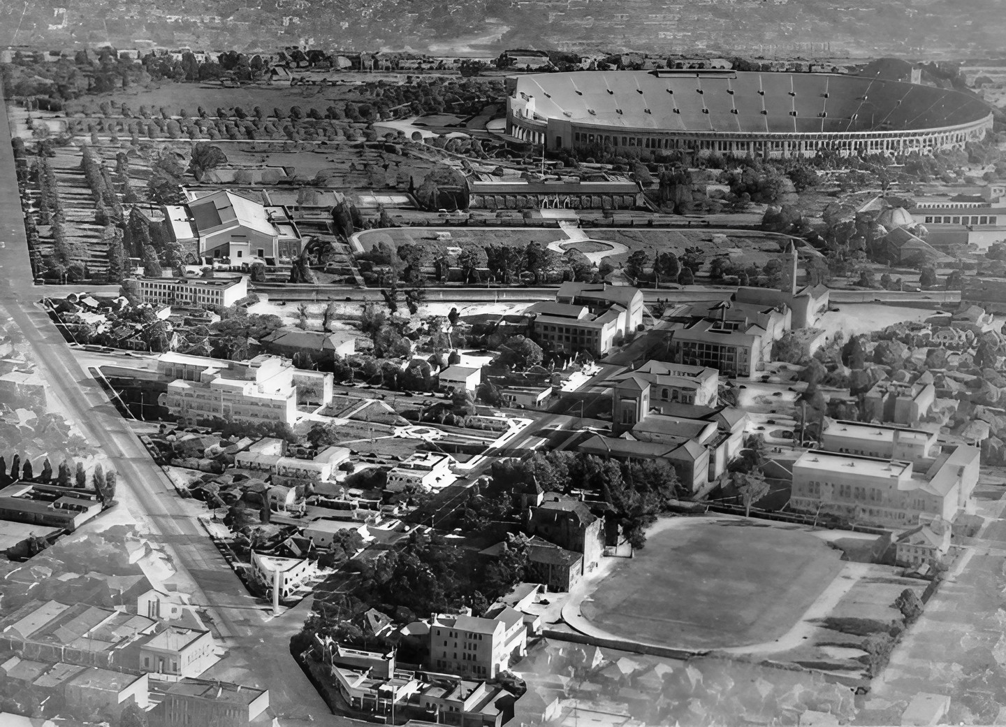
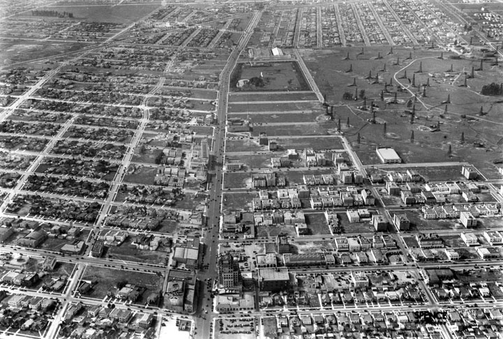
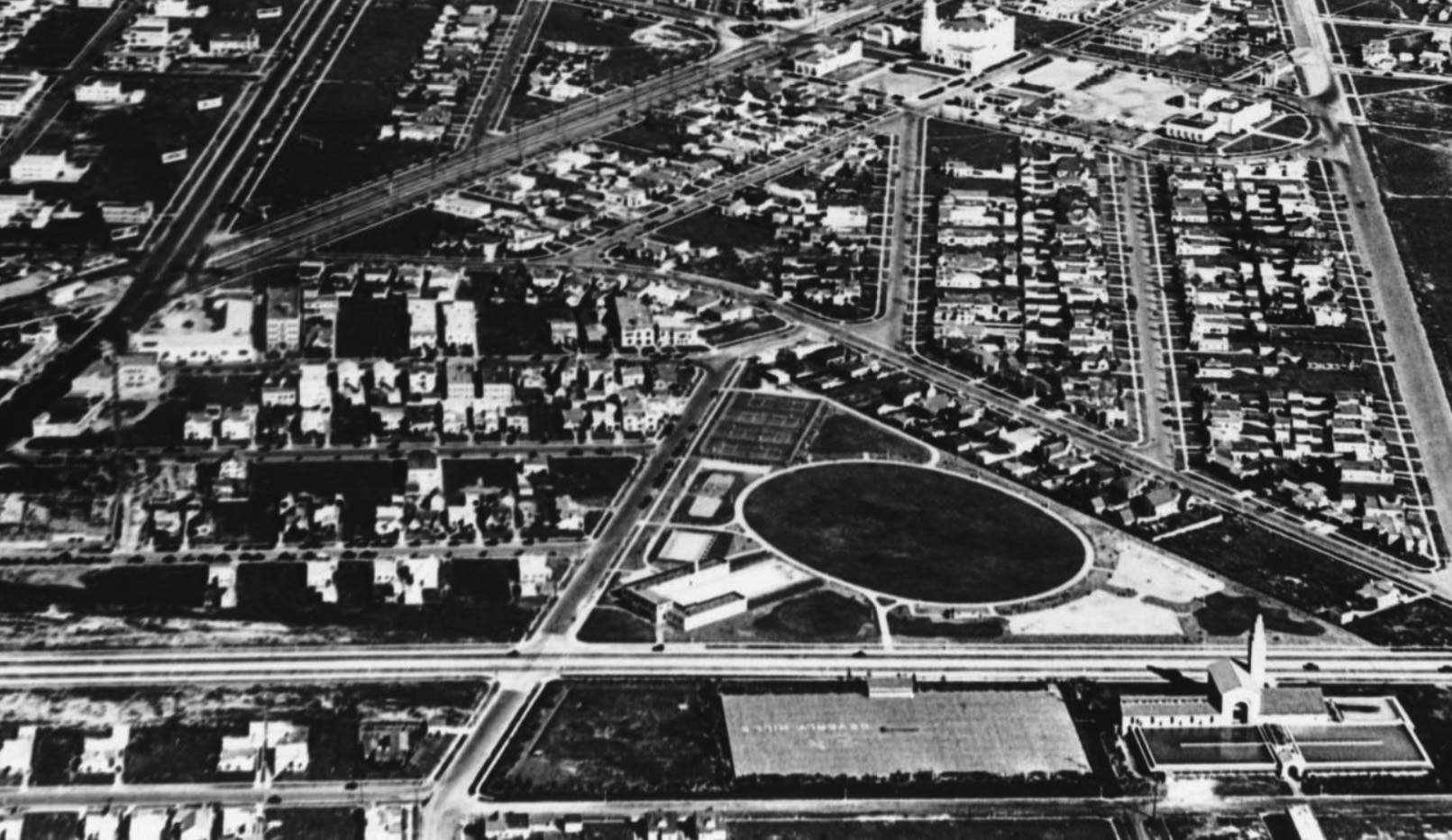
| (1930s)* - Aerial view of the University of Southern California with the Coliseum in the background. |
Historical Notes The University of Southern California (USC) was founded in 1880, making it California's oldest private research university. USC's development has closely paralleled the growth of Los Angeles, and the university historically has educated a large number of the city's business leaders and professionals. |
 |
|
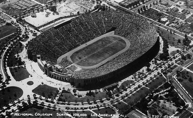
| (1930s)* - Postcard view of the Los Angeles Memorial Coliseum filled to capacity, 105,000 people. |
Historical Notes For many years the Coliseum was capable of seating over 100,000 spectators. In 1964 the stadium underwent its first major renovation in over three decades. Most of the original pale green wood-and-metal bench seating was replaced by individual theater-type chairs of dark red, beige, and yellow; these seats remain in place today, though the yellow color was eliminated in the 1970s. The seating capacity was reduced to approximately 93,000. |
 |
|
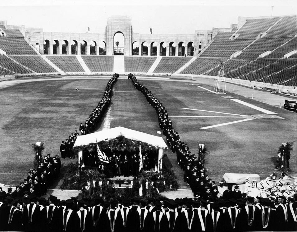
| (1931)* - USC graduation ceremony at the Coliseum, June 6, 1931. Note that the torch at the end of the Coliseum has not been installed yet. |
Historical Notes The now-signature torch was added during the renovations for the 1932 Olympics. It is still being lit during the fourth quarters of USC football games. |
 |
|
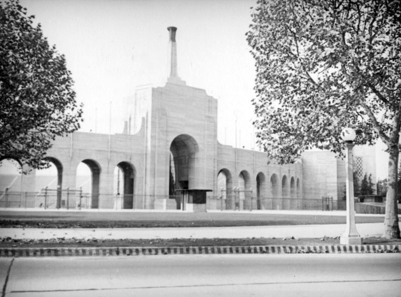
| (1932)* - View of the colonnade and newly installed torch at the front end of the Coliseum. |
Historical Notes The colonnade on the east end of the Coliseum is composed of a triumphal arch, flanked by 14 smaller arches and a central torch, rising 107 feet above street level. The torch, which was built for the tenth Olympiad, is constructed of concrete and capped with a bronze fixture that was kept illuminated throughout the games. |
 |
|
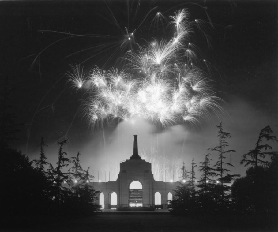
| (1936)* - Fireworks light the night sky over the Coliseum. Photo by Dick Whittington. |
 |
|
| (1932)^ - Aerial view looking northeast toward Los Angeles. The Coliseum is in the foreground with the USC campus just behind it. The LA downtown skyline can be seen in the background in the upper right of the photo. |
Historical Notes Click HERE to see more in Early Views of U.S.C. |
* * * * * |
Palm Drive
 |
|
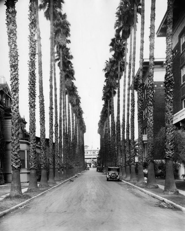
| (ca. 1930)^ - A view of Palm Drive north from Adams Boulevard, with two-story houses on either side and cars parked on the street. The building at the end of the street is the Los Angeles Orthopaedic Hospital located on the site of Charles Longstreet's former home. |
Historical Notes Many of the palm trees seen above still exist and our now situated within the grounds of the Los Angeles Orhopaedic Hospital (Flower St. and Adams Blvd). These are considered to be the oldest trees in Los Angeles. The trees date back to the 1870s. The Los Angeles Orthopaedic Hospital (LAOH) was founded in 1911 by Charles LeRoy Lowman, as a clinic for children with crippling disorders. The first LAOH building was constructed in 1922 at the above site. It was replaced in 1959 by a second hospital, and today a third hospital nears completion on the Westside of Los Angeles.^^^ |
* * * * * |
Figueroa St and Washington Blvd (Then and Now)
 |
|
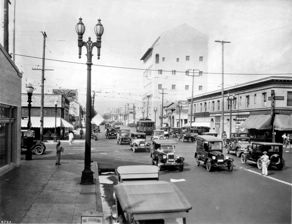
| (ca. 1927)*# - View looking north on Figueroa from just south of Washington Boulevard. A paperboy dressed in light-colored clothing stands at the center of the street to the right hawking papers while cars pass him on either side. The large building in the background is the Patriotic Hall. Note the beautiful two-lamp streetlight on the left. |
Historical Notes Patriotic Hall was built in 1925 and the building opened its doors in 1926 to serve the public. When it was built, the 85,000-square-foot building was the tallest building in the city. Patriotic Hall was rededicated to honor of Bob Hope and renamed "Bob Hope Patriotic Hall" in 2004.^* |
 |
|
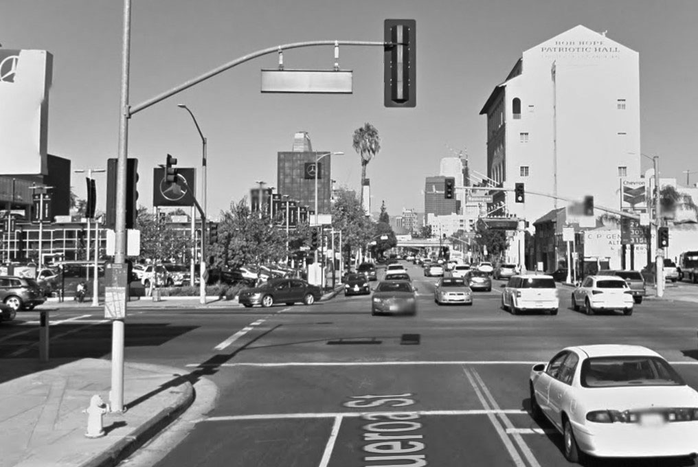
| (2015)##^ – Google street view looking north on Figueroa St. from s/o Washington Boulevard, showing the Bob Hope Patriotic Hall. In the distance is the Santa Monica Freeway. |
 |
|
| (1931)*^^ - The See’s Candies delivery motorcycle and van outside the store at 519 W. Washington in Los Angeles, near the corner of Figueroa St. The large building in the background is Patriotic Hall. Alleyway to the right is S. Lebanon Ave. |
Historical Notes Charles Alexander See II (1882–1949) arrived in the United States from Canada in 1921 with his wife Florence MacLean Wilson See (1885–1956), and his widowed mother Mary Wiseman See (1854–1939). Mary See had developed the recipes that became the foundation of the See's candy business while helping run her husband's hotel on Tremont Island in Ontario. The family opened the first See's Candies shop and kitchen at 135 North Western Avenue in Los Angeles in November 1921. They leased the shop from the French Canadian pioneer of Los Angeles Amable La Mer. They had twelve shops by the mid-1920s and thirty shops during the Great Depression. In 1936 See's opened a shop in San Francisco. In 1972 the See family sold the company to Berkshire Hathaway Inc. In 2007, Warren Buffett called See's "the prototype of a dream business". ^* |
.jpg) |
|
| (2014)##^ – Google street view showing the location where See’s Candy once stood, 519 W. Washington. It is now a Chevron gas station. The ‘Bob Hope’ Patriotic Hall is seen in the background. |
* * * * * |
Farmers Market
 |
|
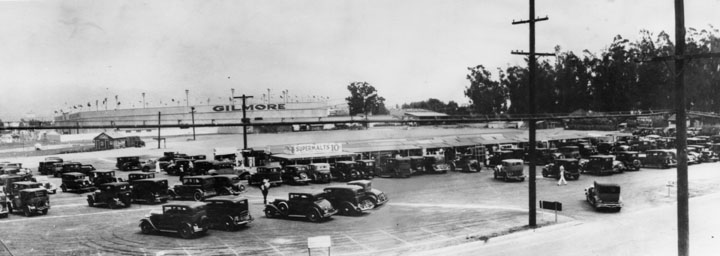
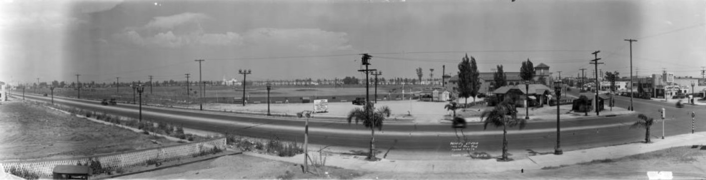
| (1934)^ - Panoramic view showing several rows of cars parked on a dirt lot with some parking lines marked. A building has a sign "Supermalts 10 cents" where Farmers Market is located in a section of low buildings. In the background another sign reads "GILMORE" which is on the face of the Gilmore Stadium where early football and baseball games were played. |
Historical Notes Farmers Market started when a dozen nearby farmers would park their trucks on a field to sell their fresh produce to local residents. The cost to rent the space was fifty cents per day. In 1870, when they moved west from Illinois, Arthur Fremont (A.F.) Gilmore and his partner bought two sizable farms, one of which was the 256-acre dairy farm at the corner of 3rd Street and Fairfax Ave. Gilmore gained control when the partnership dissolved later. Gilmore Oil Company replaced the dairy farm when oil was discovered under the land during drilling for water in 1905. Earl Bell (E.B.) Gilmore, son of A.F. Gilmore, took over the family business. The younger Gilmore started midget car racing and brought professional football to Los Angeles. He built Gilmore Field for the Hollywood Stars baseball team, which was owned by Bing Crosby, Barbara Stanwyck, and Cecil B. DeMille.^* |
 |
|
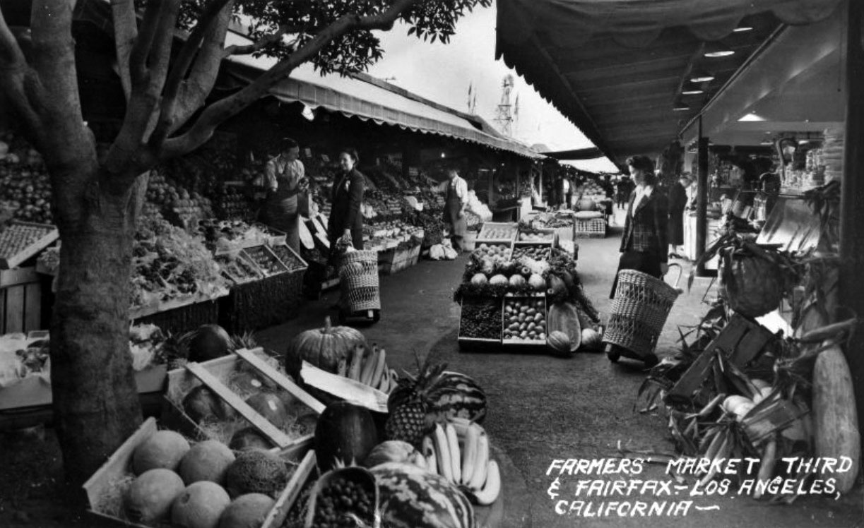
| (1942)##^* – Postcard view showing two women, pulling straw weaved baskets carts, shopping near the fruit stands at Farmers Market. |
Historical Notes Farmers Market was created in July 1934 by Roger Dahlhjelm, a businessman, and Fred Beck, an advertising copywriter. They asked the owners of “Gilmore Island,” the former dairy farm at 3rd & Fairfax, if they could invite local farmers to park trucks on vacant Gilmore land to sell fresh produce to local shoppers. Originally called the “Farmers Public Market,” the concept was so popular that within months, permanent stalls were erected to provide the farmers with a more convenient way to provide their produce. The “Public” was dropped from the name almost immediately. #** |
 |
|
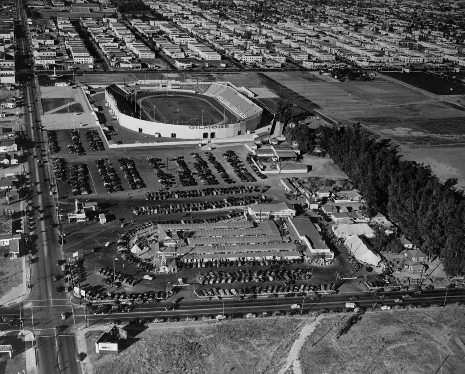
| (ca. 1938)*# - Aerial view looking northeast showing Farmers Market (lower-left) near the intersection of Fairfax and Third Street. On the right stands Gilmore Stadium (built in 1934). |
 |
|
| (1938)*# - View looking north showing the Gilmore Stadium near the corner of Fairfax and Beverly (upper left). Farmers Market is in the foreground close to the intersection of Fairfax and 3rd Street (lower left). A new baseball field, Gilmore Field, will be built within a year of this photo in the empty lot at center-right of photo. |
Hsitorical Notes Gilmore Stadium was used for American football games at both the professional and collegiate level. The stadium was the home of the Los Angeles Bulldogs, the first professional football team in Los Angeles. Gilmore Stadium was also the site of two 1940 National Football League (NFL) Pro Bowls. It was opened in May 1934 and demolished in 1952, when the land was used to build CBS Television City.^* |
 |
|
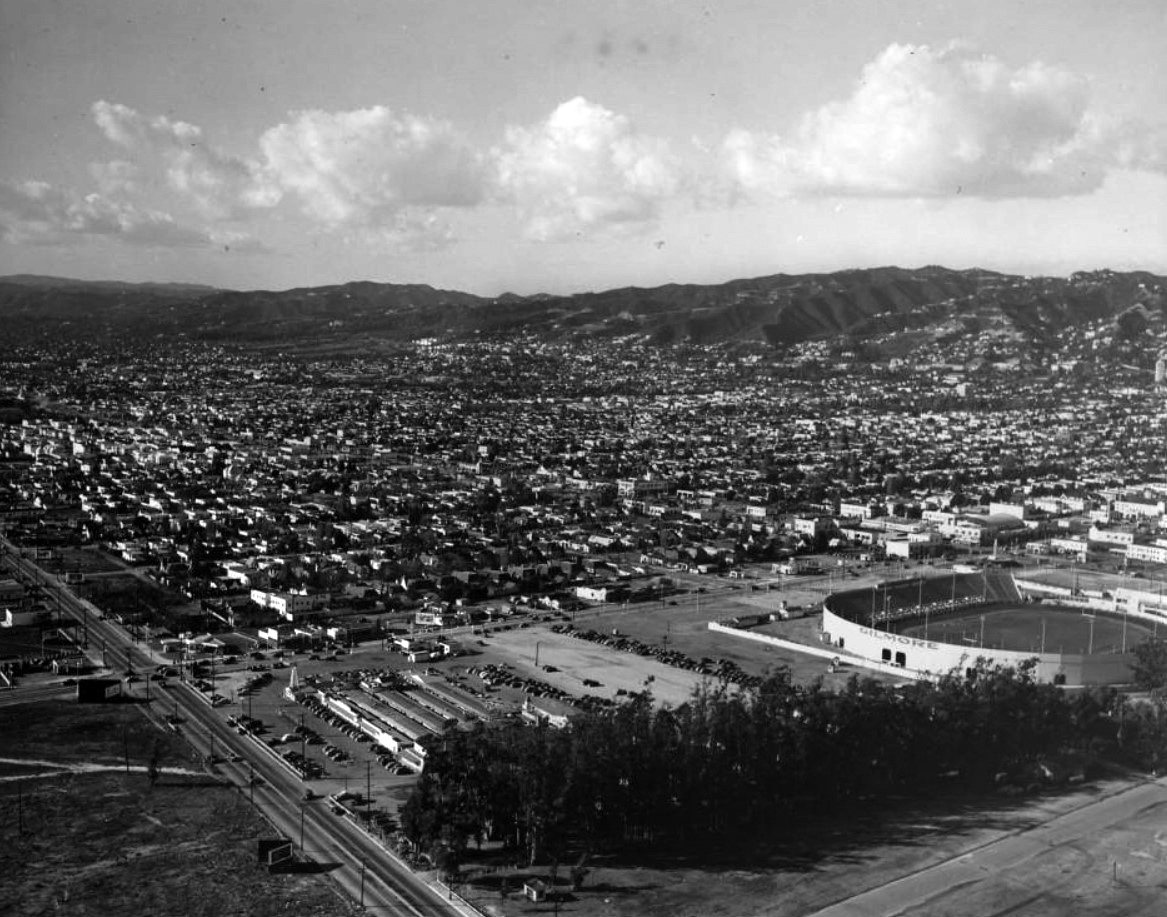
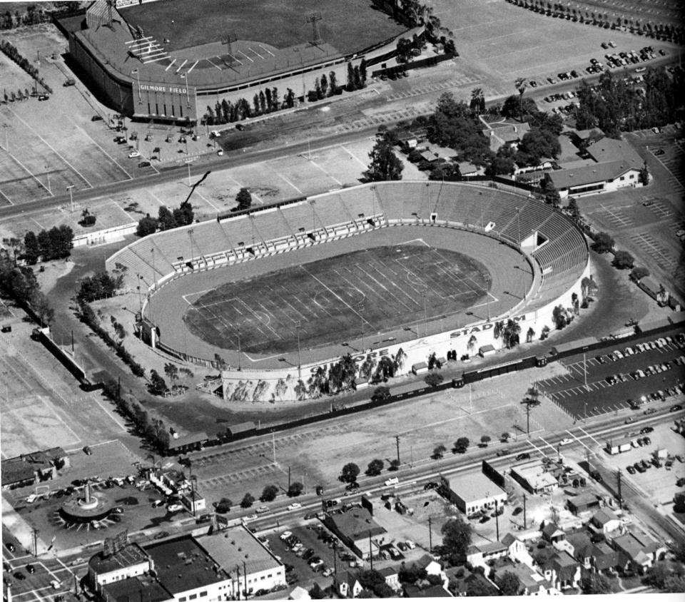
| (1949)* - View looking southeast of Gilmore Stadium (center) and Gilmore Field (top). The intersection of Fairfax Avenue and Beverly Boulevard is in the lower left of the photo. Herbert's Drive-in Restaurant can be seen on the southeast corner. Farmers Market is in the upper right. Photo: Vintage Los Angeles. |
Historical Notes Gilmore Field opened on May 2, 1939 and was the home of the Hollywood Stars baseball team until September 5, 1957. The ballpark was located on the south side of Beverly Boulevard between Genesee Avenue and The Grove Drive, just east of where CBS Television City is currently located. A couple hundred yards to the west was Gilmore Stadium, an oval-shaped venue built several years earlier, which was used for football games and midget auto racing. To the east was the famous Pan-Pacific Auditorium. Click HERE to see more in Baseball in Early L.A. Both facilities were built by Earl Gilmore, son of Arthur F. Gilmore and president of A. F. Gilmore Oil, a California-based petroleum company which was developed after Arthur struck oil on the family property. The area was rich in petroleum, which was the source of the "tar" in the nearby La Brea Tar Pits.^* |
 |
|
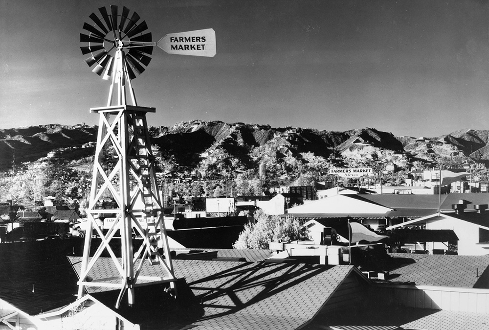
| (ca. 1940s)*# - The windmill sign on top of Farmers Market, with the Hollywood Hills in the distance. |
Historical Notes When CBS Television City opened next door in 1952, the Farmers Market provided those working or visiting that television studio a convenient place to shop or eat. In the 1970s The Country Kitchen, a restaurant owned and operated by Jack and Eileen Smith (located next to the still-operating Du-par's), was popular with stars and their fans alike. Mickey Rooney could sometimes be found working behind the counter. Other customers included Elvis Presley, Regis Philbin, Rip Taylor, Mae West, Johnny Carson and even The Shah of Iran on his visit.^* |
Click HERE to see more early views of Farmers Market. |
* * * * * |
Salt Lake Oil Field (aka Gilmore Oil Field)
 |
|
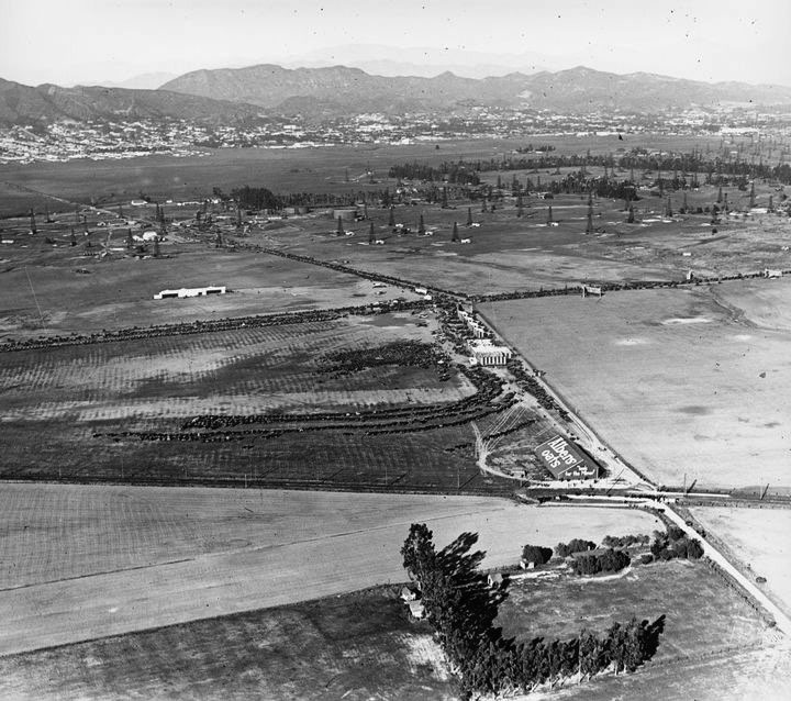
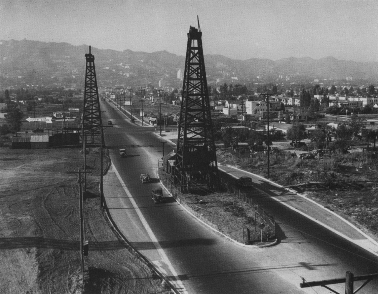
| (ca. 1922)^##* - Aerial view looking north showing oil derricks of the Salt Lake Oil Field (aka Gilmore Oil Field). The intersection of Wishire and Fairfax is seen at upper-center with the Hollywood Hills in the distance. |
Historical Notes In the 1890s, dairy farmer Arthur F. Gilmore found oil on his land, probably in the vicinity of the La Brea Tar Pits. The field was named after the Salt Lake Oil Company, the first firm to arrive to drill in the area. The discovery well was spudded (started) in 1902. |
 |
|
| (1930)^ - Aerial view looking west down Wilshire Boulevard from above Sycamore. The widest street visible, Wilshire, became known as the Miracle Mile, where most high rises were built through the years. The Salt Lake Oil Field is at upper-right and the La Brea Tar Pits at upper-center. Fairfax runs horizontal at top of photo at the end of the oil field. Farmers Market is out of view in the upper-right. |
Historical Notes Development of the field was fast, as oil wells spread across the landscape, with drillers hoping to match the production boom taking place a few miles to the east at the Los Angeles City field. Peak production was in 1908. By 1912, there were 326 wells, 47 of which had already been abandoned, and by 1917 more than 450, which had by then produced more than 50 million barrels of oil. After this peak, production declined rapidly. Land values rose, corresponding to the fast growth of the adjacent city of Los Angeles, and the field was mostly idled in favor of housing and commercial development. The early wells were abandoned; many of their exact locations are not known, and are now covered with buildings and roads.^* |
Fairfax and Drexel Avenues
 |
|
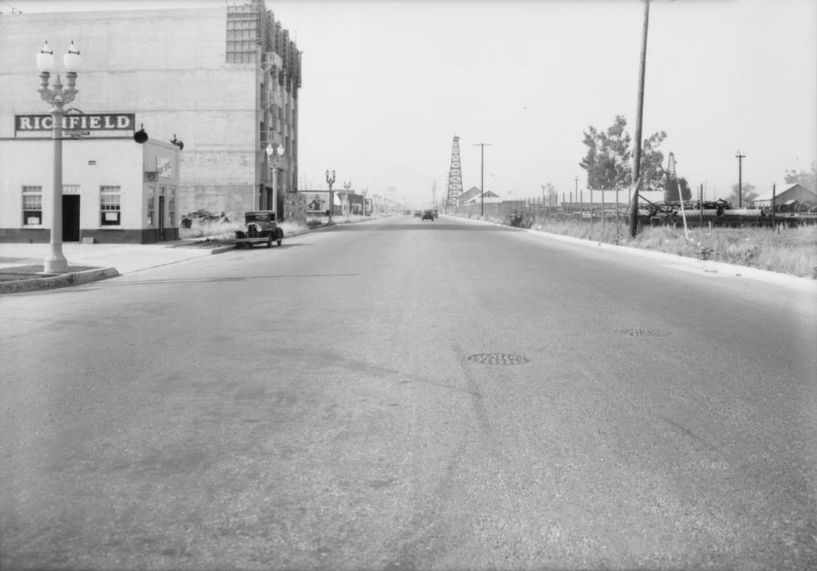
| (1931)*# - View looking north on Fairfax Avenue at Drexel Avenue. A couple of oil derricks are seen in the distance around 3rd and Fairfax. The multi-story building on the left, now occupied by Sandy’s Camera, is still under construction. |
 |
|
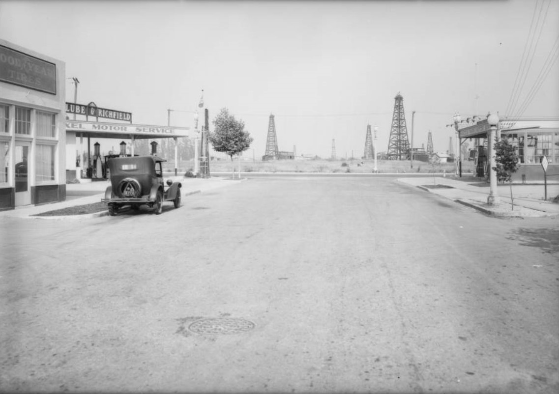
| (1931)*# - View looking east on Drexel Avenue at Fairfax Avenue with oil derricks of the Salt Lake Oil Field in the background. Both corners on the west side of Faifax are occupied by gas stations. |
 |
|
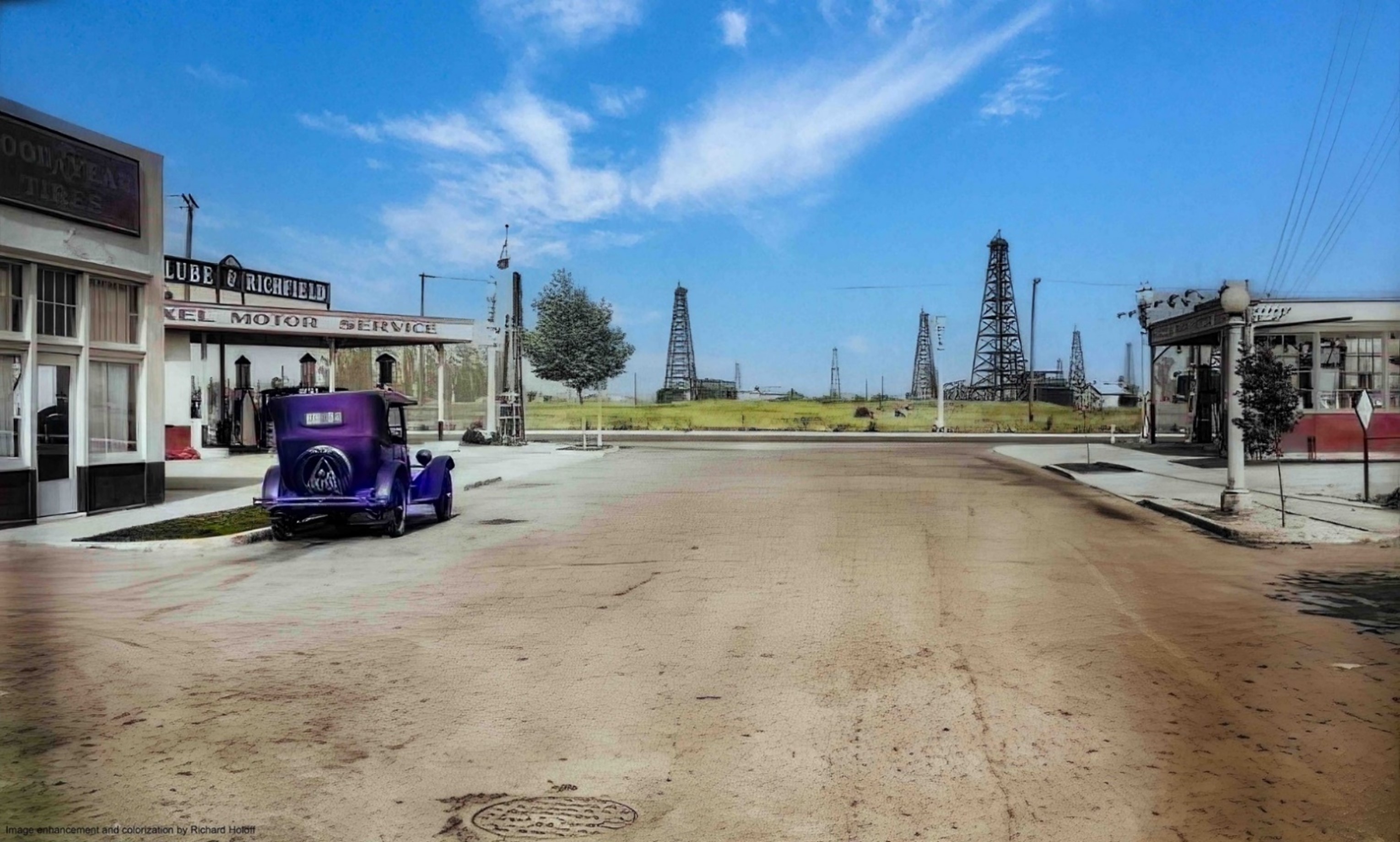
| (1931)*# - Drexel Avenue looking east toward Fairfax Avenue showing oil derricks of the Salt Lake Oil Field in the background. Note that both corners on the west side of Fairfax are occupied by gas stations. Image enhancement and colorization by Richard Holoff. |
.jpg) |
|
| (2009)^* - Detail of the Salt Lake and South Salt Lake Oil Fields, showing their position within Los Angeles and surrounding cities, and also showing the locations of the active drilling islands. |
Historical Notes After its first oil well in 1902, the Salt Lake Oil Field developed quickly in the following years and was once the most productive in California. Over 50 million barrels of oil have been extracted from it, mostly in the first part of the twentieth century, although modest drilling and extraction from the field using an urban "drilling island" resumed in 1962. As of 2009, the only operator on the field was Plains Exploration & Production (PXP). The field is also notable as being the source, by long-term seepage of crude oil to the ground surface along the 6th Street Fault, of the famous La Brea Tar Pits. The adjacent and geologically related South Salt Lake Oil Field, not discovered until 1970, is still productive from an urban drillsite it shares with the nearby Beverly Hills Oil Field, also run by Plains Exploration and Production.^* |
Then and Now
 |
|
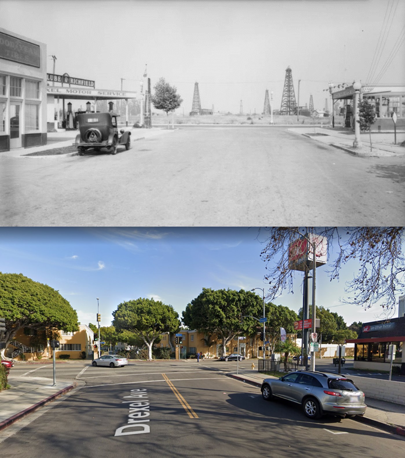
| (1931 vs. 2018)* - View looking east on Drexel Ave toward Fairfax Ave. Today, a Jack in the Box is at the southwest corner (right) and Park La Brea is on the east side of Fairfax. Photo comparison by Jack Feldman. |
Then and Now
 |
|
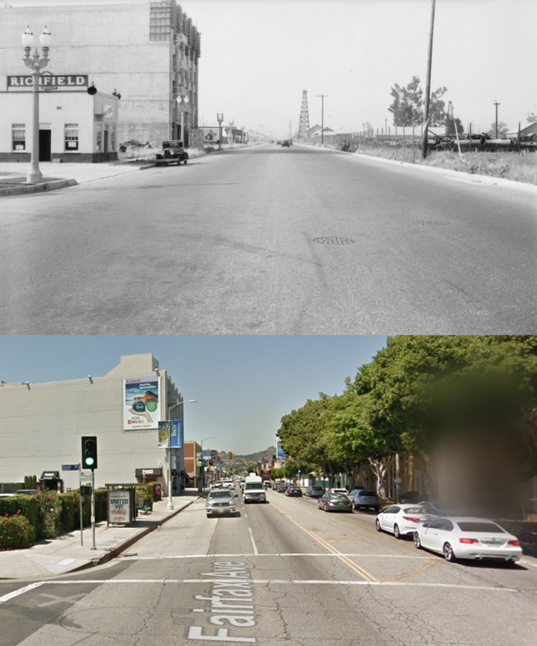
| (1931 vs. 2014)* - View looking north on Fairfax Avenue at Drexel Avenue. Photo comparison by Jack Feldman. |
La Cienega Blvd
 |
|
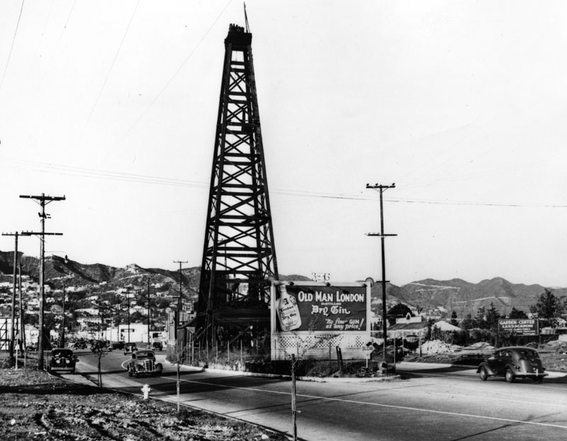
| (1931)* - View of an oil well in the middle of La Cienega Blvd. near Beverly, Feb. 16, 1931. |
Historical Notes One of Los Angeles' most unusual drilling was a well that stood in the middle of La Cienega Boulevard from 1930 to 1946, forcing drivers to zigzag around it. The oil island was located between Beverly Boulevard and 3rd Street. |
Then and Now
 |
|
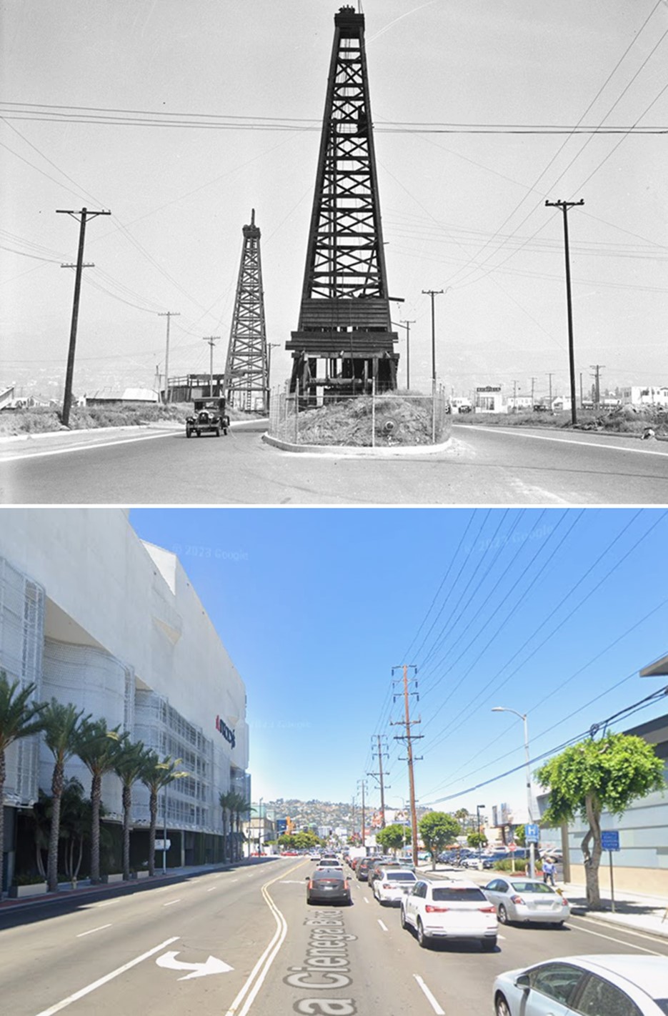
| (1931 vs. 2022)* – Looking north on La Cienega Blvd toward Beverly Blvd. Photo comparison by Jack Feldman. |
|
|
| (2009)^* - Detail of the Salt Lake and South Salt Lake Oil Fields, showing their position within Los Angeles and surrounding cities, and also showing the locations of the active drilling islands. |
 |
|
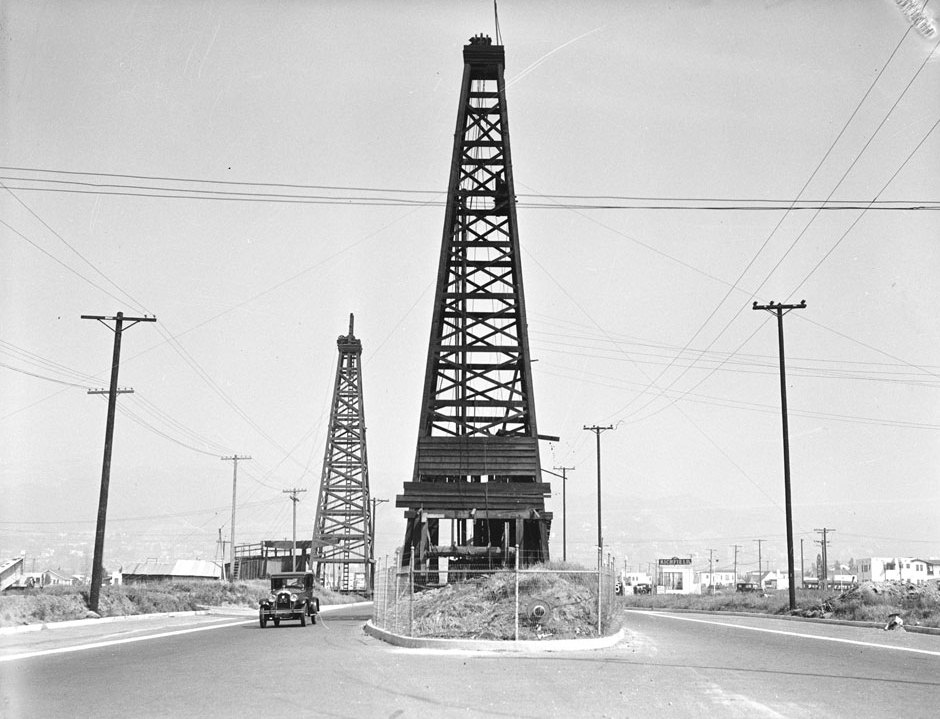
| (ca. 1931)**^ - Oil island on La Cienega just south of Beverly Blvd. The view is looking north. |
Historical Notes When the wooden derrick was constructed in 1907, it wasn't in the middle of La Cienega Boulevard. It was in the middle of a bean field. La Cienega didn't run that far north at the time but in 1930 the City extended La Cienega to Santa Monica Blvd. leaving the oil derrick in the middle of the roadway.^^ |
 |
|
| (1937)^ - View, looking north, of the oil well sitting in the center of the street. It is one of the oldest wells in this vicinity of La Cienega. A large billboard stands at the front of the oil well. |
Historical Notes Today, there is derrick tucked inside the Beverly Center not too far from where the above photo was taken. It is near the parking area for Bloomingdale’s.^^ |
 |
|
| (1930)*# – Aerial view looking east above La Cienega Boulevard (runs horizontal at bottom of photo). The intersection of Wilshire and San Vicente is at upper left and Olympic Boulevard runs away from the camera at right. The triangular piece of land with oval-shaped field in center is La Cienega Park. The La Cienega Municipal Pool sits at the corner SE corner of La Cienega and Gregory Way adjacent to the oval-shaped field. Across the street, at lower right, is the Beverly Hills Water Treatment Plant and reservoir. The large white building at top of photo is the Carthay Circle Theatre, built in 1926. |
 |
|
| (1933)*^#^ - Panoramic view of the intersection of Pico and La Cienega in Los Angeles. On the far side of the street is the Pico Fairway, a driving range that has a billboard advertising a "Free Exhibition; Stan Kertes; Babe Didrickson; Wed Eve Aug 23rd". At the corner there is a tract office for the Olympic Beverly Plaza. Across the street there are a few cafes and shops. There are rows of houses at the far side of the driving range. The Carthay Circle Theatre can be seen at left center. |
Fairfax, San Vicente, and Olympic
 |
|
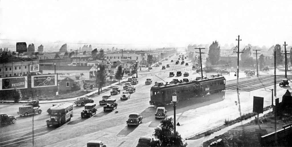
| (ca. 1931)^ – View looking west on Olympic Boulevard where it intersects with Fairfax and San Vicente. The streetcar is on San Vicente running from lower-left to upper-right towards Pico Boulevard. |
 |
|
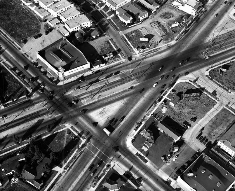
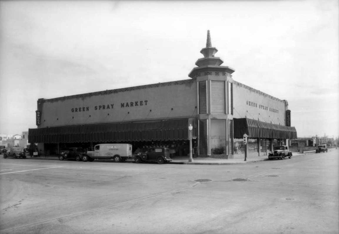
| (ca. 1936)*- Aerial view of the intersection of Fairfax Avenue, Olympic Boulevard, and San Vicente Boulevard. The Green Spray Market can be seen in the upper left. |
Historical Notes Fairfax runs from the upper left to the bottom center right of the photo. San Vicente is the wider street with the streetcar tracks. Olympic runs from the bottom left to the upper right corner of the phone. Von's Market is in the lower right corner and the Green Spray Market is at the upper left on the northeast corner of Fairfax and San Vicente. Olympic Boulevard was originally named 10th Street. In 1932, the entire length of the street, from East L.A. to Santa Monica, was renamed Olympic Boulevard for the Summer Olympics being held in Los Angeles that year.^ |
_Olympic_San_Vicente_Intersection_ca1936.jpg) |
|
| (1936)* - Aerial view from a slightly different angle of the intersection-San Vicente, Fairfax, and Olympic showing the Von’s Market to the right and the Green Spray Market to the left. San Vicente Boulevard is one of the few major streets in this area of Los Angeles that runs diagonally. |
Historical Notes The main reason that San Vicente Boulevard runs diagonally as it does is because it was built on the Los Angeles Pacific Electric Railway Right-of-way in the early 1900s. Named for the Rancho San Vicente y Santa Monica that had previously occupied the area, it begins at Venice Boulevard between Crenshaw Boulevard and La Brea Avenue and travels in a northwesterly direction towards Beverly Hills. The roadway splits into two streets past La Cienega Boulevard, with the western branch becoming Burton Way, which eventually becomes Santa Monica Boulevard South and connects directly to downtown Beverly Hills. San Vicente Boulevard itself continues north into West Hollywood and ends at Sunset Boulevard. A separate stretch of road with the same name, San Vicente Boulevard, runs from Brentwood to Santa Monica. Originally, this boulevard ran from the Soldiers' Home (Sawtelle Veterans Home) in Los Angeles to Ocean Avenue in Santa Monica. This tree-lined street was 130 feet wide, with trolley lines used by the Los Angeles Pacific Electric Railway running down its center.^ |
 |
|
| (1932)* - View of the northeast corner of Fairfax and San Vicente Boulevard showing the Green Spray Market. Several cars and trucks are parked along the curb in front of the market. |
La Brea and San Vicente
 |
|
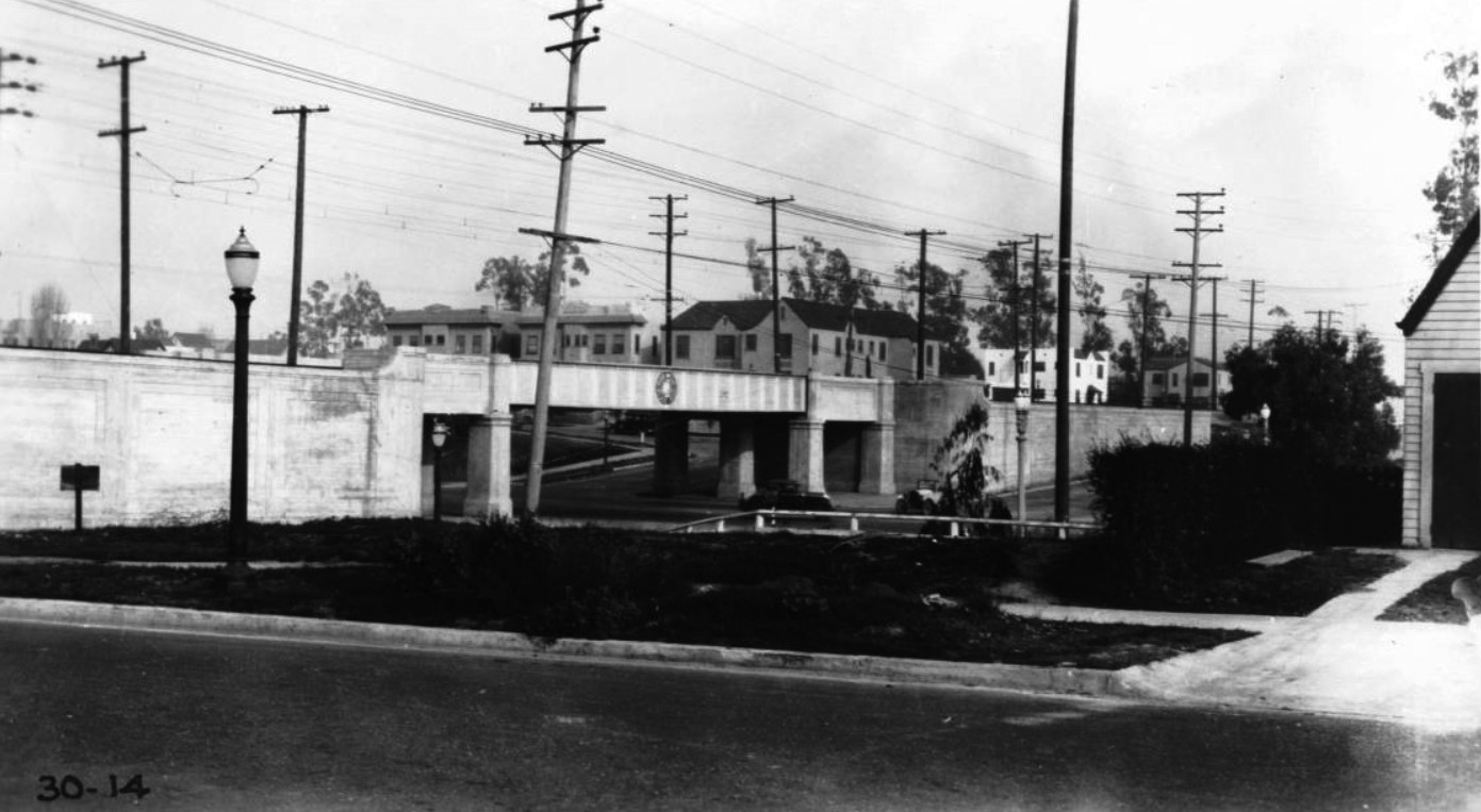
| (1936)*# - Aerial view showing the intersection of San Vicente and La Brea Avenue. San Vicente runs from lower-left to upper-right. A viaduct over La Brea Avenue separated streetcar from automobile traffic. |
 |
|
| (1930)* - View looking northeast showing the La Brea Avenue-Pacific Electric Railway grade separation at San Vicente Boulevard. |
Historical Notes The bridge was removed after the streetcars stopped running in the 1950s. |
* * * * * |
Barrington Avenue |
A Rural Road Becomes a Westside Corridor |
Barrington Avenue developed in what is now West Los Angeles, just west of today’s 405 Freeway and southwest of UCLA. In the early twentieth century, the area sat on the outer edge of the expanding Westwood district, extending north and south of Wilshire Boulevard. In the early 1930s, much of the area south of Wilshire, including the stretch near Ohio Avenue, still retained a semi rural character. Dirt roads, fenced fields, scattered homes, and utility poles defined the landscape only a few blocks from one of the fastest growing districts on the Westside. The paving of Barrington in 1934 marked more than a street improvement. It signaled permanence. Once asphalt replaced dust, subdivision accelerated, schools expanded, and multi family housing followed. Over the next several decades, Wilshire Boulevard evolved into a major employment and residential corridor, particularly during the apartment boom of the 1950s and 1960s. Barrington became part of that larger story, transforming from a rural connector into a stable urban artery shaped by the automobile and sustained by steady residential density. The images below document Barrington’s evolution from open land to established Westside corridor. |
.jpg) |
|
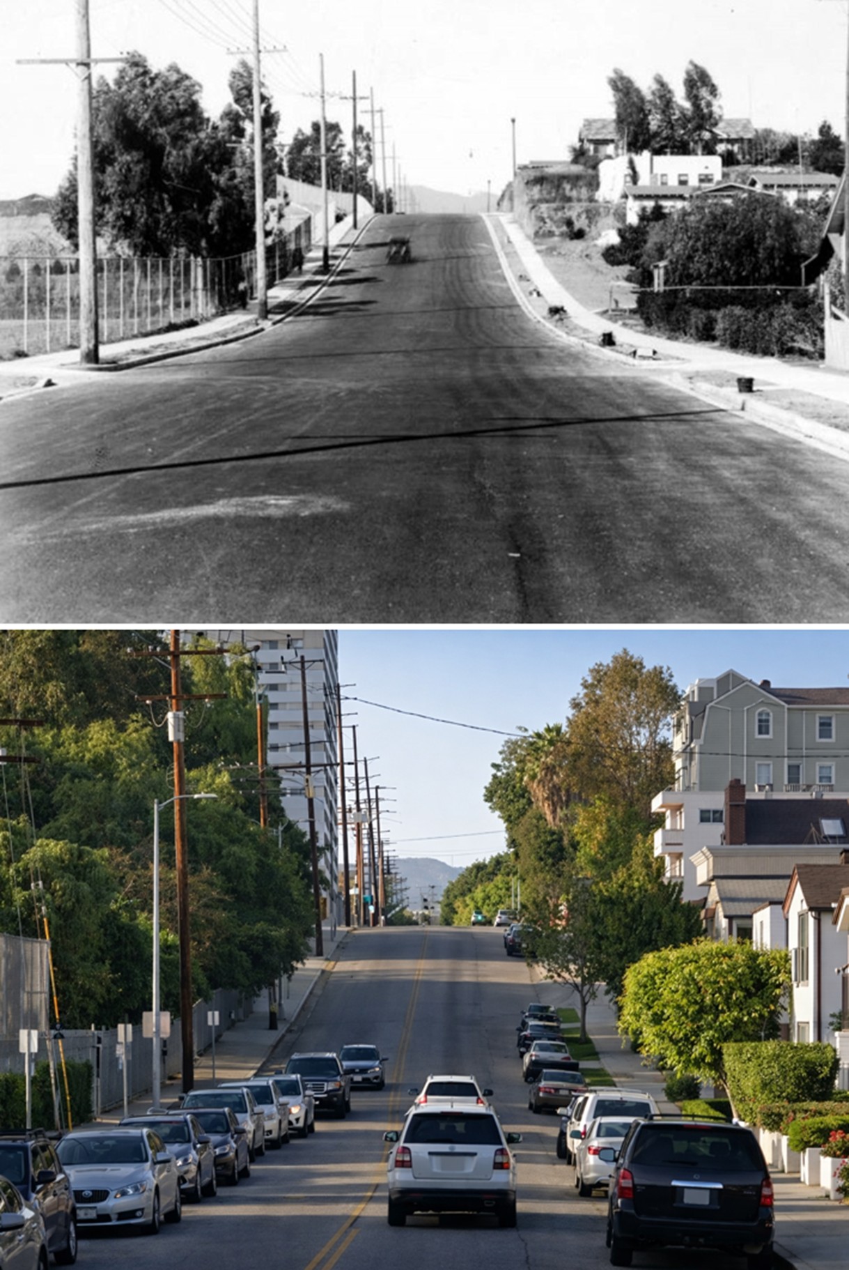
| (1930)* – View of Barrington Avenue from a point south of Wilshire Boulevard. |
Historical Notes By 1930, Wilshire Boulevard had already emerged as a principal east west route, but adjacent neighborhoods were still developing. Barrington Avenue functioned as a local connector serving early residential tracts and undeveloped parcels. Utility poles lined the graded roadway, signaling that electrical infrastructure had arrived. Yet much of the surrounding land remained open. This image captures Barrington at a transitional stage, when public investment in utilities and roads often preceded full residential buildout. It reflects the pattern that defined much of Los Angeles growth during the early twentieth century. |
 |
|
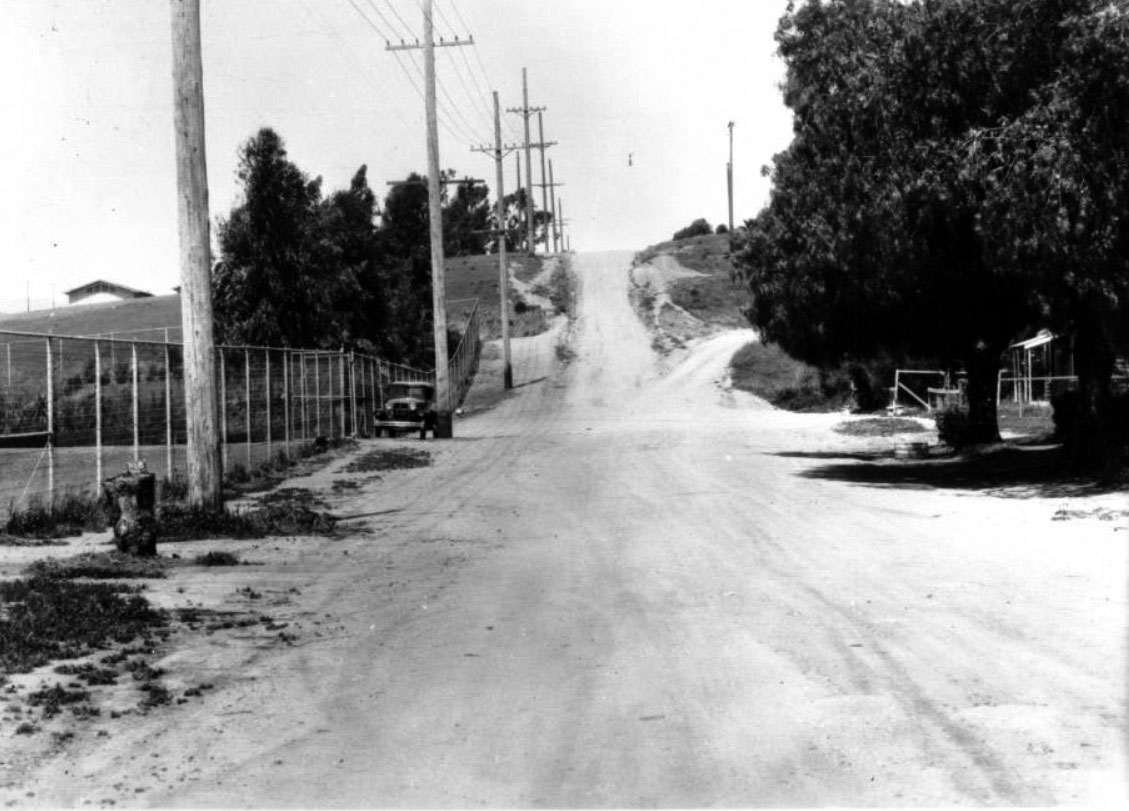
| (1934)* – View of Barrington Avenue looking north from Ohio Avenue in Westwood before improvement, April 14, 1934. |
Historical Notes In April 1934, Barrington north of Ohio Avenue remained a wide dirt road. A wire fence on the left enclosed open land awaiting subdivision or institutional use. Only a few structures are visible in the distance, and the roadway surface shows no sign of paving. Although Westwood Village had opened in 1929 and the University of California campus was expanding nearby, surrounding residential streets were still unfinished. The contrast between nearby commercial growth and this unpaved road illustrates how quickly Westside development was unfolding. Barrington stood at the edge of change, rural in appearance yet positioned within a rapidly urbanizing district. |
.jpg) |
|
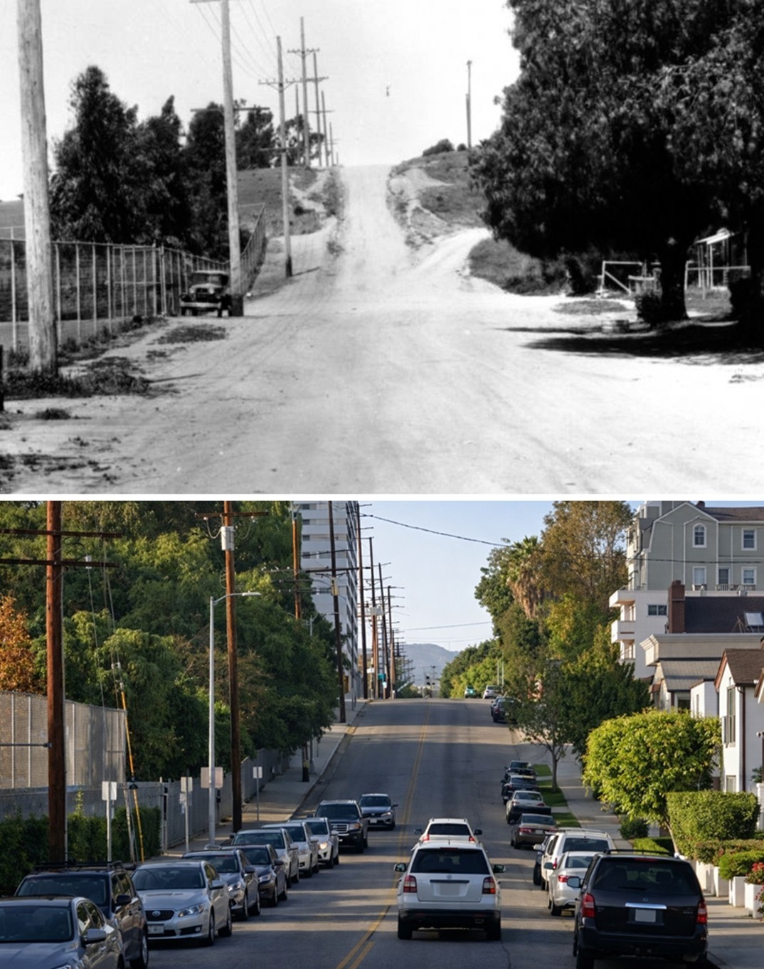
| (ca. 1934)* – View of Barrington Avenue looking north from Ohio Avenue after paving. |
Historical Notes Later in 1934, Barrington was graded, curbed, and paved. The transformation is immediate and decisive. Asphalt replaced dirt, and the street took on a defined and permanent appearance. Paving represented stability and long term commitment. Improved streets encouraged home construction, supported reliable transportation, and increased land values. In Los Angeles, street improvements often marked the moment when speculation became settlement. Barrington had crossed that threshold. |
 |
|
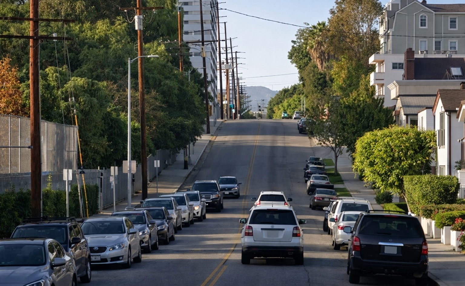
| (2021)* - Google Street View looking north on Barrington Avenue from near Ohio Avenue. |
| Historical Notes
By 2021, the same view reflects nearly ninety years of steady growth. Multi story apartment buildings and condominiums line both sides of the street, many dating from the postwar decades when population growth and automobile access fueled dense residential construction along the Wilshire corridor. Along the west side of the street, the fenced campus belongs to University High School, which occupies much of the block between Barrington and Westgate. Its athletic fields and buildings now form a major institutional presence within what was once open land. Looking north toward Wilshire Boulevard, taller buildings rise near the intersection, evidence of Wilshire’s development into a major office and residential spine during the mid twentieth century. The street alignment and gradual rise toward Wilshire remain unchanged, but nearly every visible structure reflects later phases of urban maturity. |
Then and Now
(Before Paving and Today)
 |
|
| (1934 vs. 2021)* – Looking north on Barrington Avenue from near Ohio Avenue. Photo comparison by Jack Feldman. |
Historical Notes This comparison contrasts Barrington before paving with its present condition. In 1934, the roadway was unpaved and bordered by open land and wire fencing. Development was limited, and the neighborhood retained a rural edge. Today, the same corridor is defined by continuous residential density and proximity to a major commercial spine. The transformation reflects a broader Los Angeles pattern in which transportation infrastructure established the framework for long term urban growth. The dirt road represents possibility. The modern corridor represents fulfillment of that possibility. |
Then and Now
(After Paving and Today)
 |
|
| (1934 vs. 2021)* – Looking north on Barrington Avenue from near Ohio Avenue. Photo comparison by Jack Feldman. |
Historical Notes The second comparison shows Barrington immediately after paving alongside the contemporary view. In 1934, the newly finished asphalt surface symbolized confidence and permanence. The street was prepared to support sustained residential development. Over subsequent decades, that development materialized in apartment construction, institutional facilities, and the rise of Wilshire Boulevard as a center of employment and housing. The buildings visible near Wilshire today reflect mid century growth layered with later reinvestment. The paved street of 1934 was the foundation. The modern image shows the accumulated result of decades of planning, construction, and community life. |
* * * * * |
Metropolitan Airport (later Van Nuys Airport) |
 |
|
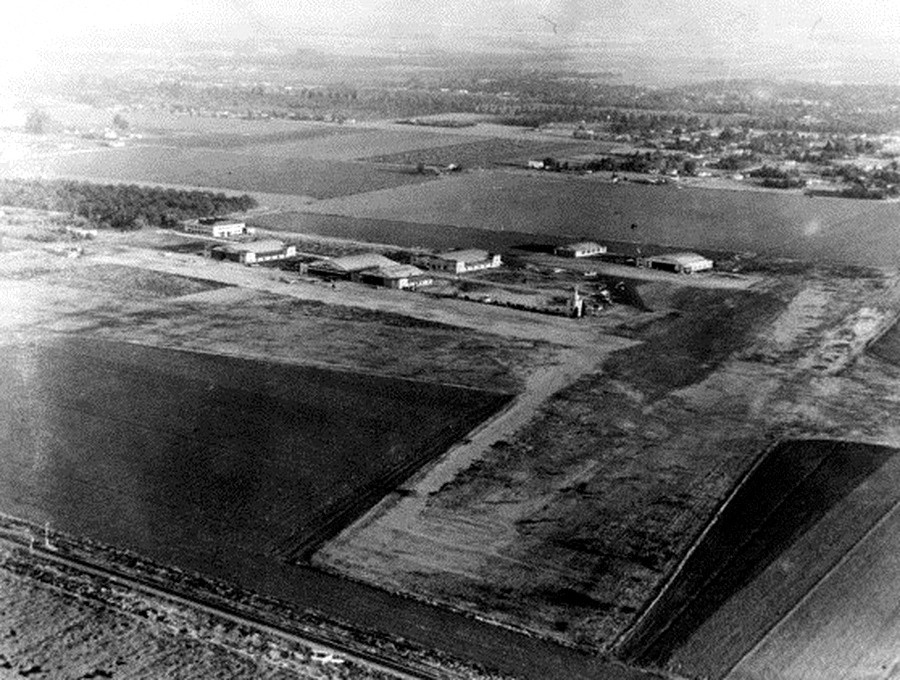
| (1930)*^ - Aerial view in 1930 of Van Nuys Airport when it was known as Metropolitan Airport. Click HERE to see more Early Views of the San Fernando Valley. |
Historical Notes Los Angeles Metropolitan Airport opened in 1928 and was spread over 80 acres amid the trees and farmland. In 1929, Hollywood discovered the airport. Howard Hughes, Hoot Gibson, Cecil B. DeMille, Gene Autry and Wallace Beery were among the growing number of stars flying at the new airport. The airport continued to expand and grow with three factories, six hangers, and a control tower on airport grounds. The airport also began hosting air races. During one such race in 1929, Amelia Earhart set a new speed record. Click HERE to see more in Aviation in Early Los Angeles |
* * * * * |
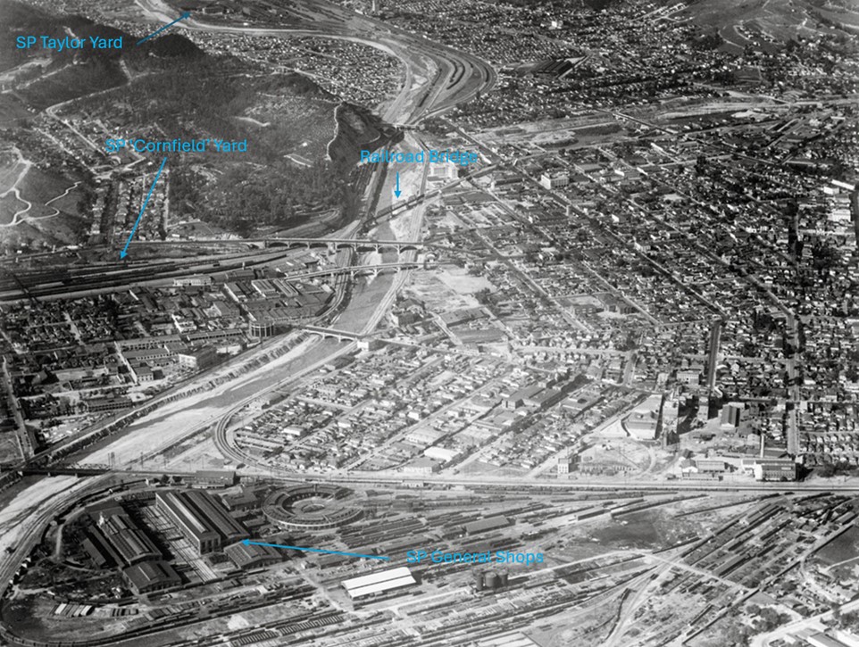
Taylor Yard (aka Southern Pacific Railroad Yard) and Southern Pacific General Shops
 |
|
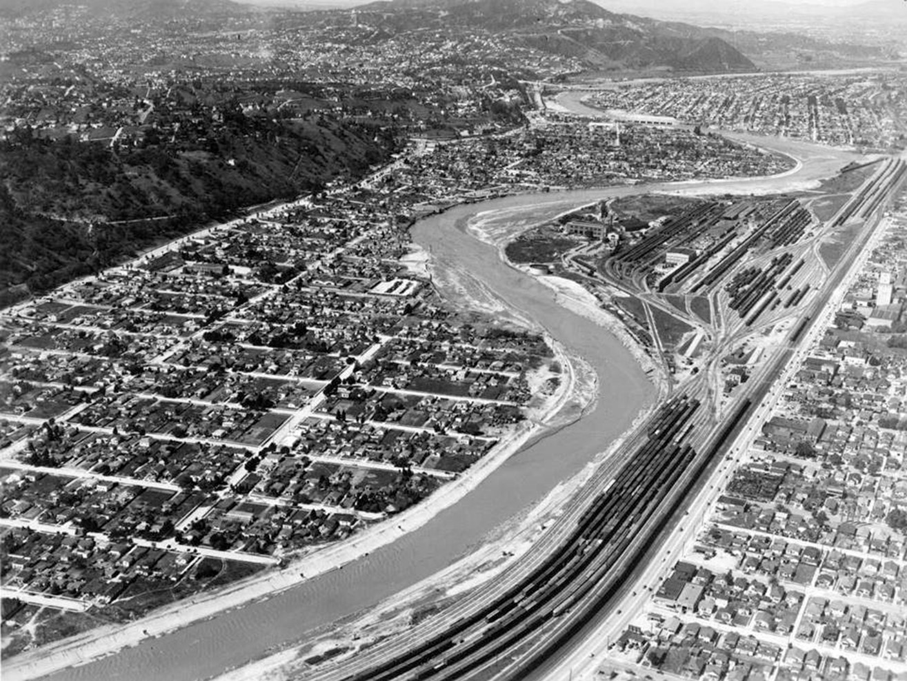
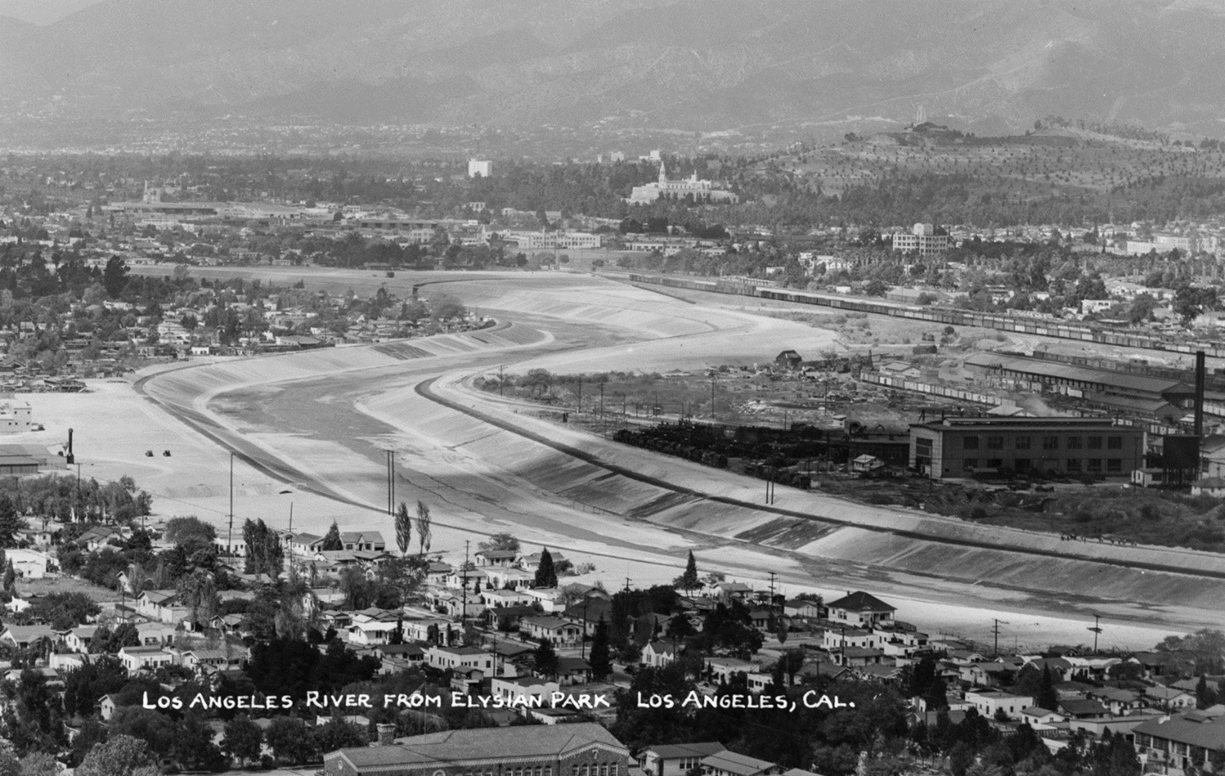
| (1940)* – View of the Southern Pacific Railroad Yard (also known as Taylor Yard) next to a very full Los Angeles River meandering through Elysian Valley, also referred to as Frogtown. |
Historical Notes Taylor Yard, also known as the Southern Pacific Railroad Yard, played a critical role in Los Angeles' rail and industrial history. Located along the Los Angeles River, Taylor Yard served as a major hub for freight and passenger train operations throughout much of the 20th century. |
 |
|
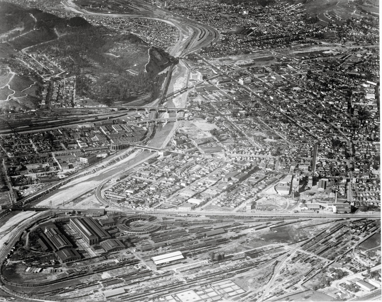
| (1930s)* - Aerial view looking southeast, showing the Southern Pacific Railroad Yard (also known as Taylor Yard) with the nearly dry bed of the Los Angeles River wrapping around it in the foreground. |
Historical Notes Taylor Yard, originally established in 1911 by Southern Pacific Railroad, was a significant railway station and classification yard in Los Angeles. Named after the Taylor Feed Mill that previously occupied the site, it grew to become a crucial hub in Southern Pacific's operations in Southern California. It was used as a freight-switching facility by the Union Pacific and later the Southern Pacific railroads from the 1920s until 1985. |
 |
|
| (ca. 1941)* - Image of the newly concrete-lined Los Angeles River looking north from Elysian Park, with houses, the Southern Pacific Railroad's Taylor Yard (across the river at right, with railroad train cars visible), the tower of the Great Mausoleum of Forest Lawn cemetery in Glendale (at center) and mountains in the distance. Photo by Bob Plunkett from the Ernest Marquez Collection. |
Historical Notes Taylor Yard had been named after J. Hartley Taylor who was a grain merchant and owned a milling company in the area. Throughout the 1920’s and 1930’s the property was a rail yard and an industrial site used primarily as a freight-switching facility, storage space and maintenance and repair facility for rail cars and locomotive engines. Several utility shops were on the property, which provided electrical, plumbing and mechanical support services. Click HERE to see more on the Taylor Gorcery and Taylor Milling Company (1890s). |
 |
|
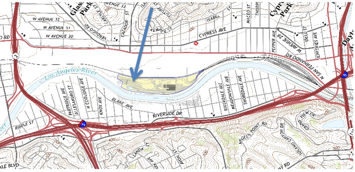
| Map showing the location of the Southern Pacific Railroad Yard (aka as Taylor Yard) located across the Los Angeles River from Elysian Valley (aka as Frogtown) |
 |
|
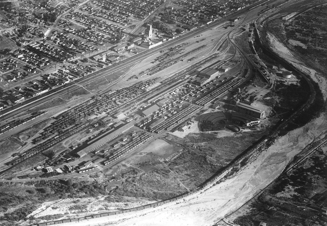
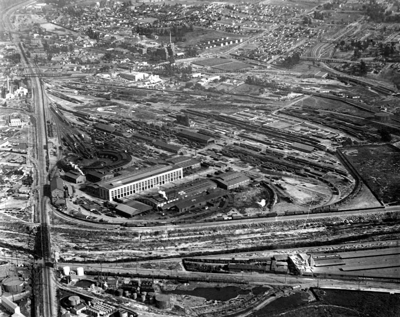
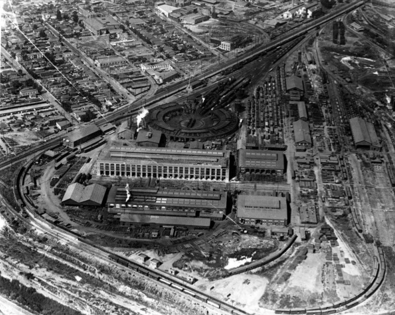
| (1934)* – Aerial view showing the Southern Pacific Railroad General Shops in the foreground with the Taylor Yard seen at top of photo. Southern Pacific’s General Shops was the most complete railroad maintenance facility the city has ever had. Photo from the UCLA Dept. of Geography, Air Photo Archives. |
Historical Notes The Los Angeles General Shops were one of the Southern Pacific's major shop facilities, though not as large as the mammoth Sacramento Shops. They played a crucial role in maintaining and repairing equipment for the railroad's extensive operations in Southern California and beyond. |
 |
|
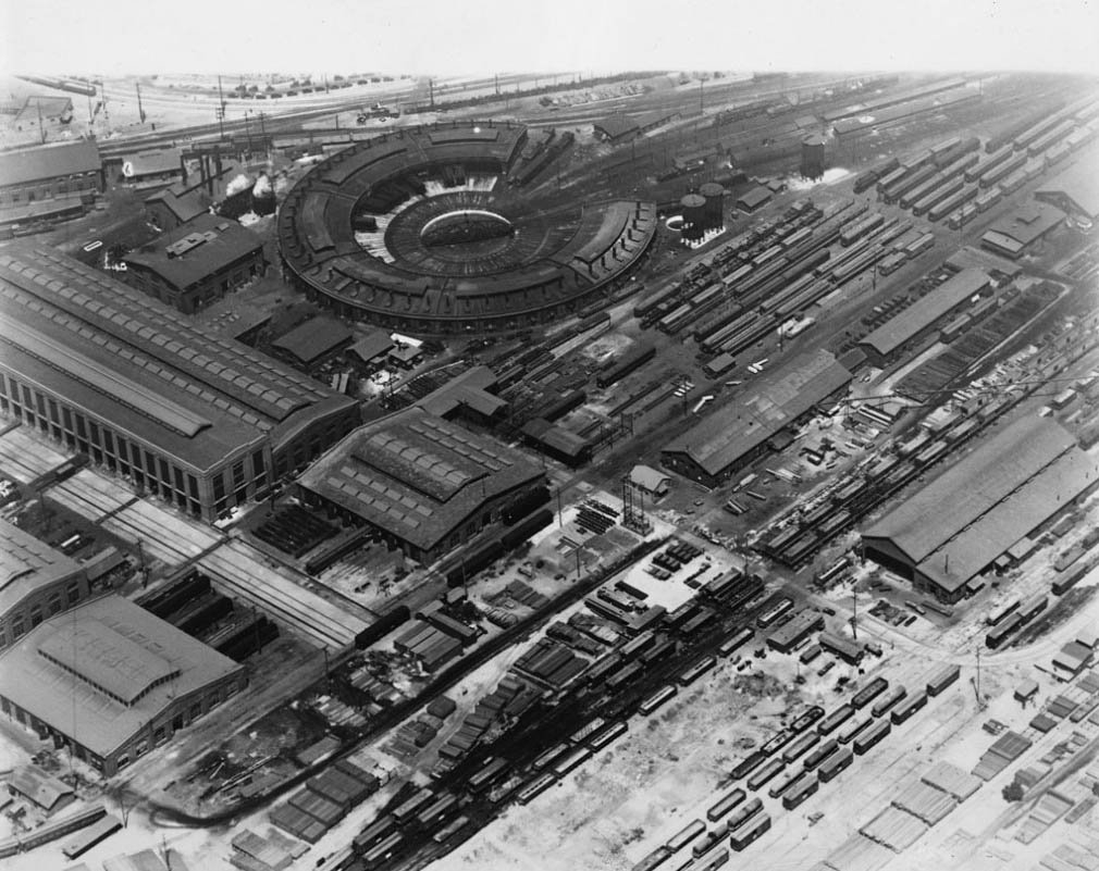
| (1931)* - Aerial view of the Southern Pacific General Shops along the Los Angeles River. |
Historical Notes Originally established in the 1920s, the yard facilitated the Southern Pacific Railroad's activities, including maintenance, repair, and classification of freight cars. It became one of the most extensive railroad facilities in Southern California, with a vast network of tracks, shops, and warehouses. |
 |
|
| (1930s)* - Aerial view of the Southern Pacific Railroad Company terminal. |
 |
|
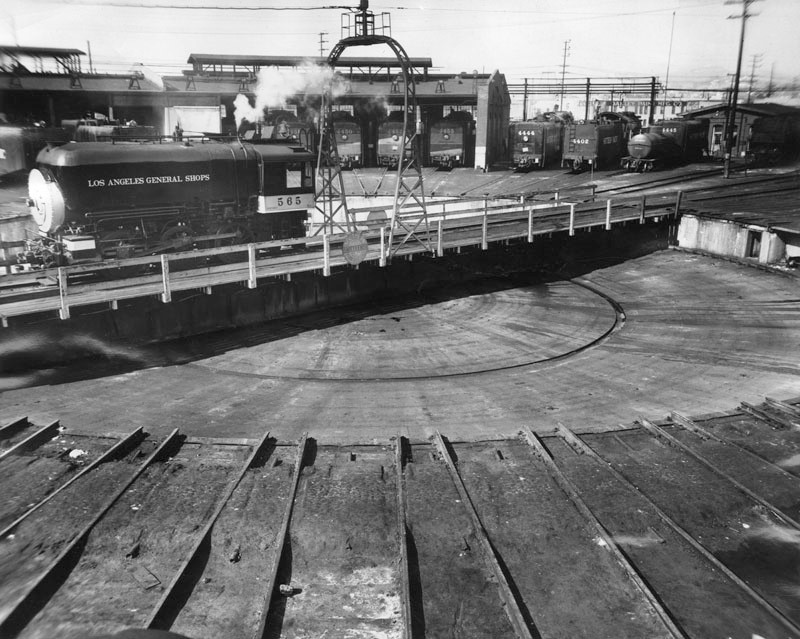
| (1931)* - Aerial view of Southern Pacific roundhouse and portion of vast network of transportation lines. |
 |
|
| (1953)* - View of the Southern Pacific's old roundhouse near the Los Angeles River. |
Historical Notes Photograph caption dated April 18, 1953 reads: "This is the Southern Pacific's old roundhouse near the Los Angeles river. It's a far cry from Dieselville, which is a sprawling yard. In the roundhouse, locomotives are stacked in stalls like silver stallions. On the turntable is the DInky, a snubnosed beetle on an engine which pushes the 'biggies' hither and yon. 'There still is romance in steam,' said one veteran railroader." |
 |
|
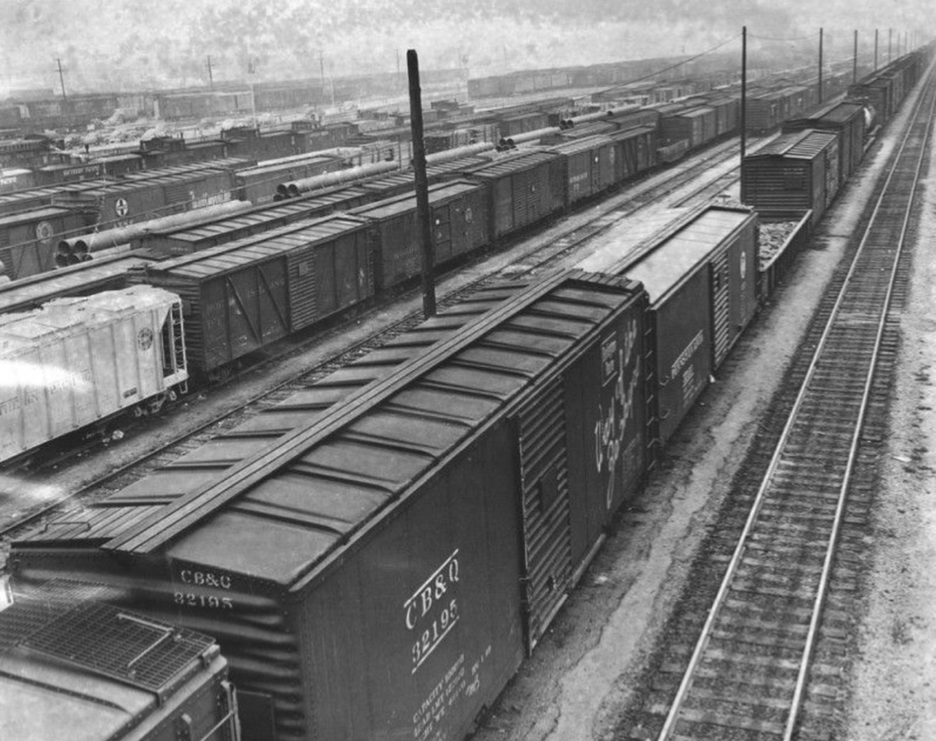
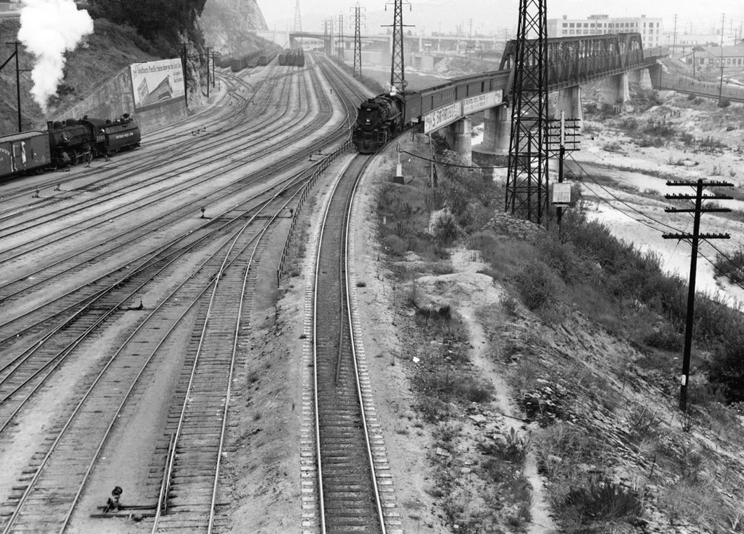
| (1955)* – View of the shop at Southern Pacific's Taylor Yard with two power units and one passenger unit in for servicing. |
Historical Notes By 1949, the yard was rebuilt to accommodate growing operations, and during the 1950s, Taylor Yard reached its peak, becoming the central node in Los Angeles' freight network for Southern Pacific. |
 |
|
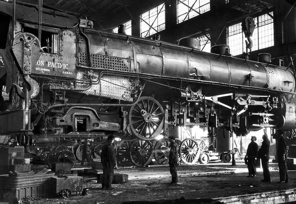
| (1936)* – View showing a locomotive wheel change in the shop. LA Times Photo |
Historical Notes Photograph caption dated Jan. 27, 1936 reads: “Passenger Engine No. 7856 of the Union Pacific rolled into the Los Angeles shops for a new set of tires. Workmen at the shops lifted the 200-ton locomotive from its wheels. August C. Roepke, mechanical supervisor, second from right, signals crane operator while J. H. Sinnar, foreman of the shop, extreme right, oversee operations and makes certain that workmen are careful and in the clear in case of accident.” |
 |
|
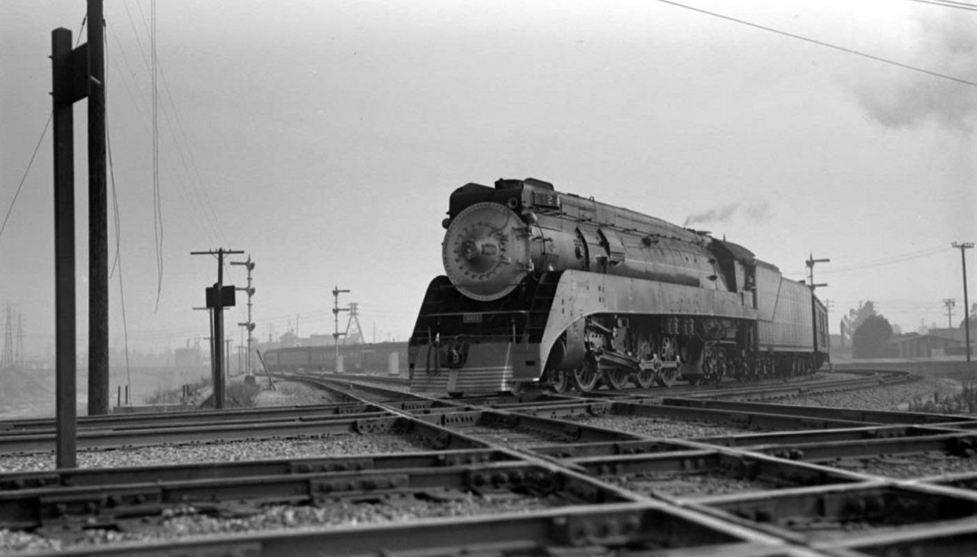
| (1937)* - Southern Pacific Coast Daylight, engine number 4410, engine type 4-8-4. Photographed by Otto Perry, July 27, 1937. |
Historical Notes The Coast Daylight was a passenger train run by the Southern Pacific Railroad between Los Angeles and San Francisco, California. The train ran on SP's coast line tracks which was considered to be the most beautiful route of all their passenger trains. The passenger cars and locomotive were painted red, orange, and black. The colors were so striking against the California coastline that the train was often called the "Most Beautiful Train in the World". The streamlined Daylight began running on March 21, 1937. Initially 12 Pullman passenger cars were hauled by GS-2 steam locomotives. Later, more passenger cars and newer steam engines were added as ridership increased. A southbound train in San Francisco (Train 98) and a northbound train in Los Angeles (Train 99) would leave at the same time. Both would depart at 8:15 am and arrive at their destination at 6:00 pm, traveling 471 miles in 9 hours 45 minutes. After the inaugural run, the Coast Daylight became very popular and ridership skyrocketed. Within a few years the Coast Daylight had the highest ridership numbers in the country. Almost every day the trains operated at full capacity. SP placed an order for more streamlined cars and when they received the new equipment in 1940 they turned the Coast Daylight into the Morning Daylight which ran with 14 cars. The older 1937 cars from the Coast Daylight became the mid-day train called the Noon Daylight. Also streamlined was the Sunbeam (Texas Daylight), the San Joaquin Daylight which ran through California's Central Valley between Oakland and Los Angeles, and the Lark which ran between San Francisco and Los Angeles at night. |
 |
|
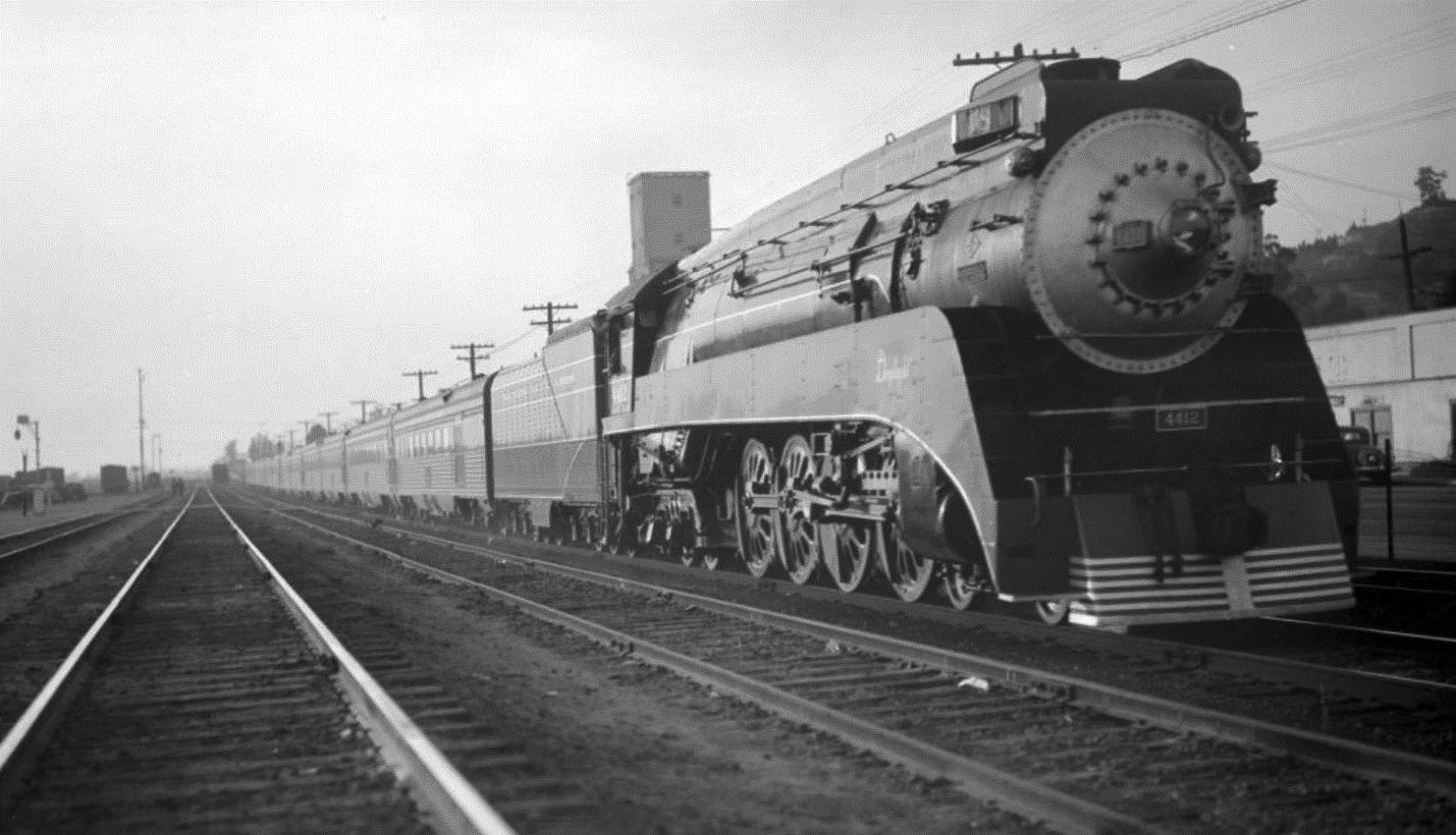
| (1940)* - Southern Pacific Noon Daylight, engine number 4428, engine type 4-8-4. Photographed: Los Angeles, Cal., August 1, 1940. |
Historical Notes The Noon Daylight was introduced on March 30th 1940 due to demand for travel on the Morning/Coast Daylight (San Francisco to Los Angeles). However, people preferred the earlier arrival times of the Morning/Coast Daylight and patronage did not meet expectations. The Noon Daylight was discontinued for the World War II years not reinstated until 14th April 1946. In the 1950s train ridership started to decline. More people were driving cars, flying with the airlines, or even riding rival passenger trains like on the Santa Fe. On January 7, 1955 the steam era ended for the Coast Daylight and all trains were pulled by diesel engines. Though the diesels were more efficient, popular opinion felt they just did not have the appeal like a steam engine. As ticket sales continued their downward spiral, the Daylight trains became shadows of what they had once been giving way to shrinking consists and spartan amenities. Whenever possible, the trains were discontinued by the SP. |
 |
|
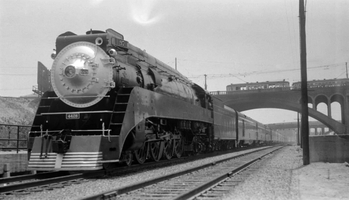
| (1940)* - Southern Pacific Sunset Limited, engine number 4414, engine type 4-8-4, photographed by Otto Perry, August 1, 1940 at Los Angeles. |
Historical Notes In 1940 the Sunset was an overnight train SF to LA that continued to New Orleans-- the SF to LA part ended 1942. The Daylight, Southern Pacific’s original train that later became an entire fleet, was one of the most successful and recognized streamliners of all time even rivaling the Santa Fe’s legendary Super Chief. Interestingly, however, only one was a long distance train as the rest were regional runs which served several different Californian cities. The popularity of the train remained incredibly high for many years even through the early 1960s. However, by the latter half of that decade the Southern Pacific began greatly reducing services and amenities on its fleet as patronage declined. By that time the railroad grew increasingly disinterested in operating passenger trains resulting in its fabled Daylight fleet coming to an unceremonious end in the early 1970s. Today, a version of this successful fleet of trains remains under Amtrak as the popular Coast Starlight. |
 |
|
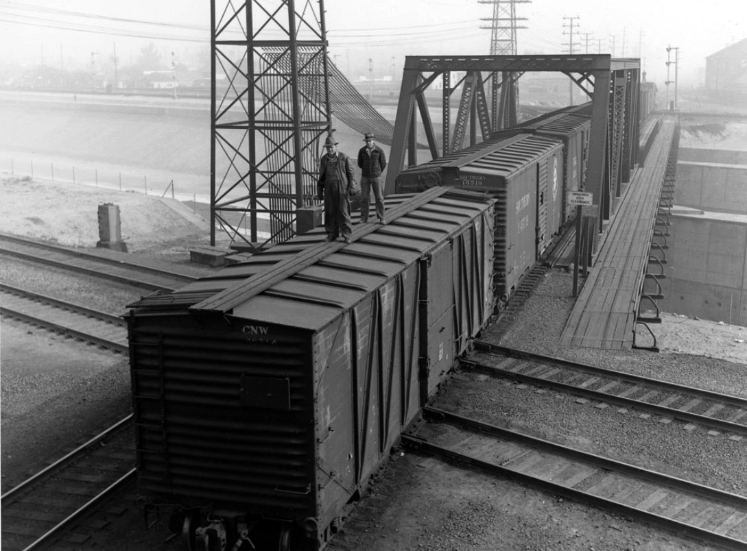
| (1940)* - View of Railroad Men on top of a boxcar learning hand signals at the Southern Pacific yard. |
 |
|
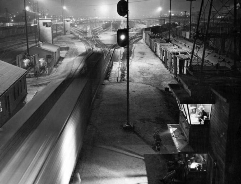
| (ca. 1950)* – View of Taylor Yard showing cars speeding by as the humpmaster watches from his tower. |
Historical Notes Cars flew like an endless chain down the humps night and day at the Taylor Yard. The humpmaster assigned each car to its destination, electronically pulling a switch to the various tracks below, loading each track with cars headed for common destinations. |
 |
|
| (1951)* - Stranded by a labor strike, a freight train occupies the Southern Pacific Railroad mainline in Taylor Yard on San Fernando Road on Monday, February 5, 1951. 90% of SP's 400 available switchmen refused to report in during the crippling nationwide strike. However, Santa Fe and Union Pacific Railroads reported switching operations were nearly normal despite the wage-hour dispute. |
 |
|
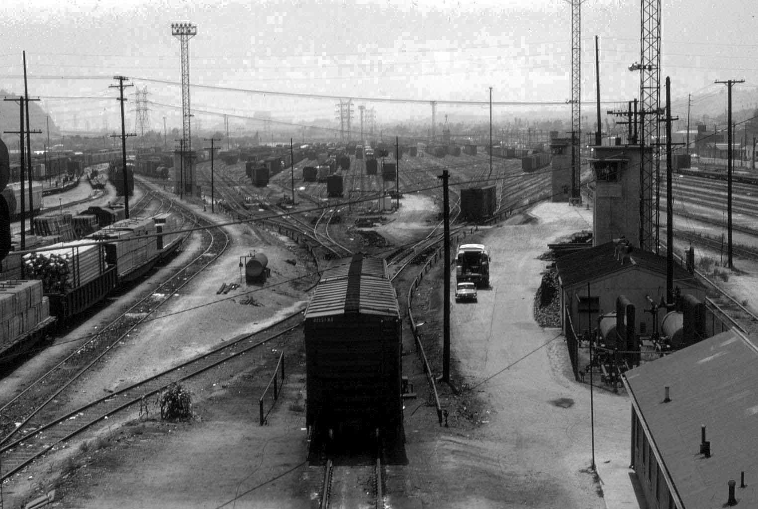
| (1960s)* – View of the Southern Pacific’s Taylor yard facility. After the cars are uncoupled they roll down off the "Hump" and switched onto one of the many yard tracks seen in the distance. The switches for all these tracks are controlled from the towers seen alongside the yard. |
Historical Notes In the 1960’s, the 247-acre freight switching facility called Taylor Yard began to slow down its operations during a time when Los Angeles was growing and expanding rapidly. By 1985 it was closed and only used for maintenance and storage. In 2007, Rio de Los Angeles State Park opened at the old Taylor Yard site. It is one of the last remaining undeveloped portions of land along the river to be used by communities as a park. The location of the park is 1900 San Fernando Road in the Cyprus Park community of Los Angeles. |
Then and Now
 |
|
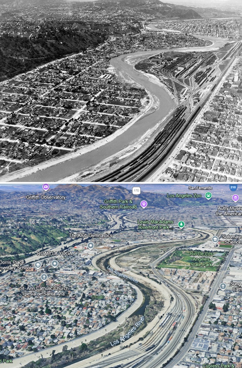
| (1940 vs 2023)* – A view of the Los Angeles River winding through Elysian Valley (also known as Frogtown), with the Southern Pacific Railroad Yard (formerly Taylor Yard) visible at center-right. Part of the former yard is now the Rio de Los Angeles State Park. Photo comparison by Jack Feldman. |
* * * * * |
LA River Railroad Crossings
 |
|
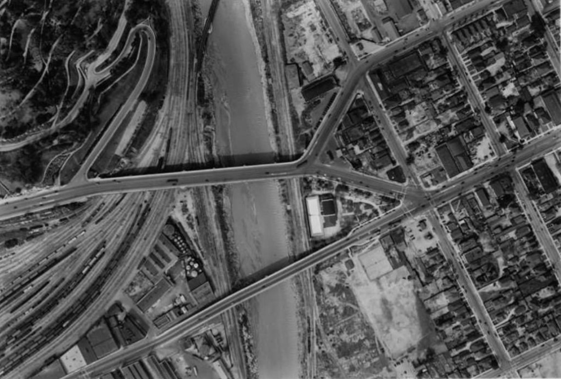
| (1934)* – Aerial view of the Los Angeles River, showcasing the many bridges that cross its banks. The diagonal bridge is a railroad bridge that carries tracks into Union Station. Also visible at the center left is the SPRR Yard, formerly known as 'The Cornfield,' now the site of the Los Angeles State Historic Park. |
Historical Notes The history of railroad bridges over the Los Angeles River reflects the region’s development as a key transportation hub. Early bridges were constructed in the late 19th and early 20th centuries, connecting major railroad lines and facilitating the movement of goods and passengers. These structures include iconic crossings like the Southern Pacific Railroad bridge and the Atchison, Topeka and Santa Fe Railway bridge. The Southern Pacific Railroad bridge, built in the early 1900s, served as a vital link for freight operations, connecting to the expansive Southern Pacific Railroad Yard, known as Taylor Yard. Another significant bridge was constructed by the Union Pacific Railroad, enabling access to their large terminal facilities. As the city grew, the railroads continued to expand their bridge infrastructure to meet increasing demands. This led to the development of more robust and modern bridges in the mid-20th century, many of which were designed to accommodate the rising number of trains crossing the river daily. The river itself, once natural and meandering, was transformed in the 1930s into the concrete channel seen today. This flood control project altered the landscape, and the railroad bridges had to be adapted to the new channel, resulting in elevated or reinforced designs. Today, while some of these historic railroad bridges remain, many have been replaced or modified due to changing rail operations and the redevelopment of the Los Angeles River as a public space. The bridges that still stand are not only functional structures but also landmarks of Los Angeles' rich railroad heritage. |
 |
|
| (1938)* - Aerial view showing the Santa Fe Railroad Bridge at the top of the photo, with the N. Broadway Bridge at the center and the Spring St. Bridge below it. The SP Cornfield railroad yard (also known as the Bullring in 1938) is visible in the lower left. Meadow Road and Park Row Drive wind up the steep slope into Elysian Park, just north of the railroad yard. Notice how swollen the Los Angeles River appears. |
Historical Notes The Southern Pacific 'Cornfield' railroad yard, also known as River Station or the Bullring, was a significant railroad facility located in what is now the Los Angeles State Historic Park, north of downtown Los Angeles. Purchased by Southern Pacific in 1873, it served as the railroad's earliest presence in the city and was the Southern California terminus of the transcontinental railroad. The yard featured multiple tracks on concrete pads, a roundhouse, shops, and a distinct yard office. Its primary function was as a clean-out track for grain loading box cars, where empty cars were cleaned with high-pressure water hoses and underwent light repairs. The yard had its own yardmaster and assigned switcher engines, operating independently to service cars before delivering them to other facilities like Taylor Yard across the LA River. In 1992, Southern Pacific sold the 32-acre site to the State of California, leading to its eventual transformation into a public park. |
 |
|
| (1939)* – A train crosses the Los Angeles River near the North Broadway Bridge, with the Lincoln Heights Jail visible in the distance. The view captures the Santa Fe’s Second District and the Downey Avenue segment of tracks, which runs from Pasadena to Union Station. |
Historical Notes Santa Fe's Second District, also known as the Pasadena Subdivision, was a vital passenger rail route that connected Los Angeles Union Station to San Bernardino via Pasadena. Originally constructed in the 1880s, it became part of the Atchison, Topeka and Santa Fe Railway (AT&SF) system in 1906. At its peak, the line accommodated up to 26 passenger trains daily, including famous services like the Super Chief and El Capitan. Primarily used for passenger transport, with most freight traffic routed through Fullerton, the Second District featured popular stations such as South Pasadena and Pasadena, the latter being a favorite among movie stars seeking to avoid crowds at Union Station. Amtrak continued to utilize the line for its Southwest Chief and Desert Wind services until the 1990s. In recent years, much of the western portion has been repurposed for light rail use, now forming part of the Metro A Line (formerly known as the Gold Line). |
 |
|
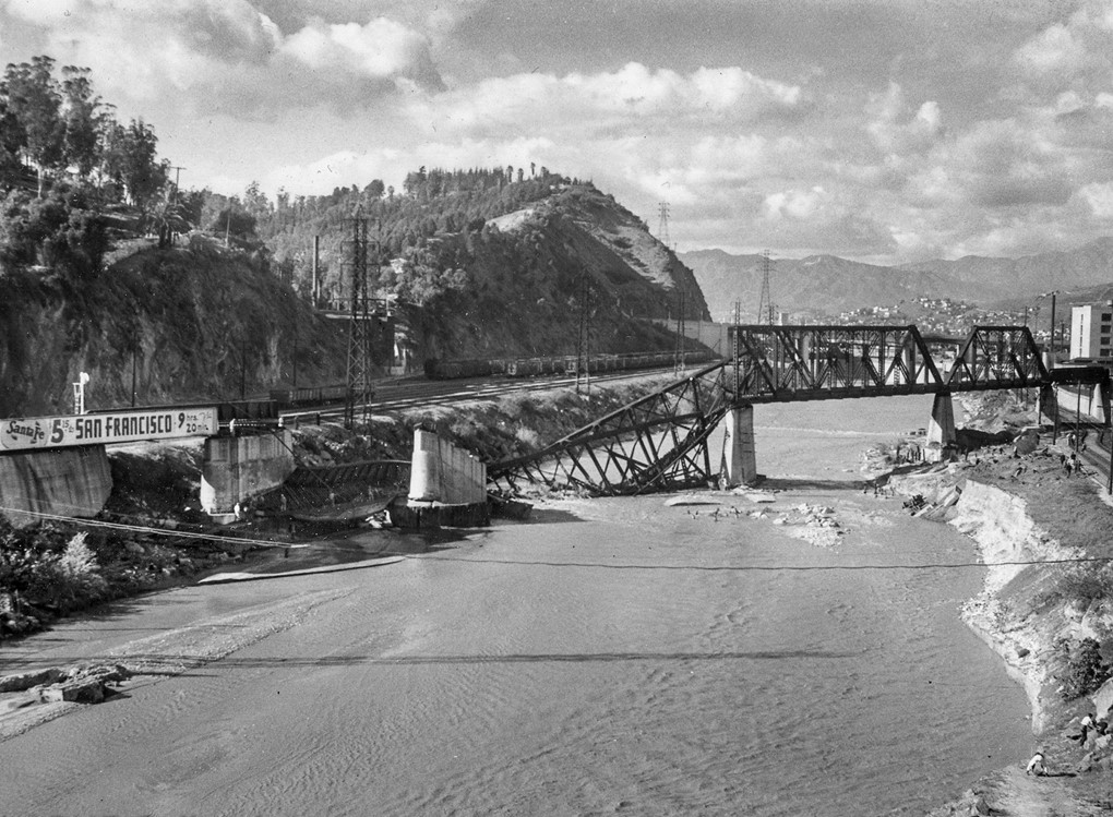
| (1941)* – A major storm struck Los Angeles, causing the LA River to surge once more, reminiscent of the catastrophic floods of 1938. The storm damaged the Santa Fe Railroad Bridge, destroying part of its structure over the Los Angeles River. |
Historical Notes Most interesting is the billboard on the truss bridge, advertising a fare of just $5.25 to San Francisco—with a travel time of only 9 hours and 20 minutes. |
 |
|
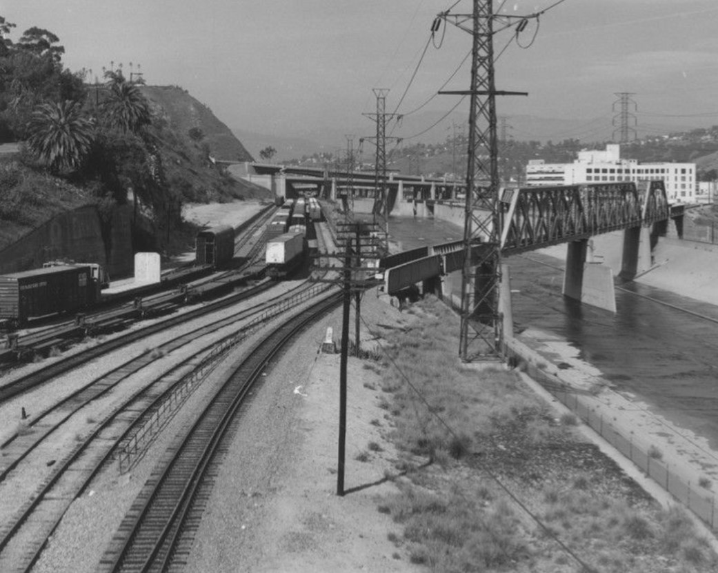
| (1988)* – View of railroad tracks and trains from the North Broadway Bridge, with the cement-lined Los Angeles River visible below and the Lincoln Heights Jail seen in the distance. |
Historical Notes The Lincoln Heights Jail, built in 1931, was once one of Los Angeles' most notorious detention facilities. Located near the Los Angeles River, it replaced the overcrowded city jail on First Street and was designed to accommodate the growing population during the city’s expansion. The facility featured Spanish Colonial Revival architecture and could hold up to 2,800 inmates. Initially, the jail housed a mix of offenders, including gang members, bootleggers, and other criminals from the Prohibition era. In 1951, it became infamous as the site of the “Bloody Christmas” incident, when police officers brutally beat several Latino inmates, leading to public outrage and internal reforms within the LAPD. By the late 1950s, the jail’s conditions had deteriorated, and it was considered outdated. The facility officially closed in 1965, with most inmates transferred to the newly constructed Parker Center jail. After its closure, the building saw sporadic use as a juvenile detention center and even served as a filming location for movies and television shows. Today, the Lincoln Heights Jail stands as a historic structure, its weathered walls a reminder of the darker chapters in Los Angeles’ history. There have been discussions about its future, with some envisioning it as a cultural or community center, but its ultimate fate remains uncertain. |
 |
|
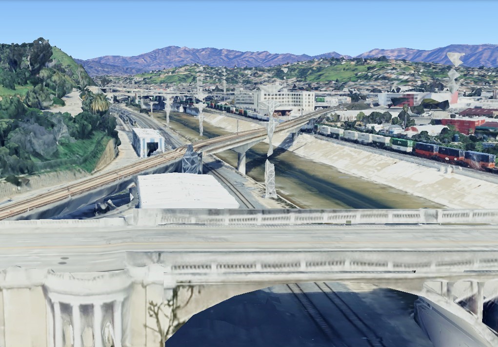
| (2023)* – Google Earth view looking over the North Broadway Bridge toward the railroad bridge crossing the Los Angeles River. |
 |
|
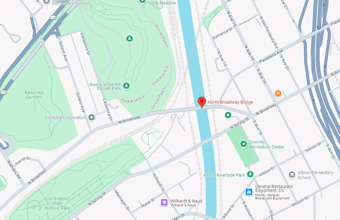
| (2024)*- Google Map showing Los Angeles State Historic Park, Elysian Park, the old Santa Fe diagonal bridge, and the North Broadway Bridge. |
* * * * * |
East Los Angeles
 |
|
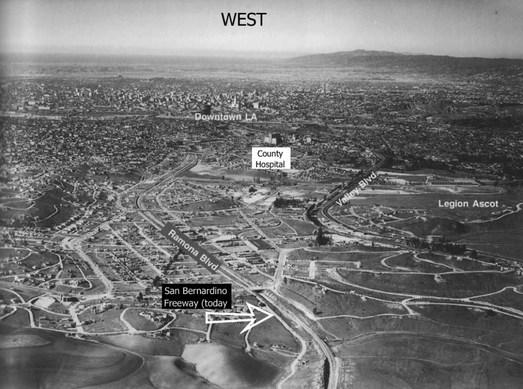
| (ca. 1932)* – Aerial view looking west toward downtown Los Angeles showing Ramona Boulevard running away from the camera. Ramona would become the San Bernadino Freeway/I-10 (completed in 1957). LA County Hospital (1932) is seen and labeled in upper-center. The Legion Ascot Speedway (1924-1936) is at upper-right. You can see the grandstands facing east. |
County General Hospital
 |
|
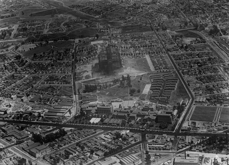
| (ca. 1930)^ - Aerial view of East Los Angeles and Boyle Heights neighborhoods revealing the construction site of the Los Angeles County General Hospital (center). |
Historical Notes L.A. County Hospital and USC Medical School were first affiliated in 1885, so the hospital is commonly known as Los Angeles County-USC Medical Center, as well as County USC. It has become one of the largest and busiest public hospitals and medical training centers in the western United States.^ |
 |
|
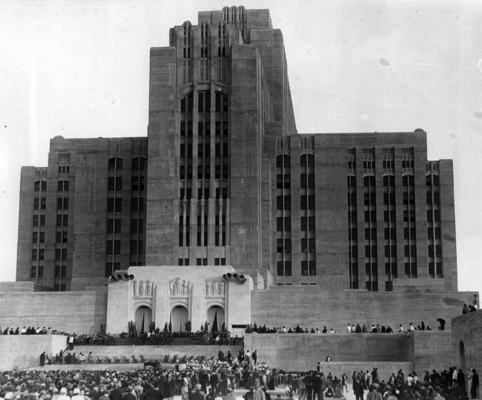
| (1932)*^^^ - Opening ceremonies in front of the newly built art deco style Los Angeles County General Hospital. |
Historical Notes Little known fact: Marilyn Monroe was born in the charity ward of this hospital on June 1, 1926.^* |
 |
|
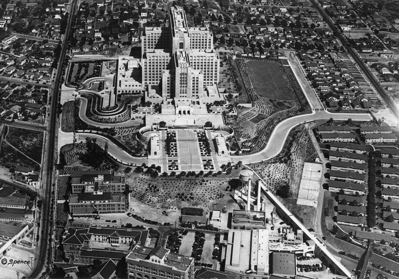
| (1932)^ - Aerial view of East Los Angeles and Boyle Heights neighborhoods revealing the Art Deco Los Angeles County General Hospital (center), surrounded by a multitude of residential dwellings. Photo dated: June 15, 1932. |
Historical Notes Beginning in 1975, the ABC soap opera General Hospital began using the facility for its exterior shots, appearing primarily in the show's opening sequence, where it still remains. The lower floors of the show's Los Angeles studio are modeled after the actual hospital's emergency room entrance, allowing for the show to shoot outdoor scenes in their own parking lot.^* |
 |
|
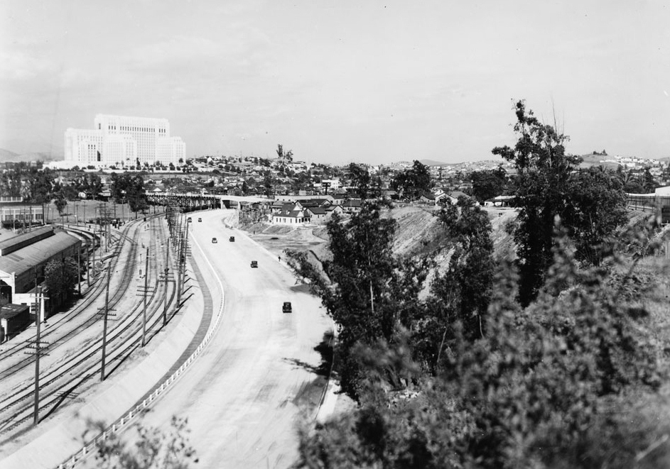
| (1935)*# - View of Ramona Boulevard “Air Line,” a limited-access, grade-separated proto-freeway that followed the present-day route of Interstate 10 between downtown Los Angeles and the San Gabriel Valley. The L.A. County General Hospital can be seen in the background. |
* * * * * |
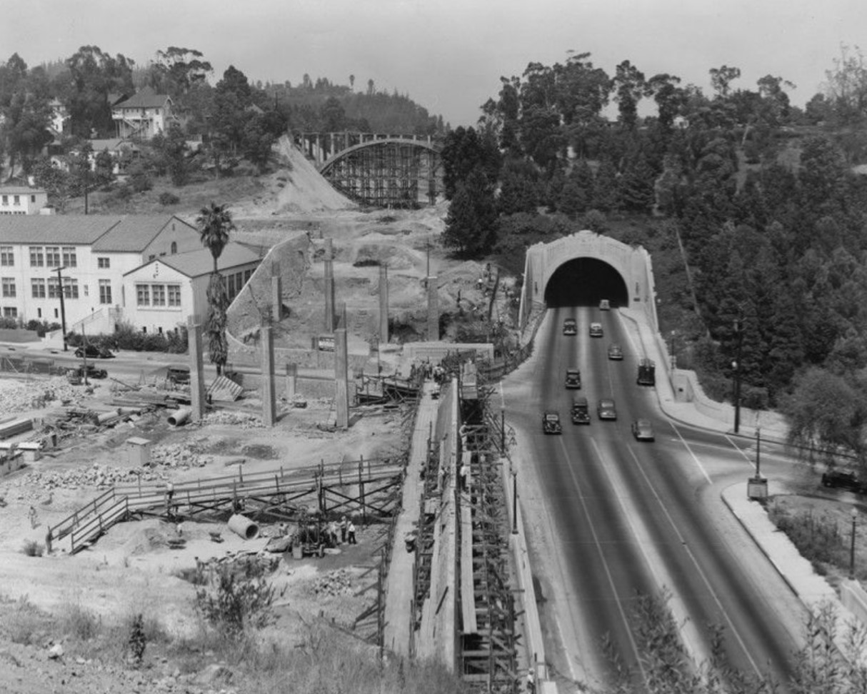
Figueroa Street Tunnels |
The Figueroa Street Tunnels are one of Los Angeles’ earliest large-scale automobile projects. Built between 1930 and 1935 through Elysian Park, they created a more direct route between downtown Los Angeles and Pasadena at a time when car travel was growing fast. What started as a street improvement soon became a key link in the region’s first freeway system.These tunnels show how Los Angeles adapted to the automobile age. They mark the shift from surface streets to high-speed parkways and early freeways. Nearly a century later, they are still in daily use and remain an important piece of the city’s transportation history. |
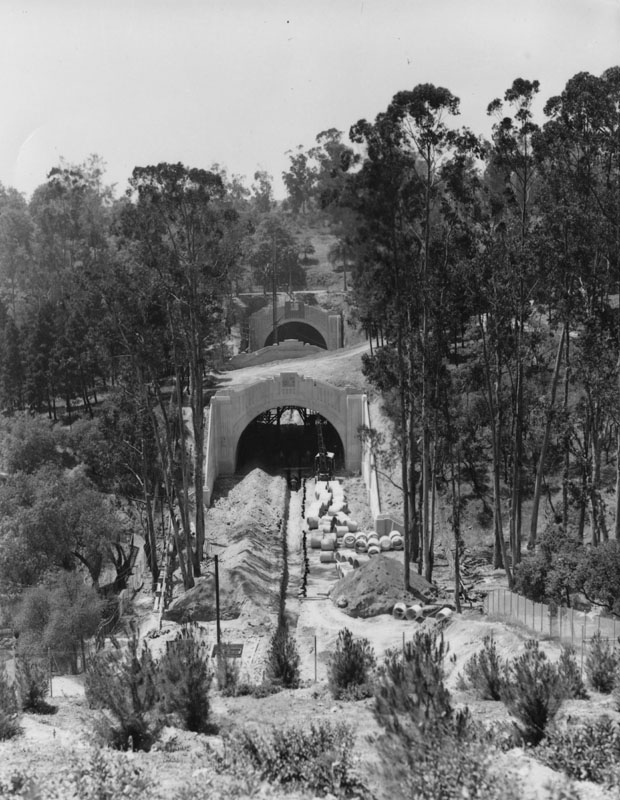
Early Construction Through Elysian Park (1930) |
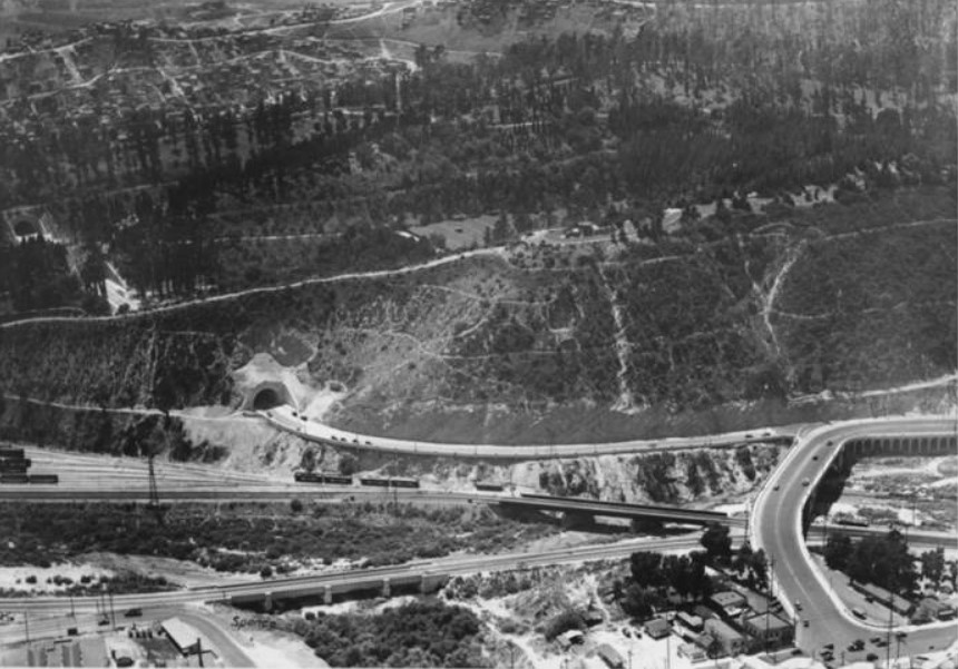
By the late 1920s, routes between Los Angeles and Pasadena were crowded and slow. City leaders chose to cut directly through Elysian Park to create a faster connection. Construction began in 1930 using both tunneling and cut-and-cover methods. |
 |
|
| (ca. 1930)^ - Constructing tunnels through Elysian Park, which will become the Pasadena Freeway. |
Historical Notes Work began in April of 1930. Tunnels on each end were bored, while the shorter, middle tunnel was dug out and encased in concrete, with earth then replaced on top. The extension was opened up to traffic in the last week of October, 1930. |
 |
|
| (1930)^ – View showing a man looking down toward the construction site of the Figueroa Tunnels through Elysian Park. |
Historical Notes Prior to the construction of the tunnels, traffic between Los Angeles and Pasadena crossed the Los Angeles River on the congested 1911-built Buena Vista-North Broadway Bridge. The Dayton Avenue Bridge provided another crossing to the north, but the hills of Elysian Park prevented it from being connected to downtown. |
* * * * * |
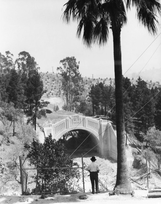
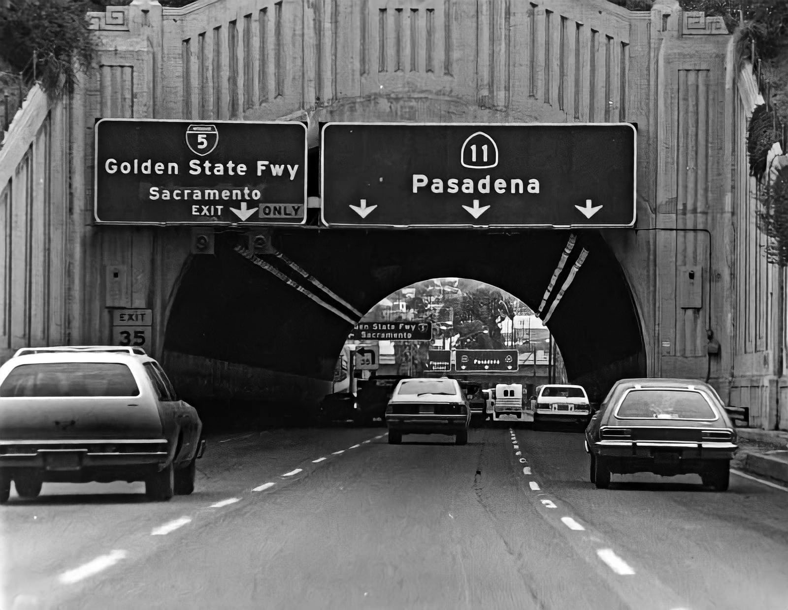
Opening of the First Three Tunnels (1931) |
The first three tunnels opened in 1931 and immediately improved travel between downtown and the northeast. They were designed for heavy automobile use and even included narrow sidewalks. |
 |
|
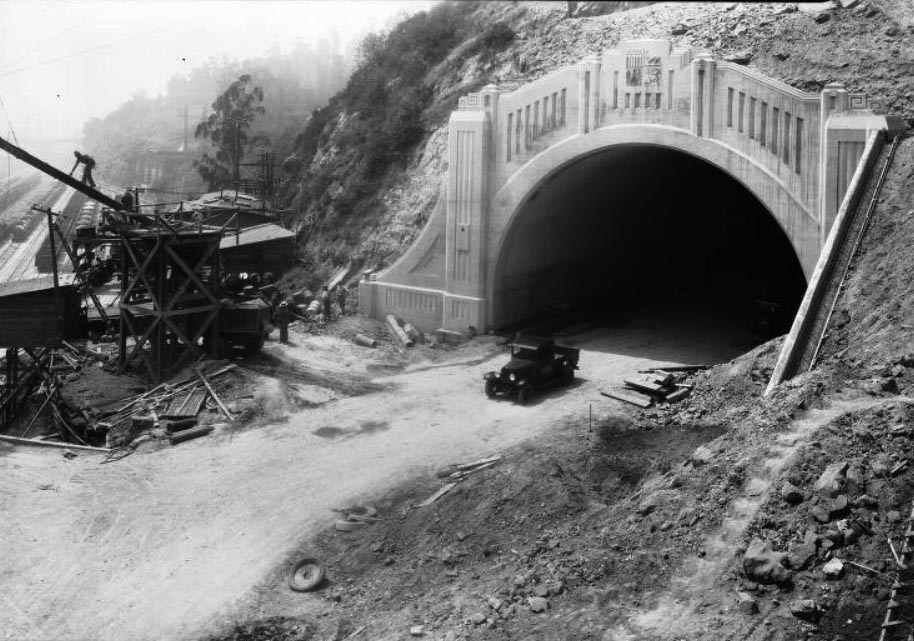
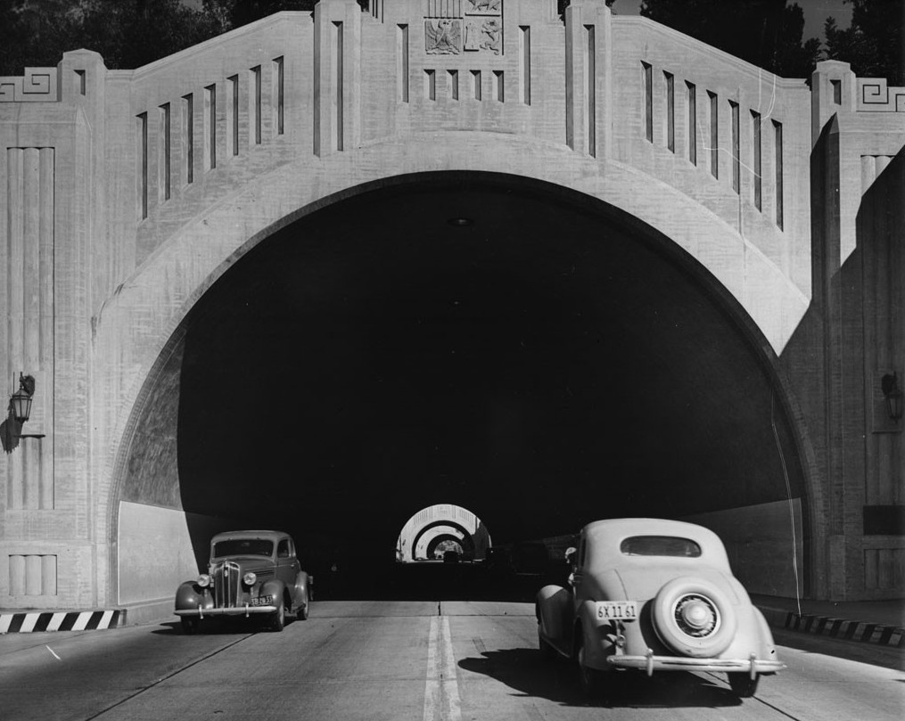
| (1931)* – View showing the eastern portal of the first of the triple Figueroa Street Tunnels with an early model car parked in front. Construction equipment and supplies are on the left, with railroad lines visible in the background. |
 |
|
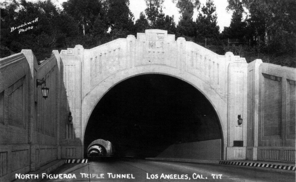
| (ca. 1931)* – Postcard view of the North Figueroa Triple Tunnels soon after they opened. |
Historical Notes The first three of the four tunnels opened by November 1, 1931, connecting to North Broadway on the south via Solano Avenue and Riverside Drive on the north. Riverside Drive was an earlier high-speed road along the Los Angeles River to Burbank, and also intersected the Dayton Avenue Bridge, which led to Dayton Avenue (now part of Figueroa Street) towards Pasadena. From opening, the tunnels carried two lanes in each direction, with a 5-foot sidewalk on the side. |
 |
|
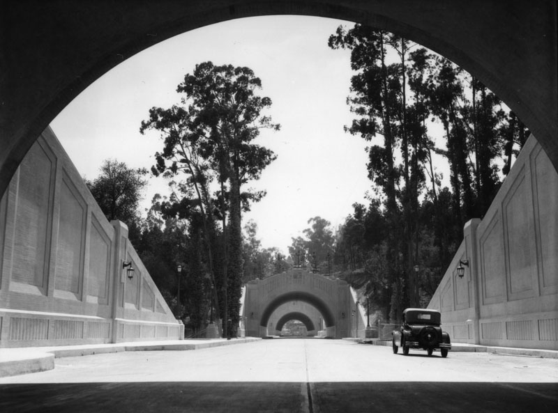
| (1931)^ - Tunnels on Figueroa Street in 1931. In 1940 this section became part of the Arroyo Seco Parkway, now the Pasadena Freeway. |
Historical Notes The first three tunnels opened in 1931 as a bypass to a section of North Broadway. The fourth tunnel (the southernmost and longest) opened in 1935, connecting to Figueroa Street downtown. Connections were added in 1937 to the Figueroa Street Viaduct, 1940 to the Arroyo Seco Parkway (known until 2010 as the Pasadena Freeway), and 1953 to the Four Level Interchange. A new alignment for southbound traffic, passing through a cut to the west of the tunnels, opened in 1943. |
* * * * * |
Building the Fourth Tunnel (1935) |
The fourth and longest tunnel was added in 1935 to extend the route closer to downtown. Its construction required careful excavation through sandstone and heavy timber shoring. |
 |
|
| (1935)* – Start of construction for the fourth Figueroa Street Tunnel (southernmost and longest). Parked cars and an excavator are seen in a ravine where the digging is set to begin. |
Historical Notes The first three tunnels opened in 1931 as a bypass to a section of North Broadway. The fourth tunnel (the southernmost and longest) would be opened in 1935, connecting to Figueroa Street downtown. |
 |
|
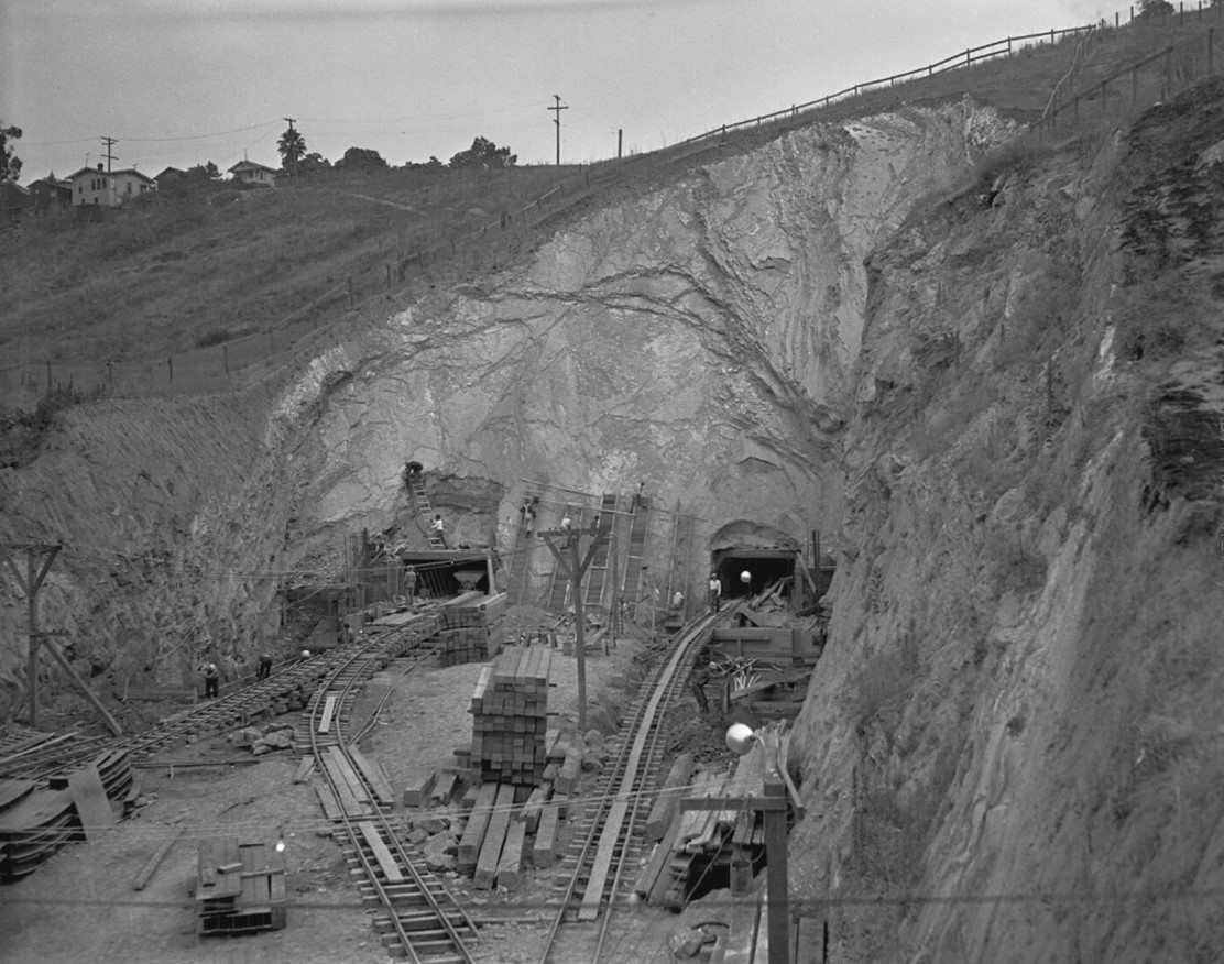
| (1935)*– View showing the southernmost of the four Figueroa Street Tunnels under construction, showing the south end with two drift tunnels with electric tram tracks for removal of sandstone running out of each tunnel. |
Historical Notes The above photo shows seven men climbing six ladders that are set against the cliff between the tunnels. Lumber is stacked between the tracks, and piled on the right. Four or five wooden houses are visible at the top of the hill on the left. A wooden rail fence circles around the excavation area. |
 |
|
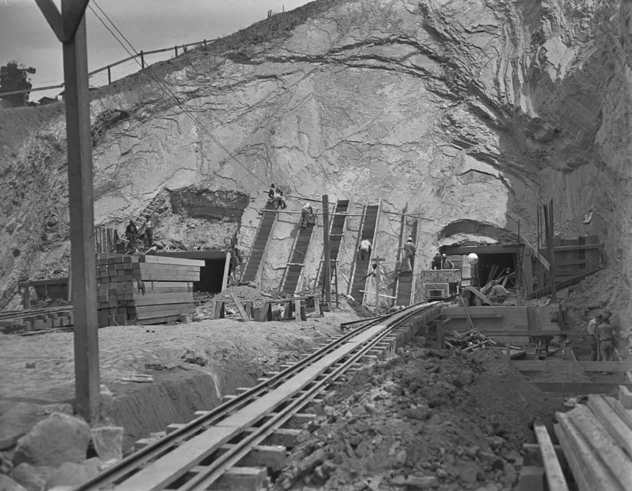
| (1935)* – Construction of the southernmost of the four Figueroa Street Tunnels. View is the south end with two drift tunnels with an electric tram for removal of sandstone running out of the one on the right. Two men are in a tram car with two men crouching near the car on the right. Four men climb five ladders that are set against the cliff between the tunnels. Lumber is stacked on the left, there are saw horses in front of the ladders and, perhaps, steel rods on the right. |
 |
|
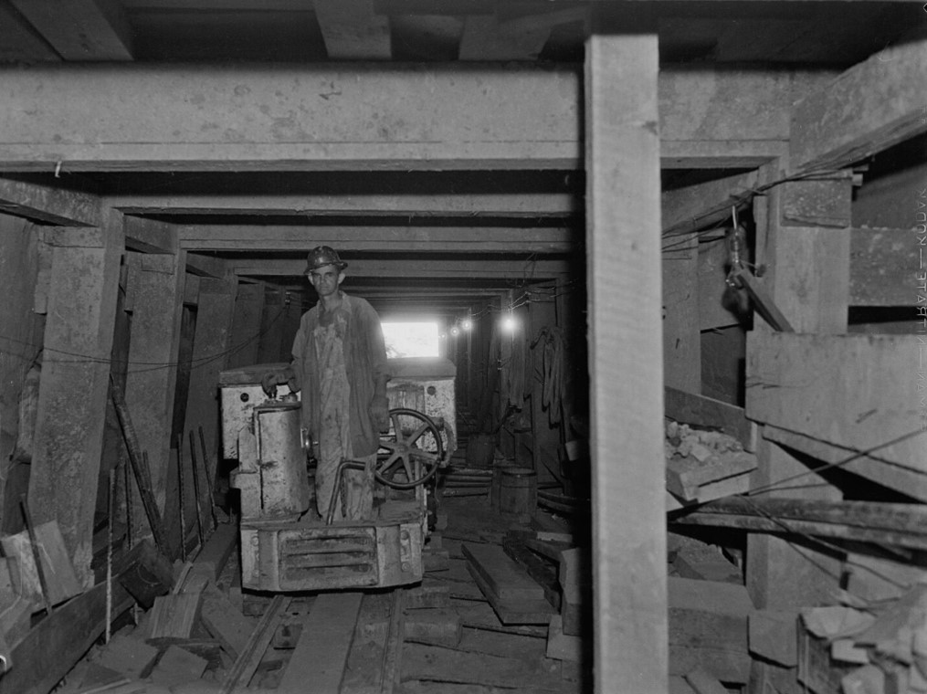
| (1935)* – Photo taken inside of one of the 2 drift tunnels used during the construction of the southernmost of the four Figueroa Street Tunnels. A man wearing a hard hat stands on an electric tram car on a track used for removal of sandstone. The tunnel is reinforced with thick wooden beams. |
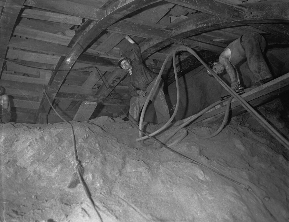 |
|
| (1935)* – Two workers in the fourth Figueroa Street Tunnel during its construction. They are in the main tunnel which is lined with curved steel girders holding up thick wooden beams. |
 |
|
| (1935)* – View showing the south portal (at Bishops Road) of the fourth and southernmost Figueroa Street Tunnel while under construction. Workers are visible throughout the site with one man standing directly below the tunnel opening. There are tracks running toward the tunnel, as well as scaffolding constructed on both sides. Photo: UCLA Digital Archives |
 |
|
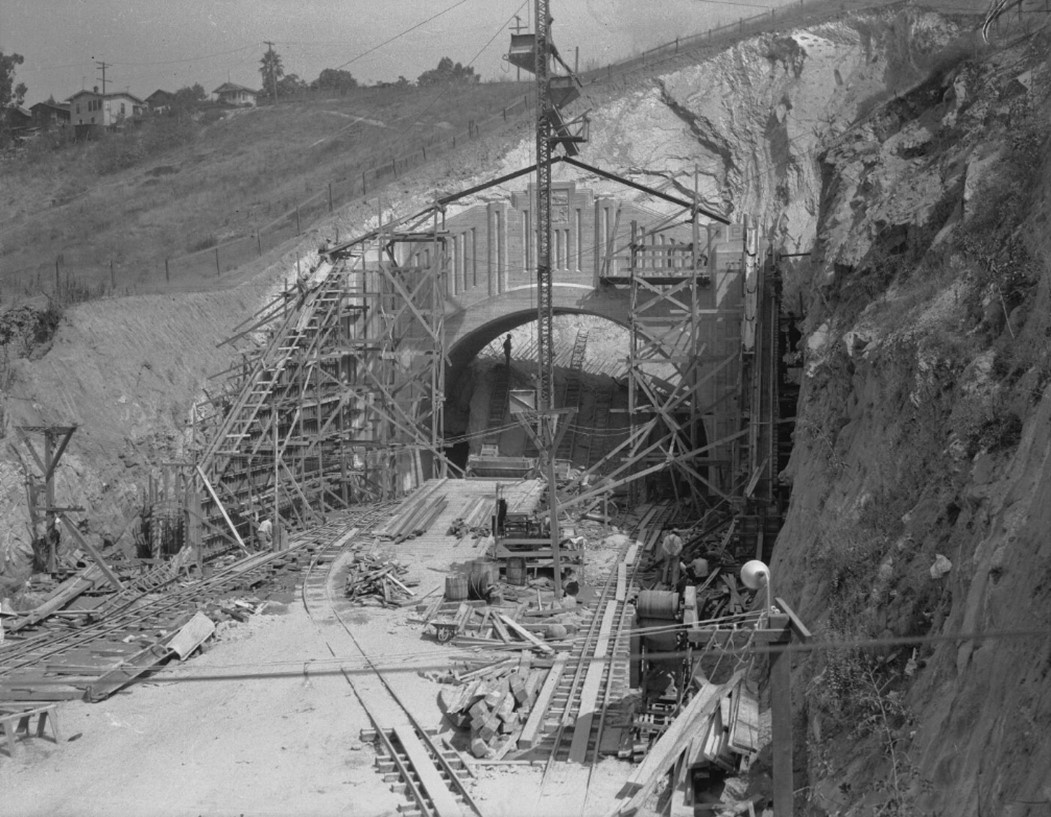
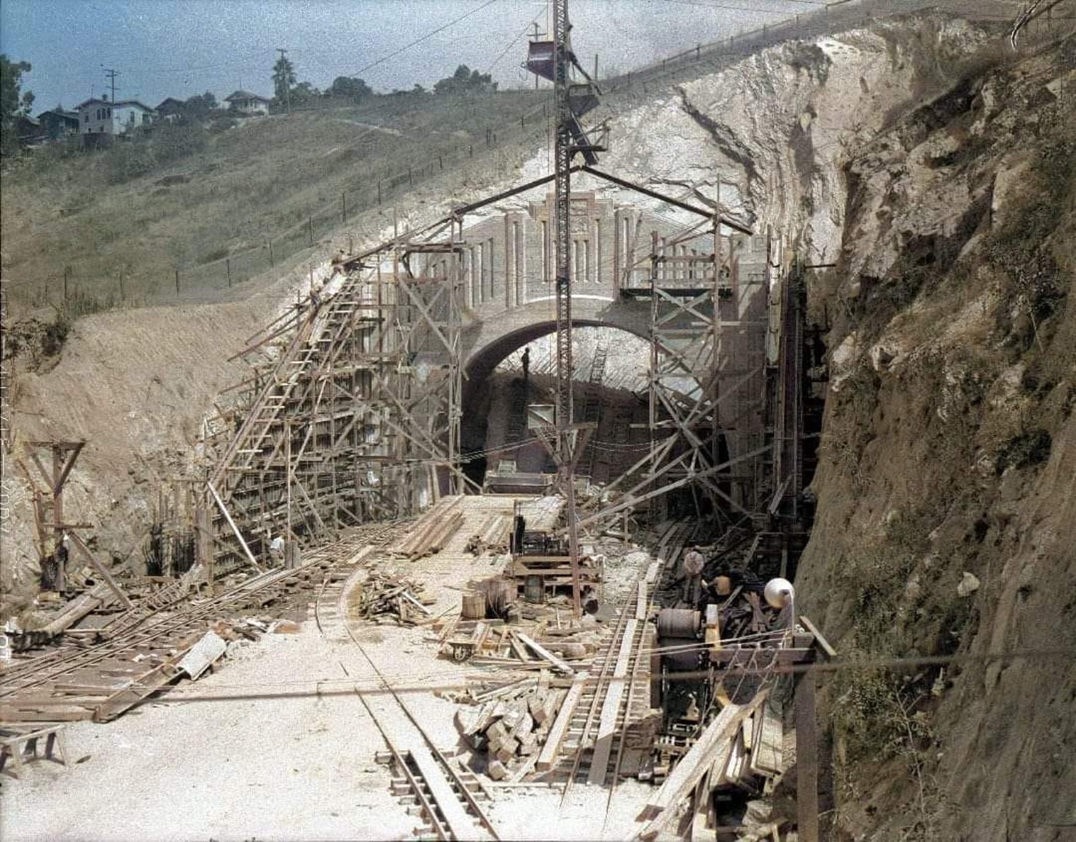
| (1935)^ - Completed 4th tunnel on Figueroa Street as seen from from Solano Avenue looking northeast at South Portal on October 15, 1935. |
Historical Notes Since the tunnels' incorporation into Arroyo Seco Parkway (now SR 110), Figueroa Street has been discontinuous. It merges into SR 110 at Alpine Street in Chinatown, south of the tunnels, and splits in Highland Park, north of the Figueroa Street Viaduct over the Los Angeles River. |
* * * * * |
Early Use Before the Freeway Era (1937–1938) |
Before the Arroyo Seco Parkway opened, the tunnels functioned as part of Figueroa Street. Traffic flowed in both directions through the same bores. |
 |
|
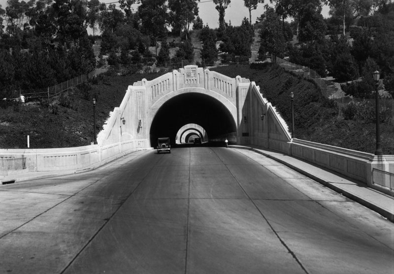
| (ca. 1937)^ - Three people are seen on the sidewalks along Figueroa Street in between two of the tunnels, while cars pass by in either direction. |
 |
|
| (1938)* - View of the Figueroa Street Tunnels in 1938 (pre-Pasadena Freeway). |
Historical Notes The tunnels would not remain part of Figueroa Street for long. The 1940 opening of the Arroyo Seco Parkway to Pasadena created a chronic traffic jam at the tunnels, where several lanes merged into two. To eliminate the bottleneck, state highway engineers rushed to upgrade Figueroa Street to freeway standards. Blasting through the hills above and to the west of the tunnels, workers built a new open-cut roadway to carry four lanes of southbound traffic through Elysian Park to Castelar (now Hill) Street. |
* * * * * |
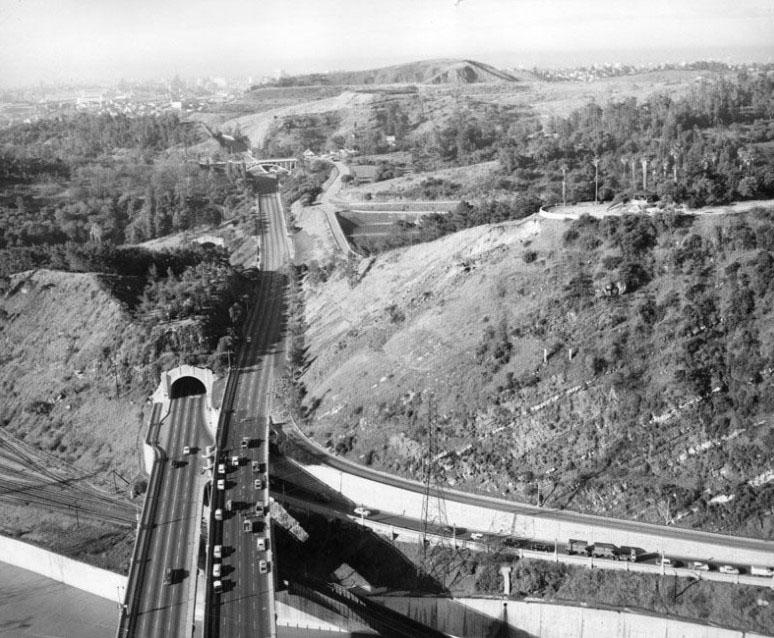
Traffic Relief for the Figueroa Street Tunnels (1940–1941) |
The opening of the Arroyo Seco Parkway in 1940 quickly created congestion at the tunnels, where multiple lanes narrowed down. What had been a modern improvement only a few years earlier became a serious bottleneck.To fix the problem, engineers built a new southbound roadway west of the tunnels through Elysian Park. This project required major earthmoving and allowed traffic directions to be separated. The tunnels and viaduct could then be used mainly for northbound travel, improving flow and safety. |
 |
|
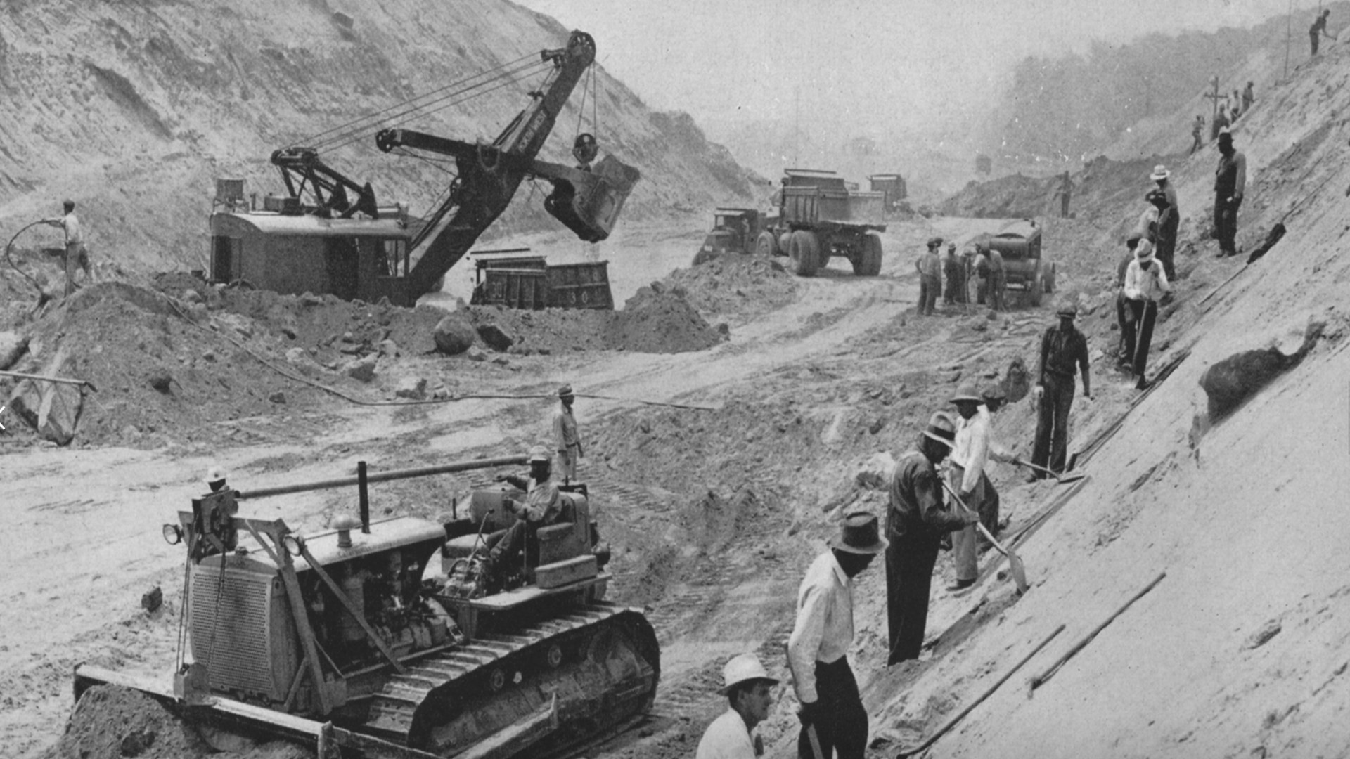
| (1941)* - Big power shovels, tractors, bulldozers, trucks and some of 2,000 men engaged in building this extension through Elysian Park to relieve the heavy traffic through the Figueroa Street Tunnels. |
Historical Notes Prior to construction of this southbound extension of Arroyo Seco Parkway, the northbound existing roadway handled both directions of traffic. This extension will allow conversion of the existing roadway to all northbound lanes. |
 |
|
| (1941)^ – View looking northeast showing the construction of a new alignment for southbound traffic, passing through a cut to the west of the tunnels. |
Historical Notes Photo caption reads: “Rushing the work to relieve the bottleneck of the Figueroa tunnels for traffic on the Arroyo Seco freeway that runs between Los Angeles and Pasadena, crews are shown building the new parallel road through Elysian Park. In one section a whole mountain is being moved to fill in dirt for the new relief road for the heavy traffic.” Photo dated March 7, 1941. |
 |
|
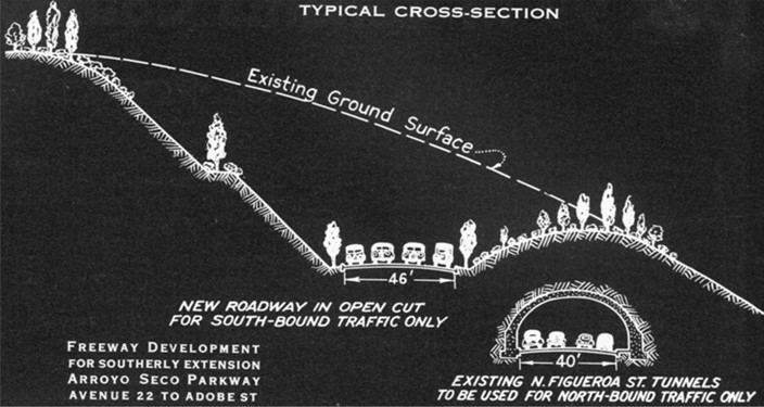
| (ca. 1940)* – Facing North, profile of cut for the southerly extension of Arroyo Parkway through Elysian Park. |
 |
|
| (1941)* – View looking northeast along the Arroyo Seco Parkway (now part of the 110 Freeway) showing two-way traffic flowing through one of the Figueroa Street Tunnels. On the left, construction is underway for a new parallel extension road designed to alleviate rush hour bottlenecks through the Figueroa Tunnels for traffic between Los Angeles and Pasadena. This new extension of the Arroyo Seco Parkway will serve southbound traffic, while the Figueroa Street Tunnel section will accommodate northbound traffic. In the background, the framing of the new Park Row Bridge, which will straddle the new extension, can be seen. The building on the left is Solano Avenue Elementary School, located in the Elysian Park area of Los Angeles. |
Historical Notes The Arroyo Seco Parkway became officially known as the Pasadena Freeway in 1954, and it received the numerical designation 110 in 1981. However, it's worth noting that in 2010, the original name "Arroyo Seco Parkway" was restored, although it still carries the State Route 110 designation. |
* * * * * |
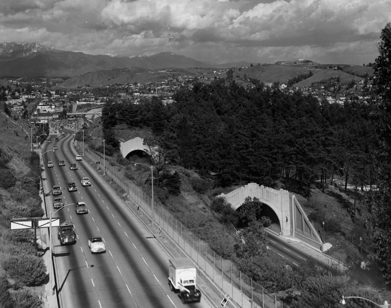
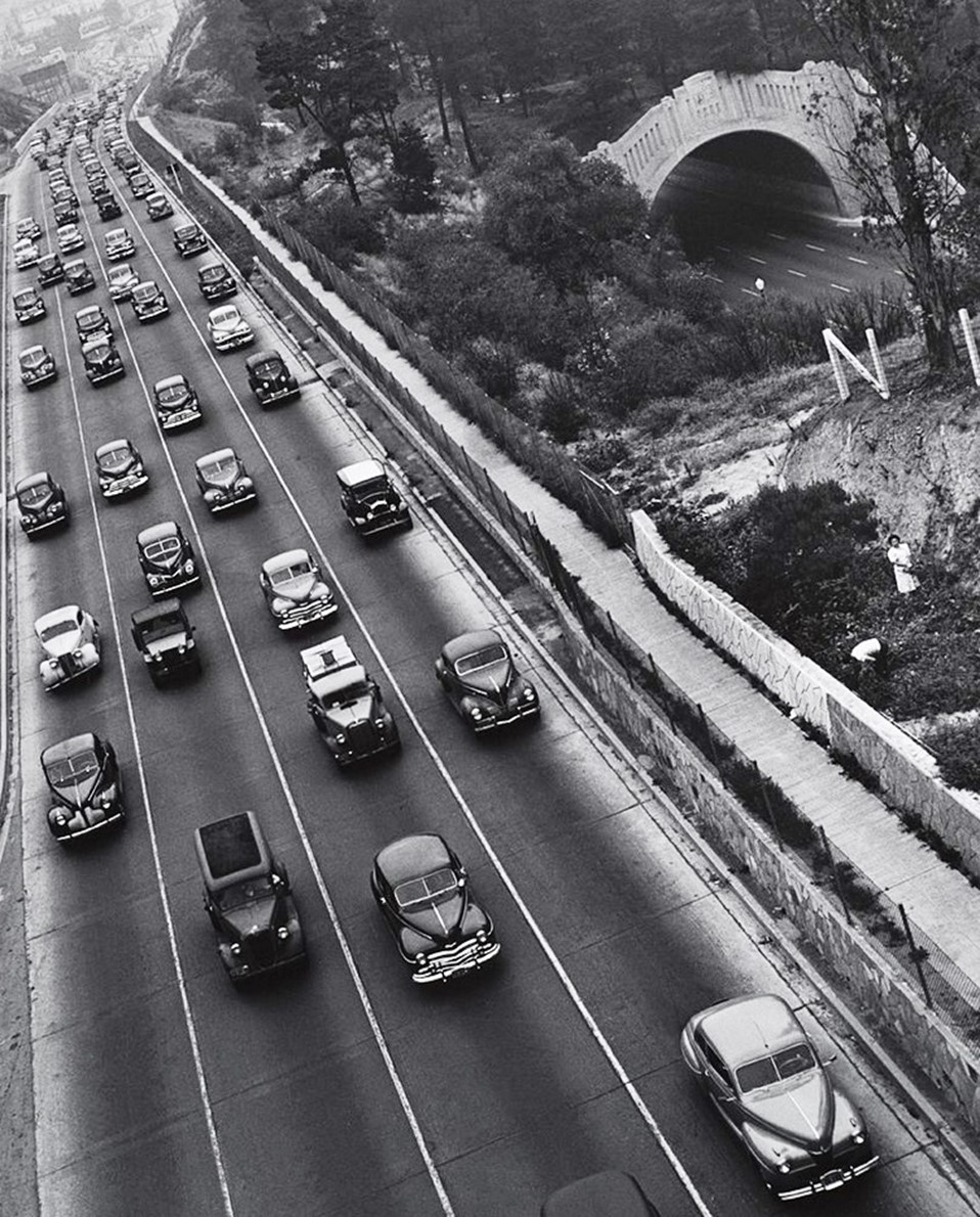
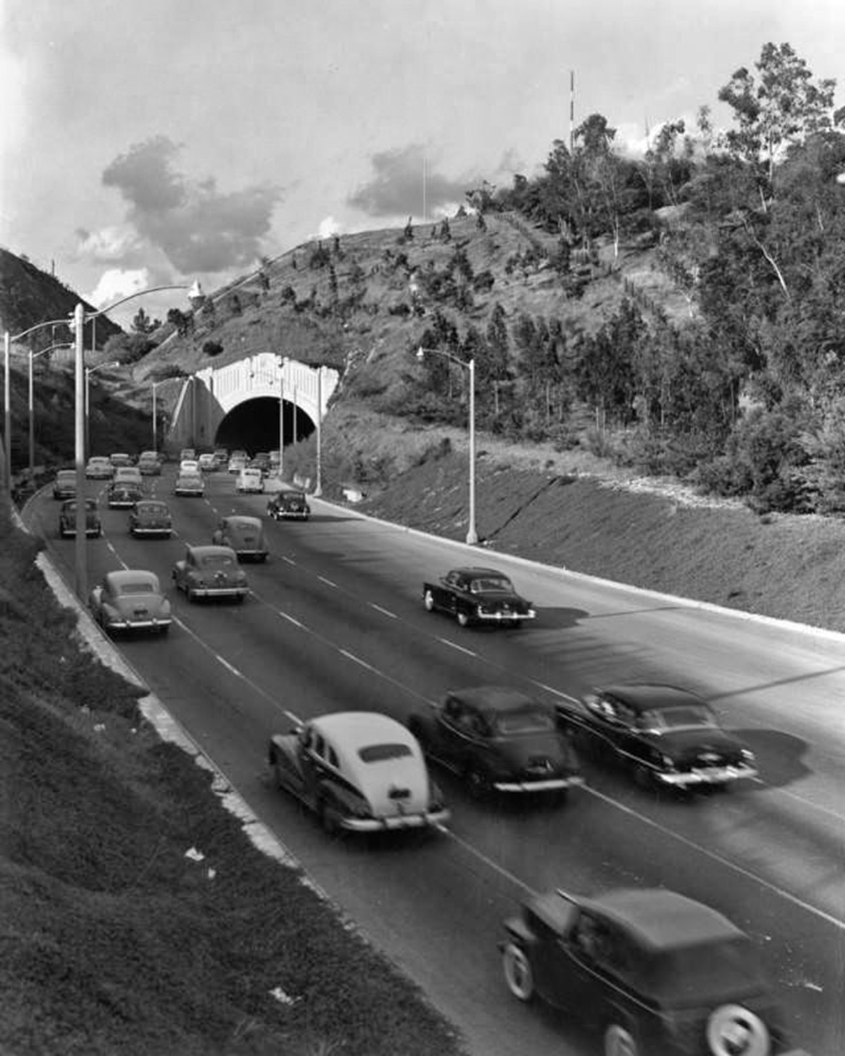
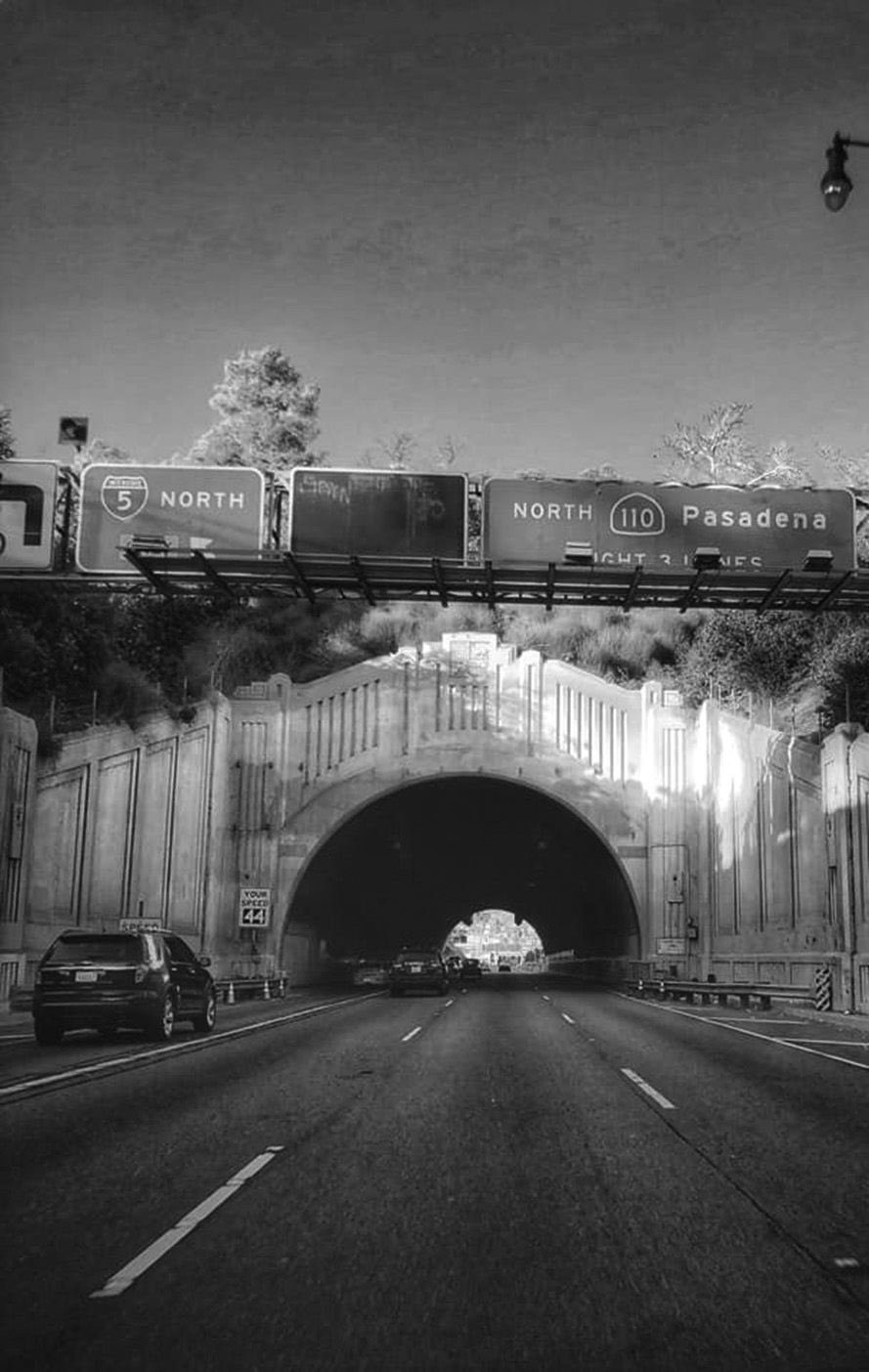
Mature Freeway Era (1940s–1950s) |
By the mid-1940s, the Figueroa Street Tunnels were fully integrated into the Arroyo Seco Parkway system. What began as a city street improvement had become part of one of the nation’s first true freeways. Traffic volumes continued to grow as Los Angeles expanded and more residents relied on automobiles.The separation of northbound and southbound traffic reduced congestion and improved safety. The tunnels were no longer just a city street feature but part of a regional highway system serving commuters between downtown Los Angeles, Pasadena, Glendale, and nearby communities. |
 |
|
| (ca. 1949)^ - View showing the Arroyo Seco Parkway in both directions; the inbound lanes (without tunnels) and the outbound lanes through tunnels. The view is outbound, towards Glendale/Burbank. |
Historical Notes By 1943, the two-way Figueroa Street Tunnels and Viaduct were repurposed for four lanes of northbound traffic, and a higher southbound roadway was cut into the hills to the west. |
 |
|
| (1940s)* - View of south bound Arroyo Seco Parkway just north of downtown with the Figueroa Street Tuneels on the right. Photo by John Gutmann |
Historical Notes The Arroyo Seco Parkway became officially known as the Pasadena Freeway in 1954, and it received the numerical designation 110 in 1981. However, it's worth noting that in 2010, the original name "Arroyo Seco Parkway" was restored, although it still carries the State Route 110 designation. |
 |
|
| (1958)^ - View looking southwest at the Pasadena Freeway (Arroyo Seco Parkway) as it crosses the Los Angeles River at Elysian Park. You can clearly see the new alignment for southbound traffic, completed in 1943. |
 |
|
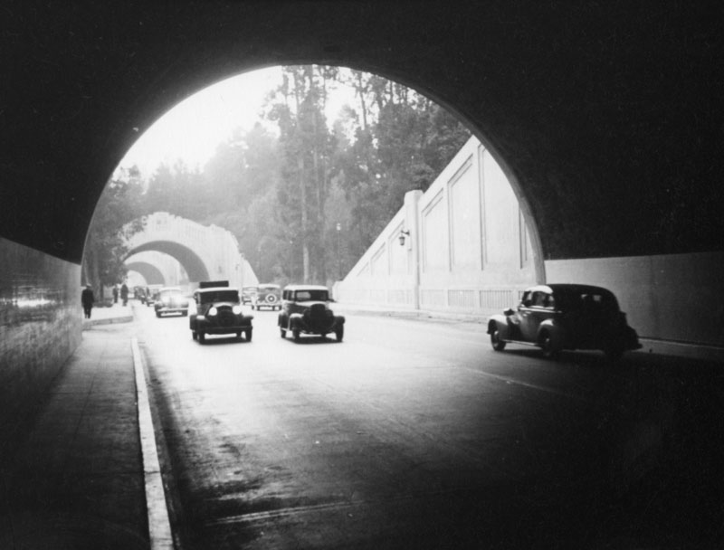
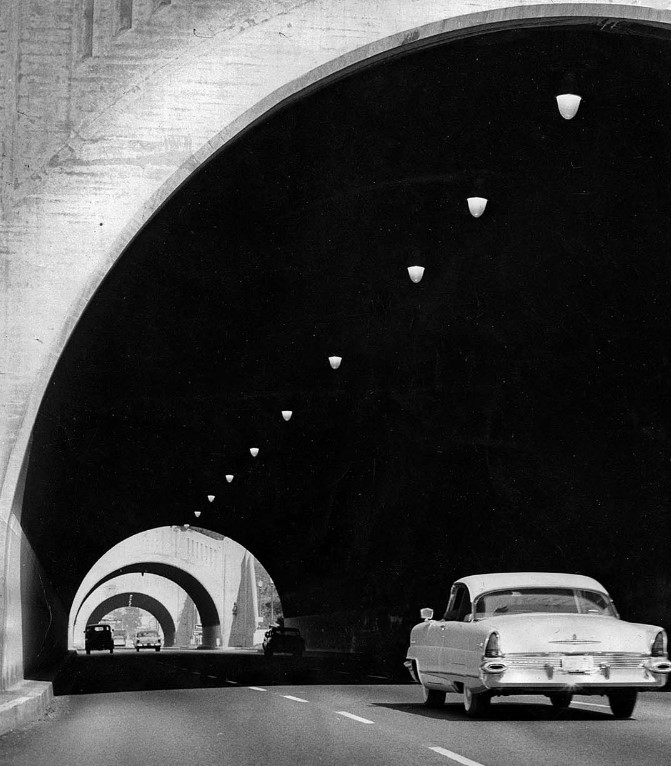
| (ca. 1955)* - Pasadena Freeway northbound approaching the Figueroa Street Tunnels. |
 |
|
| (1956)*– View showing northbound traffic through the Figueroa Street Tunnels. Note the change from two-way to one-way traffic through the tunnels. |
* * * * * |
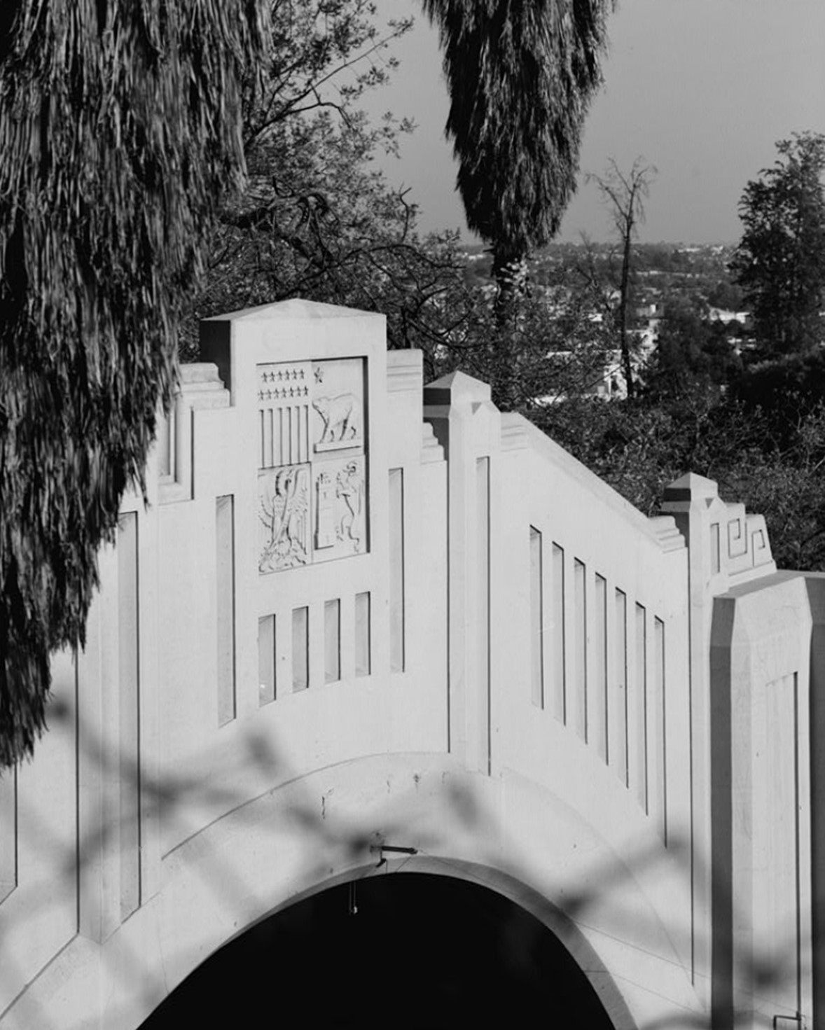
Architectural Character and Design |
Even though they were built for transportation, the tunnels were given modest architectural detailing. Their portals show simple Art Deco styling typical of the 1930s. These touches reflected civic pride and the belief that public works should also be visually appealing.Inside, early timber supports and later concrete linings reveal how tunnel construction methods evolved. Their relatively tight dimensions remind drivers these were designed during the early days of freeway engineering. |
 |
|
| (1968)* - Detail view of the Art Deco design element on Figueroa Street Tunnel No. 2, Southern Portal. |
 |
|
| (1968)* - Figueroa Street Tunnel No. 1, South Portal. |
* * * * * |
Later Decades and Continued Use |
By the 1970s, the Pasadena Freeway was a familiar route for generations of Angelenos. While newer freeways offered wider lanes and gentler curves, this historic corridor remained heavily used because of its direct link between established neighborhoods.The tunnels continued to function much as they had for decades, showing the durability of their original construction. |
 |
|
| (1970s)* – Northbound Pasadena Freeway (now CA-110) at the northernmost tunnel. |
* * * * * |
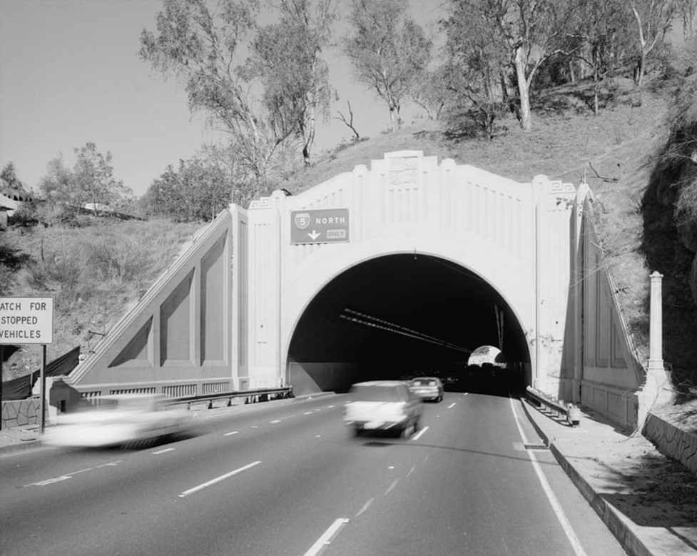
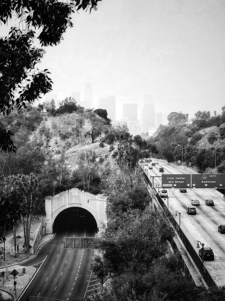
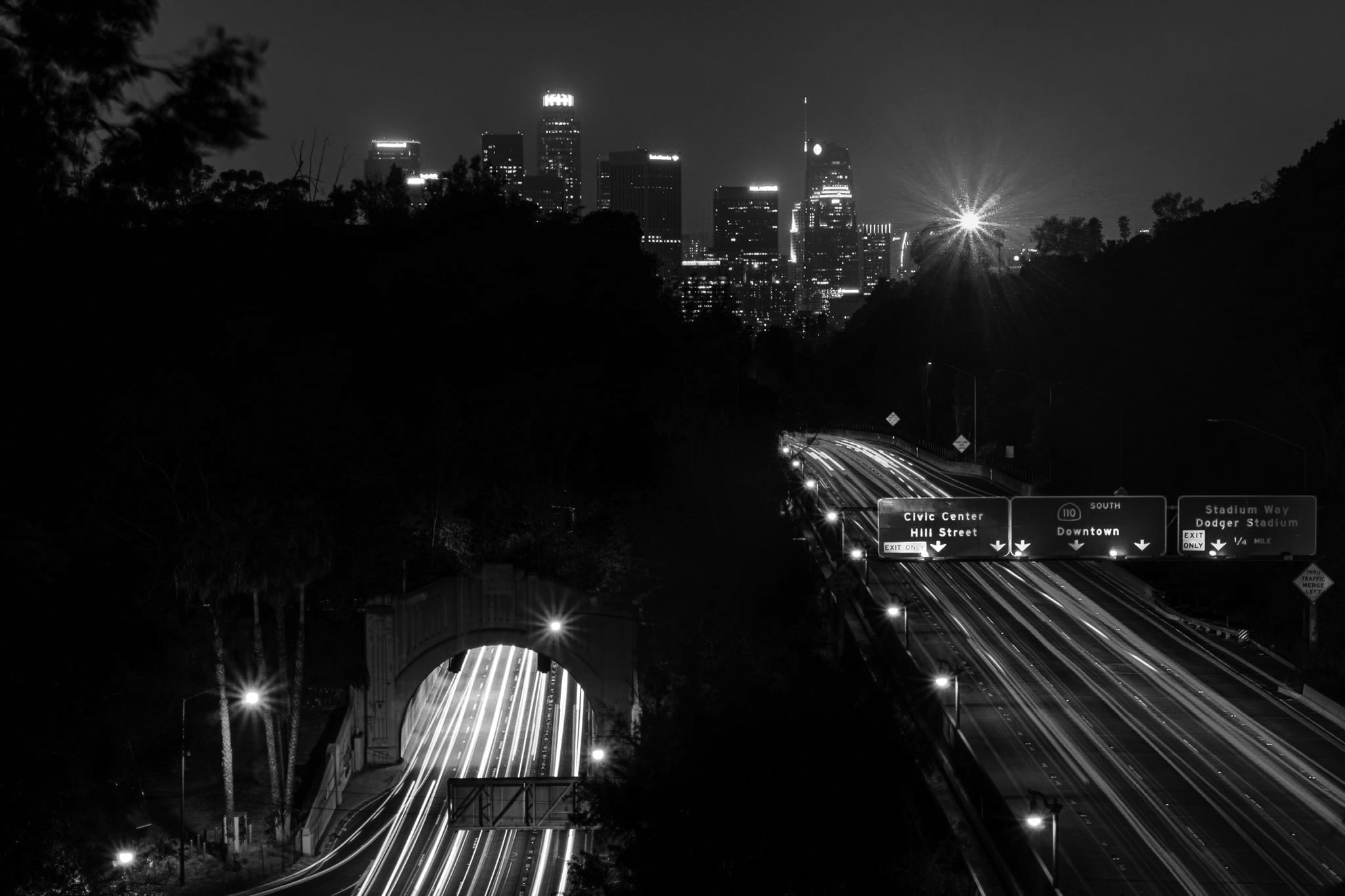
The Tunnels in the Modern City |
Today the Figueroa Street Tunnels remain part of State Route 110. Thousands of drivers pass through them daily, often without realizing they are using infrastructure built during the early freeway era.They are among the oldest continuously used freeway tunnels in the western United States and remain a visible link to Los Angeles’ transportation past. |
 |
|
| (2021)* – Northbound through the Figueroa Street Tunnels near the transition to the 5 North. Photo by Carlos G. Lucero |
* * * * * |
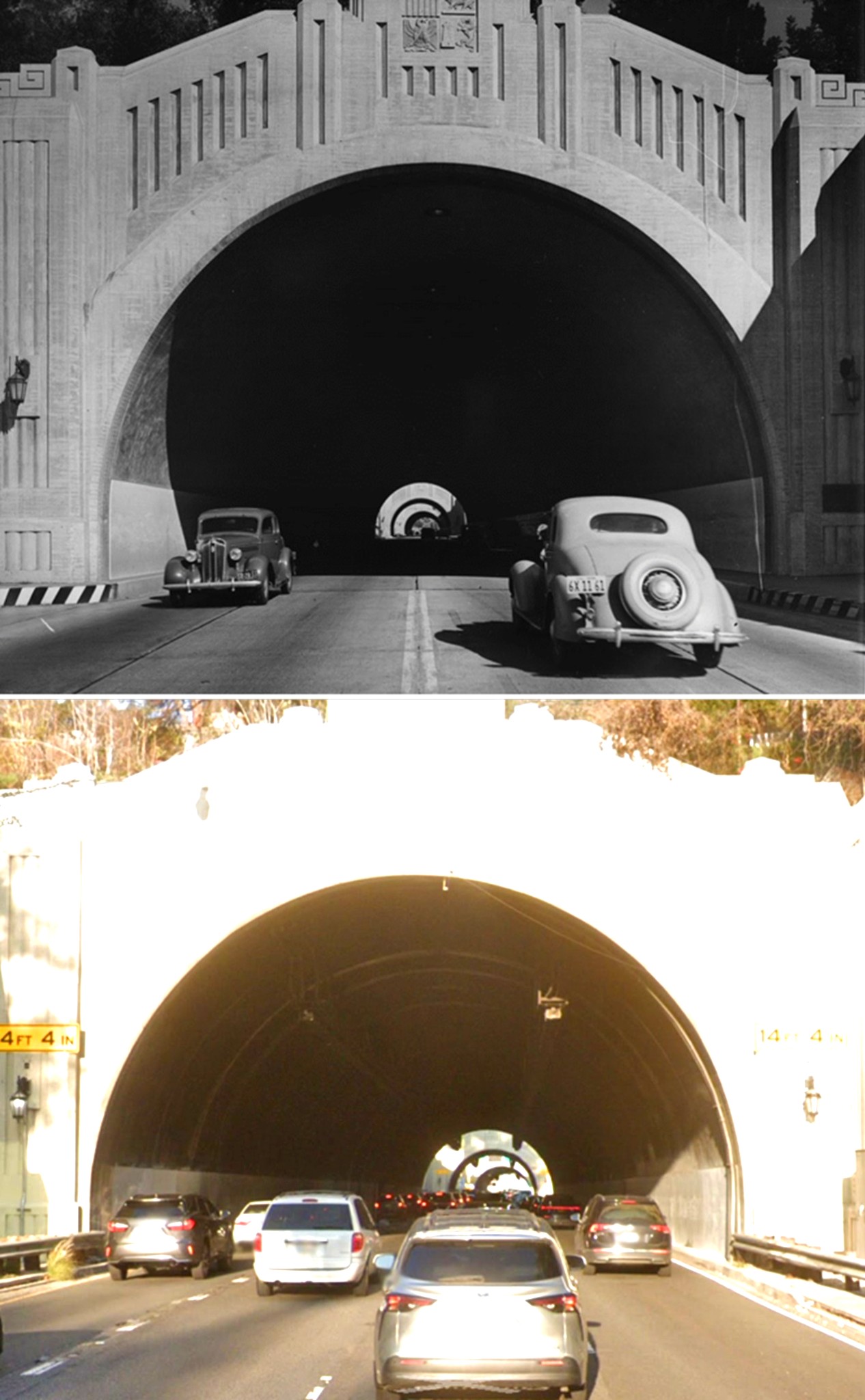
Then and Now |
These “Then and Now” comparisons show how traffic patterns and surroundings have changed over time while the tunnels themselves remain recognizable. Even though the photos are taken decades apart, the basic form of the tunnels has changed very little. They help illustrate how early transportation projects shaped the modern city. |
 |
|
| (1938 vs. 2022)* – Driving through the Figueroa Street Tunnels. Note the two-way traffic in the early 1938 photo. By 1943, the two-way Figueroa Street Tunnels were repurposed for four lanes of northbound traffic, and a higher southbound roadway was cut into the hills to the west. Photo comparison by Jack Feldman. |
* * * * * |
Contemporary Views |
Recent images show the tunnels as part of today’s downtown skyline and freeway environment. Even with the growth of the city around them, their form remains largely unchanged. |
 |
|
| (2020)* - View looking towards Downtown on a hazy day with one of the Figueroa Street Tunnels seen at lower-left. Photo by Carlos Lucero |
 |
|
| (2020)* - Time-lapse night photo showing the Downtown Skyline and Figueroa Tunnel. |
* * * * * |
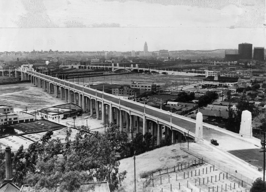
North Figueroa Street Viaduct - also known as the Figueroa Street Bridge |
The North Figueroa Street Viaduct was one of the key river crossings built during Los Angeles’ rapid growth in the 1930s. It carried Figueroa Street over the Los Angeles River, railroad tracks, and San Fernando Road, creating a more direct link between Downtown and the communities to the north.When it opened in 1937, the viaduct improved travel to Pasadena, Highland Park, and nearby areas. It later became part of the region’s early freeway system as traffic volumes continued to rise. |
Early planning and first views |
City planners in the early 1930s were already looking for ways to improve the Figueroa Street route. The goal was to remove awkward turns and create a smoother path between the tunnels and the roads near the river.At this time, Figueroa Street still functioned mainly as a surface arterial. The later viaduct and freeway upgrades would transform this route from a local connector into one of the region’s first high-speed corridors. |
 |
|
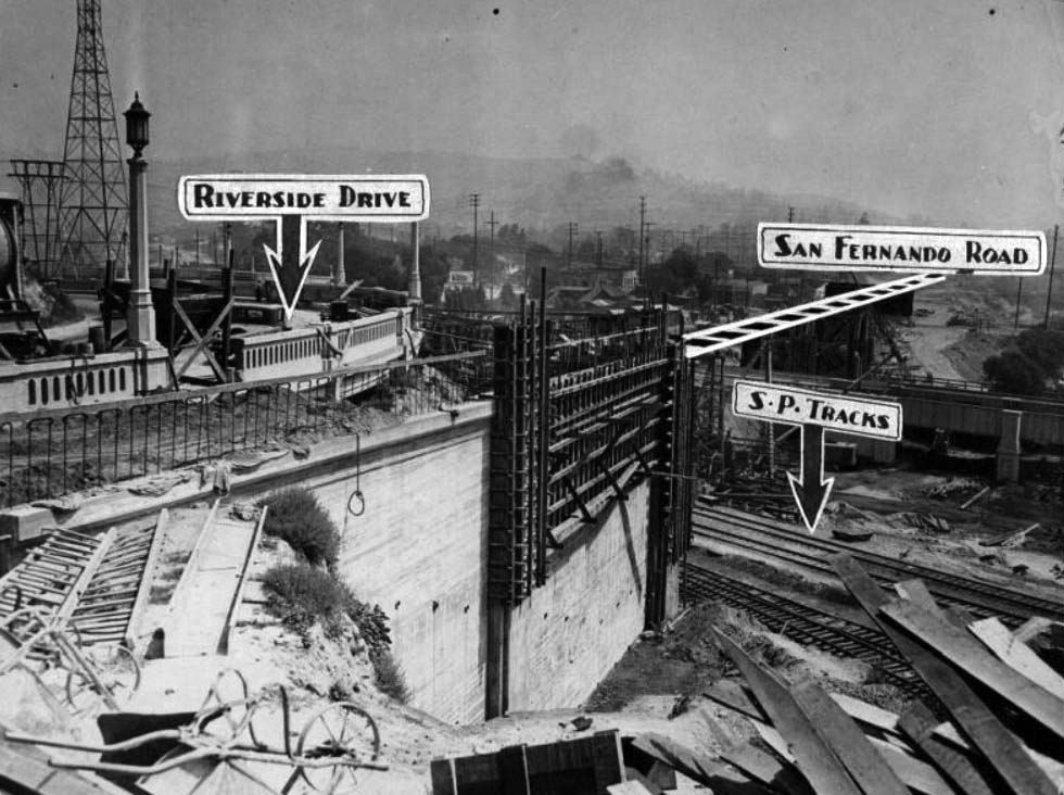
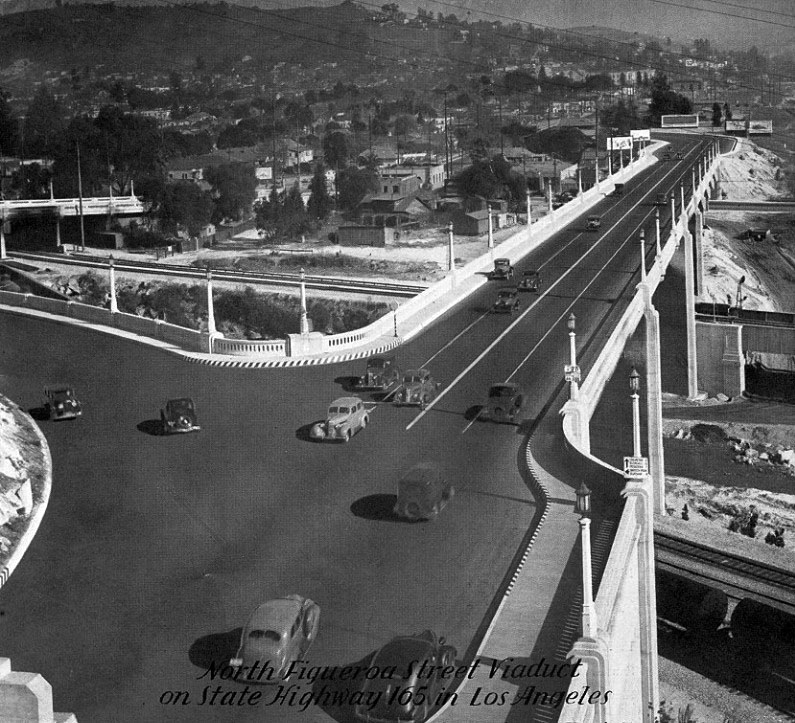
| (1931)* - Birdseye view of the new Figueroa Street extension, showing tunnels. View is looking west from Dayton Avenue at San Fernando Road. Eventually a new bridge is to connect directly with Dayton Avenue, avoiding the V-shaped road. |
Historical Notes The Bridge to the right is the Riverside-Figueroa Bridge, previous location of the Dayton Ave Bridge. |
* * * * * |
Building the new crossing |
By the mid 1930s construction began on a major new bridge. It would carry Figueroa Street over the river, railroad tracks, and San Fernando Road in one continuous span.Projects like this showed Los Angeles’ growing confidence in large concrete and steel structures, allowing major streets to cross rivers and rail lines without interruption. |
 |
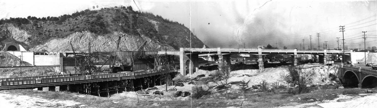
|
| (1936)*# - View of the construction of the bridge extending Figueroa Street over the Southern Pacific railroad tracks, the Los Angeles River, and San Fernando Road. "Where Figueroa Street Will Extend. Will span S.P. tracks, river and San Fernando Road" -- Examiner clipping attached to verso, dated, July 9, 1936. |
 |
|
| (1937)* - Panoramic view of the North Figueroa Street bridge under construction. . "Panorama view of the new cantilever span, the biggest ever erected in this part of the county, which is expected to expedite traffic between downtown Los Angeles and Pasadena, Highland Park, and their adjacent residential sections. The span, which will cost $1,000,000, will be 452 feet long with a roadway of 40 feet. It is being built on the new North Figueroa Street Bridge over the Los Angeles River" -- Examiner clipping attached to verso, dated, "February 6, 1937". |
* * * * * |
Completion and opening in 1937 |
By 1937 the viaduct stretched fully across the Los Angeles River. It formed a direct link between the tunnels and the roads leading northeast. |
 |
|
| (1937)^ - View showing the nearly completed Figueroa Street Viaduct spanning the Los Angeles River and providing a more direct connection between the tunnels and points northeast. |
Historical Notes The Figueroa Street Viaduct opened in 1937, providing a wider and direct Los Angeles River crossing than the Dayton Avenue Bridge. After passing over the river and San Fernando Road, it tied into Dayton Avenue (Figueroa Street) south of Avenue 26. |
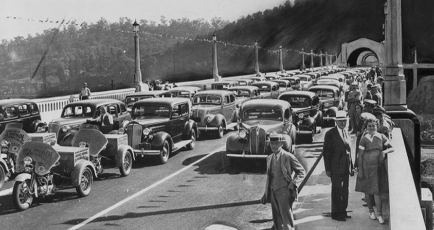 |
|
| (1937)* - Opening day of the North Figueroa Street Viaduct. |
Historical Notes July 6, 1937: Five hundred people gathered on the North Figueroa Street viaduct to celebrate the new concrete span across the Los Angeles River -- a construction project that had cost $650,000. "Los Angeles acquired some closer neighbors yesterday. The opening of the gigantic new bridge across the Los Angeles River, San Fernando Road and the railroad tracks from the Figueroa Street tunnel brought about an eagerly awaited unity," The Times said in an editorial the next day. "South Pasadena, Pasadena, San Marino and all the other communities in the north and northeast area were drawn in closer to the heart of the metropolis by the time-saving viaduct." The Times spoke with great optimism about what such easier access would mean: "Every link that is finished will make Los Angeles and its neighbors out that way more accessible to each other. All will benefit." |
 |
|
| (1937)* - View looking down at the Figueroa Street Bridge shortly after it opened. Photo dated: July 7, 1937. At top right can be seen where the Arroyo Seco converges with the Los Angeles River. |
* * * * * |
The bridge in daily use |
Soon after opening, the viaduct became a main route for drivers traveling between Downtown and the northeast part of the city. |
 |
|
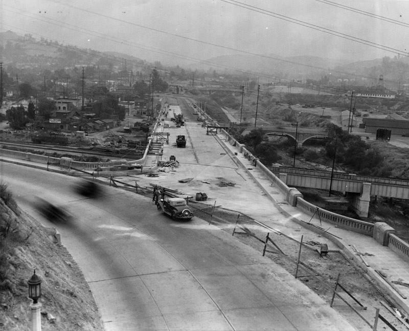
| (1938)* - View from above the last tunnel looking across the North Figueroa Street Viaduct (bridge) as it passes over the Los Angeles River. |
Historical Notes The Arroyo Seco Parkway opened in late 1940 as a freeway from the Viaduct to Pasadena. However, the six-lane parkway narrowed to four lanes at the viaduct and through the tunnels, and had a number of at-grade intersections on its way downtown. Within just a few years, this approach became part of one of America’s earliest freeway routes, blending city streets with limited-access highway design. |
 |
|
| (ca. 1938)* – North Figueroa Street Bridge over the Los Angeles River showing effect of traffic making left turn for Riverside Drive. |
| Historical Notes
The turnoff seen here is now part of the Arroyo Seco Pkwy (CA-110) connector to NB I-5. Captured just after the North Figueroa Viaduct opened over the Los Angeles River. |
* * * * * |
Freeway era changes |
As traffic increased in the early 1940s, the route was modified to handle more cars and faster travel. |
 |
|
| (1947)* – View showing the Arroyo Seco Parkway with traffic backed up on the southbound lanes heading into downtown Los Angeles. |
|
|
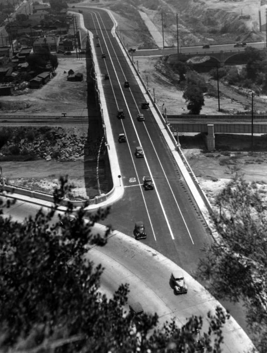
| (1958)^ - View looking southwest at the Pasadena Freeway (Arroyo Seco Parkway) as it crosses the Los Angeles River at Elysian Park. A new alignment for southbound traffic, passing through a cut to the west of the tunnels, opened in 1943. |
Historical Notes The two-way Figueroa Street Tunnels and Viaduct were repurposed for four lanes of northbound traffic, and a higher southbound roadway was built to the west. From the split with Hill Street south to near the existing College Street overpass, the four-lane surface road became a six-lane freeway. The new road split from the old at the Figueroa Street interchange, just south of Avenue 26, and crossed the Los Angeles River and the northbound access to Riverside Drive on a new three-lane bridge. Through Elysian Park, a five-lane open cut was excavated west of the existing northbound tunnel lanes, saving about $1 million. The extension, still feeding into surface streets just south of College Street, was opened to traffic on December 30, 1943. By the late 1940s, rising car ownership quickly filled even these new roadways, showing how fast Los Angeles was becoming an automobile-oriented city. |
* * * * * |
Before and After |
Over a few decades this area changed from a local street crossing into part of a regional freeway system. The viaduct and tunnels show how Los Angeles adapted to the automobile age. Together, the tunnels, viaduct, and parkway marked Los Angeles’ early shift from surface streets to the freeway network that would later define the region. |
 |
|
| (1931 vs. 1958) - View showing how traffic patterns changed after the Figueroa Street Viaduct and Arroyo Seco Parkway reshaped this corridor. |
| Historical Notes
What began as a local road evolved into one of Los Angeles’ earliest freeway approaches. |
* * * * * |
Then and Now |
The Then and Now views below show how this corridor evolved from a simple river crossing into part of a growing regional highway network. What once handled local traffic gradually became a key feeder into Los Angeles’ first freeway system. The comparison highlights how early road improvements laid the groundwork for the region’s modern transportation grid. |
| (1938 vs. 2023) - Looking northeast on Figueroa Street at Riverside Drive, where a simple turnoff later became part of the Arroyo Seco Parkway connector system linking to Interstate 5. Photo comparison by Jack Feldman. |
| Historical Notes
This location became an important transition point between city streets and the Arroyo Seco Parkway, one of the nation’s first freeways. Improvements here helped move traffic more efficiently between downtown Los Angeles, Pasadena, and the San Fernando Valley. |
* * * * * |
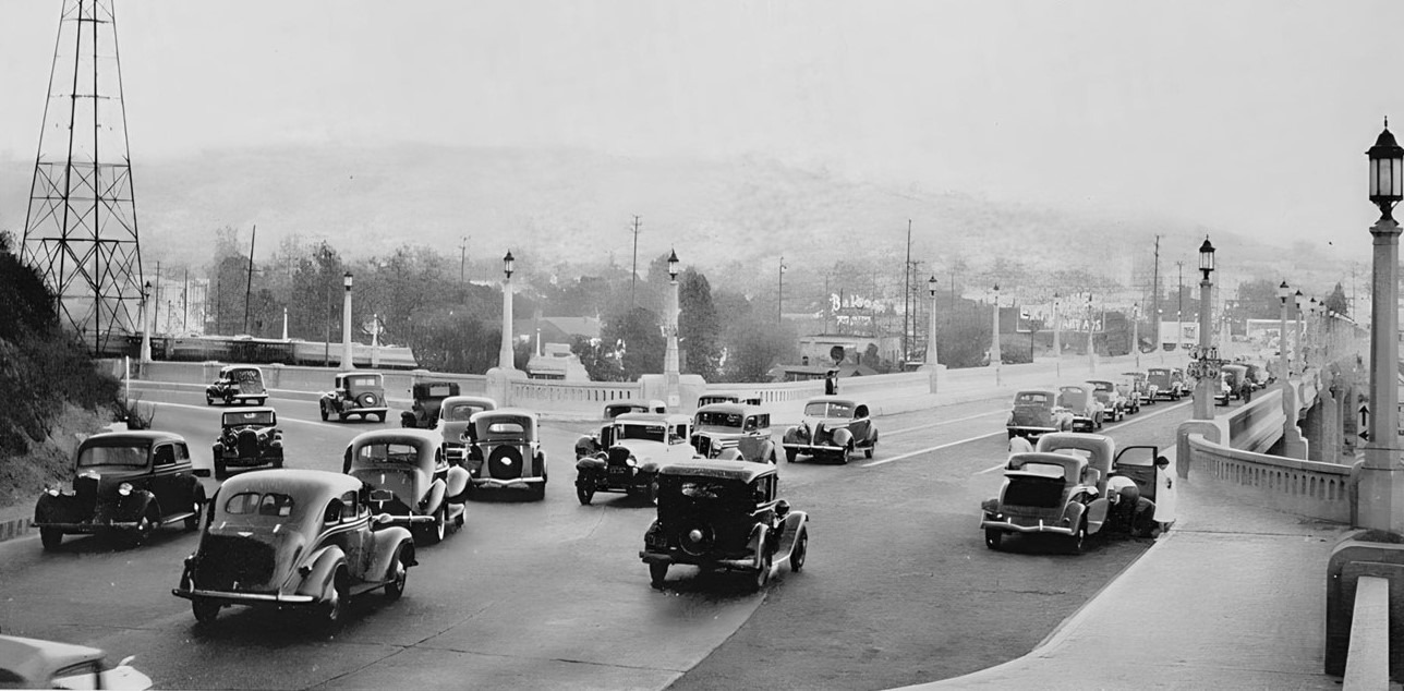
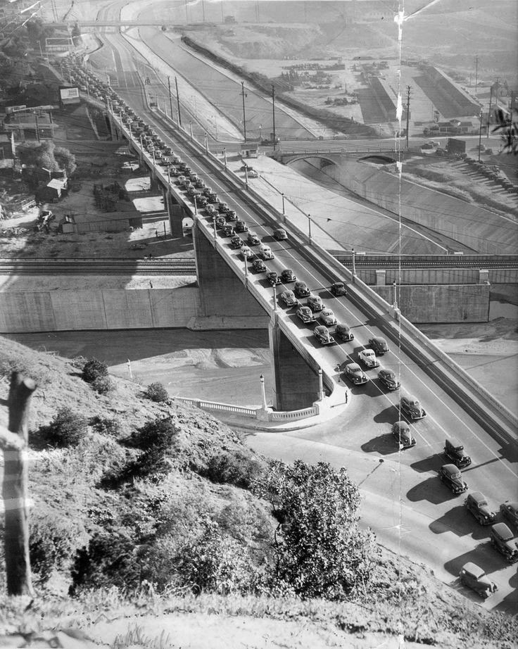
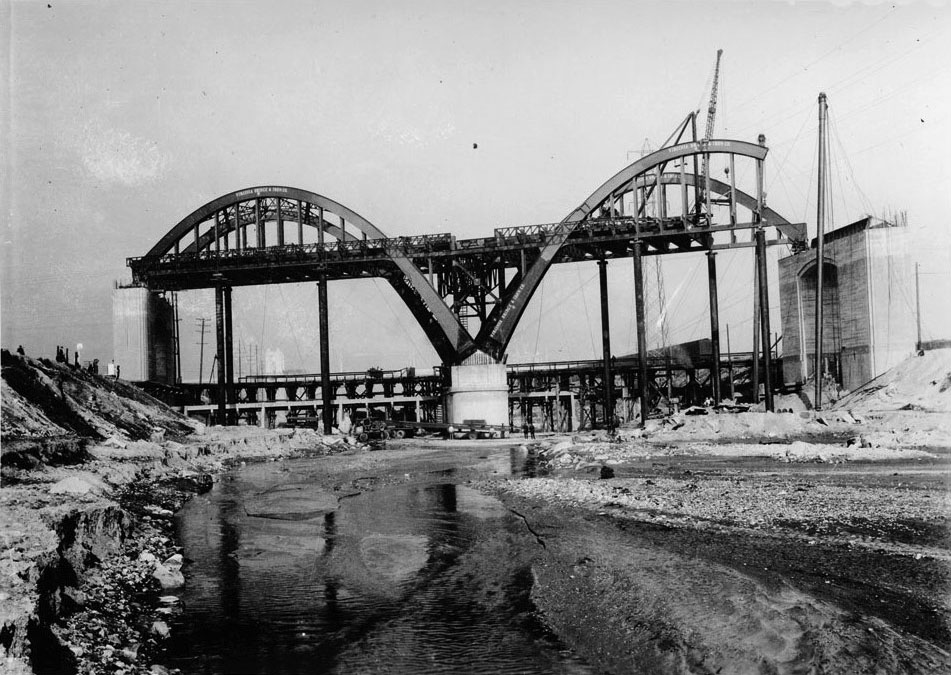
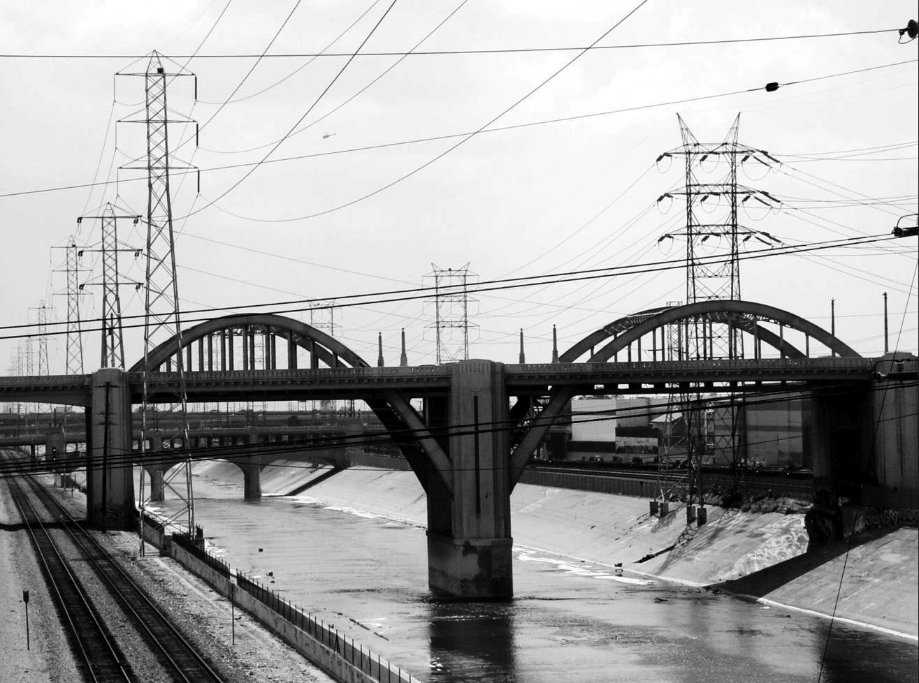
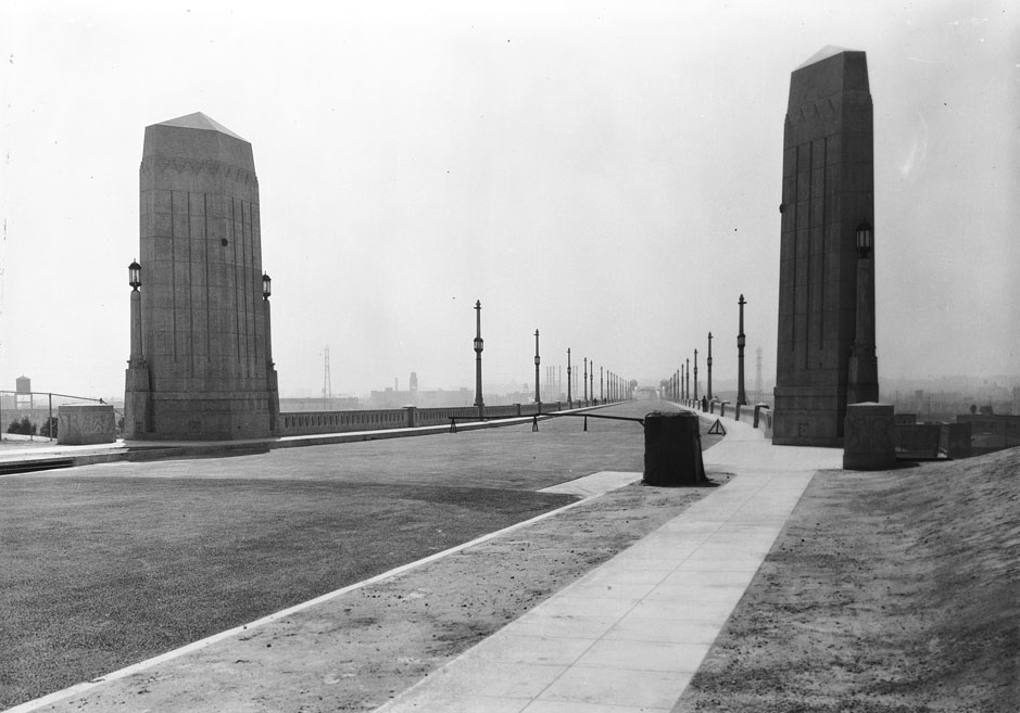
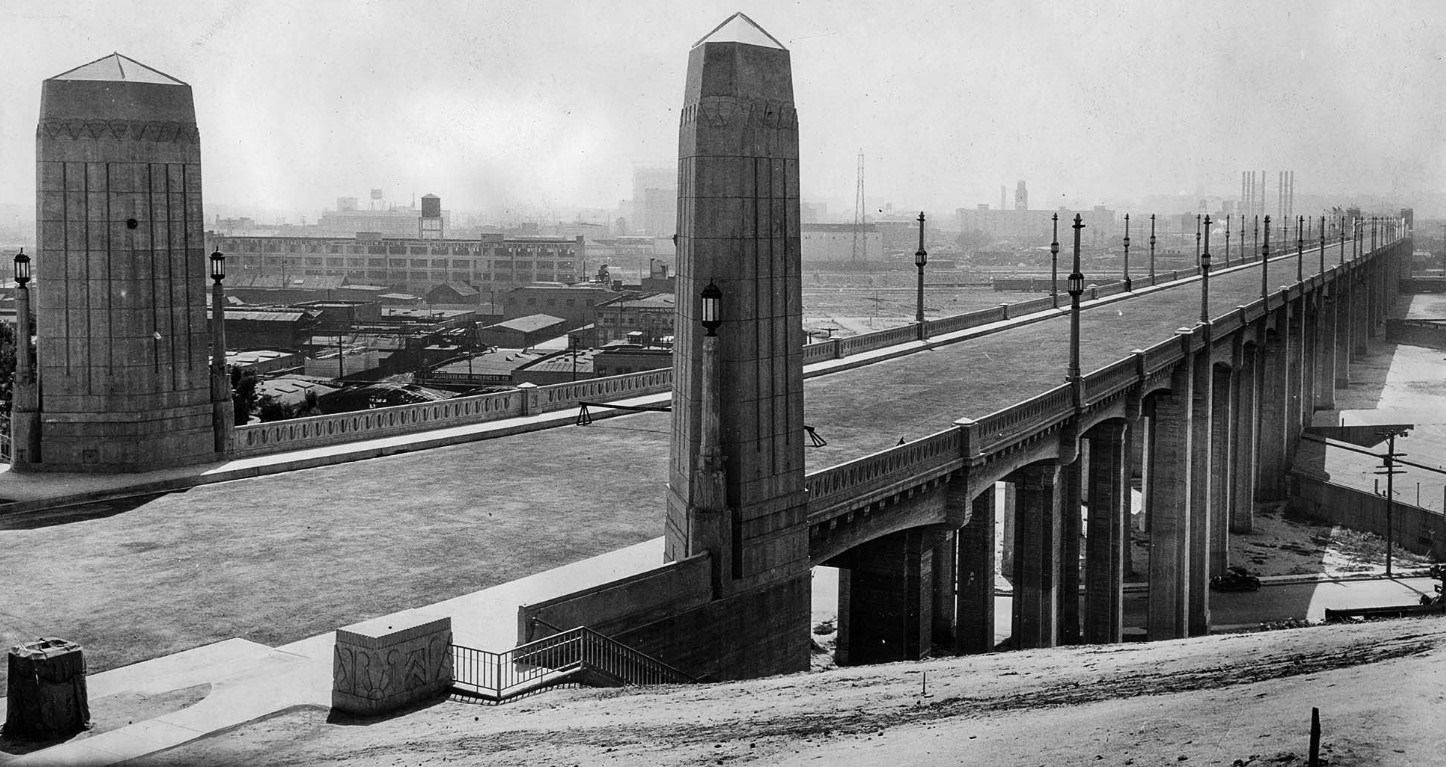
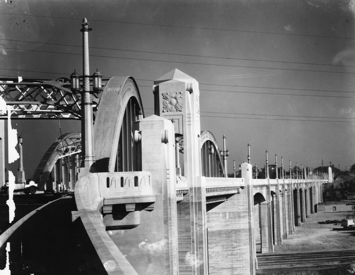
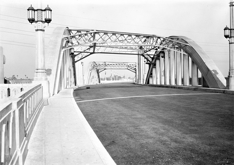
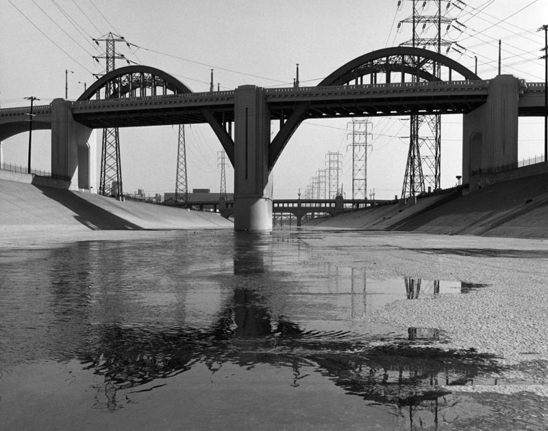
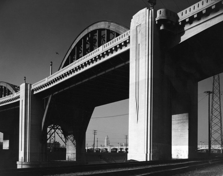
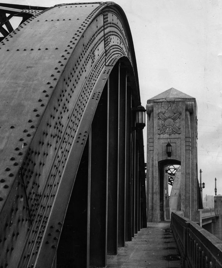
Sixth Street Bridge (aka Sixth Street Viaduct) |
 |
|
| (1932)* – View showing the construction of the 6th Street Viaduct's central steel arch segment as seen from the Los Angeles River bed. |
Historical Notes Constructed in 1932, the Sixth Street Viaduct (also known as the Sixth Street Bridge) was an important engineering landmark in the City of Los Angeles. It was one of a set of fourteen historic Los Angeles River crossing structures, and the longest of these structures. |
 |
|
| (ca. 1933)^*#* - View of the 6th Street Bridge showing the original columns (pylons) on each side of the bridge, in-between the 2 steel arches. The columns above the bridge roadway were removed shortly after they were constructed. |
Historical Notes The columns above the bridge line were removed less than a year after they were installed. Due to widespread damage of the 1933 Long Beach earthquake, the city decided that in a future quake, the pylons might collapse onto the street in the middle of the bridge. Which means very few people have actually seen the bridge in it's entire original design as the architects envisioned it when it was completed.* |
 |
|
| (n.d.)^.^ - 6th Street Viaduct central arched section after columns above the bridge line were removed due to damage resulting from the 1933 Long Beach earthquake. |
 |
|
| (1933)*# - View of several of the bridges that span the Los Angeles River. In the foreground can be seen the newly completed Sixth Street Viaduct. |
Historical Notes Twenty-seven bridges currently span the LA River, from its origin in San Fernando Valley to its terminus in Long Beach. These structures constitute one of the largest concentrations of National Register-eligible bridges in the nation. In 2007, the city’s Cultural Heritage Commission declared thirteen of them, which were built between 1900 and 1938, as cultural monuments. Several of the bridges are actually viaducts, structures with multiple spans, often connected by a tower.*^*# |
 |
|
| (1933)*# - View looking west of the eastern end of 6th Street Bridge. This photo was taken before the bridge was opened to traffic. |
Historical Notes The Sixth Street Viaduct connects the downtown and Boyle Heights areas of Los Angeles. It currently spans the Los Angeles River, the Santa Ana Freeway (US 101), and the Golden State Freeway (I-5), as well as Metrolink and Union Pacific railroad tracks and several local streets.^* |
 |
|
| (1933)^^ – View showing the newly completed 6th Street Bridge and Viaduct, built at a cost of $2,383,271. This photo was published in the June 13, 1933 Los Angeles Times |
Historical Notes The length of the span and approaches of the 6th Street Bridge and Viaduct is 3546 feet, with a roadway fifty-six feet wide. It is the longest and largest of the bridges spanning the Los Angeles River. |
 |
|
| (1933)^ - A view of Sixth Street Bridge, seen from the level of the bridge linking Boyle Heights to downtown. An automobile is visible at far left. |
 |
|
| (1933)^ - Photograph of a view around a curve on the Sixth Street Bridge, June 1933. The top of the bridge can be seen spanning from the right foreground towards the center background. Lamp posts are evenly interspersed on both sides down the length of the bridge, while metal overhangs connect two sets of archways at center. Click HERE to see more in Early L.A. Streetlights. |
 |
|
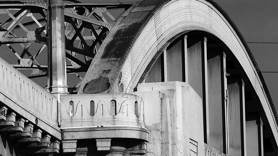
| (ca. 1950s) - View of the graceful 6th Street Bridge with its twin arches, but without the columns as originally built (sse previous photos). |
Historical Notes The L.A. River Bed system was still growing back in the 1950s. As it progressed, many sections started growing concrete making it an ideal spot for a semi-secluded meeting point with long straight-aways. Teenagers from all around met up and pitted their best hot rod against rivals and friends alike. Click HERE to see more in Drag Racing under the 6th Street Bridge. |
 |
|
| (ca. 1950)^ - Looking towards Los Angeles City Hall from across the railroad tracks by the 6th Street Bridge. |
 |
|
| (1955)^#^^ – Profile view of the Sixth Street Viaduct. |
 |
|
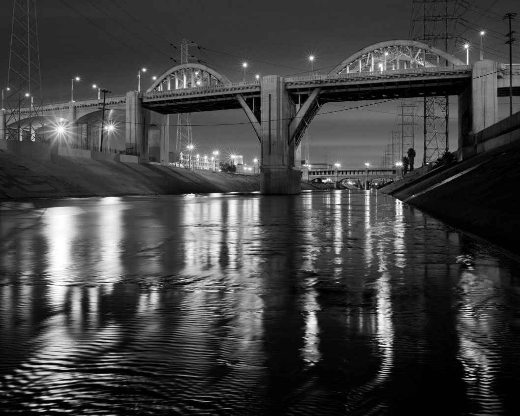
| (2012)^^^* – View of the 6th Street Bridge from Olympic Boulevard. It has the longest span of any of the bridges crossing the Los Angeles River near downtown Los Angeles. Photo by Sterling Davis |
 |
|
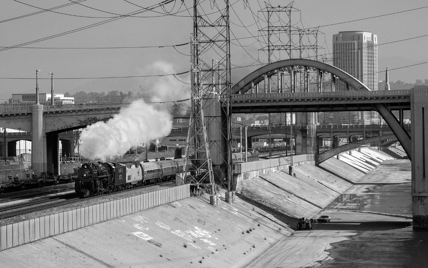
| (2008)++++ - View showing the restored Santa Fe engine no. 3751 steaming under the 6th Street Bridge on a San Diego-bound passenger special. |
 |
|
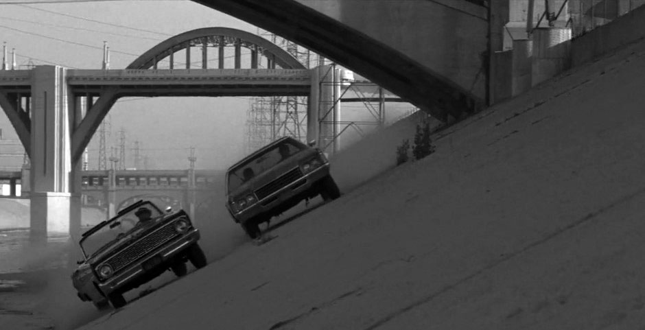
| (1984)^^ – The Sixth Street Bridge (viaduct) was featured in the race scene in Repo Man, the 1984 American comedy classic Repo Man, directed by Alex Cox and starring Harry Dean Stanton and Emilio Estevez. |
Historical Notes The Sixth Street Bridge is known as L.A.’s Most Cinematic Bridge having appeared in numerous films since it was built in 1932, including:
Despite its historical status, the bridge was closed for demolition and replacement in January 2016 due to concerns over seismic instability. |
 |
|
| (2015)^^ – Close-up view of the old 6th Street Bridge in its last days. It’s scheduled to be replaced by a new bridge over the next three years. Photo by Luis Sinco |
Historical Notes The 3,500-foot landmark lasted a lifetime. At 84 years old and reinforced with ancient square rebar and hung with steel arches, it was the longest of 14 historic Los Angeles River crossings, connecting the Arts District to Boyle Heights west to east via Sixth Street and Whittier Boulevard. Although built with 1932’s latest engineering technologies, the concrete bridge began deteriorating prematurely, only 20 years after it opened. A chemical process known as an alkali-silica reaction, which created cracks in the cement, was eroding the structure. Costly attempts were made to correct the problem, but all were met with limited success. Restoration attempts proved to have only a Band-Aid effect, and previous plans to scuttle the bridge and build a replica didn’t go far. Los Angeles city officials, citing seismic studies, reluctantly deemed the decaying structure lacked the integrity to withstand a major earthquake, in addition to other safety concerns.* In November of 2011, the LA City Council voted to put the bridge down and replace the structure due to cracks in the concrete and corroding cement. Construction is scheduled to start in 2015 and take three years, with the federal government footing much of the bill. |
New Sixth Street Bridge (aka Sixth Street Viaduct)
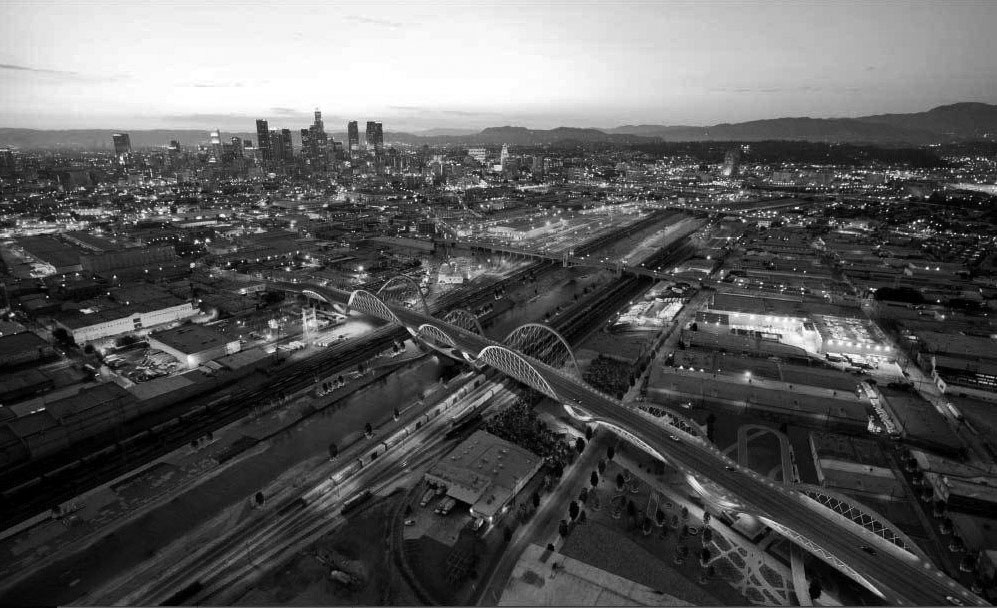 |
|
| (2012)^.^ - Rendering of the new 6th Street Bridge which will replace the original 1932-built bridge. |
Historical Notes The $482 million dollar project is the largest bridge project in the history of the city. Designed by LA-based architect Michael Maltzan, the viaduct will cross over a new public park.^ Bridge or Viaduct? |
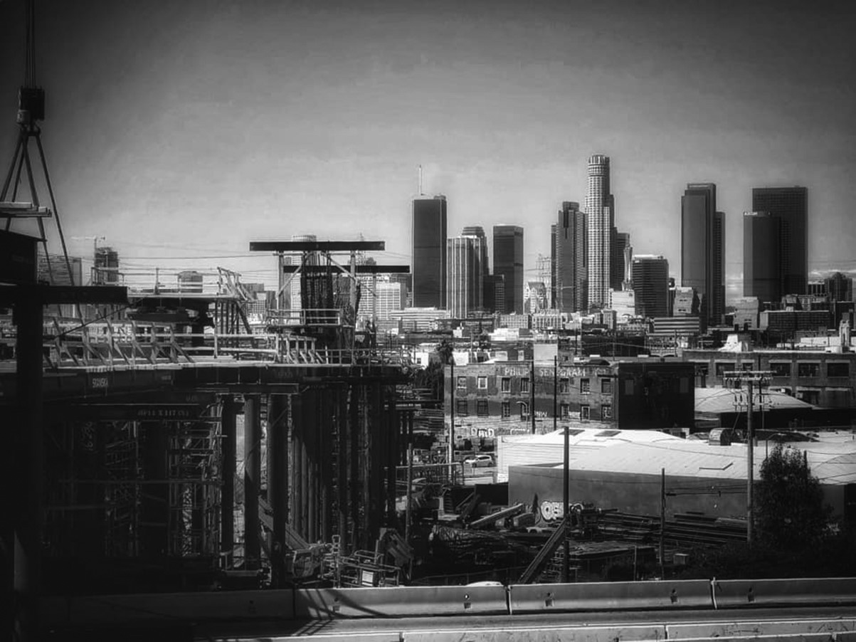 |
|
| (2021)* – Construction of the new 6th Street Bridge before the arches with the downtown skyline in the background. Photo by Carlos G. Lucero |
Historical Notes Bridge construction has experienced several years long construction delays and multi-million dollar cost increases. The latest completion date is set for Summer 2022.^ |
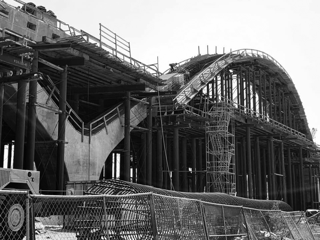 |
|
| (2021)* - Close-up view showing 6th Street Bridge arches under construction. |
Historical Notes Some of the construction delays have been attributed to “construction challenges,” including the installation of temporary “shoring and falsework” to support the bridge while under construction.^ |
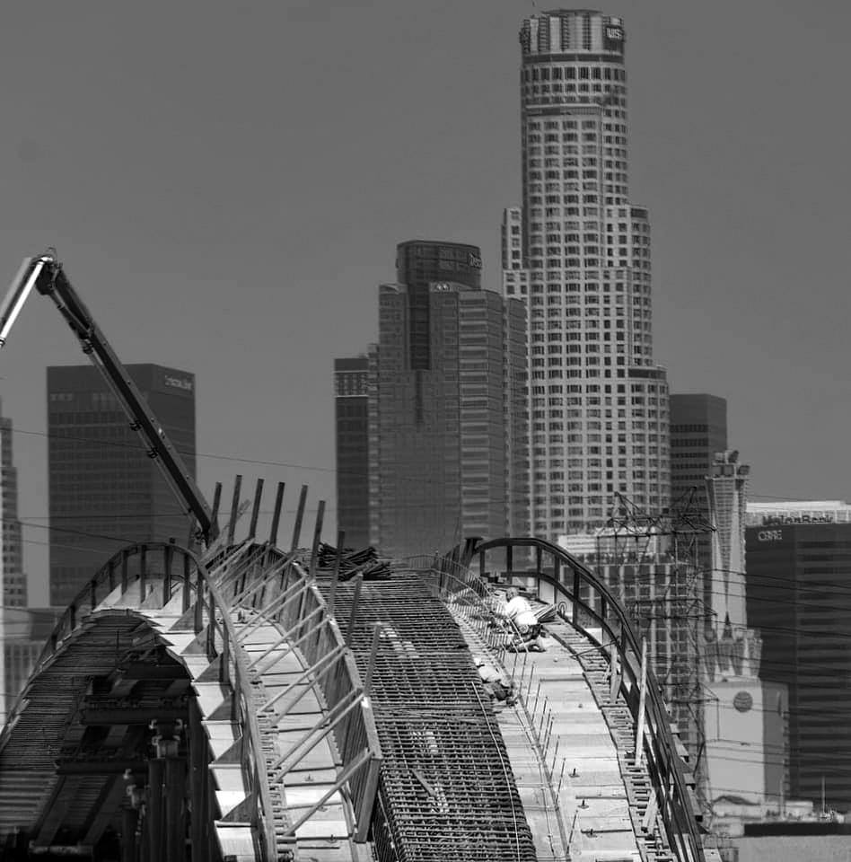 |
|
| (2021)* – Telephoto shot of work being done on the new arches of the 6th Street Bridge with downtown in the background. Photo by Bob Bernal Jr. |
Historical Notes The new 6th Street Bridge / Viaduct will feature ten pairs of arches ranging in size from 30 to 60-feet. The bridge will not only have four lanes of traffic like before, but it will have a bicycle lane on each side, 14-foot-wide sidewalks, and five sets of stairs that let pedestrians exit the bridge at different locations.* |
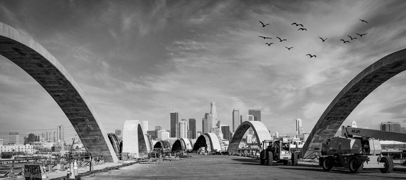 |
|
| (2021)* – Street level view of the Sixth Street Bridge under construction with the downtown skyline in the background. Photo courtesy of Greg Goyo Vargas |
Historical Notes The Sixth Street bridge features a concrete “Y” column that branches into arches using grade 80 rebar instead of grade 60, which is a first for the state of California, and sliding isolation bearings exceed seismic code. Stairways and bike ramps improve connectivity for pedestrians. |
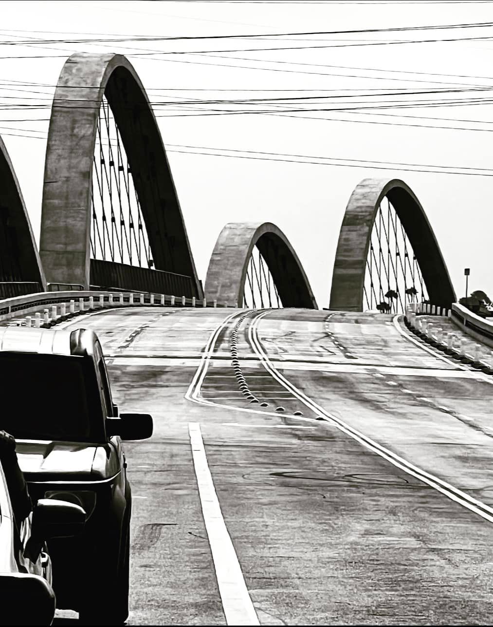 |
|
| (2022)* - The Sixth Street Bridge after its opening in July of 2022. Photo by Carlos G. Lucero |
Historical Notes “The Sixth Street Viaduct isn’t just a connection between our communities – it’s a new landmark that represents the tenacity, beauty, and promise that defines Los Angeles,” - Mayor Eric Garcetti. |
* * * * * |
Macy Street Bridge
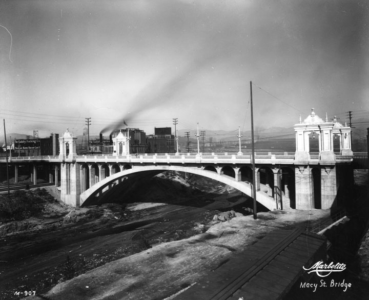 |
|
| (ca. 1933)^ - On this side view of the Macy Street Bridge (now Cesar Chavez Avenue) and overpass we can see the dry riverbed running under it, and on the lower right a train also passing under. Beyond the bridge is a manufacturing company's buildings: the Cudahy Packing Co. (ham, bacon, etc.) |
Historical Notes The Macy Street Bridge designers chose its Spanish Colonial Revival style to commemorate its location along the historic mission road, El Camino Real. The bridge is dedicated to the founder of the California missions, Father Junipero Serra. Constructed during the major bridge building decade, 1923-1933, Cesar Chavez/Macy Street is one of a group of 12 river bridges significant for their role in the transportation history of Los Angeles and their association with Chief Engineer Merrill Butler, a major bridge designer of the era. The Macy Street crossing provided a high water, unimpeded crossing for access to the city from the northern and eastern sections of the rapidly developing city.^*# On August 1, 1979, the Cesar Chavez-Macy Street Bridge was designated Los Angeles City Historic-Cultural Monument No. 224 (Click HERE to see complete listing). |
 |
|
| (ca. 1933)* - One of four identical decorations on the Macy Street Viaduct, a bridge over the Los Angeles River that is now Cesar Chavez Avenue. The viaduct is in Spanish Colonial Revival style with ionic and doric columns and ornate streetlights. |
Click HERE to see more in Early L.A. Streetlights |
* * * * * |
Glendale-Hyperion Bridge |
Few crossings over the Los Angeles River better illustrate the transformation of Los Angeles from rural floodplain to modern metropolis than the Glendale-Hyperion Bridge. Completed in 1929, the structure replaced a fragile wooden crossing and marked a decisive shift toward permanent civic infrastructure. At a time when Atwater Village and nearby neighborhoods were expanding rapidly, the new reinforced concrete bridge provided a dependable connection for automobiles and electric rail service. Its graceful arches combined engineering strength with architectural presence, signaling confidence in the city’s future.Designed under the direction of city bridge engineer Merrill Butler, the Glendale-Hyperion Bridge carried traffic over the river, Riverside Drive, and land that would later become Interstate 5. Over the decades it has witnessed the end of the Pacific Electric Red Cars, the channelization of the river after the catastrophic flood of 1938, the rise of the freeway system, and renewed efforts to restore public access to the river corridor. Today it remains both a vital transportation link and a visible reminder of nearly a century of urban change. |
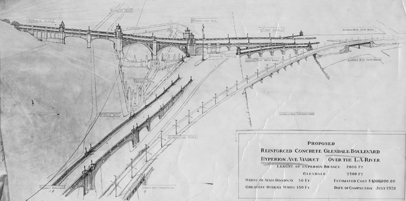 |
|
| (1927)* - Artist drawing dated November 2, 1927, showing the proposed Hyperion Avenue viaduct over the Los Angeles River and the reinforced concrete connection to Glendale Boulevard. The Hyperion branch measured about 2600 feet and the Glendale branch about 2500 feet. The main roadway was 50 feet wide, with a maximum overall width of 150 feet. The estimated cost was one million dollars, with completion projected for February 1929. The Pacific Electric line is shown running on its own adjacent bridge. |
Historical Notes Before construction of the Glendale-Hyperion Bridge, a wooden bridge built around 1910 stood at this location. It served as the main entrance to Atwater Village and provided an essential crossing over the often unpredictable river. Severe flooding in 1927 destroyed the wooden structure, reinforcing the need for a stronger and more permanent design. Local voters soon approved funding for a reinforced concrete bridge capable of withstanding future floods. |
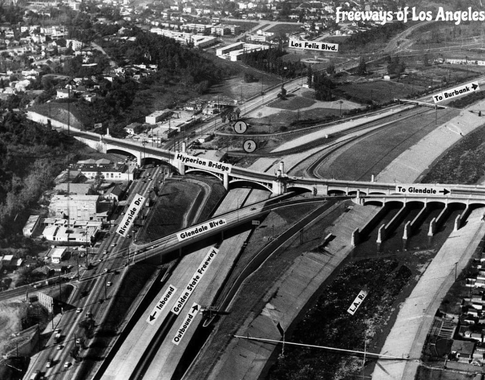 |
|
| (n.d.)* - Aerial view of the Glendale-Hyperion Viaduct annotated to show surrounding streets, with the Los Angeles River visible on the right. The Golden State Freeway had not yet been constructed. |
Historical Notes Construction began in 1927 and the bridge opened in February 1929. The main span crosses roughly 400 feet over the Atwater section of the river and carries four lanes of traffic. The bridge was originally named the Victory Memorial Bridge in honor of those who served in World War I. In later years it gained additional public recognition when a small scale replica was constructed at Disney California Adventure Park in Anaheim. |
 |
|
| (1930)* – View looking southwest showing the newly completed Glendale-Hyperion Bridge. The farmland and river bottom in the center of the image would later become the route of Interstate 5. Los Angeles City Hall, completed in 1928, appears in the upper right distance. |
Historical Notes The structure functions as both a bridge and a viaduct. A bridge spans a physical obstacle such as water or a roadway. A viaduct is a series of shorter spans placed one after another. The Glendale-Hyperion Bridge includes thirteen reinforced concrete arches arranged in sequence, giving it both structural strength and architectural rhythm. |
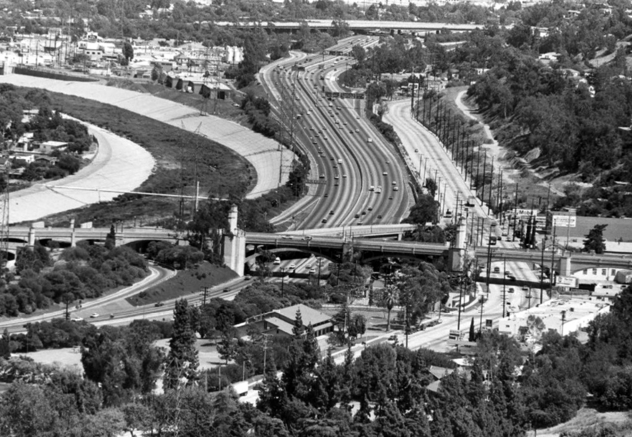 |
|
| (n.d.)* - Closer view of the Glendale-Hyperion Bridge after construction of the Golden State Freeway in the 1950s, with the Los Angeles River on the left. |
Historical Notes Merrill Butler, Engineer of Bridges and Structures for the City Bureau of Engineering from 1923 to 1961, is credited with the design. The main portion measures about 1400 feet in length. Construction required more than 35000 cubic yards of concrete and 6000000 pounds of reinforcing steel. Workers drove approximately 1500 wooden piles and 3200 concrete piles to support the piers and abutments. The bridge contains thirteen arches: two measuring 135 feet, eight measuring 48 feet, one measuring 68 feet, and two measuring 118 feet. These dimensions reflect both the scale of the river valley and the ambition of the project. |
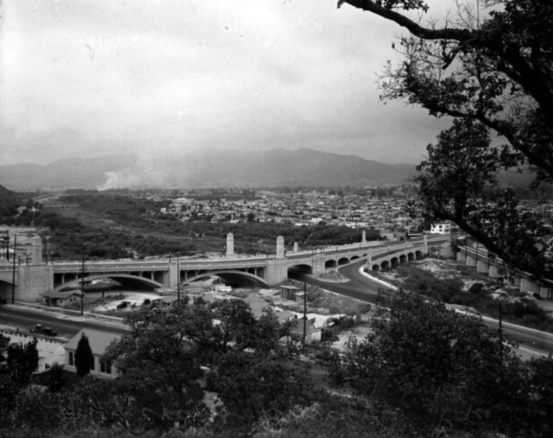 |
|
| (ca. 1930)* - View looking northeast showing the Glendale-Hyperion Bridge spanning Riverside Drive, the future alignment of Interstate 5, and the Los Angeles River. |
Historical Notes This view predates construction of Interstate 5 and shows the open character of the surrounding landscape. When the freeway was later built, one of the larger arches on the right side was removed to make room for the roadway. The Pacific Electric bridge can be seen at the far right, running parallel to the main structure, demonstrating how rail and automobile travel once shared this corridor. |
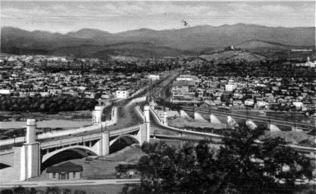 |
|
| (1931)* – Postcard view looking east showing the Glendale-Hyperion Viaduct with a Pacific Electric Red Car crossing the adjacent bridge over the Los Angeles River. |
Historical Notes In 1929 the Pacific Electric Railway constructed a line next to the Glendale-Hyperion Bridge, allowing Red Cars to cross the river and continue along Glendale Boulevard. Until 1959 these electric trains provided regular service across the river, linking neighborhoods and supporting regional growth. The line was discontinued as freeways expanded and automobile traffic increased. Today the concrete supports that once carried the tracks remain, silent reminders of the electric rail era. |
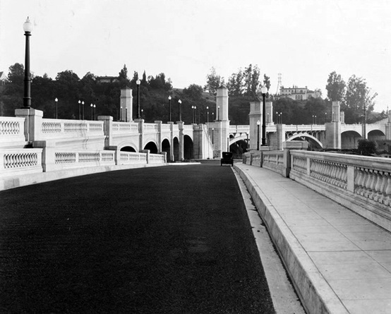 |
|
| (ca. 1930s)* - Close view of the Glendale-Hyperion Bridge shortly after it opened, with an early automobile at center. |
Historical Notes In its early years the bridge stood amid open land and low density neighborhoods. It quickly became a symbol of permanence and progress for communities on both sides of the river, offering reliable access where flooding had once disrupted travel. |
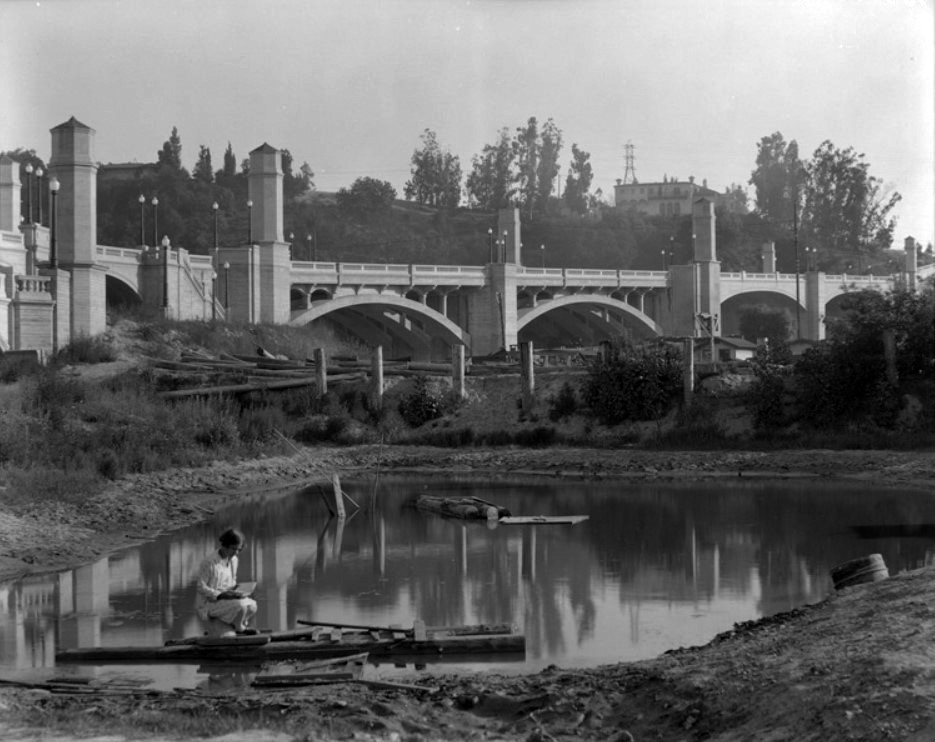 |
|
| (1930s)* – A woman reading on a makeshift wooden raft floating on a small body of water along the Los Angeles River, with the Glendale-Hyperion Bridge rising in the background. |
Historical Notes Even after completion of the bridge, portions of the Los Angeles River remained natural and unchannelized. The river flowed across a broad floodplain bordered by farmland and open space. This quiet scene captures a moment of calm beneath monumental infrastructure, highlighting the contrast between the engineered arches above and the still natural river below. |
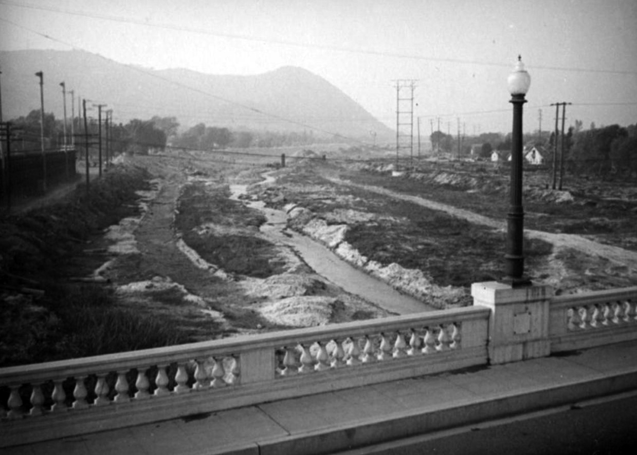 |
|
| (ca. 1937)* – View looking north from the Glendale-Hyperion Bridge showing the natural bottom of the Los Angeles River. |
Historical Notes The Los Angeles River originally flowed freely across its floodplain and frequently changed course. In March 1938 a powerful storm flooded large portions of the city and killed 115 people. Public demand for flood control led the United States Army Corps of Engineers to begin a long project to construct the concrete channel that now contains most of the river. The river landscape visible in earlier photographs would soon be permanently altered. Click HERE to see more in Los Angeles River - The Unpredictable! |
Before and After
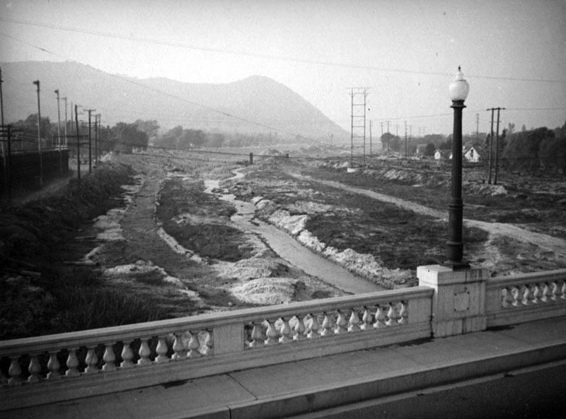 |
|
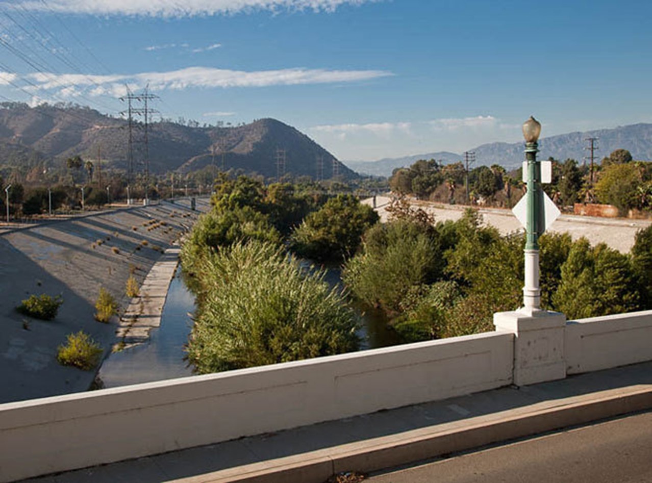 |
|
| (1937 vs. 2015)* - Before and After Los Angeles River Channelization - View from the Glendale-Hyperion Bridge. Photo comparison by Jack Feldman. |
Historical Notes Click HERE to see more on the Los Angeles River Channelization. |
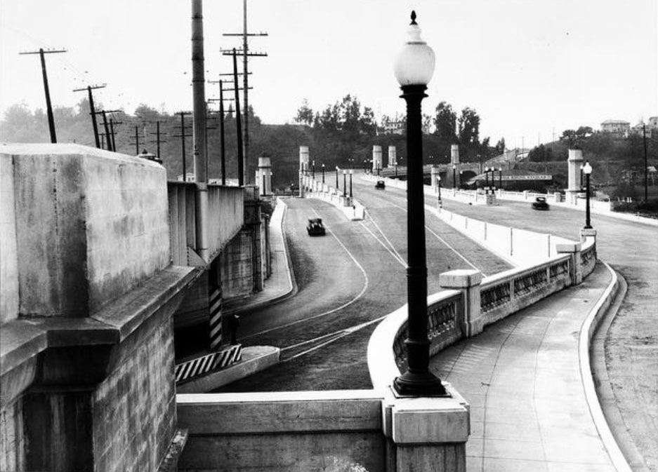 |
|
| (ca. 1935)* - View looking west showing the Pacific Electric Railway line adjacent to the Glendale-Hyperion Bridge. |
Historical Notes The Red Car line beside the bridge provided an efficient electric transit connection between neighborhoods. Its removal in 1959 marked the end of an important period in Southern California transportation history and signaled the dominance of the automobile. |
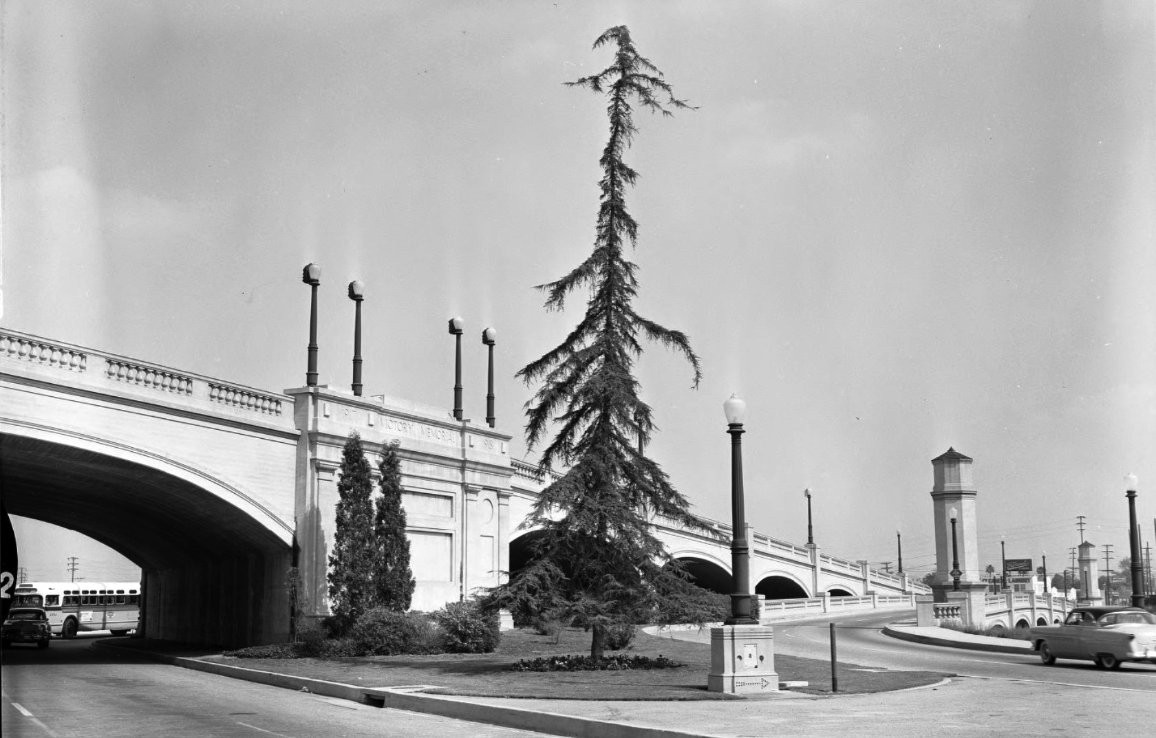 |
|
| (1956)* – View showing the eastern end of the Glendale-Hyperion Bridge descending over Riverside Drive near Glendale Boulevard in the Atwater District. |
Historical Notes The 56 foot wide and 1370 foot long reinforced concrete arch Glendale-Hyperion Bridge opened in 1929. It crosses the Los Angeles River and Riverside Drive between Ettrick Street and Glenfeliz Boulevard, and since the 1950s it has also spanned Interstate 5. Originally named the Victory Memorial Bridge, it was later designated Los Angeles Historic Cultural Monument 164, ensuring its preservation as a significant civic structure. |
 |
|
| (2015)* – Rendering of a planned pedestrian bridge across the Los Angeles River, with the Glendale-Hyperion Bridge visible on the left. |
Historical Notes In the early twenty first century, renewed interest in river access led to plans for a pedestrian and bicycle crossing using the remaining Red Car concrete pylons. Murals painted on the former rail retaining walls in 2004 helped transform the area into Red Car Park. City leaders announced the new crossing in 2015 as part of broader efforts to improve safety, reconnect neighborhoods divided by the river and freeway, and support future seismic strengthening of the main bridge. |
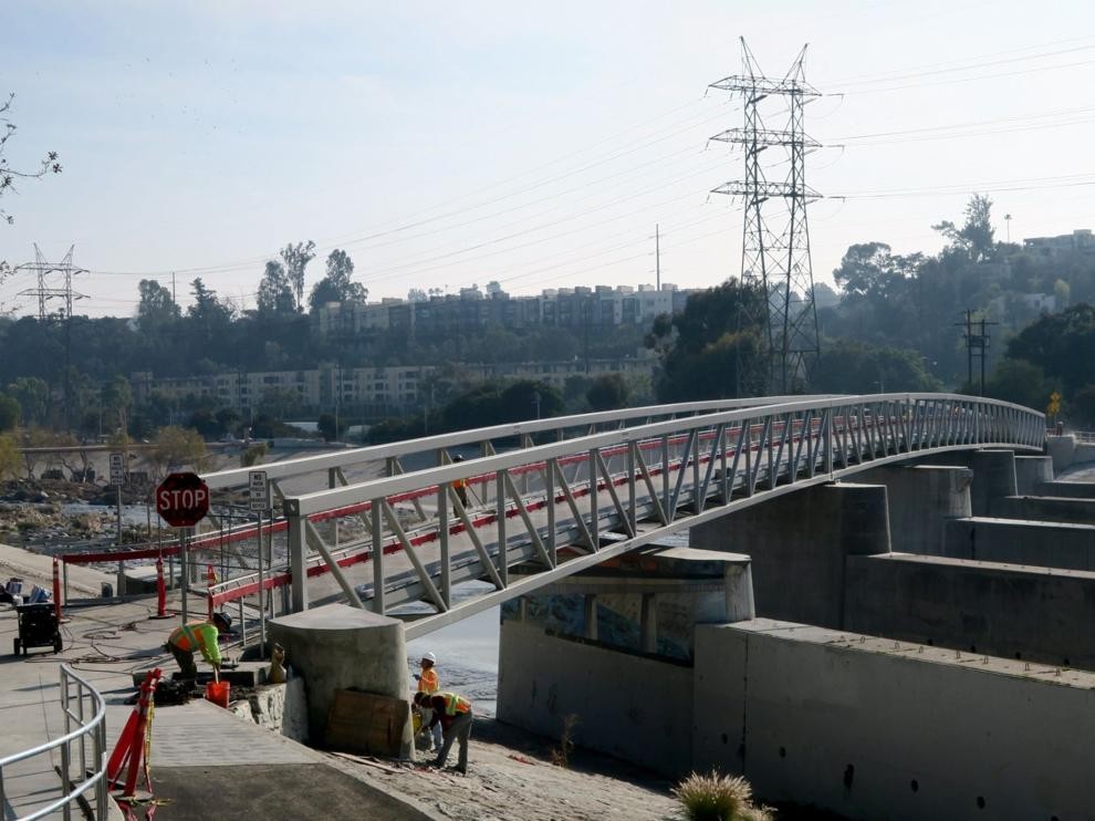 |
|
| (2020)* - The Red Car Pedestrian Bridge resting on the original concrete pylons that once supported the Pacific Electric streetcar span. Photo by Jesus Sanchez. |
| Historical Notes
The Red Car Pedestrian Bridge opened in January 2021. The 400 foot span connects Silver Lake with Red Car River Park near Atwater Village and provides a safe crossing for pedestrians and bicyclists just south of the Glendale-Hyperion Bridge. Built on five surviving concrete pylons from the former streetcar bridge, the structure acknowledges its history with a red painted steel stripe along each side. The 4 million dollar project strengthens access to the Los Angeles River Bike Path and offers an alternative to heavy vehicle traffic on the main bridge. It represents the latest chapter in the continuing evolution of this historic river crossing. For nearly a century, the Glendale-Hyperion Bridge has adapted to the changing needs of Los Angeles. From wooden predecessor to reinforced concrete monument, from electric rail service to freeway expansion, and from natural floodplain to revitalized river corridor, it stands as a durable witness to the city’s growth and resilience. |
* * * * * |
Los Feliz Boulevard Bridge |
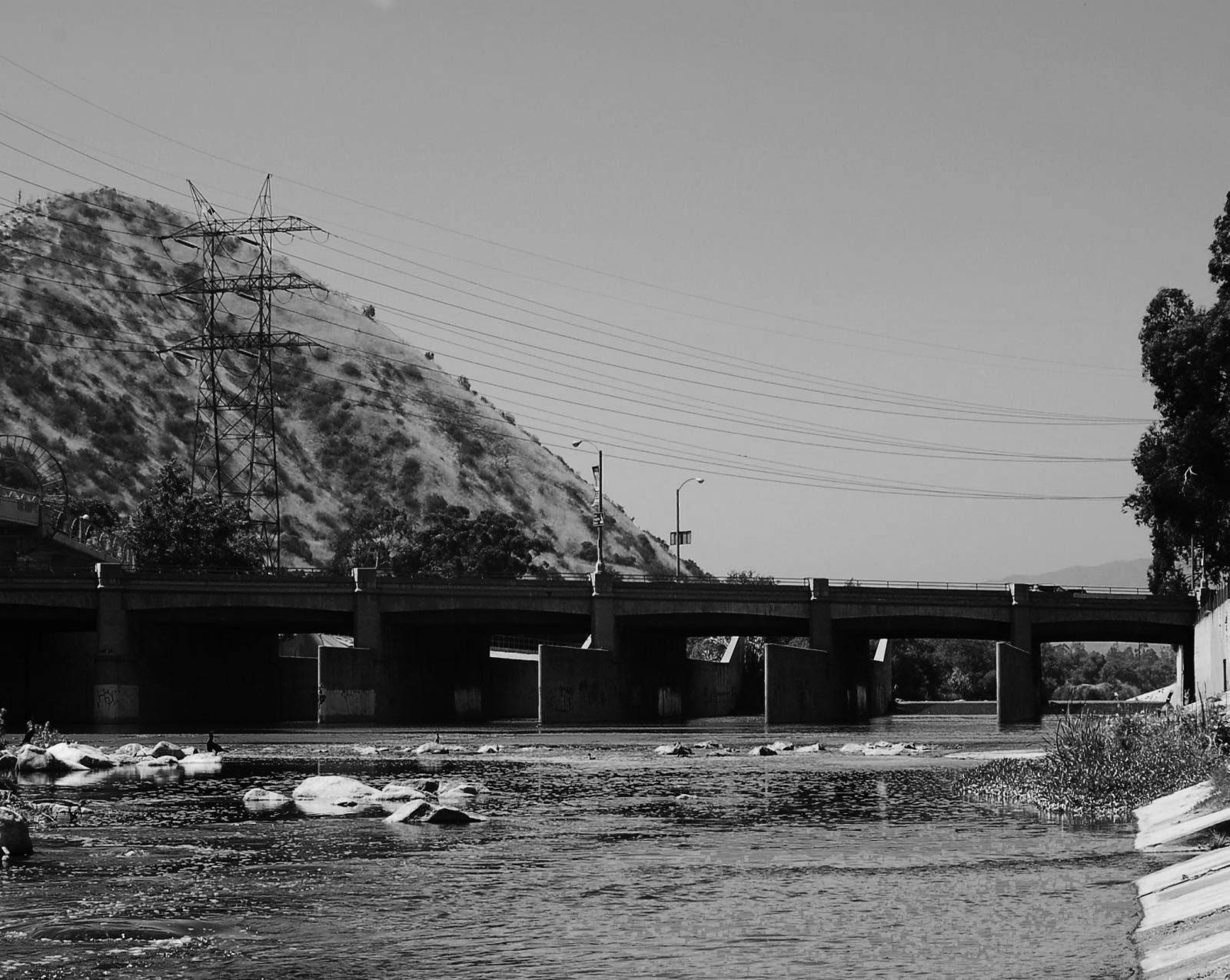 |
|
| (n.d.)* - View looking north showing the Los Feliz Boulevard Bridge over the Los Angeles River near Griffith Park. |
Historical Notes Originally called the "Tropico Bridge" when it opened in 1925, the Los Feliz Boulevard Bridge was damaged in the floods of 1938, and soon thereafter re-worked. Its ornamental concrete railing was replaced with the bland metal railing you see today. From the upstream deck you can see the Army Corps of Engineers 1938 plaque attached to the elongated piers below. |
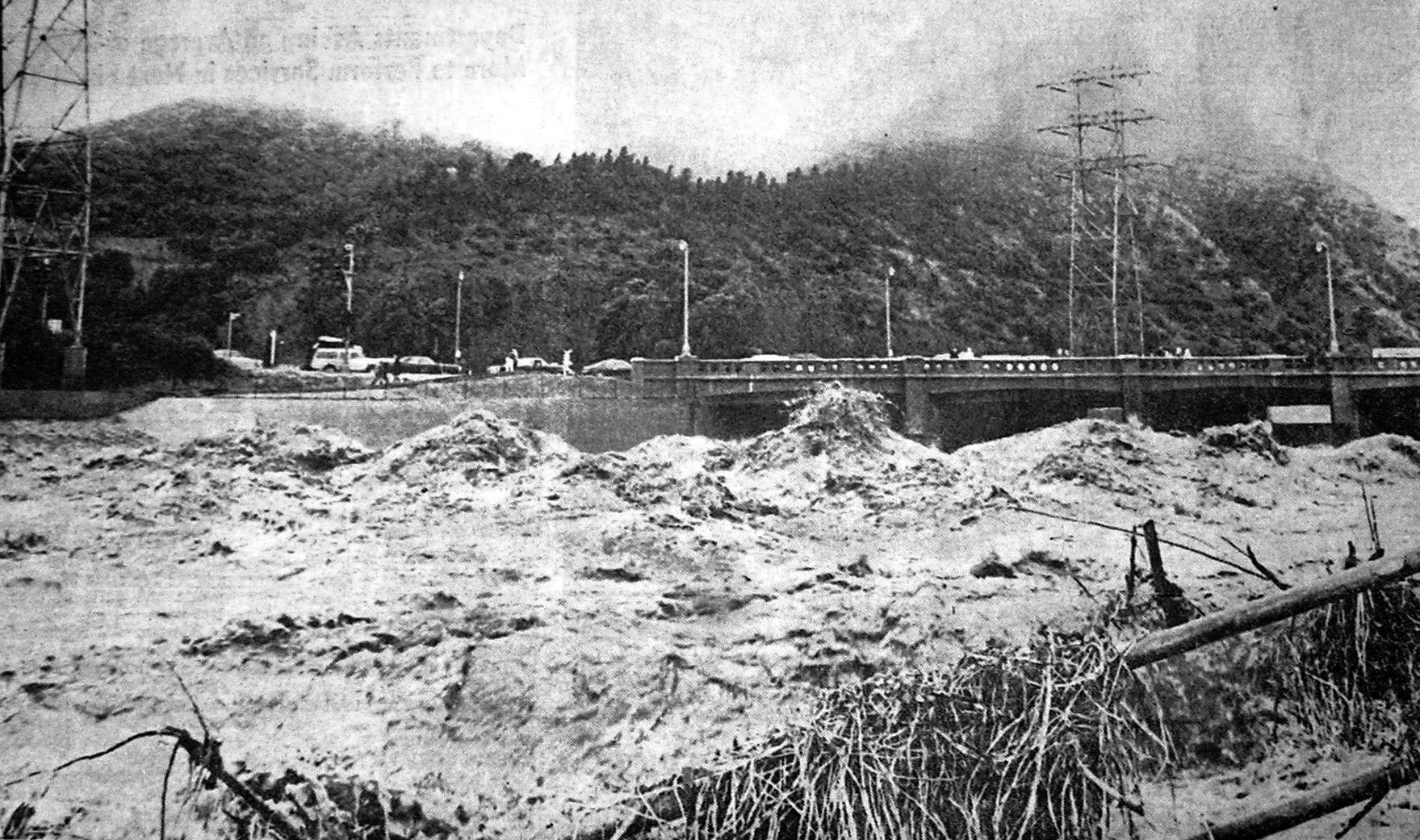 |
|
| (1969)* - Los Angeles River just below the Los Feliz Boulevard Bridge, Atwater. LAT photo by Alan Hipwell on 1/25/1969. 1969 is considered a "weak" El Nino year. |
Historical Notes Click HERE to see more in Los Angeles River - The Unpredictable! |
* * * * * |
Vermont and 4th
 |
|
| (1931)*# - Wide-angle view looking north on Vermont Avenue from 4th Street where cars are stopped at the crosswalk. Large signboards for the Belmont Theatre and the Rainbow Gardens are seen in the background. |
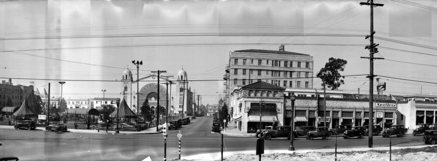 |
|
| (ca. 1931)*# – Panoramic view looking west on 4th Street at Vermont Avenue shwoing the large Romanesque and Moorish-style Sinai Temple, located on the southwest corner of 4th and New Hampshire streets. |
Historical Notes Sinai Temple was the first conservative congregation in Southern California, established in 1906. |
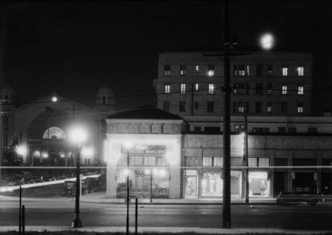 |
|
| (1931)*# - Night view looking west toward the intersection of 4th Street and Vermont Avenue. Sinai Temple stands in the background (S/W corner of 4th and New Hampshire) and a 'charcoal broiler' restaurant is seen on the northwest corner of 4th and Vermont. |
* * * * * |
Wilshire Widening and the Transformation of Orange Street |
Figueroa Street to Westlake Park |
In the early 1930s Los Angeles carried out one of the most significant boulevard reconstruction projects in its history. What had long been known as Orange Street between Figueroa Street and Westlake Park was widened, rebuilt, and fully absorbed into Wilshire Boulevard. City leaders sought to create a continuous east west artery that would connect the growing downtown business district with expanding neighborhoods to the west. To accomplish that goal, entire building fronts were removed, foundations were excavated, basements were filled, and curb lines were reset. The scale of the intervention permanently altered the character of the corridor and reshaped the western edge of downtown.The work marked a turning point in the evolution of Wilshire Boulevard. Orange Street had developed gradually as a compact commercial strip lined with storefronts, apartments, overhead wires, and closely spaced buildings. After widening, it became part of a formal automobile boulevard designed to handle heavier traffic and project civic importance. When the 971 foot downtown extension between Figueroa and Grand opened in September 1931, the project had cost approximately 3.2 million dollars, most of it spent acquiring and clearing property. The widening did more than increase the width of the roadway. It helped redefine Wilshire as one of Los Angeles’ principal corridors. |
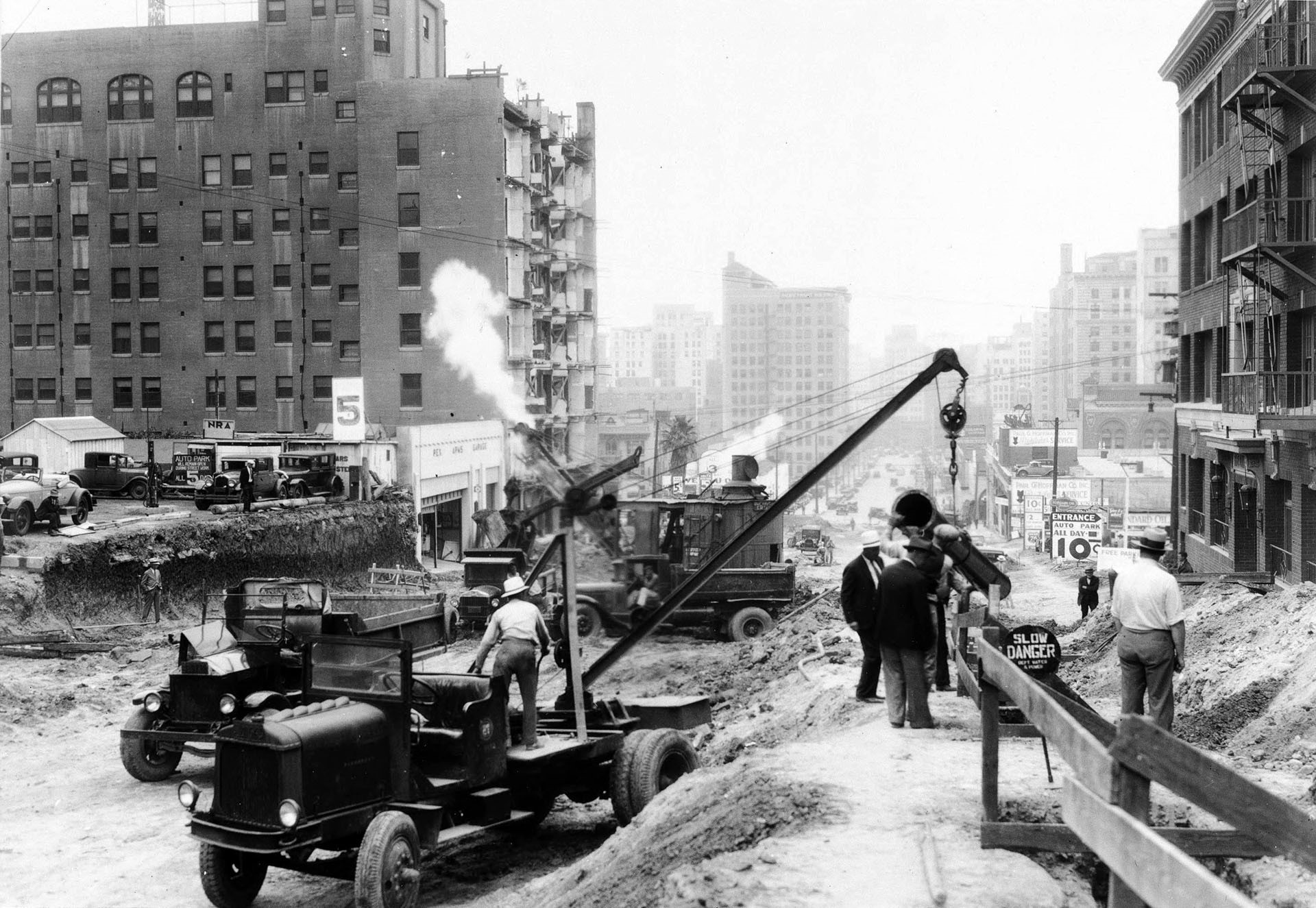 |
|
| (1931)* –View looking east on Wilshire Boulevard, previously Orange Street, toward Figueroa Street during widening construction. |
Historical Notes Construction crews work along three dense blocks where buildings once stood close to the original curb line. Foundations have been exposed and portions of structures removed to establish the new right of way. At left, the Rex Arms Apartments and Hotel stand along the corridor that is being reshaped block by block. This image captures the disruption required to convert Orange Street into a broader automobile boulevard. |
Wilshire and Figueroa
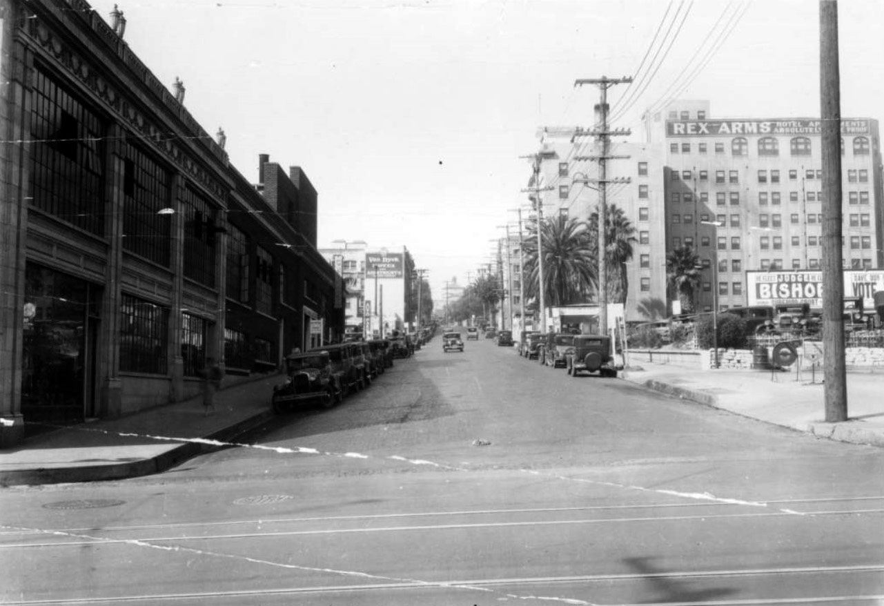 |
|
| (1931)* – View looking west on Orange Street, later Wilshire Boulevard, from Figueroa Street before widening and final reconstruction. |
Historical Notes Before widening was complete, the street retained its narrower profile. Overhead utility lines fill the skyline and early automobiles line both curbs. The Rex Arms Apartments and Hotel dominate the right side of the frame, projecting closer to the roadway than would be permitted after reconstruction. The intersection still reads as the western edge of downtown rather than part of a unified boulevard. |
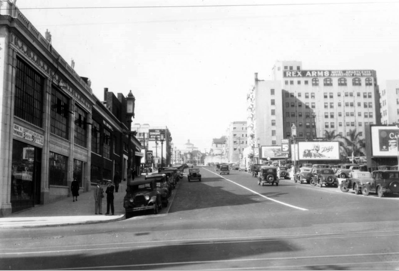 |
|
| (1934)* – View looking west on Wilshire Boulevard from Figueroa Street after widening and reconstruction. |
Historical Notes Following reconstruction, the intersection assumed a new identity. The roadway is wider and more uniform, and the building line now forms a straighter, more continuous edge along the boulevard. The Rex Arms remains, but its altered façade reflects the larger effort to impose order and scale on the corridor. What had been an incremental commercial street now presents itself as a deliberate boulevard designed for movement and civic presence. |
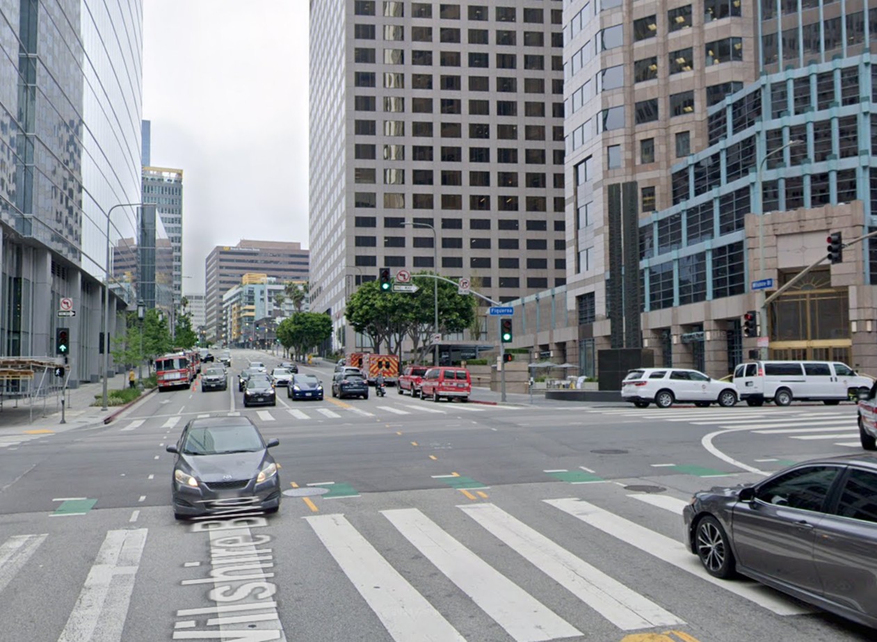 |
|
| (2024)* - View looking west on Wilshire Boulevard at Figueroa Street. |
| Historical Notes
The modern view retains the same uphill alignment, but the setting is now a dense downtown district. Buildings are taller, blocks are more uniform, and traffic volumes are heavy throughout the day. What was once the western edge of downtown has become a fully integrated part of a major commercial core. |
Then and Now
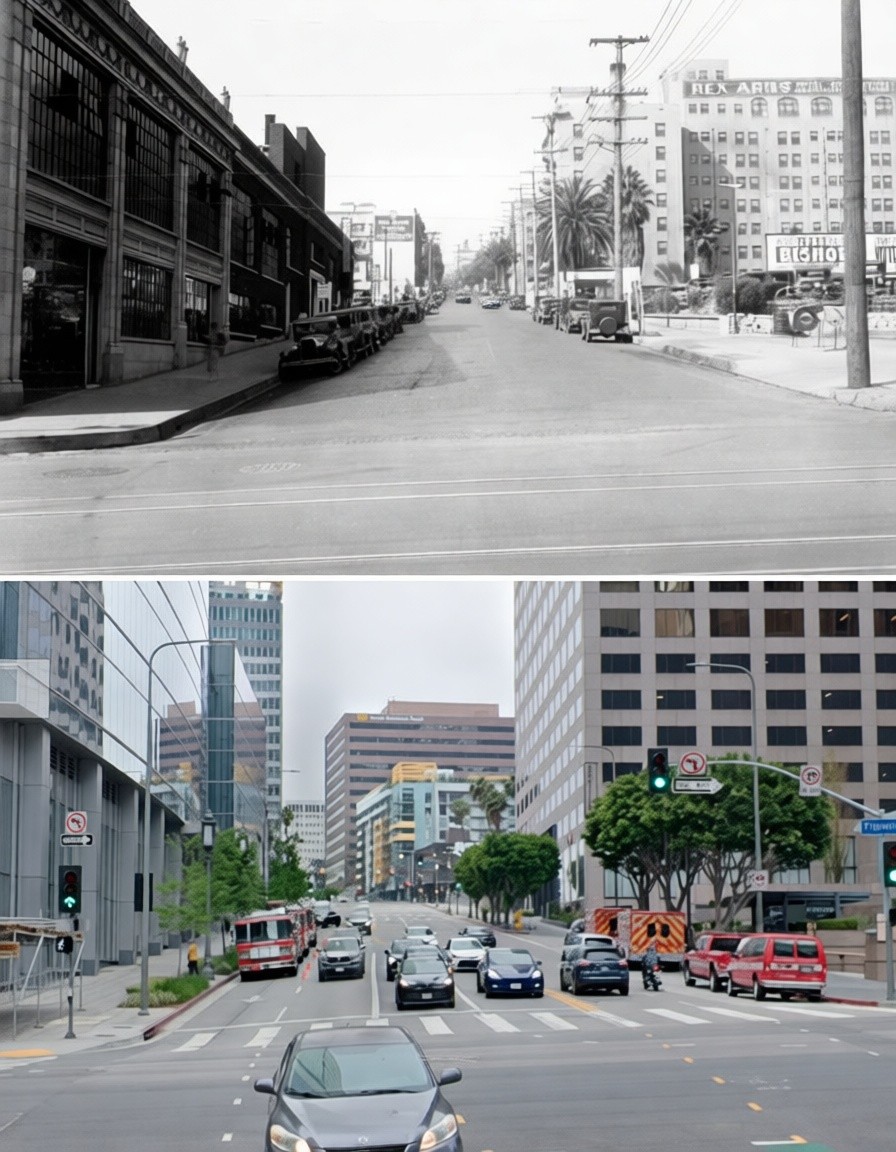 |
|
| (1931 vs. 2024)* - View looking west at Wilshire Boulevard and Figueroa Street. Photo comparison by Jack Feldman. |
| Historical Notes
Seen across time, the intersection tells the larger story of Wilshire’s rise as a defining Los Angeles corridor. The earlier view shows a narrower street with overhead wires and low to mid rise buildings. The modern view shows a widened boulevard framed by taller structures and steady traffic. The widening of Orange Street reshaped both the roadway and the relationship between downtown and the Westside. |
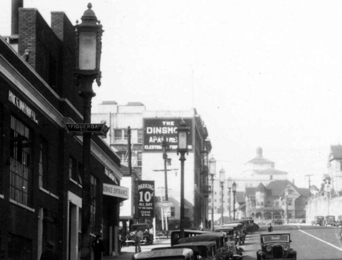 |
|
| (1934)* – Close-up view looking west from the southwest corner of Wilshire and Figueroa Street. |
Historical Notes Ornate Wilshire Special streetlights line the boulevard, with street signs mounted directly to their posts. These fixtures reflect an effort to present Wilshire as a premier civic and commercial route. Even details such as ten cent all day parking signs show how the automobile economy was reshaping daily life along the corridor. |
 |
|
| (1931)* – View of Orange Street looking west from Bonnie Brae Street before widening, March 2, 1931. |
Historical Notes This view shows Orange Street prior to the major reconstruction that would transform it into Wilshire Boulevard. The roadway is narrow, with automobiles parked along both curbs and limited space for through traffic. Buildings stand close to the street, reflecting gradual commercial development rather than coordinated planning. The eight story Wilshire Medical Building rises on the north side, and trees in the distance mark the edge of Westlake Park. At this stage Wilshire had not yet fully penetrated the downtown district. Orange Street functioned as a modest retail and residential corridor that would soon undergo dramatic structural change. |
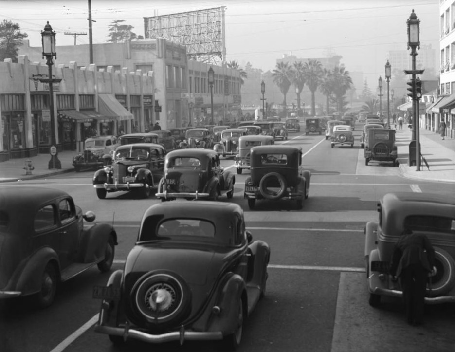 |
|
| (1937)* - View of Wilshire Boulevard at Bonnie Brae Street looking west toward Westlake Park after widening and renovation. |
Historical Notes By the late 1930s the widened corridor had settled into its new form. The Wilshire Medical Building remains on the north side, but the south side reflects substantial rebuilding. The broader roadway and straighter building line reinforce the permanence created by the reconstruction. Orange Street had effectively disappeared in both name and scale. Click HERE to see more on the Wilshire Extension through Westlake Park. |
Westlake Park and the Final Link |
Wilshire originally ended at Westlake Park, now MacArthur Park. To complete the route, the city constructed an earthen roadway across the park’s lagoon. The proposal generated strong opposition from residents who objected to cutting through one of the city’s oldest public retreats. The dispute reached the state supreme court, which ultimately allowed the project to proceed. When the crossing was dedicated in December 1934, Wilshire formed a continuous connection between downtown and the ocean, permanently reshaping both the park and the urban structure of Los Angeles. |
* * * * * |
Wilshire Boulevard |
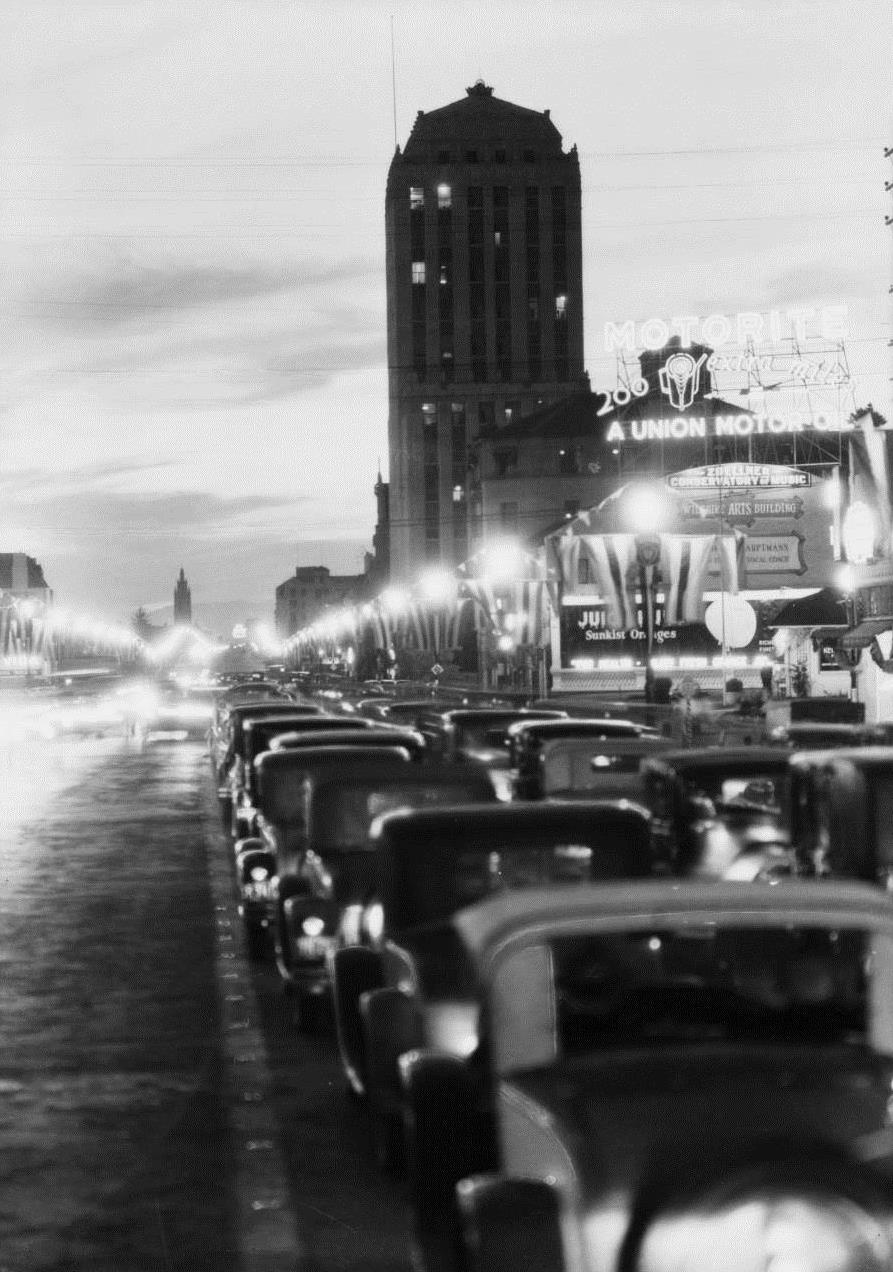 |
|
| (1931)*# - View of eastbound traffic congestion on Wilshire Boulevard. The tall building in the background is the Dominguez-Wilshire Building. |
Historical Notes The Dominguez-Wilshire building (also called the Myer-Siegel Building) was designed in 1930 by architects Morgan Walls and Clemens. The Art Deco building is located at 5410 Wilshire Boulevard in the Miracle Mile district. The property was named after its developers, the Dominguez family, the heirs to the first land grant given in California by King Carlos III of Spain.^* |
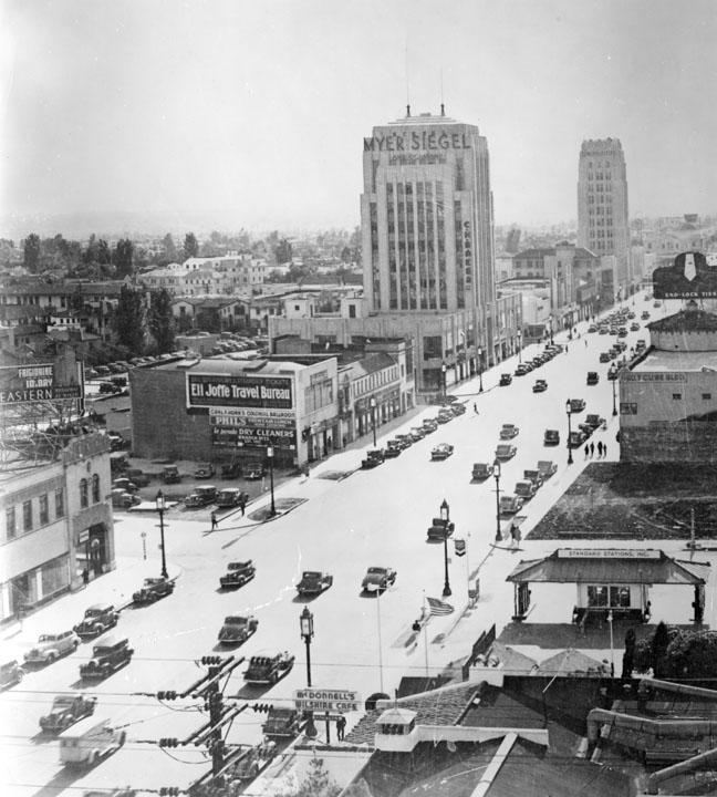 |
|
| (1932)^ - An overview of Wilshire Boulevard, looking west. Visible on the left side of the picture is a high rise building labeled Myer Siegel and Company (the Dominguez Building) with C.H. Baker on the front right lower portion of the exterior. Farther back on the street is Wilshire Tower with the name Desmonds just visible on the top. On the right side near the bottom of the picture is McDonnell's Wilshire Cafe and past it a Standard Oil gas station. |
Historical Notes In 1886, Myer Siegel opened his first store at Second and Main in Los Angeles. The Wilshire store located in the Dominguez-Wilshire Building in the Miracle Mile was the third store in the chain following stores in Downtown and Pasadena. Additional stores would follow in Beverly Hills and Westwood. These Myer Siegel stores offered better women’s apparel. The company closed in the late 1950s.^ |
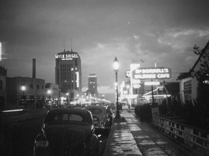 |
|
| (ca. 1937)^ - Looking west down Wilshire Boulevard from La Brea Avenue in the Miracle Mile at night. The two largest signs in view are: MYER SIEGEL and McDONNELL'S WILSHIRE CAFE |
Historical Notes Not to be confused with today’s McDonald’s fast food restaurants, McDonnell’s Restaurant and Drive-in sandwich stands were part of a chain of restaurants found in LA during the 1930s. The McDonnell's restaurants throughout Los Angeles were: McDonnell's Monterey (7312 Robertson Boulevard); McDonnell's Wilshire (Wilshire Boulevard and La Brea Avenue); McDonnell's Fairfax (Fairfax Avenue and Wilshire Boulevard); McDonnell's Gates Hotel (Sixth and Figueroa streets); McDonnell's Hill Street (454 S. Hill Street); McDonnell's Figueroa (4012 S. Figueroa Street); McDonnell's Adams and Figueroa (2626 S. Figueroa Street); and McDonnell's Pico Street (Pico and Hope streets). McDonnell's "Drive-Ins" were located at Beverly Boulevard & Western Avenue, Wilshire and Robertson Boulevards, Yucca Street and Cahuenga Boulevard, Wilshire Boulevard and Fairfax Avenue, and Sunset Boulevard and La Brea Avenue.^ |
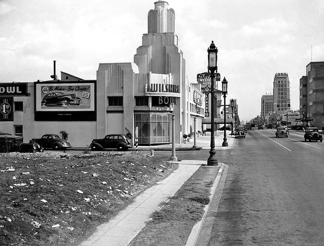 |
|
| (ca. 1938)**#* – View looking east on Wilshire Boulevard showing the Wilshire Bowl (N/E corner of Wilshire and Masselin). In the distance can be seen the Wilshire Tower and the Dominguez Building. |
Historical Notes The Wilshire Bowl was a nightclub (and not a bowling alley). It opened in 1933, by 1941 it was the Louisiana Restaurant. Slapsy Maxie's took over around 1943. |
 |
|
| (ca. 1939)^#^ – View showing the Wilshire Bowl with its Art Deco tower, located at 5665 Wilshire Boulevard. |
Historical Notes The Wilshire Bowl opened in 1933 and around 1942-1943 it became The Louisiana. Slapsy Maxie's existed in the space from 1943-1947 and was one of the venues that gave Danny Thomas his earliest standup performance opportunities. Eventually, Van de Kamp's Bakeries signed a $1,000,000 lease with Prudential Insurance Co. to convert the former restaurant into a modern coffee shop in 1952. It was demolished in 1982 to make way for a large commercial development.* |
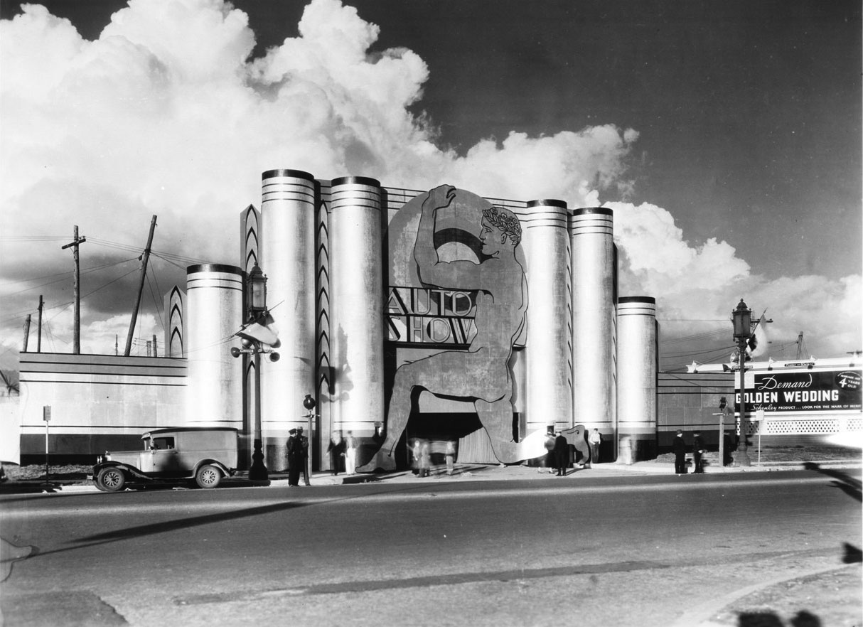 |
|
| (1935) - View of the 1935 auto-show tent on Wilshire Boulevard. The lamppost on the left indicates the intersection of Wilshire and Stanley. |
 |
|
| (ca. 1935)#++# – View looking east on Wilshire Boulevard at Cochran Avenue. An airplane (Fokker F-32) seems to be parked on the corner lot. Sign on the wings reads: BOB'S AIRMAIL SERVICE |
Historical Notes This is Bob's airmail service gas station, which stood at 5453 Wilshire Blvd, at the corner of Cochran Ave. The plane is a 32-passenger Fokker F-32, which was a white elephant of an aircraft that never really worked right. They were probably going cheap so that when in 1934, Bob Spenser got the idea to build a Mobil gas station around one, Fokker probably said, “Here! Take it!” It sure must have been eye catching because in 1934, Bob's Air Mail Service Station sold more Mobiloil and Mobilgas products than any other dealer on the West Coast. #++# |
 |
|
| (1936)*^^ - You could gas up your car beneath the wings of a grounded airplane at Bob’s Air Mail Service Station on the n/w corner of Wilshire Blvd. and Cochran Ave. in 1936. |
Historical Notes Bob’s Air Mail Service utilized the twin-prop airplane to top its station, with the wings serving as canopies to shade its General Petroleum pumps. The plane was one of two Fokker F-32 aircraft operated by Western Air Express, circa 1930-31. The four engine F-32 was a design failure due to overheating of the two pusher engines and was only briefly in commercial service. |
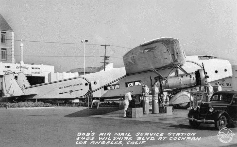 |
|
| (1936)***^ - Another view of Bob's Airmail Service Station at 5453 Wilshire Boulevard. Click HERE to see more Early Los Angeles Gas Stations. |
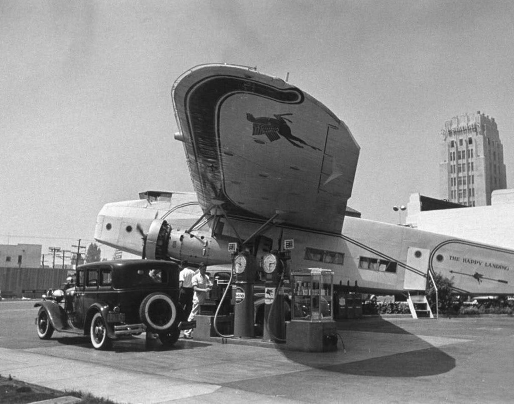 |
|
| (ca. 1936)**^ - Bob's Airmail Service Station on Wilshire. It almost appears as if the plane's propellers are moving. In the background can be seen the Wilshire Tower with the name Desmonds just visible on the top. |
Click HERE to see more in Aviation in Early Los Angeles |
* * * * * |
Downtown Los Angeles
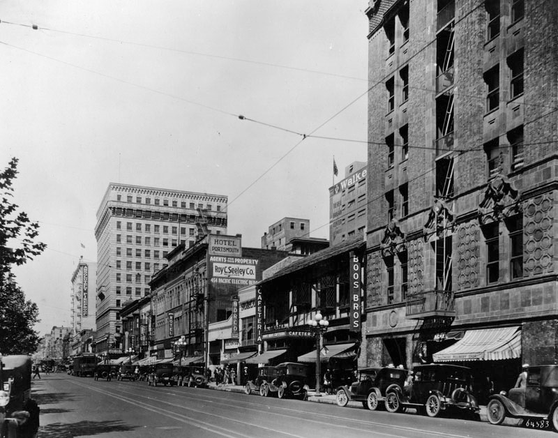 |
|
| (1930)^ - View looking north on Hill Street between 5th and 6th streets showing the Boos Bros. Cafeteria and Portsmouth Hotel on the right with Pershing Square on the left. |
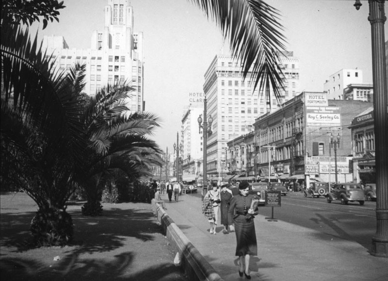 |
|
| (1930s)^ - View showing the corner of 5th and Hill streets looking north, taken from alongside Pershing Square. The tall building visible behind the small palm trees is the Title Guarantee and Trust Company Building, located at 401 W. 5th Street. Architects John and Donald B. Parkinson designed it in Art Deco style with a Gothic Revival style tower in 1930. Across the street is the Boos Bros. Cafeteria (far right). An ad for "Roy C. Seeley Co." as well as an "Auto Park" sign is posted on the side of the Hotel Portsmouth building. The taller building behind it is the Pershing Square Building, designed by architects Curlett & Beelman; the building is a 13-story Beaux Arts Renaissance Revival style structure that was built in 1925. And farther back, the Hotel Clark can be seen peeking from behind. Built in 1912 by architect Harrison Albright, Hotel Clark boasts of "555 rooms with private baths" and with fire escapes on both ends is "Absolute Fireproof". |
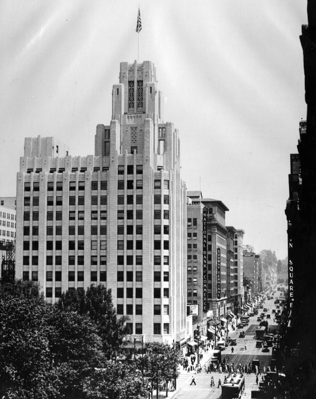 |
|
| (ca. 1932)^ - View looking north on Hill Street with Pershing Square in the lower left. On the northeast corner of 5th and Hill streets stands the Art Deco Title Guarantee Building. Other buildings seen are the National Bank of Commerce Building and the Subway Terminal Building. It's a busy afternoon as pedestrians, automobiles and street cars move about on the streets. |
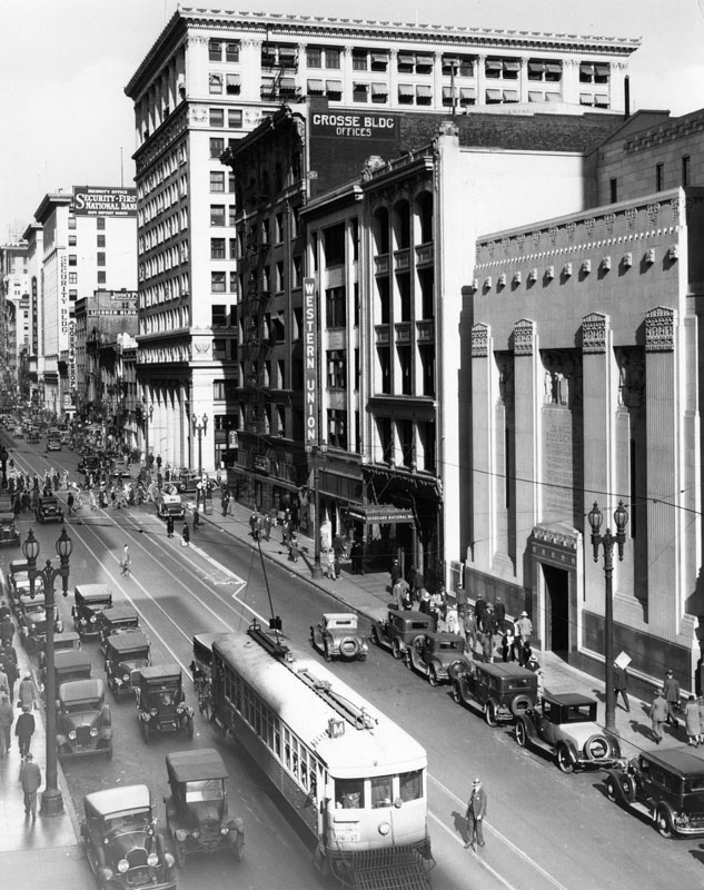 |
|
| (ca. 1932)^ - View of Spring Street looking north from between 6th and 7th Streets, full of cars, streetcars and pedestrians. At right is the Los Angeles Stock Exchange Building (later the Pacific Coast Stock Exchange), located at 618 South Spring Street and built in 1929-1930. Also visible is a Western Union office, the Grosse Bldg., the Ussner Bldg., Security-First National Bank, and the Rowan Building. |
Historical Notes The Stock Exchange opened in 1931, in the midst of the Great Depression. Designed in the Classical Moderne style to impart a sense of financial stability, the building’s imposing, fortress-like street façade rises the equivalent of five stories. A slender twelve-story office tower clad in terra cotta is set back at the rear. The Stock Exchange became part of the Pacific Stock Exchange in 1956, and it moved out of the building in 1986. In the 1980s, the building was converted into a nightclub called the Stock Exchange. After undergoing an extensive interior renovation, the building reopened in 2010 as Exchange LA, a nightclub and event venue. |
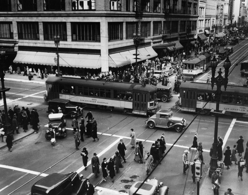 |
|
| (1930s)^ - Crowds of pedestrians are crossing the street in this picture of the intersection of 7th and Broadway. On the far (northwest) corner of Broadway is the Bullock's Dept. store. Note the long trolley cars marked Los Angeles Railway crossing the intersection. |
Historical Notes The Los Angeles Railway (also known as Yellow Cars, LARy, and later Los Angeles Transit Lines) was a system of streetcars that operated in central Los Angeles and the immediate surrounding neighborhoods between 1901 and 1963. The company carried many more passengers than the Pacific Electric Railway's 'Red Cars' which served a larger area of Los Angeles. The system was purchased by railroad and real estate tycoon Henry E. Huntington in 1898 and started operation in 1901. At its height, the system contained over 20 streetcar lines and 1,250 trolleys, most running through the core of Los Angeles and serving such nearby neighborhoods as Echo Park, Westlake, Hancock Park, Exposition Park, West Adams, the Crenshaw district, Vernon, Boyle Heights and Lincoln Heights. |
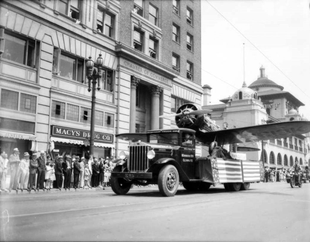 |
|
| (1933)* – View looking northwest on the 1100 block S. Broadway showing the National Air Races parade. Across the street is the Chamber of Commerce Building with the Examiner Building further north on the right (S/W corner of 11th and Broadway). |
Historical Notes The National Air Races were held at Mines Field (now LAX), July 1-4, 1933. Begun in 1920, the National Air Races were an annual, week-long event including formation flying, parachute drops, aerobatic displays, and races. The event included two privately sponsored, closed-circuit speed races: the Pulitzer Trophy race held from 1920 to 1925 and the Thompson Trophy race held from 1930 to 1939. Along with other competitions, the National Air Races fostered the development of aircraft in the 1920s and 1930s but ended during World War II. |
.jpg) |
|
| (1933)* – View looking down toward the intersection of Broadway and 12th Street during the National Air Races parade, showing the newly elected Mayor of Los Angeles, Frank L. Shaw in convertible (dark suit in rear seat), being escorted by three motorcycle policemen. |
Historical Notes In the foreground can be seen an ornate streetlight, often refered to as the 'Broadway Rose'. It was so named for the distinctive climbing rose design on the post. The Broadway Rose only appeared on Broadway. Click HERE to see more in Early Los Angeles Streetlights. |
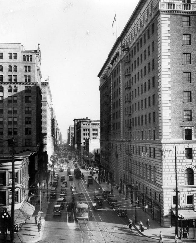 |
|
| (ca. 1932)^ - A flag flies atop the Barker Bros. furniture store at the corner of 7th St. and Figueroa in this view looking east. Wires for the electric street cars cover the intersection in a web of lines. A traffic light on the corner has stuck its "Go" sign out. On the left in the middle of the block is the Signal Oil building. |
Historical Notes Barker Brothers' fine furnishings was a Los Angeles upscale furniture chain that closed in 1992 after operating for more than 110 years. |
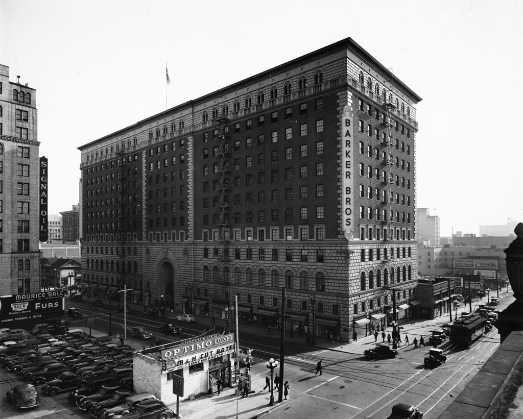 |
|
| (late 1930s)* - View of the Barker Brothers building on the southeast corner of 7th & Figueroa. Note the building on the northeast corner has been torn down and is now a parking lot (see previous photo). The M & H Cut Rate Luncheonette sits on the corner of the parking lot with a large sign on its roof that reads: “Optimo Cigars” |
Historical Notes The 1925 building, designed in the Renaissance Revival style by Curlett and Beelman, was said to have been inspired by the Strozzi Palace in Florence. The symmetrically developed twelve-story structure is faced in terra cotta and brick, with a monumental three-story round arched center entry. Inside there is a forty-foot-high lobby court with beamed and vaulted ceilings. In 1988, the Barker Brothers Building on the southeast corner of 7th Street and Figueroa was dedicated LA Historic-Cultural Monument No. 356 (Click HERE to see complete listing). |
* * * * * |
Long Beach
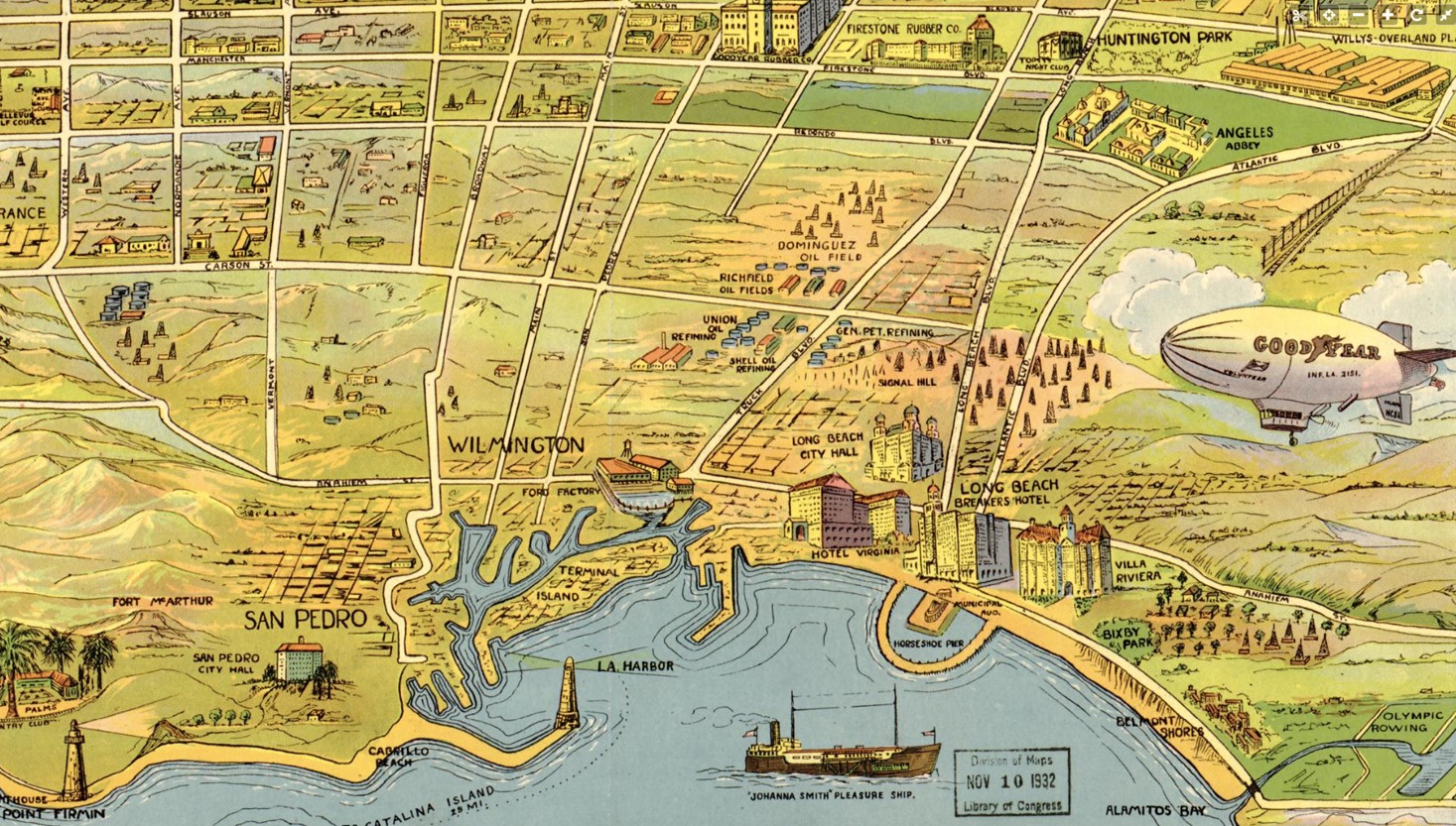 |
|
| (1932)* - Map Highlighting Key Points of Interest in the South Bay area including Long Beach, Wilmington, and San Pecro. Source: Library of Congress. |
Historical Notes During the 1930s and 1940s, Long Beach, California experienced dramatic transformation from a quiet coastal town to a bustling industrial center. The Great Depression era saw the city maintain economic stability through its robust oil industry, with population growth from 142,032 to 164,271 by 1940. A significant 6.4 magnitude earthquake in 1933 reshaped the city's infrastructure, leading to stricter building codes. The demographic makeup shifted from predominantly Midwestern retirees to a more diverse population of workers and immigrants. World War II dramatically accelerated Long Beach's development, turning it into a critical military and industrial hub. The Douglas Aircraft Company plant, established in 1941, produced thousands of aircraft for the war effort, employing around 200,000 people in regional production by 1943. The Port of Long Beach and naval facilities expanded significantly, with the U.S. Naval Shipyard and Terminal Island naval station becoming major employers. The city's Black population grew from 600 to nearly 6,000, reflecting broader demographic shifts. Post-war developments included Howard Hughes' Spruce Goose flight in 1947 and the founding of California State University, Long Beach in 1949, solidifying the city's emergence as a major urban center with a diverse, dynamic character. |
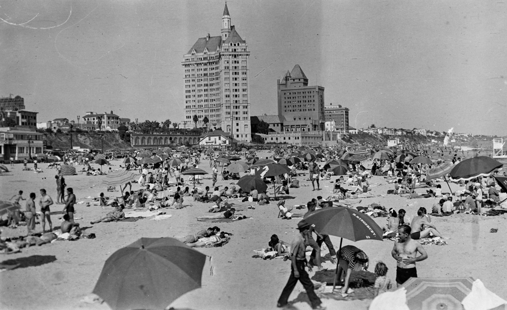 |
|
| (1940s)* - A crowded beach scene in Long Beach with beachgoers in bathing suits relaxing under beach umbrellas. The Villa Riviera towers in the background as the tallest building, with the Pacific Coast Club nearby. Photo from the Ernest Marquez Collection. |
Historical Notes In the 1940s, Long Beach's coastline underwent dramatic transformation, most notably with the construction of a massive 8-mile breakwater across San Pedro Bay. Begun before World War II and completed in 1949, this engineering project fundamentally altered the city's coastal environment. The breakwater's completion changed water flow at the mouth of the L.A. River and effectively eliminated surfing opportunities by preventing waves from reaching the shore, marking a significant shift in the beach's recreational potential. The decade was characterized by increased military and industrial presence along the coastline. The U.S. Navy established a substantial naval station on Terminal Island, employing over 16,000 people at its wartime peak, which significantly impacted beach access and usage. While specific recreational details are limited, the beaches remained an important part of Long Beach's identity, with sailors and civilians frequently enjoying the coastal areas. The breakwater and military developments represented a period of substantial urban and maritime transformation for Long Beach's shoreline. |
1930s
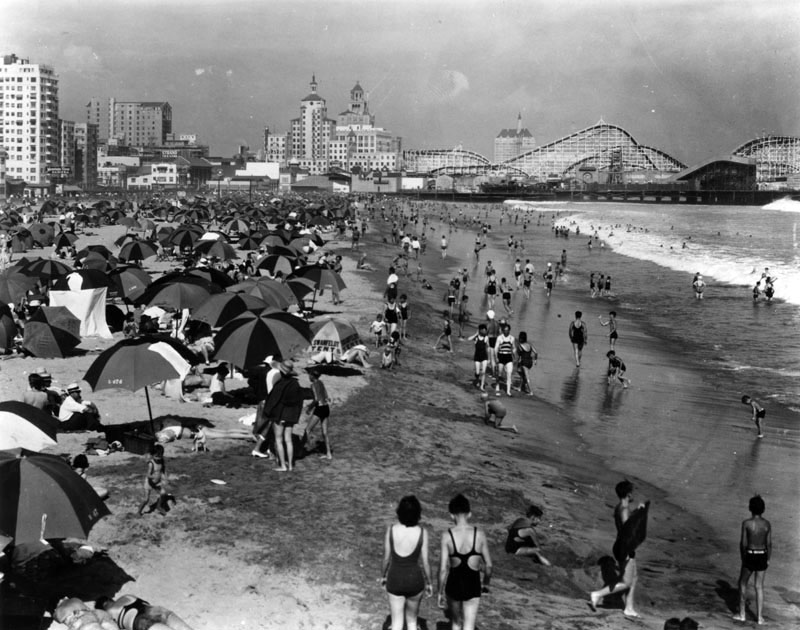 |
|
| (1930)^ - A view of the beach at Long Beach looking south toward the Pike. The Villa Riviera Hotel is just visible behind the roller coaster. Umbrellas cover the beach and the surf is crowded with swimmers. |
Historical Notes In the 1930s, Long Beach's beaches were vibrant recreational spaces that embodied the city's coastal culture despite the economic challenges of the Great Depression. The coastline featured long sandy stretches populated by hundreds of beachgoers, often dressed in period bathing attire and using umbrellas for shade. The famous Pike amusement area overlooked the beaches, while the distinctive Rainbow Pier, shaped like a horseshoe and extending into the ocean, provided a popular fishing destination. Surfing was particularly prominent during this era, with the city hosting surf contests that highlighted the area's robust beach culture. Although tourism was impacted by economic hardships, the beaches remained a critical part of Long Beach's identity. The natural beauty and recreational opportunities continued to draw locals and visitors alike, creating a sense of community and leisure during challenging economic times. Industrial developments were also emerging, with initial dredging of the Cerritos Channel beginning in 1932, signaling the start of significant maritime and coastal transformations. These early engineering efforts would reshape the shoreline in the coming decades, gradually changing the character of Long Beach's beaches from purely recreational spaces to areas of increasing economic and industrial importance. |
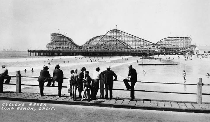 |
|
| (1930)* - A group of people look across the beach toward the Cyclone Racer at the Pike Amusement Park. A lone sailor is looking in a different direction toward perhaps some different scenery. |
Historical Notes The Pike operated under several names. The amusement zone surrounding the Pike, "Silver Spray Pier", was included along with additional parking in the post-World War II expansion; it was all renamed Nu-Pike via a contest winner's submission in the late 1950s, then renamed Queens Park in the late 1960s in homage to the arrival of the Queen Mary ocean liner in Long Beach. The Pike reached its peak popularity in the 1930s-1950s, becoming the leading amusement attraction in the Los Angeles area and the 5th largest in the U.S. by 1954. It featured 218 concessions at its peak, including the famous Cyclone Racer roller coaster that extended over the water. Other popular attractions included the Loof carousel, pony rides, sideshows, and skill games. The Pike became a hotspot for sailors on leave, who frequented its bars, tattoo parlors, and adult entertainment. Legendary tattoo artists like Bert Grimm set up shops there. The Pike was most noted for the Cyclone Racer, a large wooden dual-track roller coaster, built out on pilings over the water. It was the largest and fastest coaster in the U.S. at the time. They called it 'racer' because there were two trains on two separate tracks that raced one another from start to finish. |
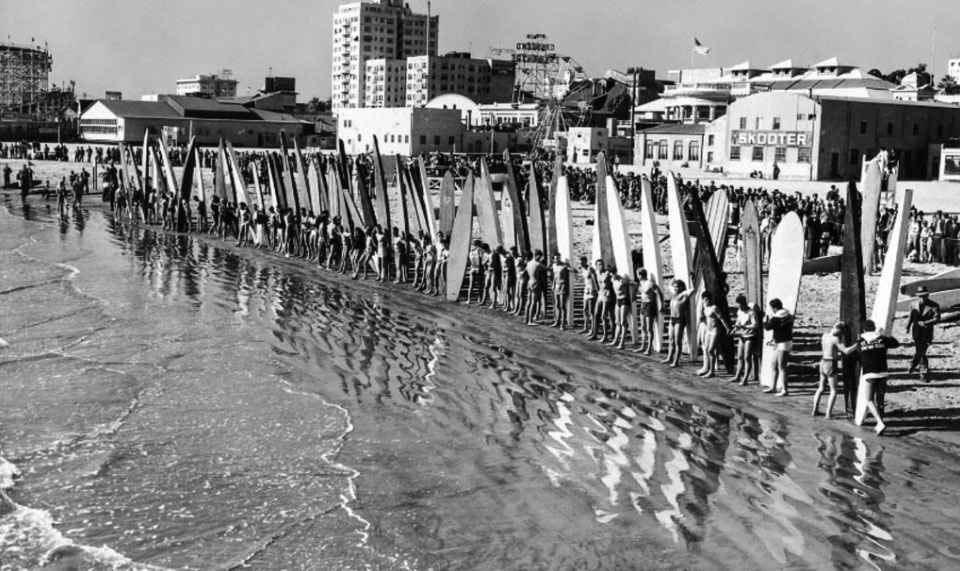 |
|
| (1938)* – Paddle boarders line up for the start of the National Surfing and Paddleboard Championship in Long Beach. The Cyclone Racer is at upper-left. |
Historical Notes Long Beach played host to the First National Surfing and Paddleboard Championship from November to December of 1938. The rising momentum of Long Beach surfing wouldn’t last, unfortunately. It took a major hit in 1941 with the construction of the Long Beach Breakwater. |
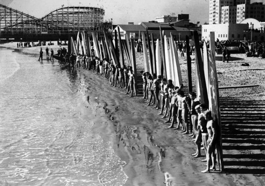 |
|
| (ca. 1938)* – Closer view showing surfers standing in front of their longboards/paddleboards with the Cyclone Racer in the background. |
Historical Notes Surfing in Long Beach was short-lived. In 1940, the U.S. Navy moved into the port of Long Beach and in 1941 construction began on the 2.2-mile long Long Beach Breakwater. The breakwater was used by the U.S. Navy as protection for the U.S. Pacific Fleet during World War II. In 1997, the Navy base was closed, but the breakwater still remains to this day. |
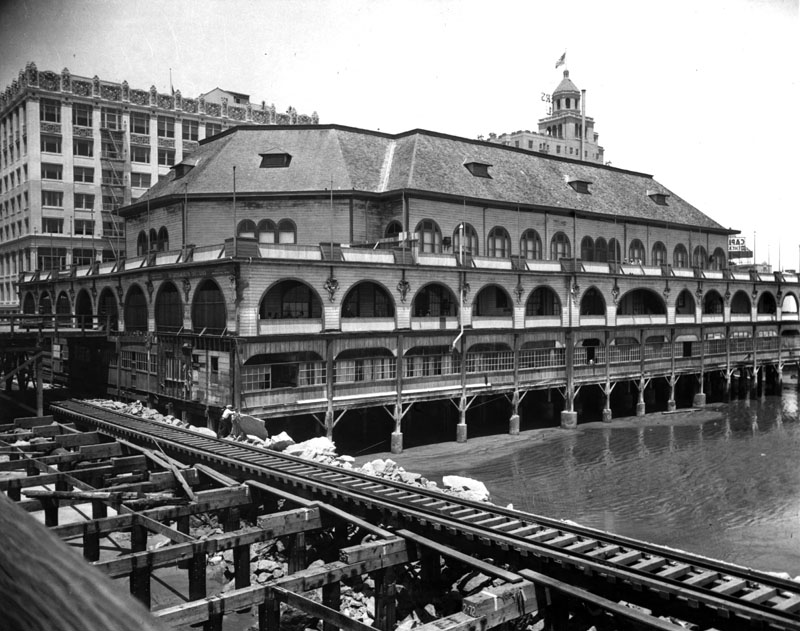 |
|
| (1929)^ - View of the first Long Beach Municipal Auditorium extending onto the beach on pillars. The municipal pier is to the left. |
Historical Notes The first Long Beach Municipal Auditorium was built in 1905 on the east side of the municipal pier at Seaside and Pine Ave. for a capacity crowd of 6000. On May 24, 1913, 10,000 people were massed on a double-deck pier in front of the City Auditorium celebrating "British Empire Day”. A section of the upper floor gave way and 400 were plunged to the beach, forty feet below. Those on the top deck fell upon the hundreds crowded on the lower deck, and all were dashed down a chute of shattered woodwork to the tide-washed sands. Thirty-three people, mostly women, were killed. Fifty more were seriously injured. The auditorium was replaced in 1932 by the second Long Beach Municipal Auditorium. |
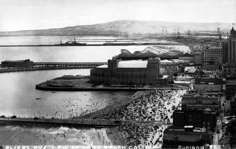 |
|
| (ca. 1932)* - Beachgoers swamp the coast of Long Beach. The Pike Amusement Park with its towering roller coaster is seen in the background. The large building in th center of the photo is the new Municipal Auditorium, Long Beach's second. |
Historical Notes In 1932, the Long Beach Municipal Auditorium was constructed on the beach on 20 acres of landfill. In order to protect the auditorium from coastal erosion, a horseshoe-shaped breakwater with a road on top was constructed around it. Because of its shape it was named Rainbow Pier. |
.jpg) |
|
| (1932)* - Three women enjoying the afternoon on a patio with the Municipal Auditorium in the background. Also note the naval vessels in the distant background. |
Historical Notes In 1932, Long Beach became a home port for the United States Navy's Pacific Fleet, hosting a significant number of naval vessels. The Battle Fleet, consisting of 16 battleships, was homeported in the San Pedro-Long Beach area from 1919 to 1940. Specifically in 1932, the Battle Fleet based in San Pedro Bay included: 16 battleships, including the USS Nevada, Oklahoma, Pennsylvania, Arizona, New Mexico, Mississippi, Idaho, Tennessee, California, Colorado, Maryland, and West Virginia 2 aircraft carriers - USS Lexington and USS Saratoga 14 cruisers (which had joined from the Atlantic-based Scouting Force) 16 support ships In total, there were around 31,286 Navy personnel manning these vessels in the San Pedro-Long Beach area by 1934. The overcrowded harbors lacked permanent shore facilities to support the large naval presence, relying on repair ships for minor repairs. |
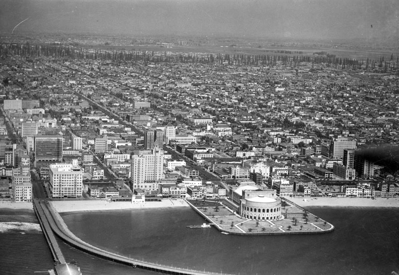 |
|
| (ca. 1932)^ - Aerial view of the Long Beach waterfront looking north, including the Municipal Auditorium, Rainbow Pier, and Breakers Hotel (directly behind the auditorium, it is the tall building with the cupola tower at one end). Behind the auditorium, every single square inch of the city is riddled with commercial and housing areas as far as the eye can see. The oil derricks visible in the extreme background (looking like tall pine trees) are the beginning of the Signal Hill oil fields. |
Historical Notes Oil was discovered in 1921 on Signal Hill, which split off as a separate incorporated city shortly afterward. The discovery of the Long Beach Oil Field, brought in by the gusher at the Alamitos No. 1 well, made Long Beach a major oil producer; in the 1920s the field was the most productive in the world. In 1932, the even larger Wilmington Oil Field, fourth-largest in the United States, and which is mostly in Long Beach, was developed, contributing to the city's fame in the 1930s as an oil town. |
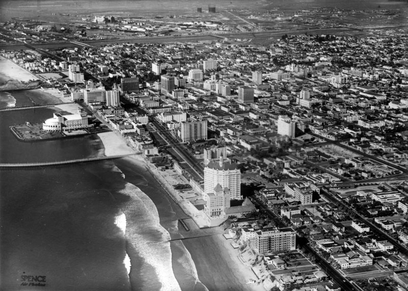 |
|
| (1935)^ - An aerial view of Long Beach looking west. Center left is the Municipal Auditorium set in the middle of a lagoon formed by the Rainbow Pier. The Pike's roller coaster is just visible to the left of the Auditorium. The Los Angeles River runs through the top of the photograph on its way to the ocean. Multi-story buildings define Long Beach's central business district. |
 |
|
| (ca. 1935)^ - Ocean Boulevard follows the shoreline in this aerial view of Long Beach. It passes the Municipal Auditorium that juts out into a lagoon formed by the Rainbow Pier. Empty lots, bottom, face the beach and lead to a row of hotels and apartments. Commercial buildings and various other businesses cluster around the boulevard. Part of the Pike's roller coaster is visible directly behind the auditorium. |
Historical Notes The 8,000-seat Long Beach Municipal Auditorium was built starting in 1931 at the foot of Long Beach Boulevard and extends 500 feet out into the Pacific Ocean. It is surrounded on three sides by a lagoon; the half-circular Rainbow Pier, which is open to the public, arches from Pine Ave. to Linden Ave. surrounding the auditorium and lagoon. |
_1935.jpg) |
|
| (ca. 1935)^ - South end of the Municipal Auditorium (right), and business buildings along the Ocean Front - Long Beach, California. A speed boat with a canvas top over the cabin passes by the auditorium in the lagoon made by the Rainbow Pier which encircles it. The tall building with a cupola to the immediate left of the auditorium is the Breakers Hotel. Beachgoers swim, boat, and lay in the sun on the beach next to the auditorium. |
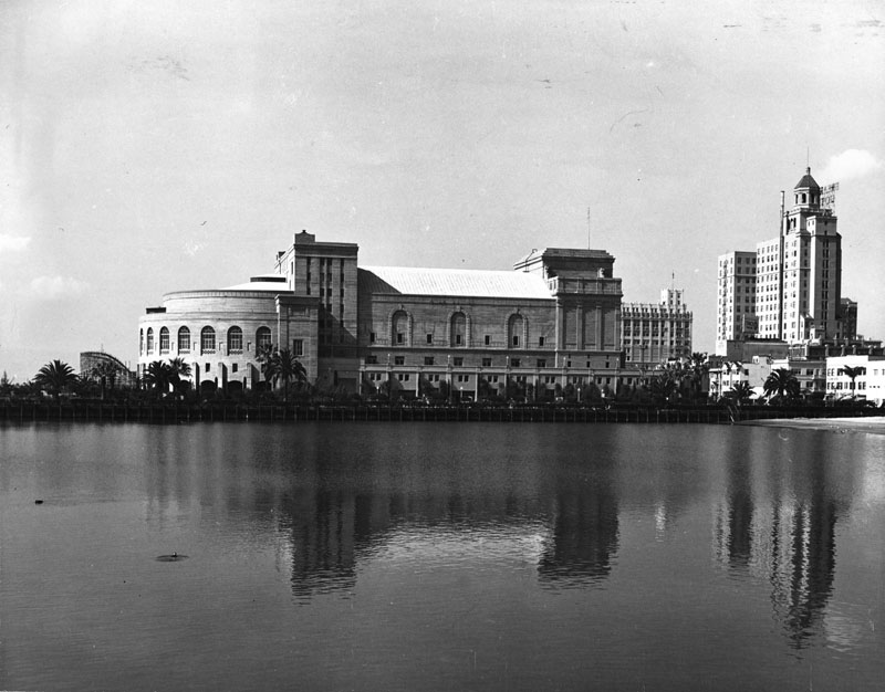 |
|
| (1938)^ - Panoramic view looking toward the Long Beach Municipal Auditorium (center) and Breakers Hotel (right). View is from the east side of the Rainbow Pier looking west. |
Historical Notes Completed in 1932 from plans drawn by J. Harold McDowell, the auditorium replaced Long Beach's first Municipal Auditorium. It stood until 1975 when it was demolished to make way for the Long Beach Convention & Entertainment Center. |
 |
|
| (ca. 1938)* – Aerial view looking down Long Beach Boulevard toward the Long Beach Municipal Auditorium and Rainbow Pier. |
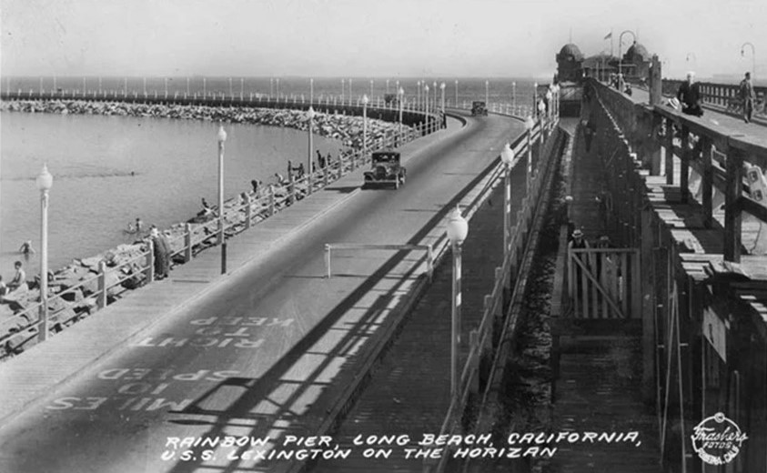 |
|
| (1940)* - Postcard view showing traffic on the Rainbow Pier. |
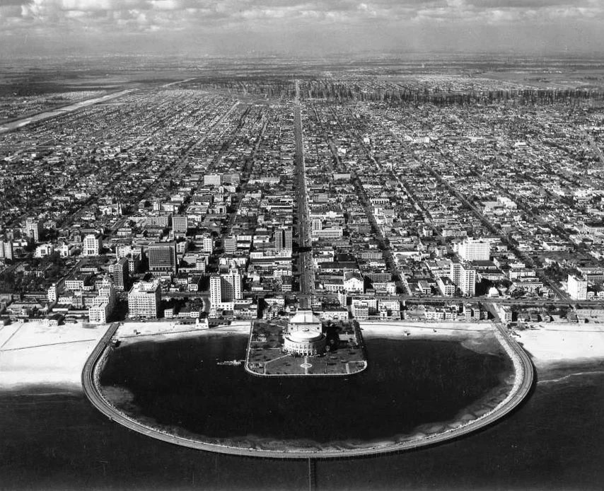 |
|
| (1946)* - Aerial view of Rainbow Pier in Long Beach. A forest of oil derricks can be seen in the background. The LA River can also be seen in the upper left of photo. |
Historical Notes The Rainbow Pier extended more than a quarter-mile into the cold Pacific before arcing back to shore. The 3,800-foot-long structure resembled a giant horseshoe, or a rainbow -- hence its name. It was the first of its kind designed explicitly for the automobile. Built atop a granite breakwater, the pier's roadway could easily support the weight of a motorcar. And the fact that the road returned to shore eliminated the need for awkward turnarounds. |
Then and Now
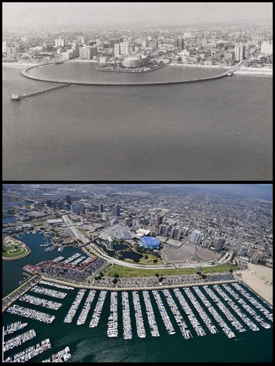 |
|
| (Then and Now - The blue round building in the contemporary image is the Long Beach Convention Center. Photo courtesy of Chris Cloud* |
* * * * * |
Hollywood
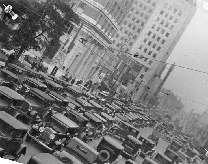 |
|
| (1932)* - Hollywood Boulevard is a sea of cars as far as the eye can see. In the middle ground the marquee of the Pantages Theatre can just be identified. The view is to the east. On the light post are Christmas decorations. |
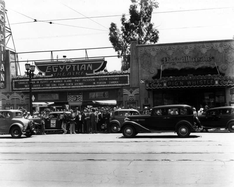 |
|
| (ca. 1933)* - Exterior view of the Egyptian Theatre and the Pig 'N Whistle Café on Hollywood Blvd. in the 1930s. The theater is showing "Charlie Chan in Egypt," with Warner Oland, Pat Paterson and Stepin Fetchit, and Bette Davis in "The Girl from Tenth Avenue." In person: Zandra. A crowd has gathered in the street and on the sidewalk around a car with a sign, "Magical No-Jinks." |
Historical Notes The Egyptian Theatre was built in 1922 by showman Sid Grauman and real estate developer Charles E. Toberman, who subsequently built the nearby El Capitan Theatre and Chinese Theatre on Hollywood Boulevard. Grauman had previously opened one of the United States' first movie palaces, the Million Dollar Theatre, on Broadway in Downtown Los Angeles in 1918. The Egyptian Theatre cost $800,000 to build and took eighteen months to construct. Called the Pig 'N Whistle, the name inspired by its fanciful logo of a dancing pig playing a flute. A side entrance to the new family restaurant opened right out into the grand courtyard of the Egyptian Theatre, so movie-goers could easily move from the restaurant to the theatre and vice versa. From July 22, 1927 to the late 1940's, the Pig 'N Whistle served a loyal Hollywood audience and became something of a Hollywood landmark, surviving both the Great Depression and World War II. By 1949, the Pig 'N Whistle was closed, it's wooden booths purchased by the nearby Miceli’s Italian Restaurant. The Pig 'N Whistle reopened in March of 2001. |
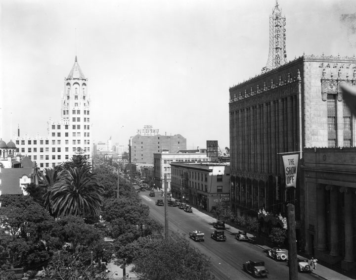 |
|
| (ca. 1935)^ - Trees and plants are in the lower left, the First National Bank Building in the upper left, and down the middle is Hollywood Blvd. with numerous cars. On the right is the El Capitan Theatre with a flag reading "The Show Off", and farther back a sign on top of a building indicates it is a hotel. The First National Bank of Los Angeles, Hollywood Branch, was designed in Art Deco/Gothic style by Meyer and Holler, architects at the Milwaukee Building Company. |
Click HERE to see more in Early Views of Hollywood (1920 +) |
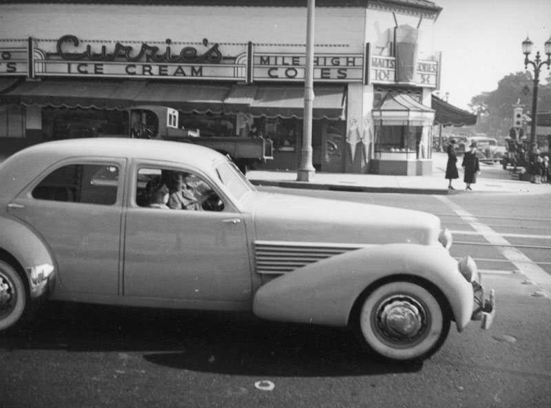 |
|
| (1937)^- A car (1936 Auburn Cord 812 Westchester) stops on Highland at the intersection of Sunset in front of Curries Ice Cream shop, which is located at 6775 Sunset Boulevard. A dimensional sign that looks like a soda with two straws seems to illustrate the claim that the store featured "mile high cones." The northeast corner of Sunset and Highland is now a mini mall. |
Historical Notes Cord was the brand name of an American automobile company from Connersville, Indiana, manufactured by the Auburn Automobile Company from 1929 through 1932 and again in 1936 and 1937.*^ People still fondly remember the Currie’s chain and its “mile-high cone” whose replica was often displayed billboard-style on roofs. The chain was started in 1927 by three brothers named Kuhns. After WWII they sold it to the Good Humor Company who later sold it to Lipton in the 1960s. In 1964 the chain opened its 87th store, in North Hollywood. Although Currie’s anticipated launching units in every community in Southern California, only three outlets were listed in the 1967 Los Angeles phone book and the chain had disappeared by the 1980s. |
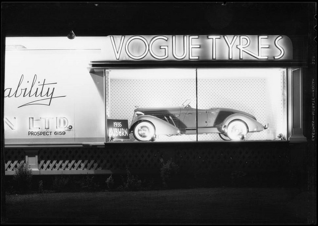 |
|
| (1935)**^ - View of a Vogue Tyre board with an a 1935 Auburn 851 Boattail Speedster on display. |
Historical Notes AUBURN Boattail Speedsters--built in very limited numbers for just a couple of years during the height of the Great Depression--were featured prominently in many magazine ads and movies. |
* * * * * |
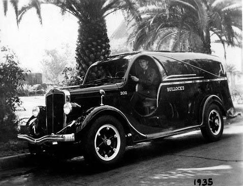 |
|
| (1935)**** – Postcard view showing a Bullock’s Department Store delivery truck in front of what appears to be Westlake Park. |
Click HERE to see more in Early Views of Bullock's Department Store |
Hollywood
 |
|
| (ca. 1935)^ - "Hollywoodland" sign seen from road with passenger car and truck in foreground. Car seems to date from early 1930's. A large white building is seen below the sign. |
Historical Notes The sign was first erected in 1923 and originally read "HOLLYWOODLAND". Its purpose was to advertise the name of a new housing development in the hills above the Hollywood district of Los Angeles. H.J. Whitley had already used a sign to advertise his development Whitley Heights, which was located between Highland Avenue and Vine Avenue. He suggested to his friend Harry Chandler, the owner of the Los Angeles Times newspaper, that the land syndicate in which he was involved make a similar sign to advertise their land.^* |
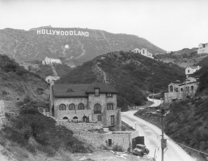 |
|
| (1930s)^ - "Hollywoodland" sign with four homes in foreground set along a winding road. Note the large white dot* below the Sign. |
Historical Notes * Few know that a giant white dot (35 feet in diameter, with 20-watt lights on the perimeter) was constructed below the Sign to catch the eye. The Sign itself featured 4,000 20-watt bulbs, spaced 8 inches apart. At night the Sign blinked into the Hollywood night: first “Holly” then “wood” and finally “land,” punctuated by a giant period. The effect was truly spectacular.^ |
Click HERE to see more in Early Views of Hollywood (1920 +) |
Los Angeles Times
 |
|
| (1934)^ - Scaffolding covers portions of the emerging Los Angeles Times Building as cranes clamp to the top like stick insects. The construction fence advertises "New Home of Los Angeles Times - largest newspaper in the West". A truck delivering construction material is parked by the curb and a ladder extends from the truck to the top of the fence. Next to the Times is the Bryson Building, left. A pharmacy is across the street. |
 |
|
| (1934)^ - View of the intersection of Spring and 2nd Streets, looking toward the United States Bank building on the corner. Beyond it the Los Angeles Times Building on Spring and 1st is under construction, and the old State Building is seen beyond. View is looking north on Spring Street. |
 |
|
| (1939)^++ - View looking north on Spring Street toward 1st Street showing the completed Los Angeles Times Building. |
 |
|
| (1934)**^ - View looking south on Broadway at 1st Street. The old Times Building (3rd Times Bldg.) with its ornate castle-like tower stands gaurd while the new Times Building on First and Spring is still under construction. The new building was completed in 1935. |
Historical Notes The third Los Angeles Times building opened on Oct. 1, 1912 — on the second anniversary of the bombing of the second Times building. It was used until the new Times Building was opened in 1935. The building was torn down in early 1938.**^ |
 |
(1937)^^ - The current Times Building rises behind a worker demolishing the paper's previous home.
|
Historical Notes In 1935 the Los Angeles Times moved into its current building located on 1st and Spring, its 4th building since it started publishing in 1881. Click HERE to see more in Early Views of the LA Times. |
* * * * * |
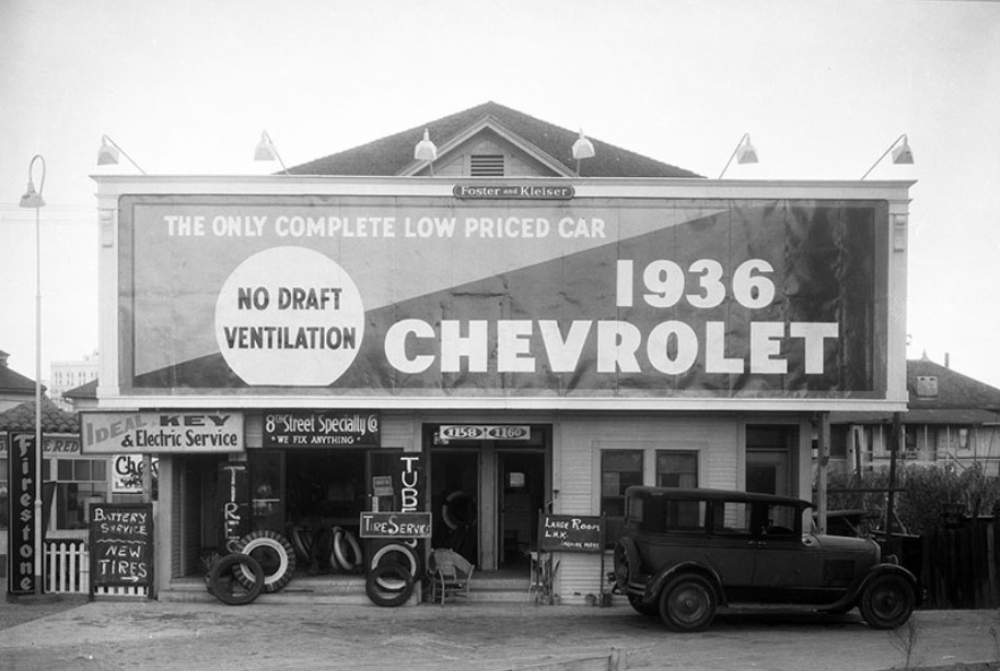 |
|
| (1935)^ - A Foster and Kleiser billboard outside of 1158 and 1160 W. 8th Street promotes the 1936 Chevrolet; 8th Street Specialty Co. is at 1158 and a small hotel is at 1160. Photograph dated November 15, 1935. |
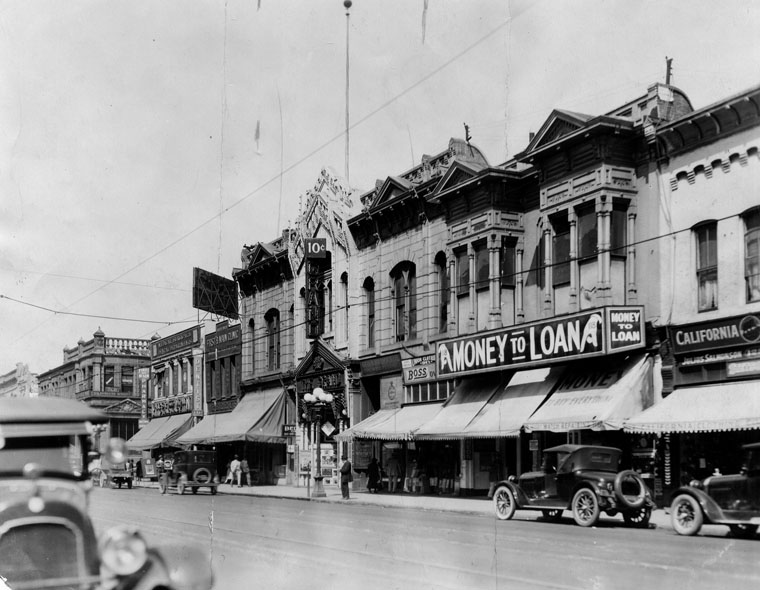 |
|
| (1935)^ - View of Main Street near 1st Street. A multi-lamp streetlight stands in front of the Grand Theatre with sign that reads 10 cents admission. Several storefronts can also be seen. |
Historical Notes The theatre above is the First Orpheum Theatre in Los Angeles, later the Grand Theatre. It opened December 31, 1894, and inaugurated the Orpheum as a circuit. There were four theaters named Orpheum. The first at 125 S. Main Street; the second at 227 S. Spring Street; the third at 630 S. Broadway; and the fourth (and present one) at 842 S. Broadway.^ |
 |
|
| (1935)^ - Exterior view of the 1st Orpheum Theatre in Los Angeles located at 125 S. Main Street. Several storefronts can be seen on both sides of the entrance to the forum. |
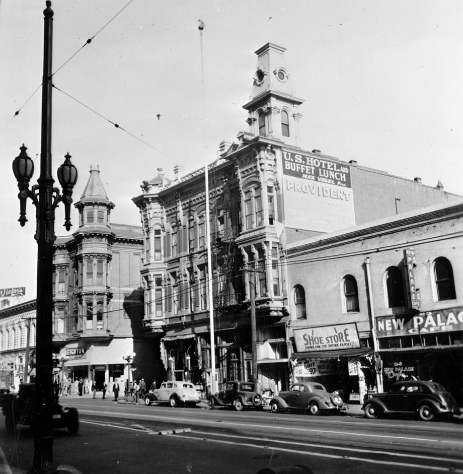 |
|
| (ca. 1935)*# - View of Main Street looking north. Two three-story Victorian-style buildings are pictured at center wedged between commercial shop fronts. The U.S. Hotel is closest to the foreground, while the Leighton Restaurant can be seen farther back. Both buildings feature a tower of sorts, the hotel's sprouting from the flat roof, the restaurant's extending from a column of windows at its corner. The New Palace Cafe and a sign that reads "Shoe Store. Shoes for the whole family" can be seen at right. A sign to the left reads "Victor's". Cars are parked along the sidewalk. Street car cables are attached to the top of a streetlamp visible in the left foreground. |
Historical Notes The U.S. Hotel was built around 1863 at 170 North Main by Louis Mesmer, then remodeled and expanded in 1886. The hotel attracted a swanky crowd and served the “best two-bit meal in Southern California” in its dining room, according to advertisements and articles published in the Los Angeles Times. *#*^ |
 |
|
| (1935)^ - View of the west side of North Main Street at Market. The old U. S. Hotel stands on the southeast corner of Market Street. It was the 3rd hotel built in Los Angeles (1863). |
Historical Notes By the early 1930s, the U.S. Hotel was still owned by the Mesmer family and lodged only men, many on public assistance.*#*^ |
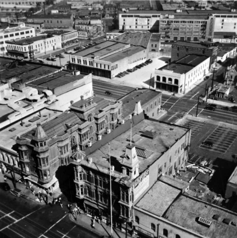 |
|
| (ca. 1937)*# - View looking down from the top of City Hall showing the U.S. Hotel at 170 North Main Street at the southeast corner of Market Street (center of photo). Across the street is the Amestoy Building (left) which featured the Leighton Restaurant on the ground floor. |
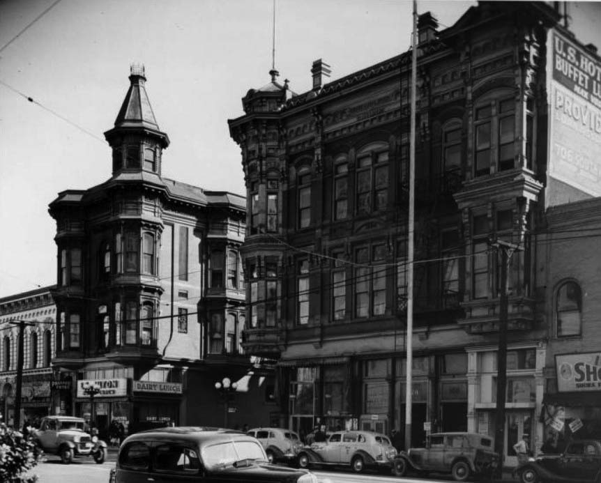 |
|
| (ca. 1938)*# - View showing the U.S. Hotel on the right and the Amestoy Building on the left across Market Street. A sign that reads Dairy Lunch can be seen over the Leighton Restaurant on the northeast corner of Main and Market streets. |
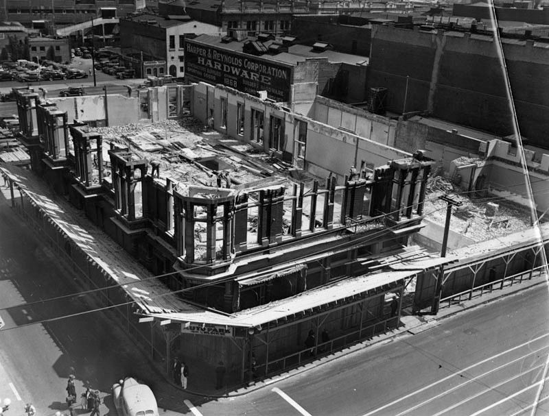 |
|
| (1939)^ – View showing the U.S. Hotel being torn down. The old U. S. Hotel stood on the southeast corner of North Main and Market streets since 1863. It was the 3rd hotel built in Los Angeles (Bella Union and Lafayette hotels were built in the 1850's). |
Historical Notes A gaunt ghost of bygone gaiety of the early days of Los Angeles, the old United States Hotel is shown as it is being torn down to make room for a more modern building. New sadness accompanied its demolishment when Mrs. Matilda M. Mesmer, widow of its manager for many years, Louis A. "Tony" Mesmer, died. She was the sister-in-law of Joseph Mesmer, prominent pioneer, who was the owner of the historic landmark. Photo dated: March 25, 1939.^ |
* * * * * |
Downtown
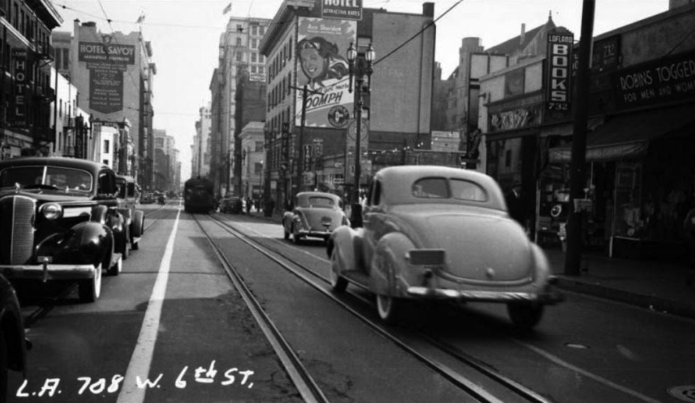 |
|
| (ca. 1938)*# – View looking east on 6th Street toward Hope Street. A streetcar is visible in the center on the tracks which bisect the street. The Hotel Savoy can be seen in the background. |
Then and Now
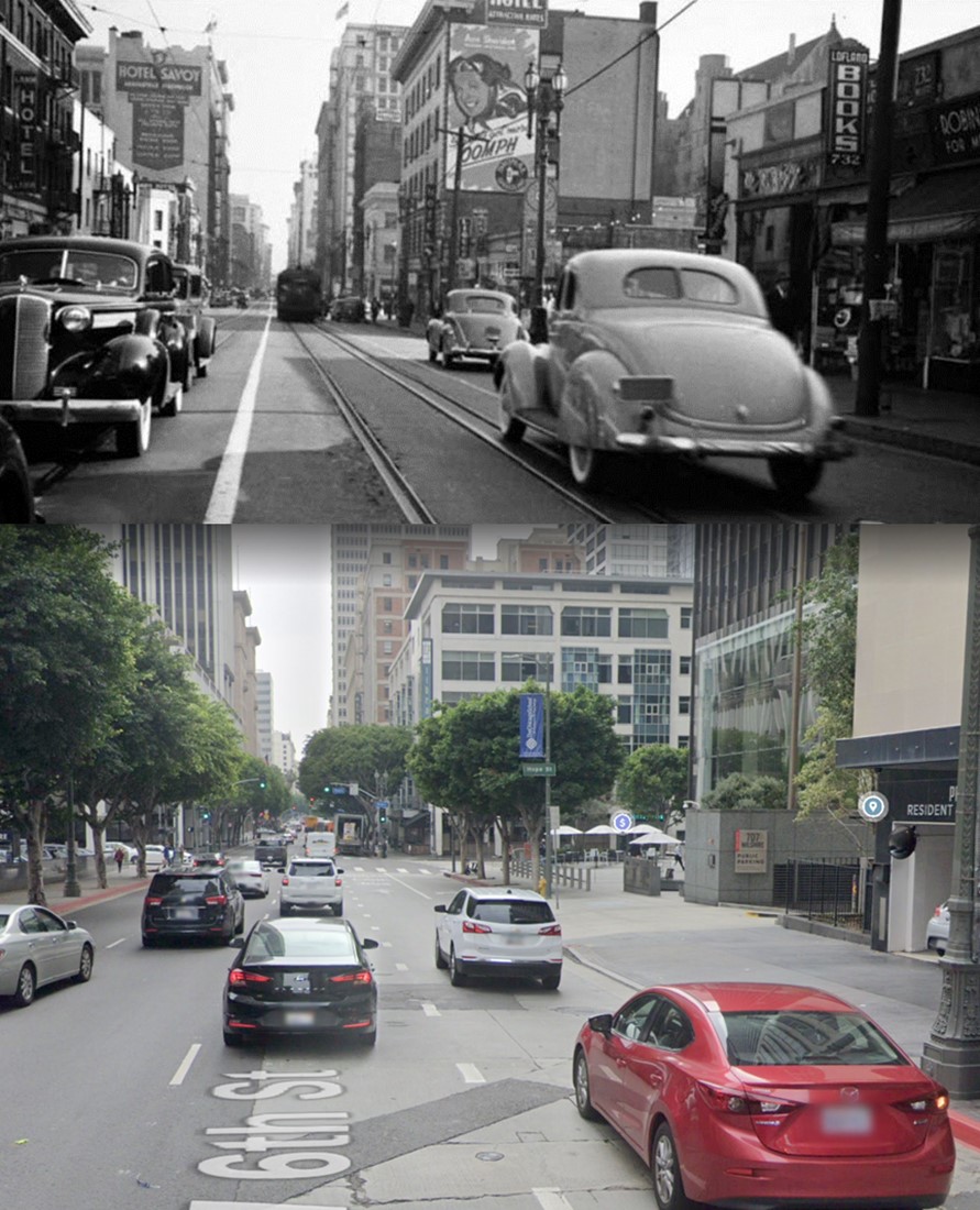 |
|
| (1938 vs. 2021)* - Looking east on 6th Street towards Hope Street. Photo comparison by Jack Feldman. |
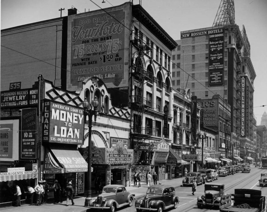 |
|
| (1938)*# - View looking north along Main Street at the many businesses between 5th and 6th streets. The Rosslyn Hotel stands on the corner of Main and 5th. City Hall is seen in the distance. Photo by Dick Whittington |
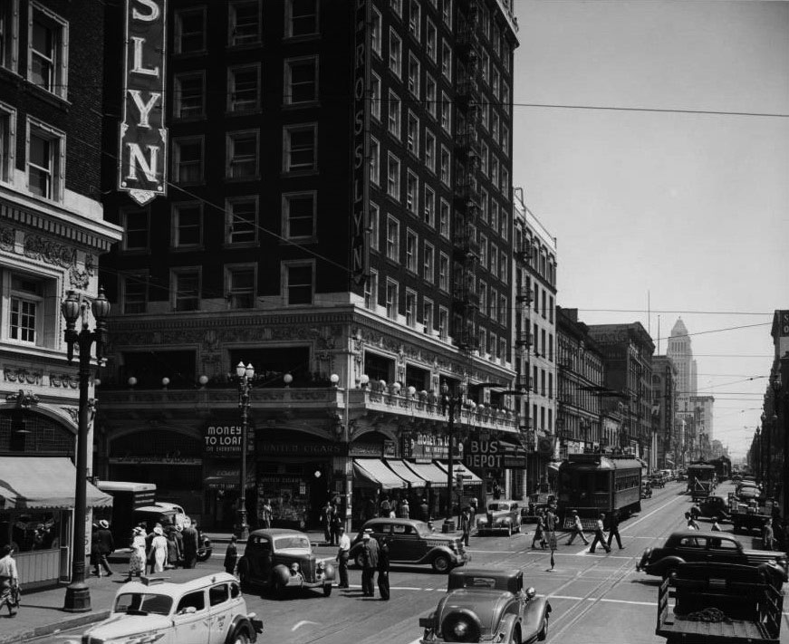 |
|
| (1939)*# - View looking north on Main Street at 5th Street. The Rosslyn Hotel an Annex are on the northwest and southwest corners respectively. Several of the legible signs read: United Cigars, "Money to Loan", All-American Lines Bus Depot, Turquoise Room, and Hotel Barclay. City Hall can be seen in the distance. |
* * * * * |
Oil Wells in Residential Areas
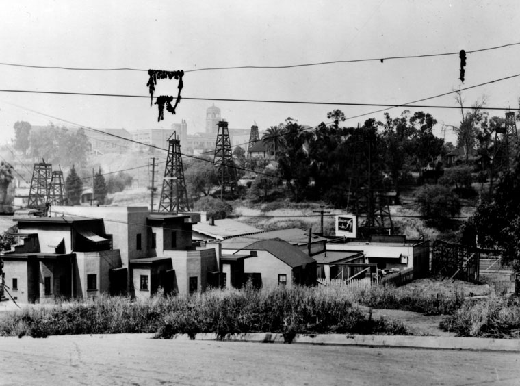 |
|
| (1937)^ - View of oil wells in a residential district near Glendale Boulevard. Tower and buildings of Belmont High School can be seen in the far background. |
Historical Notes The Central Oil Field as seen above is situated just south of the largest producing oil field in the history of the Southland called the Los Angeles Oil Field. The Los Angeles Oil Field is a large oil field north of Downtown. Long and narrow, it extends from immediately south of Dodger Stadium west to Vermont Avenue, encompassing an area of about four miles long by a quarter mile across. Its former productive area amounts to 780 acres. Discovered in 1890, and made famous by Edward Doheny's successful well in 1892, the field was once the top producing oil field in California, accounting for more than half of the state's oil in 1895. In its peak year of 1901, approximately 200 separate oil companies were active on the field, which is now entirely overbuilt by dense residential and commercial development. The fortunes made during development of the field led directly to the discovery and exploitation of other fields in the Los Angeles Basin. Of the 1,250 wells once drilled on the field, and the forest of derricks that once covered the low hills north of Los Angeles from Elysian Park west, little above-ground trace remains today.^* |
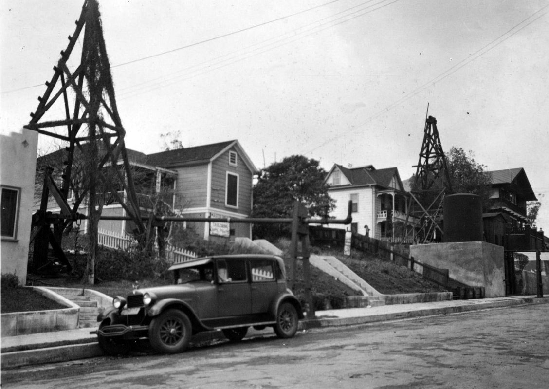 |
|
| (1933)#^ - Oil rigs on Court Street as seen from Bixel Street. Click HERE for contemporary view. |
* * * * * |
Exposition Park
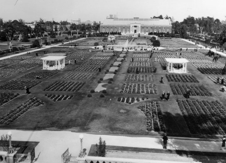 |
|
| (1935)^ - Sunken gardens, also called Rose Garden, at Exposition Park, formerly called Agricultural Park, with State armory building. This photo shows the entire garden area from the State Armory to the museum. |
Historical Notes Originally named Agricultural Park in 1876, the 160-acre site was developed and served as an agricultural and horticultural fairground until approximately 1910, at which point it was re-named Exposition Park. On November 6, 1913, Exposition Park was formally dedicated, and became the home to a state Exposition Building and the county Museum of History, Science and Art, later broken up and renamed the Natural History Museum. The Armory Building was designed in 1912 by State Architect J.W. Woollett for the California National Guard 160th Infantry. In 2003 the California Science Center's Board of Directors voted to rename the historic Armory Building as the Wallis Annenberg Building for Science Learning and Innovation due to contributions toward the renovation and re-invention of the building by architect Thomas Mayne, which reopened in 2004.^ |
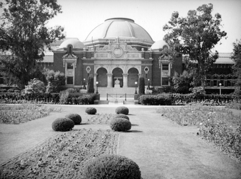 |
|
| (ca. 1937)^ - The Los Angeles County Museum of History, Science, and Art is seen from the Rose Garden in Exposition Park. |
Historical Notes The seven and a half acre Rose Garden, also called Sunken Garden, evolved from the redevelopment of Agricultural Park, and was completed in 1928. In 1991, the Exposition Park Rose Garden was listed on the National Register of Historic Places.^ |
* * * * * |
Downtown
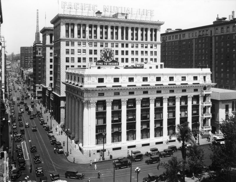 |
|
| (ca. 1935)^ - 6th Street looking west at Olive Street. At right is the Pacific Mutual Life Insurance Co. building. Pershing Square is at close right. In the distance is the Jonathan Club. |
Historical Notes The Pacific Mutual Building, located at 523 W. 6th Street, are actually three interconnected buildings built between 1908 and 1929. The original structure was designed and built between 1908-1912 by John Parkinson and Edwin Bergstrom. It has undergone many changes since it was built. In 1974, the building underwent an extensive restoration by Wendell Mounce and Associates, with Bond and Steward, which brought it back to its Beaux Arts revival. And in 1985, the entire building was renovated again by the Westgroup, Inc.^ The Pacific Mutual Building is listed as Historic-Cultural Monument No. 398. Click HERE to see complete listing. Click HERE to see more Early Views of the Pacific Mutual Building. |
Hoover Dam Lights Up Los Angeles
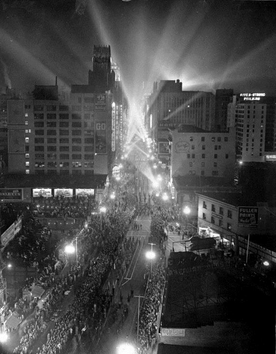 |
|
| (1936)* - Tens of thousands of people jammed the parade route on Broadway on the night of October 9, 1936, as the street became ablaze with light when the first power streaked 266 miles from the Hoover Dam Power Plant to Los Angeles. |
Historical Notes On October 9, 1936, the switch was thrown and electricity generated at the new Hoover Dam arrived in Los Angeles. Los Angeles threw a big party. The “Light on Parade” proceeded down Broadway, nicknamed “the Canyon of Lights.” |
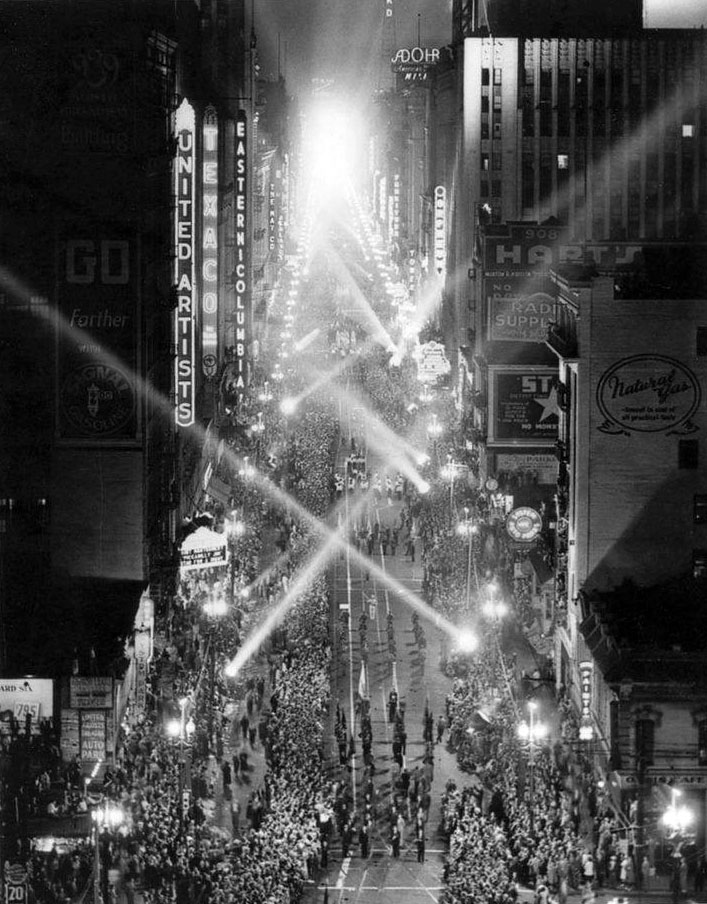 |
|
| (1936)##^# - Closer view showing the parade down Broadway (aka "The Light on Parade") celebrating Los Angeles' new source of electricity after the completion of Hoover Dam. |
Historical Notes Writer Thomas Treanor reported in the Oct. 10, 1936 Los Angeles Times: Astride the power of 115,000 horses, with burning plumes outspread, the Giant of Hoover Dam–Electricity–rode into Los Angeles last night, casting a heretofore unseen and magnificent glare on more than 1,000,000 persons who crowded the downtown district from end to end. A tumult of yelling and whistling and screaming greeted the giant with an exuberance and spontaneous feeling that has not been observed since the demonstration the day the World War ended… On the site of the old Courthouse at Temple and Broadway, a platform had been erected. On the Courthouse grounds sat 10,000 persons in folding chairs. The speakers had finished their speeches, the massed chorus had ended its song, and the prayer had been said, when the young woman–Miss Elizabeth Scattergood–stepped forward. A sputtering sound as the northeast corner of the Courthouse grounds. Brilliant as an explosion, lavender light washed away the half-darkness. In a great wave it swept across to the City Hall, to the Federal Building and to the Hall of Justice and Hall of Records… The day after this event, the Electrical Age Exposition opened at the Pan-Pacific Auditorium for a nine-day run. For the next 50 years the Los Angeles Department of Water and Power and Southern California Edison operated the Hoover Dam powerhouses. In 1987 they were turned over to the Federal Bureau of Reclamation.^^ |
| (1936)* - The beacon light placed on the top of Los Angeles City Hall (aka Lindbergh Beacon) is lighted when power arrived from Boulder Dam, later called Hoover Dam. |
Click HERE to see more in Construction of Hoover Dam |
* * * * * |
Hollywood
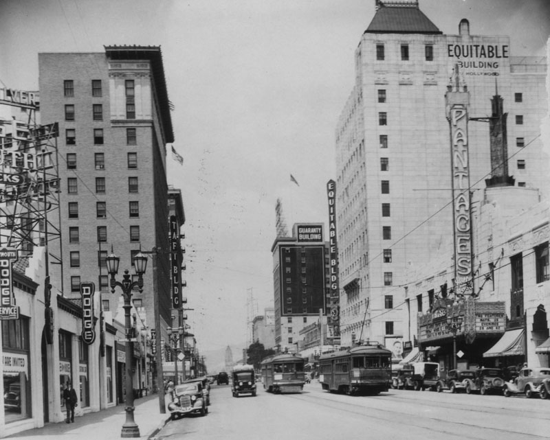 |
|
| (1936)^ - View looking west down Hollywood Boulevard from the intersection with Argyle Avenue. On the left is a Dodge Plymouth motor car dealer, and past that, the Taft Building. Going down the right side of the street we see the Pantages Theatre, and beyond that the Equitable Building and then the Guaranty Building. There are a few cars on the street, as well as trolleys. |
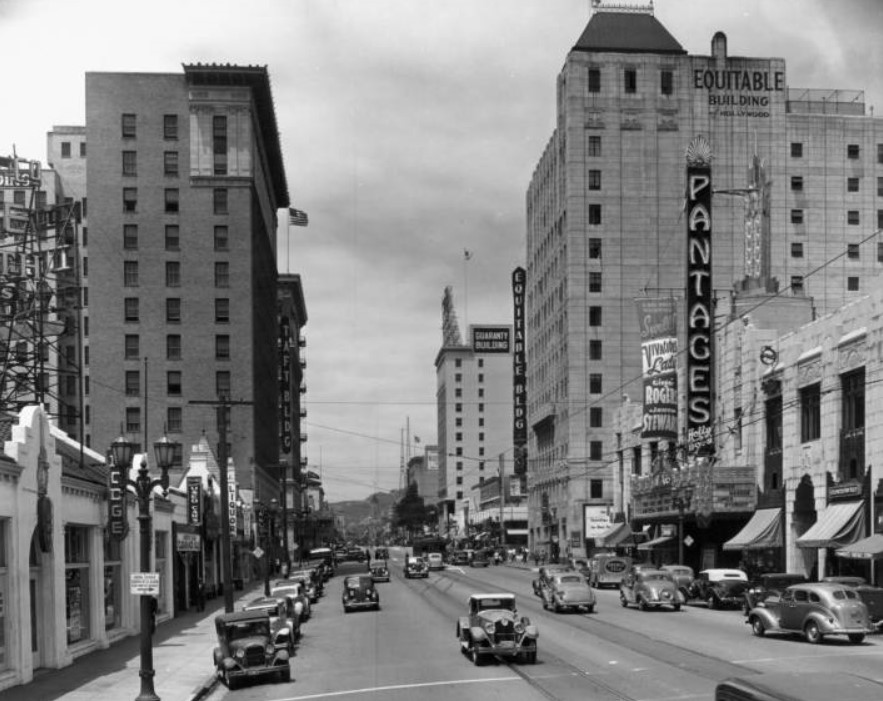 |
|
| (1936)^^ - Another view looking west toward the intersection of Hollywood and Vine showing the Pantages Theatre, Equitable Building, Taft Building, and Broadway-Hollywood Building. |
Then and Now
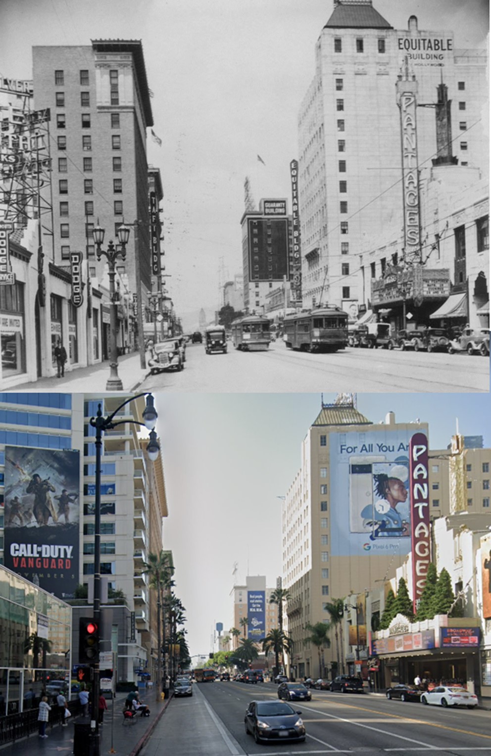 |
|
| (1936 vs. 2022)* - Looking west on Hollywood Boulevard from Argyle Avenue with the Pantages Theatre seen on the right. Note some of the changes…especially the streetcars and streetlights. Photo comparison by Jack Feldman. |
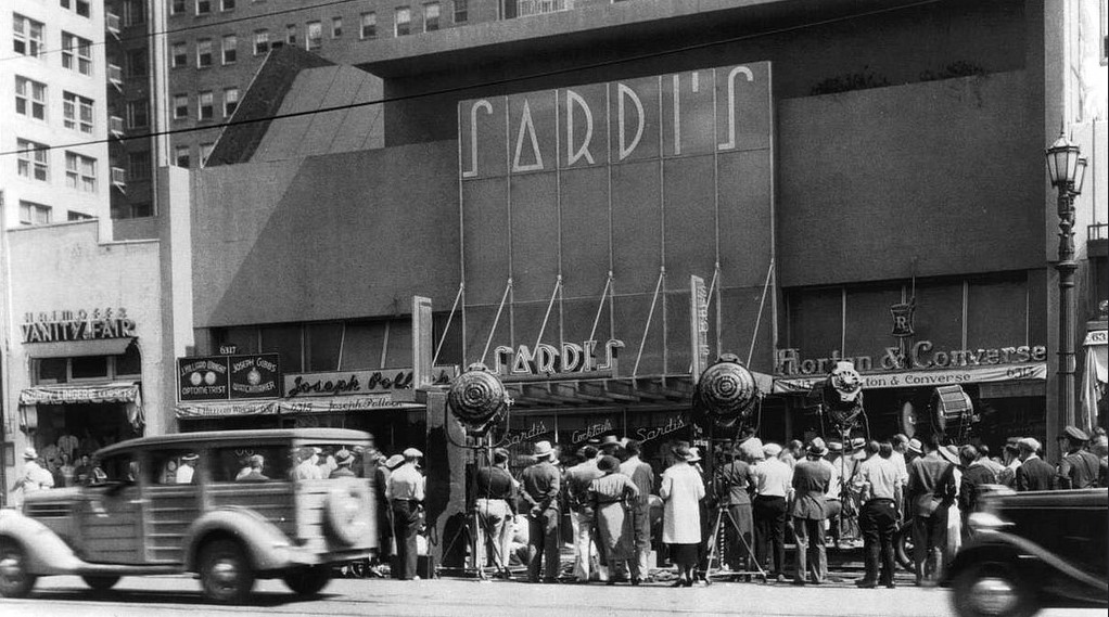 |
|
| (1936)^#^^ – View showing the filming of a movie in front of Sardi’s Restaurant on Hollywood Boulevard. Click HERE to see more Early Views of Sardi's Restaurant. |
* * * * * |
Fletcher Drive
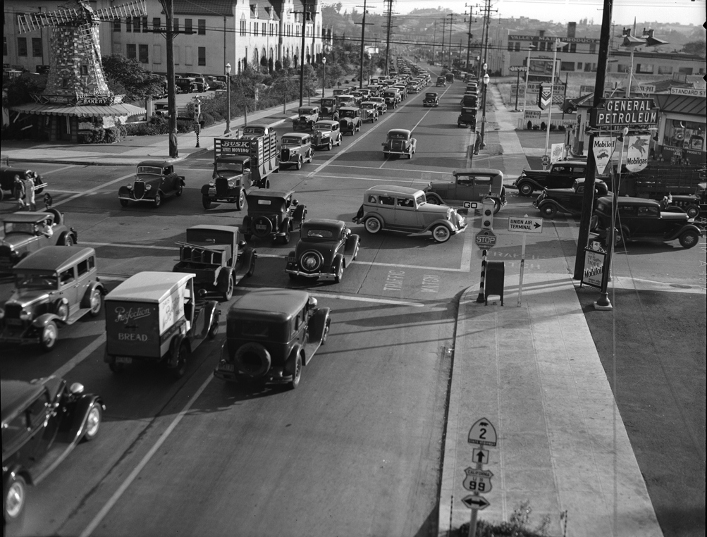 |
|
| (1936)*# - Traffic at San Fernando Road and Fletcher Drive, Glendale. Van de Kamp's Bakery with its signature windmill on top can be seen in the upper left of photo. The large building behind the windmill is the Van de Kamp's Bakery Headquarters at 1939 Fletcher Drive. |
Historical Notes Theodore J. Van de Kamp and brother-in-law Lawrence L. Frank were the owners and originators of the Van de Kamp Bakeries. Fondly known as the "Taj Mahal of all bakeries". Van de Kamp and Frank also founded both the Tam O'Shanter's (1922) and Lawry's The Prime Rib (1938) restaurants.^* |
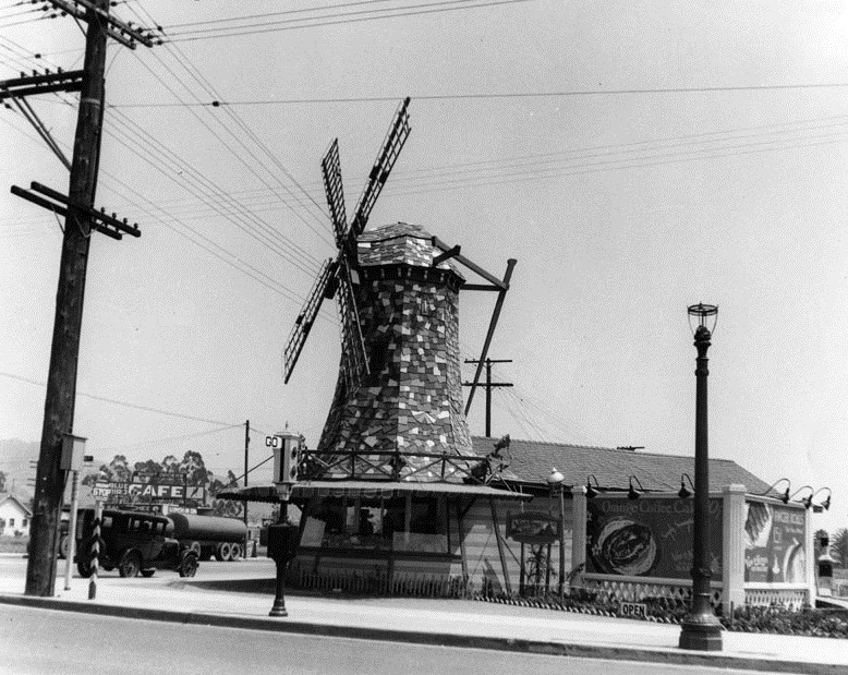 |
|
| (1931)^ - View showing the Van de Kamp's Bakery's building located on the corner of San Fernando Road and Fletcher Drive, designed to resemble a 16th-century Dutch farmhouse. The Van de Kamp's Bakery Headquarters is to the right (out of view). |
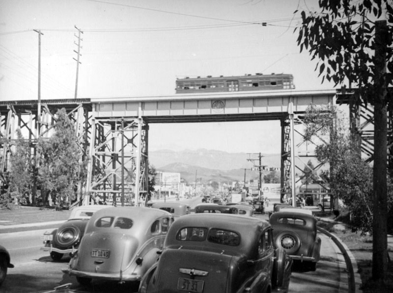 |
|
| (ca. 1938)^ - Cars drive under the Pacific Electric railroad tracks crossing Fletcher Drive (Fletcher Viaduct), and a large Sparkletts sign can be seen past the bridge on the left. Atwater Village, Glendale, and the San Gabriel Mountains are seen in the center. Photo by Herman Schultheis |
Historical Notes In 1928, when Fletcher was paved, the original timber bridge was replaced with a steel structure mounted on concrete footings (seen above). The newer structure soared more than 60 feet above the street and remained in place until 1959, when it and the nearby Riverside Drive Viaduct at Glendale Boulevard were demolished.^^^* Today these concrete footings and bridge pylons are still there and have been designated as LA Historic-Cultural Monument No. 770 (Click HERE to see complete listing). Click HERE to see more Early Views of the Fletcher Viaduct. |
* * * * * |
More Historical Early Views
Newest Additions
Early LA Buildings and City Views
History of Water and Electricity in Los Angeles
* * * * * |
References and Credits
* DWP - LA Public Library Image Archive
^ LA Public Library Image Archive
*^Oviatt Library Digital Archives
#*MTA Transportation and Research Library Archives
#^California Historical Society Digital Archive
+#Facebook.com: Garden of Allah Novels
+++Photobucket
#++Jalopyjournal.com: Legion Ascot Speedway
+^^The Eastsider: Riverside-Figueroa Bridge
+#+Pinterest - California and DailyBreeze.com; Mid Century Hollywood
#^^Picturetrail.com: KCET - Angels Flight
*^#Los Angeles Conservancy: LA Stock Exchange Building; Park La Brea; Warner Bros.Theatre; Downtown Jewelry Exchange/Warner Bros. Theatre
^#^Pacific Electric Railway Historical Society - Alan Weeks Collection
*#*Westland.net: Venice History
^#*Metro.net: Mulholland Drive Bridge
**#The California History Room, California State Library: William Reagh
^*#Library of Congress: Panoramic View of Civic Center; Macy Street Viaduct; 4th Street Bridge
^^#The George A. Eslinger Street Lighting Photo Gallery
*##LA Weekly - Warner Bros. Theatre; The Wiltern Theatre
*##Restaurant-ing Through History: Ice Cream Parlors
^## Facebook.com: Photos of Time Travelers
+##MartinTurnbull.com: Fairfax and Wilshire
+#*LA Curbed
+**Los Angeles' Bunker Hill - Alta Visa Apartments
+*+BridgeHunter.com: Los Feliz Blvd. Bridge
^^+How Stuff Works: Chevrolet Impala
++^Mentalfloss.com: 12 Postcard Locations Then and Now
++#Facebook.com: Photos of Los Angeles
#**Pinterest - California and DailyBreeze.com
#*^Theatlantic.com: AP Photo - George Patton
#^*This Moderne Life: Simon's Drive-In
##*Boston Public Library: Flickr.com
^^*Early Downtown Los Angeles - Cory Stargel, Sarah Stargel
^^^Los Angeles Orthopaedic Hospital
***Los Angeles Historic - Cultural Monuments Listing
*^*California Historical Landmarks Listing (Los Angeles)
*#^Forum.Skyscraperpage.com: Arroyo Seco Library; Westwood-Life Magazine; Japanese Internment; 8th and Francisisco; Bob's Airmail Service Station; 1932 Downtown Aerial; North Los Angeles Street; May Co. Building; Cahunega and Highland Intersection ca1937
*#^^LAPL-El Pueblo de Los Angeles Historical Monument Photo Archive
**** Pinterest.com: Los Angeles Dodgers; Vintage Los Angeles: Aerial Westwood - Rancho Park; Los Angeles and Hollywood; MacArthur Park w/Downtown Skyline; Gilmore Self-Service Gas Station; Sawtelle and National; Bullock's Delivery Truck
^^^^Depaul.edu: Night Train 55
++++Facebook.com – Los Angeles Heritage Railroad Museum
**^^Aerofiles - US Aviation Firsts
**#^Vincent Thomas Bridge - Facts and Figures
*^*^Big Orange Landmarks: Los Angeles City Hall
***^Pomona Public Library Digital Archive: Bob's Airmail Service Station
^*^*HollywoodHeritage.com: The Muller Family Foundation
*^^*Pinterest.com: Bertrand Lacheze
^^**Pinterest.com: Vintage California
^^*^Restaurantwarecollectors.com: Angelus Hotel
*##*Pinterest.com: Trucks, Pick-Ups, and Gas Stations
***#I Love Los Angeles But...: Sontag Drug Store
*#*#Abandoned & Little-Known Airfields – Paul Freeman
#*#*Fairfax High School Home Page
#*^*GenDisaster.com: Long-Beach Double Pier Collapse
^***UCLA Library Digital Archive
*^^^Art Deco in Mono
*^^Nuestra Señora la Reina de los Ángeles: losangelespast.com
*^^#Los Angeles Past: Temple and Main Streets, Los Angeles - Then and Now
**^*California State Library Image Archive
*^#*Westcoastfireescapes.com: Fire Escape History
^*#*History of Los Angeles Group
^*^#Facebook.com - Bizarre Los Angeles
^*#^Studiotour.com
*^#^Huntington Digital Library Archive
^#^*Noirish Los Angeles - forum.skyscraperpage.com; Broadway Tunnel
**^#Vintage Los Angeles: Facebook.com; Wilshire Blvd - Westlake Theater; Intersection of Main, Spring, and 9th Street; Gilmore Stadium and Field; Town House; Cruising Hollywood Blvd; Attractions and Amusement Parks
^#^#S.S. Avalon and S.S. Catalina
^^*#Historical LA Theatres: Loew's State Theatre; Warner Bros.Theatre; Lyceum Theatre; Broadway Downtown Theatres; College Theatre; Liberty Theatre
^##^Online Archive of California (OAC): Bullock's Department Store Building
*^*#The Los Angeles River: Historic Bridges
^^##Pacific Electric Railway Historical Society
^^#*LA Observed: Dedication of theSepulveda Tunnel; Decommissioned Street Cars; Bunker HIll, 1964
**##Blogdownton: State Building
*^##OAC - Online Archive of California
^*##Flickr- Old Los Angeles Postcards: LA Coliseum
*#^#Life.time.com: Stoked-Life Goes Surfing
^##*Pinterest: Bygone Los Angeles
^#**Facebook.com - City of Angels Brown Derby; Cyclone Racer
*###Consolidated Steel, Long Beach and Wilmington
*#*^Historic Hotels of Los Angeles and Hollywood (USC - California Historic Society); U.S. Hotel
*#**Flickr-Los Angeles in Good Light - Ron Reiring
^###The Historical Marker Database: Stephen M. White Statue
*##^LAist.com: The Knott's Berry Farm You May Not Know; Harbor Freeway, 1969; Century Plaza Hotel
^#*#LA Magazine: When Knott’s Berry Farm Was Actually a Farm; Beverly Park Ponyland
**#*Santa Monica via Beverly Hills Line - uncanny.net
#**#California State University Northridge History: csun.edu
#++#Facebook.com: Garden of Allah Novels, Martin Turnbull
#^^#The Museum of the San Fernando Valley: Northridge Train Depot
#^*#Flickr.com: Paul Bajerczak
#^#^Los Angeles: Portrait of a City
#^#*San Diego Air & Space Museum Archive
#*#^Facebook.com - Los Angeles Theatres: Warner Bros. Downtown
##**Franklin HIlls Residents Association
##^*Calisphere: University of California Image Archive
##^^Cinema Treasures: Warner Bros.Theatre; Olympic Drive-In
##*^Fourth Street Bridge Over Lorena Street
##*^Port of Los Angeles: portoflosangeles.corg
##^#Facebook.com: Classic Hollywood-Los Angeles-SFV
###^Flickr.com: Metro Library and Archive
#^^*Blogdowntown.com: Gas Holders; Third Street Tunnel
#^**Water and Power Associates
#^*^Los Angeles River Railroads: Taylor Yard
#*^^Parks.ca.gov: Rio de Los Angeles State Park
^#^^Flickr.com: Michael Ryerson
****^Facebook.com: West San Fernando Valley Then And Now
*^*^*Wehadfacesthen.tumblr.com
*^^^^Los Angeles Maritime Museum
**^^^Facebook.com - San Pedro's Original Website, San Pedro.com
^^^**tumblr.com: John Ferraro Office Building; DWP Office Building
**^**Los Angeles City Historical Society
**#**LMU Digital Archive
#*#**Facebook.com: Beverly Park - L.A.'s Kiddieland
^*^**LAistory: The Pan Pacific Auditorium
^*^*^Alumni.ucla.edu: UCLA History - A Bridge to the Future
^^***Facebook.com: L.A. as Subject
^^^^#A History of the Los Angeles City Market
^^^*KCET.org: Three Forgotten Incline Railways; Welcome to L.A. River; How Oil Wells Once Dominated Southern California's Landscape; Four Level Interchange; Rainbow Pier; Construction of 5 Southern California Freeways; History of Baseball Stadiums; Beverly Park and Ponyland: 6th Street Bridge; Edendale Red Car Line; Lost Tunnels of Downtown LA; Before the 'Carmageddon': A Photographic Look at the Construction of 5 SoCal Freeways; Seventh and Broadway; L.A.'s First Freeways; Figeuroa St. Tunnels; Los Feliz Boulevard Bridge
^^ LA Times: Photo Archive; An Oil Well on La Cienega; Mulholland Bridge; A Mountain of Red Cars; Spruce Goose; New Viaduct for Red Car Line; Demolition of Old Times Bldg; Flooding 1938; Huntington Beach Oil Derricks; Sepulveda Tunnel; Sunkist Bldg.; The Vincent Thomas Bridge; Hill Street Tunnels; Harbor-Santa Monica Freeway Interchange
**^ Noirish Los Angeles - forum.skyscraperpage.com; Westwood-Life Magazine; Selling Papers on Olive; Little Tokyo; La Cienega Oil Well; Hall of Justice; Bob's Airmail Service Station; California Federal Plaza Building; LA Fun Map; Downtown Aerial 1958; 1949 Construction of 101 Freeway; 1953 Harbor Freeway Construction; Wilshire Blvd, 1949; Muller Bros. Service Station; Pan Pacific Auditorium; Gilmore Aerial; Zephyr Room and Brown Derby Postcard View; Shakespeare Bridge; Prospect Studios; Aliso Before and After 101 Frwy; Gilmore Tanker Truck; Gilmore Station; North Figueroa Tunnels; Vincent Thomas Bridge; Hollywood Frwy Traffic Jam; 2012 Downtown Skyline; View from GOB; LA Times Building; Fairfax Ave 1937; Bonaventure Hotel Aerial; Fairfax and Wilshire 1939
^* Wikipedia: Hollywood Sign; Carthay Circle; Carthay Circle Theatre; Fairfax High School; Park La Brea; San Vicente Boulevard; Etymologies of place names in Los Angeles; Los Angeles Central Library; Broadway Tunnel; Pershing Square; Pacific Electric Railway; Gilmore Field; GilmoreStadium; Union Station; Westwood; 6th Street Viaduct Bridge; Figueroa Street Tunnels; Chavez Ravine; 2nd Street Tunnel; Hollywood Freeway; Los Angeles International Airport; Los Angeles City Hall; Wilshire Boulevard Temple; Egyptian Theatre; The Pig 'N Whistle; Sunland-Tujunga; Van de Kamp Bakery Building; Los Angeles County Art Museum; Los Angeles City Oil Field; Los Angeles Railway; Warner Bros. Downtown Theatre; Miracle Mile; Glendale-Hyperion Bridge; Zeppelin; Los Angeles City Hall; Los Angeles Biltmore Hotel; Farmers Market; Interstate 405; Lafayette Park; US Courthouse - Los Angeles; Los Angeles County General Hospital; Long Beach; Chevrolet Impala; Cord Automobile; Playa Vista; Signal Hill; University of Southern California; Harbor Frwy (Interstate 110); See's Candies; Hughes H-4 Hercules; Howard Hughes; History of Los Angeles Population Growth; Jonathan Temple; Olvera St.; Bullocks Wilshire; Los Angeles City Hall Lindbergh Beacon; Bullock's; Broadway Theater District: Lowe's State Theater; Obadiah J. Barker; May Company California; Dominguez-Wilshire Building; Little Tokyo; Ellison Shoji Onizuka; Japanese American Internment; Sepulveda House; Four Level Interchange; Los Angeles Plaza Historic District; Knott's Berry Farm; Hall of Justice; California Federal Bank; Century City; Harbor Freeway; Brown Derby; Bank of Italy; Silverwoods; Woodland Hills; Northridge; KFWB; Rose Bowl Stadium; Westwood; Westwood Village; UCLA; Maddux Air Lines; Olympic Boulevard; World War II; Thomas Fairfax; First National; Arroyo Seco Parkway; Zeppelin; Charles Lindbergh; Spirit of St. Louis; Hollywood Presbyterian Medical Center; Hollywood; Sheraton Town House; 2004 Los Angeles Skyline; LA's Oldest Palm Trees; Shakespeare Bridge; Franklin HIlls; John Marshall High School; Prospect Studios; Rio de Los Angeles State Park; History of Los Angeles; 1926 World Series; San Vicente Boulevard; Vincent Thomas Bridge; World Cruise Center; CSUN; Westwood; Westwood Village; UCLA; History of UCLA; Precious Blood Catholic Church; 1950s Americal Automotove Culture; Pershing Square; Salt Lake Oil Field; Century Plaza Hotel; Elysian Valley; Universal Studios; Huntington Park; Broadway Tunnel; Patriotic Hall; California Incline
< Back