Early Los Angeles Historical Buildings (1800s)
| Historical Photos of Early Los Angeles |
 |
|
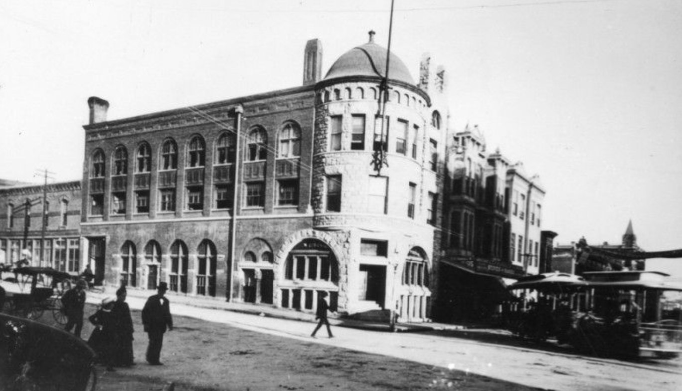
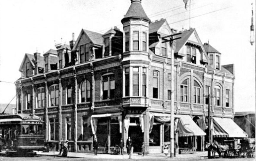
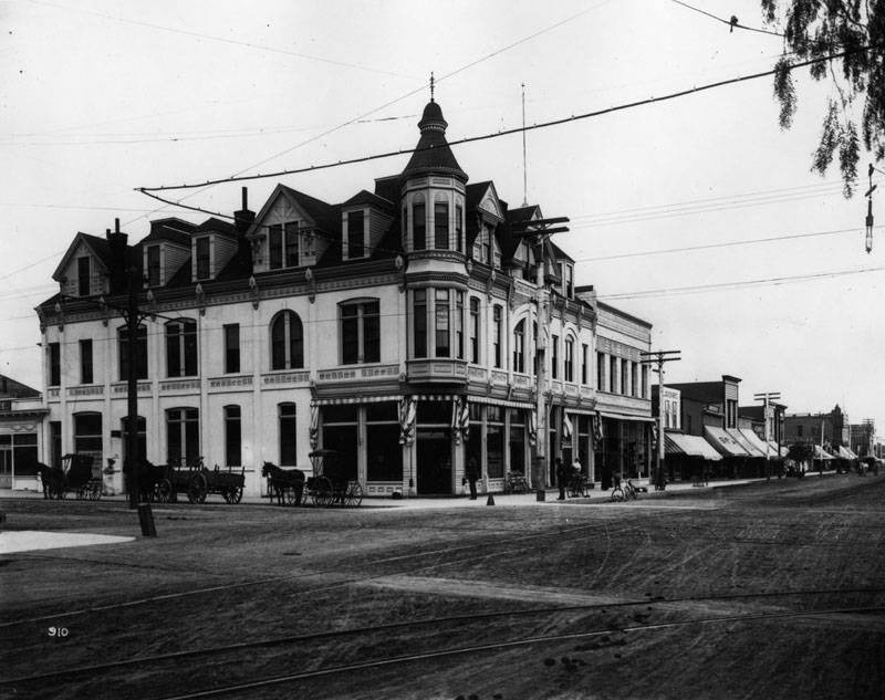
| (ca. 1890)* - View of the 2nd LA Times Building on the northeast corner of 1st and Broadway with trolley making a turn from Broadway to 1st Street. The Los Angeles Chamber of Commerce is in the building adjacent to the Times, on the north side of 1st Street. |
Historical Notes The Los Angeles Times was first published on December 4, 1881, under the name of the Los Angeles Daily Times. When the original founders ran into financial problems the following year, the fledgling paper was inherited by its printer, the Mirror Printing Office and Book Bindery. The company hired as editor former military officer Harrison Gray Otis, who quickly turned the paper into a financial success. Otis and a partner purchased the entire Times and Mirror properties in 1884 and incorporated them as the Times-Mirror Company. Two years later, Otis purchased his partner's interest in the company. In October 1886, the word "Daily" was removed from the title and the newspaper became the Los Angeles Times. Today, the LA Times occupies its 4th building since it started publishing back in 1881. Click HERE to see more in Early Views of the LA Times. |
* * * * * |
Los Angeles Examiner Building
 |
|
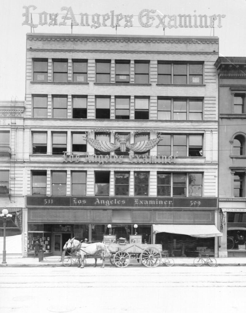
| (ca. 1903)* - A horse-drawn wagon and three bicycles are parked in front of the Los Angeles Examiner building at 509 South Broadway, in Los Angeles. |
Historical Notes The Los Angeles Examiner building, located at 509 South Broadway in downtown Los Angeles, served as the original headquarters for the newspaper when it was founded by William Randolph Hearst in 1903. This five-story structure, characteristic of early 20th-century commercial design, featured large windows and prominently displayed the "Los Angeles Examiner" name across its facade. |
 |
|
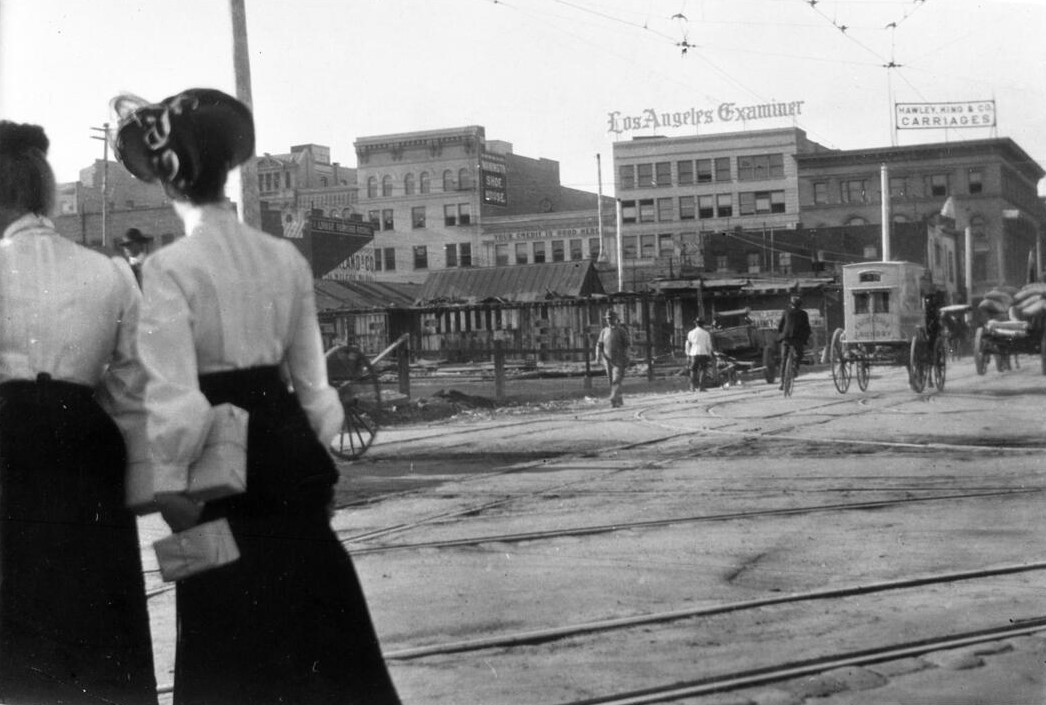
| (1905)*- Two women crossing 5th Street at Spring Street with the Los Angeles Examiner Building at 509 S. Broadway seen in the distance. |
 |
|
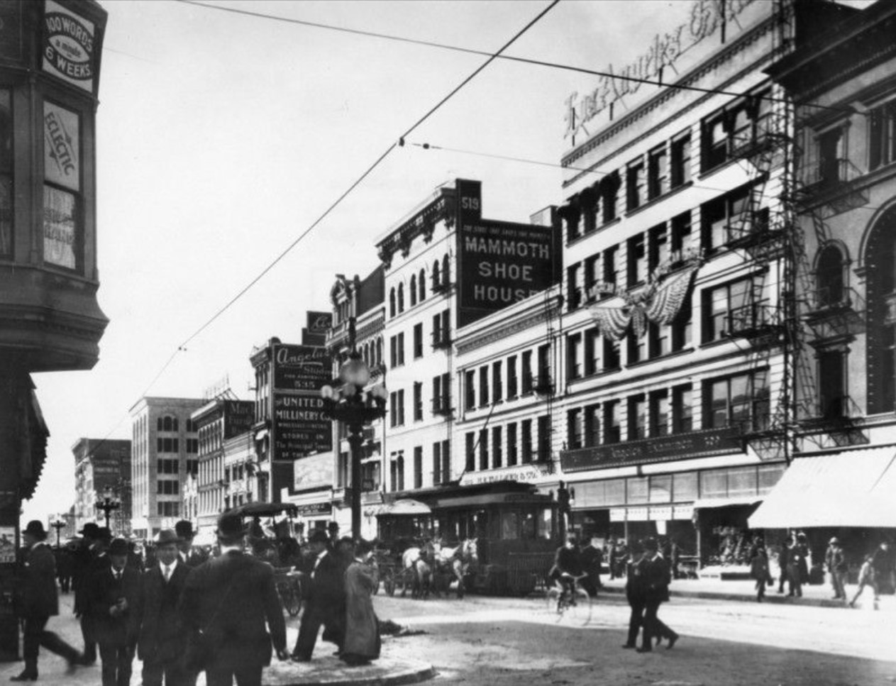
| (ca. 1906)* - The intersection at Broadway and 5th, looking south from 5th. The Los Angeles Examiner building is visible on the right. Pedestrians line the sidewalks, and horses and buggies are on the street. A lone bicycle rider leads the pack. Signs for "Mammoth Shoe House", "United Millinery Company", and "Angelus Studio" are visible. |
Historical Notes The Examiner building housed the newspaper's offices and printing operations, marking Hearst's entry into the Los Angeles newspaper market to compete with the established Los Angeles Times. Positioned in the heart of the city's bustling commercial district, the building played a crucial role in the early development of the Examiner, laying the foundation for its growth before it moved to a more elaborate building in 1914. |
 |
|
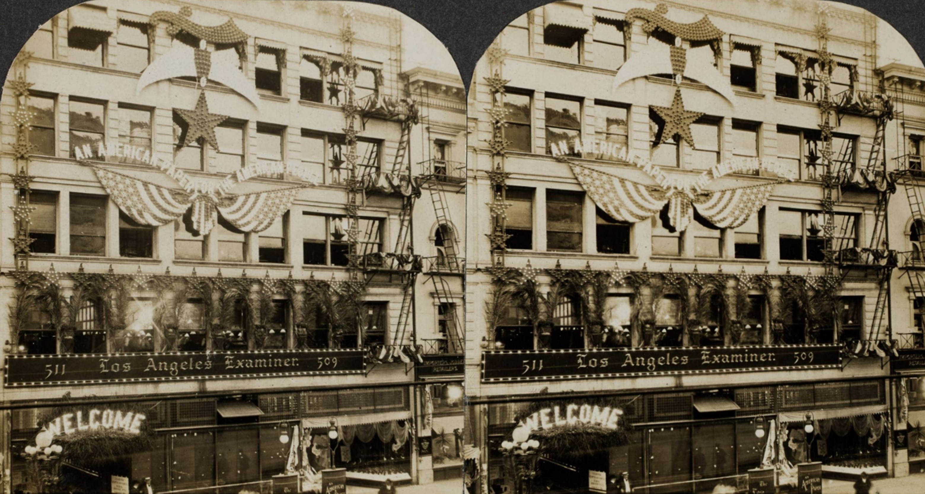
| (ca. 1910)* - Stereoscopic view of the Los Angeles Examiner building at 509 South Broadway decorated with American flags and banners including signs reading "An American Paper for the American People" and "Welcome." Photo from the Ernest Marquez Collection. |
Historical Notes The Herald Examiner moved into a new building in 1914, located at the southwest corner of Broadway and 11th Streets. Click HERE to see LA Examiner's Second Building. In 1967, Herald Examiner employees began a strike that lasted almost a decade and resulted in at least $15 million in losses. The paper never recovered from the strike and went out of business November 2, 1989, leaving the Los Angeles Times as the sole city-wide daily newspaper. |
* * * * * |
Wells Fargo & Co's Express Office
 |
|
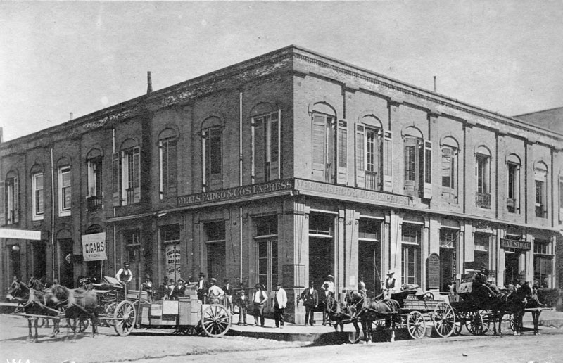
| (ca. 1890)* - Wells Fargo & Co's. Express office in an unidentified building circa 1890. A group of men are standing on the sidewalk while several horse-drawn wagons on parked on the dirt street. |
Historical Notes In 1852, Vermont native Henry Wells and New Yorker William G. Fargo organized Wells, Fargo & Company to provide express and banking services to California. |
* * * * * |
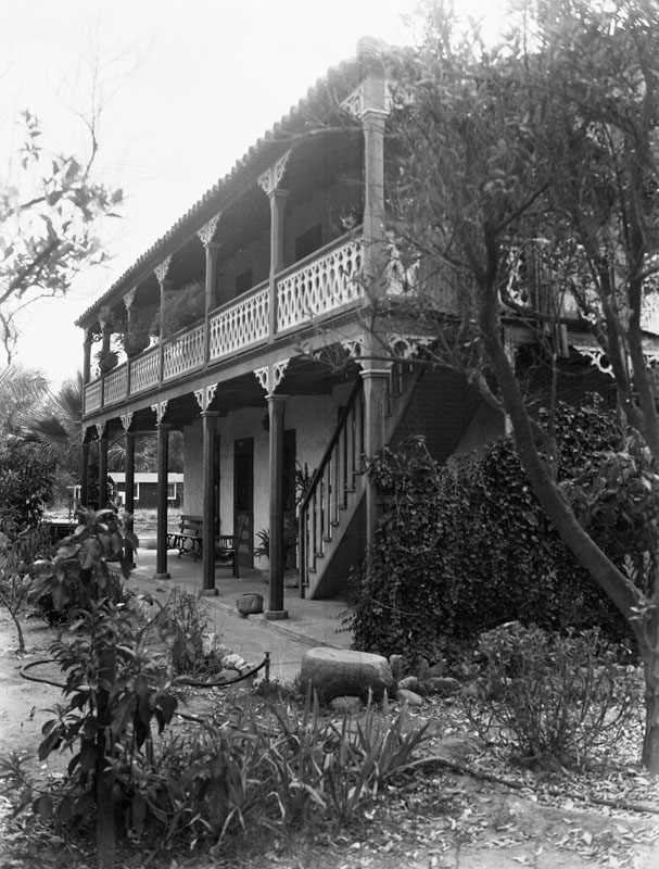
Casa de Lopez (Lopez Adobe)
 |
|
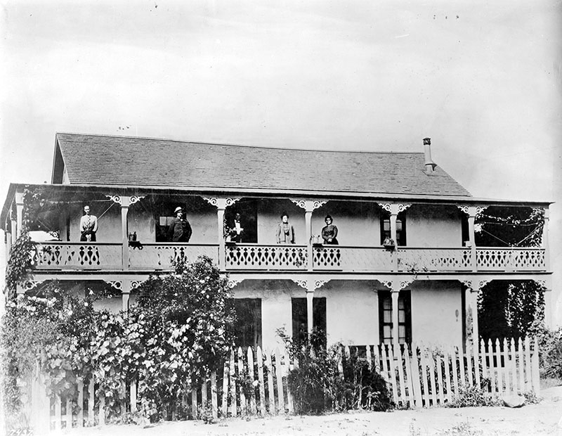
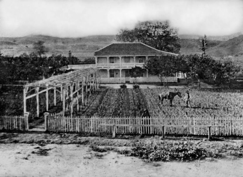
| (ca. 1883)* - View showing the Geronimo Lopez Adobe of San Fernando. Three women and two men stand on the second floor wrap-around balcony, probably members of the Lopez family. |
Historical Notes The Lopez family built the adobe between 1882 and 1883 using 24-by-6-inch, sun-baked blocks. The surviving adobe home was built by Valentin Lopez, Geronimo's cousin and brother-in-law. It was the first two-story adobe built as a residence in the San Fernando Valley. It is considered the City of San Fernando's oldest standing building.^* |
 |
|
| (ca. 1910)^^ – View showing the two-story Lopez Adobe with its gilded balcony and terracotta-tiled roof, located at 1100 Pico Street in San Fernando. |
Historical Notes Catalina Lopez died in 1918, and Geronimo Lopez died in 1921, at age 90. In 1928, several modifications were made to the house by one of the Lopez daughters, Louisa Lopez McAlonan. The balcony staircase was changed, and some rooms were divided to form apartments. Modern plumbing and electrical fixtures were also added at the time. The original shake shingle roof was also replaced by clay-tile roof. ^* |
 |
|
| (ca. 1935)* - Close-up view of the Geronimo Lopez adobe in San Fernando. It was built by Valentino Lopez for his father, Geronimo, in 1878. It later was used as a stage station, then was the San Fernando Valley's first post office. It is located at 1100 Pico Street, on the corner of Maclay Avenue and Pico Street. |
Historical Notes The Lopez Adobe has been recognized for its blend of Mission Revival and Victorian architectural styles. Catalina Lopez designed the residence's Victorian features. The first local newspaper, the San Fernando Times, was printed in April 1889 from the Lopez Adobe. Members of the Lopez family continued living in the adobe until 1961. The last Lopez to live in the adobe was another daughter, Kate Lopez Millen, who lived in an upper apartment from 1931 until shortly before her death in 1961. The property remained in the Lopez family until 1971. ^* |
 |
|
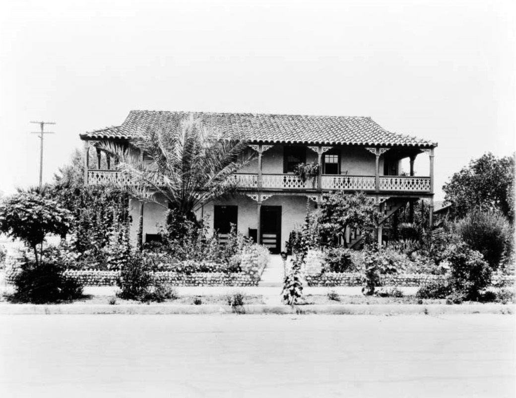
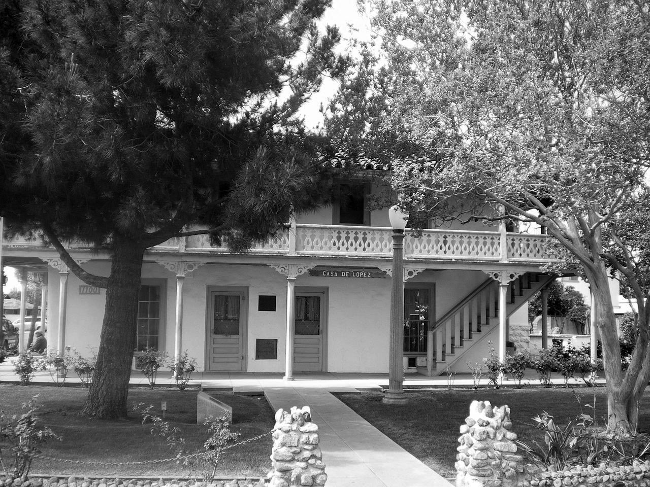
| (2008)^* - Front view of Casa de Lopez (Lopez Adobe), 1100 Pico Street in San Fernando. |
Historical Notes Lopez Adobe is one of the two oldest private residences in the San Fernando Valley. Built by early settlers of the San Fernando Valley a short distance from the San Fernando Mission, it was listed on the National Register of Historic Places in 1971. The Grand-Reopening of the property occurred on March 22, 2015 and is now open for public tours once every 4th Sunday of the month from 12-4 P.M. ^* |
Lopez Station Stagecoach Stop
 |
|
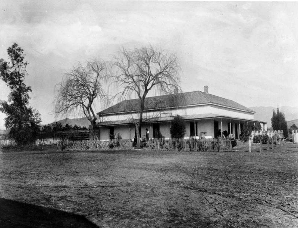
| (ca. 1885)^^* - View showing the Geronimo Lopez stage station and ranch adobe. A man is seen standing on the porch of the one and a half-story adobe. The roof of the adobe is shingled, and doors can be seen at regular intervals on each visible wall of the edifice. At the time the photograph was taken, the adobe was being used as a toll and stage station. It was built by Valentino Lopez. |
Historical Notes Geronimo and Catalina Lopez purchased 40 acres of land near the Mission San Fernando in 1861 and built an adobe home along the Butterfield Overland Mail 1st Division, on the Stockton - Los Angeles Road wagon route that connected Los Angeles and San Francisco. The original adobe became known as Lopez Station. The couple also operated the San Fernando Valley's first general store, its first English language school, and the first post office (in 1869) at the site. One account of the early days of the San Fernando Valley noted the significance of the Lopez family: In the late 1860s and early 1870s a traveler riding through the high wild mustard fields of the San Fernando Valley would find little evidence of people except for the mission, a few other adobes, cattle grazing in the fields and a stage house built by Geronimo Lopez and his wife, Catalina. ^* |
 |
|
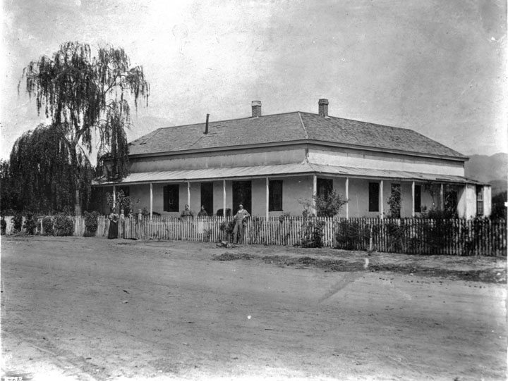
| (ca. 1890)** - Lopez Station around the year 1890 was used as a stagecoach stop on the route from Los Angeles to San Francisco. It was located on the 15700 block of Rinaldi Street in Mission Hills. |
Historical Notes Lopez Station served as a stopping place for the Butterfield Stage. The station sat on 40 acres of land originally owned by Geronimo Lopez. Here Lopez established a stage stop and a general store. This valley stop would expect two stages a week from Los Angeles en route to San Francisco. Lopez Station served the Butterfield Stage Line throughout its run from 1861 until 1874. When the railroad was completed linking Northern and Southern California, stagecoach travel became obsolete. In 1868, Lopez Station also became an overnight stop for Remi Nadeau’s Cerro Gordo Freighting Company. Nadeau ran freight wagons hauled by teams of sixteen or more mules back and forth from San Pedro to the Cerro Gordo mines in the rugged Sierra Nevada Mountains in Inyo County.** The original Lopez Station adobe was destroyed in the 1910s for the construction of the San Fernando Reservoir (later renamed Van Norman Reservoir), part of the then new Los Angeles Aqueduct system. After the 1971 Sylmar earthquake the foundation was again exposed in the reservoir basin. It was later covered by the vehicle track when the Los Angeles Police Department built the Davis Training Center in the late 1990s. ^* |
* * * * * |
Leonis Adobe
 |
|
| (ca. 1890s)**# - Leonis Adobe as it appeared in the 1890s. The photo shows a man standing by his horse in the field. If you look closely, standing right behind the fence (center) is a woman looking at the photographer. This is purported to be Espirut Leonis, wife of Miguel Leonis. |
Historical Notes Leonis Adobe, built in 1844, is one of the oldest surviving private residences in Los Angeles County and one of the oldest surviving buildings in the San Fernando Valley. Located in what is now Calabasas, the adobe was occupied by the wealthy rancher, Miguel Leonis, from 1880 until his death in 1889. Following Leonis' death, the property was the subject of a legal dispute between his common law wife (Espiritu Leonis), heirs, and a daughter born out of wedlock; the dispute lasted more than 15 years in the courts.* |
 |
|
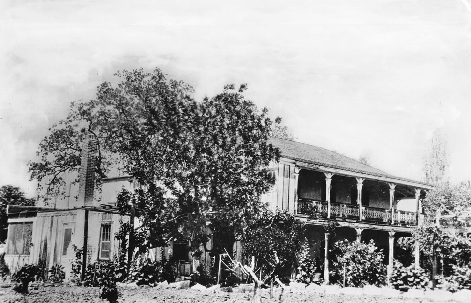
| (ca. 1915)^^* - Photograph of the adobe home of Miguel Leonis in Calabasas, ca.1915. The building is two stories high and has both a covered balcony and covered porch at right. Although classified as an adobe, most of the building is made of wood. A door and a window flank a brick chimney at left. Much of the view of the front of the house is obscured by several tall trees and bushes. Another tree is visible behind the house. |
Historical Notes In 1961, the adobe had fallen victim to vandalism, and its owner applied for a permit to raze the structure and erect a supermarket in its place. Preservationists succeeded in having the adobe declared a Historic-Cultural Landmark (the first structure in Los Angeles receiving the designation in 1962 - Click HERE to see the LA Historic-Cultural Monuments List). Leonis Adobe is also known as one of the most haunted sites in Los Angeles County, and it was profiled in the British paranormal television series "Most Haunted" in 2005. The adobe was restored and is operated as a living museum. It was listed on the National Register of Historic Places in 1975.^^^ |
Click HERE to see more in Early Views of the San Fernando Valley |
* * * * * |
Corner of 5th and Hill
 |
|
| (ca. 1890)^^* - View showing the first building erected on the corner of Fifth Street and Hill Street in Los Angeles. The small, two-story clapboard house is at center. It has a small balcony with an open doorway at center, as well as a covered porch on the first floor. Large vines have grown up the side of the porch, hiding much of the front of the house from view. Four people are on the sidewalk in the foreground, including two young children at left and a girl and a woman walking at center. |
Historical Notes The building, the home of Mary E. Taft, was moved to face Fifth Street. Later this block would become part of the center of Los Angeles' financial district.^^* |
S/W Corner of 2nd and Grand
 |
|
| (1890)* - Photo taken from the southwest corner of 2nd Street and Grand Avenue, looking north on Grand. It shows a modest one-story home. A woman stands on the steps that lead to the entrance of the house and three other people are standing in the garden, all looking toward the photographer. Visible behind tall trees, a larger, more elaborate Victorian home can be seen. |
N/E Corner of 8th and Broadway
 |
|
| (ca. 1897)* – View showing the northeast corner of 8th Street and Broadway. A woman and young girl are seen standing in front of the Victorian house. Another woman is seated in a horse-drawn carriage. |
* * * * * |
Hershey Residence
 |
|
| (ca. 1896)* - View showing Almira Parker Hershey's two-story Victorian Gothic style home, located on the northwest corner of 4th Street and S. Grand Avenue on Bunker Hill. |
Historical Notes Almira Hershey was a relative of Milton S. Hershey, founder of the Pennsylvania chocolate empire, and the daughter of Benjamin Hershey who amassed a fortune in the lumber and banking industries. Mira inherited a substantial sum when her father died and she relocated from Muscatine, Iowa to Los Angeles in the 1890s. Hershey purchased real estate on Bunker Hill and commenced construction on a number of residences, including her own home at the NE corner of Fourth and Grand Avenue in 1896. The elegant structure sat across the street from the Rose Residence. In 1906, Mira had this home moved to 750 W. Fourth Street and commissioned architects C.F. Skilling and Otto H. Neher to split it in half to turn it into an apartment building. After the apartment building opened in 1907, it was named the Castle Towers, reminiscent of the structure's "castle-like features." Built to a cost of around $50,000 and designed by architects Curlett & Eisen. |
 |
|
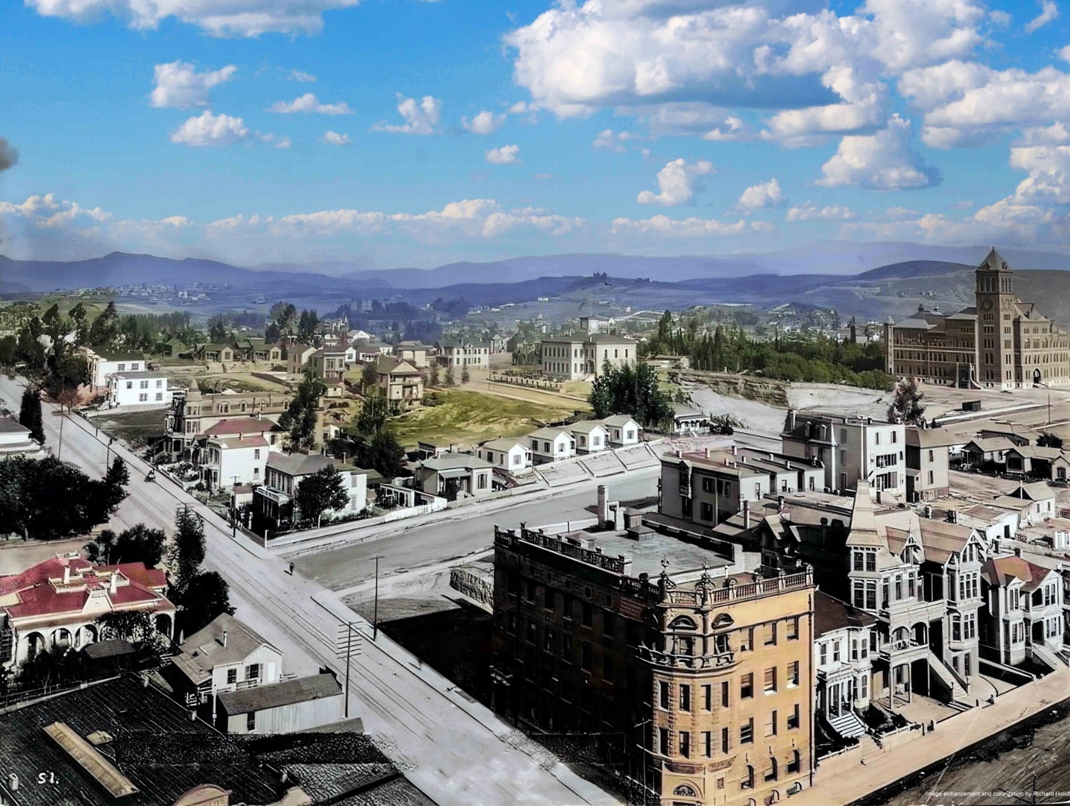
| (ca. 1896)* - View showing Almira Parker Hershey's two-story Victorian Gothic style home, located on the northwest corner of 4th Street and S. Grand Avenue on Bunker Hill. Image enhancement and colorization by Richard Holoff |
* * * * * |
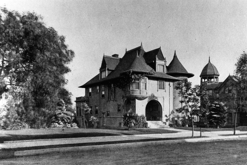
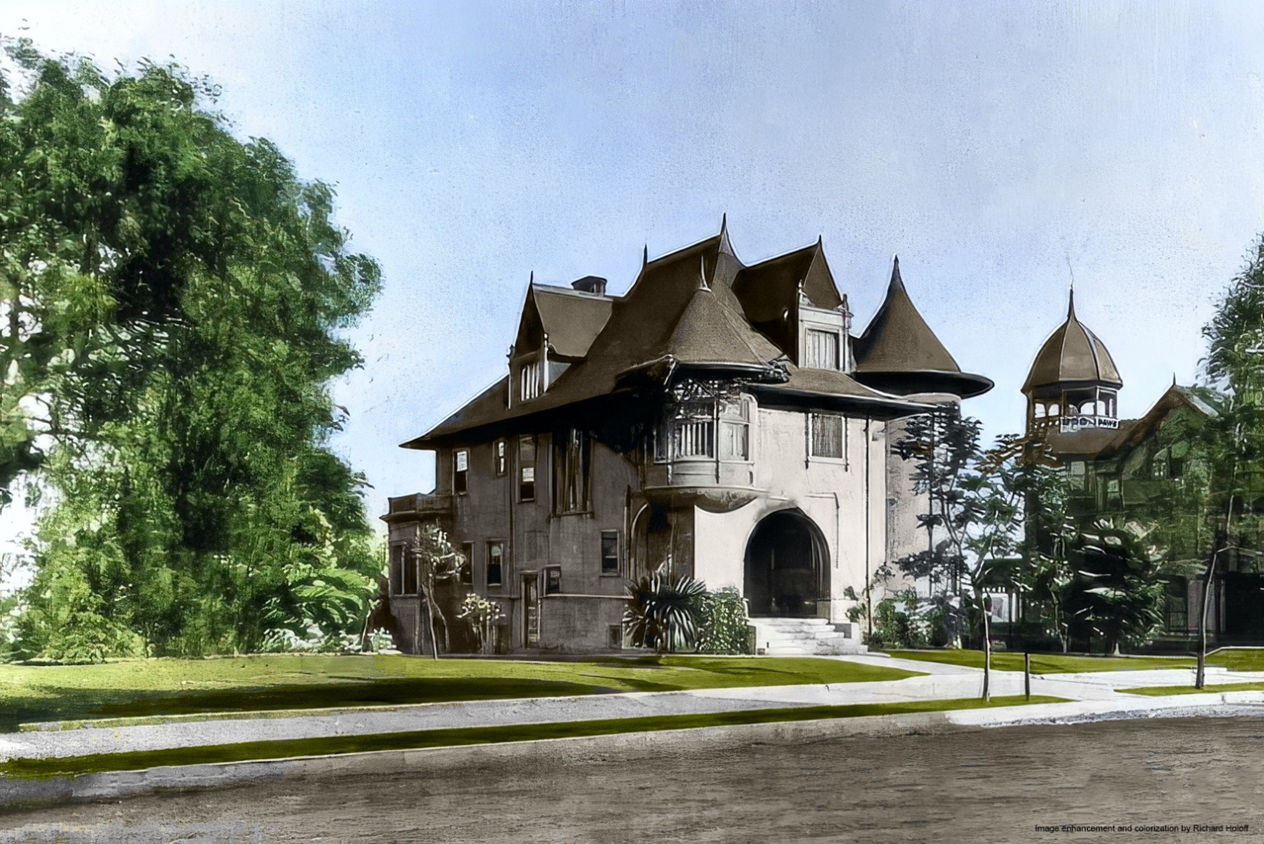
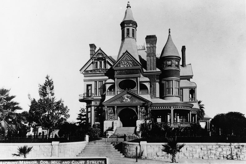
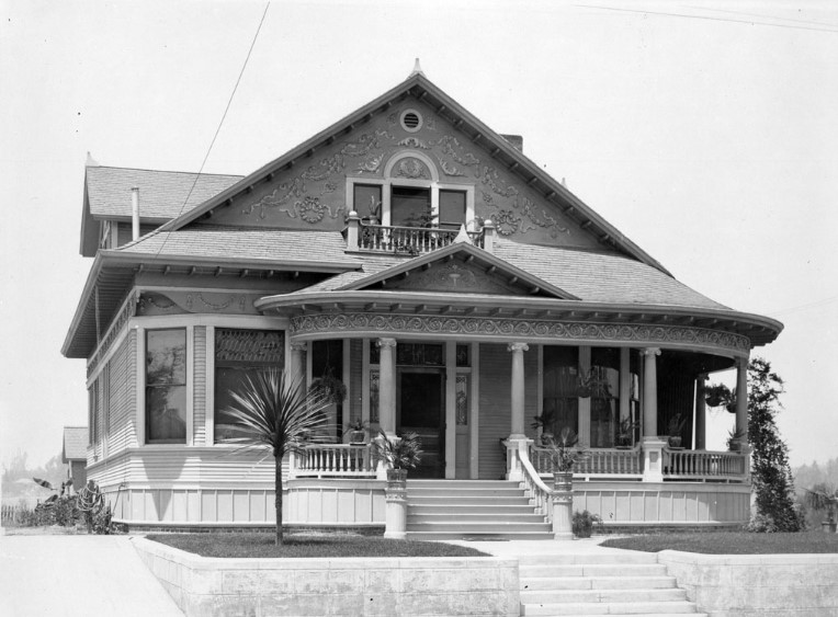
Bradbury Mansion
 |
|
| (1887)* - View of the Bradbury Mansion at 406 Court Street, situated on the southwest corner of North Hill Street and Court Street in the Bunker Hill neighborhood of downtown Los Angeles. Photo courtesy of the Ernest Marquez Collection. |
Historical Notes The Bradbury Mansion was built for Lewis Leonard Bradbury, a multi-millionaire mining magnate, who purchased the property in February 1885. The existing residence was moved to make way for the new palatial Queen Anne-style mansion, designed by the renowned San Francisco architects Joseph and Samuel Newsom. Construction began in 1886, with an estimated cost of $100,000, a considerable sum at the time. |
 |
|
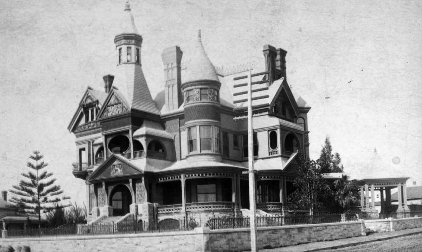
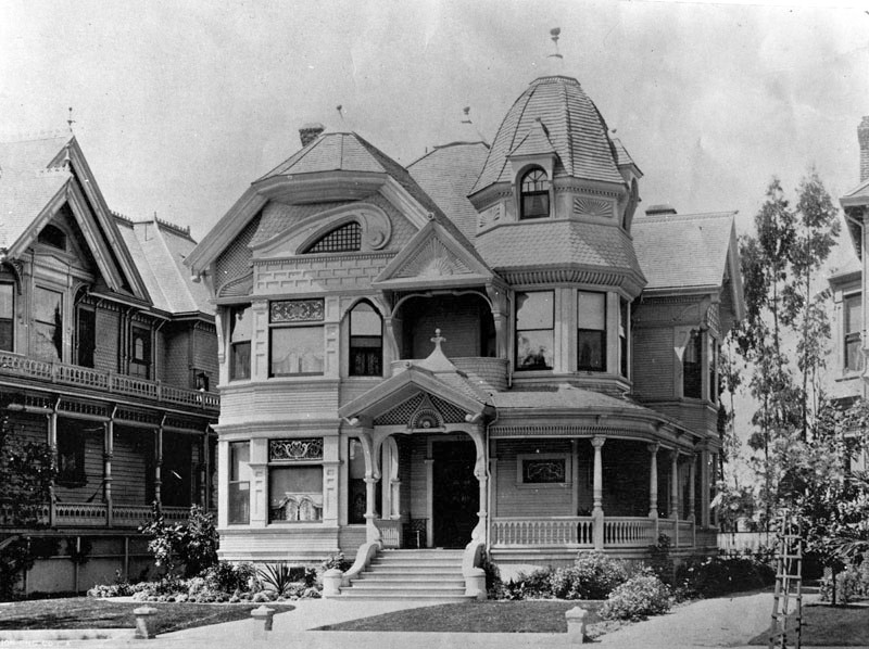
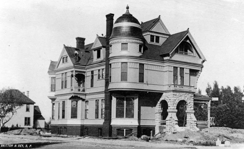
| (ca. 1890)* - View showing the Lewis Leonard Bradbury's mansion, located on the southwest corner of Hill and Court streets. |
Historical Notes The Bradbury Mansion was celebrated for its unique and elaborate design, which stood out as both innovative and visually appealing. Its exterior featured a variety of shapes, including curves, angles, and tall towers, creating a "well broken up" and attractive appearance. Balconies, bay windows, extensions, and turrets added to its distinctive style, introducing features that were considered groundbreaking at the time. Decorative chimney stacks, a Romanesque granite base, and bell-shaped towers highlighted the attention to detail in its construction. A curved, wrap-around porch or veranda further enhanced the mansion’s charm and elegance. |
 |
|
| (ca. 1890)* - View showing the Bradbury residence, located at Hill Street and Court Street. The Bradbury Mansion, constructed in the Queen Anne style of architecture, sits at center surrounded by a wrought-iron fence. The mansion has several turrets and is ornately decorated by elements including fish-scale shingles and carved moldings. A gazebo-like structure sits to the right of the house, covering a walkway to a secondary entrance. |
Historical Notes The Bradbury Mansion was built during the "Boom of the Eighties," a period of rapid growth in Los Angeles following the completion of a transcontinental railroad line. It was part of a trend of grand homes being built in the hills along the western edge of downtown, including areas like Bunker Hill and Bellevue Terrace. |
 |
|
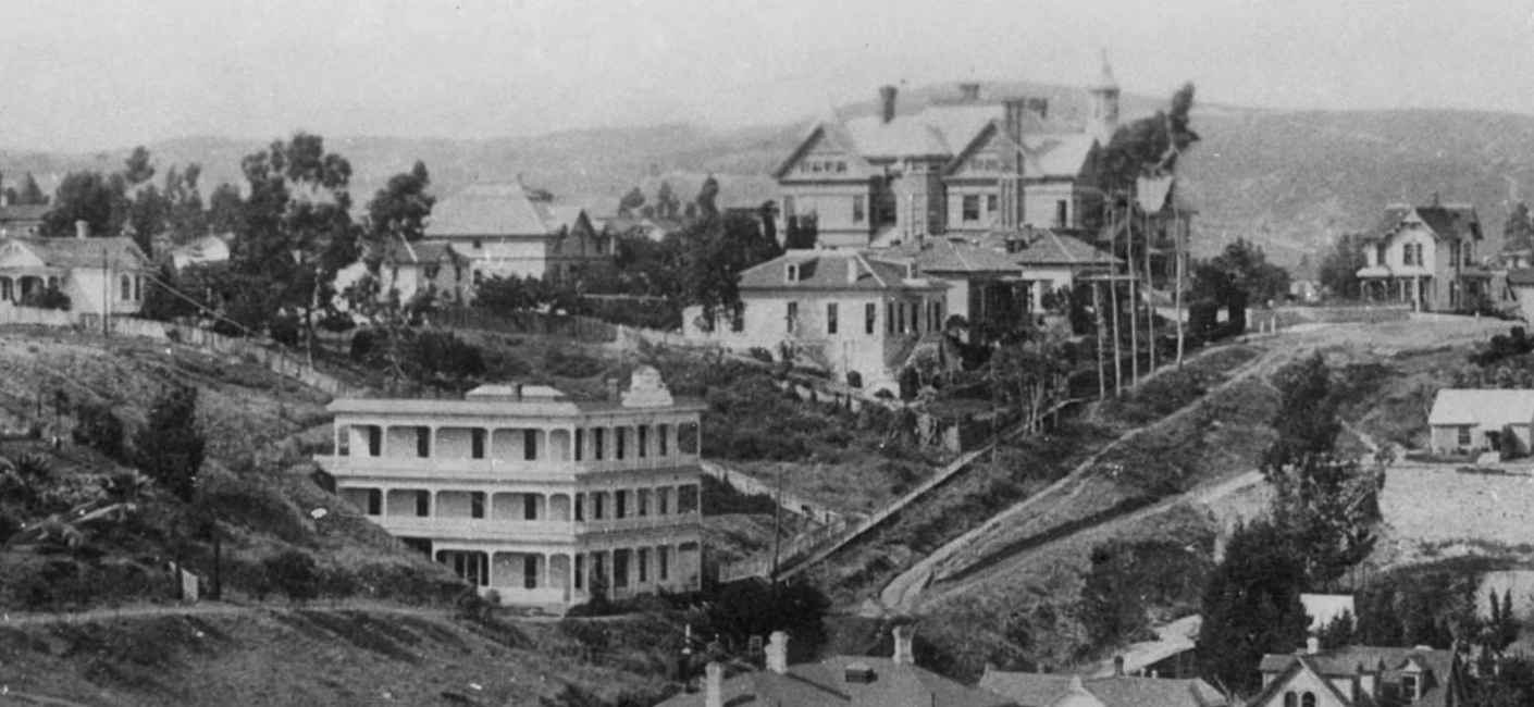
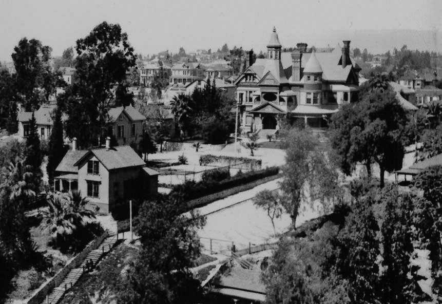
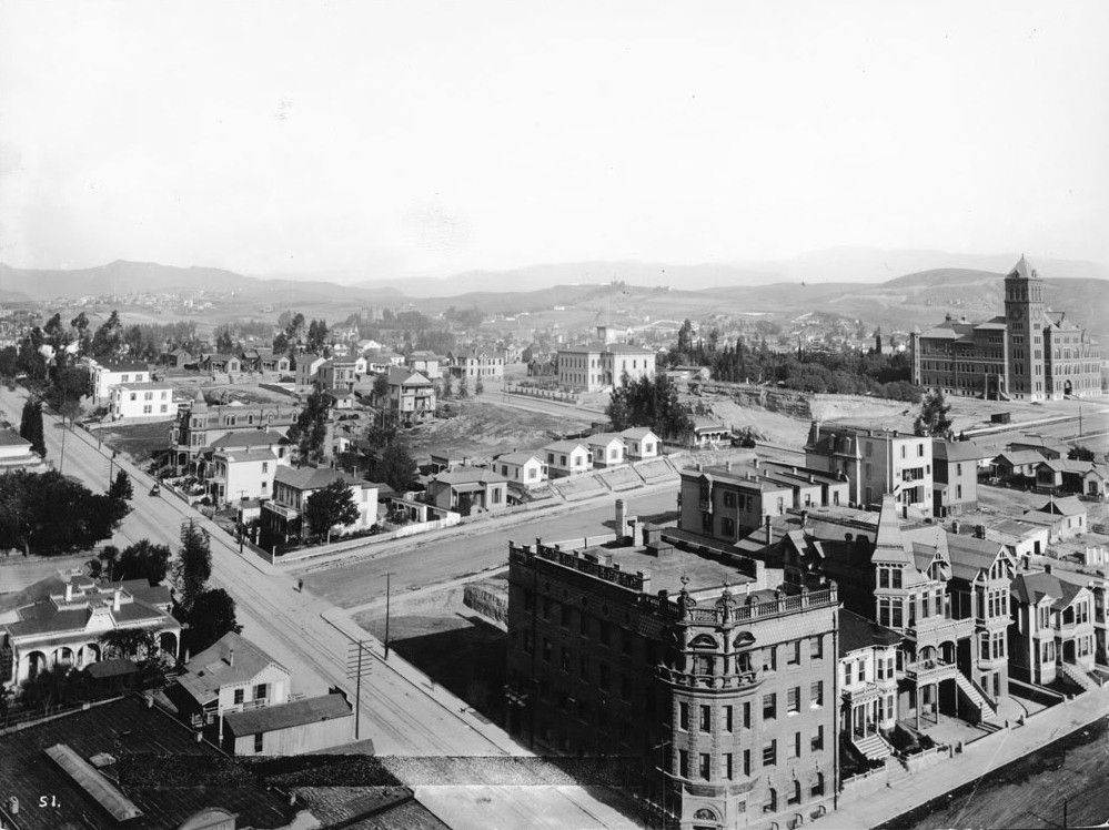
| (ca. 1898)* – View showing the Highland Villa, the Bradbury Mansion and the Bixby house, Court Hill. |
Historical Notes Looking northwest from the third City Hall with Highland Villa still isolated above a foot path which will become Hill Street, the Bradbury Mansion standing majestically above the fray at what will become Hill and Court Streets and the Llewellyn Bixby house signalling his death (1825-1896) as the second floor was added by his widow. |
 |
|
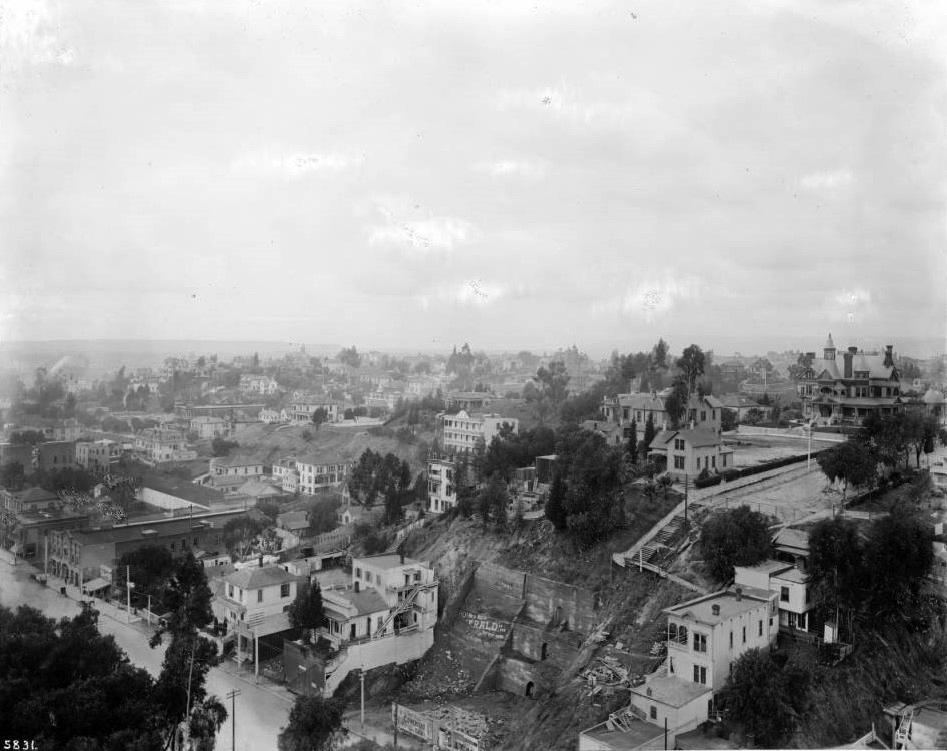
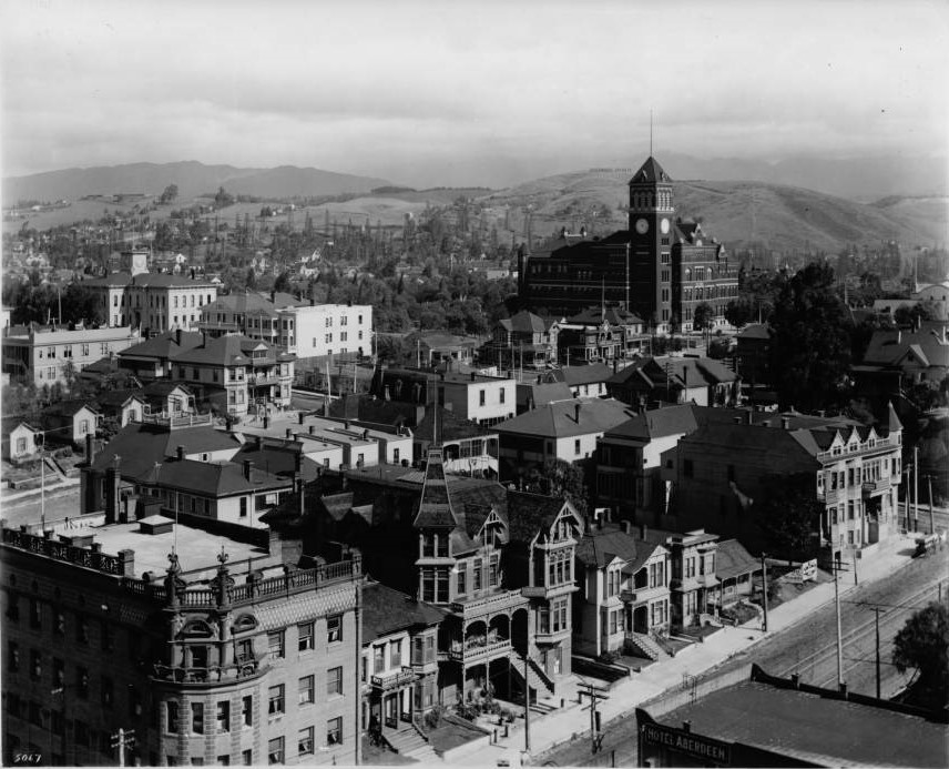
| (ca. 1900)* – View looking southwest from the County Courthouse showing the Bradbury Mansion at upper right on the corner of Hill and Court streets. The Highland Villa can be seen at center of photo. |
Historical Notes Broadway runs diagonally south(left)/north in the lower left quadrant of the photo. The steep slope with the stairs next to it is the future site of Court Flight, Angels Flight's sister funicular railway. Court St. dead ends at the top of the slope. The Bradbury mansion (built 1886, demolished 1928) is the large house on top of the hill, facing east on to N. Hill St. The house directly across from it (partially hidden by trees), at 138 N. Hill, is the third Los Angeles home (built circa 1881, demolished 1955) of Sarah Bixby Smith, author of "Adobe Days" (1931). The Hill Street Tunnel was put through in 1908 after 1st St. was extended to the west. Court Hill (between Bunker Hill and Poundcake Hill) was removed entirely in the mid- to late 1950s. |
 |
|
| (ca. 1900)* - Closer view showing the staricase leading up to the end of Court Street. The magnificent Bradbury Mansion sits on top of the hill as well as Sarah Bixby Smith's home across the street (left of photo). |
Historical Notes The Bradbury Mansion, built in 1886 as the home of wealthy developer Lewis L. Bradbury, was located near the Bradbury Building, which he commissioned in 1892 as a commercial office space. Both structures were significant in early Los Angeles history, with the mansion later serving as a film company headquarters before its demolition in 1929, while the Bradbury Building remains an architectural landmark. |
 |
|
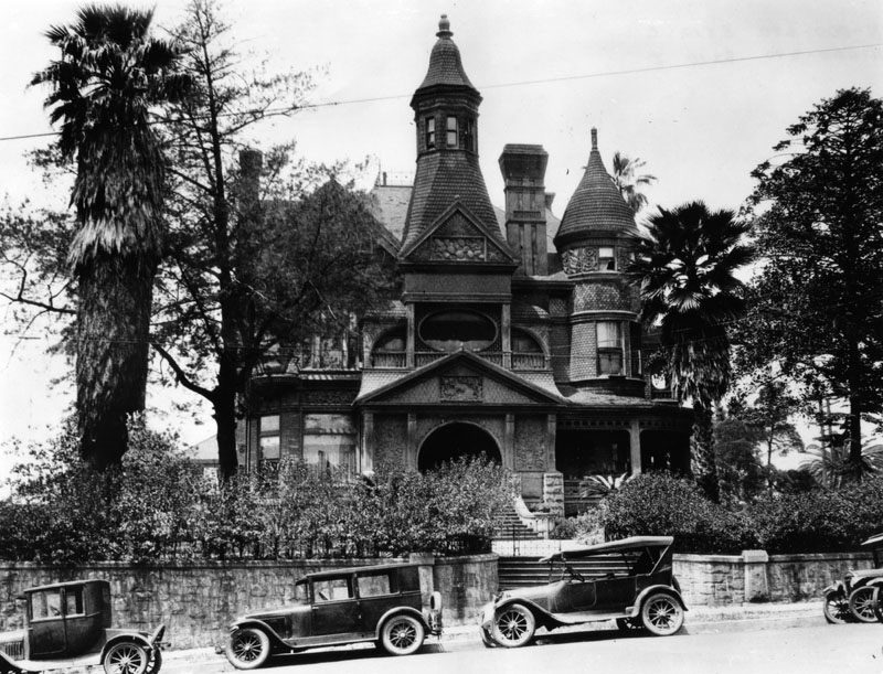
| (1927)* - The Lewis Leonard Bradbury's mansion, located on the corner of Hill and Court streets. Cars line the street and the building shows significant wear and is in need of paint. |
Historical Notes The Bradbury Mansion was occupied for years by various movie studies, including J.A.C. Film Manufacturing Co., who moved into the building in 1913. Hal Roach occupied it with Harold Lloyd, who referred to the mansion as "pneumonia hall", due to the building's high level of draftiness. It also served as a luncheon center for area Supreme Court judges and as a boarding house; it was demolished in 1929. |
 |
|
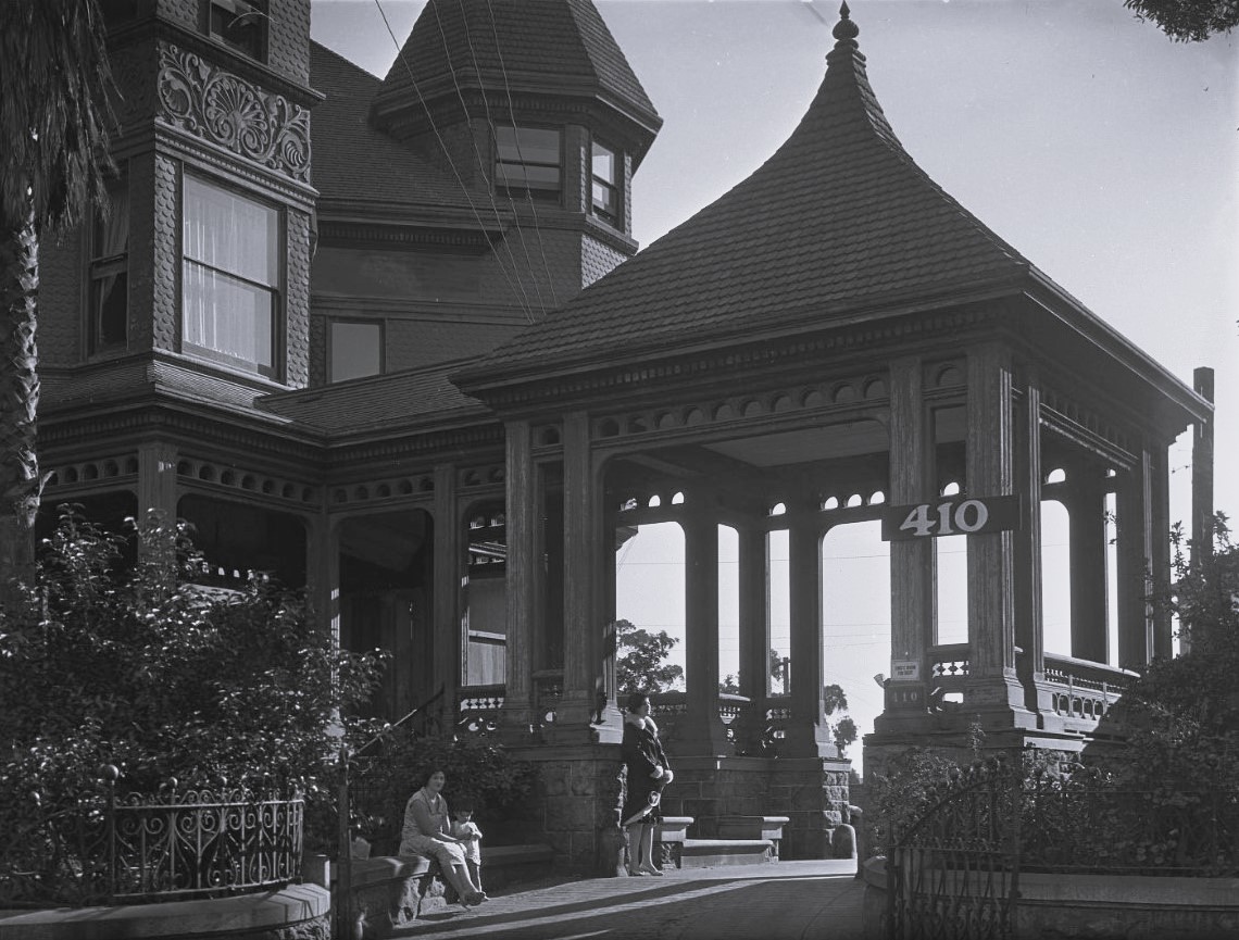
| (1928)* - View showing a gazebo-like structure to the right of the Bradbury House covering a walkway to a secondary entrance. |
Historical Notes Despite being lauded as one of the finest homes in Victorian-era Los Angeles, the Bradbury Mansion eventually fell into disrepair and neglect. In a sad turn of events, the mansion was demolished in 1929 to make way for a parking lot. This demolition was part of a larger trend of "urban renewal" that saw many historic structures in Los Angeles sacrificed in the name of progress. Today, the site where the Bradbury Mansion once stood is occupied by the Los Angeles County Superior Court building. |
 |
|
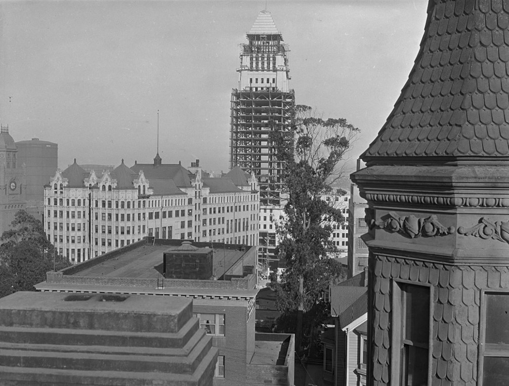
| (1928)* - View of Los Angeles City Hall, still under construction, as seen from the roof of the Bradbury Mansion, located on the southwest corner of Hill and Court Streets in Bunker Hill. Today, the site of the Bradbury Mansion is occupied by the Los Angeles County Superior Court building. |
Historical Notes From left to right can be seen: The LA County Courthouse, a Gasometer, the Hall of Records, City Hall, and the Bradbury Mansion. The only structure seen in the above photo that still stands today is City Hall. |
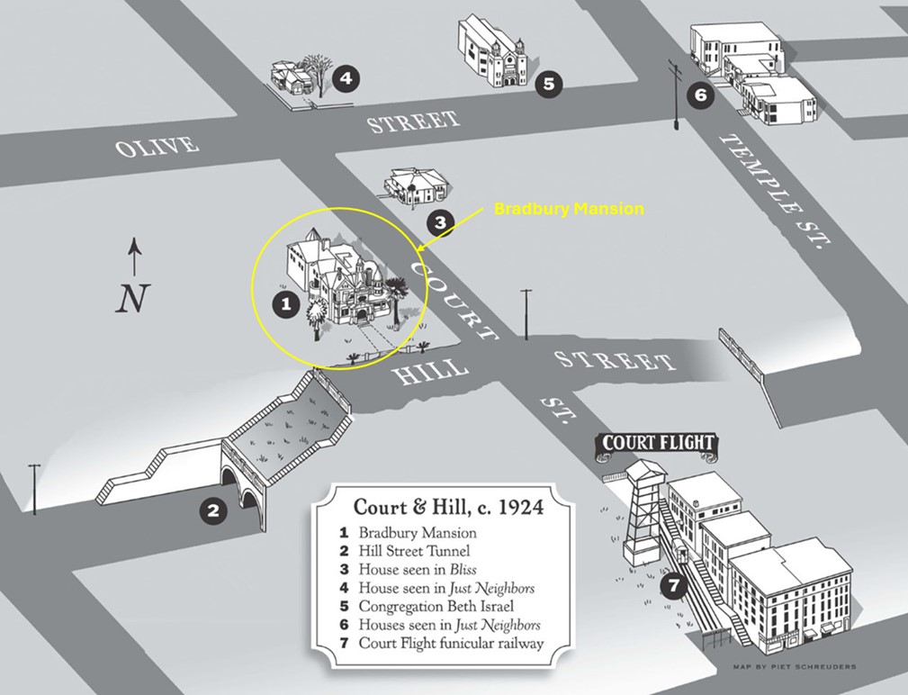 |
|
| (ca. 1924)* – Map showing the Bradbury Mansion (1), Hill Street Tunnels (2), and Court Flight (7), all of which are now gone. Map by Piet Schreuders. |
* * * * * |
Ruber Residence
 |
|
| (n.d.)* - The J. Ruber home located at 145 N. Flower St. It sat on the southwest corner of Flower and Court streets. |
Historical Notes The house is a small structure with a wide front porch held up by Romanesque columns. A 5-story sheer drop down to Figueroa was in its backyard. |
Haddock Residence
 |
|
| (ca. 1890)* – View of a large Queen Anne style residence, designed by architects Bradbeer & Ferris. Located at 939 S. Olive St., it was owned by Charles Haddock at the time this photograph was taken. |
Loew Residence
 |
|
| (1890)* - Exterior front corner view of the two-story Victorian style Jacob Loew home at 1417 South Figueroa Street, Los Angeles, in 1890, during construction |
Historical Notes Jacob Loew was president of Capitol Milling Company and originally from Germany. Samuel and Joseph Cather Newsom were the architects. The Queen Anne style house was built in 1888 at a cost of $20,000.* |
6th and Firgueroa Streets
 |
|
| (ca. 1890)* - Two ornate Victorian homes located on the west side of South Figueroa Street looking south from 6th Street. |
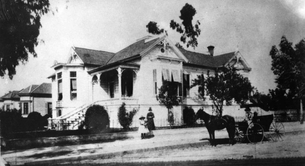
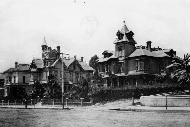
Robinson Mansion
.png) |
|
| (ca. 1887)^*# - Birdseye view of Bella Vue Avenue (now Bellevue, this section of which would later become part of Sunset Boulevard) and the Robinson residence shortly after it was built, looking north from Fort Hill. |
Historical Notes The J.W. Robinson mansion can be seen on the hilltop. It was located on Teed Street near Bella Vue Avenue (now Bellevue, this section of which would later become part of Sunset Boulevard). Teed Street was named after Freeman G. Teed who, in the 1880s and 90s, was LA City Clerk and President of the City Council. He was also a real estate speculator.^*# |
 |
|
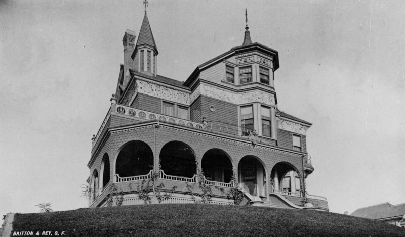
| (ca. 1890)* - Exterior view of the two-story Victorian style home of Joseph Winchester Robinson, located on Teed Street near Bella Vue Avenue (now Bellevue, this section of which would later become part of Sunset Boulevard). A winged gargoyle watches over the entrance. |
Historical Notes Samuel and Joseph Cather Newsom were the architects. The house was built in 1887 at a cost of $10,000. Joseph Winchester Robinson was the owner of Boston Dry Goods which later became the J. W. Robinson Department Stores.* |
 |
|
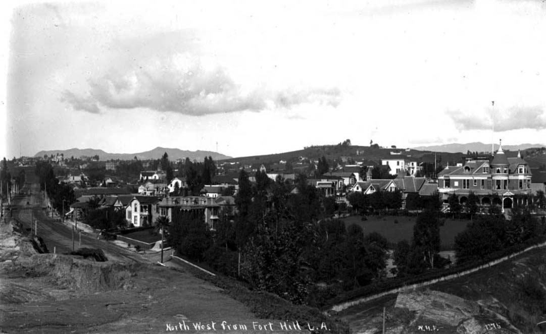
| (ca. 1895)^## - View looking northwest from Fort Moore Hill. The beautiful Victorian mansion (on the right) was purchased by Mrs. Julia S. Ford after the sudden death of J. W. Robinson in 1891. |
Historical Notes J. W. Robinson's “Boston Dry Goods Store” began business in of 1883 at the corner of N. Spring and Temple Streets. Joseph Winchester Robinson advertised that his establishment was characterized by “fine stocks and refined ‘Boston’ service.” The arrival of railroads spurred the enormous and long-lived growth of Southern California, and Robinson’s store brought eastern goods and their attendant sophistication to a willing (and growing) public; in 1887 the store was forced to move to larger quarters at 69-73 N. Spring Street. After returning from a trip back east in 1891, Robinson became ill and passed away in his home at the age of 45. His father, H.W. Robinson came to Los Angeles for the funeral and to look after the business founded by his late son. ##^^ |
 |
|
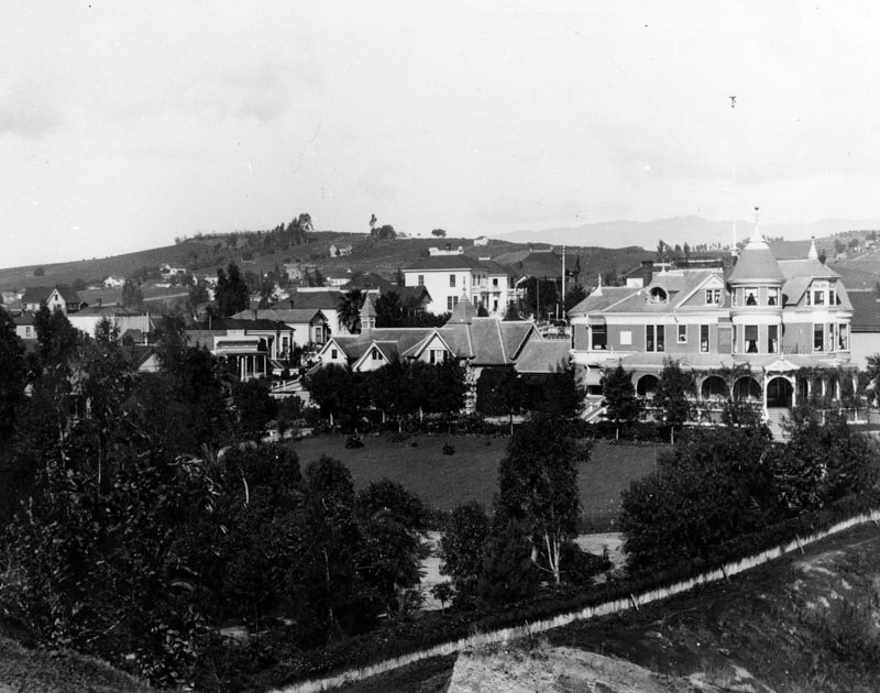
| (ca. 1897)* - Panoramic view of the two-story Victorian style home of Mrs. Julia S. Ford, who purchased the residence from J.W. Robinson Estate and then remodeled it. |
 |
|
| (ca. 1900)^^* - View showing the Ford Mansion (previously Robinson Mansion) sitting on the hill overlooking Sonora Town as seen from Fort Moore Hill. Castelar Street is on the right running away from the camera. |
* * * * * |
William H. Andrews Residence (San Fernando Valley)
 |
|
| (ca. 1900)+^^ – Front view of William H. Andrews' House, once the only house on the Lankershim Ranch. |
Historical Notes On the Van Nuys / Lankershim lands, in the late 1880’s, as wheat profits began to decline, JB Lankershim, son of Isaac, formed a group, the Lankershim Ranch Land and Water Company, and bought the easternmost 12,000 acres, and plotted the area for fruit-growing farms. William H. Andrews was the superintendent for these lands, and was the on-site director for the sale and lease of the farms for JB. As the farms grew, Andrews was instrumental in securing lands in the area for the Southern Pacific Railroad; the line that slanted across the valley to Chatsworth. +^^ |
 |
|
| (ca. 1900)* - View looking down Vineland Avenue just south of Third Street (now Riverside Drive) showing the residence of William H. Andrews. |
Historical Notes William Andrews was married to Mary "Mollie" Weddington, the sister of Sheriff Wilson Weddington of Storm Lake Iowa. During the winter of 1890, the Andrews invited their relatives to spend the winter in warm Southern California. The Weddingtons came and saw real opportunity in the San Fernando Valley. That same winter, William Andrews conducted a land auction for the Lankershim Land and Water Company, and the Weddingtons made their first big purchase of Valley land. Click HERE to see more in Early Views of the San Fernando Valley |
* * * * * |
Point Fermin Lighthouse
San Pedro, California
 |
|
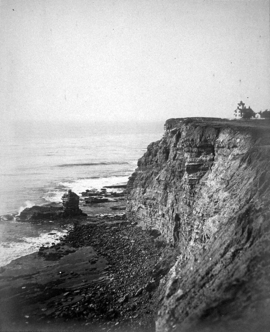
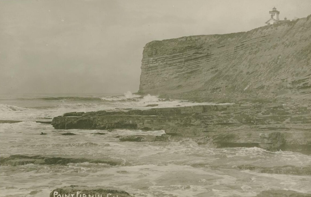
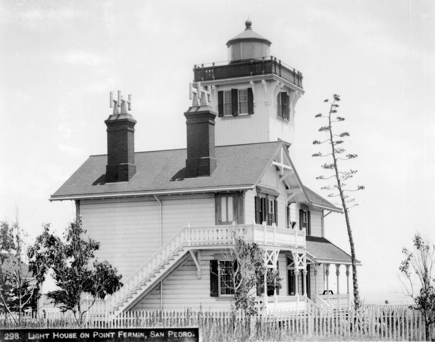
| (ca. 1880)* - View of the Point Fermin Lighthouse near the edge of the coastal cliffs overlooking San Pedro Bay. |
| Historical Notes
Point Fermin Lighthouse was completed in 1874 and was the first lighthouse built to guide ships into San Pedro Bay. For years, ships entering the harbor had no fixed navigational aid and relied on local knowledge and clear weather. The lighthouse marked the growing importance of San Pedro as a shipping center for Southern California. Its location on the high cliffs made the light visible far out to sea. The lighthouse was built after long efforts by Phineas Banning and other local leaders, who pressed the federal government to improve navigation safety. Although the site and funding were approved earlier, disagreements and delays postponed construction for nearly twenty years. Point Fermin marks the southernmost point of the City of Los Angeles. The point was named by British explorer George Vancouver in 1793 in honor of Father Fermín de Francisco Lasuén, whom he had met earlier in California. Father Fermín de Francisco Lasuén later became the second president of the California missions and founded Mission San Fernando Rey de España. Though often overshadowed by his predecessor, he guided the mission system for a longer period and left a lasting mark on California history. |
 |
|
| (1903)* - Photograph of the lighthouse site on Point Fermin. The top of the lighthouse is just visible above the steep sea cliff. |
| Historical Notes
By the early 1900s, coastal erosion had begun to reshape the cliffs around Point Fermin. Photographs from this period show how close the lighthouse stood to the edge, emphasizing both its dramatic setting and the constant threat posed by wind and waves. Despite these conditions, the lighthouse continued to operate reliably for mariners entering San Pedro Bay. |
 |
|
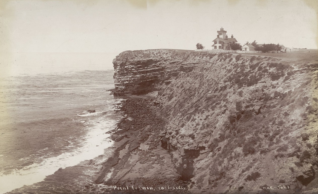
| (ca. 1888)* - View of the Point Fermin Lighthouse from the east side, showing the layered coastal bluff and the Victorian style structure. |
| Historical Notes
This view highlights the lighthouse’s wood frame construction and its relationship to the surrounding landscape. The steep, banded cliffs are a natural feature of the Palos Verdes Peninsula. The lighthouse was carefully positioned to balance visibility at sea with stability on land. |
 |
|
| (ca. 1880)* - Left panel of a stereoscopic photograph showing the multi story wood frame lighthouse surrounded by a white picket fence. |
| Historical Notes
Stereoscopic images like this were popular in the late nineteenth century and allowed viewers to experience scenes in three dimensions. The fence marked the lighthouse grounds and separated the keeper’s residence from grazing land and foot traffic. The structure served both as a navigational aid and as a family home for the lighthouse keepers. |
 |
|
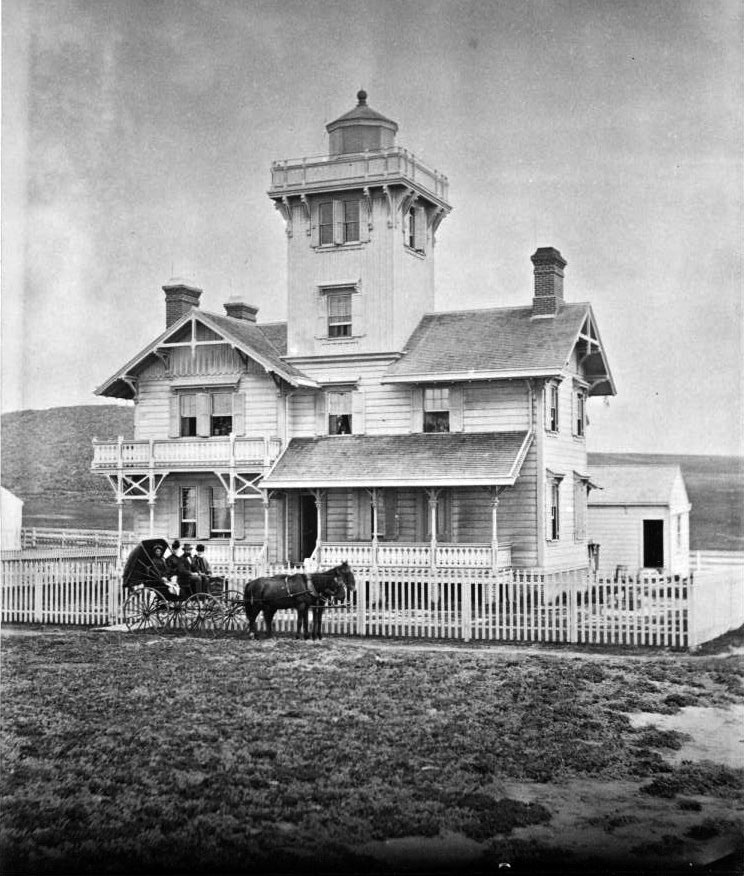
| (ca. 1875)* - View of the lighthouse shortly after completion. Four people sit in a horse drawn carriage in front of the white picket fence. |
| Historical Notes
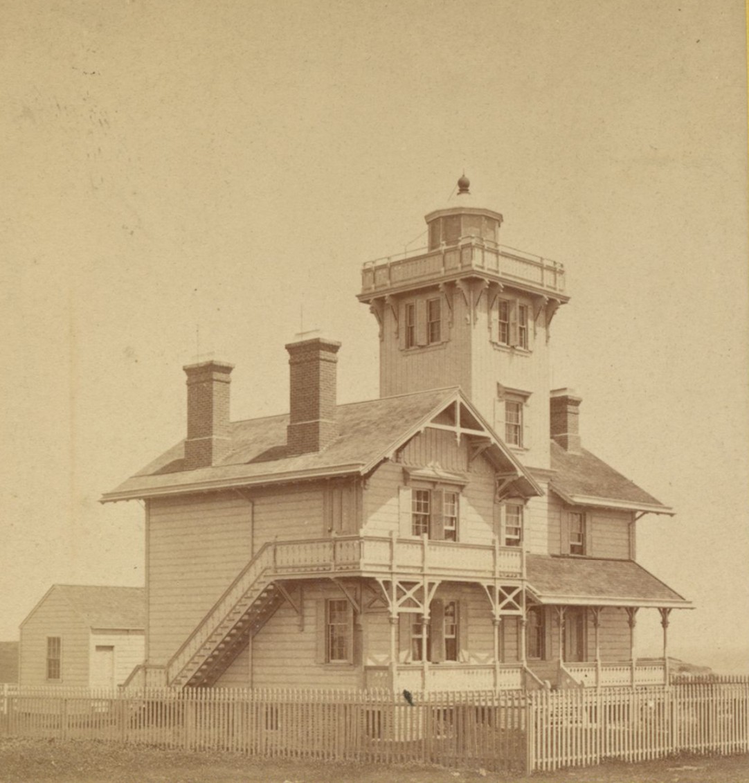
The Point Fermin Lighthouse was designed by Paul J. Pelz, a draftsman for the United States Lighthouse Board. The building reflects the Stick Style Victorian design, known for its simple decoration, gabled roofs, and visible wood details. Similar designs were used at East Brother Island Lighthouse and Hereford Inlet Lighthouse, both of which still stand today. |
 |
|
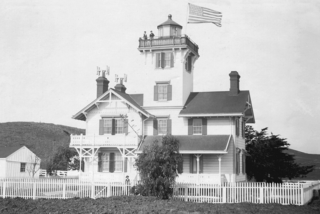
| (1890s)* - Exterior view of the Point Fermin Lighthouse with a keeper standing atop the tower beneath an American flag. |
| Historical Notes
This photograph shows the Point Fermin Lighthouse during its working years, when the light, lantern room, and gallery were fully intact and in daily use. The presence of a keeper on the tower highlights the hands on nature of lighthouse operations, which required constant maintenance, observation, and record keeping. Details such as the flag, gallery railing, and roofline help date the image to the late nineteenth century. During this period, the lighthouse served both as a navigational aid and a residence, with keepers and their families living on site while ensuring the light remained visible to ships entering San Pedro Bay. |
 |
|
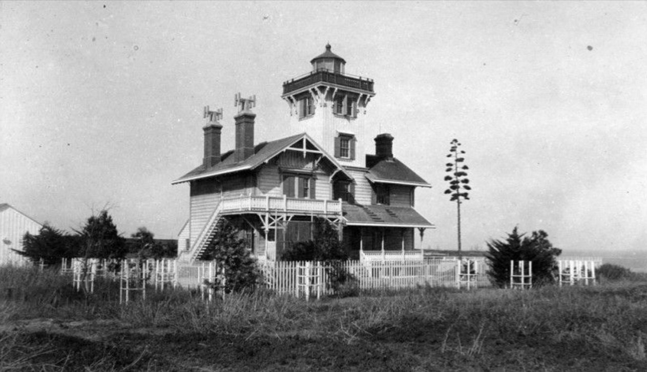
| (ca. 1890)* - Exterior view of the Victorian style lighthouse at 807 West Paseo del Mar on the Palos Verdes Peninsula. |
| Historical Notes
The lighthouse stands about thirty feet tall and rests on a brick foundation. Its wood frame was built using lumber milled from California redwood forests. The attached house provided living quarters for the keeper and family, who were responsible for maintaining the light, cleaning the lens, and recording weather and ship activity. |
 |
|
| (1890)* - Profile view of the lighthouse with trees and a picket fence surrounding the property. |
| Historical Notes
In 1941, shortly after the attack on Pearl Harbor, the light was turned off due to fears it could guide enemy ships or aircraft. The lantern room and gallery were later removed, and a small lookout structure was installed in their place. Locals referred to this temporary structure as the chicken coop. The lighthouse remained dark for decades during and after the war. |
 |
|
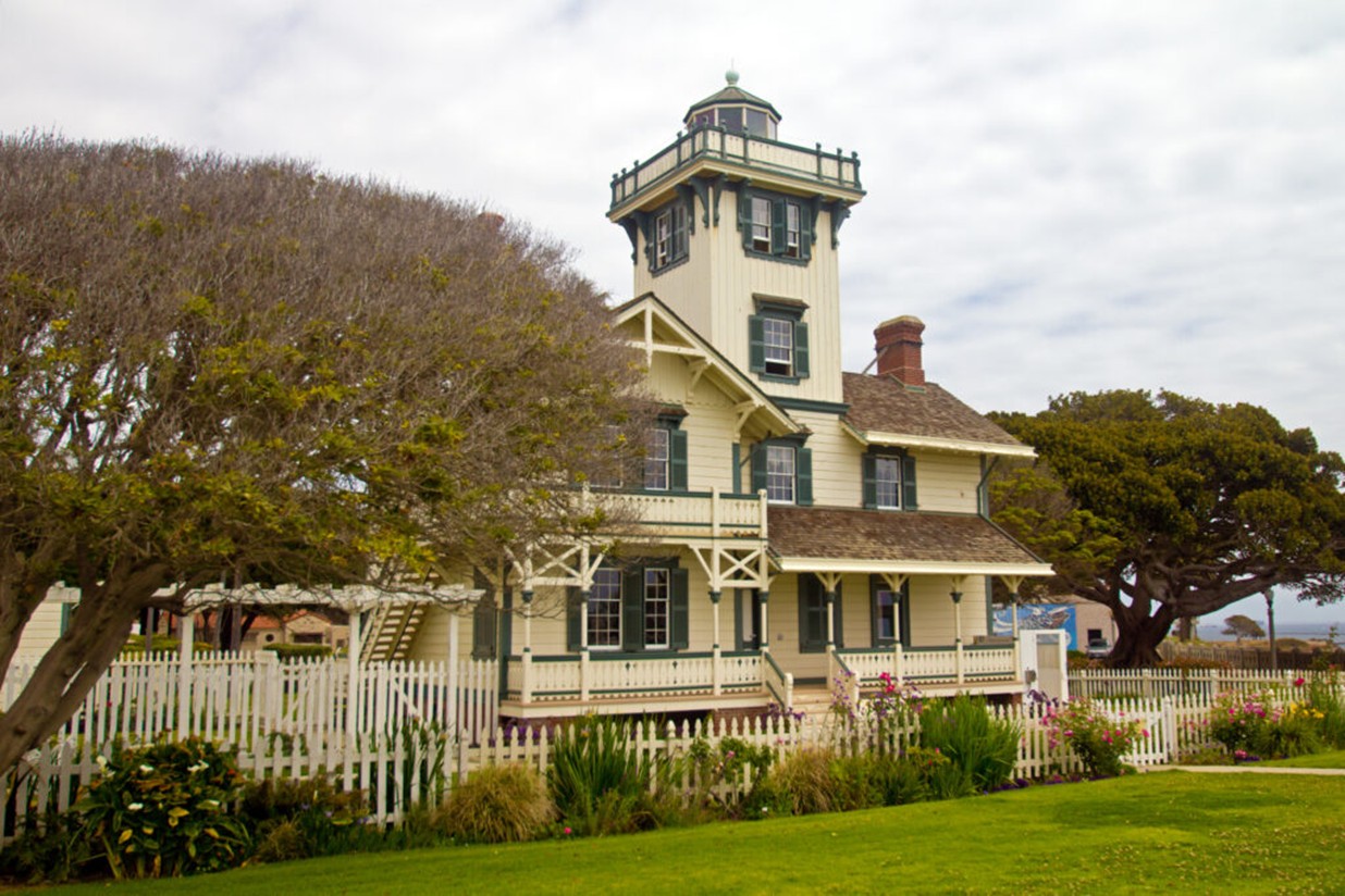
| (2021)* - Modern view of Point Fermin Lighthouse. Photo by Jeremy D’Entremont. |
| Historical Notes
The lighthouse was saved from demolition in 1972 and was listed on the National Register of Historic Places. A full restoration followed, including the reconstruction of the lantern room and gallery to match the original appearance. Today, it is the only surviving nineteenth century lighthouse in the City of Los Angeles. |
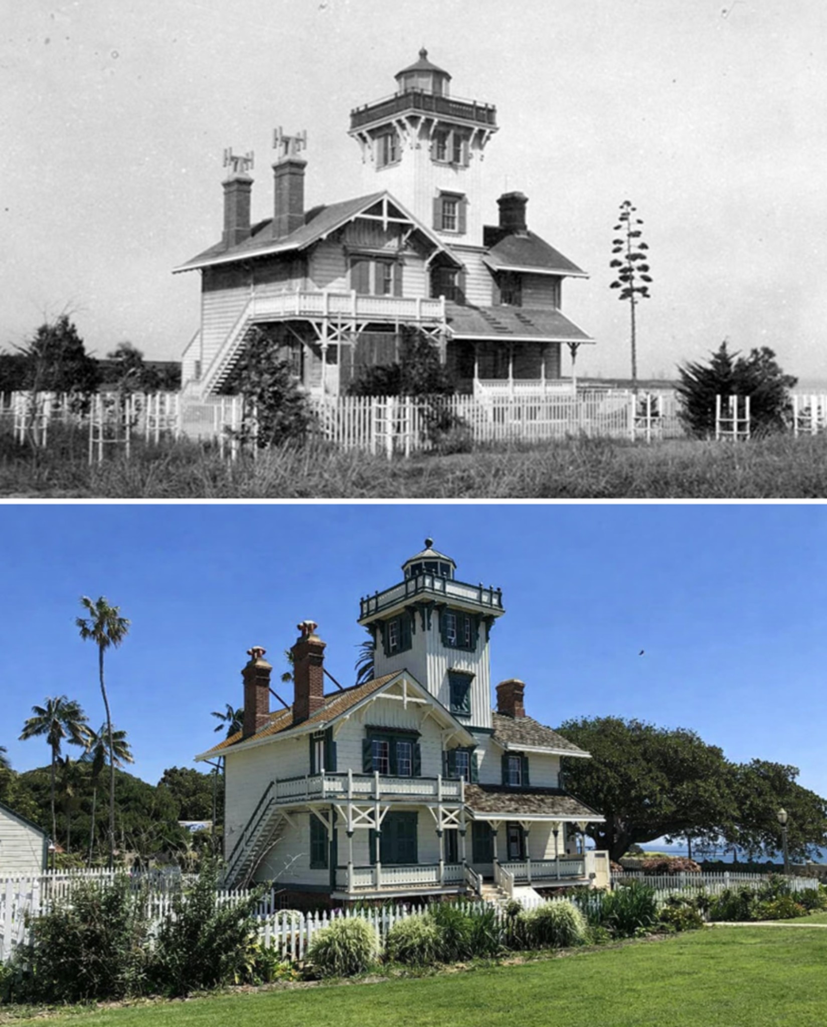
Then and Now
 |
|
| (1890 vs. 2023)* - Then and now view of the Point Fermin Lighthouse in San Pedro, showing how the historic structure was restored to closely match its original nineteenth century appearance. |
Historical Notes This then and now comparison highlights the careful restoration of the Point Fermin Lighthouse and how little its appearance has changed since it was first built in the 1870s. After years of modification and decline, the lighthouse was restored so that its overall form, exterior details, and proportions reflect how it originally looked when guiding ships into San Pedro Bay. In 2002, the lighthouse was restored, retrofitted, and rehabilitated for public access using funds from the City of Los Angeles, the Port of Los Angeles, and the State of California. Historic photographs and original design details were used to reconstruct the lantern room, gallery, siding, and trim, allowing the building to closely resemble its original Victorian design. The lighthouse reopened to the public in 2003 and is managed by the Department of Recreation and Parks for the City of Los Angeles. Volunteers from the Point Fermin Lighthouse Society serve as tour guides and help maintain the site, ensuring that this landmark continues to look much as it did when first completed nearly 150 years ago. |
* * * * * |
San Pedro Boarding House
 |
|
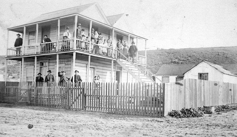
| (ca. 1890)* - Numerous people are seen outside of an unidentified two-story wooden building, which appears to be a boarding house or hotel, in San Pedro. |
* * * * * |
San Pedro Hotel
 |
|
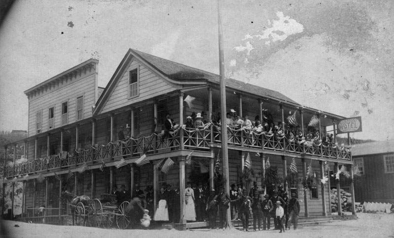
| (ca. 1898)* - Group portrait of people standing on the ground floor and along the balcony of the second floor of the San Pedro Hotel. Many flags are hanging around the hotel. A horse-drawn carriage is parked alongside the hotel. |
Click HERE to see more in Early Views of San Pedro and Wilmington |
* * * * * |
Salvation Army
 |
|
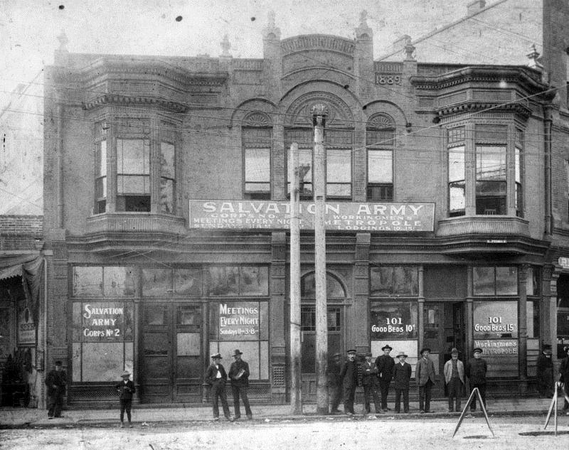
| (ca. 1890s)* - Salvation Army Corp No. 2 quarters on the corner of 1st and Weller (San Pedro) Streets, the first one with an industrial outreach in California. It offered meetings and lodging for workingmen. |
Historical NotesThe Salvation Army's presence in Southern California dates back to 1887, when an open air street meeting was held on the corner of Temple and Broadway in downtown Los Angeles. To this day, a plaque remains in the sidewalk to commemorate the event. Prior to this meeting, a church, or Corps (as it is known in The Salvation Army) had been established in the Skid Row area of Los Angeles Street. In 1892, the Corps moved to First Street where The Salvation Army occupied almost the entire block with a hotel for transient men and a men's industrial complex, the forerunner of today's Adult Rehabilitation Centers. In 1899, The Salvation Army opened a rescue home for young, expectant mothers in Los Angeles known as Booth Memorial Center. |
* * * * * |
Bank of Santa Monica (later California Bank)
 |
|
| (ca. 1899)##^ – View of the Bank of Santa Monica located at Third Street and Oregon Avenue (now Santa Monica). |
| Historical Notes
By 1899 there were two banks in the City of Santa Monica: Bank of Santa Monica located at Third Street and Oregon Avenue (now Santa Monica Blvd.) and Commercial Co's Bank at 219 Third Street. By the late 1920s there were thirteen financial institutions, including multiple branches. |
 |
|
| (1890)* - Exterior view of the California Bank building located south on 3rd from Oregon (now Santa Monica Boulevard). The building includes a library, upstairs in the corner. Several horse drawn carriages can be seen along side of the building. |
Click HERE to see more in Early Views of Santa Monica. |
* * * * * |
Fort Street Methodist Episcopal Church
 |
|
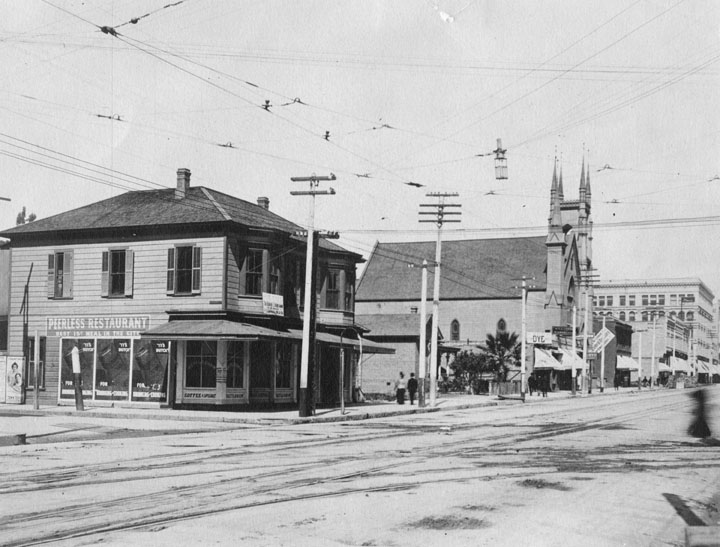
| (1890)* - Fort Street (now South Broadway), showing the Fort Street Methodist Episcopal Church, replaced by the Homer Laughlin Building in 1916. Also includes the "Peerless" restaurant, featuring a sign that reads "Best 15 cent meal in the City"! |
 |
|
| (ca. 1890)^^* - Panoramic view of downtown Los Angeles looking west from Spring Street and Fourth Street toward Bunker Hill across Broadway between Third Street and Fourth Street. Fort Street Methodist Episcopal Church (later purchased by Homer Laughlin for $63,000 in 1899) stands in the center of the photograph which includes principally dwellings. The house to the right of the church is the Hunter Residence (see next image). The tall pole at the top of Bunker Hill seen in the upper-left is one of Los Angeles’ earliest electric stretlights, standing 150-ft tall. Click HERE to see more in Early L.A. Streetlights. |
* * * * * |
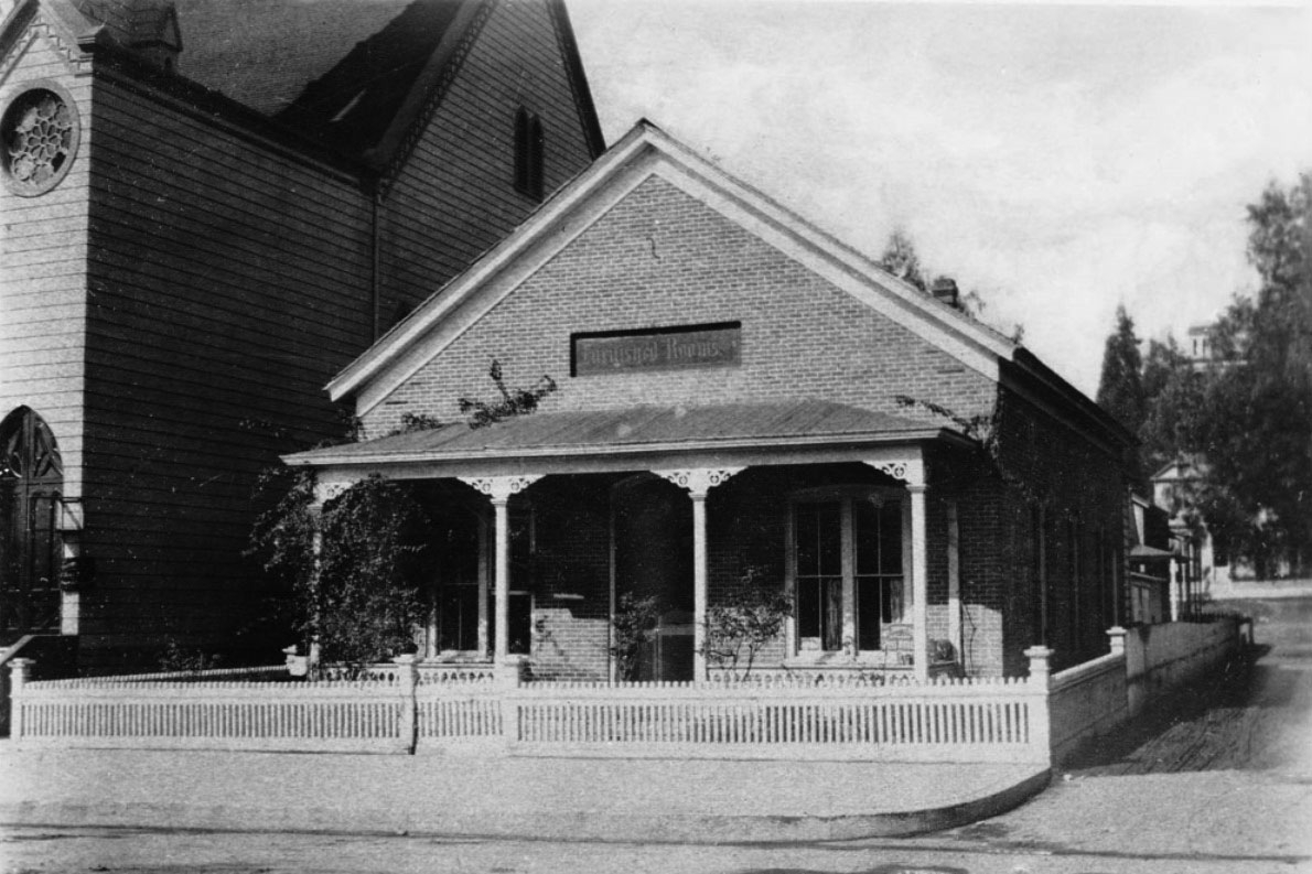
Hunter Residence
 |
|
| (ca. 1890)^^* - View showing the Hunter Residence located on Fort Street (later Broadway) near Third Street. The single-story brick house has a small fence surrounding its perimeters. It features a covered porch, large rectangular windows and a symmetric, inclined roof. Above the covered porch is "furnished rooms" sign. The Fort Street Methodist Episcopal Church is to the left of the small house. |
Custer Avenue School
 |
|
| (ca. 1890s)#*** - View of Custer Avenue School located on the corner of Custer and Temple streets. |
Historical Notes Built in 1895, Custer Avenue School was the first Junior High School (Middle School in the District). It became an elementary school in 1914. #*** |
Harper School
 |
|
| (ca. 1890s)#*** - View of Harper School, built in 1896. The school was renamed Vermont Avenue School in 1903. Notice the round dormer on the right side of the picture. Also notice the flag in the photo; it was painted in by the photographer. |
* * * * * |
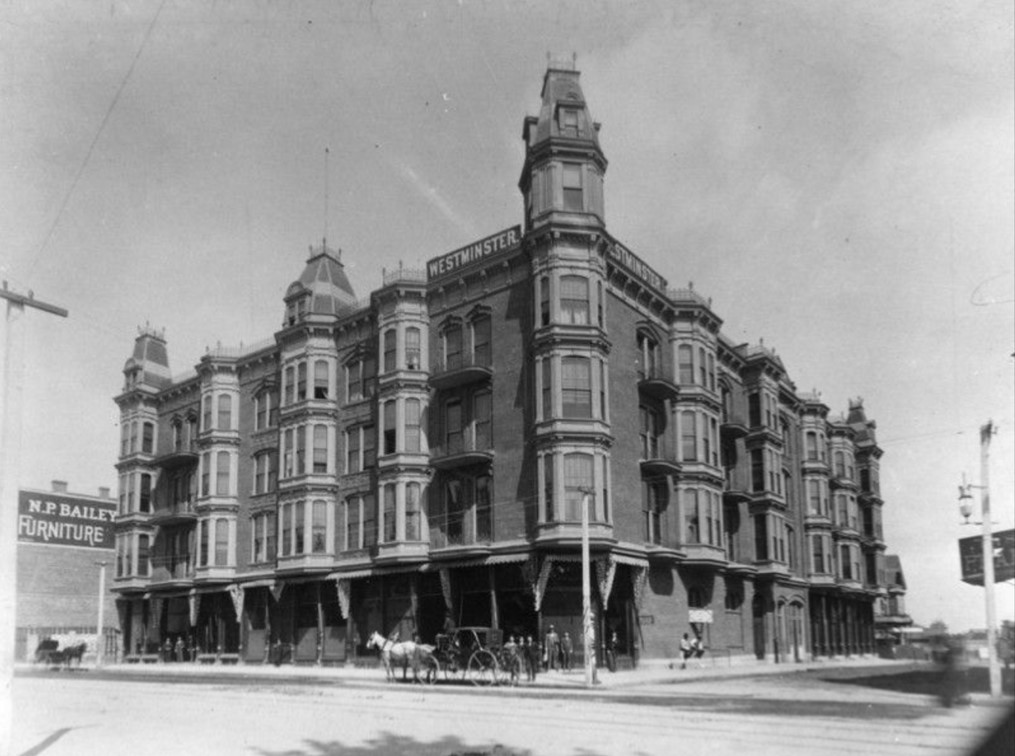
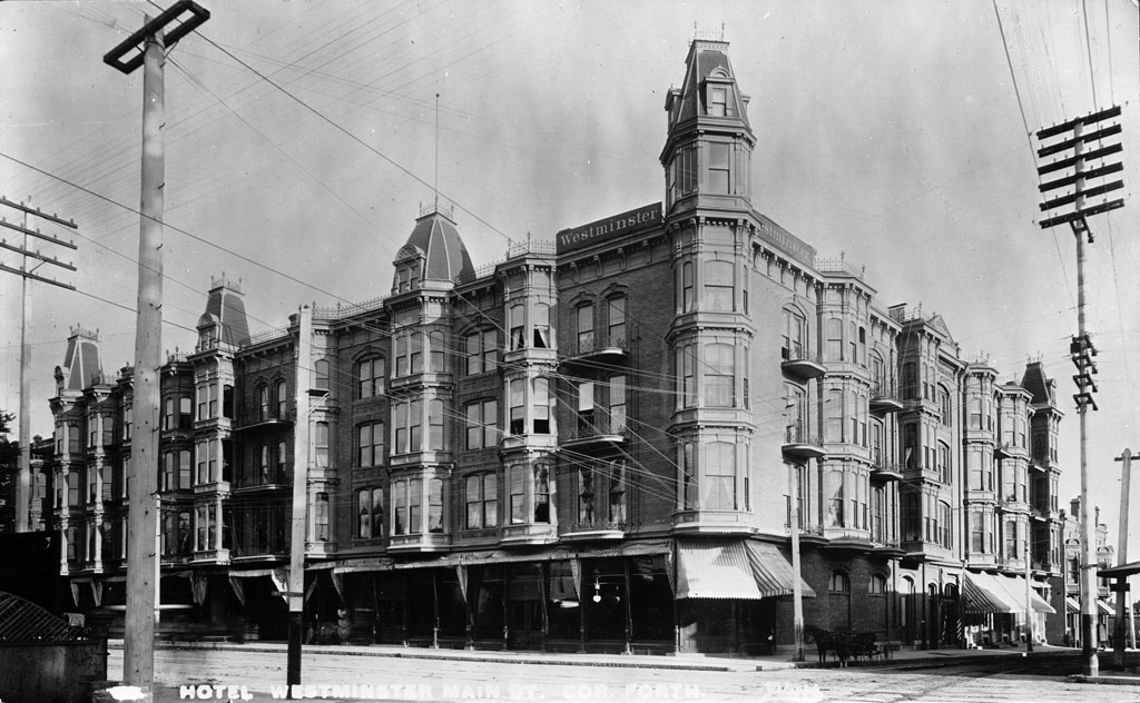
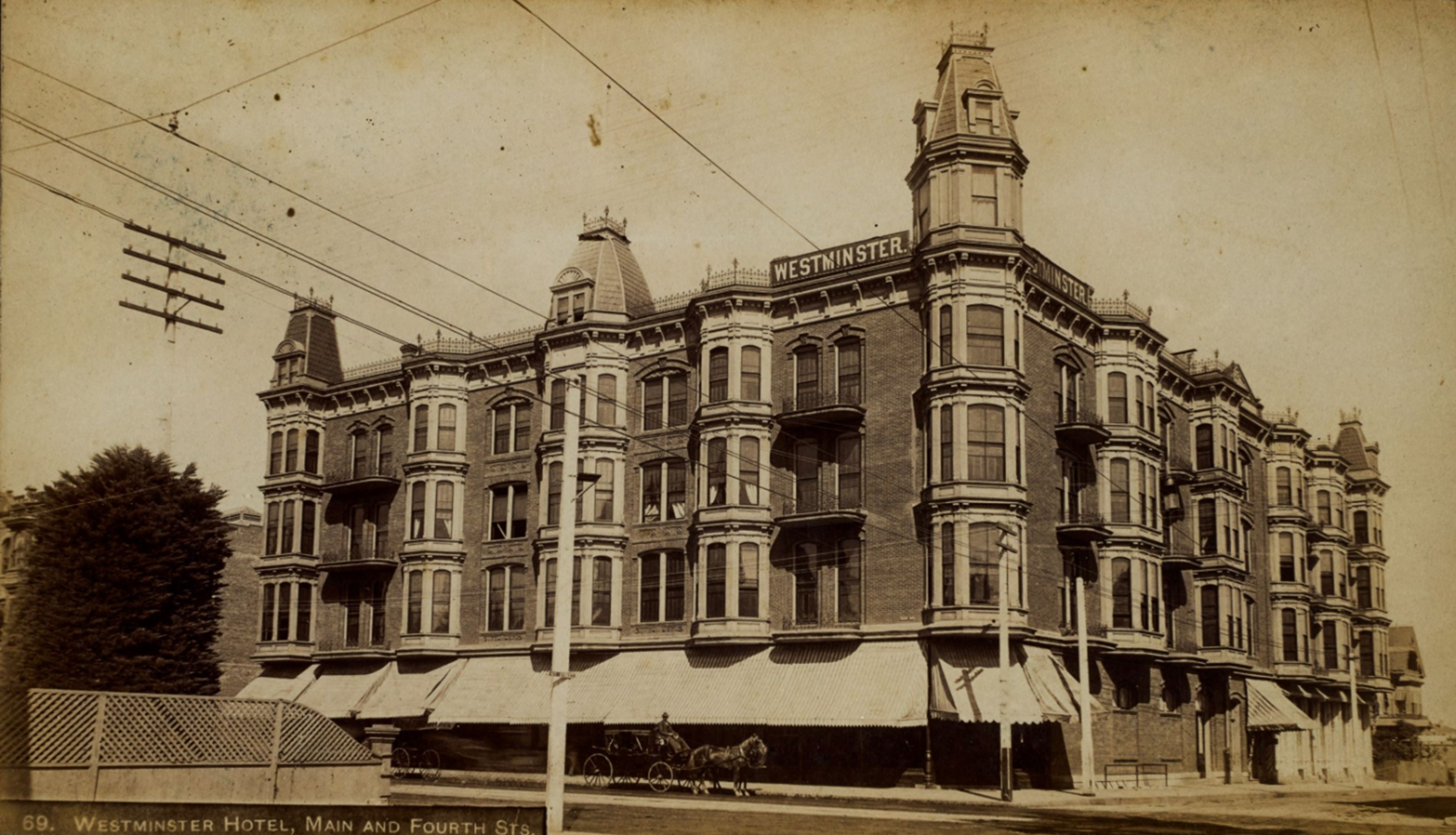
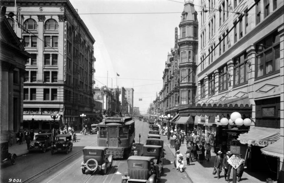
Westminster Hotel
 |
|
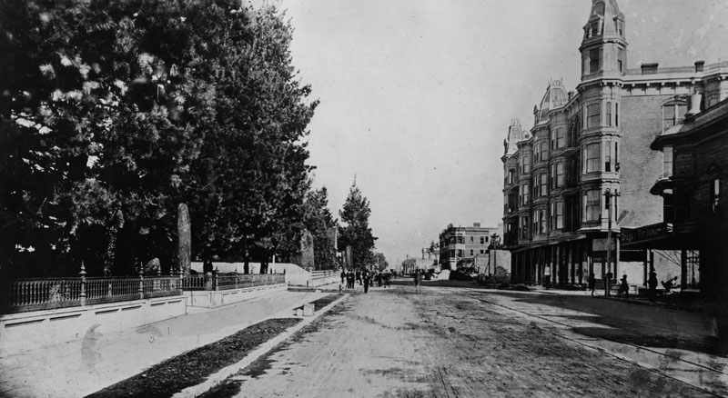
| (ca. 1890)* - A horse and buggy and a few people stand on the corner on 4th and Main Streets in front of the Hotel Westminster, architect, Robert B. Young. Down the street to the left is the N.P. Bailey Furniture store. |
Historical Notes The Westminster Hotel was a large Victorian brick building with a six-story tower. It was designed in 1887 by Robert B. Young and was considered the grandest hotel in the city. In about 1870, this area was the site of a Chinese market. |
 |
|
| (ca. 1890)* - 4th and Main looking north. The I. W. Hellmann Mansion is on the left and on the right is the Hotel Westminster, designed by Robert B. Young, before it was enlarged. |
 |
|
| (1893)* - Another view of the Westminster Hotel located on the northeast corner of 4th and Main Street. |
 |
|
| (ca. 1893)* - Image of the Westminster Hotel at Main Street and Fourth Street on the northeast corner. A horse and wagon are seen in front of the hotel. Photo by C.C. Pierce. |
 |
|
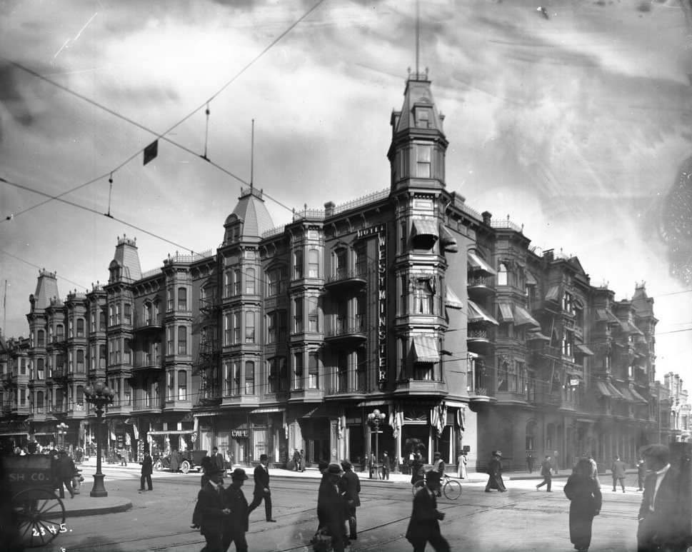
| (ca. 1905)* - People near and far walk across 4th and Main Street past the majestic Westminster (architect, Robert B. Young). Included also are a bicycle, a car and a horse-drawn cart. |
 |
|
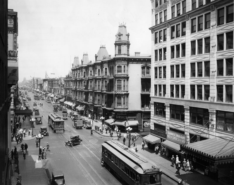
| (ca. 1924)* – View looking north up Main Street. The Westminster Hotel is seen on the northeast corner of 4th and Main Streets. |
Historical Notes The four prominent buildings seen above at the intersection of 4th and Main are the: Van Nuys Hotel (N/W), Westminster Hotel (N/E), Farmers and Merchants Bank Building (S/W), and San Fernando Building (S/E). |
 |
|
| (1926)* - Main and 4th streets, showing the Westminster Hotel on the northeast corner and the San Fernando Building (right) on the southeast. |
 |
|
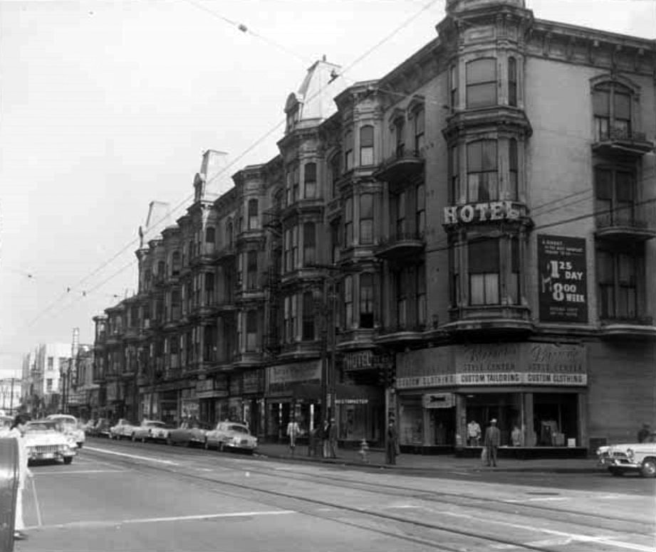
| (1954)^ – View of the Westminster Hotel, northeast corner of Main and 4th Streets. |
Historical Notes By the mid-1930s the Westminster Hotel was in decline. It, however, continued to operate until 1960 when the building was razed to make room for new development. |
 |
|
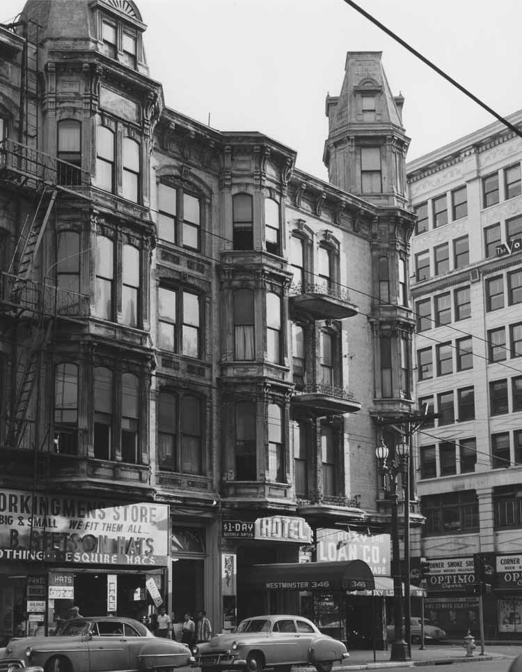
| (1959)* – Close-up view showing the Westminster Hotel one year before it was demolished. |
Historical Notes The Westminster Hotel in downtown Los Angeles was demolished in 1960. It had been in decline since the mid-1930s but continued to operate until its demolition to make room for new developments. |
 |
|
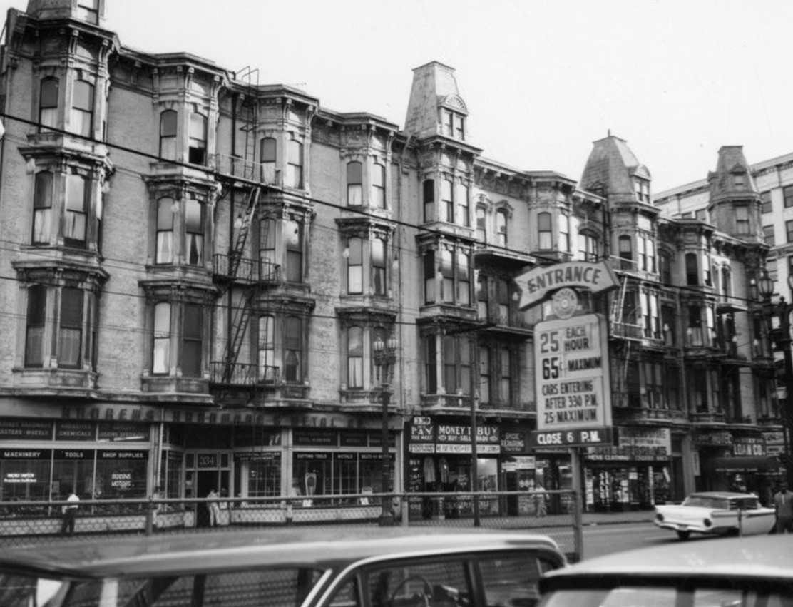
| (ca. 1960)* - Viewed from a parking lot across the street, past the sign advertising 65 cents maximum for all day parking. Across the street is the Hotel Westminster as seen shortly before it was razed. |
Historical Notes The O.T. Johnson Corporation owned the Westminster until 1952. The Westminster is the only historic building to have been razed at the corner of Fourth and Main Streets (February 1960). Remaining today on the other three corners are the Barclay (Van Nuys) Hotel, the Farmers and Merchants bank, and the San Fernando Building. |
 |
|
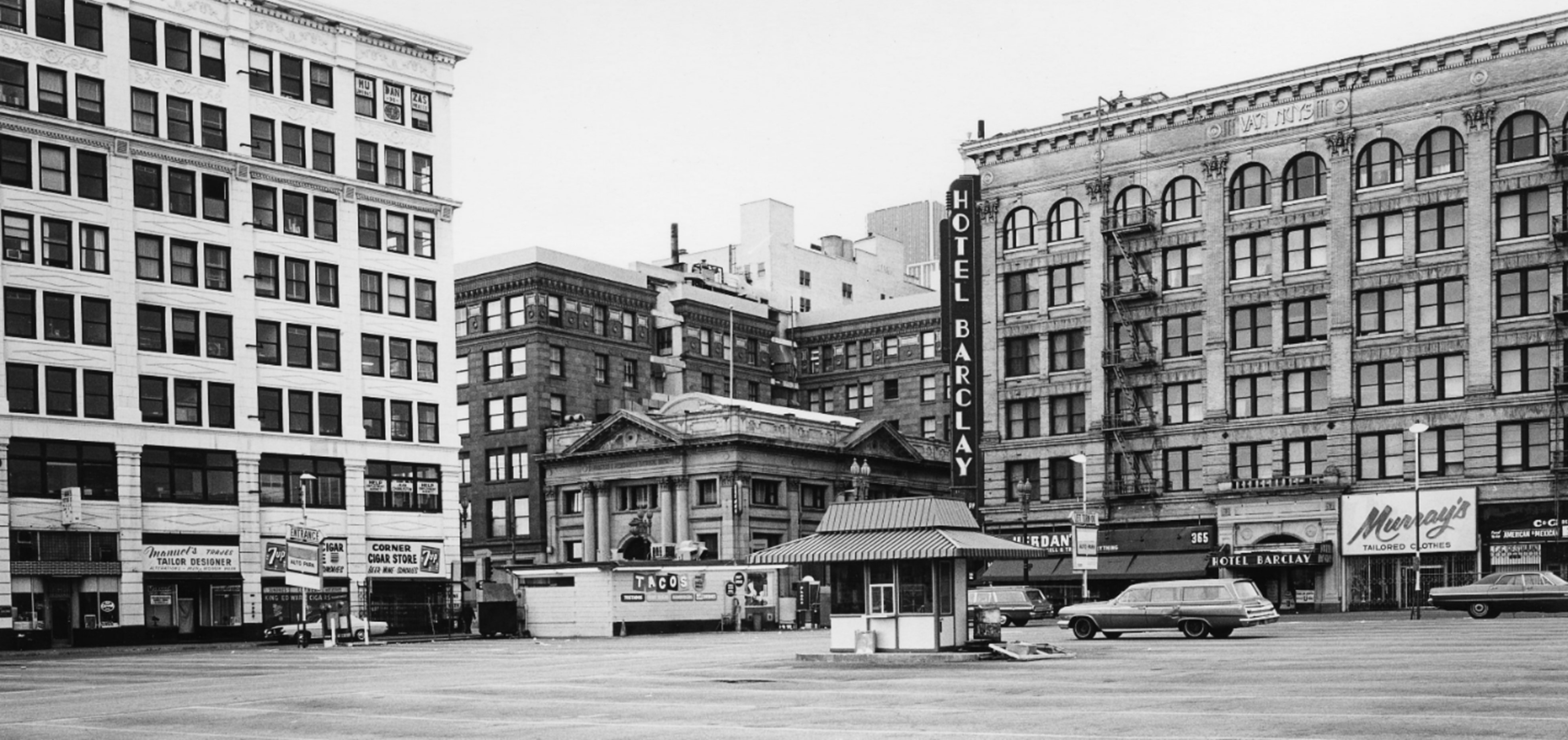
| (1973)* – View across a parking lot on the northeast corner of Main and 4th Streets, where the historic Westminster Hotel once stood before its demolition in 1960. Still standing on the other three corners are the Barclay (Van Nuys) Hotel, the Farmers and Merchants Bank, and the San Fernando Building. Photo by William Reagh. |
Historical Notes The Medallion Apartments now stand on the site of the historic Westminster Hotel at the northeast corner of 4th and Main Streets. Designed by architect Robert Brown Young, the Westminster Hotel opened in 1887 and remained a landmark until its demolition in 1960. The Medallion Apartments, a modern residential complex, opened on the site in 2010. |
 |
|
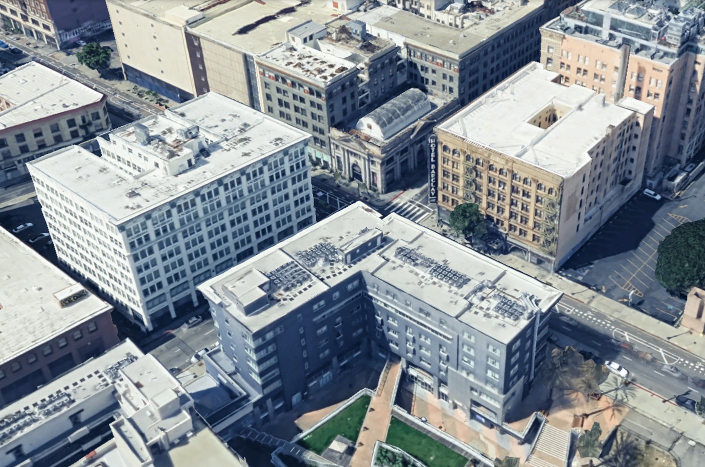
| (2023)* – Google Earth view of the intersection of Main and 4th Streets in Downtown Los Angeles. In the foreground, at the southeast corner, are the Medallion Apartments, which opened in 2010 on the site of the historic Westminster Hotel. |
Then and Now
 |
|
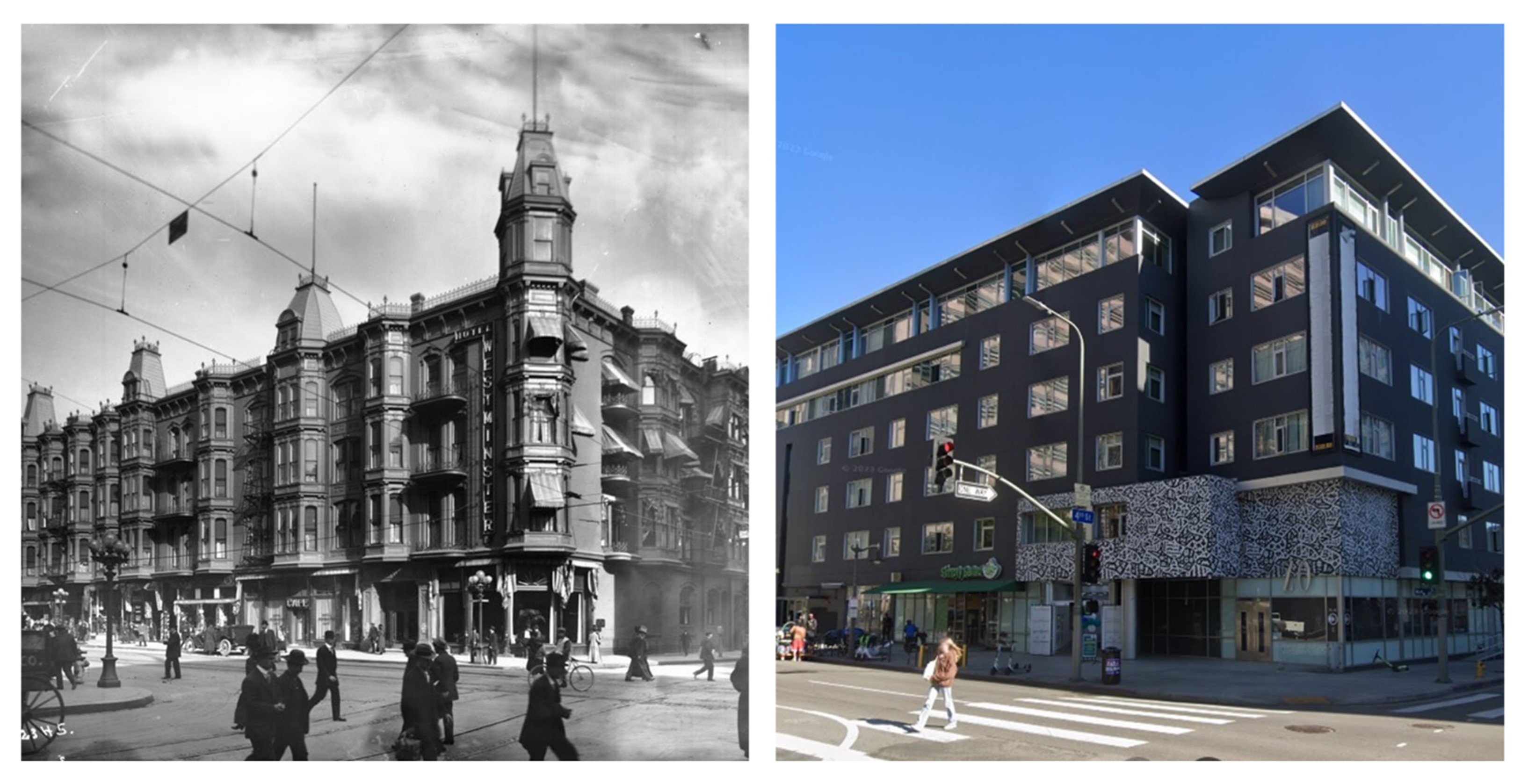
| (1905 vs 2023)* - A look at the Westminster Hotel on the northeast corner of Main and 4th Street, now replaced by a mixed-use housing building. |
* * * * * |
Stimson House
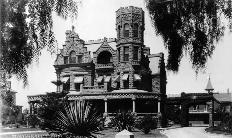 |
|
| (ca. 1890s)* - Front exterior view of the Thomas Douglas Stimson house at 2421 South Figueroa Street near Adams Street. |
Historical Notes The Stimson House is a Richardsonian Romanesque mansion on Figueroa Street north of West Adams. Built in 1891, it was the home of lumber and banking millionaire, Thomas Douglas Stimson. During Stimson’s lifetime, the house survived a dynamite attack by a blackmailer in 1896. After Stimson’s death, the house has been occupied by a brewer who reportedly stored wines and other spirits in the basement, a fraternity house that conducted noisy parties causing consternation among occupants of neighboring mansions, as student housing for Mount St. Mary's College, and as a convent for the Sisters of St. Joseph of Carondelet. From the day it was built, the 30-room house was a Los Angeles landmark. Neighbors and occupants have referred to it over the years as "the Castle" or the "Red Castle" due to its turret-top walls, four-story tower, and red-stone exterior. |
 |
|
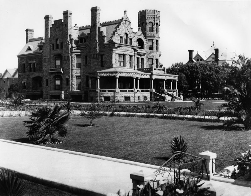
| (ca. 1890s)* - Front corner exterior view of the Thomas Douglas Stimson house. |
Historical Notes When Stimson House was built in the 1890s, the Los Angeles Times described it as "the costliest and most beautiful private residence in Los Angeles," a building "admired by all who see it." More than a hundred years later, the Times said: “From the front, the 31⁄2-story house resembles a medieval castle, with brick chimneys standing guard like sentries along the roof and an ornate four-story crenelated tower on the northeast corner, a noble rook from a massive chess board." With its $150,000 cost, it was the most expensive house that had been built in Los Angeles at the time, |
 |
|
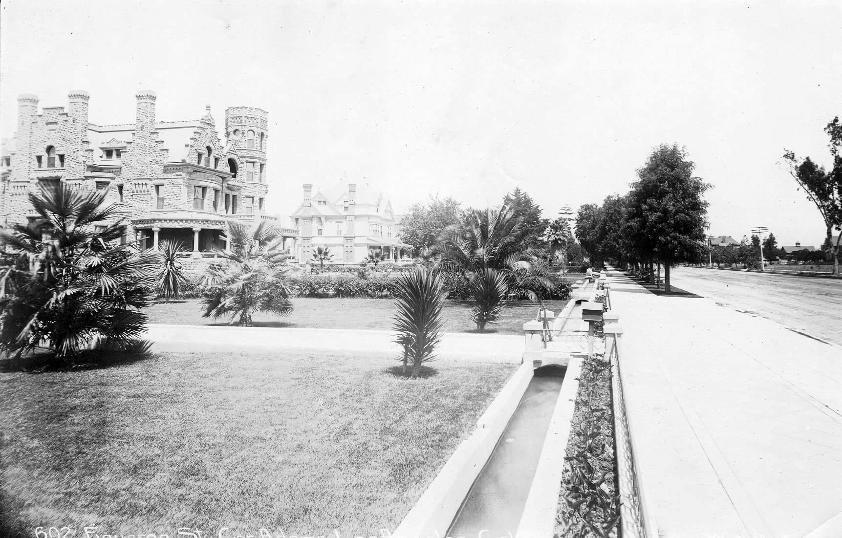
| (1890s)* – View looking north showing the Stimpson House with a water ditch (zanja) running between parallel to Figueroa at the property line. |
Historical Notes The Stimson House was listed on the National Register of Historic Places in 1978 and has also been designated Historic-Cultural Monument No. 212 by the City of Los Angeles. Click HERE to see complete listing. |
 |
|
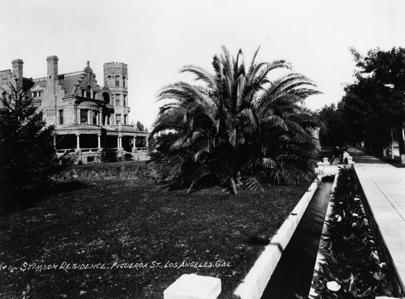
| (ca. 1890s)* - Corner front exterior view of the Thomas Douglas Stimson house. An open water-supply channel (zanja) flows in front next to the sidewalk. |
Historical Notes Zanja (Spanish for ditch) was the original water supply channel for the southwest part of the city. It was built in 1868 and rebuilt in 1885 with concrete. The original water supply for Los Angeles was delivered in open trenches, the zanja, despite serious problems with public dumping into the trenches. In the 1880s and 1890s gradually piped water was introduced into more expensive neighborhoods, and the zanjas were used for irrigation only. Click HERE to see more in Zanja Madre (Original LA Aqueduct) |
* * * * * |
Fisher's Broad-Guage Department Store
 |
|
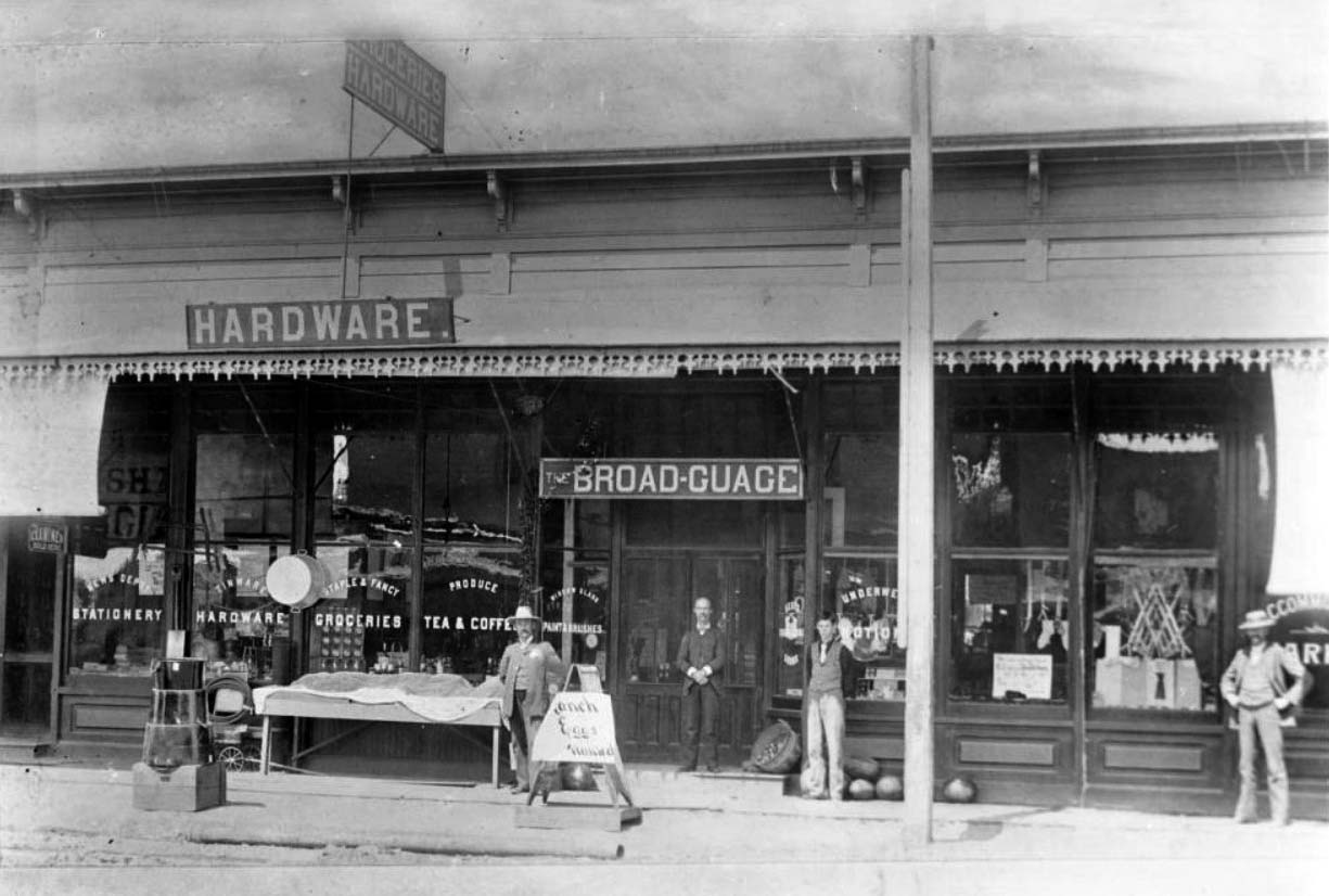
| (ca. 1890)* – Exterior view of E.C. Fisher's store on the west side of South Main Street, north of Washington Boulevard in Los Angeles. The store is in a long single story building that reaches from the left of the image to the right. It has an overhang that covers a walkway in front of the large glass windows of the store. There are four men standing on this walkway, and there is a small amount of merchandise, including melons, wash tubs, and ropes, arranged in front as well. Legible signs include, from left to right, "Examiner sold here", "News Depot Stationery", "Tinware Hardware", "Staple & Fancy Groceries", "Produce Tea & Coffee", "Window glass Paintbrushes", "The Broad-Guage", "Ranch Eggs Wanted". |
Historical Notes CNote accompanying the photo reads: "Portrait of Fisher's Broad-Guage Department Store. There is a large hotel apartment building on this corner, The Rutland, owned by the Central and Broad-Guage Department. Store owned by E. C. Fisher, located on the west side of Main Street just north of the northwest corner of Washington--the corner occupied by Henry Coch's Saloon. On the southwest corner of Main and Washington was Dave Waldron's old Washington Gardens, later Luna Park. Opposite, on the northeast corner, was the Main Street and Agricultural Park Streetcar Horse Barns and on the southeast corner was one Louis Martin's Saloon. The man on the right was one of my photographers, the boy in short-sleeves is myself, the man on the steps--E.A. Butterfield, and the policeman is a Mr. Kemp" -- Signed, J. H. Crum in 1935. |
* * * * * |
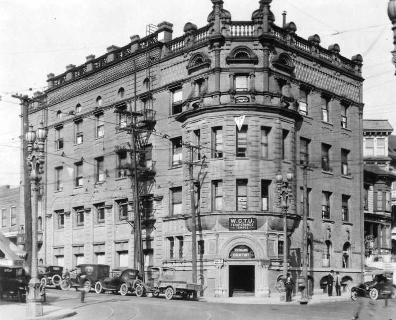
Temperance Temple
 |
|
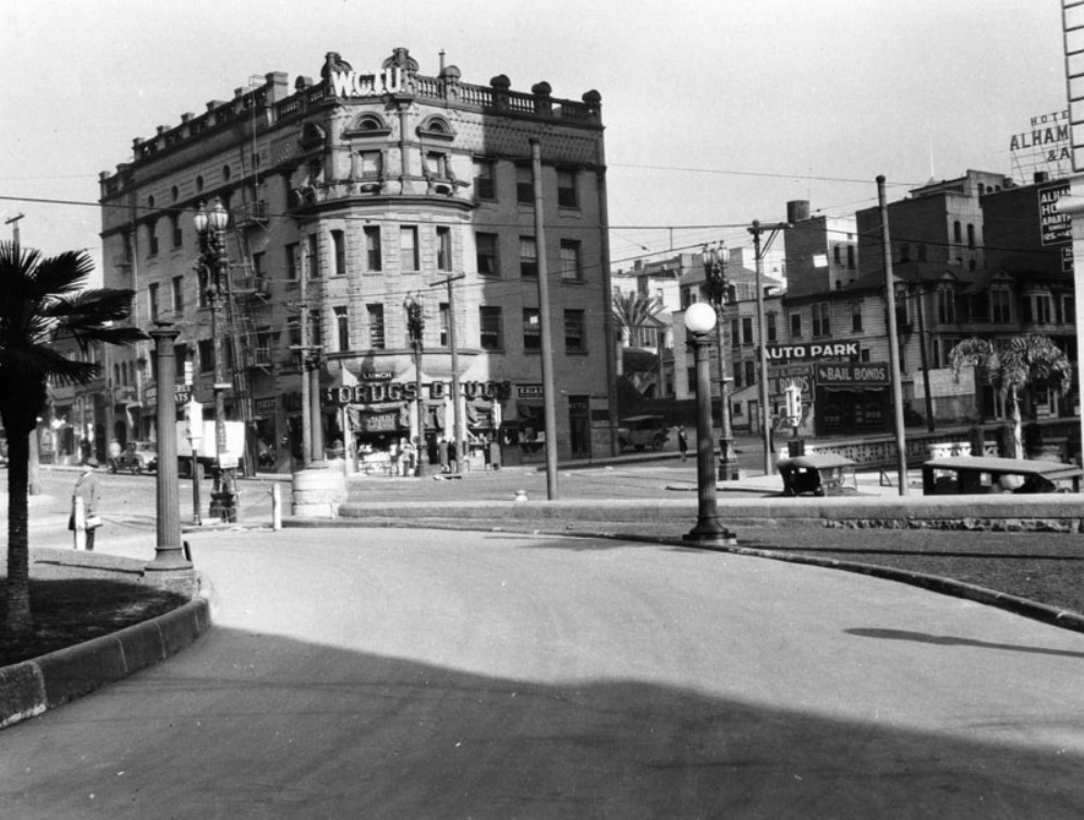
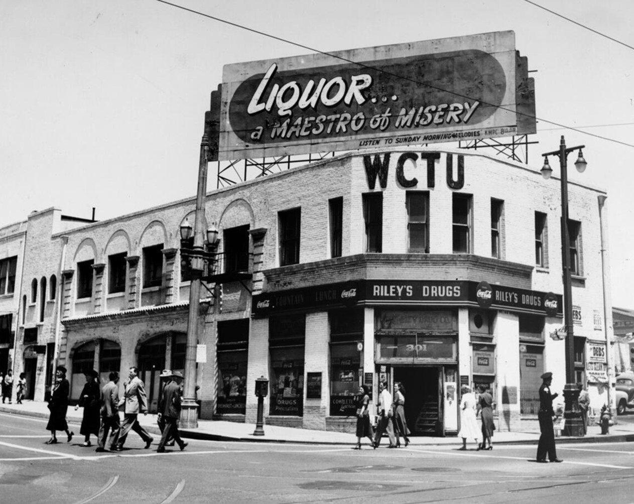
| (1890)* - The Temperance Temple of the Women's Christian Temperance Union (WCTU) is seen here on the northwest corner of Broadway and Temple Streets, 301 N. Broadway. A horse-drawn carriage passes a Temple Street Cable Railway 2-car trolley in the busy intersection. |
Historical Notes The Women's Christian Temperance Union (WCTU) Temple, located at the corner of Temple Street and Broadway in early Los Angeles, was a significant landmark in the city's history. Established after the Los Angeles WCTU chapter was founded in 1883, the Temple was built in 1888 as a $45,000 four-story brick structure. Despite financial challenges during its construction due to an economic downturn, the building was completed and served as the WCTU's headquarters for over five decades. Strategically positioned to overlook what was considered the "vilest dens in the city," the Temperance Temple symbolized the WCTU's mission to combat alcohol consumption and promote social reform. Its location was chosen to allow temperance sentiment to "crystallize" and influence the surrounding area. The Temple became a hub for philanthropic and feminist activities in Los Angeles, hosting meetings, educational programs, and advocacy work. For more than 50 years, the WCTU Temple played a crucial role in the organization's efforts to push for abstinence, prohibition laws, and various social reforms. It stood as a testament to the WCTU's influence in early Los Angeles until its demolition in the 1950s to make way for the Los Angeles Freeway. |
 |
|
| (ca. 1890s)* - View of the Temperance Temple of the Women's Christian Temperance Union (WCTU), located at 301 N. Broadway at Temple Street. A horse-drawn carriage is shown parked along the street past the Temple and other neighboring buildings. |
Historical Notes The Women's Christian Temperance Union (WCTU) stands for the complete abstinence from alcohol, tobacco, and all harmful drugs and protection of the home. As the membership of the WCTU grew throughout the U.S, a call went out from May Gould, a resident of Los Angeles, to Frances Willard to organize a local group in Southern California. On September 20 and 21, 1883, the first State Convention was called and the WCTU of Southern California was organized at the First Presbyterian Church, 2nd and Fort (now Broadway) Streets, Los Angeles. This temple was dedicated in 1889 after money had been donated for its construction in 1886. |
 |
|
| (2024)* – Contemporary view of the northwest corner of Temple and Broadway showing the Los Angeles County Central Heating and Refrigeration Plant where the Temperance Temple once stood. |
Historical Notes The Los Angeles County Central Heating and Refrigeration Plant, built in 1958 at the northwest corner of Broadway and Temple Streets, replaced the Women's Christian Temperance Union Temple and serves as a key infrastructure hub for the Civic Center. It supplies chilled water and steam for heating and cooling to 14 major buildings, including the Cathedral of Our Lady of the Angels and Walt Disney Concert Hall. While it once generated electricity, this function is no longer economically viable. The plant’s original 1950s equipment is undergoing phased refurbishment to meet modern emissions and efficiency standards, with a total project cost of $46.1 million. Managed by the Los Angeles County Internal Services Department, it plays a vital role in maintaining county-owned facilities. The plant is primarily fueled by natural gas, which powers its boilers and chillers to produce steam and chilled water for heating and cooling. As part of ongoing modernization efforts, upgrades aim to improve efficiency and reduce emissions, ensuring compliance with current environmental regulations while maintaining reliable service to the Civic Center's critical buildings. |
Then and Now
 |
|
| (1890 vs 2024)* – A ‘Then and Now’ comparison of the northwest corner of Temple and Broadway showing the Temperance Temple, today’s site of the Los Angeles County Central Heating and Refrigeration Plant. Photo comparison by Jack Feldman. |
Historical Notes The WCTU Temple, also known as the Temperance Temple, was significantly damaged during the 1933 Long Beach Earthquake. As a result, the top two floors were removed due to the damage. The building remained in use until it was ultimately demolished in 1950 to make way for the Hollywood Freeway project. The Los Angeles County Central Heating and Refrigeration Plant was designed and engineered by M.A. Nishkian Company. It opened on August 21, 1958, and was the first of its kind in the nation. This plant supplies chilled water and steam for heating and cooling to various county buildings. |
 |
|
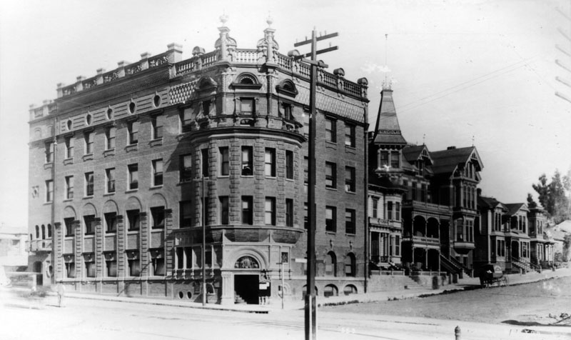
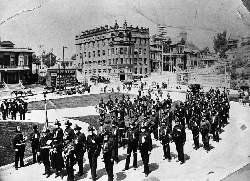
| (ca. 1900)* – View showing the San Francisco Fire Department brigade and band, in front of the Los Angeles County Courthouse (S/E corner of Temple Street and Broadway) with the Temperance Temple Building across the street. The tower of Los Angeles High School can be seen in the distance (top center-right). On the left is a clear shot of the Clifton (rooming) House (231-233 N Broadway) and the Rivers Bros. Grocery on the corner of Broadway and Temple Street (300 W Temple). The little house immediately above the Rivers Bros. sign is actually on N. Hill Street. |
Historical Notes In 1947, the County of Los Angeles took the site where the Temperance Temple once stood by eminent domain and constructed a power plant in 1958. The Temperance Temple was completely razed in 1950. |
 |
|
| (1890s)* - View looking NW from the top of LA County Courthouse located on the SE corner of Temple and Broadway. The original Los Angeles High School, which was moved in 1887, can be seen at center of photo. The New Los Angeles High School (built in 1891) is at right-center. In the foreground can be seen the Temperance Temple (WCTU), located on the northwest corner of Temple Street and Broadway. |
Historical Notes In the 1890s, the intersection of Broadway and Temple Street was a key focal point in downtown Los Angeles. The northwest corner was marked by the Women's Christian Temperance Union building, also known as the Temperance Temple, a three-story brick structure completed in 1888. This landmark reflected the city's growing social movements and was a testament to the influence of the temperance movement at the time. The intersection served as a hub for transportation and commerce, with Temple Street hosting cable cars from 1886 until their replacement by Pacific Electric streetcars in 1902. Broadway, renamed from Fort Street in 1890, was evolving into a major commercial corridor lined with boarding houses and small businesses. Over time, it would attract significant developments, including banks, department stores, and hotels, solidifying its role in the city's expansion. |
 |
|
| (1890s)* - View looking NW from the top of LA County Courthouse located on the SE corner of Temple and Broadway. The original Los Angeles High School, which was moved in 1887, can be seen at center of photo. The New Los Angeles High School (built in 1891) is at right-center. In the foreground can be seen the Temperance Temple (WCTU), located on the NW corner of Temple and Broadway. Image enhancement and colorization by Richard Holoff. |
 |
|
| (ca. 1905)^^* – Panoramic view looking northwest from the LA County Courthouse. Los Angeles High School stands tall in the background. The Temperance Temple building is seen in the lower-left located on the northwest corner of Temple and Broadway. The Broadway Tunnel is out of frame at right-center. |
 |
|
| (ca. 1920)* - Street view of the Women's Christian Temperance Union Temple on the northwest corner of Broadway and Temple as seen from the front of the LA County Courthouse. |
Historical Notes This landmark building was featured in some early pictorial books on Los Angeles and in 1900 was the site of the National Education Association (NEA) Convention. The Frances E. Willard Home For Girls was housed on the 4th floor from its inception in 1919 until 1933. |
 |
|
| (ca. 1920)* - Close-up view showing the Temperance Temple of the Women's Christian Temperance Union (WCTU) on the northwest corner of Broadway and Temple Street. |
 |
|
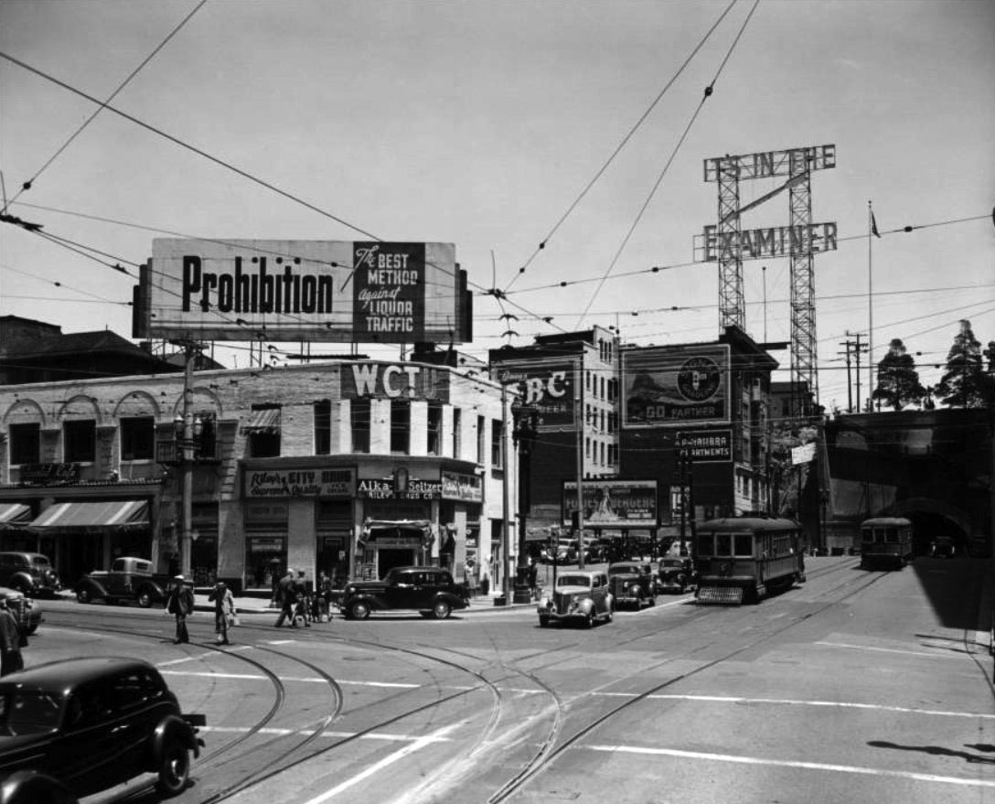
| (1939)* – View facing north at Broadway and Temple Street showing the Women's Christian Temperance Union Building, now only two stories tall. Billboard on top of building reads: "Prohibition: the Best Method Against Liquor Traffic." On the right are two Los Angeles Railway streetcars, one leaving and another one entering the Broadway Tunnel. |
Historical Notes In 1925, the City of Los Angeles took 10 feet of property from the Broadway side and in 1928, took another 12-1/2 feet from the Temple side. The 1933 Long Beach Earthquake damaged the building and consequently the two top floors were removed. |
 |
|
| (1950)* - The Temperance Building shortly before its demolition. |
Historical Notes The death knell of the once beautiful structure came in 1947 when the County of Los Angeles took the site by eminent domain and constructed a power plant where the venerable Temperance Temple once stood. When the Temple was razed in 1950, the corner stone was presented to the WCTU and now resides in front of the present Headquarters building. |
* * * * * |
Pico House
 |
|
| (1891)* - The Pico House - Sign on 2 sides over the building here reads "Pico House" and horses and carriages are on the dirt street on the right side. Farther back on the right are the towers of Baker Block (built in 1878 and later torn down to make way for the 101 Freeway). |
Historical Notes In 1868, Pío de Jesús Pico constructed the three story, 33-room hotel, Pico House (Casa de Pico) on the old plaza of Los Angeles, opposite today's Olvera Street. Click HERE to see more Early Views of the LA Plaza District. |
* * * * * |
Los Angeles County Courthouse
 |
|
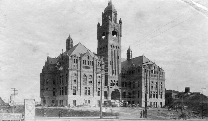
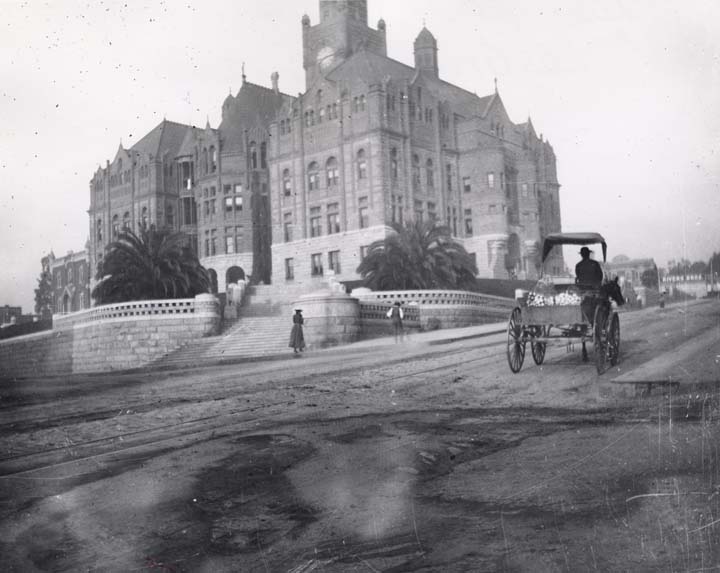
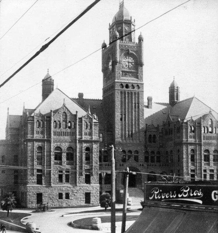
| (1891)* - View showing the Los Angeles County Courthouse (also known as the Red Sandstone Courthouse) nearing completion. Construction began in 1888. Broadway is in front, Temple Street on the left, and New High Street behind. The holes seen in the main tower are for the yet to be installed clocks. |
Historical Notes Constructed in 1891, the Los Angeles County Courthouse stood where the city’s first high school, Los Angeles High School, had been located. The high school was there from 1873 until 1886 when it was moved to North Hill Street to allow for construction of the courthouse. The clock installed in the Red Sandstone Courthouse has a history spanning over 160 years. Originally part of the city's first clock tower on the Market House, a brick building from 1858, it became known as the "Clocktower Courthouse" after Los Angeles County purchased the building in 1871. In the early 1890s, when the Red Sandstone Courthouse replaced the original structure, the clock faces were transferred to the new building. |
 |
|
| (ca. 1891)* - Looking south on Justicia Street toward its terminus at Temple Street, where the 1891-built Los Angeles County Courthouse stands. A horse-drawn carriage is parked in front of the Belderrain Adobe, located on the northwest corner. |
Historical Notes In 1891, the LA County Courthouse moved into it's new home, a beautiful new building constructed at the old site of Los Angeles High School.. Prior to its move, the courthouse was located in a large building on Temple Block sharing space with a theatre and marketplace (1861-1891). |
 |
|
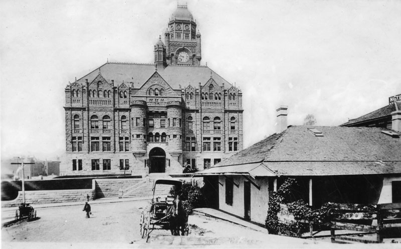
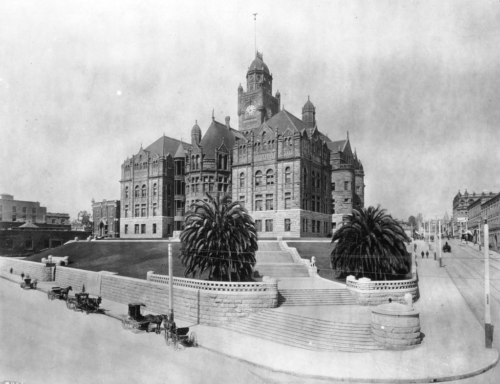
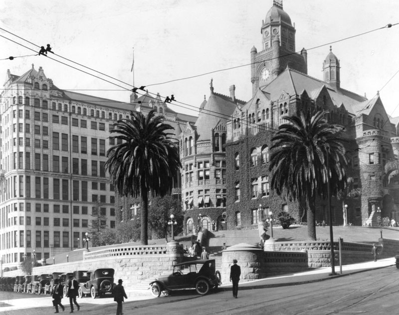
| (ca. 1891)* - View looking southeast at the corner of Temple Street (left) and Broadway showing the LA County Courthouse. Note the manicured lawn and the newly planted palm trees. |
 |
|
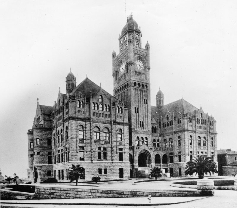
| (ca. 1891)* - Close-up view of the L.A. County Courthouse, also as known as the "Red Sandstone Courthouse", shortly after its completiion. Newly planted palm trees are seen in front. This was actually LA's 6th courthouse location. |
Historical Notes The red sandstone structure was built in the Richardsonian Romanesque style and designed by architects Curlett, Eisen and Cuthbertson. The rusticated stone building has wall dormers, column pilasters, cupola's topped with finials, and a large square clock tower with turrets and a central multi sided cupola with cast iron cresting and a flagpole. Wide stone staircases connected by walls surround the building. |
 |
|
| (ca. 1891)* - View looking toward the southwest corner of New High (later Spring) and Temple streets showing the Los Angeles County Courthouse. A Horse-drawn wagon is heading west on Temple Street while pedestrians are seen walking up the incline along the courthouse bulding. |
 |
|
| (ca. 1900)^*# - The Los Angeles County Courthouse from the corner of New High (later Spring) and Temple streets, facing southwest. Horse-drawn carriages are seen waiting at the curb. |
Historical Notes The County Courthouse building utilized an open-air elevator shaft that was added to the building before the turn of the last century. The circular shaft can be seen just to the left of the left palm tree. If you look closely, you can see the elevator car is between the first and second floors. |
 |
|
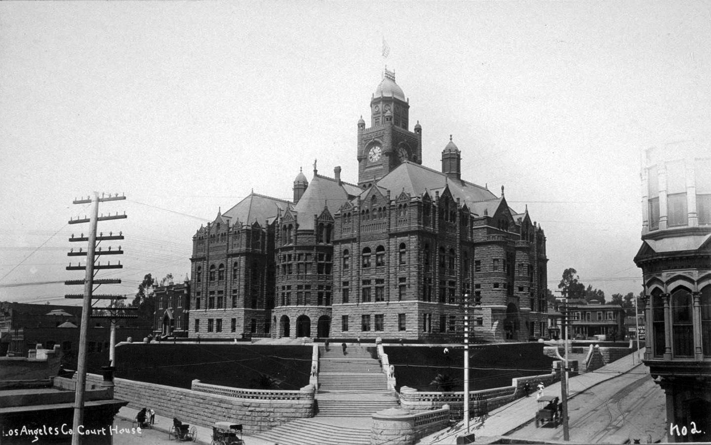
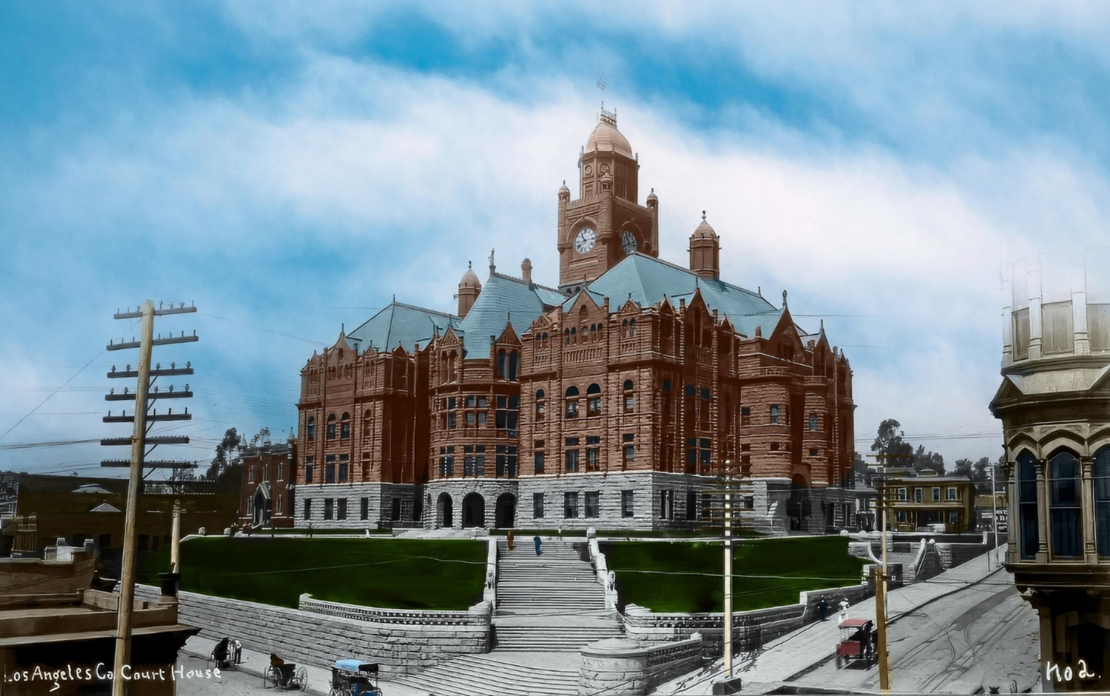
| (ca. 1890s)* - View looking southwest showing the Los Angeles County Courthouse at the intersection of New High and Temple streets. New telephone lines are now seen in front of the courthouse. |
Historical Notes Through more than 150 years the county has used at least eight buildings as its county courthouse. All have been situated within a mile of each other in downtown Los Angeles south of the original plaza in what has for the past 80 years been called the Civic Center. ◆ The first county courthouse was in the adobe Bella Union Hotel, where court was held in rented rooms from 1850 to 1852. |
 |
|
| (ca. 1890s)* - View looking southwest showing the Los Angeles County Courthouse at the intersection of New High and Temple streets. New telephone lines are now seen in front of the courthouse. Image enhancement and colorization by Richard Holoff. |
 |
|
| (1900)* - Close-up view of the Los Angeles County Courthouse as seen from across Broadway from above the Rivers Bros. Grocery (S/W corner of Temple and Broadway). |
 |
|
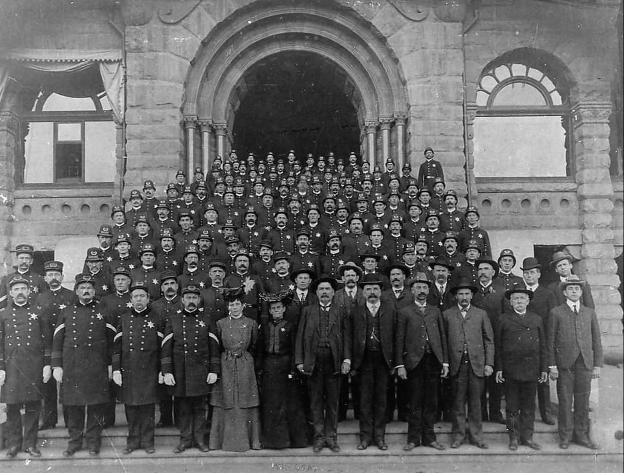
| (1904)* - Group photo of the Los Angeles Police Department on the steps in front of the County Courthouse. |
 |
|
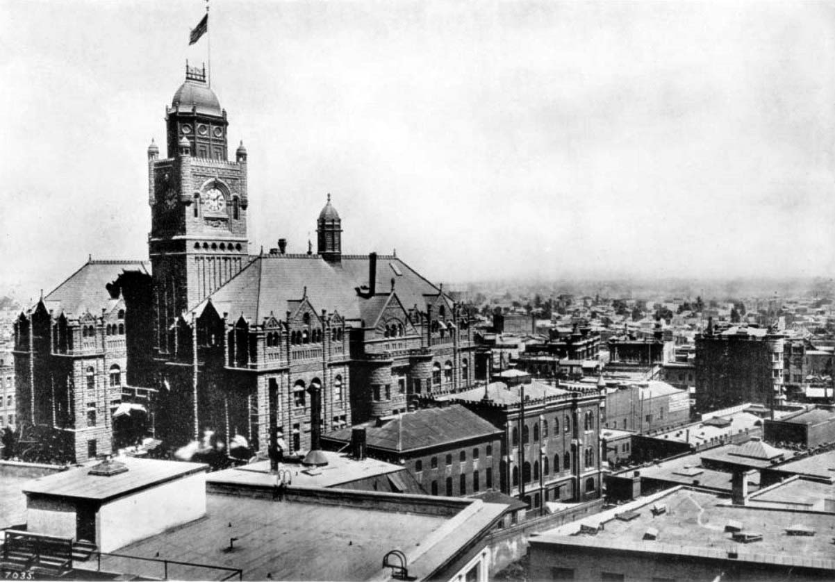
| (ca. 1906)* - View showing the Los Angeles County Courthouse and Jail looking west. The flat rooftops of high rise buildings fill the foreground while the gothic architecture of the courthouse stands to the left, its clock tower reading approximately ten minutes after nine o'clock and an American flag waving from its peak. |
 |
|
| (ca. 1905)* - View looking southwest at the intersection of New High and Temple streets showing the Los Angeles County Courthouse (Los Angeles Superior Court) standing tall on Poundcake Hill. In view are pedestrians, a cable car, horse-drawn buggies, houses and commercial buildings. |
Historical Notes Pouncake Hill was once where Los Angeles High School once stood (1873 - 1876). |
 |
|
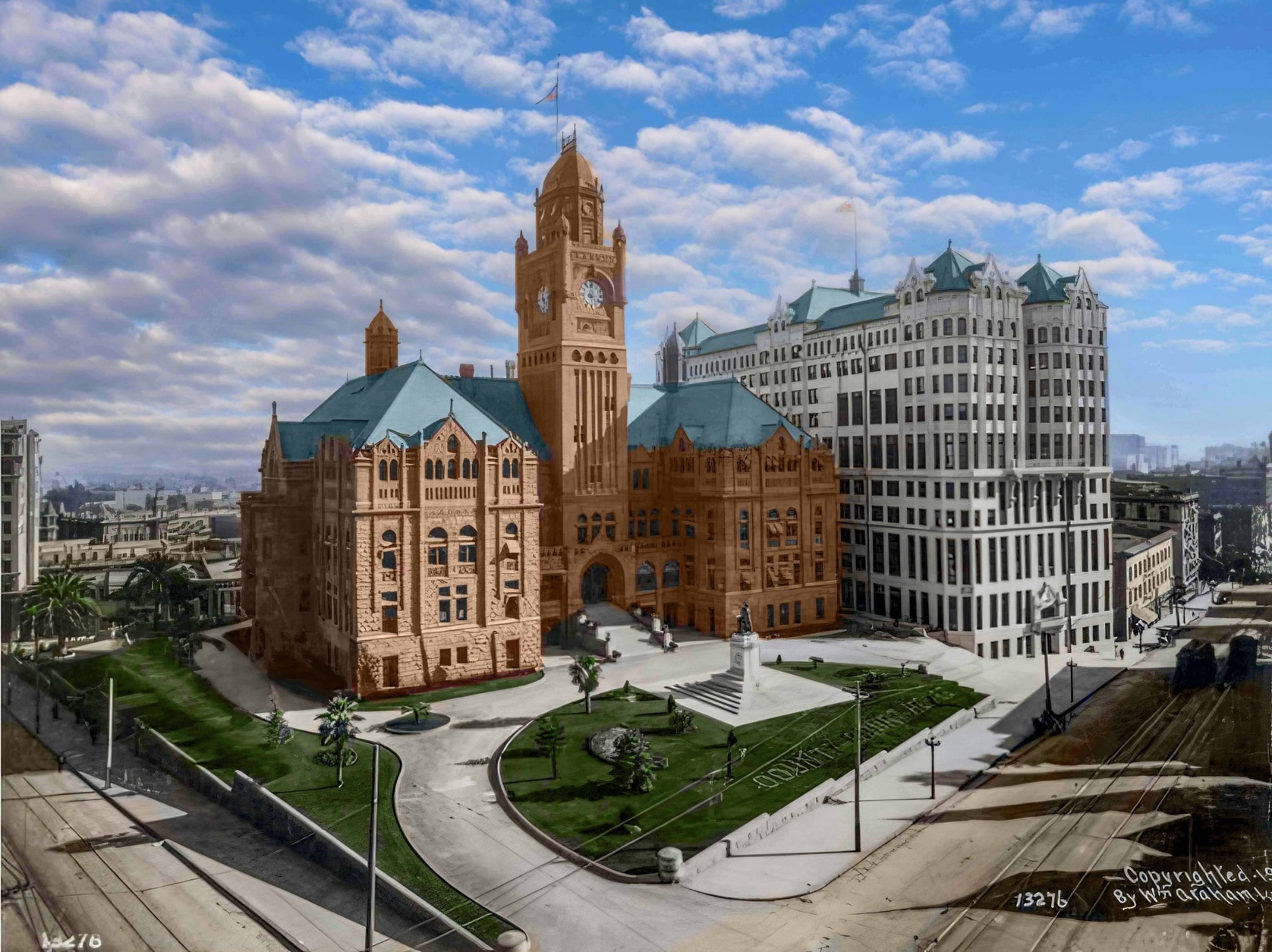
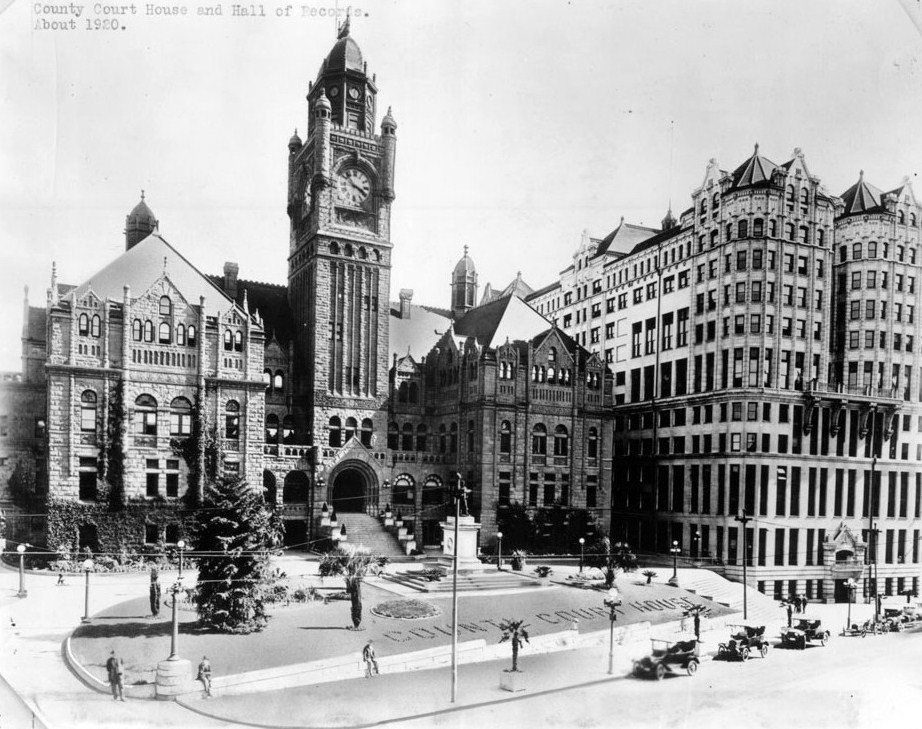
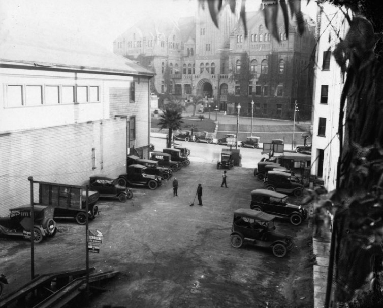
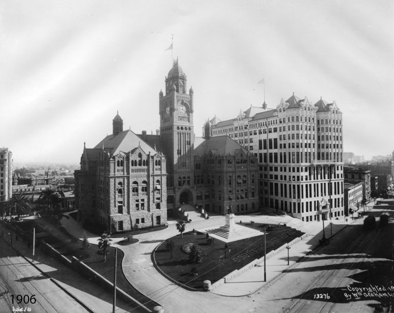
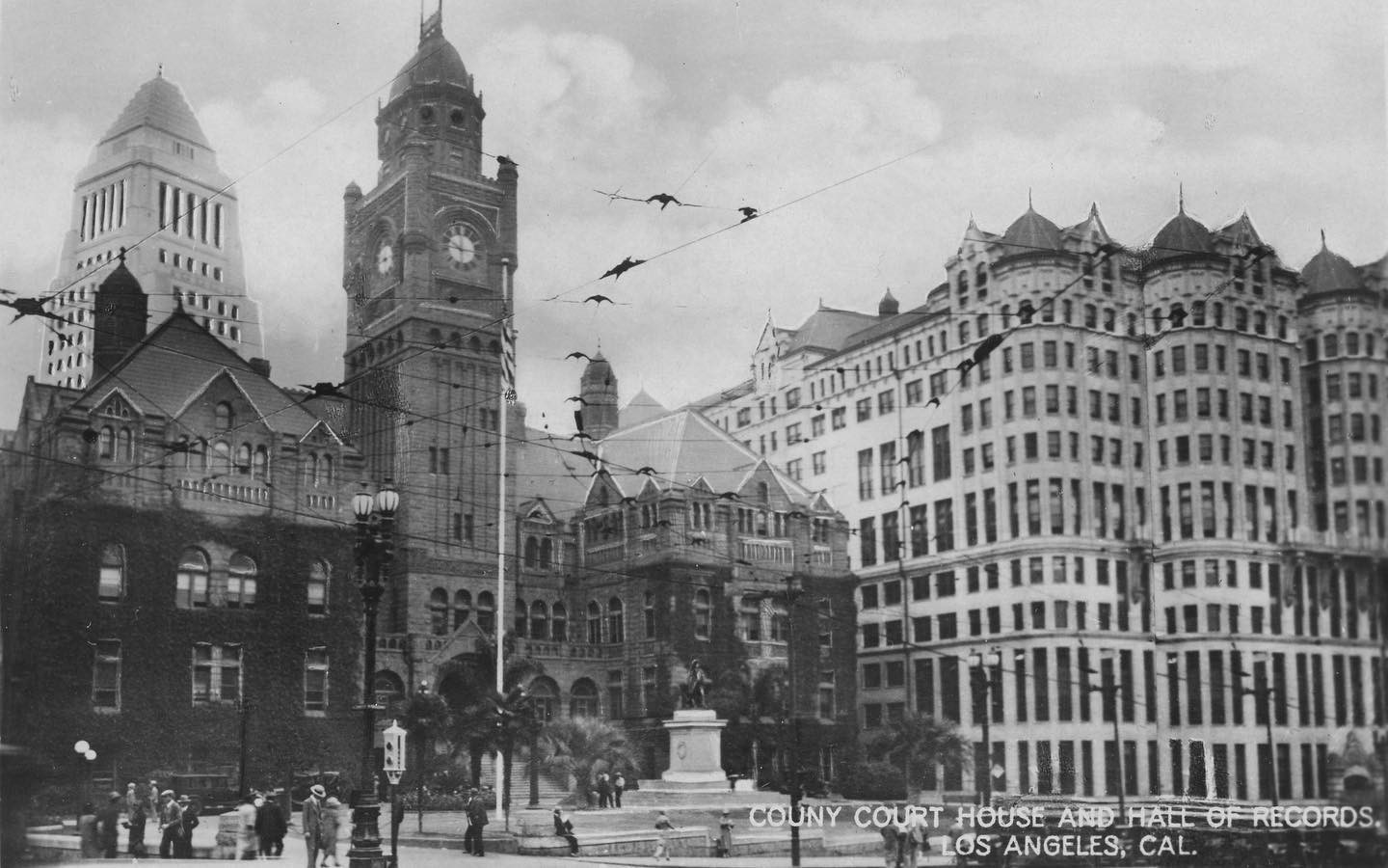
| (ca. 1906)* - View looking southeast at the intersection of Temple and Broadway, showing the LA County Courthouse side by side with the newly built Hall of Records. |
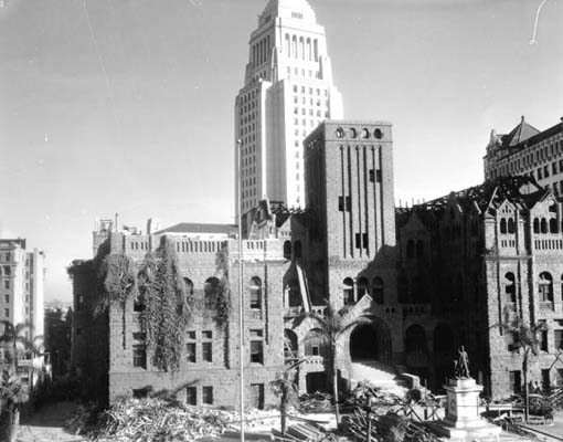
Historical Notes The LA County Courthouse building served as the courthouse until 1932, when it sustained damage in the Long Beach earthquake, and was demolished in 1936. The Hall of Records was built in 1906 to relieve overcrowding next door in the county’s red-sandstone courthouse. The new building consolidated most county offices under one lavishly ornamented roof—a showy headpiece that featured finials, pyramidal gables, and copper ribbing. The building was demolished in 1973. |
 |
|
| (ca. 1906)* - View looking southeast at the intersection of Temple and Broadway, showing the LA County Courthouse side by side with the newly built Hall of Records. Image enhancement and colorization by Richard Holoff. |
 |
|
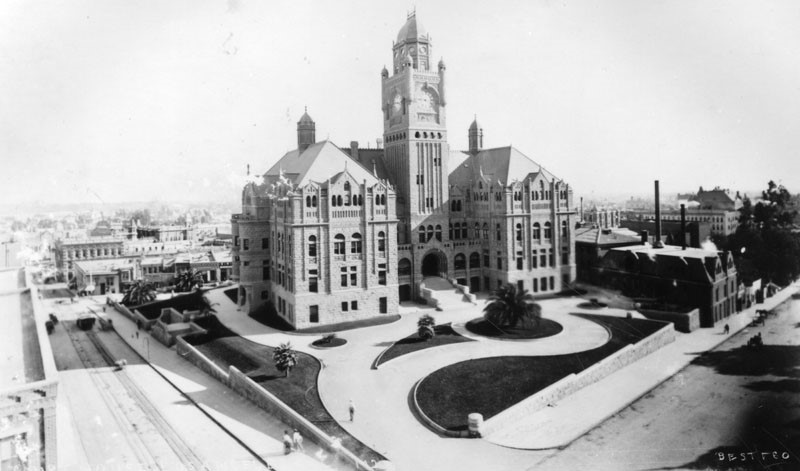
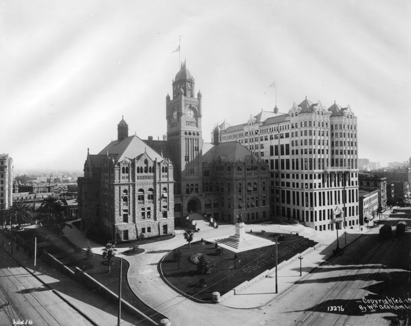
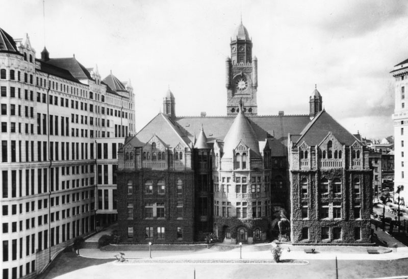
| (ca. 1920)* - View of the Los Angeles County Courthouse and Hall of Records standing side-by-side. |
 |
|
| (1920)* - View of the Los Angeles County Courthouse looking across Broadway from between buildings, an area being used as a parking lot. |
Historical Notes The building on the right is the 'New' Hotel Broadway and on the left is the Broadway Christian Church. The 'New' Hotel Broadway survived many, many years, the 'New' becoming ever more ironic. The church is about to be replaced by the Owl Drug Company which would, in its turn, survive until the CRA bulldozers and the coming of the Hollywood Parkway. The 1888 County Courthouse would be doomed in the Long Beach earthquake of 1933. |
 |
|
| (ca. 1925)* - L. A. County Courthouse viewed from the east (New High Street), with the Hall of Records on the left. |
 |
|
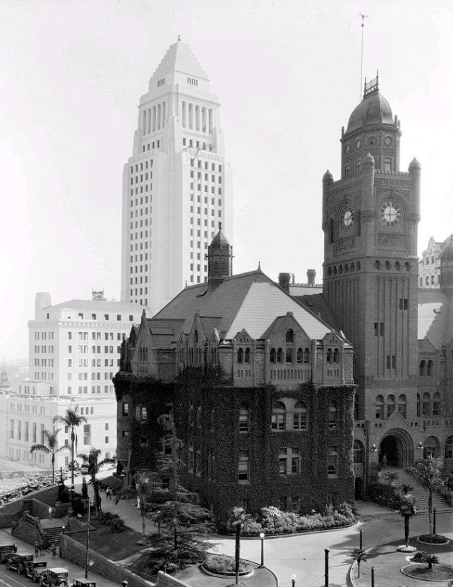
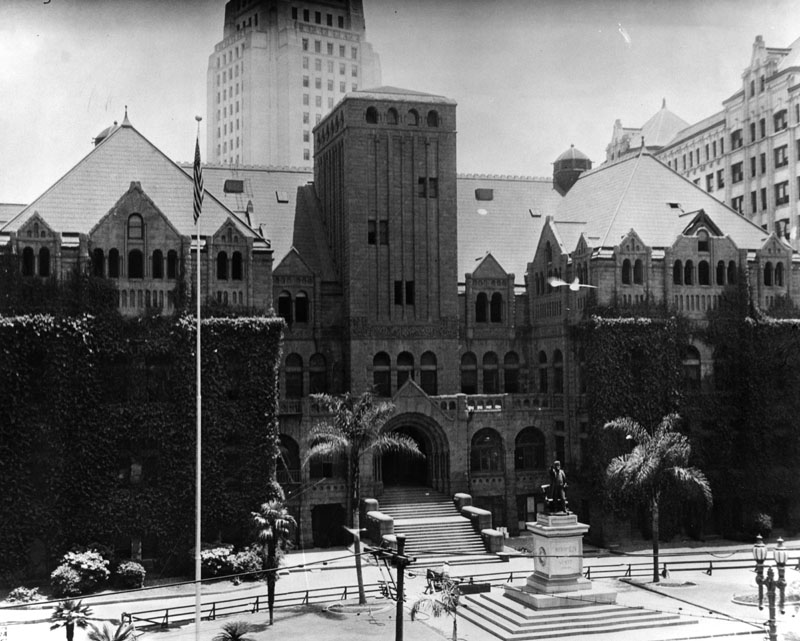
| (ca. 1927)* - View is looking northwest toward three powerhouses: Hall of Records, County Courthouse, and Hall of Justice. The construction site of the new Los Angeles City Hall can be seen in the forefront. |
Historical Notes The Hall of Records was built in 1906 and demolished in 1973; the County Courthouse was built in 1891 and demolished in 1936; the Hall of Justice was built in 1922 by Allied Architects. |
 |
|
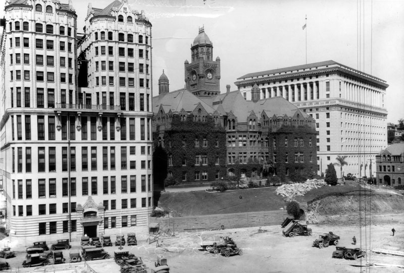
| (ca. 1926)* - View looking west showing the County Courthouse standing between the Hall of Records and the Hall of Justice. The International Bank Building stands to the right and in the foreground is the construction site for the new City Hall. |
 |
|
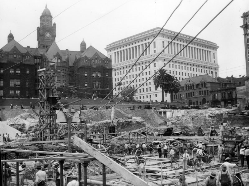
| (1927)* - Preparation of the site for construction of Los Angeles City Hall, 1927. Behind are the old County Courthouse and the Hall of Justice to its right. |
 |
|
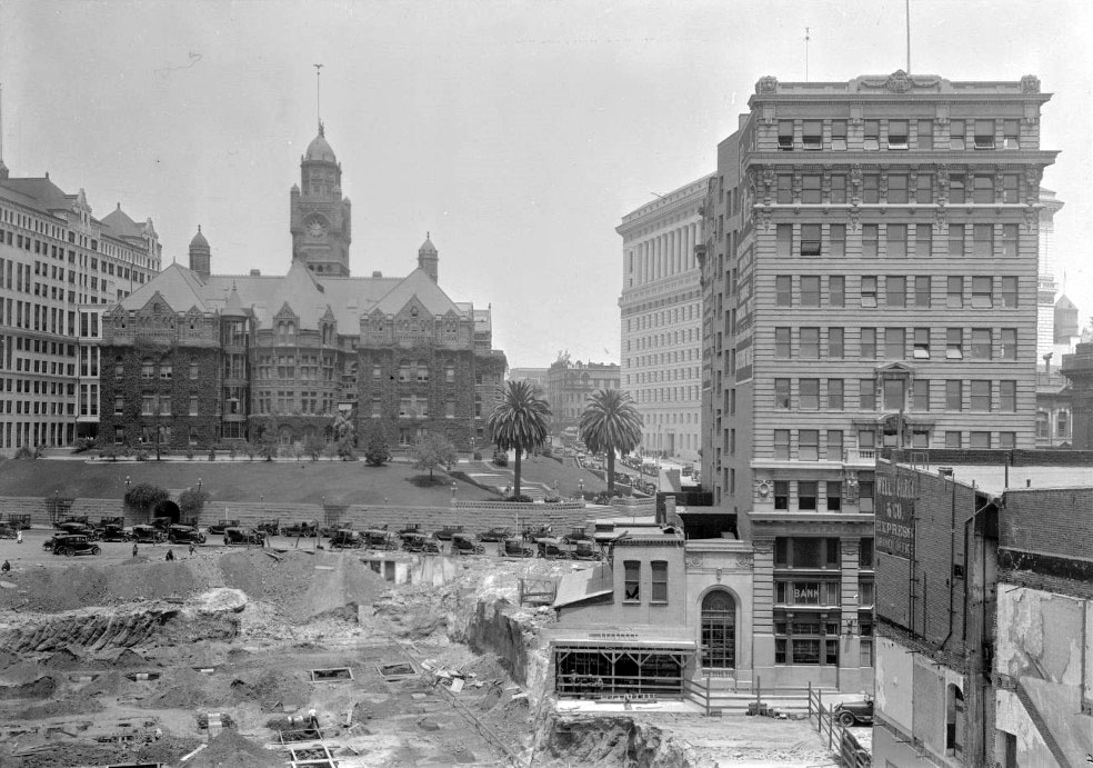
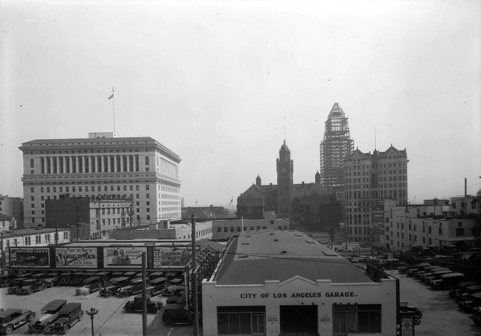
| (ca. 1927)* - View looking east from over the City of Los Angeles garage showing the County Courthouse surrounded by the Hall of Justice (left), Hall of Records (right) and the steel framing for the new City Hall (behind). |
 |
|
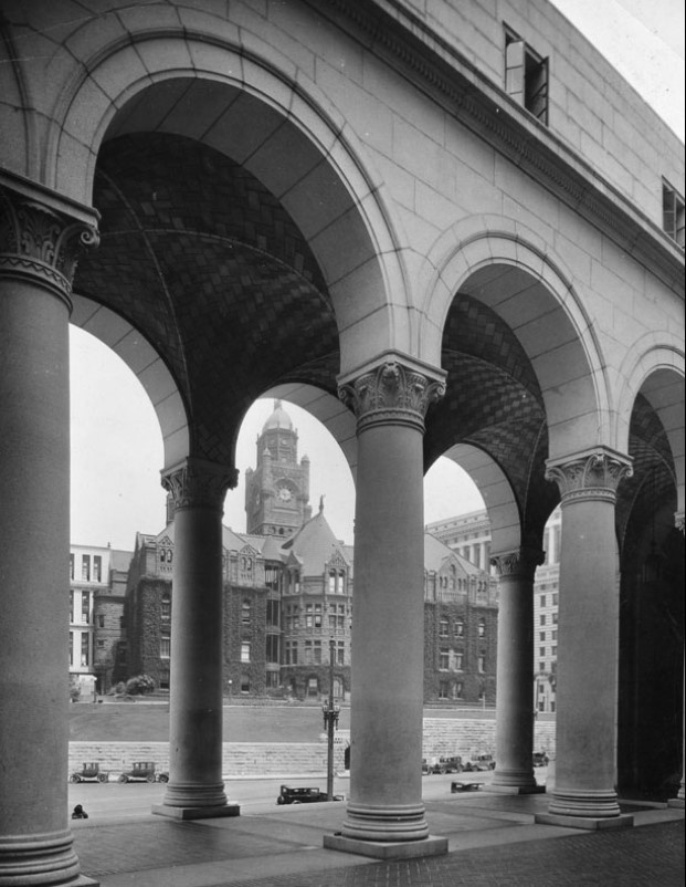
| (1928)* - View of the Los Angeles County Courthouse viewed through the colonnade of the recently completed City Hall. |
 |
|
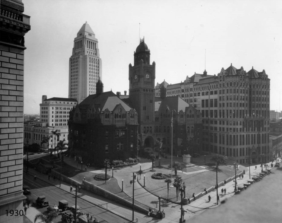
| (1930)* - View looking southeast at the intersection of Temple and Broadway. The old Courthouse stands at center with the Hall of Records to its right. City Hall towers above both in the background. |
 |
|
| (ca. 1930)* - Cars parked on New High Street in front of the old County Courthouse. The Hall of Records is on the left. |
Before and After
 |
|
 |
 |
|
| (1930)* - Postcard view showing the County Courthouse and Hall of Records with City Hall in the background. |
 |
|
| (ca. 1930)* - A great shot of the Los Angeles’ City Hall in the background (which is still with us, thankfully) and in the foreground the County Courthouse who somebody decided wasn’t worth saving (demolished in 1936). |
 |
|
| (ca. 1930)* - A great shot of the Los Angeles’ City Hall in the background (which is still with us, thankfully) and in the foreground the County Courthouse who somebody decided wasn’t worth saving (demolished in 1936). Image enhancement and colorization by Richard Holoff. |
 |
|
| (ca. 1933)* - Rear exterior view of the first Los Angeles County Courthouse (built 1891), also as known as the "Red Sandstone Courthouse," located at Spring and Temple. The new City Hall built in 1928 can be seen in the background. Note that the clock tower has been truncated (see previous photo). |
Historical Notes This building served as the courthouse until 1933, when it sustained damage in the Long Beach earthquake and declared unsafe. It was fully demolished by 1936. |
 |
|
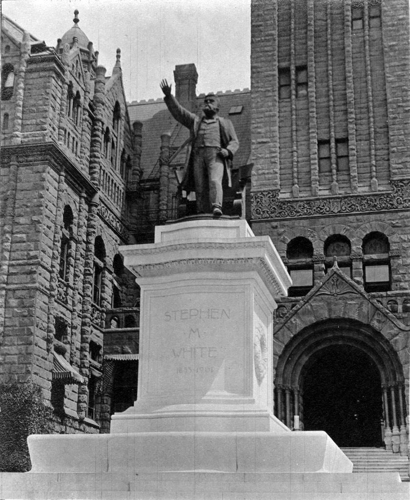
| (ca. 1933)* – View showing the statue of Senator Stephen M. White in front of the entrance to the great Red Sandstone Courthouse. |
Historical Notes Stephen M. White was elected Los Angeles County District Attorney in 1882, State Senator in 1886 and United States Senator in 1893. During his term in the United States Senate, Senator White’s most notable accomplishment was his successful leadership of the fight to create the Los Angeles Harbor in San Pedro as opposed to Santa Monica Bay, the site that was being advocated by powerful railroad interests. The statue of Stephen White was moved several times before finding a home in front of the new County (now Mosk) Courthouse in 1958. It would remain there for 30 years. In 1989, the statue was moved again to its present location, at the entrance to Cabrillo Beach off Stephen M. White Drive, overlooking the breakwater at the L.A. Harbor. Click HERE to see contemporary view. |
 |
|
| (1933)* - Demolition of the L.A. County Courthouse at Broadway and Temple with the new City Hall standing in the background. The Hall of Records, built in 1911, appears on the right. |
 |
|
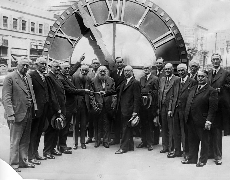
| (1932)* - Officials presenting the old courthouse clock to the Los Angeles County Museum on March 2, 1932. Left to right are: Hugh A. Thatcher, P. F. Cogswell, R. W. Pridham, Henry W. Wright, James Hay, W. J. Martin, J. S. Dodge, Fred J. Beatty, W. A. Bryan (director of the museum), J. J. Hamilton, J. R. Quinn, J. Don Wahaffey, V. E. Hinshaw, F. E. Woodley, Dr. J. W. Bovard, and Mayor Frank Shaw. |
Historical Notes The two bearded gentlemen standing front-center of the clock formerly mounted on the old Los Angeles County Courthouse are James Hay and William Martin. Both were long time County employees who were supervisors before the newly-demolished courthouse was built. The clock has been preserved and can still be seen today at the Natural History Museum's California History Room.* Additional information provided by the LA Conservancy: The numerals from one of the clock faces of the 1st County Court House were incorporated into one of the clock faces of the 2nd Court House, and were subsequently transferred to the east-facing upper clock of the 3rd Court House (opened 1959), north side of 1st Street between Grand Avenue and Hill Street, renamed the Stanley Mosk Courthouse. Click HERE to see more of today's Los Angeles County Courhtouse (Stanley Mosk County Courthouse) |
Then and Now
 |
|
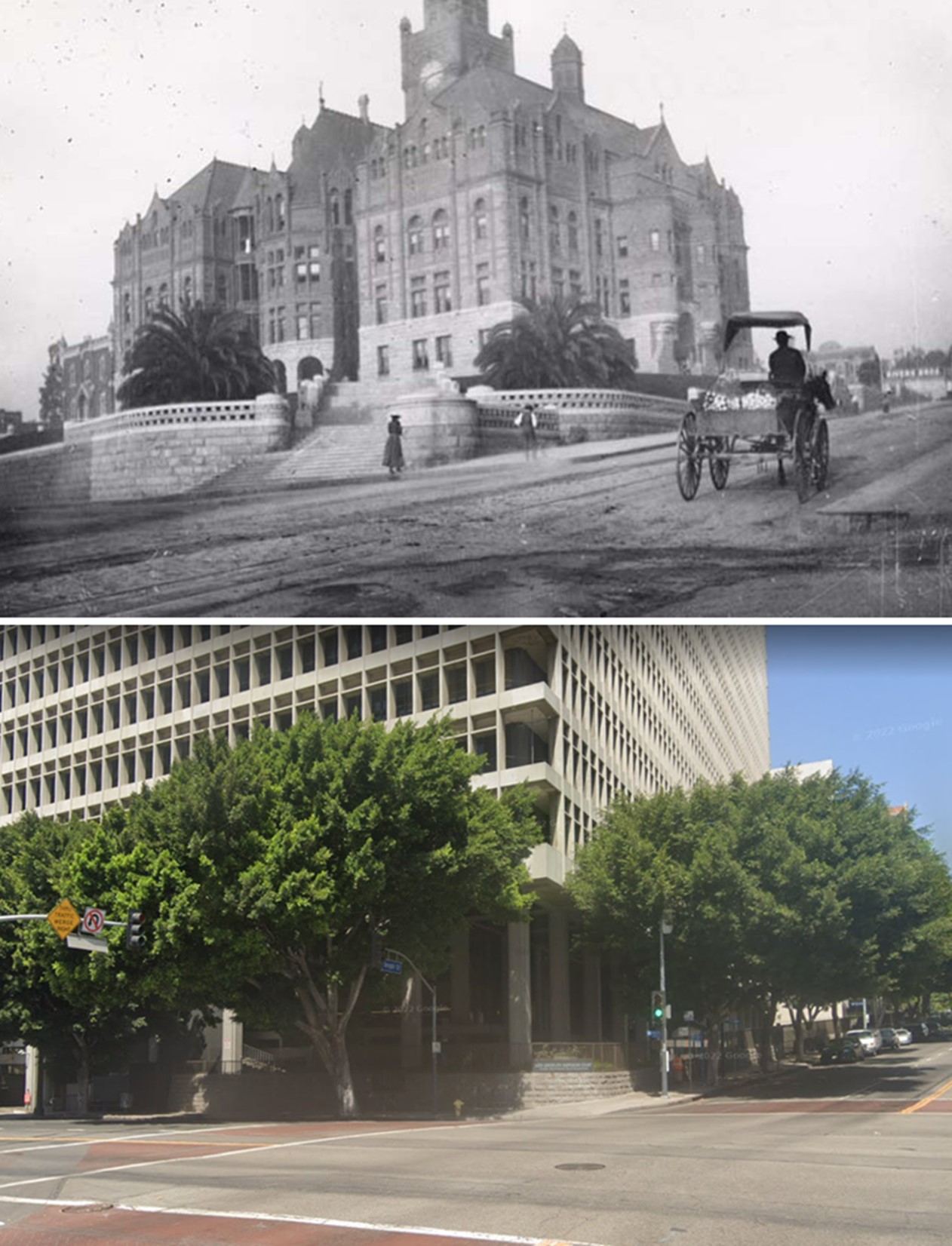
| (1891 vs 2022)* - Looking toward the southwest corner of Spring and Temple streets. Top photo shows the old Los Angeles County Courthouse on Poundcake Hill, today the site of the Clara Shortridge Foltz Criminal Justice Center. |
* * * * * |
USC Founders Building
 |
|
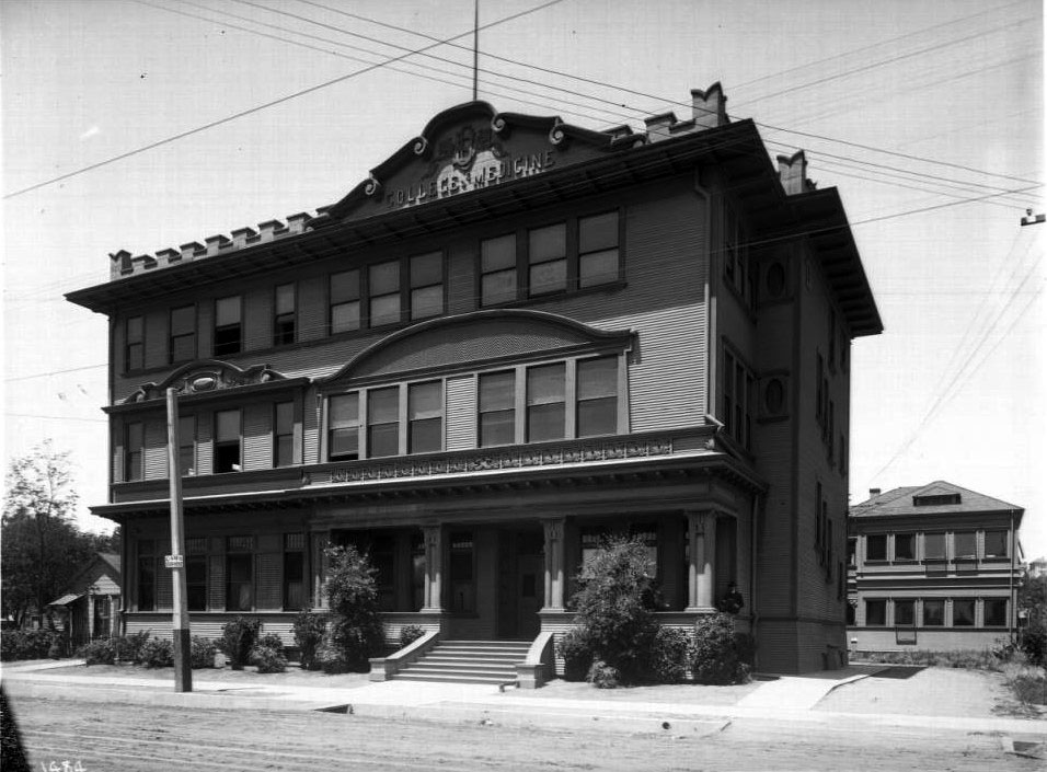
| (ca. 1895)^^* - View of the Founders Building of the University of Southern California College of Medicine, located on Buena Vista (later north Broadway). |
Historical Notes The College of Medicine of the University of Southern California (USC) was founded in 1885. Dean of the Faculty: Dr. J. P. Widney. USC was founded in 1880.^#*# |
 |
|
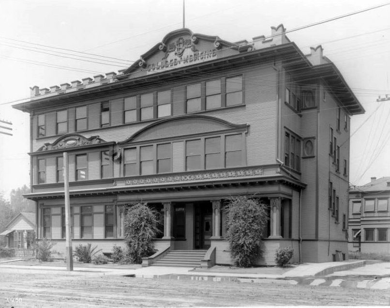
| (ca. 1909)^^* - Exterior view of the University of Southern California College of Medicine located on Buena Vista Street (North Broadway). The 3-story wooden building has a set of stairs rising to a covered porch and main entrance. At the roof level is a sign "USC College of Medicine". |
Historical Notes In 1897, the population of Los Angeles was about 86,000. There were 303 registered physicians in LA County. From 1899, there existed only a small medical library to serve the College of Medicine of the University of Southern California (USC) and the physicians of the city.^#*# |
* * * * * |
Barlow Medical Library
 |
|
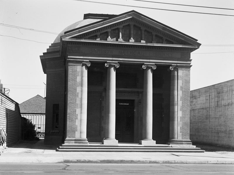
| (1939)* - Exterior front view of the Barlow Medical Library, built in 1906 and designed by Robert D. Farquhar in classic architecture style. The library was located at 742 North Broadway, across the street from the Founders Building (previous photo). |
Historical Notes In 1906, Dr. Walter Jarvis Barlow, a faculty member of the College of Medicine, erected a library building on Buena Vista Street, just opposite the Founders' Building, which he deeded to the Los Angeles College Clinical Association (a non-profit holding corporation of the College of Medicine, USC). The library was named in Dr. Barlow’s honor. In 1907, the building was dedicated to the medical profession of Southern California and of the Great Southwest. Dr. Milbank Johnson, President of the Board of Trustees, accepted responsibility for the collection. Control and management of the Library vested in Board of Trustees of the Barlow Medical Library Association, with support coming from subscribing patrons who paid $25.00 per year. In 1907 there were 53 patrons and about 5000 volumes.^#*# |
 |
|
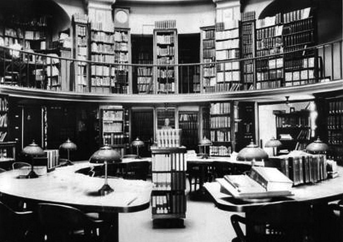
| (n.d.)^*# - Interior view of the Barlow Medical Library, College of Medicine of the University of Southern California. |
Historical Notes In 1909, the maintenance of the medical school had become more and more expensive and the University of Southern California was already spending most of its income in support of its College of Liberal Arts. Thus in 1909 the College of Medicine changed it affiliation and became part of the University of California, with the buildings including the Barlow Library building deeded to the University of California. The Barlow Medical Library Associates continued to run the Library and retained ownership of its books and journals.^#*# |
Click HERE to see more in Early Views of USC |
* * * * * |
Alhambra
 |
|
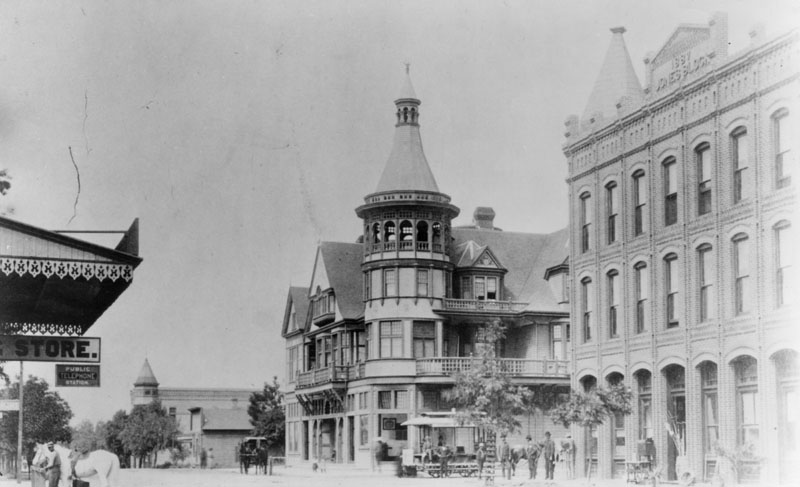
| (ca. 1890)* - Photograph of Alhambra, Garfield and Main Street ca. 1890. A horse drawn street car is in front of the elaborate Alhambra Hotrel. The building on the opposite corner is named the Jones Building and was erected in 1887. |
Historical Notes Alhambra was founded as a suburb of Los Angeles in 1903. It existed as an unincorporated area during the mid-19th century. The first school in Alhambra was Ramona Convent Secondary School built on hillside property donated by the prominent James de Barth Shorb family. Thirteen years before the city was incorporated, several prominent San Gabriel Valley families interested in the Catholic education of their daughters established the school in 1890. The city's first public high school, Alhambra High School, was established in 1898, five years before the city's incorporation. The Alhambra Fire Department was established in 1906. On July 11, 1903, the City of Alhambra was incorporated. Alhambra is named after Washington Irving's book Tales of the Alhambra, not after the Alhambra palace itself.^* |
 |
|
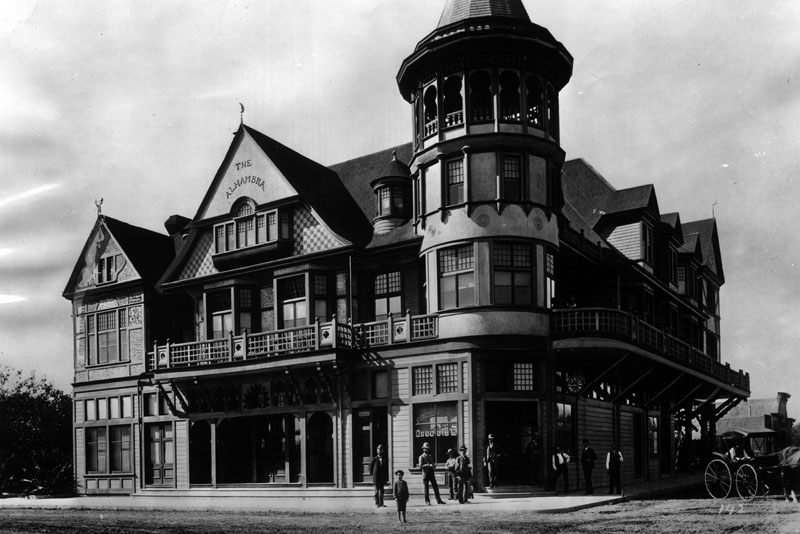
| (1898)*- This was one of the big hotels in Alhambra in 1898. Early settlers made their homes in Alhambra, gateway to the San Gabriel Valley, because of the water works. |
Historical Notes The elegant Alhambra Hotel stood at the northwest corner of Garfield and Main. This ornate structure was one of the earliest commercial buildings having been built in 1888 and which featured a billiards hall, barbershop, and restaurant. Unfortunately, the building burned down in 1908.*### |
 |
|
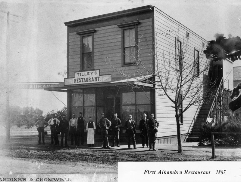
| (1887)* - Alhambra's first restaurant was named "Tilley's" and was located in this two story wood frame building with a sidewalk and unpaved street. |
Historical Notes Tilley's Restaurant opened in 1885. It was built by H. W. Stanton at the corner of Main and Garfield, the building was first used as a post office and grocery. The upstairs hall was used as a church, school, community meetings, and entertainment gathering place. H. W. Stanton was the first storekeeper, postmaster, teacher, telephone agent, land subdivider and promoter. After subdividing several ranches he became wealthy and retired. He took a trip around the world, but upon his return to Alhambra found that the boom had gone bust, and he too was broke.^### |
 |
||
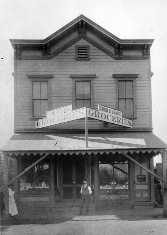
| (1898)* - An unidentified man (possibly one of the owners) stands at the front door of the Crow & Drake Groceries, two-story building located on So. Garfield Ave. It was the first general merchandise store in Alhambra in 1898. |
 |
|
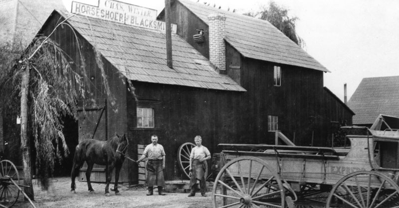
| (1890)* - Two men and a horse stand outside a building in Alhambra with a sign on the roof identifying the owner as Charles Winter, horseshoer and blacksmith. The shop opened in 1885 and was located at 4 W. Main Street. |
 |
|
| (ca. 1899)^^* - Exterior view of Villa Brunner located on the north side of Main Street just east of the Southern Pacific Railroad crossing in Alhambra. |
Historical Notes The Moorish-style residence was called Villa Brunner from 1905 to 1927 during which time it was owned by the Brunners.^^* |
 |
|
| (1910)^^* - Postcard view of the front entryway to Villa Brunner, also refered to as the "Alhambra". |
Historical Notes Two spired onion domes and the top of a chimney are visible at center in the background. The rightmost onion dome is larger and has a taller spire. A short set of stairs and an archway are also visible through the trees and shrubs which occupy the middle ground of the image. A concrete driveway bisects the lower half of the image, leading from the foreground through the archway and into the background. The near end of the driveway is flanked on each side by a small palm tree and a short stone column. The left column bears a rectangular plaque reading "Villa Brunner", while the right column's oval plaque reads "1225".^^* |
 |
|
| (ca. 1900)^*# - Close-up view of Villa Brunner in Alhambra showing its Moorish style arches similar to those seen at the Alhambra Palace in Granada, Spain. |
Historical Notes Called "The Alhambra," it was the first important residence in Alhambra. The house was built in 1885 and torn down in 1927.^^* |
* * * * * |
Echo Mountain House Hotel
 |
|
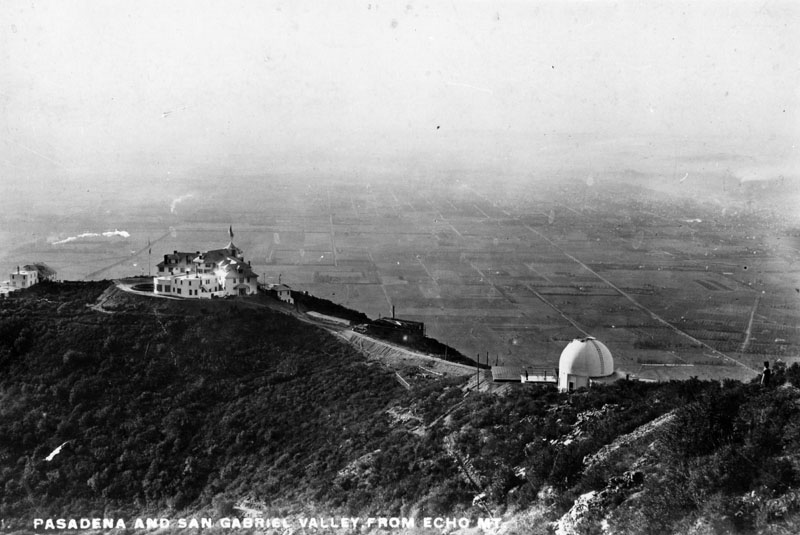
| (ca. 1890s)* - View overlooking Echo Mountain with Pasadena and the San Gabriel Valley seen in the background below. The white structure on the left is the Echo Mountain House Hotel. |
Historical Notes Buildings at Echo Mountain, reached by the Mount Lowe Railway, included the Echo Mountain House, a 70-room hotel at an elevation of approximately 3500 ft., the 40-room Echo Chalet, the observatory, car barns, dormitories, repair facilities, and a casino/dance hall.* |
 |
|
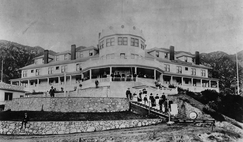
| (ca. 1890s)* - View of some of the hotel guest standing on the veranda and stairways at the front of Echo Mountain House. |
Historical Notes Completed in the fall of 1894, the Echo Mountain House was a marvel. The four-story Victorian building was marked by a tall, cylindrical tower and capped by a metal dome and a huge American flag. The bright white exterior was marked by a long row of windows on each floor. At the building’s entrance, two sweeping verandas looked off across the canyons and the valley. The interior of the hotel was extravagant, with detailed wood inlay, the finest floral-patterned carpet and handmade furniture throughout. There were seventy guest rooms, large areas for office space, a massive social hall and dining room, a souvenir shop, a Western Union office, a bowling alley, a billiard room, a barbershop and a shoeshine stand.^^## |
Click HERE to see more in Early Views of Mt. Lowe Railway |
* * * * * |
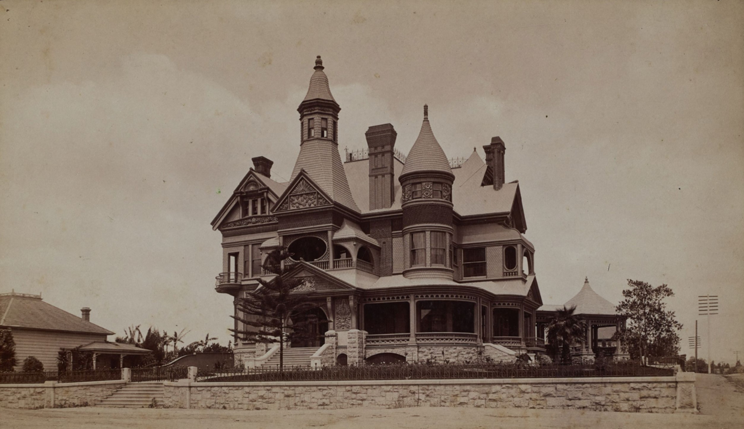
Hellman Residence
 |
|
| (1887)* - Lithograph of the expansive Italianate style estate, identified as the Isaias W. Hellman residence, located on the southwest corner of Main and 4th streets. Isaias was the brother of Herman Hellman, a well-known banker and financier in Los Angeles during the late 1800s/early 1900s. |
Historical Notes Hellman became Los Angeles' first banker almost by accident. As a courtesy, he stored his customers' gold and valuables in a safe. One day, Hellman got into an altercation with a customer who had been coming in and out of the store gloriously drunk, withdrawing gold each time from a pouch stored in the safe. When the man sobered up, he was angry to discover he had spent most of his funds, and he lunged at Hellman. That interaction prompted Hellman to stop his informal banking operations. He got slips printed up that said I.W. Hellman, Banker, and started buying people's funds and issuing deposit books. On September 1, 1868, Hellman and Temple founded Hellman, Temple and Co., the fledgling city’s second official bank. In 1871, Hellman and John G. Downey, a former governor of California, formed the Farmers and Merchants Bank of Los Angeles, which became Los Angeles' first successful bank. Hellman lent the money that allowed Harrison Gray Otis to buy the Los Angeles Times and Edward Doheny and Charles A. Canfield to drill for oil.^* |
 |
|
| (1887)* - Panoramic view of the Isaias W. Hellman residence in foreground, southwest corner of Main and 4th streets. This would be the future site of the Farmers and Merchants Bank of Los Angeles. |
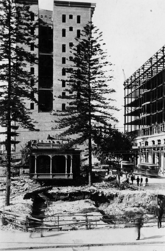 |
|
| (1895)* - View of the spot where the Isaac & Herman Hellman residence once stood on the corner of 4th and Main Streets. For the move, the house was cut into four sections, with the last section to be moved visible in the center of the image on the left. The house was moved to make way for his family's bank building - Farmers and Merchants Bank of Los Angeles. Dan W. Graybill, standing in the foreground on the right, donated this photograph. A couple street cars are seen traveling on the right in front of the Van Nuys Hotel (under construction). |
Historical Notes The Farmer's and Merchants Bank was founded by 23 prominent Los Angeles businessmen, with an initial capital of $500,000. The three largest subscribers were Isaias W. Hellman ($100,000), former California Governor John G. Downey ($100,000), and Ozro W. Childs ($50,000) who in later years became the founders of the University of Southern California. Other investors included Charles Ducommun ($25,000), I.M. Hellman ($20,000) and Jose Mascarel ($10,000.) The Farmers and Merchants Bank was the first incorporated bank in Los Angeles, founded in 1871 by John G Downey, the seventh governor of California and Isaias W. Hellman, a successful merchant, real estate speculator and banker, and brother of Hermann W. Hellman. Downey was named the first president. Isaias later served as president of the bank till his death in 1920.^* |
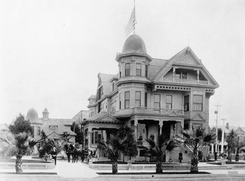 |
|
| (ca. 1890s)* - Street view of Herman Hellman's residence, located at 958 So. Hill St. Faintly visible are various members of the Hellman family, including: Irving (on the far left), Frida (later Mrs. Louis Cole), Herman and Amy (later Mrs. Sollie Aronson). Joining them is the coach driver, Oscar Leuschner. |
Historical Notes Herman W. Hellman was born on September 25, 1843 in Reckendorf, Bavaria. He emigrated to the United States with his brother Isaias W. Hellman, arriving in Los Angeles on May 14, 1859 as a sixteen-year-old. He started working as a courier from Wilmington to Los Angeles. In 1861, he worked for his uncle, Samuel Hellman, who had a store in Los Angeles. Shortly after, he opened his own store at Downey Block. He established a wholesale grocer's called Hellman, Haas, & Co. with Jacob Haas, the brother of Abraham Haas. They sold groceries in Southern California, Arizona, New Mexico and Texas. As his business prospered, he became one of the wealthiest men in Los Angeles by the 1880s. The company later became known as Baruch, Haas, & Co. In 1890, he became Vice President and General Manager of The Farmers and Merchants Bank, a bank established by his brother. He was later demoted by his brother, who found his lending practices too lenient. He resigned in 1903, and became the President of the Merchants National Bank instead. He also became a co-founder of the Los Angeles Chamber of Commerce. In 1903, he hired architect Alfred Rosenheim to design the Hellman Building named in his honor. The eight-story building in Downtown Los Angeles still stands today, on the corner of Fourth Street and Spring Street. He served as President of the Congregation B'nai B'rith, later known as the Wilshire Boulevard Temple.^* |
* * * * * |
Zahn Residence
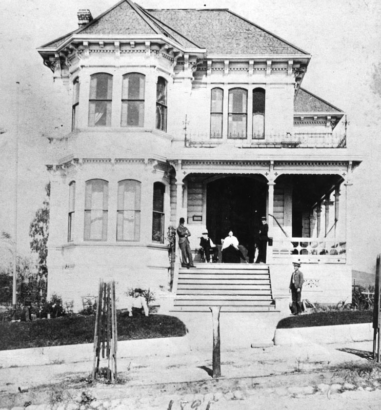 |
|
| (1891)* - The Bunker Hill residence of Dr. John Carl Zahn at 427 South Hope Street in 1891. |
Historical Notes The Zahn residence on Hope Street was a large building, yet simple and elegant with far less ornamentation than a lot of the other painted ladies in the neighborhood. Behind the house was a small pasteur where horses were kept and the Zahn boys would sometimes amuse themselves by careening down the grassy hills in the area on homemade sleds.*##^ |
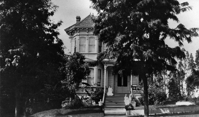 |
|
| (ca. 1912)* - View showing the Bunker Hill residence of John Carl Zahn at 427 South Hope Street. |
Historical Notes Mrs. J.C. Zahn continued overseeing the family real estate holdings after her husband's death, and in 1912 had the family home demolished in favor of a three story brick building which was to be called the Zahn Apartments but ended up going by the name Rubaiyat. In 1930, the building was remodeled and renamed the Wickland Apartments and in its last few years was known as the St. Leon until it was demolished around 1963.*##^ |
* * * * * |
Shatto Residence
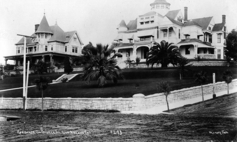 |
|
| (1892)* - Photo taken from Orange Street and shows the front view of two Queen Anne style houses built around 1892, on a hill at Lucas and Orange Street (later Wilshire Blvd). The house on the right belonged to George R. and Clara Shatto. |
Historical Notes The corner house, at 1213 Orange Street, was the residence of George R. and Clara Shatto, and later became the site of Good Samaritan Hospital in Los Angeles. George Shatto, a real estate speculator from Michigan, purchased Santa Catalina Island in 1887 for $200,000 and created the settlement that would become Avalon. He was the first owner to try to develop the island into a resort destination at the height of the real estate boom, and can be credited with building Avalon's first hotel and pier.* Next to the Shatto house is the Orson Thomas (O.T.) Johnson house at 1221 Orange Street. O.T. Johnson became a very successful businessman in Los Angeles, known for building the Westminster Hotel. Occidental College has the Johnson Hall that was constructed in 1914 and was a gift of the Johnsons. O.T. was also a big supporter of the LA YMCA, donating a reported $35,000 to construct a YMCA building. Johnson built the Florence Crittenden Home and established a clinic in Los Angeles for the aid of poor children. He also built a seventy-five suite apartment building named Anna Craven Johnson Home, after his wife, that was established for the use of widowed mothers with dependent children. |
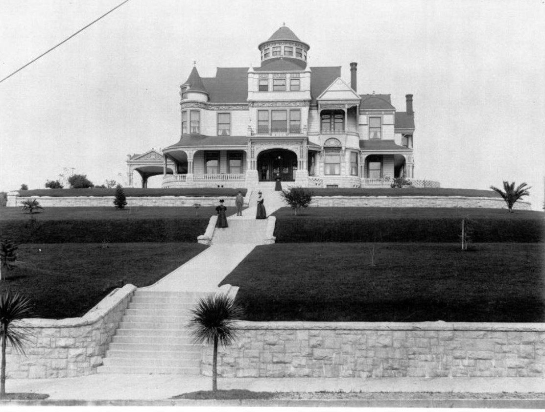 |
|
| (1900)##+ – View showing four members of the Shatto family posing in front of their home. The massive Victorian house has three stories, a wrap-around porch, a cylindrical tower, as well as several brick chimneys. The hill in front of the home is covered with a closely trimmed lawn and is held in place with two stone retaining walls. |
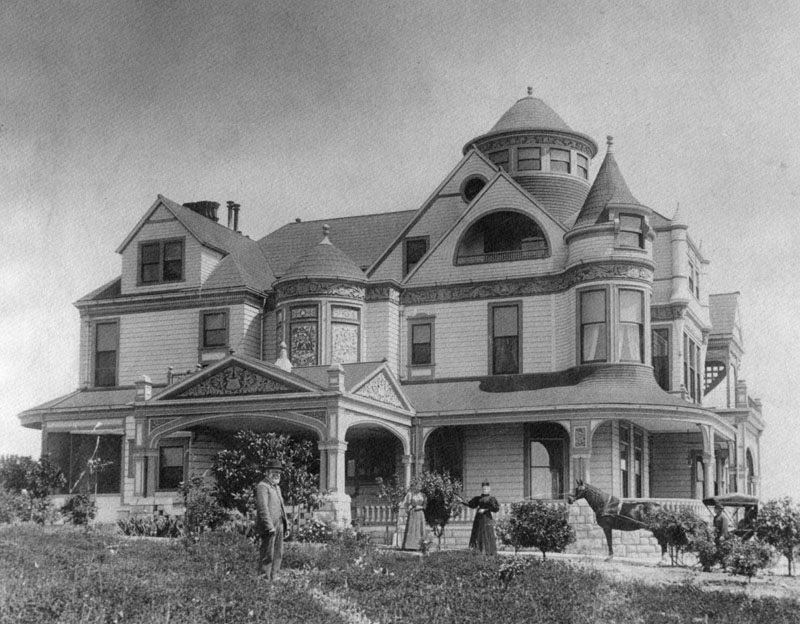 |
|
| (ca. 1892)* - Side view of the home of George R. and Clara Shatto, built approximately in 1892 at Lucas and Orange Street (later Wilshire Blvd.), later the site of Good Samaritan Hospital, in Los Angeles. The photo was taken from the Orange Street side. There are people standing in front of the house and a horse and buggy in the driveway. |
 |
|
| (ca. 1892)* - Side view of the home of George R. and Clara Shatto, built approximately in 1892 at Lucas and Orange Street (later Wilshire Blvd.), later the site of Good Samaritan Hospital, in Los Angeles. The photo was taken from the Orange Street side. There are people standing in front of the house and a horse and buggy in the driveway. Image enhancement and colorization by Richard Holoff. |
* * * * * |
First English Lutheran Church
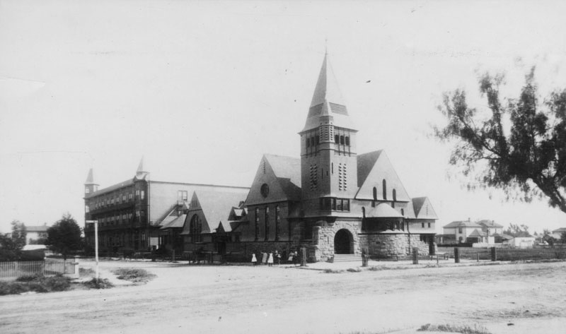 |
|
| (1890)*- View showing the First English Lutheran Church, located at the southeast corner of Flower and 8th Streets in Los Angeles, shown soon after its construction in 1890 before the streets were paved. The Abbotsford Inn is visible behind the church on the left side and a few residences are seen in the background on the right. |
Historical Notes Abbotsford Inn was converted into a hotel by Abbot Kinney, best known as the developer of Venice. The building, designed by Robert B. Young, was erected in 1887 by D. W. Hanna as Los Angeles College or Hanna College. After the college failed, Kinney took it over.* |
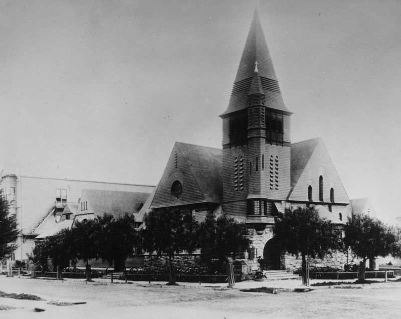 |
|
| (ca. 1892)* - Children pose on the steps outside of the First English Lutheran Church of Los Angeles, located at 800 S. Flower Street. A partial view of the Abbotsford Inn can be seen behind the church on the left. |
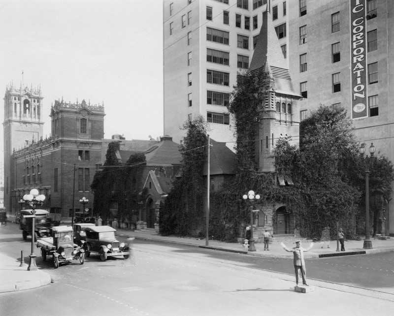 |
|
| (1920s)* - View looking southeast showing a traffic officer standing on a box and as he conducts traffic at the intersection outside of First English Lutheran Church, located at 800 S. Flower Street in Los Angeles. Present in the background are the Los Angeles Gas and Electric Company (right) and the First Methodist Episcopal Church (left). |
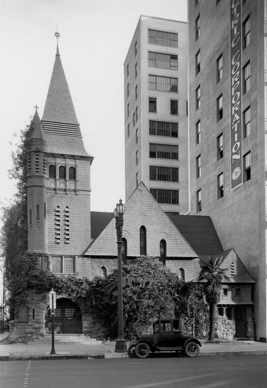 |
|
| (ca. 1925)* – A car is parked in front of the First English Lutheran Church with the Los Angeles Gas and Electric Company building visible on the right. |
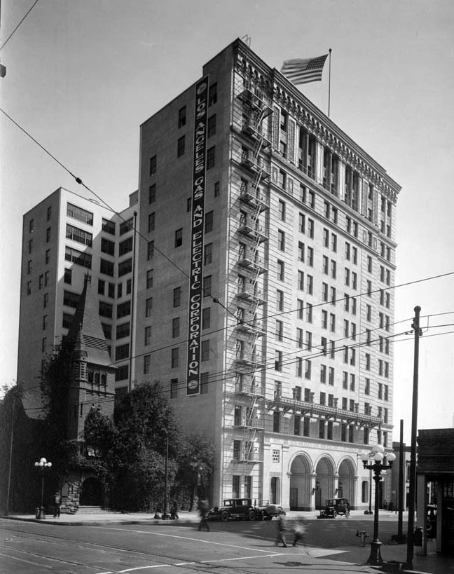 |
|
| (ca. 1925)^## - Street view of the recently completed LA Gas and Electric Corp. Office Building near the corner of 8th and Flower streets. The First English Lutheran Church of Los Angeles stands at the corner. Click HERE to see more in LA Gas and Electric Corporation. |
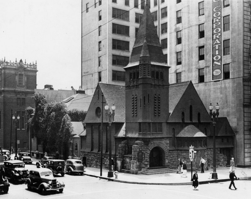 |
|
| (1936)* – View of the First English Lutheran Church of Los Angeles, located on the busy corner of 8th and Flower streets, captured just prior to its demolition. In the background are the Los Angeles Gas and Electric Company building (right) and the First Methodist Episcopal Church (left). |
* * * * * |
Please Support Our CauseWater and Power Associates, Inc. is a non-profit, public service organization dedicated to preserving historical records and photos. Your generosity allows us to continue to disseminate knowledge of the rich and diverse multicultural history of the greater Los Angeles area; to serve as a resource of historical information; and to assist in the preservation of the city's historic records.
|
For more Historical Los Angeles Views click one of the following:
For Other Historical Views click one of the following
See Our Newest Sections:
To see how Water and Electricity shaped the history of Los Angeles click one of the following:
Water:
Power:
References and Credits
* LA Public Library Image Archive
**DWP - LA Public Library Image Archive
^^Calisphere: University of California Image Archive
*# Mojave Desert.net: Remi Nadeau
#* Ancestory.com - Margarita Bandini Winston
#^Huntington Digital Library Archive
^#KCET - The Lost Hills of Downtown Los Angeles; Lost LA
+#Life of Pio Pico - Pio Pico State Historic Park
##Library of Congress Image Archive
++*Facebook.com - Bizarre Los Angeles
**^LA Fire Department Historical Archive
**#Tumblr.com - LA History: LA Times; Leonis Adobe; Larronde Block
*##Historic Los Angeles Theatres: Grand Opera House; Orpheum Theatre
^^^Oviatt Library Digital Archives
^^#The Museum of the San Fernando Valley
***Los Angeles Historic - Cultural Monuments Listing
*^*California Historical Landmarks Listing (Los Angeles)
^*#Noirish Los Angeles - forum.skyscraperpage.com; Ruber Home; Villa Brunner; LA County Courthouse; Barlow Medical Library Interior; Robinson Manison and Teed Street; Main and 4th
*#*Historic Hotels of Los Angeles and Hollywood (USC - California Historic Society)
^##California State Library Image Archive
+##GlamAmor.com: Bradbury Building
##+Facebook.com: Photos of Los Angeles
+^^Facebook.com: West San Fernando Valley Then And Now
+**Facebook.com: Old Photos of Los Angeles
+++Mt. Lowe Preservation Society
*^^Nuestra Señora la Reina de los Ángeles: Bradbury Building
^*^*TheZephyr.com: O.T. Johnson
*^*^St. Mary's Catholic Church
^^^*UC Davis: Bradbury Family Papers
*^^^Big Orange Landmarks: Forthmann House and Forthmann Carriage House
^^**Flickr.com - Floyd B. Bariscale Photostream
^^##UC Irvine - The White City by Miles Clement
^#**Historic Hotels of Los Angeles and Hollywood (USC - California Historic Society)
^#*#Online Archive of California: Barlow Medical Library
^##*South Bay Daily Breeze: Hotel Metropole; Spring Training with the Cubs on Catalina
*#*#Flickr.com: Michael Ryerson
^###Electronic Scrapbook of Alhambra History
*#*^University of Maryland Digital Archive
*#^^A House for Equal Justice - Judge Elizabeth R. Feffer
*##*Pacific Coast Architecture Database (PCAD): Bryson-Bonebrake Block; Hollenbeck Home for the Aged
*##^On Bunker Hill: The Zahn Family; St. Angelo Hotel; Hildreth Mansion
***#Salvation Army History: Southern California
#**^LA County Library Image Archive
#^*#Urban Diachrony: Intersection of 3rd and Spring Streets
#**#Santa Monica Local History: blogspot.com
#*#^Womans Christian Temperance Union
##**LAist: A Park a Day: Point Fermin Park, San Pedro
##^^The Department Store Museum: J. W. Robinson's
###Denver Public Library Image Archive
^ On Bunker Hill: The Zahn Family; Crocker Mansion; Hershey Residence; St. Angelo Hotel; Hildreth Mansion; Larronde Block and Residence
^* Wikipedia: Abel Stearns; Pío Pico; Workman-Temple Family; Jonathan Temple; Los Angeles Herald-Examiner; Charles Maclay; Los Angeles High School; Cathedral of Saint Vibiana; John Edward Hollenbeck; Foy House; Isaias W. Hellman; Isaac Newton Van Nuys; Wells Fargo; Los Angeles Plaza Historic District; Harrison Gray Otis; Harris Newmark; Bradbury Building; LA Oil Discover; Stimson House; Alhambra; Bank of America Center; La Grande Station; Santa Catalina Island; Pt. Fermin Lighthouse; Herman W. Hellman; Farmers and Merchants Bank of Los Angeles; Pan American Lofts
< Back