Early Views of Pasadena
Historical Photos of Early Pasadena |
 |
|
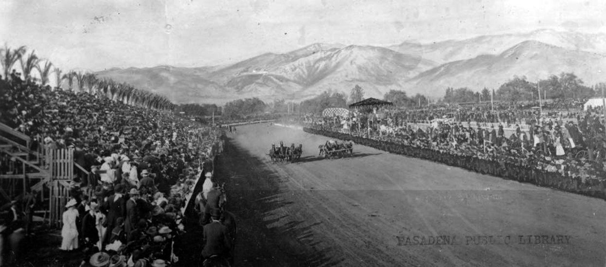
| (Early 1900s)* - View showing a couple of four-horse-drawn chariots racing in front of thousands of spectators at Tournament Park. Chariot racing was a feature of the Rose Parade in the early 1900s. |
Historical Notes For many years the main attraction in Tournament Park (the predecessor of the current Rose Bowl stadium) was chariot races, although polo matches attracted equally large crowds. |
 |
|
| (Early 1900s)* - A furious chariot race at the Tournament of Roses at Tournament Park. |
Historical Notes In 1902 football was substituted for chariot racing as the midwinter attraction. The first game was played between Michigan (49) and Stanford (0). The game was so lopsided that it didn't go over well with the fans and the Tournament organizers decided to revert back to the chariot races. |
* * * * * |
1st Rose Bowl (Tournament East-West Football Game)
 |
|
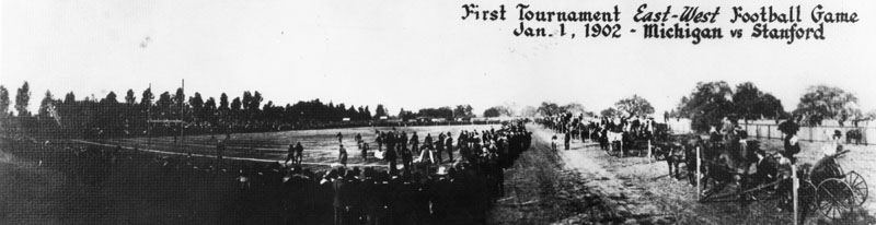
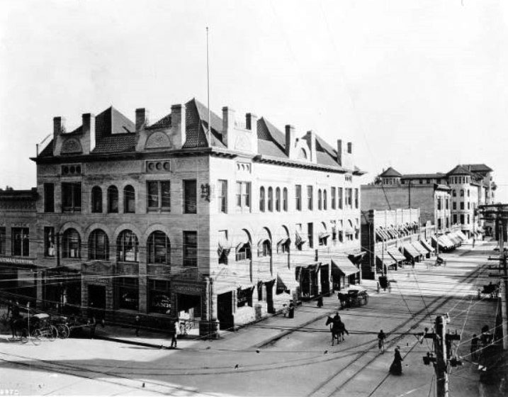
| (1902)* - First Tournament East-West football game, January 1, 1902, Michigan vs. Stanford. Note the crowd of people standing in foreground, and to the right side of the football field. Horse-drawn carriages are lined along a fence beyond the crowds of people. |
Historical Notes Originally titled the "Tournament East-West football game," the first Rose Bowl was played on January 1, 1902, starting the tradition of New Year's Day bowl games. The football game was added in 1902 to help fund the cost of the Rose Parade. The inaugural game featured Fielding H. Yost's dominating 1901 Michigan team, representing the East, which crushed a previously 3-1-2 team from Stanford University, representing the West, by a score of 49–0 after Stanford quit in the third quarter. Michigan finished the season 11–0 and was crowned the national champion. Yost had been Stanford's coach the previous year. The game was so lopsided that for the next 13 years, the Tournament of Roses officials ran chariot races, ostrich races, and other various events instead of football. On New Year's Day 1916 football returned to stay as The State College of Washington (now Washington State University) defeated Brown University in the first annual Rose Bowl with that explicit name. |
* * * * * |
Construction of the Rose Bowl
 |
|
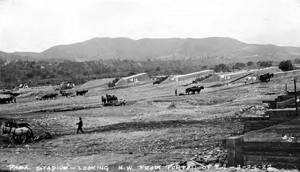
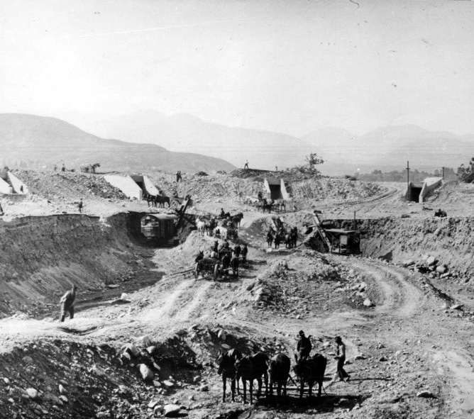
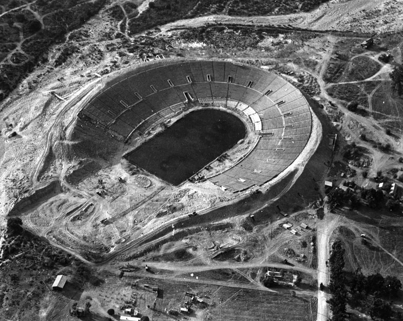
| (1922)* – View showing the early stages of construction of the Rose Bowl. The numbered structures are the tunnels, which were completed first. |
Historical Notes The idea for the Rose Bowl stadium emerged from the growing popularity of the annual Tournament of Roses football game. On March 20, 1920, the Tournament of Roses Association decided to build a stadium in Pasadena that could accommodate up to 100,000 spectators. Architect Myron Hunt, a member of the Association and respected local designer, was chosen to create the stadium's plans. In 1920, City officials declared the football facilities at Tournament Park unsafe for the growing New Year’s Day crowds. Ten-year $100 box seats were sold to raise funds for construction of a new facility. |
 |
|
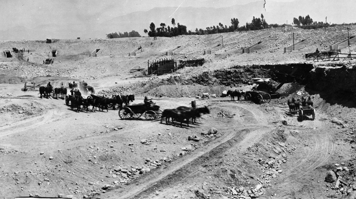
| (1922)* – Horse-drawn wagons haul off dirt during construction of the Rose Bowl Stadium. |
Historical Notes Construction of the Rose Bowl began on February 27, 1922, and was completed in just nine months, finishing in October 1922. The project employed a team of men and donkeys to dig and haul dirt, as well as to transport local river rock for the foundation. The stadium was built in the Arroyo Seco area of Pasadena, selected for its natural bowl-like topography. |
 |
|
| (1922)* - The Pasadena Rose Bowl under construction in the Arroyo Seco. Construction began on February 27, 1922, following planning and design work completed in 1920 and 1921. |
Historical Notes The stadium was designed by architect Myron Hunt in 1921. His design was influenced by the Yale Bowl in New Haven, Connecticut, which was built in 1914. The Arroyo Seco dry riverbed was selected as the location for the stadium. |
 |
|
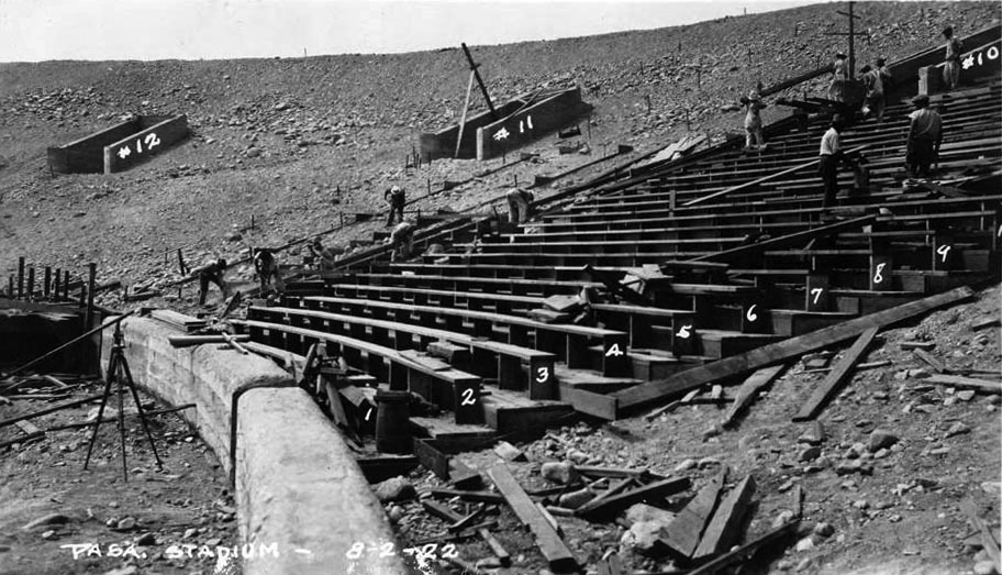
| (1922)* – View showing the Rose Bowl seats being assembled in the early stages of construction. |
Historical Notes Early construction focused on forming the concrete seating sections, tunnels, and access points. When completed in 1922, the stadium had an initial seating capacity of approximately 57,000 and was open at the southern end, forming a horseshoe shape. |
 |
|
| (1922)* - View looking west toward the San Rafael Hills showing horse-drawn wagons removing dirt and rock during construction. |
Historical Notes The rugged terrain of the Arroyo Seco required careful grading and planning. Roads, drainage systems, and utilities were integrated into the uneven canyon floor during construction. |
.jpg) |
|
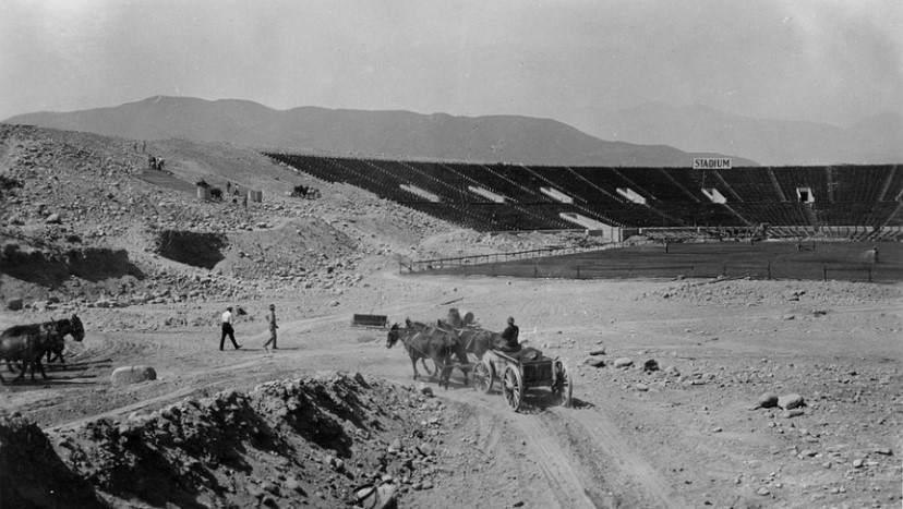
| (1922)* - Another view showing the construction work on the Rose Bowl. |
Historical Notes Despite these environmental and structural challenges, the construction team successfully transformed this natural canyon into one of the most iconic sports venues in the United States. The Rose Bowl not only became an architectural marvel but also preserved the natural beauty of its original setting. |
 |
|
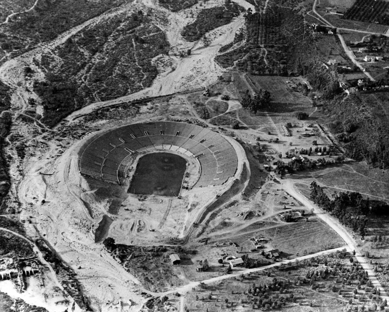
| (1922)* - Aerial view showing the Rose Bowl taking on its original horseshoe shape. |
Historical Notes The Rose Bowl was under construction for about a year. The stadium was designed to bring spectators close to the field while maximizing capacity within the natural bowl. Construction costs came in under budget, allowing funds to be reserved for future expansion. |
 |
|
| (1922)* - A closer aerial view of the Rose Bowl under construction. |
Historical Notes The Rose Bowl was completed in October 1922, just several months prior to the completion of the nearby Los Angeles Memorial Coliseum, May 1923. The first game was a regular season contest on October 28, 1922 when Cal defeated USC 12–0. This was the only loss for USC and California finished the season undefeated. California declined the invitation to the 1923 Rose Bowl game and USC went in their place. |
Then and Now
 |
|
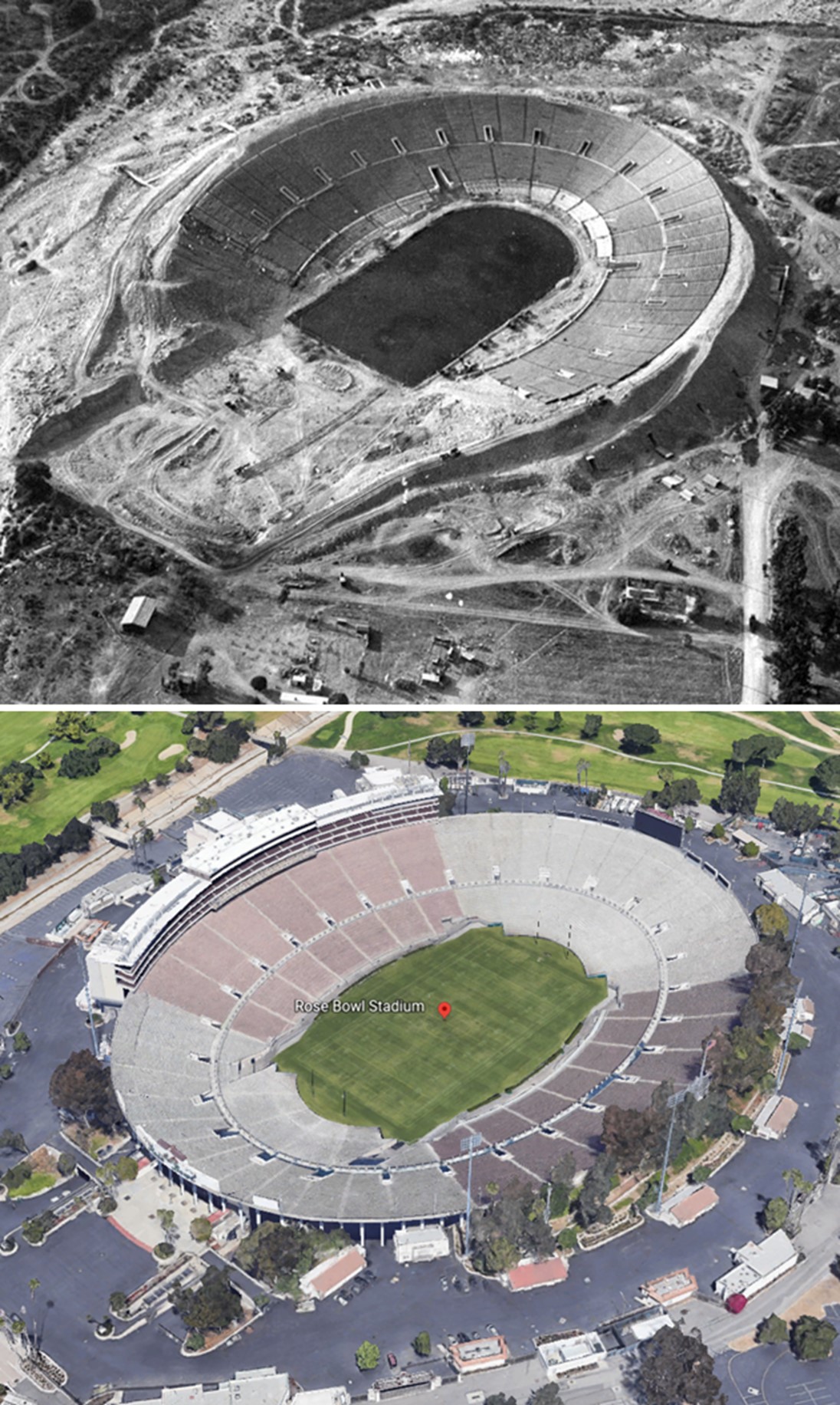
| (1922 vs. 2022)* - Then and Now. Photo comparison by Jack Feldman. |
Historical Notes The Rose Bowl stadium has undergone significant changes since its original construction in 1922, evolving from an open horseshoe into a complete bowl. Major renovations, including work completed in 2016, modernized the facility while preserving its historic character. |
 |
|
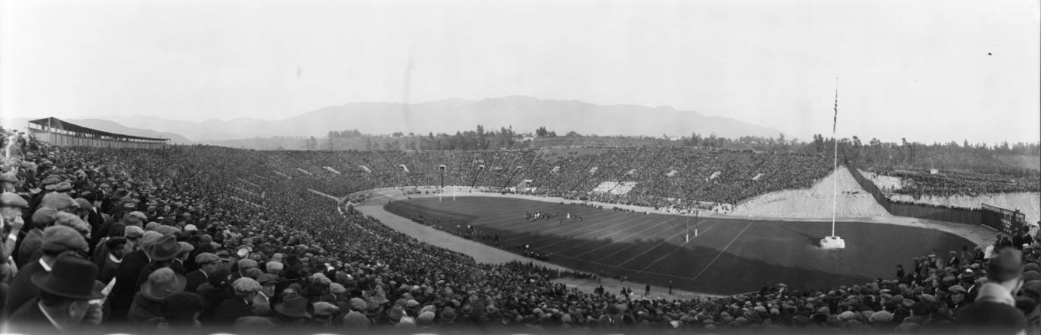
| (1923)* - Panoramic view of the 1923 Rose Bowl Game between Penn State University and the University of Southern California at the Rose Bowl Stadium in Pasadena. The stands are almost filled, with the exception of some of the higher areas on the far side of the stadium. Small groups of what appear to be military men are seated on chairs on the track surrounding the field. The game is in progress, with the two teams in the middle of a series near midfield. There are men positioned at several places along the near sideline with photographic cameras, and one man near midfield has a motion picture camera. There is a very tall flag pole on the far right with a large American flag. A large number of automobiles are parked on the far right, beyond the open part of the stadium, where there are also a couple hundred people watching the game over the stadium fence. |
Historical Notes January 1, 1923 was the first time that the Rose Bowl Game was held at the Rose Bowl Stadium. The game featured Penn State University and the University of Southern California. Start of play was delayed more than an hour when Penn’s team was stuck in traffic. USC would go on to defeat Penn State 14 to 3. The name of the stadium was alternatively "Tournament of Roses Stadium" or "Tournament of Roses Bowl", until being settled as "Rose Bowl" before the 1923 Rose Bowl game. Click HERE to see more in Early Views of USC. |
 |
|
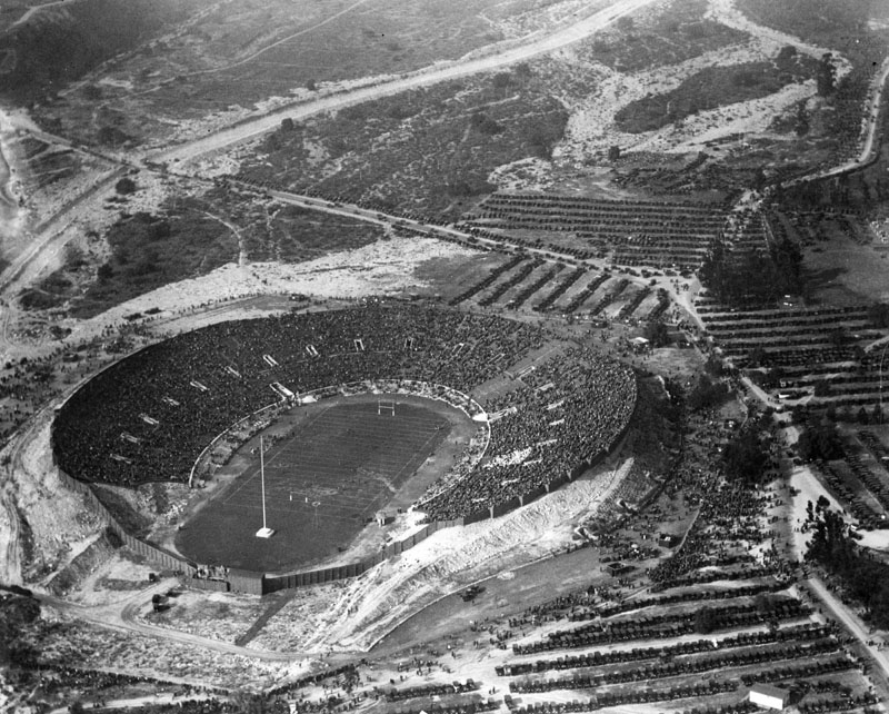
| (1925)* - Aerial view of the Rose Bowl on New Years Day, January 1, 1925. The stadium is almost full, yet crowds of people are still walking in. The football score that day was: Notre Dame, 27 vs Stanford, 10. |
Historical Notes Originally built as a horseshoe, the stadium was expanded several times over the years. The southern stands were completed in 1926, making the stadium a complete bowl. |
 |
|
| (1926)* - Aerial view looking north showing the 1926 Rose Bowl game. |
Historical Notes The 1926 Rose Bowl Game is commonly referred to as "the game that changed the south." The game featured the Alabama Crimson Tide, making their first bowl appearance, and the Washington Huskies. Alabama was victorious 20–19, as they scored all twenty points in the third quarter. With the victory, the Crimson Tide was awarded its first National Championship. The game made its radio broadcast debut, with Charles Paddock, a sports writer and former Olympian track star, at the microphone. Alabama’s coach, Wallace Wade, was later inducted into the Rose Bowl Hall of Fame (1990). |
 |
|
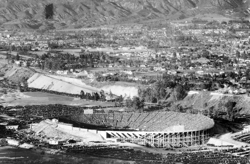
| (ca. 1928)* - Aerial view of the Rose Bowl after the southern stands were constructed making it a complete bowl. Though the stadium appears to be filled to capacity, people are still trickling in, and row upon row of automobiles can be seen neatly parked in the lots. View also shows the residential homes surrounding the stadium, as well as the mountains in the background. |
Historical Notes For many years, the Rose Bowl had the largest football stadium capacity in the United States. From 1972 to 1997, seating capacity reached 104,594. The current official seating capacity is 92,542. The stadium was designated a National Historic Landmark in 1987. |
 |
|
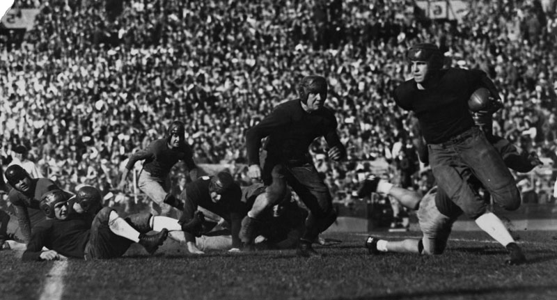
| (1929)* - Georgia Tech player Mizell carries the ball during the Rose Bowl Game, January 2, 1929. |
Historical Notes The January 2, 1929 Rose Bowl Game featured Georgia Tech and the University of California. Georgia Tech won the closely contested game by a score of 8 to 7. |
 |
|
| (ca. 1924)* - A view of the Pasadena High School commencement ceremony at the Rose Bowl. A large crowd of spectators fills about half of the stadium. There are freestanding white bleachers on the far side which are occupied by the students, and a band is on the field in front of them. |
Historical Notes Today, the stadium still hosts commencement ceremonies for John Muir High School and Pasadena High School. It also hosts the annual football homecoming game, called the Turkey Tussle, between Pasadena High School and John Muir High School, in mid-November. Click HERE to see more Early Views of the Rose Bowl (1930s & 1940s). |
* * * * * |
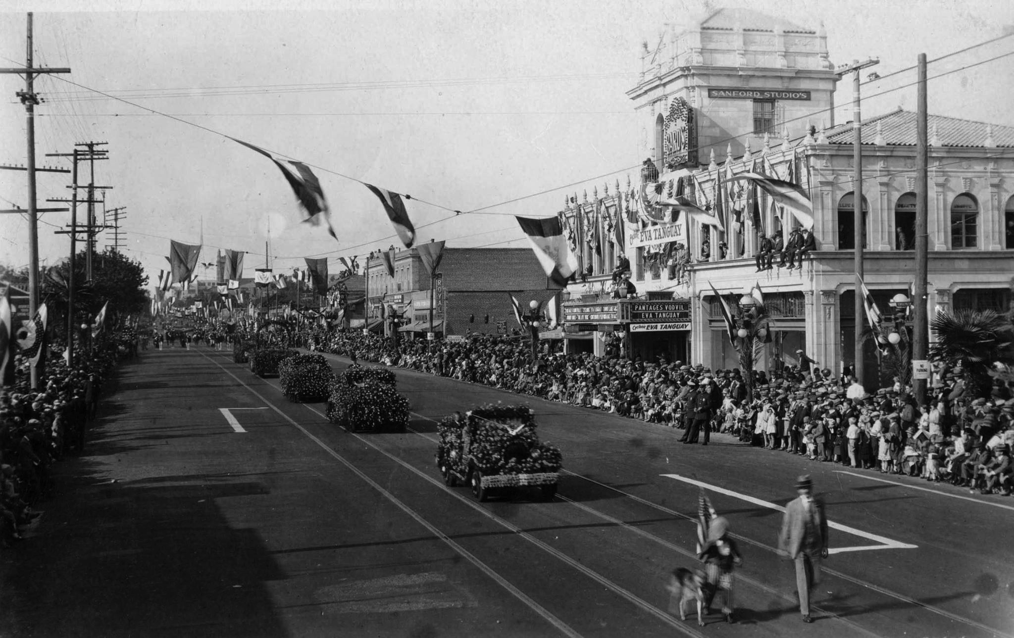
Tournament of Roses Parade
 |
|
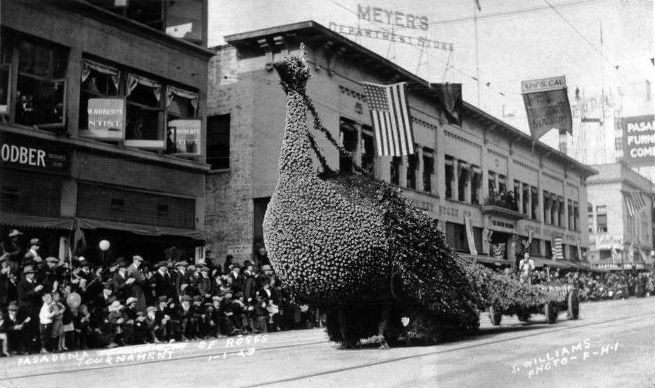
| (1923)^ – Postcard view showing the City of Glendale’s prize winning peacock float at the 1923 Tournament of Roses Parade, with Meyer’s Department Store in the background. |
Historical Notes Click HERE to see early Tournament of Roses Parades. |
* * * * * |
 |
|
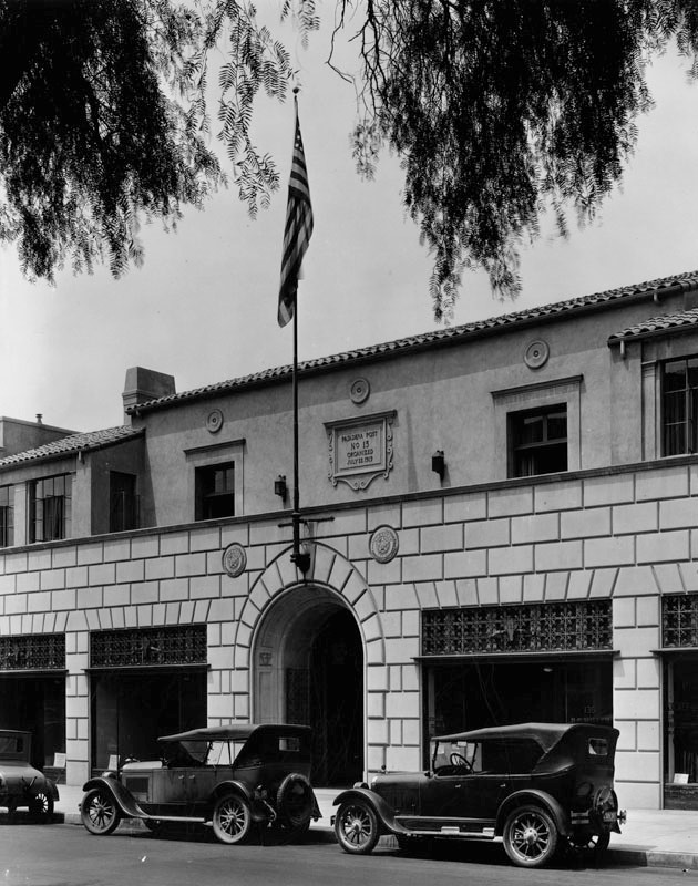
| (ca. 1923)* - View looking north on Marengo Avenue in Pasadena. The building on the left with the flag is the American Legion Post No. 13, located at 131 N. Marengo Avenue. |
Historical Notes The American Legion is an organization of U.S. war veterans formed in Paris on March 15–17, 1919, by delegates from all units of the American Expeditionary Forces. Their main mission is to sponsor programs that improve veterans communities, such as scholarships, veterans help programs (i.e. ending veterans homelessness), and youth sports. They also promote national security, patriotism, and devotion to veterans.*^ |
 |
|
| (ca. 1926)* - Close-up view of the entrance to the American Legion Post No. 13 on Marengo Avenue, Pasadena, showing iron work over the windows and dedication carved into stone over the entrance. |
Historical Notes The Pasadena Post No. 13 was organized July 22, 1919. Architects Marston and Van Pelt designed the building, which was built in 1925.* |
 |
|
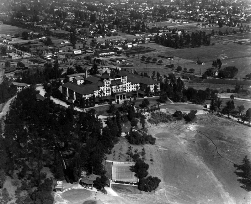
| (1924)* - Aerial view of the second Raymond Hotel looking across the grounds at the western facade, the main entrance to the hotel. Extensive urban development can be seen in the background. |
Historical Notes Located atop Bacon Hill, renamed Raymond Hill, which lies between Pasadena and South Pasadena, the first Raymond Hotel burned down in 1895 and was replaced by a second in 1903. The architect was T. W. Parkes. In 1934 the hotel was torn down for residential development due to fallout from the Great Depression.* |
 |
|
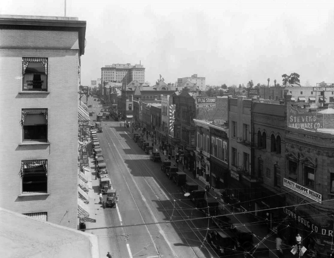
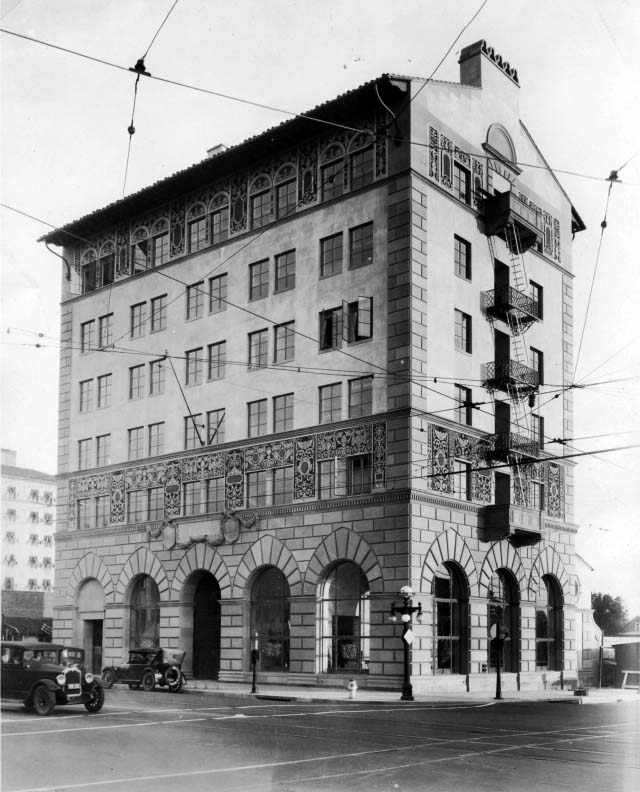
| (1925)++# - View looking east from the rooftop of building at the northwest corner of Fair Oaks Avenue and Colorado Boulevard. The large building in the distance is the Pacific Southwest Trust and Savings Bank Building. |
 |
|
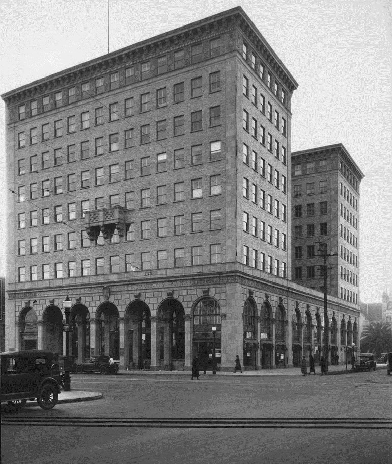
| (1925)^ - View of the Pacific Southwest Trust and Savings Bank Building at 234 East Colorado Boulevard, at the corner of Marengo and Colorado. |
Pasadena Furniture Company Building (later Sears)
 |
|
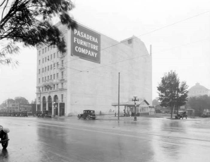
| (1924)**- Rainy day view of the Standard Oil Station at 520 East Colorado and the multi-story Pasadena Furniture Company next door. |
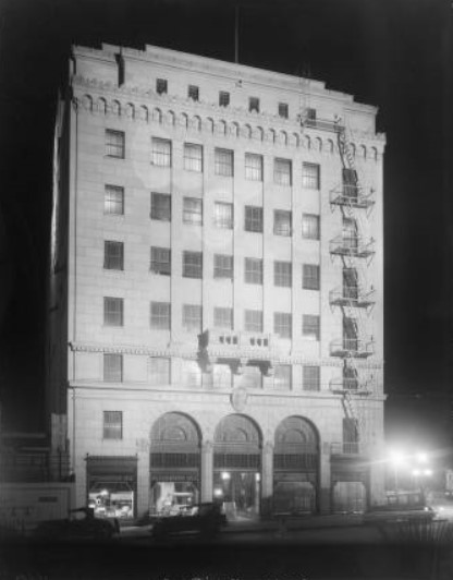 |
(1925)**- Night view of the exterior of the Pasadena Furniture Company at 530 East Colorado.
|
 |
|
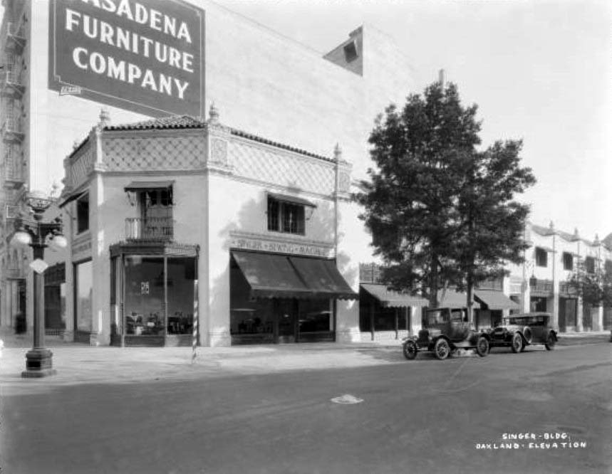
| (1926)**- A street view of the newly completed Singer Building at 520 East Colorado, next to the Pasadena Furniture Company building. Displays of sewing machines visible in the windows. Note the ornate streetlight on the corner. |
 |
|
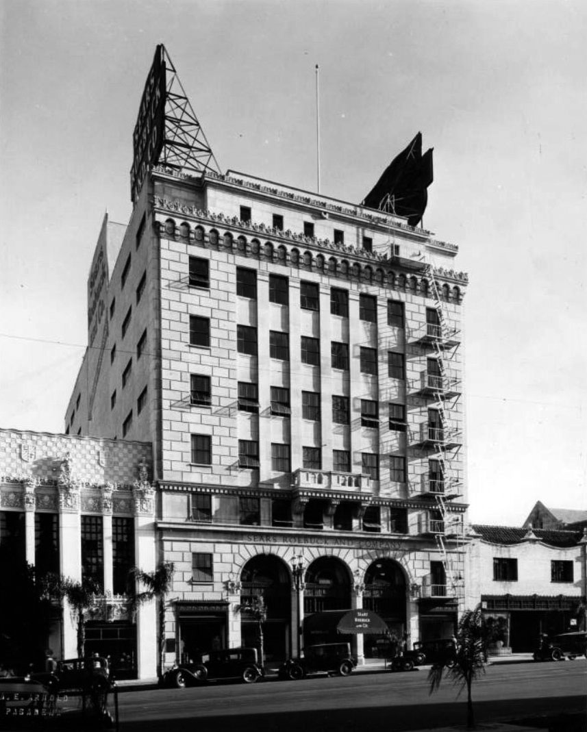
| (ca. 1930)** – View showing Pasadena's Sears, Roebuck and Company building, previously Pasadena Furniture Co Building. The Singer Building is seen to the right. Click HERE for contemporary view. |
Historical Notes Pasadena's Sears, Roebuck and Company was located at 532 East Colorado Street. Sears sold nearly everything one could want--from linoleum to sofas, trousers to electric refrigerators, washing machines to roofing materials, and building supplies to automobile accessories. The building was previously occupied by the Pasadena Furniture Company. Sears bought the building after the Pasadena Furniture Company went out of business. |
* * * * * |
 |
|
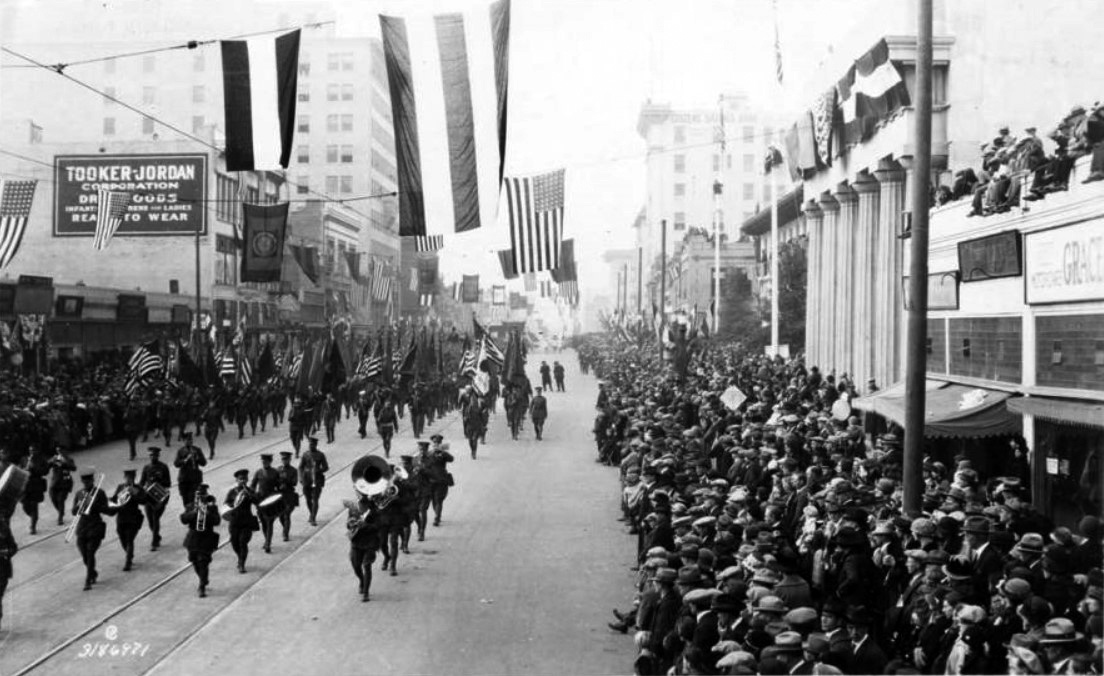
| (1925)** – People line the streets as the American Legion band marches by at the Tournament of Roses Parade. Note the spectators on the roof at right. |
 |
|
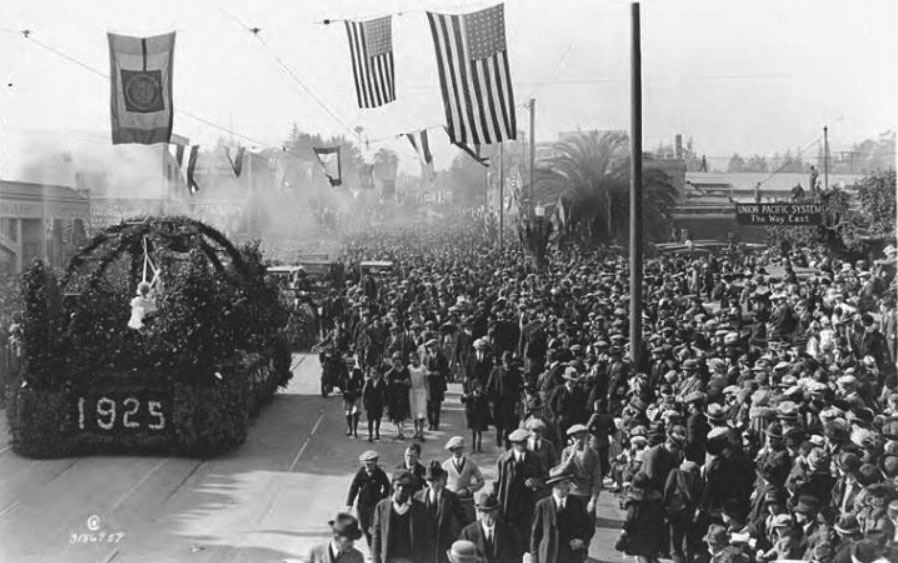
| (1925)*^* – View showing what appears to be the last float in the Rose Parade with hundreds of people all around. |
 |
|
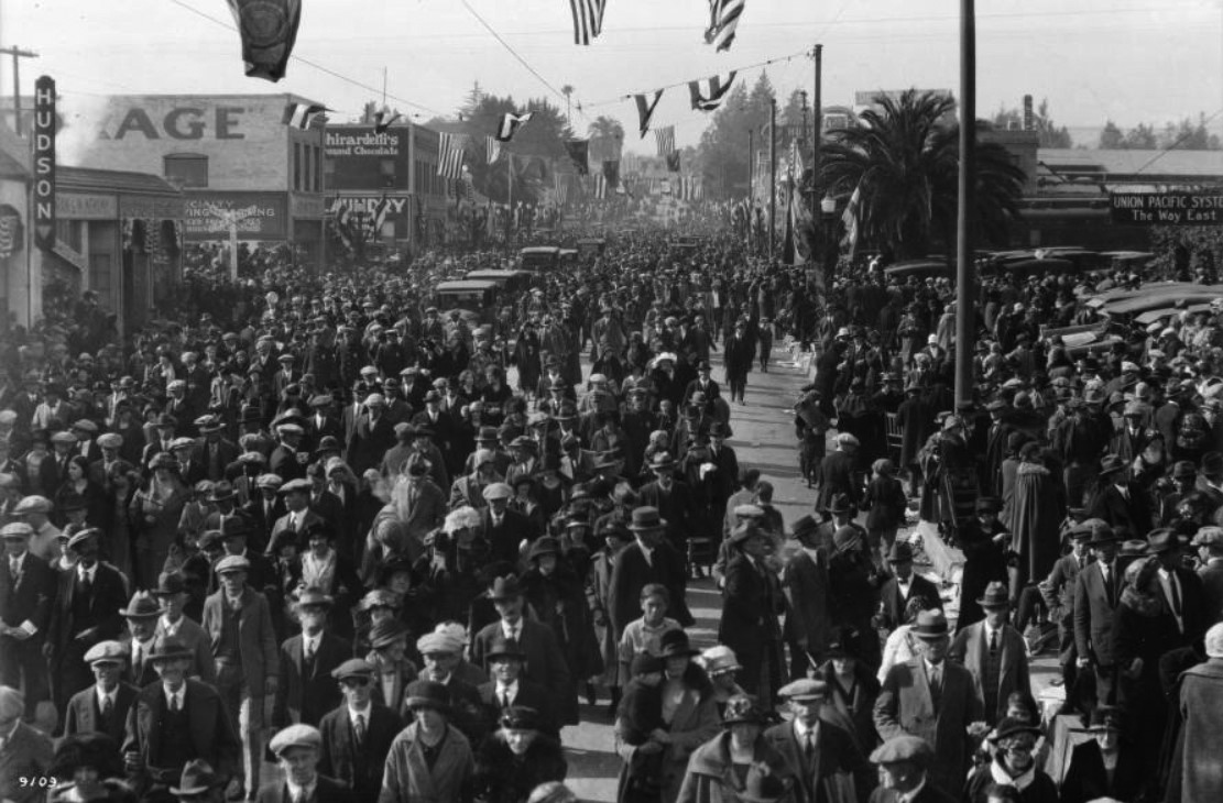
| (1925)^ – Throngs of people are filing down the street after the Tournament of Roses Parade. The Union Pacific Station's banner reading: "Union Pacific System, The Way East" can be seen in the right background. |
 |
|
| (ca. 1925)* - Exterior view of the central fire house in Pasadena. View shows groups of firemen standing next to their fire engines outside of the building. |
 |
|
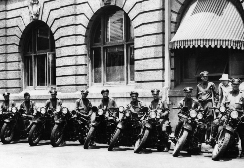
| (1929)* - Group photo of Pasadena's motorcycle policemen. |
 |
|
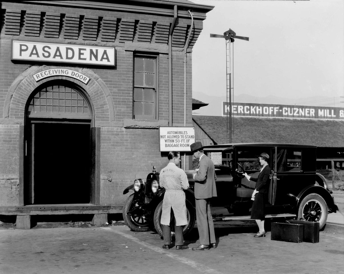
| (1926)^ - A couple and their Hudson sedan arrive at the Santa Fe Station on Raymond Avenue, Pasadena. The sign on the building to the right reads: Kerckhoff-Cuzner Mill & Lumber Co.*^^ |
Historical Notes William Kerckhoff, a German-American, began his career in Los Angeles with the Jackson Lumber Company. Later he and Guy Cuzner owned the Kerckhoff-Cuzner Mill and Lumber Company. To transport lumber, the company was the first to use oil for fuel in an ocean going vessel. In the 1890s, Kerchoff founded the San Gabriel Power Company. By the turn of the century, together with A.C. Balch, he owned half the stock of Henry E. Huntington Pacific Light & Power Company used to provide electricity to Pacific Electric, and he served as its President. In 1902, they purchased the San Joaquin Electric Company. They also founded Southern California Gas Corporation in 1910, and built a 120-mile pipeline from the San Joaquin Valley to Los Angeles.*^ |
 |
|
| (1926)*^* - Church of the Nazarene at 1565 East Washington, at the corner of Washington and Breese. Someone seems to have tried to conceal the presence of the power lines in the fore- and background. Today, the building is occupied by the The Armenian Church of the Nazarene. Click HERE to see a current view (2016). |
Historical Notes The Armenian Church of the Nazarene in Pasadena was founded in 1986. The church is one of a handful of other Armenian Nazarene churches in the Los Angeles area, including the original one in Glendale. |
 |
|
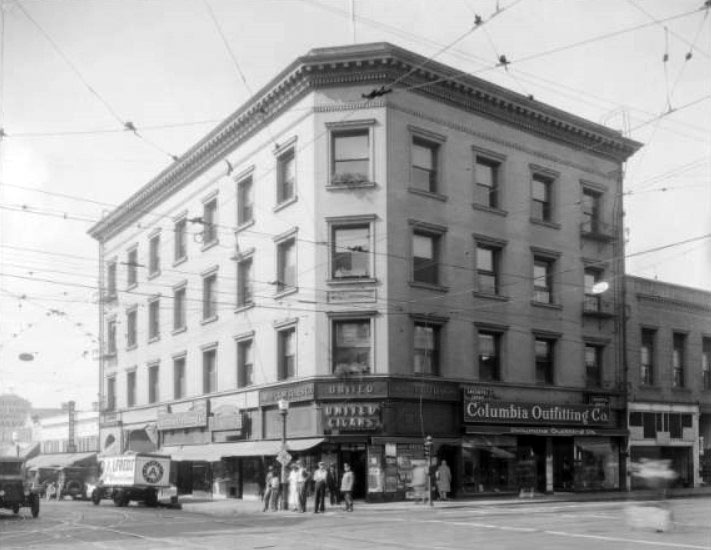
| (1926)#* - Street view of the Dodsworth Building at 1 South Fair Oaks, at the southwest corner of Colorado and Fair Oaks. The businesses in the building include United Cigars and Columbia Outfitting Co. Numerous overhead wires for streetcars are seen in front. |
Historical Notes United Cigar Stores was the largest chain of cigar stores in the United States. Though initially specializing in cigars, it eventually sold many other items, such as Mickey Mouse watches and shoe trees. The chain was founded in 1901 and represented the interests of the Consolidated Tobacco Company, the tobacco trust that controlled the American Tobacco Company and others. In September 1903 a settlement was reached with the chain's competitors and all competition ended. By 1926 the chain had close to 3000 retail stores.*^ |
 |
|
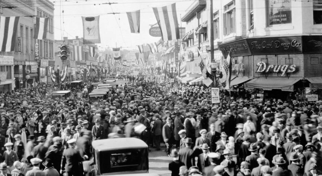
| (1926)#* - View of crowds filling the street at Colorado and Fair Oaks Ave., Rose Parade, Jan. 1, 1926. |
 |
|
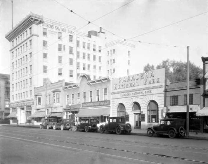
| (1927)** - Street view of the 200 block of East Colorado, centering on Pasadena National Bank and Citizens Bank at 249 East Colorado. Other businesses on the block include the Citizens Savings Bank, Daily Bread Shop, and Oriental Art Bazaar. Automobiles are parked along the street and wires run overhead for streetcars. |
 |
|
| (1926)^^*# - View showing three cars parked in front of The Model Grocery store located on Colorado near Fair Oaks Avenue. HISTORIC HEADLINE FROM June 23, 1926: Model Grocery to close for picnic: Employees and families to pass day at beach tomorrow. |
Historical Notes The Model Grocery was one of Pasadena’s best-known names in the local market business. The company got its start at a store located at 21-25 North Fair Oaks Avenue. By the 1920s it had more than 250 employees, as well as its own bakery, line of household equipment, a candy department, a post office, and other customer amenities.+^+ |
 |
|
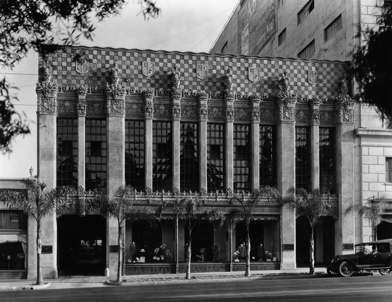
| (1927)* - Exterior view of I. Magnin store located in Pasadena. Note the architectural design on the pillars and front of the building. Placques outside of building reads, "Mullen & Bluitt..." |
* * * * * |
Don Lee Cadillac
 |
|
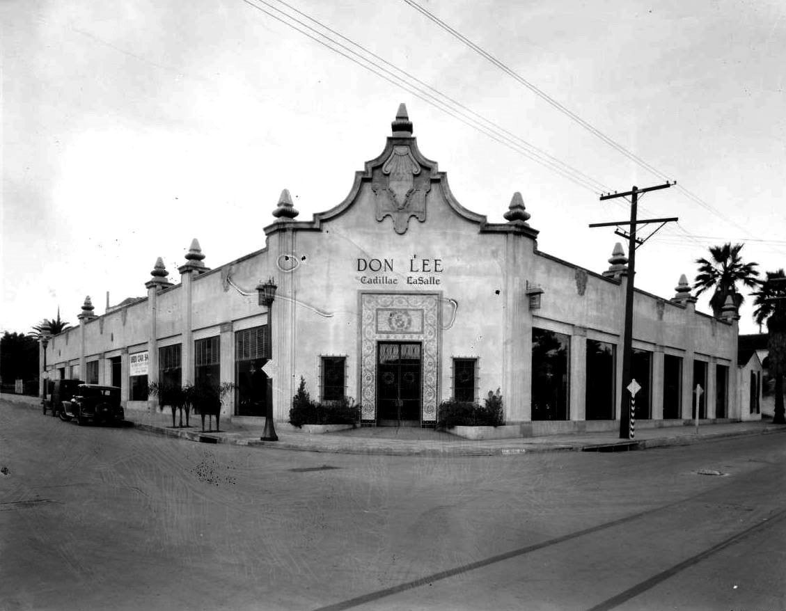
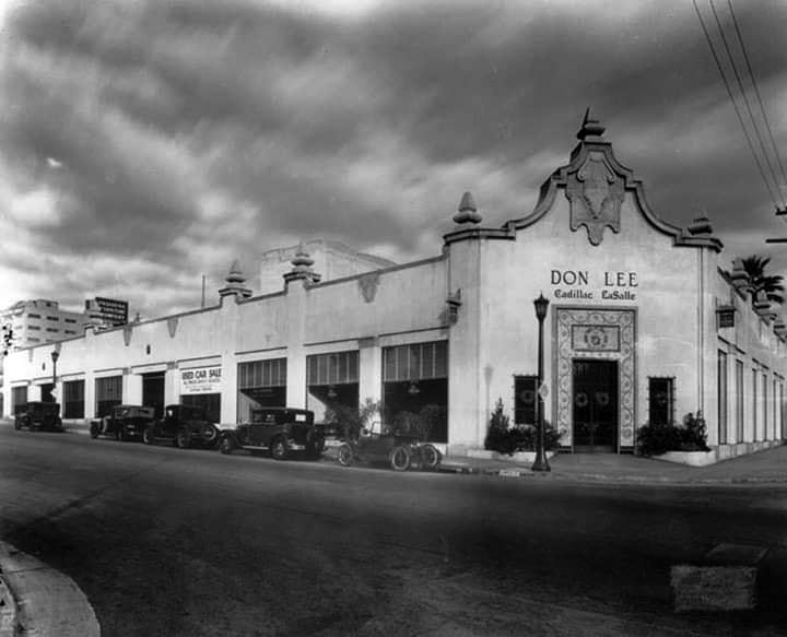
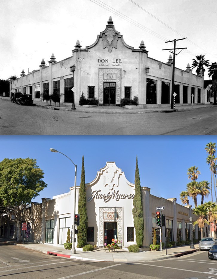
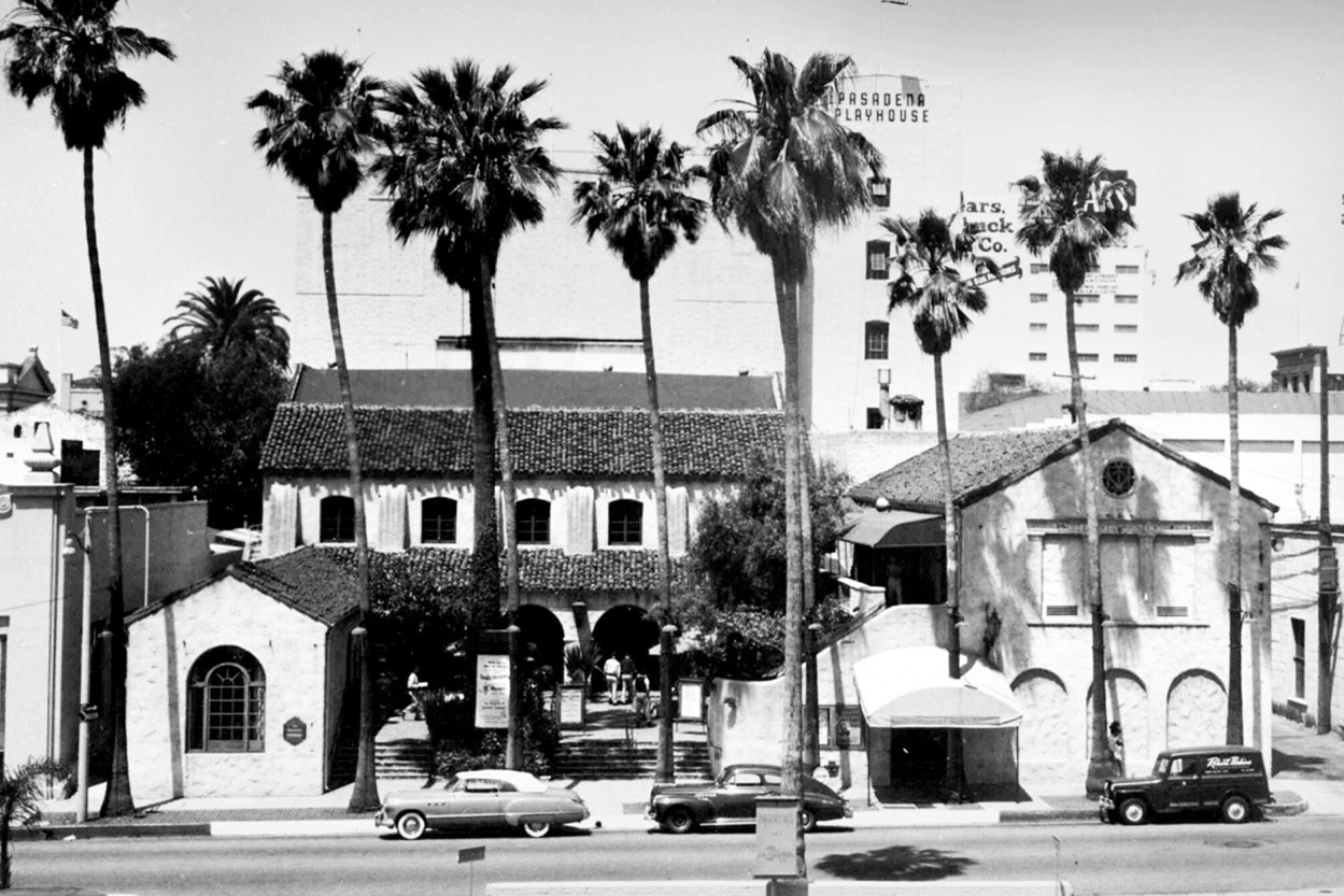
| (1927)* - View looking at the building located on northwest corner of Green and El Molino, home of Don Lee Cadillac & LaSalle. The Pasadena Playhouse is located futher north on El Molino, on the right by the palm trees. |
Historical Notes Don Lee was the west coast's most successful Cadillac dealer. He held the franchises for California and Nevada Cadillac dealerships, fostered Los Angeles radio, and was a leading pioneer of television on the West Coast. He was also famous for his Don Lee Mutual Broadcasting Studio and Mt. Lee Tower in Hollywood. |
 |
|
| (ca. 1927)^ - View looking at the NW corner of Green Street and El Molino Avenue showing the Don Lee Cadillac & LaSalle dealership. |
Historical Notes The building today is occupied by Jacob Maarse Florists. Click HERE to see contemporary view. |
Then and Now
 |
|
| Then and Now – Looking at the northwest corner of Green and El Molino in Pasadena. Originally home to Don Lee Cadillac, currently Jacoby Maarse Florists with Pasadena Playhouse to the right out of view (1927 vs. 2020)*. |
* * * * * |
Pasadena Star-News Building
 |
|
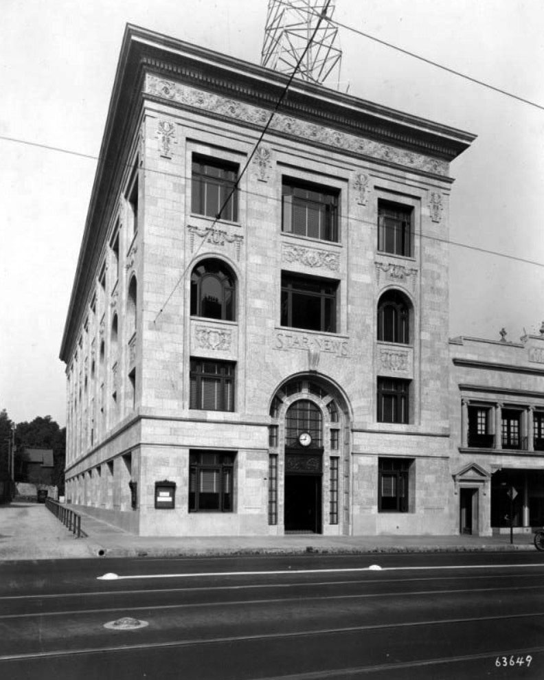
| (1925)* – View showing the recently completed Star-News Building located on the northeast corner of E. Colorado Blvd and N. Oakland Ave. There is a base of polished Original Raymond Granite with deep sills at the window openings. Architect: Joseph J. Blick. General contractors: W.A. Taylor & Sons. |
Historical Notes The Pasadena Star-News building was designed by Joseph Blick in 1924 in a Beaux-Arts style and completed in 1925. First published in 1884, the Pasadena Star-News moved into the building in 1925 and stayed until the 1990s. The building is now home to Technique at Le Cordon Bleu College of Culinary Arts and 24 Hour Fitness. Editors in the historical Star-News Building included Ed Essertier, Charles Cherniss, Bill Winter, Larry Wilson, and Frank Girardot. Publishers after Bernard J. Ridder included Bill Applebee. ^ |
 |
|
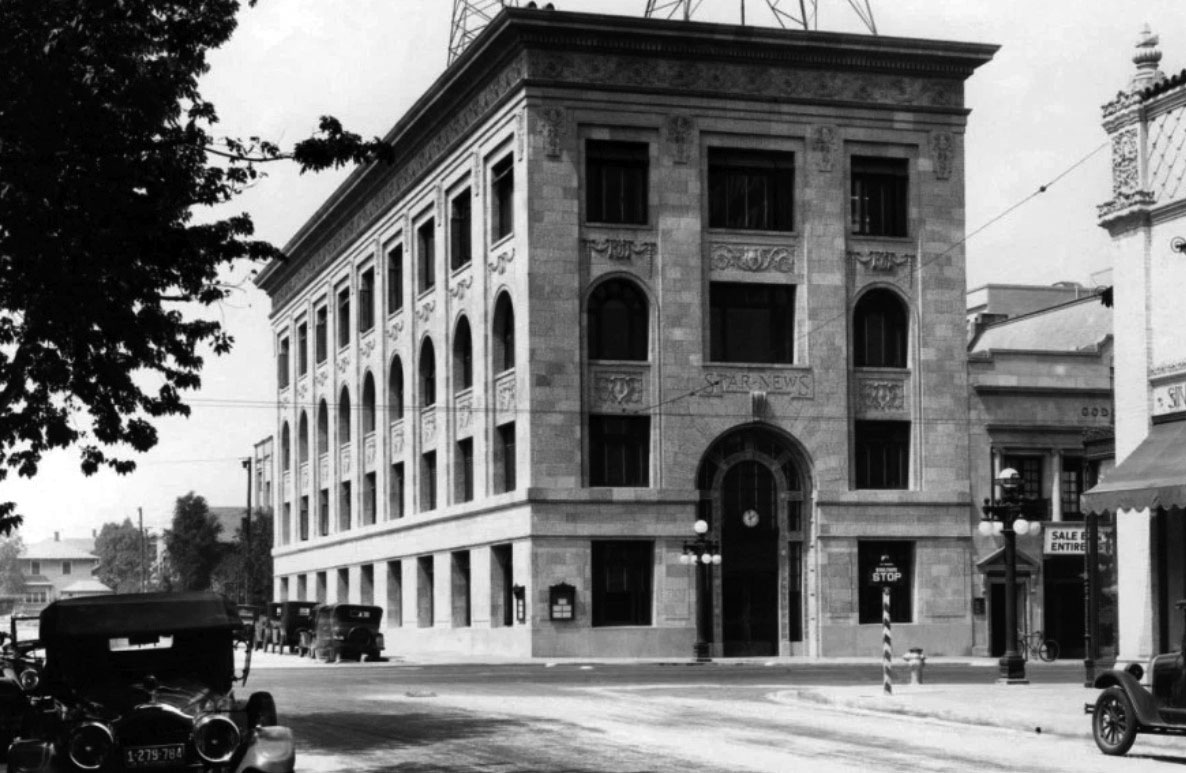
| (1927)*^* – View looking north on Oakland Avenue toward E. Colorado where the 4-story Star-News Building is seen on the NE corner. Note the ornate streetlights. |
Historical Notes The building has also played a role in the history of radio in Southern California, once hosting a pair of radio towers that broadcast Star-News programming under the call sign KPSN. The first radio broadcast of the Rose Parade aired on KPSN in 1926, and famed underground FM station KPPC also used the towers to transmit their signal from their studios in the basement of the adjacent Pasadena Presbyterian Church. ^ |
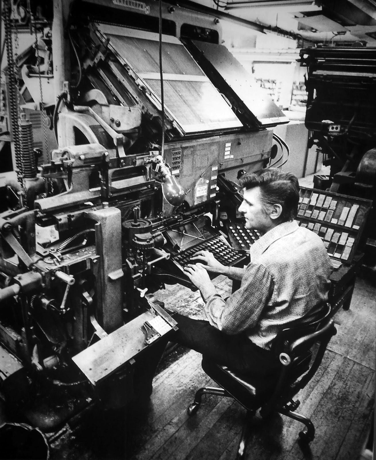 |
(1973)*# - Don Phillips operates a Linotype machine in the basement of the Pasadena Star-News Building at 525 E. Colorado Blvd. |
|
Historical Notes For decades just about every newspaper, magazine, publishing house and printing firm in the western world used Linotype machines, invented in 1884 by German watchmaker Ottmar Mergenthaler. Every time an operator touched a key on the typewriter-style keyboard, a matrix with the corresponding indented letter would drop into an assembler. When the matrices for an entire line were assembled, the line was automatically justified and molten metal cast "slugs" would be organized line by line into columns and pages for the purposes of printing. This could be done at a rate of 1,000 words per hour or 14 lines per minute. Thomas Edison called the Linotype machine the eighth wonder of the world because it revolutionized the printing industry. Prior to Linotype there was moveable type, invented by Johannes Gutenberg in 1436, that created a sea change in western civilization. Even as late as the 1930s moveable type was still in use at some newspapers where type was still being set by hand, one painstaking letter and punctuation mark at a time. These newspapers were limited to a maximum of eight pages -- the number of pages that could be typeset at a snail's pace in a day's time. By 2000 printing technology changed again, switching from mechanical hardware to digital software.* |
 |
|
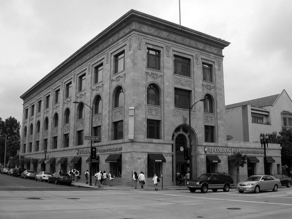
| (2011)#* – A group of people walk by the Star-News Building. The Le Cordon Bleu College of Culinary Arts, Technique Restaurant, 24 Hour Fitness, and medical offices occupy the building. Click HERE to see contemporary view. |
Historical Notes Ridder Newspapers bought the Star-News in 1956 and Bernard J. Ridder took over as publisher. Ridder merged with Knight to form Knight Ridder in 1974. The paper was sold off in 1989 to a company owned by William Dean Singleton; the Thomson Corporation bought majority control of the paper a year later. Thomson sold the Star-News to Singleton's MediaNews Group in 1996, which went on to become part of the Los Angeles Newspaper Group.*^ The newspaper also publishes the Rose Magazine which provide coverage of the Tournament of Roses Parade and the Rose Bowl Game. |
 |
|
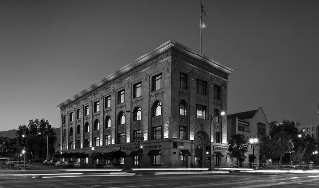
| (ca. 2018)* - Dusk view of the Star-News Building all lit up. Photo courtesy of Greenbridge Corp. |
Historical Notes The 4-story Beaux-Arts style building has a Penthouse. It also two levels below grade. The Star-News Building is listed in the National Register of Historic Places. |
* * * * * |
Pasadena Athletic Club
 |
|
| (1927)* - Exterior view of the Athletic Club located in Pasadena. Several storefronts can be seen on both sides of the building. |
Historical Notes The Pasadena Athletic Club was located at 425 E. Green Street. The building was torn down in 1977 to make way for the Plaza Pasadena Mall. |
* * * * * |
Pasadena Public Library
 |
|
| (ca. 1927)* - Exterior view of the Pasadena Public Library, located at 285 E. Walnut Street in the Civic Center. View shows several automobiles parked along Walnut Street, where the front of the building is facing south on Garfield Avenue. |
Historical Notes The library was designed by architects Myron Hunt and H. C. Chambers in the Spanish Colonial Revival style and was built between 1925-27. Construction began May 19, 1925 . This is why the year 1925 is carved in Roman numerals over the front entrance of the building after "Public Library of the City of Pasadena." The Central Library was dedicated on Lincoln's birthday (February 12), 1927, and was the first building completed of the new Civic Center Plan. * This was Pasadena's 3rd Central Library Building. Click HERE to see Pasadena's 2nd Public Library Building. |
 |
|
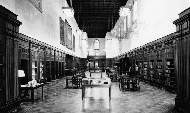
| (1927)* - Postcard view of the interior of the Pasadena Public Library. Writing on postcard describes view as the "main hall of the Pasadena Public Library, which has remained essentially the same since its construction". |
Historical Notes In the original plans for Central Library, Myron Hunt designed a four-level bookstack area, which could someday be finished to accommodate a growing collection. When this building was originally opened in 1927, only two levels were completed, the main level (with an immense open space above where more bookstacks could one day go) and one below at the basement level. By the 1980’s, the Library’s collection had grown to the point where it was necessary to complete Myron Hunt's visionary plan for a larger capacity bookstack.* |
 |
|
| (1930)#* - Street view of the Pasadena Public Library at 285 East Walnut, taken from the parking lot across the street. Automobiles line both the street and the parking lot. |
Historical Notes The Library, as well as the entire Civic Center, is listed on the National Register of Historic Places. Over the years, Central Library has been the location for some major motion pictures. * This was Pasadena's 3rd Central Library Building. Click HERE to see Pasadena's 2nd Public Library Building. |
* * * * * |
 |
|
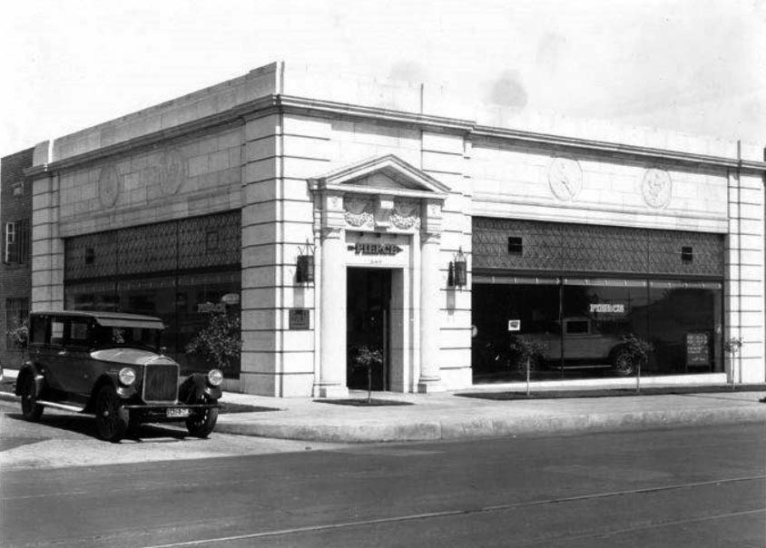
| (ca. 1927)** - View of the Hewson Motor Company showroom at 297 West Colorado. Architect: Frederick Kenedy Jr. |
Historical Notes The car at the curb with 1927 dealers' plates is most likely a 1927 Pierce-Arrow Model 80. In 1928 Studebaker took over Pierce-Arrow and in 1930 local Studebaker dealers Keller Brothers and Marcy Auto operated at this location. In 1935 is was called Earl Lundy Motor Company. Currenly (2014) it is Rusnak/Pasadena.** |
 |
|
| (1927)#* - View looking east on Colorado Blvd. in Pasadena. The Security Pacific Bank can be seen on the right. |
Santa Fe Crossing - Colorado Blvd.
 |
|
| (1928)*- Photo of Santa Fe passenger train inbound to LA crossing Colorado Blvd., between Raymond and Broadway [Arroyo Pkwy]. The view is to the east with the Security Pacific Bank building on the right behind the train. |
 |
|
| (1932)* - Santa Fe train passing through Colorado Boulevard. View is looking west from Arroyo Pkwy. The Tower Theatre can be seen on the left. |
 |
|
| (1937)* - Santa Fe train crossing Colorado Boulevard with the Tower Theater and Smoke House seen in the background. The Security Pacific Bank can also be seen on the left. |
Historical Notes The Tower Theatre was a movie palace located at 114 E. Colorado Blvd. in Pasadena, California. It opened on December 28, 1929 with the film "General Crack" starring John Barrymore. After closing as a movie theater in 1951, it had a brief stint as a church starting on October 4, 1952. However, by 1954 the Polk city directory listed the address as vacant, indicating the Tower Theatre had been demolished by that point. Today, there is just a parking lot on the site where the theater once stood. |
 |
|
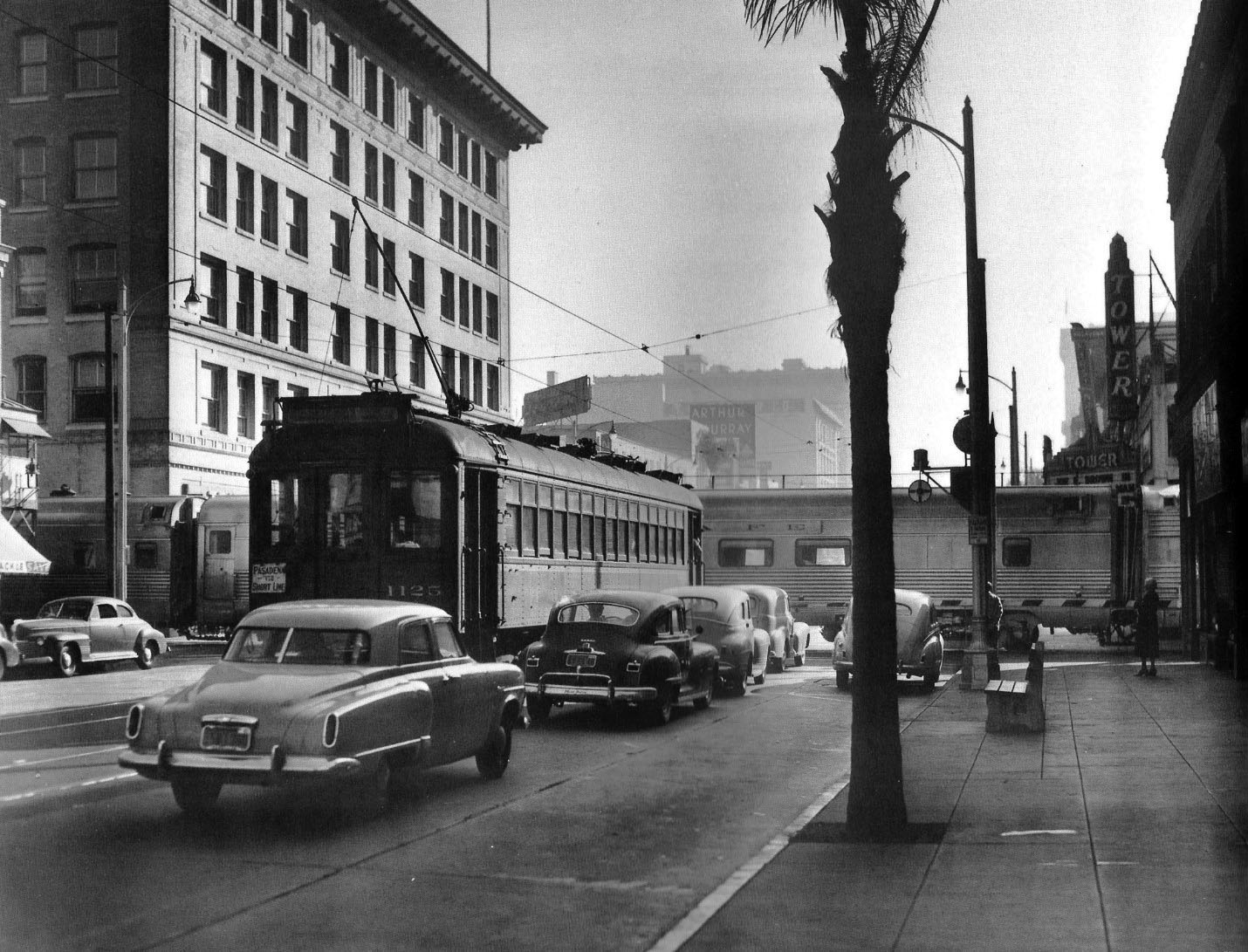
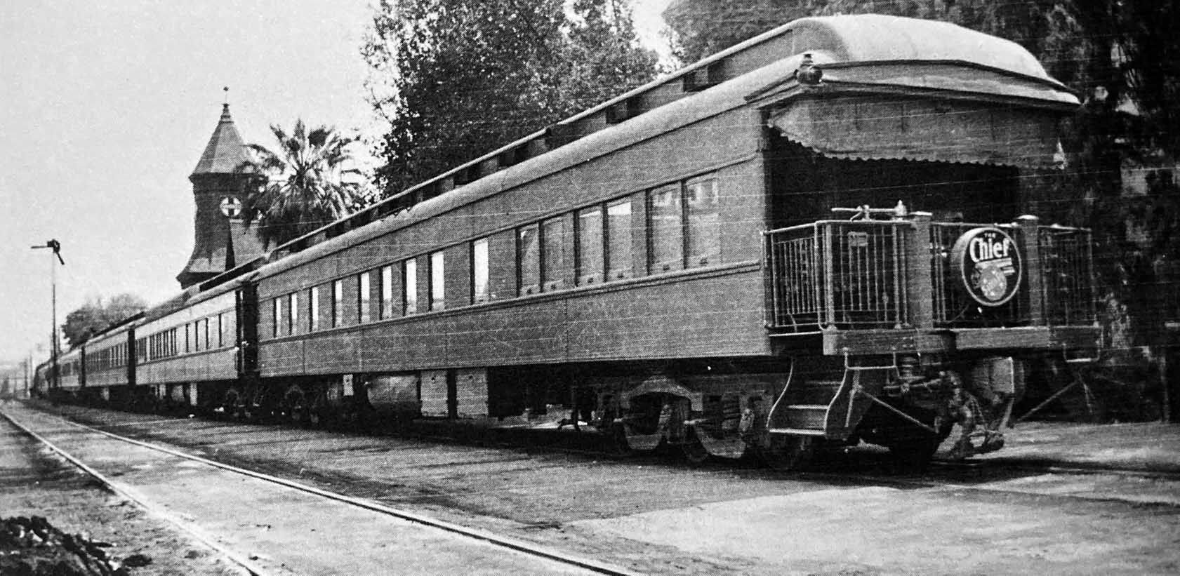
| (ca. 1950)* – View looking east on Colorado Boulevard from just west of the Santa Fe crossing in Pasadena. PE Interurban 1125 is inbound to LA by way of the Oak Knoll line but is held up by the Santa Fe Chief passing in front. Note also the Tower Theater at right. Photo by Stan Kistler. Click HERE to see contemporary view. |
Historical Notes The Chief was one of the named passenger trains of the Atchison, Topeka and Santa Fe Railway. Its route ran from Chicago, Illinois to Los Angeles. The Chief was inaugurated as an all-Pullman limited train to supplement the road's California Limited, with a surcharge of $10.00 for an end-to-end trip. The heavyweight began its first run from both ends of the line, simultaneously, on November 14, 1926, scheduled 63 hours each way between Chicago and Los Angeles, five hours faster than the California Limited. |
Then and Now
 |
|
| Then and Now – View looking east on Colorado Boulevard from just west of the Santa Fe crossing in Pasadena. |
Historical Notes Click HERE to see more Early Views of the Santa Fe 'Chief'. |
* * * * * |
 |
|
| (ca. 1928)* – View looking west showing the Rose Parade processing down Colorado Boulevard; the cross-street is Catalina. Note onlookers perched on cornice of Bard's [later Colorado and Academy] Theater. Photo courtesy of Paul Ayers |
 |
|
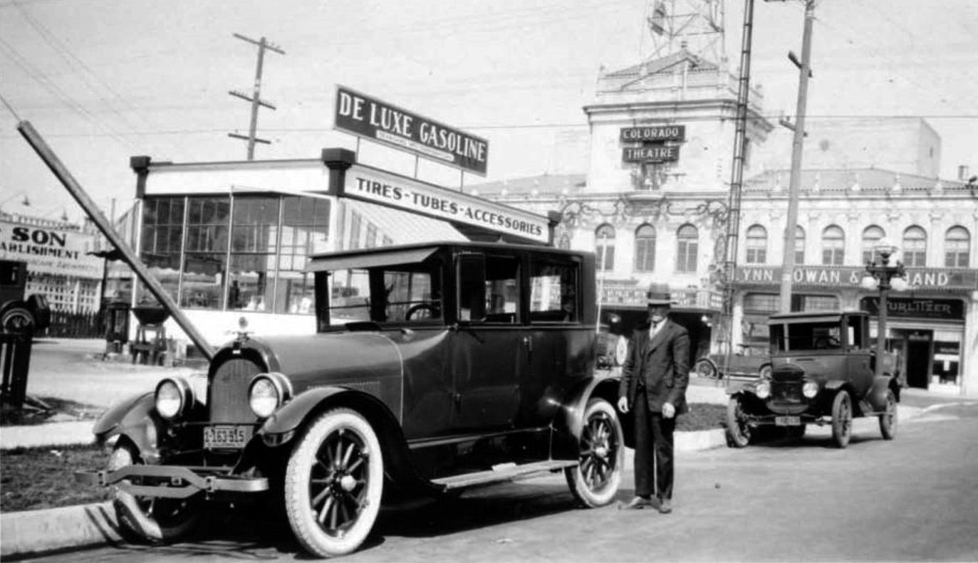
| (1927)*^* - View showing De Luxe Gasoline which was located at 1010 E. Colorado at Catalina on the southwest corner. Charles E. Fagan owned the service station. Featured in the background is the Colorado Theatre, now the Academy Theatre, and the Wurlitzer Rudolf Company, which specialized in musical instruments. |
 |
|
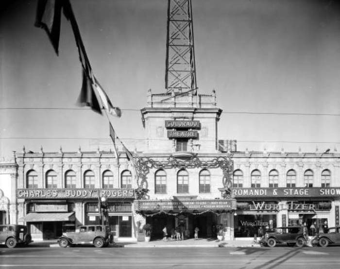
| (1928)** - Street view of the Colorado Theatre at 1003 East Colorado. The marquee reads "Charles "Buddy" Rogers in "Someone to love" with Mary Brian. Stage - F & M "Specialty Idea" - Celeste and Mexican Orchestra". Several adults and children stand outside the theater, near the ticket office. Adjacent businesses include the Albert Sheetz Mission Candies and Ice Cream and a Wurlitzer store. |
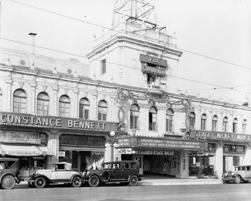
Historical Notes Opened in 1925 as Bard's Egyptian, the 1709-seat theater was designed by Lewis A. Smith. Later it was Bard's Colorado and by 1931 Fox West Coast had acquired the house and it became the Fox Colorado.*## |
 |
|
| (1931)* - Facade and marquee of the Colorado Theater, later the Academy Cinemas, located at 1003 E. Colorado Street. Parked cars are on the street. |
Historical Notes The theater got a moderne makeover in the 1940s and was renamed the Academy. In the 1980s it got turned into a 6-plex and is now operated by Regency Theatres.*## |
 |
|
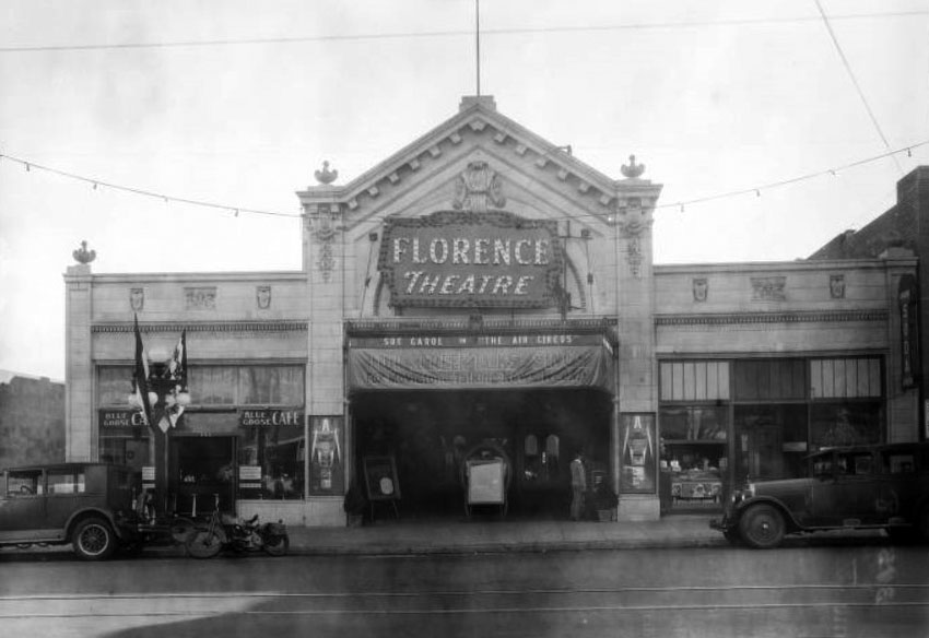
| (1928)#* - Street view of the Florence Theatre (later State Theatre) at 770 East Colorado. The marquee reads "Sue Carol in "The Air Circus", and a sign below the marquee reads "Our screen talks and sings. Fox Movietone Talking News Weekly". Adjacent businesses include the Blue Goose Cafe and a soda shop. |
Historical Notes Opened in 1918 as the Florence Theatre. This former Fox house closed and was later operated by Pussycat Theatres, in the 1970’s and 1980’s. It became an independent theatre, closing in 2000 and gutted afterward for a conversion to retail and office use.**^^ |
 |
|
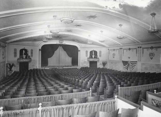
| (Early 1900s)**^^ - Interior view of the Florence Theatre (later State Theatre) located at 770 East Colorado. |
 |
|
| (ca. 1928)* - This large building, located on the corner of Mission Street and Mound Avenue, houses the South Pasadena Council Chamber and City Clerk Treasurer, as well as South Pasadena Fire Department, Engine Company #81. The entrance to the City offices can be seen at the left of the building with an address of 1424 Mission Street; the fire department is located at the rear, at 817 Mound Ave. |
 |
|
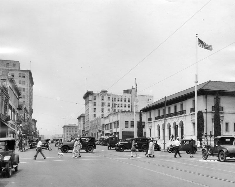
| (ca. 1928)* - View of Colorado Street and Garfield Avenue in Pasadena, facing west. The original Italian Renaissance Post Office is visible in the forefront on the right; formerly the only Post Office in Pasadena, it is now a branch. The main building was designed by Oscar Wenderoth and was built in 1913. Citizens Savings Bank can be seen farther back on the right, and across the street from it the Pacific Southwest Bldg. is on the left. Several automobiles and pedestrians, as well as a dog, can be seen crossing the street. |
 |
|
| (1928)^ – View looking north on Lake Avenue at the Santa Fe right-of-way. Today, this section of Lake Avenue crosses over the 210 Freeway. Click HERE for contemporary view. |
 |
|
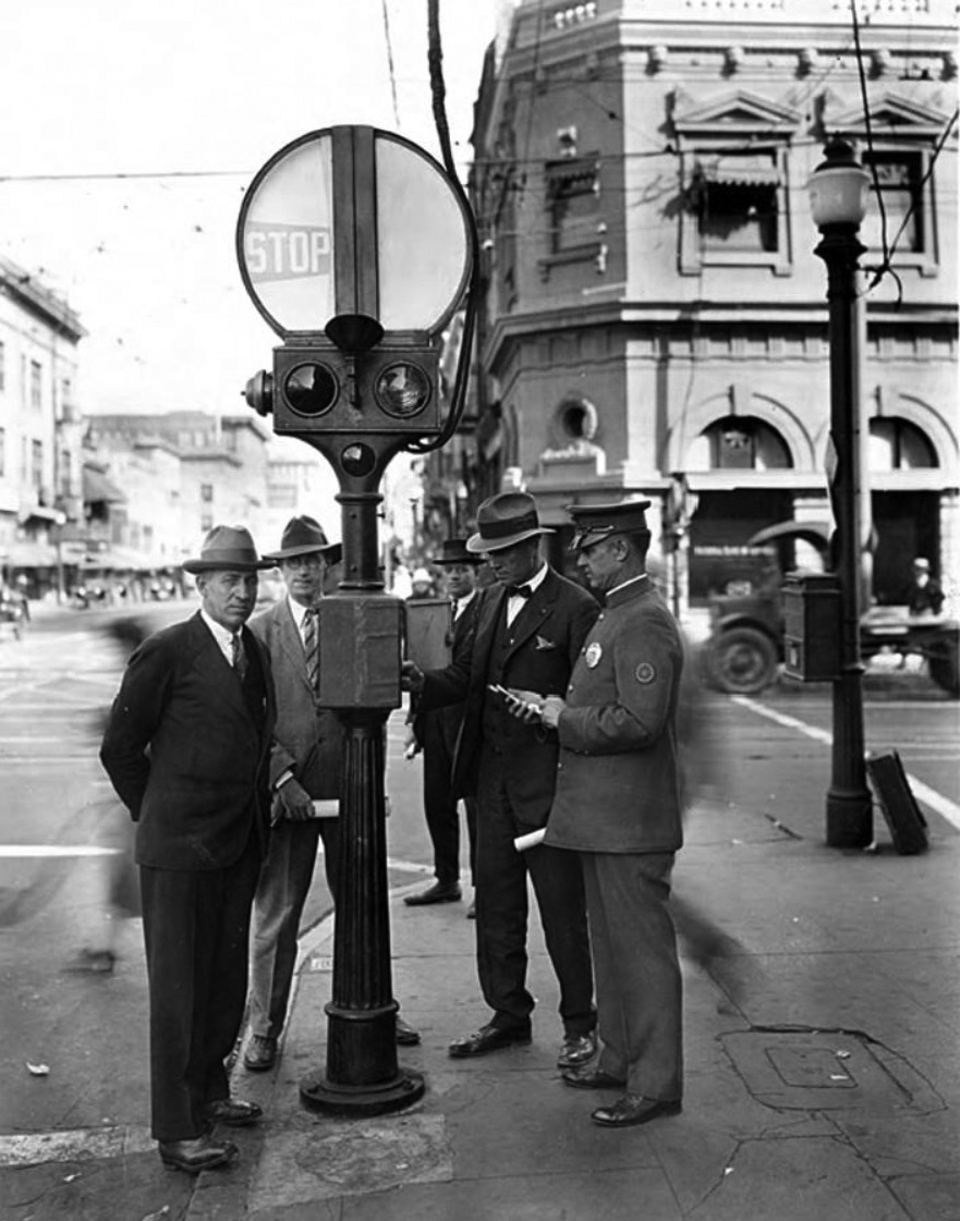
| (1928)** - View showing three men in suits and one police officer standing by a new traffic signal installation in Old Town Pasadena. |
Historical Notes The above photo was taken for the Pasadena Water and Power Department (then called the Power Department), most likely to record the installation of new traffic signals.** |
 |
|
| (1928)**- Elevated view of East Colorado looking east from South Marengo, from the fourth floor of Mather's Department Store. The street below is busy with traffic and lined with parked automobiles. The Los Angeles First National Trust & Savings Bank is immediately across the street. Businesses visible in the distance include the Model Grocery Co. and the Pasadena Furniture Company. |
 |
|
| (1928)^ - Photograph of the newly opened Oak Knoll Branch of the Los Angeles First National Trust and Savings Bank located on the southeast corner of East Colorado Street and Lake Avenue. Click HERE for contemporary view. |
Historical Notes "What Common Cents Did: Formal dedication of Oak Knoll branch of Los Angeles First National Trust & Savings Bank at Colorado and Lake, Pasadena, was held Thursday." -- Examiner clipping attached to verso, date January 8, 1928.^ |
 |
|
| (1928)**- Street view of the Constance Hotel at 940 East Colorado. The hotel is a multistory building decorated with red, white, and blue bunting. The retail space on the ground floor is occupied by the Pasadena Syndicate. There is a street lamp and a mailbox at the corner, and automobiles parked in front of the main entrance. |
 |
|
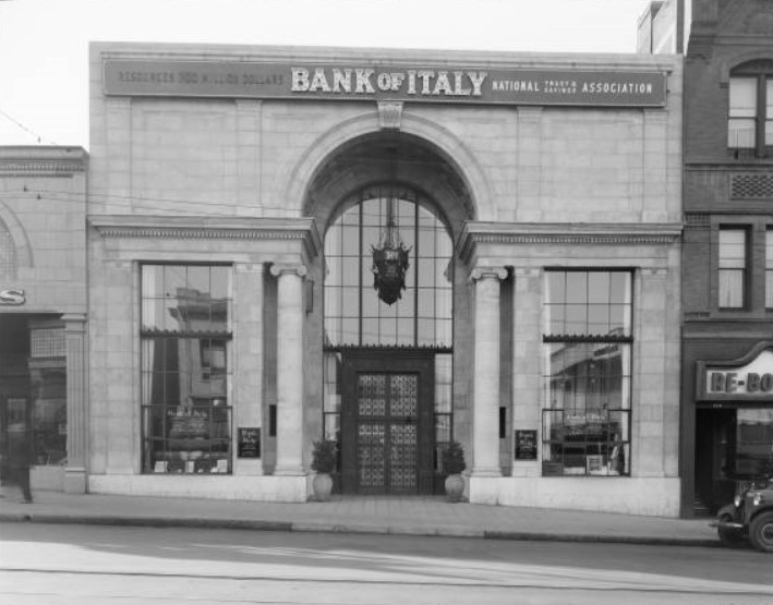
| (1928)** - View of the Bank of Italy at 160 East Colorado. Plaques on either side of the door identify this as the main office in Pasadena. |
Historical Notes The Bank of Italy was founded in San Francisco, in 1904 by Amadeo Giannini. It grew by a branch banking strategy to become the Bank of America, the world's largest commercial bank with 493 branches in California and assets of $5 billion in 1945. It was also the first state-wide branch banking system. The Bank of Italy merged with the smaller Bank of America, Los Angeles in the 1928. In 1930, Giannini changed the name "Bank of Italy" to "Bank of America." As Chairman of the new, larger Bank of America, Giannini expanded the bank throughout his tenure, which ended with his death in 1949.*^ |
 |
|
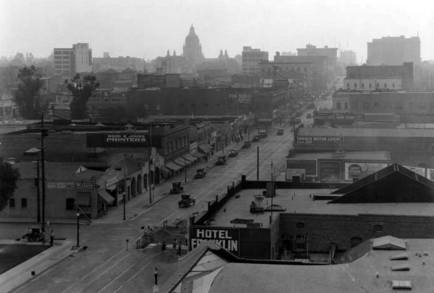
| (1928)#* - Elevated view of West Colorado looking East from the Orth Storage Building (about Pasadena Avenue). Colorado is lined with businesses, including Wood & Jones Printers, Hotel Franklin, and Tanner Motor Livery. There is construction on the street in the foreground, with numerous cars parked and in motion farther on. The recently completed (December 27, 1927) City Hall building can be seen in the background. |
 |
|
| (1928)*^* - View of First National Bank located at 301 East Colorado Boulevard with City Hall in the background. Six half columns/pilasters adorn the side of the building facing Colorado. |
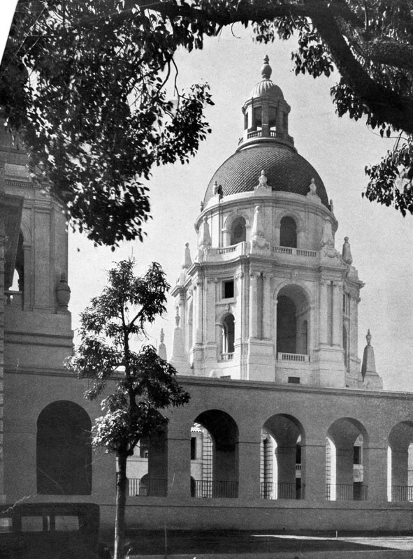
Pasadena City Hall
 |
|
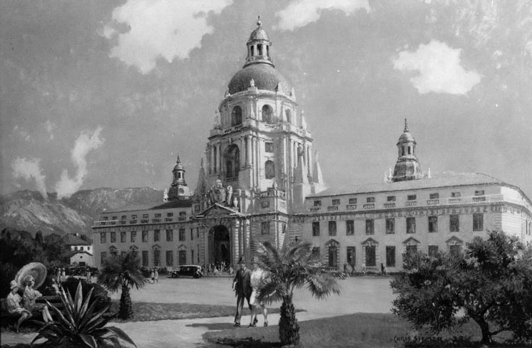
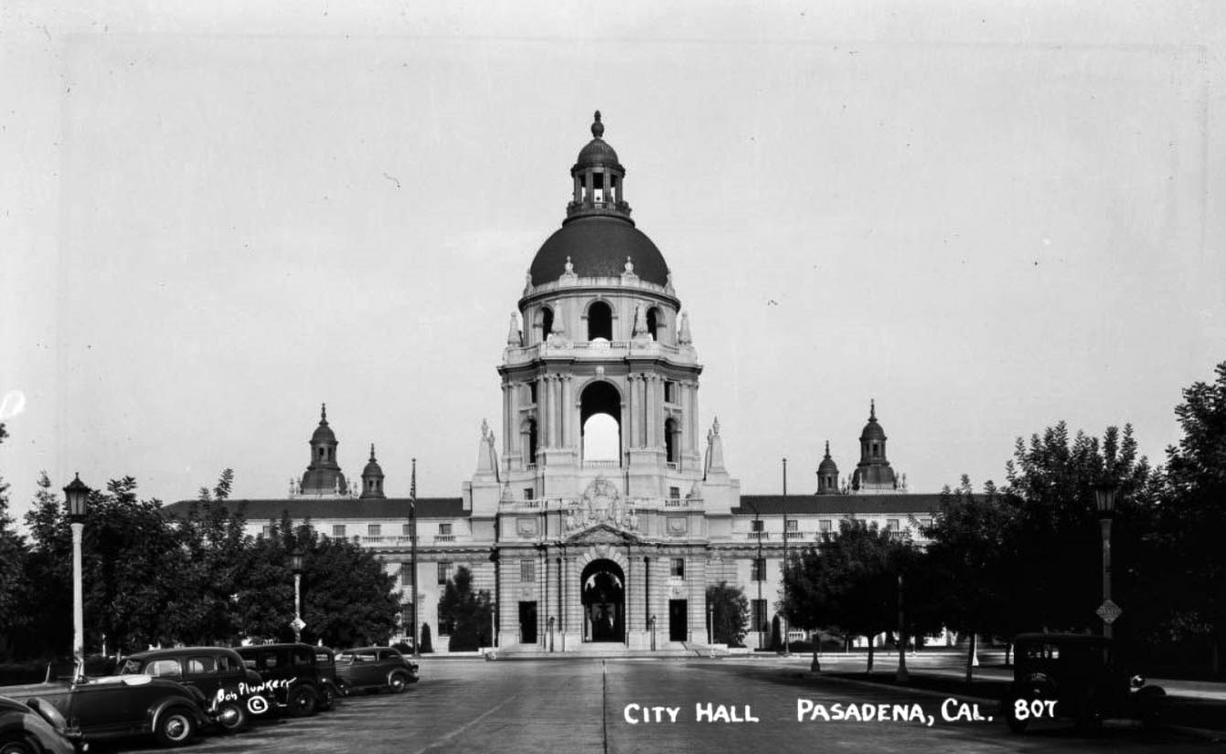
| (1927)* - Rendering showing Pasadena City Hall as it appeared shortly after it opened. Painting by Chris Siemer |
Historical Notes In 1923, the people of Pasadena approved a bond measure issuing $3.5 million towards the development of a civic center. City Hall was to be the central element of this center. The San Francisco architecture firm of Bakewell and Brown designed City Hall, which has elements of both Mediterranean Revival Style and Spanish Colonial Revival Style architecture.^ |
 |
|
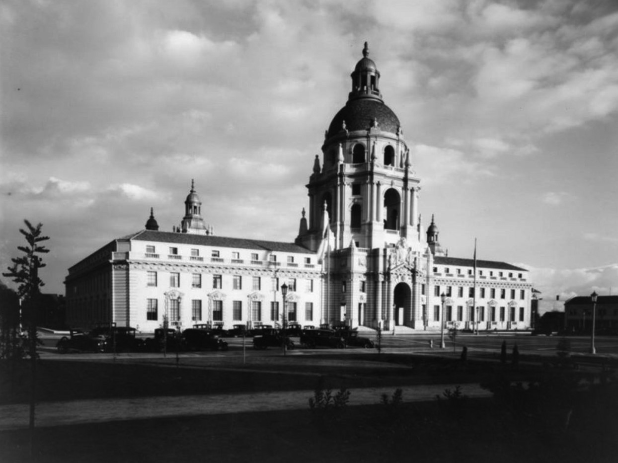
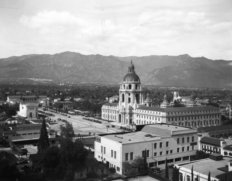
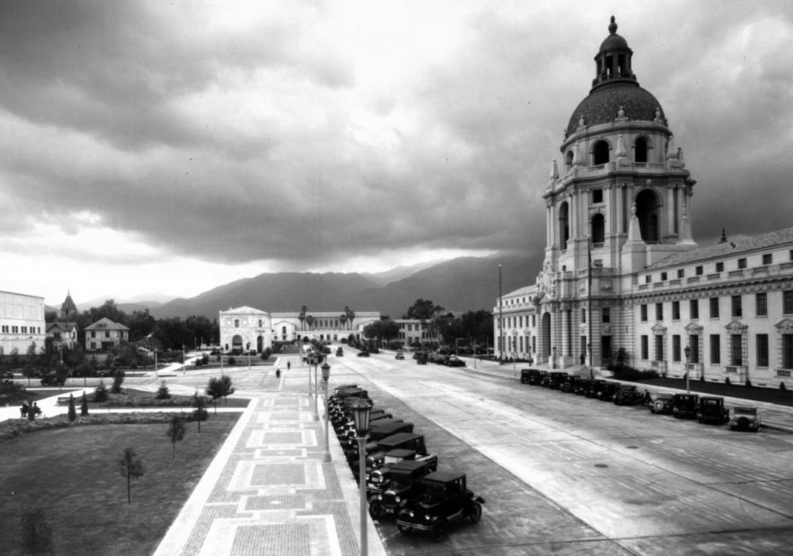
| (1930)* – View showing Pasadena's City Hall before it was surrounded by buildings. Note the architectural designs on the tower. Date built: 1925-27. Architects: Bakewell & Brown. Photo dated: January 17, 1929. |
Historical Notes Completed on December 27, 1927, the massive circular structure rises perpendicularly for six stories. The fifth story is 41 feet high and pierced with four huge round arches and four smaller ones. The next story, set back a little, is 30 feet high and is also pierced with arches. Above it rises the dome 26 feet high and 54 feet across. On top of the dome is the lantern, a column-supported cupola 41 feet high, surmounted by an urn and ball. The highest point is 206 feet above the ground.* |
 |
|
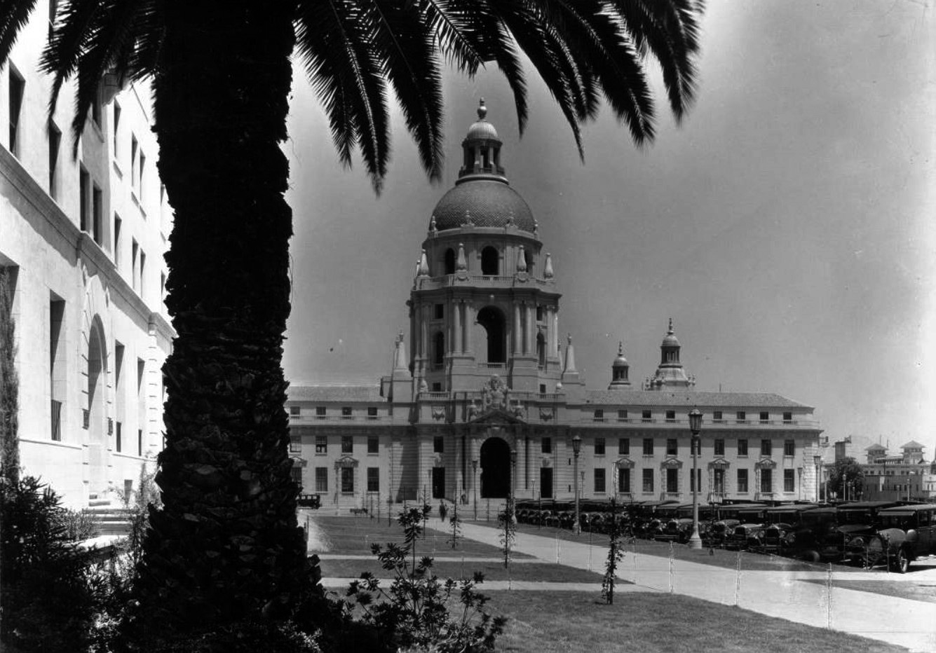
| (ca 1930)* - Not a parking space to be had in front of City Hall. |
Historical Notes For the final design, the San Francisco architectural firm of Bakewell and Brown turned to the style of 16th century Italian architect Andrea Palladio, who had studied and admired the Roman architect Vitruvius, as did the California mission-building padres. Palladio represented the simple, serene, classical style of the early Renaissance, in contrast to the Gothic style of medieval times and the rococo style of the later Renaissance. Three famous European domed structures show Palladio’s influence: the church of Santa Maria della Salute in Venice, the Hotel des Invalides in Paris and St. Paul’s Cathedral in London. Without being a direct imitation, Pasadena City Hall is related to them all.* |
 |
|
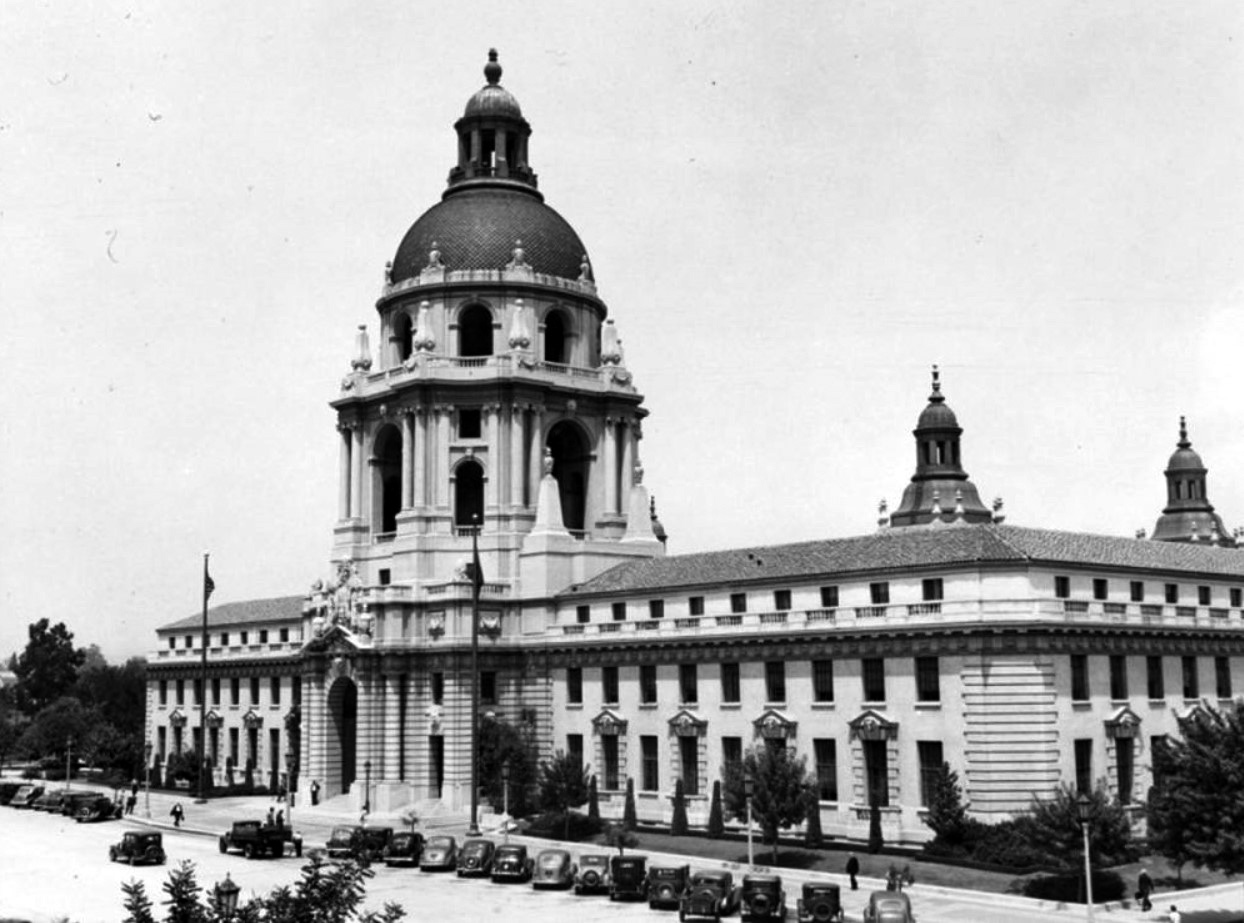
| (1928)* - Close-up view of the west facade showing the rotunda at Pasadena's City Hall, 100 North Garfield Avenue. |
Historical Notes The massive circular tower structure rises perpendicularly for six stories. The fifth story is 41 feet high and pierced with four huge, round arches and four smaller ones. The next story, set back a little, is 30 feet high and is also pierced with arches. Above rises the dome, 26 feet high and 54 feet across. On top of the dome is the lantern, a column-supported cupola 41 feet high, surmounted by an urn and ball. The highest point is 206 feet above the ground.* |
 |
|
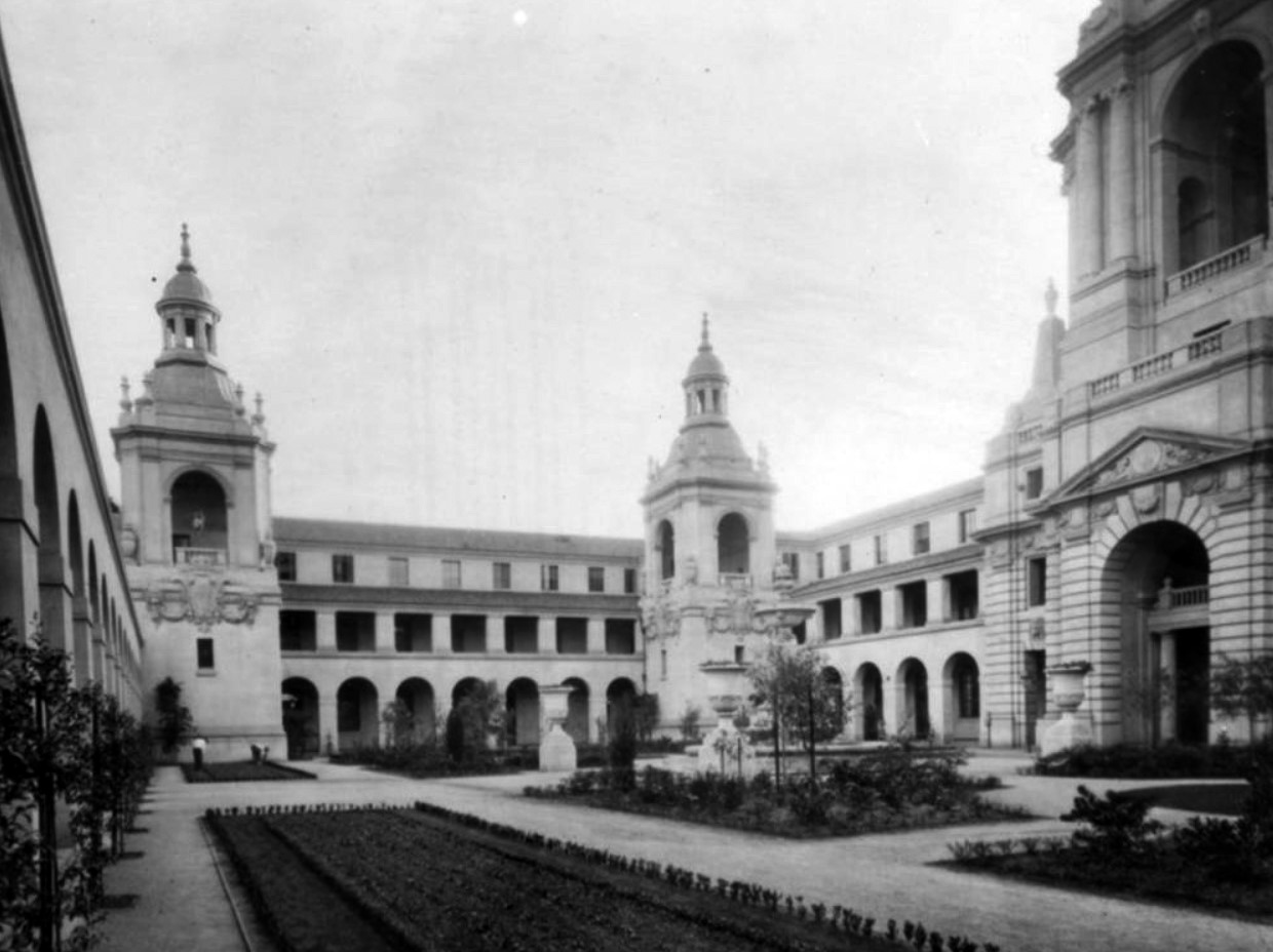
| (1930s)* - Overall view of the courtyard at Pasadena City Hall. Note the architectural designs on the two towers and the building. Architects: Bakewell & Brown. |
Historical Notes Pasadena City Hall has long been a favorite shooting location for filmmakers. The courtyard was used in the 1995 movie "A Walk in the Clouds" to portray a Napa Valley town square. It has also been used as an embassy in the "Mission: Impossible" television series, and a villa in Charlie Chaplin's Oscar-nominated 1940 film "The Great Dictator."^ |
 |
|
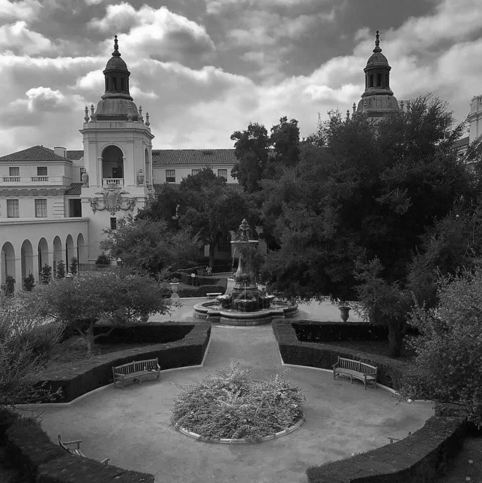
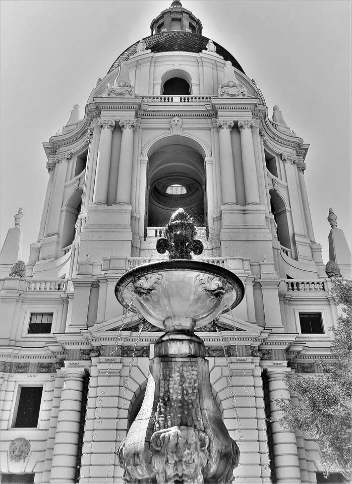
| (2020)^.^ - Pasadena City Hall courtyard. Photo courtesy Sonia Morin |
Historical Notes The courtyard has a strong Spanish Colonial atmosphere. The focal point is the cast stone Baroque fountain. 22.5 feet tall with a basin 25 feet in diameter. Paths of crushed granite define the flower beds and cloistered arches paved with red Padre tile surround the courtyard. California live oak trees provide shade for the azaleas, hydrangeas, rhododendron and beds of annuals that are planted on a rotational basis.* |
 |
|
| (1930)* - Scenic view of Pasadena City Hall and its surrounding area, with mountains in the background. Building on left of photo (past the tall pine tree) is the Y.W.C.A., located on the southeast corner of Marengo Avenue and Holly Street. It is a 3 story, plain, boxy building with long horizontal windows. Date built: 1920-1922. Designed by Julian Morgan in Mediterranean style. |
Historical Notes The way had been prepared in 1923, when the people of Pasadena passed a bond issue of $3.5 million to establish a civic center. The Chicago firm of Bennett, Parsons and Frost was commissioned to draw up a civic center plan. The planners established Garfield Avenue as an axis, on which City Hall was to be the central element, with the Pasadena Public Library to the north and the Pasadena Civic Auditorium to the south. Also included in the original design were the Pasadena Police Department, Pasadena Municipal Court, YMCA, YWCA, Southern California Gas Company and United States Post Office. Over the years the new police building and county court house have been added. The YMCA building is now Centennial Place, a single-room-occupancy residential complex, and the Southern California Gas Company building now serves as the city's Permit Center. The YWCA building is unoccupied because of seismic and other issues.^ |
 |
|
| (ca. 1936)^ - The Pasadena City Hall seen along with other buildings on the Civic Center. Photo by Dick Whittington |
 |
|
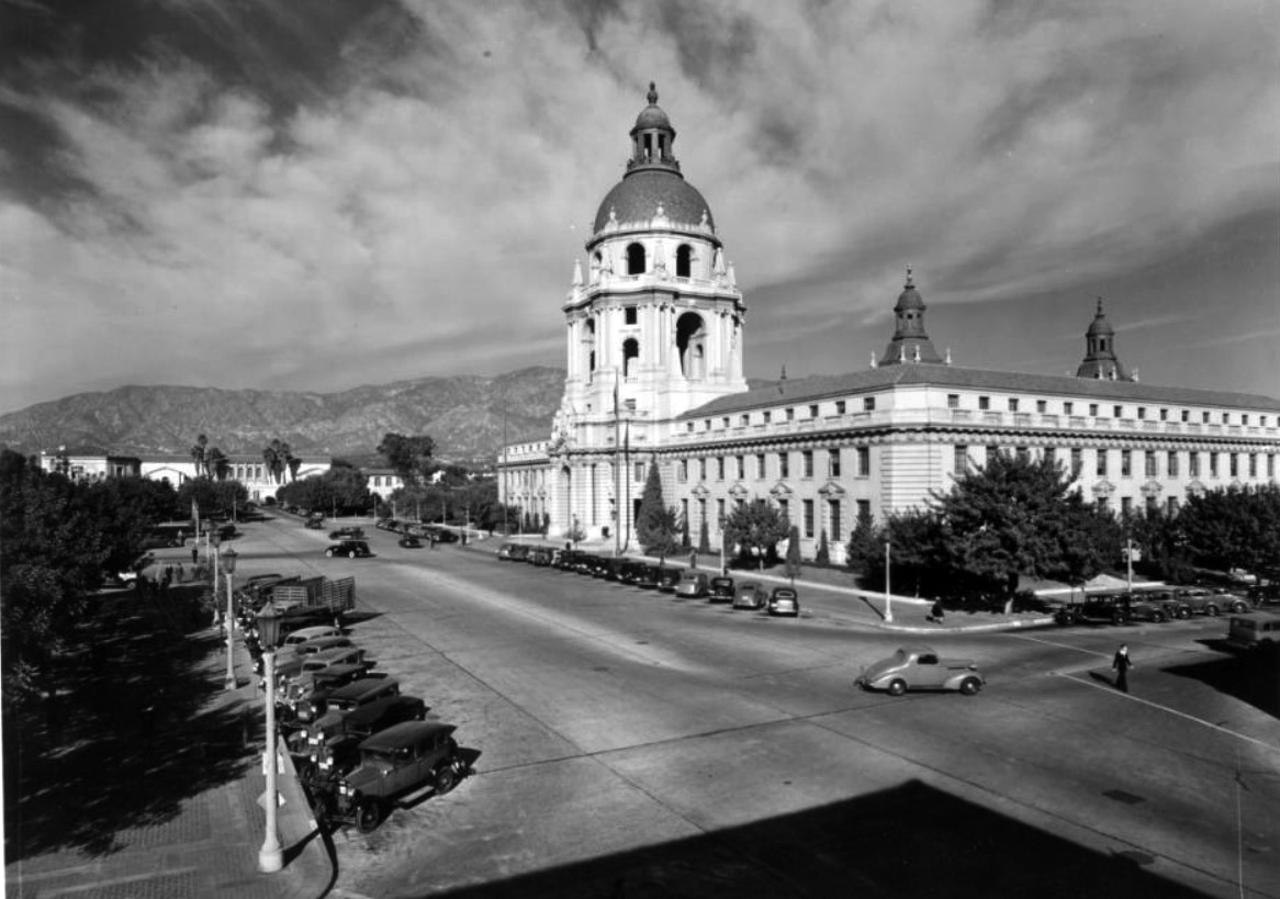
| (1937)* - Exterior view of Pasadena City Hall at 100 North Garfield Avenue, in Pasadena. Note the architectural designs on the rotunda and building. |
 |
|
| (ca. 1938)^ - A corner view of the Pasadena City Hall with the mountains in the background. Photo by Dick Whittington |
 |
|
| (ca. 1948)#* – Postcard view showing the Pasadena City Hall building and lawn as seen from across Garfield Street. |
 |
|
| (1940s)#* - Postcard view of Pasadena City Hall as seen looking down East Holly Street, with automobiles parked at the curb. |
Historical Notes City Hall is an internationally recognized star of stage and screen, appearing in Chaplin’s “The Great Dictator” in 1940, and many, many films, television shows, and wedding albums since. |
 |
|
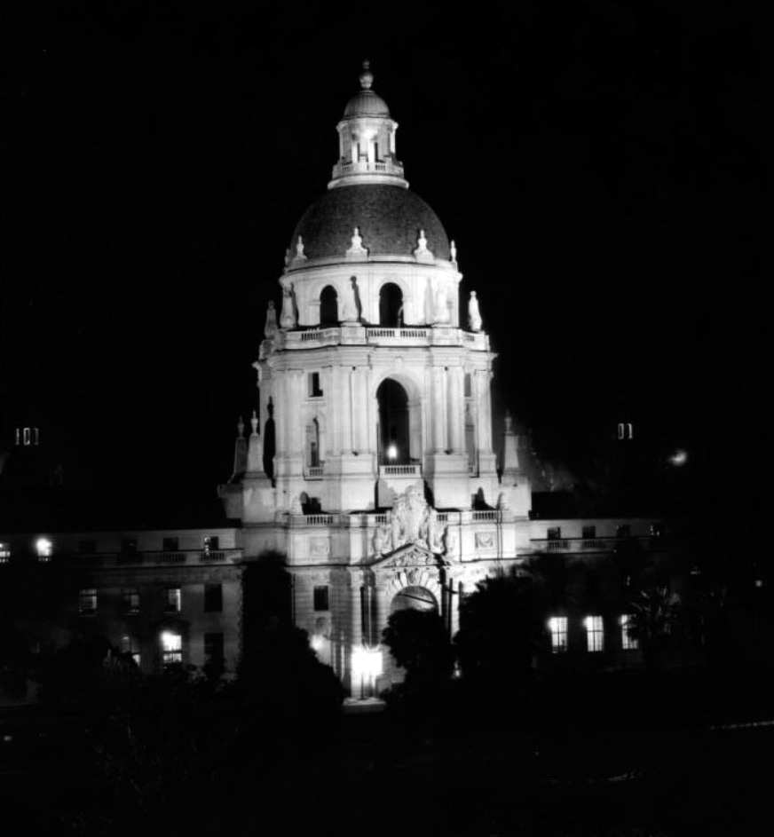
| (ca.1928)^ – Nightime view showing the large, lightly-colored City Hall building with a dome at the top of its center tower. A statue stands over the large doorway. The bright interior lights shine through the windows to the trees of the yard in the foreground. |
Historical Notes Pasadena City Hall served as the city hall of fictional Pawnee, Indiana, in the television show "Parks and Recreation." The dome is visible through the window of the main characters' apartment building in the television show The Big Bang Theory.^ |
 |
|
| (2019)^.^ - Looking up toward the top of Pasadena City Hall. Photo courtesy of Howard Gray |
Historical Notes On July 28, 1980 the Civic Center District, including Pasadena City Hall, was listed on the National Register of Historic Places. |
Civic Center District
 |
|
| (1929)**- The buildings on the north side of East Colorado Street give a sense of Pasadena's business district on the eve of the Depression. The storefront with the arches is the Pitzer and Warwick clothing store, boasting the slogan "For Lad and Dad." On the far right is Vroman's Bookstore. The building with the column on the left is First National Bank located at 301 East Colorado Boulevard. Pasadena's iconic city hall rises up in the background. |
 |
|
| (1931)*^* - Street view of the Pasadena Hall of Justice at 142 North Broadway. The building is large and multistory, and has a parking lot in which numerous automobiles are parked. |
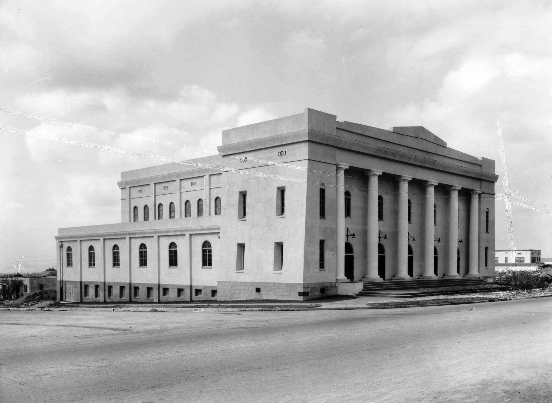
Pasadena Civic Auditorium
 |
|
| (1931)*– View showing men standing around a steam shovel during the ground breaking of the Pasadena Civic Auditorium. City Hall can be seen in the background. |
Historical Notes In February, 1932, during the lowest ebb of the Great Depression, the new Pasadena Civic Auditorium was dedicated "to the citizens of Pasadena, whose efforts and sacrifices have made the erection of this beautiful and useful building possible." In the decades since its dedication, the Civic has hosted millions of patrons from several generations of Southern Californians. |
 |
|
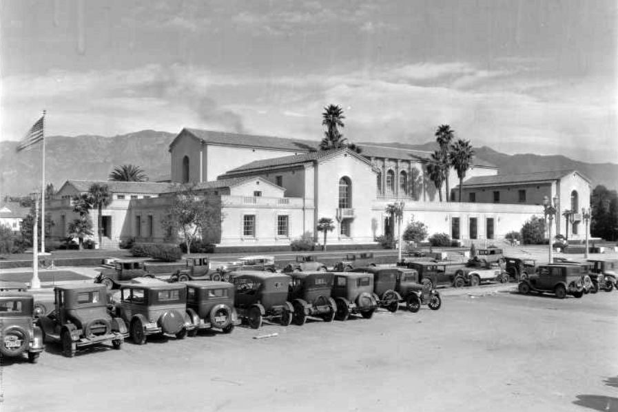
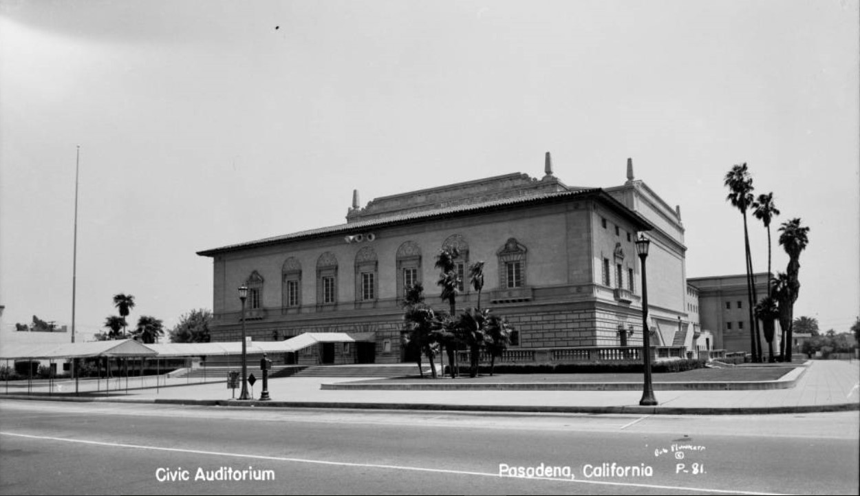
| (1930s)* – View showing the Pasadena Civic Auditorium surrounded by a well-manicured lawn and palm trees, located at 300 E. Green Street. |
Historical Notes The Civic Auditorium has been the center of Pasadena's Cultural life by hosting thousands of community events such as Rose Queen Ceremonies, graduations, benefit concerts, speeches by famous personalities, and countless programs for children. The live radio broadcasts of the big band dances from the Civic in the 1940s helped to spread the fame of Pasadena across the United States. |
 |
|
| (ca. 1932)* - View showing the Exhibition Hall of the Pasadena Civic Auditorium Building. |
Historical Notes The hall was originally constructed in 1931 as part of the civic center and the original Civic Auditorium and was used as an exhibit hall and ballroom. |
 |
|
| (1940s)* – Postcard view showing the Pasadena Civic Auditorium, facing on Green Street, with palm trees planted near entrance. |
 |
|
| (1948)* – Wide angle view of the Pasadena Civic Auditorium on Green Street in Pasadena. Palm trees are planted around the building, and a covered walkway leads to the steps. Click HERE to see contemporary view |
Historical Notes The hall became the Pasadena Ice Skating Center in 1976 until the center moved to a new location in the Convention Center courtyard in 2011. It is listed on the National Register of Historic Places. |
* * * * * |
Map of Pasadena Highlights
 |
|
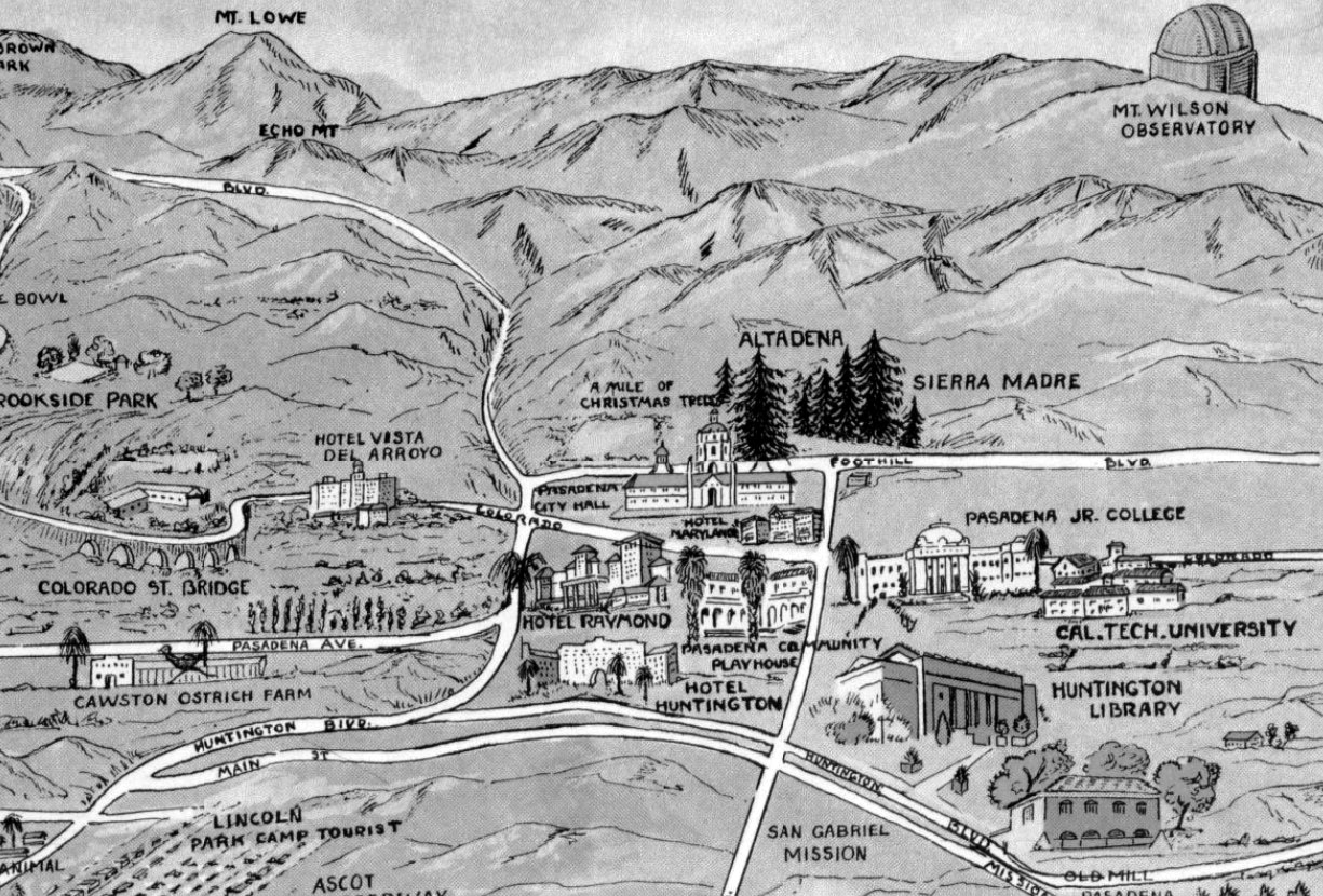
| (1932)* – Map showing Pasadena and surrounding area. Some of the highlights include (L to R): Cawston Ostrich Farm, Colorado Street Bridge, Hotel Vista Del Arroyo, Brookside Park, Mt. Lowe, Christmas Tree Lane, Pasadena City Hall, Hotel Raymond, Pasadena Playhouse, Hotel Huntington, Huntington Library, Cal Tech University and Mt. Wilson Observatory. Source: Library of Congress. |
 |
|
| (1929)* - Scenic night view of Pasadena and surrounding areas in the Valley, from Mount Wilson in 1929. |
 |
|
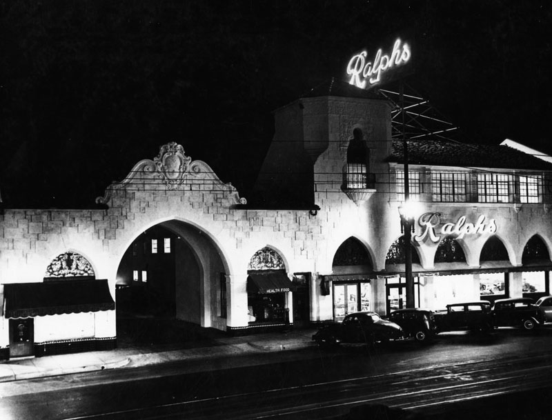
| (1929)* - Night view of the exterior of Ralphs Grocery Store in Pasadena, built in the 1920s. |
List of Awards Ralphs Grocery Company was founded in 1873 by George Albert Ralphs with the original store being located at Sixth and Spring Streets in Los Angeles. The company employed notable architects in designing its stores. Click HERE to see an 1886 photo of George Ralphs standing in front of his original store in the Early LA Buildings (1800s) Section.” |
 |
|
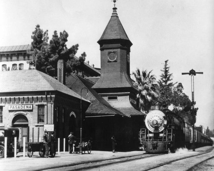
| (1929)** - View of the Santa Fe Railroad Pasadena Station, with train stopped in front. The Hotel Green is in the background (upper-left). |
 |
|
| (1920s)* - View of Santa Fe Chief observation car at Pasadena depot. |
 |
|
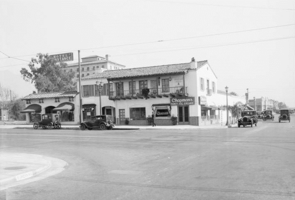
| (1929)#* - Street view of East Green at the corner of Green and Lake looking northeast. Chapman's Fancy Ice Creams is on the corner, with shops above and beside it, and the Hotel Constance is in the background. Cars are parked along the street. |
 |
|
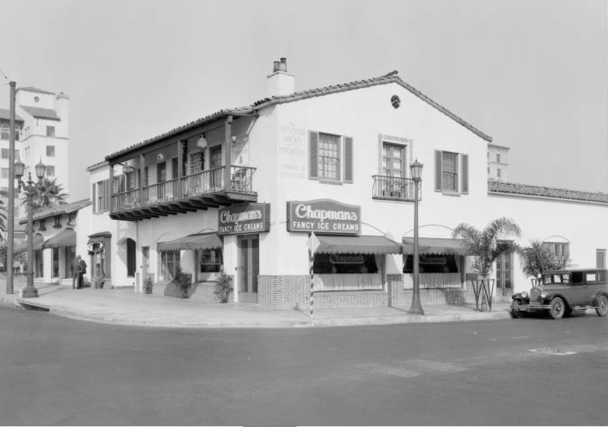
| (1928)#* - Close-up view of Chapman's Ice Cream Store at 60 South Lake the northeast corner of Lake and Green. The shops above the ice cream parlor are the Spanish Shops Incorporated Importers. |
 |
|
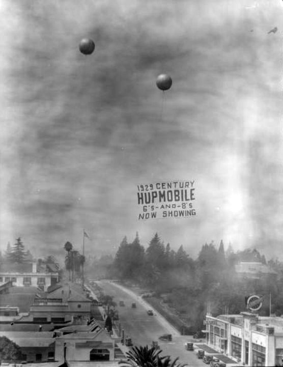
| (1929)* – Balloons support an advertisement for "1929 Century Hupmobile 6's-and-8's now showing" above West Colorado. At ground level, there are Lincoln and Chrysler automobile dealerships. |
.jpg) |
|
| (1929)*^ – View showing a 1929 Hupmobile Series M De Luxe Century 4-Door Sedan. |
List of Awards The Hupmobile was an automobile built from 1909 through 1940 by the Hupp Motor Company in Detroit, Michigan. Its first car, the Model 20, was introduced to the public at the Detroit Auto Show in February 1909. The company initially produced 500 vehicles. Robert Hupp, a former employee of Oldsmobile and Ford, founded the company with his brother Louis in 1908. Production began in 1909. In 1910, production increased by more than 5000. Hupp Motor Company continued to grow after its founder left. A new plant was purchased in 1924 as Hupp competed strongly against Ford and Chevrolet. DuBois Young became company president in 1924 moving up from vice-president of manufacturing. By 1928 sales had reached over 65,000 units Sales and production began to fall even before the onset of the depression in 1930. By 1940, the company became defunct. |
 |
|
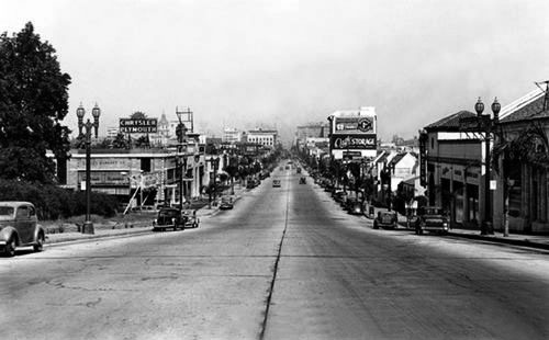
| (1929)^*** - Colorado Boulevard, just a few years after Route 66 was commissioned. View is from the hill looking East toward what is now Old Town. This may be taken right in front of where the Norton Simon Museum is today. |
Historical Notes Historic U.S. Route 66 ran through Pasadena until it was decommissioned in 1964. The historic highway entered Pasadena from the east on Colorado Boulevard and then jogged south on Arroyo Parkway before becoming part of the Pasadena Freeway (SR 110).*^ |
 |
|
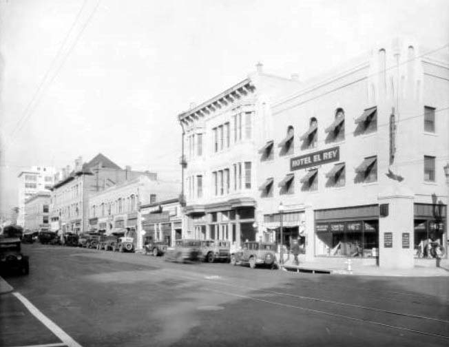
| (1929)**- Street view on South Raymond, looking north from about Green Street. Hotel El Rey, on the corner, is at 87 East Green Street. Numerous businesses are visible on the right, including as camp goods store, a tailor, and a bowling alley. The street is lined with parked automobiles. |
 |
|
| (1929)**- Street view of a bowling hall and billiard parlor at grand opening at 970 East Colorado. To one side is a cafe called the Recreation Grill, while the space on the other side is vacant. |
 |
|
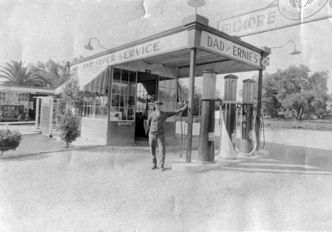
| (1930)*^* - Adolph Thore stands in front of Dad's and Ernie's Gas Station, which was located at 2830 E. Colorado at Daisy. He and Ernie Pare, the garage mechanic, were the owners and operators. They provided fuel from Gilmore Gas. |
 |
|
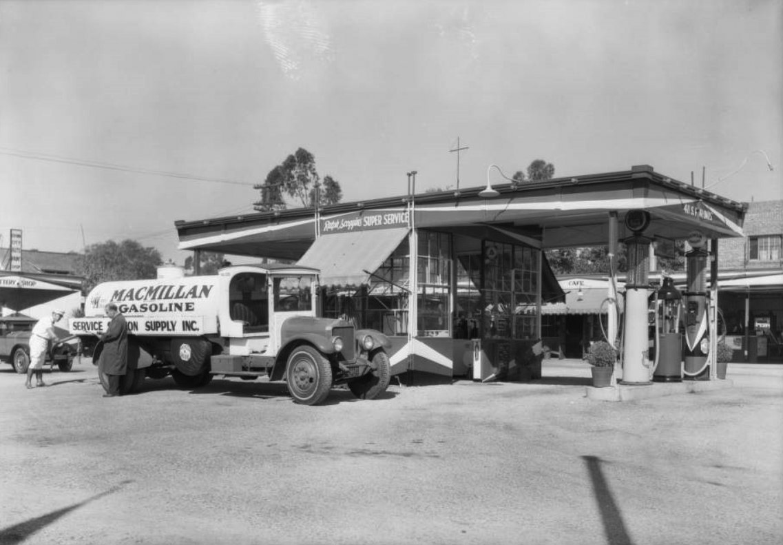
| (1929)^ – View showing a MacMillan Oil truck at a 'Super Service' Station located at 411 South Fair Oaks Avenue. |
Historical Notes Super service stations were important elaborations of the original filling stations. Introduced in Los Angeles prior to World War I, super service stations combined operations that had been handled separately. Before that time, a motorist went one place for gas and oil, and other places for lubrication and cleaning, for repairs, or for tires and other accessories. Combining these activities was convenient for consumers and opened up new marketing possibilities for those interested in taking advantage of the boom in automobiles. The earliest known super service station—Service Town—was built in 1914, three miles from downtown Los Angeles. Several of these stations were constructed in southern California in the early 1920s and soon spread across the country. +** Click HERE to see more Views of Early Gas Stations. |
 |
|
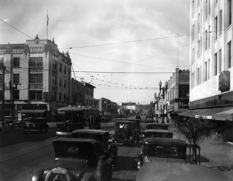
| (1929)*^* - View of East Colorado facing east from midway between Fair Oaks and Raymond. Shows 64 East Colorado, Owl Drug Company, which was Sun Drug Company in 1925. Other businesses shown include the Florsheim Shoe Store, the Flag Studio, and Bernet & Co. clothing store. The street is lined with parked automobiles and busy with moving automobiles and streetcars. |
 |
|
| (1929)#* - Street view of United Cigar at 2 East Colorado, on the southeast corner of Fair Oaks and Colorado. Above the cigar store is Dr. Ralph Mitchell Dentists. Other businesses pictured include the Goodfellows Grill and Steven Hardware. The large sign above the building reads: “6% - United States Building and Loan Association” |
Historical Notes With an untimely opening soon after the stock market crash in 1929, the building’s main tenant, the United States Building and Loan Association, was soon history. The building exists today but without the spires that used to extend above the third story windows. #*# |
 |
|
| (1930)*^* – Street view of the businesses from 13 to 31 East Colorado. The businesses shown are the C.O. Arnold Jewelers and the Shoe Market which has signs announcing a close-out sale. All the shops beyond that are vacant. |
 |
|
| (1930)*- View of Colorado Blvd. in Pasadena looking east from Marengo Ave. in 1930. The Post Office is at left, and Jordan's Inc. Dry Goods at right. |
.jpg) |
|
| (1930)* - Colorado Blvd. in Pasadena looking east from the Elks Club (near Orange Grove) in 1930. |
 |
|
| (1930)* - Colorado Blvd. at Fair Oaks Avenue in Pasadena in 1930. View is toward the west. |
.jpg) |
|
| (1930)* - View of Colorado Blvd. in Pasadena in 1930, looking west from the Maryland Hotel. |
 |
|
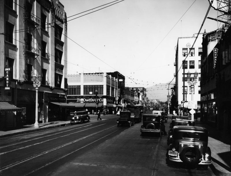
| (1930s)* - View of Fair Oaks Avenue looking north from Colorado Boulevard toward Union Street. An Owl Drug Store can be seen on the northwest corner. |
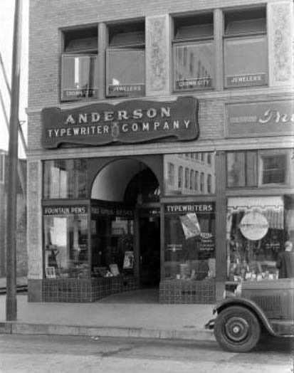 |
(1930)* - Street view of the Anderson Typewriter Company at 104 East Colorado. The display windows show various kinds of typewriters. A sign in the window announces that all makes of typewriters are available for rent. The space above is occupied by Crown City Jewelers.
|
 |
|
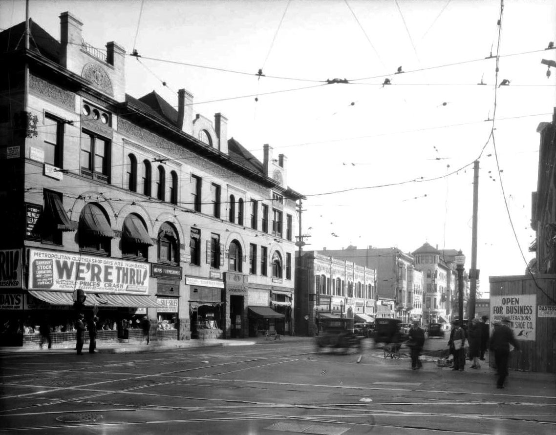
| (1928)*- View looking south on Raymond from Colorado. The large sign on southeast corner building (old Masonic Temple Block, built in 1898) reads: “Metropolitan Clothes Shop Days are Numbered – WE’RE THRU!” Sign on southwest corner reads: “OPEN FOR BUSINESS”. The tower in the distance, on the east side of Raymond, is the addition to the original Hotel Green structure. |
 |
|
|
| (1908 vs 1928)* - View looking south on Raymond from Colorado toward the Green Hotel. |
Historical Notes Harry Ridgway designed the imposing Masonic Temple block at the southeast corner of Raymond and Colorado in Romanesque Revival style in 1894. He was also the architect/designer for the First National Bank building, built in 1886 on the n/w corner of Colorado and Fair Oaks. |
Then (1932)
 |
|
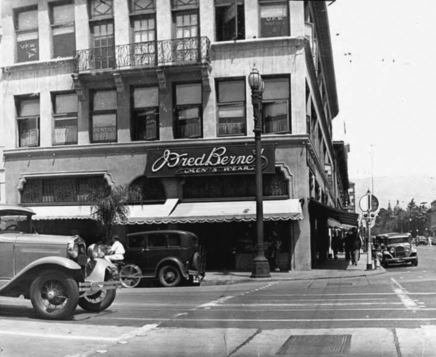
| (1932)* – View looking at the northwest corner of Raymond Ave and East Colorado Boulevard showing Fred Bernet Men’s Wear. |
Now (2015)
 |
|
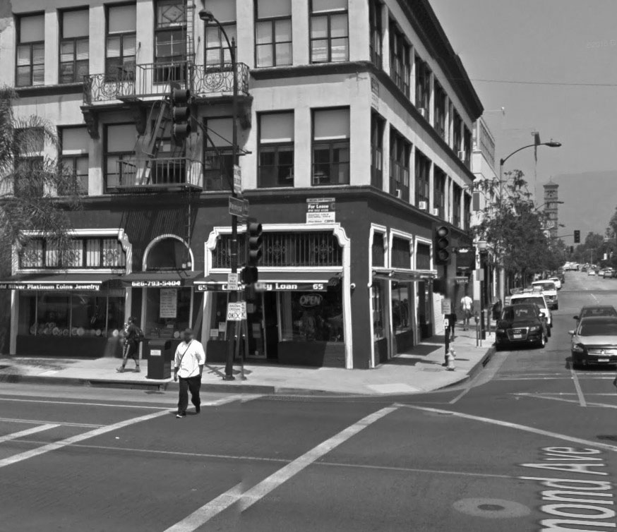
| (2015)* – View looking at the northwest corner of Raymond Ave and East Colorado Boulevard. |
 |
|
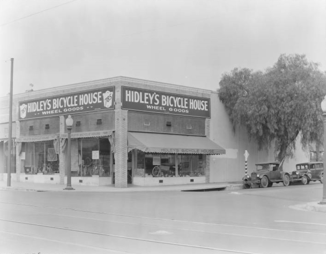
| (1930)* – Street view of Hidley's Bicycle House at 785 East Colorado Blvd (N/W corner of Colorado and Hudson). The store has large display windows showing off bicycles, bicycle equipment, scooters, and racquets. Signs in the window announce deals and promotions for the Christmas season, and several note that "Yes, we buy bicycles." |
Historical Notes The above corner site is currently occupied by a Target Store. |
 |
|
| (1930)* - View of Orange Grove Blvd. in Pasadena in 1930. A residential area, it is lined with pepper trees. |
Van de Kamp's Bakery
 |
|
| (1930s)* - View showing Van de Kamp's Bakery located on the SE corner of East Colorado Blvd and Bonnie Ave. |
Historical Notes Built in 1927, the Pasadena bakery was located on the southeast corner of East Colorado Boulevard and Bonnie Avenue (1696 E Colorado Boulevard). A prominent windmill atop the store was attached to a white L-shaped structure with stepped Dutch pediments. It’s very likely it was a project of New York architect J. Edwin Hopkins who designed Van de Kamp’s factory and headquarters in Glassell Park in 1930 – the two buildings had much in common. It’s a pity this little plaza resembling an old Dutch farmhouse was demolished in 1974 and later replaced by a generic Chick-fil-A branch. Click HERE for contemporary view. |
 |
|
| (ca. 1947)* - Van de Kamp's Bakery located at 1696 E. Colorado Boulevard in Pasadena. Almost the same view as the previous photo but 10 plus years later. There is now a new traffic signal on the corner and the overhead power lines have been removed. |
Historical Notes Although the Van de Kamp’s company was based in Los Angeles, the Van de Kamp family was from Pasadena. The company formed in 1915 by Theodore, Marian, and Henrietta Van de Kamp, along with Lawrence Frank. Theodore J. Van de Kamp and brother-in-law Lawrence L. Frank were the owners and originators of the Van de Kamp Bakeries. Fondly known as the "Taj Mahal of all bakeries". Van de Kamp and Frank also founded both the Tam O'Shanter's (1922) and Lawry's The Prime Rib (1938) restaurants. |
 |
|
| (2021)* - Contemporary view of the southeast corner of East Colorado Blvd and Bonnie Ave, now home to a Chick-fil-A drive-thru, once the site of a Van de Kamp's Bakery. |
Then and Now
 |
|
| (1930s vs 2019)* - View of Van de Kamp’s Bakery at the southeast corner of East Colorado Blvd and Bonnie Ave, now the site of a Chick-fil-A drive-thru. |
 |
|
| (1937)* - A Foster and Kleiser billboard advertising doughnuts sold at Van de Kamp's Bakeries. Photo by Herman J. Schultheis |
Historical Notes The bakery was sold by the Van de Kamp family and acquired by General Baking Co. in 1956. The company was sold to private investors in 1979, and closed in bankruptcy in 1990. The Van de Kamp's brand is now owned by Ralphs supermarket chain and used for their line of private-label baked goods. |
* * * * * |
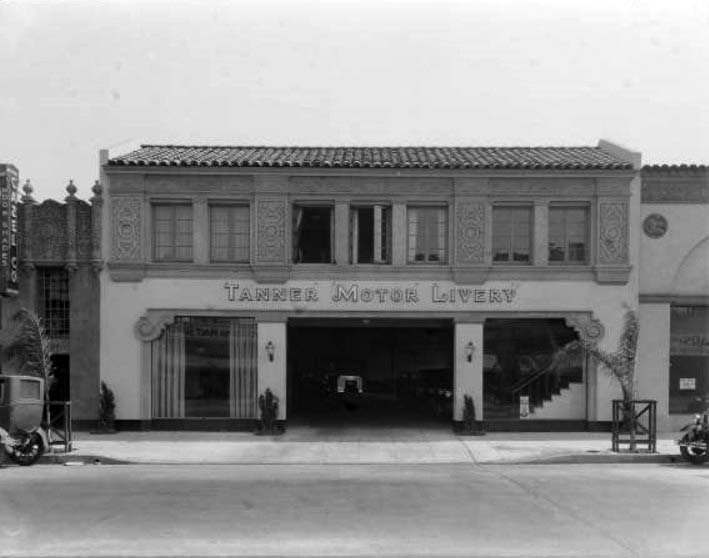 |
|
| (1930)* - Street view of the Tanner Motor Livery at 144 West Colorado. The building has two stories, and a front door wide enough for Automobiles to drive through. Automobiles on display are visible through this door. |
.jpg) |
|
| (1936)* - Ten black and white taxis owned by Tanner Motor Livery at 144 West Colorado, parked at approximately 139 West Colorado. The automobiles are parked in front of Woods & Jones Printers, Campbell Seed Store, the Bronx Diner, and Nipedal Studio Designers. |
Historical Notes Today, the 144 West Colorado building is occupied (from L to R) by Urban Outfitters, The Body Shop, and Su le Table. |
 |
|
| (1932)* - Street view of the Pyroil Service Station at 1070 East Walnut. An automobile with a spare wheel cover advertising for Pyroil is being refueled at one of the three pumps in front of the building. Signs and banners advertise for "Pyroil the wonder gas". |
Historical Notes The Pyroil brand is a trademarked name for a line of automotive chemicals offered today by the Ashland Oil Company. But in 1932, it was also a brand of gasoline that was being heavily promoted. Click HERE to see more Early Gas Stations. The roadster looks like a 29 Chrysler Series 75. 1070 E. Walnut in Pasadena is still there and today is an automobile repair shop. |
 |
|
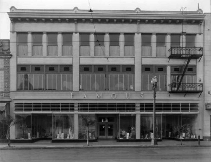
| (1933)* - Street view of the Famous Department Store at 268 East Colorado. The large windows show displays of men's and women's clothing. A metal fire escape is attached to the two upper levels. |
Historical Notes Prior to ‘The Famous Department Store’ there was Jordan’s Department Store, located in the same building at 268 East Colorado. |
 |
|
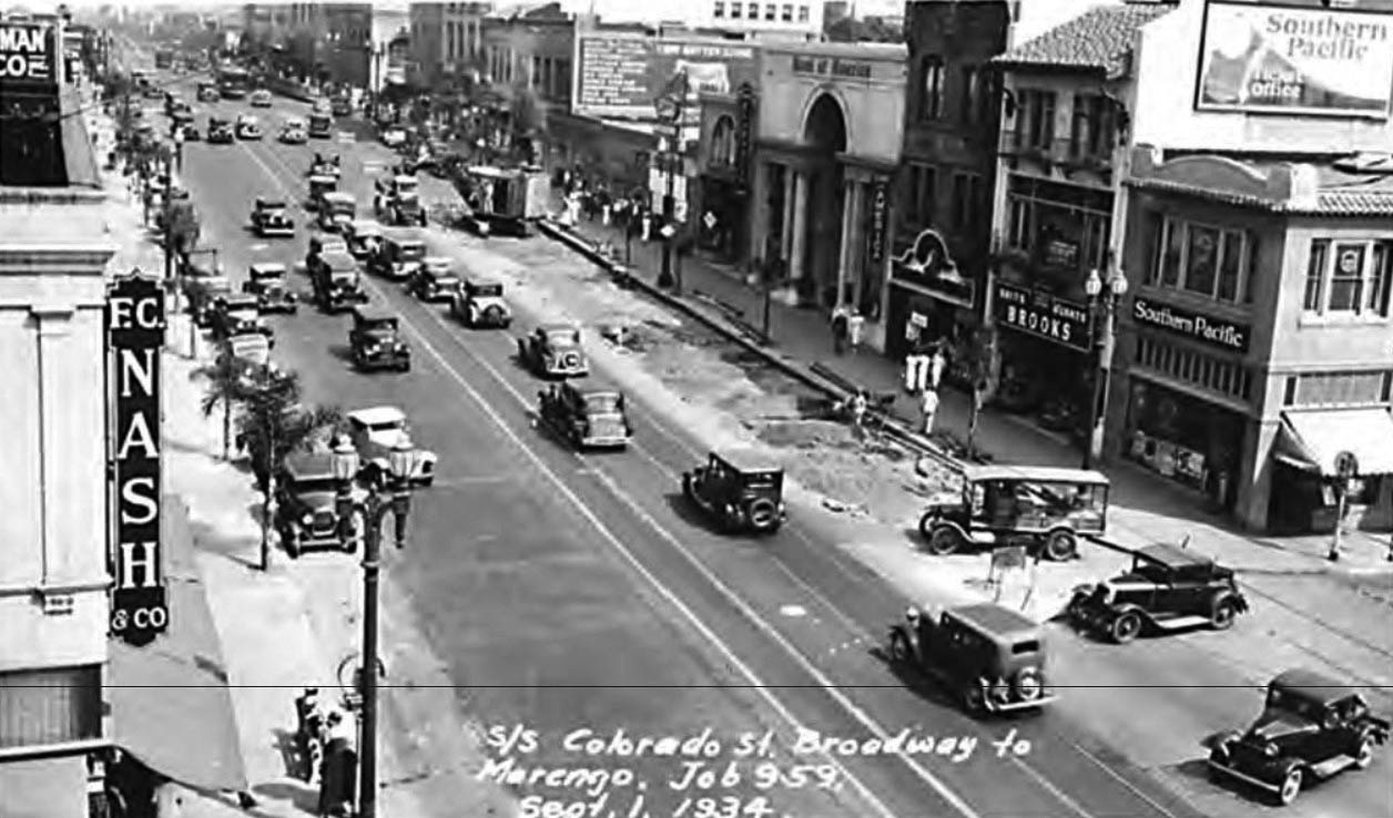
| (1934)*- View of the south side of Colorado Street, Broadway to Marengo. Broadway is now called Arroyo Parkway. |
Arcade Building
 |
|
| (1930s)*- View of the Arcade Building located on East Colorado Street between El Molino and Oak Knoll Avenues. |
Historical Notes The Arcade Building was one of the many new developments growing up on East Colorado, far from the traditional core downtown. It employed a new design that accommodated shoppers and their automobiles; the driveways to the heavily advertised parking lot was dubbed "Luxury Lane." It was, as the Pasadena Star News reported, "another page in the city's development." The Arcade Building's design was inspired by a similar structure in Budapest. Opening in 1927, the building was home to 27 stores and offices, including a wax flower shop, a tearoom, a candy shop, a jewelry store, and "moth proofers de luxe." The businesses were advertised as among the finest in the world, and several retailers had international branches. |
Then and Now
 |
|
| (1930s vs. 2018)* - View showing the Arcade Building located at 696 E. Colorado Blvd, Pasadena |
First Church of Christ, Scientist
 |
|
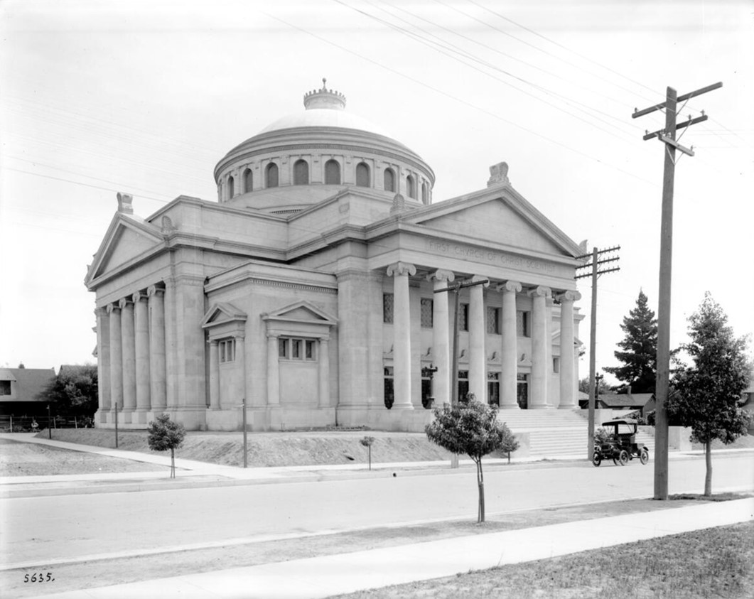
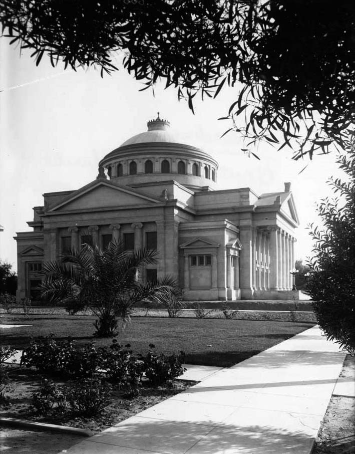
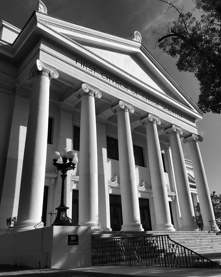
| (ca. 1910)* - Pasadena’s Christian Science Church, located at 80 S. Oakland Avenue. |
Historical Notes It is officially known as First Church of Christ, Scientist, Pasadena. The church is a branch of The First Church of Christ, Scientist in Boston, Massachusetts, which was founded by Mary Baker Eddy in 1879. |
 |
|
| (1909)^## – Side view of the First Church of Christ, Scientist Pasadena with Classical Revival style stone-brick, marble columns and dome. |
Historical Notes The First Church of Christ, Scientist Pasadena was built beginning in 1909. The Classical Revival church building was designed by architects Marston & Van Pelt. At the time of its construction it was the largest building in Pasadena. It was designed to be completely fireproof and was topped by one of the earliest examples of a reinforced concrete dome. ##+ |
 |
|
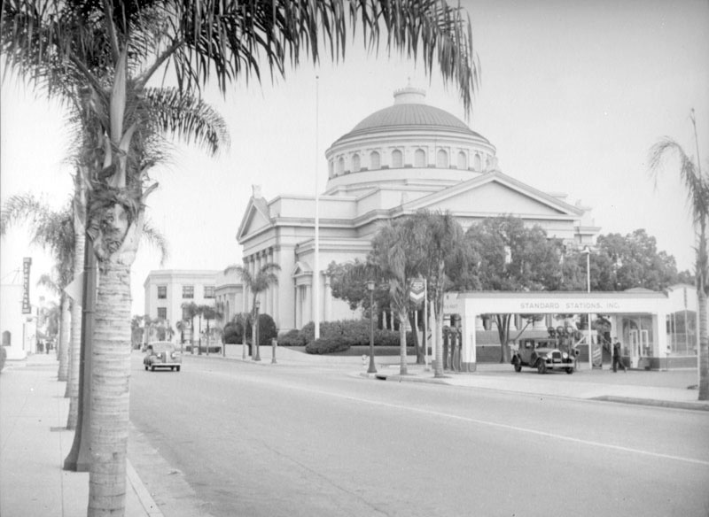
| (ca. 1939)* - Partial view of the First Church of Christ, Scientist, located at 80 Oakland Avenue in Pasadena. A Standard Stations, Inc. gas station is visible at middle right. |
Historical Notes The building recently underwent an 18-month restoration and seismic upgrade and is a contributing building in the Pasadena Playhouse Historic District. Click HERE for contemporary view. |
 |
|
| (2020)^ - The old Classical Revival First Church of Christ Scientist located at 80 S. Oakland Ave in Pasadena. Photo courtesy of Valentino Herrera |
Pasadena Playhouse
 |
|
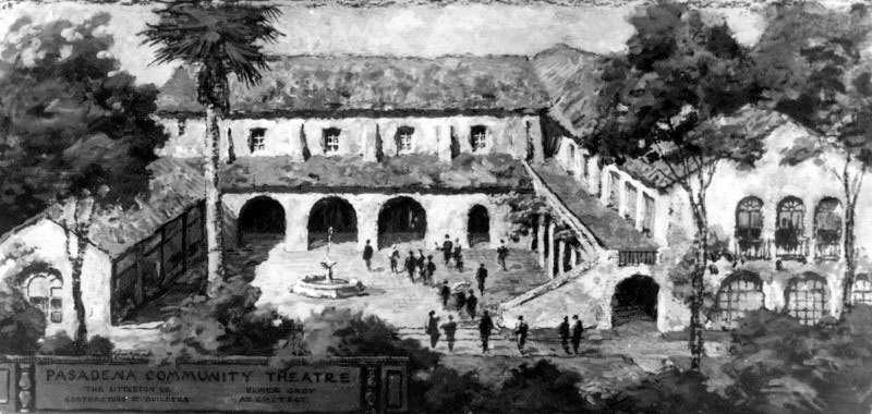
| (1920s)* - Architectural rendering of the Pasadena Playhouse with courtyard and fountain surrounded by buildings on 3 sides. Label reads: Pasadena Community Theatre |
Historical Notes Founded in 1917 by Gilmor Brown, the Pasadena Playhouse was designed by architect Elmer Grey and the cornerstone laid May 31, 1924. In 1928 the College of Theatre Arts was incorporated with the Pasadena Playhouse Association as a non-profit institution.* |
 |
|
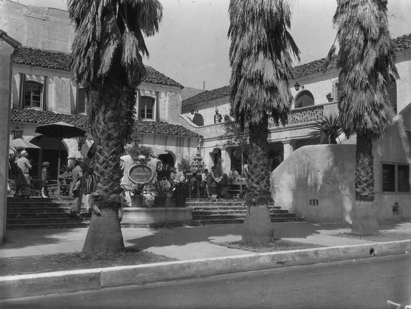
| (1930s)* - Exterior view of the entry and court of the Pasadena Playhouse, located at 39 S. El Molino Avenue. It was designed by architect Elmer Grey in Spanish Colonial Revival style and built in 1924-1925. |
Historical Notes A school of theatre arts was established in the late 1920s that became an accredited college by 1937, eventually training such notable talents as Raymond Burr, Victor Mature, Ernest Borgnine, Eleanor Parker, Charles Bronson, Mako, Jamie Farr, Gene Hackman, Dustin Hoffman, Sally Struthers and others.* |
 |
|
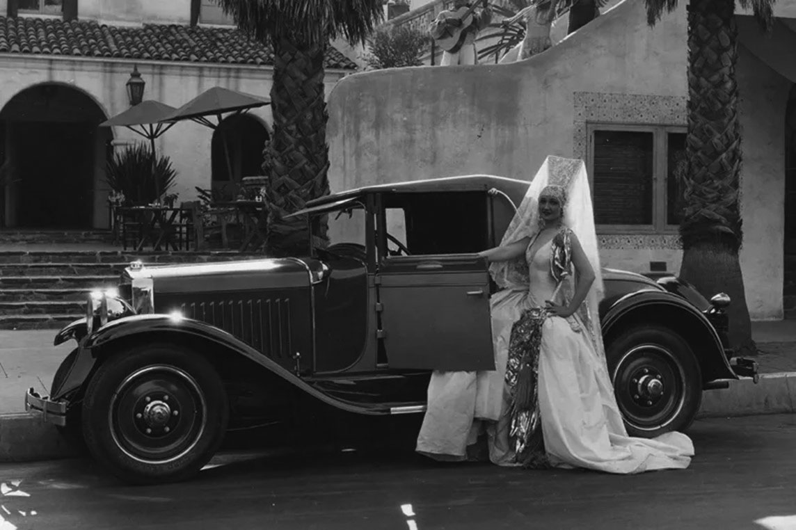
| (1930s)^ – A woman in costume poses by car in front of the Pasadena Playhouse. |
 |
|
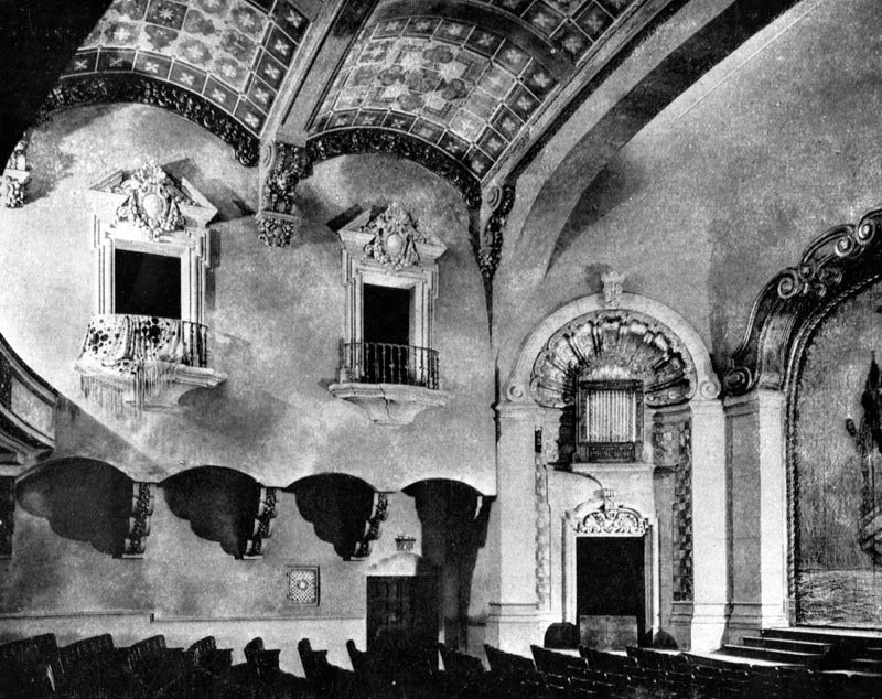
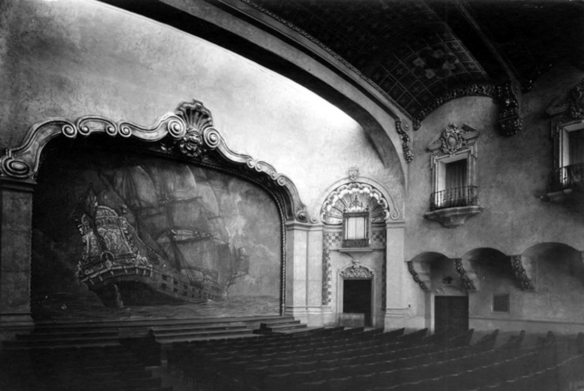
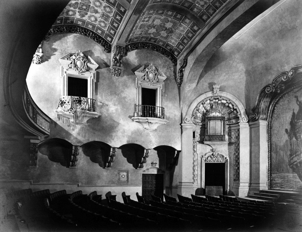
| (1925)* - The auditorium of the Playhouse, looking over the seats at the side wall where two balcony box seats can be seen. On the extreme left is the balcony itself, and on the extreme right the stage curtain. |
 |
|
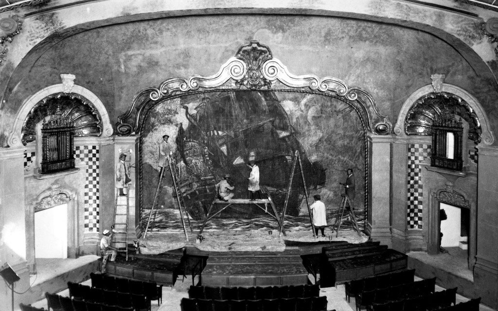
| (1925)* - Vintage image of the original Spanish galleon-adorned stage curtain being painted. (Photo courtesy of Pasadena Playhouse Archives) |
 |
|
| (1930)^ - Interior view of the Pasadena Playhouse Auditorium. Back then it was known as the Pasadena Community Theatre. |
 |
|
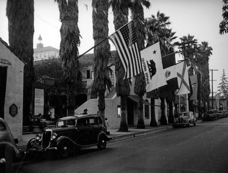
| (ca. 1937)* – View showing the entrance and courtyard of the Pasadena Playhouse, as seen from S. El Molino Avenue, with flags hanging from palm trees. |
Historical Notes The Playhouse was recognized by the Legislature as the State Theatre of California in 1937 after the laudable achievement of having performed the entire Shakespeare canon on a single stage for the first time in the United States. |
 |
|
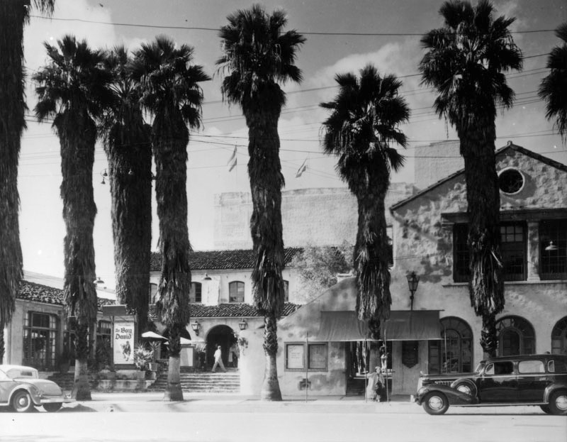
| (1939)* - Pasadena Playhouse as seen from the across the street. Large palm trees almost dwarf the theater. |
Historical Notes The Pasadena Playhouse drew the attention of the nation, bringing Southern California world premieres by authors such as Eugene O'Neill, William Saroyan, Noël Coward, F. Scott Fitzgerald and Tennessee Williams, as well as many English language premieres of significant Continental dramas.* |
 |
|
| (1944)*- Postcard view showing the front entrance and courtyard of the Pasadena Playouse. |
Historical Notes The Pasadena Playhouse was designated California Historical Landmark No. 887 (Click HERE to see more California Historical Landmarks in LA County). |
 |
|
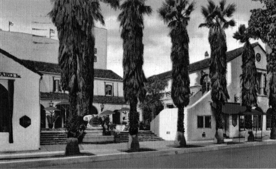
| (1940s)^ – Postcard view showing the Pasadena Playhouse fronted by a line of mature palm trees. |
Historical Notes A Spanish Colonial Revival building with Mission elements, the Playhouse is centered around a courtyard enclosed on three sides. Paved in flagstone and surrounded by arcades, the central courtyard is raised above street level. The composition of the building is asymmetrical and informal, almost residential in scale. The stucco walls are textured and irregular to resemble adobe and masonry construction. |
 |
|
| (ca. 1951)^ – View looking west over parking lot and S. El Molino Ave showing the Pasadena Playhouse. (Photo courtesy of Pasadena Playhouse Archives) |
Historical Notes The adjacent six-story concrete school Fannie E. Morrison Annex building was designed by J. Cyril Bennett in 1936 to house the School of Theatre Arts, an accredited college. |
 |
|
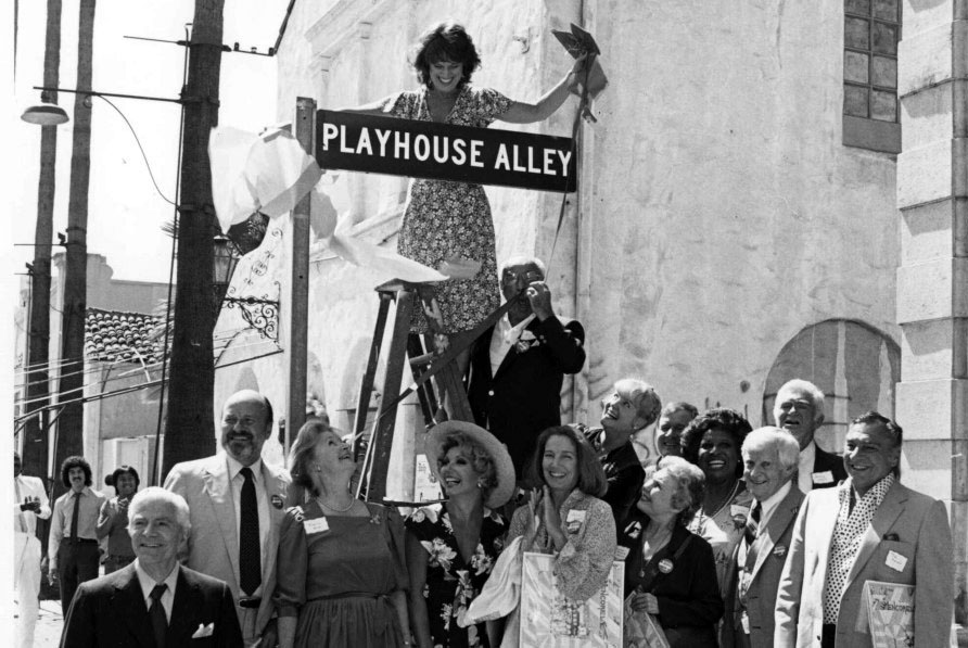
| (1982)^ – View showing dedication of the Pasadena Playhouse (Playhouse Alley) with Ruth Buzzi seen on ladder. (Photo courtesy of Pasadena Playhouse Archives) |
 |
|
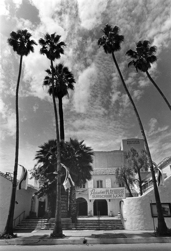
| (1987)* – Front view of the Pasadena Playhouse with trimmed palm trees near the curb. Sign in front of the playhouse reads: Pasadena Playhouse - Subscribe NOW. LA Times caption reads: Hoping to attract a new Playhouse audience, developer David Houk, who controls the theater under an agreement with the City of Pasadena, hired producers Susan Dietz and Steve Rothman, both of whom have established records. Photo Dated: May 1, 1987. |
Historical Notes Due to changes in Actors' Equity Association laws, and the opening of drama departments in many schools and universities across the country, the School of Theatre Arts shut down in 1969. Later that year, after the death of founding director Gilmor Brown, the theatre itself went bankrupt. After six years, the city bought the building in 1975 and later transferred it to real estate developer David Houk. After 17 years of lying dormant, he relaunched the theatre in 1986 as a place to develop shows that would tour other California venues. While the Pasadena Playhouse reopened for use as a community theatre, the acting school remained closed. Over the next twenty years, the theatre staged classic drama, new musicals and plays, and integrated itself as an educational facility, slowly regaining a prominent place in the national theatre scene to become a major operation of over 8 million dollars a year by 2008.* |
 |
|
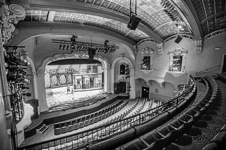
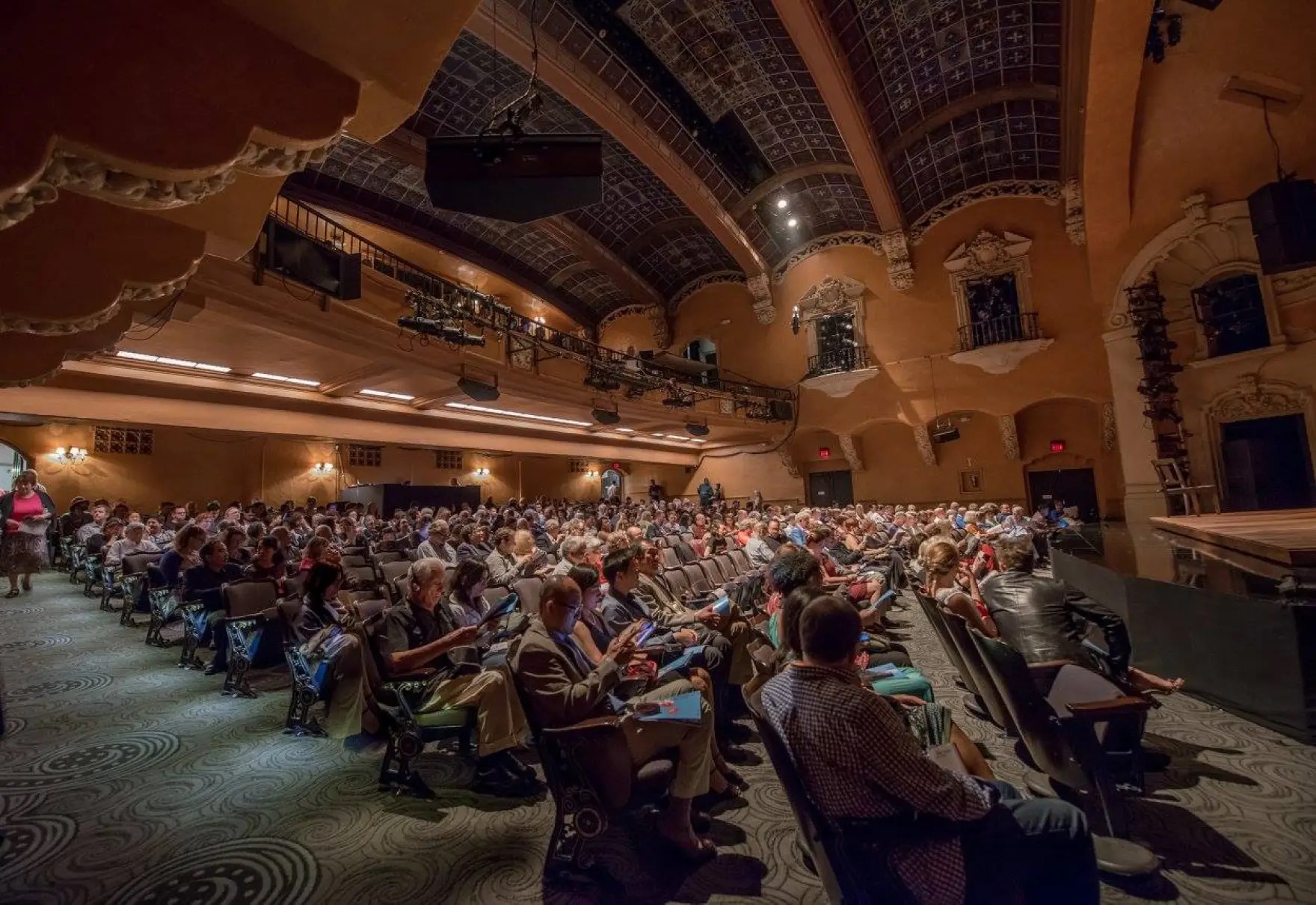
| (2014)^ - Pasadena Playhouse after renovation, including new seats and carpets. Photo by Watchara Phomicinda |
Historical Notes In Sept. 2014, the historic theatre received a makeover with new carpet and seats as it geared up to look good for its 100th birthday in 2017. |
Then and Now
 |
|
 |
|
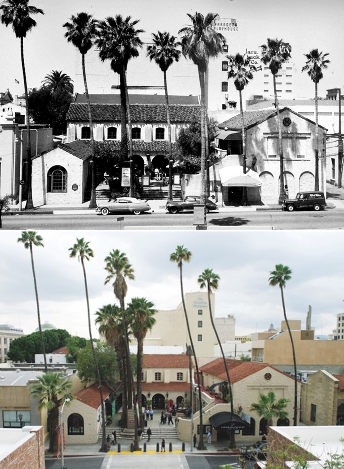
| (1925 vs. 2017)* - Pasadena Playhouse (originally Pasadena Community Playhouse) celebrated its 100 year anniversary in 2017. |
Historical Notes Opened in 1925 as the Pasadena Community Playhouse. The Playhouse quickly became a hub of the theatre community west of the Mississippi River. |
 |
|
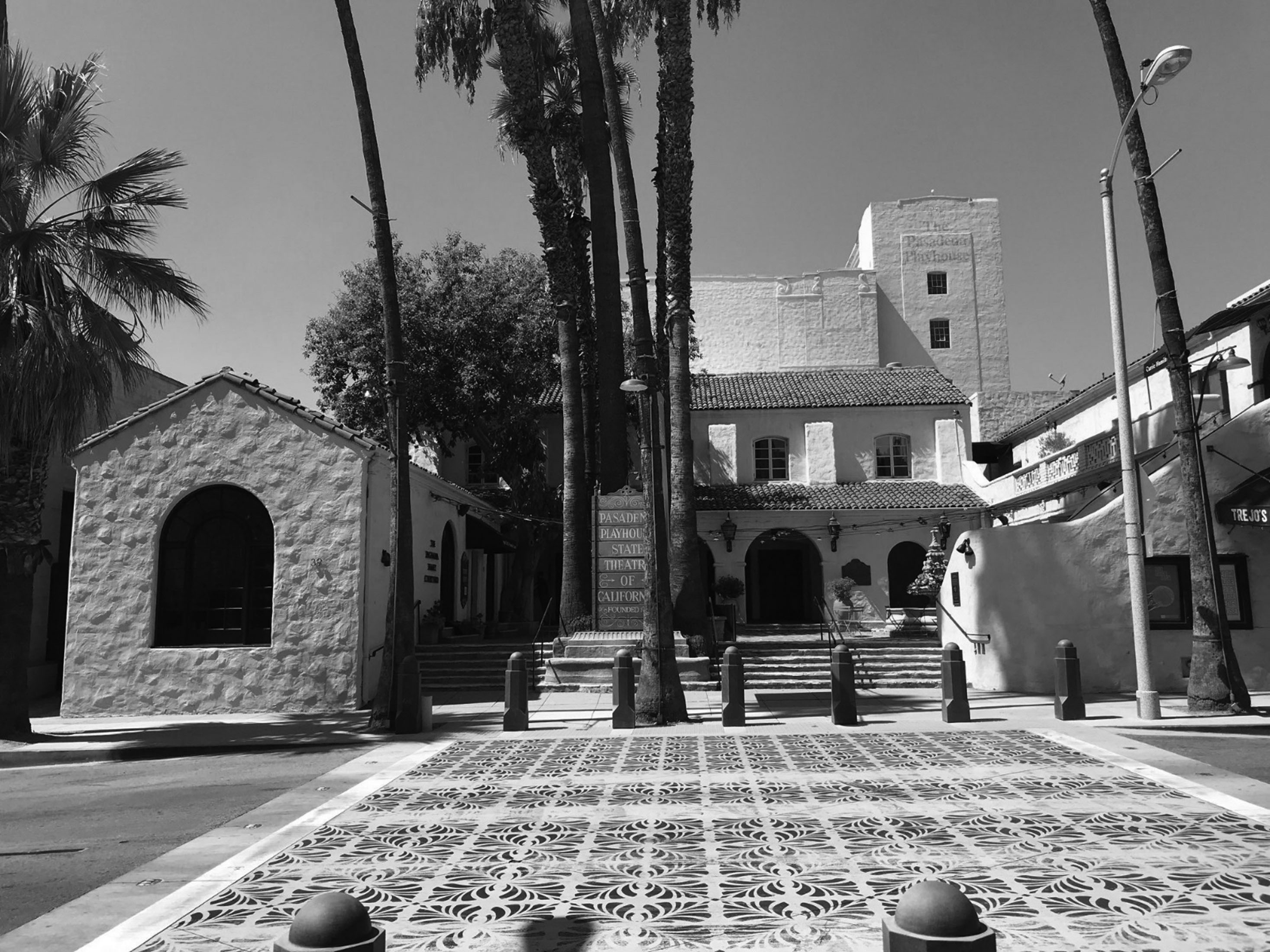
| (2019)^ - The Pasadena Playhouse, built in 1925, shares mission-style architecture with many other Pasadena buildings from that decade. Photo courtesy of Valentino Herrera |
 |
|
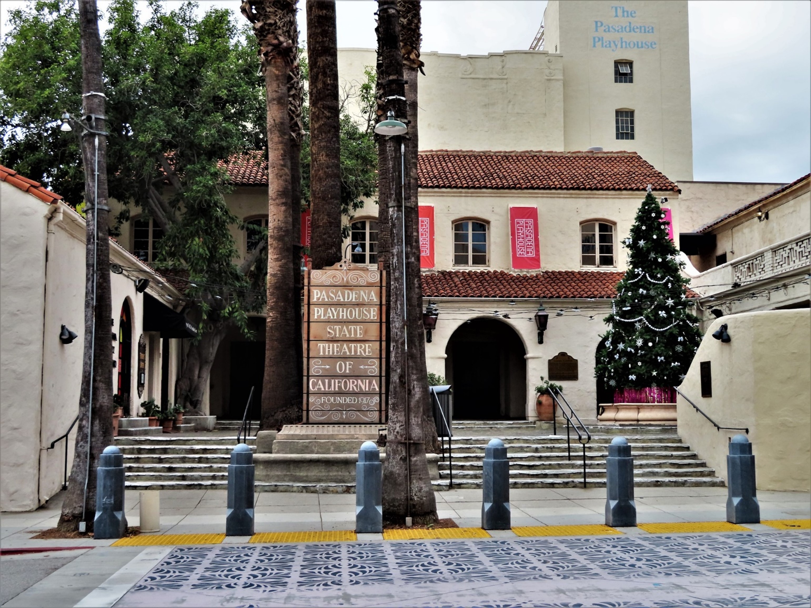
| (2021)^ - Contemporary view of the Pasadena Playhouse – The State Theatre of California. Photo by Howard Gray |
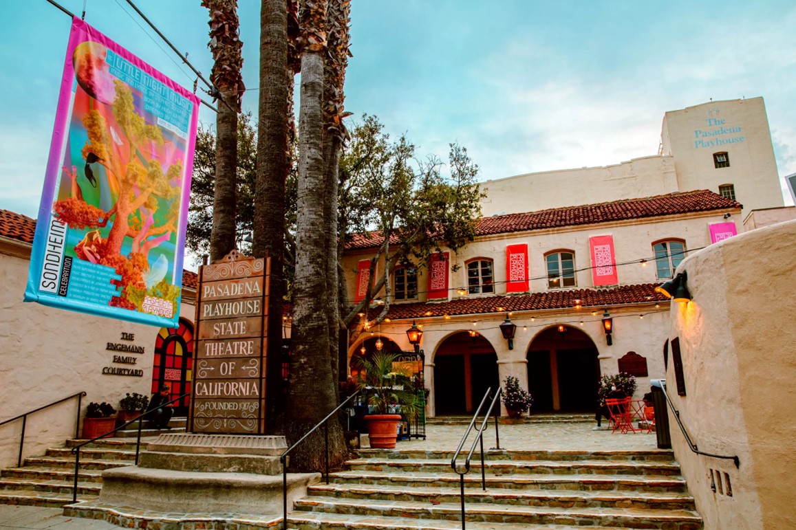 |
|
| (2023)* - Pasadena Playhouse, the State Theatre of California, recipient of the 2023 Regional Theatre Tony Award. Photo by Jeff Lorch |
Historical Notes Pasadena Playhouse received the 2023 Regional Theatre Tony Award, becoming only the second Los Angeles institution to earn the honor.* |
Then and Now
 |
|
| (1951 vs 2022)* - Pasadena Playhouse |
 |
|
| The historic Pasadena Playhouse is located at 39 S. El Molino Avenue in the heart of Pasadena. The above sign is on Colorado Boulevard just north of the theatre. |
* * * * * |
Clune's Pasadena Theater (later Fox Pasadena Theater)
 |
|
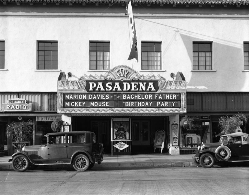
| (1931)* - Close-up view of the Pasadena Theater box office and marquee located at 61 W. Colorado Blvd. Early model cars are parked on the street. Double Feature: "Bachelor Father" with Marion Davies and "Birthday Party" with Mickey Mouse. |
Historical Notes The theatre opened as Clune's Pasadena Theatre in 1911, a project of pioneer showman Billy Clune. His best known theatre was Clune's Broadway, still around as the Cameo Theatre. Clune was also a film producer with his own studio, now a part of Raleigh Studios. Clune's Pasadena once had a rooftop sign with over 2,000 lamps. In addition to the theatre, the building had ground floor stores and a space housing the Pasadena Athletic Club. The venue was later operated by Fox West Coast and known then as the Fox Pasadena. Fox closed the theater in 1953.*## |
.jpg) |
|
| (1911)*## - Interior view of the Clune's Pasadena Theater opening night, March 1, 1911. Every seat in the house is filled with patron eager to experience Pasadena’s newest film and vaudeville theater. |
Historical Notes The opening night show was all live acts including singer Lilly Dorn, a saxophone sextet, and storyteller Frank M. Clark. The Clune's Pasadena Theater, located near Colorado Street and Delacey Avenue, later became the Fox Pasadena Theater and was in operation until the 1950s.*^^* |
* * * * * |
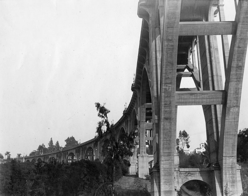
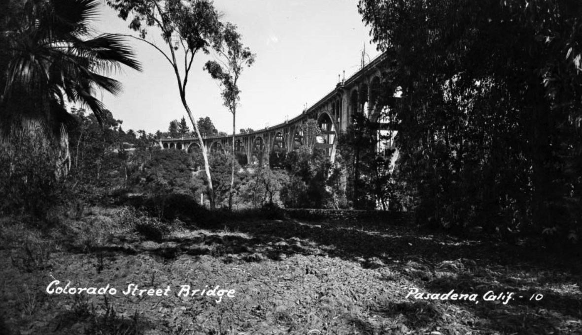
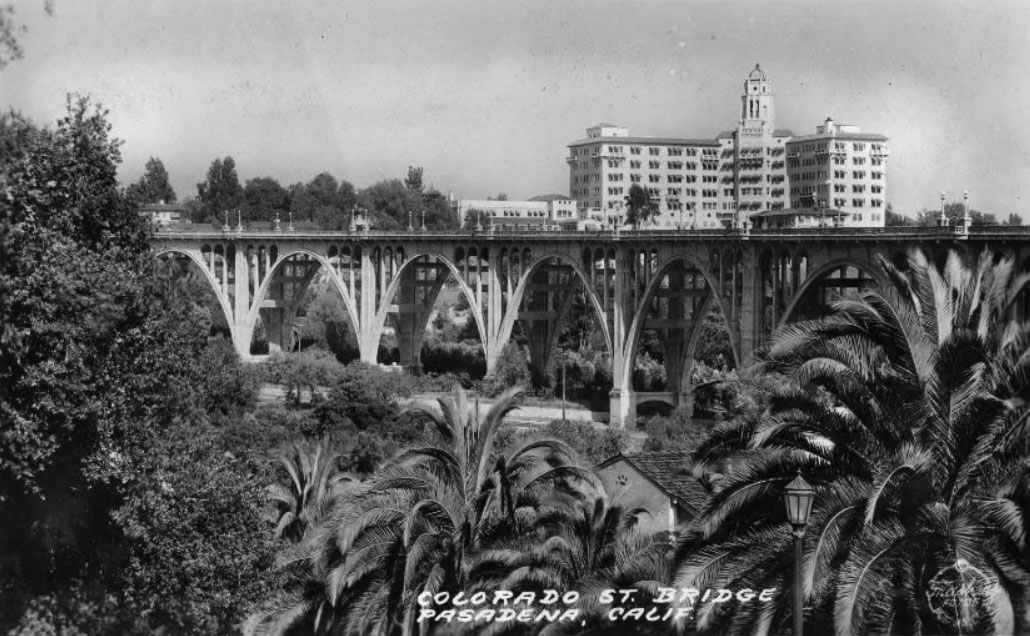
Colorado Street Bridge
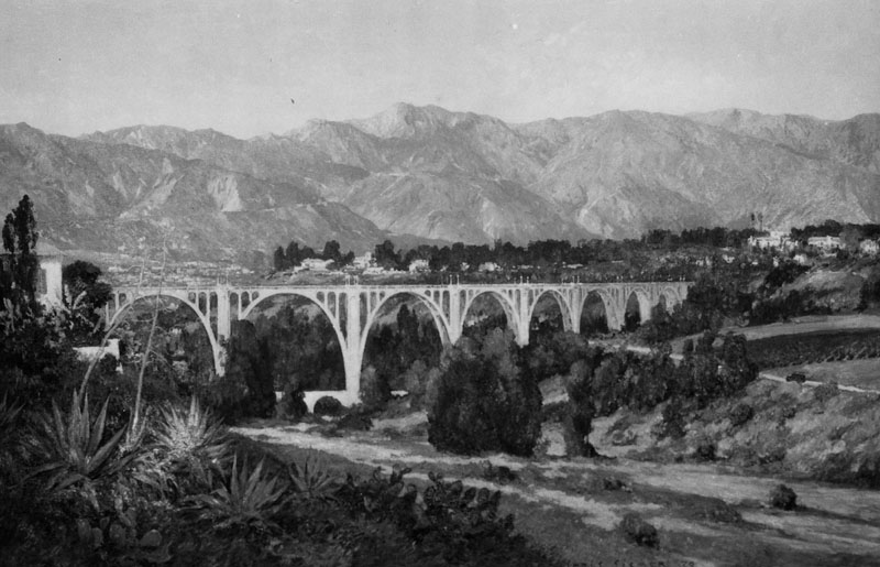 |
|
| (ca. 1930)* - Panoramic View of the Colorado St. Bridge with the San Gabriel Mountains in the background. This is a photograph of a Chris Siemer painting created for a display by the L.A. Chamber of Commerce. |
 |
|
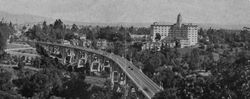
| (ca. 1930)* - Scenic view of the Colorado Street Bridge showing the length of the bridge as it curves across the ravine. Part of the Vista Del Arroyo Hotel can be seen through the arches. |
 |
|
| (1946)#* – Postcard view showing trees and foliage in the Arroyo Seco canyon, and the Colorado Street Bridge spanning across it. |
 |
|
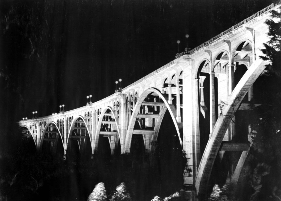
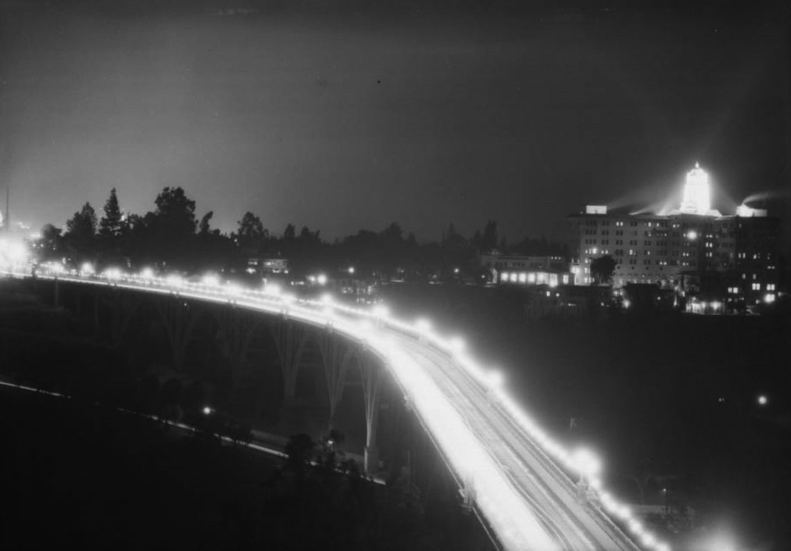
| (1930)^x^ – Night view showing the Colorado Street Bridge illuminated by 1000-watt floodlights. |
 |
|
| (ca. 1930)^ – Night view showing the Colorado Street Bridge and the Hotel Vista del Arroyo, both lit up during the holidays. |
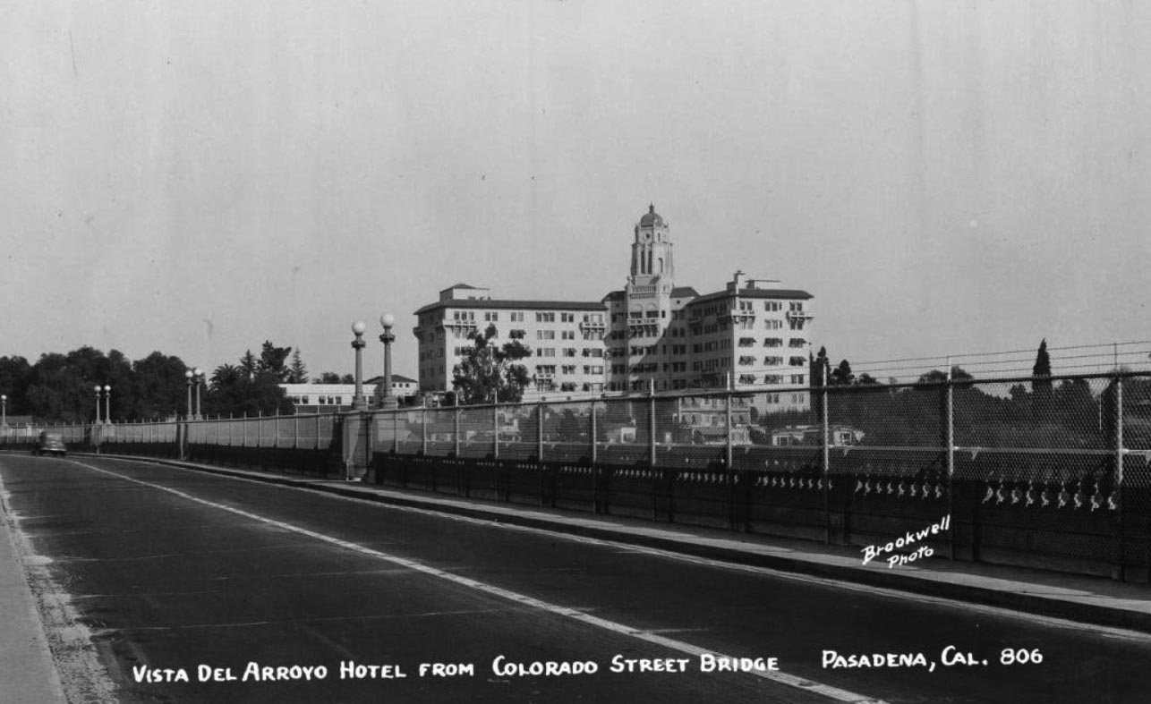
Vista Del Arroyo Hotel
 |
|
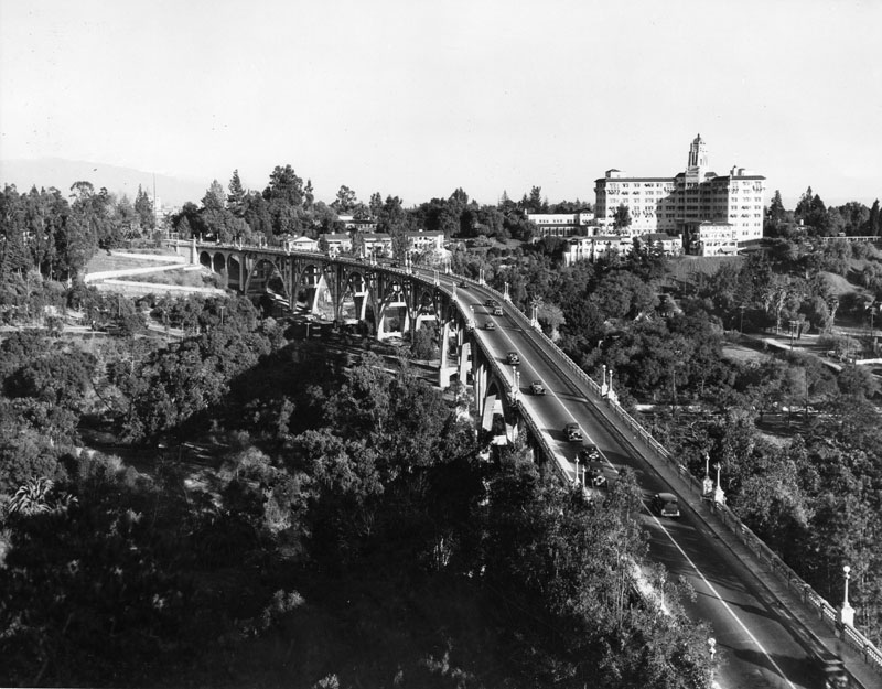
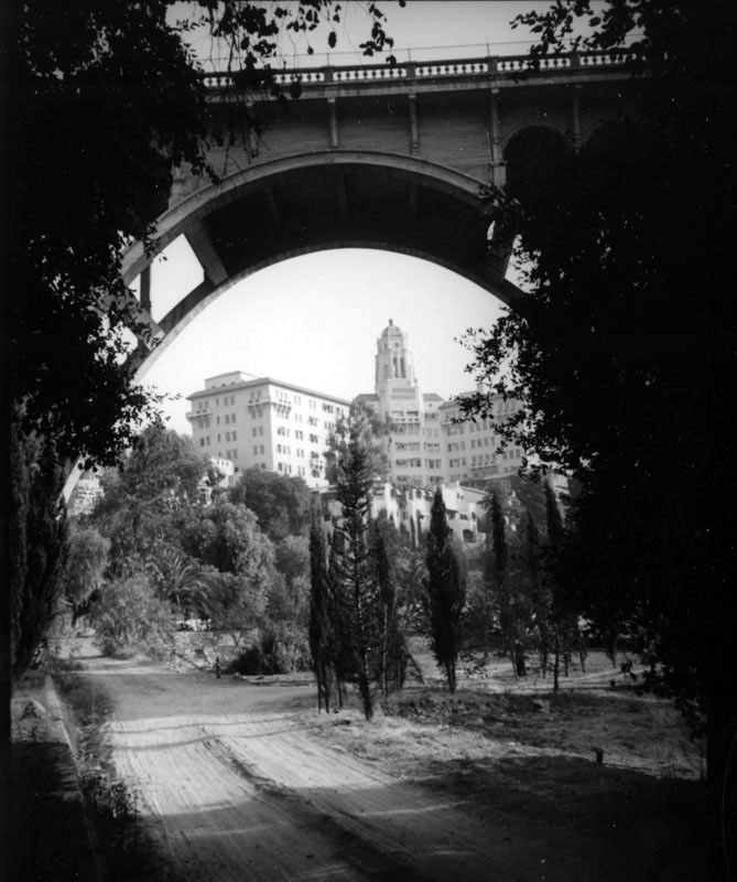
| (ca. 1931)* - View of the Colorado Street Bridge, looking southeast with the Vista Del Arroyo Hotel to the right. |
 |
|
| (ca. 1931)* - View of the Colorado Street Bridge, looking southeast. The new additon to the Vista Del Arroyo Hotel is seen on the right. |
Historical Notes In 1926, the Vista Del Arroyo Hotel and resort was sold to H.O. Comstock. Comstock hired architect George H. Wiemeyer to redesign the hotel and added a grand six-story addition that consisted of a central bell tower and flanking wings set at an angle. The new Vista opened in 1931 with iridescent color, entertainment, and social gaiety. In 1936, Linnard repurchased the property and hired landscape architect Verner S. Anderson to improve the hotel's grounds by designing formal gardens and adding fountains, tennis courts, and a swimming pool. |
 |
|
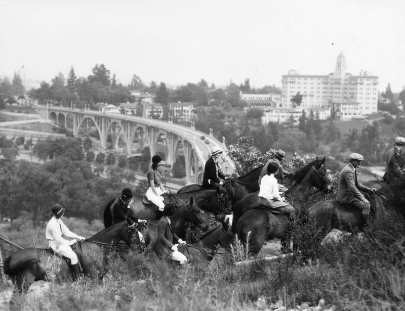
| (Early 1930s)* - Photo of horseback riders in the Arroyo Seco, overlooking the Colorado Street Bridge. The Vista Del Arroyo Hotel is on the right. |
 |
|
| (ca. 1937)* - This view of the Vista del Arroyo Hotel in Pasadena shot through the Colorado Street bridge captures a dirt path lined with Cypress trees leading through the lush arroyo. |
Historical Notes Marston and Van Pelt designed the Vista del Arroyo Hotel in 1920 and in 1930 George Wiemeyer added the tower. Myron Hunt designed some of the bungalows. * |
 |
|
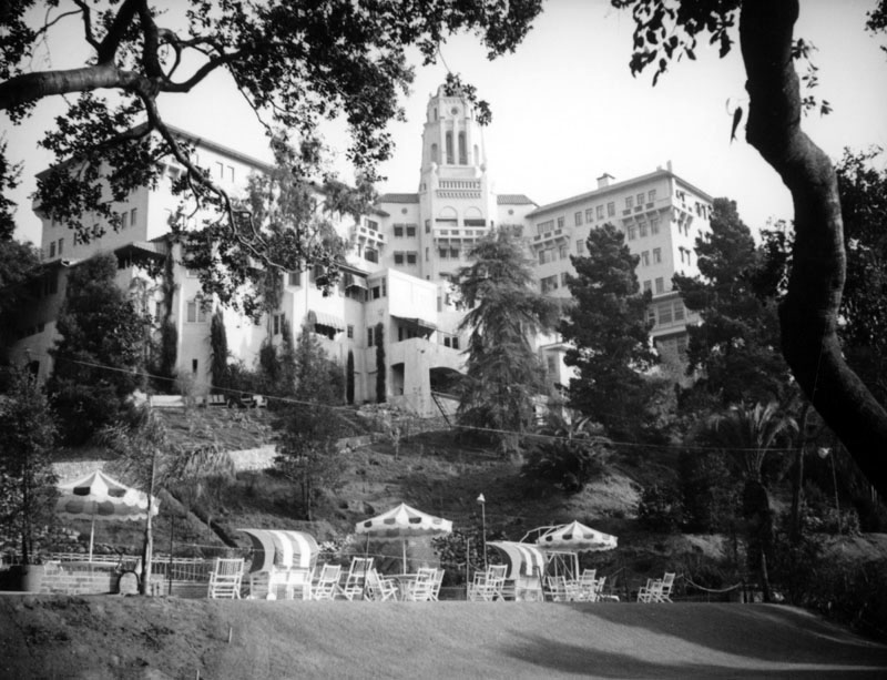
| (ca. 1937)* - View of the Vista del Arroyo Hotel taken from the arroyo includes the pool area, some of the lower buildings not commonly seen, as well as a long walkway joining the pool to the hotel. |
 |
|
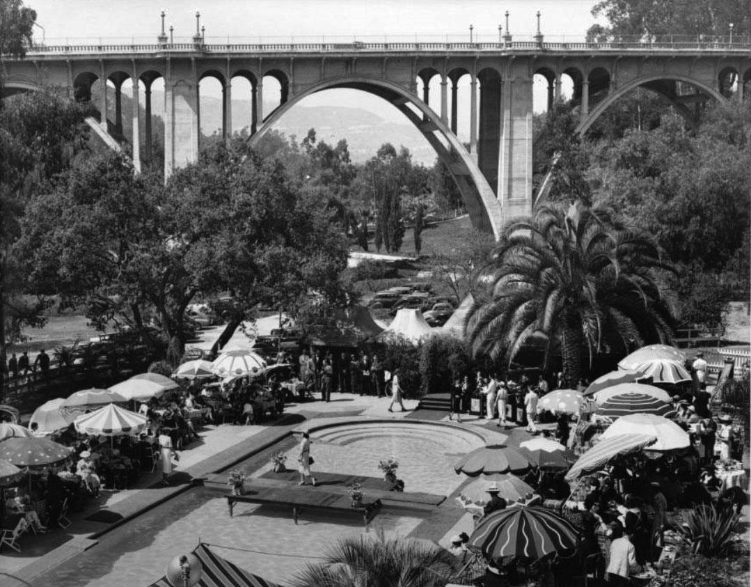
| (ca. 1940)^ – View looking across the swimming pool area of the Hotel Vista del Arroyo where it appears a fashion show is taking place. The Colorado Street Bridge is seen in the background. |
 |
|
| (ca. 1940)++* – Postcard view showing the Colorado Street Bridge and the Vista del Arroyo Hotel. |
 |
|
| (1940)^++ – Postcard view showing the Colorado Street Bridge and Vista del Arroyo Hotel with palm trees in the foreground. |
 |
|
| (ca. 1943)#* – Postcard view showing the Vista del Arroyo Hotel as seen from the Colorado Street Bridge. The hotel was converted to a hospital in 1943, near the time of this photo. |
Historical Notes In 1943 the U.S. War Department acquired the hotel complex and converted it into the McCormack Army Hospital and offices for the U.S. Army. In 1949, the hospital was deactivated and the old hotel, under the care of the U.S. General Services Administration (GSA), housed a variety of Federal agencies from 1951 to 1974. In 1981 the Vista del Arroyo was placed in the National Register of Historic Places and GSA began design work to restore the building as the southern seat of the Ninth Circuit Court of Appeals. In 1995, the building was renamed to honor Judge Richard H. Chambers, whose concept it was to bring a Federal courthouse to Pasadena.*^ |
Click HERE to see more early views of the Colorado Street Bridge. |
* * * * * |
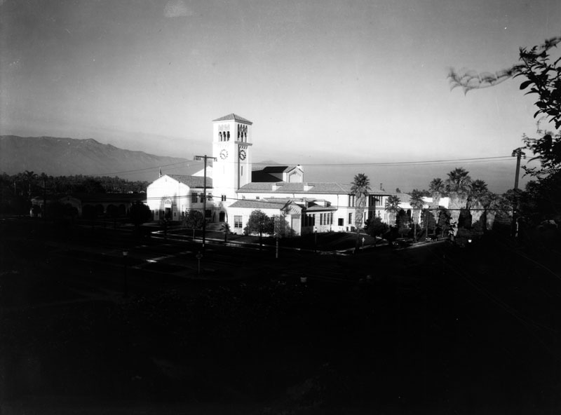
South Pasadena Middle School
 |
|
| (ca. 1932)* - Exterior view of South Pasadena Middle School, formerly known as a junior high. The attractive campus, located on the corner of Fair Oaks Boulevard and Oak Street (both are slightly visible in the foreground), includes a number of Italian style buildings. The San Gabriel Mountains are visible in the background. |
Historical Notes In 1924, bonds were passed to make money available to purchase the site for a junior high school. The town then waited for the population to grow which would necessitate construction. In 1927, $555,000 was budgeted for erection and equipping of the junior high school. In mid-January, 1928 the ground was broken for the Junior high and on September 10, 1928 the school officially opened.^# |
.jpg) |
|
| (ca. 1932)* - Closer view of the South Pasadena Middle School campus with clock tower at right. |
 |
|
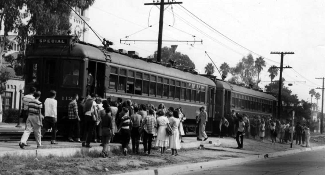
| (ca. 1945)^.^ – Students board the PE Red Car at Fair Oaks above Oneonta Junction. The South Pasadena Junior High clock tower can be seen in the background. |
Oneonta Park Junction (South Pasadena)
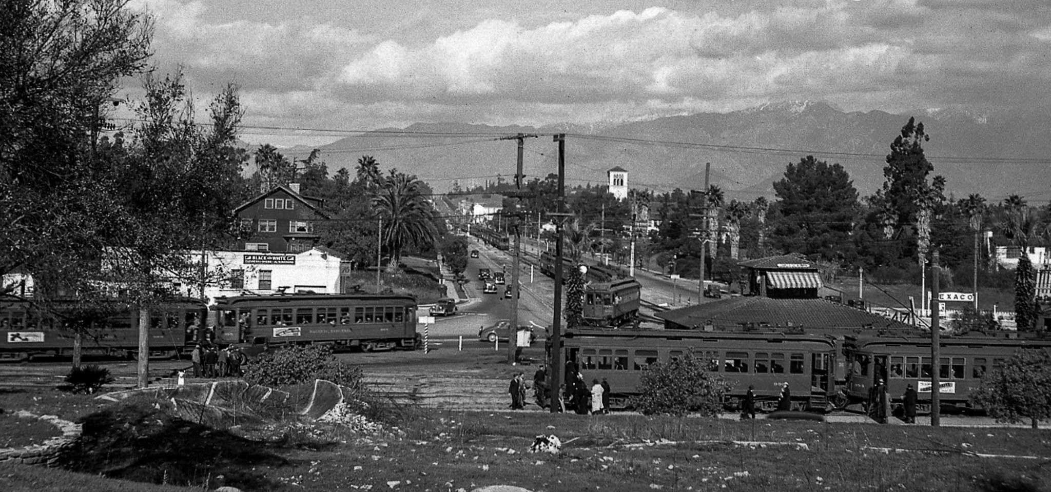 |
|
| (1937)+++ - Panoramic view looking north showing Pacific Electric streetcars gathered at the Oneonta control tower at Huntington Drive and Fair Oaks Avenue. A second story control tower was being built during this 1937 scene. The clock tower of South Pasadena Middle School at Fair Oaks Boulevard and Oak Street can be seen in the background. |
Historical Notes The Oneonta Park Station was constructed in 1906 and had a small counter where tickets, daily newspapers and soft drinks could be purchased before boarding the Red Cars. A tower located within the station housed an interlocking system which controlled all the switches at the Junction, including Southern Pacific Railway crossing at Huntington Drive and Marengo Avenue. From the tower, the controller had a view in all directions. The Oneonta Park Station was demolished when operations were discontinued in late 1951. ^ |
 |
|
| (1951)##^^– View showing one of the last Pacific Electric streetcars at Oneonta Park Junction. The station would be demolished in late 1951 when the PE Red Car operations discontinued. |
Historical Notes The largest electric railway system in the world at that time, the Pacific Electric Railway and the Big Red Cars reached the end of the line when virtually all operations ceased by late 1951, ending nearly 50 years of service to more than 50 cities. Closing the chapter on the Pacific Electric Railway, most of the nearly 1,300 miles of rail along with the trolley wire were removed throughout 1952.^ Click HERE to see more early views of Oneonta Park Junction (1910 +). |
M-M Foods
 |
|
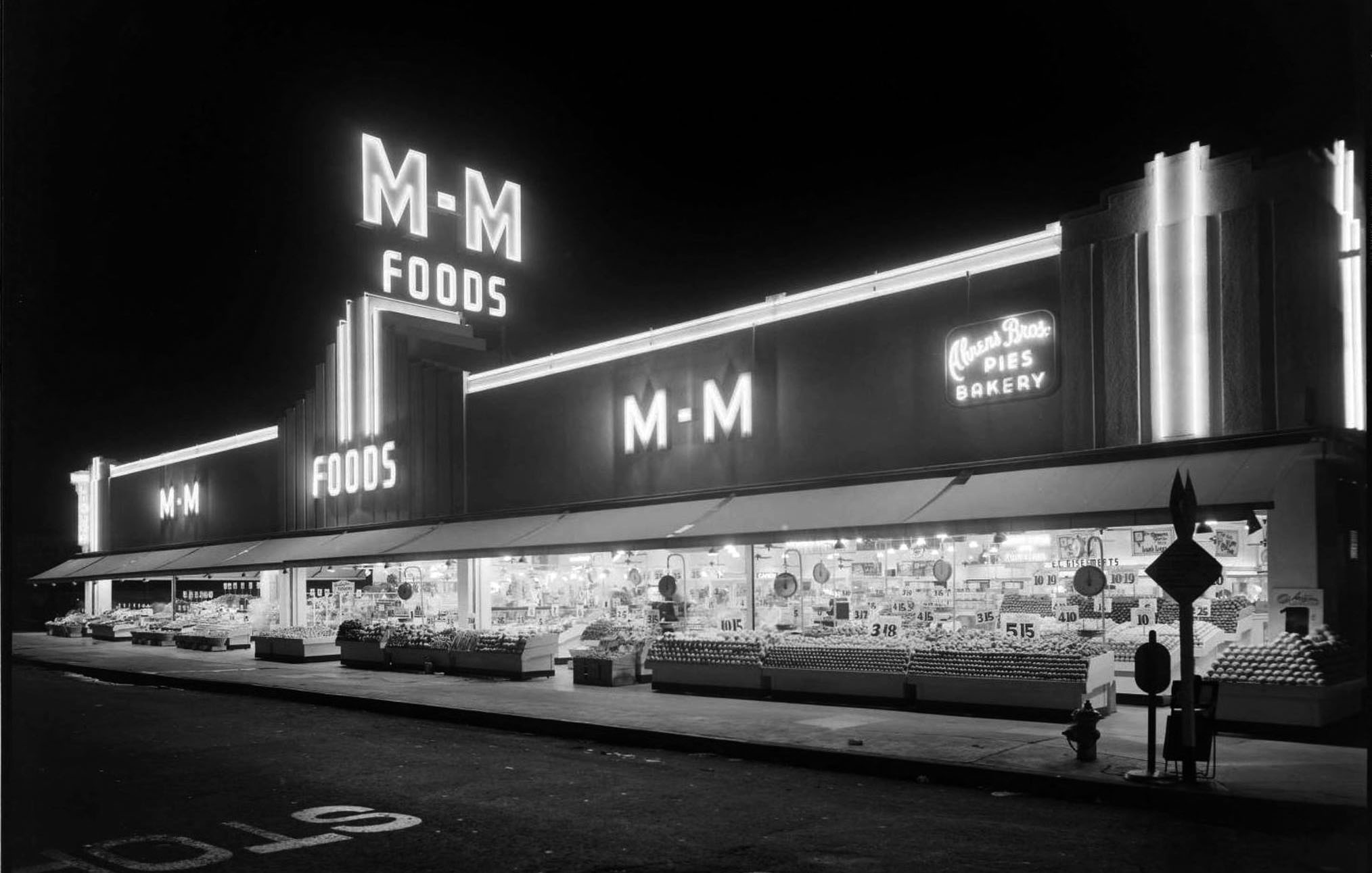
| (1939)^.^ – View showing M-M Foods located on the SE corner of Huntington Drive and Fremont Ave in South Pasadena. Photo by G. Haven Bishop, Huntington Library. |
Historical Notes M-M Foods Market later became El Rancho Market, now its a Big Lots. Click HERE for contemporary view. |
Don't Rain on My Parade!
 |
|
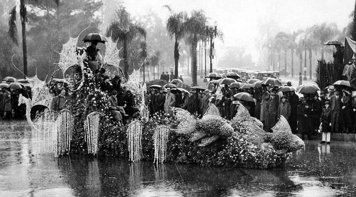
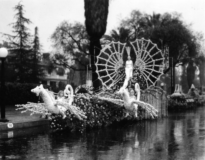
| (1934)^^* – Tournament Roses queen Treva Scott, top of float with umbrella, and her court during a rainstorm. |
Historical Notes It has rained ten times on the Rose Parade, but the parade has never been canceled due to weather. Those rainy years were 1895, 1899, 1906, 1910, 1916, 1922, 1934, 1937, 1955, and 2006. |
 |
|
| (1934)* - A Los Angeles Chamber of Commerce float in the 1934 Tournament of Roses Parade. The street is wet. |
Rose Bowl (1930s and 1940s)
 |
|
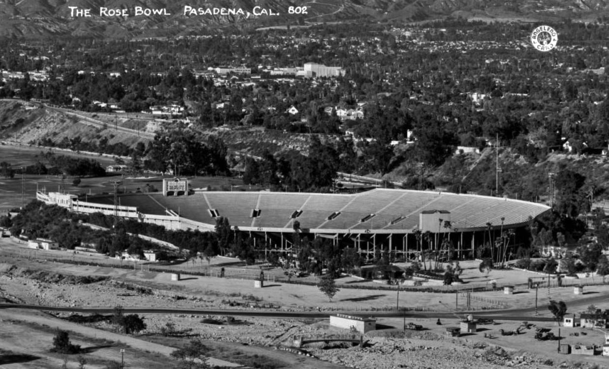
| (1930s)#* - Postcard view looking north showing the Rose Bowl stadium in the Arroyo Seco canyon area. The cities of Pasadena and Altadena are in the distance, with the San Gabriel Mountains in the background. Sign visible over scoreboard reads, "Rodeo Wild West Circus here Sat. Oct. 15th, 2.00." |
Historical Notes The southern stands were completed in 1928. |
 |
|
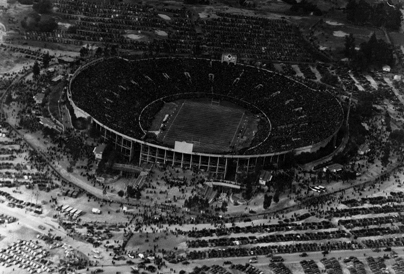
| (1937)* - Rose Bowl football is the classic of all "bowl" games. Here is how grid fans from all corners of--from New York to Seattle to Miami to Los Angeles--appear from above when this annual Pasadena classic is staged. This Kopec Air photo, taken from the Goodyear airship Volunteer, piloted by Art T. Sewell, shows the capacity crowd which witnessed Washington's demise when they met Pittsburgh. Pittsburgh Panthers 21 - Washingtion Huskies 0. Photo dated: January 2, 1937. |
 |
|
| (ca. 1939)#* - Aerial view, looking south, of the Rose Bowl in the Arroyo Seco canyon area of Pasadena showing the stadium and parking lot filled to capacity. The Arroyo Seco storm channel is seen at right. |
Historical Notes The Arroyo Seco Storm Channel was built during the late 1930s. |
 |
|
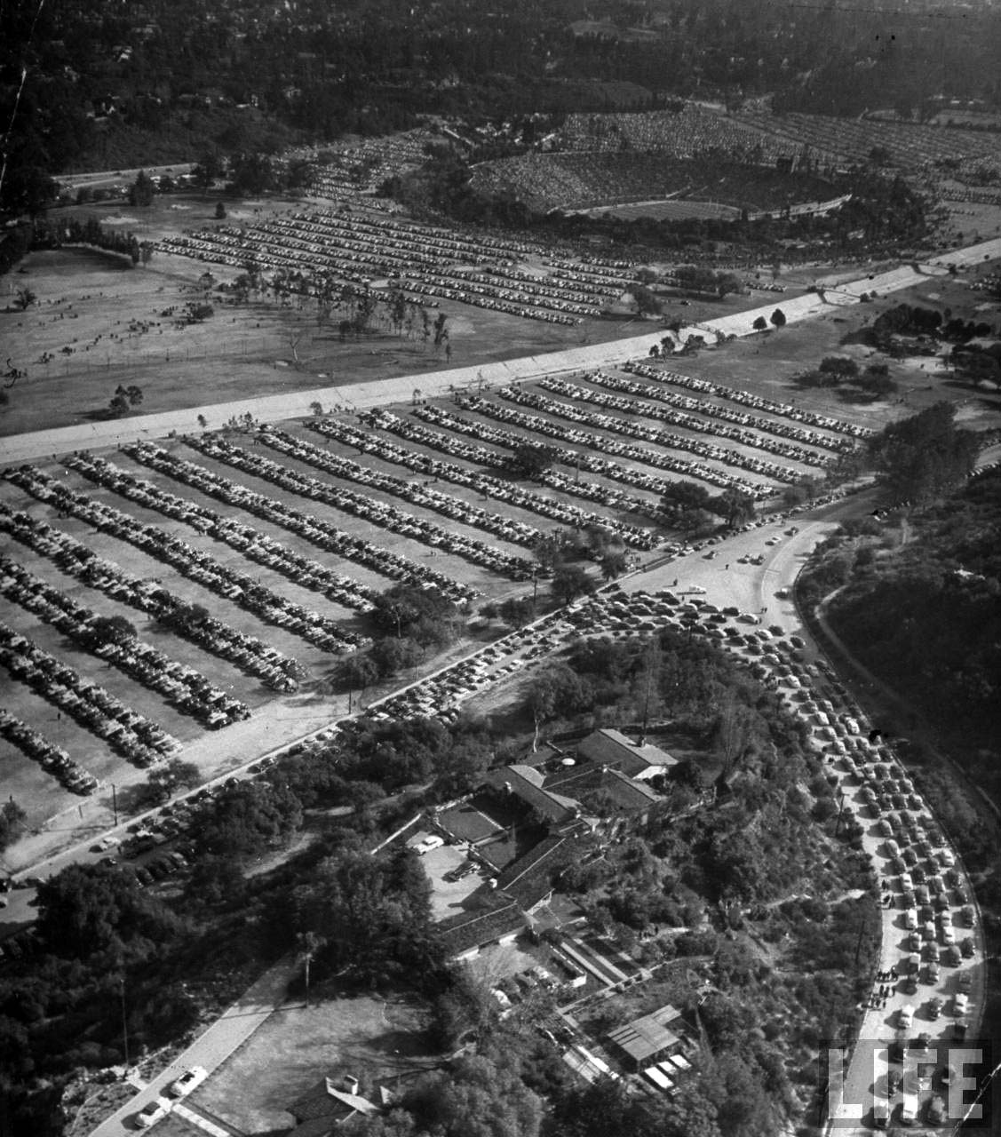
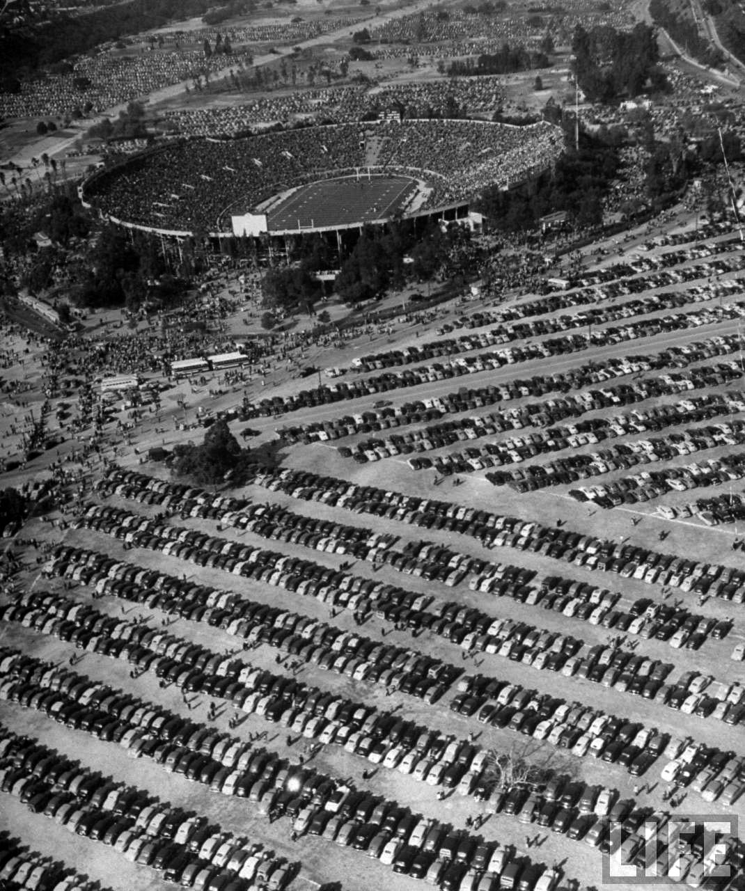
| (1949)^*# – Aerial view looking down toward the Rose Bowl as fans arrive and parking lots fill up. |
 |
|
| (1949)^*# – Closer view showing a full house at the Rose Bowl and parking lot packed with cars as far as the eye can see. |
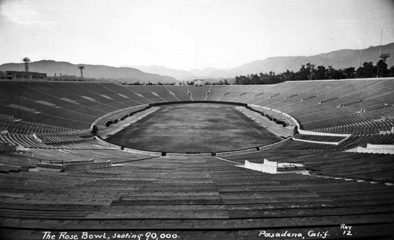 |
|
| (ca. 1940s)#* - View of the Rose Bowl stadium in Pasadena, showing the empty bleachers with seating for 90,000. |
Historical Notes By 1950 the Rose Bowl Stadium saw its fourth expansion when its capacity increased to 100,983. The Rose Bowl Game became the first bowl game to have 100,000 spectators in attendance.*^ |
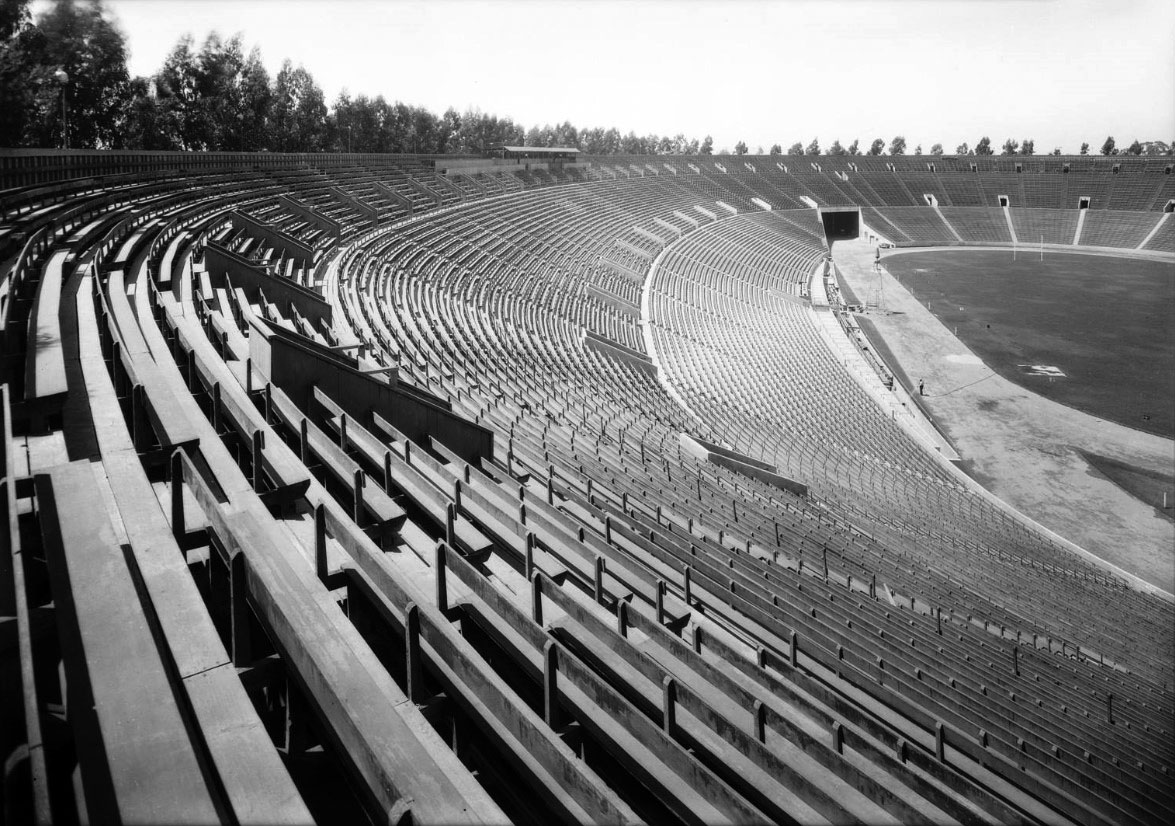 |
|
| (1950 +)^ – Rose Bowl capacity 100,000. |
* * * * * |
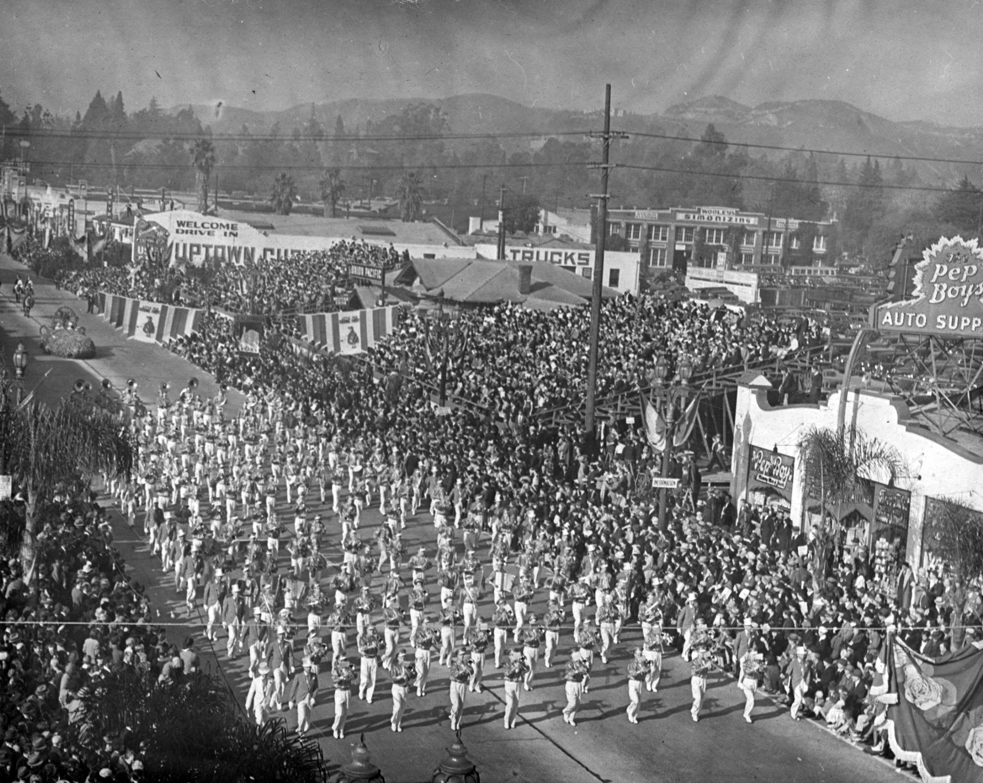 |
|
| (1937)*^* – View showing the Pasadena Junior College’s Tournament Band marching in the 1937 Tournament of Roses Parade. |
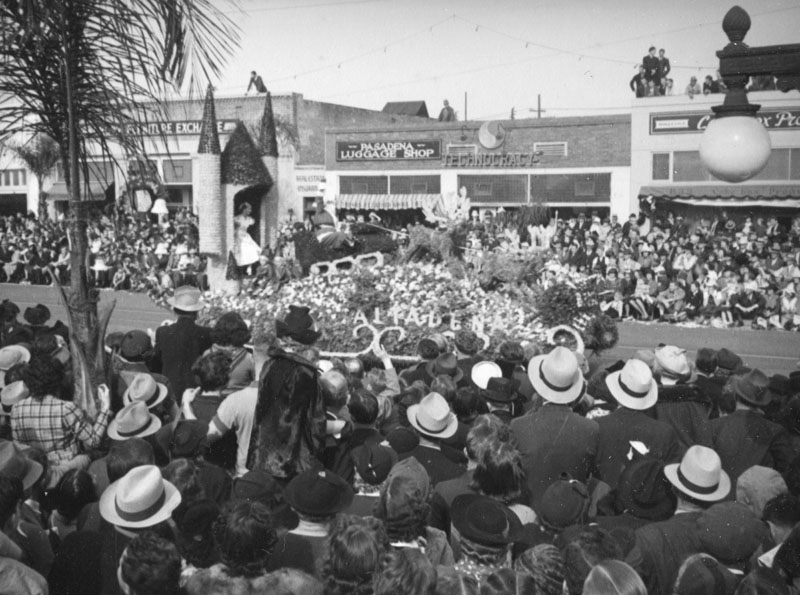 |
|
| (1938)* - Crowds watch an Altadena float that features a castle and Santa Claus with his reindeer at the Rose Parade held January 1, 1938. This float won first place in its city size category. Some businesses that can be seen on the north side of Colorado Boulevard between Hudson and Lake include: Pasadena Luggage Shop and, behind the light pole on the far right, Cake Box Products (839 East Colorado Boulevard). |
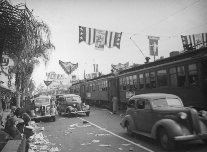 |
|
| (1938)* - A streetcar competes with automobile traffic and litter after the Rose Parade held January 1, 1938. The Banners across the street are connected to the streetcar lines, and although one banner is for Robin Hood, the central one is for Alabama, one of the two state teams playing in the Rose Bowl later that day. The Thrifty Drug Store visible on the far left was located at 355 East Colorado Boulevard. |
 |
|
| (1938)**# – View showing two streetcars heading in opposite directions at the intersection of Colorado and Lake. A used car lot can be seen on the southwest corner. |
 |
|
| (1936)#* - Street view of the building at 341-345 East Colorado. Some of the businesses in this space are the Colorado Inn Cafe, Whitfords Florists, and a jewelers. Two women stand outside of the cafe and a man stands in the doorway of the florist. Two automobiles are parked on the street in front of the buildings. |
 |
|
| (1936)** – View of an auto on a trailer truck in front of A. R. Ahrens Ford Sales and Service on W. Colorado Street. |
Historical Notes A. R. Ahrens Ford Sales and Service was located at 285 W. Colorado, near the Old Town area in Pasadena. The auto on the trailer is a 1935 Ford V-8 Fordor sedan.** |
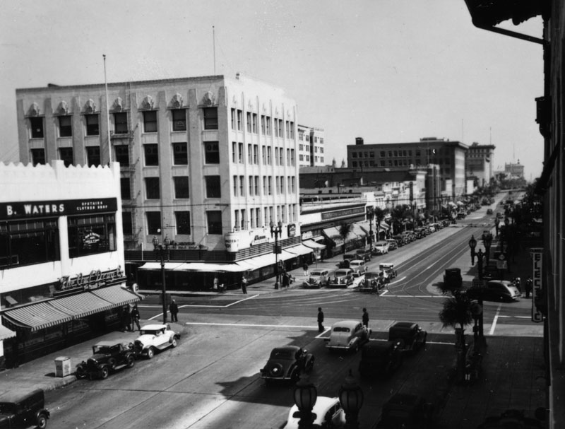 |
|
| (1937)* - The intersection of Colorado Blvd. and Fair Oaks Avenue in Pasadena on October 3, 1937. View is toward the east. |
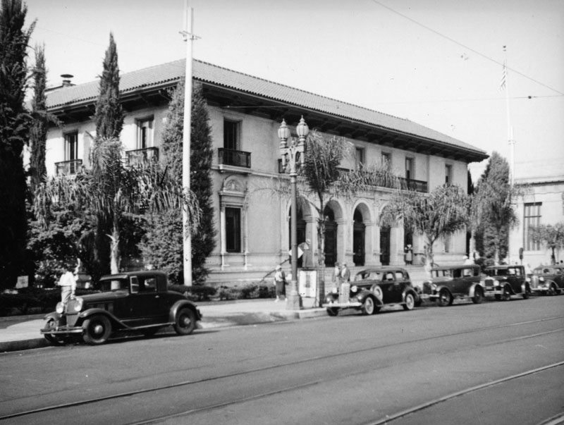 |
|
| (ca. 1937)* - Looking northeast towards the post office in Pasadena, located at 281 E Colorado Boulevard. Two sets of streetcar tracks are visible on the boulevard. |
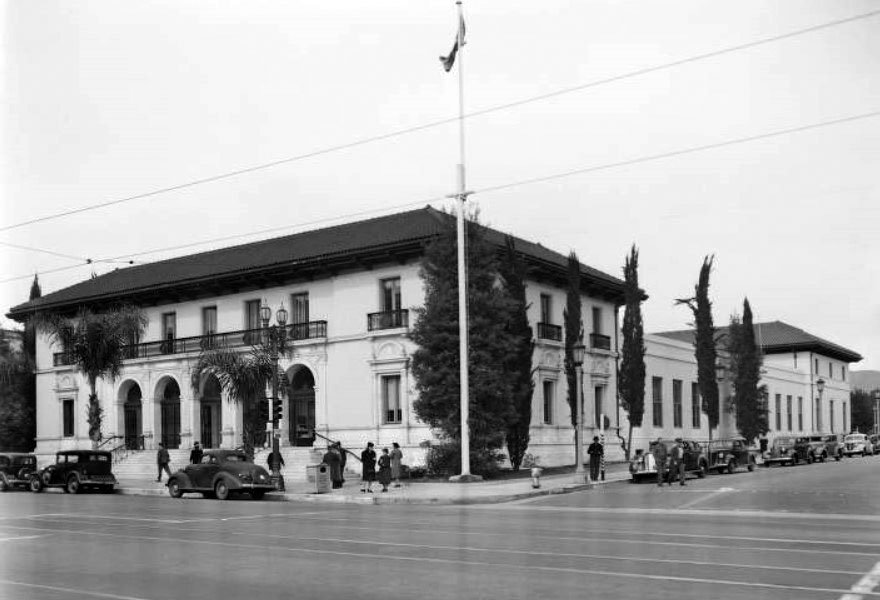 |
|
| (1939)#* - View looking toward the northwest corner of E. Colorado and Garfield Avenue showing a tall flagpole standing in front of the Post Office. Pedestrians are seen walking by the building with automobiles parked along the street. |
Historical Notes In early 2012, the post office building was renamed "First Lieutenant Oliver Goodall Post Office Building," in honor of an Altadena resident and Tuskegee Airman. Goodall lived in Altadena from 1961 until his death in November 2010. Goodall entered the service at Tuskegee in February 1943. In October 1944, he graduated as a multi-engine pilot and was assigned to the 477th Bomber Group at Godman Field, Kentucky, in January 1945, where he attained his First Pilots rating in six months. Goodall was among 60 African American U.S. Army Air Corps officers arrested for trying to peacefully integrate an all-white officers’ club, which came to be known as the Freeman Field Mutiny. The ‘mutiny’ was an important step toward full integration of all U.S. armed forces worldwide in June 1949, serving as a model for later Civil Rights efforts to integrate public facilities.* |
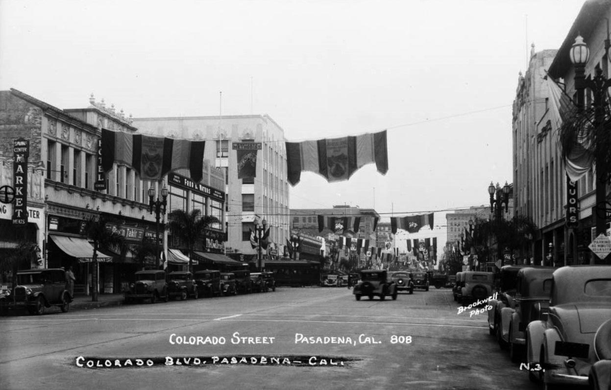 |
|
| (ca. 1936)#*– Postcard view of Colorado Street (now Colorado Boulevard), in Pasadena, showing buildings, storefronts and automobiles. A streetcar is coming onto the street from a cross street, at left. Some of the businesses seen are "The Belmont" "Central Hotel" "Owl Drug Co." a barber pole, market, and liquor store. A sign for "Route 66" is on pole at right. Flags and banners hang over the street - one says "Southern Methodist University."* |
Historical Notes In the 1936 Rose Bowl, Stanford played Southern Methodist University and beat them 7 – 0. The only Rose Bowl team from Texas in the game’s first 92 editions, SMU suffered its first loss of the season in front of the game’s first ever sellout crowd of 84,784 while Stanford avenged consecutive Rose Bowl losses the previous two years. |
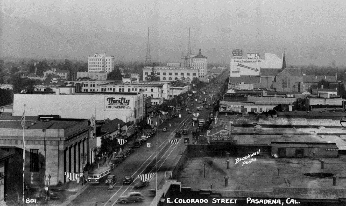 |
|
| (ca. 1939)#* - Bird's-eye-view of Colorado Street (now Colorado Boulevard), in Pasadena, showing buildings, buses and automobiles. Some of the businesses seen are "Thrifty" "Sears, Roebuck and Co." "Pasadena Corset Shop." The Pasadena Star-News Building, with the two radio towers on its roof, can be seen in the distance. In the foreground (lower-left) is the First National Bank building located at 301 East Colorado St. |
Historical Notes Colorado Street was renamed "Boulevard" in 1958. |
 |
|
| (1938)* - Exterior view of the Pasadena Star News newspaper office and radio station on Colorado Street and Oakland Ave. Radio towers are visible on the roof of the four-story building. |
Historical Notes First published in 1884, the Pasadena Star-News moved into the building in 1925 and stayed until the 1990s. Click HERE to see more views of this beautiful Beaux-Arts style building which still stands today. |
 |
|
| (1938)*^* – View showing the first library building on Dayton Street (originally located on the corner of Colorado and Raymond). |
Historical Notes The building was originally built in 1884 at the corner of Colorado and Raymond. In 1886 the building was moved to Dayton Street. The second floor was used for meetings of the Independent Order of Good Templars and the Ancient Order of United Workmen.*^* |
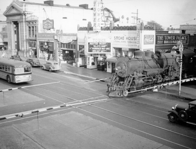 |
|
| (ca. 1938)* – View of a train passing by the Tower Theatre in Pasadena, located at 114 E. Colorado Blvd. |
Historical Notes The Tower Theatre opened in 1930 and was designed by architect B.G. Horton, who also designed the Barney’s Beanery building across the street and the elegant MacArthur Building at 24 N. Marengo Avenue. Next door was a tobacco shop and a pool hall—The Tower Palace, and beyond that, the Sante Fe railroad line, which used to rattle the theater like a Southern California temblor. #^^ |
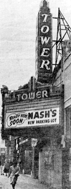 |
(ca. 1952)**^^ - The Tower Theatre opened in 1930 and it closed 22 years later, in 1952. A parking lot occupies the spot where the Tower Theater once stood—between railroad tracks and the Anderson Typewriter Company.
|
Historical Notes Hardly a spectacular movie palace, the Tower Theatre nevertheless attracted the youth of Pasadena. “We used to go there on Saturday mornings for serials—Tom Mix, Hopalong Cassidy, and Bob Steele,” recalled former Pasadena city councilman Chuck McKenney in a 2000 interview with the Pasadena Star-News. #^^ |
* * * * * |
California Institute of Technology (Caltech)
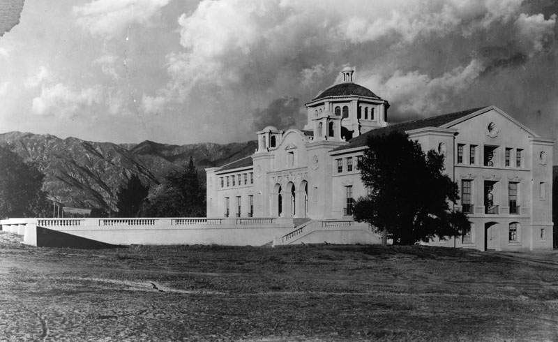 |
|
| (ca. 1912)* - Throop Hall first opened its doors to the public on February 5, 1910. Known then as Pasadena Hall, it was the first building on the new campus of Throop Polytechnic Institute. |
Historical Notes Caltech began as a vocational school founded in Pasadena in 1891 by local businessman and politician Amos G. Throop. The school was known successively as Throop University, Throop Polytechnic Institute (and Manual Training School), and Throop College of Technology, before acquiring its current name in 1920. The vocational school was disbanded and the preparatory program was split off to form an independent Polytechnic School in 1907. In 1910, Throop moved to its current site. Arther Fleming donated the land for the permanent campus site. Theodore Roosevelt delivered an address at Throop Institute on March 21, 1911, and he declared: “I want to see institutions like Throop turn out perhaps ninety-nine of every hundred students as men who are to do given pieces of industrial work better than any one else can do them; I want to see those men do the kind of work that is now being done on the Panama Canal and on the great irrigation projects in the interior of this country—and the one-hundredth man I want to see with the kind of cultural scientific training that will make him and his fellows the matrix out of which you can occasionally develop a man like your great astronomer, George Ellery Hale.” *^ |
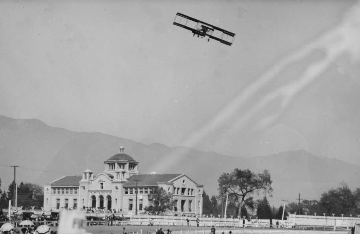 |
|
| (1914)*^* - View looking north from Tournament Park showing a biplane soaring above Throop Hall. |
 |
|
| (1922)^.^ – Aerial view of the Caltech Campus showing Throop Hall, completed in 1910; Gates Chemical Lab. built in 1917; Bridge Physics Lab. and Culbertson Hall completed in 1922. |
Historical Notes Although founded as a preparatory and vocational school by Amos G. Throop in 1891, the college attracted influential scientists such as George Ellery Hale, Arthur Amos Noyes, and Robert Andrews Millikan in the early 20th century. The vocational and preparatory schools were disbanded and spun off in 1910, and the college assumed its present name in 1921.*^ |
 |
|
| (ca. 1920s)^.^ – View showing Robert Millikan on the Caltech campus with Throop Hall in the background. He is pointing to the High-Voltage Lab (now Sloan). |
Historical Notes Robert Millikan was the 1st President of California Institute of Technology and in office between 1920 and 1946. In 1914 Millikan worked on the experimental verification of the equation introduced by Albert Einstein in 1905 to describe the photoelectric effect. He used this same research to obtain an accurate value of Planck’s constant. In 1921 Millikan left the University of Chicago to become director of the Norman Bridge Laboratory of Physics at the California Institute of Technology (Caltech) in Pasadena, California. There he undertook a major study of the radiation that the physicist Victor Hess had detected coming from outer space. Millikan proved that this radiation is indeed of extraterrestrial origin, and he named it "cosmic rays." As chairman of the Executive Council of Caltech (the school's governing body at the time) from 1921 until his retirement in 1945, Millikan helped to turn the school into one of the leading research institutions in the United States. He also served on the board of trustees for Science Service, now known as Society for Science & the Public, from 1921 to 1953. Robert Millikan was honored with the Nobel Prize for Physics in 1923 for the measurement of the elementary electric charge and for his work on the photoelectric effect.* |
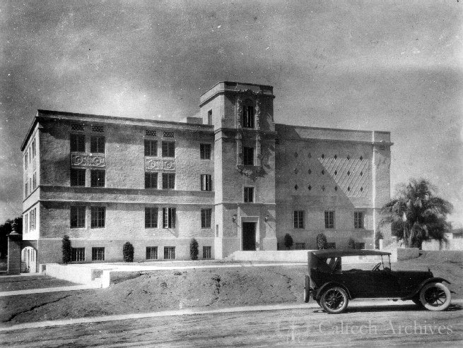 |
|
| (ca. 1922)^.^ – An early model car is parked in front of the Hi Volts Lab (now Sloan Laboratory). |
Historical Notes Since 1923, Caltech faculty and alumni have garnered 32 Nobel Prizes and five Crafoord Prizes. |
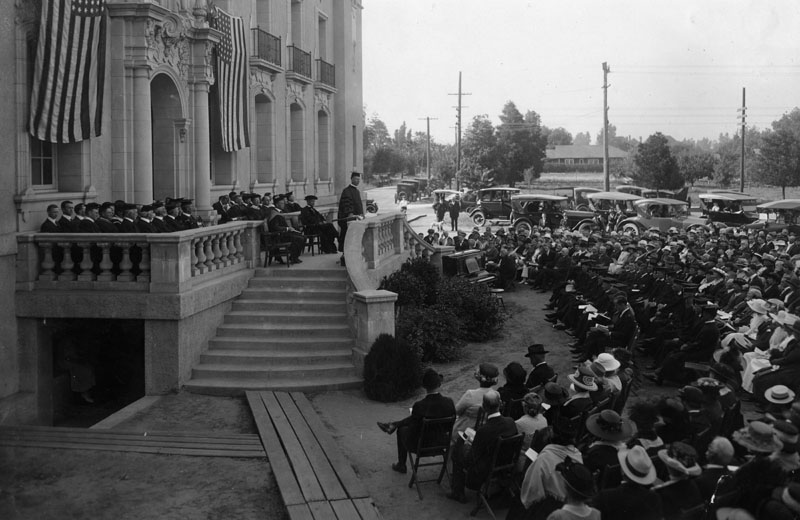 |
|
| (ca. 1930)* - Graduation ceremonies held at the California Institute of Technology, in Pasadena. Graduating students are sitting in the front (middle), surrounded by family and friends. |
|
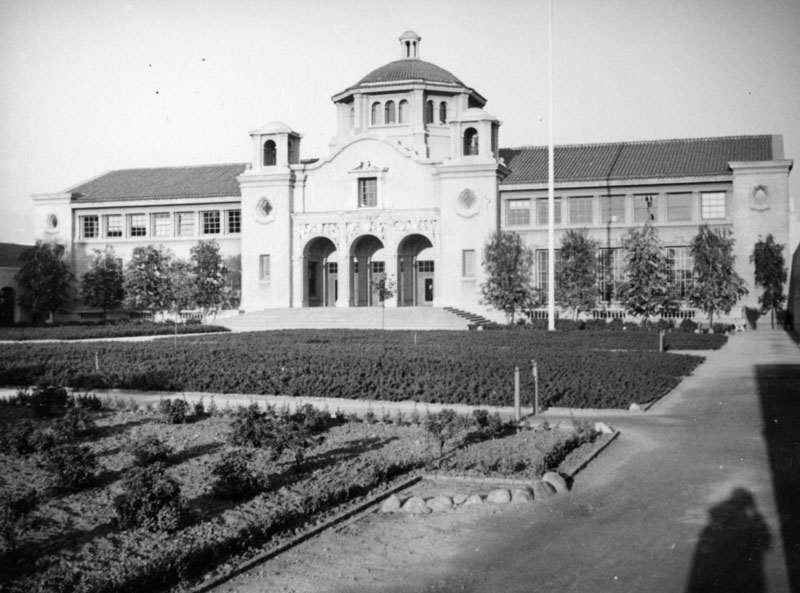
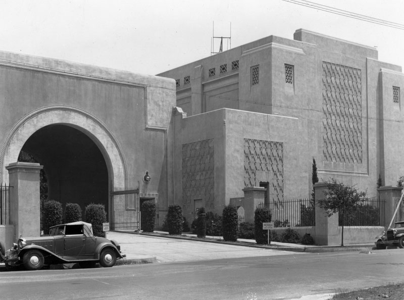 |
|
| (1930s)* - The large building on the right is the Optical Shop in which a 200-inch disc of pyrex glass was ground and polished preparatory to being installed in the Observatory on Palomar Mountain in San Diego County. |
Historical Notes At a time when scientific research in the United States was still in its infancy, George Ellery Hale, a solar astronomer from the University of Chicago, founded the Mount Wilson Observatory in 1904. He joined Throop's board of trustees in 1907, and soon began developing it and the whole of Pasadena into a major scientific and cultural destination.*^ |
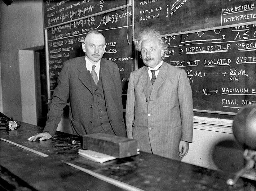 |
|
| (1932)^*^ - Richard Tolman of Cal Tech stands next to Albert Einstein in 1932. Einstein came for a visit because he was interested in Cal Tech's work. |
Historical Notes Albert Einstein arrived on the Caltech campus for the first time in 1931 to polish up his Theory of General Relativity, and he returned to Caltech subsequently as a visiting professor in 1932 and 1933. Since 2000, the Einstein Papers Project has been located at Caltech. The project was established in 1986 to assemble, preserve, translate, and publish papers selected from the literary estate of Albert Einstein and from other collections.*^ |
Robinson Laboratory
 |
|
| (1939)* - Exterior view of the Astro-Physics Laboratory (aka Robinson Laboratory) at the California Institute of Technology in Pasadena. |
Historical Notes Built in 1932, the awe-inspiring observatory was designed in an eclectic Californian Churrigueresque style, with nods to Art Deco, designed by famed architects Mayers Murray & Phillip. The laboratory, along with the rest of Caltech's exuberant campus, is one of the most exquisite and unique executions of Churrigueresque architecture in all of California. Famed astronomer Fritz Zwicky discovered the existence of Dark Matter while working in the basement of the Robinson Lab in 1933. The laboratory housed Caltech's astronomers and astrophysicists for nearly eighty years. Among countless achievements made here, Caltech co-founder and renowned astrophysicist George Ellery Hale led the construction of the 200-inch telescope on Mount Palomar. In 2008, Caltech began transforming the building into the new Ronald and Maxine Linde Center for Global Environmental Science, devoted to developing solutions to the world's complex environmental problems. The rehabilitation and restoration earned the project a Conservancy Preservation Award in 2012.* |
* * * * * |
 |
|
| (1945)^^* - Workers at the California Institute of Technology Optical Shop pose with the mirror of a 200-inch Palomar Observatory telescope |
Historical Notes After the end of World War II, grinding work was resumed on the mirror. Work had been halted in 1942 when engineers, scientists and Caltech laboratories were assigned war-related work. The mirror was transported to Palomar Observatory in 1947. The 200-inch telescope was dedicated in 1948.^^* |
 |
|
| (1939)* - Exterior view of Arms Hall (left) and Mudd Hall (right), Geology studies, at the California Institute of Technology in Pasadena on May 5, 1939. They are located on the south side of the quad. |
Historical Notes In 1910, a bill was introduced in the California Legislature calling for the establishment of a publicly funded "California Institute of Technology," with an initial budget of a million dollars, ten times the budget of Throop at the time. The board of trustees offered to turn Throop over to the state, but the presidents of Stanford University and the University of California successfully lobbied to defeat the bill, which allowed Throop to develop as the only scientific research-oriented education institute in southern California, public or private, until the onset of the World War II necessitated the broader development of research-based science education. The promise of Throop attracted physical chemist Arthur Amos Noyes from MIT to develop the institution and assist in establishing it as a center for science and technology.*^ |
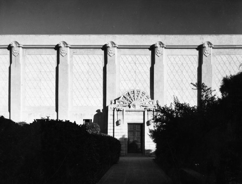 |
|
| (1939)* - Exterior view of High Tension Laboratory at the California Institute of Technology. View shows the architectural designs over the entrance and on the building. View of entrance and facade. Architect: Goodhue and Associates. Date built: c. 1925. |
Historical Notes In the 1950s–1970s, Caltech was the home of Murray Gell-Mann and Richard Feynman, whose work was central to the establishment of the Standard Model of particle physics. Feynman was also widely known outside the physics community as an exceptional teacher and colorful, unconventional character.*^ |
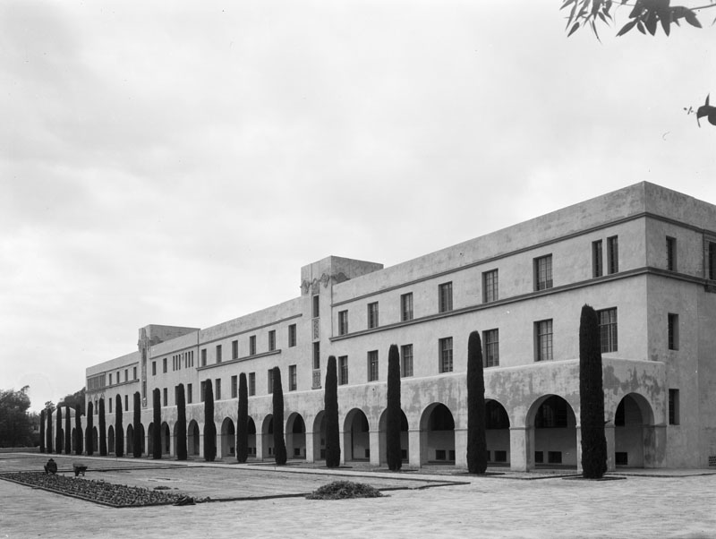 |
|
| (1939)* - Exterior view of the Kerckhoff Biological Laboratory at the California Institute of Technology |
Historical Notes In addition to managing JPL, Caltech also operates the Palomar Observatory in San Diego County, the Owens Valley Radio Observatory in Bishop, California, the Submillimeter Observatory and W. M. Keck Observatory at the Mauna Kea Observatory, the Laser Interferometer Gravitational-Wave Observatory at Livingston, Louisiana and Richland, Washington, and Kerckhoff Marine Laboratory in Corona del Mar, California.*^ |
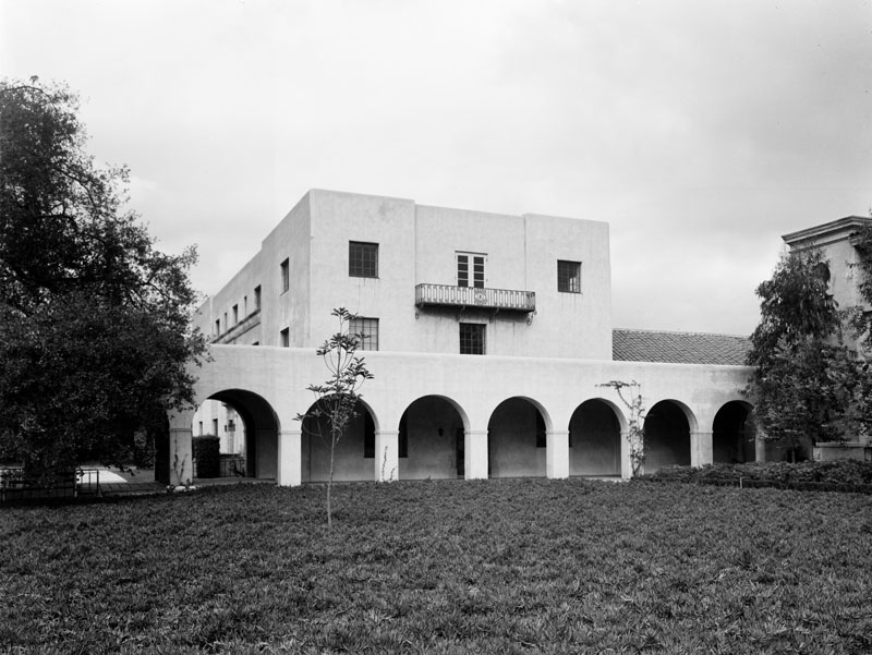 |
|
| (1939)* - Exterior view of Dabney Hall of the Humanities at the California Institute of Technology in Pasadena. |
Historical Notes Caltech opened its doors to female undergraduates during the presidency of Harold Brown in 1970, and they made up 14% of the entering class. The fraction of female undergraduates has been increasing since then. In fall 2008, the freshman class was 42% female, a record for Caltech's undergraduate enrollment.*^ |
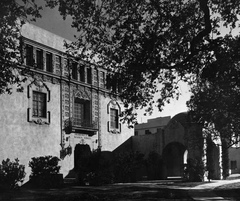 |
|
| (1939)* - Exterior view of the Biological Sciences building and Arcade Pavilion at the California Institute of Technology. View also shows the architectural designs above the entrance and around the windows of the building. West entrance of simplified Beaux Arts style laboratory building executed in poured concrete. Architect: Goodhue and Associates. Date built: ca. 1929. |
Historical Notes Caltech has six academic divisions with strong emphases on science and engineering. Caltech was ranked 1st internationally in 2011 and 2012 by the Times Higher Education World University Rankings. Caltech was ranked as the best university in the world in two categories: Engineering & Technology and Physical Sciences. It was also found to have the highest faculty citation rate in the world.*^ |
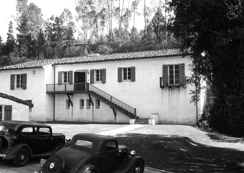 |
|
| (1939)* - Exterior view of the Carnegie Seismological Institution Laboratory in Pasadena on May 4, 1939. |
Historical Notes In 2012, the Center for World University Rankings ranked Caltech fifth in the world and fourth nationally in its CWUR World University Rankings.*^ |
* * * * * |
Pacific-Asia Museum
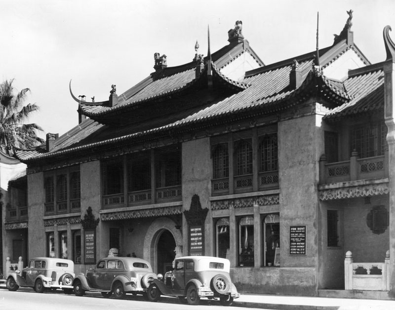 |
|
| (1939)* - Exterior view of the Grace Nicholson Bazaar and Art Gallery, now the Pacific-Asia Museum. Photo is dated July 26, 1939. Mrs. Nicholson was a dealer in Oriental art and books, and this was her shop and home. Later it became the Pasadena Art Institute. This photo shows that she rented apartments, store space and assembly halls in this building. |
Historical Notes Grace Nicholson, a noted collector and authority on American Indian and Asian Art and artifacts, supervised the design of her combination gallery and museum which was completed in 1929. It has been called an outstanding example of 1920s revival architecture and is unique for its use of Chinese ornamentation. Since then it has been designated as a California Historical Landmark, No. 988, located at 46 North Los Robles Ave, Pasadena. Click HERE to see more California Historical Landmarks in LA County.^* |
|

Historical Notes In 1901, Grace Nicholson moved to California, and soon opened a small shop in Pasadena, selling Native American handicrafts such as baskets and weaving. She hired crafters to teach traditional beadwork and other skills; she rented space to local artists. She traveled extensively in the rural western and Southwestern United States, worked with local dealers to build her collection, and corresponded with East Coast collectors to sell the objects. She personally photographed and catalogued her holdings; she also built an extensive photographic record beyond the objects, especially of the Klamath River people, with whom she had frequent dealings. Nicholson acquired artifacts for sale, but also for major museums such as the Smithsonian Institution and the Field Museum in Chicago. She lectured about "the Indian" to churches and civic groups. In recognition of her expertise, Nicholson was elected to the American Anthropological Association in 1904. As a member of the "Anthropological Society," she joined a tour group that visited horticulturist Luther Burbank in 1905, in Santa Rosa, California. In 1909, she was awarded a silver medal at the Alaska-Yukon-Pacific Exposition in Seattle, for a display of baskets and other artifacts. In 1924, she designed a new building for her collections, which (reflective of changing fashions) had begun to focus on Asian art. The architectural firm of Marston, Van Pelt & Maybury worked with Nicholson to realize her vision. Her design, nicknamed the "Treasure House," borrowed elements from buildings she had seen in China. The building was opened as an art gallery and shop in 1925, although the interior garden courtyard was not completed until 1929.*^ |
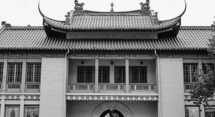 |
|
| (2018)^ – Close-up front view of the USC Pacific-Asia Museum. Photo courtesy of Pasadena Convention & Visitor Bureau |
Historical Notes In 2013, University of Southern California partnered with the museum to form USC Pacific Asia Museum. USC Pacific Asia Museum is the only university museum in the United States dedicated exclusively to the arts and culture of Asia and the Pacific Islands. The museum’s mission is to further intercultural understanding through the arts of Asia and the Pacific Islands. |
* * * * * |
War Memorial Building
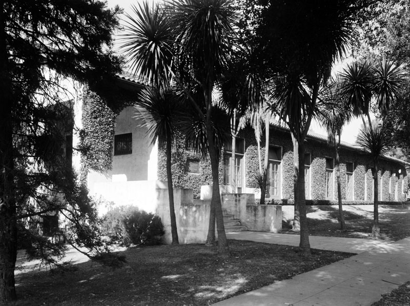 |
|
| (1939)* - Exterior view of War Memorial Building, located at 435 S. Fair Oaks Avenue in South Pasadena. Photo dated: March 3, 1939. |
Historical Notes The War Memorial Building, designed by Norman Foote Marsh, has served as a memorial to veterans and as a meeting place for South Pasadena's American Legion Post No. 140. In 1921, the cornerstone was laid and two years later General John J. Pershing planted a redwood tree on the grounds. The building is #2 on South Pasadena's Register of Cultural Heritage Landmarks.* |
* * * * * |
Millard House (aka "La Miniatura")
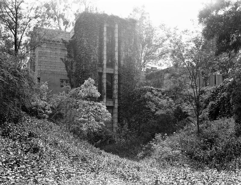 |
|
| (1939)* - Exterior view of the Millard House, named "La Miniatura", located at 645 Prospect Crescent in Pasadena. It was designed by architect Frank Lloyd Wright in a style resembling a Mayan temple, and set in a jungle-like landscape. |
Historical Notes The Millard House was the first of Frank Lloyd Wright's four "textile block" houses — all built in Los Angeles County in 1923 and 1924. Wright took on the Millard House following his completion of the Hollyhock House in Hollywood and the Imperial Hotel in Japan.*^ It was commissioned by rare book dealer Alice Millard, for whom Wright had already designed a home in Chicago in 1906. |
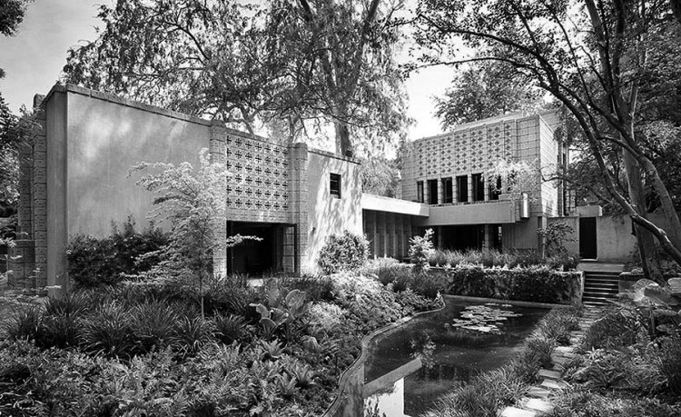 |
|
| (2011)^.^ – View showing the Millard House as it appears today. |
Historical Notes The 4,230 square foot home has four bedrooms and four bathrooms, two kitchens, and a studio guest house that was designed by Frank Lloyd Wright’s son, Lloyd Wright, a year after the original home was completed. Built in 1923, the house was listed on the National Register of Historic Places in 1976. |
* * * * * |
Rose Bowl
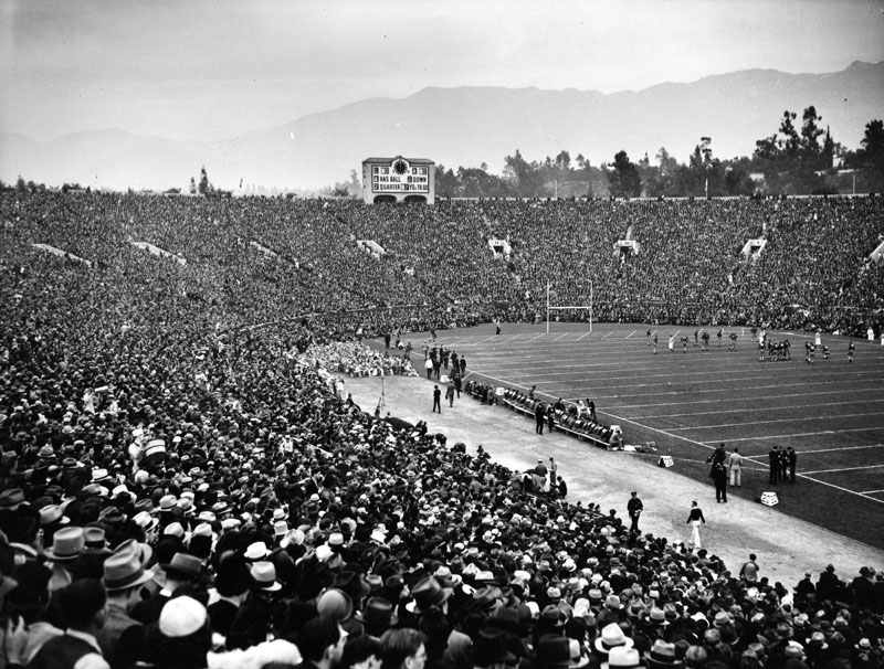 |
|
| (1939)* - View of a football game, played in front of a packed stadium at the Rose Bowl in Pasadena. Photo dated: June 22, 1939. |
Arroyo Seco Parkway (later Pasadena Freeway)
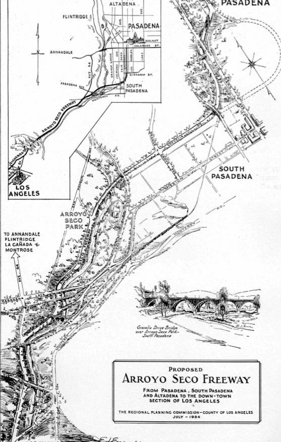 |
||
| (1934)^+^ - Map showing the proposed Arroyo Seco Freeway/Parkway from Pasadena, South Pasadena and Altadena to the Downtown section of Los Angeles. |
Historical Notes Built during the Great Depression, construction of the Arroyo Seco Parkway put a lot of people to work. At the time, it was considered an engineering marvel, reducing travel time between Los Angeles and Pasadena from 27 to 12 minutes. |
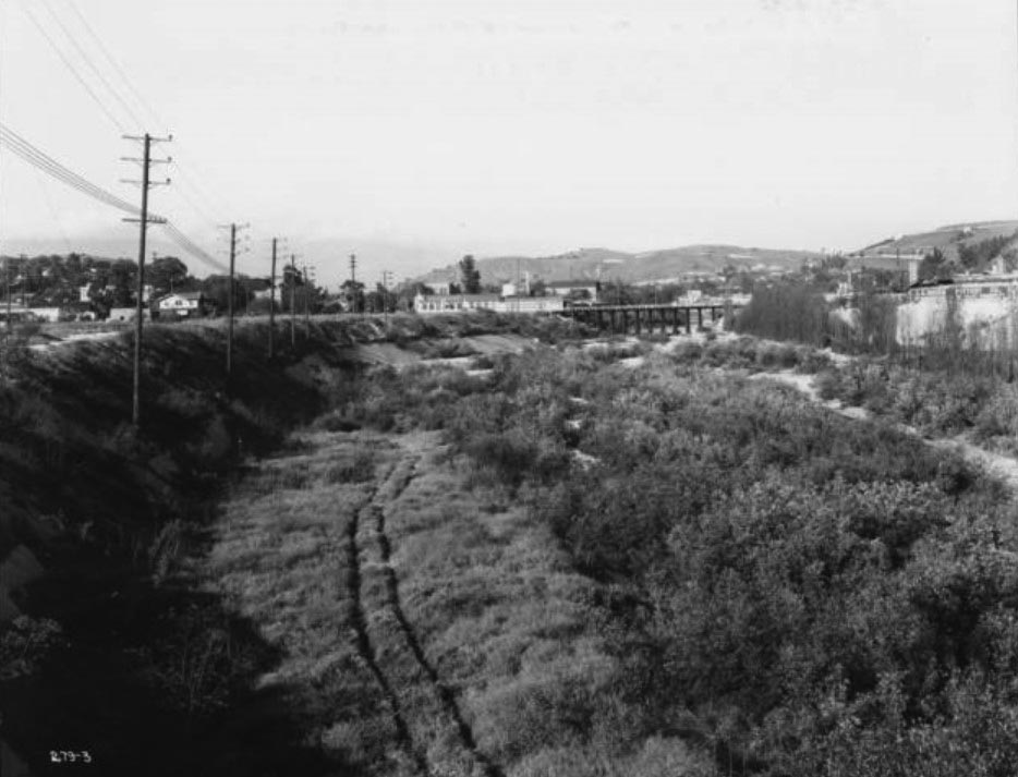 |
|
| (1936)*^* - View of the proposed Arroyo Seco Parkway location looking upstream from Avenue 26, toward Pasadena. The bridge in the center of the picture is the Cypress Avenue Bridge of the Union Pacific Railroad. The route of the proposed parkway follows along the left side of the wheel tracks in the foreground. The Sunshine Laundry Building can be seen next to the bridge. |
Historical Notes Before the Parkway was built, cottonwoods filled the Arroyo Seco at Avenue 26. The first known survey for a permanent roadway through the Arroyo was made by T.D. Allen of Pasadena in 1895, and in 1897 two more proposals were made, one for a scenic parkway and the other for a commuter cycleway.*^ |
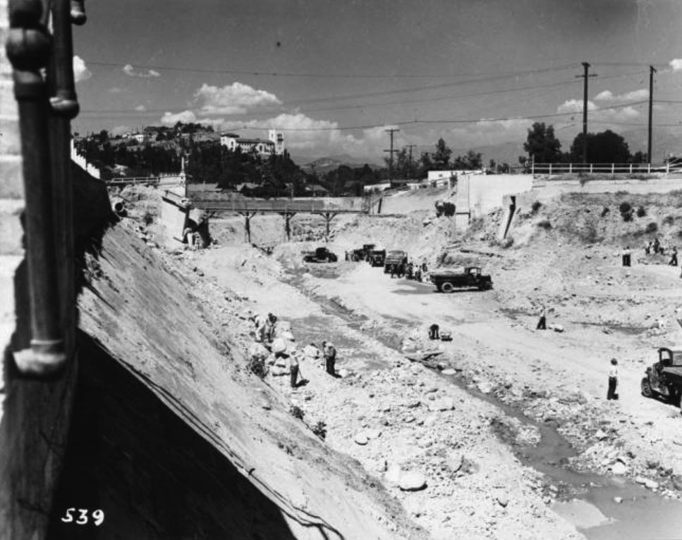 |
|
| (1938)*^* - Looking northeasterly showing the construction of the Arroyo Seco Parkway, with the demolition of old Avenue 43 Bridge in progress. The Southwest Museum is on the hill in the background. |
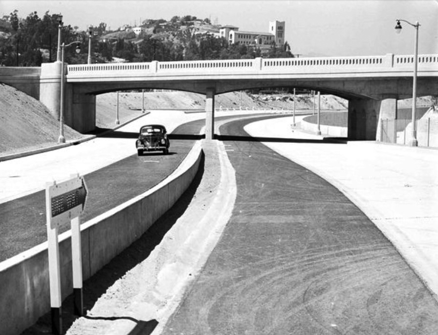 |
|
| (1940)*#* – View showing the Arroyo Seco Parkway shortly after its completion with the Southwest Museum in the background. |
Historical Notes The Arroyo Seco Parkway was the first freeway in California and the western United States, connecting Los Angeles with Pasadena alongside the Arroyo Seco seasonal river. It is notable not only for being the first, mostly opened in 1940, but for representing the transitional phase between early parkways and modern freeways. It conformed to modern standards when it was built, but is now regarded as a narrow, outdated roadway.*^ |
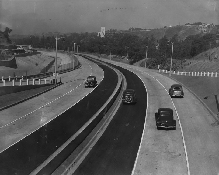 |
|
| (1940)* - Caption reads, "First motorists to travel over the new link are pictured at the Avenue 53 bridge. The freeway is divided in the center by a small parkway. Each side has three wide lanes for traffic. The new part runs from Avenue 40 to Orange Grove drive. The Glenarm-Fair Oaks section has been open some time." Photograph dated: July 20, 1940. The Southwest Museum can be seen in the distance. |
Historical Notes The Arroyo Seco Parkway was designed with two 11–12 foot lanes and one ten-foot shoulder in each direction, with the wider inside (passing) lanes paved in black asphalt concrete and the outside lanes paved in gray Portland cement concrete.*^ |
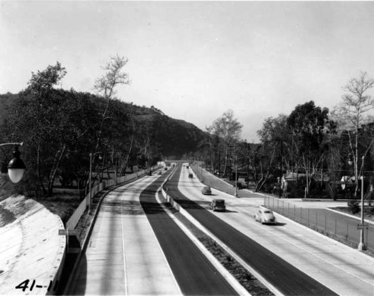 |
|
| (1941)^ - The Arroyo Seco Parkway shortly after it was completed. View is looking south from Avenue 60. Note the exit on the right is virtually a perpendicular right turn without an off-ramp or transition. |
Historical Notes At the time, it was considered an engineering marvel, reducing travel time between Los Angeles and Pasadena from 27 to 12 minutes. |
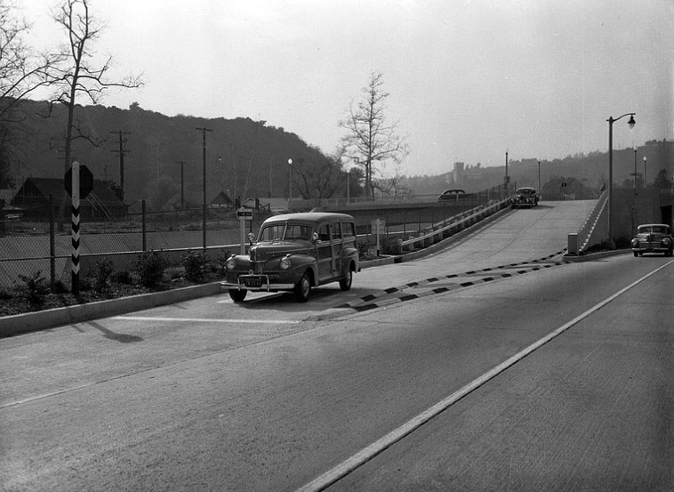 |
|
| (1942)^ - View of a 1941 Ford Woody, with the bumper-guard and dual spotlights options, waiting at the stop sign before proceeding unto the Arroyo Seco Parkway. |
Historical Notes The Arroyo Seco Parkway design, state-of-the-art when built, included tight "right-in/right-out" access with a recommended exit speed of 5 miles per hour and stop signs on the entrance ramps; there are no acceleration or deceleration lanes.*^ |
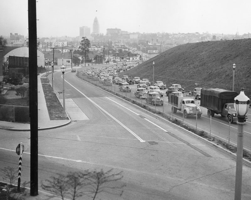 |
|
| (1949)* - View is of the Arroyo Seco Parkway, looking south from Bishops Road Bridge. The freeway is divided in the center by a small parkway. Each side has four wide lanes for traffic - though the southbound portion is not visible due to the parkway |
Historical Notes Today, the Arroyo Seco Parkway remains the most direct route between downtown Los Angeles and Pasadena despite its flaws; the only reasonable freeway alternate (which trucks must use) is the Glendale Freeway to the west, which is itself not easily reached by trucks from downtown Los Angeles. The state legislature designated the original section, north of the Figueroa Street Viaduct, as a "California Historic Parkway" (part of the State Scenic Highway System reserved for freeways built before 1945) in 1993. The American Society of Civil Engineers named it a National Civil Engineering Landmark in 1999, and it became a National Scenic Byway in 2002 and was added to the National Register of Historic Places in 2011.*^ |
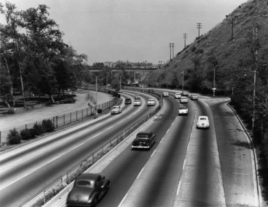 |
|
| (1955)*^* – View looking north at the Arroyo Seco Parkway from the Avenue 60 Bridge. |
Historical Notes When built in the 1930s the Arroyo Seco Parkway conformed to modern standards of the times (including a speed limit of 45 mph), but is now considered by many as too narrow and dangerous for the amount of vehicular traffic it serves on a daily basis. The six-lane, six-mile long highway was designed for 27,000 automobiles a day. These days, it carries more than 122,000 cars daily.**# |
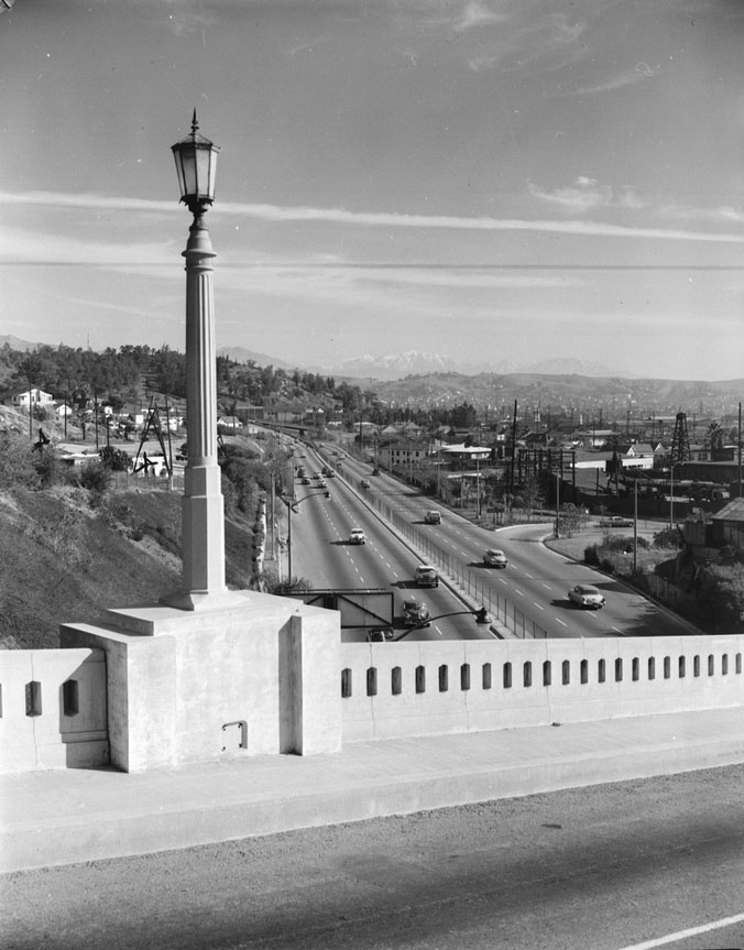 |
|
| (1955)^ - View looking north at Arroyo Seco Parkway (Pasadena Freeway) from College St. Bridge. In the distance can be seen the snow-capped San Gabriel Mountains. |
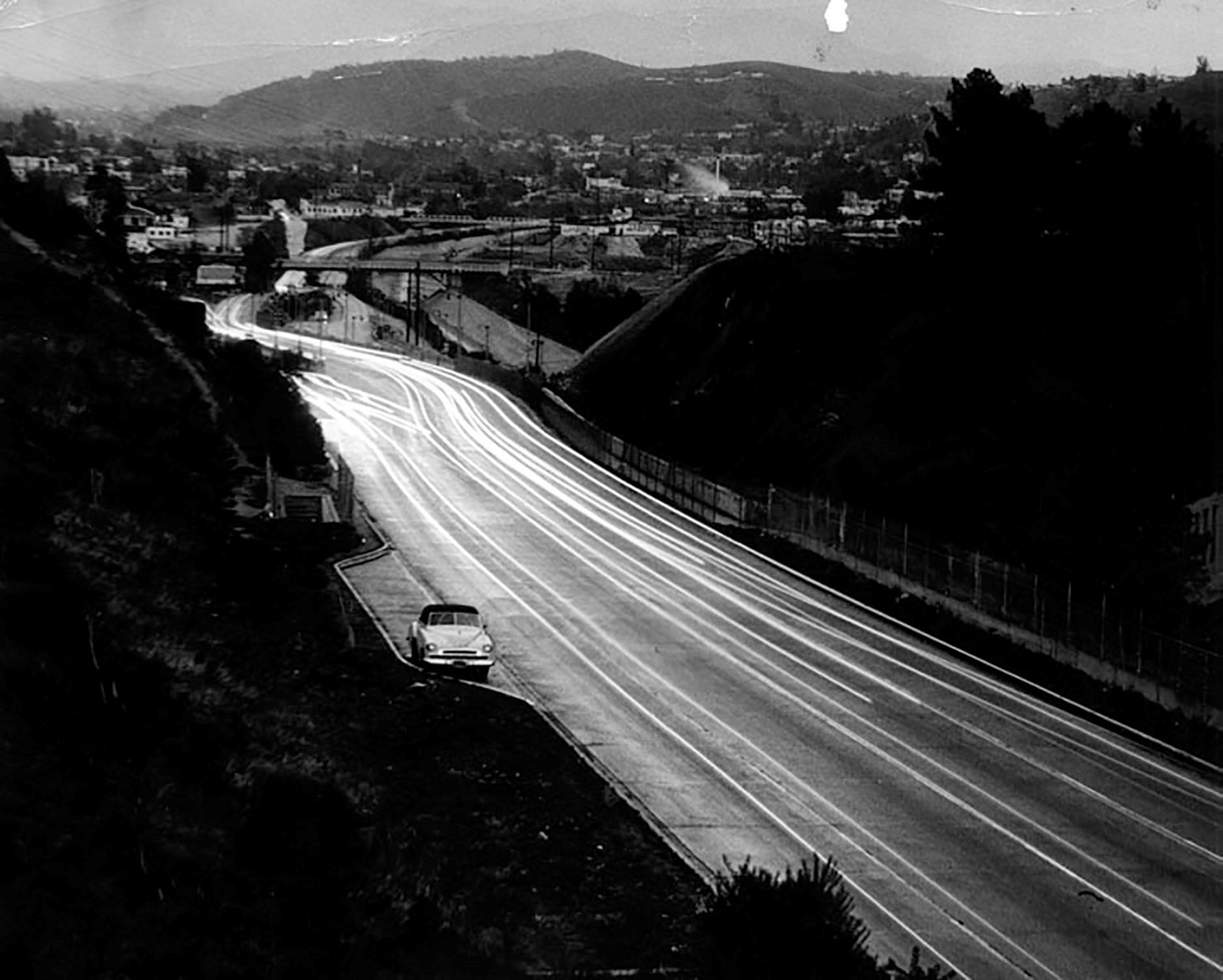 |
|
| (1948)* – Night view looking north on the 110 (Arroyo Seco Parkway) on a rainy day, with one car pulled over in the turnout. |
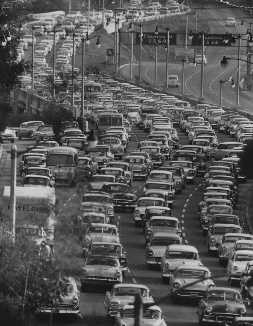 |
|
| (1950s)* – View showing densely packed traffic travelling southbound on the Pasadena Freeway, from Park Row Drive overlooking the Freeway near Civic Center. |
Historical Notes Between 1954 and 2010, Arroyo Seco Parkway was officially designated the Pasadena Freeway. In 2010, as part of plans to revitalize its scenic value and improve safety, Caltrans renamed the roadway back to its original name. All the bridges built during parkway construction remain, as do four older bridges that crossed the Arroyo Seco before the 1930s.*^ |
* * * * * |
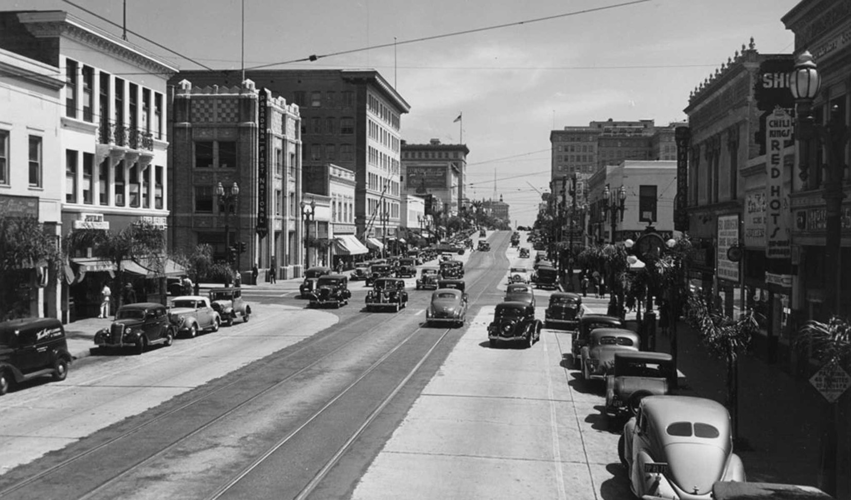 |
|
| (ca. 1940)* – Looking east on Colorado Boulevard towards Raymond where Pasadena First National Bank stands on the NE corner. |
Pasadena First National Bank
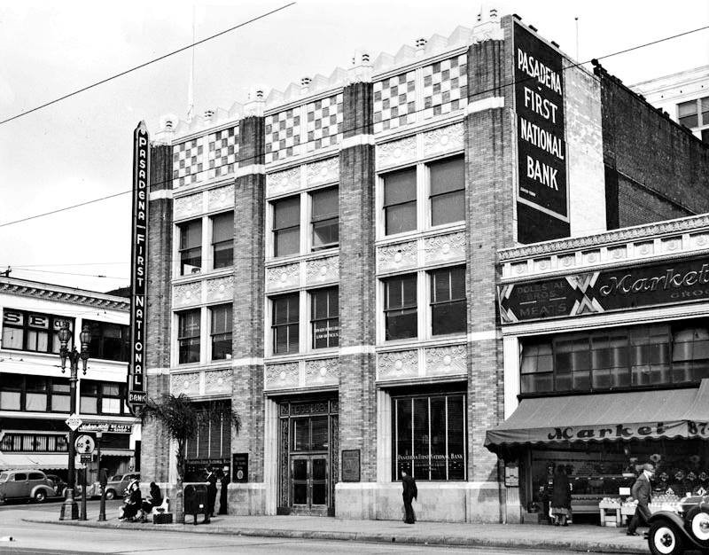 |
|
| (1938)++# - Pedestrians stroll down the sidewalk in front of the Pasadena First National Bank building, on the northeast corner of Colorado and Raymond. The city has done an excellent job preserving parts of Old Pasadena: the view today is remarkably similar. |
Then and Now
|
|
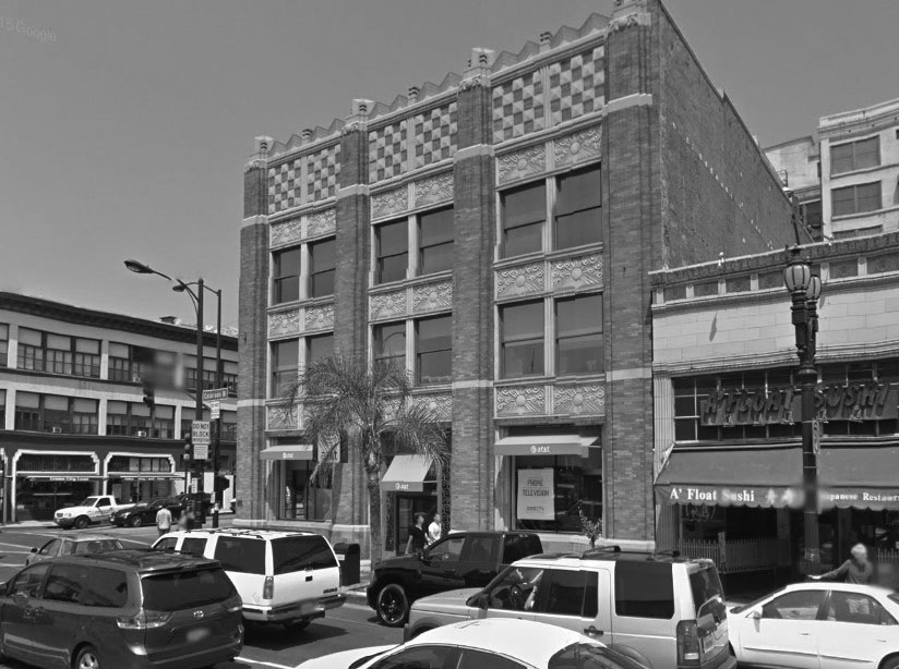 |
|
| (1938)++# vs. (2015)## - Building on the northeast corner of Raymond Ave and Colorado Boulevard, now occupied by an AT&T store. |
Fair Oaks and Green Street
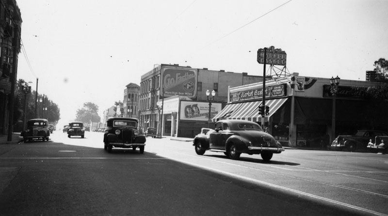 |
|
| (1941)* - View of 105 So. Fair Oaks Avenue at Green Street in Pasadena on December 24, 1941, site of a Market Basket grocery store. |
Historical Notes The three story building with the "Go Farther" billboard, once housed the John Bull pub in the 70s & 80s.^*^# |
Then and Now
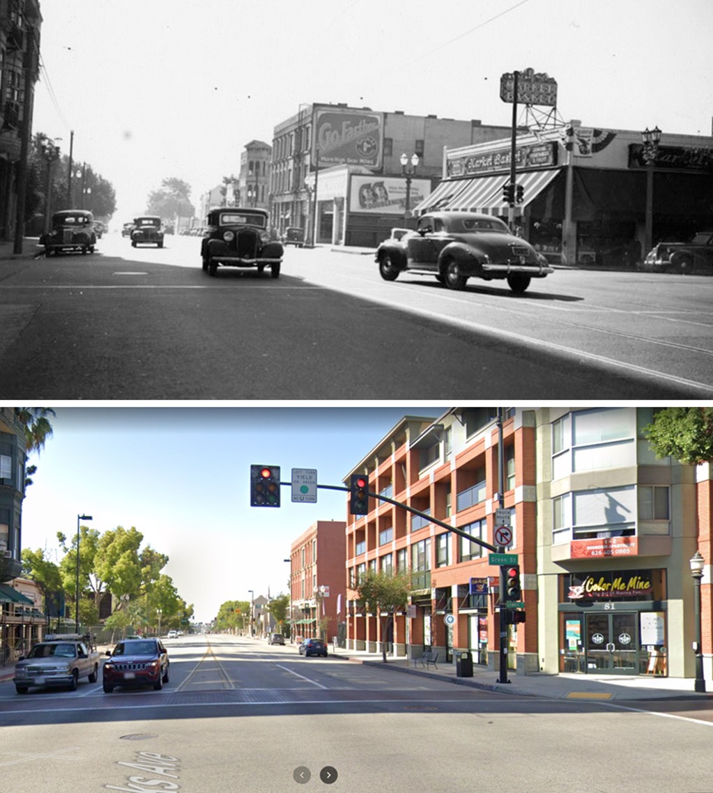 |
|
| (1941 vs. 2022)* - Looking south on Fair Oaks Avenue at Green Street. A Market Basket is seeen on the SW corner, today the site of mixed-use housing. |
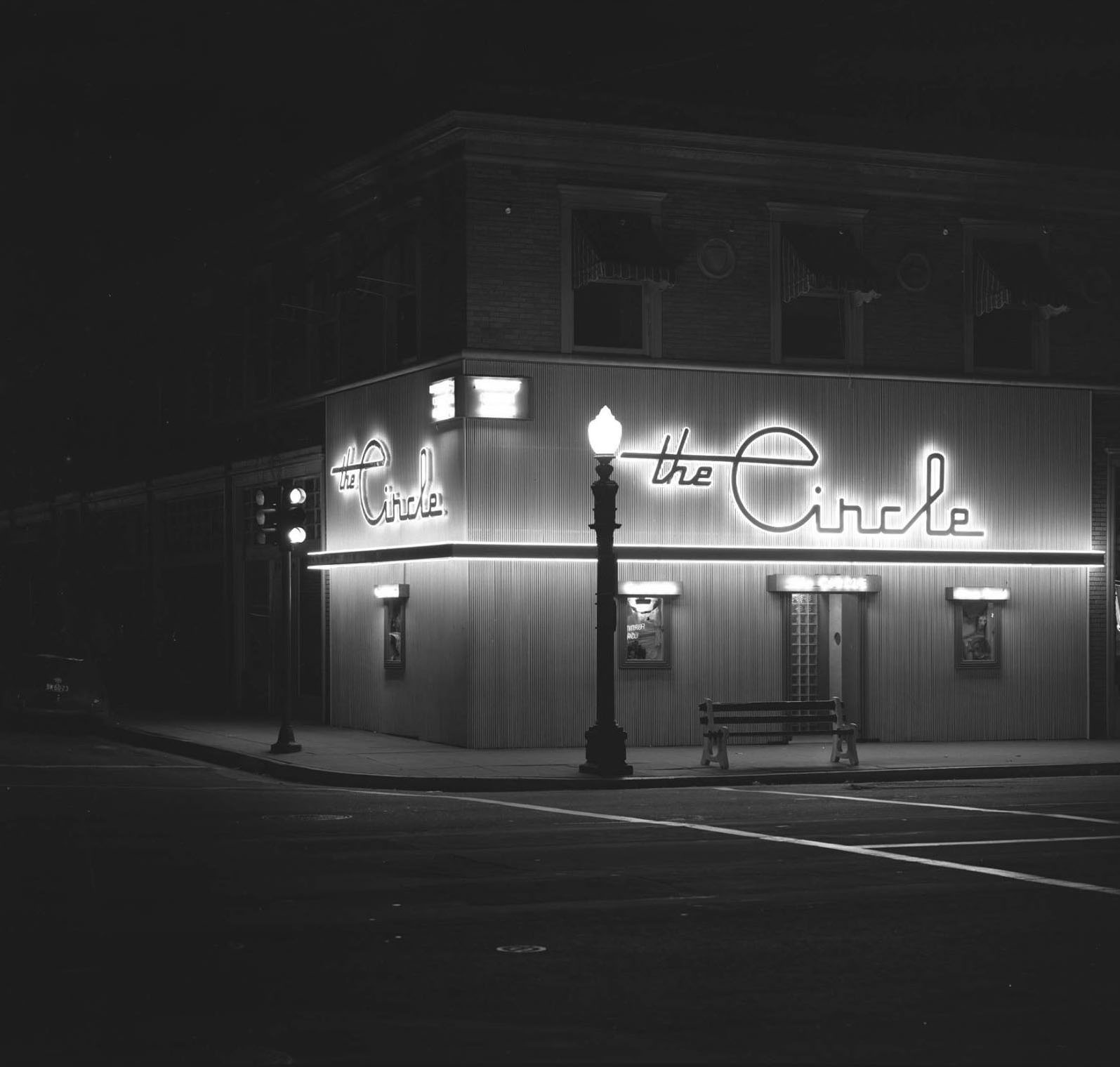 |
|
| (1946)*^* – View showing the Circle Café located at 953 East Colorado Boulevard, NE corner of Colorado and Mentor Ave. Photo by J. Allen Hawkins. Today, an H&R Block occupies the ground floor. Click HERE for contemporary view. |
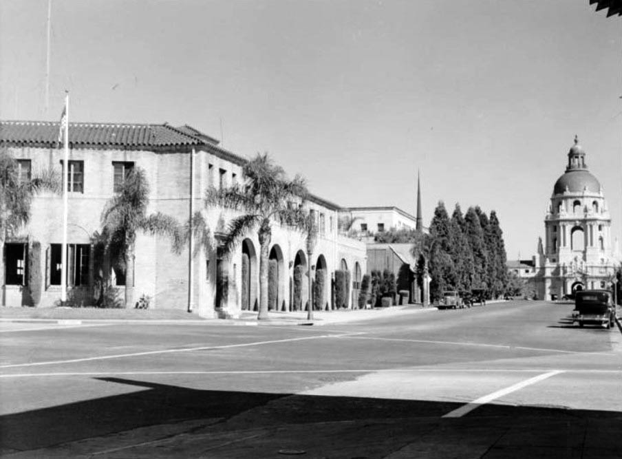 |
|
| (1939)*^* - View of the Old Fire Station 1 at corner of Holly and Arroyo Parkway looking eastward toward city hall. Arroyo Parkway here used to be N. Broadway. |
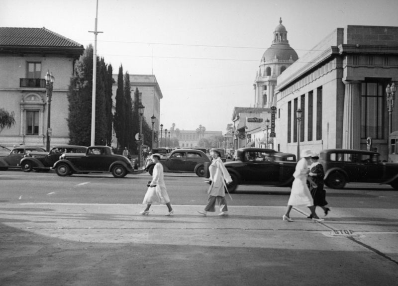 |
|
| (ca. 1940s)* - Pedestrians and cars on Colorado Blvd. in Pasadena circa the 1940s. View is looking north toward City Hall on Garfield Avenue. |
 |
|
| (1949)++# – Pasadena City Hall in snow, January 1949. |
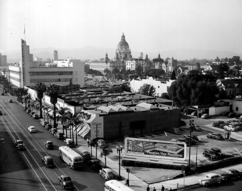 |
|
| (1945)^#^# - View from above the corner of Colorado Boulevard and Oakland Avenue as seen from the Independent-Star News building. The Broadway Pasadena is on the left and City Hall at top center. |
The Broadway Pasadena
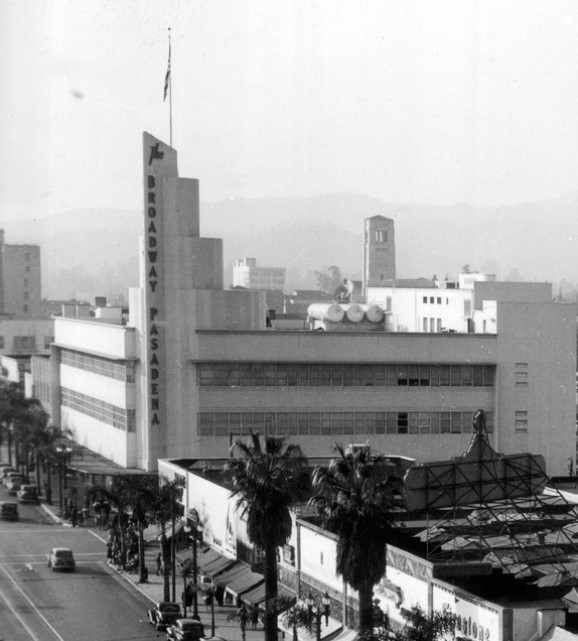 |
|
| (1945)^#^# – Close-up view of the Art Deco Broadway Pasadena on Colorado Boulevard. |
Historical Notes The Broadway began branch expansion in earnest with a striking art-deco store on Pasadena’s Colorado Boulevard. A similar store anchored the Baldwin Hills Crenshaw Plaza in 1947. With the help of its architects, The Broadway developed a signature look for its suburban stores, which numbered in the thirties by 1979. #*** |
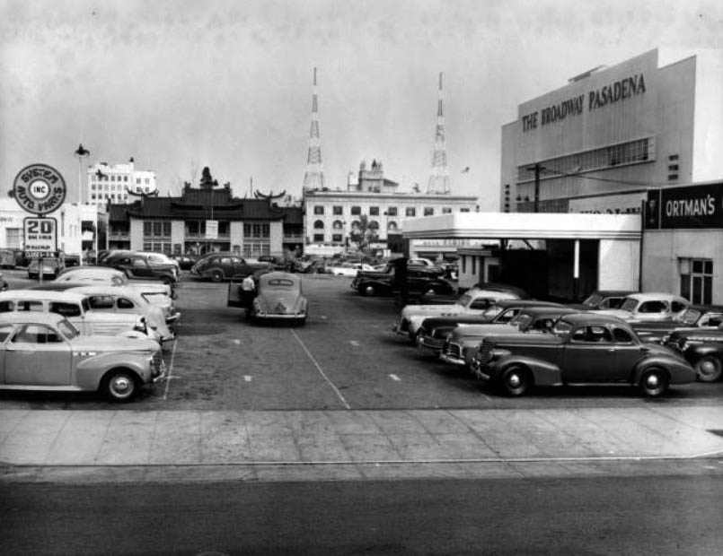 |
|
| (ca. 1945)*^* - View showing the parking lot of The Broadway department store in Pasadena. In the background can be seen the Grace Nicholson Building (now the Pacific Asia Museum) located on N. Los Robles. |
Bullock's Pasadena
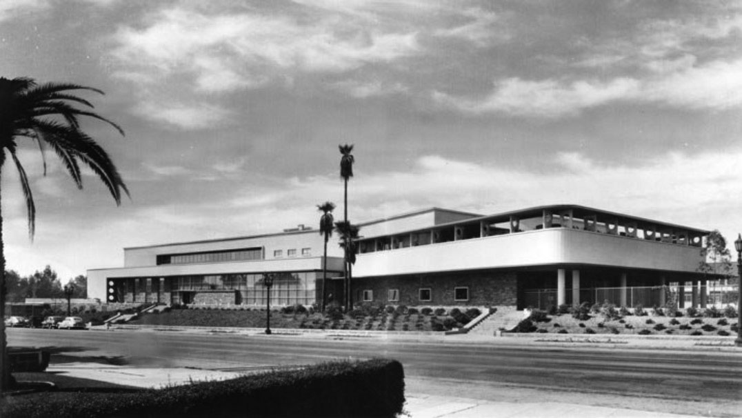 |
|
| (1947)* – Postcard view showing the newly completed Bullock's Department Store in Pasadena. |
Historical Notes Built in 1947, the Streamline Moderne Art Deco building was designed by noted Los Angeles architects Wurdeman & Becket, a partnership between Welton Becket and Walter Wurdemen. In addition to the building itself, the architects oversaw the design and installation of all aspects of the store's interior, from the wallpaper and display cases, to the unique mechanical conveyor system that delivered purchases directly to the parking lot. The design and merchandising of store were unique and stood in contrast to many older department stores of the time. Bullock's Pasadena was among the first department stores in the country to be located outside of a downtown area and was intended to appeal to the emerging "carriage trade," or those shoppers arriving by automobiles. As such, the store was oriented toward an unheard of 6-acre parking lot located behind the structure. The store's promoters touted it as the "store of tomorrow" and Arts and Architecture magazine described it as "one of the world's most modern buildings." In fact, the design was recipient of an AIA Merit Award in 1950. |
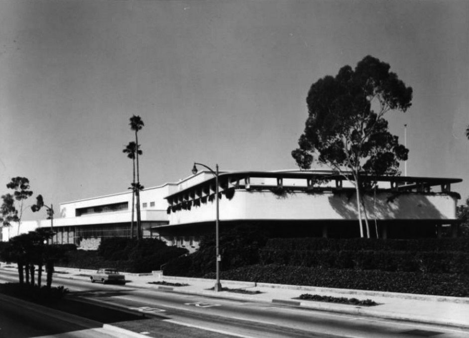 |
|
| (1960s)* - View showing the Bullock's Department Store located at 401 S. Lake Avenue in Pasadena. |
Historical Notes To attract the garden-loving populace of Pasadena and the San Gabriel Valley, landscape architect Ruth Shellhorn worked with Wurdeman and Becket to create a lush landscape from which the massive building arose like an island. In a then-astonishing concession to the automobile, Bullock's Pasadena prefigured mid-century commercial development throughout Los Angeles by featuring a rear six-acre parking lot. The parking lot has since been developed into a new retail center by Johnson Favaro (2003). The South Lake Avenue shopping district, in which Bullock's Pasadena was a major player, started to lose its luster in the late 1980s. While Pasadena's once-seedy Old Town district was reborn as a trendy shopping and entertainment district, once-proud South Lake Avenue lost much of its distinction. On July 12, 1996, the building was listed in the National Register of Historic Places as No. 96000776. In May 2000, the city of Pasadena's Design Review Board granted approval for a redevelopment of the building as part of a new shopping area called "The Shops on Lake Avenue," a $33 million project, featuring specialty shops, 27,000 square feet of new restaurants and a new 300-space-parking garage, increasing parking capacity to nearly 1,200 spaces. Developed by Cleveland, Ohio-based Forest City Development California, Inc. and owned by Federated Department Stores, the project opened in the spring of 200. |
* * * * * |
Richfield Gas Station
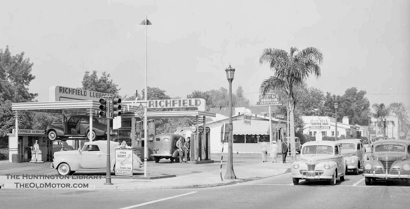 |
|
| (1941)* - A Richfield Gas Station located on the SW corner of Lake Ave and E. Green St (East California Blvd?). See notes below. |
Historical Notes Members of the Facebook group ‘You Know You Are from Old School Pasadena…’ disagree with the original location stated in the Huntington Library source. The majority opinion is that the station was actually located at Lake Ave and Green Street. Despite some conflicting evidence, we lean towards Green Street as the correct location instead of California Street. More details to come. |
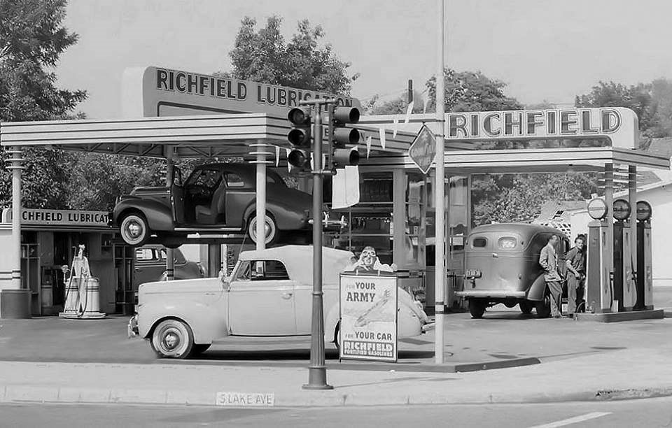 |
|
| (1941)^ – Close-up view showing the Richfield Gas Station on S. Lake Ave in Pasadena. Sign on corner reads: “For Your Army and For Your Car – Richfield" |
* * * * * |
Union 76 Service Station
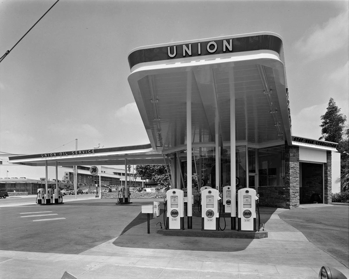 |
|
| (1949)* – View showing Union 76 Service Station located on the corner of San Pasqual Street and S. Lake Avenue in Pasadena. Bullock’s Department Store is seen in the background on the left. The building was designed by architect Raymond Loewy. Photo by Julius Shulman / Getty Research Institute |
Click HERE to see more Early Views of Gas Stations |
Guinn’s Coffee Shop and Drive-in
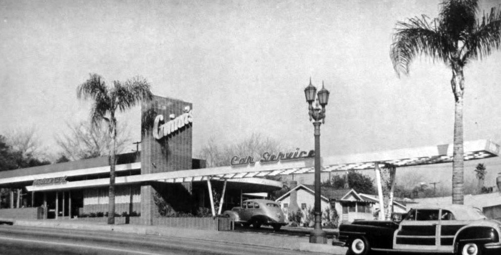 |
|
| (1940s)^^+ – View showing Guinn’s Coffee Shop and Drive-in located at 2915 E. Colorado Boulevard, Pasadena. |
Historical Notes Gwinn’s Drive-in was designed by Harold J. Bissner and Harold B. Zook. |
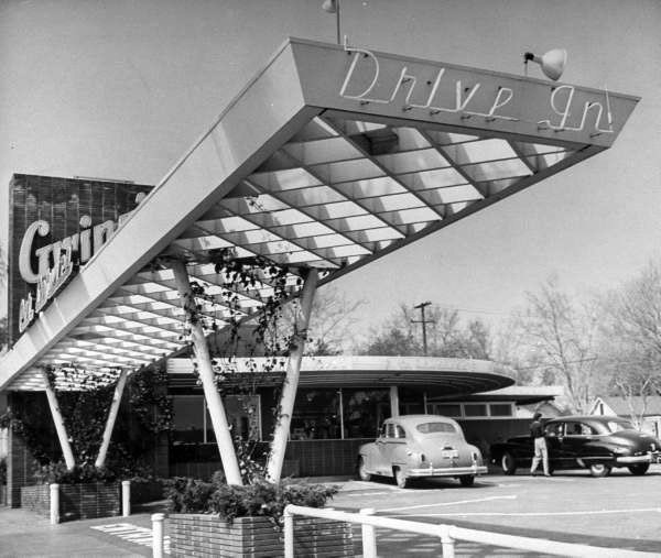 |
|
| (ca. 1947)**## – Gwinn’s Coffee Shop and Drive-in, 2915 E. Colorado Blvd. (U. S. 66) Pasadena. |
Historical Notes Guinn's Drive-in was demolished around 1992. |
Click HERE to see more Early Drive-in Restaurants |
* * * * * |
 |
|
| (ca. 1948)* – Panoramic view showing the Pasadena skyline in the city center. The tall dome of Pasadena City Hall is seen at left. |
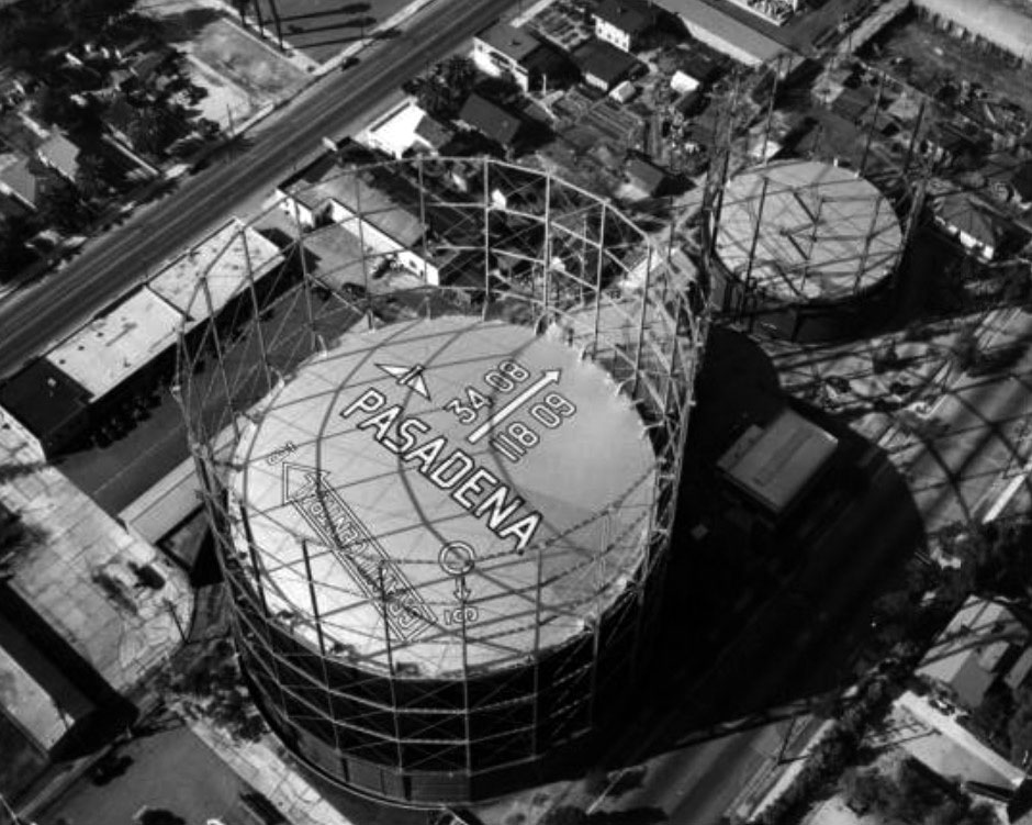 |
|
| (1948)* – Aerial view showing gas collection towers located along Edmonson Alley, between Fair Oaks and Raymond, just north of Glenarm Street. |
Historical Notes The larger of the two gas towers provided gas for the entire city of Pasadena. There are words, numbers and symbols on the roof of the larger tank providing directions and information for pilots flying overhead. The arrow reading "Grand Central" refers to the Burbank Airport. |
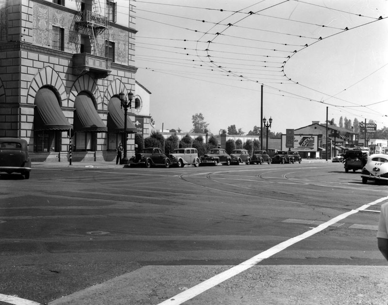 |
|
| (1947)* - View south on Lake Ave. from Colorado Blvd. in Pasadena. The building on the left corner is the Security-First National Bank of Los Angeles, next to it is a parking lot, and in the background, on the right, is Chapman's Famous Ice Cream shop. Several cars can be seen parked along the right side of the street. |
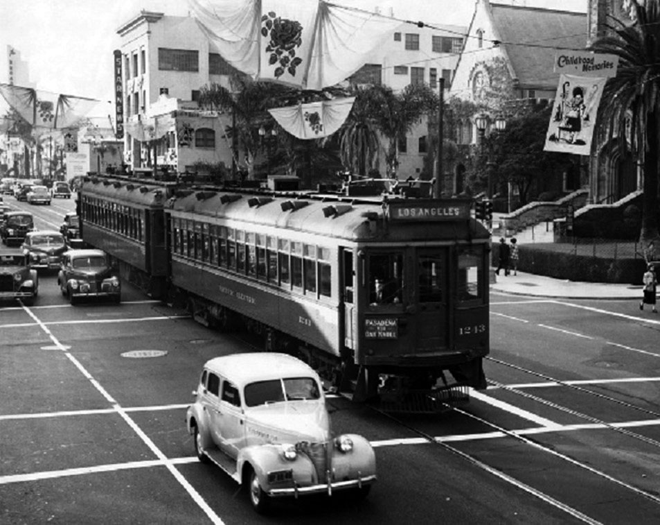 |
|
| (1949)*** - Pacific Electric Railway cars 1243 and 1211 head eastbound on Colorado Boulevard at Oakland Avenue beneath banners for the 1949 Tournament of Roses Parade. |
Historical Notes The Pacific Electric Railway route consisted of travelling on Colorado Boulevard to Lake Avenue, then south to merge onto Oak Knoll where it ran further south to Huntington Drive and then west, on its way to the PE building at 6th and Main Streets in Los Angeles. |
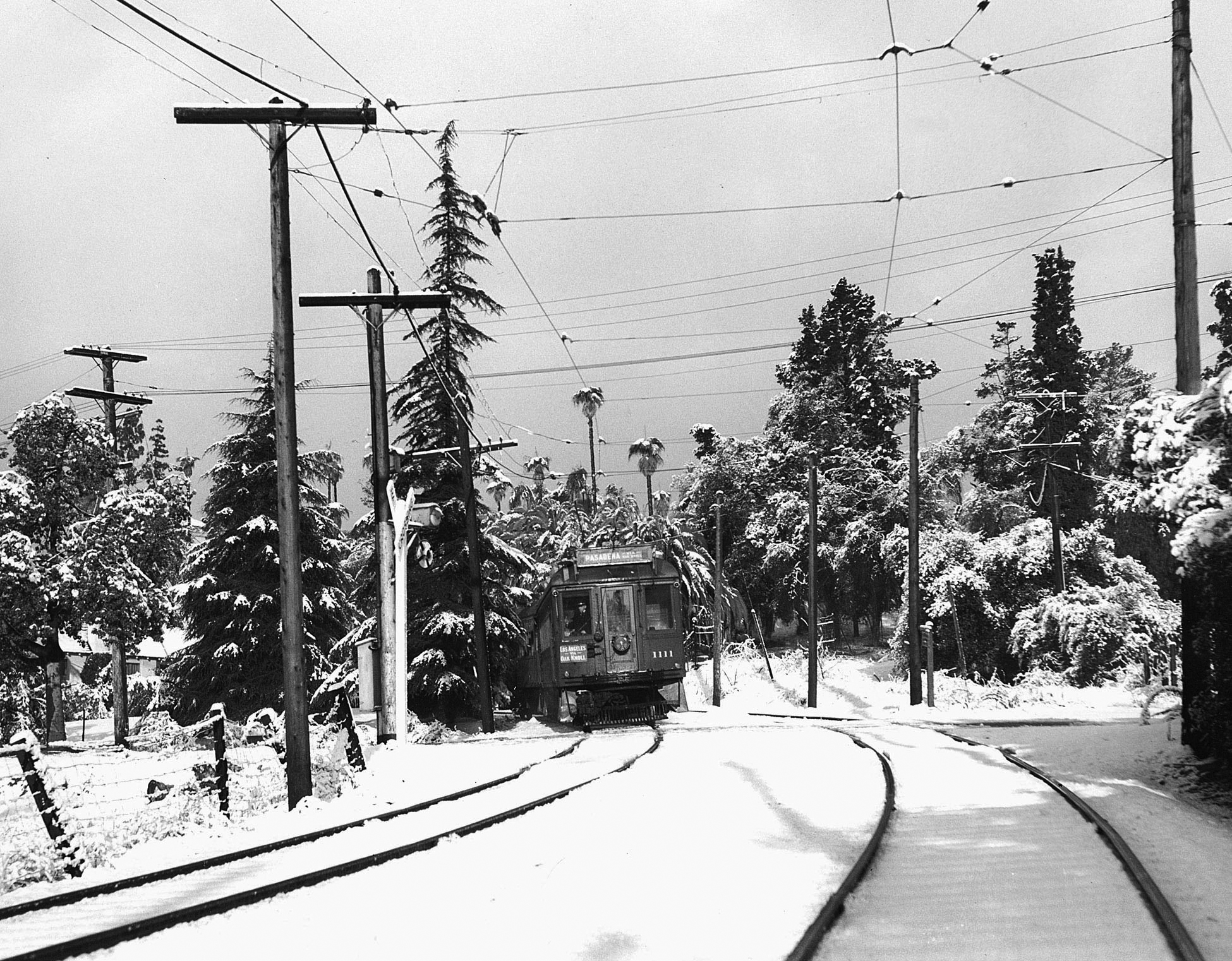 |
|
| (1949)^*# – Climate change on the Pasadena line. View showing the Oak Knoll Line at Old Mill Road in San Marino on January 11, 1949. |
Historical Notes Pasadena via Oak Knoll was a line of the Pacific Electric Railway, running from 1906 until 1950, between Downtown Los Angeles and Downtown Pasadena, with additional service to Altadena during rush hour. The route was originally built in 1906 to reach the Wentworth Hotel (later Huntington Hotel) in Oak Knoll. It was the second to last PE line to be decommissioned in Pasadena, and was the last line to run along Colorado Boulevard. |
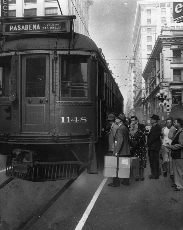 |
|
| (1950)* - A crowd of passengers wait to board the Pacific Electric Red Car No. 1148 at 6th and Main, going to Pasadena via Oak Knoll. A man carries a large package labeled "rush" and "fragile". |
Historical Notes The Red Car trolley line to Pasadena made its last run in 1950. The caption for the Oct. 3, 1950 photo read: "Its days are numbered. After Sunday, no more P.E. Oak Knoll Red Cars will rumble from Sixth and Main (above) to Pasadena". |
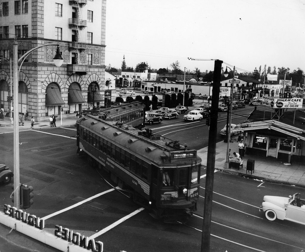 |
|
| (1950)*^^ - A Pacific Electric street car turns onto Colorado from Lake, on the last day of the line’s operation in Pasadena, October 7, 1950. |
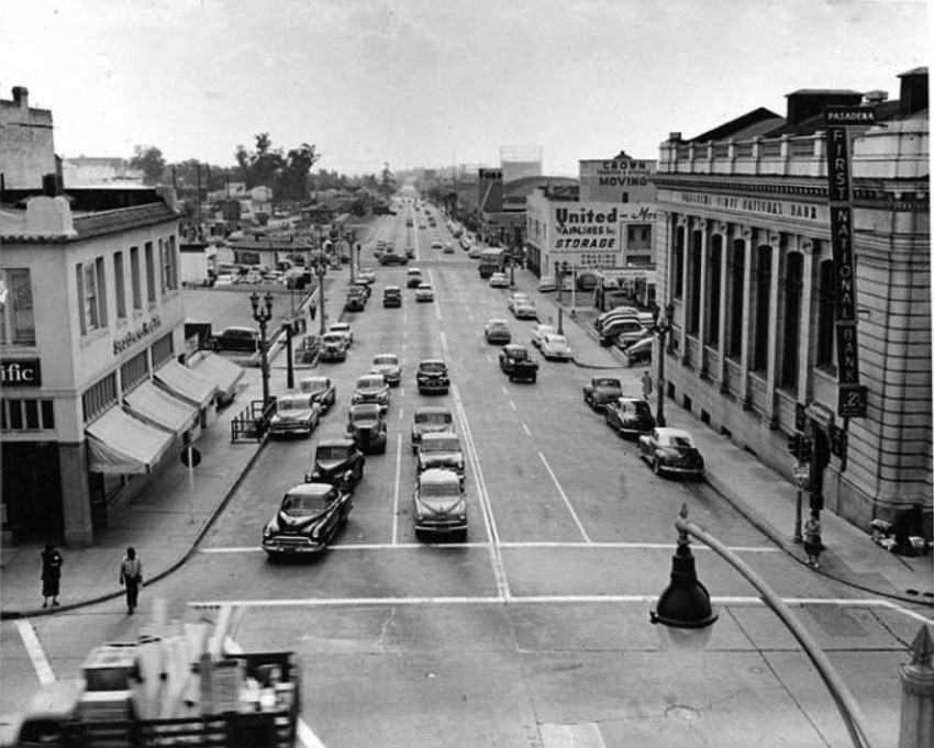 |
|
| (ca. 1950)* – View looking south on Arroyo Parkway at Colorado Boulevard. The Pasadena First National Bank stands on the southwest corner, while the Pacific Electric ticket office occupies the building on the opposite corner at left. In the distance at right is the Pasadena Winter Garden. |
Santa Fe 'Chief'
|
|
| (ca. 1950)* – View looking east on Colorado Boulevard from just west of the Santa Fe crossing in Pasadena. PE Interurban 1125 is inbound to LA by way of the Oak Knoll line but is held up by the Chief passing in front. Note also the Tower Theater at right. Photo by Stan Kistler. Click HERE to see contemporary view. |
Historical Notes The Chief was one of the named passenger trains of the Atchison, Topeka and Santa Fe Railway. Its route ran from Chicago, Illinois to Los Angeles. The Chief was inaugurated as an all-Pullman limited train to supplement the road's California Limited, with a surcharge of $10.00 for an end-to-end trip. The heavyweight began its first run from both ends of the line, simultaneously, on November 14, 1926, scheduled 63 hours each way between Chicago and Los Angeles, five hours faster than the California Limited. |
 |
|
| (ca. 1950)* - View looking north at the Colorado Boulevard Santa Fe crossing. The all-Pullman Chief, outbound to Chicago, is at center. Note the elevated flagman shanty, complete with warning bell, at center left. Photo by Donald Duke. Click HERE to see contemporary view. |
Historical Notes The Chief became famous as a "rolling boudoir" for film stars and Hollywood executives. In 1954 the Chief reduced its schedule to equal its cousins, the Super Chief and El Capitan, and would ultimately drop the extra fare requirement as well. |
 |
|
| (1958)^ - Santa Fe and Route 66 in Pasadena. The eastbound Chief noses past midcentury traffic on Colorado Boulevard; Metro's Gold Line now burrows underneath. Photo: Gordon Gattenberg / Los Angeles Heritage Railroad Foundation |
Historical Notes The Chief would have been the "crown jewel" of most railroads' passenger fleets. But it did not survive the national decline in passenger demand and its last run was on May 15, 1968. |
 |
|
| (2022)* – Looking east on Colorado Boulevard (Route 66) between Raymond Ave and Arroyo Pkwy in Pasadena where the Santa Fe ‘Chief’ once crossed the iconic boulevard. Metro's Gold Line now burrows underneath. |
Then and Now
 |
|
| (1958 vs 2022)* – Looking east on Colorado Boulevard (Route 66) between Raymond Ave and Arroyo Pkwy in Pasadena where the Santa Fe ‘Chief’ once crossed the iconic boulevard. Metro's Gold Line now burrows underneath. |
* * * * * |
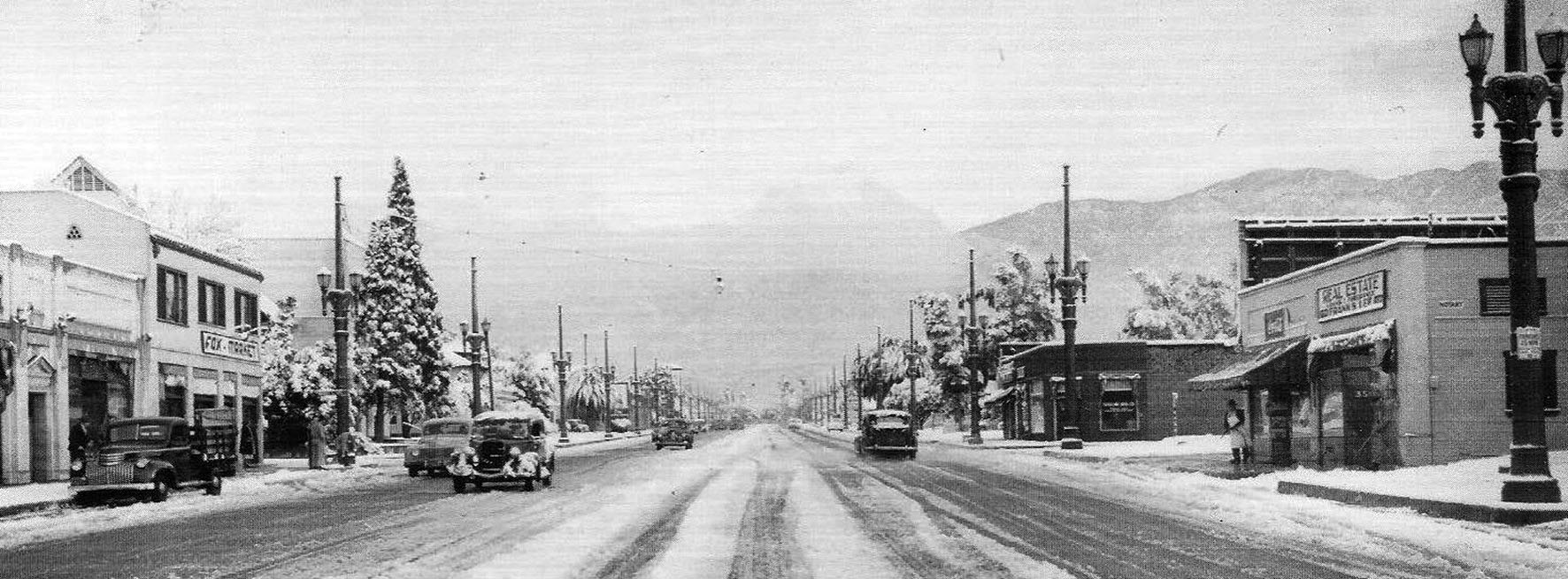 |
|
| (1949)^ - View looking north on Lake Ave after a snow storm. Photo date: 1/10/49. |
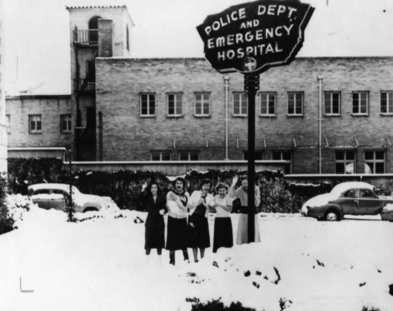 |
|
| (1949)* - Five women are waving and smiling, standing in the snow under a sign that reads, "Police Dept. and Emergency Hospital", in Pasadena. Photo is dated January 11, 1949. |
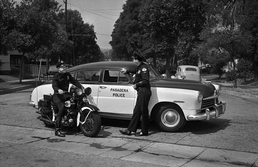 |
|
| (1950)* - Keeping the peace in Pasadena. The police car is a 1950 Hudson. |
* * * * * |
Rose Parade
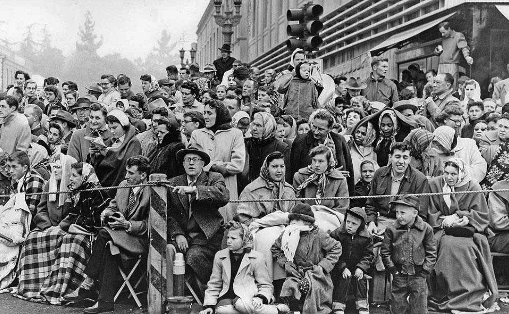 |
|
| (1955)* – Spectators brave the cold weather to watch the 1955 Rose Parade. This appears to be the N/E corner of Colorado and Fair Oaks. LA Times Photo |
Historical Notes Low of 46 and a high of 57 that New Year's Day in 1955. That's cold for Southern California. The Rose Parade in the 1950s was a vibrant and evolving event marked by notable moments and developments. In 1952, the parade faced a challenge when a group threatened to vandalize floats, with the South Pasadena entry cleverly depicting a political metaphor featuring an elephant with rose-colored sunglasses to symbolize the transition from Truman to Eisenhower. The decade also saw significant contributions, such as the 1959 donation of the Wrigley Mansion and Gardens to Pasadena for use as the Tournament of Roses headquarters. One of the most dramatic incidents occurred that same year when South Pasadena's float, featuring a life-sized elephant with an 11-person crew, encountered multiple challenges, including the driver passing out from extreme heat and a fire in the electrical generator. Despite these setbacks, the float completed the parade and won the Mayor's Trophy for the most outstanding city entry. Overall, the Rose Parade continued to grow in popularity during the 1950s, showcasing elaborate floats, marching bands, and equestrian units while remaining a significant annual event in Pasadena. |
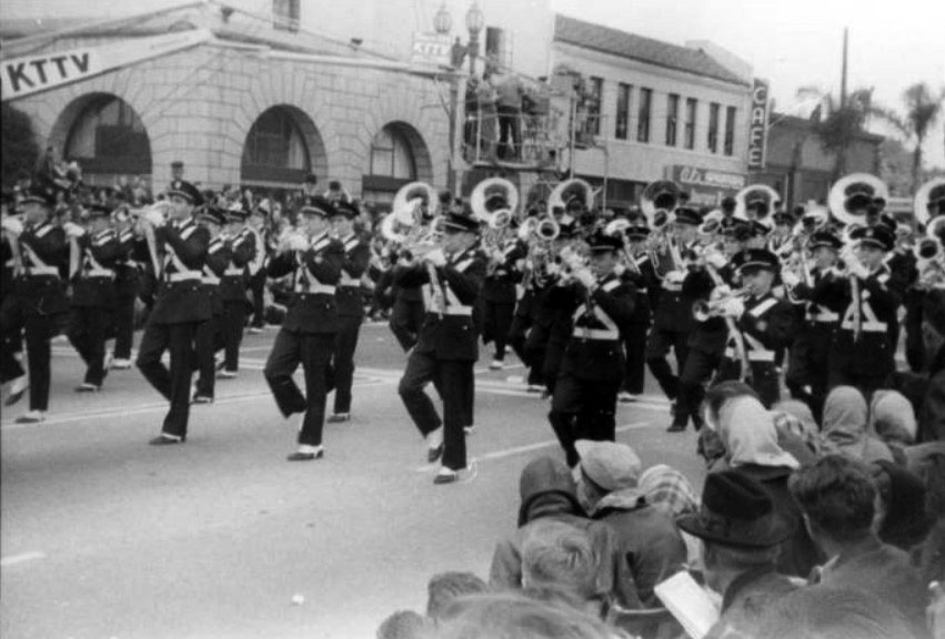 |
|
| (1950)* – View showing a marching band at the 1950 Rose Parade with Orth's Mayflower Warehouse and a camera boom for KTTV TV visible in the background. The 1949 Pasadena City Directory lists Orth Van and Storage at 238 W. Colorado Boulevard. It looks cold out there… |
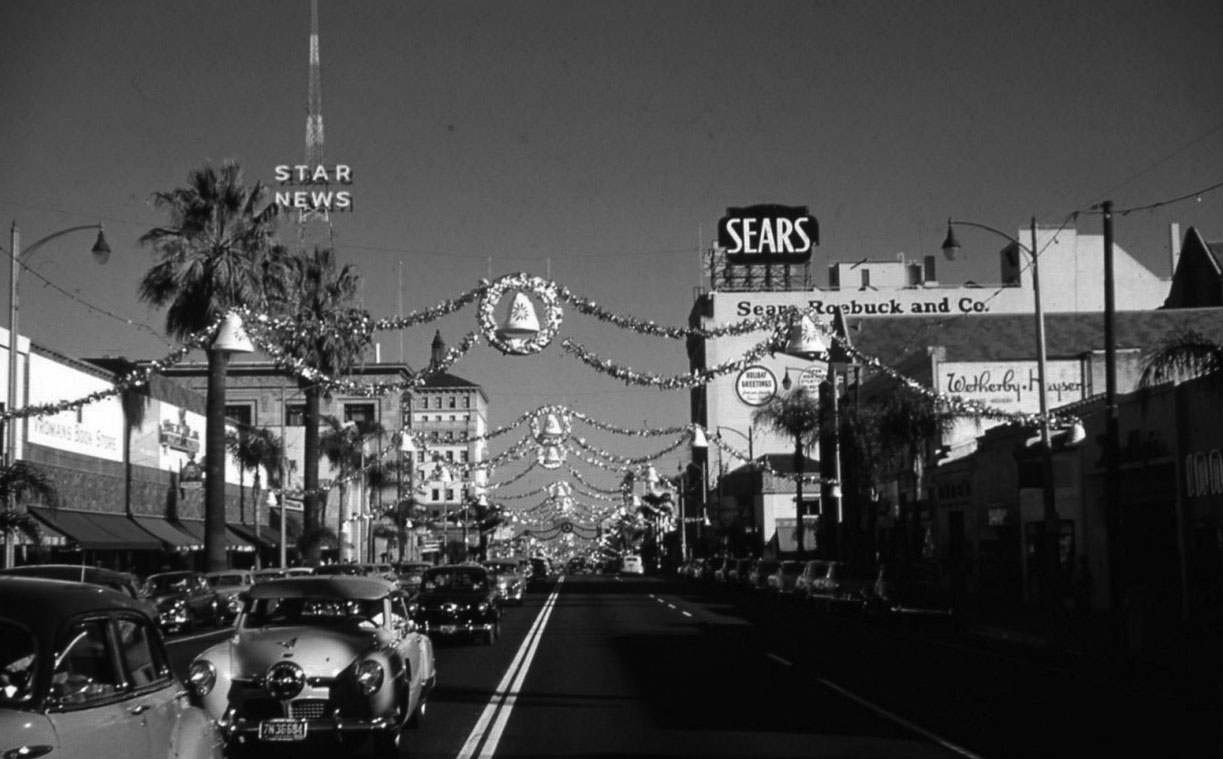 |
|
| (ca. 1950)* – View looking east on Colorado Boulevard from Los Robles Avenue during the holiday season. The Star News radio tower at Oakland Avenue is on the left. Sears and Wetherby Kayser can be seen on the right. |
* * * * * |
Howard Motor Company Building
 |
|
| (n.d.)* - View showing the 1927-built Howard Motor Company Building located at 1285 E. Colorado Blvd. Photo courtesy of David Hermann |
Historical Notes The Howard Motor Company built the showroom in 1927; it was one of several car dealerships built along Colorado Boulevard. The building has a Spanish Colonial Revival design with Churrigueresque ornamentation; its design includes a decorative frieze, chanfered corners, and an elliptical arched entrance topped by the dominant Churrigueresque element. The Bush-Morgan Motor Company moved into the building in 1938 and occupied it through the 1950s. Most early Pasadena automobile dealers located their showrooms on Colorado Boulevard. Two groupings developed: one on a two-block stretch of West Colorado Boulevard between Orange Grove Boulevard and downtown, and the other located in the then-geographic center of the city along East Colorado Boulevard between Lake and Hill Avenues. Built in 1927, the Howard Motor Company Building was one of several auto-related buildings located along East Colorado Boulevard, and it was among the showiest. |
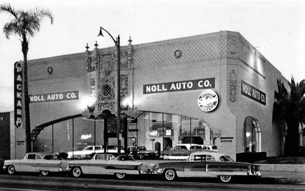 |
|
| (1956)* – Postcard view showing the Noll Auto Co., Packard Dealership, located in the old Howard Motor Company Building. Courtesy of Alden Jewell |
Historical Notes The last "real" Packards went out in a blaze of glory at this dealership. By 1957 imported makes were sold here by Noll-Baldwin Motor Co., including Hillman, Sunbeam, Jaguar, Simca, Triumph and Volvo. In the early '70s it was Pasadena Mazda, followed by California Custom Coach (which made replica Auburn Speedsters), and, finally, Acura of Pasadena until 2005. The building was also an Aaardvark’s Odd Ark clothing store in the 90s. |
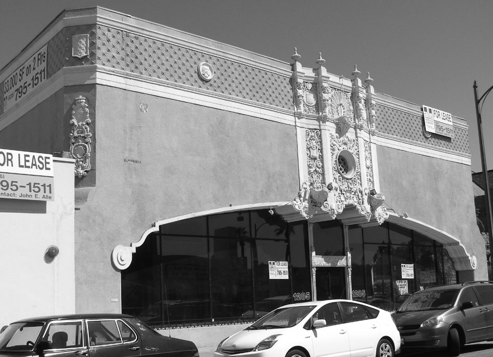 |
|
| (2008)* – View showing a vacant Howard Motor Company Building, 1285 E. Colorado Blvd in Pasadena. Photo courtesy of Roadside Architecture |
Historical Notes With considerable growth in the automobile industry during the 1920s, competition among dealers was fierce. It was not unusual for dealerships to move often, each time seeking a more elaborate or advantageous location. When builders constructed the Howard Motor Company building in 1927, Churrigueresque was an apt choice. The exterior of the building is richly ornamented. Corners are chamfered and topped with a broad ornamental frieze. Showroom windows and entry doors are recessed in a single elliptical arch, which spans the entire street facade. The arch has a grooved mold that terminates in unusual scrolled imposts. ^ The building was added to the National Register of Historic Places on April 18, 1996. Click HERE for contemporary street view. |
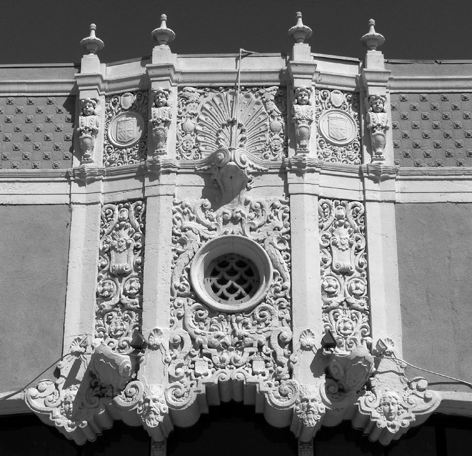 |
|
| (2008)* – Close-up detail view showing the Churrigueresque-style design above the entrance to the Howard Motor Company Building. Photo courtesy of Roadside Architecture |
Historical Notes “Churrigueresque” is the ornate, sculpted, baroque architectural style of the Howard Motor Company Building. Popularized in Spain during the late 17th and early 18th centuries, Churrigueresque was revived during the 1915 Panama-California Exposition in Balboa Park, San Diego. In the years between World War I and World War II, the country entered the age of the automobile, and this high-relief style worked particularly well in the expanding California automotive market where dealers competed fiercely for attention and for sales. ^ |
* * * * * |
Colorado and Fair Oaks
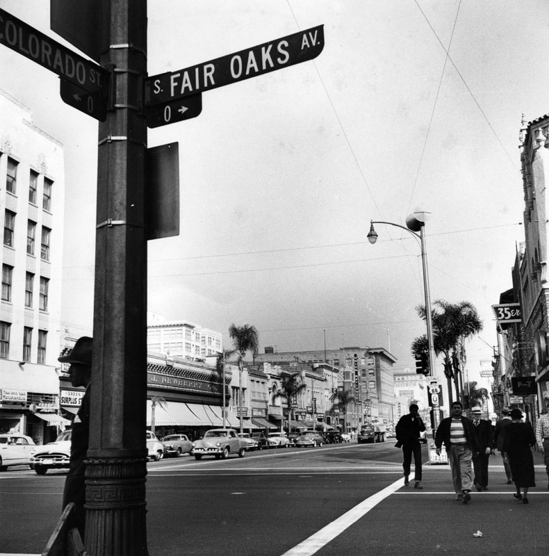 |
|
| (1954)* - View is looking east on Colorado Boulevard from Fair Oaks in Pasadena. J.J. Newberry's can be seen on the left side of the street. On the other side of the street is the still popular dive bar, Freddie's 35er. |
 |
|
| (1989)* - Gil's Grill, a small street corner carry-out restaurant located at Colorado and Fair Oaks Boulevards. |
* * * * * |
Pasadena Winter Garden
 |
|
| (ca. 1940)* - A car is parked in front of the Pasadena Winter Gardens, located at 171 S. Arroyo Parkway. |
Historical Notes Built in 1940, Pasadena Winter Garden was located at 171 S. Arroyo Parkway, not far from Colorado Blvd., the main drag of Pasadena. It was the home of the Blade and Edge Figure Skating Club and is most renowned for being the original home of World and Olympic champion Peggy Fleming. |
 |
|
| (1946)* – View looking northwest showing SP Engine No. 1677 at what is now the corner of Arroyo Parkway and Cordova Street, Pasadena. After a short pause the engine and its train of freight cars will return to the main line junction in Alhambra. Note the Pasadena Winter Garden behind the engine. Photo courtesy of Paul Ayers |
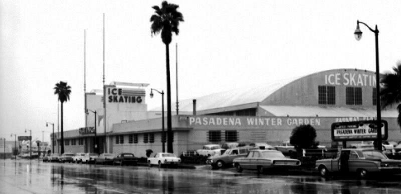 |
|
| (1960s)* – View looking south on Arroyo Parkway on a rainy day showing the Pasadena Winter Garden. |
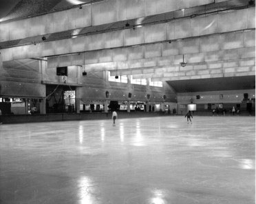 |
|
| (1960s)* – Interior view showing the ice rink at the Pasadena Winter Garden. |
Historical Notes Pasadena Winter Garden was home to the Pasadena Panthers, one of four teams in the California Ice Hockey League in the 1950s. The league contained four teams, who were vying for ice time in the three-rink Los Angeles basin. The rink closed December 31, 1966 and the wonderful art deco exterior was all that remained when it was converted to a U. S. Post Office facility. However, the permafrost caused such serious discomfort to postal workers that the facility was closed. It sat vacant for some years and is now a Public Storage facility. |
* * * * * |
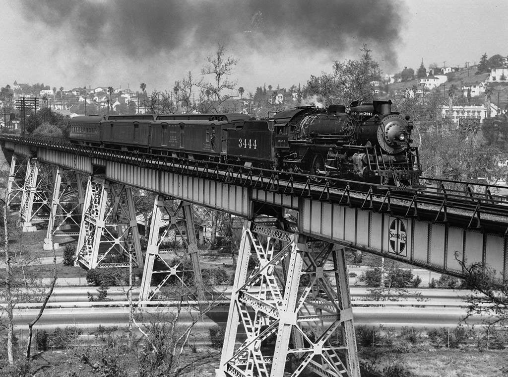 |
|
| (ca. 1949)* - A Santa Fe mail train crosses the Arroyo Seco (and Route 66) near South Pasadena behind engine no. 3444. Today the bridge carries Metro's Gold Line over the Pasadena Freeway. Photo: Donald Duke / Los Angeles Railroad Heriitage Foundation |
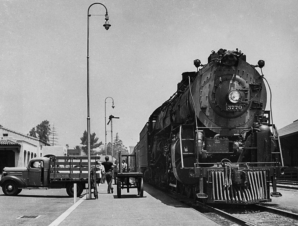 |
|
| (1949)* - Santa Fe no. 3770 with a westbound passenger train waits at the Santa Fe Train Station in Pasadena. Photo: Donald Duke / Los Angeles Railroad Heriitage Foundation |
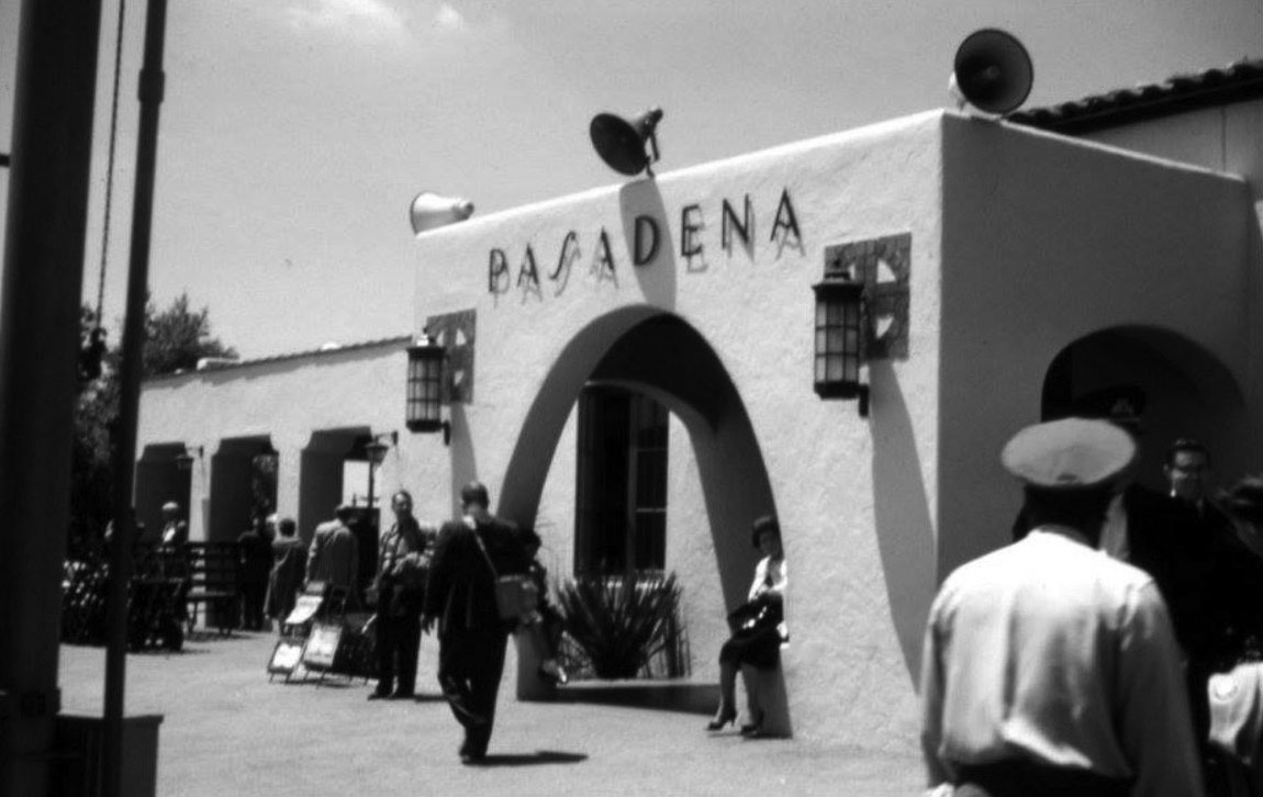 |
|
| (1961)* – View showing the Santa Fe Railway Station in Pasadena. The man with the cap in the lower-right corner is the porter to help you with the luggage. The square symbol behind the two lights is the logo for the Atchison, Topeka and Santa Fe Railway. Photo courtesy Martin Turnbull |
Historical Notes The Santa Fe Railway’s Mission Revival-style passenger station on Raymond Ave. in Pasadena opened in 1935. In the heyday of train travel, this station was favored by celebrities who didn’t want to have to deal with the whole “Movie Star Arrives in Los Angeles” press circus, and preferred to quietly arrive in town and sneak back home. So they’d get out at the station before Union Station in downtown L.A. – and that was this one. |
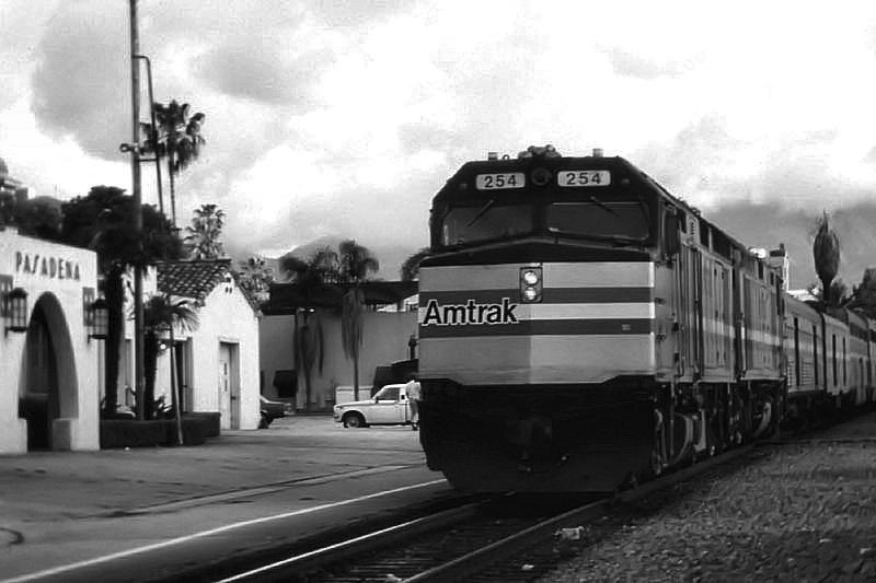 |
|
| (1980s)* – View showing an Amtrak train arriving in Pasadena from Chicago. |
Historical Notes This scene has changed drastically with the arrival of Metro's Gold Line, but the depot survives as a restaurant surrounded by high-rise living. |
* * * * * |
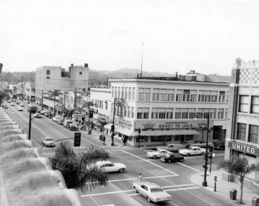 |
|
| (ca. 1970)* - Old Town Pasadena intersection of Colorado and Raymond. Crown City Loan & Jewelry is the most visible business along this stretch of Colorado Blvd. |
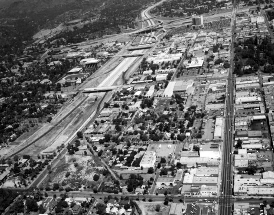 |
|
| (1970s)* – Aerial view looking north showing the newly constructed freeway system of the 1970's. Landscaping to beautify the freeway had not yet been done. Saint Andrew's Church on Raymond Street can be seen in the upper right corner of the photo just south of the 210 freeway. A few blocks below on Raymond Street is the Hotel Green next to Central Park. West of Raymond Ave. is Fair Oaks Avenue. Bekins Storage Co. is on the lower right of the photo. The Rose Bowl stadium is near the upper left corner. |
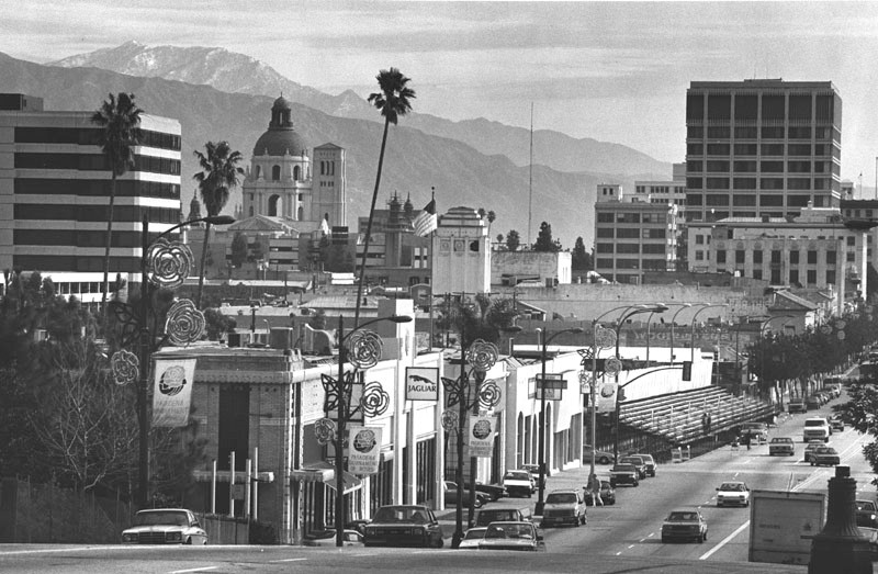 |
|
| (ca. 1986)* - Scenic view of Colorado Boulevard in Pasadena. Banners hanging from light poles, read: "Pasadena Tournament of Roses," and bleachers are set up for the Rose Parade. The Pasadena City Hall appears on the left in front of the San Gabriel mountains, seen in the distance. |
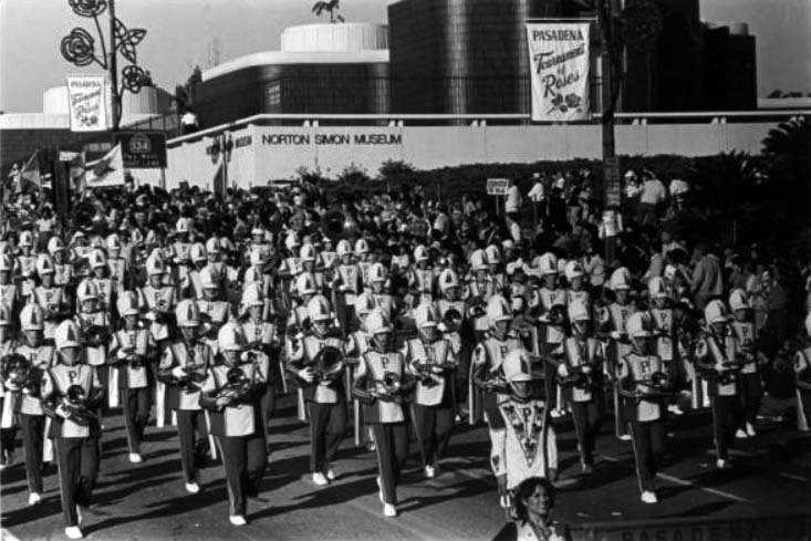 |
|
| (n.d.)#^ - The Pasadena City College Band marching in the Rose Parade in front of Norton Simon Museum. |
* * * * * |
Pasadena Pioneers Bridge - Planning and Preservation (1951)
 |
|
| (1951)* - This sketch shows the general relation of the existing and proposed Colorado Street bridges in Pasadena. This finished appearance is by Bridge Department artist Van Der Goes who retouched a photograph of a model of the bridge. |
Historical Notes When the Foothill (210) Freeway was planned in the early 1950s, the California Department of Transportation made known its intention to demolish the Colorado Street Bridge. But after much public outcry and appeals from the City of Pasadena and other organizations, Caltrans allowed the bridge to stand and built their own bridge parallel to it. |
 |
|
| (1951)* – Conceptual design sketch showing the original Colorado Street Bridge with the newly proposed Colorado Freeway Bridge (later Pasadena Freeway Bridge). |
Historical Notes Pasadena Pioneers Bridge is named for the party of settlers led by Dr. T.B. Elliot, a physician who held meetings in his Indianapolis home for people interested in moving to California and settling where the sun would shine year-round. After extensive fact-finding, the party of settlers came by train, then boat, then wagons to what became the Indiana Colony. Note: The planned Colorado Freeway was later incorporated into U.S. 101 Bypass and, in 1964, redesignated as State Route 134, the Ventura Freeway. |
* * * * * |
Construction of the Pioneers Bridge (1951–1953)
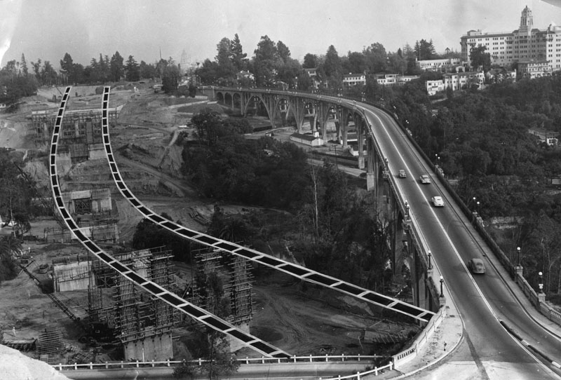 |
|
| (1951)* - Construction of the Pasadena Pioneers Bridge, also known as the Colorado Freeway Bridge, begins just north of the Colorado Street Bridge. The Vista Del Arroyo Hotel can be seen in the background. |
Historical Notes Groundbreaking took place in 1951 as automobile traffic on the 1913 Colorado Street Bridge had reached unsafe levels. At times, restrictions were even placed on traffic during peak hours. The new bridge, part of the planned Colorado Freeway, was intended to relieve congestion and serve the region’s growing need for modern, high-capacity roads. The freeway itself would later be redesignated as State Route 134 and is known today as the Ventura Freeway. |
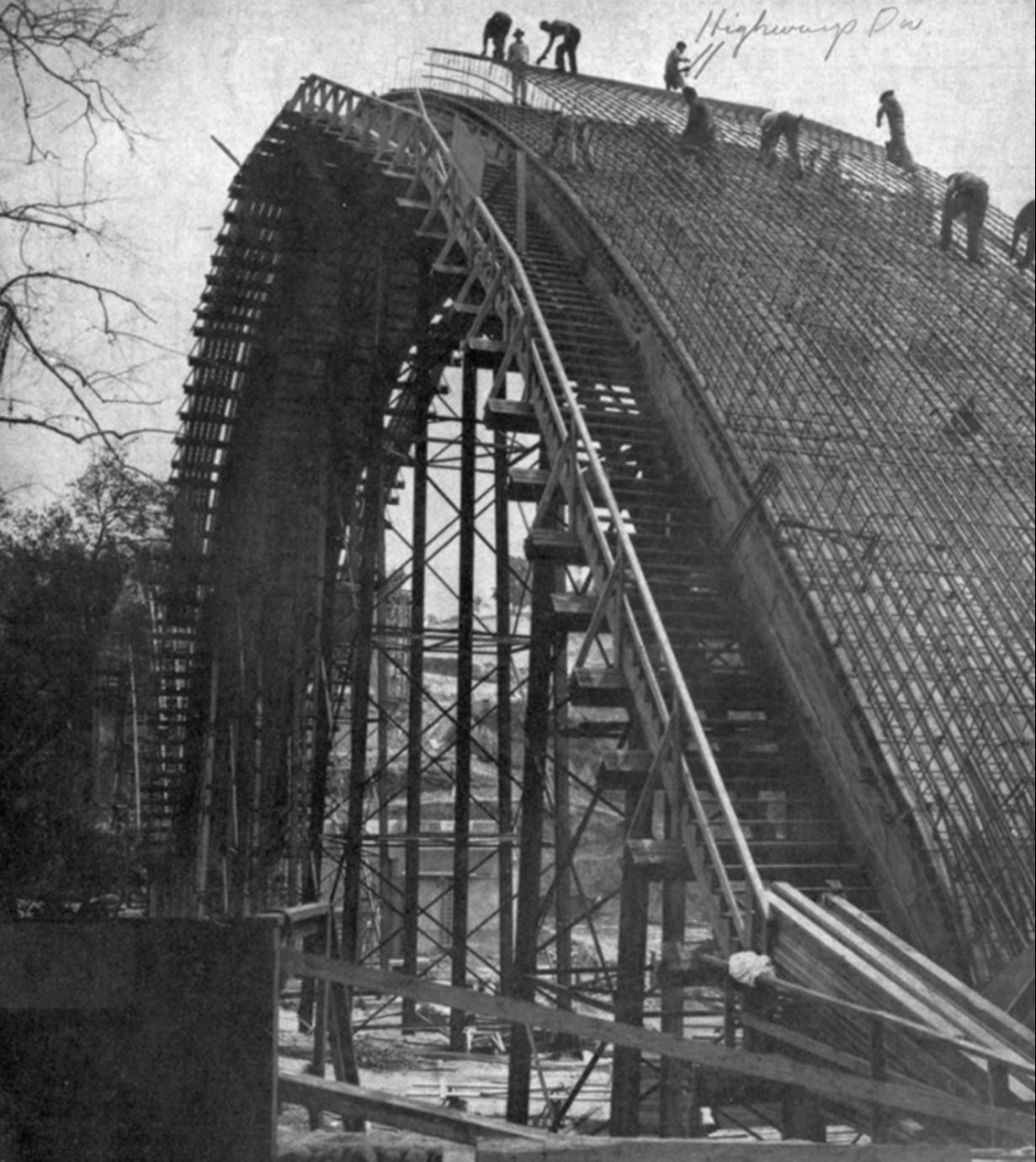 |
|
| (1952)* – Construction advances with the massive arches of the Pasadena Pioneers Bridge rising over the Arroyo Seco. |
Historical Notes The Pioneers Bridge was one of the most ambitious public works projects of its era. More than 41,000 cubic yards of concrete and 5.5 million pounds of reinforced steel went into its construction. While the new bridge echoed the arch form of the Colorado Street Bridge, it was built on a larger scale to handle the demands of freeway traffic. |
 |
|
| (1952)* - Construction of the Pasadena Pioneers Bridge (Colorado Freeway, later SR-134) over the Arroyo Seco. The massive new structure rose immediately north of the 1913 Colorado Street Bridge, which can be seen beneath its emerging arches in the background. |
Historical Notes By 1952, the outlines of the new bridge revealed how closely it paralleled the older crossing. The side-by-side contrast symbolized Pasadena’s growth: the Colorado Street Bridge represented early 20th-century expansion, while the Pioneers Bridge embodied mid-century modernization. Together, they would become a striking architectural pair across the Arroyo Seco. |
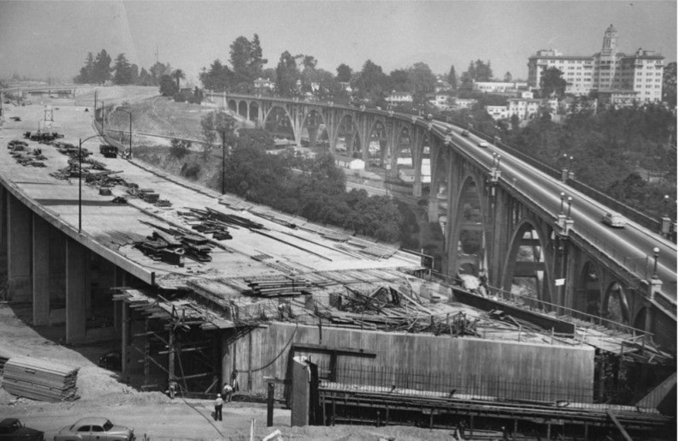 |
|
| (1953)* - A new bridge, now the Ventura Freeway, is built over the Arroyo Seco. The Colorado Street Bridge is on the right. This photo appeared in the May 25, 1953 Los Angeles Times. |
Historical Notes By spring 1953, the great arch ribs and spandrels were in place, and crews were forming the deck and approaches. Built immediately north of the 1913 Colorado Street Bridge, the new crossing was designed to carry the heavy flow of freeway traffic that the older structure could no longer accommodate. The westbound lanes were scheduled to open later that fall. |
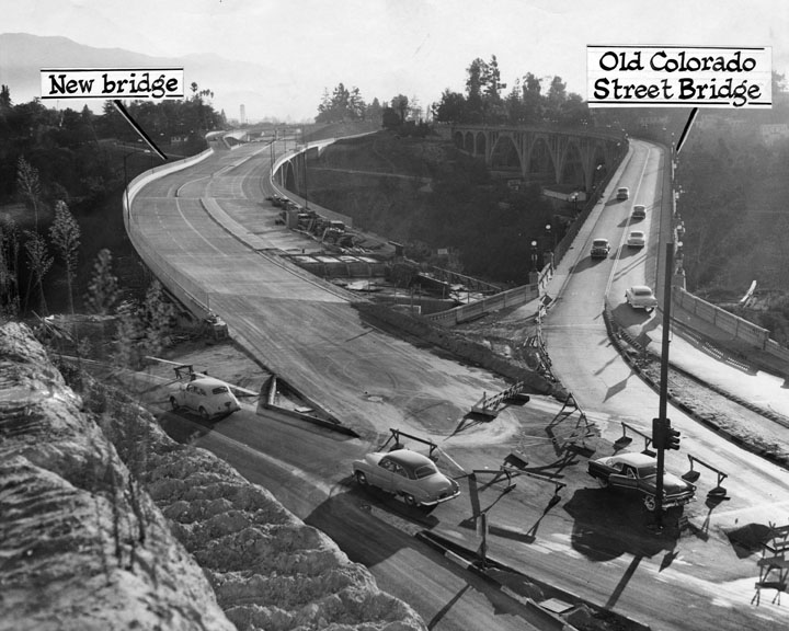 |
|
| (1953)* - Another view showing the almost-completed Pasadena Pioneers Bridge beside the Colorado Street Bridge. |
Historical Notes As the bridge neared completion, its scale was unmistakable: 1,364 feet long and 131 feet high, with three great spans. Using more than 41,000 cubic yards of concrete and 5.5 million pounds of steel, it cost $6.5 million—at the time, the largest bridge project ever undertaken by the State of California. Though functional in form, it was deliberately shaped to harmonize with the arches of its historic neighbor. |
Dedication and Naming (1953)
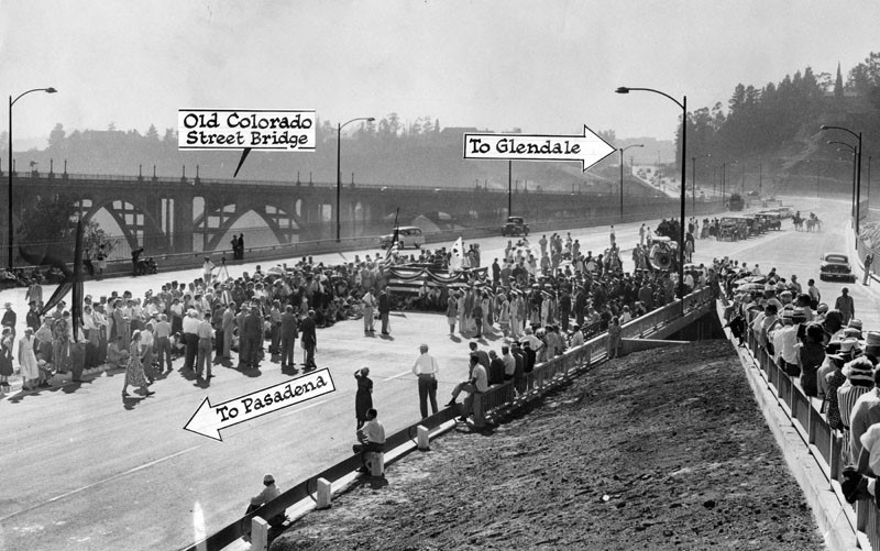 |
|
| (1953)* - Hundreds of spectators attend the ribbon-cutting marking the opening of one half of the bridge (westbound lanes). Photo dated October 9, 1953. |
Historical Notes The dedication on October 8, 1953, honored Pasadena’s pioneers, especially the 27 founders who settled nearby in 1874. A commemorative plaque placed on Orange Grove Boulevard overlooks the bridge and records the occasion: “Pasadena Pioneer Bridge erected by the California Commission and the Division of Highways of the Department of Public Works, named by resolution of the 1953 state legislature and dedicated to all Pasadena pioneers especially the twenty-seven who founded this city near this spot on January 27, 1874. Dedicated October 8, 1953 by the City of Pasadena and a committee of citizens grateful for our illustrious past and committed to a more glorious future.” |
* * * * * |
Pioneers Bridge and Colorado Street Bridge
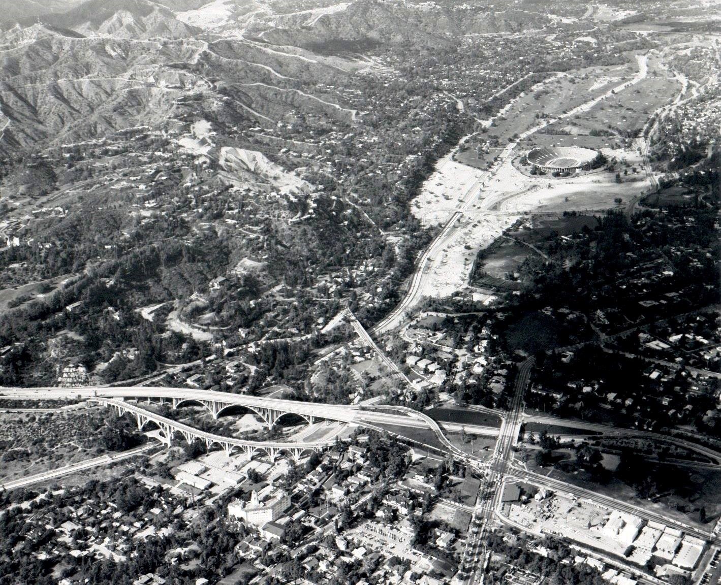 |
|
| (1966)* - Aerial view looking north up the Arroyo Seco, showing both the Colorado Street Bridge and the newly completed Pioneers Bridge, with the Rose Bowl in the distance. |
Historical Notes Seen together, the two bridges highlight Pasadena’s layered history. The Colorado Street Bridge, built in 1913, was the first major high-level crossing of the Arroyo Seco. The Pioneers Bridge, dedicated 40 years later, carried State Route 134 and marked the city’s embrace of the freeway age. Together, they illustrate Pasadena’s transition from the streetcar era to the automobile era. |
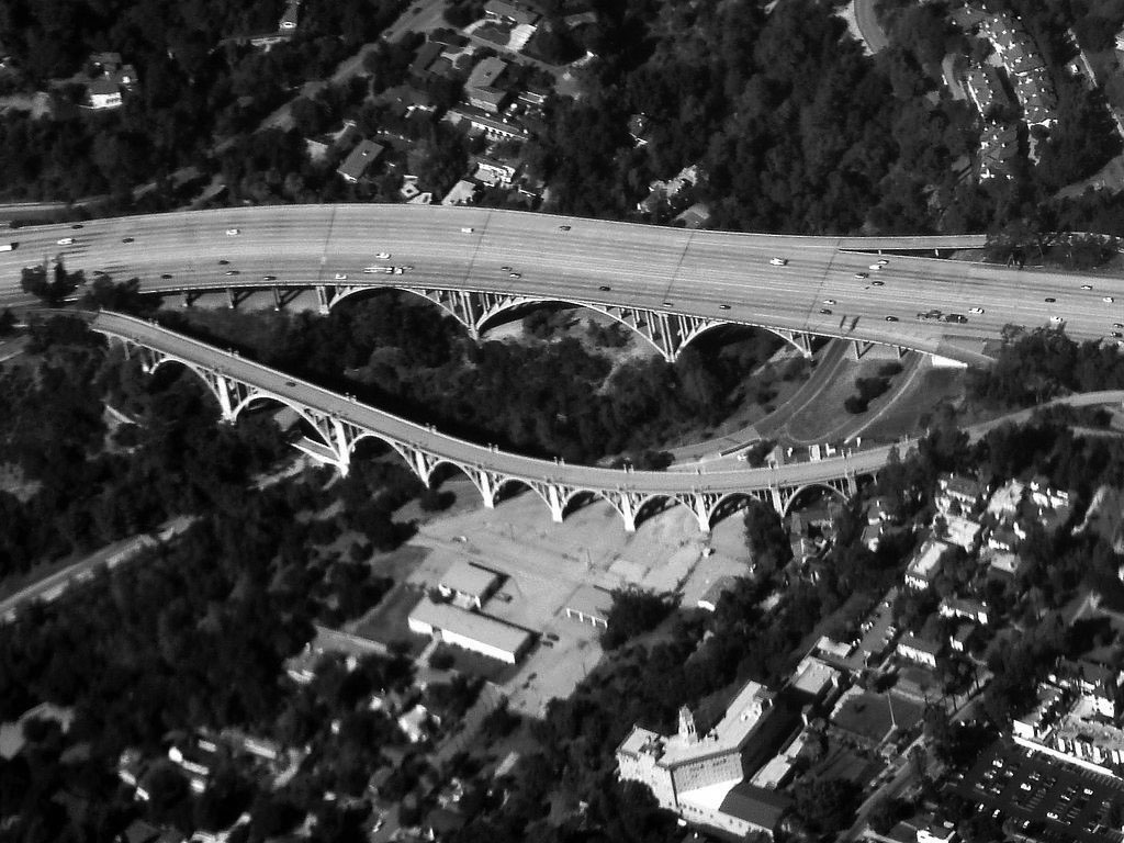 |
|
| (2010)* – Closer view of the Colorado Street Bridge next to the bridge for the Ventura Freeway, also known as the Pasadena Pioneer Bridge. The old Vista del Arroyo Hotel (today, United States Court of Appeals) can be seen in bottom right of photo. Photo by Bobak Ha'Eri / Wikipedia. |
#/media/File:2010-1101-06-ColoradoStBridge.jpg)
Historical Notes The Colorado Street Bridge is admired for its Beaux Arts design, with graceful arches and ornate details. By contrast, the Pioneers Bridge was built with bold, functional forms suited for heavy freeway traffic. Though their purposes differ, the two bridges complement one another and remain enduring landmarks of Pasadena. |
 |
|
| (2021)* – The Colorado Street Bridge with the United States Court of Appeals (formerly the Vista del Arroyo Hotel) in the distance, Pasadena. Photo by Jim Bartley. |
Historical Notes Originally opened as the Vista Del Arroyo Hotel in 1882 and later expanded in the 1920s, the building was converted into a military hospital during World War II. In 1985 it was adapted for use as a federal courthouse. Its presence adds another layer of history to the Arroyo Seco, standing alongside two of Pasadena’s most important bridges. |
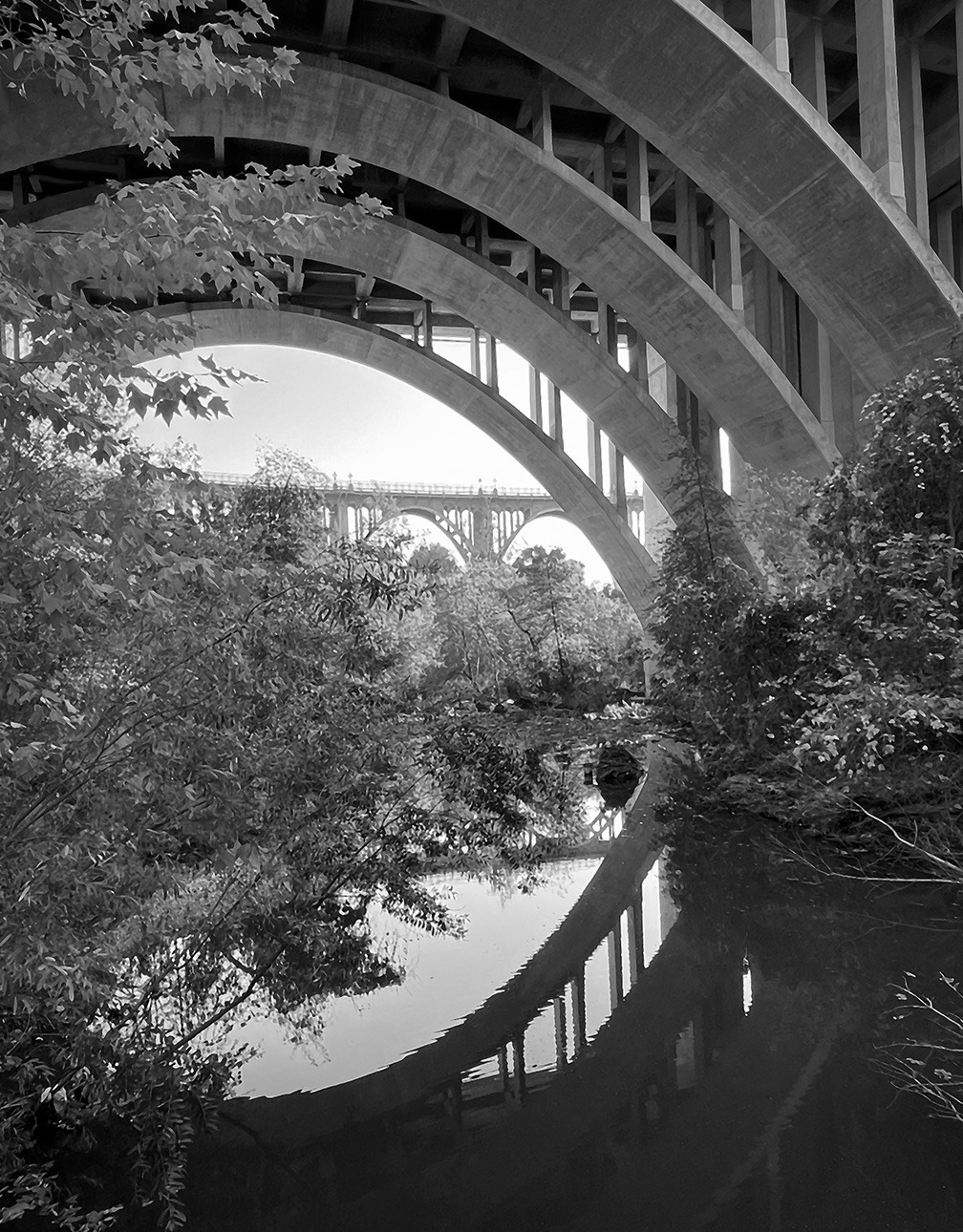 |
|
| (2022)* - Looking through the arches of the Ventura Freeway Bridge (Pasadena Pioneers Bridge) toward the Colorado Street Bridge. Courtesy of Tavo Olmos |
Historical Notes Both bridges feature dramatic arches, but they tell different architectural stories. The 1913 Colorado Street Bridge embodies elegance and craftsmanship of its time, while the Pioneers Bridge reflects mid-20th-century engineering on a grand scale. Together, they form a powerful visual dialogue between Pasadena’s past and its modern era. |
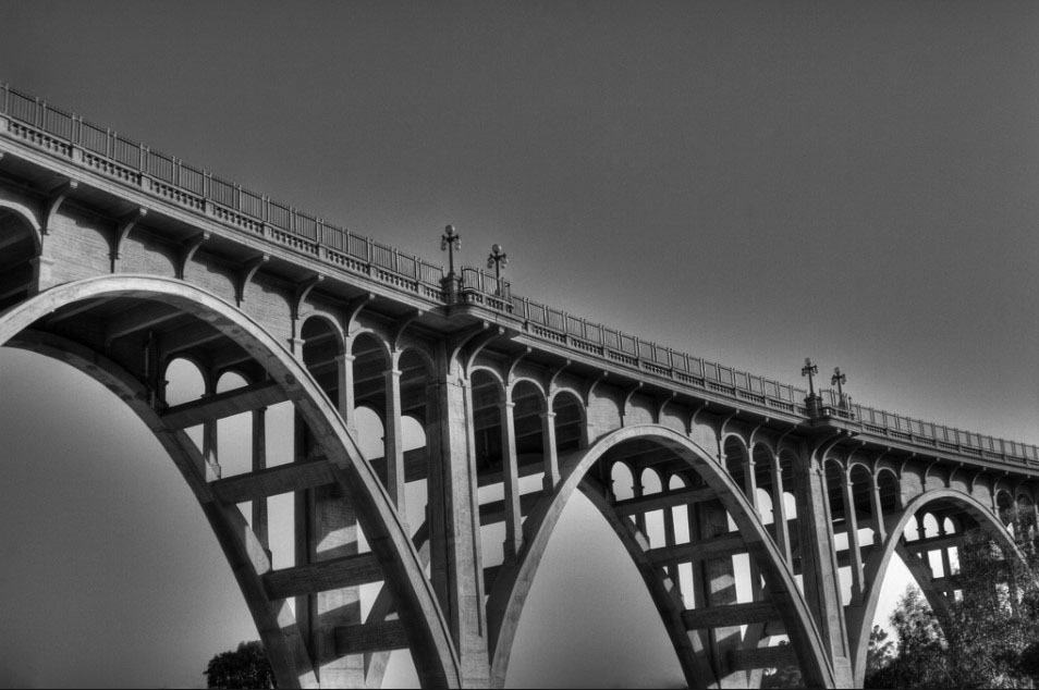 |
|
| (2007)* - View showing the majestic Colorado Street Bridge spanning the Arroyo Seco. Photo by Bernard Tang |
Historical Notes Once the tallest concrete bridge in the world, the Colorado Street Bridge quickly became one of Pasadena’s most recognized landmarks. Listed on the National Register of Historic Places and named a Historic Civil Engineering Landmark, it remains an icon of early Los Angeles County infrastructure. Though often remembered for its somber nickname, “Suicide Bridge,” ongoing preservation and safety efforts highlight the city’s commitment to both honoring and protecting this historic structure. |
* * * * * |
Rose Bowl
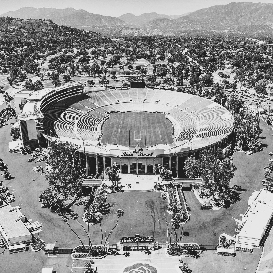 |
|
| (2022)* - Rose Bowl Today. Photo by Ted Eytan / Los Angeles Conservancy |
Historical Notes The Rose Bowl stadium in Pasadena is a historic landmark renowned for its cultural and architectural significance. Completed in 1922 and designed by architect Myron Hunt, the stadium draws inspiration from classical Greek and Roman coliseums, with its elliptical shape offering optimal sightlines for spectators. Its timeless design and functionality have made it a cornerstone of American sports history. |
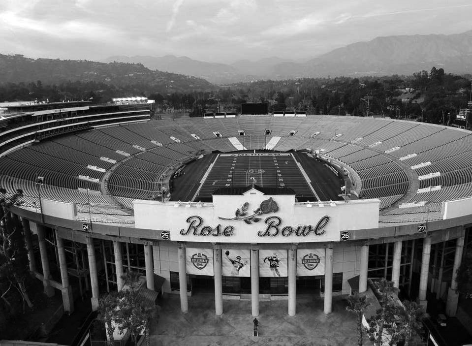 |
|
| (2018)^.^ – Contemporary view of the Rose Bowl. |
Historical Notes Since its opening, the Rose Bowl has hosted numerous iconic events, including five Super Bowls, Olympic soccer matches, FIFA World Cup Finals, and the annual Rose Bowl Game. Designated a National Historic Landmark in 1987, the stadium has maintained its architectural integrity through several expansions. These events have cemented its place as one of the most celebrated venues in the world, blending historic significance with modern relevance. |
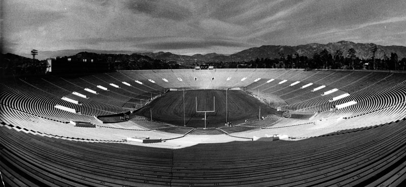 |
|
| (1987)* - It looks empty here, but the Rose Bowl is anything but on New Year's Day, when 100,000-plus fans rock the stadium. |
Historical Notes Built in just nine months using local materials, the Rose Bowl originally seated 57,000 spectators but now accommodates over 100,000. Its design seamlessly combines early 20th-century architectural principles with classical influences, creating a venue that is both functional and visually striking. Today, it stands as a cherished symbol of Pasadena’s rich sporting and architectural heritage, continuing to inspire generations of fans and visitors. |
* * * * * |
City Hall
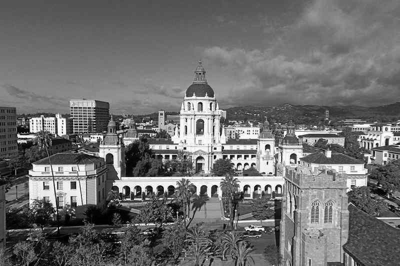 |
|
| (2014)* – Aerial drone view of the beautiful Pasadena City Hall. Photo by Phil Coombes |
Historical Notes On July 28, 1980 the Civic Center District, including Pasadena City Hall, was listed on the National Register of Historic Places. |
* * * * * |
Please Support Our CauseWater and Power Associates, Inc. is a non-profit, public service organization dedicated to preserving historical records and photos. Your generosity allows us to continue to disseminate knowledge of the rich and diverse multicultural history of the greater Los Angeles area; to serve as a resource of historical information; and to assist in the preservation of the city's historic records.
|
More Historical Early Views
Newest Additions
Early LA Buildings and City Views
History of Water and Electricity in Los Angeles
* * * * * |
References and Credits
* LA Public Library Image Archive
^*California Historic Landmark Listing (Los Angeles)
^#South Pasadena Middle School Home Page
#* Huntington Digital Library Archive
## Google Maps
++ Squareone.org: Pasadena Winter Garden
^^*LA Times Framework: Palomar Telescope
*^^Nuestra Señora la Reina de los Ángeles: losangelespast.com
***Pasadena Museum of History: Pacific Electric Railway Then and Now
**#Metro Transportation Library and Archive
+**Automobile in American Life and Society
++*Estately Blog: Colorado Street Bridge Postcard
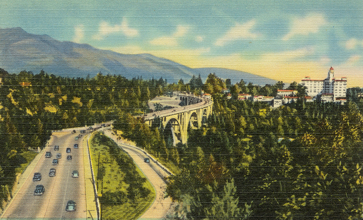
+++Facebook.com – Los Angeles Heritage Railroad Museum
#+#Facebook: Hollywood's Garden of Allah novels, by Martin Turnbull
^++Pomona Library Image Archive
+^+Pasadena: A Business History: The Model Grocery
^+^Master Plan of Highways - County of Los Angeles
^*#Noirish Los Angeles - forum.skyscraperpage.com; Oak Knoll PE Line
*#*KCET: Colorado Street Bridge; L.A.'s First Freeways
*##Los Angeles Movie Palaces: Fox Pasadena
#^^Hometown Pasadena: Tower Theatre
#^#Pyroil - The Wonder Gas: theoldmotor.com
#*#Pasadena Adventure: walknridela.com
##*The Pasadena Civic - History
##+Waymarking.com: First Church of Christ, Scientist Pasadena
**^^Cinema Treasures: Florence - State Theatre; Tower Theatre
*^^*Pasadena: A Busines History
^***Facebook.com: I Grew Up in San Gabriel Valley: Colorado Blvd.
^^**Cruiselinehistory.com: Pasadena Santa Fe Station – Gateway to Hollywood
^^*#Facebook.com - Pasadena Digital History
^++^Facebook: Los Angeles Heritage Railroad Foundation
#^^*Pasadena Star News: Pasadena Civic Auditorium; Drone View of Pasadena City Hall; Pasadena Playhouse
#^^^The City of Pasadena - cityofpasadena.net: Central Library
##++Flickr.com: Boston Public Library
++##Facebook:AmericarTheBeautiful
**##Eating L.A. - Guinn's Coffee Shop and Drive-in
*^ Wikipedia: History of Pasadena; Tournament of Roses Parade; The Langham Huntington; Hotel Green; Rose Bowl Game; Pasadena City Hall; Old Town Pasadena; Los Angeles Terminal Railway; Richard H. Chambers United States Court of Appeals and the Vista del Arroyo Hotel and Bungalows; California Institute of Technology; William G. Kerckhoff; Van de Kamp's Holland Dutch Bakeries; Bank of Italy; Arroyo Seco Parkway; Pasadena; United Cigar Stores; Pasadena Star-News; Arroyo Seco; American Legion; Pasadena via Oak Knoll PE Line; Hupmobile
< Back