Early Views of Pasadena
Historical Photos of Early Pasadena |
 |
|
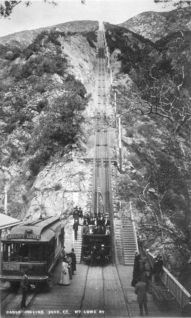
| (1893)^ - The great Cable Incline (seen above) went from Rubio Pavilion (the bottom) to Echo Mountain (at the top). In this picture one of the black cable cars, named "Rubio" sits at the bottom with some passengers aboard and others waiting nearby. Also on the left is the electric car which brought customers to the station from Mountain Junction. |
Historical Notes At the turn of the century (1893 - 1938) one of the most famous excursion in Southern California was the Mt. Lowe trip. Sightseers from all around the Los Angeles area took a Pasadena car to Altadena and Rubio Canyon. They then transferred to a cable car on the Incline Railway that went up a 62% grade to Echo Mountain. From there they would take a narrow-gauge trolley car winding its way up the rugged San Gabriel Mtns. and finally would arrive at Alpine Tavern on Mt. Lowe, a nearly 7 mile railway ride from the base of the mountain. The views of the valley floor and beyond were spectacular.* |
 |
|
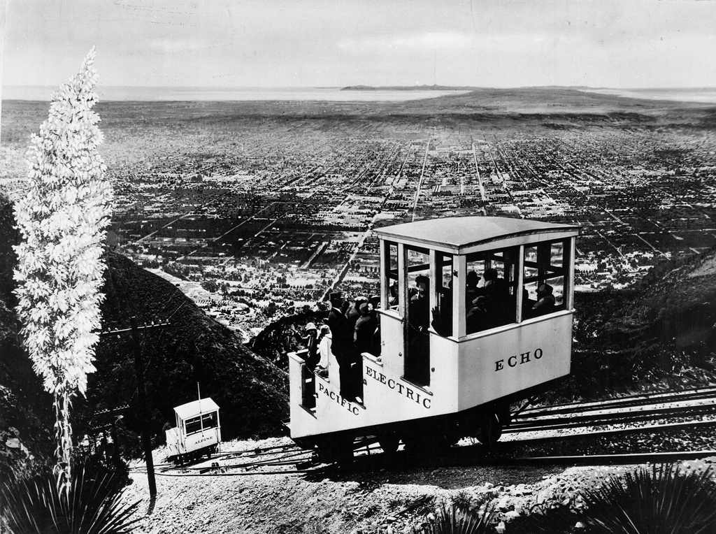
| (ca. 1915)**# - The Echo Mountain incline railway after Pacific Electric purchased it. Catalina Island can be seen in the distance. Click HERE to see more in Early Views of Catalina. |
Historical Notes After Pacific Electric (owned by Henry E. Huntington) purchased Mount Lowe Railway around 1902, the cars used on the Great Cable Incline were rebuilt to include a roof on the top deck. These cars, stripped to their floors, were last used to carry salvage in 1938, when the Mt. Lowe line was scrapped.**# |
 |
|
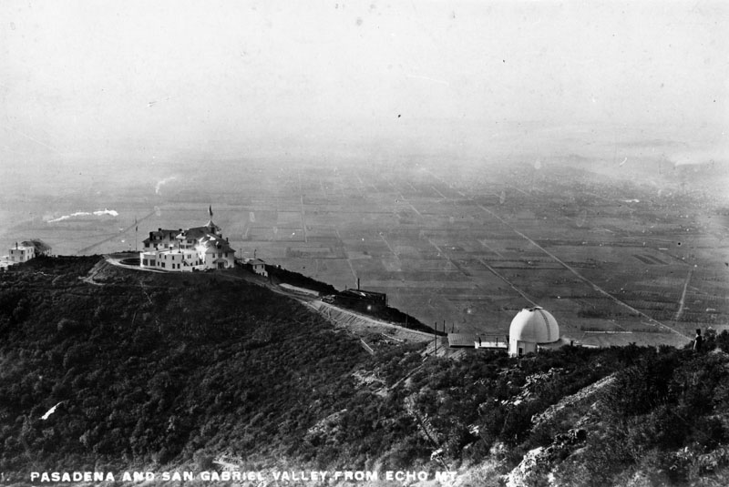
| (ca. 1890s)* - View of Pasadena and San Gabriel Valley from Echo Mountain. |
Historical Notes Buildings at Echo Mountain, reached by the Mount Lowe Railway, included the Echo Mountain House, a 70-room hotel at an elevation of approximately 3500 ft., the 40-room Echo Chalet, the observatory, car barns, dormitories, repair facilities, and a casino/dance hall.* Click HERE to see more in Early Views of Mt. Lowe Railway. |
 |
|
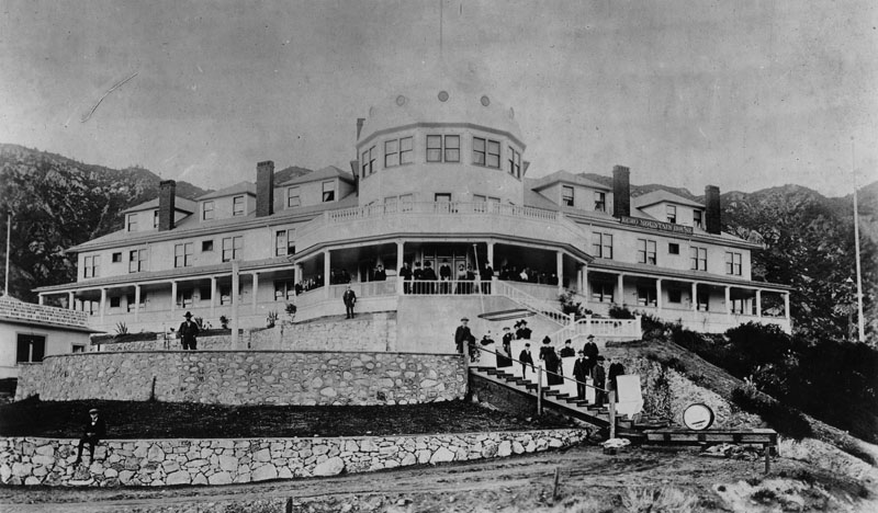
| (ca. 1890s)* - View of some of the hotel guest standing on the veranda and stairways at the front of Echo Mountain House. |
Historical Notes Completed in the fall of 1894, the Echo Mountain House was a marvel. The four-story Victorian building was marked by a tall, cylindrical tower and capped by a metal dome and a huge American flag. The bright white exterior was marked by a long row of windows on each floor. At the building’s entrance, two sweeping verandas looked off across the canyons and the valley. The interior of the hotel was extravagant, with detailed wood inlay, the finest floral-patterned carpet and handmade furniture throughout. There were seventy guest rooms, large areas for office space, a massive social hall and dining room, a souvenir shop, a Western Union office, a bowling alley, a billiard room, a barbershop and a shoeshine stand.^^ |
 |
|
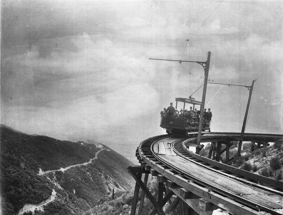
| (1893)^ - Photograph of the first passengers of Professor S.C. Lowe's dramatic Mount Lowe Railway, July 4, 1893. There are a couple of dozen people in the rail car (number "9") which is headed toward the camera on the circular bridge. The trestle structure is visible below the rails. The hotel on the mountaintop is visible at left as is the rail approach to the hotel. |
Historical Notes From the top of Echo Mtn, passengers could transfer to another trolley line, the Alpine Division, which would take them to the upper terminus at Crystal Springs and Ye Alpine Tavern, a 22-room Swiss Chalet hospice with a complement of amenities from tennis courts, to wading pools, to mule rides. This phase of tracks cut through the broad Las Flores Canyon which gave a tremendous panorama of the valley floor below. At one point a tall trestle was required to bridge a broad and deep chasm with a bridge so named High Bridge.*^ |
 |
|
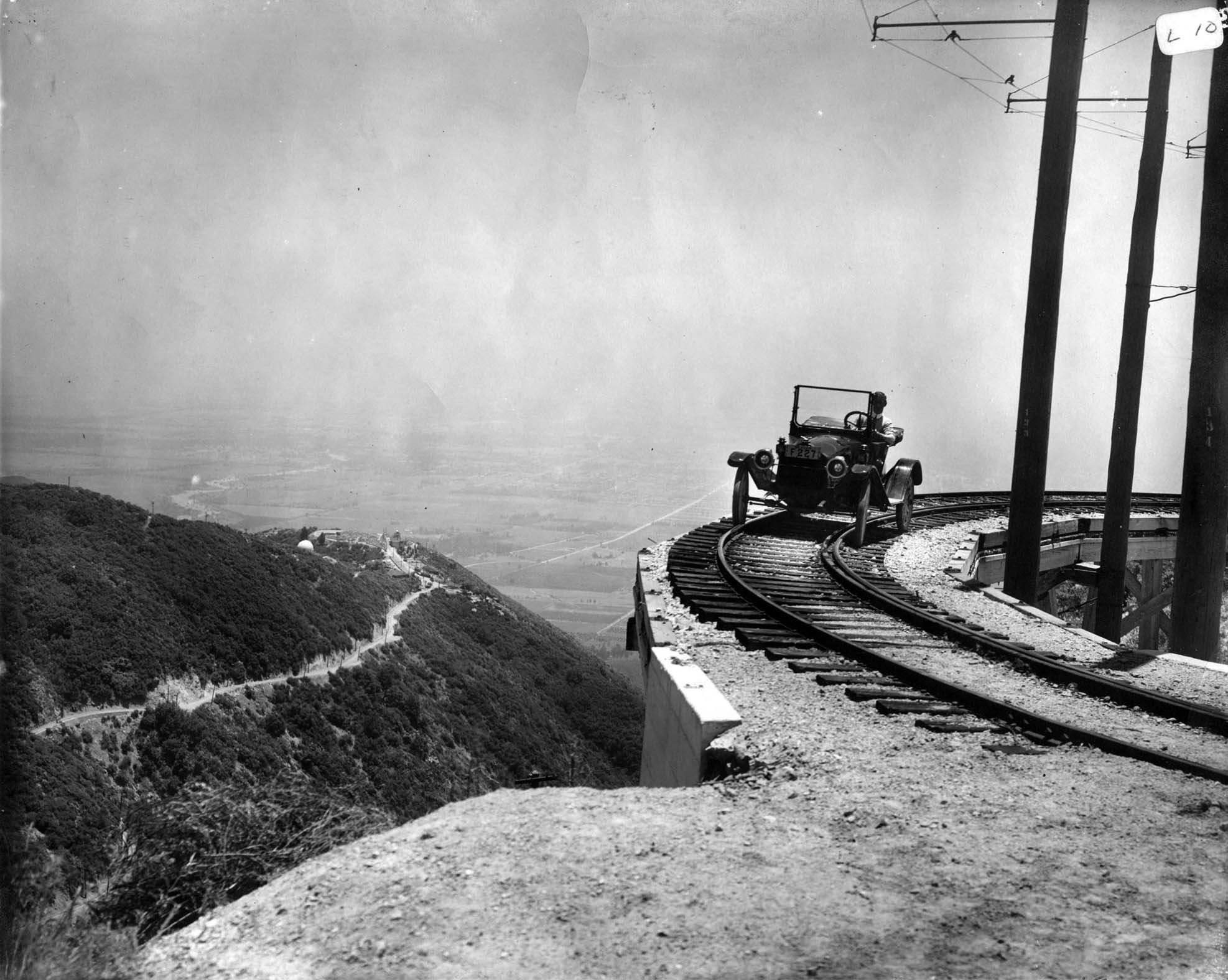
| (1914)*^* - A 1914 Metz Roadster poses for a publicity picture on Circular Bridge. Echo Mountain is at far left. The above photo was featured in the Pasadena Star (Sept. 10, 1914) where the headline read: “Five thousand is the number of autos: That many machines are owned in Pasadena and vicinity.” |
Historical Notes The automobile must have been taken up on the back of an incline car, as there were no auto roads in the vicinity at the time. A fire road reaches this spot today. |
 |
|
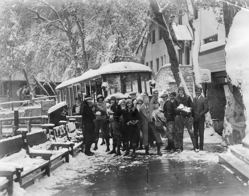
| (1930)* - Caption on the verso of the image reads, "Redondo High School students arrive at Mt. Lowe Tavern for a snow battle royal." |
Historical Notes Ye Alpine Tavern was the end-of-the-line for the Mount Lowe Railway at the foot of Mount Lowe. It was renamed The Mount Lowe Tavern in 1925, and was burned down in September 1936.*^ |
Click HERE to see more in Early Views of Mt. Lowe Railway |
 |
|
| (1897)++# - Winter view looking northeast from Monk's Hill showing the San Gabriel Mountains covered with a blanket of snow. You can just make out Mount Lowe Rwy. entering Rubio Cyn. and Alpine Division ascending from Echo Mountain. The dirt intersection in foreground is of Howard and Marengo. |
Historical Notes On closer look you can make out Christmas Tree Lane with deodar saplings in the middle of photo. The McNally and Greene mansions are those buildings on either side. |
 |
|
| (ca. 1900)#* - Panoramic view showing the snow-capped San Gabriel Mountains including Echo Mt., Mt. Lowe, and Mt. Wilson. Houses and orange groves are visible in the foreground. |
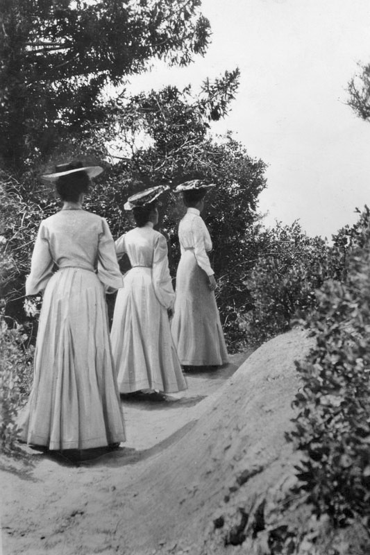 |
(1902)* - Caption reads, "'Ah, there!' Behold, three young ladies of fashion determinedly, though circumspectly, hiking up the Mt. Lowe trail in the year 1902. Mountaineering was quite the thing in those halcyon times, but if anyone had so much as mentioned hiking outfits with 'shorts' to these gals, they probably would have hidden their blushes in the shrubbery."
|
 |
|
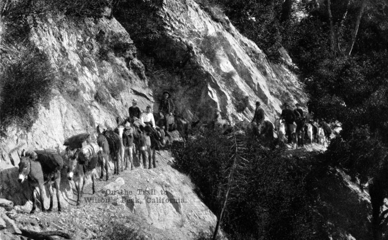
| (1912)^*^# - Postcard view showing a mule train traveling along a trail that led to the top of Mt. Wilson. |
Historical Notes Benjamin D. Wilson, born in 1811 in Tennessee, was a fur trapper by trade. He arrived in California in 1841, intending to continue to China. During the Mexican War he joined up with the Gringos, was captured, and spent the remainder of the war as a prisoner. After the war he went into business in Los Angeles and was eventually elected mayor in 1851. In 1854 he bought a 128 acre ranch where San Marino now stands and lived there until his death in 1878. Don Benito, as he was known to his many Spanish speaking friends, needed lumber for his fences and wine barrels. The mountain peak that loomed above Wilson's ranch held plentiful forests of sugar pine and cedar, so he had been told. The year was 1864. To get that timber, Wilson was to build the first modern trail up the peak that now bears his name. In the spring of 1864, Don Benito put his Mexican and Indian help to work improving an old Indian path up Little Santa Anita Canyon. Upon arriving at the top, Wilson found two cabin ruins already there, possibly built by horse thieves of an earlier time. The timber on Wilson's peak, as the mountain became known after Don Benito built his trail, apparently didn't suit Benjamin Wilson. A few weeks later he abandoned the venture. But his trail remained, and for many years was the only pathway to the mountain top. #*#* |
 |
|
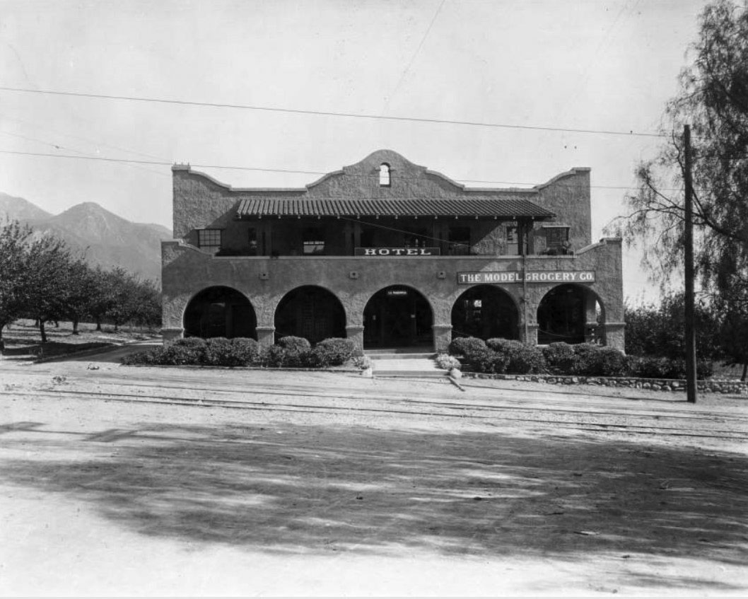
| (ca. 1910)** - View showing the Model Grocery store and the La Mariposa Hotel located at Lake and Marcheta (later Webster) avenues in Altadena. Railcar tracks can be seen embedded in the road's pavement. |
Historical Notes La Mariposa is the first motel located between Lake and Marcheta (Webster) avenues in Altadena. It was built in the early 1900s and had six rooms. The Model Grocery, a branch of Pasadena's Model Grocery stores, opened its business for a few years catering to the cattle trade customers. |
* * * * * |
 |
|
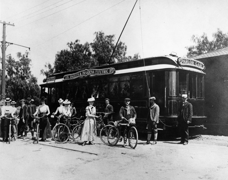
| (ca. 1894)* - A group of people, many of whom have bicycles, stands beside a Los Angeles & Pasadena Railway Company parlor car at the Altadena station. The parlor car was designed exclusively for scenic excursions to Pasadena and Altadena. |
 |
|
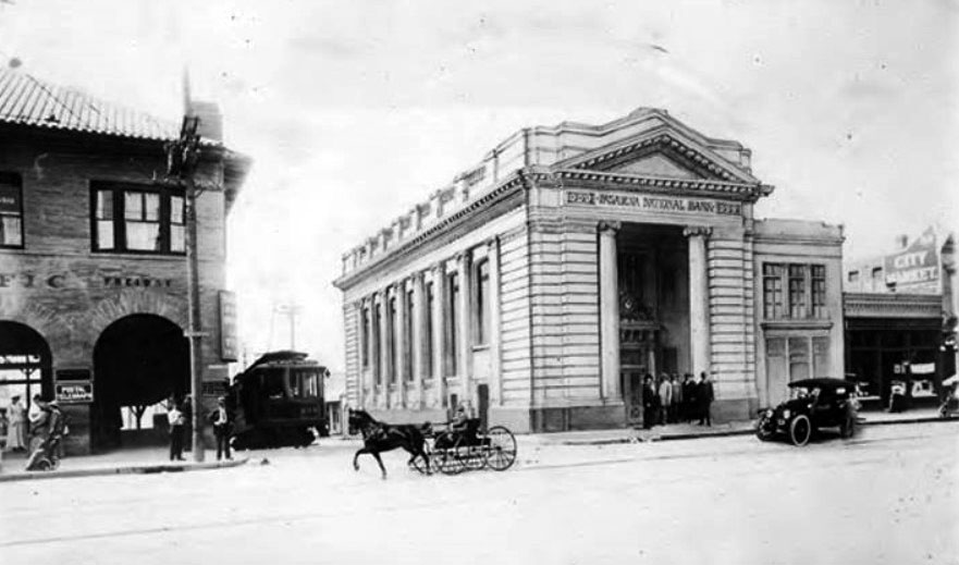
| (ca. 1886)** - View of Pasadena National Bank, located in the Masonic Temple building on the southeast corner of Raymond Avenue and Colorado Street. |
Historical Notes When the Pasadena National Bank first opened its doors in 1886, local residents made $25,000 worth of deposits on the first day alone. The bank's original lacation was a room on Raymond Avenue, but it soon moved to the Masonic Temple, shown here on the southeast corner of Raymond Avenue and Colorado Street. The bank's new offices had the most burglarproof vaults available, featuring 5-foot-thick walls laced with steel horseshoes.** |
 |
|
| (1908)#* - Street view of the corner of Raymond and Colorado looking south toward the Green Hotel. The Pasadena National Bank stands on the southeast corner. A rider on a horse shares the street with horse-drawn carriages, a cyclist, and pedestrians. |
Historical Notes Harry Ridgway designed the imposing Masonic Temple block at the southeast corner of Raymond and Colorado in Romanesque Revival style in 1894. He was also the architect/designer for the First National Bank building, built in 1886 on the n/w corner of Colorado and Fair Oaks. *#*# |
 |
|
| (ca. 1897)** - View looking toward the northwest corner of Raymond and Colorado. A streetcar shares the road with horse-drawn wagons. |
Wetherby & Kayser Shoes
 |
|
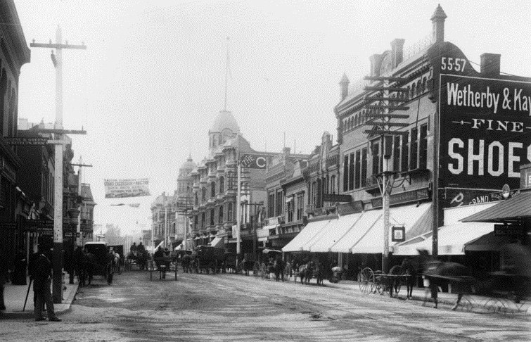
| (ca. 1894)* - View of Colorado Street, Pasadena, looking west from Raymond Avenue. Horse-drawn carriages fill the unpaved street. Sign on the right reads: "Wetherby & Kayser - FINE- SHOES" |
 |
|
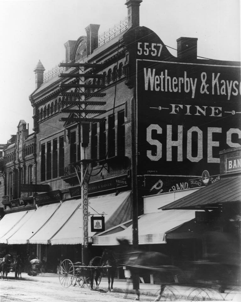
| (ca. 1894)* - Close-up view of Wetherby & Kayser Fine Shoes located at 55-57 East Colorado Street, just west of Raymond Ave. The sign on a congested telephone pole reads: "Telephone Office". |
Vroman's Bookstore
 |
|
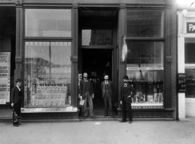
| (1895)**- Front of Glasscock and Vroman's bookstore at 60 E. Colorado and W. J. Pierce and Co. jewelers. A. C. Vroman is at the far right. |
 |
|
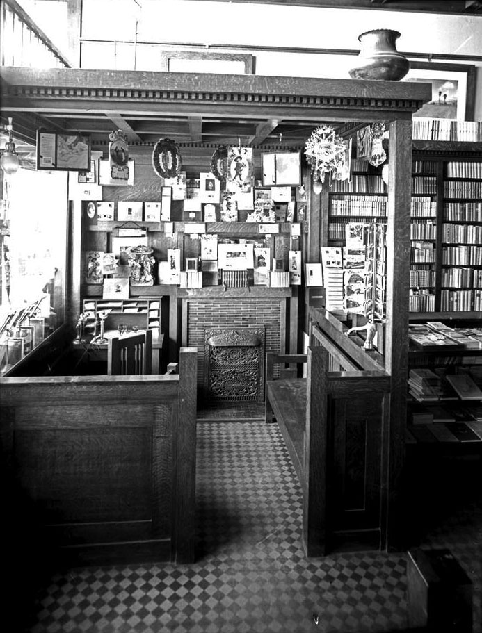
| (1905)++# – Interior view of Vroman’s bookstore showing a Christmas card display. At left can be seen the books set up in display behind the windows fronting Colorado. |
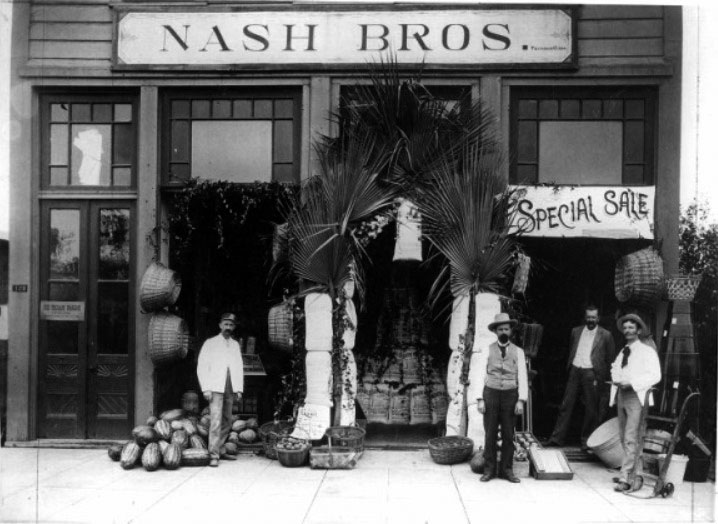
Nash Bros. Grocery Store
 |
|
| (1895)** - Exterior view of the Nash Brother's Grocery Store located at 126 East Colorado. An ice cream parlor was located upstairs. |
Historical Notes Nash Bros. Grocery store moved to 141 Colorado in 1900. |
 |
|
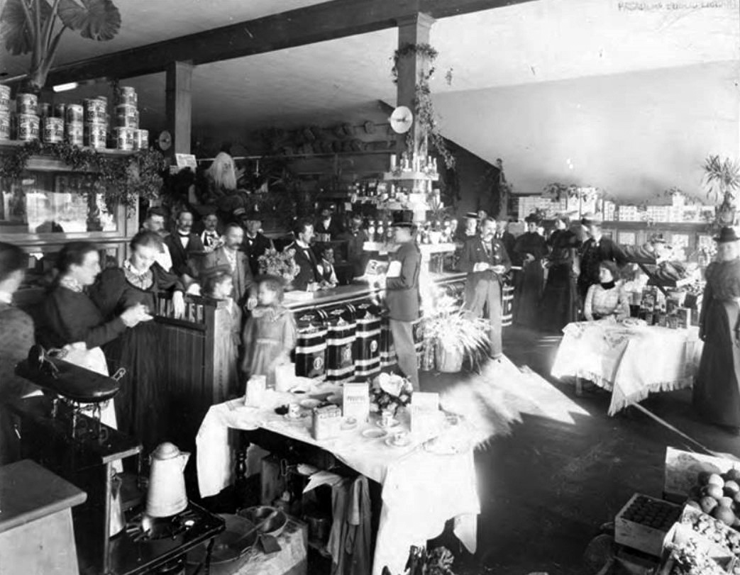
| (1890s)** – Interior view of Nash’s Grocery Store crowded with people during the holidays. Note the Santa Claus decoration on top of case in center of photo. |
* * * * * |
 |
|
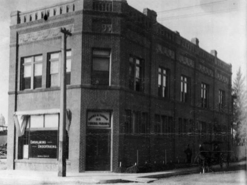
| (1895)** - View showing a two-story brick building located at 95 N. Raymond with horse-drawn wagon parked near the curb. Sign on window reads: EMBALMING – UNERTAKING. |
Historical Notes Back of photo reads: “Great Grandpa Adams founder of the Adams & Turner later Turner & Stevens. Grandma Wall lived on 2nd floor with my father.” |
* * * * * |
Universalist Church and Public Library
 |
|
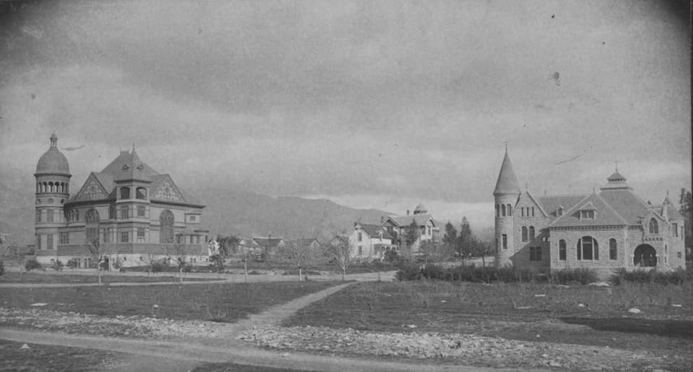
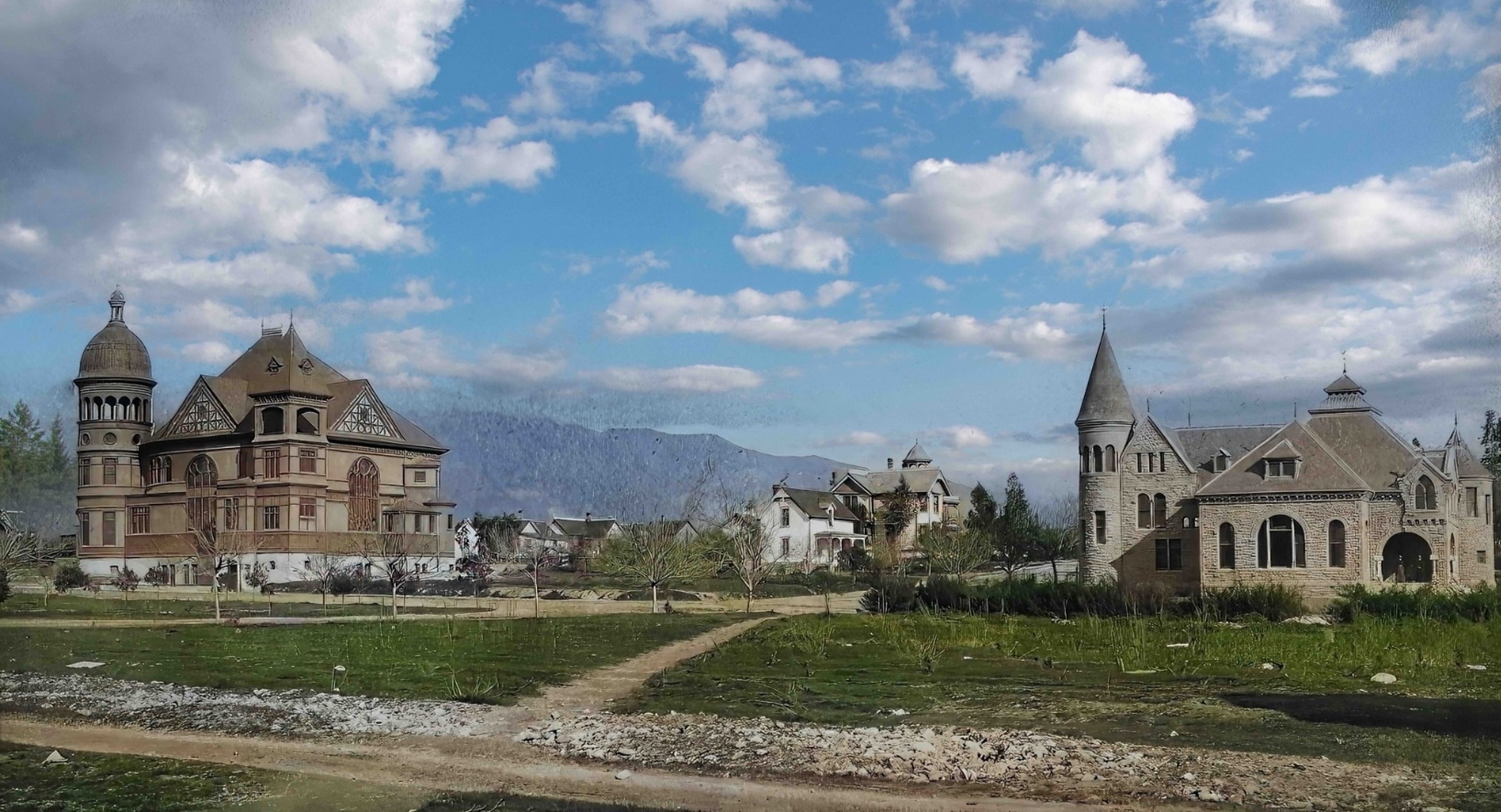
| (ca. 1890)^– Universalist Church (left) & Public Library (right) located at Walnut & Raymond Ave. Only the arch of the library still exists. |
Historical Notes The large home seen between the Churce & Library belonged to John Allin and was located at 109 East Walnut. Allin owned the "Livery and Feed Stable". Throop University later became Cal Tech. |
 |
|
| (ca. 1890)^– Universalist Church & Pasadena Public Library located at Walnut & Raymond Ave. Only the arch of the library still exists. Image enhancement and colorization by Richard Holoff. |
Public Library
 |
|
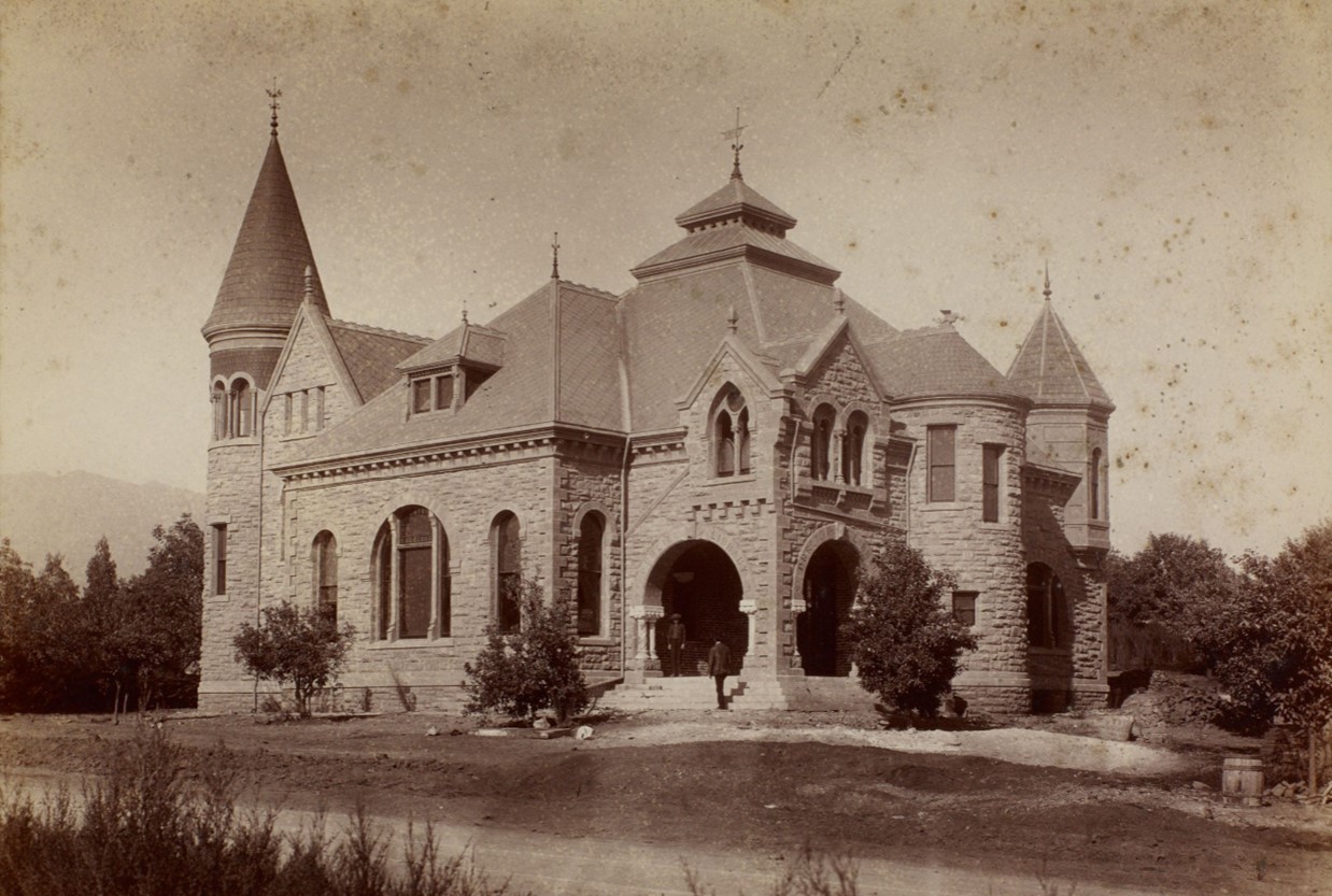
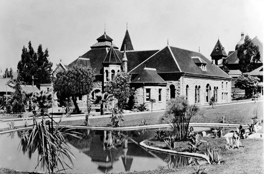
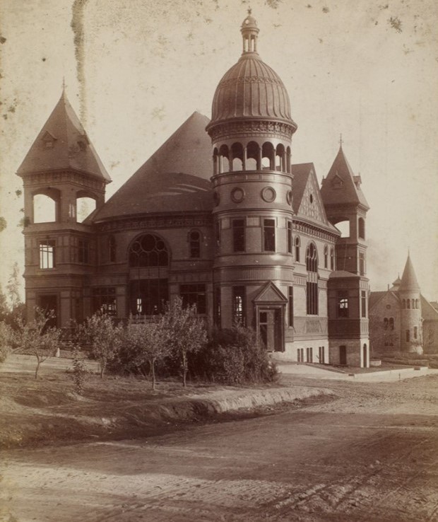
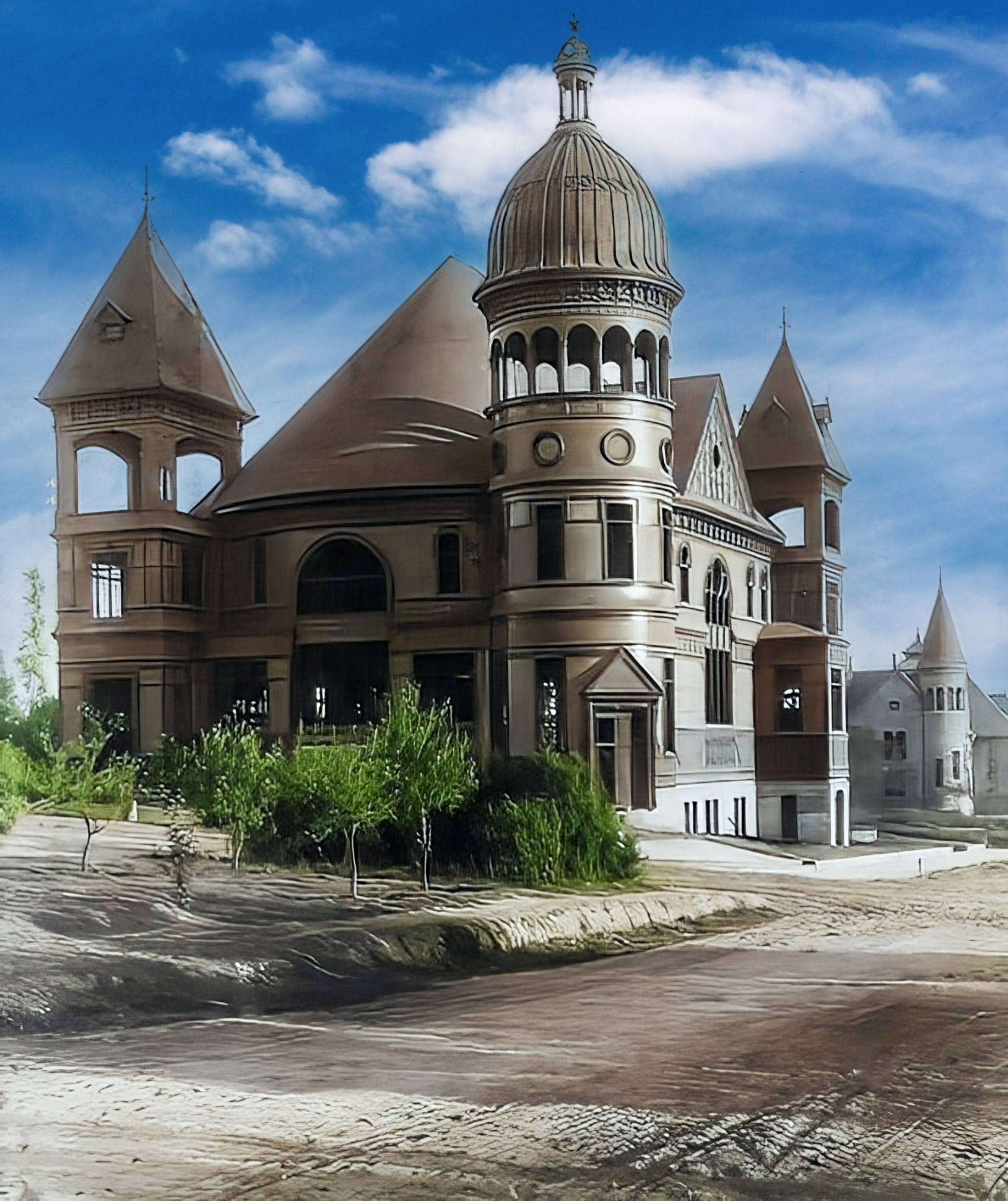
| (ca. 1890)* - Public Library Building at Walnut and Raymond (SE corner), built in the Richardson Romanesque style, with large arches and two pointed towers. |
Historical Notes This was Pasadena’s 2nd Central Public Library building. Opened on Sept. 9, 1890, the library was an impressive stone structure located on the southeast corner of Walnut Street at Raymond Avenue in what is now known as memorial Park. Although this building was expanded in 1901 and Children’s services had moved to a bungalow in Library Park, the existing space was insufficient to meet the needs of a growing City. The Library’s founding predates the City’s incorporation by four years. The first building was on Central School grounds, south side of Colorado St. between Raymond St. and Santa Fe tracks, and opened Feb. 26, 1884. This building was moved to 42 West Dayton St. in 1886.* Click HERE to see Pasadena's 3rd Public Library Building, built in 1925 at 285 E. Walnut. |
 |
|
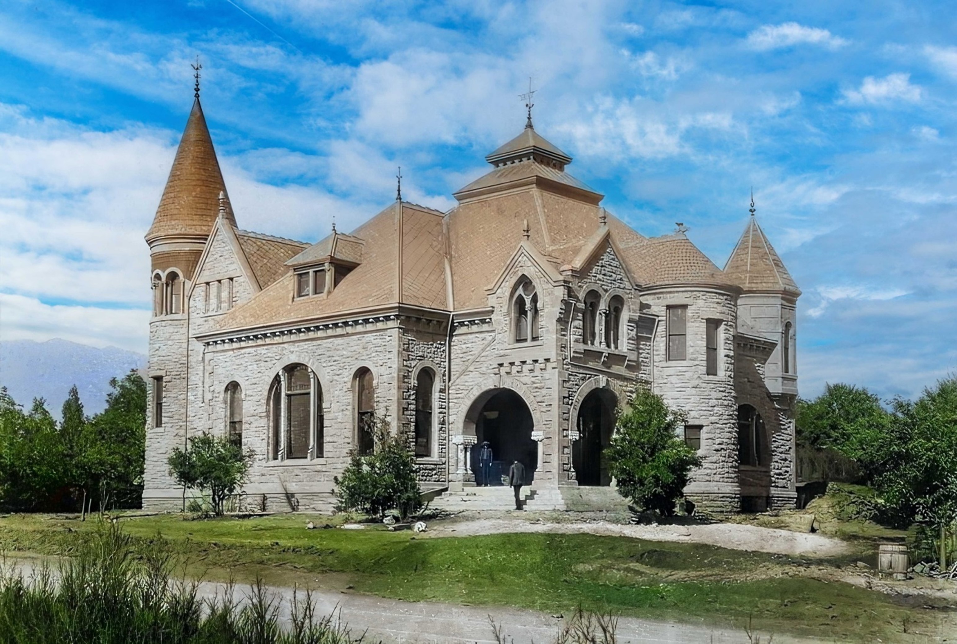
| (ca. 1890)* - Public Library Building at Walnut and Raymond (SE corner), built in the Richardson Romanesque style, with large arches and two pointed towers. Image enhancement and colorization by Richard Holoff. |
Historical Notes Opened on Sept. 9, 1890, the Richardsonian Romanesque style stone building was designed by architect Hamilton Ridgway. |
 |
|
| (ca. 1893)* - View of Pasadena’s second public library building, located on the southeast corner of Walnut Street at Raymond Avenue at what is now known as Memorial Park. A bicycle is seen parked by the curb in front of the library. |
 |
|
| (1900)* - The 1890-built Pasadena Public Library showing a horse-drawn buggy and several bicycles parked along the curb. |
Historical Notes This was Pasadena's second library building. The first was located on the Central School grounds, south side of Colorado St. between Raymond St. and Santa Fe tracks, and opened Feb. 26, 1884. |
 |
|
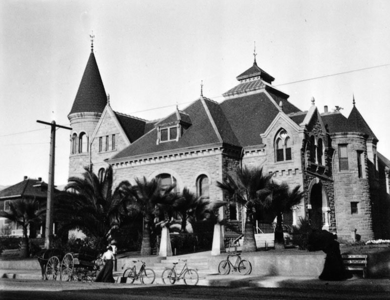
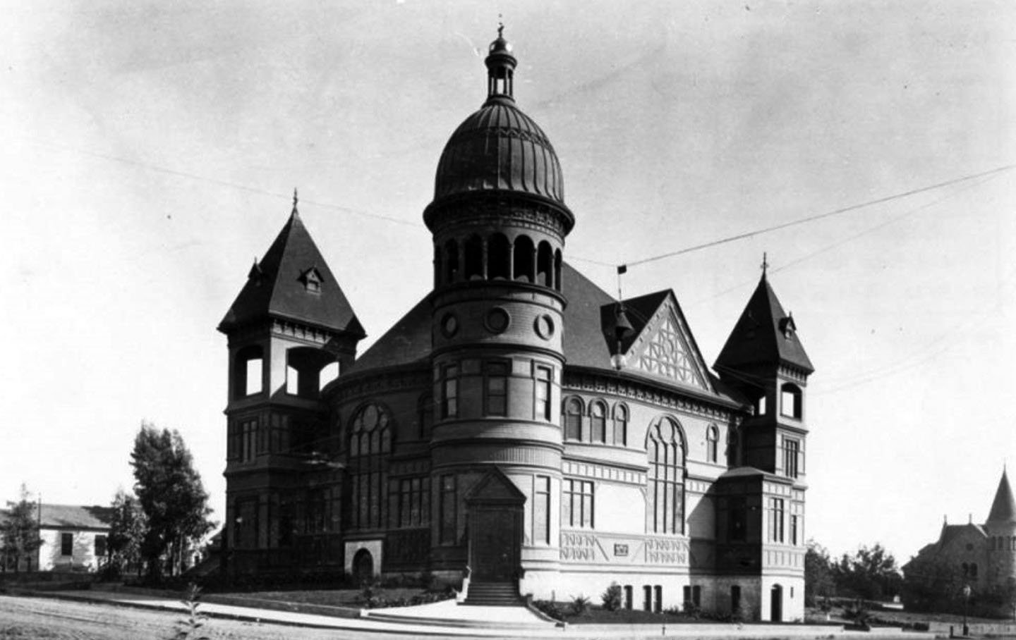
| (1908)#* - Rear view of the Pasadena Public Library showing landscape and a large pond in the foreground. It was situated in what is now known as Memorial Park, southeast corner of E. Walnut Street at N. Raymond Avenue. The building in the background on the right is the Universalist Church. |
Historical Notes Today, a green sandstone wall and a bench can be found at the corner of Orange Grove and Colorado. They are made of stone from the 1890 building of the Pasadena Public Library. A plaque bears the names of the 27 original colonists of Pasadena.*^ Click HERE to see Pasadena's 3rd Public Library Building, built in 1925 at 285 E. Walnut. |
Universalist Church
 |
|
| (1890)* – Looking at the Universalist Church located on the SE corner of the unpaved Chestnut and Raymond streets in Pasadena. The ornate church building has three towers, one with a domed top. The Public Library Building can be seen in the background. |
Historical Notes Rapidly growing in size, the Universal congregation decided to build a huge church building to accommodate future growth. By 1890 they reached almost 140 members and completed construction of a large church on the corner of Raymond and Chestnut. (The current church at Del Mar and Los Robles was built in 1923.) ^ |
 |
|
| (1890)* – Looking at the Universalist Church located on the SE corner of the unpaved Chestnut and Raymond streets in Pasadena. The ornate church building has three towers, one with a domed top. The Public Library Building can be seen in the background. Image enhancement and colorization by Richard Holoff. |
 |
|
| (ca. 1890)* – View showing the Universalist Church located on the southeast corner of Raymond and Chestnut Streets. |
Historical Notes Financing this new (1890) building was quite complicated, involving numerous other real estate transactions and loans. In the end, Amos Throop wound up paying over 2/3 of the cost. The Governor of California contributed $1000 which was a large sum in those days.^ |
 |
|
| (1895)* - Exterior view of Universalist Church at Raymond and Chestnut Streets, in Pasadena. The Romanesque-style church building had a hemispherical bronze dome supported by Roman columns. Note the palm trees surrounding the church. |
Historical Notes While a newspaper claimed in 1890 that the church could accommodate 1000 people, a more accurate story is obtained from the Nazarene Church which eventually bought the building in 1922. They claim that as many as 1300 people could be crammed into the sanctuary with 700 seated and 600 standing. The 700 seats were not pews but were luxurious theater-style seats with arm-rests. The book "Inventing the Dream, California Through the Progressive Era" mentions on p. 99: "Pasadena grew into a charming town of ten thousand by century's turn with a church for every thousand residents (including a massive Romanesque Universalist Church ...)". A local newspaper wrote: "Pasadena boasts many handsome buildings, but none of them surpass in architectural beauty the Universalist Church." The church building was demolished by the new owners in the early 1960s to create a parking lot. ^ |
Allin Residence
 |
|
| (ca. 1890)*– Home of John Allin located at 109 East Walnut. Allin owned the "Livery and Feed Stable". This was the large home seen between the Church and Library in previous panoramic view. |
* * * * * |
 |
|
| (1895)* - View of North Orange Grove Blvd. in Pasadena in 1895. It is a dirt road lined with many trees. Walnut Street is at the bottom of the hill. |
 |
|
| (ca. 1895)++# - View looking south on Marengo Avenue showing two horse-drawn carriages parked opposite each other. |
* * * * * |
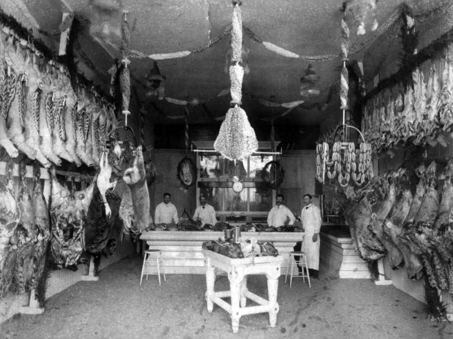
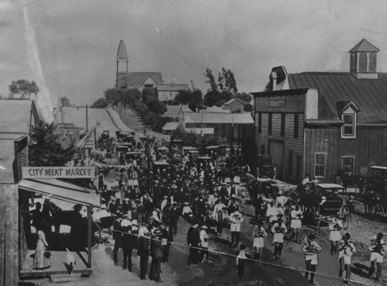
City Meat Market
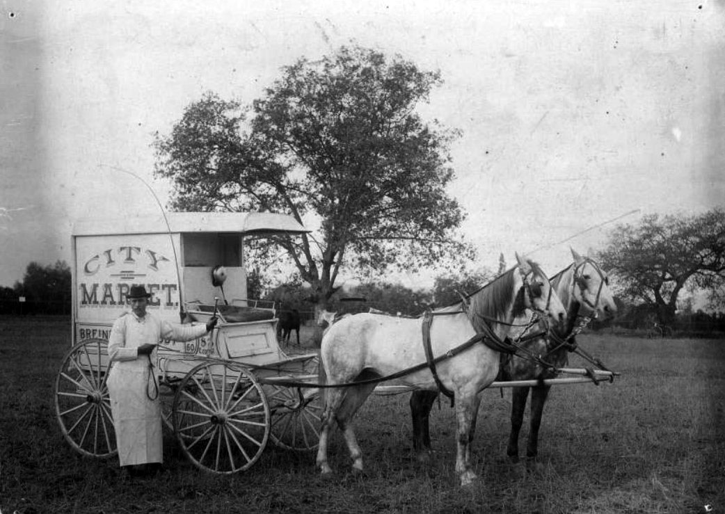 |
|
| (1895)*^* - Photo shows a man standing in front of a carriage drawn by two horses. On the side of the carriage is printed: CITY MARKET, with other words blocked by the man's body (although part of "Breiner" can be made out, probably "Breiner & Crosby"). |
 |
|
| (1891)*^* - Interior view of the City Meat Market, located at 83 East Colorado. The man on the far right is John Breiner, the proprietor. The City Meat Market is sometimes referred to as "Breiner Market." |
* * * * * |
First Electric Streetcar over Arroy Seco
 |
|
| (1895)* - View of the first electric car over Arroyo Seco near the Cawston Ostrich Farm on March 7, 1895. Pasadena and Los Angeles Railway Co. |
Historical Notes By 1895 a railroad line had been established from Downtown Los Angeles with a grand wooden trestle that cut a straight line crossing from the west side to the east. Eventually this line would hook up with rail lines built from the east to create the cross-country course of the Santa Fe Railroad. For local commutes, an electric traction trolley was put in and operated by the Pacific Electric Railway, a Henry E. Huntington enterprise, which ran the "Red Cars" from the upper Arroyo and Pasadena through the San Gabriel Valley into Los Angeles and many points beyond. The lower Arroyo Seco was served by the Los Angeles Railway "Yellow Car" lines. |
 |
|
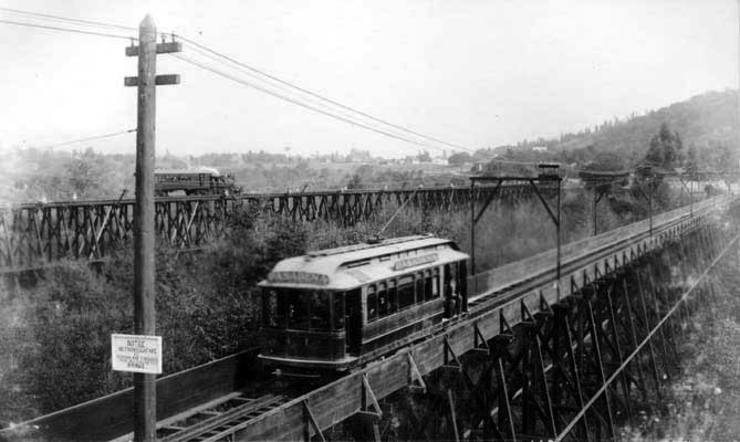
| (ca. 1895)* – View showing an electric streetcar on the bridge over Arroyo Seco at Garvanza. |
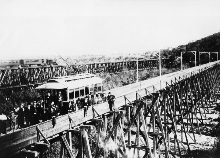
Historical Notes Originally this line had four bridges. The most spectacular spanned the Arroyo Seco at Garvanza and was the highest bridge on the PE system. It was a single track structure, of combination steel and frame bent construction. Built in 1895, it was rebuilt in 1903 and strengthened in 1916. It was about 900 feet long. Two double track wooden trestles spanned the SP main line at Daly Street & Alhambra Avenue and the UP Pasadena Branch at Fair View near Columbia Street The lower Arroyo Seco was crossed by means of a concrete structure on Pasadena Ave. near Ave. 36; this was a paved viaduct for both vehicular and rail traffic. Believe it or not, the chief tourist attraction on this line was the Cawston Ostrich Farm, on the east bank of the Arroyo Seco at Garvanza. In was American's first ostrich farm, having opened in 1886. The incubators, the dye houses and factories were widely publicized and the South Pasadena cars hauled thousands for 25 cents round trip (which included admission to the Farm). Just as long as ostrich feathers enjoyed a vogue as an essential part of milady's costume, so did this lucrative business help keep the South Pasadena Line in the black. |
* * * * * |
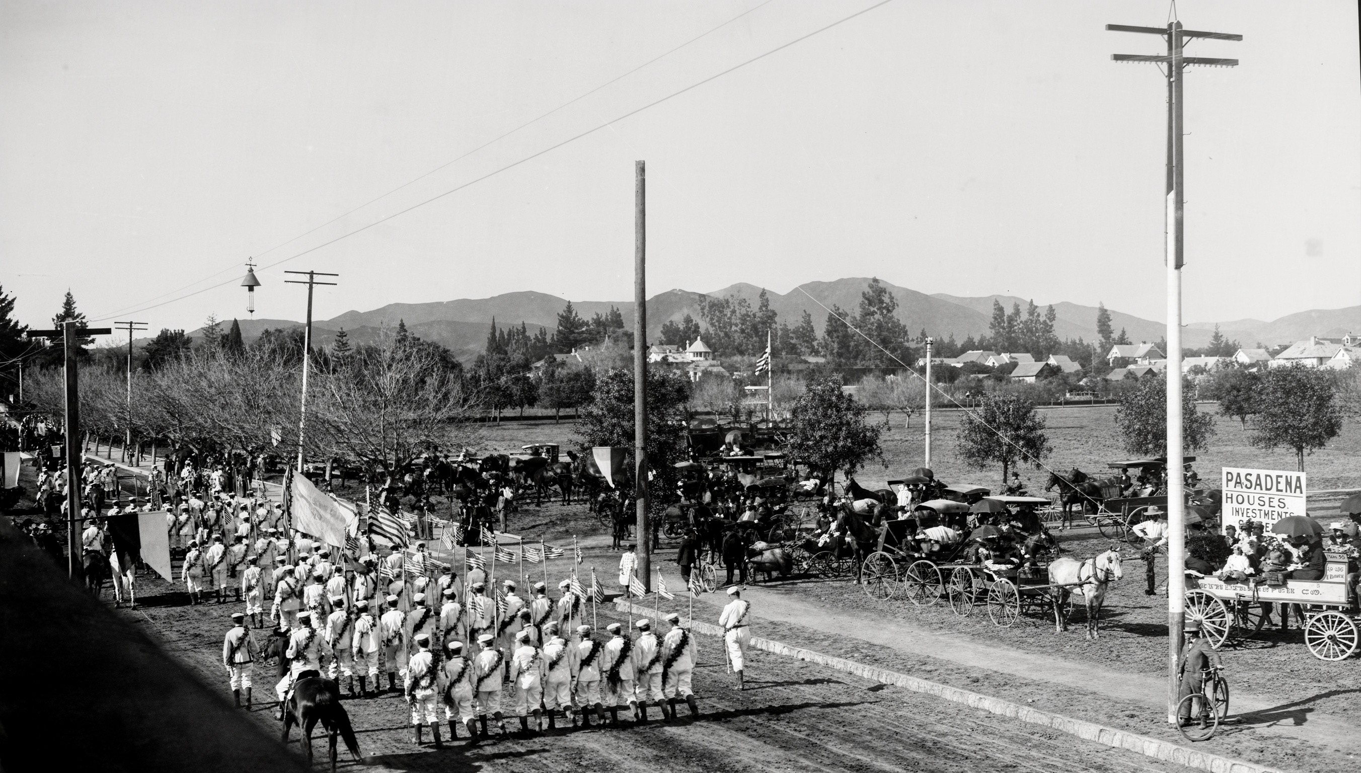
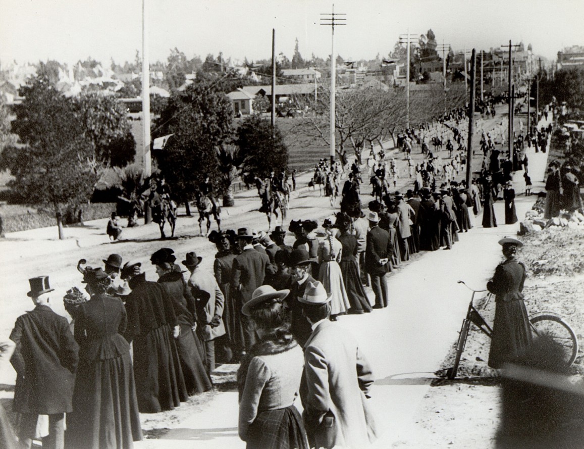
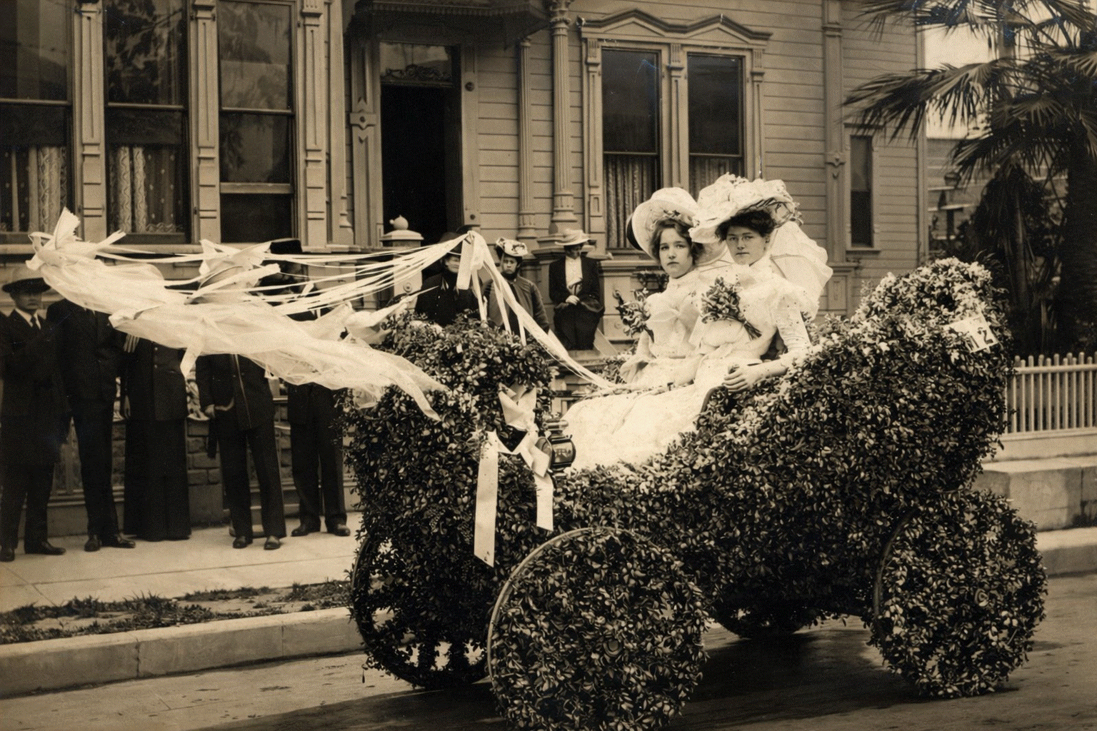
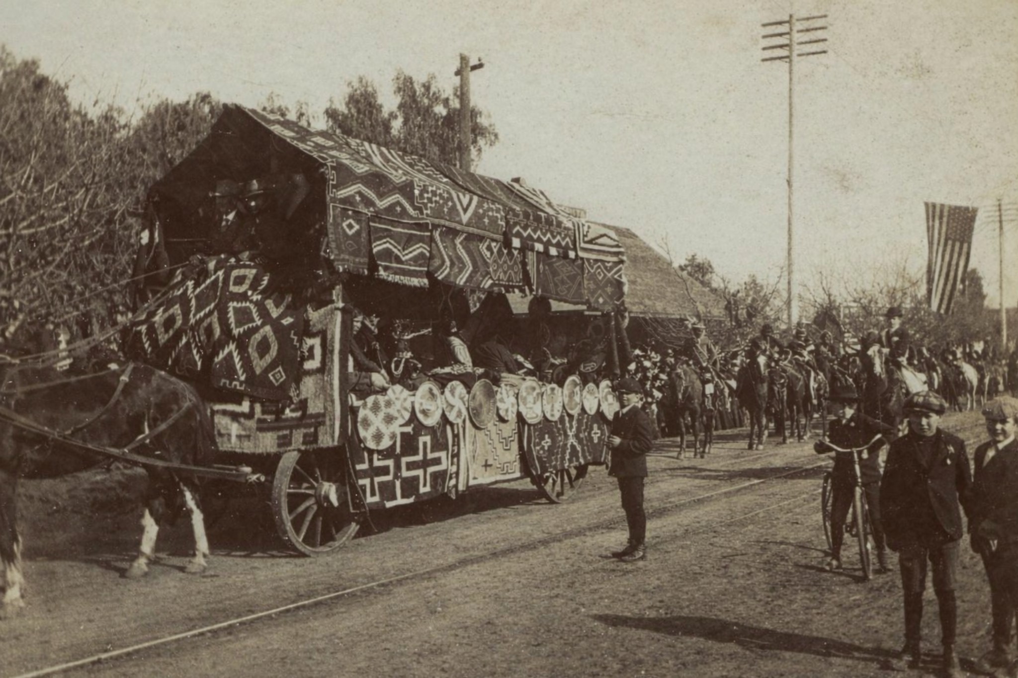
Tournament of Roses Parade
The Early Years in Pasadena, 1890 to 1910
 |
|
| (1890)* - View of the pavilion and grandstand where contests were held following the first Tournament of Roses Parade. Pasadena. January 1, 1890. |
Historical Notes The Tournament of Roses began as a winter festival created by members of Pasadena’s Valley Hunt Club. Many had moved from the East and Midwest and wanted to promote Pasadena’s mild winter climate. Professor Charles F. Holder is often credited with suggesting the idea, noting that while much of the country was buried in snow, Southern California still had flowers in bloom and oranges on the trees. The first event on January 1, 1890 featured a parade of horse-drawn carriages decorated with flowers, followed by outdoor contests including foot races, polo matches, and tug of war. The pavilion and grandstand seen here were used for these afternoon events, which helped turn the parade into a full day celebration. |
 |
|
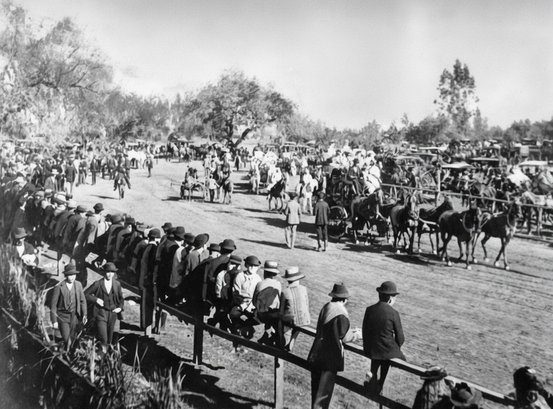
| (1893)* - Spectators line the route at Tournament Park during the Tournament of Roses Parade. California Avenue area, across from the future site of Caltech. |
Historical Notes By 1893, the Tournament of Roses had already become a popular annual event. This view shows the parade passing through what later became known as Tournament Park, near today’s California Institute of Technology. This year established a lasting tradition. When January 1 fell on a Sunday, the parade was moved to January 2 to avoid interfering with church services and to prevent frightening horses tied outside churches. From that point forward, the parade was never held on a Sunday. The casual crowd scenes reflect the early character of the event. Spectators watched from the street, nearby wagons, and open ground, giving the parade a relaxed, community feel. |
 |
|
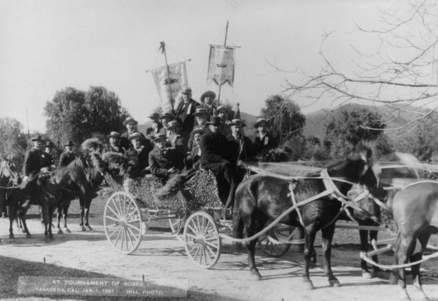
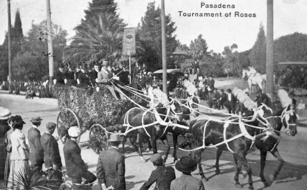
| (1893)* – Tournament of Roses Parade given under the auspices of the Valley Hunt Club. January 2, 1893. |
Historical Notes This image comes from the same year the parade date was moved from January 1 to January 2 due to the Sunday rule. At this time, the Valley Hunt Club was still responsible for organizing the parade. Within a few years, the event would grow beyond the ability of a single club to manage, leading to the formation of a dedicated Tournament of Roses Association. |
 |
|
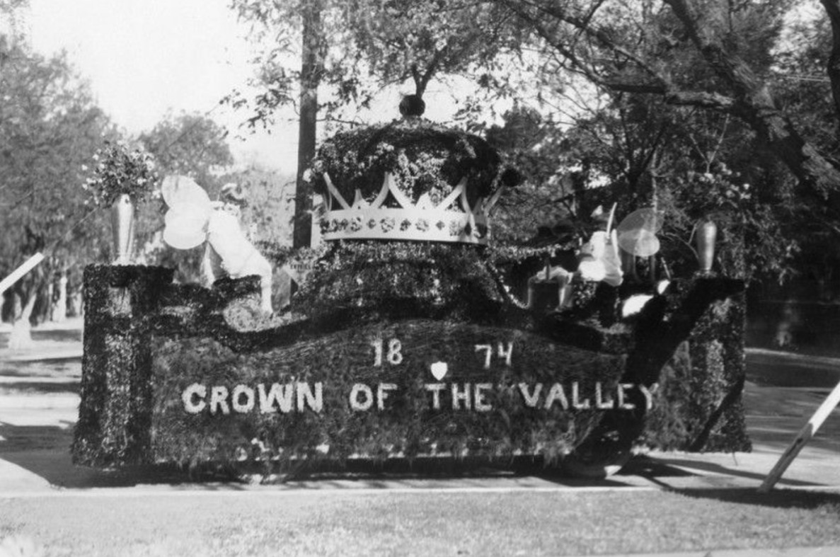
| (ca. 1894)* - Early Rose Parade float bearing the words “1874 Crown of the Valley,” Pasadena’s nickname and founding year. |
Historical Notes Early floats often promoted Pasadena itself. Themes focused on the city’s origins, climate, and identity. The phrase “Crown of the Valley” reflected how residents and boosters viewed Pasadena as a special place at the base of the San Gabriel Mountains. These early floats were simple by later standards, but they established the core tradition of using natural plant materials and flowers as the primary decorative element. |
 |
|
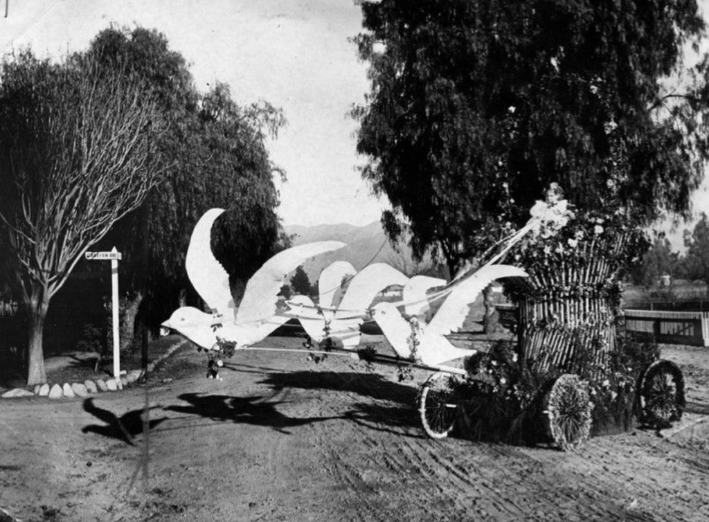
| (1897)* - Prize-winning entry of 1897; a basket which appears to be drawn by a team of flying doves is actually propelled by a man hidden inside the basket. |
Historical Notes This clever float relied on illusion rather than size or complexity. The basket was actually moved by a person hidden inside, creating the appearance of flight. Such novelty entries were crowd favorites and show that early parade organizers valued creativity and humor as much as floral beauty. |
 |
|
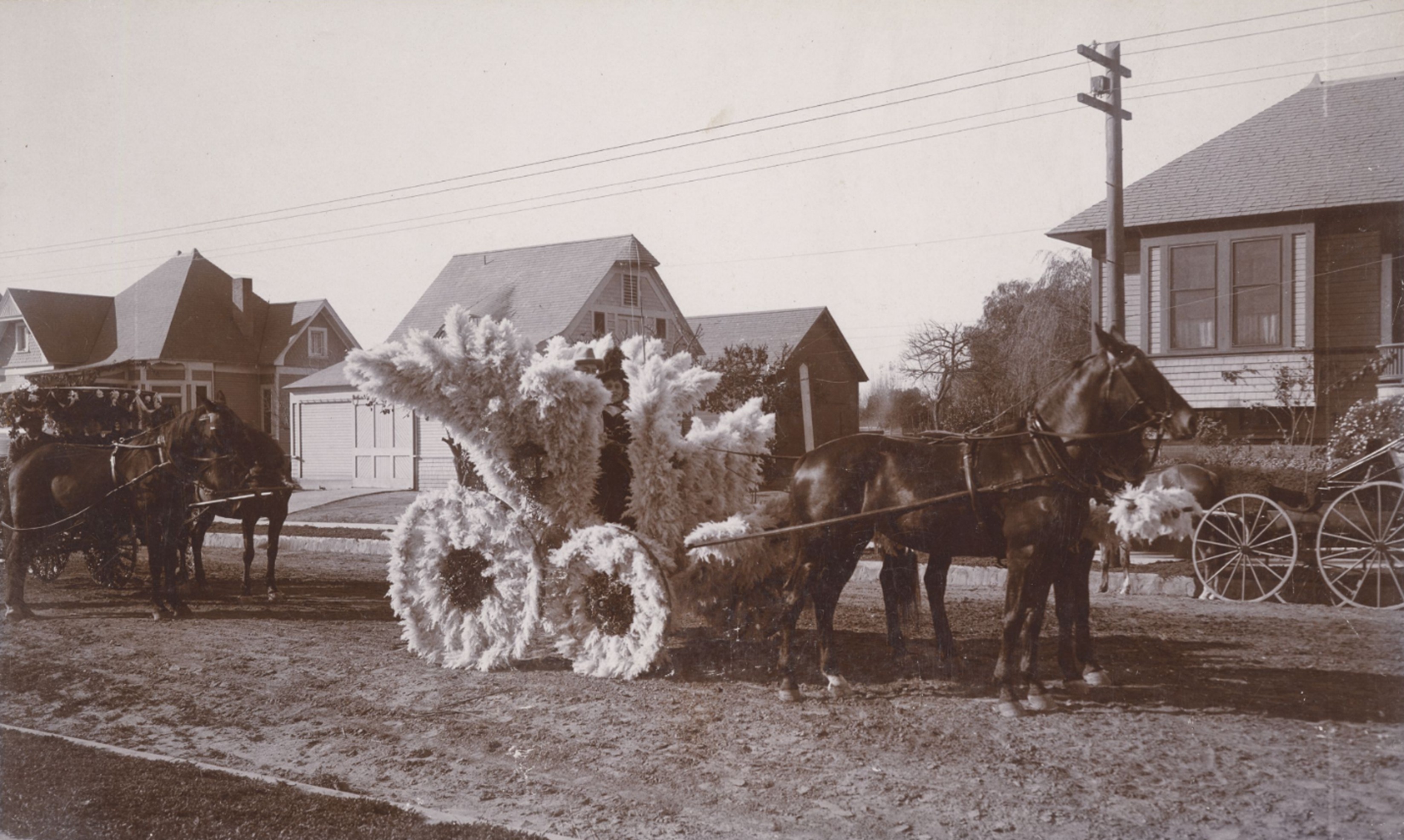
| (ca. 1895)* - Tournament of Roses parade with a small horse-drawn carriage completely decorated with pampas grass, with a young girl seated inside. |
Historical Notes Pampas grass was a popular decorative material in early Rose Parades because it was abundant, dramatic, and easy to shape. Long before strict flower rules were established, designers freely used grasses, leaves, and natural textures to create visual impact. Child participants were common in early parades, reinforcing the family and community spirit of the event. Entries like this emphasized charm and creativity rather than size or engineering. |
 |
|
| (1896)* - Horse-drawn carriage packed with riders during the Rose Parade. Women hold parasols as the procession moves along the route. |
Historical Notes In the 1890s, horse-drawn carriages formed the backbone of the parade. Many entries reflected Victorian social customs, with formal dress and decorative vehicles used to make a public impression. Parasols, hats, and packed carriages show how the parade functioned as both a civic celebration and a social event for participants and spectators alike. |
 |
|
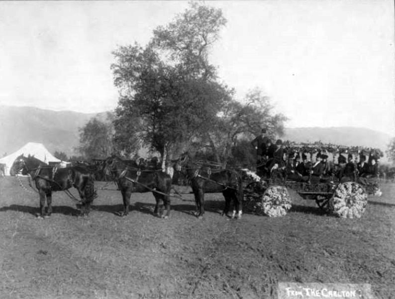
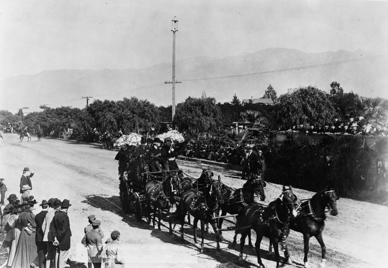
| (1890s)* - Decorated carriage, “Tallyho,” drawn by six black horses during the Tournament of Roses Parade, ca.1895-1899. |
Historical Notes The tally ho carriage was a formal horse-drawn coach traditionally associated with hunting parties and social outings. Its appearance in the Rose Parade reflects the influence of the Valley Hunt Club and Pasadena’s equestrian culture. Large teams of matched horses were a sign of prestige and spectacle. For early audiences, these impressive carriages were as exciting as later mechanical floats. |
 |
|
| (1897)* - Flower covered carriage float sponsored by the Los Angeles Chamber of Commerce, followed by riders on horseback. |
Historical Notes By the mid 1890s, the Rose Parade had become a major promotional platform. Organizations such as chambers of commerce used parade entries to advertise Southern California to visitors and potential investors. In 1895, the Pasadena Tournament of Roses Association was formed to manage the growing event. Activities associated with the parade soon expanded to include contests and novelty races held at Tournament Park. |
 |
|
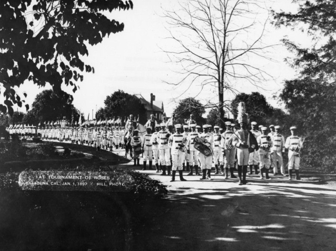
| (1897)* - Large marching band in white uniforms appears in the Rose Parade. |
Historical Notes Marching bands became part of the Rose Parade early in its history. The first band appeared in 1891 with fewer than 20 members. By the late 1890s, bands had grown in size and importance. Bands added sound, rhythm, and spectacle to the procession, helping transform the parade from a quiet carriage display into a lively public performance. |
 |
|
| (1898)* - Spectators gather along the parade route under clear skies, many watching from horse-drawn wagons. |
Historical Notes This view captures Pasadena at a time when large areas along the parade route were still open land. Spectators arrived early and often turned the parade into a full day outing. The relaxed arrangement of the crowd reflects an era before formal grandstands and heavy crowd control became common. |
 |
|
| (1901)* - Spectators line Colorado Boulevard to watch the Rose Parade. View is looking northeast from Conger Hill on Colorado Street, just east of Orange Grove Avenue. |
Historical Notes Equestrian entries remained a central feature of the Rose Parade well into the early 20th century. Riders often wore formal or themed attire, adding elegance and movement to the procession. This image also highlights the growing popularity of the parade. By this time, spectators lined the route in larger numbers, and viewing the parade had become an annual social tradition for Pasadena families. |
 |
|
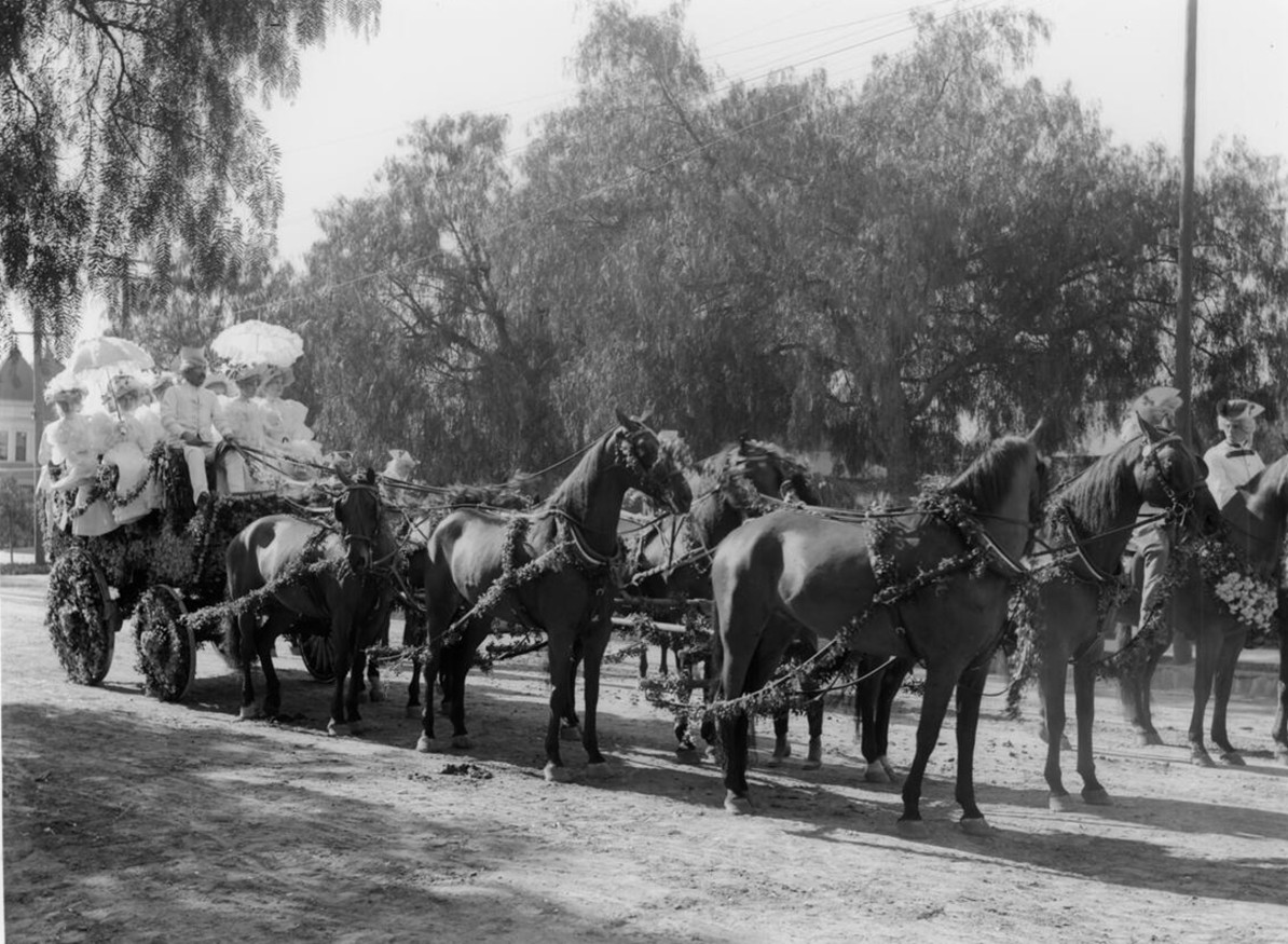
| (1902)* – Tournament of Roses Parade carriage decorated with flowers, showing women dressed in white and holding white parasols. They appear to be wearing flat caps resembling graduation hats, with tassels falling to the left. The carriage is paused, likely awaiting its turn to enter the parade route. |
Historical Notes By the early 1900s, flower-covered carriages were a common sight in the Tournament of Roses Parade, emphasizing natural beauty, craftsmanship, and Pasadena’s mild winter climate. Horse-drawn carriages were decorated with fresh flowers and greenery and often featured live participants rather than elaborate float structures. The women seated in this carriage are dressed in white and hold white parasols, reflecting the formal style of the period. Flat caps with tassels, fashionable at the turn of the century, are visible in many early parade photographs. Carriages such as this one often paused along residential streets near the parade route while awaiting their turn to proceed. |
 |
|
| (ca. 1902)* - Two women pose in an automobile decorated with garlands of greenery and ribboned doves. Both wear white dresses and wide-brimmed hats, with floral arrangements pinned to the front of their dresses. |
Historical Notes By the early 1900s, Pasadena was beginning to mix new technology with old traditions, and the Tournament of Roses became one of the places where people could literally see that transition roll by. For its first decade the parade was dominated by flower covered horse drawn vehicles and carriages, but automobiles soon began to appear as novelty entries. Motor vehicles were introduced to the Tournament of Roses Parade as early as 1901. Because the parade still relied heavily on horses, early automobiles were often kept toward the back of the procession so they would not spook the teams ahead of them. In later decades, the balance tipped the other way, and by 1920 the parade had fully shifted from horse drawn floats to motor driven floats. This photograph fits that early transitional era. The vehicle is treated almost like a rolling garden, with dense greenery used to hide the mechanics, and the decorations pushing upward and outward to create a festive silhouette. The ribboned “doves” are part of that same visual language, more symbolic than literal, suggesting peace, celebration, and the airy, floating look that parade decorators liked to create. The women’s white dresses, hats, and bouquets reinforce the formal, ceremonial feel that early Tournament entries often aimed for, half parade, half posed society scene. |
 |
|
| (1903)* - Horse-drawn wagon parade float covered with Native American blankets during the Tournament of Roses Parade. Children, a bicycle, and mounted riders are visible along the route. |
Historical Notes Parade themes in the early 1900s often reflected romanticized views of the American West. Decorative elements such as Native American blankets were used to evoke frontier imagery and regional identity. The presence of children, bicycles, and riders alongside the float shows how informal parade viewing still was. The parade moved through active streets where everyday life continued alongside the celebration. |
 |
|
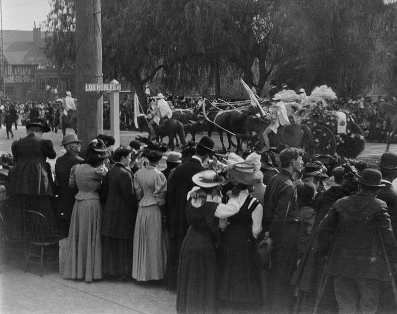
| (ca. 1900)* - Looking north along Colorado Street near Los Robles Avenue during the Rose Parade. Photo by George Leahy. |
Historical Notes By around 1900, Colorado Street had become one of Pasadena’s main parade routes, passing through increasingly developed parts of the city. At intersections such as Colorado Street and Los Robles Avenue, crowds gathered tightly along the sidewalks to watch the procession pass. This image reflects the parade’s growing popularity and its transition from an informal local celebration into a major civic event. Mature street trees, nearby buildings, and dense spectators show how the parade had become woven into the everyday urban fabric of Pasadena. Scenes like this mark a shift in the Rose Parade’s character, from open landscapes and casual viewing to crowded streets where the parade moved through the heart of the city. |
 |
|
| (1904)* – Autos in the Rose Parade. Pasadena City Hall can be seen in the background, located on the northeast corner of Fair Oaks and Union. |
Historical Notes The inclusion of automobiles marked a turning point in the parade’s history. Cars were still a novelty and symbolized modern progress. The City Hall seen here was Pasadena’s earlier civic building, used before the construction of the current City Hall in the 1920s. The image captures the transition from a horse powered past to a motorized future. |
 |
|
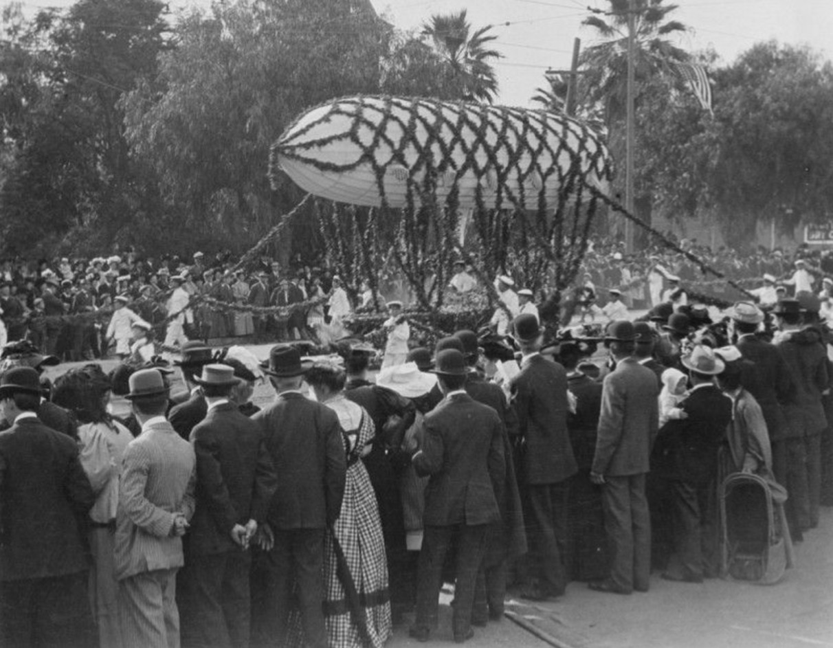
| (ca. 1908)* - A Rose Parade float that literally floats above the street, controlled by ropes held by handlers. |
Historical Notes This unusual entry demonstrates the parade’s early experimentation with spectacle. Rather than relying on size or mechanics, the float used lighter than air effects to surprise spectators. It shows that even in its early years, the Rose Parade aimed to entertain as much as impress. |
 |
|
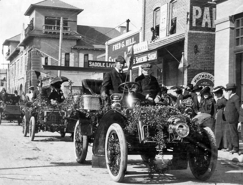
| (1910)* - Postcard view of a prize winning Rose Parade float carrying members of the Los Angeles Chamber of Commerce. |
Historical Notes This particular float was the winner of a First Prize. The verso of the card reads, "This is one of the wagons in New Year parade - the tournament was postponed till this Saturday on account of rain." There are two maxims about the Rose Parade that everyone in Pasadena knows: There’s never a parade on a Sunday, and it doesn’t rain on the parade. The first has always been true since the first time Jan. 1 fell on a Sunday in 1893 and the parade was moved to Jan. 2. The second—well, 10 rainy days in 125 years isn’t a bad batting average. |
* * * * * |
Pasadena Panoramic
 |
|
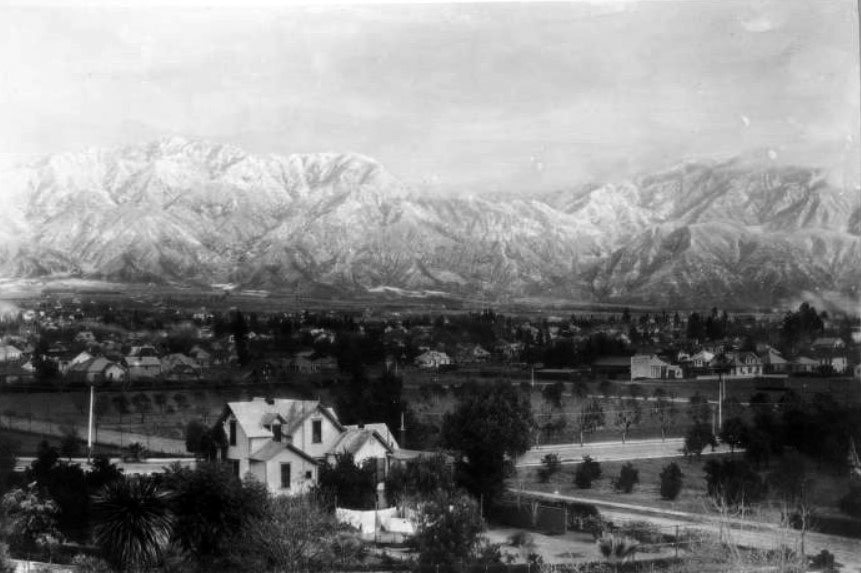
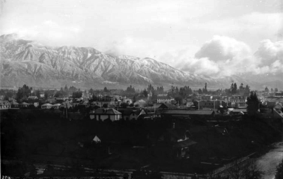
| (ca. 1898)^ - Panoramic view of Pasadena looking northeast toward the Sierra Madre mountain range in winter. Mount Wilson is behind clouds across the background. Trees are dispersed among the buildings of the city at center. |
Historical Notes The San Gabriel Mountains borrow their name from the nearby Spanish mission, but for decades they also bore a more poetic name: the Sierra Madre (Mother Mountains). Both names were handed down by the early Spanish missionaries and existed side-by-side until 1927, when the U.S. Board on Geographic Names acted on a petition from a Pomona College geographer and decided in favor of "San Gabriel Mountains." "Sierra Madre" has since passed out of common usage, although it still survives in numerous place names, from the City of Sierra Madre to the Gold Line's Sierra Madre Villa station, named after a tuberculosis sanitarium at the base of the mountains. |
California Cycleway (aka Pasadena Cycleway)
 |
|
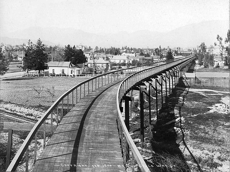
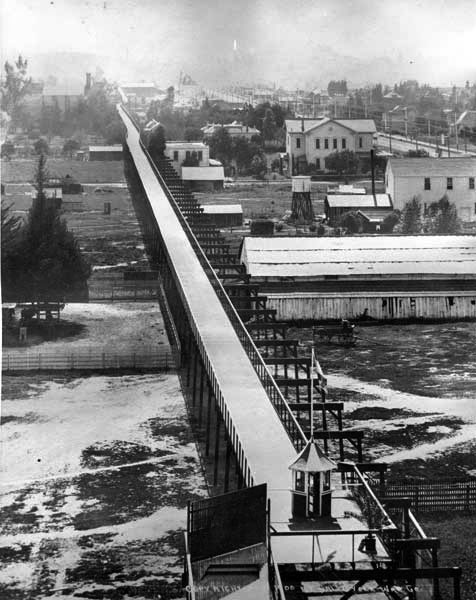
| (1899)** - View showing the construction of the California Cycleway (aka Pasadena Cycleway) a visionary project to link Los Angeles with Pasadena, built by Horace M. Dobbins (seen in lower-right). |
Historical Notes The inventor and promotor of the cycleway was Pasadena resident Horace Dobbins, who attracted ex-California governor Henry Harrison Markham to join him in the venture. Together, the two sought approval from the California state legislature, which was ultimately granted (after a first attempt was vetoed) in 1897. The California Cycleway Company bought a six-mile right-of-way from downtown Pasadena to Avenue 54 in Highland Park, Los Angeles. Construction began in 1899, and about 1.3 miles of the elevated wooden bikeway were opened on January 1, 1900, starting near Pasadena's Hotel Green and ending near the Raymond Hotel. |
 |
|
| (1900)* - View of the California Cycleway in Pasadena. A tolled elevated cycleway connecting Pasadena and South Pasadena along present day Edmondson Alley. View looking north from Raymond Hotel. Tracks in foreground are Santa Fe. Fair Oaks Ave. is on left side. |
Historical Notes The California Cycleway, opened in 1900, was a nine-mile elevated tollway built specially for bicycle traffic through the Arroyo Seco, intended to connect the cities of Pasadena and Los Angeles. The majority of the California Cycleway route is now Edmondson Alley. A toll booth was located near the north end, in the present Central Park. |
.jpg) |
|
| (ca. 1900)* - View of Bellevue Drive looking west at Raymond Avenue. The bridge in the foreground is a section of the Dobbins' Cycleway. The building at right is the rear of the Pasadena Grand Opera House. |
Historical Notes Built in 1889, the Pasadena Grand Opera House was bought by Thaddeus Lowe in 1891. Lowe is also known for his Mt. Lowe Railway and Echo Mountain Incline. |
 |
|
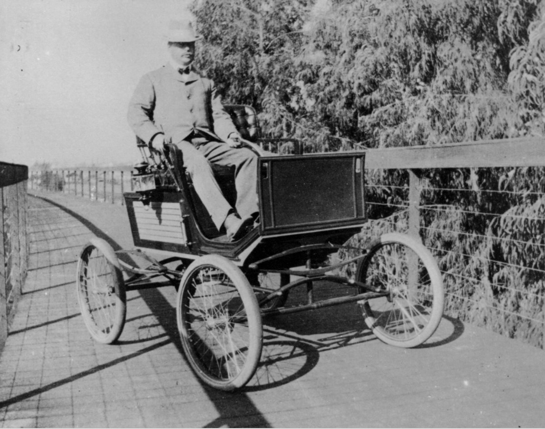
| (ca. 1902)* - On back of photograph: "Horace M Dobbins in his Olsdmobile on Pasadena Cycleway - about 1902-04". |
Historical Notes Oldsmobile model could not be verified, however, vehicle in photo closely resembles steam Locomobile from 1900-1904. |
 |
|
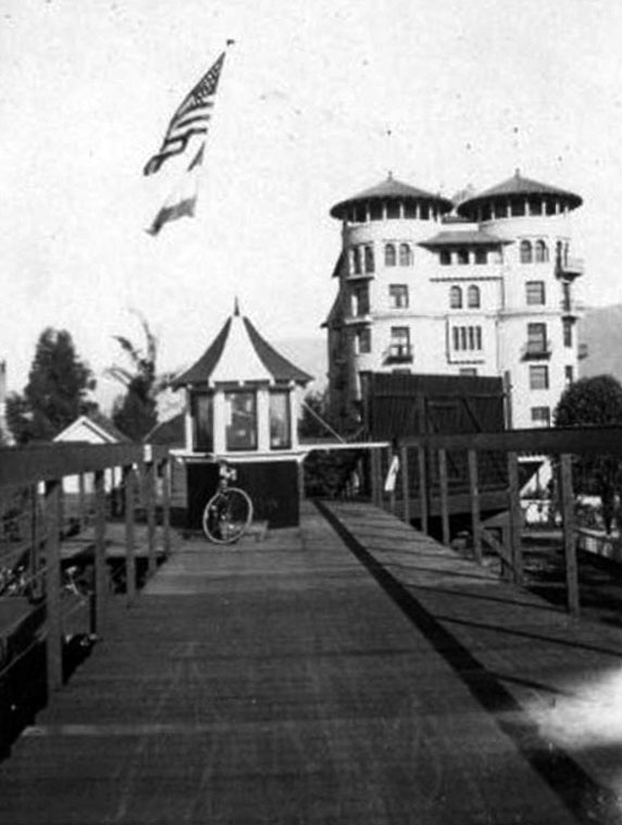
| (ca. 1902)* - View looking south from the Hotel Green showing the California Cycleway, with toll booth in center of photo. |
Historical Notes Had the full route been completed, it would have continued past Highland Park, on through Montecito Heights, crossed the Los Angeles River, passed Elysian Park, and continued to the Plaza in Los Angeles. |
 |
|
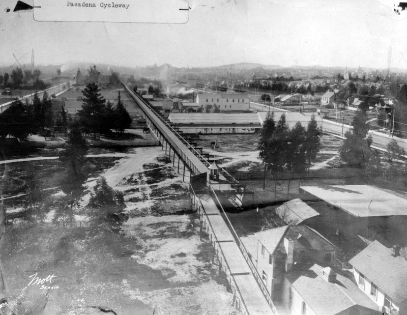
| (ca. 1902.)* - Closer view of the California Cycleway and its toll booth. Note the elaborate design of the trusses supporting the above-ground cycleway. |
Historical Notes The elevation of the roadway was 50 feet. The portion built was constructed almost entirely of Oregon pine and was wide enough for four cyclists to ride abreast, with provision for eventual doubling of the width. It was painted dark green and, at night, brightly lit with incandescent lights. |
 |
|
| (ca. 1904)** - View looking north from top of the cycleway platform. Flags fly high above the ticket booth and a bicycle is seen parked in front. The Hotel Green is in the background. |
Historical Notes The toll was 10 cents one-way, or 15 cents round trip. Due to the end of the bicycle craze of the 1890s and the existing Pacific Electric Railway lines connecting Pasadena to Los Angeles, the cycleway never made a profit, and never extended beyond the Raymond Hotel into the Arroyo Seco. In the first decade of the 20th century, the structure was dismantled, and the wood sold for lumber, and the Pasadena Rapid Transit Company, a failed venture headed by Dobbins to construct a streetcar line, acquired the right-of-way. Later, the California Cycleway's right-of-way became part of the Arroyo Seco Parkway (Pasadena Freeway). The California Cycleway, along with the similar Santa Monica Cycle Path, were two projects that reflected the cycling boom of the 1890s when Los Angeles had over 35,000 cyclists. They represented early attempts to create dedicated infrastructure for non-motorized transportation, predating the car-centric development that would come to define Los Angeles County in the 20th century. While neither project achieved long-term success, they remain important chapters in the history of transportation and urban planning in Southern California. |
Hotel Green
 |
|
| (ca. 1896)* - View looking north on Raymond Avenue showing the new Hotel Green in the distance with the original Santa Fe depot just to the right of the hotel. |
Historical Notes Hotel Green was initially known as the Webster Hotel. Mr. Webster became nearly bankrupt while trying to finish his lavish hotel in time for its opening. It opened its doors to the public in the 1880s and was only open a few months before he sold it to George Green. George Gill Green acquired the unfinished building, doubled the size and completed the hotel in 1893. The newly expanded hotel, named the Hotel Green, opened for business in 1894. |
 |
|
| (ca. 1900)* - View looking north on Raymond Avenue at the Hotel Green complex, which comprised of both buildings on either side of Raymond Avenue and walkway over the street. Horse-drawn wagons are seen parked in front of the hotel. |
Historical Notes In 1898, Col. Green built an even more impressive Mediterranean style hotel on the opposite side of Raymond. The two buildings were connected by a bridge across Raymond. |
 |
|
| (ca. 1900)* - Postcard view of the Hotel Green showing a streetcar passing underneath the bridge over Raymond Avenue that connects the two hotel buildings. |
Historical Notes The Green was one of the leading Pasadena hotels, along with the Raymond and the Huntington, during Pasadena's heyday as a winter resort for wealthy Easterners in the 1890s and 1900s. |
 |
|
| (1890)^ - A view of the Atchison, Topeka, and Santa Fe railroad California Limited at the Hotel Green in Pasadena. |
Historical Notes In 1887, Edward Webster built a new Santa Fe Railroad station next to his hotel site, for easy food and lodging business with trains' arrival/departure passengers. Webster went bankrupt before finishing his hotel. |
 |
|
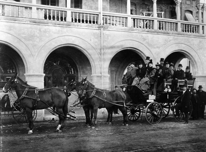
| (1890)* - Tally-Ho leaving the Hotel Green. The photograph identifies it as "Wiley & Greely's Tall-Ho." |
Historical Notes The hotel was home to both the Tournament of Roses and the Valley Hunt Club. It was supplemented by two later buildings, creating a complex of three structures. |
 |
|
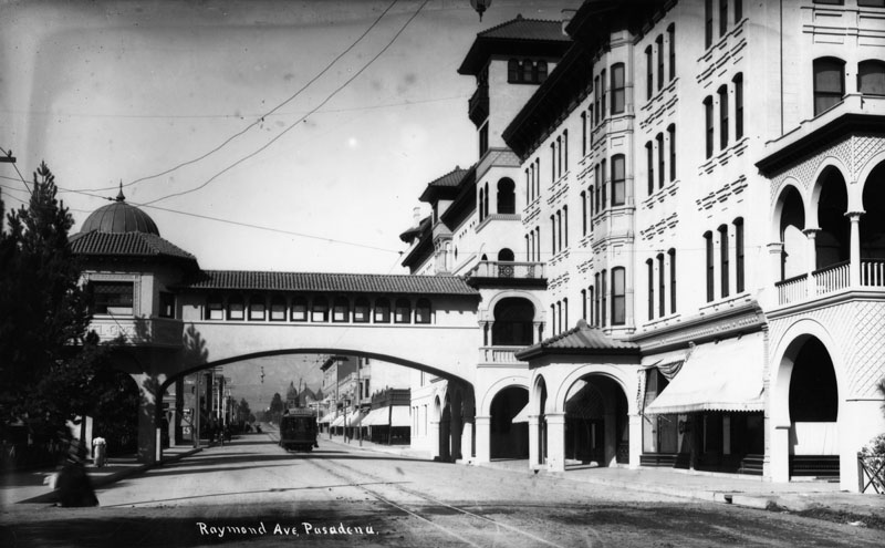
| (1901)^ – Panoramic view looking south showing the Hotel Green and its annex, “Central Annex”, from the corner of Green Street and Raymond Avenue. |
Historical Notes Due to the hotel's success, Green began building an addition in 1897, and the "Central Annex" opened on January 16, 1899 to coincide with Green's birthday, and 1,000 guests came to celebrate the occasion. The hotel continued to grow in popularity with the new Central Annex. Its pedestrian bridge to the main hotel over Raymond Avenue became a popular viewing site for the Rose Parade, which ran along Raymond at the time. |
 |
|
| (1905)^ - View of Hotel Green and its new Central Annex (Castle Green) on the left. |
Historical Notes The new building, to become known as "Castle Green," was on a full city block but was set back from the streets, which provided open space for large new gardens. They became Pasadena's only 'public' park at the time. |
 |
|
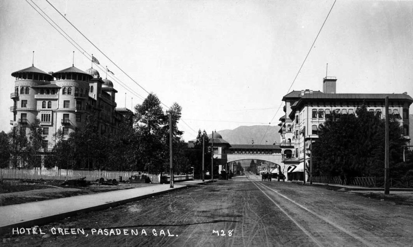
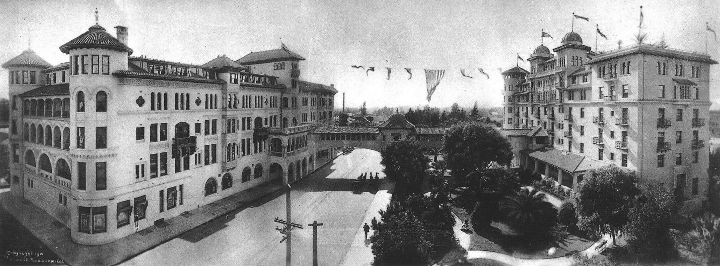
| (1908)^- Panoramic view showing the Hotel Greeen and its surrounding area. |
Historical Notes In 1903 Green added a third annex, known as the Wooster Block. It incorporated an earlier building constructed in 1887, which had been part of the original site of the California Institute of Technology. Green planned to add a fourth annex, before running short on money for construction. |
 |
|
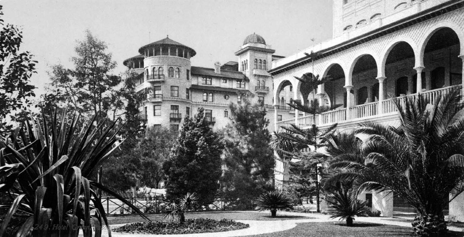
| (ca. 1910)* - Exterior view of the Green Hotel looking from Central Park. View shows the towers of the building on the west side of Raymond Avenue, in Pasadena. |
Historical Notes Hotel Green, designed by Los Angeles-based architect Frederick Roehrig, was published in the periodical The Western Architect in December 1905. |
 |
|
| (ca. 1910)* - View of the Castle Green, part of the Green Hotel Complex. Two early model cars are parked by the curb as a band is seen playing on the front lawn. |
Historical Notes Hotel Green acquired a reputation as a luxury hotel. The hotel hosted society events such as receptions for significant visitors and the Valley Hunt Club's annual ball. In addition, the hotel contributed to Pasadena's economy and population. Lodgers at the hotel were credited with spending large amounts of money at Pasadena businesses, and many tourists ultimately decided to live in Pasadena. |
 |
|
| (ca. 1910)* - View of the Hotel Green in Pasadena, in a lush garden setting. The portion of the building which extends to the right crossed over Raymond Avenue. |
 |
|
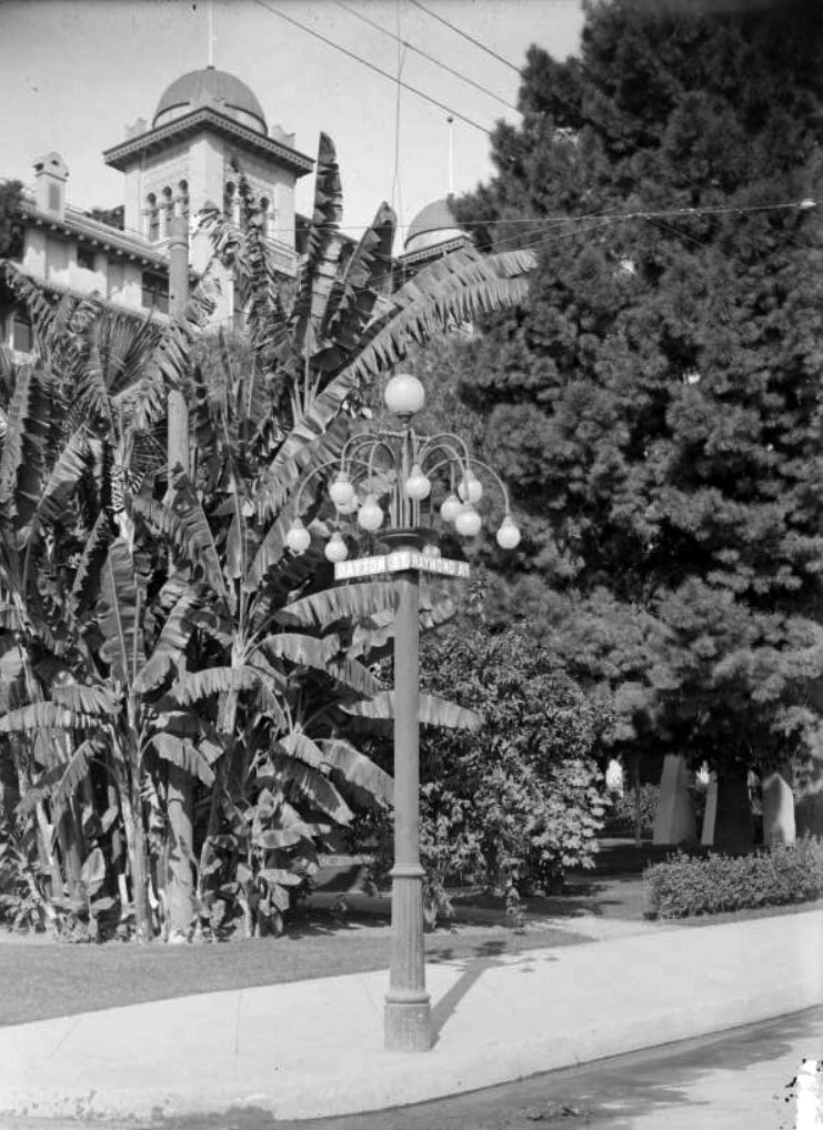
| (1910)^ – View showing a street lighting post on the corner of Raymond Avenue and Dayton Street, showing the Green Hotel in the background. |
 |
|
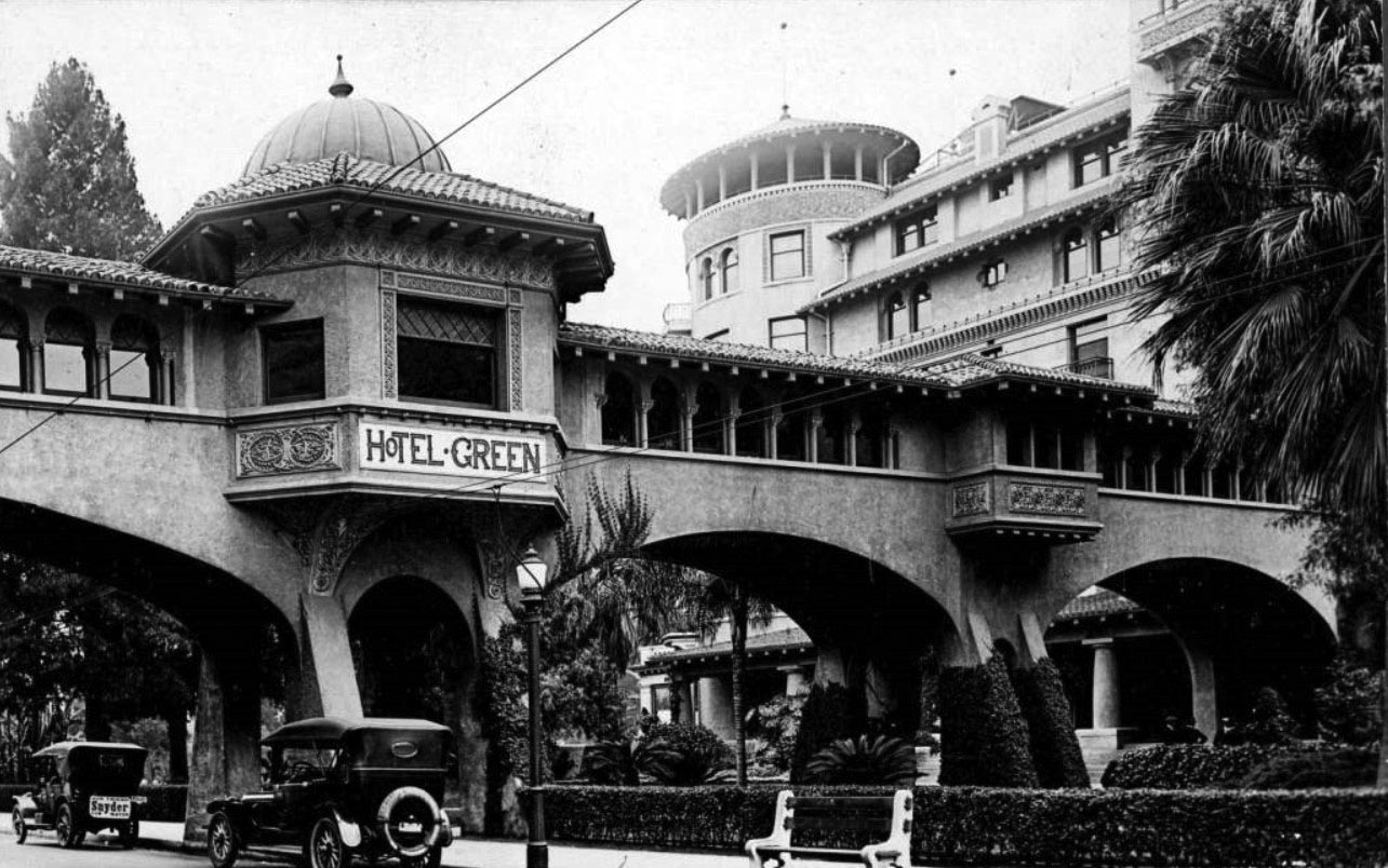
| (ca. 1919)^ - View of the Hotel Green and walkway that crossed over Raymond Avenue, connecting two buildings of the hotel. Two automobiles are parked on the street, and one has a sign saying "Snyder for Mayor." |
Historical Notes Meredith P. Snyder was elected mayor of Los Angeles in 1919. |
 |
|
| (1923)^ - Postcard view of Hotel Green and grounds. |
.jpg)
Historical Notes Daniel M. Linnard bought the hotel from George Gill Green in 1914. The hotel's business declined after this point, as the rise of automobile travel took away its market of Santa Fe Railroad passengers at the adjacent train station. The original 1894 Hotel Green building on the east side of Raymond Avenue was sold in 1920. By 1924 the hotel was owned by a group of investors who divided the hotel complex into three parts. The Central Annex was subdivided into fifty residential apartments and renamed the Castle Green.* The Castle Green is now a luxurious condominium complex, with 52 units privately owned. They are predominantly one bedroom units, carved out of what were once hotel rooms and suites for the very wealthy. They are filled with rare architectural detail and beautiful reminders of their Victorian past. The Castle Green is listed on the National Register of Historic Places, the State Historic Register, and the City of Pasadena’s list of Historic Places.* |
* * * * * |
 |
|
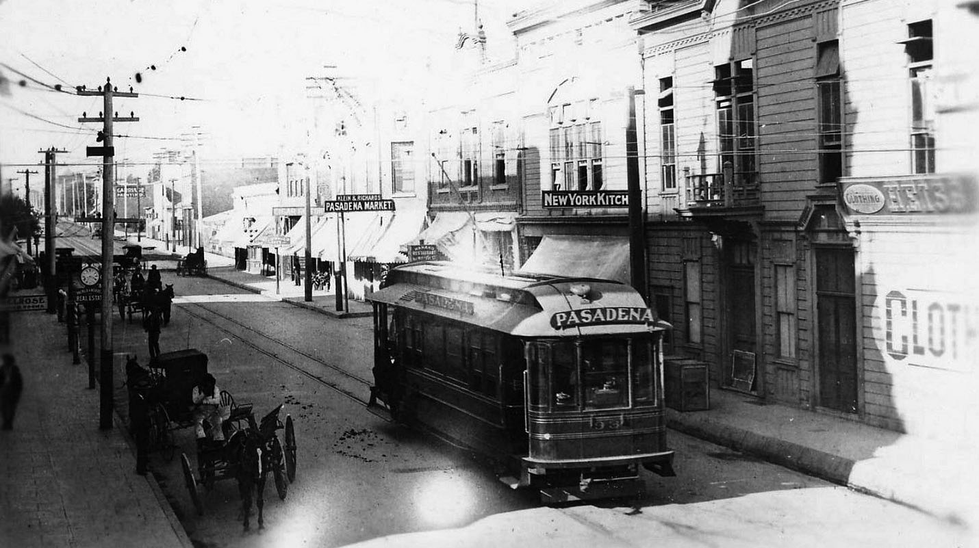
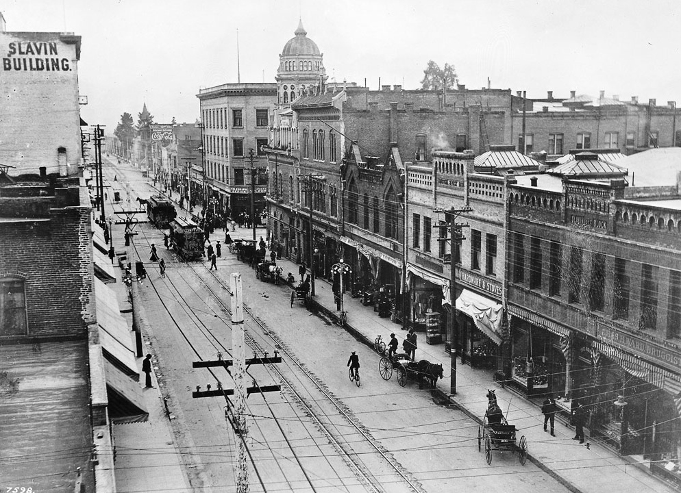
| (ca 1900)* - PE no. 93, Pasadena. Some of the business seen include: Pasadena Market, New York Kitchen, and Heiss Clothing. Mount Lowe Preservation Society Collection |
 |
|
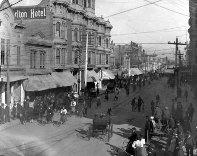
| (ca. 1900)* – View of a what appears to be a bicycle parade on Colorado Street in front of the Carlton Hotel. |
Historical Notes Colorado Street had become a more bustling locale by the time this photograph was taken, sometime around 1900. Many of the timber shacks lining the street in the 1880s photographs have been replaced by taller, more ornate buildings. Power lines and trolley tracks show Pasadena's progress as well. A bicycle parade attracted the curiosity of onlookers. Pasadena had nine bicycle shops by 1902, and the long line of parade participants on this day suggests that business was good. |
 |
|
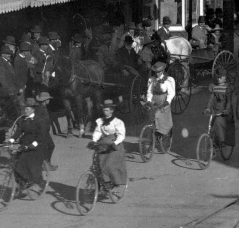
| (ca. 1900)* – Close-up view showing four women in their riding attire participating in the bicycle parade as spectators look on. |
.jpg) |
|
| (ca. 1900)* – Close-up view showing a woman seated in an early three-wheel bicycle along the parade route. |
 |
|
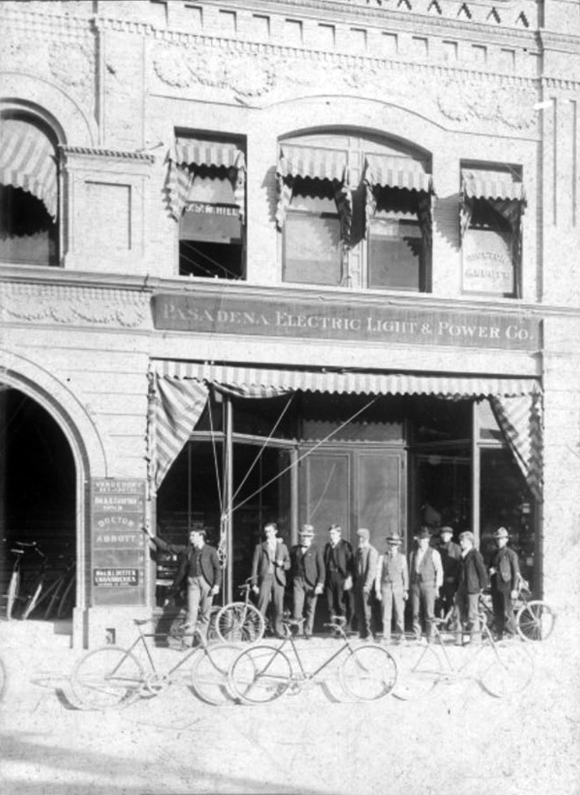
| (1900)* – View showing a group of men standing by their bicycles in front of the Pasadena Electric Light & Power Building at 34 S. Raymond Avenue. |
Carlton Hotel
 |
|
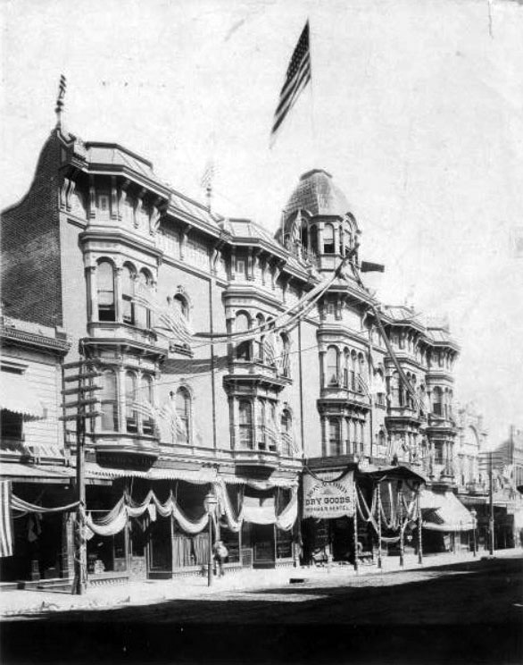
| (ca. 1902)*^* - Close-up view of the Carlton Hotel on Colorado St. The hotel is decorated with flags and banners. |
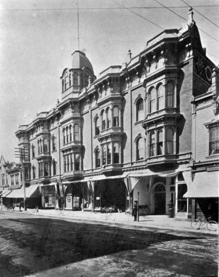
Historical Notes The Carlton Hotel was a first-class establishment in the center of Pasadena’s growing downtown. Known as the Exchange Block, and designed by Harry Ridgway, it opened in the summer of 1886 (the same year as the Raymond Hotel). The Carlton boasted the first passenger elevator in town, and at its front entrance was the first benchmark from which all official city grades or levels were measured.*#*# |
 |
|
| (1902)*^* – Close-up view of the Carlton Hotel located at 29 E Colorado Street. |
* * * * * |
 |
|
| (ca. 1890)^ - Panoramic view of Pasadena looking northwest from the cupola of the Longfellow Octagon House on San Pascual Street, about where Cal Tech stands today. In the foreground is an orchard of trees and further away stands a two-story house. |
Longfellow Octagon House
 |
|
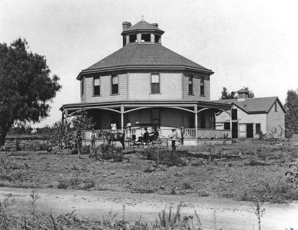
| (ca. 1900)^.^– View showing a horse-drawn carriage surrounded by several people in front of the Longfellow Octagon House in its original location on San Pasqual Street in Pasadena. (Photo courtesy of Cultural Heritage Foundation of Southern California) |
Historical Notes Gilbert Longfellow built his first octagonal house along the coast of Maine. Then in 1893, after moving to Pasadena, Longfellow built his second octagonal home on San Pasqual Street. After Longfellow died in 1912, his son Charles continued the family's farming business, purchasing additional land nearby (now part of the California Institute of Technology campus) where he established a small, but successful, citrus grove. In 1917, to make way for subdivision of the original farm, the house was moved to a city lot about a mile north of the farm on Allen Avenue. While remaining in the same family, over the years the house fell into great disrepair. In 1973, facing demolition of the house where he had spent much of his life, Walter Hastings (Longfellow's grandson) sought assistance from the Cultural Heritage Foundation of Southern California's Heritage Square Museum to save his family's home. In exchange, he donated the house to the museum. The home was moved to its present location (Heritage Square Museum) in 1986. ^ |
 |
|
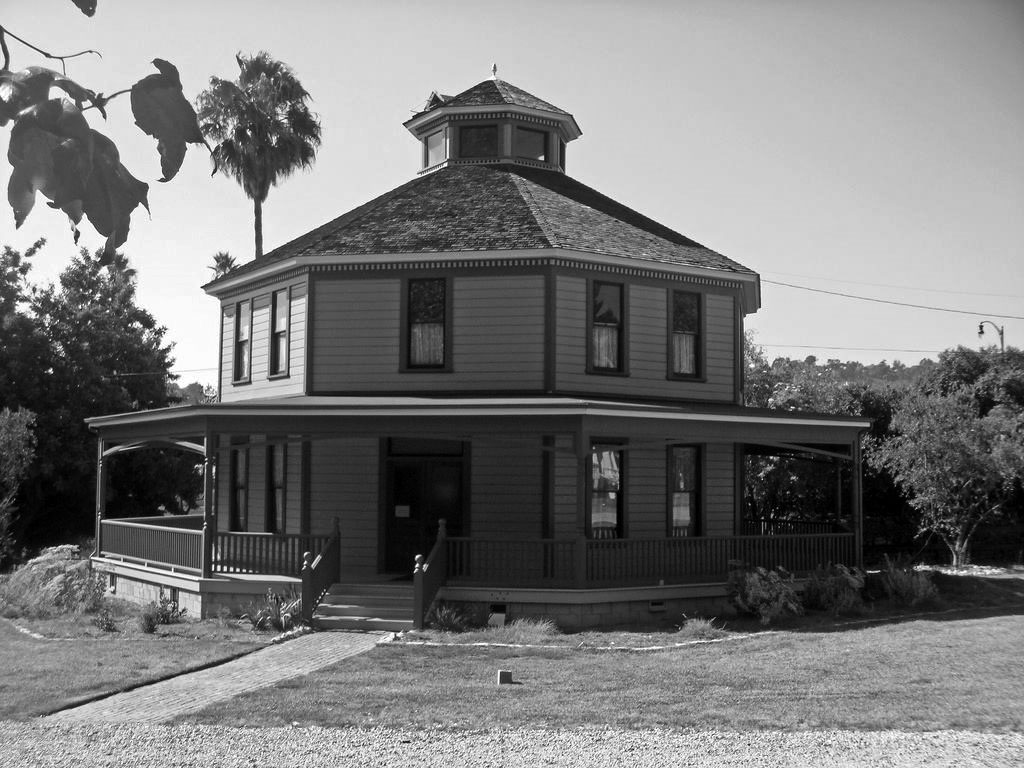
| (2009)^.^ – View showing the Longfellow-Hastings Octagon House after it was relocated to its current location at the Heritage Square Museum at 3800 Homer Street along the Arroyo Seco. |
Historical Notes In 1917, when L.A./Pasadena sprawl reached San Pasqual Street, the Longfellow family moved its octagon house a mile north to Allen Avenue. In 1973, the Cultural Heritage Foundation of Southern California, which runs the Heritage Square Museum, struck a deal with Walter Hastings, Longfellow's grandson who lived in the house. The foundation would save his home from threatened demolition if he donated the octagon. When Hastings moved out in 1986, the organization relocated the Longfellow place to the Arroyo Seco.) ^ |
* * * * * |
 |
|
| (1900)* - View of a tree-lined unpaved Marengo Avenue, Pasadena. |
 |
|
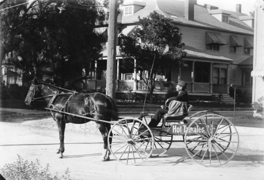
| (Early 1900s)*^* - View of a tamale wagon driven by Abalenio Hernandez of 615 South Broadway, Pasadena. Broadway is now called Arroyo Parkway. |
 |
|
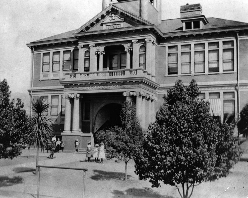
| (1900)* - View of Abraham Lincoln Elementary School, built at its present location (Lincoln Avenue and West Peoria Street) in 1895. |
Historical Notes The original building was a large two-story structure facing Lincoln Avenue; a small building for the kindergarten was in the rear. The Board purchased a house and lot adjoining the school site in November 1901, and started the kindergarten class there in January of 1902.* |
 |
|
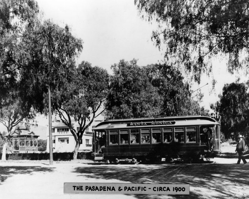
| (ca. 1900)* - Pacific Electric Railway Pasadena and Pacific car labelled "Santa Monica,” seen crossing a street. |
Historical Notes In 1895 The Pasadena and Pacific Railway was created from a merger of the Pasadena and Los Angeles Railway and the Los Angeles Pacific Railway (to Santa Monica.) The Pasadena and Pacific Railway boosted Southern California tourism, living up to its motto "from the mountains to the sea." *^ |
 |
|
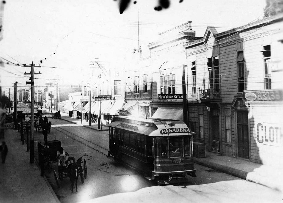
| (ca. 1900)##^^ - A PE Pasadena and Pacific streetcar marked “Pasadena” shares the road with horse-drawn wagons. Pasadena Market and New York Kitchen can be seen in the background. |
 |
|
| (1902)* - This was the 1902 Tournament of Roses parade, with a butchers band marching down the Pasadena street. There was nothing spectacular about the parade then, and the spectators were few. This was also the first year of the Rose Bowl game. |
 |
|
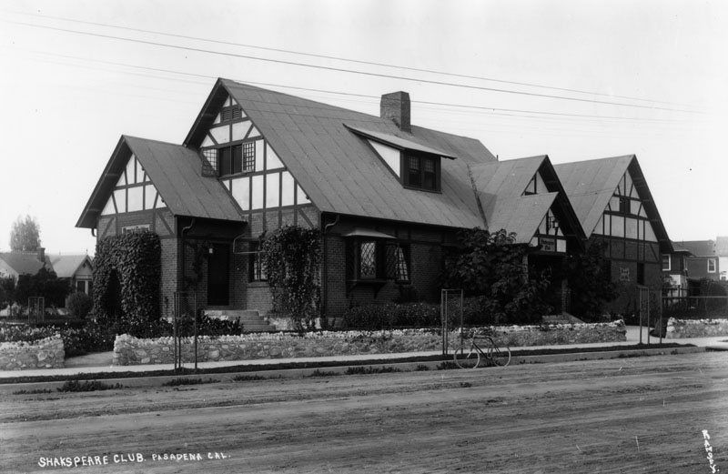
| (ca. 1902)* - Exterior view of the Shakespeare Club, junction of Fair Oaks and Lincoln Avenues, in Pasadena. |
Historical Notes The Shakespeare Club of Pasadena was organized in 1888 and has the distinction of being the oldest women's club in Southern California. The Club's purpose has always centered around the cultural, educational and philanthropic interests of its members.*# |
 |
|
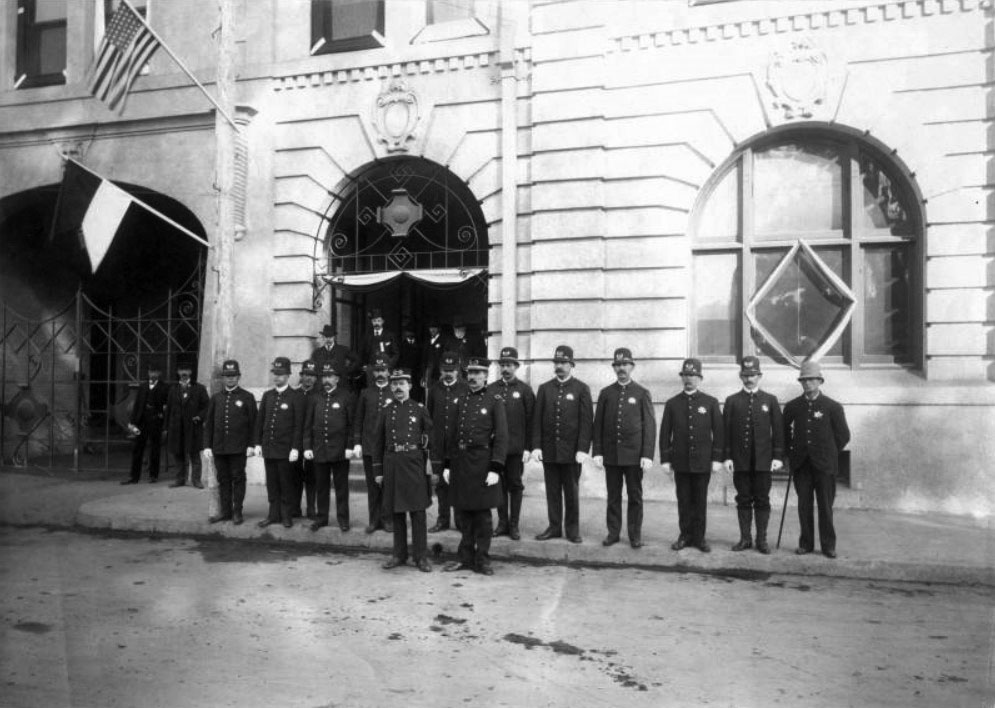
| (1903)** – View showing policemen posing in front of City Hall at Union and Fair Oaks. |
Historical Notes The Pasadena Police Department was founded in 1886.*^ |
 |
|
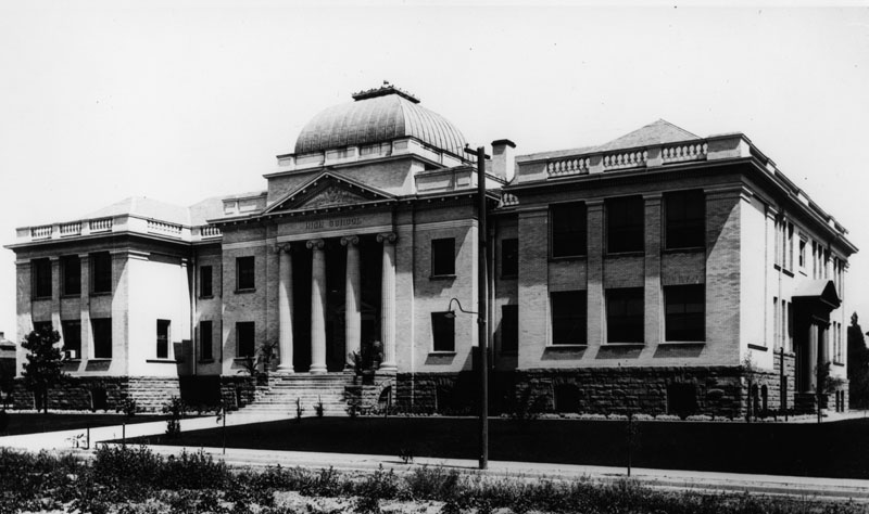
| (1903)* - View of John Muir High School, built in 1903 on the north side of east Walnut Street, between north Los Robles and Euclid Avenue. |
Historical Notes John Muir High School was Pasadena's second High School. Later it served as a Junior High School for many years, and then a school for special classes. The name had been changed to Benjamin Franklin. Later it was condemned for school purposes and the Recreation Department used it for years.* |
 |
|
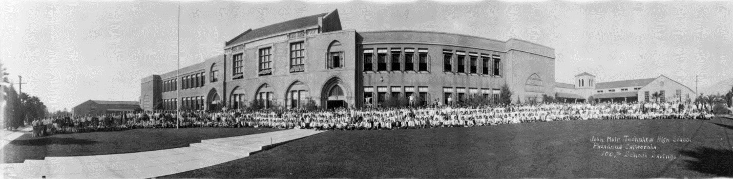
| (ca. 1930)#* – Panoramic view of John Muir Technical High School, 1835 Lincoln, Pasadena, with the student body sitting and standing in front of the building. |
Historical Notes John Muir Technical High School first appears in a 1928 Pasadena directory at its Lincoln location. Prior to that it was John Muir Junior High School, and was located on Walnut. #* |
 |
|
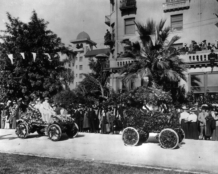
| (1905)* - Two flower-covered automobiles in the 1905 Rose Parade. This appears to be in front of the Raymond Hotel. |
 |
|
| (ca. 1905)* - View of Pasadena Park and City Hall in the back left of photo. |
 |
|
| (ca. 1904)* – Looking north towards the San Gabriel mountains as seen from one of the upper floors of the Green Hotel. |
 |
|
| (ca. 1905)^ – View of Raymond Avenue looking north as seen from the intersection of Raymond and Colorado. A streetcar is in the middle of the image while the Green Hotel is seen in the distance. The beautiful San Gabriel Mountains stand in the far background. |
Colorado and Fair Oaks
 |
|
| (ca. 1905)^ – A Pacific Electric car on Colorado Street near Fair Oaks Avenue in Pasadena stops for passengers. The car was on the West Colorado Street-Orange Grove Avenue line. |
 |
|
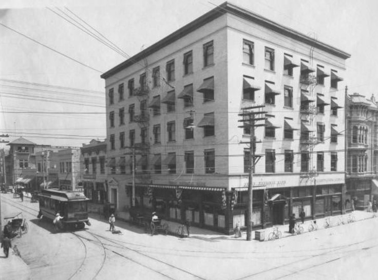
| (1906)** - Looking toward the northeast corner of Colorado and Fair Oaks showing the First National Bank. More bicycles are seen parked by the curb in front of the building than horse-drawn carriages. A woman is boarding a stopped electric streetcar on the left. |
 |
|
| (ca. 1907)# – View looking east on Colorado Street at Fair Oaks Avenue. First National Bank is on the ground floor of the building on the NE corner (left). |
 |
|
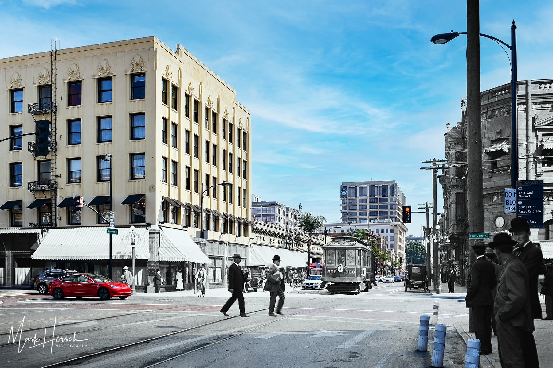
| (1907 - 2020)* - Compositied image showing Colorado Blvd. looking east at Fair Oaks Ave. Photo by Mark Hersch |
Then and Now
 |
|
| (1907 v. 2020) - Colorado St. looking east at Fair Oaks in Pasadena. Bottom photo is a composited image blending a 1907 view with one that’s more current. Composite image by Mark Hersch. |
 |
|
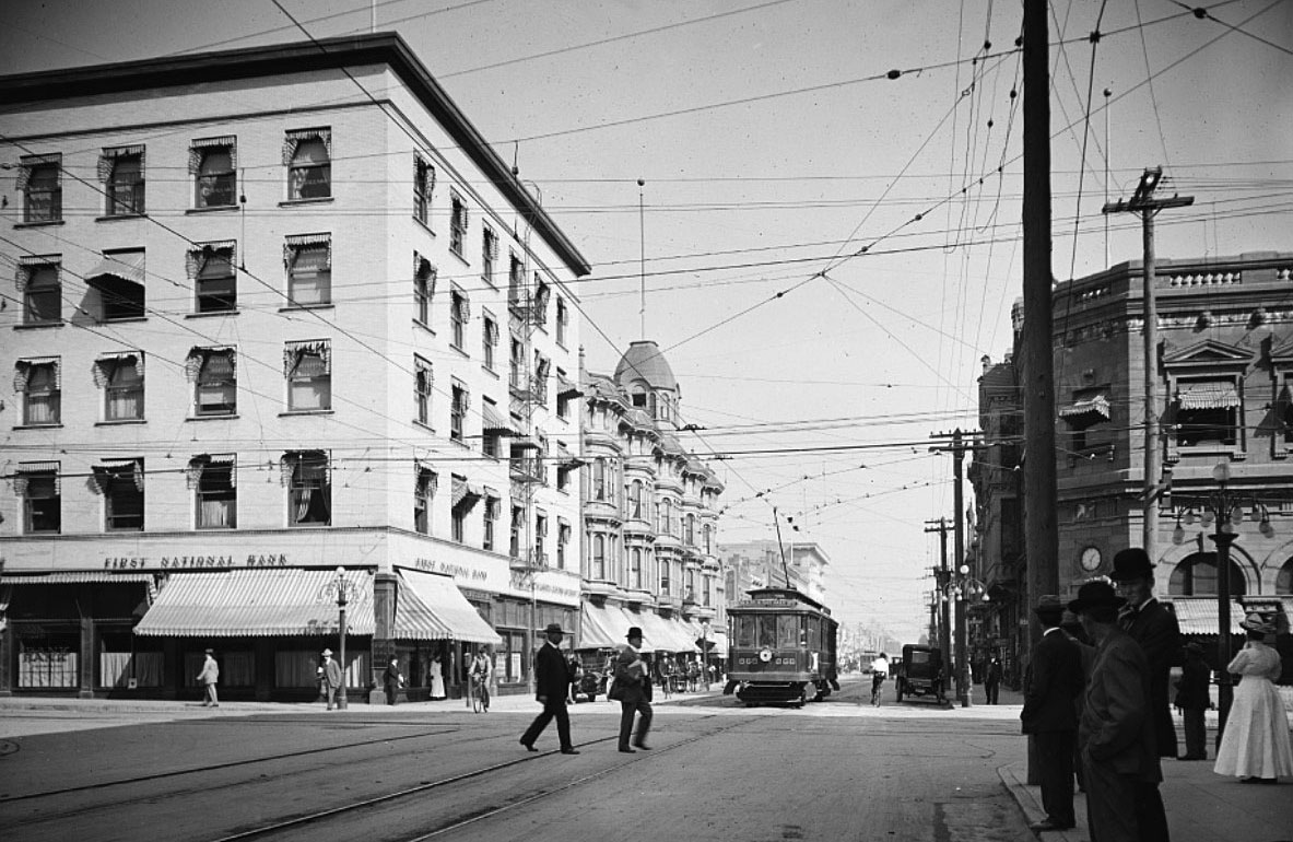
| (ca. 1907)^ - Looking east on Colorado at Fair Oaks. Early model cars and bicycles are parked by the curb while a streetcar, horses, and pedestrians are seen on the road. |
 |
|
| (ca. 1907)^ - Looking east on Colorado at Fair Oaks. Photo by C.C. Pierce; AI image enhancement and colorization by Richard Holoff |
Then and Now
 |
|
| (1907 v. 2022)* - Colorado Street looking east at Fair Oaks Avenue. |
Colorado and Broadway (Now Arroyo Parkway)
 |
|
| (ca. 1907)** - View of Pasadena National Bank Located at the corner of Colorado and Broadway (Now Arroyo Parkway). A horse-drawn carriage passes by an electric streetcar, while an early model car is seen parked in front of the bank. |
South Pasadena High School
 |
|
| (1907)* - Exterior view of the Classical Revival style building of South Pasadena High School, taken not long after the building was completed. |
Historical Notes The City of South Pasadena established a solid reputation for its public schools, its first high school being no exception. Norman Foote Marsh, and his firm Marsh and Russell, designed this first High School building in 1906, and saw its completion by 04/1907. The City of South Pasadena, in its historic preservation context statement said of this education complex: "After several years of operating out of shared or rented facilities, a bond was passed in 1906 which authorized $65,000 for the construction of a new high school. However, construction was delayed when the San Francisco earthquake in 1906–along with the subsequent rebuilding efforts–inflated the cost of building materials. Voters were compelled to approve an additional $10,000 before construction could begin. Designed by the firm of Marsh & Russell, the three-story building was officially opened in April 1907. Additional buildings housing domestic science and manual training programs were added in 1912.^ |
 |
|
| (1908)^#^^ – Postcard view showing South Pasadena High School. Two men are seen posing in the foreground. |
Historical Notes This building, constructed in 1907, and two others added in 1912 stood until the 1950s, at which time they were demolished. * |
* * * * * |
 |
|
| (ca. 1907)* - Exterior view of Lake Ave. Methodist Church on the southeast corner of Colorado and Lake Avenue, in Pasadena. |
 |
|
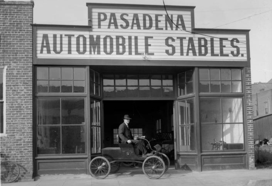
| (ca. 1908)#* - A street view of Pasadena Automobile Stables, with a man seated in a parked automobile in front of the open shop doors. The vehicle has no top or sides, and only has one padded bench for seats. |
 |
|
| (ca. 1900)*^* – View looking north on Los Robles Avenue from the Maryland Hotel located on Colorado Boulevard with John Muir Jr. High School visible in the background in the upper left corner of the photo. |
Historical Notes The large building seen in the upper left corner of the photo is John Muir Jr. High School, which later became Pasadena High School, located on Walnut St., between Euclid and Los Robles.*^* |
 |
|
| (ca. 1903)*^* – View looking west from the Maryland Hotel. |
Historical Notes The trellis in the lower left hand corner was later covered in vines. The church in the upper corner of the photo is believed to be the Pasadena Presbyterian Church.*^* |
 |
|
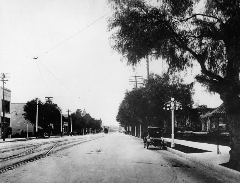
| (ca. 1908)* - Colorado Blvd. in Pasadena looking east from the Hotel Maryland circa 1908. The street is lined with houses, and streetcar tracks run down the middle. |
 |
|
| (1910)* - View of Colorado Blvd. in Pasadena looking west from the Maryland Hotel. Streetcar tracks and overhead wires are seen. Note the ornate streetlight on the right. Click HERE to see more in Early LA Streetlights. |
Hotel Maryland
 |
|
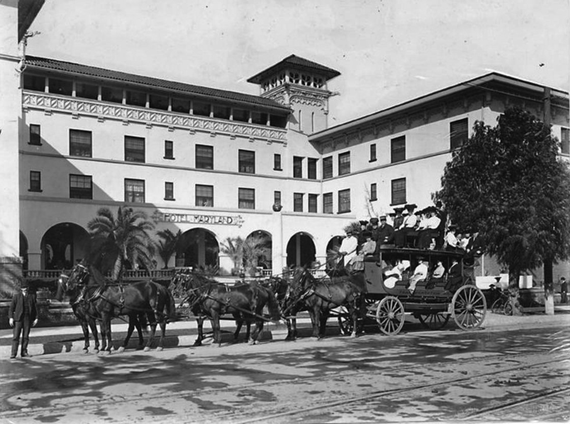
| (1903)*^* – View showing the newly constructed Hotel Maryland located at 411 East Colorado with San Gabriel Mountains in the background. A horse-drawn wagon is parked in front of the hotel. |
Historical Notes The Hotel Maryland was designed by John Parkinson and opened in 1903. It was expanded over the years and hosted many famous people including Presidents. |
 |
|
| (ca. 1903)*^* – View showing a tally-ho parked by the curb in front of the Maryland Hotel. |
Historical Notes The Maryland Hotel was an all year hotel, different from seasonal hotels. The builder of the Maryland's first unit was Colin Stuart, who named the hotel "Maryland", after his home state.* |
 |
|
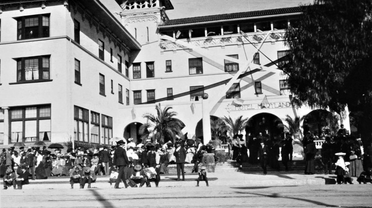
| (1905)^*# – View showing the front of the Maryland Hotel where crowds of people await the Rose Parade. |
 |
|
| (ca. 1910)*^* - Panoramic street view of the Hotel Maryland on East Colorado, between Euclid and Los Robles. There are several automobiles parked along the street, and an electric streetcar travels along the street on the right. |
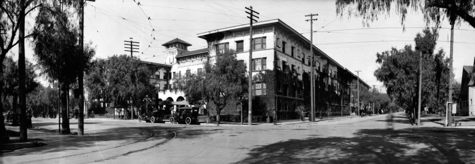 |
|
| (ca. 1913)*^* - Panoramic street view of the Hotel Maryland. Vines have overgrown the walls of the first two stories and stretch as far as the roof in places. Automobiles are parked on the street in front of the hotel, and cables run overhead for streetcars. |
Historical Notes On April 18, 1914, the main building burned to the ground. It was redesigned by Myron Hunt and rebuilt the same year. A large open area to the north was lined with "bungalows" and some people lived there all the time. |
 |
|
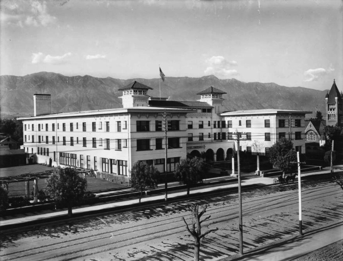
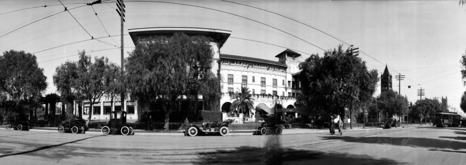
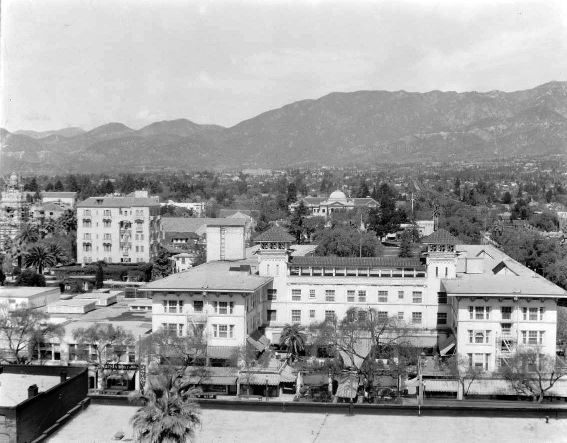
| (1927)++# - View looking north from the roof of the Pasadena Athletic Club on the corner of Los Robles and Green. The Maryland Hotel is seen across the street with its Annex (at left) which still stands at the northeast corner of Union and Euclid. At far left, City Hall is still being erected; note scaffolding. At center rear with distinctive dome is the Benjamin Franklin School on Walnut. |
Historical Notes At one time the Maryland Hotel covered the entire area from Colorado Blvd. to Walnut Avenue, with Los Robles as its eastern border and Euclid as its western border. Union Street wasn't put through until later, so it was a solid long block full of rental bungalows all the way north. |
 |
|
| (1927)*^* - Street view of the Hotel Maryland at 411 East Colorado. A doorman stands at the end of an awning on the sidewalk. |
Historical Notes The Maryland Hotel covered eight acres of lawn and flower gardens, and besides the main structure it had thirty bungalows, where one could live in quiet seclusion a few feet from the busy halls - yet remote and undisturbed - if he so desired.* |
 |
|
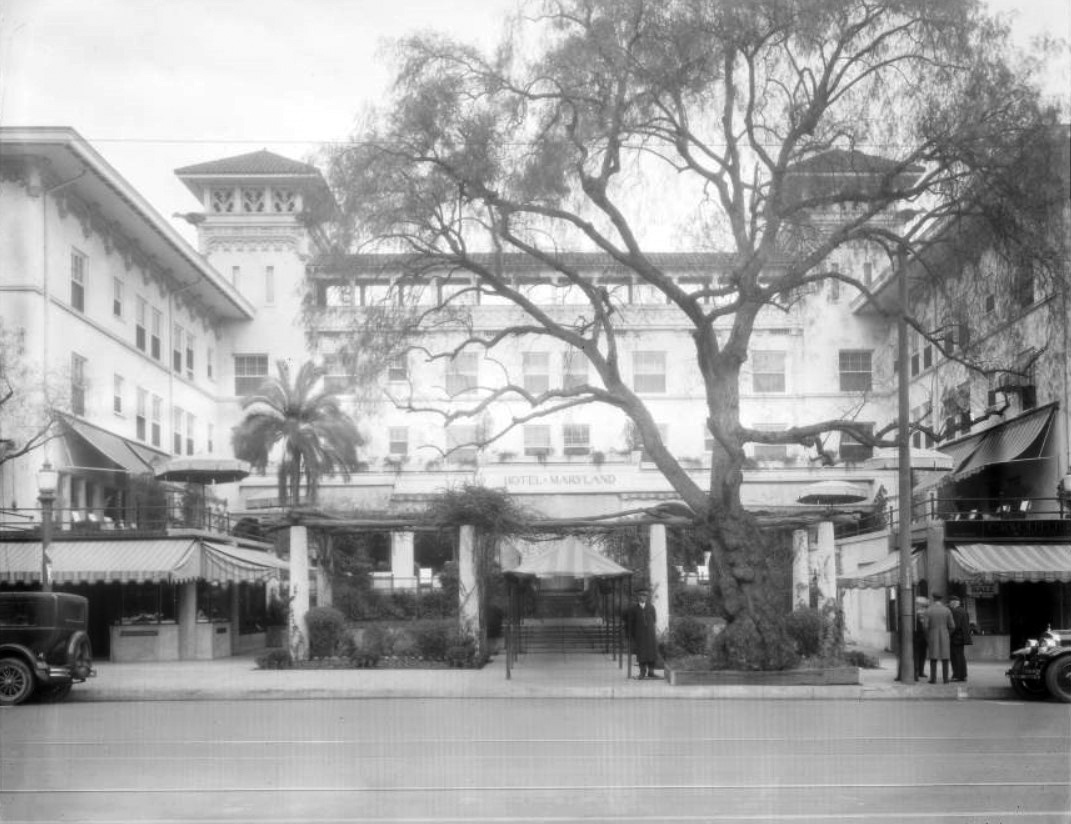
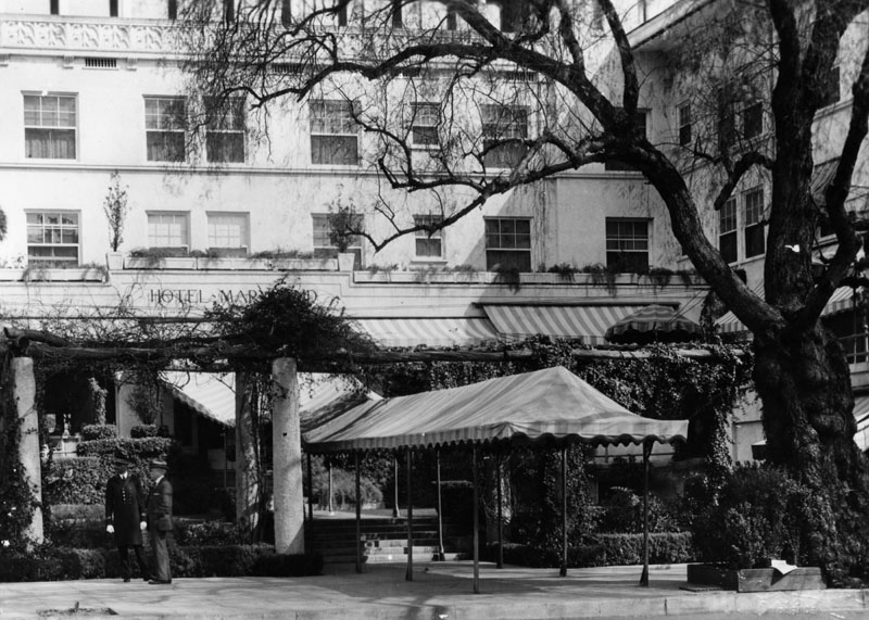
| (ca. 1930)* - Close-up view of front entry to the Maryland Hotel. A canopy stretches from the entrance of the hotel to the street. |
 |
|
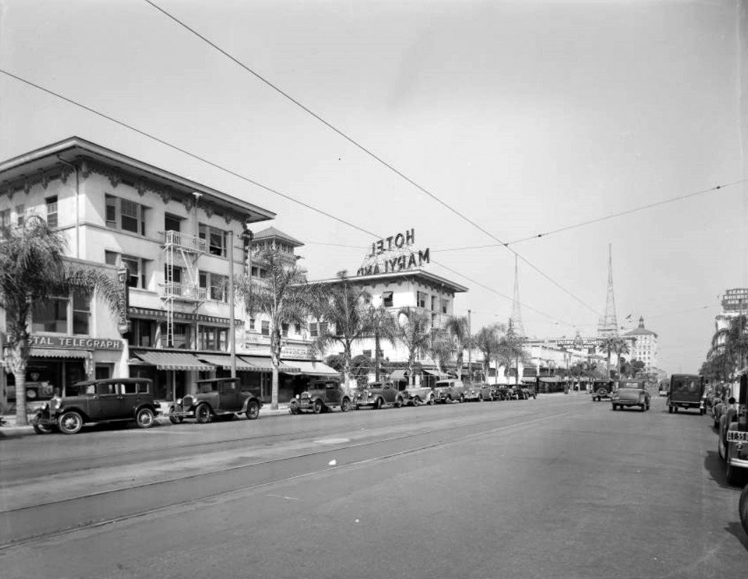
| (1937)*^* - Street view looking east showing the Maryland Hotel at 411 East Colorado. Other businesses on this stretch of Colorado include Postal Telegraph, Sherwin Williams Paints & Wallpapers, and Sears Roebuck & Co. |
.jpg) |
|
| (1937)++# - View looking west on Colorado at Los Robles showing the Hotel Maryland. Two men stand under an umbrella next to an open manhole in the middle of the street. |
Historical Notes Most of the Hotel Maryland was torn down shortly after August 20th, 1937 but some of the hotel continued until 1948. The property was gradually sold off. The apartment house on Euclid, added in 1927, is all that remains today. |
Maryland Apartments
 |
|
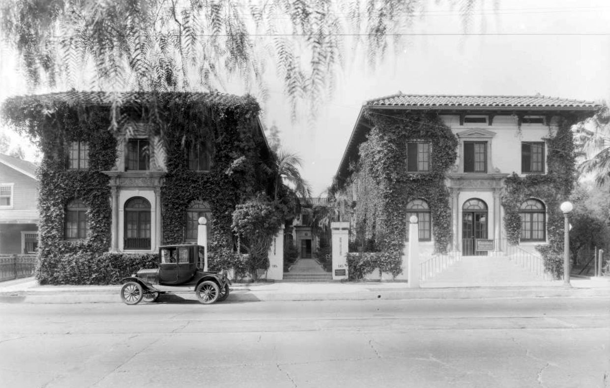
| (1924)*^* - Street view of the ivy-covered Maryland Apartments at 95 South Los Robles, with an automobile parked in front. On the right is a women's clothing shop called Flornina. |
 |
|
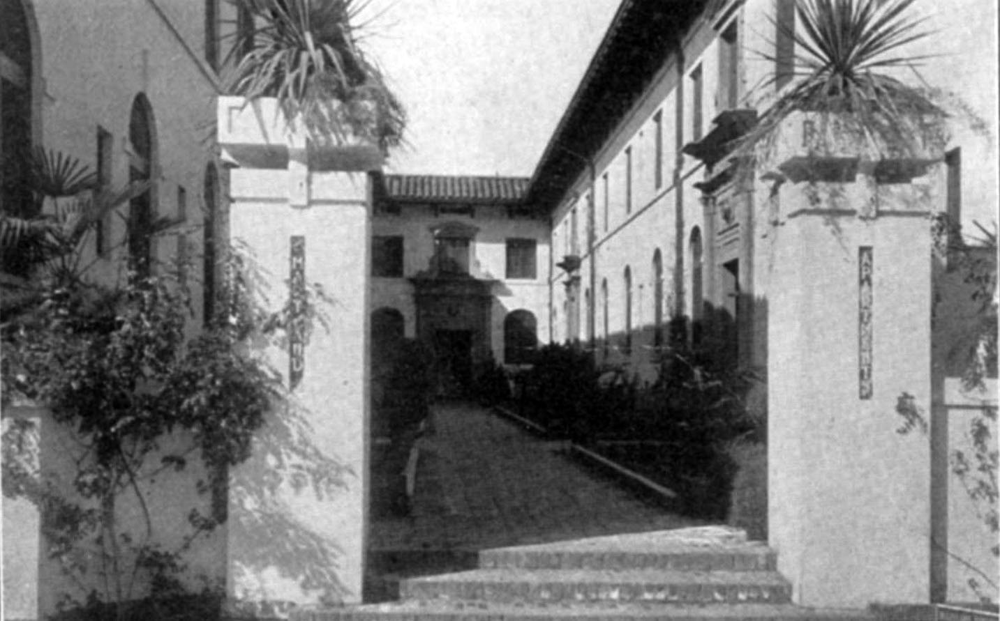
| (1918)*^* – Close-up view showing the front courtyard to the Maryland Apartments. |
Fair Oaks Market
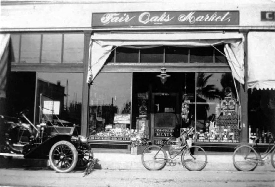 |
|
| (1909)*^* - View showing an early model car and two bicycles parked in front of Fair Oaks Market located at 139 North Fair Oaks. W. H. Stone, Jr. was the proprietor. |
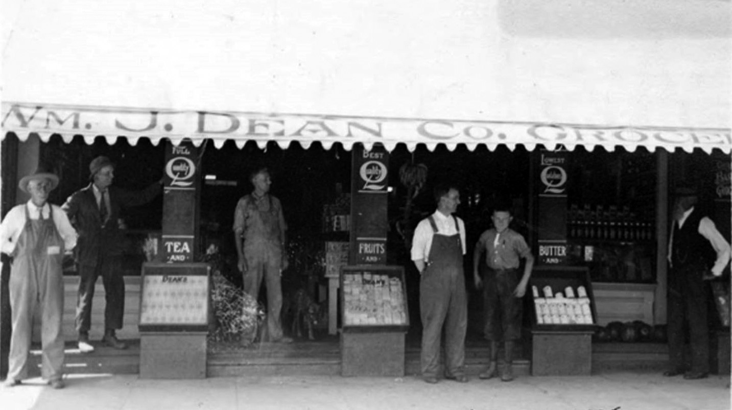
William J. Dean Co. Grocery
 |
|
| (ca. 1910s)** – View showing the William J. Dean Co. Grocery Story located on the north side of Colorado Street west of Fair Oaks Avenue. |
* * * * * |
 |
|
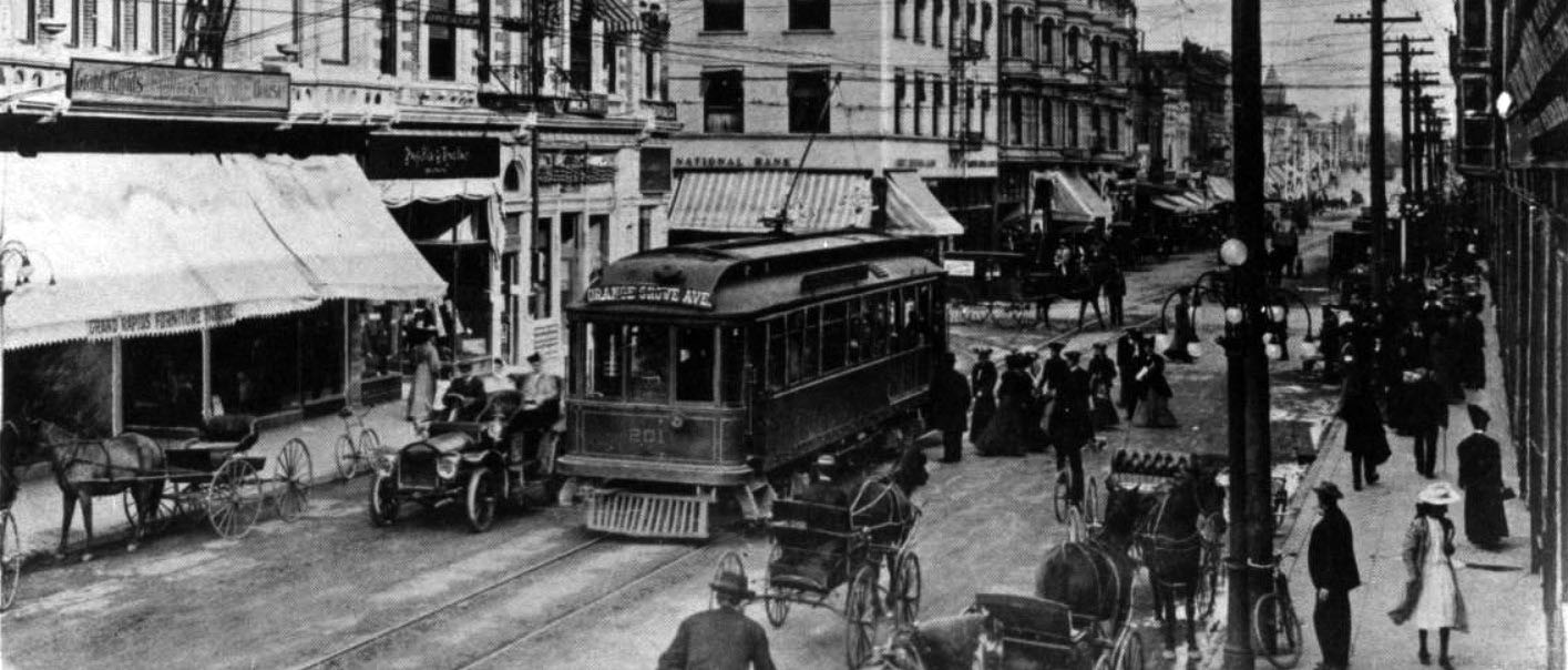
| (1910)^ - View looking south toward the intersection of Fair Oaks Ave and Colorado Street. A trolley with a sign that reads: ALTADENA waits while another trolley with a sign that reads: NORTH SOUTH LOOP passes through the intersection. The sidewalks and streets are full with people, horse-drawn wagons, and a cyclist. To the right is a postal-telegraph office. |
 |
|
| (ca. 1910)*x* – Close-up view showing passengers waiting to board a streetcar on Colorado Street with early model cars seen parked along the curb. The Carlton Hotel can be seen in the background. |
 |
|
| (ca. 1911)* – A couple are seen driving a 1906 Woods' Queen Victoria electric automobile down Colorado Boulevard. The background is 54-60 E. Colorado Blvd. |
Historical Notes The man in the car is Charles Gibbs Adams, a landscape architect and historian in Pasadena. The woman at the steering tiller is identified only as “Mary”. |
 |
|
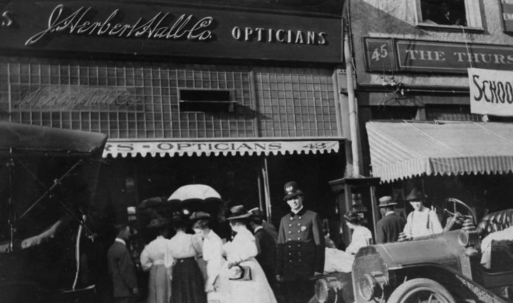
| (1910)** - Small crowd gathers outside J. Herbert Hall Jewelers, located on 43 East Colorado. The officer is guarding a 60 3/4 karat diamond that is placed in the store window. |
Warner's Photoplay Theatre
 |
|
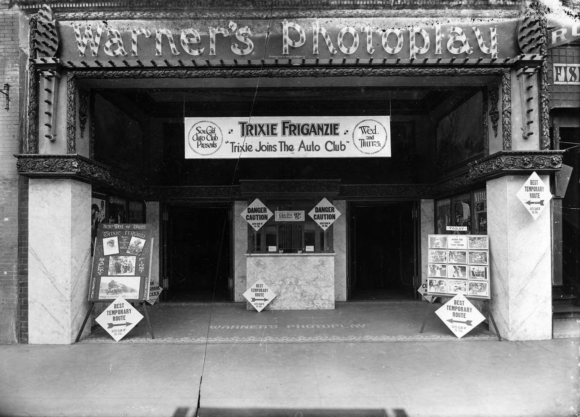
| (1914)*^* – View showing Warner's Photoplay Theater, located at 28 East Colorado Street with special showing of “Trixie Joins the Auto Club”, starring vaudeville star and new film actress Trixie Friganza, sponsored by the Automobile Club of Southern California. |
Historical Notes Opened in August of 1914, Warner’s Photoplay Theater was one of the first motion picture theaters offering air-conditioning. It was a welcome relief from Pasadena's hot August temps. *^* |
* * * * * |
 |
|
| (ca. 1910)^ – View of Fair Oaks Avenue looking north from Colorado Street. A streetcar featuring a sign that reads "Pasadena" makes its way down the avenue at center, while horse-drawn carriages are parked along with bicycles to either side, at the feet of high rise shop buildings. A carriage in the shape of a large shoe stands to the right, illegible advertising written on its side. Legible signs include: "Philadelphia Shoe Co.", "New York Dental Co.", "Money to Loan", "First National Bank", and "Parker Bros. Dentist". |
 |
|
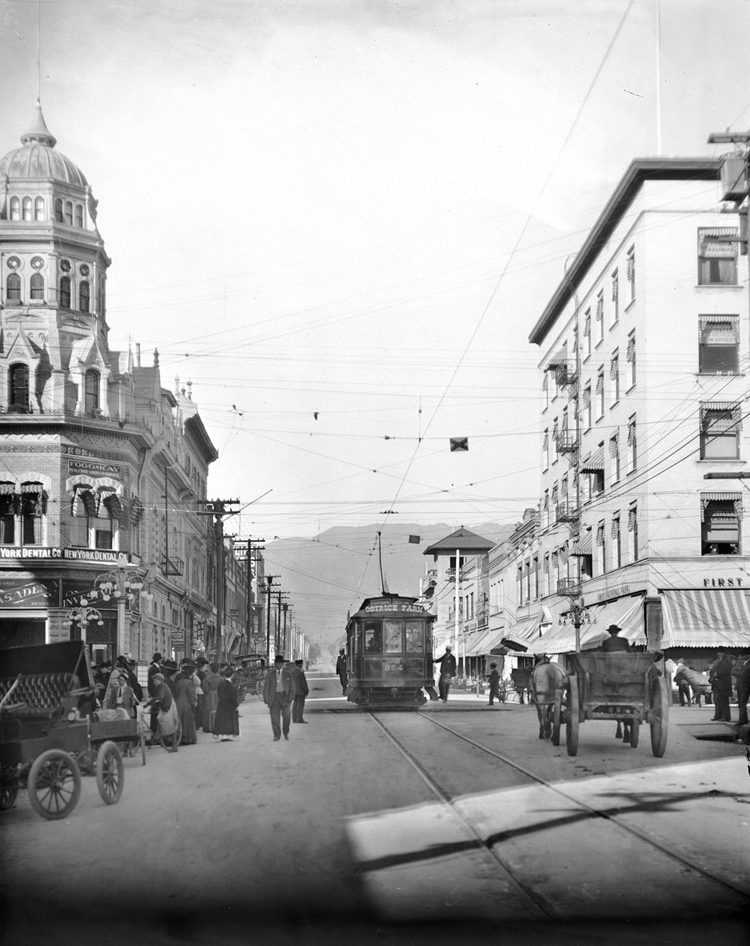
| (ca. 1910)^ - View looking north up Fair Oaks Avenue at Colorado Boulevard (then named Colorado Street). On the northeast corner stands the First National Bank. A trolley and a horse-drawn wagon share the road. The sign on the trolley reads: OSTRICH FARM |
Historical Notes The Cawston Ostrich Farm became a premier tourist attraction for many years. Its proximity to the trolley line that came through from downtown Los Angeles brought many tourists to visit the farm through the earlier part of the 20th century.*^ |
 |
|
| (ca. 1910)++# – View showing houses on Terrace Drive just below Colorado Blvd., Pasadena. |
 |
|
| (ca. 1915)++# - View of the south side of the 400 block of W. Colorado Blvd., Pasadena. The tops of three of houses seen in previous photo can be seen here. Note the B.P.O.E. Lodge 672 built 1911 (still standing) at right. Click HERE for contemporary view. |
Cawston Ostrich Farm
 |
|
| (1910)* - View of the Cawston Ostrich Farm, South Pasadena, in 1910. |
Historical Notes Cawston Ostrich Farm, located in South Pasadena, was opened in 1886 by Edwin Cawston. It was America's first ostrich farm and was located in the Arroyo Seco Valley just three miles north of downtown Los Angeles and occupied nine acres.*^ |
 |
|
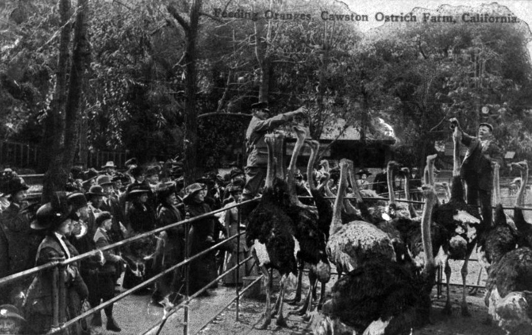
| (ca. 1907)^#^^ – Postcard view showing two men feeding oranges to ostriches at Cawston Farm as spectators watch on. |
Historical Notes In 1885 Edwin Cawston charted a ship to take fifty of some of the best obtainable ostriches in the world from South Africa to Galveston, Texas. From there, the ostriches endured a treacherous train journey to South Pasadena. Out of the original fifty, only eighteen survived. Cawston bounced back from the loss of over half of his stock and the Ostrich Farm eventually boasted over 100 ostriches from the original batch.*^ |
 |
|
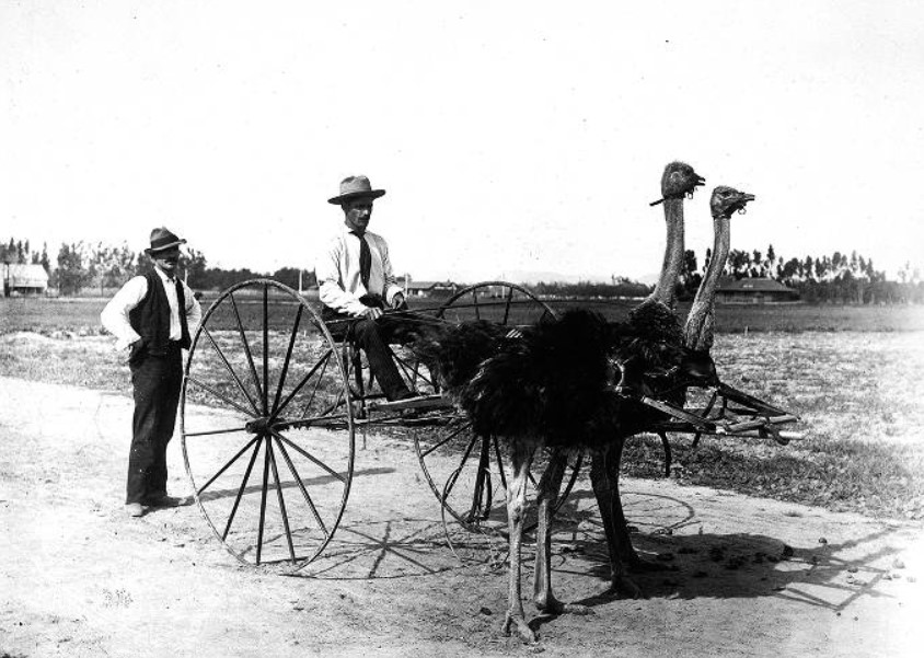
| (1905)#* - Cawston Ostrich Farm, South Pasadena. Two ostriches are hooked up to a buggy with one man seated with a driving whip and one man standing at the rear. |
 |
|
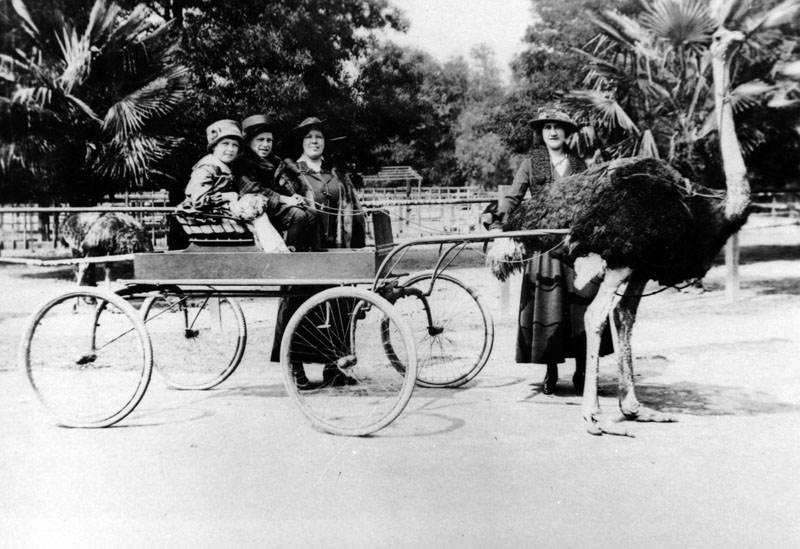
| (1922)* - View of two children sitting in an ostrich drawn wagon while two women stand in the background, all posing for the camera. |
Historical Notes Cawston Ostrich Farm guests were able to ride on the backs of ostriches and to be taken for ostrich drawn carriage rides. They also could buy ostrich feathered hats, boas, capes and fans at the Ostrich Farm store that was connected to the factory. The ostrich farm feather products were shipped and sold throughout the world.*^ |
 |
|
| (1912)* - View of the entrance to Cawston Ostrich Farm on August 4, 1912. |
 |
|
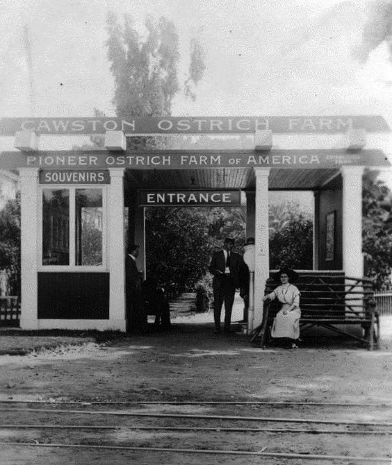
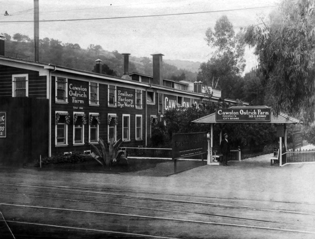
| (ca. 1920)^#^^ – View of the entrance to Cawston Ostrich Farm. Edwin Cawston, who initially established an ostrich breeding farm in Southern California in 1886, opened his famous farm in South Pasadena in 1896. A sign above the entry way references the farm's Los Angeles city store on South Broadway. |
Historical Notes Most of the original brick structure of the factory and store remains today and is South Pasadena Cultural Landmark #18.*^ |
 |
|
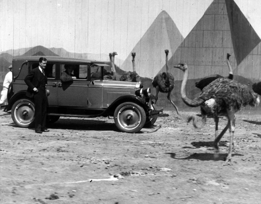
| (ca. 1930s)^#^^ - Ostriches roam the Cawston Ostrich Farm grounds and examine an automobile while two men look on. The pyramids in the enclosure provide an exotic backdrop, reflecting the ostriches' native Africa. |
 |
|
| (ca. 1910)^ - Looking south on Fair Oaks Avenue from just north of Colorado Boulevard, circa 1910. |
City Hall
 |
|
| (ca. 1911)* - Exterior view of City Hall in Pasadena located on the northeast corner of Fair Oaks and Union. Note the architectural designs on the building. Horse-drawn buggy's are parked along the sidewalks. |
Historical Notes In 1911 City Hall occupied a building at Union and Fair Oaks. Since then City Hall moved several times, and the building was lost, only to be replaced in 2003 by a quasi replica now known as the Container Store.*^ |
 |
|
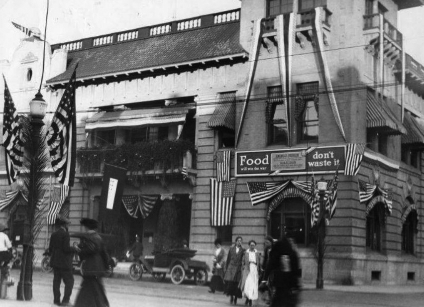
| (1917)^^*# - HISTORIC HEADLINE FOR MARCH 26, 1917 - 'Display of flags now patriotic duty says city official: Situation is now declared to constitute prescribed "Special Occasion" (Pasadena Star News) |
* * * * * |
 |
|
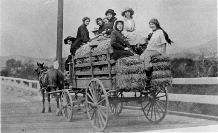
| (1911)*^# - Arriving in Style? A wagon trip from Pasadena to Glendale in 1911. The description on the reverse of this photo reads: "the girls had gone to a house party and it rained all the way home." |
* * * * * |
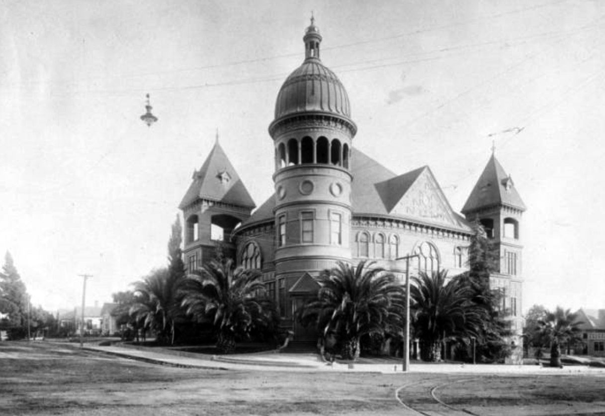
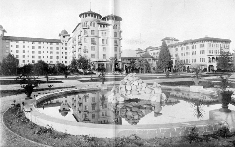
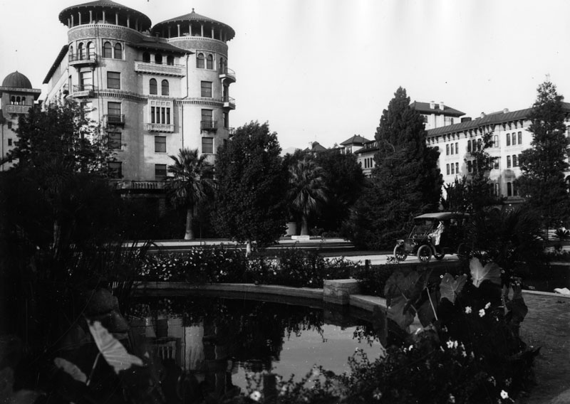
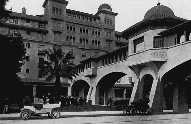
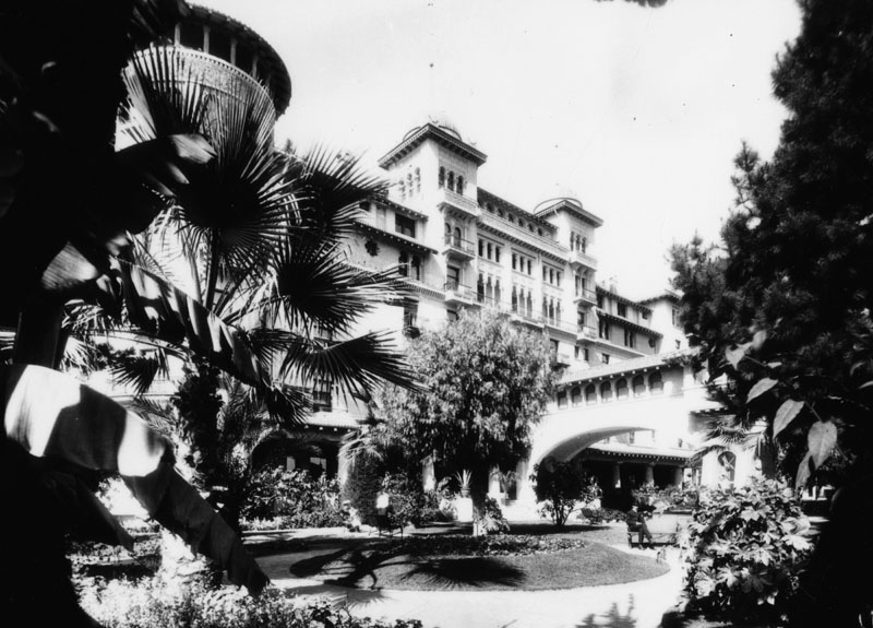
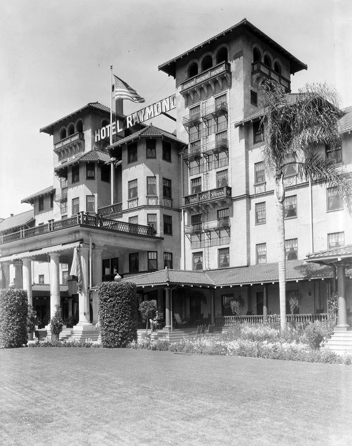
Second Raymond Hotel
 |
|
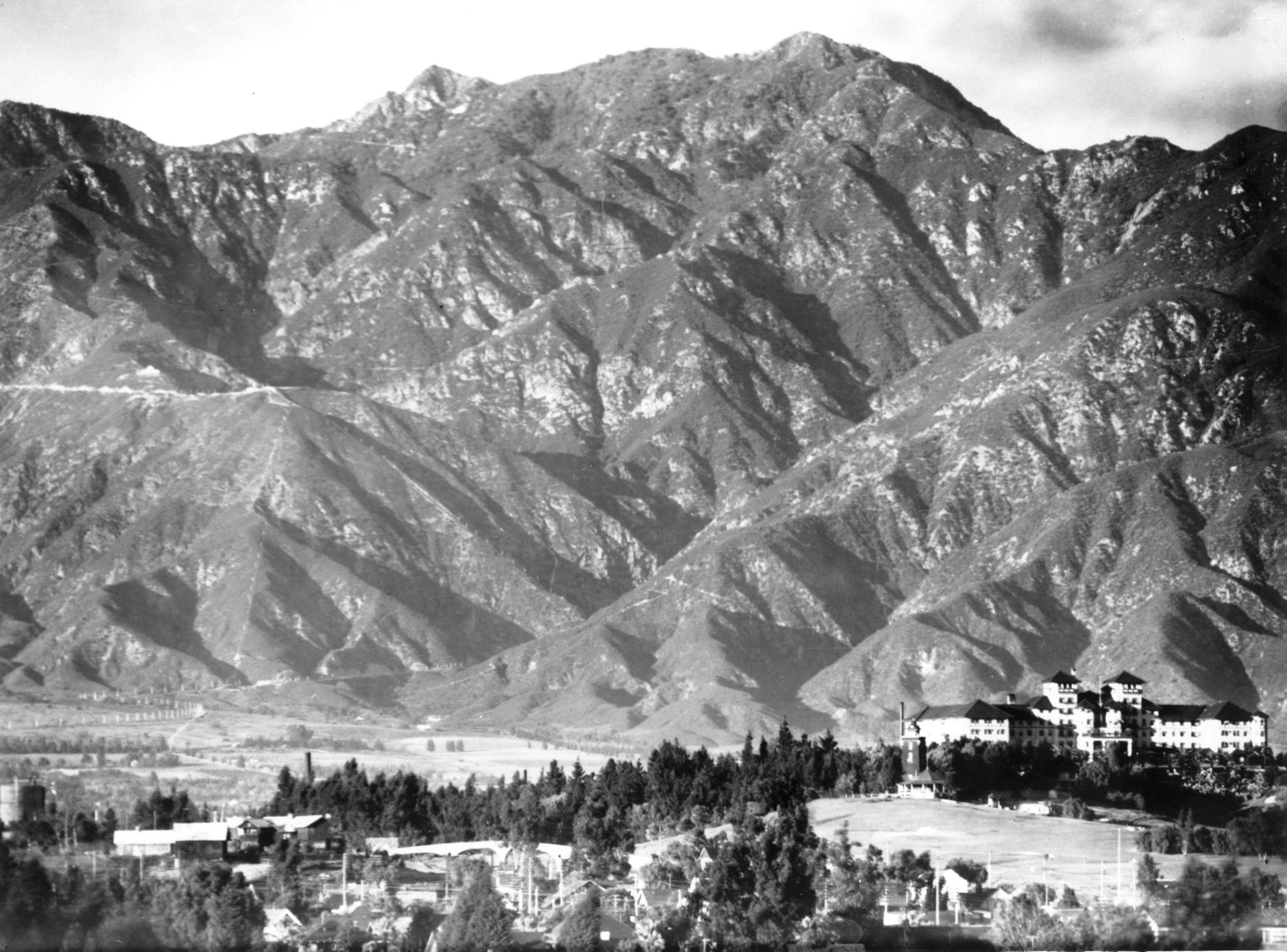
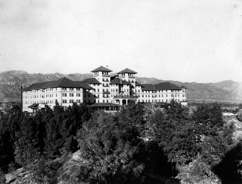
| (1908)* – View looking north from the Monterey Hills showing the majestic San Gabriel Mountains with the Raymond Hotel seen at lower right. |
Historical Notes The Original Raymond Hotel burned to the ground in 1895. The second Raymond Hotel opened on December 19, 1901 and was met with immediate success especially from those who had lost their winter residence for 6 years. The registry was filled with names of moguls from the East: Pullman, Schwab, Harriman, Swift, Armour, Rockefeller, Morgan, Carnegie, and of course R. T. Crane who spent his remaining winters at the Raymond. |
 |
|
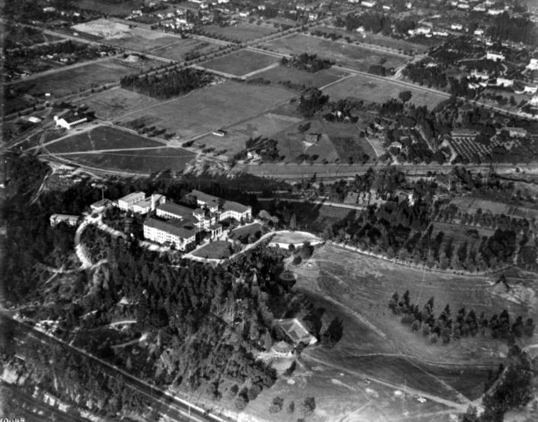
| (ca. 1918)* - Aerial view showing the Hotel Raymond and surrounding area. At the base of the hill is a gazebo and a tennis court. To the right of the hotel is a large open field; there are other open fields above the hotel as well. The upper right corner of the image shows the edge of a residential area. |
Historical Notes Located atop Bacon Hill, renamed Raymond Hill, which lies between Pasadena and South Pasadena, the first Raymond Hotel burned down in 1895 and was replaced by a second (seen above) in 1903.* Click HERE to see more on the 1st Hotel Raymond. |
 |
|
| (ca. 1910s)* - View of the second Raymond Hotel looking across the grounds at the western facade, the main entrance to the hotel. In the background are the San Gabriel Mountains. |
 |
|
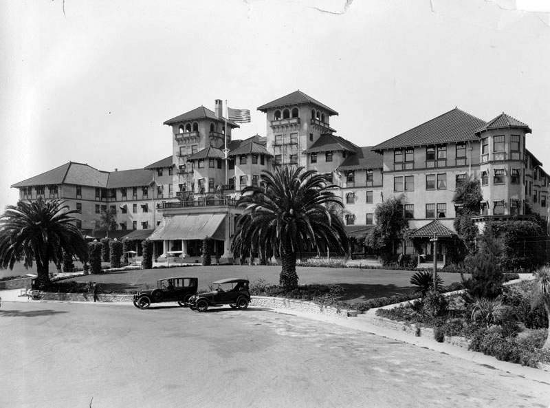
| (ca. 1910s)* - View of two cars parked in front of the second Raymond Hotel. The architect was T. W. Parkes. |
Historical Notes The Raymond was a landing-place for well-heeled visitors in the area until the Huntington Hotel, another luxury resort also located in Pasadena began receiving visitors in 1914. |
 |
|
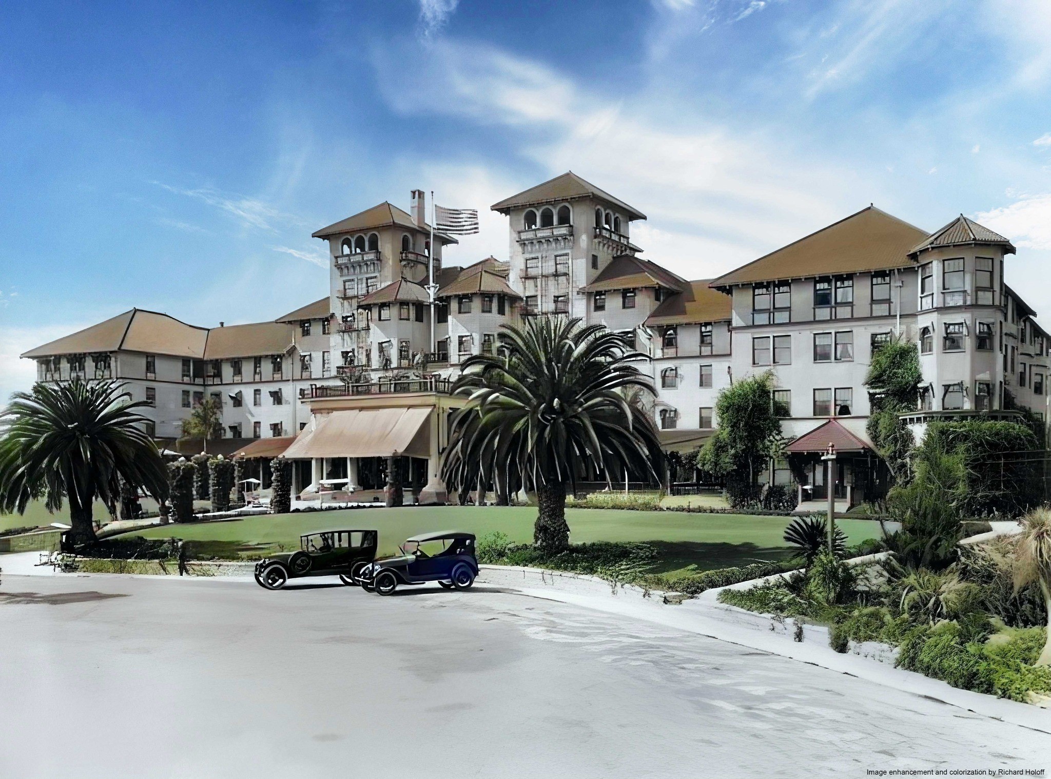
| (ca. 1910s)* - View of two cars parked in front of the second Raymond Hotel. The architect was T. W. Parkes. Image enhancement and colorization by Richard Holoff. |
 |
|
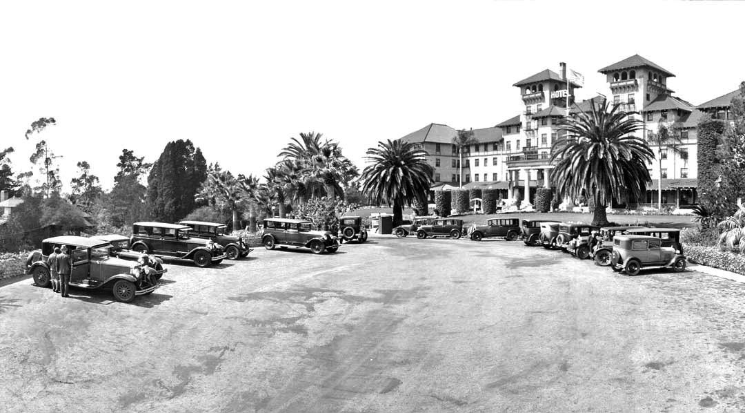
| (ca. 1928)* – View showing a lot full of cars in front of the Raymond Hotel. |
 |
|
| (1929)* – View showing the Raymond Hotel, 1200 South Fair Oaks, South Pasadena. |
Historical Notes During the Great Depression, 1931, the Raymond Hotel starting seeing a major decline in the number of guests. Mortgage payments became due and could not be met. The bank foreclosed on the hotel and Walter Raymond lost the property. The owner of the Maryland Hotel, Daniel M. Linnard, sought to manage the property for a while, but in 1934, the year of Walter Raymond’s death, the hotel was torn down for commercial development. |
* * * * * |
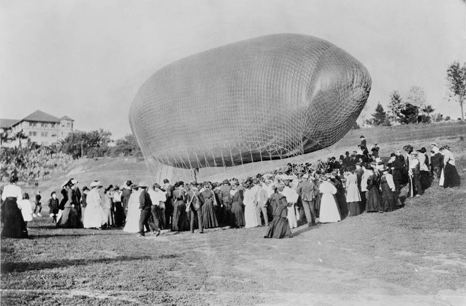
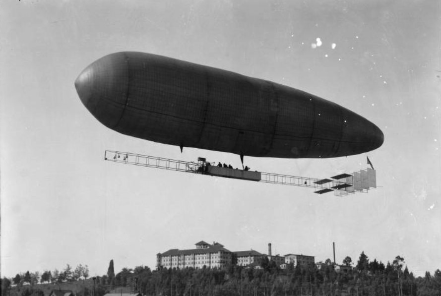
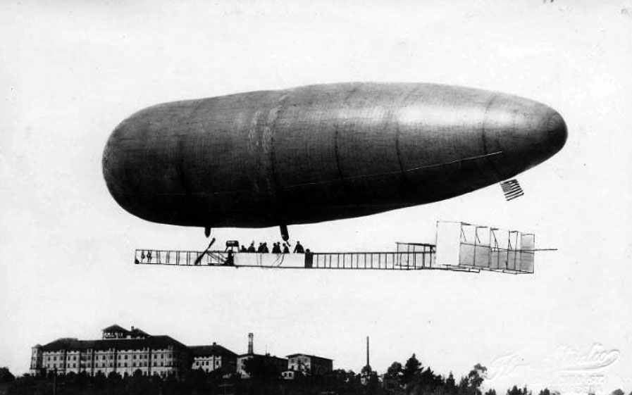
Dirigible Flights at the Raymond Hotel
 |
|
| (1905)* - View of Roy Knabenshue landing his dirigible on the Raymond Hotel grounds, surrounded by a large crowd of people. |
Historical Notes CA. Roy Knabenshue made outstanding contributions to aviation as an aeronaut making balloon flights. He was among the first to pilot a steerable balloon, one of the pilots of the first successful American dirigible, a builder and exhibitor of dirigibles of his own design, manager of the Wright Brothers’ Exhibition Team, and a leading builder of observation balloons during World War I. |
 |
|
| (1913)* - A view showing Roy Knabenshue flying his new multi-passenger dirigible with the Raymond Hotel in the background. There are people in the undercarriage which runs the length of the airship. |
Historical Notes Roy Knabenshue was the first to make a dirigible balloon flight over the skyscrapers of New York back in 1905, one year after his original lighter-than- air powered flight at the St. Louis Exposition. After several years of barnstorming and a stretch as general manager for the Wright Brothers, he went west and built a 13-passenger airship in Pasadena for passenger flights. |
 |
|
| (1913)* - Roy Knabenshue flying his 13-passenger dirigible over the Raymond Hotel. He offered aerial tours of the City of Pasadena. |
Historical Notes Click HERE to see more in Aviation in Early L.A. |
* * * * * |
Oneonta Park Junction (South Pasadena)
 |
|
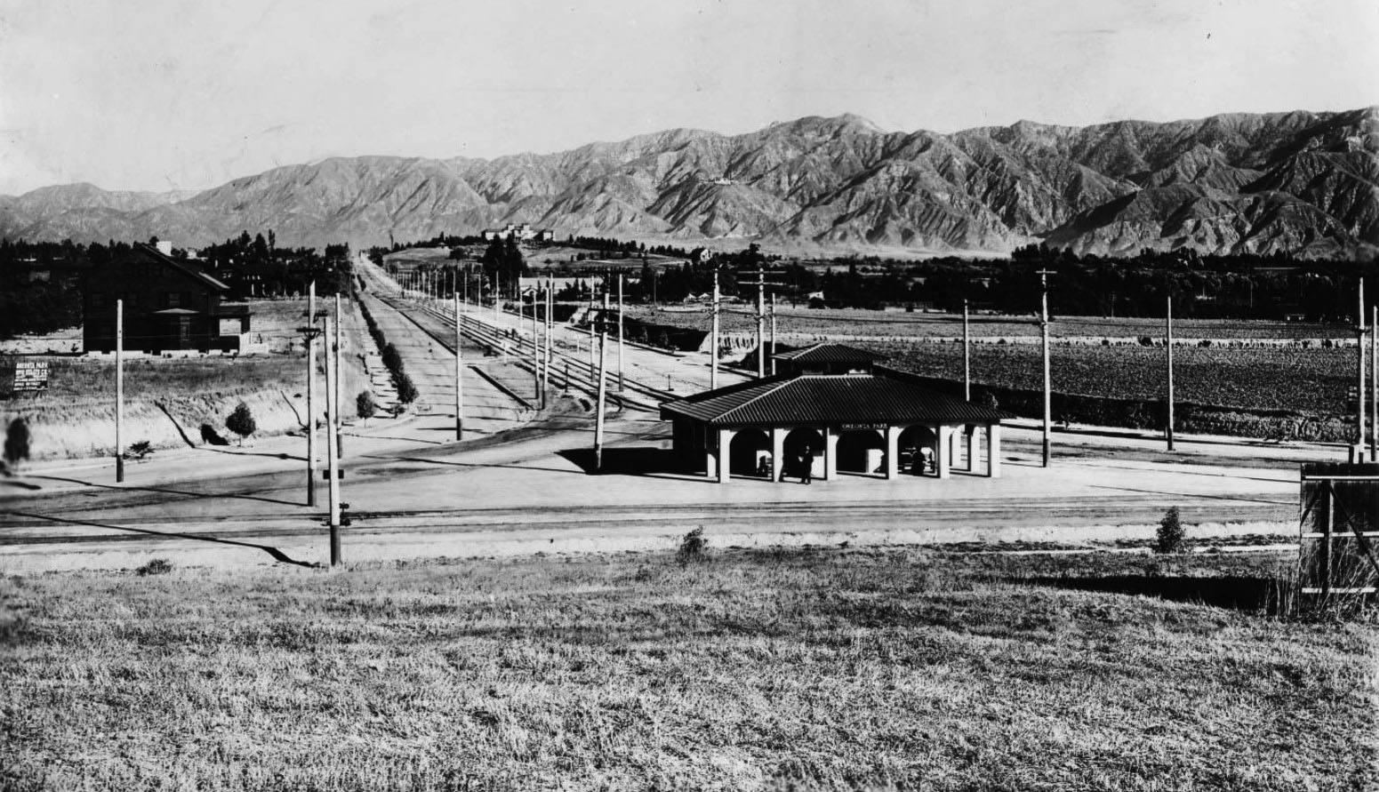
| (ca. 1910)^ - View showing Oneonta Park and Pasadena on a clear day as seen from the hill to the south, Huntington Drive & Fair Oaks Avenue, South Pasadena. Two sets of streetcar tracks merge behind the station (center) to form parallel tracks that lead into the distance. The Raymond Hotel can be seen on a hill in the background with the San Gabriel Mountains in the distance. |
Historical Notes The Oneonta Park Tract came into being in 1902 when Henry Huntington changed the name of the existing Monrovia Junction to Oneonta, the name of his hometown in New York. He described Oneonta Park as a model suburb with rail transportation to downtown Los Angeles as more than 750 Red Cars passed in a single day. The name Oneonta was widely used in South Pasadena – Oneonta Military Academy, Oneonta School, Oneonta Congregational Church, Oneonta Club, and many others. The Oneonta Tract encompassed several hundred acres in the area of Huntington Drive and Fremont Avenue, east to Fletcher Avenue and south to the Alhambra city limits. |
 |
|
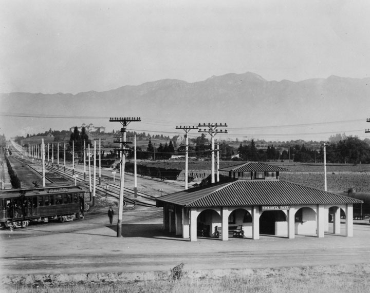
| (ca. 1915)* - Closer view showing the Spanish Revival style station; inside cupola is a switching station for the four-tracking system for the Pasadena Short Line of the Pacific Electric Railway Company. The Raymond Hotel is seen on a knoll at center-left with San Gabriel Mountains beyond. |
Historical Notes The Oneonta Park Station was constructed in 1906 and had a small counter where tickets, daily newspapers and soft drinks could be purchased before boarding the Red Cars. A tower located within the station housed an interlocking system which controlled all the switches at the Junction, including Southern Pacific Railway crossing at Huntington Drive and Marengo Avenue. From the tower, the controller had a view in all directions. The Oneonta Park Station was demolished when operations were discontinued in late 1951. Click HERE to see more early views of Oneonta Park Junction (1937 +). |
* * * * * |
Raymond and Colorado
 |
|
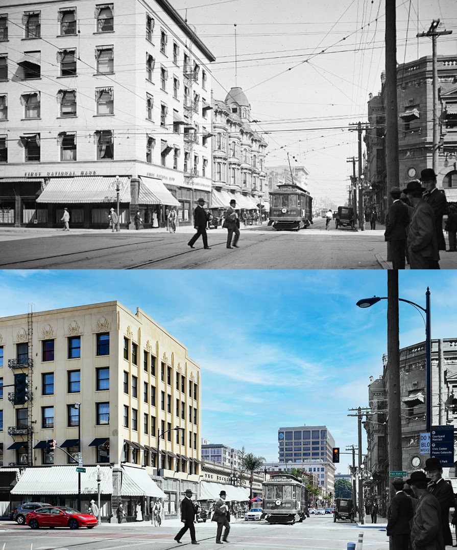
| (ca. 1918)^## – View looking north on Raymond Avenue at Colorado Boulevard showing a policeman standing on a box at the middle of the intersection. Click HERE to see contemporary view. |
Then and Now
 |
|
| (1918 vs. 2022)* – View looking north on Raymond Avenue at Colorado Boulevard. |
 |
|
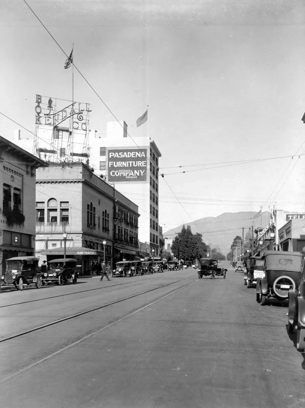
| (ca. 1918)^## – View looking north on Raymond Avenue just north of Colorado Boulevard. The Pasadena Furniture Company building can be seen in the distance. Click HERE to see contemporary view. |
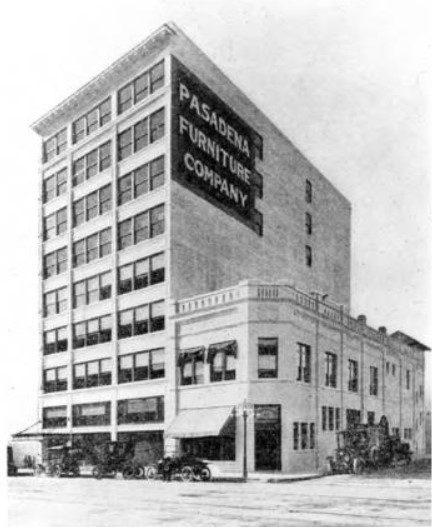 |
(1915)**- View of the Pasadena Furniture Company. Picture taken from 1915 Tournament of Roses Program. According to the 1916 Pasadena City Directory, the Pasadena Furniture Company was at 83-91 Raymond Avenue. Click HERE to see contemporary view.
|
.jpg) |
|
| (ca. 1920)++# – View looking east on Colorado Boulevard from Raymond Avenue showing a uniformed officer directing traffic from the middle of the intersection. |
 |
|
| (1926)*^* – View looking east on Colorado from Raymond showing several people crossing the street with streetcar and autos waiting at the intersection. Note the overhead streetcar wire above the intersection. |
 |
|
| (1920s)* - Cars on Colorado Boulevard with the First Trust & Savings Bank seen on the right, at Raymond Avenue. |
* * * * * |
Colorado Street Bridge |
The Early Years 1913 to the 1920s |
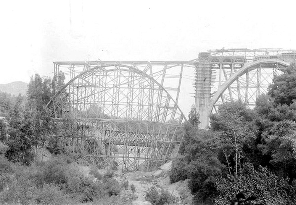
When the Colorado Street Bridge opened to traffic on December 13, 1913, it permanently altered Pasadena’s geography. For decades, travelers had descended steep dirt roads to the wooden Scoville Bridge at the bottom of the Arroyo Seco, then climbed the opposite bank through Eagle Rock Pass. The route was slow, muddy in winter, and increasingly inadequate for a growing city.By the early twentieth century, Pasadena’s population and automobile ownership were rising rapidly. Civic leaders recognized that the arroyo was no longer a picturesque boundary but a transportation barrier. After years of discussion, the city approved funding for a permanent reinforced concrete span at Colorado Street. The contract was awarded to the nationally respected engineering firm of Waddell and Harrington of Kansas City.The completed bridge stretched 1,467.5 feet across the chasm and rose approximately 150 feet above the arroyo floor. Its eleven open spandrel arches created strength without mass, while decorative Beaux Arts railings and five globe streetlights reflected the ideals of the City Beautiful movement. Infrastructure, in this vision, was meant to inspire as well as function.From the day it opened, the bridge was more than a crossing. It announced that Pasadena had embraced modern engineering and the automobile age. This section traces its formative years, from construction in 1912 and 1913 through its establishment as a regional landmark in the 1920s. |
 |
|
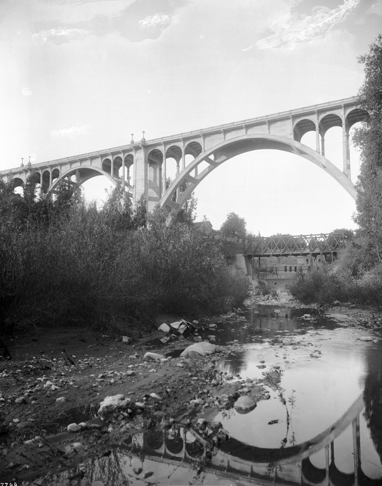
| (1914)* - View looking up toward the bridge with its reflection in the water below. The Scoville Bridge stands in the distance in its final year. |
Historical Notes With eleven arches spanning the arroyo, the bridge was hailed as one of the highest concrete structures of its kind in the world at the time of completion. Its open spandrel design reduced weight while preserving strength, allowing it to appear light despite its massive scale. In later years, particularly during the Great Depression, the bridge gained a tragic reputation after a number of suicides occurred from its height. That chapter lies beyond this early period, but it remains part of the structure’s complex legacy. |
 |
|
| (1913)* - View showing the bridge under construction with the 1887 Scoville Bridge in the background. |
Historical Notes Construction began in July 1912 and continued for roughly eighteen months. Between forty and one hundred men worked on the project at any given time. More than eleven thousand cubic yards of concrete were poured using aggregate taken directly from the arroyo, reinforced by approximately six hundred tons of steel. For a brief period, the wooden Scoville Bridge and the rising concrete arches stood together. The scene captured a turning point in Pasadena’s transition from nineteenth century frontier town to modern city. |
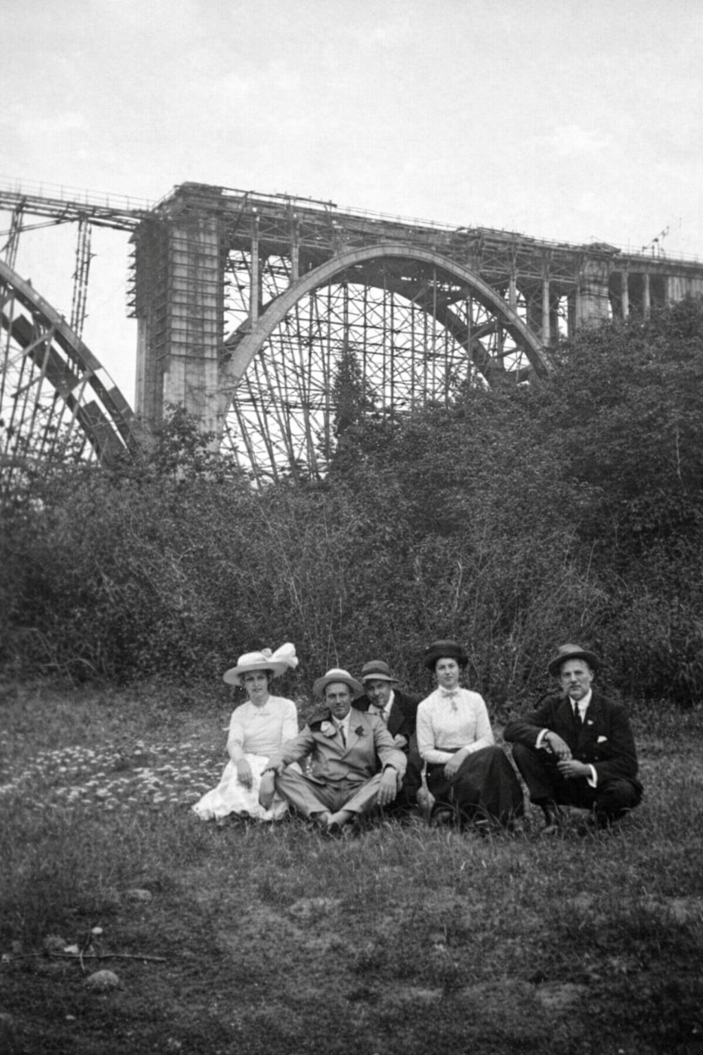 |
|
| (1913)* - Group photo near the base of the bridge under construction. |
Historical Notes Temporary wooden falsework supported each arch as it was poured in place. Workers balanced on scaffolding high above the ravine, often exposed to heat, wind, and limited safety protections compared with modern standards. Their precision was critical. Each arch had to align perfectly across the wide span so that the completed structure would distribute its load evenly and remain stable for generations. |
 |
|
| (1913)* - View looking west showing the bridge under construction with the Scoville Bridge at center right. |
Historical Notes Before 1913, wagons and early automobiles descended into the arroyo to cross the wooden bridge below. The climb up the opposite side was steep and frequently rutted. The new elevated crossing eliminated this obstacle and dramatically shortened travel time between Pasadena and communities to the west. It immediately encouraged residential development beyond the arroyo. |
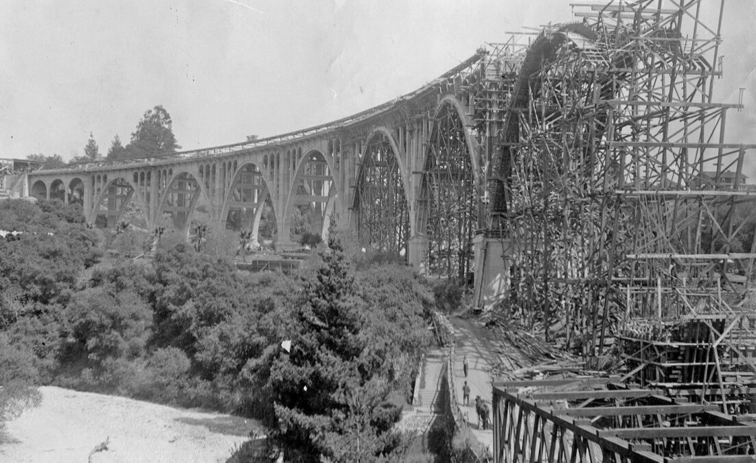 |
|
| (1913)* - Colorado Street Bridge under construction with the old Scoville Bridge seen at lower right. |
Historical Notes Each of the eleven arches was formed and poured on site, an ambitious undertaking for its time. The open spandrel system allowed material to be placed only where structurally necessary, reducing weight while maintaining rigidity. The final cost approached two hundred forty thousand dollars, a substantial municipal investment that reflected confidence in Pasadena’s long term growth. |
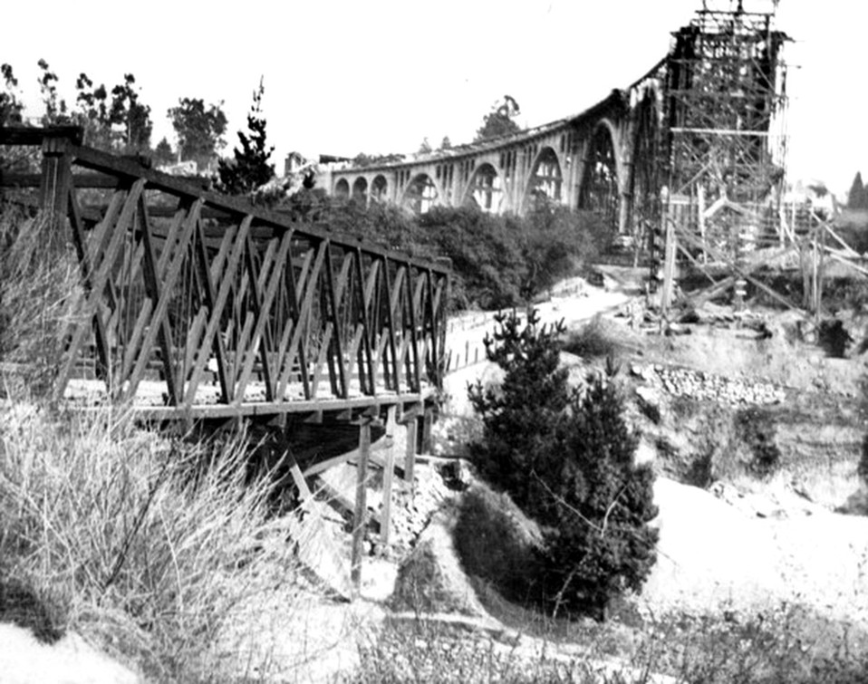 |
|
| (ca. 1913)* - Partially completed bridge with the Scoville Bridge in the foreground. |
Historical Notes In January 1914, heavy storms caused severe flooding throughout the region. The wooden Scoville Bridge was swept away and carried downstream into the Los Angeles River. The survival of the new reinforced concrete span during this flood confirmed the wisdom of building a permanent and resilient structure. |
 |
|
| (1913)* - View looking west before the official opening. Ornate five globe streetlights line both sides. |
Historical Notes The decorative railings and lamp standards reflected early twentieth century civic ambition. Public works were designed to uplift the spirit as well as serve transportation needs. From the beginning, the bridge was meant to be experienced. Wide sidewalks allowed pedestrians to pause and take in expansive views of the arroyo and surrounding hills. |
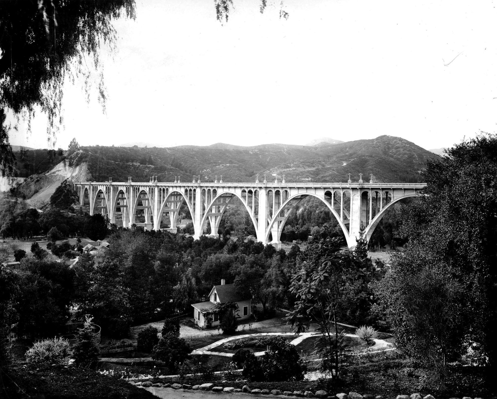 |
|
| (1913)* - View looking northwest of the Colorado Street Bridge in the final stages of construction. Construction equipment is visible near the west end of the span, where the roadway had not yet fully connected. Early residential homes line the edge of the arroyo in the foreground. |
Historical Notes This view shows the bridge just before completion, when the concrete arches were finished but surrounding roadway improvements were still underway. At this stage, the structure already carried its full visual weight across the arroyo, even as grading and approach work continued. The nearby houses illustrate how closely Pasadena’s residential neighborhoods bordered the arroyo. Once the bridge opened, access to these hillside areas improved dramatically, reinforcing the bridge’s immediate impact on local development. |
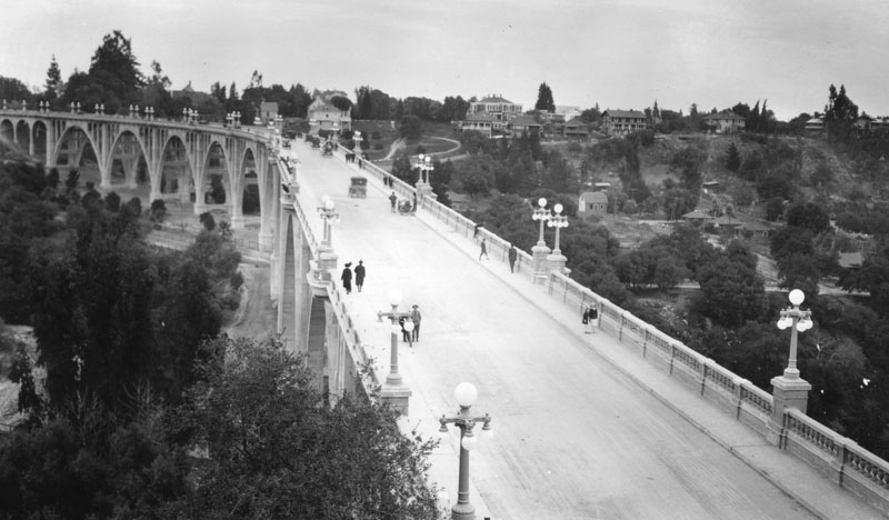 |
|
| (ca. 1913)* - People walking and early automobiles crossing the bridge. |
Historical Notes The bridge quickly became part of major regional routes and later carried U.S. Route 66 before traffic shifted to the Arroyo Seco Parkway in 1940. Although only two lanes wide, it accommodated growing traffic throughout the 1910s and 1920s, serving commuters, visitors, and those attending civic events. |
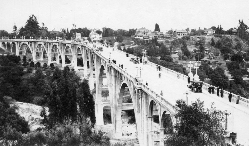 |
|
| (ca. 1913)* - Another view of the Colorado Street Bridge shows several groups of people walking on the bridge. The original La Vista del Arroyo Hotel can be seen in the background to the right of the bridge. |
Historical Notes The La Vista del Arroyo resort overlooked the bridge and benefited from improved access. Established in the 1880s and expanded in the 1920s, it reinforced Pasadena’s reputation as a winter destination for visitors from across the nation. Together, the bridge and the resort framed the arroyo as both a natural landscape and a cultivated civic setting. |
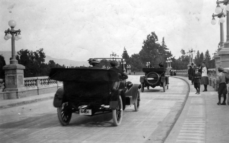 |
|
| (1913)* - Automobiles travel east on the Colorado Street Bridge, located over the Arroyo Seco in Pasadena, captured not long after it was completed. Pedestrians are seen strolling along the path on the right. |
Historical Notes Only two lanes wide, the bridge was considered inadequate as early as the 1930s. The bridge remained part of Route 66 until the 1940 completion of the Arroyo Seco Parkway. After the route moved to the Arroyo Seco Parkway, Colorado continued to be signed as Alternate 66 until 1964. |
.jpg) |
|
| (1913)* - Early model car and pedestrians try out the newly constructed Colorado Street Bridge. |
Historical Notes Shortly after opening, residents crossed the bridge simply to experience it. Early automobiles shared the roadway with pedestrians who paused along the sidewalks to admire sweeping views of the Arroyo Seco. The bridge quickly became both a transportation corridor and a destination. Its height and elegant arches made it one of Pasadena’s most talked about civic improvements. |
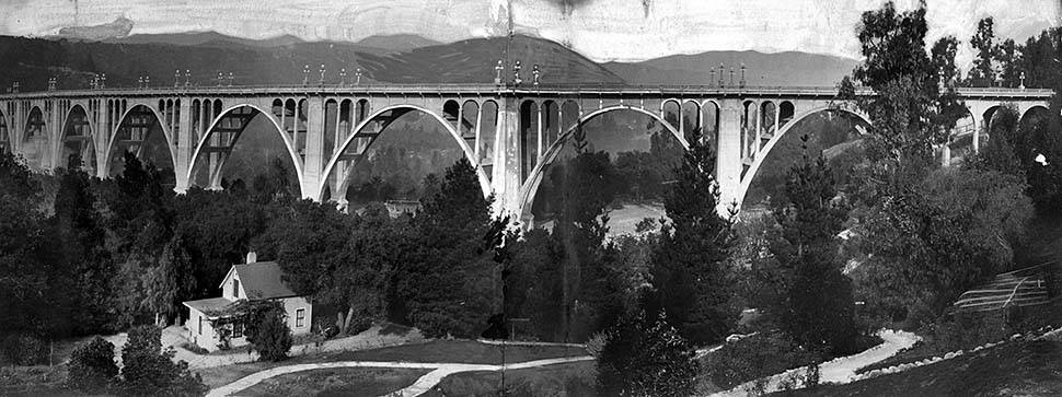 |
|
| (1914)* - Panorama of the new Colorado Street Bridge across the Arroyo Seco in Pasadena. This photo was published in the Dec. 14, 1914, Los Angeles Times. |
Historical Notes Newspapers praised the bridge as a triumph of engineering and civic pride. Photographs of its sweeping arches circulated widely in print and promotional materials. The structure quickly became one of the most recognizable images associated with Pasadena. |
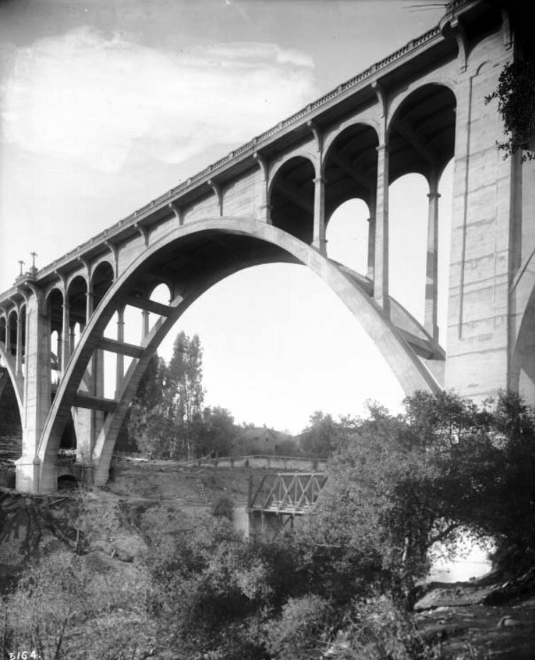 |
|
| (ca. 1914)* - Close-up view of the Colorado Street Bridge looking up from its base with the Scoville Bridge behind it. |
Historical Notes The Scoville Bridge survived until the flood of 1914, when the trestle was carried all the way down the Arroyo Seco and into the Los Angeles River. |
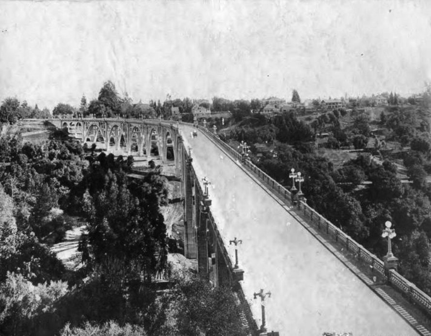 |
|
| (ca. 1915)* – Along the Colorado Street Bridge. |
Historical Notes By the mid 1910s, the bridge had settled into daily use. Horse drawn vehicles, early motorcars, and pedestrians all relied on its elevated crossing. Its concrete deck and steel reinforced arches required far less maintenance than the wooden structures it replaced, reinforcing public confidence in modern engineering. |
 |
|
| (ca. 1920)* - View of the Colorado Street Bridge, also known as the Arroyo Seco Bridge. |
Historical Notes By 1920, the bridge was firmly established as a defining Pasadena landmark. Increasing automobile ownership placed steady demand on the two lane roadway. The structure’s alternate name, Arroyo Seco Bridge, reflected its geographic identity as the principal crossing of the deep natural ravine that shaped Pasadena’s development. |
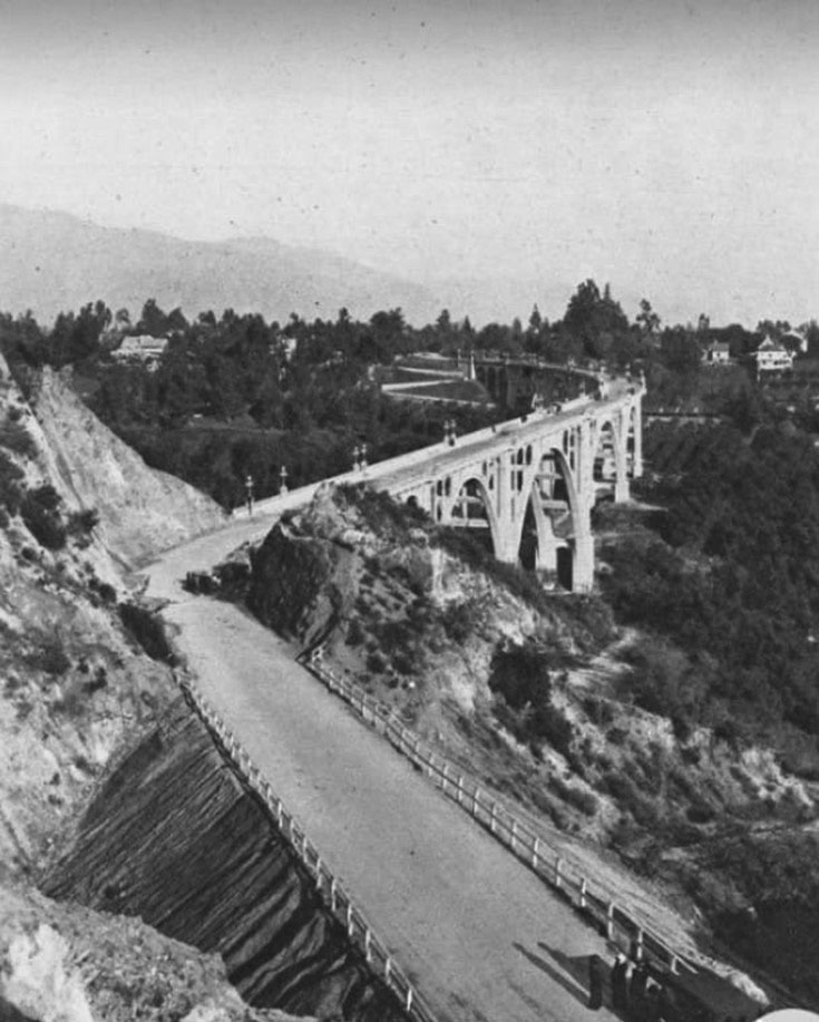 |
|
| (1910s)*- What appears to be a landslide blocks a portion of the road leading to the Colorado Street Bridge. |
Historical Notes Early approach roads were vulnerable to erosion and landslides, especially during heavy winter storms. While the bridge itself was engineered for strength, surrounding terrain required ongoing grading and maintenance. The later construction of the expanded Vista del Arroyo complex in the 1920s would further reshape this hillside landscape overlooking the bridge. |
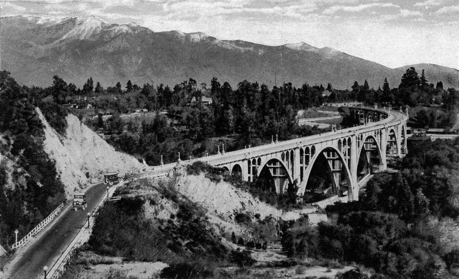 |
|
| (ca. 1920)* - Postcard view of the Colorado Street Bridge with snow capped San Gabriel Mountains in the background. |
Historical Notes By the 1920s, the bridge had become a frequent subject of postcards. Its sweeping arches framed against the San Gabriel Mountains symbolized Pasadena’s combination of natural beauty and civic ambition. These images circulated nationally, reinforcing the city’s identity as a modern yet picturesque destination. |
 |
|
| (ca. 1920)* – Panoramic view showing the Colorado Street Bridge on the right and the Linda Vista Bridge on the left. |
Historical Notes The Colorado Street Bridge was soon joined by additional crossings of the Arroyo Seco, including the nearby Linda Vista Bridge. Together, they transformed what had once been a barrier into a connected transportation corridor. Multiple spans across the arroyo encouraged residential expansion and strengthened links between Pasadena and surrounding communities. |
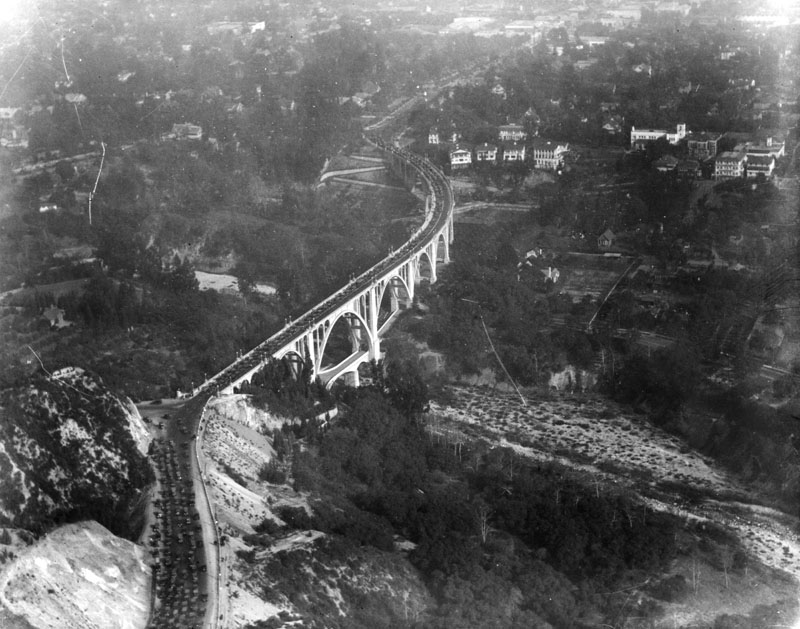 |
|
| (ca. 1920s)* - Aerial view of traffic congestion on the Colorado Street Bridge. |
Historical Notes Automobiles lined the narrow roadway, reflecting the rapid growth of car ownership during the 1920s. The bridge often served as a primary approach to civic events, including early Rose Bowl games beginning in 1923. Traffic congestion in this era foreshadowed later debates about widening, replacement, and long term capacity, issues that would shape the bridge’s future. |
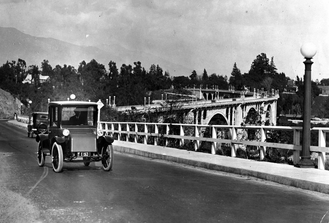 |
|
| (1920s)* - An electric car crosses the Colorado Street Bridge. Courtesy of the Pasadena Museum of History. |
Historical Notes The car seen above appears to be a 1920 Milburn Electric. People liked them because in many ways early electric cars outperformed their gas competitors. Electric cars didn’t have the smell, noise, or vibration found in steam or gasoline cars. They were easier to operate, lacked a manual crank to start, and didn’t require the same difficult-to-change gear system as gas cars. Electric cars became extremely popular in cities, especially with upper-class women who disliked the noisy and smelly attributes of gasoline-powered cars. The production of electric cars peaked in 1912. And while at the turn of the century electric cars had made up a good proportion of the market, advances in gasoline-powered vehicles meant that electric cars owned a smaller and smaller market share as time went on. When Henry Ford introduced the mass-produced and gas-powered Model T in 1908, it symbolized a death blow to the electric car. By 1912, a gasoline car cost only $650 while the average electric roadster sold for $1,750. In 1912 Charles Kettering also invented the first electric automobile starer. Effectively eliminating the hand crank, Kettering’s invention made the gas-powered auto even more attractive to the same drivers who had preferred electric cars. By 1935, electric cars had all but disappeared from the road.* |
Click HERE to see more Early Views of the Colorado Street Bridge |
* * * * * |
Mt. Wilson Observatory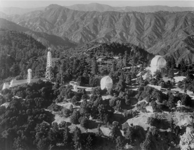
| (1932)#* - Aerial view of Mount Wilson Observatory from the southeast located in the San Gabriel Mountains near Pasadena. |
Historical Notes The Mount Wilson Observatory is located on Mount Wilson, a 5,715-foot peak in the San Gabriel Mountains near Pasadena. The observatory contains two historically important telescopes: the 60-inch Hale telescope built in 1908 and the 100-inch Hooker telescope, which was the largest telescope in the world from its completion in 1917 until the 200-inch Hale telescope at Palomar Observatory was built in 1948. |
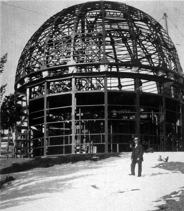 |
|
| (ca. 1907)* – View showing a man posing in front of the 60" Telescope Dome under construction. |
Historical Notes The 60-inch Hale telescope was the largest telescope in the world when it was completed in 1908. |
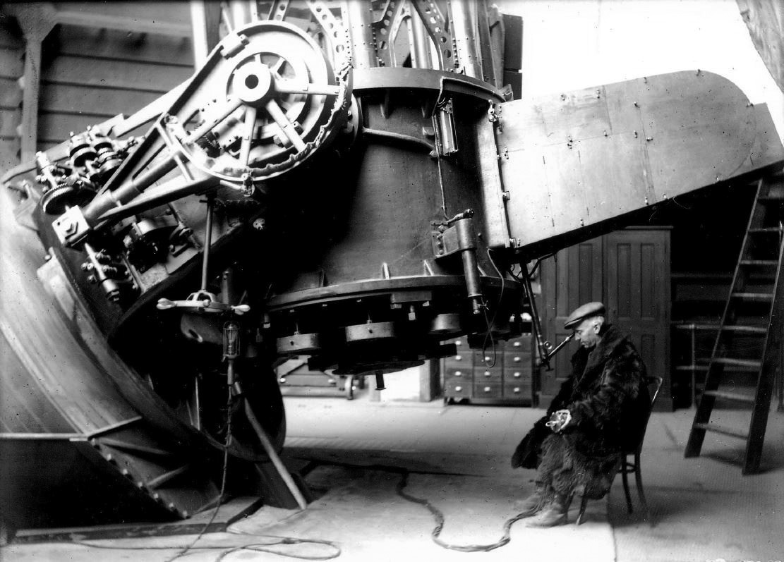 |
|
| (1912)* - Astronomer Wendell Hoge at eyepiece of 60-inch Hale Telescope at Mt. Wilson. Note the fur coat and leggings. |
Historical Notes One of the things that astronomers had to learn in those days was how to stay warm on cold nights [this shot was taken in December] working with a telescope. The instrument had to be the same temperature as the outside air, and the astronomer couldn't move very much. |
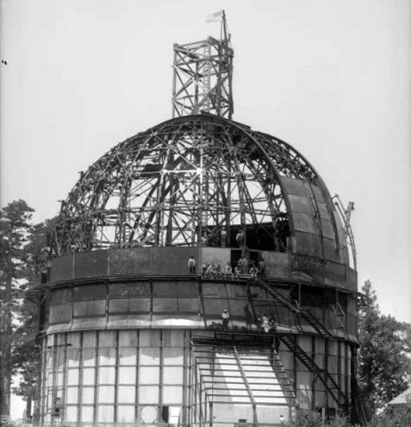 |
|
| (1915)#* - View of the 100 inch telescope dome under construction at the Mount Wilson Solar Observatory. Workman are seen posing on the structure. |
Historical Notes Mount Wilson Solar Observatory was founded in 1904 by George Ellery Hale under the auspices of the Carnegie Institution of Washington (the word "Solar" was dropped from the name in 1919 soon after the completion of the 100-inch telescope). In that year, Hale brought the Snow Solar Telescope from Yerkes Observatory in southern Wisconsin to the sunnier and steadier skies of Mount Wilson to continue his studies of the Sun. With a small cadre of Yerkes scientists and engineers accompanying him, Hale started what would become the world’s foremost astronomical research facility. |
 |
|
| (1916)#* - View of the dome for the 100-inch Hooker Telescope shortly after its completion. |
 |
|
| (1916)++# - View showing the lower housing of the 100" Hooker Telescope loaded and ready for transportation to Mt. Wilson. The location is the Mt. Wilson Observatory Pasadena Offices, 813 Santa Barbara St., Pasadena; the Observatory still maintains its offices at this address. The view is to the north, Santa Barbara is behind the photographer, Lake Ave. is about 100' to the right. |
 |
|
| (1917)* - View showing the 100-inch Hooker Telescope glass being hauled up the one-way dirt toll road from Altadena to Mt. Wilson by truck on the Mt. Wilson Roadway. |
Historical Notes In 1889, the Harvard Telescope was transported up the San Gabriel Mountains and installed at the top of Mt. Wilson. The problems associated with transporting this instrument up the old Wilson trail and the belief that larger telescopes would follow, created an interest in building the Mt. Wilson roadway. As new, larger telescopes were designed for the Mt. Wilson Observatory, an automobile roadway became necessary to accommodate the trucks hauling parts up the mountain. In 1907 the trail was widened to ten feet with most of the work being done by hand with the use of Japanese laborers and mule-drawn scrapers. The road was widened to a full 12-foot roadway in 1917 to facilitate the transportation of parts for the 100-inch Hooker Telescope. |
 |
|
| (1917)* - The 100-inch telescope being hauled up the one-way dirt toll road from Altadena to Mt. Wilson by truck. It was boxed in and draped with an American flag. |
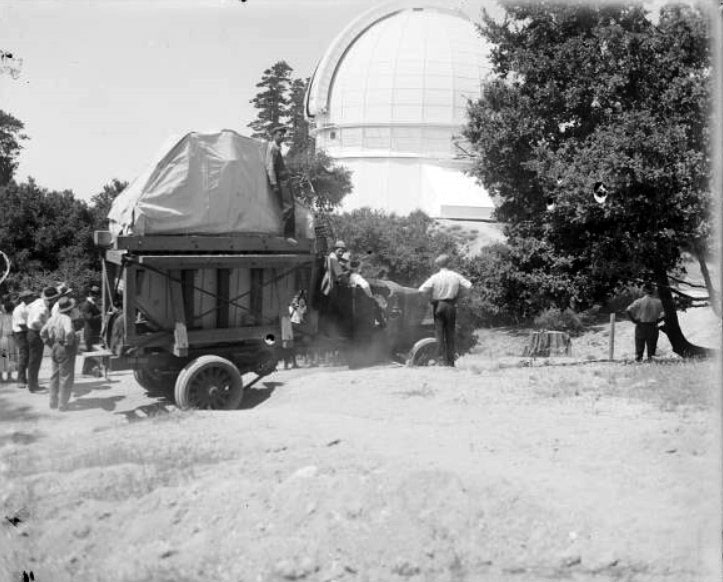 |
|
| (1917)#* - Arrival of the 100-inch telescope mirror at Mount Wilson Observatory. The mirror is covered with a white tarpaulin and is loaded in the back of a truck. The observatory dome is seen between trees, to the right of the truck. |
 |
|
| (1917)#* - View of the Hooker 100-inch telescope tube and mount, nearly complete, Mount Wilson Observatory. |
Historical Notes The first optical interferometer ever used for astronomical research was used on the 100-inch telescope to measure the sizes of distant stars for the first time in 1919. |
 |
|
| (1940)#* - The Hooker 100-inch reflecting telescope, side view with tube 40 degrees from horizontal. Edwin Hubble's chair, on an elevating platform, is visible at left. |
Historical Notes Edwin Hubble used the 100-inch telescope to determine the distances and velocities of neighboring galaxies, demonstrating that they are separate "island universes" and not small nebulae contained within the Milky Way, as many astronomers had previously thought. |
 |
|
| (1937)* - Astronomer Edwin Powell Hubble stargazes through the Hooker telescope at California's Mount Wilson Observatory. |
Historical Notes Edwin Powell Hubble (1889-1953) played a crucial role in establishing the field of extragalactic astronomy and is generally regarded as one of the most important observational cosmologists of the 20th century. Hubble is known for showing that the recessional velocity of a galaxy increases with its distance from the earth, implying the universe is expanding, known as "Hubble's law" although this relation had been discovered previously by Georges Lemaître, who published his work in a less visible journal. Edwin Hubble is also known for providing substantial evidence that many objects then classified as "nebulae" were actually galaxies beyond the Milky Way. |
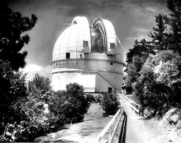 |
|
| (n.d.)#* - View of Mount Wilson's 100-inch Hooker Telescope dome in the early days. |
Historical Notes The Hooker 100-inch telescope is named after John D. Hooker, who provided the funds for the giant mirror. It was the largest telescope in the world from 1917 to 1948 when the 200-inch telescope was built on Palomar Mountain 90 miles to the southeast. |
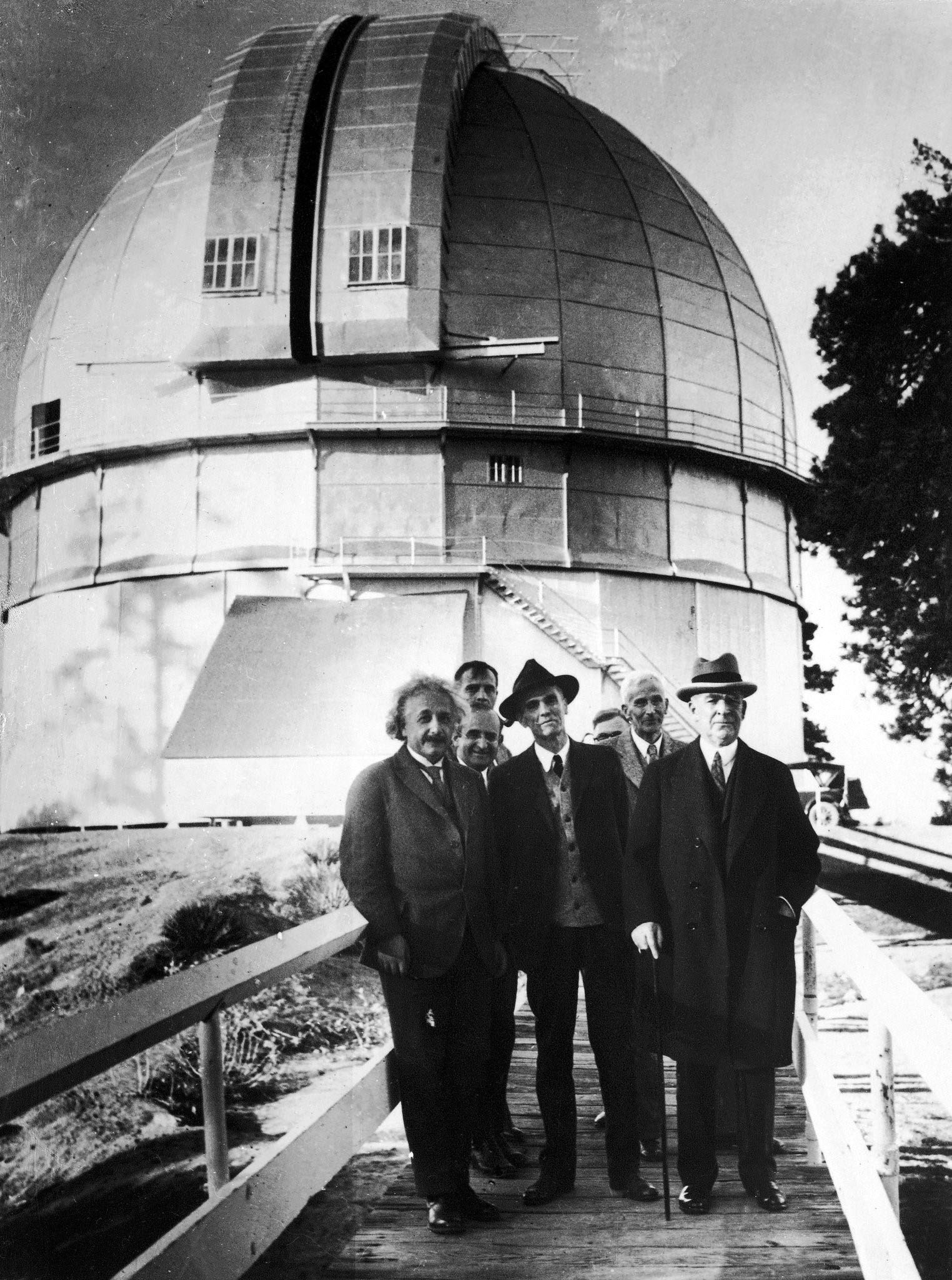 |
|
| (1931)* - Albert Einstein, left, and Edwin Hubble, second from left, pose for the camera on the bridge leading to the Mount Wilson 100-inch Hooker Telescope dome. |
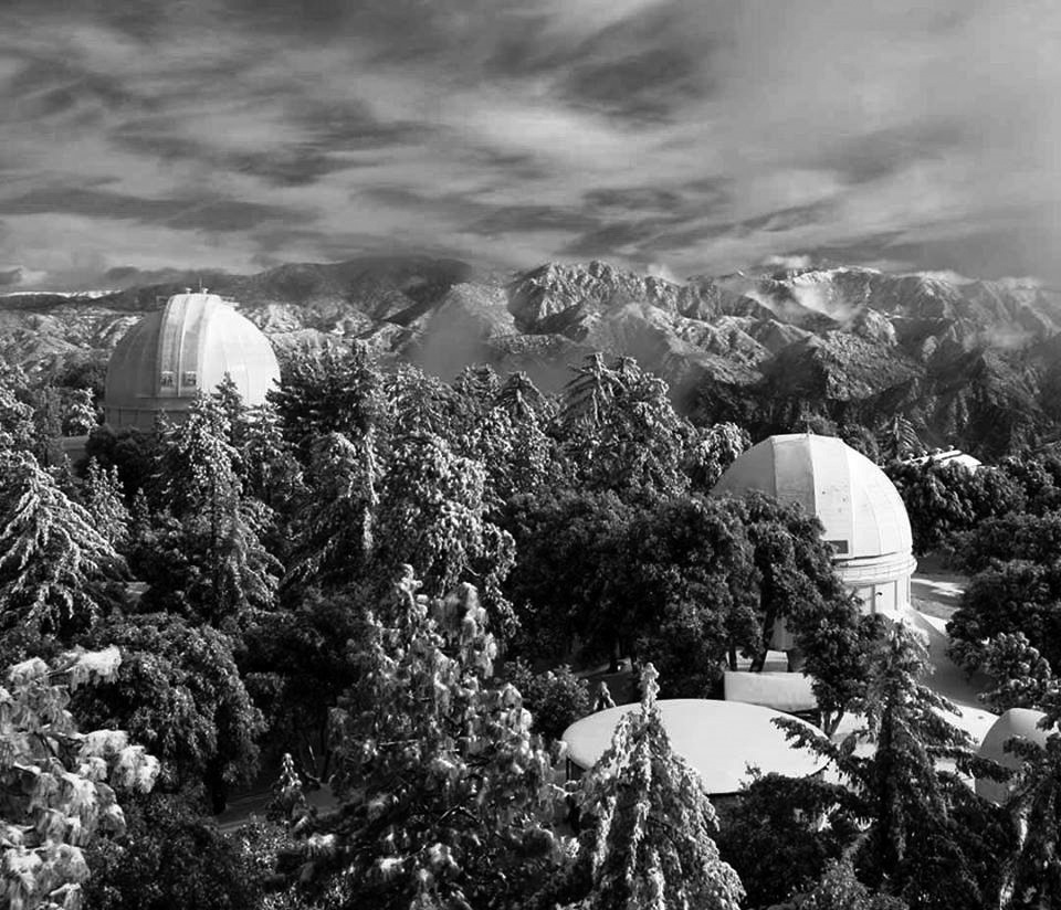 |
|
| (n.d.)* - Contemporary winter view of Mt. Wilson looking east; dome of 100" Hooker Telescope is at left, 60" at right; taken from the 150' Solar Telescope. |
 |
|
| (2015)* – View showing the 150-foot Solar Telescope at Mt. Wilson. Photo by Roger Klemm |
Historical Notes The horizontal Snow solar observatory was built on Mount Wilson in 1904. It was soon found that heat radiation was disrupting observations. Almost as soon as the Snow Observatory opened, plans were started for a 60-foot-tall tower that opened in 1908 followed by a 150-foot tower in 1912. The 60-foot tower is currently used to study helioseismology, while the 150-foot tower is active in UCLA's Solar Cycle Program.*^ |
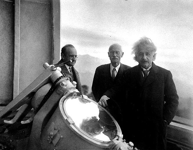 |
|
| (1931)* - Albert Einstein at the top of the 150-foot Solar Telescope, Mount Wilson, with solar physicist Charles St. John (middle) and mathematician Walther Mayer (left). |
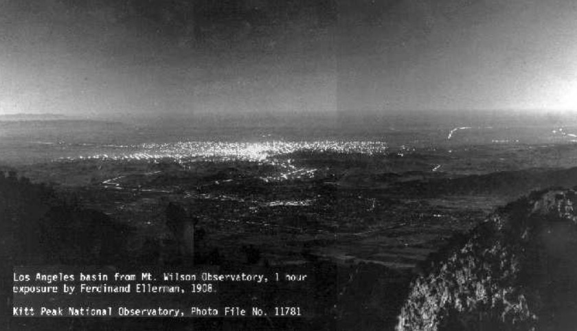 |
|
| (1908)^^^^* - Panoramic view showing Pasadena and Los Angeles as seen from Mount Wilson (elevation of 5000’) showing some of the main streets and roads which exists today and an extensive view of outdoor electric lights. The brightest lights are in downtown Los Angeles, some 20 miles distant. |
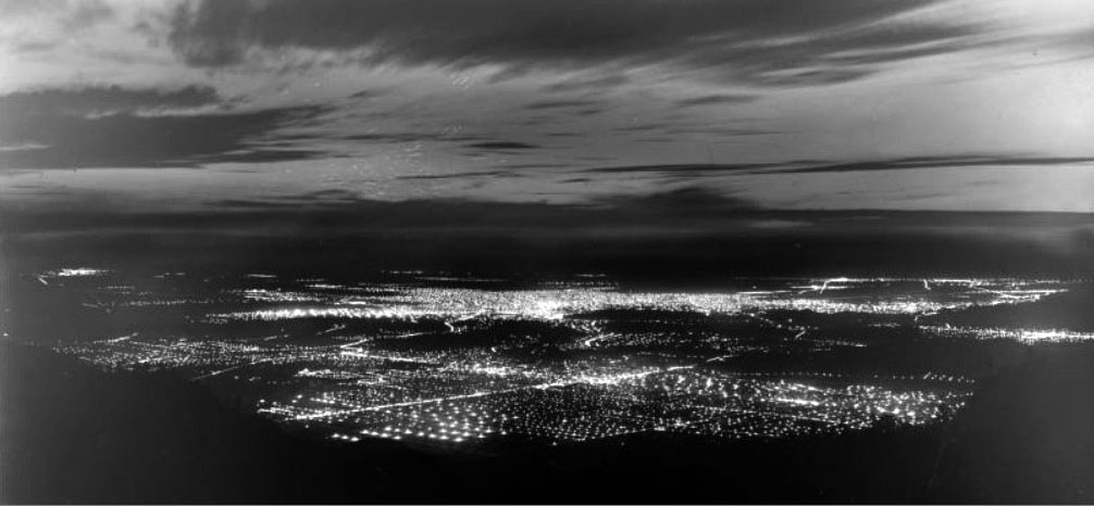 |
|
| (1918)#* - View from Mt. Wilson from approximately the same location as the 1908 photo. The intersection of Lake Avenue and Colorado Boulevard in the City of Pasadena in the foreground, with the Los Angeles Civic Center area in the middle of the photograph. |
Historical Notes Over the years, the increasing light pollution due to the growth of greater Los Angeles has limited the ability of the observatory to engage in deep space astronomy, but it remains a productive center, with many new and old instruments in use for astronomical research. |
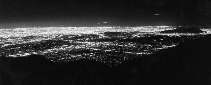 |
|
| (1988)^^^^* - View from Mt. Wilson from approximately the same location as previous photos. This was a 15-second exposure showing the dramatic growth of outdoor lighting throughout the greater Los Angeles basin. Click HERE to see more in Early Streetlights. |
Historical Notes In 1928, George Ellery Hale secured a grant of six million dollars from the International Education Board, a funding agency endowed by the Rockefeller Foundation, for "the construction of an observatory, including a 200-inch reflecting telescope... and all other expenses incurred in making the observatory ready for use." The 5,600-ft tall Palomar Mountain, located 100 miles south of Pasadena, was selected as the site of the new observatory. Construction of the observatory facilities and dome started in 1936, but because of interruptions caused by World War II, the telescope was not completed until 1948 when it was dedicated. Due to slight distortions of images, corrections were made to the telescope throughout 1949. It became available for research in 1950. Unlike the Mt. Wilson observatories, which are operated by the Carnegie Institution, the 200-inch is administered by the California Institute of Technology (Caltech). |
Mt. Wilson Toll Road
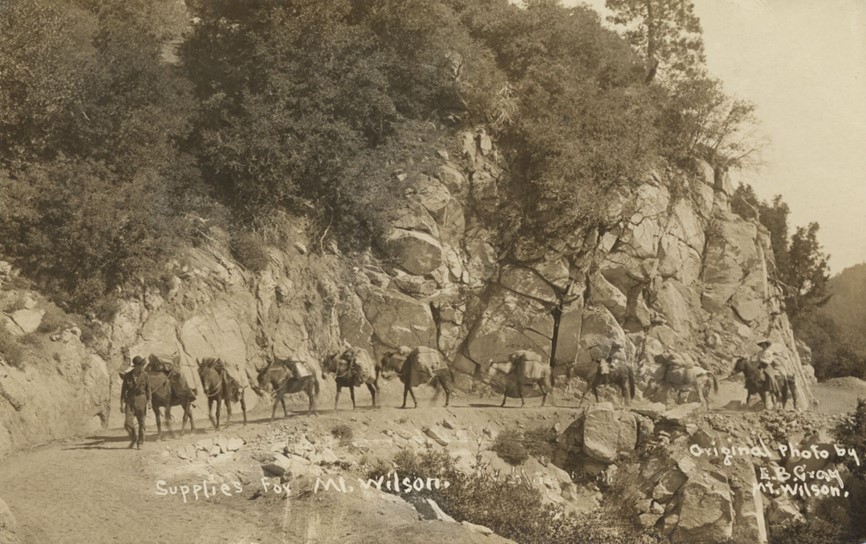 |
|
| (1904)* - A pack train carrying supplies on the road to the observatory at the summit of Mount Wilson. Photo by E.B. Gray |
Historical Notes The installation of the Harvard telescope in 1889, which brought its own problems of transporting the instrument up the old Wilson trail, caused an interest in a Mt. Wilson roadway. In June 1889, Judge Benjamin Eaton gathered a group of prominent Pasadena businessmen to consider building a wagon road to Mt. Wilson. There were eighteen men who agreed to contribute capital and on July 12, 1889, they incorporated "The Pasadena and Mount Wilson Toll Road Company." However, the company failed before there was any progress on a roadway. Within a couple of years five of the original investors reorganized and refinanced the project, but since the Harvard telescope had been removed, and interest in Mt. Wilson had tailed off, they thought it better to downsize the project from a twelve foot road to a four foot road. By June 1891, after only five months work, a usable ten mile trail was established. |
.jpg) |
|
| (1915)* - View showing the Mt. Wilson Toll House, located near the intersection of East Altadena Drive and Mendocino Lane with the Toll Road seen in the background. |
Historical Notes The road was built in 1891 by the Pasadena and Mount Wilson Toll Road Company to provide access to the newly installed Harvard telescope and observatory on the summit of Mt. Wilson. The original road was 10 miles long and 4 feet wide, but was later expanded to 6 feet wide to accommodate increased foot and pack animal traffic. The toll road allowed vehicles, hikers, and pack animals to reach the top of Mt. Wilson, which had previously only been accessible via a more difficult trail. The road was used to transport equipment and materials for the construction of the Mount Wilson Observatory, including the 100-inch telescope mirror in 1917. |
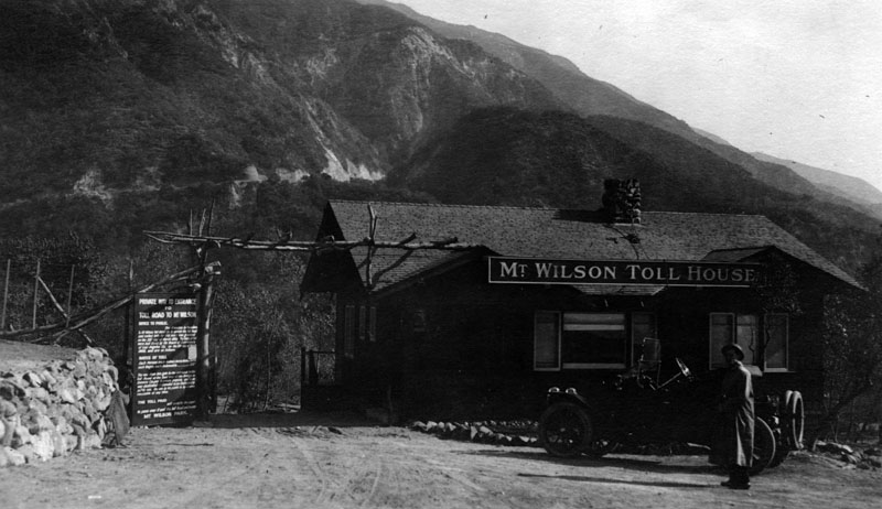 |
|
| (ca. 1917)* - Close-up view of the Mt. Wilson Toll House. Sign on left reads, "Private way to entrance to toll road to Mount Wilson." |
Historical Notes In July, 1891 the new toll road was officially opened to the public and the toll fixed by the Los Angeles County Board of Supervisors at 25 cents for hikers and 50 cents for horseback. The new road was called the "New Mt. Wilson Trail", and it soon became more popular than the old Sierra Madre trail. Foot and pack animal traffic became so heavy that in June 1893 the trail was widened to six feet, making two way travel much easier. |
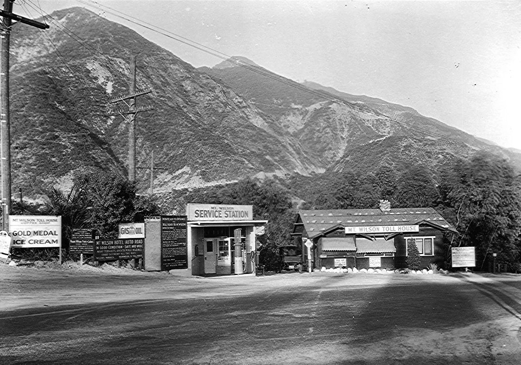 |
|
| (ca. 1920)* - View showing the Mount Wilson Toll Road, Toll House and Service Station. The Toll Road rises at rear. |
Historical Notes The Mount Wilson Toll Road ascended Mount Wilson via a vehicular passable road from the base of the foothills in Altadena. It was accessible from Pasadena via Santa Anita Avenue (nowadays the north-south portion of Altadena Drive) which drove right to the front porch of the toll house.*^ When the Toll Road closed in 1936, the first 1/2 mile was sold off as residential lots and the entrance to the road moved to its present location on Pinecrest Drive. |
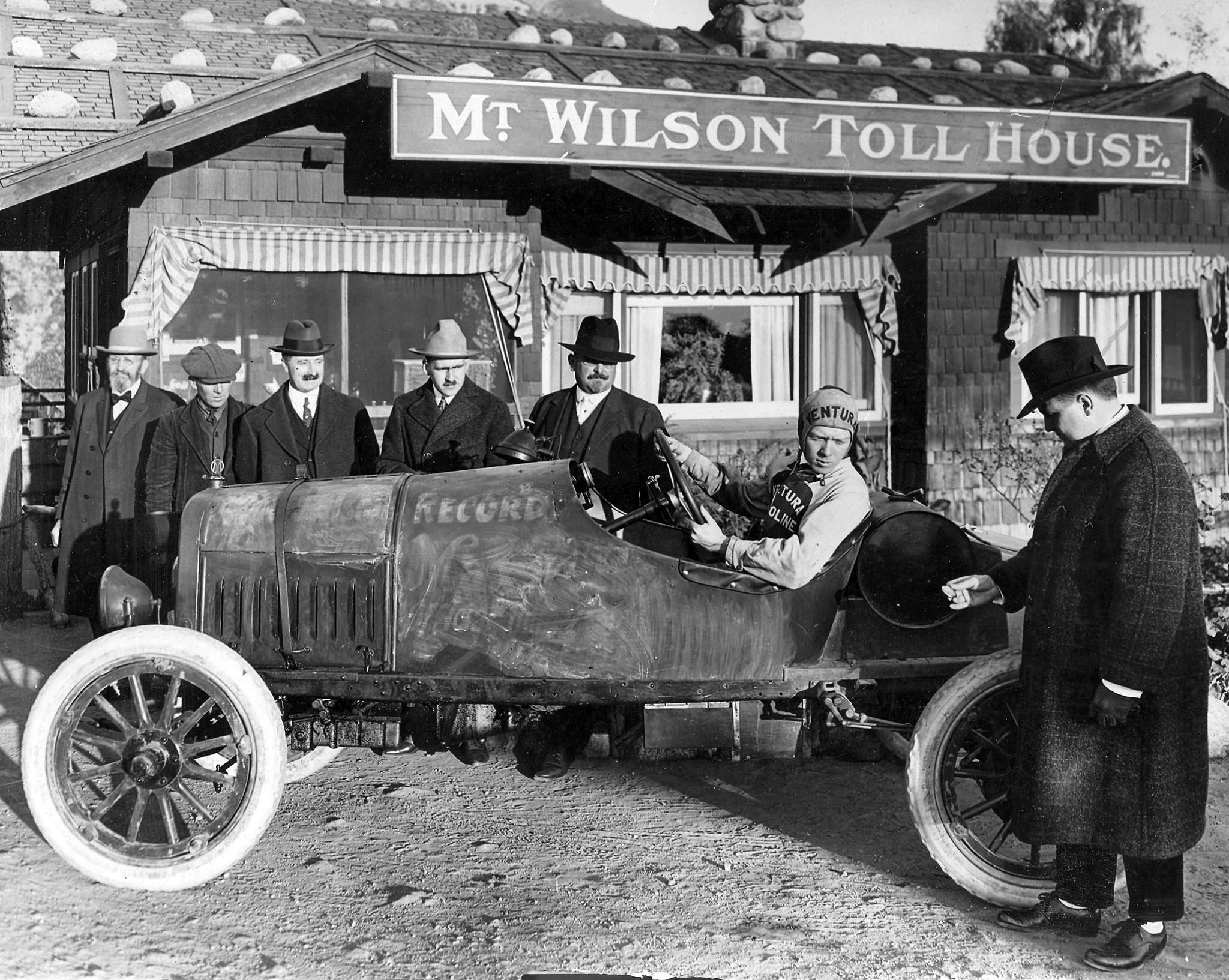 |
|
| (ca. 1915)++# - View showing a 1915 Maxwell about to make an ascent on Mt. Wilson Toll Road with the Toll House at rear. Note the man holding the watch, presumably to time round trip. |
Historical Notes The Maxwell was a brand of automobiles manufactured in the United States from about 1904 to 1925. By 1914 the company sold 60,000 cars. They became known for their speed from some racing contests. The present-day successor to the Maxwell Company is Chrysler Group. |
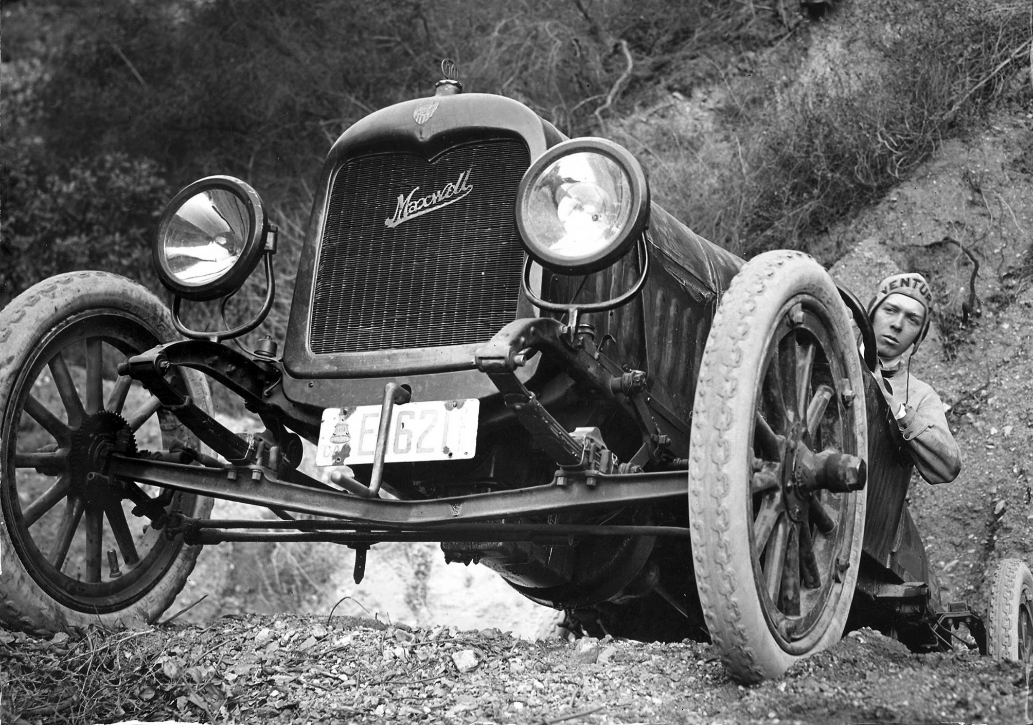 |
|
| ca. 1915)++# - A view of the Maxwell during its ascent on the Toll Road. |
 |
|
| (1918)* - A tourist bus on the road up Mount Wilson in Los Angeles County. |
Historical Notes By the early 1930s a new high speed highway was being built from La Cañada via the Arroyo Seco. The new Angeles Crest Highway was paved and ready for travel into Red Box Canyon and onward to Mt. Wilson from the back side by 1935. The historic Mt. Wilson Toll Road closed to the public in March, 1936 and was turned over to the United States Forest Service. Today, the Old Mt. Wilson Toll Road is still accessible to non-motorized traffic (hikers, bicyclists, and horses) by way of Eaton Canyon (either from the Nature Center entrance, or an access gate on Pinecrest Drive, just off Altadena Drive in Altadena). Segments of it have been closed at various times due to landslides. A 2005 landslide destroyed 50 yards of the road, but it has since been rebuilt and reopened. |
* * * * * |
Mount Wilson Hotel
 |
|
| (1910s)* - View across clouds to mountains from Mount Wilson with the first Mount Wilson Hotel seen at lower right. Photo by Bob Plunkett |
Historical Notes The Mt. Wilson Hotel was a popular resort in the early 20th century, located near the Mt. Wilson Observatory which was undergoing major improvements at the time. The hotel was frequently taxed to its limits, with 50 men having to stay up all night in the dining room at one point in 1907. |
 |
|
| (ca. 1920s)* - Postcard view showing the Mount Wilson Stage Line outside Mount Wilson Hotel. In background stands one of the solar towers. |
Historical Notes When the automobile craze surged in the 1920s, families were finally able to reach the summit on four wheels. Driving up the harrowing Mountain Wilson toll road, which was open to the public from 1912 to 1936, deposited weekend adventures at the doorstep of the Mount Wilson Hotel. Rebuilt after burning down in 1913, the hotel, complete with a dining room and swimming pool, was a popular lodging for Southern Californians. |
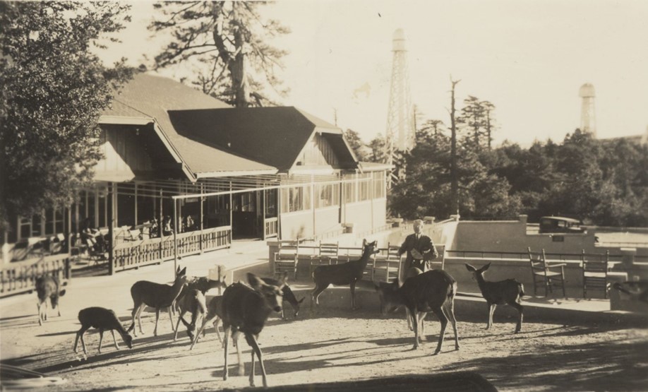 |
|
| (1941)* – Postcard view showing a man feeding deer at the Mt. Wilson Hotel. In the background can be seen two solar towers of the Mt. Wilson Observatory. |
Historical Notes The hotel faced recurring challenges over the years, including wildfires, cottage fires, and battles over control of the surrounding land with operators like Charles Chantry and the McNallys of the Orchard Camp. The landmark hotel would be torn down in 1966. |
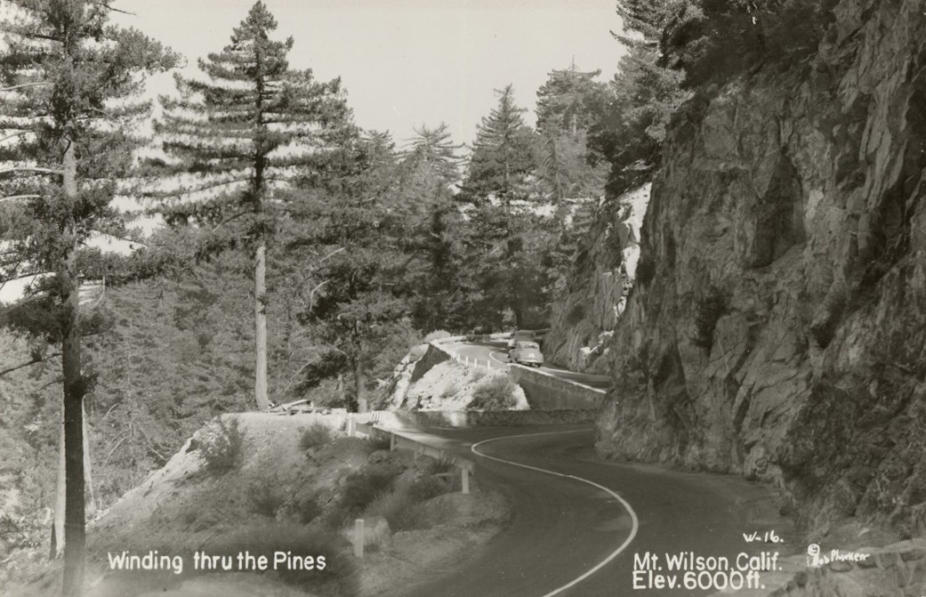 |
|
| (1940s)* – Postcard view showing cars on the winding road up to Mt. Wilson. Photo by Bob Plunkett |
Historical Notes The road up to Mount Wilson today is known as the Mount Wilson Red Box Road, and it provides access to the Mount Wilson Observatory and other facilities at the summit. The road starts from the Angeles Crest Highway and is 4.7 miles long, with an elevation gain of 1027 feet. The average gradient of the road is 4.14%, making it a challenging and scenic drive. |
Angeles Crest Highway
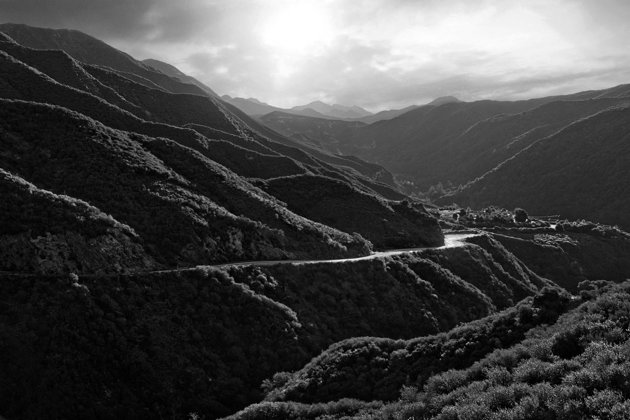 |
|
| (n.d.)* – View looking down at Angeles Crest Highway as it winds its way through the scenic Angeles National Forest. |
Historical Notes Engineer J. B. Lippincott surveyed the highway for the Automobile Club of Southern California in 1919. This is the same Lippincott that surveyed the Los Angeles Aqueduct for William Mulholland. When finished, the scenic byway would ascend up and wind its way through 66 miles of the Angeles National Forest, through chaparral, and montane forest habitats, along the highest and most scenic ridges of the San Gabriel mountain range. |
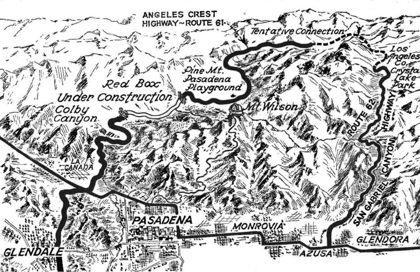 |
|
| (1934)*#* - The Angeles Crest Highway was meant to connect with the San Gabriel Canyon Road to create a scenic loop. The loop was eventually completed but was severed by a landslide in 1978. |
Historical Notes The concept for "the most scenic and picturesque mountain road in the state" was developed in 1912, and the funding allocated beginning in 1919. The construction, piece by piece, started in 1929 and continued until 1956, with the exception of the years 1941 through 1946 during WWII. * |
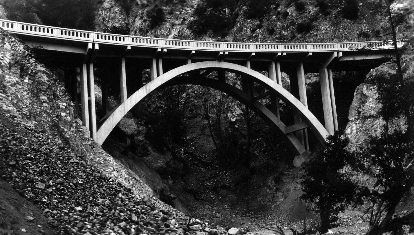 |
|
| (1931)#++ - Postcard view showing the Slide Canyon Bridge just after its construction. It would take another 15 years to complete the entire 66 miles of the Angeles Crest Highway. |
Historical Notes Where nature failed to provide a way, workers created one, blasting roadcuts into granite and erecting bridges over drainages. Some cuts are as deep as 240 feet. |
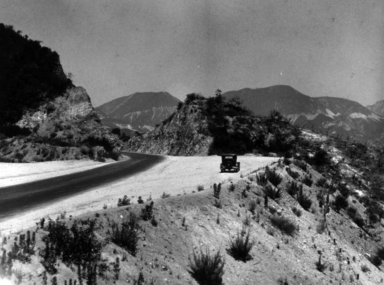 |
|
| (1934)* - The Angeles Crest Highway includes several scenic turnouts as it climbs the Arroyo Seco drainage toward Red Box. |
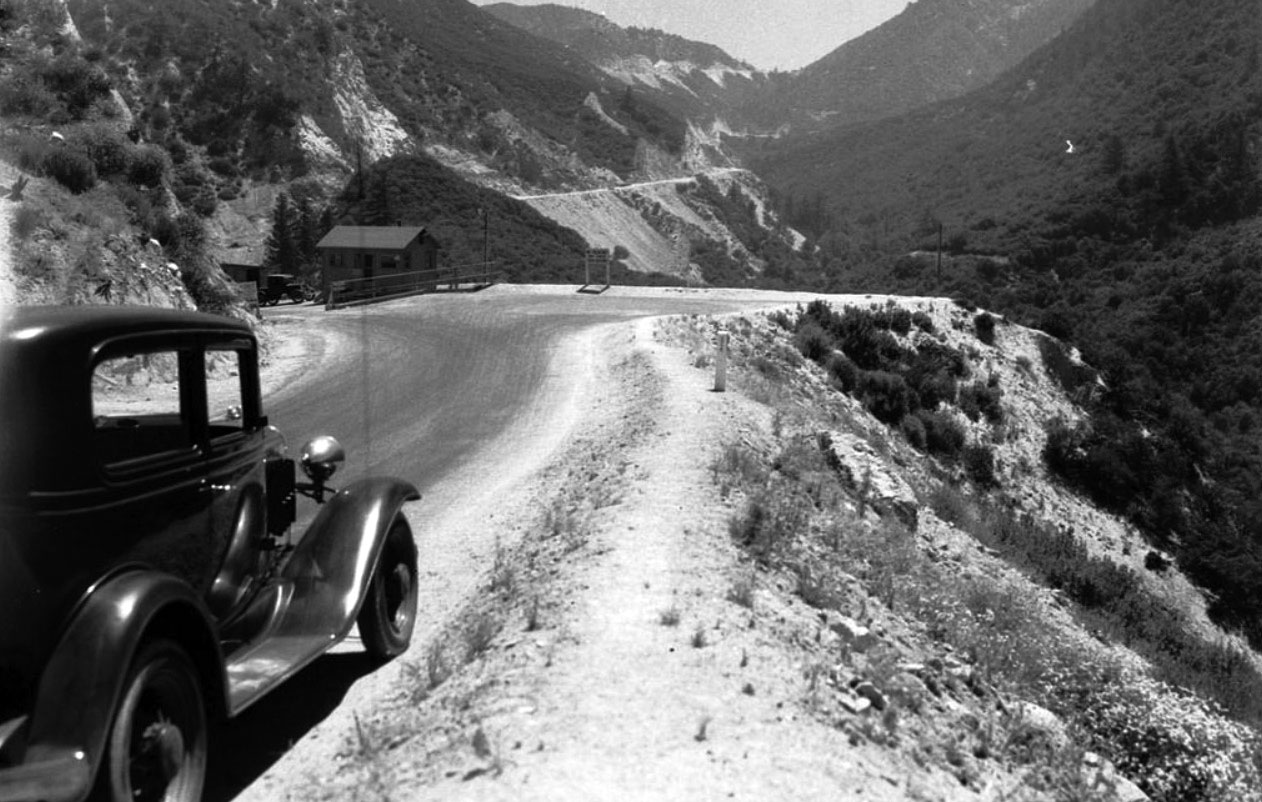 |
|
| (1934)*#* – View showing the Angeles Crest Highway between Colby Canyon and Red Box. Photo courtesy of the Automobile Club of Southern Calfiornia Archives. |
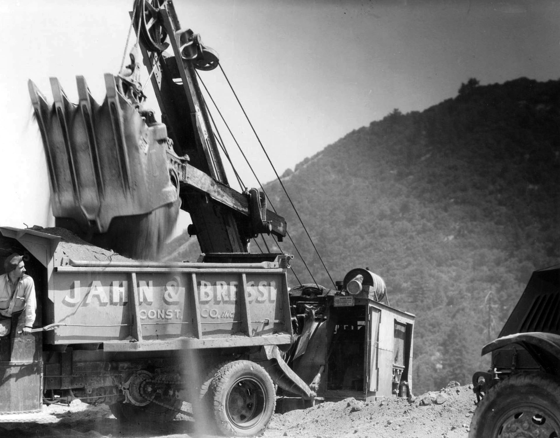 |
|
| (n.d.)^ - Convicts were an essential part of the Angeles Crest Highway construction workforce, but private contractors performed heavy lifting, too. |
Historical Notes Construction of Angeles Crest Highway began in 1929. It was originally intended to be a fire access road. In 1941 construction stopped because of World War II. In 1946, after the war, construction resumed; the completed highway eventually opened in 1956. The road was constructed by prison labor from Camp 37, which has since been razed. Division of Highways (now known as CalTrans) staff lived at a site called Cedar Springs. The staff is now located at Chilao Flats. Children of the staff attended Chilao Mountain School, a one-room school; the school has been closed for several years. |
Angeles Crest Tunnels
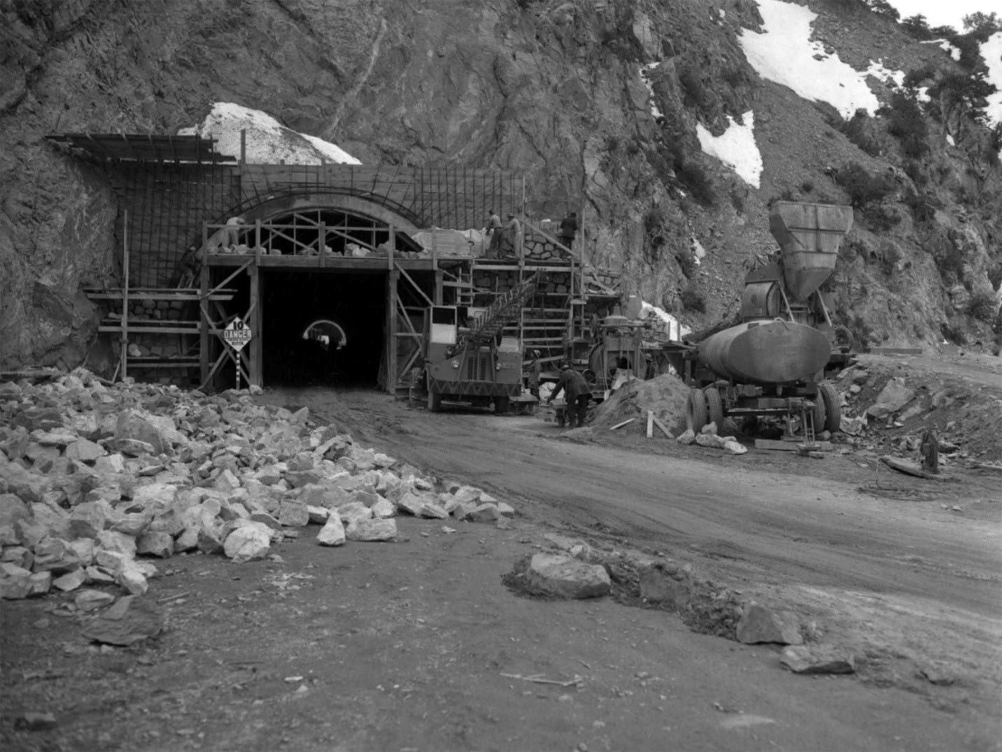 |
|
| (1949)* – View showing the construction work on two highway tunnels, measuring 680 and 470 feet in length, in the San Gabriel Mountains high country, a short distance east of Cedar Springs. Los Angeles Times Photo Archive, UCLA Library. |
Historical Notes In the high country near Islip Saddle, the highway tunnels twice through the mountainside. It achieves its highest elevation, 7,901 feet, at Dawson Saddle. |
 |
|
| (2009)* – Contemporary view of the Angeles Crest Tunnels. |
Then and Now
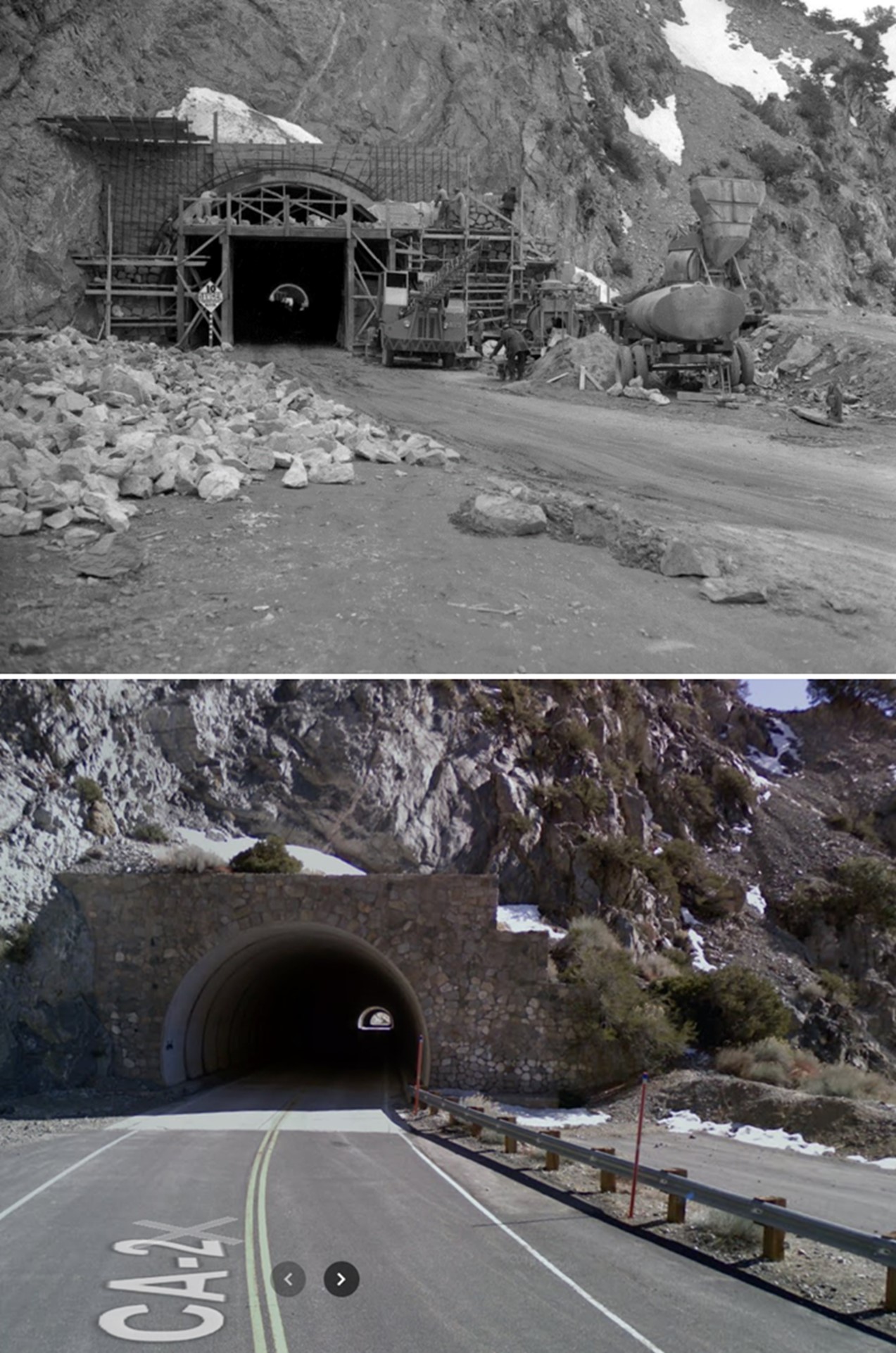 |
|
| (1949 - 2009)* – Angeles Crest Highway (SR-2) in the high country near Islip Saddle, where the highway tunnels twice through the mountainside. The tunnels measure 680 and 470 feet in length and are located a short distance east of Cedar Springs at an elevation of 6680 feet. |
 |
|
| (2018) – After completing a long hike in the San Gabriel Mountains and finding ourselves a couple of miles from our original starting point, we head through the Angeles Crest Tunnels in search of our car. Photo by Jack Feldman |
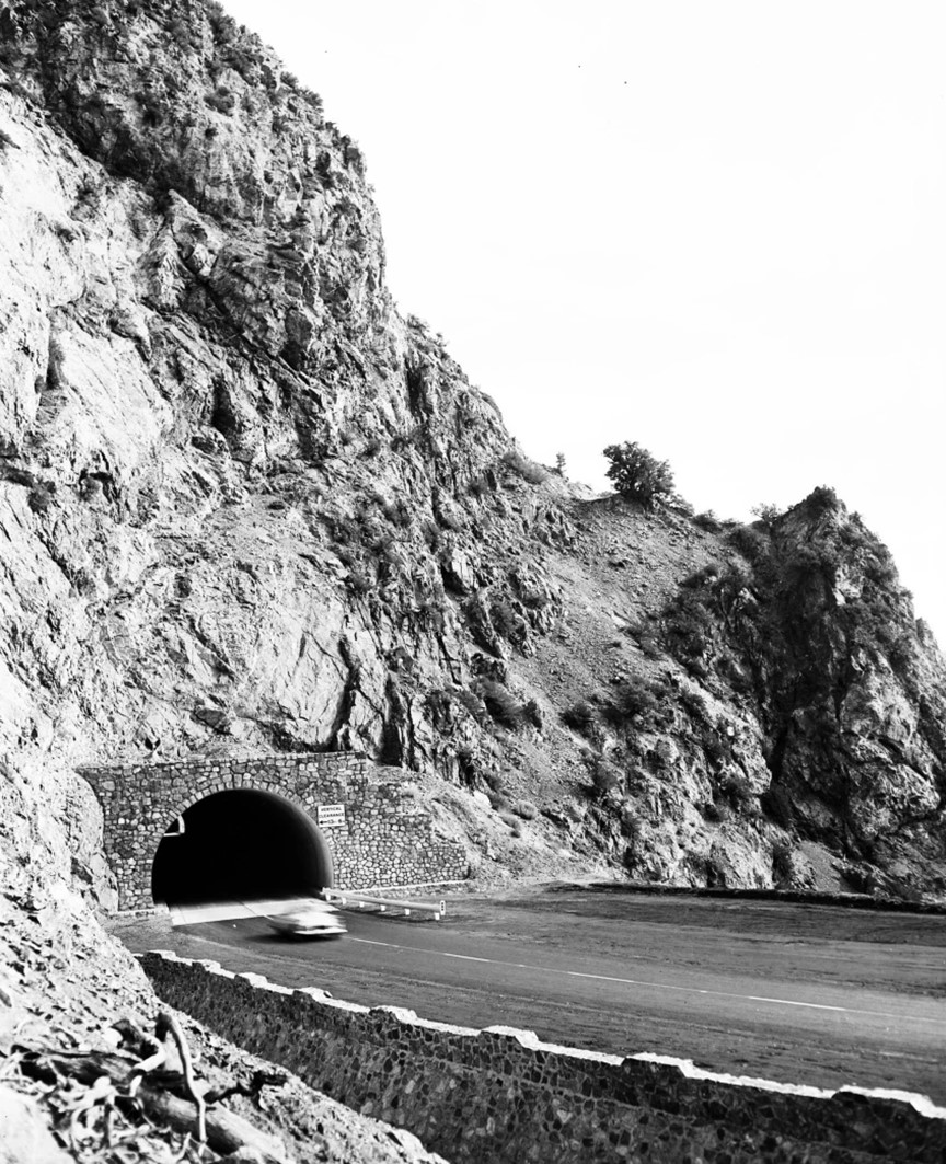 |
|
| (1956)^ – A car passes through one of the tunnels of Angeles Crest Highway. Los Angeles Examiner Collection |
Historical Notes Angeles Crest Highway was originally planned to be upgraded to a freeway in the 1950s, but was later considered geographically improbable and the plans were abandoned. |
 |
|
| (1956)* - Angeles Crest Hwy (CA-2) at Angeles Forest Hwy turnoff. View is looking north. |
 |
|
| (1959)^ – Snow on Angeles Crest Highway. The road crosses a remote backcountry once accessible only by a trip of several days on foot or horseback. |
Historical Notes The highway forever changed the Angeles National Forest. Almost immediately after the first segment opened, automotive visitors flooded trail resorts like Switzer’s or forested hideaways like Chilao previously accessible only by foot or horseback. In the 18 months between July 1932 and Dec. 1933, nearly 2.5 million people visited the Angeles National Forest – more than all visitors to California’s national parks combined. As construction extended the road toward Big Pines (which it finally reached in 1956), Civilian Conservation Corps (CCC) campgrounds drew even more visitors deep into the San Gabriels’ remote backcountry. Today, a motorist can traverse 66 miles of some of the most difficult terrain in the U.S. in under two hours, through country that once provoked complaints from no less a mountaineer than John Muir. “In the mountains of San Gabriel,” Muir wrote, “Mother Nature is most ruggedly, thornily savage.”* |
* * * * * |
Gamble House |
The Gamble House in Pasadena is widely considered the finest example of American Arts and Crafts architecture. Designed in 1908 by architects Charles and Henry Greene of Greene and Greene, the home was built for David and Mary Gamble of the Procter and Gamble Company as a winter residence. Completed in 1909, it reflects an extraordinary level of craftsmanship, where architecture, furniture, lighting, and decorative details were conceived as one unified work.Set on a private street overlooking the Arroyo Seco, the house blends structure, landscape, and interior design into a seamless composition. Natural materials, careful proportions, and handcrafted elements give the house a warmth and quiet dignity that continues to define its reputation today. It stands as a National Historic Landmark and one of the most celebrated homes in Los Angeles County. |
 |
|
| (ca. 1909)* - The completed Gamble House at 4 Westmoreland Place near the Arroyo Seco. |
Historical Notes Completed in 1909, the Gamble House represents the highest expression of the American Arts and Crafts movement in Southern California. Designed by Charles and Henry Greene, the residence reflects a unified vision in which structure, materials, furnishings, and decorative details were conceived as a whole. Set on Westmoreland Place overlooking the Arroyo Seco, the house blends architecture and landscape through deep overhangs, broad terraces, and carefully chosen natural materials. Its horizontal lines and handcrafted detailing establish it as one of the most important residential designs of the early twentieth century. |
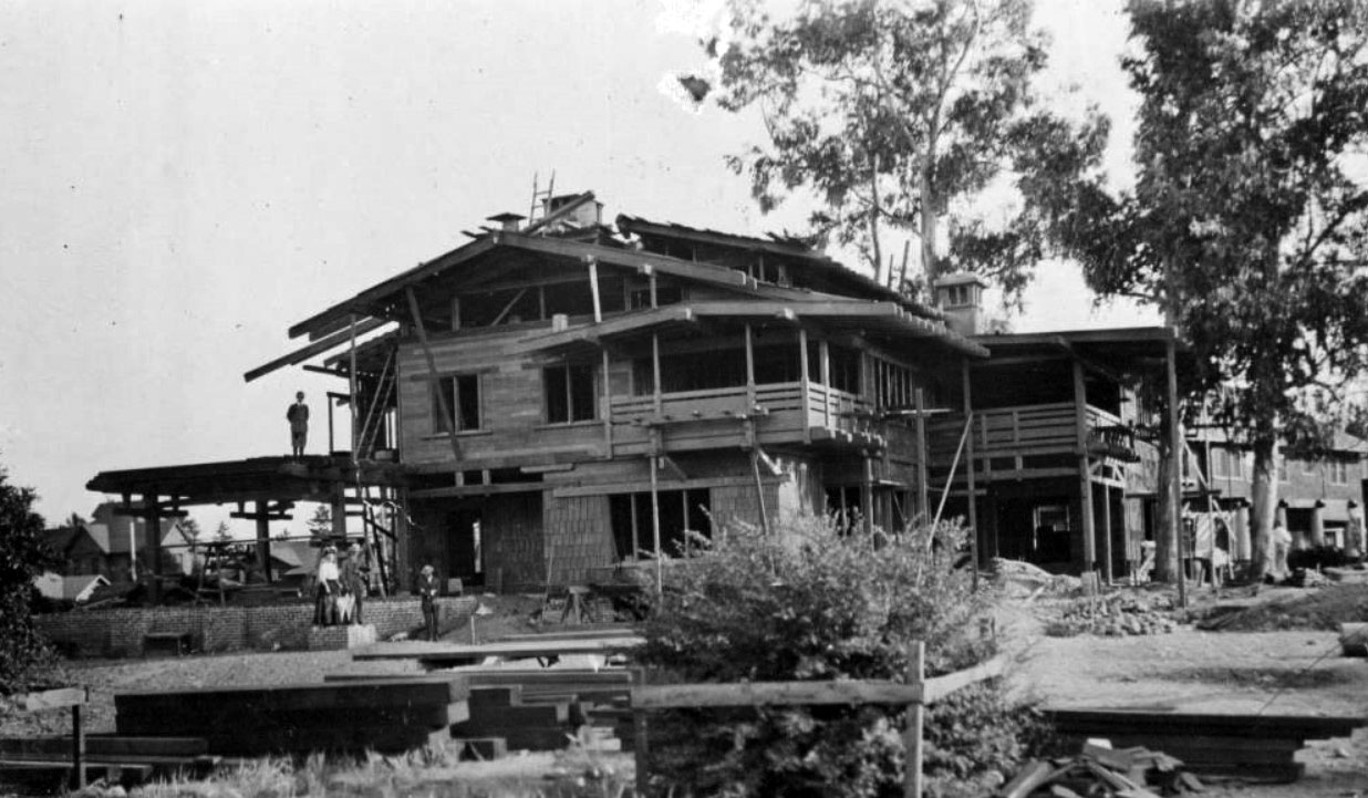 |
|
| (ca. 1909)* - Construction of the Gamble House at Westmoreland Place in Pasadena. |
Historical Notes The Gamble House was commissioned in 1908 by David Berry Gamble and his wife Mary Huggins Gamble of Cincinnati, Ohio. David Gamble, a second generation member of the Procter and Gamble Company, had retired in 1895. After spending several winters in Pasadena, the couple decided in 1907 to build a permanent seasonal residence. In June 1907, they purchased a lot on the short and private Westmoreland Place, choosing it over the more fashionable South Orange Grove Avenue, then known as Millionaires Row. Construction began soon after, with the Greene brothers closely supervising the work to ensure exceptional craftsmanship in every detail. |
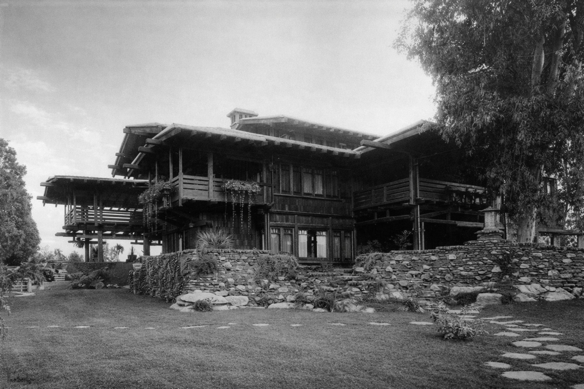 |
|
| (1947)* – View of the Gamble House showing the broad terrace and landscaped grounds. |
Historical Notes David and Mary Gamble lived in the house until their deaths in 1923 and 1929. After the death of Mary’s sister Julia in 1944, Cecil Huggins Gamble and his wife Louise Gibbs Gamble moved into the home. At one point they considered selling it, but changed their minds when potential buyers discussed painting the original teak and mahogany woodwork white. Recognizing the architectural importance of the house, the Gamble family preserved it until 1966, when it was deeded to the City of Pasadena in partnership with the University of Southern California School of Architecture. This agreement ensured its long term protection and continued educational use. |
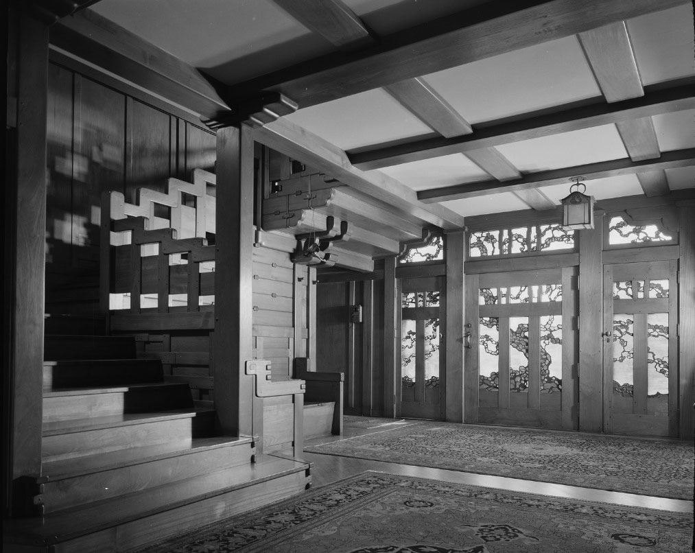 |
|
| (n.d.)* – Interior view of the Gamble House designed by Charles and Henry Greene. |
Historical Notes The interior showcases a masterful use of wood, including teak, maple, oak, Port Orford cedar, and mahogany. These woods are arranged in sequences that highlight differences in color, tone, and grain. Nearly every visible element, from built in furniture to lighting fixtures and hardware, was custom designed to complement the architecture. Although the floor plan is organized around a central hall and follows a traditional layout, the low ceilings, deep overhangs, and filtered natural light create an intimate and harmonious atmosphere. The house was declared a National Historic Landmark in 1977, recognizing its national importance in American architectural history. |
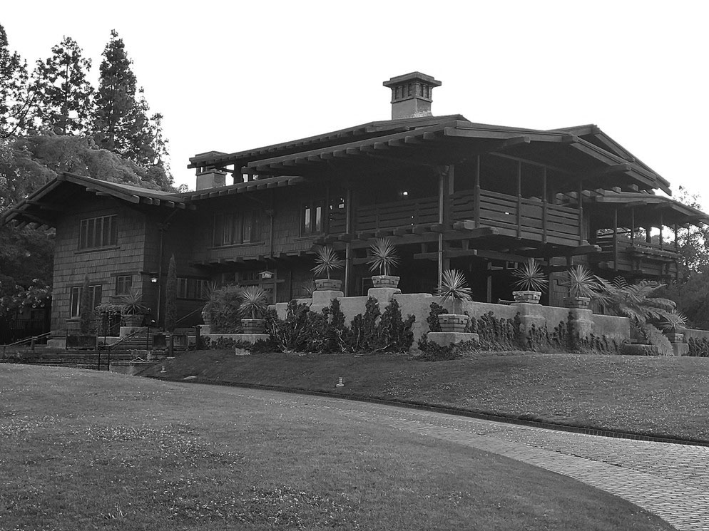 |
|
| (2021)* - The Gamble House at 4 Westmoreland Place in Pasadena. Photo by Celina Paternostro. |
Historical Notes Today, the Gamble House operates as a public museum offering guided tours. Each year, two fifth year architecture students from the University of Southern California are selected to live in the home as part of its stewardship program. In 2008, it was named one of the top ten houses in Los Angeles in a Los Angeles Times survey of architectural experts. The house also reached a wider audience in 1985 when it was used as the exterior of Dr. Emmett Brown’s home in the film Back to the Future, introducing its distinctive design to a new generation while reinforcing its place in Southern California cultural history. |
* * * * * |
Merritt Mansion |
Also known as Villa Merritt Ollivier |
The Hulett C. Merritt House is one of the grandest early twentieth century estates built along South Orange Grove Boulevard in Pasadena. Constructed between 1905 and 1908, the mansion reflected both the immense wealth of its owner and the prestige of what became known as Millionaires Row. With its commanding hilltop setting, formal grounds, and richly detailed interiors, the residence symbolized Pasadena’s rise as a winter haven for America’s industrial elite. Designed in an elaborate Mediterranean and Beaux Arts inspired style, the house combined European formality with the scale and craftsmanship expected of Pasadena’s most prominent residents. Over time, the estate evolved from a private mansion to a college landmark and today remains one of the most recognizable historic properties in the city. |
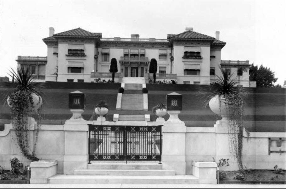 |
|
| (ca. 1916)* – Street view of the Hulett C. Merritt House at 99 Terrace Drive, Pasadena. The three story mansion rises above a four acre estate bounded by Terrace Drive, Olcott Place, and South Orange Grove Boulevard. |
Historical Notes The Hulett C. Merritt House was built between 1905 and 1908 at a reported cost of approximately 1.1 million dollars, an extraordinary sum for its time. The property occupied four acres in Pasadena’s most exclusive residential district along South Orange Grove Boulevard. Hulett C. Merritt made his fortune in the railway supply and steel industries, including large scale manufacturing interests in the Midwest. By the early twentieth century, he was regarded as one of Pasadena’s wealthiest and most influential citizens. The scale of the residence, its elevated position, and its carefully planned landscaping reflected the social prominence of its owner. South Orange Grove Boulevard became widely known as Millionaires Row, home to a number of substantial estates built by business leaders and industrialists who chose Pasadena as their winter residence. The estate was later referred to as Villa Merritt Ollivier. In the 1950s, the mansion appeared in the opening scenes of the television series The Millionaire, further increasing its public recognition. |
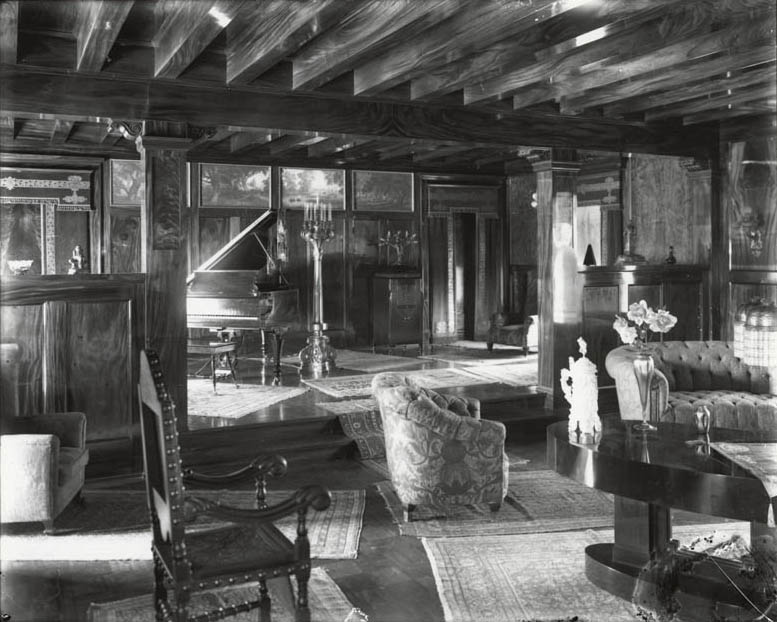 |
|
| (ca. 1915)* - Interior view of the Merritt residence showing a richly paneled family room with grand piano, decorative candelabra, hardwood floors, and exposed ceiling beams. |
Historical Notes The interior of the Merritt House displayed exceptional craftsmanship and attention to detail. Extensive wood paneling, substantial ceiling beams, and custom millwork gave the rooms both warmth and dignity. Large reception rooms were designed for formal entertaining, reflecting the social expectations of Pasadena’s upper class during this period. The balance of classical design and finely crafted materials created an atmosphere of refinement consistent with one of the city’s most prestigious estates. |
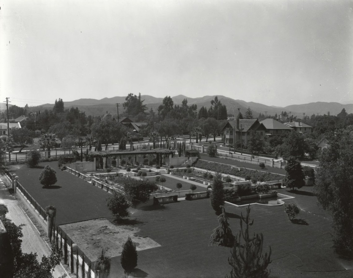 |
|
| (ca. 1915)* - Elevated view of the lawn and formal sunken garden at the Hulett C. Merritt residence, at the corner of Olcott Place and South Orange Grove Boulevard. Sprinklers water the expansive lawn, while fountains, a pergola, and low retaining walls define the geometric garden below. |
| Historical Notes
The grounds of the Merritt estate were carefully designed to complement the scale and formality of the mansion. The sunken garden, with its fountains, pergola, and symmetrical layout, reflected European landscape traditions adapted to Southern California’s climate. Large estates along South Orange Grove Boulevard were intended to impress both guests and passersby. Broad lawns, mature trees, and formal garden spaces reinforced the image of stability, wealth, and permanence. Decades later, when the property became part of Ambassador College, formal gardens continued to play a central role in the campus design. The preservation of landscaped spaces helped maintain the estate’s historic character even as its use changed. |
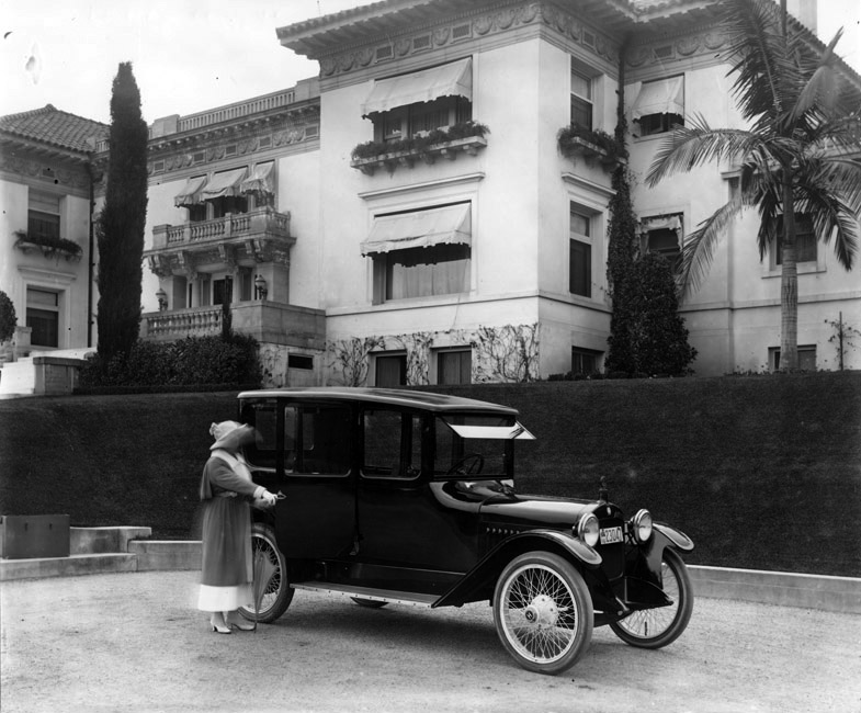 |
|
| (1921)* - Mrs. Merritt standing beside a 1921 Ford Model T center door sedan in front of the Merritt estate. |
Historical Notes This image captures the estate during the height of its residential use. By the early 1920s, the automobile had become both a practical necessity and a visible symbol of prosperity. The presence of a 1921 Ford Model T illustrates how even the wealthiest households embraced the rapidly changing technology of the era. Following Hulett C. Merritt’s death, the estate remained in family ownership until 1956. That year it was purchased by Herbert W. Armstrong, founder of Ambassador College, because the property adjoined the college campus. The mansion was renamed Ambassador Hall. Terrace Drive was closed, and the address was redesignated as 100 South Orange Grove Boulevard. In the 1960s, Ambassador College constructed two modern classroom buildings flanking the historic mansion. A formal Italian style garden and central plaza unified the three structures into a cohesive academic center. Ambassador College closed in 1997. After years of vacancy, the mansion and surrounding grounds were restored and are now operated as an event venue known as Ambassador Mansions and Gardens, preserving one of Pasadena’s most significant historic estates for continued public use. |
* * * * * |
Pasadena Post Office |
.jpg) |
|
| (1913)* - Postcard view depicting Pasadena's "new" Post Office located on the northwest corner of E. Colorado Boulevard and Garfield Avenue. The Post Office was built in 1913 and designed by architect, Oscar Wenderoth. |
Historical Notes The Post Office Building is still standing today. |
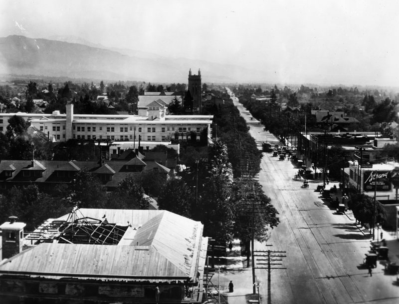 |
|
| (1917)* - Colorado Boulevard in Pasadena looking east from the Post Office. |
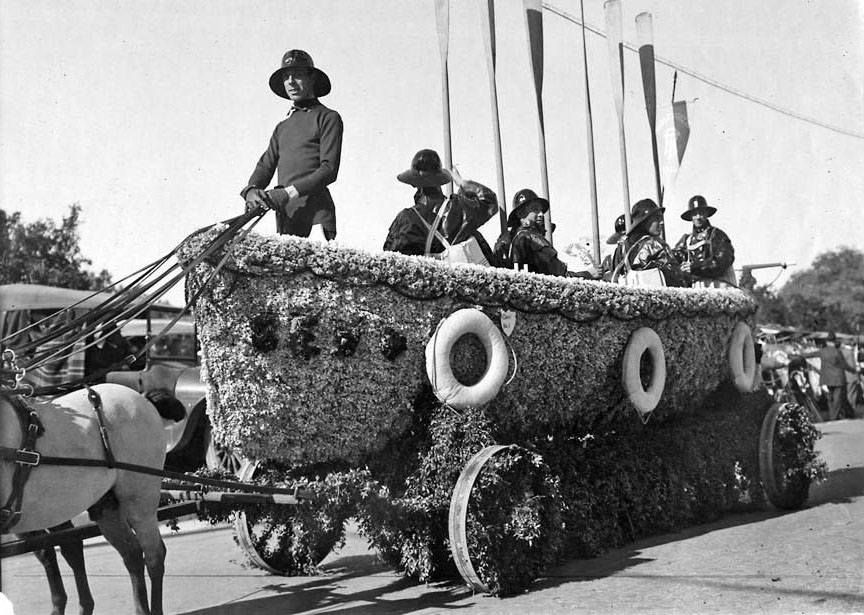 |
|
| (1918)^^* - The Adolphus Busch Estate float won first prize, class F, commercial float category in the Jan. 1, 1918 Rose Parade. First prize was a $50 silver trophy and blue banner. |
Huntington Hotel
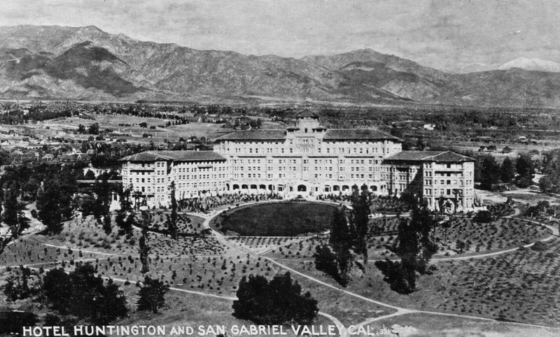 |
|
| (ca. 1910s)* - Postcard view of the Huntington Hotel in Pasadena, and the San Gabriel Valley behind it. |
Historical Notes The above view is that of the original hotel on the site, built in 1906 by General Wentworth, a Civil War veteran, and designed by Charles Frederick Whittlesey in Spanish Mission Revival-style. It opened in February 1907 as the Hotel Wentworth, but closed its doors after its first season. It was purchased by Henry E. Huntington in 1911 and reopened in 1914 as The Huntington Hotel after redesign by the architect Myron Hunt. The hotel remained under Huntington's management until 1918.*^ |
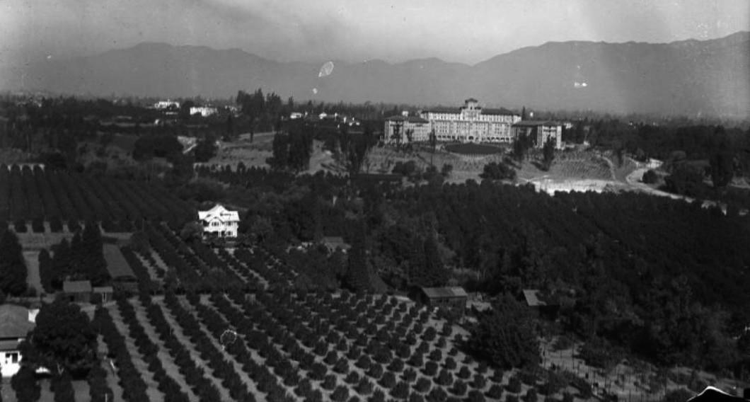 |
|
| (1913)#* - An aerial view of the front of the Huntington Hotel, at the corner of Oak Knoll and Wentworth, taken from a dirigible. In the foreground there are a few houses surrounded by extensive orchards, and the San Gabriel Mountains are in the background. |
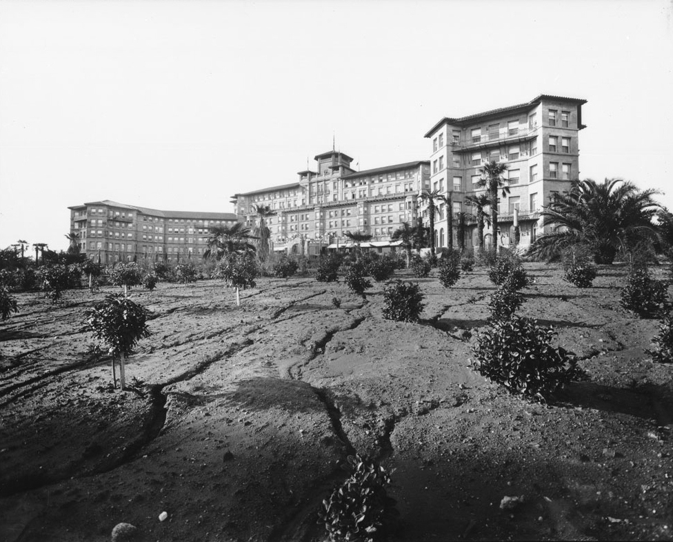 |
|
| (ca. 1917)**# - Exterior view of the rear of the Huntington Hotel in Pasadena, showing the newly landscaped gardens. |
Historical Notes The Huntington Hotel, a Mission style resort hotel "where the sunshine spends the winter", was designed by architects Myron Hunt and Charles Whittlesey and built from 1906 to 1916. The hotel is situated on 23 acres at the base of the San Gabriel Mountain foothills with 380 guestrooms, suites, and cottages.* |
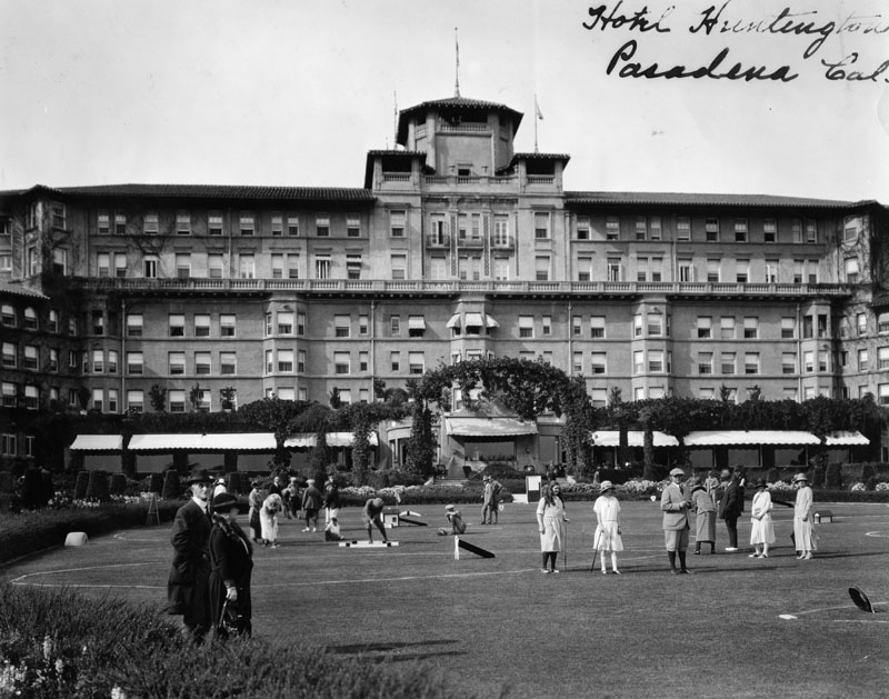 |
|
| (ca. 1920)* - Exterior view of the Huntington Hotel in Pasadena. Guests are playing on the famous obstacle golf course in front of the hotel. |
Historical Notes California's first outdoor Olympic-size swimming pool was added in 1926, when the hotel, formerly a winter resort, began opening year-round. The hotel was later owned by Stephen W. Royce, who sold it to the Sheraton Corporation in 1954. It was subsequently renamed The Huntington Sheraton.*^ |
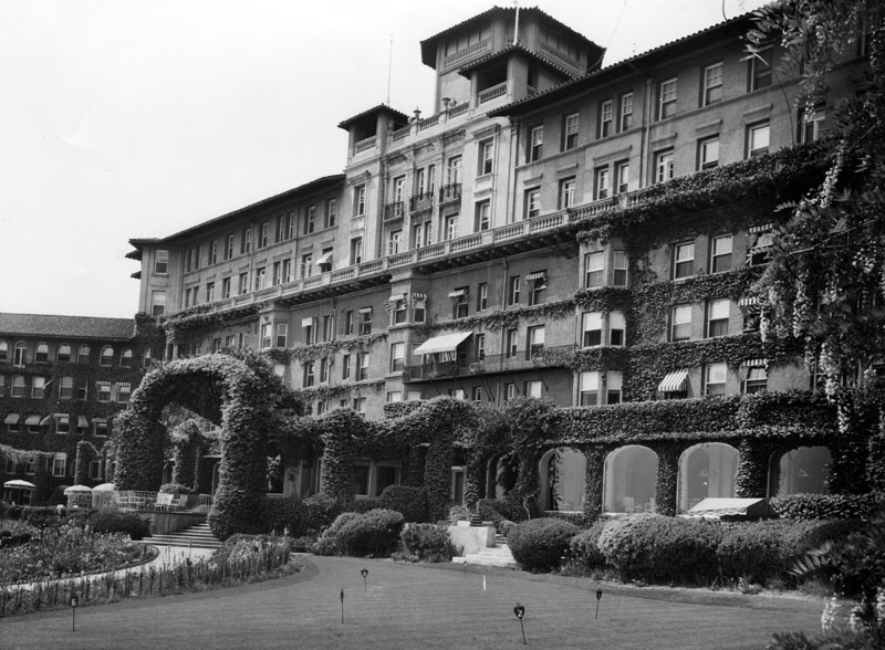 |
|
| (n.d.)* - Exterior view of the ivy-covered Huntington Hotel, located at 1401 S. Oak Knoll Avenue at Wentworth Avenue, in Pasadena. |
Historical Notes The Huntington Hotel became the Huntington Sheraton in the 1950s; it was restored to its turn-of-the-century grandeur by Ritz-Carlton in 1991, after languishing for several years due to earthquake damage.* |
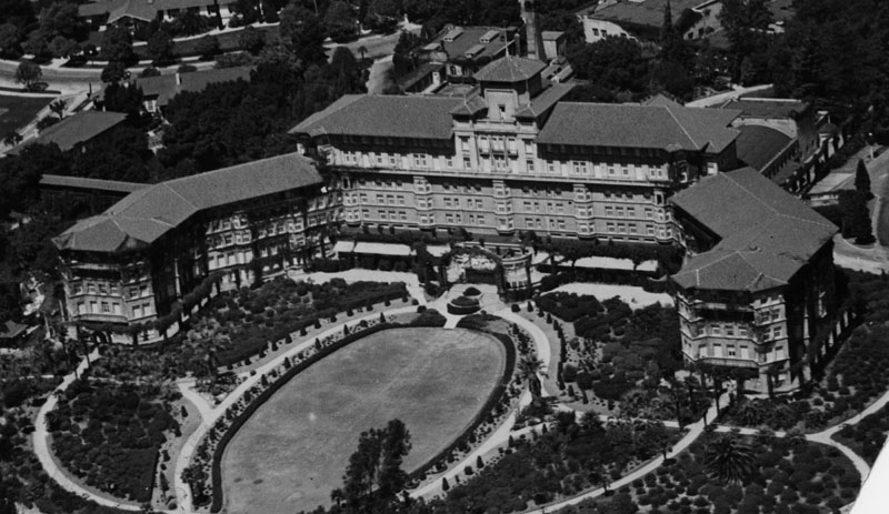 |
|
| (ca. 1920)* - Aerial view of the Huntington Hotel in Pasadena. View also shows the hotel's immense oval shaped lawn and the many roads in front of the building. |
Historical Notes The hotel closed in 1985 after the main building ceased to meet new earthquake codes, which had been changed due to the disastrous 1985 Mexico City earthquake. It sat vacant until it was demolished in 1989, though the bungalows remained in operation as a hotel.*^ |
 |
|
| (1930)++# – View showing the Hotel Huntington sign with cars passing at rear on Oak Knoll. |
 |
|
| (1948)##^^ - View from the lobby of the Huntington Hotel. Photo by Julius Shulman |
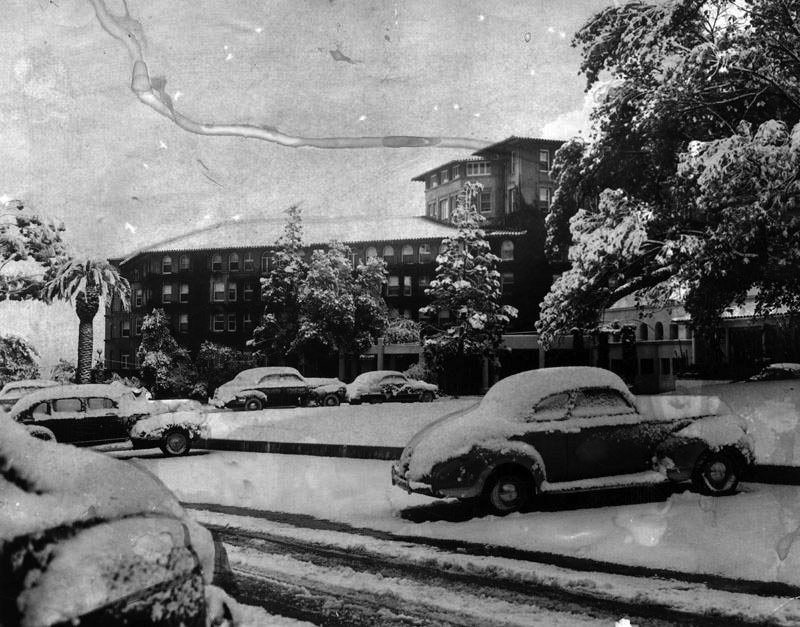 |
|
| (1949)++# - Dreaming of winter. The Huntington Hotel parking lot during the Great Snowstorm of January 1949. |
Historical Notes From Jan. 9 through 12, 1949, snow fell in Pasadena, Los Angeles and Southern California. In a Jan. 10, 1999, Los Angeles Times article, columnist Cecilia Rasmussen wrote: “On Jan. 10, 1949, in the middle of the worst housing shortage in Los Angeles history, more than half an inch of snow covered the Civic Center. The San Fernando Valley was pelted with the unfamiliar white stuff for three days, accumulating almost a foot. The Rose Bowl was transformed into “a dishpan full of milk,” by one account. An Alhambra hardware store put up a sign that said, “Snow Plows for Rent–Hurry!” A snowman appeared in Eagle Rock, wearing a sombrero, and the city of Reno, Nev., sent L.A. a snow shovel. In a semitropical climate where January sometimes feels like June, palm-lined boulevards were transformed into winter wonderlands. Altadena residents turned their evergreen-lined Christmas Tree Lane on snow-swaddled Santa Rosa Avenue into a miniature ski run, and golfers swapped nine irons for snow skis…" ^^* |
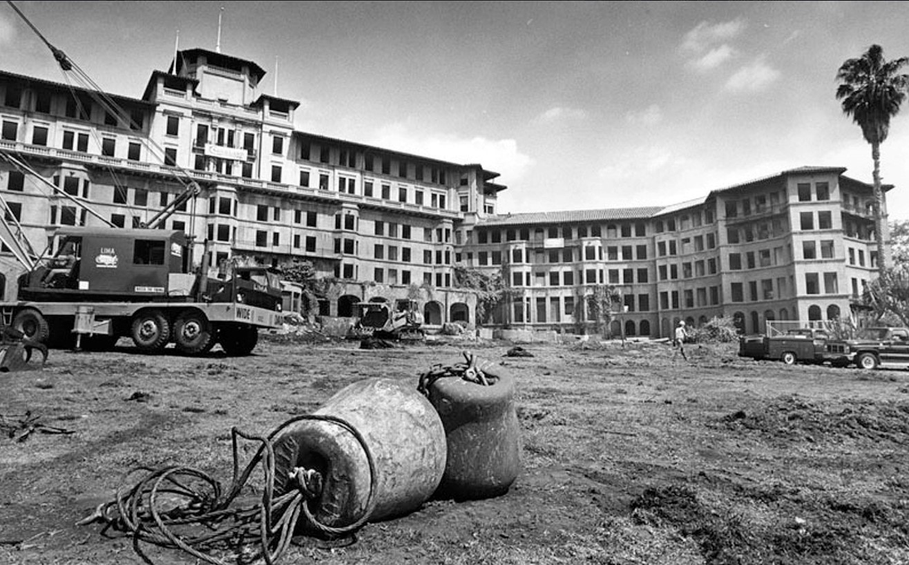 |
|
| (1989)* - View of Pasadena's Huntington Hotel shortly before its demolition. It shared the same architect as the Ambassador Hotel: Myron Hunt. Photo by Mike Mullen |
Historical Notes A new building, almost exactly replicating the original, opened in March 1991 as the 383-room Ritz-Carlton, Huntington Hotel. It was renamed The Ritz-Carlton, Huntington Hotel & Spa in April 1998. In 2006 the hotel underwent renovations, changed hands, and re-opened in 2007 managed by Langham Hotels International.*^ |
Huntington Mansion
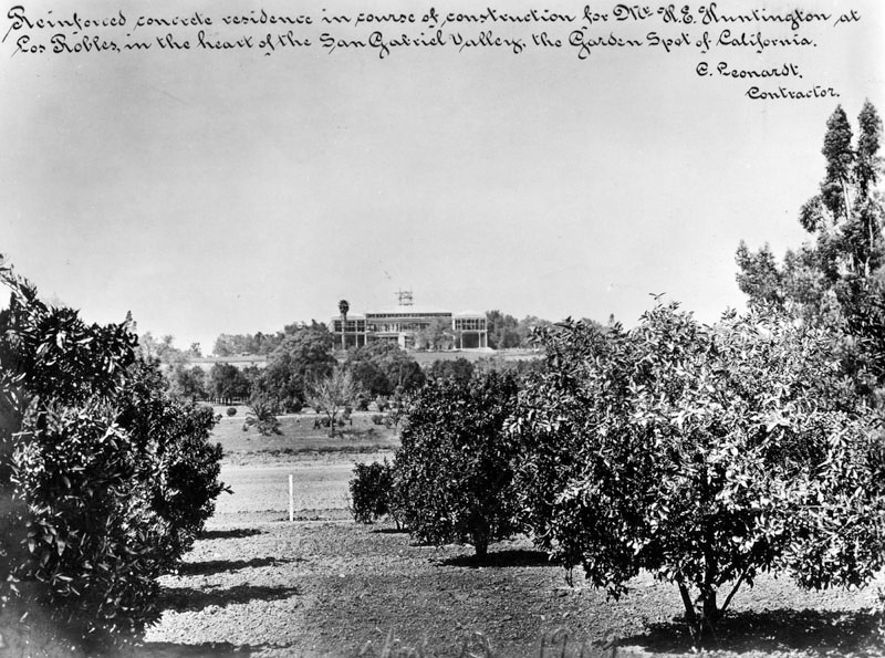 |
|
| (1909)* - View showing the Henry E. Huntington mansion under construction, April 13, 1909. The note on the photograph reads, "Reinforced concrete residence in course of construction for Mr. H. E. Huntington at Los Robles, in the heart of the San Gabriel Valley, the Garden Spot of California." |
Historical Notes In 1905, railroad and real estate magnate Henry Huntington commissioned an engineer E.S.Code to translate his own simple sketch of what he wanted into a buildable design. By 1908, when he asked the distinguished Los Angeles architect Myron Hunt to take the project forward, he was already being influenced by the taste of his uncle’s widow, Arabella Huntington, whom he would marry in 1913. Retaining many of the features of the original plans, Hunt’s design subtly raised the game, removing Code’s neo-Palladian mannerisms, and restricting exterior classical ornament to the main compositions of the north and south fronts. To these he added a small porte cochere for the main entry, and the large peristylar loggia on the east, which to this day remains the building’s most distinguished architectural feature.^ |
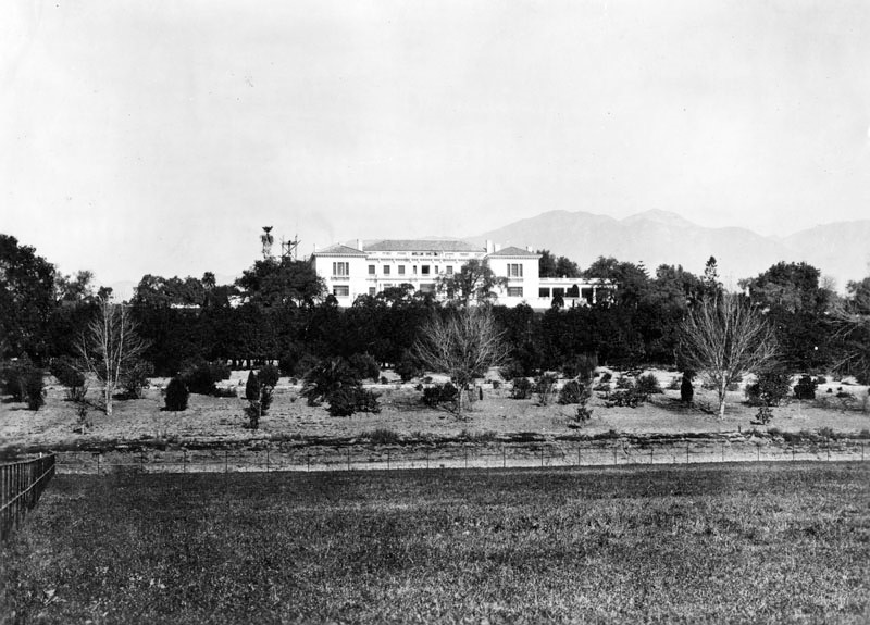 |
|
| (ca. 1915)* - View from a lower level of the Henry E. Huntington mansion, built on a rise overlooking the gardens and grounds of the estate. |
Historical Notes As a landowner and businessman, Henry Edwards Huntington, (1850–1927), played a major role in the growth of southern California. Huntington was born in 1850, in Oneonta, New York, and was the nephew and heir of Collis P. Huntington, (1821–1900), one of the famous "Big Four" railroad tycoons of 19th century California history. In 1892, Huntington relocated to San Francisco with his first wife, Mary Alice Prentice, and their four children. He divorced Mary Alice Prentice in 1906, and in 1913, married his uncle's widow, Arabella Huntington, (1851–1924), relocating from the financial and political center of northern California, San Francisco, to the state's newer southern major metropolis, Los Angeles. He purchased a property of more than 500 acres that was then known as the "San Marino Ranch", and went on to purchase other large tracts of land in the Pasadena and Los Angeles areas of Los Angeles County for urban and suburban development.*^ |
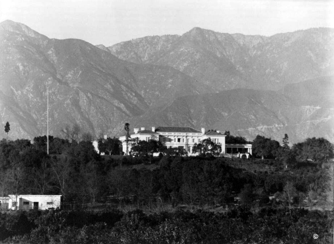 |
|
| (n.d.)** - View looking north showing the Huntington Mansion with the San Gabriel Mountains in the background. |
Historical Notes As president of the Pacific Electric Railway Company, the regional streetcar/public transit system for the Los Angeles metropolitan area and southern California and also of the Los Angeles Railway Company, (later the Southern California Railway), Huntington spearheaded urban and regional transportation efforts to link together far-flung communities, supporting growth of those communities as well as promoting commerce, recreation, and tourism. He was one of the founders of the City of San Marino, incorporated in 1913.*^ |
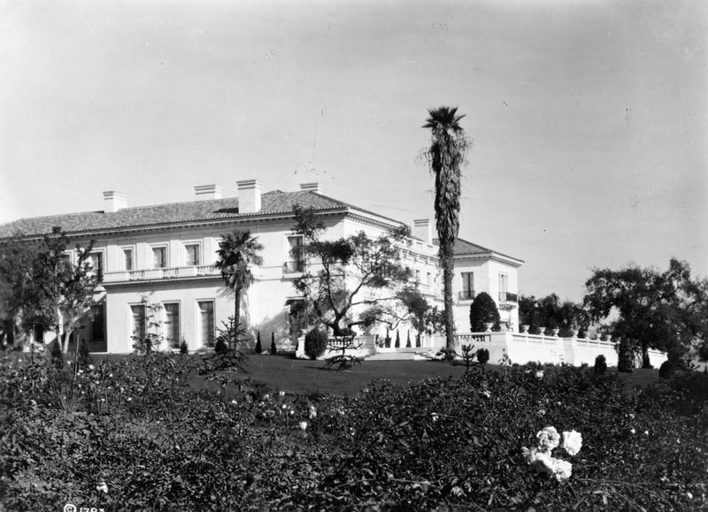 |
|
| (ca. 1911)* – View showing the home of Henry E. Huntington, with gardens. Mr. Huntington donated his home and collections to the people of the State of California for use as the Huntington Library and Art Gallery and the Huntington Botanical Gardens. |
Historical Notes The Huntington Mansion originally came in at 55,000 square feet. The south façade and terrace reflects Italian and Spanish Renaissance traditions of country house architecture, and the north façade is more in the French tradition. As a whole, the house is a classic exercise in the emerging Mediterranean style of early-20th-century Californian architecture.^ |
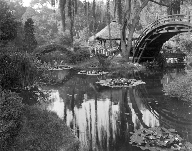 |
|
| (1913)* – View showing the Japanese Garden after the completion of landscape at the Huntington estate. |
Historical Notes Henry Huntington's superintendent, William Hertrich, was instrumental in developing the various plant collections that comprise the foundation of the Botanical Gardens. Together, they molded the working ranch into a botanical collection of rare and exotic plants. They searched local nurseries and visited other plant collectors in the area to find mature and unique specimens. Mr. Huntington imported plants from many parts of the world to experiment with their cultivation in Southern California.^ |
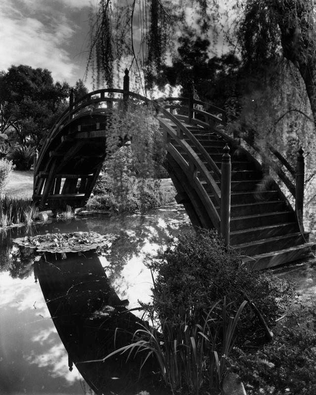 |
|
| (n.d.)* – Close-up view of the Japanese Gardens of the Henry E. Huntington Library and Art Gallery. The Botanical Gardens are a part of the trust left by Mr. Huntington to the people of California. |
Historical Notes The garden was completed in 1912 and opened to the public in 1928. It features the drum or moon bridge, a large bell, the authentic ceremonial teahouse Seifu-an (the Arbor of Pure Breeze), a fully furnished Japanese house, koi-filled ponds, the Zen Garden, and the bonsai collections with hundreds of trees.*^ |
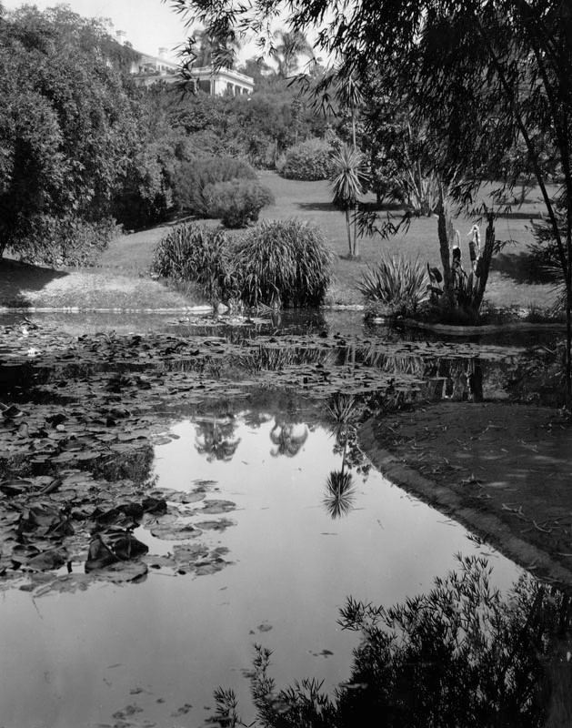 |
|
| (1916)* - Lily pond on the Huntington estate, with a view of the residence up on the hill in the background. |
Historical Notes The Lily Ponds were heated at the time to maintain the giant-leafed Amazon water lily during the relatively cool Southern California winters. Huntington and Hertrich also worked together on the Palm, Desert, and Japanese gardens and planned the North Vista and the landscaping around the mansion. Today, forty gardeners, a curatorial staff of seven, and more than 100 volunteers maintain the botanical collections.^ |
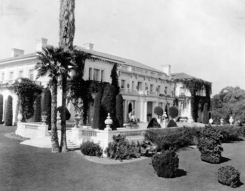 |
|
| (ca. 1930)* - View of the Huntington Art Gallery, formerly the home of Mr. and Mrs. Henry E. Huntington. |
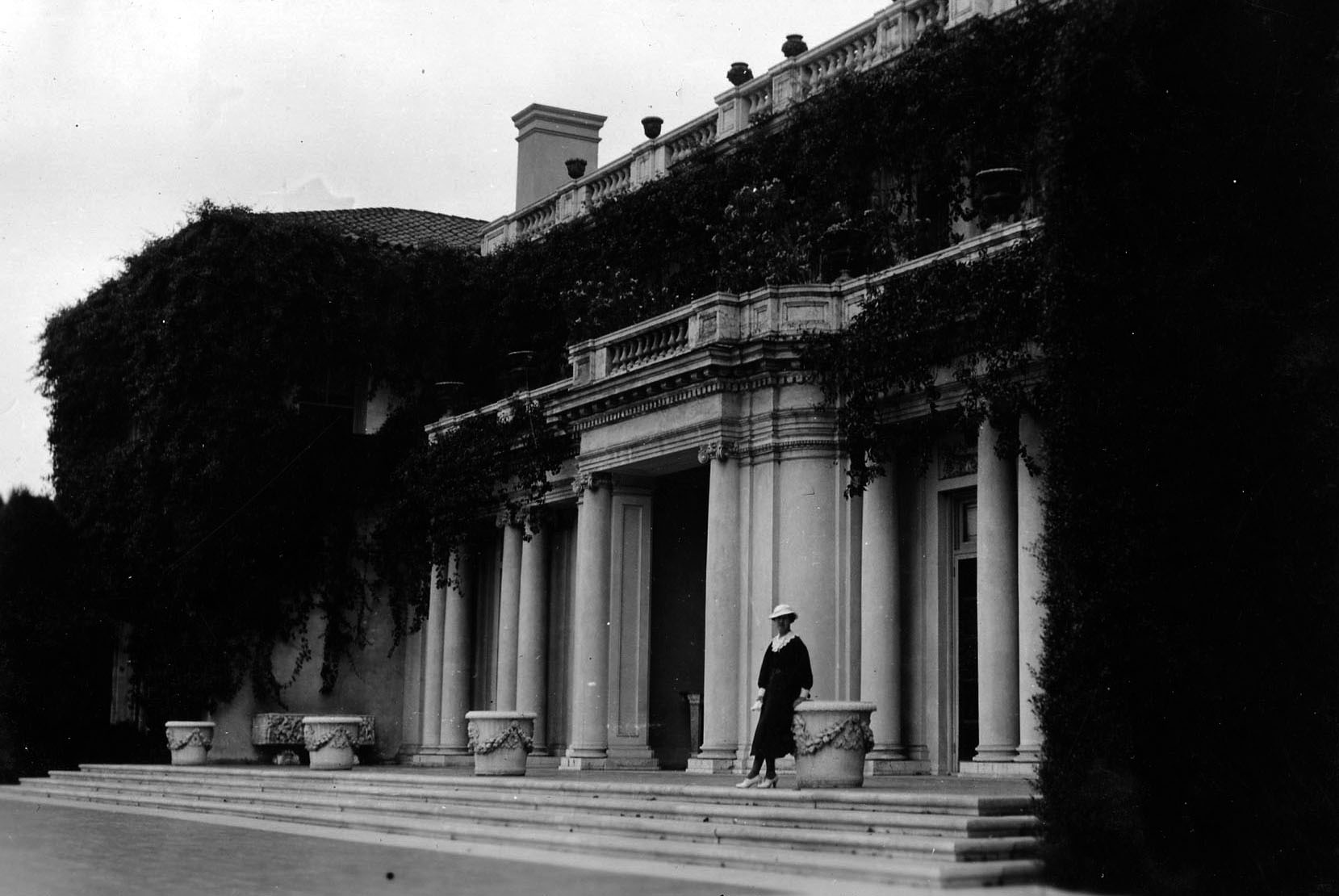 |
|
| (1935)^^# - View shows Grace McCarthy (photographer) standing before the ivy-covered Huntington Art Gallery building in San Marino. |
Historical Notes The Huntington Art Gallery, originally Henry and Arabella’s home, was designed by Myron Hunt and Elmer Grey. It was constructed from 1909 to 1911 and comprises 55,000 square feet. A 2008 renovation and adaptive reuse was led by Earl Corp. and Architectural Resources Group. |
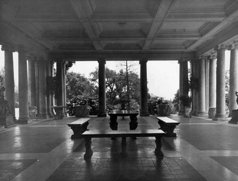 |
|
| (1937)* - Loggia at the eastern end of the Henry E. Huntington Library in San Marino. |
Huntington Library and Art Gallery
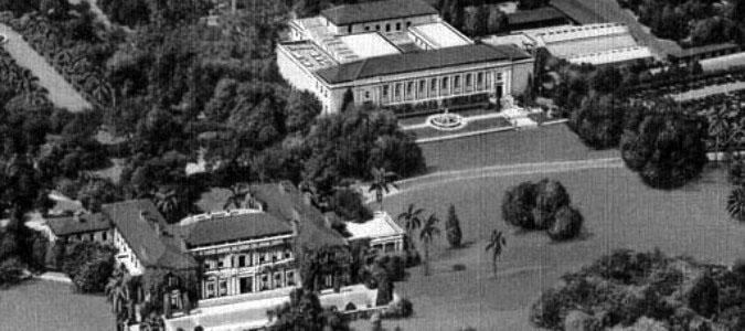 |
|
| (n.d.) – Postcard view showing the Henry E. Huntington Library and Art Gallery. The Huntington Mansion is seen on the left and the Library Building is to the right. |
Historical Notes Huntington's interest in art was influenced in large part by his second wife, Arabella Huntington, (1851–1924), and with art experts to guide him, he benefited from a post-World War I European market that was "ready to sell almost anything". Before his death in 1927, Huntington amassed "far and away the greatest group of 18th-century British portraits ever assembled by any one man". In accordance with Huntington's will, the collection, then worth $50 million, was opened to the public in 1928.*^ |
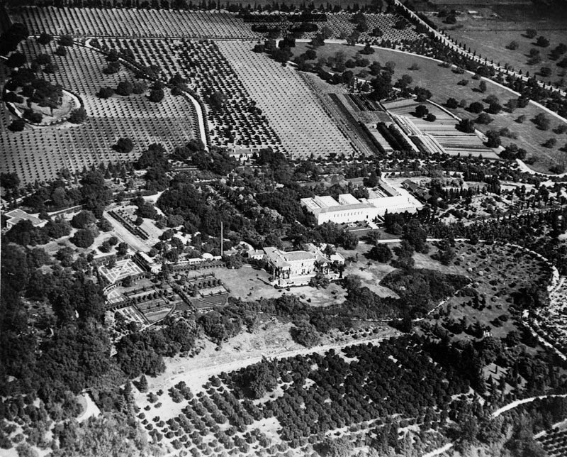 |
|
| (1920s)* - Aerial view looking north showing the Huntington Library and Art Gallery in San Marino. |
Historical Notes In addition to the library, the institution houses an extensive art collection with a focus in 18th and 19th-century European art and 17th to mid-20th-century American art. The property also includes approximately 120 acres of specialized botanical landscaped gardens, most notably the "Japanese Garden", the "Desert Garden", and the "Chinese Garden" (Liu Fang Yuan).*^ |
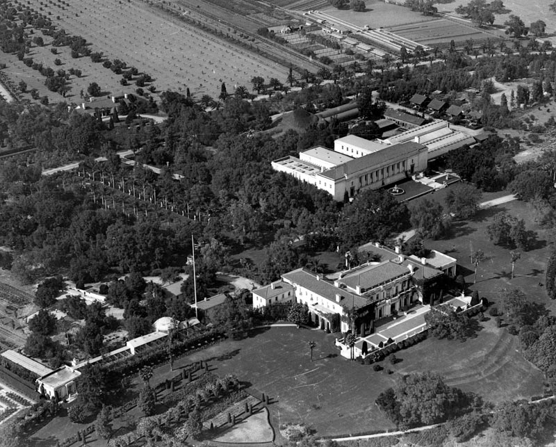 |
|
| (1924)* – Close-up aerial view of the Huntington Library and Art Gallery. The large new Library Building (upper-right) was constructed in 1920. Note the tall flag pole at center-left. |
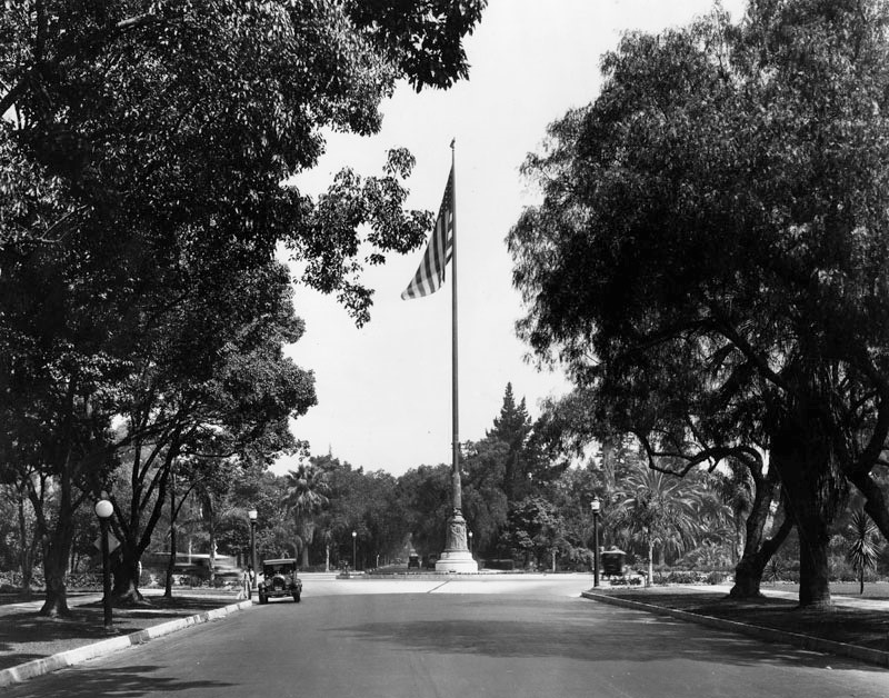 |
|
| (1920s)* - View showing a very large flag pole in the center of a wide road leading up to the Huntington Library. |
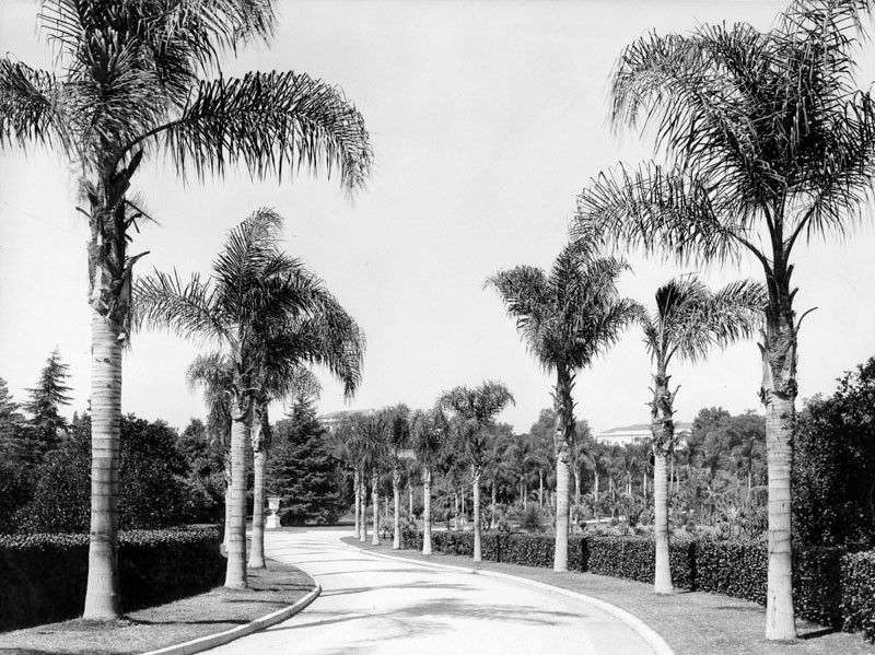 |
|
| (n.d.)* - Main entrance to Huntington Library from Huntington Drive. The residence is seen on the hill in the distance. A palm-lined drive amid the lush gardens on the grounds. |
 |
|
| (1924)^## - Henry E. Huntington Library and Art Gallery, 1151 Oxford Avenue; shows formal Neo-Classical style building, columns between paned windows, and statuary. |
Historical Notes The building was constructed in 1920, at which time the Library was transferred from New York to San Marino. It is now being used extensively by scholars and is also serving the public through exhibitions of rare books and manuscripts from the collections. |
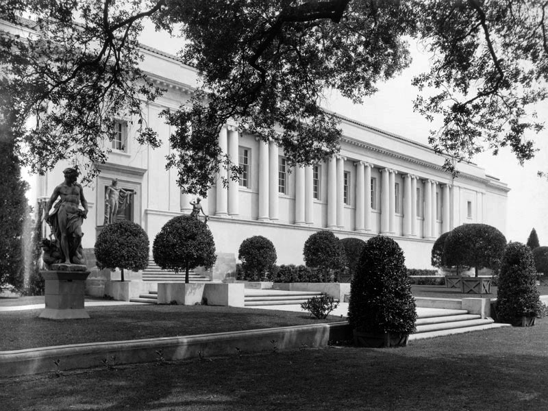 |
|
| (1923)^## - Closer view looking northeast of the neo-Classical Style Huntington Library Building with statues in front. |
Historical Notes The Library building was designed in 1920, by the southern California architect Myron Hunt in the Mediterranean Revival style. Hunt's previous commissions for Mr. and Mrs. Huntington included the Huntington's residence in San Marino in 1909, and the Huntington Hotel in 1914.*^ |
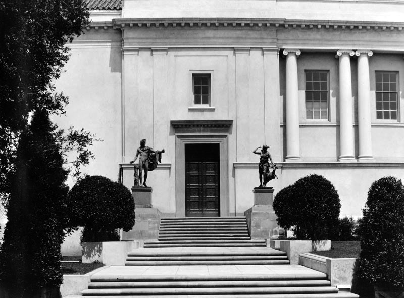 |
|
| (1923)^## - Close-up view of one of the two main entrances to the Huntington Library fronted by two imposing life-size statues. |
Historical Notes Today, the library contains a substantial collection of rare books and manuscripts, concentrated in the fields of British and American history, literature, art, and the history of science. Spanning from the 11th century to the present, the library's holdings contain 7 million items, over 400,000 rare books, and over a million photographs, prints, and other ephemera. Highlights include one of 11 vellum copies of the Gutenberg Bible known to exist, the Ellesmere manuscript of Chaucer ca. 1410, and letters and manuscripts by George Washington, Thomas Jefferson, Benjamin Franklin, and Abraham Lincoln. It is the only library in the world with the first two quartos of Hamlet; it holds the manuscript of Benjamin Franklin's autobiography, Isaac Newton's personal copy of his Philosophiae Naturalis Principia Mathematica with annotations in Newton's own hand. The first seven drafts of Henry David Thoreau's Walden, John James Audubon's Birds of America, and first editions and manuscripts from authors such as Charles Bukowski, Jack London, Alexander Pope, William Blake, Mark Twain, and William Wordsworth.*^ |
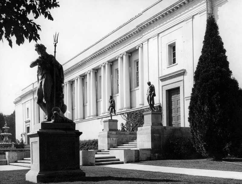 |
|
| (1937)* - General view of the exterior of the Library building. "Neptune" (stone) is the statue in the foreground; "Hercules and Telephus" (bronze) at the rear center; on the right in the rear is "Apollo Belvedere" (bronze). |
Historical Notes The Huntington Library is one of the world’s great independent research libraries in the fields of British and American history, literature, art, and the history of science, stretching from the 11th century to the present. Among the collections: 7 million manuscripts 430,000 rare books 275,000 reference books 875,000 prints and ephemera 774,000 photographs |
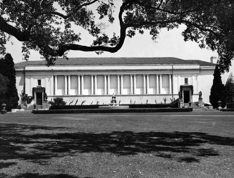 |
|
| (n.d.)* - View of the Library building after the south windows were closed . The four bronze statues at the two entrances to the building are life size and were cast in Italy for Francis I, King of France, early in the XVI century. They are from left to right: the Apollo Belvedere, the Diana of Versailles, Hercules and Telephus, and the Belvedere Mercury. There is also a large fountain in front of the building. |
Historical Notes In the west wing of the Library building is installed the Arabella D. Huntington Memorial Art Collection, consisting of Renaissance paintings and French decorative art of the XVIII century. The Library contains original manuscripts and first and early editions of English and American literary and historical works, and incunabula (or books printed before 1501).* |
 |
|
| (1937)* - Fountain on the terrace in front of the Huntington Library, originally from the Grimaldi Palace, Venice. |
 |
|
| (n.d.)* - View of the North Vista lawn and the statues on one side, at Huntington Library and Art Gallery. |
 |
|
| (n.d.)* - View of a pool of water reflecting the pillars and building along its edges, on the grounds of Huntington Library and Art Gallery. |
* * * * * |
Colorado Boulevard
|
|
| (ca. 1920)++# – View looking east on Colorado Boulevard from Raymond Avenue showing a uniformed officer directing traffic from the middle of the intersection. |
|
|
| (1926)*^* – View looking east on Colorado from Raymond showing several people crossing the street with streetcar and autos waiting at the intersection. Note the overhead streetcar wire above the intersection. |
|
|
| (1920s)* - Cars on Colorado Blvd. in Pasadena in 1920. First Trust & Savings Bank is on the right, at Raymond Avenue. |
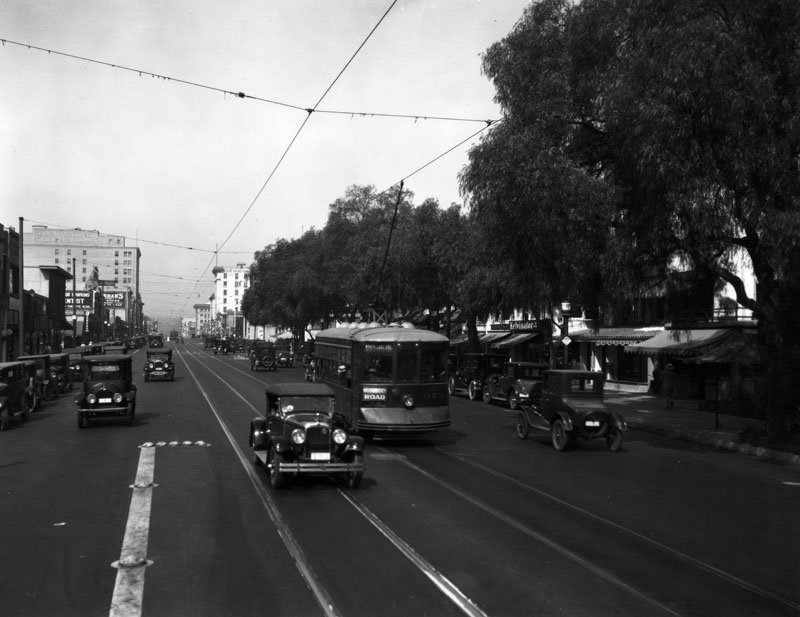 |
|
| (1920)s* - Another view of Colorado Boulevard in Pasadena in 1920. A streetcar carries a sign, "Woodbury Road." |
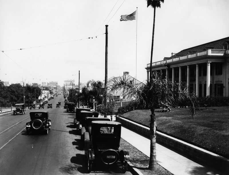 |
|
| (1920)* - Colorado Blvd. in Pasadena looking east on Colorado Blvd. from the Elks Club (on right) in 1920. View is from just east of Orange Grove Ave. |
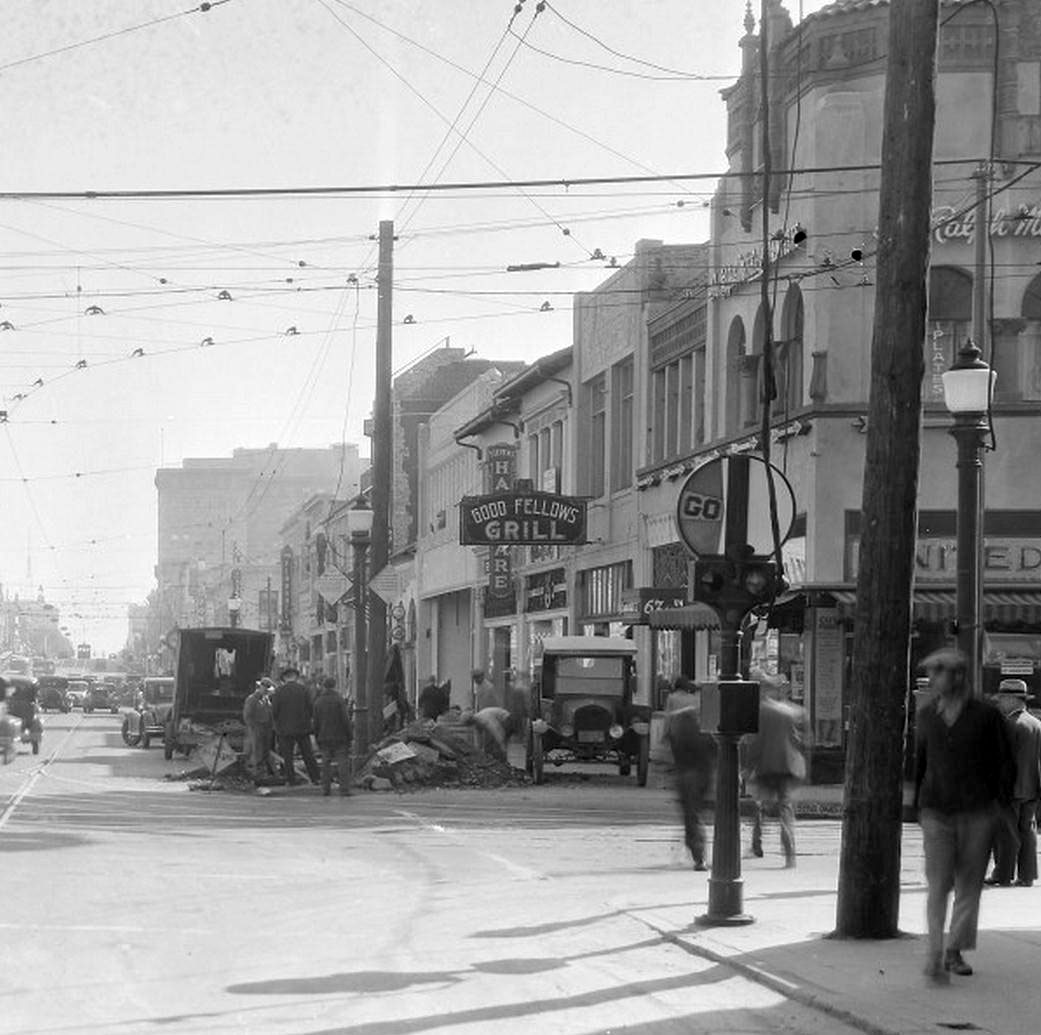 |
|
| (1920s)^*# - Looking east on Colorado Boulevard from Fair Oaks Avenue. Construction workers are digging up the street in front of Good Fellows Grill. |
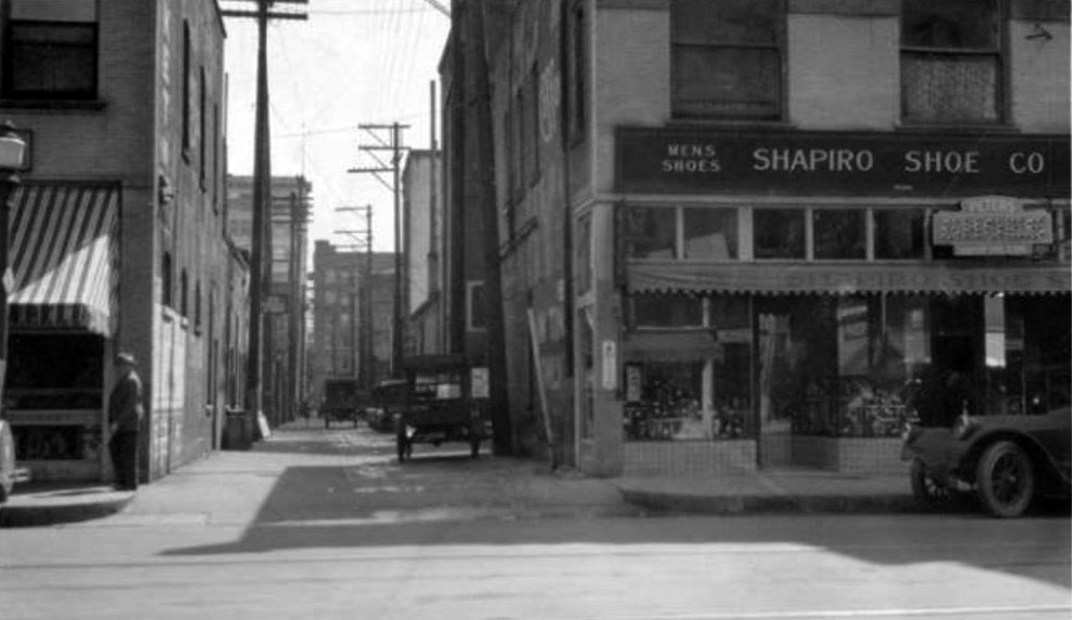 |
|
| (1920s)*^* – View showing the alley between Colorado and Union looking east from Fair Oaks. Shapiro Shoe Store can be seen on the right. |
Mother Goose Pantry
.jpg) |
|
| (1927)* - Mother Goose Pantry, located on the north side of Colorado Blvd. between Berkeley and Greenwood Aves. View is to the west. |
Historical Notes This structure graced Colorado Blvd from ca. 1927 to at least the mid-1940s. |
 |
|
| (1920s)+## - View showing Mother Goose Pantry, located at 1951 East Colorado Boulevard. This was a 'shoe-in' for best design in the 1920s. |
Historical Notes In the 1920s, as the automobile was becoming the default way to get around the Southland, buildings and structures in the area became more unique, often resembling the merchandise or services they hawked. These “hey-you-can’t miss-me!” buildings (referred to as Novelty or Programmatic Architecture) were made to pull automobile drivers right off the road. |
 |
|
| (1927)** - The Mother Goose Pantry in an ad in the 1927 cookbook by the Woman's Auxiliary of the Pasadena Fire Department. Source: Pasadena Central Library |
Historical Notes The restaurant served hearty meals from the whimsical shoe that attracted patrons driving along Route 66 from the east coast to Los Angeles. Diners would be seated on the ground floor and in a dining room upstairs. Click HERE to see more examples of Programmatic Architecture. |
Brookside Park
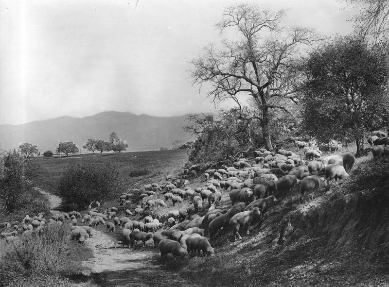 |
|
| (ca. 1906)* – Sheep graze among the oaks in an area near the Arroyo Seco in Pasadena. The San Gabriel Mountains are seen in the background. |
Historical Notes In 1912 the City of Pasadena purchased 30 acres of land known as Sheep Corral Springs for the development of a park in the Arroyo Seco. For many years sheep had grazed in that area. While the park was being planned and constructed, it was known as Arroyo Springs Park.^ |
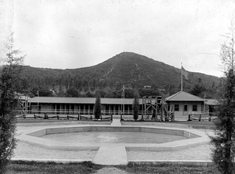 |
|
| (1915)^## - View showing a wading pool and swimming pool with hill in the background in Brookside Park, located at Arroyo Terrace and N. Grand Avenue, Pasadena. The pool area was known as the Brookside Plunge. |
Historical Notes TIn 1914 Mrs. Everett Wellington Brooks, the wife of a local investment banker, donated $3,000 to build a municipal swimming pool on a portion of land within what was then known as Arroyo Springs Park. The park was then dedicated in her honor (hence "Brookside") and the plunge was added later that same year.^ |
 |
|
| (ca. 1920s)^^# - Postcard view showing the Arroyo Seco with swimming pool and wading pool in the foreground, Brookside Park. |
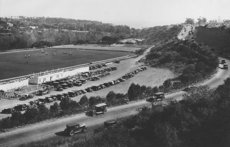 |
|
| (1920)* - View of Pasadena's Brookside Park showing a stream of cars coming down the hill on the right, a parking lot mid-photo, and a large grassy area, possibly an equestrian field, on the left. Several people can be seen riding horses, possibly playing in a polo match, and more horses are visible in penned-in sections between the cars on the parking lot. Homes are nestled in the hills along the background. |
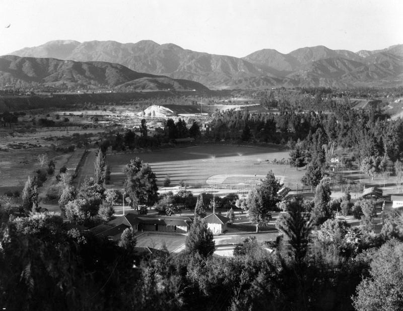 |
|
| (ca. 1925)* - View of the baseball field at Brookside Park in Pasadena. The Rose Bowl, in the shape of a horseshoe, can be seen in the background. The Brookside Plunge is seen in the foreground. |
Historical Notes Originally built as a horseshoe, the Rose Bowl stadium was expanded several times over the years. The southern stands were completed in 1926, making the stadium a complete bowl. The above photo was taken prior to 1926. Today, Brookside Park is Pasadena's largest park covering over 61 acres. It contains the world-famous Rose Bowl Stadium, Brookside Golf Course, and Rose Bowl Aquatics Center, as well as several regulation baseball fields, multi-purpose fields, picnic areas, tennis courts, badminton courts, handball courts, horseshoe courts, archery, casting and lawn bowling facilities, etc., making it Pasadena's largest fully maintained park facility. Brookside Park is located at 360 North Arroyo Boulevard in the city of Pasadena.* |
Baseball at Brookside Park
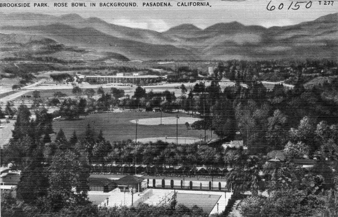 |
|
| (ca. 1930s)##++ – Postcard view showing Brookside Park with the Rose Bowl seen in background. Two baseball fields can be seen at center of photo. |
Historical Notes From 1933 to 1942 and from 1946 to 1950, the Chicago White Sox held their spring training in Brookside Park.^ |
 |
(1938)# - Fans watch from bleachers at Brookside Park as the Chicago White Sox practice during Spring Training. | |
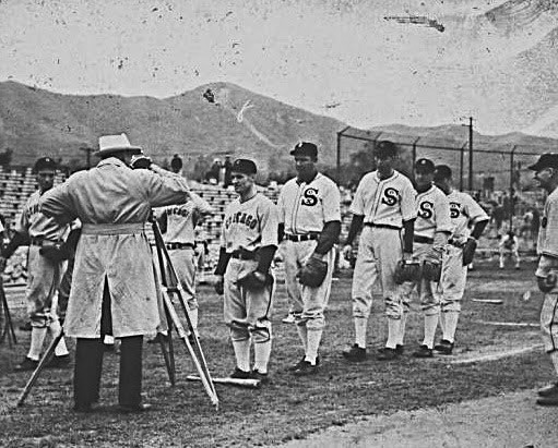 |
(1938)# - Chicago White Sox players line up in front of a movie camera for a newsreel that would be shown in theaters. (Brookside Park, Pasadena) |
|
Brookside Plunge
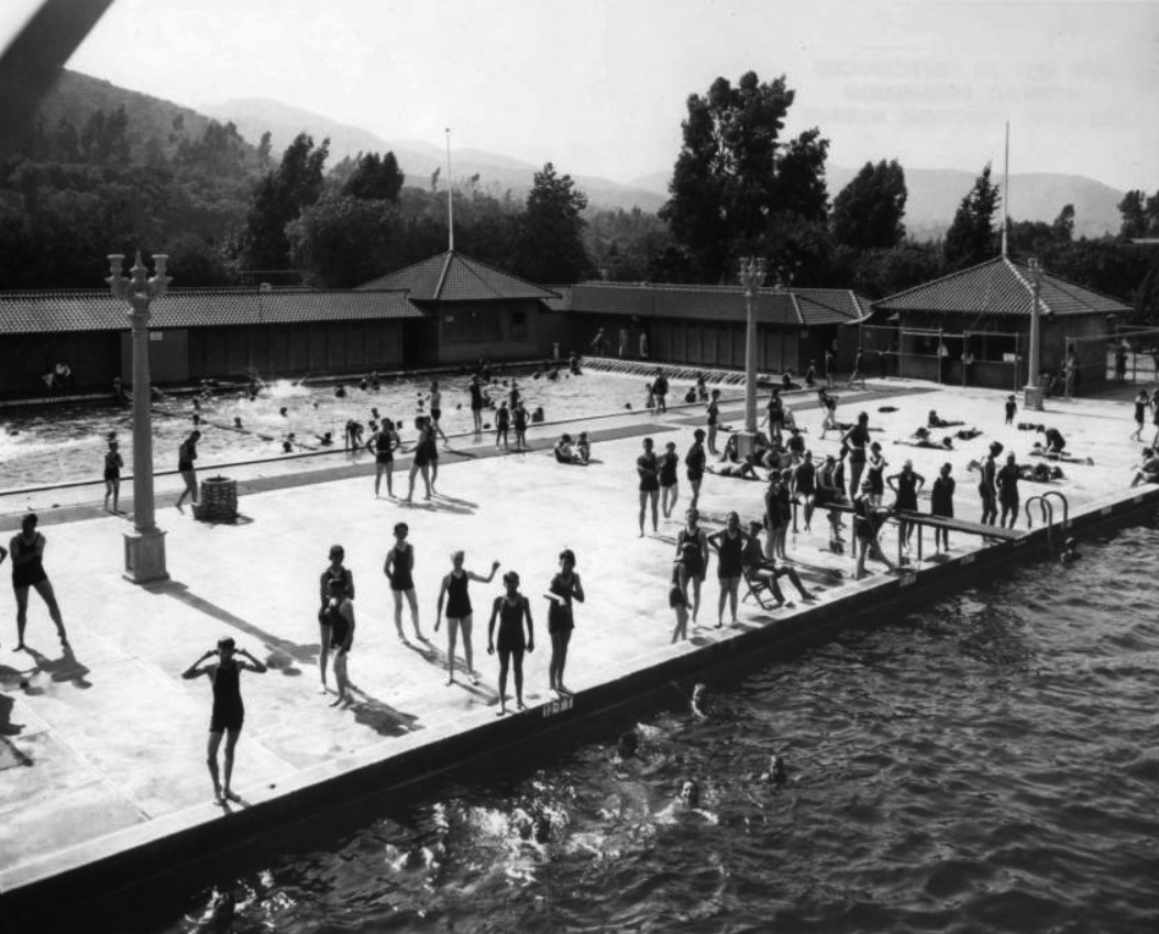 |
|
| (ca. 1938)*^* – View showing children at play at the Brookside Plunge in Brookside Park, Pasadena. |
Historical Notes In 1914 Mrs. Everett Wellington Brooks, the wife of a local investment banker, donated $3,000 to build a municipal swimming pool on a portion of a park located in Arroyo Seco. The park was dedicated in her honor (hence "Brookside") and the plunge was added later that same year.^ |
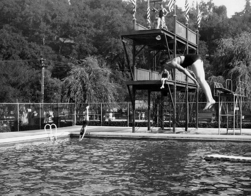 |
|
| (1938)* - Close-up view showing swimming pool and diving platform at the Brookside Plunge in Brookside Park. |
Historical Notes There exists an uncomfortable racial history of the Brookside Plunge. It was a different time in Pasadena and throughout the nation, and segregation was common. Soon after the plunge was completed, city officials announced that it would be "set aside Wednesday afternoons and evenings for the use of the Negro population of Pasadena." By 1930 use of the pool by people of color -- by now including residents of Hispanic and Asian descent -- was limited to one weekday from 2 to 5 p.m. The weekly event was dubbed "International Day." No white people were permitted to swim on that day. The pool was drained and cleaned at the end of each International Day and by the following morning there was fresh water in it. After protracted litigation, the practice was ended in 1947 when the pool was opened to all swimmers in Pasadena, regardless of their race..*^* In 1989 the Rose Bowl Aquatics Center opened on the site, funded with $4.5 million from the City of Pasadena and $2 million in private donations. |
Devil's Gate
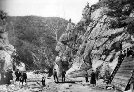 |
(1888)^#^ – Early view of Devil’s Gate showing the Arroyo Seco at its most narrow point. |
Historical Notes The outcropping of rugged granite cliffs offered shade in the morning and late afternoon, make it a favorite community gathering spot. Local residents would pack lunches and have family picnics here. The name Devil’s Gate was given because the profile of a devil’s face can be seen on a cliff at the right. In this photo a man is sitting on top of the devil’s horn.^#^ |
 |
|
| (ca. 1890)++# - Closer view showing a group of people in front of the downstream face of Devil's Gate. Note the ‘advertisements’ written on the rocks. |
.jpg) |
|
| (ca. 1890)++# - View of Devil's Gate from upstream side with the Devil on left. |
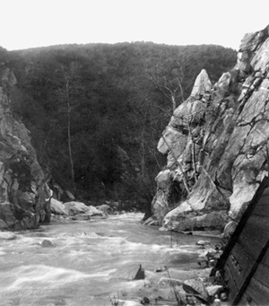 |
(ca. 1910s)*^ - The Devil's Gate at the Arroyo Seco River prior to 1920 damming. Note the "devil's profile" in the rock to the right.
|
Historical Notes Above Devil's Gate, the rapids of the Arroyo Seco are so positioned so that the falls make a beating, laughing sound. In Tongva-Gabrieliño traditional narratives, this is attributed to a wager made between the river and the coyote spirit.*^ |
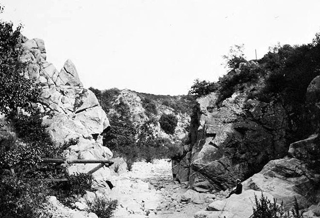 |
|
| (Early 1900s)^ - View of a lone picnicker at Devil’s Gate. The rock face on the left was said to resemble a horned devil. |
Historical Notes In the prehistoric past, Devil’s Gate was not a gate at all but a natural dam, formed where the stalwart granite of the San Rafael Hills merged with the bajada of the San Gabriel Mountains. For a time, this dam held back a natural lake fed by mountain streams. Then one day the dam burst. Spilling over the top, rushing water exploited weaknesses in the granite and punched a narrow gap through the rocks, unleashing a flood wave downstream. The gate—and its peculiarly shaped crag—was born. #^#^ |
 |
|
| (Early 1900s)++# - A man and a woman are seen on the rocks of Devil’s Gate. |
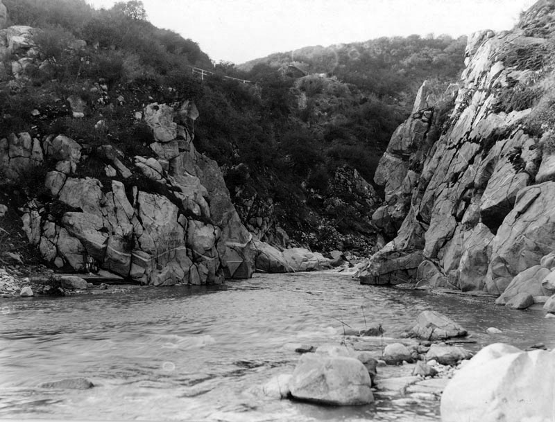 |
|
| (1908)^*# - View of the Devil's Gate with more water flowing than previous photo. A dam would be built across this section of the Arroyo Seco Canyon in 1920. |
Historical Notes Disastrous floods in 1914 and again in 1916 prompted Pasadena and the Los Angeles County Flood Control District to reverse the work of that ancient cataclysm. Between 1919 and 1920, the Los Angeles County Flood Control District erected an arched, concrete dam just upstream from the Devil’s Gate formation. #^#^ |
Devil's Gate Dam
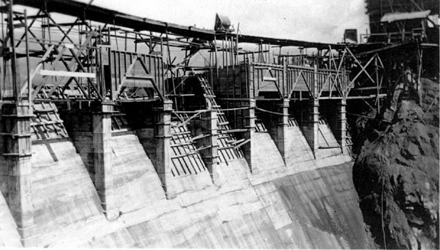 |
|
| (1920)^#* - View of the Devil’s Gate Dam under construction, the first of the Los Angeles County Flood Control District's dams. |
Historical Notes The Devil’s Gate Dam was built in 1920 as part of the Arroyo Seco flood control scheme designed to tame destructive rain-driven flooding as far south as downtown Los Angeles, whose river the Arroyo feeds. Though a dam now reaches across the gorge, the water still laughs as it flows through the sluice gates, and the Devil’s face ominously remains intact.^^^ |
 |
|
| (1920)++# - View of Devil’s Gate Dam shortly after it was completed. |
Historical Notes Devil’s Gate Dame, completed in 1920, was the first of the Los Angeles County Flood Control District's dams. |
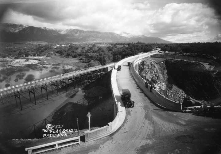 |
|
| (1921)* - A view of the road with 3 people on the edge of the bridge looking down at Devil's Gate Dam. On the left side of the picture is another road, and some water is collected in the area. |
Historical Notes The bridge on the left is the original bridge over the site of the Devil's Gate Dam. As of 1987, there is no longer a reservoir. The site may be seen from Highway 210, north of the Arroyo Seco and south of Jet Propulsion Laboratory. Look up location of Devil's Gate.* |
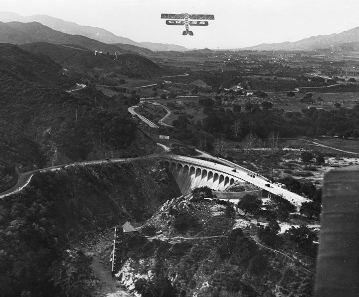 |
|
| (ca. 1920s)* - A view from the air of the Devil's Gate Dam, probably in the 1920's. A few people are visible on top of the dam road, but there does not appear to be any water in the reservoir. |
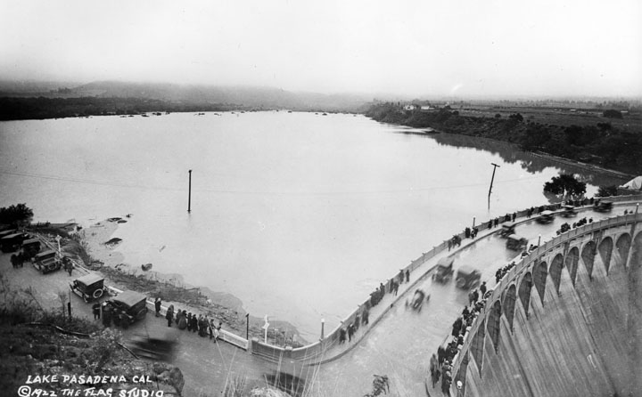 |
|
| (1922)* - A great many people are gathered to look over the road running across the Devil's Gate Dam. Behind the dam is large lake or reservoir. |
Historical Notes Soon after the dam was built it filled with water. The dam was designed for both flood control and water conservation. It also served as the main road between La Canada and Pasadena for many years. |
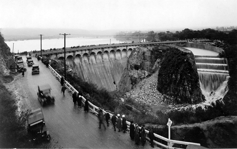 |
|
| (ca. 1920s)^*# - Looking from the adjacent hillside we see the road, the dam and the reservoir behind the dam. Water is rushing down the spillway. |
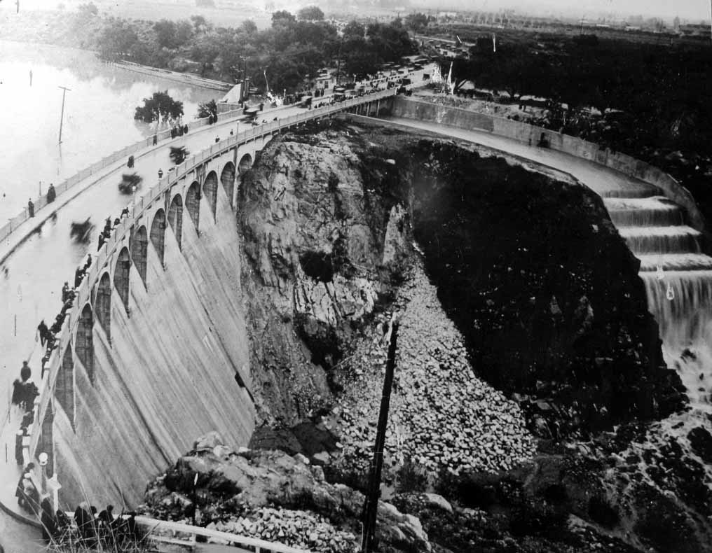 |
|
| (ca. 1920s)^*# - People are standing on top of the Devil's Gate Dam observing water coming down the spillway. |
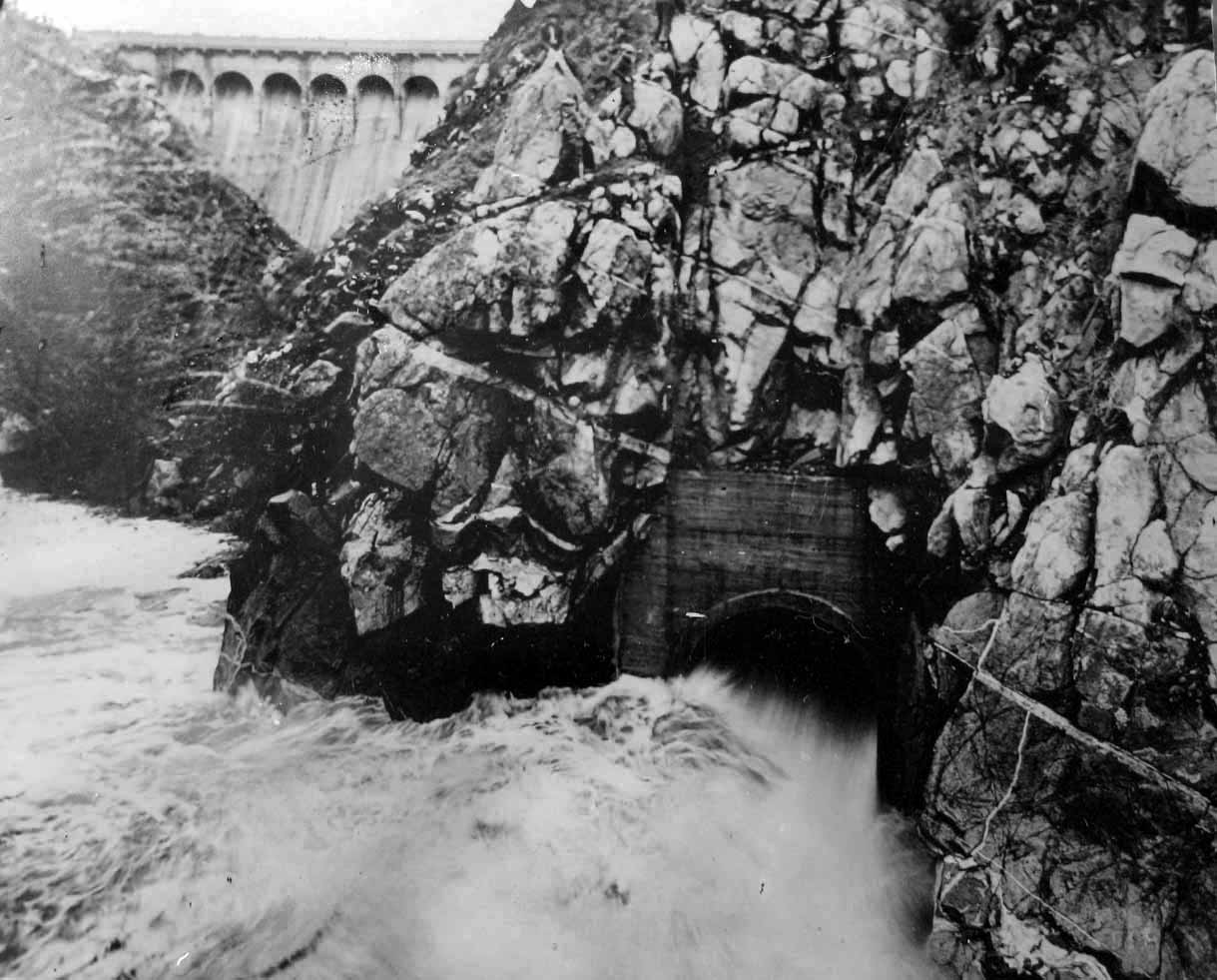 |
|
| (ca. 1920s)^*# - Water is rushing out of a second spilway in the bottom of the canyon. The Devil's Gate Dam is seen in the background. |
Historical Notes The Arroyo Seco watershed begins at Red Box Saddle in the Angeles National Forest near Mount Wilson in the San Gabriel Mountains. As it enters the urbanized area of the watershed, the Arroyo Seco stream flows between La Cañada Flintridge on the west and Altadena on the east. Just below Devil's Gate Dam, the stream passes underneath the Foothill Freeway. At the north end of Brookside Golf Course the stream becomes channelized into a flood control channel and proceeds southward through the golf course.*^ |
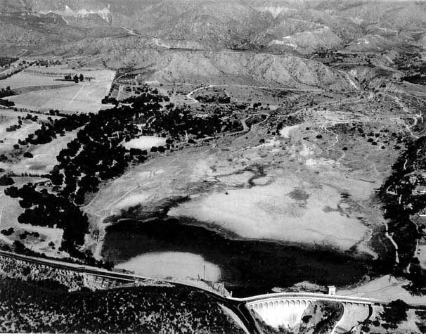 |
|
| (1935)^#* - An aerial view, taken December 18, 1935, shows water flowing into the Devil's Gate Dam basin from La Canada through Flynt Canyon Wash in the lower left. The dense oak grove with the clearing in the middle is also clearly depicted. |
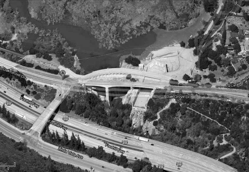 |
|
| (2013)## - Google Maps view of Devil's Gate Dam showing the 210 Freeway in the foreground. |
* * * * * |
Raymond Theatre
 |
|
| (1922)* - Exterior front of the Raymond Theatre, with cards parked in the street. Marquee reads: "Wallace Reid in The Love Special ; Ko'vert in Hanuya The Spirit of Evil ; Buster Keaton in Hard Luck". |
Historical Notes There was a great deal of anticipation leading up to the opening of Jensen’s Raymond Theatre on April 5, 1921. But there was also a sense of amazement in the cost of the construction. The Star News, on May 6, 1920, reported that the project was over budget, with a cost to date of $592,644. When it opened, all was forgotten, and the Pasadena Star-News exclaimed the Raymond to be “Last Word in Modern Thespian Temples". *^^* |
* * * * * |
 |
|
| (ca. 1920s)#* – View looking north on Fair Oaks Avenue in Pasadena towards Glenarm Street with the San Gabriel Mountains in the background. On the right is Somman’s California Cut Glass Mfg. Co. located at 1172-1186 S. Fair Oaks Avenue. |
 |
|
| (ca. 1920s)#* - Pacific Electric Railway tracks on a street in what appears to be South Pasadena. A sign on the center pole says "Hope St." which is a street in South Pasadena. A storefront says "Fagg-Dublin Co." which was a business in South Pasadena. A huge advertisement is on a wall that reads "Oneonta." |
Mission Street (South Pasadena)
 |
|
| (1922)#* - View of Mission Street in South Pasadena, showing a streetcar that says "South Pasadena" across the top, storefronts of businesses and automobiles parked on street. A wall on right says "Oneonta Hardware." |
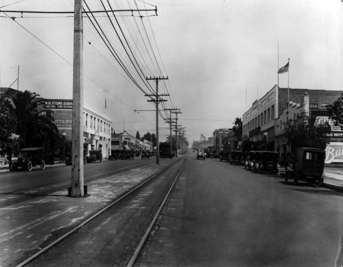 |
|
| (1922)#* - View of Mission Street in South Pasadena, showing streetcar tracks, storefronts of businesses and automobiles parked on street. A small sign on center pole says "Mission Street." Signs on buildings say "South Pasadena" "W.B. Stone Garage" "Sam Seelig Co." and automobile dealerships appear on either side of street. |
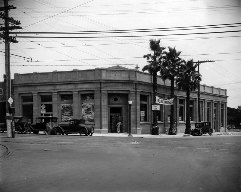 |
|
| (1922)* - Exterior view of a bank, located at 824 Fair Oaks Boulevard on the northeast corner with Mission Street in South Pasadena. At the time this photograph was taken, First National Bank was located in the building, but Security First National Bank also occupied this building. |
Historical Notes This Beaux Arts style building, originally occupied by Security National Bank and today by Comerica Bank, was constructed in 1922 by an unknown architect. The building sits at the confluence of two early alignments of Route 66, and along two Pacific Electric Red Car lines that shuttled commuters and shoppers between Los Angeles, South Pasadena and Pasadena during the bank's heyday.* |
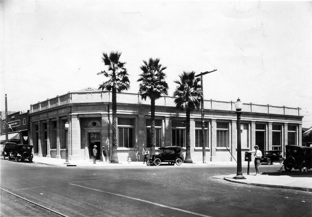 |
|
| (1922)* – Another view of the SE corner of Fair Oaks Boulevard and Mission Street. This building would be home to several banks and a furniture store over the years. It is the current home of Comerica Bank. |
Historical Notes This Beaux Arts style building was “remodeled” during 50s, then restored in 2000s. |
Then and Now
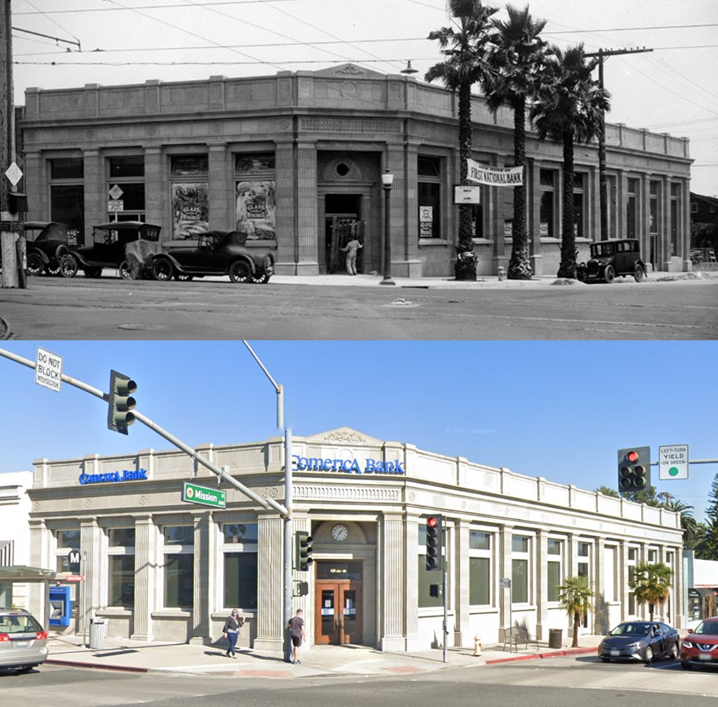 |
|
| (1922 vs. 2021)* - Looking at the northeast corner of Fair Oaks Boulevard and Mission Street in South Pasadena. This Beaux Arts style building, originally occupied by Security National Bank is todauy occupied by Comerica Bank |
* * * * * |
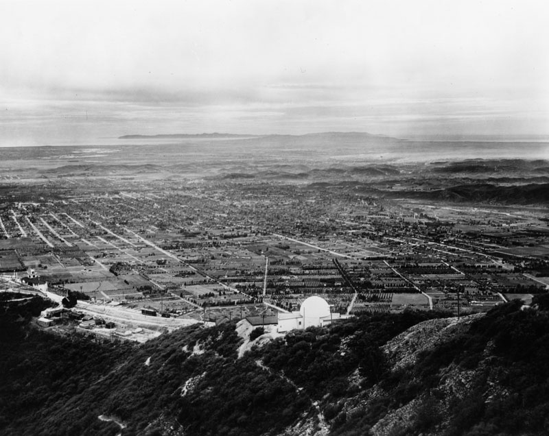 |
|
| (1922)* - Panoramic view of Pasadena and surrounding areas, as seen from top of Echo Mountain. View also shows, Mount Lowe Observatory in the foreground. Catalina Island (over 60 miles away) can be seen in the far background. Click HERE to see more in Early Views of Catalina. |
Click HERE to see more Early Views of Echo Mountain, Mt. Lowe, and the Mt Lowe Observatory. |
* * * * * |
More Historical Early Views
Newest Additions
Early LA Buildings and City Views
History of Water and Electricity in Los Angeles
* * * * * |
References and Credits
* LA Public Library Image Archive
^*California Historic Landmark Listing (Los Angeles)
^^UC Irvine - The White City by Miles Clement
*# The Shakespeare Club of Pasadena
+# Examiner.com - Rose Parade no-nos: Sundays, rain, Supreme Court Justices
#* Huntington Digital Library Archive
## Google Maps
*^#CSUN Oviatt Library Digital Archives
**^Colorado Street Bridge nps.com
*^^Nuestra Señora la Reina de los Ángeles: losangelespast.com
^^*LA Times Framework: 1918 Rose Parade; In 1949, the Snowman Socked LA
^*#Noirish Los Angeles - forum.skyscraperpage.com; Devil's Gate; Colorado St. Bridge; Maryland Hotel
^##California State Library Image Archive
+##Weird California: Los Angeles' Programmatic Architecture
###Library of Congress: Hotel Green Panoramic, ca. 1908
**#Metro Transportation Library and Archive
#**Palomar Observatory - Caltech.edu
*#*KCET: Scoville Bridge; Rise of the Sierra Madre
^#^LAghostpatrol.com: Devil's Gate
^.^Facebook: SoCal Historic Architecture
^#*ArroyoSeco.org: Devil's Gate
^^^Atlasobscura.com: Devil's Gate
*^*^Earlyaviators.com: Roy Knabenshue
^*^*Mtwilson.edu: Mount Wilson Observatory
^*^#Facebook.com - Bizarre Los Angeles
*^^*Pasadena: A Busines History
*^^^San Fernando Valley Historic Society/Facebook.com: Wagon Trip
^^*#Facebook.com - Pasadena Digital History
*#*^Denver Public Library Image Archive
*#*#Downtown Pasadena's Early Architecture
^#^^Calisphere: University of California Image Archive
#*#*OldRadio.com; The Story of Mt. Wilson
#^#^Los Angeles Magazine: The Dammed Past of Devil's Gate
##^^Flickr.com: Michael Ryerson
##^*Los Angeles Daily News: Castle Green
##**Electric Railway Historical Association; Pacific Electric
^^^^*Bureau of Street Lighting Image Archive
*^ Wikipedia: History of Pasadena; Tournament of Roses Parade; The Langham Huntington; Hotel Green; Rose Bowl Game; Pasadena City Hall; Old Town Pasadena; Los Angeles Terminal Railway; Richard H. Chambers United States Court of Appeals and the Vista del Arroyo Hotel and Bungalows; California Institute of Technology; Mt. Lowe Railway; Cawston Ostrich Farm; Pacific Electric Railway; Arroyo Seco - Devil's Gate; Mt. Wilson Toll Road; Mt. Wilson; Merritt Mansion; Raymond Hotel; California Cycleway
< Back