Early Los Angeles Historical Buildings (1900 - 1925)
Historical Photos of Early Los Angeles |
 |
|
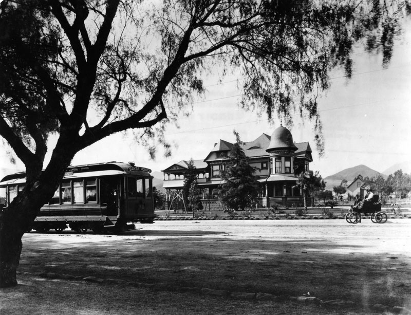
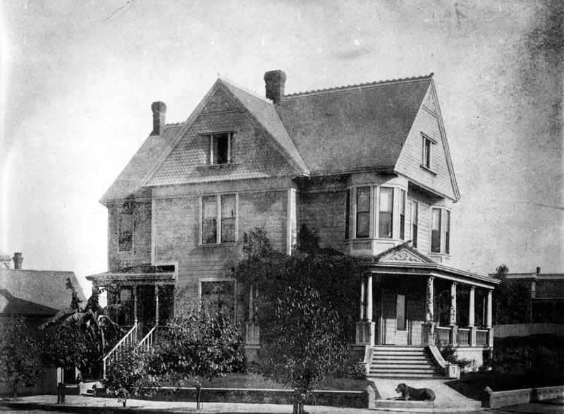
| (1900)* - Looking at the Victorian style H.J. Whitley residence (previously the Hurd Residence) at 6594 Hollywood Blvd. at Wilcox Avenue. A streetcar, labeled Santa Monica, is on the street in front of the house. Also a couple are sitting in an open-air automobile, and the woman wears a lap robe. |
Historical Notes In 1887, James McLaughlin obtained a franchise to build a steam dummy line connecting to the 2nd Street Cable Railroad at Diamond (Beverly Boulevard) and Texas (Belmont Avenue) Streets. The line would extend north along Texas to Temple and then westward to the Los Angeles City Limits at Hoover Street and beyond. The end of the line was at Prospect Avenue (later Hollywood Blvd.) and Wilcox. It was here that McLaughlin built himself a rather imposing “McMansion” on the northwest corner of that intersection. In 1890 the Cahuenga Valley RR was sold to E. Hurd and S.E. Mattison who extended the line westward along Prospect Avenue to Laurel Canyon, opening it to residential development. In addition to selling his railroad, McLaughlin sold his beautiful mansion on the norhwest corner of Prospect (later Hollywood) and Wilcox to Eli C. Hurd, a wealthy Colorado miner. |
 |
|
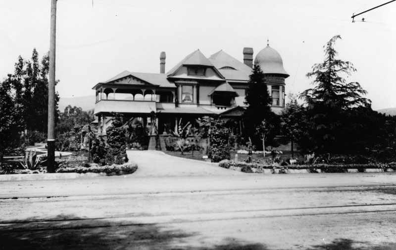
| (ca. 1900)* - The two-story Victorian Hollywood residence of H.J. Whitley who purchased it from E. C. Hurd one year earlier. Hurd was a member of the Cahuenga Valley Water Company in Hollywood. The beautiful mansion on the northwest corner of Pospect (later Hollywood) and Wilcox was originally built by James McLaughlin who also built the Cahuenga Valley RR. |
Historical Notes E. C. Hurd made his fortune from the mines of Colorado and invested it in a prime Hollywood tract. In 1890, he and S.E. Mattison bought the Cahuenga Valley RR from James McLaughlin. In the mid-1880s, H.J. Whitley arrived in Southern California. He was well known as a land developer and many tried to follow on his coattails. As president and major shareholder of the Los Angeles Pacific Boulevard and Development Company, he orchestrated the building of the Hollywood Hotel, the opening of the Ocean View Tract and construction of a Bank which were located on the corners of Hollywood Boulevard and Highland. |
 |
|
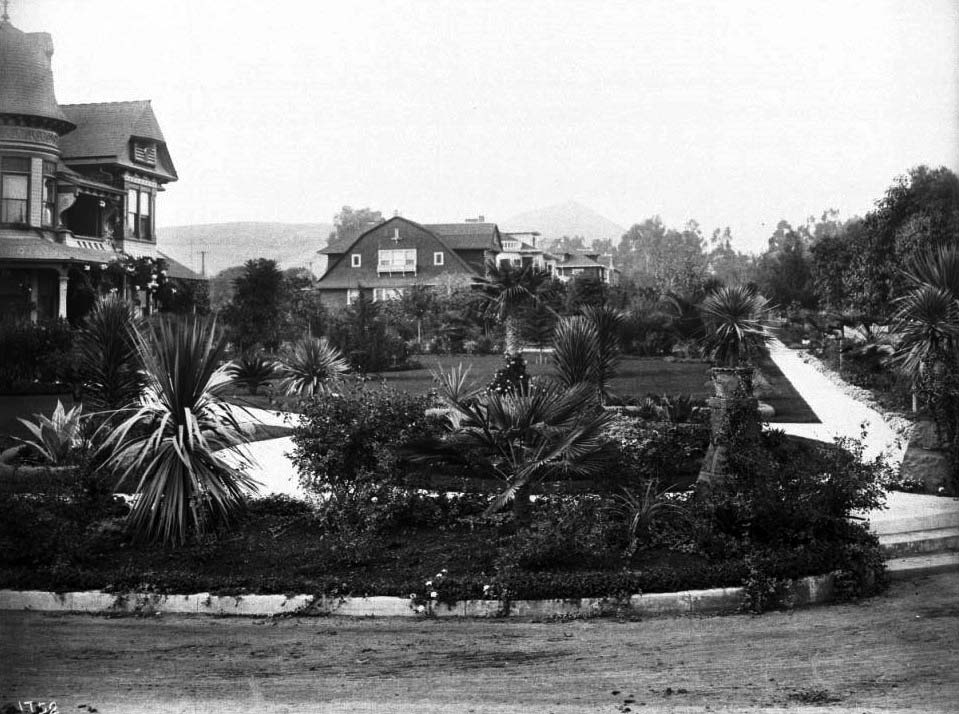
| (ca. 1905)* - View showing the northwest corner of Prospect (later Hollywood Blvd.) and Wilcox. In the foreground is a well-tended garden consisting of small pine trees, yucca trees, and patches of lawn. In the background at left, is the large Victorian mansion of banker H.J. Whitley (previously the Hurd Residence). The two-story home consists of a covered balcony and cylindrical section with a rounded rooftop. In the extreme background at center, a group of large homes can also be seen. The Hollywood Hills stand in the background. Click HERE to see more Early Views of Hollywood (1850 - 1920). |
* * * * * |
Los Angeles County Courthouse
 |
|
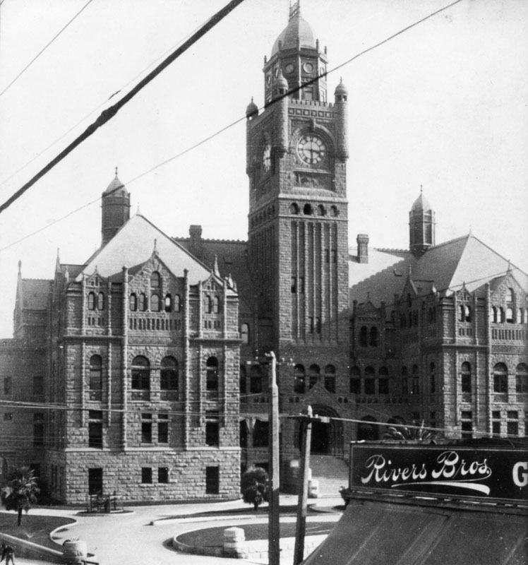
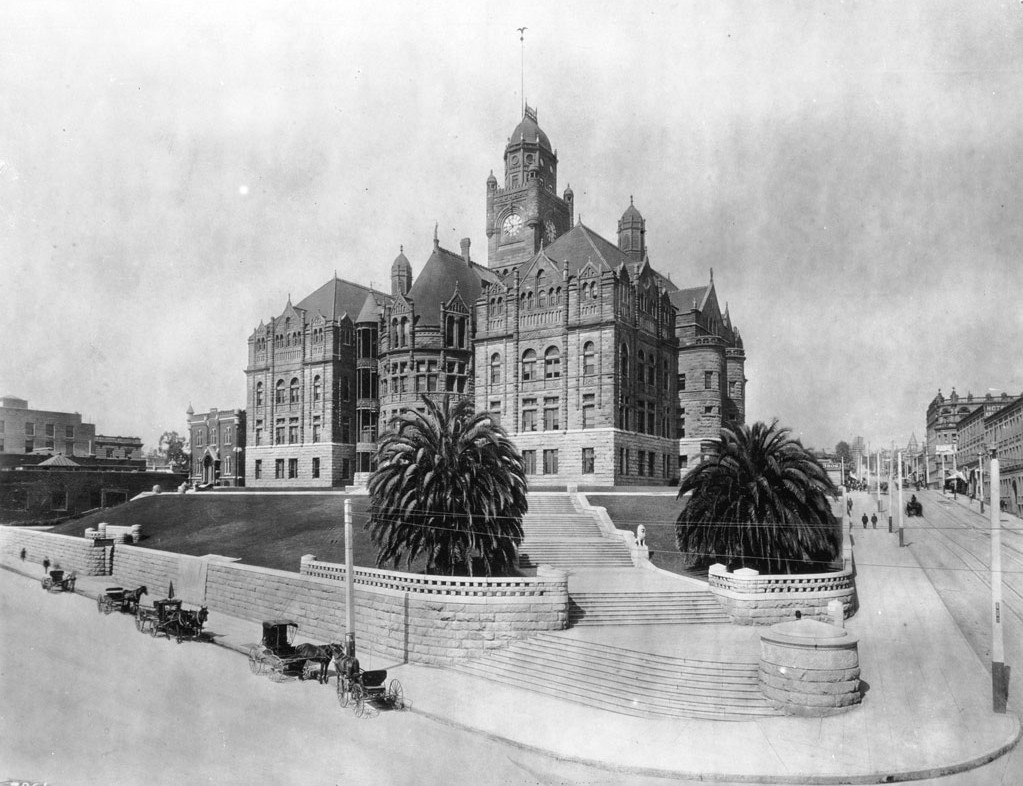
| (1900)* - Close-up view of the Los Angeles County Courthouse in 1900, taken from across Broadway near Rivers Bros. |
Historical Notes In 1891, the LA County Courthouse moved into it's new home, a beautiful new building constructed at the old site of Los Angeles High School where it stayed until 1932. Between 1861 and 1891 it was located in a large building on Temple Block sharing space with a theatre and marketplace. |
 |
|
| (ca. 1900)* - The Los Angeles County Courthouse from the corner of Temple Street and Broadway, facing south. Horse-drawn carriages are seen waiting at the curb. |
Historical Notes The County Courthouse building utilized an open-air elevator shaft that was added to the building before the turn of the last century. The circular shaft can be seen just to the left of the left palm tree. If you look closely, you can see the elevator car is between the first and second floors. |
 |
|
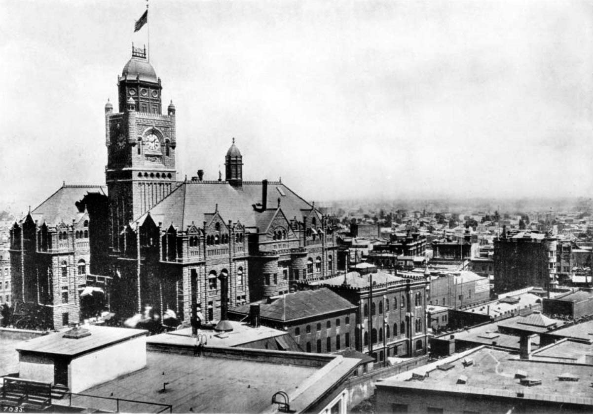
| (ca. 1906)* - View showing the LA County Courthouse and Jail looking west. The flat rooftops of high rise buildings fill the foreground while the gothic architecture of the courthouse stands to the left, its clock tower reading approximately ten minutes after nine o'clock and an American flag waving from its peak. |
Historical Notes The Court House was built from 1887-1891. It was damaged in the 1933 Long Beach earthquake, and declared unsafe for occupancy. Demolition started in 1935 (roof and two upper floors removed), and concluded 1936. Among the others, the photograph features the following buildings and structures: (John Anson) Bullard Block (1896-1926) can be seen between Main and Spring, Market and Court Streets; United States Hotel (1862-1939) is visible at left of upper Bullard on south-east corner of Main and Market Streets; Amestoy Building (1887-1958) is visible left of the U.S. Hotel, at north-east corner of Main and Market Streets. Additional information provided by the LA Conservancy: The numerals from one of the clock faces of the 1st County Court House were incorporated into one of the clock faces of the 2nd Court House, and were subsequently transferred to the east-facing upper clock of the 3rd Court House (opened 1959), north side of 1st Street between Grand Avenue and Hill Street, renamed the Stanley Mosk Court House. |
 |
|
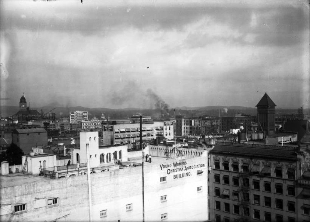
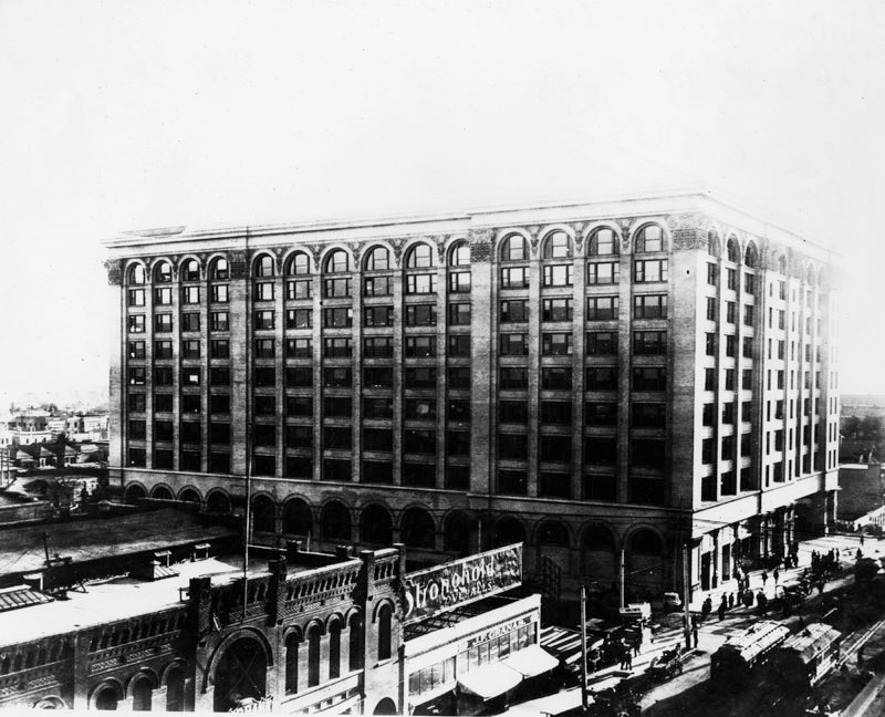
| (1906)^ - Birdseye view of Los Angeles looking northeast from the Third Street Hill. The Young Women's Christian Association (YWCA) Building is in the foreground at center. It is a large, light-colored building with several small rectangular windows on the side and two structures on the roof. There are also two men on the roof. The tall rectangular tower of City Hall with its pyramidal roof is at right, and the Hall of Records is being built near the LA County Courthouse in the distance at left. |
 |
|
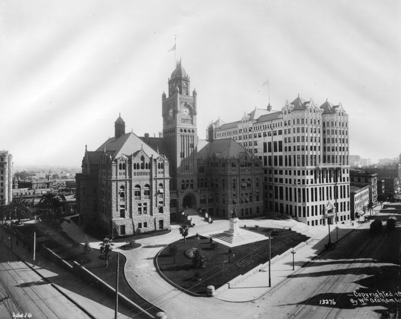
| (ca. 1906)* - View looking southeast at the intersection of Temple and Broadway, showing the LA County Courthouse side by side with the newly built Hall of Records. |
Historical Notes The LA County Courthouse was built in 1891 at the old site of Los Angeles High School. The building was demolished in 1932. The Hall of Records was built in 1906 to relieve overcrowding next door in the county’s red-sandstone courthouse. The new building consolidated most county offices under one lavishly ornamented roof—a showy headpiece that featured finials, pyramidal gables, and copper ribbing. The building was demolished in 1973. |
* * * * * |
College of Fine Arts
 |
|
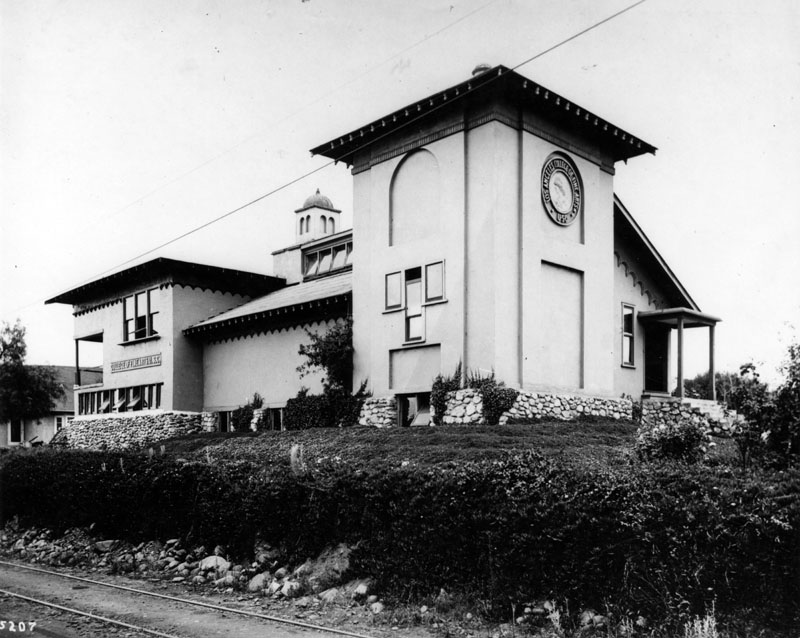
| (ca. 1900)* - View of Los Angeles College of Fine Arts, U.S.C. located at 200 S. Avenue 66 in the Garvanza district. Photograph shows a white three-story Moorish-style building with a stone foundation, and few windows. A large medallion with the school seal looms high on the right side of the building. |
Historical Notes In 1896 William Lees Judson (1842-1928), an English-born California landscape painter, was offered a professorship in drawing and painting at the University of Southern California. In 1897, he founded the Los Angeles College of Fine Arts at his home, located at 200 S. Avenue 66 in the Garvanza district. In 1901, Judson's art college became USC's College of Fine Arts, with Judson serving as dean from 1901 until his retirement in 1922. Under Judson's watch, the school flourished and gained a reputation as being among the largest, best equipped and most efficient in the West.* |
 |
|
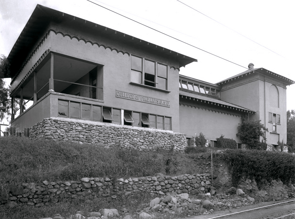
| (ca. 1900)^ - View of the College of Fine Arts building at the University of Southern California (U.S.C.), Garvanza, Los Angeles. |
 |
|
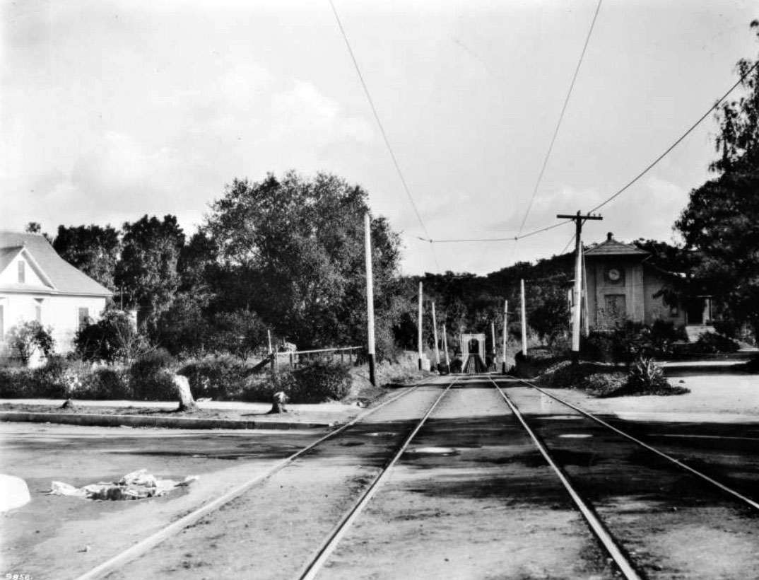
| (1907)^ – View looking toward the Pacific Electric Bridge crossing the Arroyo Seco with the University of Southern California College of Fine Arts (Judson Art Institute) seen at right. |
Historical Notes On December 1910, a fire devoured the original three-story Moorish-style building and its dormitories, and though no one perished, many of Judson's artworks were destroyed. In 1911, a new two-story Shingle Style, Bungalow/Craftsman building designed by Robert Train and Robert Edmund Williams was built on the site, and classes resumed there until 1920, when USC moved the College of Fine Arts to its central campus site (Click HERE to see more in Early Views of USC).* |
 |
|
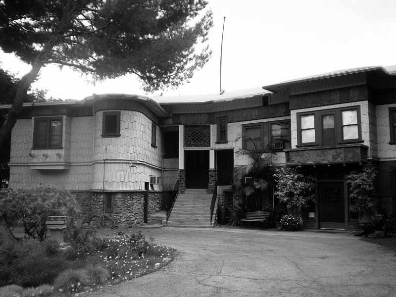
| (2008)^* - View of the Judson Studios building located at 200 S. Avenue 66 in Highland Park, Northeast Los Angeles. The Bungalow/Craftsman building was built in 1911 and designed by Robert Train and Robert Edmund Williams. |
Historical Notes With USC vacating the space in 1920, the building became the headquarters for a group called the Arroyo Guild of Fellow Craftsmen. Later, it would become the home of Judson Studios, the family-operated stained glass business which had initially opened and operated from Mott Alley near the Old Plaza and Union Station.* In 1969, the Judson Studios building was designated Los Angeles Historic-Cultural Monument No. 62 (Click HERE to see complete listing). That same year it was added to the National Register of Historic Places. |
* * * * * |
LA Fire Houses
 |
|
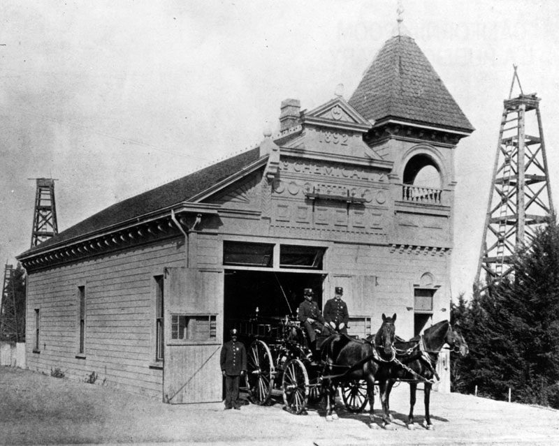
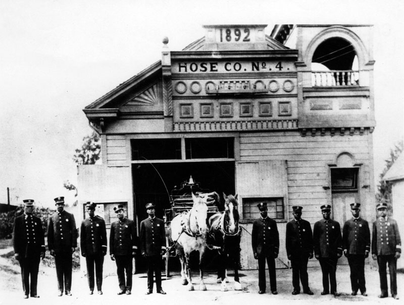
| (ca. 1900)* - This building housed Chemical Engine Co. No. 1 from 1892 to 1907, located at 137 S. Belmont (later changed to Loma), near W. First Street. Referred to as "The Hill", Chemical Co. No. 1 closed in 1907 and Hose Company No. 4 moved in and went into service at the same station. Two of the firemen pictured are identified as William Glenn and George Bright. |
Historical Notes In September of 1871, George M. Fall, the County Clerk for Los Angeles County organized Engine Company No. 1. This volunteer firefighting force disbanded in 1874 after the City Council refused to purchase horses to pull the fire engine and hose jumper-equipment that had previously been hand-drawn to fires. Soon after, many of the former members reorganized under the name of Thirty-Eights-No. 1. In May 1875, Engine Co. No. 2 was organized under the name Confidence Engine Company. In 1877, the first horses were bought for the fire department. In 1878, a third fire company was formed and was named Park Hose Co. No. 1. Five years later, in 1883, the East Los Angeles Hose Co. No. 2 was formed. And the final volunteer company, called Morris Vineyard Hose Co. No. 3, forming in the fall of 1883.* |
.jpg) |
|
| (1900)* - Los Angeles Fire Department, Chemical Engine No. 2, located at 3401 S. Central Avenue, at the corner of 34th Street. Two firemen and a "fire dog" sit atop a horse-drawn engine, and another stands to its right |
Historical Notes All of the volunteer companies remained in service until February 1, 1886, when the present paid Los Angeles Fire Department came into existence. When it was officially formed, it had 4 fire stations, 2 steam fire engines, 2 hose reels, a hose wagon, a 65' aerial ladder truck, 31 paid firefighters, 24 reserve firefighters, and 11 horses to protect 30 square miles and a population of 50,000.* |
 |
|
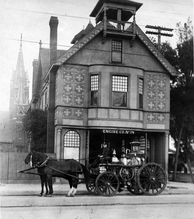
| (1914)^*# - View of Engine No. 14 in front of Engine House No. 14 (previously No. 2). |
Historical Notes From 1900 to 1902 the fire station at 3401 South Central Avenue housed Chemical Engine Company No. 2. From 1902 to 1919 Engine Company No. 14 was located there.^##* |
 |
|
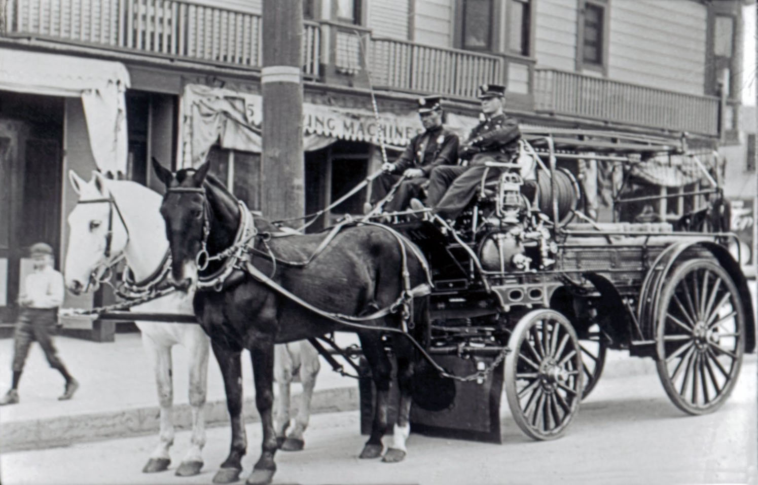
| (1911)^##*- Resting, but ready for Action! Two fireman sit on a horse-drawn fire ladder wagon as a boy walks by admiring the horses. |
Historical Notes Not seen here, however, Dalmatians were often used as a coach dog. These 60 lb dogs were used to guard the ladder wagon from theft and to keep the horses calm during the excitement of the fire. The fire-ladder wagon was loaded with attractive brass items that were easy pickings for boys looking for a souvenir.**# |
 |
|
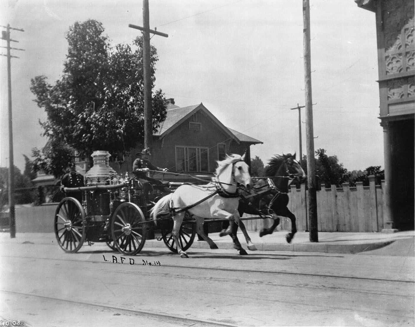
| (ca. 1910)^ - View of horse-drawn Engine No.14 running past the Engine House at 3401 S. Central Ave. |
Historical Notes On a cool day 50 MPH was easy for these horses when pulling the 6000 lb steamer pump. They would always use the best horses for the pump engine. Horses of the Morgan breed were most typically used. Often when the old fire engine horses were retired out to pasture, from blocks away they would hear the fire bell and run to the station house, ready to pull the wagon. The bell meant "get ready to be in harness". This was how loyal they were.**# |
 |
|
| (ca. 1910)* - Hose Company No. 4 opened on February 22, 1900 and was originally located on Jefferson Street, between Thirty-Second and McClintock Streets. |
Historical Notes In 1906-07, Hose Co. No. 4 closed and moved to its new location (pictured) at 137 S. Loma Drive (previously Belmont), which had formerly been occupied by Chemical Engine Co. No. 2, known as "The Hill". In 1924, Hose Co. No. 4 closed, and Engine Co. No. 58 opened in this same building. |
* * * * * |
State Normal School
 |
|
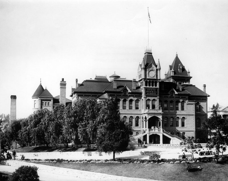
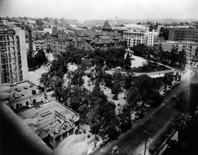
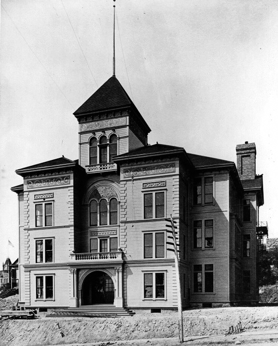
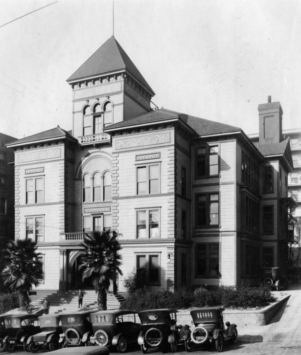
| (ca. 1910)* - View of the State Normal School, located at Grand Avenue and 5th Street. Here, clusters of students can be seen on the balcony, going up the stairway, and scattered around the grounds. The building opened in 1881 and was removed in 1924. |
Historical Notes In 1880, with a population of 11,000, Los Angeles was a gaslit pueblo trying to convince the state to establish in Southern California a second State Normal School like the one already existing in San Jose, some 300 miles to the north. In March of the following year, the State Assembly approved the establishment of such a school. A group of enthusiastic citizens, over 200 of whom contributed between $2 and $500, purchased a site less than a mile from the business section. Soon the towering Victorian form of the school rose from an orange grove that, today, is the site of the Central Los Angeles Public Library. |
 |
|
| (Early 1900s)* - Side view of the State Normal School, located at Grand Avenue and 5th Street. |
Historical Notes In March 1881, after heavy lobbying by Los Angeles residents, the California State Legislature authorized the creation of a southern branch of the California State Normal School (which later became San Jose State University) in downtown Los Angeles to train teachers for the growing population of Southern California. The State Normal School at Los Angeles opened on August 29, 1882, on what is now the site of the Central Library of the Los Angeles Public Library system. The new facility included an elementary school where teachers-in-training could practice their teaching technique on children. That elementary school is related to the present day version, UCLA Lab School. In 1887, the school became known as the Los Angeles State Normal School. |
 |
|
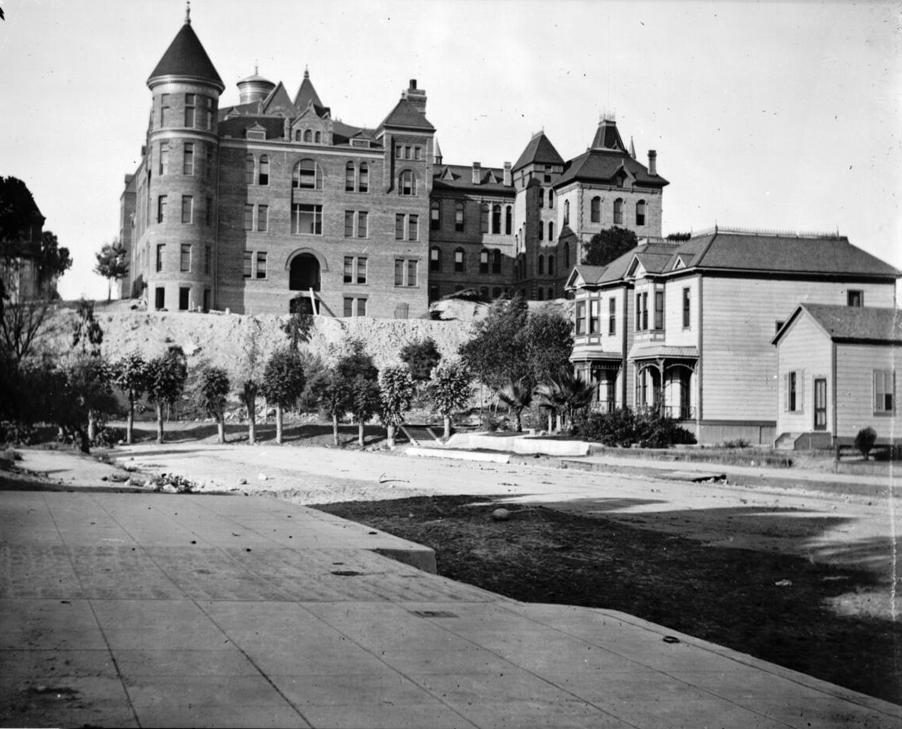
| (ca. 1898)* - Exterior view of the State Normal School. Residential homes sit on a cul-de-sac behind the school. |
Historical Notes Because the school sat impressively on the last knoll of Bunker Hill, aptly dubbed "Normal Hill", there were two ways to get to the main entrance: either taking the long and winding driveway located on the left side, or a long flight of stairs on the right (neither visible in this shot). The beautiful brick building had numerous tall windows all around, several chimneys, gabled dormers, a tower with a balcony and ornate grill, a set of stairs on either side leading to the main doors, and beautiful landscaping all around. |
 |
|
| (Early 1900s)* - Aerial view of the State Normal School, located at Grand Avenue and 5th Street. Because the school sat impressively on the last knoll of Bunker Hill, aptly dubbed "Normal Hill", there were two ways to get to the main entrance: either taking the long and winding driveway located on the left side, or a long flight of stairs on the right (partially covered by the trees), which was parallel to 5th Street. The large white building on the middle left is the Bible Institute, later to become the Church of the Open Door/Biola Institute, that was located on Hope Street; the Key West Rooms and Apartments is visible on the lower left. |
Historical Notes After the demolition of this structure (1924), 5th Street was straightened and the remainder of the site was eventually occupied by the L.A. Public Library. |
.jpg) |
|
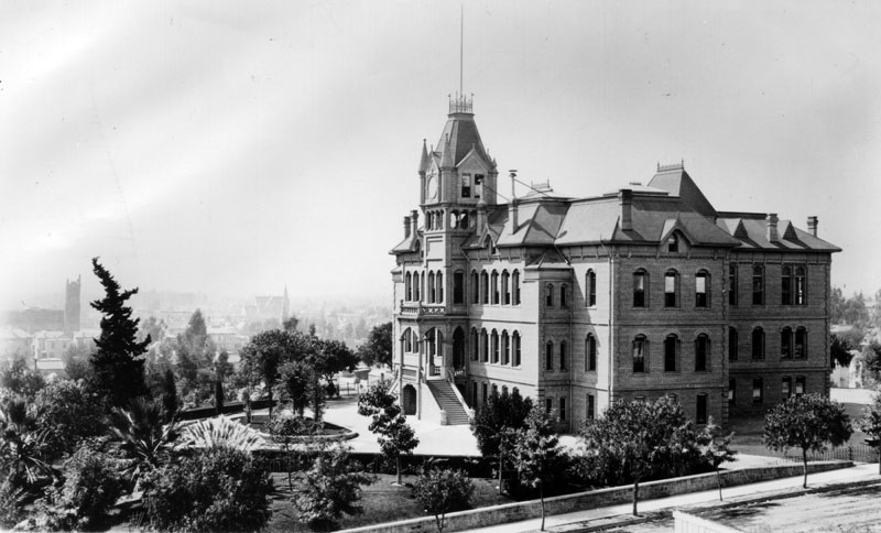
| (ca. 1905) - The four-story Victorian-style Normal School building can be seen at center overlooking a beautiful courtyard. The building features steep gables, pointed towers and ceilings, a circular tower at left, and a square tower at right. A few other much smaller buildings can be seen at right. Legible signs include: "State Normal School". |
 |
|
| (ca. 1905)* - The four-story Victorian-style Normal School building can be seen at center overlooking a beautiful courtyard. The building features steep gables, pointed towers and ceilings, a circular tower at left, and a square tower at right. A few other much smaller buildings can be seen at right. Legible signs include: "State Normal School". Photo by C.C. Pierce; Photo enhancement and colorization by Richard Holoff. |
Then and Now
 |
|
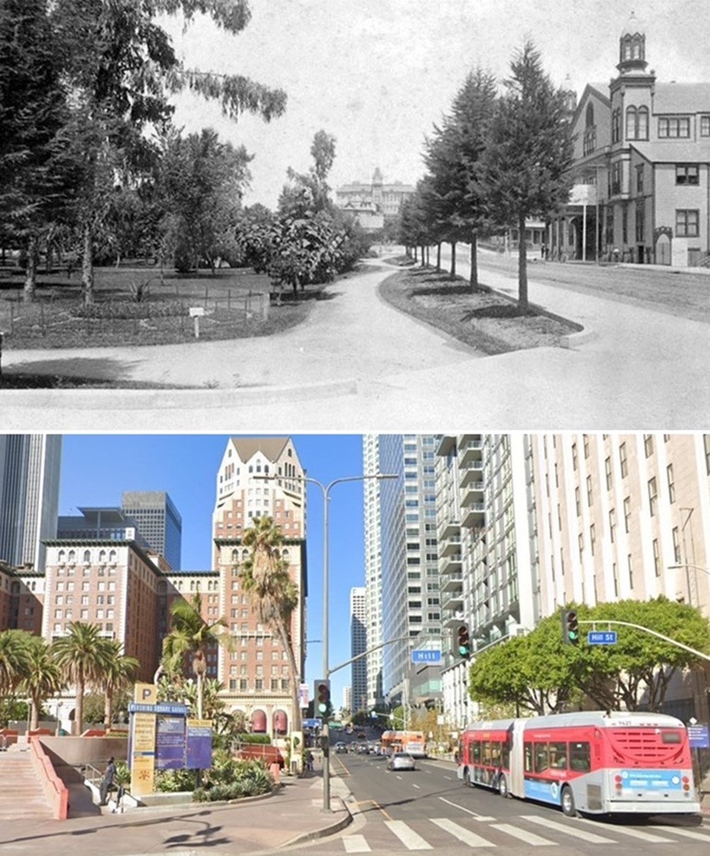
| (1890 vs 2021)* - Looking west on 5th Street at Hill Street. In the early image, 6th Street Park (now Pershing Square) is on the left. The State Normal School is visible in the distance at Grand Avenue, where 5th Street originally dead-ended. On the right is Hazard's Pavilion, which was demolished in 1905 to make way for the Philharmonic Auditorium. The auditorium itself was demolished in the 1980s and replaced by a modern office building. After the demolition of the State Normal School in 1924, 5th Street was straightened and extended past Grand Avenue. The remainder of the school site became the location of the L.A. Central Library, built in 1925. Photo comparison by Jack Feldman. |
Historical Notes After the demolition of the State Normal School in 1924, 5th Street was straightened and the remainder of the school site was eventually occupied by the L.A. Public Library. |
Then and Now
 |
|
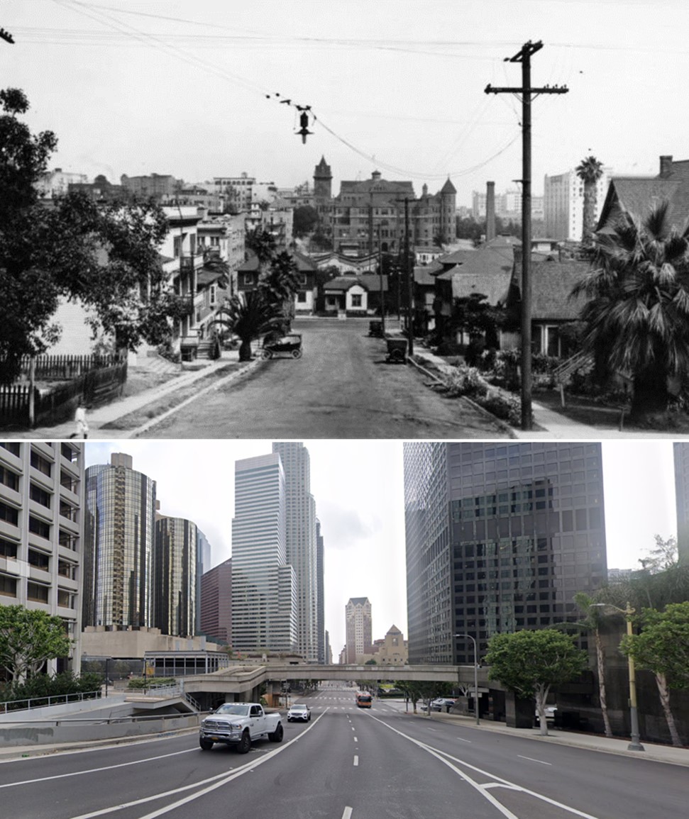
| (1922 vs 2021)* – Looking east on 5th Street toward Figueroa Street in DTLA. The top photo, dated 1922, shows the State Normal School located atop the last knoll of Bunker Hill, aptly dubbed 'Normal Hill.' In the mid-1920s, the school was demolished, Normal Hill was leveled, 5th Street was extended through to Grand Avenue, and the LA Central Library was constructed on the site where the old school once stood. Photo comparison by Jack Feldman. |
Historical Notes By 1914 the little pueblo of Los Angeles had grown to a city of 350,000 and the school, whose enrollment far exceeded its capacity, moved to new quarters -- a Hollywood ranch off a dirt road which would later become Vermont Avenue. With a view toward expansion, Director Ernest Carroll Moore proposed in 1917 that the school become the first branch of the Berkeley-based University of California. Two years later on May 23, 1919, California Governor William D. Stephens signed the legislation that created the "Southern Branch" of the University of California -- no longer merely a teacher's college but an institution that offered two years of instruction in Letters and Science. Third- and fourth-year courses were soon added, the first class of 300 students was graduated in 1925, and by 1927 the Southern Branch had earned its new name: University of California at Los Angeles (the "at" became a comma in 1958). As the student population of the University continued to increase, the need for a new site became obvious and the search was soon under way for a permanent home for UCLA. Click HERE to see more Early Views of the Normal School and UCLA. |
* * * * * |
Olive Street School
 |
|
| (ca. 1900)* - View of the Olive Street School, located between 4th and 5th, on Olive. This photo was taken near the end of construction. Notice the workman's ladder laying across the front steps. |
Historical Notes The Olive Street School was constructed at the turn of the century and was converted into a high school in 1909. An evening school was also opened there in 1908 for students that needed to work during the day. |
 |
|
| (ca. 1920)* - Exterior view of Olive Street School, located on the west side of Olive Street between 4th and 5th Streets. |
* * * * * |
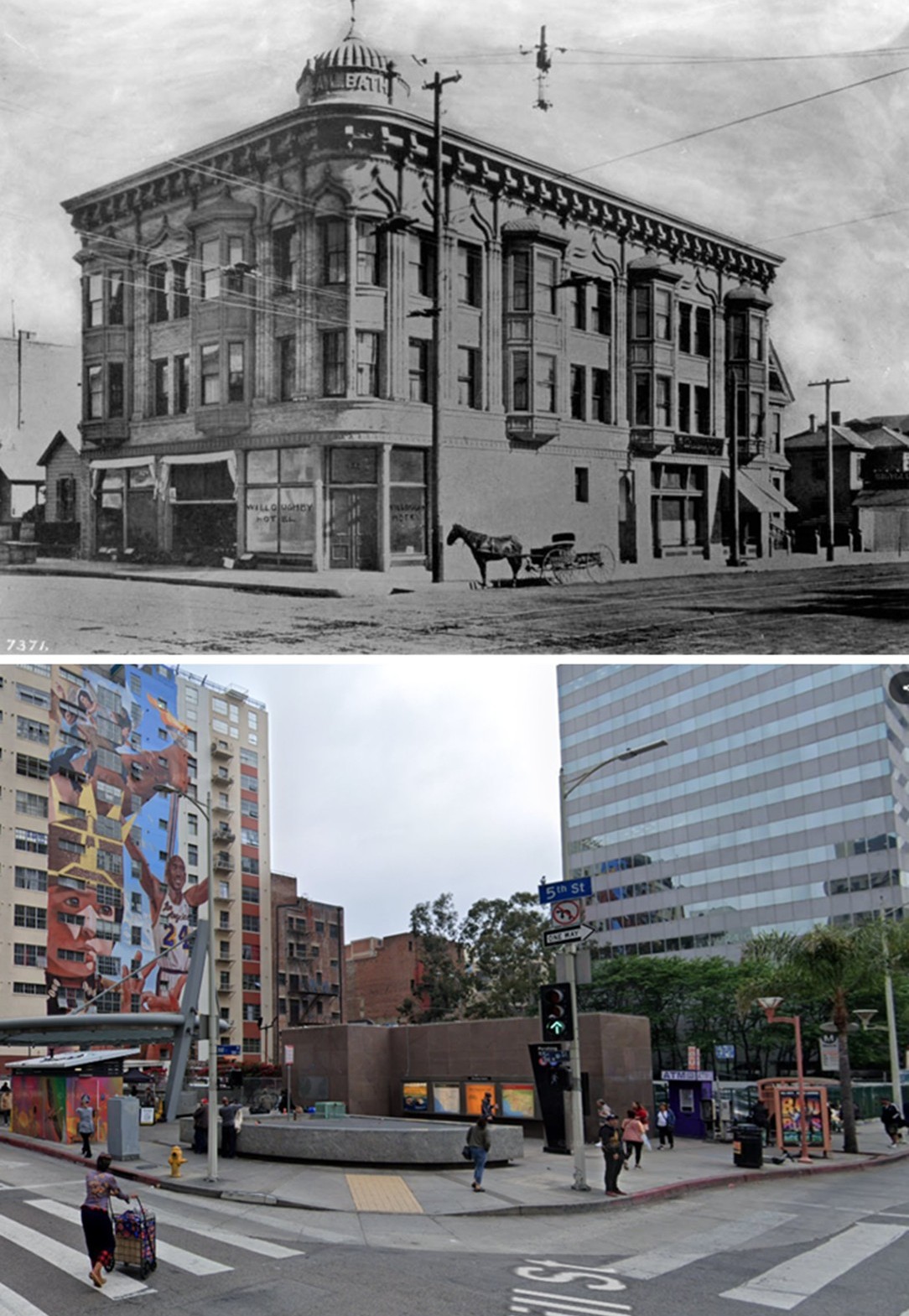
A. L. Bath Building (also the Willoughby Hotel)
 |
|
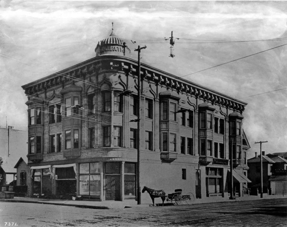
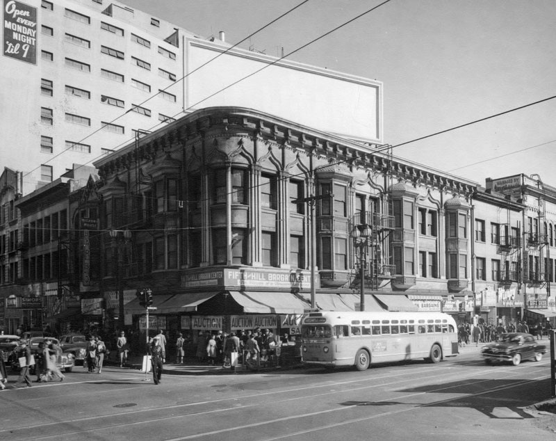
| (ca. 1900)* – View showing the A.L. Bath Building at the southeast corner of 5th and Hill Streets, directly across from Central Park (now Pershing Square). Built in 1898, this three-story Victorian-era structure featured a striking domed turret at the corner with “A. L. Bath” lettered around the rim. The upper floors housed the Willoughby Hotel, while the street-level windows advertised various commercial tenants. "Willoughby Hotel" appears written in the windows beside the entryway—possibly added to the image negative. A horse-drawn carriage waits at the curb. |
Historical Notes The A.L. Bath Building was developed by Nova Scotia native Albert Leander Bath and designed by architect Robert B. Young. Bath named the hotel for his mother’s maiden name, Willoughby. Its Moorish Revival design, including the corner spire and ornate detailing above the third story, was highly unusual for Los Angeles at the time. The hotel was managed by Mrs. E. Hollingsworth and consisted of 30 rooms. At the turn of the century, the building stood among other early landmarks such as Hazard’s Pavilion (1887) and St. Paul’s Episcopal Cathedral (1883), facing a still-residential Pershing Square. |
 |
|
| (ca. 1913)* - Looking east on 5th Street toward Hill Street, with the Willoughby Hotel prominently located on the southeast corner. The dome and bay windows of the A.L. Bath Building anchor the intersection, while Central Park (now Pershing Square) sits in the foreground at right. Streetcars have replaced horse-drawn transport as downtown continues to grow. |
Historical Notes By the 1910s, the Willoughby Hotel shared its block with the Boos Bros. cafeteria, Portsmouth Hotel, and Lillie Hotel, as the east side of Pershing Square became increasingly commercial. The Willoughby ceased operations as a hotel in 1917, though the building continued to house offices and businesses on the upper floors for decades. |
 |
|
| (1951)* - The A.L. Bath Building still stands at the southeast corner of 5th and Hill, but its original Moorish dome and cornice details are gone—likely removed to make way for rooftop billboard advertising. A large sign now occupies the flat roof. Milliron’s 5th Street department store dominates the background, rising behind the smaller three-story Bath Building. Modern buses have replaced trolleys, and the corner has fully transitioned into a dense urban retail zone. |
Historical Notes Throughout the 1920s–1950s, the building's appearance and purpose evolved, shedding many of its original architectural details. Despite the lost tower, the structure continued to operate with ground-floor shops and professional offices above. It became increasingly overshadowed by newer, taller neighbors such as the Pershing Square Building (1924) and Milliron’s. |
 |
|
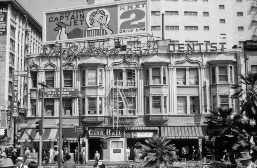
| (ca. 1950s)*- View of the Bath Block (formerly the Willoughby Hotel) at 506 South Hill Street. A billboard promoting the Captain Jet television program tops the roof. Dr. Albert L. Gibson’s dental office occupies the second floor, while the ground floor still supports retail tenants. The building retains a flat parapet and simplified brick façade. |
 |
|
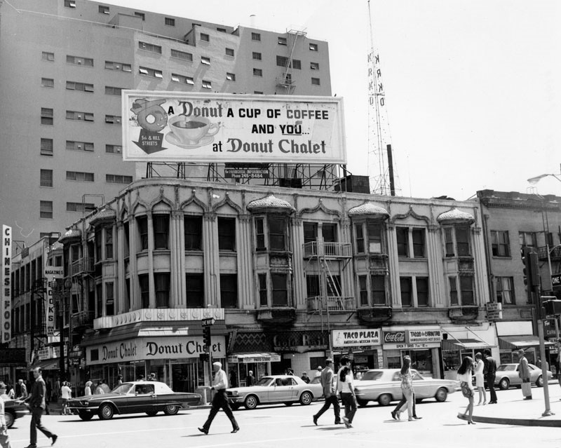
| (1971)* - Looking southeast at the corner of 5th and Hill Streets. The aging A.L. Bath Building now features a roof sign advertising, “a donut, a cup of coffee and you... at Donut Chalet.” The donut shop and other eateries occupy the ground floor. The building’s upper floors appear to be inactive, as newer developments dwarf the once-distinctive structure. |
Historical Notes By the 1970s, the former hotel was a relic of another era—its ornate architecture stripped, its scale dwarfed by a changing cityscape. Though neglected, it persisted as a commercial structure into the early 1980s. Its demolition eventually made way for major transit infrastructure. |
 |
|
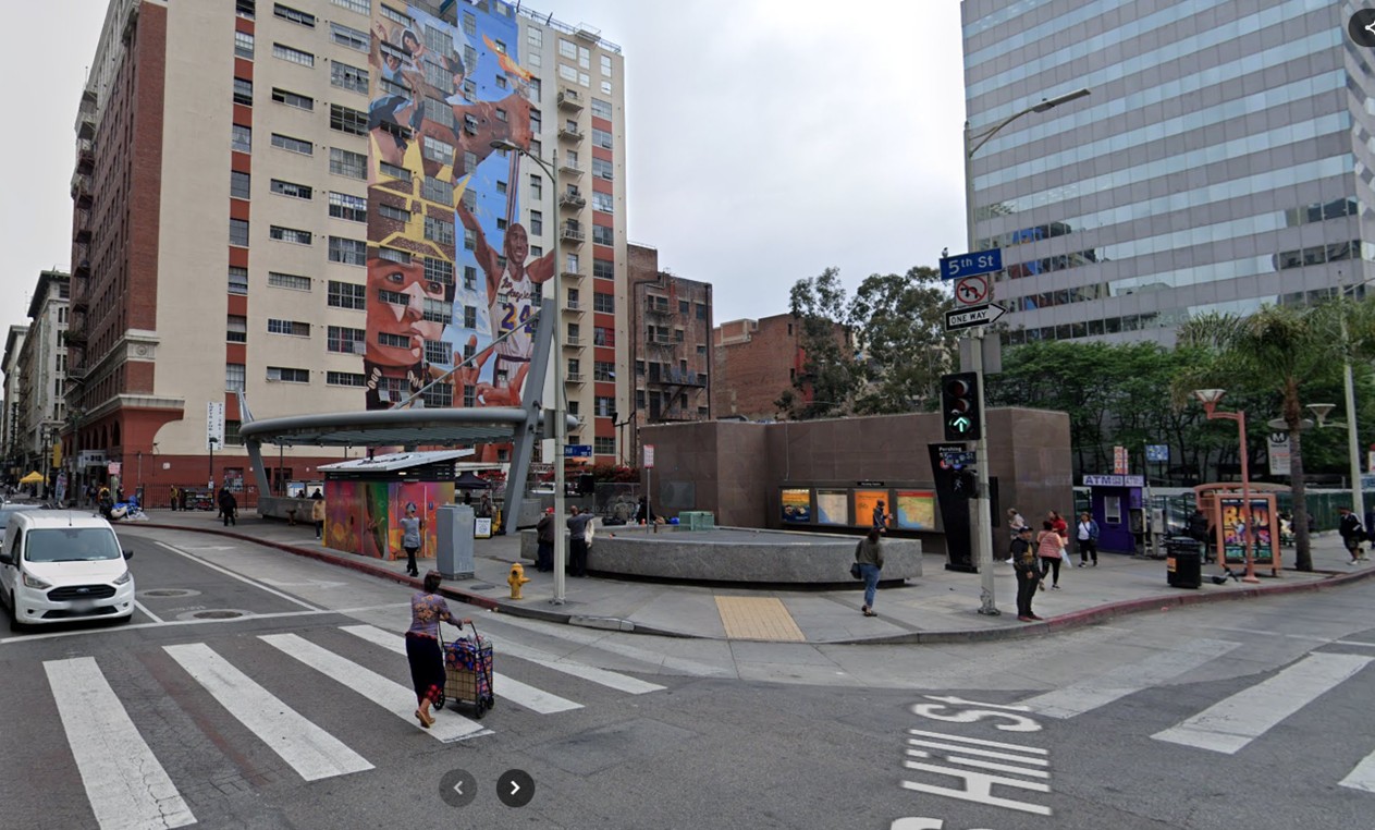
| (2024)* – Looking at the southeast corner of Hill and 5th Streets in downtown Los Angeles, showing the entrance to the Pershing Square Metro station. This was once the site of the A.L. Bath Building, now replaced by transit infrastructure and public art. |
Then and Now
 |
|
| (1900 vs. 2024)* – A 'Then and Now' view of the southeast corner of 5th and Hill Streets in downtown Los Angeles. Once the site of the ornate A.L. Bath Building, the corner is now home to Pershing Square Metro station infrastructure and public art. Photo comparison by Jack Feldman. |
* * * * * |
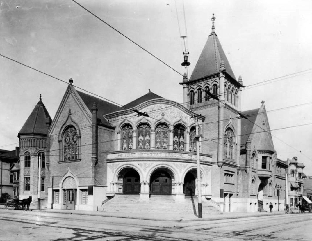
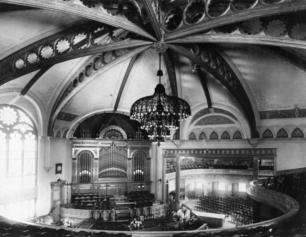
First Methodist Episcopal Church
 |
|
| (1902)* – View looking at the First Methodist Episcopal Church located on the northeast corner of Sixth and Hill streets. The curved entryway on the corner consists of three arched doors. Five arched stained glass windows are directly over the entryway. A square tower to the right of the entryway rises to a spire. The roof has two main peaks -- one at left, the other at right. An octagonal tower is at left. A horse-drawn wagon is parked on the curb at left and a pedestrian is walking down the sidewalk at right. |
 |
|
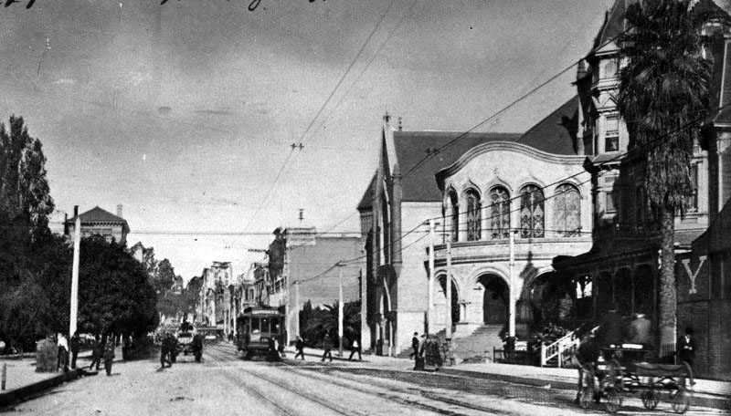
| (ca. 1900)* - View looking east on Sixth Street from Hill Street with the First Methodist Episcopal Church on the left (N/E corner). Three women and a man are in front of the church while another man is riding a bycicle. Streetcar tracks can also be seen on the unpaved road. |
 |
|
| (1900)* - Interior view of the First Methodist Church, John C. Austin is the architect. The view seems to be from an upper level of the church with the large chandelier hanging from the domed ceiling at center. Below flowers sit in front of the pulpit while the large organ pipes stand against the back wall. Daylight shines brightly from the large window at left. |
 |
|
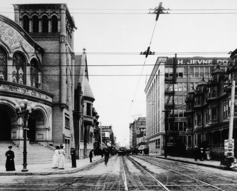
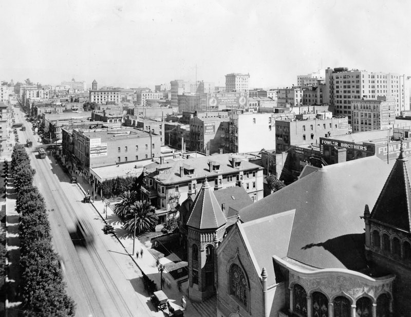
| (1906)* - View looking north on Hill Street with Central Park (Pershing Square) on the left. First Methodist Episcopal Church is on the right corner, on the N/E corner of 6th and Hill Streets. |
 |
|
| (1906)* – Postcard View looking north on Hill Street showing a horse-drawn wagon with two men heading toward 6th Street. The First Methodist Episcopal Church can be seen on the N/E corner with streetcar in front of it. Across the street on the left is Central Park (Pershing Square after 1918). |
 |
|
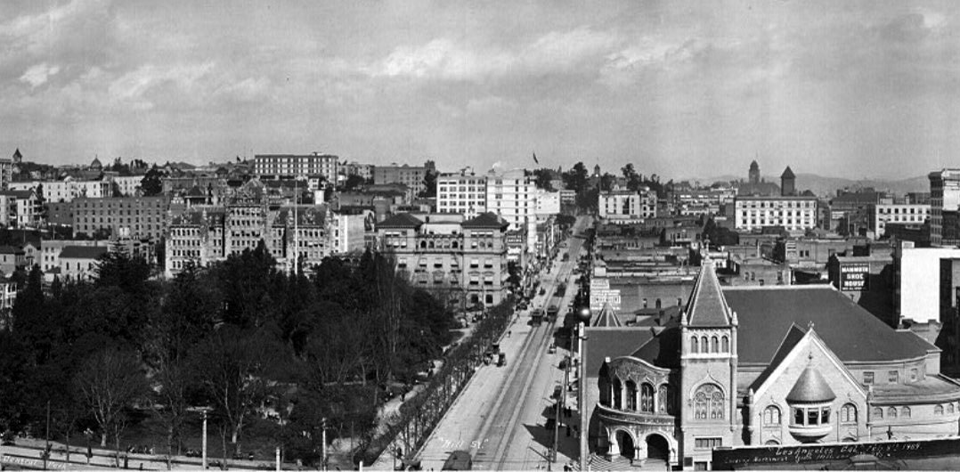
| (1909)* – Panoramic view looking north on Hill Street from over 6th Street with the First Methodist Episcopal Church seen in the lower-right (S/E corner). Central Park (later Pershing Square) is across the street on the left. On the north side of the park can be seen the Auditorium Building on the left. To its right is the California Club Building on the N/W corner of Hill and 5th streets. |
Historical Notes In 1923, the Church moved to 8th and Hope streets to accommodate the increasing numbers of parishioners. |
* * * * * |
Main and 9th Street (SW Corner)
 |
|
| (1912)* – View looking southwest at Main and 9th Streets, showing an Italianate/Victorian-style commercial building with ornate bay windows and a corner turret. Two men in uniform—likely streetcar conductors or motormen—stand in the intersection, possibly awaiting the arrival of a car or between shifts. |
Historical Notes Between the 1880s and the 1920s, Italianate and Victorian-style commercial buildings were a common sight in early Los Angeles, especially during the city’s explosive growth following the 1880s real estate boom. These styles—characterized by ornate cornices, bracketed eaves, arched windows, and decorative cast-iron details—lined Main, Spring, and Broadway, forming the visual identity of the city’s early business district. Often built as hotels, theaters, banks, and mixed-use structures, they reflected both European influence and East Coast sensibilities, adapted to the climate and ambitions of a young Western city. In the late 19th and early 20th centuries, the intersection of Main, Spring, and 9th marked the southern edge of a rapidly expanding downtown Los Angeles. With the arrival of electric streetcars in the 1890s, and the development of hotels, theaters, and commercial buildings by the 1910s, it became a key urban crossroads—bustling with streetcars, pedestrians, and automobiles. By the 1920s and 1930s, it was a vibrant transit and nightlife hub, serving as both a commuter gateway and a center for entertainment with venues like Miller’s Theatre, the Roseland Roof dance hall, and the Avodon Ballroom. Click HERE to see more on the Intersection of Main, Spring, and 9th Streets. |
 |
|
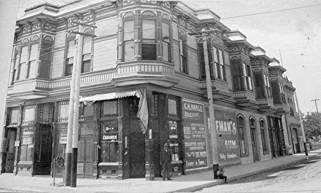
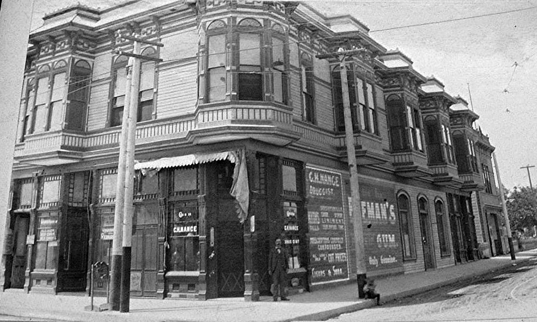
| (ca. 1900)* – Close-up view of a two-story Italianate/Victorian-style commercial building on the southwest corner of Main and 9th Streets, with C.H. Nance’s Drug Store occupying the ground floor. A man stands near the front entrance, while a young boy sits on the curb, leaning back against a pole. |
Historical Notes The above building was demolished in 1912 to make way for the 12-story Marsh-Strong Building. Although its loss marked the disappearance of another beautiful Italianate/Victorian-style structure, several similar buildings have survived to this day. Notable examples include the elegant Pico House (1870) and the adjacent Merced Theater, both still standing across from the Plaza; the long-demolished Baker Block, once admired for its mansard roof and ornate detailing; and the Stimson Block, a red sandstone Victorian landmark that once stood at Spring and 3rd. Though not strictly Italianate, the Bradbury Building (1893) blended Victorian-era design with Romanesque influence and remains a treasured icon. Many of these structures were lost to mid-century urban renewal, but their influence lingers in surviving examples and historic photographs that capture their once-prominent role in shaping downtown Los Angeles. |
Marsh-Strong Building
 |
|
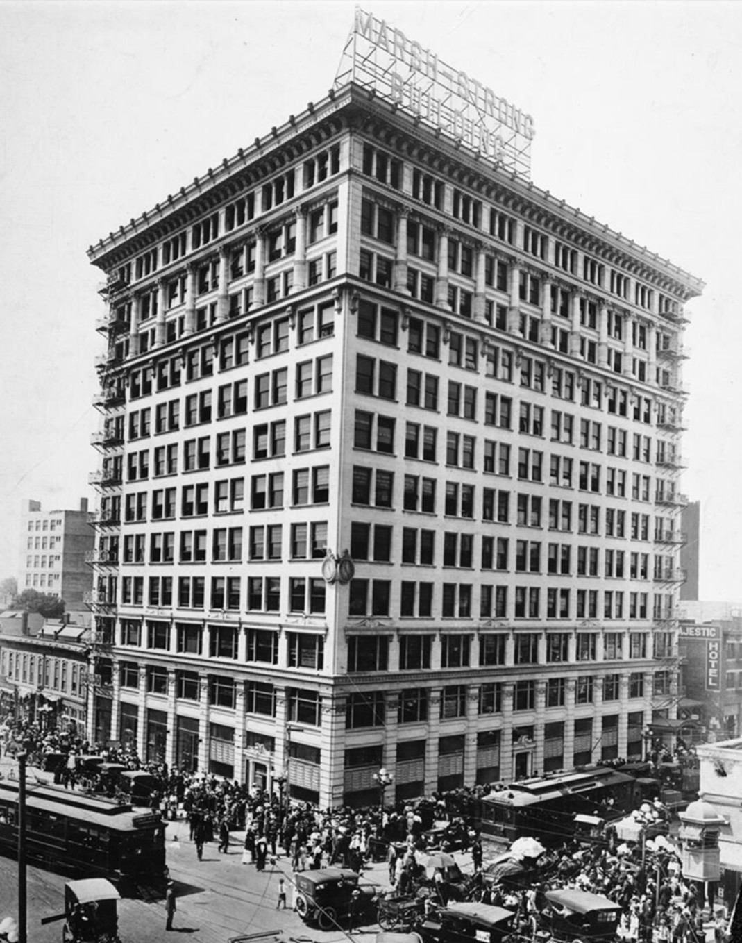
| (1914)* – The Marsh-Strong Building, located on the southwest corner of Main and 9th Streets in downtown Los Angeles. This 12-story Renaissance Revival structure, completed in 1913, replaced the two-story building seen in the previous photo. |
Historical Notes The Marsh-Strong Building, located at the southwest corner of Main, Ninth, and Spring Streets in Downtown Los Angeles, is a 12-story Renaissance Revival structure completed in 1913. Designed by architect Frederick Rice Dorn, with Loyall F. Watson as supervising architect, it was developed by Robert Marsh & Company. The building replaced a two-story Italianate commercial block that stood on the site until 1912. Featuring a brick and terra-cotta façade, the Marsh-Strong Building stretches 117 feet along Main Street and 148 feet along Ninth Street, originally housing nearly 400 offices. It was considered modern and fireproof for its time, symbolizing the commercial expansion of early 20th-century Los Angeles. Over the years, it became a vital part of the Fashion District, later renamed the L.A. Apparel Mart, offering over 130,000 square feet of space. |
 |
|
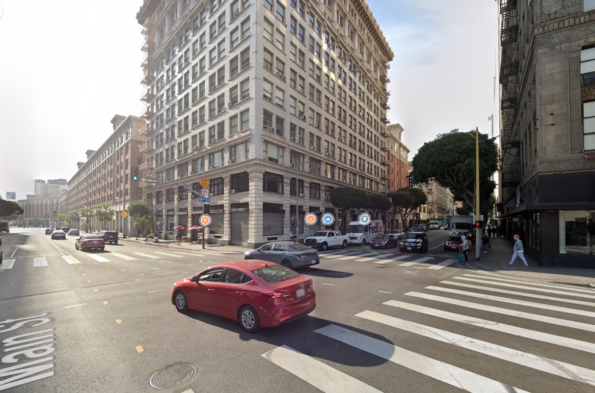
| (2022)* - Contemporary view of the Marsh-Strong Building on the southwest corner of Main and 9th Streets. |
Historical Notes The Marsh-Strong Building is tied to notable figures like William May Garland, a major force behind the 1932 Olympics, and has appeared in historical photos—including a 1912 image with policemen outside—and in early silent films, such as Charlie Chaplin’s 1914 work. Today, it remains a preserved example of pre-1920s Los Angeles commercial architecture and a significant part of the city’s evolving downtown landscape. |
Then and Now
 |
|
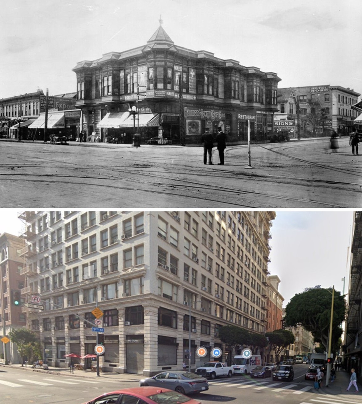
| (1900 vs. 2022)* – A ‘Then and Now’ comparison of the southwest corner of Main and 9th Streets in downtown Los Angeles, where the 1913-built Marsh-Strong Building now stands. |
Historical Notes Now called the L.A. Apparel Mart, the building serves as a hub in the Fashion District, offering over 130,000 square feet of commercial space. It has been repurposed for apparel-related businesses, retaining its historic character while adapting to modern needs. |
* * * * * |
Joe Gioia Grocery Store - Alpine and Broadway (originally Buena Vista)
 |
|
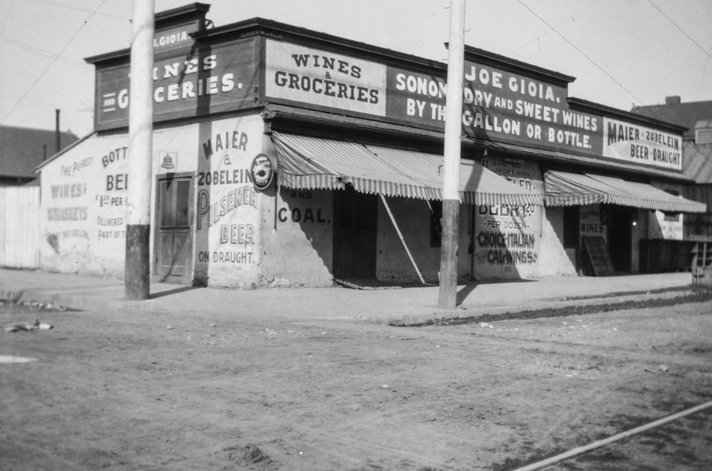
| (ca. 1900)* – View of the northwest corner of Alpine and Buena Vista Streets (now North Broadway), at 801 Buena Vista Street, showing the Joe Gioia grocery store. Painted signage advertises "Maier and Zobelein" beer, wines, groceries, and coal. Photo by George Washington Hazard from the Ernest Marquez Collection. |
Historical Notes This location sat on the northwestern edge of Sonoratown, a historically Mexican and Californio neighborhood that, by 1900, had become increasingly diverse—home to Italian, Chinese, and Mexican immigrant communities. The area would later be absorbed into what is now known as Los Angeles’s Chinatown. |
 |
|
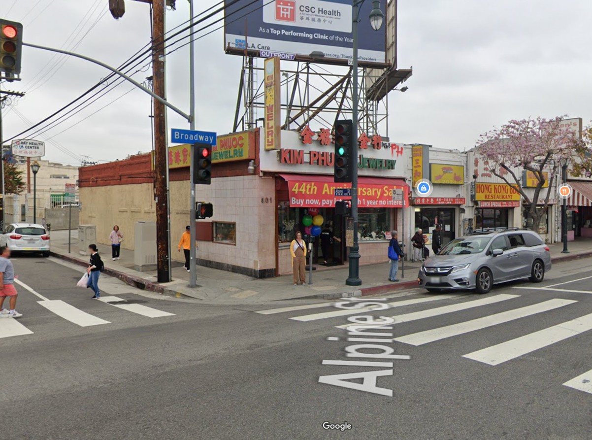
| (2024)* – Contemporary view of the northwest corner of Alpine Street and Broadway in Chinatown, home to the Kim Phuoc Jewelry store. |
Historical Notes The intersection of Alpine and Broadway marks the southern entrance into Los Angeles' Chinatown, just north of the historic Plaza area and Union Station. It's a well-known entry point lined with markets, eateries, and cultural landmarks, serving as a busy threshold into the neighborhood's core. |
Then and Now
 |
|
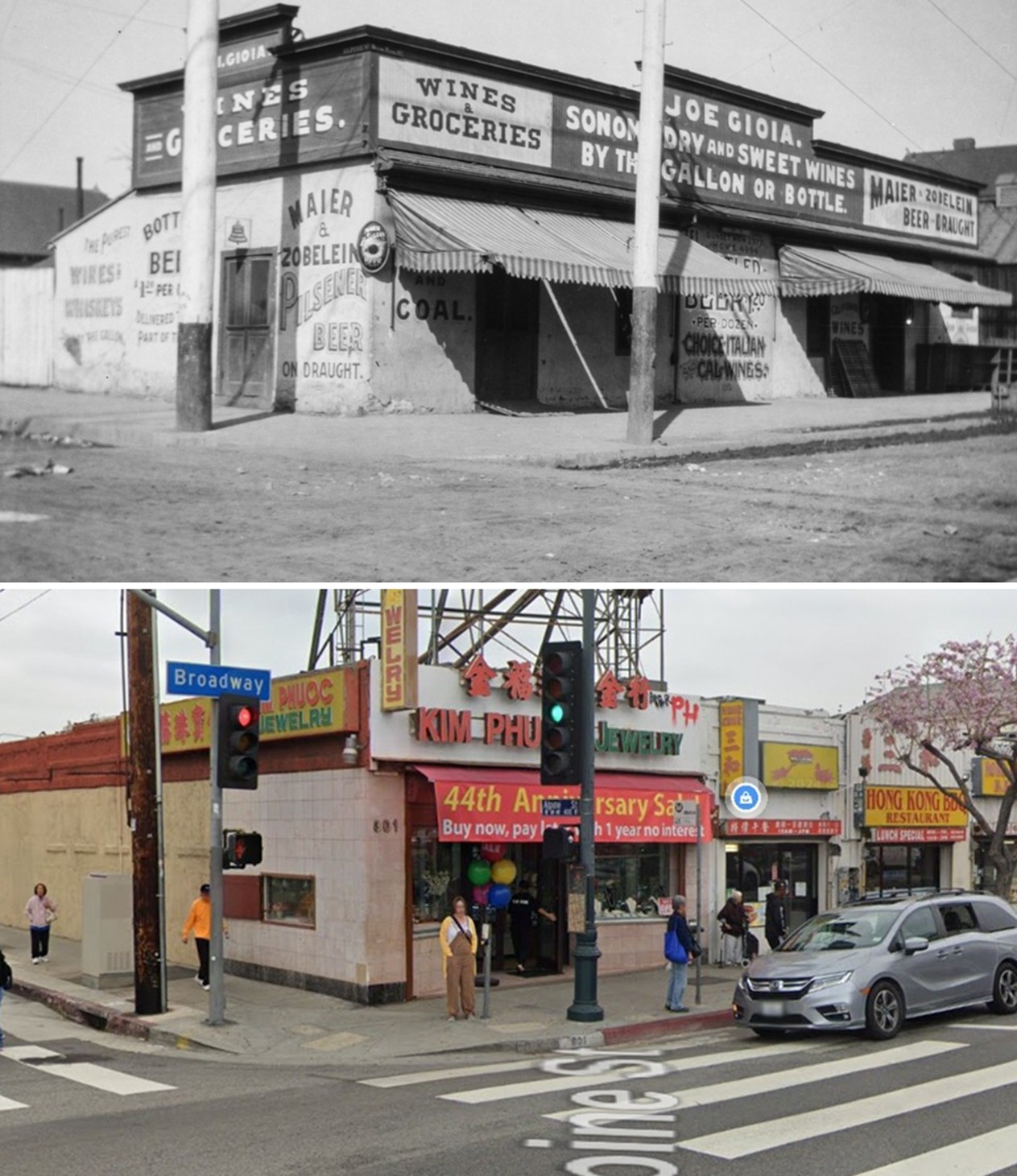
| (1900 vs. 2024)* – A ‘Then and Now’ comparison of the northwest corner of Alpine and Broadway (originally Buena Vista), showing the Joe Gioia grocery store—today the site of Kim Phuoc Jewelry store and Hong Kong BBQ restaurant. Photo comparison by Jack Feldman. |
* * * * * |
Los Angeles Brewing Co. (aka Eastside Brewery)
 |
|
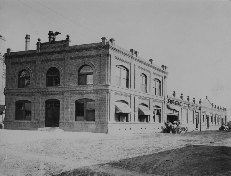
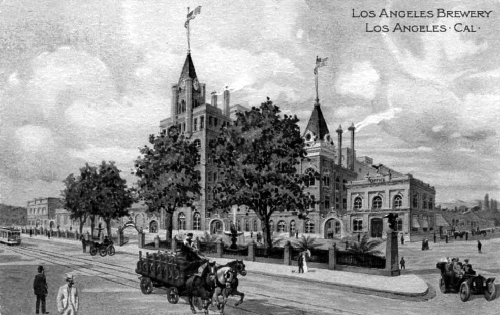
| (ca. 1900)* - Exterior view of the Los Angeles Brewing Co. building, located on North Main Street, east of the Los Angeles River, aligning with the area south of North Main and near Lamar Street. |
Historical Notes The Los Angeles Brewing Company, founded by P. Max Kuehnrich and Edward Mathie in 1897, was later acquired by Bavarian immigrant and experienced brewer George Zobelein in 1907. After leaving his partnership with Joseph Maier at the Maier & Zobelein Brewery, Zobelein took over and rebranded the brewery's beer as "Eastside" due to its location east of the Los Angeles River. Under his leadership, the brewery became a major local institution and one of the largest beer producers in the nation. The Los Angeles Brewing Company was located near the San Antonio Winery. The brewery was situated on North Main Street, east of the Los Angeles River, aligning with the area south of North Main and near Lamar Street. This location helped cement its local significance, particularly with the "Eastside" branding under George Zobelein's ownership, reflecting its position east of the river (Pabst) |
 |
|
| (Early 1900s)* - Postcard view showing the Los Angeles Brewery. |
Historical Notes In the years after the Civil War, waves of new immigrants and the national craze for German-style "beer gardens" created such a demand for malted spirits that beer replaced hard cider as America's most popular alcoholic drink. In response to that booming demand, the Los Angeles Brewing Co. opened in 1897 on the banks of the Los Angeles River, whose then cool and flowing waters were a key ingredient of the beer. Within two decades, the immigrant son of a German brew master would purchase the brewery and turn it into a local institution and the country's fifth-largest beer producer. |
 |
|
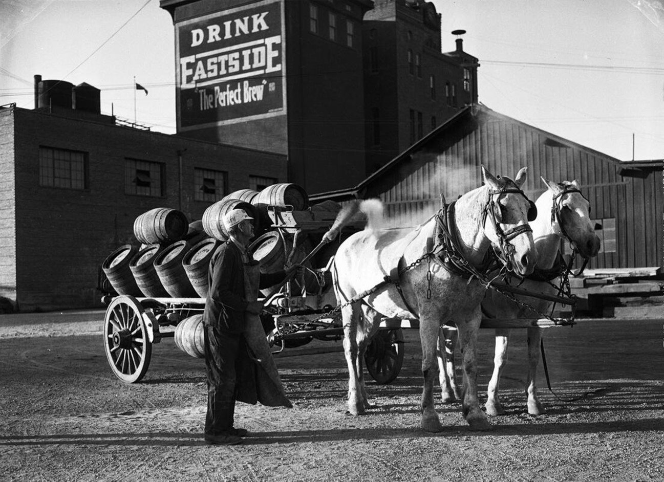
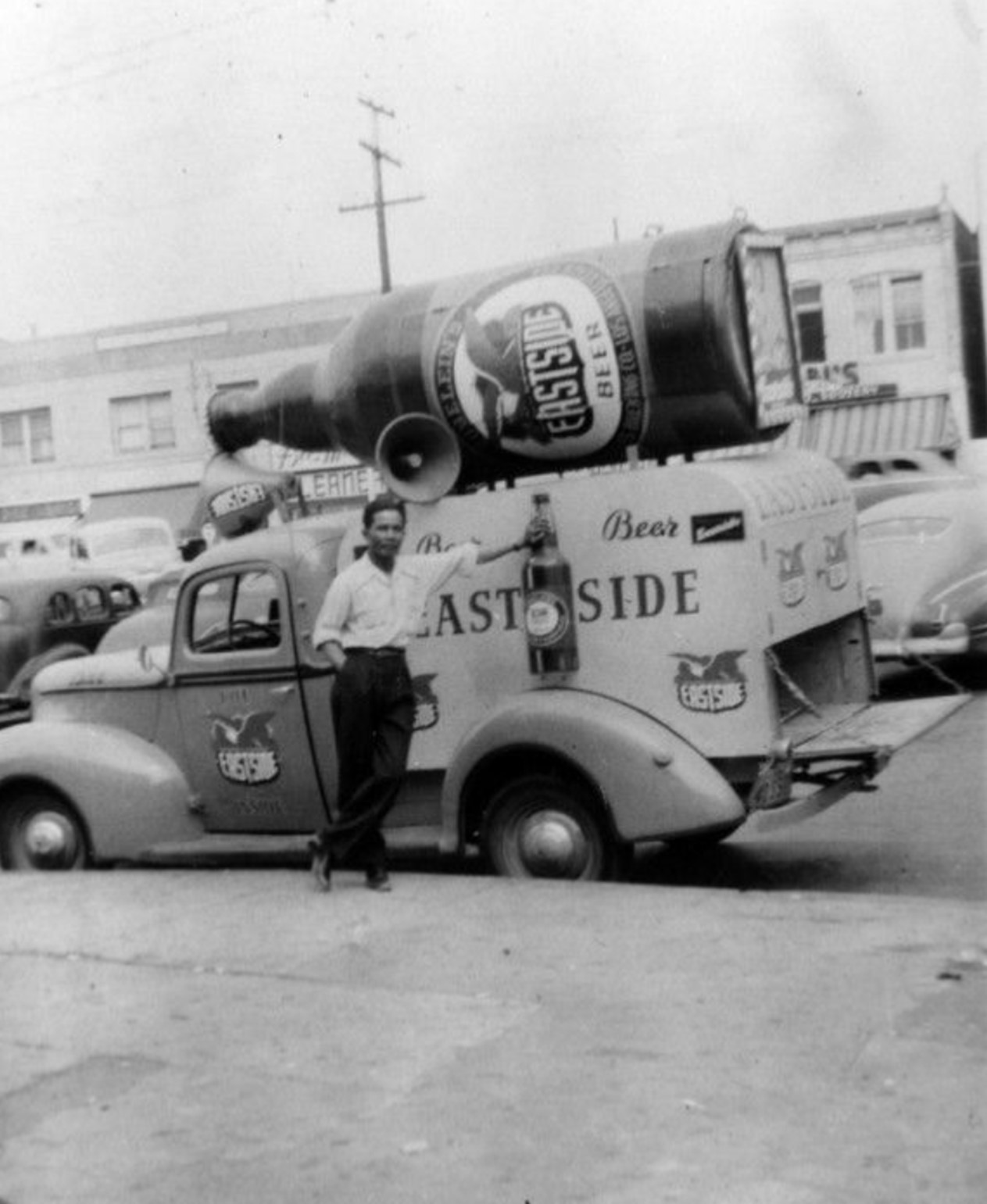
| (ca. 1933)* - A horse-drawn wagon carrying barrels of Eastside Brew is seen here at the Los Angeles Brewing Company. A man is seen sweeping dust off the backs of the two horses. |
Historical Notes In 1907, Zobelein named his new beer "Eastside" since Los Angeles Brewing Company was located east of the Los Angeles River at the 1920-2026 block of Main Street. The bottling facility later became Eastside Brewery, which was eventually sold and was finally owned by Pabst Brewery. |
 |
|
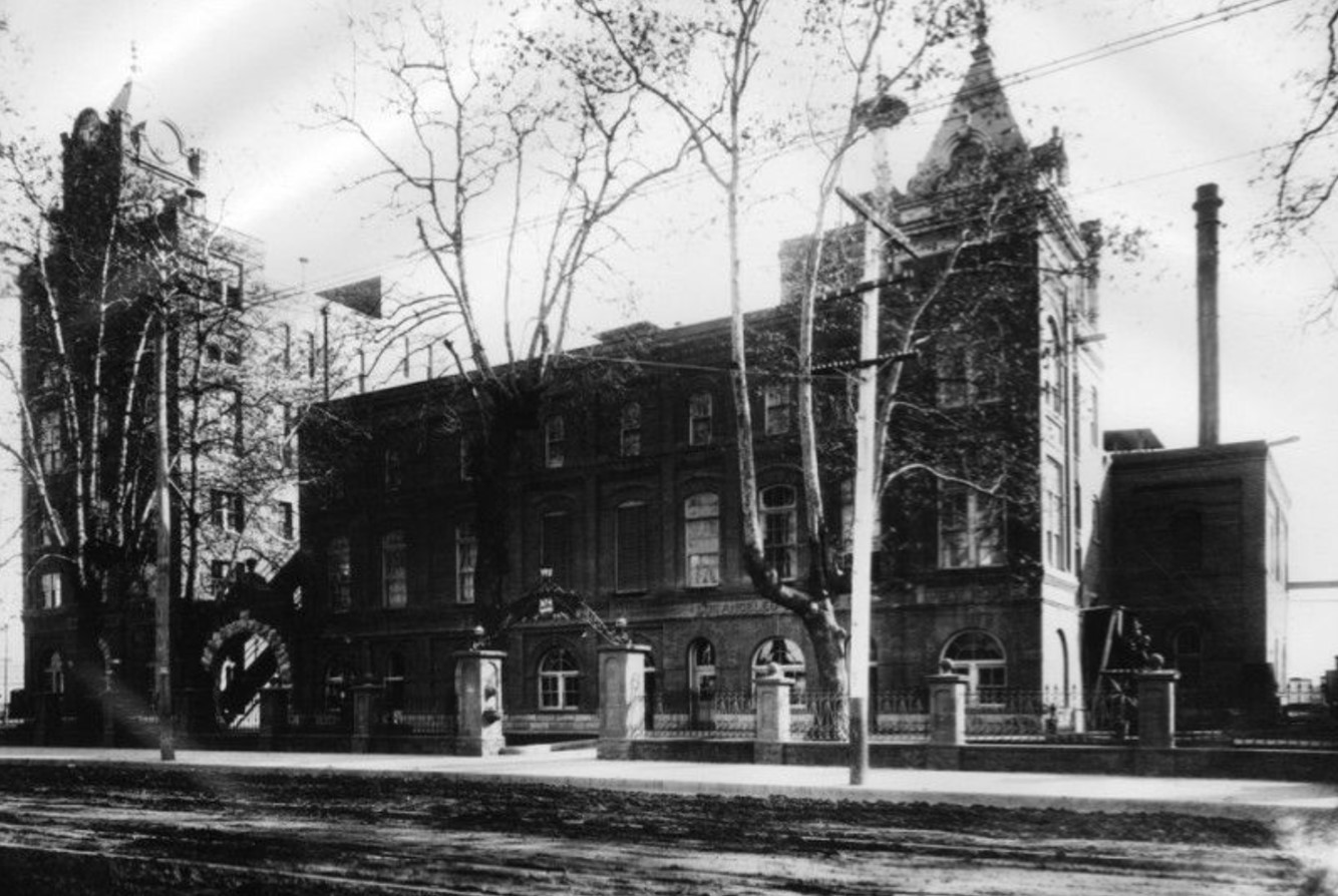
| (ca. 1908)* - View of the Los Angeles Brewing Co. building. Writing above some of the windows along the right portion of the building reads: "Los Angeles [illegible] Brew House". |
Historical Notes Maier Brewing Company Origins: The Maier Brewing Company was founded as Ed. Preuss & Company Philadelphia Brewery in 1874, later becoming the D. Mahlstedt Company Philadelphia Brewery. In 1882, it became the Maier & Zobelein Brewery, and after the dissolution of the partnership in 1907, it was renamed the Maier Brewing Company. Eastside Beer Company: The Maier Brewing Company introduced the Eastside brand of beer, which became quite popular. Eastside Beer was one of the flagship brands of the Maier Brewing Company. |
 |
|
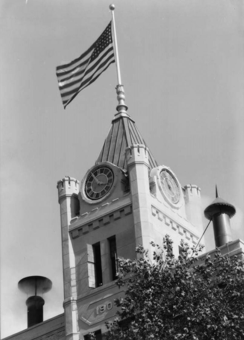
| (1934)^ – Close-up view of the clock tower at the Eastside Brewery. |
Historical Notes The Zobelein family sold the Los Angeles Brewing Company and its Eastside brand to Wisconsin-based Pabst in 1948. Pabst, in a race with other national brewers to expand first to the West Coast, opened a new plant next door to the old Eastside brewery and began making its Pabst Blue Ribbon lager in 1953. Rival brewers Anheuser-Busch and Schlitz both followed in 1954 by opening large industrial breweries in Van Nuys. The original building of the Los Angeles Brewing Company, located at 600 Moulton Avenue, is now part of The Brewery Artist Lofts complex. This complex houses artist studios, lofts, and creative spaces, maintaining the legacy of the historical brewery site. The Brewery Artist Lofts is known for its vibrant community and hosts events like the bi-annual Artwalk, showcasing the work of resident artists. Additionally, the area includes venues like Barbara's at the Brewery, a bar and grill that serves as a local gathering spot. |
 |
|
| (1940s)* - Silver Cariaso stands next to an Eastside Beer truck on Alameda Street, near the LA Plaza. Mr. Cariaso was an employee for many years at Terminal Island. |
* * * * * |
Chutes Amusement Park
 |
|
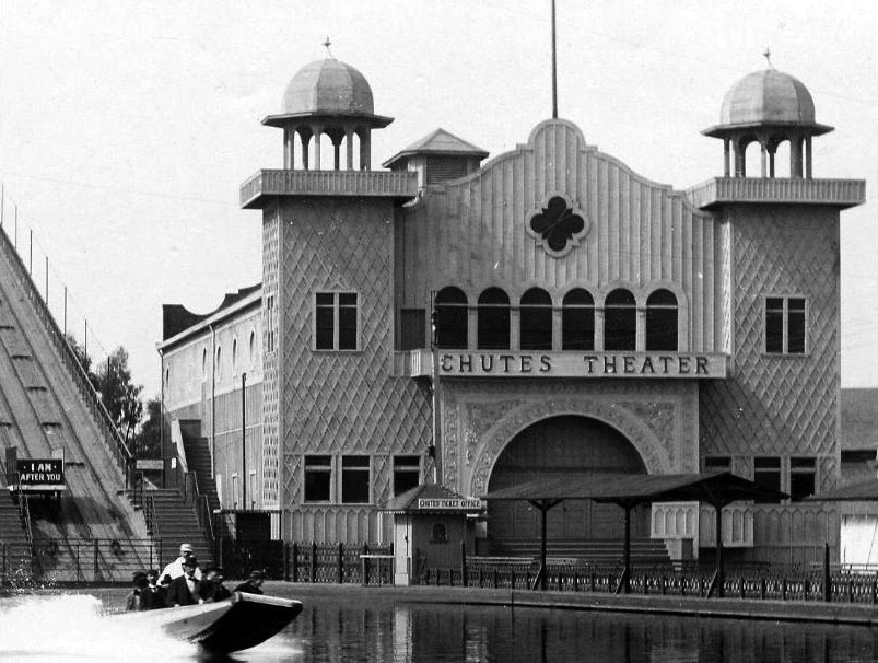
| (Early 1900s)* - View of the Washington Gardens Chutes Amusement Park. The Chutes Water Slide stands at center between a roller coaster and the Chutes Theater. |
Historical Notes Chutes Park began as a trolley park in 1887. It was a 35-acre amusement park bounded by Grand Avenue on the west, Main Street on the east, Washington Boulevard on the north and 21st Street on the south. At various times it included rides, animal exhibits, a theater and a baseball park. |
 |
|
| (ca. 1901)^#^ - View of a water slide splashing down into the Chutes' lake. The beautiful ornate Chutes Theater stands on the right. |
Historical Notes The site also included, at various times, such exotic diversions as a seal pond, ostriches and the interestingly named House of Trouble and Cave of the Winds. By 1901, it also had a 4,000-seat theater and a baseball park that seated 10,000. Click HERE to see more in Early Southern California Amusement Parks |
* * * * * |
B.H. Nance’s Drug Store
 |
|
| (Early 1900s)* – View of B.H. Nance’s Drug Store on the corner of S. Main and W. 9th streets. A man is standing by the front entrance of the building while a young boy is seen sitting on the curb, leaning back against a pole. |
* * * * * |
Occidental Hotel
 |
|
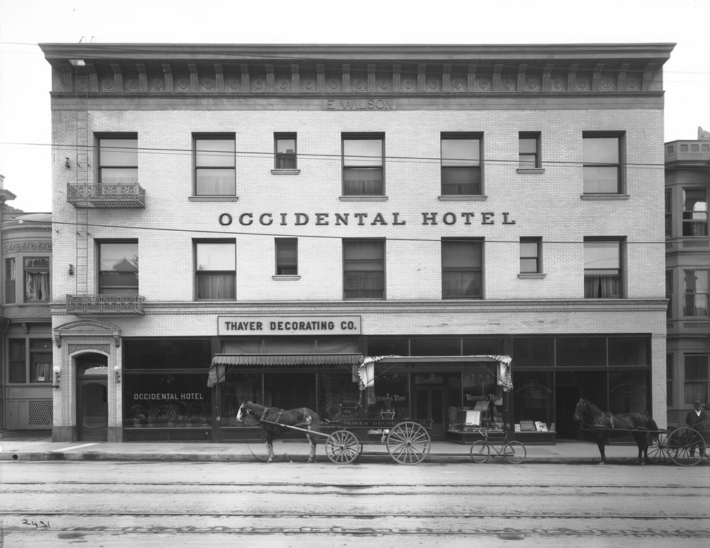
| (1900)^ - View of the Occidental Hotel located at 428 S. Hill Street. Thayer Decorating Co. is located on the street level. Architect, Robert B. Young. |
Historical Notes The Ezra Wilson Building, also known as the Occidental Hotel, was completed around 1898 at 428 South Hill Street. Though never one of the city’s landmark establishments, it was one of the earlier commercial buildings to venture into Pershing Square’s vicinity, at the onset of its rapid transition from residential district to downtown center. |
 |
|
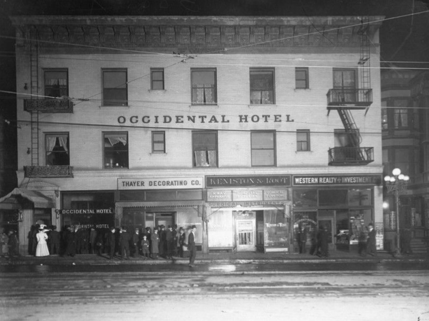
| (Early 1900s)* - Occidental Hotel seen at night with a crowd of people gathered at hotel entrance. Businesses on the lower floor now include Thayer Decorating and Western Realty and Investment. |
Historical Notes In the early 1900s, when purchased by hotelier A. Garrison von Ache, the building was turned into a 170-room hotel. It was a hybrid of the Occidental and the former Broadway Hotel whose entrance was from Broadway Street. |
 |
|
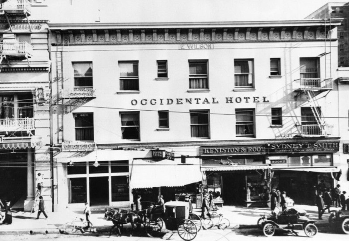
| (ca. 1910)* - Occidental Hotel seen from across the street with horse buggies and early automobiles in front. "E. Wilson" is on building just below the roof line. |
Historical Notes In 1914, the relatively humble building (428 S. Hill Street) was dwarfed by the 11-story Hotel Clark, which rose on the adjacent plot on its north side. The Occidental Hotel was eventually acquired and demolished by its neighbor and replaced by a two-story annex in 1937. Click HERE for contemporary view . |
 |
|
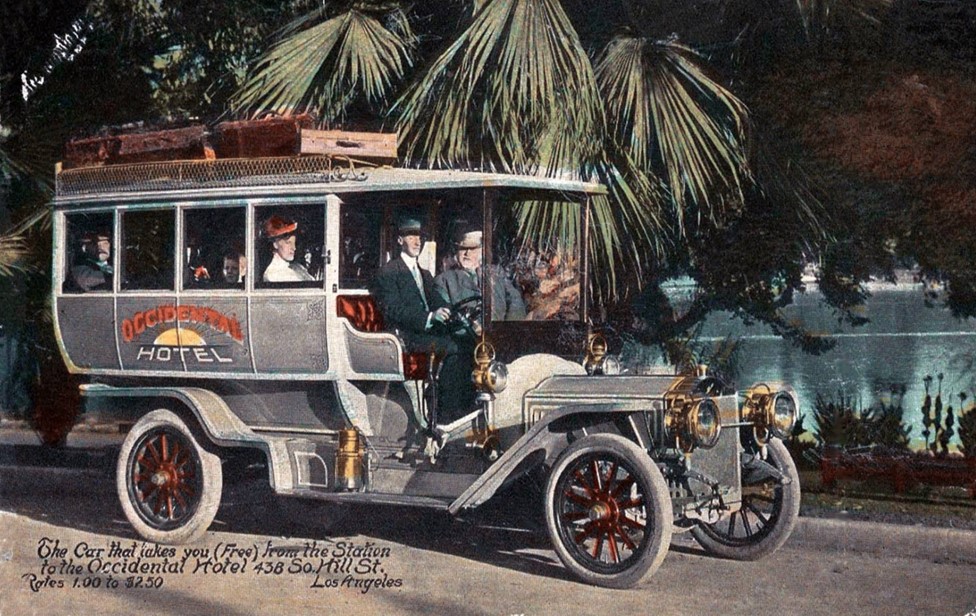
| (ca. 1910s)* – Postcard view showing the free shuttle from La Grande Station to the Occidental Hotel. |
Historical Notes Back of postcard reads: "Occidental Hotel. Rates, $1.00 to $2.50. Through the "Block" from Hill Street, to Broadway. Main Entrance, 428 So. Hill Street Los Angeles." |
* * * * * |
Vendome Hotel
 |
|
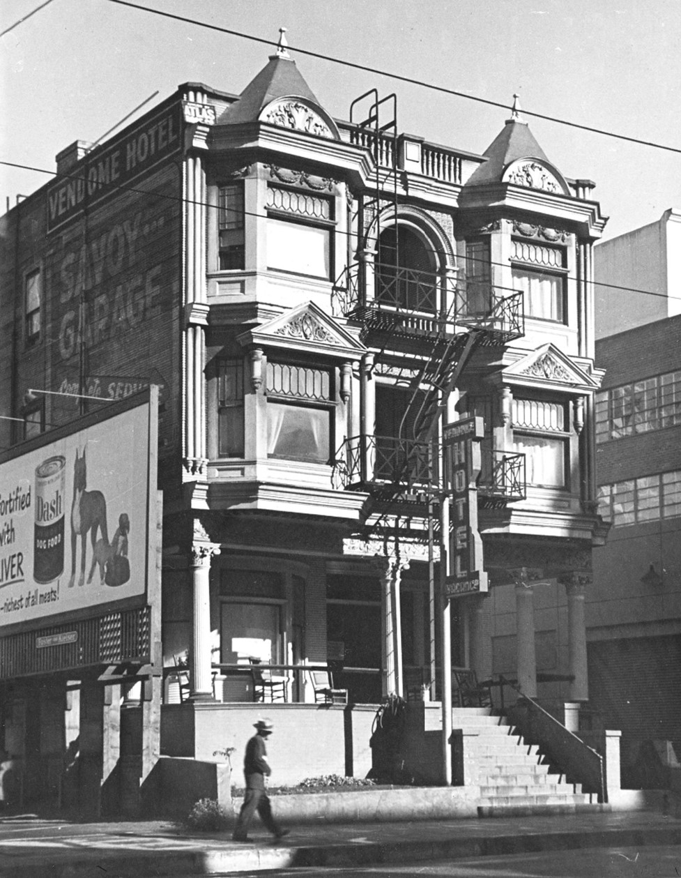
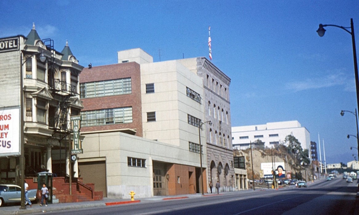
| (1947)* - Street view of the Vendome Hotel, located on the west side of Hill Street between Second and Third Streets. The Victorian-style structure features a shoe shine parlor at street level, with pedestrians adding life to the scene. Photo by Arnold Hylen. |
Historical Notes The Vendome Hotel, located at 231 South Hill Street in Los Angeles, was a three-story Victorian structure built in 1900 and designed by architect Charles H. Brinkhoff for the Barr Realty Company. Notable for its architectural features, including fire escapes, balconies, and bay windows, the hotel stood as a striking example of the period's design until its demolition in 1963. |
 |
|
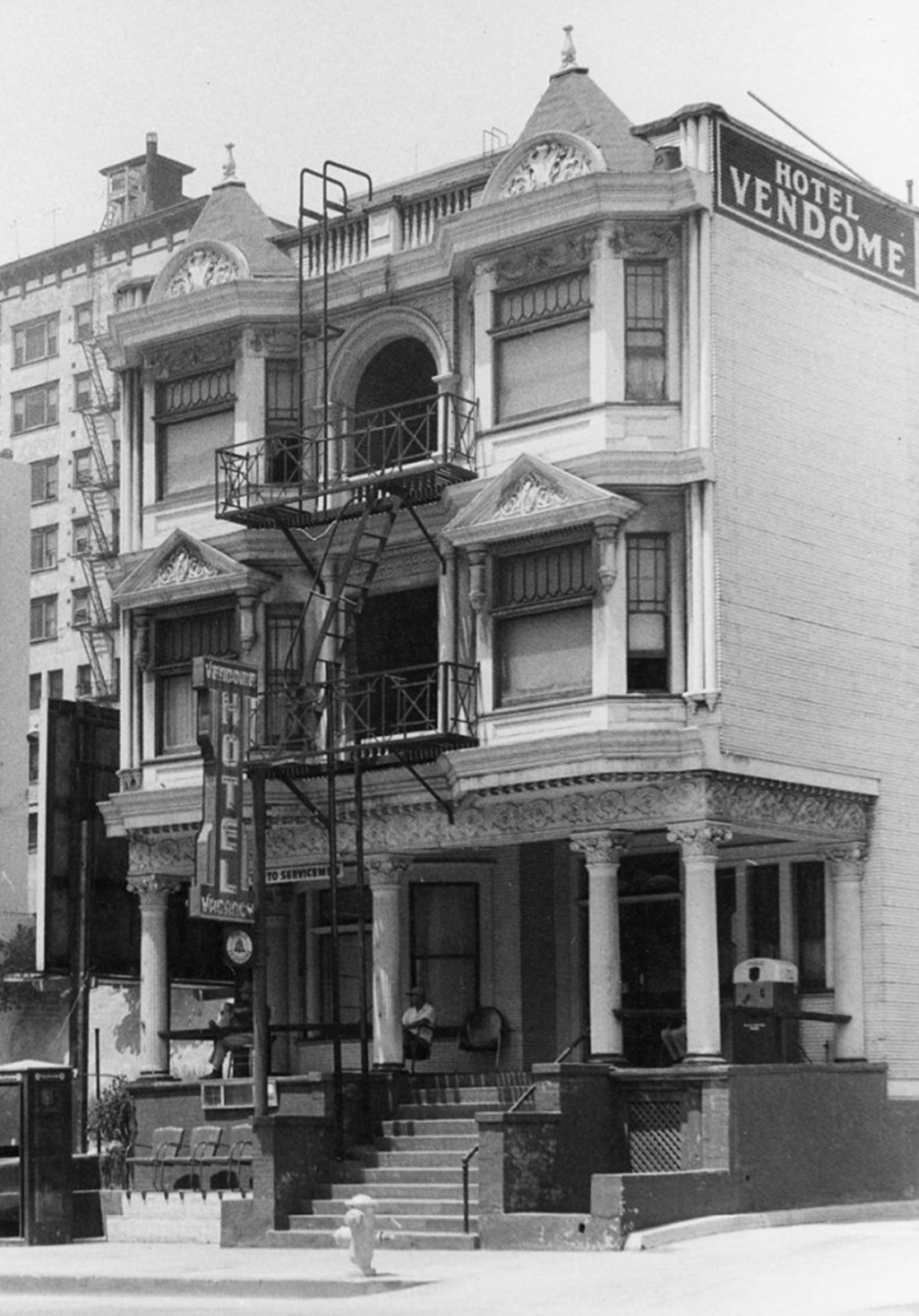
| (1950)* - A view of the bay-windowed and columned Vendome Hotel at 231 South Hill Street, just north of 3rd Street. A man walks past the building, while a billboard advertising Dash Dog Food is visible near its left side. Photo by Arnold Hylen. |
 |
|
| (ca. 1958)* - A view of the bay-windowed and columned Vendome Hotel at 231 South Hill Street, with two men lounging on its porch. In the foreground, a phone booth, fire hydrant, and shoeshine stand are visible. The Hotel Astoria is seen in the left background. Photo by Arnold Hylen. |
 |
|
| (1960)* - View of the Vendome Hotel at 231 South Hill Street, just north of 3rd Street. The structure features columns and bay windows, with a man seated in a chair on the porch. A phone booth is visible in the foreground. Photo by Arnold Hylen. |
.jpg) |
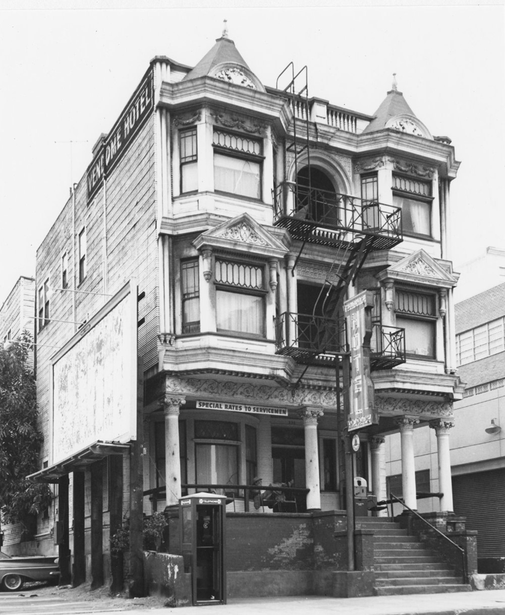
|
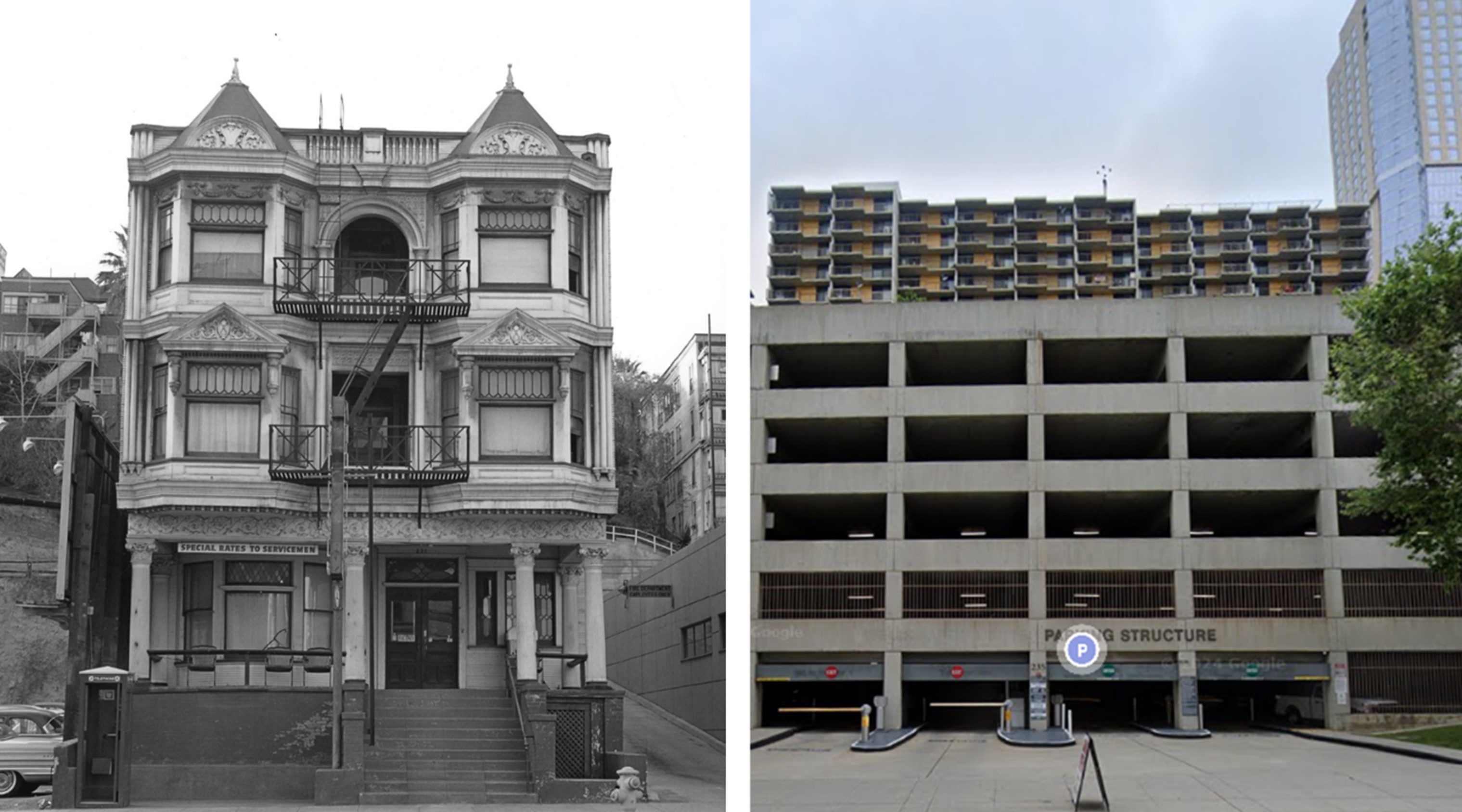
| (1960)* – Front view of the Vendome Hotel at 231 South Hill Street, a three-story Victorian structure featuring fire escapes, balconies, and bay windows. A sign reading 'Special Rates to Servicemen' is visible on the left. Photo by William Reagh. |
 |
|
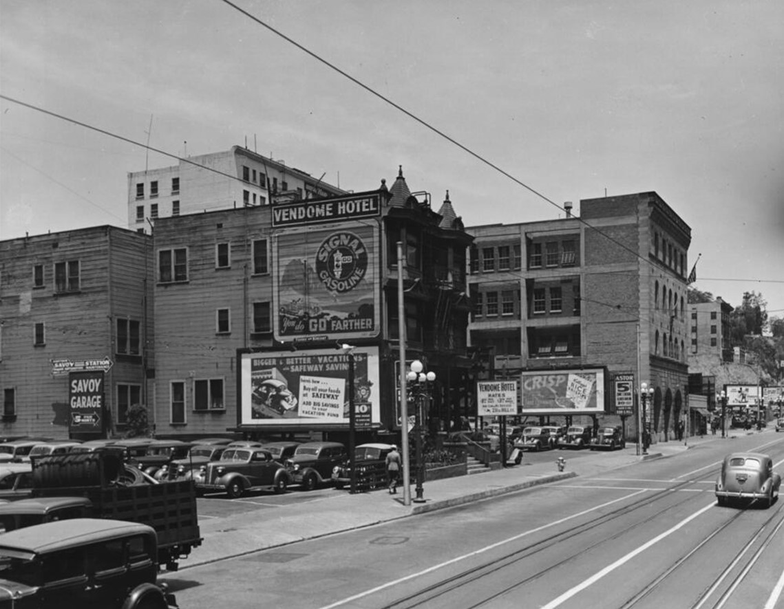
| (1939)* – Looking north on Hill Street, with the Vendome Hotel on the left advertising rooms for $1.00 per day or $3.00 per week for a clean, well-ventilated stay. Photo by Dick Whittington. |
 |
|
| (1958)* – A northward view across Hill Street, featuring, from left to right, the Vendome Hotel, Fire Station No. 3, and 2nd Street. In the distance, the Los Angeles County Courthouse (later renamed the Stanley Mosk Courthouse) and the Los Angeles County Hall of Administration (later renamed the Kenneth Hahn Hall of Administration) are under construction. Photo by L. Mildred Harris. |
Historical Notes In 1963, the Vendome Hotel was demolished as part of the Bunker Hill Redevelopment Project. Today, the site is occupied by a massive multi-story parking structure that extends to 2nd Street. Click HERE to see contemporary view. |
Then and Now
 |
|
| (1960 vs. 2024)* – The Vendome Hotel, now replaced by the entrance to a multi-story parking structure. |
* * * * * |
Los Angeles County Orphanage (aka Sisters' Orphan Home)
 |
|
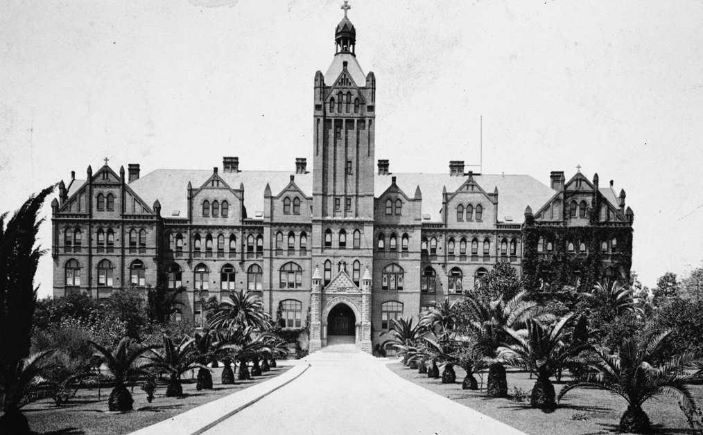
| (ca. 1899)* - Soon to become the L.A. County Orphanage, Sisters' Orphans Home on 7th Street and Boyle Avenue in Boyle Heights. |
Historical Notes The Romanesque style building has a central bell tower topped with a cupola and cross. The tower has wall dormers, turrets, arched windows and vertical coursing. The main building has wall and roof dormers, horizontal corbeled moldings, pilasters, brackets, arched windows and a decorative cornice. The entrance has half turrets with crosses and a pediment with a checkerboard pattern. The orphanage typically dominated the eastern horizon in the days before the County General Hospital went in. |
 |
|
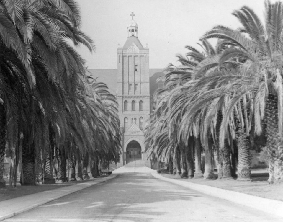
| (ca. 1900)* - The Los Angeles Orphanage at 917 South Boyle Avenue, southwest corner of Boyle Avenue at Stephenson Avenue (now Whittier Boulevard) in Boyle Heights. The orphanage is a five-story, brick, L-shaped building with dormer windows on the facade and a tower at the entrance that is flanked by newly-planted date palm trees. Steps lead to an arched entryway at the bottom of the tower. Several chimneys sit atop the roof. |
Historical Notes The girl's orphange and school was established in 1856 by six Sisters of Charity nuns from Emmitsburg, Maryland, the motherhouse in the United States. They selected a house with vineyard and orchard belonging to B. D. Wilson for $8,000. This gave the orphanage an income from wine grapes and a supply of fresh fruits and vegetables. The 917 South Boyle Avenue site opened in 1890 on twelve acres and remained open until the it was condemned in 1953 and the orphanage moved to Rosemead. |
 |
|
| (ca. 1930)* - View of the Los Angeles Orphan Asylum in Boyle Heights. |
Historical Notes For over sixty years the facility served thousands of orphaned children in Los Angeles. Concerns over structural integrity came about in the early 1930s when construction crews blasting the hillside next to the asylum for the extension of Sixth Street weakened the massive structure's foundations. While the building was used for classes during the day, children and staff slept at the basement at St. Vincent's Hospital in the evenings. |
 |
|
| (ca. 1930s)* - Los Angeles Orphanage. |
Historical Notes The Los Angeles Orphanage, also known as the Sisters' Orphan Home, was a prominent institution in Boyle Heights, Los Angeles, from the 1930s through the 1950s. Located at 917 S. Boyle Avenue, this imposing Romanesque-style building was completed in 1891 and played a crucial role in caring for thousands of orphaned children. The orphanage faced significant challenges during this period, including structural damage from nearby construction and the 1933 Long Beach Earthquake, which forced children and staff to sleep in the basement of St. Vincent's Hospital for safety. |
 |
|
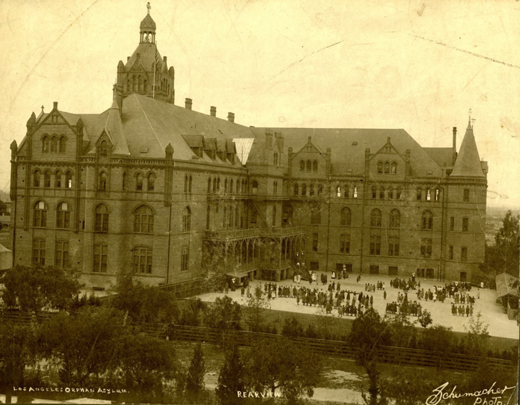
| (Early 1900s)* - Rear view of the Los Angeles Orphanage, where young girls are seen lined up in groups in the play area. |
Historical Notes Despite structural damage from nearby construction and the 1933 Long Beach Earthquake, the orphanage continued to operate through the 1940s and into the early 1950s, housing 180 children by 1950. However, ongoing structural issues and freeway construction projects in Boyle Heights led to the facility's relocation |
 |
|
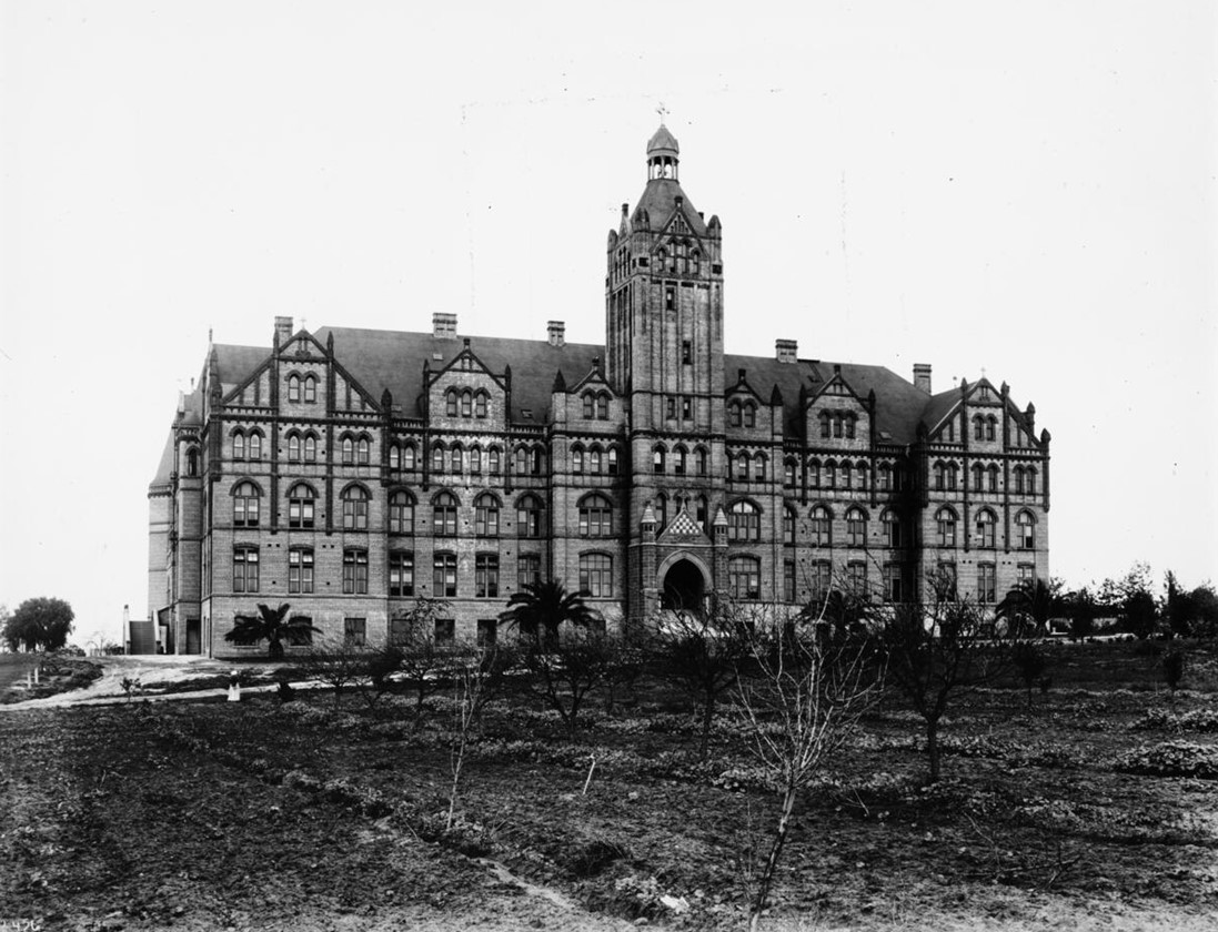
| (ca. 1950)* - Photograph of the Sisters Orphan Home (Los Angeles Orphanage), Boyle Heights, Seventh Street and Boyle Avenue, cornerstone laid 9 February 1890. The 4-story Romanesque stone building is surrounded by fields in which grow trees, grass and other plants. A tall bell tower with a stone cross on top towers over the main entry. A set of broad stairs supply an additional entry at left. A woman is standing near the dirt road which passes in front of the building. |
Historical Notes In 1953, after successful fundraising efforts, the Daughters of Charity moved the orphanage to Rosemead in the San Gabriel Valley, where it opened as Maryvale School. The Los Angeles Orphanage left a lasting legacy, having served children without regard to ethnicity, ability to pay, or religion during its time in Boyle Heights. |
 |
|
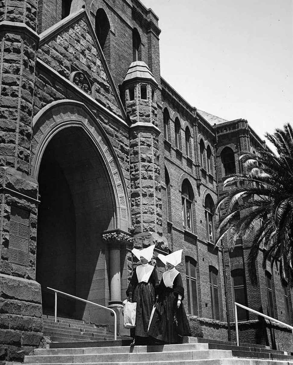
| (1950)* - Two nuns walk down the front steps of the Los Angeles Orphanage in Boyle Heights, a prominent institution that served the community for decades. Photo by Robert Perkins. |
Historical Notes Los Angeles Herald Examiner photograph caption reads: "In addition to caring for their wards at the Los Angeles Orphanage, the Daughters of Charity regularly visit the poor. With their charity work stretching what few funds are available month by month, the Sisters now face the challenge of raising $750,000 to replace the present orphanage building, which is crumbling with age. Left to right are Sisters Frances and Henrietta." |
 |
|
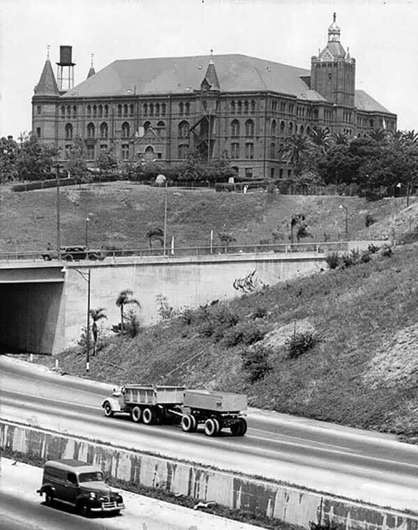
| (1950)* - View looking across the 101 Freeway (what today is the 5 Freeway) showing the old Los Angeles Orphanage (also known as the Sisters Orphanage) at 917 S. Boyle Avenue in Boyle Heights. Click HERE for contemporary view. |
Historical Notes Damage wrought by the 10 March 1933 Long Beach earthquake as well as the notorious freeway construction projects that controversially carved through much of Boyle Heights, led the Daughters to abandon the site and move the facility to Rosemead in the San Gabriel Valley. From 1953, the facility has operated as Maryvale, but has been reconfigured as a residential home for girls from ages six to seventeen. There are also adjunct facilities in El Monte and Duarte. |
 |
|
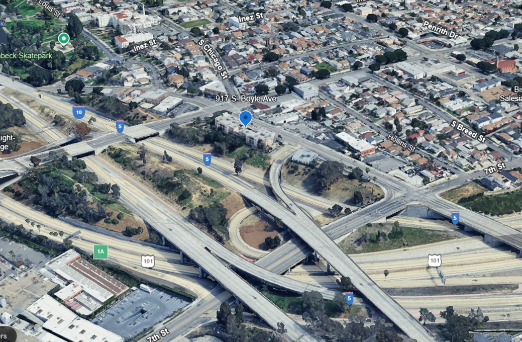
| (2024)* - Google Earth view of the site of the old Los Angeles Orphanage (also known as the Sisters Orphanage) at 917 S. Boyle Avenue, near the interchange of the 101 and 5 Freeways in Boyle Heights. |
Historical Notes Ongoing structural issues and freeway construction projects in Boyle Heights led to the facility's relocation. In 1953, after successful fundraising efforts, the Daughters of Charity moved the orphanage to Rosemead in the San Gabriel Valley, where it opened as Maryvale School. The Los Angeles Orphanage left a lasting legacy, having served children without regard to ethnicity, ability to pay, or religion during its time in Boyle Heights. |
* * * * * |
San Pedro City Hall
 |
|
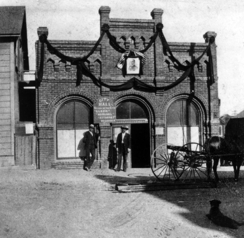
| (1900)* - Los Angeles city clerk O.C. Abbott (left) and Ben Baker stand outside of the second location of the San Pedro City Hall, a rented building on Beacon between 4th and 5th streets. |
Historical Notes In 1906, the City of Los Angeles annexed the Harbor Gateway, a long narrow strip of land connecting the city to the coast, and in 1909, the city annexed San Pedro and the adjacent town of Wilmington. The odd shape is still seen in the map of the city. Click HERE and see more in Early Views of San Pedro and Wilmington |
* * * * * |
Phineas Banning Residence (Wilmington)
 |
|
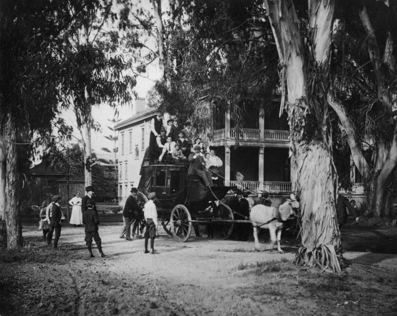
| (ca. 1900)* - Tree-shaded residence of Phineas Banning in Wilmington. In front is a mule-drawn coach piled high with people. |
Historical Notes Phineas Banning (1830 – 1885) was an American businessman, financier, and entrepreneur. Known as "The Father of the Port of Los Angeles," he was one of the founders of the town of Wilmington, which was named for his birthplace. His drive and ambition laid the foundations for what would become one of the busiest ports in the world. Besides operating a freighting business, Banning operated a stage coach line between San Pedro and Wilmington, and later between Banning, California, which was named in his honor, and Yuma, Arizona. During the Civil War, he ceded land to the Union Army to build a fort at Wilmington, the Drum Barracks. He was appointed a Brigadier General of the First Brigade of the militia, and used the title of general for the rest of his life.^* |
 |
|
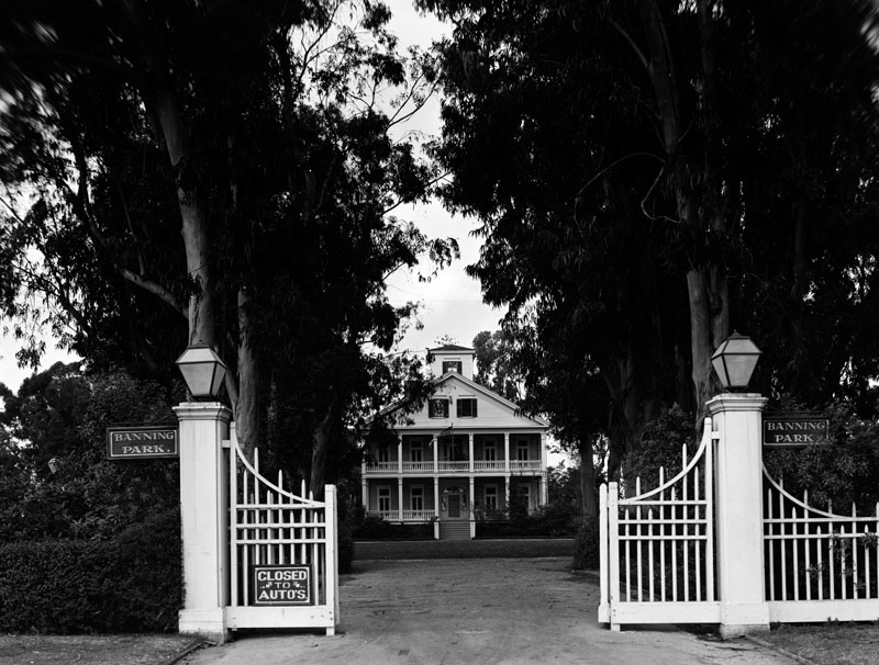
| (1937)* - Exterior view of the Greek Revival style residence of Phineas Banning, located at 401 East M Street in Banning Park in Wilmington. |
Historical Notes Banning's chief residence, constructed in Wilmington in 1864, is open to the public as a museum devoted to the Victorian era in California.^* In 1963, the Banning House property, also known as Banning Park, was designated as Los Angeles Historic-Cultural Monument No. 25 (Click HERE to see complete listing). It is also California Historical Landmark No. 147 (Click HERE to see more in California Historical Landmarks in LA) as well as being federally listed on the National Register of Historic Places. |
Click HERE to see more in Early Views of San Pedro and Wilmington |
* * * * * |
National Soldier's Home (now Veterans Administration Hospital)
 |
|
| (1901)* - President William McKinley can be seen near the entrance of the National Soldier's Home (now Veterans Administration Hospital) in Sawtelle (Los Angeles). This event marks the Dedication by President McKinley on May 9, 1901. |
Historical Notes The National Home for Disabled Volunteer Soldiers was established in 1887 on 300 acres of Rancho San Vicente y Santa Monica lands donated by Senator John P. Jones and Arcadia B. de Baker. The following year, the site grew by an additional 200 acres; in 1890, 20 acres more were appended for use as a veterans' cemetery. With more than 1,000 veterans in residence, a new hospital was erected in 1900. This hospital was replaced in 1927 by the Wadsworth Hospital.^* |
* * * * * |
Los Angeles High School
 |
|
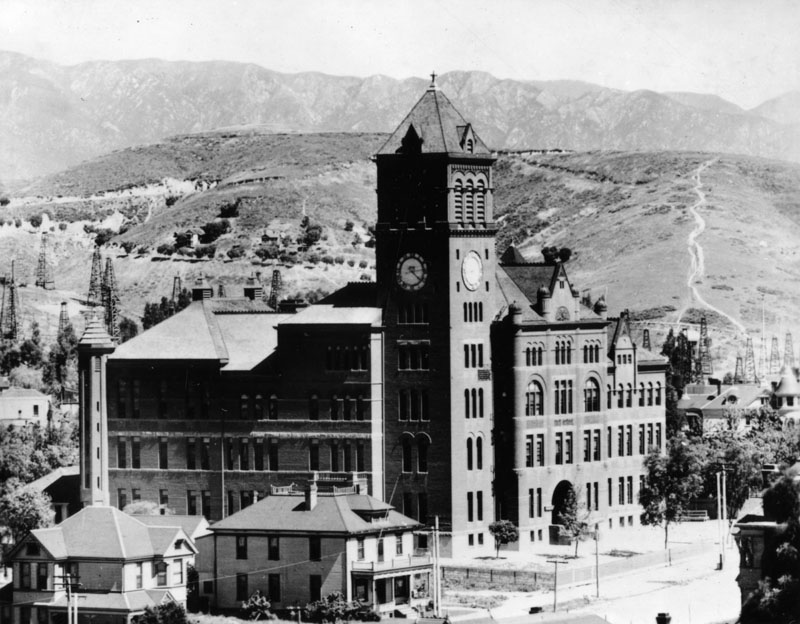
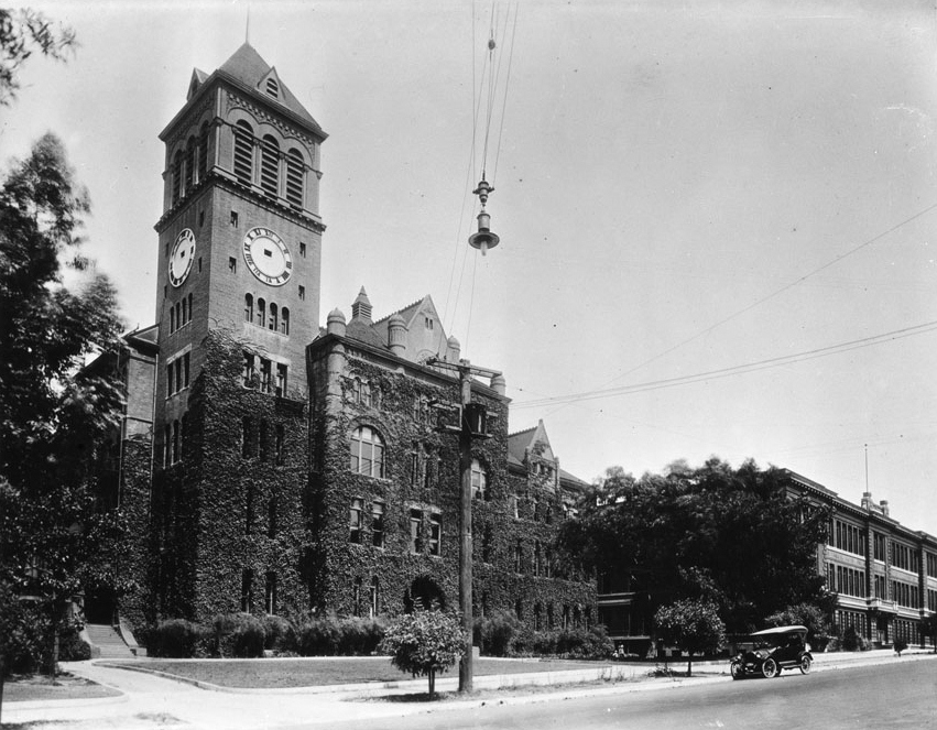
| (ca. 1901)* - The second building housing Los Angeles High School, located on north Hill Street between California and Bellevue. Oil derricks can be seen in the hills behind the school and to the left. |
Historical Notes The Los Angeles High School building seen above replaced the original one, built in 1872, at the former site of Central School on what was then known as Poundcake Hill, at the southeast corner of Fort Street (later Broadway). This second location atop a hill was completed in 1891 and LAHS moved in. It was an enormous, for then, building. The new high school was built on part of the site of the abandoned Fort Moore Hill Cemetery, the first Protestant cemetery in Los Angeles, which was spread over the slopes of the hill. Early buildings commissioned to house the Los Angeles High School were among the architectural jewels of the city, and were strategically placed at the summit of a hill, the easier to be pointed to with pride. One of the school's long standing mottos is "Always a hill, always a tower, always a timepiece". ^* |
 |
|
| (ca. 1910)^ - Photograph of Los Angeles High School, overgrown with vines. At left, the vines stop on the clock tower just beneath the clock, whose hands are missing. At right, a lone automobile is parked along the sidewalk near a second, three-story building. |
Historical Notes In 1917, the school moved to its current location at 4650 Country Club Drive (now West Olympic Boulevard), which incidentally is not on a hill. The second high school, on Fort Moore Hill, eventually became a school for problem students. In 1949, the school was razed for the construction of the Hollywood Freeway. The headquarters of the Board of Education was later built on the property. Most of Fort Moore Hill itself was removed in 1949 for the construction of the freeway, which opened in December 1950. Also located on what remains of the hill is the Fort Moore Pioneer Memorial, which was opened to the public in 1958.^* |
 |
|
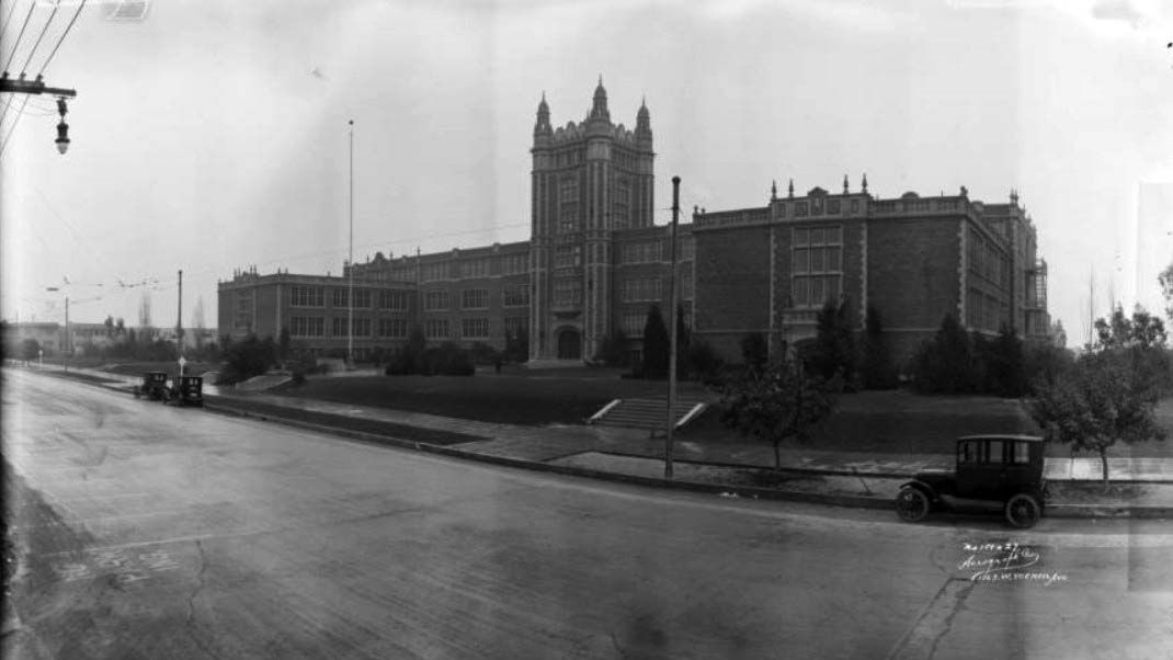
| (1924)^ - View showing Los Angeles High School at its third location, built in 1917 and located at 4650 Country Club Drive (now Olympic Boulevard). The main building is three and a half stories, while the wings perpendicular to the street are two and a half stories, and the central tower is five or six stories. The street is empty except for three parked automobiles. |
Historical Notes Olympic Boulevard was originally named 10th Street for most of its length, except for a couple of shorter stretches, one of which was named Country Club Drive. In 1932, the entire length of the street, from East L.A. to Santa Monica, was renamed Olympic Boulevard for the Summer Olympics being held in Los Angeles that year.^* |
 |
|
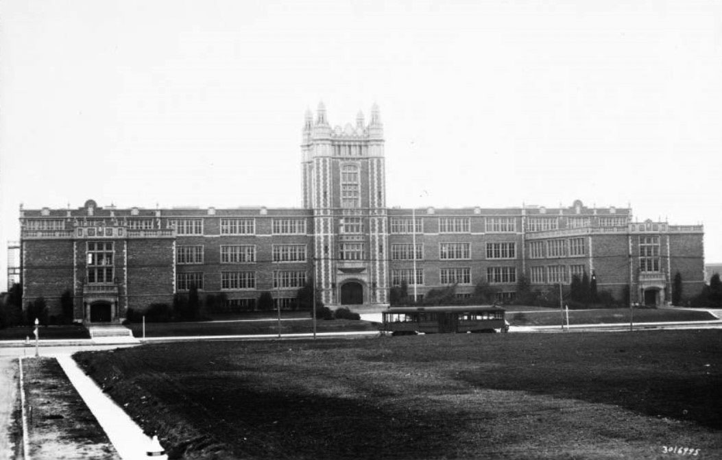
| (ca. 1925)^ - View of Los Angeles High School with streetcar in front, as seen from what appears to be an empty lot across the street. The four-story brick building of the high school is shown at a distance in three sections: the main section of the building runs the width of the image and does not extend past four stories. At the center of this, a section of tower houses the main entrance, capped at its four corners by minarets. It adds an extra story. The third section is pictured at the far right and extends perpendicularly from the main building. It is three stories tall. |
Historical Notes To honor the graduates and under-graduates of the school who took part in the World War, in 1922 the students voted to buy the acreage across the street, a plot of ground approximately 315 by 350 feet, to be used as a memorial park. In 1923, the land was purchased by the student body and alumni association of Los Angeles High School, and deeded to the City of Los Angeles in commemoration of twenty alumni who died in World War I. Six years later, the city gave the Los Angeles Public Library the right to establish a branch on the site. In 1930, a library opened in the park (LA Public Library - Memorial Branch). The students of Los Angeles High School commissioned a stained glass window with the names of the twenty alumni and an inscription stating hope for peace among nations. The window, designed by the renowned Judson Art Studio, was inspired by those in the Parliament Building. #^^^ |
 |
|
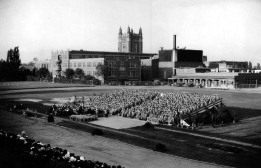
| (1940)^* - South view of Los Angeles High School, with graduating class of 1940 in foreground, 4650 W. Olympic Boulevard. |
 |
(2006)^* - Los Angeles High School logo. Team Name: Romans Colors: Blue and White
|
Click HERE to see more Early Views of Los Angeles High School in the 1800s |
* * * * * |
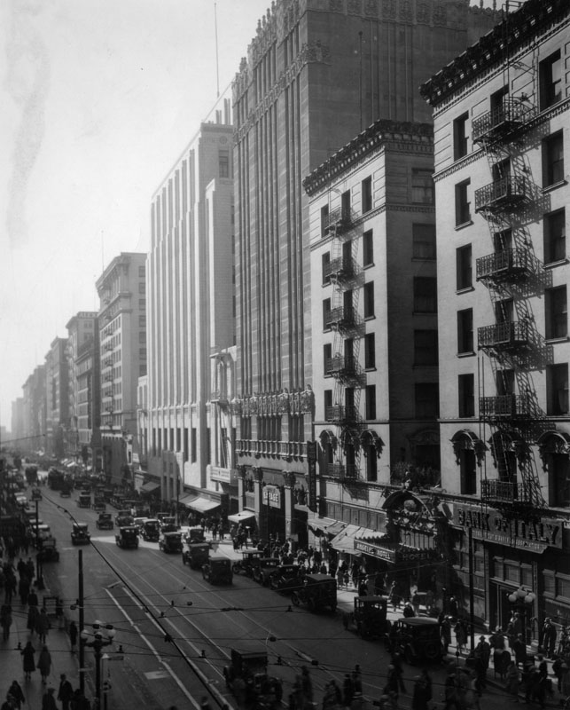
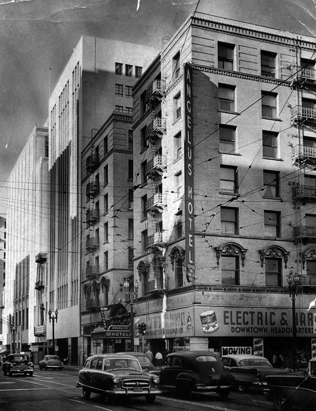
Angelus Hotel
 |
|
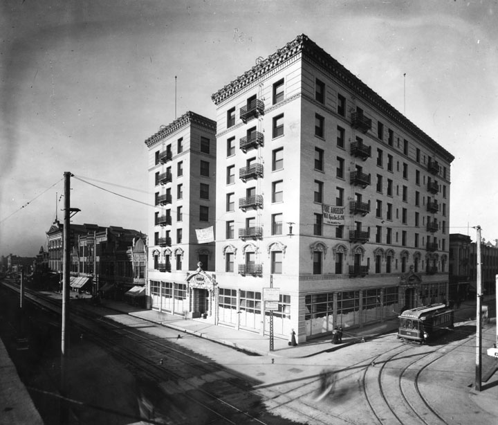
| (1901)* - A corner view of two sides of the 7-story Angelus Hotel which has not yet opened, located on the southwest corner of Spring and Fourth streets. A banner on the right side reads: "The Angelus will open Dec. 15, 1901." Hotel architect, John Parkinson. |
Historical Notes The Angelus was built in 1901 by G.S. Holmes (also the proprietor of The Knutsford Hotel in Salt Lake City, Utah). Advertised then as the tallest building in Los Angeles, the hotel consisted of two, seven-story buildings joined by a central structure with a lobby, dining rooms, meeting rooms and other shared facilities, including a central court yard on top.^^*^ |
 |
|
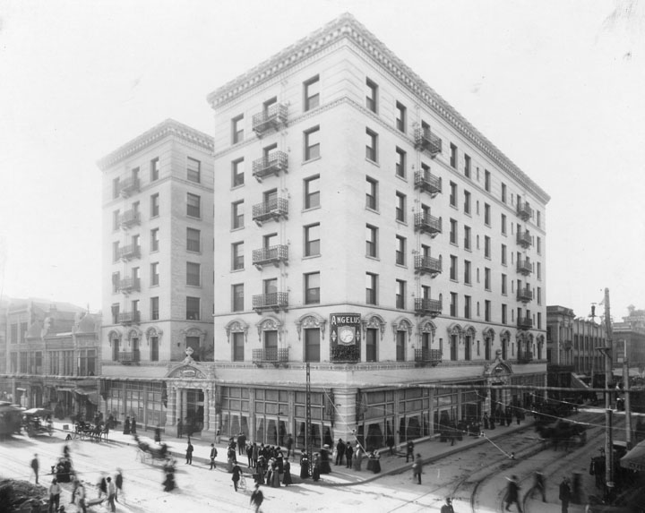
| (ca. 1902)* - View of the Angelus Hotel which is open for business. A sign with the name "Angelus" and containing a clock is located on the corner of the building. The street is filled with people and horses and carriages, and a streetcar coming from the left. |
Historical Notes According to The American Globe, Independent Illustrated Monthly of 1909, The Angelus was sold circa 1903 to the Loomis Brothers, who were experienced hoteliers. The Angelus had a Turkish-themed room in its early days, along with a bowling alley, billiards, a buffet and hair dressing parlor. Under the Loomis Brothers, the hotel later offered onsite "progressive tailoring" services by Eisner & Company.^^*^ |
 |
|
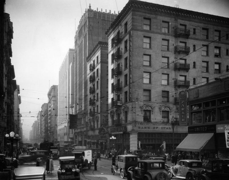
| (ca. 1930)* - Angelus Hotel and Bank of Italy on the corner of Spring and 4th Streets. Also shows Dan Parker, United Cigars, cars and pedestrians. |
 |
|
| (ca. 1930)* - View looking south on Spring from 4th Street, with the Bank of Italy and the Angelus Hotel at right. They were demolished in 1956 for a parking lot. Next to them is the Title Insurance Co. building. Pedestrians, automobiles and trolleys are seen. What stands out are the exterior fire escapes on the Angelus Hotel. |
Historical Notes Fire Escapes date back to the turn of the 20th century, when fire safety became a major concern and building owners were required by law to provide fire escape routes in their new property. The fire escape invention seemed to be a simple and cost-efficient way to address this requirement. As far as a patented fire escape, the first credited person for such an invention was Anna Connelly in 1887. She invented the exterior staircase, used specifically for a fire escape. Many companies saw advantages to using this system and decided to incorporate that patent into their own buildings. These exterior staircases were cheap to build and could be added to the existing construction very easily, without the need to restructure the walls.**^* |
 |
|
| (1956)* - Photo caption reads: "The Angelus Hotel's days are numbered. The hostelry at Fourth and Spring Streets will be torn down and the space will be used for a parking lot." |
Historical Notes The Angelus Hotel building was razed May 7, 1956.* |
* * * * * |
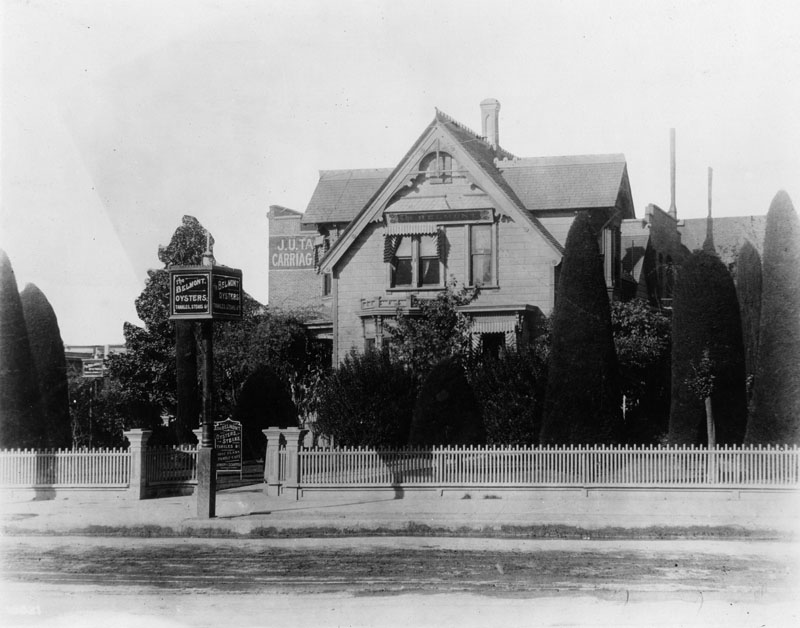
Darmody and Schaeffer's Belmont Cafe
 |
|
| (1901)* - Darmody and Schaeffer's Belmont Cafe, at the northwest corner of 5th and Main, on the site of the present Rosslyn Hotel. The photograph shows the view from the street. There is a signpost with "The Belmont", and a sign which advertises "oysters, steaks, tamales, & etc., first class family cafe." |
Historical Notes The Cafe was formerly the site of the home of John H. Jones, who lived there until 1900 in a house that was built in 1869.* |
* * * * * |
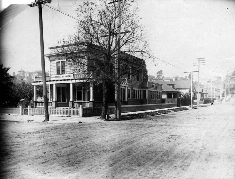
Children's Hospital
 |
|
| (ca. 1902)* - Early view of Childrens Hospital, possibly located at 769 Castelar Street and the southwest corner of Alpine Street. Photograph shows a long, two-story building with a wrap around porch and second floor balcony; a wooden picket fence surrounds the building. Although the sidewalks have been paved, the wide roads are still hard-packed dirt. |
Historical Notes Childrens Hospital Society of Los Angeles was founded on April 1, 1901 by a small group of women who recognized the need for a hospital that could serve ill, crippled, and under-privileged children. The original hospital, which opened in 1902, was a modest two-story clapboard house located at 769 Castelar Street and the southwest corner of Alpine Street; it had nine beds and one volunteer doctor who treated fourteen patients that first year. By 1905, the hospital had expanded to accommodate 20 patients and converted the kitchen pantry into a "surgery suite"; by now, 229 children had received care. In 1913, Childrens Hospital relocated to a new location at Sunset and Vermont Avenue, opening a 100-bed facility. A year later, on February 7, 1914, a new Childrens Hospital was opened by President Woodrow Wilson, who presided over the ceremonies from The White House via telegraph. As the decades passed, new services were added, buildings went up and came down, and Childrens Hospital Los Angeles evolved to serve more children and those with the most complex medical needs. Today, CHLA is a national leader in pediatric care and research, serving over 300,000 patients annually at its four-acre facility, located at 4650 Sunset Boulevard.* |
* * * * * |
Rindge Residence
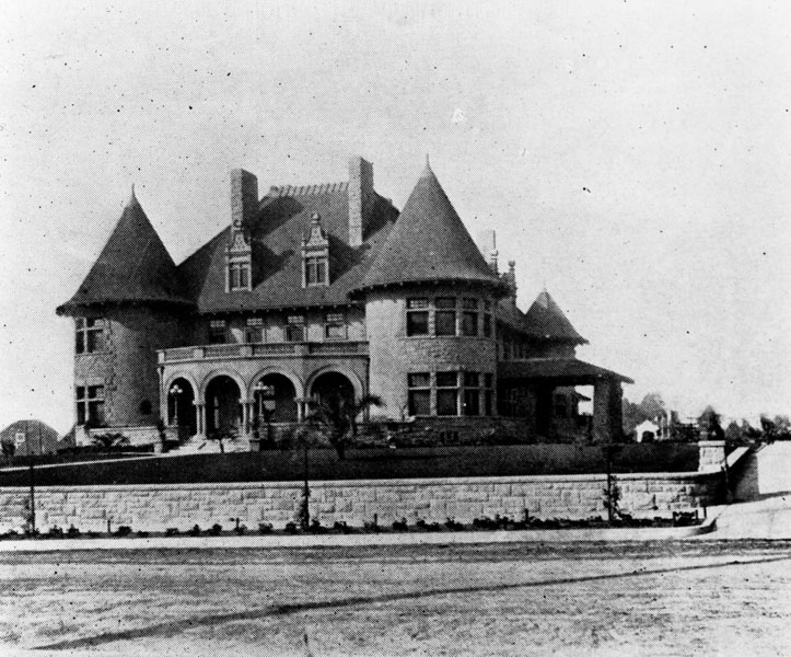 |
|
| (ca. 1902)* - Exterior of the large Renaissance revival/Romanesque revival Victorian mansion at 2263 S. Harvard Boulevard in the West Adams district of Los Angeles, built for and once owned by the Frederick H. Rindge family. |
Historical Notes In 1892 Frederick H. Rindge purchased the 13,300-acre Spanish land grant Rancho Topanga Malibu Sequit or "Malibu Rancho". He later expanded it to 17,000 acres as the Rindge Ranch, which encompasses present day Malibu, California.^* |
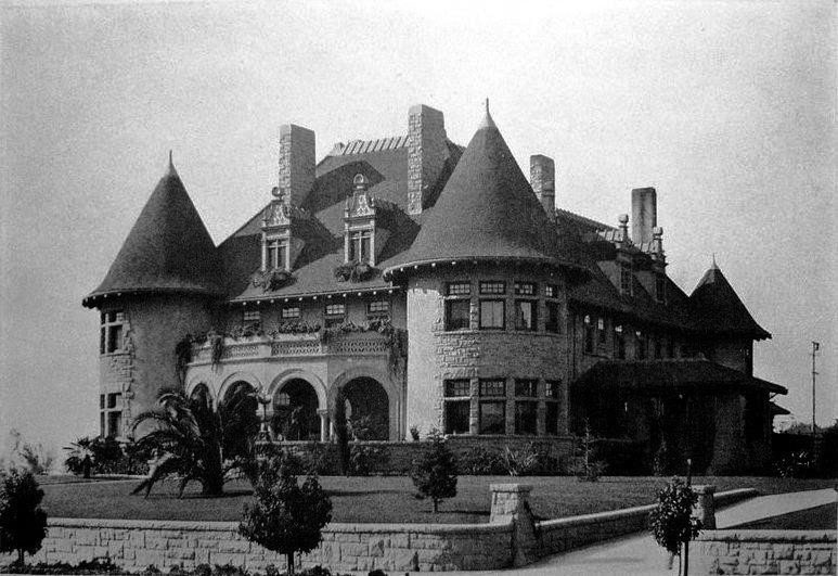 |
|
| (1910)^* – View showing the Frederick Rindge residence at 2263 S. Harvard Boulevard, south of what is now the 10 Freeway. |
Historical Notes Frederick Rindge was land holder (much of Malibu) founded the Conservative Life Insurance Company, and was a VP at Union Oil, and a director of the Los Angeles Edison Electric Company (later Southern California Edison Company). |
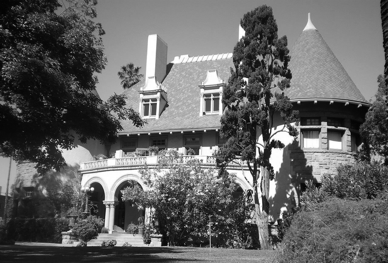 |
|
| (2008)^* - Frederick Hastings Rindge House at 2263 Harvard Boulevard, now a Los Angeles Historic-Cultural Monument. |
Historical Notes This estate, both a Los Angeles Historic-Cultural Landmark and on the National Register of Historic Places, was designed by Frederick Louis Roehrig and E.C. Shipley and built in 1902.^ |
* * * * * |
Nicola Bonfilio Residence
 |
|
| (n.d.)* - Exterior view of a gothic revival style house once owned by Nicola Bonfilio, located at 2019 S. Figueroa St. |
Historical Notes Nicola Bonfilio lived in this Morgan & Walls-designed mansion at 2019 South Figueroa Street in L.A. from about 1903 until 1923, the year he died. Bonfilio was the director of the Bank of Italy (now Bank of America) and Merchants National Bank. He had married wealthy horse breeder Elizabeth Gates McGaughey (d. 1911), mother of Nellie McGaughey. Nellie went on to marry her mother's horse trainer, William Durfee. After living in this house, the Durfees bought the former West Adams estate of William Ramsay, built in 1908. |
* * * * * |
Chandler Residence
 |
|
| (1903)* - View showing the three-story Victorian home of Harry Chandler, publisher of the Los Angeles Times, located at 503 North Broadway. A dog can be seen lying on the sidewalk. |
Historical Notes In Los Angeles, while working in the fruit fields, Harry Chandler started a small delivery company that soon became responsible for also delivering many of the city's morning newspapers, which put him in contact with The Los Angeles Times publisher Harrison Gray Otis. Otis liked this entrepreneurial young man and hired him as the Times’ general manager. Harry’s first wife, Magdalena Schlador, had died in childbirth in 1892, leaving him with two small daughters, Franciska and Alice May. He went on to marry Otis’s daughter, Marian Otis. Upon Harrison Gray Otis’s death in 1917, Harry took over the reins as publisher of the Times. He and Marian had eight children. His oldest son, Norman Chandler, followed him as publisher of the Times. Chandler Boulevard, a major street in the San Fernando Valley, is named for Harry Chandler. |
* * * * * |
Dome Hotel and Apartments (aka Minnewaska Hotel)
 |
|
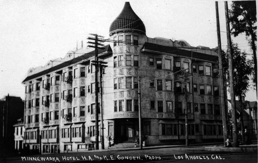
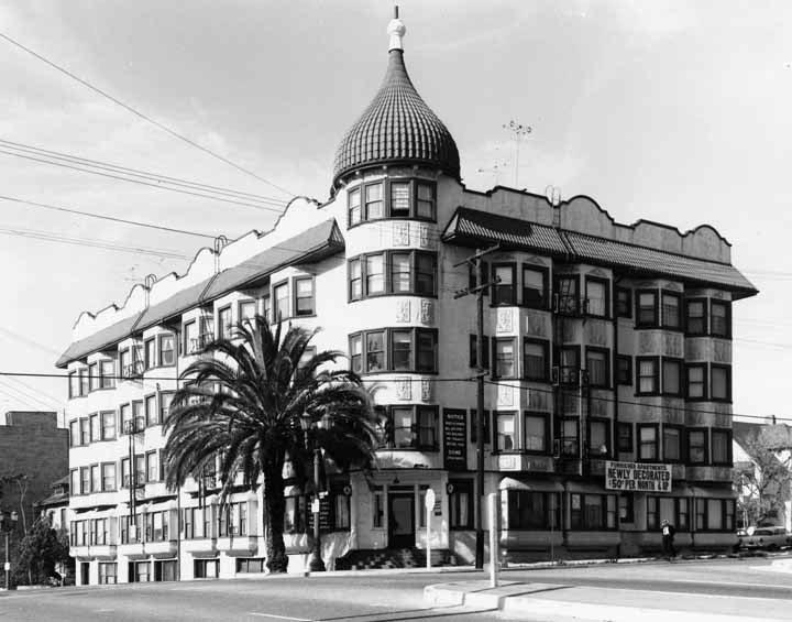
| (ca. 1905)* – View of the Minnewaska Hotel with its distinctive dome at the southwest corner of 2nd Street and Grand Avenue, later renamed the Dome Hotel and Apartments. |
Historical Notes Completed in 1903, the Minnewaska opened as a four-story, 122–133 room luxury hotel. Its spiral dome made it a recognizable Bunker Hill landmark. The Los Angeles Times praised its construction, describing heavy diagonal framing with steel lath and plaster tinted a delicate cream. Inside were two- and four-room flats with private baths, marble washstands, steam heat, and electric bells. Sold in 1905, the name Minnewaska lingered in directories until about 1907, when it was simplified to the Dome. |
 |
|
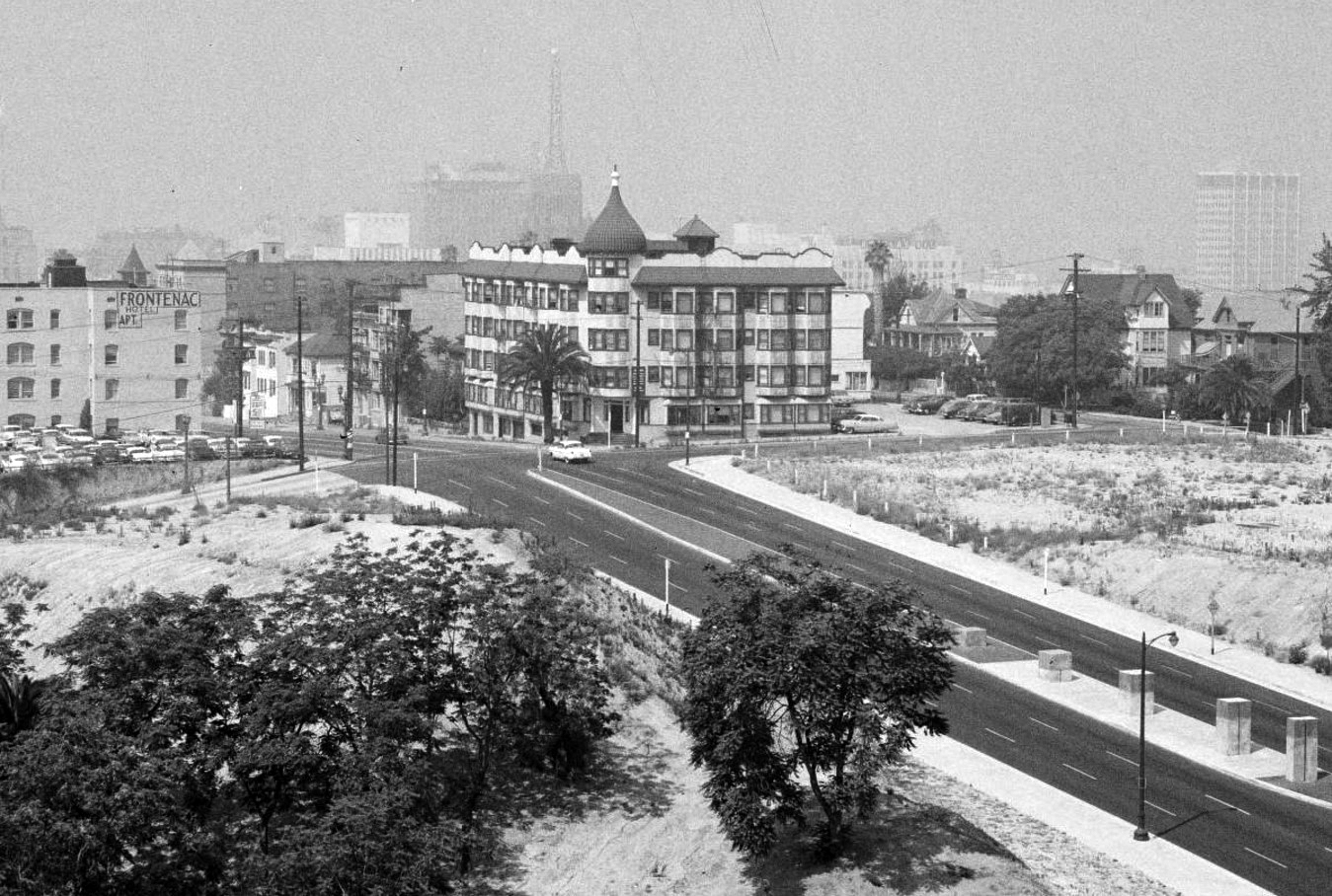
| (1960)* – View of the Dome Hotel and Apartments, with the Rihfield Oil Company Building in the background and the future site of Walt Disney Concert Hall to the right. |
Historical Notes By this time the Dome had transitioned fully to apartments. The surrounding Bunker Hill neighborhood was already in steep decline, targeted for redevelopment. The striking black-and-gold Richfield Building stood tall in the distance until it was demolished in 1969 to make way for the ARCO Towers. To the right of the Dome lay a vacant lot, later chosen for the Walt Disney Concert Hall, completed in 2003. |
 |
|
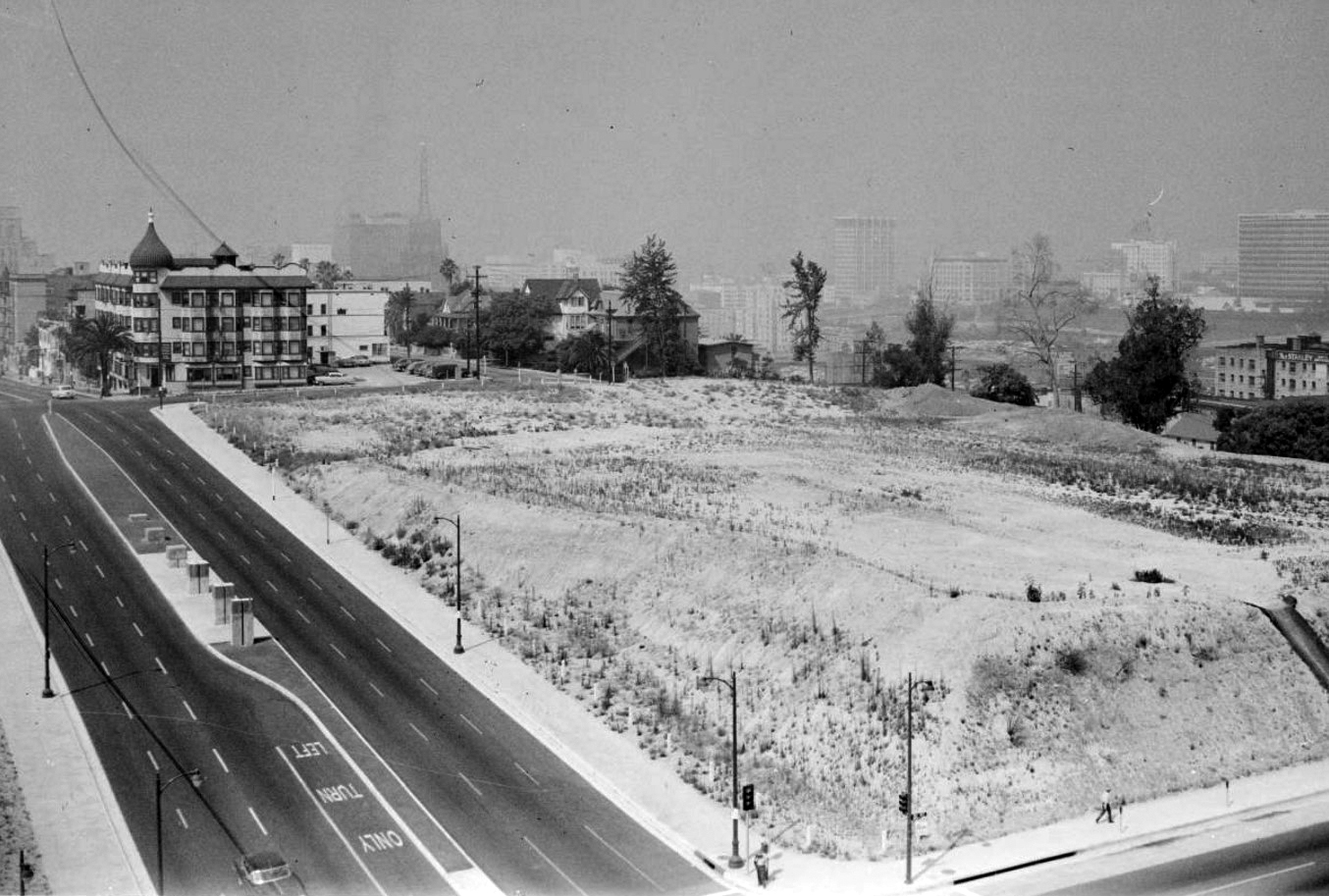
| (1960)* – Looking southwest from the L.A. County Courthouse at 1st and Grand, with the Dome Apartments visible beyond a cleared lot. This will become the site of the Walt Disney Concert Hall (completed in 2003). |
Historical Notes This view captures the Dome standing almost alone amid growing demolition on Bunker Hill. Large swaths of the neighborhood were being razed under the city’s redevelopment program, leaving vacant lots where Victorian homes and boardinghouses once stood. The Dome, though still occupied, was already living on borrowed time. |
 |
|
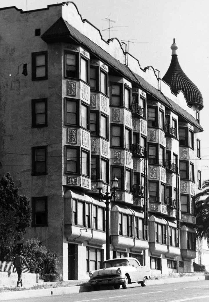
| (ca 1963)* – Profile of the Dome Apartments, advertising “Newly Decorated, $50 Per Month & Up. |
Historical Notes The Dome had by then declined into budget apartments, far removed from its early 20th-century luxury. The $50 monthly rent reflected both inflation and the neighborhood’s deterioration. Once considered a modern and elegant building, by the 1960s it stood as one of the last survivors of Bunker Hill’s grand era, increasingly surrounded by empty lots. |
 |
|
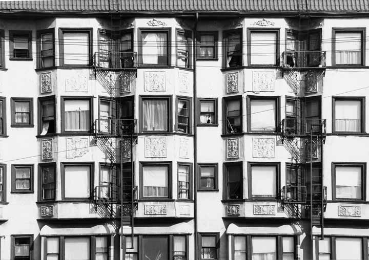
| (1960s)* – Close-up of the Dome Apartments façade showing plaster finish and fire escapes. |
Historical Notes The exterior, once tinted cream, showed its age after decades of wear. Fire escapes were added as code requirements increased for older structures. Early descriptions noted a light court and open stairwell inside, features admired when built but ultimately contributing to the rapid spread of fire in its final year. |
 |
|
| (1964)* – Profile of the Dome Apartments at 2nd and Grand, taken shortly before the fire that destroyed the building. |
Historical Notes On July 25, 1964, a fire swept through the Dome, killing one resident and injuring several others. Its open stairwell acted like a chimney, spreading flames quickly. Though never proven arson, some speculated redevelopment pressures may have welcomed its loss. The structure was demolished later that year, and the lot became surface parking for the next half-century. |
Then and Now
 |
|
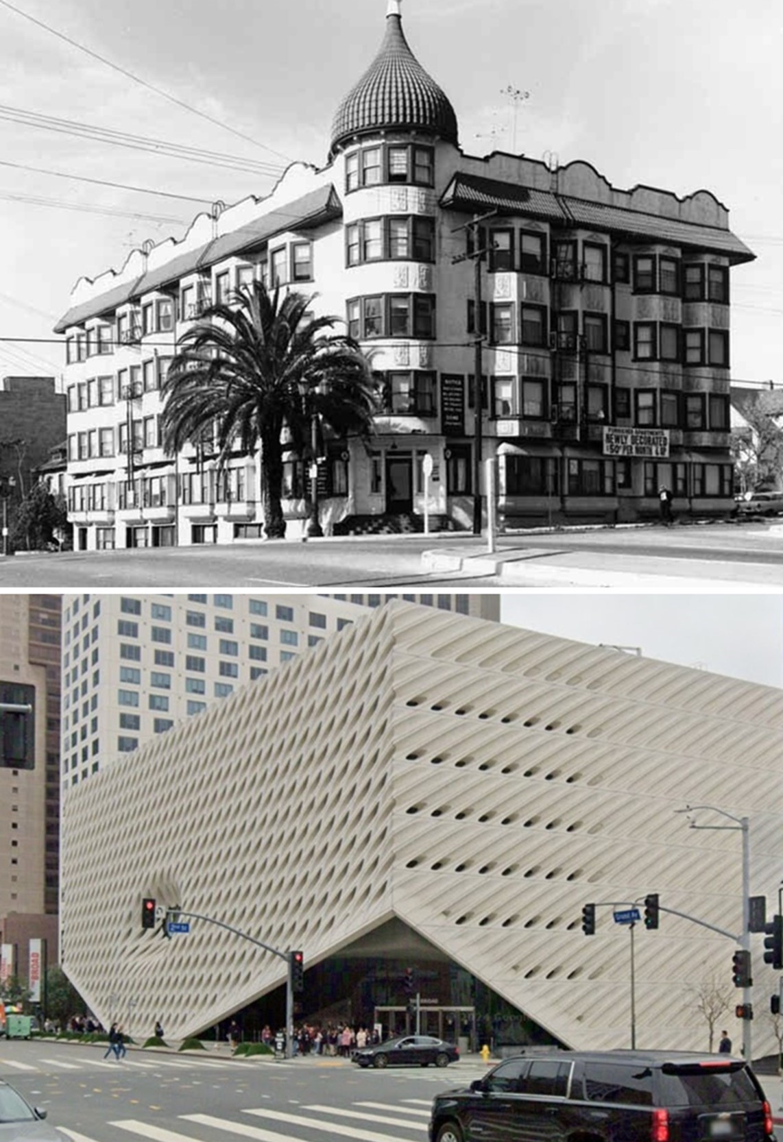
| (1963 vs. 2024)* - Looking at the southwest corner of Grand Avenue and 2nd Street, where the Dome Apartments once stood, today the site of The Broad Contemporary Art Museum, also known as The Broad. Photo comparison by Jack Feldman. |
Historical Notes After the Dome burned and was cleared, the corner sat as a parking lot until construction began on The Broad in 2014. Opened in 2015, the contemporary art museum was founded by Eli and Edythe Broad and houses over 2,000 works. Its “veil and vault” design stands in stark contrast to the Dome, reflecting Bunker Hill’s transformation from a residential district into a hub of cultural institutions. |
* * * * * |
Fischer Vaudeville Theatre
 |
|
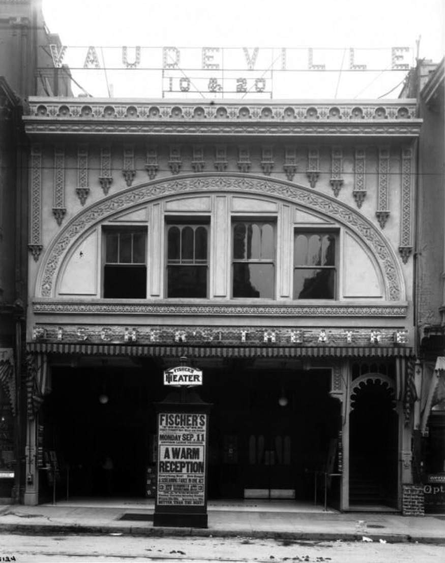
| (ca. 1905)^ - View of the Fischer Vaudeville Theater (now City Hall), north side of 1st Street, between Main Street and Spring Street. The theatre is about two-stories tall. Just above the first floor is the name "Fischer's Theatre" in lights. Above the roof is the name "Vaudeville, 10 & 20" in lights. The second floor has four windows with a decorative multifoils arch above them. The first floor has two doorways flanking the center booth. A set of stairs leading to the second floor can be seen to the right of the building. A lamppost on the sidewalk prominently displays the theater's name and current showing. Sign reads: "First Street bet. Main and Spring, E.A. Fischer, proprietor, Harry James, director, commencing Monday, Sep. 11, 'A Warm Reception', everything new!, new songs!, a screaming farce in one act, 3, new Vaudeville act, matinees, Tuesday, Thursday, Saturday, Sunday, prices 10¢, 20¢, reserved seats 25¢, better than the best!" |
Historical Notes This small theater was located, on one of the old downtown blocks which was leveled in the mid-1920s to make way for the new Los Angeles City Hall. It was a two story building, with almost the entire ground floor front taken up by the theater’s entrance lobby, and the highly decorated facade was topped by an electric sign reading “Vaudeville 10 & 20”. By 1912, the operators of Fischer’s Theater had taken over the former Los Angeles Theater on Spring Street, which had from 1903 to 1911 been the second Los Angeles home of the Orpheum Theater Circuit. The Spring Street Theater was then renamed Fischer’s Lyceum.^ Opened: Sometime prior to 1908. It's listed in the 1908 city directory as Fischer's. It's listed in the 1907-1908 Henry's Theatrical Guide as being managed by E.A. Fischer. Henry's notes that the house was at the time devoted to stock musical productions year round. Stage Specifications: Illumination in 1907 was both gas and electric. The proscenium was 24' wide with a height of 22'. Stage depth was 30' with a grid height of 45' and a wall to wall measurement of 50'. In the 1911 and 1912 directories it's the Princess. It's in the 1915 city directory as the Princess First St. Theatre. In the 1919 and 1923 directories it's listed as the Princess although by June 1922 it was called the Spanish Theatre offering both movies and stage shows. Seating: 800 Status: Demolished for the 1926 construction of City Hall. Fischer also opened the Chronophone Theatre in 1908, a venue later known as Horne's Big Show. We also had a Fischer's Theatre in Pasadena (later called the Oaks) about the same time. Fischer also took over the Lyceum Theatre around 1912. There were also several Fischer's theatres in San Francisco in this period.* |
* * * * * |
Orpheum - Lyceum Theatre (2nd Home of the Orpheum Circuit
 |
|
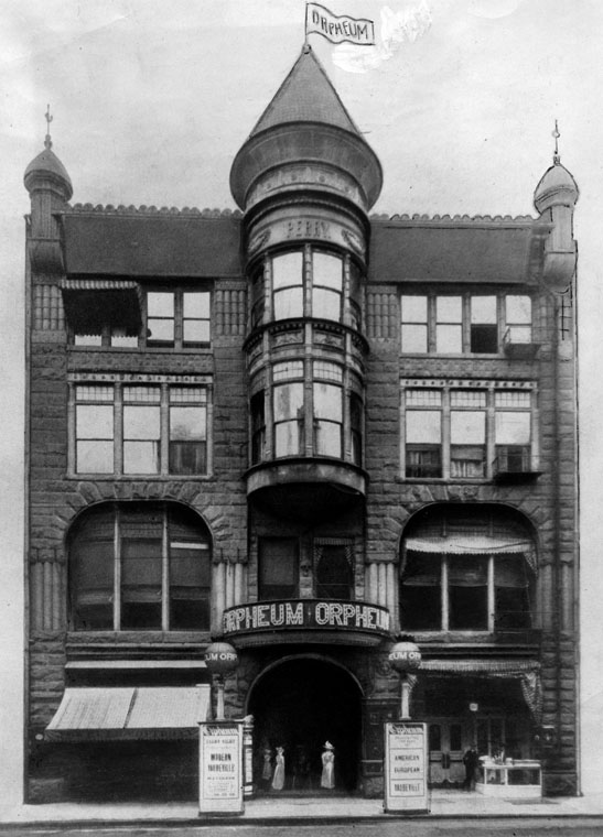
| (ca. 1903)* - Exterior view of the old Orpheum Theater (later Lyceum Theatre) on Spring Street between 2nd and 3rd Streets. Underneath the building was the Rathskeller. |
Historical Notes Opened in 1888 as the Los Angeles Theatre. The theatre was built by William Hayes Perry and the building containing it was known as the Perry Building. In 1903 this interesting Richardsonian Romanesque building became the Orpheum - the second home of Orpheum Circuit vaudeville in Los Angeles. Previously they'd been at the Grand Opera House. The Orpheum moved on in June, 1911 to their new home at 630 S. Broadway (now the Palace Theatre).**^ |
 |
|
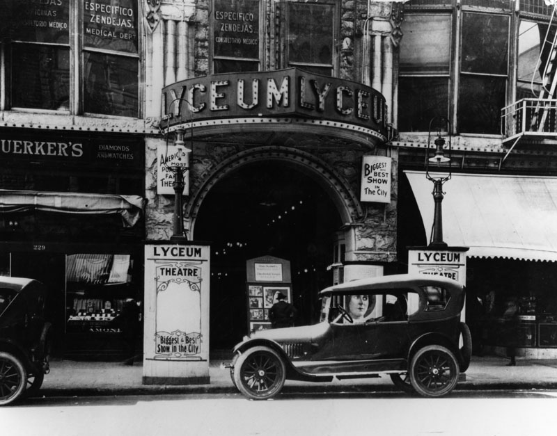
| (1919)* - View of an early model car parked in front of the entrance to the Lyceum Theatre (previously Orpheum) on Spring Street. Signs in front read: "Biggest and Best Show in the City" and "America's Most Popular Family Theatre". |
Historical Notes In 1912 the building became known as Fischer's Lyceum, operated by the Mr. Fischer of Fischer Theatre on 1st St. Later it was just known as the Lyceum Theatre. It was listed as the Lyceum in the 1916 city directory and onward.**^ |
 |
|
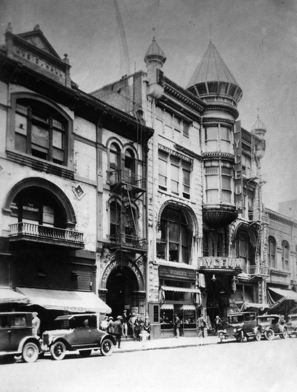
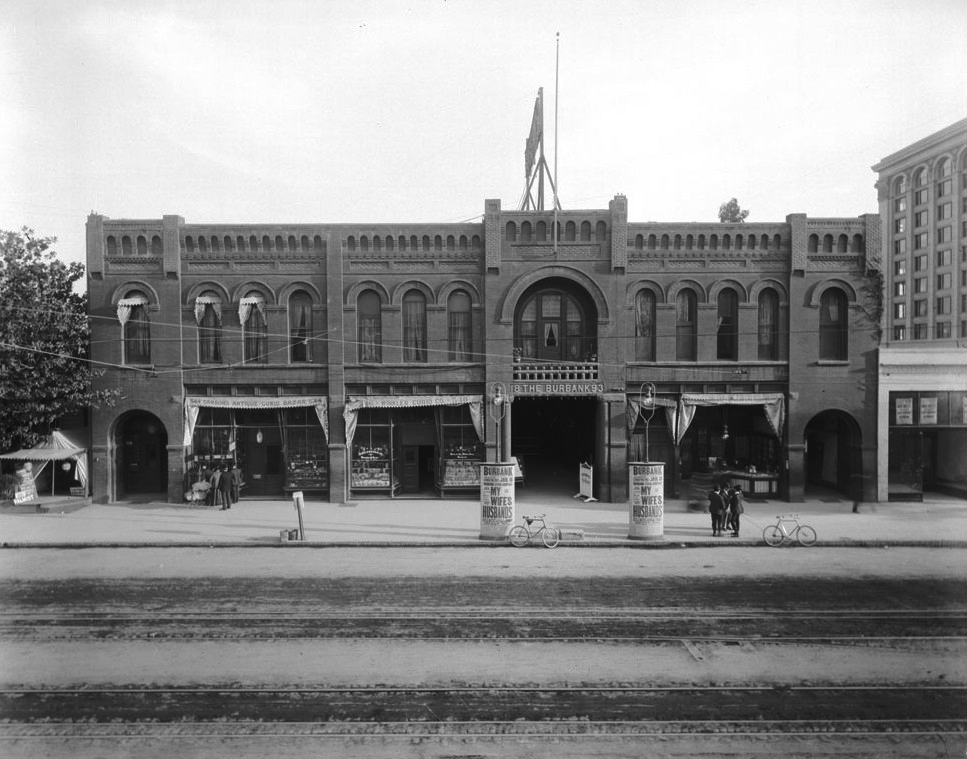
| (1920)* - Exterior view of the Lyceum Theatre, the original Los Angeles Theater, which opened in 1888 and located at 227 South Spring Street. |
 |
|
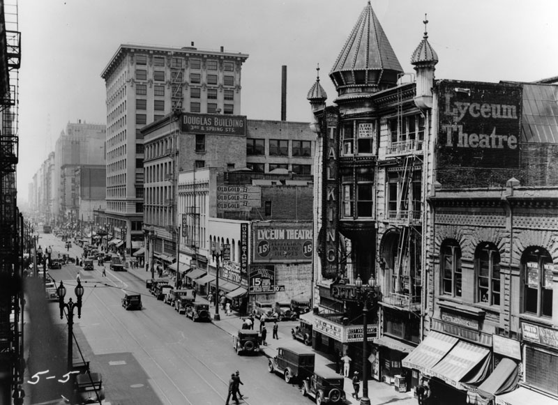
| (ca. 1930)* - Looking south down Spring Street near 3rd Street (left, with cluster of cars), showing various structures, including the Douglas Building (left of center) and the ornate Lyceum Theatre (right of center). |
Historical Notes Beneath the Lyceum Theatre is one of the original springs from which Spring Street derived its name.* |
 |
|
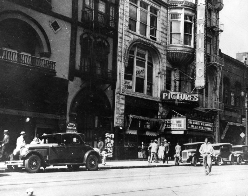
| (1935)* - Side view of the Lyceum Theatre located at 227 S. Spring Street. Signboards in front of building read "Talking Pictures". |
Historical Notes By the early 30s the Lyceum Theatre was exclusively a movie theatre.**^ |
 |
|
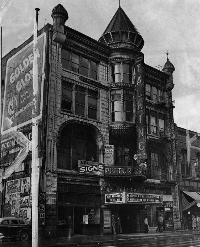
| (1941)* - Street view of the Lyceum Theatre, located at 227 South Spring Street. It was the second oldest showhouse built in the City. |
Historical Notes In 1941 the Lyceum closed and, later that year, was demolished. The site is now the L.A. Times parking garage.**^ |
* * * * * |
Burbank Theatre
 |
|
| (1903)^ – Front view of the Burbank Theatre as seen from acroos the street. The theatre was located on the east side of Main Street between 5th and 6th streets. Two lampposts on the sidewalk prominently display the current theatre showing. Four people (including a woman with a baby stroller) are peering through the window at Carson's Antique and Curio Bazar (left). Three men stand near the street in front of the bar. Along the curb are two parked bicycles. |
Historical Notes The Burbank Theatre opened in 1893 as a project of dentist Dr. David Burbank (also the namesake of the city). The theatre had troubles and went through a succession of managers without any lasting success. **^ |
 |
|
| (ca. 1905)* – View looking southeast toward the intersection of Main and 6th streets. The brick façade on the lower-left is the Burbank Theatre. The large building on the S/E corner is the Pacific Electric Building. |
Historical Notes In 1900, the theater was leased to Oliver Morosco and became known as Morosco's Burbank Theatre. Morosco was later involved in the Majestic Theatre on Broadway (which opened in 1908) and got a house named for himself when he opened the Morosco on Broadway (now the Globe) in 1913. **^ |
 |
|
| (1910s)* - Five early model cars are seen parked in front of the Burbank Theatre located at 548 S. Main Street. |
Historical Notes In a 1919 ad the theatre was called Pelton's Burbank, featuring the New Burbank Musical Comedy Company. In the 1921 city directory it was called Gore's Burbank. It was a newsreel house in the 1930's, got a deco makeover in 1937 and by the 50s it was turned into the Burbank Burlesque Theatre. **^ |
 |
|
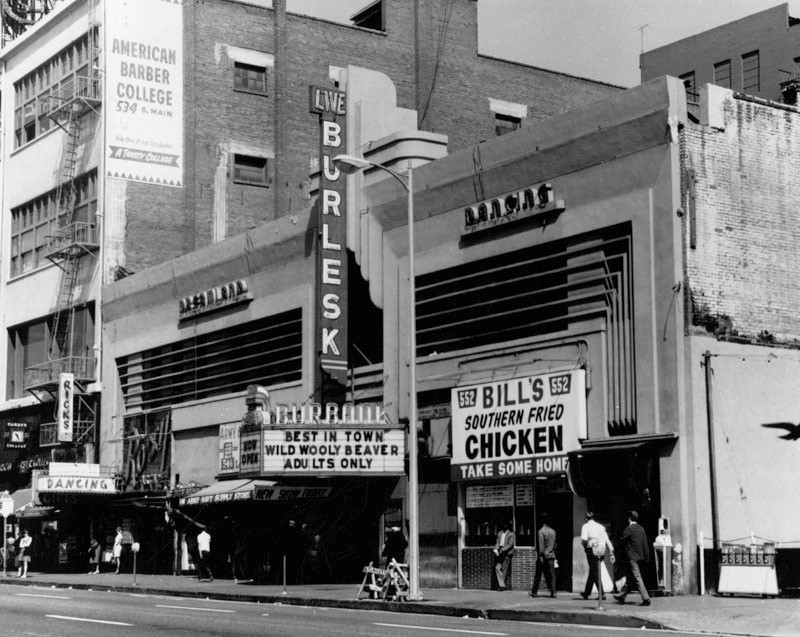
| (ca. 1970)* - View showing the Burbank Burlesque Theatre with the Dreamland dance hall on the 2nd floor of the building. Note the design change to the facade. |
Historical Notes In 1937, the Burbank Theatre got a deco makeover and by the 1950s it was turned into the Burbank Burlesque Theatre. |
 |
|
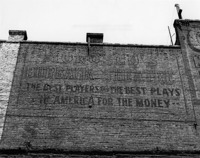
| (n.d.)* – View showing the back wall of the theatre with the early 1900s Morosco sign still in view. The sign reads “Morosco's Burbank Theatre, The Best Players and The Best Plays in America for the Money”. |
Historical Notes The Burbank Theatre was demolished in March, 1974. |
* * * * * |
Ville de Paris
 |
|
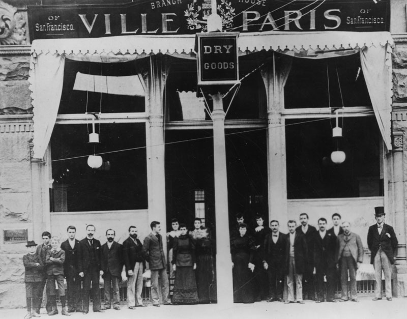
| (ca. 1901)* - Exterior view of the Los Angeles branch of the San Francisco dry goods store, Ville de Paris, remodeled in 1901. The employees (men, women and young boys) pose in front of the store. Two electric lights hang down in front of the store windows. |
Historical Notes Founded in 1850 in San Francisco by the Verdier brothers, immigrants from France, the Los Angeles branch was opened in 1893. The store later became B. H. Dyas Co.* |
 |
|
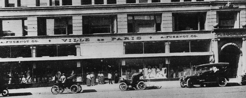
| (1904)* - Ville de Paris store front at South Broadway in the Homer Laughlin building. Horseless carriages are parked at the curb. |
Historical Notes The store later moved to W. 7th St. and eventually became B. H. Dyas Co. The Homer Laughlin Building became the Grand Central Market by 1959.* |
* * * * * |
Harris & Frank
 |
|
| (1903)* - The building on Spring Street housing the men's clothing store of Harris & Frank; John Parkinson was the architect. |
Historical Notes Originally Lewin Hirshkowitz, Leopold Harris arrived in Los Angeles in 1854 by way of the Isthmus of Panama from Loebau, Prussia (later Poland). In 1870 Leopold Harris took over a Main Street stationary store which had been operated by Herman W. Hellman. By 1903, Leopold Harris’ two sons-in-law, Herman W. Frank and M.C. Adler, and his son, Harry L. Harris, were running the business, which was then known as Harris & Frank.^^#* |
* * * * * |
Lexington Hotel
 |
|
| (ca. 1904)* – Panoramic view looking north on Main Street showing the Lexington Hotel at center. Some other identifiable buildings include: H. Raphael Co., Barker Bros., and Angelus Hotel to name a few. |
Historical Notes Located on Main Street between 4th and 5th Street, the Lexington Hotel was designed by Robert B. Young and built by contractor, O. T. Johnson.* |
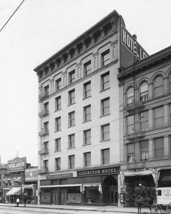 |
|
| (1904)* - View of the Lexington Hotel on Main Street between 4th and 5th streets, butting the south wall of the first Rosslyn Hotel on the right.The signs indicate three businesses on the bottom floor: Wells Fargo & Company, Lexington Hotel entrance, and Holmes Book Co. |
Historical Notes In 1906, the Rosslyn expanded to include the six-story Lexington building. The result was a 280-room hotel. The Rosslyn would eventually build two larger structures just to the south (left) of the Lexington building.^#* |
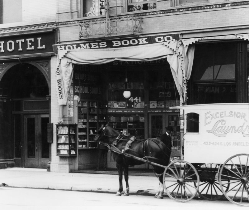 |
|
| (1904)* – Blow-up detail view of previous image showing a horse-drawn carriage belonging to Excelsior Laundry service parked outside of the Holmes Book Co., a business located on the ground floor of the Lexington Hotel (entrance on far left). |
* * * * * |
Olvera Adobe
 |
|
| (ca. 1904)* - View of Agustín Olvera adobe, located on the corner of Marchessault and Olvera streets, after it had been converted into office space for Murray & Ready. A man can be seen riding his bicycle on the unpaved road toward the left. The Plaza Substation may be seen behind the Olvera Adobe (with the stepped-gable end). It was built in 1903-04. |
Historical Notes Agustín Olvera arrived from Mexico in 1834 where he had been a Justice of the Peace, and held various offices in the Mexican administration. In 1842 he was granted Rancho Mission Viejo, and three years later, was also granted the 35,501-acre Rancho Cuyamaca. Olvera is noted for helping to bridge the gap between the governance of California by Mexico and the U.S.; helping sign the Treaty of Cahuenga, thus ending the war in California; was appointed to be Judge of the First Instance in 1849; was elected as the first county judge of the newly formed County of Los Angeles in 1850; and eventually entered private practice law. In 1877, the Los Angeles City Council changed the name of Wine Street to Olvera Street in his honor. Marchessault Street is named for French Canadian, Damien Marchessault, who served as mayor of Los Angeles from 1859-1860, and again from 1861-1865. During his term in office, the Plaza Church was rebuilt and the City Gas Company was organized. Marchessault committed suicide in the city council chamber in 1868, after becoming despondent over public criticism of the water system and over gambling debts.* |
Click HERE to see more in Early Plaza of Los Angeles |
* * * * * |
Van Nuys Mansion
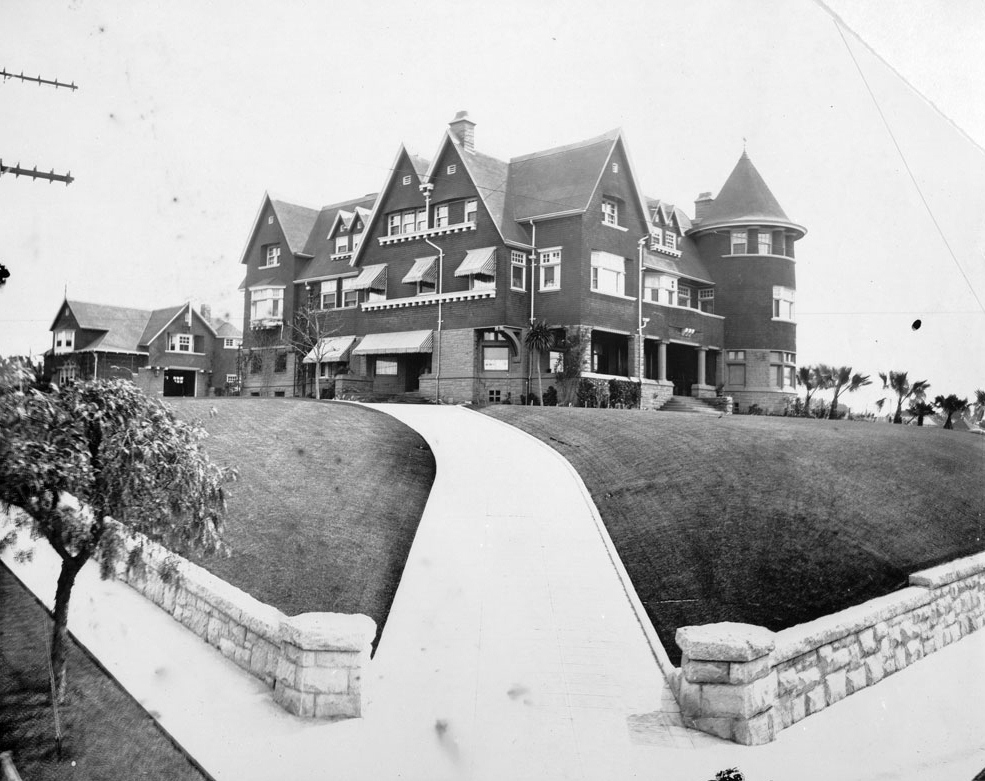 |
|
| (ca. 1904)^ - Exterior view of the Van Nuys mansion in downtown Los Angeles, ca.1904. The massive building is on a hill at center. It is three stories high and has very steeply sloped roofs. A tall cylindrical tower can be seen on the corner of the building at right. In the foreground, the hill is covered with neatly trimmed grass, and a wide concrete walkway leads from the entrance to the home to the foreground at center. |
Historical Notes The house was later moved to Windsor Square on the northwest corner of Fourth Street and Lorraine Boulevard. |
* * * * * |
"The Castle" and "The Salt Box"
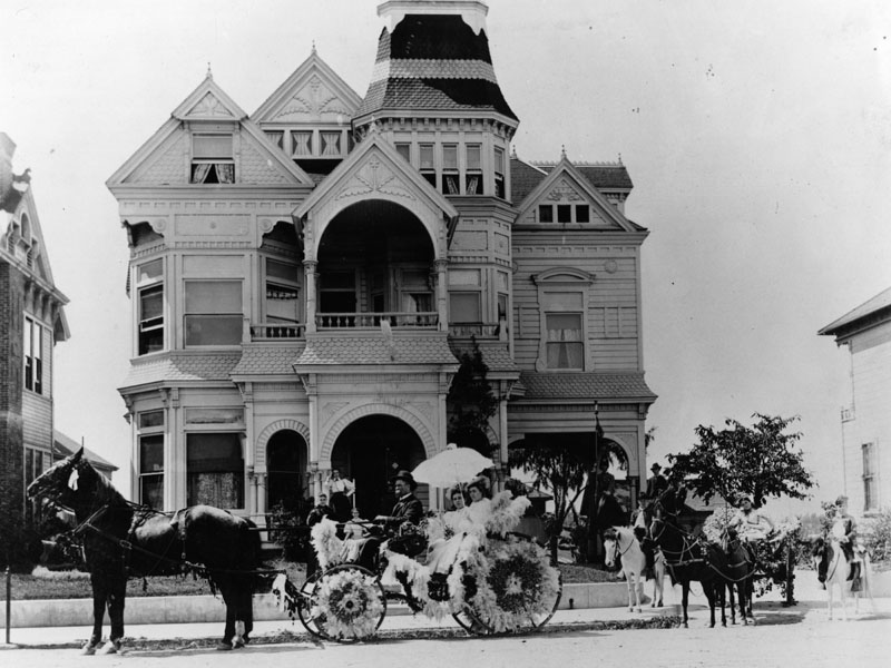 |
|
| (ca. 1904)* - Women in a horse-drawn carriage ride past the Victorian-style house known as "The Castle" located at 325 S. Bunker Hill Avenue during the La Fiesta de las Flores parade. |
Historical Notes The Castle was built in the late 1880s, possibly by developer Reuben M. Baker. The grand home had 20 rooms, a three-story staircase winding up the middle, and a magnificent stained glass front door. The La Fiesta de las Flores Parade was first celebrated in 1894 as a means of attracting visitors to the city. La Fiesta activities were held over several days and included a parade, a grand ball, and a floral battle. Costumed Los Angeles residents participated in the parade by decorating any moving contraption they had. |
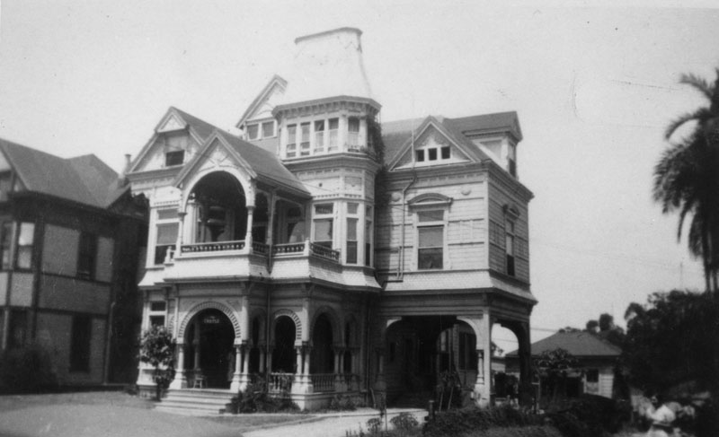 |
|
| (ca. 1924)* - Looking across S. Bunker Hill Avenue towards the "Castle," located at 325. The curved Mansard roof on the tower (upper center) and the triangular crown of a front balcony (left of center) were removed after the 1933 Long Beach earthquake. On the far left is a glimpse of the residence that once belonged to the Thorpe family at 333. |
Historical Notes The Donegan Family lived in the residence from 1894-1902, and they were the ones who supposedly named it "The Castle." Eventually, the mansion was converted into a boarding house for multiple residents. Bunker Hill Avenue was probably the most picturesque street in the neighborhood of the same name. The avenue was much more narrow than the other streets and was lined with some of the most impressive mansions on the Hill. |
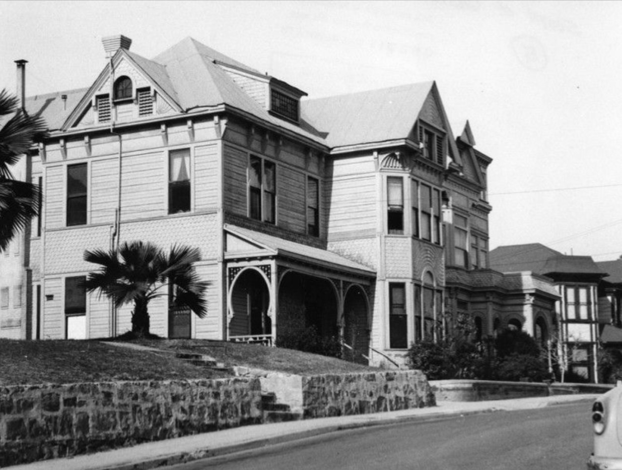 |
|
| (1955)* - Looking across the street towards three structures on S. Bunker Hill Avenue. From left to right, the residence once belonging to the Thorpe family at 333, "The Castle" at 325 (right of center), and the residence at 321 (far right), once belonging to Lady Frances McDonald. |
.jpg) |
|
| (1955)* - View of the Castle, at 325 South Bunker Hill Avenue, former home of D. E. Donnigan. Home has bay windows, dormers an elaborate entrance, and a porte cochere. A woman is walking toward the front steps. Photo by Arnold Hylen |
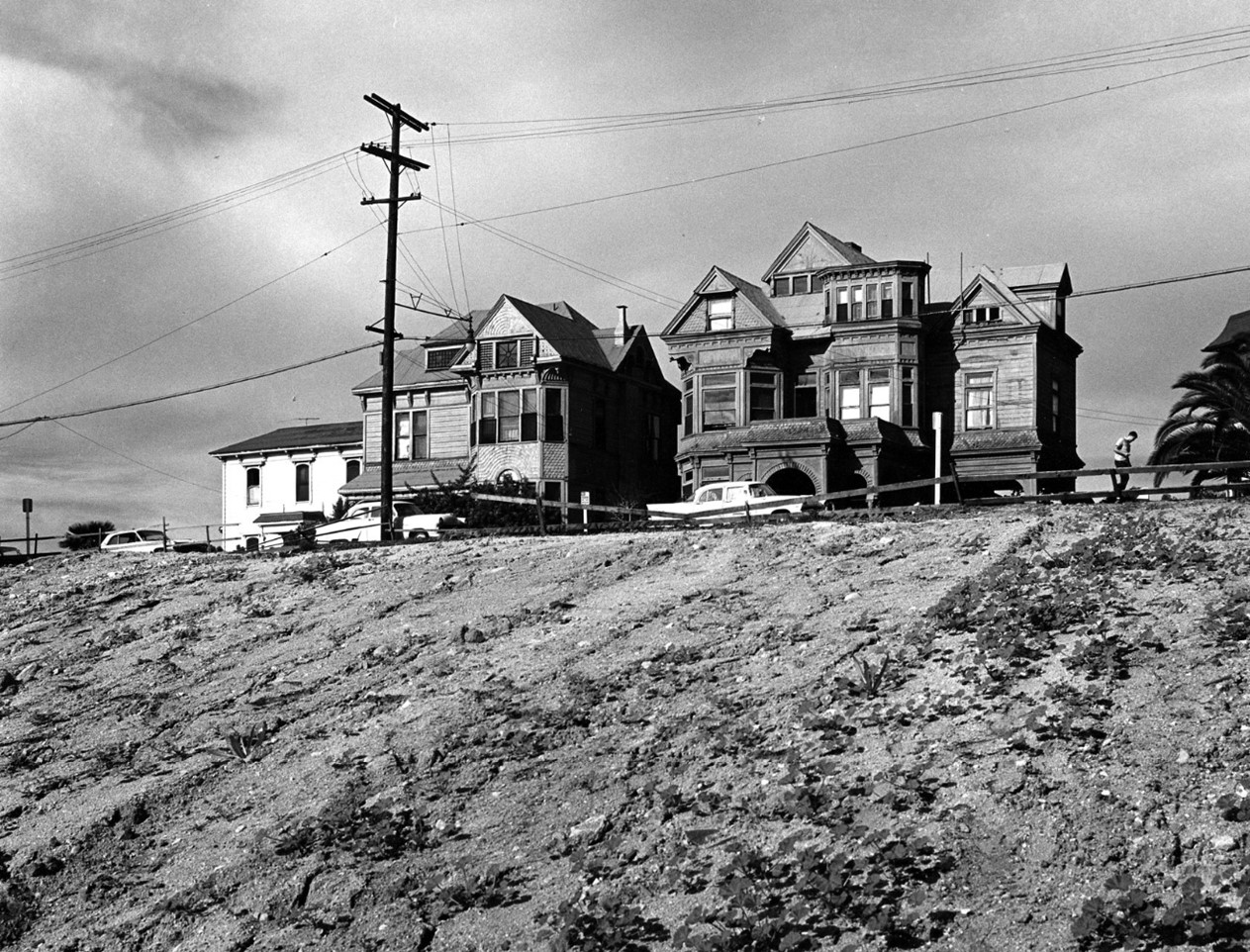 |
|
| (1965)* – View overlooking weedy lot towards Victorian houses lining Bunker Hill Avenue in the Bunker Hill area of Los Angeles. The ‘Castle’ is seen on the right. The white building on the left was referred to as the 'Salt Box'. Photo by William Reagh. |
Historical Notes The Salt Box was two doors down from the grand mansion that came to be known as the Castle. Since Rueben M. Baker owned the lots, he was probably responsible for the construction of all three houses. Baker resided at the Castle until 1894 and possibly rented out the Salt Box until selling it to Ada Frances Weyse and her husband Rudolph in 1892. |
.jpg) |
|
| (1965)* - The Bunker Hill residence, affectionately called "The Castle" is being painted by two artist at their easels. Photo by William Reagh. |
Historical Notes In 1965, 'The Castle' was designated LA Historic-Cultural Monument No. 27 (Click HERE to see complete listing). |
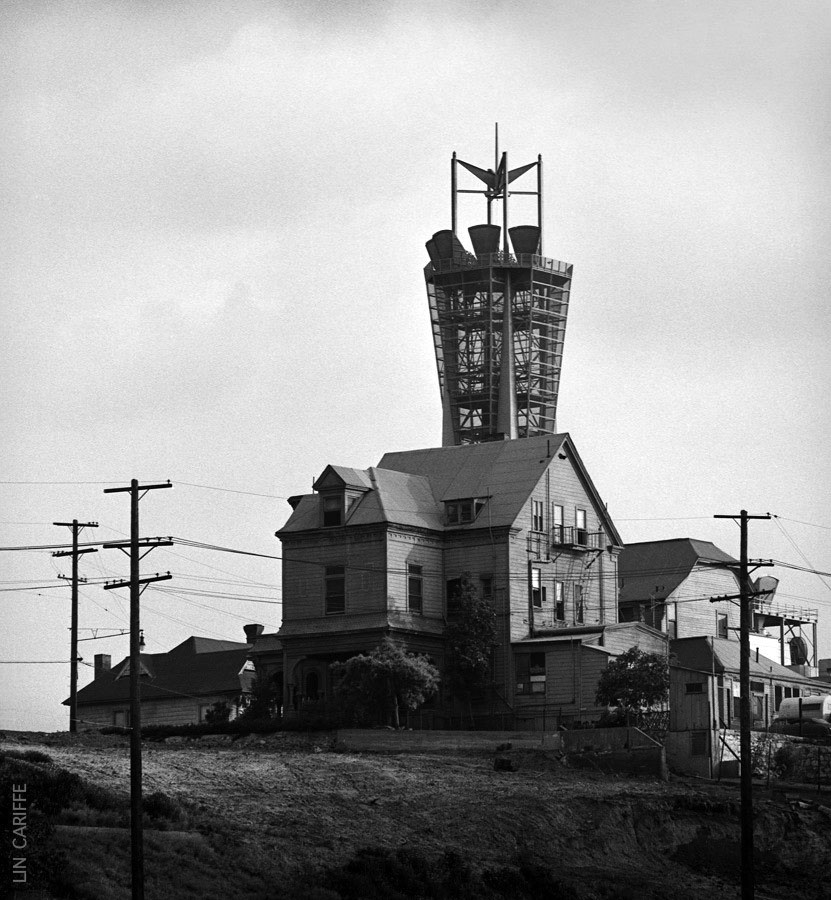 |
|
| (1965)* - View showing the “Castle” (at center) and the ‘Salt Box’ (right) with the PacBell Telephone MicrowaveTower behind them in the distance. Photo courtesy of Lin Cariffe |
Historical Notes The 'Castle', in foreground, and the 'Salt Box', both built before 1890, were the only two buildings saved from the bulldozer when the entirety of Bunker Hill was leveled to make way for the future. |
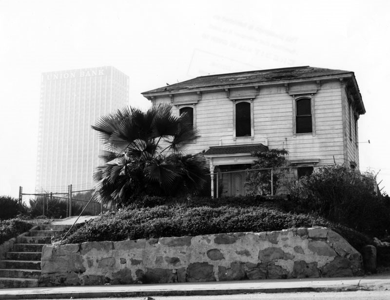 |
|
| (1967)* - Front view showing a residence known as the "Salt Box," located at 339 S. Bunker Hill Avenue. The recently completed Union Bank Building (left), is evidence of the drastic changes underway in and around Bunker Hill. |
Historical Notes The Salt Box was two doors down from the grand mansion that came to be known as the Castle. Since Rueben M. Baker owned the lots, he was probably responsible for the construction of all three houses. Baker resided at the Castle until 1894 and possibly rented out the Salt Box until selling it to Ada Frances Weyse and her husband Rudolph in 1892. In 1900, the house at 330 S Bunker Hill was home to two households. By 1910, the Salt Box had been divided up into seven separate units which housed families as well as single tenants. In 1920 there were ten units and by 1939 the house had been further divided into thirteen separate residences. Those who called the Salt Box their home came from all walks of life and included painters, nurses, waiters, and of course pensioners who could afford rents that were as little as $9.75 per month. Built in the 1880s, the "Salt Box" was Los Angeles Historic-Cultural Monument No. 5. (Click HERE to see complete listing). |
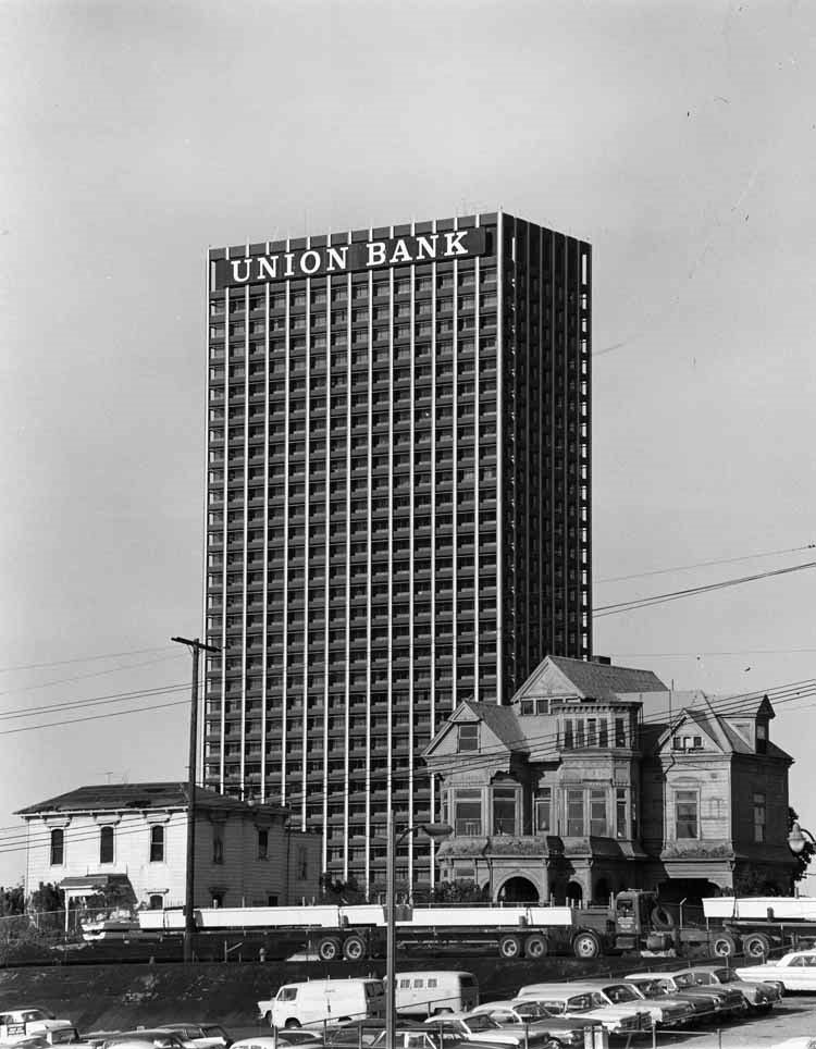 |
|
| (1968)* – View showing The Castle and Salt Box houses with the Union Bank Building in the background and trucks and cars in foreground. |
Historical Notes At the end of 1968, the decision was finally reached to move the Castle and Salt Box to Highland Park in an area called Heritage Square in Highland Park. |
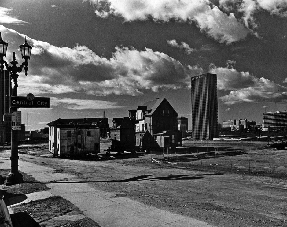 |
|
| (1968)* - "The Castle" and "The Saltbox," sit on blocks awaiting their removal from Bunker Hill. The Union Bank Building stands tall in the background. |
Historical Notes By 1968, all of the once proud Victorians of Bunker Hill Avenue had been demolished, except for the Castle and the Salt Box. The two structures that had been constructed at the same time had been spared. Once the CRA began pushing forward with their grand redevelopment plan in the mid-1950s, the writing was on the wall for the mansions in the neighborhood, and in an attempt to save a couple of the structures, the Salt Box was declared Historic Cultural Monument #5 in October in August 1962. Designation was soon bestowed upon the Castle which became HCM #27 in May 1964. The rest of the decade was spent trying to figure out a way to spare the two structures from the wrecking ball. |
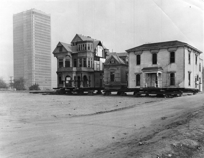 |
|
| (1969)* - "The Castle" and "The Saltbox," sit on blocks awaiting their removal to Montecito Heights. The 32-story Bunker Hill Tower, built in 1968, is seen in the background. Photo Date: January 10, 1969. |
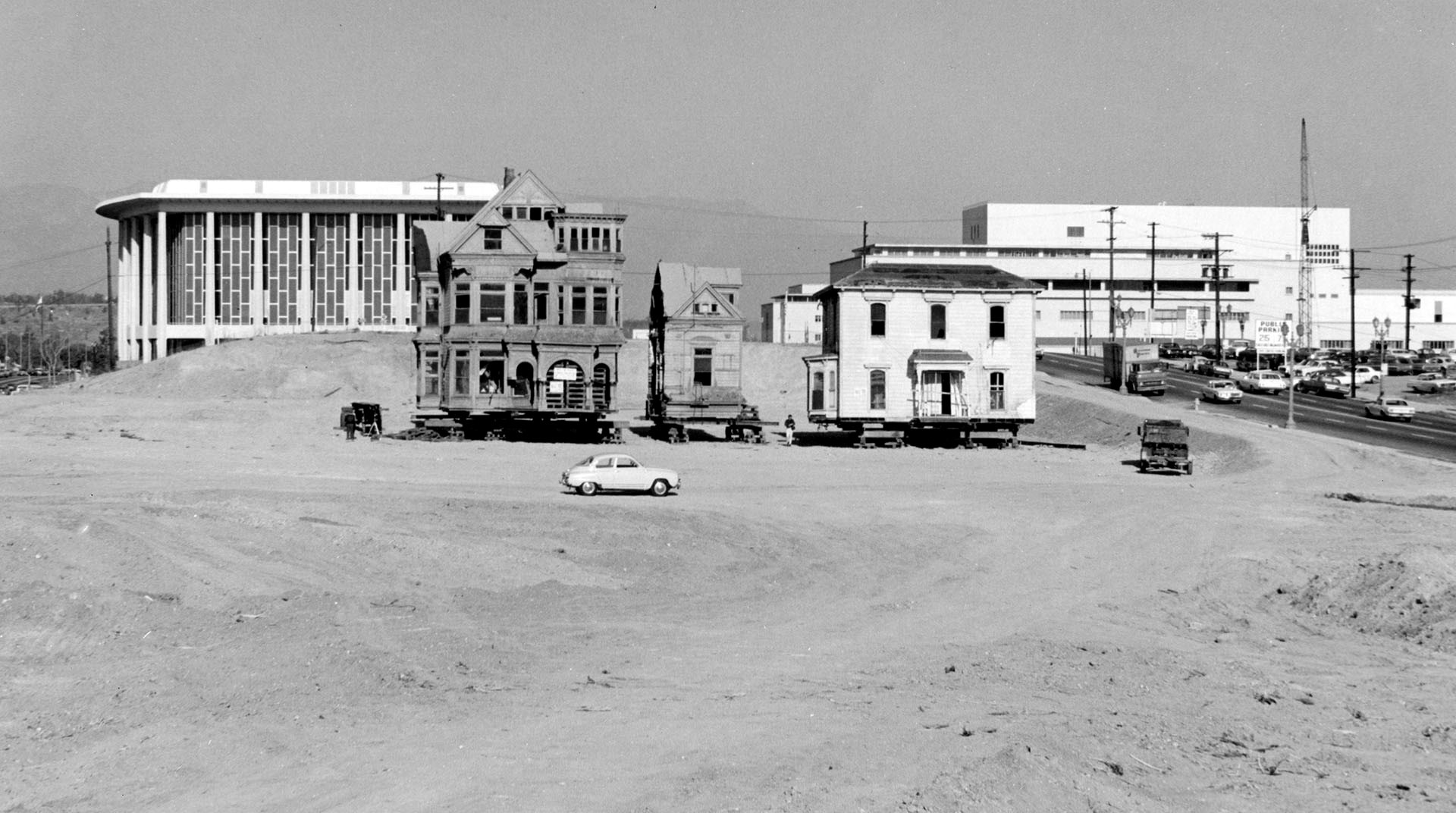 |
|
| (1969)* - View of the last remaining residence on Bunker Hill. "The Castle" and "The Saltbox" are jacked up and ready for moving. The Dorothy Chandler Pavilion and Stanley Mosk County Courthouse can be seen behind them to the north. |
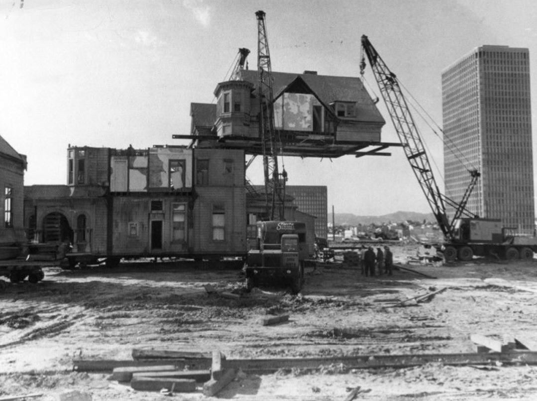 |
|
| (1969)* - Three heavy cranes support the upper floor of the historic Bunker Hill house called "The Castle." The upper floor was then lowered onto blocks to prepare it for relocation to Arroyo Seco Park. Since the size of the house made it impossible to move, the house was cut into three sections--the north wing, the third floor and the two main stories. Photo by Myron Dubee. |
Historical Notes Both "The Castle" and "The Saltbox" were successfully relocated to Heritage Square in March 1969. Unfortunately, the area was not well protected, and both the Castle and the Salt Box were burned to the ground by vandals in October 1969. |
* * * * * |
Nelson Flats
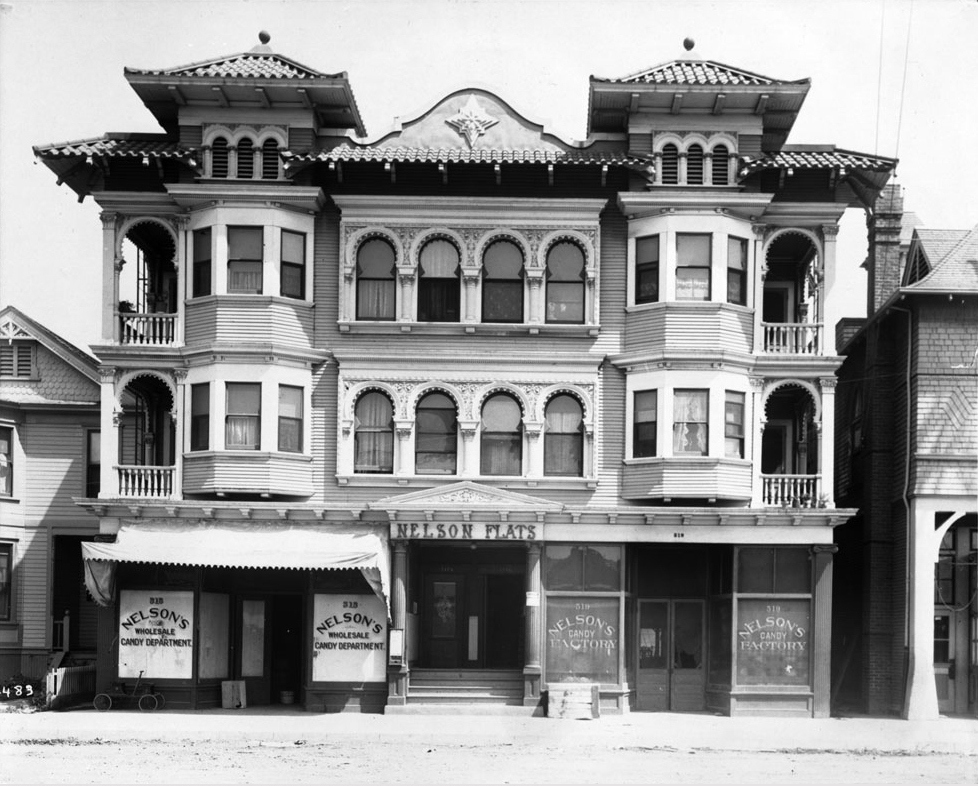 |
|
| (ca. 1910)^ - Exterior view of the Italianate and Moorish Revival style Nelson Flats, located at 515-519 East 4th Street. Note the similarities between these Moorish style arches and those found in the Bunker Hill home of the previous photo. |
Historical Notes At the turn of the 20th century, the eastern area of present-day Skid Row remained largely residential, despite a small but growing industrial presence. At the time, the 500 block of East 4th Street was occupied by apartment houses and smaller homes, with the exception of a candy factory and fire station which sat adjacent on the north side. In 1904, the owner of Nelson’s Candy Factory, A. L. Nelson, had the factory and shop space rebuilt on the ground floor of a new apartment building, christened as the Nelson Flats. Designed by A. L. Haley, the three-story structure was designed in a mix of Italianate and Moorish Revival styles that was popular at the time. Though primarily an architect of apartments and small residences, Haley’s best-known work today is likely the Higgins Building at Second and Main Streets. As the century progressed, many of the neighborhood’s apartment buildings gave way to warehouses as the eastern downtown districts became increasingly dominated by industry, aided by the city’s zoning ordinances. Though the Nelson Flats and several of its neighbors survived into the 1950s, they have long since disappeared, leaving behind nearly no traces of the area’s residential past.* |
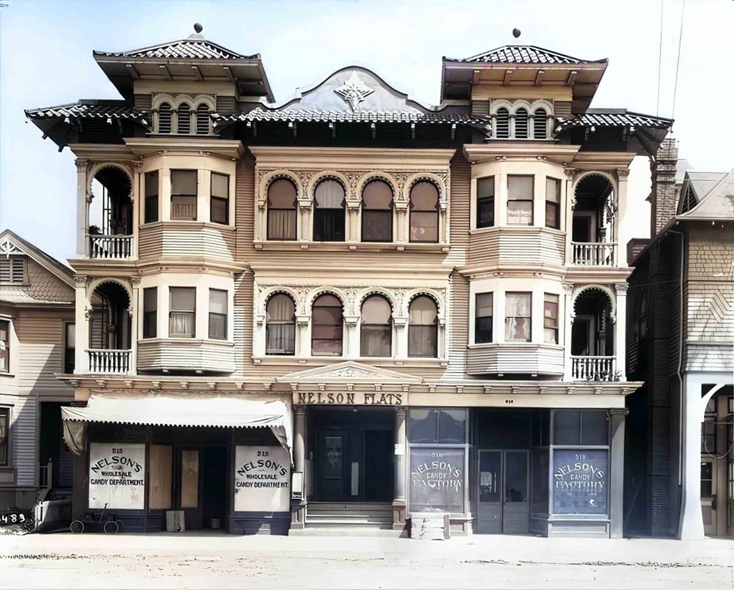 |
|
| (ca. 1910)^ – Nelson Flats, a mixed-use building located at 515-519 East 4th Street in DTLA. (AI image enhancement and colorization by Richard Holoff) |
* * * * * |
Good Samaritan Hospital
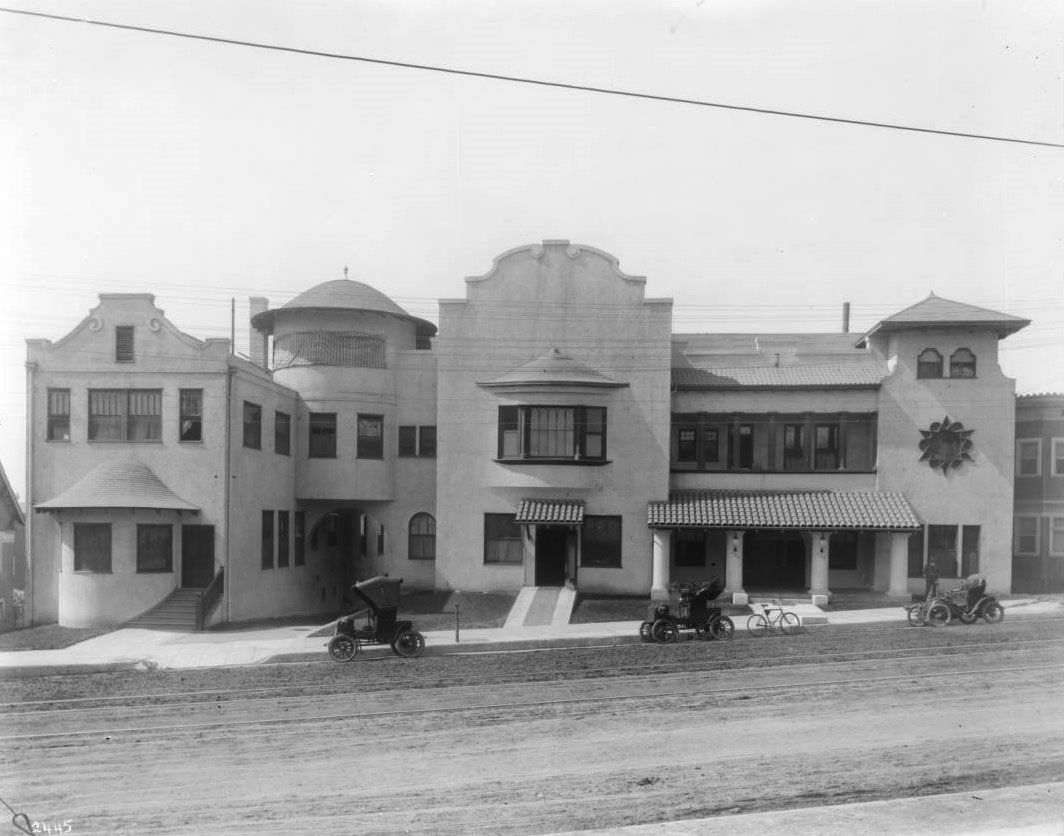 |
|
| (ca. 1904)* – Three early model automobiles and a bicycle are parked in front of the Mission Revival-style Good Samaritan Hospital on Seventh Street west of Figueroa Street. |
Historical Notes Good Samaritan Hospital in Los Angeles has a long and storied history dating back to 1885. Originally established by the Episcopal Church as St. Paul's Hospital & Home for Invalids, it was later renamed Hospital of the Good Samaritan in 1895. The original location of St. Paul's Hospital and Home for Invalids in Los Angeles was what today is 321 South Olive Street (originally 215 South Olive Street)*. In October 1887, the hospital moved to a leased, wood-frame house at 31 Sand Street (later renamed California Street). It remained at this Sand Street address until 1895, when it became known as the "Hospital of the Good Samaritan" and was relocated to the south side of 7th Street near Pearl Street. In 1897, Pearl Street was officially renamed Figueroa Street. In 1912, Good Samaritan Hospital (GSH) relocated to the recently completed Columbia Hospital (built 1910), located on the northeast corner of Wilshire and Witmer. By the mid-1920s, GSH had acquired the entire block of Wilshire Blvd between Witmer and Lucas, and new hospital buildings would be subsequently be built on that block over the next several decades. *Note: Los Angeles city ordinance renumbering all street addresses went into effect in December 1889; 215 South Olive thus became 321 South Olive.* |
* * * * * |
Braly Building (currently The Continental)
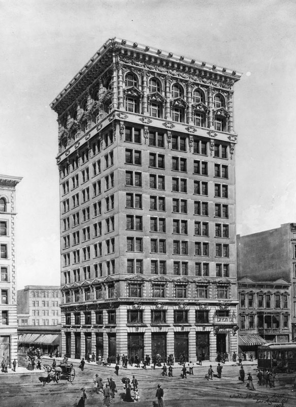 |
|
| (ca. 1904)* - Architectural rendering of the Braly Building, designed by John Parkinson. This Beaux Arts office block was the first skyscraper in Los Angeles and was built in 1904 on the southeast corner of South Spring and West 4th Streets. |
Historical Notes At one time the Braly Building was the tallest building in Los Angeles. Architect John Parkinson designed the Beaux Arts office block, which was built in 1904.* |
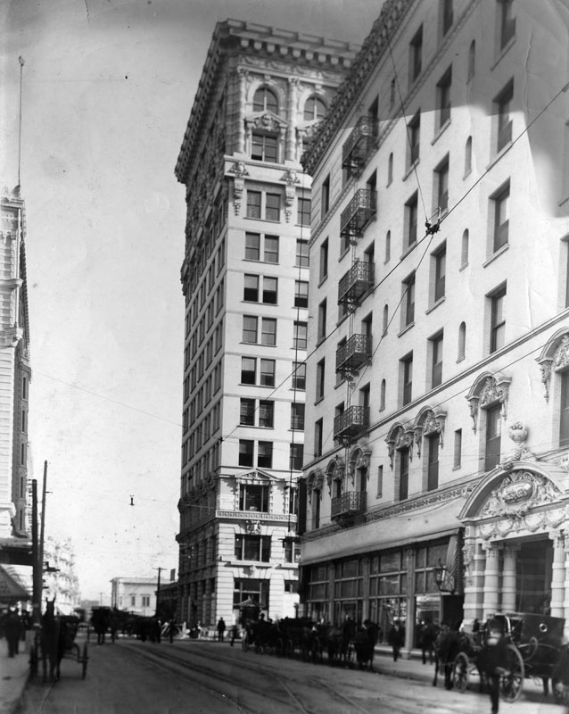 |
|
| (ca. 1904)* - View is looking across Spring at 4th to Main St. The Braly Building is seen at center of photo. The Angelus Hotel on the right. |
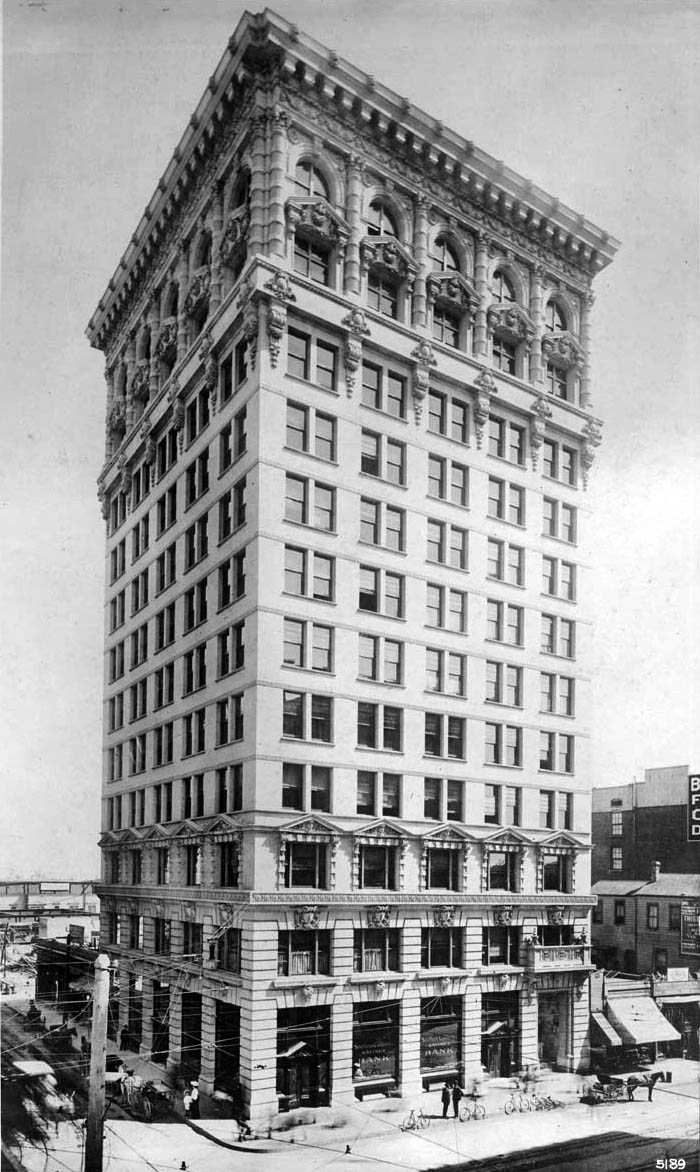 |
|
| (1904)* - Exterior view of the Braly Building on the southeast corner of 4th and Spring Streets, later called the Union Trust Building, the Hiberman Building, and then the Continental Building. |
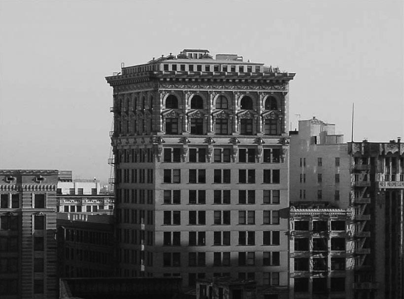 |
|
| (n.d.)*##^ - View showing The Braly Building (now Continental Building) located at 408South Spring Street. |
Historical Notes In 2002, the Continental Building (Braly Building) was dedicated as Los Angeles Historic-Cultural Monument No. 730 (Click HERE to see complete listing). |
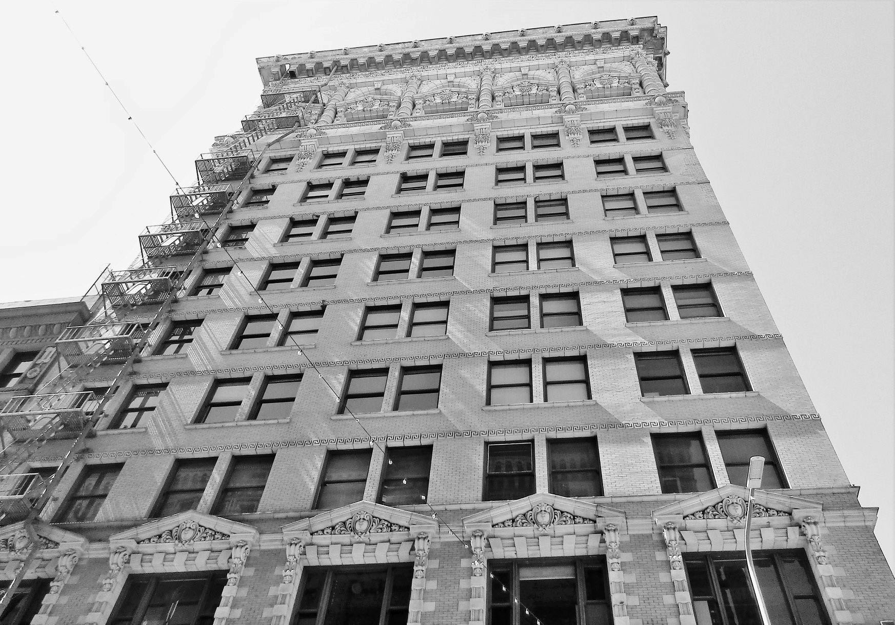 |
|
| (2018)^.^ - The Continental (formerly Braly Building), LA’s first high rise. When built in 1904 it was the tallest building in Los Angeles at 151 feet. |
* * * * * |
El Miradero
 |
|
| (ca. 1904)* - View of El Miradero, the estate of Leslie C. Brand, as seen from the entrance gates of the property. |
Historical Notes Born in Missouri in 1859, Leslie Coombs Brand became the sole provider for his family at age 11. In 1886, Brand came to California to take advantage of its first boom period. Brand was a major figure in the settlement and economic growth of the Glendale area. He had purchased land on the lower slopes of Mount Verdugo overlooking the city, and in 1904 built an imposing residence that became known as Brand Castle, also El Miradero (which today houses the Brand Library). |
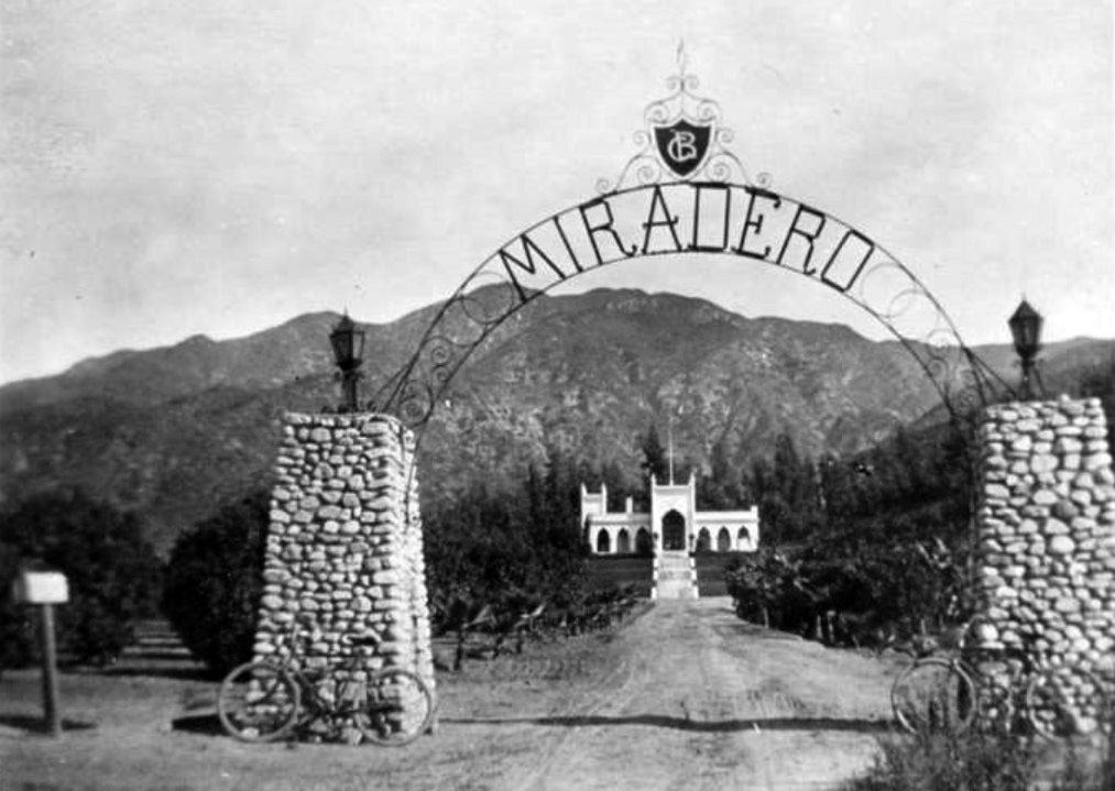 |
|
| (1911)* – View showing the home of L. C. Brand, El Miradero, through the front arched entryway. Two bicycles rest on the stoned pillars supporting the archway. |
Historical Notes The photograph was taken by Miss Ethel Thompson, a nurse at the Burbank Hospital and sister to Dr. Elmer Thompson (Thompson Memorial Hospital, and the only doctor in Burbank at this time.) |
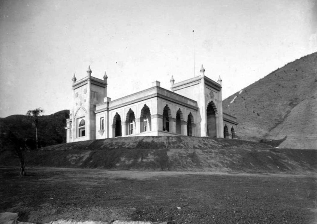 |
|
| (1904)* – West side view of the newly constructed ‘El Miradero’, home of Leslie C. Brand. |
Historical Notes Designed by Leslie C. Brand's brother-in-law Nathaniel Dryden, the mansion was completed in 1904 and is similar in style to that of the East Indian Pavilion built for the 1893 Columbian World Exposition held in Chicago. The architecture is considered Saracenic, with crenellated arches, bulbous domes and minars combining characteristics of Spanish, Moorish, and Indian styles. |
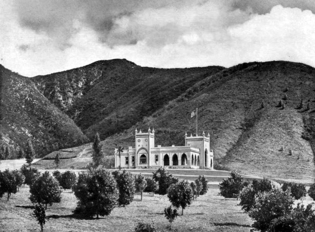 |
|
| (ca. 1906)* – View of El Miradero Mansion standing between orange groves in the foreground and the Verdugo Hills in the background. |
Historical Notes Leslie C. Brand helped develop the city of Glendale. Together with Henry E. Huntington, he brought Pacific Electric to the town to develop it. The 'Brand Library' section of the Glendale Public Library is named in his honor. Brand Boulevard in Glendale is also named in his honor. |
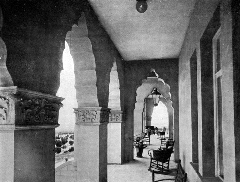 |
|
| (ca. 1906)* - View of exterior porch of El Miradero (Brand Mansion) enclosed with a scalloped arched arcade. The porch is furnished with wicker chairs and potted plants. |
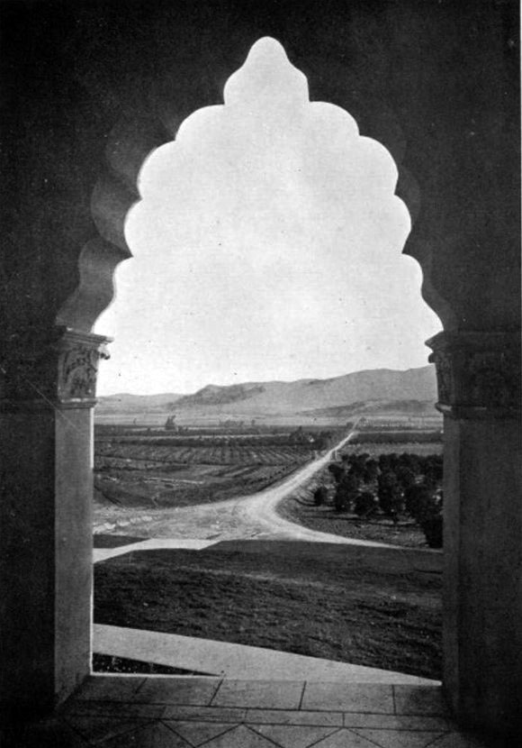 |
|
| (ca. 1906)* – View looking South over Glendale and Griffith Park toward Los Angeles through one of the many arches of ‘El Miradero’. |
Historical Notes Just across the mostly dry Los Angeles River, Brand could see the Griffith Park Aerodrome's grass field, built in 1912. Just three years later he decided to build his own grass airstrip below his mansion. |
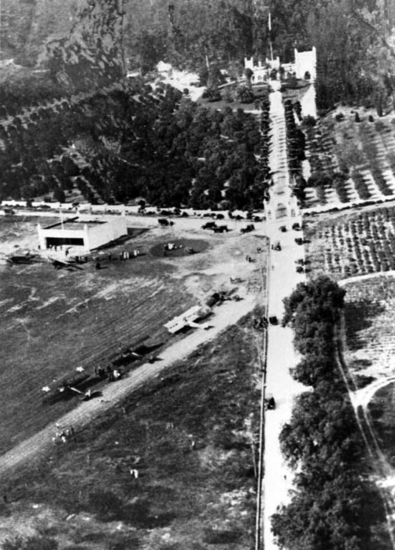 |
|
| (1921)* - An aerial view of L. C. Brand's airfield in front of his home, El Miradero in Glendale. The airplanes took off downhill toward Kenneth Road. |
Historical Notes Brand established a grassy, well-manicured airfield in front of the mansion. The airfield consisted of a 1,200' rolled dirt runway, with a white hangar at one end and a putting green on the other. The hangar matched the architectural style of the mansion - with turrets atop each of the 4 corners. |
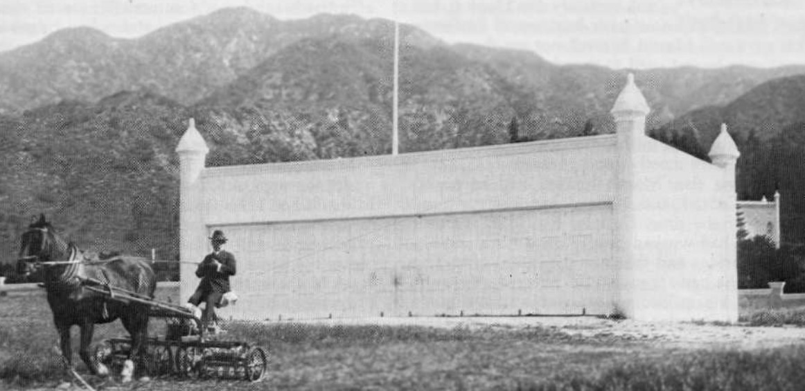 |
|
| (ca. 1920s)* – View of millionaire Leslie C. Brand mowing the lawn in front of the Moorish-style hangar at his private Airfield. |
Historical Notes Brand built his first hangar in 1916 and put together a fleet of planes, and held fly-in parties. The only requirement was that guests had to arrive in their own planes and bring passengers. |
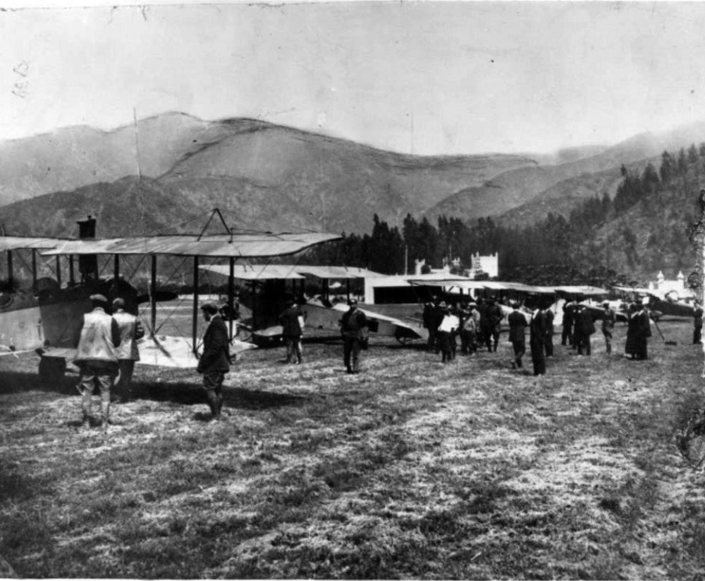 |
|
| (1921)^*# – Several airplanes and guests arriving at Brand's fly-in luncheon party on April 1, 1921. El Miradero Mansion is seen in the background. Click HERE to see more in Aviation in Early L.A. |
Historical Notes Brand Field was no longer depicted on a 1931 street map, but “Brand Park” was depicted, so the airfield may have ceased operation by that point. |
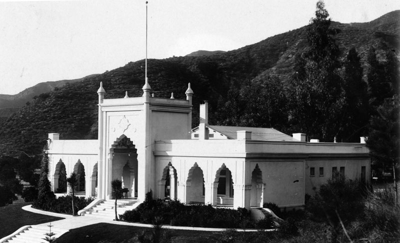 |
|
| (ca. 1920s)* - Exterior view of El Miradero, the estate of Leslie C. Brand, located in Brand Park, high in the foothills overlooking Glendale and the San Fernando Valley. |
Historical Notes Brand is largely responsible for Glendale’s civic development: he organized utility companies, founded the Title Guarantee and Trust Company, sponsored local businesses, invested heavily in San Fernando Valley real estate, and built a private airstrip where he hosted the world’s first fly-in parties. |
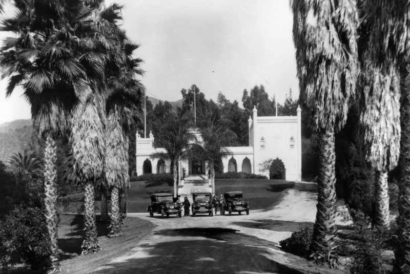 |
|
| (ca. 1920)* - View of El Miradero and estate grounds, once home to Leslie C. Brand. Three vehicles are seen parked next to one another where the driveway and path to the front door meet. Four people, three men and one woman, are standing next to the automobiles. |
Historical Notes It was stated in Brand's will that El Miradero would be bequeathed to the city upon his wife's death, on the condition that the property be used exclusively for a public park and library. Mrs. Mary Louise Brand retained rights of the residence from 1925, when Mr. Brand died, until her death in 1945. |
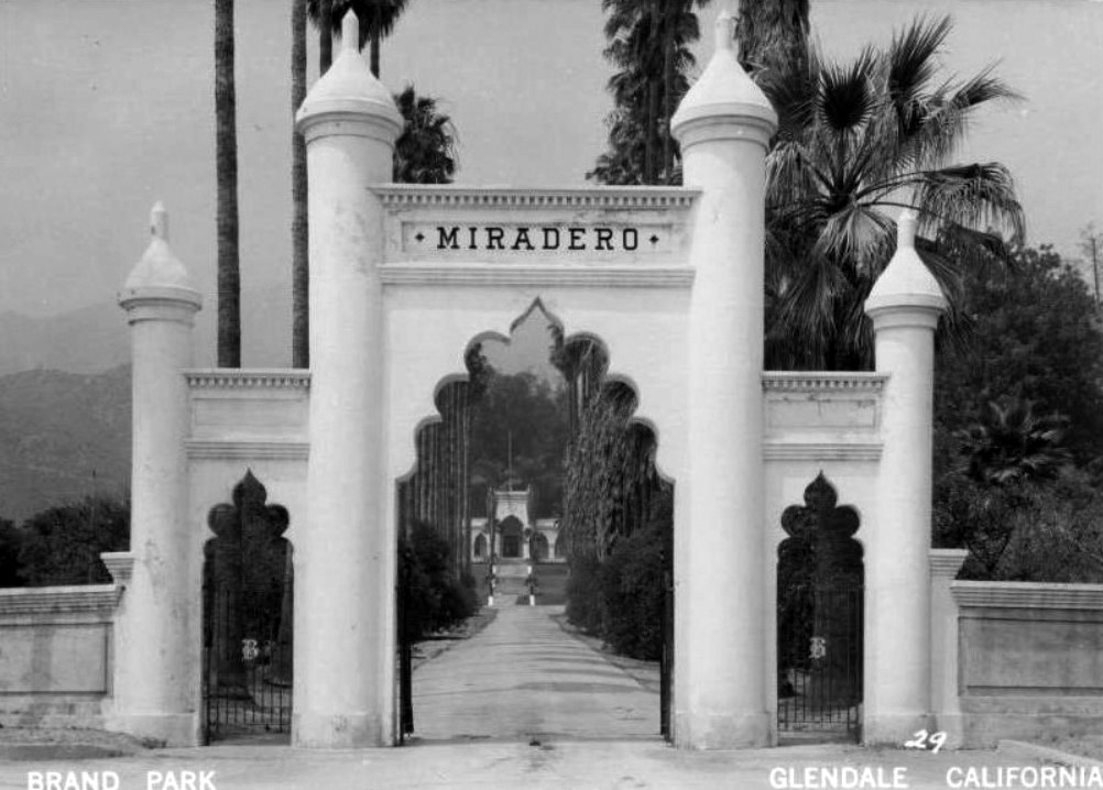 |
|
| (ca. 1940s)* - Postcard view of the entrance to El Miradero, the estate of Leslie C. Brand, located in Brand Park. |
Historical Notes In 1956 the mansion became the Brand Library, the art and music branch of the Glendale Public Library. The address is 1601 West Mountain Street, Glendale. |
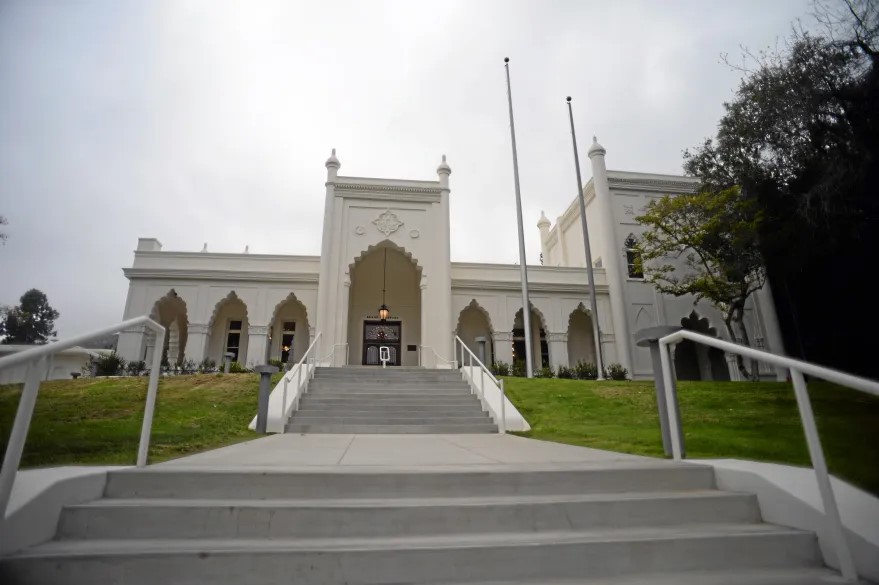 |
|
| (2014)* – View looking up the stairway leading to the entrance of the Brand Library after its renovation. Photo by Hans Gutknecht/Los Angeles Daily News |
Historical Notes After an extensive $10 million renovation, the Brand Library & Art Center reopened on March 27, 2014. Brand Library and Art Center encompasses El Miradero, the Brand family mansion built in 1904; an art and music library; a recital hall; art galleries; and art studios. |
* * * * * |
Hollywood Hotel
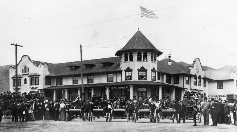 |
|
| (1903)* - View of the Hollywood Hotel at northwest corner of Prospect Ave. (later Hollywood Blvd.) and Highland Ave. showing a gathering of people, fronted by five identical open-air automobiles. Only the original portion of the hotel had been built at this time. Photo Date: April 26, 1903 |
Historical Notes The Hollywood Hotel opened in December 1902. It was built by early Hollywood developer H.J. Whitley, to support selling residential lots to potential buyers arriving from Los Angeles by the electric Balloon Route trolly of the Los Angeles Pacific Railroad. It was developed on property owned by Harrison Gray Otis, George Hoover, and Whitley. Located on the west side of Highland Avenue, the elegant wood structure with Mission Revival style stucco facades and broad verandas also fronted on unpaved Prospect Avenue, lined with California pepper trees. The hotel was sited among lemon groves then at the base of the Hollywood Hills, part of the Santa Monica Mountains in the area. Whitley was instrumental in improvements to Prospect Avenue, which in 1910 was renamed Hollywood Boulevard. Increasing business compelled the building of an additional 40-room wing onto the hotel in 1905.^ |
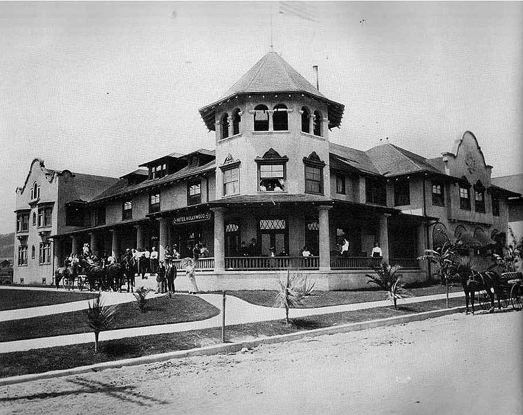 |
|
| (1905)^* - A closer view of the Hollywood Hotel. Guests can be seen standing on the front porch while horse-drawn wagons are parked in front of the hotel and along the curb of an unpaved Highland Avenue. |
Historical Notes Whitley surrounded the hotel with 3 acres of cultivated gardens. He operated the establishment as a country resort hotel as the developing community of Hollywood first established itself.^ |
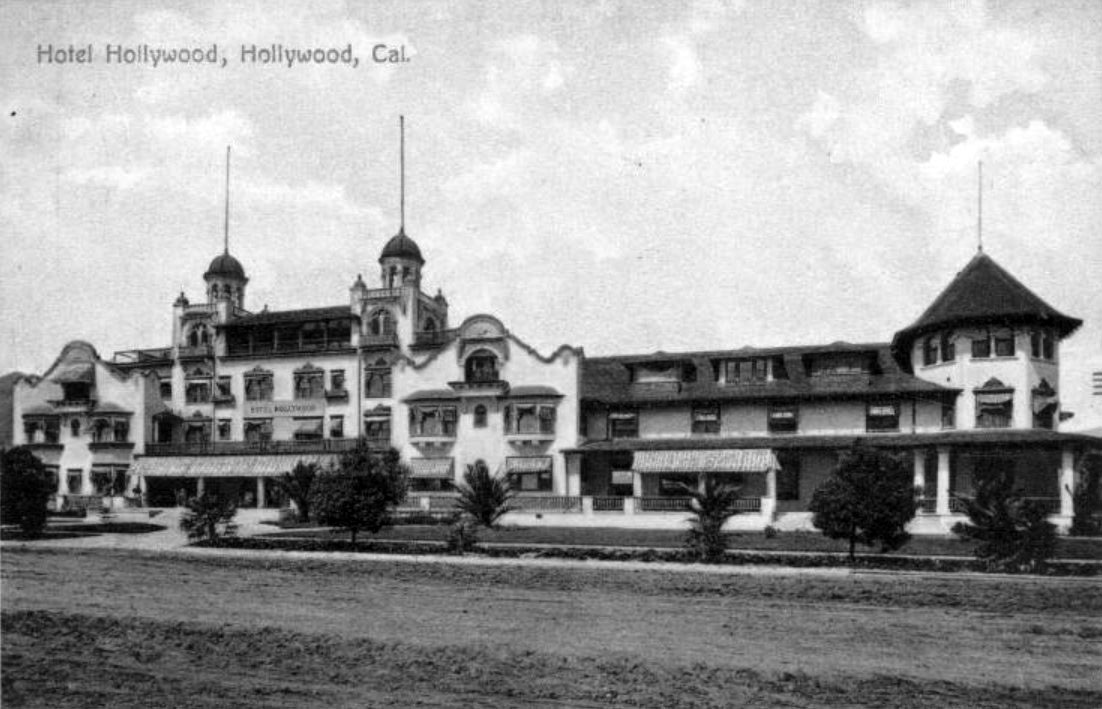 |
|
| (1906)*– Postcard view of the Hollywood Hotel after new addition. Prospect Avenue (later Hollywood Boulevard) is still unpaved. |
Historical Notes The hotel was so successful that in 1906 a huge addition, which included a new entrance, chapel, ballroom, etc. and 125 guest rooms, was constructed running along Prospect Ave (later Hollywood Blvd.), stretching west to Orchid Drive. The whole place, including the gardens took up three acres. |
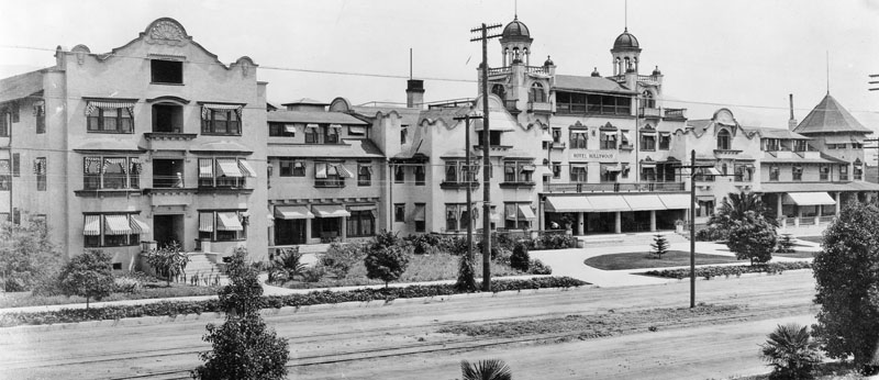 |
|
| (1906)* - View of the Hollywood Hotel just after it was enlarged to cover the entire block. The original building can be seen on the right. |
Historical Notes In 1906 the heiress Almira Hershey, who was then living in a mansion on Bunker Hill in Downtown Los Angeles, took a horse and buggy ride to see the hotel that was being advertised in the Los Angeles Times. She was so impressed with the Hollywood Hotel she decided to buy it. She hired Margaret J. Anderson who had worked for her at the Darby and the Fremont Hotels, which Hershey owned, as the manager. Under Anderson's management, the hotel expanded to 250 rooms and became well known in the area, but the two women had a contentious relationship and Anderson left to move to the Beverly Hills Hotel in 1912.^ |
.jpg) |
|
| (ca. 1907)#** - View looking north from the field behind Hollywood High School. The Hollywood Hotel is seen on the north side of Prospect Avenue (Hollywood Boulevard). In the far background are the Hollywood Hills. |
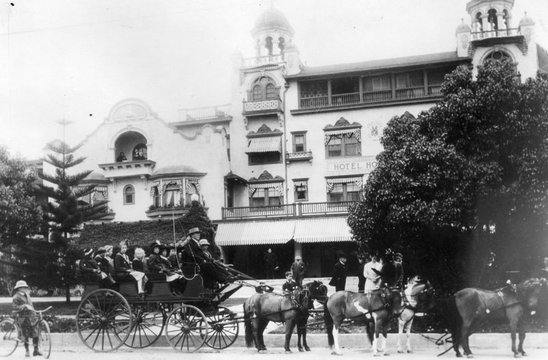 |
|
| (ca. 1910)* - Carriage drawn by six horses in front of the Hollywood Hotel. Thie is the year Prospect Avenue would become Hollywood Boulevard. |
Historical Notes Hollywood Boulevard was named Prospect Avenue from 1887 until 1910, when the town of Hollywood was annexed by the City of Los Angeles. After annexation, the street numbers changed from 100 Prospect Avenue, at Vermont Avenue, to 6400 Hollywood Boulevard.^ |
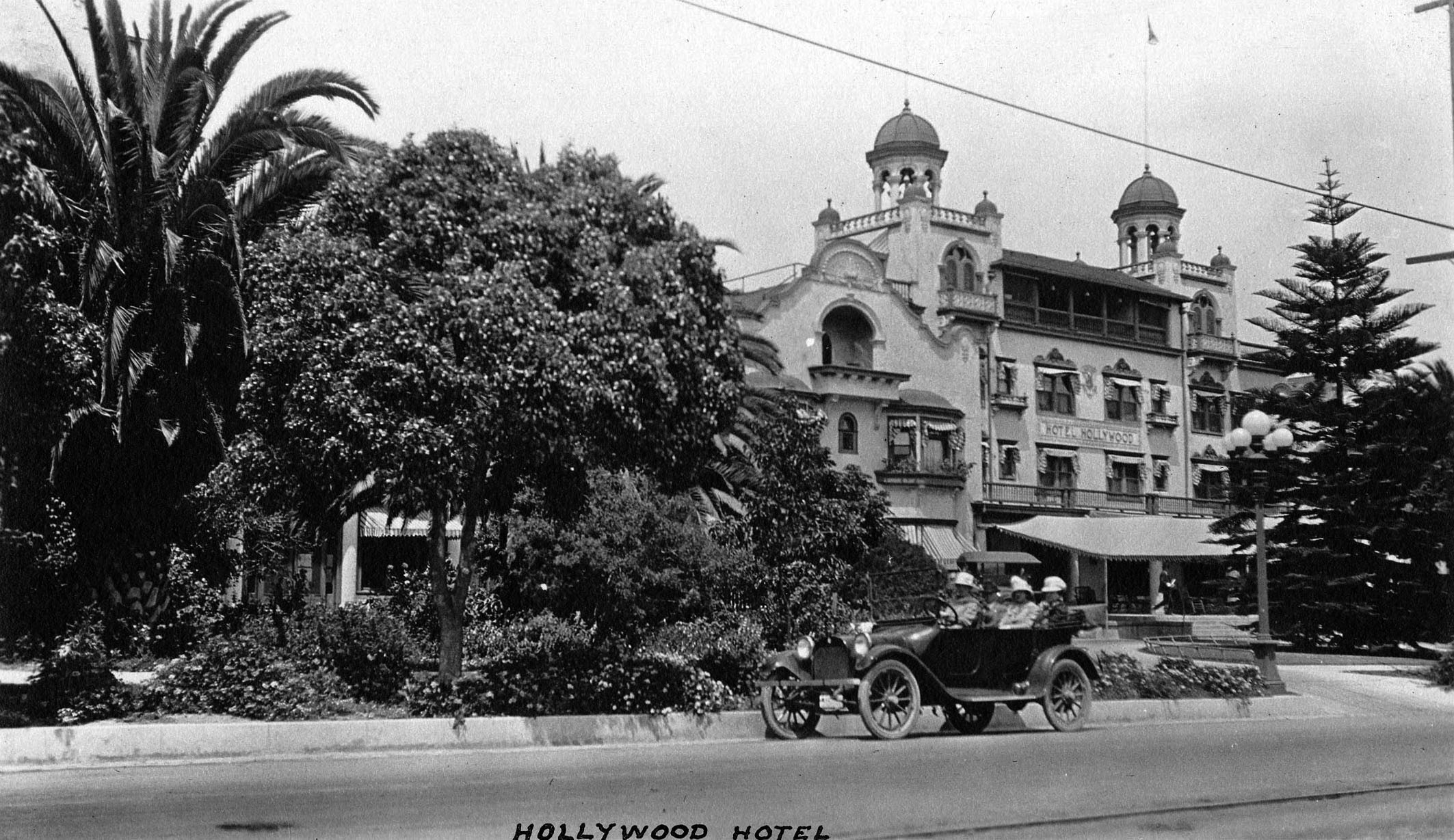 |
|
| (ca. 1915)^*# - View looking northeast showing a car full of people parked by the curb in front of the Hollywood Hotel. |
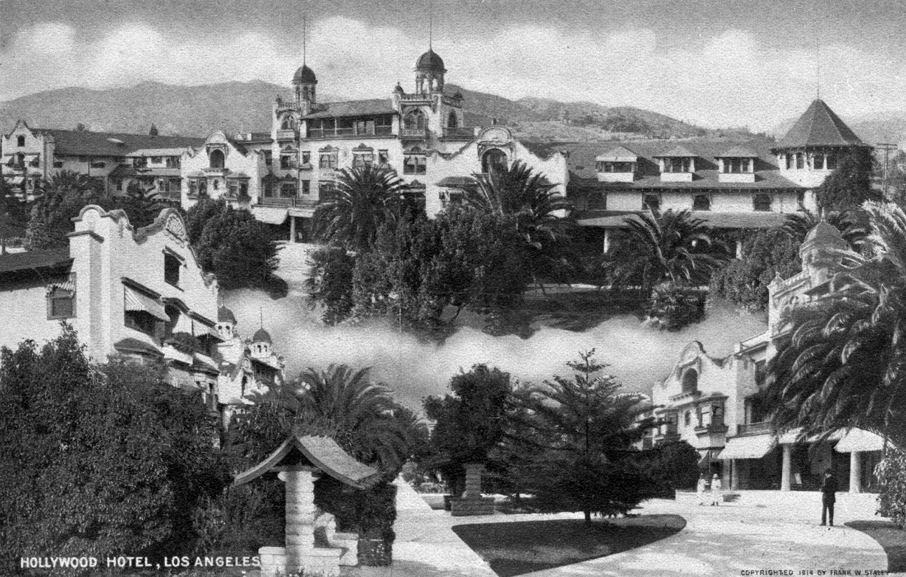 |
|
| (1914)^.^ - Composite postcard of the Hotel Hollywood at Hollywood & Highland, 1914. Creator Frank W. Staley |
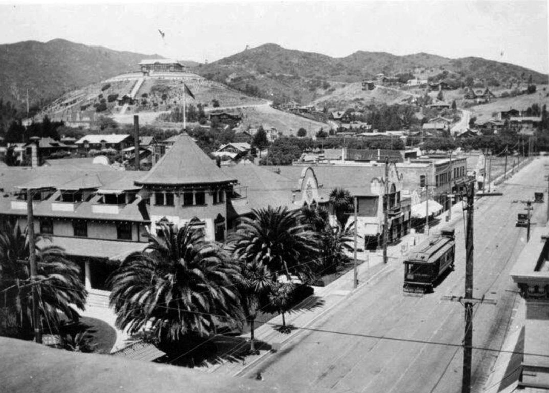 |
|
| (ca. 1915)##^* - View showing a streetcar heading south on Highland Avenue in front of the Hollywood Hotel. In the background high on a hill sits the impressive Japanese Palace of brothers Charles and Adolph Bernheimer. |
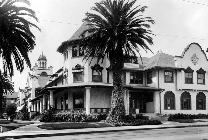 |
|
| (ca. 1920s)* - Corner view of the famous Hollywood Hotel, located on the north side of Hollywood Blvd, between Highland and Orchid Avenues. It shows a white, 2-story Spanish style structure with numerous windows throughout, a wrap-around porch, neatly manicured lawns, and several tall palms. A cupola can be seen peeking up from behind the arched façade on the left of the building. |
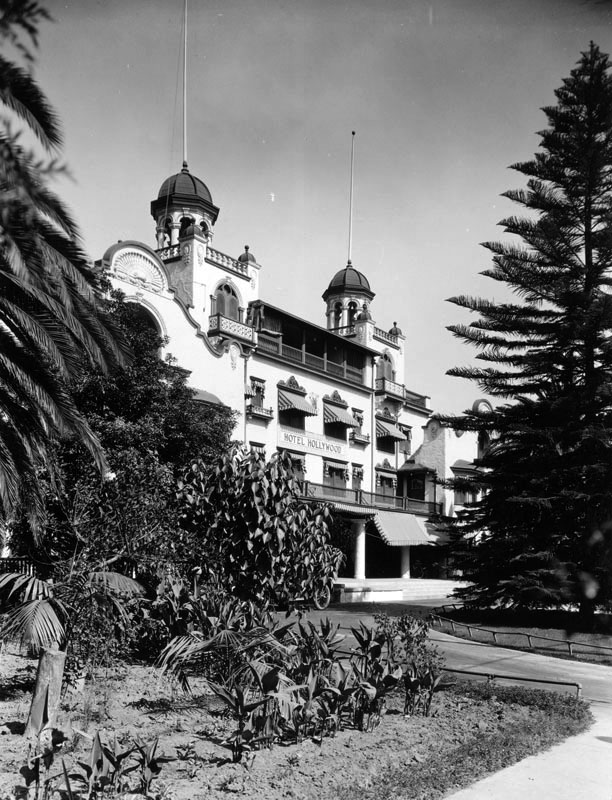 |
|
| (ca. 1920)^*# - View of the Hollywood Hotel circa 1920. Note how much the trees have grown over the last decade (see previous photo). |
 |
|
| (1930s)#^^ – Postcard view of the Hollywood Hotel with early model car parked in front. |
 |
|
| (ca. 1930s)^^ – Street level view looking at the front entrance of the Hollywood Hotel. The four-story hotel has a striped awning on the bottom floor, while a tower can be seen at left rising above the fourth floor. Several large windows with decorative wooden frames can be seen on the facade, along with a sign that bears the name of the hotel. Two men can be seen standing outside the hotel near the top of stairs leading down to a circular driveway. |
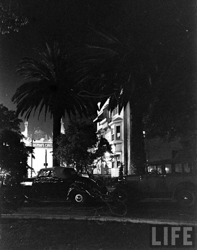 |
|
| (1936)^***^ – Night view looking west through the foliage of the Hollywood Hotel. Two cars are parked on the circular driveway in front of the hotel with the bright lights of the neighboring Grauman's Chinese Theatre seen in the distance. |
.jpg) |
|
| (1936)^***^ - Night view looking northeast showing the entryway to the Hollywood Hotel with cars parked in the circular driveway. |
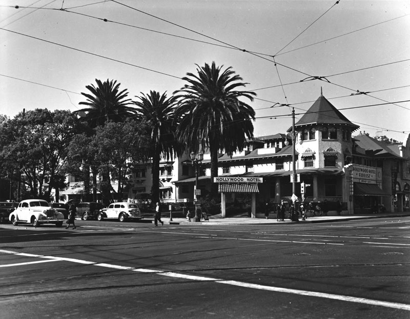 |
|
| (ca. 1937)* - The Hollywood Hotel, located on the northwest corner of Hollywood Boulevard and Highland Avenue. |
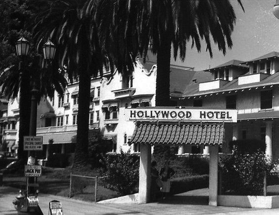 |
|
| (ca. 1937)^***^ – Close-up view showing two women standing under the archway in front of the Hollywood Hotel near the NW corner of Hollywood and Highland. |
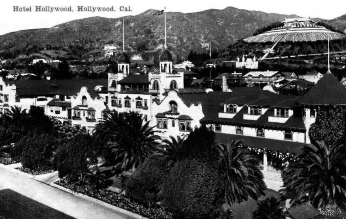 |
|
| (1940)##^* – Postcard view showing the Hotel Hollywood fronting Hollywood Boulevard. The hilltop Japanese estate and gardens of brothers Charles and Adolph Bernheimer can be seen in the upper right corner. |
Historical Notes After WWII, the Bernheimer home was remodeled and converted into apartments. Soon thereafter, Thomas O. Glover purchased the property and began the restoration of what was to become the Yamashiro restaurant.* |
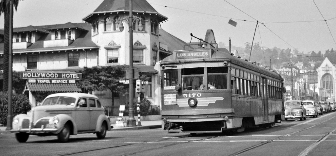 |
|
| (1940s)##** – View looking north on Highland Avenue at Hollywood Boulevard showing P.E. No. 5170 heading south. The Hollywood Hotel is seen on the northwest corner. |
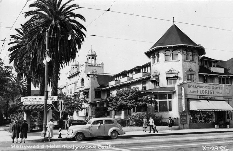 |
|
| (1940s)^*# - Postcard view of the Hollywood Hotel on the northwest corner of Hollywood and Highland. The hotel’s florist shop fronts Highland and can be seen in the lower right. |
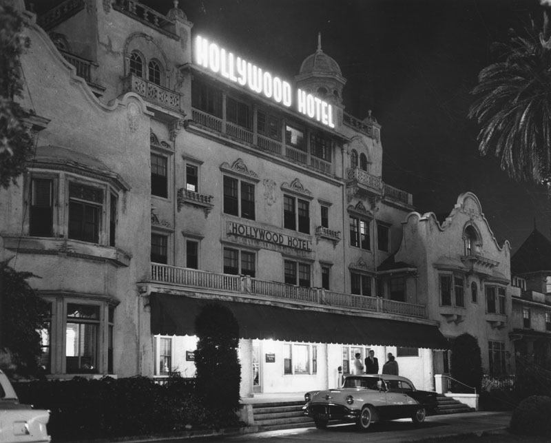 |
|
| (1956)* - Night view of the Hollywood Hotel which was razed shortly after this photo was taken. |
Historical Notes Though the Hollywood Hotel housed many of the great stars in its day, it was razed in August 1956 to make way for a $10 million development, with a twelve story office building (First Federal Savings and Loan Building), a shopping center and parking lots.^ |
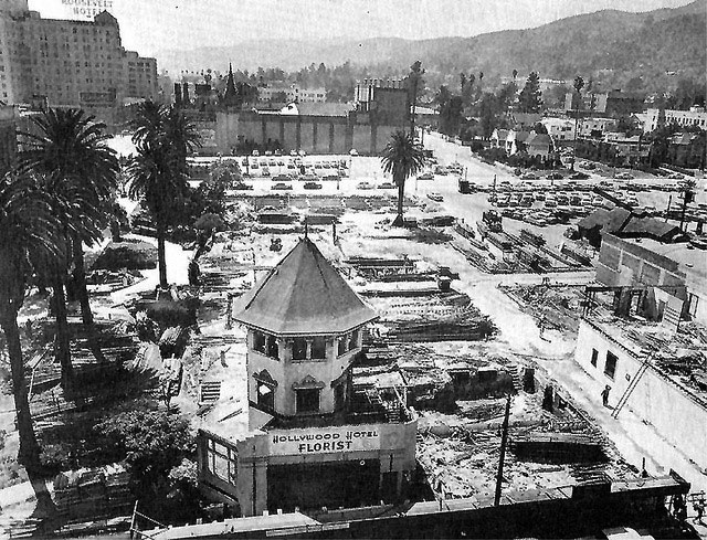 |
|
| (1956)^#^* – View showing the demolition of the Hollywood Hotel, N/W corner of Highland and Hollywood, with only its florist shop left standing. Both the Chinese Theatre and the Roosevelt Hotel are seen in the background. |
Historical Notes In 2001, the Hollywood and Highland entertainment complex, which includes the Hollywood and Highland Center, the current home of the Academy Awards, was constructed on the site. |
* * * * * |
Paul de Longpré Residence
.jpg) |
|
| (ca. 1905)* - Exterior view of the Mission Revival/Islamic style Hollywood residence once owned by artist Paul de Longpré. The home was located on the west side of Cahuenga Blvd. at Hollywood Blvd. |
Historical Notes Perhaps the most famous Hollywood transplant of the time was Paul de Longpre, a French horticultural painter who arrived in Los Angeles with his family in 1889. After de Longpre discovered his ideal flowers growing in Hollywood, he met Daeida Wilcox, who was so anxious to attract culture that she gave him her homesite, three lots on Cahuenga just north of Prospect (later Hollywood Blvd.), for his estate. The mansion and gardens Paul de Longpre built not only drew Hollywood society but served as a lure for new property buyers and tourists. So many visitors came to see “Le Roi des Fleurs” that the P.E. Railway added a trolley spur on Ivar Avenue to deposit them closer to the estate. |
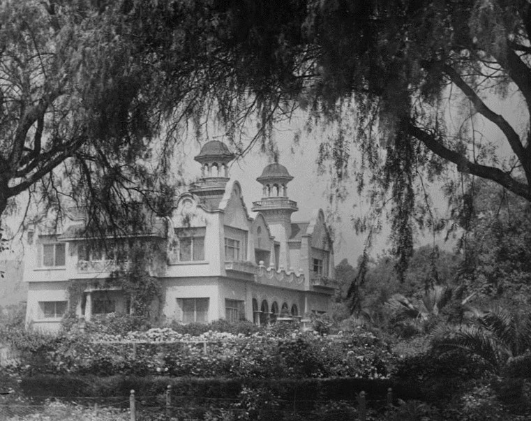 |
|
| (1907)* - Exterior view of the Hollywood residence and gardens owned by artist Paul de Longpré. The home was located on the west side of Cahuenga Blvd. at Hollywood Blvd. on property he obtained from Mrs. Wilcox Beveridge after he moved to Los Angeles in 1889. The French born artist desired the 65-foot-deep lots for a large flower garden. |
Historical Notes Tours of the house and gardens, along with prints of his floral paintings, supported the de Longpre family until the artist’s death in 1911. After his family returned to France, the house and gardens were demolished for their valuable real estate, and de Longpre’s paintings–romantic still-lifes of roses, orchids and the like–fell permanently out of fashion. |
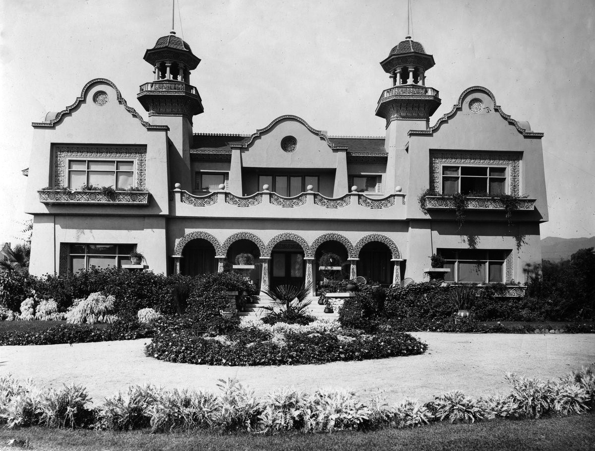 |
|
| (Early 1900s)* - Frontal view of the Mission Revival/Islamic style Hollywood residence and gardens owned by artist Paul de Longpré. |
Historical Notes The home was located on the west side of Cahuenga Blvd. at Hollywood Blvd. on property Longpré obtained from Mrs. Wilcox Beveridge after he moved to Los Angeles in 1889. The residence was a popular tourist destination for several years and was demolished in 1927. |
* * * * * |
Arthur Letts Residence (Hollywood)
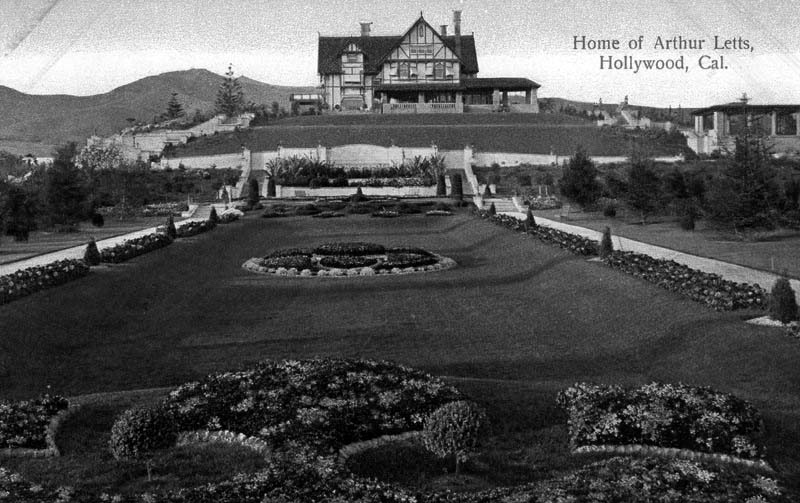 |
|
| (ca. 1905)* - Postcard view of the Tudor Revival Hollywood home and gardens of merchandiser Arthur Letts, located at 4931 Franklin Avenue, Hollywood. The residence was also known as the Holmby Mansion, the name loosely derived from Letts' hometown of Holdenby, England. |
Historical Notes Arthur Letts, Sr. was born in England. In 1882 he emigrated to Toronto, Canada, and found employment in a large dry goods store. When the Red River Rebellion broke out in the Northwest of Canada, he volunteered. He was awarded a silver medal and clasp for distinguished service, and a grant of land by the Canadian government. In the early 1890s he emigrated to the United States in Seattle, Washington and began retail employment in dry goods. Having little success, he then headed for L.A. in 1895. At the corner of Fourth and Broadway, then on the far southern edge of the downtown Los Angeles business district, the J. A. Williams & Co. Dry Goods Store had gone bankrupt. With the help of an influential friend, who was impressed with Letts’ knowledge of that type of business, a loan of $5000 was secured from the Los Angeles National Bank, and opened his business on February 24, 1896. He named the department store The Broadway.^* |
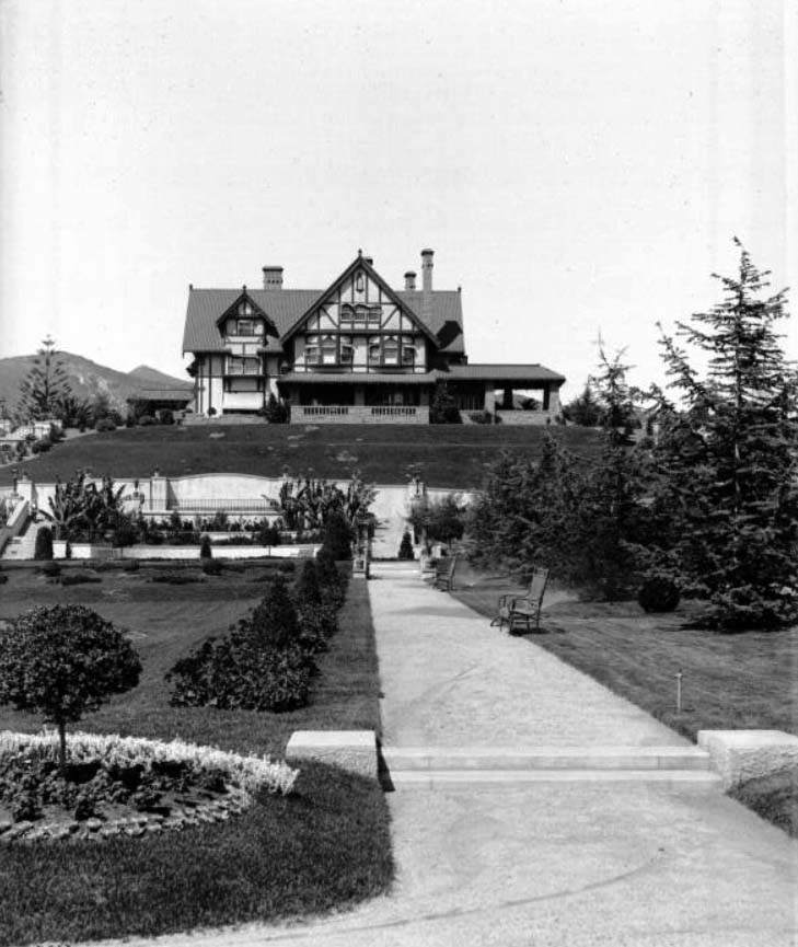 |
|
| (ca. 1905)^ – View showing the three-story Letts residence. The house is situated on a hill and features dormer windows, cant windows, stone masonry walls, a covered porch, several chimneys and window awnings. An immaculate courtyard adorned with well-manicured lawns and gardens precedes the house. |
Historical Notes Arthur Letts knew real estate was great for investment in fast-growing Los Angeles. And with his significant access to capital, it was just a matter of time before he made one of his most significant purchases. In 1919 heirs to the Wolfskill Ranch (Rancho San Jose de Buenos Aires) were ready to sell, but they wanted cash. The former ranch consisted of over 3,200 acres, with an approximate border of Pico Blvd. on the south, L.A. Country Club on the east, Sunset Blvd. on the north, and I-405 on the west. Purchased for $2 Million, Arthur turned over development to his son-in-law Harold Janss' company, Janss Investment Co. The area south of Wilshire contained land reserved for movie studios. The townsite of Westwood was laid out, which by 1927 contained 4,000 people.^#^# He later also developed the westside residential community of Holmby Hills, loosely derived from the name of his birthplace, a small village in England called Holdenby.^* Click HERE to see more in early views of UCLA and Westwood. |
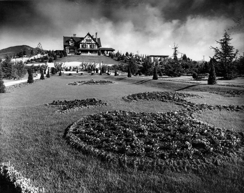 |
|
| (ca. 1905)* - Exterior view of the Tudor Revival Hollywood home and gardens of the Broadway Department Store founder Arthur Letts. |
Historical Notes Arthur Letts was also the 'behind the scenes' financial founder and owner of Bullock's Department Store, and put John Bullock from his The Broadway to direct this store. After Letts' death, Bullock and a group of investors purchased the store from the estate.^* |
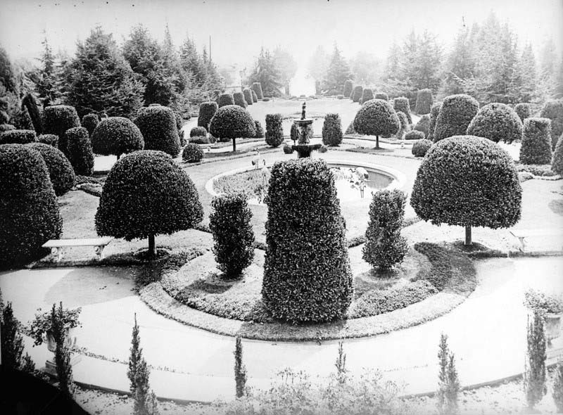 |
|
| (Early 1900s)* - A fountain in the garden of Arthur Letts' home, located at 4931 Franklin Avenue, Hollywood, in which crane statues are seen. The shrubs and trees are carefully manicured and set in a balanced design. |
Historical Notes The grounds of Los Feliz district, Hollywood estate Holmby House were formally laid out with wide variety of trees, shrubs, and flowers, and Letts’ cactus collection was known across the country. It was bound by Franklin Avenue, Vermont Avenue, Los Feliz Boulevard, and Laughlin Park. The gardens were open to the public for tours, with the Pacific Electric Railway stopping at it. It was his wish that the gardens be continued even after his death. Upon his death in May 1923, his wife, at the suggestion of son-in-law Harold Janss of Janss Investment Company (who lived at the back of the property), demolished the gardens and mansion in 1927 to subdivide and develop the land, and moved to a new residence in Holmby Hills. Henry E. Huntington purchased many of the rare specimen cacti for his Huntington Desert Garden at his estate and Huntington Library in San Marino.^* |
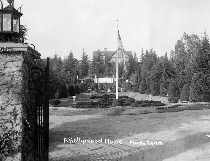 |
|
| (Early 1900s)* - View through the front entrance gates of the Tudor Revival Hollywood home and gardens of merchandiser and philanthropist Arthur Letts, located at 4931 Franklin Avenue. He was the founder of The Broadway Department Store and other ventures and later developed the westside residential community of Holmby Hills. |
Historical Notes In 1909, the estate was a stop on the Points of Interest for Hollywood tour, which also included Paul De Longpre's residence about a mile away. The Herald write-up in their Sunday magazine read: Arthur Letts' Mansion and Grounds - Immense country place. Large sunken gardens. A full acre of every known variety of cacti. Flowers in profusion. The largest coca plumosa drive in Southern California. Grounds open to visitors Thursdays.^#^# |
* * * * * |
Hollywood High School
 |
|
| (1906)* - View of Hollywood, looking south, showing Hollywood High School (at center), 1906, one year after it opened. Orchid Avenue is on the left while Orange Drive runs south, dog-legs at Hollywood, and then continues south again. Note the vast open land south of the school. |
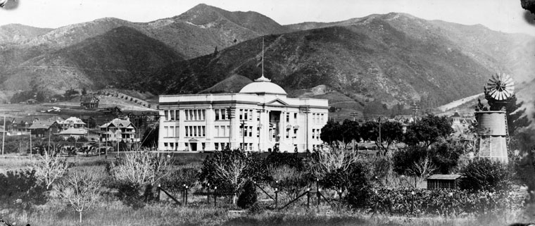 |
|
| (ca. 1905)* - Original building of Hollywood High School designed by Burnham and Bliesner in the "Ionic architecture" style. With two stories and a basement, it accommodated 400 students. |
Historical Notes In September 1903, a two-room school was opened on the second floor of an empty storeroom at the Masonic Temple on Highland Avenue, north of Hollywood Boulevard (then Prospect Avenue). Hollywood was incorporated as a municipality in November 1903.*^ The original school building (above) opened in 1905 and consisted of the consolidated school districts of Hollywood City, Laurel, Coldwater, Lankershim, Los Feliz, Cahuenga, and The Pass. In 1910, Los Angeles and Hollywood consolidated and the high school was turned over to the L.A. Board of Education.* |
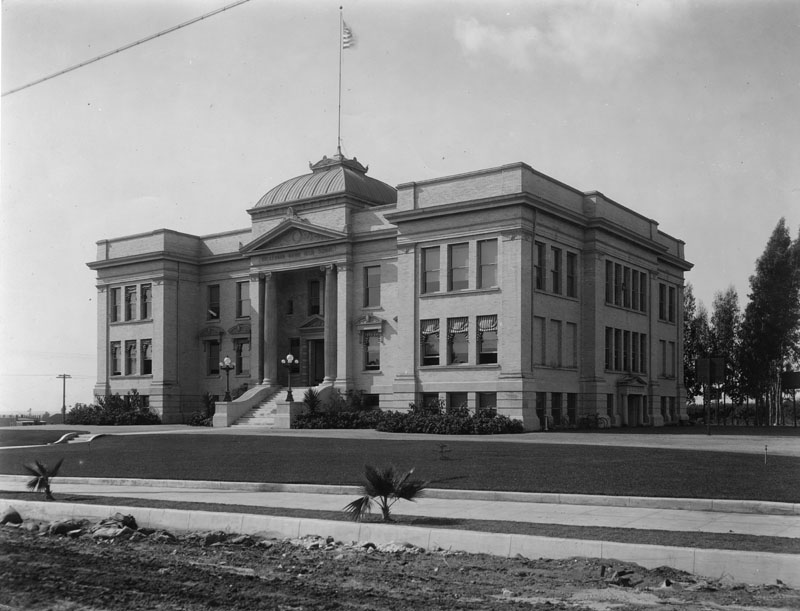 |
|
| (ca. 1905)* - Hollywood High School as seen from Highland Avenue (still a dirt road) shortly after the school was built in 1905. |
Historical Notes Hollywood High School was built on Sunset and Highland Avenue in 1905. In 1910, the school had its name changed to Hollywood Union High School. In 1924, the school changed its name again to Union High School. In 1940, the school had its name changed back to Hollywood High School and it was used for housing and feeding WWII soldiers.^ |
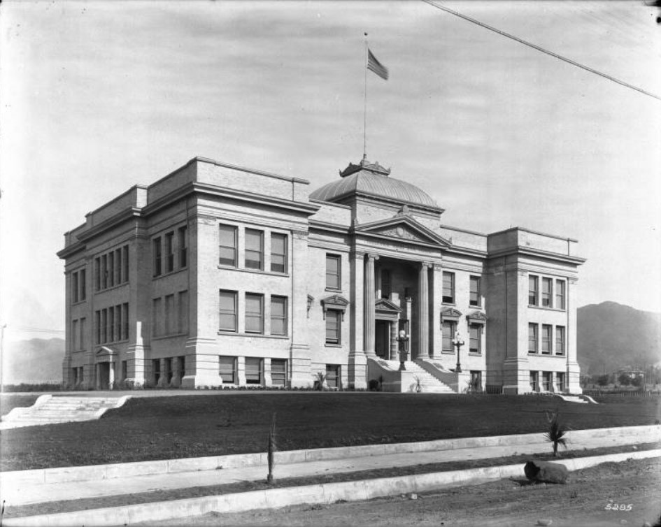 |
|
| (ca. 1905)^ - Exterior view Hollywood High School looking northwest, with the Hollywood Hills in the background. The three-story building has a tall portico supported by proto-ionic columns where inside is smaller portico supported by two Doric order columns. Both porticos have decorated pediments. "Hollywood Union High School" is displayed below the pediment of the large portico. The façade of the building is symmetric. Two lampposts flank the stairs leading to the front entrance. A flagpole stands on top of the dome-like roof above the porticos in the center of the building. The lawn around the building is well manicured. Newly planted palm trees line the dirt portion of the sidewalk. Rocks and a large boulder lay on the dirt road in the foreground. |
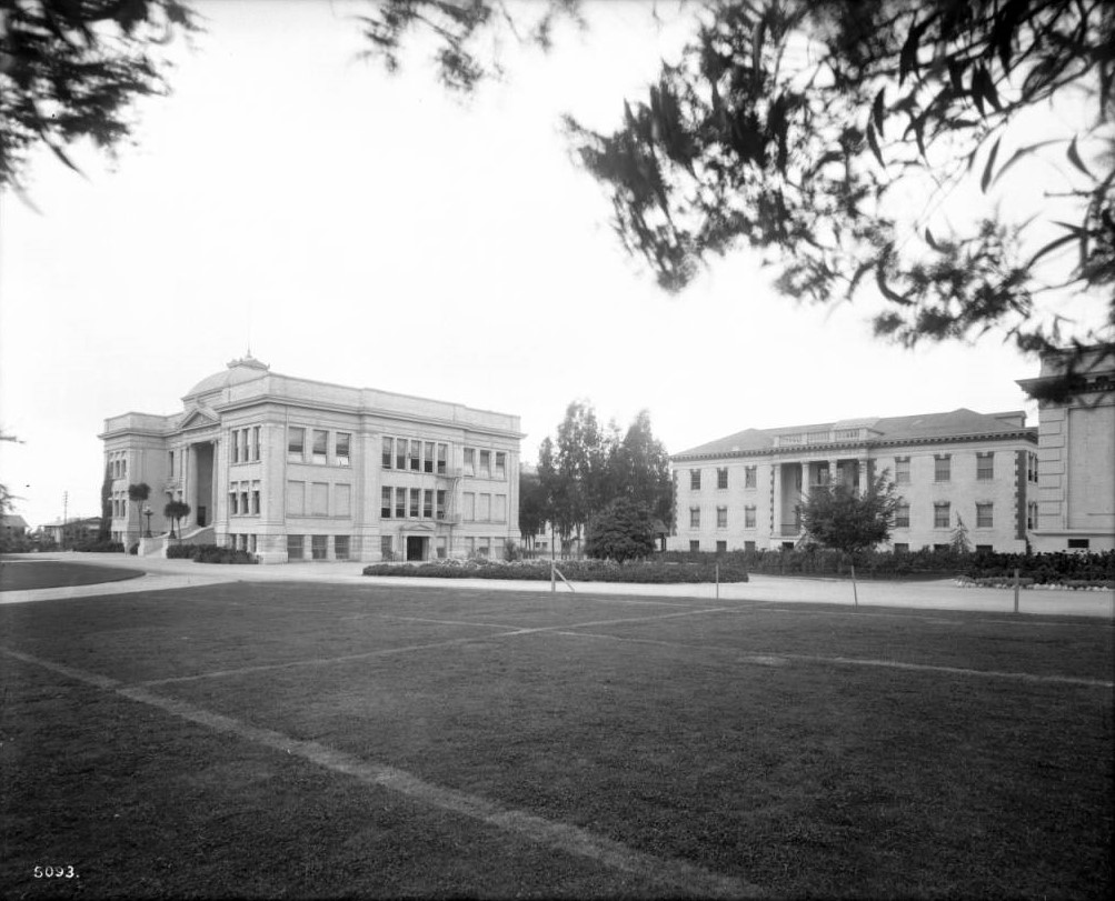 |
|
| (1916)^ - View of the campus of Hollywood High School, located north of Sunset and West of Highland Avenue. Overlooking a well-groomed courtyard are two clearly visible buildings. The left building is the original school building built in 1905. It has embossed letters that reads "Hollywood Union High School" directly above its portico. A flight of stairs leads up to the portico. On the side of the building, there is a fire escape ladder near the side entrance. Two bicycles are leaned up against the wall near the side entrance. The right building has embossed letters above its portico, which reads "Household and Fine Arts”. |
Historical Notes The Hollywood High School campus was established on its current site in 1904. The original Administration / Classroom Building was completed in 1905, and the first major campus expansion campaign concluded in 1913.*^#^ |
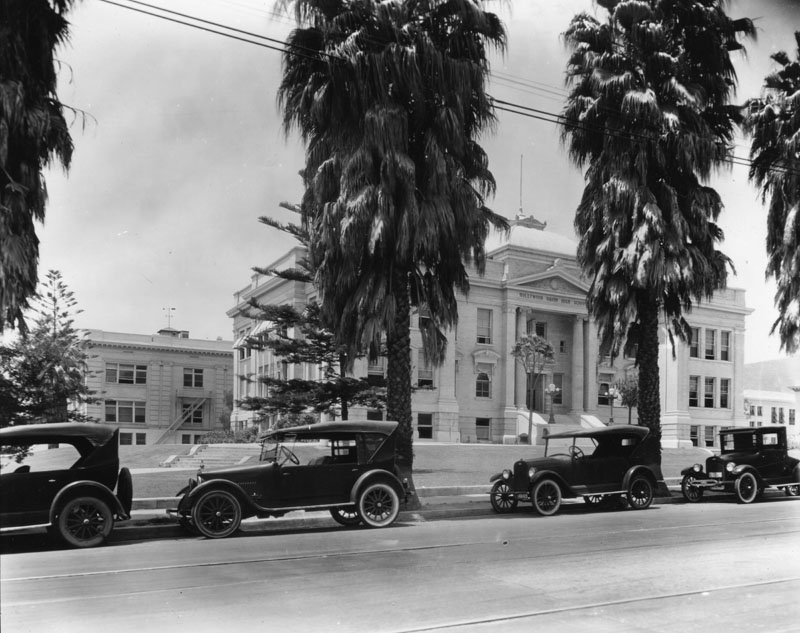 |
|
| (1920)* - A view of Hollywood High School campus, or quadrangle, looking northwest from Highland Ave. Cars are parked in front of fan palms that need to be trimmed. Yucca trees grow by the stairs leading to the entrance of the original 1905 building. "Hollywood Union High School" is chiseled over the |
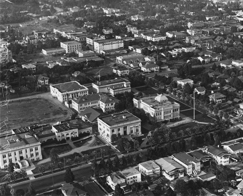 |
|
| (1922)* - An aerial view of Hollywood High School from the southwest. There is practice of some kind on the athletic field. Palm trees line the campus on Sunset and Highland. The original 1905 building is on the bottom right. The Household & Fine Arts building is in the middle of the quadrangle and the gymnasium is to its left when facing Highland. |
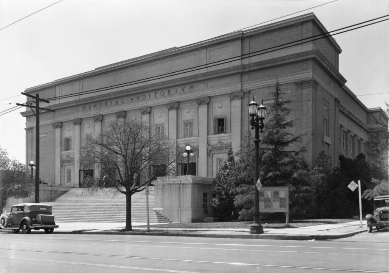 |
|
| (ca. 1929)^^ - View of the Hollywood High School Memorial Auditorium located on the southwest corner of Highland and Hawthorn avenues. A long stretch of stairs can be seen in front of the auditorium, leading up to five front entrances separated by eight Romanesque columns. Seven windows can be seen above the five front entrances. The words, "Memorial Auditorium" can be seen above the windows, at the top of the building, engraved in capital letters. |
Historical Notes The Auditorium was originally constructed in 1924. It was formally dedicated at commencement exercises on June 25, 1924 and named the Memorial Auditorium to honor the Hollywood High School graduates who died in World War I. The Auditorium is the second of only two buildings on campus that survived the Long Beach Earthquake of 1933. The original building was a Beaux Arts design that included a flat roof, masonry walls, and a symmetrical façade.*^#^ |
 |
|
| (2010)^#*^ - The Hollywood High School mural, painted by Eloy Torrez. |
Historical Notes In 1956 the original Beaux Arts façade was altered to be Mid-Century Modern in style. The façade was refinished in concrete and gunnite. In 2002 artist Elroy Torrez painted the mural "Portrait of Hollywood" on the east-facing (primary) façade that features prominent graduates throughout Hollywood High School’s history. In 2008, to commemorate the 2003 death of John Ritter, a fifty-foot portrait of the actor was added to the mural on the north façade.*^#^ Click HERE to see the complete list of Notable Alumni.^* |
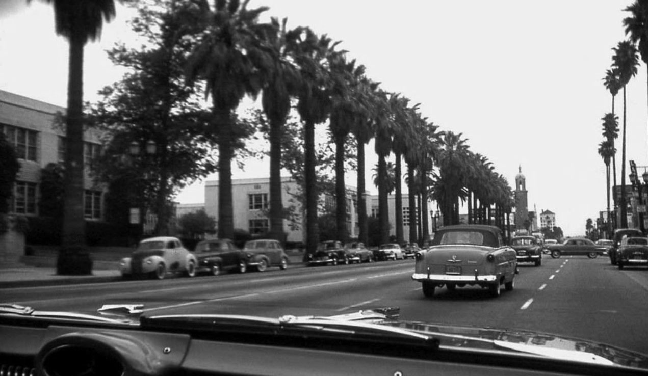 |
|
| (1956)*##^ – Dashboard view looking east on Sunset Boulevard toward Highland Avenue with Hollywood High School at left. It appears we’re riding in a new Oldsmobile (‘56 or ‘57). |
Then and Now
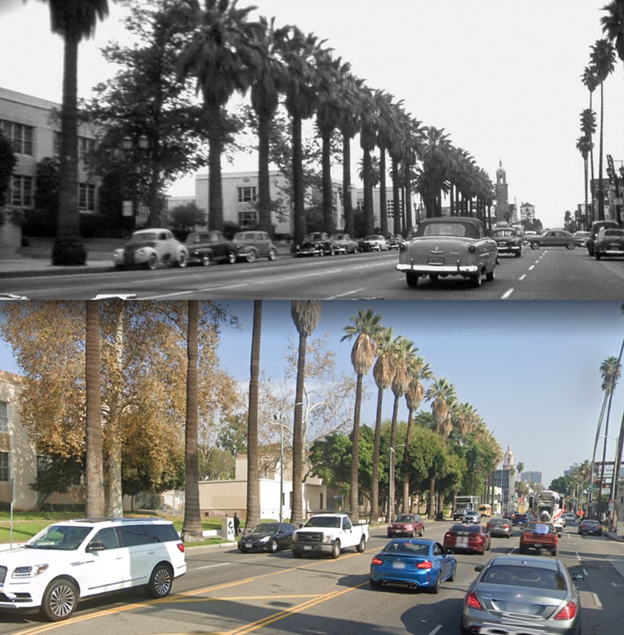 |
|
| Then and Now – Looking East on Sunset Boulevard toward Highland Avenue (1956 vs 2021) |
 |
|
| (1941)* - Early model cars parked in front of Hollywood High School on Sunset Boulevard. |
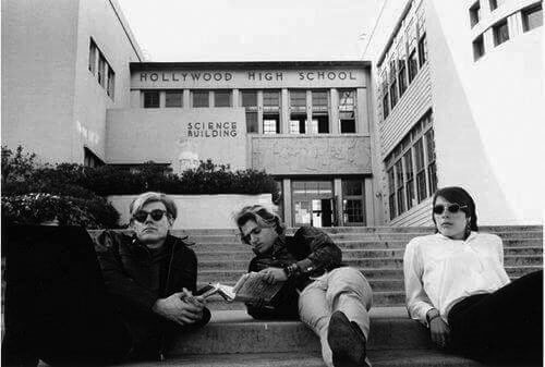 |
|
| (1966)* - View showing Andy Warhol and two friends on steps of Hollywood High School. |
* * * * * |
Please Support Our CauseWater and Power Associates, Inc. is a non-profit, public service organization dedicated to preserving historical records and photos. We are of the belief that this information should be made available to everyone—for free, without restriction, without limitation and without advertisements. Your generosity allows us to continue to disseminate knowledge of the rich and diverse multicultural history of the greater Los Angeles area; to serve as a resource of historical information; and to assist in the preservation of the city's historic records.
|
For more Historical Los Angeles Views click one of the following:
For Other Historical Views click one of the following:
See Our Newest Sections:
To see how Water and Electricity shaped the history of Los Angeles click one of the following:
Water:
Power:
* * * * * |
References and Credits
* LA Public Library Image Archive
**DWP - LA Public Library Image Archive
*^Oviatt Library Digital Archives
^^Daily Breeze: Los Angeles Motordome
*#LA Times: Hollywood Castles and Curious Cures; L.A. Brewery Was the Toast of Its Times
^#Boyle Heights History Blog: The Los Angeles Orphans' Asylum
#*Urban Diachrony - Occidental Hotel; The Nelson Flats
#^KCET: A Brief History of LA Beer
#^*Huntington Digital Library Archive
^*#California State Library Image Archive
^^*#Early Downtown Los Angeles - Cory Stargel, Sarah Stargel; Hollenbeck Hotel
*^#Publicartinla.com - Bovard Hall
***Los Angeles Historic - Cultural Monuments Listing
*^*California Historical Landmarks Listing (Los Angeles)
^^*Early Downtown Los Angeles - Cory Stargel, Sarah Stargel
*#^The Department Store Museum: J. W. Robinson's; Bullock's; The Broadway
^#*Historic Hotels of Los Angeles and Hollywood (USC - California Historic Society)
^#^Communities of Los Angeles Pacific: Hollywood
*^^Nuestra Señora la Reina de los Ángeles: losangelespast.com
^##Library of Congress: Los Angeles Herald; Venice Lagoon
**^Historical LA Theatres: The Philharmonic Auditorium; Downtown Theatres; Mason Theatre; Trinity Auditorium; Belasco Theatre; Lyceum Theatre; Orpheum Theatre; Burbank Theatre
****Windward Avenue - virtualvenice.info
^^**Flickr.com - Floyd B. Bariscale: Bonfilio Residence
^^*^Restaurantwarecollectors.com: Angelus Hotel
**^*Westcoastfireescapes.com: Fire Escape History
**^#Historical LA Theatres: The Philharmonic Auditorium
**#*Los Angeles Daily News: Brand Library
^*^#Facebook.com - Bizarre Los Angeles
*#*#Santa Monica Beach Stories
*#^^HistoryLosAngeles.blogspot.com: Lankershim Hotel
^#*^Flickr.com: espensorvik: Hollywood High School Mural
^#^#Oldhomesoflosangeles.blogspot.com: Mervin Monnette Mansion; Holmby House
*##^Flickr.com: Michael Ryerson
^##^Online Archive of California (OAC): Bullock's Department Store Building
^##*Los Angeles Fire Department Historical Archive
*^#*Blogdowntown.com: New Story Building
*^#^Hollywood High School – National Register of Historic Places Application
^^*Early Downtown Los Angeles - Cory Stargel, Sarah Stargel; Hollenbeck Hotel
^^##Metropolitan Transportation Library and Archive: Hill St. Station; Pacific Electric Building 6th and Main; PE Building ca. 1906
^^#*Jewish Museum of the American West: Leopold Harris
^^#^Facebook.com - Great Photos from Los Angeles' Past: Philharmonic Auditorium
*##*Pacific Coast Architecture Database (PCAD): Bryson-Bonebrake Block
^*#^Abandoned & Little-Known Airfields – Paul Freeman
#*#^Brand Park and Studios: glendale.ca.us
##**http://underthehollywoodsign.wordpress.com/tag/cahuenga-valley-railway/
##^^City of Angels: 1910s - Facebook.com
##^*Facebook.com: Classic Hollywood-Los Angeles-SFV
##*^http://underthehollywoodsign.wordpress.com/tag/cahuenga-valley-railway/
#*^^Beachwoodvoice.com: The Cahuenga Valley Railroad
#*^#Plummer and Associates Blog: Bullock's Downtown Los Angeles
#^*#Los Angeles Conservancy: Junipero Serra State Office Building
#^^*Google Maps
#^^^LAUSD.net; LA Memorial Library
^***^Facebook.com: Garden of Allah Novels
**# Noirish Los Angeles - forum.skyscraperpage.com; Fire Station Horses and Dogs; Pacific Electric Building; Chutes Theater; Hollywood Hotel; Walter P. Story Building; Nance's Drug Store; YWCA Building; Los Angeles Brewery
^* Wikipedia: Leonis Adobe; Occidental College; Beverly Hills; Beverly Hills Hotel; Huntington Hotel; Bank of Italy; Van de Kamp's Holland Dutch Bakeries; Rose Bowl Stadium; Los Angeles Memorial Coliseum; Farmers and Merchants Bank of Los Angeles; Los Angeles Biltmore Hotel; Jonathan Club; Los Angeles Plaza Historic District; St. Vincent Church; The Benevolent and Protective Order of Elks; Park Plaza Hotel; YMCA; San Pedro; Venice; Subway Terminal Building; St. Vincent Hospital; Los Angeles Herald-Examiner; Cahuenga Branch Library; Foy House; Frederick Hastings Rindge House; Los Angeles High School; MGM; Breed Street Shul; Natural History Museum of Los Angeles County; Jonathan Temple; Highland Park Masonic Temple; Egyptian Theatre; Phineas Banning; Eagle Rock; Hollywood Masonic Temple; Sawtelle Veterans Home; Downtown, Los Angeles; Los Angeles Philharmonic; Pacific Electric Building; Los Angeles and Mt. Washington Railway; Ebell of Los Angeles; Bullock's; Nelson Story; History of UCLA; Engine House No. 18; James Boon Lankershim; Olympic Boulevard; Harry Chandler; Judson Studios; Hollywood Hotel; Leslie Brand; Grand Central Airport; YWCA; John H. Francis Polytechnic High School; Powers House - Alvarado Terrace; Alvarado Terrace Historic District; Arthur Letts
< Back