THE ST. FRANCIS DAM DISASTER: CONSTRUCTION, COLLAPSE, AND LEGACY |
Introduction |
The St. Francis Dam was built in San Francisquito Canyon between 1924 and 1926 as part of Los Angeles' expanding water system. Designed and constructed by the city's Bureau of Water Works and Supply under Chief Engineer William Mulholland, the concrete gravity dam created a reservoir capable of storing about 38,000 acre feet of Los Angeles Aqueduct water.At 11:57 p.m. on March 12, 1928, the dam suddenly failed, releasing more than 12 billion gallons of water into San Francisquito Canyon and the Santa Clara River Valley. The flood traveled more than 50 miles to the Pacific Ocean, destroying homes, roads, bridges and farms and killing more than 400 people. The disaster ended Mulholland's career and led to major changes in dam engineering and safety oversight in California. |
 |
|
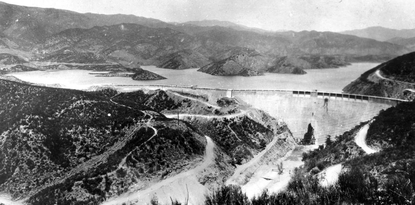
| (1928)* - Panoramic view of the St. Francis Dam with its reservoir nearly full. The dam stood in San Francisquito Canyon in northern Los Angeles County, about 10 miles north of present day Santa Clarita. |
Historical Notes Completed in May 1926, the St. Francis Dam was a curved concrete gravity dam built by the City of Los Angeles Bureau of Water Works and Supply under Chief Engineer William Mulholland. The main dam stood about 195 feet above the streambed and approximately 205 feet from its deepest foundation. The reservoir held about 38,000 acre feet of Los Angeles Aqueduct water. Less than two years after its completion, the dam failed at 11:57 p.m. on March 12, 1928. The resulting flood traveled through San Francisquito Canyon and the Santa Clara River Valley to the Pacific Ocean, killing more than 400 people. It remains one of the deadliest civil engineering disasters in American history. |
 |
|
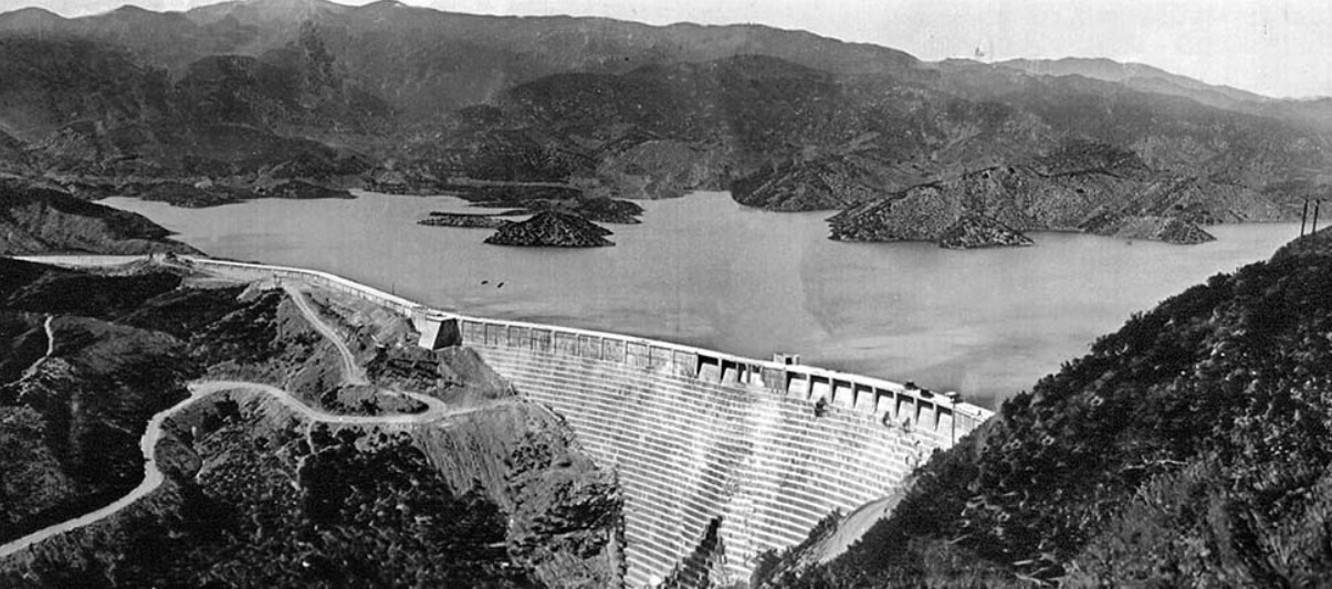
| (1928)* – View of the St. Francis Dam and its reservoir shortly before the collapse. |
Historical Notes Water began entering the St. Francis Reservoir in 1926. Over the next two years the reservoir gradually filled with water from the Los Angeles Aqueduct, reaching its highest level in early March 1928. When full, the reservoir held about 38,000 acre feet, or more than 12 billion gallons of water. |
 |
|
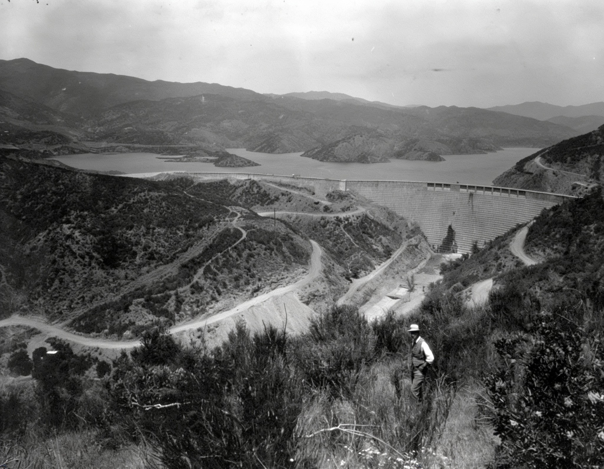
| (1928)* - The St. Francis Dam seen from the canyon hillside. A man in a hat stands in the foreground, giving a sense of the dam's scale. |
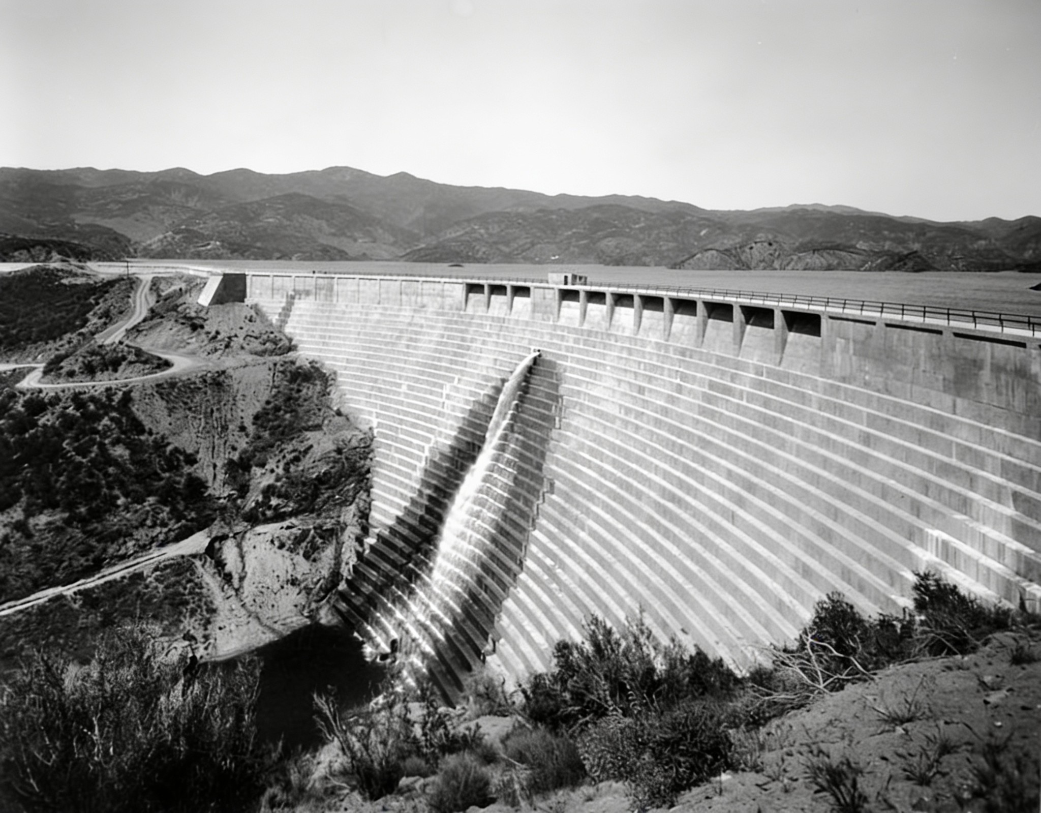
Historical Notes The St. Francis was a curved concrete gravity dam, designed so that its enormous weight resisted the pressure of the water behind it. It was built by the City of Los Angeles Bureau of Water Works and Supply, predecessor of today's Department of Water and Power, under the direction of William Mulholland. |
 |
|
| (1928)* - Close view of the St. Francis Dam shortly before the reservoir reached capacity. |
Historical Notes The dam took its name from San Francisquito Canyon, where it was built. "St. Francis" is the English form of the Spanish name San Francisco, from which San Francisquito, meaning "Little San Francisco," is derived. |
* * * * * |
Construction of the St. Francis Dam |
Construction of the St. Francis Dam began in 1924 under the direction of William Mulholland and the City of Los Angeles Bureau of Water Works and Supply. The dam was built in San Francisquito Canyon to provide additional storage for water delivered to Los Angeles through the Los Angeles Aqueduct.During construction, the height of the dam was increased to provide additional reservoir capacity. These changes, along with the geology of the site and other design factors, would later become important in investigations of the dam's failure. |
 |
|
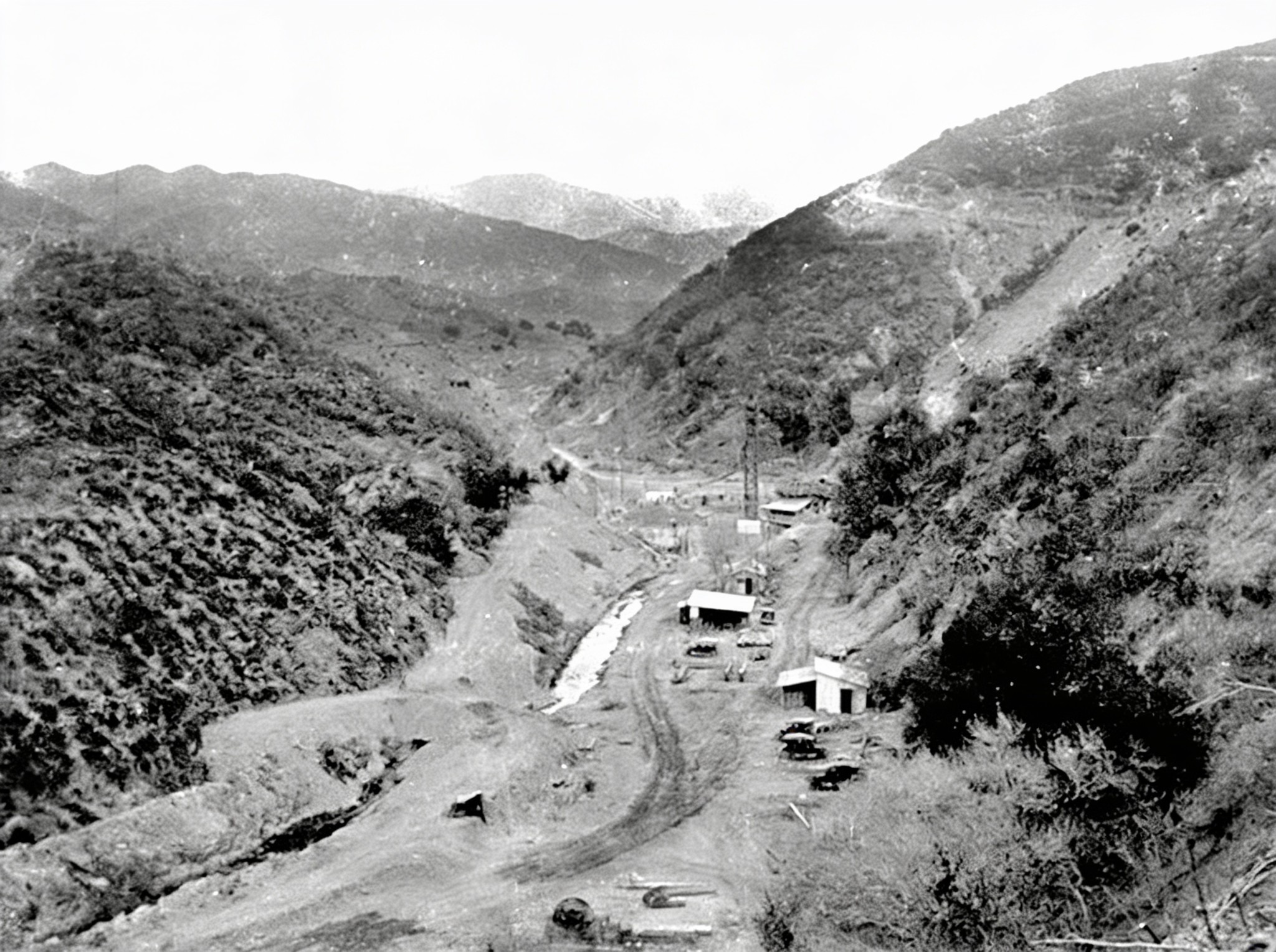
| (1925)* - Preliminary work begins at the base of San Francisquito Canyon. |
Historical Notes Planning for the reservoir began in the early 1920s, and construction was underway by 1924. The original design called for a dam about 175 feet above the streambed. The project was designed and constructed largely within the Bureau of Water Works and Supply without the independent engineering and geological review that would later become standard practice for major dams. |
 |
|
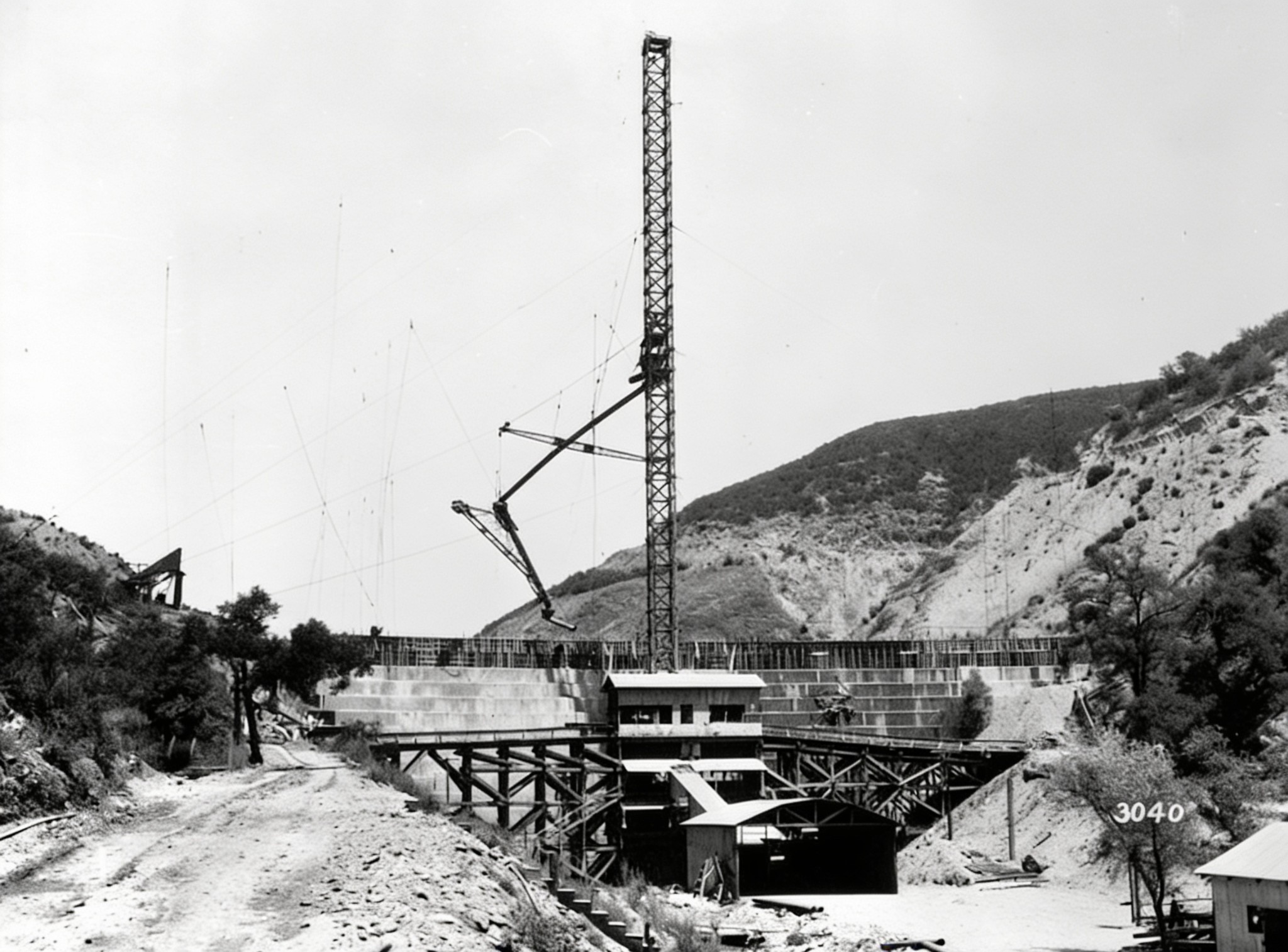
| (1925)* - Construction of the St. Francis Dam showing the concrete mixing plant, construction tower and runway. |
Historical Notes During construction, the planned height of the dam was increased to provide additional reservoir capacity. According to later engineering studies, the original design was ultimately raised by about 20 feet without a corresponding increase in the width of the dam's base. That decision would become important in later investigations of the failure. |
 |
|
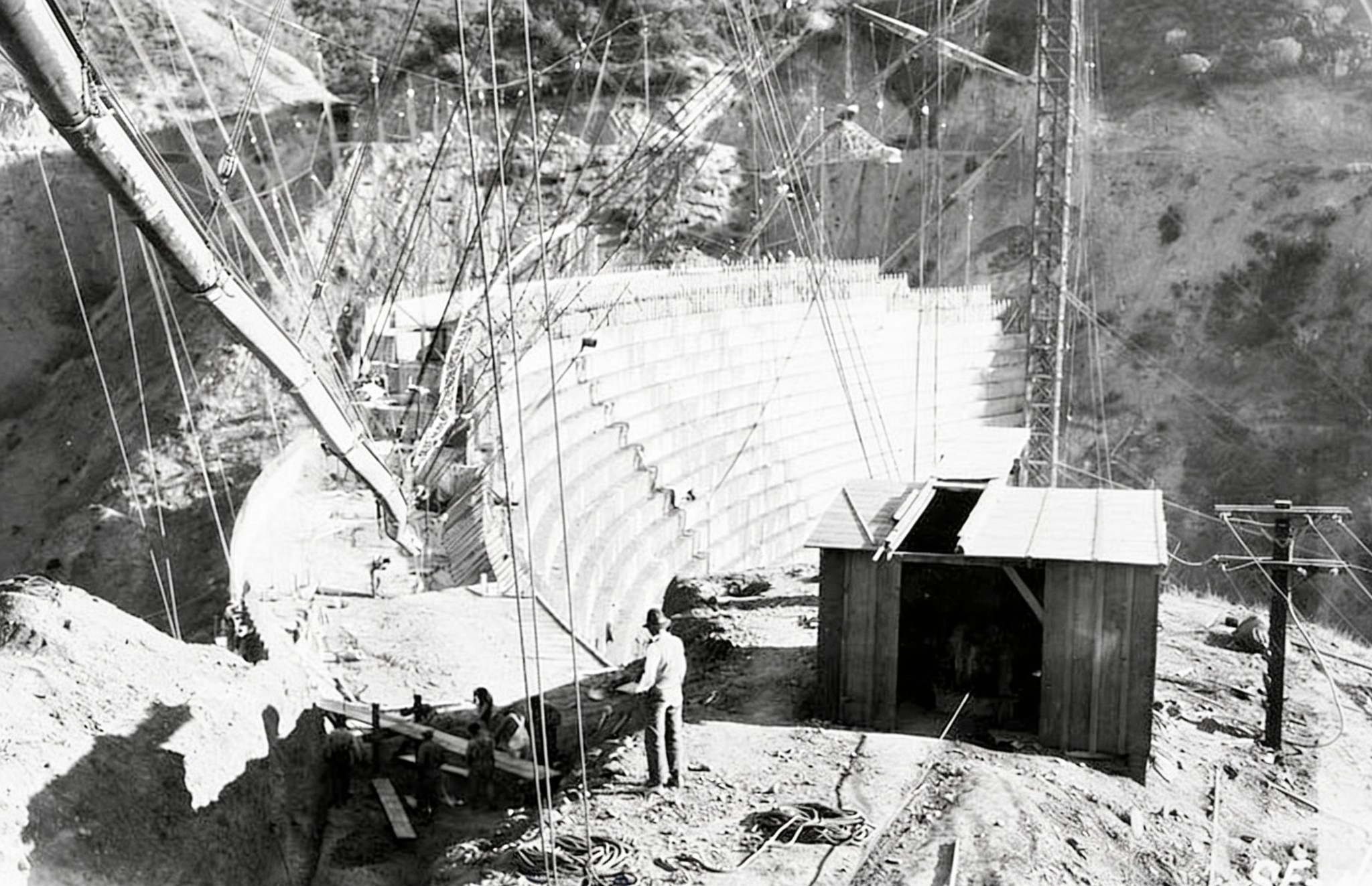
| (1925)* - Construction of the wing dike along the western side of the St. Francis Dam site. |
Historical Notes As the planned reservoir elevation was increased, a low ridge west of the main dam would have been overtopped. A concrete wing dike nearly 600 feet long was constructed along the ridge to contain the enlarged reservoir. |
 |
|
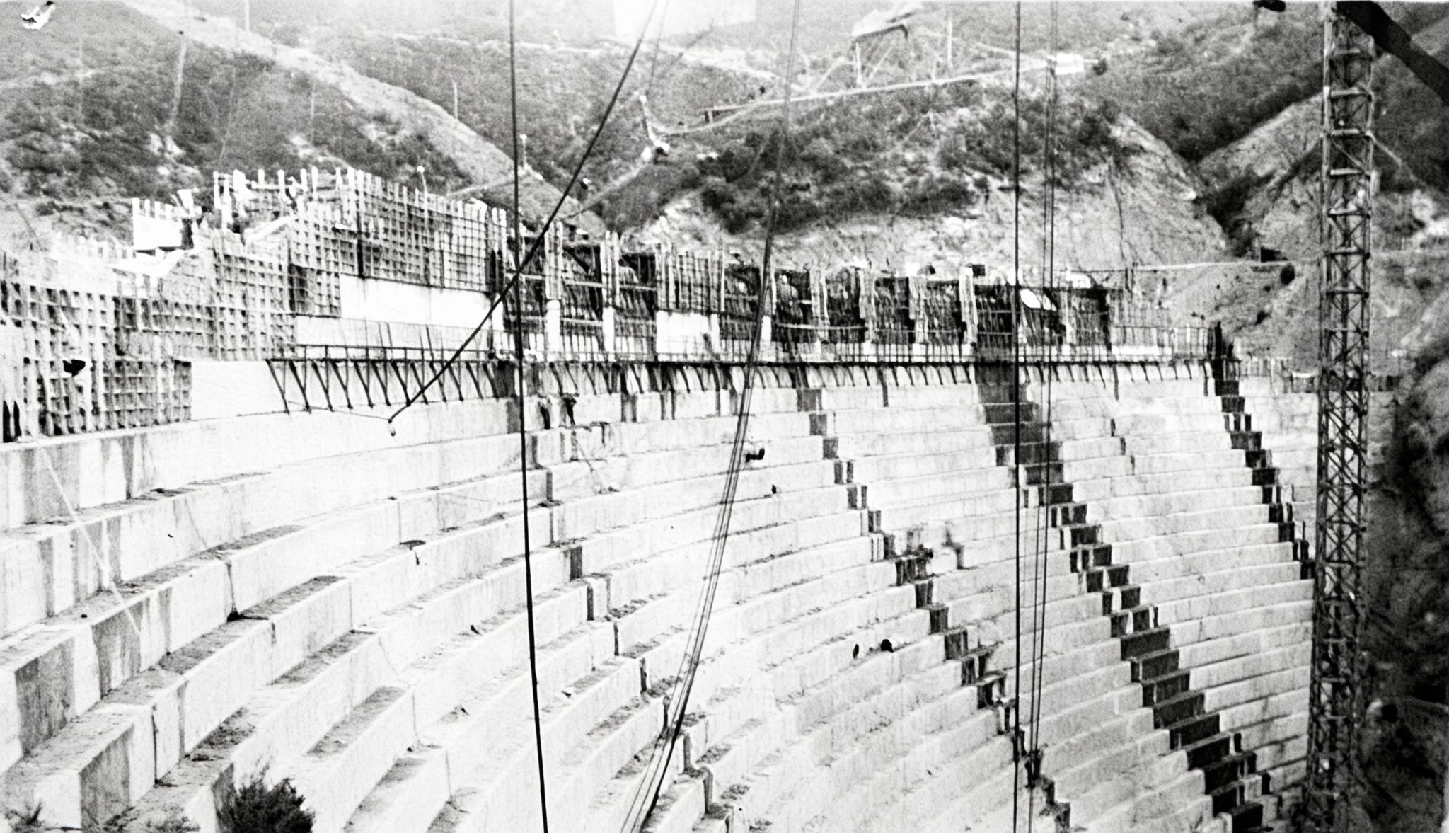
| (1925)* - The St. Francis Dam nearing completion. Changes made during construction left the dam about 20 feet taller than originally designed. |
Historical Notes A gravity dam depends largely on its weight to resist the pressure of the water behind it. Later engineering studies found that increasing the height of the St. Francis Dam without substantially widening its base reduced its margin of safety. The dam also lacked foundation drainage and other provisions for relieving water pressure beneath the structure. These factors, combined with difficult geology at the site, contributed to the disaster. |
* * * * * |
The Reservoir Reaches Capacity |
Water began filling the St. Francis Reservoir in 1926 following completion of the dam. Over the next two years, the reservoir gradually rose as it stored water delivered through the Los Angeles Aqueduct.By early March 1928, the reservoir was nearly full. On March 7, it reached its highest level, within inches of the spillway. Five days later, the dam failed. |
 |
|
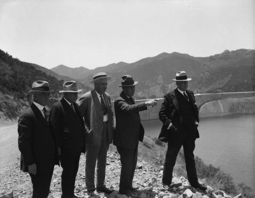
| (ca. 1926-1928)* - William Mulholland points across the St. Francis Reservoir while standing with four other men on its east bank. The top of the dam is visible behind them. |
Historical Notes From left to right can be seen Fred Fischer, R. del Valle, an unidentified man, William Mulholland and John R. Haynes. |
 |
|
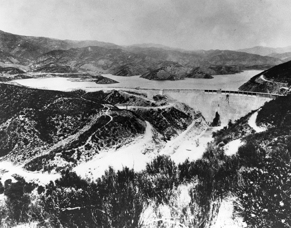
| (1928)* - Aerial view of the St. Francis Dam as the reservoir approached full capacity. |
Historical Notes Cracks, leaks and seepage had been observed at the dam during its brief operating life. Bureau engineers did not consider them unusual for a concrete dam of this type. Later investigations showed that water pressure beneath the structure and within the surrounding geology played an important role in the failure. |
 |
|
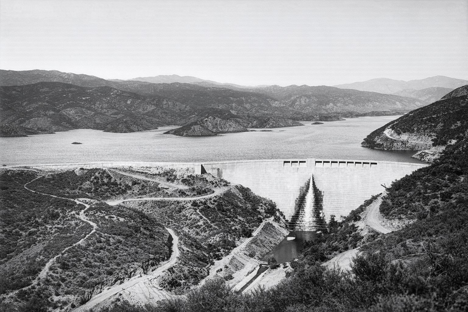
(1928)* - The St. Francis Dam with its reservoir near full capacity. The small island at center left, visible in the previous photograph, is now almost completely submerged. |
Historical Notes On March 7, 1928, the reservoir reached its highest level, within inches of the spillway. Five days later, the dam failed. |
 |
|
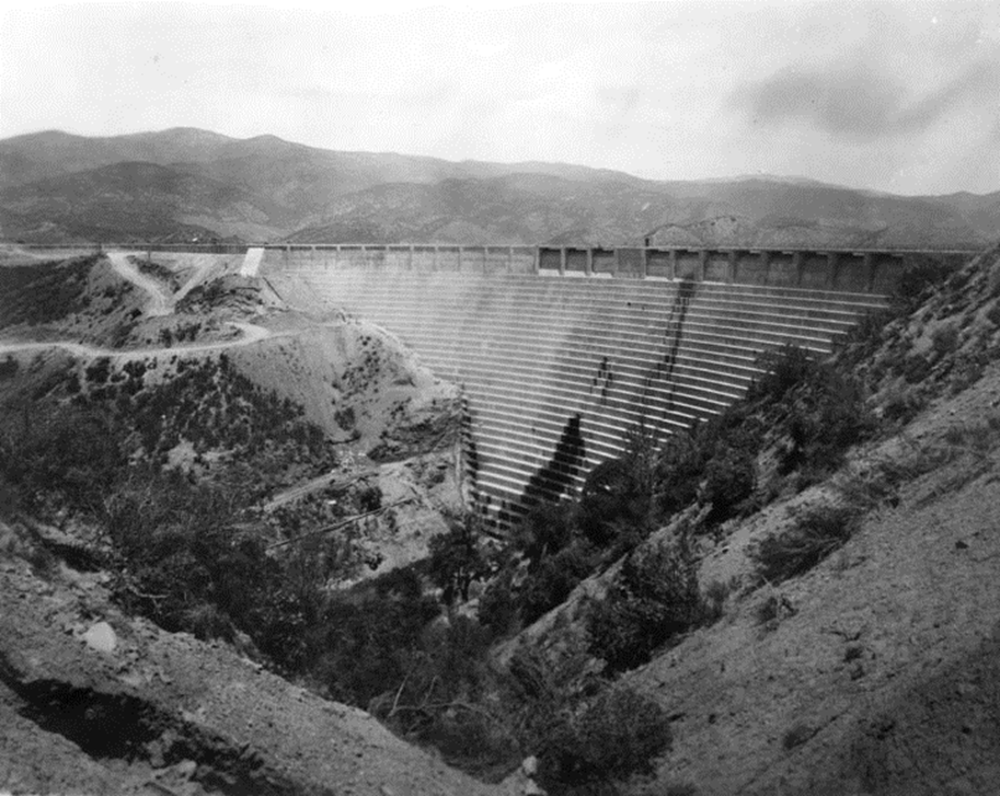
| (1928)* - Downstream view of the St. Francis Dam and surrounding canyon shortly before the failure. |
Historical Notes On the morning of March 12, damkeeper Tony Harnischfeger reported muddy water near the western abutment. Because muddy seepage could indicate that foundation material was being carried away, Mulholland and his assistant, Harvey Van Norman, came to inspect the dam. They found no evidence they believed indicated imminent failure and left the site. Harnischfeger and his family were among the first victims when the dam collapsed that night. |
* * * * * |
Catastrophic Failure |
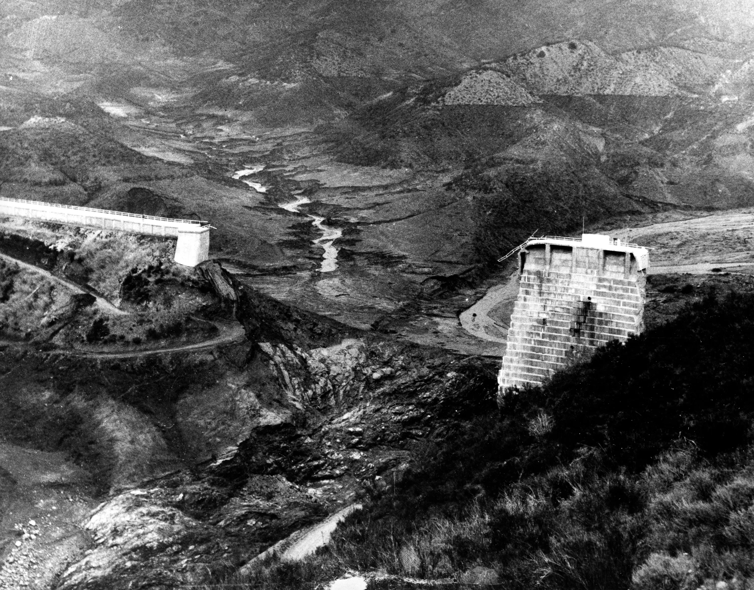
At 11:57 p.m. on March 12, 1928, the St. Francis Dam suddenly failed, releasing more than 12 billion gallons of water into San Francisquito Canyon. Most of the dam collapsed within minutes as massive sections of concrete broke apart and were swept downstream.The failure immediately became the subject of engineering investigations. Attention focused on the geology of the site, particularly the eastern abutment, where movement of ancient landslide material contributed to the collapse. |
 |
|
| (1928)* - The St. Francis Dam shortly after its catastrophic failure at 11:57 p.m. on March 12, 1928. The reservoir, containing more than 12 billion gallons of water, emptied in little more than an hour. |
Historical Notes No one at the dam survived to describe the moment of failure. Later engineering studies concluded that instability in the eastern abutment, where the dam rested against ancient landslide material, played a major role in initiating the collapse. Once failure began, enormous sections of concrete broke away and were carried downstream. Most of the dam was destroyed within a short period of time. |
 |
|
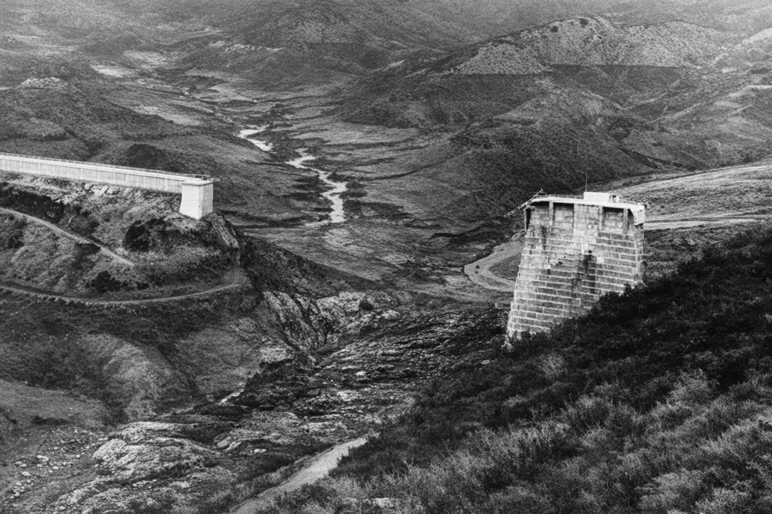
| (1928)* - Aftermath of the St. Francis Dam collapse. The former reservoir water line can be seen on the hills at upper right. |
Historical Notes The failure released the reservoir with tremendous force, stripping vegetation and soil from portions of the canyon and leaving debris scattered below the dam. The high water line visible on the surrounding hills shows the former level of the reservoir. |
 |
|
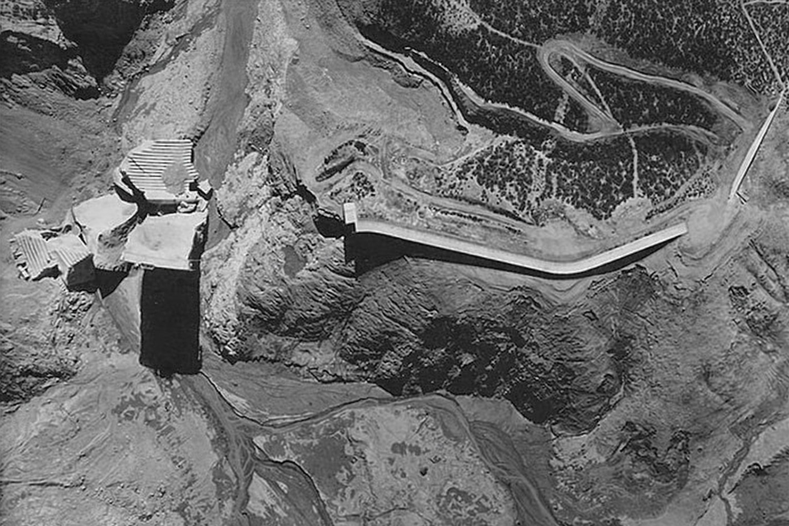
| (1928)* - Aerial view looking down on the collapsed St. Francis Dam. |
Historical Notes From the air, the extent of the failure could be clearly seen. Most of the dam had disappeared, leaving massive sections of broken concrete scattered below the emptied reservoir. |
 |
|
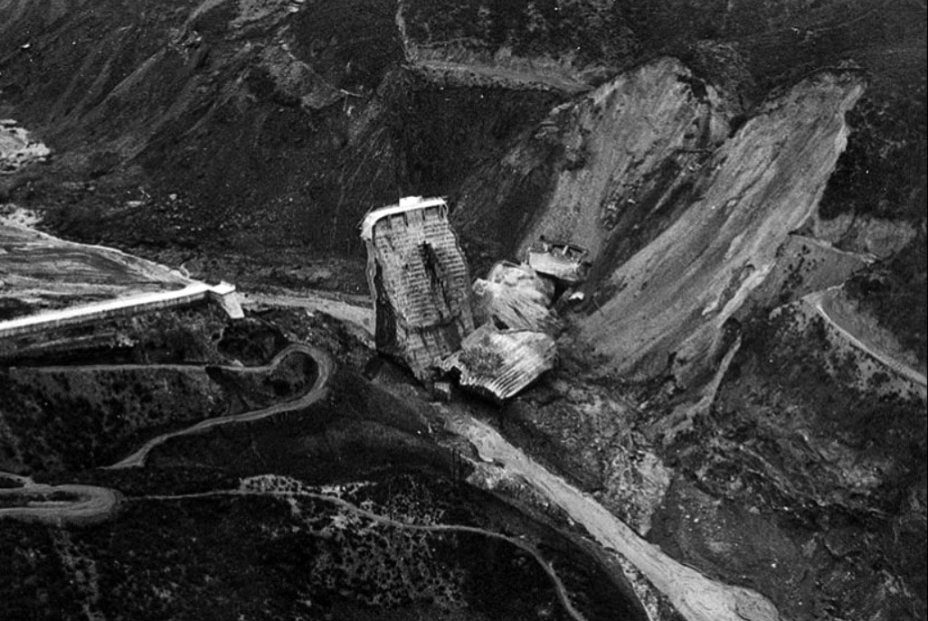
| (1928)* - Aerial view of the dam ruins. Only the center section remains upright, while the hillside shows evidence of the massive slide associated with the failure. |
Historical Notes The geology of the site became a central focus of investigations. The dam's eastern abutment had been constructed against ancient landslide material that had not been recognized as such before construction. Later engineering studies concluded that movement of this material, combined with water pressure beneath the dam and weaknesses in the design, played a major role in the failure. |
 |
|
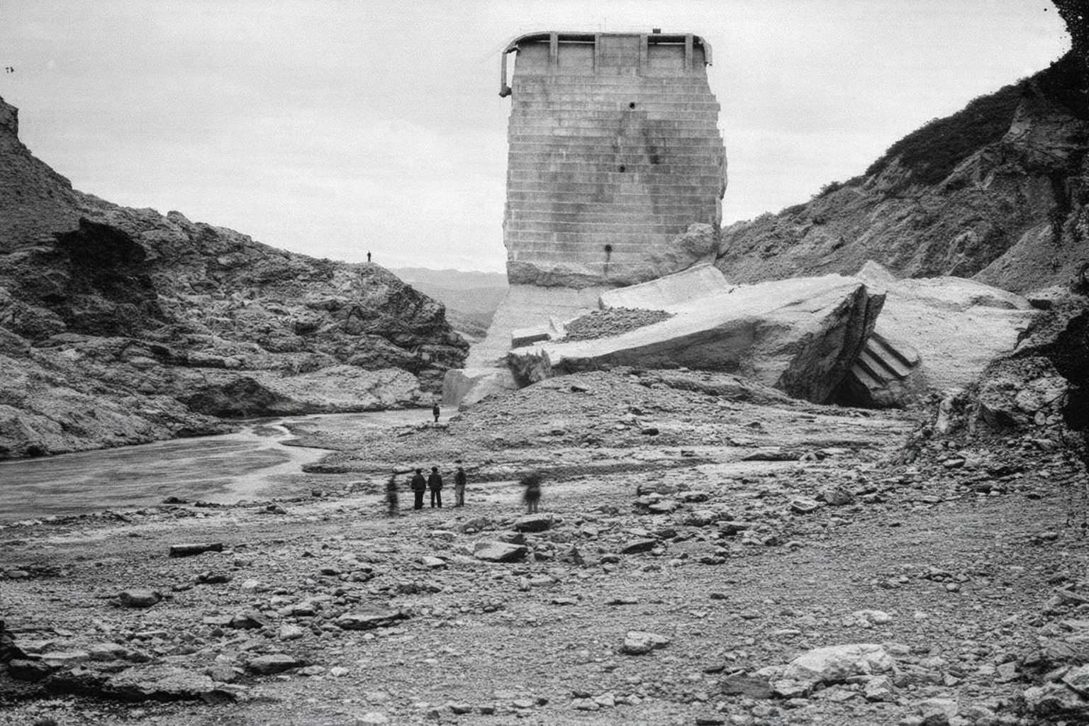
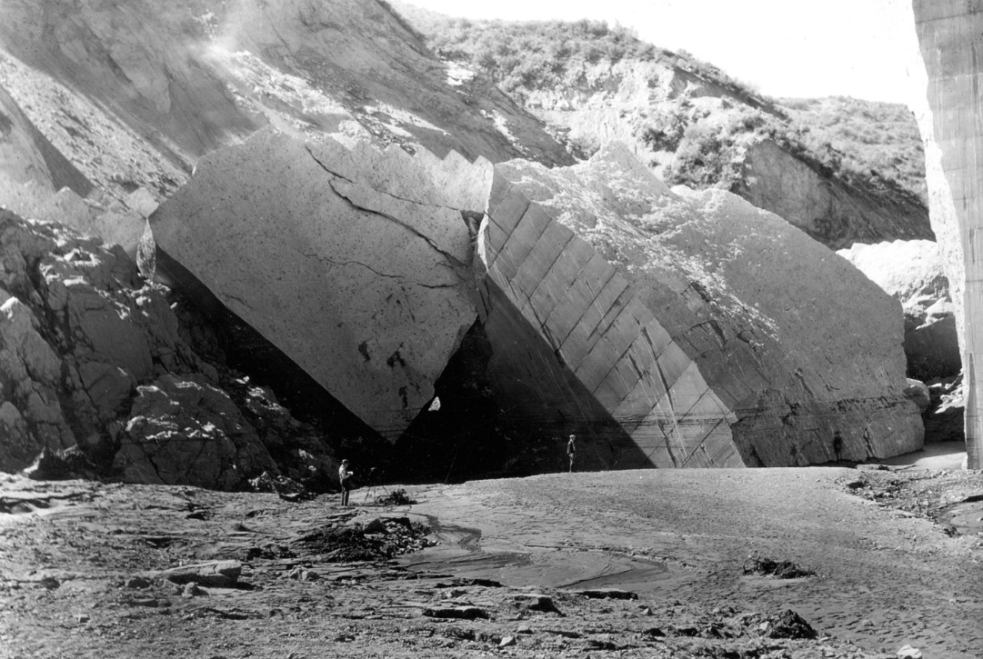
| (1928)* - Several men, dwarfed by the ruins, stand below the failed dam. One massive section remains standing while another lies broken below it. |
Historical Notes The dam broke into numerous sections, some weighing thousands of tons. Several large blocks were carried substantial distances downstream, demonstrating the enormous force of the escaping water. The men standing among the ruins provide a sense of the size of the concrete sections left behind after the collapse. |
 |
|
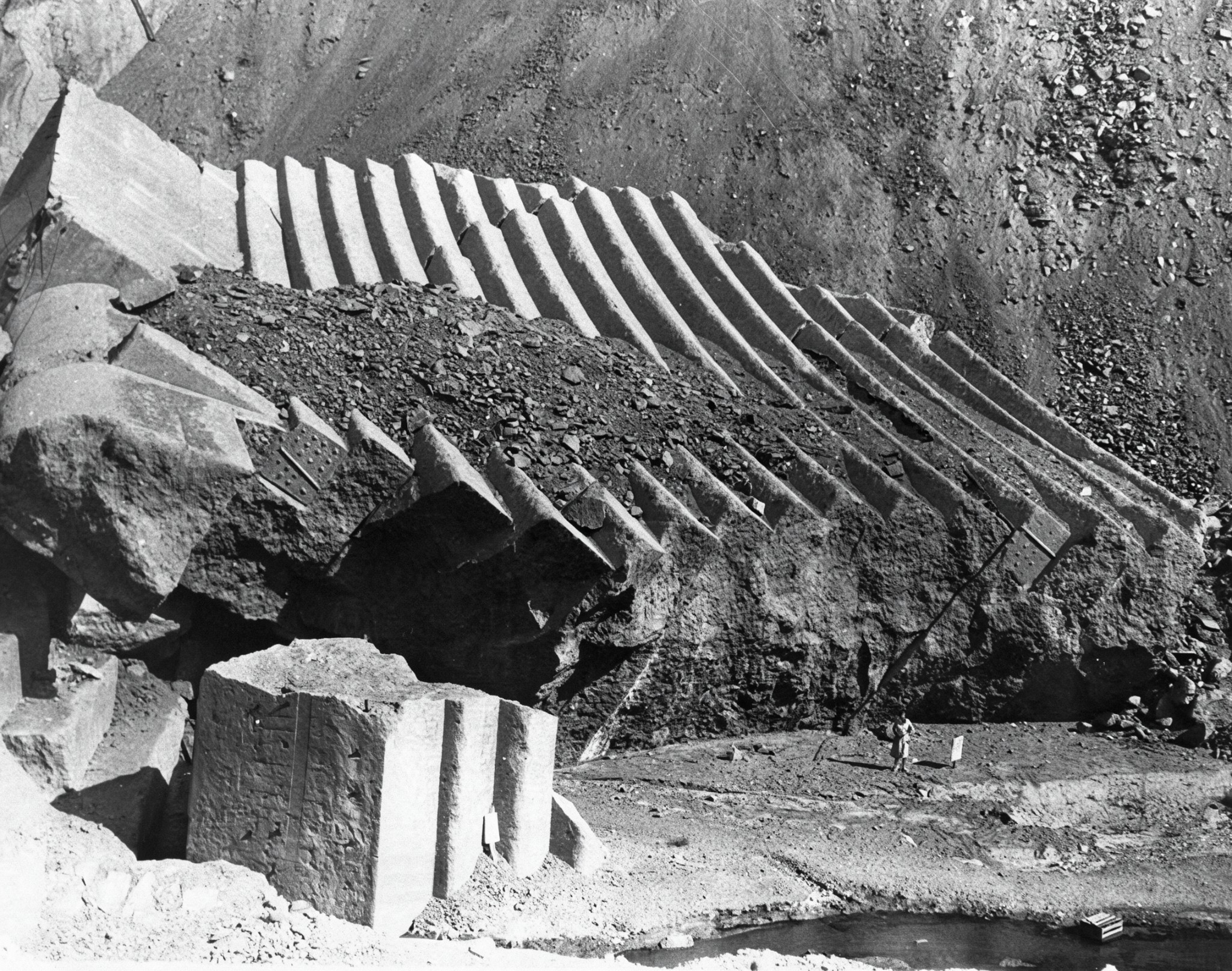
| (1928)* - A woman stands below massive pieces of concrete carried downstream by the failure of the St. Francis Dam. |
Historical Notes The force of the escaping water tore enormous sections of concrete from the dam and carried some of them downstream. Blocks weighing thousands of tons were found scattered through the canyon below the dam site. The woman standing near the wreckage provides a sense of the enormous size of the displaced concrete sections. |
* * * * * |
Tombstone |
The center section of the St. Francis Dam was the only major portion of the structure left standing after the collapse. Rising above the shattered remains of the dam, it soon became known as the “Tombstone.”For more than a year, the massive concrete section remained a prominent reminder of the disaster and attracted investigators, photographers and sightseers. In May 1929, it was finally demolished to prevent further accidents and discourage people from climbing among the ruins. |
 |
|
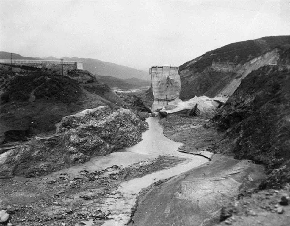
| (1928)* - Remaining water flows through the ruins of the St. Francis Dam. Only the center section remains standing. |
Historical Notes Most of the dam was destroyed during the failure. The center section remained standing while large portions on either side collapsed and were swept downstream. This surviving section soon became known as the "Tombstone" and remained standing for more than a year after the disaster. |
 |
|
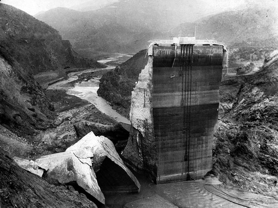
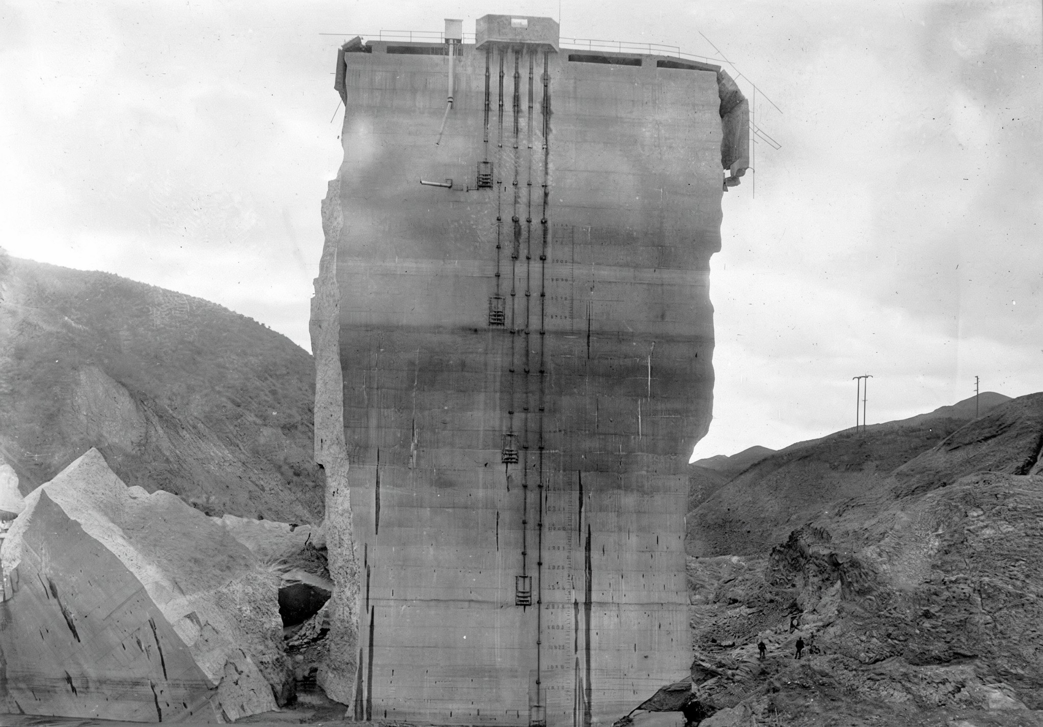
| (1928)* – The last standing section of the St. Francis Dam, with broken concrete at its base and water still flowing downstream. |
Historical Notes The standing center section towered above the broken remains of the dam while water continued to drain through the ruins. Its survival provided investigators with an important reference point as they examined how the structure had failed. Photographs taken in the days after the disaster also show the enormous amount of broken concrete and debris surrounding its base. |
 |
|
| (1928)* - Several men stand at the base of the surviving center section of the St. Francis Dam. |
Historical Notes The surviving section rose more than 100 feet above its foundation, giving investigators and visitors a dramatic indication of the original height and massive construction of the dam. People frequently entered the ruins after the disaster, both to inspect the damage and to see firsthand the remains of the structure. |
 |
|
| (1928)* – Close-up view of the last remaining standing section of the St. Francis Dam, also referred to as the “Tombstone.” Three men are seen climbing the debris at its base. |
Historical Notes The broken concrete surrounding the base of the standing section became accessible soon after the floodwaters receded. Investigators, photographers and curious visitors climbed among the ruins to examine the destruction. The presence of people in photographs such as this also provides a useful sense of the enormous scale of the surviving structure. |
 |
|
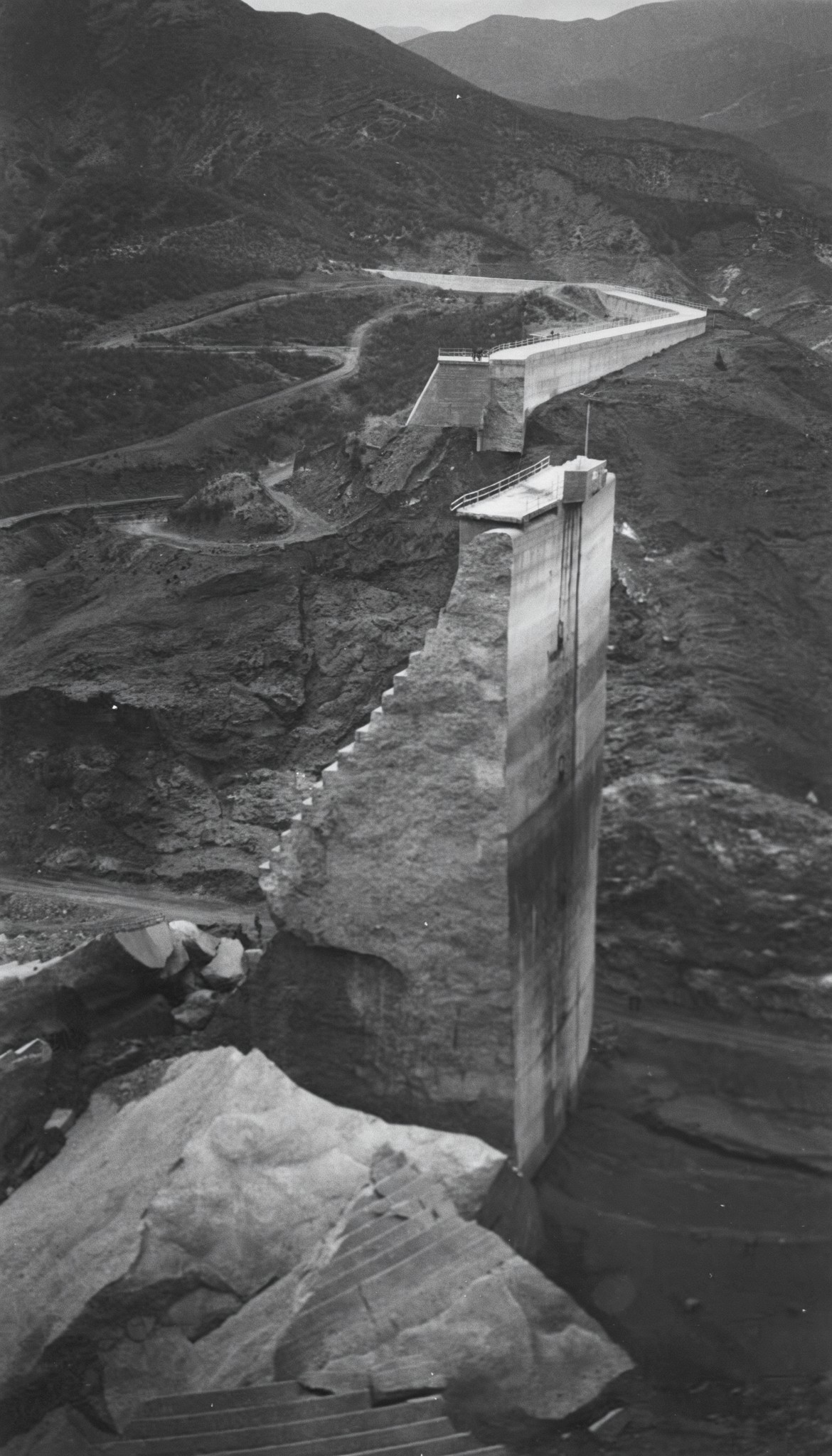
| (1928)* - Side view of the surviving center section of the St. Francis Dam, commonly known as the “Tombstone.” Large blocks of broken concrete lie scattered around its base. |
Historical Notes Viewed from the side, the narrow profile of the surviving section gave it the appearance of a giant tombstone, the name by which it soon became widely known. Large pieces of the destroyed dam remained scattered around the site, while roads, bridges and other nearby structures had also been damaged by the flood. |
 |
|
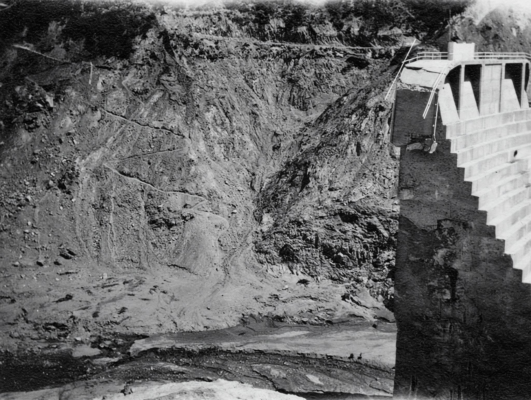
| (1928)* - Side view of the surviving center section of the St. Francis Dam. Remaining water can be seen at left, while a nearby road has been blocked by a landslide. |
Historical Notes The dam failure altered the surrounding landscape as well as destroying the structure itself. Saturated slopes and landslides affected portions of the canyon near the dam, while water continued to collect and drain through the devastated reservoir area. The photograph also shows how the Tombstone stood largely isolated after the sections adjoining it had collapsed. |
 |
|
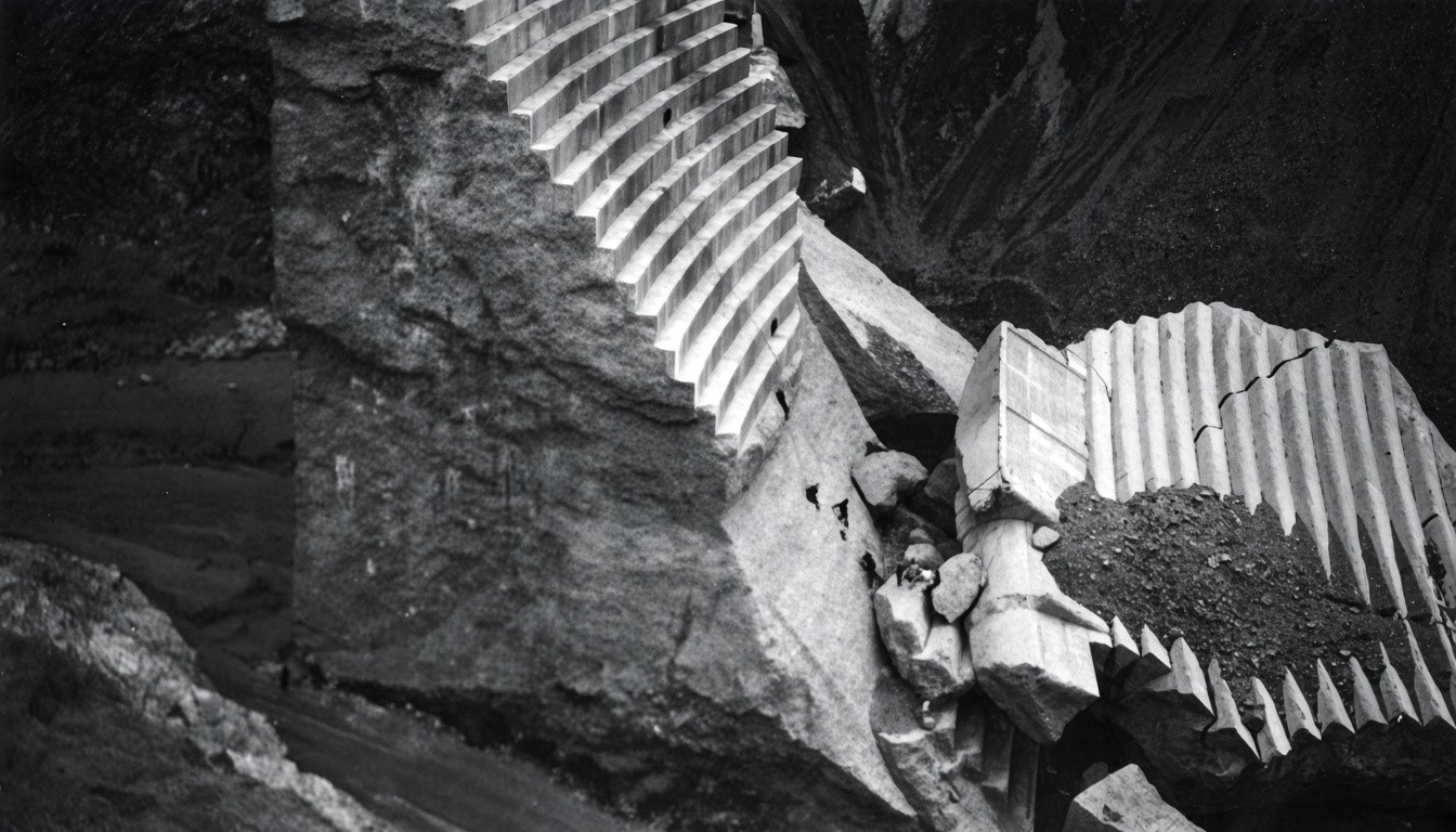
| (1928)* - Sightseers climb large chunks of concrete near the surviving center section of the St. Francis Dam. |
Historical Notes The ruins quickly attracted sightseers, many of whom climbed over the broken concrete and even onto the standing center section. In May 1928, 18-year-old Leroy Parker fell to his death from the standing section after a friend, as a prank, tossed a snake at him. |
 |
|
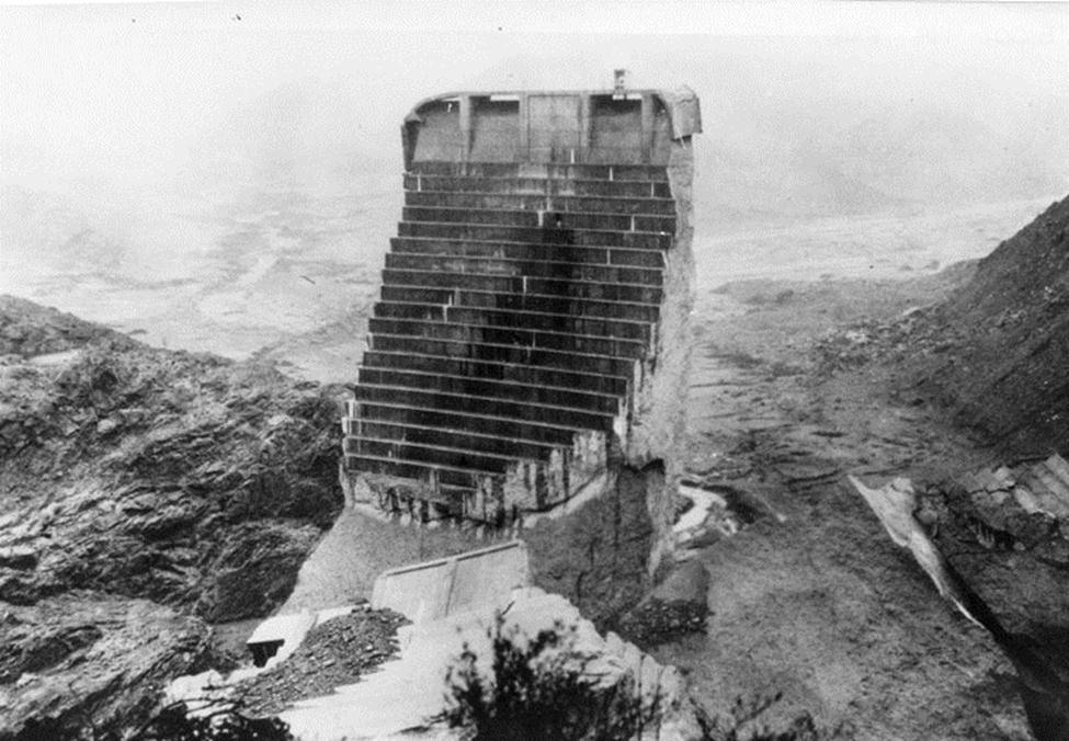
| (1928)* - Aerial view of the surviving center section of the St. Francis Dam. Water-soaked ground and a small stream can be seen below and behind it. |
Historical Notes The Tombstone remained standing for more than a year after the disaster and became one of the most recognizable remnants of the failed dam. In May 1929, the upright section was toppled with dynamite and the remaining blocks were demolished with bulldozers and jackhammers to discourage sightseers and souvenir hunters from exploring the ruins. |
* * * * * |
The Flood |
After the St. Francis Dam failed, the released reservoir water surged down San Francisquito Canyon and into the Santa Clara River Valley. The flood destroyed Power Plant No. 2 and swept away homes, roads, bridges, rail lines, farms and work camps as it traveled more than 50 miles toward the Pacific Ocean.The flood passed through or near communities including Piru, Fillmore, Santa Paula and Saticoy before reaching the ocean near Ventura several hours later. More than 400 people were killed, making the St. Francis Dam disaster one of the deadliest civil engineering failures in American history. |
 |
|
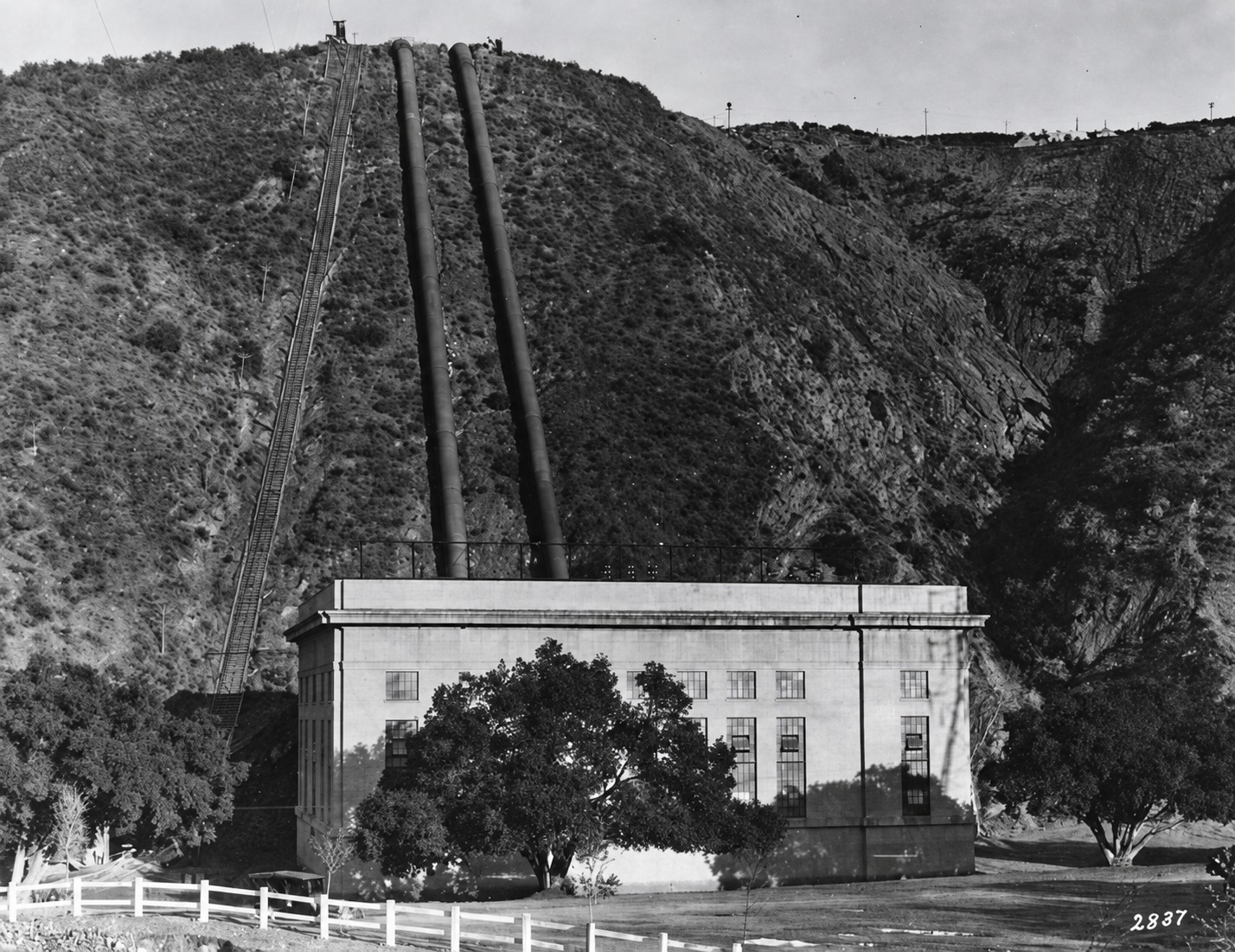
| (1920)* - San Francisquito Power Plant No. 2 before the disaster, with its penstocks extending up the hillside. The plant stood directly in the path of the flood released by the St. Francis Dam. |
Historical Notes Located approximately seven miles downstream from the dam, Power Plant No. 2 was one of the first major structures struck by the flood. The plant and nearby facilities were devastated as the flood swept through San Francisquito Canyon. |
 |
|
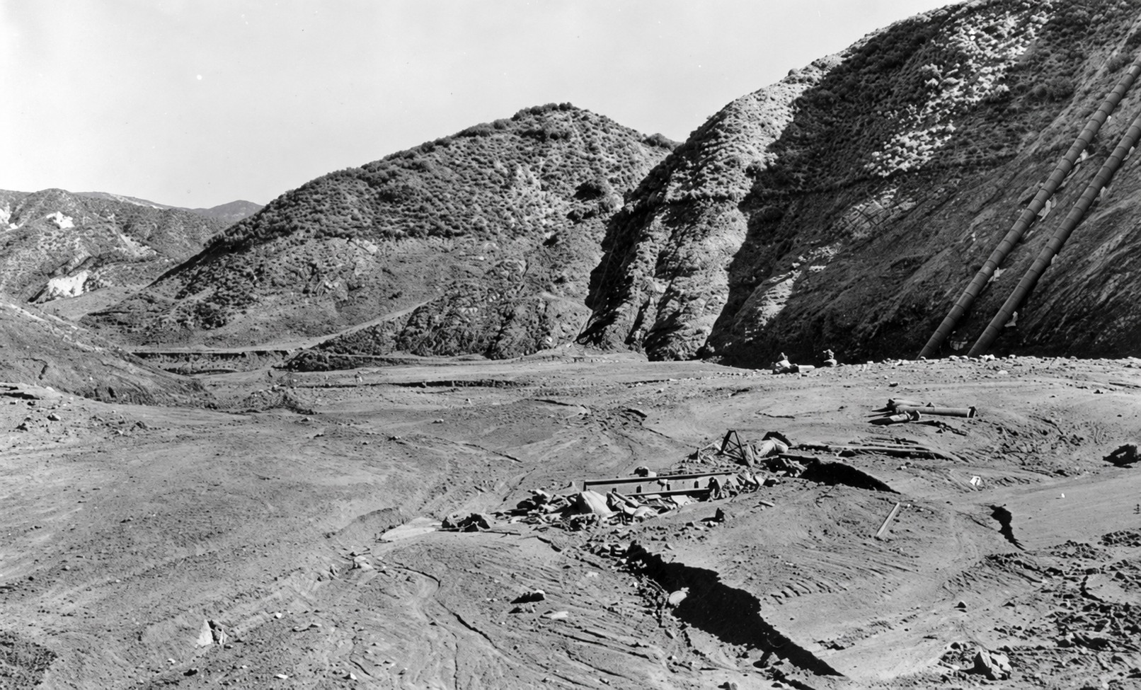
| (1928)* - The ruins of San Francisquito Power Plant No. 2 as seen from the canyon road above. The plant's penstocks are visible at upper right. |
Historical Notes The flood struck Power Plant No. 2 only minutes after the dam failed, destroying much of the facility and sweeping away buildings, equipment and nearby structures. The surviving penstocks on the hillside provide a reference for the location of the power plant after most of the structures below had been destroyed. |
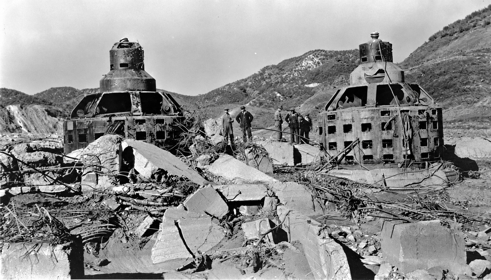 |
|
| (1928)* - Generators stand amid the rubble of San Francisquito Power Plant No. 2 following the St. Francis Dam disaster. |
Historical Notes The massive generating equipment survived in place while much of the powerhouse surrounding it was destroyed. Photographs of the exposed machinery illustrate the tremendous force of the flood as it swept through the narrow canyon. |
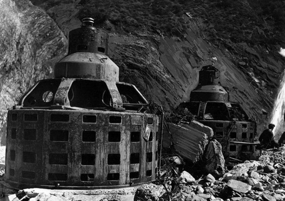 |
|
| (1928)* – Close-up view of the turbine-generator housings, among the few recognizable remains of San Francisquito Power Plant No. 2. LA Times Photo, March 15, 1928. |
Historical Notes Little remained of the powerhouse except portions of its heavy generating equipment and concrete foundations. The destruction of Power Plant No. 2 demonstrated the enormous force the flood still carried only a short distance downstream from the dam. |
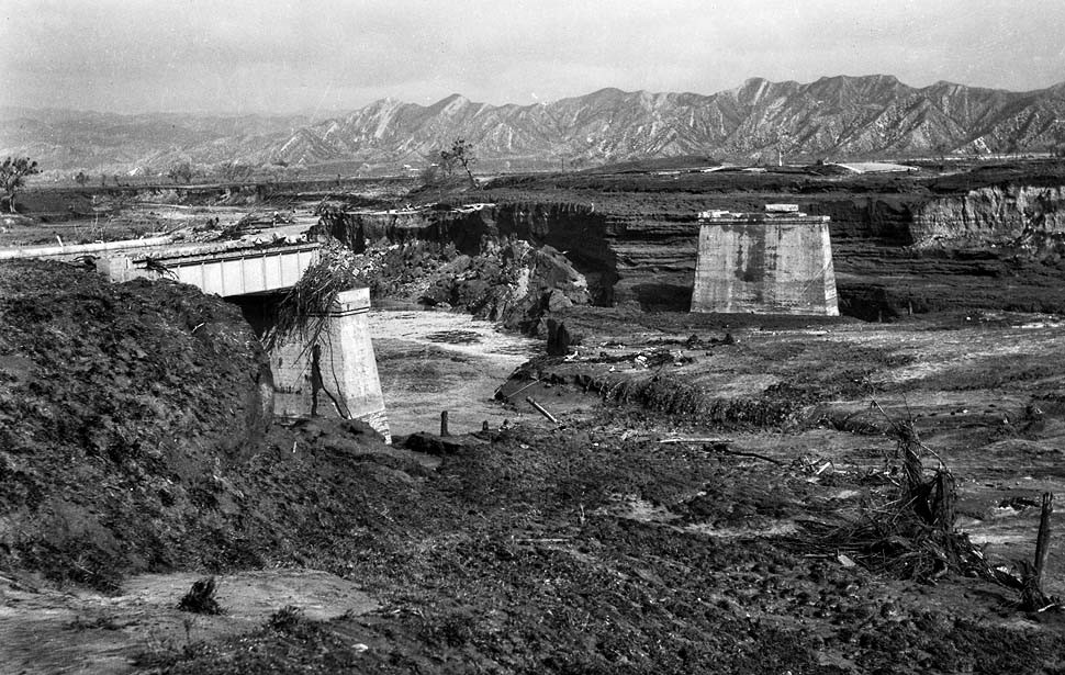 |
|
| (1928)* – Remains of the Main Highway Bridge about one and one-half miles from Castaic. Only the supports remained after the St. Francis Dam flood swept through the area. |
Historical Notes As the flood moved south through San Francisquito Canyon, bridges, roads and other transportation routes were destroyed or badly damaged. The loss of bridges and washed-out roads complicated rescue and recovery efforts in the hours and days following the disaster. |
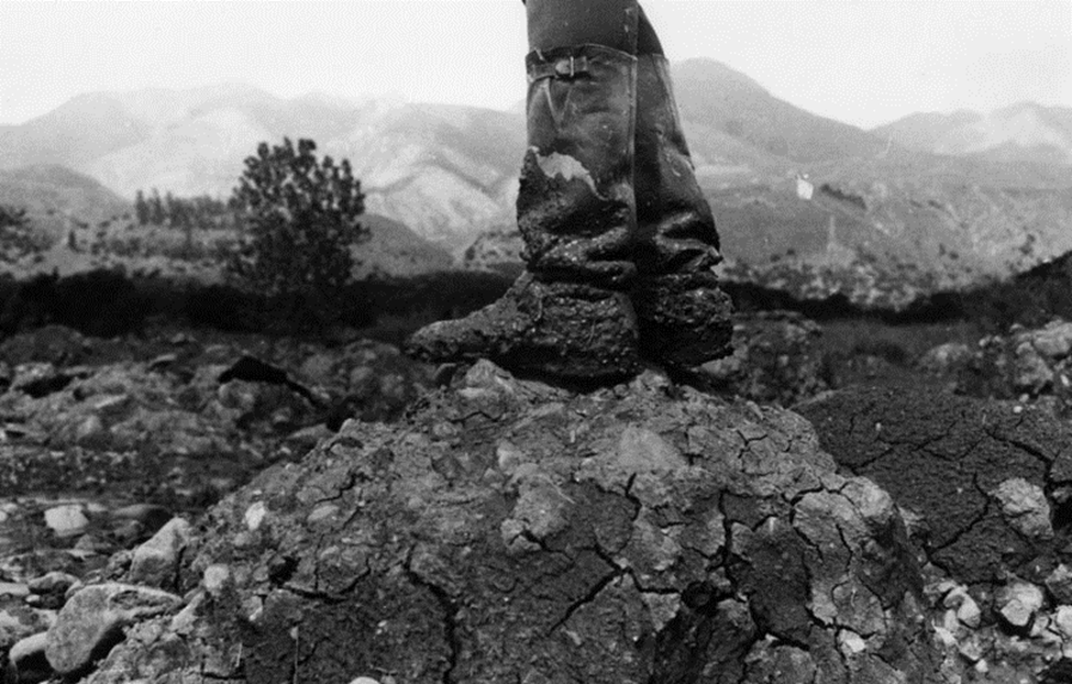 |
|
| (1928)* - A man in rubber boots stands atop a mound of rock and mud left by the St. Francis Dam flood. |
Historical Notes The flood carried enormous quantities of mud, rock, trees and wreckage downstream. When the water receded, thick deposits of debris covered portions of San Francisquito Canyon and the Santa Clara River Valley. The deposits left behind provide another indication of the enormous amount of material carried by the flood. |
 |
|
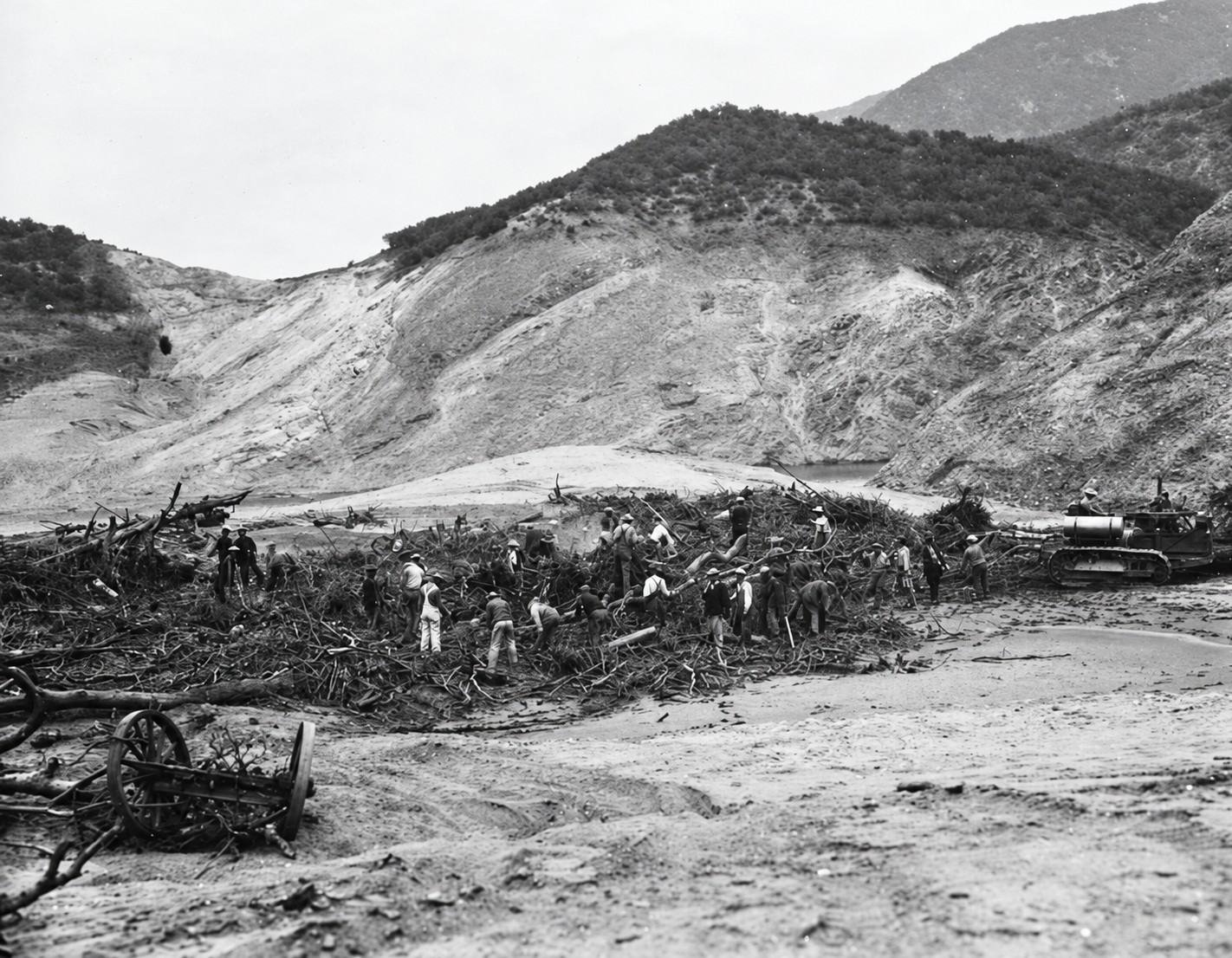
| (1928)* - Men work among broken trees, wagons and other debris left by the St. Francis Dam flood. A Caterpillar tractor can be seen at right. |
Historical Notes In the days following the disaster, crews began clearing roads, recovering property and searching through the enormous amount of debris deposited along the flood path. Trees, vehicles, farm equipment, portions of buildings and other wreckage were carried downstream and deposited across fields and low-lying areas. |
 |
|
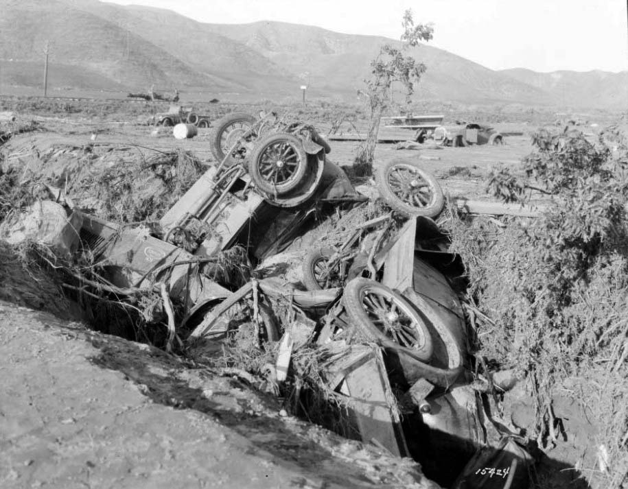
| (1928)* - Twisted company automobile wreckage marks the site of Southern California Edison's Kemp Camp, which was destroyed by the flood. |
Historical Notes Near the Ventura County line along the Santa Clara River was a railroad siding known as Kemp, where approximately 150 Southern California Edison workers were staying while constructing a transmission line. Night watchman Ed Locke attempted to warn the sleeping workers as the flood approached. Locke and many of the workers were killed when the flood swept through the camp near Blue Cut. The destruction of Kemp Camp accounted for one of the largest concentrations of fatalities during the disaster. |
 |
|
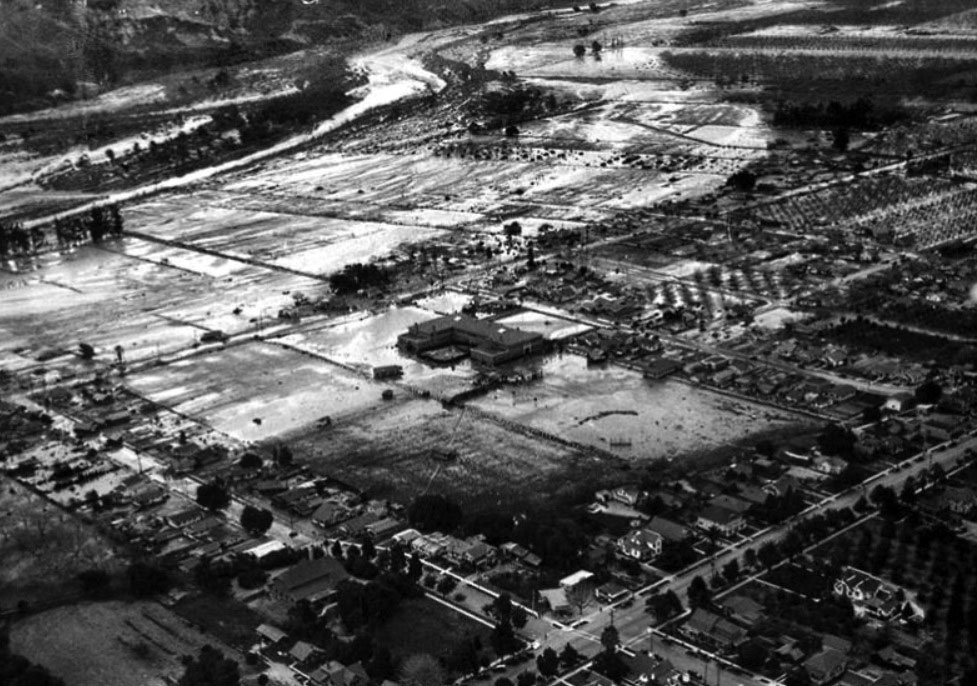
| (1928)* - Aerial view of Santa Paula following the St. Francis Dam disaster. The photograph appeared on the front page of the Los Angeles Times on March 14, 1928. |
Historical Notes As the flood approached Santa Paula, telephone operator Louise Gipe remained at her post and helped spread warnings to residents in low-lying areas. State Motorcycle Officer Thornton Edwards and Santa Paula Police Officer Stanley Baker rode through threatened areas warning residents. Their efforts helped many people escape before the flood reached the community. A Santa Paula sculpture, The Warning (Eric Richards, 2003), depicts motorcycle officers Thornton Edwards and Stanley Baker, who rode through low-lying areas warning residents of the approaching flood. |
.jpg) |
|
| (1928)* - Remains of homes in Santa Paula following the St. Francis Dam flood. LA Times Photo, March 14, 1928. |
Historical Notes By the time the flood reached the Santa Clara River Valley, it had spread across a much wider area but remained powerful enough to destroy homes, farms and other structures. Low-lying portions of Santa Paula were inundated, leaving buildings damaged or destroyed and large areas covered with mud and debris. |
 |
|
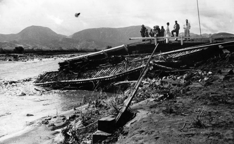
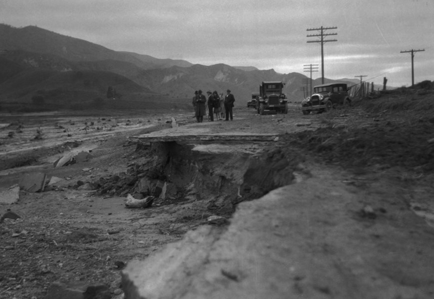
| (1928)* - People examine a damaged road and washed-out railroad tracks along the Santa Clara River following the St. Francis Dam flood. |
Historical Notes The flood damaged transportation routes throughout the Santa Clara River Valley, washing out sections of roads, railroad tracks and bridges. Damage to these routes made it more difficult for rescuers and recovery crews to reach some of the affected communities. |
 |
|
| (1928)* - Officials stand at the edge of the broad path left by the St. Francis Dam flood. |
Historical Notes As the water spread into the Santa Clara River Valley, the flood path widened considerably from the confined channel it had followed through San Francisquito Canyon. Investigators surveying the area after the disaster found widespread destruction extending across farms, roads, rail lines and communities along the river. |
 |
|
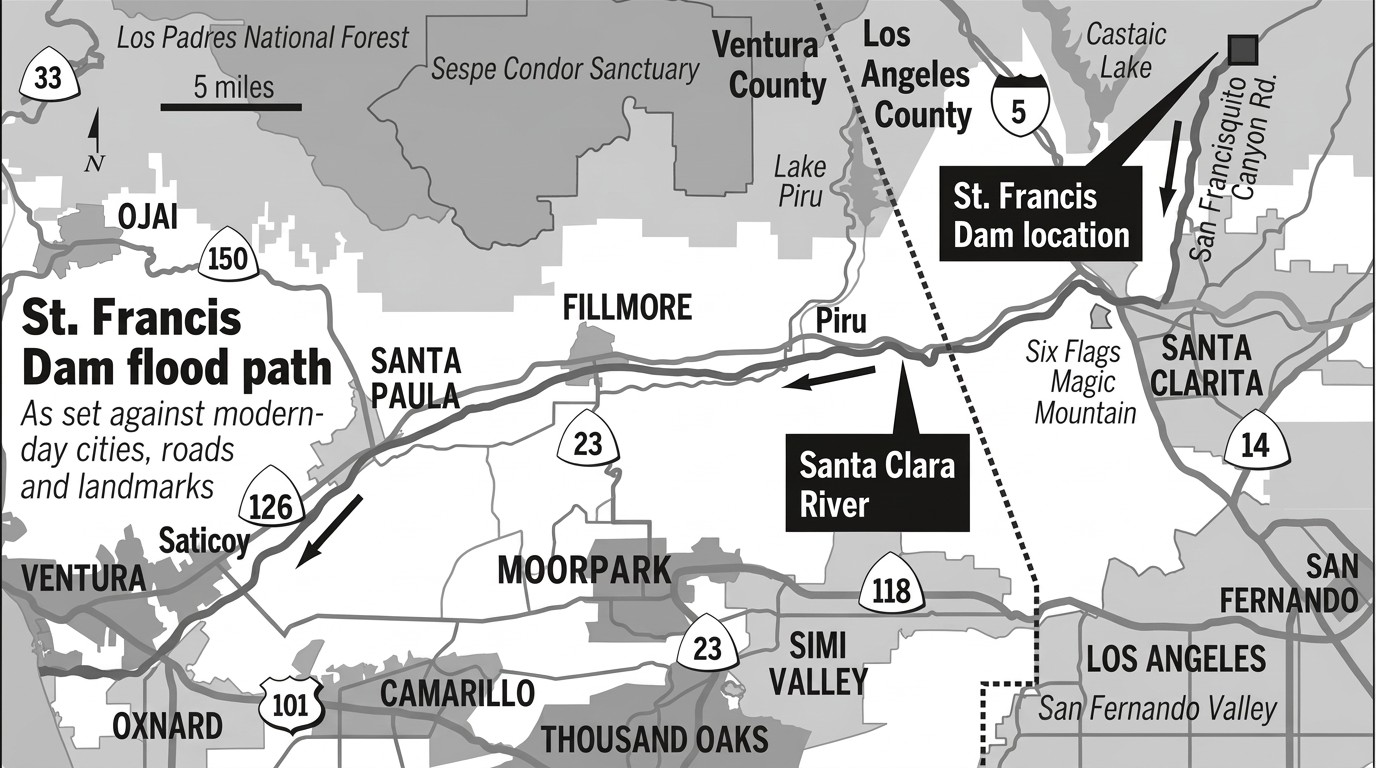
| Map showing the path of the St. Francis Dam flood from San Francisquito Canyon through the Santa Clara River Valley to the Pacific Ocean. Ventura County Star/Steve Greenberg* |
Historical Notes After leaving San Francisquito Canyon, the flood turned west and followed the Santa Clara River Valley through Ventura County. The flood traveled more than 50 miles from the dam before reaching the Pacific Ocean near Ventura several hours after the failure. |
* * * * * |
Investigation and Aftermath |
The failure of the St. Francis Dam immediately raised questions about how a major municipal dam could collapse with such devastating consequences. Investigations focused on the geology of the site, the design and construction of the dam, and the decisions made during its construction and operation.William Mulholland accepted responsibility as chief engineer of the Bureau of Water Works and Supply. The disaster ended his active career and led to greater scrutiny of dam design, construction and safety oversight in California. |
 |
|
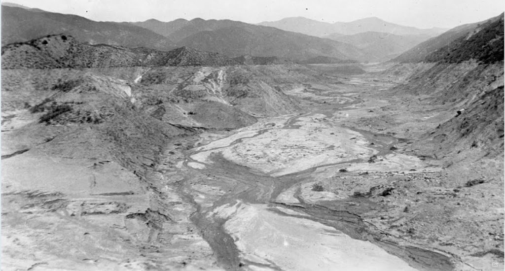
| (1928)* - The empty St. Francis Reservoir a day or two after the disaster. The former water line can be seen on the surrounding hills. |
Historical Notes The reservoir, which had contained more than 12 billion gallons of water, emptied rapidly after the dam failed shortly before midnight on March 12, 1928. Investigators examining the site focused particular attention on the eastern abutment and the geology of the surrounding hillsides. Later studies concluded that instability of ancient landslide material beneath the eastern portion of the dam played a major role in the failure. |
 |
|
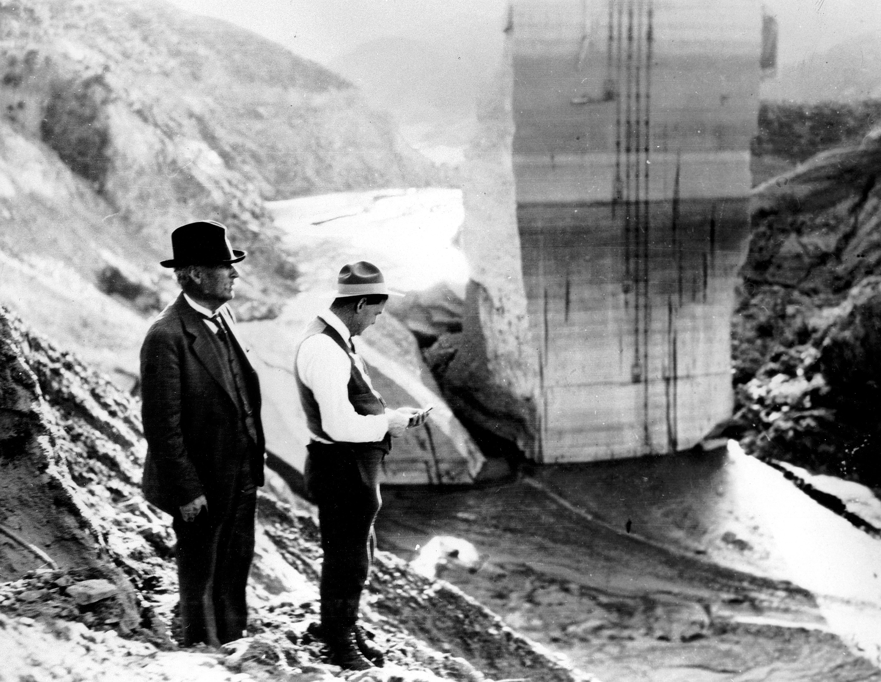
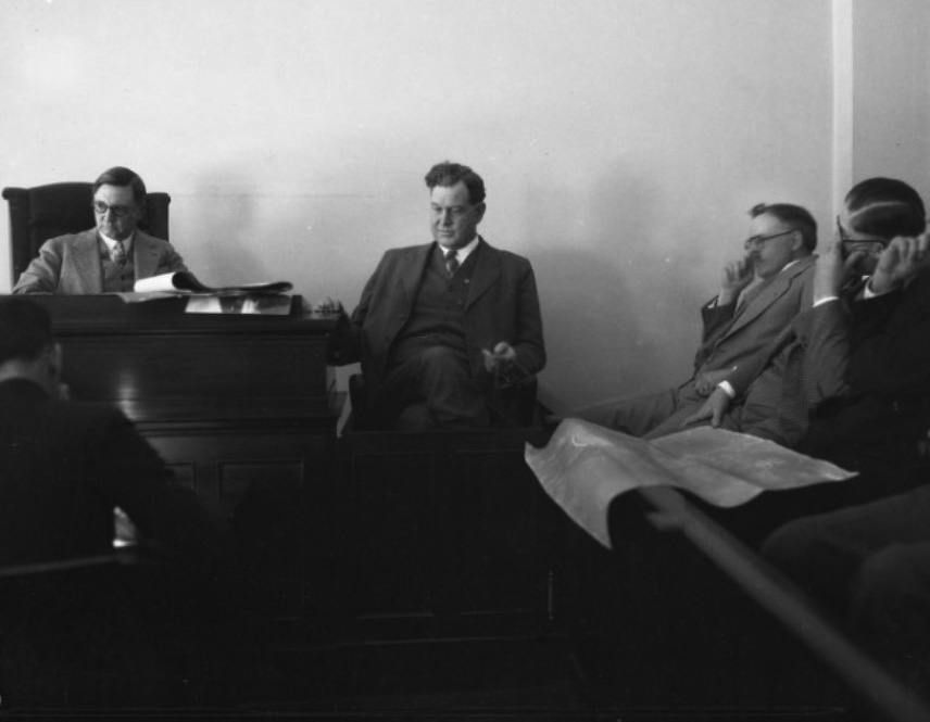
| (1928)* – William Mulholland and H. A. Van Norman stand on a hillside overlooking the ruins of the St. Francis Dam shortly after the disaster. |
Historical Notes Mulholland and Van Norman were among those who examined the site following the collapse. Mulholland had overseen construction of the dam as chief engineer and general manager of the city's Bureau of Water Works and Supply, while Van Norman was one of his principal assistants. The disaster prompted several investigations into the cause of the failure, including examinations by engineers and geologists and a coroner's inquest into the deaths. |
 |
|
| (1928)* - Coroner Frank Nance and engineer H. A. Van Norman at the coroner's inquest following the failure of the St. Francis Dam. |
Historical Notes The coroner's inquest examined the circumstances surrounding the collapse and heard testimony from engineers, officials and others associated with the dam. The inquest concluded that the disaster resulted from defects in the dam's foundation and held that responsibility rested with those responsible for its design, construction and operation. It also called for greater independent review of major dam projects rather than leaving such decisions largely in the hands of a single engineer. |
 |
|
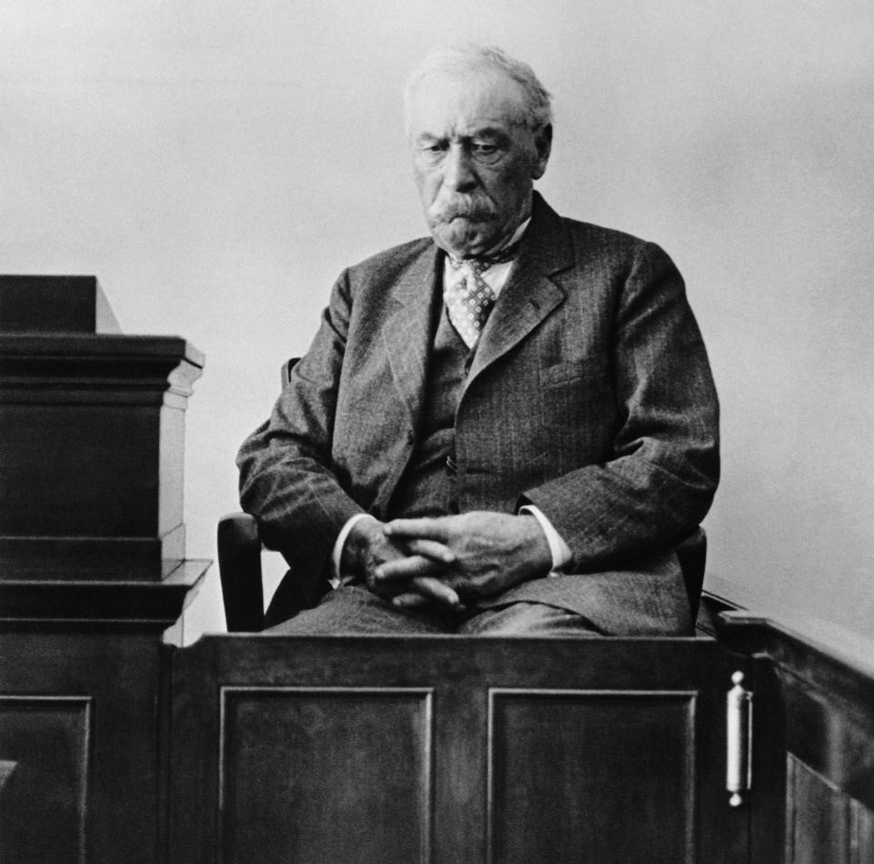
| (1928)* - William Mulholland testifies at the coroner's inquest into the St. Francis Dam disaster on March 26, 1928. |
Historical Notes Mulholland accepted responsibility for the disaster during the proceedings. His testimony reflected the enormous personal impact the failure and loss of life had on him. At the inquest he made one of the most frequently quoted statements associated with the disaster:
The collapse effectively ended Mulholland's career as the dominant figure in the development of Los Angeles' water system. |
Follow-Up Analysis |
Later studies provided a more detailed understanding of why the dam failed. Geological engineer J. David Rogers identified several contributing factors, including instability of ancient landslide material at the eastern abutment, design changes made as the dam was raised during construction, and inadequate independent review of the design.Modern analyses have reinforced the importance of the site's geology while also examining the dam's design, construction and the engineering practices of the period.Click HERE to see a slide presentation of J. David Rogers' report. |
Engineering and Regulatory Changes |
The St. Francis Dam disaster led to major changes in dam safety oversight in California. Existing dams received greater scrutiny, and the failure strengthened the movement toward independent state review of dam design and construction.Los Angeles also reexamined other reservoirs and dams in its water system. Mulholland Dam above Hollywood, which shared some design characteristics with the St. Francis Dam, was later reinforced with a massive earth fill placed against its downstream face.Click HERE to see more in Early Views of the Mulholland Dam and Hollywood Reservoir. |
Mulholland's Final Years |
Mulholland retired from the Bureau of Water Works and Supply in March 1929. His longtime associate H. A. Van Norman succeeded him as chief engineer and general manager.Although Mulholland remained a consulting engineer for a time, the St. Francis Dam disaster marked the end of his public career. He largely withdrew from public life and died in 1935 at the age of 79.The disaster remained the defining tragedy of Mulholland's career and led to lasting changes in the way major dams were designed, reviewed and regulated in California. |
* * * * * |
Research, writing, and image curation by Jack Feldman, Water and Power Associates, with editorial assistance.
* * * * * |
More Historical Early Views
Newest Additions
Early LA Buildings and City Views
History of Water and Electricity in Los Angeles
* * * * * |
References and Credits
* DWP - LA Public Library Image Archive
*#Folegattiadvocacia.com: St. Francis Dam
#*Newsweek: St. Francis Dam Disaster
**Ventura County Star: St. Francis Dam Flood Path
^^Noirish Los Angeles - forum.skyscraperpage.com
^^*LA Times Framework: St. Francis Dam Collapse
**^Sometimes-Interesting.com: St. Francis Dam
^**Huntington Digital Library Archive
*^*SCVHistory.com -St. Francis Dam Disaster
^*^Calisphere: University of California Image Archive
^^^UCLA Library Digital Collection
.....Failure of the St. Francis Dam Website - J. David Rogers
^ 1928 Catastrophic St. Francis Dam Failure -Suburban Engineering Management Project Publication
< Back