Early Views of Eagle Rock
 |
|
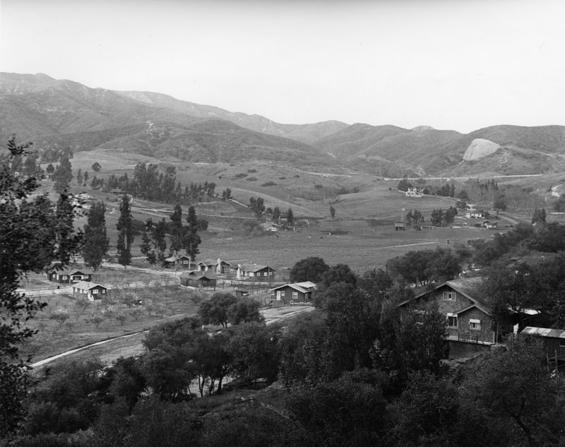
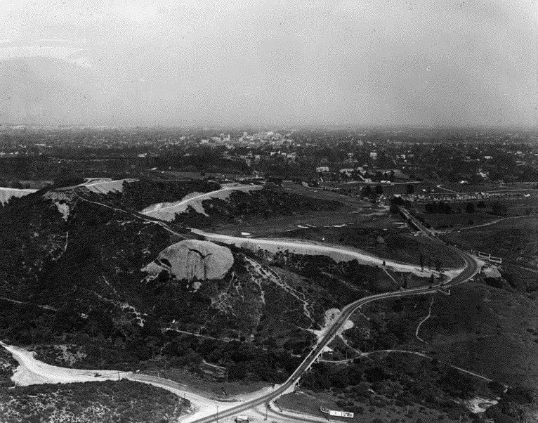
| (ca. 1906)* - Panoramic view looking northeast into the Eagle Rock Valley, as it was known in the early 1900s. A large boulder appears to protrude out from the hills (upper right) in the background. |
Historical Notes Eagle Rock derives its name from a massive boulder at the district's northern edge (visible in the upper right). The boulder contains an indentation that creates an eagle-shaped shadow everyday around noon. In the 1880s Eagle Rock existed as a farming community with grand Victorian farmhouses and many exquisite Craftsman homes in charming neighborhoods. |
 |
|
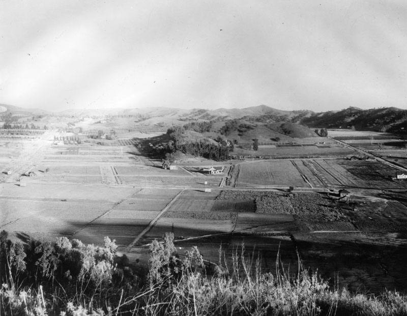
| (Early 1900s)* - Panoramic view looking east into the Eagle Rock Valley where farming predominates in the landscape. |
Historical Notes In 1906 Eagle Rock became an independent city and was incorporated in 1911 with a population of approximately 600; in 1914 it also became home to Occidental College, designed by famed architect Myron Hunt. In 1920, population had grown to 2,250. Just one year later, in 1921, this figure had leaped to 3,800. In the 1950s, newer streets were extended into the hillsides and larger homes boasting views of the city were built. Since then, the city has been experiencing gentrification as young urban professionals discover this gem between Glendale and Pasadena, minutes away from downtown Los Angeles. By 2005 Eagle Rock's population was approximately 27,875. |
 |
|
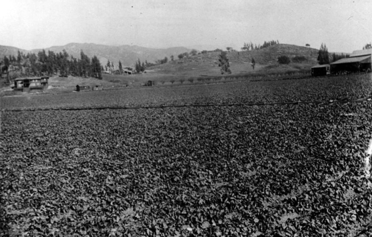
| (ca. 1905)* - The Gates Ranch in Eagle Rock. |
Historical Notes The Gates Ranch ran from Yosemite Drive and Eagle Rock Blvd. to about Chickasaw, and east to the hills past Maywood, and beyond Maywood along Yosemite Drive. The ranch raised mostly strawberries. |
 |
|
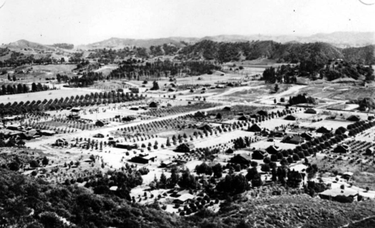
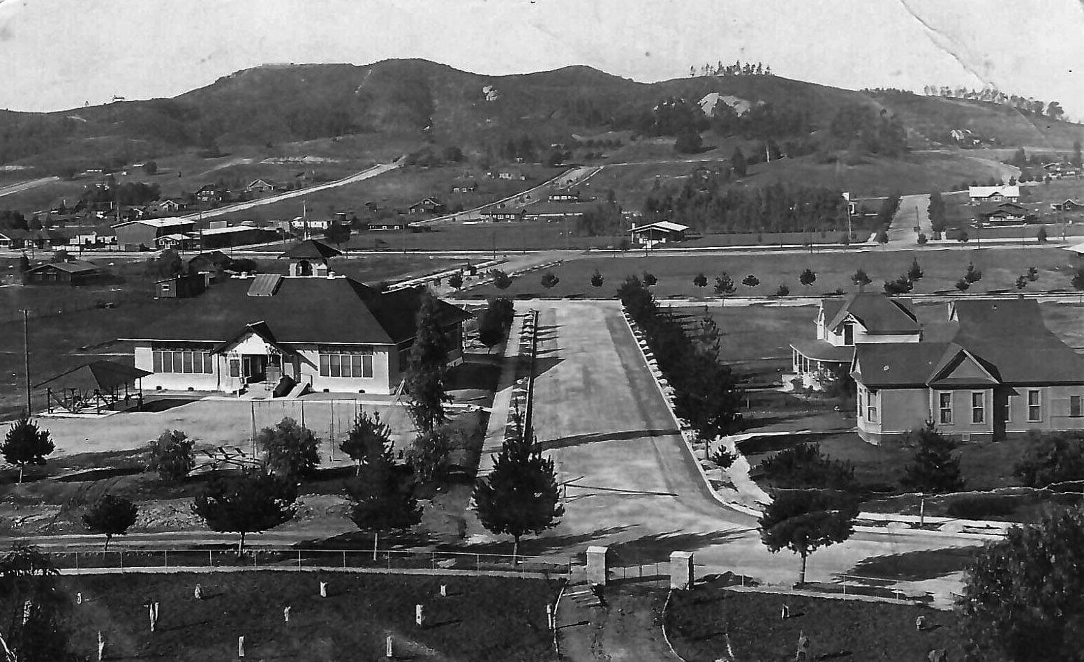
| (1915)* - Panoramic view of Eagle Rock valley, as it was known in the 1900s, looking south and east from the hills in back of Hill Drive. Colorado Boulevard, a major east-west thoroughfare, can be seen running along the middle of the photo. The streets running in a north-south direction are possibly (l to r): Dahlia Dr., Townsend Ave., Vincent Ave., Mt. Royal Dr., La Roda Ave., and Argus Drive. |
 |
|
| (1910)* - Birdseye view of Eagle Rock. |
Historical Notes Although Eagle Rock—which is geographically located between the cities of Pasadena and Glendale—was once incorporated as Eagle Rock City in 1911, it was thereafter annexed to the City of Los Angeles in 1923 due to need for an adequate water supply and a high school. |
 |
|
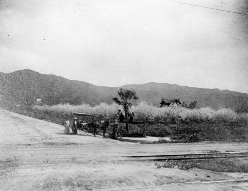
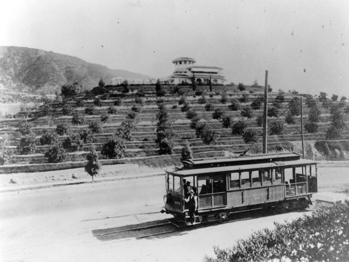
| (1911)* - Photo taken at the intersection of La Roda Ave. and Colorado Blvd., looking north toward Scholl Canyon. One man and two women stand at the corner next to a horse-drawn carriage; a plum tree orchard with trees in blossom is visible behind them. The very spacious dirt roads show the east/west direction of trolley tracks in the foreground. |
Historical Notes A "Dinky" ran from Glendale to the center of Eagle Rock for nearly twenty years on double tracks, later "Toonerville Trolleys" ran on single tracks. |
 |
|
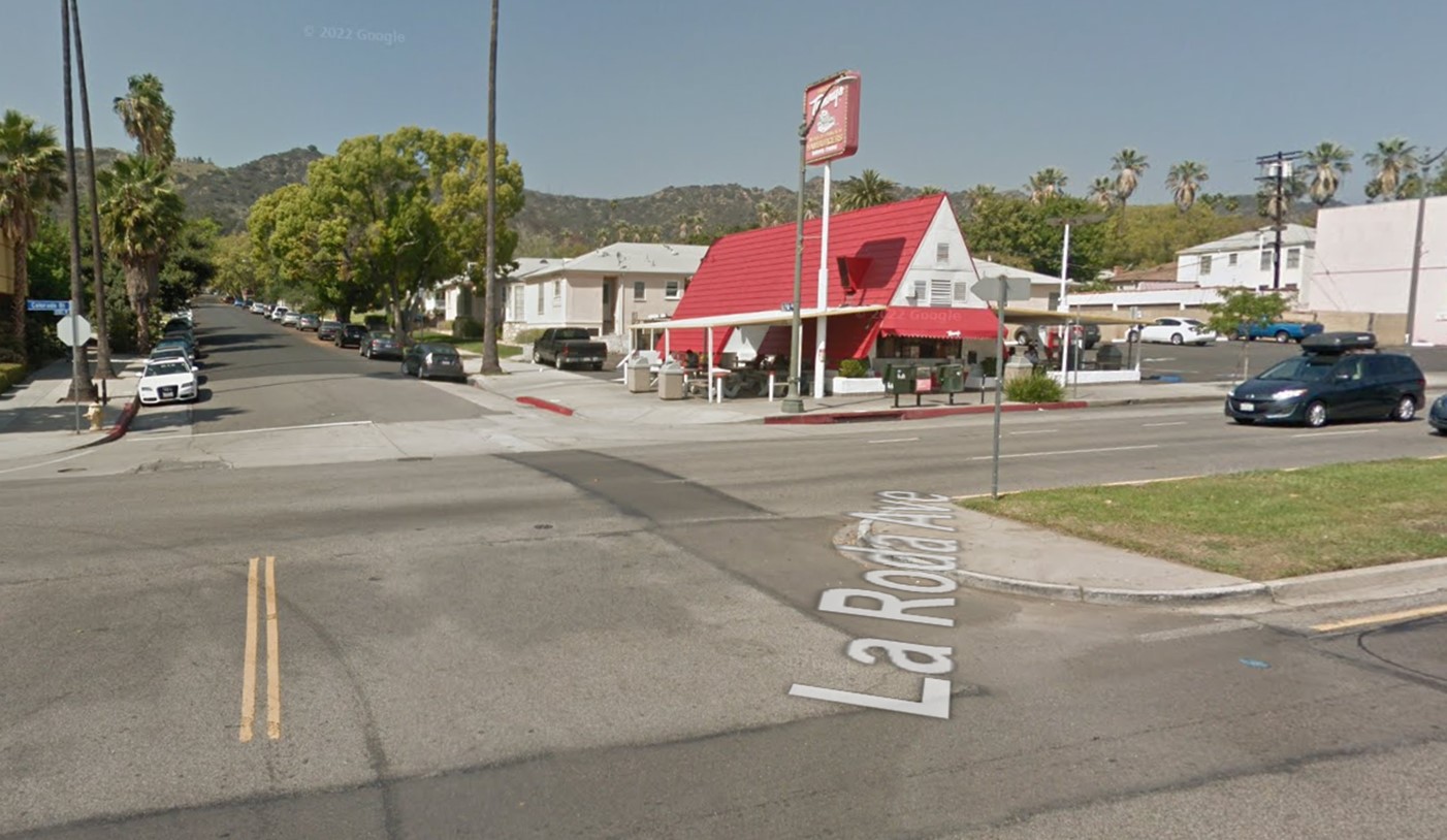
| (2024)* - Looking toward the northeast corner of La Roda Avenue and Colorado Boulevard, where a Tommy's Hamburgers stand is located today. |
Then and Now
 |
|
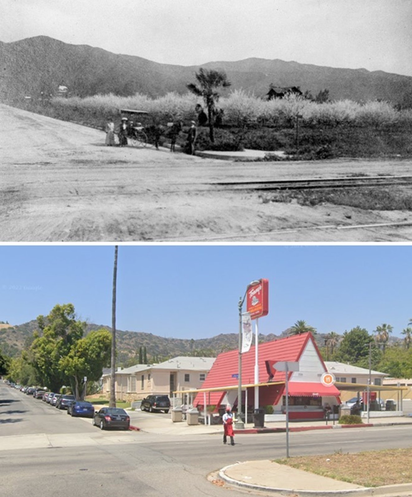
| (1911 vs 2022)* – A 'Then and Now' view of the northeast corner of La Roda Avenue and Colorado Boulevard in Eagle Rock, where a Tommy's Hamburgers stand is now located. Photo comparison by Jack Feldman. |
 |
|
| (1914)* - View of the "Dinkey" that ran from Glendale to the center of Eagle Rock for nearly twenty years. |
Historical Notes This photo shows the earlier double track type; later cars ran single track, "toonerville trolleys." The Bessolo residence is in the background. The construction of Henry Huntington's Los Angeles Railway trolley line up Eagle Rock Boulevard to Colorado Boulevard and on Colorado to Townsend Avenue commenced the rapid suburbanization of the Eagle Rock Valley. |
 |
|
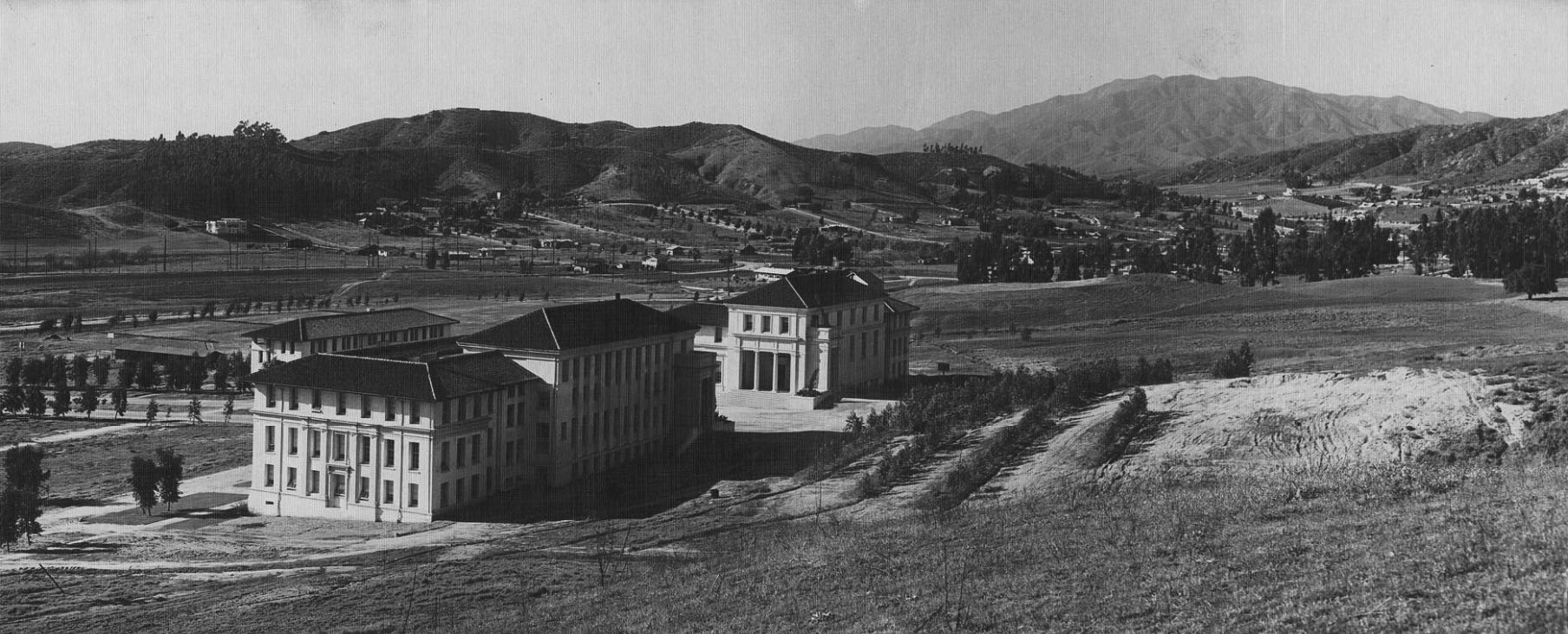
| (1916)* – Panoramic view looking NW showing the Occidental College campus. |
Historical Notes The new Eagle Rock campus was designed by noted California architect Myron Hunt, also known as the planner of the Caltech campus and as designer of the Huntington Library and Art Gallery and the Rose Bowl. This was Occidental College's 3rd campus location. 1st location was Boyle Heights (1888). 2nd locatiion was (1898-1914). Click HERE to see more. |
 |
|
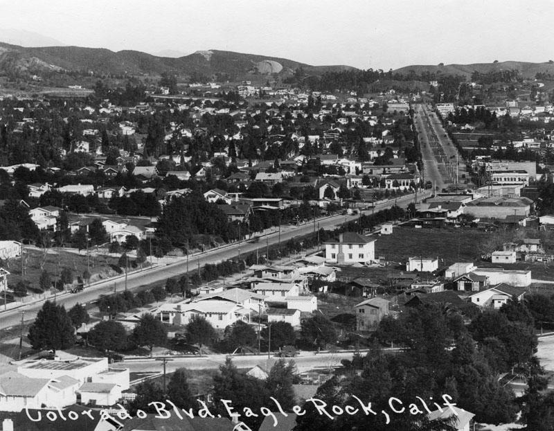
| (1920s)* - Panoramic view looking northeast along Colorado Boulevard, which is a major east-west thoroughfare that runs through Eagle Rock; commercial buildings and residential homes are on either side. |
 |
|
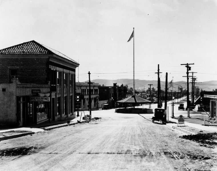
| (1920s)* - View of the "Merry-Go-Round" Pavilion at the intersection of Colorado and Eagle Rock boulevards. |
Historical Notes In 1921 a circular pavilion nicknamed "The Merry-Go-Round" was built in the center of the city at the intersection of Colorado and Eagle Rock Blvd (seen toward the right, where the street bends). This structure was to shelter and protect streetcar travelers; it was razed in the 1930s as automobile traffic became heavier. |
 |
|
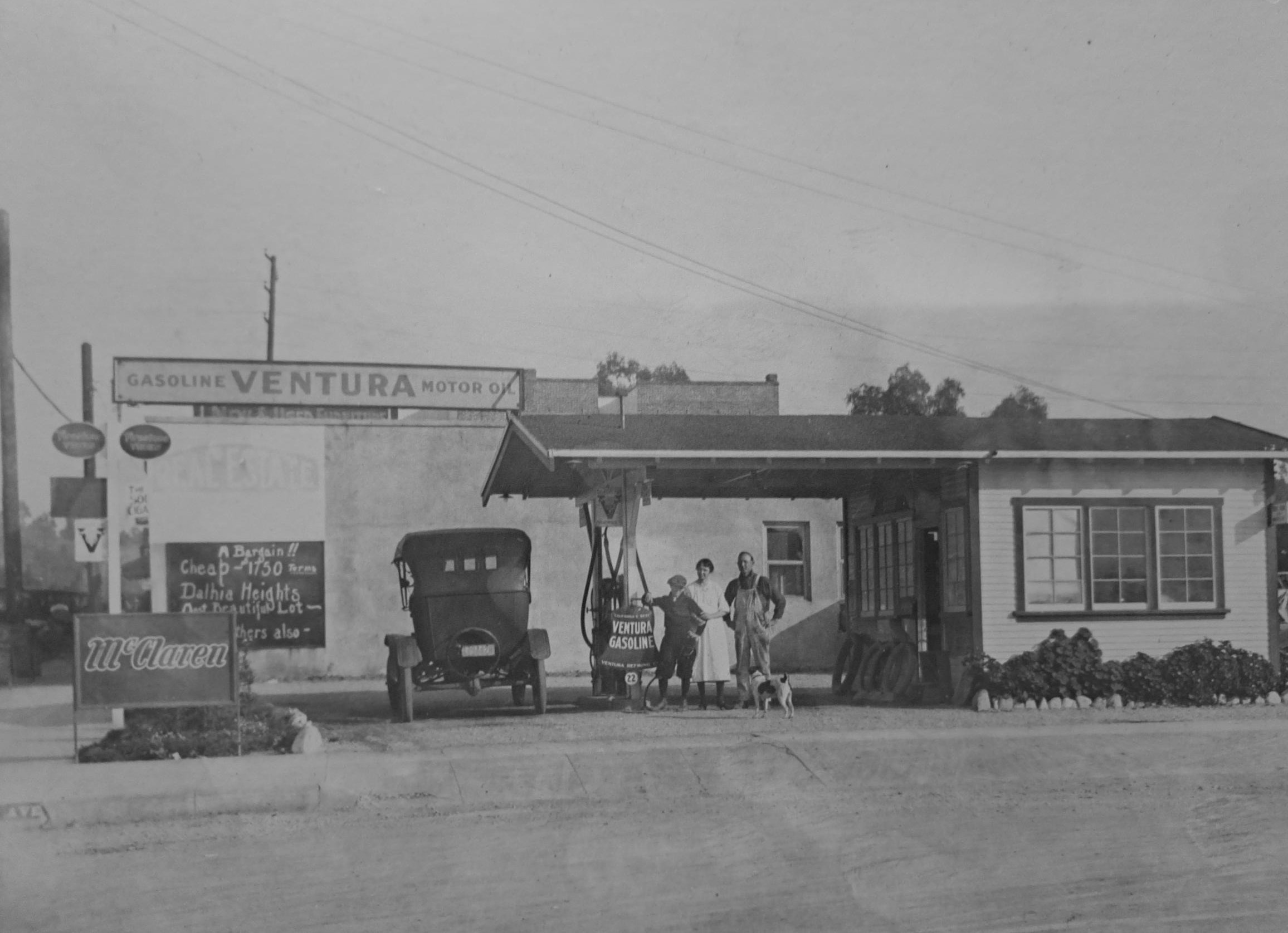
| (ca. 1929) – Joseph Kopietz with wife (Elizabeth) and son (Fred) stand at a Ventura Gas and Oil service station located on Colorado Blvd. and ‘...inia’ (showing on the curb) in Eagle Rock. This is puported to be the first gas station in Eagle Rock, later becoming a Texaco station. Photo courtesy of Joe Chatham, grandson of Fred Kopietz |
Historical Notes The petroleum exploration company California-Ventura Oil incorporated in 1927 with capitalization of $500,000. By 1929, the venture had several working drilling rigs when lightning sparked the “Sulphur Mountain Fire,” which destroyed the derricks. As the Great Depression began, California-Ventura Oil Company discovered the Hermosa Beach oilfield. The newly revealed field proved to be a key addition to the prolific Torrance oilfield, discovered a decade earlier. |
 |
|
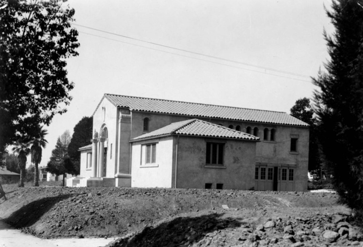
| (1922)* - Eagle Rock City Hall, probably at time of completion in 1922 because the grounds are not yet landscaped. |
Historical Notes The arrival of Owens Valley water via the Los Angeles Aqueduct and the concurrent depletion of the young city's wells ultimately led the city fathers to agree to annexation by Los Angeles in 1923. Eagle Rock is one of the few cities incorporated by Los Angeles to still have its original pre-annexation City Hall (2035 Colorado Blvd.) and Library (2225 Colorado Blvd.) still standing. Click HERE to see Contemporary View. |
 |
|
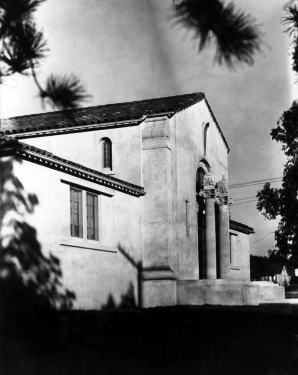
| (1923)* – Eagle Rock City Hall, showing detail of facade and front entrance. It was built in 1922 and was designed by architect William Lee Woollett. |
 |
|
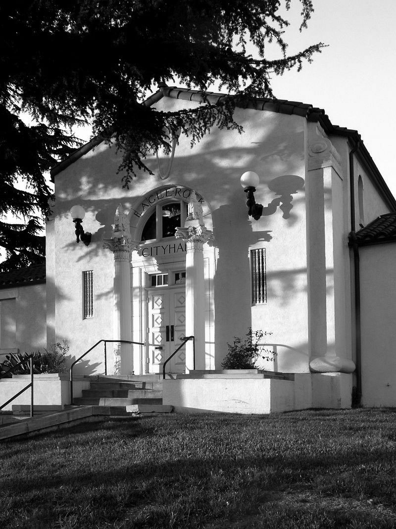
| (2009)* – Eagle Rock City Hall located at 2035 Colorado Boulevard. Historic-Cultural Monument No.59. Photo by Laurie Avocado |
 |
|
| (1925)* - View looking east toward Pasadena showing the outline of a flying eagle on the face of a massive boulder that locals ca*ll "The Rock". Created from local hot springs millions of years ago, this impressive rock looms above the valley below, creating an eagle-shaped shadow every day around noon. |
Historical Notes In the mid to late 1770s, Native Americans inhabited the caves at the base of The Rock, formerly known as La Piedra Gorda (which translates to "Fat Rock"). 100 years later, in 1874, desperadoes used these same caves, including the infamous bandit Tiburcio Vasquez, who was said to have used The Rock as a hideout and to store his loot. In 1962 this Eagle Rock landmark was appraised at $250,000 and on November 16th of that same year, The Rock was declared Los Angeles Historic Cultural Monument #10, but it did not actually belong to the community until 1995 when the city of Los Angeles officially purchased it for close to $700,000. |
 |
|
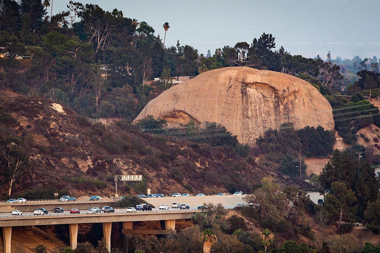
| (2018)* - The eagle rock at dusk, shown here above California State Route 134 (the Ventura Freeway), north of Downtown Los Angeles, at the border of Pasadena. Photo by John M. DeMarco / Wikipedia |
 |
|
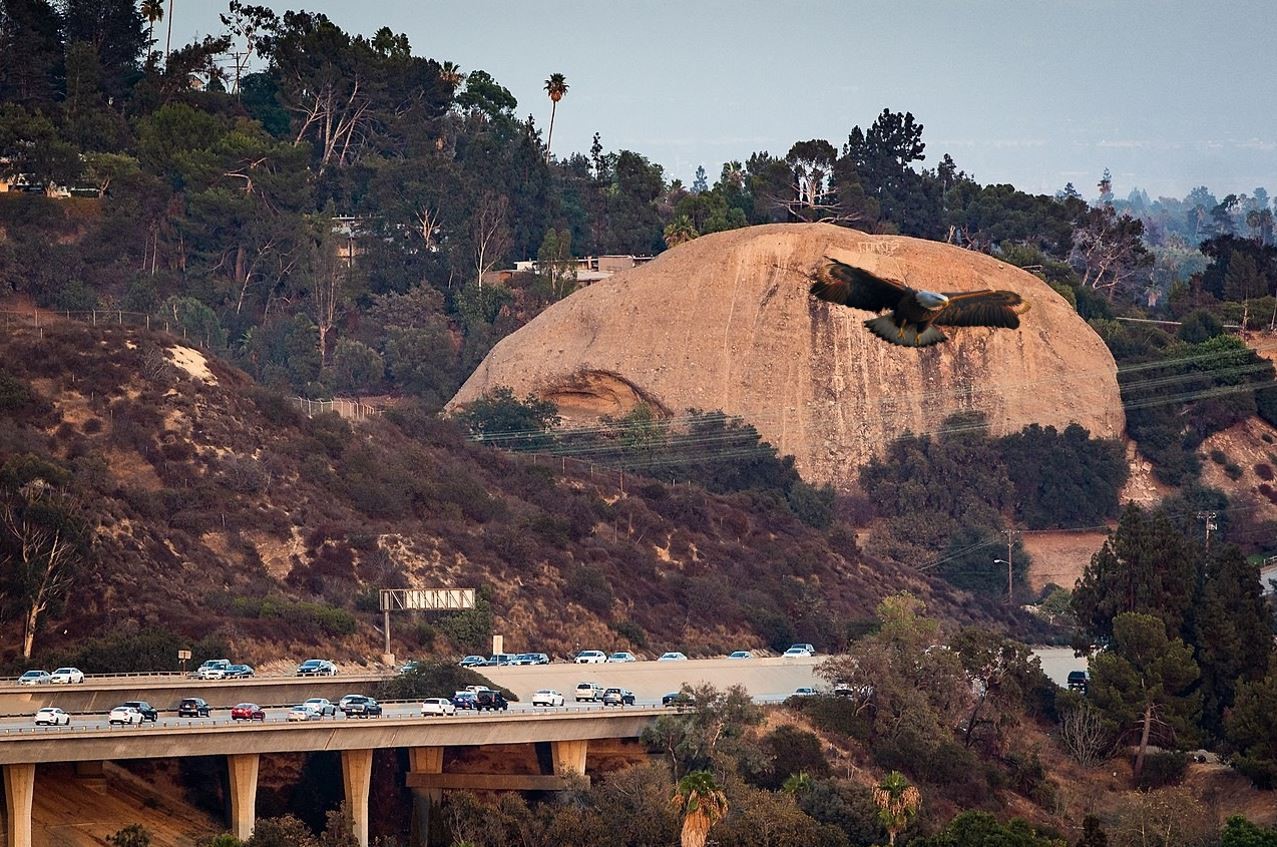
| An eagle flying in front of Eagle Rock. Photoshopped by Champel Once* |
* * * * * |
|
Other Sections of Interest |
|
Water and Power in Early LA |
|
Newest Additions |
New Search Index |

A new SEARCH INDEX has been added to help navigate through the thousands of topics and images found in our collection. Try it out for a test run.
Click HERE for Search Index |
* * * * * |
< Back