Early Los Angeles Historical Buildings (1800s)
Historical Photos of Early Los Angeles |
 |
|
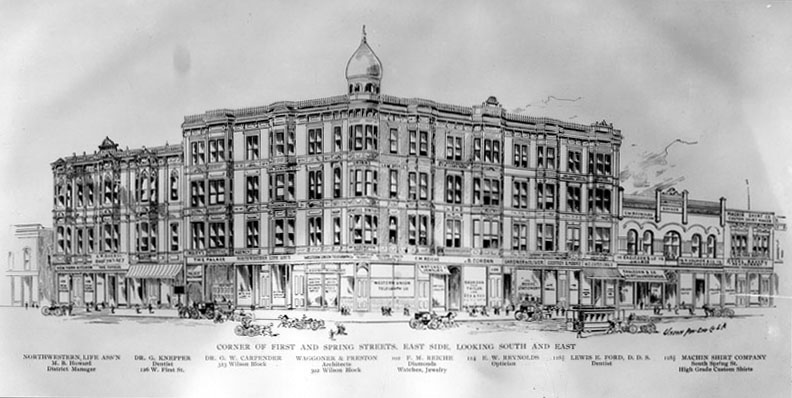
| (ca. 1886)* - Sketch showing the corner of First and Spring streets, looking southeast at the Wilson Block with its distinct copula, built in 1886. |
Historical Notes The Los Angeles Herald has an extensive article about the Wilson Block in the 8 August 1886 edition. The first paragraph says: The full article can be found at the California Digital Newspaper Collection. ^*# |
 |
|
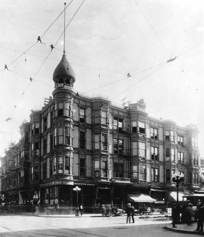
| (ca. 1910)* - View of the Wilson Block located on the southeast corner of First Street and Spring Street. Sign over the corner store reads: WESTERN UNION TELEGRAPH. Note the ornate streetlights on the corners. Click HERE to see more in Early L.A. Streetlights. |
 |
|
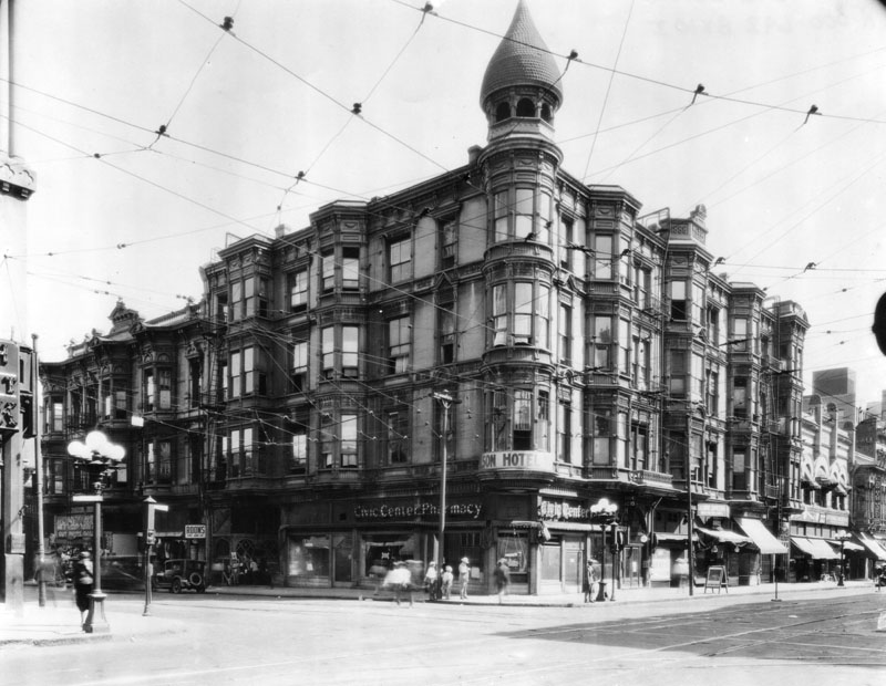
| (ca. 1918)* - View of the Wilson Building, also known as Wilson Block, on corner of First Street and Spring Street. Sign over the corner store reads: Civic Center Pharmacy |
* * * * * |
YMCA (212 W. 2nd Street)
 |
|
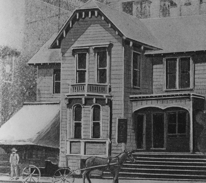
| (ca. 1888)* - Sketch showing the first permanent home of the Los Angeles Young Men's Christian Association (YMCA), located in this structure at 212 West 2nd Street, which the organization leased in 1886. It was used by the Y until about 1889. |
YMCA (207 S. Broadway)
 |
|
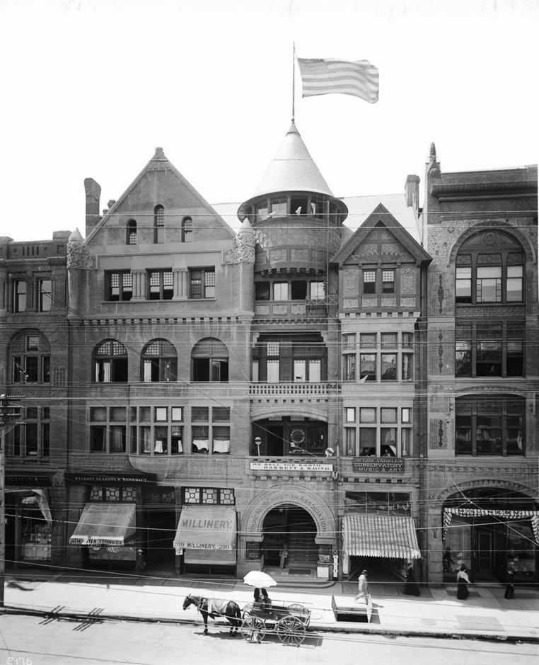
| (ca. 1899)^^* - View of the first building designed and constructed as a YMCA structure in Los Angeles. It was located at 207 Fort Street (now Broadway). Completed in 1889, it had the first gymnasium in Los Angeles. |
Historical Notes The YMCA's most influential period since its conception (London in 1844) could be between the 1870s and 1930s. It is during this time that they most successfully promoted "evangelical Christianity in weekday and Sunday services, while promoting good sportsmanship in athletic contests in gyms (where basketball and volleyball were invented) and swimming pools." Later in this period, and continuing on through the 20th century, the YMCA had "become interdenominational and more concerned with promoting morality and good citizenship than a distinctive interpretation of Christianity.^* |
 |
|
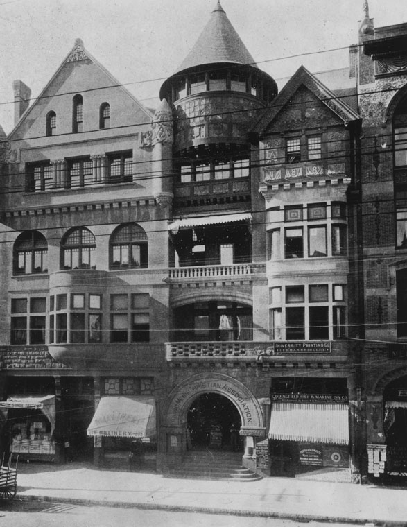
| (ca. 1900)* - YMCA building at 209 South Broadway, used from 1889 to 1903. |
Historical Notes In 1903, the YMCA Building would be demolished to make way for the Merchants Trust Company Building. |
 |
|
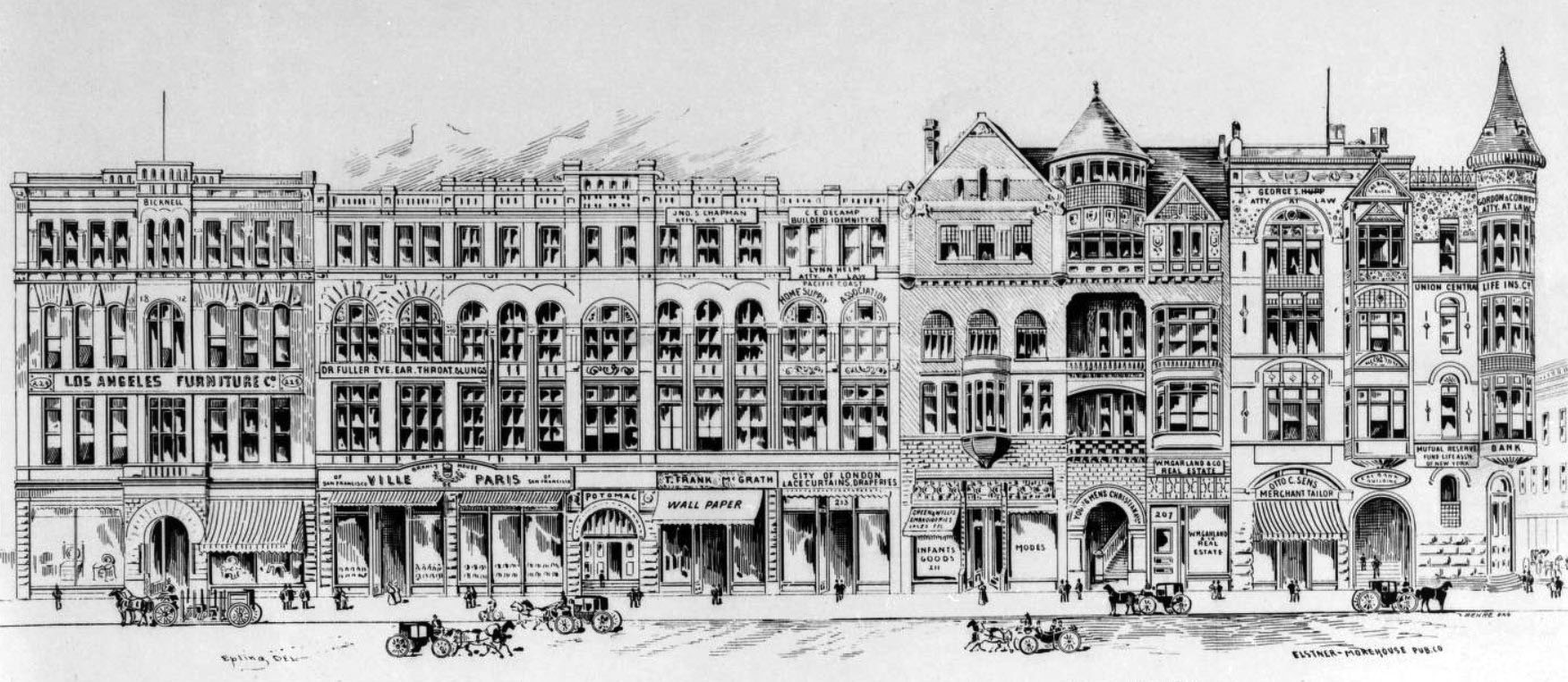
| (ca. 1890s)^^*- Photograph of an artist's rendering of a portion of a block on the west side of Broadway, between Second and Third Streets, showing commerical buildings and pedestrian traffic. The YMCA Building is the second building from the right. On the southwest corner of Broadway and 2nd Street, next to the YMCA, stands the California Bank Building. On the other side of Broadway are: City Hall , B'nai B'rith Temple, and the First Presbyterian Church. |
Historical Notes A block of commercial buildings, designed in the Second Empire style of architecture, is depicted in detail, with the row of buildings crossing the center of the image. Each building is four stories tall and its front contains many windows; the building at the right edge of the picture is more ornate, with gabled windows and a turret at its outer edge. The bulidings are fronted by a paved sidewalk, which is occupied by pedestrian traffic. The edge of another block can be seen at the rightmost edge of the image, while horse-drawn carriages line Broadway. Legible signs, from left to right, include: "Los Angeles Furniture Co", "Dr. Fuller Eye, Ear, Throat & Lungs", "Ville de Paris", "Jno.S Chapman. Atty. At Law", "T. Frank McGrath Wallpaper", "C.E. Decamp Builders Indemnity Co", "Lynn Helm Atty. At Law", "Pacific Coast Home Supply Association", "City of London Lace Curtains, Draperies", "Green & Willis Embroideries Laces Etc. Infant Goods. Modes", "Young Mens Christian Assn", "W.M.Gar & Co. Real Estate", "George S. Hupp Atty At Law", "Otto C. Sens Merchant Tailor", "Cal-Bank Building", "Gordon & Conrey Atty At Law", "Union Central Life Ins. Co", "Mutual Reserve Fund Life Assn of New York", and "Bank".^^* |
California Bank Building
 |
|
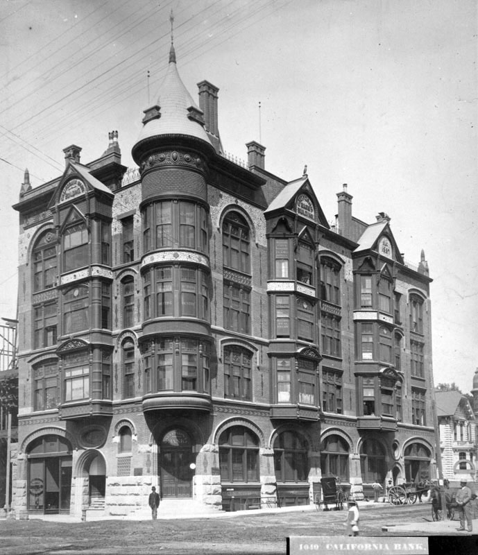
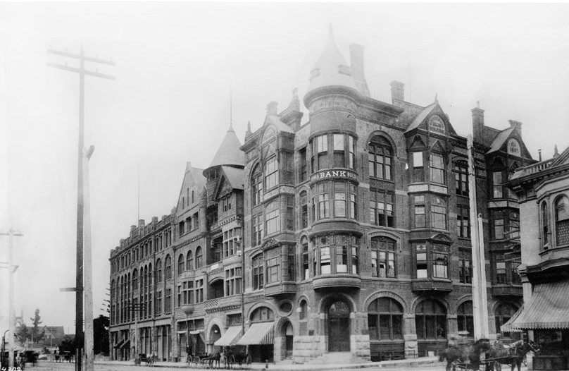
| (ca. 1887)* - Exterior view of the California Bank building, located on southwest corner of Second and Broadway. Note the adjacent bulding is still under construction. |
Historical Notes Of the buildings seen in the previous artist rendering of 200 block of Broadway, the 1887 built California Bank Building appears to be the first building constructed. |
 |
|
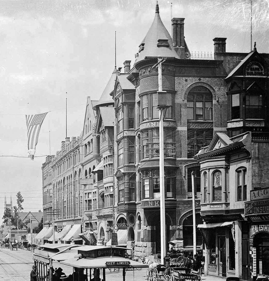
| (ca. 1889)^^* - View of the California Bank, the YMCA and the Fort Street Methodist Episcopal Church on Broadway and Second Street, looking south. |
 |
|
| (1889)* – View looking south on Broadway at 2nd Street showing the California Bank Building on the southwest corner. City Hall (built in 1888) is across Broadway out of view on the left. |
* * * * * |
Turnverein Building
 |
|
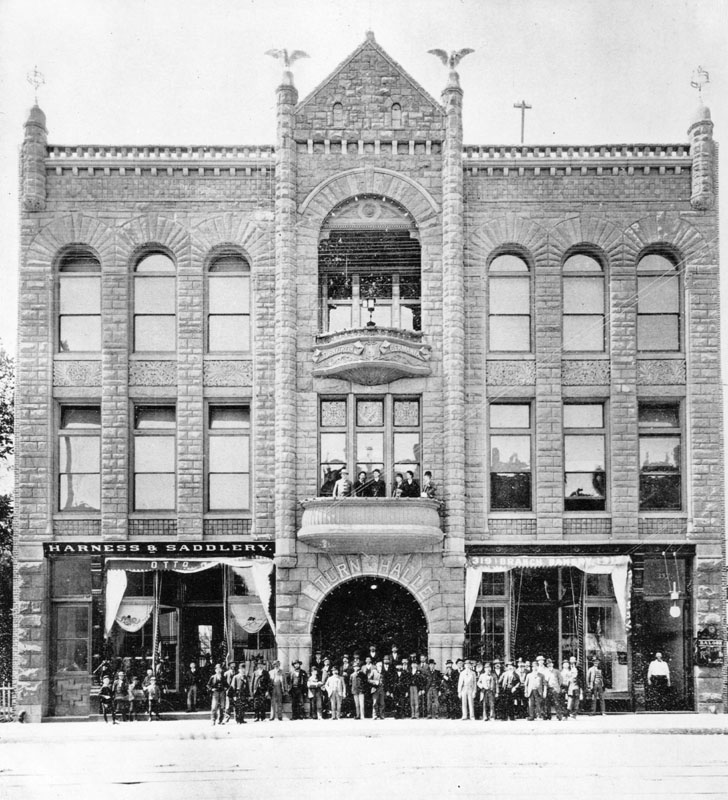
| (1888)* - Exterior view of the new Turnverein building in 1888, located at 321 So. Main Street. It has a group posing in front. This was a club of German Americans. |
* * * * * |
St. Francis Apartments
 |
|
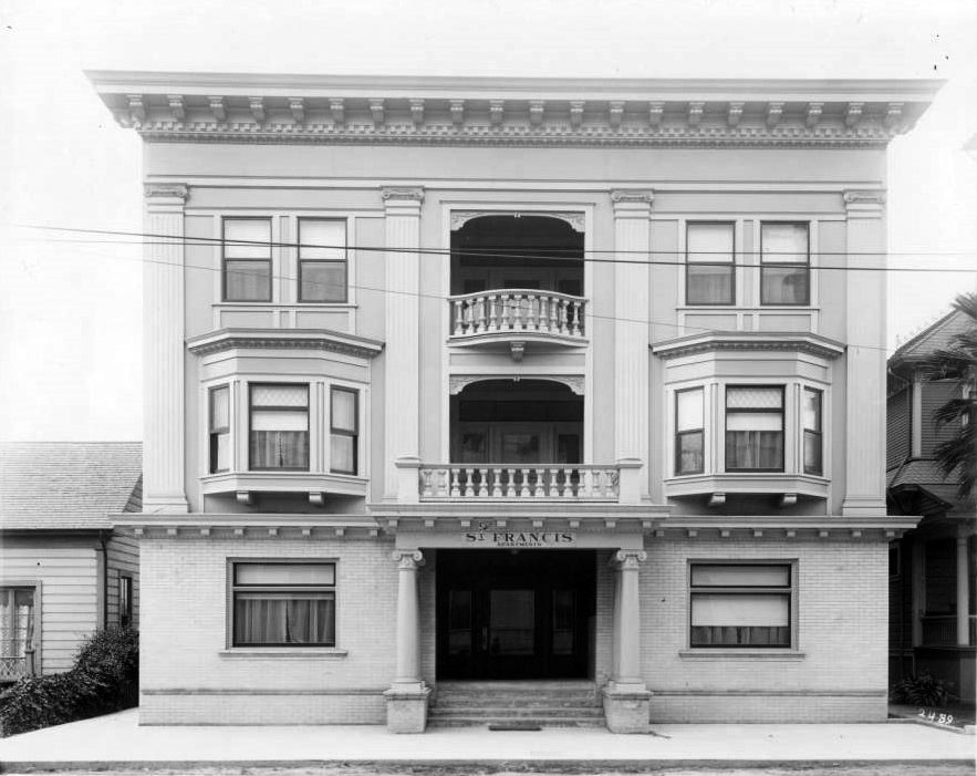
| (ca. 1890)* – View of the St. Francis Apartments on Tenth Street (Olympic Blvd. today) near Broadway. The three-story apartment building’s main entrance is on a covered porch with two balconies directly above. The bottom floor of is made of brick, while the upper floors are made of wood and decorated with façade columns. Each floor consists of large windows, designed in different sizes and shapes. |
Historical Notes Olympic Boulevard was originally named 10th Street for most of its length, except for a couple of shorter stretches. In 1932, the entire length of the street, from East L.A. to Santa Monica, was renamed Olympic Boulevard for the Summer Olympics being held in Los Angeles that year. |
* * * * * |
 |
|
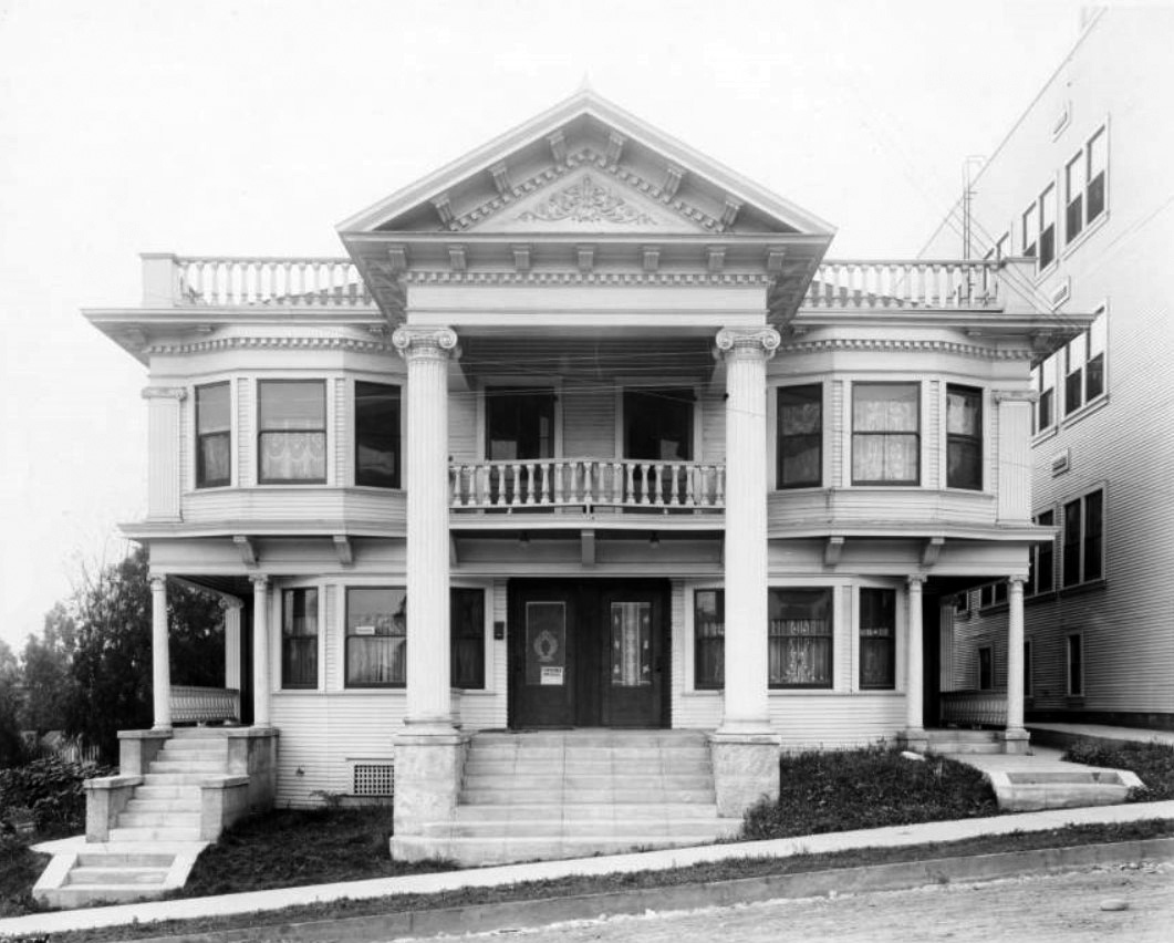
| (ca. 1889)* – View showing a Colonial Revival-style apartment building located on 6th Street west of South Figueroa Street in Los Angeles. The main entrance is flanked by two massive columns, and a balcony can be seen over the front double doors. Two cement stairways lead to covered walkways on the sides of the building, while another set of stairs leads to the front door. A thee-story rectangular building can be seen at right. |
* * * * * |
 |
|
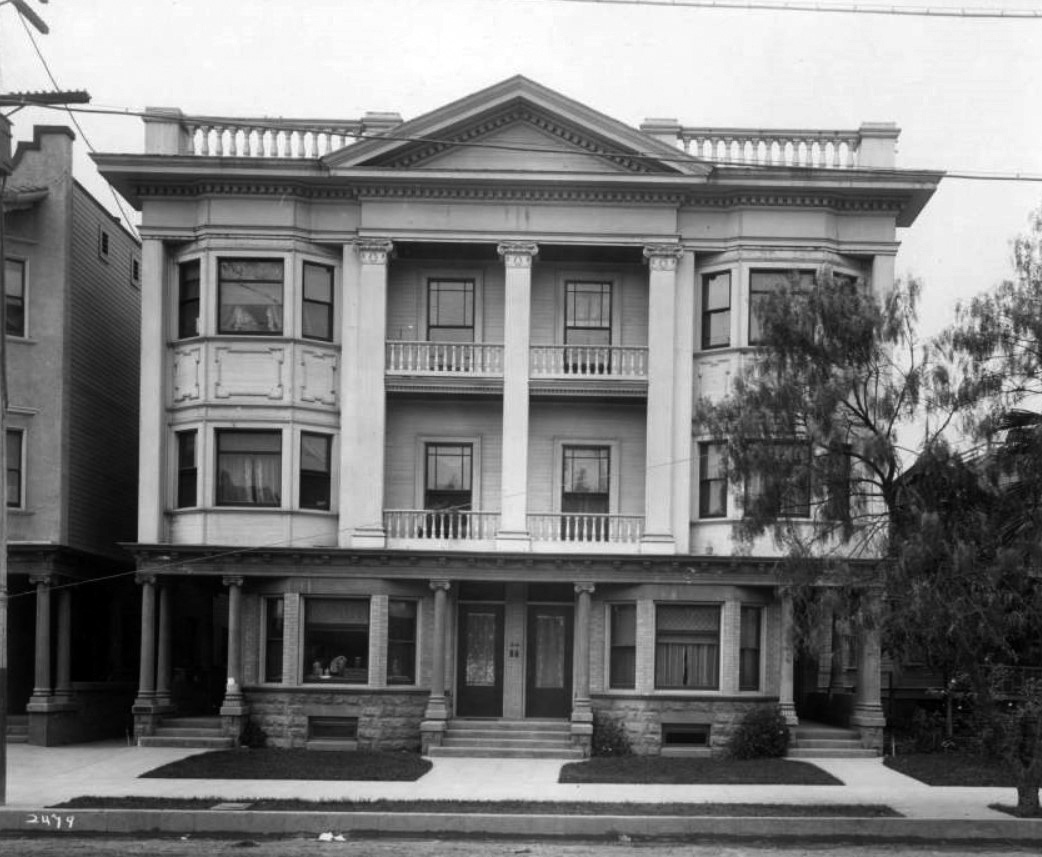
| (ca. 1889)* - View showing a three-story Colonial-revival apartment house located at 1111-1117 South Figueroa Street. The first floor is constructed of stone, while the upper stories are made of wood. All three stories are decorated with large columns, and rectangular windows look out on the street below. Two balconies are visible in the middle of the building. A concrete sidewalk runs parallel to an unpaved street in the foreground. |
* * * * * |
 |
|
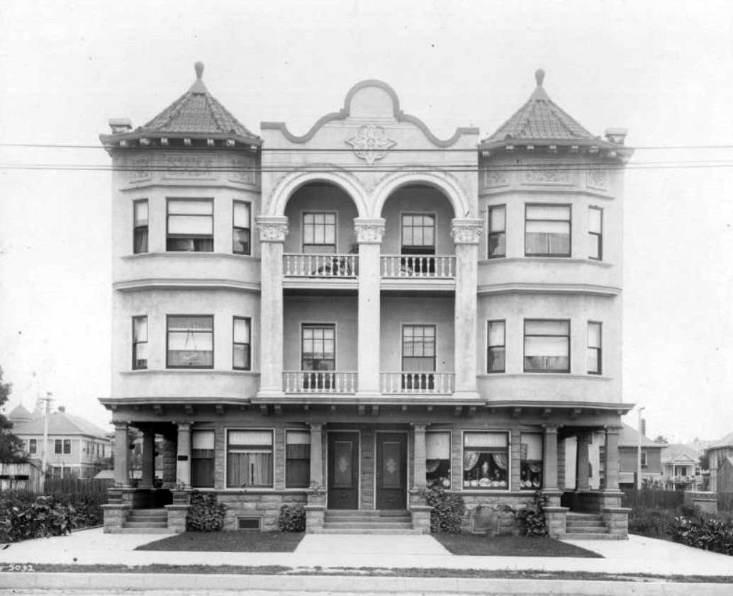
| (ca. 1889)* - View shwoing a three-story apartment building on Figueroa Street between Eleventh Street and Twelfth. The main entrance is in the middle of the building on the bottom floor and is flanked by two sets of three windows. Covered walkways lead to other rooms on the edges of the building. There are two balconies visible on the second and third stories. The roof of the building is made of terracotta tiles. |
* * * * * |
 |
|
| (ca. 1889)* - Exterior view of a three-story Romanesque apartment building located at 1133 South Figueroa Street. Four tall columns hold up an overhanging section of the roof in the front of the building. Balconies can be seen on the second and third stories, while arched windows can be seen flanking the arched front door at center. |
Historical Notes Today, the Crypto Arena (Staples Center) is located where this beautifully designed apartment building once stood, 1133 S. Figueroa Sreet. |
* * * * * |
Princess Apartment-Hotel (aka 'Queen Apartments')
 |
|
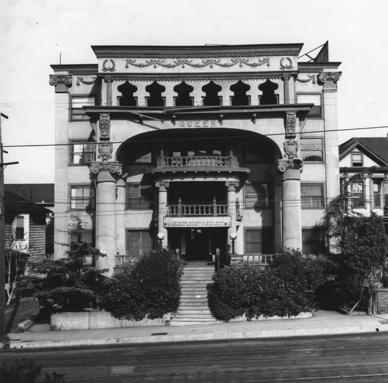
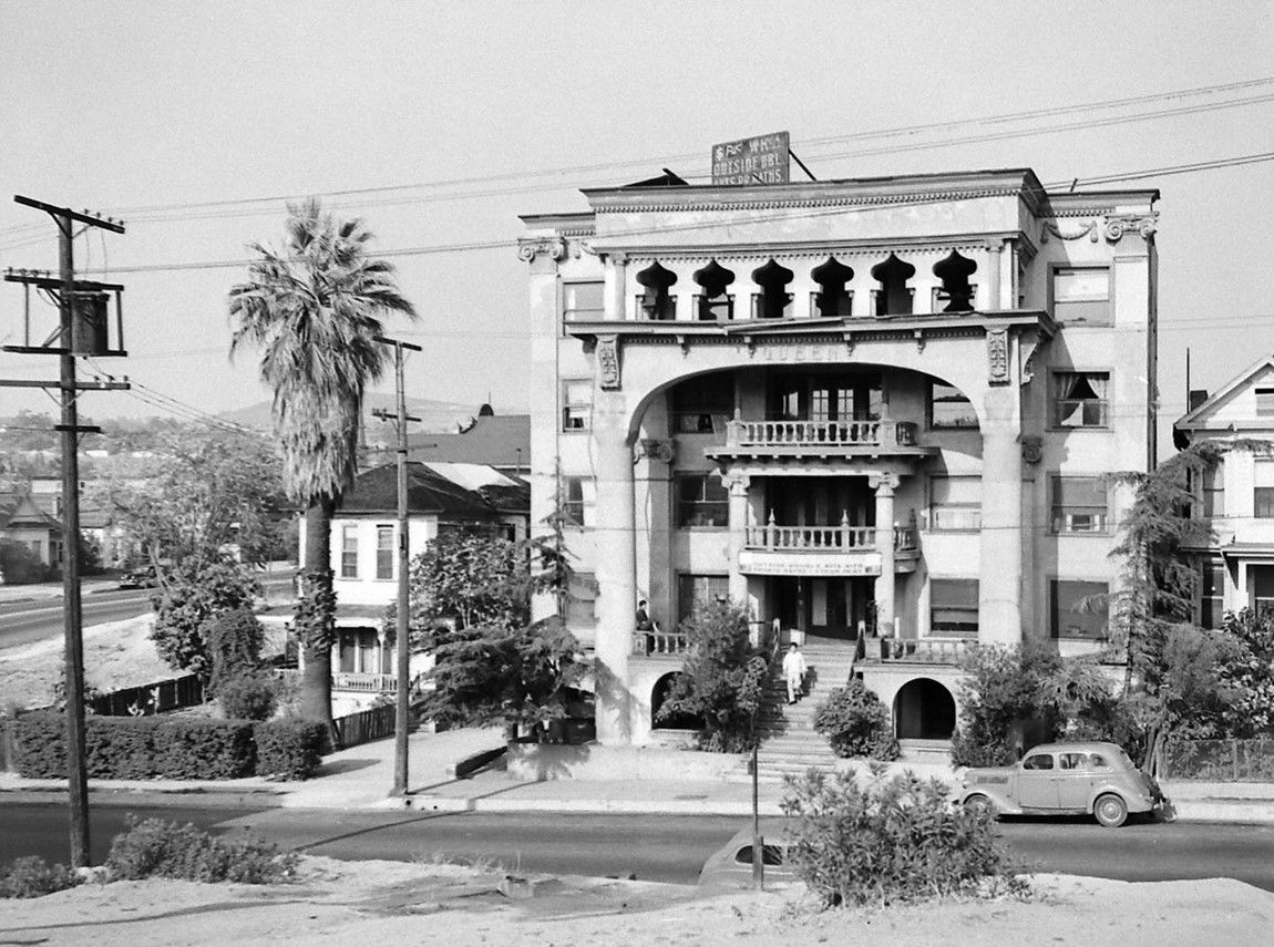
| (ca. 1940)* - Street view of a large residential building known as the Princess Apartment-Hotel, located at 529 California Street. A sign indicates that there are "outside double apartments with private baths and steam heat" for $5.00 a week and up. The Classical Revival structure, which was demolished when the 101 Freeway was constructed, was named as the Queen by oil baroness Emma Summers, a onetime owner of the home. Photo by Ansel Adams |
Historical Notes In 1892, "Miss" Emma Summers (1858-1941) was listed in the directory as "Piano Teacher", giving lessons at her residence at 517 Sand Street (soon to become California), where she and carpenter husband A.C. rented a small place. With her 1879 degree from the New England Conservatory of Music, she was in strong demand to teach many children the black and white of pianos, and in fact had multiple pianos in the house. But in April 1893 all that was about to change, as two down-on-their-luck miners (Doheny and Canfield), using a 60 foot Eucalyptus tree trunk as a drill bit, struck oil a few blocks away at Court and Patton. It was the first oil well in downtown Los Angeles. Emma had the business head in the family--she had saved $700 from her child tutelage, and she used the money to go in half on a new well in the neighborhood. She ended up following the initial amount with an additional $1800, and the well hit. In fact it was still producing after 10 years. Wells popped up everywhere in the area. The neighborhood by the late 1890's consisted of houses interspersed between well derricks. Emma continued to invest in oil wells, still teaching piano at night, followed by then balancing the books of the business. In the beginning she was in debt up to $10,000 and thought that she might quit when the debt was paid off, But she continued and by 1901 she was being called the "Oil Queen", and with her many dealings in oil, she controlled the Los Angeles market. By 1904 she dealt in 50,000 barrels per month, having moved her office from her home on California St. to the Mason Opera House building downtown. Down the block from her early California Street residence Emma had built the Queen Apartments, which by 1940 had been "downgraded" to the Princess Apartment-Hotel. At that time Ansel Adams came by to take a shot of the apartment building as part of an article for the L.A. Examiner. It is said that Emma lived in the apartment building for awhile. The building survived until the early 1950's when the downtown freeway destroyed the whole block. |
 |
|
| (1945)* - The Queen Apts located at 529 California Street. It was demolished the 1950s to make way for the 101 Freeway through downtown LA. Photo by Walter Sanders |
Historical Notes California Street (originally Sand Street) was located one block north of Temple Street in Downtown Los Angeles. It is where the 101 Freeway is today. |
 |
|
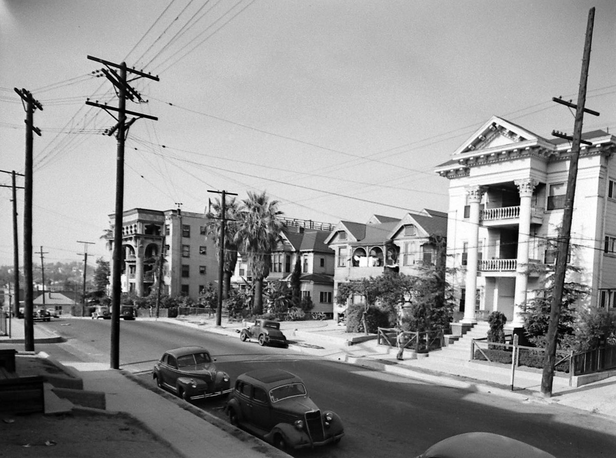
| (1945)* - Waldron Apts at 509 California Street, with the Queen Apts seen in the distance. |
* * * * * |
Lima Apartments Hotel
 |
|
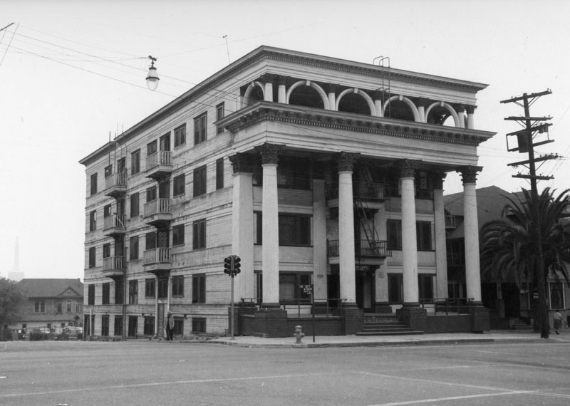
| (ca. 1955)* - Looking southwest across the intersection of W. First Street (running left to right in the foreground) and S. Hope Street, showing the Lima Apartments, also known as the Lima Apartments Hotel, located at 700–702 W. First Street. |
Historical Notes Built around 1900–1905, this three-story masonry apartment house with Edwardian and Classical Revival influences stood on the southwest corner of First and Hope Streets in the Bunker Hill district. Like many such structures on Bunker Hill, the Lima began as a respectable middle-class residence before evolving into a residential hotel—a common form of affordable urban housing in the early 20th century. By the postwar years, these once-elegant buildings reflected the area’s decline, offering low-cost rooms to seniors and working-class tenants. The Lima stood as a modest but characteristic survivor of old Bunker Hill’s apartment era until it was cleared by the Community Redevelopment Agency (CRA) during the sweeping urban renewal of the mid-1960s. Demolished c. 1965–1966 during the Bunker Hill Redevelopment Project. |
 |
|
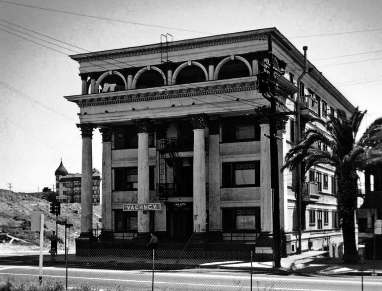
| (ca. 1964)* - View showing the Lima Apartments Hotel on the southwest corner of First and Hope Streets. On the far left is a glimpse of the Dome Hotel Apartments, located on the southwest corner of 2nd and Olive Streets—another residential hotel soon lost to redevelopment. |
Historical Notes By the early 1960s, the city and federal redevelopment programs were transforming Bunker Hill. Photographs like this, taken just before demolition, document the final years of the hill’s residential hotels, once home to thousands of downtown residents. Today, the site of the Lima Apartments lies within the Bunker Hill Cultural Complex. The Lima’s former parcel is now part of the landscaped open space that links these civic landmarks—symbolizing Los Angeles’ transformation from a once-crowded residential hill to a modern cultural center. |
 |
|
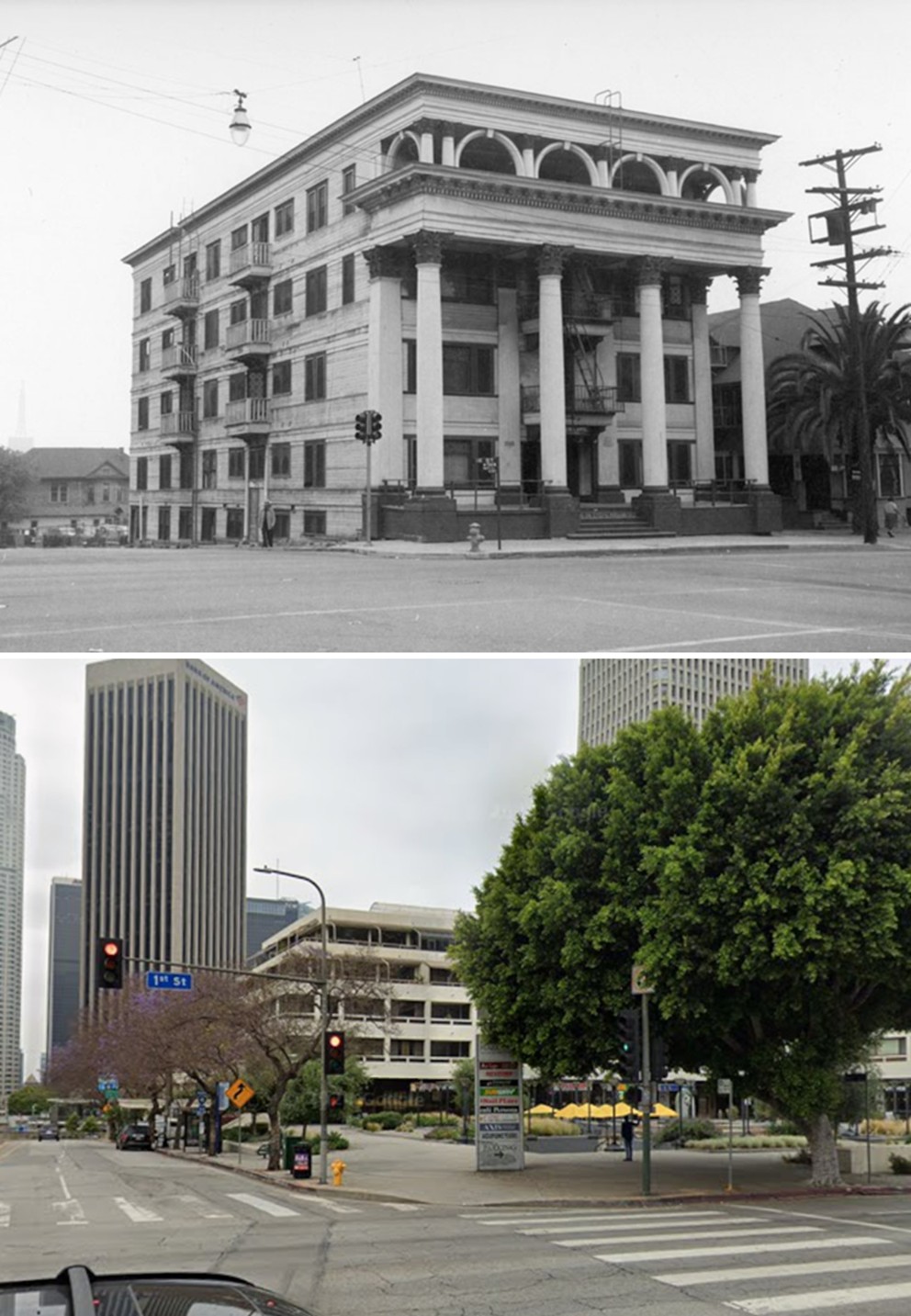
| (1955 vs. 2024)* – Looking at the southwest corner of Hope and 1st Streets. The Lima Apartments Hotel once stood here; today the site is the Promenade Plaza in front of the Promenade Residences building. Photo comparison by Jack Feldman. |
Historical Notes The southwest corner where the Lima Apartments once stood is now occupied by the Promenade Residences at 121 S. Hope Street, with Promenade Plaza forming the landscaped terrace in front. Completed in 1980, the Promenade was among the first residential projects to bring housing back to the redeveloped Bunker Hill area. Its stepped design and open plaza stand in contrast to the densely built apartments that once defined the neighborhood, reflecting the district’s evolution from early 20th-century residential hotels to the modern skyline seen today. |
* * * * * |
Purser Apartments
 |
|
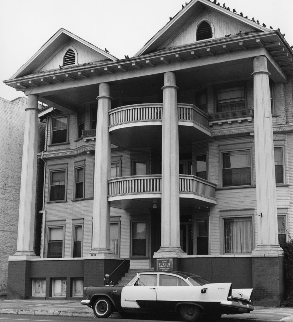
| (1965)* - The Purser Apartments at 1126 S. Olive Street. This multi-story clapboard building features four tall columns, with two supporting graceful balconies. Pigeons perched along the roofline and a classic car parked in front lend a nostalgic charm to the scene. Photo by William Reagh. |
Historical Notes Photographer William Reagh documented the Purser Apartments in 1965 as one of the last wood-frame, veranda-style apartment houses lingering in the South Park area of downtown Los Angeles. Library catalog records confirm the address, date, and photographer, and describe the same clapboard façade with full-height columns and stacked porches shown here. While no architect or exact construction date has been identified in the public catalogs, the building’s form fits early 20th-century apartment types that once lined nearby streets before mid-century redevelopment. Reagh’s image preserves the “everyday” residential fabric that was fast disappearing from this part of downtown. |
 |
|
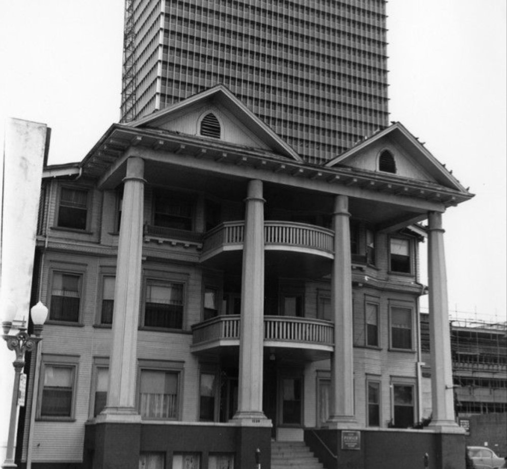
| (1965)*– The Purser Apartments at 1126 S. Olive Street in downtown Los Angeles, with a high-rise in the background. Photo by William Reagh. |
Historical Notes The high-rise behind the Purser is the Occidental Life Building at 1150 S. Olive Street, later known as the Transamerica and AT&T Center and today called USC Tower at South Park Center. Designed by William Pereira & Associates, construction started in 1962 and the 32-story tower was completed in 1965. Reagh’s pairing of the wooden Purser in the foreground with this glass-and-steel skyscraper captures a turning point for South Park, when small, older apartments gave way to corporate modernism and larger commercial projects. The same tower remains a district landmark today as part of the South Park Center complex. |
 |
|
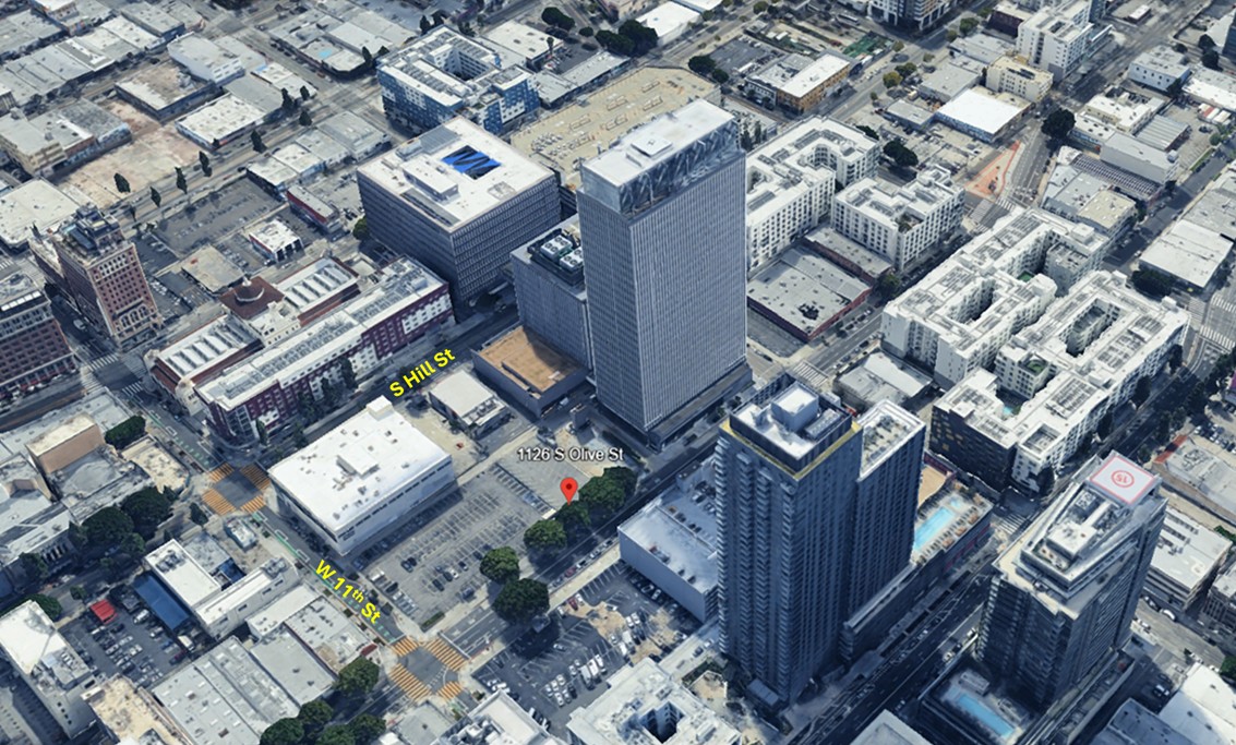
| (2024)* - Google Earth view showing the location of where the Purser Apartments once stood. Today the site is a parking lot. |
Historical Notes The former Purser address sits within the 1100–1130 block of South Olive Street. City planning documents describe these corners at Olive and 11th as existing surface parking lots targeted in recent years for large mixed-use proposals. In 2024 the City released a Sustainable Communities Environmental Assessment for the “DTLA South Park Properties, Sites 2 and 3,” covering 1105–1123 S. Olive (southwest corner) and 1100–1130 S. Olive (southeast corner). Those filings confirm the present-day parking use and outline potential high-rise redevelopment. Separate plans across the street at 1120 S. Olive were withdrawn in September 2025, underscoring that while redevelopment pressure is ongoing, the immediate Purser frontage remains a surface lot at this time. |
* * * * * |
Downey Estate
 |
|
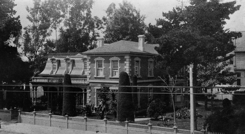
| (ca. 1888)* - Exterior view of the Governor John Gately Downey estate at 345 S. Main Street, near 3rd Street. The house is a Second Empire residence with a mansard roof and ornamental ironwork, typical of the period. |
Historical Notes John G. Downey (California governor, 1860–1862) made his home at 345 South Main Street, where he died on March 1, 1894. Contemporary reports identify the address and confirm his death at the residence. Architecturally, sources describe the house as a modestly scaled Second Empire design with a mansard roof, dormers, an inset front porch, and decorative iron cresting—features visible in period photographs. The location is consistently recorded as Main Street near Third. Downey played a central role in early Los Angeles banking. In 1871 he joined financier Isaias W. Hellman and others to found the Farmers and Merchants Bank; multiple histories note that Downey served as the bank’s first president before Hellman succeeded him in 1876. The institution became Los Angeles’ leading bank and helped finance growth along Main Street, only a few blocks from Downey’s residence. Downey’s broader legacy extended to the founding era of the University of Southern California and to the community that bears his name. USC’s own history notes his early trustee role alongside Ozro W. Childs and I. W. Hellman, while the City of Downey took its name from his landholdings and subdivision efforts in the 1870s. The Main Street house itself appears frequently in institutional photo catalogs under “Ex-Gov. Downey’s Home,” reinforcing the identification and its proximity to Third Street. Later city views and surveys suggest the residence was removed during downtown’s commercial buildout, but published records do not provide a firm demolition date; by the early twentieth century, larger commercial structures dominated this stretch of Main. |
* * * * * |
Bryson-Bonebrake Block
 |
|
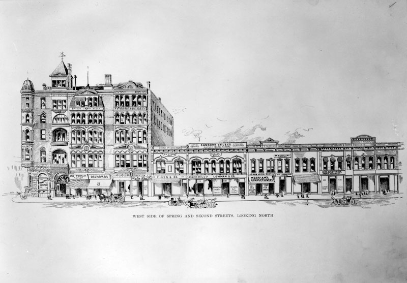
| (ca. 1888)* - Drawing of the west side of Spring Street, including the Bryson-Bonebrake Block on the left, between 1st and 2nd Streets. |
Historical Notes Designed by architects Joseph Cather Newsom and Samuel Newsom, the Bryson-Bonebrake Block was completed in 1888. The 126-room bank and office building cost $224,000, a staggering sum at the time. Bonebrake was one of the richest men in the city at the time, and he could afford making such an investment. He located the main headquarters of his bank in the Bryson-Bonebrake Block. |
 |
|
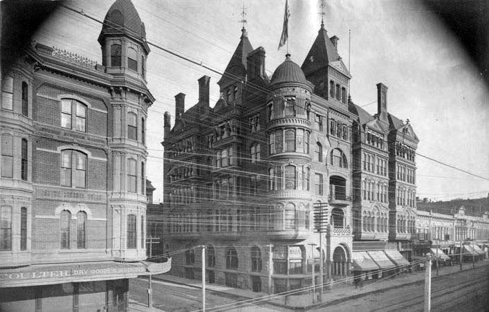
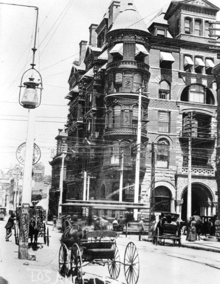
| (ca. 1888)* - View of the Bryson-Bonebrake Block located on the northwest corner of Spring and Second streets. |
Historical Notes The Bryson-Bonebrake Block was one of the more important office buildings built during the 1880s building boom in Los Angeles. It had six stories, with a typical Queen Anne Style variety of shapes, materials and ornamentation for which architect Joseph Cather Newsom was famous. |
 |
|
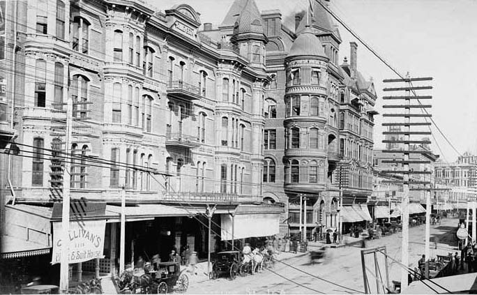
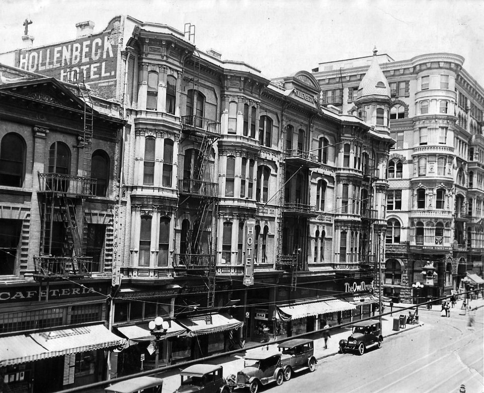
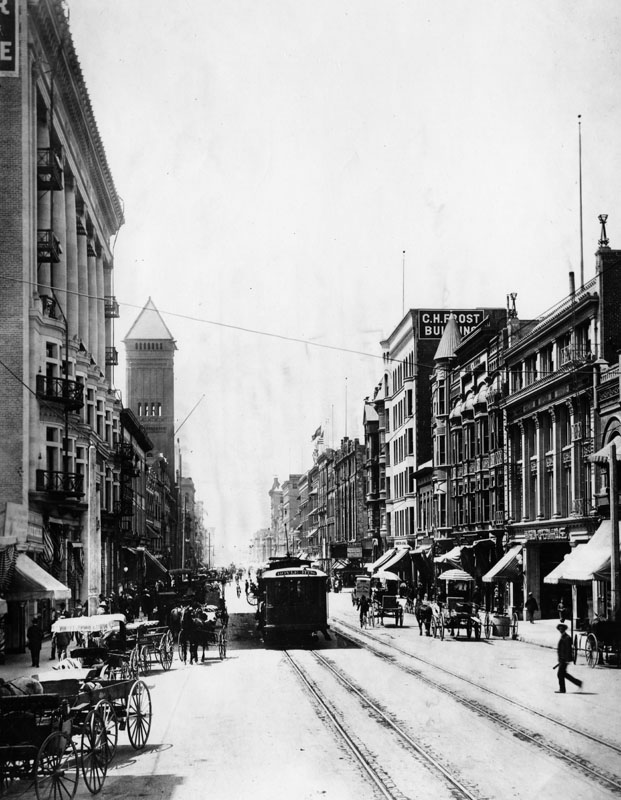
| (1888)* – Looking north on Spring Street toward 2nd Street showing horse-drawn wagons and a street car in front of the Hollenbeck Hotel left and the Bryson Building on the NW corner. |
Historical Notes Two highly influential figures in 1880s Los Angeles, John Bryson, Sr., the 19th mayor, of LA and Major George H. Bonebrake, President of the Los Angeles National Bank and the State Loan and Trust Company, commissioned Joseph Cather Newsom to erect this 126-room bank and office building. It's cost was projected to be $224,000, a staggering sum at the time. Bonebrake was one of the richest men in the city at the time, and he could afford making such an investment. He located the main headquarters of his bank in the Bryson-Bonebrake Blocks. |
 |
|
| (1890)* - View of Spring at 2nd Street looking north. The Hollenbeck Hotel is seen on the left and the Bryson-Bonebrake Building is on the right. Horse-drawn carriages are parked in front of the hotel. |
Historical Notes The Bryson-Bonebrake Building housed Desmond's department store from 1890 to 1900. |
 |
|
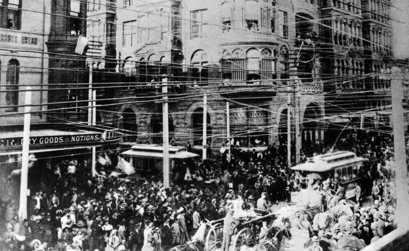
| (1892)* - A Columbus Day parade on October 26, 1892, on Spring and 2nd Streets. The Bryson-Bonebrake Building is on the right and the Hollenbeck Block on the left. |
 |
|
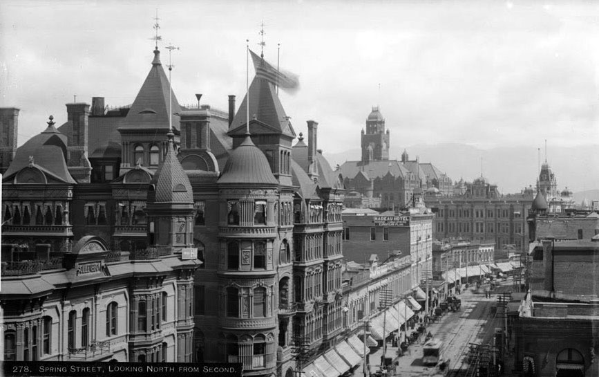
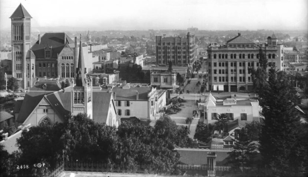
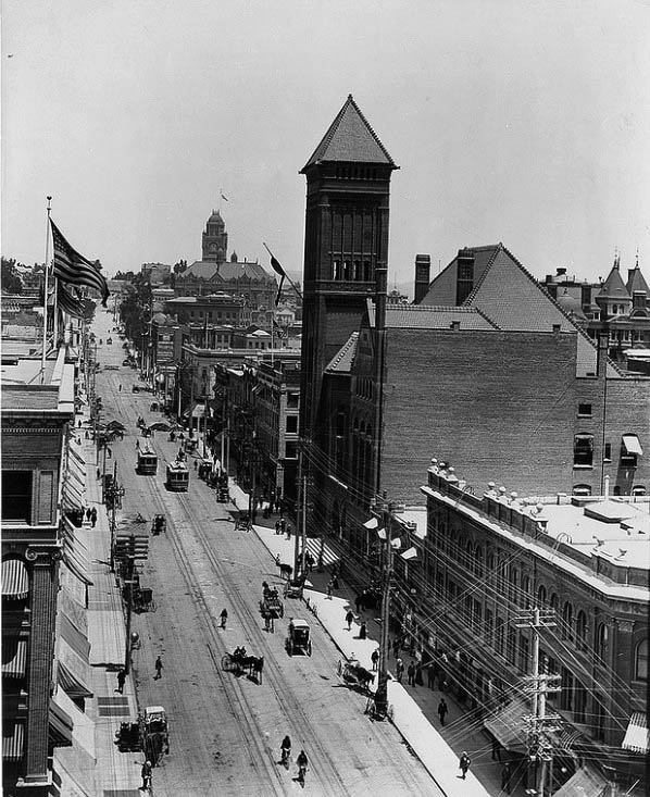
| (ca. 1895)* - View of Spring Street looking north from Second. The Bryson-Bonebrake Block is seen on the northwest corner of Spring and Second streets. The Hollenbeck Hotel is seen across the street (left of photo). Both the LA Country Courthouse and the Phillips Block can be seen in the background. Photo by C.C. Pierce |
Historical Notes The building was described as "nothing short of amazing, displaying a riotous and eclectic amalgam of features" and was considered a landmark in late 19th century Los Angeles. |
 |
|
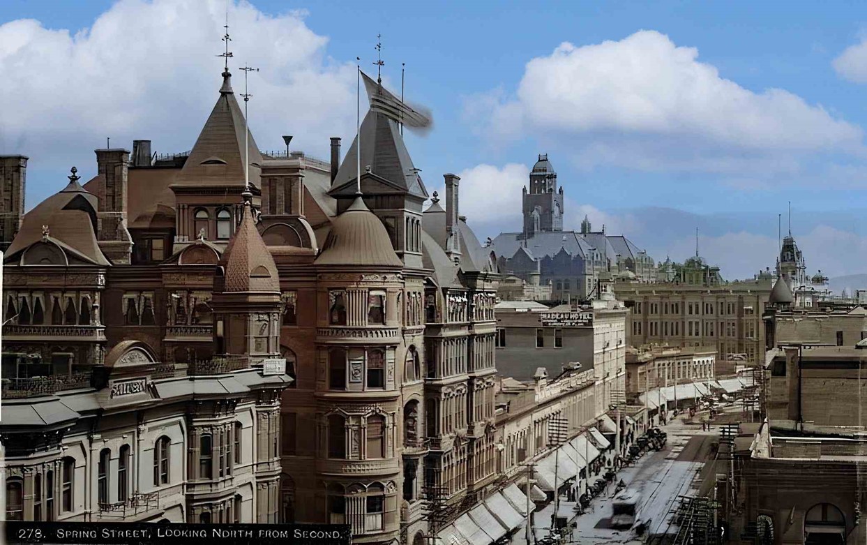
| (ca. 1895)*- View of Spring Street looking north from Second. The Bryson-Bonebrake Block is seen on the northwest corner of Spring and Second streets. The Hollenbeck Hotel is seen across the street (left of photo). Both the LA Country Courthouse and the Phillips Block can be seen in the background. Photo by C.C. Pierce, AI image enhancement and colorization by Richard Holoff |
 |
|
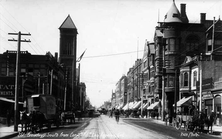
| (ca. 1900)* – Looking west on 2nd Street toward Spring Street where the Bryson-Bonebrake Building stands on the NW corner. Note all the horse-drawn carriages parked along the curb. |
 |
|
| (ca. 1904)* - View of the Bryson-Bonebrake Building located at the northwest corner of 2nd and Spring. Note how the roofline has been shaved off, including towers, domes, and chimneys, to make room for two additional stories (see previous photos). |
Historical Notes In 1902-1904, two additional stories were added to the original structure. |
 |
|
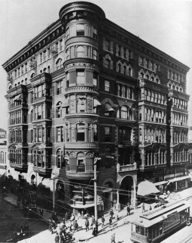
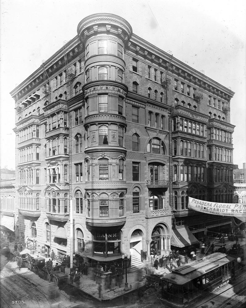
| (1905)* - Photograph of the Bryson-Bonebrake Block on the corner of Second Street and Spring Street. The eight-story building towers above the streets and other buildings nearby. The first two floors are constructed of stone masonry, while the top two floors are constructed of brick. The building has a circular, tower-like corner. A street banner announces, "Pasadena floral parade and chariot races, first prize $1000.00." The street is busy with pedestrian, bicycle, horse-drawn carriage, early model car and streetcar traffic. |
Historical Notes While an architectural landmark when built in 1888, the Bryson-Bonebrake Building was expanded vertically in the early 1900s before being torn down in 1934 after over 45 years at that prominent downtown Los Angeles intersection. |
 |
|
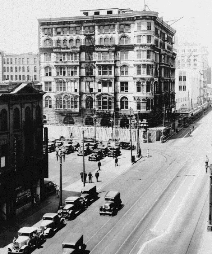
| (1934)* - Only 46 years after its construction, demolition of the Bryson Block is underway. |
Historical Notes The Bryson-Bonebrake Building stood at the northwest corner of Spring and 2nd Streets until its demolition in 1934 to make way for the 1948 Crawford Addition building, part of the Times Mirror Square complex. |
* * * * * |
Hollenbeck Hotel (aka Hollenbeck Block)
 |
|
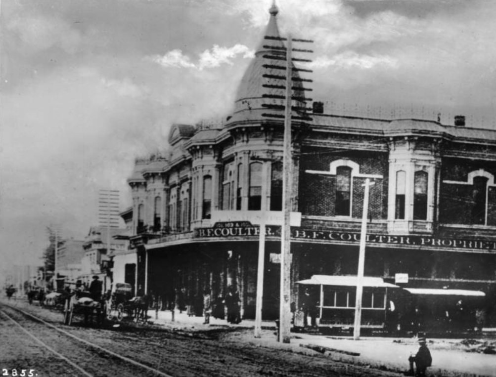
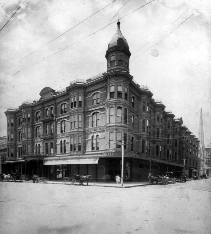
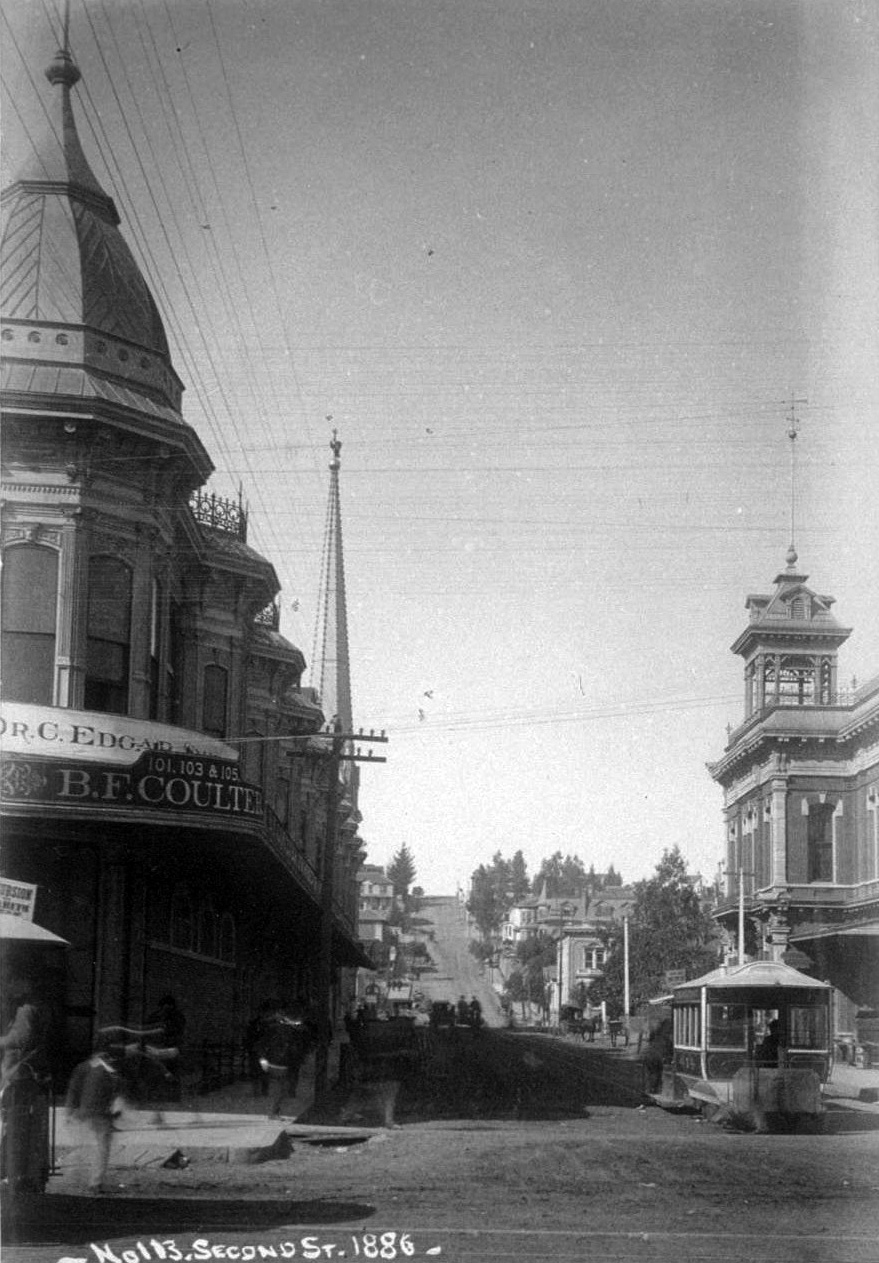
| (1886)* - View of the southwest corner of Spring and Second streets showing the B.F. Coulters store on the ground floor of the Hollenbeck Hotel. A streetcar is stopped along Second Street. A series of utility poles are visible looking up Spring Street in front of the store. Horse-drawn wagons, carriages, and pedestrians are on the dirt street and sidewalk. Legible signs include: "101, 103 & 105, B.F. Coulter, proprieter"; "Coulters Store in the Baker Block is to be closed Feb. 1 and all business of the firm will hereafter be done in the Hollenbeck block, corner Spring & Second Streets" -- 10 January 1886. |
Historical Notes The Hollenbeck Hotel was constructed in 1884 at Spring and Second streets. The hotel was named for its owner, John Hollenbeck, a prominent investor, banker, and owner of large landholdings in the Boyle Heights area. A leading hotel in its day, it was designed by Robert Young, an architect responsible for several early downtown hotels, including the Lankershim, the Lexington, and the Westminster. |
 |
|
| (ca. 1888)* - View of the Hollenbeck Block shortly after it was enlarged to include a 3rd and 4th floor (see previous photo). The Hollenbeck Hotel entrance is to the left, and Coulter's Dry Goods store occupies a portion of the first floor. Several horse-drawn wagons are seen parked in front. In the distance is the tall spire of the First Presbyterian Church, located on the southeast corner of 2nd Street and Broadway. |
Historical Notes B. F. Coulter was one of the earliest merchants in Los Angeles. The Coulter's Dry Goods business dates from 1878 and later was called Coulter's. Coulter was an ordained minister and founded the Broadway Christian Church. The business was continued by B.F. Coulter's son-in-law, R. P. McReynolds, and his son, James McReynolds. |
 |
|
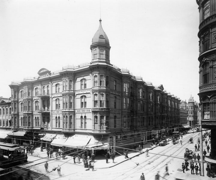
| (ca. 1890)* - The Hollenbeck Hotel sits on the southwest corner of Spring and Second behind trolley lines extending up and down the streets on both sides. On the street are people, a trolley, horses and buggies. A portion of the Bryson-Bonebrake Building can be seen on the right. |
Historical Notes John Edward Hollenbeck (June 5, 1829 - September 2, 1885) was an American businessman and investor who was involved in the 19th century development of Nicaragua and the city of Los Angeles, California. Arriving in Los Angeles a wealthy man from his investments in Nicaragua in 1876, Hollenbeck purchased land on the east side of the Los Angeles River, and built a large residence with broad verandas and a tower on extensive grounds on Boyle Avenue. He made twenty-seven acquisitions of property by 1880. In 1884 he purchased and developed an urban business district, known as the Hollenbeck Block, within Los Angeles. In 1878 Hollenbeck became a stockholder in the Commercial Bank of Los Angeles, and was elected its president. In 1881, he and other investors organized and established the First National Bank. In 1880, Hollenbeck, with former California Governor John G. Downey, horticulturalist Ozro W. Childs and other associates, persuaded the State of California to purchase 160 acres in Los Angeles to foster agriculture in the southland. The property, then known as Agriculture Park, is now known as Exposition Park, home to the Los Angeles Coliseum and the Los Angeles County Museums. |
 |
|
| (ca. 1900)* - The intersection of Spring and 2nd Street, showing the Hollenbeck Block on the southwest corner. An electric trolley car heading to the Salt Lake Station is seen. A woman appears to walking in toward the trolley. |
 |
|
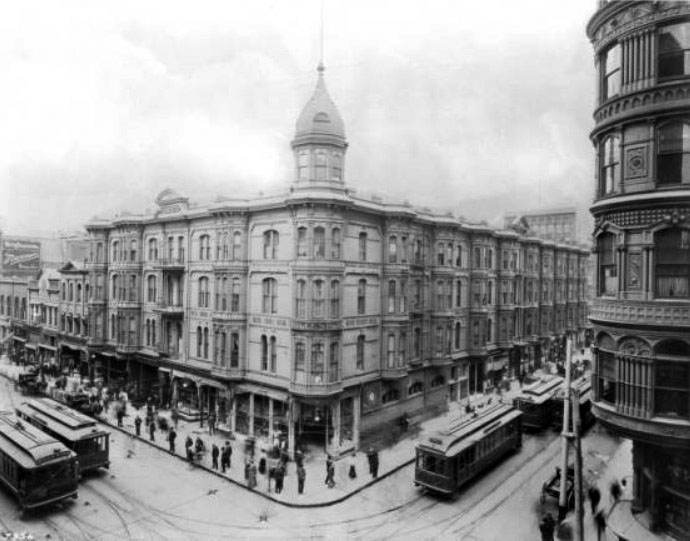
| (ca. 1905)* - Exterior view of the Hollenbeck Hotel at the intersection of Second Street and Spring Street. Streetcars are pictured making their way down either side of the three-story Romanesque hotel, which is pictured on the southwest corner at center. Pedestrians, including a man riding a strange, bicycle-like contraption can be seen navigating the sidewalks. The column of a larger building is visible in the right foreground. The signs on the streetcars read "Hollywood", "Griffin Ave.", "Redondo", and "2nd & Spring Streets". |
 |
|
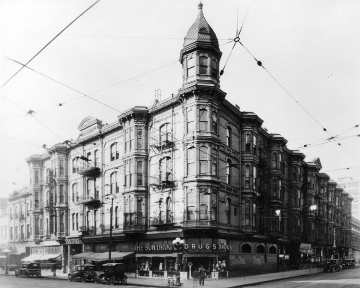
| (ca. 1920)* - The Hollenbeck is seen standing regally behind some trolley lines crossing in front and extending down the streets. Cars can be seen in the street and some people. A drug store now occupies the street level corner of the building. |
 |
|
| (1926)* - The Hollenbeck Hotel and the Bryson Building, 2nd and Spring Streets. |
Historical Notes The Hollenbeck will be gone by late 1931 (in favor of a parking lot) and the Bryson in 1934 (with the coming of the Times building). |
* * * * * |
City Hall (1884 - 1888)
 |
|
| (1880s)* - View looking west on 2nd Street from Spring Street. The building to the right was Los Angeles City Hall between 1884-1888 (site of current Los Angeles Times Building). The tall spire in the background is the First Presbyterian Church located on the southeast corner of 2nd and Fort Street (later Broadway). |
Historical Notes The following historical timeline lists the buildings used by City Council, also known as City Hall, since 1850, when Los Angeles was incorporated as a municipality: ◆ 1850 - 1853 - used rented hotel and other buildings for City meetings ◆ 1853 - rented adobe house (aka Rocha Adobe) on Spring Street - across from current City Hall (now parking lot for Clara Shortridge Foltz Criminal Justice Center). The buliding was shared with the County who used it as a Court House. ◆ 1861 - moved into John Temple's Clocktower Market Building, but only stayed for less than a year before the County Court House moved-in ◆ 1861 - 1884 - relocated back to the Rocha Adobe and stayed for over 20 years ◆ 1884 - 1888 - moved to new City Hall Building at South Spring Street and West 2nd Street (site of current Los Angeles Times Building) ◆ 1888 - 1928 - moved to new Romanesque Revival Building on 226-238 South Broadway between 2nd Street and 3rd Street; demolished in 1928 and now site of parking lot between LA Times Parking structure and 240 Broadway. ◆ 1928 - moved to current City Hall Building |
 |
|
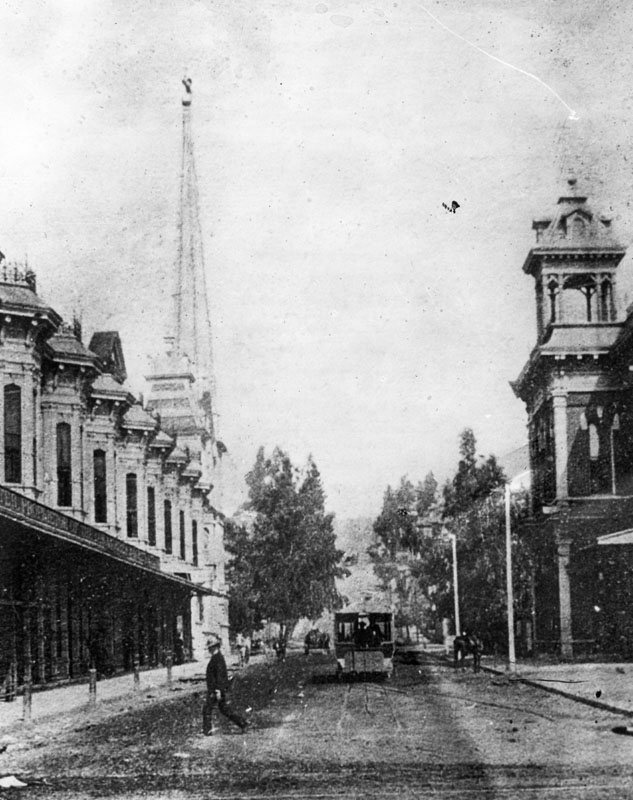
| (1886)^ - On the right behind the cable car is the Second Street City Hall. This is apparently the best available photo of the building when it was owned by the city. The two-story Hollenbeck Block (expanded to four stories in the second half of 1887) and the spire of the First Presbyterian Church are on the left in the photo, which looks west on Second from Spring. Construction of the California Bank Building on the southeast corner of Second and Fort (renamed Broadway in February 1890) has just begun. |
Then and Now
 |
|
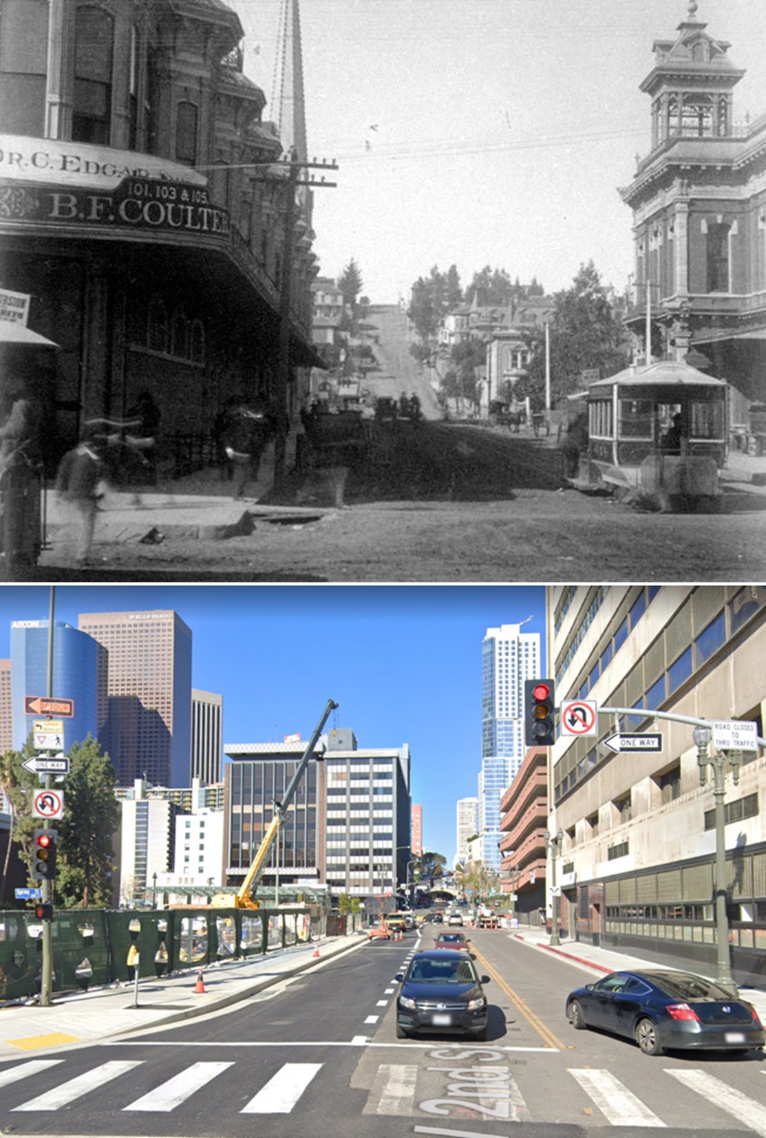
| (1886 vs 2023)* - Looking west on 2nd Street from Spring Street. |
|
|
| (ca. 1888)^ - View looking at the northwest corner of 2nd and Spring streets showing the newly built Bryson-Bonebrake Block. On the left is the Hollenbeck Block shortly after it was enlarged to include a 3rd and 4th floor. Just to the left of the Bryson-Bonebrake Block can be seen part of the short-lived City Hall Building (1884 - 1888). |
Historical Notes The Bryson-Bonebrake Block was one of the more important office buildings built during the 1880s building boom in Los Angeles. It had six stories, with a typical Queen Anne Style variety of shapes, materials and ornamentation for which architect Joseph Cather Newsom was famous. Click HERE to see more early views of the Bryson-Bonebrake Block. |
City Hall (1888 - 1928)
 |
|
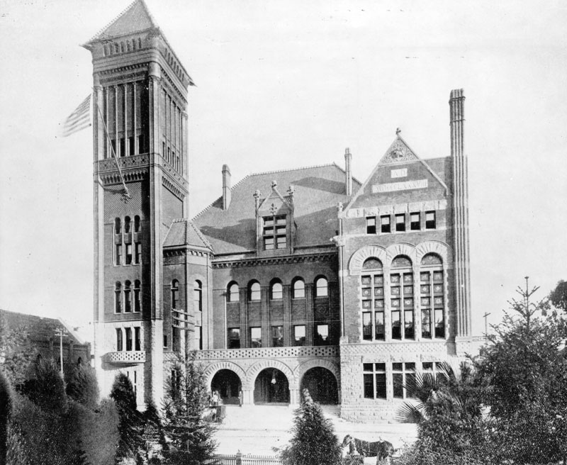
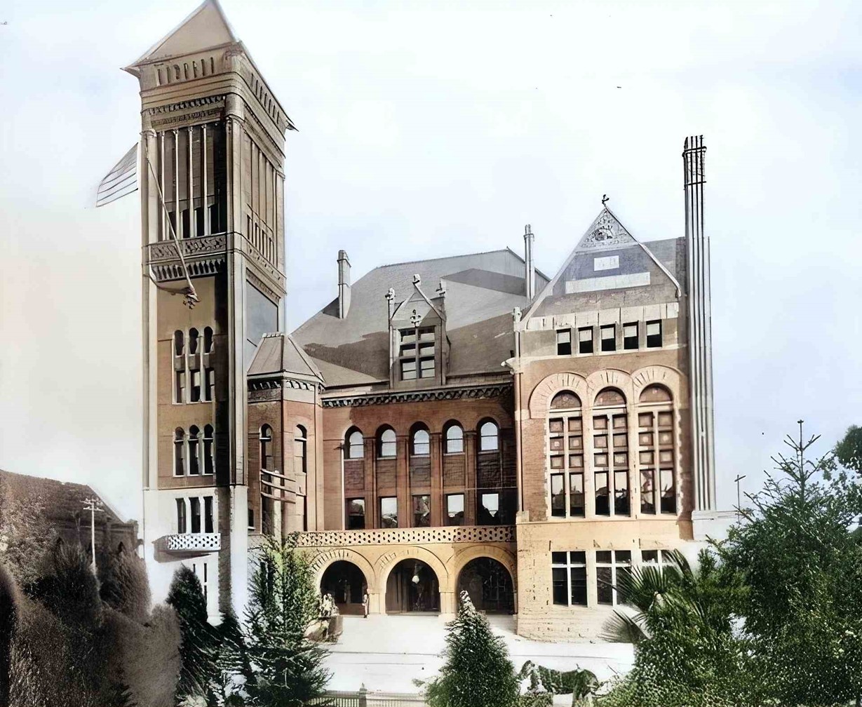
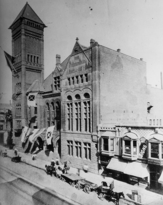
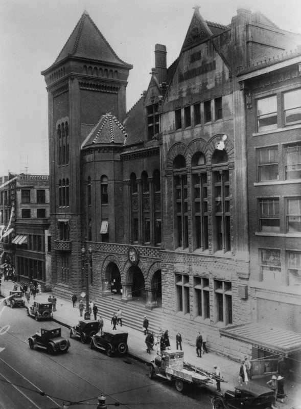
| (ca. 1889)* - Exterior view of the Old City Hall, located at 226 Broadway. It stood from 1888 until 1928. This was Los Angeles' third City Hall. The building to the left is the B'nai B'rith Temple (First Jewish Synagogue in Los Angeles). |
Historical Notes Built in 1888, this grand Romanesque edifice of marble and red sandstone building located at 226-238 South Broadway stood for 40 years until 1928 when the present day City Hall was completed. |
 |
|
| (ca. 1889)* - Los Angeles City Hall from 1888 until 1928, located at 226 Broadway. AI image enhancement and colorization by Richard Holoff |
 |
|
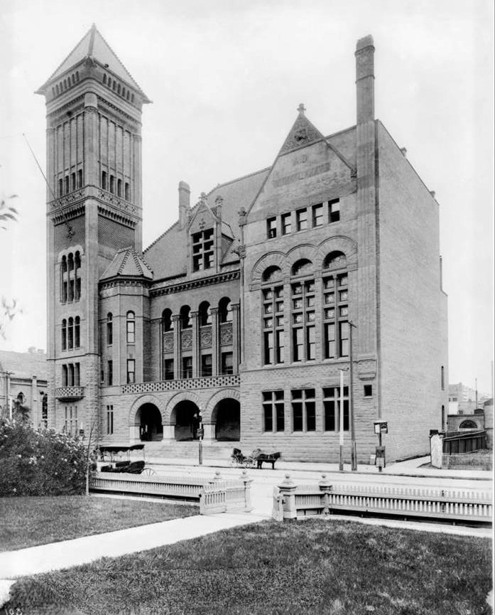
| (ca. 1890)^*# – View of City Hall as seen from the front yard of a home across the street. Two horse-drawn wagons are parked by the curb. |
Historical Notes Architectural plans for this building were submitted by Caukin & Hass and formally accepted by City of Los Angeles officials on July 7, 1887; the cost of the entire structure had to come within the limits of $150,000.* |
 |
|
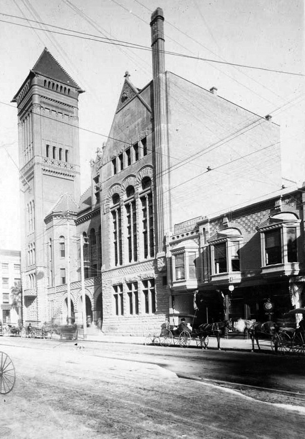
| (ca. 1890)^*# – Closer view showing several horse-drawn carriages parked on an unpaved Broadway in front of City Hall. The building north of City Hall is the B'nai B'rith Temple, built in 1873. |
Historical Notes Designed and built in 1888 in a graceful Romanesque style and constructed of brick, sandstone and terra cotta, City Hall included a buttressed skyscraper tower atop a square colonnade base, a wide three-arched porch accessed by a broad flight of stone steps, numerous large windows throughout, and a gabled roof.* |
 |
|
| (1895)* - Exterior view of the 1888-built City Hall, adorned with banners. Horse-drawn wagons are parked in front. |
Historical Notes The following historical timeline lists the buildings used by City Council, also known as City Hall, since 1850, when Los Angeles was incorporated as a municipality: ◆ 1850 - 1853 - used rented hotel and other buildings for City meetings ◆ 1853 - rented adobe house (aka Rocha Adobe) on Spring Street - across from current City Hall (now parking lot for Clara Shortridge Foltz Criminal Justice Center). The buliding was shared with the County who used it as a Court House. ◆ 1861 - moved into John Temple's Clocktower Market Building, but only stayed for less than a year before the County Court House moved-in ◆ 1861 - 1884 - relocated back to the Rocha Adobe and stayed for over 20 years ◆ 1884 - 1888 - moved to new City Hall Building at South Spring Street and West 2nd Street (site of current Los Angeles Times Building) ◆ 1888 - 1928 - moved to new Romanesque Revival Building on 226-238 South Broadway between 2nd Street and 3rd Street; demolished in 1928 and now site of parking lot between LA Times Parking structure and 240 Broadway. ◆ 1928 - moved to current City Hall Building^* |
 |
|
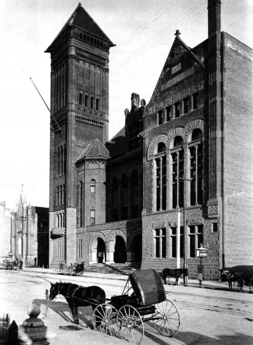
| (ca. 1895)^## – Street view looking across Broadway toward City Hall. |
 |
|
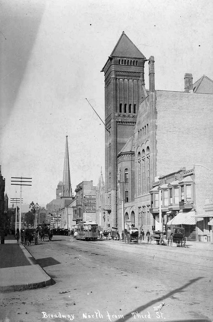
| (ca. 1895)^## - View of Broadway looking north from Third Street. Horse-drawn carriages and a streetcar share the road. |
Historical Notes City Hall (1888-1928) dominates the right of the picture. Several other landmarks of the day can also be seen here. The tower of Los Angeles High School is partially visible to the left of the power poles. The clock tower in the distance is that of the LA County Courthouse. The tall spire next to that belongs to the First Presbyterian Church at the SE corner of Broadway and Second Street. And, the gothic structure just barely visible between City Hall and the Crocker Building (with the two bay windows) is Los Angeles' first Jewish synagogue, the B'nai B'rith Temple.*^^* |
 |
|
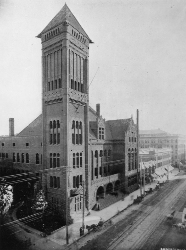
| (ca. 1895)* - View looking southeast toward the Old City Hall at 226 Broadway. Horse-drawn carriages can be seen parked in front of the building. |
 |
|
| (1894)^^* - Panoramic view of downtown Los Angeles, looking east on Third Street from the balcony of the Crocker Mansion. There is a clear view of the intersection of Broadway and Third Street where the Bradbury Building is seen on the southeast corner. On the northwest corner can be seen the excavation for the Irvine Building. City Hall is at upper-left of photo with the cupola of St. Vibiana's Cathedral behind it in the distance. |
 |
|
| (ca. 1900)#*^^ - View looking north on Broadway from near 3rd Street showing streetcars, horse-drawn wagons, bicycles and pedesrians all sharing the roadway. City Hall stands tall on the east side of Broadway. The LA County Courthouse, built in 1891, stands in the background. |
Historical Notes Municipal departments, as well as the offices for: Clerk and Council, Tax Collector, Treasurer, Chief of Fire Department, Zanjero, Building Inspector, Board of Education, Board of Health, Health Officer, Board of Public Works, Mayor's office, Council Chambers, City Attorney, Superintendent of Streets, Assessor, Public Library, and City Surveyor, among others were housed here from 1888 until 1928; a courtroom and several private offices were also located here.* |
 |
|
| (ca. 1902)^## - Street view looking south on Broadway from near the conrner of 2nd Street. Horse-drawn carriages are seen on both sides of the street. A bicycle is moving north toward the photographer as it passes 2nd Street. The group of buildings opposite City Hall, on the west side of Broadway, includes California Bank Building (S/W corner). |
 |
|
| (ca. 1904)* - A view of Broadway looking south from 1st Street. A trolley marked "Boyle Heights” takes the center of the street while horses and carriages fill the sides in front of the businesses along the street. Down the street on the left can be seen the tower of the City Hall building. |
 |
|
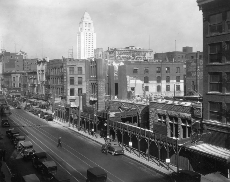
| (1925)* - Exterior view of L.A.'s third City Hall, located at Broadway, between 2nd and 3rd streets. Within three years of this photo, the building would be torn down. |
Historical Notes On January 10, 1928 an auction of the furnishings and other items inside the structure was conducted on the front steps before the building was torn down later that same year. A new, larger City Hall had been built (in 1927) to replace this one.* |
 |
|
| (1928)* - View of the demolition of the old City Hall building which stood at 226 S. Broadway between 1888 and 1928. The governmental offices moved into the new City Hall, seen in the background, earlier in the year. |
Historical Notes Click HERE to see more on the current Los Angeles City Hall (completed in 1928). |
* * * * * |
Temple Block
 |
|
| (1889)* - People standing outside the County Courthouse in 1889. This was LA's original County Courhouse, located on Temple Block. Between 1860s-1884 City Hall also occupied this building. |
Historical Notes The old County Courthouse, originally built by John Temple in 1861 as a marketplace and theater. Its first floor was used for that purpose for a number of years, and the second floor was the first theater in Los Angeles. The County purchased it for $25,000 in 1870 and occupied it as a court from 1861 to 1891.* In 1891 the LA County Courthouse moved to it's newly constructed building located at the old site of Los Angeles High School where it would stay until 1932. |
* * * * * |
Weil Building
 |
|
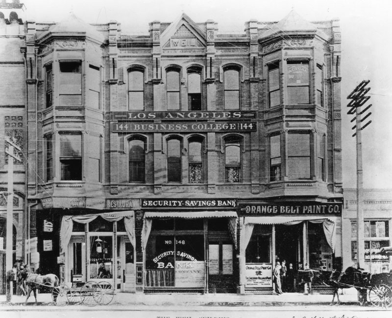
| (1889)* - Exterior view of the Weil Building, owned by Mrs. Jacob (Yetta) Weil, Maurice Hellman's aunt. |
Historical Notes The Weil Building housed the Security Savings Bank and Trust Co., a predecessor of the contemporary Security Pacific National Bank, which opened in this building on Main Street, on February 11, 1889. The name was changed to Security Trust Savings Bank in 1912 and to Security First National Bank in 1929. Also sharing this building was the Los Angeles Business College and the Orange Belt Paint Co.* |
* * * * * |
Grand Opera House (1st Home of the Orpheum Circuit)
 |
|
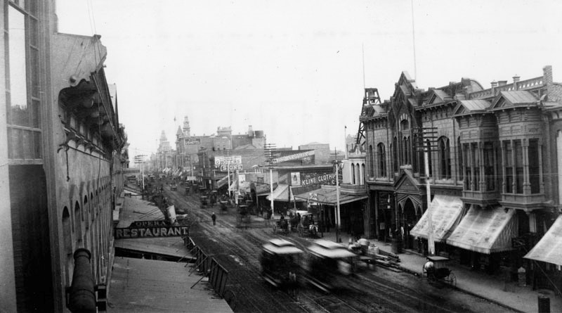
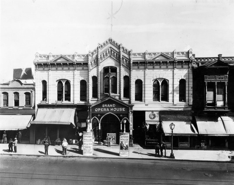
| (ca. 1889)* – View of Main Street looking north from 2nd Street showing various businesses, horse-drawn street-cars, and Childs’ “Los Angeles Opera House” (center-right). This would become the Orpheum Theatre in 1894. The Opera Restaurant is seen across the street on the left. |
Historical Notes Opened on May 24, 1884 as Child's Opera House, but also known as the Grand Opera House. The theatre at the time was the largest yet built in the growing city of Los Angeles. It was built by local entrepreneur and real estate man Ozro W. Childs, one of the city’s most successful developers. #^#* There were four Orpheum theatres in downtown Los Angeles: ◆ 110 S. Main St. -- Grand Opera House was the home of Orpheum vaudeville from 1894 to 1903. ◆ 227 S. Spring St. -- The Los Angeles Theatre, later called The Lyceum, was known as the Orpheum from 1903 to 1911. ◆ 630 S. Broadway -- Now the Palace Theatre -- this was the Orpheum between 1911 and 1926. ◆ 842 S. Broadway -- Orpheum Theatre from 1926 to Today |
 |
|
| (n.d.)* – Exterior view of the Childs' Grand Opera House, featuring "Uncle Tom's Cabin." |
Historical Notes The theatre was designed by architects Ezra F. Kysor and Octavius Morgan, whose firm later became Morgan and Walls (Arcade Theatre) and later Morgan, Walls and Clements (Mayan, Belasco and many others). Kysor had earlier designed the Merced Theatre.**# Childs' Grand Opera House was the home of Orpheum vaudeville from 1894 to 1903. |
 |
|
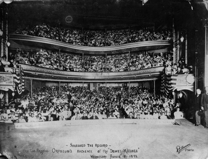
| (1898)* - The Los Angeles Orpheum's Audience at the "Dewey Matinee" on Wednesday, August 9, 1898. |
 |
|
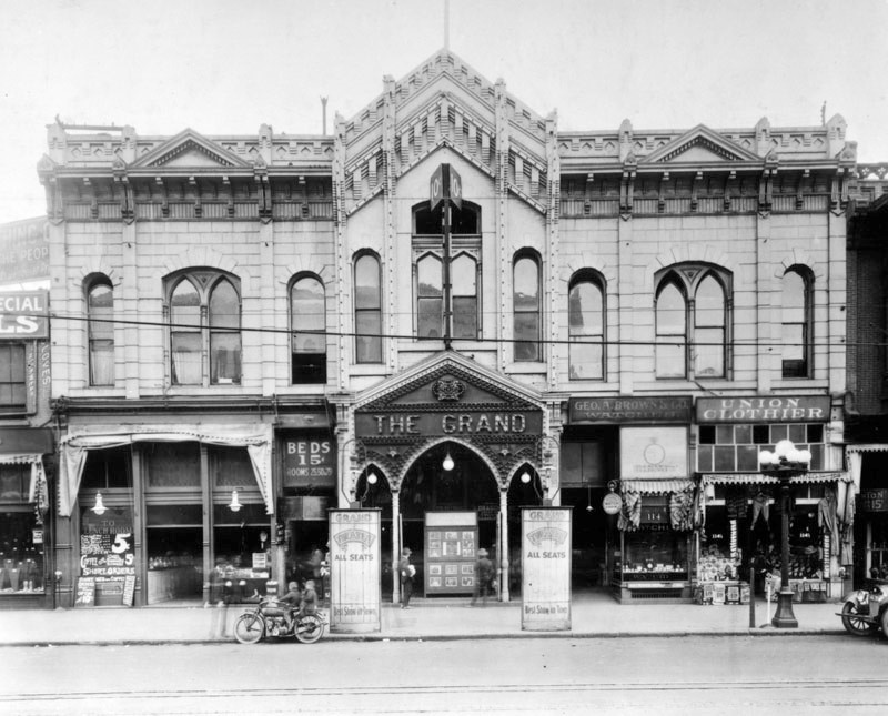
| (ca. 1920)* - Exterior view of the Grand Opera House (also known as Childs' Opera House). Two young people are seen on a motorcycle parked by the curb. |
Historical Notes As the theater district of Los Angeles shifted south and west, and larger, more modern theaters such as the Burbank, the Hippodrome and, in 1905, the new Mason Opera House on Broadway opened, the fortunes of the Grand Theater declined. By 1910, it had become a movie house, and by 1920, second run movies were being shown for an admission price of ten cents. #^#* |
 |
|
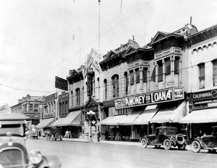
| (ca. 1920s)* – View of the Grand Theatre (first Orpheum in Los Angeles) located on Main Street near 1st Street. |
 |
|
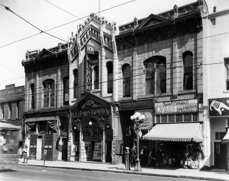
| (1929)* – View of the Los Angeles Grand Opera House after it became a 10 cents movie house; it originally opened on May 27, 1884. |
Historical Notes In 1912 the theatre was known as Clune's Grand. With increased competition from newer theatres, the Grand became a showplace for Mexican stage shows and movies in the 20's as Teatro Mexico.*## |
.jpg) |
|
| (1936)* – Last days of Childs’ Grand Opera House (now known as El Teatro Mexico), located at 110 S. Main Street. |
Historical Notes Photo Caption Reads: "That treasure house of the gaiety and culture in old Los Angeles, Childs Grand Opera House on Main Street just south of First Street, is no more. The curtains went down for the final time and the old show house was being torn down. Photo shows the old opera house when its light were dimmed for the last time. It was built in 1884 by Ozro W. Childs as the last word in theaters. In the past decade it has been known as El Teatro Mexico." * Closed April 5, 1936, the theatre was soon demolished for a parking lot. It is now the site of the California Department of Transportation building.*## |
* * * * * |
Los Angeles Cable Railway Co. Barn
 |
|
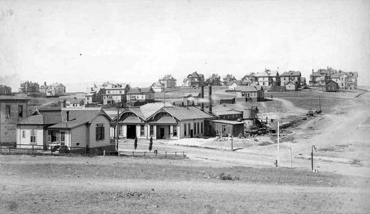
| (1889)* - Before being run by electric lines, the cable cars were pulled by horses. Shown here is the horse barn at 12th and Olive Streets which ran the "red line", running from Broadway out E. 1st St. to Boyle Heights, Broadway to 7th, west on 7th to Westlake Park. The sign on the barn reads "Los Angeles Cable Railway Co." |
* * * * * |
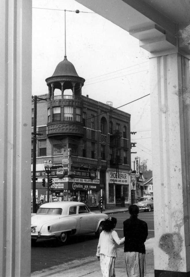
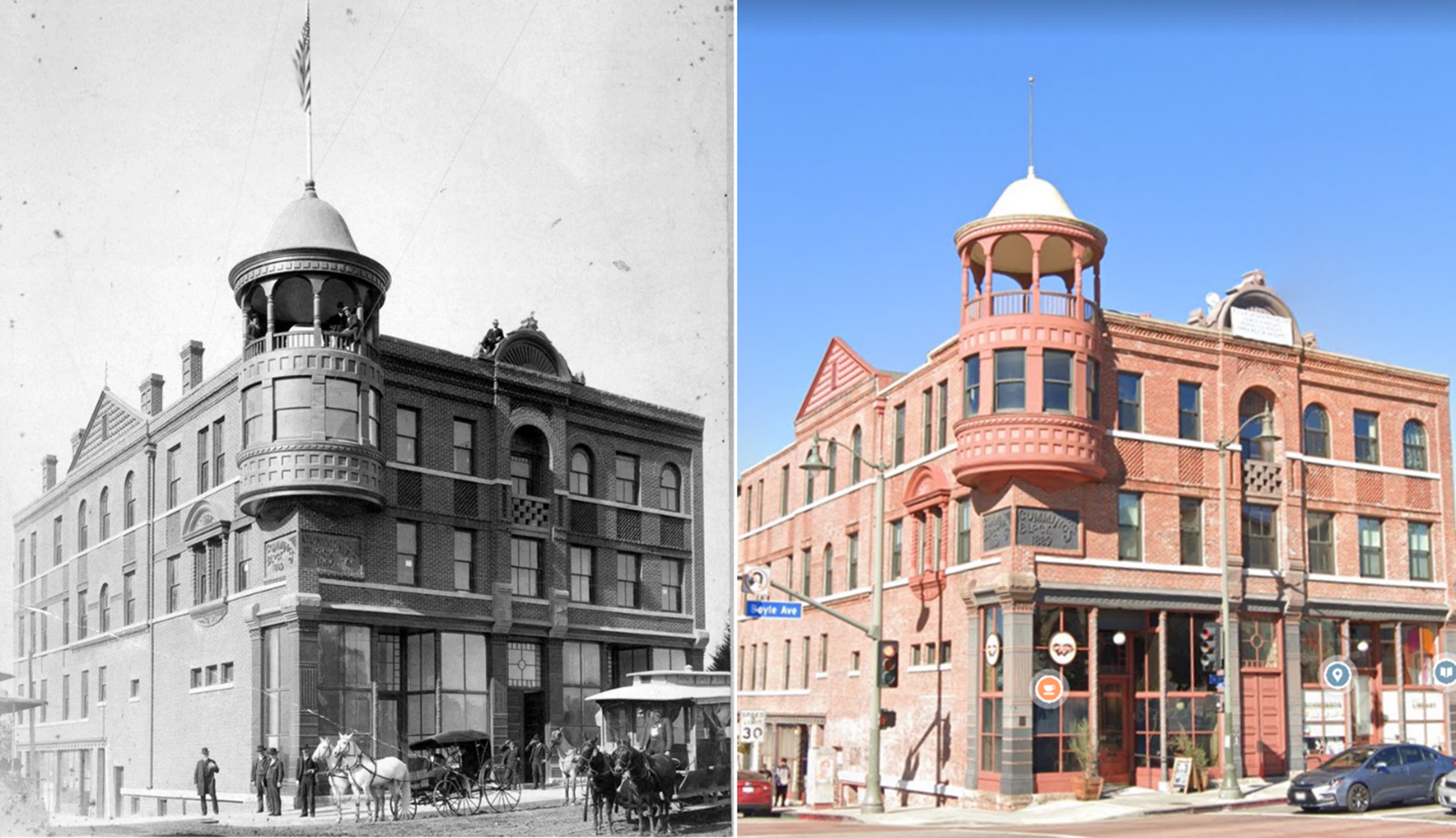
Boyle Hotel (Cummings Block) |
The Boyle Hotel, also known as the Cummings Block, has stood at the corner of First Street and Boyle Avenue since 1889. Over time, it has reflected the changing life of Boyle Heights, from its early growth as a streetcar suburb to its role as a cultural center and, more recently, a successful preservation project.The images that follow trace the building’s history across more than a century, showing its rise, decline, and restoration, along with the changing character of the neighborhood around it. |
 |
|
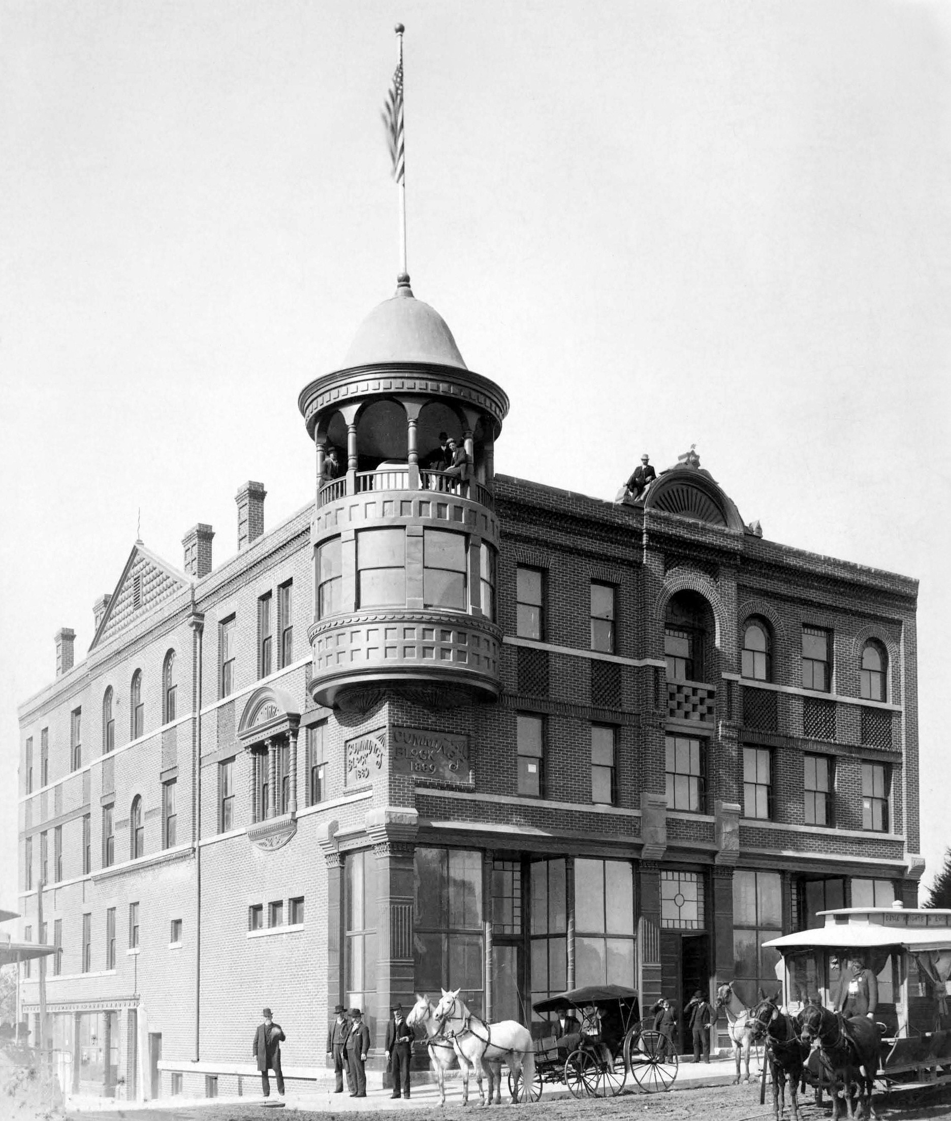
| (1889)* - View of the Boyle Hotel Cummings Block on the northwest corner of 1st and Boyle Avenue. A horse drawn carriage is parked at the curb while a group of men stand behind it on the sidewalk. A horse drawn streetcar is in the lower right. Several men can be seen on the roof balcony and along the parapet. |
Historical Notes Located at the corner of Boyle Avenue and First Street in Boyle Heights, the Boyle Hotel, also known as the Cummings Block, is one of the oldest surviving commercial buildings in Los Angeles. Designed by architect W. R. Norton and completed in 1889 for George Cummings and his wife Maria del Sacramento Lopez, the building became an early center of social and business life in the growing community. The structure features patterned brickwork, cast iron storefront columns, and a corner turret with an open belvedere. These details reflected the pride and ambition of a neighborhood on the rise and helped establish Boyle Heights as a desirable place to live and do business. |
 |
|
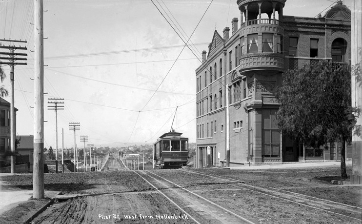
| (ca. 1895)* - View looking west on 1st Street at Boyle Avenue. An electric streetcar passes by the Boyle Hotel on the northwest corner. |
Historical Notes The history of Boyle Heights begins with Andrew A. Boyle, an Irish immigrant who arrived in Los Angeles in 1858. On land known as Paredón Blanco, Boyle built the first brick home east of the Los Angeles River and developed vineyards that helped define the area’s early character. After his death in 1871, the property passed to his daughter and her husband, William H. Workman. In 1875, Workman joined with Isaias W. Hellman and John Lazzarovich to subdivide the land, creating the neighborhood of Boyle Heights. Growth slowed after the failure of the Temple and Workman Bank in 1876, but the area rebounded during the real estate boom of the late 1880s. By that time, Boyle Heights had become a popular residential district for middle and upper middle class residents. Some of the large homes built during that period still remain today. |
 |
|
| (1942)* - View of the Boyle Hotel Cummings Block at Boyle Avenue and First Street as it appeared in 1942. |
Historical Notes By the early twentieth century, the building had taken on a new role within the community. The hotel became closely associated with mariachi musicians, many of whom rented rooms there and gathered nearby to find work. This connection added an important cultural layer to the building’s history. |
 |
|
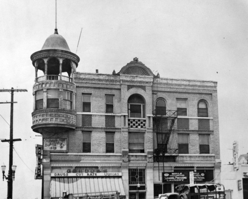
| (ca. 1950)* - View looking up at the cupola structure of the Cummings Block on the northwest corner of First Street and Boyle Avenue. It was originally built as a hotel and continued to serve that purpose. |
Historical Notes By the mid twentieth century, the Boyle Hotel remained an active residential building as Boyle Heights became more urban and automobile oriented. Its continued use reflected the steady population of working class residents who called the neighborhood home. |
 |
|
| (1950s)* - Corner view of the Cummings Hotel in Boyle Heights. |
Historical Notes Scenes from this period show the hotel still in use, though the surrounding area had changed from its earlier streetcar days. Increased traffic and commercial activity reflected the postwar growth of Los Angeles. |
 |
|
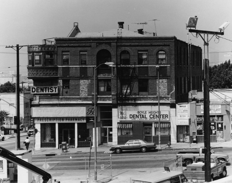
| (1997)* - Exterior view of the Boyle Hotel showing the turret removed and several windows bricked in. |
Historical Notes By the late twentieth century, the building had fallen into decline. Decorative features were removed, and parts of the structure were altered or neglected. Despite its condition, the building’s historical importance helped ensure that it would not be lost. A full rehabilitation later restored the building for use as apartments and returned key architectural features, including the upper portion of the corner turret. |
 |
|
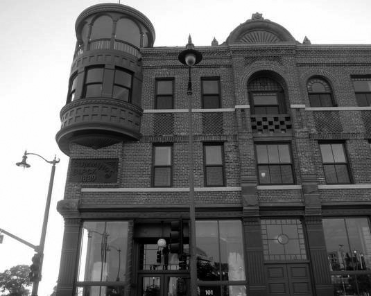
| (2012)* - View of the Boyle Hotel following its restoration, with the turret once again in place. |
Historical Notes In 2012, a major restoration project brought new life to the building. The East Los Angeles Community Corporation led the effort, transforming the former hotel into affordable housing. The work restored important features such as the turret, arched windows, and decorative details. The project showed how historic buildings can be preserved while continuing to serve the community. |
 |
|
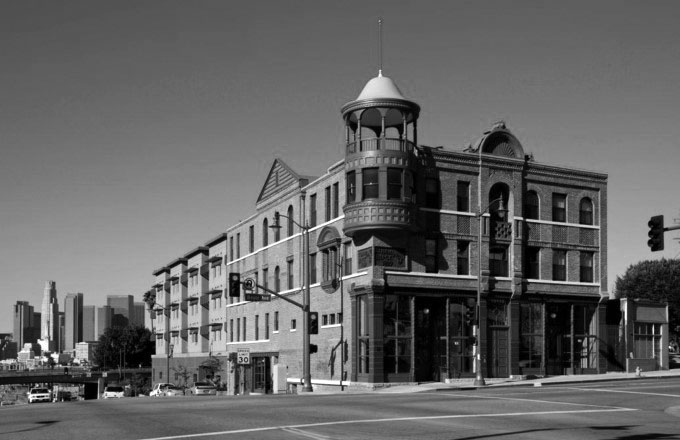
| (2012)* - View looking west on 1st Street at Boyle Avenue after the restoration. |
Historical Notes The Boyle Hotel was designated Los Angeles Historic Cultural Monument No. 891 in 2007, recognizing its architectural and cultural importance. |
Then and Now
.jpg) |
|
| (1895 vs 2012) - Looking west on 1st Street at Boyle Avenue. |
Historical Notes These images show how the intersection evolved from a streetcar served corridor into a busy urban setting. While the surroundings changed, the Boyle Hotel remained a constant presence. |
Then and Now
 |
|
| (1889 vs 2023)* - Boyle Hotel, northwest corner of Boyle and 1st in Boyle Heights. Photo comparison by Jack Feldman. |
Historical Notes From newly built landmark to carefully restored structure, the Boyle Hotel continues to define this corner. Its survival highlights the value of preservation in maintaining neighborhood identity. |
Then and Now
 |
|
| (1895 vs 2022)* - Looking west on 1st Street at Boyle Avenue. Photo comparison by Jack Feldman. |
Historical Notes These then and now images show how transportation and daily life have changed in Boyle Heights. The earlier view centers on the streetcar, which helped make this one of the city’s first accessible suburbs. The modern view is shaped by automobiles, traffic lanes, and a more crowded streetscape. Even with these changes, the street layout and the presence of the Boyle Hotel create a clear sense of continuity. |
 |
|
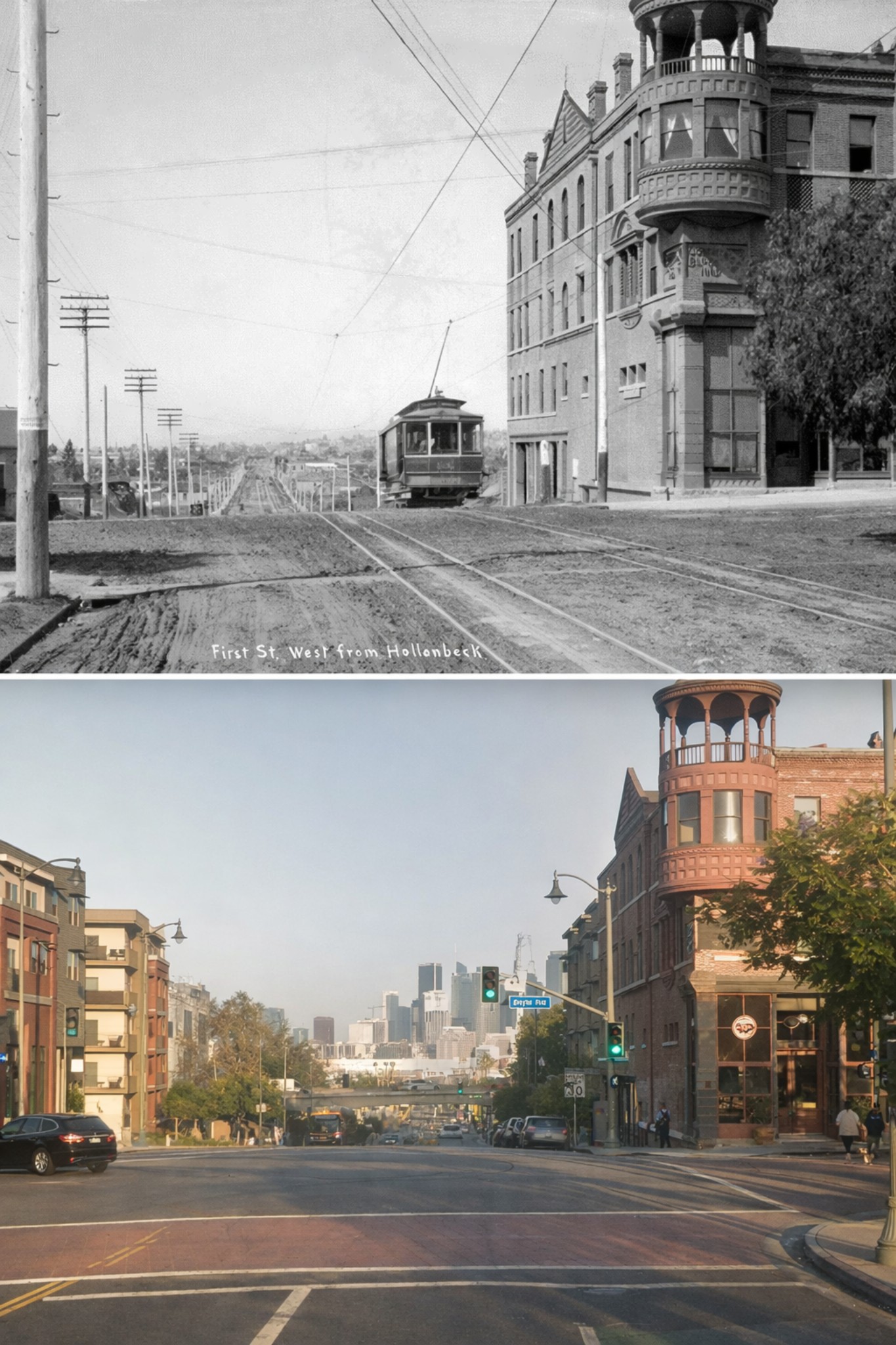
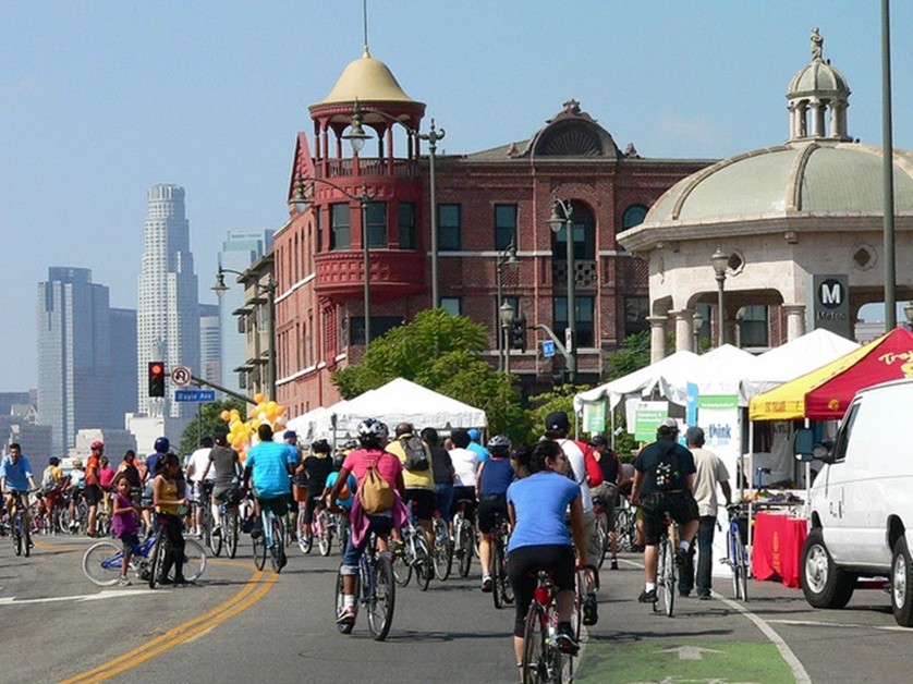
| (2014)* – Weekend bike riders head west on 1st Street at Boyle Avenue. The Boyle Hotel stands on the corner with the downtown skyline in the background. Photo by Victoria Bernal |
Historical Notes Today, the Boyle Hotel stands as both a historic landmark and a living part of the community. Its restoration has allowed it to continue serving residents while preserving a visible link to Boyle Heights’ past. |
* * * * * |
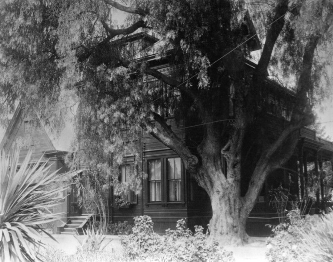
William H. Workman Residence, Boyle Heights |
William Henry Workman was one of the key figures behind the early growth of Boyle Heights. He married Maria Boyle, daughter of Andrew A. Boyle, and after Boyle’s death the family holdings east of the Los Angeles River became the foundation for the new neighborhood Workman helped launch in 1875. Workman later served as Mayor of Los Angeles during the city’s major growth boom of the late 1880s.The Workman family home stood on Boyle Avenue on what had once been vineyard and orchard land. In early accounts, the property at 357 South Boyle Avenue was described as a prominent home site with spacious grounds and a welcoming setting, reflecting the area’s early identity as an upper middle class residential district.Over time, the site changed as the neighborhood changed. By the early 1900s, the larger campus around Boyle Avenue became associated with senior care uses, including the Jewish Home for the Aged on adjacent parcels, and later Japanese American senior services connected to Keiro and what became known as Sakura Gardens. |
 |
|
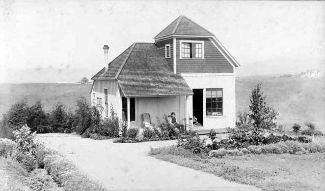
| (n.d.)* - Close up view of the residence of W. H. Workman at 357 Boyle Avenue in Boyle Heights, built in the 1880s. The site later became home to the Hebrew Sheltering Home for the Aged. |
| Historical Notes
The Workman residence is closely tied to the founding story of Boyle Heights. Workman’s decision to subdivide the Boyle family land helped turn former vineyard acreage into one of Los Angeles’ earliest streetcar era suburbs. His home and grounds on Boyle Avenue became a visible symbol of that early prosperity and civic ambition. Later generations remembered the Boyle Avenue property as a long time family center. Sources note that the Workmans lived on the Boyle Heights grounds for decades and that the address was associated with the family home site near Fourth Street. By the 1920s, as many families moved west, the property transitioned into institutional use connected with elder care, reflecting the neighborhood’s evolving population and land use patterns. |
* * * * * |
Occidental College (First Campus)
 |
|
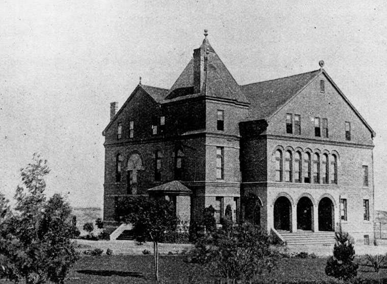
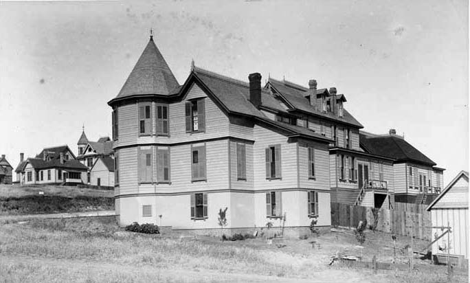
| (1890s)* - View of the first campus of Occidental College in Boyle Heights. An institution for the higher Christian education of both sexes, the college was built in 1890 in Romanesque/Elizabethan style and was destroyed by a fire in 1896. |
Historical Notes On 20 April 1887, a group of clergy and laypersons from the city's Presbyterian population received its articles of incorporation from the State of California for "The Occidental University of Los Angeles, California." The site chosen for the school was at the southern end of Boyle Heights off Rowan Street (named, incidentally, for banker, county treasurer, county supervisor and Los Angeles mayor Thomas E. Rowan.) On 20 September, the cornerstone was laid for the sole college structure and construction commenced. A year later, in October 1888, instruction began for the first crop of Oxy students, composed of twenty-seven men and thirteen women, who paid $50 tuition per year. Five years later, the college celebrated the matriculation of its first graduates: Maud E. Bell and Martha J. Thompson. Another landmark occurred in 1895 when Oxy played its first football game against arch-rival Pomona College, a contest won by the Tigers, 16-0. On 13 January 1896, a fire destroyed the sole structure at the institution, which then moved temporarily to 7th and Hill streets in downtown Los Angeles. A new campus was built and occupied in 1898 at Highland Park, on Pasadena Avenue (now Figueroa Street) near Avenues 51 and 52.**^^ |
Occidental College (2nd location)
 |
|
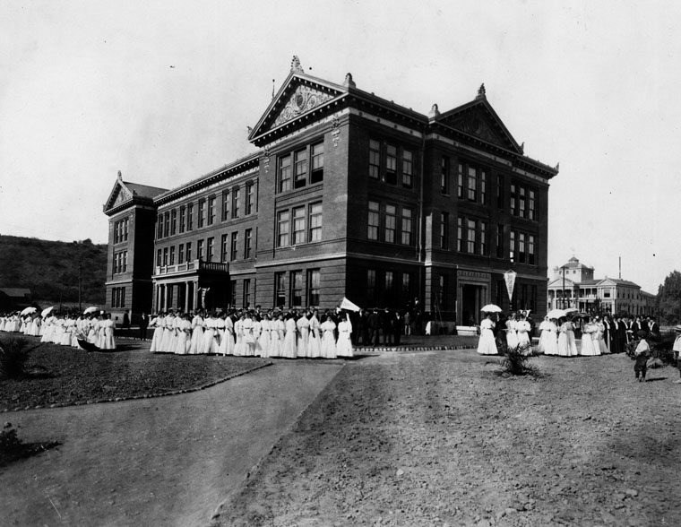
| (1904)* - A group of formally-dressed people, women in white, men in black, pose by the Hall of Letters building at Occidental College. It may be a graduation ceremony. The structure was built in 1898 on Pasadena Ave (now Figueroa), between Ave 51 & Ave 52 in Highland Park (the second location of the campus). |
Historical Notes Despite a strong Presbyterian presence on its campus, Occidental cut ties to the church in 1910. In 1912, Occidental President John Willis Baer announced the trustees’ decision to convert Oxy into an all-men’s institution. However, students protested, and the idea was abandoned.^* |
 |
|
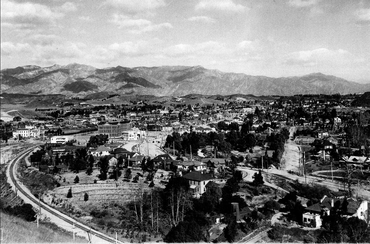
| (ca. 1905)*#*# - Panoramic view of Highland Park with the San Gabriel Mountains in the distance. On the left, the railroad tracks make a turn and then head northeast toward South Pasadena. At center, Figueroa Street also turns and parallels the tracks. At center-left stands the 3-story Hall of Records Building seen in previous photo. The white building to its right is the Occidental College Library Building. It sits at the point where Figueroa makes its turn. |
Historical Notes After being located in Highland Park for over a decade, another move would be made. The small size of the 15-acre campus and the disruption caused by frequent freight trains pushed the college's trustees to find a new location. In 1912, the school began construction of a new campus located in Los Angeles’ Eagle Rock neighborhood.^* |
 |
|
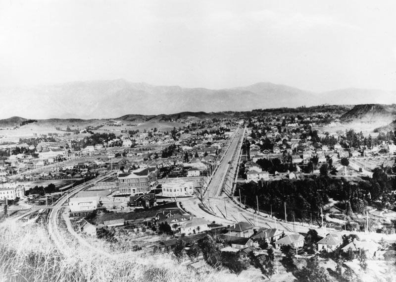
| (1908)* - Closer view showing the Occidental College campus in Highland Park (center-left). North Figueroa Street runs down the center of photo after make a sharp turn. It was called Pasadena Avenue at the time. Monte Vista Avenue parallels it to the left. |
 |
|
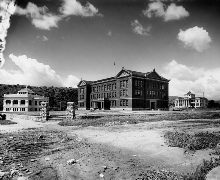
| (Early 1900s)* - View showing three of the early buildings at Occidental College. From left to right they are: the Chas. M. Stimson Library building, theStimson Library Hall of Letters building, and the Academy building. |
Historical Notes The Hall of Arts and Letters building was converted to apartments. The hall still stands today.^* |
 |
|
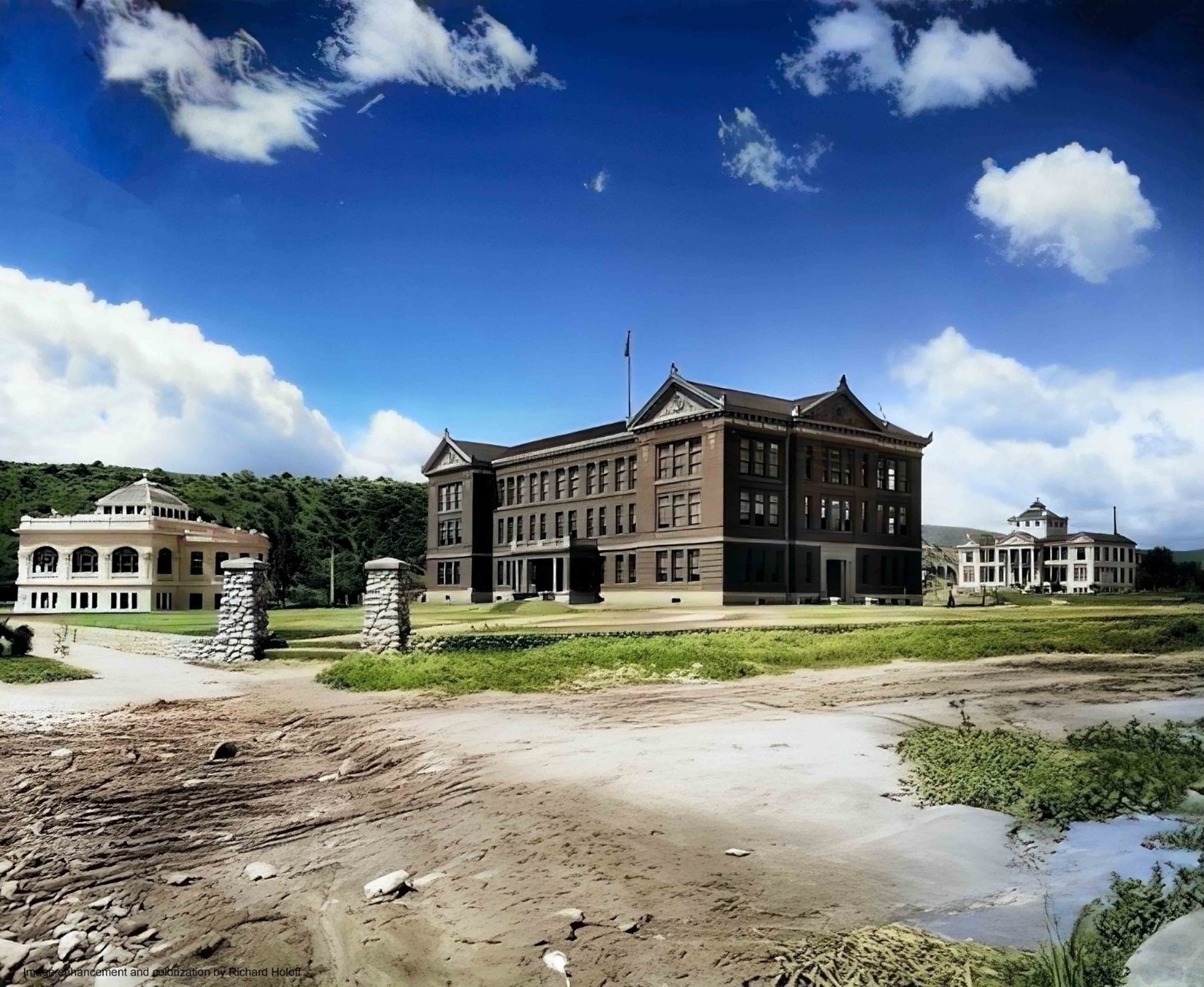
| (Early 1900s)* - View showing three of the early buildings at Occidental College. From left to right they are: the Chas. M. Stimson Library building, theStimson Library Hall of Letters building, and the Academy building. Image enhancement and colorization by Richard Holoff. |
 |
|
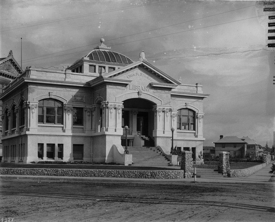
| (ca. 1908)* - Photograph of the Chas. M. Stimson Library, built in 1904 on the Occidental College Highland Park Campus. The two-story building has an extended porch where above it is a pediment displaying the name of the building. Multifoil tracery outline the windows the walls. Above the roof is a turret-like tower. A stone masonry wall creates a perimeter around the front yard. Heavy tracks line the dirt road in front of the building. |
Historical Notes After the College moved to its present campus in Eagle Rock (1914) the Library building was used for a short time as a Los Angeles City Branch Library. The building has since been demolished.^ The new Eagle Rock campus was designed by noted California architect Myron Hunt, also known as the planner of the Caltech campus and as designer of the Huntington Library and Art Gallery and the Rose Bowl.^* Click HERE to see Occidental College's 3rd location in Eagle Rock. |
* * * * * |
Temple Street Cable Railway Barn
 |
|
| (ca. 1890)* - A cable car full of passengers and decorated with American flags is seen in front of the Temple Street Cable Railway barn and powerhouse on the northwest corner of Temple Street and East Edgeware Road. Angelino Heights is in the background. |
Historical Notes Originally spelled Angeleno Heights, Angelino Heights is second only to Bunker Hill as the oldest district in Los Angeles. Founded in 1886, it was originally connected to the downtown mainline (which ran east to west on Temple Street) by the Temple Street Cable Railway and later by streetcars.^* |
 |
|
| (ca. 1890)^## - View of Angelino Heights looking north at the corner of Temple Street and East Edgeware Road. The two buildings on the northwest corner belonged to the Temple Street Cable Railway. The front building with tracks running into its entry is the cable car barn. The building in the rear with the smokestacks is the powerhouse. |
Historical Notes In the late 1940s, a large swath of Angelino Heights was destroyed to build the Hollywood Freeway. The new freeway cut off Temple Street save an overpass at Edgeware Road.^* |
Homes of Angelino Heights
 |
|
| (ca. 1890)^## - Close-up view of the multi-story homes of Angelino Heights. |
Historical Notes Angelino Heights was the City of Los Angeles' first recognized historic district, or Historic Preservation Overlay Zone (HPOZ). Enacted in 1983 and spelled out in Angelino Heights' Preservation Plan, this zoning prohibits unsympathetic remodelling of historic houses and requires new construction to resemble original architecture in scale, massing and materials. Today, the district contains many notable examples of Victorian architecture, particularly of the Eastlake and Queen Anne styles, and though found throughout the neighborhood, they are especially concentrated on Carroll Avenue. Two of these residences served as the houses used for the TV shows Charmed and Journeyman, used in the shows as San Francisco Victorian residences, and because of the picturesque nature of the neighborhood, they have served as the backdrop for countless motion pictures from the earliest days of cinema to the present.^* |
 |
|
| (ca. 1895)^## - A man is seen sitting on the front porch of his simplistic but elegantly stylish home in Angelino Heights. |
Historical Notes Traveling around the Angelino Heights today, one can see many styles of architecturally significant homes, such as Craftsman, Bungalow, Mission Revival, Art Deco, and Colonial Revival, to name a few. |
* * * * * |
Vincent Lugo Adobe (Original location of St. Vincent College)
 |
|
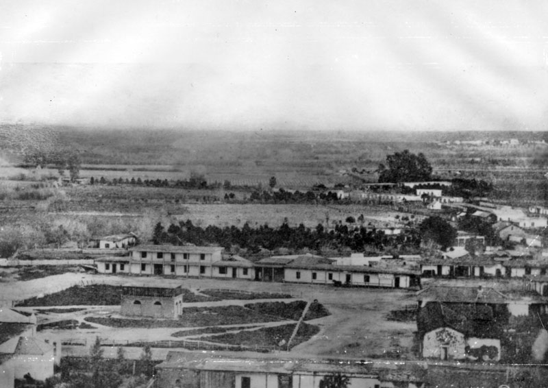
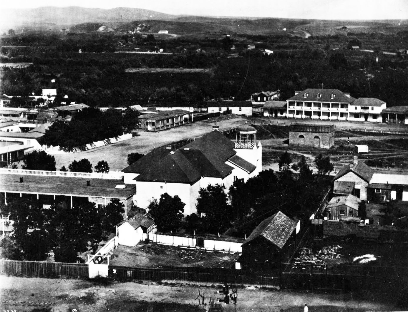
| (ca. 1858)* - This is the earliest known close-up photograph of the Los Angeles Plaza. There is a square main brick reservoir in the middle of the Plaza, which was the terminus of the town's historic lifeline: the Zanja Madre ('Mother Ditch'). The two-story building behind the reservoir is the Vincent Lugo Adobe House. |
Historical Notes The Lugo Adobe, built in the 1840s by Don Vicente Lugo, was one of the few two-story houses in Los Angeles. The Lugo family, one of the founding families of Los Angeles in 1781, played a significant role in the city's early history. Antonio Maria Lugo, Vicente's father, received a land grant in 1819 for his service in the Spanish army, which included present-day Bell Gardens, and later became mayor of Los Angeles. In 1867, Vicente Lugo donated the house on the Plaza to St. Vincent's School, the predecessor of Loyola University. |
 |
|
| (1865)* - View of the LA Plaza looking east, showing the newly refurbished Vincent Lugo adobe, now housing Saint Vincent's College. The Old Plaza Church is seen in the foreground. |
Historical Notes Saint Vincent's College was founded by the Vincentian Fathers in 1865. Initially located in the Lugo Adobe, as described above, the college remained there from 1865 to 1868 before moving to a new location several blocks away. The new campus was bounded by Broadway, 6th Street, Hill Street, and 7th Street. Today, this site is in the heart of Los Angeles's Jewelry District and is known as St. Vincent Court. A decade later, the school moved to a location at Grand Avenue and Washington Boulevard, where it remained until merging with the newly founded Los Angeles College in 1911. This institution evolved into Loyola College of Los Angeles, which eventually became Loyola Marymount University. Click HERE to see more of St. Vincent's College (later LMU). |
 |
|
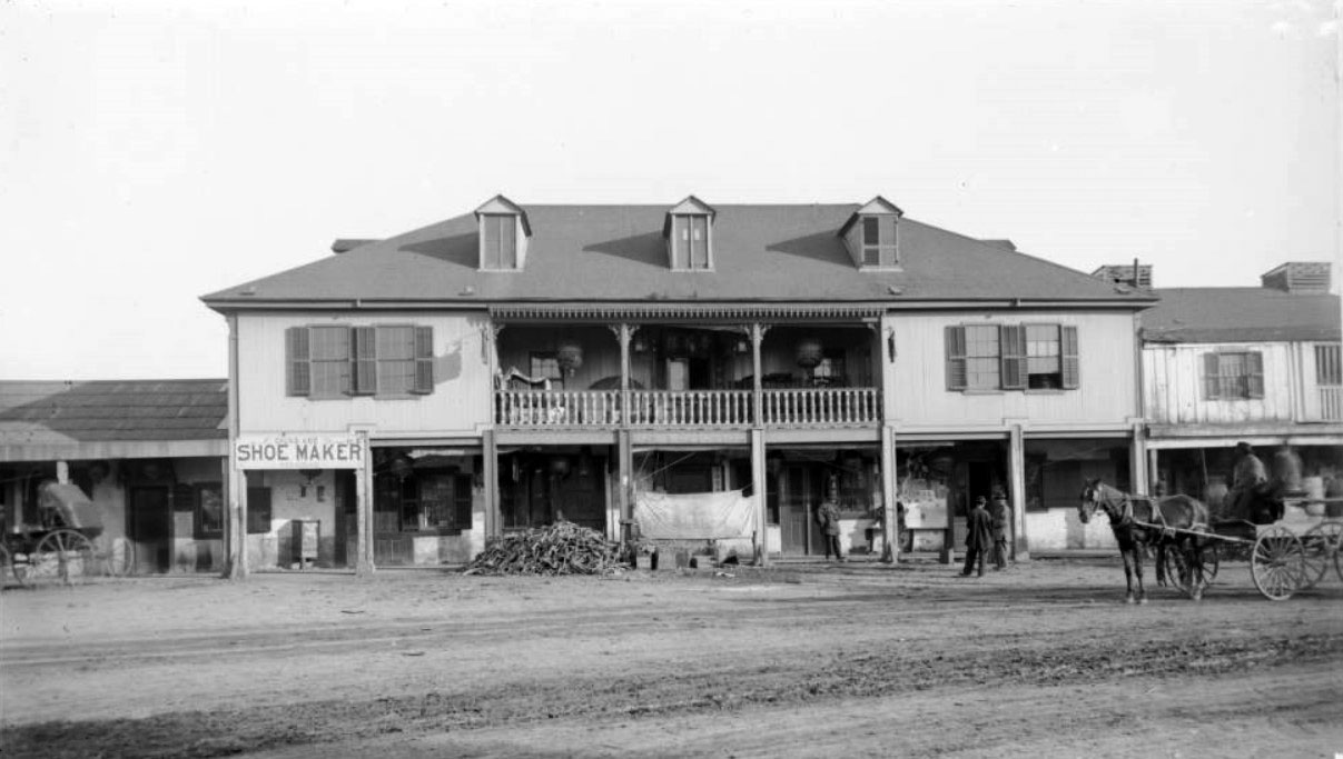
| (ca. 1886)* - Panoramic view showing the Old Lugo Residence, now a Chinese restaurant in disrepair, on the east side of the Plaza. |
Historical Notes The building features a covered veranda and balcony, four windows with shutters on the second level, and three dormer windows along the roof. In front of the large building, there is a pile of debris or wood. A shoemaker has a shop next door. On the second-story porch, furniture and two Chinese lanterns are visible, with at least eight additional lanterns hanging below. Four men stand in front of the building. A horse and carriage are visible on the right, and another carriage can be seen on the far left. Some signs are in Chinese. Legible signs include: "Chung Kee, shoe maker, repairing," "Chung Kee Co., shoe makers," and "Chinese merchandise, Chinese goods, butcher shop." From the 1880s until it was razed in 1949, the building was occupied by Chinese businesses. |
 |
|
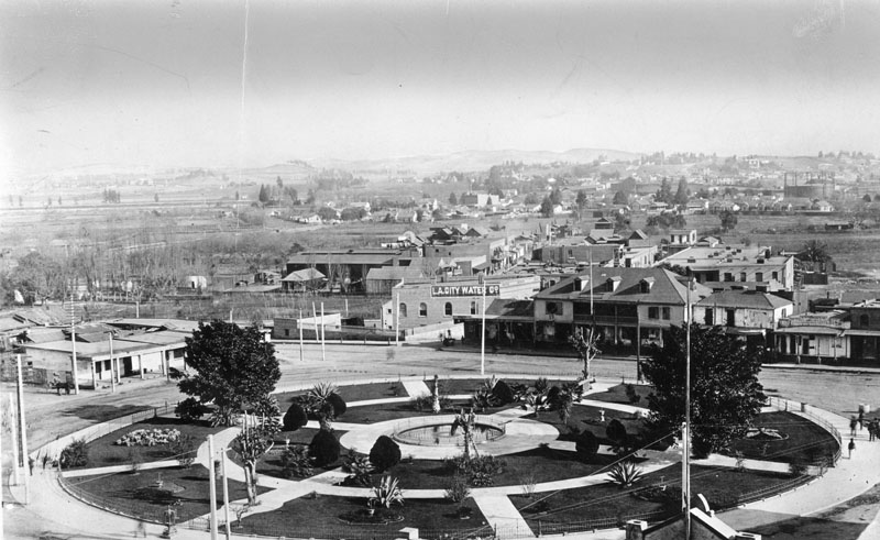
| (ca. 1890)* - The Los Angeles Plaza, around 1890. The one story building on the left is the former residence of Don Augustin Olvera. The large two story on the right is the former residence of Don Vicente Lugo. The LA City Water Company building is at the northwest corner of Marchessault and North Alameda (at the center of the photo). |
Historical Notes In 1902 the City of Los Angeles took over control of its water system from the LA City Water Company. The building seen with a large sign on its face reading: LA CITY WATER CO., was used by the City's Water Dpartment (later DWP) from 1902 until it was razed in 1939. Click HERE to see more in Water Department's Original Office Building. |
 |
|
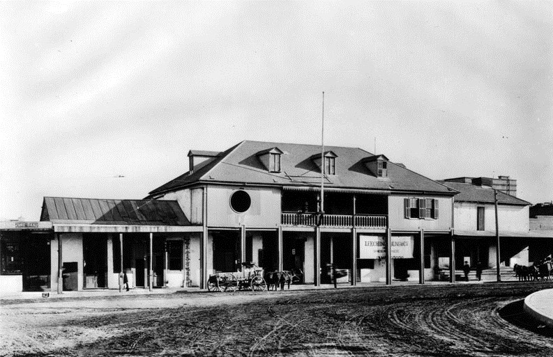
| (ca. 1890s)** - Exterior front view of the two-story Vicente Lugo adobe house, seen with hipped roof and dormer windows. The home is on S/E corner of Los Angeles and Alameda Streets, and faces the Plaza. |
Historical Notes When this photograph was taken, the adobe was home to Leeching Hung & Co. |
 |
|
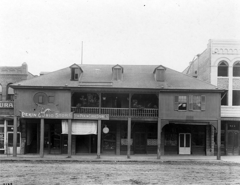
| (1905)* - View showing the two-story Vicente Lugo adobe house, seen with hipped roof and dormer windows. The home is located at 518-520 North Los Angeles Street and Sunset Boulevard, and faces the Plaza. When this photograph was taken, the adobe was home to the Pekin Curio Store with brick buildings flanking it on either side; and the road was still unpaved. |
Historical Notes La Casa de Don Vicente Lugo located on the east side of the El Pueblo Plaza at North Los Angeles Street and Sunset Boulevard. Built in 1839 by Vicente Lugo, it was one of the few two-story homes in Los Angeles at the time. It was donated in 1867 to St. Vincent's College (which later became Loyola University), the first college in Southern California; but later became known as the Washington Hotel, and later, the Pekin Curio Store. Unfortunately, the structure was so altered, that it does not resemble an adobe. The site of the Vicente Lugo adobe house was designated California State Historic Landmark No. 301. |
 |
|
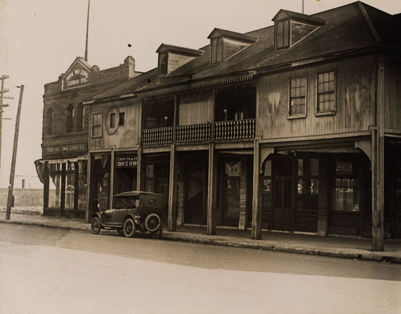
| (1915)* - View of a row of two-story buildings with balconies in the 500 block of North Los Angeles Street in Old Chinatown, Los Angeles, with signs for "Fook Wo Lung Curio Co." and "Chew Fun & Co. Chinese Herbs" visible and an automobile parked at the street curb. The buildings face the Los Angeles Plaza (not pictured) and the central building (with three dormer windows) was built for Don Vicente Lugo and known as the Lugo Adobe. |
 |
|
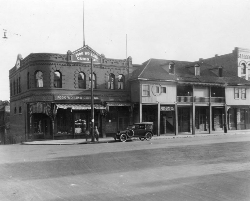
| (ca. 1920)* - Shops on Los Angeles Street at Marchessault. Shown are the Fook Wo Lung Curio Co., at 526-528, next to Houng On Company, at 524, and Chew Fun and Company, Chinese herbs in the old Vincent Lugo adobe at right. |
 |
|
| (ca. 1930)* - View showing the Old Lugo adobe residence as seen from the LA Plaza, across Los Angeles Street. Three early model cars are seen parked in front. |
 |
|
| (1939)* - View showing the two-story Vincent Lugo adobe house, located on Los Angeles Street and facing the Plaza. It is now flanked by brick buildings, with cars parked on the street in front. |
 |
|
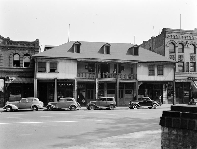
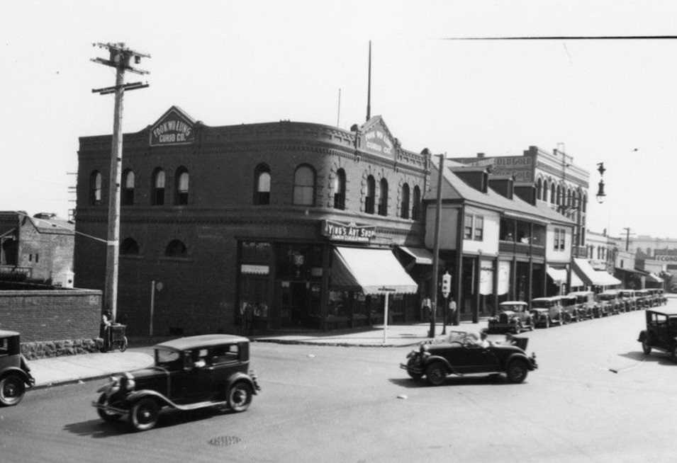
| (1930s)* – Looking at the SE corner of Los Angeles and Marchessault streets showing Ying's Art Shop located in Fook Wo Lung Curio Company building. To its right is the old Vincent Lugo Adobe house. |
Historical Notes Marchessault Street was located along the north side of the historic Los Angeles Plaza. It was named after Damien Marchessault, a French-born two-time mayor of the city who later died by suicide. |
 |
|
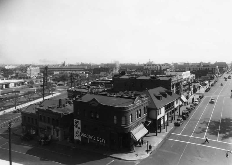
| (ca. 1939)* - View of Chinatown, looking south on Los Angeles and Marchessault streets. The Dragon's Den, a Chinese food restaurant, is in the Fook Wo Lung Curio Company building at the corner of the block with the Lugo Adobe next to it. |
 |
|
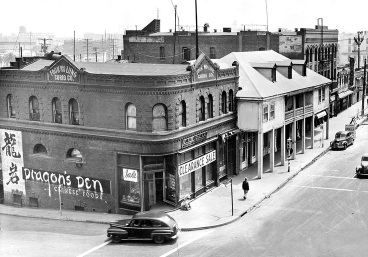
| (1949)* - View of the southeast corner of Marchessault and Los Angeles St. The old two-story Vincent Lugo Adobe house can be seen with its hipped roof and dormer window. It sits directly across the street from the LA Plaza. The brick building on the corner is the Fook Wo Lung Curio Company building. The painted sign on its side reads: Dragon's Den Chinese Food. |
Historical Notes In 1935, Eddy See opened the Dragon's Den Restaurant in the basement of the F. Suie One Company. On the exposed brick of the basement walls, Benji Okubo, Tyrus Wong and Marian Blanchard painted murals of the Eight Immortals and a dancing dragon. An arty crowd, including Walt Disney and the Marx Brothers, came to see the murals and sample the "authentic fare." In an era when Chinese restaurants were known as chop-suey joints, Dragon's Den served egg foo young, fried shrimp and almond duck. Non-Chinese diners during the Great Depression considered these "exotic" dishes. |
 |
|
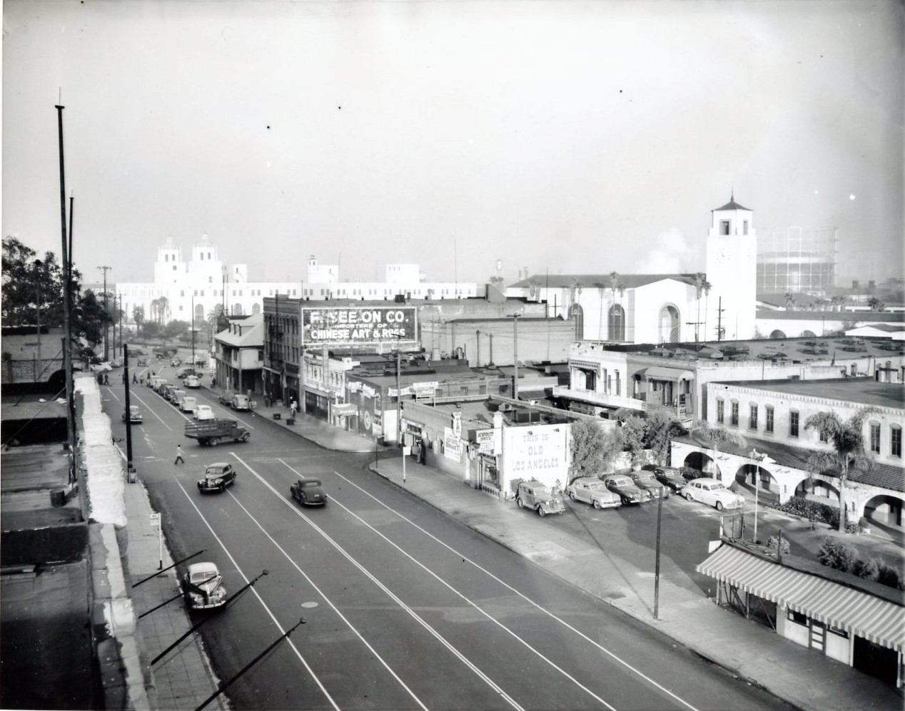
| (1947)* - View of Los Angeles Street looking north. The large trees in the upper left are in the LA Plaza and across the street is the Vincent Lugo Adobe with its distinctive hipped roof and dormer windows. In the background can be seen both the Terminal Annex Post Office and Union Staion. |
 |
|
| (1949)* – Close-up view of the Vincent Lugo adobe in its last days of existence. |
Historical Notes The last vestige of Old Chinatown, a block of buildings between Sunset Boulevard and Los Angeles, Alameda and Aliso streets, was demolished in 1949 to make way for the Hollywood Freeway and a park. Included in that cluster of 22 razed buildings was the home of Vicente Lugo, the first two-story residence on the plaza. He donated the house to the parish priest in the 1850s. The house became the first home of St. Vincent's College (now Loyola Marymount University) in 1865, named for Lugo's patron saint, Vincent de Paul, a 17th century French priest who founded the Vincentian Fathers. |
.jpg) |
|
| (2010)* – Aerial view showing the site of the old Vincent Lugo Adobe. |
Historical Notes The Vincent Lugo Adobe was demolished in 1949 to make way for urban redevelopment, including the construction of the Hollywood Freeway, despite preservation efforts. The site, now part of Father Junípero Serra Park, is located on the east side of the Los Angeles Plaza, just west of Union Station and east of Olvera Street. This park serves as a green space and historical marker, commemorating the location of the former Lugo Adobe. A marker at the site acknowledges the significance of the adobe, detailing its construction in the 1840s, its donation to St. Vincent's School, and its role in the community before its demolition. |
* * * * * |
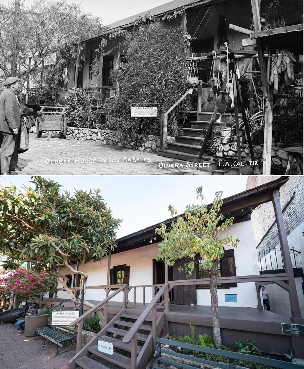
Avila Adobe (1818)
 |
|
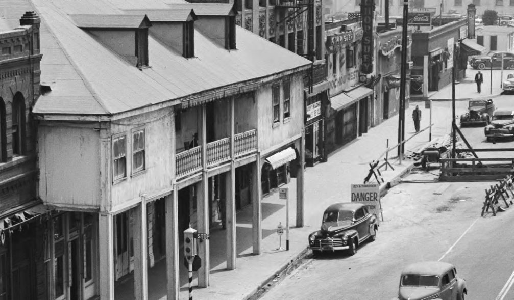
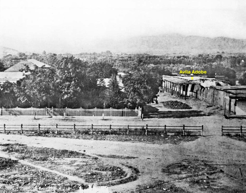
| (ca. 1869)* - View of the edge of the Los Angeles Plaza and the entrance to Wine Street (renamed Olvera Street in 1877) looking north from the Pico House. The Avila Adobe is visible at center-right on Wine Street. |
Historical Notes Don Francisco Avila, a wealthy cattle rancher and one-time Mayor of the pueblo of Los Angeles, built the Avila Adobe in 1818. The Avila Adobe, presently the oldest existing residence within the city limits, was one of the first town houses to share street frontage in the new Pueblo de Los Angeles. |
 |
|
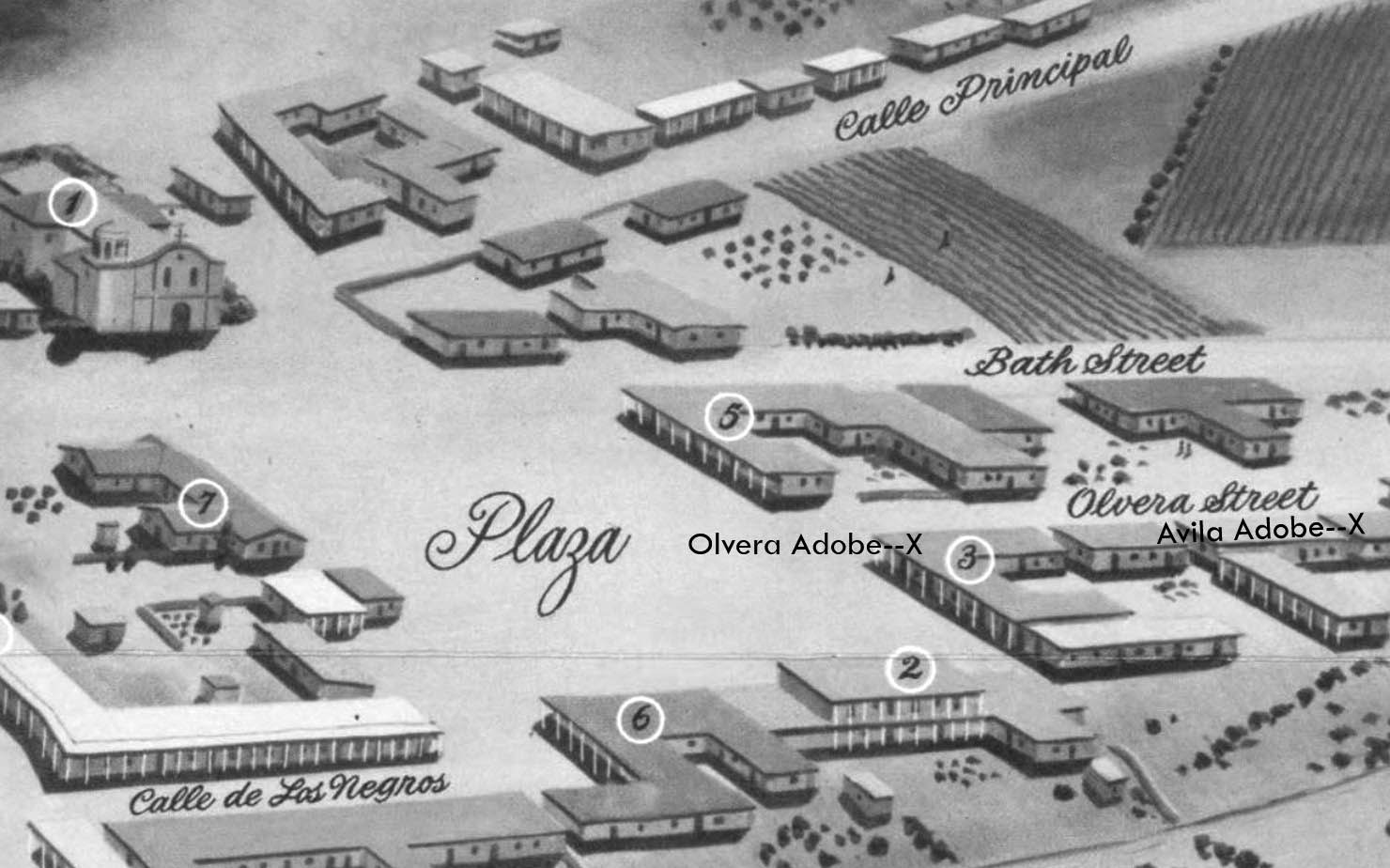
| (1850)* - Map view looking northwest showing the LA Plaza and surrounding area as it appeared in 1850. To the right can seen Olvera Street (Wine Street until 1877) at its intersection with the Plaza, with both the Olvera Adobe and Avila Adobe locations marked with an X. The Plaza Church is in the upper left corner. |
Historical Notes Francisco Ávila died in 1832, but his widow Encarnación continued to live in the adobe until her death in 1855. During the Mexican-American War in 1846, American forces briefly occupied the building. After the war, the Avila family reclaimed their home. |
 |
|
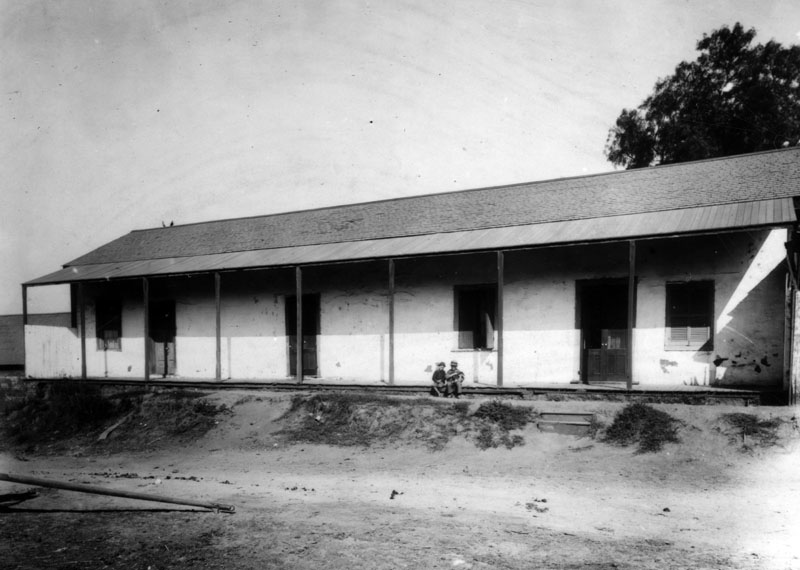
| (1890)* - Avila Adobe house on Olvera Street as it looked in 1890; two young boys sit on the porch. |
Historical Notes The adobe was built using traditional methods, with thick walls made from sun-dried mud and straw bricks, which provided natural insulation against the Californian climate. |
 |
|
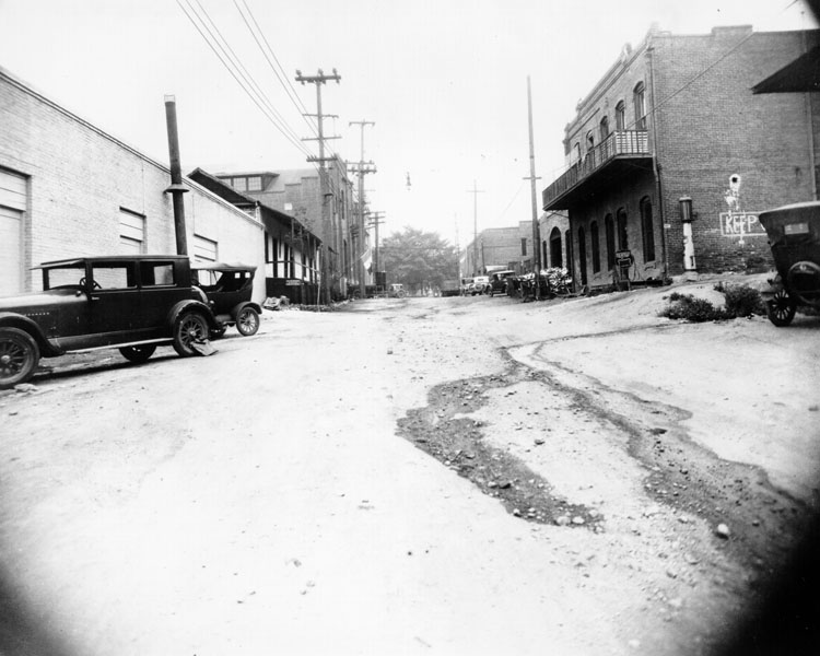
| (1920s)* - View looking south of Olvera Street before improvement and also before City Hall was built. On the left the Avila Adobe is seen. To the right is the Sepulveda House with a gas pump on by its side and at the end of the street is the Los Angeles Plaza. |
Historical Notes By 1926, the city of Los Angeles condemned the deteriorating structure, planning to demolish it for a gas station. However, Christine Sterling, a preservationist from San Francisco, intervened. She launched a campaign to save the adobe and transform the surrounding area into a cultural center. |
 |
|
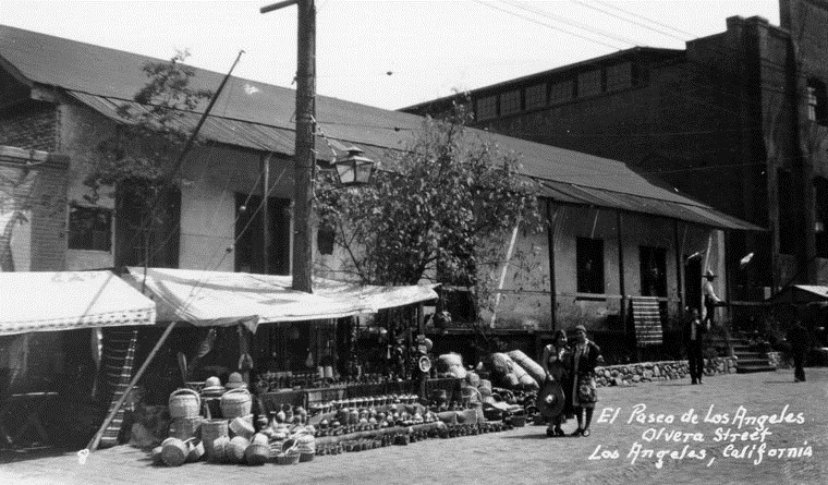
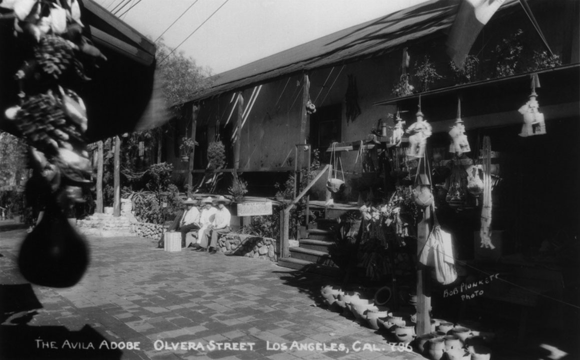
| (ca. 1930)* - A view of Olvera Street looking across at vending booths in front of the Avila Adobe with two pedestrians walking near. |
Historical Notes In 1930, through the efforts of activist Christine Sterling, the Plaza-Olvera area was revived with the opening of Paseo de Los Angeles (which later became popularly known by its official street name Olvera Street). |
 |
|
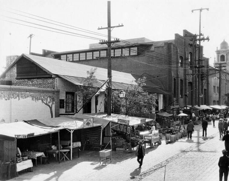
| (1932)* - View of the Avila Adobe house on Olvera Street, taken in 1932 - two years after Olvera Street was converted to a colorful Mexican marketplace - as made evident by the small vendor stands visible throughout. |
Historical Notes Thanks to Sterling's efforts and support from influential figures like Harry Chandler of the Los Angeles Times, the Avila Adobe was restored in 1929-30. This restoration coincided with the opening of Olvera Street as a Mexican marketplace, breathing new life into the area. |
 |
|
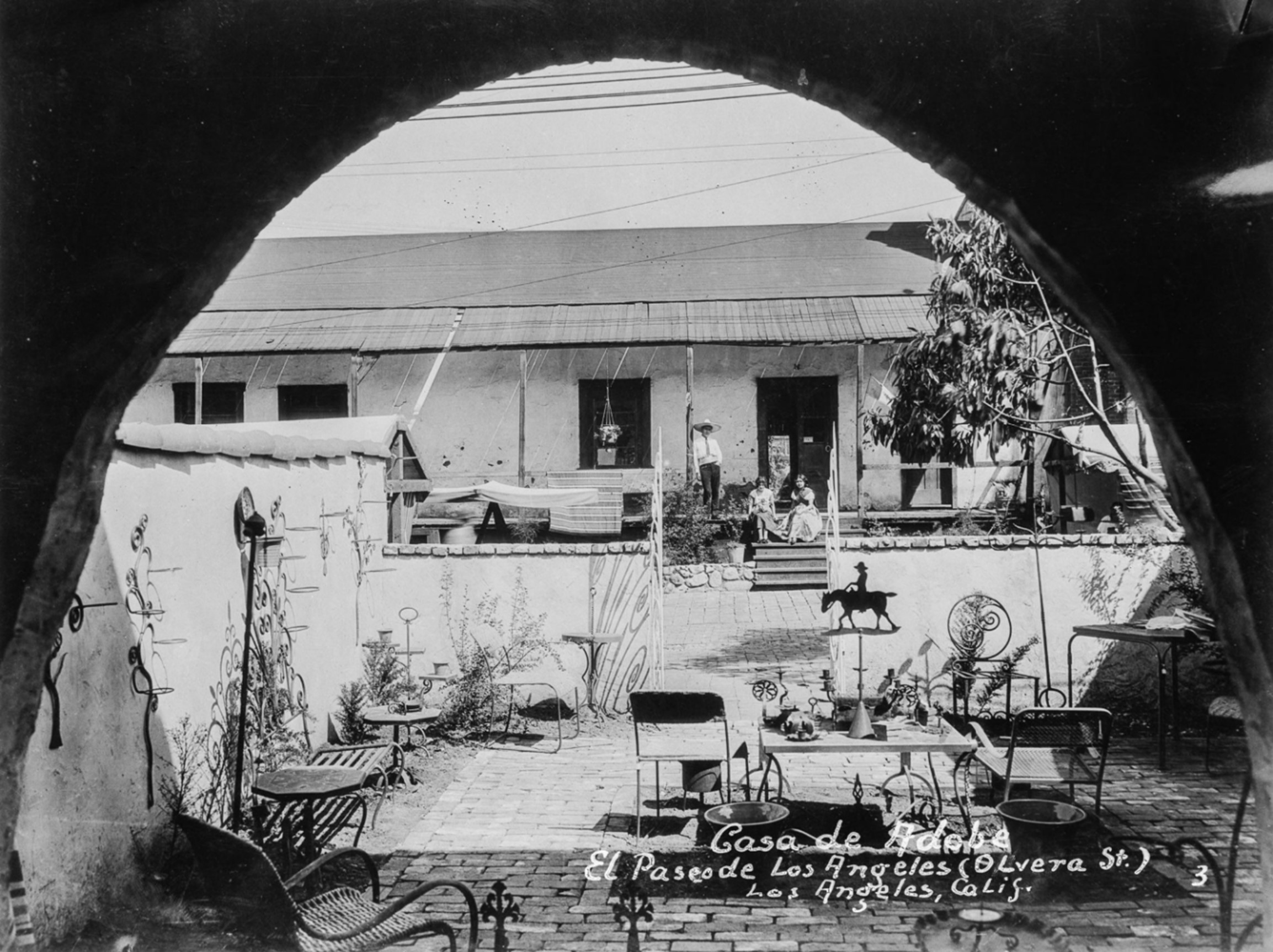
| (1930s)* – Looking through an archway across a courtyard showing a man and two women on the porch of the Avila Adobe on El Paseo de Los Angeles. Photo from the Ernest Marquez Collection. |
Historical Notes Located at 10 Olvera Street, the Avila Adobe was built in 1818 by Francisco Ávila, a prominent cattle rancher and early mayor of Los Angeles. It is recognized as the oldest standing adobe house in the city. |
 |
|
| (1930s)* – Postcard view showing the Avila Adobe on Olvera Street. |
Historical Notes In the 1930s, the Avila Adobe underwent a significant transformation, becoming a central feature of the revitalized Olvera Street area. The building’s restoration aimed to educate visitors about early Los Angeles history and Mexican-American heritage, positioning the adobe as a focal point of a newly imagined 'Mexican Marketplace of Yesterday.' Showcasing original architectural features and period furnishings, the presentation highlighted a romanticized view of the region's Spanish and Mexican past. This transformation not only preserved one of Los Angeles' oldest residences but also contributed to the cultural identity of the area, making it one of the city’s most visited tourist attractions. |
 |
|
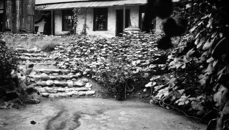
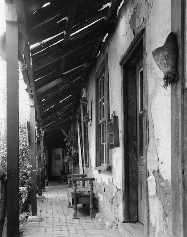
| (1930s)* - View of the Avila Adobe house on Olvera Street, showing the rear of the home. Several windows and doorways are visible under the long, covered "corredor" (or porch); steps lead down to a lower area of the courtyard. |
Historical Notes The Avila Adobe consisted of a generous courtyard with covered porches for each of the garaging areas, stables, workshops, etc., as well as a garden and vineyard, which Don Francisco tended to regularly. |
 |
|
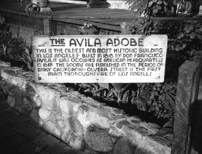
| (ca. 1935)* - View of the sign in front of the Avila Adobe, the oldest existing residence within the city limits. |
Historical Notes The sign for the Avila adobe reads "This is the oldest and most historic building in Los Angeles. Built in 1818 by Don Francisco Avila it was occupied as American headquarters in 1847. The rooms are furnished in the period of early California. Olvera Street is the first main thoroughfare of Los Angeles.” |
 |
|
| (1945)* - View of patio of Avila Adobe showing bench and foliage. Photo by Arnold Hylen. |
Historical Notes The Avila Adobe's front entrance along Olvera Street showcases a distinctive architectural feature added by Francisco Avila: a wooden veranda with small staircases leading up to the porch. The entrance is characterized by an arched, gated alleyway on the southeast side of the pedestrian-only Olvera Street, serving as an inviting gateway to the historic property. This design not only enhances the adobe's aesthetic appeal but also provides visitors with a tangible connection to Los Angeles' past. The entrance offers a glimpse into the vibrant Mexican marketplace atmosphere of Olvera Street while leading to the oldest standing residence in the city. |
 |
|
| (1948)* – Postcard view showing the Avila Adobe on Olvera Street. Built in 1818 by Don Francisco Avila it was occupied as American headquarters in 1847. |
Historical Notes In 1953, the State of California acquired the Avila Adobe as part of El Pueblo de Los Angeles State Historic Park, and has been opened to tours since 1976. The Avila Adobe is registered as California Historical Landmark #145, while the entire historic district is both listed on the National Register of Historic Places and as a Los Angeles Historic-Cultural Monument. |
Then and Now
 |
|
| (1948 vs. 2020)* - Avila Adobe, the oldest existing residence within the city limits. |
Historical Notes Avila adobe holds the record for being the oldest house in Los Angeles. It was built in 1818 by Francisco Avila. It's protected by the Los Angeles Plaza Historic District & California State Historic Park. The walls of the Avila Adobe are 2.5–3 feet thick and are built from sunbaked adobe bricks. |
* * * * * |
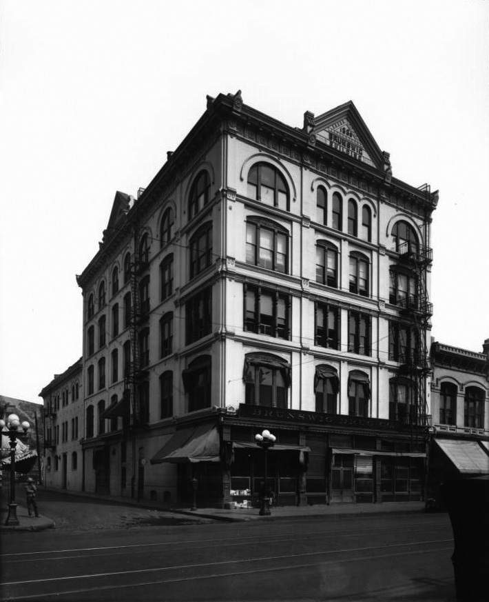
Vickrey-Brunswig Building
 |
|
| (ca. 1887)* - A view of the Los Angeles Plaza looking southwest with the Pico House to the left and the Old Plaza Church on the right. The 2-story 'Plaza House' (built in 1883) sits directly across the Plaza on the west side of Main Street. The Vickrey-Brunswig Building, one of the City's first 5-story buildings, would be built within a year of this photo just to the left (south) of the Plaza Building. |
Historical Notes In 1887, during the height of the real estate boom, investor William Vickrey bought a parcel of land on North Main Street, on which he commissioned construction of the Vickrey-Brunswig Building. Originally the site of an adobe owned by Jesus Dominguez, the land was purchased by Vickrey from the City of Los Angeles for a total cost of $3,925. Los Angeles city directories from the mid-1880s list Vickrey's occupation as "capitalist." He established and served as president of the East Side Bank, which was located at 510 Downey Avenue in downtown Los Angeles.^^^^ |
 |
|
| (ca. 1890)* - Same view as previous photo but three years later. The new additon to the scene is the 5-story Vickrey-Brunswig Building built adjacent to the Plaza House. |
Historical Notes Construction of the Vickrey-Brunswig Building took place in 1888, the year marking the abrupt collapse of the real estate boom that had driven rapid construction and market speculation through the 1880s. Soon after completion of the building, Vickrey would be forced to declare insolvency and then lose the property to his lender.^^^ The Victorian-era brick Vickrey Building was among the earliest five-story buildings in Los Angeles. When it opened in 1888, the building housed ground floor retail with lodging on the upper floors. * The two-story Plaza House (built in 1883) was commissioned by Frenchman Philippe Garnier, whose name appears at the base of the decorative false gable parapet rising above the roofline. It was once the site of La Esperanza Bakery. |
 |
|
| (ca. 1890s)* - Closer view showing the new 5-story Vickrey-Brunswig Building located on N. Main Street across from the LA Plaza and also across the street from the Pico House. Men are seen strolling in front of the Plaza. |
Historical Notes In 1897, the Vickrey Building was purchased by F. W. Braun and Company, and for more than three decades was associated with the pharmaceutical industry. Reorganized as the Brunswig Drug Company in 1907 following its purchase by part owner and prominent Angeleno Lucien Brunswig, the company expanded dramatically and developed into the largest pharmaceutical manufacturing laboratories west of Chicago. * |
 |
|
| (ca. 1920)^^* - View of the Brunswig Building located on the northwest corner of N. Main and Republic streets. The name of the building appears on two signs, one over the doorway and one on top of the roof. |
Historical Notes Prominent architect Robert Brown Young designed the building in a transitional Italianate style, varying the treatment of each story of the facade for greater visual interest. The windows of the upper floor feature Romanesque arches, while those of the third floor are embellished with turned posts that serve as the mullions between the grouped sashes. Architect R. B. Young was the principal of one of Los Angeles's earliest architectural firms, R.B. Young & Son. Young's office garnered a number of prestigious hotel commissions, such as the Clifton (his first commission in Los Angeles, at the corner of Broadway and Temple Streets), Lankershim, Westminster, Lexington, Hollenbeck, and Occidental hotels. Young also designed the Lankershim office building, the Barker Brothers' block, the Wilson Block, and the California Furniture Company.^^^^ |
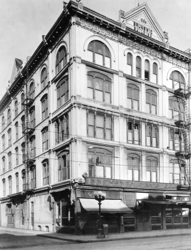 |
|
| (ca. 1921)* - Closer view of the Brunswig Building located at 501 N. Main Street. The roof sign reads: 1888 - Brunswig Building. The sign over the building entrance reads: Brunswig Drug Co. |
Historical Notes The Vickrey-Brunswig Building was constructed of brick on a trapezoidal plan and stands five stories with a full basement. It was constructed in the Italianate style commonly used for commercial architecture in the Iate-19th and early 20th centuries. Characteristic elements of the building include the decorative stringcourse located above the fifth floor windows and the segmental and rounded arched brick windows featured on the south and west elevations.^^^^ |
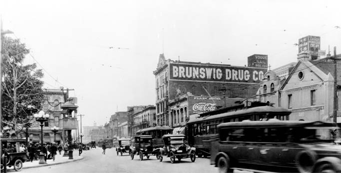 |
|
| (1920)**#^- View looking south on Main Street showing the Old Plaza Church and Brunswig Building (Brunswig Drug Company) on the right and the LA Plaza and Pico House on the left. The new City Hall which would stand two blocks south would not be built until 1928. Early model cars share the road with electric streetcars. |
Historical Notes Note the elevated kiosk on the edge of the plaza to the left ot the photo. Elevated booths like these were used by the Los Angeles Railway and the Yellow Cars as a switchman’s tower to control the flow and path of streetcars through the intersection. Many of these were still standing well into the 1920s. |
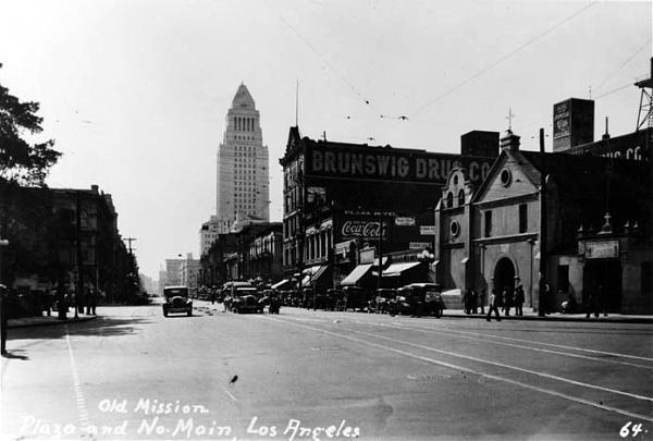 |
|
| (ca. 1928)^* - View looking south on Main Street showing the newly constructed City Hall standing in the background (corner of Temple and Main streets) with the Brunswig Building and Old Plaza Church at right. |
 |
|
| (n.d.)#*^ – View showing the Vickery-Brunswig Building located at 501 N. Main Street, across the street from the Pico House. Photo by Flora Chow |
Historical Notes The County of Los Angeles purchased the Vickrey-Brunswig Building and the adjacent Plaza House in 1948 and renovated them for use by the Los Angeles County Civil Service Commission, County Superior Courts, Police Crime Laboratories and the County Sherriff’s offices through the mid-1970s. * |
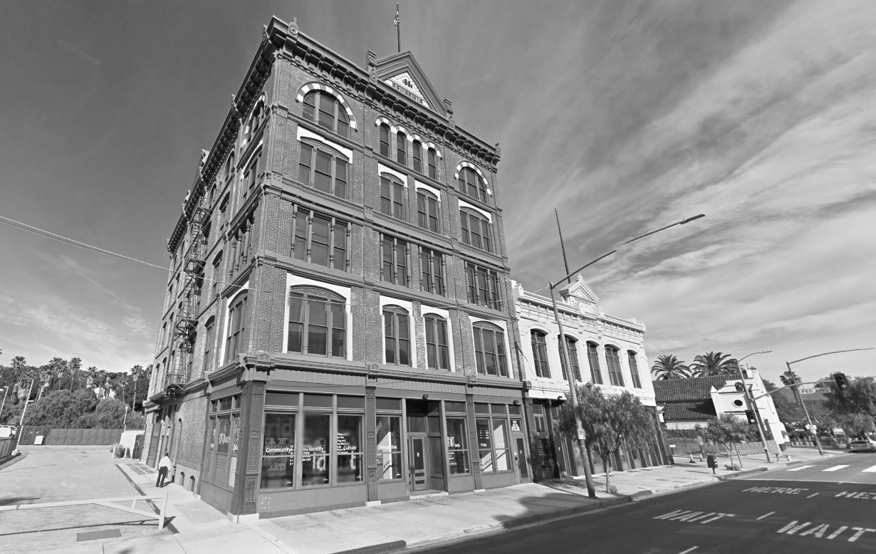 |
|
| (2015)#^**– Google street view looking northwest showing the 5-story Brunswig Building at 501 N. Main Street, adjacent to the Plaza House. The Old Plaza Church is at far right. |
Historical Notes After enduring three decades of vacancy and deterioration, the County rehabilitated both buildings to house LA Plaza de Cultura y Artes, a Mexican and Mexican-American cultural center which opened in 2011.* |
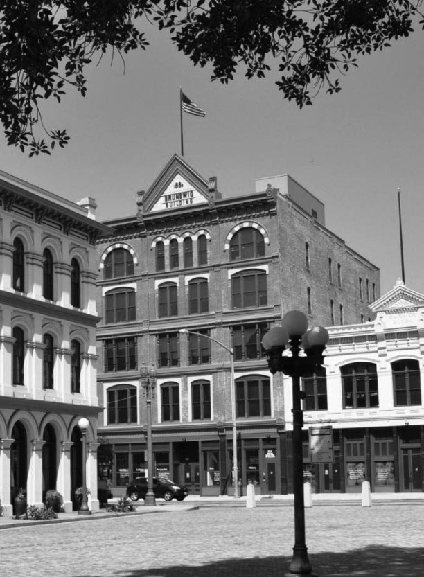 |
|
| (2014)^* - View of the Vickrey-Brunswig Building as seen from the LA Plaza with the Pico House on the left and the Plaza House on the right. |
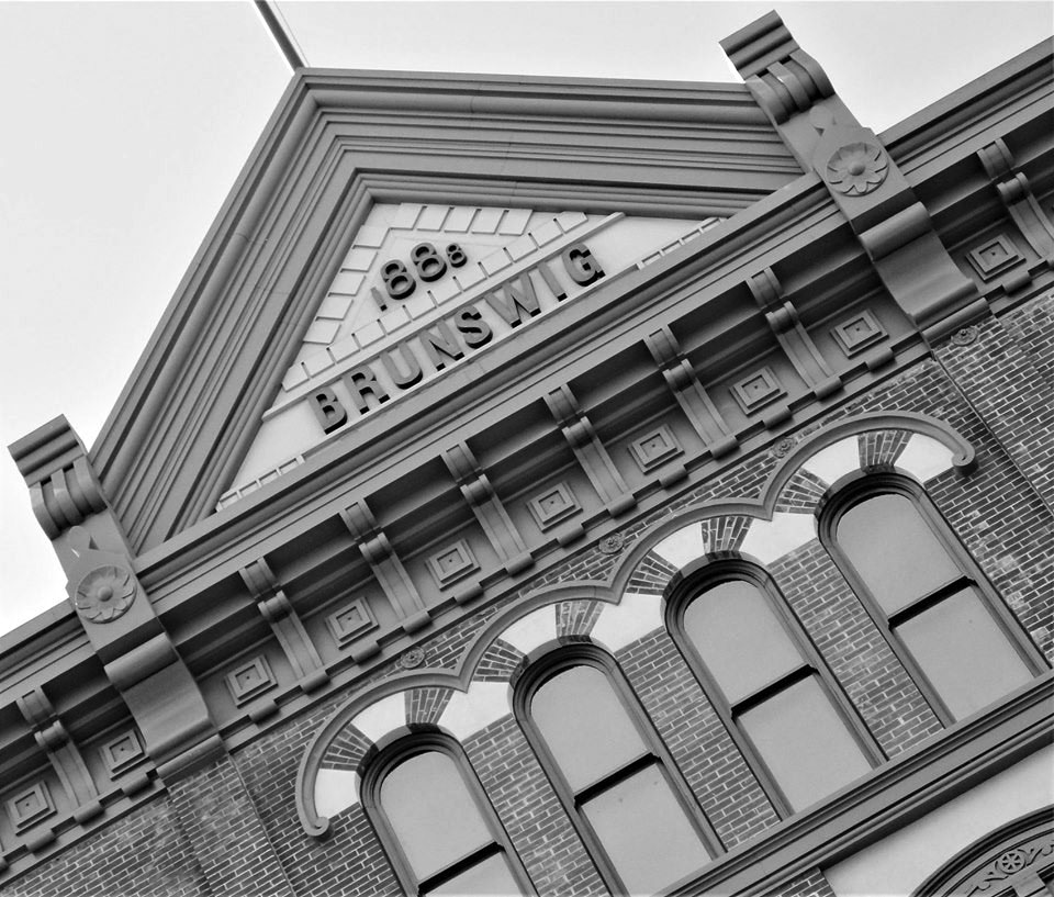 |
|
| (2019)^.^ - Vickrey-Brunswig Building, built in 1888. Photo by Howard Gray |
Click HERE to see more in Early Views of the LA Plaza |
* * * * * |
Phillips Block
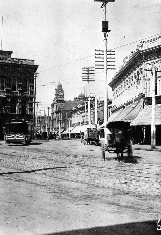 |
|
| (ca. 1887)^ - View looking south on Spring Street with Temple Block seen on the left and Downey Block on the right. The large 4-story building with the copula in the distance is the Phillips Block. The large, ornate four-story building housed one of the City's first department stores called Hamburger & Son's People's Store whch would evolve into May Company. A horse-drawn carriage crosses the tracks as a streetcar appears to be headed toward it. |
Historical Notes The Phillips Building was constructed in 1887 in the French Renaissance style popular at that time for secular buildings. It was the second four-story building erected in Los Angeles and was one of the most ornately decorated. |
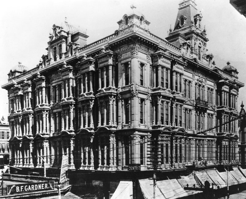 |
|
| (ca. 1890)* - View showing the Phillips Block, located at 25-37 N. Spring Street. The Hamburger's Peoples Store was in this building. |
Historical Notes The building was constructed in 1887 by Louis Phillips at a cost of about $200,000. Louis Phillips was born Louis Galefsky to a Jewish family in Prussia (now Kempen, Poland) and moved to California in the early 1850s, changing his name to Phillips. He moved to Spadra (now part of Pomona) in 1862 and began engaging in sheep herding and cattle raising. In 1864, Schlesinger and Tischler acquired the Rancho San Jose in a foreclosure. Phillips, who had previously been a manager on the ranch, bought 12,000 acres out of the foreclosure. In January 1874, the Southern Pacific Railroad completed a rail line from Los Angeles to Spadra, spurring interest in land development in the area. In 1875, Phillips built the Phillips Mansion (now operated by the Historical Society of Pomona Valley) and also sold most of his 12,000 acres for subdivision into the Pomona Tract, thus beginning the formation of Pomona. Phillips retained 2,241 acres surrounding his mansion, which he operated as a cattle and sheep ranch. Phillips acquired large land holdings in other parts of the county, including the Los Angeles business district where he owned the Phillips Block on Spring Street, a block on Los Angeles Street and another on Third Street. By 1892, the Los Angeles Times reported that Phillips, "who lives so quietly out at Spadra, near Pomona," was "the richest man in Los Angeles County." The Times noted that Phillips was worth "not a dollar less than $3,000,000" and stated that, in addition to his land holdings in Los Angeles, he had a ranch that produced wool, honey and wheat.*^ |
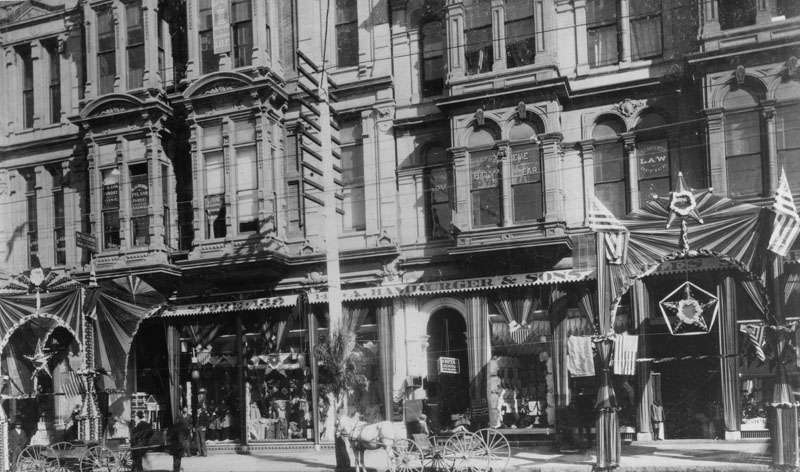 |
|
| (ca. 1890)* - The entrances to Hamburger's People's Store in the Phillips Block on Spring Street is decorated in patriotic themes. Horse and buggies wait by the curb. A sign for "Royal Rooms" hangs over an arched entrance. Mr. Carpenter's law office, Dr. Hoy's (Eye and Ear), and Dr. Solomon's (Eye, Ear and Throat) offices are on the second floor. |
Historical Notes A. Hamburger and Sons was one of the first department stores to operate in Los Angeles. Originally known as A. Hamburger & Son's People's Store, the name later changed to Hamburger's Store. In 1908 the company relocated their store from Spring Street to a newer building located at Broadway and Eighth Street. May Department Stores acquired Hamburger's in 1923 and renamed it the May Company. Much later in the century, the May Company and Robinsons chains of department stores would affiliate under the name Robinsons-May; and this entity would be bought out by Macy's in 2005.*^# |
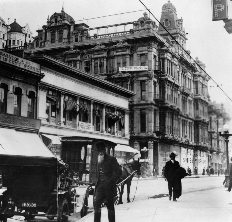 |
|
| (ca. 1908)* - A horse and buggy are parked in front of a vintage automobile on North Spring St. at Franklin. In the background stands the four-story Phillips Block building with a banner on the top floor for M. Garry Realty Co. advertising its availability. This is presumably after the Hamburger's Store moved to it's new location (SW corner of Broadway and 8th streets). |
* * * * * |
Simpson Methodist Episcopal Church
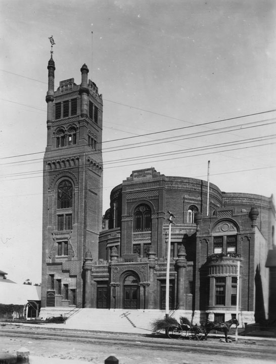 |
|
| (ca. 1890)* - Exterior view of Simpson Methodist Episcopal Church, located at 734 S. Hope Street, as seen from across the unpaved street. A horse-drawn carriage is parked outside the church at the curb. |
Historical Notes The Simpson Methodist Episcopal Church was constructed in the late 1880s. After serving as a Methodist church for years, it later became the Third Church of Christ, Scientist.* |
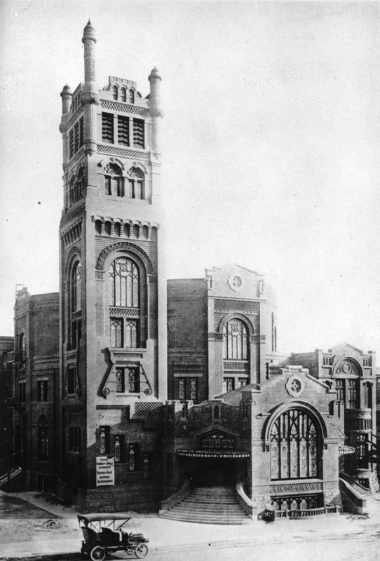 |
|
| (ca. 1911)* - Exterior view of Third Church of Christ, Scientist, located at 734 S. Hope Street, during an extensive remodeling project in 1911. |
Historical Notes After serving as Simpson Methodist Episcopal Church and Simpson Auditorium for years, it became the Third Church of Christ, Scientist in the early 1910s. A Christian Science Reading Room remains on the site, but the large church building was demolished after it suffered severe damage as a result of the 1971 San Fernando earthquake.* |
* * * * * |
Burbank Villa Hotel (later Santa Rosa Hotel)
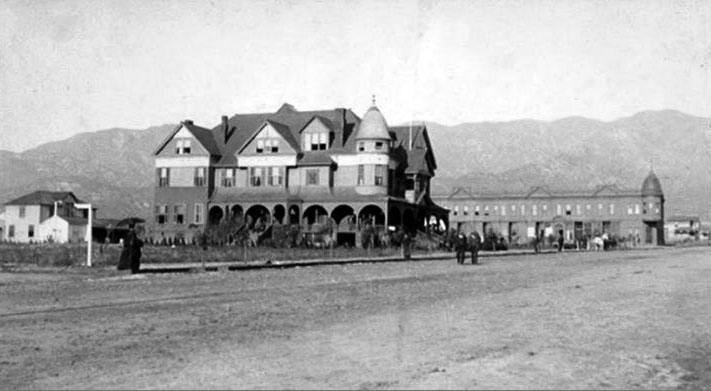 |
|
| (1887)* - View of the Burbank Villa Hotel on Olive Avenue. It was built by Dr. David Burbank and his son-in-law John W. Griffin. In the distance can be seen Burbank Block. |
Historical Notes At the time the American Civil War broke out Dr. David Burbank established his profession as a dentist in Pueblo de Los Angeles. In 1867, he purchased Rancho La Providencia from David W. Alexander and Francis Mellus, and he purchased the western portion of the Rancho San Rafael (4,603 acres) from Jonathan R. Scott. Dr. Burbank's property reached nearly 9,200 acres at a cost of $9,000. He eventually became known as one of the largest and most successful sheep raisers in southern California, resulting in him stopping his practice of dentistry and investing heavily in real estate in Los Angeles.^ |
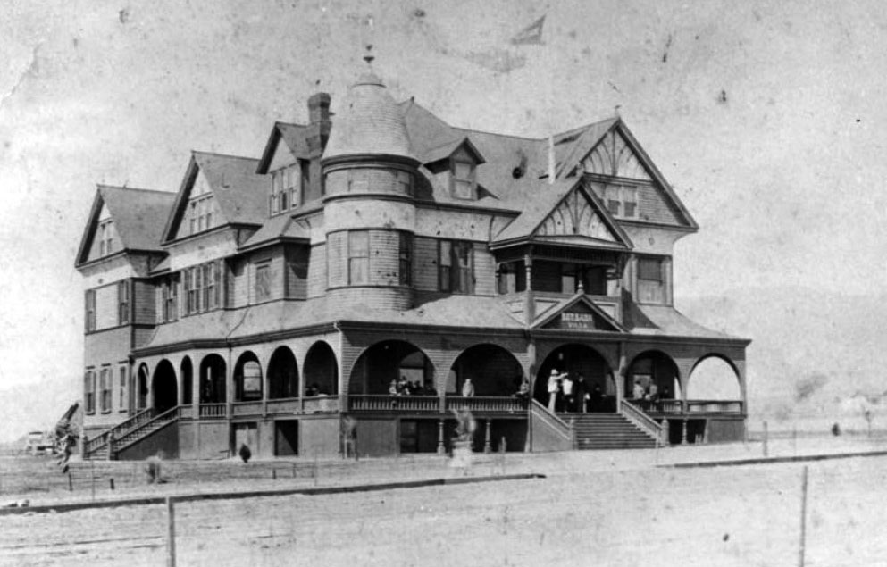 |
|
| (1887)^ – View looking across an unpaved Olive Avenue showing the Burbank Villa Hotel with several people standing on the porch and stairway. |
Historical Notes The Burbank Villa Hotel (with turret, gables, and verandas with arches) was built by Dr. Burbank and his son-in-law John W. Griffin in 1887 at a cost of $30,000.00. Later the hotel was renamed the Santa Rosa Hotel and was a popular place for weddings and parties. During the 1920s the hotel was remodeled into apartments and by 1927 it had been torn down and replaced by the post office. Today, this post office is known as the Burbank Downtown Station and is located at 135 E. Olive Ave, Burbank. |
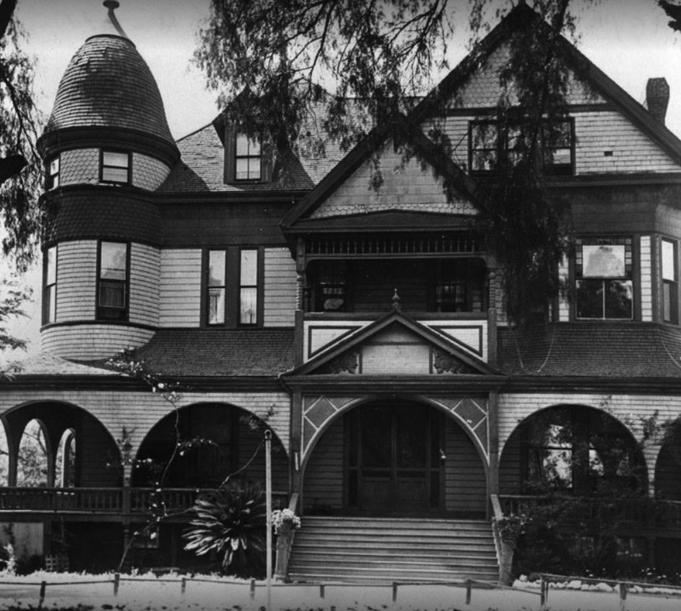 |
|
| (1924)* – Close-up view of the Victorian-style Burbank Villa Hotel about the time its name change to Santa Rosa Hotel. |
Historical Notes In 1924, the Burbank Villa Hotel was renamed Santa Rosa Hotel. |
 |
|
| (1920s)^^ – View showing the Santa Rosa Hotel (originally Burbank Villa Hotel) located at 135 E. Olive Avenue. |
Historical Notes During the 1920s the hotel was remodeled into apartments and by 1927 it had been torn down and replaced by the post office. Today, this post office is known as the Burbank Downtown Station and is located at 135 E. Olive Ave, Burbank.^ |
 |
|
| (1970s)^^ - Photo of the Downtown Burbank Post Office at 135 E. Olive Avenue taken from across the street. A convertible sports car drives past while a man mails an item at one of the two curbside collection boxes. The building inscription reads, "United States Post Office, Downtown Station, Burbank California 91503." |
Historical Notes The post office was built in 1938 on the former site of the Santa Rosa Hotel and, before that, the Burbank Villa. Constructed during the Depression, under the federal Works Progress Administration program, out-of-work skilled laborers were employed by Los Angeles architect, Gilbert Stanley Underwood, who also designed the Los Angeles Federal Court House. The Mediterranean style exterior features five large arches and a red tile roof. The inside lobby displays two 25-foot murals, by artist Barse Miller, celebrating Burbank's aviation and motion pictures industries. The post office served as the main branch and administrative offices until 1968 when increased mail volume required a larger facility. A new post office then opened on Hollywood Way while the Olive Avenue location continued to serve as the Downtown branch. In 1985, the building was listed in the National Register of Historic Places and, on November 11, 2003, the Downtown Burbank Post Office was named in honor of legendary entertainer, Bob Hope, who launched his career nearby with a weekly radio show at Burbank's NBC Studios.^ |
Phillips House
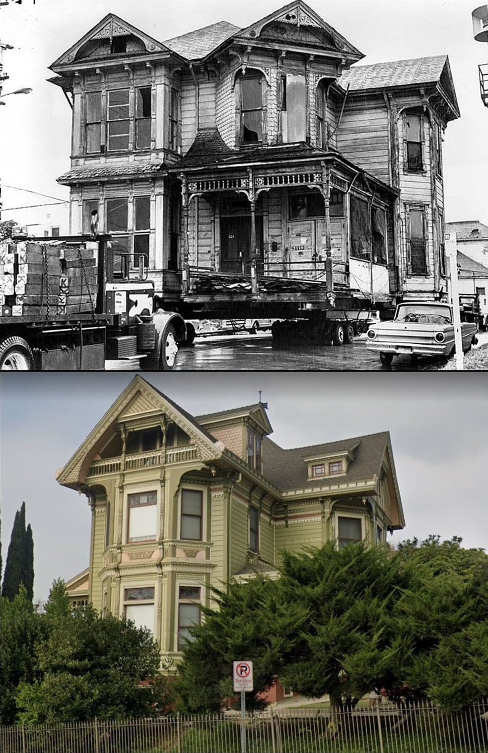 |
|
| (1970s vs Today)* - Phillips House then and now. The home was relocated from Court Street to Carroll Avenue. |
Historical Notes Built in 1887, the imposing Phillips House was likely a project of local real estate developers George O. Ford and James B. Myer, men also associated with the homes at 1316, 1320, and 1324 Carroll Avenue. Ford was an agent for the Richfield Land and Water Company, and Myer owned the Southern Pacific Transfer Truck Company.* |
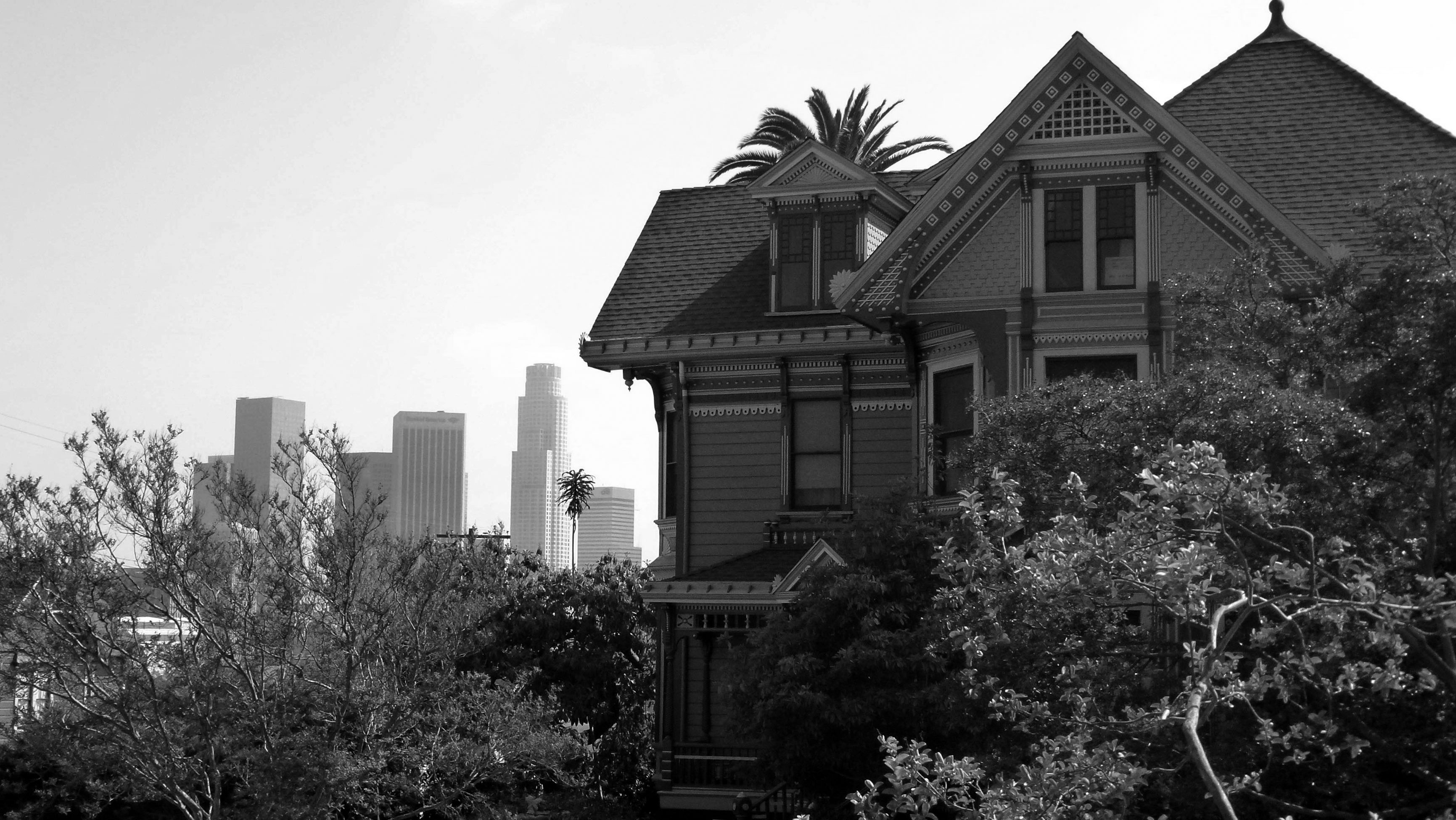 |
|
| (2012)^ – The Phillips House located at 1300 Carroll Avenue in Angelino Heights with the downtown skyline in the background. |
Historical Notes The first owner of the house was Aaron Phillips, who was from Iowa and had a wife, Maria, and daughter Grace. Grace lived in the house until 1942, when her heirs sold the property to the current owner’s family. The home was relocated from Court St to Carroll Avenue in the 1970s.* |
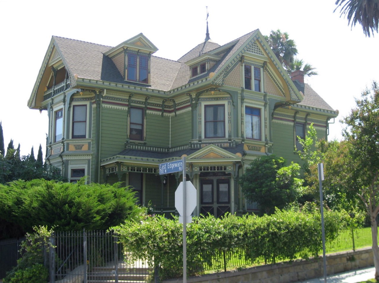 |
|
| (2007)* – The Phillips House located on the SW corner of Carroll Ave and East Edgeware Rd. |
Historical Notes One of the most ornate homes in Angelino Heights, the Phillips House blends two Victorian styles. The sharp angles, in both the shape of the house and its geometric decoration, typify the Eastlake style, while the overall decorative exuberance reflects the Queen Anne style.* This Victorian home was the first house on Carroll Avenue declared a Los Angeles landmark (No. 51). |
* * * * * |
Please Support Our CauseWater and Power Associates, Inc. is a non-profit, public service organization dedicated to preserving historical records and photos. We are of the belief that this information should be made available to everyone—for free, without restriction, without limitation and without advertisements. Your generosity allows us to continue to disseminate knowledge of the rich and diverse multicultural history of the greater Los Angeles area; to serve as a resource of historical information; and to assist in the preservation of the city's historic records.
|
For more Historical Los Angeles Views click one of the following:
For Other Historical Views click one of the following:
See Our Newest Sections:
To see how Water and Electricity shaped the history of Los Angeles click one of the following:
Water:
Power:
References and Credits
**DWP - LA Public Library Image Archive
* LA Public Library Image Archive
*# Mojave Desert.net: Remi Nadeau
#* Ancestory.com - Margarita Bandini Winston
#+Maviealosangeles.com Avila Adobe
+^Old Los Angeles and Environs blogspot
^# KCET - The Lost Hills of Downtown Los Angeles; A Vision for the Next Los Angeles: Transportation Equity and Just Growth
#^^theeastsiderla.com: Boyle Hotel
#*^LA Conservancy: Boyle Hotel; Vickrey-Brunswig Building
**^LA Fire Department Historical Archive
^^#The Museum of the San Fernando Valley
*^#CSULB - A Visit to Old LA: Hamburger Dept. Store
**#Tumblr.com - LA History: LA Times
*##Historic Los Angeles Theatres: Grand Opera House
^##California State Library Image Archive
^#*The Department Store Museum: J. W. Robinson's
#^*Early Downtown LA - Hollenbeck Hotel
***Los Angeles Historic - Cultural Monuments Listing
*^*California Historical Landmarks Listing (Los Angeles)
*^^*Los Angeles Past: City Hall (ca. 1895)
***^Historical Buildings - boyleheightsbeat.com
**^^Boyle Heights History Blog: Occidental College
**#^LAPL-El Pueblo de Los Angeles Historical Monument Photo Archive
^*^^San Fernando Valley Historical Society/Facebook.com: Burbank Villa Hotel; Hotel Cecil
^^^^US Department of the Interior: Vickrey-Brunswig Building
^*#*Panoramonview.org: Paorama of the Siege of Paris
^*##blogdowntown: Third Street Tunnel
*##*Pacific Coast Architecture Database (PCAD): Bryson-Bonebrake Block
*##^Pinterest.com: California Places of the Past
*#*#Flickr.com: Michael Ryerson
^#*^LA Times: Amestory Building; Newmark Fountain; Demolition of Old Times Bldg; Don Antonio Maria Lugo; Los Angeles Chinatown then and now
**## Mojave Desert.net: Remi Nadeau
#*^^Flickr.com: Views of Los Angeles
#^**Google Maps
#^#*Cinema Treasures: Childs' Opera House and Grand Theatre
#^#^St. Vincent's Medical Center: History
^*#Noirish Los Angeles - forum.skyscraperpage.com; Arcade Palm Tree; Angels Flight; Hotel Cecil; Wilson Block; LA City Hall; LA Times Building Bombing; Times Bldg Lit Up; North Los Angeles Street
^ On Bunker Hill: Crocker Mansion; Hershey Residence; Larronde Block and Residence; Brunson Mansion
^* Wikipedia: Abel Stearns; Pío Pico; Workman-Temple Family; Jonathan Temple; Los Angeles Herald-Examiner; Charles Maclay; Los Angeles High School; Cathedral of Saint Vibiana; John Edward Hollenbeck; Foy House; Isaias W. Hellman; Isaac Newton Van Nuys; Wells Fargo; Los Angeles Plaza Historic District; Harrison Gray Otis; Harris Newmark; Hazard's Paviolion; Fort Moore; Compton; Boyle Heights; Arcade Station; Avila Adobe; Los Angeles City Hall; Burbank; Angelino Heights; Boyle Hotel - Cummings Block; YMCA; Loyola Marymount University; Wikimapia: Vickrey-Brunswig Building
< Back