San Fernando Valley (Then and Now)
 |
|
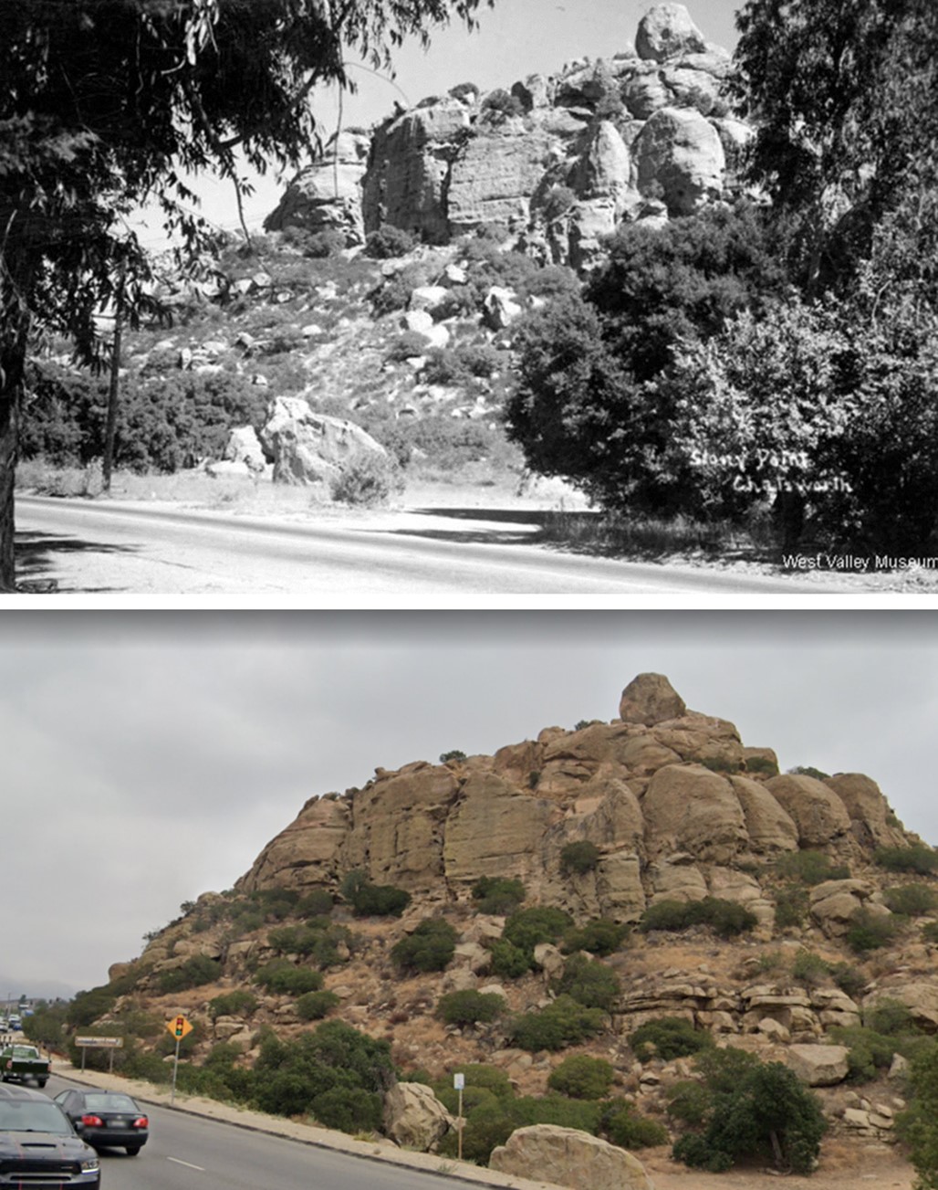
| (1935 vs 2022) - Stoney Point, Chatsworth. Some things never change. |
Historical Notes Click HERE to see more early views of Stoney Point. |
 |
|
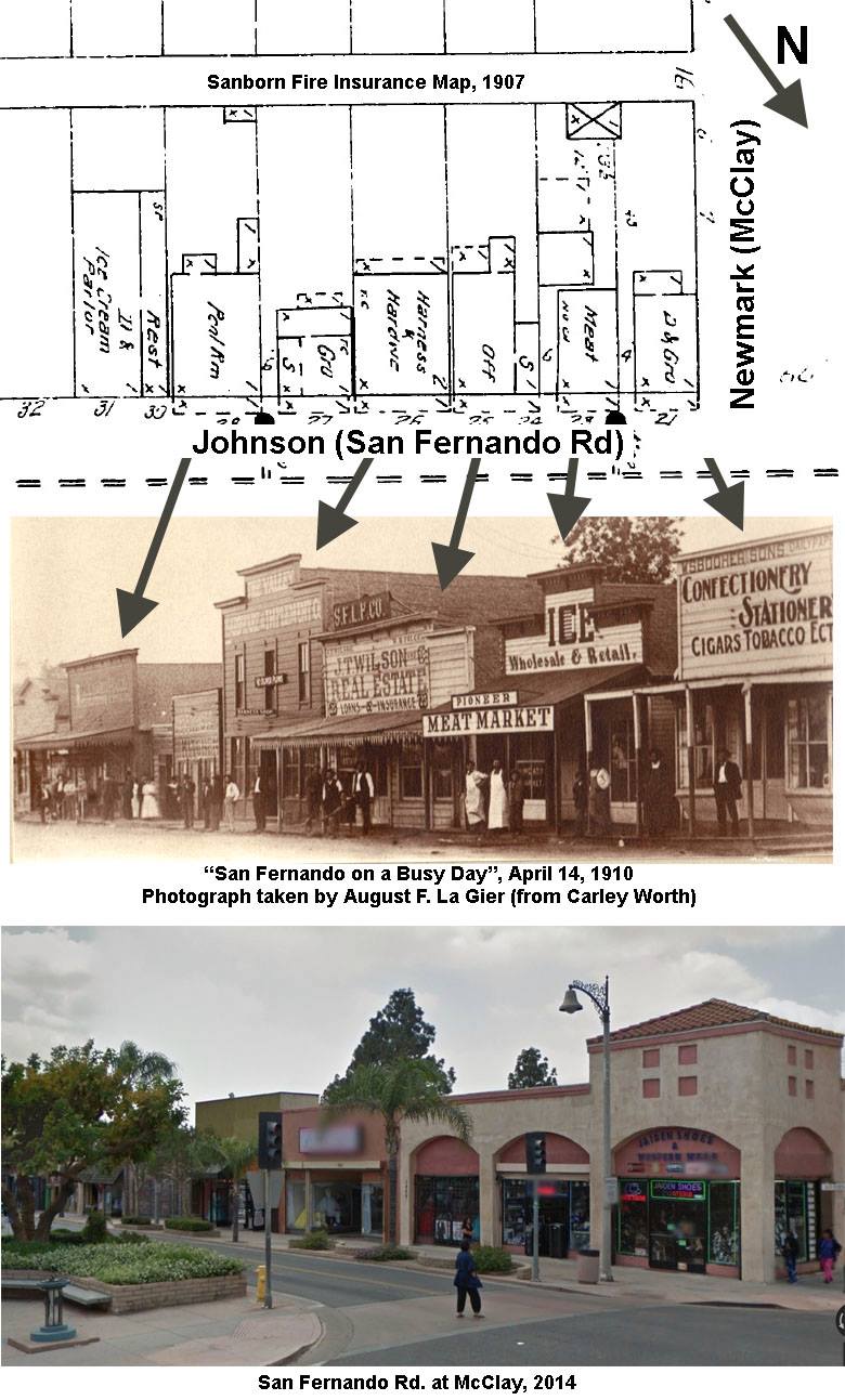
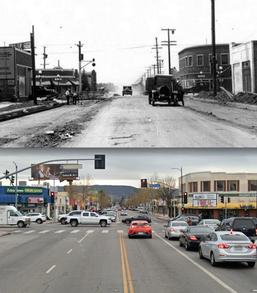
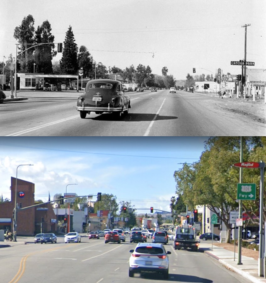
| (1910 vs. 2014)* - View showing San Fernando Road at McClay. |
Historical Notes Click HERE to see more Early Views of the City of San Fernando. |
 |
|
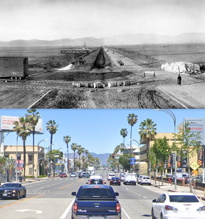
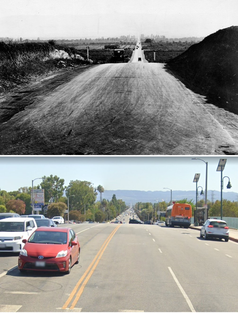
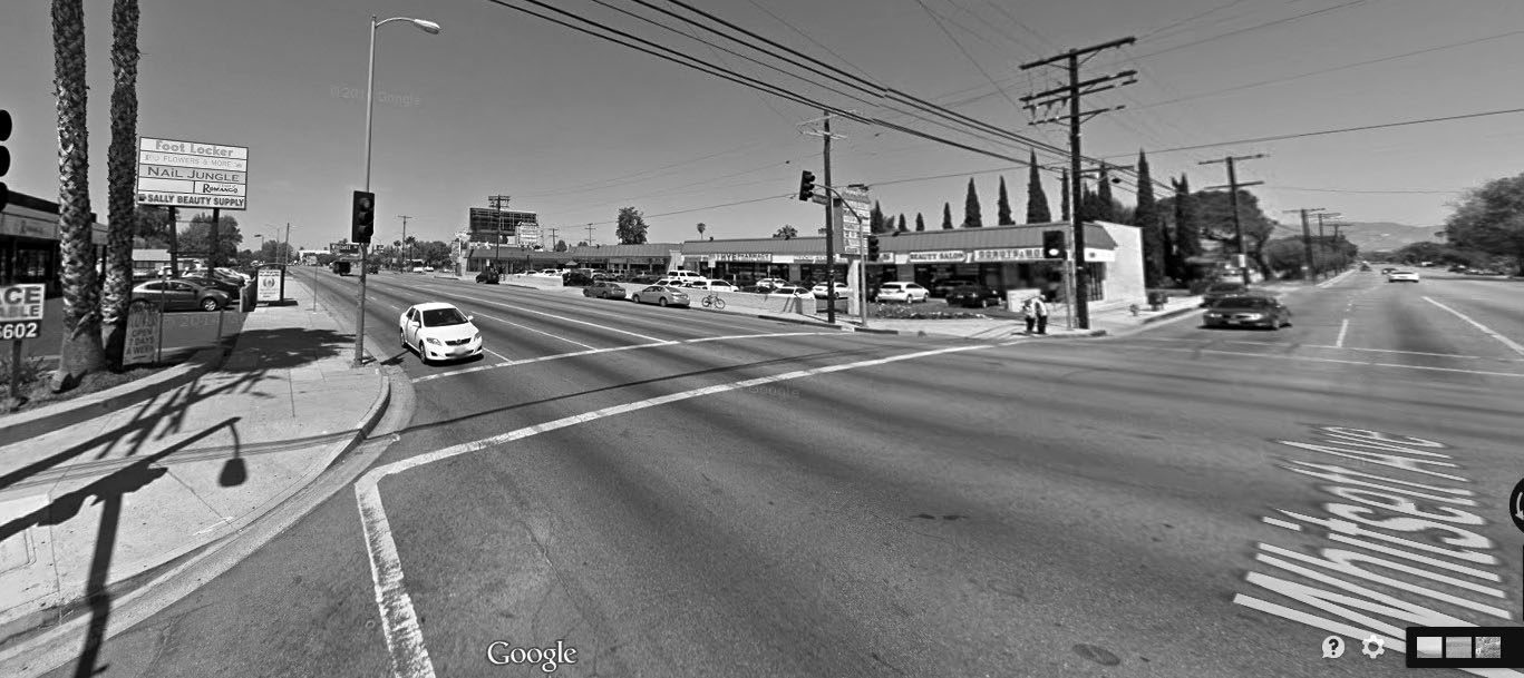
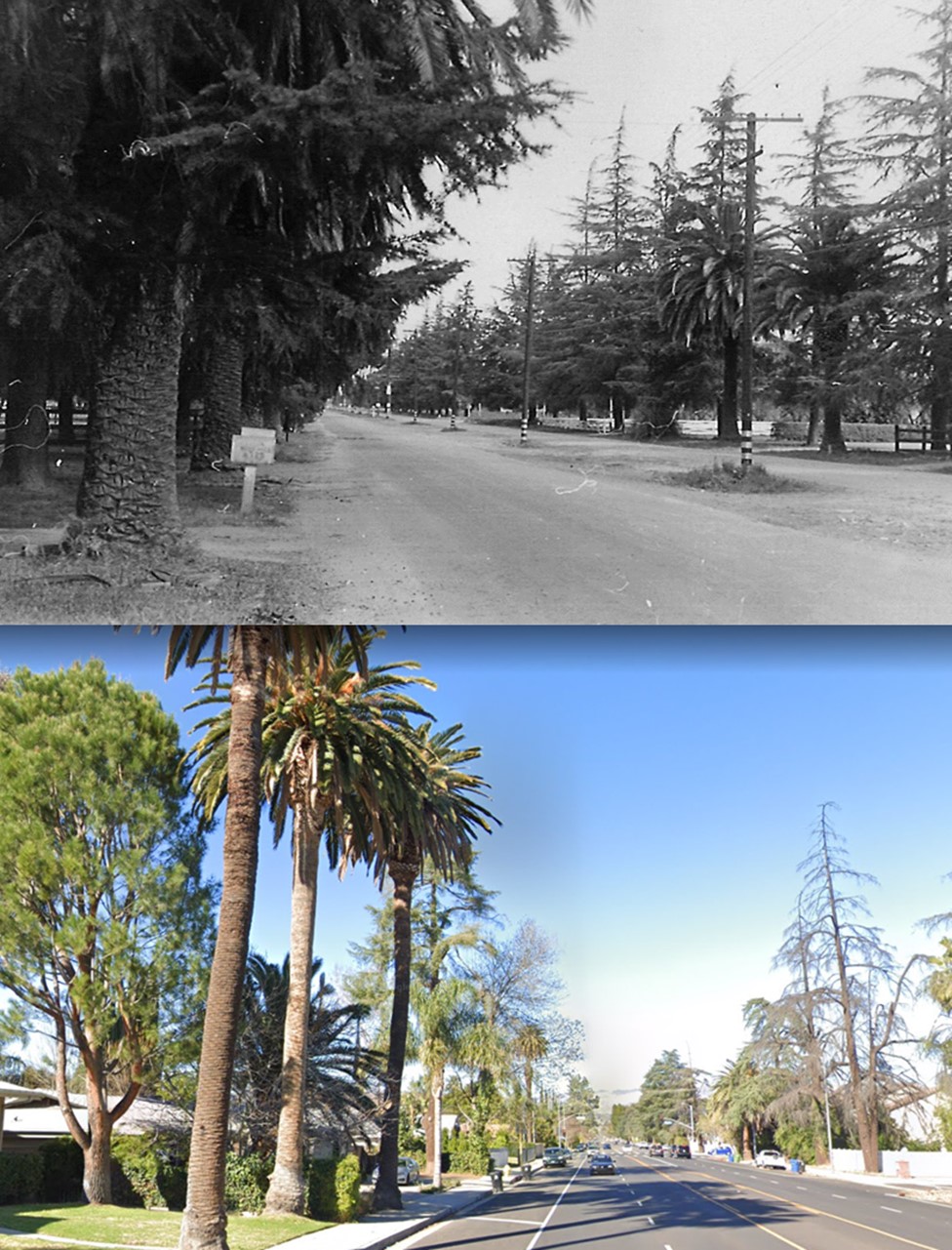
| (1911 vs. 2021) - View looking North on Van Nuys Boulevard from near Delano Street. Virginia Street (seen in above photo) later became Sylvan Street. |
Historical Notes Click HERE to see more early views of Van Nuys - "The Town That Started Right" |
 |
|
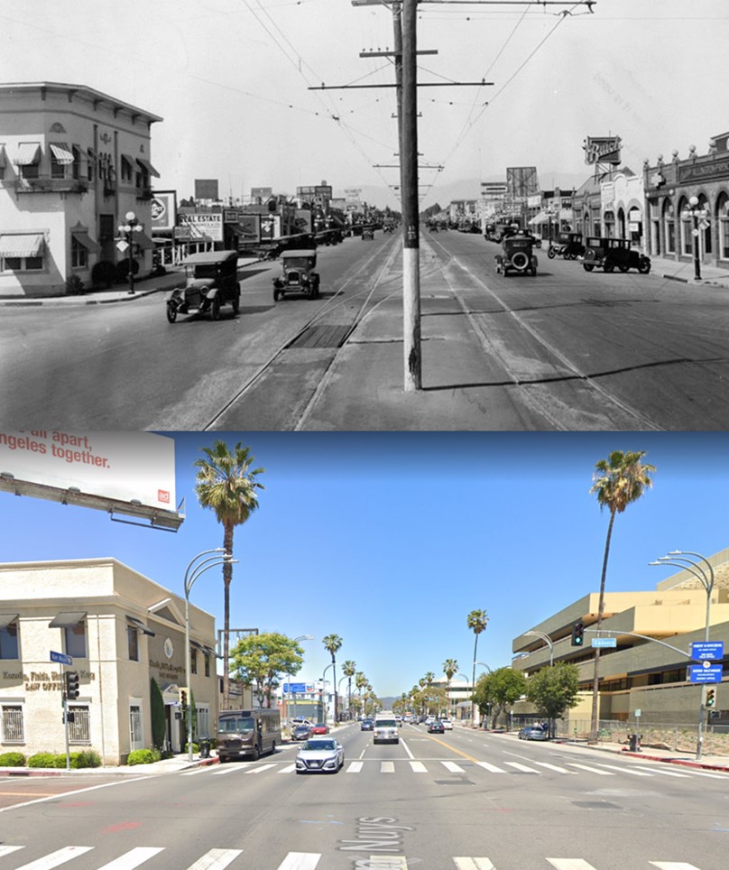
| (1927 vs 2021)* – Looking north on Van Nuys Boulevard at Calvert Street. Note the streetcar tracks and pole line down the center of Van Nuys Blvd. Also, the building on the NW corner appears to have survived albeit modified. |
 |
|
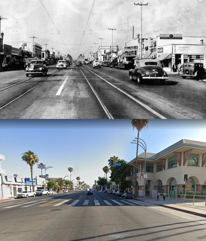
| (1946 vs 2021)* – Looking north on Van Nuys Boulevard at Erwin Street showing streetcar tracks running down the center of the street. The Rivoli Theatre can be seen in upper right, today site of the Marvin Braude San Fernando Valley Constituent Service Center. |
 |
|
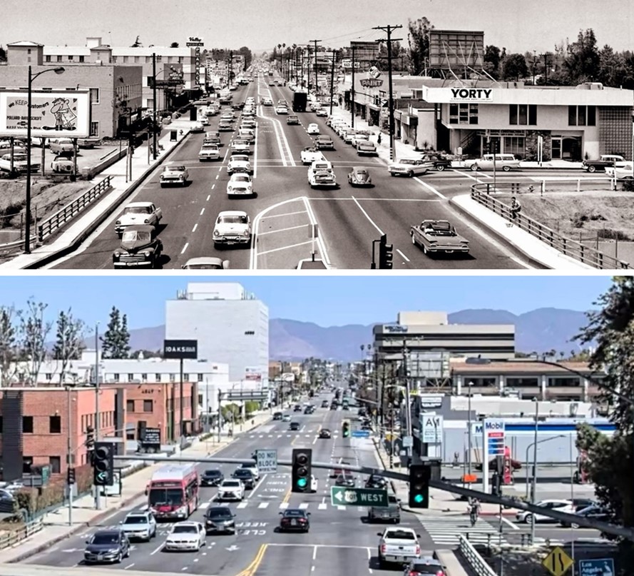
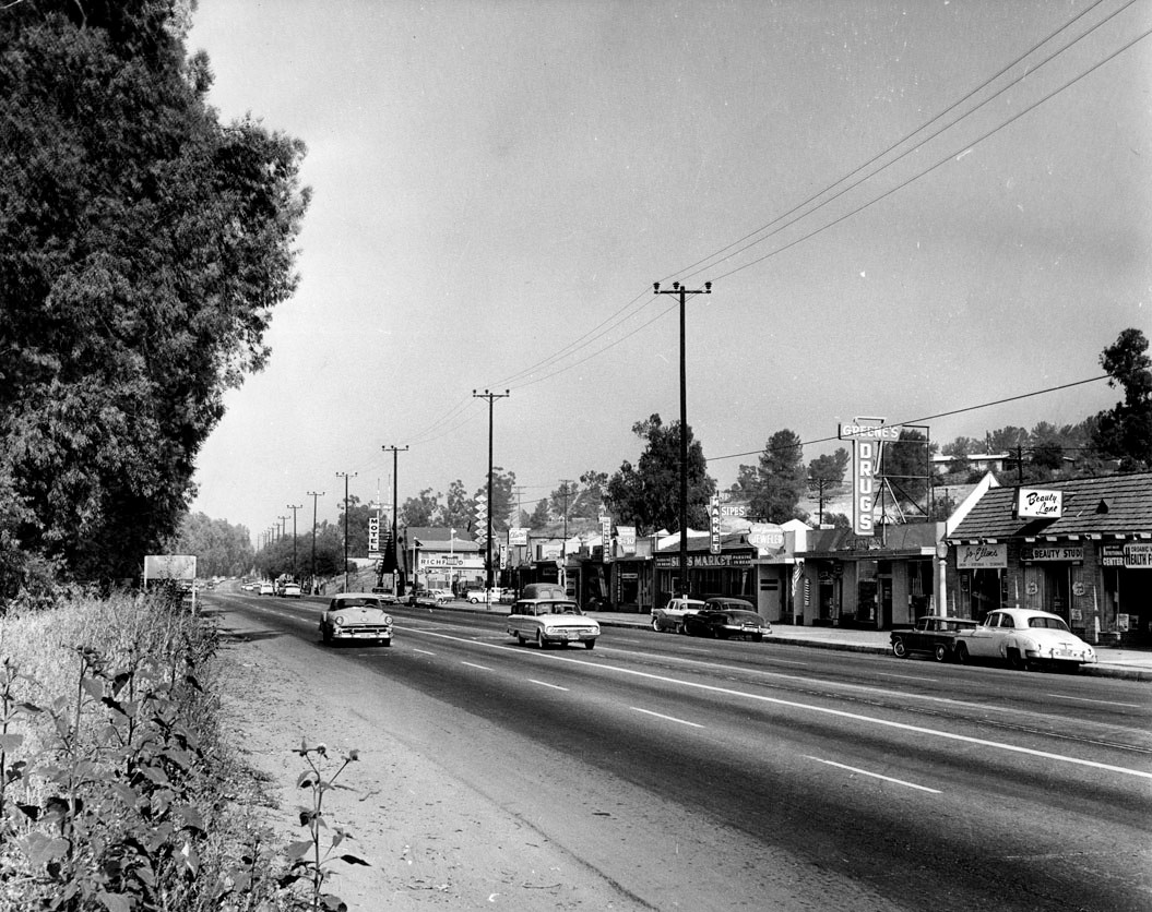
| (1961 vs. 2021) - Looking north on Van Nuys Blvd from the Ventura Fwy (US-101). |
 |
|
| (1929 vs. 2022)* - Reseda Boulevard looking south from near Devonshire Street. |
Historical Notes The surrounding community grew on land that was once part of the Hawk Ranch. It's first name became Zelzah. The name then changed to North Los Angeles for a short period of time and then changed again to Northridge. Click HERE to see more. |
 |
|
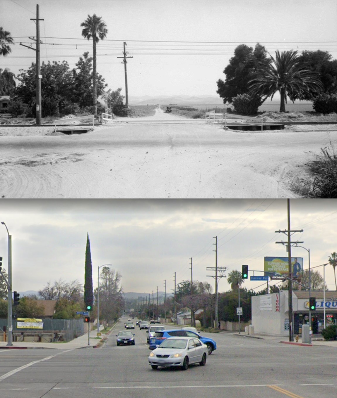
| (1926 vs. 2021)* - View looking south on Resdea Boulevard toward Sherman Way. |
Historical Notes Reseda originated as a farm town named "Marian" (or "Rancho Marian") that appeared in 1912. Its namesake, Marian Otis Chandler, was the daughter of Los Angeles Times publisher Harrison Gray Otis, a director of the Los Angeles Suburban Homes Company. H J Whitley was the manager of the Los Angeles Suburban Home Company. The Western Division of the Pacific Electric Railway 'Red Cars Line' expedited development after the Los Angeles Aqueduct brought water to the City of Los Angeles in 1913. Soon, thereafter, Marian would be annexed by the City.*^ |
 |
|
| (1932 vs. 2021)*– View looking south on Mason Ave across Sherman Way. Click HERE to see more. |
 |
|
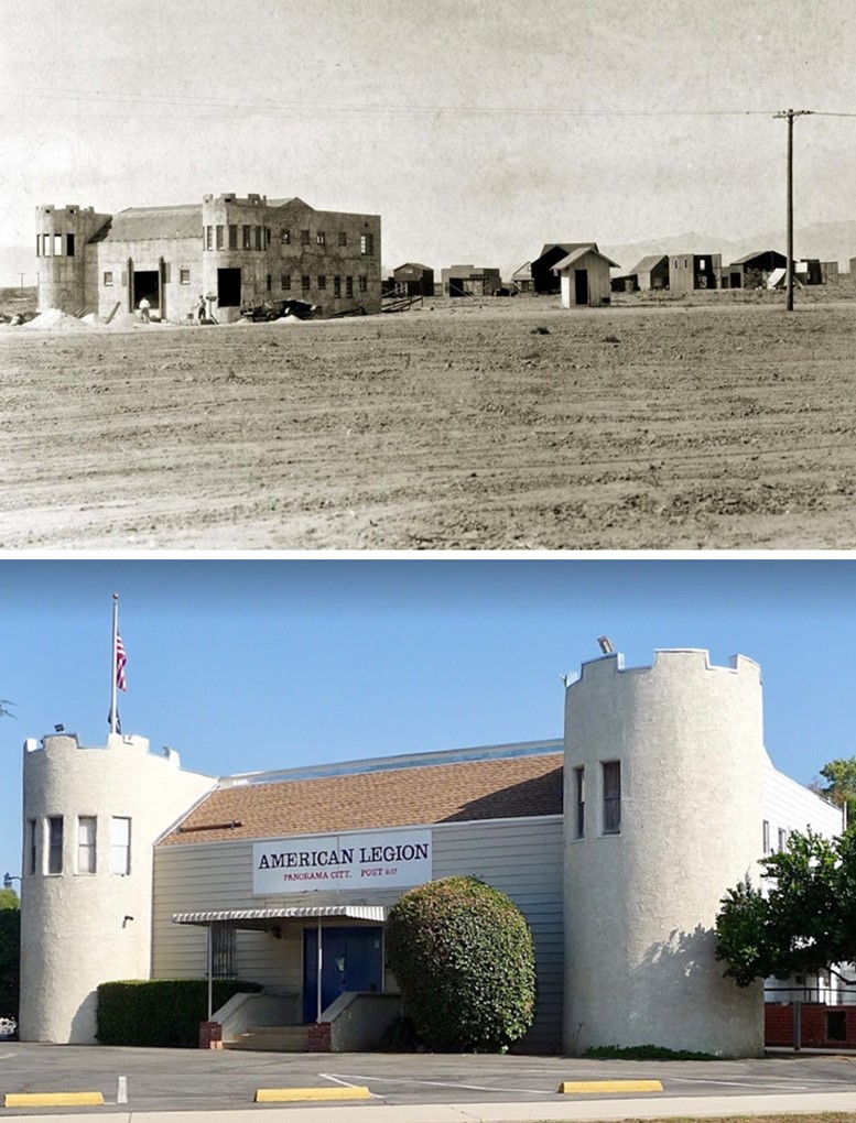
| Then and Now - Regan Studios in 1925 and, today, the American Legion Post 817 in Panorama City - 13553 Reedley Street. |
Historical Notes According to film historian Robert "Bob" Birchard, American Legion Post 817 located at 13553 Reedley St., Panorama City, CA 91402, was originally built in 1926 as the administration building for the Thomas C. Regan Studio. The architect was H.B. Pentland of Van Nuys. The castle like structure was part of a silent motion picture studio that, alas, never released any commercially-made films, which of course, begs the question: was the company's films so bad that they could not find distribution, did the company make non-commercial films or did the company run out of money before it could even take off as a business? Typical of many Los Angeles area buildings, there are alternative histories steeped more in folklore than in documented fact. In the following article from the Los Angeles Times in 1999, the history of the building might have had a colorful past apart from its silent film connection. Click HERE to read more. |
 |
.jpg) |
|
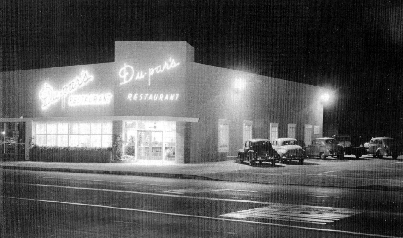
| (ca. 1948) - Du-par's Restaurant at 12036 Ventura Boulevard, Studio City. | (2014) - Du-par's Restaurant at 12036 Ventura Boulevard, Studio City. |
 |
 |
|
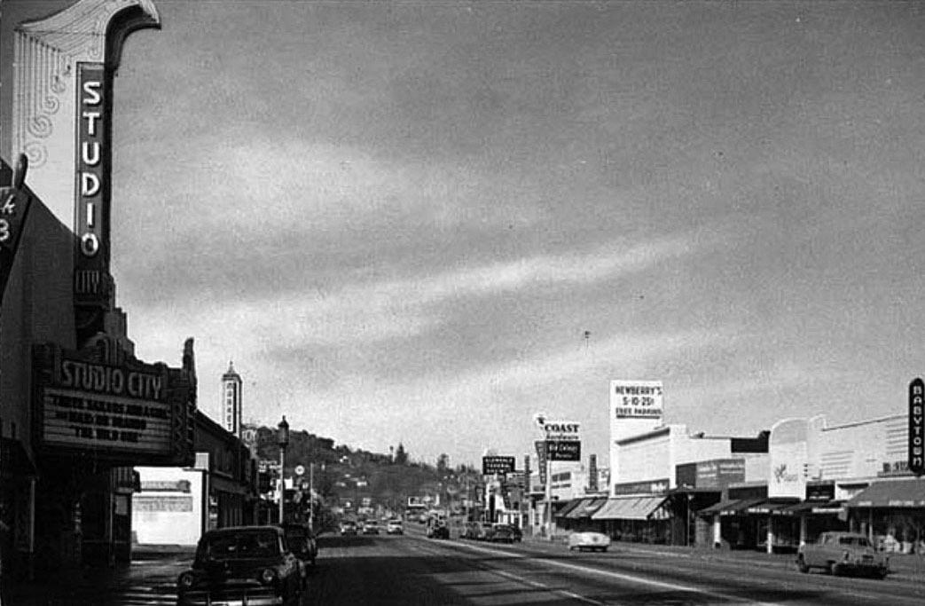
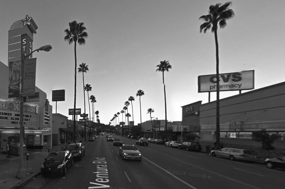
| (1950s)^^^* – Looking west on Ventura Boulevard, Studio City. | (2014)#*^# – Looking west on Ventura Boulevard, Studio City. |
 |
|
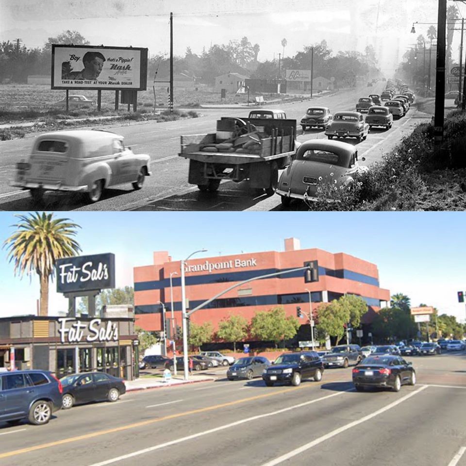
| (1953 vs. 2019)^ - Ventura Blvd. looking East at Balboa Blvd. |
 |
|
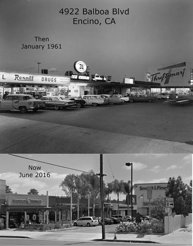
| (1961 vs. 2016)^ - 4922 Balboa Blvd in Encino. Aside from the store names and facades, not much has changed. Note that the Thriftimart is now a Smart and Final. Photo courtesy of Dean Fields. |
 |
|
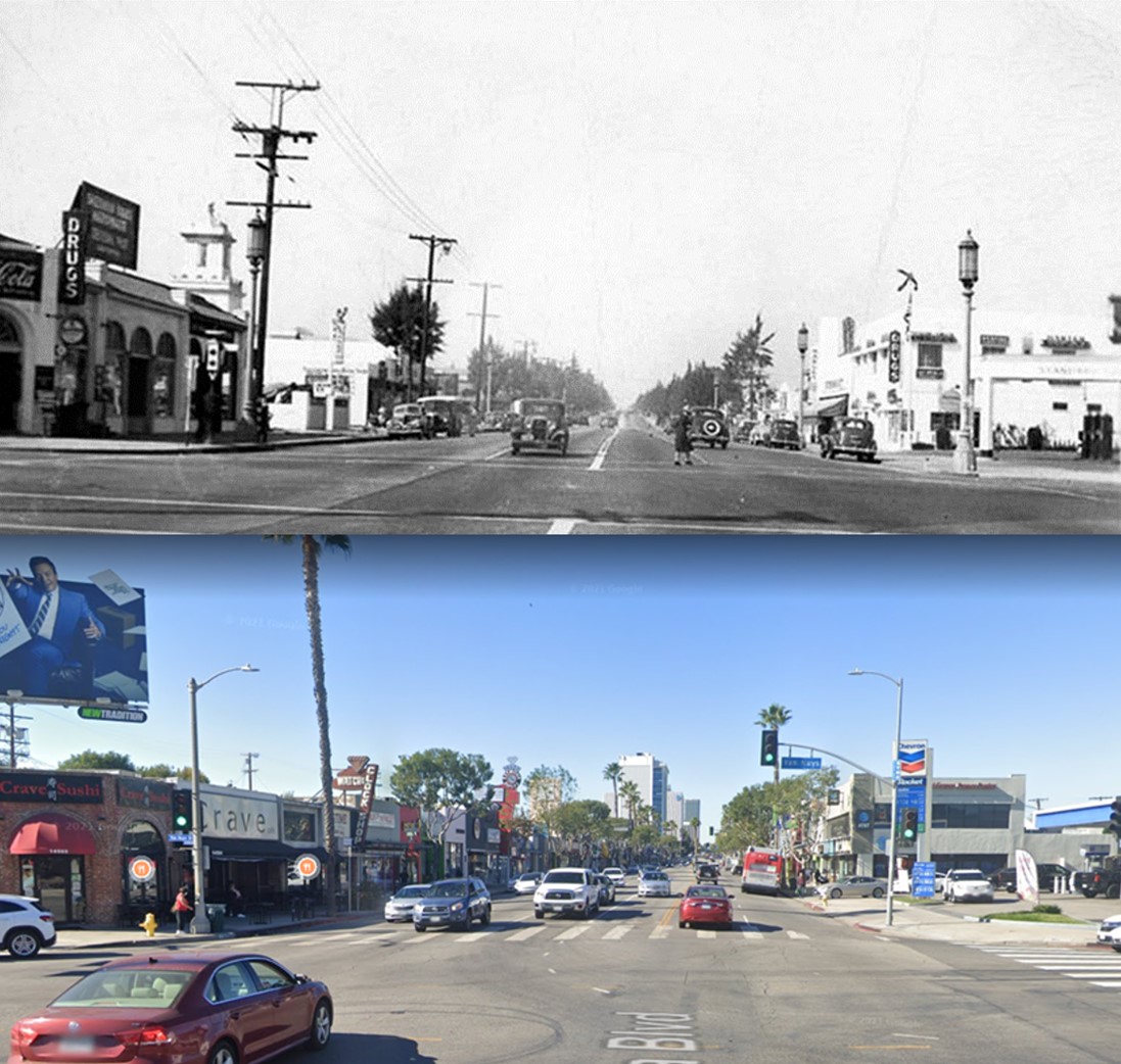
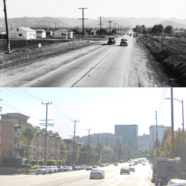
| (1940s vs 2021)* - Looking west on Ventura Boulevard at Van Nuys Boulevard. |
 |
|
 |
|
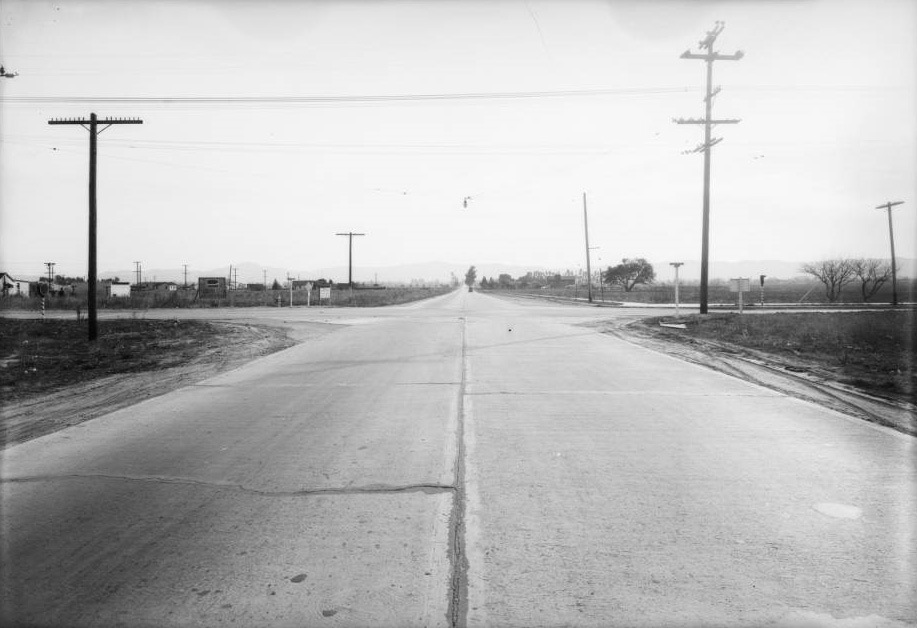
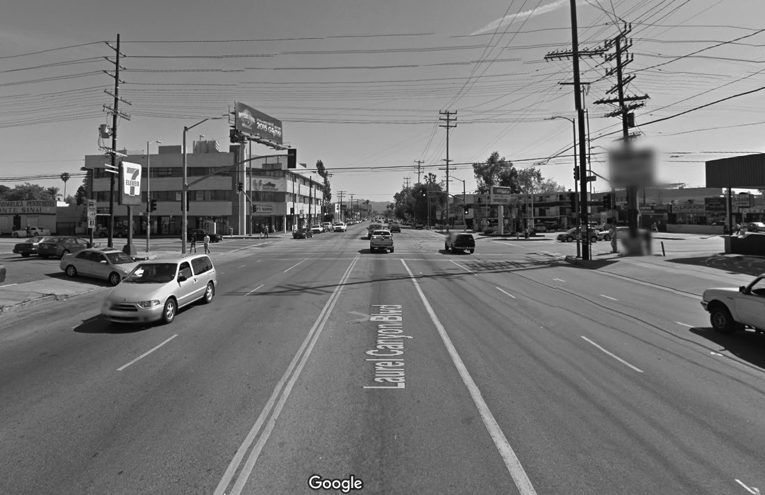
| (1931)*#^# vs. (2015)#*^# - View looking south on Laurel Canyon Blvd. at Vanowen Street. |
 |
|
| (1939 vs. 2022)* - View of Sepulveda Boulevard looking south from Magnolia Boulevard. |
 |
|
 |
|
| (1920)* vs. (2016)#*^# - Aerial/Satellite view showing the area that became Republic Studios and today is CBS Studio Center. The major street runnning diagonally (lower-right to upper-left) is Ventura Boulevard. The LA River loops around the facility. Laurel Canyon Boulevard can be seen in the upper-left corner of the bottom image. |
 |
 |
|
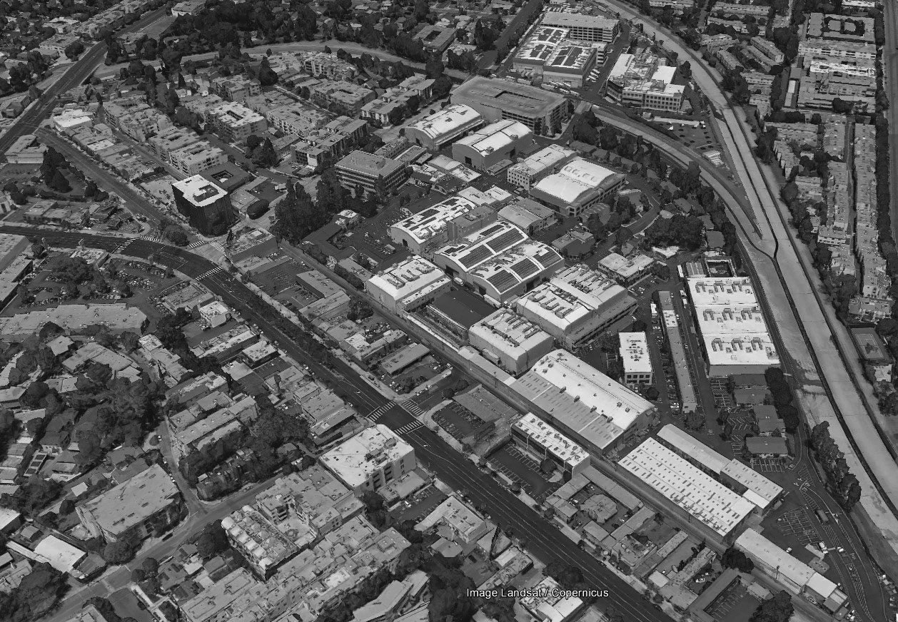
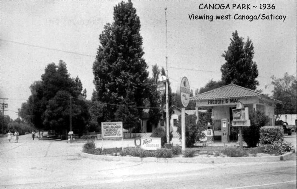
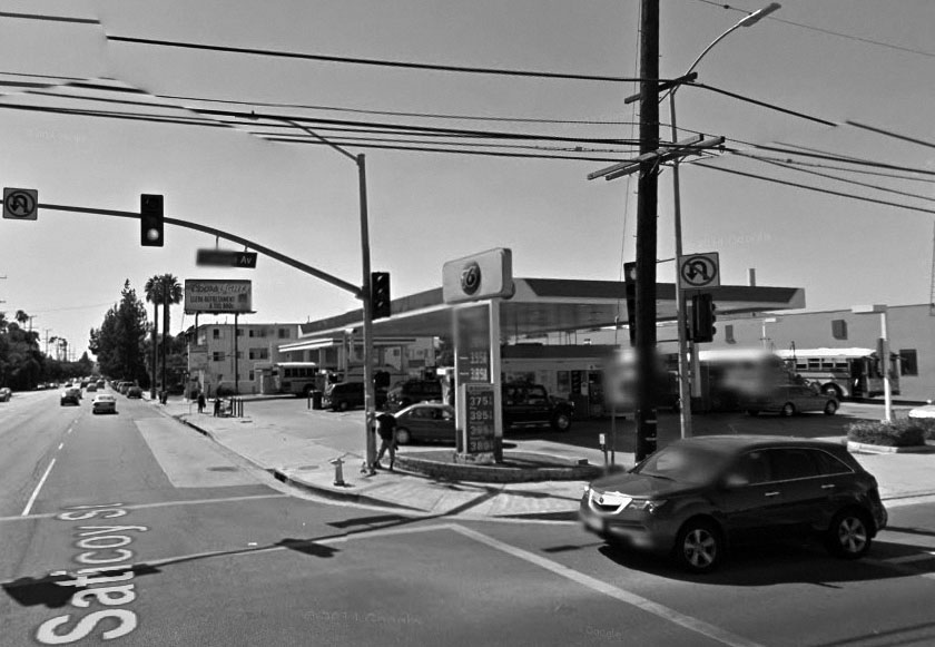
| (ca. 1936)#^*^ - Northwest corner of Saticoy St. and Canoga Ave. | (2014)#*^# - Northwest corner of Saticoy St. and Canoga Ave. |
 |
 |
|
| (1940s)^^^* - View looking northwest at the intersection of Whitsett and Victory. | (2014)#*^# - View looking northwest at the intersection of Whitsett and Victory. |
 |
|
 |
|
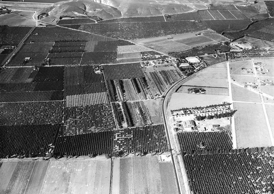
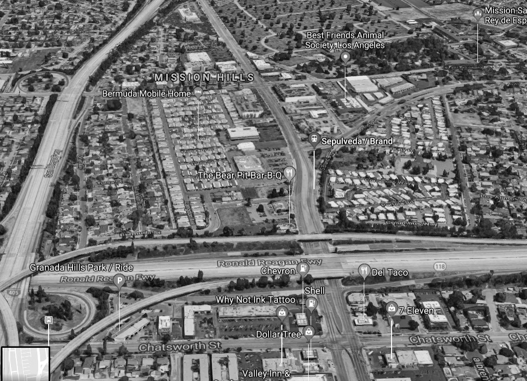
| (1935 vs. 2019)** - Mission Hills Then and Now |
 |
|
 |
|
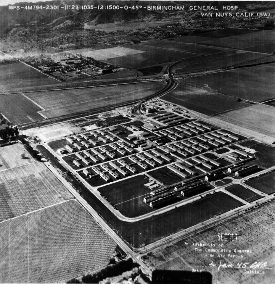
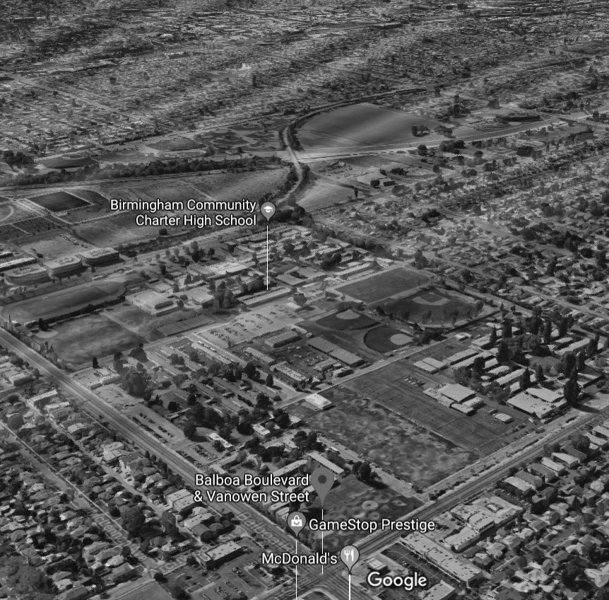
| (1945) vs. (2017)#*^# - Today, three schools sit on the former Birmingham Army Hospital site: Mulholland Middle School, Daniel Pearl Magnet High School, and Birmingham Community Charter High School. |
Historical Notes The VA closed the hospital in 1950. After 1950 the facility was converted into local use for public schools, while the army retained a piece for use in the air defense of Los Angeles. Part of the former Birmingham Army Hospital facility was used as an air defense missile battalion headquarters from 1956 to 1968.^ |
 |
|
| (1940s vs 2021)* - View looking north on Shoup Ave towards Vanowen Street in West Hills. |
 |
|
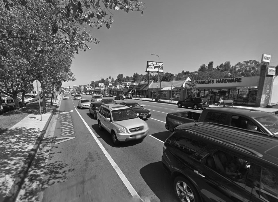
| (1949 vs. 2021)* – View looking west on Ventura Boulevard toward Topanga Canyon Boulevard in Woodland Hills. |
 |
|
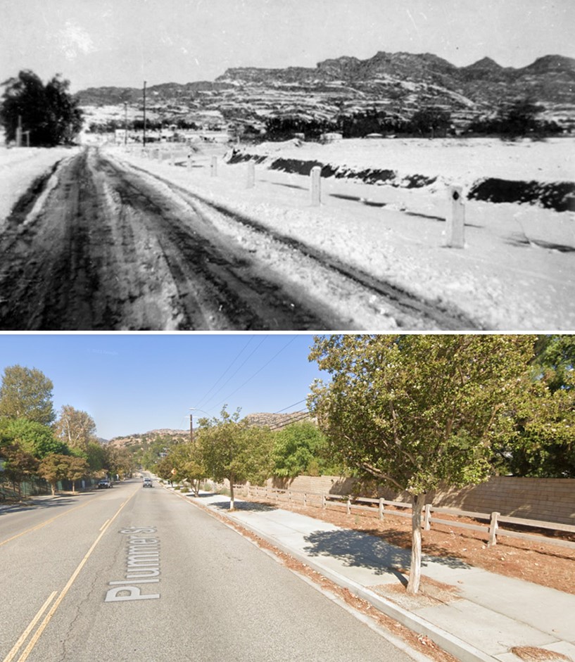
| (1949 vs 2022)* - Looking west on Plummer Street in Chatsworth toward the Santa Susana Mountains. Top photo was taken after snowfall on January 11, 1949. |
 |
|
 |
|
| (1962)* - (2015)* - Ventura Boulevard east of Topanga Canyon Boulevard. |
 |
|
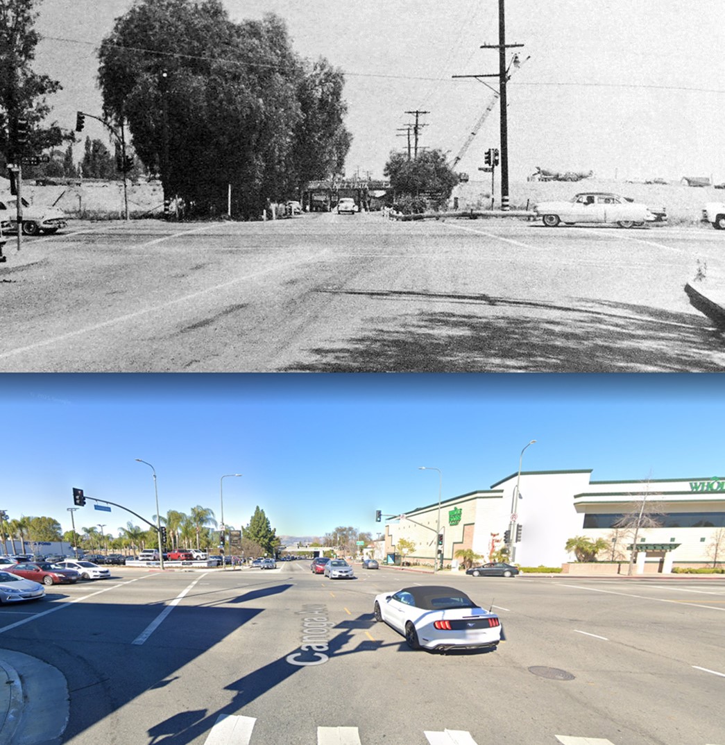
| (1957 vs 2021)* - Looking north on Canoga Avenue at Ventura Boulevard. |
 |
|
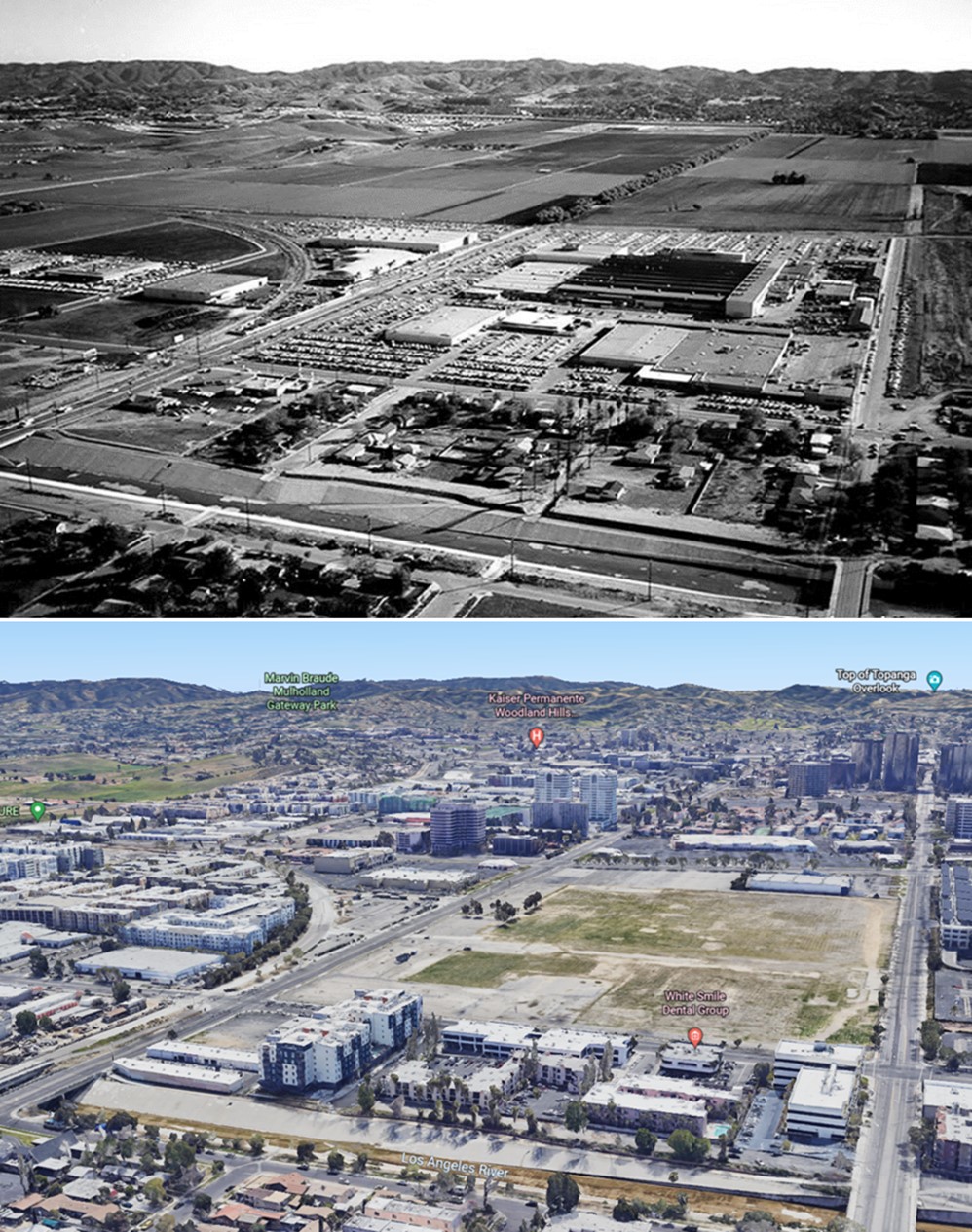
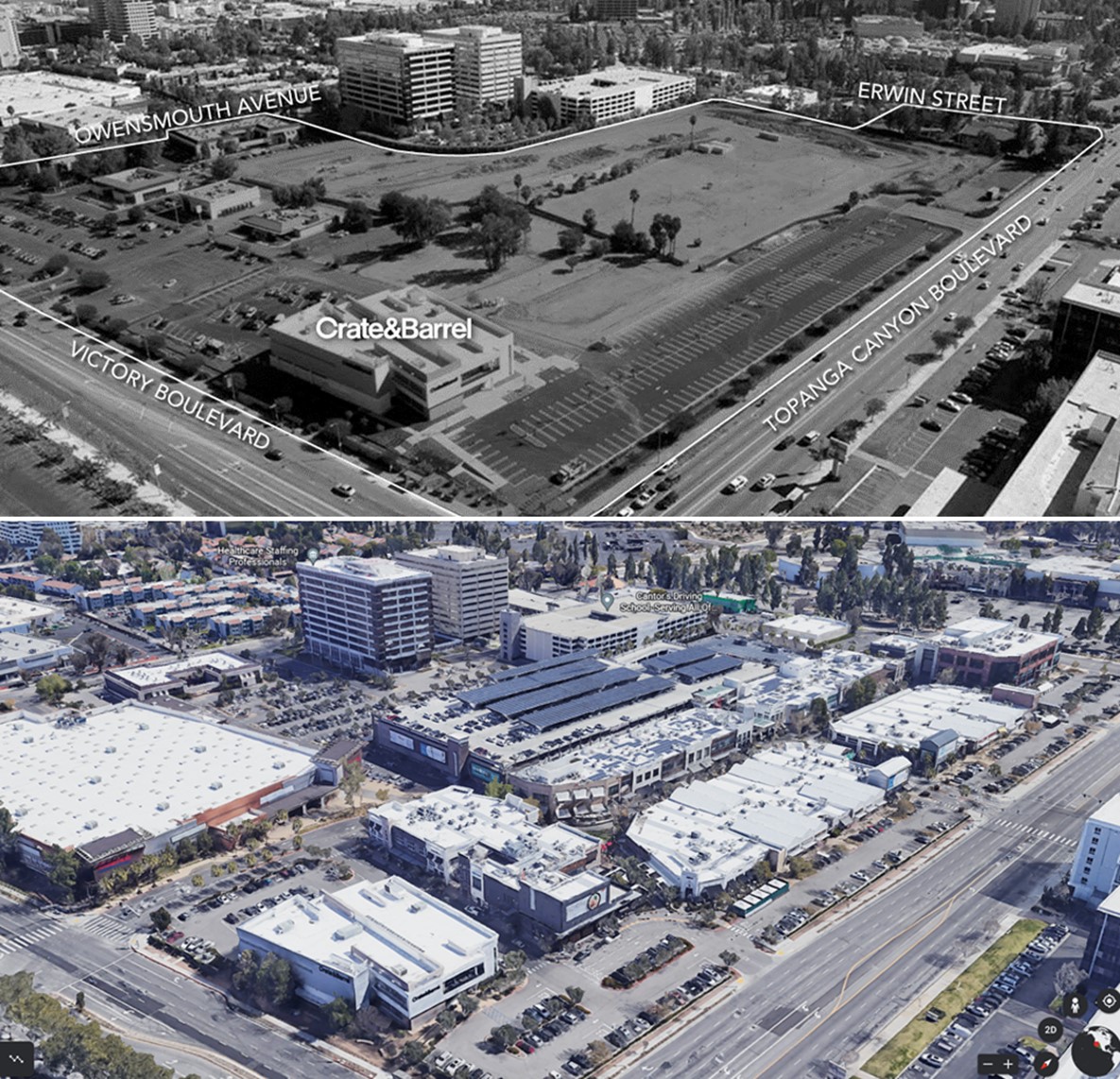
| (1960 vs 2022) – Aerial view looking southeast towards Warner Center. Canoga Ave is on the left running diagonally from lower left to upper right. Owensmouth is running away from the camera on the right. The headwaters of the LA River is seen at bottom. In earlier photo, the Rocketdyne facility is seen at center and Warner Center has yet to be developed. At center-right you'll notice that Topanga Plaza has not been built yet. Wouldn't be open for another 4 more years. Click HERE to see more. |
 |
|
| (2010s vs 2022) - The Village at Westfield Topanga |
Historical Notes This was the previous site of the Topanga Amusement Center and Topanga Theatre back in the 1970s. Click HERE to see more. |
 |
|
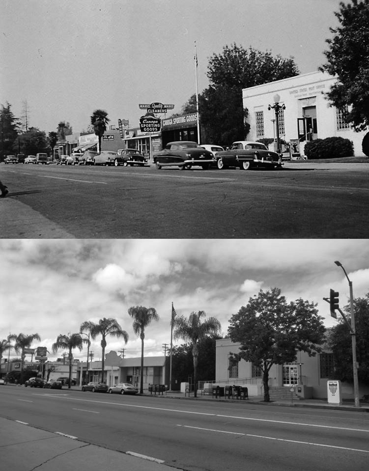
| (1955 vs. 2018)#^*^ – View looking northwest on Sherman Way from Jordan Avenue in front of Green Thumb Nursery showing the Post Office across the street at 21801 Sherman Way. |
 |
.jpg) |
|
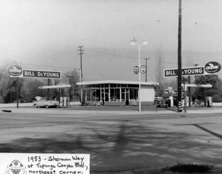
| (1953)#^*^ - N/E Corner of Sherman Way and Topanga Canyon Boulevard | (2014)#*^# - N/E Corner of Sherman Way and Topanga Canyon Boulevard |
Then and Now
 |
|
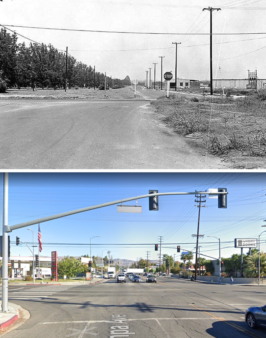
| (1960 vs. 2022)* - Looking north on Tampa Avenue at Parthenia Street in Northridge. |
 |
|
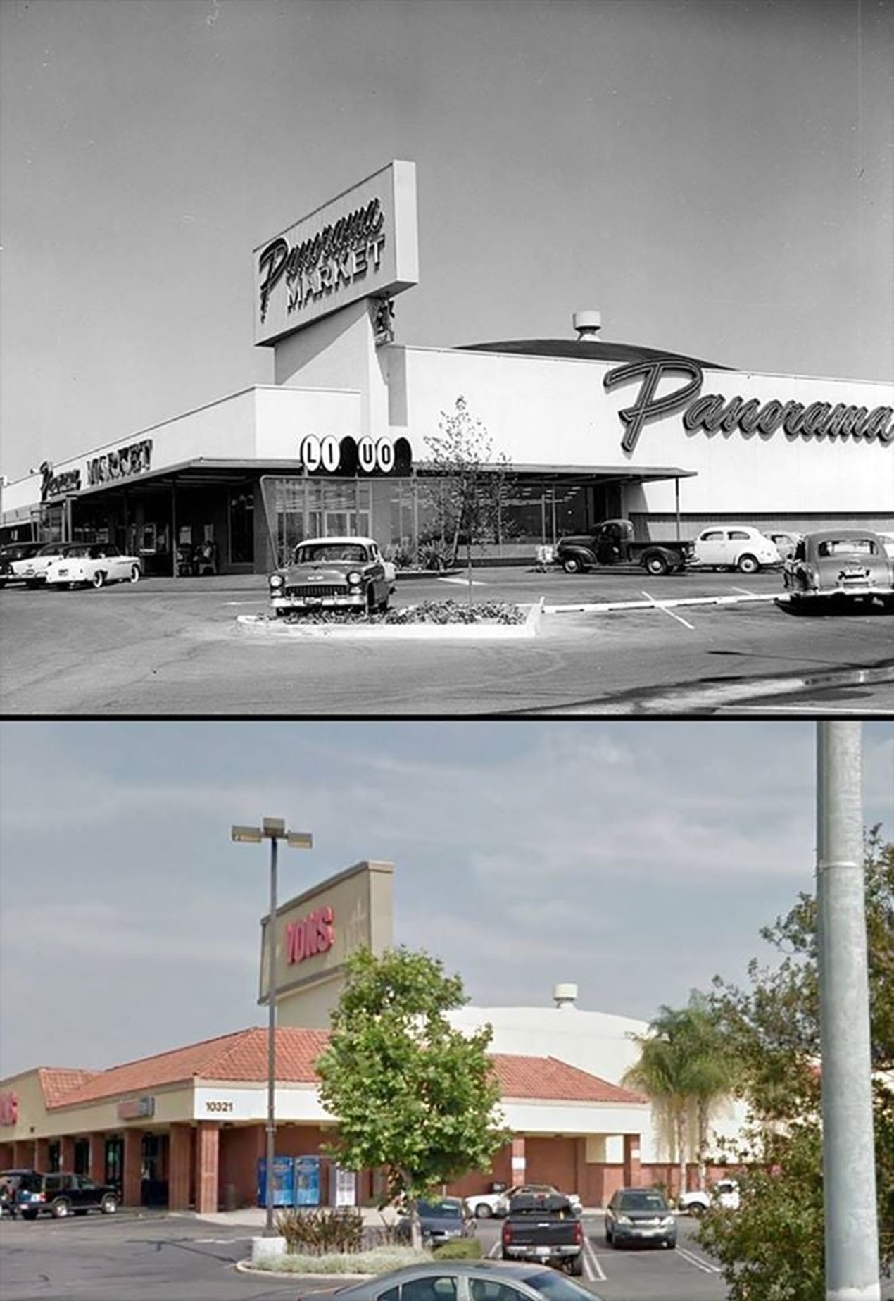
| (1957 vs 2010s)* - Panorama Market….Today a Von’s |
| (1949 vs. 2014)* – View of the Lankershim Boulevard underpass at the Hollywood Freeway. View is looking North. |
 |
|
 |
|
| (1958 vs. 2019)* - Calabasas Road |
 |
|
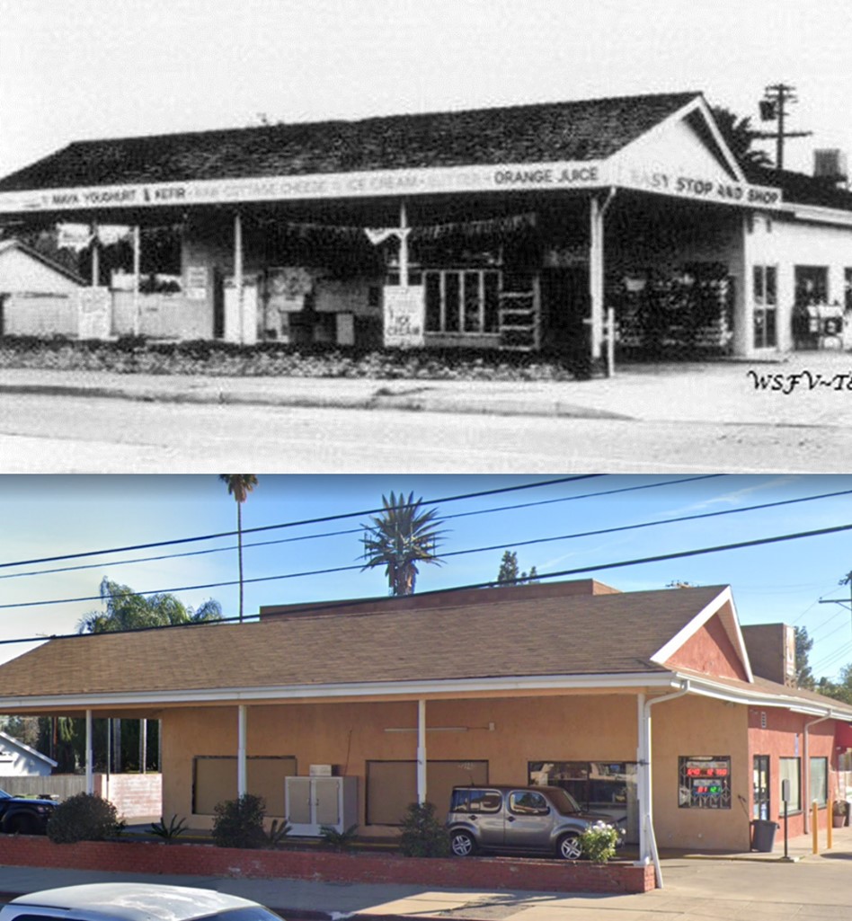
| (1960 vs 2021)* - Giacopuzzi Drive-thru Dairy (today Altadena Express Market) located on the SE corner of Saticoy Street and Fallbrook Avenue in West Hills. |
 |
|
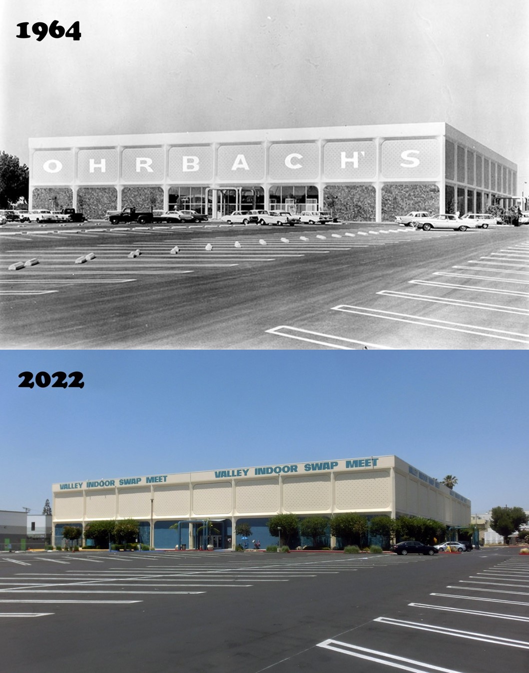
| (1964 vs. 2022)* - The Ohrbach’s Panorama City store closed in 1986, and the building has since served as the Valley Indoor Swap Meet. |
 |
|
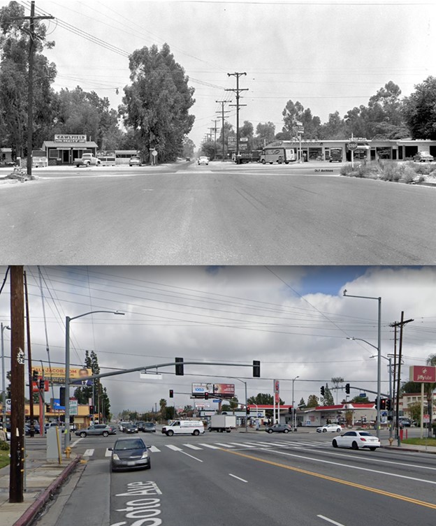
| (1957 vs. 2021)* – View looking north at the intersection of De Soto and Roscoe. |
 |
.jpg) |
|
| (1980s)^**^ - Aerial view of the Winnetka 6 Pacific Drive-In, Chatsworth. | (2014)#*^# – Google satellite view of the Winnetka Pacific Theatres, Chatsworth. |
Historical Notes The Winnetka Drive-In was the last drive-in to be built (1976) and the last to close (1996) in the San Fernando Valley. |
 |
|
 |
|
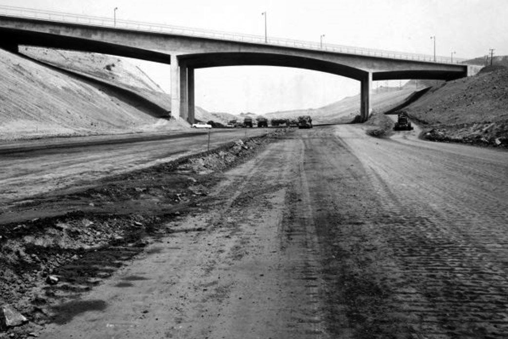
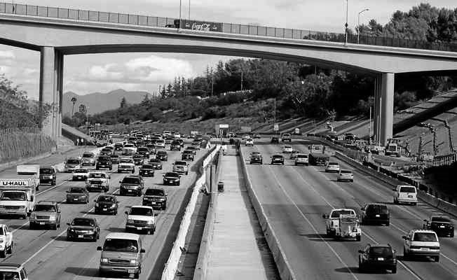
| (1961)#^*^ vs. (2014)#*## - View looking north toward the Mulholland Dr. Bridge. 2014 Photo by Dean Musgrove |
Historical Notes In 2012, 52 years after it was originally built, the Mulholland Dr. Bridge was demolished and reconstructed to accommodate the widening of the I-405 freeway. The new bridge was widened by approximately 10 feet and designed to the latest seismic standards.^*^* |
 |
|
| (1960s vs. 2010s) - Spahn Ranch - Then and Now |
* * * * * |
|
Other Sections of Interest |
|
Water and Power in Early LA |
|
Newest Additions |
New Search Index |

A new SEARCH INDEX has been added to help navigate through the thousands of topics and images found in our collection. Try it out for a test run.
Click HERE for Search Index |
* * * * * |
< Back