Early Los Angeles Historical Buildings (1800s)
Historical Photos of Early Los Angeles |
 |
|
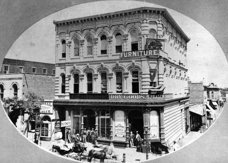
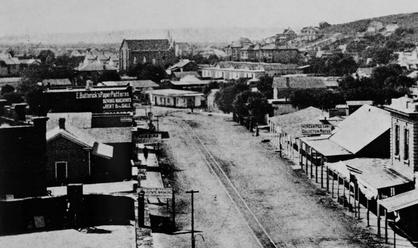
| (ca. 1882)* - Hardware Store of C. Ducommun, dry goods store of S. Prager and a furniture store at 204 N. Main Street (after 1890 at 304 N. Main Street) are shown. The 1883-4 edition of the city directory lists C. Ducommun Hardware at this location. |
Historical Notes Charles Louis Ducommun, a watchmaker by training, emigrated to the US from Switzerland in the early 1840s. He started a general store, providing supplies (and credit) to gold prospectors and other pioneers who had settled in the burgeoning pueblo of Los Angeles. Ducommun Street was named for Charles Louis. |
 |
|
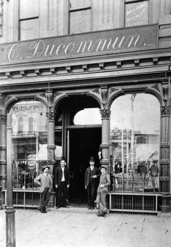
| (1886)* - Facade of the hardware store of C. Ducommun at 204 N. Main Street (after 1890 at 304 N. Main Street). |
 |
|
| (1898)#*^* - View looking north on Main Street showing the Baker Block in the background. Pedestrians are seen crossing the streetcar tracks on Main Street in front of the Ducommun Building. One of the City's original 150-ft electric streetlights stands at center of photo. Click HERE to see more in Early L.A. Streetlights. |
 |
|
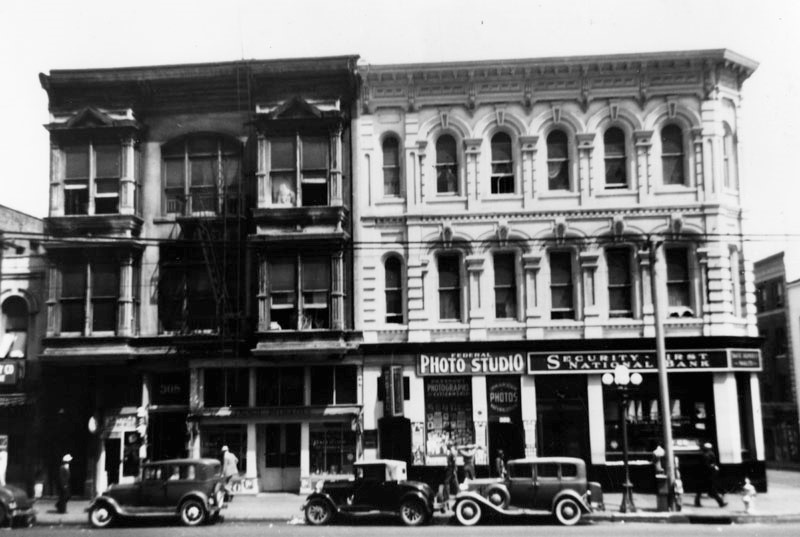
| (ca. 1930)* – View of the west side of North Main Street. Security First National Bank now occupies part of the Ducommun Building on the northeast corner of Main and Commercial streets. |
Historical Notes The Security First National Bank of Los Angeles became the Security Pacific National Bank and is now Bank of America. The Farmers and Merchants Bank was the oldest bank in Southern California from 1871 until 1956 when it was merged into the Security First National Bank of Los Angeles.* Click HERE to see more Early Views of the 300 Block of North Main Street. |
Charles Davis Residence
 |
|
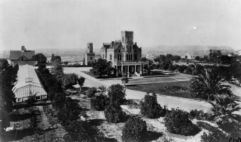
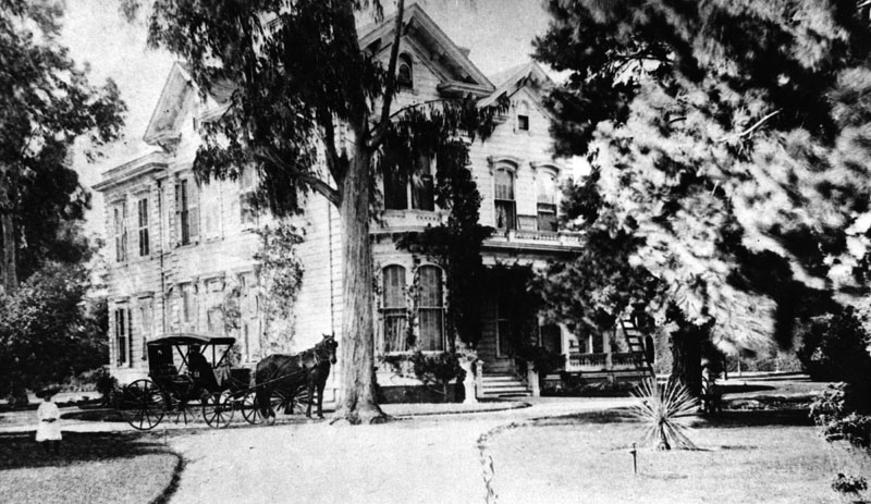
| (ca. 1880)* - Panoramic view of the home and grounds once belonging to Charles W. Davis. The house and its groves are identified as being on Boyle Ave. near Stephenson. Charles Davis was one of Los Angeles' earliest well known architects. |
First Presbyterian Church
.jpg) |
|
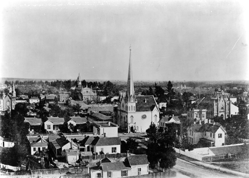
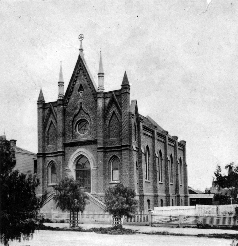
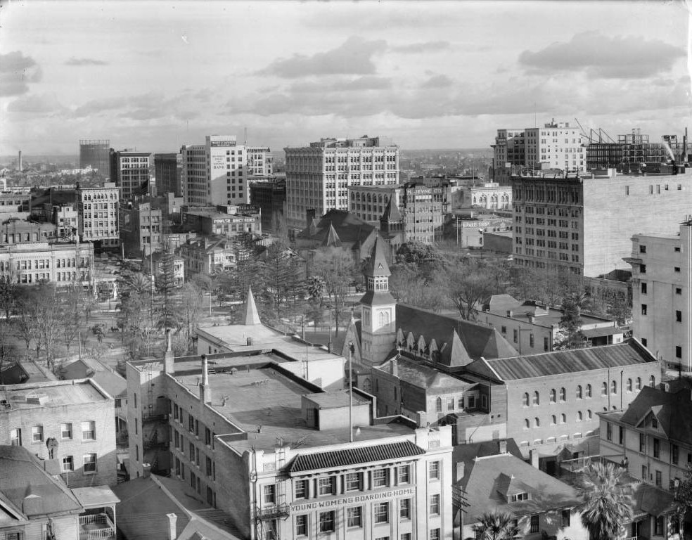
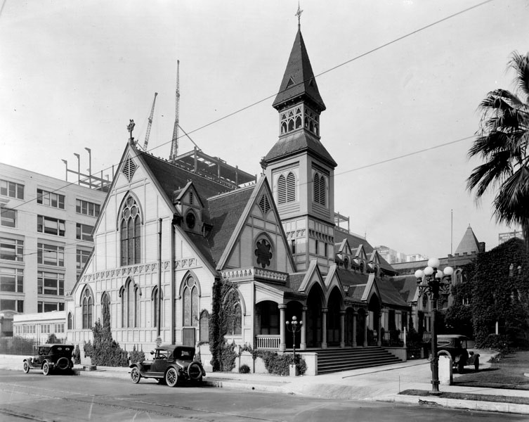
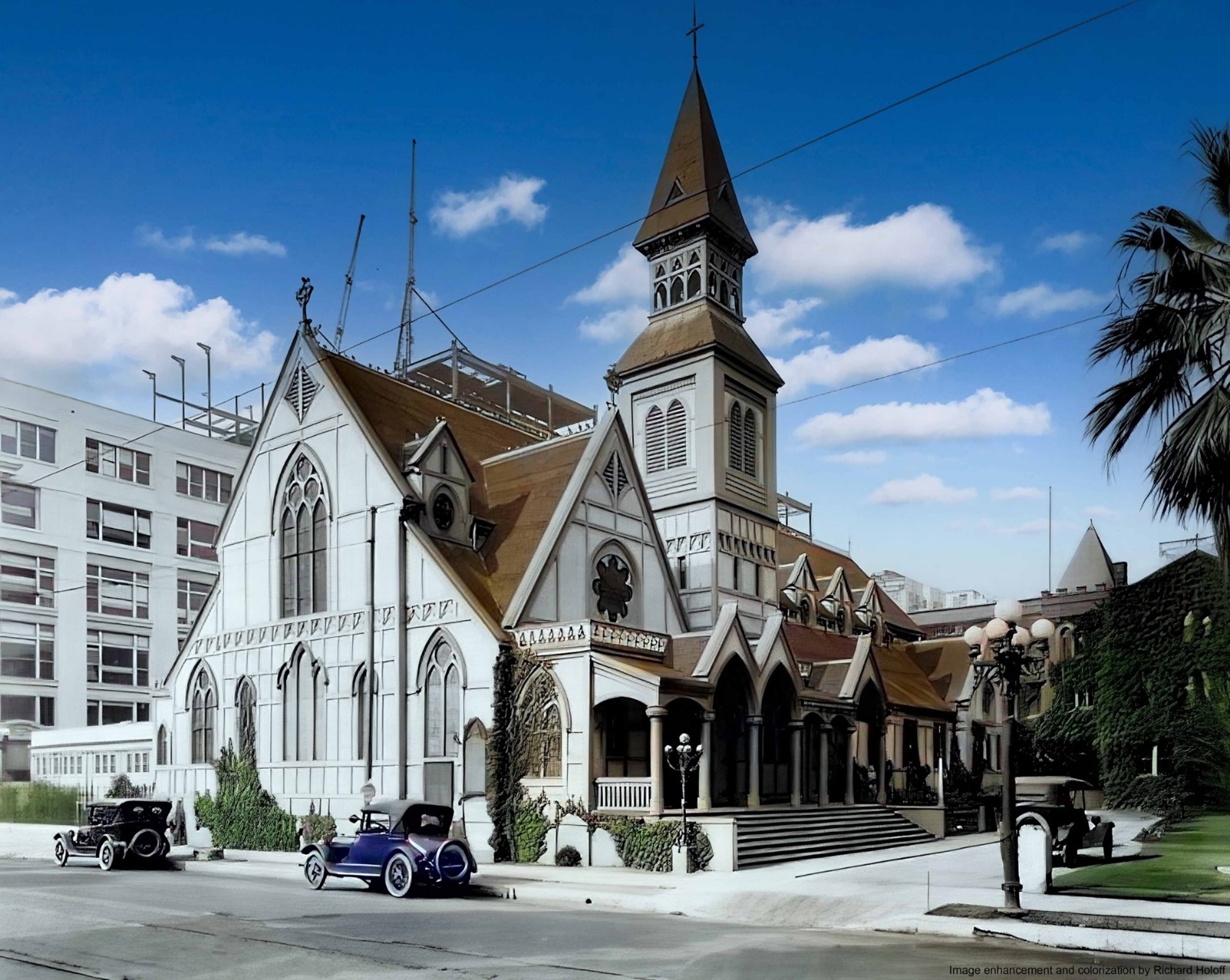
| (ca. 1880)* – View showing the First Presbyterian Church on the southeast corner of Second Street and Fort Street (later Broadway). A horse-drawn coach stands parked in the street to the right of the Gothic 1st Presbyterian Church and its impressively tall spire. A man stands in the unpaved street farther to the right. A wrought-iron fence enclosed a garden of topiary across the street to the left. The city's first Jewish Synagogue, B'nai B'rith Temple, can be seen behind the church to the right. To the right of the synagogue is the future home of LA's 3rd City Hall (1888-1928). |
 |
|
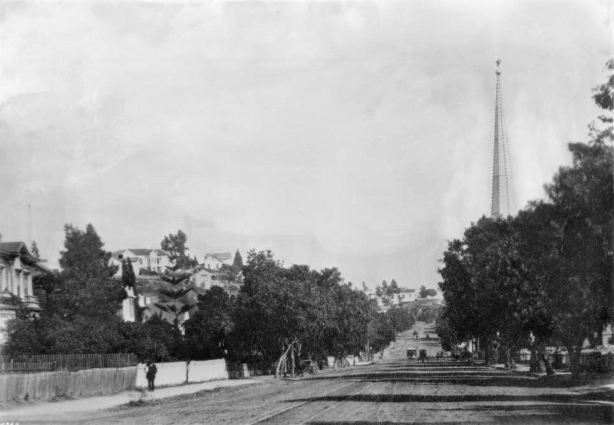
| (ca. 1882)* - View looking north on Fort Street (later Broadway) from Third Street. The spire of the First Presbyterian Church can be seen above the trees at right. |
 |
|
| (1880s)*- View looking SW from the Nadeau Hotel showing the First Presbyterian Churc on the SE corner of Fort Street (later Broadway) and 2nd Street. from Third Street. |
 |
|
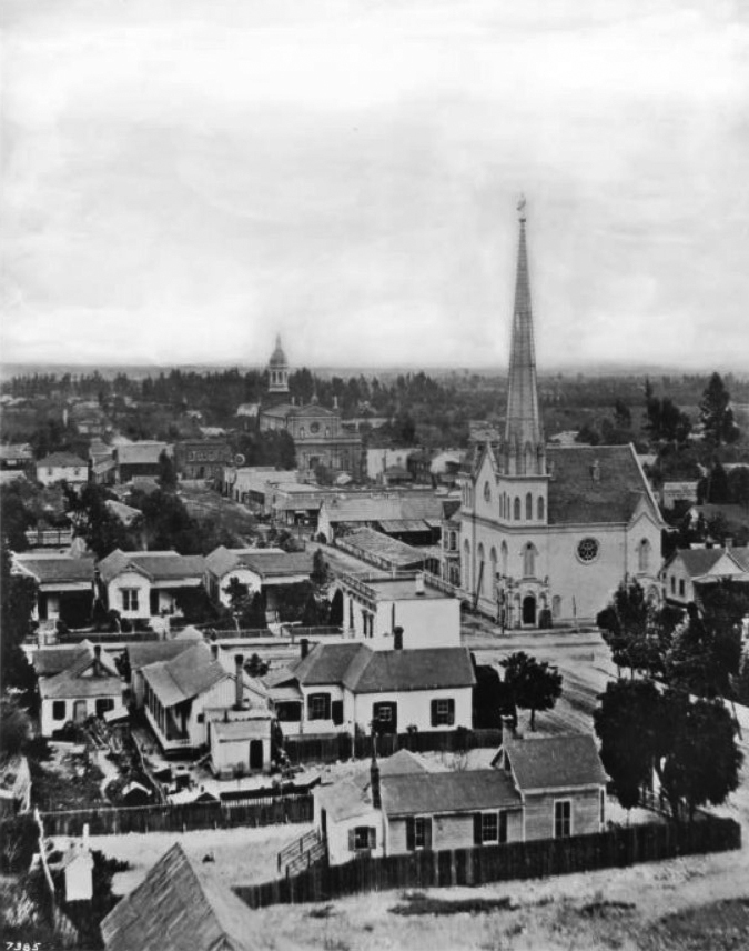
| (ca. 1884)* - View looking southeast showing the intersection of Second Street and Fort Street (later Broadway) where the First Presbyterian Church, with its impressively tall spire, stands on the southeast corner. In the distance, on the east side of Main Street just south of Second Street, is St. Vibiana's Cathedral. |
.jpg) |
|
| (ca. 1885)* – View looking east on 2nd Street from Olive Street showing the First Presbyterian Church in the distance on the S/E corner of 2nd and Fort (later Broadway). In the center of photo can see two cable cars of LA's first cable car system - The Second Street Cable Railway. |
Historical Notes The Second Street Cable Railway was the first cable car system to open in Los Angeles. Opened in 1885, it ran from Second and Spring Streets to First Street and Belmont Avenue. The completed railway was 6,940 feet long, just over a mile and a quarter, with a power house constructed in the middle, at Boylston Street. It was a single track system, with sidings where a down-hill car could coast past an up-hill car.^* |
 |
|
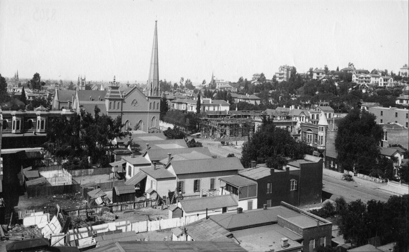
| (ca.1886)* - Churches and small business are interspersed with homes in this view of Second Street between Fort and Spring Streets. Fort Street later became Broadway (1890). The church in the center with the tall spire is the First Presbyterian Church at Fort and 2nd. To the church's right is Congregation B'nai B'rith, built in 1872. It was the first synagogue in Los Angeles. St. Vibiana's Cathedral is in the background and the Trinity Methodist Episcopal Church South is on the far left at 1st and Spring. |
 |
|
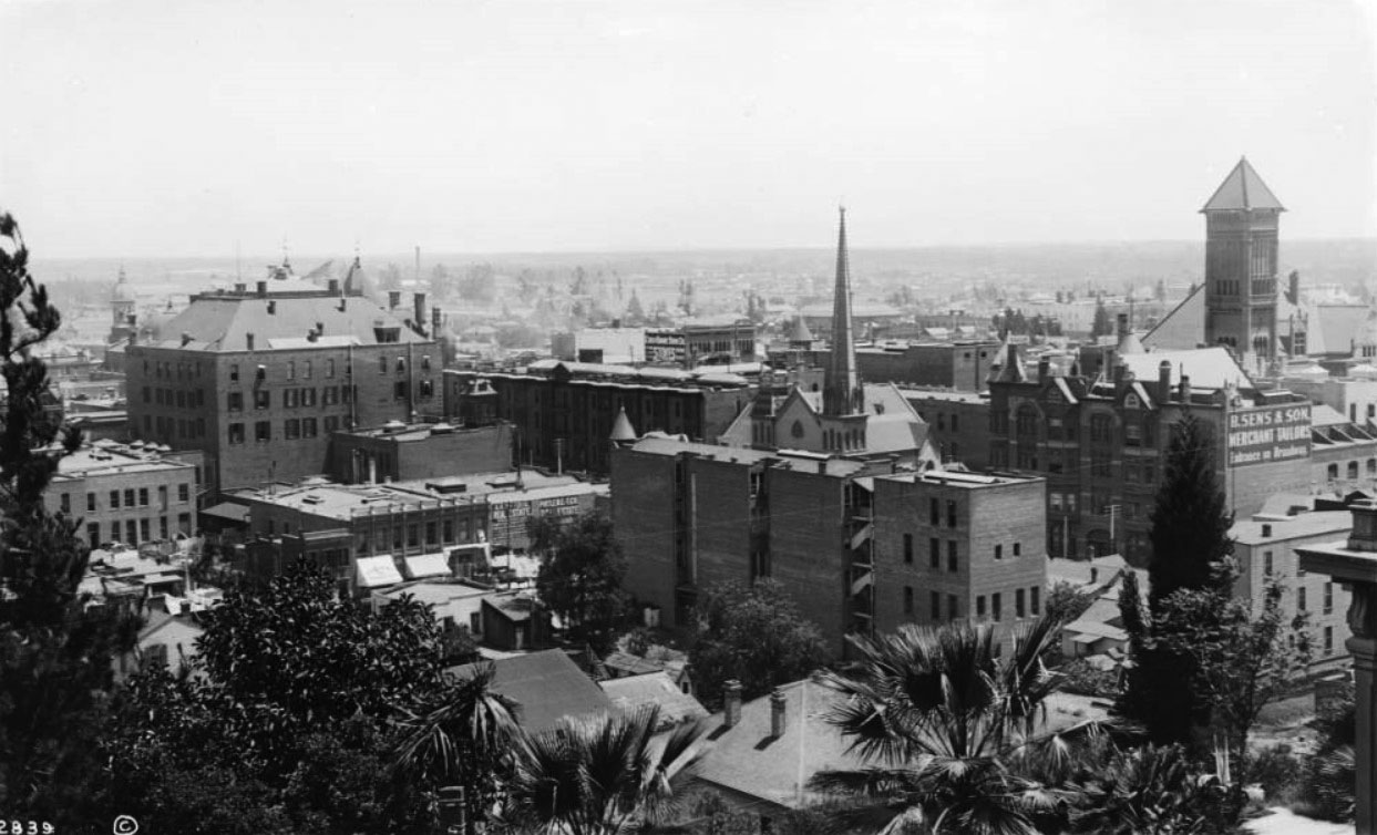
| (ca. 1893)* - Panoramic view looking southeast from First Street and Hill Street toward Broadway. First Presbyterian Church stands at center with its tall spire. City Hall (built in 1888) is at right and is now the tallest building in the area. |
 |
|
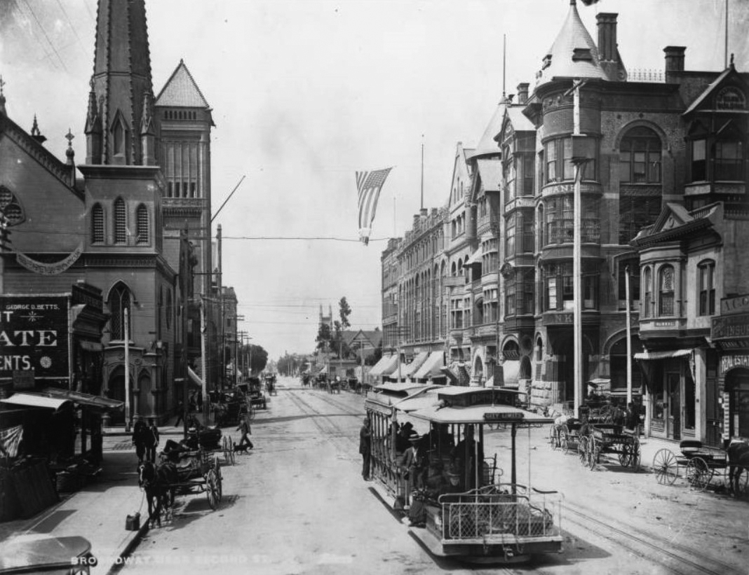
| (ca. 1893* – View looking south on Broadway showing the First Presbyterian Church on the southeast corner of Second Street and Broadway (left) with City Hall several lots behind it. The California Bank Building stands on the southwest corner. |
 |
|
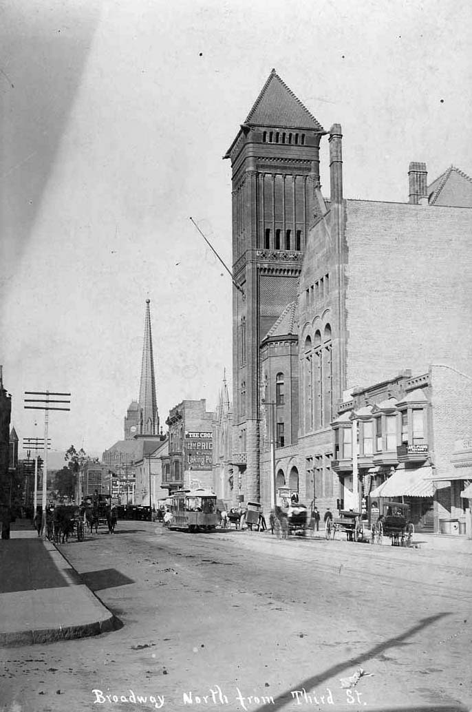
| (ca. 1895)^## - View looking north on Broadway from Third Street. Identifiable buildings from right to left include: City Hall (1888-1928), B'nai B'rith Temple (1872-1896), First Presbyterian Church ( - 1897), and the LA County Courthouse (1891-1932). Horse-drawn carriages and a streetcar share the road. |
Historical Notes The First Presbyterian Church was sold in 1897, and presumed demolished soon thereafter. |
* * * * * |
Spring Street School |
(Los Angeles’ First Publicly Funded School) |
Built in 1855, the Spring Street School was Los Angeles’ first publicly funded school under American civil government. Located at the northwest corner of Second and Spring streets, the modest two-story brick structure marked the formal beginning of organized public education in the growing city. Just five years after California achieved statehood, the establishment of this school reflected Los Angeles’ transition from a small pueblo into an organized American municipality with civic institutions supported by public taxation. |
 |
|
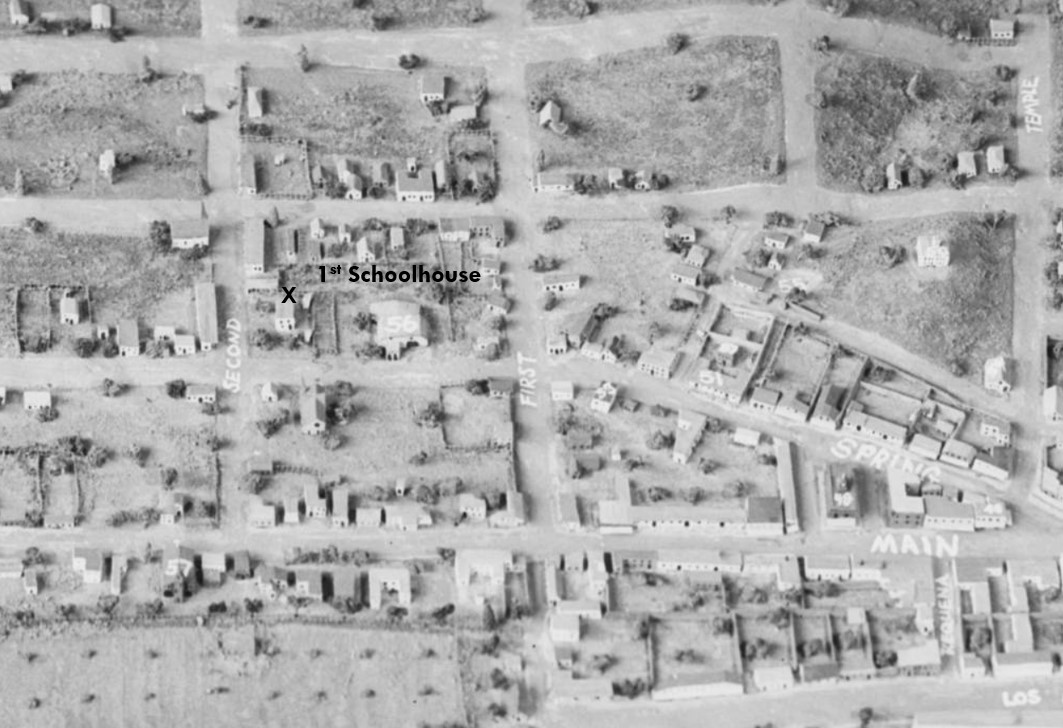
| (ca. 1860s)* - Panoramic view looking south across early Los Angeles showing the Spring Street School near the northwest corner of Second and Spring streets. The two-story building with three second-floor windows opened in 1855 and served as the city’s first publicly funded school. Image courtesy of the Natural History Museum of Los Angeles County. |
Historical Notes The Spring Street School opened on March 19, 1855, at a time when Los Angeles had only a few thousand residents. By 1873, the school enrolled approximately one hundred pupils and was staffed by a single teacher. That same year, the city reported five public schools with fourteen teachers serving 835 students, averaging roughly sixty pupils per teacher. Rapid population growth soon strained available classroom space, and by the mid-1870s the school operated on a double-session system, with one group of students attending in the morning and another in the afternoon. In 1884, the original Spring Street School was vacated to make way for a new Los Angeles City Hall and government complex. The site briefly served as City Hall before later redevelopment transformed the block into part of the Times Mirror Square complex, long home to the Los Angeles Times. The Los Angeles Times Building opened in 1935 and served as the newspaper’s headquarters for decades. The Times Mirror Square property was sold in 2016, and the newspaper relocated its newsroom in 2018. Redevelopment plans for the historic complex continue to evolve. After leaving the Second and Spring location in 1884, Spring Street School relocated south on Spring Street between Fifth and Sixth streets, where it continued serving students in the expanding public school system. Click HERE to see more about the second location of Spring Street School: |
 |
|
| (n.d.)* - Model view of early Los Angeles highlighting the northwest corner of Second and Spring streets, site of the Spring Street School from 1855 to 1884 before the property was redeveloped for City Hall and later Times Mirror Square. |
* * * * * |
Spring Street School (2nd location) |
 |
|
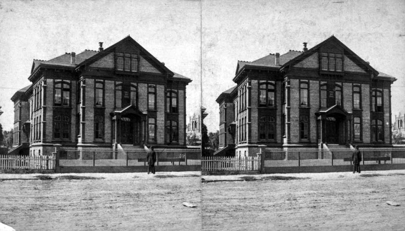
| (ca. 1884)* – Stereoscopic view showing the Spring Street Elementary School on the 500 block of South Spring Street between Fifth and Sixth streets in downtown Los Angeles, with a picket fence and sign on the building reading "Public School 1884." |
Historical Notes In 1883, the school board purchased a parcel of land fronting on both Broadway and Spring Street, midblock between Fifth and Sixth streets (the present site of the Broadway-Spring Arcade), for $12,500, and a new Spring Street School was built there. The more commodious structure hosted gatherings of educators and parents, it had an auditorium used by the public and it was the home of special education for "deaf-and-dumb" children, with the "oral method or lip-reading system" as the method of instruction. |
 |
|
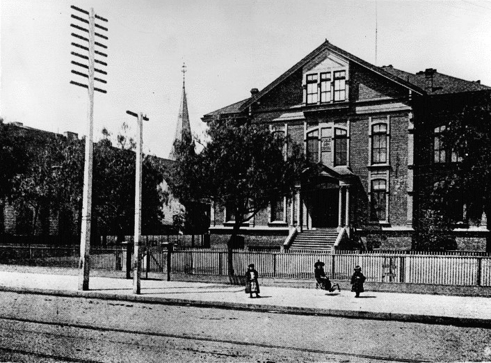
| (1884)* – View showing Spring Street School at its new home on the 500 block of S. Spring Street. It was relocated from Spring and 2nd streets to make room for a new City Hall. |
 |
|
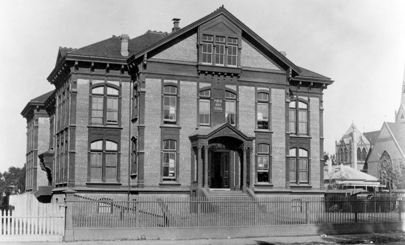
| (1886)* - Exterior view of Spring Street School at its new location on the 500 block of S. Spring Street. Three children are on the sidewalk in front of a picket fence. To the left is the First Baptist Church. |
 |
|
| (1890)* - Group portrait of the students at Spring Street School in 1890. The school's location is the present site of the Mercantile Arcade Building. |
Historical Notes By 1904 the Broadway-Spring real estate had become so valuable that the school board decided to put the land up for lease but to retain the material in the old brick schoolhouse, which by then was noted to be a "landmark." As a result, in that year work began on Mercantile Place—what was planned to be "something entirely new in Los Angeles development"—a private shopping street under the aegis of C. Westley Roberts, who secured a ten-year lease from the Los Angeles School Board and bought the material of the old brick school building, which was to be demolished. As the ten-year anniversary of the lease approached in 1913, school board members realized that the value of the property had increased from $400,000 to $1 million, which meant that the rental charged to the Mercantile Place lessee was amounting to only 2.5% a year on the valuation. A move was begun to sell the property instead of renewing the lease, and in February 1914 the board signed a renewable lease with the Mercantile Improvement Association for $3,500 a month "in order that the property may not be empty pending the sale of the property or the erection of a building thereon." The next month a special referendum election was held to ask voters what they wanted to do with the property, and in a lightly attended response 2,003 votes were cast for "lease for fifty years," 1,478 for "sell" and 931 for "neither sell nor lease for fifty years." The school board sold the property for $1.155 million in 1919 to Adolph Ramish, president of the Hippodrome Theater Company. |
* * * * * |
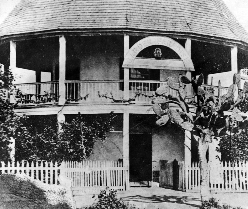
Round House Adobe
 |
|
| (1880)* - Close-up view of the Round House main entrance with sign above reading: "Garden of Paradise". |
Historical Notes This adobe, known as the Round House as well as the "Garden of Paradise", was built in 1854 by Ramón Alexander as a gift to his Spanish bride María Valdéz, daughter of Basílio Valdéz, who came to Los Angeles from Spain in 1830. |
 |
|
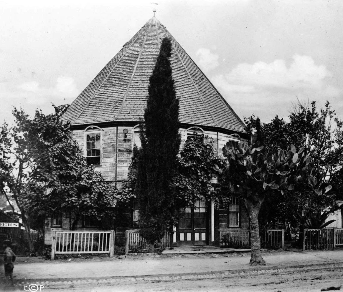
| (ca. 1880s)* - Exterior view of the Round House which was once a popular beer garden and later became one of LA's first kindergarten, located on Main Street between 3rd and 4th streets. |
Historical Notes In 1856, the property was purchased by George Lehman, a German immigrant nicknamed "Round House George." Lehman transformed the site into the Garden of Paradise, a popular public garden and gathering place for over 20 years. To accommodate the resort's growing popularity, he enclosed the building in an octagonal frame and expanded its interior. After Lehman’s financial troubles in 1879, the Round House transitioned to various uses, including serving as a schoolhouse. |
 |
|
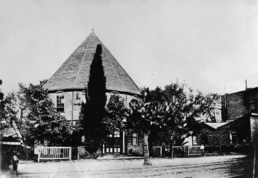
| (ca. 1880s)* - View showing the Round House, located from Main to Spring streets, between 3rd and 4th. It later became a kindergarten. |
Historical Notes After the famous beer garden closed, one of the city's first kindergarten was opened here, with Kate Douglas Wiggin as teacher. Sadly, it was torn down in or about 1887. |
 |
|
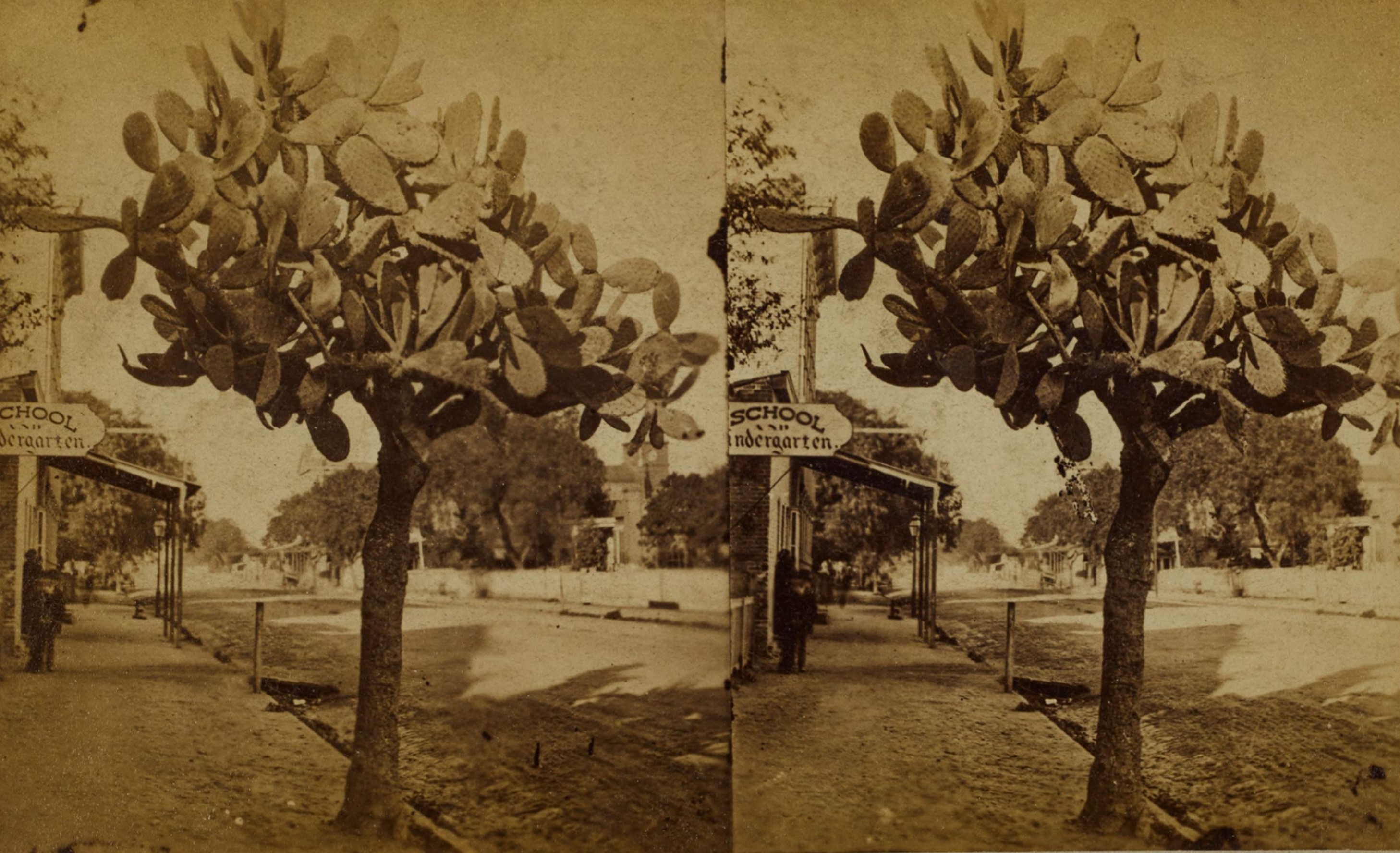
| (1880)* – Stereoscopic view looking north on Main Street showing a prickly cactus tree on the sidewalk in front of 311 South Main Street in downtown Los Angeles, with a sign "School and Kindergarten" visible. Photo from the Ernest Marquez Collection. |
Historical Notes To the left of the cactus was the location of one of LA’s first kindergarten, opened in 1877. Established by Caroline Severance, a prominent suffragette and community organizer, the kindergarten was part of the city's Free Kindergarten Association, which played a pivotal role in introducing the kindergarten movement to Los Angeles. |
 |
|
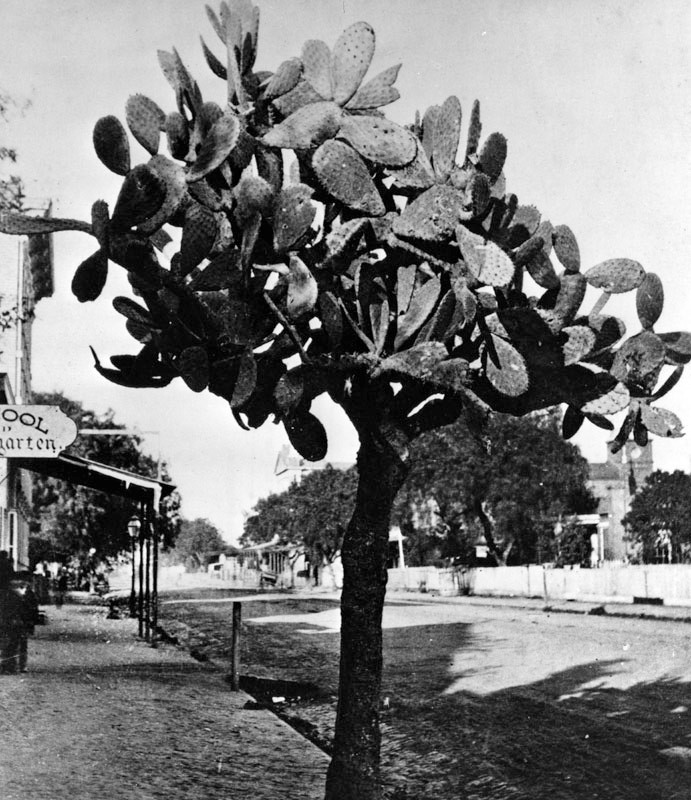
| (1880s)* - View looking north on Main Street near 3rd Street showing a large Cactus tree in front of the Round House, with a kindergarten sign seen on the left. In the distance, on the right, can be seen St. Vibiana's Cathedral. |
Historical Notes Following its educational use, the Round House became a lodging house and later a transient dwelling, reflecting the changing needs of the city. Despite its architectural and historical significance, the building was demolished in 1889. Its site continued to play an important role in Los Angeles history, later hosting notable structures such as the Pinney Block, Pridham Block, and Turnverein Hall. Today, the Ronald Reagan State Building stands where the Round House Adobe once stood. |
* * * * * |
Isaac Van Nuys Residence
 |
|
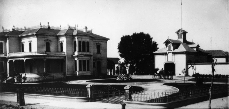
| (ca. 1880)* - Exterior view of the residence and carriage house of Isaac Newton Van Nuys. It was located at Spring and 7th Street, on the southwest corner. A horse and buggy stands in the driveway. |
Historical Notes Isaac Newton Van Nuys was a businessman, real estate developer, banker, and agricultural entrepreneur. He founded the community of Van Nuys in the San Fernando Valley in 1911. As a major figure in regional history and development, there are schools, streets, libraries, and a Liberty Ship with the name of Van Nuys. |
 |
|
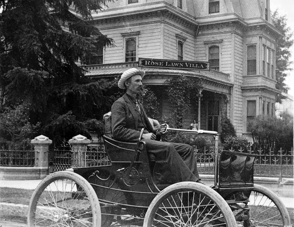
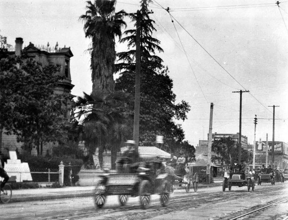
| (ca. 1902)* - View of man driving on Spring Street in front of the Van Nuys family residence. The man, dressed in a dark suit and candystriped hat, steers the topless carriage with a rod-and-stirrup device. In the background, the Victorian architecture of the I.N. Van Nuys residence can be seen, with its gingerbread roof, molded window frames and clapboard veneer. A wrought-iron fence marks the perimeter of the lawn. A woman is partially visible in the background from behind the vine-grown porch of the residence, over which hangs a sign reading "Rose Lawn Villa". Tree foliage obscures the left side of the residence. |
Historical Notes A thrid floor was added to the orgiinal 2-story house since the time of the previous photo. |
 |
|
| (1904)* - View of Spring Street looking north from Seventh Street featuring the I.N. Van Nuys residence, May 24, 1904. Several early automobiles drive towards the camera along the unpaved street in which trollycar tracks are visible. Only the wrought-iron fence and the top of the Victorian architecture of the Van Nuys residence is visible from behind the lush treecover surrounding it. Telephone poles are visible, as well as large signs attached to building in the background which read "Furniture and Carpets" and "Angelus Flour". |
* * * * * |
Los Angeles' 1st Synagogue (B'nai B'rith Temple)
 |
|
| (1874)* – View looking south on Spring Street from near the Temple Block. The large building in the distance is Los Angeles' first synagogue (B'nai B'rith), built in 1873. |
Historical Notes In 1862, a small community of Los Angeles Jews received its charter from the state to found Congregation B’nai B’rith. Worship was led by a layman, Joseph Newmark, until Abraham Wolf Edelman was hired as the first rabbi. |
 |
|
| (ca. 1874)* - Looking down from Bunker Hill showing the 1873-built B'nai B'rith Synagogue located on Fort Street (later Broadway) between 2nd and 3rd streets (upper center-left). Also seen in the distance is St. Vibiana's Cathedral (built between 1871 & 1876) with its tall cupola and bell tower, located on Main Street south of 2nd Street. |
Historical Notes A study of the 1870 Federal Census in Los Angeles revealed that of the city's 5,728 citizens, 330 individuals, or 5.76 per cent were Jewish. By comparison, the Jewish residents of New York City at that time numbered slightly over five per cent of the general population. |
 |
|
| (ca. 1880)* - View showing the original B'nai B'rith Temple, located on the east side of Fort Street between 2nd and 3rd Streets. Fort Street later became Broadway (1890). LA's 3rd City Hall (1888-1928) would be built on the second lot to the right (south) of the temple. |
Historical Notes Isaias W. Hellman was president of B'nai B'rith in 1872 when the congregation built the city's first temple. Hellman was a German-born American banker and philanthropist, and a founding father of the University of Southern California. By 1885 much of the congregation was pushing to move away from Orthodox practice, and Rabbi Edelman eventually resigned. Ephraim Schreiber was hired as rabbi in 1885 and adopted some reforms, but soon left. Abraham Blum was hired in 1889, but was forced out in 1895 and replaced by Moses G. Solomon. |
|
|
| (ca. 1886)* - Churches and small business are interspersed with homes in this view of Second Street between Fort and Spring Streets. Fort Street later became Broadway (1890). The church in the center with the tall spire is the First Presbyterian Church at Fort and 2nd. To the church's right is Congregation B'nai B'rith and to the right of the synagogue would be built City Hall in 1888. St. Vibiana's Cathedral is in the background (Second and Main) and the Trinity Methodist Episcopal Church South is on the far left (1st and Spring). |
 |
|
| (ca. 1890)* – View of several horse-drawn carriages parked on an unpaved Broadway in front of Los Angeles City Hall (1888-1928). The building north of City Hall is the first B'nai B'rith Temple (1873-1896). |
Historical Notes In 1896, Congregation B'nai B'rith moved into a new building located on the corner of 9th and Hope streets.* Click HERE to see the 2nd B'nai B'rith Temple location. |
* * * * * |
U.S. Hotel
 |
|
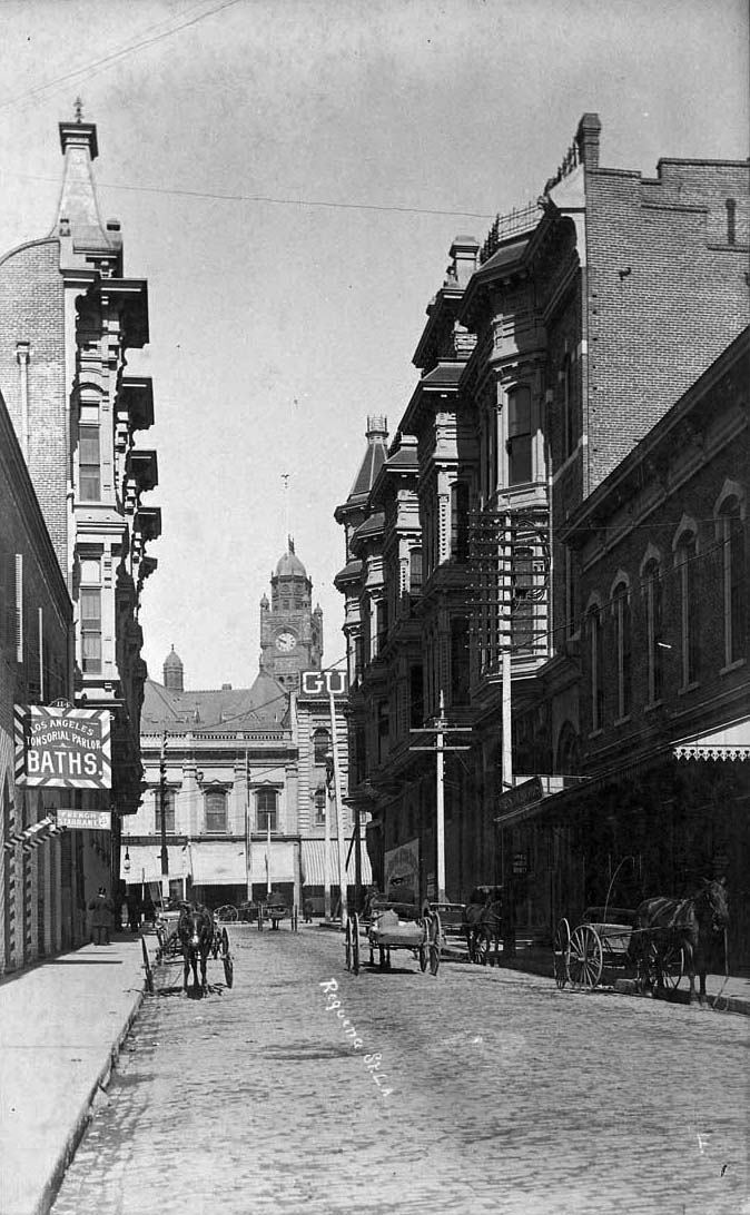
| (ca. 1880)* - View of the United States Hotel on the corner of Requeña Street (later renamed Market Street) and North Main Street. A horse-drawn carriage is seen parked in front of the hotel. |
Historical Notes The U.S. Hotel, built between 1861 and 1862 at 170 North Main by Louis Mesmer, was remodeled and expanded in 1886. Known for attracting an upscale clientele, it offered what advertisements in the Los Angeles Times called the “best two-bit meal in Southern California.” By the early 1930s, still owned by the Mesmer family, the hotel exclusively lodged men, many of whom were on public assistance. Requena Street, originally named after Manuel Requena—the city’s first Mexican-American mayor (a brief 11-day term) and a key advocate for Los Angeles’ first public school—was later renamed Market Street. In 1904, merchants along North Main Street petitioned the City Council to change the name of Requena Street to Market Street, which was approved. This change reflected the growing commercial nature of the area. |
 |
|
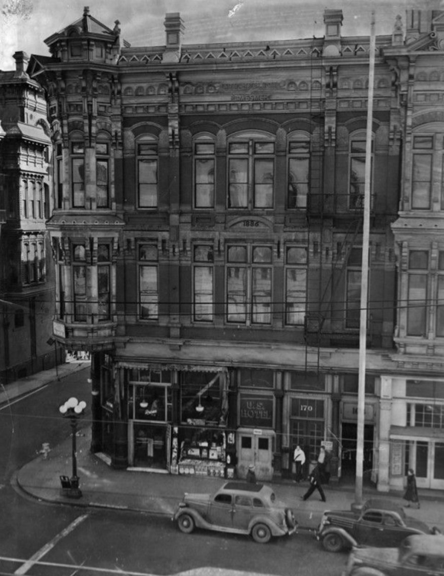
| (ca. 1935)* – A view of the southeast corner of Main and Market Streets, with the Victorian-style U.S. Hotel prominently situated on the corner. |
Historical Notes The United States Hotel, located at Main and Market Streets in downtown Los Angeles, was one of the city’s earliest hotels, established between 1861 and 1862. It served primarily a working-class clientele, particularly men in the building trades during its early years. By the 1930s, the hotel was a significant fixture in a downtown area experiencing demographic changes due to the Great Depression, which brought an influx of displaced workers seeking opportunities in Los Angeles. |
 |
|
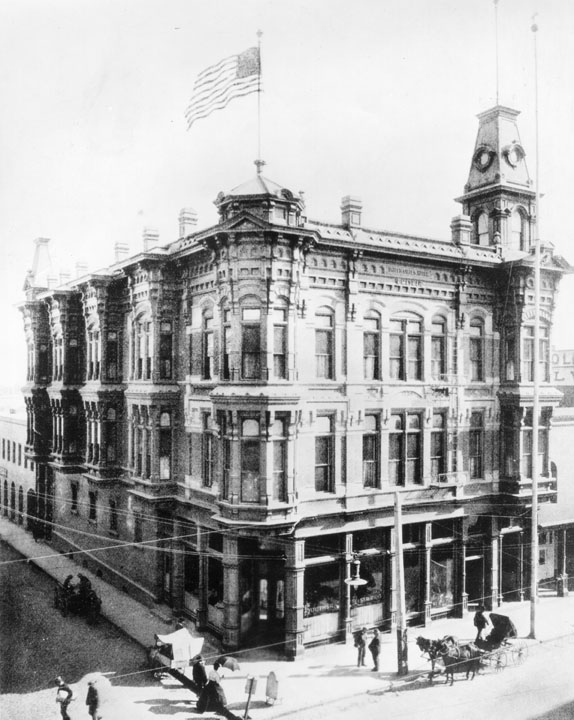
| (1935)* – Looking across Main Street showing a beautiful pair of buildings on the corners of Market Street, the U.S. Hotel at 170 North Main Street, and the Amestoy Building at 202 North Main Street. |
Historical Notes The U.S. Hotel (1862-1939) is the three-story Victorian-style building to the right, visible from across Main Street, wedged between various commercial shop fronts. It was one of the first hotels in the city. The Amestoy (1887-1958) is the second Victorian-style building to the left (north, across Market Street), with a sign that says "Leighton" over its entrance. Both of the Victorian buildings feature corner oriel windows extending from their second to third levels, as well as towers. The U.S. Hotel has a small octogonal turret at one corner, and a taller square turret and cupola at the other. The Amestoy has a octogonal turret and cupola. |
 |
|
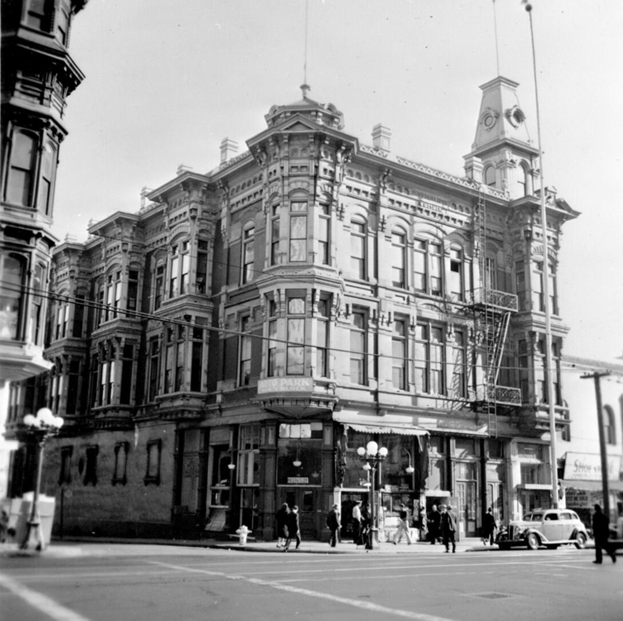
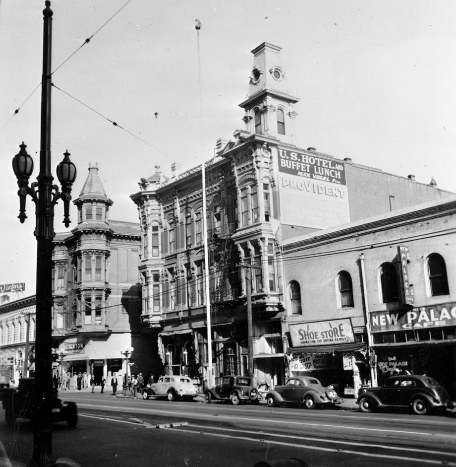
| (1935)* - Closer view of the three-story Victorian-style buildings wedged between commercial shop fronts. The U.S. Hotel is closest to the foreground, while the Amestoy Building can be seen farther back. |
Historical Notes Both buildings feature a tower of sorts, the hotel's sprouting from the flat roof, the Amestoy Building's extending from a column of windows at its corner. The New Palace Cafe and a sign that reads "Shoe Store. Shoes for the whole family" can be seen at right. A sign to the left reads "Victor's". Cars are parked along the sidewalk. Street car cables are attached to the top of a streetlamp visible in the left foreground. |
 |
|
| (1935)* - Exterior view of the old United States Hotel on March 16, 1935, once the center of the city's social life. For 80 years it stood on the southeast corner of Market and North Main Streets. The hotel was owned by the Mesmer family from 1862 until 1939 when the building was demolished. |
Historical Notes The U.S. Hotel, located on the southeast corner of Main Street and Market Street (originally known as Requena Street), was built in an ornate Italianate architectural style. The hotel, constructed in 1862 and demolished in 1939, was notable for its elaborate design featuring ‘a profusion of brackets, corbel tables, and oriel windows’. |
 |
|
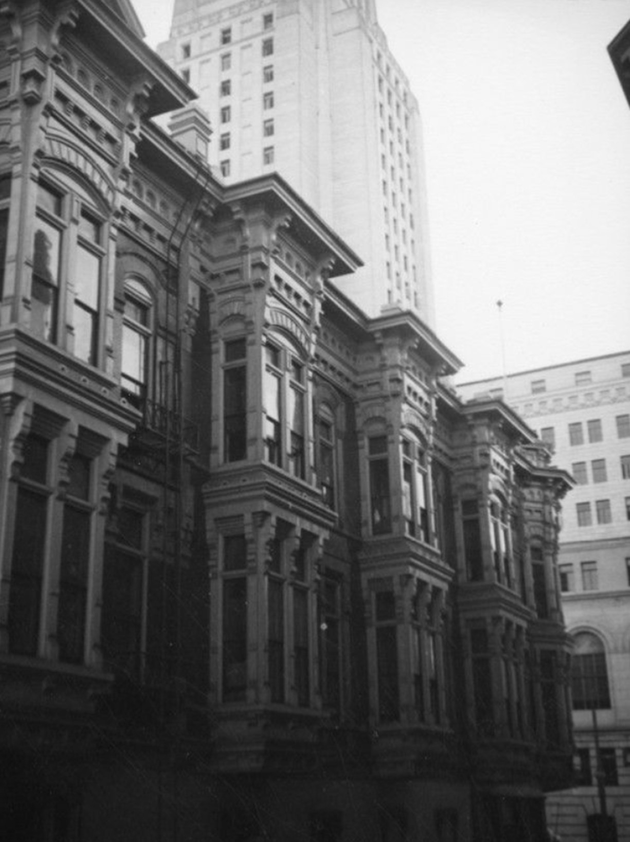
| (ca. 1939)* - Looking up from Market Street at the ornate United States Hotel, with the Los Angeles City Hall rising tall in the background across Main Street. |
Historical Notes While the U.S. Hotel had been a longstanding fixture in downtown Los Angeles, it ultimately faced demolition. The hotel was torn down in 1939, marking the end of its nearly 80-year presence in the city. This demolition occurred during a period when many of downtown Los Angeles' older buildings were being removed or falling into disrepair, as the city's focus shifted towards suburban development and urban renewal projects. |
 |
|
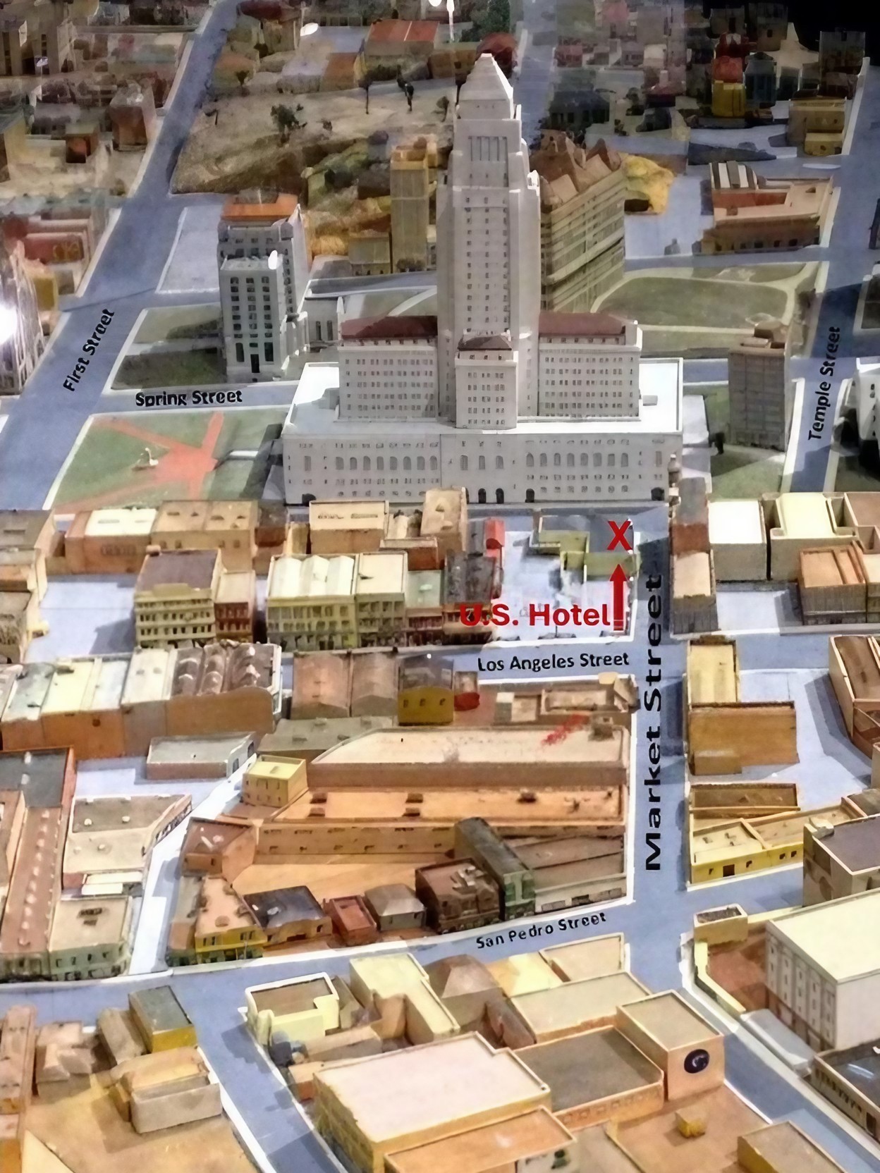
| (ca. 1939)* – An aerial view depicted on the Los Angeles City Model, showcased at the Natural History Museum's Becoming Los Angeles exhibition in 2016, highlighting the location of the U.S. Hotel with its top two floors removed. |
* * * * * |
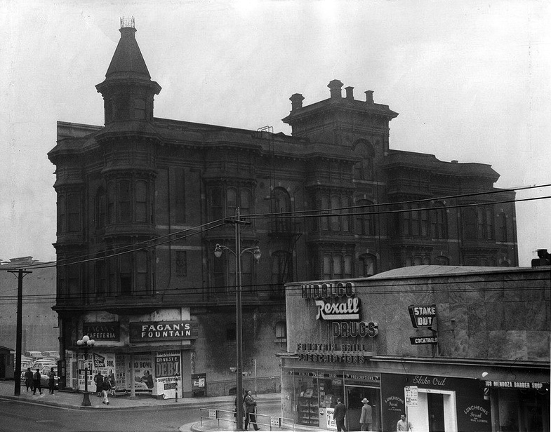
Amestoy Block
 |
|
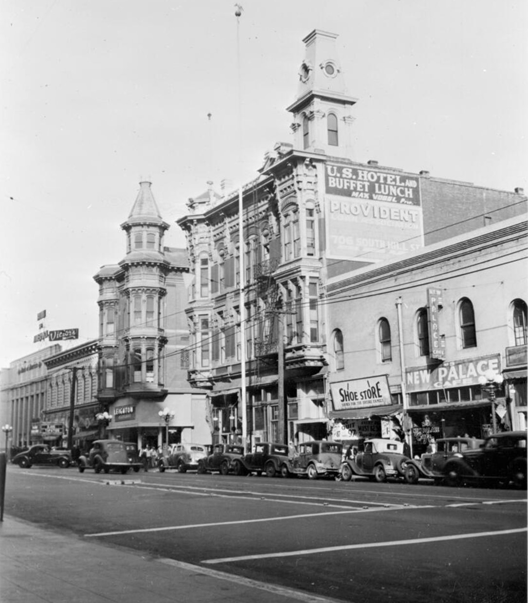
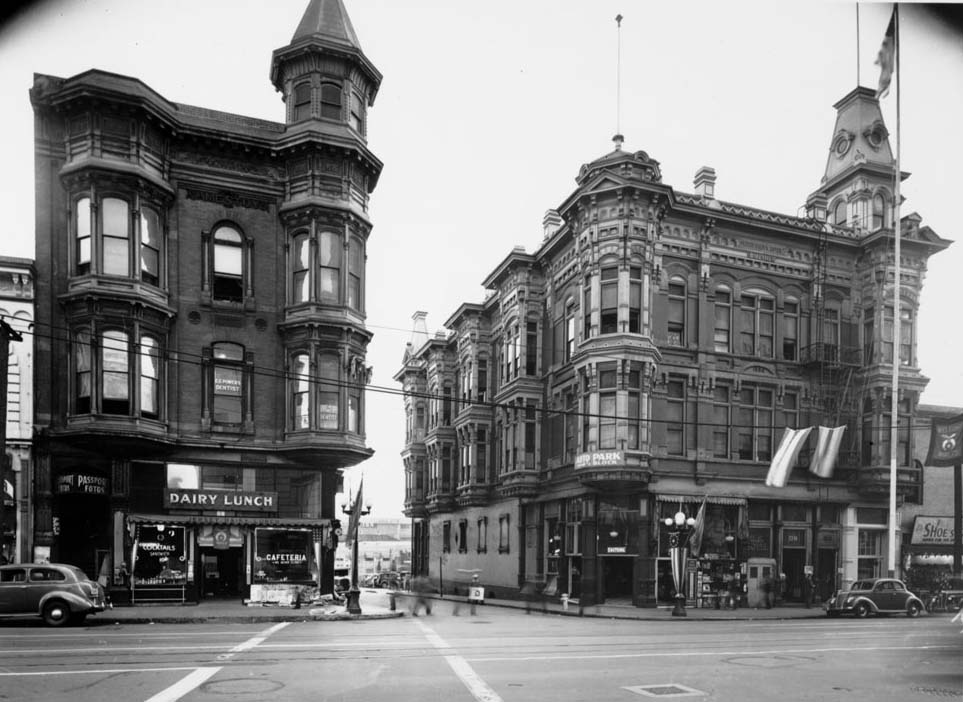
| (ca. 1890)* - View looking West on Requena Street (later Market Street) toward North Main Street. The U.S. Hotel is on the left and the Amestoy Block on the right. The newl built County Courthouse can be seen in the background. A large sign on the side of the building reads: "Los Angeles Transorial Parlor - BATHS". The two-story building on the right with the horse-drawn wagon parked in front is the H. Newmark & Co. Building. |
Historical Notes Built in 1887 by Domingo Amestoy, the structure on the northeast corner of Main and Requena (later Market) was Los Angeles' first brick office building and the first to have an elevator. Note: The Nadeau Hotel also claims to have had the first elevator (built in 1882). |
 |
|
| (1939)* - View looking East from across North Main at Market Street showing both the Amestoy Building (left) and the U.S. Hotel (right). This photo was taken shortly before the U.S. Hotel was razed. |
Historical Notes Domingo Amestoy came to California by way of Argentina in 1851. Amestoy started a modest sheep business and within a few years he parlayed it into a fortune. He was one of the largest wool producers in Southern California during the 1860s. In 1871, he bought $500,000 worth of shares in the newly established Farmers and Merchants Bank in Los Angeles. In 1874 he went back to France and married. In 1875 Amestoy moved his family to 650 acres of the "Rosecrans Rancho" in what is now Gardena. By 1880, he had over 30,000 head of sheep, most of which were fine-wooled Spanish merinos. In 1889 he acquired all 4,500 acres of Rancho Los Encinos in the San Fernando Valley. After Domingo Amestoy died on January 11, 1892, his sons, John and Peter Amestoy, assumed ranch operations and changed the name to Amestoy ranch. Like other ranches in the San Fernando Valley at the time, the Amestoys cultivated wheat and barley. The Amestoy family held title to rancho for fifty-five years. In 1915, subdivision of the rancho began later developing into the communities of Sherman Oaks and Encino. The Amestoys held on to 100 acres, which included the old adobe until selling the property in 1944. |
 |
|
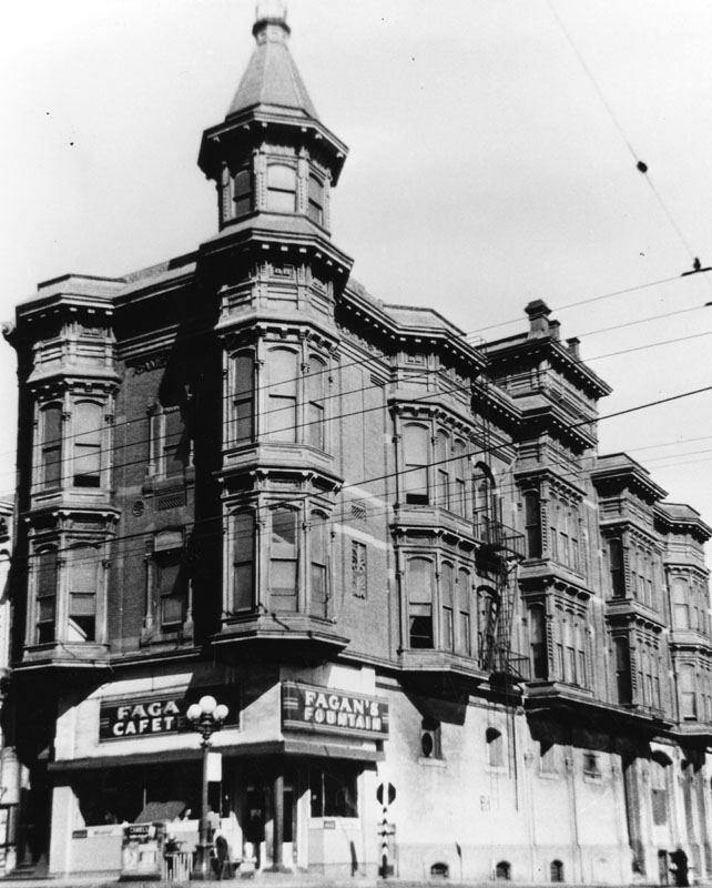
| (1952)* - View of the Amestoy Block on the northeast corner of Main and Market Streets. Fagan's Cafeteria and Fountain is on the first floor. |
 |
|
| (1954)* - Amestoy Block along Market Street viewed from the 100 block of North Los Angeles Street. Hall of Justice Building, 310 North Broadway, at left background and Federal Building , 312 North Spring Street, in center background. |
 |
|
| (ca. 1954)* - Amestoy Block along Market Street viewed from the 100 block of North Los Angeles Street with the Federal Building seen in the background. |
 |
|
| (ca. 1954)* - Close-up detail view of the Amestoy Block. |
 |
|
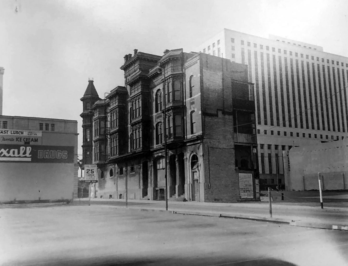
| (1955)* - View of the Amestoy Building just before it was torn down. City Hall East now sits at this location. Note that the photo also shows a lounge called the Stake Out. This was a favorite hangout for police officers as it was across from headquarters, which was then located in City Hall. |
Historical Notes On May 28, 1958, Times columnist Jack Smith wrote a column on the Amestoy Building: “It was built by Domingo Amestoy in 1887 and it still stands at the northeast corner of Main and Market, across from City Hall. It is alone now among the white concrete monoliths that have shouldered up around it, making it seem to grow smaller, like a very old man. It has been condemned. It will give way to the magnificent civic master plan. Its doors are padlocked now and its bay windows have that blind look of windows in abandoned buildings. It stands three stories high, not counting the cupola. It is built of dark-red brick ornamented by elegant cornices and stone scrolls. Its plump bay windows, like bustles, look obsolete and unnecessary, but beguiling. |
* * * * * |
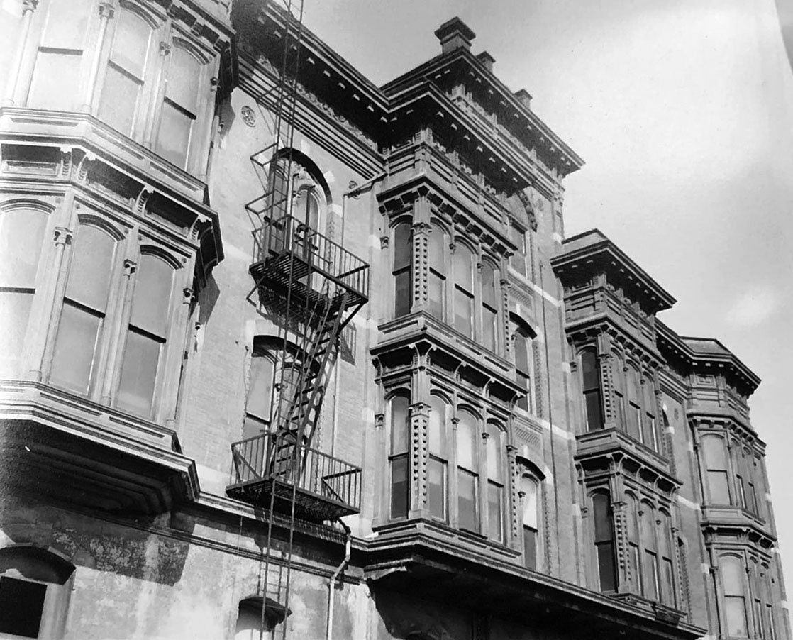
Melrose and Richelieu Hotels |
Grand Avenue at 2nd Street, Bunker Hill |
For nearly seventy years, the Melrose and Richelieu Hotels stood as two of the most striking Victorian buildings on Bunker Hill. Built in the 1880s as elegant private homes, they defined this stretch of Grand Avenue during a time when the hill was one of Los Angeles' most desirable neighborhoods.Over the decades, both were converted into hotel apartments, serving a changing population as the city grew around them. By the 1950s they were aging but still visually distinctive — and soon to be lost. Both were demolished in 1957 as part of the Bunker Hill redevelopment that transformed this hillside. Today the site is home to The Grand LA and the Conrad Los Angeles hotel tower. |
Early Years |
 |
|
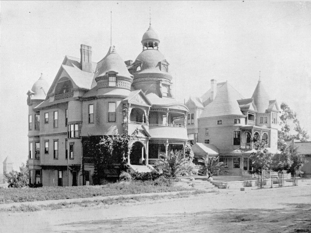
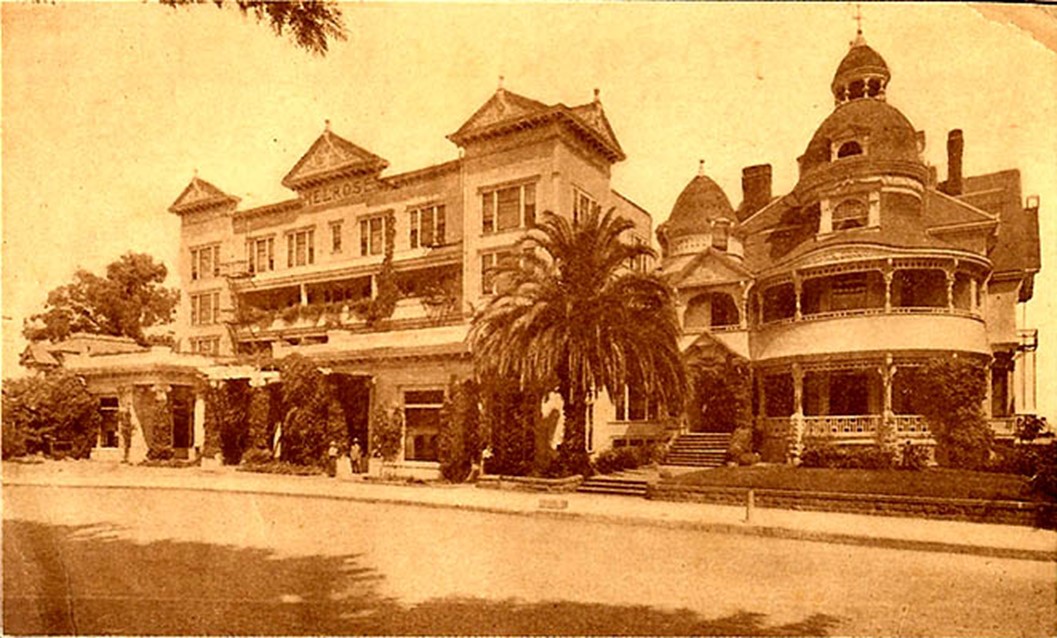
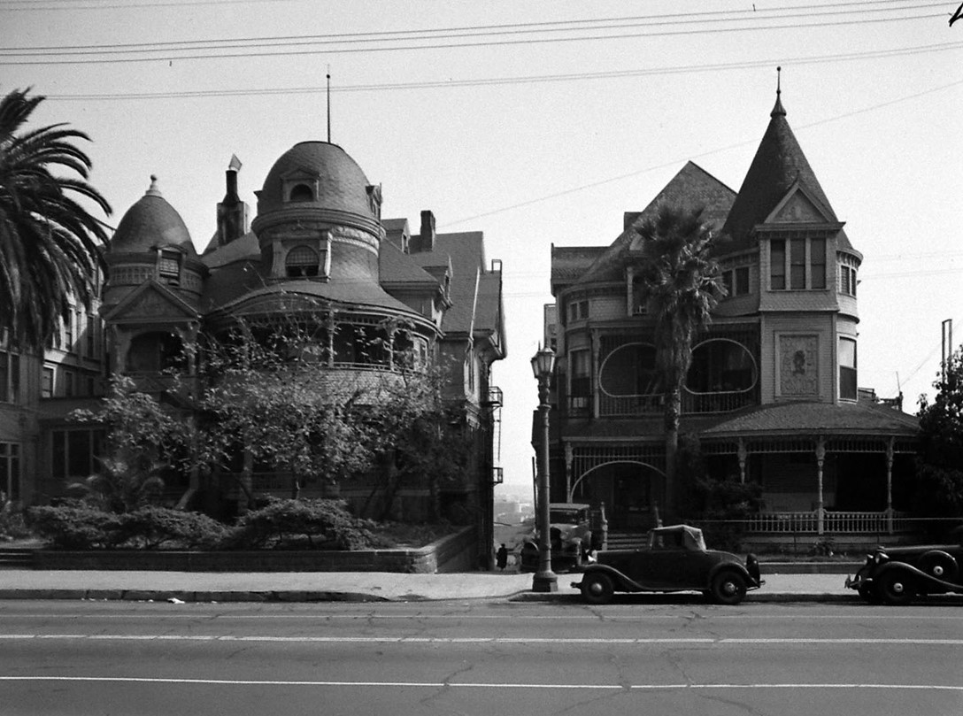
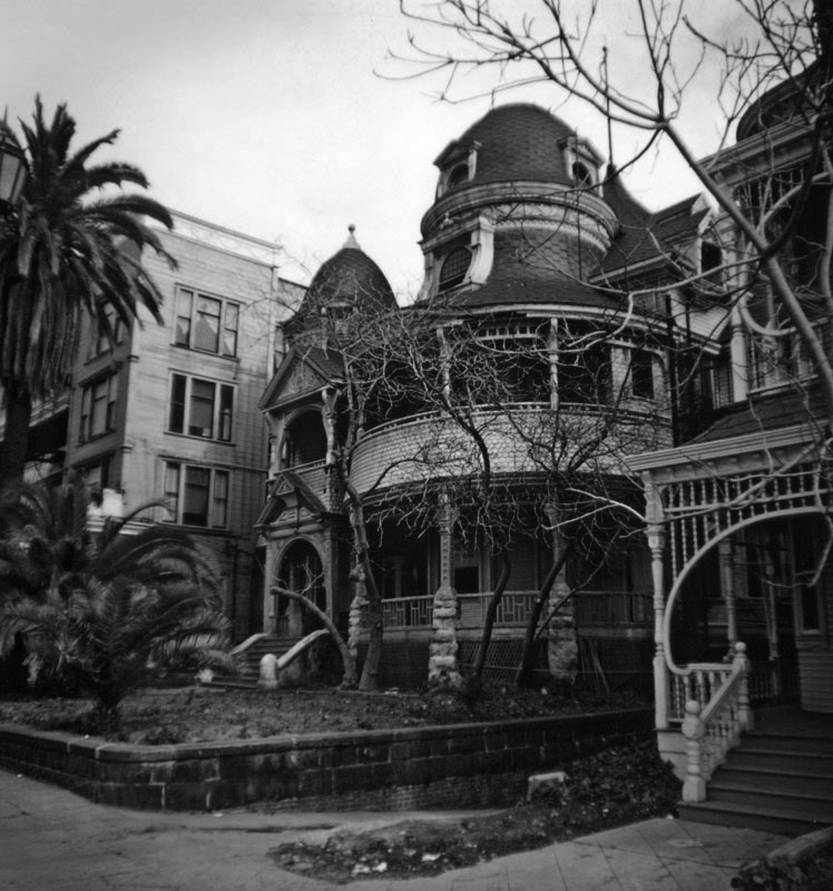
| (ca. 1891)* - A full view of the Hotel Melrose, left, and the Richelieu Hotel, Grand Avenue and Second Streets. Photograph names M. W. Connor as proprietor. City Hall (1888 - 1928) can be seen in the background at lower-left. |
Historical Notes This is one of the earliest known photographs of both hotels side by side, taken around the time the Melrose first opened. The Melrose Hotel began as a private Victorian mansion in 1881, decorated with overlapping shingles, cupolas, and rounded domes. It was soon expanded into a hotel, with the original mansion serving as an annex to the new building at left. Nearby, the Richelieu was built in the late 1880s as a private residence for Robert Larkin. Both buildings followed a pattern common in a growing Los Angeles: elegant homes converted into income-producing hotels as the city drew new residents and visitors to the hill. The name M. W. Connor on the photograph identifies an early proprietor of the Melrose. |
 |
|
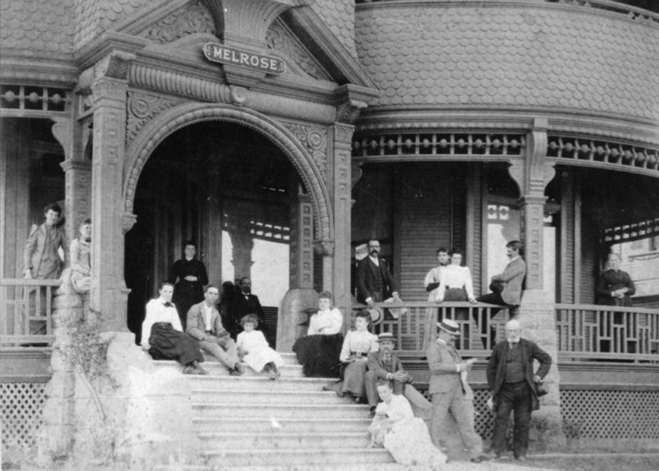
| (ca. 1894)* - 18 guests of the Hotel Melrose are gathered on the steps and porch of the hotel's verandah. Located at 138 S. Grand Ave. on Bunker Hill. |
Historical Notes This photograph captures a lively moment on the Melrose Hotel's wide verandah around 1894. The eighteen guests gathered here reflect the hotel's standing as an active social destination in the early years of Bunker Hill, when the neighborhood attracted prominent Los Angeles families and newcomers to the city. The porch faced west across Grand Avenue. If still standing today, guests would look out directly at the Walt Disney Concert Hall, which now occupies the opposite side of the street. |
 |
|
| (ca. 1890s)* - View of the Hotel Melrose showing the new 4-story addition to the left, located at 120-30 South Grand Avenue. |
Historical Notes By the 1890s, the Melrose had grown into a two-building complex. The original Victorian mansion at 130 South Grand served as the hotel's main structure, while the newer four-story rectangular annex at 120 provided additional rooms. Together they filled a notable stretch of the east side of Grand Avenue. The Melrose attracted well-known residents over the years. In the 1920s, labor lawyer and Socialist Party mayoral candidate Job Harriman and his wife made the Melrose their home — a sign of the hotel's role as more than a stopping place. It had become part of the fabric of Bunker Hill life. |
 |
|
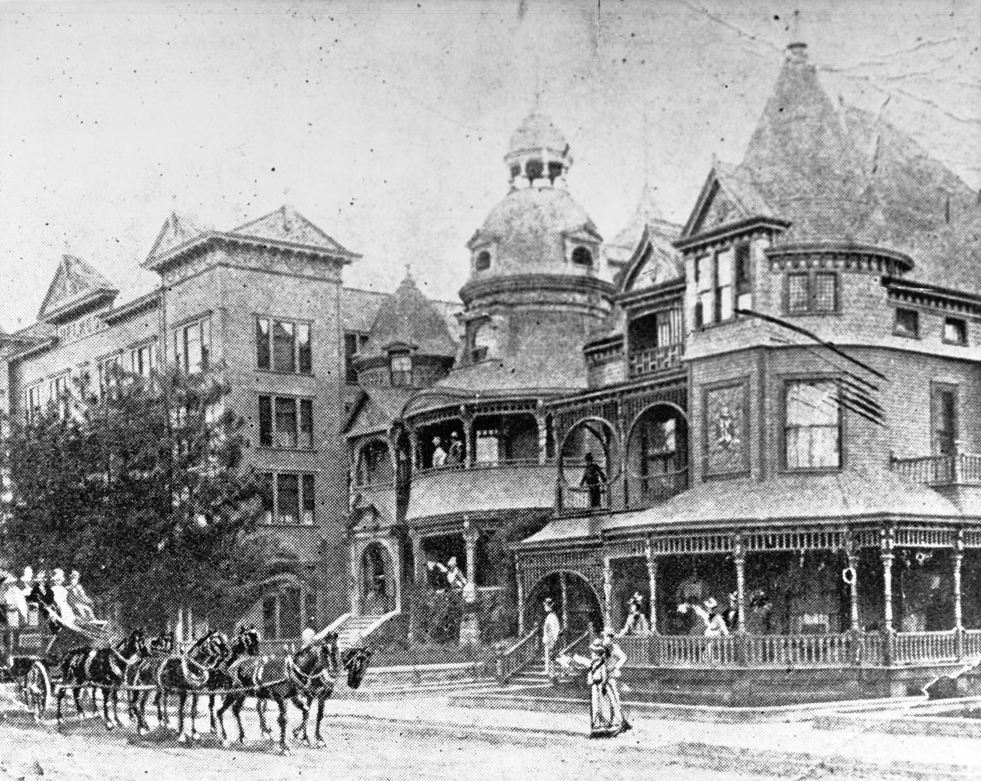
| (ca. 1895)* - View of a stagecoach in front of the Melrose Hotel and the Hotel Richelieu on Grand Avenue between First Street and Second Street, ca.1895. The half-tone photograph shows the Richelieu at right. It is a large Victorian mansion with a wrap-around porch and a tall conical tower. At center and left are the two buildings of the Melrose Hotel. The one at center is another Victorian mansion with a tall, bell-shaped tower topped by a cupola. At left is a four-story rectangular building with triangular attachments on the roof and a sign that reads "Melrose". A stagecoach pulled by a team of six horses is in the street at left, and several people are waving at it from the porches of the Victorian buildings. |
| Historical Notes
This half-tone photograph captures one of the most active street scenes in the early history of Grand Avenue. A stagecoach pulled by six horses moves past the two hotels while guests wave from the porches — a glimpse of the neighborhood in its original character before automobiles reshaped the street. The Richelieu at right is clearly shown: a large Victorian mansion with a tall conical tower, wide wrap-around porch, and decorative woodwork. At center is the original Melrose with its bell-shaped tower and cupola. At far left is the Melrose annex with its triangular roofline ornaments and hotel sign. The three structures together made this block one of the most visually striking on Bunker Hill. |
Life on the Hill: 1920s–1940s |
 |
|
| (1928)* - View showing cars parked at the curb in front of the Melrose Hotel with 2 pedestrians seen walking on the sidewalk. The Melrose Annex is on the left. |
| Historical Notes
By 1928, Grand Avenue had changed considerably. Automobiles now lined the curb where stagecoaches once passed, and the quiet residential street of the 1890s had become a busier urban corridor. The Melrose Hotel and its annex still stood, but the neighborhood around them was in transition. The automobiles visible here — low-slung sedans typical of the late 1920s — help date the photograph precisely. Despite the modernizing street, the Melrose itself remained largely unchanged from its Victorian form, a holdover from an earlier Los Angeles that was fading fast. |
 |
|
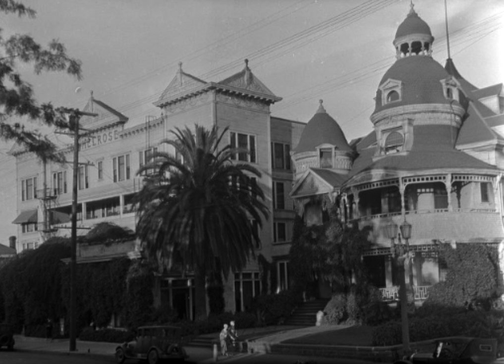
| (ca. 1930s)* - View from across the street on Bunker Hill of two Victorian style hotels on the 100 block of S. Grand Ave., the Richelieu (at 142) on the right and the Hotel Melrose (at 130) on the left. New dual-lamp electric streetlights now appear in front of the buildings. Click HERE to see more in Early Los Angeles Streetlights. |
Historical Notes This view from the 1930s shows both hotels still standing on the east side of Grand Avenue. New dual-lamp electric streetlights — a modern addition — now stand in front of buildings that had changed little since the 1880s. For more on these distinctive streetlights, see the Early Los Angeles Streetlights section. The Richelieu at right began as the home of Robert Larkin. In 1893, his widow Helen sold the property to Chicago businessman Charles S. Hord, who promised to upgrade it into a first-class hotel. The building's conical tower and wide porches gave it a grand presence on the street. Both hotels would remain standing for another two decades before the wrecking crews arrived in 1957. |
 |
|
| (1945)* – The Hotel Melrose (left) and the Richelieu Hotel (right), both on South Grand between First and Second. |
| Historical Notes
In this 1945 photograph, both hotels remain intact and operational. The Melrose at left still shows its curved balconies, rounded domes, and ornate tower. The Richelieu at right retains its conical tower and covered porches. Despite more than sixty years of use, both buildings carried the visual character of a Victorian neighborhood that had largely disappeared around them. By this point, both were functioning as hotel apartments serving long-term residents rather than overnight guests — a common shift for Bunker Hill buildings as the neighborhood's population changed during the Depression and World War II years. |
 |
|
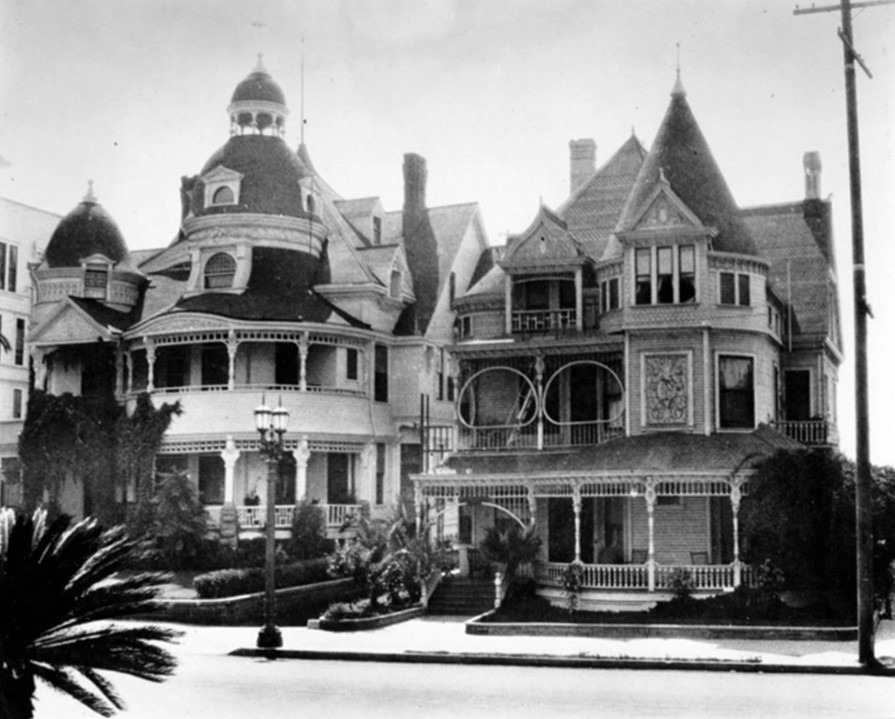
| (1946)* – View of the Melrose Hotel and the Hotel Richelieu on Grand Avenue between First Street and Second Street. |
Historical Notes This 1946 photograph offers a clear view of both hotels standing side by side. The Richelieu at right is a large, light-colored Victorian mansion with a conical tower and wide covered porches. The Melrose at center shows its curved balcony, rounded domes, and richly detailed walls topped by a tall tower with a cupola. The four-story rectangular annex at far left, with its triangular roof ornaments and hotel sign, completes the complex. Two automobiles sit at the curb, and garden plantings remain in the front yards. This photograph was taken just eleven years before both were demolished. |
Final Years: The 1950s |
 |
|
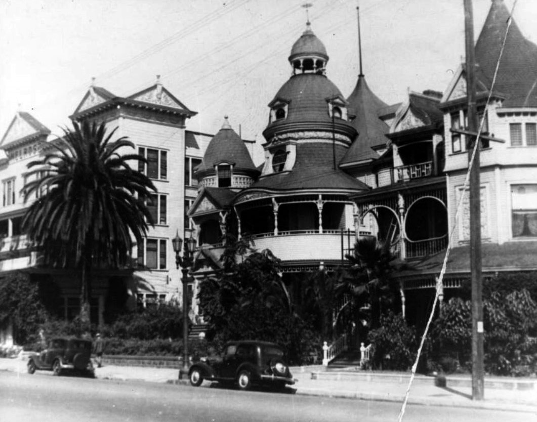
| (1950)* - View of the Victorian-style Melrose Hotel at 130 South Grand Avenue north of Second Street, with domes, verandas, and elaborate ornamentation. Trees and ferns decorate the front garden. Photo by Arnold Hylen. |
Historical Notes Photographer Arnold Hylen captured the Melrose Hotel in 1950 in remarkable detail. The building still showed all of its original Victorian character: a four-story tower rising above the roofline, large chimneys indicating fireplaces within, and an entry garden with trees and a low palm adding warmth to the street-facing facade. Arnold Hylen was one of a small number of photographers who documented Bunker Hill's Victorian buildings before their demolition. His photographs of the Melrose are among the most detailed architectural records of the hotel that survive. Hylen himself is seen sitting on the retaining wall in the foreground of this image. |
.jpg) |
|
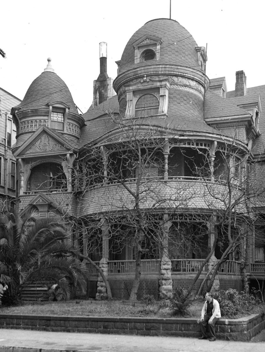
| (1950)* - View of the corner above the entrance to the Victorian-style Melrose Hotel at 130 South Grand Avenue, showing the elaborate turreted corner and porch. Photo by Arnold Hylen. |
Historical Notes This close-up by Arnold Hylen focuses on the most ornate corner of the Melrose Hotel — the turreted entry where the porch curved around the front of the building. Overlapping shingles covered the walls in a richly textured pattern. Small dome-like cupolas and larger rounded domes rose above the roofline, giving the structure its distinctive silhouette. Details like these help explain why the Melrose remained one of the most photographed buildings on Bunker Hill even in its final years. Despite decades of wear, its Victorian craftsmanship was still unmistakable from the street. |
 |
|
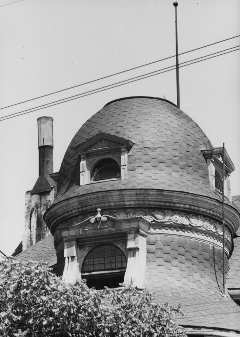
| (1958)* - View showing cupola of the Victorian-style Melrose Hotel at 120 South Grand Avenue. Photo by Arnold Hylen. |
| Historical Notes
By 1958, the main Melrose Hotel building had already been demolished. This photograph by Arnold Hylen shows one of the decorative cupolas still standing on the annex at 120 South Grand — one of the last remaining fragments of the complex. Hylen's decision to photograph this detail reflects his commitment to preserving on film even the smallest elements of the building before they disappeared. A cupola is a small dome-shaped structure placed at the peak of a roof, used for both ventilation and decoration. On the Melrose, they were signature ornaments that gave the roofline its irregular, animated quality — a hallmark of Victorian design that would soon vanish from this block entirely. |
Demolition, 1957 |
.jpg) |
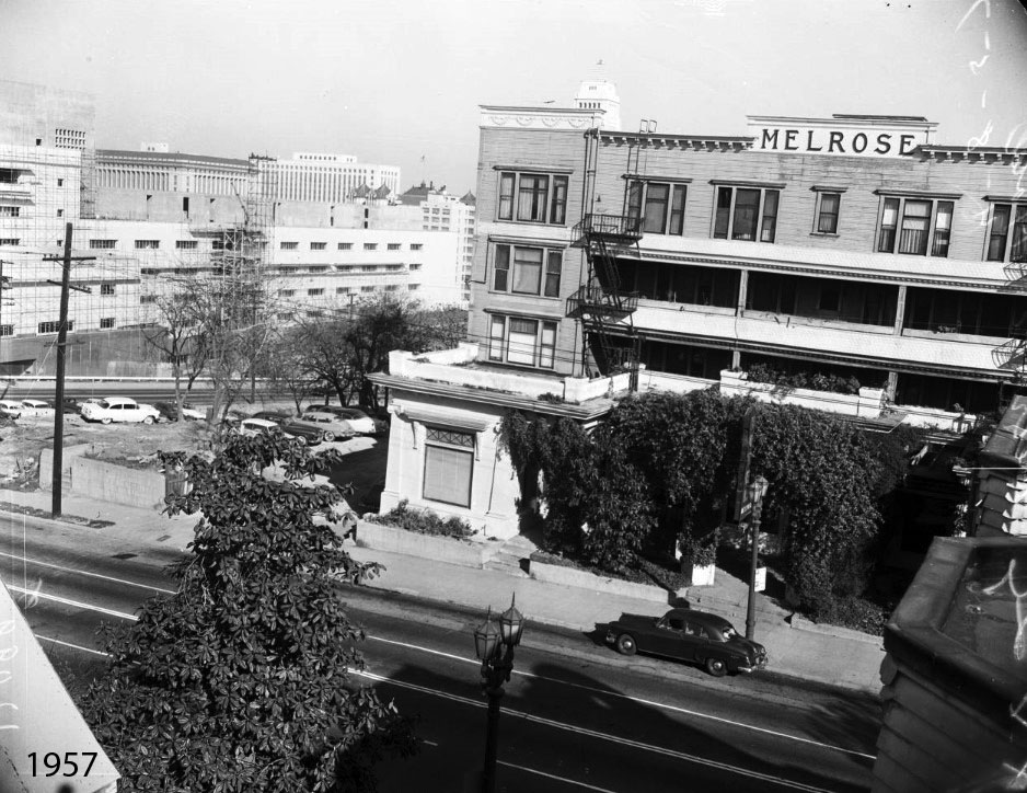
|
| (1957)* – View looking at the Richelieu and Melrose Hotels from the corner of 2nd Street and Grand Avenue. Both hotels were razed shortly after this photo was taken. |
| Historical Notes
This corner-view photograph, taken in 1957, captures both hotels in their final weeks. The vantage point at 2nd Street and Grand Avenue shows the full sweep of the Victorian streetscape that had occupied this block for nearly seventy years. The Richelieu stands at left and the Melrose complex fills the view to the right. By this time the City of Los Angeles had launched its Bunker Hill urban renewal program, targeting the hill's older buildings for clearance. The Richelieu was demolished first, followed shortly by the Melrose. Both were gone before the end of 1957. |
 |
|
| (1957)* - One of the last photos taken of the former Bunker Hill hotels on S. Grand Avenue; from left to right, the Melrose Hotel "Annex" (at 120), the original Melrose (at 130), and a glimpse of the Richelieu Hotel (at 142). |
Historical Notes This photograph is one of the last taken of all three buildings together before demolition began. Reading left to right: the Melrose annex at 120, the original Melrose mansion at 130, and at the far right, a partial view of the Richelieu at 142. For nearly seventy years, the Melrose was the more celebrated of the two hotels. It once hosted President William McKinley, was painted and drawn by artist Leo Politi, and drew local press coverage when demolition crews arrived. The Richelieu passed more quietly into history — less famous, but no less significant to the neighborhood that had gathered around it since the 1880s. |
 |
|
| (1957)* – Long shot of Melrose Hotel to be torn down after 75 years with City Hall tower in background. View is from the future home of the Disney Hall. Photo Date: April 8, 1957. |
Historical Notes Taken on April 8, 1957 — just days before demolition began — this photograph places the Melrose Hotel within the larger story of downtown Los Angeles. City Hall, completed in 1928, rises in the background, representing the civic growth that had reshaped the city since the Melrose was built in 1881. The photographer stood on what would become the site of the Walt Disney Concert Hall, which opened in 2003. The two landmarks represent different chapters of the same neighborhood: one shaped by the residential life of Victorian Bunker Hill, the other by the cultural development that followed. In July 1957, the Melrose was demolished after seventy-six years on this corner. |
 |
|
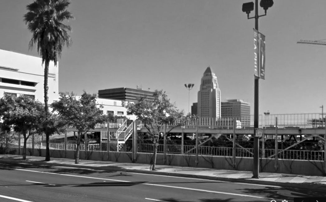
| (2014)* – Google Street View looking toward where the Melrose Hotel once stood. |
| Historical Notes
By 2014, the east side of Grand Avenue between 1st and 2nd Streets bore no trace of the Victorian buildings that had stood there for nearly seventy years. The streetscape visible here reflects decades of redevelopment: wide sidewalks, modern towers, and open plazas replacing the dense, human-scaled character of the old neighborhood. This Street View image serves as a reference point for the then-and-now comparisons that follow, showing the modern baseline against which the full transformation can be measured. |
Before and After
.jpg) |
||
.jpg) |
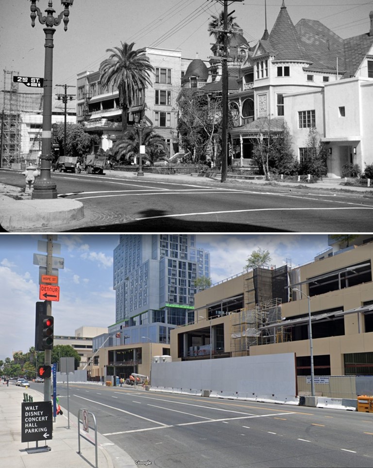
(1957 vs. 2014) - Grand Ave & 2nd St, Bunker Hill — The Melrose and Richelieu apartments once stood near this corner. Today, the site is part of The Grand LA development. Photo comparison by Jack Feldman.
| Historical Notes
This corner-view comparison anchors the then-and-now sequence at street level. The 2nd Street sign appears in both panels, giving the eye a clear reference point across fifty-seven years of change. In 1957, the ornate towers and porches of the Melrose and Richelieu filled this view. By 2014, the same corner was occupied by a multi-level parking structure — a reminder that the Bunker Hill redevelopment unfolded in stages, with surface lots and parking facilities filling many sites for years before permanent development arrived. |
Then and Now
 |
|
| (1957 vs. 2021) - Looking toward the east side of Grand Avenue between 1st and 2nd streets, where two of the most stunning Queen Anne Victorian buildings once stood, the Melrose and Richelieu Hotels. |
| Historical Notes
This longer view captures the full stretch of Grand Avenue between 1st and 2nd Streets and gives a sense of how completely the Victorian streetscape once filled this block. The Melrose and Richelieu were among the most architecturally prominent buildings remaining on Bunker Hill by the mid-twentieth century, and photographs like this preserve the scale and character of what was here. Today the same view is defined by modern towers and open civic space. The contrast between the two images shows that the redevelopment of Bunker Hill was not simply a change in buildings — it was a transformation of the entire character of the neighborhood. |
| Closing Reflections
For decades, the Melrose and Richelieu Hotels defined this stretch of Grand Avenue. They began as private homes built for Los Angeles' early families, evolved into hotel apartments that sheltered generations of residents, and ended as part of an urban renewal program that remade the city from the ground up. No physical trace of either building remains. But through the photographs gathered here — from the verandah gathering of 1894 to Arnold Hylen's close-up studies of ornamental detail to the final long shot on a spring morning in April 1957 — the character of Bunker Hill as it once was can still be seen and understood. What was lost here was not just architecture. It was a neighborhood. |
* * * * * |
New High and Temple Streets
 |
|
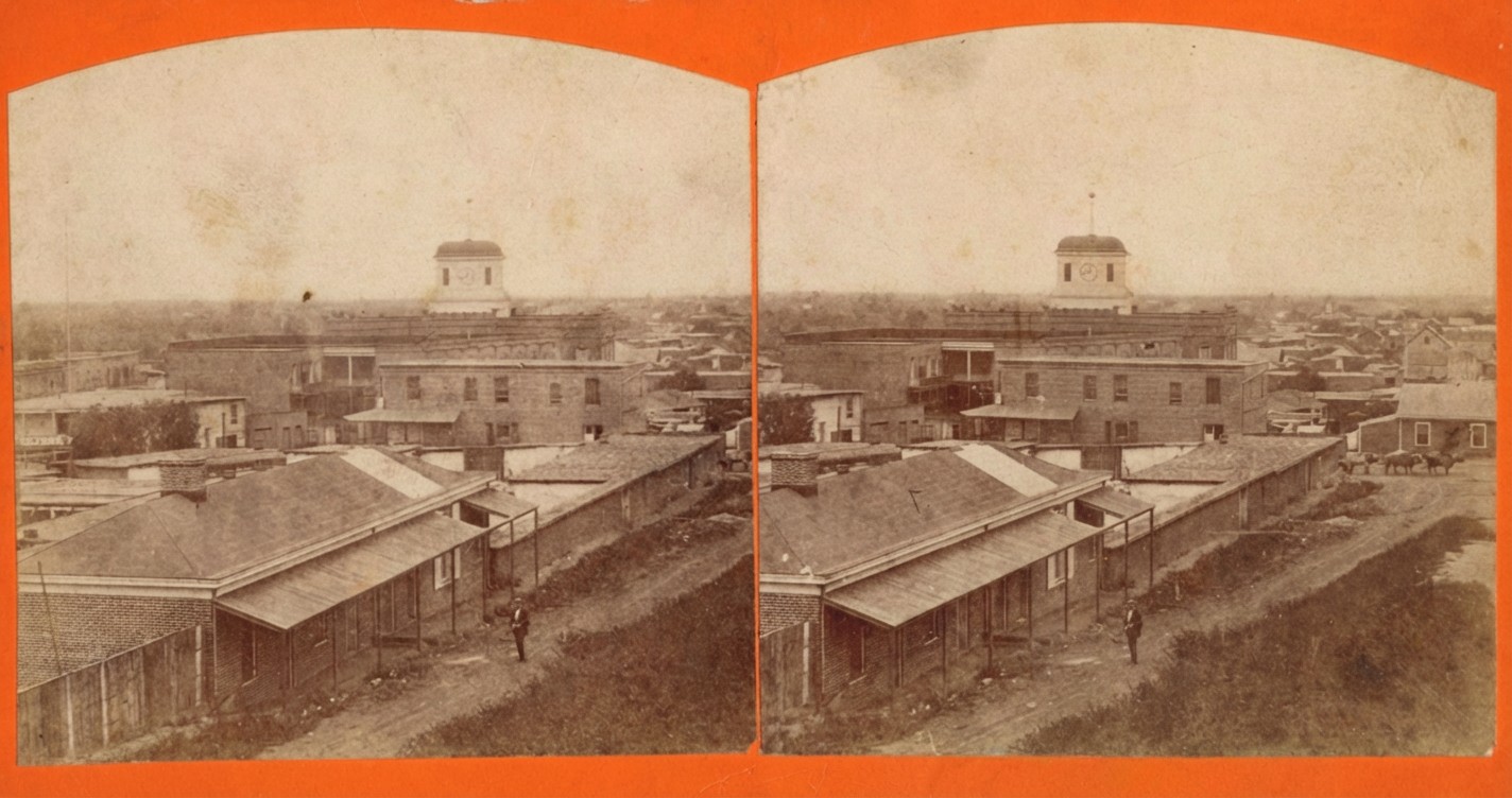
| (ca. 1869)* - Stereoscopic view looking southeast from the slope of Poundcake Hill showing adobe buildings along New High Street with a rifleman standing in the roadway. An ox team is seen heading west on Temple Street. Temple Block, with its prominent clock tower, is visible in the background. |
Historical Notes In the late 1860s Los Angeles was still a small frontier town with a reputation for disorder and violence. The population was only a few thousand people and the city often made national headlines for its high murder rate. Many residents carried rifles or pistols for personal safety, which is why armed men can sometimes be seen in early street scenes. The unpaved roads, the scattered adobe buildings, and the general openness of the area in the photograph reflect the simple and rugged character of the town. From the slope of Poundcake Hill, the view looks toward New High Street and Temple Street, where both homes and small businesses stood side by side. Ox teams were a common sight on Temple Street, which served as an important east west route for hauling goods and supplies. Life here moved slowly, and most of the activity centered on a few key streets that connected civic, commercial, and residential areas. |
 |
|
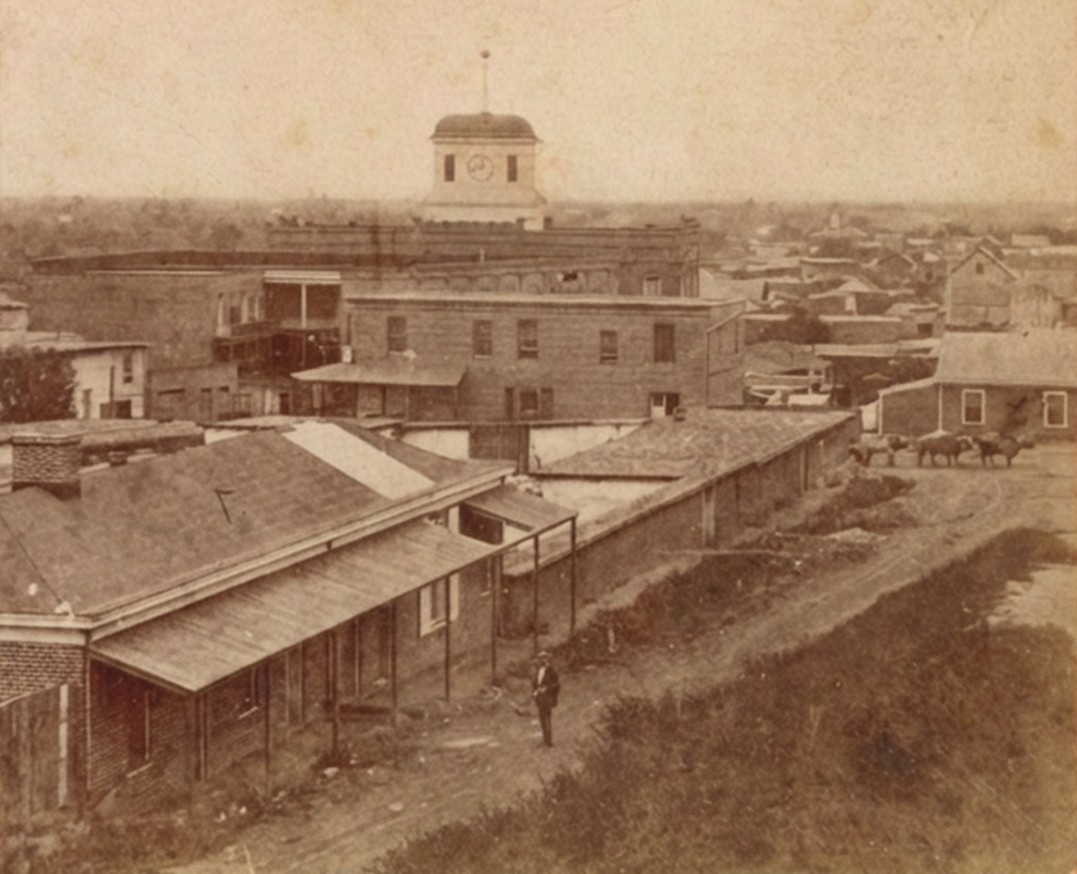
| (ca. 1869)* – View of New High Street (later incorporated into Spring Street) showing a rifleman in the roadway near the corner of New High and Temple Streets, with the Allen Block in the foreground and the Clocktower Market and Courthouse rising behind it. |
Historical Notes This corner of New High and Temple Streets was one of the earliest centers of public life in Los Angeles. It stood only a short walk from the first city hall and jail, which were simple adobe structures used by city leaders, law officers, and guards. Crime was a frequent challenge for the city, and law enforcement was stretched thin. It was not unusual to see armed men in the streets, especially near government buildings, which were gathering points for court cases and disputes. The Allen Block, visible in the foreground, was one of the first brick commercial buildings in the area. Its construction marked the city’s gradual shift from adobe buildings to more substantial architecture. Behind it stands the Temple Block and its well known clock tower. This cluster of buildings housed lawyers, shopkeepers, and the early county courthouse, making this intersection one of the busiest and most important places in the city. |
 |
|
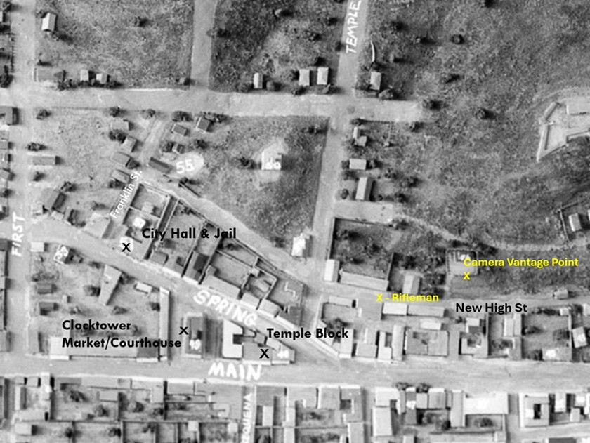
| (1850s)*- Annotated image of a model of early Los Angeles showing the location of the rifleman on New High Street seen in the earlier photograph, along with the Temple Block, the Clocktower, and the approximate camera vantage point. Photo annotation by Jack Feldman. |
Historical Notes This model helps show how small Los Angeles was in the 1850s and how concentrated public activity was around the Temple Block area. The rifleman seen in the earlier photograph stood near the heart of the young civic center, surrounded by adobe homes, simple stores, and dirt streets. The early courthouse and government offices in the Temple Block handled everything from land disputes to conflicts between ranchers, merchants, and new arrivals seeking opportunity in Southern California. The model also gives a clear sense of how the camera views were positioned. Early photographers often set up their equipment on hillsides, rooftops, or open lots because the town was still lightly developed. These elevated angles allowed them to document the growing city and the everyday life of its residents. |
 |
|
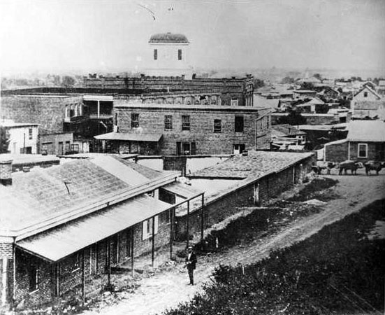
| (ca. 1869)* – Black-and-white version of the view showing a rifleman standing in the roadway near the corner of New High and Temple Streets, with the Allen Block in the foreground and the Clocktower Market and Courthouse rising behind it. |
Historical Notes This image again shows the daily activity at New High and Temple Streets during a time when Los Angeles was transitioning from a frontier settlement to an organized American city. The presence of a man holding a rifle reflects both the unpredictable nature of the town and the fact that many people felt the need to protect themselves. Law officers worked from nearby offices and the jail, but they often lacked the staff and resources to control every disturbance. The Allen Block and the Clocktower Market and Courthouse continued to anchor this busy intersection. Lawyers, clerks, merchants, and local residents all passed through this area, making it a crossroads where public business and private errands came together. Over time this corner became the foundation of the city’s future civic center, even as the surrounding streets remained rough and undeveloped. |
 |
|
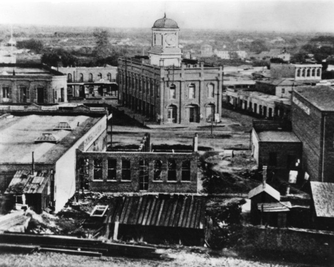
| (1876)* - Elevated view of the Clocktower Market and Courthouse on Temple Block, the main county government center located one block east of the first city hall and jail. |
Historical Notes By the mid 1870s the Temple Block had become the main government and business center of Los Angeles. Jonathan Temple, one of the city’s earliest merchants, developed several of the important structures in this area, including shops, offices, and the Market House that later became the home of the county courthouse. The tall clock tower in this view was one of the first major landmarks recognized by residents and visitors. This area was the setting for many early court cases that reflected the struggles of a fast changing community. Disputes over land, cattle, and business were common as new settlers arrived and the city began to grow. Even though the population remained small, the courts and offices in the Temple Block played a central role in maintaining order during a time when informal justice and personal protection were still part of daily life. As the years went on, this district evolved into the core of the modern Los Angeles civic center. Later courthouses, city offices, and eventually Los Angeles City Hall would replace many of the original buildings. The early scenes of New High and Temple Streets mark the beginning of that long transformation from a dusty frontier town to a major American city. Click HERE to see more early views of the Temple Block. |
* * * * * |
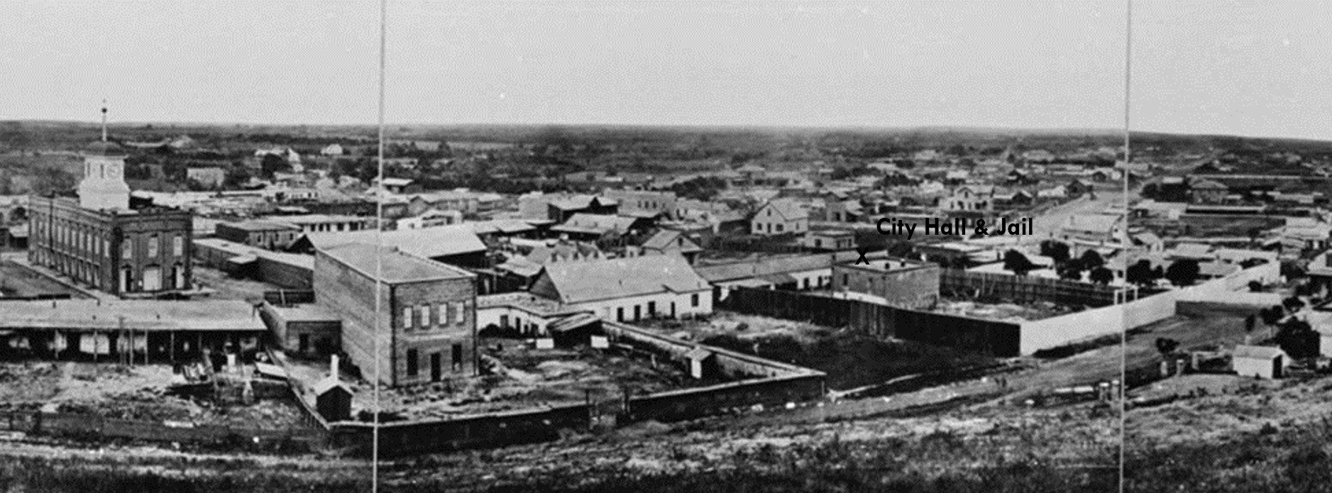
The First City Hall and Jail of Los Angeles (Rocha Adobe)
.jpg) |
|
| (1850s)* - Model of early Los Angeles showing the first city hall and jail at center-left on the northwest corner of Spring and Franklin (formerly Jail) Streets. |
Historical Notes This model represents the heart of Los Angeles as it appeared in the early 1850s. The first city hall and jail stand at the northwest corner of Spring and Franklin Streets. At this time Spring Street was known as New High Street, and Franklin Street was called Jail Street because the jail stood at its eastern end. The hill behind the building is Poundcake Hill, later the site of the 1888 County Courthouse. To the right are Temple Block and the Clocktower Market and Courthouse, which formed the center of civic life in early Los Angeles. The model shows how small and closely packed the young city was during its earliest years. |
 |
|
| (ca. 1869)* - Composite panoramic view showing the first city hall and jail at the corner of Spring and Jail Streets, with the adobe city offices along Spring Street and the brick jail standing in the yard behind it. |
Historical Notes This view shows the full first city hall and jail complex at the northwest corner of Spring and Jail Streets. The adobe fronting Spring Street served as the city offices. Behind it stands the two-story brick jail. The open yard between the buildings held prisoners and was the site of early executions. Because vigilantes sometimes stormed the jail, the tall fence around the yard was built mainly to keep angry crowds out. The Clocktower Market and Courthouse on Temple Block appears at left. Few images capture this important early civic corner as clearly as this one. |
 |
|
| (ca. 1875)* - View looking east down from Poundcake Hill showing Franklin Street (originally Jail Street) as it intersects with Spring Street. LA’s first designated Jail (brick building) sits near the northwest corner. The long building it sits behind is the Rocha Adobe on Spring Street which also served as LA’s first City Hall. The Temple Block clock tower is visible at upper left. |
Historical Notes This view shows the first city hall and jail complex from the hillside west of Spring Street. The long adobe on Spring Street originally served as the home of Antonio José Rocha and was used as the city offices in the eighteen fifties and sixties. Behind it stands the two-story jail, with adobe walls on the lower level and brick above. The small white outhouse at the southwest corner of the yard is clearly visible. Executions were carried out in the jail yard, and residents often stood on the hill behind the jail to watch the proceedings. This photograph highlights the compact layout of the early civic center. |
 |
|
| (ca. 1875)* - Henry T. Payne stereoscopic view from the hillside west of Spring Street showing the Rocha Adobe with the brick jail building in the yard behind it. |
Historical Notes This stereoscopic view by photographer Henry T. Payne shows the first city hall and jail complex from the hillside west of Spring Street. The long adobe on Spring Street originally served as the home of Antonio José Rocha and was used as the city offices in the eighteen fifties and sixties. Behind it stands the two-story jail, with adobe walls on the lower level and brick above. The small white outhouse at the southwest corner of the yard is clearly visible. Executions were carried out in the jail yard, and residents often stood on the hill behind the jail to watch the proceedings. Payne’s view, with its stronger stereoscopic depth, underscores the compactness of this early civic center. |
 |
|
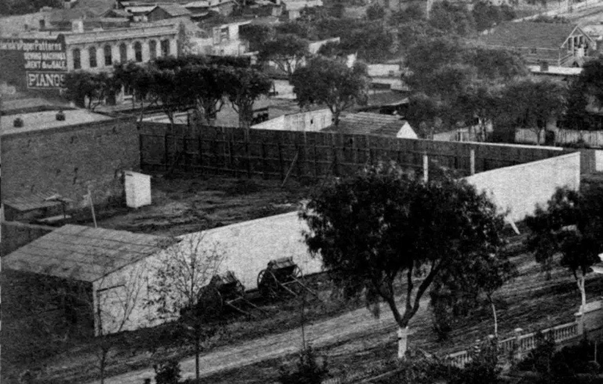
| (ca. 1875)*- Detail view of the fenced jail yard behind the former Rocha Adobe, showing the white outhouse and the two-story city and county jail building. |
Historical Notes This closer look at Spring Street captures the jail yard behind the adobe city offices. The tall fence surrounding the yard was built to protect the jail from intruders rather than to prevent escapes. The two-story jail building, adobe below and brick above, stands directly behind the yard. A commercial building on the east side of Spring Street is visible at upper left, displaying painted signs for clothing patterns, sewing machines, and pianos. The scene reflects the mix of civic and commercial activity that filled this small area of the city. |
|
|
| (1874)* – View looking south on Spring Street as seen from the top of the Clocktower Market/Courthouse building. To the right of center is a building with a steep roof and a sign that says “Mercantile Law Collection Books.” The building immediately south of that, on the northwest corner of Spring and Franklin Streets, is the first Los Angeles City Hall and jail, a building the city and county shared. The taller building in the distance, near the top center of the photo, is the City's 1st Synagogue, built in 1873. |
Historical Notes In August 1853, an adobe home that had been built in the 1820s at the northwest corner of Spring and Franklin Streets – a site now under the current city hall – was sold by John Temple to the city and to Los Angeles County for a city hall and courthouse. The city owned a one-quarter interest in the property, and the county owned a three-quarters interest. A brick jail used by both the city and county was constructed behind the adobe in 1853-54, the first (non-adobe) brick building built in Los Angeles. |
Rocha Adobe
 |
|
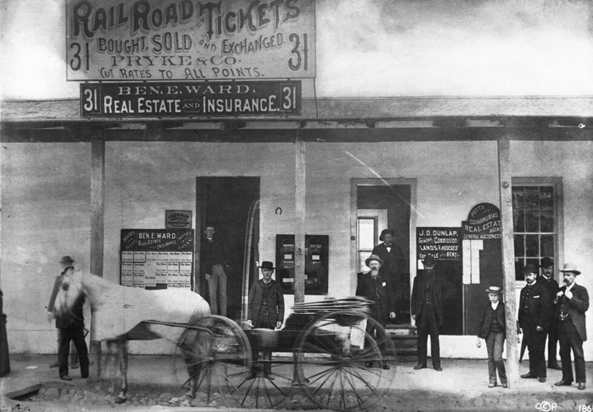
| (ca. 1880)* - View showing the first Los Angeles jail and city hall, west side of Spring Street on the corner of Franklin Street. A group of men and a boy stand in and around the doors under the roof overhang of the 1-story building. A horse-drawn wagon moves by going to the left. The address above is 31 and 33 Spring Street. |
Historical Notes By the 1880s the original city hall and jail had been converted into storefronts. The adobe stood on the northwest corner of Spring and Franklin Streets and was originally built as a residence by Antonio José Rocha. Signs advertise real estate, insurance, railroad tickets, and auction services. Several men and a boy stand beneath the porch roof while a wagon passes by. Although no longer serving its original purpose, the building remained a familiar landmark until it was demolished as downtown Los Angeles expanded. Originally built in the 1820s as a residence by Antonio Jose Rocha and deeded to the city in 1855 by Rocha, Buenaventura Lopez, his wife, Jose Jorge Rocha, Guadalupe Valez, and his wife. Later used as a railroad ticket office and real estate office. The businesses advertised are "Ben. E. Ward, real estate and insurance", "Pryke & Co., railroad tickets bought, sold and exchanged, cut rates to all points", "Potts and Covarrubias, real estate agent, general auctioneer" and "J. D. Dunlap, general commission, lands & houses for sale or rent". Mr. Dunlap was also a Deputy Marshall. The following historical timeline lists the buildings used by City Council, also known as City Hall, since 1850, when Los Angeles was incorporated as a municipality: ◆ 1850 - 1853 - used rented hotel and other buildings for City meetings ◆ 1853 - rented adobe house (aka Rocha Adobe) on Spring Street - across from current City Hall (now parking lot for Clara Shortridge Foltz Criminal Justice Center). The buliding was shared with the County who used it as a Court House. ◆ 1861 - moved into John Temple's Clocktower Market Building, but only stayed for less than a year before the County Court House moved-in ◆ 1861 - 1884 - relocated back to the Rocha Adobe and stayed for over 20 years ◆ 1884 - 1888 - moved to new City Hall Building at South Spring Street and West 2nd Street (site of current Los Angeles Times Building) ◆ 1888 - 1928 - moved to new Romanesque Revival Building on 226-238 South Broadway between 2nd Street and 3rd Street; demolished in 1928 and now site of parking lot between LA Times Parking structure and 240 Broadway. ◆ 1928 - moved to current City Hall Building |
* * * * * |
Foster Block
 |
|
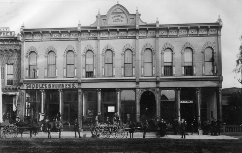
| (1882)* - Foster Block building was located on Main Street near First Street. A sign on the face of the building reads: "SADDLES & HARNESS". |
* * * * * |
L.A. Conservatory of Music and Arts
 |
|
| (1883)* - The L. A. Conservatory of Music and Arts in 1883 located at 406 South Main Street. The building would have been at 506 South Main Street after the change in street addresses in 1890. |
Historical Notes The L. A. Conservatory of Music and Arts was founded in 1883 and was still in existence 75 years later. The 1890 City Directory lists the president as Emily J. Valentine. |
* * * * * |
Ozro Childs Residence
 |
|
| (ca. 1880s)* - View of Ozro W. Childs’ house located at 1111 S. Main Street. The photo shows the exterior front of the house, with a horse-drawn carriage next to a tree, as well as a child wearing a white dress and hat to the left of the picture. |
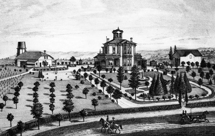
Historical Notes Ozro W. Childs obtained the contract to build an extension of the Zanja Madre, a canal system to bring water to the fields south of the pueblo. He was paid in land in that area – all now within present day Downtown Los Angeles - from Sixth to Ninth, and Main to Figueroa Street. Click HERE to see more in Zanja Madre - LA's Original Aqueduct. This property was the foundation of his fortune. He built a substantial house at 10th and Main, then a half-mile from town center, and on his property took up planting. In his day, Ozro Childs was Los Angeles’s most prominent plantsman, with a Plant nursery. |
 |
|
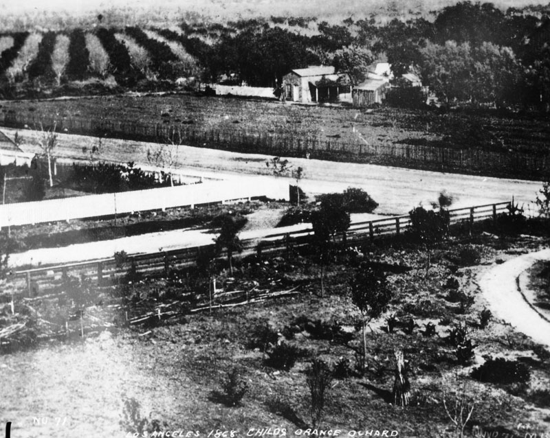
| (1868)* - View of Ozro Childs' orange orchard in 1868 at the corner of Main and 12th Streets. |
Historical Notes Ozro Childs was also involved in philanthropic work. When Judge Robert Maclay Widney set out to create a university in Los Angeles in the 1870s, he received assistance from donors including Childs. In 1879, Childs contributed a considerable amount of land to the founding of the University of Southern California, which opened in 1880. |
* * * * * |
 |
|
| (1880s)* - Retail stores in the 2600 block of Central Avenue, Los Angeles. |
* * * * * |
Hollenbeck Residence (Villa de Paredon Blanco)
 |
|
| (ca. 1880)* - Engraving of the "Villa de Paredon Blanco," residence of J. E. Hollenbeck, in Boyle Heights, 1-1/4 miles southeast of downtown Los Angeles. Note: Boyle Heights was once called Paredon Blanco (White Bluff) when California was part of Mexico. |
Historical Notes In 1874, John Edward Hollenbeck and his wife visited Los Angeles. The community was growing rapidly, and businesses were investing heavily in anticipation of the coming of the Southern Pacific Railroad. While visiting California, Hollenbeck, who made his wealth in Nicaragua, purchased several parcels of real estate and deposited funds in Temple and Workman Bank. Hollenbeck soon closed out his Nicaraguan businesses and made his final move to the United States. Arriving in Los Angeles early in the spring of 1876, Hollenbeck purchased land on the east side of the Los Angeles River, and built a large residence with broad verandas and a tower on extensive grounds on Boyle Avenue. He made twenty-seven acquisitions of property by 1880; spending $108,875 for a total of 6,738 acres. The real estate holdings included 600 acres south of the city limits, much of which was planted in vineyards. In the San Gabriel Valley, he owned orchards of oranges, lemons, and grapes; and invested in 3,500 acres of Rancho La Puente — a grain and stock ranch. In 1884 he purchased and developed an urban business district, known as the Hollenbeck Block, within Los Angeles. Hollenbeck was elected to the Los Angeles Common Council, the governing body of the city, on December 3, 1877, for a term ending on December 6, 1878. In 1878 Hollenbeck became a stockholder in the Commercial Bank of Los Angeles, and was elected its president. In 1881, he and other investors organized and established the First National Bank.*^ |
 |
|
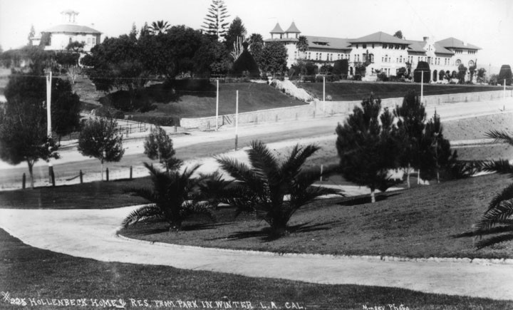
| (ca.1896)* – View showing the original J.E. Hollenbeck residence at upper left and the Hollenbeck Home for the Aged as viewed across part of Hollenbeck Park. |
Historical Notes Because of health problems stemming from his years in tropical Central America, Hollenbeck died in his fifties in 1885. In addition to donating some land for a park (Hollenbeck Park), Elizabeth Hollenbeck willed the couple's home and surrounding grounds across Boyle Avenue for a senior citizens' home, dedicated in 1896 and now known as Hollenbeck Palms.**^^ |
.jpg) |
|
| (ca. 1896)^*# – View showing a woman (Elizabeth Hollenbeck?) standing in a garden in front of the Hollenbeck Residence located at 573 S. Boyle Avenue. The Hollenbeck Retirement Home is the building with the two turrets at the right. |
* * * * * |
Dodson Residence (San Pedro)
 |
|
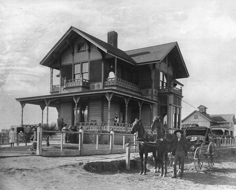
| (1880s)^^** - Home of merchant/postmaster James H. Dodson and his wife, Rudecinda Sepulveda. She is possibly the woman standing on the second floor balcony. |
Historical Notes The Victorian architecture style house was built in 1881 by the Sepulveda family as a wedding present for their daughter Rudecinda and her husband, James Dodson. It was originally located at the corner of 7th and Beacon Streets, San Pedro.^* |
 |
|
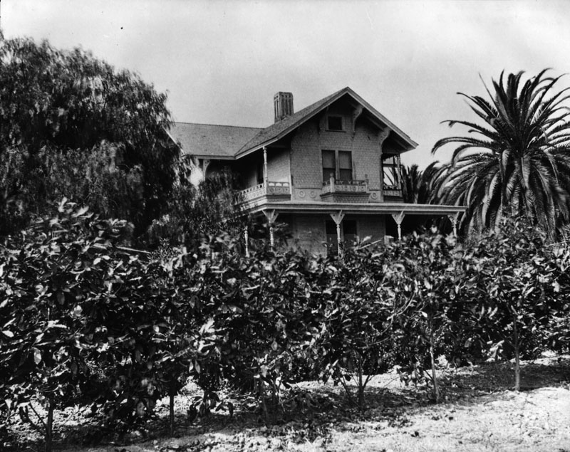
| (1890)* - A partial view of J. W. Dodson's residence can be seen above the small trees. |
Historical Notes In 1976, the James H. Dodson Residence was dedicated Los Angeles Historic-Cultural Monument No. 147 (Click HERE to see complete listing). The house is now located at 859 W. 13th St., San Pedro. It is a private residence and is not open to the public.^* |
* * * * * |
Macy Street School
 |
|
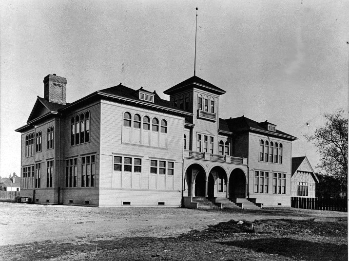
| (ca. 1880s)#*** - View of the Macy Street School located on the corner of Macy and Bridget streets. |
Historical Notes The Macy Street School was built in 1881 on the corner of Macy and Bridget Streets. It was not named until 1887. It was considered one of the more beautiful schools in the District. #*** |
* * * * * |
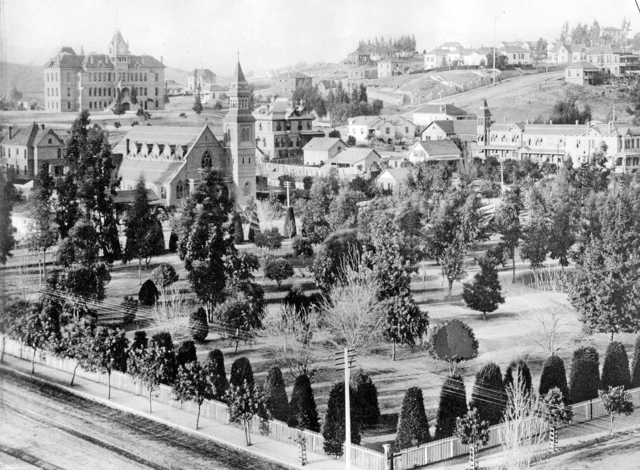
State Normal School
 |
|
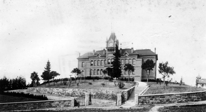
| (ca. 1882)* - Front view of the State Normal School, located at Grand and 5th Street close to the time it opened. |
Historical Notes In March 1881, after heavy lobbying by Los Angeles residents, the California State Legislature authorized the creation of a southern branch of the California State Normal School (which later became San Jose State University) in downtown Los Angeles to train teachers for the growing population of Southern California. The State Normal School at Los Angeles opened on August 29, 1882, on what is now the site of the Central Library of the Los Angeles Public Library system.^* |
 |
|
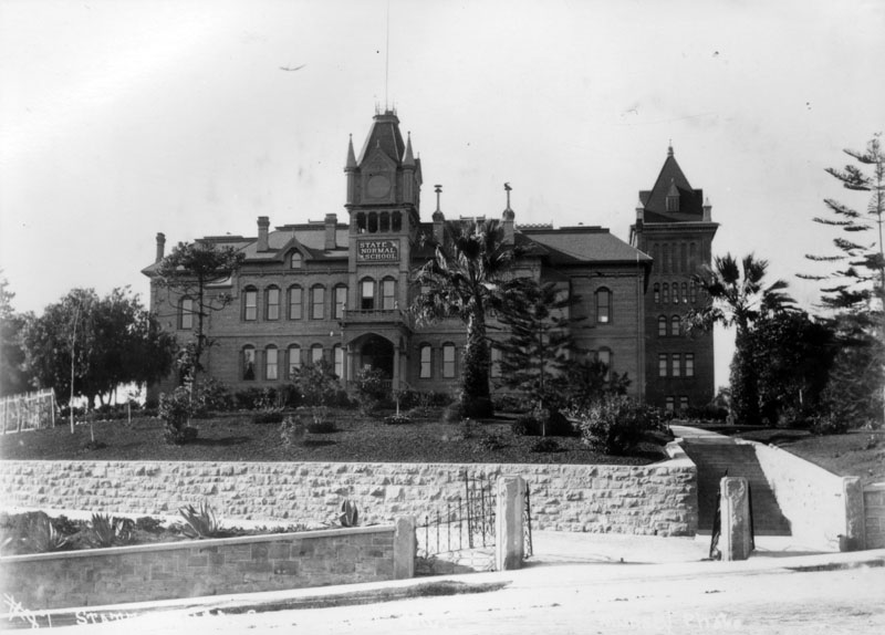
| (ca. 1888)* - View of the State Normal School looking southwest. The scarce landscaping on the property and young saplings suggests that the school was fairly new at the time the image was taken, although a new wing had been added (extreme right tower). |
Historical Notes Through the years, the State Normal School was expanded and several new wings were added; the "new and improved" facility would eventually include an elementary school where the teachers-in-training could practice their teaching technique on real children.* |
 |
|
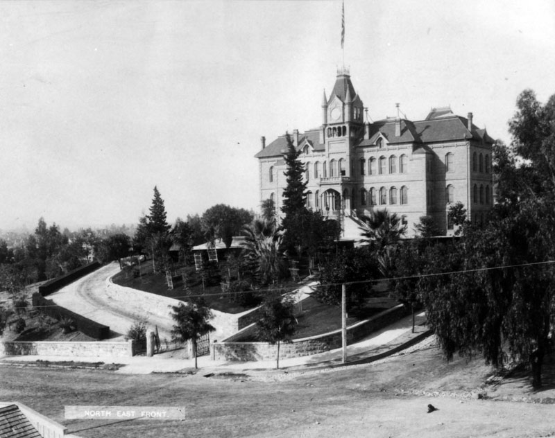
| (ca. 1893)* - Southwest corner view of the State Normal School, located at Grand and 5th Street. A long and winding driveway is located on the left side of the entrance, and a long flight of stairs (barely visible) is on the right; the school sits impressively on the last knoll of Bunker Hill, aptly dubbed "Normal Hill". |
Historical Notes After the demolition of this structure (1922), 5th Street was straightened and the remainder of the site was eventually occupied by the L.A. Public Library.* |
 |
|
| (ca. 1890s)* - Southwest corner view of the State Normal School, located at Grand and 5th Street. A long and winding driveway is located on the left side of the entrance (not visible in this shot), and a long flight of stairs is on the right. |
Historical Notes In 1914, the Los Angeles State Normal School moved to a new campus on Vermont Avenue (now the site of Los Angeles City College) in East Hollywood. On May 23, 1919, Governor William D. Stephens signed Assembly Bill 626 into law, which merged the Los Angeles Normal School with the University of California as the Southern Branch of the University of California. The same legislation added its general undergraduate program, the College of Letters and Science.^* |
Click HERE to see more Early Views of the Normal School and of UCLA. |
* * * * * |
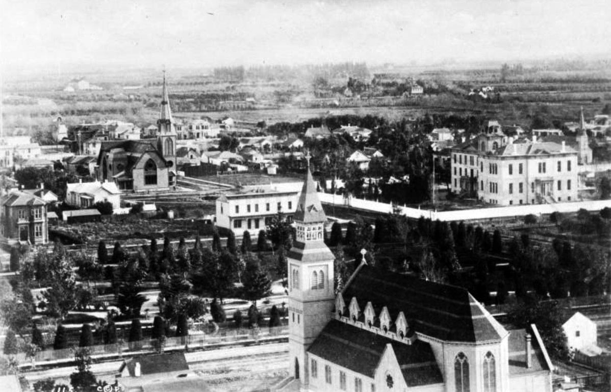
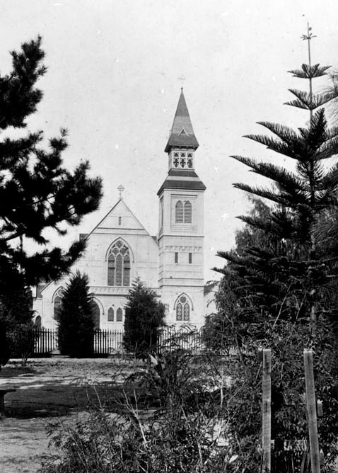
St. Paul's Pro-Cathedral
 |
|
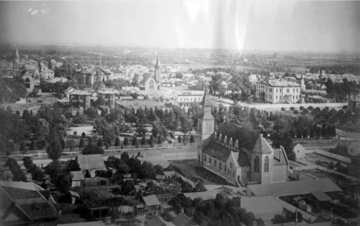
| (ca. 1883)^^* - View looking southeast from the State Normal School (current location of Central Library) showing St. Paul's Catherdral (lower-right) with Los Angeles Park (now Pershing Square) across the street. |
Historical Notes The St. Paul's Church was built in 1883 on Olive Street at the site now occupied by the Biltmore Hotel.. St. Athanasius (built in 1864) was the first Episcopal church in Los Angeles, located on the northeast corner of Poundcake Hill at Temple and New High Streets. In 1881, the church was renamed St. Paul's. Two years later, the original church building was sold to Los Angeles County, and a new St. Paul's Church was built at the location seen above.^ |
 |
|
| (ca. 1883)^^* - Closer view of St. Paul's Cathedral, in the foreground, with Los Angeles Park (now Pershing Square) across the street, as seen from the State Normal School. The multi-story building on the right is St. Vincent's College located on Hill Street between 6th and 7th Streets. |
 |
|
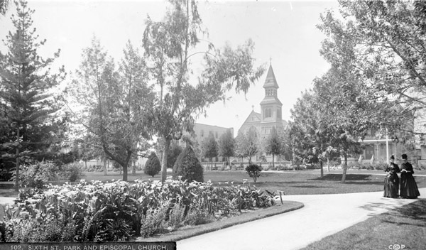
| (ca. 1886)* - View of Sixth Street Park (later Pershing Square) looking northwest toward the front of St. Paul's Episcopal Church on Olive Street. The State Normal School can be seen in the distance (upper-left) on the southwest corner of Grand and Fifth Street (Click HERE to see more views of the State Normal School). The slopes of Bunker Hill are on the right. |
Historical Notes The following is a chronology of name changes the park has seen before becoming Pershing Square: ◆ 1866 – La Plaza Abaja or "The Lower Plaza" ◆ 1867 – St. Vincent Park ◆ 1870 – Los Angeles Park ◆ 1886 – 6th Street Park ◆ 1890s- Central Park ◆ 1918 – Pershing Square |
 |
|
| (ca. 1888)^^* - View of two women walking along a walkway in 6th Street Park (formerly known as St. Vincent's Park). Today, this is the site of Pershing Square. |
 |
|
| (1890)* – Ground view of St. Paul’s Cathedral as seen from 6th Street Park (today, Pershing Square). |
 |
|
| (ca. 1913)^^* - View looking southeast showing St. Paul's Episcopal Church in the foreground, Pershing Square, and part of the city skyline. |
Before and After
 |
|
.jpg) |
 |
|
| (ca. 1920)* – View of the Episcopal St. Paul's Cathedral, located at 523 S. Olive Street. |
Historical Notes This building for St. Paul's Episcopal Cathedral was razed for the construction of the Biltmore Hotel. Its replacement was a 1,200-seat church at 615 South Figueroa Street, designed by Reginald Johnson, Roland Coate, Gordon Kaufman, and Carleton Winslow. That structure was dedicated on July 13, 1924 and razed in 1980. |
 |
|
| (ca. 1920)* – View of the Episcopal St. Paul's Cathedral, located at 523 S. Olive Street. Image enhancement and colorization by Richard Holoff. |
Historical Notes The St. Paul's Church was built in 1883 at the site now occupied by the Biltmore Hotel.. |
* * * * * |
San Fernando Mission
 |
|
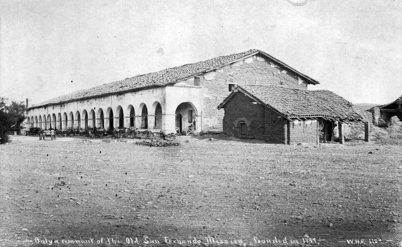
| (1883)* - Founded by father Fermín Lasuén on September 8, 1797 in Mission Hills, Mission San Fernando Rey de España (originally La Misión del Señor Fernando, Rey de España) is located on the former settlement of Encino Rancho. |
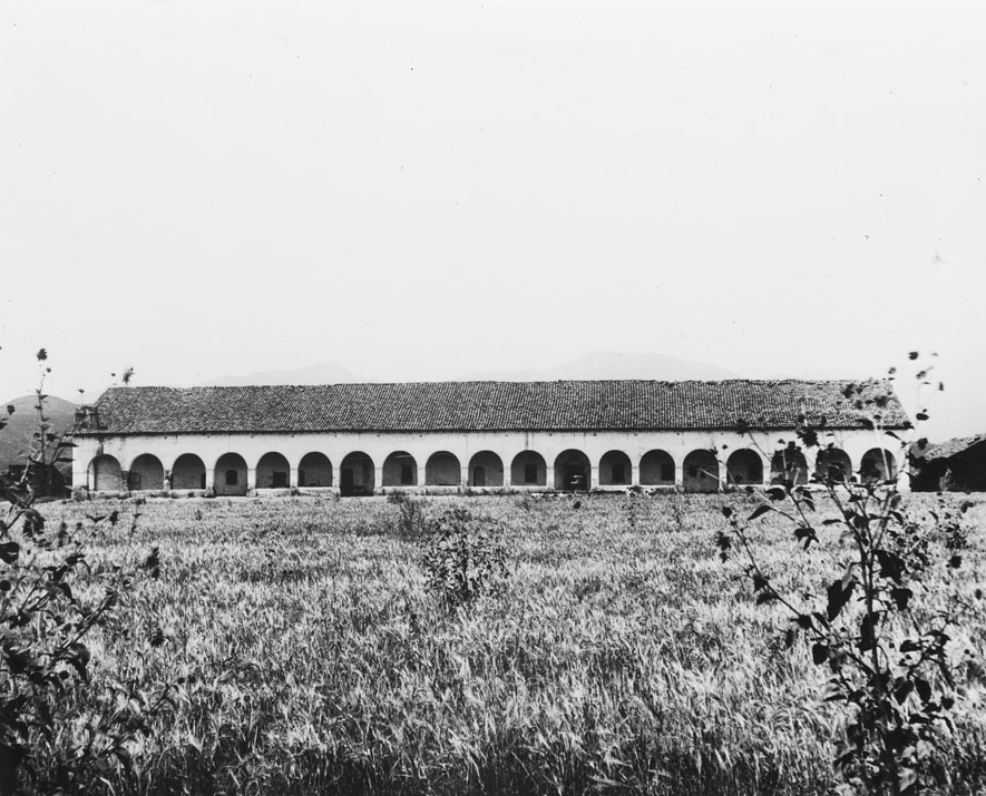
Historical Notes The San Fernando Mission was the seventeenth mission built in Alto California. It was built in a quadrangle, similar to other missions, in which the church makes up one corner. The Convento stands apart from the quadrangle; it took 13 years to construct and was completed in 1822. Most noted for its 21 Roman arches, it is the largest two-story adobe structure in California. Now, the second floor is used for storage.* |
.jpg) |
|
| (1886)* - View from the corridor of Mission San Fernando Rey de Espana showing its external surroundings and a fountain, Mission Hills, California, 1886. The tall corridor is constructed of wooden beams supporting the roof structure, large arches made of adobe bricks, and stucco to cover the adobe bricks. |
Historical Notes The Convento Building was added to the National Register of Historic Places in 1988 - Building #88002147. And in 1999, the entire Mission San Fernando Rey de España was added to the National Register of Historic Places as well - Building #71001076. It also was dedicated as California Historic Landmark No.157 (Click HERE to see complete listing). |
 |
|
| (1898)* - Exterior view of the San Fernando Mission cloister. The long, one-story building of the cloister is pictured at center, showing its broad side. A colonnade is effected along the side by the situation of evenly spaced arches, which coincide with what appear to be the doors to the monks' quarters on the main building just inside the colonnade. Three tall, weed-like plants stand in the foreground in a large swath of sedgegrass. The picture file card identifies them as "Sunflowers". |
 |
|
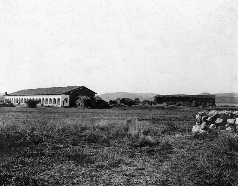
| (ca. 1903)* - View of the Convento Building, also known as the "Long Building" (on the left), after its 1903 restoration, as well as the original chapel structure (on the right), which had since fallen into ruin. |
 |
|
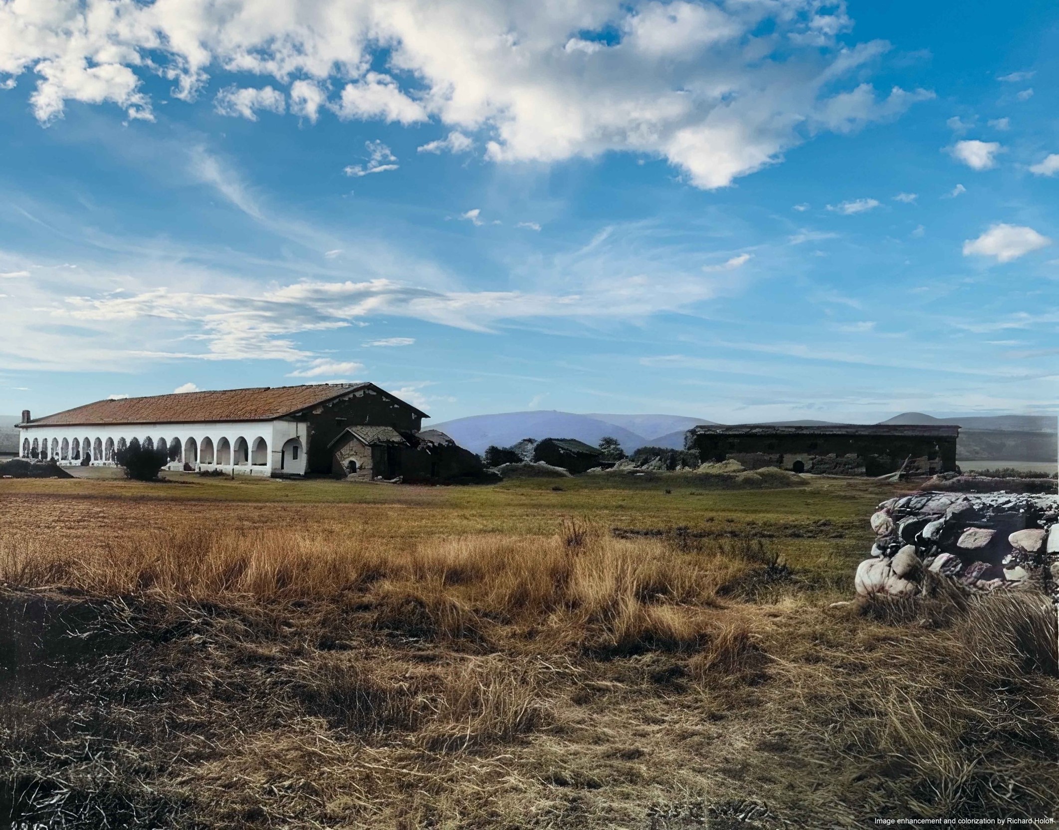
| (ca. 1903)* - View of the Convento Building, also known as the "Long Building" (on the left), after its 1903 restoration, as well as the original chapel structure (on the right), which had since fallen into ruin. Image enhancement and colorization by Richard Holoff. |
Historical Notes Click HERE to see more in Early Views of the San Fernando Mission |
* * * * * |
Main and 3rd Streets (SW Corner)
 |
|
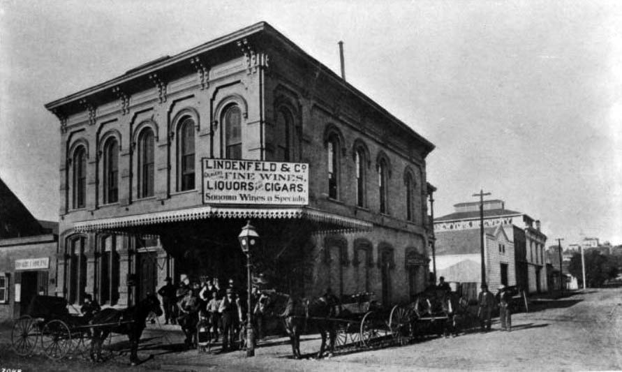
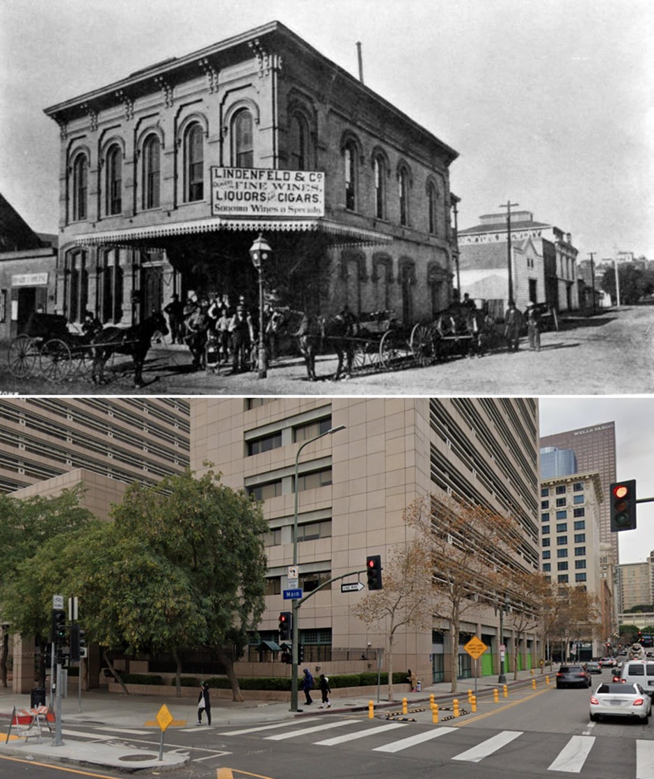
| (ca. 1884)* - View showing the Lindenfeld & Co. Liquor Store on the southwest corner of Main Street and Third Street. Men and horse-drawn carriages are gathered in front of the two-story Romanesque building, in front of which a streetlamp stands. The New York Brewery building is visible farther down the street to the left. The sign on the Lindenfeld & Co. building reads "Dealers in Fine Wines, Liquors and Cigars. Sonoma Wines a Specialty". A second sign is posted on the side, reading "Wine Room". |
Historical Notes The building was erected in the late 1870's and later torn down in 1905 in lieu of the City National Bank Building. The Henne Building was later constructed where the New York Brewery is pictured. |
Then and Now
 |
|
| (1884 vs 2021) – Looking at the SW corner of Main Street and 3rd Street in DTLA showing the Lindenfeld & Co. Liquor Store, today the site of the Ronald Reagan State Building. |
* * * * * |
Los Angeles Soap Company
 |
|
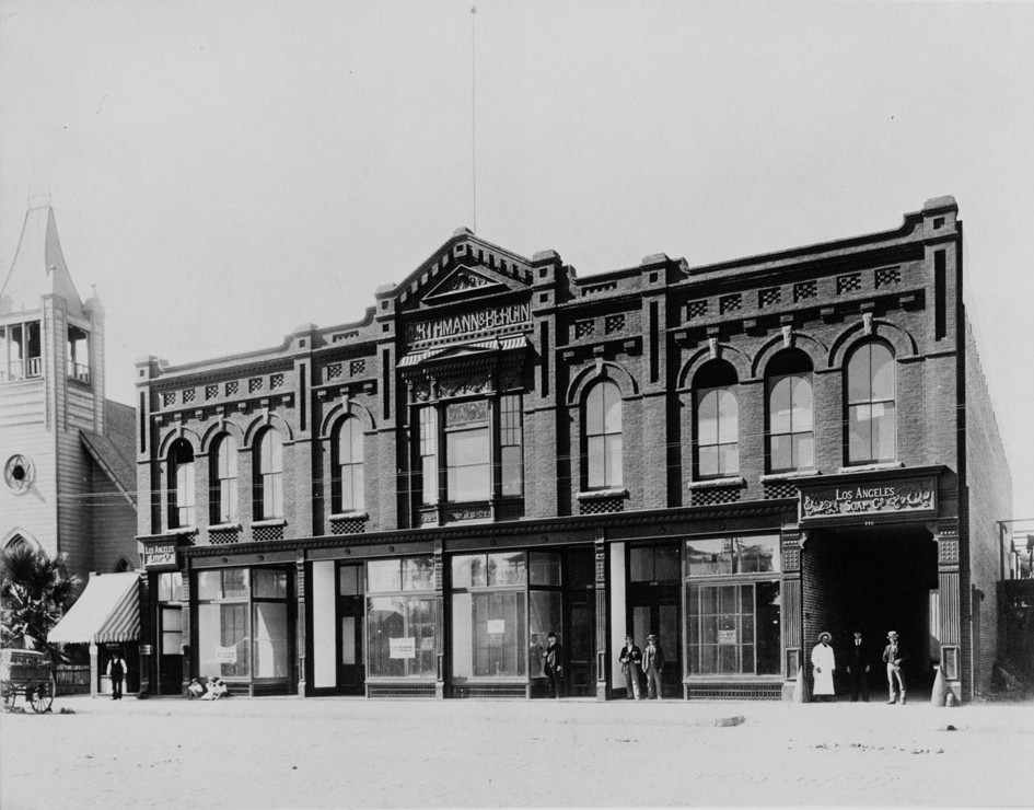
| (1884)* - View of the Los Angeles Soap Company Building on 1st Street. Sign on front of building reads: FORTHMANN & BERGIN |
Historical Notes John Forthmann was a 17-year-old immigrant from Hamburg, Germany, when he arrived in California in 1860. He briefly lived in San Francisco, then came south and opened a small grocery store at Sixth and Olive streets before starting the Los Angeles Soap Co. at First and Alameda streets that same year. In 1870, he and William D. Bergin became partners and they erected a factory amongst the orange trees and grape vines in the downtown area. The company grew to include about 25 buildings, some as high as five stories, on 16 acres from First Street on the south to Banning Street on the north. The Los Angeles Soap Co. is best known for making White King Detergent and for sponsoring the show 'Queen for a Day'.* |
* * * * * |
St. Vibiana's Cathedral
 |
|
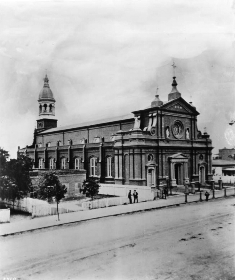
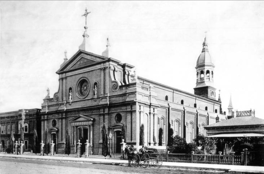
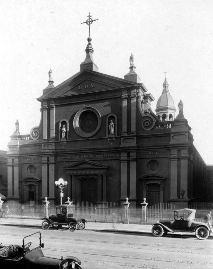
| (ca. 1880)* – View of St. Vibiana's Cathedral soon after its completion, located on the east side of Main Street south of 2nd Street. Built between 1871 and 1876, the arabesque cathedral stands at center, a rose window positioned above the main entrance with a religious statue affixed at either side. It is surrounded by a wrought-iron fence. The cathedral's bell tower can be seen extending from the back of the building. To the left, two men stand and talk in front of the Union Rescue Mission's own picket fence. |
Historical Notes Plans for a cathedral dated back to 1859; and land for the facility was donated by Amiel Cavalier. The complex, on the southeast corner of Main and Second Street in downtown Los Angeles, was dedicated in 1876 and cost $80,000 to build. The Cathedral's architect, Ezra F. Kysor, also designed the landmark Pico House.* |
 |
|
| (1884)* - Main Street looking north toward 2nd Street, showing the Cathedral of St. Vibiana on the right side. Horse-drawn streetcar can be seen heading South on Main Street. |
Historical Notes The Cathedral of Saint Vibiana, often called St. Vibiana's, was a cathedral church building and parish of the Roman Catholic Archdiocese of Los Angeles. The building opened in 1876 as the cathedral for what was then known as the Diocese of Monterey-Los Angeles, and remained the official cathedral of the Los Angeles for over 100 years.* |
 |
|
| (1885)^^* - A man stands near a horse-drawn carriage is parked on the dirt road in front of St. Vibiana's Cathedral located at 200-248 S. Main Street. |
Historical Notes Pope Pius IX chose the Cathedral's name, choosing third-century Roman martyr Saint Vibiana. Cathedrals traditionally contained the relics of a saint, so the remains of St. Vibiana were removed from the Catacombs of Rome and moved to a gilt and plate glass sarcophagus located in a niche above the high altar.* |
 |
|
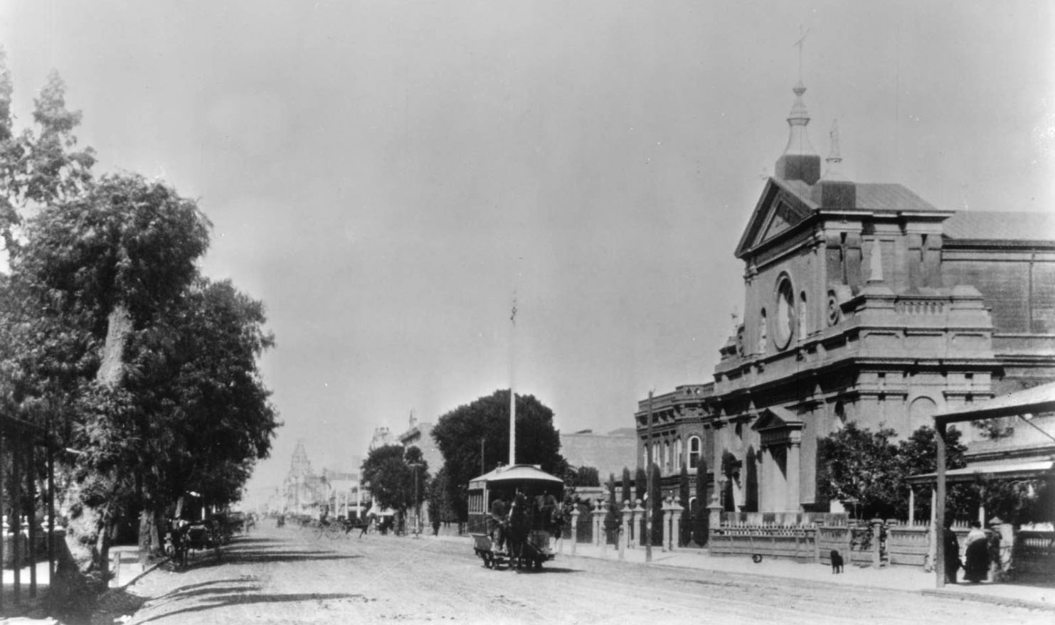
| (ca. 1888)* – View showing the Cathedral of Saint Vibiana, located near the southeast corner of Main Street and Second Street. The large, neo-Classical cathedral is shown at center, with other, commercial buildings at its left. Several statues protrude from the church's roof, along with two spired steeples. The façade shown has two unadorned pediments, a rose window, and a balustraded railing along the lower roofline. Pedestrians and horse-drawn buggies stand on the sidewalk and street in front of the cathedral. |
Historical Notes The Baroque-inspired Italianate structure was a landmark in the early days of Los Angeles. When first opened, it held one-tenth of the young town's population. |
 |
|
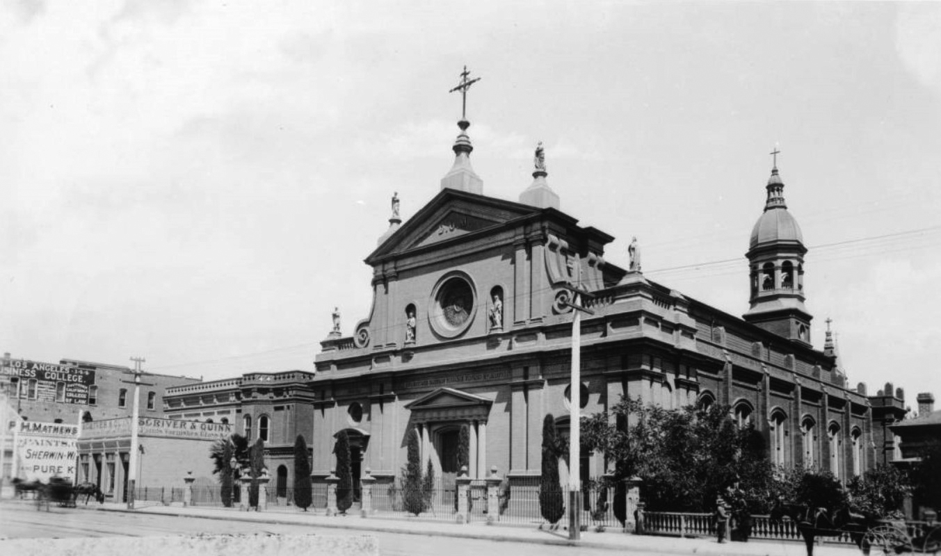
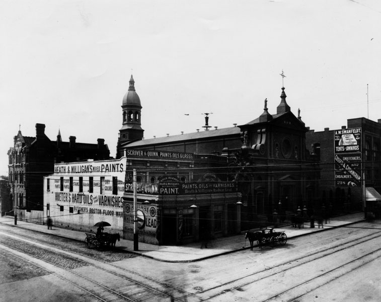
| (ca. 1890s)* - Exterior view of the Cathedral of St. Vibiana as it appeared in the late 19th century. Horse-drawn wagons are parked at the curb. Note that the corner building is now a paint store. |
 |
|
| (ca. 1920)* - Three early model cars are parked in front of the the Catholic Cathedral of St. Vibiana. |
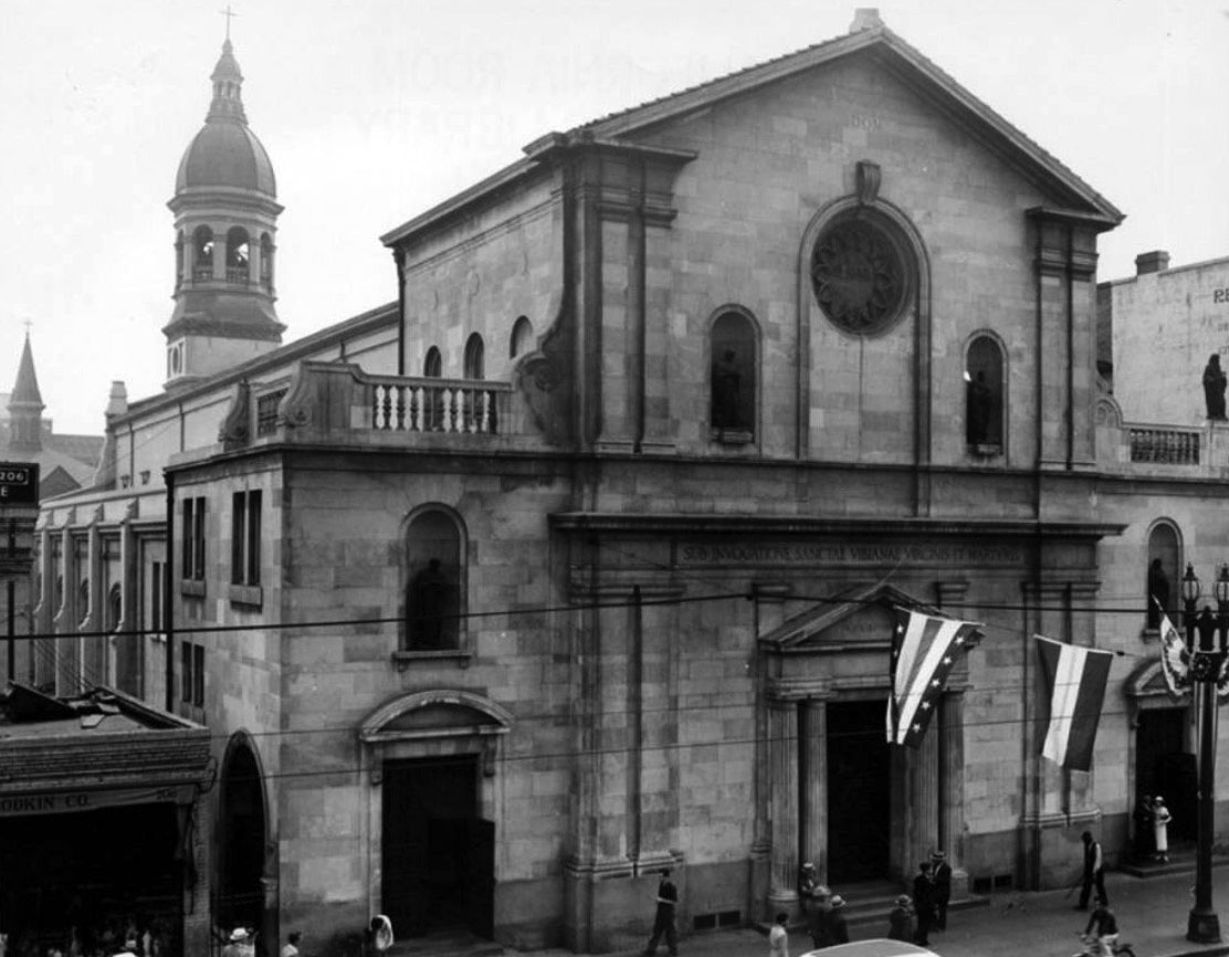
Historical Notes The interior was remodeled around 1895, using onyx and marble; the exterior facade was changed in 1922-24 to give it its present look, said to be based on a Roman design.* |
 |
|
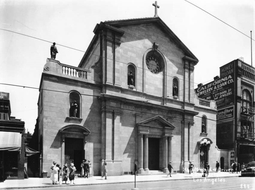
| (ca. 1930)^^* – View of Saint Vibiana's Cathedral (Saint Mary's Church), showing pedestrians in front. At center, the two-story Greek Revival-style building is pictured, it's leftmost of three doors open. In front, pedestrians stand by the open door or walk by on the sidewalk. At right, a two-story commercial or tenement building features advertisement on its side wall, reading: "California Jewelry & Loan Co", "[...]ican Store" and "Money To Loan". |
 |
|
| (1939)* - Front facade of the Catholic Cathedral of St. Vibiana. Remodeled in 1922. Architect: John C. Austin. |
 |
|
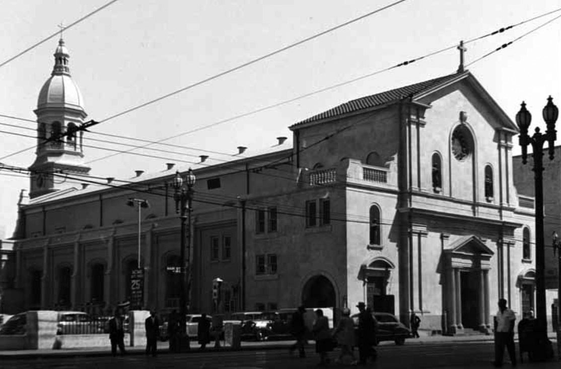
| (1947)* - Side view of St. Vibiana Cathedral at Main and 2nd Streets, showing autos and pedestrians. Note the beautiful two-lamp streetlight at right. |
Historical Notes During the 1940s, a rectory and school building were added. The school closed in 1969 because the parish could not afford it. It became a convent for the Disciples of the Divine Master.^ |
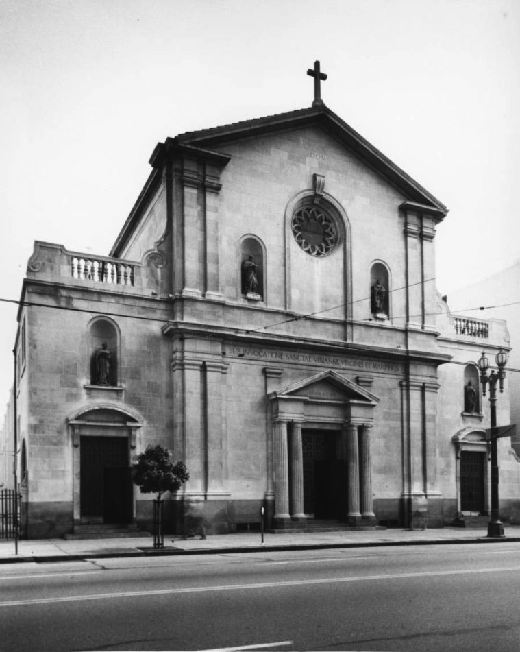 |
|
| (ca. 1950)* – Close-up view showing Saint Vibiana's Catholic Cathedral, from the Main Street side. |
Historical Notes The two-story Greek Revival-style church has three different doors visible in its facade. The centermost door is flanked by columns, while secondary doors are at left and right, each topped by a statue. Above the center, two other statues flank a rose window. A latin inscription above the center door reads: "sub invocatone sanctae vibianae virginis et martyris". |
.jpg) |
|
| (1954)* – View showing a Mass at St. Vibiana’s Cathedral as seen from the balcony. |
Historical Notes The cathedral had a seating capacity of 1,200. Designed in 1876 by Ezra F. Kysor, it was modeled after a Baroque church in Barcelona. |
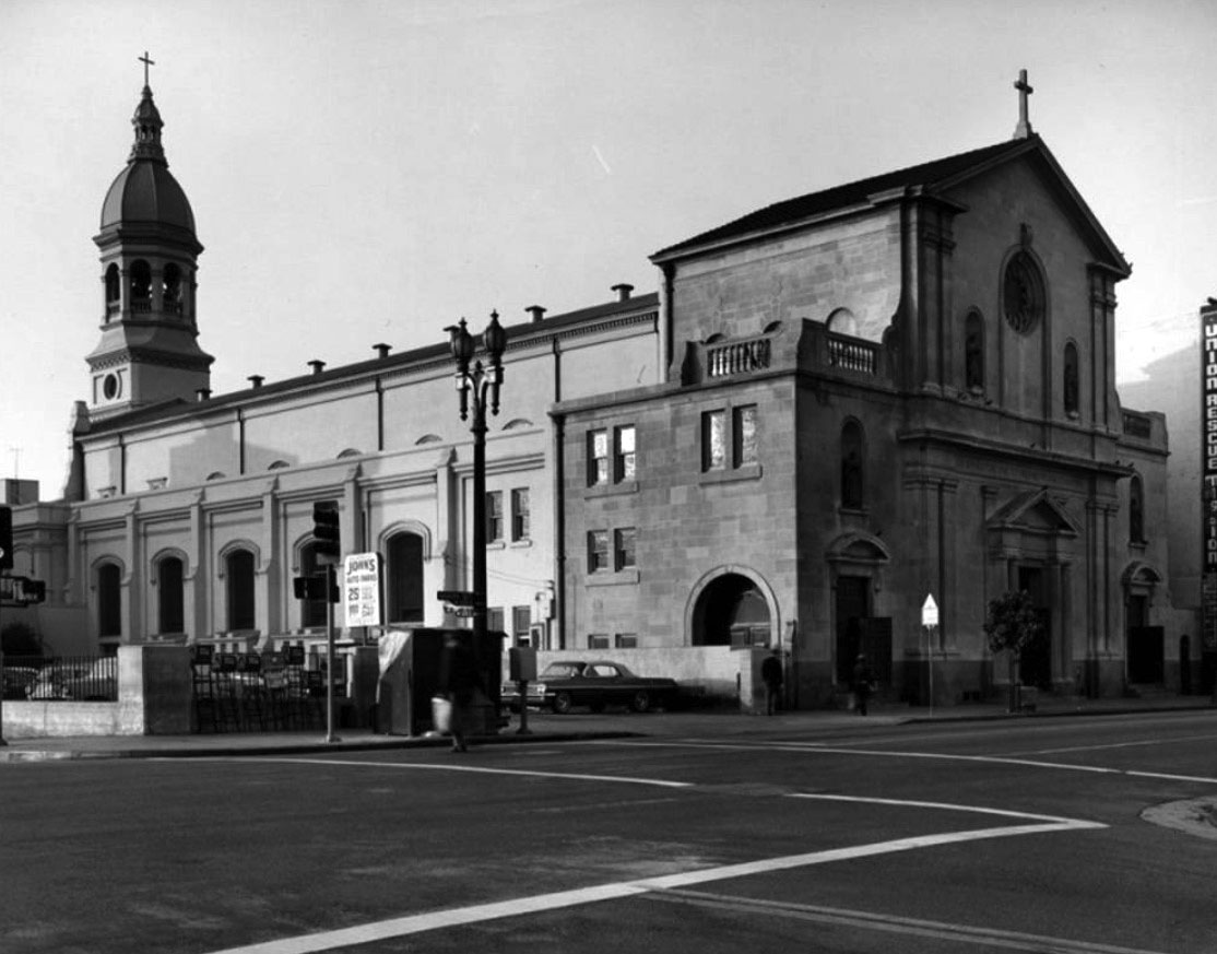 |
|
| (1955)* – View looking southeast showing the Catholic Cathedral of St. Vibiana. The sign at far right reads ‘Union Rescue Mission’. |
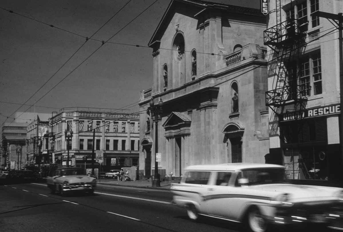 |
|
| (1960)* - Looking north on Main Street from below 2nd Street. St. Vibiana, 214 South Main Street, is at center. The Odd Fellows Hall, functioning as a rescue mission, has since been demolished. Further up Main Street, the Hotel Yorke at northeast corner, Hoegee and the 1952 City Health Building. |
Historical Notes In 1963, St. Vibiana's Cathedral was dedicated as Los Angeles Historic Cultural Monument No. 17 (Click HERE to see complete listing). |
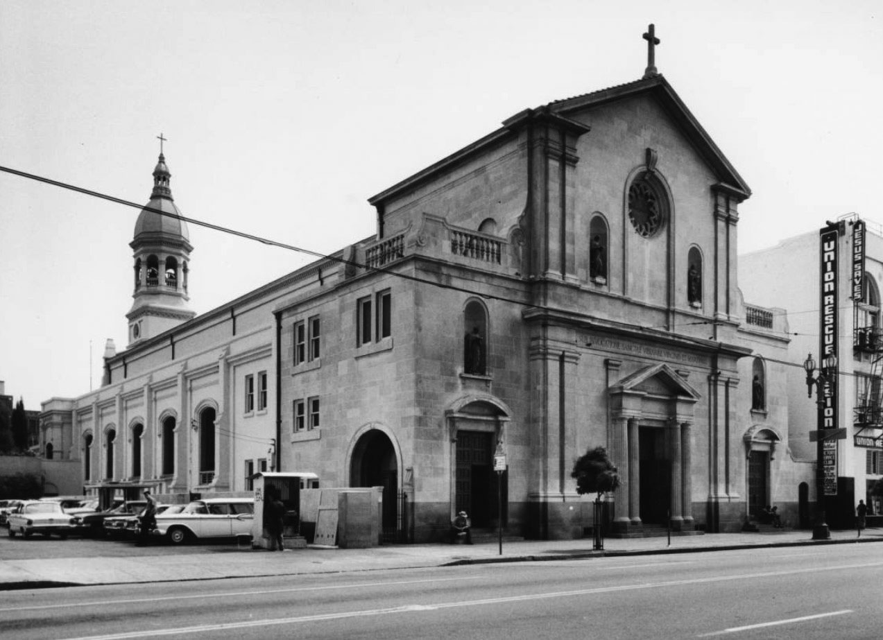 |
|
| (1960s)* - Exterior view of St. Vibiana's Cathedral showing a parking lot on the left side of the cathedral and the Union Rescue Mission on the right. |
Historical Notes The facade's classical pilasters and volutes are crowned with a tower and cupola. Inside are relics of an early Christian martyr whose name is given to the Cathedral, St. Vibiana. The remains are preserved in a marble sarcophagus.^ |
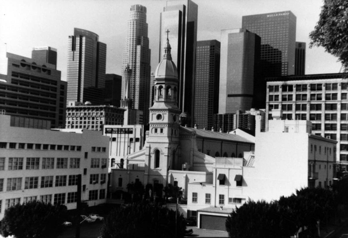 |
|
| (1995)* - View looking SW toward the back of the St. Vibiana’s Cathedral with the Downtown skyline in the background. |
Historical Notes In early 1996 the good Cardinal, who presides over the largest Catholic Diocese in the United States, proposed that it be torn down and replaced by a new Cathedral building. Preservation- and historic-minded L.A. folk protested loudly in response.^ |
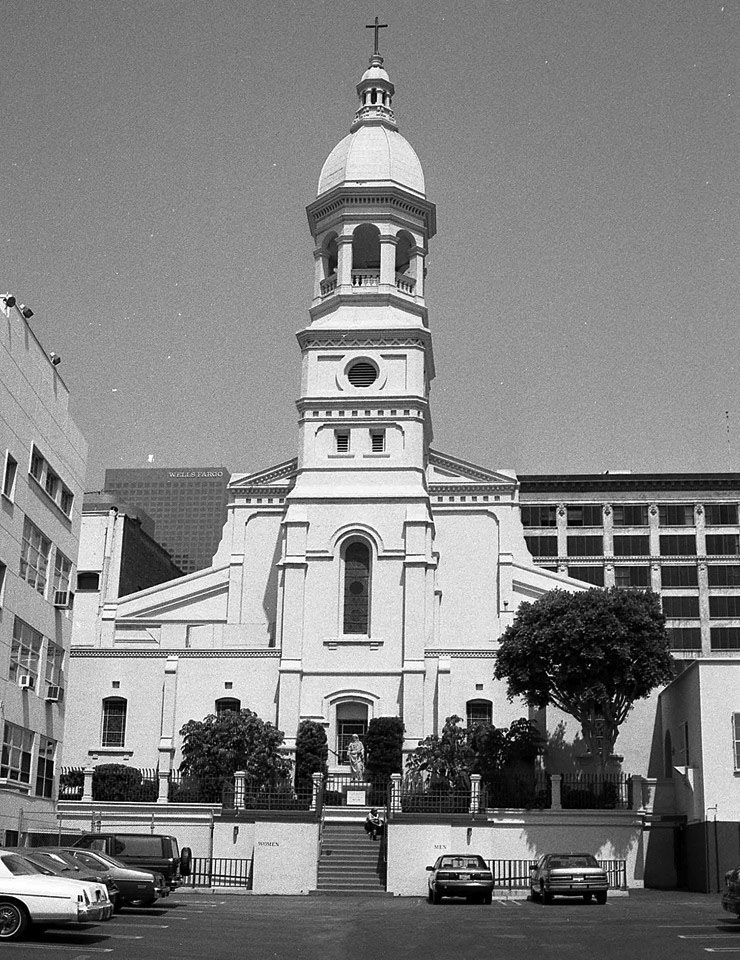 |
|
| (1990s)^ - View looking at St. Vibiana’s Cathedral from the East side. A view that no longer exists, as the parking lot was developed. Photo by Ray Long |
Historical Notes The cathedral was heavily damaged during the 1994 Northridge earthquake and became the subject of a lengthy legal battle between the archdiocese, which wanted to demolish the building and build a new cathedral on the site, and preservationists, who wanted the building to remain standing due to its historical significance. In 1996, the parties involved reached a compromise in which the archdiocese would purchase a nearby site on which to build a new cathedral, and in turn would turn over the St. Vibiana site to the City of Los Angeles. The Cathedral of Our Lady of the Angels was dedicated in 2002 as the successor to St. Vibiana's Cathedral.^ |
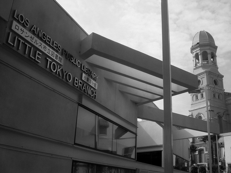 |
|
| (2006)* – View showing the St. Vibiana complex, which now includes the Little Tokyo Branch Library. |
Historical Notes The cathedral site was taken over by the city. The city sold the former cathedral building to downtown developer Tom Gilmore in 1999 for $4.6 million. The non-historic 1940s Education Building was demolished, making way for the new Little Tokyo Branch of the Los Angeles Public Library. The building celebrated the end of its renovation with a gala on November 12, 2005, though plans for its use were still undecided. In August 2007, the 3,500-pound cupola was returned to the top of the 83-foot tall bell tower.^ |
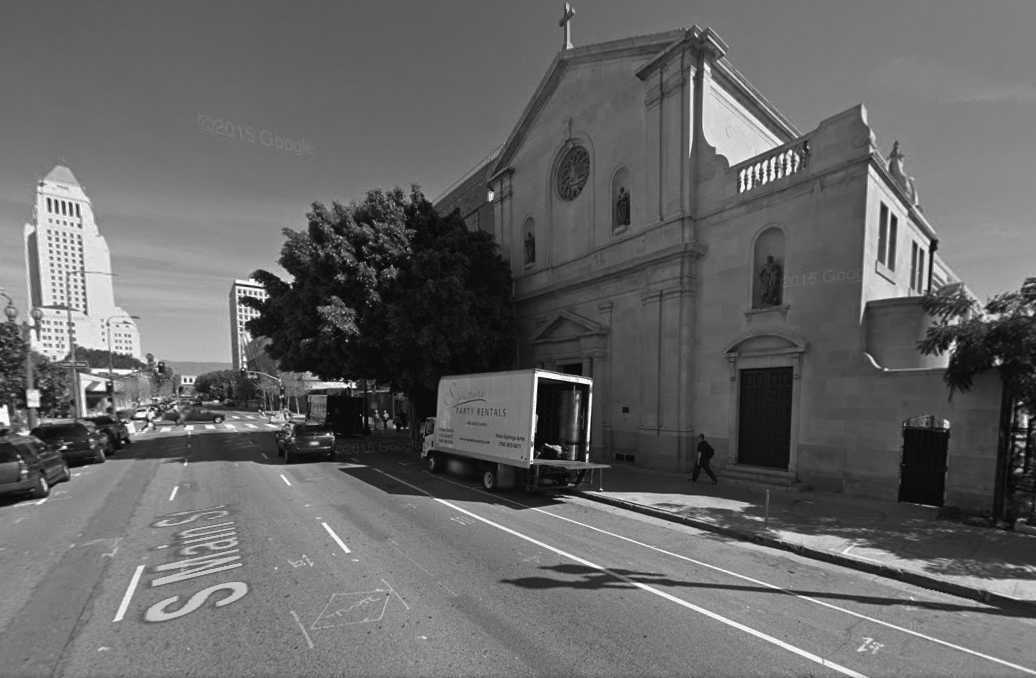 |
|
| (2015)* - View looking north on Main Street showing the old St. Vibiana's Cathedral building with City Hall in the background. |
Historical Notes The former cathedral building is now a performing arts complex and event venue called "Vibiana". The Little Tokyo branch of the Los Angeles Public Library is also located on the site.^ |
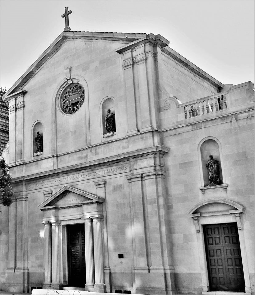 |
|
| (2018)* - Close-up view of Main Street front side of the St Vibiana Church as it appears today. |
Historical Notes In 2017, it was added to the National Trust for Historic Preservation list of America's Most Endangered Places "Success Stories"—sites that were named to the "Most Endangered" list that were the focus of successful preservation efforts Amy Knoll Fraser and Chef Neal Fraser are now the owners and operators of Redbird | Vibiana, a wedding, events and performing arts venue located in the Historic Core of Downtown Los Angeles. |
* * * * * |
Old Plaza Firehouse
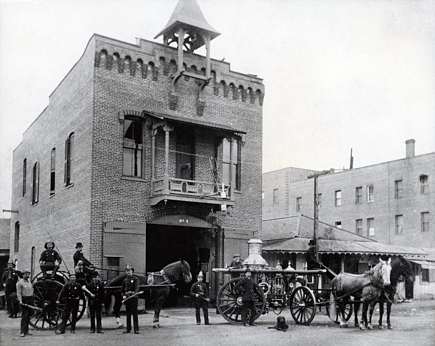 |
|
| (ca. 1886)* - Photograph showing Los Angeles' first fire station, near the Los Angeles Plaza, with a horse and buggy firefighting team (The First Volunteer Company), located at 26 Plaza Street. |
Historical Notes The Old Plaza Firehouse, built in 1884 near the historic Los Angeles Plaza, is the city’s oldest surviving fire station. It operated until 1897 and initially housed the volunteer Engine Company No. 1, known as the "38s" for its 38 members, along with a horse-drawn cart and three horses. The surrounding plaza served as a staging area for parades, fireworks displays, inspections, and musters—activities that fostered civic pride but also revealed deep rivalries among volunteer units. These tensions led to the formation of the city’s first paid fire department on February 1, 1886. Walter S. Moore was appointed as the first Fire Chief, and the newly formed Engine Company No. 4, staffed by seven paid men and a steam-powered engine, replaced the volunteers at the Plaza Firehouse. |
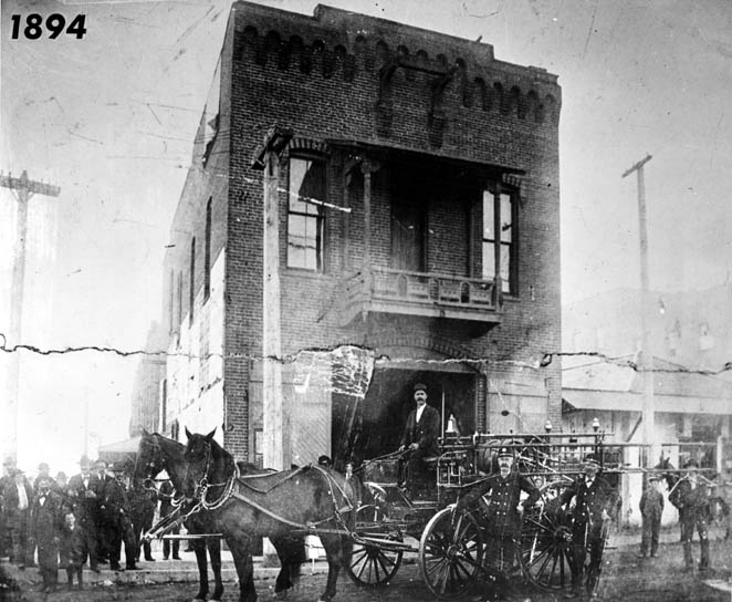 |
|
| (1894)* - Firetruck, men and horses in front of the Plaza Firehouse. |
Historical Notes The Los Angeles Fire Department moved out of the Plaza Firehouse in 1897 due to a legal dispute over the ownership of the property. The site was not owned by the city, and a court ruling favored the claimants Mrs. L. M. Bigelow and Griffin Johnston. When the lease expired, the city was forced to vacate the building, prompting a new policy that all future fire stations be constructed only on city- or state-owned land to prevent similar issues. After the fire department left, the Plaza Firehouse was used for various commercial purposes until it was restored as a museum in 1960. |
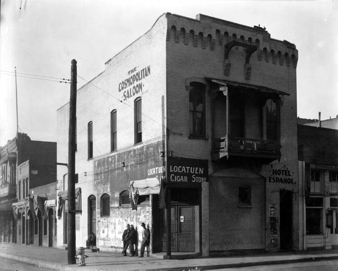 |
|
| (1920s)* - View of the Old Plaza Firehouse with three men standing at the corner, when it was the Cosmopolitan Saloon. The sign over the corner doorway reads: Locatuen Cigar Store. |
Historical Notes After 1897, the building saw a variety of uses—including as a saloon, cigar store, poolroom, “seedy hotel,” Chinese market, flop house, and drugstore. It was restored in the 1950s and reopened as a firefighting museum in 1960. |
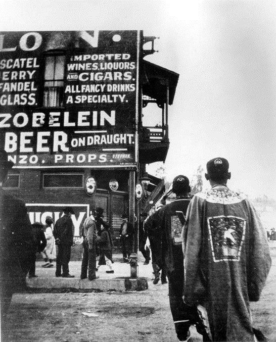 |
|
| (ca. 1920s)* - Chinese New Year procession in front of the Old Plaza Firehouse/Cosmopolitan Saloon. |
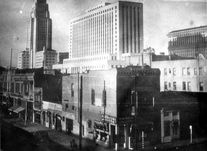 |
|
| (1947)* - Firehouse as a Chinese store with City Hall and the Federal Courthouse in background. |
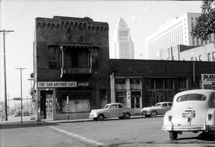 |
|
| (1954)* - View of the San Antonio Cafe (Old Firehouse #1) with City Hall and the Federal Courthouse in the background. |
Historical Notes Calle de la Plaza was the original name for what is now the short, pedestrianized lane at the southern border of the Plaza, and it provided access to key buildings, including the firehouse, Plaza Church, and other historic structures. In the late 19th and early 20th centuries, as the city modernized, Calle de la Plaza was gradually closed to regular traffic and became part of the El Pueblo de Los Angeles Historic Monument, now serving as a pedestrian walkway and event space. |
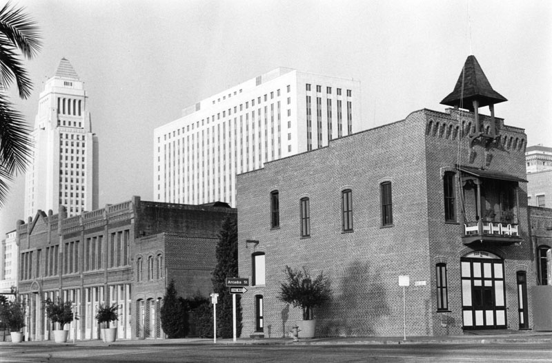 |
|
| (ca. 1950s.)* - Exterior of the old Plaza Fire House which houses "Firetruck No. 1". To the left is the restored Garnier Building. City Hall and the Federal Courthouse are seen in the background. |
Historical Notes The Old Firehouse building was restored in the 1950s and opened as a firefighting museum in 1960. |
.jpg) |
|
| (2013)^* - View of the Old Plaza Firehouse with Los Angeles City Hall and Federal Courthouse in the background. |
Historical Notes The Old Plaza Firehouse is the oldest fire station in the city of Los Angeles. It was dedicated as California Historical Landmark No. 730 (Click HERE to see complete listing of California Historical Landmarks in L.A.). The plaque reads: "Dedicated to the firemen of the Los Angeles Fire Department--past, present and future--who since 1871, by their courage and faithful devotion to duty, have protected the lives and property of the citizens of Los Angeles from the ravages of fire." |
Then and Now
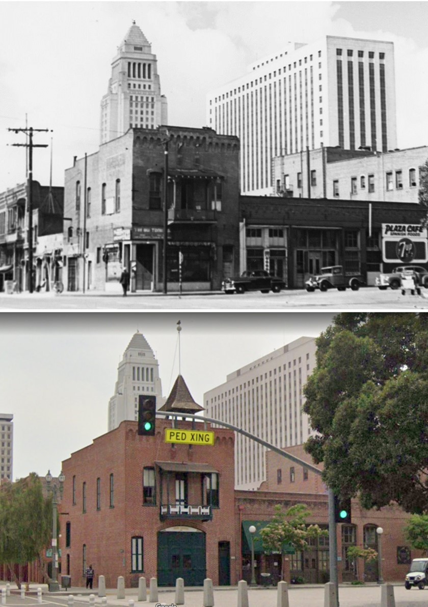 |
|
| (1944 vs 2021)* - Looking toward the southwest corner of Los Angeles Street and Plaza Street, showing the Old Plaza Firehouse with Los Angeles City Hall and the U.S. Federal Courthouse in the background. About the only visible change is the addition of a pyramidal cupola above the entrance—originally designed to house a fire bell. Also, Calle de la Plaza the short street connecting Main and Los Angeles Streets is now blocked off and converted into a pedestrian lane.Photo comparison by Jack Feldman. |
Historical Notes The Old Plaza Firehouse is the oldest firehouse in Los Angeles. Built in 1884, it operated as a firehouse until 1897. The building was thereafter used as a saloon, cigar store, poolroom, "seedy hotel", Chinese market, "flop house", and drugstore. The building was restored in the 1950s and opened as a firefighting museum in 1960. Calle de la Plaza was the original name for what is now the short, pedestrianized lane at the southern border of the Plaza, and it provided access to key buildings, including the firehouse, Plaza Church, and other historic structures. In the late 19th and early 20th centuries, as the city modernized, Calle de la Plaza was gradually closed to regular traffic and became part of the El Pueblo de Los Angeles Historic Monument, now serving as a pedestrian walkway and event space. |
Then and Now
 |
|
| (1886 vs 2020s)* - Then and Now comparison by Trey Callaway. |
Historical Notes Today, the Old Plaza Firehouse serves as a museum, offering visitors a glimpse into the early days of firefighting in Los Angeles and preserving the legacy of the city’s first official fire station. |
* * * * * |
Temple Block to City Hall
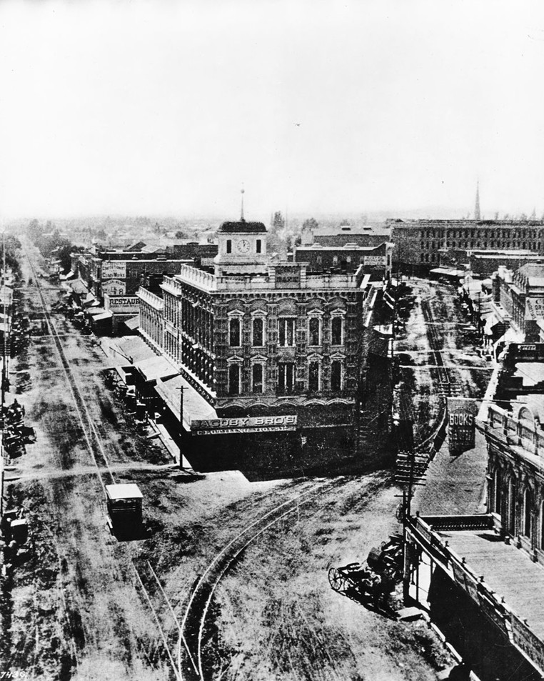 |
|
| (ca. 1885)* - View looking south with Main Street at left and Spring Street at right. Temple Street runs to the right (out of view). The old County Courthouse, with its cupola and clock, sits at the center of Temple Block. A large Jacoby Bros. sign spans the corner storefront of the Italianate-style Temple Block building. |
Historical Notes The original Temple Block was built by John Temple in 1857–1858 as a combined marketplace and theater, with shops on the first floor and Los Angeles’ first theater on the second. After Temple’s death in 1866, the property was inherited by his half-brother, F.P.F. Temple. In 1871, F.P.F. Temple replaced the earlier structure with the large Italianate Temple Block seen in the photographs. |
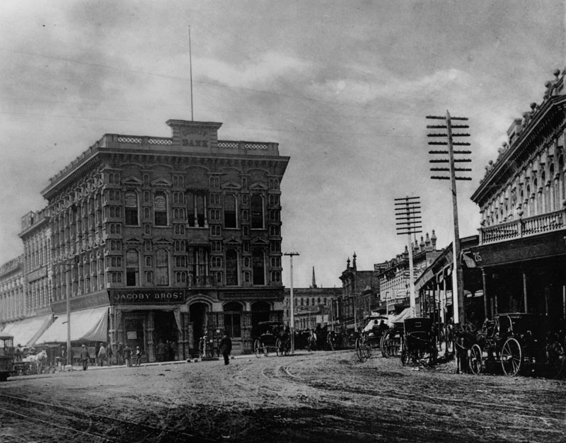 |
|
| (ca. 1885)* - The junction of Main, Spring, and Temple Streets. The Jacoby Brothers Clothing Store occupies the corner space, with the Los Angeles County Bank nearby. The Downey Block stands at the northwest corner across the street. |
Historical Notes The Italianate Temple Block was completed in 1871 by F.P.F. Temple, who inherited the site from his brother John. Known as “Lawyers’ Block,” it housed numerous attorneys whose offices surrounded the courthouse. Because the courthouse had little waiting space, lawyers worked in their offices until their cases were called—usually by a clerk shouting their names out the courthouse windows. |
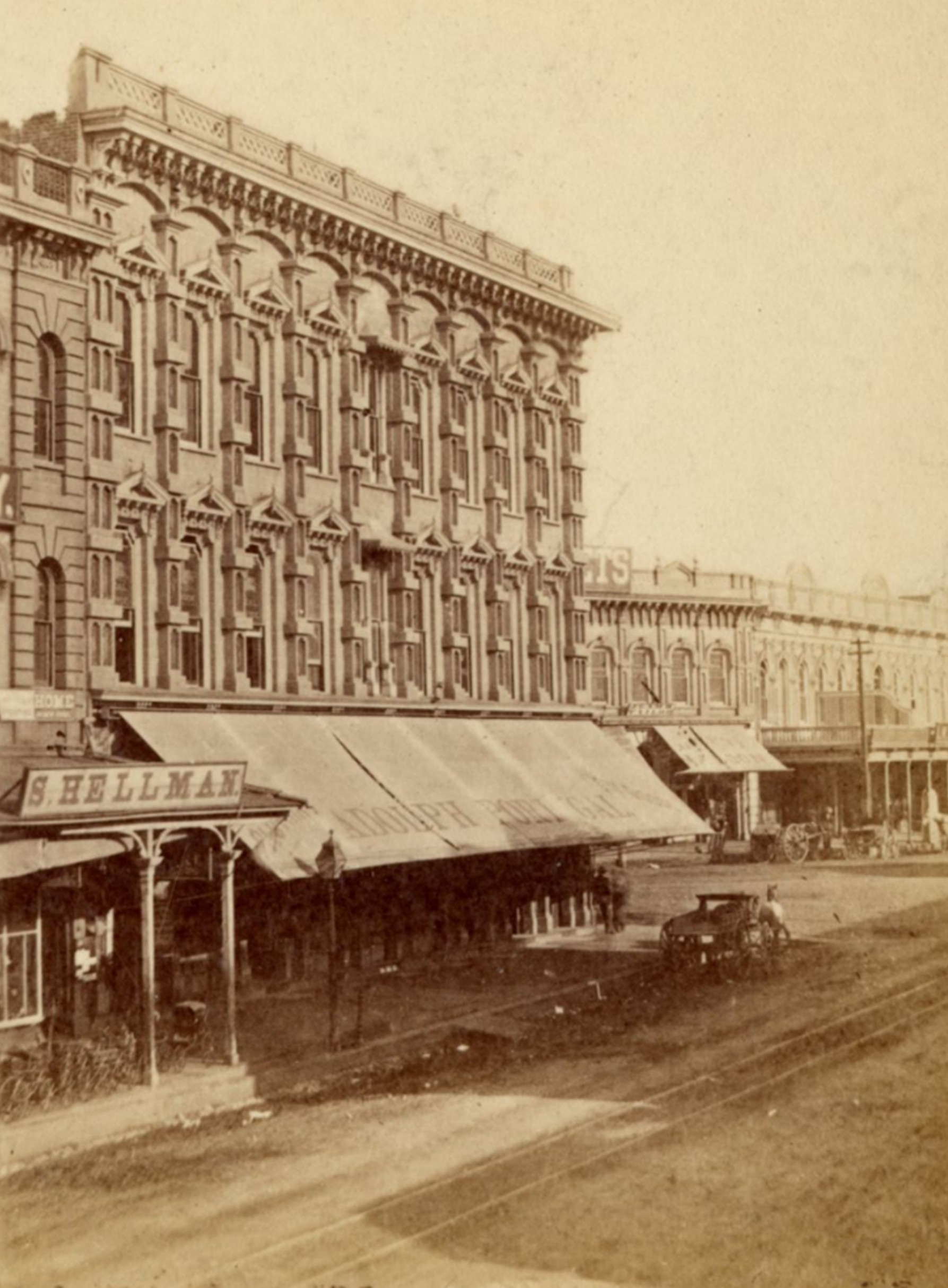 |
|
| (1880s)*- View looking north on Main Street toward Temple Street showing the ornate Temple Block on the southwest corner. Storefronts include S. Hellman and Adolph Portugal. The Downey Block is visible on the northwest corner across the street. |
Historical Notes Temple Block continued to serve as one of the busiest commercial corners in early Los Angeles. Merchants like S. Hellman and Adolph Portugal occupied its ground floor stores during the 1880s, reflecting the growing mix of retail businesses attracted to this important intersection. |
Then and Now
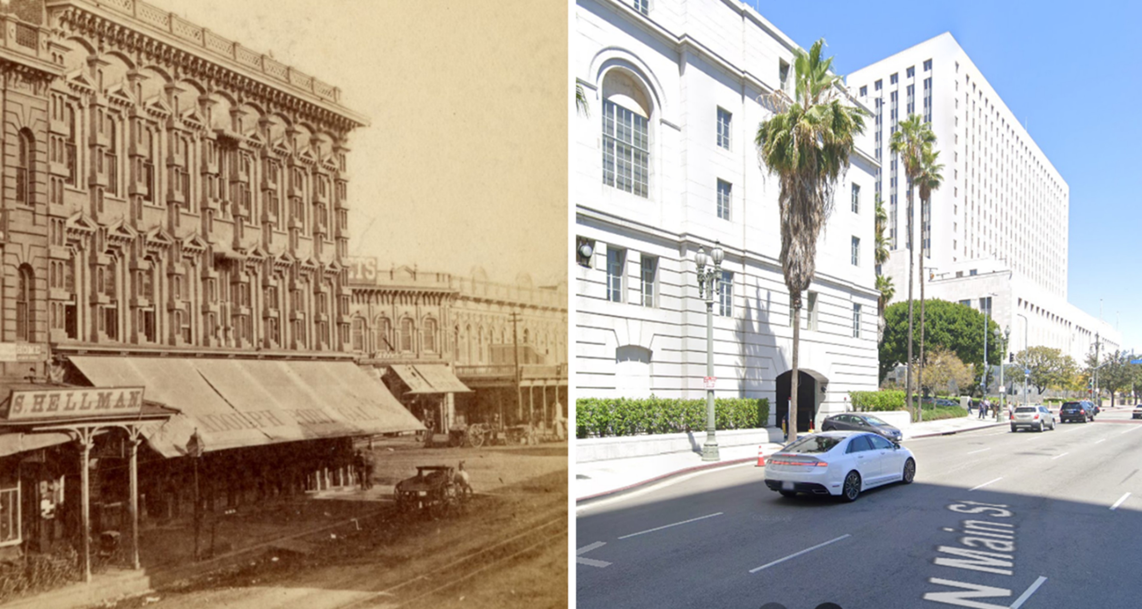 |
|
| (1880s vs Today)* - A Then and Now view of the Temple Block, today the site of Los Angeles City Hall. Across the street, the former Downey Block is now the location of the U.S. Courthouse Building. Photo comparison by Jack Feldman. |
Historical Notes When City Hall was planned in the 1920s, Spring Street was realigned so that it ran parallel to Main. This redesign permanently erased the original three-street intersection that had defined Temple Block. |
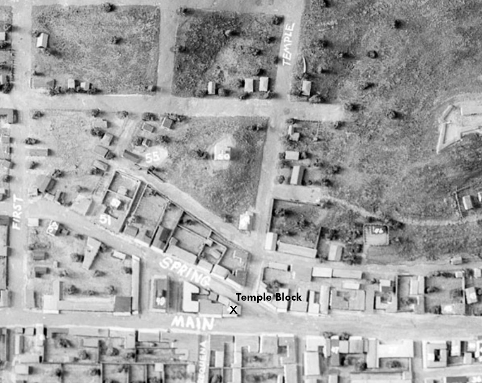 |
|
| (n.d.)* - Temple Square (Temple Block) appears at the bottom-center of this photograph of a model of old Los Angeles. This would become the future site of the current City Hall. |
Historical Notes The realignment of Spring Street in 1927 reshaped the street grid around the new City Hall. The old junction of Main, Spring, and Temple no longer exists, surviving only in maps, photographs, and topographic models. |
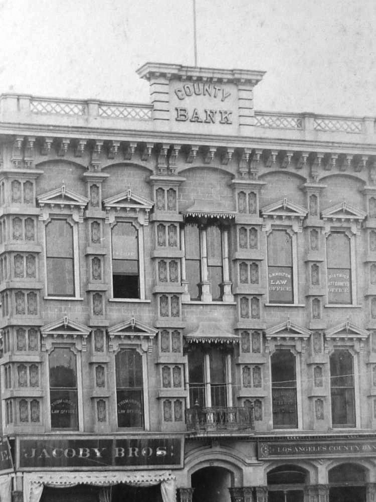 |
|
| (ca. 1885)* - Close-up view of Temple Block showing its ornate architectural design. |
Historical Notes Temple Block is one of the best surviving examples of Italianate commercial architecture in early photographs of Los Angeles. Built in 1871 by F.P.F. Temple, the structure features tall narrow windows with arched tops, carved window hoods, and a deep bracketed cornice that gave the block a strong and elegant presence. At street level, wide awnings and large display windows supported a lively mix of shops and offices, showing how quickly the city was moving toward a more modern commercial identity. F.P.F. Temple and his father in law, William Workman, operated the Temple and Workman Bank here during the real estate boom of the 1870s. When the bank failed during the Panic of 1875, both men lost their fortunes. This setback marked one of the earliest major financial collapses in Los Angeles history, yet Temple Block remained a busy center of business and law for decades afterward. |
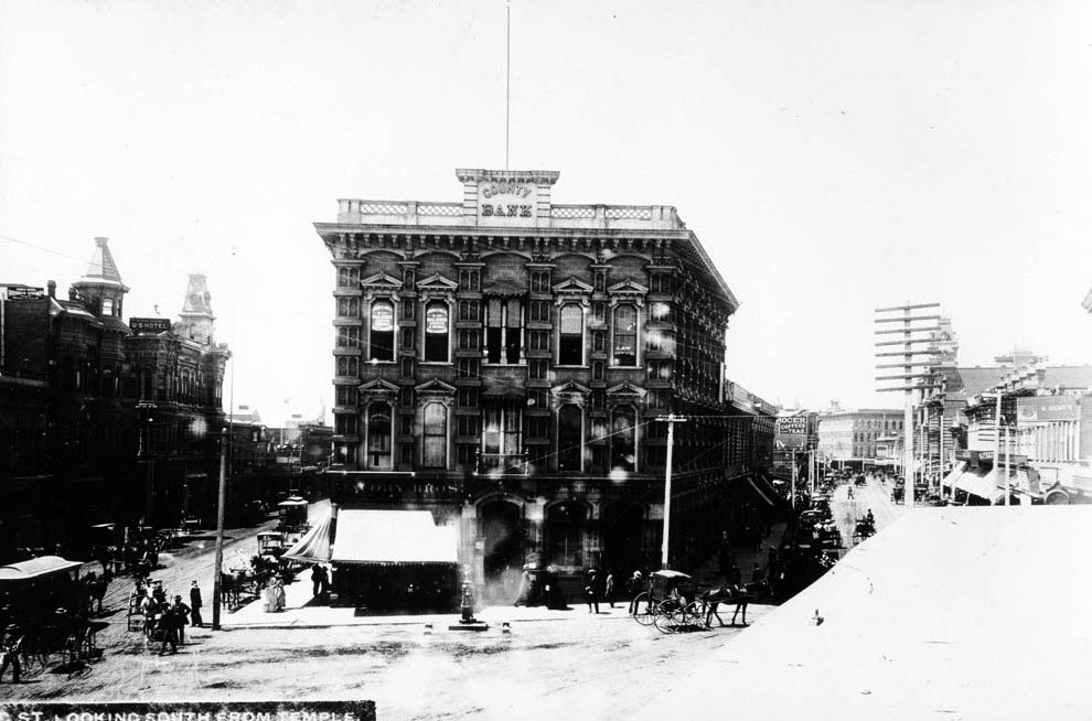 |
|
| (1887)* - Looking south from Temple toward Temple Block. A decorative fountain stands in front of the building. |
Historical Notes The Newmark Fountain was installed in 1882, donated by Harris Newmark, with water supplied free by the LA Water Company. Featuring a nude female figure, it became a modest landmark until demolished in 1892 by runaway horses. Newmark was one of Los Angeles’ most influential businessmen, contributing to the founding of the Los Angeles Public Library, the Chamber of Commerce, the Board of Trade, the Jewish Orphans Home, and later the Southwest Museum. |
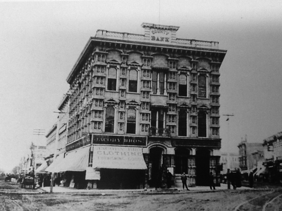 |
|
| (ca. 1880s)* - Temple Block with large Jacoby Bros. awnings. |
Historical Notes The Jacoby brothers came from Loebau, Poland, then under Prussian control, and arrived in the U.S. during the 1870s. In Los Angeles they partnered with Leopold Harris to acquire Herman W. Hellman’s store. After Hellman left, the firm became Jacoby Brothers, eventually becoming one of LA’s major retail and wholesale businesses. |
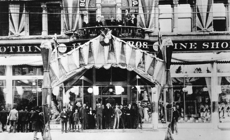 |
|
| (1896)* - Jacoby Bros. Dry Goods Store in Temple Block during La Fiesta Week. Employees pose at the entrance and on the balcony. |
Historical Notes Jacoby Bros. continued expanding into the early 20th century. In the mid-1920s, the company was sold to David May of the May Company of St. Louis, around the same time the Hamburger Department Store was also sold to the May Co. |
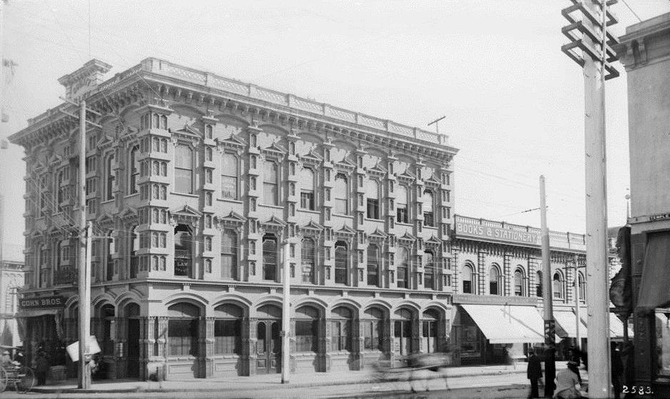 |
|
| (ca. 1880s)* - View of Temple Block from the Spring Street side, highlighting its ornate façade. |
Historical Notes The Spring Street elevation of Temple Block shows how carefully detailed the building was for its time, with arched windows, heavy cornices, and large display awnings that sheltered pedestrians and shopfronts. This side of the block developed into one of the more fashionable commercial frontages in the growing downtown district, reflecting the shift from adobe structures to more permanent brick and stone buildings. |
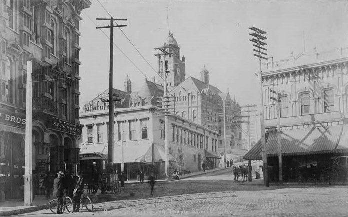 |
|
| (1891)* - Corner of Spring and Temple looking west. The Temple Block is on the left behind the two men leaning on their bicycles. The LA County Courthouse can be seen in the background. |
Historical Notes By 1891, Temple Block had become a familiar landmark where cyclists, pedestrians, and horse-drawn vehicles converged at one of the city’s busiest intersections. Bicycles, newly popular in Los Angeles, symbolized the modernizing pace of the city. The courthouse tower visible in the background further emphasizes how this intersection served as both the legal and commercial hub of early Los Angeles. |
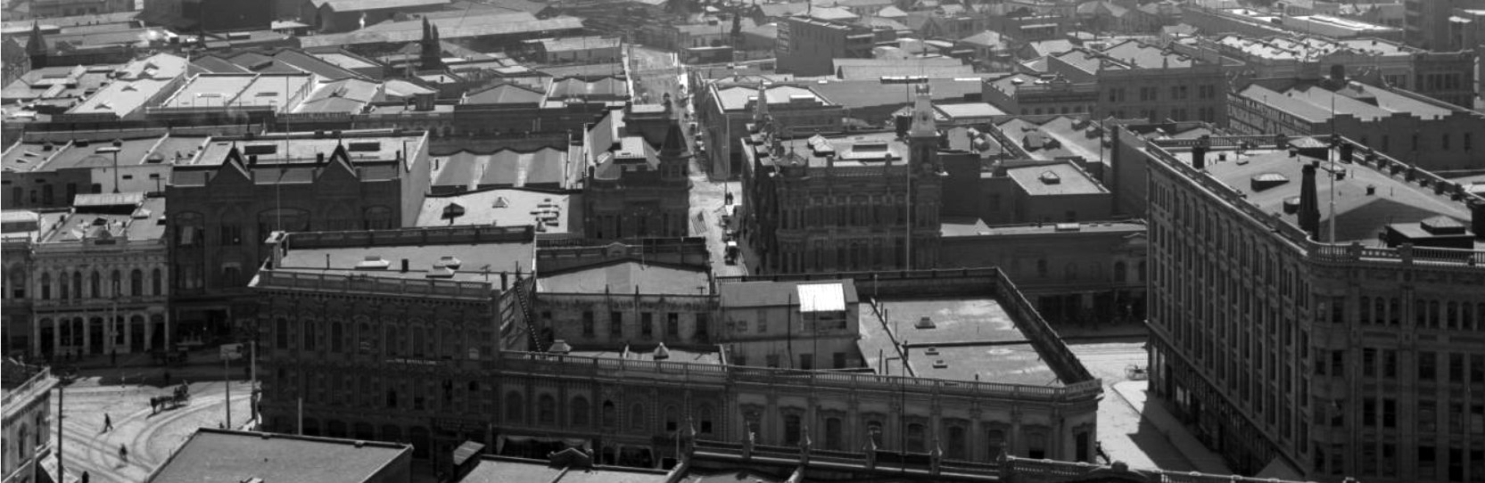 |
|
| (1890s)* – Panoramic view looking east from the LA County Courthouse. The Temple Block (site of today’s City Hall) stands in the foreground. |
Historical Notes This panoramic courthouse view captures Temple Block during the height of its importance, standing prominently at the front of the frame. The image illustrates how the block anchored the early civic district, surrounded by banks, law offices, and commercial houses. The land shown here would ultimately be cleared in the 1920s to make room for the new Los Angeles City Hall, completed in 1928. |
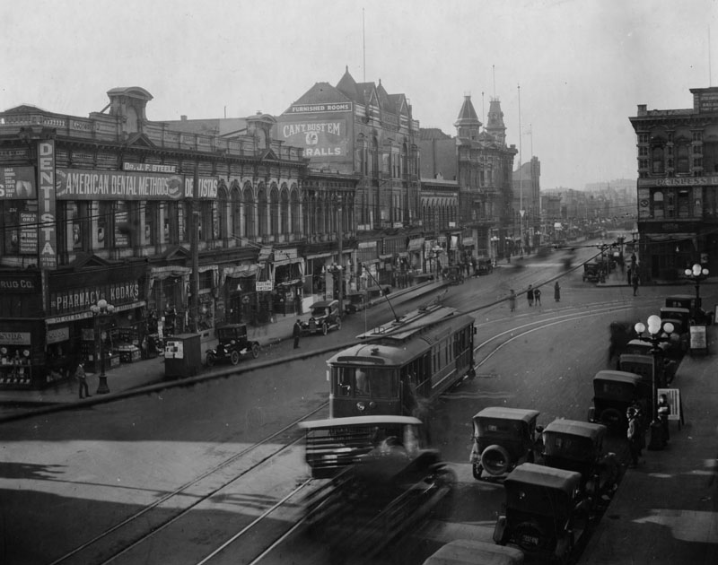 |
|
| (ca. 1920)* - View looking south on Main Street. Streetcar tracks curve toward Temple Street. The Farmers and Merchants Bank stands at left; Temple Block rises at right. |
Historical Notes By the 1920s, Temple Block was one of the last major remnants of nineteenth-century Los Angeles still standing in the Civic Center area. The streetcar tracks curving toward Temple Street reflect downtown’s evolution into a dense transportation corridor. The Farmers and Merchants Bank building on the left represents the city’s financial growth, while Temple Block on the right shows its older architectural roots. Within a few years, this entire intersection would be transformed to make way for City Hall and the modernized Civic Center. |
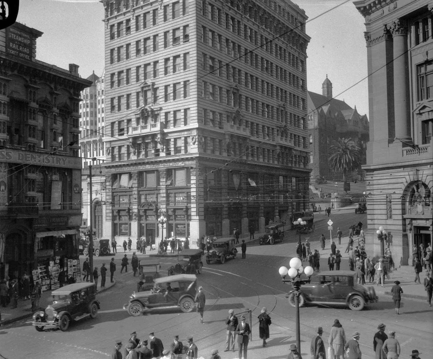 |
|
| (ca. 1924)* - The Temple Block (left) area in Downtown with the 1907-built International Bank Building at center. Note the beautiful 5-lamp ornate streetlights (Click HERE to see more). |
Historical Notes Not a single building in the above photograph survived. The building on the left is the Temple Block, the old Hall of Records is background left, then the International Bank Building, the Sandstone Courthouse on the back right, and finally the Federal Post Office on the far right. |
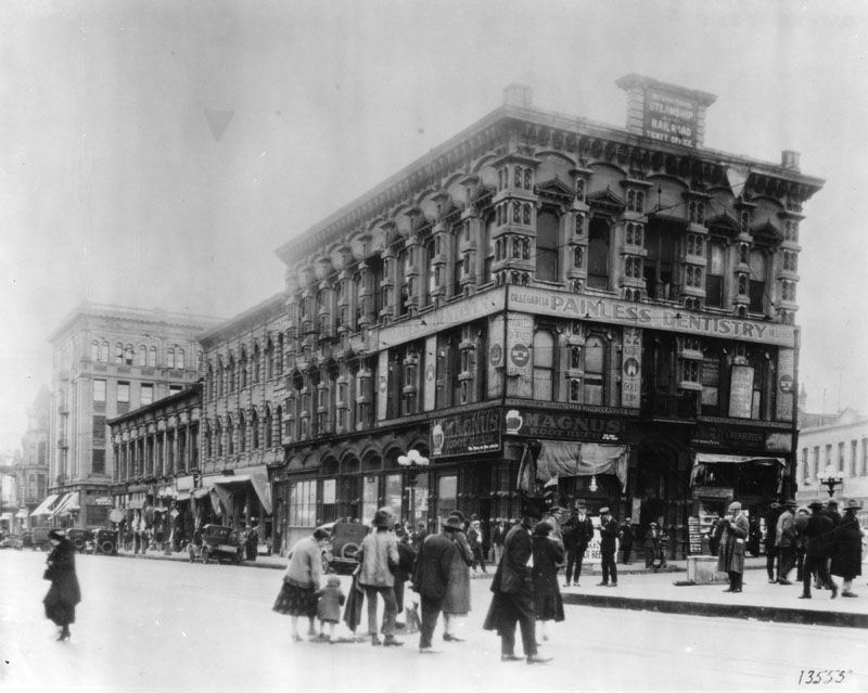 |
|
| (ca. 1926)* - Temple Block as it appeared one year before demolition for the new City Hall. |
Historical Notes By 1926, Temple Block was surrounded by modern buildings and an expanding Civic Center, making it increasingly out of place in the rapidly growing city. Although still fully occupied, its nineteenth-century design no longer matched the architectural direction Los Angeles was taking. Plans for a grand, centralized City Hall required clearing the entire block, sealing the fate of one of the city's most historically important intersections. This view is among the last to show Temple Block intact before demolition began the following year. |
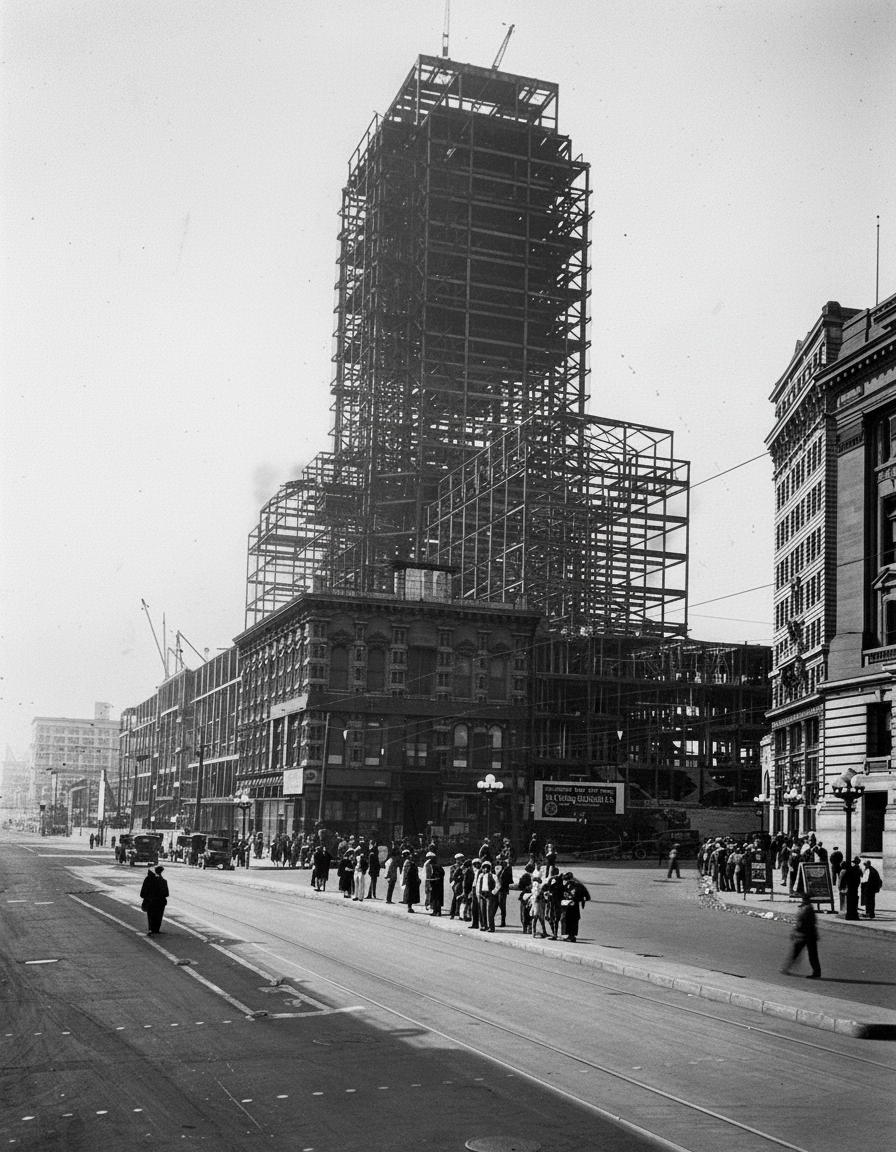 |
||
| (1927)* - The last stand of the historic Temple Block. As the steel frame of the new City Hall neared completion the proud building, once dominant in the business and professional life of the city, was razed. |
Historical Notes This marked the final transformation of early Los Angeles’ most important civic and commercial intersection. Click HERE to see more of Construction of Today's City Hall |
Then and Now
.jpg) |
|
| (1927 vs. 2024)* – Los Angeles City Hall, Then and Now - On the left: City Hall under construction, rising from the cleared site of the historic Temple Block. On the right: the same view today, nearly a century later, with the completed 454-foot landmark still presiding over downtown. This rare 1927 image is one of the final glimpses of Temple Block before it vanished into history. Photo comparison by Jack Feldman. |
Historical Notes The 1927 construction view documents the moment when Los Angeles permanently reshaped its civic landscape. After Temple Block was demolished, the city regraded the site, realigned Spring Street, and erected the new City Hall using a steel frame clad in concrete and limestone. Completed in 1928, the tower became the tallest building in Los Angeles for decades and a defining symbol of the city. The contemporary view shows how City Hall continues to anchor the Civic Center on the very ground where Temple Block once stood, linking two distinct eras of Los Angeles history. |
* * * * * |
Los Angeles Athletic Club
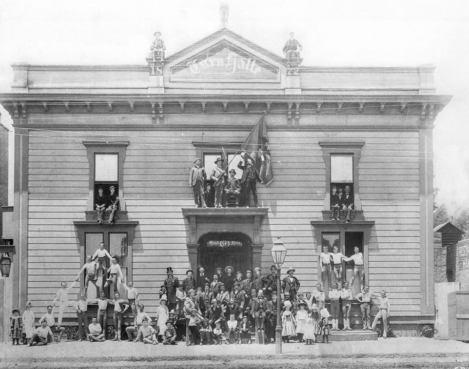 |
|
| (1885)* - The first Los Angeles Athletic Club located on the west side of Spring Street between 29th & 31st Streets. |
Historical Notes The Los Angeles Athletic Club was founded on September 8, 1880 and used several locations before settling into its own twelve-story building in downtown Los Angeles in 1912. The LAAC building was notable at the time for being the first building in Southern California to have a swimming pool on an upper floor. |
* * * * * |
Belmont Hotel
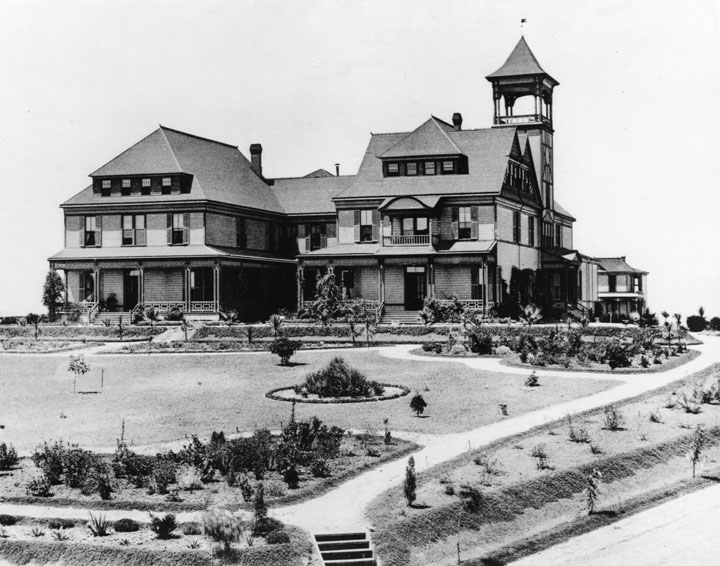 |
|
| (1886)* - Photograph of the exterior view of the Belmont Hotel and its yard, Belmont Avenue & 2nd Street. The three-story hotel featured shingled walls, triangular shaped dormer windows, triangular gables, inclined roof, a balcony, and a square tower. |
Historical Notes The Belmont Hotel on Crown Hill opened in July 1886 at the terminus of the Second Street Cable Railway that was completed a year earlier. The easy access to the line, the graceful architecture, beautiful landscaping, fresh air, and stunning views were attractions for visitors and wealthy Los Angelenos who held a number of social events there. The Belmont’s owner, Rev. John W. Ellis, was also the proprietor and director of another Crown Hill establishment, Ellis Villa College, a finishing school for young ladies.*#* |
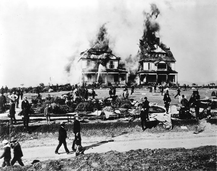 |
|
| (ca. 1887)* - Photograph of the Belmont Hotel on fire at the corner of Belmont Street and First Street, December 16, 1887. While firemen hose down the hotel, people are shown milling around on the lawn which is covered with assorted sheets, furniture, etc. The Hotel was a great tourist resort at that time and was later the site of Belmont High School. |
Historical Notes This is the earliest photograph of a major fire in Los Angeles and possibly the earliest photo of the newly formed Los Angeles Fire Department in action.**^ In December of 1887 the Belmont Hotel burned down just a little over a year from the time it was built. Several years later the private Belmont School for Girls was built on the same site. After the school was destroyed by yet another fire, the grounds were left vacant, except for five oil wells and a pumping plant for the Los Angeles Oil Field. On February 28, 1921, the Los Angeles Board of Education purchased the site for $100,000, for the purpose of constructing Belmont High School. Belmont High School opened its doors on September 11, 1923, to about 500 students, all sophomores, and 28 faculty members.^* |
* * * * * |
Garvanza Hotel (Highland Park)
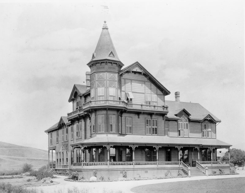 |
|
| (1887)* - View showing the Queen Anne revival style Garvanza Hotel. Opened in 1886, the hotel was located at South Avenue 63 and York Boulevard in Garvanza, a former section of Highland Park. |
Historical Notes One of the oldest settled areas of Los Angeles, Highland Park is also one of the most scenic due to its location along the Arroyo Seco, between the Mt. Washington hills, the San Rafael hills and the Monterey Hills.*^ Garvanza is considered a sub-district of Highland Park. The area was named for the garbanzo beans that once flourished there. In 1899, Garvanza was annexed by the City of Los Angeles.*^ |
 |
|
| (1887)* - View showing the Queen Anne revival style Garvanza Hotel. Opened in 1886, the hotel was located at South Avenue 63 and York Boulevard in Garvanza, a former section of Highland Park. Image enhancement and colorization by Richard Holoff. |
 |
|
| (1887)* - Panoramic view of Highland Park looking north in 1887. Garvanza was the north section of Highland Park. The Garvanza Hotel is the largest building in this picture. Arroyo Seco is in the foreground. In the right background is Johnson Lake; just below the lake is Miller's Hall. |
* * * * * |
Raymond Hotel
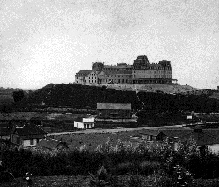 |
|
| (ca. 1886)* - A panoramic view facing the eastern facade of the Raymond Hotel. The surrounding land is still rural with scattered houses and small buildings close to a dirt road that passes over a bridge covering a small wash. |
Historical Notes The Raymond Hotel was the first major resort hotel of the San Gabriel Valley and was only opened from December to April. It was built by Mr. Walter Raymond of Raymond & Whitcomb Travel Agency of Boston, Mass. and sat atop Bacon Hill which lies between Pasadena and South Pasadena. Bacon Hill was renamed Raymond Hill with the opening of the hotel in 1886.* |
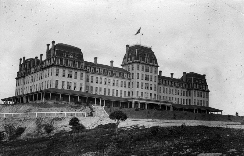 |
|
| (ca. 1886)* - A closer view of the Raymond Hotel. Landscaping covers the embankment to the right of the stairs. |
Historical Notes The Raymond Hotel was opened in 1886 but burned down in 1895. It was replaced by a second Raymond Hotel in 1903.* |
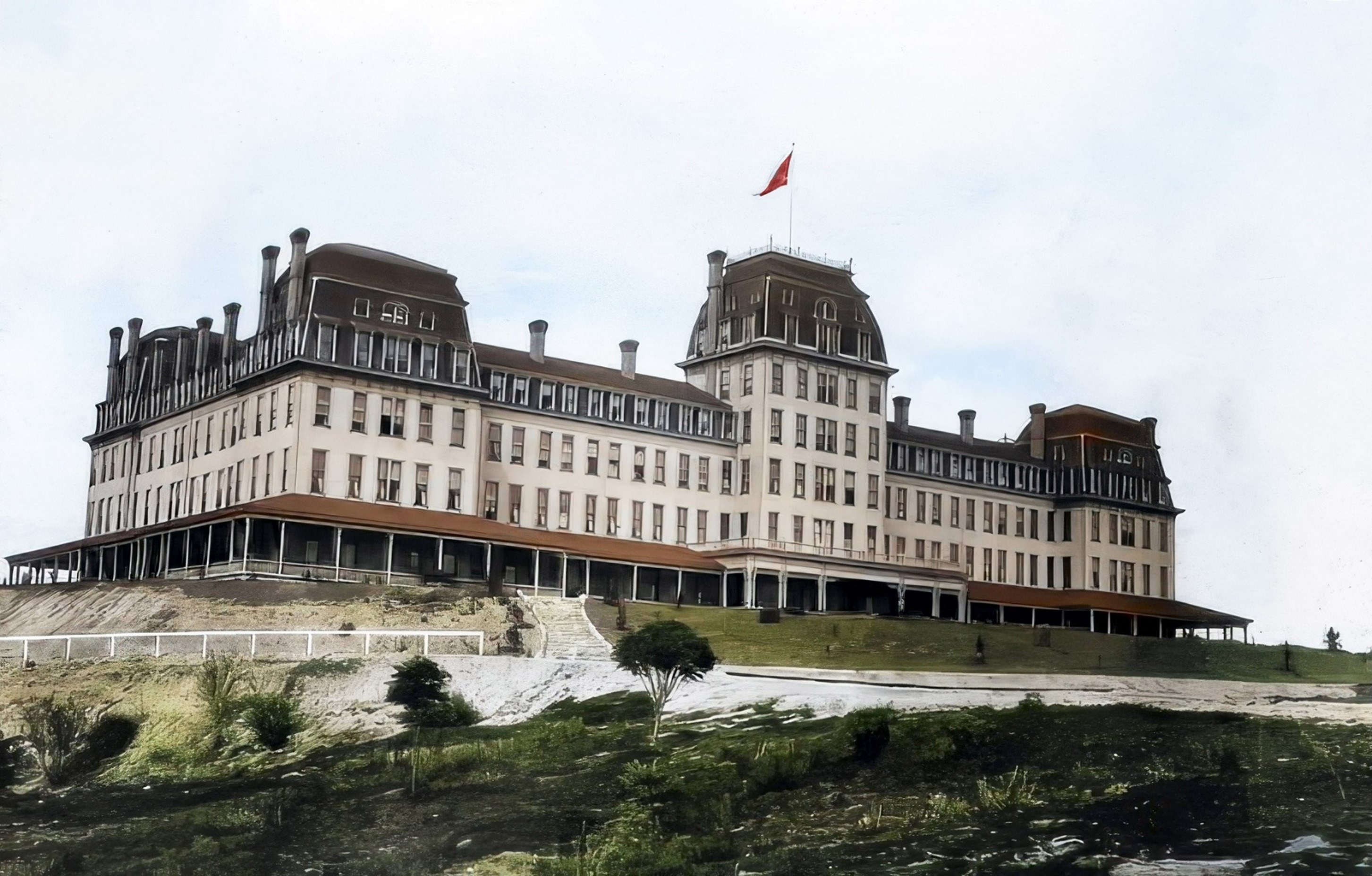 |
|
| (ca. 1886)* - A closer view of the Raymond Hotel. Landscaping covers the embankment to the right of the stairs. Image enhancement and colorization by Richard Holoff. |
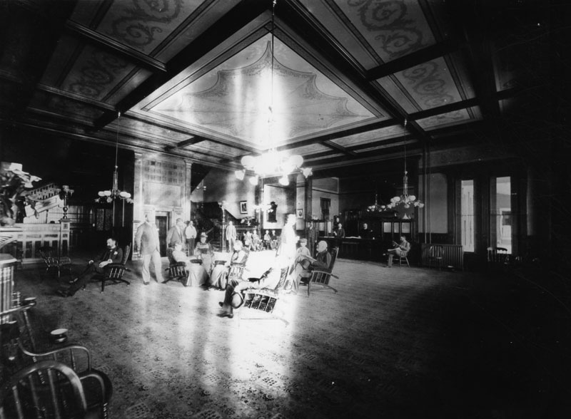 |
|
| (ca. 1890)* - A group of people sit under a hanging light fixture in the luxurious and spacious lobby of the Raymond Hotel. The beamed ceiling is decorated with painted motifs. An elevator is directly behind the seated group and large staircases behind the elevator and on both sides lead to the upper floors. The reception desk is to the left of the front doors. The floor is carpeted and spittoons stand close to several chairs. |
Historical Notes Click HERE to see more early views of the Raymond Hotel. |
* * * * * |
Arcadia Hotel
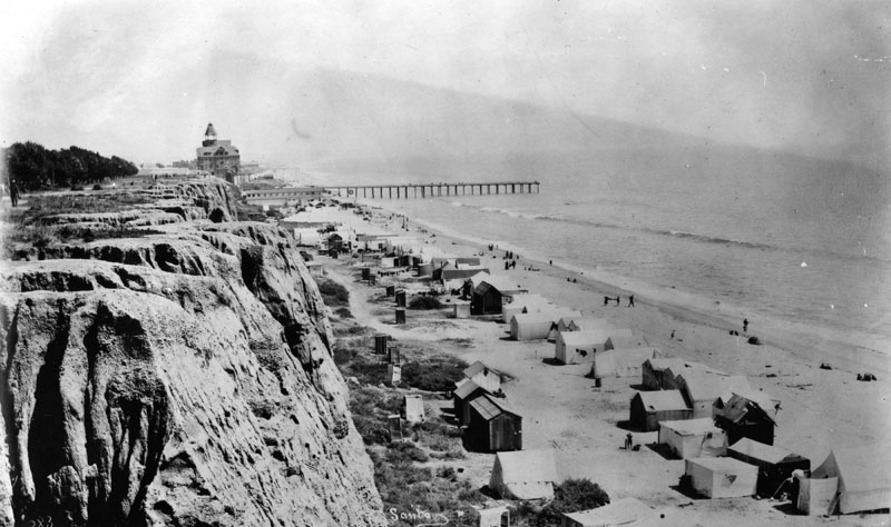 |
|
| (ca. 1887)* - View of Santa Monica beach looking south from Santa Monica Canyon rim. The wharf and newly constructed Arcadia Hotel can be seen in the background. House-tents are seen along the beach. |
Historical Notes The Arcadia Hotel opened for business in 1887 and was located on Ocean Avenue between Railroad Avenue (later known as Colorado Avenue) and Front (later known as Pico Boulevard). The Arcadia was the largest structure in Santa Monica at the time of its construction. The 125-room hotel was owned by J.W. Scott, the proprietor of the city's first hotel, the Santa Monica Hotel. The hotel was named for Arcadia Bandini de Baker, the wife of Santa Monica cofounder Colonel R. S. Baker.^**# |
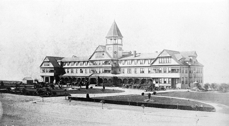 |
|
| (ca. 1887)* - Exterior view of the east front of the Arcadia Hotel in Santa Monica soon after its construction. It opened in March 1887. It was located on Ocean Avenue immediately south of the bridge over the gulch that was later occupied by Roosevelt Highway. |
Historical Notes Being located on a bluff, all 125 rooms in the 5-story building boasted unobstructed views. It featured a grand ballroom, upscale dining room and its own roller coaster. A bathhouse was located on the beach directly below the hotel, offering guests hot saltwater baths.*^*^ The pinnacle of the hotel was an observation tower, offering breathtaking views in every direction a dizzying 136 feet above the beach level.*^** |
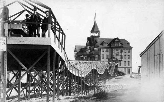 |
|
| (ca. 1887)*^** - View of the 'Switchback Rollercoaster' at the Arcadia Hotel. |
Historical Notes A special delight for guests was a two-track gravity switchback rollercoaster, which in a one minute journey, could whisk guests either to or from the hotel and back again, all for the price of a nickel.*^** Click HERE to see more in Early Southern California Amusement Parks. |
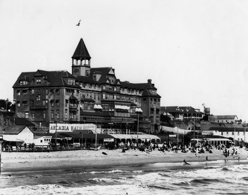 |
|
| (ca. 1890)* - View from the pier showing the Arcadia Hotel on Santa Monica South Beach behind the Arcadia Bath House. |
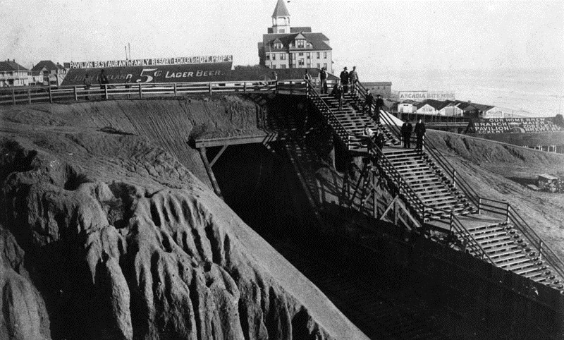 |
|
| (1890s)* - View looking south of the Arcadia Hotel and the Arcadia Bath House. The Southern Pacific Railroad tunnel is seen at center. At right are the '55 steps' that enabled visitors to have quick access to the beach below. |
Historical Notes In the 1890s, the Southern Pacific Railroad built a tunnel under Ocean Avenue. The tunnel was eventually enlarged to accommodate the Pacific Coast Highway**^* |
Click HERE to see more in Early Views of Santa Monica. |
* * * * * |
Please Support Our CauseWater and Power Associates, Inc. is a non-profit, public service organization dedicated to preserving historical records and photos. We are of the belief that this information should be made available to everyone—for free, without restriction, without limitation and without advertisements. Your generosity allows us to continue to disseminate knowledge of the rich and diverse multicultural history of the greater Los Angeles area; to serve as a resource of historical information; and to assist in the preservation of the city's historic records.
|
For more Historical Los Angeles Views click one of the following:
For Other Historical Views click one of the following:
See Our Newest Sections:
To see how Water and Electricity shaped the history of Los Angeles click one of the following:
Water:
Power:
References and Credits
**DWP - LA Public Library Image Archive
* LA Public Library Image Archive
^ http://onbunkerhill.org/; Richelieu Hotel & Melrose Hotel
*# Mojave Desert.net: Remi Nadeau
#* Ancestory.com - Margarita Bandini Winston
#^ Huntington Digital Library Archive
^# KCET - The Lost Hills of Downtown Los Angeles
+^Old Los Angeles and Environs blogspot
*+ The Jews of Los Angeles: Urban Pioneers
#**OUTPOST – Preserving Historical Data by W. S. Broke
#++National Geographic: California Before the Stars Arrived
++#Flickr.com
**^LA Fire Department Historical Archive; Belmont Hotel Fire
^##California State Library Image Archive
^^#The Museum of the San Fernando Valley
*^#CSULB - A Visit to Old LA: Hamburger Dept. Store; Main Street
^**UCLA-DWP Library Collection: Map of the City of Los Angeles as it Appeared in 1850
^*#Noirish Los Angeles - forum.skyscraperpage.com; Temple Block; Melrose and Richelieu Hotels; Hollenbeck Residence
***Los Angeles Historic - Cultural Monuments Listing
*^*California Historical Landmarks Listing (Los Angeles)
*#^Picture Gallery of Los Angeles History
*#*Historic Hotels of Los Angeles and Hollywood (USC - California Historic Society): Bella Union Hotel; Belmont Hotel; U.S. Hotel
##* Boston Public Library: Flickr.com
###Denver Public Library Image Archive
^***Homestead Museum: Workman and Temple Family
^**^Wilmington Historic Society
*^^*Los Angeles Past: Temple and Main Streets, Los Angeles - Then and Now
^^**Flickr.com - Floyd B. Bariscale Photostream: Dodson Residence
*^**Paradise Leased: Arcadia Hotel
**^*Santa Monica Beach Stories
**^^Boyle Heights History Blog: Hollenbeck Park
^#*^LA Times: Amestory Building; Don Antonio Maria Lugo
^**#LMU Digital Collection: Arcadia Hotel
^^*#Jewish Museum of the American West: Jacoby Brothers
**#^LAPL-El Pueblo de Los Angeles Historical Monument Photo Archive
*#^#Los Angeles Athletic Club History
^#*^LA Times: Newmark Fountain
*#^^A House for Equal Justice - Judge Elizabeth R. Feffer
#^*#Urban Diachrony: East side of North Main Street south of Arcadia Street
#^^#Los Angeles County Bar Association: Courthouse Clock
^##^Los Angeles Downtown News.com: A True Soap Opera
##^*Publicartinla.com: Bella Union Hotel Site
#***LAUSD.net; LA Memorial Library
#*^*Photos of Vintage Los Angeles: Facebook.com
#*^^Flickr.com: Views of Los Angeles
^* Wikipedia: Abel Stearns; Pío Pico; Workman-Temple Family; Jonathan Temple; Los Angeles Herald-Examiner; Charles Maclay; Los Angeles High School; Cathedral of Saint Vibiana; John Edward Hollenbeck; Foy House; Isaias W. Hellman; Isaac Newton Van Nuys; Wells Fargo; Los Angeles Plaza Historic District; Harrison Gray Otis; Harris Newmark; Los Angeles Athletic Club; The Church of Our Lady the Queen of Angels; Los Angeles and Independence Railroad; Phineas Banning; UCLA; History of UCLA; Garvanza, Los Angeles; Highland Park; Ozro W. Childs; Ducommun; James H. Dodson Residence; Domingo Amestoy; History of Los Angeles Population Growth; Spring St. School; Fort Moore; Los Angeles High School; Harris Newmark
< Back