Early Los Angeles Historical Buildings (1900 - 1925)
 |
|
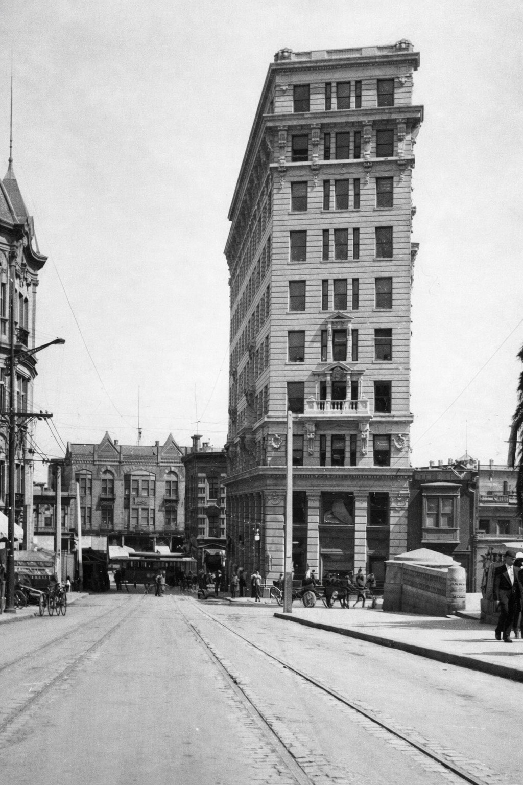
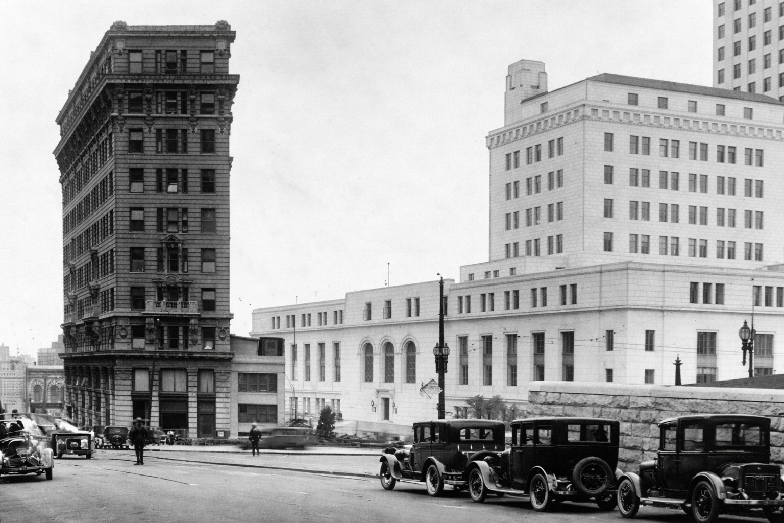
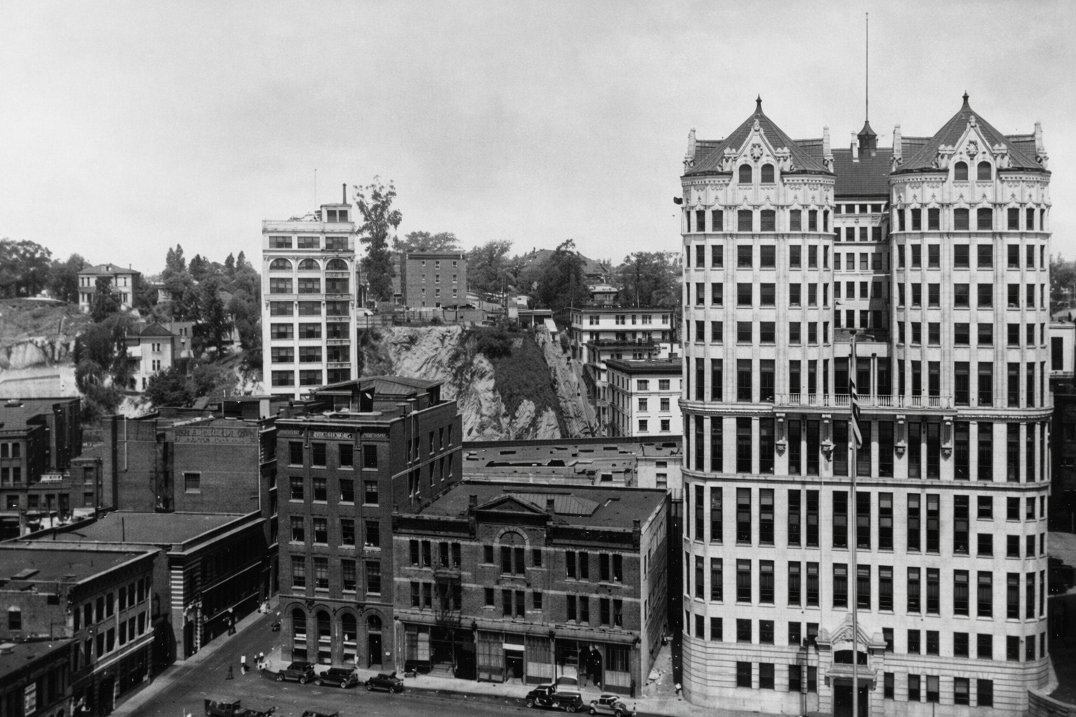
| (ca. 1907)* - View of the International Bank Building at the corner of Spring Street and Temple Street. The Los Angeles County Courthouse is seen on the right, with the Temple Block in the background. |
Historical Notes The International Savings and Exchange Bank Building was completed in 1907 in what was then the heart of Los Angeles’s financial district. The ten story structure was designed in the Renaissance Revival and Italianate styles and quickly became a prominent landmark along Spring Street. Designed by architect H. Alban Reaves, the building reflected the city’s rapid growth and ambition at the turn of the century. Its location near Temple Square placed it among banks, courts, and government offices that defined early downtown Los Angeles. |
 |
|
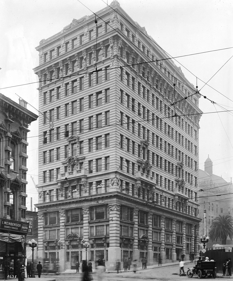
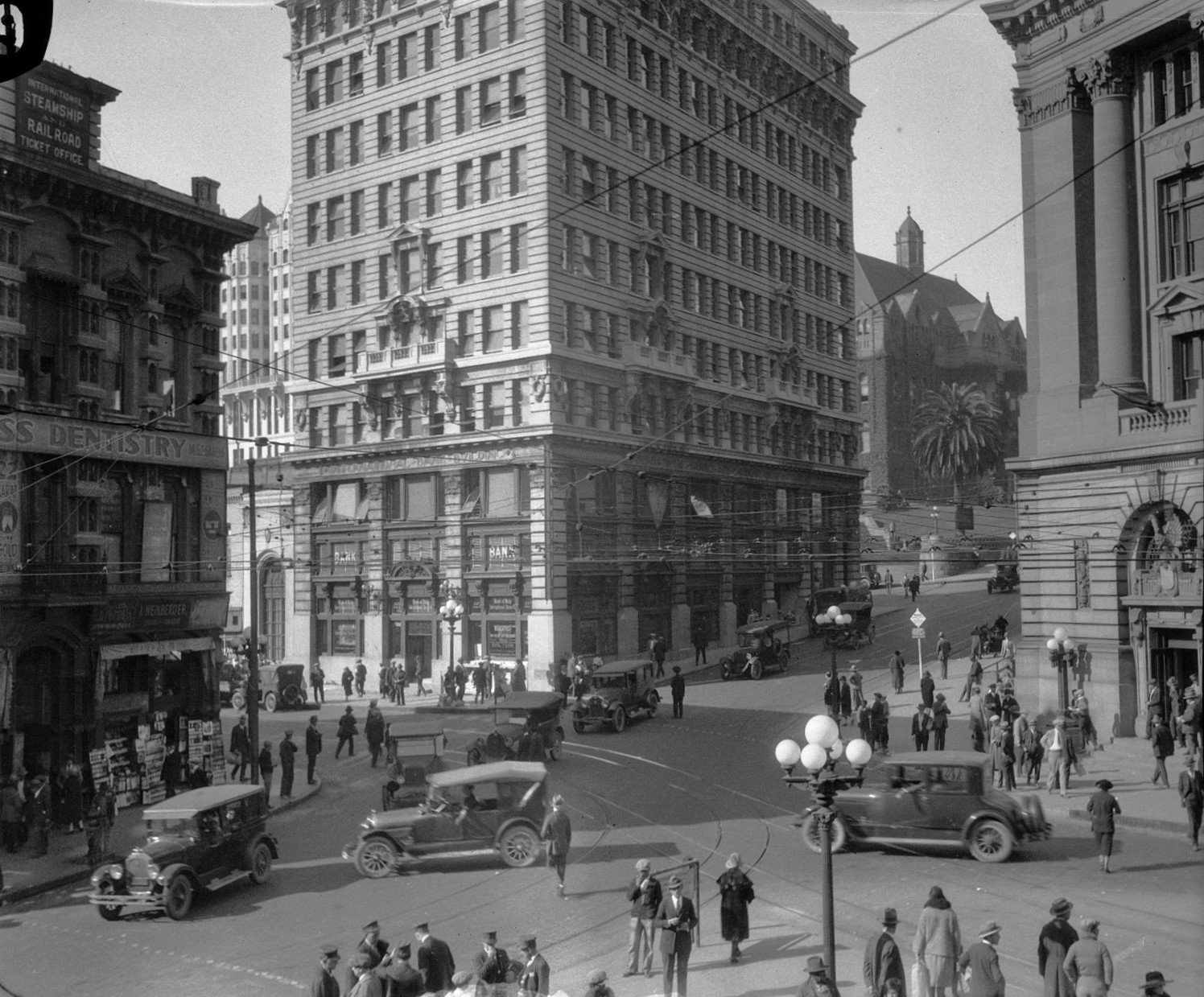
| (1910)* - The International Bank Building on the southwest corner of Spring and Temple streets. The Los Angeles County Courthouse appears in the background on the right, with the Temple Block on the left. |
Historical Notes By 1910, the International Bank Building had become a familiar feature of the downtown skyline. Its height and ornate exterior made it stand out among nearby commercial and civic buildings clustered around Temple Square. This area served as a major crossroads where business, transportation, and government activity converged. The steady flow of pedestrians, streetcars, and early automobiles reflected the city’s fast-paced development during this period. |
 |
|
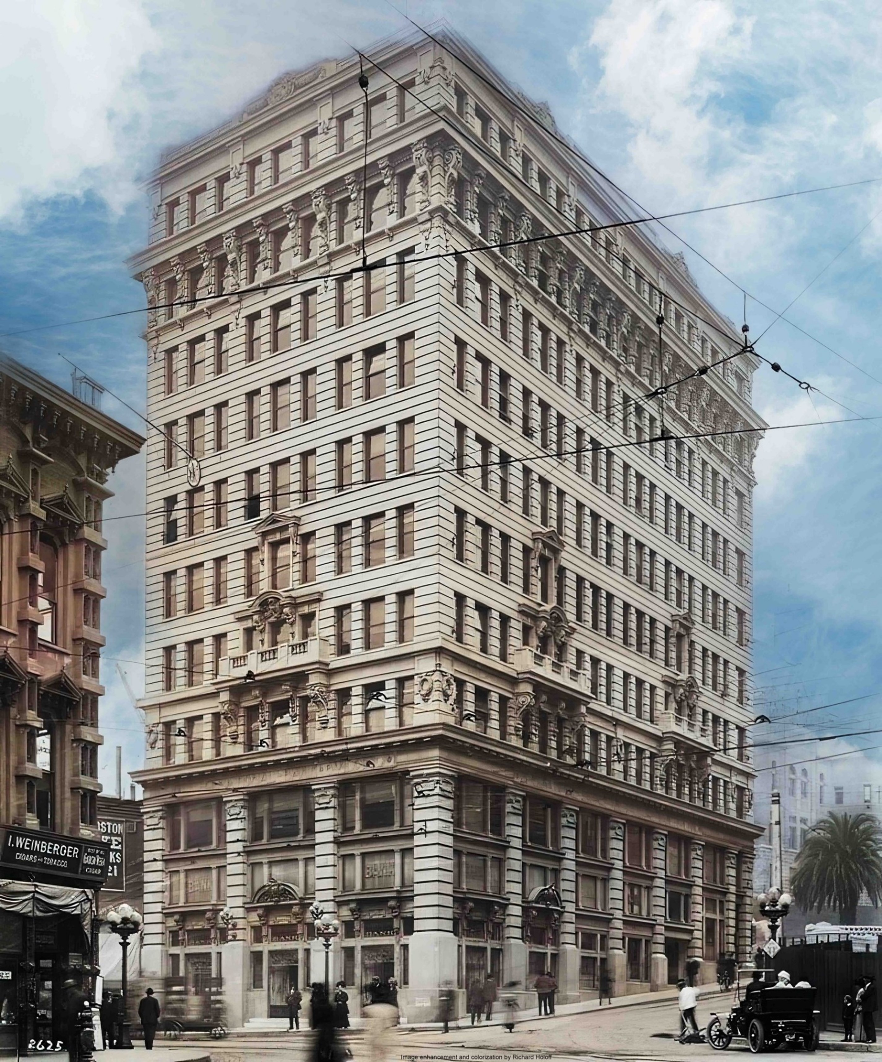
| (1910)* - The International Bank Building at Spring and Temple streets. The Los Angeles County Courthouse is visible on the right. Image enhancement and colorization by Richard Holoff. |
Historical Notes This enhanced view highlights the building’s architectural detailing, including its strong vertical lines and decorative stonework. The design emphasized both stability and elegance, qualities expected of major financial institutions at the time. Although colorized, the image remains consistent with the building’s original appearance and massing. It offers a clearer sense of scale and materials that were sometimes lost in early black and white photography. |
 |
|
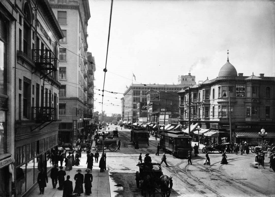
| (ca. 1910)* - Temple Street at the junction of Spring and Main Streets. The International Bank Building stands at left across from the Federal Building and Post Office. An early automobile and a streetcar are visible. |
Historical Notes The intersection of Spring, Main, and Temple streets was known as Temple Square and functioned as the commercial center of Los Angeles. Offices overlooking this triangle were highly sought after by bankers, lawyers, and other professionals. The presence of streetcars and early automobiles shows how transportation shaped downtown life. This busy junction connected the financial district with civic buildings and nearby neighborhoods. |
 |
|
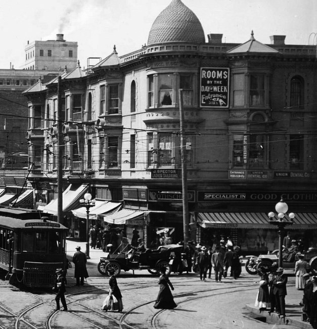
| (ca. 1924)* - The Temple Block area with the International Bank Building at center. Ornate five lamp streetlights line the streets. |
Historical Notes By the 1920s, Temple Square was surrounded by some of the city’s most important buildings. The International Bank Building stood among the Temple Block, the County Courthouse, and the Federal Post Office, forming a dense civic and commercial core. None of the buildings shown in this image survive today. The photograph captures a streetscape that would soon be transformed by large scale civic redevelopment. |
 |
|
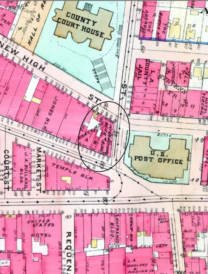
| (1920s)* - Map of the Temple Square area highlighting the International Bank Building. Courtesy of Mary Rice Schuyler. |
Historical Notes This map illustrates how the International Bank Building fit within the tightly packed street grid of early downtown Los Angeles. Temple Square served as a focal point where business and government activities overlapped. The map also shows how close the building stood to major institutions, reinforcing its importance during the height of Spring Street’s role as the city’s financial center. |
 |
|
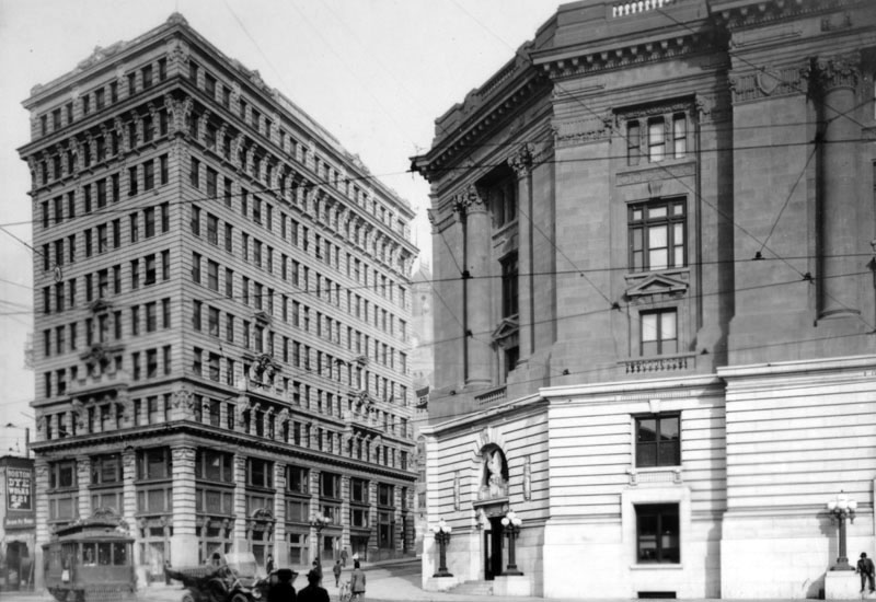
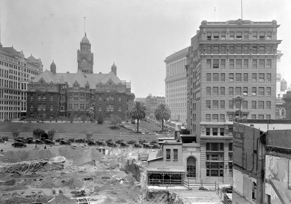
| (ca. 1926)* - View looking west showing the International Bank Building beside the construction site of the new Los Angeles City Hall. The Hall of Records, County Courthouse, and Hall of Justice appear in the background. |
Historical Notes As construction of the new City Hall began, the International Bank Building found itself surrounded by massive civic projects. These changes signaled a shift in downtown priorities from commerce to government administration. Although still in use, the building was beginning to lose its visual dominance as taller and more modern structures reshaped the skyline. |
 |
|
| (1927)* - View looking northeast showing Los Angeles City Hall under construction. The International Bank Building stands to the south. A sign on the building reads Bank of Italy. |
Historical Notes By the late 1920s, the building housed the Bank of Italy, which would later become Bank of America. Its proximity to the rising City Hall highlighted the dramatic contrast between early twentieth century commercial architecture and newer civic monuments. The growing scale of government buildings reduced the building’s prominence and foreshadowed its eventual removal. |
 |
|
| (1929)* - The International Bank Building beside the completed Los Angeles City Hall. |
Historical Notes When City Hall was completed in 1928, it towered over the International Bank Building, making the older structure appear small by comparison. Calls for modernization and redevelopment of the civic center soon followed. Although still standing, the building was increasingly viewed as outdated within the rapidly changing downtown landscape. |
 |
|
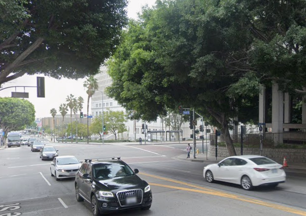
| (2021)* – Looking east on Temple Street at Spring Street. This view closely matches the scene shown in the 1929 photograph above. |
Historical Notes In the 1929 image, the International Bank Building stands prominently at left beside the recently completed Los Angeles City Hall. By 2021, that entire streetscape had been transformed, with the bank building long gone following its demolition in 1954. The modern view reflects decades of civic redevelopment that replaced dense early commercial buildings with government complexes, open space, and widened roadways. Mature trees, modern traffic patterns, and set-back structures mark a very different chapter in the history of downtown Los Angeles. |
Then and Now
 |
|
| (1929 vs 2021)* – Then and now view looking east on Temple Street at Spring Street. The International Bank Building once stood at left; today, the view opens to the Civic Center and a side entrance to Los Angeles City Hall. Photo comparison by Jack Feldman. |
Historical Notes This then and now comparison shows how dramatically the Temple and Spring streets area has changed over time. In 1929, the International Bank Building stood prominently along Temple Street, just before it was overshadowed by the newly completed Los Angeles City Hall. By 2021, the bank building was long gone, having been demolished in 1954 as part of Civic Center redevelopment. What was once a dense mix of commercial and civic buildings is now a more open streetscape focused on government offices, reflecting the city’s continued growth and changing priorities. |
 |
|
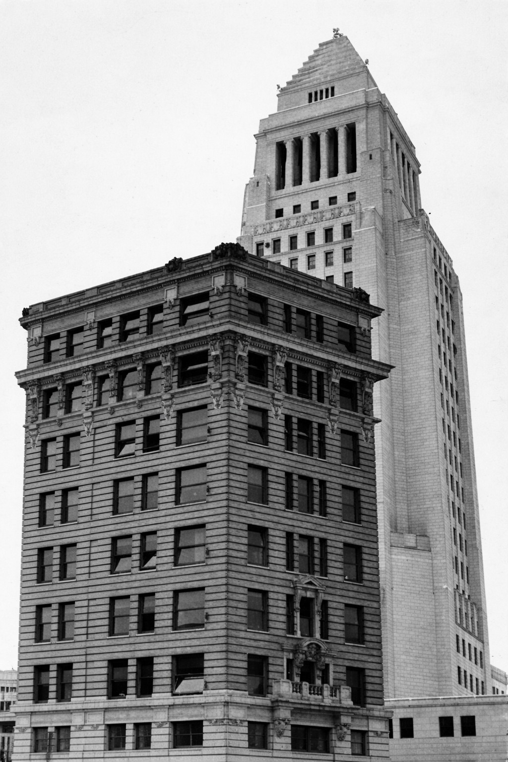
| (1934)* – The International Bank Building standing in front of Los Angeles City Hall. |
Historical Notes By 1934, the International Bank Building had lost much of its earlier prominence as a financial landmark. The completed Los Angeles City Hall, rising behind it, now dominated the skyline and reshaped the Civic Center area. At this point, the building was no longer used primarily for banking and had begun serving various municipal functions. Its smaller scale and older design stood in sharp contrast to the monumental civic architecture that defined downtown Los Angeles during the 1930s. |
 |
|
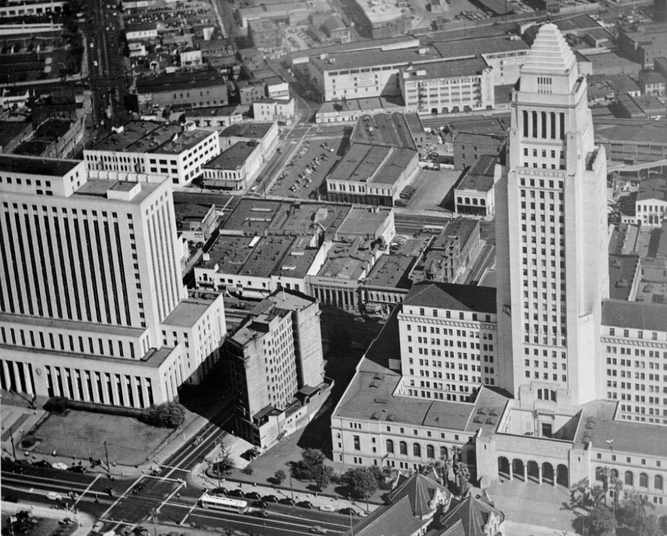
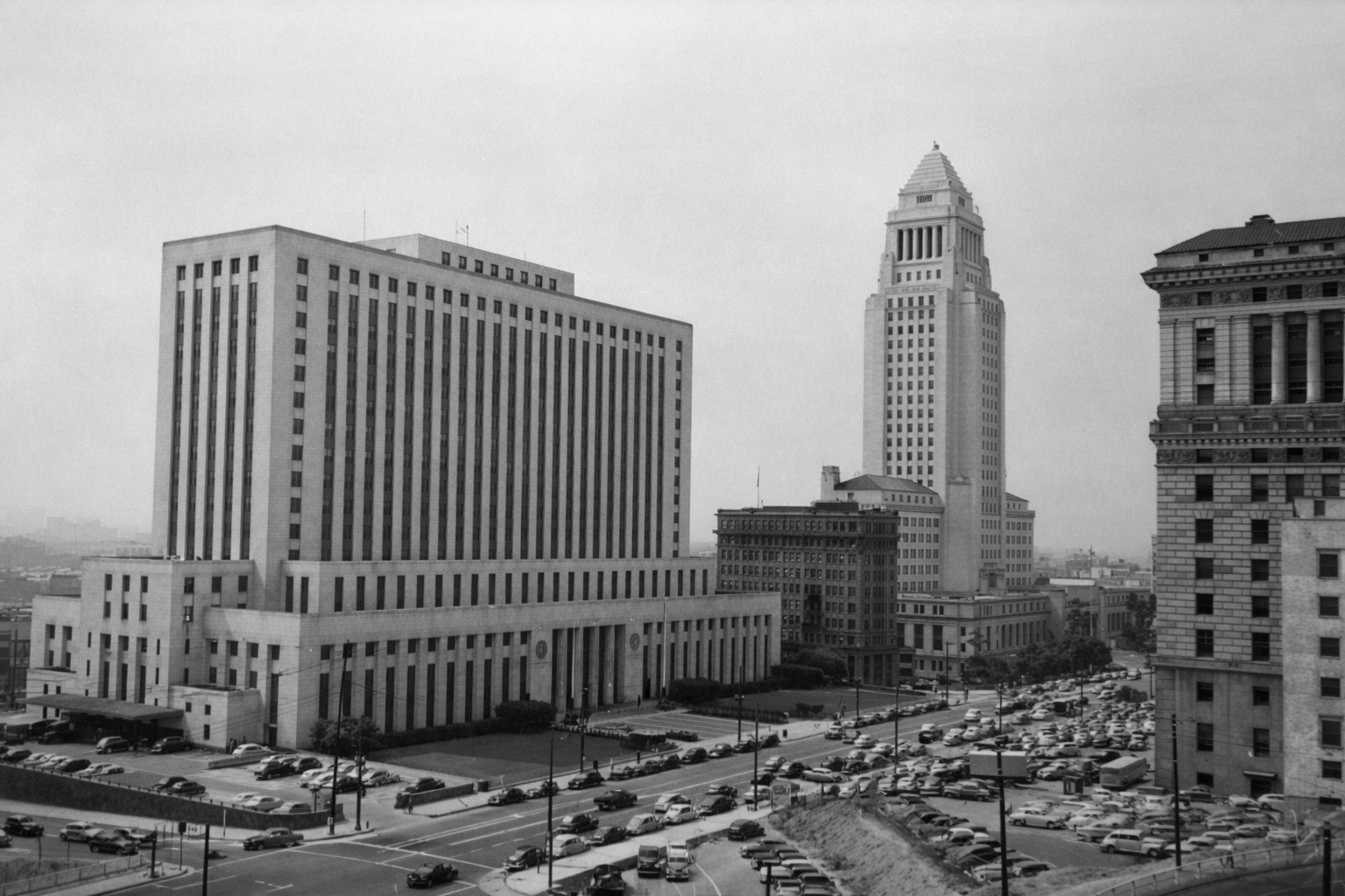
| (1947)^ - Aerial view showing the International Bank Building between City Hall and the Federal Courthouse and U.S. Post Office Building. |
Historical Notes By the mid 1940s, the International Bank Building was tightly surrounded by large government buildings. It had been repurposed for city use and was commonly known as the Old City Health Building. Its cramped position reflected the pressures of civic expansion in downtown Los Angeles. |
 |
|
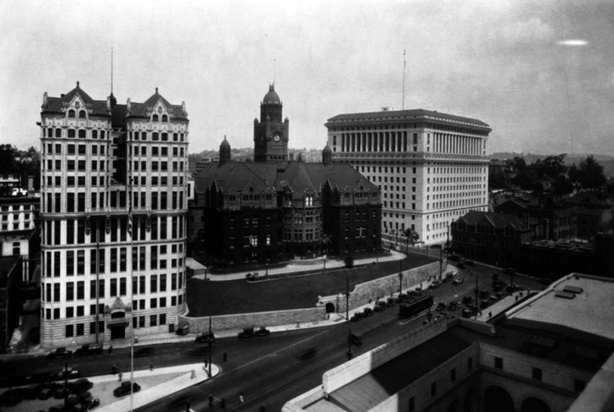
| (1949)* - View of the Civic Center showing the International Bank Building dwarfed by City Hall and the Federal Courthouse and Post Office Building. The Hall of Justice is visible on the right. |
Historical Notes This image shows how completely the building had been overshadowed by newer construction. Once a landmark, it now appeared as a leftover from an earlier era. Urban renewal plans increasingly favored open space and larger civic structures, leaving little room for older commercial buildings. |
 |
|
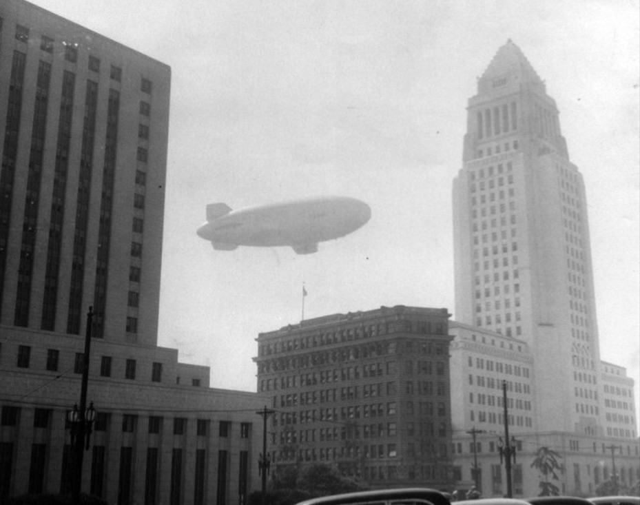
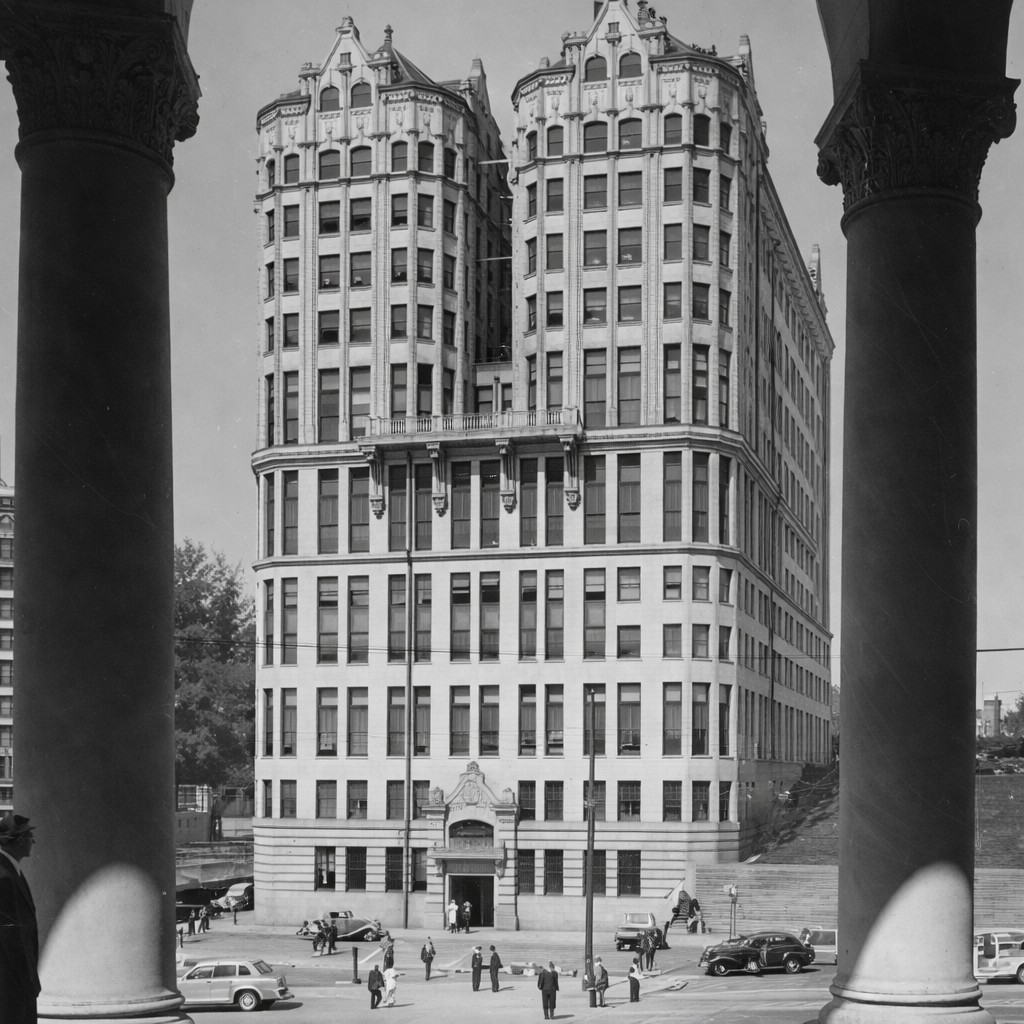
| (1954)* - Closer view of the International Bank Building between City Hall and the Federal Courthouse and U.S. Post Office Building. A Goodyear Blimp flies overhead in the hazy skyline. |
Historical Notes In 1954, the International Bank Building was demolished, ending nearly fifty years of service. Its removal was part of a broader effort to reshape the Civic Center. Today, the site forms part of the expanded City Hall complex. The building’s disappearance reflects the constant reinvention of downtown Los Angeles. |
 |
|
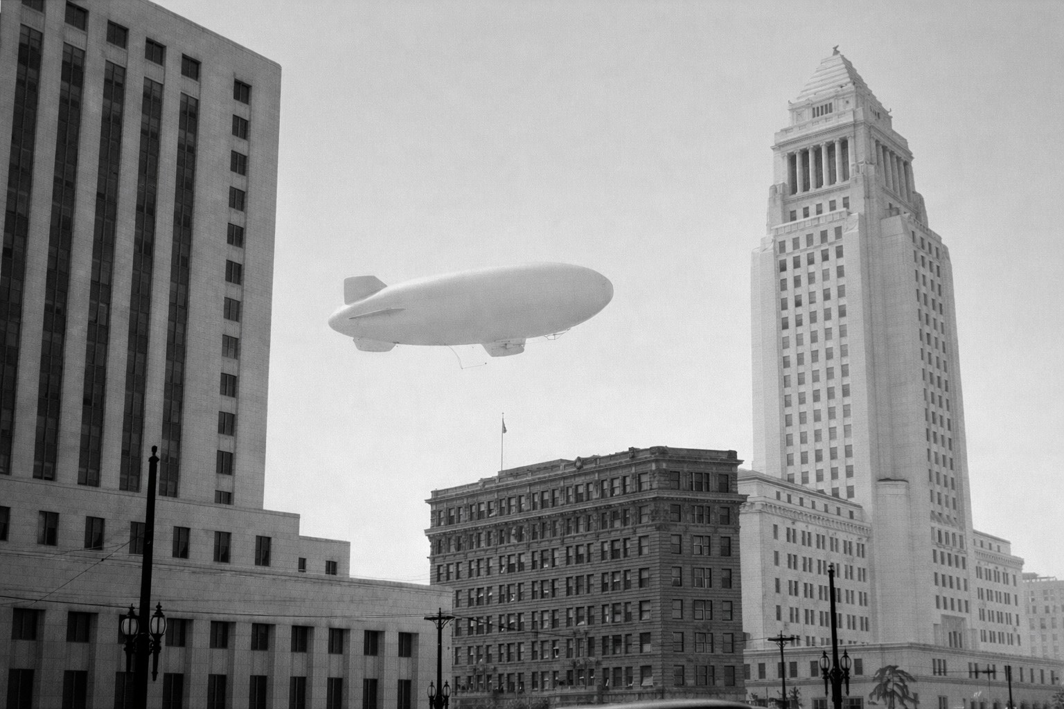
| (1954)* - Enhanced view of the International Bank Building between City Hall and the Federal Courthouse and U.S. Post Office Building. |
Historical Notes This enhanced image provides a clearer view of the International Bank Building shortly before its demolition. The original photograph was taken on a heavily smog-filled day, a common condition in Los Angeles during the mid twentieth century. Smog was a serious and growing problem in the city by the 1940s and 1950s, caused largely by automobile emissions and industrial activity. While the building itself soon disappeared, the image also serves as a reminder of environmental challenges that shaped daily life in Los Angeles during this period and would later lead to major air quality reforms. |
* * * * * |
Stimson Building
 |
|
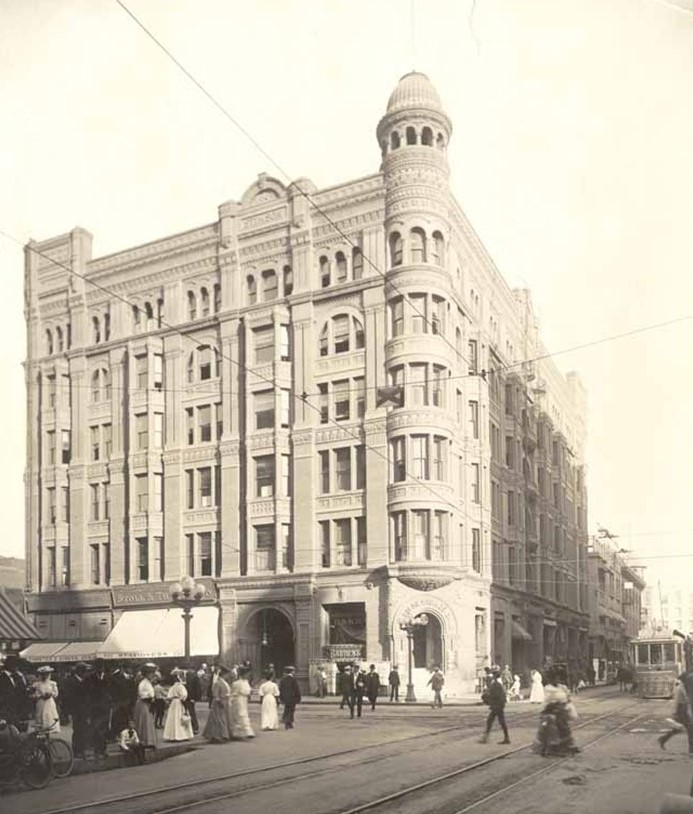
| (ca. 1907)* - Looking north on Spring Street toward Third Street. The Stimson Building stands on the northeast corner. |
Historical Notes The Stimson Building was completed in 1893 and quickly became one of the most recognizable structures in early downtown Los Angeles. Designed in the Richardsonian Romanesque style, the six story stone building featured heavy masonry, arched windows, projecting bays, and a distinctive observation tower. Located at the busy intersection of Spring and Third streets, the building stood near the southern edge of the Spring Street Financial District. This area was rapidly developing into the city’s commercial core during the late nineteenth and early twentieth centuries. |
 |
|
| (ca. 1908)*- Looking east on Third Street at Spring Street showing the Stimson Building on the northeast corner at 256 South Spring Street. |
Historical Notes The building was commissioned by Thomas D. Stimson, a prominent lumber magnate who had relocated to Los Angeles from Michigan. Architect Carroll H. Brown designed the structure in 1893, and it was considered one of the city’s earliest high rise office buildings. Originally constructed at a cost of about one hundred fifty thousand dollars, the Stimson Building reflected both wealth and confidence in Los Angeles’s future. Its commanding presence made it a visual anchor at one of downtown’s busiest intersections. |
 |
|
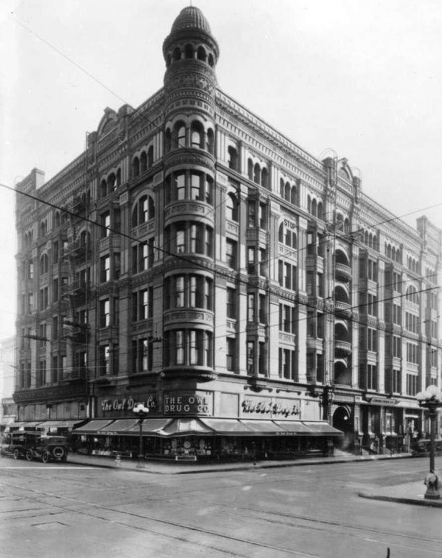
| (1920)* - The Stimson Building on the northeast corner of Third and Spring streets with Owl Drug Company occupying the ground floor. |
Historical Notes By the 1920s, the Stimson Building had transitioned fully into commercial use, housing offices above street level retail. National chains such as Owl Drug Company occupied prominent corner storefronts during this period. Spring Street had become a destination for banking, shopping, and entertainment. Streetcars, automobiles, and pedestrians passed continuously through this intersection, making it one of the most active locations in the city. |
 |
|
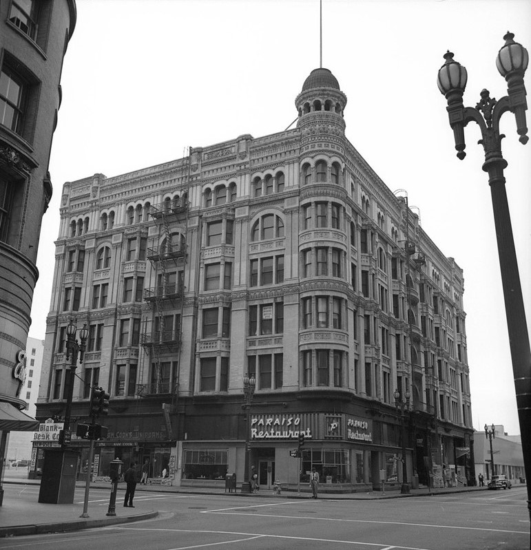
| (1950)* - View of the Stimson Building at the northeast corner of Third and Spring streets. Paraiso Restaurant occupies the ground floor. |
Historical Notes In the postwar years, the Stimson Building remained in use but was increasingly seen as outdated. Newer buildings nearby reflected modern architectural styles and changing expectations for office space. Restaurants and small businesses on the ground floor helped keep the building active, even as downtown Los Angeles began to experience shifting economic patterns and early signs of decline. |
 |
|
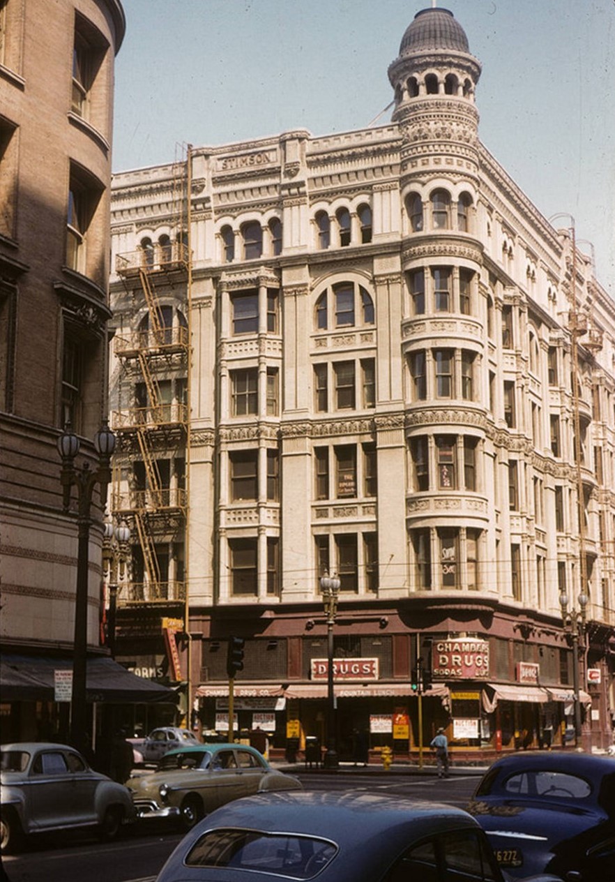
| (1955)* - The Stimson Building at 256 South Spring Street. |
Historical Notes By the mid 1950s, the Stimson Building stood as a reminder of an earlier era of downtown development. Its heavy stone construction contrasted sharply with newer steel and glass buildings rising elsewhere in the city. Despite its architectural significance, preservation was not a priority at the time. Plans for redevelopment increasingly favored demolition over reuse. |
 |
|
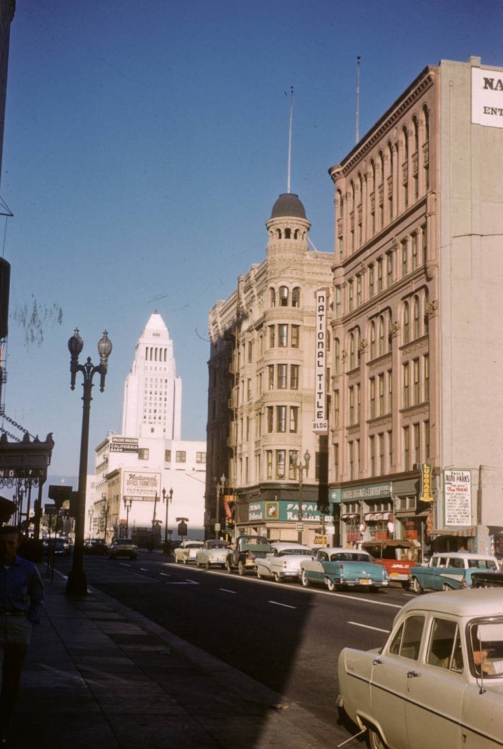
| (1959)* - Looking north on Spring Street showing the Stimson Building on the northeast corner of Third Street. The National Title Building stands across the street on the southeast corner. |
Historical Notes This view captures the Stimson Building shortly before its demolition. Although still structurally sound, it was surrounded by newer commercial buildings that reflected mid twentieth century design trends. The intersection of Spring and Third streets remained busy, but the character of downtown was changing. Older landmarks were increasingly seen as obstacles to modernization. |
Then and Now
 |
|
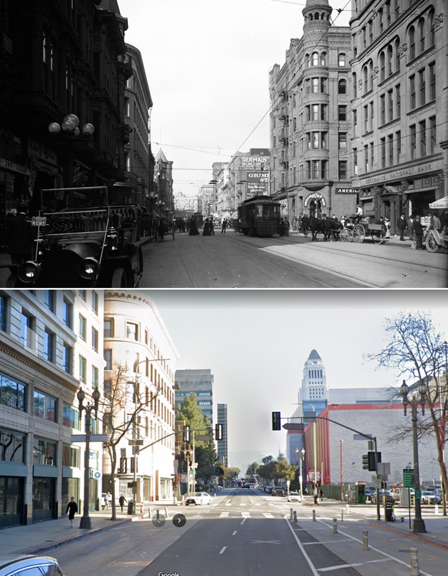
| (1907 vs 2023)* - Looking north on Spring Street toward Third Street. Photo comparison by Jack Feldman. |
Historical Notes For roughly seventy year, the Stimson Building occupied the northeast corner of Spring and Third streets, serving as a landmark during Los Angeles’s rise as a major city. Completed in 1893, it witnessed the transition from streetcars and horse drawn vehicles to automobiles and modern traffic. The building was demolished in 1963 and replaced by a parking lot. Its absence reflects a period when historic structures were routinely removed in favor of redevelopment, leaving few physical traces of early downtown Los Angeles at this intersection. |
* * * * * |
Hall of Records
 |
|
| (1910)* - Postcard view of the Hall of Records Building. The Los Angeles County Courthouse is seen to the right. This view is from the New High Street side. |
Historical Notes Constructed between 1909 and 1912, the Hall of Records was built to relieve overcrowding in the adjacent red sandstone county courthouse and to consolidate most county offices under one roof. Rising twelve stories, it was among the tallest government buildings in Los Angeles at the time and a strong symbol of the county’s expanding administrative role in the early twentieth century. Designed by architects Frank Hudson and William Munsell, the Hall of Records was richly detailed in the Beaux Arts and Renaissance Revival traditions. Its elaborate roofline featured finials, pyramidal gables, copper ribbing, and dormers that gave the building a highly ornamental civic presence. The structure was arranged around a central elevator core, with upper floors divided into paired wings, and clad in brick and terra cotta above a heavy granite base. The building’s diagonal orientation followed the alignment of New High Street, an early north south route that predated the formal planning of the modern Civic Center. What appears unusual today reflects the street pattern of an earlier Los Angeles rather than an intentional departure from symmetry. |
 |
|
| (1910)* - Postcard view of the Hall of Records Building. The Los Angeles County Courthouse is seen to the right. Image enhanced and colorized by Jack Feldman. |
Historical Notes From New High Street, the Hall of Records presented one of its most dramatic elevations. The diagonal street frontage allowed the architects to emphasize vertical massing and corner detailing, reinforcing the building’s prominence within the civic core. At the time of its construction, New High Street and nearby Court Street formed part of an irregular street network shaped by topography and early land divisions rather than by long term civic planning. The Hall of Records was designed to fit that older city, not the monumental Civic Center that would soon replace it. |
 |
|
| (ca. 1920s)* - View of downtown Los Angeles showing the Hall of Records within the early civic district. The intersection of Court Street and New High Street appears along the left edge of the image, with Court Flight visible climbing the eastern slopes of Bunker Hill in the distance. |
Historical Notes By the 1920s, the Hall of Records stood within a dense civic landscape shaped by steep terrain and inherited street alignments rather than by a formal plan. The meeting of Court Street and New High Street followed early property lines and natural grades, explaining why many surrounding government buildings appear diagonally oriented when compared with today’s Civic Center grid. Court Flight, rising along the eastern slopes of Bunker Hill, connected the lower courthouse district with the residential neighborhoods above. These stairways, hillside streets, and irregular blocks would soon be erased or reshaped during large scale civic redevelopment, leaving images such as this as rare documentation of early downtown Los Angeles before the hill was cut down and the area reconfigured. |
 |
|
| (ca. 1929)* - View looking northwest from City Hall toward the Hall of Records at left, the County Courthouse, and the Hall of Justice. A realigned Spring Street appears in the foreground. New High Street runs diagonally in front of the Hall of Justice and merges with Spring Street at center right. |
Historical Notes The construction of the current City Hall between 1927 and 1928 triggered a major reconfiguration of the surrounding street system. Spring Street was realigned to run parallel with Main Street, eliminating its earlier convergence at Temple Street and imposing a more formal civic axis. As a result, New High Street was truncated and eventually removed, leaving older buildings such as the Hall of Records visually misaligned with the new street grid. The diagonal orientation seen in historic photographs is a physical reminder of the earlier street pattern that once defined the area. |
 |
|
| (ca. 1930s)* – Aerial view looking down at the Civic Center, annotated with street names and the original location of Poundcake Hill. The Hall of Records is seen aligned with the former path of New High Street at center. |
Historical Notes This aerial view clearly illustrates the layered evolution of the Civic Center. Court Street, which once climbed Poundcake Hill and served early civic buildings, was shortened and ultimately eliminated during grading and redevelopment in the 1920s and 1930s. The Hall of Records remained fixed to the geometry of the earlier city, standing as a visual link between the informal street patterns of nineteenth century Los Angeles and the planned monumental Civic Center that followed. |
 |
||
| (ca. 1935)* - The Hall of Records as framed by the arches of City Hall across Spring Street. The former intersection of New High Street and Spring Street can be seen near the lower center of the image. |
Historical Notes The Los Angeles County Hall of Records served as the administrative center of county government from 1911 until 1976, housing court records, deeds, and numerous county offices. Despite its architectural distinction and historic importance, the building was ultimately deemed obsolete and was demolished in 1973 as part of continued Civic Center redevelopment. Its loss remains one of the most significant architectural removals in downtown Los Angeles. Historic photographs preserve not only the building itself, but a record of the city’s earlier scale, street patterns, and evolving civic identity. |
Click HERE to see more Early Views of the Hall of Records |
* * * * * |
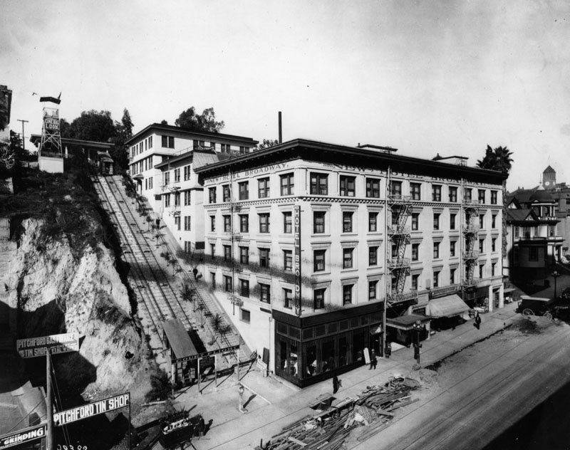
New Hotel Broadway
 |
|
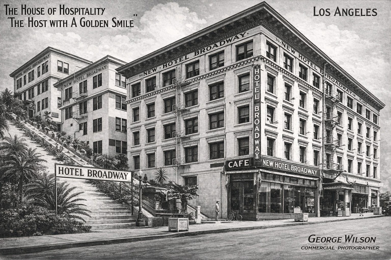
| (1916)* - Postcard view of the New Hotel Broadway at 205 North Broadway, adjacent to Court Flight. The card promotes the hotel as “The House of Hospitality, The Host with a Golden Smile,” with George Wilson listed as Managing Director. |
Historical Notes The New Hotel Broadway stood at the base of the eastern slopes of Bunker Hill, directly beside Court Flight and across Broadway from the Hall of Records and County Courthouse. Its location placed it at the crossroads of Los Angeles civic activity and the residential neighborhoods above, making it a popular lodging choice for attorneys, county officials, and visitors conducting business in the courthouse district. The hotel’s promotional language reflects the period’s emphasis on comfort, service, and hospitality as downtown Los Angeles rapidly expanded. Court Flight, visible alongside the hotel, opened in 1905 as a pedestrian cable railway linking Broadway with Court Street. The steep ascent made the funicular an essential connection between the civic core below and the densely populated Bunker Hill neighborhoods above. The close physical relationship between the hotel and the incline underscores the importance of vertical transportation in early downtown Los Angeles before widespread grading and redevelopment altered the area. |
 |
|
| (Early 1900s)* - View of the New Hotel Broadway next to the Court Flight cable railway at 205 North Broadway. The hotel stands opposite the Hall of Records and County Courthouse, marking the base of the Bunker Hill ascent. |
Historical Notes This early view shows the New Hotel Broadway integrated into the civic and transportation landscape of north Broadway. The hotel’s proximity to both the courthouse complex and Court Flight illustrates how lodging, government, and hillside transit were interwoven in this part of the city. Guests could step directly from the hotel to the incline, providing convenient access to Bunker Hill residences and streetcar connections along Court Street. At street level, Broadway functioned as a major north south artery carrying pedestrians, streetcars, and early automobiles through the civic district. The presence of the hotel at this location highlights the growing demand for accommodations near government offices during the city’s rapid population growth in the early twentieth century. |
|
|
| (ca. 1920s)* - Looking west past the Hall of Records toward the eastern slopes of Bunker Hill. Court Flight appears at center, with a partial view of the New Hotel Broadway visible at its base. |
Historical Notes By the 1920s, the area surrounding the New Hotel Broadway had become a dense and irregular civic district shaped by steep terrain and inherited street alignments. Court Flight continued to serve as a vital pedestrian link up the eastern slopes of Bunker Hill, while the hotel remained a visible marker at the transition between the level civic core and the rising hillside beyond. This view also captures the complex layering of streets, stairways, and buildings that characterized early downtown Los Angeles prior to large scale redevelopment. The partial view of the hotel emphasizes how structures at the base of Bunker Hill were visually and functionally tied to both the courthouse district and the residential neighborhoods above, relationships that would soon disappear as the hill was cut down and the area reconfigured. |
* * * * * |
Westmoore Hotel
 |
|
| (1910)^ - Exterior view of the Westmoore Hotel located at 1000 W. Seventh Street. Tall palm trees flank the grand portico entrance to this three-story Greek revival building. Stairs lead to the front entrance and patio at left, while an unpaved Seventh Street runs in front of the building in the foreground. |
 |
|
| (1910)**# - Postcard view of the Westmoore Hotel, located on the southwest corner of Seventh and Francisco streets. |
 |
|
| (1957)^ - View showing the demolition of the Westmoore Hotel at 1000 W. Seventh Street. Francisco Street is on the left. The Harbor Freeway, built in 1953, is seen on the right. |
Historical Notes It appears that somewhere along the line there was an addition to the Westmoore Hotel with included a new structure between the Greek-style columns of the original building and the front property line at 7th Street. |
Old Shrine Auditorium (Al Malakah Temple)
 |
|
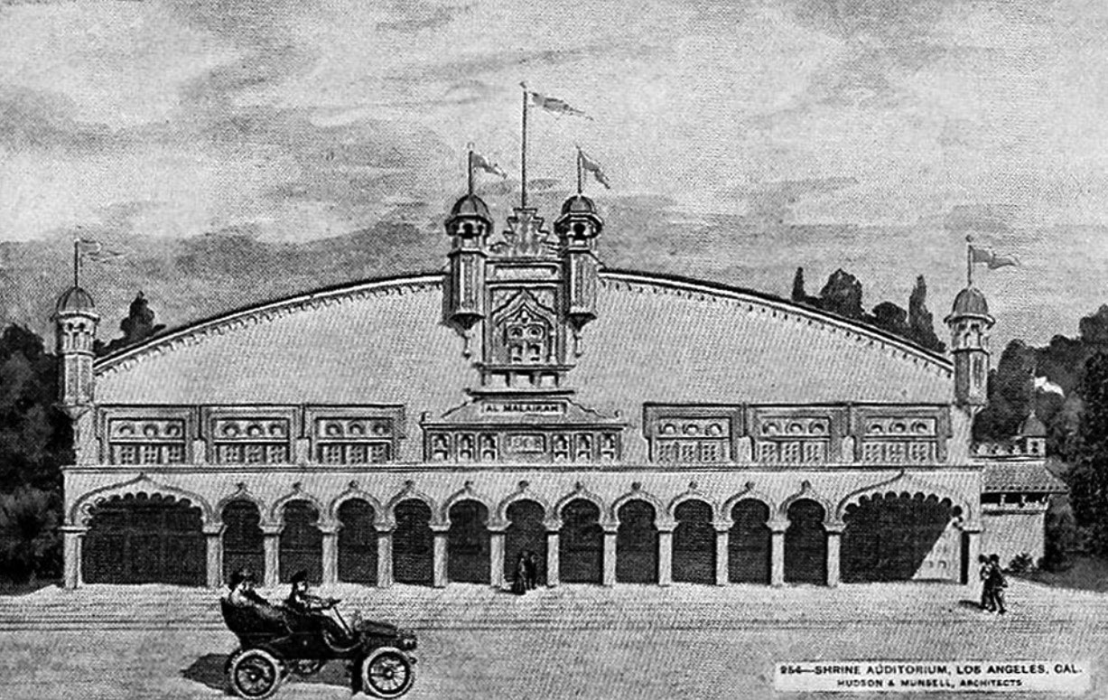
| (1910)^*^# – Postcard view of the original Shrine Auditorium (Al Malaikah Temple). |
Historical Notes The original Shrine Auditorium was built in 1906 and served as the Shriner's Al Malaikah Temple until it burned in 1920 and was replaced by the current incarnation.* The Shriners, or Ancient Arabic Order of the Nobles of the Mystic Shrine (A.A.O.N.M.S.), were established in the U.S. in 1870 as an appendant body to Freemasonry.^* |
 |
|
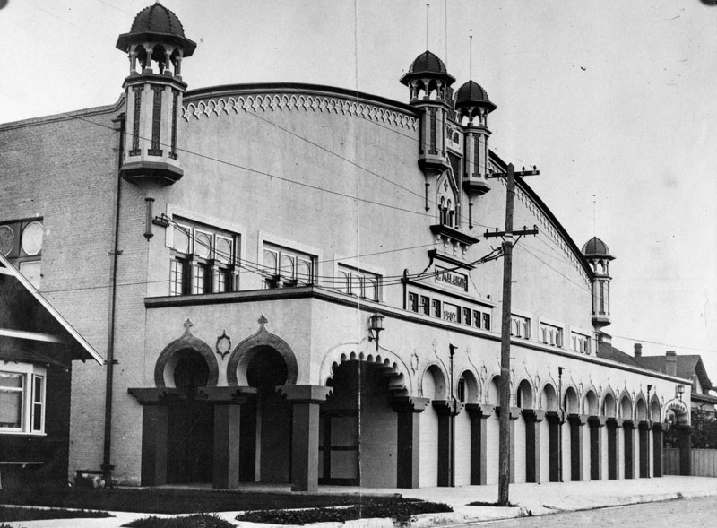
| (1910)* - Exterior view of the Old Shrine Auditorium on Jefferson Boulevard, built in 1906. |
Historical Notes The Al Malaikah Shriners built the original Shrine Auditorium to serve as a civic center as well as their home base and clubhouse. The building was designed by Frank D. Hudson and William Munsel who also designed the Museum of Science and Industry, the first museum built in the city's Exposition Park.^* |
 |
|
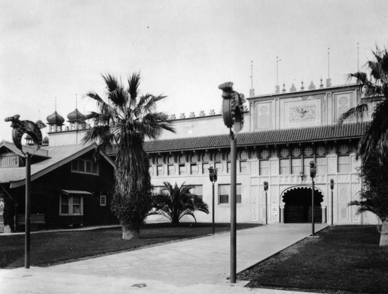
| (1920)* - Another view of the Old Shrine Auditorium as seen from the corner of Royal and Jefferson. |
Historical Notes In 1920 a fire burnt the building down in just 45 minutes. With plans to add an attached expo hall, The Shriners began rebuilding almost immediately. In January 1926 the new Shrine Auditorium and Expo Hall opened and quickly became the center of entertainment in Los Angeles.^* |
Click HERE to see more on the New Shrine Auditorium built in 1926. |
Early Fire Stations
 |
|
| (ca. 1910)* - View of a fire fighter maneuvering a horse-drawn fire engine, as two other firemen stand next to it; the station visible in the background is Engine Company No. 9. |
Historical Notes Engine Company No. 9, formed on November 27, 1899 and was located at 916 S. Santee Street until 1960 when It was relocated to 430 E. Seventh Street. It has operated from that location since then. Engine Company No. 23 and Squad #23 moved into the building formerly occupied by No. 9.* |
 |
|
| (ca. 1910)^##* – View of firemen posing in front of Engine Company No. 9, located at 916 South Santee Street. |
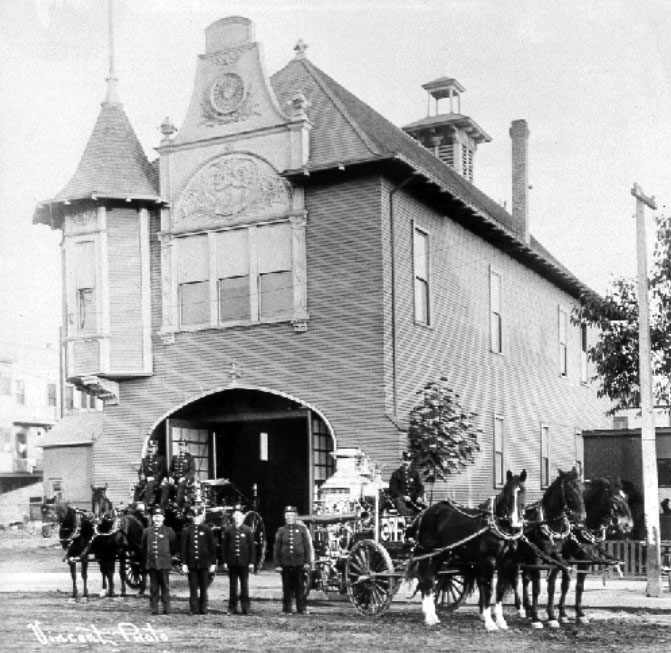
Engine Company No. 23
_B.jpg) |
||
| (ca. 1915)^##* - Group photo of Engine Company 23 and Truck Company 5 located at 225 E. 5th Street. |
Historical Notes Late in September, 1910, the new engine house for Co. 23 was finished and dedicated. It contained three stories, and on the ground floor, in addition to space for the new auto truck with 65-foot ladders (which had not arrived) it had ten stalls for horses--the reason for having quarters for horses when the equipment was to be motorized not being clear either at that time or now.^##* |
 |
|
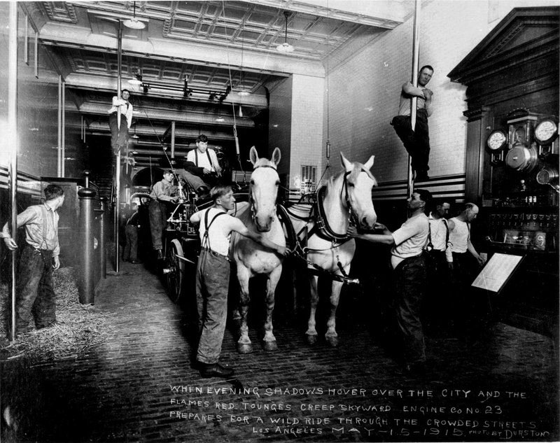
| (1915)**# - Interior view of Engine Company No. 23. Inscription on photo reads: WHEN EVENING SHADOWS HOVER OVER THE CITY AND THE FLAME'S RED TONGUES CREEP SKYWARD, ENGINE CO. NO. 23 PREPARES FOR A WILD RIDE THROUGH THE CROWDED STREETS OF LOS ANGELES. |
Historical Notes Fire Station No. 23 remained an active firehouse from 1910-1960. When it opened, it was manned by fifteen firefighters and ten horses. The original equipment included a horse wagon, chief's buggy, and a pumper that used a vertical tube boiler. The company's first major call was a fire in the old Byrne Building that took ten hours to extinguish.^* |
 |
|
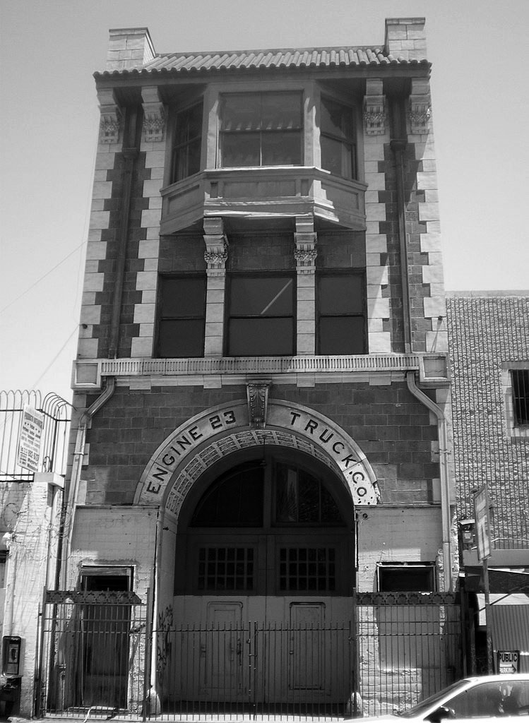
| (2008)^* - View showing the abandoned Fire Station No. 23 in Downtown Los Angeles. |
Historical Notes Fire Station No. 23 was built in 1910 as an operating fire station. It was also the Los Angeles Fire Department's headquarters until 1920 and the residence of every fire chief from 1910-1928. When it opened, it spawned a political firestorm due to the ornate interior and expensive imported materials, leading to its being called the "Taj Mahal" of firehouses. Through the 1960s and 1970s, the station deteriorated. The surrounding neighborhood became part of the city's Skid Row and the station became "a hangout for the street people." Looters stole most of the copper tubing and brasswork, banisters, doorknobs, firebells, and even the five brass firepoles. By the mid-1970s, concerns were raised that the building had become a hazard, and some proposed tearing it down. However, in 1979, the Fire Commission announced plans to restore the rooms back to their 1910 condition and turn the station into a museum. The City Council placed the station under control of the fire department, but provided that no city funds were to be used in creating the museum. In 1981, officials of the fire department set up a nonprofit organization called Olde 23 to raise funds to build the museum, but sufficient funds were never raised. The projected cost of the museum, even in 1982, was $1 million, and critics questioned the wisdom of building a museum in Skid Row. In 1988, the city settled on a different location for the Los Angeles Fire Department Museum—Engine Co. No. 27 in Hollywood.^* |
 |
|
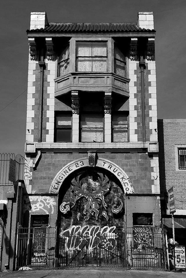
| (2018)^.^ - View showing an abandoned and deteriorated Fire Station No. 23, located at 225 E. 5th Street. |
Historical Notes In 1966, the station was declared a Historic Cultural Monument by the Los Angeles Cultural Heritage Commission; at the time of the declaration the Los Angeles Times called it the "Taj Mahal of fire stations." A Library of Congress survey of 250 firehouses concluded that Station 23's interior was "unmatched in its beauty." It was added to the National Register of Historic Places in 1980.^* Fire Station No. 23 is currently being repurposed as a community arts center by City of LA Cultural Affairs Department. |
Engine Company No. 24
 |
|
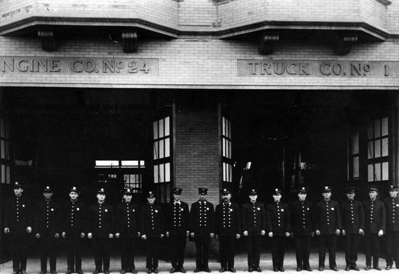
| (ca. 1910)* - Sixteen fire fighters in full uniform stand in a single-file line in front of Engine Company No. 24, which is located at 204 S. Hewitt, near Second Street. Truck Co. No. 1 (pictured on right) was headquartered in the same building. |
Historical Notes Engine Company No. 24 and Water Tower 1 opened August 16, 1910. The 13,800 square foot site had an 11,140 square foot floor area. Cost of the land was $16,000 and the building cost was $30,464. This station moved to its new home at 9411 Wentworth Street in Sunland on July 10, 1969, and has operated from that location since. |
* * * * * |
Hotel Snow (later Hotel Southland)
 |
|
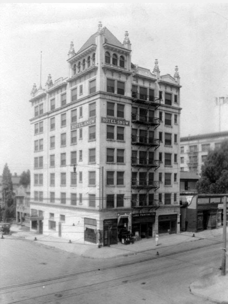
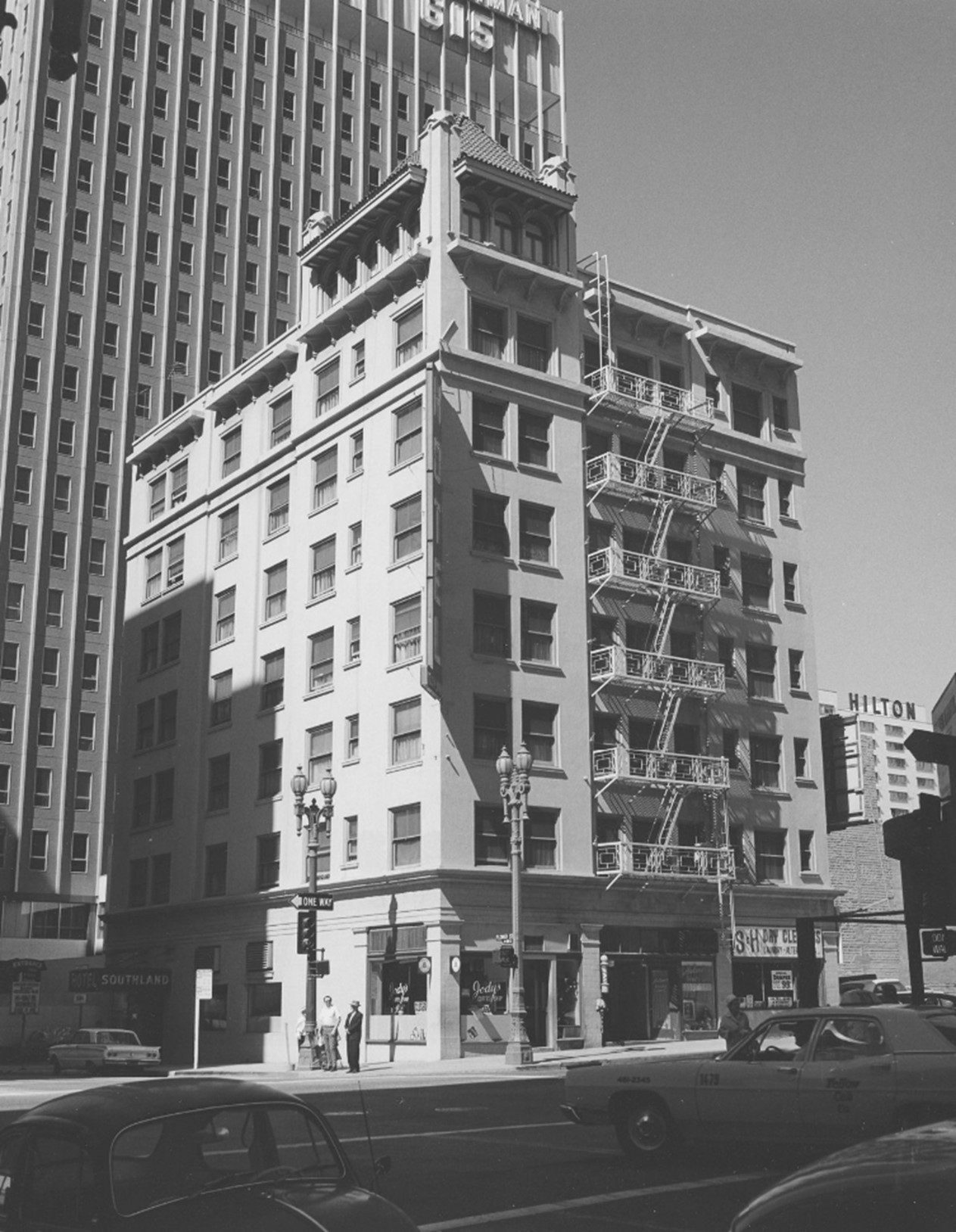
| (ca. 1910)* – View looking at the SW corner of 6th and Flower streets showing the Hotel Snow. The name “FINKLE" is carved on the top front of the building. |
Historical Notes The Snow was opened by Frank C. Finkle in December 1910. It was designed by architect H. M. Patterson, best known for his churches, especially Immanuel Presbyterian (that imposing Gothic structure at Wilshire and Berendo. Rooms rented rooms for $1.00-$2.00 without bath (for 1-2 people) and $1.50-$2.50 with bath (1-2 people). |
 |
|
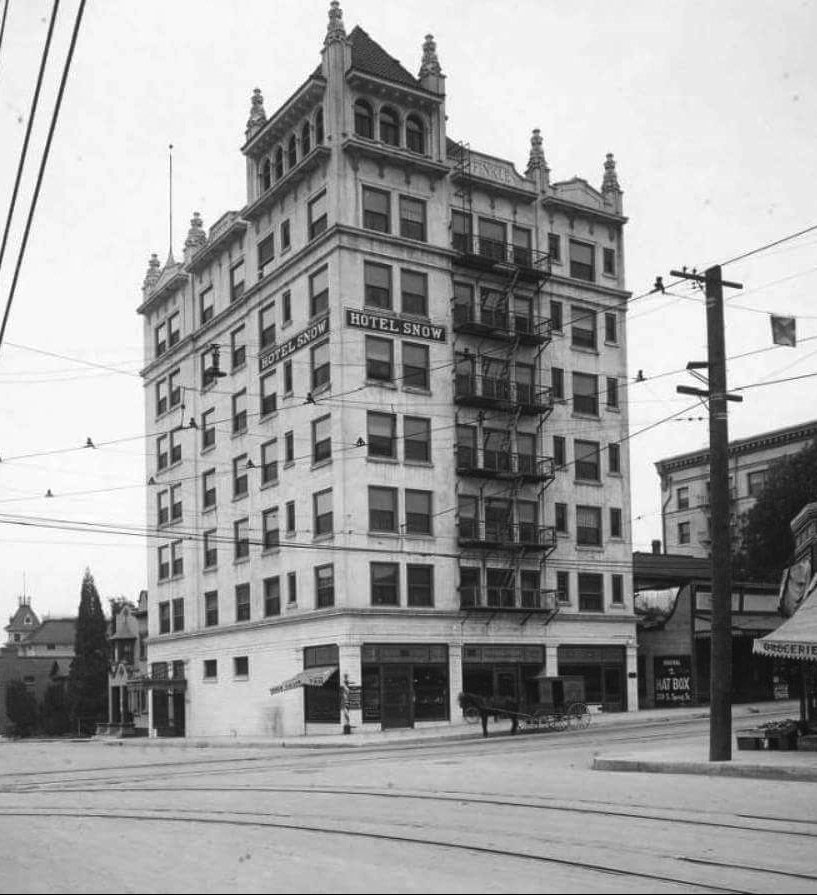
| (1912)* – View of the Hotel Snow, 6th & Flower, with a horse-drawn wagon parked in front on the 6th street side. It would be renamed Hotel Southland in 1916. The small grocery store across the street (bottom right) is on the future site of the Richfield Tower. |
 |
|
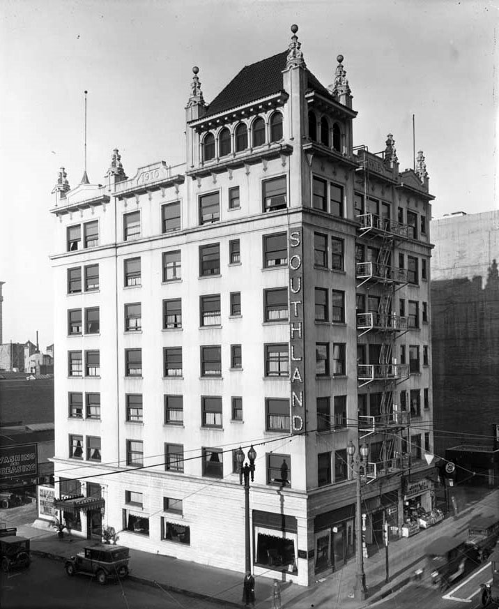
| (ca. 1929)* - View of Southland Hotel (previously Hotel Snow) with a Peerless Cab Company taxi parked in front (lower left), 804 W. 6th Street. |
Historical Notes The seven-story stucco building had Spanish style Gothic Revival trim along roofline and penthouse. The mixed-use building had a barber shop, beauty parlor, and grocery store on ground floor. Originally the Hotel Snow, it was renamed Southland in 1916. |
 |
|
| (1969)* – Southland Hotel with fire escape above the entryway and two ornate lampposts on the sidewalk. Photo by William Reagh. |
 |
|
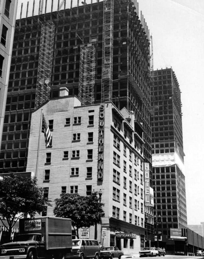
| (ca. 1970)* – View looking NW showing the Southland Hotel with the construction on the twin towers of Arco Plaza taking place above and behind it on the norh side of 6th Street. |
 |
|
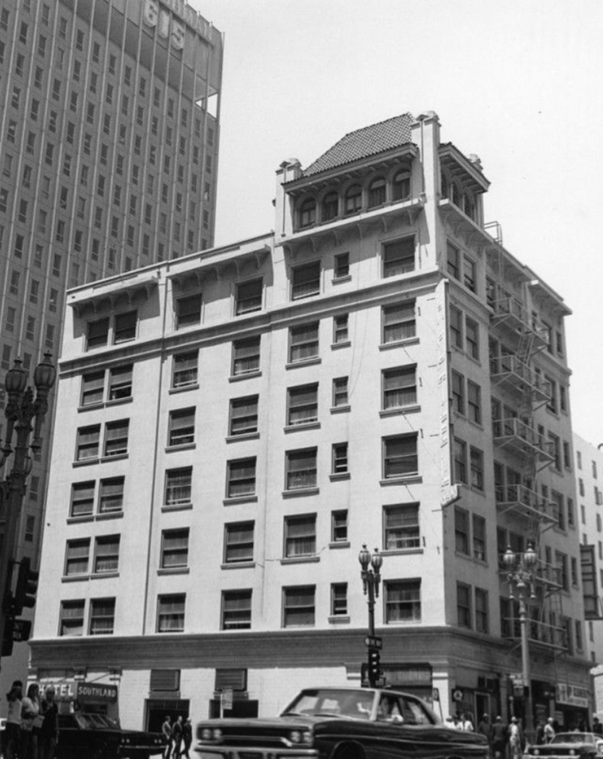
| (1970)* – The Southland Hotel on the southwest corner of Flower and 6th Streets. This image was taken close to the time of the building's demolition. |
Historical Notes The Southland Hotel met its end in 1971 and was replaced by the William L. Pereira-designed Pacific Financial Center. |
 |
|
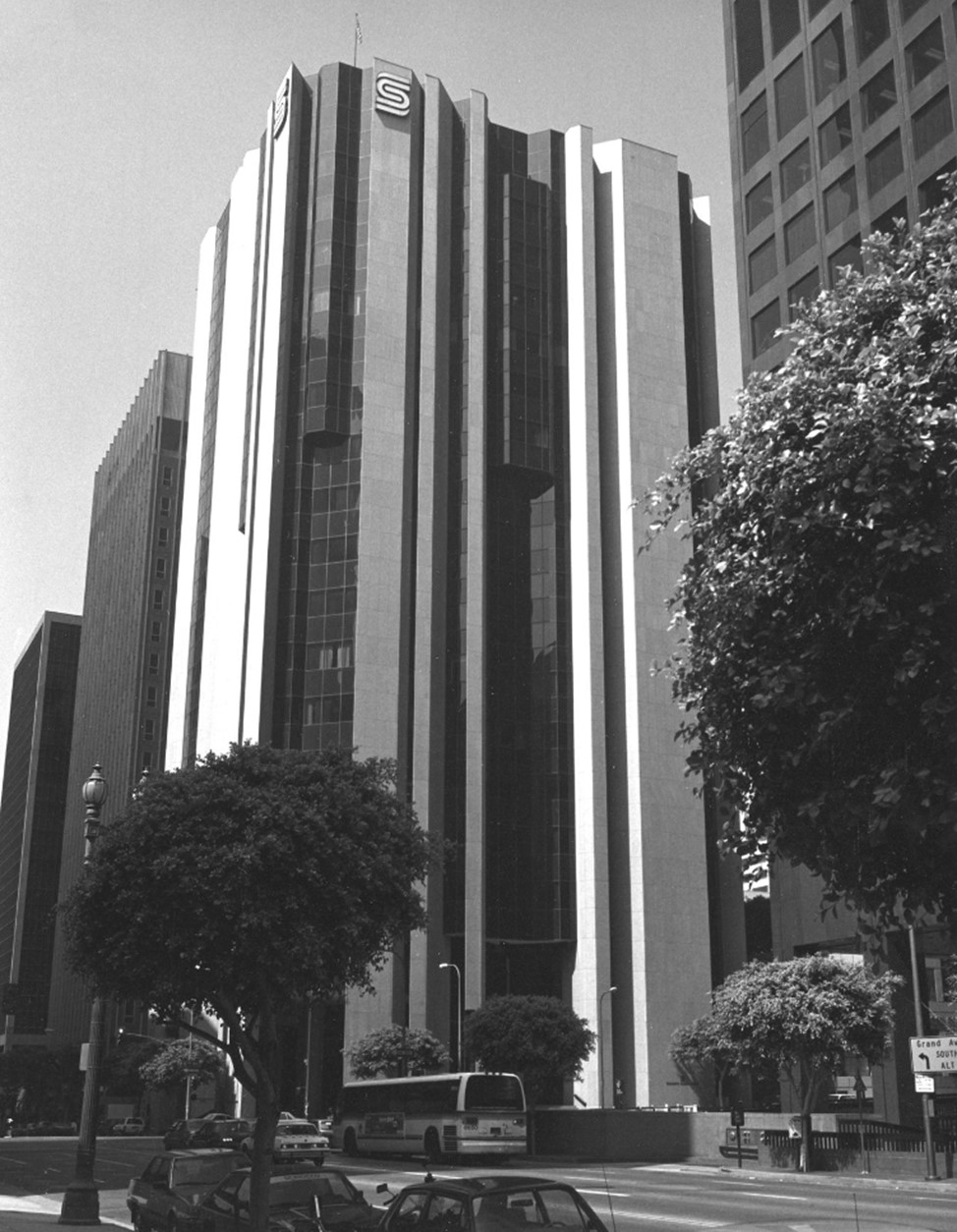
| (1986)* – View showing the Security [Pacific National] Bank standing where the Southland Hotel once stood. Photo by William Reagh. |
Historical Notes The current Pacific Financial Center was built in 1973, replacing the Southland Hotel. |
Before and After
 |
|
| (1969 vs 1986)* - View showing the Security [Pacific National] Bank where the Southland Hotel once stood, southwest corner of Flower and 6th Streets. |
* * * * * |
Newmark Building - Blanchard Music Hall
 |
|
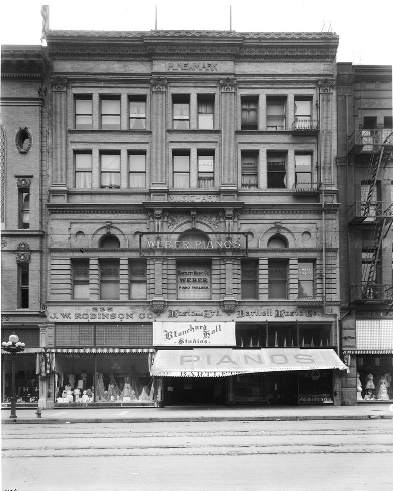
| (1910)^ - View of the H. Newmark Building located at 233 South Broadway. The five-story building, designed by A. M. Edelman, housed Blanchard Music Hall, J. W. Robinson Company, and Bartlett Music Company, dealers in Weber Pianos. |
Historical Notes The building went by the name of Blanchard Music Hall but was also known as the H. Newmark Building as it was built by and on the site of Harris Newmark's former residence. Harris Newmark emigrated to the United States in 1853 from Germany. He sailed from Europe to New York City to San Francisco, and finally settled in Los Angeles. The Newmark clan was one of the founding families of the Los Angeles area. Newmark developed several successful businesses, which employed most if not all of a near-inexhaustible list of Newmark family members. Newmark was chiefly a grocer and dry goods merchant, but he also dabbled in other fields. He even tried sheep farming, but he was preoccupied with the burgeoning real estate opportunities to be had in the Los Angeles area. Newmark bought and sold properties throughout southern California, and made a fortune in the process. |
 |
|
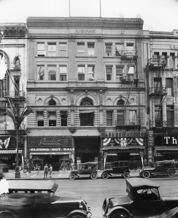
| (ca. 1928)* - View showing the original Harris Newmark Block. A sign on the building reads, "Music-Art." On the street level is the Leader clothing store and Barnes Music Co. Street address on the clothing store is 235. |
Historical Notes The building had a large hall (Blanchard Music Hall) with a seating capacity of 800. It was used for chamber music concerts and other programs. There was another smaller hall seating 150 and a banquet hall for 300. There was also an "Assembly Hall" of unknown capacity. There was also space in the Music and Art Building for studios for 150 musicians and artists as well as a fourth floor art gallery. Blanchard Music Hall was named for Frederick W. Blanchard, who had been influential in the music business in Los Angeles and went on to become the first president of the Hollywood Bowl. The building went all the way through to Hill St. On the 1910 Baist Real Estate Survey map the Hill St. end of the skinny building is marked "Blanchard Hall Bldg." while the Broadway end is labeled "Newmark Bldg." |
* * * * * |
Blanchard Music Hall - Newmark Building
 |
|
| (1910)* – View of the Hill Street entrance to the Blanchard Music Hall and art gallery, located on the east side of Hill Street between 2nd and 3rd streets. Note the ornate 6-lamp lamppost in front of the building. Click HERE to see more in Early Los Angeles Streetlights. |
Historical Notes Blanchard Hall contained the first art gallery west of Chicago. The building went all the way through to Broadway (previous photo). On the 1910 Baist Real Estate Survey map the Hill St. end of the skinny building is marked "Blanchard Hall Bldg." while the Broadway end is labeled "Newmark Bldg." |
* * * * * |
Grand Central Hotel
 |
|
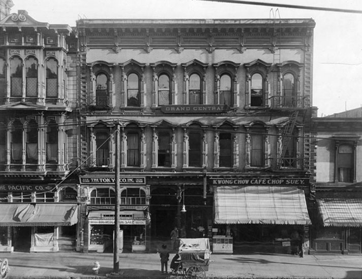
| (ca. 1910s)* - View showing the Grand Central Hotel, at 326 N. Main Street, with businesses on the ground floor such as Tokyo Co. Inc. and Kwong Chow Cafe. A man in a push cart is directly in front. To the left ia the 3-story Downey Building and further to the left (out of view) is the Baker Block. To the right is the 2-story Pico Building. |
Historical Notes The three-story Grand Central Hotel at 326 North Main Street was completed around 1877. Major construction came to its climax on the 300 blk of Main Street in the following year with the opening of the Baker Block, on the left. The slim, three-story building nestled between the Baker Block and Gand Central Hotel was developed by the ever active Governor Downey, and finished around 1878. +# |
 |
|
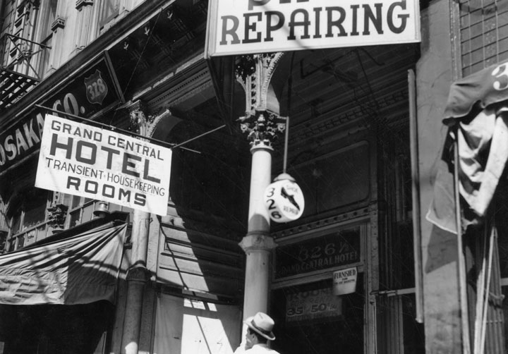
| (ca. 1930s)* - Looking at the upper part of the doorway into the Grand Central Hotel, you can see a sign advertising transient-housekeeping rooms, the bottom half of a shoe repairing sign, a hanging globe with the number 326 (for 326 N. Main Street) on it and in the background the sign reading "furnished". |
 |
|
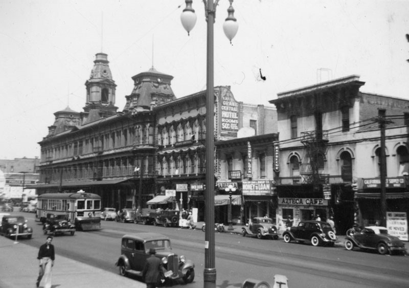
| (ca. 1940)* - Looking northeast showing the buildings on the 300 block of North Main Street shortly before their demoliton. The Grand Central Hotel sits at center with large sign on side of building. |
Historical Notes Well into the 20th century, the old buildings on the 300 block of North Main Street were a vivid testament to Los Angeles’ early history, from its humble beginnings to its astonishing growth during the Reconstruction years. Behind the “Azteca” sign on the right side of the top photograph is the Bella Union Hotel, considered to be the city’s first hotel. Completed sometime during the 1840s, it was one of downtown’s greatest landmarks for several decades, and was later expanded to two, then three stories. The two-story building to its left is the Pico Building, built by Pio Pico in 1868 (two years before the Pico House). In 1871, the building became home to the Farmers & Merchants Bank, the first incorporated bank in the Los Angeles, directed by former California Governor John G. Downey. +# |
 |
|
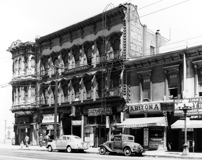
| (1940s)^*# - View of Maint Street north of Commercial Street showing (L to R): the slim Downey Building, Grand Central Hotel and Pico Building (original home of Farmers and Merchants Bank). |
Click HERE to see more in Early Views of the Historic 300 Block of N. Main Street |
* * * * * |
Avila Adobe
 |
|
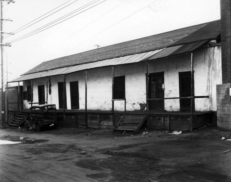
| (ca. 1910s)* - View of the Avila Adobe house on Olvera Street; a small car is parked along the front of the wooden porch next to one of the staircases. |
Historical Notes Don Francisco Avila, a wealthy cattle rancher and one-time Mayor of the pueblo of Los Angeles, built the Avila Adobe in 1818. The Avila Adobe, presently the oldest existing residence within the city limits, was one of the first town houses to share street frontage in the new Pueblo de Los Angeles.* |
.jpg) |
|
| (1935)* - Avila Adobe as seen from a building across Olvera Street. In front of the house is a wooden cart, and a Mexican flag is by the entrance. It is located at 14-16-18 Olvera Street and was used by the Avila and Rimpau families. |
Historical Notes The above photo of the Avila Adobe house was taken just after Olvera Street was converted to a colorful Mexican marketplace - as made evident by the small vendor stands. The original porch was given a much-needed face-lift with the addition of a long veranda and steps and a short brick planter the length of the house.* |
 |
|
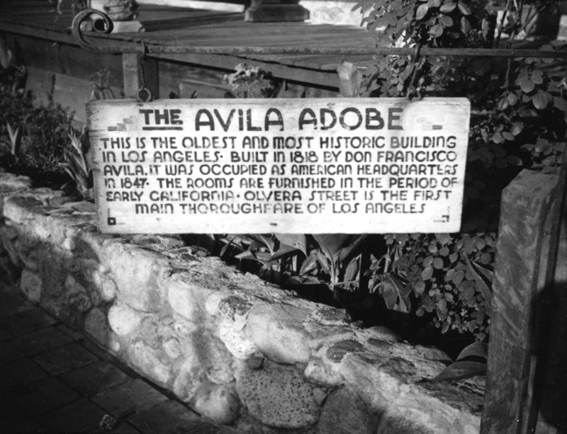
| (ca. 1935)* - View of the sign in front of the Avila Adobe, the oldest existing residence within the city limits. |
Historical Notes In 1847, this adobe became the temporary headquarters for Commodore Robert Field Stockton and General Stephen Watts Kearny during the American occupation of Los Angeles.* Click HERE to see more in Early LA Plaza. |
* * * * * |
Knapp House (San Fernando Valley)
 |
|
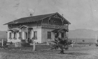
| (1912)^* - The Knapp home at Owensmouth Avenue and Cohasset Street in Canoga Park. View looking north west. |
Historical Notes Knapp Park in West Hills is named for these same Knapps. The men of the Knapp family were stone builders and did much of the stone work at Orcutt Ranch, also located in West Hills on Roscoe Boulevard near Valley Circle Boulevard. |
Click HERE to see more Early Views of the San Fernando Valley |
* * * * * |
Vogel Block
 |
|
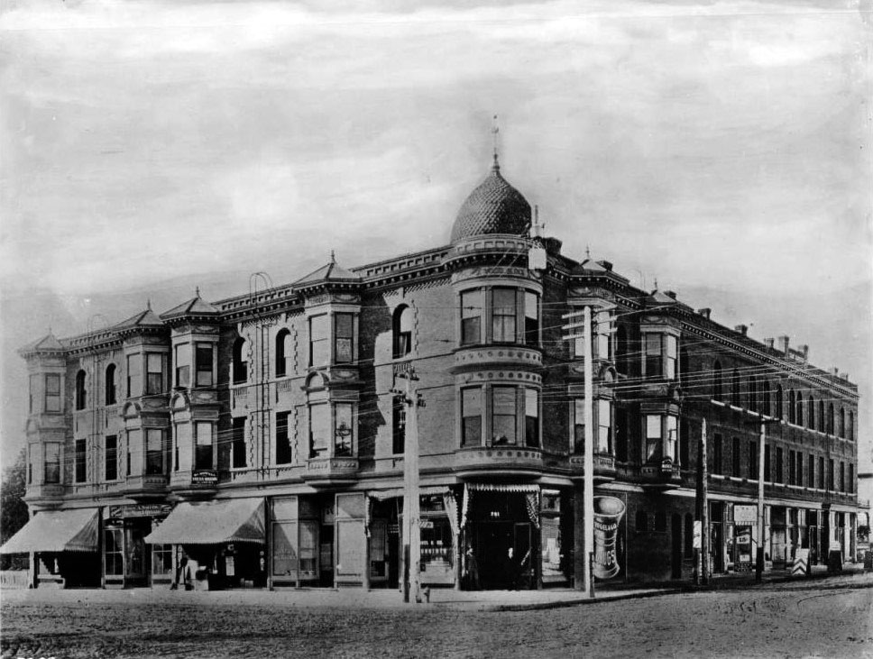
| (ca. 1910)^ – View of the Vogel Block building, constructed in 1893, on the southwest corner of Seventh Street and Broadway. A cylindrical collection of windows extends out from the corner of the three-story building over the entrance, topped by a spired dome. The architecture is reminiscent of the Victorian style, and all of the box window are decoratively molded. Signs are displayed along the shop fronts that comprise the lower level along the sidewalk. The street is unpaved, and utility poles can be seen. |
 |
|
| (ca. 1910)^ – View looking down Broadway at 7th Street. The Vogel Block building, with its onion-shaped roof, stands on the southwest corner. The large building with Rossiter sign, across Broadway to the left, is the Lankershim Hotel (built in 1905); the building in the extreme foreground at left is the Hotel Corona; the large white building with two flags on its top (in the close background at center) is the Hamburgers Department Store (south-west corner with 8th Street, where it had moved after leaving the Phillips Block). |
 |
|
| (1910)^ - Close-up view of the southwest corner of Broadway and 7th Street showing the Vogel Block with its onion-shaped tower. Sign on the side of building reads: “Rooms by the Day or Week”. |
 |
|
| (1921)^ - Birdseye view of Seventh Street looking west from Broadway, showing the Vogel Block on the corner at left. The three-story building is topped by a spired dome and covered with signs. Its windows have molding reminiscent of Victorian architecture. |
Historical Notes In 1921 the 1893-built Vogel Block would be demolished to make room for Loew's State Theatre (currently United Building). |
* * * * * |
Hyman Theatre (later Garrick Theatre)
 |
|
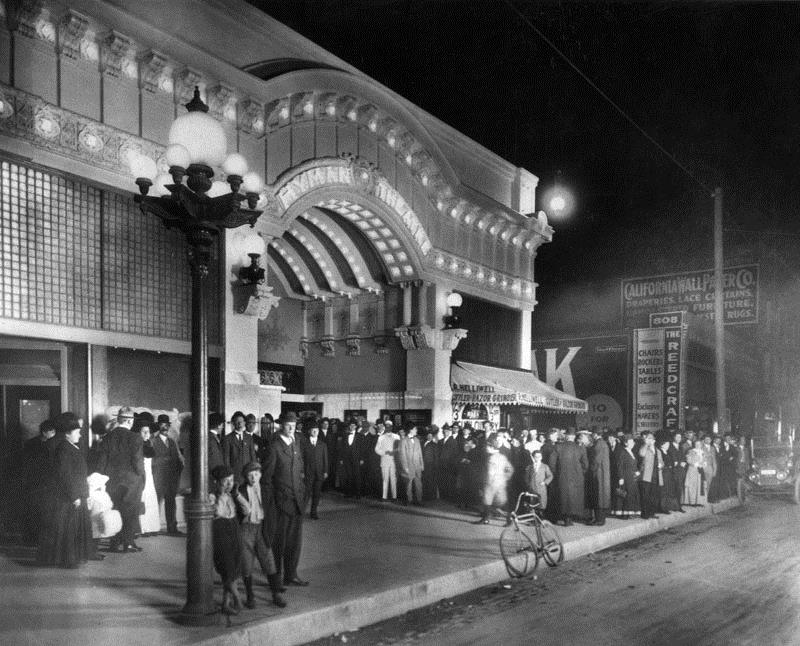
| (1910)* - An evening crowd gathers under the marquee of the Hyman Theater at 802 S. Broadway, on the southeast corner of 8th and Broadway. A lone bicycle leans on the curb in front. One boy is seen leaning against an ornate 7-bulb streetlight. Click HERE to see more in Early Los Angeles Streetlights. |
Historical Notes The theater was built in 1910 by Los Angeles theatrical promoter Arthr S. Hyman. Within just one year, 1911, the theater became the Garrick, a motion picture theater. The original facade was by the Los Angeles architect firm, Train & Williams. In 1921 it was remodeled to a design by architect George Edwin Bergstrom. The building was replaced by the Tower Theatre in 1927.* |
 |
|
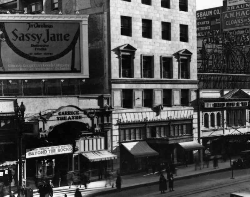
| (ca. 1922)* - "Sassy Jane" billboard sits atop the Garrick Theatre on Broadway in downtown Los Angeles as pedestrians pass the marquee. |
Historical Notes In 1921, the Garrick Theater was remodeled to a design by architect George Edwin Bergstrom. The building was demolished in 1927 to make way for the Tower Theatre.* |
Tally's New Broadway Theatre (also Kinemacolor Theatre)
 |
|
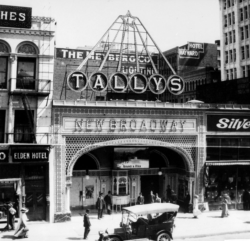
| (ca. 1911)^ - Tally's New Broadway Theater located on the 800 block of South Broadway. |
Historical Notes Opened on May 2, 1910 by Thomas L. Tally, the theatre was constructed in 30 days. Located on the west side of Broadway between 8th and 9th, it was just south of Hamburger's Department Store (later the May Co.) and two doors north of the Majestic Theater. The 1910 city directory gives a listing at 833 S. Broadway for both Tally's Film Exchange and Tally's New Broadway. Tally had earlier used that latter name for his New Broadway Theatre at 554 S. Broadway, a house he took over in 1905. In 1911 Tally's Broadway was known as the Kinemacolor Theatre while showing color films in the Kinemacolor process but then went back to the Tally's Broadway name.**^ |
 |
|
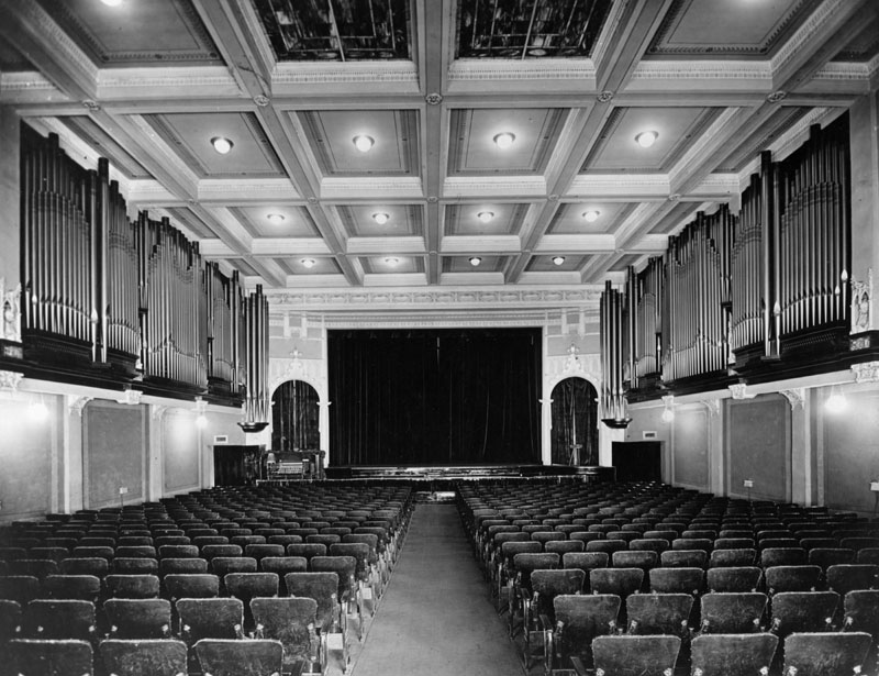
| (ca. 1911)* - Interior view of Tally’s Theatre. Picture faces the curtained stage, with walls on the right and left lined with pipe organ pipes. |
Historical Notes An article in Moving Picture World for July 15, 1916 says " The chief feature of this house is the music. It has a splendid orchestra and a simply wonderful organ." In 1916 the admission prices were 10, 20 and 30 cents. The house manager at the time was Seymour Tally, son of Thomas. The article noted that the 30 cent price got you a wicker chair back in the elevated loge section.**^ |
 |
|
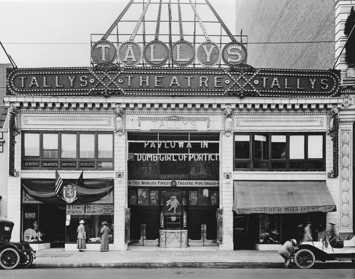
| (1916)^*# - View of Tally's Theatre in 1916. The sign over the front entrance reads: "The World's Finest Theatre Pipe Organ". |
Historical Notes Just two doors south of Tally's was the Majestic Theater. Across the street was the Mission and later the still surviving Orpheum. The Mission was demolished for construction of the Orpheum in 1926. |
 |
|
| (1915)#^* - A terrific view by G. Haven Bishop of Tally's running "Pretty Mrs. Smith." The photo is part of a set commissioned by Southern California Edison Co. documenting electric signs. |
 |
|
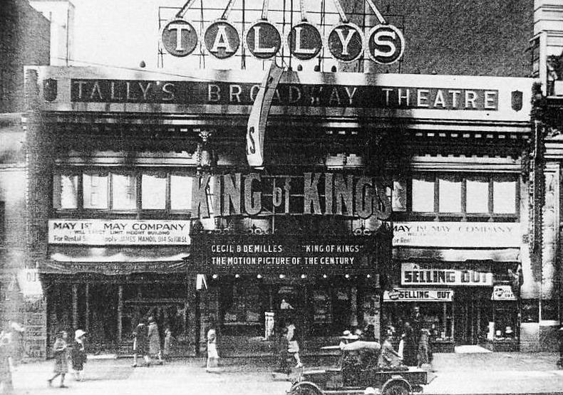
| (1928)* - "King of Kings" playing Tally's near the end. Note the signs saying that the May Co. was going to erect their new building on the site starting May 1. "King of Kings" was the film that opened Grauman's Chinese in May 1927. It ran there until October 30. |
Historical Notes The building was demolished for a 1928 expansion of the May Co. department store (originally Hamburger's) just to the north. |
* * * * * |
Orpheum Theatre (Today the Palace Theatre - 3rd Home of the Orpheum Circuit)
 |
|
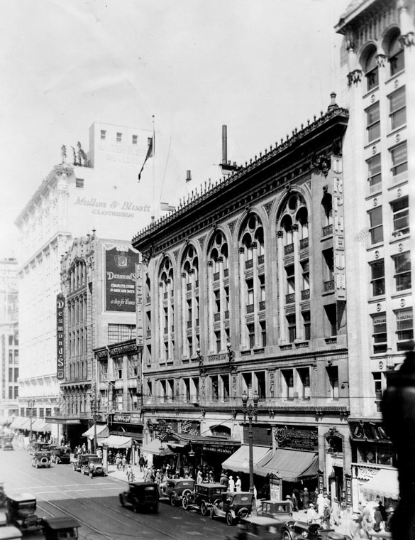
| (1911)* – View looking at the east side of Broadway between 6th and 7th streets showing the Orpheum Theatre #3. Further north on the left can be seen the Walter P. Story Building with "Mullen & Bluett Clothing Co." painted on its south face. |
Historical Notes The 3rd Orpheum in Los Angeles opened on June 26, 1911 with two-a-day vaudeville. Sophie Tucker was on the inaugural program. Many famous performers appeared on the stage here including Al Jolson, Sarah Bernhardt (1913), the Marx Brothers, W.C Fields and Will Rogers. There were four Orpheum theatres in downtown Los Angeles: ◆ 110 S. Main St. -- Grand Opera House was the home of Orpheum vaudeville from 1894 to 1903. ◆ 227 S. Spring St. -- The Los Angeles Theatre, later called The Lyceum, was known as the Orpheum from 1903 to 1911. ◆ 630 S. Broadway -- Now the Palace Theatre -- this was the Orpheum between 1911 and 1926. ◆ 842 S. Broadway -- Orpheum Theatre from 1926 to Today |
 |
|
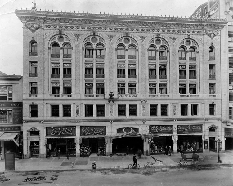
| (ca. 1910s)* - View showing several bicycles parked along the sidewalk at the entrance to the Orpheum Theatre located at 630 S. Broadway. |
Historical Notes Architects G. Albert Lansburgh and Robert Brown Young designed this French renaissance palazzo. Lansburgh would later design the 1926 Orpheum down the street. Sculpture on the striking brick and polychrome terra cotta facade is by Domingo Mora, whose son would later do the sculpture for the Million Dollar Theatre. The four figures on the facade represent the muses of vaudeville: music, song, dance and drama. The building was designed with fire safety in mind. There are 22 exits and one of the city's first sprinkler systems. |
 |
|
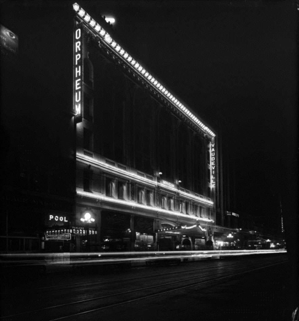
| (1913)#^* - A night photo of the Orpheum Theater, advertising Vaudeville. Located at 630 S. Broadway. |
 |
|
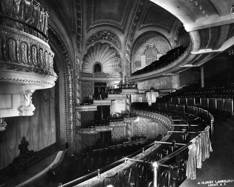
| (n.d.)* - The interior auditorium of the third Orpheum Theatre, looking across the balcony towards the box seats on the opposite wall. Another balcony is on the upper right and the stage on the left. |
Historical Notes The cheap seats in the upper balcony were actually benches. While terrific for vaudeville, the section is less desirable for film viewing and hasn't been used since the 1930s. Originally the entrance to the second balcony was from separate stairwells with no access to the rest of the theatre, typical of two balcony theatre construction at the time.**^ |
 |
|
| (1933)* – View looking north on Broadway showing the 3rd Orpheum in Los Angeles, which opened June 26, 1911. |
Historical Notes On February 20, 1926 this theatre reopened as the Broadway Palace. The new Orpheum Theatre had opened down the street February 15, 1926. The Palace, as a film only operation, was still run by the Orpheum circuit into the summer of 1928. The Variety issue of August 18, 1928 had a little story titled "Orpheum Loses Lemon" noting it had been a big liability for the circuit since their new house had opened. The Palace was taken over by Harry Strere's Pacific Amusement Co., a firm that also operated the Rialto at the time. Sol Lesser, long involved with West Coast Theatres (soon to become Fox West Coast) was a minor stockholder in Pacific Amusement. By 1929, Fox West Coast was running the house, calling it the Fox Palace.**^ |
 |
|
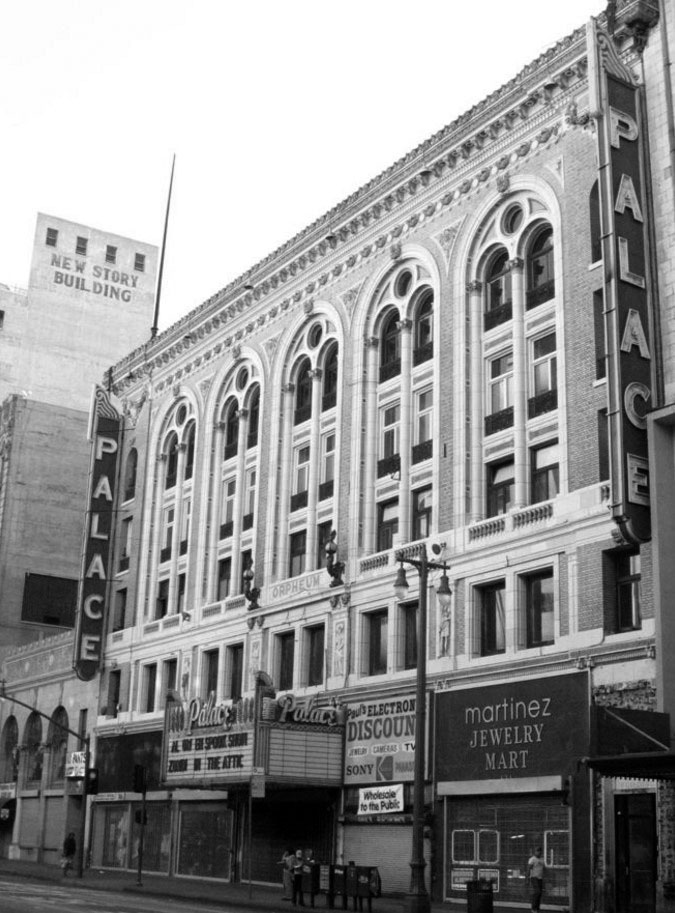
| (2007)**^ – View of the Palace Theatre located at 630 S. Broadway. Photo by Bill Counter. |
Historical Notes Today, the Palace is owned by the Delijani family. They also own the Los Angeles, State and Tower theatres. The theatre interests are operated by an entity known as the Broadway Theatre Group with Shahram Delijani heading the firm and Ed Baney as general manager. The Palace is currently available for theatrical productions, concerts, film shoots, and special events. |
 |
|
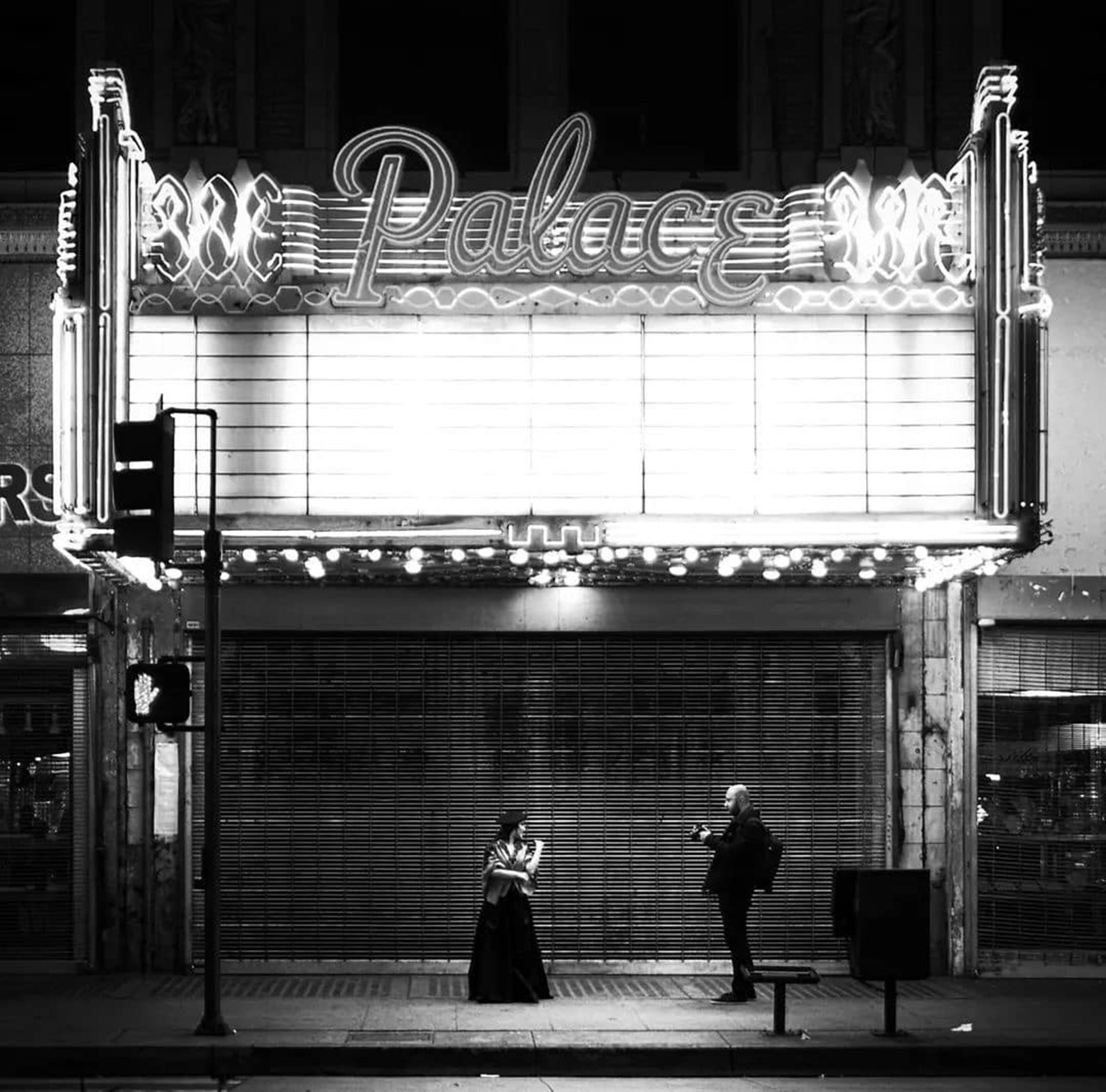
| (2010s) - Photo-op in front of the Palace Theatre, originally the Orpheum Theatre. |
Historical Notes The theatre unveiled a $1 million restoration to celebrate its 100th birthday on June 26, 2011. The restoration work was begun in 2007 with cleaning and facade repair of both the Palace and the Tower.**^ Click HERE to see contemporary view. |
* * * * * |
Liberty Theatre
 |
|
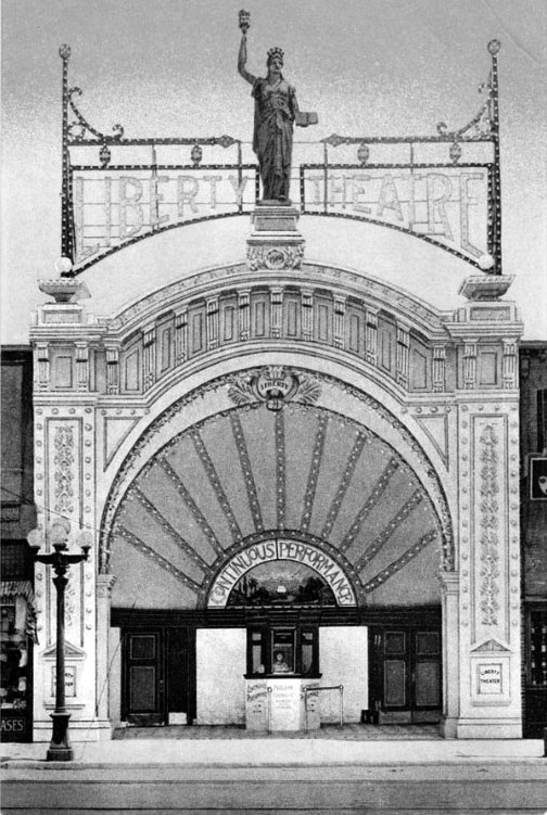
| (ca. 1911)#^*^ – Postcard view showing the Liberty Theatre located at 266 S. Main Street. |
Historical Notes Built in late 1910 and opened in 1911, the Liberty Theatre was designed by A. C. Martin (also designed the Million Dollar Theatre). The 540 seat theatre was constructed by the firm of P.J. Bolin and built for proprietors Kaiser, Sturm and Hughes.**^ |
 |
|
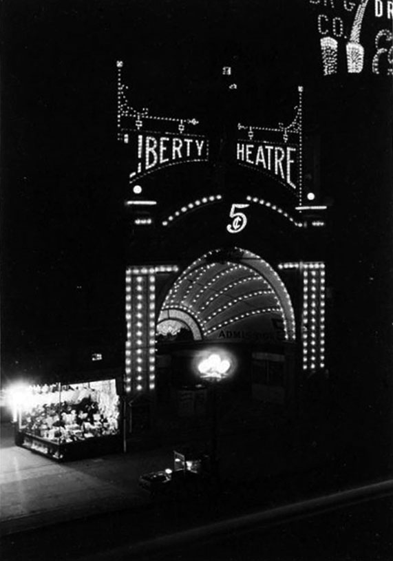
| (1912)*^*# – Night view showing the well-lit entrance to the Liberty Theatre. |
Historical Notes The building is described at length in the Moving Picture World article: The front facade is of stucco and plaster-covered brick, the paneling and cornices outlined in small electric lights at night. The gold leaf statue crowning the cornice is ten feet in height, and, symbolizing liberty, holds aloft an electric torch. At the base of the statue in a laurel leaf gilded shield is the date of erection, 1910. Below this, on the crown of the shell-shaped lobby ceiling, is a second shield in gold leaf with the theater name 'Liberty.' The theatre is showing four first-run licensed films, and one illustrated song, except on Saturdays and Sundays, when two songs are used. The theater employs ten people. Girl ushers look after the seating arrangements. Five cents admission is charged to all parts of the house.**^ |
.jpg) |
|
| (1929)**^** – View of the Liberty Theatre bookended by the Harris Hardware Company and the Gray Hotel. |
Historical Notes The Liberty Theatre at 266 S. Main Street closed by 1930. It is not to be confused with the Liberty Theatre at 136 S. Main Street which had the earlier names of Novelty Theatre and Chinese Theatre and operated into the 1950’s.^^^* |
.jpg) |
|
| (2015)#^^* – Google street showing the northeast corner of 3rd and Main streets and what’s left of the original Liberty Theatre Building. |
Historical Notes The triangular building remaining at 3rd and Main (seen above) is what's left of the Liberty Theatre. The angled deco facade is obviously grafted on to a much older building. The building now houses a wholesale merchandise distributor. The current address of the building is 103 E. 3rd St. as it no longer has much frontage (or an entrance) on Main St. The City Planning Department lists the building as being constructed in 1910 with substantial remodeling in 1926.**^ |
* * * * * |
Brock & Feagans Building
 |
|
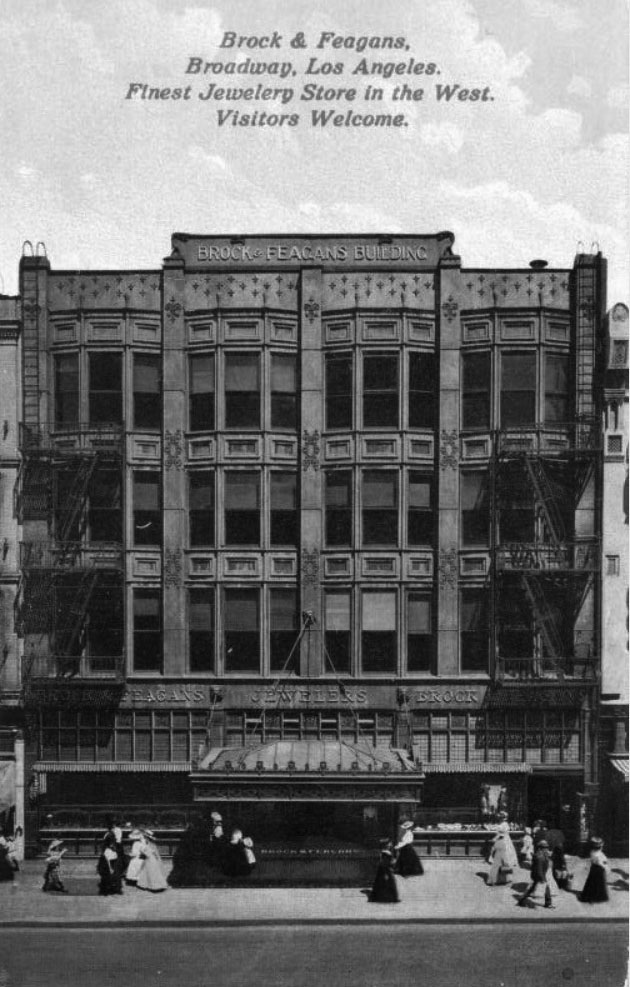
| (ca. 1910)^##^ – Postcard view showing the Brock and Feagans Jewelry Store located on the west side of Broadway between 4th and 5th streets. Sign on top facia reads Brock & Feagans Building. Click HERE for another street view. |
Historical Notes George E. Feagans was a jeweler from Illinois, and he established Brock & Feagans in the 1880s with a partner. After the partnership broke up, Feagans opened a new store in the Alexandria Hotel located at 5th and Spring streets. |
* * * * * |
The Yamato
 |
|
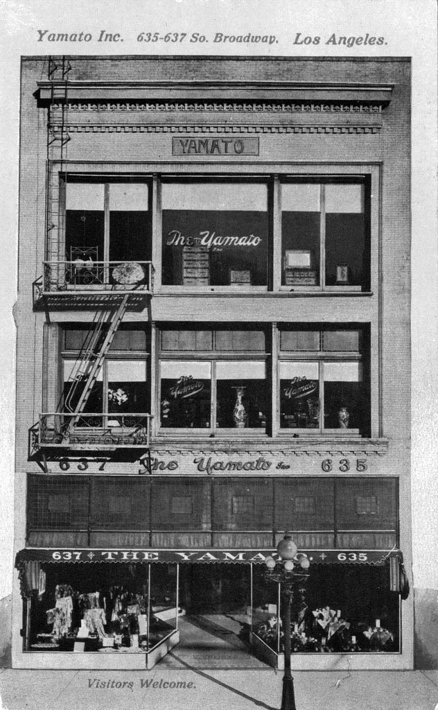
| (ca. 1910)^##^ – View of the Yamato Inc. store, located at 635-637 South Broadway in Downtown Los Angeles, showing furniture in the windows of the uppermost floor, vases in the second floor windows, and assorted goods on the ground floor. |
Historical Notes The Yamato, Inc., was a Japanese Bazaar that served tea and cake to customers, as early as 1908. One of its famous customers was female impersonator Julian Eltinge. In 1917, the three story building became Harry Fink & Co., an apparel store for women's clothing.^*^# |
* * * * * |
Five Points Building
 |
|
| (ca. 1911)* - Five Points Building at 2601 Pasadena Avenue, Lincoln Heights, housing at this time a Ralphs Market. |
* * * * * |
Lindley Building
 |
|
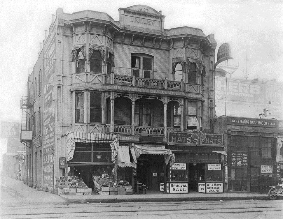
| (1912)^ - Exterior view of "The Lindley", a Victorian building on the corner of Sixth Street between Broadway and Hill Street. |
Historical Notes In 1887, Dr. Walter Lindley paid $1,825 for the property at 315 West Sixth Street in Los Angeles to open the first California Hospital. Known as Dr. Lindley’s Private Hospital, it had only 6-8 beds and served a carriage trade clientele. In 1898, Dr. Lindley conceived of a hospital owned and operated by physicians. He erected the first building especially designed for medical purposes in California at 1414 South Hope Street. California Hospital became known as the largest, best-equipped hospital west of Chicago entirely owned and operated by physicians and surgeons.^^^# |
 |
|
| (ca. 1920)* - Exterior view of the Lindley Building, with remodeled facade circa 1920. |
* * * * * |
Locke Hotel
 |
|
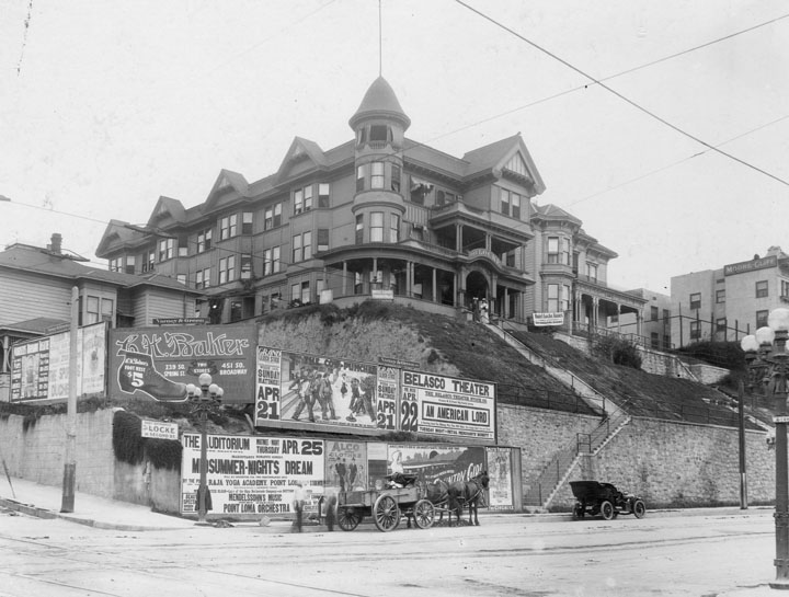
| (1912)* - Looking northwest across the intersection of 2nd and Hill Streets at the Locke Hotel at 139 S. Hill. 2nd Street runs up Bunker Hill to the left, Hill Street continues to the right toward the tunnels at 1st Street. The hotel & annex sit up on the hill while advertising placards are pasted all over the wall at street level. Ads for "Midsummer Nights Dream" at the Auditorium, "An American Lord" at the Belasco Theater, "G.H. Baker" shoes stories, can be seen. The Moore Cliff Hotel can be seen at the right edge just above the Five-Globe Llewellyn.*##^ |
* * * * * |
 |
|
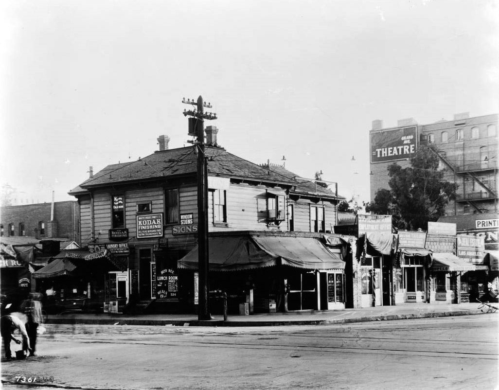
| (1912)^ - View of a shop on the southeast corner of 7th Street and Grand Street. The two-story shop with clapboard veneer stands is riddled with signs. A cloth canopy extends from its right side, where more shops continue down the sidewalk. Sign on the window reads: “Busy Bee Lunch Room / Fish Halibut 15¢ / Dinner Roast Beef 15¢ Lamb Pot-Pie 15¢ Baked Beans 15¢ Braised Beef 15¢ Stewed Lamb 15¢ / Meals 15¢ and Up" |
* * * * * |
Los Angeles Athletic Club
 |
|
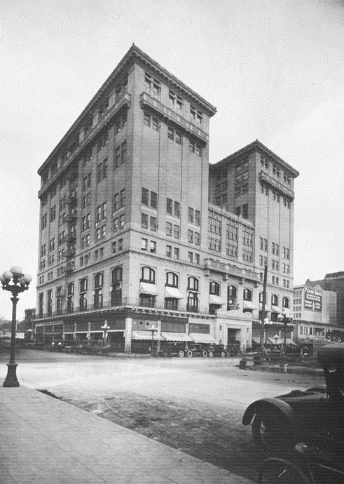
| (ca. 1912)*^^ - The Los Angeles Athletic Club located on the northeast corner of 7th and Olive at 431 West 7th Street. |
Historical Notes In 1911, construction on a new club building began at Seventh and Olive Streets on the site of the former Hotel Baltimore. John Parkinson and Edwin Bergstrom were the architects. The Beaux Arts building stands twelve stories tall and features pressed brick with a trim of terra cotta. The Los Angeles Athletic Club opened its gym in 1912.***# |
 |
|
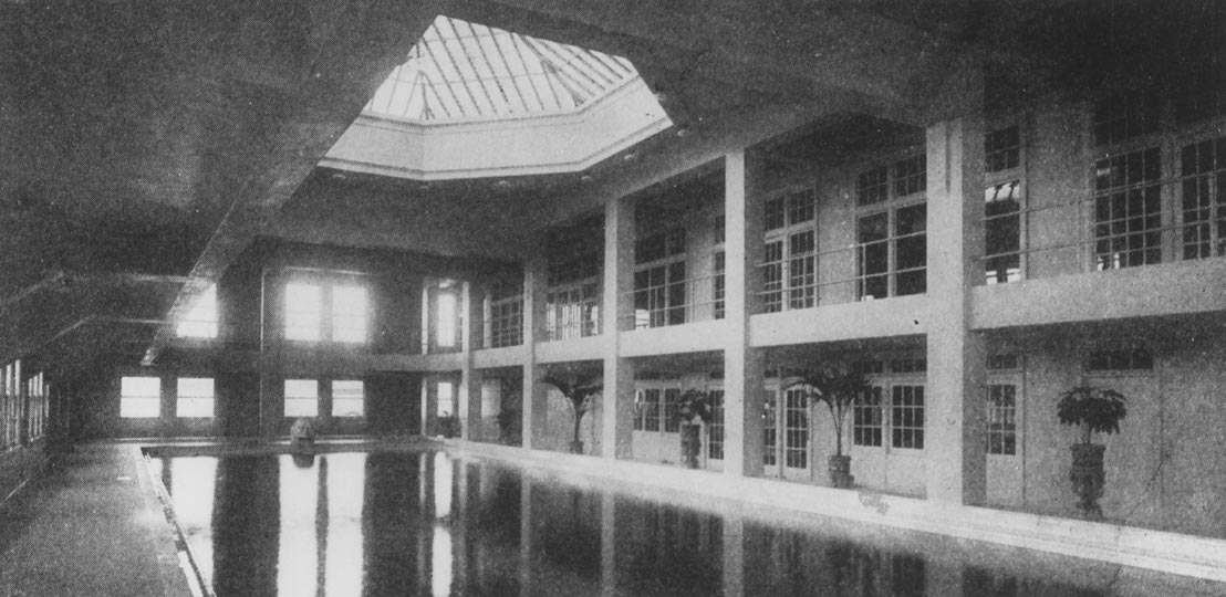
| (2007)***# - Interior view of the Los Angeles Athletic Club's swimming pool. |
Historical Notes The Los Angeles Athletic Club building was notable at the time for being the first building in Southern California to have a swimming pool on an upper floor. Click HERE to see contemporary view. |
 |
|
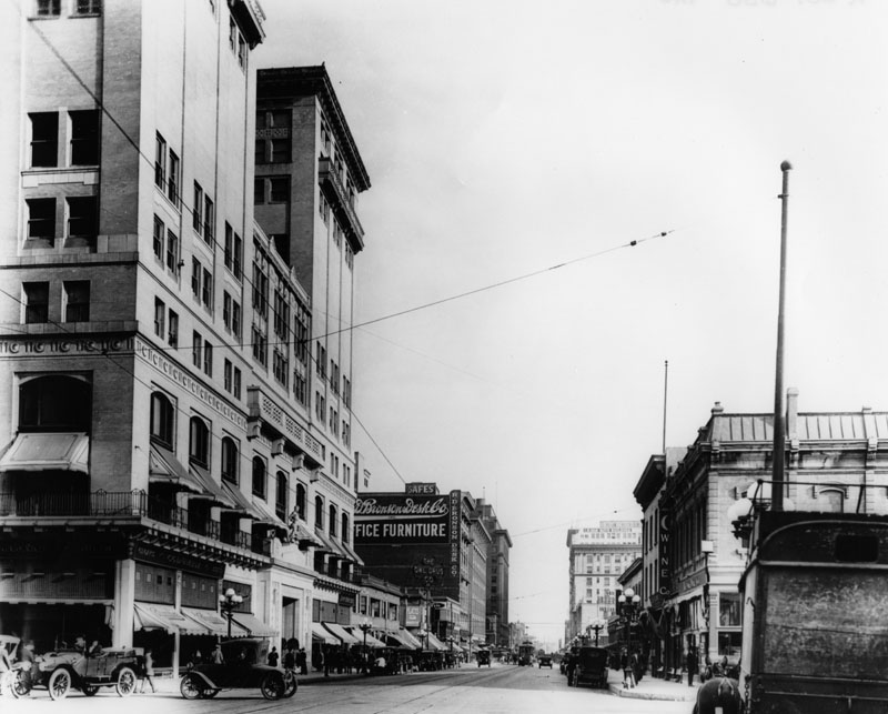
| (ca. 1912)* - View looking east on 7th Street at Olive Street. The large building to the left is the Los Angeles Athletic Club. |
Historical Notes The Los Angeles Athletic Club (LAAC) was formed back in 1880, its first president being James B. Lankershim, its first headquarters in the Arcadia Building on Spring Street. For most of the decade it was the on the Downey Block, after which it relocated to South Spring Street, first at 226, then at 523 ½. Some of its earlier day members included Harrison Gray Otis, Harry Chandler, Eli Clark, Moses Sherman, Henry Huntington, Edward L. Doheny, Charles Canfield, Senator Stephen White, and Mayor Fred Eaton.***# |
 |
|
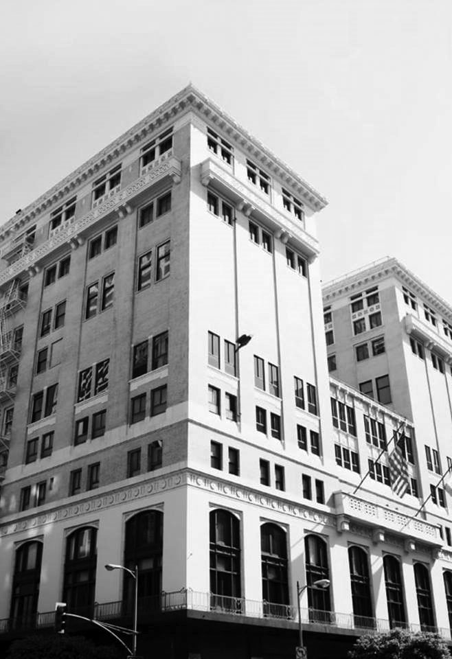
| (2019)* – View showing the Los Angeles Athletic Club building as it appears today. Photo courtesy of Ray Darluv |
Historical Notes In 1970, the LA Athletic Club Building was designated Los Angeles Historical-Cultural Monument No. 69 (Click HERE to see complete listing). |
* * * * * |
Automobile Club of Southern California
.jpg) |
|
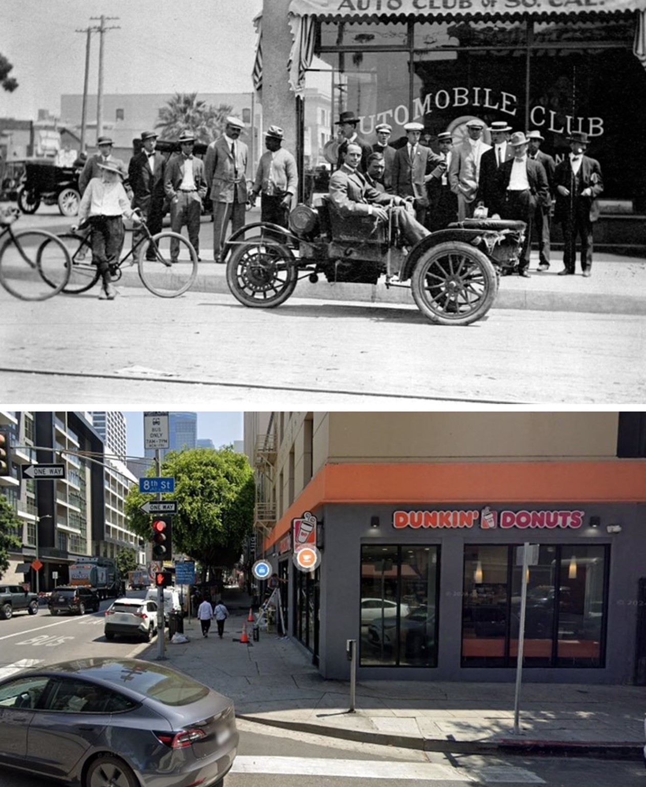
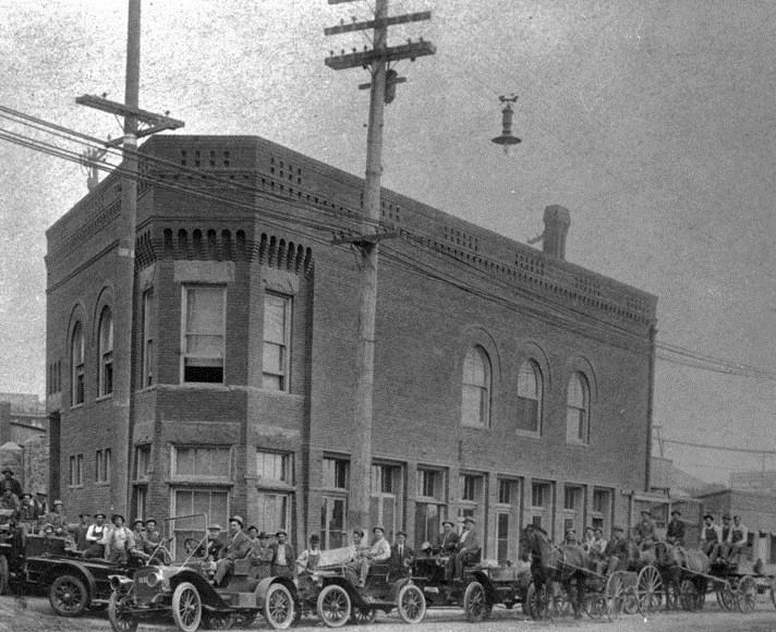
| (1912)* - Auto Club Headquarters, located on the northeast corner 8th and Olive streets. A group of people look on as two men sit in an early model car and pose for the camera. Note that the car is a 'tricycle car' (aka 'trike'). |
Historical Notes The Automobile Club of Southern California is a nonprofit organization founded in 1900 by a group of 10 automobile enthsiasts. Its purpose, in addition to providing a social organization, was to encourage the construction and maintenance of roads suitable for automobile travel, and to protect the interests of automobile owners and drivers. In its early years, the club's first headquarters were rented at 307 O.T. Johnson Building. They remained in that space for approximately two years, but beginning in 1909, the club's rapid growth necessitated a series of moves to larger and larger offices. In 1909, they moved to 323 South Hill Street, and again to 754 South Hill Street in 1910. They relocated again in 1911 to the northeast corner of 8th and Olive Streets, where they remained until 1914, when the club built a completely new facility at 1344 South Figueroa Street. Click HERE to see current headquarters (Figueroa and Adams). Interesting Auto Club Facts: 1900 - The Auto Club was founded. Within a few years, 13 southern counties in California became the Auto Club’s service territory. |
.jpg) |
|
| (1912)* – Close-up view of two men sitting in a car and posing for the camera in front of the Automobile Club Headquarters, 8th and Olive streets, NE corner. |
Historical Notes In 1920, the club recognized that they would continue to need more space, and authorized the purchase of property at the southwest corner of Adams and Figueroa Streets, using funds acquired from the insurance plans offered by the club. The building was designed by architect Sumner P. Hunt in a Spanish baroque style, and was completed in 1923. It became their final headquarters, although it was expanded to double its original size by 1931. |
 |
|
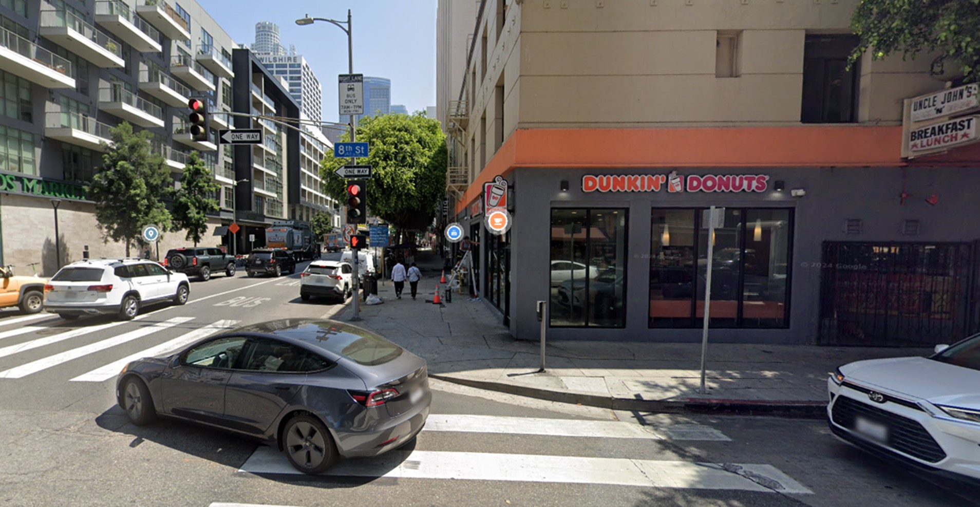
| (2024)* - View looking at the northeast corner of Olive and 8th Streets, currently the location of Dunkin' Donuts. |
Historical Notes When the Auto Club moved out of the ground floor of the Olive Hotel, it became a succession of restaurants and bars until, in the late 30s, when it became the Crown Grill Cocktail Lounge, reportedly a popular watering hole for the up-and-comers and down-and-outers of the south civic center. Some sources say it is into the Crown that Elizabeth Short appeared on the night of her murder. It is a persistent story which is not supported by the police investigation nor by Larry Harnisch who, is the preeminent authority on the Black Dahlia case. In any event, the Crown Grill Cocktail Lounge lasted into the 60s and is now a Dunkin Donuts. The Olive Hotel is still in business on the upper two floors. And Elizabeth Short's murder remains unsolved. |
Then and Now
 |
|
| (1912 vs. 2024)* - A 'Then and Now' view of the northeast corner of Olive and 8th Streets showing the Auto Club Headquarters, today the location of Dunkin' Donuts. |
* * * * * |
Water Department's Original Building
 |
|
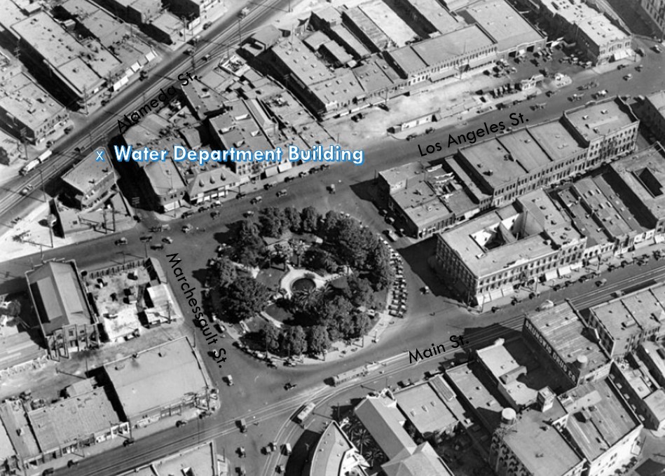
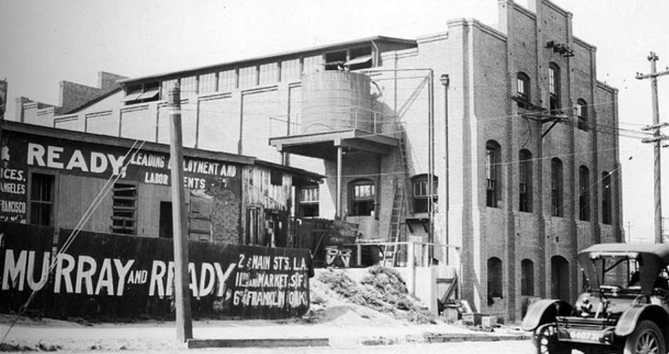
| (ca. 1912)** - Construction crews in cars and horse-drawn wagons in front of the City's first Water Department building located on the northwest corner of Marchessault and North Alameda streets (across from where Union Staion stands today). |
Historical Notes In 1868, the City of Los Angeles approved a franchise water agreement on a 30 year lease basis with the private Los Angeles City Water Company. In 1899, after the end of the lease, a $2.09 million bond measure for the purchase of LA City Water Co.’s system was approved by city voters by a margin of nearly eight to one. After over two years of litigation the City of Los Angeles finally regained control of its water system on February 13, 1902. A new department was created called the Los Angeles Water Department. Click HERE to see more in Water in Early L.A. |
 |
|
| (1920s)**- View looking at the northwest corner of Marchessault and Alameda street showing the first home of the Los Angeles Water Department (later DWP). |
Historical Notes The two-story brick building which in 1902 was large enough to house the entire executive and clerical forces of the water works soon was outgrown and the municipal Water Department would move into larger quarters (440 S. Hill Street). As both the City and the utility continued to grow, the Water Department (later DWP) would move several more times until settling into their current home (GOB) in 1965, located at 111 N. Hope Street. Click HERE to see more in Construction of the GOB |
 |
|
| (ca. 1924)* - Aerial view of the Los Angeles Plaza and surrounding area annotated to show the Water Department's original building. |
Click HERE to see more in Water Department's Original Office Building |
* * * * * |
El Pueblo Plaza Subtation
 |
|
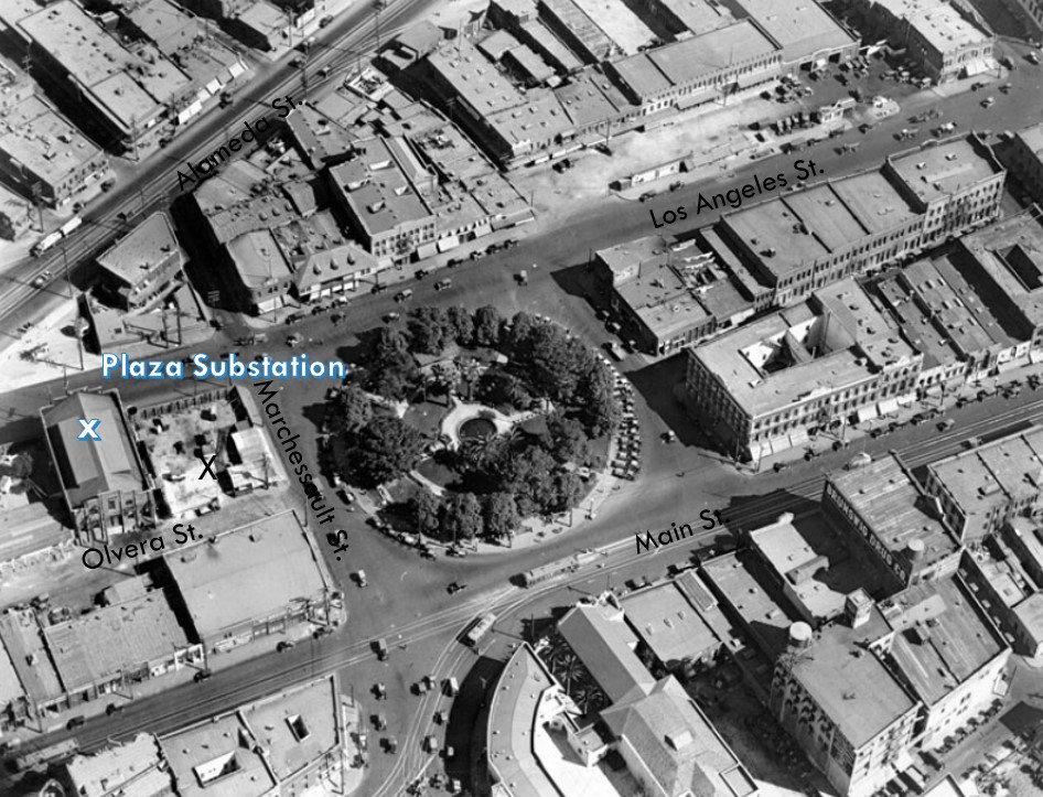
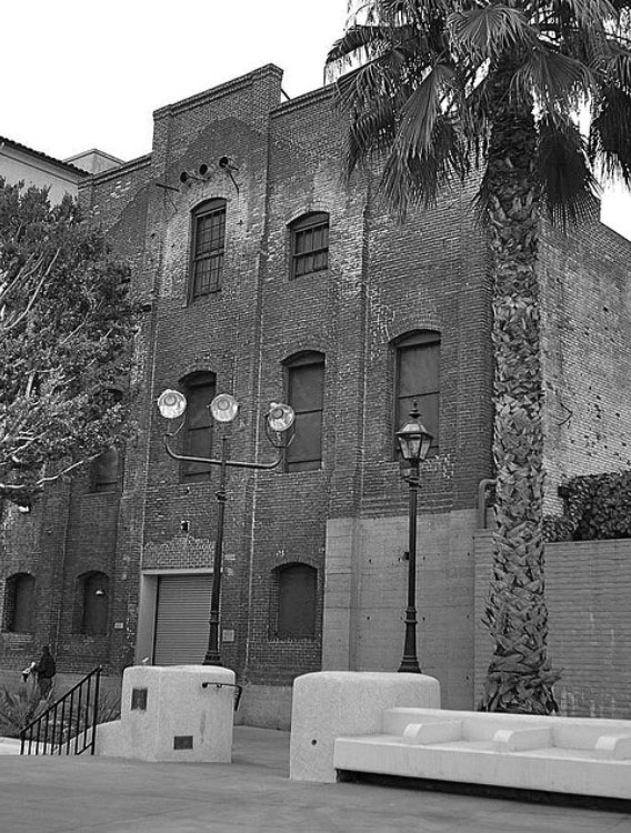
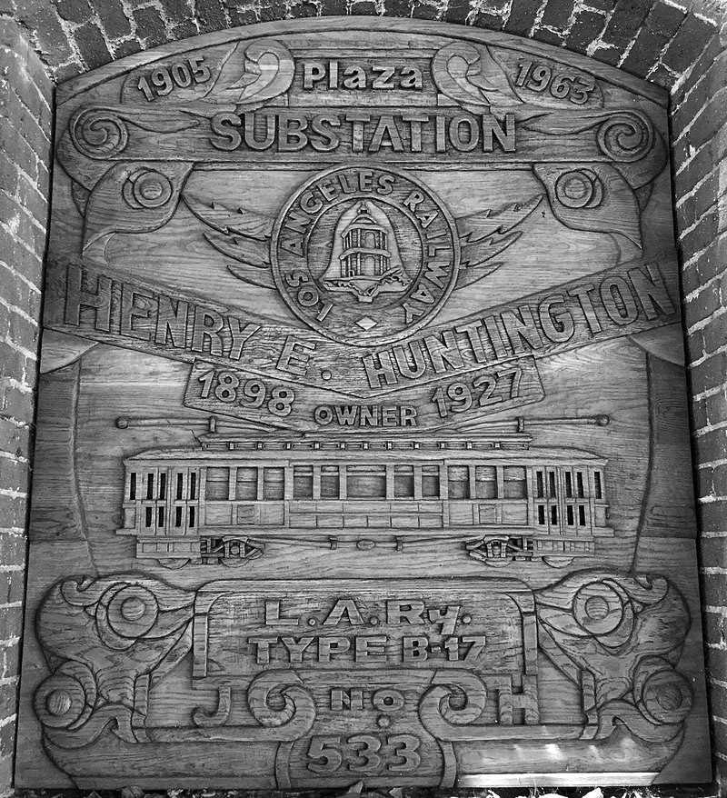
| (1913)#^** – View of the Los Angeles Railway (LARy) Plaza Substation (Eastside). The other side of the substation building fronts Olvera Street and is adjacent to the Avila Adobe. |
Historical Notes Built in 1903-1904, the Plaza Substation was the first and largest of fourteen substations that supplied electric power to the Los Angeles Railway Company’s yellow streetcars – the first mass transportation for Los Angeles. It was built by Henry Huntington, owner of the Los Angeles Railway Company. The trolleys operated from 1896 to 1960.+^ |
 |
|
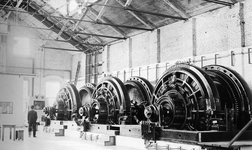
| (1913)#^** – Interior view of the Plaza Substation showing three motor-generator sets used to provide electricity for the Los Angeles Railway (LARy). |
Historical Notes In May 1903, Henry Huntington, owner of the Los Angeles Railway, announced plans to build a new substation near the old plaza. The Los Angeles Times reported: "Another mammoth electricity substation is to be constructed by the Los Angeles Railway Company. Its location will be on the Plaza, and its completion will mean a long step forward toward the perfection of a system that already is surpassed by few in this country." The substatin was operating by 1905.^ |
 |
|
| (ca. 1924)* - Aerial view of the Los Angeles Plaza and surrounding area annotated to show location of the El Pueblo Plaza Substation. |
Historical Notes The substation is one of the two buildings in the Los Angeles Plaza Historic District that is itself separately listed in the National Register of Historic Places, having been so listed in September 1978 (The Avila Adobe is the other).^ |
 |
|
| (2006)+^ - View showing the front of the El Pueblo Plaza Substation as it appears today. |
Historical Notes After being threatened with demolition in the 1970s, the Plaza Substation was added to the National Register of Historic Places in 1978. Plans now call for the building to become a museum on Los Angeles trolley cars.+^ |
 |
|
| (2018)^* - Hand-carved window carving at the Plaza Substation on Olvera Street. |
Click HERE to see more Early Views of the Los Angeles Plaza |
* * * * * |
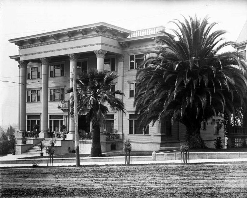
Beverly Hills Hotel
 |
|
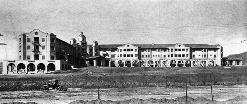
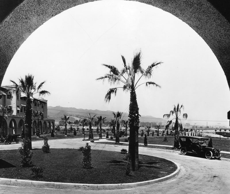
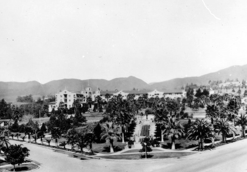
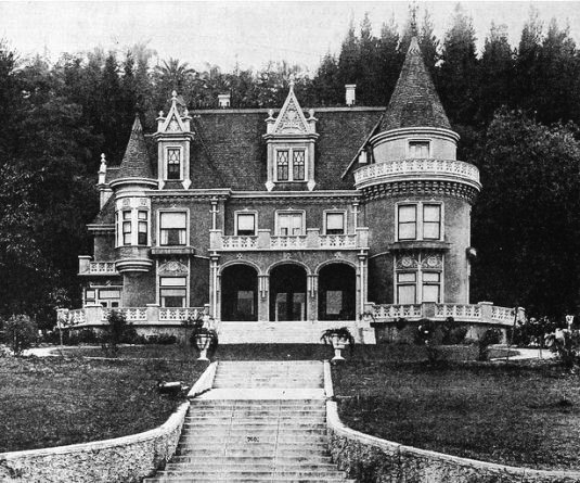
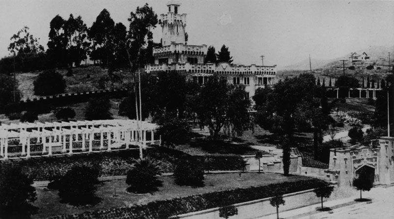
| (ca. 1912)* - Exterior view of the Beverly Hills Hotel across an unpaved Sunset Boulevard. Workers appear to be putting the finishing touches on the western wing, and the front lawn has yet to be landscaped. This Mission style complex was designed by architect Elmer Grey. |
Historical Notes In September, 1911, work began on the Beverly Hills Hotel. It was opened on May 12, 1912 by Margaret J. Anderson and her son, Stanley S. Anderson, who had been managing the Hollywood Hotel. The LA Times would call it a "monster hostelry" since it cost $300,000. At the time, lots in the area were selling for around $2,000 each.^* From 1928 to 1932, the hotel was owned by the Van Noy Railway News and Hotel Company. Its strict resident owner from 1954 until his death in 1979 was former Detroit real estate magnate Ben L. Silberstein, who took it over from Hernando Courtright, later hotelier at the Beverly Wilshire Hotel. Some of the hotel's owners have been celebrities: Irene Dunne, Loretta Young, and currently Sultan of Brunei.^* |
.jpg) |
|
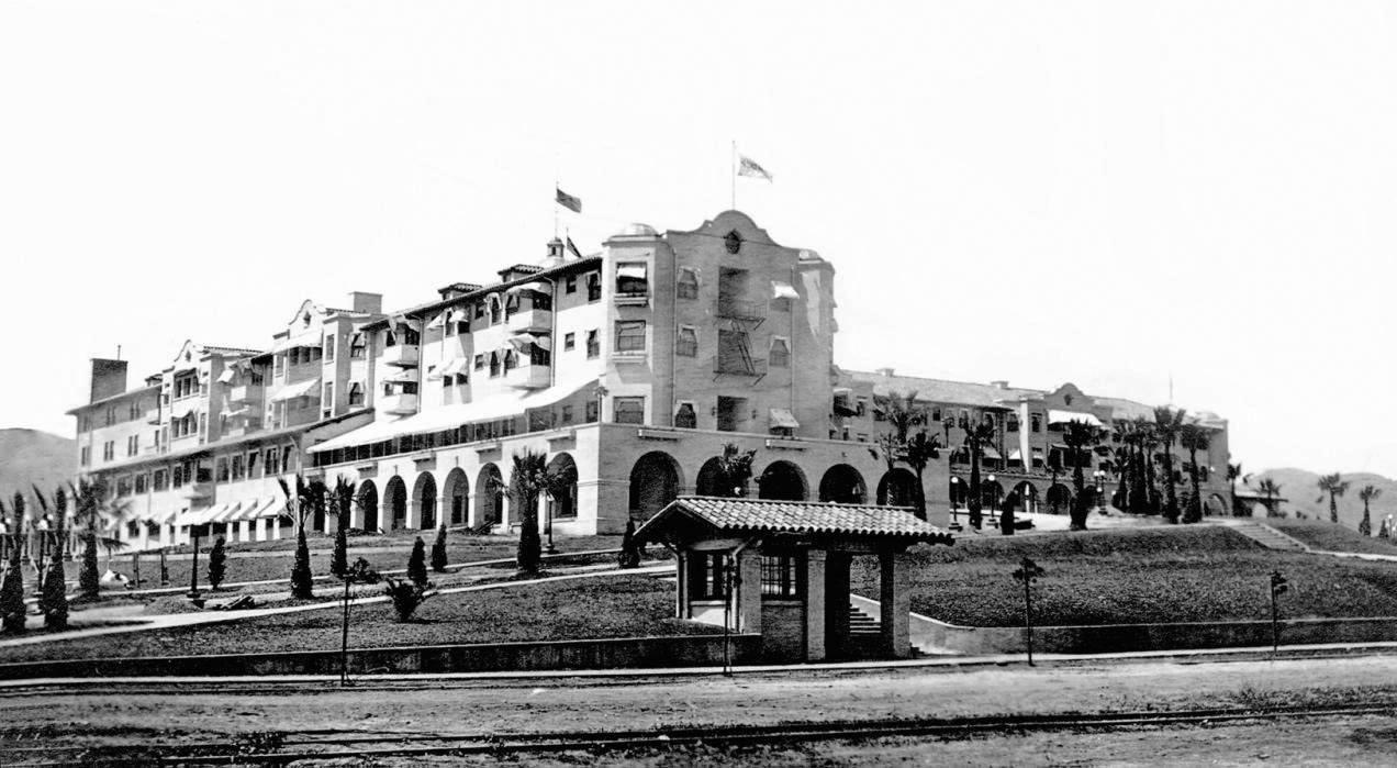
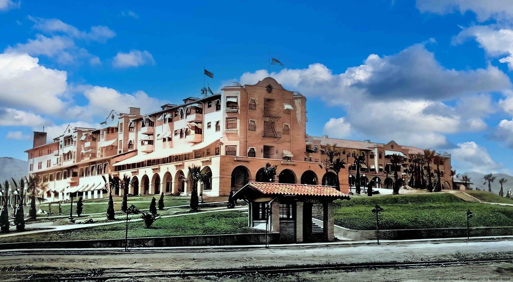
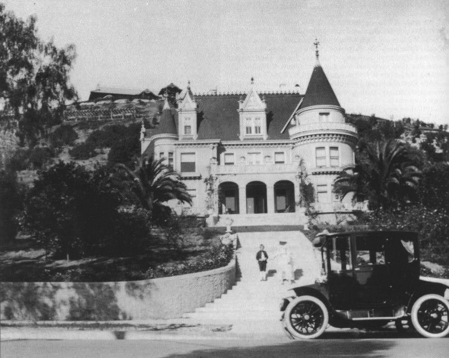
| (ca. 1914)^ – View showing the Beverly Hills Hotel from the end of its main driveway which is lined by small palm trees. |
Historical Notes Two years before Beverly Hills became an incorporated city, the Beverly Hills Hotel opened on May 12, 1912; the hotel initially included the main building and twenty-three separate bungalows in the Mediterranean Revival style, designed by Elmer Grey.* |
 |
|
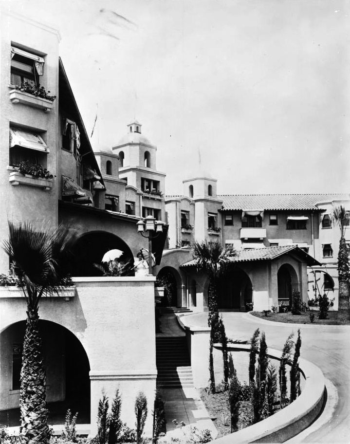
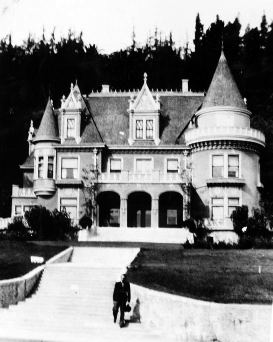
| (ca. 1918)^ – Close-up view of the entrance to the Beverly Hills Hotel, shown from the left edge of the building. The entrance is pictured in the background to the right, an open-air arcade leading to the front door of the large Spanish Colonial Revival building. |
 |
|
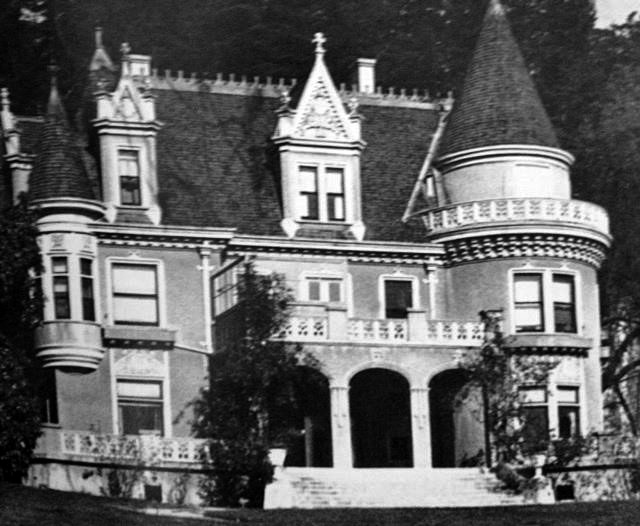
| (ca. 1918)*^^ - View of the circular driveway in front of the Beverly Hills Hotel. Palm trees abound. |
 |
|
| (ca. 1918)* - Close-up view of the Beverly Hills Hotel with Pacific Electric station on Sunset Boulevard in the foreground. |
Historical Notes A one-trolley car system known as the “Dinky” conveyed guests from a Pacific Electric station at the southwest corner of Santa Monica Boulevard and Canon Drive up Rodeo Drive to the Hotel. |
 |
|
| (ca. 1918)* - Close-up view of the Beverly Hills Hotel with Pacific Electric station on Sunset Boulevard in the foreground. Image enhancement and colorization by Richard Holoff. |
 |
|
| (ca. 1918)^ - View of the newly Will Rogers Memorial Park (then called Sunset Park) in front of the Beverly Hills Hotel, designed by Elmer Grey. Neither has mature landscaping at this time. Note the streetcar trolley at center-left. |
Historical Notes Will Rogers Park opened in 1915 as the first municipal park in the Beverly Hills, at that time called Sunset Park. In 1926, entertainer Will Rogers was appointed first "Honorary Mayor" of Beverly Hills and, in 1952, the City renamed the Park, Will Rogers Memorial Park.**^^ |
 |
|
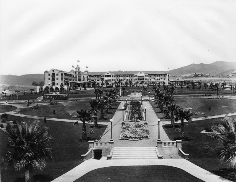
| (1921)* - Aerial view looking south from a vantage just above the Beverly Hills Hotel showing wide areas of open land in the background. |
 |
|
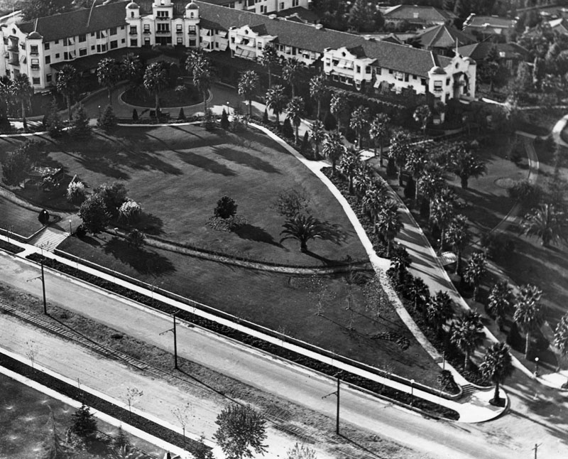
| (ca. 1924)* - View of the grounds of the Beverly Hills Hotel with the Will Rogers Park, shown in the foreground. |
 |
|
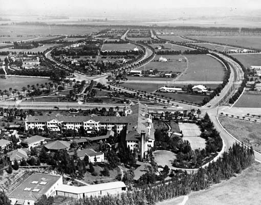
| (1924)* - Aerial view of the Beverly Hills Hotel and grounds, located at 9641 West Sunset Boulevard. Sunset Blvd. is at bottom of photo. Railroad tracks can be seen running parallel to Sunset. |
 |
|
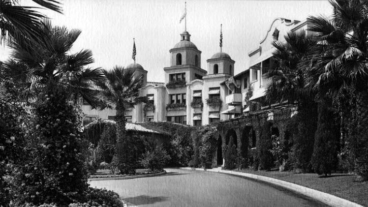
| (n.d)* - View showing the front entrance to the Beverly Hills Hotel. |
 |
|
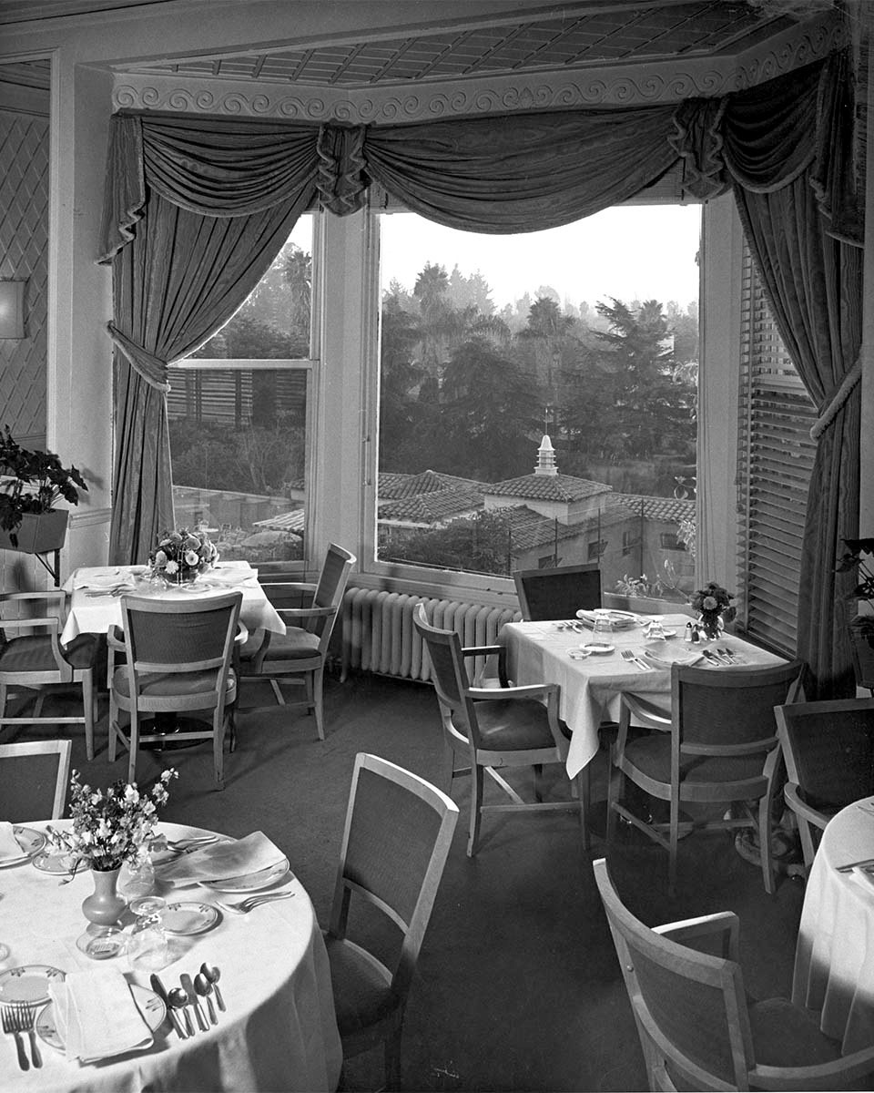
| (1947)*++ – Dining room with a view at the Beverly Hills Hotel. Photo by Julius Shulman |
 |
|
| (ca. 1980)* - Entrance to the Beverly Hills Hotel, at a point where a new wing was added in the 1940's. Palm trees decorate both sides of the road leading to the entrance of the hotel on Crescent Drive and Sunset Boulevard. Directly behind the hotel sits the huge mansion of late newspaper mogul William Randolph Hearst. |
Historical Notes In the 1940s, a new wing was added to the east side of the main building. Eighty years after it opened, the hotel closed for two and a half years for a complete restoration.* |
 |
|
| (2012)* – View showing the entrance to the Beverly Hills Hotel on its 100 year anniversary. Photo by Matt Sayles |
Historical Notes The hotel was named the first historic landmark in Beverly Hills on September 12, 2012.* Click HERE to see more in Early Views of Beverly Hills. |
* * * * * |
Magic Castle (aka 'Holly Chateau' or Rollin Lane Residence)
 |
|
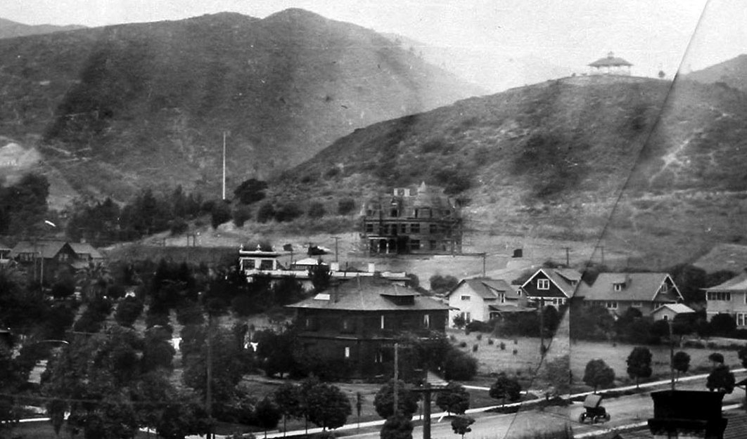
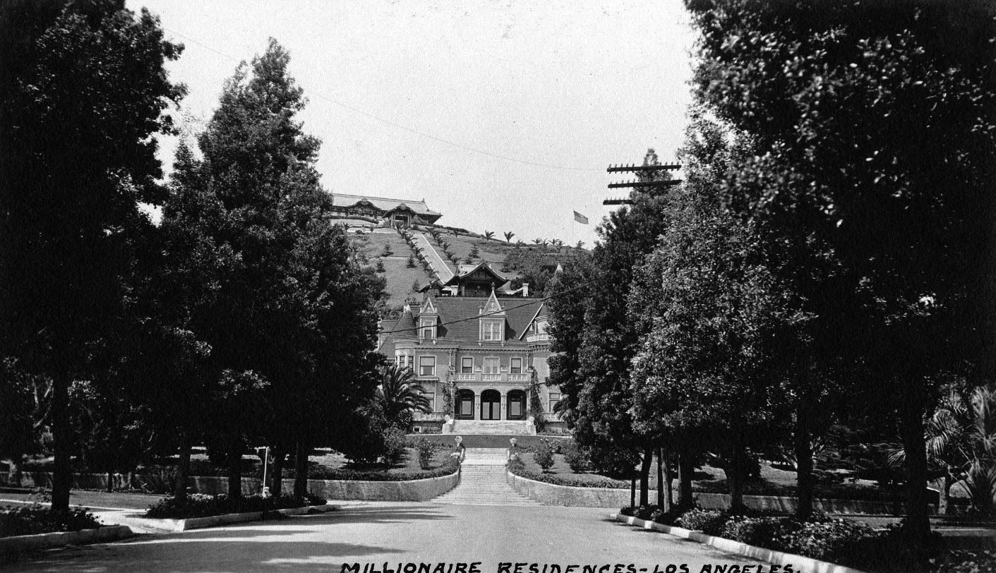
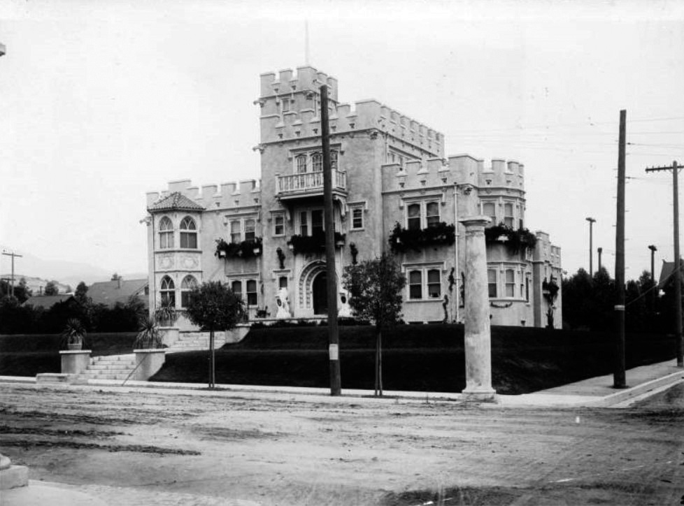
| (1909)^.^ - View looking northwest from a rooftop near the Hollywood Hotel showing the Rollin Lane house (aka Holly Chateau) under construction in the foothills just above Franklin Avenue. Orchid Avenue, with early model car on it, is seen at lower right. |
Historical Notes The Chateau-style residence was built in 1909 by banker, real estate developer and philanthropist, Rollin B. Lane. The house was designed by architects Lyman Farwell and Oliver Dennis and constructed as a near duplicate of the 1897 Kimberly Crest House and Gardens in Redlands, California that the architects had designed over a decade earlier.^ |
 |
|
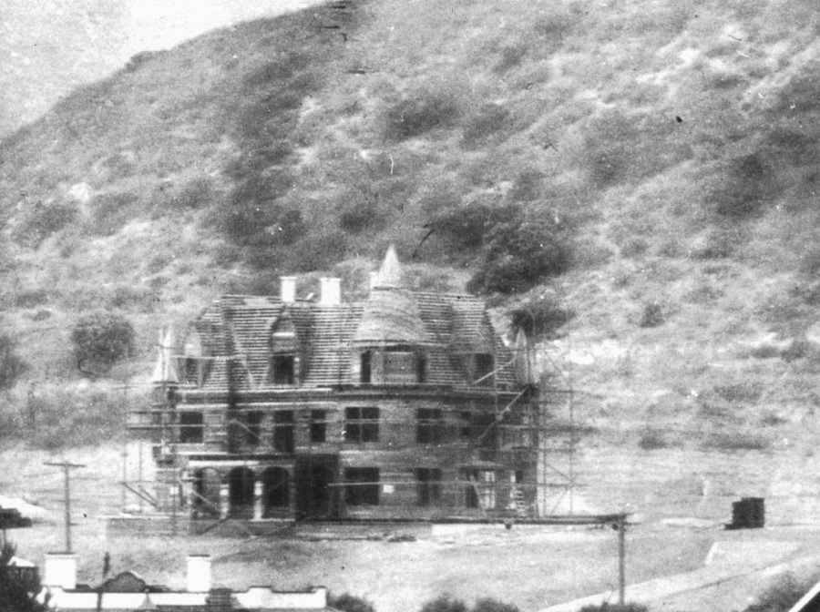
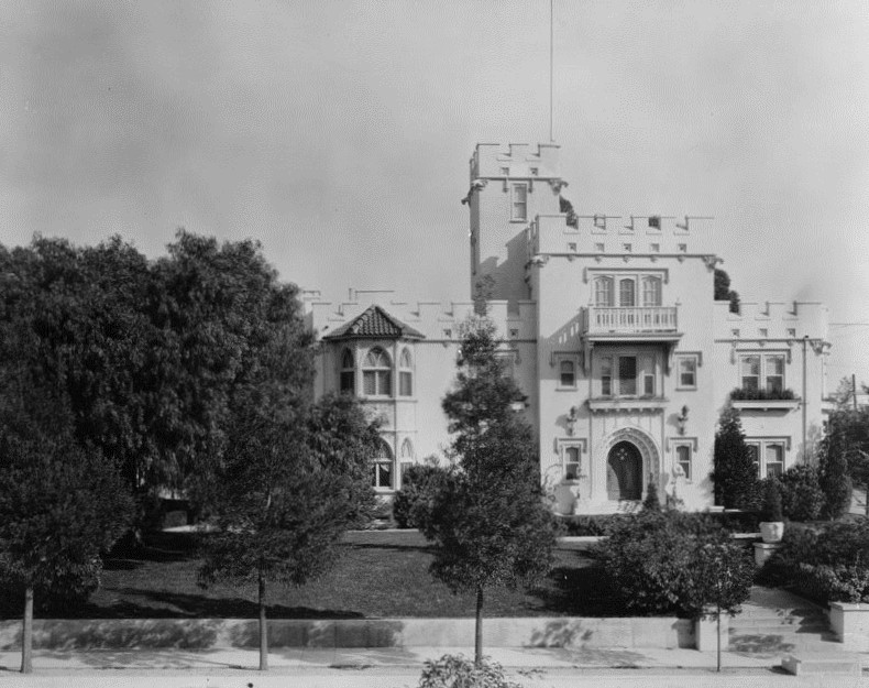
| (1909)* – Close-up view showing the Lane Residence under construction. Note how barren the hills are behind it. |
Historical Notes The Gothic Renaissance chateau (also referred to as “Holly Chateau”) sits in the middle of what is now historic Hollywood and was originally the personal residence of a wealthy banker, Rollin B. Lane. |
 |
|
| (ca. 1910s)^x^ - View showing the 'Holly Chateau' built by Rollin Lane in 1909. This house became the Magic Castle in 1963. |
Historical Notes Rollin Lane was a very successful lawyer, banker and real estate investor who helped build Hollywood through property development and participation on the historic Hollywood Board of Trade. He also invested heavily in the early development of the nearby San Fernando Valley and in California’s San Joaquin Valley. ^ |
 |
|
| (1920)* – A woman and a child stand on the stairs leading up to the Lane Residence. The house in the background on top of the hill is the famous Bernheimer Estate and Gardens (currently Yamashiro Restaurant). Note the early model car in the foreground. |
Historical Notes Katherine Lane (Rollin's wife) was a college graduate, published author, teacher and lecturer who worked to improve the quality of life in Hollywood through various community service organizations, even serving a term as president of the Woman’s Club of Hollywood. Later, working with the Los Angeles Chamber of Commerce and supported by a small army of volunteers, she promoted the planting of the landmark palm trees that line Wilshire Blvd., as well as hundreds of Japanese cherry trees in and around Griffith Park. ^ |
 |
|
| (1936)^x^ – View showing a man walking down the front stairs of the Lane residence (aka Holly Chateau) built by Rollin B. Lane. Now home of the Academy of Magical Arts and the Magic Castle. |
Historical Notes Ownership of the building remained in the Lane family until 1955 when it was sold to Thomas O. Glover, whose family still owns the property. |
 |
|
| (Early 1900s)^x^ – Close-up view of the Victorian-style Rollin B. Lane residence (aka Holly Chateau) located at 7001 Franklin Avenue in Hollywood. |
Historical Notes The Lanes named their home “Holly Chateau” and for thirty years, it was one of the most recognized addresses in Hollywood and a popular location for the area’s social elite. Hundreds of newspaper articles attest to the elegant and elaborate luncheons, teas and musicales held for artists, orphans, community leaders or world travelers, or to raise funds for one of Katherine’s many civic projects. ^ |
 |
|
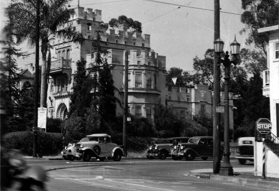
| (ca. 1915)^* – View looking north on Orange Drive showing the Rollin Lane residence (later Magic Castle) at the T-intersection with Franklin Avenue. The Bernheimer Estate and Gardens (built in 1914) is seen at the top of the hill in the background. |
Historical Notes The 1914 hilltop estate seen behind and above the Lane Residence was built to house the Bernheimers' priceless collection of Asian treasures. In order to have an authentic Japanese design, hundreds of skilled craftsmen were brought from Asia to recreate an exact replica of a palace located in the Yamashiro mountains near Kyoto, Japan. The original Bernheimer structure included a 10-room teak and cedar mansion, where carved rafters were lacquered in gold and tipped with bronze dragons. |
 |
|
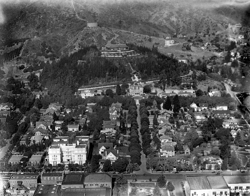
| (ca. 1924)* - Aerial view looking north on Orange Drive toward Franklin Avenue. The Rollin B. Lane Estate (now Magic Castle) is seen on the north side of Franklin at the end of the T-intersection (center of photo). Hollywood Boulevard runs horizontal in the foreground. The white building at lower-left is the Garden Court Apartments. The building at the top of the hill behind the Lane Estate is the Japanese estate and gardens of brothers Charles and Adolph Bernheimer (Bernheimer Estate and Gardens). |
 |
|
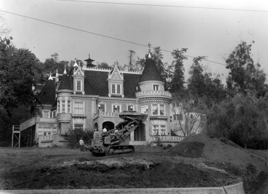
| (1962)* - Renovations for the Magic Castle begin. |
Historical Notes After the Lanes passed away in the 1940’s, the house was divided into a multi-family home. It then became a home for the elderly and was finally transformed into a maze of small apartments. By 1960, the fate of the building was uncertain. Then Milt Larsen met the owner, Thomas O. Glover. Milt was a writer on the NBC-TV show Truth or Consequences. His office was on the ninth floor of a Hollywood office building that overlooked the Lane residence. Milt’s late father, William W. Larsen Sr., was a renowned magician and had long dreamed of building an elegant private clubhouse for magicians. The Lane residence would become that club. In September 1961, Milt, his brother Bill (an accomplished magician, publisher of Genii Magazine and the Academy’s first President), Irene (Bill’s wife) and a crew of friends and volunteers began the task of returning this run-down apartment building to its glorious past. After months of scraping and sanding, the rich Victorian elegance began to resurface. The Magic Castle opened its doors on January 2, 1963. ^ |
 |
|
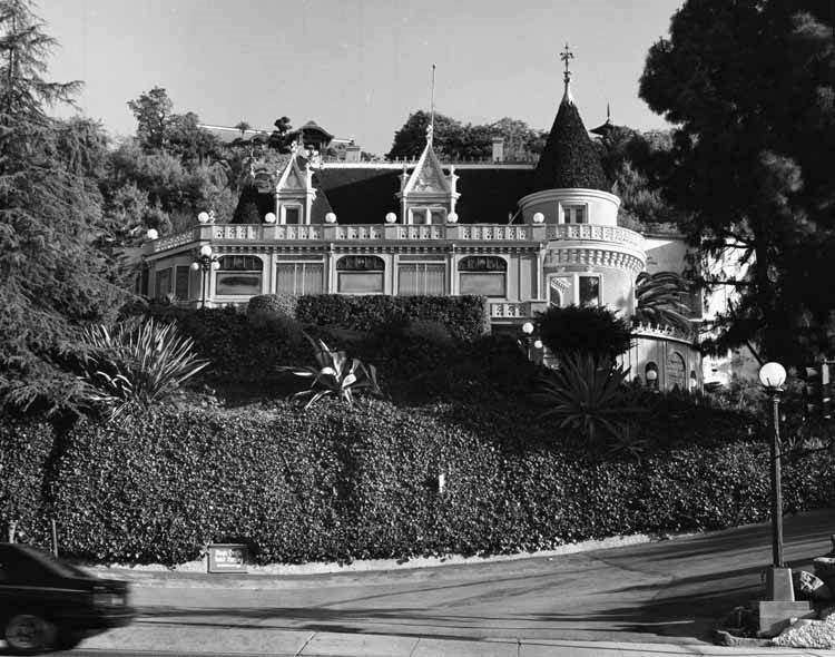
| (1981)^*# – View looking up from Franklin Avenue showing the Victorian-style "French Chateau" building known as Magic Castle, with turrets and architectural detailing and ivy-covered retaining wall in foreground. |
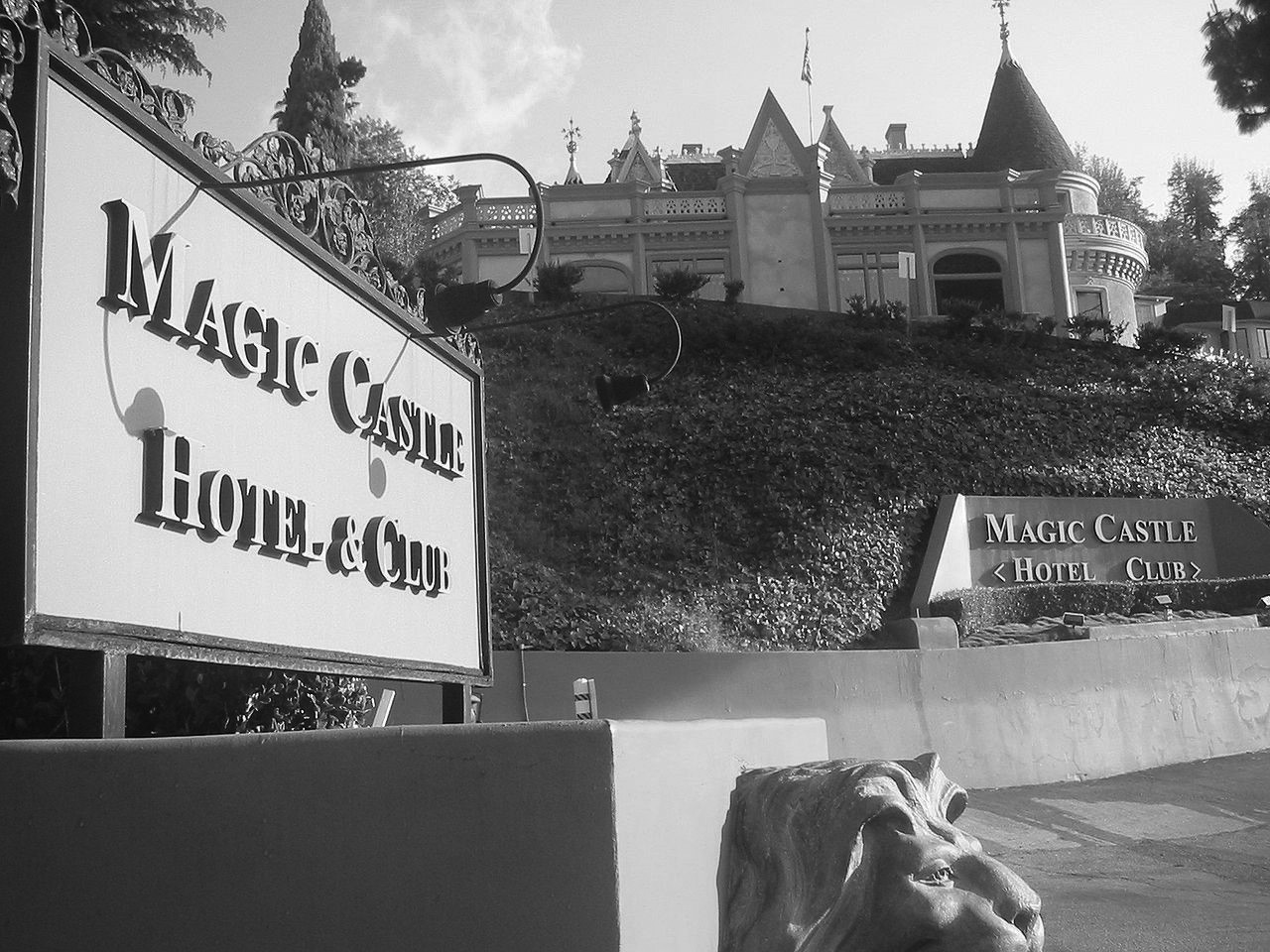
Historical Notes The Magic Castle was declared Los Angeles Historic-Cultural Monument No. 406 in 1989. |
 |
|
| (2007)^* - View showing the driveway entrance to the Magic Castle located at 7001 Franklin Avenue in Hollywood. |
Historical Notes Since 1963, the Magic Castle has been a nightclub for magicians and magic enthusiasts, as well as the clubhouse for the Academy of Magical Arts. It bills itself as "the most unusual private club in the world." |
* * * * * |
Glengarry Castle
 |
|
| (ca. 1912)^^ - View of Glengarry Castle, the residence of Dr. Schlosser in Hollywood. The three-story castle-like building can be seen at center with a tower visible on the roof at center. A balcony is visible on the third story, while a long staircase leads to the arched front entrance. Statues can be seen on either side of the archway, while grass is visible in the front yard. |
Historical Notes At the turn of the century, after striking it rich in the Nevada silver mines, Dr. Schlosser and his family moved to Hollywood, where the doctor built Glengarry, a copy of his wife's ancestral home in Inverness, Scotland. Soon this castle proved too small for his burgeoning social life and medical practice. So in 1912, he built Schloesser Terrace (Castle Sans Souci) on a three-acre plot across the street (NW corner of Argyle and Franklin avenues).*# |
 |
|
| (ca. 1913)* - Exterior view of Glengarry Castle (also known as Schlosser Terrace) located on the eastern side of Argyle between Franklin Avenue and Dix Street in Hollywood. |
Historical Notes He was originally called Dr. Alfred Guido Rudolph Schloesser, but during World War I, due to anti-German sentiment, he changed it to Dr. A. G. Castles. |
 |
|
| (1934)^*# - View showing Glengarry Castle located on the northeast corner of Franklin and Argyle avenues. |
Historical Notes The Glengarry Castle was demolished in 1959.* |
Castle Sans Souci
 |
|
| (1913)* - Exterior view of Castle Sans Souci, the mansion of Dr. A. G. Castles, located on the northwest corner of Franklin and Argyle avenues, across the street from Glengarry Castle |
Historical Notes Dr. Castles originally lived in Glengarry Castle (NE corner of Argyle and Frnaklin). But that 'home' soon proved too small for his burgeoning social life and medical practice. So in 1912, he built Castle Sans Souci on a three-acre plot across the street (NW corner of Argyle and Franklin). As an investment, the eccentric Dr. Castles, who always wore a frock coat, heavy makeup and top hat, tore down Sans Souci and built Castle Argyle Arms apartments in 1928, attracting a new breed of royalty: movie makers. Guests there over the next two decades were to include Clark Gable, Howard Hughes, Ronald Reagan and Cecil B. DeMille.*# |
* * * * * |
Fremont Hotel
 |
|
| (ca. 1913)^ – View looking southeast from Fourth Street and Grand Avenue. Fourth Street runs vertically (at left) with Olive Street intersecting it horizontally (visible at left). In the lower right is the Rose Mansion, on the SE corner of Fourth and Grand. Beyond it is the distinctive multi-turreted roof of the Fremont Hotel, on the SW corner of 4th and Olive. |
 |
|
| (n.d.)* - Postcard view of the Fremont Hotel on the southwest corner of 4th and Olive, showing the 6 story building, with corner turrets and balconies on one side for the 2nd and 3rd floors. Architect, John Austin. |
Historical Notes The Fremont Hotel, located in the Bunker Hill suburb, was built and designed by the architect John C. Austin and developed by Thomas Pascoe. The plans for building the hotel were developed in November 1901 and initially faced resistance from the next door Olive Street School establishment. It was designed by the architect in the Mission style, and had some 100 rooms. It opened on September 9, 1902 and was named after John C. Frémont. When newly built it was billed as "the newest and most elegantly appointed family hotel in Los Angeles.” The hotel also held dinners in tribute to Frémont. Frémont's widow, Jessie, was the first registered guest. She also designed and executed the hotel's crest. Frémont's motto, "Eternal vigilance is the price of safety" was adopted as the hotel's motto, paraphrased into "Eternal vigilance is the price of success in the hotel business". ^* |
 |
|
| (1925)* – View looking north showing the southern tower of the Fremont Hotel. |
Historical Notes The hotel was demolished in 1955 by the Community Redevelopment Agency, and what remained was only the retaining wall next to the Olive Public School.^* |
* * * * * |
Los Angeles Trust and Savings Bank (later Pacific Southwest Bank)
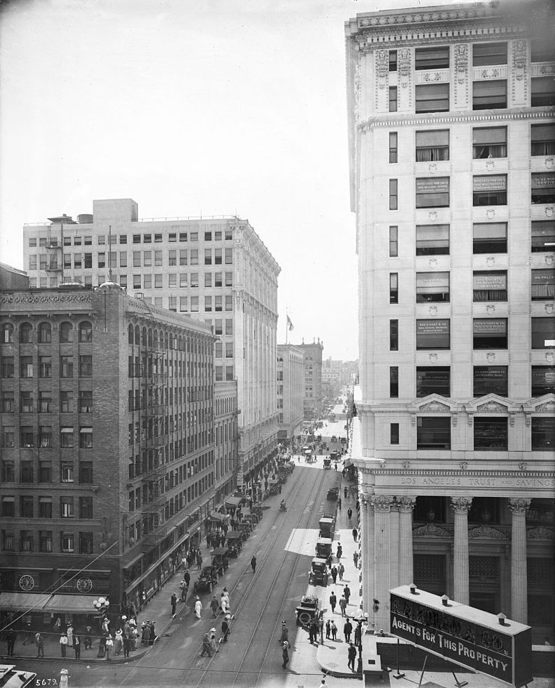 |
|
| (ca. 1910)^* - View looking west on 6th Street from Spring Street. On the northwest corner stands the newly built Los Angeles Trust and Savings Bank. |
.jpg)
Historical Notes Constructed in 1910, the Los Angeles Trust and Savings Bank building stood on the northwest corner of Spring and 6th Streets. The building was designed by John Parkinson and G. Edwin Bergstrom, prolific architects who were responsible for numerous Spring Street financial buildings, including the Security Building and the Los Angeles Stock Exchange Building.^^* In 1922, Los Angeles Trust and Savings Bank changed its name to Pacific Southwest Bank.^^* |
 |
|
| (1910s) - Postcard view showing the armor plate safe deposit and storage vaults of the Los Angeles Trust and Savings Bank. |
Historical Notes By 1910, when the Los Angeles Trust and Savings Bank was completed, Spring Street had become the city’s financial and banking center.^^* |
 |
|
| (ca. 1924)* - Street view showing the Pacific Southwest Trust and Savings Bank located at 215 W. 6th Street, on the N/W corner of 6th and Spring streets. It was originally the Los Angeles Trust and Savings Bank Building (1910 – 1922). |
Historical Notes In 1922, Los Angeles Trust and Savings Bank changed its name to Pacific Southwest Trust and Savings Bank.^^* |
 |
|
| (ca. 1924)* – View looking south on Spring Street showing the Pacific Southwest Bank on the N/E corner of 6th and Spring streets. To the right stands the Mercantile Arcade Building with the Leighton Coffee Shop at center. |
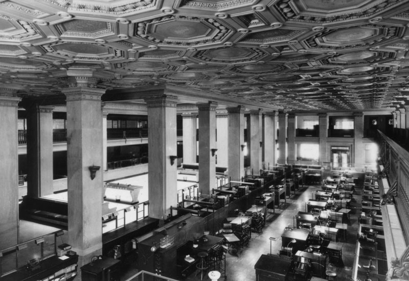 |
|
| (ca. 1924)* - Interior view of Pacific Southwest Trust and Savings Bank at 561 So. Spring Street, in downtown Los Angeles. Note the ornate ceiling. |
.jpg) |
|
| (2008)^* - Pacific Southwest Bank (built 1910), the present day SB Manhattan Lofts (condominiums) — at 215 W. 6th Street, Downtown Los Angeles. |
.jpg)
* * * * * |
Merchants National Bank Building
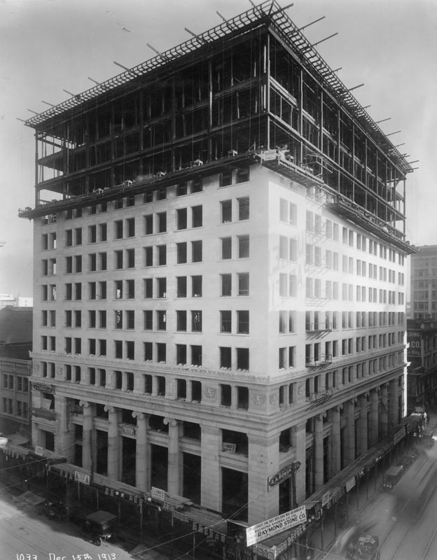 |
|
| (1913)* - An exterior view of 2 sides of the Merchants National Bank building on the NE corner of So. Spring St. & W. 6th St. It is under construction and the exterior is 3/4 finished. There are 2 signs low on the building: one giving the name Raymond Stone Co. and the other (a little higher) R.A. Rowan Co. This was part of the Beaux Arts office block; architects were William Curlett & son. |
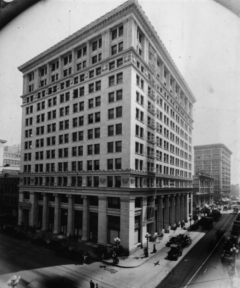 |
|
| (ca. 1920)* - View showing the Merchants National Bank located on the northeast corner of Spring and 6th streets. |
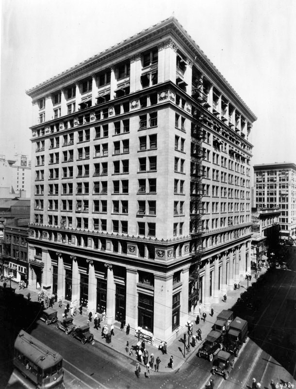 |
|
| (1926)* - Located on the northeast corner of Spring and 6th streets stands the Merchants National Bank Building. |
.jpg) |
|
| (1920s)* – Close-up view of the Merchants National Bank showing four proto-ionic columns, each one situated between doors, providing support for the building. "Merchants National Bank" is engraved into the wall above the columns and just below the cornice and the bank's name is painted on the windows above the entrances. |
* * * * * |
Herald Examiner Building |
From Newspaper Powerhouse to Historic Landmark |
The Herald Examiner Building stands as one of the most distinctive landmarks along South Broadway, reflecting a time when newspapers played a central role in shaping Los Angeles. Completed in 1914, it served as the second home of the Los Angeles Examiner, replacing the paper's earlier and quickly outgrown headquarters on Broadway. Commissioned by William Randolph Hearst and designed by Julia Morgan, the building was created to house both editorial offices and large scale printing operations. Its Mission Revival and Spanish Colonial design, with arched facades and tiled domes, gave it a strong visual identity and a commanding presence along one of the city's busiest streets. For more than seventy years, the building served as the center of Hearst's newspaper operations in Los Angeles. It witnessed the rise of the Examiner, its later merger into the Herald Examiner, and the eventual decline of the newspaper industry following a prolonged labor strike. After years of vacancy and use as a filming location, the building was restored and reopened in 2021 as a new academic center, ensuring its continued role in downtown Los Angeles. |
Construction and Early Years |
 |
|
| (1914)* – Aerial view looking southwest showing the Examiner Building under construction, sections of which are still lined with scaffolding. Main Street angles in from the lower left, while Hill Street cuts diagonally from upper left to right center. 11th Street crosses from lower left to center right. Broadway, which runs between and parallel to Main and Hill Streets, has not yet been paved but will run directly in front of the completed building. |
Historical Notes By 1912, William Randolph Hearst had outgrown his first Los Angeles newspaper home at 509 South Broadway and set his sights on something far grander. He paid one million dollars for a full city block at the southwest corner of Broadway and 11th Street, a parcel that had previously been part of railroad magnate Henry Huntington's land holdings. Construction began that year on what Hearst envisioned as the largest building in the world devoted exclusively to the production of a newspaper, a goal that reflected both his outsized ambitions and his determination to stamp his presence permanently on the city's skyline. The new building was the work of Julia Morgan, working in association with Los Angeles architects J. Martyn Haenke and William J. Dodd. Morgan, who had trained at the prestigious Ecole des Beaux Arts in Paris, brought both technical skill and artistic flair to the project. The aerial photograph captures the site in its final stages, with scaffolding still clinging to portions of the facade. Broadway, the street that would soon run directly in front of the building's grand arched entrance, remains unpaved in this view, a reminder that this stretch of downtown Los Angeles was still very much a work in progress. |
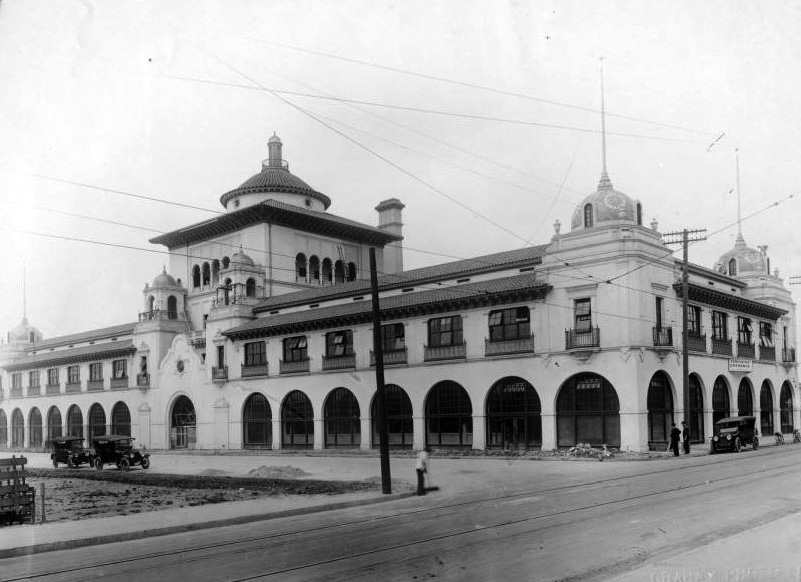 |
|
| (ca. 1914)* - View of the nearly completed Examiner Building on the southwest corner of Broadway and 11th Street. Many of the second-story windows stand open, and a ladder leans from the second-floor roof up to the archways of the center section's third floor. A sign on the 11th Street side of the building reads "Temporary Entrance – All Departments," indicating that finish work is still underway inside. |
Historical Notes This photograph captures the Examiner Building in its final days of construction, its exterior essentially complete while workers finished the interior. The building's Mission Revival design is already fully visible: the broad arched openings across the street-level facade, the red tile roofline, and the decorative domed towers rising at each corner of the block-long structure. Morgan specified glazed ceramic tiles for the domes, in rich shades of blue and yellow, giving the building a color and warmth unlike any other downtown office or commercial structure of the era. The temporary entrance sign on the 11th Street side speaks to the organized chaos of a major construction project nearing completion. Inside, Morgan had created a lobby of exceptional beauty, with hand-painted tiles, elaborate ironwork, intricately carved woodwork, and a sweeping staircase leading up to the newsroom. A private elevator, reserved solely for Hearst, was tucked discreetly into the design. When the building officially opened in 1914, it represented the most ambitious newspaper headquarters west of the Mississippi River and the beginning of a long and celebrated working relationship between Hearst and his architect. |
.jpg) |
|
| (ca. 1916)* - Postcard view of the Examiner Building on the southwest corner of Broadway and 11th Street, just two years after its completion. A streetcar rolls south along Broadway in front of the building's grand arched facade. |
Historical Notes By the time this postcard was produced around 1916, the Examiner Building had already become one of the most recognizable structures in downtown Los Angeles. Postcards of prominent buildings were a popular keepsake of the era, and the Examiner's dramatic Mission Revival facade made it a natural subject. The building's sweeping row of arches along Broadway, combined with its tiled domes and prominent corner towers, gave it a visual grandeur that stood apart from the more utilitarian commercial blocks surrounding it. The streetcar visible in the foreground is a reminder of how Broadway functioned in the 1910s. The Los Angeles Railway operated multiple streetcar lines along this corridor, carrying workers, shoppers, and newspaper readers through the heart of downtown. For the Examiner, a Broadway address meant maximum visibility: thousands of commuters passed the building's newsstands and delivery bays every day, reinforcing the paper's presence in the daily life of the city. At this point, the Examiner was firmly established as one of Los Angeles's leading newspapers, challenging the dominance of the Times and reaching a growing readership hungry for the bold, sensational style of journalism that Hearst championed. |
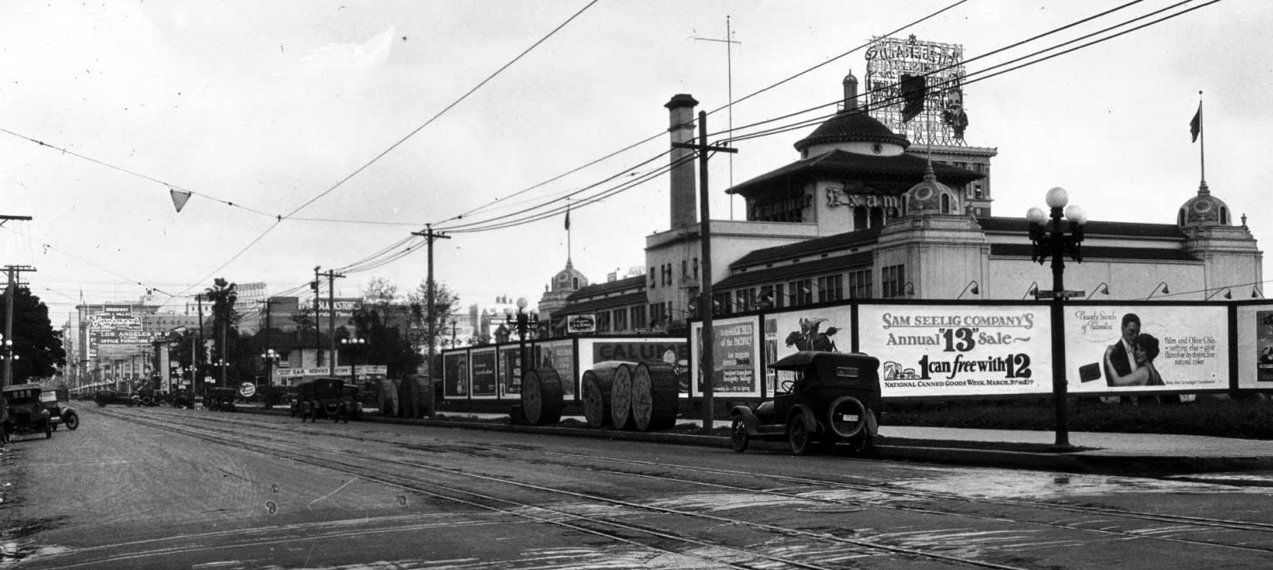 |
|
| (ca. 1923)* – Panoramic view looking north on Hill Street at 12th Street, showing the rear of the Examiner Building. An ornate five-bulb streetlight stands on the northeast corner of 12th and Hill, and a series of billboards lines the back of the Mission Revival structure. |
Historical Notes This panoramic view from around 1923 reveals the Examiner Building from an angle that most Angelenos of the era rarely saw. While the Broadway facade received all the architectural fanfare, the Hill Street rear of the building was the functional side, where paper rolls were delivered, trucks were loaded with fresh editions, and the mechanical work of running a major daily newspaper played out around the clock. The Mission Revival detailing extended to this elevation as well, giving the building a consistent character on all four sides of the block. The billboards clustered along the rear of the building reflect a lively advertising culture that had taken root throughout downtown Los Angeles in the 1920s. The five-bulb ornamental streetlight in the foreground is typical of the elegant cast-iron standards that the city installed along major downtown intersections during this period, balancing civic pride with practical illumination. By the early 1920s, the Examiner was thriving, and Hearst would soon expand his Los Angeles holdings further, acquiring the Los Angeles Herald in 1922 and adding it to his West Coast publishing empire. |
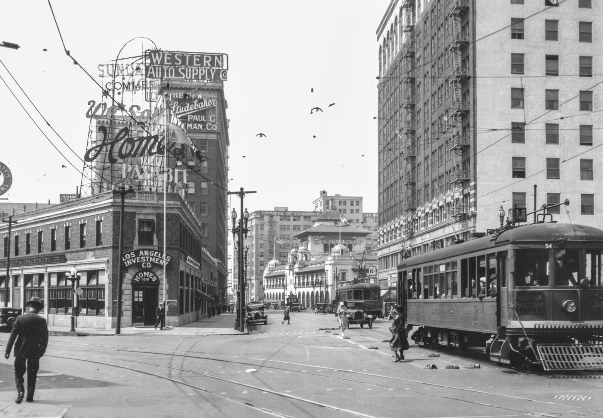 |
|
| (1920s)* - View looking south on Broadway showing two Los Angeles Railway "M Line" streetcars, with the Examiner Building visible in the background at the southwest corner of Broadway and 11th Street. At left, the storefronts of the Los Angeles Investment Company and Western Auto Supply are followed by the Paul G. Hoffman Studebaker sales office. Photo courtesy of the Los Angeles Railroad Heritage Foundation. |
| Historical Notes
This lively street scene captures Broadway at the height of its importance as downtown Los Angeles's commercial and transit spine. The Los Angeles Railway's M Line was one of several streetcar routes that funneled tens of thousands of riders through this corridor every day, connecting neighborhoods across the city to the stores, offices, and entertainment venues concentrated along Broadway. For the Examiner, the steady stream of streetcar passengers represented a built-in audience: riders could spot the paper's display boards and newsstands as they passed the building's front doors. The businesses visible on the left side of the frame reflect the commercial energy of 1920s Los Angeles. Automobile dealerships like the Paul G. Hoffman Studebaker office were springing up throughout the downtown core as car ownership expanded rapidly across Southern California. Auto supply shops and investment companies occupied neighboring storefronts, catering to a city whose residents were beginning to build wealth and embrace the automobile as the central feature of modern life. The Examiner Building looms at the far end of this scene, its arched facade marking the intersection of 11th Street with the calm authority of a building that had already become an established institution. |
Growth and Prominence |
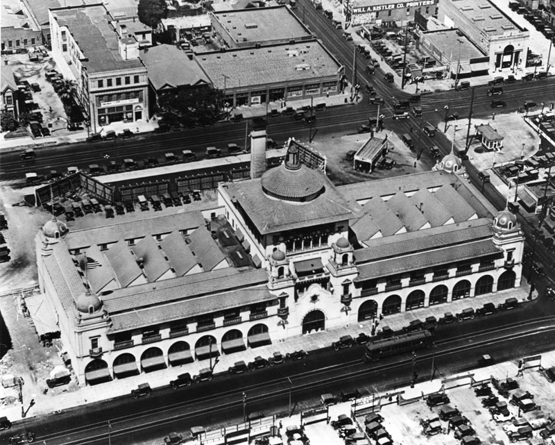 |
|
| (ca. 1925)* - Aerial view looking down on the Examiner Building at 1111 South Broadway, on the southwest corner of 11th Street and Broadway. The building's full block-long footprint is clearly visible, along with its tiled corner domes and the central tower rising above the main Broadway entrance. |
Historical Notes Aerial photography was still a novelty in the mid-1920s, and images like this one offered residents an entirely new way of understanding their city. Seen from above, the Examiner Building's remarkable scale becomes apparent: it occupies a full city block, stretching from Broadway on the east to Hill Street on the west, and from 11th Street on the north to 12th Street on the south. Julia Morgan designed the building to project authority and permanence, and from the air its footprint dominates the surrounding neighborhood. By the mid-1920s, the Examiner was solidly established as one of the two dominant voices in Los Angeles journalism, alongside its great rival, the Los Angeles Times. Hearst was simultaneously building out his newspaper empire across the country, and the Broadway building served as the flagship of his California operations. In 1922, he had added the Los Angeles Herald to his holdings, setting the stage for the eventual merger of the two papers that would come a decade later. This aerial view shows the building at the peak of its early confidence, before the turbulent decades that would follow. |
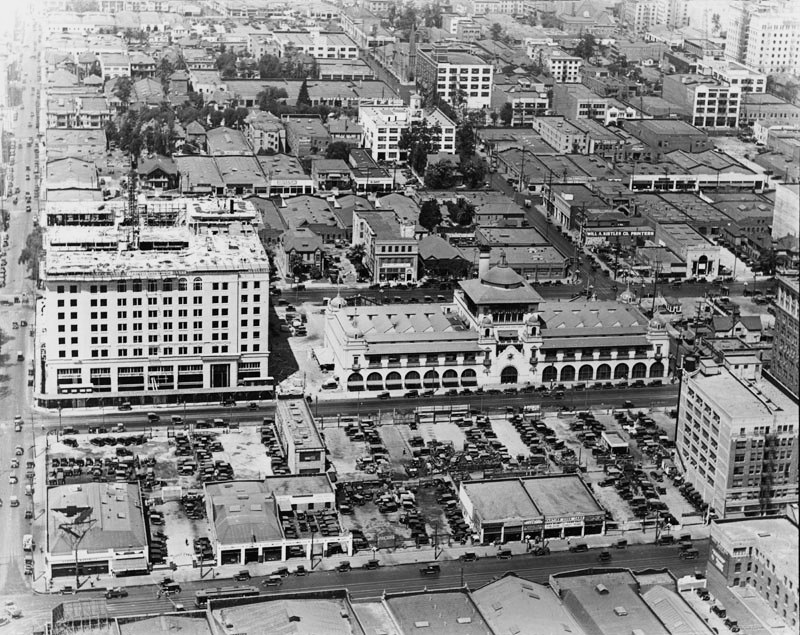 |
|
| (ca. 1926)* - Aerial view of the Examiner Building and its surrounding neighborhood. The main Broadway facade features seven arches on either side of the central entrance, with a tower rising from the middle of the roofline. Directly south of the Examiner, at the northwest corner of Broadway and 12th Street, stands the newly completed Chamber of Commerce Building. |
Historical Notes This view from around 1926 shows the Examiner Building at the center of a rapidly developing section of downtown Los Angeles. The fourteen arches running across the Broadway facade, seven on each side of the main entrance, were one of the most striking features of Julia Morgan's design, giving the building a rhythm and depth that drew the eye from half a block away. The central tower that rises above the entrance was both decorative and functional, housing water tanks and mechanical equipment while providing a dramatic focal point for the building's street-facing elevation. The new Chamber of Commerce Building visible to the south is evidence of the construction boom transforming downtown Los Angeles in the 1920s. The city was growing faster than almost anywhere else in the country, driven by real estate promotion, the expanding film industry, and a steady flow of migrants from the Midwest and East. In 1931, Hearst would solidify his hold on the local afternoon newspaper market by merging the Los Angeles Daily Herald with the Los Angeles Evening Express, creating the Los Angeles Evening Express and Evening Herald, which briefly became the largest-circulation evening newspaper west of the Mississippi River. |
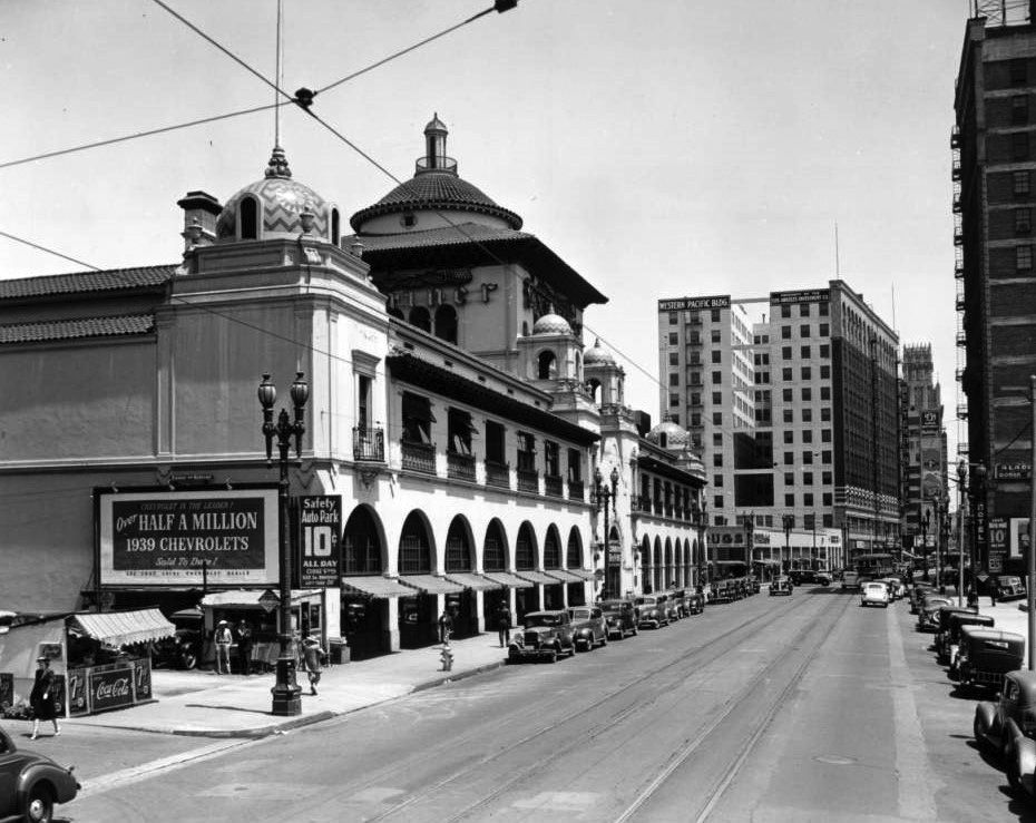 |
|
| (ca. 1939)* - View looking north along South Broadway toward 11th Street. At the left, the offices of the Los Angeles Examiner occupy the southwest corner of Broadway and 11th Street. One block to the north, the Western Pacific Building stands at 1031 South Broadway. |
| Historical Notes
By the late 1930s, the Examiner Building had become a fixed landmark in the South Broadway streetscape, its arched facade as familiar to Angelenos as City Hall or the Bradbury Building. Broadway itself had evolved considerably since the building opened in 1914. Automobile traffic had largely displaced the horses and early motorcars of the earlier era, the pavement had long since been laid, and the street-level storefronts on both sides of the block reflected the commercial energy of a major urban corridor in the years just before World War II. The Western Pacific Building visible a block to the north was one of many office structures that had risen along Broadway during the 1920s and 1930s as downtown Los Angeles continued to densify. The Examiner, under the editorial leadership of City Editor James H. Richardson, was in the midst of what would later be remembered as one of its most vigorous editorial periods, emphasizing crime coverage and Hollywood scandal in a style that drove circulation and kept readers returning for more. At this point in the paper's history, the future still looked bright, though the challenges of the postwar era were not yet visible on the horizon. |
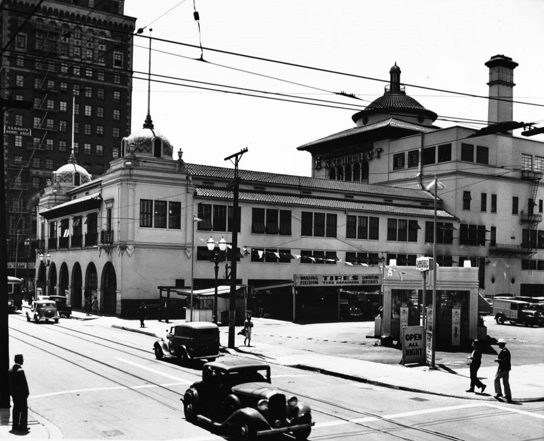 |
|
| (1939)* - View looking east on 11th Street at Hill Street, showing the rear elevation of the Examiner Building on the left. Across 11th Street, a coffee shop occupies the ground floor below the Aladdin Hotel, a lodging house restricted to women only. Adjacent to it stands a Richfield Tires and Service Station. Photo by Dick Whittington. |
| Historical Notes
This street-level view from 1939 shows the Hill Street and 11th Street corner of the Examiner Building, a vantage point that highlights the everyday neighborhood surrounding one of the city's most prominent landmarks. The Aladdin Hotel across the street was one of many women-only residential hotels that operated in downtown Los Angeles during the first half of the twentieth century. These establishments provided safe, affordable housing for the growing number of women who had moved to the city to work in offices, department stores, and the growing entertainment industry. The Richfield Tires and Service Station next door reflects the automobile's total dominance of Los Angeles street life by the late 1930s. Richfield was one of Southern California's major petroleum brands, operating a chain of distinctive stations throughout the region. The contrast between the grand arched architecture of the Examiner Building and the practical storefronts across the street captures something true about mid-century downtown Los Angeles: monumental public buildings and modest commercial life existed side by side, each reinforcing the other's sense of a city fully alive and in motion. |
.jpg) |
|
| (1939)^ – Aerial view looking down on South Broadway, with the Mission Revival Examiner Building filling the full block between 11th and 12th Streets. The building's tiled corner domes and arched Broadway facade are prominently displayed. Photo by Dick Whittington. |
Historical Notes Dick Whittington was one of Los Angeles's most prolific commercial and documentary photographers, and his aerial views of the city in the 1930s and 1940s provided a comprehensive visual record of downtown at its mid-century peak. This photograph of the Examiner Building shows the structure from above just as the paper entered the most celebrated period of its history. Under City Editor James H. Richardson, the Examiner in the late 1930s and 1940s built its reputation on aggressive crime reporting and Hollywood gossip, a formula that drove circulation higher year after year. Seen from the air, the full scale of Julia Morgan's design becomes clear: a complete city block, unified by a consistent architectural language, its roofline punctuated by the four tiled domes at each corner and the central Broadway tower. At its peak in 1960, the Examiner would reach a daily circulation of 381,037 copies, a number that represented a significant share of the metropolitan audience in pre-television Los Angeles. In 1962, the morning Examiner merged with Hearst's afternoon Los Angeles Herald-Express, creating the Los Angeles Herald Examiner and marking the end of the Examiner's independent identity after nearly six decades of publication. |
Decline and Renewal |
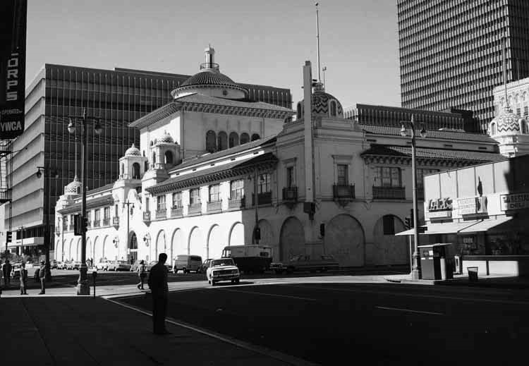 |
|
| (1970)* - A man stands at the curb on Broadway, looking toward the Herald Examiner Building at the southwest corner of Broadway and 11th Street. The building's arched facade, blocked off at street level, reflects the turbulent years of the labor strike that began in 1967. Photo by William Reagh. |
Historical Notes By 1970, the Herald Examiner Building had taken on a different, more somber character. In December 1967, the Newspaper Guild and other unions representing about 2,000 employees launched a strike against the Hearst Corporation that would last nearly a decade. At the time the walkout began, the paper's daily circulation stood at approximately 721,000, making it the largest-circulation afternoon daily in the country. Management's confrontational response, including the use of strikebreakers and the boarding up of the ground-floor arched windows after vandalism occurred, changed the building's outward appearance dramatically. The sealed arches visible in photographs from this period transformed the building's friendly street presence into something more fortified and closed-off. Union members urged readers to cancel their subscriptions, and many did. Advertisers, wary of the controversy and of the paper's shrinking working-class readership, pulled their accounts. When the strike finally ended in March 1977, the paper's circulation had fallen to around 350,000 and its workforce had shrunk from 2,000 to roughly 700. The damage proved impossible to reverse, and the paper never regained its former standing in the competitive Los Angeles media market. |
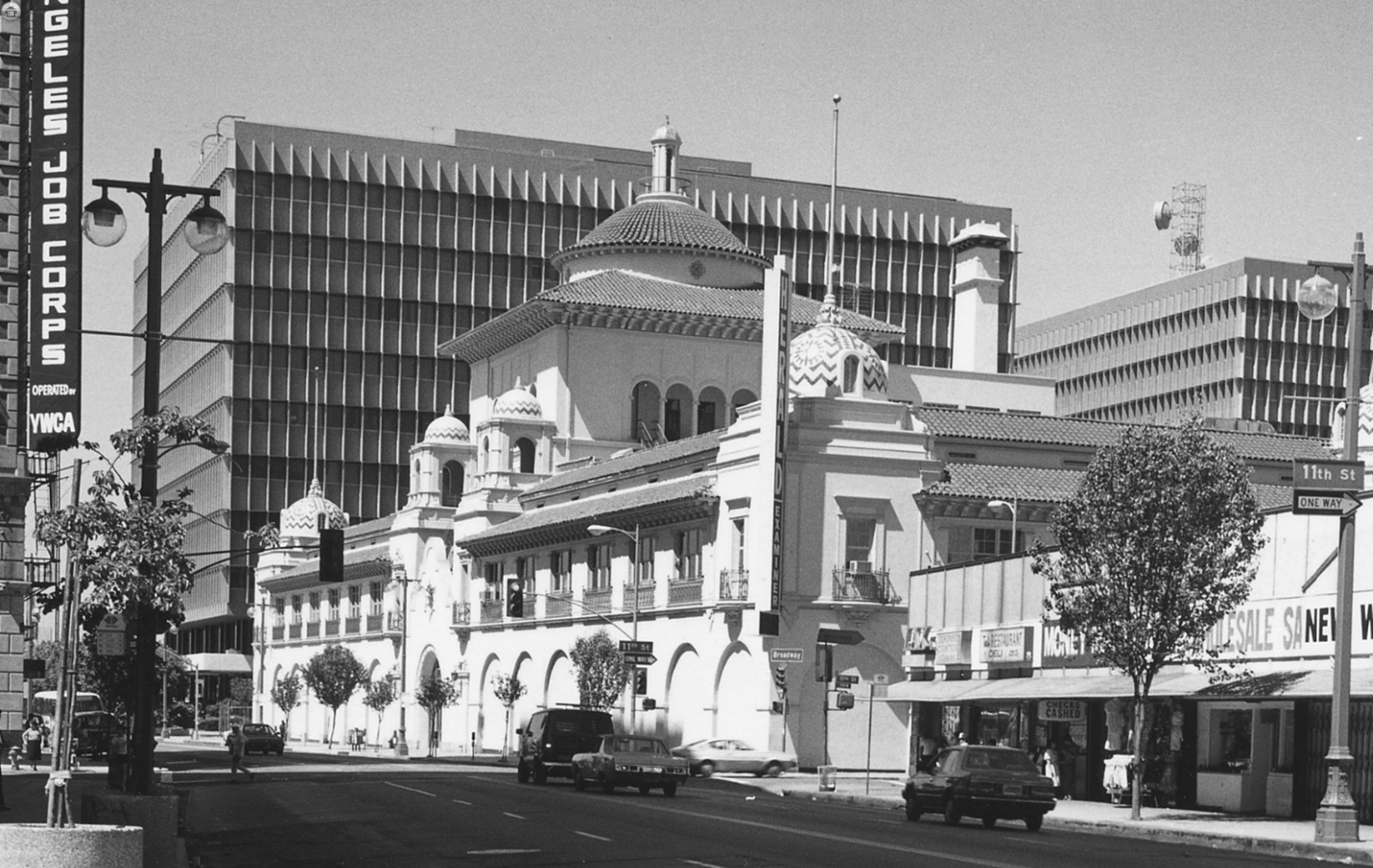 |
|
| (1976)* - View of the Mission Revival style Herald-Examiner Building located at Broadway and 11th Street in downtown Los Angeles, surrounded by other buildings. Photo by William Reagh. |
Historical Notes This 1976 photograph was taken less than a year before the conclusion of the nearly decade-long labor strike that had reshaped the Herald Examiner's fortunes. The building's boarded-up arches, clearly visible in street-level views from this era, had by then been sealed for almost a decade, fundamentally altering the visual character of the structure that Julia Morgan had designed to engage openly with the street. In August 1977, the city would formally recognize the building's architectural significance by designating it Los Angeles Historic-Cultural Monument No. 178, one of the few tangible acknowledgments of its importance during a difficult chapter in its history. The designation came at a moment when the Herald Examiner was fighting for survival. The paper's once-loyal readership had scattered. Television news had claimed a growing share of the audience the paper once commanded, and the Los Angeles Times, its longtime rival, had grown into a nationally respected publication that increasingly dominated the market. Despite attempts to modernize and rebuild, the Herald Examiner was operating in a media landscape that had fundamentally shifted away from afternoon newspapers, and no amount of editorial effort could entirely reverse that structural decline. |
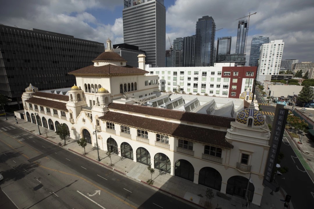 |
|
| (2021)* - The restored Herald Examiner Building at the corner of Broadway and 11th Street in downtown Los Angeles, reopened after a comprehensive renovation project. The ground-floor arches, sealed for more than fifty years, have been opened again, restoring the building's original relationship with the street. Photo by Myung J. Chun, Los Angeles Times. |
Historical Notes The rehabilitation of the Herald Examiner Building stands as one of the most significant preservation achievements in downtown Los Angeles in recent decades. In 2015, the Georgetown Company partnered with the Hearst Corporation to undertake an approximately $80 million restoration of the landmark, working with the architecture firm Gensler to honor Julia Morgan's original vision while adapting the interiors for twenty-first century use. The project restored the building's exterior to its original condition, reopened the long-sealed ground-floor arches, and preserved the ornate lobby, the tiled domes, and Hearst's private elevator, all of which had survived the paper's turbulent final decades. The building reopened in 2021 with Arizona State University as its primary tenant, operating under the name ASU California Center. The university's programs in journalism, film, and business found an especially fitting home in a building whose entire history was bound up with the craft of storytelling and the power of public communication. The project received the Chair's Award from the Los Angeles Conservancy as part of its 2022 Preservation Awards, recognizing both the quality of the restoration work and the building's renewed contribution to the life of the neighborhood. After more than a century, Julia Morgan's creation had found a purpose worthy of its architecture. |
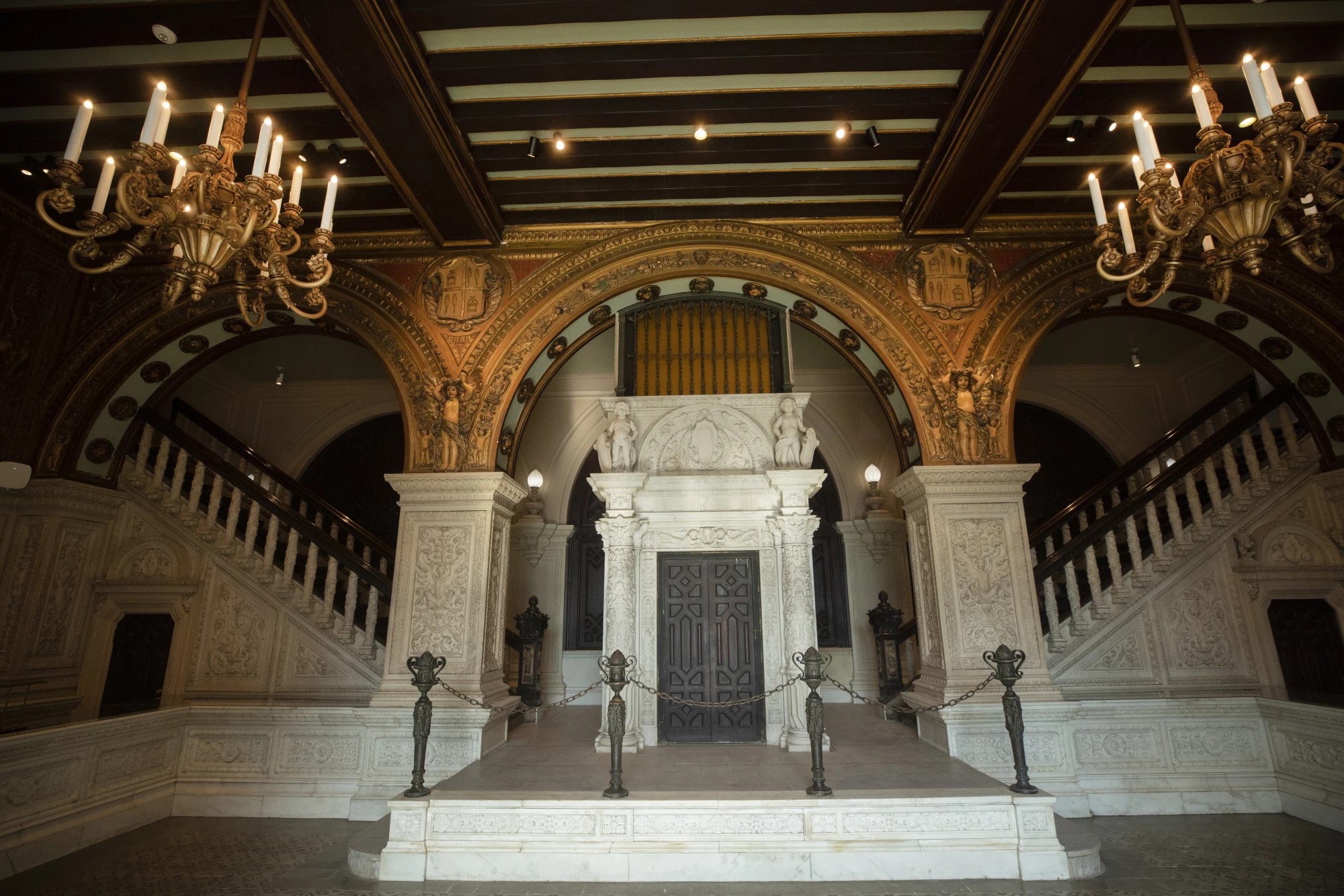 |
|
| (2021)* - Interior view of the restored lobby of the Herald Examiner Building, showcasing Julia Morgan's original design elements: hand-painted tiles, elaborate ironwork, intricately carved woodwork, and soaring ceilings that combine to create one of the most ornate interior spaces surviving from early twentieth century Los Angeles. Photo by Myung J. Chun, Los Angeles Times. |
Historical Notes The lobby of the Herald Examiner Building was Julia Morgan's most personal statement in the entire project. While the exterior communicated authority and civic presence through the language of Mission Revival architecture, the lobby was designed to impress and delight on a more intimate scale. Hand-painted decorative tiles covered the walls in patterns drawn from Spanish Colonial traditions. Elaborate wrought ironwork framed the staircase and balcony railings. Carved wooden details ornamented the ceilings and window surrounds. The overall effect was of a space that took journalism seriously, treating the daily production of a major newspaper as a dignified and even noble enterprise. The restoration by Gensler carefully preserved all of the lobby's historic elements while updating the building's systems and adapting the upper floors for modern use. The private elevator that once carried William Randolph Hearst to his personal suite on the upper floors was retained as a working piece of the building's history. For the editorial and production staff who worked in the building across its decades of active newspaper operation, the lobby was the front door of an institution. Today it serves the same function for students and faculty of Arizona State University, connecting the building's storied past to the intellectual life of its present tenants. |
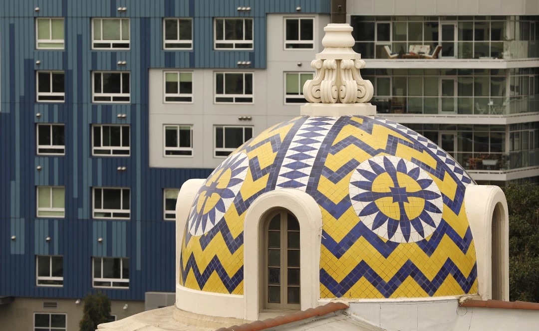 |
|
| (2021)* - The decorative tiled cupolas that crown each corner of the Herald Examiner Building, as seen following the building's 2021 restoration. Julia Morgan specified glazed ceramic tiles in shades of blue and yellow for these rooftop domes, giving the building a distinctive and colorful skyline presence that remains one of its most recognizable features. Photo by Al Seib, Los Angeles Times. |
| Historical Notes
The four ceramic-tiled cupolas at the corners of the Herald Examiner Building are among the most distinctive architectural details in all of downtown Los Angeles. Julia Morgan chose a palette of blue and yellow glazed tiles for these rooftop domes, drawing on the Spanish Colonial and Mission Revival traditions that had deep roots in California's architectural heritage. The domes serve both a decorative and a structural purpose, marking the corners of the block-long building and anchoring the composition of the roofline in a way that is immediately recognizable from blocks away. During the decades of the building's neglect following the Herald Examiner's closure in 1989, the cupolas deteriorated along with the rest of the structure, their tiles fading and in some cases cracking or falling away. The 2015 to 2021 restoration project gave particular attention to returning the domes to their original condition, carefully matching the historic tile patterns and colors. The result is visible in this photograph: cupolas that look very much as they did when Morgan completed the building in 1914, a testament both to the durability of her design and to the commitment of the preservation team that brought the building back to life. |
Then and Now
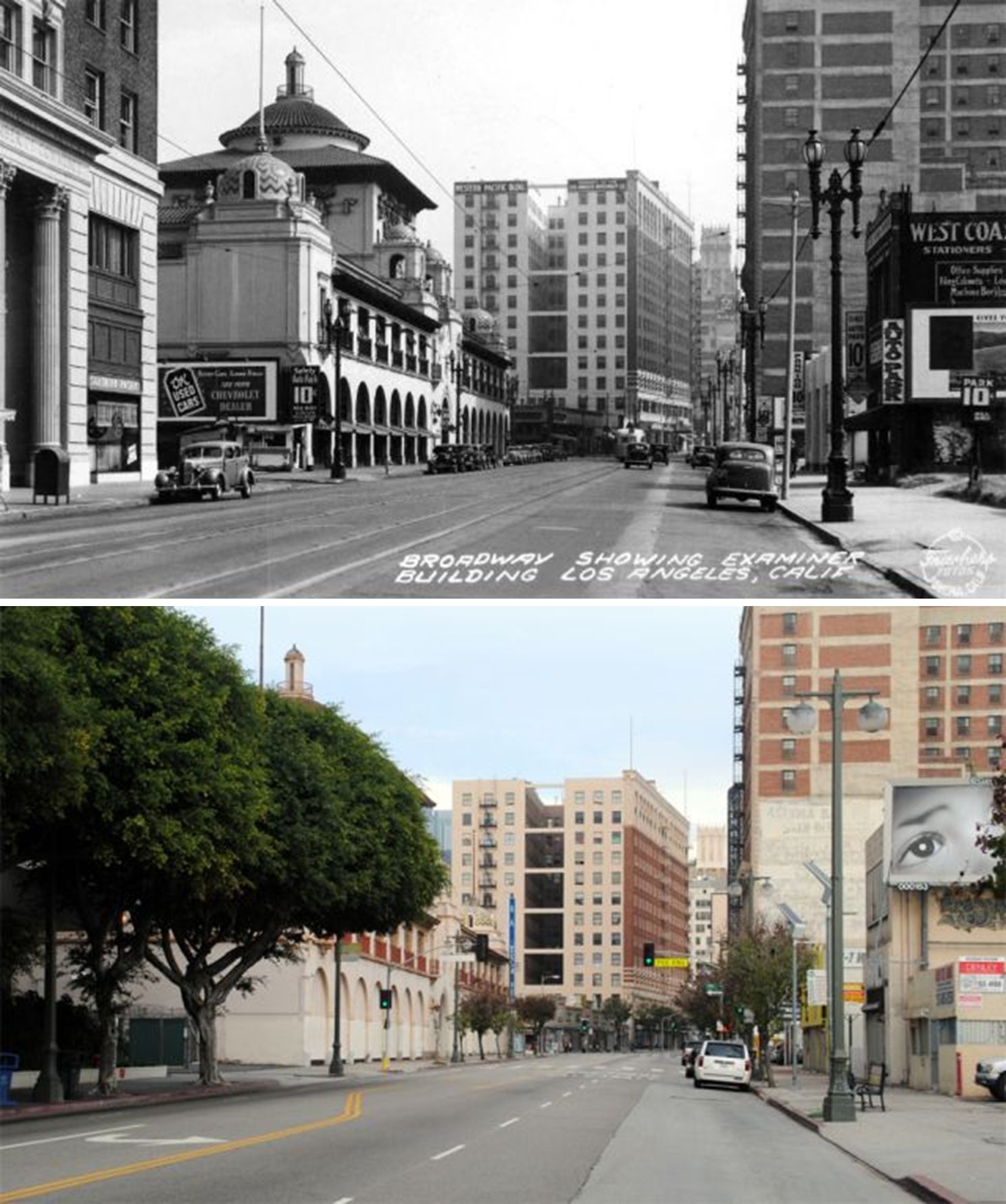 |
|
| (1938 vs. 2014)* - Then-and-now view looking north on Broadway from 12th Street. In the 1938 photograph, the Examiner Building's tiled domes and arched facade rise prominently on the left, with the Western Pacific Building visible in the distance and streetside businesses including a Chevrolet dealership and West Coast Stationers occupying the nearby storefronts. By 2014, mature street trees line the left sidewalk, partially screening the building's lower facade, while the arched ground-floor bays, still sealed from the 1967 labor dispute, remain visible beneath the canopy. Photo comparison by Jack Feldman. |
| Historical Notes
This view from 12th Street offers a perspective on the Examiner Building that few of the other photographs in this collection share: the building seen as a passing motorist or pedestrian on Broadway would have encountered it, approaching from the south with the full length of the block-long facade stretching ahead. In the 1938 image, the tiled domes rise clearly above the roofline, their blue and yellow glazed surfaces catching the light and giving the building an unmistakable silhouette against the downtown skyline. The street-level arches are open, the building fully engaged with the sidewalk life of South Broadway, and the surrounding storefronts reflect the commercial activity of a busy urban corridor. A Chevrolet dealership advertises used cars on the left, and the West Coast Stationers sign is visible across the street, details that together sketch the texture of everyday downtown life in the late 1930s. The 2014 photograph taken from the same vantage point tells a quieter story. The street trees planted along Broadway in the intervening decades have grown large enough to soften and partially obscure the lower portion of the building's facade, a change that reflects the city's effort to humanize the South Broadway corridor during the late twentieth century. The domes are still visible above the tree canopy, and the familiar rhythm of the arched bays can be made out beneath the foliage, but the ground-floor arches remain sealed, a reminder that the labor dispute of 1967 left a physical mark on the building that would not be undone until the restoration completed in 2021. Taken together, the two images span seventy-six years of the building's life along one of downtown Los Angeles's most storied streets. |
Then and Now
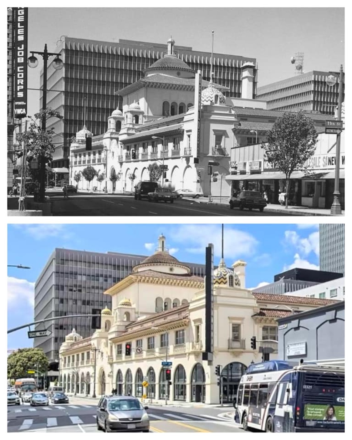 |
|
| (1976 vs 2020s)* – Then-and-now comparison of the Herald Examiner Building at Broadway and 11th Street. The 1976 view shows the building during the years of the labor strike, with the ground-floor arches sealed. The recent view shows the same facade after the comprehensive 2015 to 2021 restoration, with the arches reopened and the exterior returned to something close to Julia Morgan's original design. Photo comparison by Trey Callaway. |
Historical Notes Few before-and-after comparisons in Los Angeles history are as striking as this one. The 1976 photograph shows the Herald Examiner Building during one of its lowest periods: the ground-floor arches sealed with concrete and board, the street-level presence of Julia Morgan's design reduced to a blank and unwelcoming wall. The sealing of the arches had begun in the late 1960s following vandalism connected to the labor strike, and for more than fifty years the building presented this closed face to Broadway, a visible symbol of the institutional decline that eventually ended the paper's run in 1989. The recent photograph tells a different story entirely. The restored building shows the arches open once again, the facade cleaned and repaired, and the tiled domes gleaming above the roofline. The building's designation as Los Angeles Historic-Cultural Monument No. 178 and its recognition by the Los Angeles Conservancy with a 2022 Chair's Award reflect the community's investment in preserving this irreplaceable piece of the city's architectural and journalistic heritage. The comparison makes clear just how completely the restoration has reclaimed the original character of Morgan's design, returning to Broadway a building that is once again a source of civic pride. |
* * * * * |
Trinity Auditorium
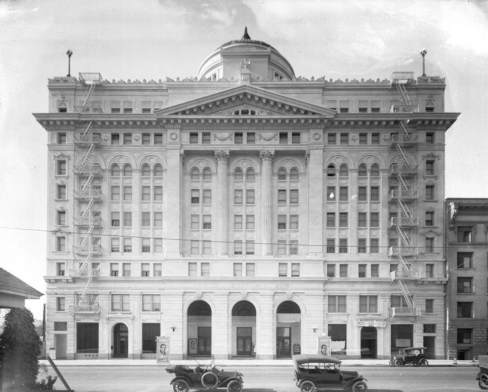 |
|
| (ca. 1914)^ - View of the Trinity Auditorium (later the Embassy Hotel and Auditorium) at 851 S. Grand Avenue. |
Historical Notes The Trinity Auditorium Building opened in 1914. The 9-story Beaux Arts style mixed use hotel, office building and auditorium was designed by architects: Thornton Fitzhugh, Frank G. Krucker and Harry C. Deckbar. The auditorium with a seating capacity of 1,600 to 2,500 featured balconies on three sides and a stained glass ceiling. When it was the Trinity Auditorium Building and being used as a church, three stories of the building were church offices and the hotel portion (325 rooms) was a hotel for men. The auditorium had a huge pipe organ. It was church on Sundays and the auditorium was rented to meetings, conventions, etc. during the week. |
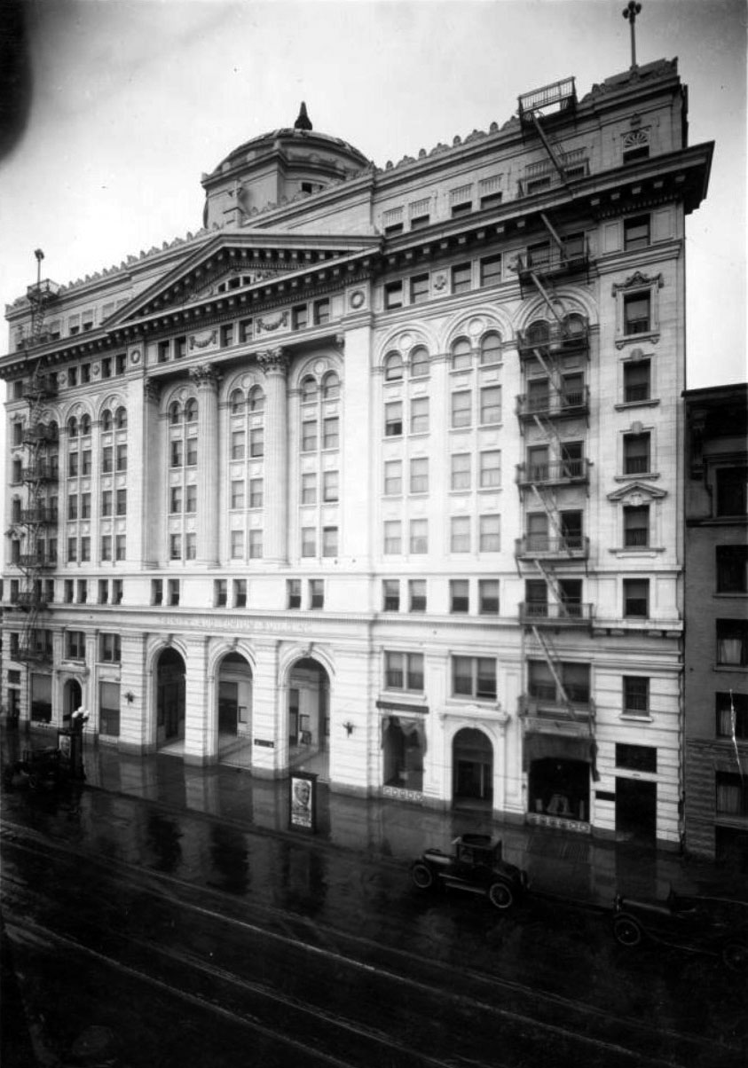 |
|
| (ca. 1914)^ - View showing the Trinity Auditorium, Northwest corner of 9th and Grand. The nine-story Italianate building can be seen with three arches delineating its entrance. A sign stands on the sidewalk in front, featuring a man's face, while two automobiles can be seen farther right, parked on the street. |
Historical Notes The L.A. Philharmonic played their first season here before moving to the Temple Theatre, which they re-christened the Philharmonic Auditorium. When the hotel became the Embassy Hotel, the auditorium was known as the Embassy Auditorium. |
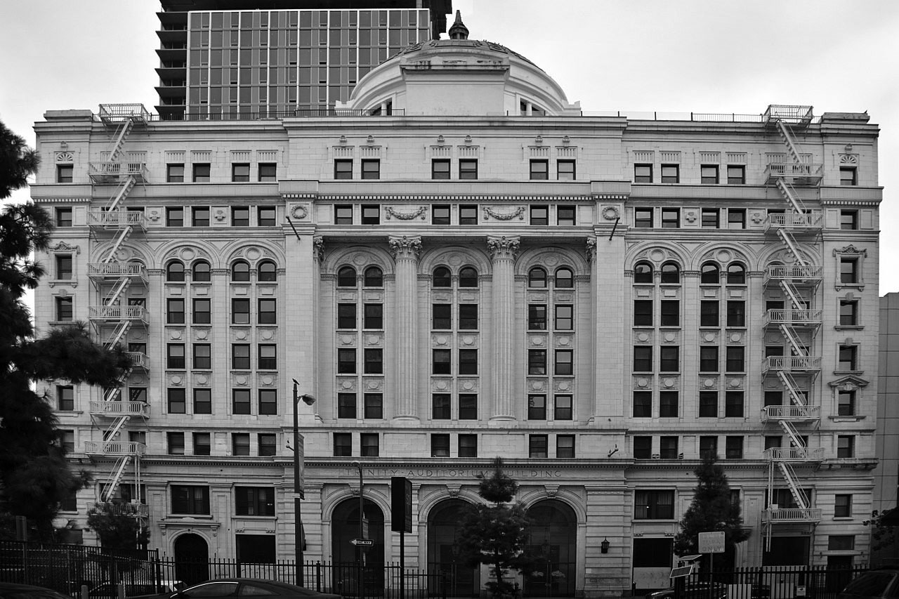 |
|
| (2017)* - Trinity Auditorium, now the Embassy Hotel. Photo by Glenn Francis |
Historical Notes The building was acquired by the University of Southern California in the 1987, when it was used as a residential building and an annex. They sold it to the Chetrit Group, chaired by Joseph Chetrit, in 1998. |
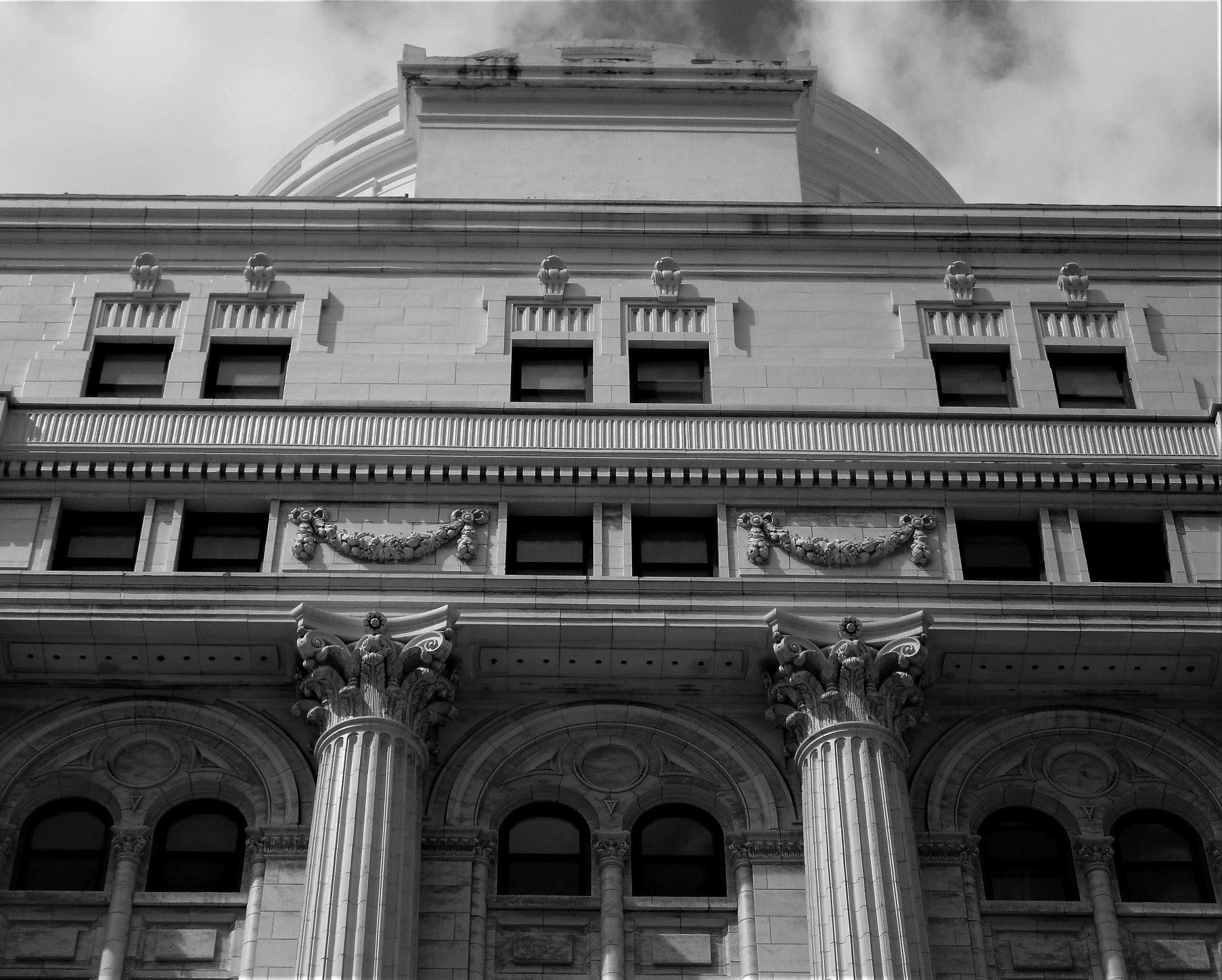 |
|
| (2019)* - Close-up detail view of the Trinity Auditorium as it appears today, 851 S. Grand Avenue. Photo by Howard Gray |
Historical Notes By 2005, the Chetrit Group decided to remodel the building as the Gansevoort West hotel scheduled for 2006. The new hotel was supposed to be an LA version of the Hotel Gansevoort in New York City. However, by 2007, the project had been cancelled. By 2012, the owners decided to turn it into another hotel called the Empire Hotel, with "183 hotel rooms, a groundfloor restaurant, an outdoor garden, a bar, and an entertainment venue." The remodel was still underway in 2014. |
* * * * * |
Southern Pacific Depot (aka Central Station)
 |
|
| (ca. 1915)* – Postcard view showing the entrance to Beaux Arts style Southern Pacific Depot (aka Central Station) located at 5th and Central streets in Downtown LA. |
Historical Notes In 1914, the Southern Pacific Railroad replaced its Arcade Station (built in 1888) with the Central Station, a larger and more modern railroad passenger depot. The Union Pacific Railroad moved its Downtown Los Angeles passenger terminal to Central Station in 1924 after its original passenger depot just south of First Street on the east side of the Los Angeles River was destroyed by fire. |
 |
|
| (ca. 1920)* – View showing 5 Union Pacific locomotives at Central Station as train passengers wait while railroad employees do their jobs. Across from Central Station, the Hotel Morris can be seen in the distance. |
Historical Notes Central Station was used by Southern Pacific and Union Pacific Railroads, and was located on Central Avenue at the end of 5th Street. |
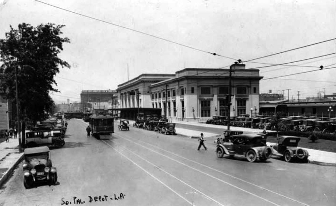 |
|
| (ca. 1924)^ - View looking south on Central showing the Southern Pacific Railroad Depot (aka Central Station) with streetcars and autos sharing the street. Taxi cabs can be seen across the depot (on the left), parked perpendicular to the curb, waiting for passengers to arrive. |
Historical Notes The Southern Pacific depot was one of three railroad depots that served the Los Angeles area before the construction of Union Station in 1939. The Southern Pacific Arcade depot was originally constructed in 1888 at 5th and Central streets. 26 years later, in 1914, the station was rebuilt on an adjoining site, and renamed to Central Station. In 1924, the Union Pacific Railroad moved its Downtown Los Angeles passenger terminal to Central Station after its original passenger depot was destroyed by fire. The Central Station, along with the "La Grande" Santa Fe Railroad Passenger Depot, was replaced in 1939 by Union Station and later demolished. |
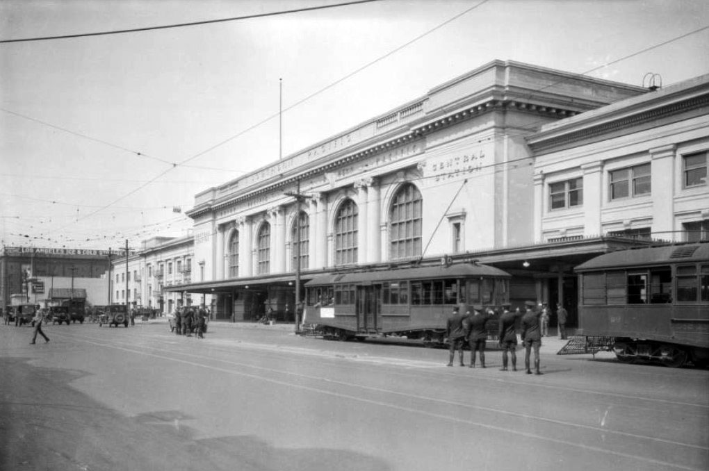 |
|
| (1927)^^ – Streetcars are lined up in front of the Southern Pacific Depot, with what appears to be uniformed porters waiting for passengers to arrive. |
Historical Notes The Southern Pacific depot was one of three railroad depots that served the Los Angeles area before the construction of Union Station in 1939. The Southern Pacific Arcade depot was originally constructed in 1888 at 5th and Central streets. 26 years later, in 1914, the station was rebuilt on an adjoining site, and renamed to Central Station. In 1924, the Union Pacific Railroad moved its Downtown Los Angeles passenger terminal to Central Station after its original passenger depot was destroyed by fire. The Central Station, along with the "La Grande" Santa Fe Railroad Passenger Depot, was replaced in 1939 by Union Station and later demolished. |
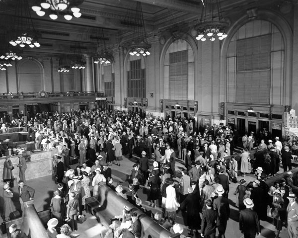 |
|
| (ca. 1920s)^^ - Interior view of the Central Station lobby jam-packed with people. |
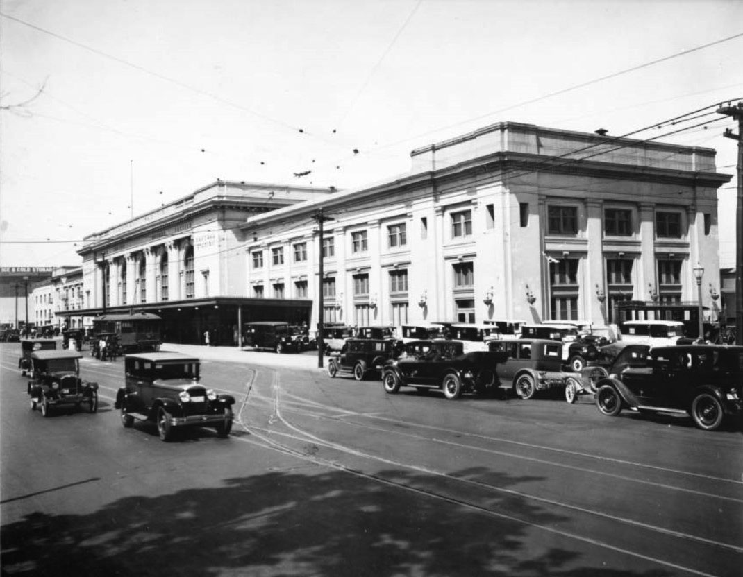 |
|
| (1926)^ - View showing the Southern Pacific depot, located at Fifth Street and Central Street. Text above the entrance of the building reads "Southern Pacific" and "Central Station". A streetcar sits to the left of center, in front of the depot, while parked automobiles line the street in the right foreground. |
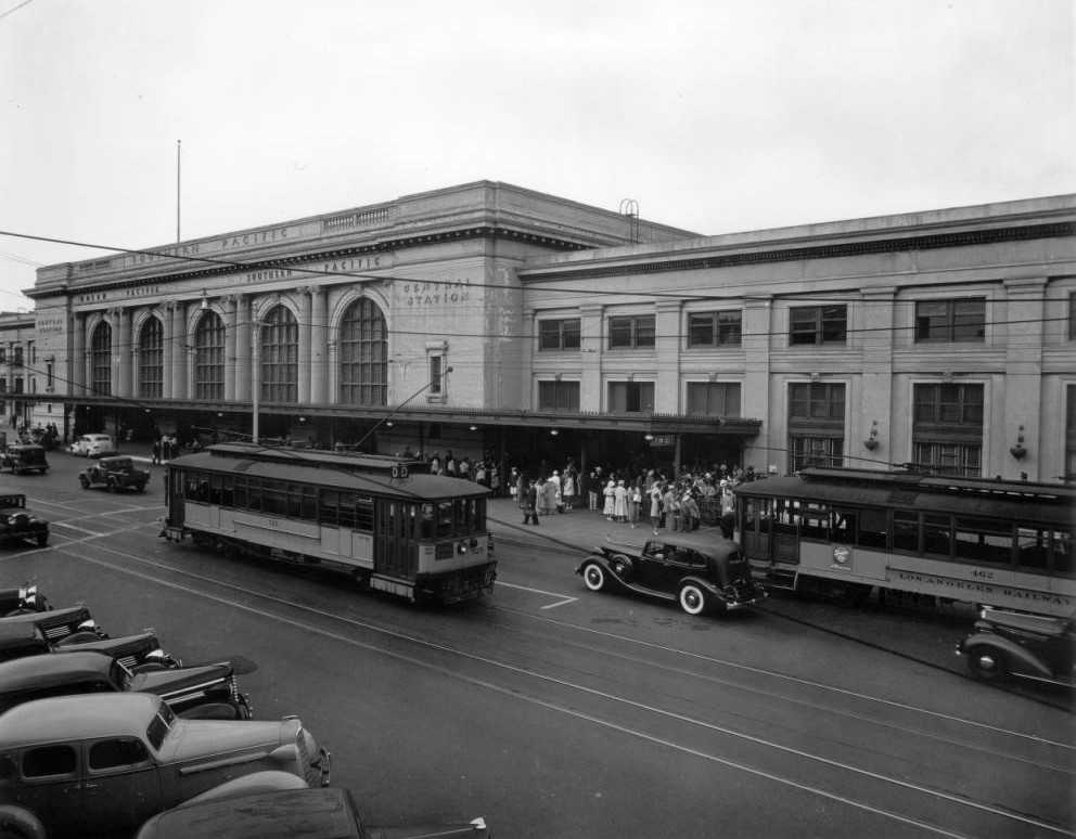 |
|
| (1937)*^ - View showing the Southern Pacific, Union Pacific Central Station located at Central Avenue and 5th Street. |
Historical Notes The Central Station, along with the "La Grande" Santa Fe Railroad Passenger Depot (2nd St. and Santa Fe Ave.), was replaced in 1939 by Union Station and later demolished.^* |
 |
|
| (ca. 1930s)*^^ - The interior of Central Station is lit by the sun pouring through the large windows. |
 |
|
| (1937)^.^ – View showing Southern Pacific 4416 “Daylight” at Central Station. |
Historical Notes Southern Pacific trains known as 'Daylights' ran during the daytime between San Francisco and Los Angeles beginning in 1937. The first 'Daylight' train left at 8:15 a.m. In January 1940 the 'Noon Daylight' train was added to accommodate additional passengers; it departed daily at noon. |
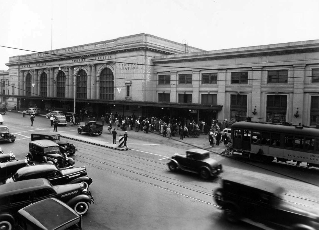 |
|
| (ca. 1937)^^ - A crowd is gathered in front of the Old Central Railroad Station with cars parked on the other side of the street. |
Historical Notes The Central Station, along with the "La Grande" Santa Fe Railroad Passenger Depot (2nd St. and Santa Fe Ave.), was replaced in 1939 by Union Station. The trains moved to Union Staton but the building, with exterior adornments removed, stood until the late 1960s. |
* * * * * |
J.W. Robinson Department Store |
Joseph Winchester Robinson came to Los Angeles in 1882 not to sell dry goods but to grow oranges. The Waltham, Massachusetts merchant had purchased land in Riverside with farming in mind, but the city of 13,000 people he found on arrival convinced him there was a more urgent opportunity. He returned east, worked his trade contacts, and in February 1883 opened the Boston Dry Goods Store at the corner of Spring and Temple Streets, promising customers "fine stocks and refined 'Boston' service." After Robinson's death in 1891, his father renamed the company the J. W. Robinson Company in his son's memory. The store moved several times as Los Angeles grew around it, reaching 239 South Broadway by 1895. By 1914, with Broadway running out of room, the company purchased a full block along West Seventh Street between Grand and Hope and broke ground on a seven-story flagship. Critics called the location out of the way. They were wrong.The store that opened on September 7, 1915, at 600 West Seventh Street cost one million dollars and covered nearly nine acres of floor space. It set the tone for an entirely new upscale shopping district, drawing Ville de Paris, Coulter's, and Desmond's to follow along Seventh Street. The building was expanded in 1923, remodeled in 1934, and designated Los Angeles Historic-Cultural Monument No. 357 in 1988. The Robinson's name retired with the 1993 merger into Robinsons-May, and the flagship closed. The building at 600 West Seventh Street still stands today, its Moderne exterior largely intact, now housing telecommunications infrastructure, offices, and ground-floor retail. |
Origins and Move to Seventh Street (1883–1915) |
Robinson's history on Seventh Street began not with a grand plan but with a calculated gamble. After more than three decades of steady growth through successive downtown locations, the company chose to leave the familiar Broadway retail corridor entirely and stake its future on a block that most of Los Angeles had not yet considered for serious commerce. |
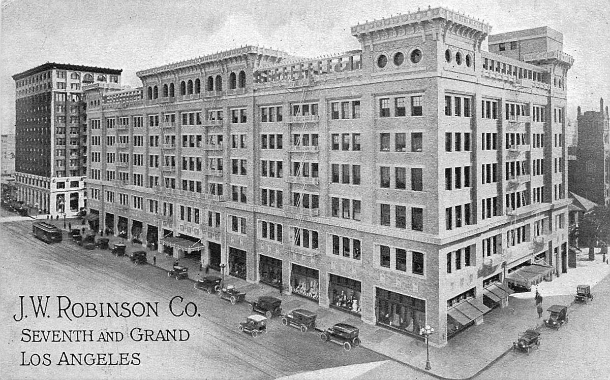 |
|
| (ca. 1915)^ – Postcard view of the newly constructed J. W. Robinson Co. store at the corner of 7th Street and Grand Avenue. The back of the postcard reads: "Where nine acres of floor space, perfectly lighted, equipped with the most modern fixtures and served by ten large passenger elevators, place the convenience and dispatch of the finest Dry Goods Store in America at the disposal of the public." |
Historical Notes Joseph Winchester Robinson opened the Boston Dry Goods Store in February 1883 at the corner of Spring and Temple Streets, bringing eastern merchandise and what he called "refined 'Boston' service" to a city of roughly 13,000 people. Robinson died in 1891 at the age of 44, and his father came from Boston to continue the business, renaming it the J. W. Robinson Company in his son's memory. The store relocated to 239 South Broadway in 1895 and grew steadily as Los Angeles expanded around it. By 1914, with the Broadway location unable to accommodate further growth, the company purchased a full block along West Seventh Street between Grand and Hope Streets and began construction on a seven-story flagship. When the store opened on September 7, 1915, it was designed by the architectural firm Noonan and Richards. Promotional materials at the time noted nine acres of floor space, advanced lighting throughout, and ten passenger elevators for vertical movement across seven floors, all intended to deliver the efficiency and comfort the company had long associated with its brand. |
Architecture and Early Design (1915) |
From the moment it opened, the Robinson's building announced itself as something more than a place to shop. Its architects gave the structure a civic presence that matched the company's ambitions, combining classical detailing with the practical demands of a large modern retail operation. |
 |
|
| (ca. 1915)* - Corner view of the J. W. Robinson Co. store at 7th Street and Grand Avenue, showing the building's distinctive corner towers and elaborate terra cotta detailing shortly after opening. |
Historical Notes The seven-story structure was built of beige pressed brick trimmed in cream and polychrome terra cotta, featuring distinctive corner towers, deeply projecting cornices, and oculus windows. The street-level frontage was defined by plate glass display windows measuring 60 feet long and nearly 20 feet high. Inside, a grand sixteen-foot-wide aisle entered from Seventh Street, and the seventh floor housed a dining room approached through a foyer arranged as a palm room, with two roof gardens on either side. A Los Angeles Times reporter who visited on opening day described the interior as one of "dignified elegance," noting soft grays, tans, and tapestried panels throughout, with woodwork of Southern gum "chastely inlaid." |
 |
|
| (1926)* - Shoppers gather at a J. W. Robinson Co. display window along Seventh Street, drawn by the store's elaborate street-level presentations. |
Historical Notes Window displays were central to the Robinson's identity and helped distinguish the store from the more utilitarian retail of the Broadway corridor to the east. The Greek Revival-influenced facade featured an elaborate Corinthian-style cornice, a high parapet broken by high-relief entresol panels, and 60-foot plate glass windows at street level that gave passersby an unobstructed view of the merchandise inside. Robinson's cultivated an atmosphere of refined commerce from its earliest days, and its window presentations were considered among the finest in Los Angeles retail. |
Growth of the Seventh Street Retail District (1915–1928) |
Robinson's success along Seventh Street did more than establish a single store. It pulled the commercial center of Los Angeles westward and gave the block a character that Broadway, with its more democratic mix of retailers, could not match. Within a decade, Seventh Street had become the city's premier address for upscale shopping. |
 |
|
| (1928)* - J. W. Robinson Co. at 7th and Grand, showing the expanded store with rooftop pergolas and the commercial vitality of Seventh Street at its peak. Globe street lamps line the sidewalks as pedestrians and automobiles fill the block. |
Historical Notes Although Robinson's location west of Broadway had drawn early skepticism, the store's rapid success quickly settled the question. Other retailers followed, and Seventh Street between Grand and Figueroa was transformed into downtown's high-end shopping corridor, with Ville de Paris, Coulter's, Desmond's, and Barker Brothers among those that established a presence nearby. Thirteen large office buildings opened along the street between 1920 and 1928, and by 1929 every plot between Figueroa and Los Angeles Streets had been developed. Robinson's own expansion reflected the district's momentum. In 1923, a seven-story annex was built to the south at a cost of $900,000, with Dodd and Richards again serving as architects. The addition brought the store's total footprint to approximately 624,000 square feet, making it one of the largest retail operations in Southern California. |
Remodeling and Mid-Century Presence (1934–1950s) |
The Depression did not stop Robinson's from investing in its future. In 1934, coinciding with the store's 51st anniversary, the company undertook a substantial exterior remodeling that gave the building the appearance it largely retains today. The Los Angeles Times noted that the project "marked the third time in its history that the J. W. Robinson Co. expressed confidence by expanding in periods of world stress." |
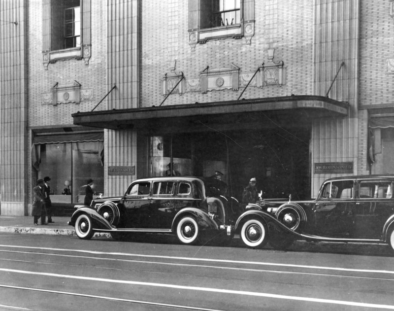 |
|
| (1938)* - The Seventh Street entrance to J. W. Robinson Co., photographed January 27, 1938 by the Works Progress Administration. A canopy covers the entrance and two Rolls-Royce automobiles are parked at the curb. The remodeled facade shows recessed upper-story windows flanked by stylized columns and classical friezes above the display windows. |
Historical Notes The 1934 remodeling was designed by architect Edward L. Mayberry and unveiled September 3, 1934. The project cost between $100,000 and $200,000 and replaced the building's original Mission Revival and Beaux Arts detailing with what the store described as a "restrained-modernistic design." Executed in reinforced concrete and stucco, the new exterior combined streamlined Art Deco surfaces with oversized classical elements. The Los Angeles Times called the result "one of the outstanding beautiful structures of America." At the time of the remodeling, the company had grown from its original two employees in 1883 to a staff of 1,500. |
 |
|
| (1951)* - Corner view of J. W. Robinson Co. at 7th Street and Grand Avenue, showing the Moderne exterior as it appeared after the 1934 remodeling. The building retains this appearance today. |
Historical Notes By the early 1950s, the Seventh Street flagship remained a prominent downtown destination, its remodeled exterior now a familiar presence at the corner of Grand and Seventh. Robinson's did not open its first branch until 1952, when a Beverly Hills location near Wilshire and Santa Monica Boulevards debuted to considerable attention. In 1955, the company was acquired by Associated Dry Goods, a New York-based holding company, though it continued to operate with the character and reputation for quality that had defined it since its founding. Click HERE to see contemporry view. |
Later Years and Closure (1980s–1993) |
By the time downtown Los Angeles began its long retail decline in the 1970s and 1980s, Robinson's had expanded to roughly 30 branch stores across Southern California and Arizona. The flagship endured, but the forces reshaping American retail were larger than any single store could withstand. |
Preservation and Adaptive Reuse |
The closing of the flagship store did not mean the end of the building. Designated a Los Angeles landmark before Robinson's itself closed its doors, the structure at 600 West Seventh Street has continued to serve the city in ways its original occupants could not have imagined. In 1988, the Robinson's building was designated Los Angeles Historic Cultural Monument No. 357, recognizing both its architectural significance and its role in shaping the Seventh Street retail district. After the store closed in 1993, the building was adapted for new uses rather than demolished. Today it houses telecommunications infrastructure, offices, and ground-floor retail, allowing the structure to remain an active part of downtown Los Angeles while preserving its historic form. Click HERE to see contemporry view. |
Then and Now |
These paired views show the southwest corner of Seventh Street and Grand Avenue across seven decades, capturing both how much has changed on the surrounding skyline and how consistently the Robinson's building itself has held its form. The 1934 remodeling that gave the structure its current appearance proved durable enough to outlast the store it was designed for. |
 |
|
| (2022 vs. 1951)* - Robinson's Department Store Building at the southwest corner of Grand Avenue and 7th Street. Photo comparison by Jack Feldman. |
Historical Notes The 2022 view shows how thoroughly the skyline around the Robinson's building has changed since 1951. The towers of Bunker Hill, largely undeveloped as late as the 1960s, now rise immediately to the north, and the street-level environment reflects decades of shifts in downtown land use. The Robinson's building itself reads as comparatively low and horizontal against its current neighbors, a contrast that was far less pronounced when it was built and the blocks around it were occupied by two- and three-story commercial structures. |
 |
|
| (1951 vs. 2022)* – The southwest corner of Grand Avenue and 7th Street, then and now. The 1934-remodeled J. W. Robinson Co. flagship, with its "restrained-modernistic" exterior by architect Edward L. Mayberry, remains largely intact. The store closed in 1993, and the building at 600 West Seventh Street now houses telecommunications infrastructure, offices, and ground-floor retail. Photo comparison by Jack Feldman. |
Historical Notes The 1951 view captures Seventh Street at a moment when the downtown retail district was still functioning as Robinson's had helped build it, with the store as a genuine commercial anchor at the intersection of Grand and Seventh. By 2022, the surrounding retail fabric had largely given way to office and mixed-use development, and the pedestrian character of the block had changed considerably. The building's Moderne exterior, however, remains close to what Mayberry designed in 1934, making it one of the more intact survivors of the Seventh Street district's commercial peak. |
Legacy of a Downtown Landmark The J. W. Robinson Co. building at 7th and Grand stands as a reminder of a time when department stores shaped the identity of downtown Los Angeles. What began in 1915 as a bold move away from the established Broadway retail core became a catalyst for Seventh Street's transformation into the city's premier upscale shopping district. Other stores followed Robinson's lead, and within a decade the block had become one of the most active commercial corridors in Southern California. The Robinson's name retired with the 1993 merger into Robinsons-May, and the flagship closed not long after. But the building itself survived. Its Moderne exterior, largely as architect Edward L. Mayberry left it in 1934, remains a defining presence at the corner of Seventh and Grand. The building's longevity reflects something the city has managed more than once: finding new use for the old without erasing the record of what came before. |
* * * * * |
Arroyo Seco Branch Library |
A Carnegie Library at the Crossroads of Highland Park History |
The Arroyo Seco Branch Library has served Highland Park readers for more than a century. Located on a triangular lot at North Figueroa Street and Piedmont Avenue, the site connects several layers of Los Angeles history: the Carnegie library movement, early streetcar travel, neighborhood growth, and even the city’s first municipal electric power pole.Three different library buildings have stood on this corner over time. Each reflects the era in which it was built and the changing needs of the community it served. |
 |
|
| (1914)* - View of the original Arroyo Seco Branch Library at 6145 North Figueroa Street (formerly 6545 Pasadena Avenue). Tall Classical Revival columns frame the rounded entrance. |
Historical Notes The Arroyo Seco Branch opened in 1914 as one of six Los Angeles neighborhood libraries funded by Andrew Carnegie’s gift to the city. Los Angeles received a $210,000 Carnegie grant for branch libraries, and the Arroyo Seco Branch is often cited as receiving about $35,000 of that funding. Architect Frederick M. Ashley designed the building in the Classical Revival style. Like many Carnegie libraries, it included community-oriented spaces meant for reading and gatherings. The branch also grew out of earlier library efforts in Garvanza and Highland Park and carried forward that neighborhood tradition of public learning. |
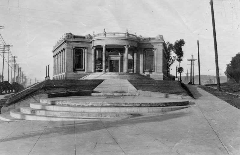 |
|
| (ca. 1916)* - Exterior view of the library. Along Piedmont Avenue at right, the pole line includes the location of Los Angeles’ first municipal power pole installed by the Bureau of Power and Light (later LADWP). Click HERE to see more in LA's First Municipal Power Pole. |
Historical Notes On March 30, 1916, the Bureau of Power and Light dedicated its first municipal electric distribution pole at this corner. A sidewalk plaque today marks the location. This moment marked Los Angeles’ early move toward publicly owned electric service and ties the library site directly to the story of municipal power in Los Angeles. |
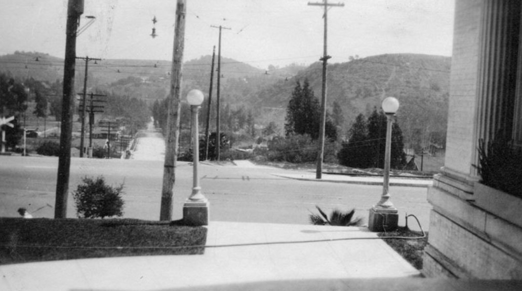 |
|
| (ca. 1920)* - Looking east from the Arroyo Seco Branch Library across North Figueroa Street. |
| Historical Notes
By the 1920s, Highland Park was a growing streetcar suburb. The library served as both a reading room and a neighborhood gathering place. Its location near transit routes made it easy for residents to visit on foot or by streetcar. |
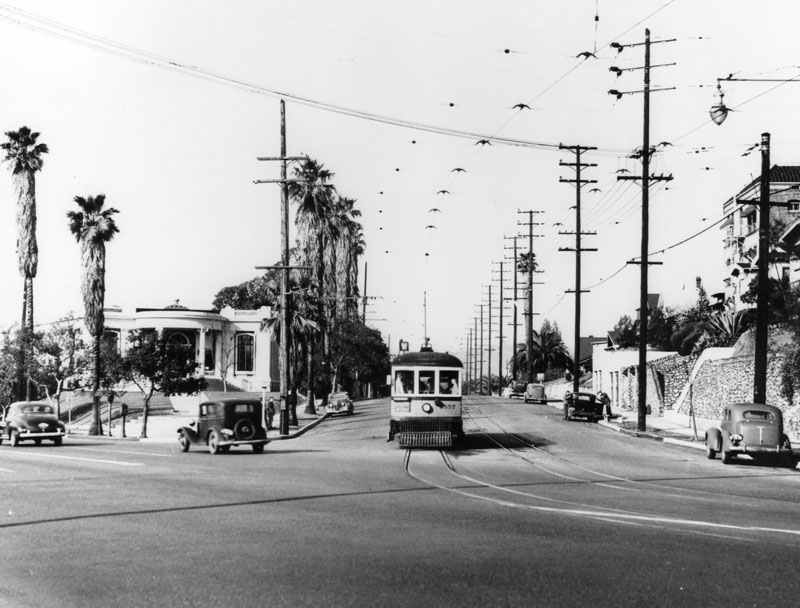 |
|
| (1946)* - Looking southwest on Piedmont Avenue as a streetcar heads toward the bend at North Figueroa Street, with the library property on the left. |
| Historical Notes
Streetcars once played a major role in daily life in Highland Park. The library stood along an active transit corridor, placing it at the heart of community activity and neighborhood movement. |
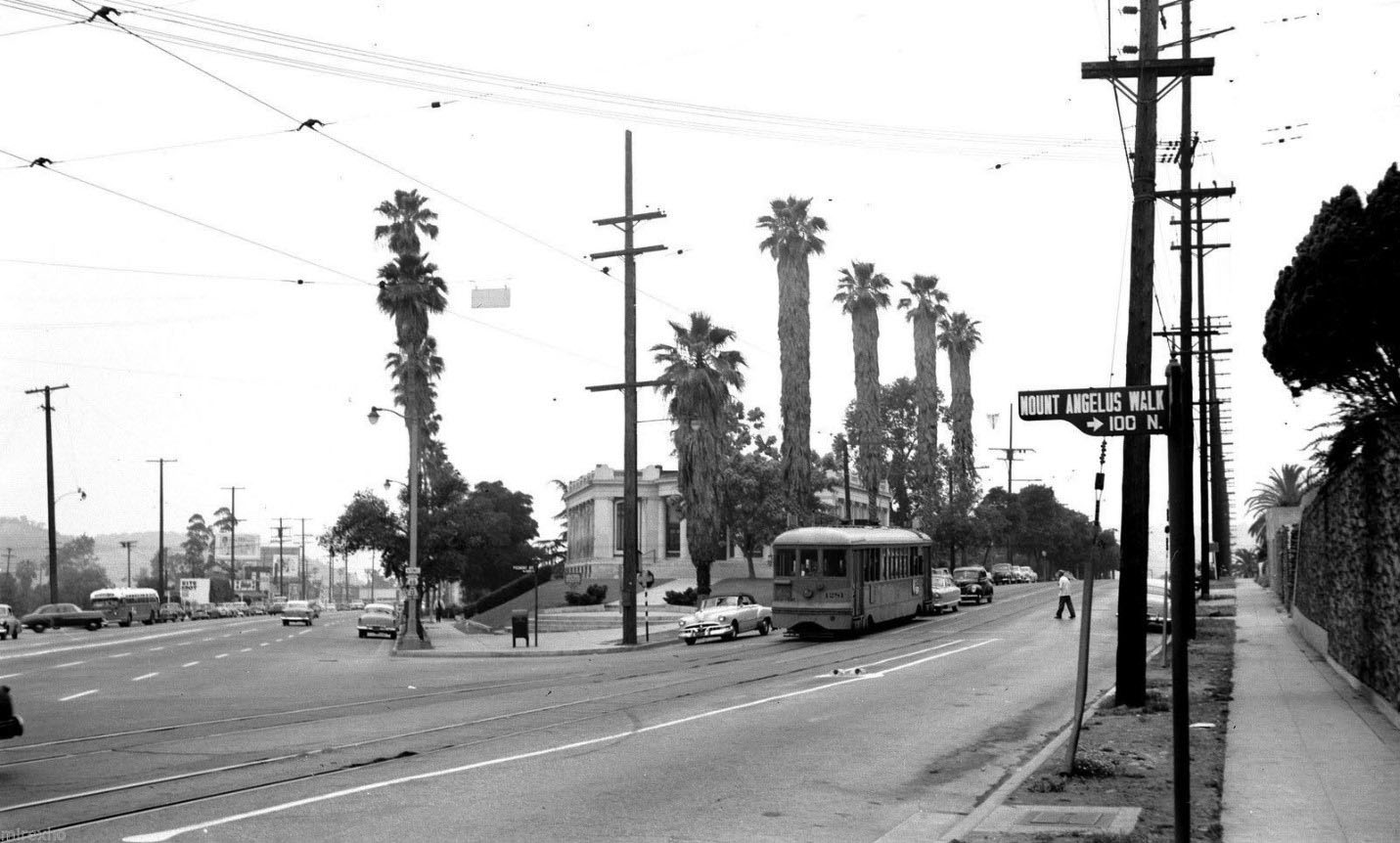 |
|
| (ca. 1951)^* – Los Angeles’ first municipal power pole stands at the corner of Piedmont Avenue and North Figueroa Street. A sign at right points to Mount Angeles Walk, the stairway leading up to Mount Angelus Place. |
| Historical Notes
Even decades after installation, the first municipal pole remained a visible landmark. Its survival into the mid-20th century highlights how early public power infrastructure became part of the neighborhood landscape. |
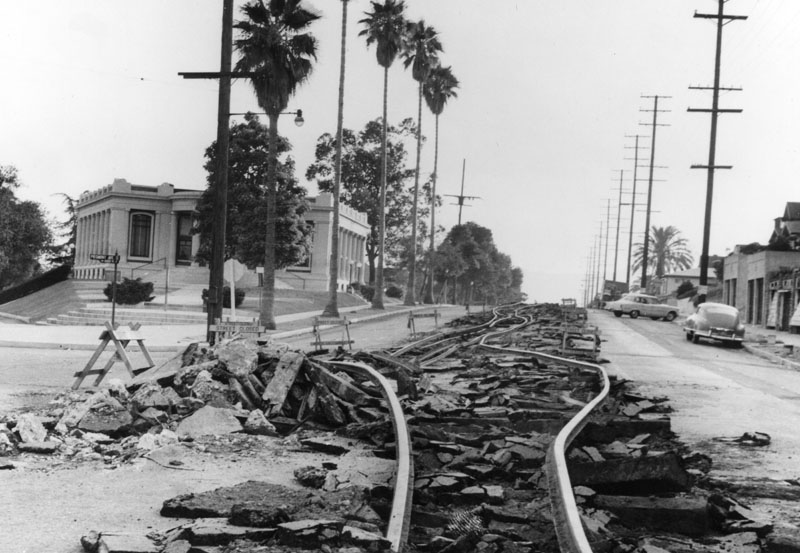 |
|
| (1958)^^ - Streetcar tracks are being removed on Piedmont Avenue. LADWP’s first municipal power pole remains standing in its original location at Piedmont Avenue and North Figueroa Street. |
Historical Notes By the late 1950s, the streetcar era in Los Angeles was ending. The removal of tracks marked a shift toward automobile travel and bus service. Around this same time, the original 1914 Carnegie library was nearing the end of its life. The Carnegie building was demolished in 1959 and replaced by a new Modernist branch that opened in 1960. That building reflected mid-century design trends and even included rooftop parking — a feature later abandoned due to maintenance problems. |
Then and Now
 |
|
| (1946 vs. 2021)* - Looking southwest on Piedmont Avenue toward the bend at North Figueroa Street in Highland Park. The library site appears on the left, showing how this historic corner has evolved over time. Photo comparison by Jack Feldman. |
| Historical Notes
Today’s Arroyo Seco Regional Branch Library is the third building on this site. The current structure opened in 2003 and was designed by the firm M2A (Barry Milofsky and Thomas Michali). Its design includes elements meant to relate to local Northeast Los Angeles history and nearby historic architecture. |
* * * * * |
Exposition Park |
 |
|
| (ca. 1900)* - Partial view of the racetrack at Exposition Park in the early 1900s. Photograph shows the grandstand with three open towers, an adjacent smaller structure, possibly a concession stand, and another unidentified structure on the extreme left. |
Historical Notes Originally, this piece of land served as an agricultural fairground from 1871 to 1911. Farmers sold their harvests on the grounds, while horses, dogs, camels, and later automobiles, competed along the racetrack (seen). In the late 1800s and early 1900s, the city's most influential families moved into the neighborhood but did not appreciate the racing and gambling that came with it. As a result, this racetrack was transformed into the now-famous Exposition Park Rose Garden. November 6, 1913, marked the beginning of a two-week, city-wide celebration that opened Exposition Park and its facilities (also the LA Aqueduct). |
 |
|
| (ca. 1930s)* - Jets of water converge in the center of the fountain in Exposition Park which is filled with lily pads. |
Historical Notes On November 6, 1913, Exposition Park was formally dedicated, and became the home to a state Exposition Building and the county Museum of History, Science and Art. Senator John Works dedicated the fountain as a commemoration of the Owens River/Los Angeles Aqueduct whose grand opening coincided with the opening of Exposition Park. As the Senator left the platform, a jet of water shot up 30 feet.* Click HERE to see the Opening Ceremonies of the LA Aqueduct. |
Click HERE to see the Commemorative of the Official Opening of the LA Aqueduct and Exposition Park. |
* * * * * |
Natural History Museum |
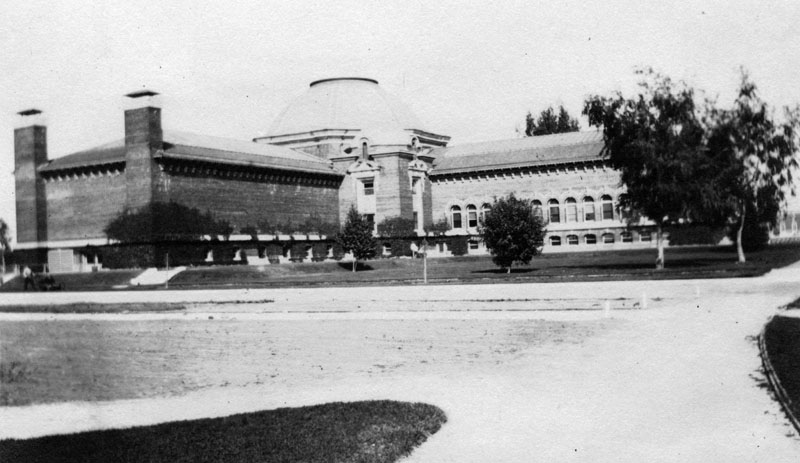 |
|
| (ca. 1915)* - A view of the Los Angeles Museum of History, Science, and Art and its grounds. A driveway in the foreground veers around the museum, a multi-storied, brick building with arms extending from a rotunda. |
Historical Notes The Natural History Museum of Los Angeles County opened in Exposition Park in 1913 as the Museum of History, Science, and Art. The moving force behind it was a museum association founded in 1910. Its distinctive main building, with fitted marble walls and domed and colonnaded rotunda, is on the National Register of Historic Places. |
 |
|
| (ca. 1915)* - "History, Science and Art Upholding the World"; a bronze sculpture by Julia Bracken Wendt installed in 1914 in the rotunda of the L.A. Museum of History, Science, and Art. Three robed, female figures hold aloft an illuminated globe and stand in the exact center of the rotunda. |
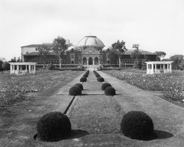 |
|
| (ca. 1915)* - Sunken gardens, also called Rose Garden, at Exposition Park, formerly called Agricultural Park, with museum buildings in the background. This photo shows a view of the History, Science and Art Building. |
Historical Notes Exposition Park, originally named Agricultural Park, was developed in 1876 as a showground for agricultural and horticultural fairs. The property became state land in 1880, but during the 1890s it fell into private hands and became victim to deterioration. Late in the decade, USC law professor William M. Bowen and USC President George Finley Bovard garnered the commitments of city, state, and county to develop the land as a public educational, cultural and recreational center. |
 |
|
| (ca. 1925)^ – View showing the central fountain (aka "Los Angeles Aqueduct Fountain") in Exposition Park with the domed Natural History Museum in the background. A large main jet of water spouts from the center of the circular fountain while smaller spouts shoot inward to it, surrounded by plant growth. In the foreground, the fountain appears to extend into a lily-pond. |
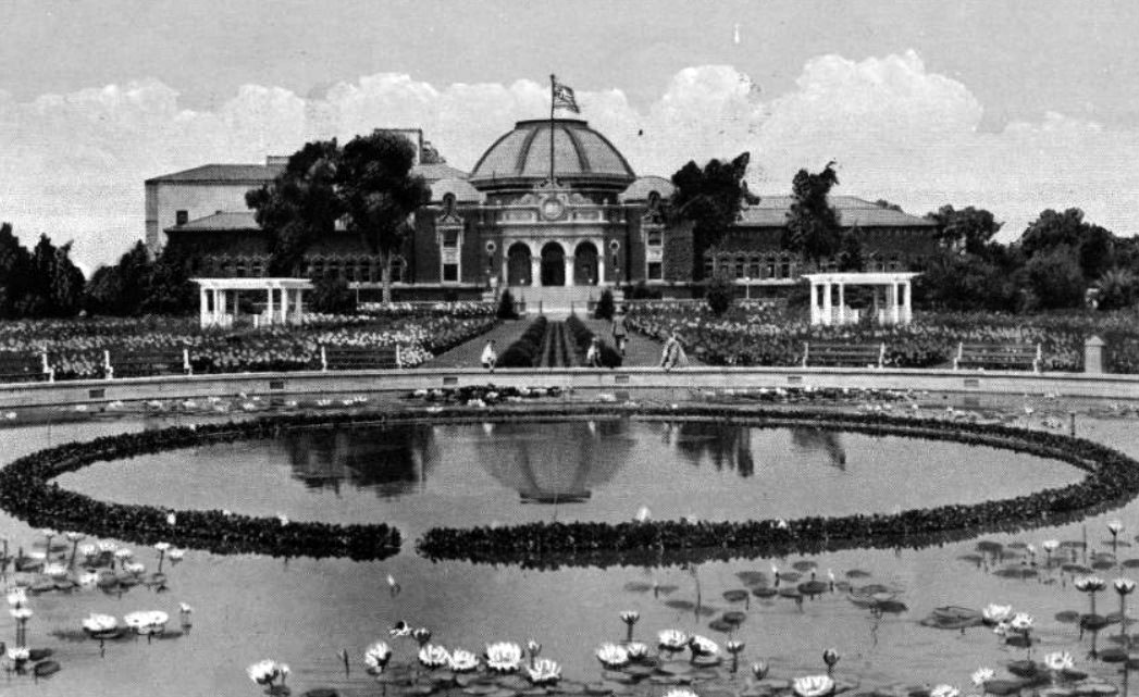 |
|
| (ca. 1929)#^^ – Postcard view showing the Natural History Museum at the end of the Rose Gardens as seen from the other side of the “LA Aqueduct Fountain”. |
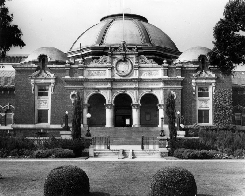 |
|
| (ca. 1915)* - View of the eastern entrance of the Los Angeles Natural History Museum. The Beaux Arts/Romanesque style building features three large stone arches, a large center dome with two smaller ones on either side, terracotta-tiled roof, fancy ornamental moldings and patterns above the portico entry, and several types of bricks and many different brick patterns forming the walls of this three-story building. Above the stone arches the words "Los Angeles County Historical and Art Museum" are etched into the facade. |
Historical Notes On November 6, 1913 the Museum of History, Science, and Art was formally dedicated and opened in Exposition Park. Additional wings of the museum opened in 1925, 1930, 1960, and 1976. In 1961, it was "divided" into the Los Angeles County Museum of History and Science, and the Los Angeles County Museum of Art (known as LACMA, since moved to new quarters on Wilshire Blvd). Years later, the museum was again renamed, becoming the Natural History Museum of Los Angeles County. It is the largest museum in the western United States, with a collection of nearly 33 million specimens and artifacts covering 4.5 billion years of history. The Natural History Museum, located at 900 Exposition Boulevard between Vermont and Figueroa, was added to the National Register of Historic Places in 1975. |
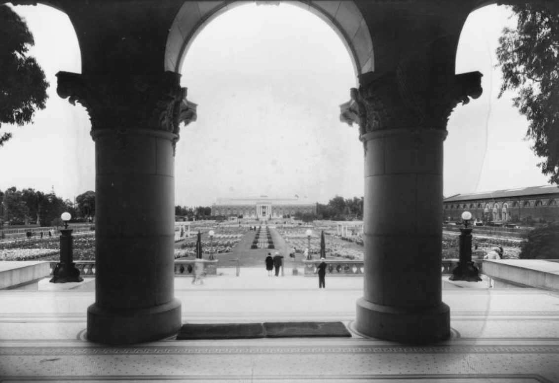 |
|
| (ca. 1929)* - View looking at the Sunken Gardens at Exposition Park as seen through the columned entrance of the Natural History Museum. In the distance stands the State Armory Building and to the right is the State Exposition Building. |
* * * * * |
State Armory Building |
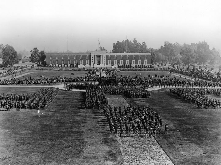 |
|
| (1920)* - Sunken gardens, also called Rose Garden, at Exposition Park, formerly called Agricultural Park, with State Armory Building. This photo shows Pershing Day, Jan. 26, 1920, at the Sunken Gardens at Exposition Park. |
Historical Notes The Armory Building was designed in by State Architect J.W. Woollett for the California National Guard 160th Infantry. The seven and a half acre Rose Garden, also called Sunken Garden, evolved from the redevelopment of Agricultural Park, and was also completed in 1913. |
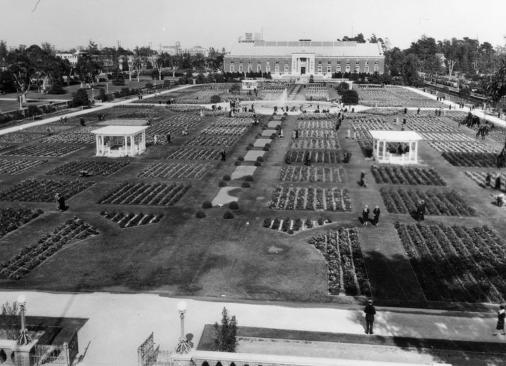 |
|
| (1935)* - View of the Rose Garden, at Exposition Park, formerly called Agricultural Park, with State Armory Building in the background. The photo was taken from the steps of the County Museum of History Science and Art Building. |
Historical Notes Originally named Agricultural Park in 1876, the 160-acre site was developed and served as an agricultural and horticultural fairground until approximately 1910, at which point it was re-named Exposition Park. On November 6, 1913, Exposition Park was formally dedicated, and became the home to a state Exposition Building and the county Museum of History, Science and Art, and was slated to gain a National Guard Armory.* On November 6, 1913, a celebration was held as a joint dedication of both the opening of Exposition Park and the Los Angeles Aqueduct. Click HERE to see more in the Opening of the LA Aqueduct. |
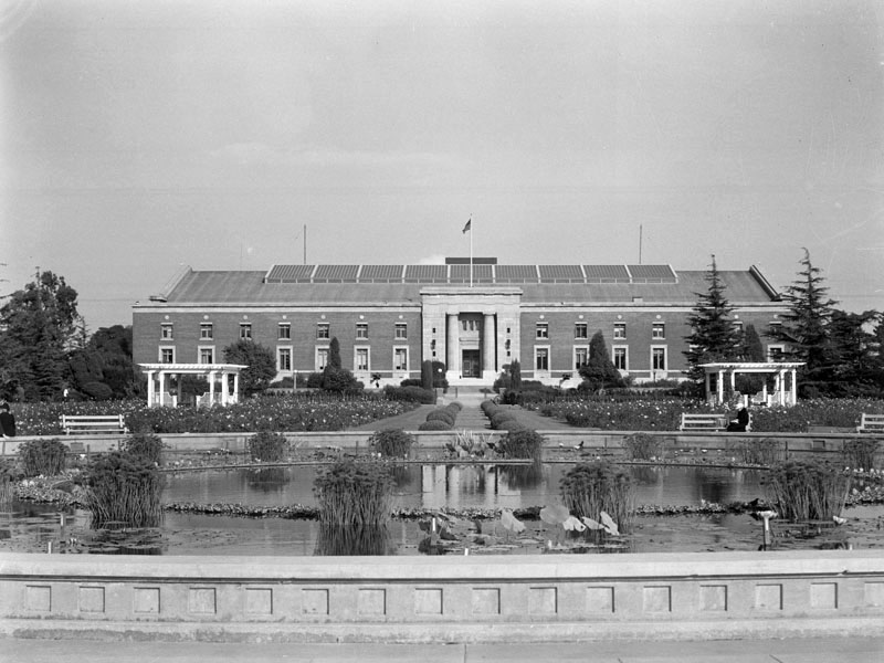 |
|
| (ca. 1936)* - View of the State Armory Building in Exposition Park. The "LA Aqueduct Fountain" stands in the foreground and two gazebos are seen in the Rose Garden between the fountain and the State Armory Buidling. |
Historical Notes In 2003 the California Science Center's Board of Directors voted to rename the historic Armory Building as the Wallis Annenberg Building for Science Learning and Innovation due to contributions toward the renovation and re-invention of the building by architect Thomas Mayne, which reopened in 2004. |
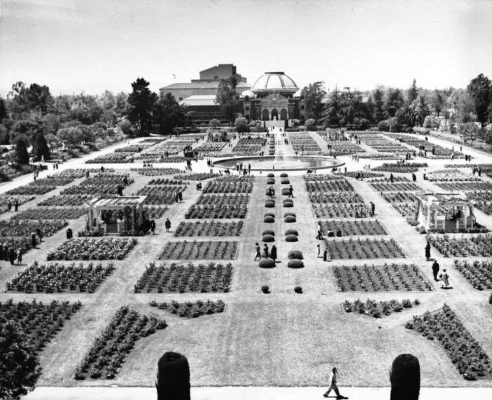 |
|
| (ca. 1950)* - Birdseye view of the Sunken Rose Garden as seen from the State Armory Building. In the background at center, the large dome and elaborate façade of the Natural History Museum are visible. |
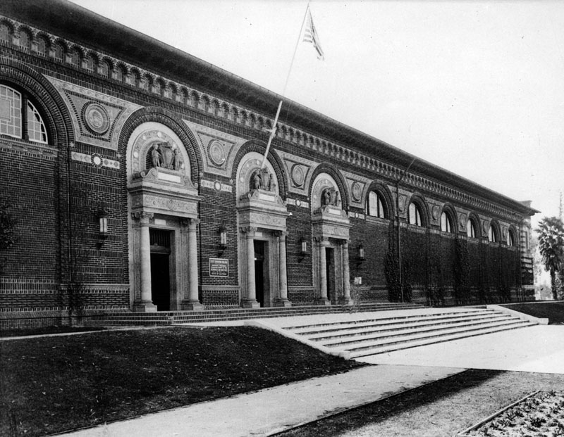 |
|
| (ca. 1925)* - Steps up an embankment lead to the State Exposition Building in Exposition Park in Los Angeles. Arched windows and columned entrances give a classical air to the single-story, brick building. A sign identifying the building is between the two left columned entrances. Cherubs and shields stand over each entrance and the arches are separated by medallions. |
Historical Notes The State Exposition Building, designed by William D. Coates, Jr., state architect, and N. Ellery, state engineer, opened in 1912 and housed simple, agriculturally based displays of natural resources and industrial products from across the state. |
* * * * * |
For more Historical Los Angeles Views click one of the following:
For Other Historical Views click one of the following:
See Our Newest Sections:
To see how Water and Electricity shaped the history of Los Angeles click one of the following:
Water:
Power:
* * * * * |
References and Credits
* LA Public Library Image Archive
**DWP - LA Public Library Image Archive
*^Oviatt Library Digital Archives
^^ Daily Breeze: Los Angeles Motordome
+^Flickr.com: City Project: El Pueblo de Los Angeles
*# LA Times: Hollywood Castles and Curious Cures
+#Urban Diachrony: East side of North Main Street south of Arcadia Street
#+LA Architecure Tours: Carroll Avenue
#^ KCET: Southwest Museum of the American Indian; Lost Train Depots of LA
^^*Early Downtown Los Angeles - Cory Stargel, Sarah Stargel; Los Angeles Trust and Savings Bank
*^#Publicartinla.com - Bovard Hall
#^*Huntington Digital Library Archive
^*#California State Library Image Archive
^##Library of Congress: Los Angeles Herald
***Los Angeles Historic - Cultural Monuments Listing
*^*California Historical Landmarks Listing (Los Angeles)
*#^The Department Store Museum: J. W. Robinson's
^#*Historic Hotels of Los Angeles and Hollywood (USC - California Historic Society): St. Elmo Hotel; Tally's Broadway Theatre
*^^Nuestra Señora la Reina de los Ángeles: losangelespast.com
**#Noirish Los Angeles - forum.skyscraperpage.com; Engine Company No. 23; Westmoore Hotel; J.W. Robinson Store; Bible Institute of Los Angeles
+#+Southern California Arcthitectural History
+++Facebook.com – Los Angeles Heritage Railroad Museum
**^Historical LA Theatres: The Philharmonic Auditorium; Downtown Theatres; Mason Theatre; Trinity Auditorium; Quinn's Superba; Liberty Theatre; Palace Theatre
***^Highland Park - amoeba.com
*^^^San Fernando Valley Historical Society/Facebook.com: Westinghouse Electric Range
^^^*Cinema Treasures: Quinn's Superba Theatre; LIberty Theatre
^^^+Los Angeles Housing Partnership
^+^+The Daily Mirror: Bryson Apartments
^***West Adams Avenues Blogspot
^^**Flickr.com: Bonfilio Residence - Floyd B. Bariscale; Million Dollar Theater - Ryan Vaarsi
*^*^Big Orange Landmarks: Los Angeles Athletic Club
*^*#Huntington Digital Library Archive
*^^#The Barlow Sanitorium - barlowgenealogy.com
^#^^El Pueblo de Los Angeles Historical Monuments; Garnier Building
*#*^Openlibrary.or: Westinghouse Automatic Electric Range
*^#*Blogdowntown.com: Merritt Building
**##History of the Rosslyn Hotel
*#**B. H. Dyas Co.
^##*Los Angeles Fire Department Historical Archive
*##^Flickr.com: Michael Ryerson
^*^#Facebook.com - Bizarre Los Angeles
#^*^Facebook.com: Photos of Los Angeles
#+++Yahoo.com: Beverly Hills Hotel
^^^#California Hospital Medical Center Foundation
#^**Flickr.com: Metro Library and Archive
#^^#Beforeusc.com: Church of Christ, Scientist
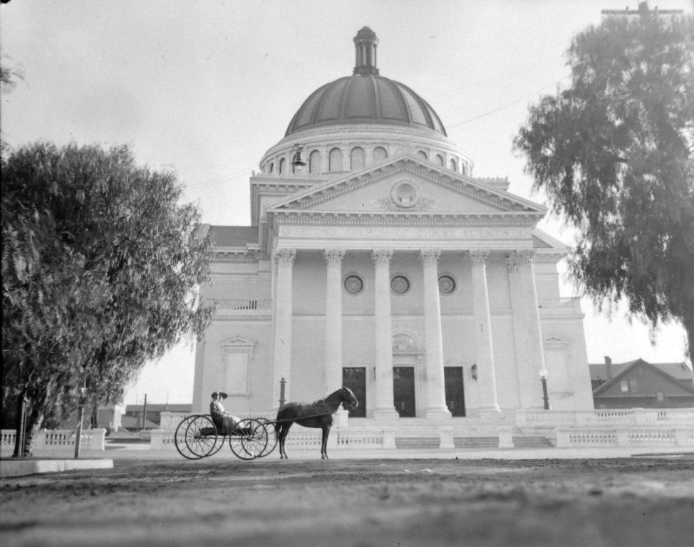
###^Pomona Public Library Poscard Collection
^*^*^Denver Public Library Image Archive
^***^Facebook.com: Garden of Allah Novels
**^**Los Angeles City Historical Society
^* Wikipedia: Leonis Adobe; Occidental College; Beverly Hills; Beverly Hills Hotel; Huntington Hotel; Bank of Italy; Van de Kamp's Holland Dutch Bakeries; Rose Bowl Stadium; Los Angeles Memorial Coliseum; Farmers and Merchants Bank of Los Angeles; Los Angeles Biltmore Hotel; Jonathan Club; Los Angeles Plaza Historic District; St. Vincent Church; The Benevolent and Protective Order of Elks; Park Plaza Hotel; YMCA; San Pedro; Venice; Subway Terminal Building; St. Vincent Hospital; Los Angeles Herald-Examiner; Cahuenga Branch Library; Foy House; Frederick Hastings Rindge House; Los Angeles High School; MGM; Breed Street Shul; Natural History Museum of Los Angeles County; Jonathan Temple; Highland Park Masonic Temple; Egyptian Theatre; Phineas Banning; Eagle Rock; Hollywood Masonic Temple; Sawtelle Veterans Home; Downtown, Los Angeles; Robinson's Department Store; International Savings & Exchange Bank Building; Quinn's Superba Theatre; Million Dollar Theater; Los Angeles Athletic Club; Harris Newmark; Fire Station No. 23; Church of the Open Door; Lyman Stewart; Biola University; Paramount Studios; Fremont Hotel; Barlow Respiratory Hospital; Shrine Auditorium; Second Church of Christ, Scientist 2008/1928; Hotel Rosslyn Annex; Plaza Substation
#mediaviewer/File:Second_Church_of_Christ_Scientist.JPG)
< Back