Early Los Angeles City Views (1900 - 1925)
A City in Transition
* * * * * * * * * * * * * * * * * * * * * * * * * * * * * * * * * * * * * * * * * * * * * * * * * * * * * * * * * * * * * * * * * * * * * * * * * * * * * * * * * * * * * * * * * * * * * * * * * * * * |
Introduction |
The early 20th century was a period of dramatic change for Los Angeles. Between 1900 and 1925, the city evolved from a dusty western town into a growing metropolis shaped by streetcars, early automobiles, new boulevards, and expanding neighborhoods.These photographs capture Los Angeles during that transition — when horses shared the streets with electric rail cars, when Bunker Hill still stood tall, and when many of today’s historic landmarks were newly built.Together, they offer a visual record of how quickly the city grew and how everyday life looked during Los Angeles’ formative years.Many of these early scenes also reflect the foundations of the city’s water, power, and transportation systems that would shape Los Angeles for the next century. |
Spring and 3rd Streets |
Spring and 3rd Streets stood at the heart of early downtown Los Angeles during a time when the city was shifting from a horse powered town to a streetcar and automobile city. This intersection captured the energy of a growing business district where hotels, banks, and transit lines converged. The images here show Los Angeles learning how to manage growth, congestion, and new technology all at once. |
 |
|
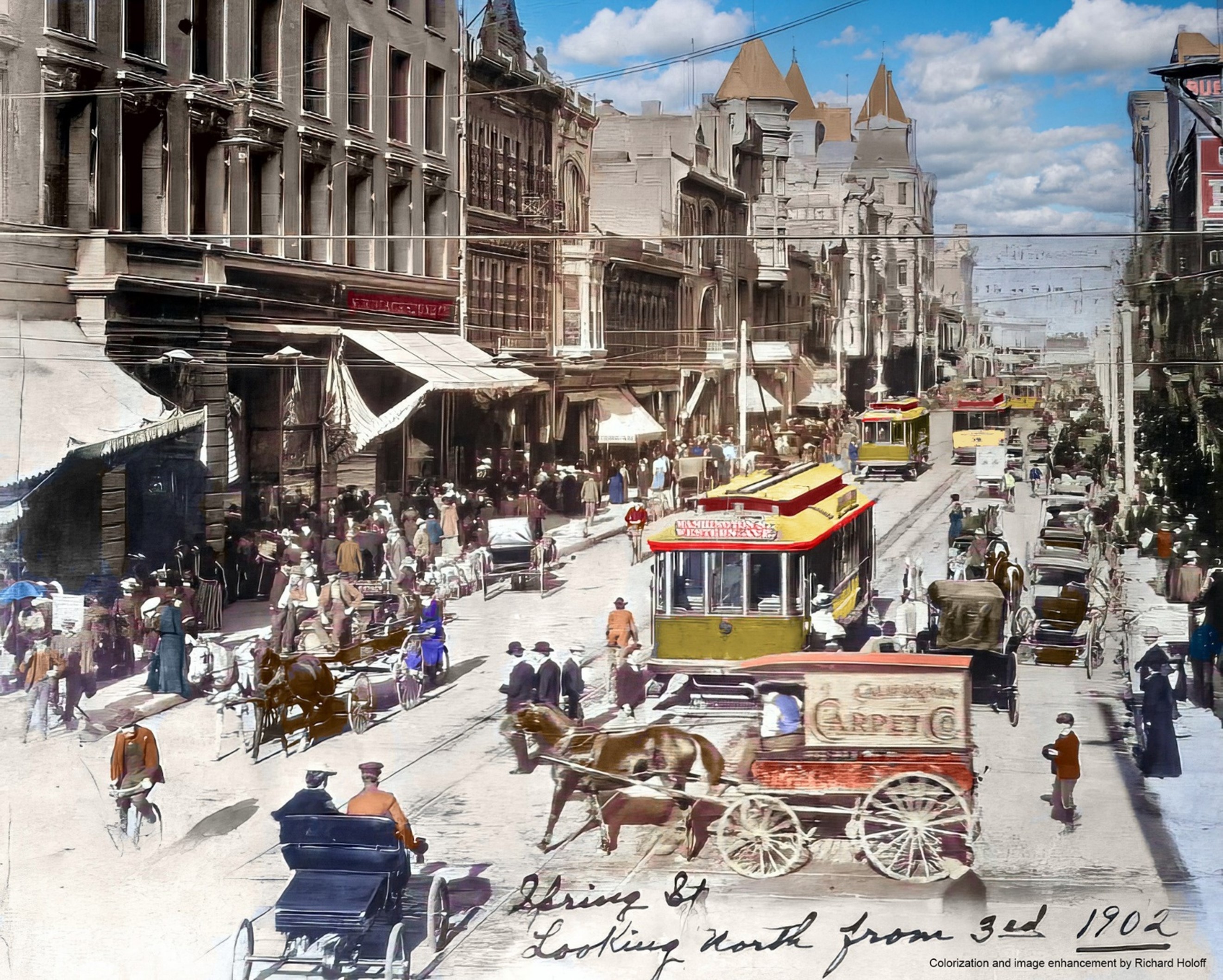
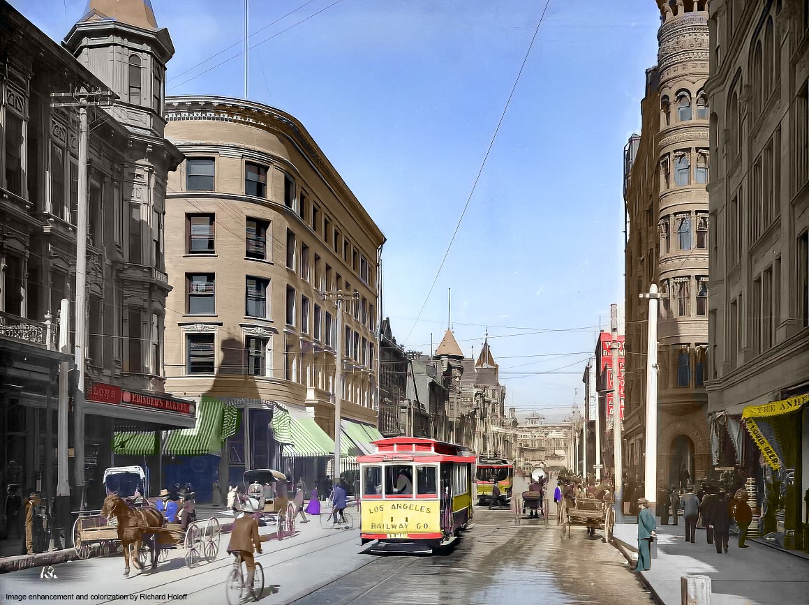
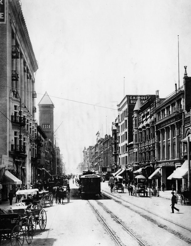
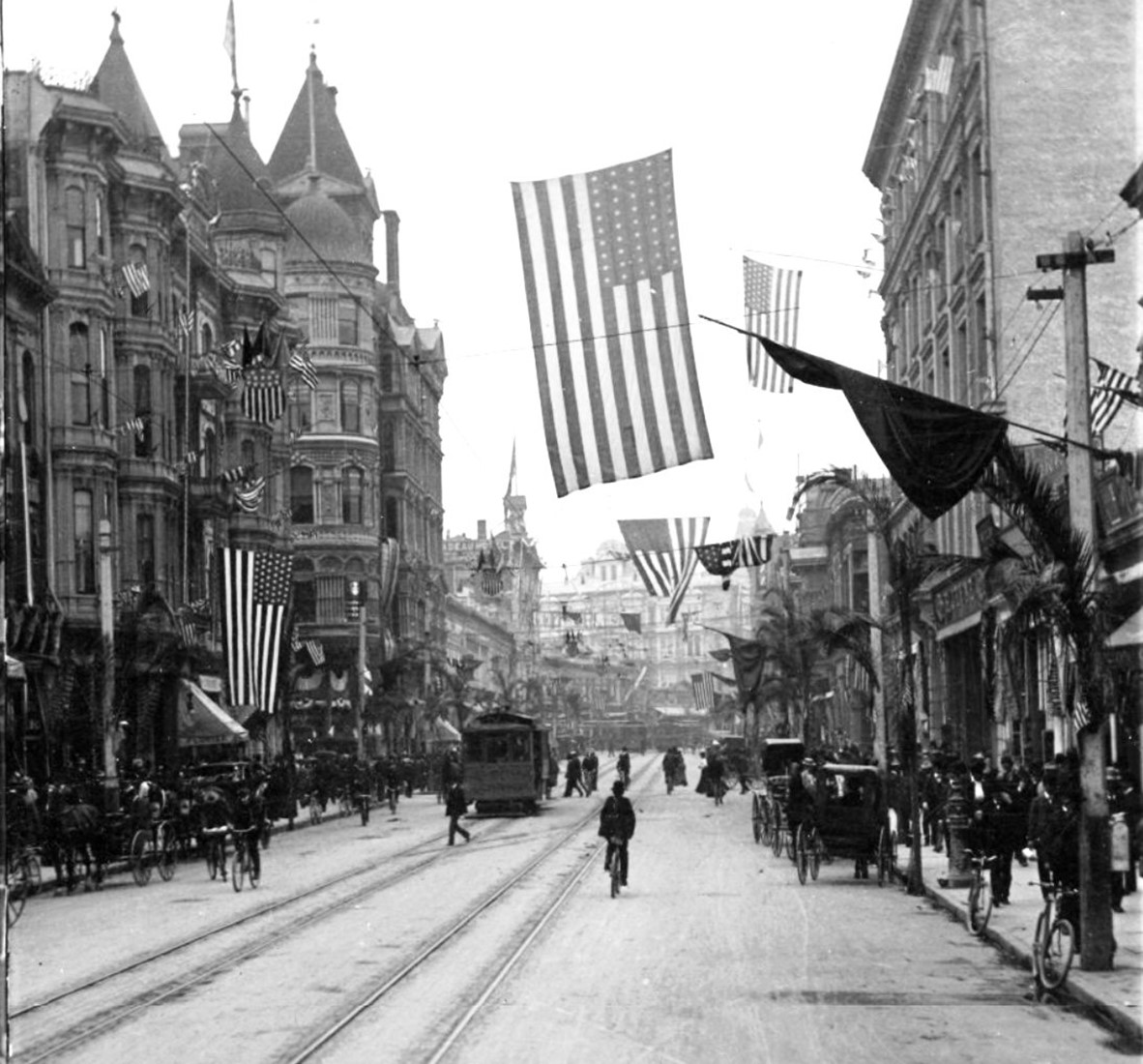
| (ca. 1902)* - View looking north on Spring Street from 3rd Street. Early model automobiles share the road with horse-drawn wagons, electric streetcars, and bicycles. A large number of pedestrians fill the sidewalk and some are seen crossing the road. A large sign on the side of the horse-drawn wagon in the foreground reads: "California Carpet Co." Also, the sign on top of the streetcar reads: "Washington St - Western Ave" |
Historical Notes In 1900, 8,065 horses called Los Angeles home, one for every 12.7 people. Inside the city, stables, saddlers, and blacksmiths occupied prime real estate along L.A. streets. Outside the city, farmers planted countless acres with the oat and alfalfa that fueled these animal engines. And the horse-drawn vehicle was hardly a zero-emissions machine. In fact, though Southern California's millions and millions of internal combustion engines have added up to an environmental disaster, the urban horse made the automobile look like a clean technology by comparison. A single animal produced 15-30 pounds of manure and a quart of urine each day, much of which festered on the city streets, attracting flies, soiling shoes, and mingling with dirt to form noxious mud when wet and eye-stinging dust in dry weather. And when draft animals collapsed from over-exertion, their drivers often left their carcasses to rot in the roadway -- a sight that disturbed humans and spooked other horses, occasionally triggering mad stampedes through crowded streets. City officials struggled to keep this public health menace in check, contracting with street sweepers and dead animal removers, but ultimately it took the replacement of equine by automobile power to clean up L.A.'s streets. Horses continued to march down (and foul up) Los Angeles streets well into the 1920s. Not until 1924 had the balance of power tilted to motorists such that city leaders felt comfortable banning horse-drawn vehicles from downtown during rush-hour -- a traffic-relief measure that remains on the books to this day. |
 |
|
| (ca. 1902)* - View looking north on Spring Street from 3rd Street. Early model automobiles share the road with horse-drawn wagons, electric streetcars, and bicycles. A large number of pedestrians fill the sidewalk and some are seen crossing the road. A large sign on the side of the horse-drawn wagon in the foreground reads: "California Carpet Co." Also, the sign on top of the streetcar reads: "Washington St - Western Ave". Image enhancement and colorization by Richard Holoff. |
Historical Notes In 1902, the Los Angeles Railway (LARy) streetcars operating in downtown Los Angeles were painted a distinctive yellow color. This color scheme became iconic for LARy and was maintained throughout much of its existence. The yellow streetcars were a familiar sight on the streets of Los Angeles during the early 20th century, contributing to the city's vibrant and bustling atmosphere. |
 |
|
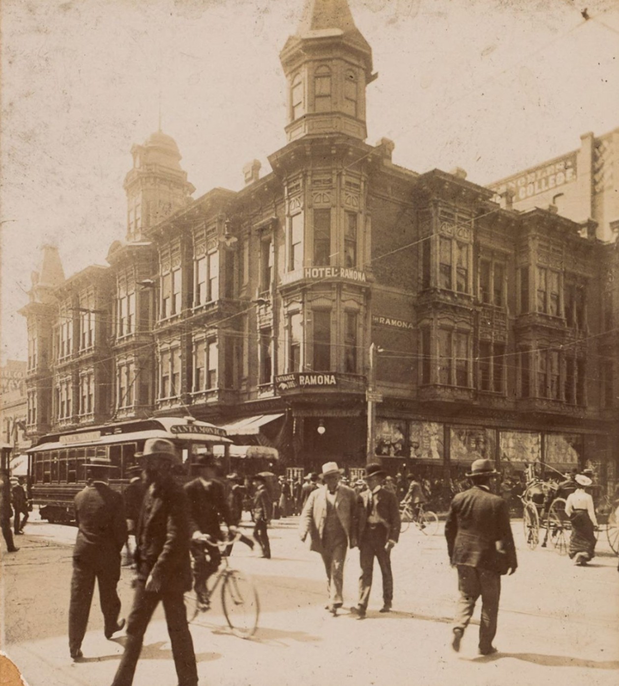
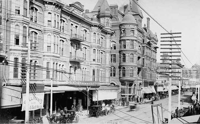
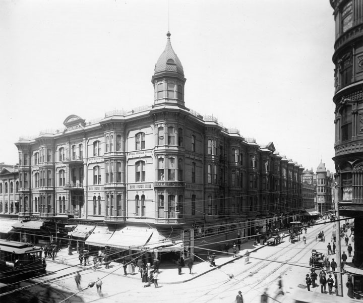
| (ca. 1900)* - The intersection of Spring and 3rd Streets, with the Hotel Ramona on the southwest corner. Streetcars, horse-drawn wagons, bicycles, and pedestrians share the busy street. |
Historical Notes At the turn of the 20th century, the intersection of Spring and 3rd Streets was one of the busiest places in downtown Los Angeles. Horse drawn wagons, electric streetcars, bicycles, and pedestrians all competed for space in the unpaved street. Spring Street was the city’s main business corridor, lined with hotels, banks, shops, and offices. Streetcars ran down the center of the road, moving people between downtown and the growing neighborhoods to the west and south, while horses still handled much of the city’s freight and daily transport. The Hotel Ramona stood prominently on the southwest corner and was one of the city’s best known early hotels. Built in the late 1880s, it featured an ornate Victorian design with corner towers, decorative cornices, tall narrow windows, and a commanding presence at the intersection. The hotel catered to traveling businessmen, tourists, and new arrivals drawn to Los Angeles during its rapid growth years. Its ground floor housed shops and services, while upper floors offered rooms with views of the busy streets below. The Hotel Ramona symbolized the optimism and ambition of early Los Angeles before it was later replaced as downtown development moved south and west. |
 |
|
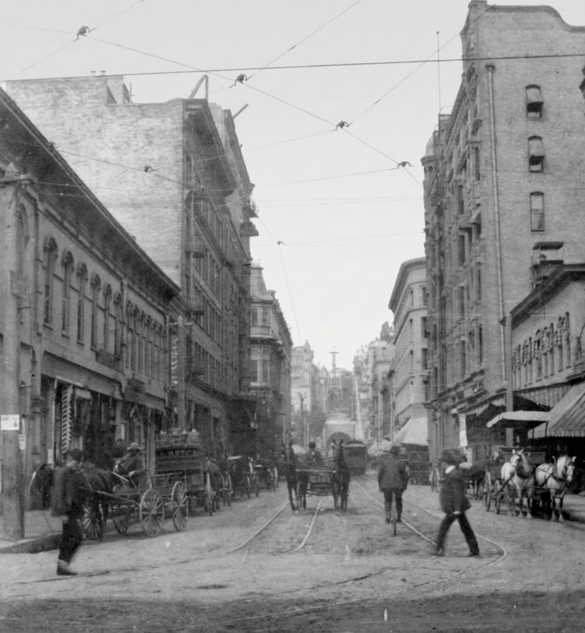
| (ca. 1901)* - View looking west on Third Street toward Spring Street. The Hotel Ramona stands on the southwest corner and the Douglas Building on the northwest corner. In the distance is the newly completed Third Street Tunnel under Bunker Hill. Horse drawn vehicles and a streetcar travel along the unpaved street. |
Historical Notes This view looks west along Third Street toward Spring Street during a period of rapid downtown growth. Horse drawn wagons and streetcars move along the unpaved roadway, carrying goods and passengers through one of the city’s busiest corridors. Third Street served as an important east west route, feeding traffic directly into Spring Street’s commercial center. Visible in the distance is the Third Street Tunnel beneath Bunker Hill, which had recently opened to improve access between downtown and neighborhoods to the west. The tunnel represented a major engineering project for early Los Angeles and helped relieve congestion on steep hill streets. Together with nearby hotels, office buildings, and streetcar lines, it shows how transportation improvements shaped the city’s early expansion. |
 |
|
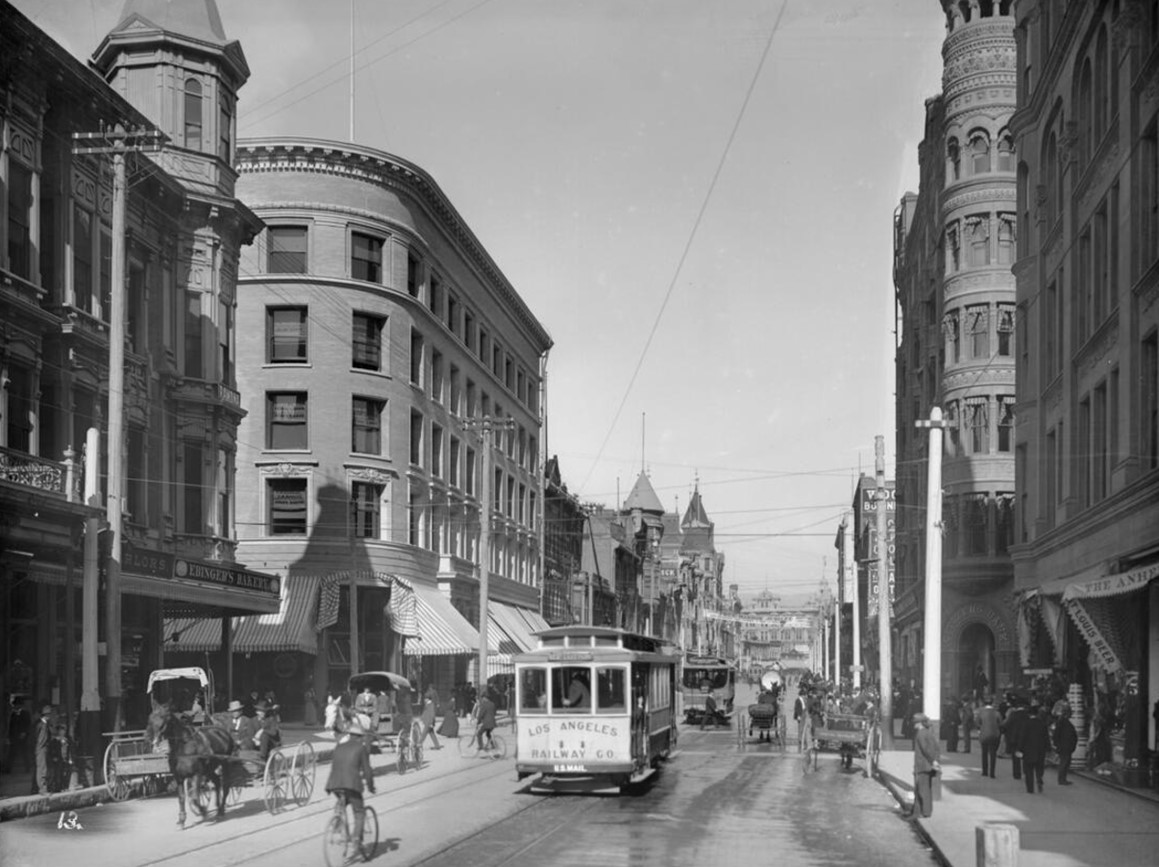
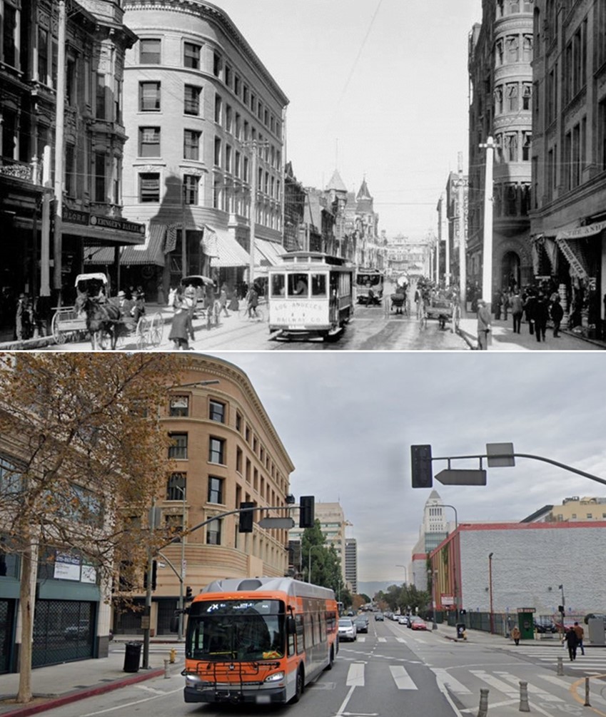
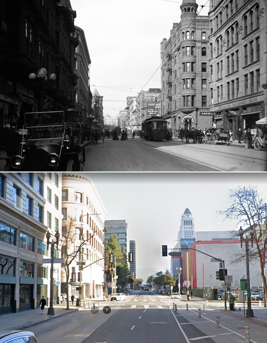
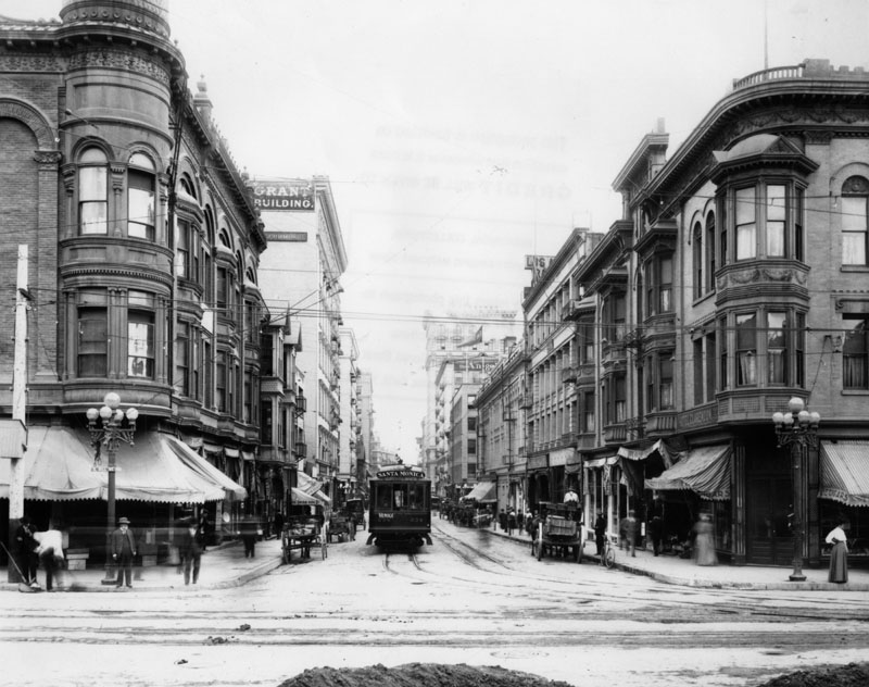
| (1903)* - A view looking north on Spring Street toward Third Street with carriages, trolley cars, pedestrians and bicycles. The Hotel Ramona is on the left, southwest corner. Across the street on the northwest corner is the Douglas Building which still stands today. The sign on the cable car reads: "Los Angeles Railway Co." Click HERE for contemporary view. |
Historical Notes Streetcars operated by the Los Angeles Railway dominated downtown travel by 1903. These cars ran frequently and followed fixed routes, making them reliable for workers and shoppers. Tracks ran directly through the middle of the street, forcing all other traffic to work around them. The scene shows how crowded Spring Street had become, with no separation between vehicles and pedestrians. Despite the congestion, the streetcar system allowed Los Angeles to expand outward while keeping downtown accessible. |
 |
|
| (1903)* - A view looking north on Spring Street toward Third Street with carriages, trolley cars, pedestrians and bicycles. The sign on the cable car reads: "Los Angeles Railway Co." The Douglas Building on the NW corner still stands. Click HERE for contemporary view. Photo by C.C. Pierce; Image enhancement and colorization by Richard Holoff |
Historical Notes Los Angeles Railway (1895-1945) also known as the Yellow Cars of Los Angeles, was the local streetcar transit system running down the center of city streets and connecting the city center to neighborhoods in about a six mile radius of downtown. |
.jpg) |
|
| (1903)* - Close-up panoramic view of Spring Street from Third Street looking north showing a typical downtown Los Angeles day in 1903. On the right is the entrance to Citizens Bank. |
Historical Notes This close up view captures the everyday rhythm of downtown Los Angeles in 1903. Pedestrians cluster near storefronts, while wagons and streetcars move steadily through the street. Buildings are packed tightly together, creating a continuous wall of commercial activity. On the right is the entrance to Citizens Bank, one of many financial institutions that gave Spring Street its nickname as the Wall Street of the West. Banking, real estate, and insurance offices dominated this stretch, reflecting the city’s growing economic confidence. |
* * * * * |
Spring and 3rd Streets – Rise of the Financial District |
By the early 1900s, this corner was becoming more than just a busy intersection. It was emerging as part of Los Angeles’ growing financial and professional district. Substantial office buildings began replacing smaller Victorian structures, and banks, rail offices, and investment firms clustered along Spring Street.Together, these views show the corner evolving into a symbol of downtown’s economic ambition, laying groundwork for Spring Street’s later reputation as the “Wall Street of the West.” |
 |
|
| (1903 vs. 2019) – View looking North on Spring Street at 3rd Street with the Douglas Building seen on the NW corner. Photo comparison by Jack Feldman. |
Historical Notes The Douglas Building, completed in 1899, still anchors the northwest corner of Spring and 3rd Streets. Designed by architects James and Merritt Reid, the building reflects Classical Revival design and was among the most prestigious office buildings in early Los Angeles. While the surrounding street has changed dramatically, the building remains a rare survivor from Spring Street’s early commercial era. Its continued presence offers a direct visual link between modern downtown and its turn of the century past. In 2009 the Classical Revival style building was declared LA Historic-Cultural Monument No. 966. |
Then and Now
 |
|
| (1903 vs. 2021) – View looking North on Spring Street at 3rd Street with the Douglas Building seen on the NW corner. Photo comparison by Jack Feldman. |
Historical Notes The Douglas Building was commissioned by T.D. Stimson, a lumber baron turned real estate mogul who fostered commercial development in Los Angeles during the 1890s. The five-story building was designed by San Francisco architects James and Merritt Reid, who gained fame for designing the remarkable Hotel del Coronado near San Diego in 1888. The Douglas Building was one of Los Angeles’ greatest office building and commanded the highest rentals. In its early years, it housed the chief ticket office of the Southern Pacific Railroad. During that time many travelers passed through its doors to purchase a ticket. In 2005, this former office block was renovated into 50 residential units. |
 |
|
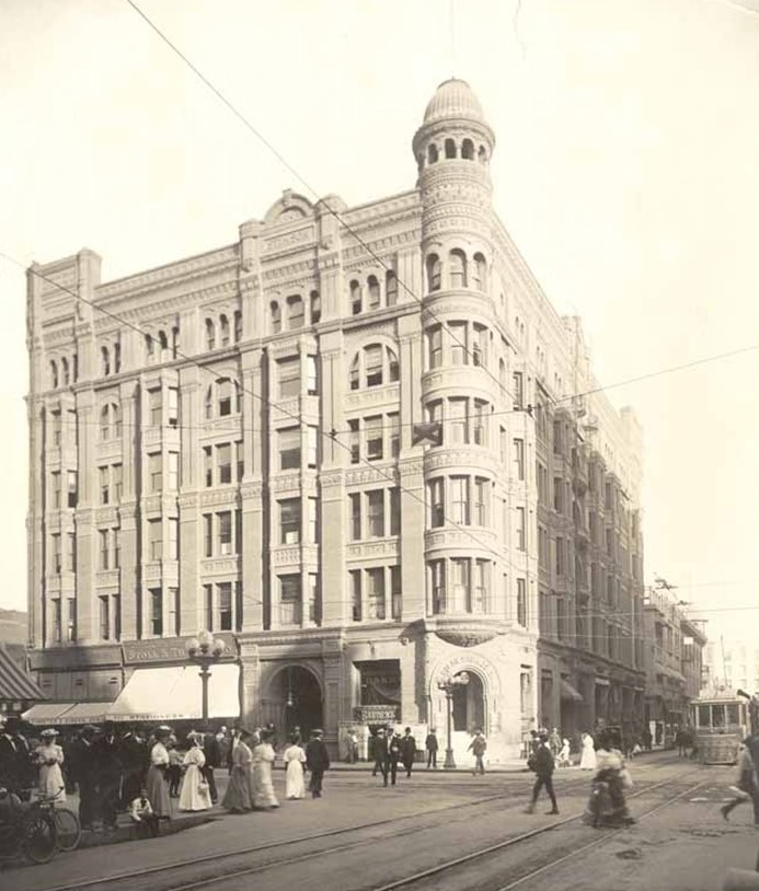
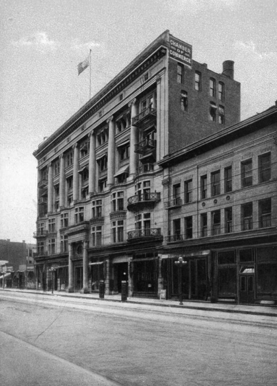
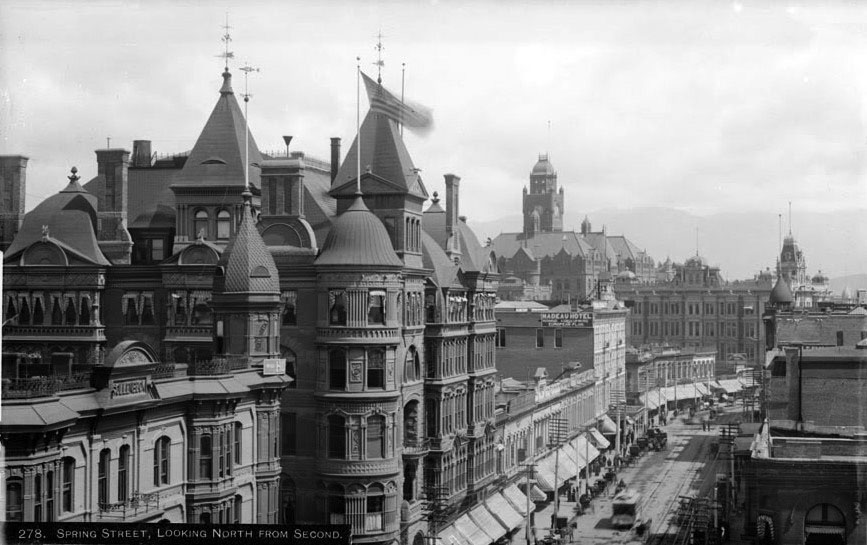
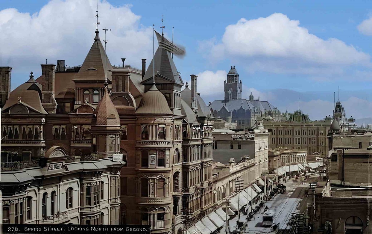
| (ca. 1907)* - Looking north on Spring Street toward Third Street with the beautiful Stimson Building seen on the NE corner. |
Historical Notes By 1907, the Stimson Building dominated the northeast corner of Spring and 3rd Streets. Its massive stone construction and tower made it one of the most visually striking buildings downtown. It stood in contrast to the lighter Victorian buildings nearby. The presence of such large office buildings shows how Spring Street had evolved into a center of finance and professional services. Traffic remained heavy, but the street had become more structured as Los Angeles continued to grow. |
 |
|
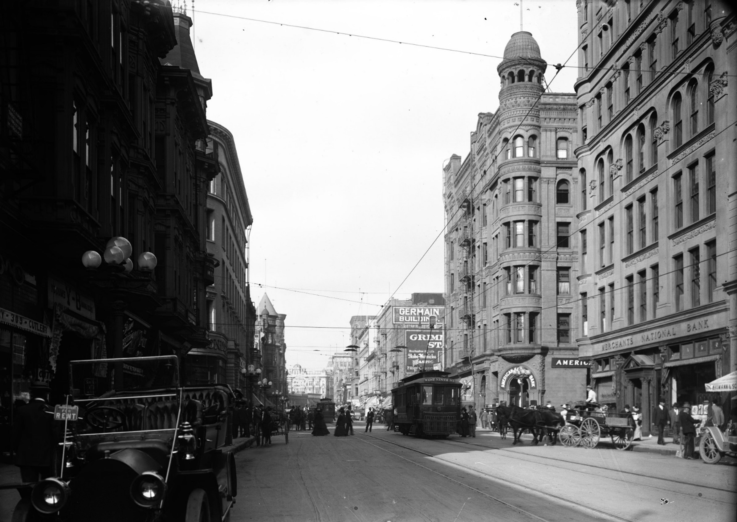
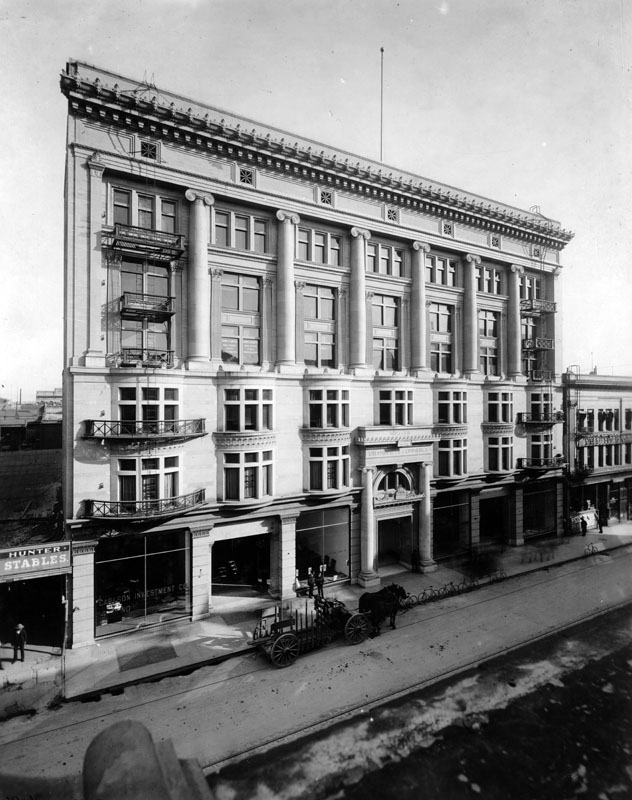
| (ca. 1908)*- Looking east on Third Street at Spring Street showing the Stimson Building on the NE corner. The six-story stone masonry building with cupola and projecting bays was located at 256 South Spring Street. |
Historical Notes The 1893-built Stimson Building, a six story Richardsonian Romanesque office building with an observation tower, stood on the NE corner of Spring and 3rd streets until 1963…today a parking lot. Click HERE to see more Early Views of the Stimson Building. |
Then and Now
 |
|
| (1907 vs 2023)* - Looking north on Spring Street toward Third Street. Photo comparison by Jack Feldman. |
Historical Notes The comparison highlights how much Spring Street has changed over more than a century. Early images show a dense, pedestrian focused street filled with mixed traffic and ornate architecture. Today, wider streets, modern surfaces, and fewer pedestrians reflect the dominance of automobiles and different patterns of downtown use. These comparisons help illustrate how transportation and land use shaped the evolution of Los Angeles. |
* * * * * |
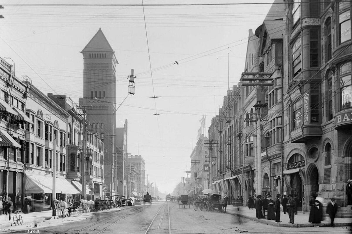
Broadway |
At the turn of the 20th century, Broadway was emerging as one of Los Angeles’ premier corridors. Government buildings, hotels, theaters, and businesses lined the street, making it both a civic and commercial spine. The following images show Broadway before the skyscraper era, when ornate mid-rise buildings defined the skyline and streetcars carried much of the traffic. |
.jpg) |
|
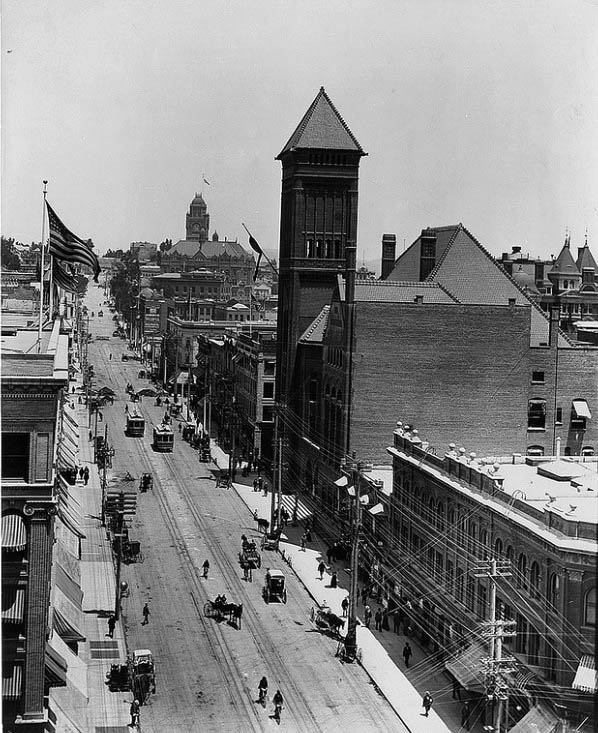
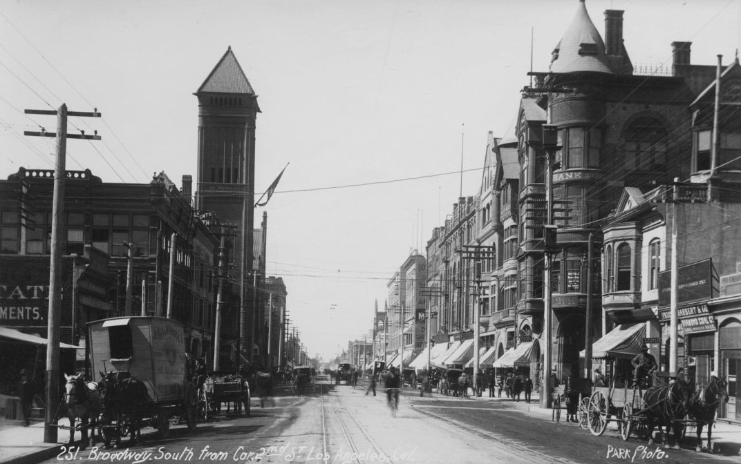
| (ca. 1900)* - Panoramic view looking south on Broadway from the LA County Courthouse. City Hall is the tallest structure in the distance. |
Historical Notes The above photograph features the following buildings: From north-west corner of Broadway and First Street: Tajo Building (1894-1938), Tally-Ho (circa 1894-1939, adjoining Tajo to north), Watauga Hotel (four-story, two buildings north of Tally-Ho), Brotherton Building, Franklin Hotel (far lower right, top of T, Broadway at Franklin Street) and Los Angeles Police Central Division (west of, and partially behind Tajo, across First Street); South of First Street: Hough Block (unknown-1956, 2nd from SW corner), Yosemite Hotel (left of the Hough Block), Newell and Rader Block (the shorter building left of Yosemite Hotel), Newell and Gammon Building (a taller building with "Smith Premier" sign), Roanoke Building (built in 1886 as Millar Building, left of Newell), C.H. Frost Building (built in 1898, north-west corner of Broadway and Second Street), California Hotel (First and Hill Streets), Hotel Lincoln (with white cupola, Hill Street at First and Second Streets), Crocker Mansion (at Bunker Hill - just above and left of Lincoln cupola, south-east of Olive Street and Third Street); South of Second Street: California Bank Building (built in 1887, south-west corner), YMCA Building (built ca.1887, left of the California Bank), B.F. Coulter Building (built ca.1888, left of YMCA Building), Bicknell Building (built in 1892, left of the Coulter Building), . H. Newmark Building (left of Bicknell), Boston Dry Goods Store (built ca. 1896, J. W. Robinson's, left of Newmark), Fred J. Byrne Building (at north-west corner with Second Street). From the left side Broadway: Second Los Angeles Times Building; South of First Street: Culver Block (at south-east corner of Broadway and First Street), Hayes Block (just east of the Culver Block), Larronde Block (at north-west corner of Spring and First Streets), Schumacher Block (just north of the Larronde Block), Nadeau Hotel (First and Spring Streets), Wilson Block (south-east corner of Spring and First Street); South of Second Street: Hellman Building (north-east corner of Broadway and Second Street), Bryson-Bonebrake Building (north-west corner of Spring and Second Streets), Hollenbeck Hotel (1884-1931, south-west corner of Second and Spring Streets), Wilcox Building (1896 - shortened in 1971, south-east corner of Spring and Second Streets), Third City Hall (1888-1928); South of Third Street: Bradbury Building (built in 1893, south-east corner of Broadway and Third Street).^^ |
 |
|
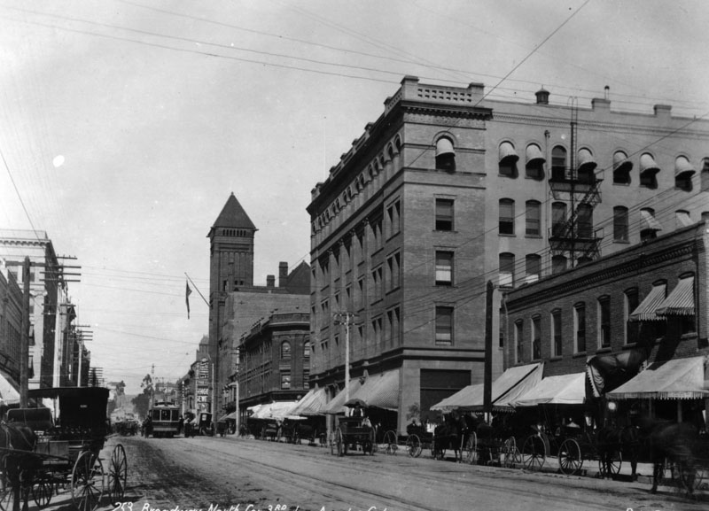
| (ca. 1900)#*^^ - View looking north on Broadway from near 3rd Street showing streetcars, horse-drawn wagons, bicycles and pedesrians all sharing the roadway. City Hall stands tall on the east side of Broadway. The LA County Courthouse, built in 1891, stands in the background. |
 |
|
| (ca. 1900)^ - Street view of Broadway looking north from 3rd Street. Trolleys as well as horses and carriages are seen on the street. City Hall can be seen down the street on the right (tall tower and flag). |
 |
|
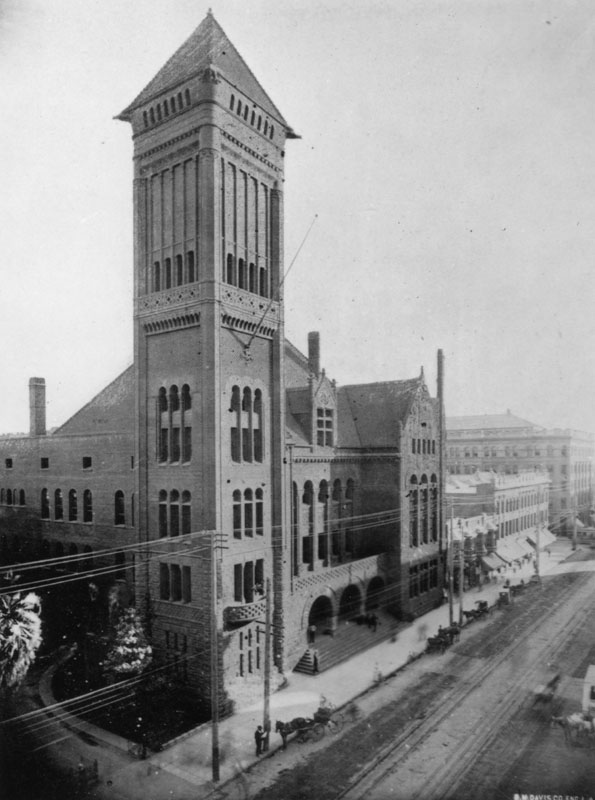
| (ca. 1890)^ - Close-up view of Old City Hall at 226 Broadway. Horse-drawn carriages can be seen parked in front of the building. |
Historical Notes The following historical timeline lists the buildings used by City Council, also known as City Hall, since 1850, when Los Angeles was incorporated as a municipality: ◆ 1850 - 1853 - used rented hotel and other buildings for City meetings ◆ 1853 - rented adobe house (aka Rocha Adobe) on Spring Street - across from current City Hall (now parking lot for Clara Shortridge Foltz Criminal Justice Center). The buliding was shared with the County who used it as a Court House. ◆ 1861 - moved into John Temple's Clocktower Market Building, but only stayed for less than a year before the County Court House moved-in ◆ 1861 - 1884 - relocated back to the Rocha Adobe and stayed for over 20 years ◆ 1884 - 1888 - moved to new City Hall Building at South Spring Street and West 2nd Street (site of current Los Angeles Times Building) ◆ 1888 - 1928 - moved to new Romanesque Revival Building on 226-238 South Broadway between 2nd Street and 3rd Street; demolished in 1928 and now site of parking lot between LA Times Parking structure and 240 Broadway. ◆ 1928 - moved to current City Hall Building *^ |
* * * * * |
Broadway and 2nd Street |
The intersection of Broadway and 2nd Street sat near the center of civic Los Angeles. City Hall, banks, and major offices were within steps of this corner, making it a daily crossroads for officials, workers, and visitors. These views highlight how public life and transportation overlapped in a compact downtown core. |
 |
|
| (ca. 1902)^ - Street view looking south on Broadway from near the conrner of 2nd Street showing the 1888-built City Hall with flag. Horse-drawn carriages are seen on both sides of the street. A bicycle is moving north toward the photographer as it passes 2nd Street. The building with the conical roof on the right, SW corner of Broadway and 2nd Street, is the California Bank Building (built in 1887). |
 |
|
| (ca. 1904)* - Broadway looking south from Second Street. A double carbon arc lamp utilitarian streetlight is hanging from wire at the center of the intersection. |
 |
|
| (ca. 1904)* - Looking south on Broadway at 2nd Street in DTLA. Photo by C.C. Pierce; AI enhancement and colorization by Richard Holoff |
Then and Now
 |
|
| (1904 vs. 2022)* - Looking south on Broadway at 2nd Street. Photo comparison by Jack Feldman. |
* * * * * |
Broadway and 1st Street |
Broadway and 1st Street marked the northern gateway to Los Angeles’ early business district. This area blended civic institutions, commercial buildings, and streetcar routes, making it a daily hub of movement and activity. The images here show a corridor where government, business, and transportation met at a time when downtown Los Angeles was still compact but rapidly growing. |
 |
|
| (ca. 1904)^ - A view of Broadway looking south from 1st Street. A trolley marked "Boyle Heights” takes the center of the street while horses and carriages fill the sides in front of the businesses along the street. The building on the left with the large columns is the Southwest Building (130 S. Broadway). It was occupied by the LA Chamber of Commerce between 1903 and 1925. The ornate building across the street with the turret is the Newell and Gammon Building (131 S. Broadway). Down the street on the left can also seen the tower of the City Hall building. |
 |
|
| (ca. 1903)* – Postcard view showing the Los Angeles Chamber of Commerce, also known as the Southwest Building, located at 130 S. Broadway between 1st and 2nd streets; view is looking north. |
Historical Notes The Los Angeles Chamber of Commerce's first meetings were held in the old board of trade building on First and Broadway, which has since been torn down. In 1890, the Chamber moved into the Mott Building at 131 S. Main Street, where it stayed for four years. In 1894, the organization moved to new quarters at the southeast corner of Broadway and 4th, in a building designed especially for its use, the then-new three-story Mason Building - which would serve as the L.A. Chamber of Commerce for twelve years. In 1903, it moved into the Southwest Building, located at 130 S. Broadway, and stayed there until January 31, 1925. In 1925 it moved to its brand new building at 1151 S. Broadway and 12th Street. It now makes its home at 350 S. Bixel and 6th streets.* |
 |
|
| (1905)^ - The Los Angeles Chamber of Commerce, also known as the Southwest Building, located at 130 S. Broadway. The white building has numerous windows, columns, and balconies as well as ornamental detailing throughout. The Chamber of Commerce moved here in 1903 and stayed until January 31, 1925. Parked along the front are several bicycles, as well as a horse-drawn cart. |
 |
|
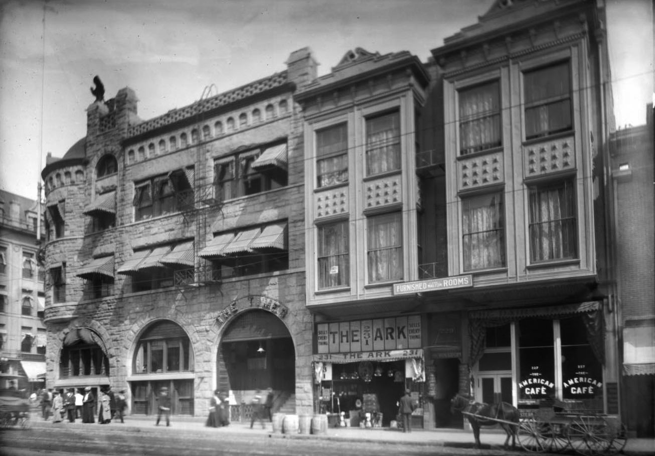
| (ca. 1905)^^ - View looking at the north side of 1st Street showing the three-story stone Los Angeles Times Building (built in 1886), N/E corner of First Street and Broadway. Next door is a rooming house above store fronts. About fifteen pedestrians are on the sidewalk. Two horse-drawn carriages are in the street. Legible signs include: "The Times", "Furnished Rooms", "Sells Everything - The Ark, 231", "The American Café”. |
* * * * * |
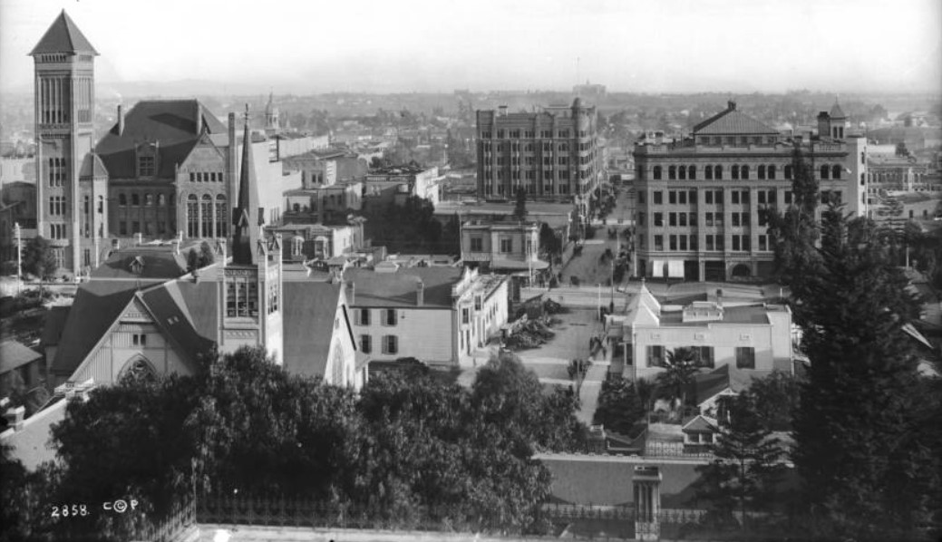
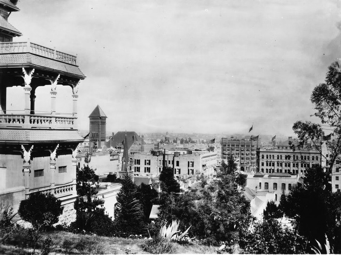
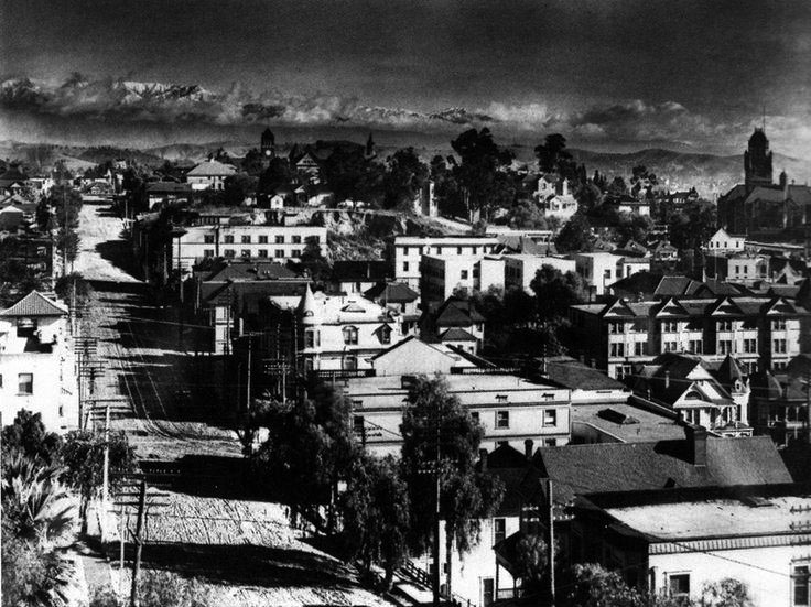
Views from Bunker Hill |
From Bunker Hill, early residents could look out over a downtown that was expanding in every direction. Grand Victorian homes shared the hilltop while below, commercial blocks, churches, and civic buildings filled the streets. These views capture Los Angeles at a moment when residential elegance and urban growth still existed side by side. |
 |
|
| (ca. 1900)^^ - Panoramic view of downtown Los Angeles, looking east, as seen from the rear deck of the Crocker Mansion . The view is looking toward the intersection of Broadway and Third Street where the Bradbury Building stands on the southeast corner. The streets are busy with horse-drawn vehicles and pedestrians. A pile of construction supplies and debris is visible near the intersection. City Hall is at left and the First Congregational Church at lower-left. |
Historical Notes Built in 1893, the Bradbury Building was commissioned by LA mining millionaire Lewis L. Bradbury and designed by local draftsman George Wyman. Click HERE to see more Early Views of the Bradbury Building. |
 |
|
| (ca. 1900)* - Panoramic view of downtown Los Angeles from the Crocker Mansion (partially visible at left) looking east on Third Street from the intersection of Olive Street on Bunker Hill. Flags are flying on several buildings, including the Bradbury Building (Third Street and Broadway). The Los Angeles City Hall, with its distinguished tall tower, is seen just to the right of the mansion. |
Historical Notes The Crocker Mansion was designed by architect John Hall and erected in 1886. The ornate residence was built at a cost of $45,000 for Mrs. Margaret E. Crocker, widow of Edwin Bryant Crocker, a California Supreme Court Justice. Later it was called the Crocker Mansion Rooming House and became the site of the Elks Club, and finally the Moose Lodge. Click HERE to see more Early Views of the Crocker Mansion. |
 |
|
| (ca. 1900)* - View from Bunker Hill looking north on Grand Avenue near Third Street on an exceptionally clear day. The San Gabriel Mountains can be seen in the background. |
Historical Notes This exclusive residential area, most of it built during the 1880's, was at its zenith in 1900. |
* * * * * |
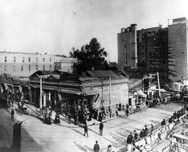
Spring and 4th Streets |
Spring and 4th Streets stood within Los Angeles’ developing financial and hotel district at the turn of the century. Businesses, pharmacies, and hotels lined the intersection as the city’s population surged and downtown activity intensified. The scenes here show a commercial core in transition, where modest storefronts soon gave way to larger masonry office buildings. |
 |
|
| (ca. 1900)^ - View of the northeast corner of Spring and 4th streets, showing pedestrians and Off & Vaughan Drug Co., Blaney's Shoe Store and part of the Van Nuys Hotel. Pedestrians and horse-drawn wagons are seen throughout. In 1903, the 8-story Hellman Building would be built on the northeast corner of Spring and 4th. |
Historical Notes By 1900, Los Angeles' population swelled to 102, 500. This was double the City's population of only 10 years earlier (1890). The Van Nuys Hotel was built by Isaac Newton Van Nuys, businessman, real estate developer, banker, and agricultural entrepreneur. He founded the community of Van Nuys in the San Fernando Valley in 1911. As a major figure in regional history and development, there are schools, streets, libraries, and a Liberty Ship with the name of Van Nuys. |
 |
|
| (ca. 1900)^ - The intersection of 4th Street looking east from Spring Street toward Main Street in 1898. The Off & Vaughn Pharmacy is seen on the northeast corner, and the Van Nuys Hotel at 103 W. 4th Street at the corner of Main Street. Further in the distance is the Westminster Hotel. Pedestrians and horse-drawn carriages are seen. We are beginning to see overhead line congestions from telephone poles and electric streetcars. |
Historical Notes The Van Nuys Hotel was designed in 1895 by Octavius Morgan and J. A. Walls in a Beaux-Arts style for Isaac Newton Van Nuys. Consolidated Hotels, Inc., leased the hotel in 1929, renamed it to Barclay, and renovated it to include a high-speed elevator and a remodeled lobby. |
 |
|
| (1903)* – View showing a steam shovel excavating the northeast corner lot of Spring and 4th streets where the Hellman Building will soon go up. The Angelus Hotel is seen across the street on the southwest corner. |
Historical Notes When built in 1901, the Angelus Hotel was advertised as the tallest building in Los Angeles. The Hellman Building, built in 1903, would surpass it at eight stories. |
 |
|
| (ca. 1906)^ – View showing the 8-story Hellman Building located on the NE corner of Spring and 4th streets as seen from the Angelus Hotel. In the distance, on the right, can be seen the Westminster Hotel (N/E corner of Main and 4th). |
Historical Notes The Hellman Building still stands today. In 2002 it was dedicated Los Angeles Historic-Cultural Monument No. 729. |
* * * * * |
Main and 4th Streets |
Main and 4th Streets sat at one of downtown Los Angeles’ earliest “hotel and transit” crossroads. In the early 1900s, this corner was where visitors, workers, and shoppers mixed with streetcars, bicycles, and horse drawn wagons in a tight and lively street scene.The images here also hint at how quickly the neighborhood changed. Grand hotels and busy sidewalks made this intersection feel like a big city, even before the modern skyline arrived. |
 |
|
| (ca. 1900)* - People near and far walk across 4th and Main Street past the majestic Westminster (architect, Robert B. Young). Included also are a bicycle, a car and a horse-drawn cart. |
Historical Notes The Westminster Hotel was a large Victorian brick building with a six-story tower. It was designed in 1887 by Robert B. Young and was considered the grandest hotel in the city. In about 1870, this area was the site of a Chinese market. By the mid-1930s the hotel was in decline. It, however, continued to operate until 1960 when the building was razed to make room for new development. Click HERE to see more Early Views of 4th and Main Street (1890s) |
* * * * * |
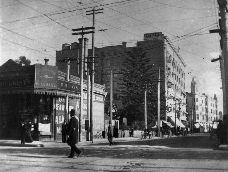
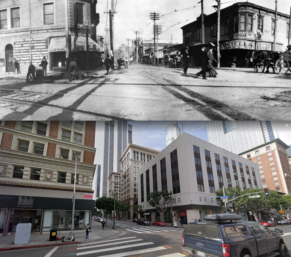
Olive and 6th Streets |
Olive and 6th Streets offers a quieter but revealing look at early downtown. Instead of banks and big hotels, these views focus on everyday storefronts, apartments, and the steady street work that kept a growing city functioning. It is a slice of ordinary Los Angeles life around 1900, when streets were still being improved block by block and the city’s center was spreading outward from its older core. |
 |
|
| (ca. 1900)^ - View of 6th Street looking west from Olive St. Pedestrians and horse-drawn vehicles are seen, and men are doing road work. A druggist is at left, and at right is Fontella Cigar Store, above which are Park View Apartments. Glengarry is a building further down the street, past several small shops. |
Then and Now
 |
|
| (1900 vs. 2022)* - Looking West on 6th Street at Olive Street. Photo comparison by Jack Feldman. |
* * * * * |
Spring and 2nd Streets |
Spring and 2nd Streets was one of the busiest corners in early Los Angeles, where finance, hotels, and streetcar travel overlapped in the same tight space. The photographs show a downtown still dominated by foot traffic and horses, but already being shaped by electric rail and dense commercial architecture.This is the Spring Street that would soon earn its reputation as the “Wall Street of the West,” with prominent buildings, banks, and constant movement through the intersection. |
 |
|
| (1888)* – Looking north on Spring Street toward 2nd Street showing horse-drawn wagons and a street car in front of the Hollenbeck Hotel left and the Bryson-Bonebrake Block on the NW corner. |
Historical Notes This intersection was at the heart of Los Angeles' expanding central business district. The period between 1888 and 1900 was pivotal in shaping Spring Street's future as a financial center, as key structures like the Bryson-Bonebrake Block and the California Bank Building were constructed, reflecting the growing economic importance of the area. By the early 1900s, the city center began spreading south, with banks and financial institutions concentrating along South Spring Street. This shift laid the groundwork for the area to eventually earn the nickname 'Wall Street of the West,' a title solidified in the decades following 1900. |
 |
|
| (1890)^ - View of Spring at 2nd Street looking north. The Hollenbeck Hotel is seen on the left and the Bryson-Bonebrake Block is on the right. Horse-drawn carriages are parked in front of the hotel. |
Historical Notes Two highly influential figures in 1880s Los Angeles, John Bryson, Sr., the 19th mayor, of LA and Major George H. Bonebrake, President of the Los Angeles National Bank and the State Loan and Trust Company, commissioned Joseph Cather Newsom to erect this 126-room bank and office building. It's cost was projected to be $224,000, a staggering sum at the time. Bonebrake was one of the richest men in the city at the time, and he could afford making such an investment. He located the main headquarters of his bank in the Bryson-Bonebrake Blocks. |
 |
|
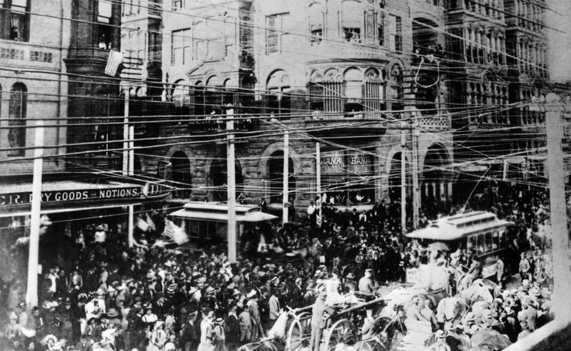
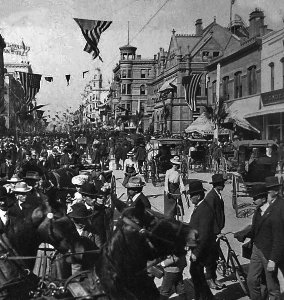
| (1892)* - A Columbus Day parade on October 26, 1892, on Spring and 2nd Streets. The Bryson-Bonebrake Block is on the right and the Hollenbeck Block on the left. |
Historical Notes The Columbus Day parade on October 26, 1892, in Los Angeles was a significant event that took place at the intersection of Spring and 2nd Streets. This parade was part of the nationwide celebrations marking the 400th anniversary of Christopher Columbus's arrival in the Americas. |
 |
|
| (ca. 1895)^ - View of Spring Street looking north from Second. The Bryson-Bonebrake Block is seen on the northwest corner of Spring and Second streets. The Hollenbeck Hotel is seen across the street (left of photo). Both the LA Country Courthouse and the Phillips Block can be seen in the background. Photo by C.C. Pierce |
Historical Notes The architecture of early Los Angeles around Spring and 2nd Streets from 1895 to 1905 reflected the city's rapid growth and economic ambition. This period saw the dominance of impressive structures like the Bryson-Bonebrake Block, an eight-story Romanesque edifice completed in 1888 and expanded between 1902-1904, which housed numerous offices and banks. Across the street, the Hollenbeck Block, built in 1884, remained a significant presence with its hotel and retail spaces. The area was characterized by a mix of architectural styles, including Romanesque Revival, Second Empire, and early skyscraper designs, showcasing the city's evolving urban landscape. Buildings like the California Bank Building and the YMCA Building added to the commercial vibrancy of the neighborhood. |
 |
|
| (ca. 1895)^- View of Spring Street looking north from Second. The Bryson-Bonebrake Block is seen on the northwest corner of Spring and Second streets. The Hollenbeck Hotel is seen across the street (left of photo). Both the LA Country Courthouse and the Phillips Block can be seen in the background. Photo by C.C. Pierce, AI image enhancement and colorization by Richard Holoff |
Historical Notes The streets were lined with multi-story structures featuring ornate facades and ground-floor retail spaces, creating a dense urban fabric that bustled with pedestrians, horse-drawn carriages, and early automobiles. This intersection was rapidly becoming the heart of Los Angeles' financial district, earning the nickname "Wall Street of the West" as banks and financial institutions concentrated along South Spring Street. The grand scale and elaborate designs of these buildings symbolized Los Angeles' transition from a small town to a major urban center, setting the foundation for the city's future growth and development. The architecture of this period around Spring and 2nd Streets not only reflected the city's growing wealth but also its aspirations to become a significant metropolitan area on the West Coast. |
 |
|
| (ca. 1900)* – View looking north on Spring Street toward 2nd Street, with the ornate Bryson-Bonebrake Block on the northwest corner and the Hollenbeck Hotel on the southwest corner. American flags drape across the street, and palm fronds adorn telephone poles as decorations. Pedestrians and bicycle riders share the street with a streetcar, while horse-drawn wagons and bicycles are parked along the curb. |
Historical Notes In 1900, horses remained the dominant mode of transportation in Los Angeles, with 8,065 horses, or about one for every 12.7 people. Horse-drawn vehicles were prevalent, while electric streetcars, operated by the Los Angeles Railway (LARy), provided popular public transport in the downtown area. The transition to automobiles began in the 1910s but was gradual; by 1920, there were 161,846 registered cars in Los Angeles County, which surged to 806,264 by 1930. |
 |
|
| (ca. 1900)^ - View of the intersection of Spring and Second streets. The Hollenbeck Hotel stands on the southwest corner. Across the street (right of photo) is a partial view of the Bryson-Bonebrake Block. Trolley lines cross over the intersection. |
Historical Notes The Hollenbeck Hotel was constructed in 1884 at Spring and Second streets. The hotel was named for its owner, John Hollenbeck, a prominent investor, banker, and owner of large landholdings in the Boyle Heights area. A leading hotel in its day, it was designed by Robert Young, an architect responsible for several early downtown hotels, including the Lankershim, the Lexington, and the Westminster. |
 |
|
| (ca. 1900)^ - The intersection of Spring and 2nd Street, showing the Hollenbeck Block. An electric trolley car heading to the Salt Lake Station is seen. A woman appears to walking in the direction of the trolley. |
Historical Notes In downtown Los Angeles around 1900, pedestrians followed a formal dress code reflecting the era's social norms. Men typically wore suits with jackets, waistcoats, and trousers, complemented by white collared shirts and neckties or bow ties. Headwear was common, with styles like bowler hats, fedoras, and straw boaters. Women wore long dresses or skirts that reached the ankles, paired with high-necked blouses and corsets to achieve the fashionable silhouette. Their outfits were often topped with wide-brimmed hats adorned with feathers or flowers, along with gloves. The color palette leaned towards dark or muted tones. |
Then and Now
 |
|
| (1900 vs 2023)* - Looking at the SW corner of Spring and 2nd streets. Photo comparison by Jack Feldman. |
* * * * * |
Hill and 4th Street |
Hill and 4th Street captures a side of downtown that was both commercial and practical, with hotels, storefronts, deliveries, and streetcars sharing the street. The scene feels less ceremonial than Broadway and less financial than Spring, but just as busy.These views show how downtown functioned day to day, with passengers headed toward neighborhoods and workers handling the constant flow of goods and services that kept the city running. |
 |
|
| (ca. 1900)^ - The 234 Santa Monica/Venice streetcar is running east on 4th St. in this view of commercial, downtown Los Angeles at Hill and 4th. The Hotel Brighton stands on the N/E corner (left). The Hotel Clarendon is on the southeast corner, a cigar store on the bottom floor. The Grant Building is on the center left. Deliveries are being made by horse-drawn wagons. An awning advertises ice cream sodas for 5 cents. |
Historical Notes Click HERE to see more Early Views of Hill and 4th Street. |
* * * * * |
Main Street |
Main Street was one of Los Angeles’ original downtown corridors, carrying people, commerce, and public events through the heart of the city. In the early 1900s, it was a place where streetcars and wagons moved alongside crowds, signage, and theaters that drew people in from across the region.The images here also show how civic moments played out on ordinary streets, turning a normal workday into a citywide event when a major visitor or parade arrived. |
.jpg) |
|
| (ca. 1901)* – Street view looking north on Main Street from 6th Street. Horse-drawn wagons and streetcars share the busy street. A sign for Morosco’s Burbank Theatre is seen at right. The streetlight is decorated for possibly a parade. |
Historical Notes In 1900, the Burbank Theatre was leased to Oliver Morosco and became known as Morosco's Burbank Theatre. Morosco was later involved in the Majestic Theater on Broadway (which opened in 1908) and got a house named for himself when he opened the Morosco on Broadway (now the Globe) in 1913. |
 |
|
| (1901)* – View looking north on Main Street from 5th Street toward Winston Street. The large two buildings on the east side of Main Street at Winston Street are the Government Building (S/E corner) and the Main Street Savings Bank Building (N/E corner). Photo was taken on May 8, 1901, the day U.S. President William McKinley came to Los Angeles. Horse-drawn wagons, cyclists, and pedestrians share the street. |
Historical Notes President McKinley, after his second inauguration on March 4, 1901, went on a six-week tour of the United States. Traveling by train, McKinley arrived in Los Angeles on May 8. On May 10, McKinley’s train headed north with stops in Ventura, Santa Barbara and San Luis Obispo. |
* * * * * |
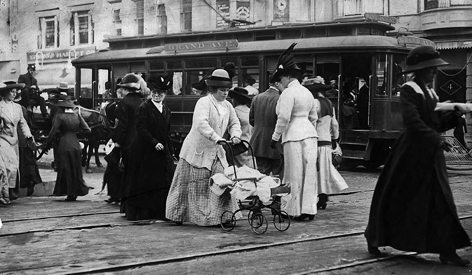
Fashion in Early Los Angeles |
These images capture something that photographs of buildings often miss: how Angelenos presented themselves in public. Clothing, hats, posture, and even how people stand near a streetcar reveal social expectations and everyday routines in the city’s early years.This subsection is a reminder that “early Los Angeles” was not only about streets and structures. It was also about people moving through the city, trying to look their best while navigating dust, crowds, and constant change. |
 |
|
| (ca. 1900)*- Fashionable women walk in front of a Grand Avenue trolley car. |
Historical Notes This photo was published in the Jan. 3, 1950, Los Angeles Times Mid-Winter Edition as part of a photographic history of Los Angeles. The accompanied headline announced, “Century’s Early Years Brought Trolleys, Traffic and (Ah!) Fashion.” |
* * * * * |
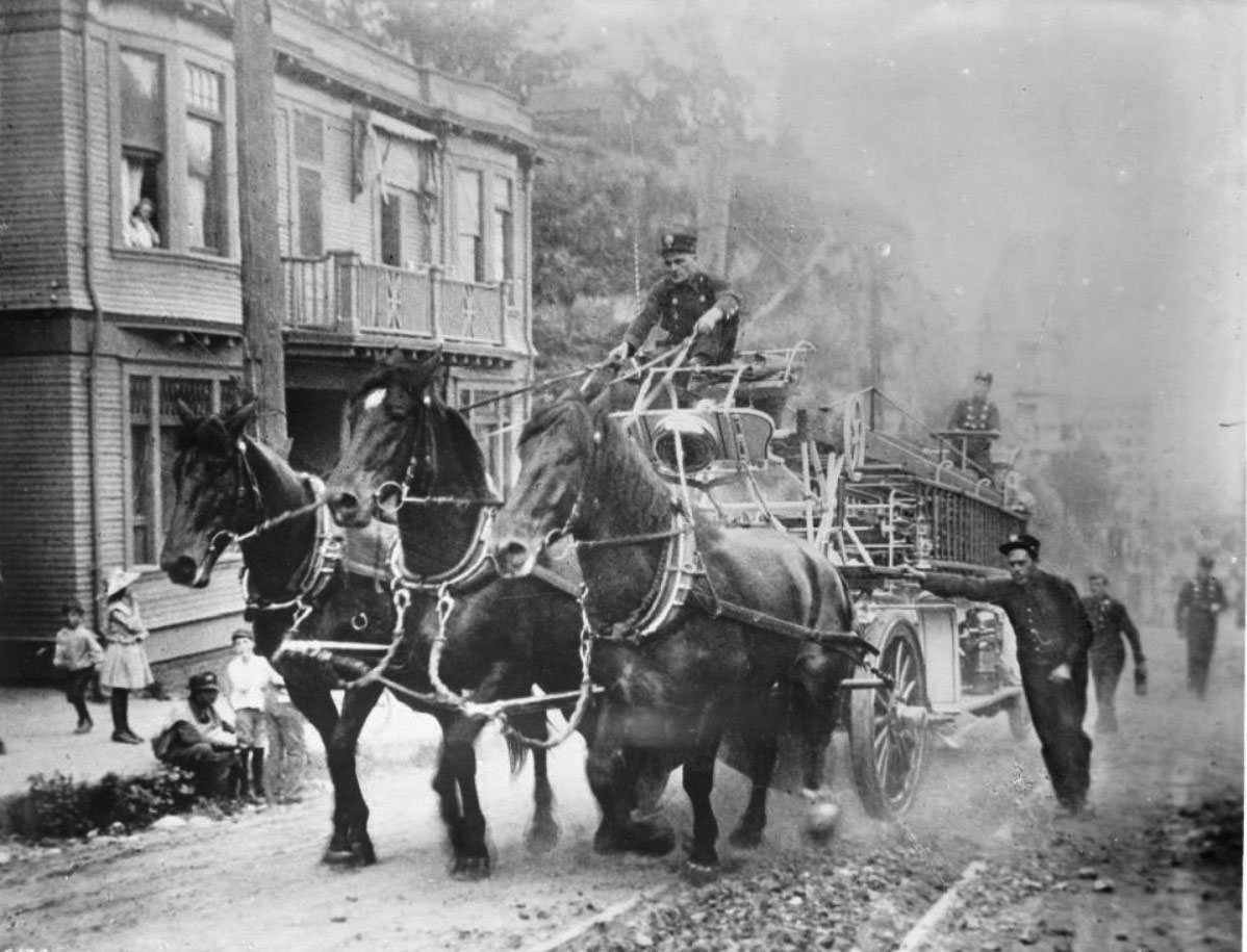
Early Fire Engines |
Before motorized apparatus changed firefighting in Los Angeles, fire engines were pulled by trained horses and supported by firefighters on foot.
|
 |
|
| (ca.1900)* - View showing an early fire engine pulled by large muscular horses, up a hill on First Street. Several firefighters help push the fire engine as it makes its way up the hill. The horses kick up a lot of dirt and dust as they pull the long fire engine. On the engine, one driver steers the horses from the front while a second driver at the rear holds a tiller steering wheel. A large shiny bell is mounted on the engine. A long ladder runs the length of the body. The unpaved road is scattered with rocks. At left, about five children can be seen on the sidewalk, and a woman watches from the window of a two-story house. Caption reads: "Early days with the fire companies. A hard pull up First Street hill toward a fire." |
| Historical Notes
First Street in downtown Los Angeles crosses the eastern slope of Bunker Hill, a prominent rise that separated the Victorian residential district from the commercial flatlands below. Early city maps marked several Bunker Hill routes as "Impassable for Teams," and it was no exaggeration. The inclines were so formidable that the city eventually bored a tunnel through the hill in 1901, and the famous Angels Flight funicular railway was built the same year specifically to spare residents the climb on foot. A steam fire engine in full running order weighed roughly three tons or more, and pulling that load up such a grade required every ounce of the animals' strength. The man at the rear of the engine, visible holding a wheel, was known as the tillerman. Long ladder trucks and large steam pumpers were built in two sections, with a pivoting rear axle that required a second driver to steer the trailing end independently. Without the tillerman's work, the long apparatus could not negotiate tight turns in the city's narrow streets. The large bell mounted at the front was the primary warning device of the era, rung continuously by the driver or a riding firefighter to clear traffic and pedestrians as the company responded. The scene of children pausing on the sidewalk and a neighbor watching from her window reflects what these runs actually looked like to ordinary Angelenos: a dramatic and memorable sight that brought neighborhood life to a momentary standstill. |
 |
|
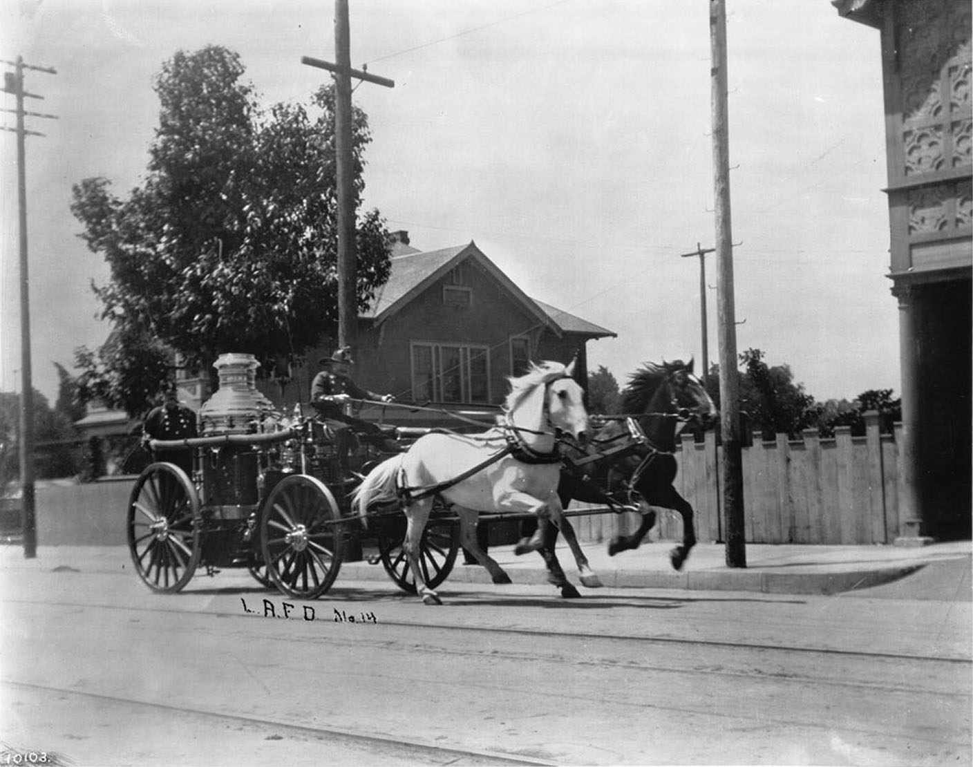
| (ca. 1910)* - View of horse-drawn Engine No. 14 running past the Engine House at 3401 S. Central Ave. Two horses gallop at full stride as two firefighters ride the engine. |
| Historical Notes
Engine Company No. 14 operated out of the station at 3401 South Central Avenue, at the corner of 34th Street, from 1902 to 1919. The station had a prior identity: it originally housed Chemical Engine Company No. 2, established in 1891 at a location on Belmont between First and Silver Streets, before relocating to the Central Avenue address. On October 1, 1902, the company was redesignated as Engine Company No. 14, and a hose tower and locker room were added to the building at that time. The land for the station had been acquired in 1900 for just $500. Around 1910, the Central Avenue corridor south of downtown was a working- and middle-class neighborhood in the early stages of demographic change, home to a growing African American community that would eventually make the street famous as the center of Black cultural life in Los Angeles. The horses visible in this photograph are running at full gallop, which was the expected pace on alarm response. Well-conditioned fire horses on a clear road could reach impressive speeds on short runs, and the animals assigned to steam pumping engines were always chosen with care for their combination of speed, strength, and steady temperament. Morgan horses were among the most commonly favored breeds for pump engine duty, prized for their compact, powerful build and reliable disposition. The bond between fire horses and their stations ran deep. Horses that had been retired to pasture were known to break away and run back to the firehouse whenever they heard the alarm bell from a distance, arriving ready to take their place under the harness. For those who worked alongside them, this loyalty made the eventual retirement of the horses in 1921 a genuinely emotional event. |
* * * * * |
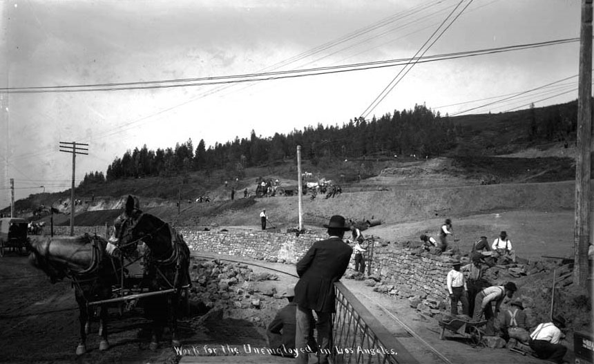
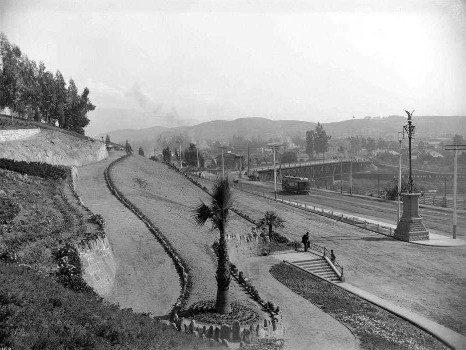
Elysian Park |
Elysian Park is Los Angeles’ oldest city park, and these views show it at the moment it was being shaped into a public landscape. Early images highlight retaining walls, roads, stairways, and gateways that made the hills accessible to everyday Angelenos.This section also connects to a larger theme running through your site: Los Angeles growing into itself by building infrastructure not only for work and transportation, but for recreation, scenery, and civic pride. |
 |
|
| (ca. 1895)^*# - View showing a man leaning on a rail and another man sitting in front of him as they watch workers construct a retaining wall at the newly created Elysian Park. Title on photograph reads "Work for the Unemployed in Los Angeles". |
Historical Notes Elysian Park is the city's oldest public park and, at 575-acres, the second largest after Griffith Park. It is home to numerous historic sites, including the Los Angeles Police Academy and Barlow Hospital, that are linked by miles of walking trails. In 1769, Gaspar de Portola and Father Juan Crespi camped on the river bank opposite Buena Vista Hill near the North Broadway Bridge entrance to Elysian Park. Yang-Na Indian villagers from the creeks of Solano Canyon and the current location of the Los Angeles Police Academy greeted the Spaniards with native refreshments. In 1781, the Pueblo of Los Angeles was officially established by Spanish California Governor Felipe de Neve with the Royal Grant of 4 square Spanish leagues (translated into 28 square miles or about 17,000 acres) of Pueblo Lands. Of this public land grant, the approximately 575-acre Elysian Park is the last remaining large piece. All else has been auctioned off or given away. Los Angeles even had to buy back the site of the present City Hall. One of the first American official acts was the Ord Survey of 1849 to record the boundaries of these Pueblo Lands so they could be auctioned to produce city revenue. Elysian Park was then known as Rock Quarry Hills for the building stone mined in the area. But instead of being sold, the Rock Quarry Hills area were "reserved" for public purpose and withdrawn from public auction. |
 |
|
| (ca. 1900)* - Photograph of the North Broadway entrance to Elysian Park. Here we have a panoramic view of Elysian Park hillside with an electric car approaching. A palm tree is planted in the elbow of a path as it curves up into the park. A man is standing at the railing of a landing of steps. Two other men are further into the park itself. Nearby is a decorative lamp post topped with a bird. Visible in the background are the Buena Vista Street bridge and several horse-drawn vehicles. Photo by C.C. Pierce |
Historical Notes In 1886, the Mayor and City Council of Los Angeles dedicated the Rock Quarry Hills as a city park forever, and renamed it Elysian Park (Elysian is derived from the Greek word paradise). Subsequent city charters have protected dedicated park lands and their use for park purposes in perpetuity. |
 |
|
| (ca. 1900)* - North Broadway entrance to Elysian Park with Buena Vista Street bridge seen in the background as it crosses the Los Angeles River. Elysian Park is the City’s oldest park, established in 1886. Photo by C.C. Pierce; AI image enhancement and colorization by Richard Holoff |
 |
|
| (ca. 1900)^ - A small stand with three men sets beside the road just before the Fremont entrance to Elysian Park. The hill on their left is landscaped with shrubs and flowers, and 2 horses & carriages are on the road into the park. |
Historical Notes After beautification, improved access was a top priority. The extension of Buena Vista Street to the park's Fremont Gate entrance brought the park within a short carriage ride of the central city, and in 1893 a former burro trail became a trans-park road. Further improvements in 1896 -- funded by a $20,000 subscription drive and performed by an army of unemployed workers -- laced the park with footpaths and added basic facilities like restrooms.* |
 |
|
| (ca. 1909)^*# – View showing a man and woman walking down the stairs at the entrance to Elysian Park. |
Historical Notes The park became even more colorful in 1893, when the Los Angeles Horticultural Society created the City Arboretum in Chavez Ravine. A haphazard planting of rare trees from around the world, the arboretum transformed Elysian Park's western canyon into an exotic forest. Some of the arboretum's trees, still growing today, remain the only representatives of their species in Los Angeles. |
* * * * * |
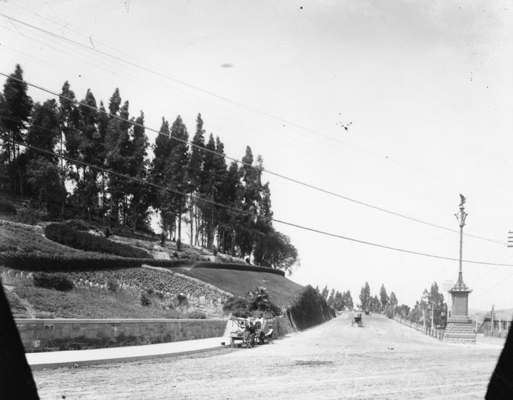
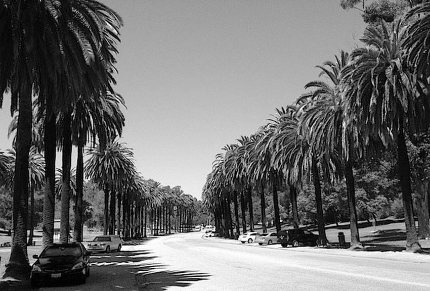
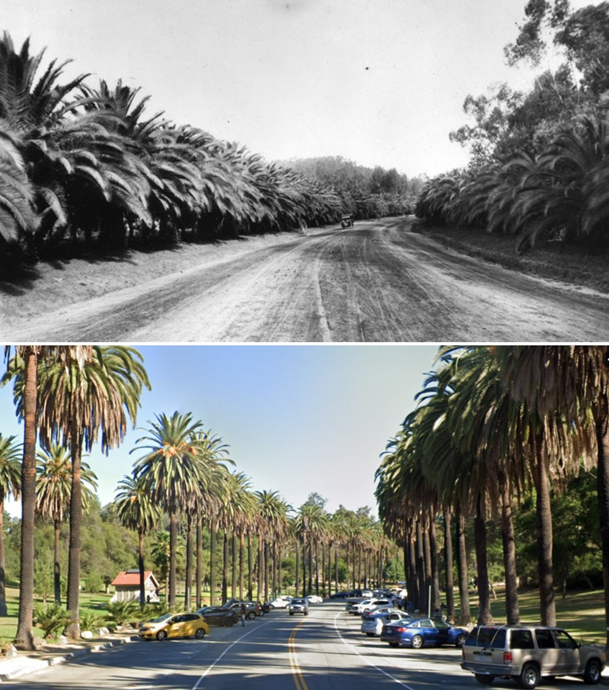
Avenue of the Palms |
Elysian Park, Los Angeles |
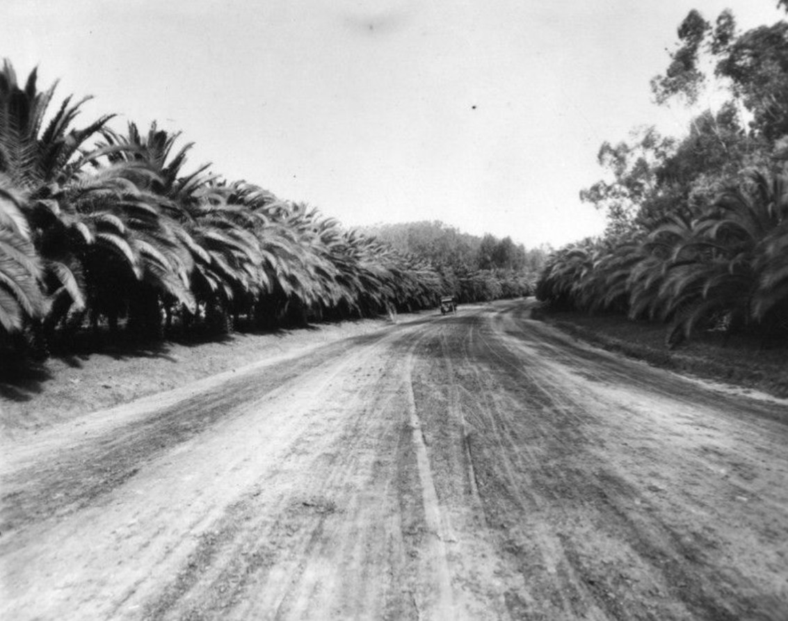
The Avenue of the Palms in Elysian Park is one of Los Angeles’s most recognizable and enduring landscapes. Lined with Canary Island date palms, the roadway has long served as a dramatic approach through one of the city’s oldest public parks.The palms were planted around 1895 along what is now Stadium Way, at a time when Elysian Park was being transformed from bare hillsides into a green retreat. Even when young, the evenly spaced rows created a strong visual effect, giving visitors a sense of arrival within the park.The images that follow trace more than a century of change, from early growth to full maturity and now to a new phase of renewal. While the trees have changed, the character of the avenue has remained remarkably consistent. |
Early Growth |
 |
|
| (ca. 1920)* - Looking down the Avenue of the Palms, rows of closely spaced trees line both sides of a wide dirt roadway. A single automobile approaches in the distance. |
Historical Notes The Avenue of the Palms was planted around 1895 using Canary Island date palms (Phoenix canariensis), a species known for its durability and distinctive form. In these early years, the trees were still relatively slender, spaced evenly and only a few feet apart. The unpaved roadway reflects the park’s early condition, when Elysian Park was still developing into a public landscape. Even at this stage, the alignment of the trees created a strong visual corridor that would define the avenue for generations. |
 |
|
| (1937)* – Looking down the roadway, the palms have grown taller and fuller, forming a more defined corridor. A single car is parked along the left side. |
Historical Notes By the 1930s, the palms had matured into a more prominent feature, with thicker trunks and broader crowns. Their rounded form and dense fronds distinguish them from other palm species commonly seen in Los Angeles. As the trees grew, the avenue became one of the most recognizable features within Elysian Park, offering a shaded and structured passage through the landscape. |
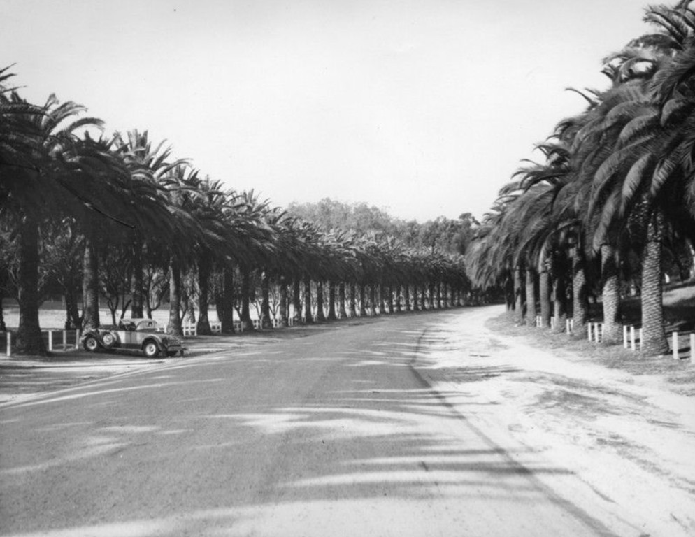
Maturity and Threat |
 |
|
| (2013)* - View of the Avenue of the Palms with trees now more than a century old. |
Historical Notes By the early 21st century, many of the original palms had reached heights exceeding 50 feet, forming a continuous canopy along the roadway. The avenue remained largely unchanged in its overall form, even as the surrounding city evolved. At the same time, the trees faced a growing threat from Fusarium wilt, a fatal fungus affecting Canary Island date palms. Once infected, the disease cannot be reversed, and its spread raised concerns about the future of the avenue. |
Transition and Renewal
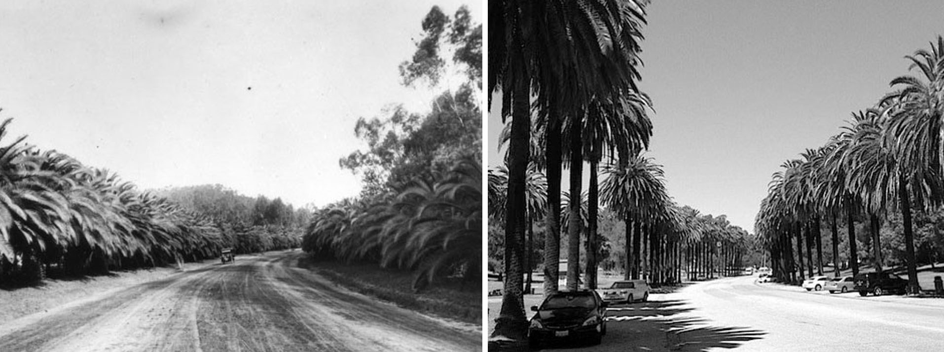 |
|
| (1920 vs. 2013) – Then and Now comparison, Avenue of the Palms, Elysian Park. Photo comparison by Jack Feldman. |
| Historical Notes
This comparison shows the dramatic growth of the palms over nearly a century. Trees that were once relatively small have developed into a towering canopy, while the roadway has been paved and the surrounding landscape has filled in. Despite these changes, the essential character of the avenue remains intact, defined by two parallel rows of palms that continue to frame the roadway. |
Then and Now
 |
|
| (1920 vs. 2025)* - Avenue of the Palms - a section of Stadium Way. Note the new Chilean wine palms (Jubaea chilensis) planted between the century old originals. Photo comparison by Jack Feldman. |
| Historical Notes
In response to the spread of Fusarium wilt, new trees were planted beginning in 2014 to ensure the avenue’s future. The selected species, Chilean wine palm (Jubaea chilensis), is resistant to the disease and capable of reaching similar size over time. This image captures a moment of transition, with mature trees standing alongside younger replacements. As the original palms decline, the new plantings will gradually take their place, preserving the avenue’s visual identity for future generations. |
* * * * * |
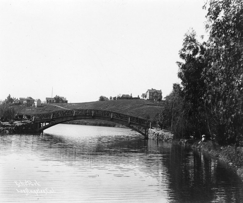
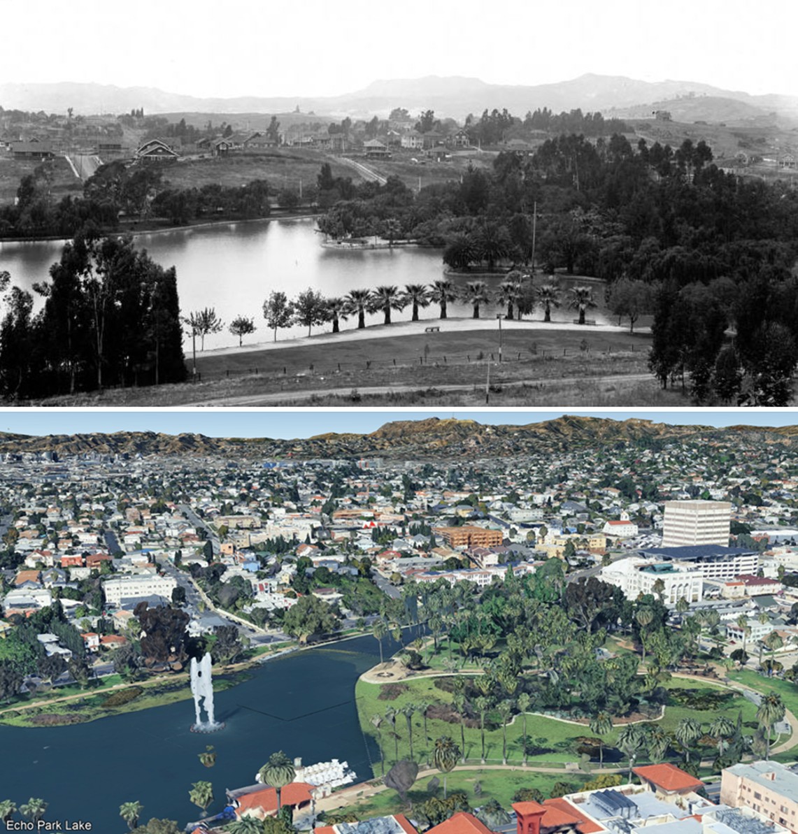
Echo Park Lake – From Reservoir to Park |
Long before Echo Park Lake had rowboats and lotus flowers, it served a strictly practical purpose. The Los Angeles Canal and Reservoir Company impounded what it called Reservoir No. 4 in 1868, drawing water from the Los Angeles River through a long, winding ditch that began near the area now known as Los Feliz. The company flooded the Arroyo de los Reyes — a naturally dry ravine — behind a 20 foot earthen dam, creating the largest body of water within the Los Angeles city limits at the time.
|
 |
|
| (1900)* - Wooden bridge over Echo Park Lake as it looked at the turn of the century. Note the homes on the hillside behind the bridge and the woman with the hat relaxing alongside the lake. |
Historical Notes This view dates to the earliest years of Echo Park as a public park, just a few years after the city took ownership of the old reservoir in 1891. The wooden bridge seen here was one of two built in a rustic style during the 1890s conversion. Parks superintendent Joseph Henry Tomlinson oversaw the work, which included dredging 5,000 cubic yards of soil from the lake's bottom to form a small island, reinforcing the earthen dam with clay, and lining the shores with quarried riprap from nearby Elysian Park. The homes on the hillside behind the bridge belonged to the neighborhoods of Angelino Heights and Victor Heights, which had grown quickly during the 1880s real estate boom that followed the arrival of cable cars from downtown Los Angeles. |
 |
|
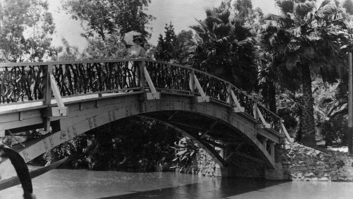
| (ca. 1910)* – View showing a woman (Grace McCarthy) with a parasol standing on a bridge at Echo Park Lake. William M. McCarthy Photograph Collection. |
Historical Notes The bridge seen here connected pedestrians to the small island near the center of the lake, one of two rustic style bridges Tomlinson incorporated into his park design. A second bridge crossed the lake's northwest corner, where the original water delivery ditch from the Los Angeles River once emptied into the reservoir. That same corner is where lotus flowers grow today. By 1910, the park drew visitors for boating, picnicking, and afternoon walks, and the boathouse completed in 1895 offered rowboats along the eastern shore. |
 |
|
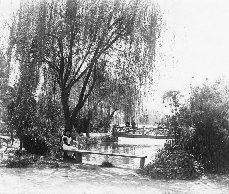
| (ca. 1900)^ - View of a woman seated on a bench by Echo Park. Behind her can be seen two men standing by their bicycles on an ornate bridge which passed over the lake's northwest corner where lotus now grow. This is where a ditch emptied Los Angeles River water into the lake. |
Historical Notes The Los Angeles Canal and Reservoir Company formed Reservoir No. 4 in 1868 by flooding the Arroyo de los Reyes through a long, zigzag canal that drew water from the Los Angeles River near present day Griffith Park. The arroyo originated near the Catholic school on Glendale Boulevard and flowed southward before continuing toward downtown Los Angeles, where it spread into low marshy ground around what is now Pershing Square. The bridge visible in this photograph crossed the exact point where that delivery canal once emptied into the reservoir. The lotus plants growing in that corner today first appeared around 1923 or 1924 and have remained one of the park's best known features ever since. Click HERE to see more Early LA Water Reservoirs. |
* * * * * |
Echo Park Lake – A Neighborhood Takes Shape |
When the city accepted the old reservoir in 1891, the land around it changed quickly. Carriage maker turned real estate developer Thomas Kelley had purchased about 70 acres in the area — including the reservoir itself — with five other investors in the late 1880s, and the group had already begun selling off lots from what they called the Montana Tract. A commercial strip grew along Sunset Boulevard, and densely packed homes and apartment buildings climbed the hillsides on every side of the lake.
|
 |
|
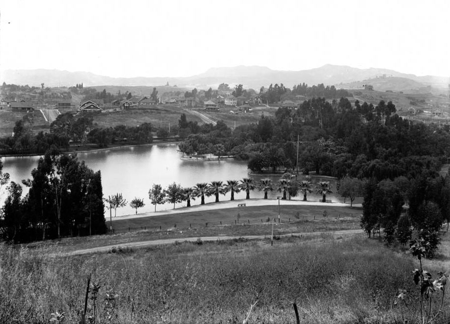
| (1911)* - View of Echo Park Lake looking northwest toward the Hollywood Hills. |
Historical Notes Thomas Kelley died in 1906, the same year he built a house for his sister at 1467 Echo Park Avenue. By then, much of his remaining land had passed to Henry Christian Jensen, who built the Sunset Pharmacy at the corner of Sunset and Echo Park, the Globe Theater at 1624 Sunset Boulevard (now Guadalupana), and Jensen's Recreation Center at Sunset and Logan Street. By 1911, Craftsman style apartment flats lined Echo Park Avenue and Alvarado Street, while a few farmhouses still occupied the northern hillside. This view northwest across the lake captures the neighborhood at the height of its first full wave of development, when Pacific Electric streetcar lines were bringing new residents from downtown Los Angeles and every available slope was being put to use. |
 |
|
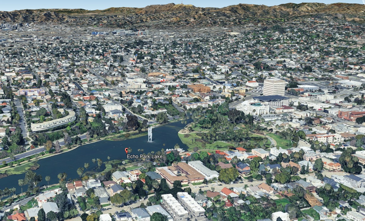
| (2025)* - Google Earth view of Echo Park Lake and surrounding community. |
| Historical Notes
This aerial view shows how completely the neighborhood filled in around the lake over the twentieth century. The park covers roughly 25 acres, with the 14 acre lake at its center. The Hollywood Freeway (US 101) cuts through the former Echo Park Playground just south of the park, severing the lakeside grounds from the commercial corridor along Temple Street that once connected them. The boathouse on the lake's eastern shore, built in 1932 in the Spanish Colonial Revival style, is visible in satellite imagery. The park was designated a Los Angeles Historic-Cultural Monument in 2006 and underwent a $45 million renovation, reopening on June 5, 2013. |
Then and Now
 |
|
| (1911 vs. 2025) - Echo Park Lake with the Hollywood Hills in the distance. Photo comparison by Jack Feldman. |
| Historical Notes
Seen top and bottom, these two views show the same northwest prospect across Echo Park Lake separated by more than a century. The upper image, taken in 1911, shows open hillsides, scattered homes, and an undeveloped horizon. The lower image, taken in 2025, shows the same water and the same distant ridge, now surrounded by a fully built neighborhood. The shoreline vegetation has matured considerably, and the updated walking paths reflect the 2013 renovation. Despite all that changed in the surrounding city, the basic geography of the lake and the hills behind it remains immediately recognizable. |
* * * * * |
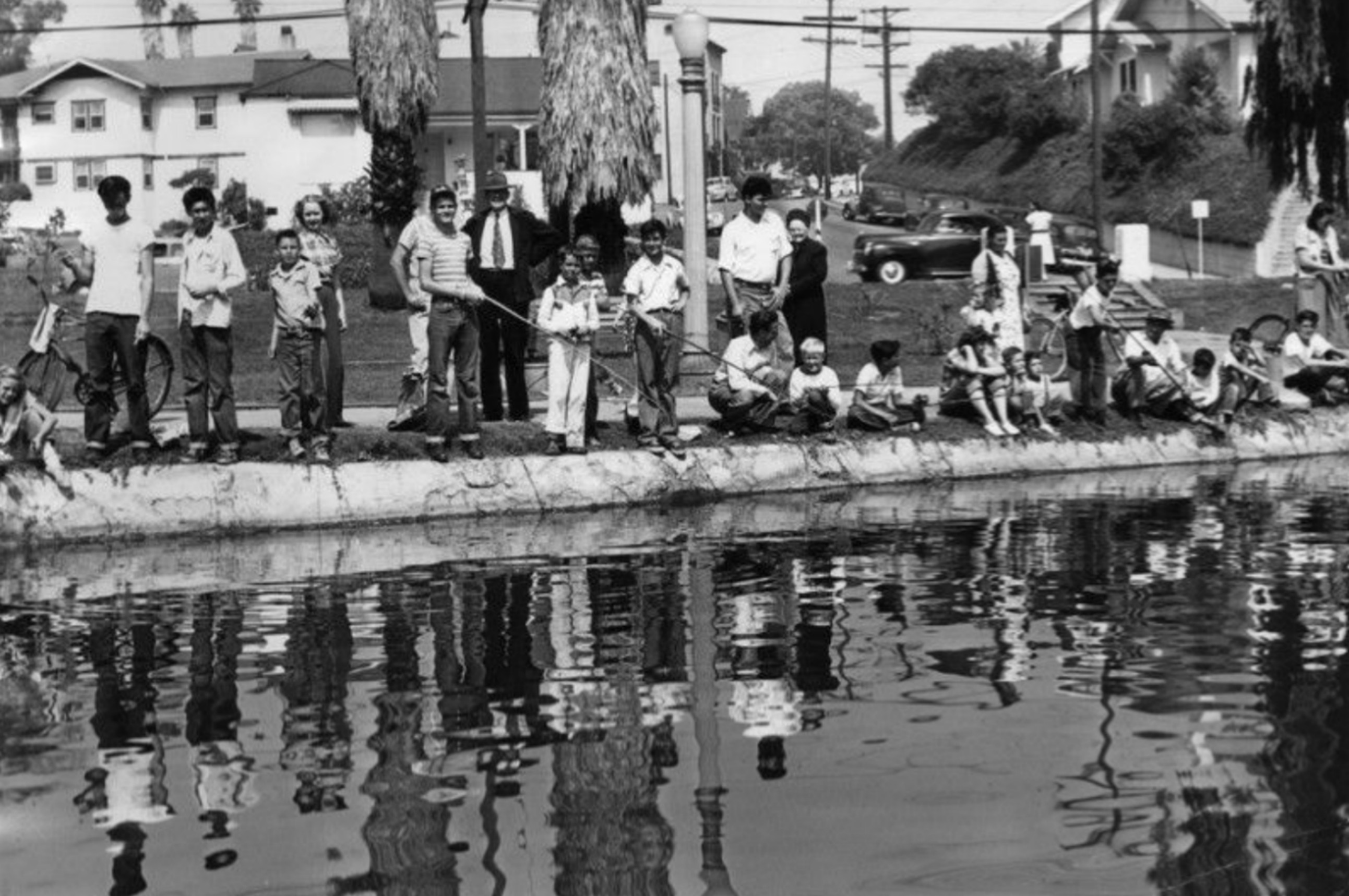
Fishing at Echo Park Lake |
Fishing at Echo Park Lake goes back to the park's earliest years, when local children fished from wooden bridges and grassy banks with handlines and simple poles. The lake held carp, catfish, and bluegill, species that thrived in shallow, slow moving urban water, and the fish were plentiful enough that young anglers rarely left empty handed.
|
 |
|
| (ca. 1900)* – Several boys are seen fishing off a wooden bridge over the lake at Echo Park. |
Historical Notes Echo Park Lake had been a public park for less than a decade when this photograph was taken. The wooden bridge seen here was one of two built during the 1890s conversion of the old reservoir, and it offered an easy perch for young anglers from the neighborhoods of Angelino Heights and Victor Heights. Fishing in these early years was informal and unregulated. The lake held carp, catfish, and bluegill, and because the park cost nothing to enter, it was especially well used by working class families who had settled the surrounding hillsides during the 1880s development boom. |
 |
|
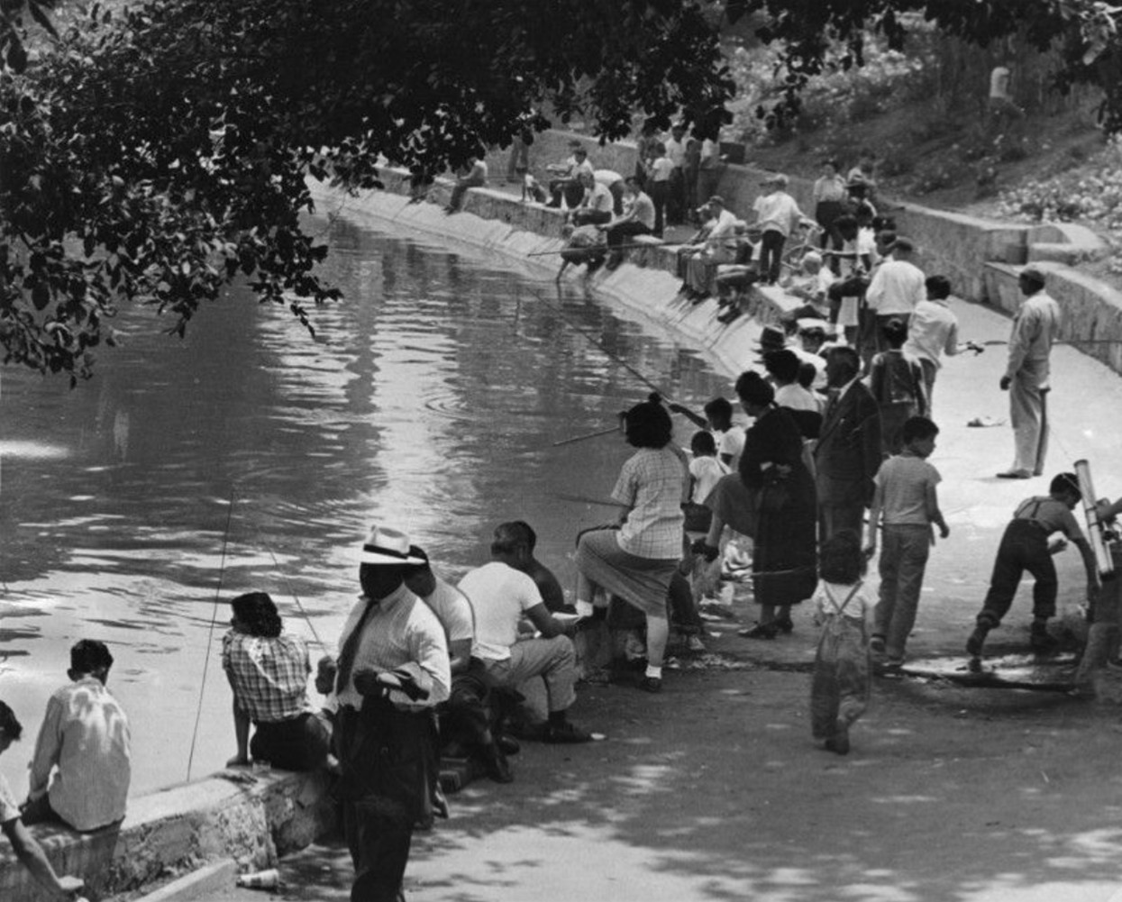
| (1949)* - Elbow room only line at the west side of Echo Park Lake at opening of the fishing season as hundreds of boys and some girls line up with their rods, hooks and lines. |
Historical Notes By the late 1940s, the city's Recreation and Parks Department had made fish stocking a seasonal tradition at Echo Park Lake. Trout were trucked in each spring, and opening day drew crowds that packed the western shore from end to end. This 1949 photograph captures what had become one of the most anticipated events on the neighborhood calendar. The scene reflects a postwar Los Angeles where public parks were under growing pressure, with a rapidly expanding population seeking affordable outdoor recreation in the city's older neighborhoods. |
 |
|
| (1949)* - Los Angeles fishermen — young and old — are gathered on the banks of the lake at Echo Park on a hot Saturday. |
Historical Notes This second photograph from 1949 shows the lake crowded on a warm Saturday afternoon with anglers of all ages along the banks. By mid century, fishing at Echo Park had become a genuinely multigenerational activity. Families brought picnic lunches, settled in for the day, and passed along whatever fishing knowledge they had to the children sitting beside them. The lake was stocked with trout, catfish, and sunfish on a regular seasonal schedule, and for many nearby families it was the most accessible stretch of open water in the city. |
 |
|
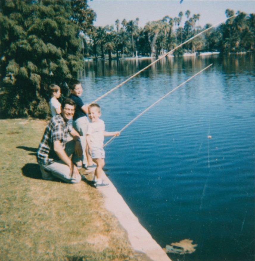
| (1967)* - A man and three boys fishing at Echo Park Lake. Young boy at the rear (left) is Kent, 3 years old, with his brother Paul, 5 years old, wearing a dark t-shirt. Adult and small boy in front are unknown. Source: LA Public Library Image Archive. |
Historical Notes By the 1960s, the Echo Park neighborhood had changed considerably from its early decades. Many families who had recently arrived from Mexico and Central America had settled in the surrounding blocks, and the park continued to serve as one of the few green spaces within easy walking distance for residents who lived nearby. Water quality had declined from the lake's earlier years, with urban runoff from surrounding streets carrying increasing levels of pollutants, but the fish population was maintained through regular restocking and the lake remained open for recreational use. Fishing went on steadily through this period, as it had for sixty years. |
 |
|
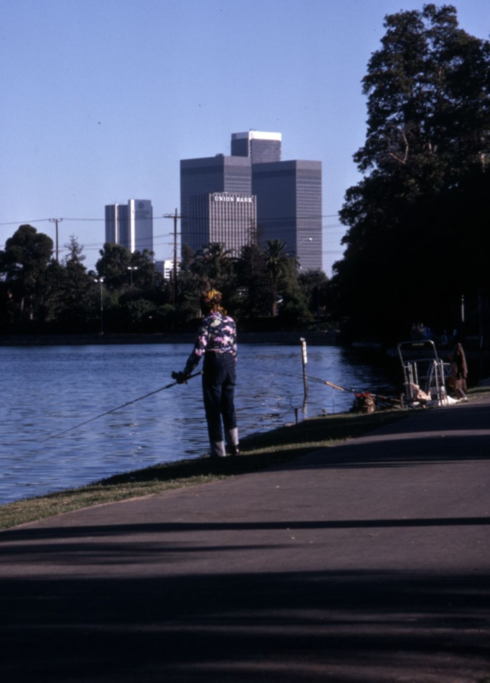
| (1975)* - Park visitors fishing on the shore of Echo Park Lake in September 1975. In the distance are downtown office buildings, from left to right, the Crocker Bank Tower, the Union Bank Building, ARCO Plaza, and the United California Bank Building (later Aon Center). Photo by Roy Hankey. |
Historical Notes This photograph, taken by Roy Hankey in September 1975, shows anglers along the shore with the downtown Los Angeles skyline filling the background. The Crocker Bank Tower, Union Bank Building, ARCO Plaza, and United California Bank Building were all products of the construction boom of the late 1960s and early 1970s, and their presence on the horizon places this image firmly in its era. The lake's water quality had been declining for years by this point. California formally identified Echo Park Lake as an impaired body of water in 2006, prompting the city to allocate $64.7 million for cleanup and renovation. The lake was drained in the summer of 2011, dredged, and replanted with native vegetation and lotus flowers before reopening on June 5, 2013. |
* * * * * |
Echo Park Playground |
The Echo Park Playground opened in 1907 on a four acre lot just south of the lake, between Bellevue Avenue and Temple Street. It was the second public playground built in Los Angeles, following the Violet Street Playground near City Hall, which had opened in 1905. What had been low, swampy ground — considered a nuisance by the surrounding neighborhood — was filled in and graded to create playing fields, tennis and croquet courts, and an outdoor gymnasium.
|
 |
|
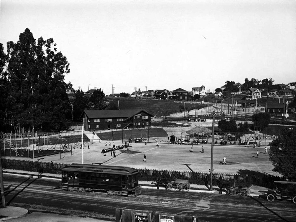
| (1909)* - View of the Echo Park Playground, a city playground in the Echo Park neighborhood located south of Echo Park Lake between Bellevue Avenue and Temple Street. A Pacific Electric streetcar, a horse and buggy and an automobile are all seen on Temple Street in foreground. Children play in the playground on a ball field, and large houses are seen on the hill. |
Historical Notes The Echo Park Playground opened in 1907 as the city's second public playground, two years after Violet Street. The four acre site had previously been low, poorly drained ground that collected runoff and drew complaints from neighbors. The city had the lot filled and leveled to create playing fields, tennis courts, croquet grounds, and an outdoor gymnasium. The location, adjacent to but formally separate from the older park to the north, followed a pattern the city would use elsewhere, including at the Griffith Park Playground. Temple Street, visible in the foreground, already carried a Pacific Electric streetcar line that connected Echo Park directly to downtown Los Angeles. |
 |
|
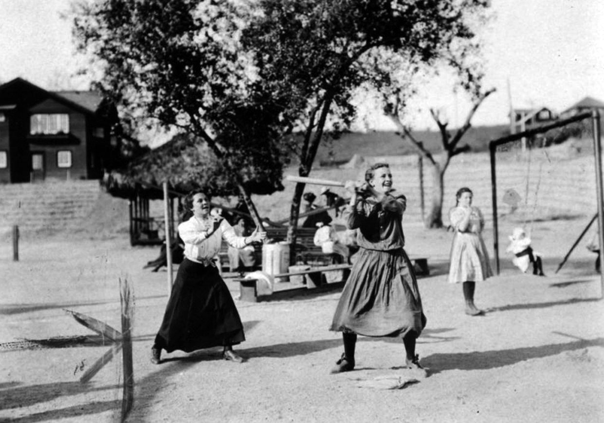
| (1907)* - Bloomer girls enjoying a game of baseball in Echo Park Playground, the oldest existing playground in Los Angeles. The clubhouse is the two story structure seen in upper left. Photograph was published in 1949. |
Historical Notes Los Angeles established its Playground Commission in 1904, the first municipal body of its kind in the country. Arabella Page Rodman, president of the Los Angeles Civic Association, led the effort alongside social worker Bessie Stoddart, who argued that supervised outdoor play was essential to civic life. The original Echo Park clubhouse, seen in the upper left of this photograph, was designed by the firm of Sumner P. Hunt and W. Wesley Eager and completed in 1908. It was only the second recreation building constructed by the city, and it offered the neighborhood's first lending library alongside meeting rooms, sports programming, and music activities. A 1918 census of playground users found that about 65 percent of Echo Park Playground visitors identified as American born — a notably different profile from the Violet Street Playground to the east, which drew heavily from Mexican, Italian, and African American communities. |
 |
|
| (1937)* – View showing the new Echo Park Clubhouse with fenced in playground to protect the children. |
Historical Notes By the early 1920s, the original 1908 Craftsman clubhouse had outgrown its usefulness, and Echo Park residents petitioned the City Council for a replacement. In June 1924, the city awarded the commission to the Allied Architects' Association, a cooperative that also designed the County USC Medical Center in Lincoln Heights and the Hall of Justice downtown. Their design, completed in 1926, was described in the Los Angeles Times as the first in a planned series of similar recreation buildings to be built across the city. The two story Spanish Colonial Revival building sat on a sloping site, with one story facing Bellevue Avenue and two stories opening to the playground at the rear. The lower level held locker and shower rooms; the upper floor contained a large meeting room with a stage. The original 1908 clubhouse was moved to a donated lot on Echo Park Avenue in 1925, where it served the Echo Park Women's Club and other community organizations before being designated Los Angeles Historic-Cultural Monument No. 950. |
 |
|
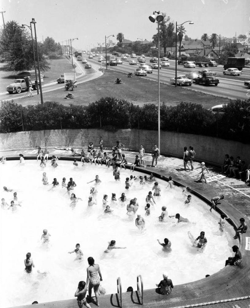
| (1958)* - Cars on the Hollywood Freeway speeding by the Echo Park Community Pool. The Hollywood Freeway was constructed in the early 1950s. |
Historical Notes Construction of the Hollywood Freeway (US 101) ran from 1947 to 1954 at a total cost of $55 million, nearly half of which went toward acquiring and clearing the right of way. The freeway cut directly through the center of the Echo Park Playground, severing the park from Temple Street and eliminating the homes of scores of residents who had been within walking distance of the lake. Before the freeway arrived, the playground had offered two basketball courts, two croquet fields, two tennis courts, a sports field, an outdoor gymnasium, a fountain, and landscaped walking paths. What remained afterward was reconfigured into a smaller footprint pressed against the freeway embankment. The public swimming pool visible in this 1958 photograph continued to serve the community for decades. A skate park opened on the site of the former pool in 2020. |
* * * * * |
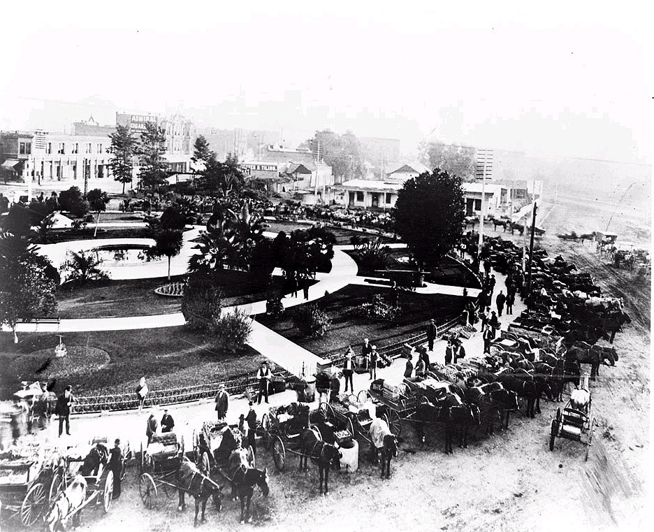
LA Plaza Open-Air Market |
Before Los Angeles had large, centralized produce markets, the Plaza served as the city’s informal marketplace. Farmers and vendors gathered here with wagons full of fruits and vegetables, creating a lively street scene that also caused congestion and complaints.
|
 |
|
| (ca. 1900)^#^ - Open air market at the L.A. Plaza, view is looking north westerly from the Plaza Firehouse. |
Historical Notes Initially, the majority of vegetable selling in Los Angeles was done around the circular Olvera Street Plaza, just South of Macy Street, where Caucasian, Japanese and Chinese farmers congregated with their goods. However, the increased presence of wagons and the long hours of the makeshift vegetable market became a nuisance to the city. Click HERE to see more Early Views of the LA Plaza. |
* * * * * |
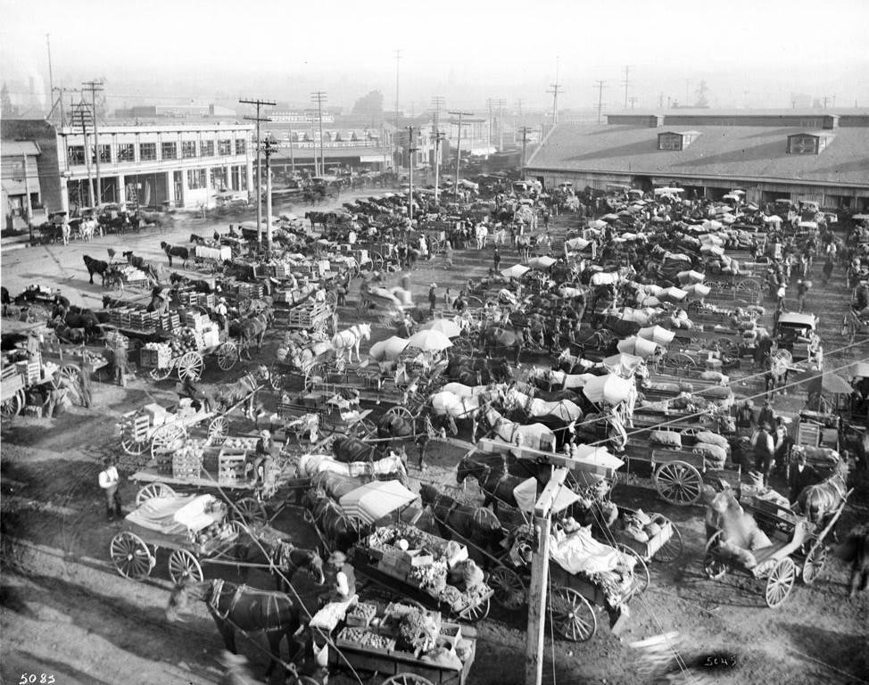
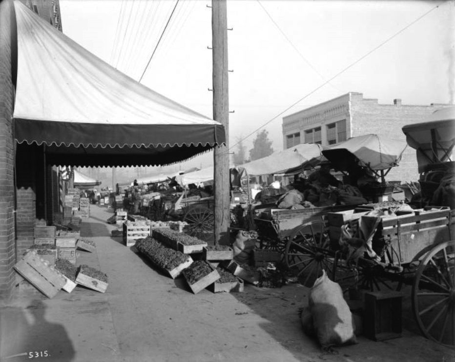
Los Angeles Produce Markets |
As Los Angeles grew, feeding the city became a major business and a major logistics challenge. What began as informal selling at the Plaza soon shifted to organized produce markets closer to rail lines and warehouses.
|
 |
|
| (ca. 1903)* - View of the Los Angeles Produce Market (Old City Market) as it appeared near the time it opened. |
Historical Notes The City’s demand for fresh produce was only increasing; subsequently, it leased a vacant lot at 9th Street and Los Angeles Street to provide a more regulated space for the vegetable market. This new market, known as the Hughes Market, opened its stalls in 1901, expanding at a rapid rate until it outgrew its bounds and leased another vacant lot from the city at 3rd Street and Central in 1903, establishing the Los Angeles Market Company.^^^^# In the upper left of the photo can be seen two buildings. The building in front (the one under construction) was the Produce Exchange Building and the one in the back has a sign which reads Towne Produce Co. These two buildings are still there and look like this today. |
 |
|
| (ca. 1910)* - View showing wagons loaded with food at the Old City Market at 3rd Street and Central Avenue. The street is filled with parked carriages at right containing goods to be sold at the market. Crates of fruits and vegetables clutter the sidewalks. |
Historical Notes Infighting amongst the shareholders and stall vendors led to the creation of two new markets in 1909; one was the City Market of Los Angeles on 9th Street and San Pedro, established by Mr. Louis Quan, while the other remained, in name, the Los Angeles Market Company, established on 6th Street and Alameda (the Southern Pacific railroad, wanting to run track through the 3rd and Central street location, exchanged this land for the lot on 6th street). Both markets grew at a tremendous rate, and while the City Market was able to expand three blocks south to 12th street, and 1 block west from San Pedro to Wall Street, the Los Angeles Market Company soon moved to a larger space on 7th and Central Streets. |
 |
|
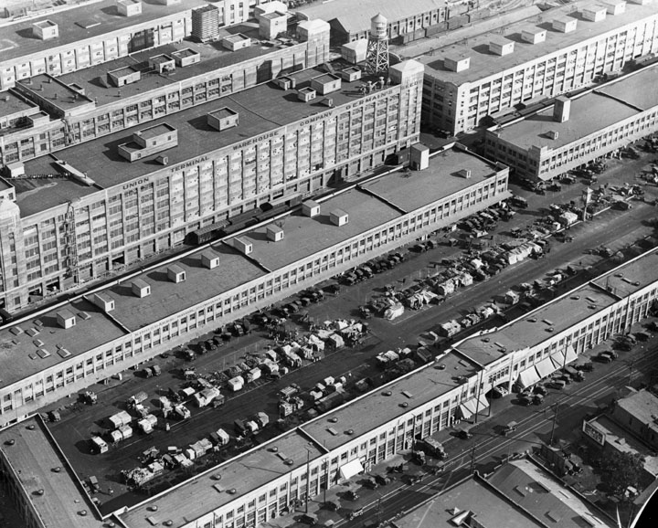
| (1920s)^ - Terminal Market, located at Seventh and Central. The entire center area consists of cars and at least one horse & cart, parked while people walk to or from the market area around the outside. |
Historical Notes Where previously the market was crowded with horses and buggies, this new site was designed to be large enough to accommodate automobile traffic. In 1926, horses were legally prohibited on streets, making wagons an obsolete method for transporting produce. |
 |
|
| (ca. 1930)^ - Long buildings in rows stretch across the picture. The Produce Market is stretched a block long between two of these rows, with double rows of stands. A warehouse in the back row carries the name "Union Terminal Warehouse Company". |
Click to see more on Los Angeles Produce Market |
* * * * * |
 |
|
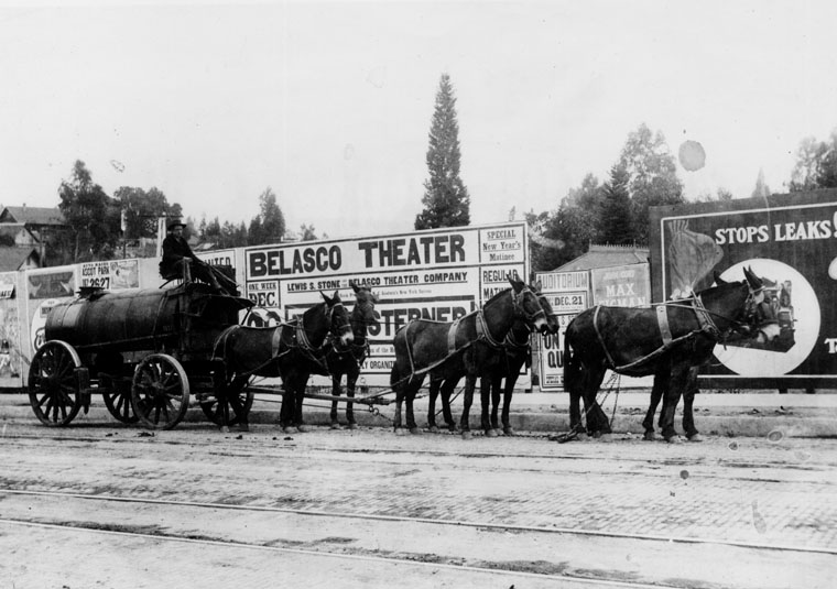
| (ca. 1900)^ - A horse-drawn wagon of the A. F. Gilmore Oil Co. on a Los Angeles street, in front of an advertisement for the Belasco Theater. |
Historical Notes A.F. Gilmore and his son, Earl Bell (E.B.) turned their Gilmore Oil Company into the largest distributor of petroleum products in the Western U.S. E. B. Gilmore appears to have invented the self-serve gas station. He created a “gas-a-teria” not far from Farmers Market where customers saved 5 cents per gallon by filling their own tanks. Those who preferred to have their gas pumped by “professionals” at the gas-a-teria got unusual service for a period of time when young ladies on roller skates would glide to the pumps to gas the cars up. |
* * * * * |
Sawtelle: From Soldiers’ Home to Streetcar Suburb |
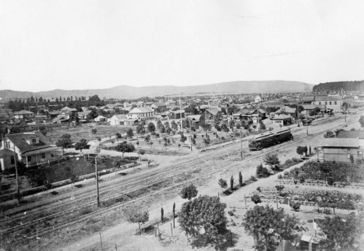
Sawtelle began as a small independent town on Los Angeles’ western edge, shaped by the nearby National Soldiers Home and the arrival of electric rail lines. What started as open land and scattered development quickly grew into a modest but active community serving veterans, workers, and early Westside residents.For a quarter century Early Sawtelle functioned more as a town than a full city. These early views capture Sawtelle during its formative years, when dirt roads, horse teams, and streetcars defined daily life. |
Sawtelle: Naming and Timeline |
Although settlement near the Soldiers’ Home began in the 1880s, the community was formally named Sawtelle around 1899, after W. E. Sawtelle, an officer with the Pacific Land Company that was subdividing and selling land for homes and businesses. Before that, early plans to call the town “Barrett” were rejected by postal authorities because the name was too similar to Bassett in the San Gabriel Valley. Sawtelle existed as an independent municipality from about 1899 until 1922, when residents approved annexation to the City of Los Angeles. |
 |
|
| (1890)* - Early view of Santa Monica Boulevard in the developing community of Sawtelle, then a young town on the western fringe of Los Angeles County. |
Historical Notes This scene shows Sawtelle when it was little more than a rural settlement with graded roads and scattered structures. Santa Monica Boulevard would soon become the community’s main commercial spine and transportation corridor linking Sawtelle with Los Angeles and the coast. The area’s growth was strongly influenced by nearby veteran facilities and by real estate interests promoting Westside development. Sawtelle was the site of the U.S. Government’s National Soldiers Home (now Veterans Administration Hospital). Click HERE to see more. |
 |
|
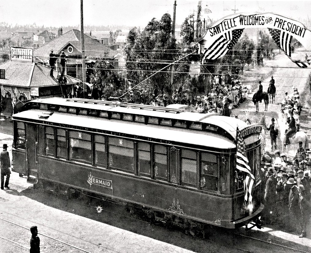
| (1901)* - A streetcar stands at Sawtelle and Santa Monica Boulevards during President William McKinley’s visit on May 9, 1901. The car likely transported the presidential party to Sawtelle, where a banner overhead reads: “Sawtelle Welcomes Our President". |
| Historical Notes
President McKinley’s visit was tied to the National Soldiers Home, one of the most important institutions in the area. The Soldiers Home (established in the 1880s) drew veterans, staff, and visitors, helping stimulate local businesses and housing. Events like this show how even a small town like Sawtelle became part of national moments. The presence of the streetcar highlights how rail transit already connected Sawtelle to the larger Los Angeles region. |
 |
|
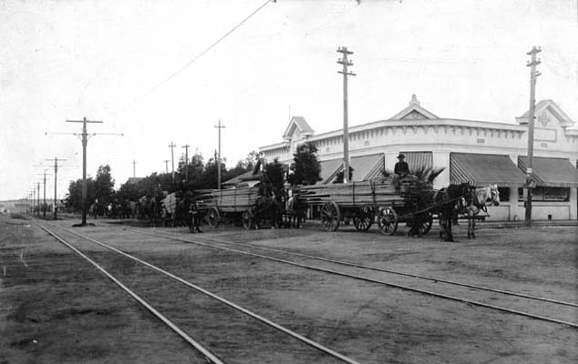
| (1900)* - Horse-drawn teams haul lumber along Oregon Avenue (today’s Santa Monica Boulevard) near its intersection with Fourth Street (today’s Sawtelle Boulevard) in the City of Sawtelle. The distinctive corner commercial building seen here appears in several early Sawtelle views. |
| Historical Notes
Before automobiles dominated local travel, freight and building materials moved by wagon. Scenes like this reflect Sawtelle’s active growth phase, when stores, homes, and civic buildings were steadily rising to serve a growing population connected to the nearby Soldiers Home and streetcar lines. The corner building visible here became a recognizable landmark in early Sawtelle and appears in multiple photographs taken from different directions at this same intersection. |
 |
|
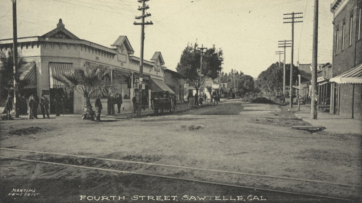
| (ca. 1910)* - View looking along Fourth Street in Sawtelle (today’s Sawtelle Boulevard) with streetcar tracks in the foreground near its intersection with Oregon Avenue (today’s Santa Monica Boulevard). The same corner commercial building seen in earlier views appears at left. |
| Historical Notes
Early Sawtelle postcards often identified scenes by the street the camera faced. This view looks down Fourth Street toward the town’s small commercial district. Streetcar tracks in the roadway highlight how rail transit shaped daily life, allowing residents and visitors to travel easily between Sawtelle, Los Angeles, and the coast. |
 |
|
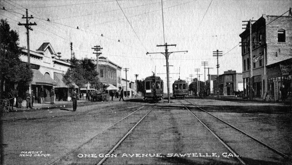
| (1906)* – View looking east on Oregon Avenue (today’s Santa Monica Boulevard) near Fourth Street (today’s Sawtelle Boulevard). Two electric streetcars are visible, and the same corner commercial building appears at left. |
Historical Notes Oregon Avenue served as Sawtelle’s main east-west corridor and later became part of Santa Monica Boulevard as regional street naming was standardized. The recurring corner building in this and other views confirms these images were taken at or near Sawtelle’s primary crossroads, the heart of the town’s early business district. Different postcards labeled the scene by the street in view, which can make locations seem inconsistent even when they show the same intersection. |
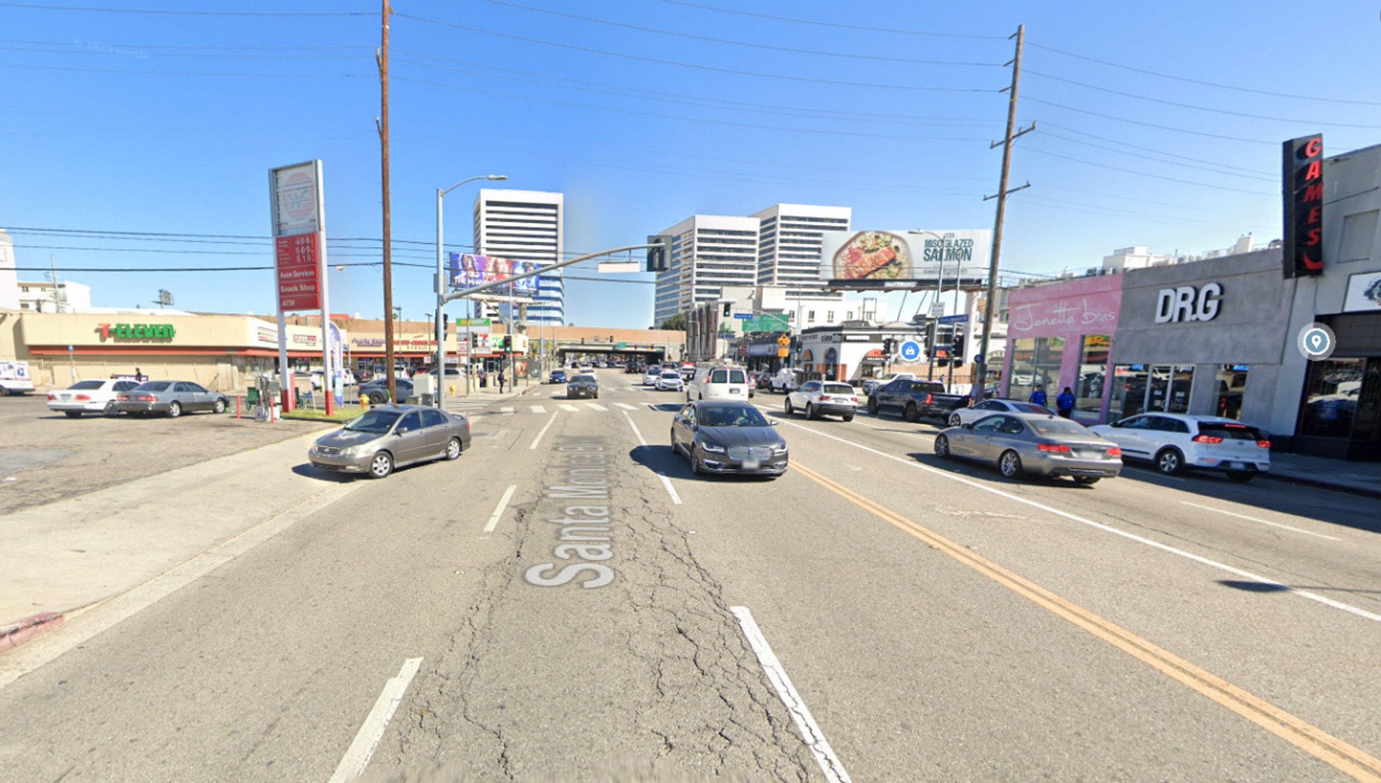 |
|
| (2023)* - Google Street View looking east on Santa Monica Boulevard toward Sawtelle Boulevard, the former crossroads of Oregon Avenue and Fourth Street in the City of Sawtelle. |
| Historical Notes
Santa Monica Boulevard still follows the alignment of early Oregon Avenue, the main street of historic Sawtelle. What was once a modest commercial district serving a small independent town has grown into a busy West Los Angeles corridor lined with regional businesses and multi-lane traffic. Though the early buildings and streetcars are gone, the roadway continues to trace the heart of Sawtelle’s original business district and transportation route between Los Angeles and Santa Monica. |
Then and Now
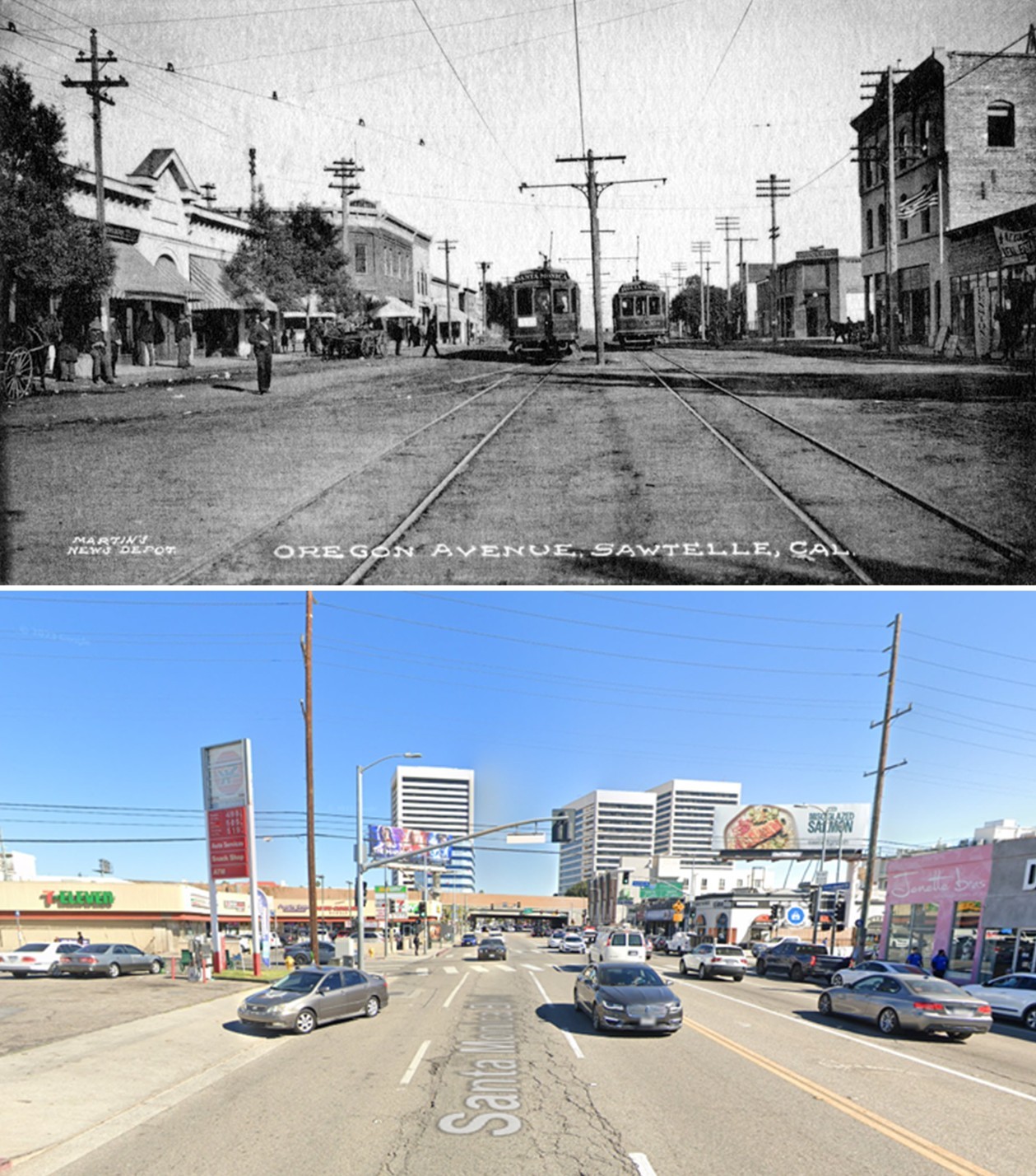 |
|
| (1960 vs. 2023)* - Then and now views looking east along Oregon Avenue (today’s Santa Monica Boulevard) near Fourth Street (today’s Sawtelle Boulevard), once the center of Sawtelle’s small commercial district. Photo comparison by Jack Feldman. |
| Historical Notes
The earlier view shows Sawtelle during the streetcar era, when electric rail service connected the town with Los Angeles and the coast. Dirt roads, overhead wires, and small storefronts defined the streetscape. The modern view reflects more than a century of change as the corridor adapted to automobiles, regional growth, and urban redevelopment. While the streetcars and early structures have disappeared, the route itself remains a continuous thread linking Sawtelle’s past and present. Together, these views illustrate how a once-independent streetcar suburb evolved into part of the larger West Los Angeles landscape. |
Sawtelle’s Founding and Annexation |
In 1896 the Pacific Land Company purchased roughly 225 acres and began planning a new town. The original name “Barrett,” honoring General A. W. Barrett of the Soldiers Home, was rejected for postal reasons due to similarity with Bassett, California.By 1899 the town was renamed Sawtelle after W. E. Sawtelle, who succeeded S. H. Taft as land company manager.Sawtelle remained an independent municipality until 1922, when local voters approved annexation to Los Angeles. Its legacy survives in the Sawtelle neighborhood name and in the long-standing presence of the Veterans Administration campus. |
* * * * * |
Santa Monica: From Coastal Outpost to City by the Sea |
Santa Monica grew from a small coastal town into one of Southern California’s most recognizable seaside cities. Early development clustered along streets like Third Street and Oregon Avenue (today’s Santa Monica Boulevard), where modest buildings, dirt roads, and horse-drawn traffic gradually gave way to automobiles, apartments, and thriving commercial districts.These early views capture Santa Monica at the moment it was transitioning from a quiet community into a growing city shaped by tourism, transportation, and real estate development. |
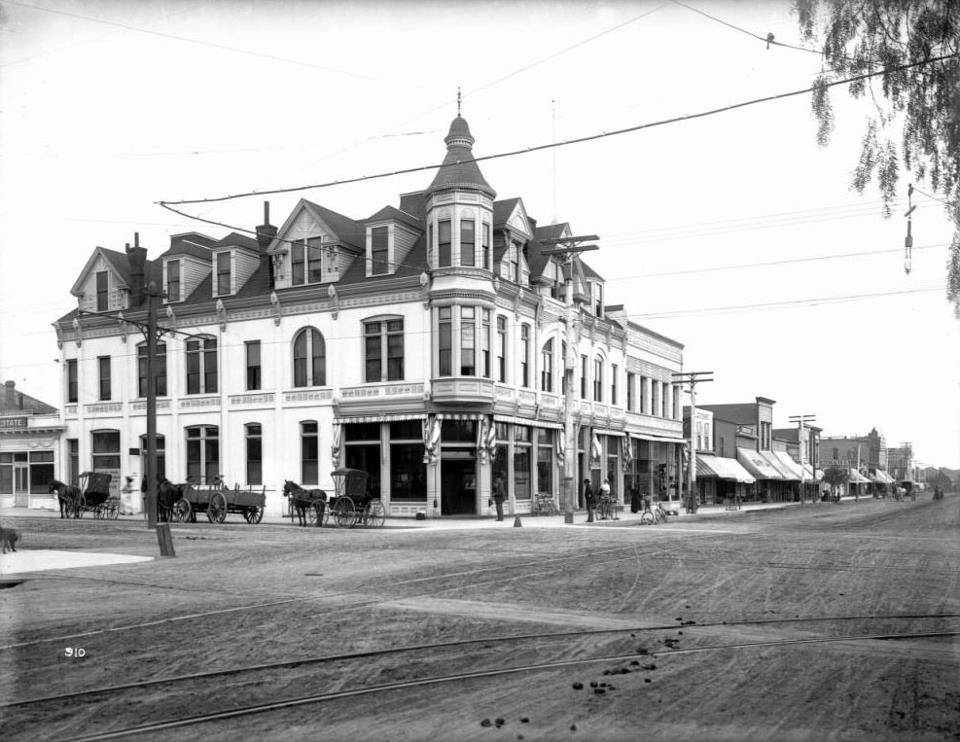 |
|
| (ca. 1900)* - View of the corner of Third Street and Santa Monica Boulevard, then known as Oregon Avenue. Today this location lies within the popular Third Street Promenade district. |
| Historical Notes
At the turn of the 20th century, this intersection sat near the heart of Santa Monica’s small but growing business district. Streets were still lightly developed, and most structures were simple wood-frame buildings serving local needs. Over time, this corridor evolved into one of the most active commercial areas on the Westside, eventually becoming the pedestrian-friendly Third Street Promenade known today. |
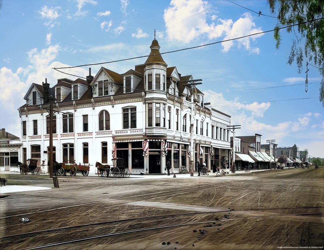 |
|
| (ca. 1900)* - The same intersection of Third Street and Oregon Avenue (Santa Monica Boulevard), presented in color. Image enhancement and colorization by Richard Holoff. |
| Historical Notes
Colorization helps modern viewers imagine how early Santa Monica may have appeared to residents and visitors. Though the buildings were modest, the area already functioned as a community gathering point and commercial hub. This corner would later sit at the center of Santa Monica’s retail and entertainment district. |
 |
|
| (1910)^ - Two automobiles travel along the 400 block of Third Street in Santa Monica. The Adelaide Apartments appear at left. Today, this stretch forms part of the Third Street Promenade. |
| Historical Notes
By 1910, automobiles were beginning to replace horse-drawn vehicles, signaling Santa Monica’s entry into the modern transportation era. The presence of apartment buildings like the Adelaide reflects the city’s growth as both a residential community and a coastal destination. Scenes like this show Santa Monica shifting from a small town to a developing city with regional appeal. |
Explore More |
Click HERE to see the full Early Views of Santa Monica section and discover how this seaside town grew into a major Southern California city. |
* * * * * |
San Fernando Valley |
 |
|
| (ca. 1900)***^ - An old time camp outfit near Ventura Boulevard and Valley Circle Boulevard. Leonis Adobe is in the background to the left of the photo. On the El Camino Real sign it says, "83.9 Santa Barbara, 18 Newberry Park, 47.9 Ventura, Los Angeles 26.1, Encino 8, Hollywood 19.6, San Fernando Mission 14." The El Camino Real bells were placed along the mission routes. |
Historical Notes Leonis Adobe, built in 1844, is one of the oldest surviving private residences in Los Angeles County and one of the oldest surviving buildings in the San Fernando Valley. Located in what is now Calabasas, the adobe was occupied by the wealthy rancher, Miguel Leonis, from 1880 until his death in 1889. Following Leonis' death, the property was the subject of a legal dispute between his common law wife (Espiritu Leonis), heirs, and a daughter born out of wedlock; the dispute lasted more than 15 years in the courts. |
 |
|
| (ca. 1890s)****# - Leonis Adobe as it appeared in the 1890s. The photo shows a man standing by his horse in the field. If you look closely, standing right behind the fence (center) is a woman looking at the photographer. This is purported to be Espiritu Leonis, wife of Miguel Leonis. |
Historical Notes In 1961, the adobe had fallen victim to vandalism, and its owner applied for a permit to raze the structure and erect a supermarket in its place. Preservationists succeeded in having the adobe declared a Historic-Cultural Landmark (the first structure in Los Angeles receiving the designation in 1962 - Click HERE to see the LA Historic-Cultural Monuments List). Leonis Adobe is also known as one of the most haunted sites in Los Angeles County, and it was profiled in the British paranormal television series "Most Haunted" in 2005. The adobe was restored and is operated as a living museum. It was listed on the National Register of Historic Places in 1975.*^ |
Click HERE to see more in Early Views of the San Fernando Valley |
* * * * * |
San Pedro
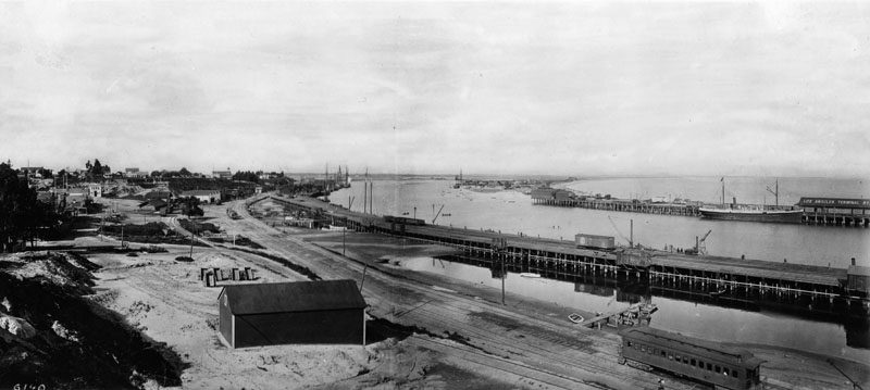 |
|
| (ca. 1900)^ - View of L.A. Harbor at San Pedro showing a large ship anchored alongside the Los Angeles Terminal Railway across the channel. Railroad tracks can be seen in the foreground. |
Historical Notes In 1542, Juan Rodriquez Cabrillo discovered the "Bay of Smokes". The south-facing San Pedro Bay was originally a shallow mudflat, too soft to support a wharf. Visiting ships had two choices: stay far out at anchor and have their goods and passengers ferried to shore; or beach themselves. Phineas Banning greatly improved shipping when he dredged the channel to Wilmington in 1871 to a depth of 10 feet. The port handled 50,000 tons of shipping that year. Banning owned a stagecoach line with routes connecting San Pedro to Salt Lake City, Utah and to Yuma, Arizona, and in 1868 he built a railroad to connect San Pedro Bay to Los Angeles, the first in the area. |
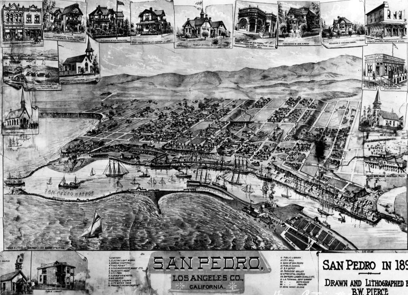 |
|
| (1893)^ - Map of San Pedro in 1893. Drawn and lithographed by Bruce W. Pierce. |
Historical Notes San Pedro was named for St. Peter of Alexandria, a Fourth Century bishop in Alexandria, Egypt. His feast day is November 24 on the local ecclesiastical calendar of Spain, the day on which Juan Rodriguez Cabrillo discovered the bay in 1542 which would be known as San Pedro. Santa Catalina Island, named after Catherine of Alexandria, was claimed for the Spanish Empire the next day, on her feast day, November 25. In 1602–1603, Sebastián Vizcaíno (1548–1624) officially surveyed and mapped the California coastline, including San Pedro Bay, for New Spain. The land was granted in 1784 by King Carlos III to Juan Jose Dominguez, a retired Spanish soldier who came to California with the Gaspar de Portolà expedition. Under United States control after 1848, when the United States defeated Mexico in the Mexican-American war, the harbor was greatly improved and expanded under the guidance of Phineas Banning and John Gately Downey, the seventh governor of California.*^ |
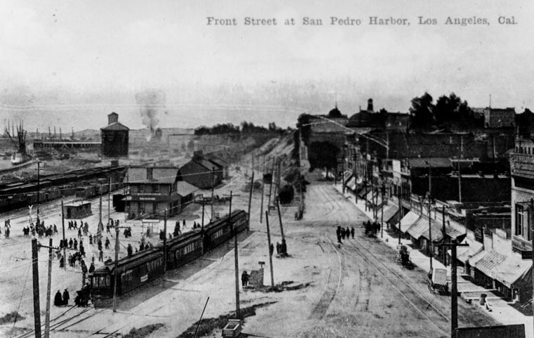 |
|
| (ca. 1900)^ - View of Front Street at San Pedro Harbor showing a multitude of people disembarking from a commuter train. Commercial storefronts can be seen acroos the unpaved road to the far right of the photo. |
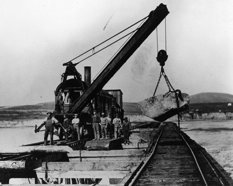 |
|
| (1904)^ - Photo of workers building the breakwater in the San Pedro Harbor. Work was started in 1899. |
Historical Notes Most of the boulders used to construct the breakwater in San Pedro Harbor came from the mountains of west San Fernando Valley. Between 1898 and 1904, Southern Pacific was grading, cutting, and tunneling through the Santa Susana Mountains near Chatsworth Park as they establshed their new Coast Line connection from Ventura to Burbank. This provided San Pedro with an ample supply of boulders for their new breakwater. Click HERE to see more in Early Views of the San Fernando Valley. |
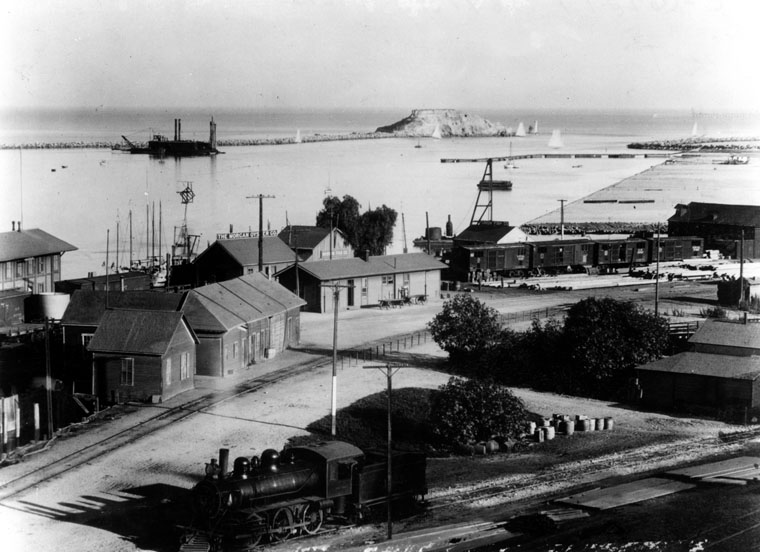 |
|
| (1905)^ - View looking over a portion of San Pedro, toward Deadman's Island, and the beginning harbor. Building at extreme left is the Southern Pacific depot. In the distance is a dredge at work along the breakwater. |
Historical Notes Deadman's Island was one of two islands near San Pedro in the 19th century. The land, sometimes referenced as Dead Man's Island, Isla Del Muerto, and Reservation Point, was dredged away in 1928 as part of a harbor development effort. Rattlesnake Island, the other islet in the area, became Terminal Island.*^ |
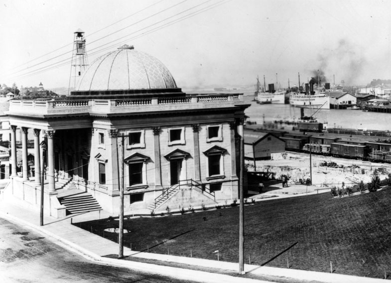 |
|
| (ca. 1907)* - Exterior view of the San Pedro City Hall. A rail yard and the Los Angeles Harbor are visible in the background on the right. |
Historical Notes In 1906, the City of Los Angeles annexed the Harbor Gateway, a long narrow strip of land connecting the city to the coast, and in 1909, the city annexed San Pedro and the adjacent town of Wilmington. The odd shape is still seen in the map of the city.*^ |
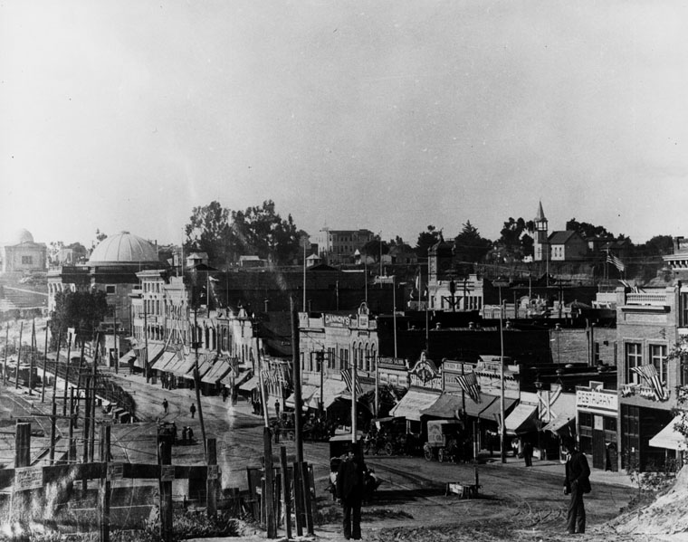 |
|
| (1910)^ - San Pedro waterfront looking south along Harbor Boulevard from 4th Street. City Hall is the building with the large dome; the smaller dome belongs to the Carnegie library building. |
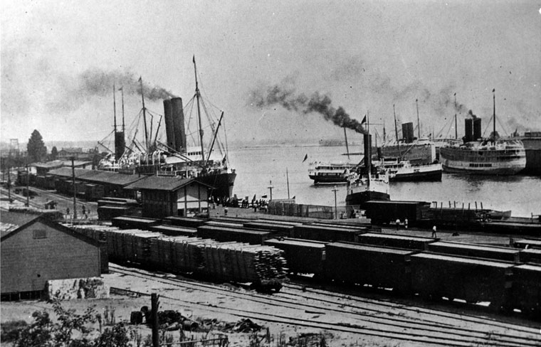 |
|
| (1913)^ - The Port of Los Angeles in 1913. The harbor appears to be filled to capacity with steam ships and train cars are full of cargo. |
Historical Notes In 1912 the Southern Pacific Railroad completed its first major wharf at the port. During the 1920s, the port passed San Francisco as the west coast's busiest seaport. In the early 1930s a massive expansion of the port was taken with the construction of a massive breakwater three miles out that was over 2 miles in length. In addition to the construction of this outer breakwater an inner breakwater was built off of Terminal Island with docks for sea going ships and smaller docks built at Long Beach.*^ |
Click HERE to see more in Early Views of San Pedro and Wilmington |
* * * * * |
Hill and 6th Street
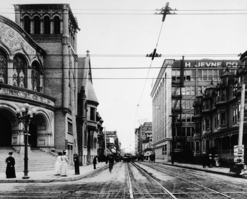 |
|
| (ca. 1900)^ - View looking east on Sixth Street from Hill Street with the First Methodist Episcopal Church on the left (N/E corner). Three women and a man are in front of the church while another man is riding a bycicle. Streetcar tracks can also be seen on the unpaved road. |
 |
|
| (ca. 1900)^ - View looking east on Sixth Street from Hill Street with the First Methodist Episcopal Church on the left (N/E corner). Three women and a man are in front of the church while another man is riding a bycicle. Streetcar tracks can also be seen on the unpaved road. Image enhancement and colorization by Richard Holoff. |
 |
|
| (2022)* - Looking east on 6th Street at Hill Street. |
Then and Now
 |
|
| (1900 vs 2022)* - Looking east on 6th Street at Hill Street. Photo comparison by Jack Feldman. |
* * * * * |
Central and 1st Street
 |
|
| (Early 1900s)^ - View of the corner of First Street and Vine (later renamed Central Ave.) A few pedestrians on the street, no automobiles. Hardware and furniture store on corner. Signage on building: "The Olive Flats, furnished rooms," "Owl cigar now 5 cents." |
Historical Notes This is in Little Tokyo. The building at center left was later replaced by a Buddhist temple, later the Japanese-American Museum. The building further to the left later had a very famous restaurant/cafe within. View is to the northwest. |
* * * * * |
Normandie Ave and 3rd Street
 |
|
| (1900)* - View looking east along an unpaved, muddy Third Street at Normandie Avenue. |
Historical Notes This was a common scene on many Los Angeles streets at the turn of the century, as paved roads were still relatively rare several miles from downtown. The street was originally named Rosedale Avenue when it was established in 1884. This name was chosen because the street led to the newly opened Rosedale Cemetery. However, in 1898, real estate developer Edwin S. Rowley successfully petitioned the Los Angeles City Council to rename the street to Normandie Avenue. Rowley's motivation for the name change was apparently that he didn't want to sell houses on a street named after a graveyard, as that could be unappealing to potential buyers. The exact reason why Rowley chose the name "Normandie" is unclear. The French-inspired name could indicate a desire to add a touch of European sophistication to the rapidly growing city, or it might have been chosen to honor French settlers or notable figures. This renaming coincided with a period of substantial growth in Los Angeles, as the city's population was booming and new areas were being developed. Over time, Normandie Avenue grew to become one of Los Angeles County's longest north-south streets, stretching approximately 22.5 miles. |
 |
|
| (2022)* - Looking east on Third Street at Normandie Avenue showing a mixture of commercial and residental property. |
Then and Now
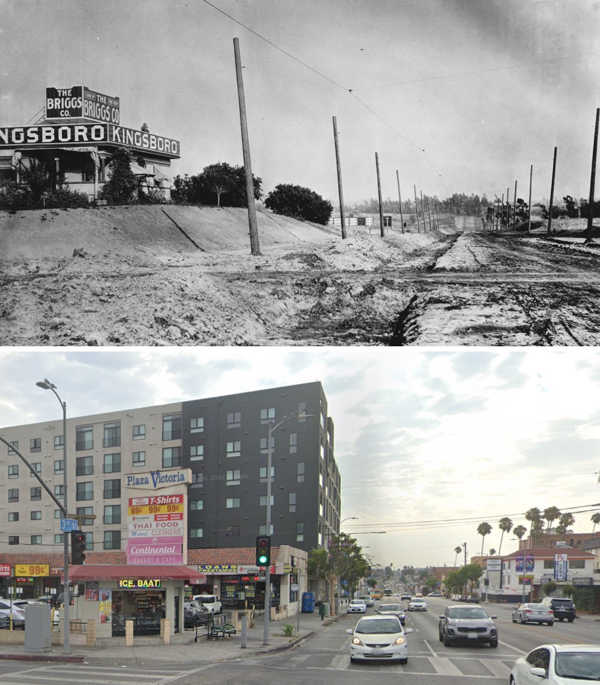 |
|
| (1900 vs 2022)* - Looking east on Third Street at Normandie Avenue, highlighting how this Los Angeles neighborhood has changed over the years. Photo comparison by Jack Feldman. |
* * * * * |
Hollywood Area
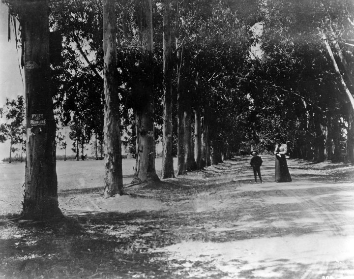 |
|
| (ca. 1900)^ - View looking west on Melrose Avenue from Western Avenue. Trees were planted in the early 1880's and felled on the right side in 1922 and on the left side in 1923. |
Historical Notes Melrose Avenue was named by ranch owner E. A. McCarthy after his hometown of Melrose, Mass. The McCarthy Ranch occupied most of the area bounded by Western to Wilton and Melrose to Santa Monica Blvd. |
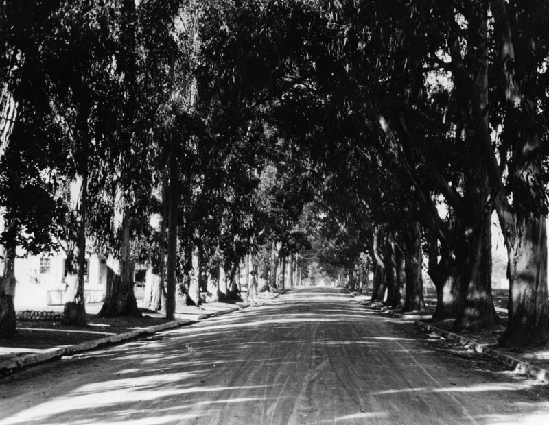 |
|
| (ca. 1910)^ - Tree-lined Melrose Avenue at Western Avenue. Houses and street curbs can now be seen. This was a favorite street for horse and buggy rides on Sundays. |
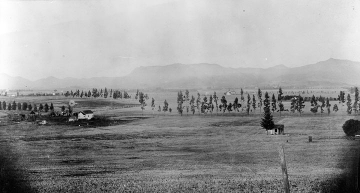 |
|
| (1906)^ - Large rural area with a few houses and trees. The future site of Melrose and Normandie, 1906. Mt. Hollywood peak can be seen in the upper right of the photo. |
Historical Notes The above farm is where the Hollywood Frwy crosses Melrose Avenue today. Just to the west and out of view is the location of the McCarthy Ranch. In 1887 E. A. McCarthy named Melrose Avenue after his hometown of Melrose, Massachusetts. |
 |
|
| (ca. 1915)^^ - View from the E. A. McCarthy ranch showing the Hollywood Hills in the background. |
Historical Notes In 1896 Griffith J. Griffith donated over 3000 acres of Rancho Los Felis to the City of Los Angeles to create a public park in his name. Mount Hollywood, the highest peak of the park, rises to an elevation of 1640 feet. Griffith Park was declared Los Angeles Historic-Cultural Monument No. 942 in 2009 (Click HERE to see complete listing). |
 |
|
| (1901)^ - Panoramic view of Hollywood looking southeast from near Vista Street and Franklin Avenue. The scene is largely agricultural. |
Historical Notes The Hollywood area was still very rural in the turn of the century with the first substantial residences built around farmland. |
 |
|
| (1901)^ - A man walks through a sweet pea field located at about Fairfax and Sunset, in West Hollywood. |
Historical Notes Click HERE to see more in Early Views of Hollywood (1850 - 1920) |
* * * * * |
Early Modes of Transportation
 |
|
| (1901)^ - A delivery truck for the Los Angeles Times in 1901. Several men are looking toward the photographer. |
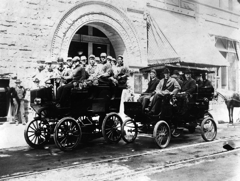 |
|
| (1902)^ - Two unidentified vehicles used to transport a large number of people,"Sports" is the note on the photograph. From another copy of the subject the team is identified as the "Bank baseball team, Second Street and Spring Street, 1902." Los Angeles Trust Company, engraved in the arch of the doorway to the building in the background, may be the "Bank" referred to. |
Historical Notes Click HERE to see more in Baseball in Early L.A. |
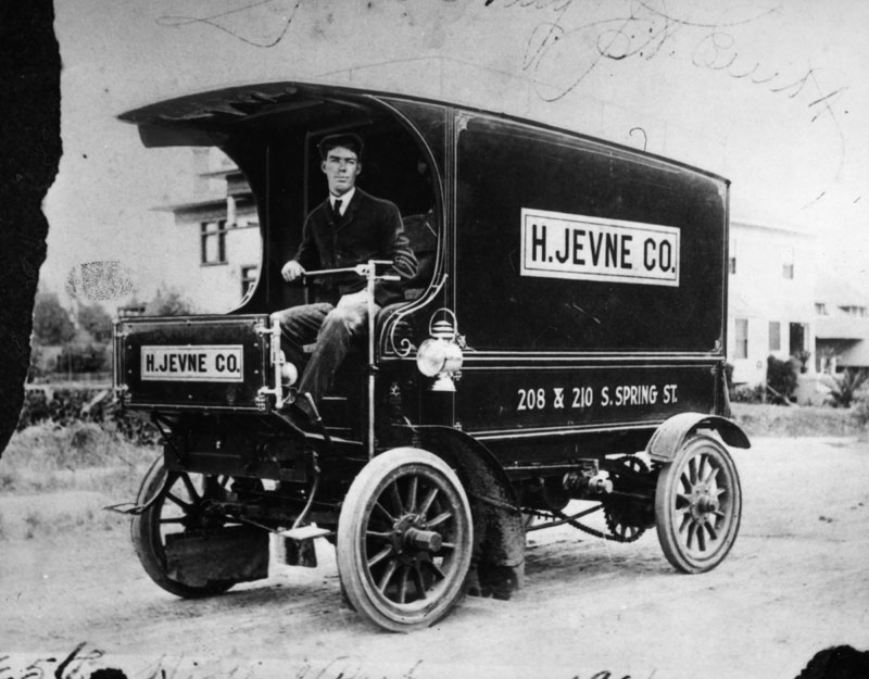 |
|
| (1906)^ - Delivery vehicle of the H. Jevne Co., a wholesale grocery supplier, taken in Highland Park in 1906. The company was located at 208 and 210 South Spring Street. This early truck has no steering wheel but uses a metal post device and has no front enclosure. |
Historical Notes Hans Jevne, in the grocery business in downtown Los Angeles from 1882-1920, didn’t want to miss a sale. At some point quite early in his operations (perhaps right from the start), he determined that if customers in the vicinity couldn’t come to him—or did come but didn’t want to tote the groceries—he’d have the merchandise delivered to them. While free home delivery by a grocery store was certainly not originated by Jevne, he eventually provided that service on an exceptionally grand scale. He employed deliverymen at least as early as 1893. On As of 1889, when “The Illustrated History of Los Angeles County, California” was published, H. Jevne Co. had 13 horses (and employed 27 men). His store, at 38 and 40 North Spring Street, had by then expanded from a single room in the building to both floors, according to the book. In 1890, Jevne moved to a three-story building at 136 and 138 N. Spring St. (in the “Wilcox Block”), and in 1896 relocated to 208/210 S. Spring Street (in the newly opened “Wilcox Building”). Jevne continued to offer home delivery, shifting from reliance on horse-pulled wagons to motorized vehicles. |
* * * * * |
La Fiesta de las Flores Parade (aka La Fiesta de Los Angeles)
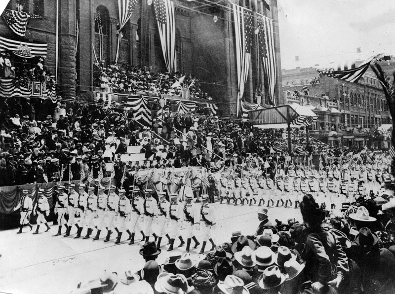 |
|
| (1901)^ - President McKinley reviewing the Americus Club marching in the La Fiesta de las Flores Parade from the steps of the Los Angeles City Hall building on Broadway. |
Historical Notes La Fiesta de Los Angeles which began on April 10, 1894, was a four day festival that the city threw in its own honor celebrating its many different cultures. It continued throughout the 1890s and early 1900s. The event featured parades, floats, many flowers, athletic competitions, a costume ball, and carnival attended by masked revelers. It was conceived of by a local business man as a way to attract tourism at a time when the effects of the 1893 depression were being felt. The City Hall building as seen above was LA's third. It was built in 1888 and stood until the current city hall was completed in 1928. |
 |
|
| (ca. 1901)* - View of the La Fiesta Parade between Broadway and Sixth Street showing President McKinley. McKinley turns the corner of the two streets in a horse-drawn carriage that has been decorated with a layer of roses while a cavalcade of police officers follow him to his side both on foot and on horseback, as well as behind him in rank. Spectators sit and stand in the bleachers in the left background. To the right, a brick business building advertises yeast for the Golden Gate Compressed Wheat Company. |
 |
|
| (1901)* – View looking north on Spring Street from 4th Street showing crowds of spectators observing the Chinese dragon in a parade at the Los Angeles Fiesta. One parade marcher carries a stool on which the head of the dragon sits when at rest. American flags hang from lines strung across the road. Onlookers sit on the edge of the roof in the foreground. |
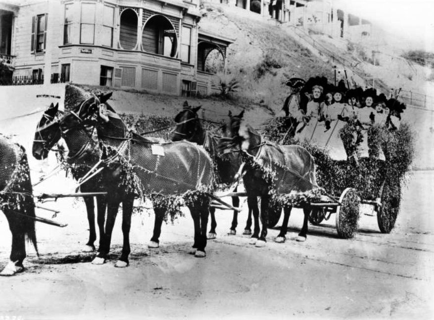 |
|
| (ca. 1901)* – View showing a carriage drawn by 6 horses and decorated with flowers, the Friday Morning Club float, standing at the corner of Second Street and Hill Street, during La Fiesta de Los Angeles. |
Historical Notes Founded by abolitionist, suffragist, mother and homemaker Caroline Severance in 1891, the Friday Morning Club (FMC) was the largest single women's club in California, with membership of over 1,800 women by the 1920s. Women's clubs were a mainstay of middle-class women's social and intellectual life across America from the end of the Civil War until the middle of the 20th century, when their numbers declined as opportunities increased for women's equal participation in mainstream business, educational, and social institutions. |
 |
|
| (1903)^ - View of La Fiesta de las Flores parade passing in front of several large buildings along Spring Street in Downtown Los Angeles. Multitudes of people line both sides of the street and numerous others can be seen enjoying the parade from open windows and rooftops high above. |
 |
|
| (1903)* - View showing the same floats as previous photo but now Broadway. Thousands of people line the street and/or sit in the stands. Sign on building reads "Conservative Life". |
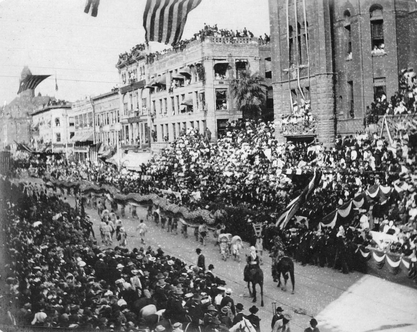 |
|
| (1903)* - Chinese Dragon winds its way heading north on Broadway in front of Los Angeles City Hall , at the Fiesta de la Flores Parade. The County Courthouse tower can be seen in the upper-left. |
Historical Notes The 1903 La Fiesta de la Flores parade was notable because President Theodore Roosevelt was in attendance and watched as it passed this reviewing stand. On each side, flanking the Presidential stand, is the Grand Stand containing the Executive Committee, sub-committees, County and City Officials, and invited guests. After the Floral Parade, the Presidential party entered the carriages in waiting and with military escort, drove to Sixth Street Park (later Pershing Square). |
 |
|
| (ca. 1910)* - The Wheelmen were regular participants in the La Fiesta de Los Angeles downtown parade in April. |
Historical Notes The Los Angeles Wheelmen, a prominent cycling club formed around 1896 during the height of the bicycle craze, were regular participants in the annual La Fiesta de Los Angeles downtown parade in April. This period marked a surge in cycling's popularity as both a sport and a mode of transportation, with the Wheelmen actively organizing and participating in events like races and century runs, including the notable Fourth of July race from Los Angeles to Santa Monica. The completion of the 18-mile Santa Monica Cycle Path in 1900, part of the broader good roads movement, provided a reliable route to the sea and highlighted the Wheelmen's advocacy for better road conditions and safer riding environments. Their legacy endured through reunions of former racers, known as the "Wheelmen of the Past Century," which continued into the mid-20th century, celebrating the lasting impact of early cycling culture in the region. The La Fiesta de Los Angeles parades ended in 1916. |
* * * * * |
Tournament of Roses (Pasadena)
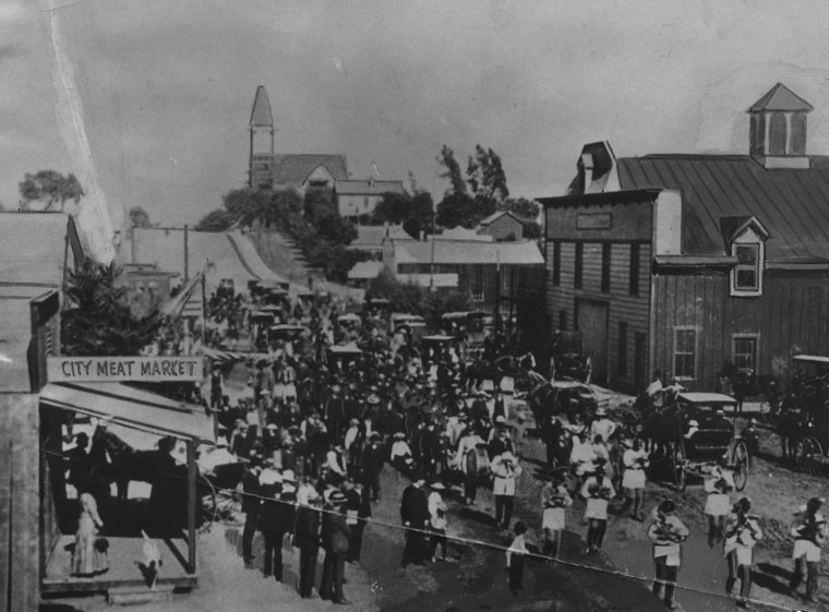 |
|
| (1902)^ - This was the 1902 Tournament of Roses parade, with a butchers band marching down the Pasadena street. There was nothing spectacular about the parade then, and the spectators were few. This was also the first year of the Rose Bowl game. |
Historical Notes Members of Pasadena's Valley Hunt Club first staged the Tournament of Roses parade in 1890. Since then the parade has been held in Pasadena every New Year's Day, except when January 1 falls on a Sunday. Many of the members of the Valley Hunt Club were former residents of the American East and Midwest. They wished to showcase their new California home's mild winter weather. At a club meeting, Professor Charles F. Holder announced, "In New York, people are buried in the snow. Here our flowers are blooming and our oranges are about to bear. Let's hold a festival to tell the world about our paradise." So the club organized horse-drawn carriages covered in flowers, followed by foot races, polo matches, and a game of tug-of-war on the town lot that attracted a crowd of 2,000 to the event. Upon seeing the scores of flowers on display, the professor decided to suggest the name "Tournament of Roses." Over the next few founding years, marching bands and motorized floats were added. |
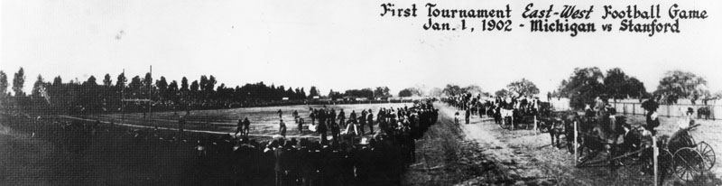 |
|
| (1902)^ - First Tournament East-West football game, January 1, 1902, Michigan vs. Stanford. Note the crowd of people standing in foreground, and to the right side of the football field. Horse-drawn carriages are lined along a fence beyond the crowds of people. |
Historical Notes Before the Rose Bowl was built, 1923, games were played in Pasadena's Tournament Park, approximately three miles southeast of the current Rose Bowl stadium near the campus of Caltech. Tournament Park was determined to be unsuitable for the larger and larger crowds gathering to watch the game and a new, permanent home for the game was commissioned. Click HERE to see more in Early Views of Pasadena |
* * * * * |
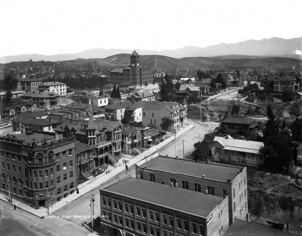 |
|
| (1900)* - View looking northwest from the top of the County Courthouse located on Temple Street and Broadway. The tall building with a clock tower is Los Angeles High School. The Broadway Tunnel would be bored through Fort Moore Hill, at the end Broadway (center-right), within a year of this photo. |
Historical Notes The Broadway Tunnel was a tunnel under Fort Moore Hill, built in 1901, extending North Broadway (formerly Fort Street), at Sand Street (later California Street), one block north of Temple Street, northeast to the intersection of Bellevue Avenue (later Sunset Boulevard, now Cesar Chavez Avenue), to Buena Vista Street (now North Broadway). Buildings seen include the Hotel Aberdeen and the Women's Christian Temperance Union building with a rounded corner and a balustrade on the cornice. Signs read: "Hotel Aberdeen" "W.C.T.U, Temperance Temple, Furnished Rooms" and "Sanitarium and Health Office." Multi-story Victorian houses have half-timbering, dormers, and turrets. |
 |
|
| (1901)^ - Close-up view of the second building housing Los Angeles High School, located on north Hill Street between California and Bellevue. There are numerous oil derricks behind it, all part of the Los Angeles Oil Field. |
Historical Notes This was Los Angeles High School's second home, built in 1891 on Fort Moore Hill. Los Angeles High School was founded in 1873 and is the oldest public high school in the L.A. Unified School District. The original building was at Temple and Broadway (the current site of the Los Angeles County Court House). In 1891, L.A. High School moved to its second building at a new location (seen above) on nearby Fort Moore Hill, located on north Hill Street between California (now the 101 Freeway) and Sunset Blvd (now Cesar E. Chavez Ave). Early buildings commissioned to house the Los Angeles High School were among the architectural jewels of the city, and were strategically placed at the summit of a hill, the easier to be pointed to with pride. One of the school's long standing mottos is "Always a hill, always a tower, always a timepiece." In 1917, the school moved to its current location at 4650 West Olympic Boulevard (which incidentally is not on a hill). |
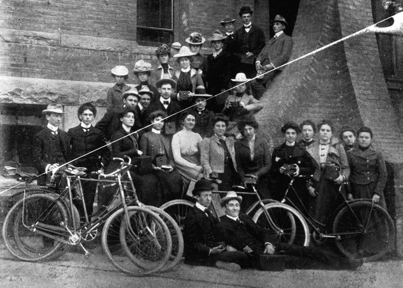 |
|
| (1900)^ - Group photo of members of Los Angeles High School's Kodak and bicycle club. Some hold their cameras, other stand near bicycles. |
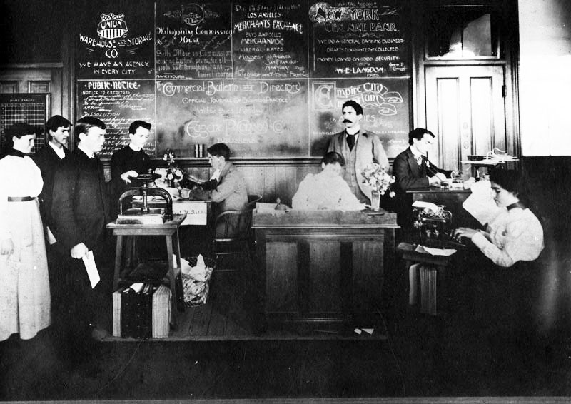 |
|
| (1899)^ - Los Angeles High School's commercial practices class, in 1899. Click HERE to see more Early Views of Los Angeles High School. |
\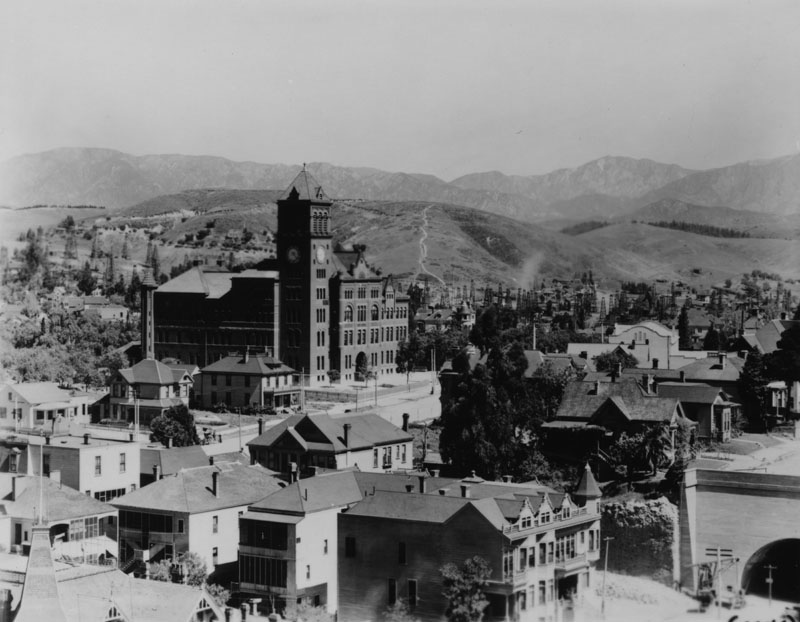 |
|
| (ca. 1902)^ - View from Broadway between Temple and California Streets, northwest. The tall building with a clock tower is Los Angeles High School. The Los Angeles Oil Field is in the background behind the school. The Broadway Tunnel can be seen in the lower right corner of this photo. |
Historical Notes Discovered in 1890, and made famous by Edward Doheny's successful well in 1892, the Los Angeles Oil Field was once the top producing oil field in California, accounting for more than half of the state's oil in 1895. In its peak year of 1901, approximately 200 separate oil companies were active on the field, which is now entirely built over by dense residential and commercial development. |
* * * * * |
Broadway Tunnel
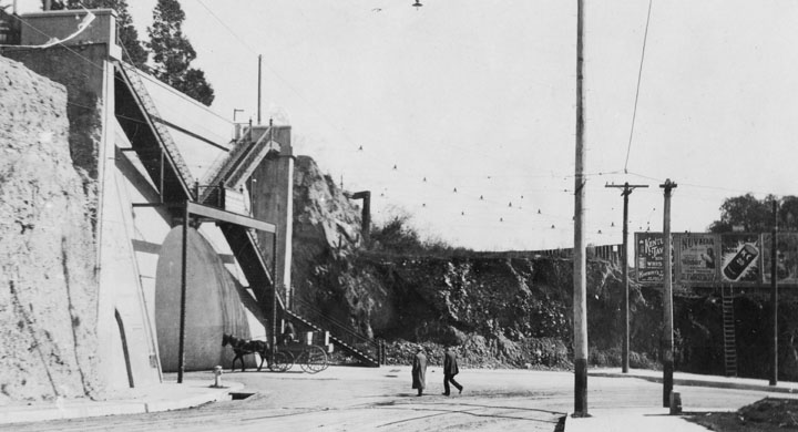 |
|
| (ca. 1902)^ - South approach to the Broadway Tunnel and the stairway leading up to Fort Hill. A man is riding a horse-drawn wagon into the tunnel while two men are crossing the unpaved road and appear to also be heading toward tunnel opening. There was a sign over the Tunnel which read: “$50.00 fine for riding through this tunnel faster than a walk.” |
Historical Notes The Broadway Tunnel opened in August 1901, pushing through Fort Moore Hill at a cost of $66,000. At 760 feet long, 40 feet wide, and 22 feet high, it was one of the largest urban tunnels in the United States at the time. Signs warned drivers of a steep grade and imposed a $50 fine for traveling faster than a walk—an attempt to control the speed of horses and wagons. Alongside the nearly completed Third Street Tunnel under Bunker Hill, it marked Los Angeles’ growing confidence in reshaping its landscape to meet the needs of a fast-expanding city. Third Street Tunnel under Bunker Hill was also completed in 1901. |
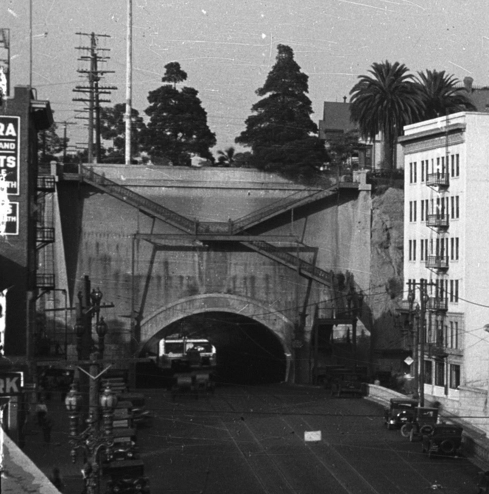 |
|
| (ca. 1924)* – View showing the south portal of the Broadway Tunnel. Note the pedestrian staircase on the face of the tunnel. |
Historical Notes By the 1920s, the tunnel had become a critical link between the Civic Center and neighborhoods to the north. The south portal stood out for its pedestrian staircase, which climbed the face of Fort Moore Hill and provided access to the residential streets above. The tunnel was more than just a passage for cars, wagons, and streetcars—it was a connector that stitched together the city’s civic and residential worlds, a symbol of Los Angeles’ determination to overcome the barriers of its rugged topography. |
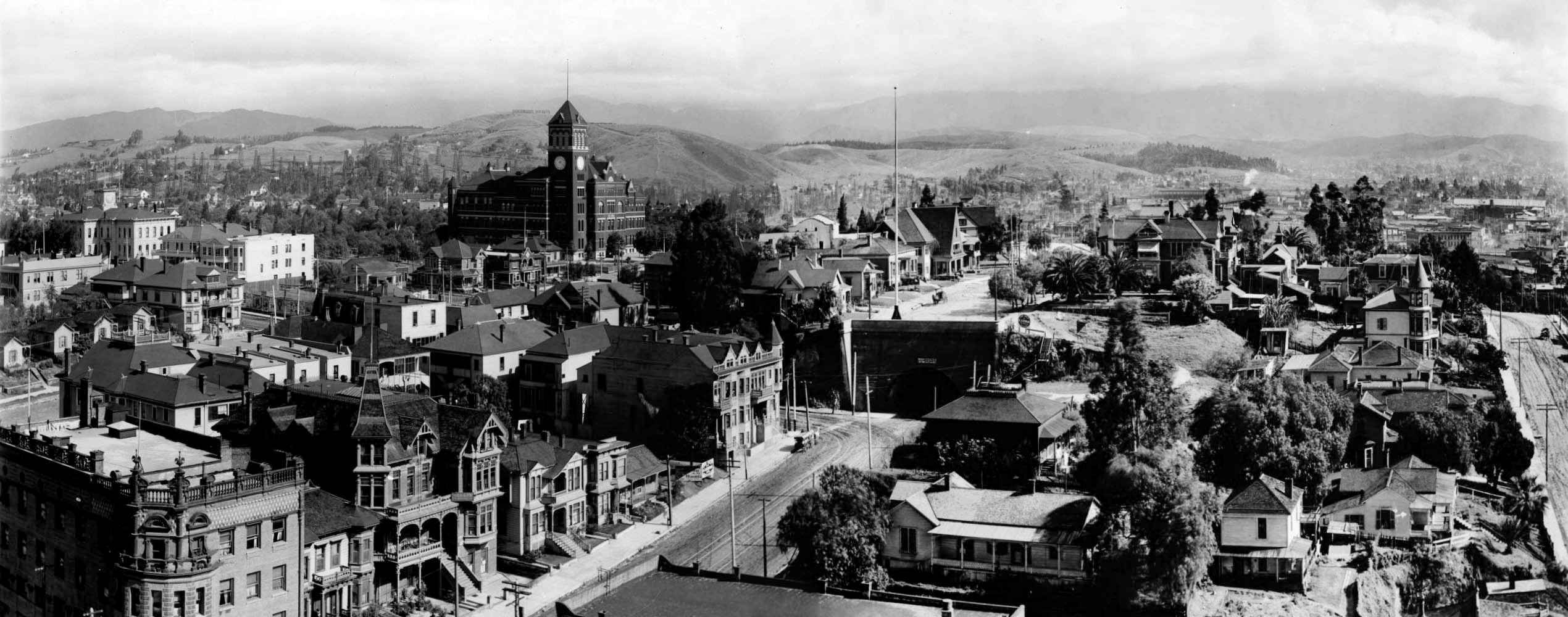 |
|
| (ca. 1905)* - Panoramic view looking northwest as seen from the LA County Courthouse (S/E corner of Broadway and Temple Street) showing a completed Broadway Tunnel at center and Los Angeles High School in the background. |
Historical Notes From the vantage point of the Los Angeles County Courthouse, the Broadway Tunnel appeared as a bold cut through Fort Moore Hill, with Los Angeles High School visible in the distance. The tunnel not only relieved congestion in downtown’s crowded streets but also signaled the city’s ambitions to expand northward. For early Angelenos, it was a daily reminder that growth required reshaping the land itself. |
Before and After
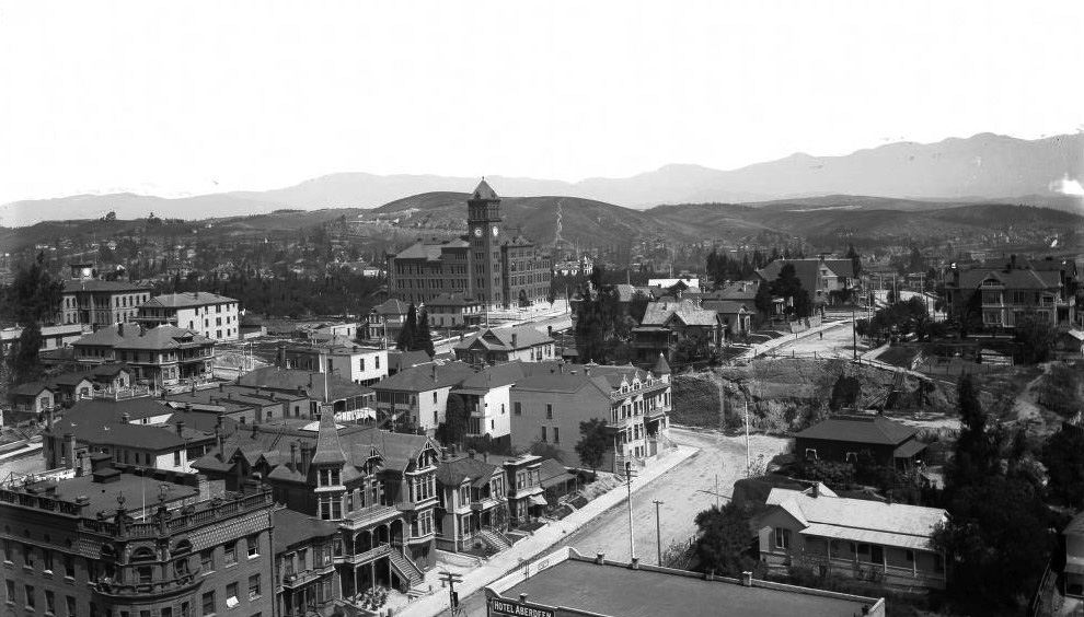 |
|
.jpg) |
|
| (1900)* vs. (1905)* - View looking northwest from the top of the County Courthouse located on Temple Street and Broadway. |
Historical Notes Only a few years separated the barren slope of Fort Moore Hill from the fully operational Broadway Tunnel, but the difference was striking. The project reflected Los Angeles’ transformation at the turn of the century, when major infrastructure projects turned physical barriers into conduits for movement, commerce, and civic pride. |
 |
|
| (1905)* - Detail view showing houses, dirt road, and a horse-drawn carriage above the finished tunnel. Note the wooden steps on the right. Also, there is a sign above the tunnel entrance that warns of a $50 fine "For Riding Or Driving Through This Tunnel Faster Than A Walk". |
Historical Notes Above the tunnel’s southern entrance, homes clung to the hillside and wooden steps climbed the slope. A sign at the entrance repeated the warning against moving faster than a walk—an early attempt at traffic regulation in a city where horses, carriages, and pedestrians all shared the same space. Though modest by today’s standards, the tunnel represented an ambitious reimagining of Los Angeles’ landscape, one that foreshadowed the larger engineering projects of the freeway era. |
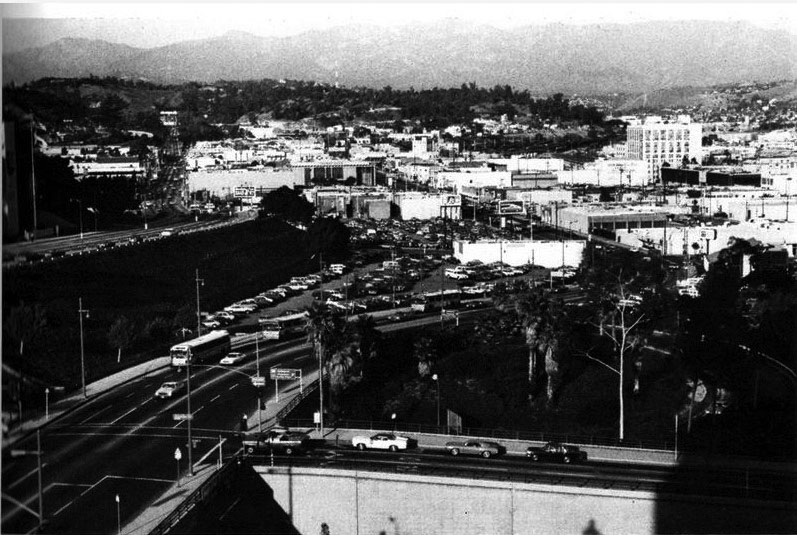 |
|
| (1987)^#^ - View looking north from Temple between Broadway and Spring Street. The Hollywood Freeway now cuts through where the Broadway Tunnel used to be. Same view as previous photo but 82 years later. |
Historical Notes The Broadway Tunnel was closed on June 2, 1949, and demolished soon after to make way for the Hollywood Freeway. Fort Moore Hill, once a formidable barrier, was reduced to a remnant. Broadway, which had once dipped beneath the hill, now crossed above the freeway on a bridge at the very spot where the tunnel once stood. The shift marked the transition from an era of horse-drawn wagons and early automobiles to one dominated by freeways, cars, and a completely reconfigured downtown. |
Then and Now
 |
|
| (1905 vs. 1987) - Then and Now |
Historical Notes The comparison of Broadway’s southern approach in 1905 and 1987 highlights the scale of change in Los Angeles’ core. What had once been a tunnel beneath Fort Moore Hill became an overpass above the Hollywood Freeway, reflecting the city’s unrelenting drive to rebuild its landscape in pursuit of growth and mobility. |
Then and Now
 |
|
| (1949 vs. 2022)* - Looking south from the northern portal of the 1901-built Broadway Tunnel. In 1949, the construction of the 101 freeway through downtown L.A. reduced Fort Moore Hill to a stump and converted the section of Broadway between Temple and Sunset from a tunnel to a freeway overpass. Photo comparison by Jack Feldman. |
Historical Notes By 1949, construction of the Hollywood Freeway cut directly through Fort Moore Hill, sealing the tunnel’s fate. Broadway, which had once depended on the 1901 tunnel, now crossed the freeway on an overpass. More than just a shift in design, it reflected Los Angeles’ embrace of the automobile and its willingness to erase older infrastructure to build anew. Click HERE to see more Early Views of the Broadway Tunnel |
* * * * * |
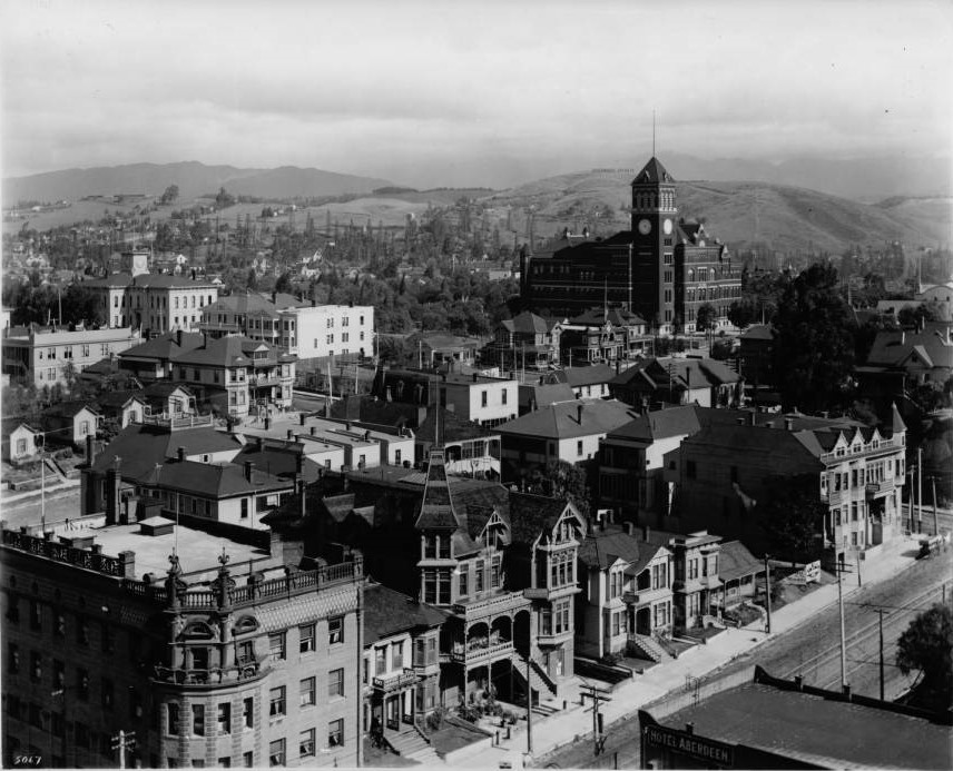 |
|
| (ca. 1905)^^ – Panoramic view looking northwest from the LA County Courthouse. Los Angeles High School stands tall in the background. The Temperance Temple building is seen in the lower-left located on the northwest corner of Temple and Broadway. The Broadway Tunnel is out of frame at right-center. |
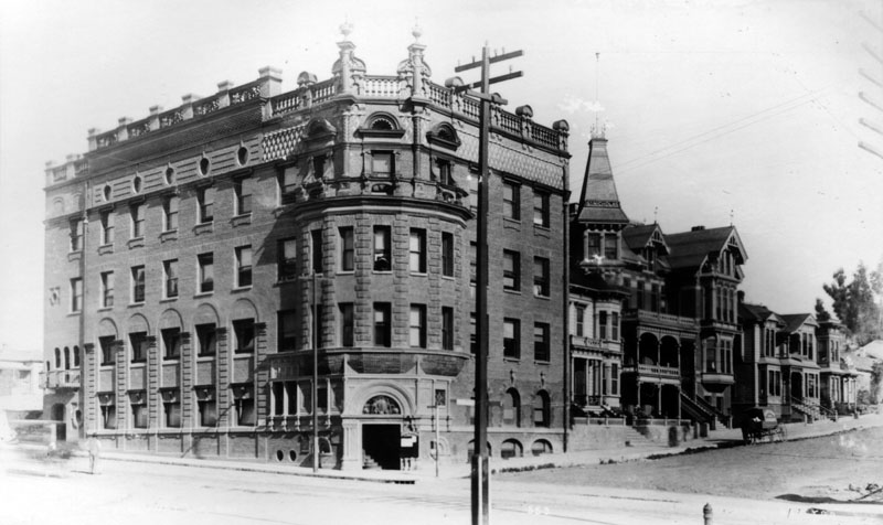 |
|
| (ca. 1890s)^ - Street view of the Temperance Temple of the Women's Christian Temperance Union (WCTU), located at 301 N. Broadway at Temple Street. A horse-drawn carriage is shown parked along the street past the Temple and other neighboring buildings. |
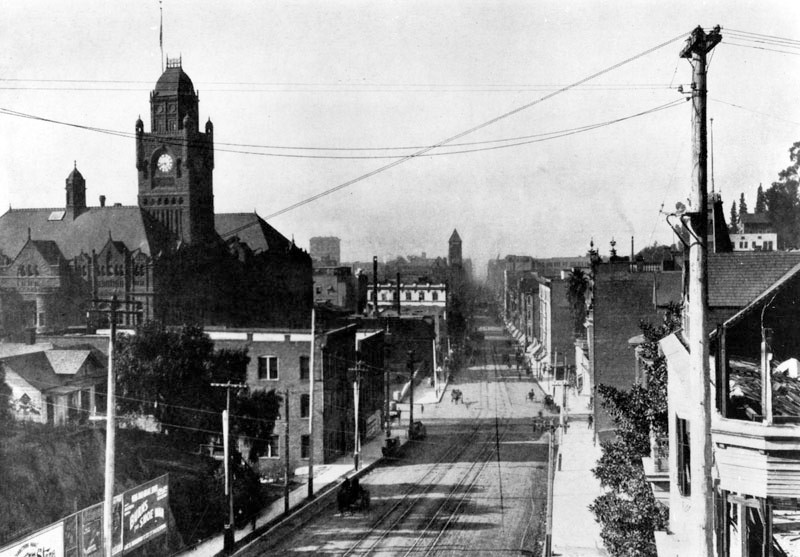 |
|
| (ca. 1900)^ - View of Broadway looking south toward Temple Street, with the County Courthouse on the left. The northern wall of the Temperance Temple Building (N/E corner of Broadway and Temple) is at center-right. City Hall (built in 1888) stands tall in the distance. |
(ca. 1901)* – View looking northwest showing Temple Street as seen from the LA County Courthouse. A horse-drawn carriage and a streetcar can be seen at the intersection of Temple and N. Hill streets at center of photo. The Temperance Temple Building is at lower right.
Historical Notes
At the end of Temple Street can be spotted one of Los Angeles' earliest streetlights. They were carbon-arc lamps mounted on 150-foot tall poles. Click HERE to see more in Early Los Angeles Streetlights.
(ca. 1905)* - View looking northwest from the top of the LA County Courthouse toward the intersection of Temple and North Hill streets. The Hollywood Hills can be seen in the background. Same view as previous photo but 4 years later.
(ca. 1905)* - View showing the Los Angeles County Courthouse located on Poundcake Hill at the southeast corner of Temple and Broadway as seen from the Women's Christian Temperance Union Building across the street. In view are pedestrians, a cable car, horse-drawn buggies, houses and commercial buildings.
Historical Notes
Constructed in 1891, the Los Angeles County Courthouse stood where the city’s first high school, Los Angeles High School, had been located. The high school was there from 1873 until 1886 when it was moved to North Hill Street to allow for construction of the courthouse.
Third Street Tunnel
The Third Street Tunnel was built to solve a major problem in early Los Angeles. Bunker Hill stood between downtown and neighborhoods to the west, making travel slow and difficult. In 1893, residents asked the City Council to build a tunnel through the hill. The plan called for a tunnel about 1,080 feet long with room for vehicles and sidewalks.
Voters approved funding in 1898, and construction soon began. Work was dangerous, and in 1900 a cave-in trapped thirteen men. Ten were rescued, but three died. The tunnel opened in March 1901. At first it was unpaved and unlit, with basic improvements added the following year.
(1901)* - View looking west on 3rd St toward Hill St showing the newly completed 3rd Street Tunnel through Bunker Hill. A conductor is seen standing on the outside steps of a streetcar as a woman carrying a parasol and a young boy walk by. Edwin B. Crocker's mansion is seen above on Bunker Hill. Angels Flight has not been built yet.
Historical Notes
This photograph shows the Third Street Tunnel soon after it opened. The tunnel cut directly through Bunker Hill, making it much easier to travel between downtown and neighborhoods to the west. At this time, streets were unpaved and traffic included streetcars, horse-drawn wagons, and pedestrians.
Above the tunnel stands the Crocker Mansion, one of many large homes that once lined Bunker Hill. Angels Flight had not yet been built, showing this image dates to the earliest years of the tunnel’s use.
(1903)* - View of the western terminus of the Third Street Tunnel. An early model automobile and a horse-drawn carriage can be seen after they exit from the tunnel while a bicycle is parked along the curb.
Historical Notes
This view shows vehicles exiting the west portal of the tunnel. An early automobile appears alongside a horse-drawn carriage, showing how quickly transportation was changing in Los Angeles.
The tunnel made daily travel faster and more direct. Its success helped push development westward and increased traffic through this narrow passage.
(1901)* - View looking west on 3rd Street at Hill Street showing the terminus of the recently completed Third Street Tunnel located at the base of Bunker Hill. Angels Flight, also completed in 1901, is seen on the left. Crocker Mansion stands at the top of Bunker Hill.
Historical Notes
This image shows the tunnel entrance at the base of Bunker Hill shortly after Angels Flight opened in 1901. The short railway carried passengers up the steep hill while the tunnel handled traffic below.
Together, the tunnel and Angels Flight solved two major problems, moving people through the hill and up the hill. The Crocker Mansion remains visible at the top, showing how transportation and residential life existed side by side.
(ca. 1901)* – Looking west on 3rd Street toward Hill Street showing the Third Street Tunnel and Angels Flight.
Historical Notes
This view shows the Third Street Tunnel and Angels Flight from farther east on Third Street. Horse-drawn vehicles dominate the street, reflecting everyday travel at the time.
The tunnel entrance appears simple and practical. Angels Flight quickly became a familiar and popular feature, especially for residents living atop Bunker Hill.
(ca. 1905)* – Panoramic view showing a horse-drawn wagon and two horse-drawn carriages heading toward the entrance to the Third Street Tunnel shortly after it opened. On the left can be seen the newly constructed Angels Flight.
Historical Notes
This panoramic image shows wagons and carriages approaching the tunnel several years after it opened. Traffic moved slowly, and safety inside the tunnel was a concern.
A sign above the entrance warned drivers not to travel faster than walking speed. The tunnel was narrow, unlit, and shared by many types of users.
(ca. 1904)* - Engine 3, running out of the Third Street Tunnel. The driver is Miller, and the horses are named Rowdy, Kruger, and Bill. Photo Source: LAFD Historical Archive
Historical Notes
The sight of horses racing through the streets to respond to alarms was a common and memorable scene in early Los Angeles. Powered by steam generated from burning coal, the engines used this steam to move pistons that operated water pumps, allowing them to deliver substantial amounts of water to fires. The year 1911 marked a significant transition, as it was the last year all 25 horse-drawn steam fire engines remained in service in Los Angeles.
(ca. 1901)* - Half of a stereoptic view of 3rd Street, looking west past office buildings to the newly constructed 3rd Street Tunnel under Bunker Hill in the far distance. Horse-drawn vehicles and a streetcar are on the unpaved street.
Historical Notes
This view looks west along Third Street toward the tunnel in the distance. The street is unpaved, and streetcars share the roadway with wagons and pedestrians.
The tunnel appears as a new landmark, showing how the city was pushing past the natural barrier of Bunker Hill.
(ca. 1901)* - View of 3rd Street looking west from Spring Street. A dog appears to be drinking from a puddle of water in the street (lower left). The 3rd Street Tunnel is seen in the distance with an observation tower perched above it. The Ramona Hotel with the beautiful corner tower is seen on the left, SW corner of 3rd and Spring.
Historical Notes
Looking west from Spring Street, this image shows Third Street leading toward the tunnel. Puddles and dirt streets were common sights at the time.
The Ramona Hotel stands on the southwest corner, while the Douglas Building appears on the northwest corner. Both buildings helped define the edge of downtown Los Angeles.
(ca. 1901)* - View looking west on 3rd Street toward Spring Street with the 3rd Street Tunnel seen in the distance. Streetcar, horse-drawn carriages, and pedestrians share the streets. The Ramona Hotel with its 4-story tower can be seen on the SW corner of 3rd and Spring streets. The Douglas Building on the NW corner is still standing today.
Historical Notes
This image shows a busy Third Street filled with streetcars, wagons, and pedestrians. The tunnel is visible in the distance beneath Bunker Hill.
The Ramona Hotel and Douglas Building frame the street scene and help modern viewers recognize this early downtown location.
Third Street Tunnel - Before and After
(1885 vs. 1901)* – Looking west on 3rd Street toward Hill Street, before and after the construction of the 3rd Street Tunnel and Angels Flight, with the Crocker Mansion seen at the upper left on top of Bunker Hill. Photo comparison by Jack Feldman.
Historical Notes
Before the tunnel was built, Third Street stopped at the steep face of Bunker Hill. Travelers had to go around the hill, slowing movement across the city.
The 1901 image shows how the tunnel and Angels Flight cut directly through the hill. Together, they changed how people moved and marked the beginning of major changes to Bunker Hill.
(1885 vs. 1901)* – A view looking west on 3rd Street near Spring Street shows Bunker Hill in the distance before and after the construction of the 3rd Street Tunnel and Angels Flight. Photo comparison by Jack Feldman.
Historical Notes
In 1885, Bunker Hill blocked the view west from Spring Street. Access beyond the hill was limited.
By 1901, the tunnel opened a direct route. The Douglas Building on the right still stands today and helps anchor the comparison. This Classic Revival style building was declared an LA Historic-Cultural Monument in 2009.
Third Street Tunnel - Then and Now
(1905 vs 2022)* - Traffic heading into the Third Street Tunnel at Hill and 3rd Streets. Photo comparison by Jack Feldman.
Historical Notes
This view shows traffic entering the Third Street Tunnel from Hill Street in the early 20th century and more than a century later. While modes of transportation have changed dramatically, the tunnel continues to serve the same basic function—moving people and vehicles beneath Bunker Hill.
The hillside above the tunnel, once lined with stairways, homes, and small boarding houses, has been completely transformed. Today, the area is dominated by Angelus Plaza, a large residential complex built as part of the Bunker Hill redevelopment era. Opened in 1970, Angelus Plaza was designed as senior housing and remains one of the most prominent residential structures overlooking the tunnel.
(1901 vs. 2017) - Photo comparison by Jack Feldman.
Historical Notes
This comparison illustrates the dramatic transformation of the area surrounding the Third Street Tunnel. Nearly all early structures visible in the 1901 view have been removed, replaced by much larger-scale development.
Despite these changes, the tunnel itself remains one of the few features still in continuous use from early Los Angeles, serving as a physical link between the city’s past and present.
(1901 vs 2022)* - Looking west on 3rd Street toward Spring Street with the Third Street Tunnel seen in the distance. Photo comparison by Jack Feldman.
Historical Notes
In the modern view, the tunnel appears closer than in early photographs. This visual shift occurred because the tunnel was extended eastward to Hill Street during the late 1960s.
This extension was part of the Bunker Hill redevelopment project, which substantially reshaped the street grid and erased much of the original hillside neighborhood.
(1910s vs. 2022)* - Looking west on 3rd Street at Hill Street, showing the Third Street Tunnel and the earlier location of Angels Flight. Photo comparison by Jack Feldman.
Historical Notes
During the Bunker Hill redevelopment period, Angels Flight was dismantled in 1969 and placed in storage. It was later relocated one block south and reopened in 1996.
The removal and relocation of Angels Flight symbolized the broader transformation of Bunker Hill, as historic hillside features gave way to modern infrastructure and redevelopment.
Angels Flight
Angels Flight opened at the end of 1901 as a practical solution to one of downtown Los Angeles’ most challenging geographic obstacles. While the Third Street Tunnel allowed traffic to pass through Bunker Hill, pedestrians still faced a steep climb to reach the residential streets above. Angels Flight provided that vertical connection, linking Hill Street at Third Street with Olive Street at the top of the hill.
Financed by Colonel J. W. Eddy, the incline railway was originally promoted as the Los Angeles Incline Railway. Although it quickly became known as “the shortest railway in the world,” its purpose was practical rather than symbolic. It served residents, workers, and visitors moving daily between the city’s commercial center and the hillside neighborhood above.
(1901)* - Photo of Angels Flight at the grand opening of the incline railway, December 31, 1901.
Historical Notes
Angels Flight officially opened on December 31, 1901, immediately drawing public attention. Built beside the Third Street Tunnel approach at Hill Street, it formed part of a coordinated effort to improve circulation through and over Bunker Hill.
From the start, the incline combined transportation with spectacle, attracting riders who came as much for the experience and view as for the convenience.
(ca. 1901)* – Brochure for Angels Flight, compliments of J. W. Eddy. “Have You Visited the Angels Flight? If Not Why Not?”
Historical Notes
Early brochures promoted Angels Flight as a destination rather than simply a utility. They emphasized panoramic views from the hilltop, the observation tower, and the Camera Obscura, all designed to make the short ride feel like a complete outing.
The modest fares shown in the brochure reflect how accessible the attraction was, appealing to everyday riders as well as visitors.
(ca. 1905)* – Stereoscopic view of Angels Flight incline railway with the Third Street Tunnel below and an observation tower above. Photo from the Ernest Marquez Collection.
Historical Notes
By 1905, Angels Flight had been rebuilt into the form most closely associated with its historic appearance. The original segmented incline was replaced with a single straight track supported by timber trestles and set at a uniform 33 percent grade.
New cars were introduced at this time, later known as Sinai and Olivet. This reconstruction established the classic configuration that remained in service for decades.
(ca. 1905)* – Left panel of a stereoscopic view showing Angels Flight at Hill and Third Streets.
Historical Notes
This closer view emphasizes the incline’s relationship to the surrounding streets. Angels Flight was designed for pedestrians, offering a quick alternative to long stairways and steep hillside routes.
Behind the railway, Bunker Hill remained a dense residential neighborhood, with homes and boarding houses lining the slopes above downtown.
(ca. 1903)* - Postcard view of Third Street looking west at Hill Street. A horse and carriage exit the Third Street Tunnel while Angels Flight stands to the left. Stairways are visible on the right.
Historical Notes
The image highlights how the tunnel and incline complemented each other. The tunnel allowed traffic to pass through Bunker Hill, while Angels Flight provided access up the hill for pedestrians.
Stairways remained an important parallel route, reflecting the many ways people navigated the steep terrain.
(1902)* - View looking down from the top of Angels Flight east on Third Street. A woman holding a small dog is posing on the stairway adjacent to the Bunker Hill furnicular. The bottom of the observation tower is seen at right.
Historical Notes
A stairway of approximately 150 steps ran parallel to the Angels Flight funicular railway on Bunker Hill, providing pedestrians an alternative route up the steep urban incline between Hill and Olive Streets during the early 20th century.
(ca. 1905)* - View showing Angels Flight and observation tower at the 3rd Street tunnel. A horse-drawn carriage approaches the tunnel opening and several pedestrians are on the sidewalk at left. Legible signs include: "Angels Flight", "S. Hill St.", "Notice, $50.00 fine for riding or driving through this tunnel faster than a walk".
Historical Notes
This scene captures the concentration of movement at Hill and Third Streets. Traffic flows through the tunnel, pedestrians gather at the base of the incline, and riders move upward toward the hilltop.
The warning sign reflects early concerns about safety and congestion in the narrow tunnel below.
(ca. 1905)* - Pedestrians wearing the latest styles cross the street in front of Angels Flight with the 3rd Street Tunnel seen in the background. The sign on the building to the right reads ‘Battle Creek Sanitarium’. This builidng would later be converted into an Apartment House.
Historical Notes
Street level details like storefront signs help place Angels Flight within an active commercial district. Health oriented restaurants and cafeterias were common in early Los Angeles and often clustered near busy intersections.
These businesses benefited from steady foot traffic generated by the incline and tunnel.
The original Battle Creek Sanitarium was a health resort in Battle Creek, Michigan, founded by the Seventh-day Adventist Church. It was known for its focus on health and wellness and its strict vegetarian diet.
(ca. 1907)* - Angels Flight - A view from a nearby roof shows 2 cars on the rail, houses, and Hill Crest Inn on the right side, the observation tower above in the middle, and the Third Street Tunnel below. There is a partial view of the Crocker Mansion on the left.
Historical Notes
When the construction on the Third Street tunnel began in 1900, Mrs. Crocker filed a petition claiming that the mansion was endangered by the street tunnel which was “unsafe, improperly constructed and a veritable death trap.” According to the Los Angeles Times, “the walls of her house are settling, the foundations giving way and the plaster is falling off…Unless something is done, the building is liable to topple into a hole.” The house never did topple and was alive and well in 1902 when Angels Flight began operating and dropping riders off practically on the Crocker doorstep.
The Victorian building was razed in June 1908 and the cornerstone for the Elk’s Annex was laid the following September.
(ca. 1907)* - Street scene at Hill and Third Streets in front of the newly constructed Angels Flight. Two cars are seen ascending and descending the incline while traffic enters the Third Street Tunnel in the distance. Photo enhancement by Jack Feldman.
Historical Notes
This image shows Angels Flight operating as part of a broader transportation system. Streetcars, wagons, pedestrians, and tunnel traffic converge at this intersection, while the incline carries foot traffic up the hill.
The two counterbalanced cars move simultaneously, one rising as the other descends, a simple system that proved reliable and efficient.
(1909)* - Image of a crowd of people gathered around the Angels Flight incline railway watching F.R. Pendelton send his Cartercar automobile up the incline on September 2, 1909.
Historical Notes
This well known event illustrates Angels Flight’s role as a public stage for spectacle. Crowds gathered to watch an automobile attempt the steep grade, highlighting the novelty of both the incline and early cars.
The scene reflects how quickly Los Angeles embraced new technology and public demonstrations.
(ca. 1910)* - Postcard view showing Angels Flight and the newly constructed Elks building near the top of the hill. A wagon approaches the Third Street Tunnel.
Historical Notes
By the early 1910s, large institutional buildings had begun to replace private mansions on Bunker Hill. The Elks building marked a shift in the hill’s character while maintaining its prominence.
Angels Flight remained the most direct pedestrian link between these hilltop destinations and downtown streets.
The Elks Lodge No. 99 building on Bunker Hill in Los Angeles has a rich history dating back to 1908-1910. Strategically located at the upper terminal of the Angels Flight funicular railway, it was built to host the 1909 national Elks gathering. The main building on Clay Street housed various facilities, including an auditorium and dormitories, while an annex on South Olive Street provided additional amenities. The Elks' presence was closely tied to Angels Flight, with the railway even incorporating the organization's initials into its lower arch. However, the Elks' time on Bunker Hill was brief; by 1925, they had moved to larger quarters near Westlake Park. The buildings were then taken over by the Loyal Order of Moose, reflecting the dynamic urban development of early 20th century Los Angeles.
(ca. 1910)* - View of Angels Flight and the Third Street Tunnel with the Elks building now visible above. A woman walks down the stairway at right.
Historical Notes
This image shows three parallel routes through the same landscape. Vehicles pass through the tunnel, riders use the incline, and pedestrians descend the stairs.
Together, these routes illustrate how transportation systems were layered to meet different needs.
(ca. 1910)* - View of Angels Flight’s upper terminal near Olive Street with the observation tower behind.
Historical Notes
Over time, Angels Flight received more substantial station structures. What began as a modest installation evolved into a recognizable landmark with defined terminals and supporting features.
These improvements reinforced the railway’s role as a permanent part of the city’s infrastructure.
(ca. 1910s)* - Standing at the top of Olive Street just under the observation tower, the cable car is descending on the right of the picture.
Historical Notes
From this vantage point, Third Street appears as a straight corridor into the commercial core. The incline shortened the daily journey for residents traveling between home and work.
Increasing automobile traffic hints at the changes that would soon reshape downtown streets.
(ca. 1910s)* – Postcard view looking east on Third Street from the observation tower with crowds filling the street.
Historical Notes
Large crowds often gathered at Hill and Third Streets for events, parades, and daily activity. The intersection served as a focal point where multiple transportation modes converged.
The popularity of the observation tower reflects a time when downtown viewpoints were attractions in themselves.
(ca. 1907)* - Seen from directly across Hill Street are, from left to right, Marsden Drug Co., the arch for Angels Flight, 3rd Street Tunnel with observation tower at the top of the hill, Vegetarian Cafeteria with a horse-drawn wagon in front, and the YWCA Building with top floors visible.
Historical Notes
An archway labeled "Angels Flight" greeted passengers on the Hill Street entrance, and this name became the official name of the railway in 1912 when the Funding Company of California purchased the railway from its founders.
(ca. 1907)^ - View of the west side of Hill Street showing the YWCA Building. Several horse-drawn wagons, early model cars and trucks are parked along the curb. The Third Street tunnel is just to the left of the 'Vegetarian Cafeteria'. Across Third Street can be seen one of the two Angels Flight cars stopped at the lower terminus.
Historical Notes
This scene highlights the overlap of transportation eras. Horse drawn vehicles and automobiles share curb space near streetcars and the incline.
Angels Flight reduced congestion by lifting pedestrians off the street and up the hill in a short ride.
(ca. 1910)* - View toward the Third Street Tunnel and Angels Flight from near the northeast corner of Third and Hill Streets.
Historical Notes
From this angle, the intersection reads as a gateway through and over Bunker Hill. The tunnel channels traffic beneath the hill while Angels Flight carries people upward.
The repeated appearance of nearby storefronts helps anchor these views within the early downtown streetscape.
Then and Now
(1910s vs. 2022)* - Looking west on Third Street at Hill Street showing the Third Street Tunnel and the original location of Angels Flight. Photo comparison by Jack Feldman.
Historical Notes
Angels Flight operated at this location from 1901 until 1969, when it was dismantled during the Bunker Hill redevelopment period. The cars were placed in storage and later rebuilt and reopened nearby in 1996.
Although relocated, Angels Flight remains one of the clearest survivors of the old Bunker Hill circulation system.
(1910)* - View looking west toward the Third Street Tunnel and Angels Flight with streetcars, wagons, and early automobiles. Photo Martin Behrman
Historical Notes
Flags and banners suggest a civic celebration. The image captures downtown at a moment when multiple transportation modes shared the street.
The tunnel and incline form the visual center of the scene, underscoring the importance of this intersection.
(ca. 1910)* - Autos and a horse drawn carriage approach the Third Street Tunnel with Angels Flight visible above.
Historical Notes
This view reinforces the division of movement. Vehicles pass through the tunnel while pedestrians rely on Angels Flight to reach the hilltop.
It reflects how the city adapted to growth within a constrained landscape.
(ca. 1913)* – Postcard view showing Angels Flight with traffic flowing in and out of the Third Street Tunnel. A sign reads “Left Turn Prohibited.”
Historical Notes
Traffic control signs reflect increasing congestion at Hill and Third Streets. Managing movement at this junction became essential as vehicles multiplied.
Angels Flight helped reduce pressure by removing foot traffic from the steep climb.
(ca. 1915)* – View showing a newspaper boy and traffic officer in the middle of the intersection at Third and Hill Streets.
Historical Notes
By the mid 1910s, traffic officers were needed to manage busy downtown intersections. Streetcars, wagons, automobiles, and pedestrians all converged here.
Angels Flight remained a constant presence in the background of daily street life.
(1919)* – View looking east toward Third and Hill Streets from near the stairway opposite Angels Flight.
Historical Notes
This later view shows the same elements still in place but with heavier traffic and a more developed streetscape.
It underscores Angels Flight’s long period of steady service as a simple solution to a persistent topographic challenge.
(1922)* – View looking east along Third Street from near the west portal of the Third Street Tunnel with Angels Flight on the right.
Historical Notes
By the early 1920s, Angels Flight had become a familiar and enduring feature of downtown Los Angeles.
Its continued operation made it one of the few physical links between early Bunker Hill and the modern city that followed.
Click HERE to see more early views of Angels Flight.
Click HERE to see more early views of the Third Street Tunnel.
Aliso Street
.jpg)


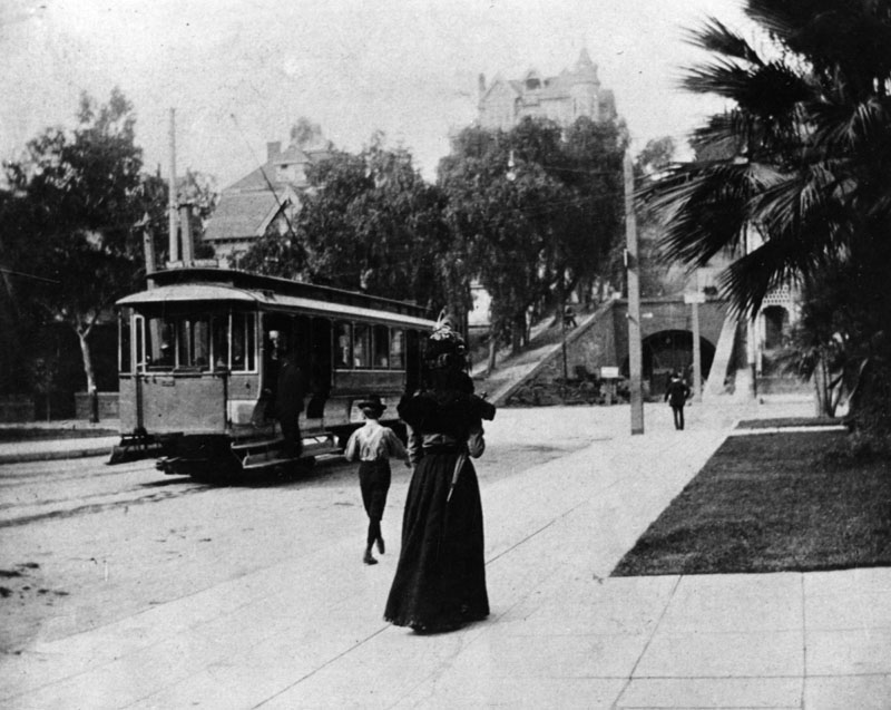
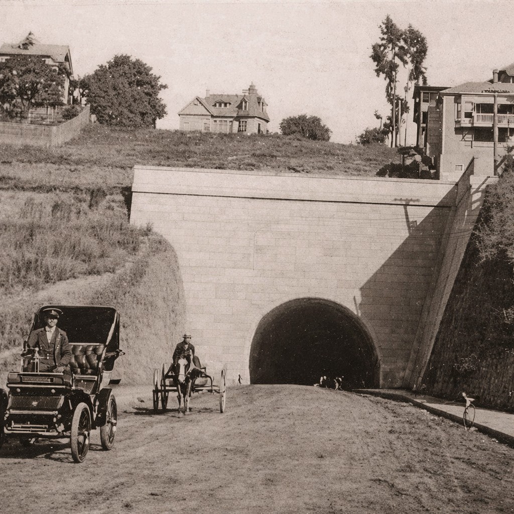
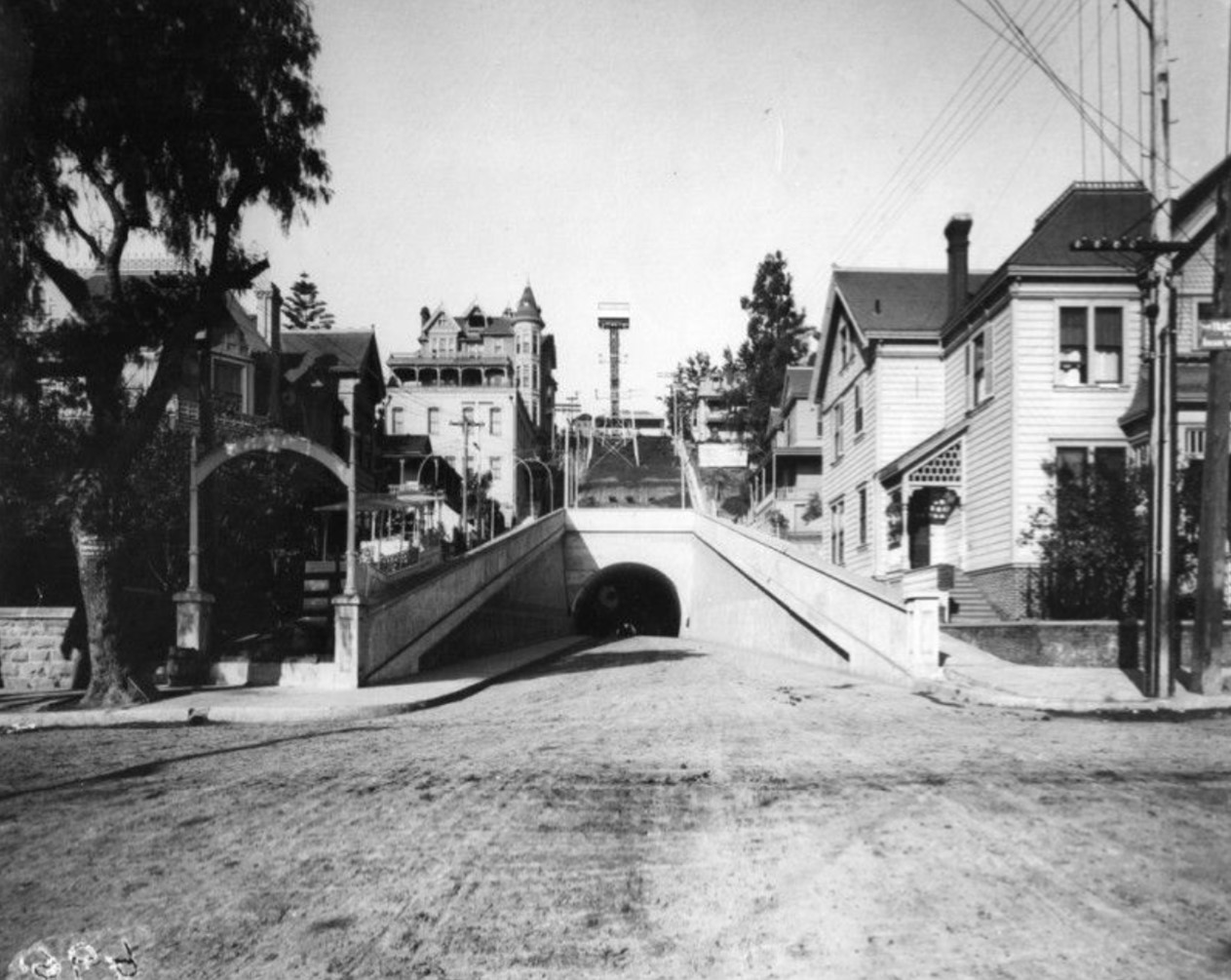
.jpg)
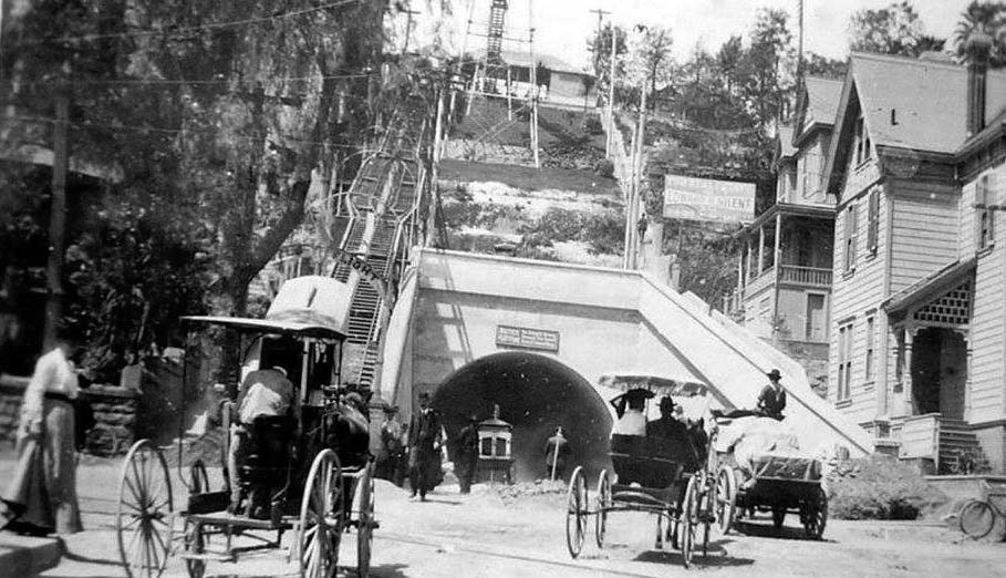
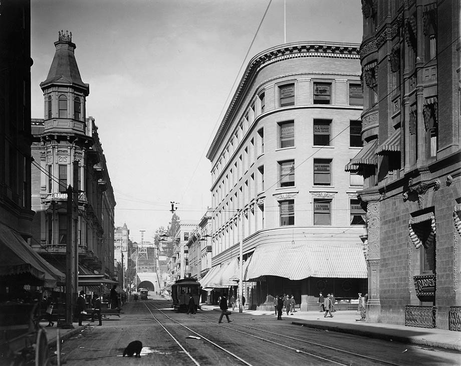
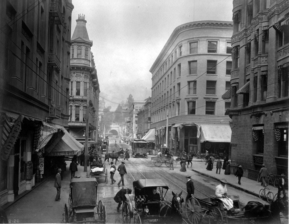
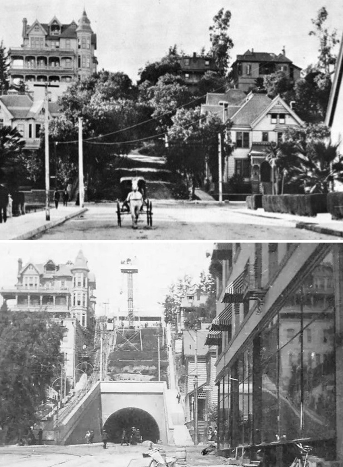
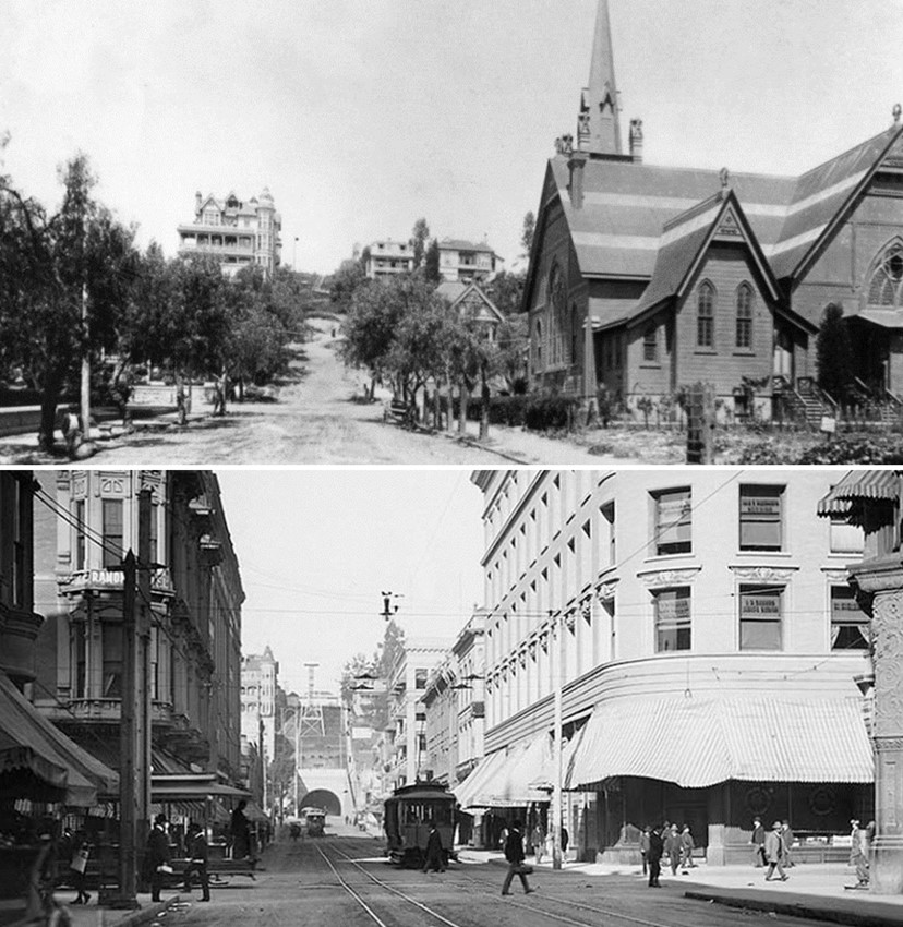
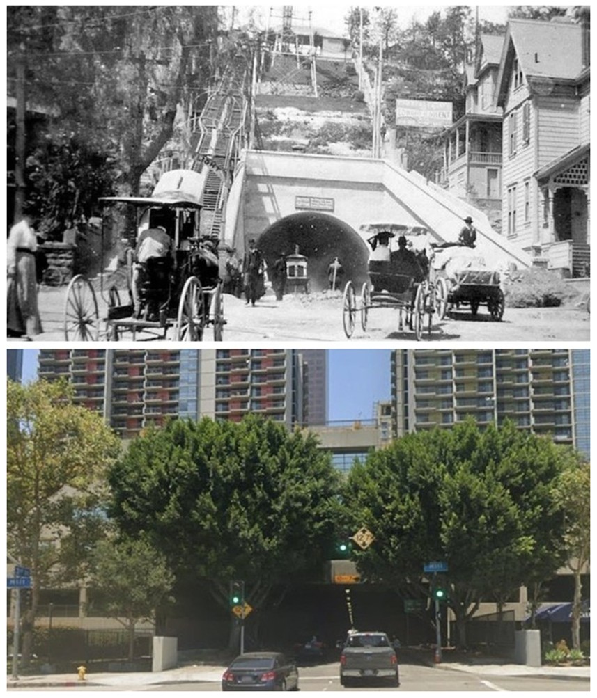

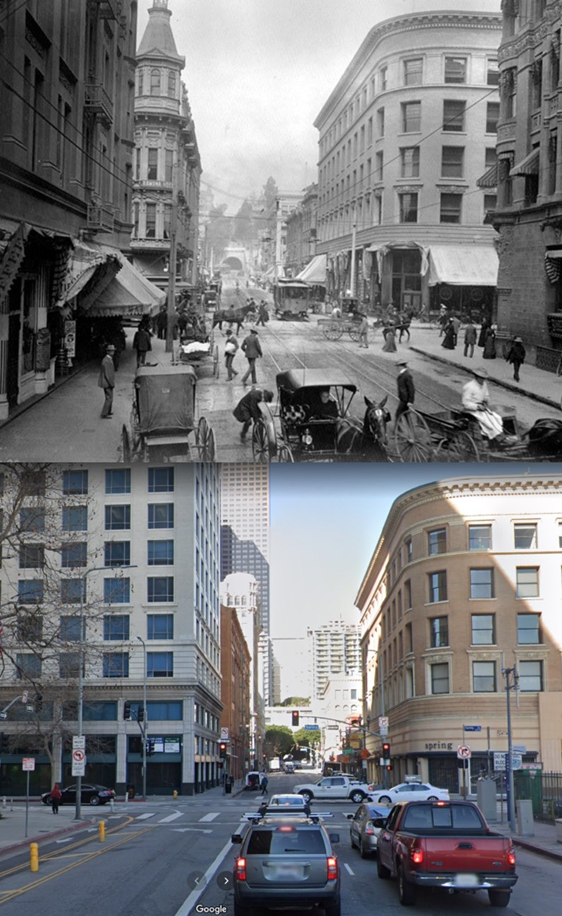
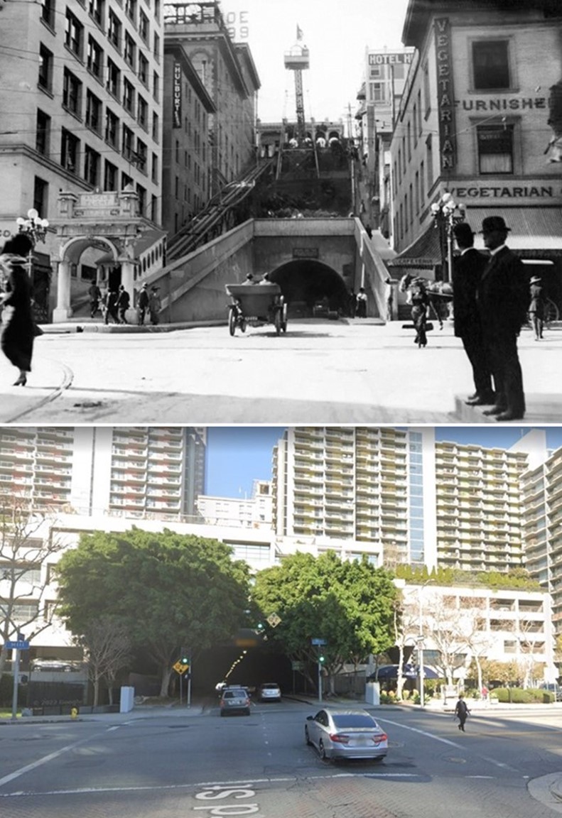
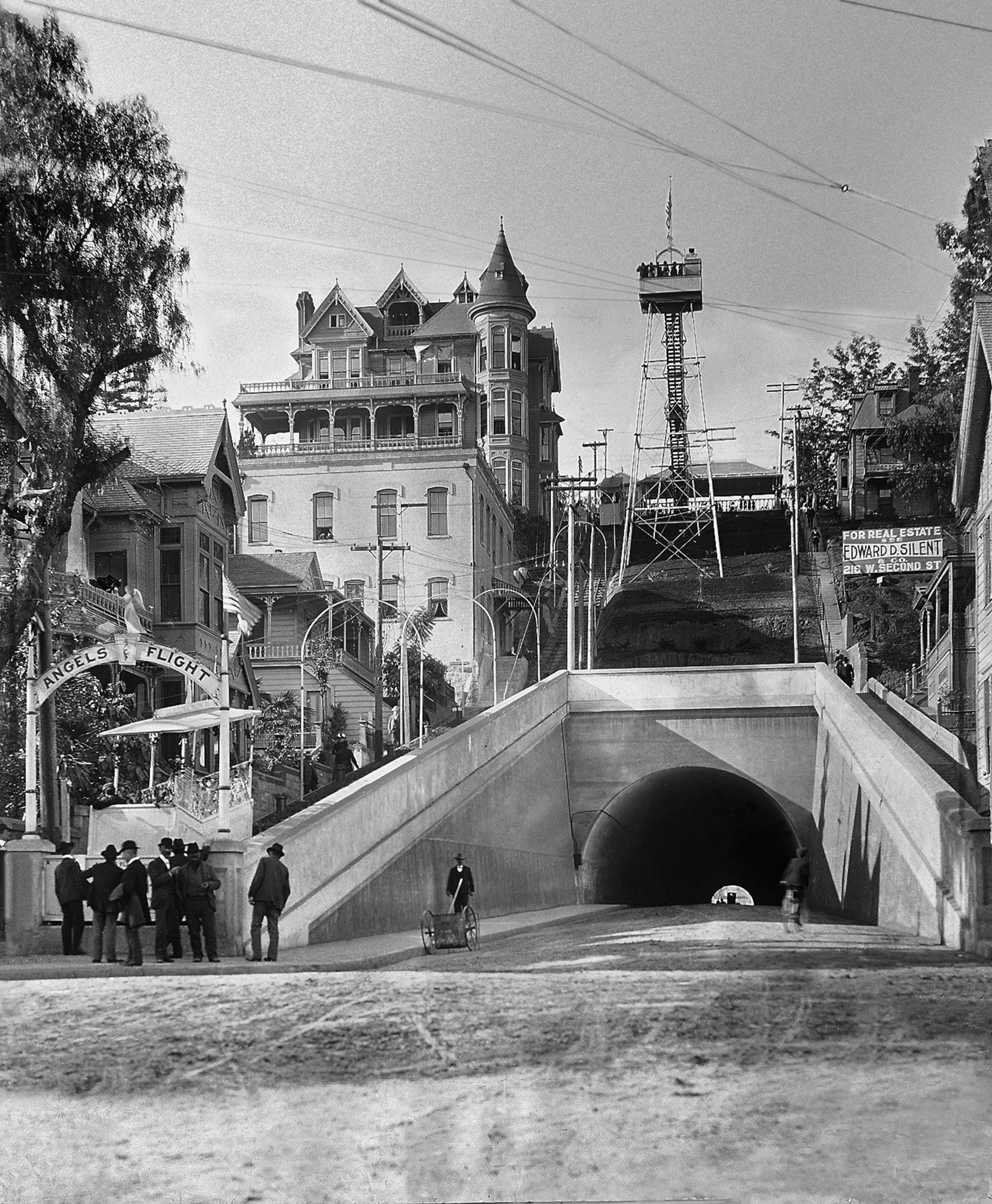
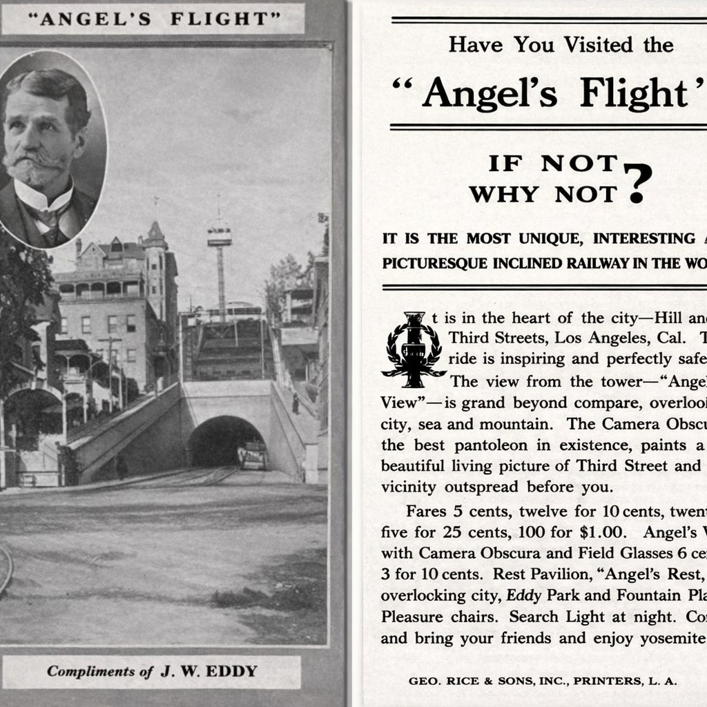
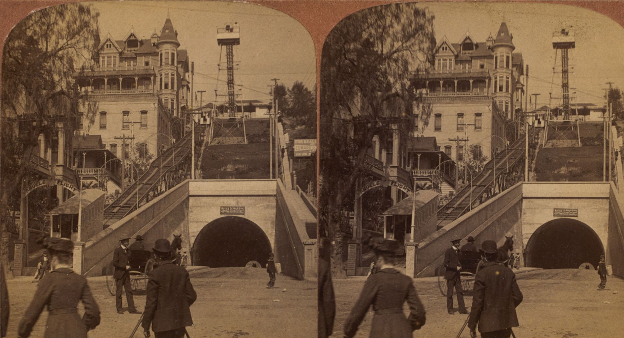
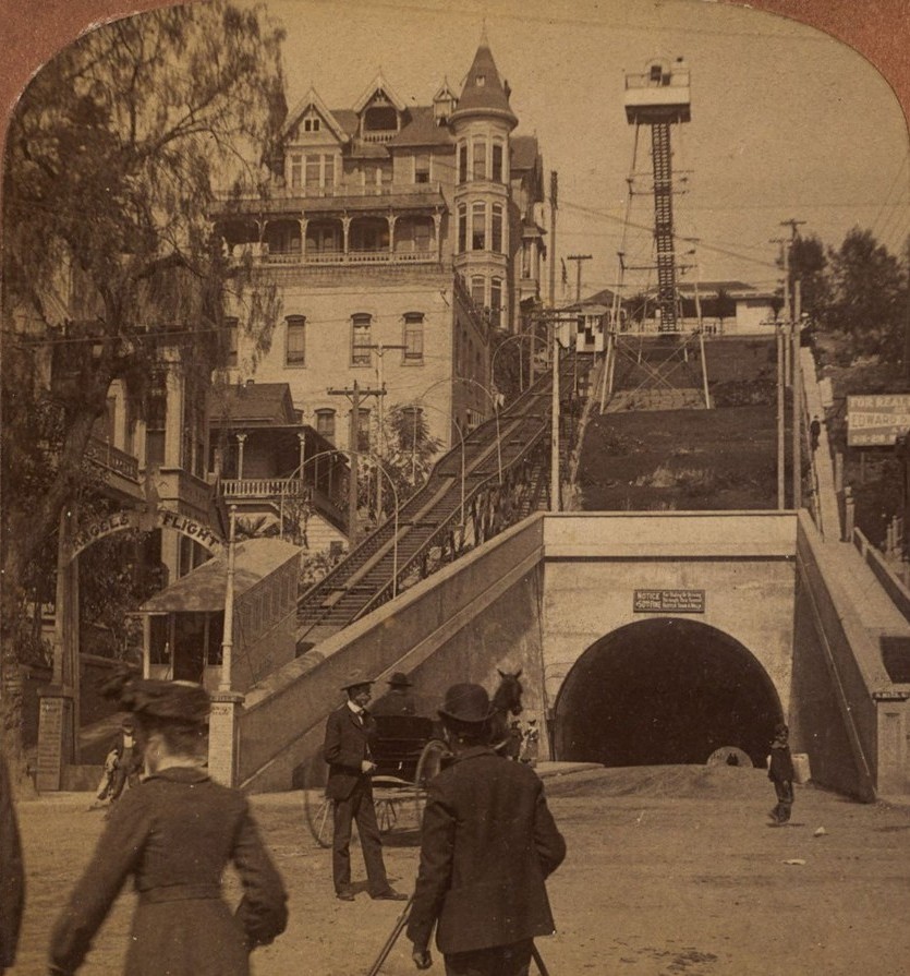
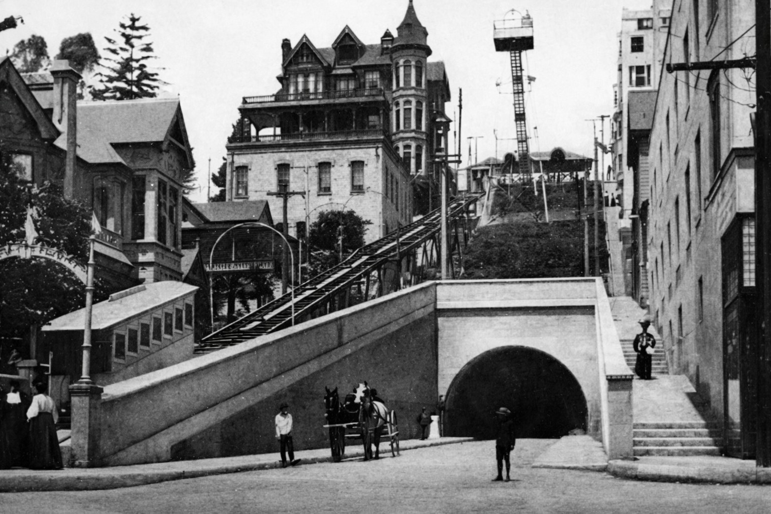
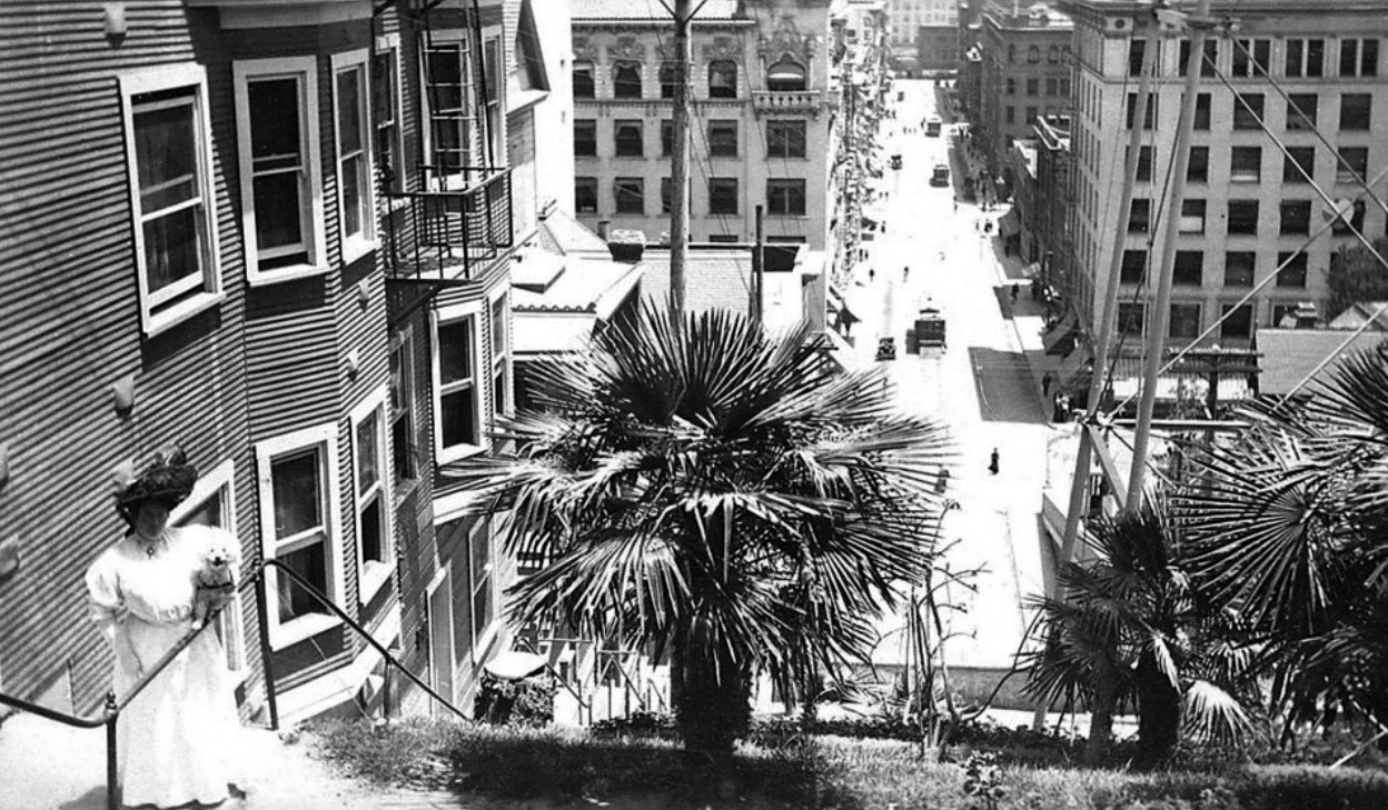

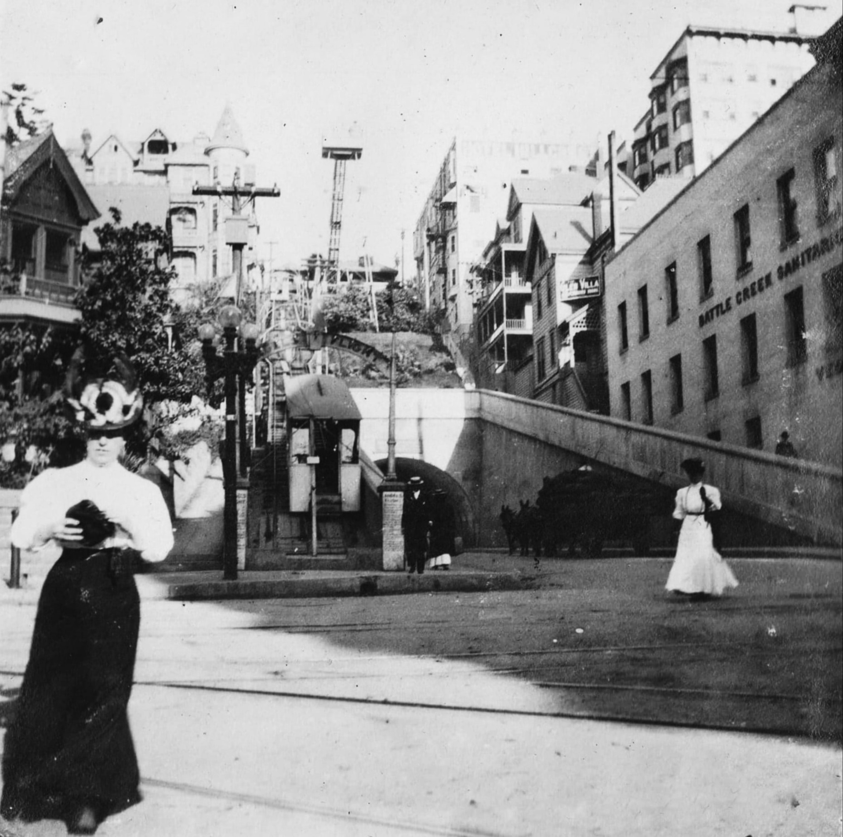
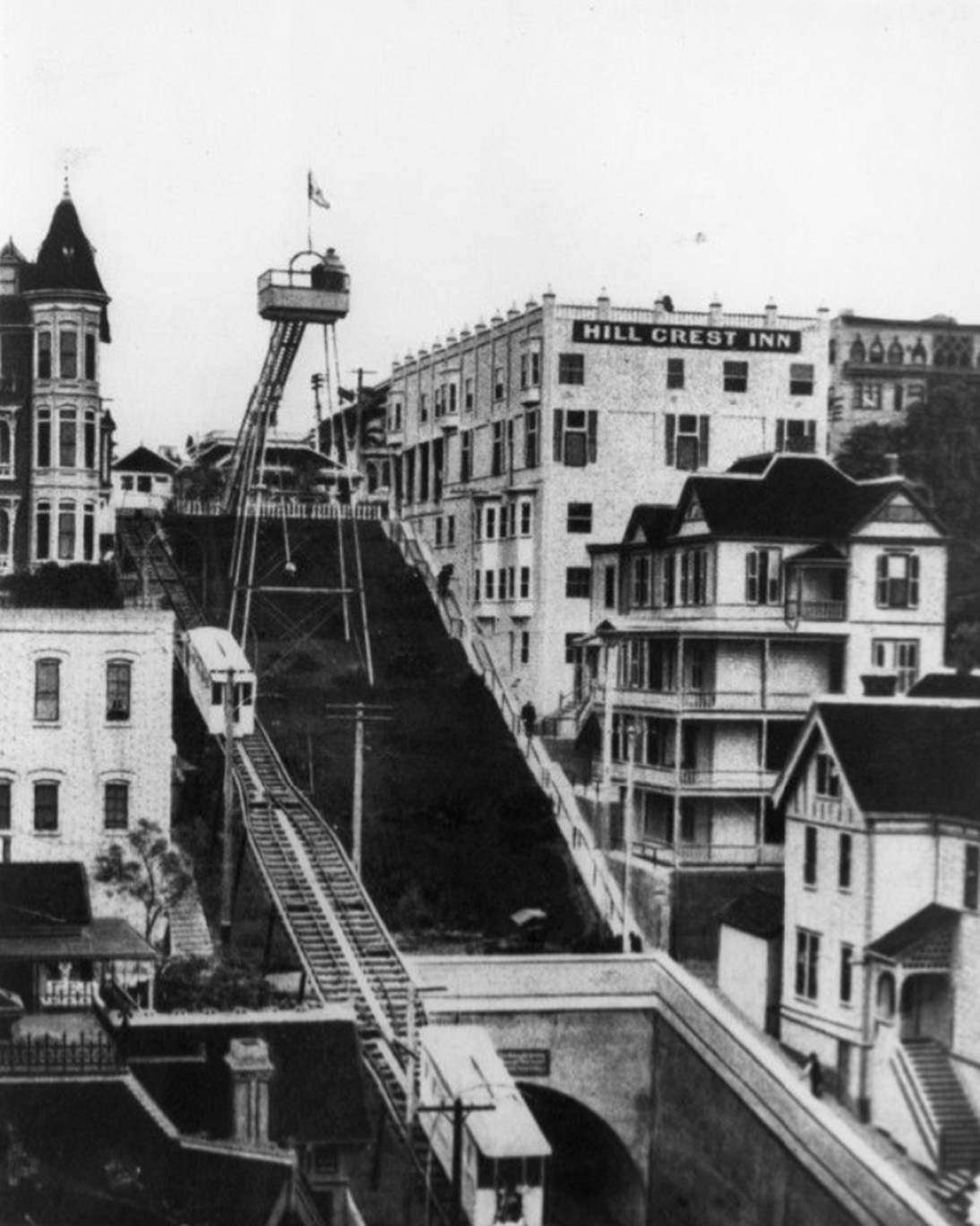
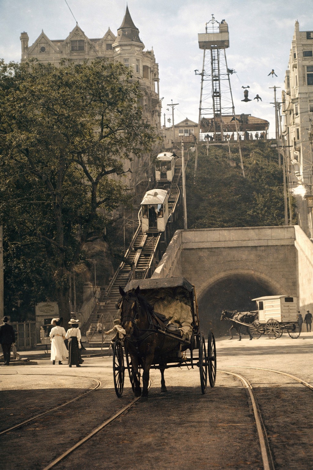
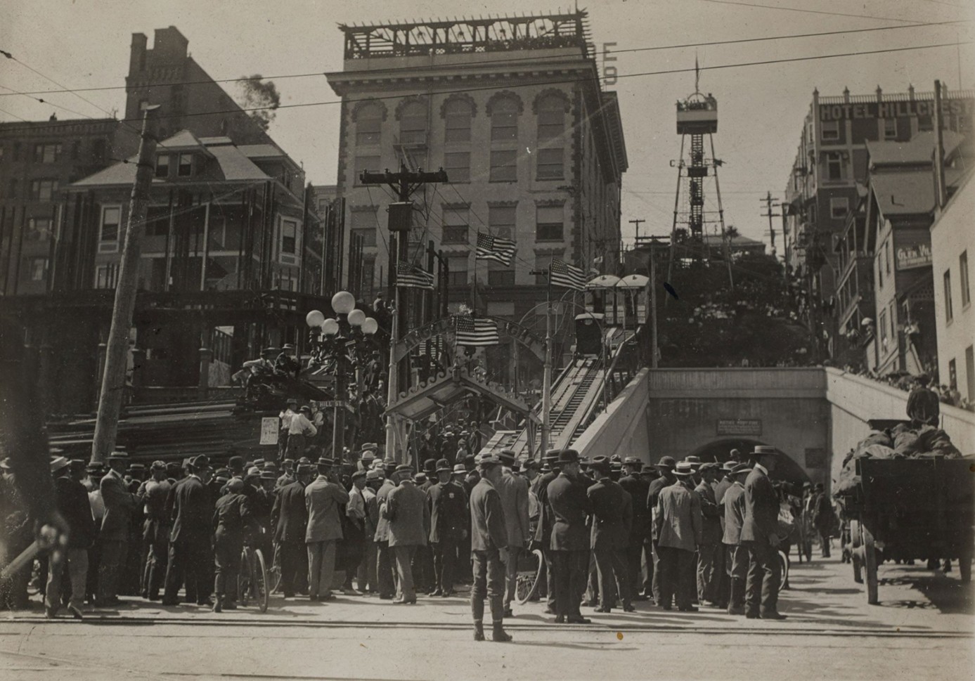
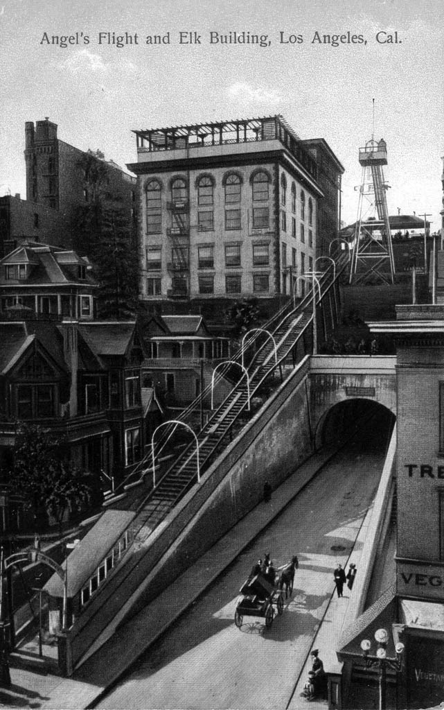
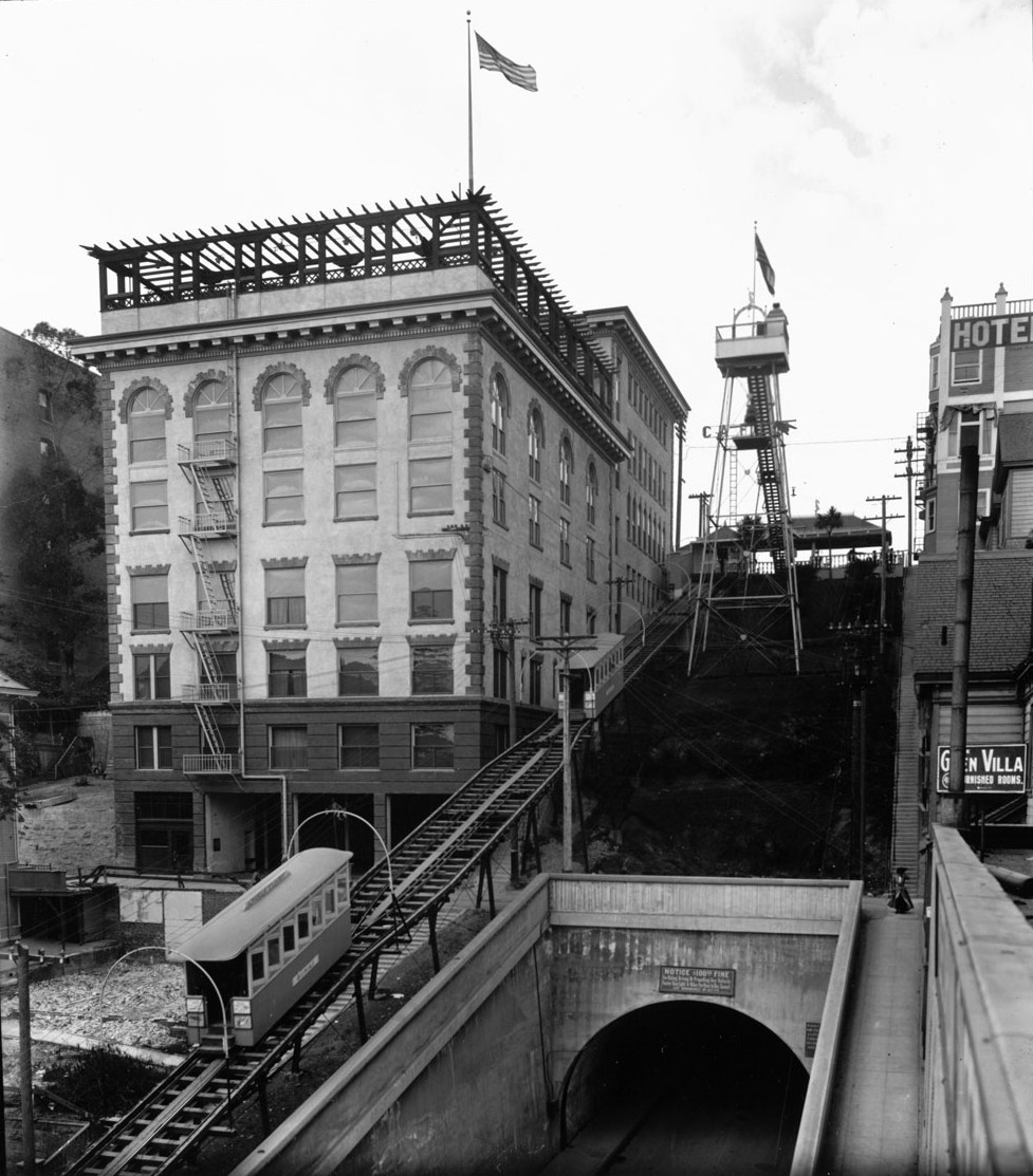
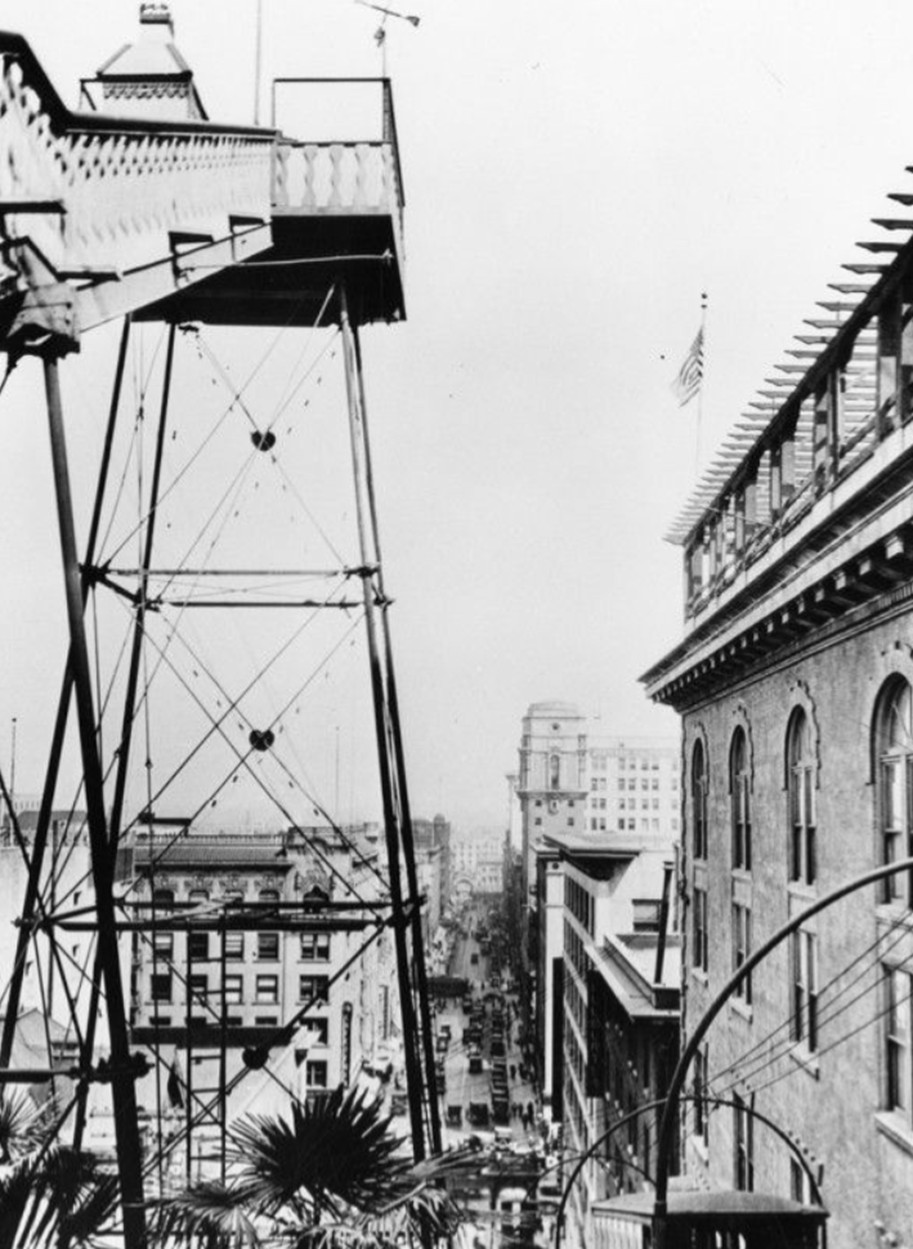
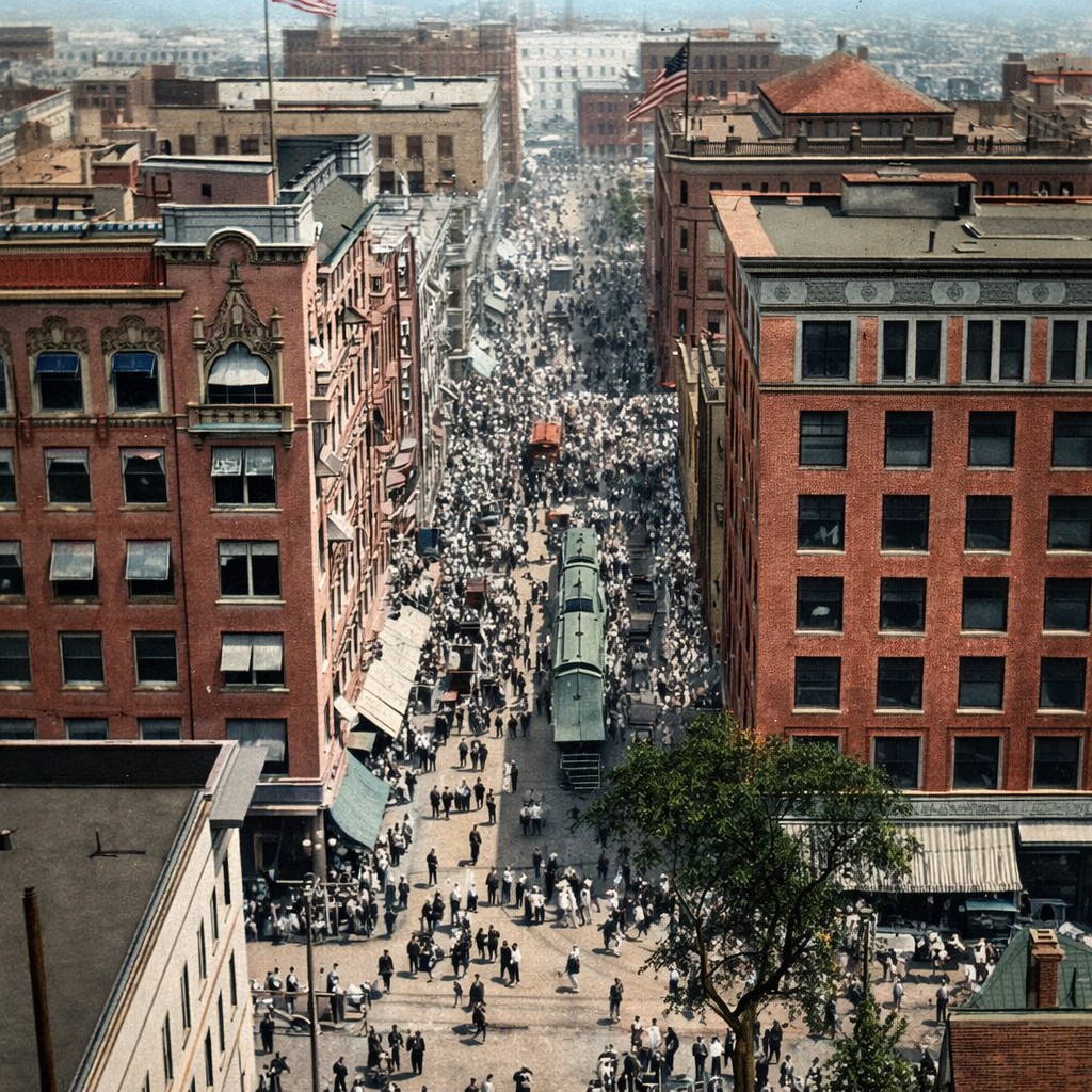
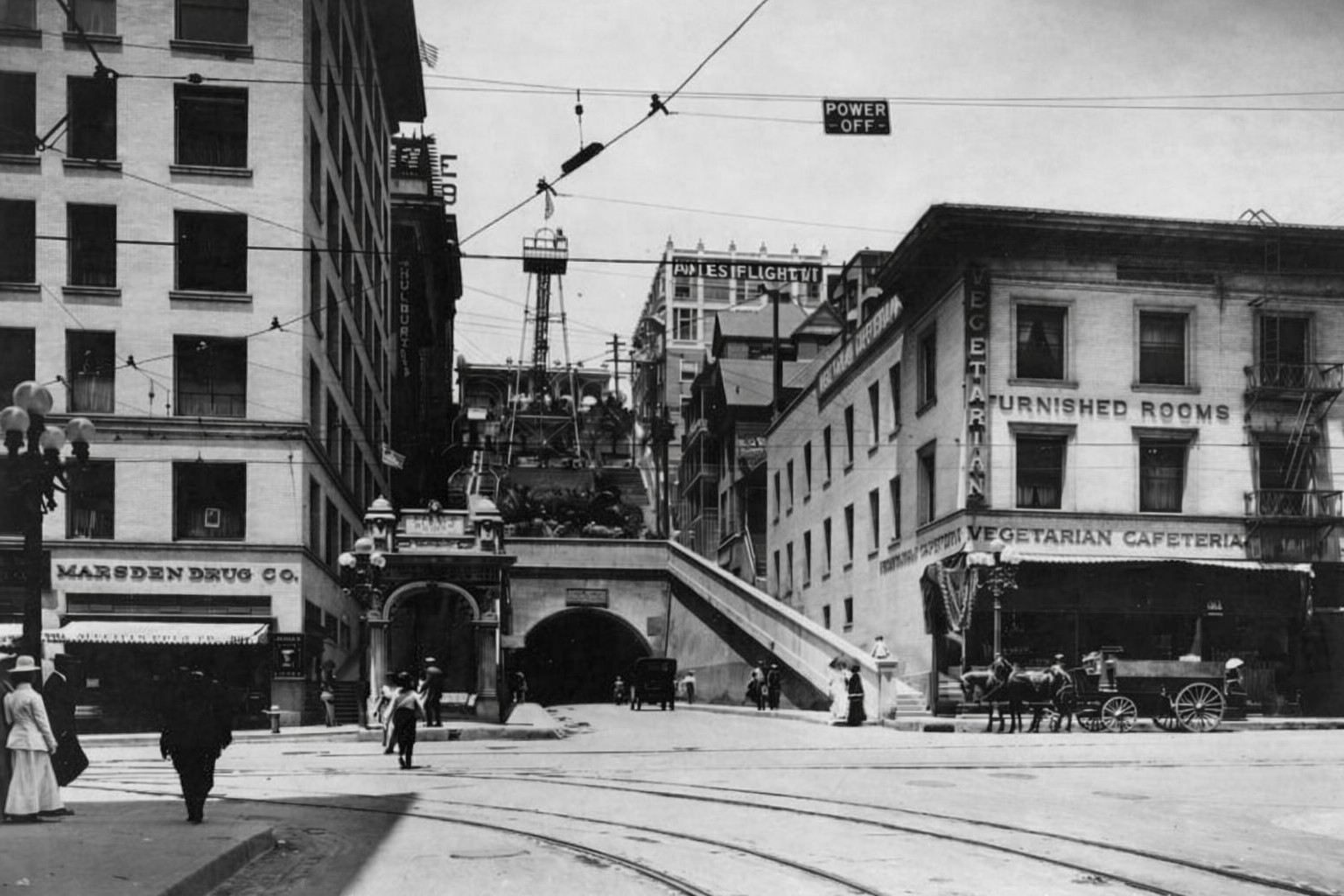
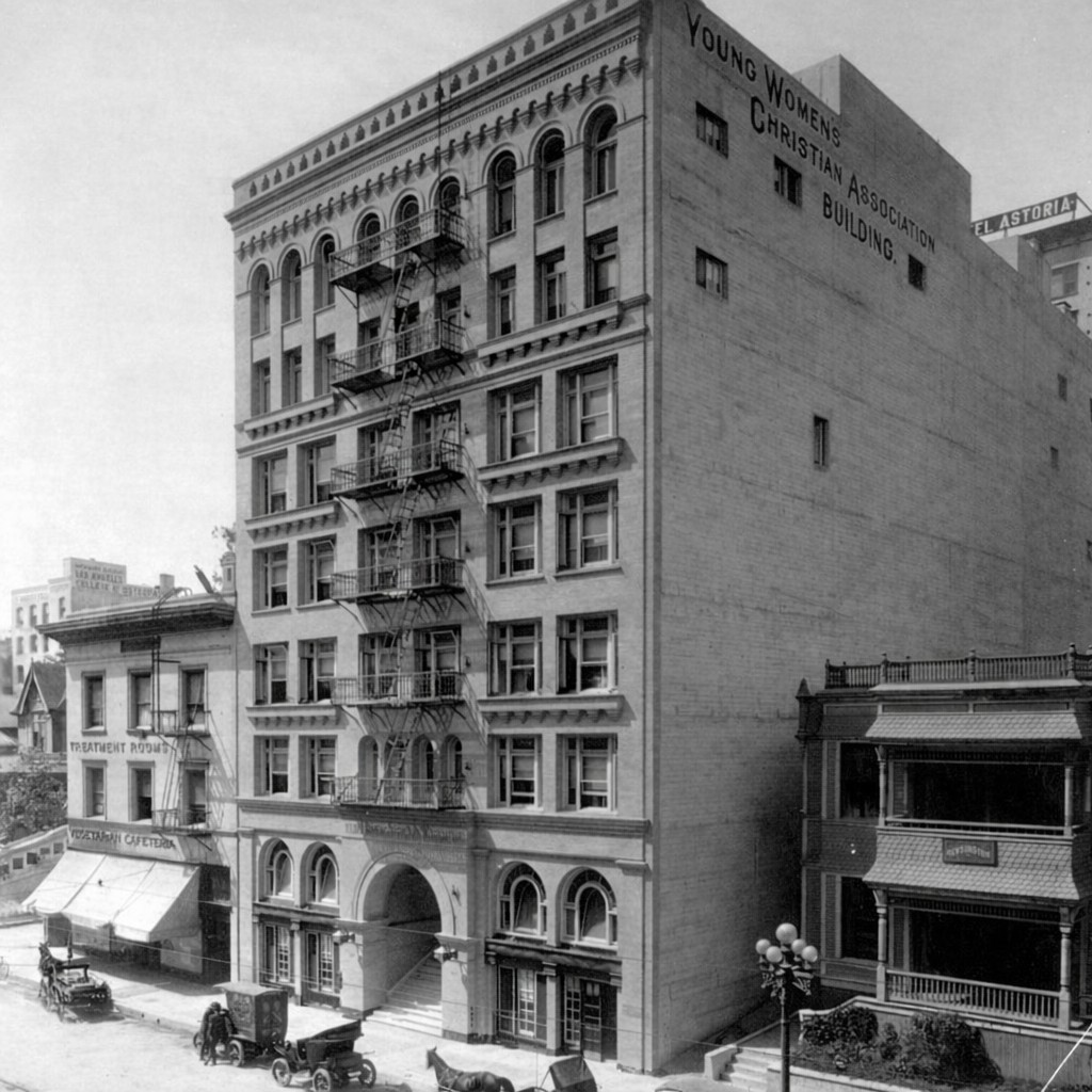
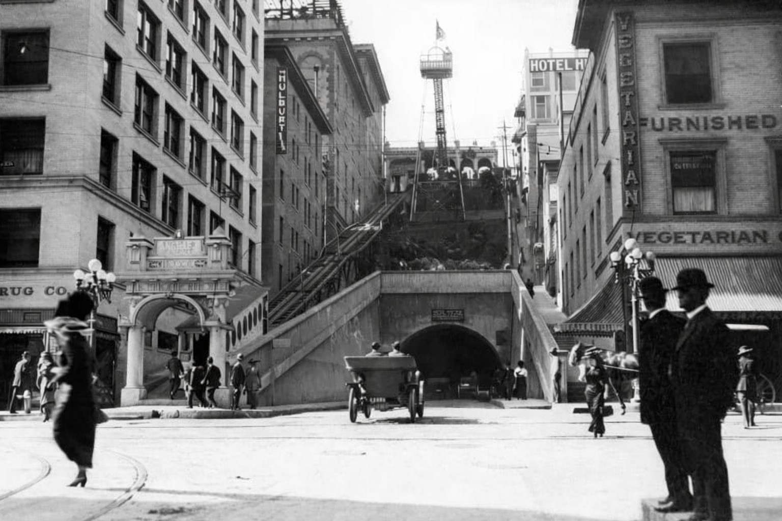
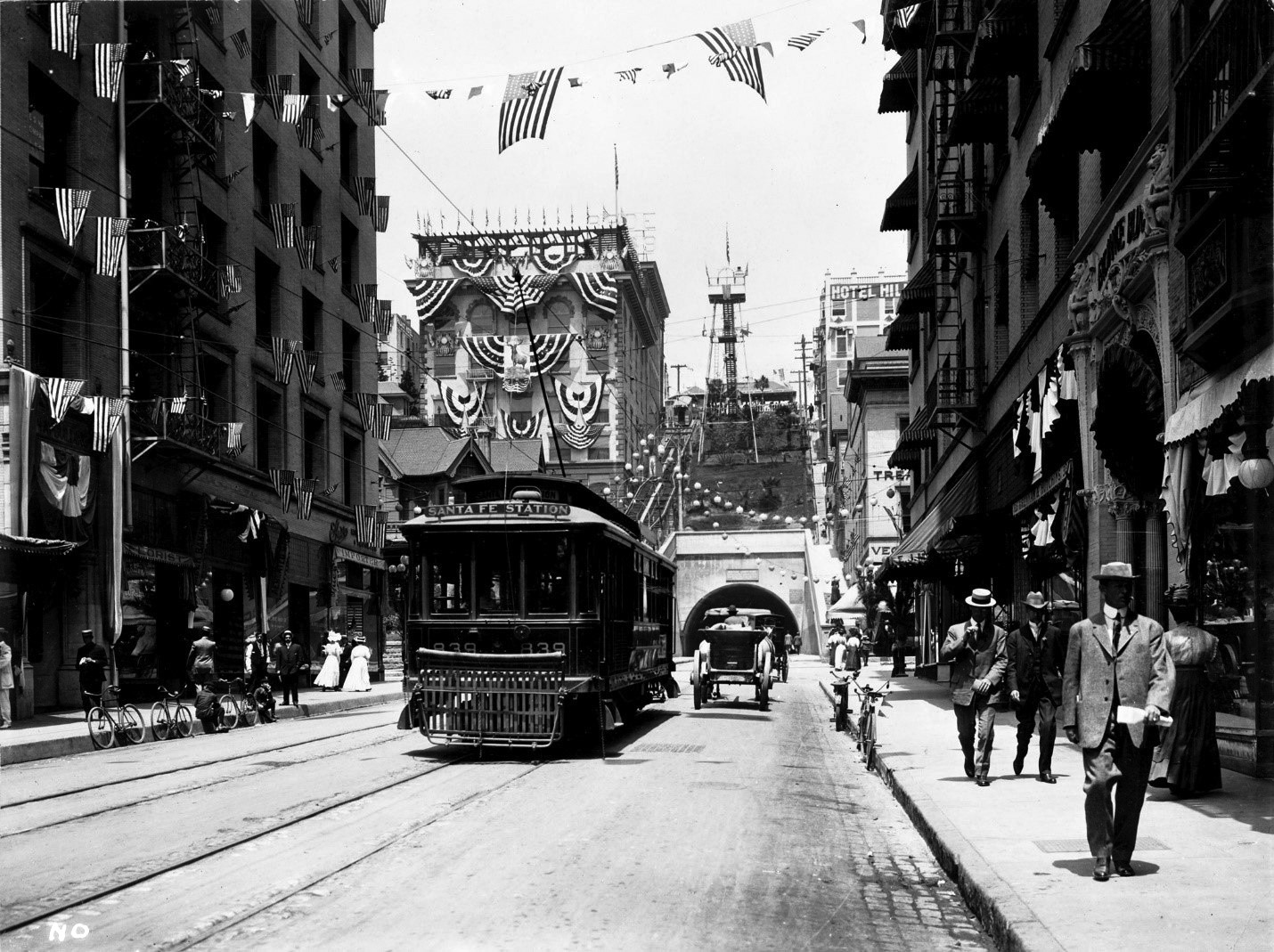
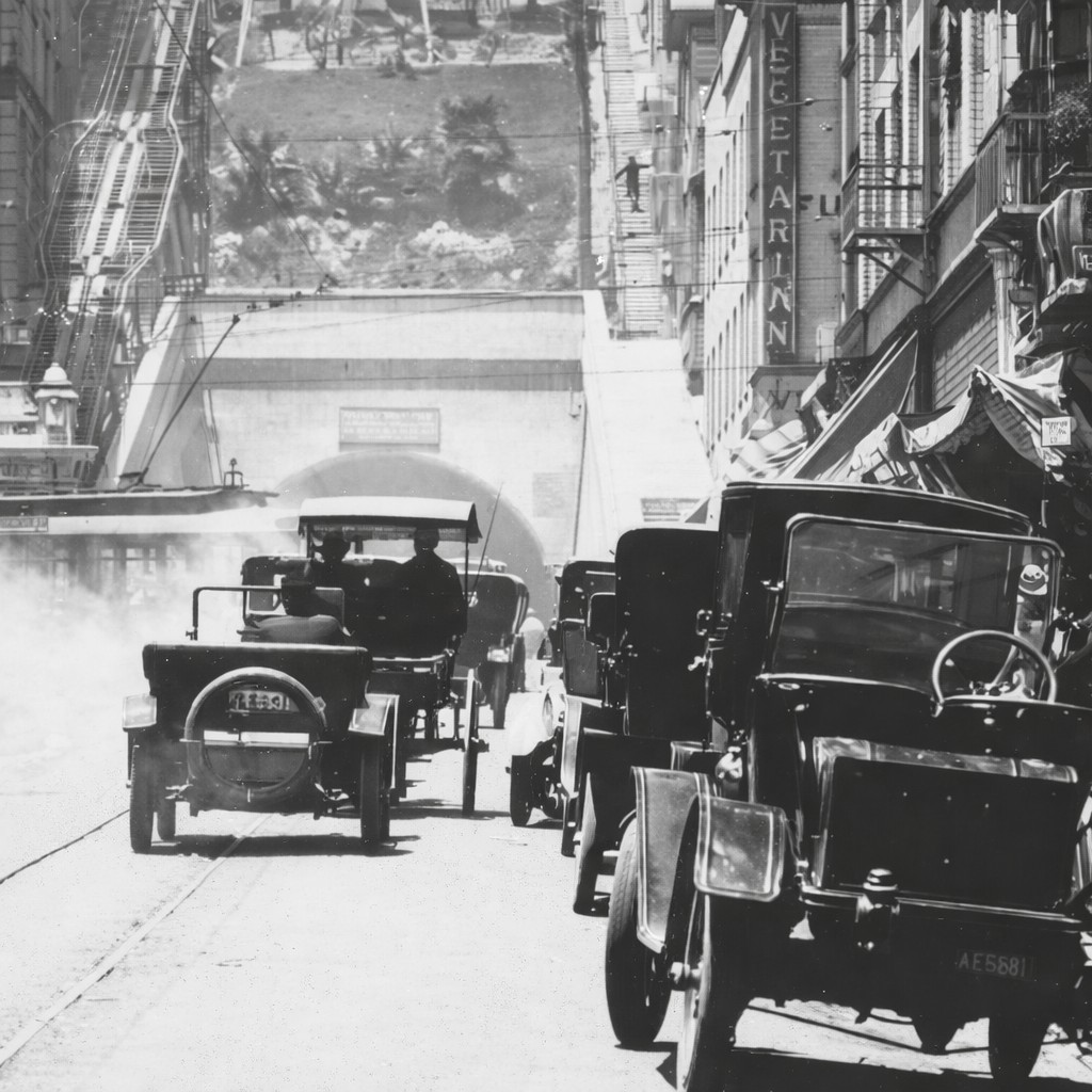
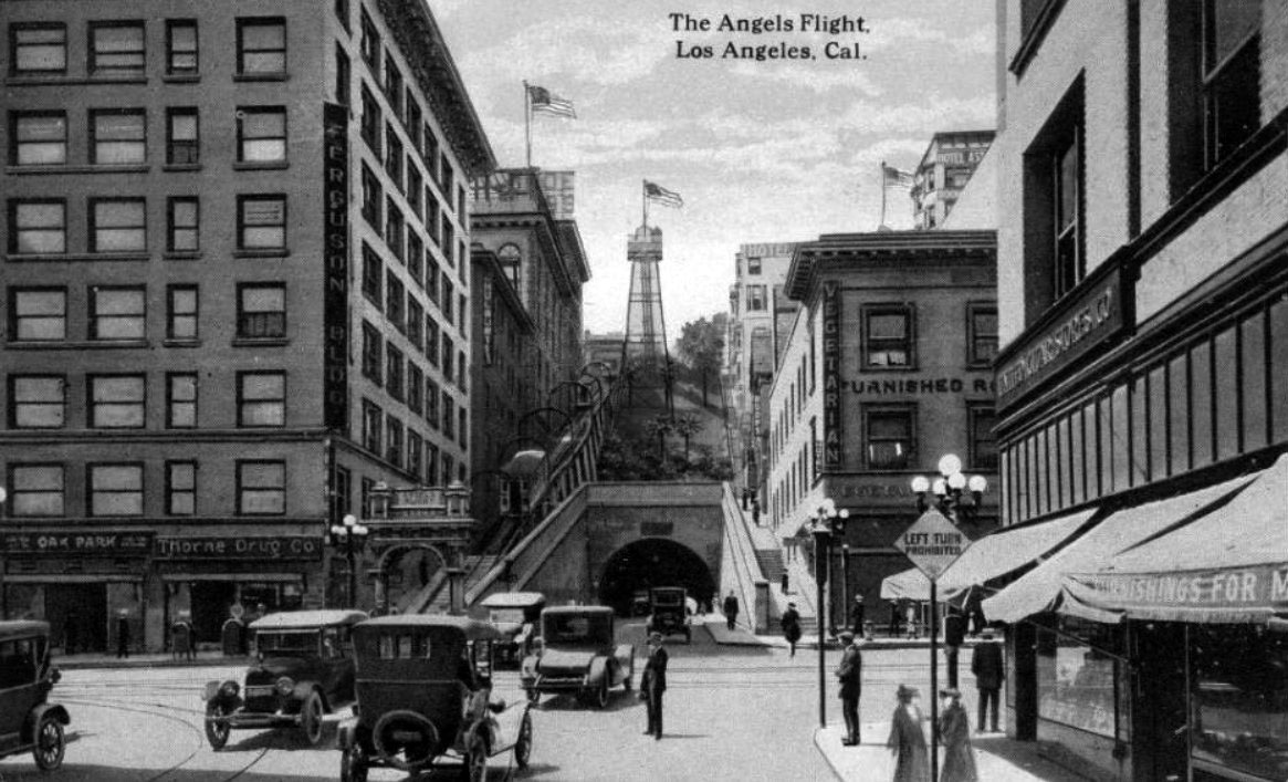


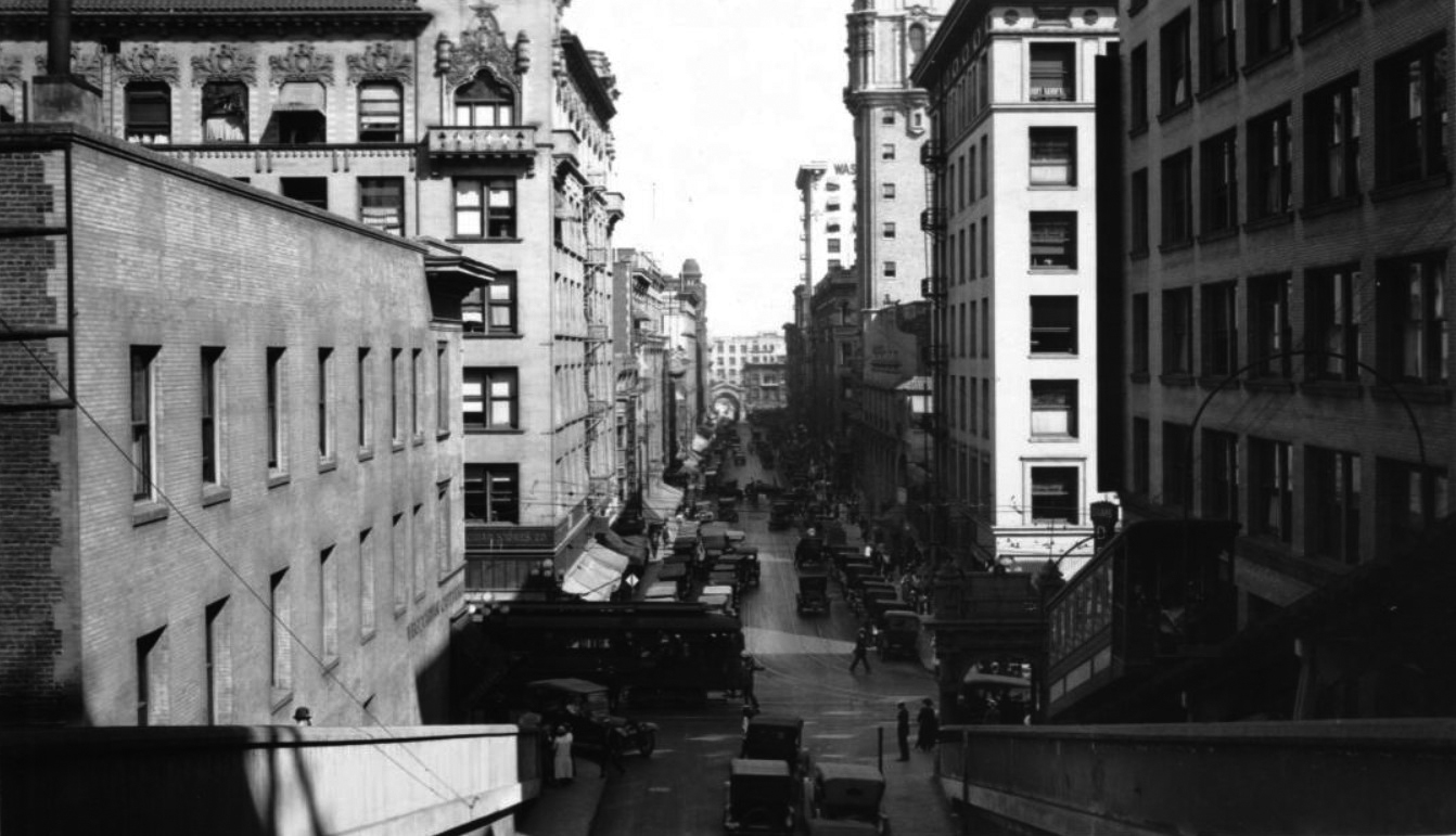
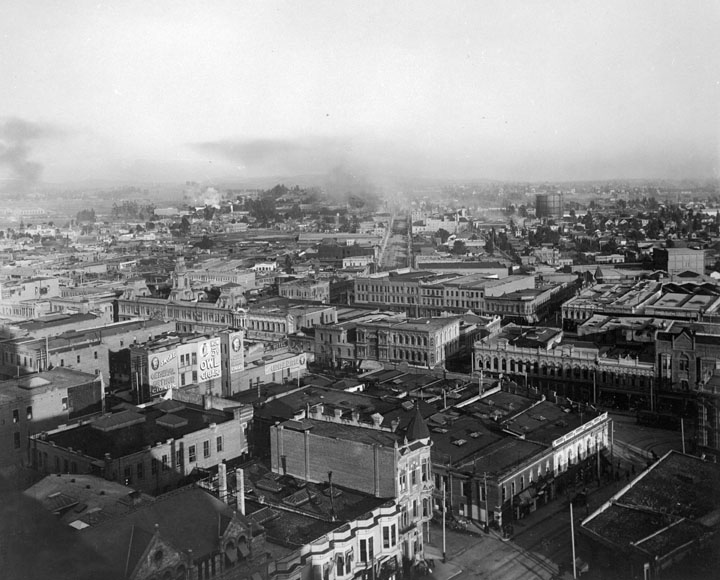 |
|
| (Early 1900s)^ - Los Angeles historical view looking northeast showing the heart of downtown in early 1900s. Aliso Street runs diagonally away from the center of photo. |
Historical Notes The wide avenue in the background pointing almost straight at us is Aliso Street, which today is the alignment of the 101 freeway east of the Civic Center. It turns slightly to the viewer’s left then and becomes The Slot as it passes through the site of the Baker Block - that long building at center-left with the three large cupolas, located on the 300 block of Main Street. Down at the lower right can be seen a portion of Temple Square - the "Times Square" of old L.A. And at the extreme right edge you can just barely see a corner of the Temple Block - one of the most important buildings in the early political and commercial life of the city.^^# |
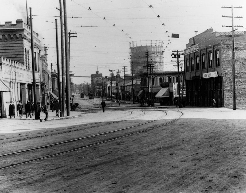 |
|
(ca. 1900)^ - View looking northeast along Aliso Street from San Pedro Street. Street cars and a gas storage tank (aka 'Gasometers') are seen in the background. On the left is a Los Angeles Fire Station. On the right, second building, is a barber shop. A few horse and buggies are waiting at the curb. Today, the 101 Freeway runs in alignment with Aliso St. |
* * * * * |
Los Angeles Camera Club
 |
|
| (Early 1900s)^ - Members of the Los Angeles Camera Club relax next to their bicycles on a dirt road. The club's outings took place at the beginning of the 20th century. |
Historical Notes A Mr. Sturdevant put in a notice calling the first meeting; only three showed up. Then Carl K. Broneer put in another notice, and ten camera enthusiasts showed up at the office of the Los Angeles and Pasadena Electric Railway, 222 West 4th Street, where he was office boy. Then Mr. Valentine, assistant to Frank Wiggins, director of the Los Angeles Chamber of Commerce, moved the meeting to the chamber director's office. From that time on the club grew by leaps and bounds and signed a lease for the top floor of the Wright & Callender Building on Hill Street.^ |
Early Modes of Transportation
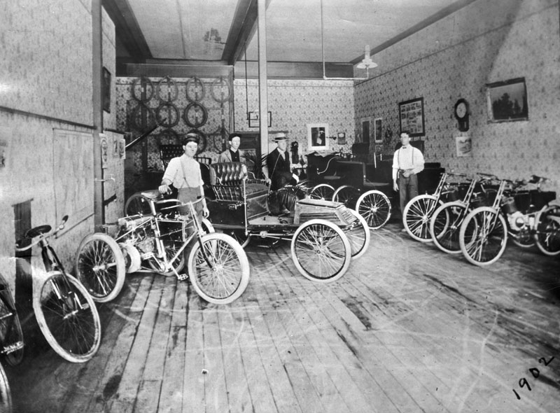 |
|
| (1902)* - Employees stand by early motorcycles and "horseless carriages" that are parked on a wooden floor in this view of Ralph Hamlin's wallpapered salesroom on Main St. Inner tubes hang on the wall in back. Photo caption reads: "This was Hamlin's salesroom in 1902, located at 1837 South Main street. Hamlin was born in San Francisco and was brought to Los Angeles by his parents at the age of six." |
 |
|
| (ca. 1902)^ - This picture shows a man driving a Waverley Electromobile car on Spring Street (looking north from 8th Street). Behind him on the left the Copeland Building tower (also called the Armory Building) can be seen. On the right side (east side of Spring) a sign for the Corum Paper Box Factory is visible on the side of a building. |
Historical Notes By the turn of the century, America was prosperous and cars, now available in steam, electric, or gasoline versions, were becoming more popular. The years 1899 and 1900 were the high point of electric cars in America, as they outsold all other types of cars. One example was the 1902 Phaeton built by the Woods Motor Vehicle Company of Chicago, which had a range of 18 miles, a top speed of 14 mph and cost $2,000. Later in 1916, Woods invented a hybrid car that had both an internal combustion engine and an electric motor.#* |
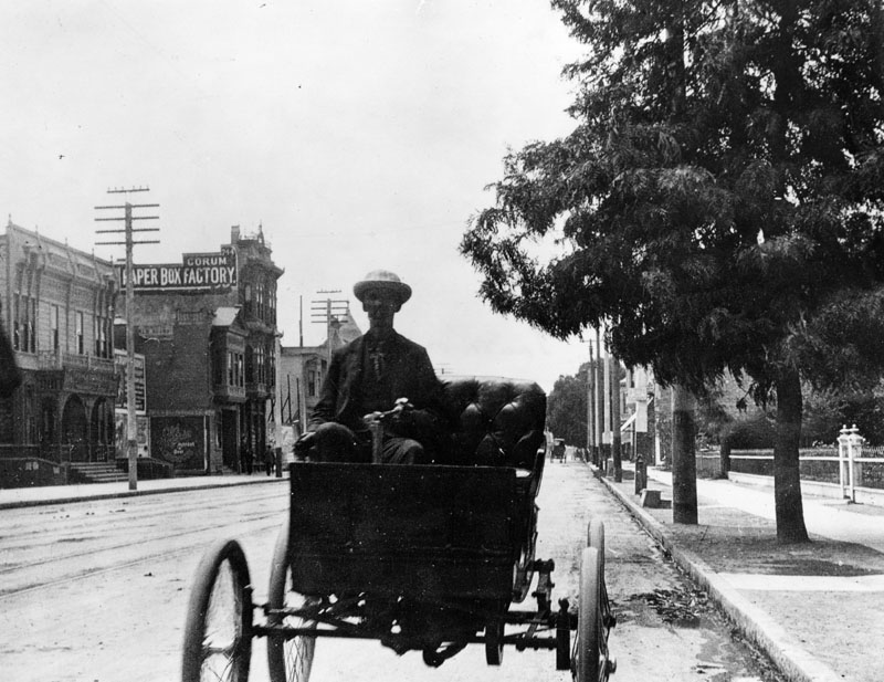 |
|
| (1902)^ - View of a man driving a Waverley Electromobile car on Spring St. (looking south near 8th St.). Behind him on the left (east side of Spring) a sign for the Corum Paper Box Factory is visible on the side of a building. |
Historical Notes Electric vehicles had many advantages over their competitors in the early 1900s. They did not have the vibration, smell, and noise associated with gasoline cars. Changing gears on gasoline cars was the most difficult part of driving, while electric vehicles did not require gear changes. While steam-powered cars also had no gear shifting, they suffered from long start-up times of up to 45 minutes on cold mornings. The steam cars had less range before needing water than an electric's range on a single charge.#* |
Los Angeles Examiner (1st Building)
(ca.1903)^^ - View showing two women crossing the street at Spring and Fifth Street looking west toward a group of buildings at a distance. The buildings are located on the west side of Broadway just south of Fifth Street with the Los Angeles Examiner building visible at center.
Historical Notes
The Los Angeles Examiner was founded in 1903 by William Randolph Hearst as a union-friendly answer to the Los Angeles Times. At its peak in 1960, the Examiner had a circulation of 381,037. It attracted the top newspapermen and women of the day. The Examiner flourished in the 1940s under the leadership of City Editor James H. Richardson, who led his reporters to emphasize crime and Hollywood scandal coverage.*^
(ca. 1903)^ - View showing a horse-drawn wagon and three bicycles parkd in front of the Los Angeles Examiner building located at 509 South Broadway.
Historical Notes
The Herald Examiner would move into a new, larger building in 1914, located at the southwest corner of Broadway and 11th Streets. Click HERE to see the Examiner's 2nd buidling located at 1111 South Broadway.
Broadway and 5th Street
(1903)^*# - View looking south on Broadway from 5th Street. Men and women are crossing the street in all directions. The sign on top of the building on the southwest corner reads: The 5 Cents Store - S & H Green Stamps
(ca. 1903)^ - The intersection at Broadway and 5th, looking south from 5th. The Los Angeles Examiner building is visible on the right. Pedestrians line the sidewalks, and horses and buggies are on the street. A lone bicycle rider leads the pack. Signs for "Mammoth Shoe House", "United Millinery Company", and "Angelus Studio" are visible.
(ca. 1908)^^ - View looking south on Broadway from Fifth Street showing two streetcars heading in opposite directions. One streetcar sign reads “Boyle Hts” and the other “Downey Ave". On the left can be seen several horse-drawn carriages and on the right a young man is riding a bicycle with a package under his arm. Also at right, commercial buildings line the street, including the Los Angeles Examiner building.
Historical Notes
In 1967, Herald Examiner employees began a strike that lasted almost a decade and resulted in at least $15 million in losses. The paper never recovered from the strike and went out of business November 2, 1989, leaving the Los Angeles Times as the sole city-wide daily newspaper.*^
(1903)^ - An early photo looking west on 6th Street from Main Street. Streetcar tracks cross at this intersection, and horse-and-carriages are seen. The Lion Cafe is at right, and houses are on both corners. Pedestrians are walking
Then and Now
(1903 vs 2022)* – Looking west on 6th Street from Main Street. Photo comparison by Jack Feldman.
(1903)^ - A group of people standing outside of Platt's Popcorn Palace on 5th and Main Streets. The Rosslyn Hotel later came to occupy this site.
(ca. 1903)^^ - Panoramic view of downtown Los Angeles looking east from the Fremont Hotel, 4th Street and Olive Street. Notable buildings include the Angelus Hotel (top-center), W.E. Cummings building (left), Niles Pease Furniture Co. (right). Legible signs include: "Conrad's, men's furnishings", "factory, climax, isolar [...]", "W.E. Cummings", "the Angelus", "restaurant", "Niles Pease Furniture Co.", "429, delicatessen, B.W. [...] & Co.".
Historical Notes
The Angelus Hotel was built in 1901 by G.S. Holmes (also the proprietor of The Knutsford Hotel in Salt Lake City, Utah). Advertised then as the tallest building in Los Angeles, the hotel consisted of two, seven-story buildings joined by a central structure with a lobby, dining rooms, meeting rooms and other shared facilities, including a central court yard on top.^^*^
(ca. 1902)^ - View of the Angelus Hotel located on the southwest corner of Spring and Fourth streets. A sign with the name "Angelus" and containing a clock is located on the corner of the building. The street is filled with people and horses and carriages, and a streetcar coming from the left.
Historical Notes
According to The American Globe, Independent Illustrated Monthly of 1909, The Angelus was sold circa 1903 to the Loomis Brothers, who were experienced hoteliers.
The Angelus had a Turkish-themed room in its early days, along with a bowling alley, billiards, a buffet and hair dressing parlor. Under the Loomis Brothers, the hotel later offered onsite "progressive tailoring" services by Eisner & Company.^^*^
(ca. 1903)^ - Spring Street between 2nd and 3rd Streets, looking north. The National Bank of California is on the northeast corner and H. Jevne Grocers at 208-210 South Spring. Two streetcars can be seen at the intersection of Spring and 2nd. Horse-drawn wagons and several bicycles are parked at the curb.
Broadway and 9th Street (Car Rally)
(1903)* - View looking south on Broadway from near 9th Street. Five motorcarriages with spoked wheels form a line running up the side of the still unpaved street, in which embedded trollycar tracks are visible.
Historical Notes
In 1903, Los Angeles was seeing the beginnings of informal car rallies, with several automobiles occasionally following each other through downtown streets. Though formal rallies weren’t organized yet, small caravans of cars weaving through the city offered a glimpse of the coming automotive culture. These early gatherings symbolized a growing fascination with automobiles amidst the usual traffic of horse-drawn carriages and streetcars.
(1903)* - A view of the west side of Broadway south of 9th St. A group of people are seen in their parked cars by the curb. Some of the cars have their tops down. Pennants are attached to the automobiles. On the opposite side of Broadway are homes.
Historical Notes
While automobiles were visible on the streets of downtown Los Angeles in 1903, they were still a relatively rare sight compared to other forms of transportation. Their presence was growing, but they were far from dominating the urban landscape at this point.
(1904)* - View of Broadway looking south from 9th St. Note the cars with signs such as "3 Daily Deliveries" lined up on one side of the street.
Then and Now
(1903 vs. 2024)* - Looking south on Broadway from near 9th Street toward 10th Street (now Olympic Boulevard). Photo comparison by Jack Feldman.
Historical Notes
10th Street in downtown Los Angeles was renamed Olympic Boulevard in 1932 to honor the Summer Olympics that were held in the city that year. The 1932 Olympics were the tenth modern Olympic event, which is how the street got its new name.
Some parts of the old 10th Street still exist as smaller streets in Westlake, near Hancock Park, and in the Central City East area. Tenth Street School, located at Olympic and Grattan, still has its original name.
Sunset Boulevard - Echo Park
(ca. 1903)* – Early view of Echo Park looking northwest toward the Hollywood Hills with the intersection of Sunset Boulevard and Innes Avenue at center-left.
Historical Notes
In the early 1900s this district was called Edendale—today’s Echo Park—with Silver Lake over the low hills in the distance. The photograph was taken from Everett Street hill around 1903. Much of the street grid we know today is already visible: Sunset Boulevard angles up through the scene; Innes Avenue sits in the lower left; Elysian Park Avenue (renamed Vin Scully Avenue in 2016) climbs the slope one block north; Allison Avenue and Douglas Street cross Sunset mid-frame; and Echo Park Avenue runs north with its line of trolley poles. Reservoir No. 4 (Echo Park Lake) lies just behind the tree-covered rise at left. The mix of graded streets, new trolley infrastructure, and scattered houses shows a neighborhood moving quickly from rural edges to streetcar suburb.
Then and Now
(1903 vs 2023)* – View of Echo Park with the intersection of Sunset Boulevard and Innes Avenue shown on the left. Elysian Park Avenue (now Vin Scully Avenue) is one block to the north. Photo comparison by Jack Feldman.
Historical Notes
The “then/now” pairing highlights how the street pattern has endured even as building types have changed. Echo Park grew first as a streetcar neighborhood, then adapted to automobiles after 1910. Name changes—most notably Elysian Park Avenue to Vin Scully Avenue—mark modern layers added onto a turn-of-the-century framework.
Sunset Boulevard - Grand Opening (Echo Park)
(1904)^ – View of Glendale Boulevard (then Lake Shore Avenue), still a dirt road, with a parade of cars near Sunset Boulevard.
Historical Notes
Sunset Boulevard officially opened on May 14, 1904. Celebrations brought out an eye-catching mix of early automobiles, horse-drawn carriages, tall tally-hos, and electric rail cars. The route finally gave Los Angeles a continuous macadamized roadway west toward Hollywood—then still an independent city—and set off a burst of subdivision activity in Echo Park and Silver Lake.
(1904)* - The procession at the intersection of Sunset and Glendale (then Lake Shore Avenue). This view looks west toward the present-day site of the Echo and Echoplex music venues. Courtesy of the Automobile Club of Southern California Archives.
Historical Notes
Local landowners had lobbied for this boulevard since the 1890s, recognizing how a modern, through street would raise property values and speed development. After years on paper, grading began in April 1903 when contractor Charles Stansbury’s crews cut Sunset’s meandering path through soft sandstone hills. Within a year it was ready for its public debut.
(1904)^ - Automobile parade on Sunset Boulevard. The vehicles are going down the sidewalk past redwood electric poles with palm fronds attached. There are boards stacked to lessen the shock of returning to the road, and the curbs have not yet been cut for driveways.
Historical Notes
The opening day pageant also exposed the road’s rough edges. Curbs weren’t yet cut for driveways, and some stretches remained bumpy. Organizers tied palm fronds to utility poles to suggest a tree-lined boulevard the city hadn’t planted. Sunset would not reach the ocean until the 1930s, when its west end was extended and linked to the coastal highway network. Despite the imperfections, the 1904 opening fixed Sunset’s identity as a major automobile corridor layered atop existing streetcar lines.
Then and Now
(1904 vs. 2022)* - Looking north on Glendale Boulevard (then Lake Shore Avenue) toward the Sunset Boulevard overcrossing. Lake Shore Avenue is still there as the street on the right past the overcrossing. Photo comparison by Jack Feldman.
Historical Notes
This match-up shows how the old Lake Shore Avenue alignment survives as a local street even after 20th-century projects—bridge work, channelization, and highway-style approaches—lifted Sunset over Glendale. The shift from dirt lanes to engineered separations mirrors Los Angeles’ transition from streetcar city to auto city.
Sunset Boulevard - Echo Park (Streetcar Era)
Sunset Boulevard through Echo Park offers one of the clearest visual records of how Los Angeles was built. In the early 1900s, crews carved the roadway out of hillsides, widened it for streetcars, and reshaped the terrain to carry a growing city westward. The images in this section capture that transformation at ground level, from raw roadwork in 1907 to a fully developed urban corridor.
Echo Park's stretch of Sunset was part of a larger effort to connect Downtown Los Angeles with Hollywood and the emerging residential neighborhoods in between. The boulevard's extension through the Silver Lake and Echo Park hills was completed around 1904, immediately drawing streetcar service down its center median. By 1912, streetcars shared the corridor with early automobiles, and within a generation, the city would widen lanes, remove the center-running tracks, and reorganize the street for cars alone.
What persists across more than a century of change is the boulevard's underlying geometry — the alignment, the angle of cross streets, the rhythm of small commercial lots at the corners. The images here trace how a rough hillside roadcut became a modern boulevard, and how that boulevard continued to evolve long after the streetcars were gone.
(ca. 1907)* - Looking east on Sunset Boulevard toward Benton Way from near Occidental Boulevard. Crews have pushed large rounded boulders to the roadside as they cut and widen the street for streetcar tracks and heavier traffic.
Historical Notes
In 1907, Sunset Boulevard through Echo Park was still being shaped into a modern thoroughfare. Crews cut into the hillside and widened the roadbed to accommodate streetcar tracks along Sunset Boulevard's center median. The work was heavy and largely done by hand — picks, shovels, horse-drawn scrapers, and plenty of labor. The boulders pushed to the roadside are a direct result of that grading work.
The rounded shape of those boulders is not accidental. They are products of spheroidal weathering, a geological process in which water seeps along cracks in buried rock and chemically attacks the corners and edges first, gradually rounding what began as an angular block. Southern California's sedimentary hills contain many such corestones — smooth, rounded masses that look almost worked by human hands but are entirely natural. Workers of the era sometimes called them "cannonballs," and earlier generations occasionally mistook similar formations for dinosaur eggs. No verified dinosaur eggs have been found in Southern California; these are simply ancient geology surfacing as the hillside was cut away.
(1912)* - Looking east on Sunset Boulevard from near Occidental Boulevard (about 2751 Sunset Boulevard). Trolley poles and center-running tracks mark an active streetcar route, while storefronts and bungalows along the corridor reflect Echo Park's growth as a transit suburb.
Historical Notes
By 1912, the Sunset Boulevard corridor through Echo Park had taken on the character of a streetcar suburb. Streetcar lines ran center-track along Sunset, connecting the neighborhood to Downtown Los Angeles and anchoring commercial development along the route. Storefronts, bungalow courts, and early garages had begun to cluster near the streetcar stops, a pattern typical of how Los Angeles grew outward in the 1900s and 1910s — transit first, then the neighborhood filling in around it.
This was the moment when Sunset Boulevard carried two futures at once — rail in the center, automobiles at the edges. Over the following decades, the city removed the tracks and widened the lanes in favor of the car — adding traffic signals and eventually replacing the streetcars with buses in the early 1950s. But in this image, the transit era is still at its height, and the boulevard's role as a connector between Downtown, Echo Park, Silver Lake, and Hollywood is fully established.
(2024)* - Looking east on Sunset Boulevard from near Occidental Boulevard (about 2751 Sunset Boulevard). Bus service now runs where streetcars once did, and a century of lane widening, curb cuts, and traffic signals reflects how thoroughly the corridor was rebuilt for the automobile.
Historical Notes
Today's Sunset Boulevard through Echo Park is organized entirely around the car. The center-running streetcar tracks that defined the 1912 streetscape are long gone, replaced by continuous travel lanes, left-turn pockets, and timed signals. Metro bus lines now serve the corridor, operating in mixed traffic rather than on dedicated track. The change was gradual but decisive: as car ownership rose and freeway construction reshaped the region, the city removed parking strips, widened travel lanes, and converted streetcar lanes to auto use — a process largely complete by the late 1950s. The width of the roadway itself tells the story: what was once shared space is now dominated by moving traffic.
What has not changed is the boulevard's underlying geometry. Echo Park's older street grid — with its angled intersections, small commercial lots, and closely spaced cross streets — was set in place during the streetcar era and has remained largely intact. The neighborhood's relative walkability today is in part a legacy of that early transit-era planning, even though the transit itself is long gone. Sunset still connects Downtown Los Angeles to Hollywood by the same alignment laid out more than a century ago.
Then and Now
(1912 vs 2019)* - Looking east on Sunset Boulevard from near Occidental Boulevard (about 2751 Sunset Boulevard). Photo comparison by Jack Feldman.
Historical Notes
The comparison shows that Sunset Boulevard's alignment through Echo Park has changed very little in more than a century. The line of the boulevard, the angle at which cross streets meet it, and the general rhythm of commercial frontage at the corners all persist from the 1912 view to the 2019 one. What has turned over completely is the architecture: none of the early storefronts visible in 1912 survive in the later image, replaced by structures built across several subsequent decades.
This pattern — durable infrastructure, cycling architecture — is characteristic of how Los Angeles developed along its older transit corridors. The street grid and lot sizes were established early and have proven resistant to change, even as the buildings on those lots have been rebuilt multiple times. The then-and-now view makes that continuity visible in a way that either image alone cannot: the boulevard endures; everything built along it changes.
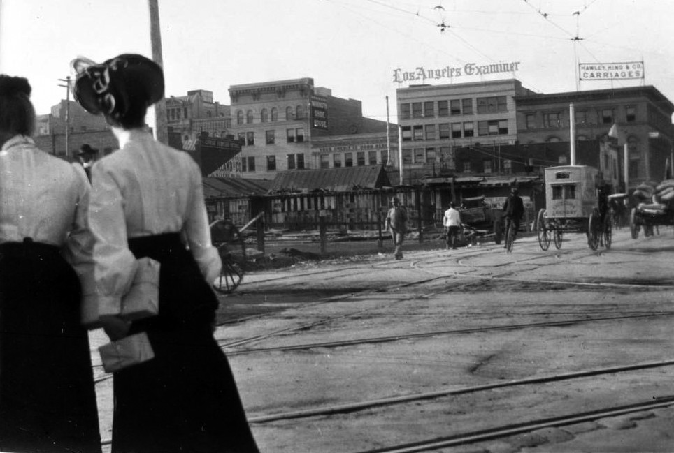


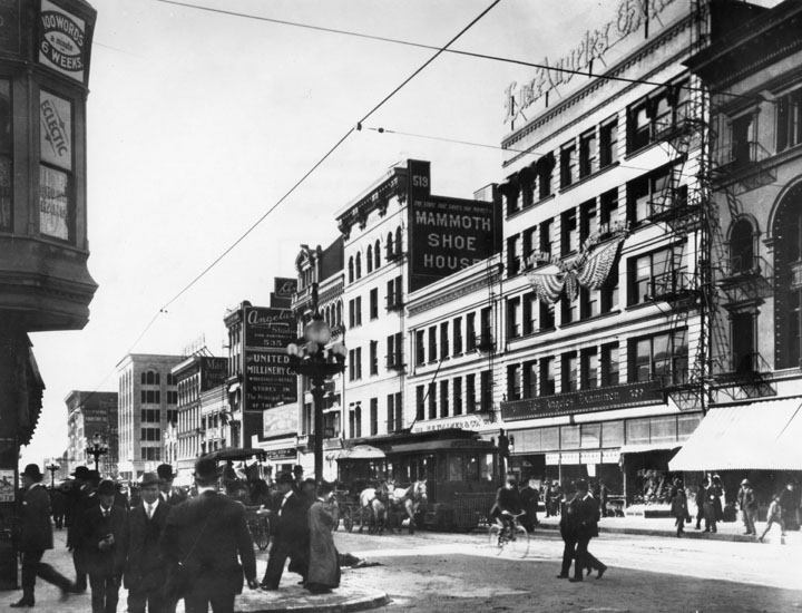
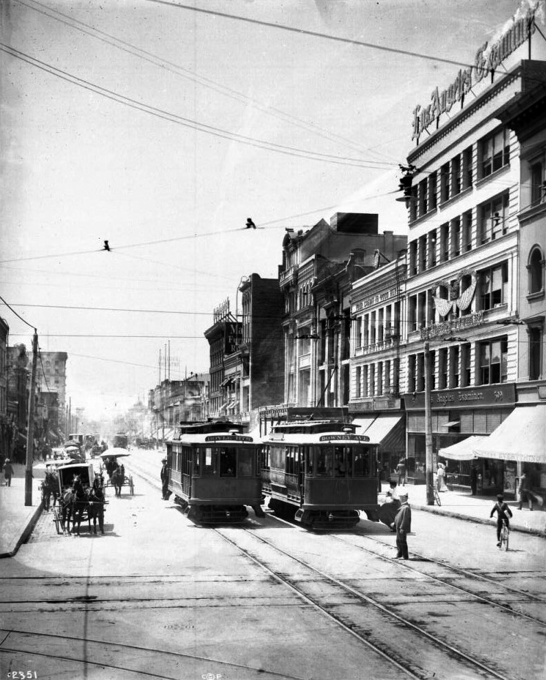

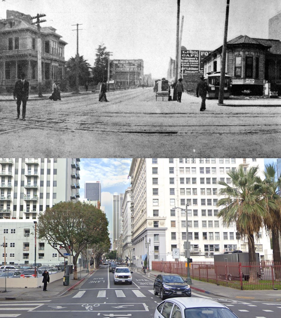
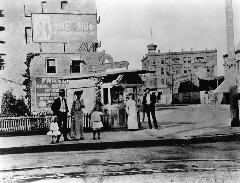
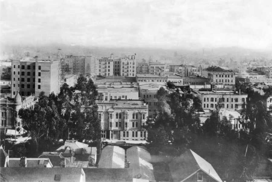
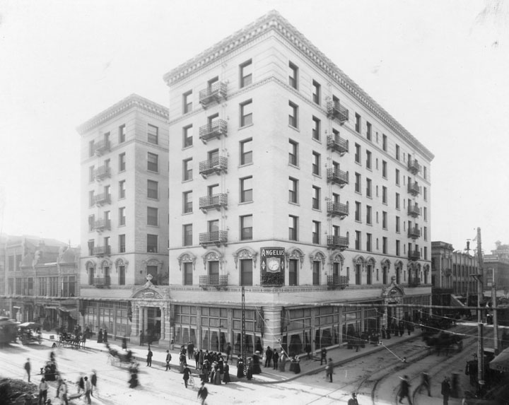

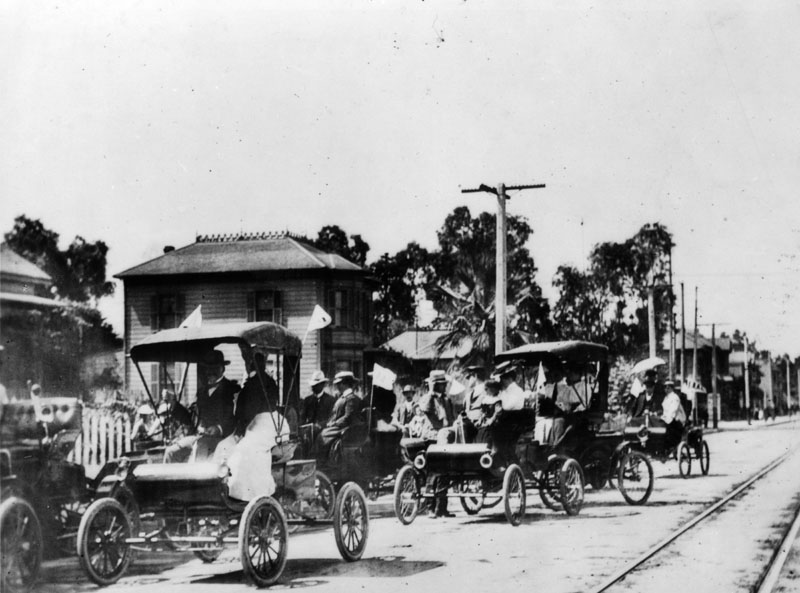
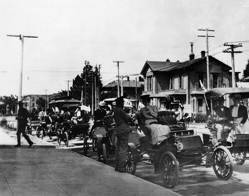
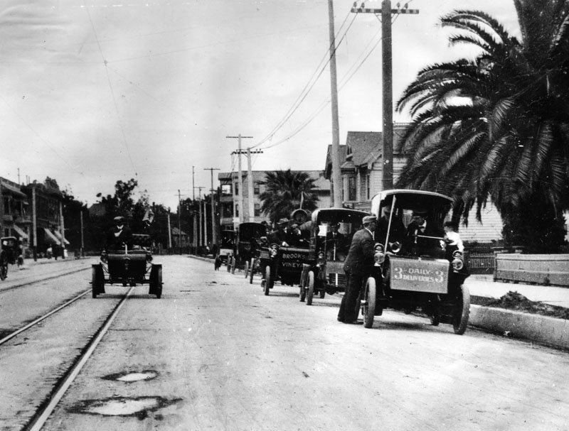
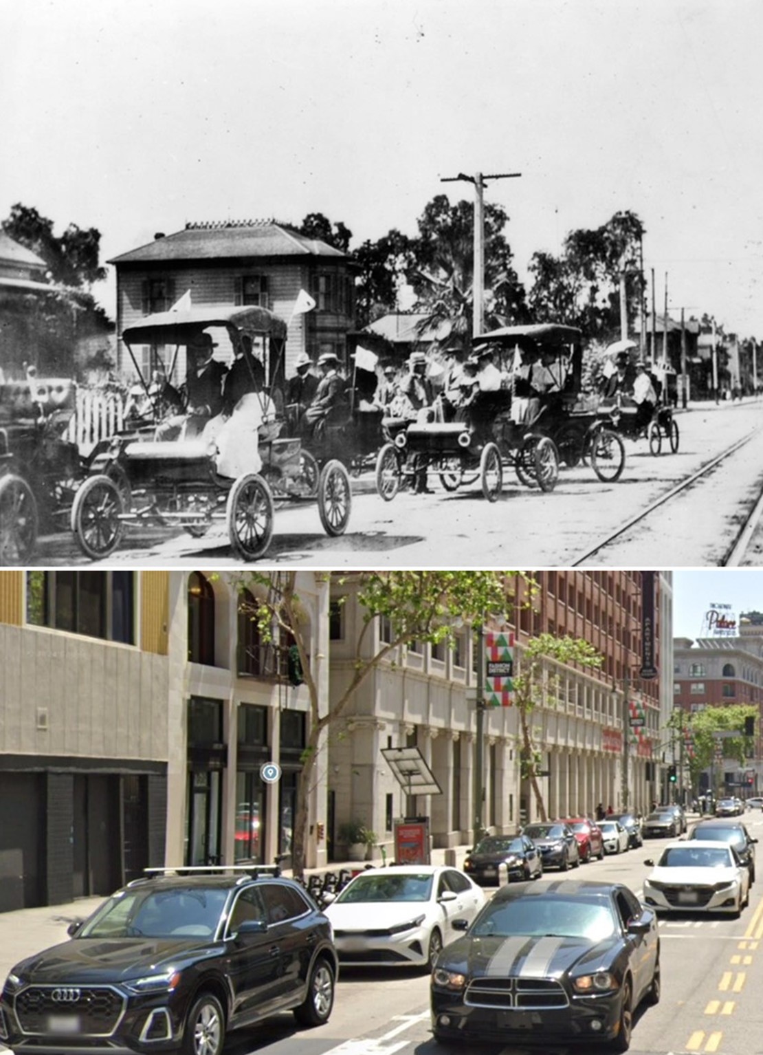
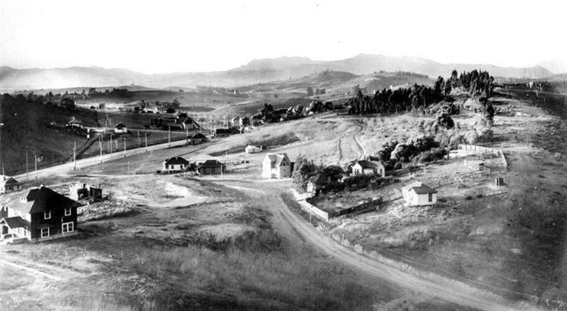
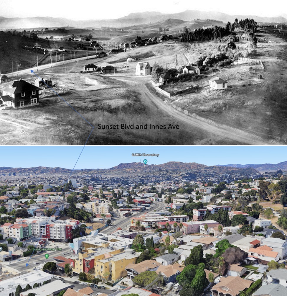
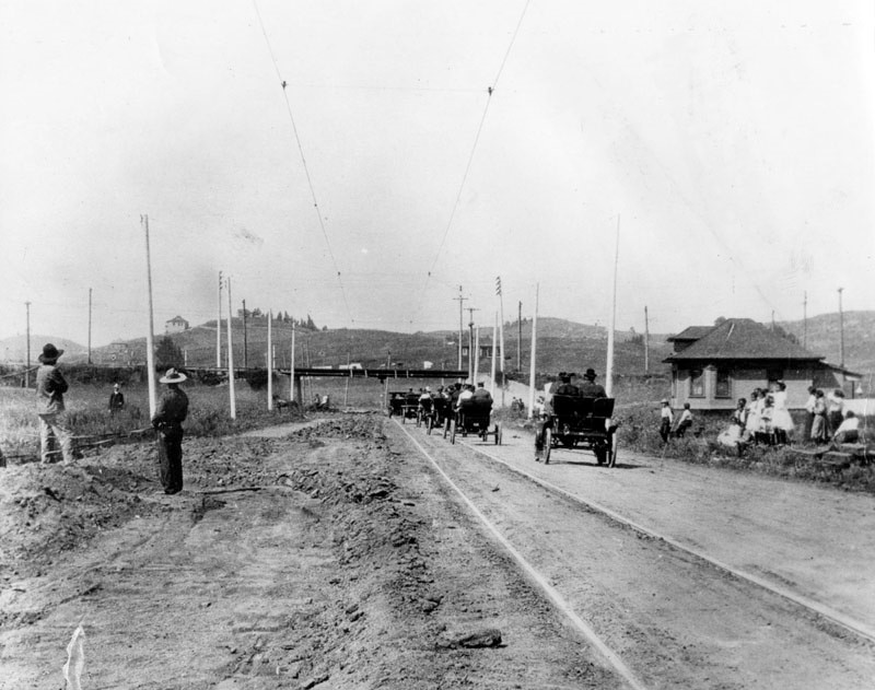

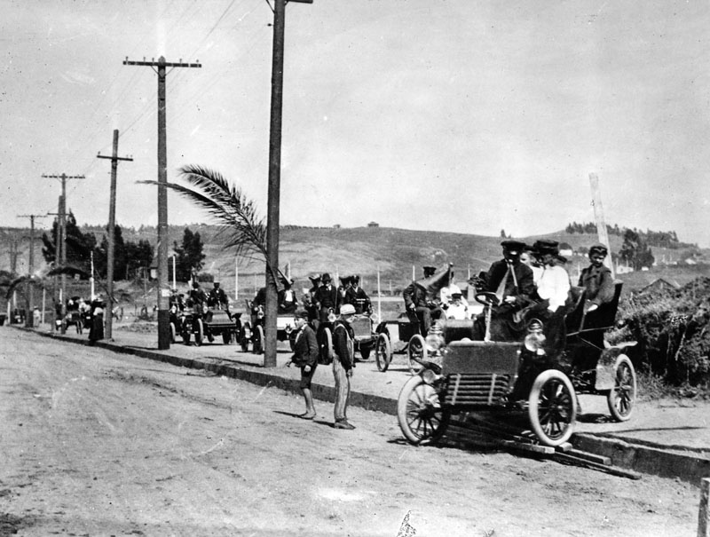


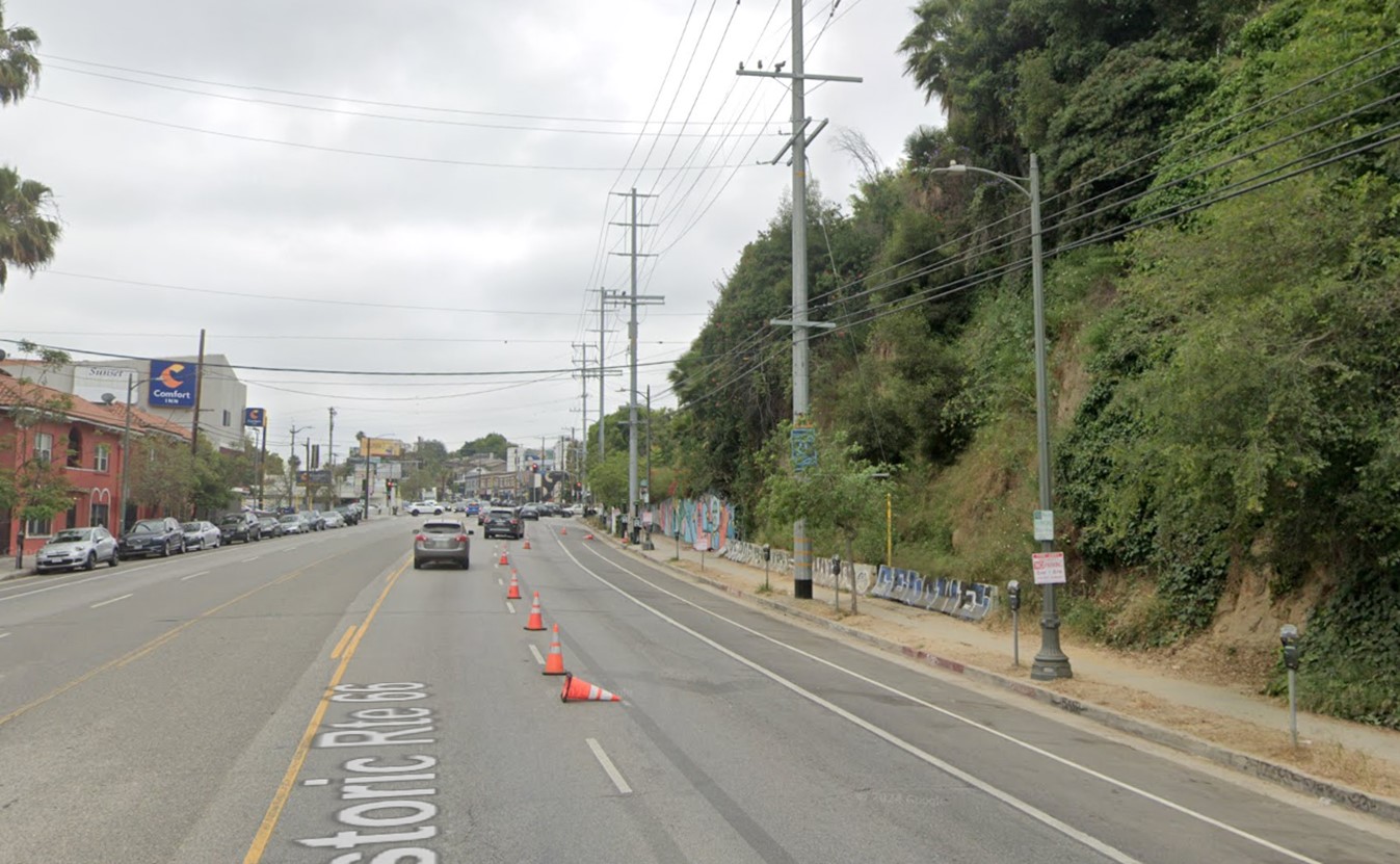
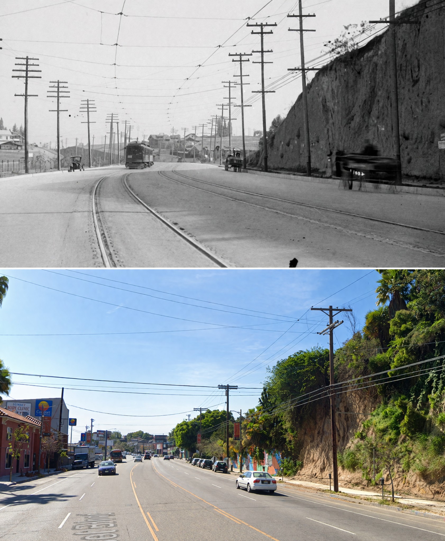
.jpg)
Downtown
 |
|
| (ca. 1904)^^ - View looking north on Main Street. The streets are filled with horse-drawn carriages, streetcars, and pedestrians. Large business signs can be seen throughout. |
 |
|
| (ca. 1904)^ - At the intersection of Main (foreground) and 9th streets, a bicycle group prepares to depart for Griffith Park. |
 |
|
| (ca. 1904)^^ – Portrait of veterans "Teddy's Terrors" at First Street and Broadway. Soldiers from the Spanish-American War who served under Theodore Roosevelt stand in front of a two-story brick corner building in their cavalry uniforms with a group of young boys standing with their bicycles to the left. More onlookers are visible to the right and peering out of the windows above. These soldiers were campaigning for the soon-to-be President Roosevelt at the time. |
* * * * * |
For more Historical Los Angeles Views click one of the following:
For Other Historical Views click one of the following:
See Our Newest Sections:
To see how Water and Electricity shaped the history of Los Angeles click one of the following:
Water:
Power:
* * * * * |
References and Credits
* DWP - LA Public Library Image Archive
^ LA Public Library Image Archive
^*The Valley Observed: Street Name Origins; Timeline of Valley History
+*The Eastsider LA: Avenue of the Palms
*# blogdowntown: Third Street Tunnel
#* About.Com: History of Electric Vehicles
#*^Library of Congress: Venice Lagoon
##*A Visit to Old Los Angeles: CSULB
*##LA Times: Dig Into History You'll Find Snake Oil..Victor Girard Kleinberger ; 1900 Fashion
^##Metropolitan Transportation Library and Archive
##^CSUN Oviatt Library Digital Archives
###Denver Public Library Image Archive
*#*Historical Los Angeles Theatres: The Philharmonic Auditorium; Downtown Theatres
*^#LincolnHeightsLA.com: Legion Ascot Speedway
**#KCET - Lost Tunnels of Downtown LA; Three Forgotten Railway Inclines; Edendale Red Car Line; The Origins of Elysian Park; When L.A. Was a Horse-Powered Town; How L.A. Celebrated Sunset Boulevard's Opening in 1904
^*#California State Library Image Archive
^^#forum.scraperage.com: Aliso St; Hill Street Tunnel, 1903; Broadway Tunnel
*#^History of Hermosa Beach - Maureen Megowan
^#*City of Redondo Beach HIstory
^#^Noirish Los Angeles - forum.skyscraperpage.com; Broadway Tunnel; Sugarloaf Point; Angels Flight; Avalon; Boylston Yard; Angels Flight Observation Tower View
+#+Silentlocations.wordpress.com: Venice Minitiare Railroad
++#Everydayarmour.blogspot.com/
^^*Early Downtown Los Angeles - Cory Stargel, Sarah Stargel; Hollenbeck Hotel
***Los Angeles Historic - Cultural Monuments Listing
**^Historicechopark.org: Echo Park Lake; Elysian Park
*^*California Historical Landmarks Listing (Los Angeles)
*^^Nuestra Señora la Reina de los Ángeles: losangelespast.com
^^^Aerofiles - US Aviation Firsts
***^Oviatt Library Digital Archives
***#Pinterest.com: 1890's to 1920's Los Angeles - Anna Blanc's LA; Snapshots - Avalon Bay
#***S.S. Hermosa: pasadenastarnews.com
#**^LA County Library Image Archive
#*#^Brand Park and Studios: glendale.ca.us
*^#*On Bunker Hill: Crocker Mansion
*^#^Huntington Digital Library Archive
^^*^Restaurantwarecollectors.com: Angelus Hotel
^^^#Los Angeles Fire Department Historical Archive
#*^^Flickr.com: Views of Los Angeles
^*##Calisphere: University of California Image Archive
^##^Glendale Historical Society
^#^#U.S. Geological Survey Photographic Library
*#**Los Angeles Westerners Corral: Venice Miniature Railway
^#*^Facebook.com - Bizarre Los Angeles
*#*#Abandoned & Little-Known Airfields – Paul Freeman
^#*#Angels Flight Goes to the Movies
*##*Chatsworth Historical Society
+##+Restaurant-ing Through History: Ice Cream Parlors
**#*Creating a Landmark: the Historic Casino Point
*###Pacific Coast Architecture Database (PCAD): Bryson-Bonebrake Block
###*Glendalecagov.org: Glendale History
*##^Wikimapia: Pacific Electric Edendale Cut
#**#Debunking Venice's Historic Myths
#^^#Facebook.com: Garden of Allah Novels, Martin Turnbull
****#Tumblr.com: LA History - Leonis Adobe
#+++Facebook.com: West San Fernando Valley Then And Now
#+#+Glendale News-Press: Tropic
**#**Electric Railway Historic Association: Angel's Flight
**^*^Pacific Electric Historical Society
^^^**Metropolitan News: H. Jevne Co. Offers Free Home Delivery
^^^^#A History of the Los Angeles City Market
*#*#*Venice Miniature Railroad - Jeffrey Stanton
*^ Wikipedia: H.J. Whitley; Occidental College; Beverly Hills; Beverly Hills Hotel; Los Angeles Railway; Pershing Square; Broadway Tunnel: Isaac Van Nuys; Sawtelle; Port of Los Angeles; Tournament of Roses Parade; Angels Flight; Occidental College; Mt. Washington, LA; Broadway, LA; Hancock Park; La Brea Tar Pits; Los Angeles City Oil Field; Deadman's Island (San Pedro); Moses Sherman; Rose Bowl Game; Hollywood Hotel; Hollywood HIgh School; California Club; San Pedro; Salt Lake Oil Field - Gilmore Oil Field; Westwood; 2nd Street Tunnel; Hermosa Beach; Los Angeles Memorial Coliseum; Redondo Beach Pier; Redondo Beach; West Hollywood; Pacific Palisades; 1910 L.A. International Air Meet at Dominguez Hills; Hancock Park; Marlborough School; Pacific Electric Building; History of the Los Angeles Police Department; History of Los Angeles Population Growth; Avalon Bay Stereoscopic View; History of UCLA; Leslie Brand; Venice Canal HIstoric District; Leslie Brand; Grand Central Airport; Leonis Adobe; Los Angeles Herald-Examiner; Camera Obscura; Friday Morning Club
< Back