Early Views of Santa Monica
Historical Photos of Early Santa Monica |
 |
|
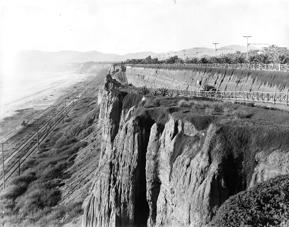
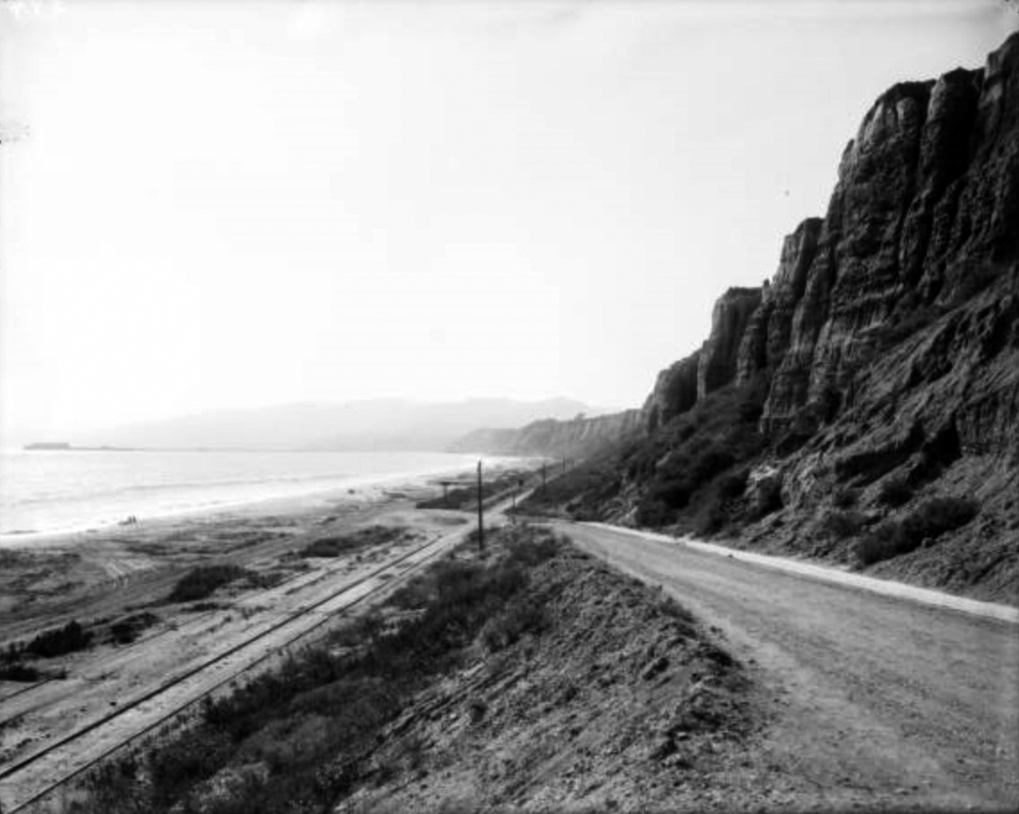
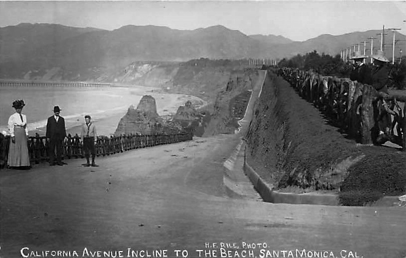
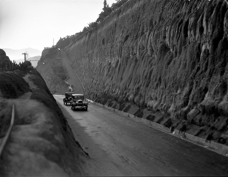
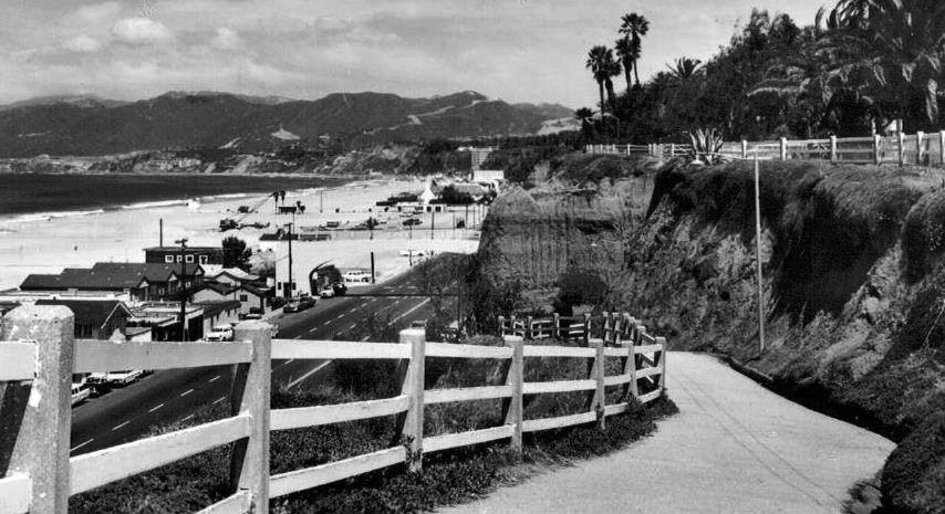
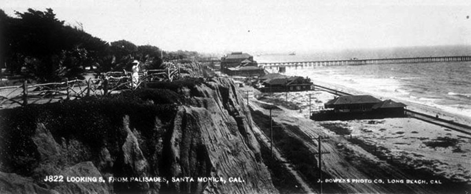
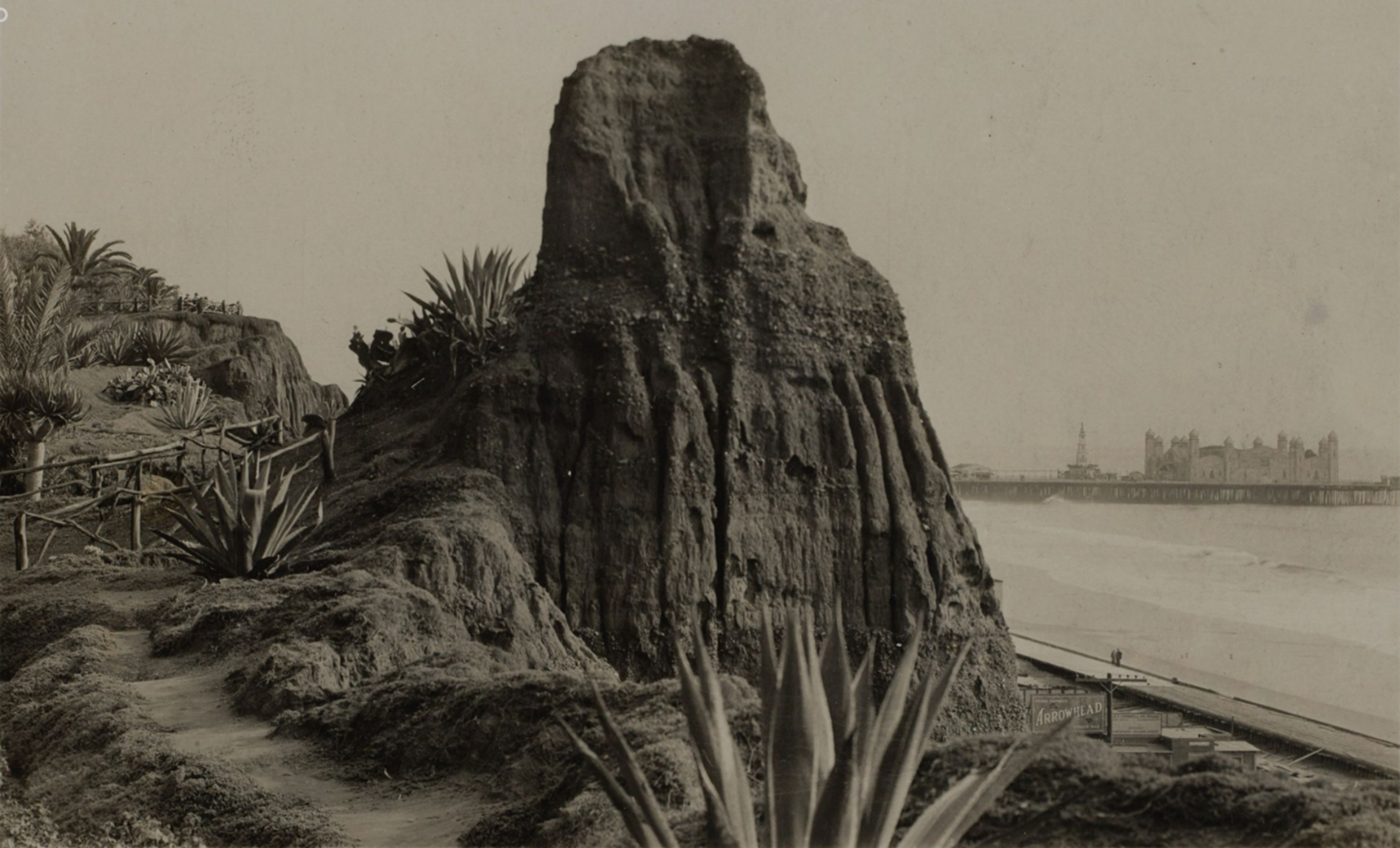
| (ca. 1905)* - View of the Santa Monica shoreline from Palisades Park. The tracks of the Los Angeles & Independence R.R. run where Pacific Coast Highway is today. To the right, a motorcar ascends an early version of the California Incline. |
Early California Incline |
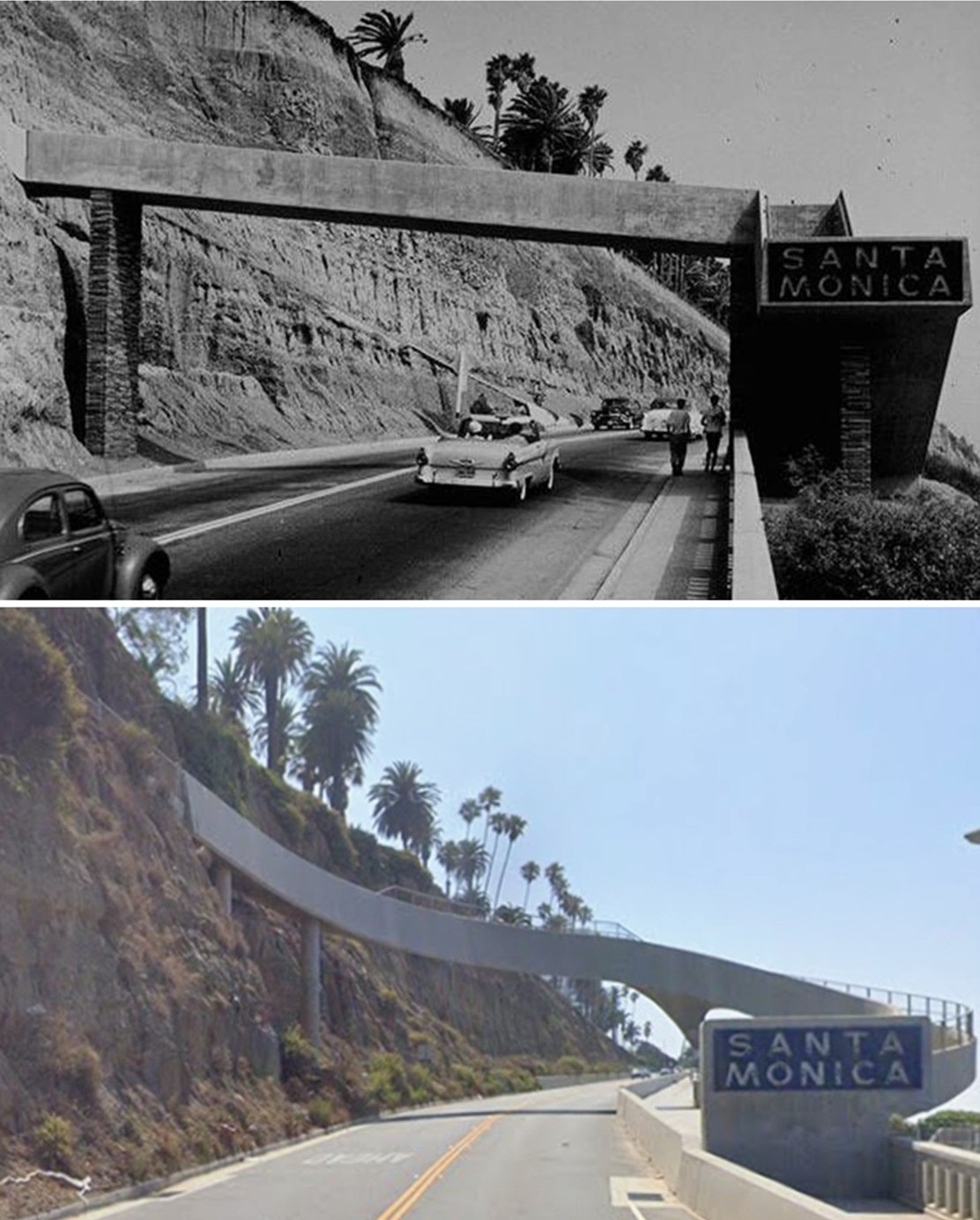
Santa Monica’s First Automobile Route Down the Palisades (1905–1929) |
Footpaths such as the Sunset Trail and stairways like the 99 Steps provided early access down Santa Monica’s bluffs, but the California Incline was the first route designed specifically for vehicles. Completed around 1905, the new dirt road was part of a plan by City Engineer Thomas H. James to create three inclines linking Linda Vista Park with the beach below.At the base of the bluffs, Beach Road and the tracks of the Los Angeles and Independence Railroad ran along the shoreline where Pacific Coast Highway sits today. Trains carried passengers and freight between Los Angeles and the Southern Pacific Long Wharf, visible in the distance.This early photograph captures the incline at the moment when Santa Monica was beginning to reshape its steep coastal landscape for the automobile, turning what had once been footpaths and trails into a practical roadway connecting the growing town above with the busy waterfront below. |
Photo Gallery |
Early Views of the California Incline and Santa Monica Bluffs (1905–1929) |
These photographs document the California Incline during its earliest decades, when the bluff road was still unpaved and shared by wagons, pedestrians, and the first automobiles. The images also capture the surrounding coastal landscape—Palisades Park above, Beach Road and the railroad tracks below, and the Southern Pacific Long Wharf and early Santa Monica Pier in the distance. |
 |
|
| (ca. 1905)* - Early view looking up the California Incline leading from the coast highway to the palisades. There is a walking path to the right of the road. |
Historical Notes In this early view the California Incline is still an unpaved dirt road cut straight into the face of the bluff. A simple walking path on the right gives pedestrians their own route up the grade while wagons and the first motorcars share the narrow roadway. The rustic railings at the top edge of the cliff were part of the city’s first efforts to make Linda Vista Park safer while still allowing visitors to walk right to the brink for a full view of the ocean. The image captures the moment when Santa Monica’s seaside resort town began to reshape its steep shoreline for regular traffic rather than only for recreation. |
 |
|
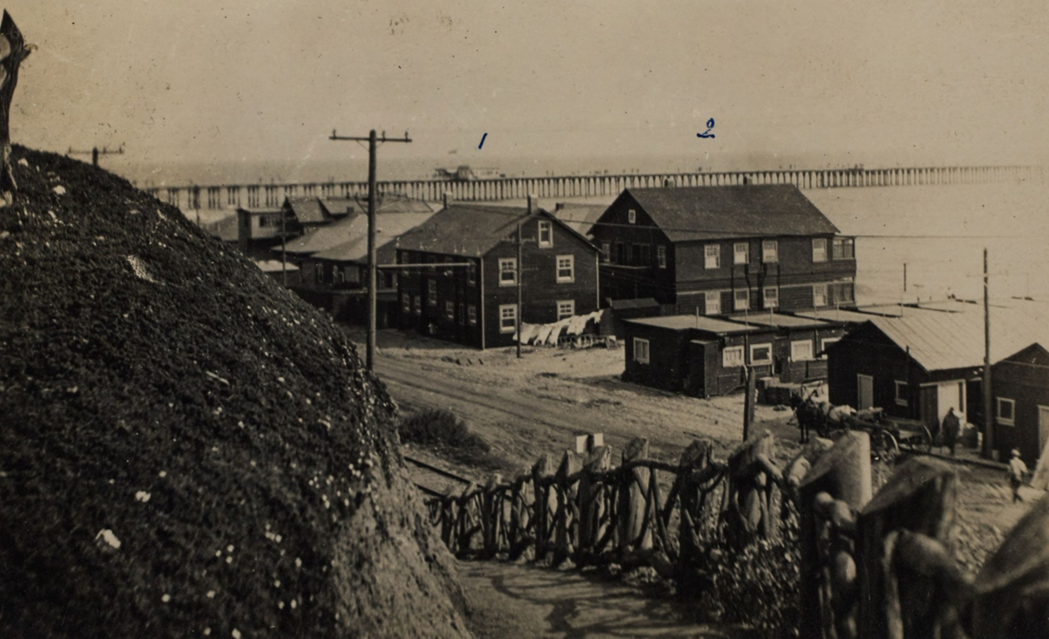
| (ca. 1905)* - View shows a wooden fence along an unpaved California Incline with the Long Wharf seen in the background. The Santa Monica mountains are in the distance. Linda Vista Park (later Palisades Park) is on the right. |
Historical Notes The rough post-and-rail fence along the edge of the incline is the signature look of early Linda Vista Park, later renamed Palisades Park. Senator John P. Jones and the Santa Monica Land and Water Company had donated this bluff-top land to the city in the 1890s so it could remain a public promenade above the sea. Far out in the water stands the Southern Pacific Long Wharf, at that time advertised as the longest wharf in the world at more than four thousand seven hundred feet, serving as Port Los Angeles before San Pedro Harbor was chosen as the region’s main port. The view reminds us that the California Incline originally connected not just to a local beach road but to a deep-water port that briefly competed to be Los Angeles’s primary harbor. |
 |
|
| (ca. 1905)* - View shows a wooden fence along an unpaved California Incline with the Long Wharf seen in the background. The Santa Monica mountains are in the distance. Linda Vista Park (later Palisades Park) is on the right. Image enhanced and colorized by Richard Holoff. |
Historical Notes This colorized version is based on the original black-and-white photograph of the unpaved incline and rustic fence with the Long Wharf in the distance. While the added color helps modern viewers imagine the tones of the sandstone bluffs, the green plantings in the park, and the blue of the Pacific, the underlying scene is the same early automobile era Santa Monica. It shows how quickly the city embraced the dramatic setting of its bluffs by framing the new road with hand-built fencing and plantings rather than heavy masonry, keeping the landscape informal even as it was being engineered. |
 |
|
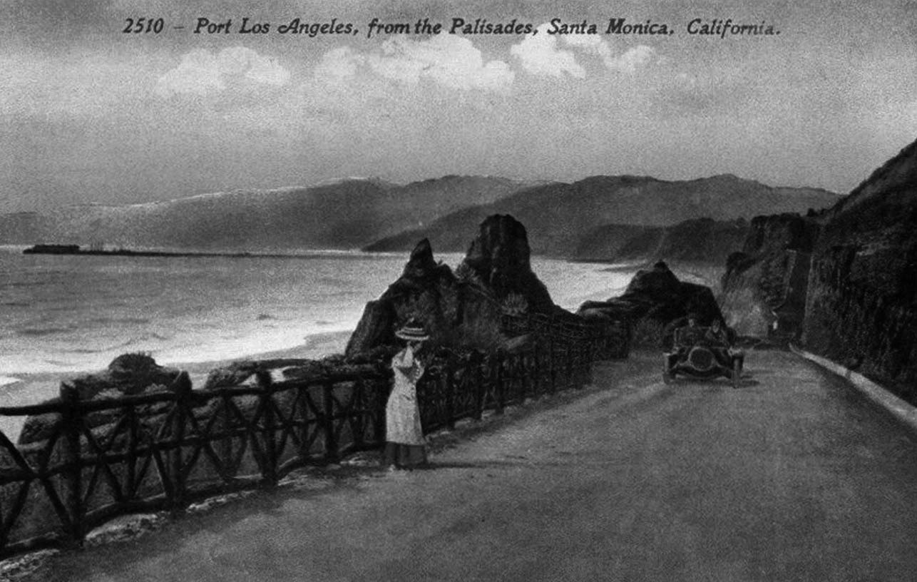
| (ca. 1910)* – Postcard view showing a woman standing on the California Incline watching a car as it makes its way up the grade. The Long Wharf can be seen in the background. |
Historical Notes By about 1910 automobiles were a regular sight on the California Incline, sharing the grade with horse-drawn vehicles and pedestrians. The woman standing at the edge of the road illustrates how the incline itself became a vantage point, offering sweeping views of the bay and of the Long Wharf still jutting into the ocean to the north. The wharf, completed in the 1890s for the Southern Pacific Railroad, was already losing its role as a major port after San Pedro was selected as the official harbor, but it remained a dramatic feature of the skyline for visitors driving or walking the incline. |
 |
|
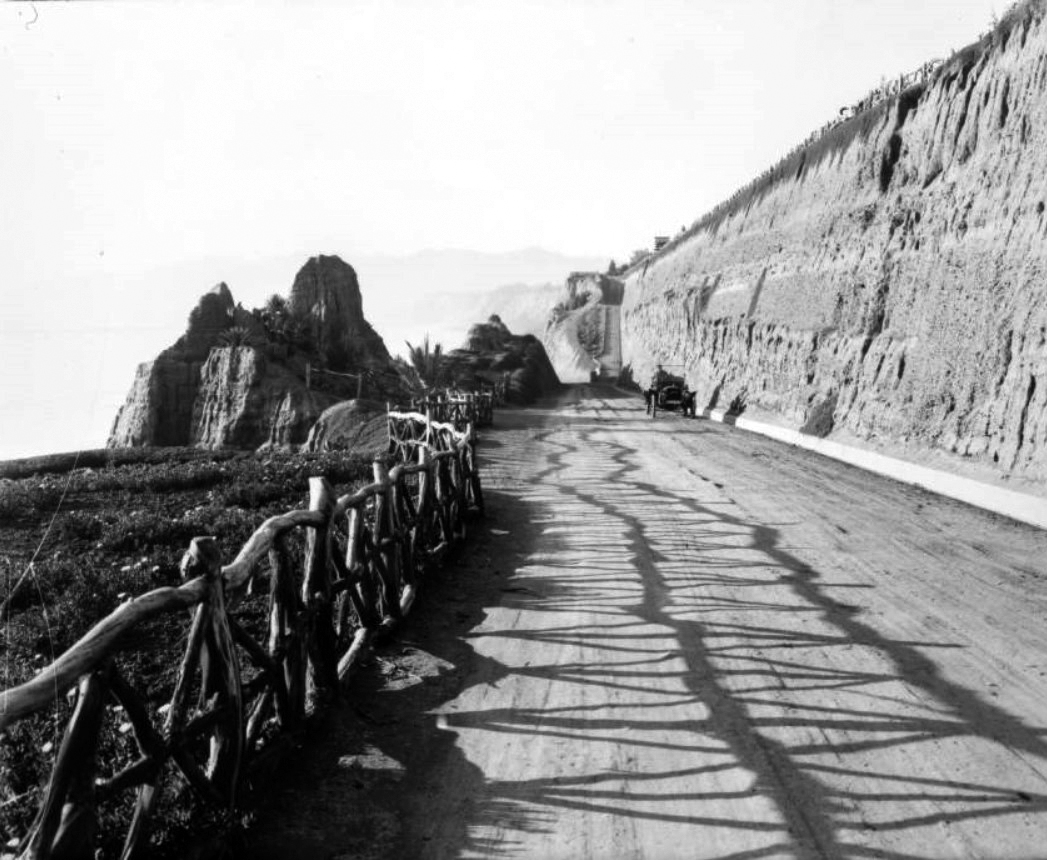
| (1910s)* – View showing an automobile driving south up the California Incline in Santa Monica. The rustic fence is on the left, and the bluffs on the right. Note the pedestrian trail at center-top. |
Historical Notes This view shows how the California Incline looked after a few years of regular use. The dirt surface is more defined, the rustic fence along the outer edge continues the style of Palisades Park above, and an automobile climbs the grade with the high bluffs rising on the inside. Above the road, a separate pedestrian trail can be seen cutting across the slope, giving walkers their own route between park and beach. Together these features show how Santa Monica tried to balance early car traffic with pedestrian access long before modern ideas about complete streets and shared corridors. |
 |
|
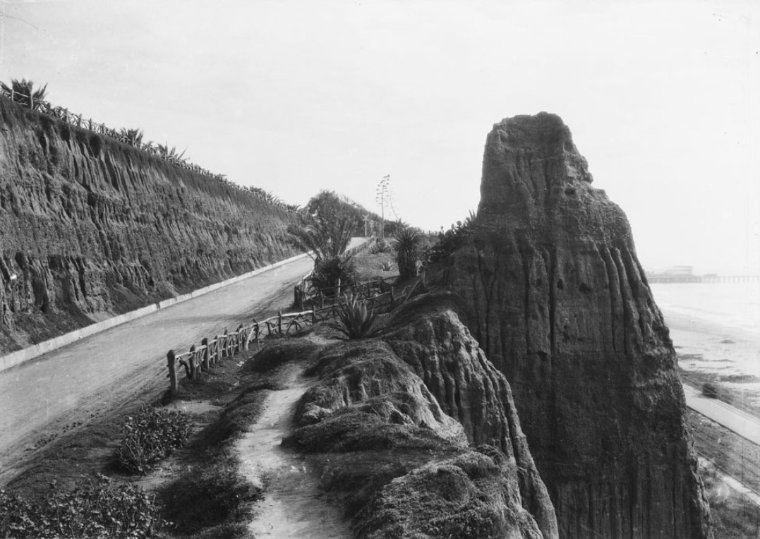
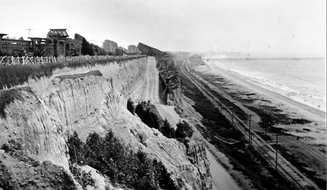
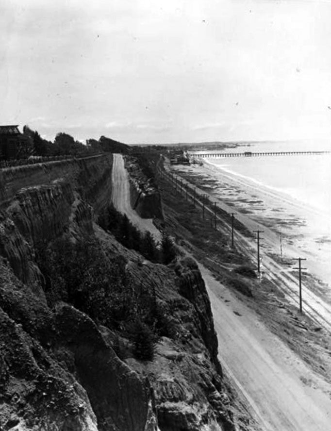
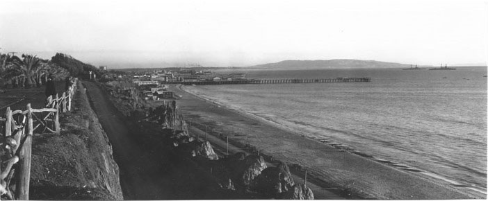
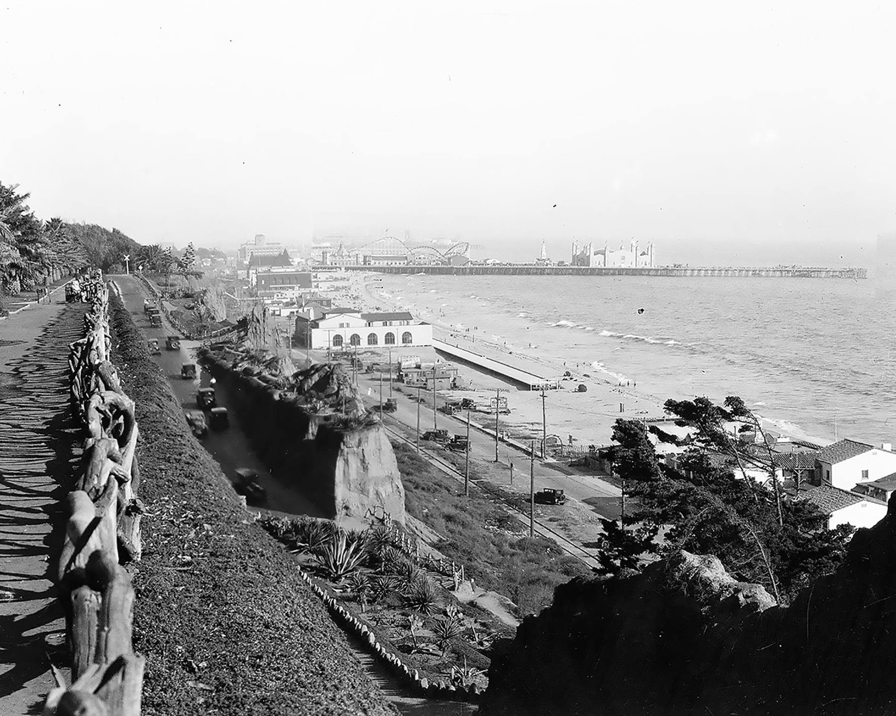
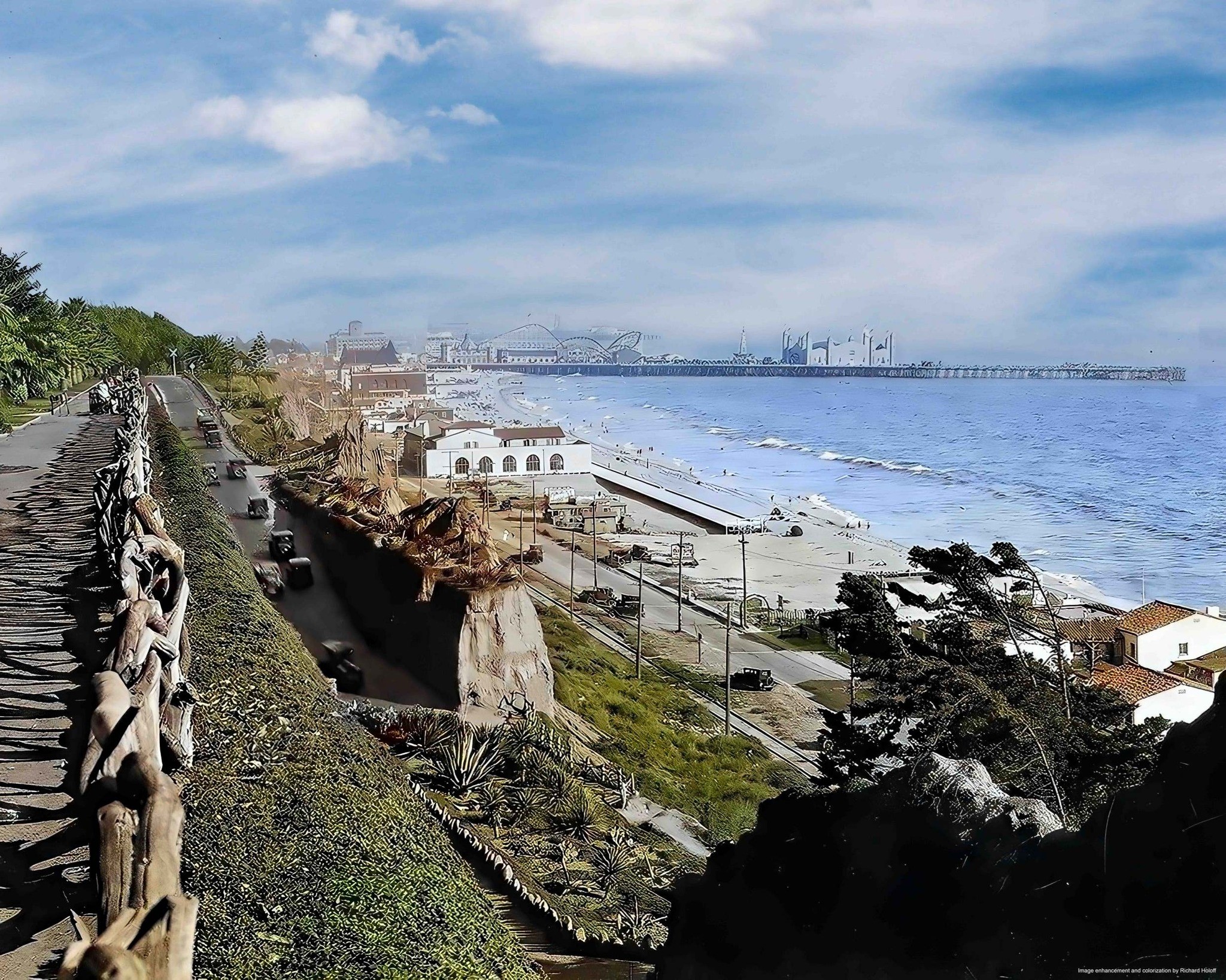
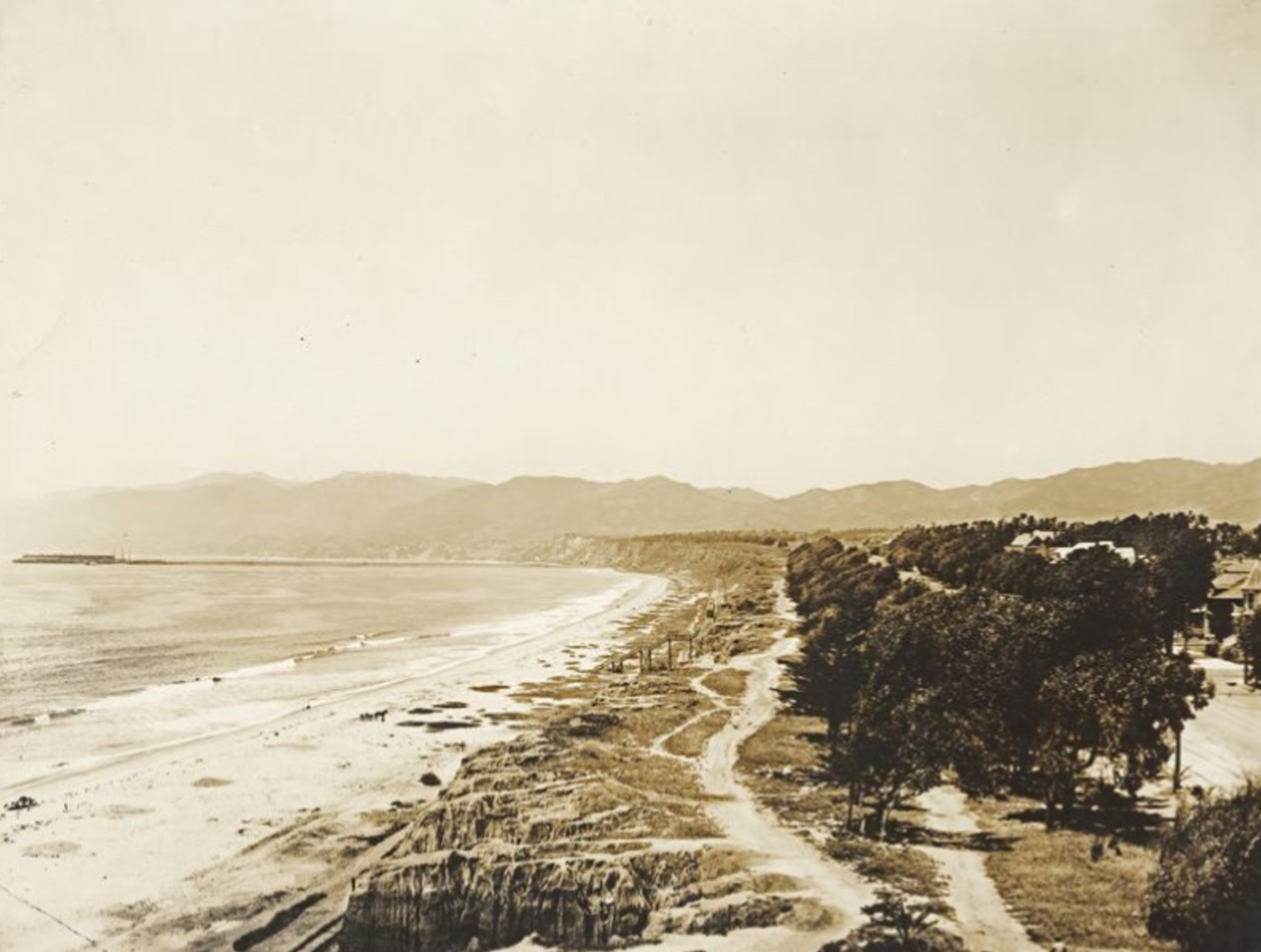
| (ca.1910)* - View showing the Santa Monica coastline, looking south from Linda Vista Park (later Palisades Park). The palisades are at left and are a line of steep, rocky cliffs. A twisted wood fence runs along the top edge of the cliff, and several wooden structures can be seen beyond the fence. A wide unpaved road runs up the face of the cliffs at center. At right, the ocean is visible. A set of railroad tracks and Beach Road (later Roosevelt Highway and the Pacific Coast Highway) can be seen at center, running parallel to the shoreline down to where Santa Monica Municipal Pier (1909) juts out into the water. |
Historical Notes From the bluff top the new road down the cliff stands out as a wide diagonal cut, while Beach Road and the Southern Pacific tracks trace the shoreline below toward the newly built Santa Monica Municipal Pier of 1909. This image makes clear how the California Incline was part of a layered system of movement: trains and wagons on the beach road, pedestrians and carriages on the pier, and people strolling behind the twisted wooden fence along the edge of Linda Vista Park. The view south also hints at the rapid growth that would soon fill the beachfront with bathhouses, beach clubs, and amusement piers at Ocean Park. |
 |
|
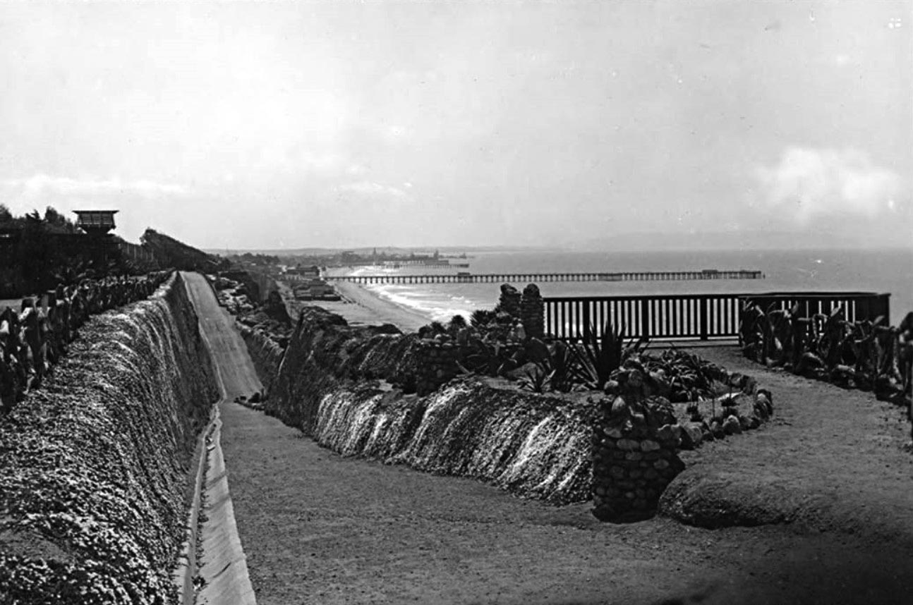
| (1910s)* - View from Palisades Park looking down a pedestrian trail that intersects the California Incline road, with the beach, and Santa Monica Pier and Ocean Park amusement piers in the background. Note the observation deck at right. |
Historical Notes Here the focus shifts from the roadway to the people using the bluffs themselves. A narrow pedestrian trail descends from Palisades Park and meets the California Incline, giving walkers a direct route down to the sand. In the distance the Santa Monica Pier and the busy amusement piers of Ocean Park line the horizon, showing how popular the shoreline had become as a regional playground. The small observation deck along the trail is another reminder that the bluffs were treated as a scenic overlook as much as a transportation corridor. |
 |
|
| (ca. 1905)* - View looking down the California Incline road in Santa Monica towards the beach and railroad tracks. The Southern Pacific Railroad ran steam engines along these tracks between Los Angeles and the Long Wharf (seen in distance at left). A few telephone poles can also be seen, as well as the wagon trail that ran alongside the railroad tracks. |
Historical Notes Seen from partway up the grade, the California Incline drops onto Beach Road, where a set of Southern Pacific tracks runs toward the Long Wharf. At this date steam trains still served both the wharf and passenger stations along the bay, while wagons used the dirt track beside the rails. The telephone and telegraph poles that line the right side of the image show how fast communication technology arrived at the shore, even before the road itself was paved. The photograph captures a transitional moment when heavy rail, wagons, and the first automobiles all converged at the foot of the same cliff. |
 |
|
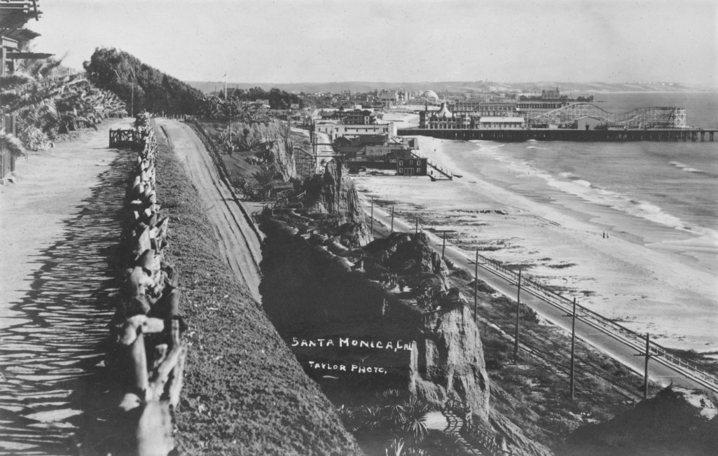
| (ca. 1910)* - View looking south at the California Incline road coming down from the bluffs to the beach, in Santa Monica. The Santa Monica Municipal Pier (1909) is in the distance. Railroad tracks can be seen running along the beach road below. |
Historical Notes Looking south, the California Incline appears as a straight ribbon descending to the beach where trains and vehicles travel along the coast road. The Santa Monica Municipal Pier, opened in 1909, is visible in the distance with its early utility-pier structure later joined by pleasure piers and amusement attractions. This image helps place the incline within the larger geography of the bay, showing how it funneled traffic not only to the open beach but also directly toward the growing entertainment district around the pier. |
 |
|
| (1912)* – View looking up the California Incline from near the tracks along the beach. |
Historical Notes By 1912 the California Incline had become a well used route cut into the steep sandstone face of the Palisades. Seen from track level at the bottom, the grade looks imposing and shows the challenge of building a dependable road on unstable coastal bluffs. Utility poles and wires run along the railroad and beach road at the foot of the cliffs, while the incline above remains simple and unpaved, with only scattered plantings and no retaining walls or concrete curbs. This early simplicity helps explain why later decades brought repeated projects to strengthen the bluffs and widen the roadway as traffic and erosion increased. |
 |
|
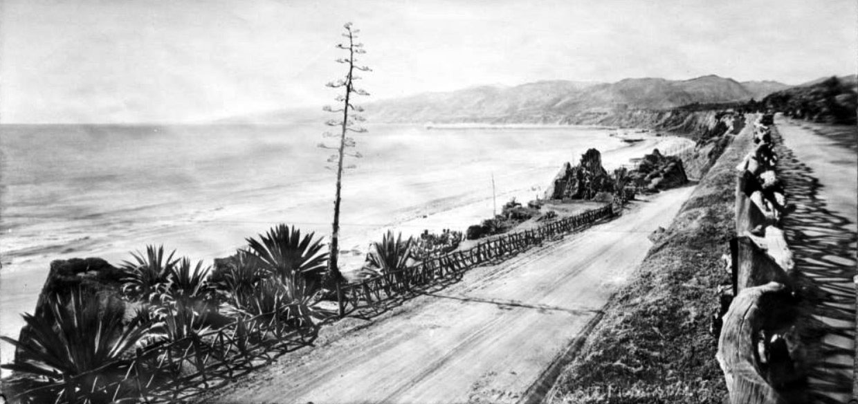
| (ca. 1913)* - Panoramic view of Santa Monica Beach looking north from the California Street incline. The ocean and shore are visible to the left, down from the cliff along which a paved road runs, lined to either side by a post-and-rail fence made from rough-cut branches. A second, higher road stands directly next to the first, at the right. Mountains are visible stretching out into the water in the background. Plants that appear to have been put there rather than growing naturally stand along the left side of the road. |
Historical Notes In this panorama a paved road hugs the base of the bluffs while a second, higher road runs alongside it, both lined with the characteristic rough-cut post and rail fence. Newly planted shrubs and trees soften the edge between road and cliff, part of a broader city effort to landscape the route for visitors arriving by carriage or car. The mountains angling into the sea remind viewers that this was still the edge of the Santa Monica Mountains, not yet hidden by dense development. Together the two roads show how the area around the incline was evolving into a scenic drive as well as a practical connection between the city grid and the coast highway. |
 |
|
| (1915)* – View of two horse-drawn wagons hauling freight up the California Incline. |
Historical Notes Even as automobiles became more common, freight in Santa Monica still often moved by horse and wagon. This 1915 scene shows two heavily loaded wagons grinding their way up the California Incline, using the new shortcut to reach the commercial streets at the top of the bluffs. The combination of animal power, early road engineering, and the dramatic setting conveys how recent the shift from farm and ranch economy to beach town really was. It also illustrates why the city soon had to improve the road surface and width: the incline was carrying everything from beachgoers to building materials. |
 |
|
| (1916)* – Photo of the California Incline showing a man next to an early model convertible taking on the view of the beach and ocean below. Also seen is a horse-drawn wagon making its way up the incline. LA Times Photo Archives |
Historical Notes Here a man stands beside an open touring car to admire the sweeping view of the ocean while a horse-drawn wagon labors up the incline behind him. The photograph was taken only a few years after the Santa Monica Municipal Pier opened and the same year the Looff Hippodrome carousel building was completed on the adjacent pleasure pier. The scene sums up a moment when Santa Monica marketed itself as both a modern motor destination and a traditional seaside resort, with the California Incline as a scenic driveway between city and shore. |
 |
|
| (1910s)* – Postcard view looking down the California Avenue Incline with the Long Wharf (1893 – 1920) seen in the distance. A man, a woman, and a child are posing for the camera at left. On the right, two people with ‘cool’ looking hats are standing behind the rustic wood fence at Linda Vista Park, which by 1920 was known as Palisades Park. |
Historical Notes This postcard view, posed with figures at the fence, was aimed at tourists who wanted a souvenir of the dramatic drop from Linda Vista Park to the beach. The road appears well worn by this time, and the rustic fence has become part of the visual identity of the park. The Long Wharf can still be seen far to the north, though by the late 1910s its days as an active cargo pier were nearly over and sections were already being removed. Images like this helped fix the relationship between city, bluffs, and wharf in the public imagination just as the port itself was fading from use. |
 |
|
| (ca. 1920)^^ - Panoramic view shows two people standing by the fence along Palisades Park looking south toward the Santa Monica Pier and the Palos Verdes Peninsula. Another person is seen walking along the fence-lined path. Two large ships are seen between the pier and peninsula. |
Historical Notes By about 1920 Palisades Park had been formalized with walkways, plantings, and viewpoints, but it still retained its earlier rustic fencing and open bluffs. From this vantage the Santa Monica Pier dominates the scene, with the Palos Verdes Peninsula faint on the horizon and ships visible offshore. The photograph shows how the coastline had become busier with marine traffic and recreation, even as the park above remained a relatively quiet promenade for residents and visitors. The long sightline south also emphasizes how important the elevated park was for experiencing the coastline before high-rise development arrived. |
 |
|
| (ca. 1920)* - View looking down from Linda Vista Park (Palisades Park) showing the California Incline. A bit of the Camera Obscura on the left edge, with the Looff Hippodrome, Dome Theater, Roosevelt Highway (Pacific Coast Highway) seen below. |
Historical Notes This view looks straight down on the California Incline from Palisades Park and catches several key landmarks. At the top left sits the Camera Obscura, a popular optical attraction that had been moved from the beach up to the park in the early 1900s. Below on the pier stands the Looff Hippodrome carousel building, completed in 1916 as part of the Looff Pleasure Pier. Roosevelt Highway, later known as Pacific Coast Highway, runs along the base of the bluffs, underscoring the growing importance of coastal motoring. Together these elements show how the incline linked new entertainment venues on the pier with the older bluff-top park. |
 |
|
| (1920s)^ - Postcard view showing the California Incline and Palisades bluffs, lined with rustic wood fence, leading down to the beach at Santa Monica. |
Historical Notes By the 1920s the California Incline had become a familiar image in postcards that promoted Santa Monica as a scenic gateway to the coast. The road is now well defined and lined along its full length with the rough-hewn fence that appears in so many views of the bluffs. Cars share the road with occasional wagons while pedestrians still use nearby trails and park paths. The postcard reflects how the incline itself had become a landmark, not just a convenient street, and helped advertise Santa Monica’s combination of coastal cliffs and easy beach access. |
 |
|
| (1924)^ - View showing two early model cars driving up the California Incline with pedestrian trail seen in the background. |
Historical Notes In this 1924 view the California Incline is clearly an automobile route, with two early cars climbing the grade while the Idaho Trail can be seen cutting across the bluff behind them. The coexistence of a dedicated footpath and a busy road reflects the original three-incline concept approved in 1905, which aimed to separate pedestrians from vehicles for both safety and comfort. The maturing plantings on the slopes hint at ongoing efforts to stabilize the bluffs and reduce erosion even before modern engineering methods were adopted. |
 |
|
| (ca. 1925)* - California Incline with the Santa Monica Pier and Amusement Park in the distance. |
Historical Notes By the mid-1920s the Santa Monica Pier complex and the amusement zone around Ocean Park had grown into major attractions, and the California Incline served as a direct visual and physical link between the city and this entertainment waterfront. From the incline motorists could see the pier’s rides and lights ahead as they descended, making the drive itself part of the outing. At the same time, increased traffic along Roosevelt Highway and the beachfront was beginning to expose the limitations of the original narrow grade, setting the stage for the widening projects at the end of the decade. |
 |
|
| (ca. 1925)* - California Incline with the Santa Monica Pier and Amusement Park in the distance. Image enhancement and colorization by Richard Holoff. |
Historical Notes This colorized rendering of the 1920s incline emphasizes the warm tones of the bluffs, the green park above, and the bright seaside light that drew visitors to Santa Monica. While the colors are modern additions, the underlying photograph remains an important record of the incline at its peak pre-widening form, with the now famous pier complex already established in the distance. |
 |
|
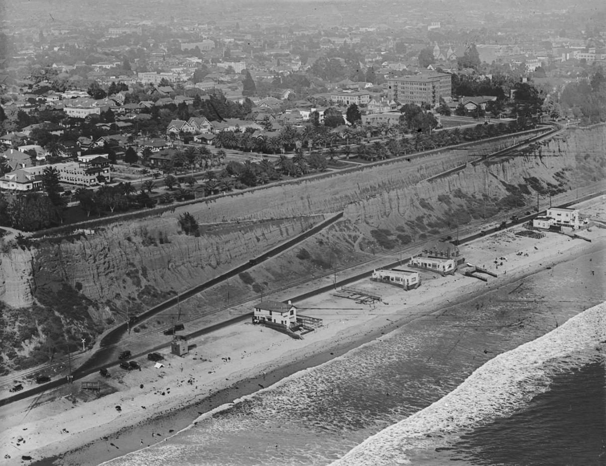
| (1920s)* - Aerial view of Santa Monica’s coastline showing the California Incline cutting through the bluffs, with a handful of beach clubs and homes along the shore, palm-lined Palisades Park above, and early residential development spreading inland. Photo by Dunning Air from the Ernest Marquez Collection. |
Historical Notes The aerial view from the 1920s shows how the California Incline carved a single direct line through the bluffs at a time when only a handful of beach clubs and houses dotted the shoreline. Roosevelt Highway runs at the base of the cliffs, with open sand extending seaward and Palisades Park lined with palms above. Inland, street grids and early residential districts are beginning to spread, signaling Santa Monica’s rapid growth as both a resort and a commuter suburb. This image helps explain why improving the incline and the coast highway soon became a priority for state and local officials. |
* * * * * |
Late 1920s Improvements |
Widening the California Incline and Roosevelt Highway |
 |
|
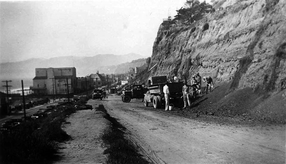
| (ca. 1929)* – View showing construction crews working on widening both Roosevelt Highway and the California Incline. |
Historical Notes Here workers and equipment are busy cutting back the bluffs and widening both Roosevelt Highway and the California Incline. The project, carried out around 1929 and 1930 by the state Division of Highways, was part of a larger effort to upgrade the coastal route that would soon be formally dedicated as the Theodore Roosevelt Highway and later signed as U.S. 101 Alternate before becoming California State Route 1. These improvements recognized that the once local beach road and narrow incline had become important regional links for motorists traveling between Los Angeles and points north along the coast. |
 |
|
| (ca. 1929)* – View showing construction crews working on widening the California Incline. |
Historical Notes This closer view focuses on the California Incline during the same late nineteen-twenties widening project. Crews are cutting into the sandstone bluff, building up the outer edge, and preparing a broader, smoother surface suitable for the growing flow of cars and trucks. The work marks the incline’s transformation from a modest dirt shortcut into a fully engineered highway connection, anticipating later decades when it would be rebuilt again to meet changing safety and seismic standards. It is an early example of how coastal roads along the Pacific would require repeated rebuilding as traffic increased and knowledge about bluff stability improved. Click HERE to see more early views of the California Incline (1930 +). |
* * * * * |
A Century of Change |
The California Incline Then and Now |
 |
|
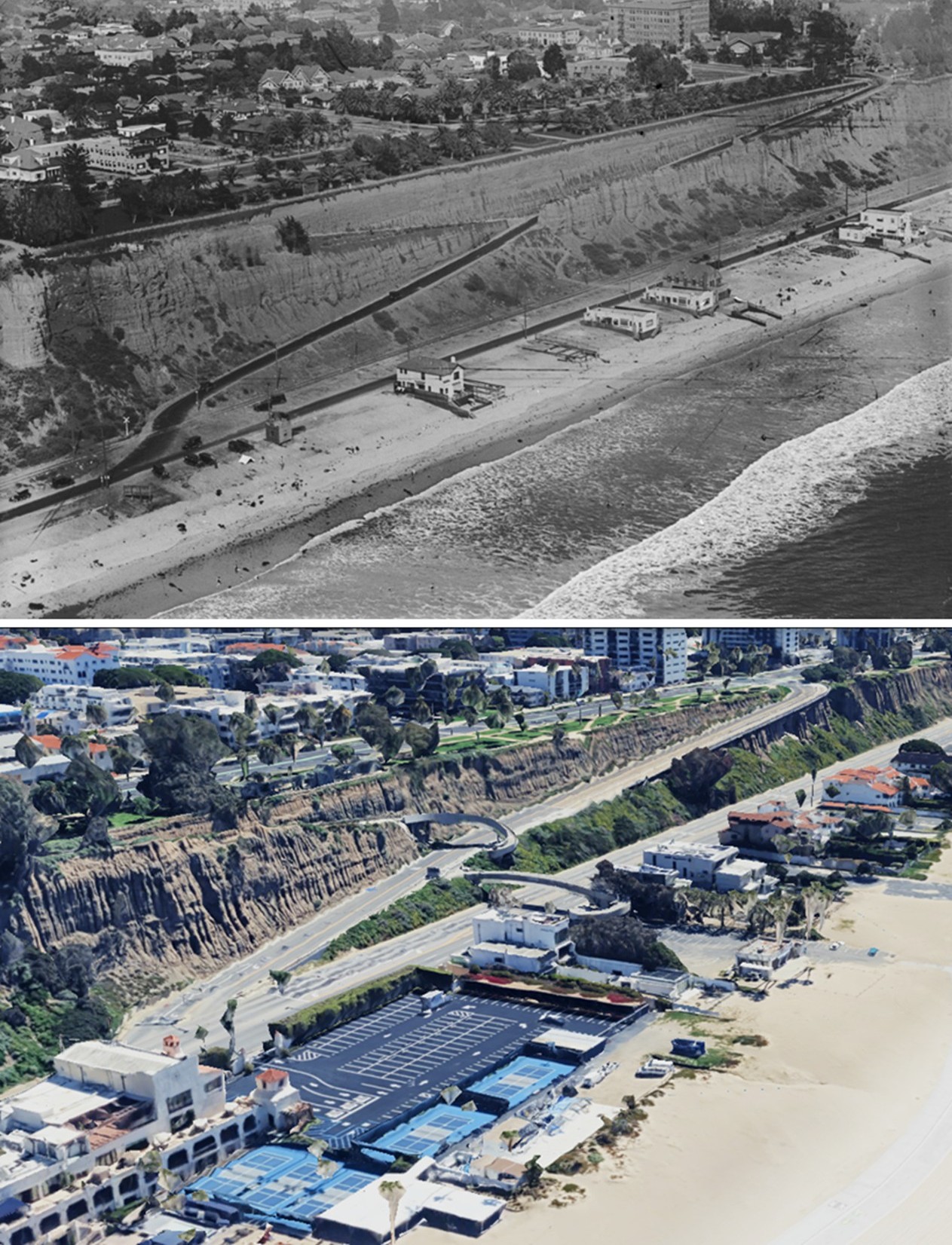
| (1920s vs. 2020s)* – Aerial Then and Now Comparison of the California Incline and Santa Monica Beachfront. Photo comparison by Jack Feldman. |
Historical Notes A full century separates these two views—100 years of change captured from above. In the earlier scene, Roosevelt Highway hugs the base of the Palisades, with just a scattering of beach structures. Fast forward to the 2020s, and the modern image reveals an expanded Pacific Coast Highway (CA–1), a reinforced and wider California Incline, and two pedestrian bridges now linking Palisades Park to the shore. The bluffs have filled in with development, and the beach appears noticeably wider. The increase in beach width is largely the result of sand replenishment efforts, which began in the mid-20th century as part of coastal management programs aimed at combating erosion and maintaining recreational shorelines. These projects, often involving offshore dredging and sand transport, have helped preserve and even expand the usable beachfront along much of Santa Monica Bay. |
Then and Now
 |
|
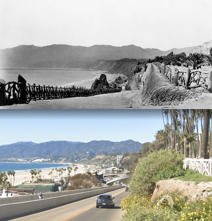
| (1905 vs. 2022)* - A 'Then and Now' comparison view of the California Incline. Photo comparison by Jack Feldman. |
Historical Notes In 1905, City Engineer Thomas H. James’ plan for three bluff inclines was approved. A footpath from Idaho Avenue and a vehicle road from California Avenue joined halfway down the bluff to form what is now the California Incline. A second pedestrian-only incline at Oregon Avenue (now Santa Monica Boulevard) became known as the Sunset Trail in 1916, while the Idaho path was renamed the Idaho Trail. All three routes were outfitted with rustic safety railings, including along the bluff edge of Palisades Park. |
Then and Now
 |
|
| (1915 vs 2024)* – Freight on the California Incline, then and now. Photo comparison by Jack Feldman. |
Historical Notes In the 1915 view, two horse-drawn wagons make the slow climb up the original dirt incline, using the bluff road as a practical route for hauling goods between the beach road and Santa Monica’s growing business district above. Lumber, produce, and building materials all moved this way before trucks became common, and the incline served as one of the few direct links between the shoreline and the top of the Palisades. The modern scene shows how the purpose of the incline has continued even as the city has changed. Where horses once strained up the grade, loaded trucks now move steadily along the rebuilt concrete structure. The shift from animal power to motor freight reflects Santa Monica’s growth and the repeated engineering work needed to keep this connection safe. What began as a narrow dirt cut into the bluff is now a widened, reinforced roadway carrying thousands of vehicles daily, yet its basic role—moving people and goods between Ocean Avenue and the coast—remains the same more than a century later. |
Then and Now
 |
|
| (1924 vs. 2022)* - A ‘Then and Now’ comparison of the California Incline. In the 1924 view, a narrow pedestrian path known as the Idaho Trail descends from Idaho Avenue down Santa Monica’s bluffs, hugging the cliffside above the roadway. Nearly a century later, the 2022 photo shows its modern counterpart—the sculptural Idaho Avenue Pedestrian Overcrossing—spiraling gracefully over the California Incline, continuing the legacy of foot access from Palisades Park to the beach below. Photo comparison by Jack Feldman. |
Historical Notes The Idaho Avenue Pedestrian Overcrossing traces its origins to the early 20th century, when the Idaho Trail—formerly known as Linda Vista Walk—was established as a pedestrian path from Idaho Avenue down Santa Monica’s bluffs. This trail was part of a larger 1905 plan by City Engineer Thomas H. James, which included three inclines to improve beach access from Palisades Park. The Idaho Trail was designed exclusively for foot traffic and featured rustic fencing for safety, serving as a vital pedestrian link to the beach alongside the vehicular California Incline. By the mid-20th century, increased automobile traffic on the California Incline and Pacific Coast Highway created a need for a safer pedestrian route. In 1957, a dedicated pedestrian overcrossing was built to span the busy roadway, protecting foot traffic from the growing hazards below. Over time, this bridge, like the original incline, became structurally outdated and seismically vulnerable, prompting plans for its replacement as part of a broader infrastructure upgrade. |
Then and Now
 |
|
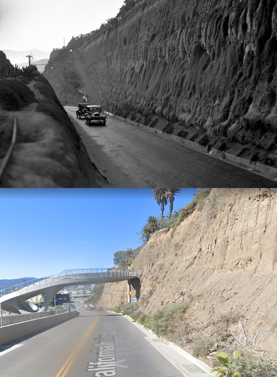
| (1905 vs. 2024)* – A ‘Then and Now’ comparison of the California Incline. In the 1910 photo, the California Incline meets Beach Road, which ran parallel to tracks built by Southern Pacific Railroad Co. that led to the Long Wharf—faintly visible in the distance along the shoreline. Over a century later, the 2024 view from the Idaho Avenue Pedestrian Overcrossing shows the same location transformed, where the Incline now intersects with the heavily trafficked Pacific Coast Highway. Photo comparison by Jack Feldman. |
Historical Notes The California Incline underwent a significant reconstruction and reopened in 2016 after being deemed structurally deficient in the early 1990s. The new structure features a 750-foot-long reinforced concrete slab supported by 96 deep concrete piles and over 1,000 soil nails to stabilize the erosion-prone sandstone along the bluff. The updated Incline accommodates three lanes of traffic and includes a 16-foot-wide separated path for pedestrians and cyclists. As part of the reconstruction, the 1957-built Idaho Avenue Pedestrian Overcrossing was replaced with a modern, structurally sound bridge. The new curvilinear structure, featuring a signature V-shaped pier, connects Palisades Park to the beach, enhancing safety and accessibility for pedestrians. |
Then and Now
 |
|
| (1957 vs. 2025)* – Looking up the California Incline toward the pedestrian crossing that connects the Palisades Park at the top to the bridge crossing Pacific Coast Highway. Photo comparison by Jack Feldman. |
Historical Notes The original Idaho Avenue Pedestrian Overcrossing was completed in 1957, giving beachgoers a safe way to cross the California Incline from Palisades Park without mixing with automobile traffic. It connected directly to a second structure, the California Incline Pedestrian Overcrossing, which spanned Pacific Coast Highway and led to the beach below. Together, the two bridges formed a continuous pedestrian route from Ocean Avenue to the shoreline. Both bridges were rebuilt in 2016 as part of the California Incline reconstruction project. The upper bridge was redesigned in a graceful curved form that follows the contour of the bluff, while the lower bridge over PCH was realigned and strengthened to meet modern seismic and accessibility standards. Today, the two crossings function as one continuous system linking Palisades Park with the beach, preserving the route’s historic purpose while enhancing its safety and visual appeal. Click HERE to see more early views of the California Incline (1930 +). |
While the California Incline carried wagons and automobiles down the bluffs, other routes nearby were designed for pedestrians. One of the most popular of these was Sunset Trail, a steep footpath that connected Palisades Park with the beach below. |
* * * * * |
Sunset Trail |
One of the Earliest Pedestrian Routes from the Palisades to the Beach |
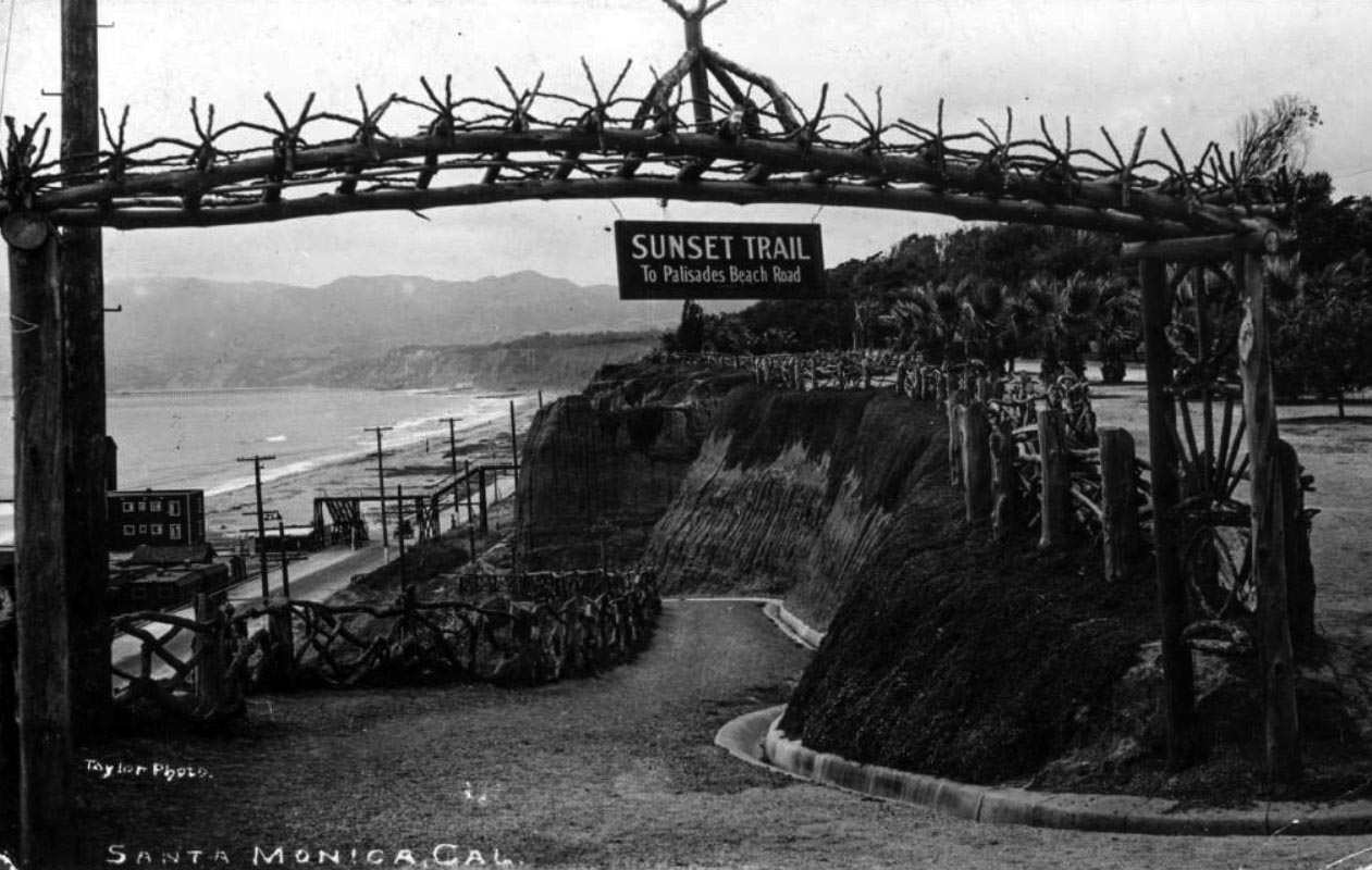
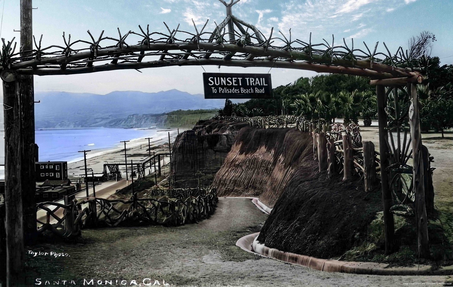
Before the California Incline provided a roadway for wagons and automobiles, most visitors reached Santa Monica’s beach from the bluff tops by footpaths and stairways cut into the steep coastal cliffs. One of the best known of these routes was Sunset Trail, a narrow pedestrian path that descended from Linda Vista Park (today’s Palisades Park) to the strip of shoreline known as Palisades Beach Road below.Located a short distance south of the later California Incline, Sunset Trail served walkers rather than vehicles. Marked by a rustic wooden arch and bordered by fences made from twisted tree branches, the trail reflected the naturalistic landscape style used throughout the park. Visitors followed the winding dirt path down the bluff to the beach road and the railroad tracks that ran along the sand toward the Southern Pacific Long Wharf. Nearby stairways such as the 99 Steps continued the descent to the beach itself.Although the California Incline eventually became Santa Monica’s primary route for automobiles, Sunset Trail remained the pedestrian counterpart nearby, offering one of the most scenic ways to move between the bluff top promenade and the busy shoreline below. |
 |
|
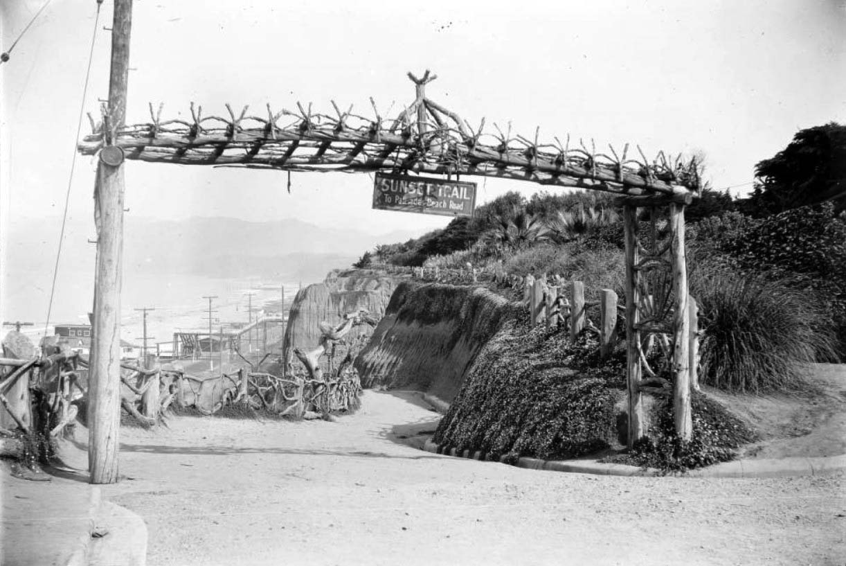
| (1910s)* - View of Sunset Trail from Linda Vista Park (present-day Palisades Park) to Palisades Beach Road in Santa Monica. A sign hangs from a rustic wooden archway that reads "Sunset Trail to Palisades Beach Road." The 99 Steps can be seen over the Beach Road (later part of Pacific Coast Highway) at left and the Long Wharf is visible in the distance. |
Historical Notes Sunset Trail began at the edge of Linda Vista Park, the bluff-top open space that Senator John P. Jones and the Santa Monica Land and Water Company donated to the city in the 1890s so it would remain a public promenade above the sea. The park was gradually landscaped in the spirit of the City Beautiful movement, with winding paths, plantings, and rustic fences made from twisted branches. The wooden arch in this view announces “Sunset Trail to Palisades Beach Road” and marks one of the steepest pedestrian routes down the bluffs. Below, Beach Road and the railroad tracks run along the sand toward the Southern Pacific Long Wharf in the distance. The set of stairs known as the 99 Steps drops from the lower end of the trail to the beach itself, giving visitors a direct connection from the park to the shoreline and the early bathhouses and cottage streets along what was sometimes called Sunset Beach. |
 |
|
| (1910s)* - View of Sunset Trail from Linda Vista Park (present-day Palisades Park) to Palisades Beach Road in Santa Monica. A sign hangs from a rustic wooden archway that reads "Sunset Trail to Palisades Beach Road." The 99 Steps can be seen over the Beach Road (later part of Pacific Coast Highway) at left and the Long Wharf is visible in the distance. Image enhancement and colorization by Richard Holoff. |
Historical Notes This colorized version of the Sunset Trail entrance helps modern viewers imagine the scene as early visitors experienced it. The green of the bluff-top lawn, the dark foliage of the palms, and the warm tones of the sandstone cliffs all emphasize how closely the rustic trail was tied to its natural setting. The twisted branch fence and rough timber arch were deliberate design choices meant to make the man-made path feel like part of the landscape rather than a formal staircase. Even so, the trail carried steady traffic between the park and the busy beachfront below, where Beach Road, the railroad, and the Long Wharf made this part of Santa Monica an important corridor for both recreation and commerce. |
 |
|
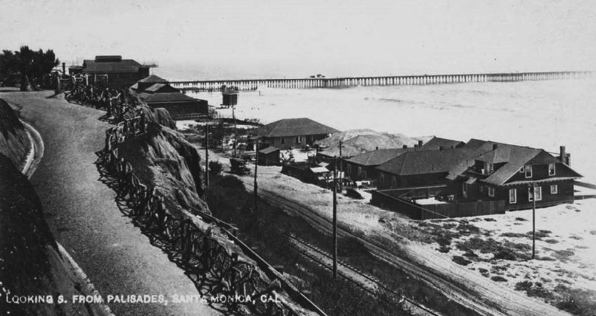
| (1910)* - Postcard view showing houses, a dirt coast road, an automobile and railroad tracks along the beach at Santa Monica, with the Santa Monica Municipal Pier (built in 1909) in the background. The Sunset Trail is seen on the left. |
Historical Notes This postcard shows how many different kinds of movement crowded the narrow strip between the bluffs and the ocean in the years just after 1910. A car and horse-drawn vehicles share the dirt coast road while a railroad line hugs the edge of the beach, carrying passengers and freight toward the Long Wharf and points north. On the left, the line of Sunset Trail drops sharply from the bluffs, meeting Beach Road close to the new Santa Monica Municipal Pier, which had opened in 1909 as a utility pier for sewer outfalls and city pipes. Small houses and beach cottages stand between the road and the sand, illustrating how the shoreline was starting to fill in with year-round development, even as the trail and park above still offered a largely open, rustic experience. |
 |
|
| (1914)* - Image of the rustic fence from Linda Vista Park (later Palisades Park) leading down to the Beach Road (later Pacific Coast Highway) with a horse-drawn wagon parked next to houses along Sunset Beach. The Santa Monica Municipal Pier is visible in the distance. |
Historical Notes The foreground fence, built from rough tree limbs and posts, is the signature style of early Linda Vista Park. It guided walkers safely along the bluff edge while preserving unobstructed views of the ocean. The same rustic look continued down the slope along Sunset Trail, where the path zigzagged past agaves and other hardy plantings on its way to Beach Road. At the bottom of the hill, a horse-drawn wagon is parked near modest homes that front the sand at Sunset Beach. Farther out, the Santa Monica Municipal Pier stretches into the bay. A few years later, amusement operator Charles Looff would add a wider pleasure pier with a carousel and other attractions just south of the municipal structure, and together the two would come to be known simply as the Santa Monica Pier. |
 |
|
| (ca. 1920)* - Entrance to the Sunset Trail at Santa Monica's Palisades Park (originally Loma Vista Park). The trail is at center and heads down the steep face of the cliffs that give the park its name. The trail is bordered on the left side by a wooden fence made from twisted tree branches. The entrance to the trail is marked by a large wooden sign supported by a wooden framework made of tree trunks. The tops of the cliffs are at right and are covered with an assortment of bushes, and the ocean is visible in the background at left. The Pacific Coast Highway is at the base of the trail in the background at left and is lined with utility poles and beach houses. Sign reads: "SUNSET TRAIL - To Palisades Beach Road" |
Historical Notes By about 1920 Linda Vista Park had been renamed Palisades Park, but the entrance to Sunset Trail still kept its earlier rustic character. A heavy wooden frame made from unpeeled tree trunks supports the sign, and the fence along the path continues the theme, using crooked branches instead of formal rails. The intention was to make the trail feel like a natural canyon path, even though it was carefully engineered into the face of the bluff. At the bottom of the trail the once simple Beach Road had evolved into a busier coastal route lined with beach houses and utility poles. Within a few years this road would be improved and dedicated as Roosevelt Highway and later become part of Pacific Coast Highway, carrying motorists along the same strip of sand that walkers and wagon drivers once used. Sunset Trail remained the pedestrian counterpart to these changes, offering a direct foot route between the park lawns and the shoreline. |
 |
|
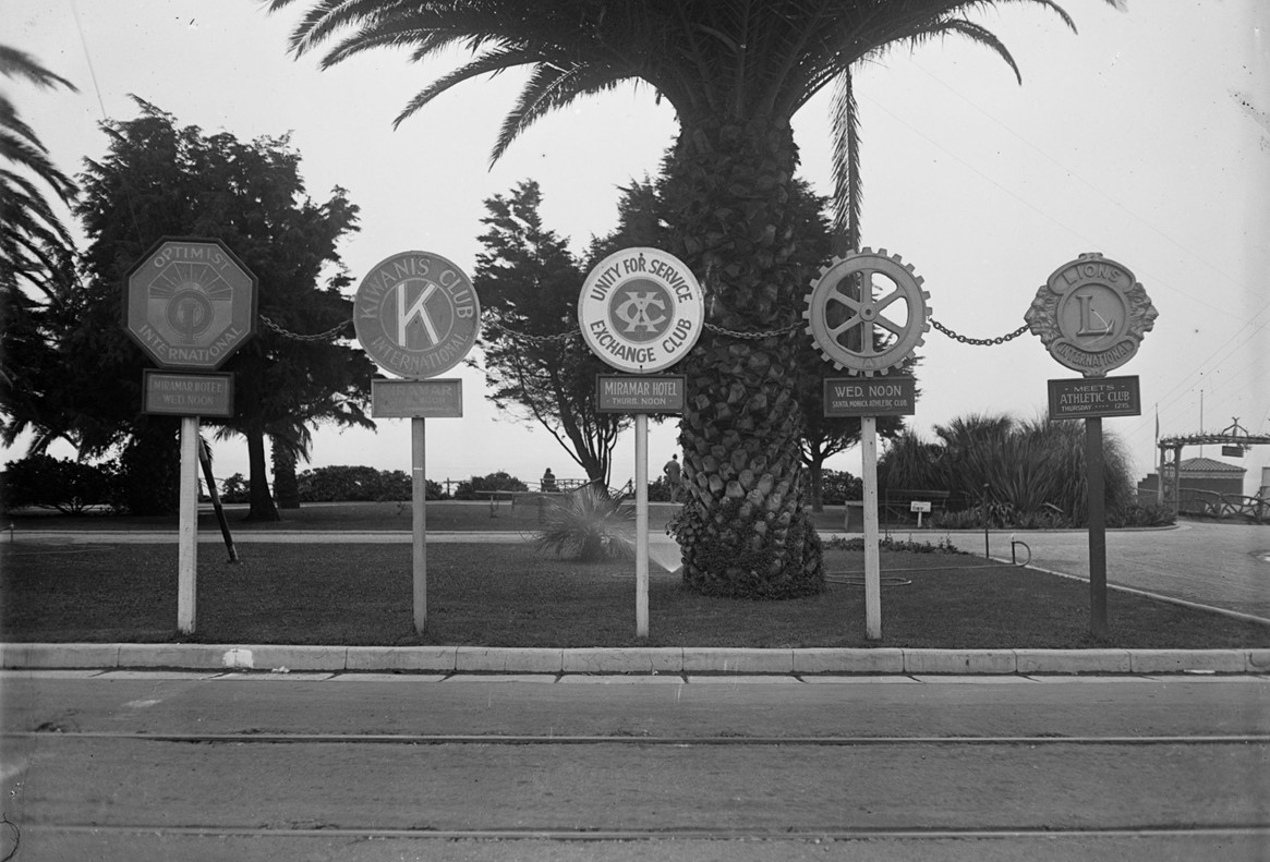
| (1920s)* – A view looking west at service club signs posted at the edge of Palisades Park in Santa Monica. Represented clubs include Optimist International, Kiwanis Club, Exchange Club, Rotary International, and Lions Club. To the right, a rustic wooden archway marks the entrance to Sunset Trail, which leads down the bluff to the beach. Photo from the Ernest Marquez Collection. |
Historical Notes In the 1920s Santa Monica promoted itself as a modern, civic-minded city, and the cluster of service club signs at the edge of Palisades Park reflects that spirit. Groups like the Rotary, Lions, Kiwanis, and Optimists were proud to announce their presence to motorists and pedestrians moving along Ocean Avenue and the bluff-top paths. Just beside these emblems of civic boosterism stands the familiar arch for Sunset Trail. Its rough wood construction contrasts with the neatly painted metal signs and underscores how the bluffs served two roles at once. They were both the city’s front porch, where organizations advertised their good works, and a rustic gateway to the beach, where the trail led down through the palms and agaves to the sand and coastal road below. |
 |
|
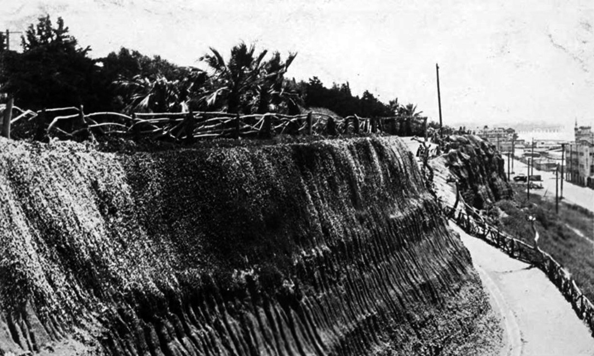
| (ca. 1920s)* - View of the Palisades bluffs above the beach, with a rustic wood fence, and palm trees in Palisades Park. The Sunset Trail path is on the right; a woman is walking down it in the background. The coast road (later part of Pacific Coast Highway) and buildings on the beach are also in the view. |
Historical Notes This view shows Sunset Trail in everyday use rather than as a posed postcard subject. A woman makes her way down the path, following the curve of the bluff toward the beach while palms and drought-tolerant shrubs line the slope around her. Above, Palisades Park is shaded by palm trees and framed by the same twisted branch fence seen in earlier decades, tying the whole bluff edge together visually. Below the trail, the coastal road and a row of houses and beach clubs mark how much busier the shore had become since the trail was first cut. Even so, the path itself still appears narrow and informal, more like a country footpath than a city staircase, reminding us how long Santa Monica tried to preserve a park-like atmosphere along its dramatic ocean cliffs. |
 |
|
| (1950s)* – Postcard view showing Sunset Trail in the early 1950s with Palisades Park (originally Linda Vista Park) seen in upper right. |
Historical Notes By the early 1950s the world around Sunset Trail had changed dramatically. Pacific Coast Highway had been widened and engineered as a major state route, carrying a steady stream of cars between Los Angeles and the coastal communities to the north. New beach clubs, parking lots, and apartment buildings lined the shore, and the sound of traffic filled the canyon formed by the bluffs and the sea. Yet the postcard shows that the basic idea of the trail survived. Walkers could still leave the lawns and palm groves of Palisades Park, pass under the familiar rustic arch, and follow the steep path down to the beach. In an era increasingly defined by automobiles, Sunset Trail remained a reminder of the days when access to the shoreline depended as much on stairs and footpaths as on roads. |
 |
|
| (2018)* - Today’s reinforced walkway, built along the alignment of the old Sunset Trail. |
Historical Notes Although the name and general route survive, the original Sunset Trail no longer exists in its early form. The rustic wooden archway, twisted branch railings, and narrow dirt path that once descended the bluffs were removed as erosion control and safety needs changed over the decades. Today a modern pedestrian walkway occupies roughly the same alignment, reinforced with concrete, steel railings, and retaining walls that stabilize the steep cliffs. What remains is the experience of moving from the bluff top of Palisades Park down toward the beach. Visitors still begin near a signed entrance, walk past agaves and other coastal plants, and descend toward the shoreline after crossing Pacific Coast Highway. More than a century after it first appeared on postcards, Sunset Trail continues to serve its original purpose, even though its historic features have been replaced by modern infrastructure. |
Both the California Incline and Sunset Trail began in the bluff-top park originally known as Linda Vista Park. From this elevated landscape visitors enjoyed sweeping views of the Pacific Ocean and the rapidly developing shoreline below. |
* * * * * |
Linda Vista Park |
Santa Monica’s Historic Bluff Park (later Palisades Park) |
Perched high above the Pacific Ocean, the blufftop landscape now known as Palisades Park began as one of Santa Monica’s earliest public parks. In 1892, city founders Senator John P. Jones and Arcadia Bandini de Baker donated this stretch of coastal bluff to the young seaside town with the condition that it “remain a park forever.” At the time, the windswept bluff was largely barren, offering little more than sweeping views of the ocean, the mountains, and the rapidly developing shoreline below.Over the following decades the area gradually evolved from an open bluff into a landscaped public space. Early stairways and footbridges connected visitors to the beach below, rustic fencing and walking paths appeared along the bluff edge, and trees were planted to soften the rugged terrain. From its elevated vantage point, the park also provided visitors with dramatic views of Santa Monica’s most important coastal landmarks, including the Southern Pacific Long Wharf, the California Incline, and later the Santa Monica Municipal Pier.Renamed Palisades Park in 1915 to reflect the dramatic coastal cliffs that define the shoreline, the park became one of the most beloved gathering places along the Southern California coast. The photographs below trace its early development and reveal how this once windswept bluff became the scenic promenade that continues to overlook Santa Monica Bay today. |
 |
|
| (ca. 1893)* – Sweeping view looking north from the Santa Monica bluffs toward the mountains and the Southern Pacific Long Wharf, which opened in 1893. In the foreground is the newly donated bluffland that would soon become Linda Vista Park—the city's first public park, gifted in 1892 by founders Senator John P. Jones and Arcadia Bandini de Baker. Note the original “99 Steps” footbridge crossing the road and train tracks to the beach below. Ocean Avenue runs along the right, with a few early homes visible. |
Historical Notes Linda Vista Park was established in 1892 when Santa Monica’s co-founders donated this coastal bluff to the city “to remain a park forever.” Though the image card mistakenly dates the photo to 1888, the presence of the Long Wharf confirms it was taken no earlier than 1893. The original “99 Steps” staircase and footbridge were some of the earliest park features, offering a path to the beach long before the California Incline was carved into the bluff around 1905. |
 |
|
| (1909)* – View looking south across Linda Vista Park toward the Santa Monica Municipal Pier. The bluff was still lightly landscaped, with simple paths and early plantings along Ocean Avenue. |
Historical Notes The park's blufftop location was prized for its views but started out barren and windswept. After its dedication in 1892, the city slowly added improvements, including walking paths, trees, and rustic wooden fencing. This area remained known as Linda Vista Park until 1915, when it was officially renamed Palisades Park to reflect the grandeur of its coastal cliffs. |
 |
|
| (ca. 1909)* - View from Linda Vista Park (later Palisades Park), looking south toward the newly constructed Santa Monica Municipal Pier. The park's rustic fencing and early plantings are visible in the foreground. |
Historical Notes Park development picked up in the early 1900s under Park Commissioner E.H. Sweetser, who led major improvements including the planting of Monterey cypress, eucalyptus, and palms. Sweetser even donated his city salary to buy trees. The city built paths, benches, and viewing points that helped establish the park as a local gathering place and visitor attraction. |
 |
|
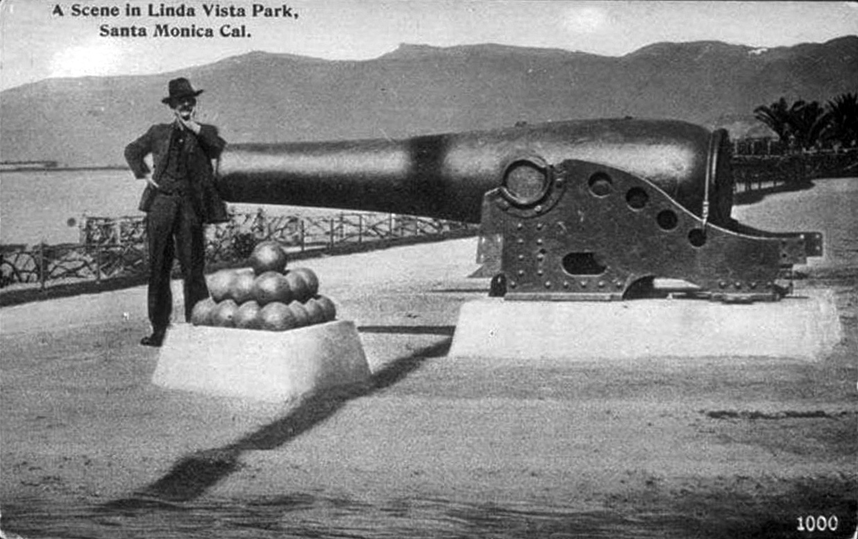
| (1908)* – A man poses beside the large 1861 Rodman cannon installed at Linda Vista Park (now Palisades Park). The cannon, aimed out toward the sea, was brought to Santa Monica from San Francisco as part of a national program to place military artifacts in public parks. |
Historical Notes Designed during the Civil War, the Rodman gun was one of the largest coastal defense cannons of its era. In 1908, Santa Monica received two Rodman guns on loan from the federal government, placing one at the end of Colorado Avenue to become a public curiosity. The cannon helped tie the park’s natural beauty to civic pride and American history, reinforcing the park's role as a centerpiece of public life. |
 |
|
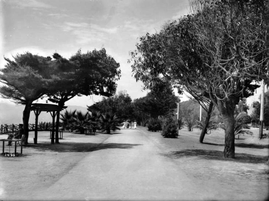
| (ca. 1910)* - Four women stroll along “Lover’s Walk,” a shaded dirt path in Linda Vista Park. Trees line the path, and a man is seen quietly sitting on a bench looking out over the Pacific Ocean. |
Historical Notes By the early 1910s, Linda Vista Park was becoming more than a simple bluff walk. It offered winding paths like “Lover’s Walk,” romantic spots for strolling and reflection. In 1913, landscape architect I.G. Le Grande proposed a more formal redesign influenced by the City Beautiful movement, including gazebos, walkways, and fountains. But local groups like the Santa Monica Bay Women’s Club successfully pushed to preserve the park’s informal charm, keeping much of its early rustic design intact. |
 |
|
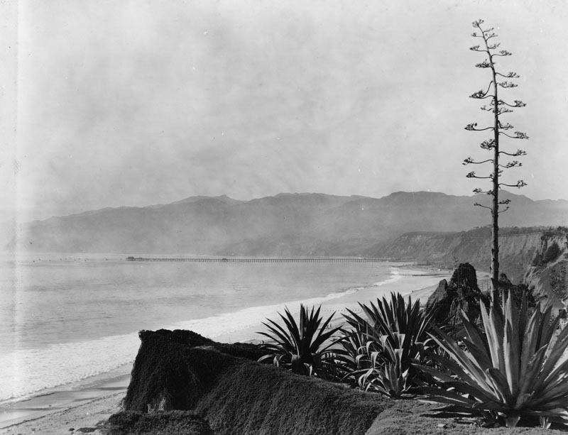
| (Early 1900s)* - View looking north from Linda Vista Park near the top of what would become the California Incline. The Southern Pacific Long Wharf, the world’s longest pier at the time, can be seen in the distance. |
Historical Notes In the early 1900s, a steep road called Linda Vista Drive (now the California Incline) was carved into the bluff to connect the park with the beach road below. It opened around 1905 and became a vital link for early automobiles. The Long Wharf, visible in the distance, was a major transportation hub until it was dismantled in 1920. The park’s location offered panoramic views of these landmarks and made it a favorite photo stop. |
 |
|
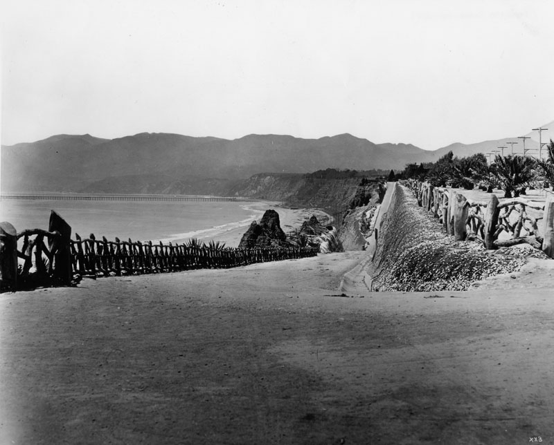
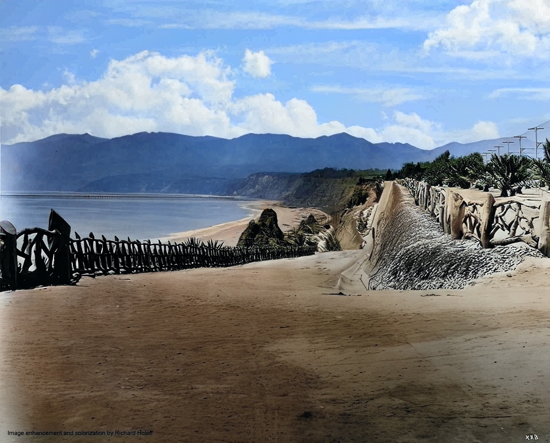
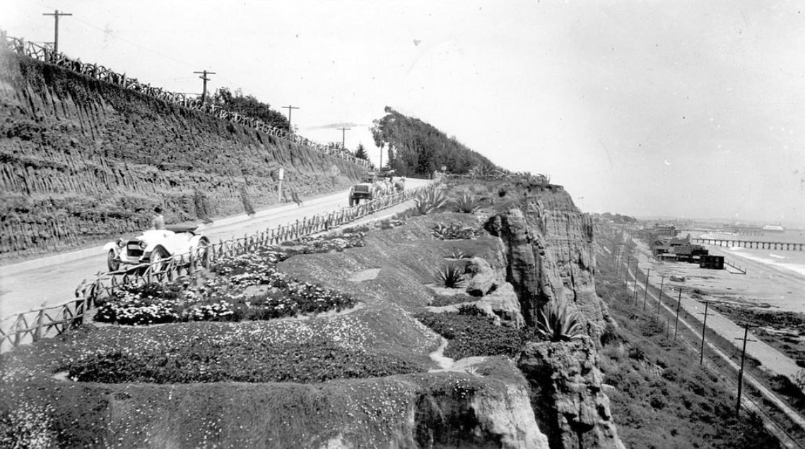
| (ca. 1929)* - View showing a natural alluvial formation at Palisades Park, with rustic fences in the background and the Santa Monica Pier and La Monica Ballroom visible at right. A boardwalk runs along the beach below. |
Historical Notes By the late 1920s, Linda Vista Park had been renamed Palisades Park and was well established as a scenic and recreational space. The rustic fencing seen here was first installed in the 1900s using trimmed eucalyptus limbs and became a trademark of the park’s informal charm. The La Monica Ballroom, built in 1924, was one of the largest dance halls over the ocean and added a festive backdrop to the park’s serene setting. |
South of the Palisades, another beach community was developing at the same time. Ocean Park grew into Santa Monica’s busiest seaside resort district, with Pier Avenue serving as its commercial main street and gateway to the oceanfront piers. |
* * * * * |
Ocean Park (Pier Avenue) |
The Commercial Heart of Santa Monica’s Southern Beach Resort |
In the early 1900s, Pier Avenue was the bustling main street of Ocean Park, Santa Monica’s southern beach district. Developed from oceanfront property acquired by Abbot Kinney and Francis Ryan in 1891, the area quickly grew into a lively seaside resort filled with hotels, restaurants, bathhouses, shops, and amusement piers. Streetcar lines, horse-drawn wagons, early automobiles, and crowds of pedestrians all converged along Pier Avenue, making it the principal gateway between the inland neighborhoods and the beach attractions beyond. From here visitors could reach the Ocean Park piers, seaside promenades, and entertainment venues that helped make Santa Monica one of Southern California’s earliest recreational destinations. Although Ocean Park was annexed to Santa Monica, it retained a distinct identity shaped by tourism, amusements, and its close association with nearby Venice of America, which Abbot Kinney developed just to the south after 1905. The photographs below capture Pier Avenue during its most active early years, when it served as both the commercial center and social gathering place for the growing beach community. |
Early Views of Pier Avenue (1900–1910) |
.jpg) |
|
| (ca. 1900)* – Panoramic postcard view showing Ocean Park. The "Wave w/ Furnished Rooms" can be seen in the background. "Lunch Counter" is on the right. |
Historical Notes This panoramic postcard introduces Ocean Park as it appeared around the turn of the twentieth century. Signs for “The Wave – Furnished Rooms” and a nearby lunch counter reflect the transient economy of a beach resort catering to vacationers and excursionists arriving by rail or streetcar. Ocean Park grew rapidly during the 1890s after Abbot Kinney and Francis Ryan began subdividing their oceanfront property. Small hotels, lodging houses, and restaurants quickly appeared near the beach, creating a lively district oriented toward tourism and seaside recreation. |
 |
|
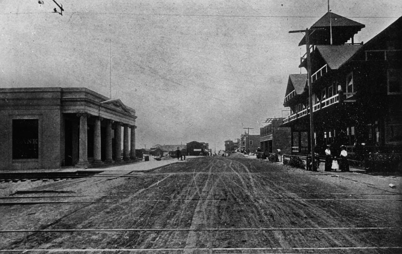
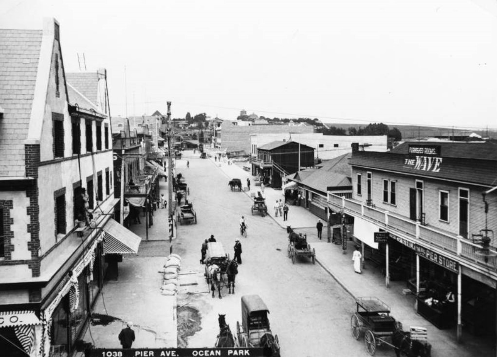
| (Early 1900s)^ - An early view down the unpaved Pier Avenue in Ocean Park. Several rail lines can be seen in the street. A bank has been built on the left and other multi-story commercial buildings on the right. The cross street is Trolley Way. |
Historical Notes In this early view Pier Avenue is still an unpaved street crossed by several rail lines belonging to the electric streetcar systems that linked Santa Monica with Los Angeles and surrounding communities. The intersection with Trolley Way highlights the importance of public transit to the district’s growth. Streetcars delivered thousands of visitors each weekend, transforming Ocean Park into one of the most accessible seaside resorts in Southern California. |
 |
|
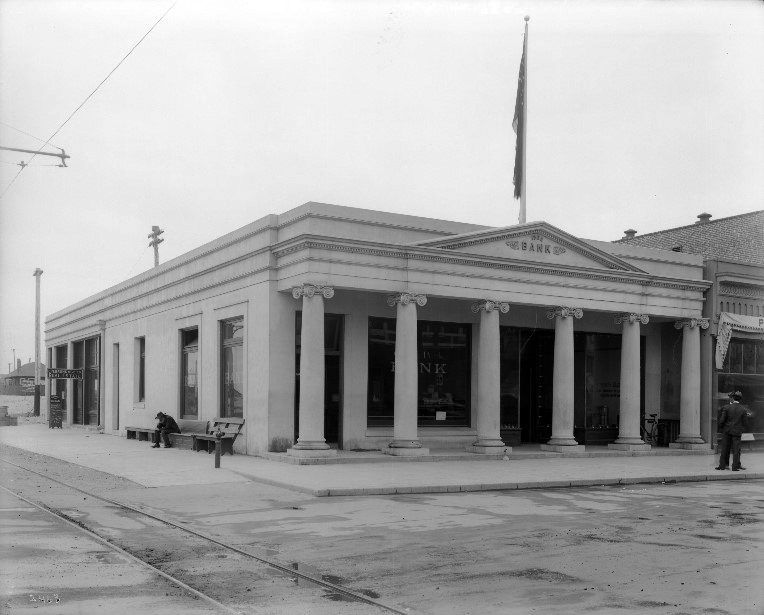
| (1905)* - View showing Ocean Park Bank located on the southwest corner Pier Avenue and Trolley Way. A man is sitting on a bench on the side of the bank in front of the tracks. The bank resembles a Greek Temple with its columns. |
Historical Notes The Ocean Park Bank building, designed with classical columns resembling a Greek temple, signaled the district’s growing commercial confidence. Located on a prominent corner at Pier Avenue and Trolley Way, the bank served both local residents and the many business owners operating along the beachfront. Its presence demonstrates that Ocean Park had developed beyond a seasonal resort into a functioning business district with financial services, commercial blocks, and year-round activity. |
 |
|
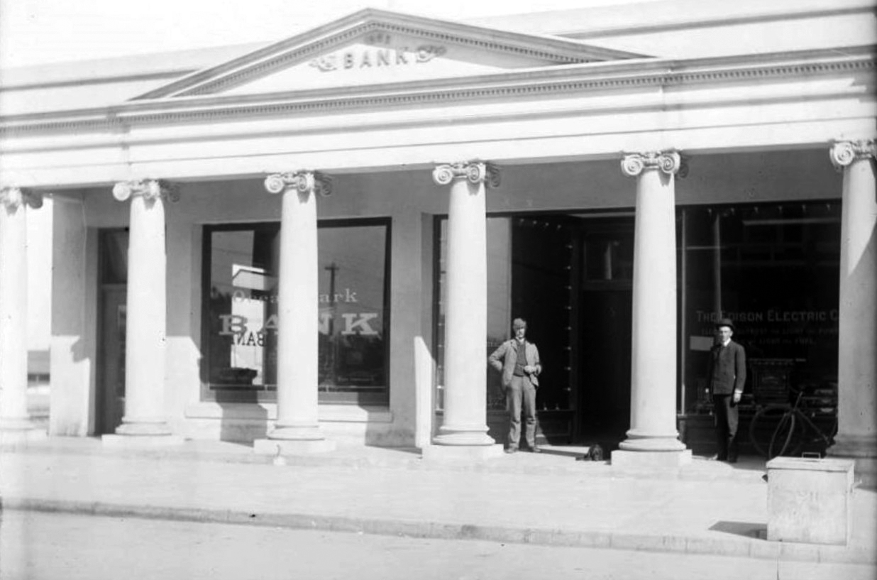
| (Early 1900s)* - View showing two men standing in front of the Ocean Park Bank on Pier Avenue. The Edison Electric Co. shared the building with Ocean Park Bank. |
Historical Notes This view shows the Ocean Park Bank building shared with the Edison Electric Company, illustrating how modern infrastructure quickly followed the growth of the seaside resort. Electric power supported street lighting, streetcars, hotels, restaurants, and amusement attractions. Together, these developments helped transform Ocean Park from a sandy beachfront subdivision into a lively urban neighborhood connected to the expanding Los Angeles region. |
 |
|
| (1905)* - A view down Pier Avenue showing additonal buildings from what was seen three photos back. The street is filled with pedestrians. Cars and horse-drawn carriages are parked in front of the stores on both sides of the street. |
Historical Notes By 1905 Pier Avenue had become the busiest commercial street in Ocean Park. Storefronts, lodging houses, and restaurants lined both sides of the road while pedestrians, horse-drawn carriages, and early automobiles shared the street. The scene captures the lively atmosphere of a resort district whose economy depended on both permanent residents and the steady flow of tourists visiting the nearby piers and beaches. |
Resort District and Amusement Culture |
 |
|
| (1904)* – Birdseye view of Pier Avenue in Ocean Park showing many horse-drawn vehicles, September, 1904. The unpaved street is at center is being traveled by several carriages as well as pedestrians and bicyclists. Large buildings, most of which are at least two stories high, line both sides of the street. A wooden building at right has a large balcony, while a brick building at left has three stories. Sand bags are piled up near the street at left.; Legible signs include, from left to right, "Pier Restaurant", "Wave Furnished Rooms", and "The Big Pier Store". |
Historical Notes This elevated view shows the density of development along Pier Avenue by 1904. Multi-story commercial buildings house restaurants, lodging rooms, and shops serving beach visitors. Signs for establishments such as the Pier Restaurant, The Wave Furnished Rooms, and The Big Pier Store illustrate the commercial diversity of the district. The busy street filled with pedestrians, bicycles, and horse-drawn vehicles underscores Ocean Park’s role as a major gathering place for seaside entertainment. |
 |
|
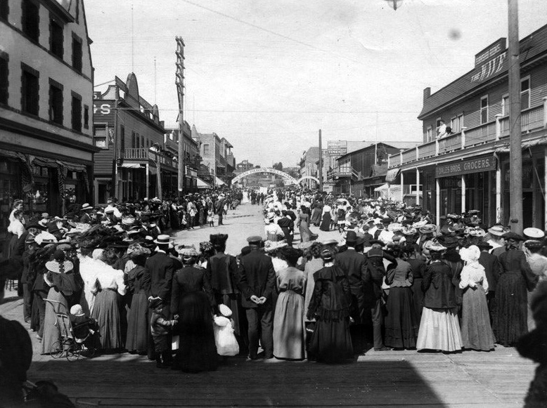
| (ca. 1905)* – View showing Pier Avenue with a crowd of men, women and children (including baby in a baby carriage waiting for some type of parade. The banner over the street reads “Ocean Park’s Welcome”. Buildings include: Dales Bros. Grocers, The Wave (furnished rooms), lunch room. |
Historical Notes A banner reading “Ocean Park’s Welcome” stretches across Pier Avenue as crowds gather to watch a parade or civic celebration. Public events like this were common in resort communities, where festivals, parades, and holiday gatherings helped attract visitors and promote local businesses. Ocean Park’s merchants and property owners frequently sponsored such events to advertise the district as a lively and welcoming beach destination. |
.jpg) |
|
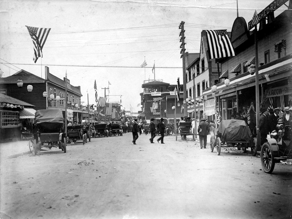
| (1915)* - Looking east on Pier Avenue, Ocean Park, Santa Monica. The Wave is on the right. |
Historical Notes By 1915 Pier Avenue had begun to transition from a horse-drawn resort street to an automobile-oriented commercial corridor. Cars line the curb while larger storefront buildings replace some earlier wooden structures. Despite these changes, the street retains its compact scale and pedestrian activity, reflecting the mixed transportation environment typical of early twentieth-century seaside towns. |
.jpg) |
|
| (1915)* – Closer view of Pier Avenue, looking east, showing a line of cars backed up against the curb. Note the new 3-bulb streetlamps. |
Historical Notes This closer street scene highlights the arrival of modern street lighting with distinctive three-bulb lampposts. Such improvements reflected Santa Monica’s continuing investment in public infrastructure as the beach communities matured into permanent neighborhoods. The presence of numerous automobiles indicates the growing popularity of motor travel to the coast during the 1910s. |
* * * * * |
Ocean Park |
Piers, Promenades, and Seaside Entertainment |
By the turn of the twentieth century, Ocean Park had grown from a quiet stretch of coastline into one of Southern California's busiest seaside resorts. Developed by Abbot Kinney and Francis Ryan beginning in 1895, the community quickly evolved into a lively destination where visitors could enjoy the beach, stroll along bustling commercial streets, attend concerts, dine overlooking the Pacific, and experience one of the region's earliest amusement districts. Frequent electric streetcar service from Los Angeles made the trip easy, bringing thousands of visitors to the ocean throughout the year.The photographs in this section follow the experience of a typical visitor to Ocean Park during its busiest years. Beginning along Pier Avenue and the commercial district, they continue to the Casino, the beach, the bandstand, the promenade, and Band Plaza, capturing the sights and attractions that made Ocean Park one of Southern California's favorite seaside destinations during the early twentieth century. |
 |
|
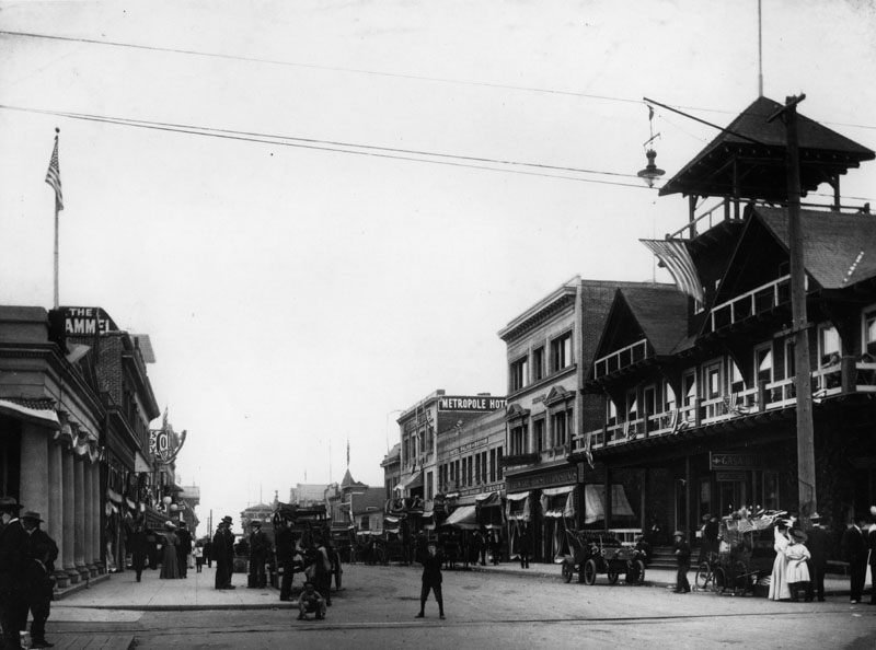
| (ca. 1905)* – View looking west down Pier Avenue toward the beach at Ocean Park. Horse-drawn carriages, early automobiles, and pedestrians share the street beneath patriotic decorations. The Wave Furnished Rooms is on the left. |
Historical Notes Pier Avenue served as the main route between Ocean Park's business district and the beach. Visitors arriving by electric streetcar or carriage often walked this street on their way to the amusement piers, restaurants, and oceanfront attractions. The mixture of horses, wagons, and early automobiles reflects a period when new forms of transportation were rapidly changing everyday life. Hotels, boarding houses, grocery stores, restaurants, and small shops lined the avenue, serving both local residents and the growing number of visitors spending a day—or an entire summer vacation—at the beach. As Ocean Park became more popular, Pier Avenue developed into one of Southern California's busiest seaside commercial streets. |
 |
|
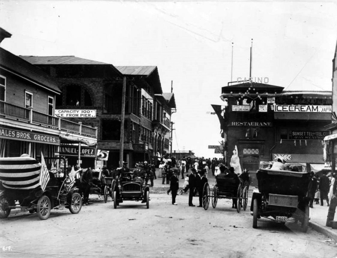
| (1905)* - View looking toward the intersection of Third Street and Pier Avenue in Ocean Park. Businesses, automobiles, and horse-drawn carriages crowd the busy commercial district. Visible signs include the Ocean Park Improvement Company, the Casino, Japanese Tea Garden and Art Curio Rooms, Sunset Telephone and Telegraph Company, Manuel Lopez Habana Cigars, and Dales Bros. Grocers. A statue of a woman stands at center right. |
Historical Notes This intersection formed the heart of Ocean Park's commercial district. Real estate offices promoted beach lots to prospective buyers, grocery stores supplied local residents, and specialty shops catered to tourists exploring the nearby waterfront. Telephone service, curio shops, cigar stores, and restaurants reflected the growing sophistication of a community that had expanded rapidly within only a few years. Ocean Park was more than a resort. It was also a thriving neighborhood where people lived, worked, and shopped year-round. The businesses seen here illustrate how tourism and everyday community life developed side by side. |
 |
|
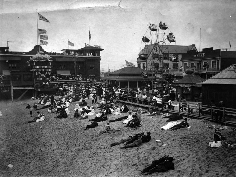
| (ca. 1905)* - View showing the Casino restaurant and theater, a beach crowded with visitors, a Ferris wheel, and Pier Avenue in the background. The Wave Furnished Rooms is on the right. |
Historical Notes Opened in 1903, the Ocean Park Casino quickly became the social center of the resort. The building housed restaurants, entertainment, and gathering spaces overlooking the Pacific, while the nearby beach, amusement rides, and waterfront attractions drew visitors throughout the day. This photograph captures the close relationship between Ocean Park's commercial district and its beachfront attractions. Within a short walk, visitors could enjoy the ocean, ride the Ferris wheel, attend a performance, dine at the Casino, and spend the afternoon exploring one of Southern California's most popular seaside resorts. |
.jpg) |
|
| (ca. 1905)* – View of the Casino restaurant and bandstand at Ocean Park. Crowds gather to watch a performance beneath flags and patriotic bunting while the Ocean Park Pier extends into the Pacific beyond. |
Historical Notes Live music was one of Ocean Park's biggest attractions. Long before radio became common in American homes, free outdoor concerts drew large crowds who gathered to listen to marches, popular songs, and light classical music while enjoying the ocean air. The festive decorations seen here suggest a holiday or special community celebration. The bandstand stood beside the Casino until 1906, when a new Auditorium building incorporated a larger performance stage into its design. Behind it, the original Ocean Park Pier stretched into the Pacific, serving as both a scenic promenade and a popular gathering place before it was replaced by Fraser's Million Dollar Pier in 1911. |
 |
|
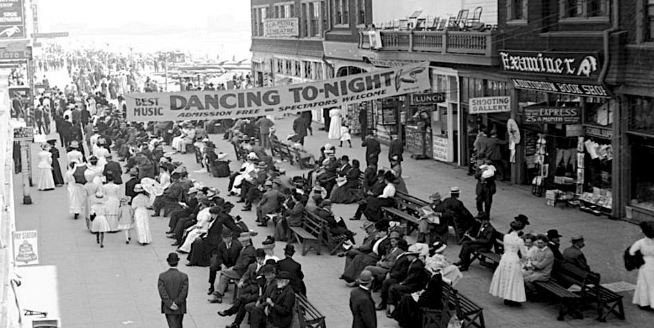
| (ca. 1907)* - View of the Ocean Park Promenade showing visitors strolling along the beach in the formal fashions of the day. The balcony at upper right served as a bandstand overlooking the promenade. |
Historical Notes An afternoon walk along the promenade was one of Ocean Park's favorite pastimes. Visitors dressed in hats, coats, ties, and long dresses, reflecting the customs of the early twentieth century when even a casual trip to the beach was considered a social occasion. Live music often accompanied these strolls as bands performed from balconies overlooking the promenade. Families gathered to enjoy the cool ocean breezes, meet friends, and watch the constant activity along the waterfront, creating an atmosphere that helped make Ocean Park one of Southern California's best-known seaside destinations. |
 |
|
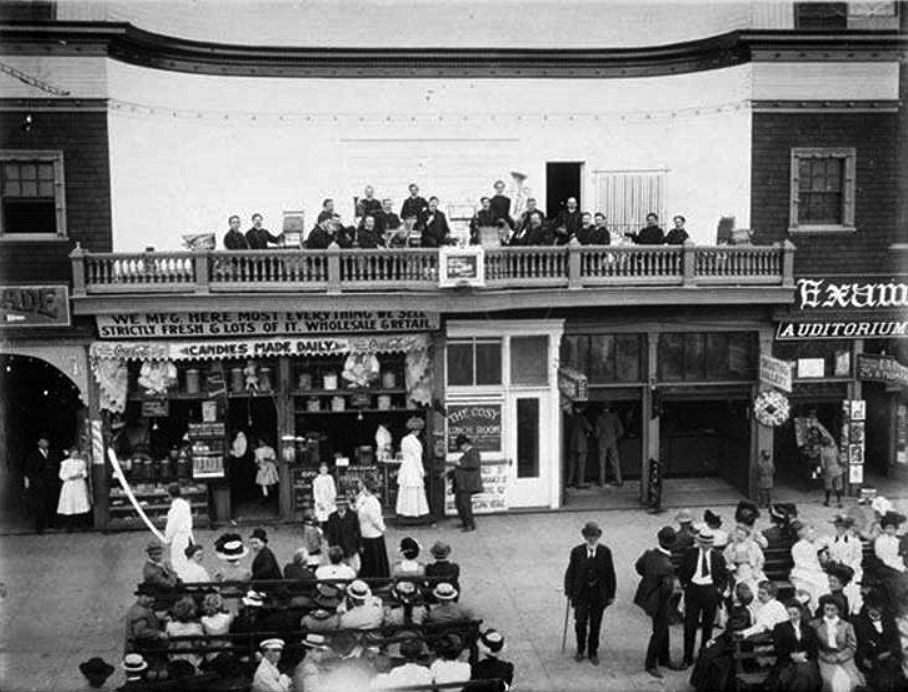
| (1909)* – View showing Frank McGarry's candy store and Band Plaza between Pier Avenue and Marine Street in Ocean Park. A band performs from the balcony above. |
Historical Notes Band Plaza served as another gathering place where shopping, music, and recreation came together only steps from the beach. Candy stores, refreshment stands, souvenir shops, and other businesses catered to the steady stream of visitors enjoying a day at Ocean Park. Public concerts remained one of the resort's most popular attractions. Bands regularly performed from balconies and outdoor stages throughout the district, filling the streets with music while encouraging visitors to linger, shop, dine, and enjoy the lively seaside atmosphere that defined Ocean Park during its early years. Click HERE to see more Early Views of Ocean Park in Santa Monica |
* * * * * |
Life at Ocean Park – Summer of 1916 |
Photographs Courtesy of Stan Onaitis |
By the summer of 1916, Ocean Park had become one of Southern California's most popular seaside destinations. Visitors arrived by Pacific Electric streetcar, automobile, and on foot to enjoy the beach, amusement piers, bathhouses, games, and lively boardwalk. Beyond the famous attractions, families gathered along the shore, strolled the streets, and created lasting memories of a day by the ocean. The photographs below, discovered in a vintage family album and shared by Stan Onaitis, capture those everyday moments. More than a century later, they provide a rare glimpse of the people who helped make Ocean Park one of Southern California's favorite beach resorts. |
 |
|
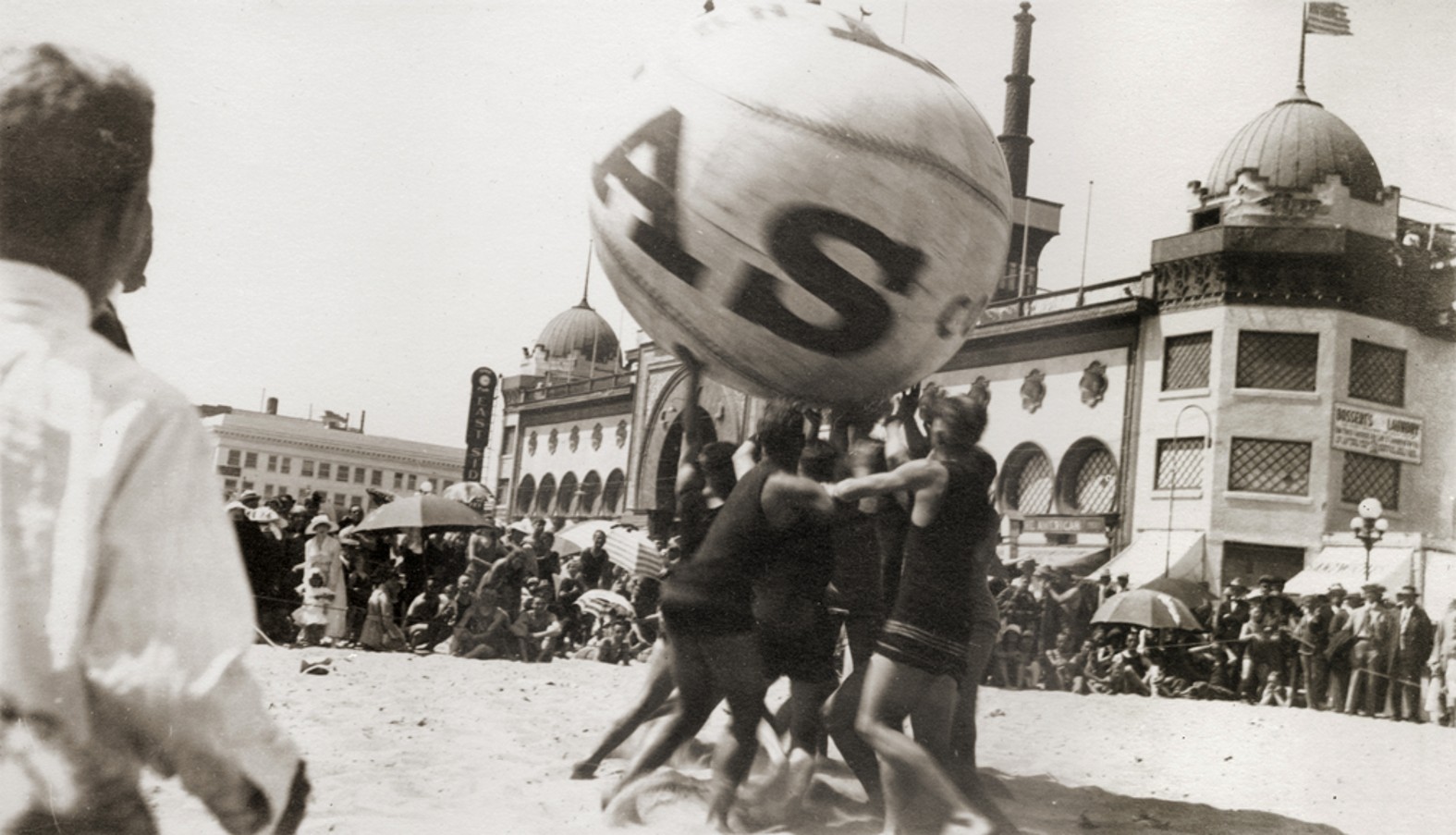
| (1916) - Teams compete in a spirited game of push ball on the beach in front of the Ocean Park Bath House. Large crowds gathered to watch one of the beach's most popular attractions. |
Historical Notes Push ball was one of the most popular beach attractions of the early twentieth century. Played with a giant inflated leather ball that could reach six feet in diameter, the object was simple: two teams worked together to push the enormous ball toward the opposing goal. The game required strength, teamwork, and determination, while the frequent tumbles and unpredictable bounces kept spectators laughing and cheering. Rising behind the players is the Ocean Park Bath House, completed in 1905. With its distinctive domes and towers, it quickly became one of the best-known landmarks along the Southern California coast. Located beside the original Ocean Park Pier, the bath house welcomed thousands of visitors each summer and helped establish Ocean Park as one of the region's premier seaside resorts. |
 |
|
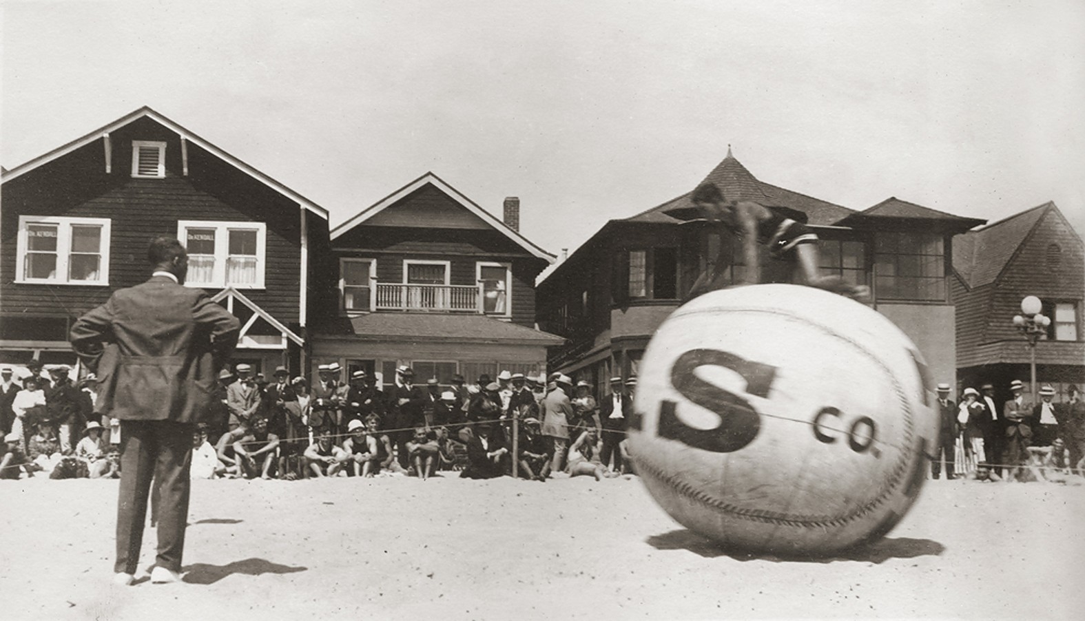
| (1916) - A player scrambles atop the giant push ball as spectators line the playing area, with beach cottages forming the backdrop at Ocean Park. |
Historical Notes This second photograph captures the same match from the opposite direction, looking away from the amusement district toward the rows of beach cottages that lined the shoreline. Many of these cottages were rented by families spending weekends or extended summer vacations at the beach, while others served as year-round homes for local residents. Together, the two photographs show both sides of Ocean Park's appeal. Visitors could enjoy lively attractions and organized beach events only steps away from quiet neighborhoods where families relaxed, entertained friends, and enjoyed life by the sea. It was this unique combination of recreation and community that made Ocean Park one of Southern California's favorite seaside resorts. |
 |
|
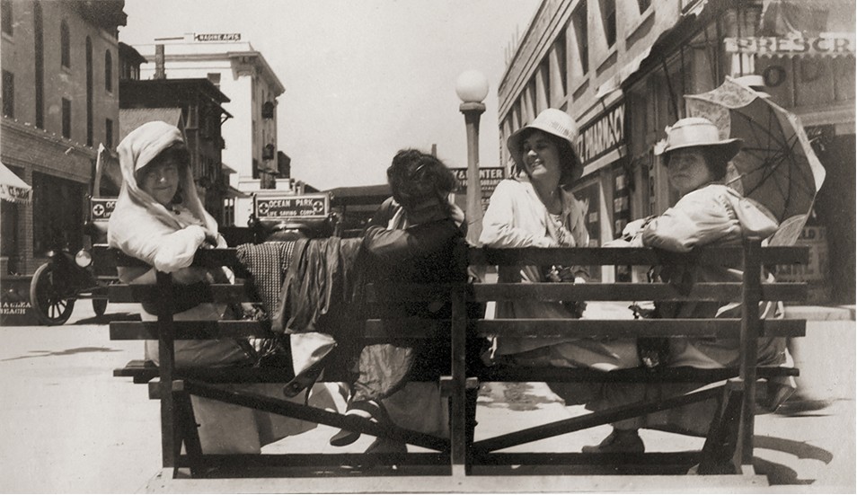
| (July 1916) - Four women pose for a photograph on a wooden bench along busy Pier Avenue during a Sunday morning outing at Ocean Park. |
Historical Notes By 1916, Sunday mornings brought a steady stream of visitors to Ocean Park. Shops, restaurants, bathhouses, and other businesses lined Pier Avenue as beachgoers made their way between the streetcar station, the beach, and the amusement piers. Visible in the background are the Ocean Park Life Saving Corps headquarters and Katz Pharmacy, both familiar landmarks to summer visitors. More than a century later, photographs like this remind us that the history of Ocean Park is more than its famous piers and attractions. It is also the story of the families and friends who came here to relax, socialize, and enjoy a day by the ocean. Preserved in the Stan Onaitis family album, this candid snapshot captures a quiet moment that countless visitors experienced but few had the opportunity to record. |
* * * * * |
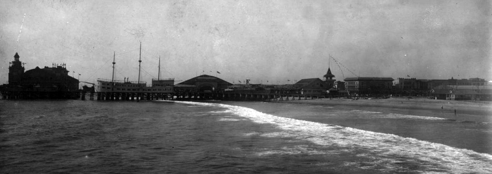
Venice Pier |
Abbot Kinney's Pleasure Pier and the Birth of Venice of America (1905–1920) |
In 1904, tobacco millionaire Abbot Kinney won a coin toss that gave him a stretch of marshy wetlands just south of Ocean Park, the least desirable parcel along the Southern California coast. What he built on it became one of the most ambitious resort developments in Los Angeles history. Dredging canals from the marshes, importing gondoliers from Italy, and laying out an entire town inspired by Mediterranean architecture, Kinney opened Venice of America on July 4, 1905. At the heart of the new resort stood a 1,600 foot pleasure pier at the foot of Windward Avenue. It featured the famous Ship Café, a full scale replica of Juan Cabrillo's Spanish galleon, along with a dance hall, a Dentzel carousel, a marine aquarium, and a 3,600 seat auditorium. At its peak, the pier drew up to 150,000 visitors on busy weekends, earning Venice the nickname "Coney Island of the Pacific." The pier's story ended on December 20, 1920, when a gas heater explosion in the dance hall ignited a fire that consumed nearly the entire structure. The photographs below document Kinney's remarkable pier during its fifteen years above the Pacific. |
 |
|
| (ca. 1905)** - Panoramic view looking north at the Abbot Kinney Pier at Venice Beach, showing the amusement park and beach. The Ship Café is visible on the left. |
Historical Notes The pier opened on July 4, 1905, as the centerpiece of Kinney's Venice of America. Stretching 1,600 feet over the Pacific, it anchored a resort designed to rival the great amusement piers of Atlantic City and Coney Island. The Ship Café, visible at left, was modeled after the galleon of explorer Juan Cabrillo and was designed from the start as a full resort, with a restaurant, sleeping apartments, and all the comforts of a modern hotel above the waves. A 3,600 seat auditorium anchored the seaward end. The pier had nearly been lost before it ever opened. Storms in early 1905 wrecked the nearly finished structure, forcing Kinney's crew of more than a thousand workers to race through repairs in time for the July 4th debut. It was a preview of the constant battle between the pier and the Pacific that would define its entire existence. |
 |
|
| (1905)* - A large crowd gathers around the Ship Café, a replica of Juan Cabrillo's Spanish galleon, at the Abbot Kinney Pier in Venice. |
Historical Notes The Ship Café was one of the most photographed structures in early Southern California. Built as a permanently moored replica galleon alongside the pier, it offered dining above the ocean and became one of the defining images of Venice of America. Kinney had originally envisioned the pier as a venue for lectures and cultural performance, but crowds made their preferences clear from opening day. They wanted spectacle, food, and entertainment. The Ship Café embodied exactly that, and its distinctive silhouette against the Pacific became the image most associated with Kinney's Venice in its early years. |
 |
|
| (1906)* – Well-dressed visitors stroll on the Abbot Kinney Pier alongside the Ship Café. A handwritten note on the reverse reads: "Ship Cafe / Venice, Cal. / 12-16-06." |
Historical Notes By December 1906, the pier had already grown beyond its original layout. That summer, 125 carpenters and electricians had built a $40,000 dance hall, the largest on the West Coast, in just seventeen days, racing to finish its 14,560 square foot hardwood floor in time for a July 4th dedication. Visitors in this view are dressed in the formal attire typical of the era. A trip to the pier was a social occasion as much as a recreational one. The strings of electric lights outlining the auditorium and Ship Café made the pier one of the most dramatic nighttime spectacles on the Southern California coast, drawing evening crowds long after the last Red Car had arrived from Los Angeles. |
 |
|
| (1905)* - Nighttime view of the Abbot Kinney Pier at Venice, illuminated with strings of electric lights. The pier was destroyed by fire in 1920. |
Historical Notes Electric lighting transformed the pier into a destination after dark unlike anything else in the region. The auditorium and Ship Café glowed with strings of lights visible for miles along the coast, drawing evening crowds who arrived by Pacific Electric trolley from Los Angeles and Santa Monica. The pier continued expanding through the 1910s, adding a Virginia Reel ride, a Ferris wheel, a scenic railroad, a Dentzel carousel, and some forty concessions and attractions in all. Venice historian Jeffrey Stanton, author of Venice of America: Coney Island of the Pacific, later wrote that when the fire finally came in December 1920, "damages ran to a million dollars, with little of it insured. It was a bleak Christmas." The nighttime photograph above captures the pier at the height of its appeal, a glittering attraction that seemed, in those years, as permanent as the bluffs above it. |
 |
|
| (ca. 1905)* - A gondolier poles a boat beneath one of the canal bridges at Venice of America, as a pedestrian and a cyclist cross overhead. |
Historical Notes The canals were the soul of Kinney's Venice of America. Dredged from tidal marshland beginning in 1904, they stretched across the development in a network of waterways lined with arched bridges and Mediterranean style architecture. Kinney imported real gondoliers from Venice, Italy, giving the canals an authenticity that delighted early visitors. As the automobile gained dominance in the 1920s, the canals were increasingly viewed as obstacles rather than attractions, and most were filled in and paved over in 1929. Only the small surviving network to the south, designated the Venice Canal Historic District and listed on the National Register of Historic Places in 1982, remains today, a quiet reminder of how completely the resort's character was transformed by the rise of the car. Click HERE to see more Early Views of the Venice Canals (1904+). |
 |
|
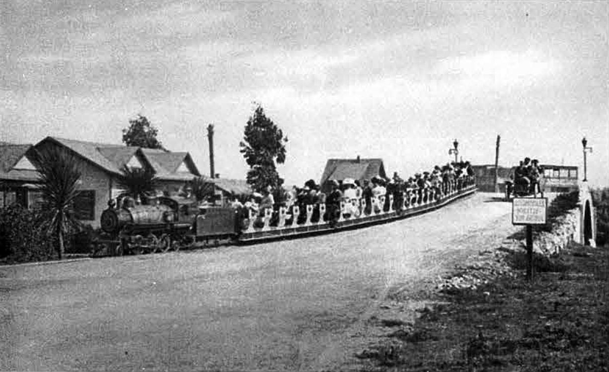
| (ca. 1905)* - The Venice Miniature Railway crosses a canal bridge on its way back toward Windward Avenue at the Venice of America Amusement Park. |
Historical Notes To move visitors through his sprawling resort, Kinney hired John J. Coit, who operated a successful miniature steam railroad at Eastlake Park in Los Angeles, to build a narrow gauge railway at Venice. The line ran about a mile and three quarters, looping from the Windward Avenue business district across canal bridges, through residential neighborhoods, and back, giving riders a full tour of the development for five cents a trip. Residents could buy a book of tickets for a dollar, bringing the cost to just two cents per ride. The railway operated until 1924, by which time the automobile had made it largely redundant, the same shift in transportation habits that had already begun filling in the canals on which its bridges stood. |
 |
|
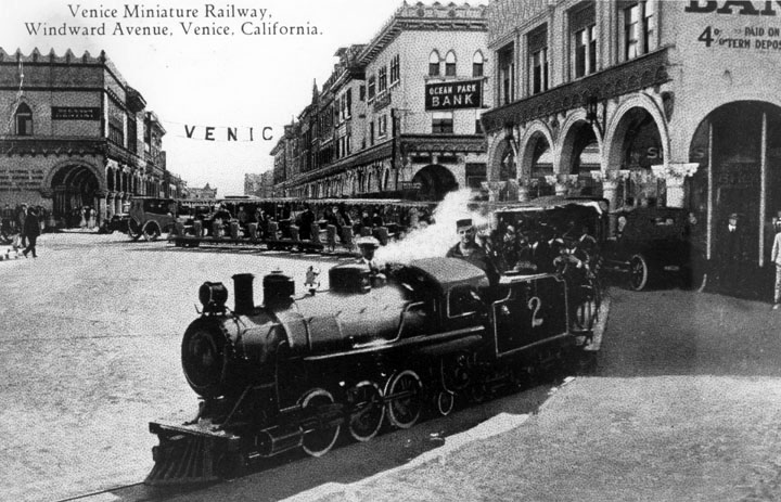
| (1912)* - Postcard view of the Miniature Railway on Windward Avenue in Venice. The miniature railroad would carry passengers for trips around the Venice streets, including Windward Ave. as shown here, and around the canal area. |
Historical Notes The Venice Miniature Railway was more than a novelty. It was the circulatory system of Kinney's resort. Running a mile and three quarters on eighteen inch gauge track, it looped from the Windward Avenue business district across canal bridges and through the residential neighborhoods, giving visitors a guided tour of the entire development for five cents a trip. By 1912, when this postcard was produced, the railway was one of the most recognizable images of Venice of America, its small locomotive threading through the colonnaded streets that Kinney had modeled on the Italian original. At that time it cost fifteen cents to ride the Los Angeles Pacific Railway all the way from the city to Venice, making a round trip on the miniature railway, at five cents, one of the best bargains at the beach. The railway ran until 1924, outlasting the canals it crossed and the pier it served, before finally surrendering to the automobile culture that had already begun remaking Venice into something quite different from what Kinney had imagined. |
 |
|
| (ca. 1905)* - Visitors stroll past the Dance Hall on the Abbot Kinney Amusement Pier at Venice Beach. |
Historical Notes The Dance Hall was completed in July 1906 at a cost of $40,000, making it the largest ballroom on the West Coast. Its 14,560 square foot hardwood floor could accommodate hundreds of couples at a time, and live music drew large crowds on summer evenings. When the fire of December 20, 1920, broke out in the dance hall, the band played a rousing march to guide guests through an orderly evacuation, a detail that became one of the most remembered stories of the pier's final night. The hall that had hosted so many evenings of music and dancing was gone within hours, taking most of the pier with it. |
 |
|
| (1908)* - The Abbot Kinney Pier on a crowded summer day, with the Dance Hall visible in the background. |
Historical Notes By 1908 the pier had grown into a full amusement complex, with roughly forty concessions and attractions stretching its length, among them a Virginia Reel, a Ferris wheel, a scenic railroad, bowling alleys, a pool hall, a shooting gallery, and a Japanese Tea House. The Aquarium, which would open in January 1909, was under construction, soon to exhibit the finest collection of Pacific marine life in the region. Weekends drew between 50,000 and 150,000 visitors, most arriving by Pacific Electric Red Car. The density of attractions visible in this view helps explain why the 1920 fire was so catastrophic. With wooden structures packed tightly together above the ocean and wind off the water, the blaze moved from the dance hall to the Virginia Reel to the auditorium within minutes and was fully out of control before midnight. |
 |
|
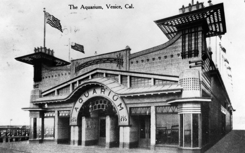
| (ca. 1908)* - Front view of the Venice Aquarium, decorated with flags flying above the entrance. |
Historical Notes The Venice Aquarium opened in January 1909 as one of the pier's most distinctive attractions. Its 48 glass tanks displayed the finest collection of Pacific Coast marine life anywhere in the region, arranged around a central sunken pool where sea lions performed for the crowd. Beyond its appeal to visitors, the aquarium served a serious scientific purpose, eventually becoming the official marine biological station for the University of Southern California, bridging popular entertainment and academic research in a way that few pier attractions managed anywhere in the country. Like the dance hall, the Ship Café, and the auditorium, it was destroyed in the fire of December 1920, leaving nothing of the original pier above the waterline. Click HERE to see more in Early Southern California Amusement Parks. |
* * * * * |
North Beach |
Santa Monica's First Great Beach Resort (1876 to 1910) |
Long before the Santa Monica Municipal Pier became the city's most famous landmark, the stretch of shoreline known as North Beach was the center of Santa Monica's early resort life. Located just north of the foot of Colorado Avenue, it was the town’s most fashionable destination for swimming, strolling, and seaside recreation from the 1870s through the early twentieth century. The anchor of North Beach was the grand North Beach Bath House, built in 1893 and 1894 by Senator John P. Jones, one of Santa Monica's co-founders, at a cost of $50,000. Designed by prominent Los Angeles architect Sumner P. Hunt, the sprawling 440-foot-long complex offered two large heated saltwater plunges, 300 dressing rooms, a ballroom, a roof garden and observation deck, a bowling pavilion, and the Pavilion Restaurant. A twenty-foot-wide wooden boardwalk extended from the bathhouse past the nearby Arcadia Hotel and ran more than a mile along the surf, creating one of the earliest seaside promenades on the Southern California coast. Admission to the bathhouse was just twenty-five cents. For nearly three decades North Beach stood at the heart of Santa Monica’s identity as a seaside resort. Its popularity began to fade after 1905 when Abbot Kinney’s newly opened Venice of America captured the public’s imagination and drew much of the region’s excursion traffic southward. The North Beach Bath House was ultimately demolished in 1911, and the site was later redeveloped in the 1920s as the Deauville Club. The photographs below document North Beach and its lively boardwalk district at the height of its popularity around the turn of the twentieth century. |
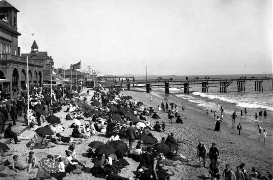 |
|
| (ca. 1900)** - View of a crowded North Beach in Santa Monica with the pier in the background. The boardwalk is also full of people enjoying what appears to be a nice day at the beach. |
Historical Notes This view captures North Beach at the height of its popularity as Santa Monica’s first major seaside resort. Stretching along the shoreline north of Colorado Avenue, the North Beach boardwalk was one of the earliest oceanfront promenades on the Southern California coast. Built of wood planking and elevated above the sand, it allowed visitors to stroll comfortably beside the surf while enjoying ocean breezes and panoramic views of Santa Monica Bay. The pier visible in the distance is the remnant of the old Los Angeles and Independence Railroad wharf. In the 1890s this wharf was connected to the Southern Pacific Long Wharf to the north, forming part of the rail system that helped transform Santa Monica from a quiet coastal settlement into a thriving beach resort. By the turn of the twentieth century thousands of visitors arrived each weekend by electric streetcar and excursion train from Los Angeles. The crowded boardwalk, beach, and bathhouse district seen here illustrate how quickly Santa Monica had evolved—within barely twenty years of its founding—into one of Southern California’s earliest and most fashionable seaside destinations. |
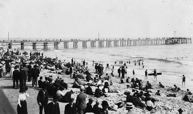 |
|
| (ca. 1900)* - Men wearing suits and finely dressed women sitting on the sand, standing and walking the boardwalk at North Beach in Santa Monica. The North Beach Bath House pier can be seen in the background. |
Historical Notes The formally dressed visitors in this photograph illustrate how different the culture of the beach was around 1900. Men typically wore suits, straw hats, and leather shoes even while walking on the sand, while women appeared in long skirts, high collars, and elaborate hats. A visit to the shore was considered a social outing rather than an athletic activity, and much of the enjoyment came from strolling the boardwalk, meeting friends, and watching the lively parade of visitors along the waterfront. The North Beach Bath House, visible in the background, provided the structured setting required for respectable bathing in this era. Built in 1893–1894 by Senator John P. Jones and designed by architect Sumner P. Hunt, the enormous complex stretched roughly 440 feet along the beach. Inside were hundreds of dressing rooms, heated saltwater plunges filled directly from the ocean, and a variety of recreational spaces including a ballroom, bowling pavilion, and restaurant. For twenty-five cents, visitors could change into bathing costumes, enter the water, and return to the boardwalk in proper attire. |
 |
|
| (Early 1900s)* - Group portrait of eight people, finely dressed, standing on the beach. The pier can be seen in the background |
Historical Notes Posed photographs such as this were a common souvenir of a day at the shore. Beach photographers worked along the boardwalk and shoreline, offering visitors the chance to capture their outing with the ocean or pier as a backdrop. Families and groups often dressed in their best clothing for these portraits, treating a trip to Santa Monica as a special social occasion. The clothing worn here reflects the strict social conventions of the Victorian and Edwardian periods. Women’s dresses covered the arms and legs completely and were often worn over corsets that shaped the fashionable silhouette of the time. Hats were considered essential accessories even on warm days by the sea. These details remind us that early beach culture was shaped as much by etiquette and social display as by recreation. Note: Although grouped with North Beach photographs, the exact location of this image along the Santa Monica shoreline cannot be confirmed with certainty. |
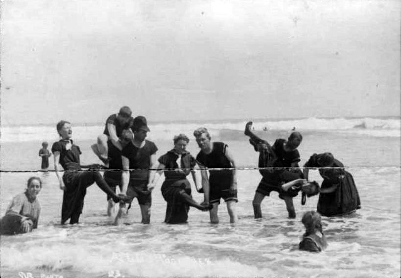 |
|
| (ca. 1900)* - Eleven young men and women standing knee deep in the ocean, posing for the photographer. |
Historical Notes This photograph offers a rare glimpse of early bathing customs at the turn of the twentieth century. The women are wearing wool bathing costumes that covered the body from neck to knee, often paired with loose bloomers or trousers beneath the skirt. Some garments even included weighted hems designed to keep the fabric from floating upward in the surf. Men wore wool shirts and knee-length trunks. These heavy garments absorbed water and made swimming difficult, which is why many early bathers preferred wading or posing for photographs rather than actually swimming. Public attitudes toward modesty were strict. Bathing costumes were expected to be worn only in designated bathing areas and bathhouses, and appearing in such attire elsewhere along the beach could result in arrest. Within a generation these conventions would change dramatically, and the lighter bathing suits of the 1920s would help usher in the modern culture of sunbathing and recreational swimming. Note: This photograph is included here for its vivid depiction of early bathing dress and customs. The precise location along the Santa Monica shoreline has not been confirmed and may not specifically be North Beach. |
* * * * * |
North Beach Bath House |
Santa Monica's Grand Indoor Resort (1894 to 1910) |
When the North Beach Bath House opened on June 9, 1894, the Los Angeles Times called it the largest and finest structure of its kind on the Pacific Coast. Senator John P. Jones, one of Santa Monica's co-founders, had invested $50,000 to build it, hiring architect Sumner P. Hunt to create something truly remarkable on the sand.The complex stretched 440 feet along the beach and offered far more than a simple swim. Two large heated saltwater plunges drew year-round crowds, while the building also housed 300 dressing rooms, a ballroom, a rooftop garden, a bowling pavilion, and the Pavilion Restaurant. A twenty foot wide boardwalk connected the bath house to the nearby Arcadia Hotel and ran for miles along the surf. Admission was just twenty five cents.The bath house served Santa Monica for sixteen years before being torn down in 1911. The photographs below capture its boardwalk, its grand interior, and its famous saltwater plunge near the height of their popularity. |
.jpg) |
|
| (1905)* - Crowds of people in their finest dress stroll along the boardwalk and sit on the beach in front of the North Beach Bath House in Santa Monica. |
Historical Notes The North Beach Bath House replaced the original Santa Monica Bath House in 1894 and quickly became the premier resort facility on the Southern California coast. Its most celebrated feature was the heated saltwater plunge, filled with ocean water piped directly into the building and warmed to a comfortable temperature year round. A Camera Obscura, installed on the property around 1899, added another popular attraction. For ten cents, visitors entered a darkened room where a lens and mirror projected live moving images of the beach and passing ships onto a circular viewing table. It was one of the first Camera Obscuras in California and was later relocated to Palisades Park, where a version still operates today. By 1905, when this photograph was taken, thousands of visitors were arriving each weekend by Pacific Electric trolley and early automobile. The broad boardwalk running in front of the bath house served as a promenade where visitors strolled, socialized, and watched the surf, dressed in the formal attire that a day at the beach still demanded in that era. |
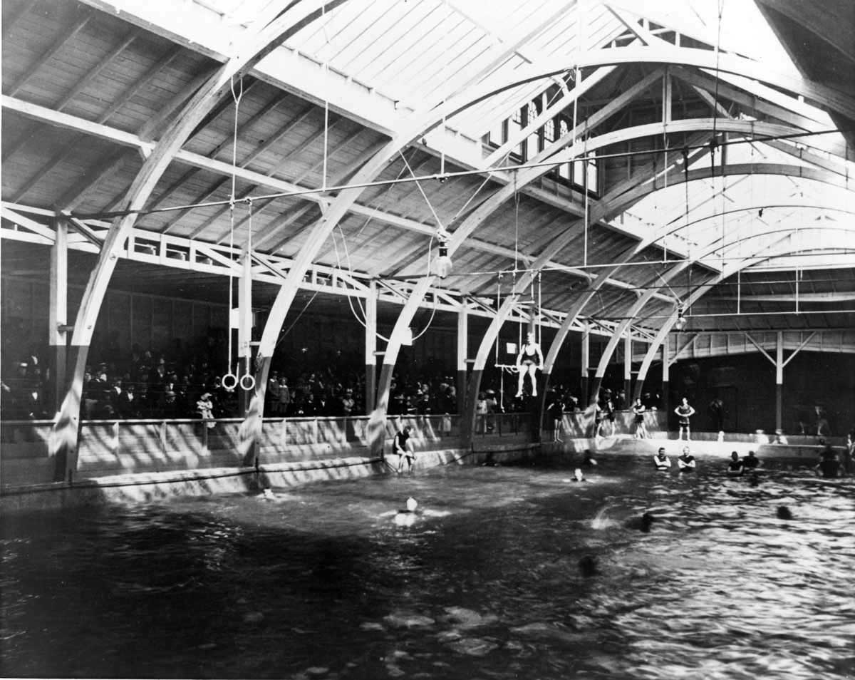 |
|
| (ca. 1900)* - Interior view of the North Beach Bath House saltwater plunge in Santa Monica. Swimmers of all ages fill the pool while formally dressed spectators watch from the seating area above. |
Historical Notes This photograph offers one of the finest surviving interior views of the North Beach Bath House plunge. The large pool at center was filled with heated saltwater piped in from the ocean, making it a comfortable destination year round even when the Pacific itself was too cold for most visitors. Individual changing room doors line the walls at pool level, while the seating area above is filled with spectators dressed in formal street clothes, watching the swimmers below much as one would watch a sporting event today. The contrast between the casually dressed swimmers and the fully clothed observers in the seating area is a telling detail. In 1900, going into the water was still a structured activity governed by strict social rules, and the bath house provided the controlled, respectable environment that made it acceptable for men, women, and children to be seen in bathing attire. The wooden frame construction, the rows of windows along the upper walls, and the generous spectator seating all reflect the ambition of a building designed to feel more like a grand resort hotel than a simple changing facility. |
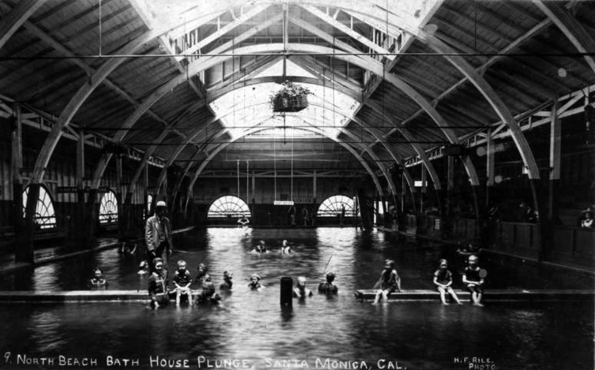 |
|
| (1901)* - Image of people, including children, swimming in the North Beach Bath House saltwater plunge in Santa Monica. A sign reading "Deep Water" hangs at the center of the image above the indoor pool. |
Historical Notes This 1901 view looks directly into the heart of the plunge on a busy day, with swimmers of all ages sharing the pool under the watchful eye of the "Deep Water" sign overhead. The sign is a reminder that the pool ranged from four to fourteen feet in depth, making it a genuine swimming facility rather than a simple wading area. Children in the shallower end and adults venturing toward the deeper sections reflect how the bath house served the whole family, a deliberate part of its appeal as a respectable, supervised resort destination. The saltwater plunge was the centerpiece of a facility that offered something for everyone. While swimmers enjoyed the pool below, other visitors dined in the Pavilion Restaurant, bowled in the pavilion, strolled the rooftop garden, or peered at the beach through the Camera Obscura. At twenty five cents admission, the North Beach Bath House delivered an extraordinary range of entertainment for a single coin, and for sixteen years it remained the finest resort facility on the Southern California coast. Click HERE to see more early views and history of the North Beach Bath House. |
* * * * * |
Santa Monica Municipal Pier |
The West Coast's First Concrete Pier (1909 to present) |
When the Santa Monica Municipal Pier opened on September 9, 1909, the Los Angeles Times celebrated it as the longest concrete pier in the world. Senator John P. Jones's legacy pier had inspired a city to think boldly, and Santa Monica answered with a 1,600-foot-long concrete structure extending far into the Pacific Ocean, the first of its kind on the entire West Coast. City officials had hired local architect Edwin H. Warner, whose winning design among eleven submitted proposals called for a concrete deck supported by concrete pilings, with an eighteen-inch outfall pipe running beneath the full length of the pier. Construction began on April 8, 1908, and was completed just sixteen months later.The pier had been built first and foremost to solve a problem. Santa Monica's growing population was producing more sewage than the city could safely dispose of on land, and untreated waste was threatening the beaches that made the community attractive in the first place. Warner's design carried the treated sewage under the pier's deck and deposited it far beyond the breaking surf, where it would wash out to sea rather than wash back to shore. A treatment plant was built at the base of the pier on the beach to handle the processing. The outfall pipe fulfilled its original purpose quietly until 1928, long after the structure above it had become one of Southern California's most beloved gathering places.The pier's opening day drew thousands of visitors for band concerts, swimming races, and the sheer novelty of strolling above the surface of the Pacific Ocean. The United States Navy sent warships to anchor offshore in honor of the occasion. Within a few years, fishing crowds had claimed the pier as their own, and by 1916 amusement pioneer Charles I. D. Looff and his son Arthur had constructed a pleasure pier immediately to the south, adding a carousel, a roller coaster, and a variety of other attractions. The photographs below capture the pier in its earliest years, from the celebrations of opening day to the coastline still taking shape around it. |
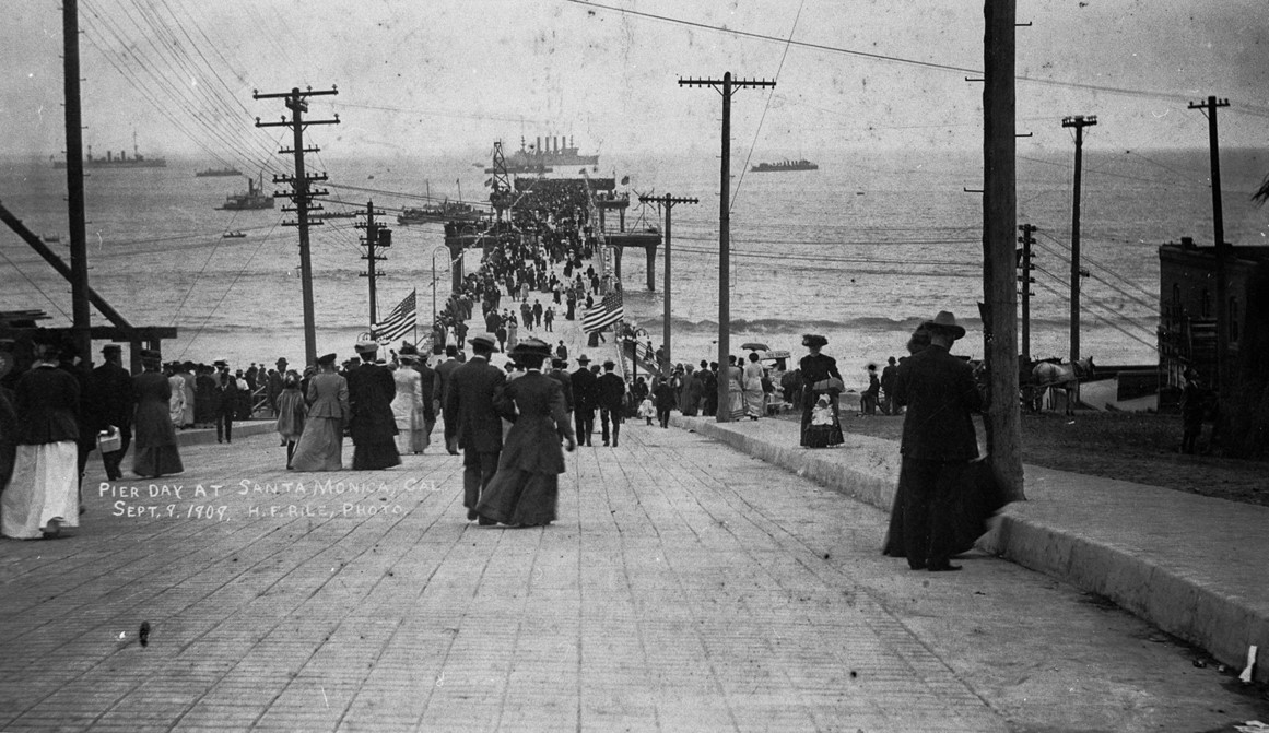 |
|
| (1909)* - View showing people walking onto the Santa Monica Municipal Pier on Pier Day, September 9, 1909, in Santa Monica. In the distance, United States Naval vessels are seen anchored offshore for the event. From the Ernest Marquez Collection. |
Historical Notes The opening of the Santa Monica Municipal Pier on September 9, 1909 drew thousands of residents and visitors who streamed onto the new concrete deck to take part in what city officials had declared a full day of public celebration. The date had been chosen with care: it was the fifty-ninth anniversary of California's admission to the United States, and Mayor T. H. Dudley and other civic leaders wanted the pier's debut to carry the weight of that connection. The morning began with a parade from Santa Monica City Hall to the foot of the pier, where the formal dedication ceremony took place. State Senator Lee C. Gates served as the featured speaker, and the festivities that followed included band concerts, swimming contests, and boating races, giving the crowd of thousands every reason to linger through the afternoon. The naval vessels visible in the distance are among the warships dispatched by the United States Navy specifically for the opening ceremonies. The protected cruiser USS Albany was the most prominently celebrated of the vessels, and sailors from the ships participated in the opening parade before the public was invited to tour the warships anchored in the bay. The presence of the Navy elevated what might have been a local milestone into a moment of genuine national notice, and reporters from newspapers across the country were on hand to file their dispatches. For the people walking onto the pier in this photograph, the day represented something more than a new piece of infrastructure. It was proof that a small seaside city had accomplished something no other community on the West Coast had done before. |
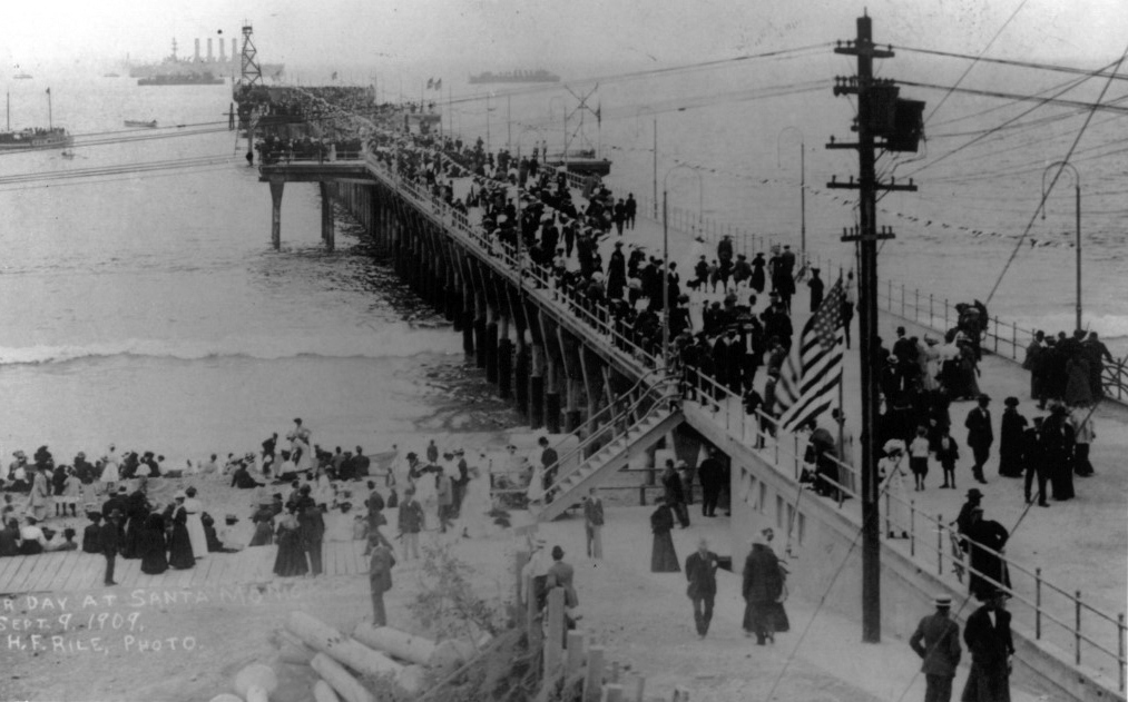 |
|
| (1909)* – View showing the Santa Monica Municipal Pier on opening day, September 9, 1909. Photo Credit: Santa Monica Pier Restoration Corporation. |
Historical Notes This view of the pier on its opening day shows the clean, spare lines of a structure designed entirely around function. Local architect Edwin H. Warner's plan called for a concrete deck 1,600 feet long, supported by concrete pilings and wide enough to accommodate the steady flow of foot traffic that city planners anticipated. Beneath the deck ran an eighteen-inch outfall pipe, installed at a slight downward incline so that gravity would carry treated sewage from a processing plant at the pier's base all the way out to the open ocean. The decision to build in concrete rather than wood was a deliberate one. Wooden piers along the California coast had long been vulnerable to the Teredo worm, a shellfish that bores through submerged timber, and to the relentless weathering of salt air and storm surf. Concrete offered a far more durable solution. The Stutzer Cement and Grading Company broke ground on April 8, 1908, and completed the structure on August 18, 1909, with only minor finishing work remaining when Mayor Dudley dedicated it three weeks later. Reporters had been arriving throughout construction to observe the project and write about both the engineering achievement and the community behind it, giving Santa Monica a level of national attention it had never previously enjoyed. Though the pier's original purpose was entirely practical, it took almost no time for the public to reimagine it as something more. Fishing crowds claimed the railing almost immediately, and entrepreneurs began drawing up plans for amusements and concessions. The sewer outfall beneath the planks would do its work quietly until 1928, but the life of the pier above had already taken on a character all its own. |
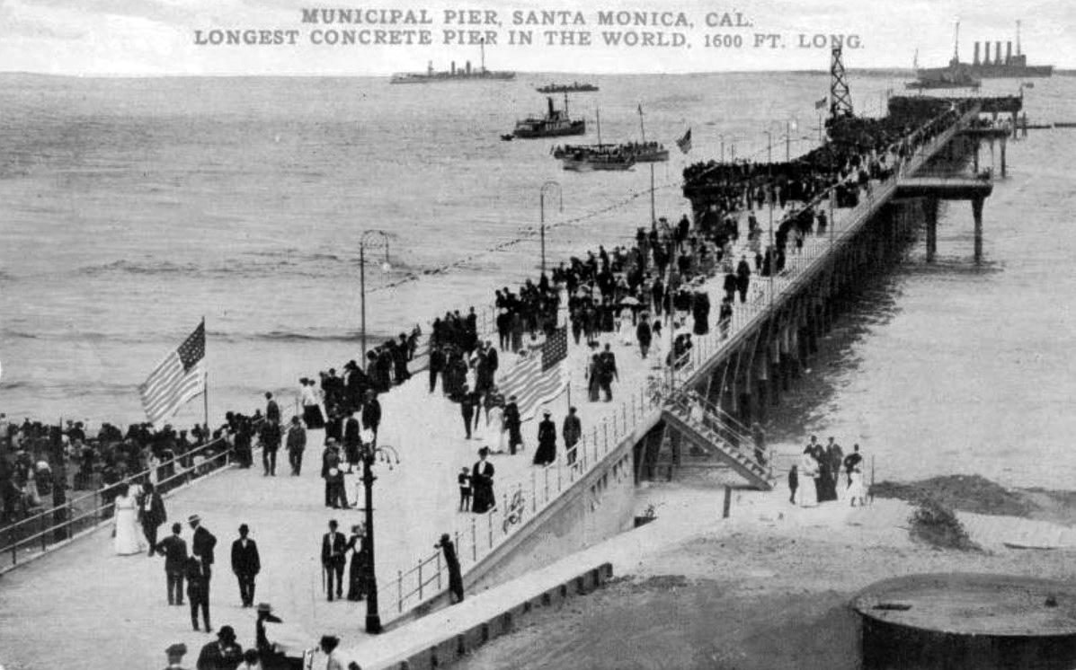 |
|
| (1909)*– Postcard view showing the newly constructed Santa Monica Municipal Pier on opening day. Heading reads: Municipal Pier, Santa Monica. Longest Concrete Pier in the World, 1600 Ft. Long. |
Historical Notes This postcard was produced to promote the Balloon Route Excursion, one of the most popular tourist attractions in early twentieth-century Southern California. Managed by Charles Merritt Pierce under the Los Angeles Pacific Company beginning in 1904, the Balloon Route was a full-day trolley excursion that departed from downtown Los Angeles each morning and traced a sweeping loop of more than one hundred miles through Hollywood, Beverly Hills, and along the coast through several beach communities before returning to the city by evening. The route took its name from the roughly balloon-shaped arc it drew on the map. The one-dollar fare included reserved seating in parlor cars, the services of a competent guide, and admission to several attractions along the way, including the Camera Obscura in Santa Monica and a remarkable stretch of track that ran a full mile out over the water on the Long Wharf at Port Los Angeles. The claim printed on the card, that the pier was the longest concrete pier in the world at 1,600 feet, was a point of genuine pride and was repeated widely in the press during and after construction. Postcards like this one served a dual purpose in the early 1900s. They functioned as souvenirs for tourists who wanted to share news of their travels, and they served as promotional tools for the communities that produced them. Santa Monica was competing actively with other Southern California coastal towns for visitors arriving from the East, and a striking postcard was one of the most cost-effective ways to spread the word. The Balloon Route was eventually absorbed into the Pacific Electric Railway system in 1911, but the connection between the new pier and the region's growing tourist economy had already been firmly established. |
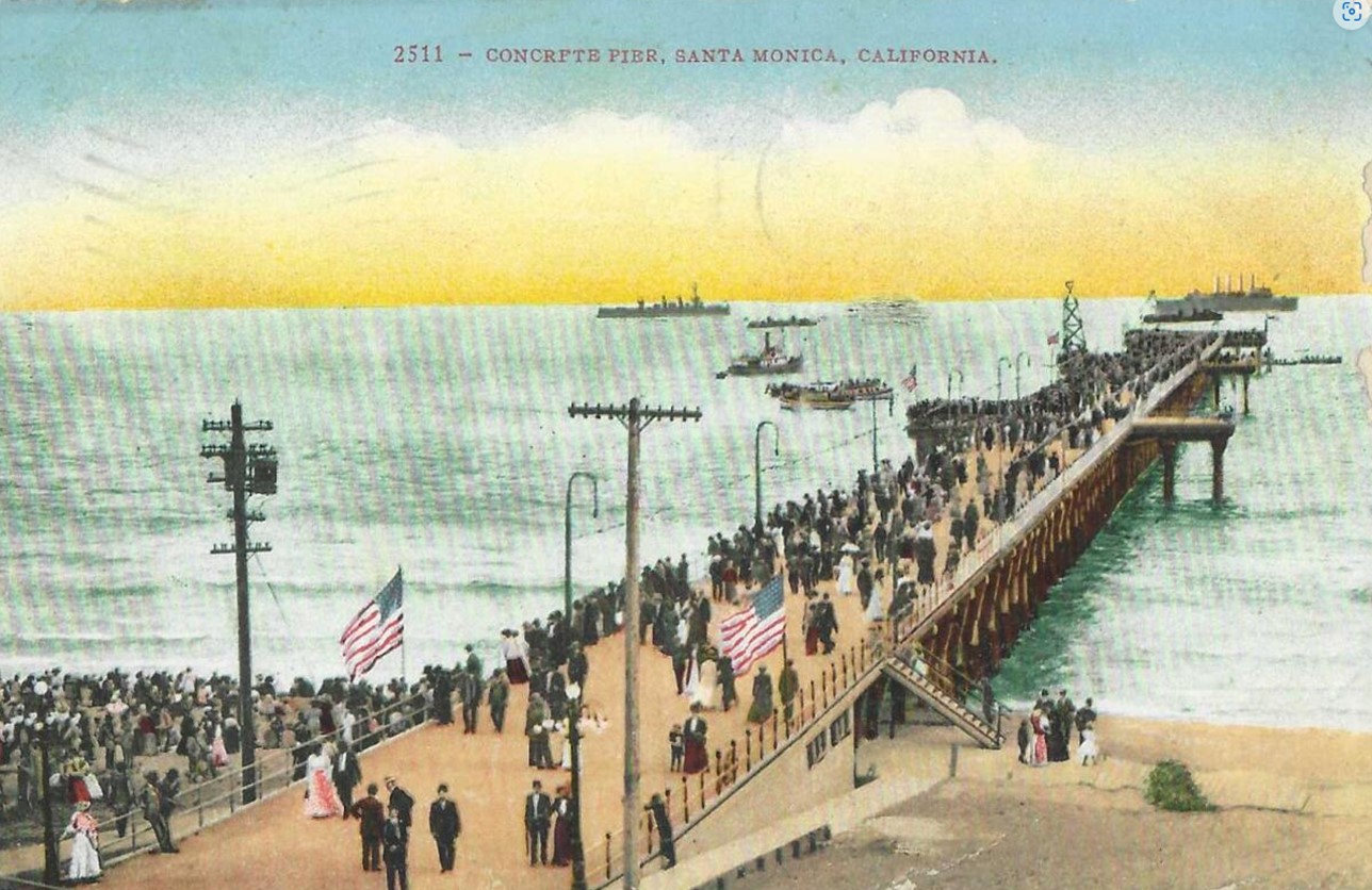 |
|
| (1909)*– Colorized postcard view showing the newly constructed Santa Monica Municipal Pier on opening day. Heading reads: Municipal Pier, Santa Monica. Longest Concrete Pier in the World, 1600 Ft. Long. |
Historical Notes The colorized postcard was a popular medium of the era, giving publishers a way to make black-and-white photographs more visually appealing and commercially attractive at a time when color photography was not yet widely available. This version of the opening-day pier image illustrates how effectively the postcard industry adopted the new Santa Monica Municipal Pier as a subject worthy of wide distribution. The vivid tones applied to the concrete structure, the sky, and the water gave the image a warmth and immediacy that plain photographs of the period often lacked, and the result was a product that felt both modern and inviting to the tourists and potential residents it was meant to reach. Colorized postcards of this kind were typically produced in large print runs by specialty publishers and distributed through hotel lobbies, newsstands, and tourist shops along popular excursion routes like the Balloon Route. Each card sold carried the pier's image and its record-setting measurements to destinations across the country, building name recognition for Santa Monica in living rooms and parlors far from the California coast. The combination of the striking image and the bold claim printed across the front made this postcard one of the more effective pieces of civic promotion the city had produced, and it helped fix the Municipal Pier in the national imagination as one of the defining sights of the Southern California shoreline. |
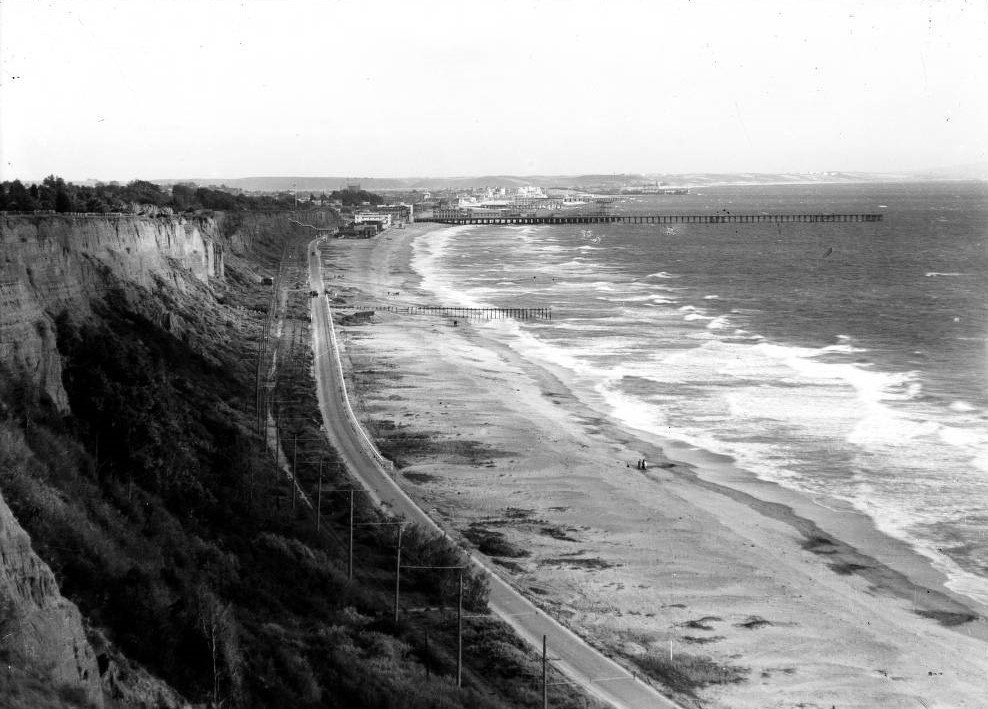 |
|
| (ca. 1909)* - View of Santa Monica Beach looking south from the Palisades. The beach stretches to the right alongside a two-lane paved highway, with a railroad running parallel to it. The Santa Monica Municipal Pier extends into the ocean in the middle distance, and a shorter pier is visible in the foreground. |
Historical Notes This elevated view from the Palisades captures the Santa Monica shoreline in the months just after the Municipal Pier's opening, and it offers a portrait of a coastline still in the early stages of development. The paved road running along the beach would evolve over the following decades into the Roosevelt Highway and eventually become a key stretch of the Pacific Coast Highway, today one of the most celebrated drives in the United States. The railroad tracks running parallel to the road belonged to the electric trolley lines connecting Santa Monica to Los Angeles and to the string of beach communities growing up along the bay. On summer weekends, the trolleys brought thousands of day-trippers to the shore, and the pier had quickly become one of the most popular destinations waiting for them at the end of the line. The shorter pier visible in the foreground was one of several smaller piers that dotted the Santa Monica Bay coastline during this period, as amusement operators and fishing concessions competed for visitors along the shore. In this setting, the long reach of the Municipal Pier made it instantly recognizable from a distance and gave it an authority that the smaller structures around it could not match. The cliffs of the Palisades rising to the left still retained much of their natural character at this time, covered in native scrub and coastal plants, though residential streets and park improvements would follow in the years ahead. The scene as a whole conveys the sense of a community that had just announced itself to the world and was still figuring out what came next. |
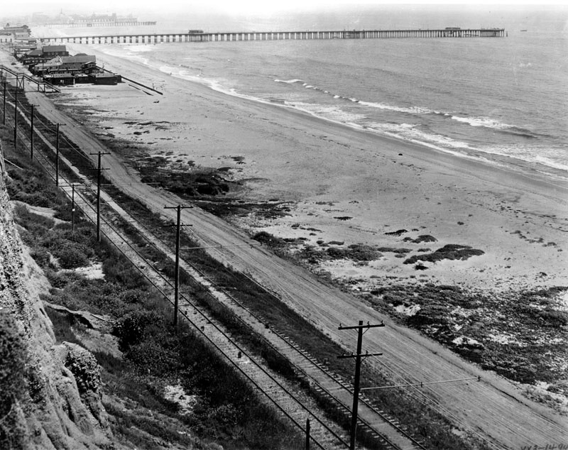 |
|
| (1915)* – View showing railroad tracks running parallel to an old dirt road along the Santa Monica beachfront. This location is now the Roosevelt Highway. The Santa Monica Municipal Pier is visible in the background. |
Historical Notes By 1915, the Santa Monica Municipal Pier had been standing for six years, and the coastline around it was beginning to show the first signs of the transformation that would eventually produce one of the most developed stretches of beachfront property in the world. The dirt road visible in this photograph was already being widened and improved in sections, and within a few years it would be paved and designated as the Roosevelt Highway, a name it carried until its incorporation into the Pacific Coast Highway system. The trolley tracks alongside it remained the primary means of reaching the beach from inland Los Angeles, carrying workers, families, and tourists to the shore at a cost that almost anyone could afford. The pier was by this point a well-established destination rather than a novelty, and the fishing community had thoroughly adopted it as their own. Plans were already in circulation by 1915 to add an amusement section to the area around the pier, and the following year those plans became a reality. In February 1916, Charles I. D. Looff, the carousel builder who had constructed the very first carousel at Coney Island in Brooklyn, purchased land immediately south of the Municipal Pier and began construction of the Pleasure Pier. He and his son Arthur drove the first pilings on March 25, 1916, using a custom electric pile driver that used jets of water to clear sand from beneath each piling before setting it in place. The additions that followed, including the Looff Hippodrome carousel building, the Blue Streak Racer roller coaster, and a variety of other amusements, transformed the pier from a piece of public infrastructure into one of the premier entertainment destinations on the entire Southern California coast. The photographs that follow document the next chapter of that story, as the pier continued to grow and evolve through the years ahead. Click HERE to see more Early Views of the Santa Monica Pier (1917+). |
* * * * * |
Venice Beach |
The Coney Island of the Pacific (1910s to 1920s) |
During the early twentieth century, Venice Beach grew from a small seaside resort into one of the most celebrated coastal destinations on the West Coast. Founded on July 4, 1905 by tobacco millionaire Abbot Kinney, Venice was built as a place where Angelenos could escape the city for fresh ocean air, wide sandy beaches, and a lively seaside atmosphere. Electric trolley cars provided frequent service from downtown Los Angeles and nearby Santa Monica, making the beach easily accessible to working and middle class families alike. On busy summer weekends the crowds could reach well over 100,000 people, earning Venice its popular nickname, the Coney Island of the Pacific. What drew people to Venice was not just the ocean, but the entire experience of spending a day at the shore. Bath houses offered changing rooms, lockers, and equipment rentals, while vendors lined the sand renting out umbrellas and refreshments. Visitors could swim in the surf, stroll along the boardwalk, or simply spread out on the wide sandy beach and watch the crowds. Combined with the nearby amusement piers and the famous Venice canals, the shoreline formed the center of a resort environment unlike anything else in Southern California, and photographs from the era capture a beach culture that was vibrant, social, and entirely new to American life. |
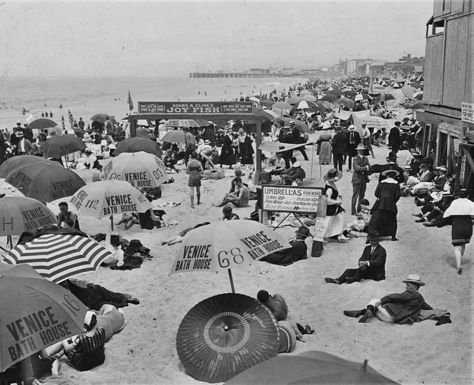 |
|
| (1910s)* – View of sunbathers enjoying an afternoon at Venice Beach in front of the Venice Bath House. Umbrellas are available for rent at 25 cents for three hours or 50 cents for the whole day. The Ocean Park Pier is visible in the distance. |
Historical Notes The Venice Bath House, opened in 1908 by Abbot Kinney, served as the hub of beach services along the shoreline. It was a massive facility containing a saltwater swimming plunge, changing rooms, and lockers, making it possible for visitors who had no access to beachwear at home to arrive by trolley and spend an entire day at the water's edge. The rows of rented umbrellas visible in photographs from this period became one of the defining visual features of the Venice waterfront, and small signs in the sand advertised rates for visitors planning stays of an afternoon, a full day, or even an extended summer week. Beach fashion in this period looked nothing like what we know today. Women wore full wool suits with skirts and stockings, while men wore tank tops with knee length shorts. Sunbathing as we understand it was not yet common, and bathing suits were worn for entering the water rather than lounging in the sun. Venice's city council even passed regulations requiring bathers in swimwear to stay within a narrow strip close to the waterline, a rule that reflected just how differently public beach behavior was understood in the early twentieth century. |
 |
|
| (1923)* – Beauty contest contestants in the Venice-Ocean Park Annual Review with the Moorish-style dome of the Ocean Park Bath House seen in the background. |
Historical Notes By the 1920s, bathing beauty contests had become one of the signature events of the Venice shoreline, drawing large crowds of spectators and contestants from across Southern California. The contests were originally promoted by the Los Angeles Examiner and grew into major seasonal attractions that helped define the festive character of the beach. Contestants paraded along the sand in fashionable bathing suits while judges awarded prizes and titles, and thousands of visitors gathered to watch. Venice later expanded the tradition by introducing male beauty contests in the mid 1920s, including categories for most handsome and most homely, adding a spirit of humor and novelty to the celebrations. The contests unfolded against a backdrop of rapidly changing attitudes toward beach fashion and the female body in public. Suntans were becoming fashionable for the first time, and there was growing demand for more form fitting swimwear. At the same time, beaches were patrolled by officers whose job was to measure the length of women's bathing suits and issue fines to those deemed improperly dressed. Beauty contests, with their celebration of fashionable swimwear and public display, sat at the very center of this cultural tension between older traditions and the more liberated beach culture that was beginning to take hold. |
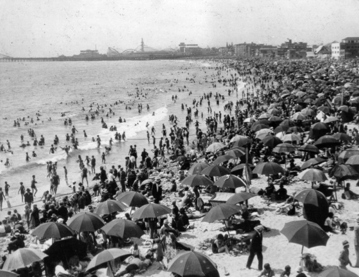 |
|
| (1925)* – The ocean is crowded with people swimming and playing, while the beach is filled with sunbathers and umbrellas. The view looks north toward Ocean Park from Venice Beach. |
Historical Notes By the mid 1920s, Venice Beach had firmly established itself as one of Southern California's most popular summertime destinations. The combination of warm weather, easy rail access from Los Angeles, and a wide variety of entertainment options made it a favorite for families and day trippers of all backgrounds. Photographs from this period show thousands of people filling both the surf and the sand from morning until late afternoon, a scene that repeated itself every weekend throughout the summer months. Beach culture itself was visibly shifting in ways that photographs from this era make clear. Bathing suits had evolved toward more form fitting silhouettes with higher cuts, a striking contrast to the covered up styles of just a decade earlier. The beach was increasingly becoming a place of fashion and social display as much as simple recreation. The sight of thousands of bathers filling the surf and the sand at Venice represented something genuinely new in American life, a sense that the beach belonged to everyone and that a day in the sun was one of the simple pleasures available to ordinary people. |
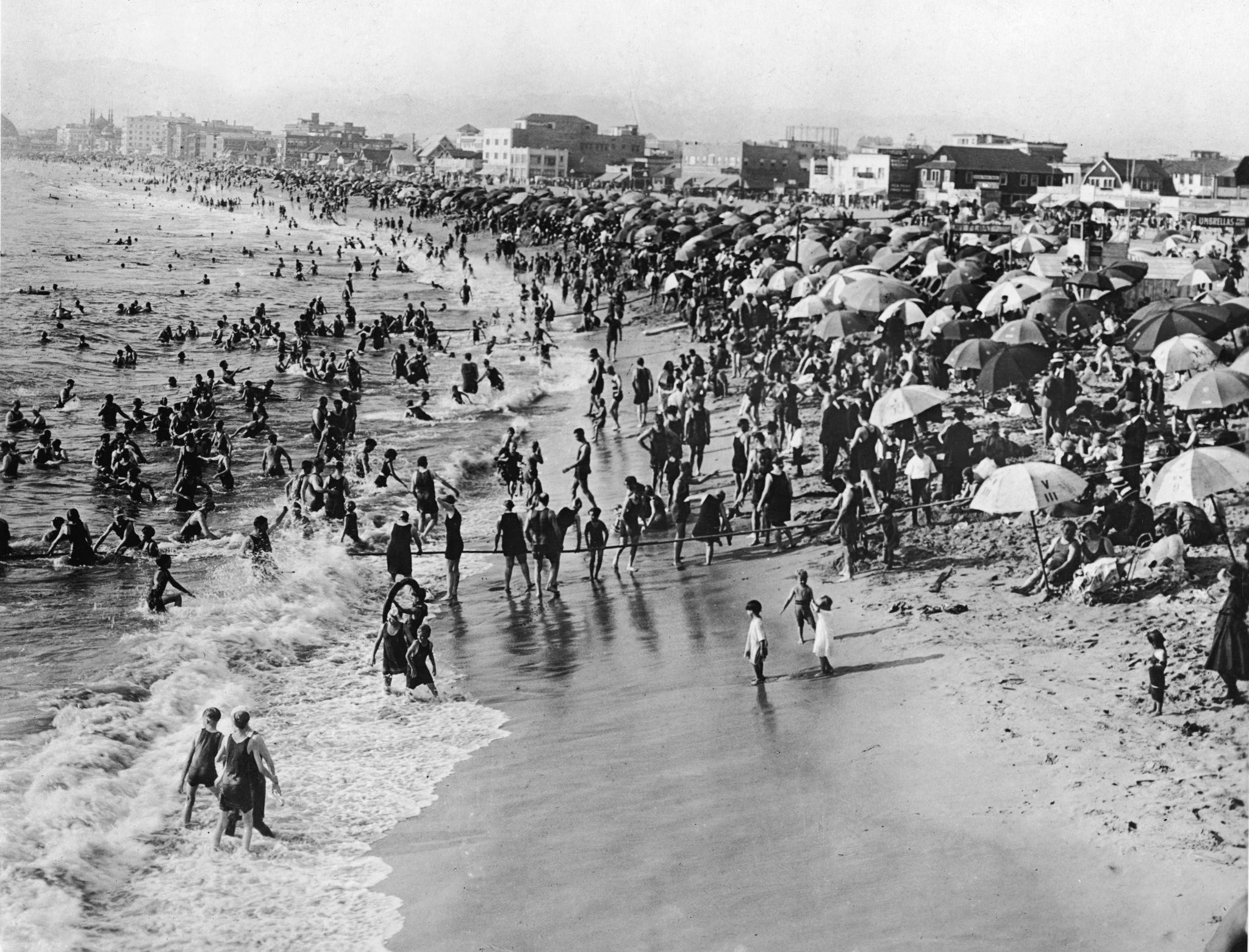 |
|
| (1926)* – Crowds line the shoreline as swimmers and sunbathers fill Venice Beach during the height of the resort era. |
| Historical Notes
Scenes like this defined Venice Beach at its peak. The wide shoreline drew visitors from every walk of life, and the beach itself served as both a recreational playground and a social gathering place where the crowds became part of the spectacle. The combination of ocean swimming, rented umbrellas, nearby amusement piers, and a boardwalk full of vendors and performers created an atmosphere that was festive, democratic, and impossible to find anywhere else in the region. It would not last. By 1925, Venice's aging roads, water systems, and sewage infrastructure were badly in need of repair and expansion, and a consolidation vote resulted in Venice being officially merged into the City of Los Angeles in 1926. The new city government showed little interest in preserving the resort character that had made Venice famous, and the amusement piers and beach culture that had defined the neighborhood for two decades began to slowly fade. The golden era of Venice Beach as the Coney Island of the Pacific was drawing to a close, though the photographs here preserve it at its most vivid and alive. |
* * * * * |
Ocean Park Bath House |
Introduction |
In the early 1900s, Ocean Park was one of the busiest beach communities along Santa Monica Bay. Electric streetcars brought thousands of visitors from Los Angeles every weekend, and the shoreline was lined with hotels, restaurants, amusement piers, and bathhouses that kept the crowds coming back. Developer Alexander Rosborough Fraser saw an opportunity to give the district something that would set it apart from every other beach resort in Southern California. What he built became one of the most talked-about structures on the entire coast.The Ocean Park Bath House opened on the Fourth of July weekend in 1905 at a cost of $185,000. Designed by Los Angeles architect Joseph Cather Newsom in a Moorish style, the three-story building featured five large domes, round turrets at each corner and above the main entrance, and rows of arched windows facing the Pacific. Inside was an 8,450-square-foot heated saltwater pool called the plunge, one of the largest indoor pools in the country at the time. Advertisements from 1906 claimed it was the largest swimming pool in the United States, a boast that drew attention from newspapers across the region and put Ocean Park on the map as a destination worth the trip.The bath house stood for nearly three decades. It survived two major pier fires, in 1912 and 1924, that destroyed much of the surrounding beachfront. Crowds continued filling the sand in front of it through the 1920s. Daredevil pilots landed on the beach beside it. Lifeguards patrolled the boardwalk out front. Evening moonlight bathing events drew visitors well after dark. The building was finally torn down in 1933 after the Depression had taken its toll on the beach resort economy. The photographs below show the bath house during the years when it stood at the center of one of the liveliest stretches of shoreline in California. |
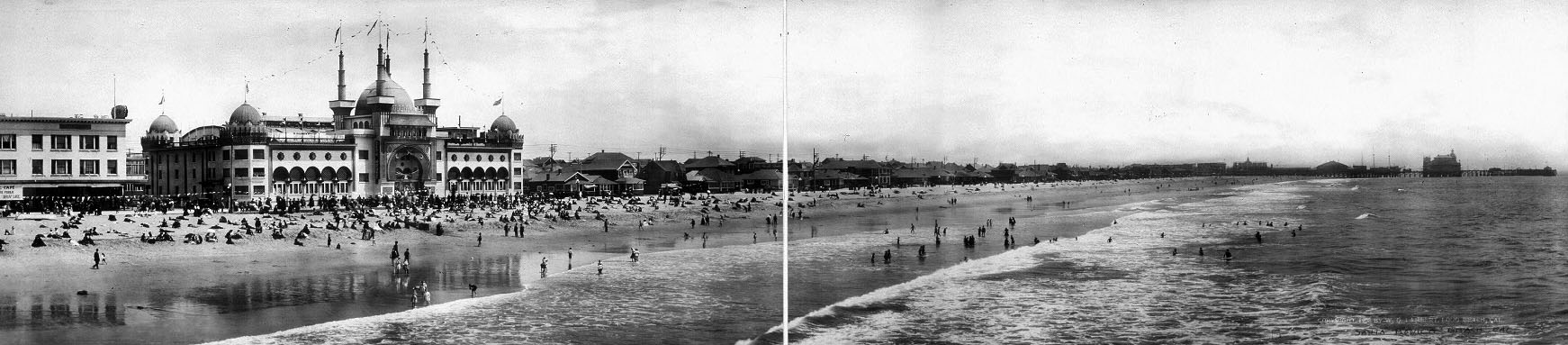 |
|
| (ca. 1908)* – Panoramic view looking south from Ocean Park Pier in Santa Monica. The Ocean Park Bath House, completed in 1905, appears at left along the shoreline. |
Historical Notes When the Ocean Park Bath House opened in 1905, it was immediately one of the most impressive buildings on the Southern California coast. The three-story structure rose above the sand with five large domes, corner turrets, and rows of arched windows that made it look more like a Moorish palace than a public swimming facility. Its $185,000 construction cost made it one of the most expensive beachfront buildings in the region at the time. The building's most celebrated feature was its heated saltwater plunge. Ocean water was piped directly into the pool and warmed to a comfortable temperature year-round. For visitors who found the cold Pacific surf too chilly, the plunge was a perfect alternative. Advertisements from 1906 claimed it was the largest swimming pool in the United States, and that claim drew crowds from across Southern California from the moment the doors opened. |
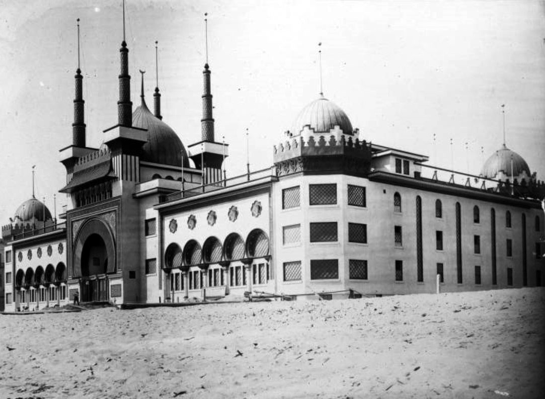 |
|
| (1905)* - View of the Moorish style Ocean Park Bath House nearing completion. Round turrets rise from each corner and above the main entrance while workers finish construction along the beachfront. |
Historical Notes The Ocean Park Bath House was designed by architect Joseph Cather Newsom, who gave it a bold Moorish look that was meant to turn heads. The domes, minarets, and ornate entrance made the building look like something out of another world, and that was exactly the point. Fraser wanted a structure that would announce Ocean Park as a serious destination and give visitors something to talk about long after they went home. The building was not cheap to build. The steel frame alone, supplied by the Llewellyn Iron Works, cost $14,700. When it finally opened it quickly became the subject of postcards sold throughout Southern California. Fraser followed it up with the Ocean Park Auditorium, the Masonic Temple, and the Decatur Hotel in 1906, then completed his Million Dollar Pier in 1911. But the bath house always remained the building that defined what Ocean Park looked like and what it stood for. |
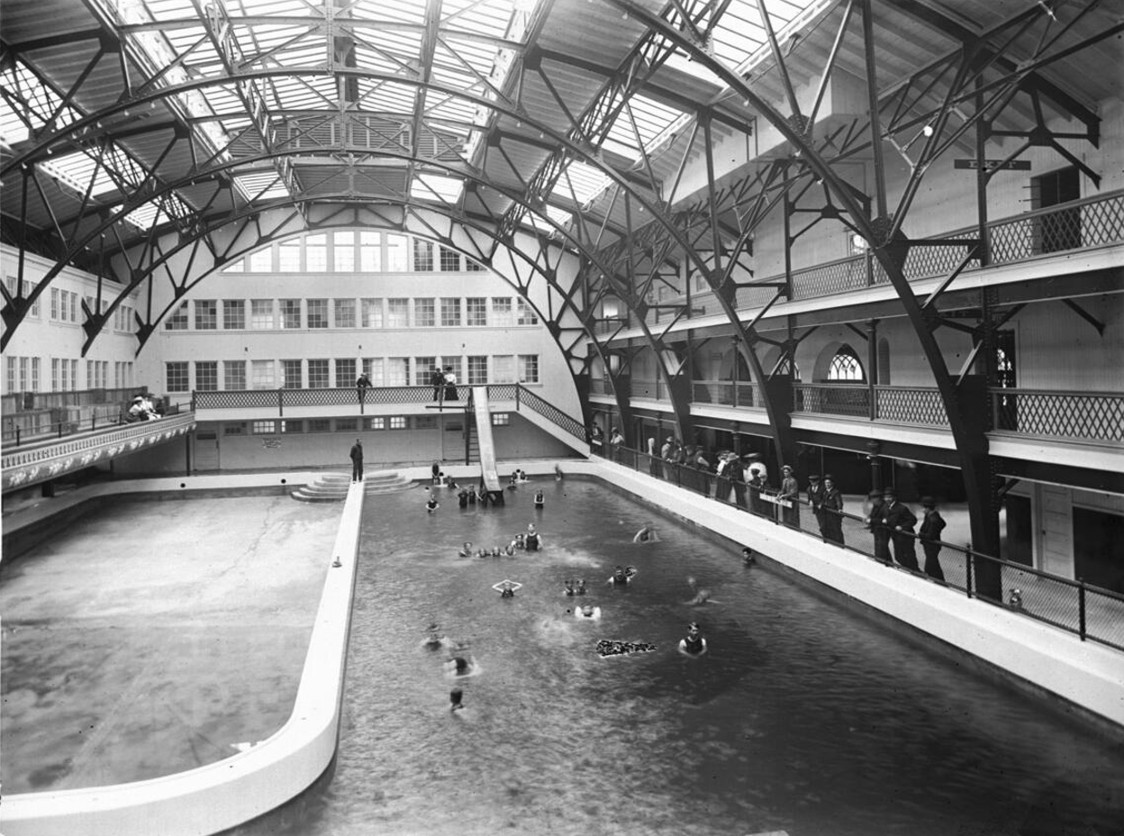 |
|
| (ca. 1905)* – Interior view of the Ocean Park Bath House showing spectators watching swimmers in the heated saltwater plunge. Elevated galleries surrounded the pool beneath a soaring arched roof supported by iron columns. |
Historical Notes The Ocean Park Bath House was far more than a place to change into a bathing suit. Its centerpiece was the enormous heated saltwater plunge, where visitors could swim in warm ocean water regardless of the weather or surf conditions outside. Ocean water was pumped directly into the pool, heated, and circulated throughout the day, making it one of the most modern recreational facilities on the West Coast when it opened in 1905. The broad galleries around the pool allowed family members and friends to watch the swimmers, turning a visit into a social outing as much as a recreational one. This photograph also highlights the impressive engineering of the building. Iron columns supported the lofty vaulted roof while large windows and skylights flooded the interior with natural light. Signs reading "Positively No Smoking" and "Bathers Must Not Stand on This Edge" remind us that even in 1905 the bath house operated under rules intended to promote safety and order. For many visitors arriving by Pacific Electric streetcar from Los Angeles, the plunge offered a warm, comfortable alternative to the often chilly waters of Santa Monica Bay. |
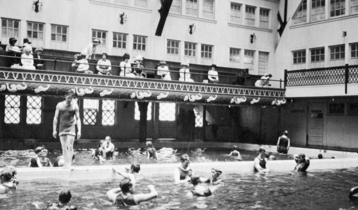 |
|
| (ca. 1905)* - Bathers enjoy the heated saltwater plunge inside the Ocean Park Bath House while spectators observe from the surrounding galleries above. The spacious indoor pool quickly became one of the resort's most popular attractions. |
Historical Notes Unlike the previous view, which emphasizes the building itself, this photograph captures the plunge as it was intended to be experienced. Swimmers of all ages shared the warm saltwater pool while friends and family looked on from the elevated galleries. The bath house provided a year-round destination where visitors could enjoy the benefits of ocean bathing without rough surf, cold water, or unfavorable weather. The Ocean Park Bath House reflected the growing popularity of indoor public bathing during the early twentieth century. Combining modern engineering with resort-style recreation, the facility offered heated seawater, spacious dressing rooms, diving platforms, water slides, and areas for spectators. Its blend of recreation, architecture, and social gathering helped make the bath house one of Ocean Park's signature attractions during the community's heyday as Southern California's premier seaside resort. |
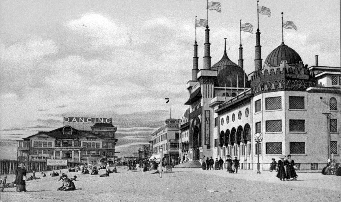 |
|
| (ca. 1909)*- Postcard view of Ocean Park beach with the pier in the distance and the Ocean Park Bath House visible along the shoreline. |
Historical Notes By the end of the first decade of the twentieth century, Ocean Park had become one of the most popular beach resorts along Santa Monica Bay. Visitors arrived by electric streetcar, early automobile, and on foot from nearby communities to swim, enjoy the amusements, and take in the lively atmosphere along the shore. The bath house stood at the center of it all, its domes visible from the pier and its entrance drawing steady lines of visitors throughout the summer season. Postcards like this one were one of the main ways resorts advertised themselves in the early 1900s. Printed in large quantities and sold at hotels, newsstands, and souvenir shops along the streetcar lines, they carried images of the bath house, the pier, and the crowded beaches to homes all across the region. For many people, a postcard like this was the first glimpse they ever had of Ocean Park, and it was often enough to convince them to make the trip. |
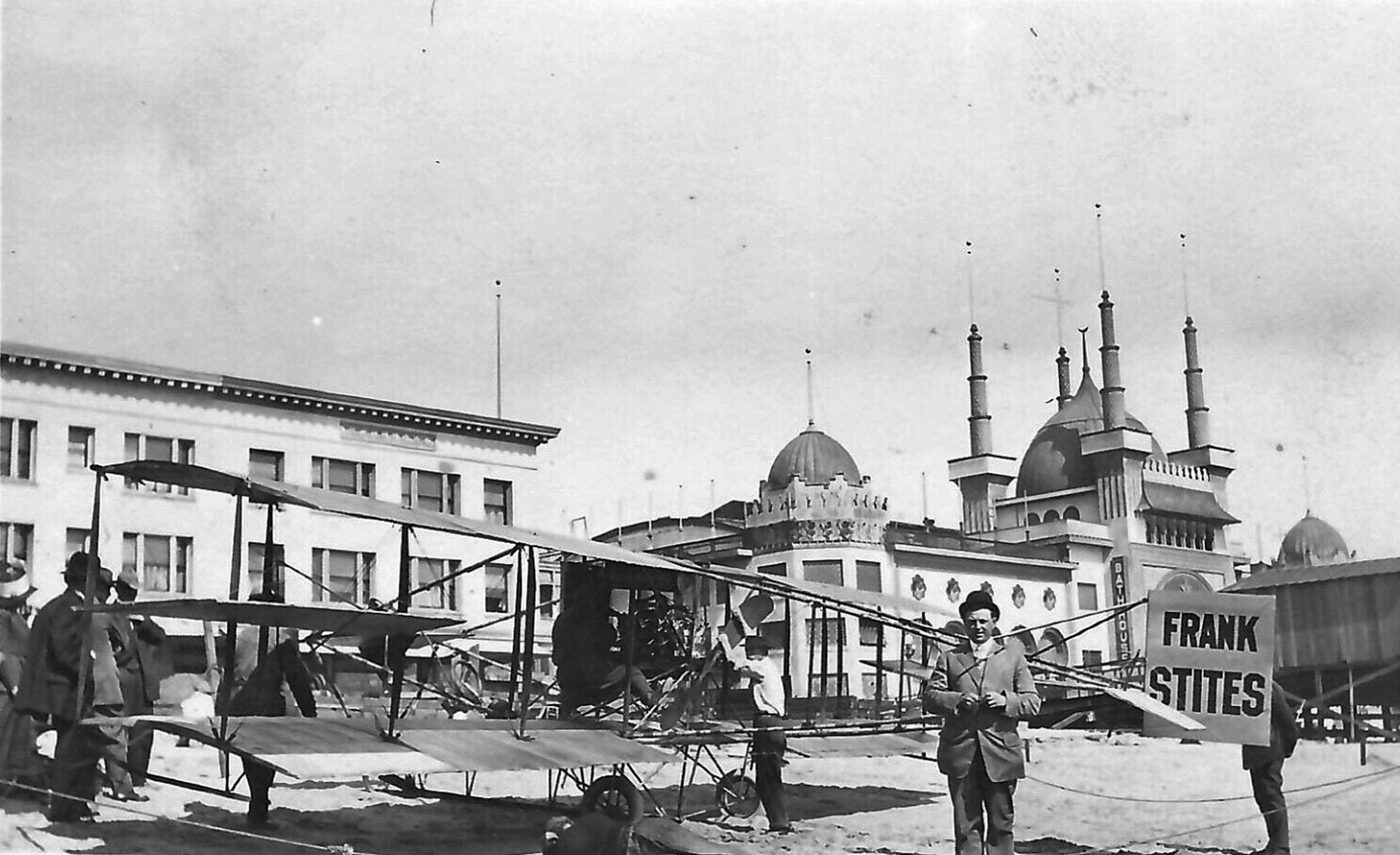 |
|
| (ca. 1909)* - Early airplane of pilot Frank Stites resting on the beach in front of the Ocean Park Bath House. |
Historical Notes Frank Stites was one of the best-known stunt pilots in early Los Angeles, and the wide, flat beach at Ocean Park was one of his favorite landing spots. There were no airports in those days, so ocean beaches served as natural runways for early aviators. Resort operators along the coast, including the Kinney Company, hired pilots like Stites to perform exhibition flights above the water, knowing that nothing drew a crowd faster than the sight of an airplane in flight. Photographs from around 1909 show his fragile wood-and-canvas biplane parked in the sand directly in front of the bath house. Stites went on to become one of the most active exhibition pilots in Southern California, flying at resorts, racetracks, and fairgrounds up and down the coast throughout the early 1910s. He died on March 16, 1915, when his plane crashed during a staged aerial battle performed for the grand opening of Universal City. He was 32 years old. The photograph here captures him near the start of his career, when the beach was still the only runway available and the bath house rising behind him was the grandest building on the shore. |
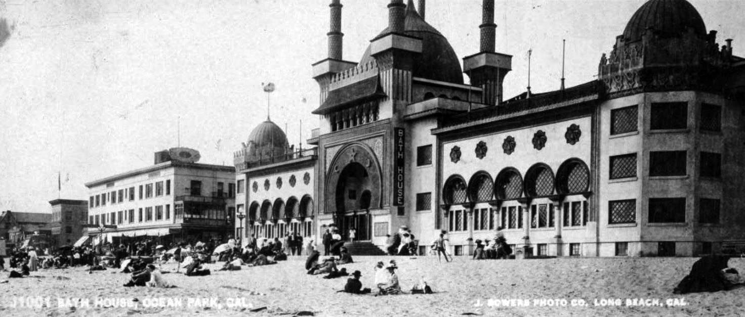 |
|
| (ca. 1910)* – Panoramic view showing people gathered along the beach in front of the Ocean Park Bath House. |
Historical Notes Scenes like this show how quickly the bath house changed the character of Ocean Park's beachfront. On warm days the shoreline filled from the water's edge to the boardwalk with swimmers, sunbathers, and visitors who had arrived by Pacific Electric streetcar from Los Angeles. The bath house gave the beach a clear center of gravity, a landmark that organized the whole scene and gave people a reason to gather in one place. Inside, visitors could rent bathing suits, change in private dressing rooms, and enter the heated plunge without ever touching the cold ocean. Outside, the building's Moorish facade and dramatic roofline gave the beach a visual presence that no other resort along the bay could match. The combination of a striking building, a comfortable pool, and easy streetcar access made Ocean Park one of the most popular destinations on the coast during these years. |
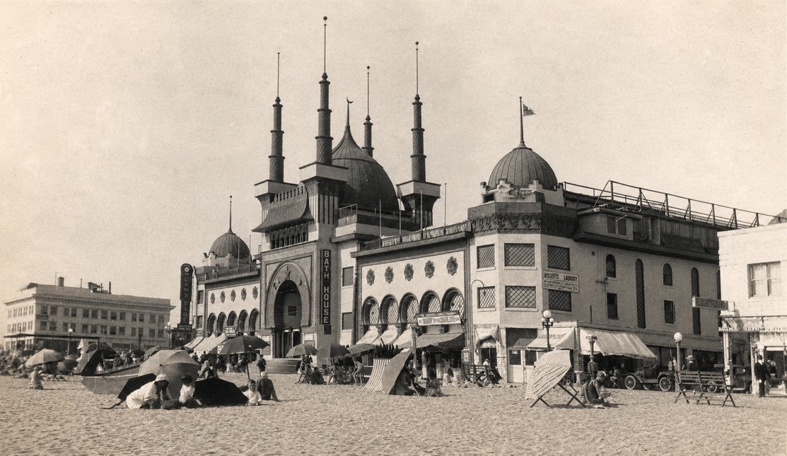 |
|
| (1916) - Panoramic view showing beachgoers enjoying a sunny day in front of the Ocean Park Bath House. Photo courtesy of the Stan Onaitis Collection. |
Historical Notes By 1916, Ocean Park had reached the height of its popularity as one of Southern California's premier seaside resorts. Families arrived by Pacific Electric streetcar, automobile, and interurban rail to spend the day swimming, strolling the beach, and enjoying the attractions that stretched along the shoreline. The Ocean Park Bath House remained the centerpiece of the resort, offering visitors heated saltwater bathing, dressing rooms, and easy access to the sand just beyond its doors. This photograph captures more than the bath house itself—it preserves the relaxed atmosphere of a typical summer day at Ocean Park during its golden years. Crowds spread across the wide sandy beach while the distinctive domes of the bath house rose above the shoreline, creating one of the most recognizable scenes along Santa Monica Bay. Thanks to photographs like this, we can still experience the lively character of Ocean Park as thousands of visitors knew it more than a century ago. |
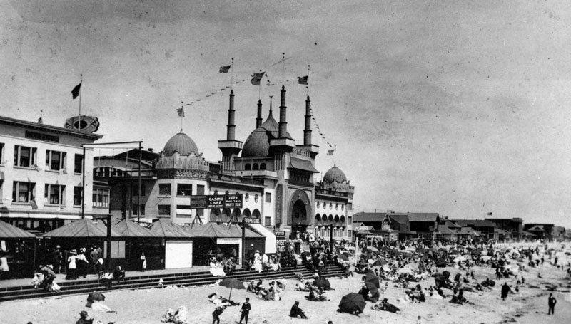 |
|
| (Early 1900s)* - Crowded shoreline in front of the Ocean Park Bath House at Ocean Park Beach. |
Historical Notes The growth of Ocean Park during the early 1900s was largely the work of Alexander Rosborough Fraser, who built one major attraction after another around the bath house. In 1903 he opened the Ocean Park Casino. In 1905 he opened the bath house itself. In 1906 he added the Ocean Park Auditorium, the Masonic Temple, and the Decatur Hotel. In 1911 he completed Fraser's Million Dollar Pier, a structure extending a thousand feet over the ocean and packed with amusements and a dancing pavilion. He also built the concrete promenade that connected Ocean Park with Venice to the south. Together, these projects gave Ocean Park a concentration of entertainment that was hard to find anywhere else along the coast. Visitors stepping off the streetcar found themselves within walking distance of a grand bathhouse, a pleasure pier, a ballroom, and a full commercial district. The crowds that packed the shoreline during the summer season were the direct result of everything Fraser had built around that original bath house on the sand. |
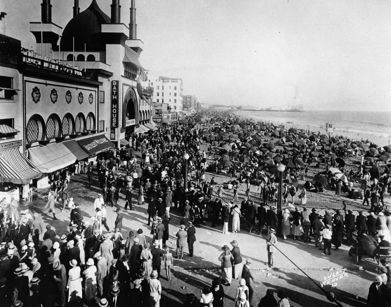 |
|
| (Early 1900s)* - Large crowds gather along the beach in front of the Ocean Park Bath House. |
Historical Notes The Pacific Electric Railway made crowds like this possible. Its streetcar lines connected downtown Los Angeles to the beach communities along Santa Monica Bay quickly and cheaply, and on summer weekends the cars ran constantly. A round trip fare was within reach of almost any working family, and thousands of people took advantage of it every week throughout the summer season. Once at Ocean Park, visitors could enter the bath house for a swim in the heated plunge, rent an umbrella on the sand, stroll the boardwalk, or catch a live band performance at the Casino a short walk away. The bath house was the busiest single attraction on the beach, offering changing rooms, rental suits, and a warm pool that made a day at the shore accessible to families who might have found the cold ocean surf too much of a challenge on its own. |
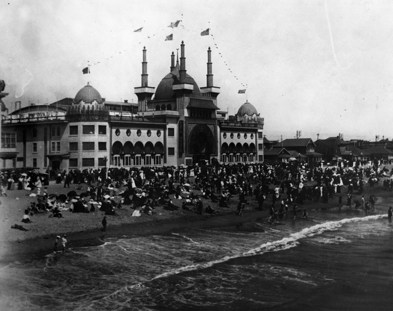 |
|
| (Early 1900s)* - Crowded beach scene at Ocean Park with the bathhouse overlooking the shoreline. |
Historical Notes The bath house was one of the most recognizable buildings on the Santa Monica coast. Its five domes and corner turrets rose well above the wooden piers and smaller beachfront structures around it, giving it a presence on the skyline that nothing else in the district could match. It was visible from the pier, from passing boats offshore, and from the bluffs above Palisades Park to the north. For the many Angelenos who spent summer weekends at the beach during these years, the dome of the Ocean Park Bath House was as familiar a sight as the sound of the waves. It appeared in the background of countless personal photographs and postcards from the era, the one constant landmark against which the life of the shoreline played out season after season. |
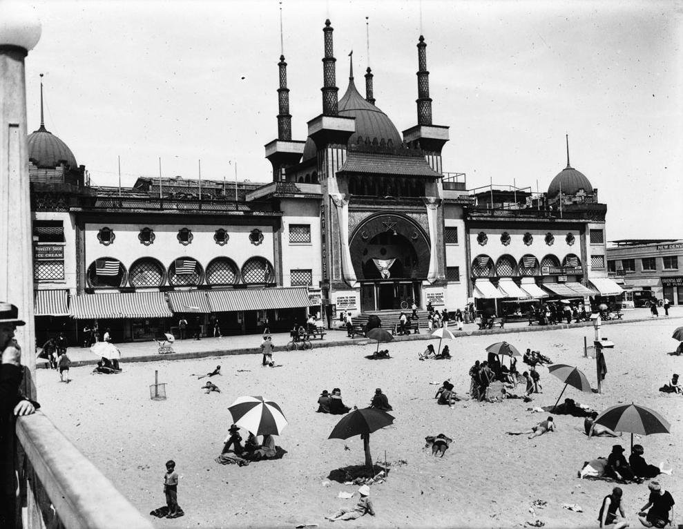 |
|
| (ca. 1920)* - Exterior view of the Ocean Park Bath House from the pier showing the large central dome and surrounding towers. |
Historical Notes By the early 1920s the bath house had been standing for fifteen years and had come through two major pier fires that destroyed much of the surrounding beachfront. The 1912 fire burned more than 220 structures across six city blocks and required twelve fire companies nearly four hours to put out. The bath house survived both fires, thanks in large part to its steel-framed construction, and continued operating while the district around it was rebuilt. Seen from the pier in this view, the building still shows the full design that architect Joseph Cather Newsom created in 1905. The large central dome rises above four tall flanking spires, smaller domed towers mark each corner of the roof, and awnings shade the ground-floor entrance along the beachfront. Fifteen years of salt air and heavy use had done nothing to diminish the grandeur of the building's appearance. |
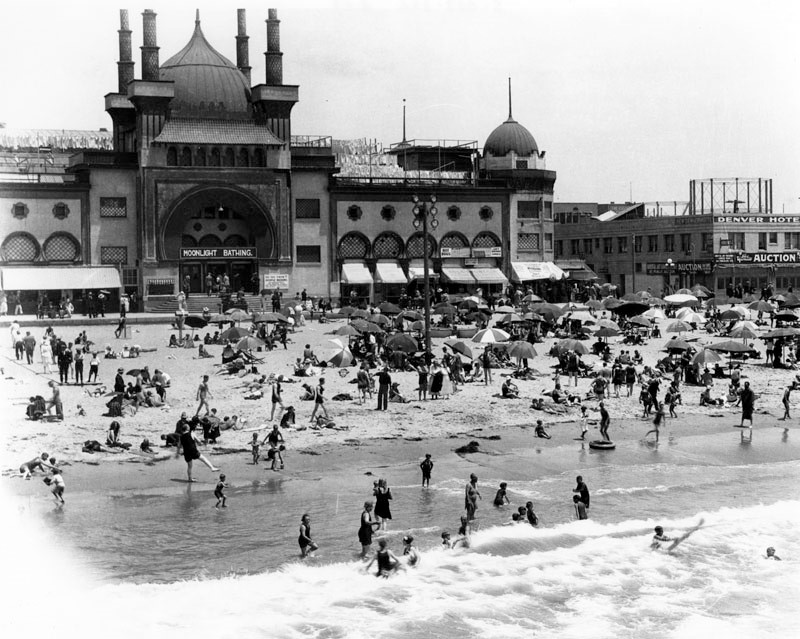 |
|
| (1921)* - View of the beach and ocean with the Ocean Park Bath House in the background, a sign over the entrance advertising moonlight bathing. The Denver Hotel and a Yosemite Auction sign are visible to the right. |
Historical Notes Moonlight bathing became a popular attraction at beach resorts along the Southern California coast during the 1910s and 1920s. Resort operators found that evening events could bring in a different crowd than the daytime rush, people looking for a cooler, more relaxed experience by the water after the sun went down. At Ocean Park, the bath house promoted these nighttime sessions with signage above the entrance that was clearly visible to visitors on the boardwalk and the beach. The heated indoor plunge made moonlight bathing practical in a way that the cold ocean after dark was not for most people. Guests could arrive in the evening, change inside the building, swim in the warm pool, and walk back out onto the boardwalk under the night sky. The Denver Hotel and Yosemite Auction sign visible to the right of the bath house are a reminder of how much the neighborhood around the building had filled in with shops, hotels, and commerce by 1921. |
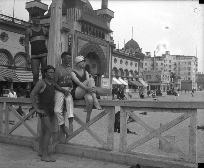 |
|
| (ca. 1925)* - Bathers and lifeguard on the boardwalk in front of the Ocean Park Bath House. |
Historical Notes By the mid-1920s Ocean Park was one of the busiest recreational areas along Santa Monica Bay. The presence of a uniformed lifeguard on the boardwalk reflects how the beach had changed since the bath house first opened. What had begun as a private bath house centered around a heated saltwater plunge had grown into a full resort environment, with city-employed lifeguards, boardwalk vendors, and concession stands serving the busy stretch of sand throughout the summer months. |
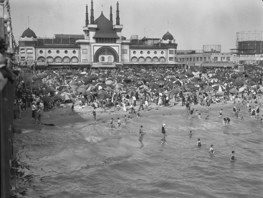 |
|
| (1929)* - Crowd celebrating the Fourth of July in front of the Ocean Park Bathhouse. |
| Historical Notes
The Fourth of July had always been a big day at Ocean Park. The bath house had opened on that holiday weekend in 1905, and for nearly three decades the summer crowds that packed the beach in front of it were at their largest on the Fourth. This photograph, taken in 1929, captures one of the last of those celebrations. Within a few months the stock market would crash, ushering in the Great Depression that would permanently change Ocean Park's resort economy. The bath house was torn down in 1933. The site eventually became a parking lot, and nothing was left of the building that had defined the Ocean Park skyline for nearly thirty years. Today, the Adda & Paul Safran Senior Housing complex stands on much of the former site where the domes once rose above the sand. For the people in this photograph, none of that was visible yet. They were simply enjoying another Fourth of July at the beach, in front of the grandest building on the shore. |
Then and Now
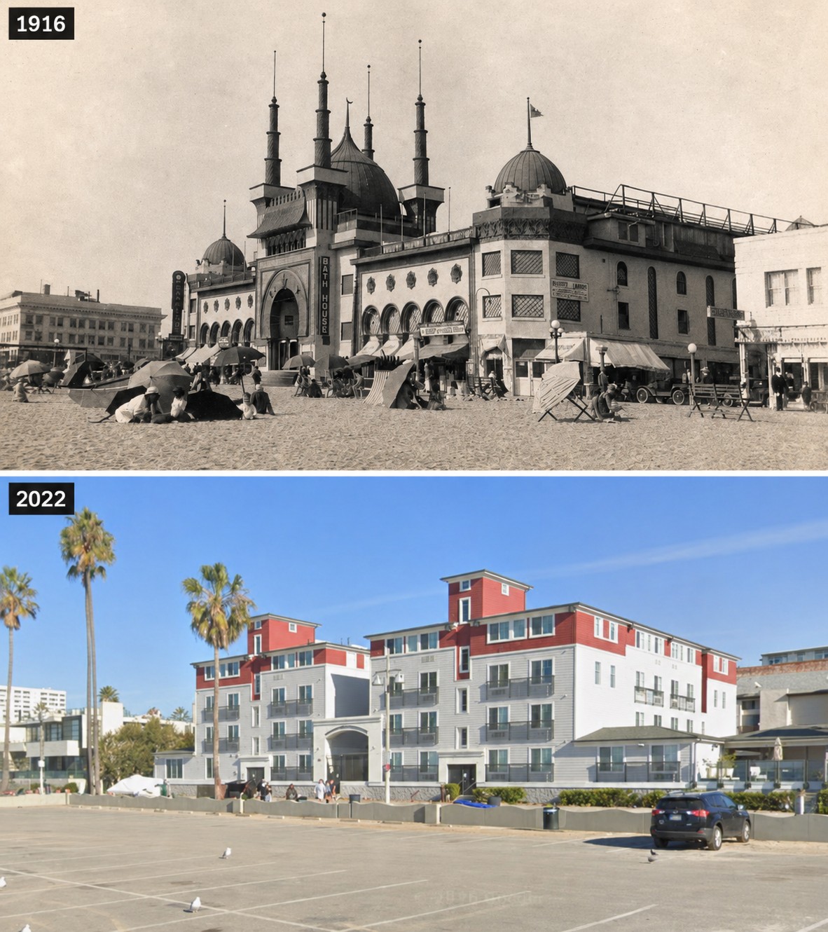 |
|
| (1916 vs 2022)* - The Ocean Park Bath House at the height of its popularity, compared with the same site today, now occupied by the Adda & Paul Safran Senior Housing complex. Photo comparison by Jack Feldman. |
Historical Notes After the Ocean Park Bath House was demolished in 1933, the property became a parking lot. Today, much of the former site is occupied by the Adda & Paul Safran Senior Housing complex, built in 2003 on the block between Navy Street and Ozone Avenue. The beach, parking lot, and Ocean Front Walk remain just west of where the bath house once stood. This comparison illustrates how completely Ocean Park has changed over the past century. One of Southern California's grandest seaside attractions gave way first to a parking lot and later to senior housing, reflecting the neighborhood's evolution from a resort destination into a residential beachfront community. |
Closing Note For nearly three decades the Ocean Park Bath House was one of the most familiar sights along Santa Monica Bay. Its Moorish domes and towers could be seen from the piers, from the bluffs above Palisades Park, and from the streetcars that carried thousands of visitors to the shore each week. Around it grew a full resort district of piers, hotels, dance halls, and amusement attractions that made Ocean Park one of the most visited and liveliest beach communities in early Southern California. When the building came down in 1933, it marked the end of an era for a stretch of coastline that had become one of the busiest and most vibrant beach communities in Southern California. |
* * * * * |
Downtown Santa Monica: Third Street Through Time |
Third Street has long been the commercial heart of Downtown Santa Monica. Early twentieth century shoppers shared the street with automobiles, horse-drawn wagons, and Pacific Electric streetcars, while today the same stretch is known worldwide as the pedestrian-only Third Street Promenade. These photographs illustrate more than a century of change at one of Southern California's best-known shopping districts. |
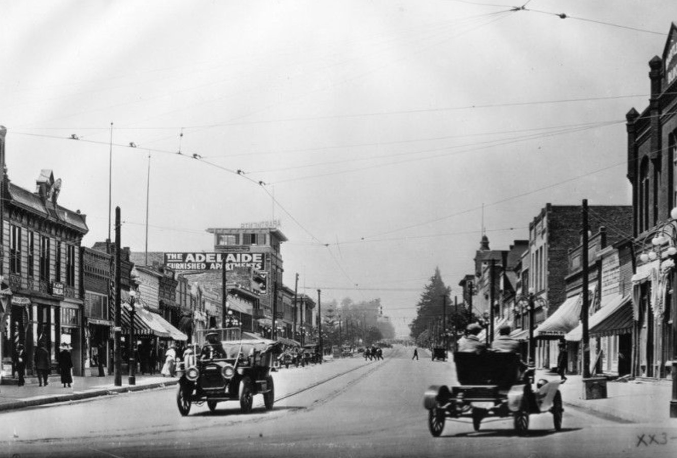 |
|
| (1910)* - View looking northwest along Third Street from Utah Street (now Broadway), showing the commercial heart of Downtown Santa Monica. Today this same stretch is known as the Third Street Promenade. |
Historical Notes By 1910, Third Street had become Santa Monica's principal shopping district. Automobiles, horse-drawn wagons, pedestrians, and electric streetcars all shared the roadway, creating a lively streetscape that reflected the city's rapid growth. Many of the early automobiles seen here still featured right-hand steering, a carryover from the industry's formative years before left-hand drive became the American standard. Storefronts lined both sides of the street, serving residents as well as the growing number of visitors arriving from Los Angeles by Pacific Electric Railway. Although the buildings have changed over the decades, this intersection has remained the commercial center of Downtown Santa Monica for more than a century. |
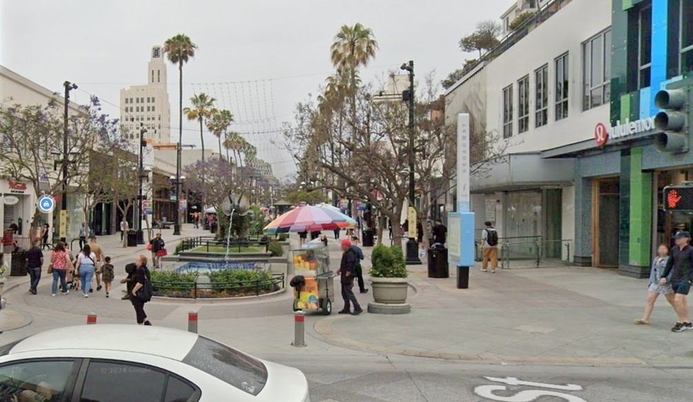 |
|
| (2024)* - Looking northwest along the Third Street Promenade at Broadway, nearly the same view as the 1910 photograph. |
Historical Notes Third Street's transformation began in 1965 when several downtown blocks were closed to automobile traffic as part of an ambitious urban renewal project. A major redesign completed in 1989 introduced new landscaping, public art, outdoor dining, and street performances, creating what became the Third Street Promenade. Today the Promenade remains one of Southern California's most recognizable pedestrian shopping districts, blending national retailers, local businesses, restaurants, entertainment venues, and public gathering spaces while preserving Third Street's historic role as the heart of Downtown Santa Monica. |
Then and Now
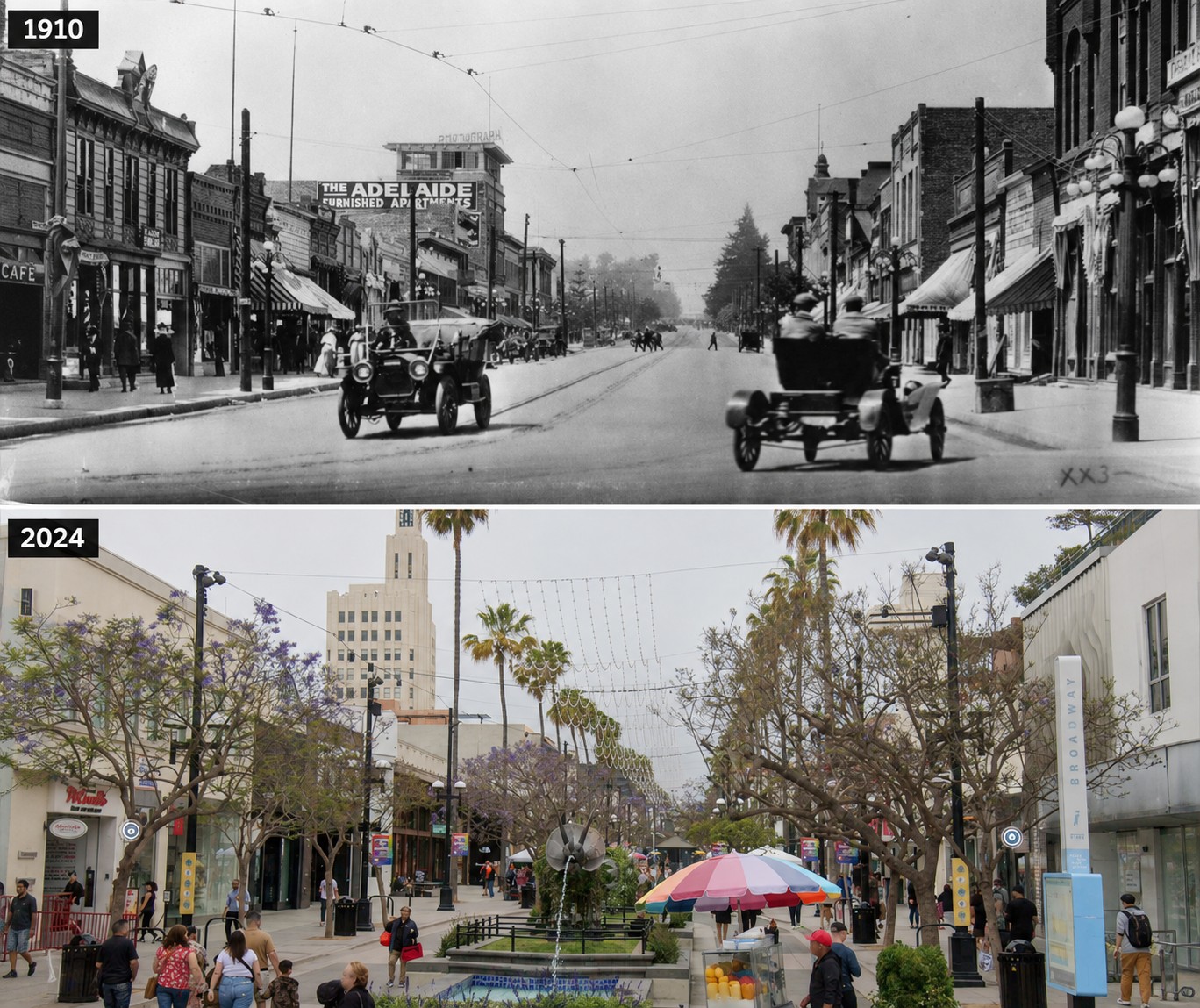 |
|
| (1910 vs. 2024)* - Then and Now comparison looking northwest along Third Street at Broadway. More than a century separates these two views of what is now the Third Street Promenade. Photo comparison by Jack Feldman. |
Historical Notes Although the buildings, streetscape, and transportation have changed dramatically since 1910, this intersection has remained the commercial center of Downtown Santa Monica for generations. The comparison highlights the city's evolution from an automobile-oriented business district into one of Southern California's premier pedestrian destinations. ClicK HERE to see more early views of Third Street and today's Third Street Promenade. |
* * * * * |
Auto Racing in Early Santa Monica |
For a decade, the streets of Santa Monica became one of America's premier automobile racing courses. Beginning in 1909, Southern California automobile dealers organized annual road races to encourage interest in the automobile at a time when cars were still a novelty for most Americans. Each race transformed ordinary city streets into an 8.4-mile circuit that attracted the country's best drivers, leading automobile manufacturers, and tens of thousands of spectators.The course followed three main streets—Ocean Avenue, Nevada Avenue (renamed Wilshire Boulevard in 1913), and San Vicente Boulevard. Together they formed one of the fastest road racing circuits in the nation, while the sharp turn from Ocean Avenue onto Nevada Avenue became famous as "Death Curve." Santa Monica hosted the prestigious Vanderbilt Cup and American Grand Prize races in 1914 and 1916, bringing international attention to the growing seaside community. Although the races ended after 1919, they remain one of the most memorable chapters in Santa Monica's early history. |
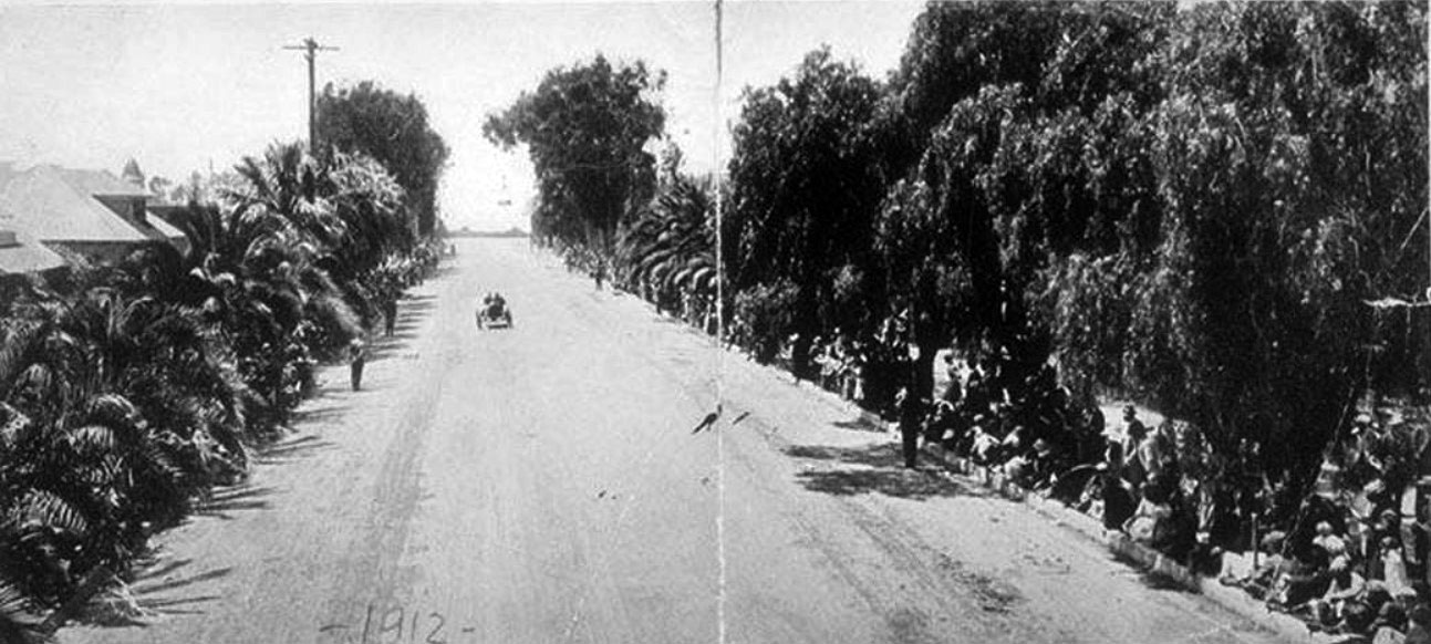 |
|
| (1912)* - View looking west along Nevada Avenue (renamed Wilshire Boulevard the following year), part of Santa Monica's famous 8.4-mile road racing circuit. |
Historical Notes Santa Monica's annual road races were held from 1909 through 1919, with a pause during America's involvement in World War I. The races were organized by a group of Southern California automobile dealers who wanted to introduce the public to the rapidly growing automobile industry and demonstrate the speed, reliability, and excitement of the newest cars. Although promoted as sporting events, the races also served as one of the nation's earliest automotive showcases. Thousands of spectators came to watch the latest racing machines compete on ordinary city streets, helping fuel Southern California's growing interest in the automobile. |
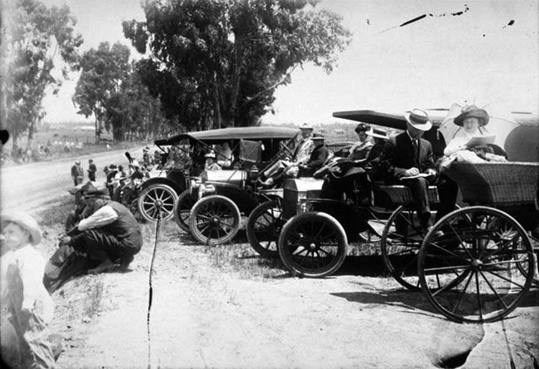 |
|
| (1912)* – Close-up view showing spectators on the side of the road and in their automobiles on Nevada Avenue (later Wilshire Boulevard) waiting for the Santa Monica Road Race to begin. |
Historical Notes Race day turned Santa Monica into one of Southern California's largest public events. Visitors arrived by automobile, streetcar, horse-drawn carriage, and on foot, filling sidewalks, grandstands, and every available viewing spot along the course hours before the race began. The 8.4-mile circuit challenged drivers with long straightaways, sweeping turns, and changing road conditions. As the popularity of the races grew, so did the size of the crowds, making the annual event one of the region's biggest sporting attractions. |
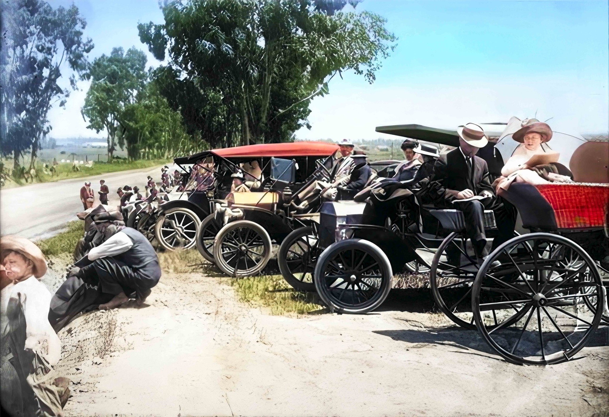 |
|
| (1912)* – Colorized view of spectators waiting along Nevada Avenue (later Wilshire Boulevard) before the start of the Santa Monica Road Race. Image enhancement and colorization by Richard Holoff. |
Historical Notes When Santa Monica was founded in 1875, many of its east-west streets were named after western states and territories. As the city expanded during the early twentieth century, several of those names were replaced with the familiar street names used today. Nevada Avenue became Wilshire Boulevard in 1913. Oregon Avenue became part of Santa Monica Boulevard in 1912, Utah Avenue became Broadway in 1924, and Railroad Avenue had already been renamed Colorado Avenue in 1902. These changes reflected Santa Monica's growth from a small beach town into a modern city. |
 |
|
| (1912)* – Crowds gather at the start and finish line of the Dick Ferris Trophy Race on Ocean Avenue. Grandstands, streetcar tracks, and thousands of spectators line the course. Photo from the Ernest Marquez Collection. |
Historical Notes The Dick Ferris Trophy Race covered 36 laps of the 8.4-mile course, a total distance of 303 miles. Early racing automobiles had little suspension, limited braking ability, and virtually no safety equipment, making endurance and mechanical reliability just as important as speed. Among the entrants was the famous Barney Oldfield, returning to competition after a one-year suspension by the American Automobile Association. The race was won by Teddy Tetzlaff driving a Fiat, adding another important victory to one of the country's finest racing careers. |
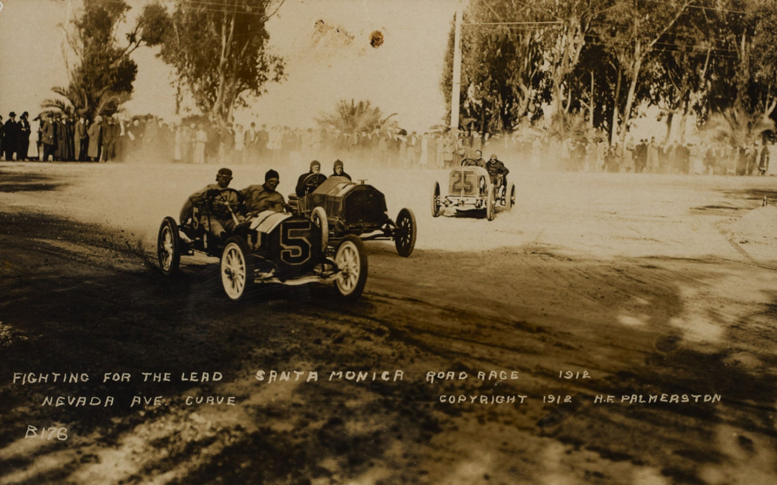 |
|
| (1912)* - Two-man race cars turn from Ocean Avenue onto Nevada Avenue (today's Wilshire Boulevard) as spectators line both sides of the course. Photo from the Ernest Marquez Collection. |
Historical Notes Unlike modern race cars, early racing machines carried both a driver and a riding mechanic. The mechanic monitored the engine, watched for approaching competitors, and often made emergency repairs during the race without leaving the car. The unpaved streets produced heavy clouds of dust, making visibility difficult while adding another challenge for both drivers and mechanics. |
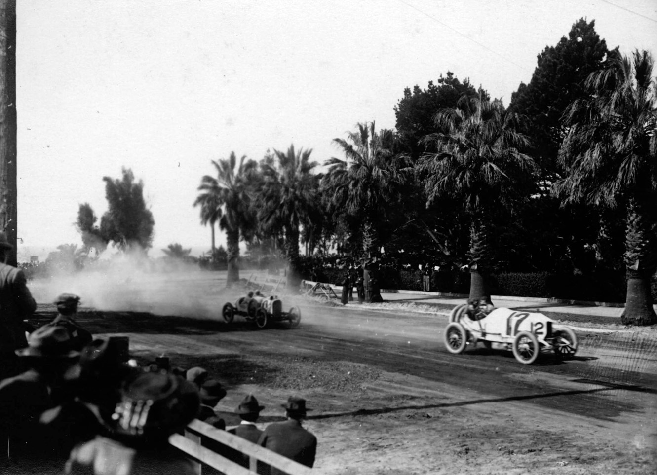 |
|
| (1910)* - Race cars round the famous "Death Curve" where Ocean Avenue meets Nevada Avenue (later Wilshire Boulevard). |
Historical Notes Death Curve quickly became the best-known corner on the Santa Monica circuit. Newspapers and race promoters popularized its nickname because it was one of the course's most demanding turns, where drivers entered at high speed before accelerating onto the long Nevada Avenue straightaway. Although the curve witnessed several spectacular crashes, no driver was killed there during an official Santa Monica race. Its reputation came from the skill required to negotiate the turn successfully lap after lap. |
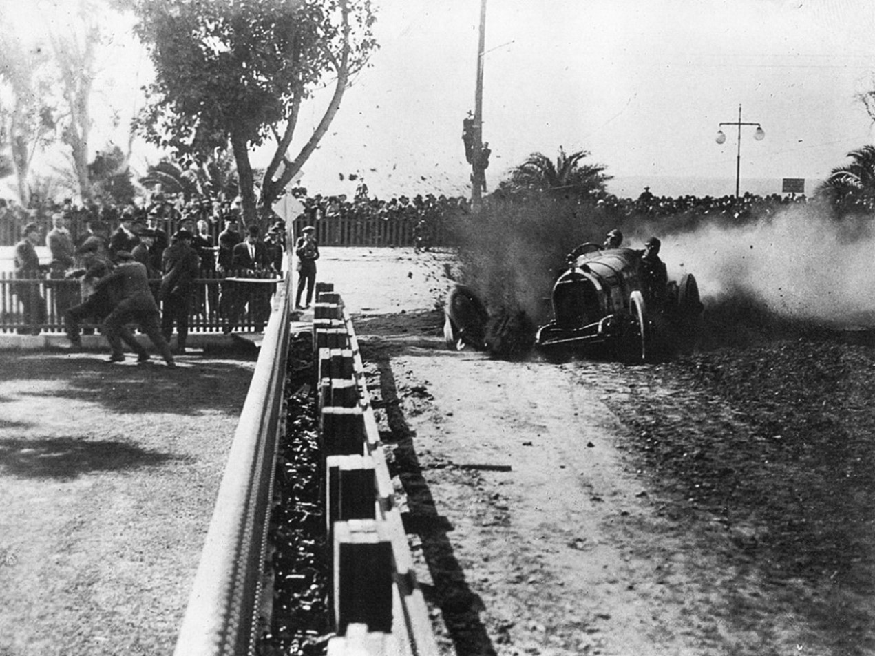 |
|
| (1914)* – View of the famous "Death Curve" at Ocean Avenue and Wilshire Boulevard during the Vanderbilt Cup races |
Historical Notes The 1914 races brought two of America's most prestigious automobile competitions to Santa Monica—the Vanderbilt Cup and the American Grand Prize. Drivers from leading American and European manufacturers competed on the city's challenging street circuit before large crowds. During the Vanderbilt Cup, Eddie Pullen lost a front tire at Death Curve and crashed into the barricade. Two days later, driving the same repaired Mercer, he returned to win the 400-mile American Grand Prize. |
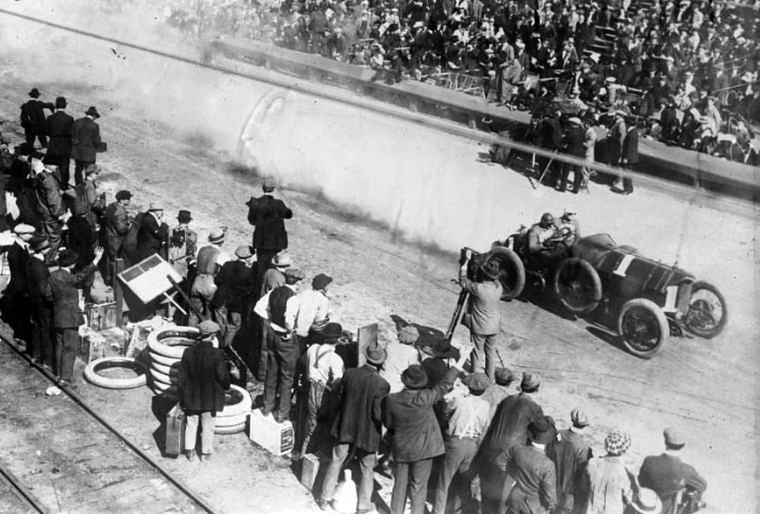 |
|
| (1914)* - Harry Grant drives his No. 1 Isotta Fraschini past the grandstands on Ocean Avenue during the Vanderbilt Cup |
Historical Notes By 1914, Santa Monica had earned an international reputation as one of the country's leading road racing venues. The annual races attracted many of the world's best-known drivers along with manufacturers eager to demonstrate the performance of their newest automobiles. Harry Grant had already established himself as one of America's leading racers by winning the Vanderbilt Cup twice on Long Island before competing in Santa Monica. |
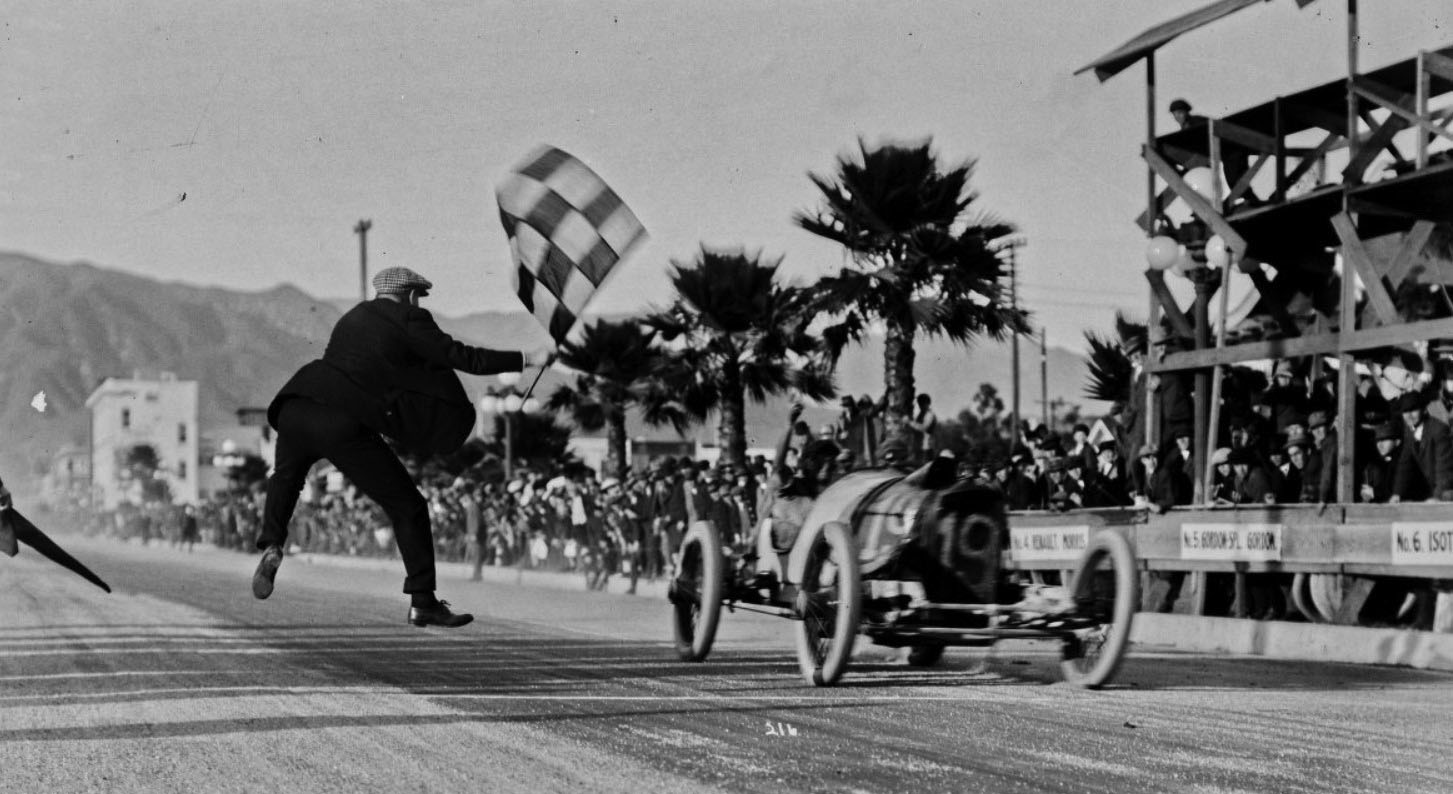 |
|
| (ca. 1916)* – A Duesenberg race car takes the checkered flag during Santa Monica's road racing years. The circuit's biggest weekends, headlined by the Vanderbilt Cup and American Grand Prize, drew large crowds and some of the country's top driving teams. |
Historical Notes By the mid-1910s, Santa Monica's annual road races ranked among the most important automobile competitions in the United States. The Vanderbilt Cup and American Grand Prize attracted many of the world's leading drivers and manufacturers, bringing national and international attention to the city's 8.4-mile street circuit. As automobile technology advanced, speeds increased and the races became more dangerous for both drivers and spectators. The 1916 race weekend included several serious accidents, including one that claimed the lives of driver Lewis Jackson and three spectators. Growing safety concerns, together with increasing automobile traffic and the difficulty of closing city streets for racing, contributed to the end of Santa Monica's annual road races after the 1919 season. |
Then and Now
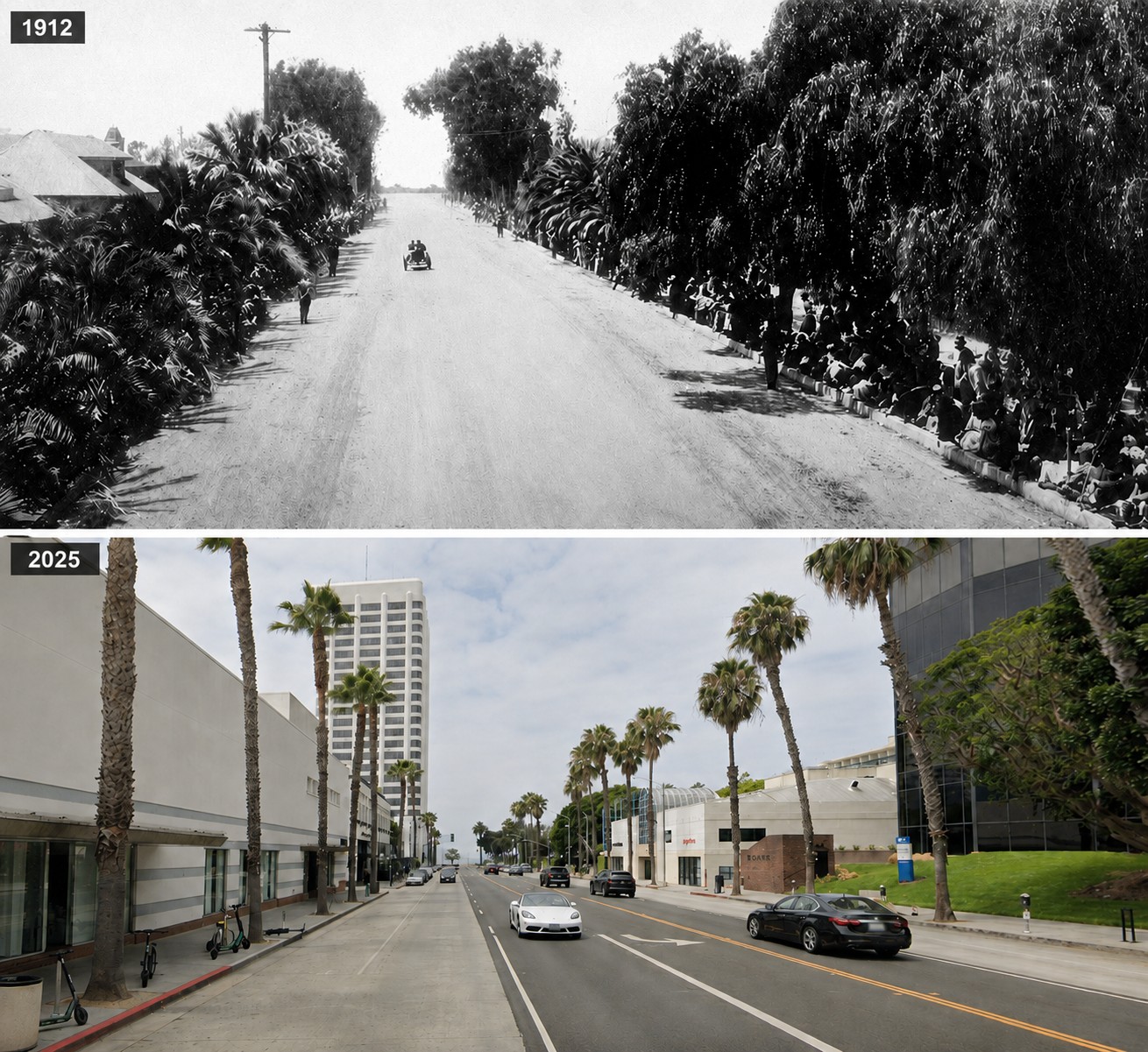 |
|
| (1912 vs 2025)* - View looking west along Wilshire Boulevard (then Nevada Avenue) toward Ocean Avenue. Photo comparison and enhancement by Jack Feldman. |
Historical Notes In 1912, this stretch of Nevada Avenue formed one of the fastest sections of Santa Monica's famous 8.4-mile road racing circuit. During race weekends, thousands of spectators lined both sides of the street to watch drivers accelerate away from the famous Death Curve toward San Vicente Boulevard. Today, the same roadway is Wilshire Boulevard, one of Southern California's best-known streets. Hotels, offices, apartments, and shops have replaced the open racecourse, yet the boulevard still follows the same alignment used by racing legends more than a century ago. |
Then and Now
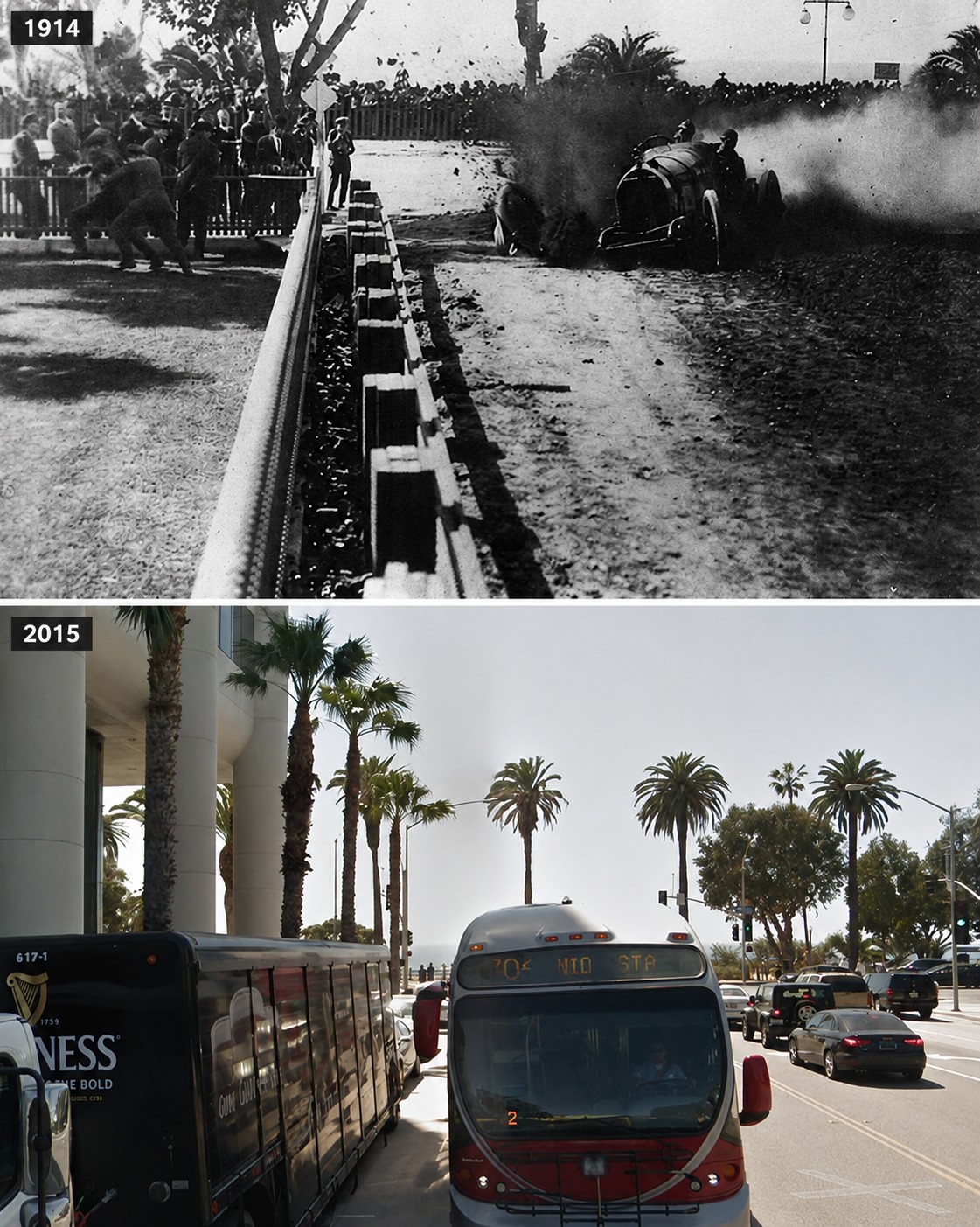 |
|
| (1914 vs. 2015)* – A ‘Then and Now’ view looking west along Wilshire Boulevard toward Ocean Avenue. Photo comparison by Jack Feldman. |
Historical Notes The intersection of Wilshire Boulevard and Ocean Avenue has evolved from a dangerous racing curve to a prime location for luxury hotels, residences, and commercial spaces, reflecting Santa Monica's growth as a popular coastal city. |
* * * * * |
Jefferson School (Santa Monica's 1st School Building)
 |
|
| (1910)* - Jefferson School located at 1333 Sixth Street in Santa Monica. |
Historical Notes Jefferson school, originally called 6th St. School, was Santa Monica's first school building and was located on two lots on the east side of 6th St. between Santa Monica Blvd. and Arizona. This first school was a frame building and was erected in 1876. |
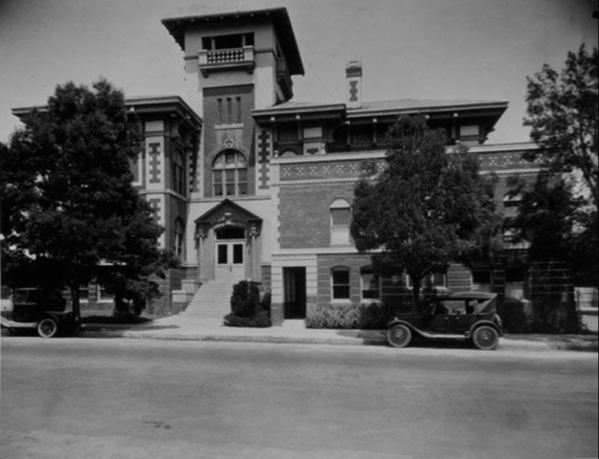 |
|
| (1920s)* - Jefferson School, originally known as 6th Street School, located at 1333 Sixth Street in Santa Monica. |
* * * * * |
Santa Monica City Hall
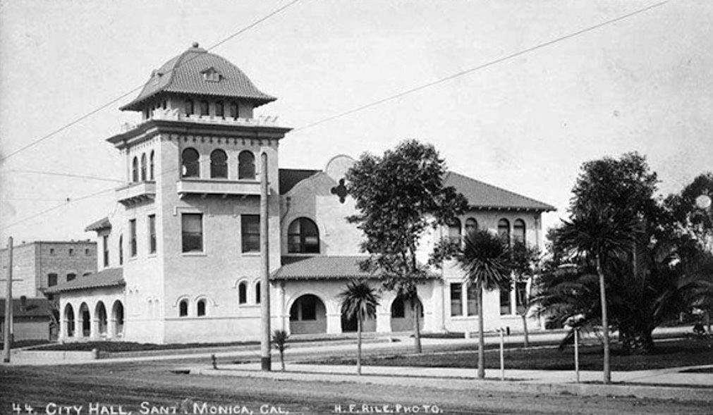 |
|
| (1903)* - Exterior view of Santa Monica City Hall the year it was built, located at the southwest corner of 4th and Oregon (Santa Monica Boulevard). Architect: Carol Brown, addition by Henry Hollwedel. |
Historical Notes In 1903, Santa Monica constructed its first independent city hall at a site that was then just east of downtown’s main commercial core. Choosing the Mission Revival architectural style, it featured massive brick walls covered with stucco, arcades, arched windows, elevated scalloped parapets, and a corner tower. |
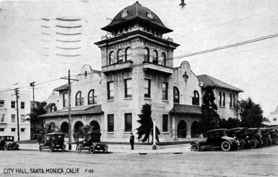 |
|
| (ca. 1917)* – Postcard view showing the old Santa Monica City Hall, located at Santa Monica Boulevard and Fourth Street. |
Historical Notes Santa Monica’s library shared space in City Hall, and a notorious dungeon-like jail was located in the basement that drew indignant protests from female civic leaders who demanded better conditions for the city’s prison population. Later a new jail adjacent to City Hall was built by Henry Hollwedel. |
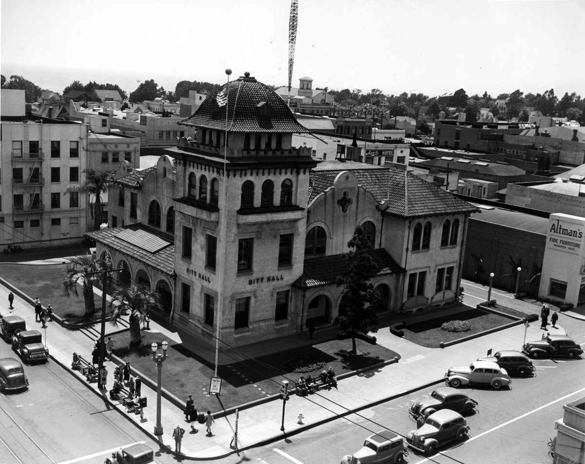 |
|
| (1930s)* - The old Santa Monica City Hall at Santa Monica Boulevard and Fourth Street. This building housed the City Hall and Police Department from 1902-1938. |
Historical Notes The Mission Revival style building designed by architects Carroll Brown and Henry Hollwedel (Henshey's Majestic Theater, Santa Monica Bay Women's Club) served as city hall and SMPD headquarters from 1902 to 1938. |
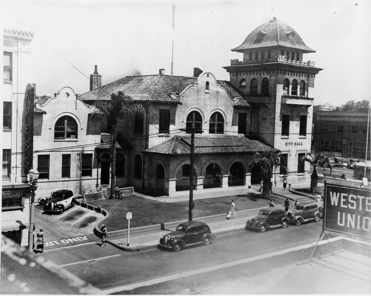 |
|
| (1930s)* - Closer view of Santa Monica City Hall. The building shared space with the Police Dept. |
Historical Notes The old City Hall building was demolished in the late 1930’s. S. H. Kress & Co bought the property and erected a new store to replace the store on 3rd street. This building has since been demolished for new development, but the 3rd Street building survives. Today’s City Hall at 1685 Main Street replaced this earlier structure in 1939. |
* * * * * |
Vitagraph Film Company |
Before Hollywood became synonymous with filmmaking, Santa Monica briefly played a role in the birth of the American motion picture industry. Founded in Brooklyn, New York, in 1897, the Vitagraph Company grew into one of the nation's leading silent film studios. Seeking Southern California's mild climate and abundant sunshine, the company established a West Coast studio on Second Street in 1911. Although its stay in Santa Monica lasted only a few years, the studio helped place the city among the earliest communities to host a major motion picture company. |
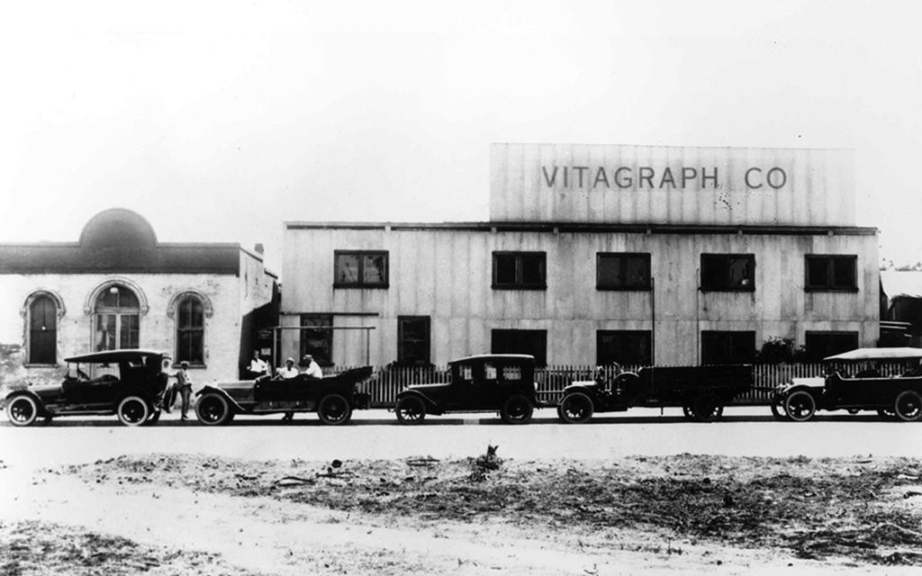 |
|
| (1912)* – View showing early automobiles parked in front of the Vitagraph Film Company studio and the Rapp Saloon building on the 1400 block of Second Street in Santa Monica. |
Historical Notes Founded in Brooklyn in 1897 by J. Stuart Blackton and Albert E. Smith, the Vitagraph Company became one of the pioneers of the American motion picture industry. By the early 1910s it was producing hundreds of films each year and expanded westward to take advantage of Southern California's dependable daylight for filming. Santa Monica seemed like an ideal location, but persistent coastal fog often disrupted outdoor production. Within a few years Vitagraph relocated its West Coast operations inland to a much larger studio on Prospect Avenue near Hollywood, where clearer weather proved better suited to filmmaking. In 1925 the company was acquired by Warner Bros., bringing one of the silent era's most influential studios to a close. (Click HERE to see the Hollywood Studio). In 1925, they were bought by Warner Bros. |
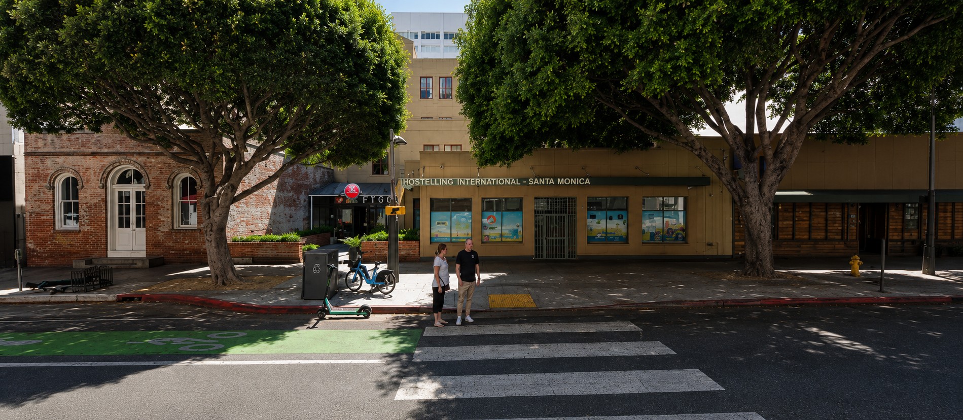 |
|
| (2025)* - Contemporary view showing the Rapp Saloon building at left and Hostelling International Santa Monica, occupying the former site of the Vitagraph Film Company. |
Historical Notes Little remains today to suggest that one of America's earliest motion picture studios once occupied this block. The wooden studio buildings disappeared long ago, replaced by modern commercial development and the Hostelling International Santa Monica complex. The small brick Rapp Saloon building at left survived because the American Youth Hostel organization chose to preserve it when redeveloping the property in the late 1980s. Rather than demolishing the landmark, the new hostel was thoughtfully designed around it, creating one of Santa Monica's best examples of blending historic preservation with contemporary architecture. |
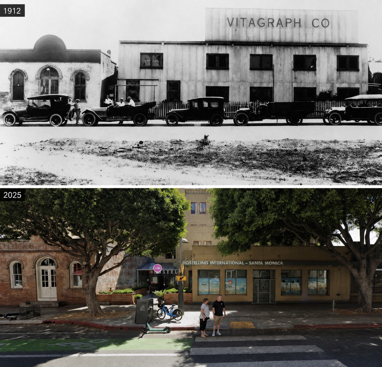 |
|
| (1912 vs. 2025)* - Then and Now view comparing the Rapp Saloon building and the former site of the Vitagraph Film Company, now home to Hostelling International Santa Monica. Photo comparison by Jack Feldman. |
Historical Notes More than a century separates these two views, yet the Rapp Saloon remains instantly recognizable. In 1912 it stood beside one of Southern California's earliest motion picture studios. Today it anchors a modern hostel, providing a tangible connection to both Santa Monica's frontier beginnings and its brief but fascinating role in the infancy of the American film industry. The comparison illustrates how a single preserved building can preserve the memory of an entire neighborhood. Without the Rapp Saloon, there would be little visible evidence that this block once played a role in the early motion picture industry before Hollywood emerged as its center. |
* * * * * |
Rapp Saloon |
Built in 1875, the same year Santa Monica was founded, the Rapp Saloon is the city's oldest surviving masonry building and its first designated historic landmark. During the past 150 years it has served as a beer hall, town hall, movie studio, repair shop, gallery, and historic landmark. Its preservation offers visitors a rare opportunity to experience one of the few buildings that has witnessed nearly every chapter of Santa Monica's history. |
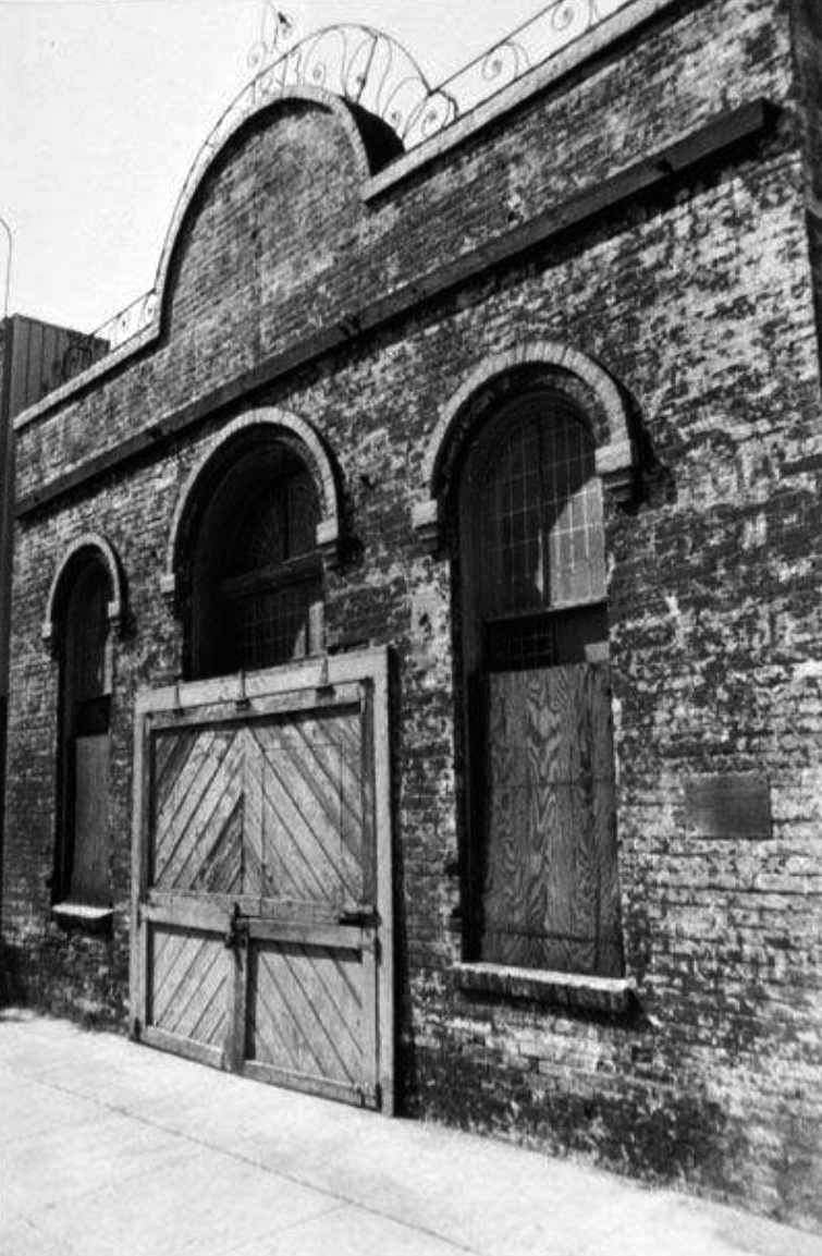 |
|
| (1975)* – Close-up view of the Rapp Saloon at 1438 Second Street, the oldest masonry building in Santa Monica. Built in 1875, it was designated the city's first historic landmark in 1975. |
Historical Notes William Rapp built the structure in 1875 as a beer hall for the young seaside community. An 1877 newspaper advertisement promoted it as the "Los Angeles Beer Garden," serving fresh Los Angeles beer to residents and visitors alike. This photograph was taken during the building's centennial year, when Santa Monica officially recognized its historical importance by designating it the city's first historic landmark. |
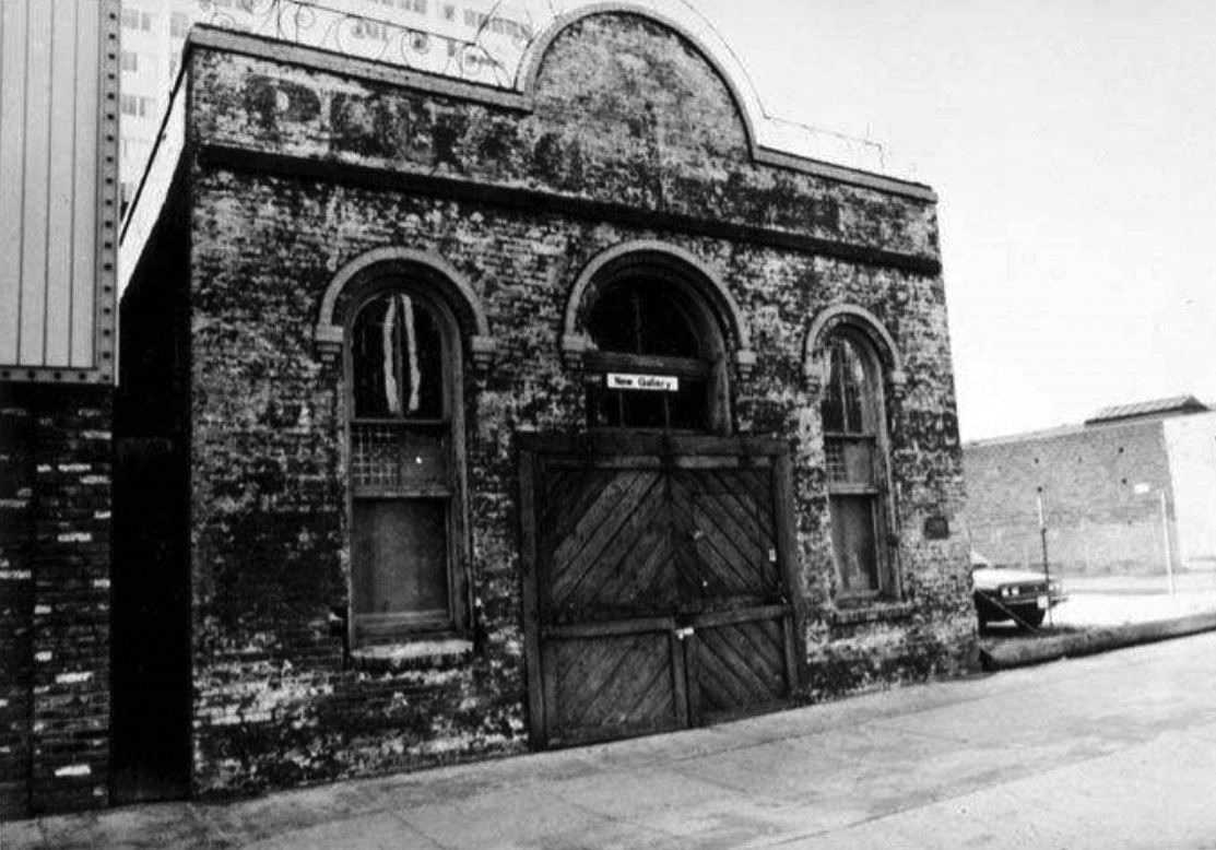 |
|
| (1983)* - Rapp Saloon, 1438 Second Street, Santa Monica. Built in 1875 by William Rapp, it is the oldest masonry building in the city. |
Historical Notes Although modest in size, the building's rounded-arch windows and doors give it a distinctive Italianate appearance. Over the decades it has served many purposes, reflecting the changing needs of a growing city. Among its many uses, the building briefly served as Santa Monica's town hall in the late 1880s. During the early 1910s it was also used by the Vitagraph Film Company as part of its Santa Monica studio complex. It later housed the Salvation Army, a radiator repair shop, a piano tuning business, and an art gallery. Faded painted signs on the north wall still preserve the names of several earlier occupants. |
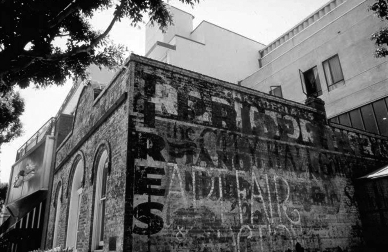 |
|
| (2001)* – Side view of the Rapp Saloon at 1438 Second Street, the oldest surviving masonry building in Santa Monica. |
Historical Notes Saving the Rapp Saloon required decades of effort. Vacant since 1959, the building faced relocation or possible demolition as redevelopment plans were considered for the valuable downtown property. Although landmark status helped protect it, no practical preservation plan emerged for many years. Its future was finally secured in 1986 when the American Youth Hostel organization acquired the property. Rather than moving or demolishing the landmark, the new hostel was designed around it, preserving the building in its original location. The project remains one of Santa Monica's finest examples of integrating historic architecture into modern development. |
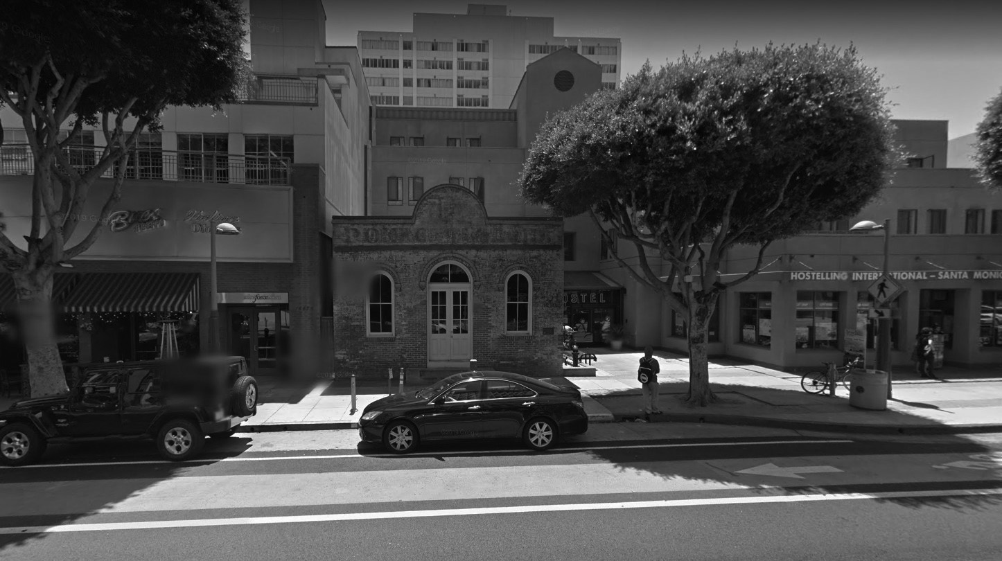 |
|
| (2015)* – Google Street View showing the Rapp Saloon as it appeared in 2015. |
Historical Notes Nearly a century and a half after its construction, the Rapp Saloon continues to stand as Santa Monica's oldest surviving brick building. Surrounded by modern development, it remains a physical reminder of the city's earliest years while also recalling its brief connection to the beginnings of the American motion picture industry. Today the building serves as both a historic landmark and a symbol of successful preservation, demonstrating how a community can protect its architectural heritage while continuing to evolve. |
* * * * * |
Santa Monica High School
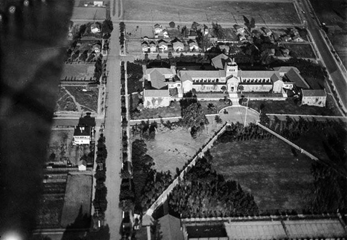 |
|
| (1916)* – Aerial view of Santa Monica High School, located at 601 Pico Boulevard. |
Historical Notes Santa Monica High School was founded in 1884. It changed location several times in its early years before settling into its present campus at 601 Pico Boulevard. The "new" campus opened in 1906 with one building, the current History building, with an enrollment of 50 students. The school sits on the hilltop of what is now 6th Street and Pico Boulevard, from which one can see the Pacific Ocean. |
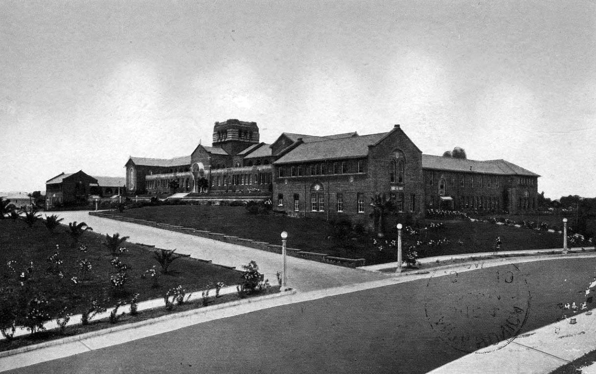 |
|
| (ca. 1919)*^ - Postcard view of Santa Monica High School located at 601 Pico Boulevard. |
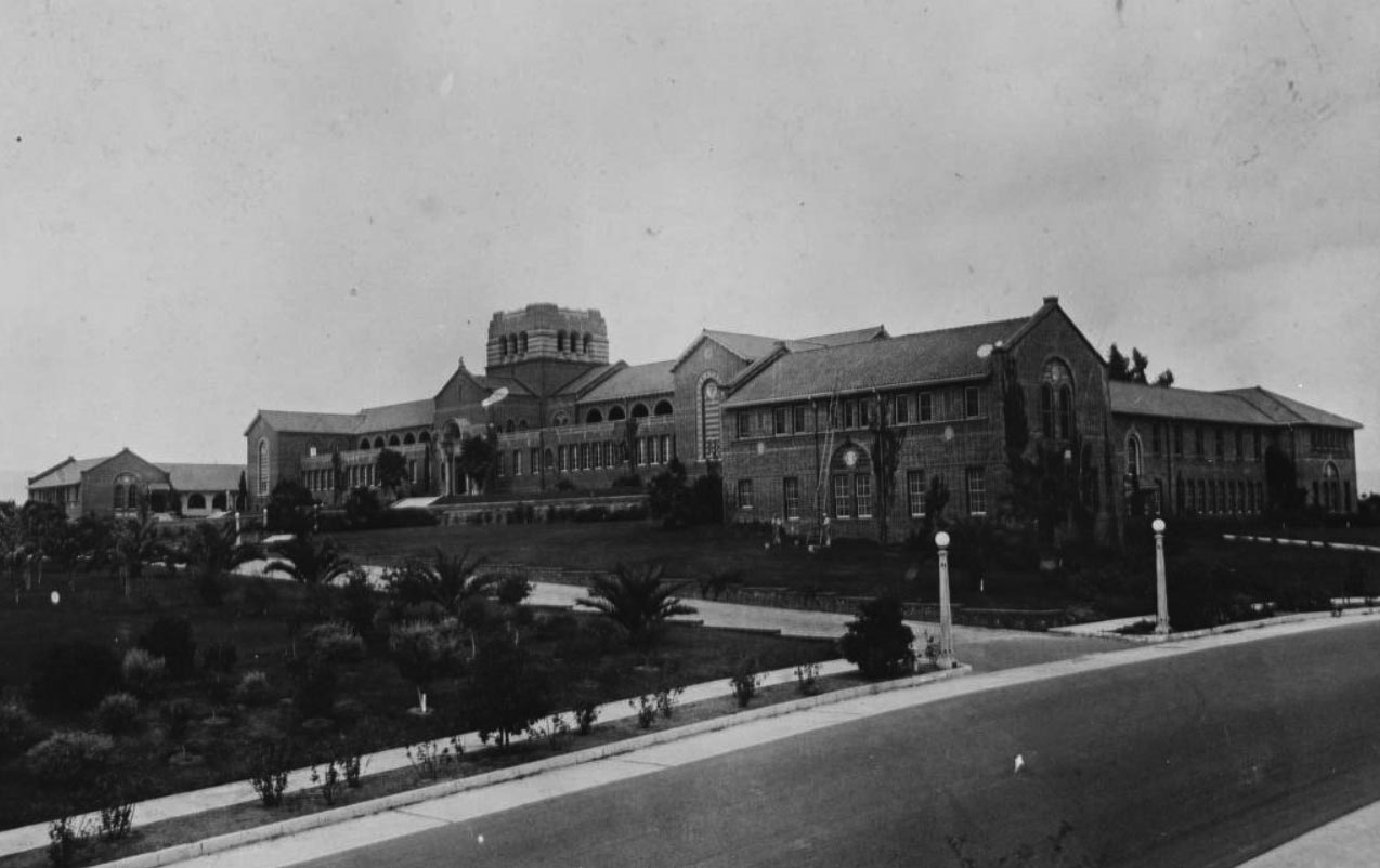 |
|
| (ca. 1922)* - Image of the main entrance wing of Santa Monica High School and grounds on Pico Boulevard in Santa Monica. |
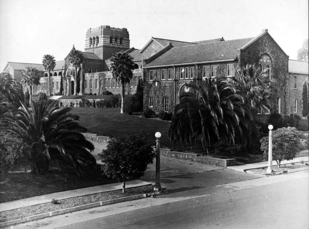 |
|
| (1924)* - Exterior view of Santa Monica High School, showing the main entrance and right wing. The main entrance to the multi-story brick building is seen at left center. The right wing, its walls covered in ivy, protrudes toward the foreground. The building is fronted by lawns and palm trees. A paved street and sidewalk run diagonally through the lower right of the image. The high school building was erected in 1912 and replaced during 1936 and 1937. |
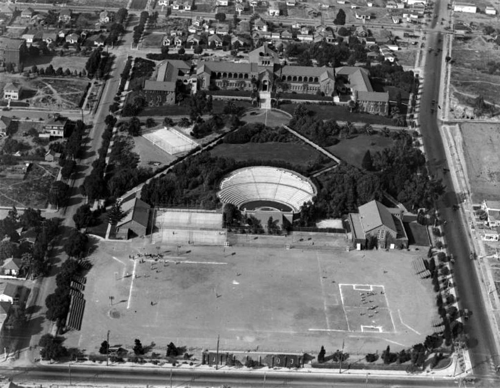 |
|
| (1925)* - Aerial view of the Santa Monica High School campus showing the athletic field and Open Air Memorial Theater (later renamed the Memorial Greek Amphitheatre) bordered by 4th Street at bottom and Pico Boulevard at right. |
Historical Notes In 1921, the Open Air Memorial Theatre (now called the Greek Amphitheatre) was built to honor the Santa Monicans who served in World War I. One of the best examples of the classical Greek style in Southern California, the amphitheatre was built after Santa Monica passed a $30,000 bond measure to fund its construction. Barnum Hall Theater, originally called "the Auditorium," was built in 1937 by the Works Progress Administration (WPA) to be the Civic Auditorium of Santa Monica and host school events as well. The campus also added six buildings during this period: the Language, English, Business, History, Administration and Music buildings. In 1952, Santa Monica High School was finally expanded to what it is now, 33 acres, and two new buildings were built, the Science and Technology D.M. buildings. As the school aged, renovations took place in Barnum Hall and the Music building was completely rebuilt. The school has been a location in a number of films. Most famously, it is the high school setting in Rebel Without a Cause where James Dean walks up the History Building stairs. |
* * * * * |
Ocean Park
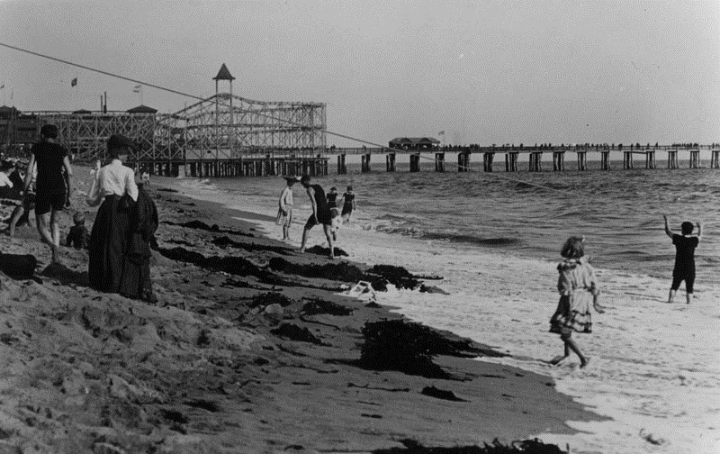 |
|
| (1912)* - View of the seashore at Ocean Park Beach in Santa Monica. Amusement park can be seen on the pier. The roller coaster seen above was called Ingersol's Scenic Railroad. It was the first roller coaster to be installed in the Santa Monica Bay area. |
Historical Notes Amusement piers became enormously popular in the first decades of the 20th century. The extensive Pacific Electric Railroad easily transported to the beaches people from across the Greater Los Angeles Area. Competing pier owners commissioned ever larger roller coaster rides. Wooden piers turned out to be readily flammable, but even destroyed piers were soon replaced. There were five piers in Santa Monica alone, with several more down the coast. |
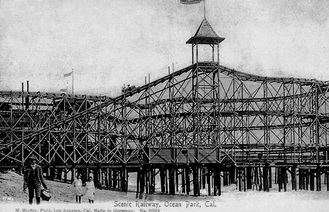 |
|
| (ca. 1912)* – Postcard view showing a man and two young girls walking along the beach with the Ocean Park Scenic Railway Roller Coaster in the background. |
Historical Notes In 1904, Ingersol's Scenic Railroad was the first roller coaster to be installed in the Venice / Ocean Park area. |
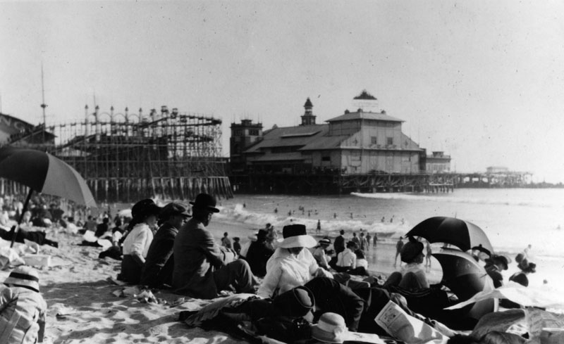 |
|
| (1912)* - View from Santa Monica Beach of Ocean Park. |
Historical Notes The earliest part of the current Santa Monica Pier, which is now the last remaining amusement pier, was built in 1909 on what was referred to as the North Bay. The second half, an amusement park pier, was built later and the two rival piers were merged. |
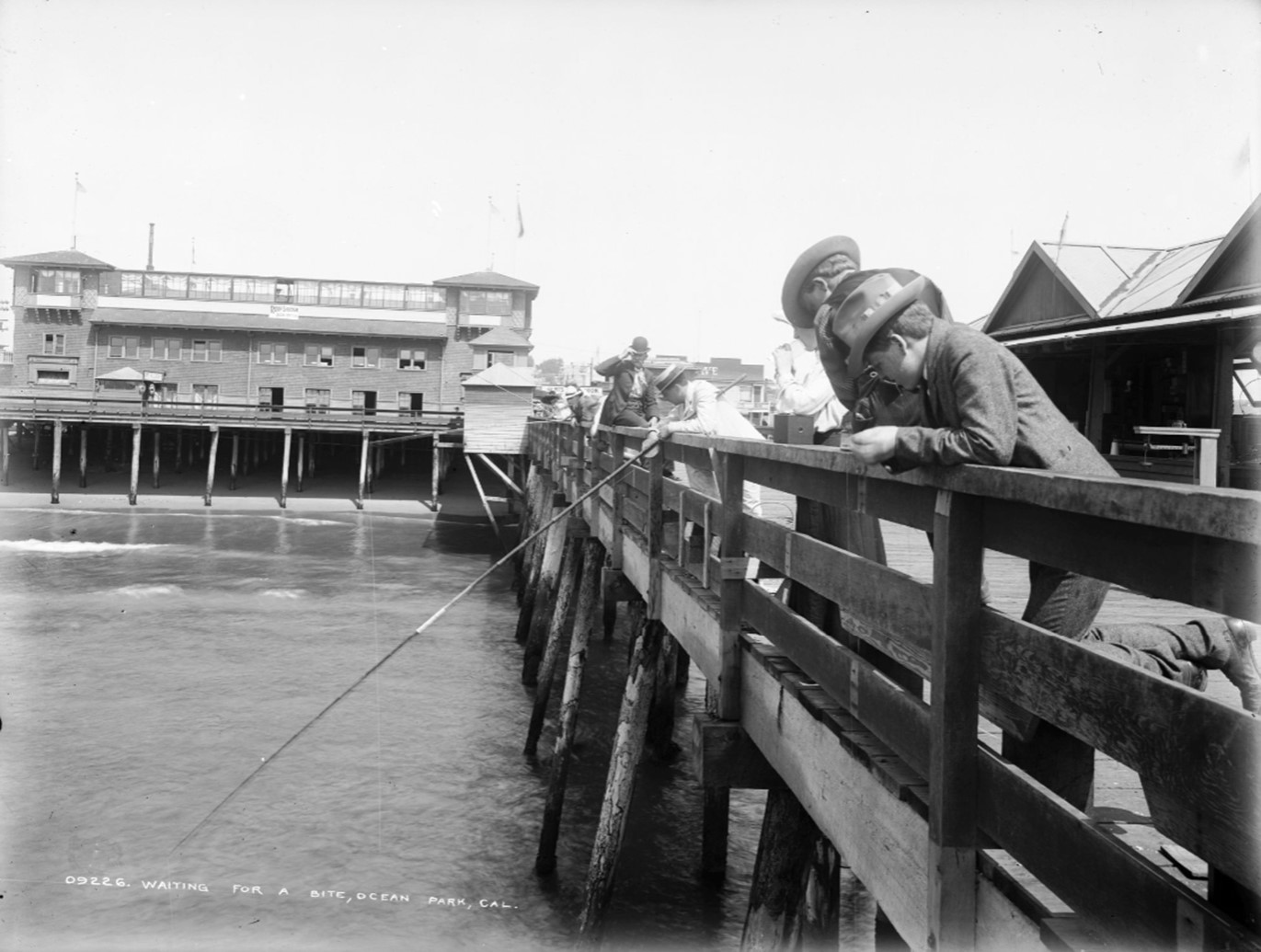 |
|
| (ca. 1910)* – Waiting for a Bite, Ocean Park – Several people are seen leaning on railings and fishing from Ocean Park Pier. One man is holding a bamboo (cane) fishing rod. Sign on the building in the background reads: "Roof Garden Now Open". |
 |
|
| (ca. 1910)* - View of the casino and band stand at Ocean Park in Santa Monica. The two-story brick building is at center. It has a wooden ramp leading up from the sandy beach to the entryway at center. The roof of the building is flat and has an open observation deck. Four towers are visible, one on each corner, and a sign over the arched entryway identifies the building as a casino. A man is standing near the entrance, and another is visible in the foreground at right. Several benches can be seen in the sand in front of the casino, and American flags fly from the top of the building. |
 |
|
| (1912)* - Large crowds are gathered near a concert shell in Ocean park. There are more people than seats. Edges of buildings of several businesses can also be seen such as real estate and restaurants. An early model car and several horse-drawn wagons are parked in the foreground. |
 |
|
| (ca. 1910)* - Closer view of the Ocean Park bandstand showing Harry Moore's band playing in front of a crowd. Dozens of people, many holding umbrellas, are seated in chairs in front of the band, watching. Attached to the bandstand at right is a casino, and a pier juts into the water behind the bandstand building. More people can be seen seated on benches at left near the water's edge. A small shack on the edge of the pier is adorned with the words "Wharf Fish and Tackle Co. Poles for Rent". |
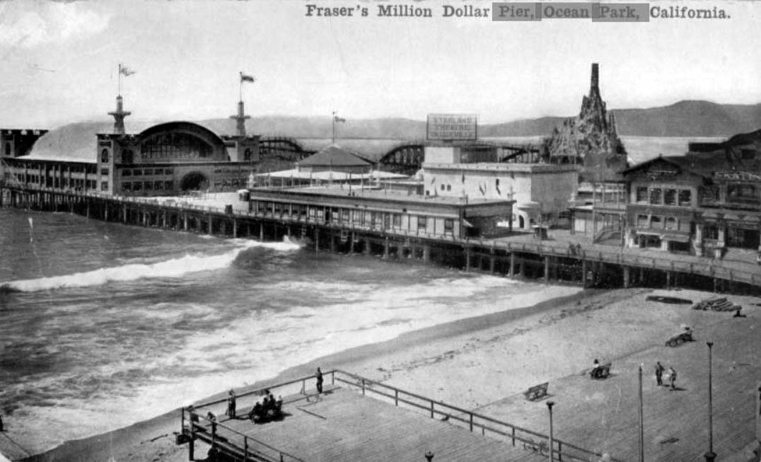 |
|
| (ca. 1911)* – Postcard view showing Fraser's Million Dollar Pier, Ocean Park. Fraser's Dance hall, the roller coaster, and Starland Theater can be seen on the pier, with a boardwalk and beach in the foreground. |
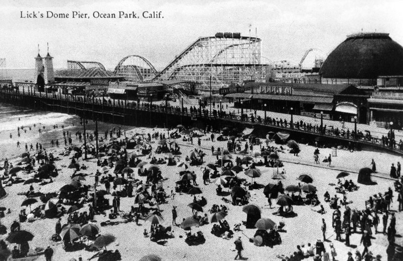 |
|
| (ca. 1911)* - View of the Lick's Dome Pier at Ocean Park. |
Historical Notes In 1911, Charles Lick added Lick Pier to the new Million Dollar Pier. They were both destroyed by fire in 1912 and again in 1924. The Lick Pier was rebuilt both times. The pier was finally done in by a fire in 1970, after which it was not rebuilt. |
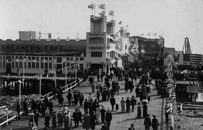 |
|
| (Early 1900s)^^ - A crowded day at the Ocean Park Pier in Santa Monica. |
Historical Notes The Ocean Park Pier, a combination of two piers: Million Dollar Pier and Lick Pier, burned down in 1912. In its place was rebuilt Fraser's Million Dollar amusement pier, which claimed to be the largest in the world at 1250 feet long and 300 feet wide. The pier housed a spacious dance hall, two carousels, the Crooked House fun house, the Grand Electric Railroad, the Starland Vaudeville Theater, Breaker's Restaurant and a Panama Canal model exhibit. It too burned within the year. |
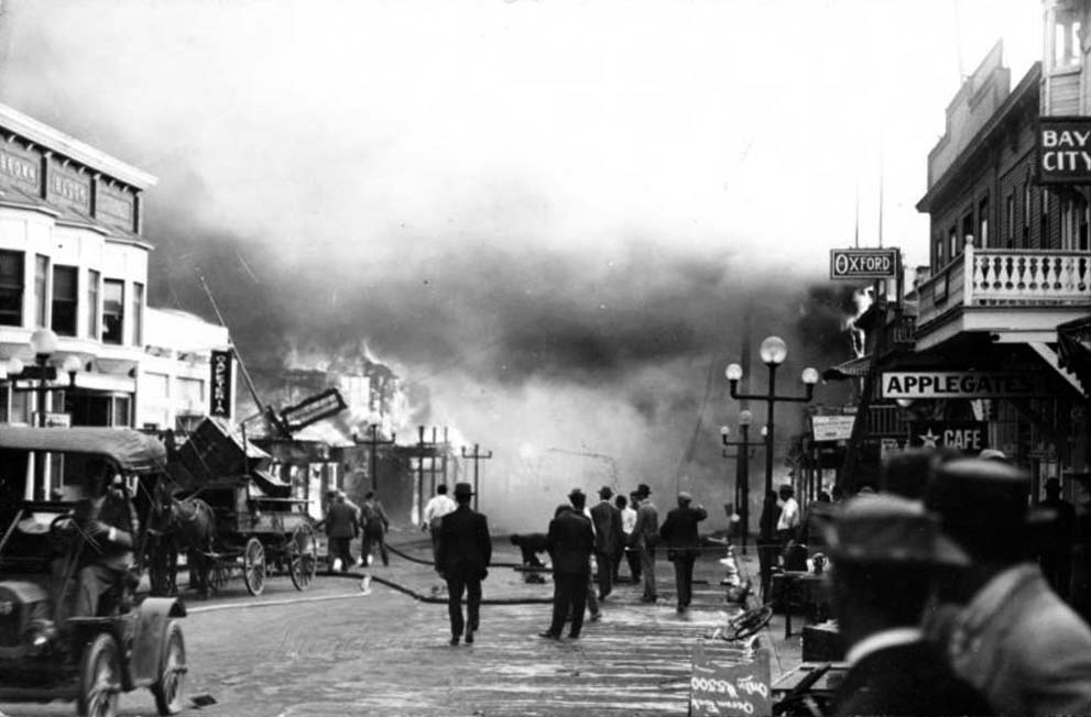 |
|
| (1912)- View showing people working to extinguish the fire on the Ocean Park pier in Santa Monica, 1912. The fire is blazing in the distance at left. A group of onlookers is gathered at center as is watching as firemen drag a large hose towards the building. The dirt road at center is muddy from the water used to fight the fire. An early automobile can be seen at left, and a large horse-drawn wagon is parked near the edge of the street at left. A collection of two-story buildings lines the road.; Legible signs include, from left to right: "Brown Block", "Cafeteria", "Oxford", "Applegate's Café", and "Bay City". |
Historical Notes Click HERE to see more Early Southern California Amusement Parks. |
* * * * * |
Bristol Pier (originally White Star Pier, later Crystal Pier)
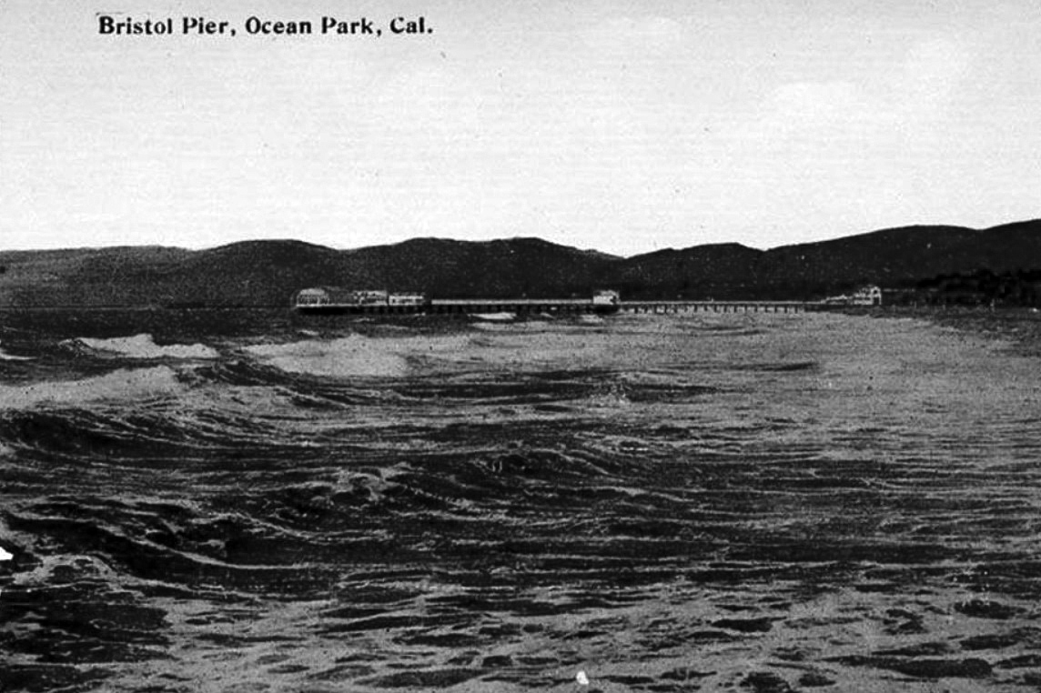 |
|
| (ca. 1908)* – View looking north from Ocean Park Pier showing Bristol Pier in the distance. |
Historical Notes The smallest pier, south of Santa Monica Pier at Hollister Avenue, existed from 1905 to 1949. It was built in 1905 as the White Star. In 1908 it was renamed the Bristol Pier. From 1919 to 1949 it was the Crystal Pier. The pier was demolished in 1949. |
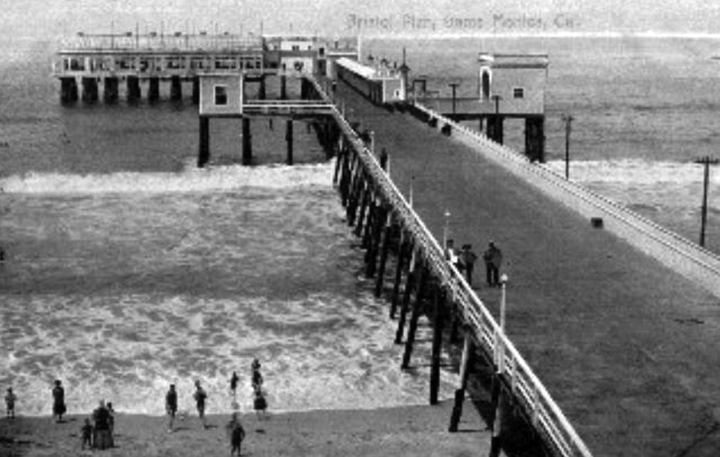 |
|
| (1908)* – Postcard view showing the Bristol Pier located in Ocean Park (Santa Monica) at the foot of Hollister Avenue. |
Historical Notes The White Star pier was completed in 1905, but it was not a paying investment during its first season and was sold in 1906. Renamed the Bristol pier in 1908, and the Crystal Pier in 1919 by Nat Goodwin. |
 |
|
| (1909)* – Postcard view showing the flags rising from the ornate entrance to Bristol Pier in Ocean Park* with the Bristol Pier Bath House seen at lower-right. |
Historical Notes Although Santa Monica and Ocean Park (South Santa Monica) were both settled at the same time (in the early 1870’s), Ocean Park’s history is somewhat independent from that of the rest of Santa Monica. Separated from the north by a gully which today is occupied by the Santa Monica Freeway, Ocean Park was initially oriented towards the beach where a series of piers and other tourist attractions were erected in 1890 to 1910. Much of the housing during this initial period of development was deliberately temporary in nature. Although residential tracts began to be subdivided from the large blocks of land owned by families such as the Lucas’ and the Vawters, construction tended to cluster on streets nearest the ocean, with the 4th Street hill as the inland boundary. One of the city’s oldest neighborhoods, Ocean Park sprang to life with Abott Kinney’s 1891 Ocean Park Development Company. Kinney bought a sandy strip of land in Santa Monica’s southwestern edge and began building roads, homes, parks and piers. After 1904, Kinney moved his attention to his Venice of America development (also called Ocean Park at the time) , south of the Santa Monica city boundary. The history of Venice and Ocean Park are intertwinned. From 1905 to 1925, Ocean Park was developed by people such as Fraser, Merritt Jones, Hart, Hollister and Wadsworth. |
Café Nat Goodwin
 |
|
| (1917)* – View showing cars parked at the foot of Hollister Avenue in front of the private Bristol Pier. A large arched sign reads Café Nat Goodwin. Courtesy of Ernest Marquez Collection |
Historical Notes Nat Goodwin was a vaudevillian comic who also appeared in a few films between 1912 and 1916. In about 1913 Goodwin opened a club on the private Bristol Pier in Santa Monica. The Cafe Nat Goodwin was one of the swankiest on the beach and included a cabaret, ballroom and a roof garden. Goodwin's club was frequented by fellow film funny folks, Charlie Chaplin, Mabel Normand, and Mack Sennett and soon became an area hot spot. Goodwin sold his cafe to Baron Long about 1919 and it became the Sunset Inn. Goodwin died in 1919. |
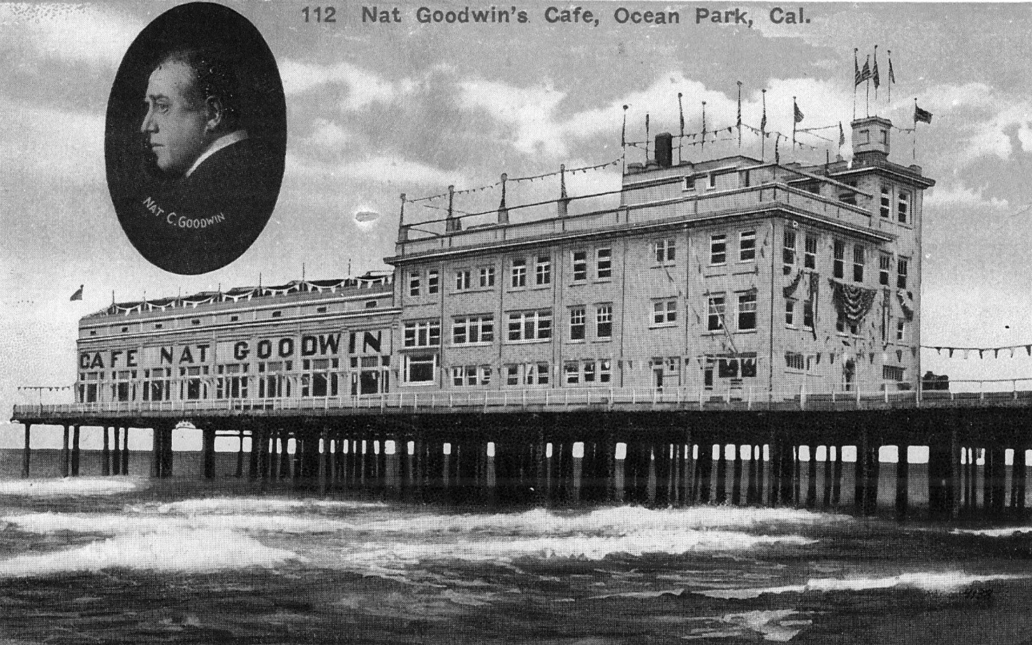 |
|
| (ca. 1917)* – Postcard view of Café Nat Goodwin located on the private Bristol Pier in Santa Monica. |
Historical Notes The restaurant, Cafe Nat Goodwin, was located on Hollister Avenue at Crystal Pier in Ocean Park. It claimed to be the "largest and best cafe on the Pacific coast." Originally, the Crystal Pier was named the White Star Pier, then was renamed the Bristol Pier after the Bristol Cafe located there. When Nat Goodwin took over the Bristol Cafe and renamed it the Cafe Nat Goodwin, the Pier became known as the Crystal Pier. |
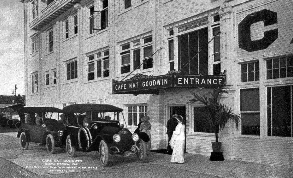 |
|
| (1917)* - Postcard photo showing entrance to Café Nat Goodwin located on Bristol Pier, Santa Monica. |
Historical Notes Goodwin opened an incredibly hip and exclusive operation that took use of a ball room, inclusive gardens on the roof and live cabaret. This era in the early 20th century was full of expansion and Goodwin recognized that, renaming the pier — Crystal Pier. Shortly after renaming the restaurant, Goodwin sold the restaurant to Baron Long. The Nat Goodwin Cafe on Ocean Park became the Sunset Inn and Goodwin died later that year from “shock” two weeks after his eye was removed. At the time of his death, Goodwin was deeply in debt, with his estate listing assets of $6,895 and debts of $15,000. When he died he was said to have been engaged to the actress Georgia Gardner. White Star Pier (1905 - 1908) – Bristol Pier (1908 - 1919) – Crystal Pier (1919 – 1949) |
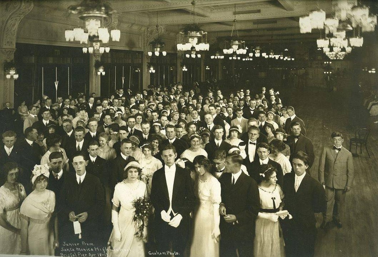 |
|
| (1913)* - Santa Monica High School Junior Prom at the ballroom of the Café Nat Goodwin on Bristol Pier, April 18, 1913. |
Historical Notes lThe ballroom at Café Nat Goodwin, part of the upscale dining complex on Bristol Pier, was a key feature of the establishment when it opened in 1913. Reflecting the café's status as a fashionable entertainment destination, the ballroom was elegantly decorated and spacious enough to accommodate live music and dancing, complete with a proper dance floor for popular dances of the era. This multi-faceted venue, which also included a cabaret and roof garden, catered to wealthy patrons and celebrities, enhancing its reputation as one of the "swankiest" spots on the beach. |
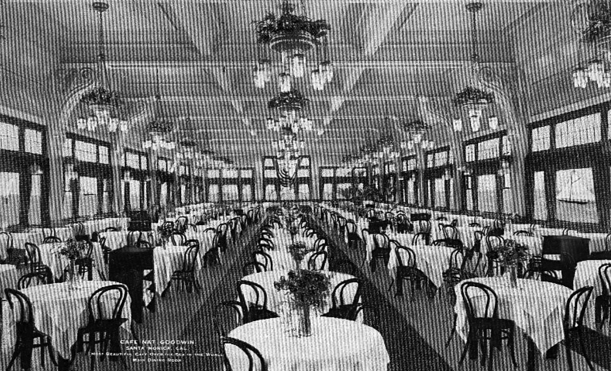 |
|
| (ca. 1917)* – Postcard photo showing main dining room at the Café Nat Goodwin. |
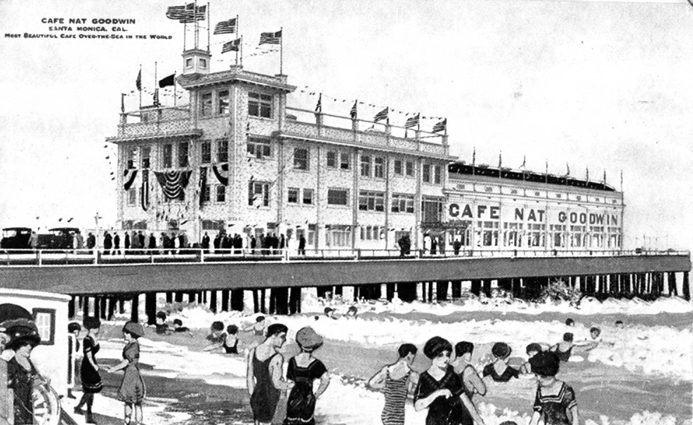 |
|
| (ca. 1917)* - Postcard view showing the grand restaurant built by Nat Goodwin on a pier that hangs above the ocean. |
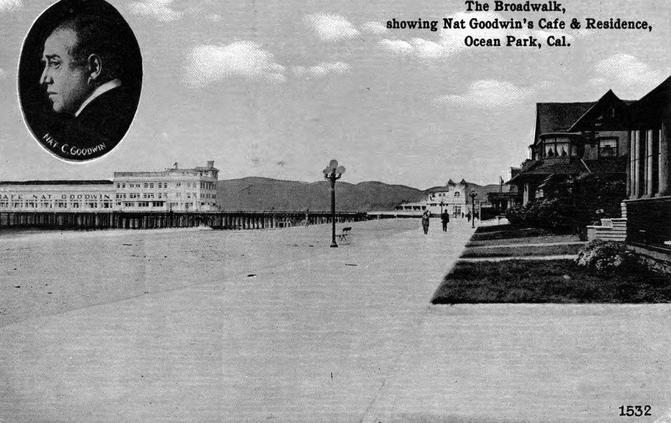 |
|
| (ca. 1915)* – Postcard view looking north showing the boardwalk leading to Bristol Pier where the where Nat Goodwin's Cafe is located with residences seen on the right. |
Historical Notes After Nat Goodwin sold the business, its name was changed to the Sunset Inn. |
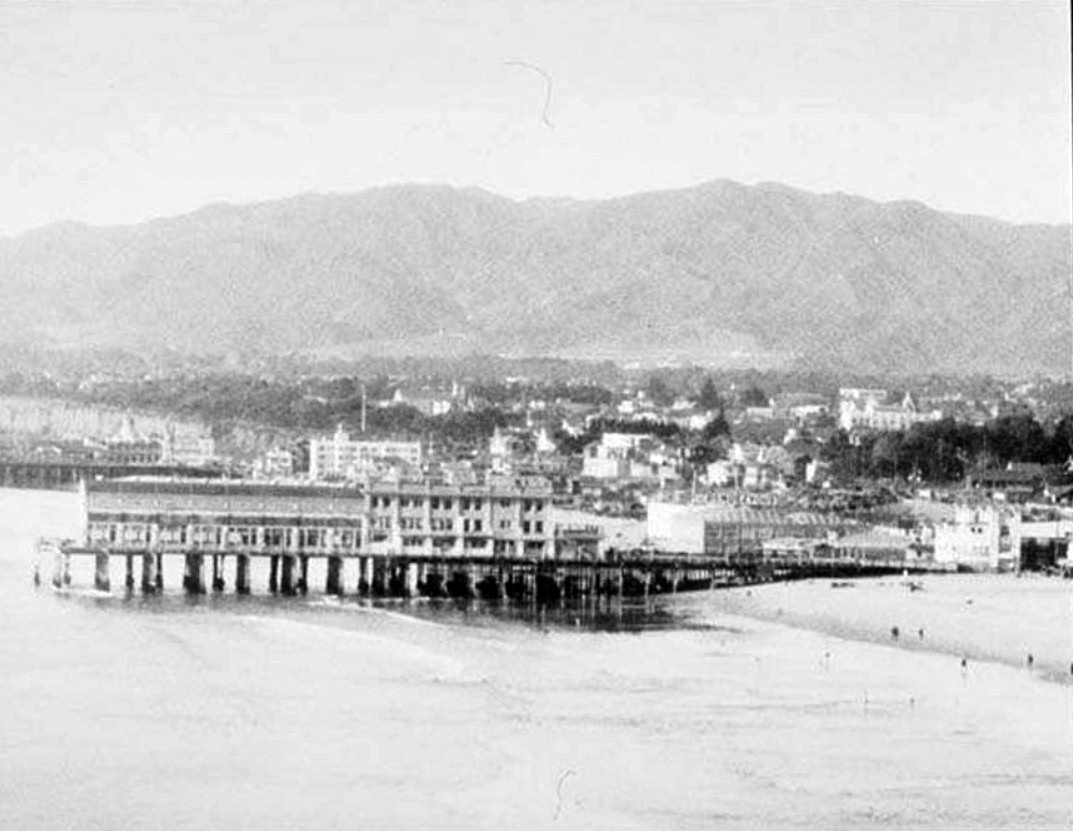 |
|
| (1923)* – Aerial view looking at the Crystal Pier showing the Rendevous Ballroom. Note how much shorter the pier is when compared to earlier photos (most likely due to storm damage). |
Historical Notes Records show the pier had three names during its existence, from its construction in 1905 to its demolition in 1949: White Star Pier (1905–1908) Bristol Pier (1908–1919) Crystal Pier (1919–1949) |
* * * * * |
Santa Monica's Cement Boardwalk and Piers
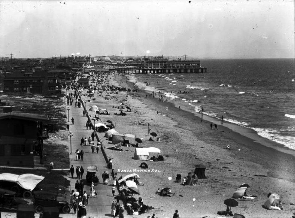 |
|
| (ca. 1915)* - Birdseye view of the beach in Santa Monica looking south with Bristrol Pier in the background. The beach is a wide, sandy tract of land that extends from the foreground away from the viewer into the distance at center. There are a few people playing in the surf and many people resting beneath umbrellas or tents on the sand. The left side of the beach is bordered by a cement sidewalk, and a large number of pedestrians is walking along the path. At left, a series of two-story beach houses lines the sidewalk. Several early-model automobiles are parked in driveways and alleys near the sidewalk at left. There is a short pier jutting out into the water in the background at center and a large building is constructed near the right side of the pier. |
Historical Notes In the early 1900s, Santa Monica's boardwalk emerged as a vibrant coastal destination that captured the imagination of Southern California's growing population. Anchored by the newly constructed Santa Monica Pier, which opened in 1909, the area became a bustling hub of entertainment and leisure. The Pacific Electric Railroad made the beach easily accessible, drawing visitors from across Los Angeles who came to enjoy roller coasters, carousels, vaudeville shows, and seaside attractions. |
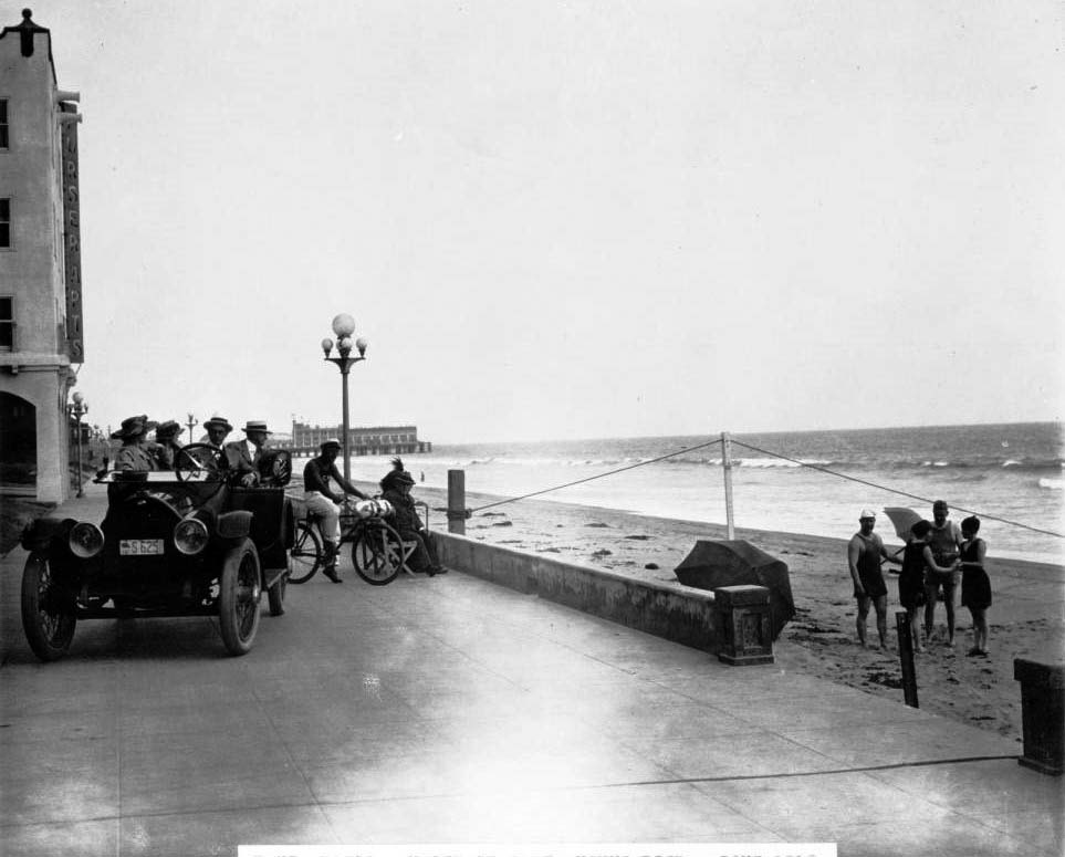 |
|
| (ca. 1915)* - Photograph of people on the beach in Santa Monica, looking south toward Bristol Pier. Four people in bathing suits stand in the sand of the beach on the right with the water washing in and out behind them. A tile sidewalk lies on the left where people stay finely dressed in their automobile. A shop can be seen on the far left of the sidewalk further back while a large building stands on the beach in the background. |
Historical Notes The boardwalk was more than just an amusement area; it was a social center where people could swim, sunbathe, and gather at venues like the Casino Restaurant and Japanese Tea Garden. Wealthy elites and working-class families alike were drawn to the pier's attractions, while surrounding commercial developments sprouted banks, restaurants, and furnished rooms to support the growing tourism industry. |
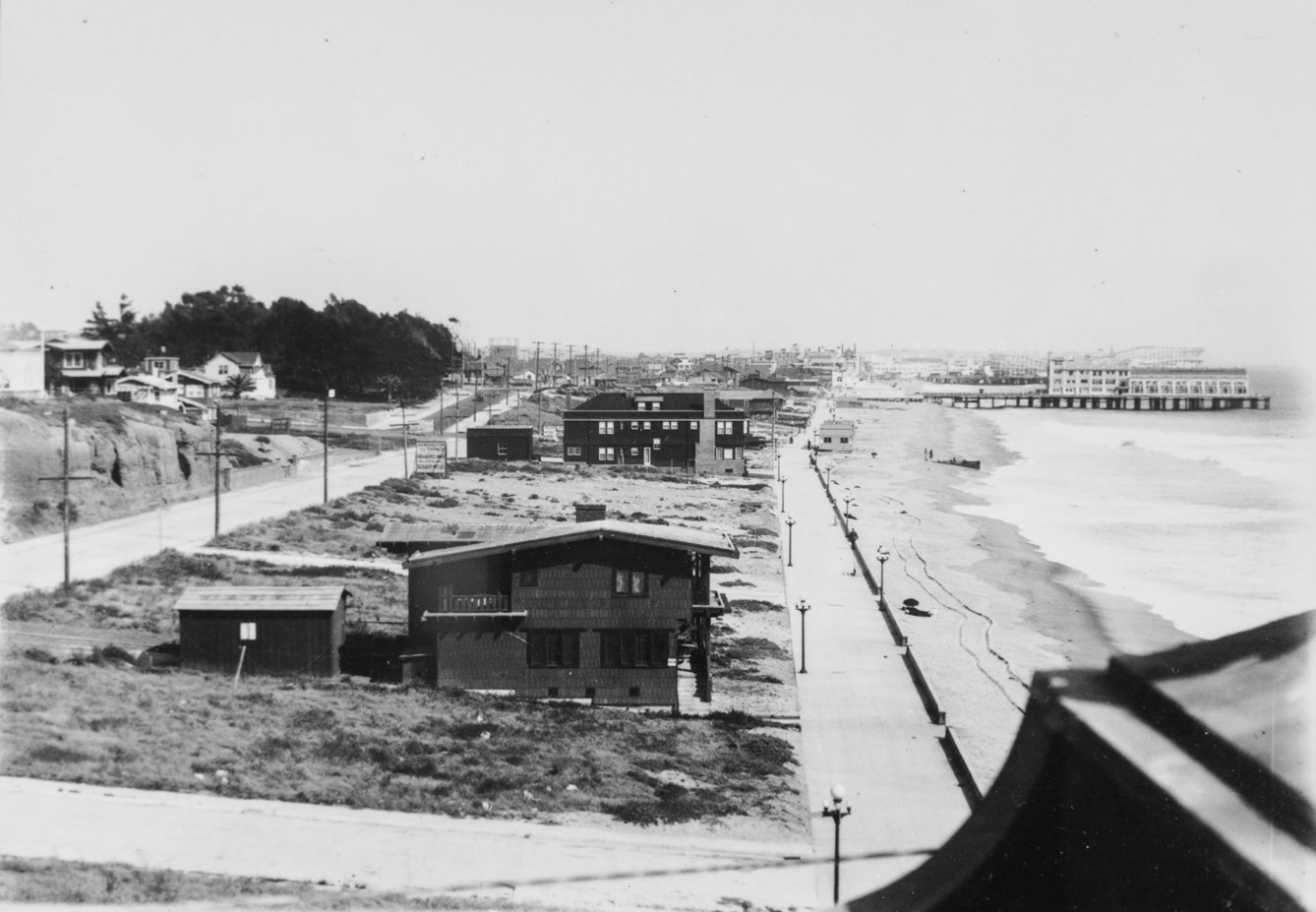 |
|
| (1910s)* – Looking south from near the Santa Monica Pier, the view shows beach houses lining the boardwalk. In the distance, Bristol Pier (renamed Crystal Pier in 1919), home to the once-famous Café Nat Goodwin, is visible, with Ocean Park Pier and its roller coasters further back. On the left, a sign along the road reads "Kensington Terrace, Residents Only ...". Photo from the Ernest Marquz Collection. |
Historical Notes Café Nat Goodwin openend in 1913. Goodwin sold his cafe to Baron Long about 1919 and it became the Sunset Inn. The name of the pier also changed in 1919 from Bristol Pier to Crystal Pier. Kensington Terrace was a distinctive residential development in Santa Monica during the 1920s, created by developer Elliot Schrader between the Vicente Terrace and Seaside Terrace tracts. Situated along the city's rapidly developing coastline, the tract emerged during a transformative period when Santa Monica was experiencing significant urban growth, with its population nearly doubling from 15,000 to 32,000 during the decade. Like many coastal developments of its era, Kensington Terrace likely represented an upscale residential area targeting affluent homeowners seeking proximity to the beach and the city's emerging urban amenities. While specific architectural and demographic details remain limited, the tract was part of the broader real estate expansion that characterized Santa Monica's coastal landscape in the early 20th century, reflecting the city's economic prosperity and growing desirability as a residential destination during the Roaring Twenties. |
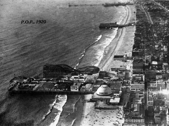 |
|
| (1920)* - Aerial view of Ocean Park Pier showing it's large roller coster. The long pier to the north (top of photo) is the Santa Monica Pier. It too had its own amusement park starting in 1916. In between the two longer piers is the shorter Crystal Pier (originally White Star Pier then Bristol Pier). |
Historical Notes In the 1920s, Santa Monica Bay was lined with numerous piers due to the area's booming tourism, vibrant recreational activities, and strategic importance for transportation and commerce. The piers served as hubs for economic growth, attracting visitors with entertainment, dining, and amusement parks. Additionally, they enhanced real estate development by making coastal properties more attractive and served as key social and community gathering spots. |
 |
|
| (1928)* – A strongman in a leopard-print bodysuit pulls a car packed with beachgoers by his teeth, near one of Santa Monica’s piers. Just another day of seaside spectacle and vintage showmanship. Photo from the Ernest Marquez Collection. |
Historical Notes In the 1920s, Santa Monica’s piers were vibrant hubs of entertainment where seaside spectacles and vintage showmanship were common. Acts like a strongman in a leopard-print bodysuit pulling a car full of beachgoers by his teeth fit perfectly into the lively beach culture of the time. The piers featured a mix of vaudeville performances, athletic feats, and circus-like stunts designed to captivate crowds. This tradition of public displays of strength and novelty acts helped define Santa Monica as a popular playground blending physical culture, spectacle, and Hollywood glamour well before the famous Muscle Beach era of the 1930s |
 |
|
| (1927)* – Detail of a map showing four of the main piers in Santa Monica Bay. |
Historical Notes 112 – Santa Monica Pier 111 – Crystal Pier 110 – Ocean Park Pier 109 – Pickering Pier / Venice Pier Click HERE to see more of the Piers of Santa Monica Bay. |
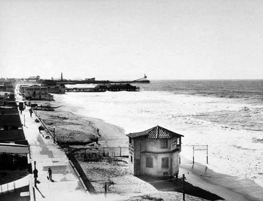 |
|
| (1938)* - View looking south toward Crystal Pier with the longer Ocean Park Pier and amusement park seen in the distance. |
Historical Notes Click HERE to see more of the Piers of Santa Monica Bay. |
* * * * * |
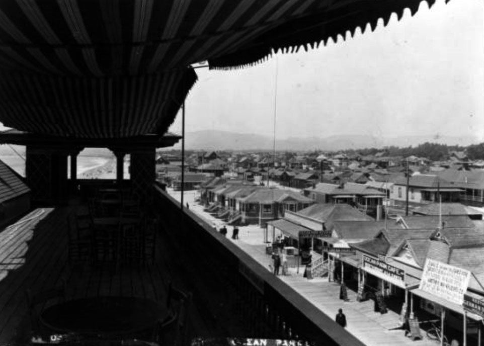 |
|
| (ca. 1915)* - View from the second story of a pavilion on the Ocean Park pier, showing shops and beach houses. A portion of roof covered by a cloth canopy is pictured in the left foreground, four sets of tables and chairs spaced regularly under the shade. Over its edge to the right, a collection of small shop fronts can be seen advertising their wares via signs, while farther in the distance at center, an expanse of housing can be seen stretching toward the mountains.; Legible signs from left to right include: "These chairs for patrons only", "Clairvoyant", "Lunch Room", "Ocean Park Review Job Printing", "Cigars and Tobacco", "Ice Cream Parlor", "99 Ocean Park Cafe. Restaurant A la Carte". |
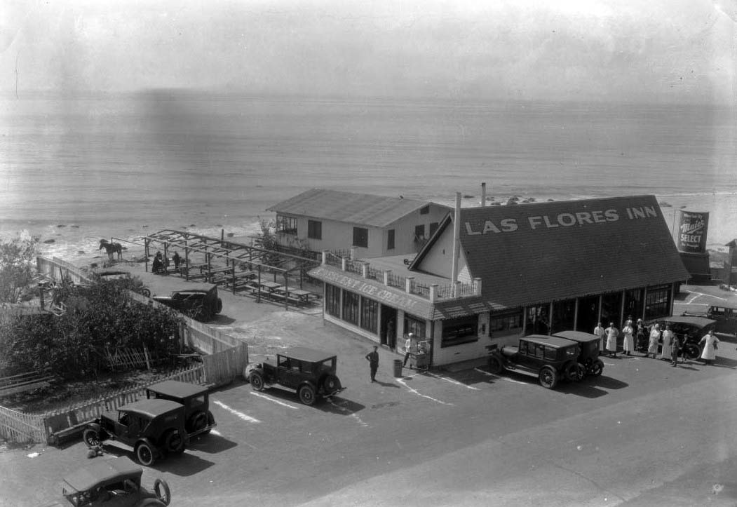 |
|
| (1915)** - Exterior view of the Las Flores Inn on the coast road near Santa Monica. The inn is at right and has a steeply peaked roof with its name painted near the top. Part of the inn extends back to the ocean behind it. A wooden structure is seen covering tables at left, and there is a fenced-in garden at left. Several cars are parked in front of the inn and the garden, and there are people standing in front of the inn. A horse is tied near the ocean at left. |
Historical Notes Las Flores Inn was located near where Duke’s Restaurant is today, by Las Flores Canyon. The coast route ended at Las Flores Canyon until the late 1920s, when the Roosevelt Highway was completed. Children used to wait here for the school bus to Santa Monica. Their parents played the slot machines at the restaurant and a big win meant soda pops for all. It is said the inn refused to pay "protection fees" and lost their slots, but the Malibu Inn up the road kept theirs.^## |
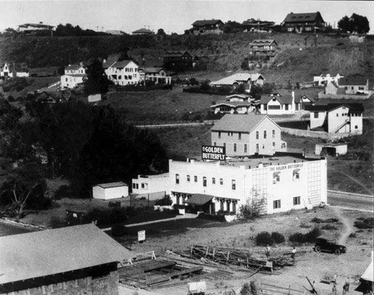 |
|
| (1916)#^ - View of the Golden Butterfly establishment in Santa Monica Canyon, below Adelaide Drive. |
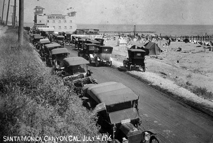 |
|
| (1916)#^ - View showing people enjoying the Fourth of July on the beach at the entrance to the Santa Monica Canyon. A large bathouse and two piers are seen in the background. |
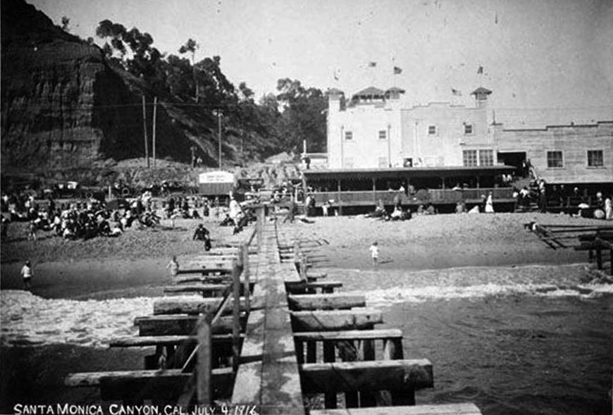 |
|
| (1916)#^ – View of the beach at the entrance to Santa Monica Canyon. The Santa Monica bathouse is seen in the background. |
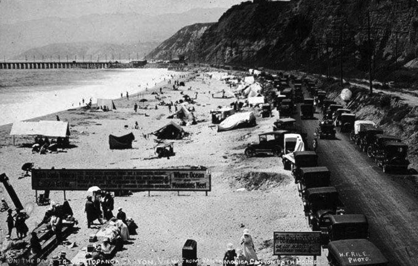 |
|
| (1916)#^ - View of the road to Topanga Canyon as seen from the Santa Monica Bath House. The Long Wharf can be seen in the distance. The beach is full of people between the bath house and the pier. The right side of the sign in the foreground reads: "Where Ocean and Mountains Meet" |
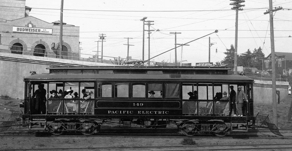 |
|
| (1916)#**- View of streetcar 149 leaving Santa Monica en route to the Long Wharf. |
Historical Notes The above streetcar was built by American Car Co. in 1902 for the San Bernardino Valley Traction Co. and later purchased by the Pacific Electric Railway Company. The car was eventually scrapped in 1926. #** The last ships arrived at the Long Wharf in 1908, however, the wharf lived on as a tourist destination, accessed by a trolley from Santa Monica. The wharf was demolished in stages, and disappeared entirely by 1920.#^^^ |
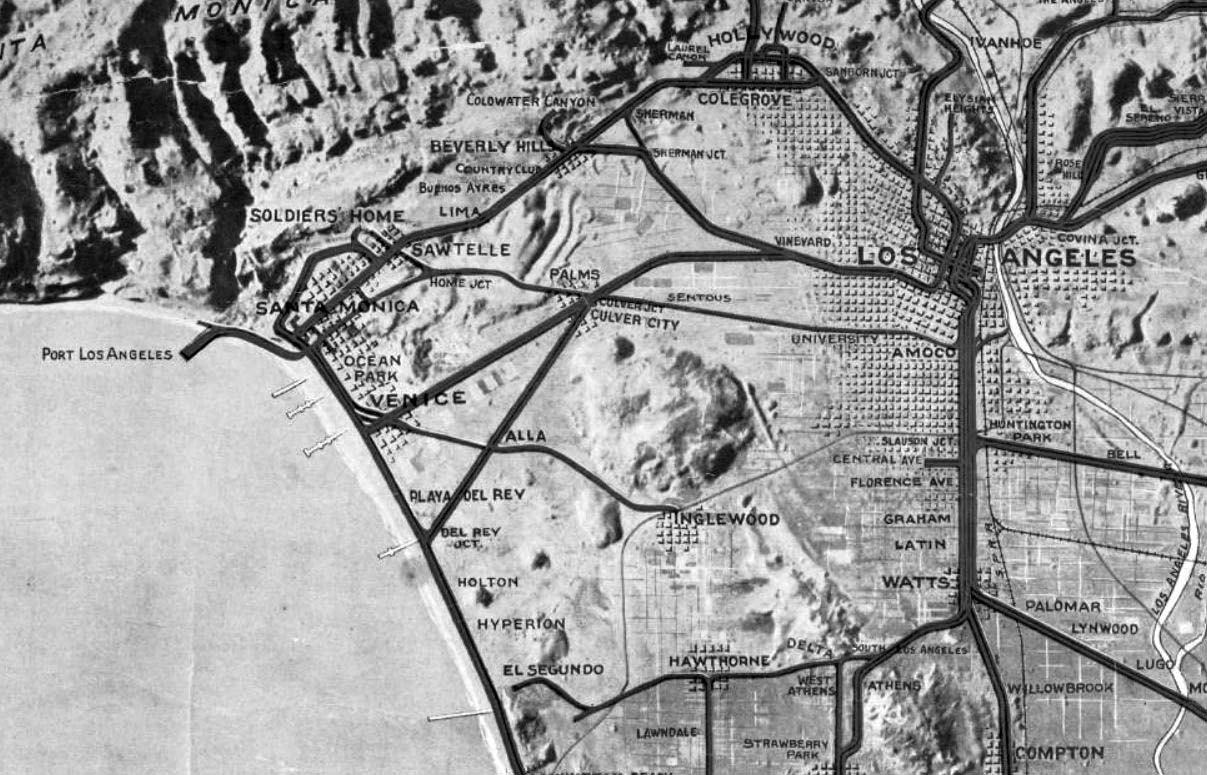 |
|
| (ca. 1920)#^# - Relief map of territory served by lines of the Pacific Electric Railway in Southern California. At the time of the photo it was the largest electric railway system in the world. Note the line heading to the Port of Los Angeles (The Long Wharf). |
 |
|
| (1926)#^^ - A panorama view of the California coastline at the Castellammare development area in Pacific Palisades in Los Angeles. The land is still undeveloped, with only a sign spelling out the development name perched on a hill. The land was under development by Frank Meline. |
Historical Notes Castellammare (Castle by the sea) is located along the Pacific Coast Highway on small bluffs much closer to sea-level, just north of where Sunset Boulevard meets the PCH. This is the home of the Getty Villa and the narrow, winding streets in this neighborhood have Italian names and ocean breezes.*^ |
Bel-Air Bay Club
 |
|
| (ca. 1927)* - The Bel-Air Bay Club in Pacific Palisades, although “Santa Monica” is present on the print. To the right can be seen a portion of the Roosevelt Highway (Pacific Coast Highway). |
Historical Notes In 1927, Alphonzo Bell built the Spanish Colonial Revival style Bel Air Bay Club located at 16801 Pacific Coast Highway, Pacific Palisades. The club is still standing today, although modified.* Alphonzo Bell was an American oil multi-millionaire, real estate developer, philanthropist, and champion tennis player. The westside Los Angeles residential community of Bel-Air is named after him. Bell was a native and lifelong resident of Los Angeles whose family had deep financial and historical ties to the area, and played a key role in the history and development of Southern California. He was the son of James George Bell, who established Bell Station Ranch (now the site of the City of Bell), in the Santa Fe Springs area in 1875, and of Susan Albiah Hollenbeck. His uncle, Ed Hollenbeck, who arrived in California in the 1850s, founded the First National Bank, created Los Angeles's public transportation trolley system, and developed eastern portions of Los Angeles County.*^ |
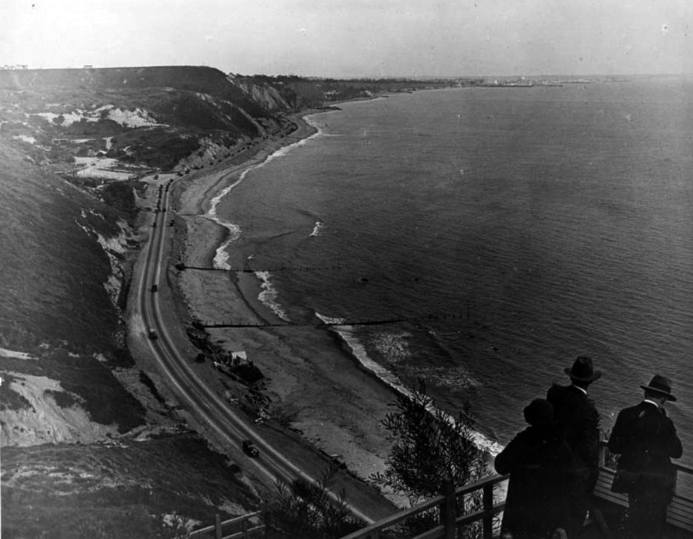 |
|
| (1927)#^^ – People overlooking the Santa Monica Bay and beach from the site of the upper clubhouse of the Bel-Air Bay Club site, with the lower clubhouse building under construction in the foreground on the beach in Pacific Palisades. Automobiles can be seen along the Beach Road (later the Roosevelt Highway and Pacific Coast Highway), and Santa Monica and the Santa Monica Pier are visible in the distance. |
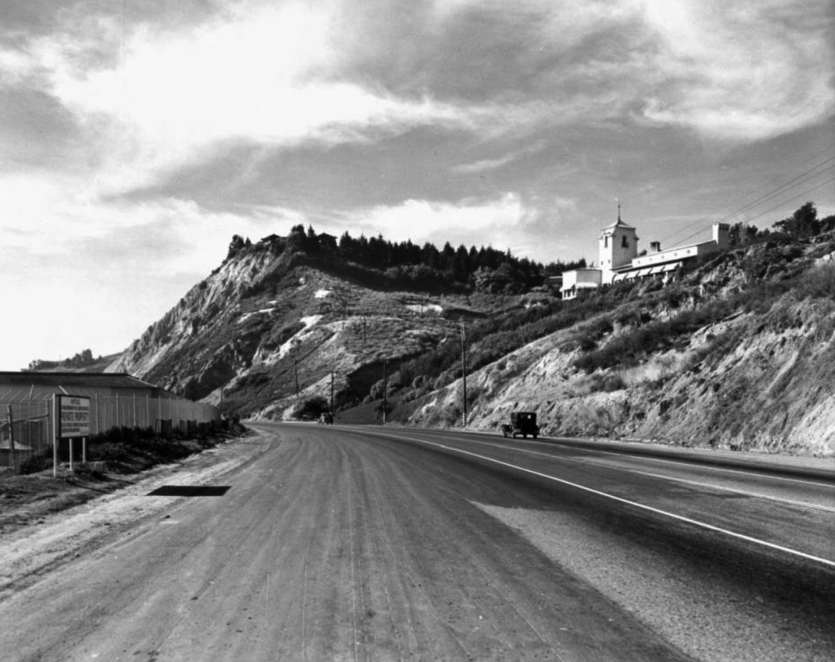 |
|
| (1930s)** – View looking north on Pacific Coast Highway showing the two facilities of the Bel-Air Bay Club. One facility is on the left along the beach and the other is the Spanish Colonial Revival-style building on the hillside at upper-right. Also seen in the distance, on top of the hill, is the famed Bernheimer Japanese Gardens. |
Historical Notes Bel-Air Bay Club consists of two facilities separated by the Pacific Coast Highway. The grounds are located on one-quarter mile of beachfront, with a total of 14 acres including picturesque bluffs overlooking the sea. |
 |
|
| (1931)* – View showing beach volleyball in front of the Bel-Air Bay Club. |
Historical Notes The Club was such a center of social activity during the 1920s, 1930s and 1940s that many celebrities frequented Club functions. |
* * * * * |
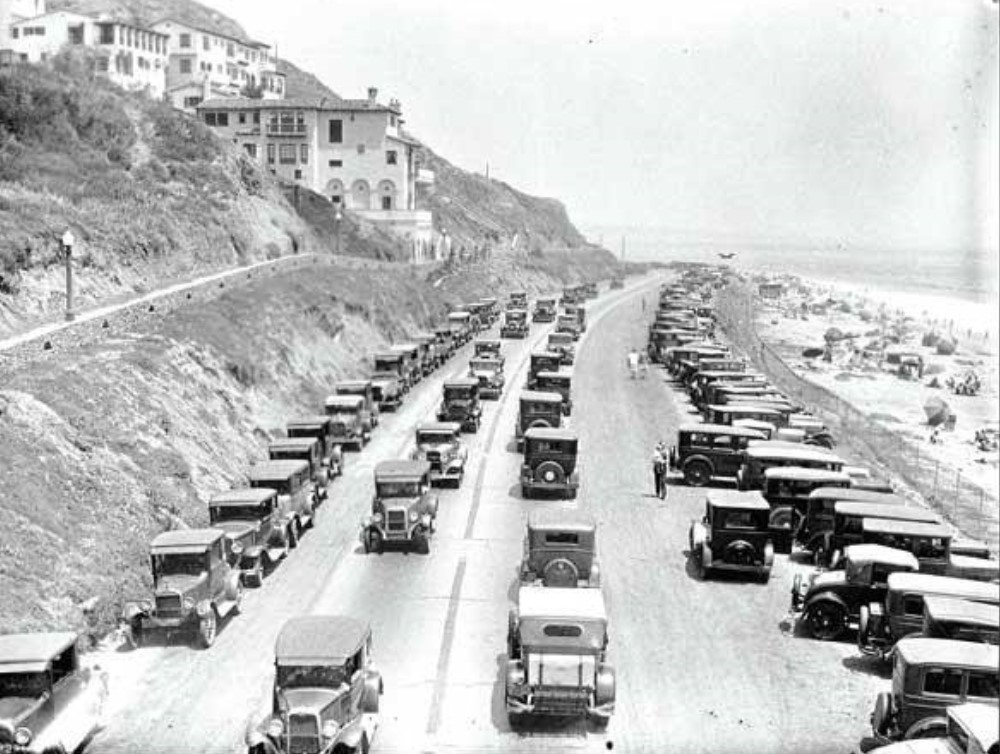 |
|
| (1920s)* – View looking south on Roosevelt Highway (later PCH) showing a busy day at the beach with parking spaces hard to come by. |
* * * * * |
Toed Inn
 |
|
| (1929)* - The Toed Inn, was a stand in the shape of a toad, located on Channel Road in Santa Monica. Behind can be seen the Seaside Service Station. |
Historical Notes Opened in 1929 at 124 West Channel Road in Santa Monica Canyon, the original Toed Inn was a charming example of programmatic architecture—designed in the shape of a giant frog, with customers entering through its open mouth. Owned by Roger C. McGinn and designed by architect Jacob Lee Schimmer, the whimsical structure quickly became a roadside attraction for beachgoers and motorists alike. In 1931, the building was moved to a larger adjacent lot and expanded, but it met disaster in 1938 when a catastrophic flood damaged and partially buried the restaurant in mud, forcing it to close. |
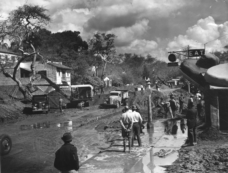 |
|
| (1938)* - Photo shows the cleanup of Channel Road in Santa Monica Canyon. Tons of mud and silt were deposited from the flood waters which raced down the canyon. The Toed Inn is on the right. |
Historical Notes In 1938, the Toed Inn structure was damaged by a flood caused by one of wettest seasons ever to hit Southern California. That same year the Toed Inn was relocated to West Los Angeles, at 12008 Wilshire Boulevard. |
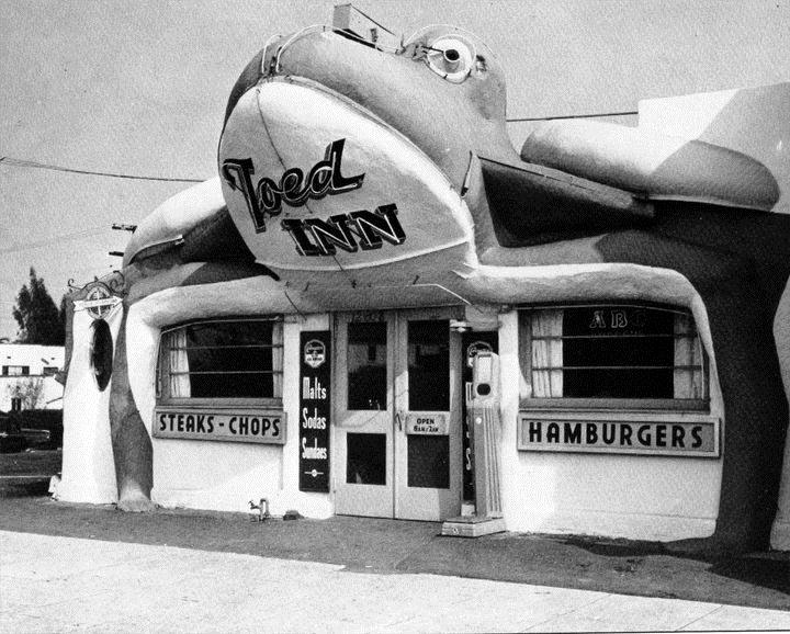 |
|
| (ca. 1939)* - The Toad Inn at it's new location at 12008 Wilshire Boulevard in West Los Angeles.. |
Historical Notes In early 1939, McGinn relocated the damaged frog structure several miles inland to 12008 Wilshire Boulevard, near Saltair Avenue in West Los Angeles. The front was rebuilt using accordion-style doors, and the restaurant reopened in a more enclosed and modernized form while still retaining its signature amphibian charm. The move positioned the Toed Inn along a major urban corridor, where it continued to draw attention with its fanciful design and playful theme. It was eventually sold to Benjamin Rosenfeld, who made further enhancements including neon signage and a new front façade. |
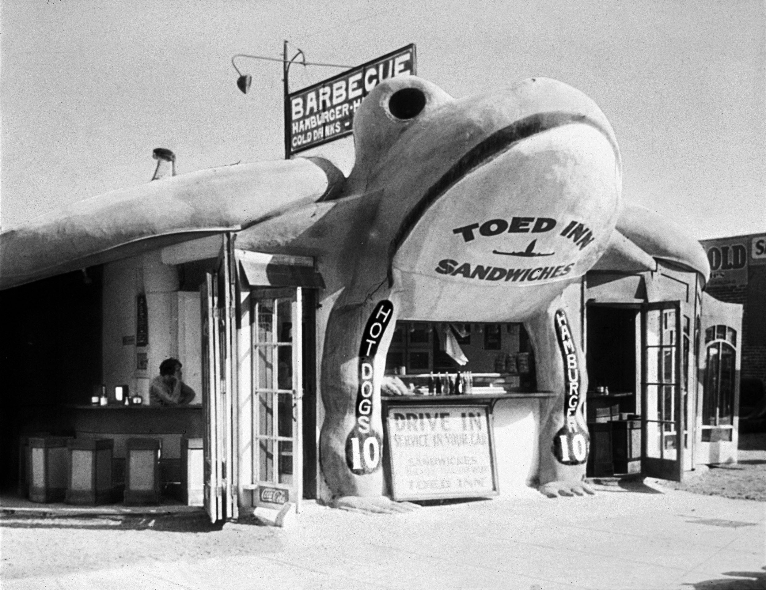 |
|
| (1940)* - Toed Inn located at 12008 Wilshire Boulevard after it became a drive-in restaurant. Click HERE to see more Early LA Drive-in restaurants. Photo from the Jim Heimann Collection. |
Historical Notes During the 1940s, the Toed Inn thrived as a drive-in restaurant, fitting perfectly into the car-centric culture of postwar Los Angeles. Known for hearty meals—steaks, barbecue, fried chicken, and even frog legs—it became a local favorite and was featured in publications like the Saturday Evening Post. However, by the early 1950s, novelty architecture began to fall out of favor, and the restaurant closed in 1953. The building was replaced with a more conventional establishment called Ben’s, but the giant frog lives on in L.A. lore as one of the city’s most endearing roadside oddities. Click HERE to see more examples of Programmatic Architecture. |
* * * * * |
Flooding (1938 Storm)
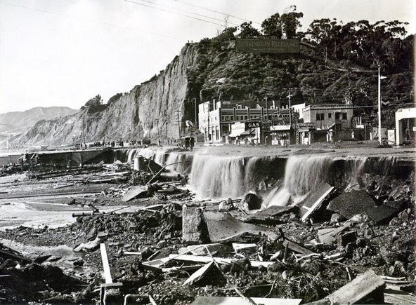 |
|
| (1938)^ - View showing the Santa Monica Canyon flood of 1938. The sign on top of the hill reads: HUNTINGTON PALISADES. |
Historical Notes Between February 27 and 28, 1938, a storm from the Pacific Ocean moved inland into the Los Angeles Basin, running eastward into the San Gabriel Mountains. The area received almost constant rain totaling 4.4 in from February 27-March 1. This caused minor flooding that affected only a few buildings in isolated canyons and some low-lying areas along rivers. Fifteen hours later on March 1, at approximately 8:45 PM, a second storm hit the area, creating gale-force winds along the coast and pouring down even more rain. The storm brought rainfall totals to 10 inches in the lowlands and upwards of 32 inches in the mountains. When the storm ended on March 3, the resulting damage was horrific. |
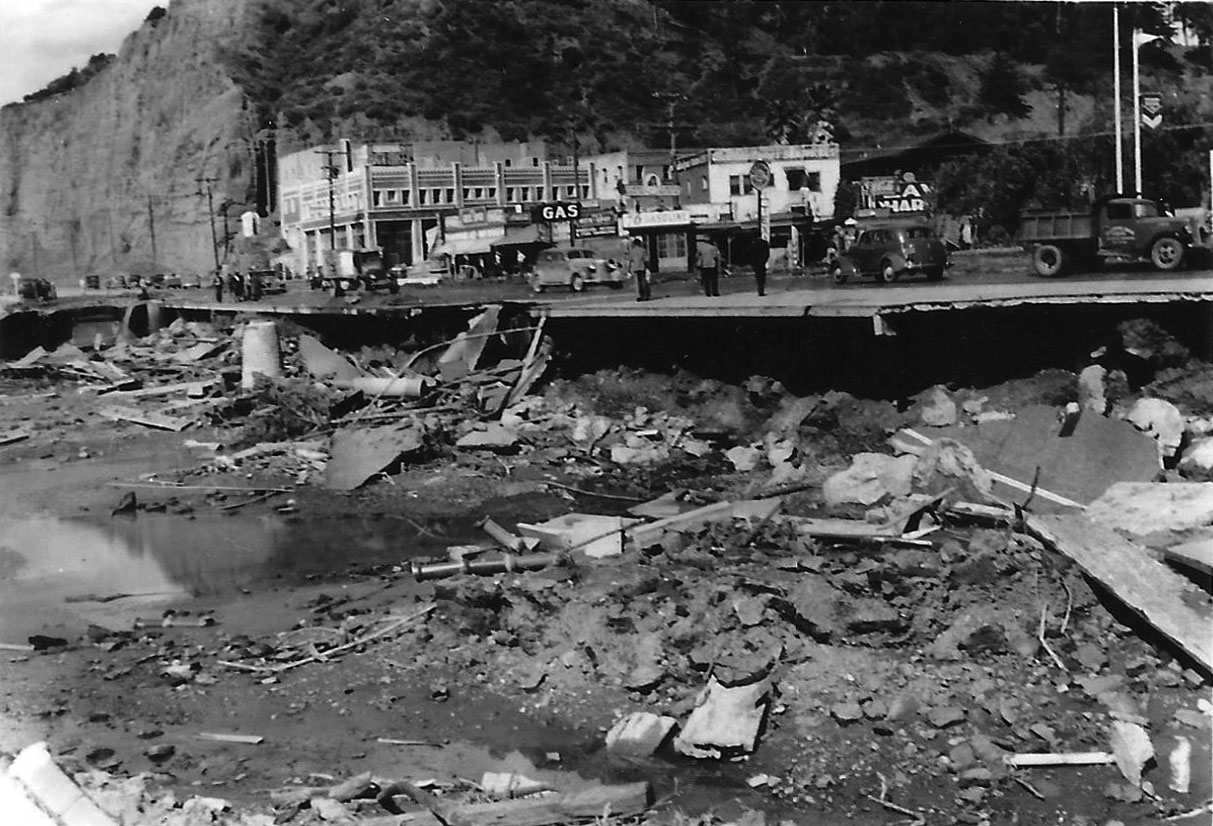 |
|
| (1938) – Aftermath of the Santa Monica Canyon flood. Photo courtesy of Sarah Marinelli |
.jpg) |
|
| (1938) – Santa Monica Canyon flood aftermath. Photo courtesy of Sarah Marinelli |
.jpg) |
|
| (1938) – Channel Road in Santa Monica Canyon after the great flood. Photo courtesy of Sarah Marinelli |
|
|
| (1938)* - Photo shows the cleanup of Channel Road in Santa Monica Canyon. Tons of mud and silt were deposited from the flood waters which raced down the canyon. The Toed Inn is seen on the right. |
Historical Notes After the 1938 Santa Monica Canyon flood, the Toed Inn was relocated to Westwood, at 12008 Wilshire Boulevard. |
* * * * * |
Pacific Palisades
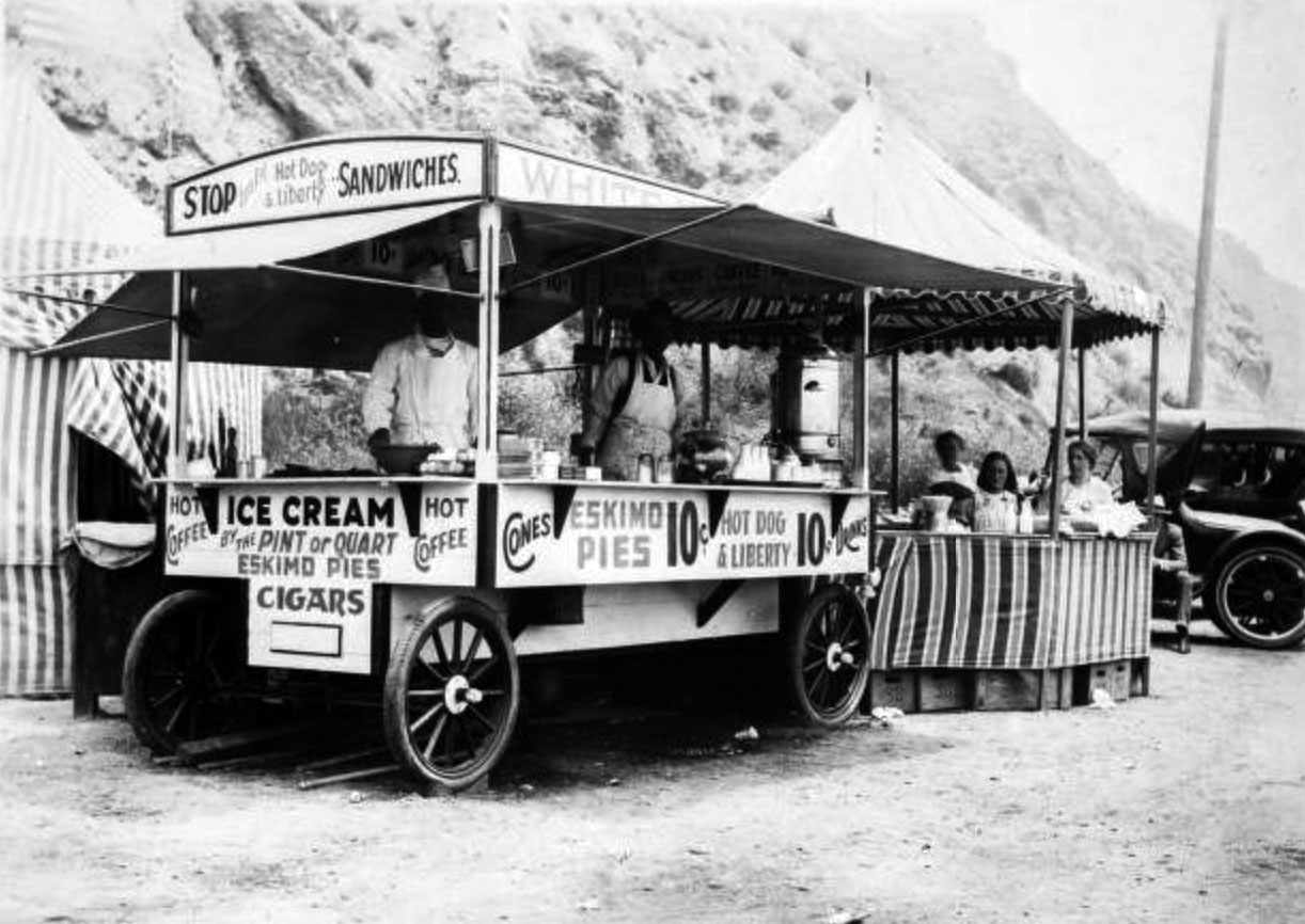 |
|
| (ca. 1918)* - Image of a food stand on the beach, with vendors behind counter in Pacific Palisades. The cart may say "White House" above the awning (the sign is partially obscured). The cart has signs including "Stop, Let's Eat Hot Dog & Liberty Sandwiches" and "Hot coffee, Ice Cream by the pint or quart, Eskimo Pies, Cigars, Cones... Drinks." |
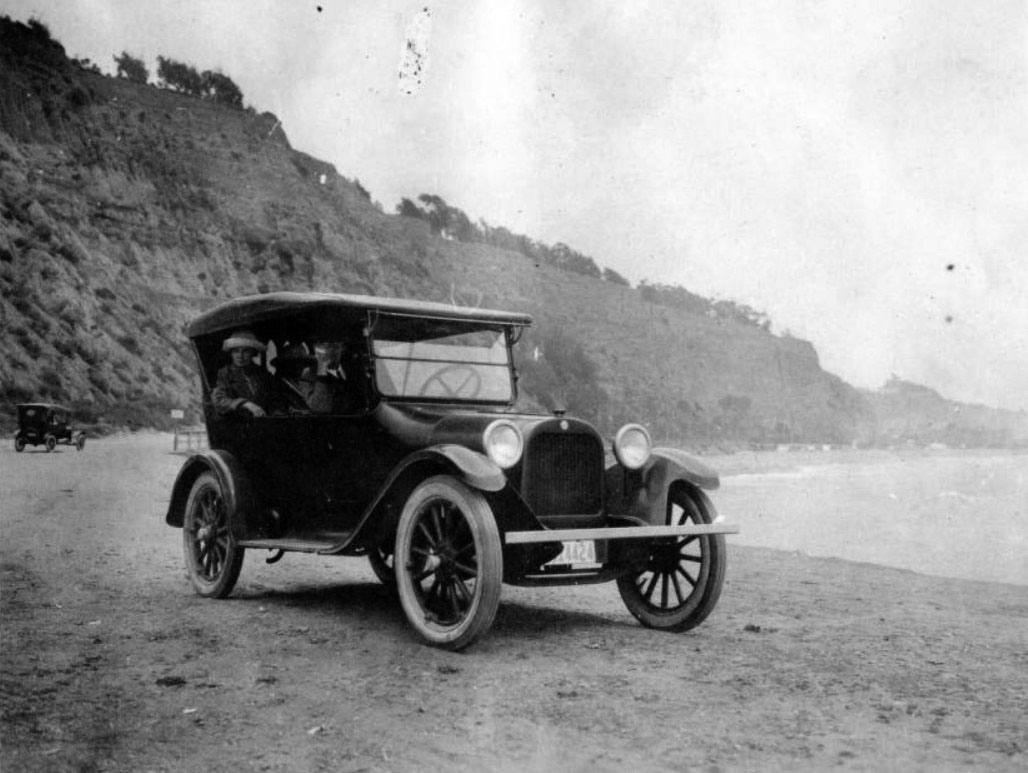 |
|
| (1922)* - A 1918 Dodge Brothers touring car on the beach just south of the Long Wharf location in Pacific Palisades. |
* * * * * |
Santa Monica Palisades
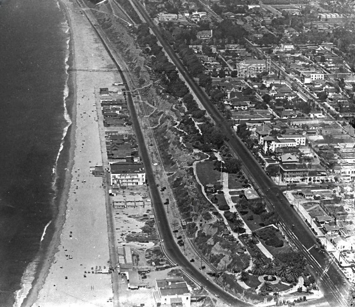 |
|
| (1922)*– Aerial view looking north from above the Santa Monica Pier, showing the Pacific coastline with beach houses lining the shore, the Roosevelt Highway (now Pacific Coast Highway), and the terraced bluffs of Palisades Park. Ocean Avenue runs parallel to the bluffs, bordered by early residential neighborhoods and palm-lined streets. Several civic and institutional buildings can be seen near Arizona Avenue. This image captures Santa Monica’s coastal development during the early automobile era. |
Historical Notes Roosevelt Highway, visible hugging the coastline, was part of a larger coastal route proposed in the 1910s and officially named in 1921 to honor President Theodore Roosevelt. It was later incorporated into Pacific Coast Highway (PCH) in the 1930s.
|
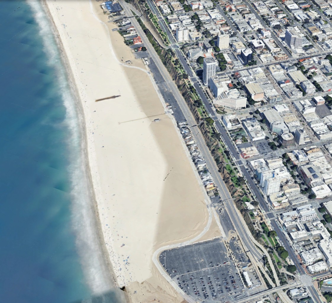 |
|
| (2022)* - Contemporary View – A Century of Change Along Santa Monica’s Coastline |
Historical Notes This modern Google Earth view, looking north from above the Santa Monica Pier area, reveals the dramatic transformation of the coastal landscape since 1922. The once dense row of beach houses seen in the earlier aerial has been replaced by wide, open sand and uninterrupted public beach access. Roosevelt Highway is now Pacific Coast Highway (PCH)—modernized and expanded to accommodate heavy traffic. Ocean Avenue still runs parallel to the bluffs, though it is now lined with mid- and high-rise buildings, reflecting Santa Monica’s evolution into a vibrant urban center. The terraced bluffs and pathways of Palisades Park remain a constant, offering a preserved stretch of green between city and sea. Note on the Widened Beach: |
.jpg) |
|
| (1922)* - Aerial view of the Palisades and various residential homes in Santa Monica. Ocean Avenue and Palisades Park runs parallel to the cliffs. Roosevelt Highway and Santa Monica beach can be seen below the cliffs. |
Historical Notes The nationwide prosperity of the 1920s was felt in Santa Monica. The population increased from 15,000 to 32,000 at the end of the decade. Downtown saw a construction boom with many important buildings going up such as Henshey's Department Store (destroyed) and the Criterion Theater. Elegant resorts were opened, including the 1925 Miramar Hotel and the 1926 Club Casa del Mar. The Los Angeles firm of Walker & Eisen designed the art deco Bay City Building, a 13-story skyscraper topped with a huge four-faced clock that was finished in 1930. |
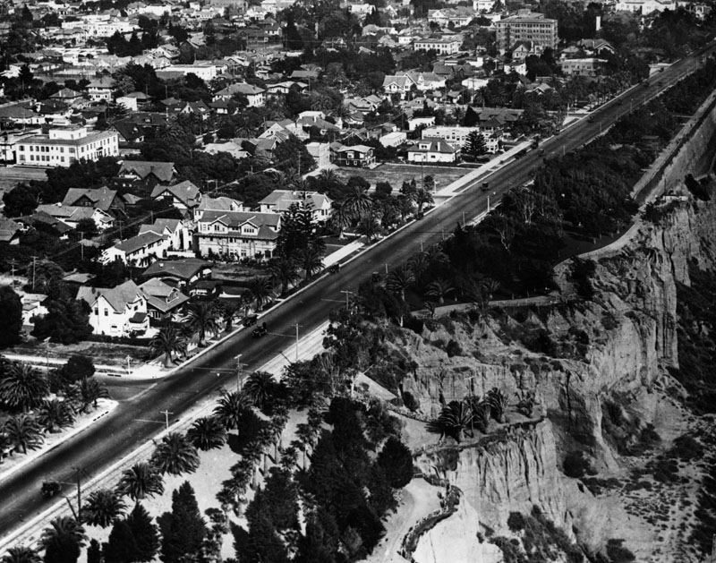 |
|
| (1922)* - Closer view of the Palisades in Santa Monica. Ocean Avenue runs parallel to Palisades Park (right). Palm trees can be seen in the lower part of the park and throughout the city. |
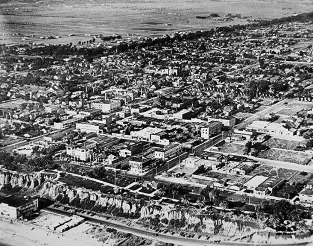 |
|
| (1919)* - Aerial view of Santa Monica, north of Wilshire showing the wooded diagonal virtually undeveloped. |
* * * * * |
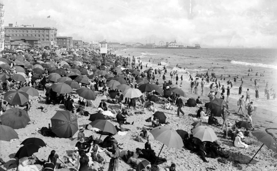 |
|
| (ca. 1920)* - View of Ocean Park Beach in Santa Monica crowded with bathers. The beach and most of the people sitting on it have umbrellas, creating a sea of various patterns and colors. The ocean at right is also full of people wading in the waves. The pier is visible in the background at center. There are several rides visible on the pier, including a Ferris Wheel and a roller coaster. |
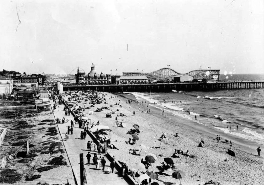 |
|
| (ca. 1920)* - View of Santa Monica beach looking south toward the pier. The beach is crowded with people resting under umbrellas or playing in the waves. There is a wide sidewalk bordering the beach at left. The left side of the walkway is lined with empty lots in the foreground and buildings in the distance. The pier is in the background at right center and several structures are built on it, including a billiards and bowling hall and a large wooden rollercoaster. Another pier is visible further down the beach at center. |
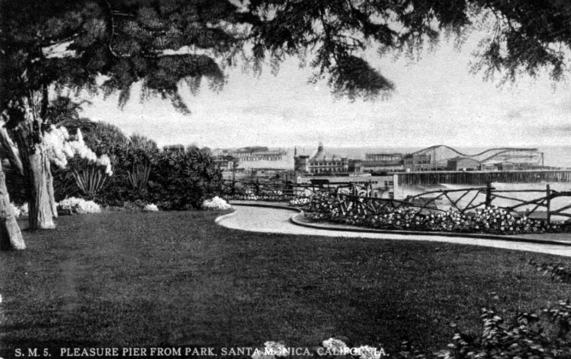 |
|
| (1922)* – Postcard view showing the Santa Monica Pleasure Pier from Palisades Park. Part of Ocean Park Pier can also be seen in the background. |
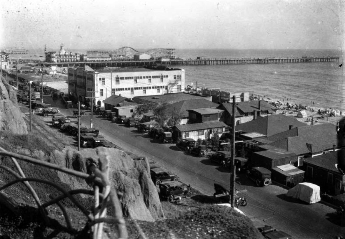 |
|
| (ca. 1922)* - View of Ocean Park beach and the Santa Monica Pier looking south from Palisades Park. The Pacific Coast Highway runs from the foreground at right into the distance at left and is lined with early-model automobiles. The right side of the road also has several beach houses and a large, two-story bath house. The beach is visible beyond the buildings at right and is full of bathers and other beach-goers. The pier is in the background and stretches across the entire image. At left are several amusement park structures, including a roller coaster and a bowling and billiards hall. |
* * * * * |
Santa Monica Pier (Loof Pleasure Pier and Santa Monica Municipal Pier Combined)
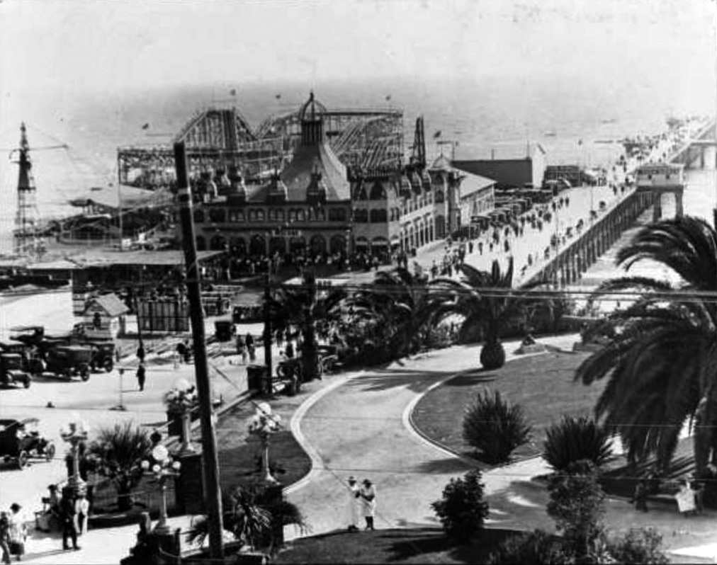 |
|
| (1917)#^^ - View showing the Santa Monica Municipal Pier at right and the Looff Pleasure Pier at left including the Looff Hippodrome (with "Welcome" sign) and Blue Streak roller coaster. Both piers combined were also known as Santa Monica Pier. Automobiles are seen parked on along the pier as well as signs for "Fish market bait and tackle" and "Pure California orange juice." Palm trees and cannon and cannon balls can be seen in the foreground in Palisades Park. |
Historical Notes From the time the Municipal Pier was conceived, the community wished to add an amusement park to compete with the neighboring Ocean Park and Venice Piers. In 1916 Charles Looff, a famous carousel carver turned amusement entrepreneur, answered that wish by building a new, wider pier with an amusement park along the south side of Municipal Pier. Both piers combined were often referred to as Santa Monica Pier. Looff's opening day, July 4, 1917, drew over 100,000 people; the biggest crowd in the city's history.* |
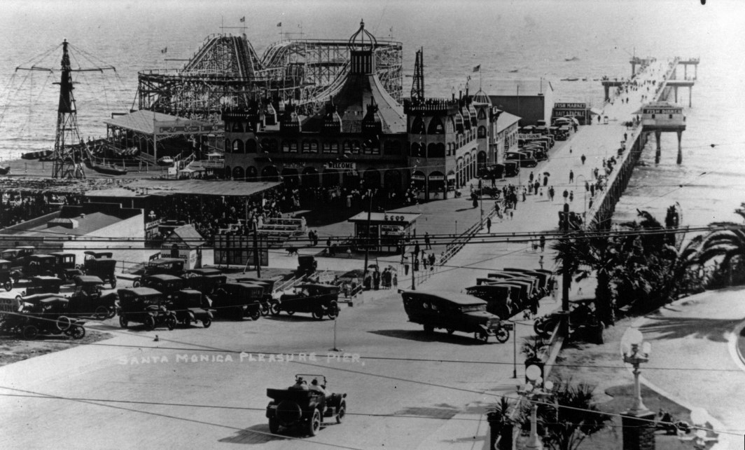 |
|
| (ca. 1922)* - View showing the Santa Monica Pier with parking lot in the foreground. The largest two structures are the wooden roller coaster and the Looff Hippodrome. |
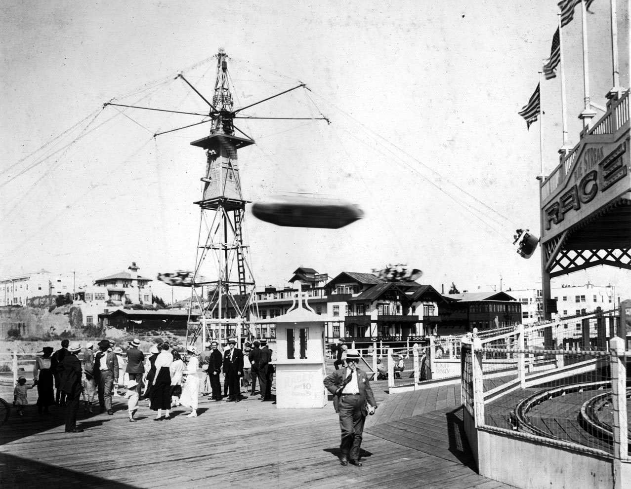 |
|
| (1920s)* - The Aeroscope ride on the Looff Pier in Santa Monica, to the right is the entrance to the Blue Streak Racing Coaster |
Historical Notes The Aeroscope had six boats, each boat holding six passengers. When the ride reached thirty-five miles per hour, the centrifugal force prevented its passengers from falling out. Sixty feet high and decorated with colored lights hanging from its crown and down its cables, the Aeroscope was visible at night from miles around.* |
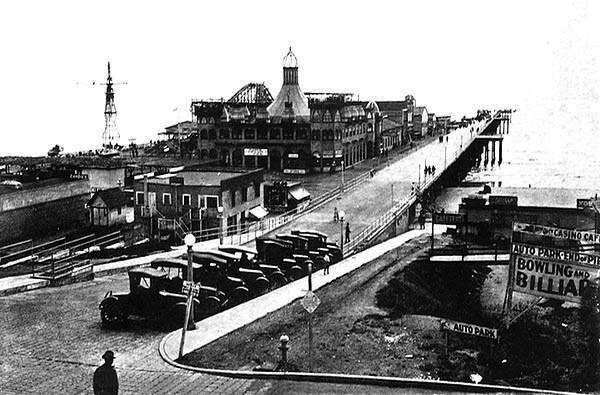 |
|
| (ca. 1922)^*## - View showing a man crossing the street heading toward Santa Monica Pier. Sign on right reads: CASINO CAFE - AUTO PARK - BOWLING AND BILLIARDS. |
Historical Notes Santa Monica has had several piers over the years; however, the current Santa Monica Pier is actually two adjoining piers that long had separate owners. The long, narrow Municipal Pier opened September 9, 1909, primarily to carry sewer pipes beyond the breakers, and had no amenities. The short, wide adjoining Pleasure Pier to the south, a.k.a. Newcomb Pier, was built in 1916 by Charles I. D. Looff and his son Arthur, amusement park pioneers. Attractions on the Pleasure Pier eventually included the Santa Monica Looff Hippodrome building (which now houses the current carousel and is listed on the National Register of Historic Places), the Blue Streak Racer wooden roller coaster (which was purchased from the defunct Wonderland amusement park in San Diego), the Whip, merry-go-rounds, Wurlitzer organs, and a funhouse.*^ |
 |
|
| (1924)* – Image of people walking along the Santa Monica Municipal Pier at right and the Santa Monica Amusement Pier at left. Visible on the pier are the Whirlwind Dipper roller coaster, Looff Hippodrome, and the La Monica Ballroom. With visible signs including "Whirlwind Dipper," "The Overlook Hotel & Apts., "La Monica Ballroom Auto Park," and "La Monica School of Dancing." Photo Ernest Marquez |
Historical Notes The above photo was taken shortly after the La Monica Ballroom was built at the end of the pier. Click HERE to see more. |
Santa Monica Looff Hippodrome
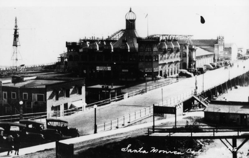 |
|
| (ca. 1924)* - Closer view of the combined Municipal Pier and Loof Pleasure Pier showing the impressive Looff Hippodrome at center. |
Historical Notes TIn 1916, Charles I.D. Looff constructed a Moorish-Byzantine hippodrome on the Santa Monica Pier. It housed a merry-go-round with 44 hand-crafted horses.* In ancient Greece, the hippodrome was is an open-air stadium with an oval course for horse and chariot races or an arena for equestrian shows. |
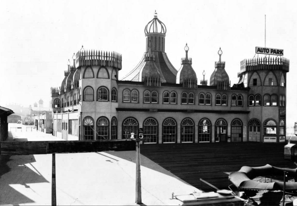 |
|
| (ca. 1920s)** - View of the Santa Monica Pier Merry-go-round. The ride is housed within a large building that resembles a castle with round turrets on the corners and domes along the tops of the walls. Arched windows run along the perimeter on both the first and second stories. A large tower that looks like the top of a circus tent rises from the middle of the building. A sign on one of the castle turrets reads "Auto Park". |
Historical Notes Charles Looff is renowned for innovating a noteworthy style of carousel horse. The moving horses were slender and graceful and inferred motion. The manes featured "cut through" openings, which looked dramatic, but where very time consuming to carve. Around 1905, Looff designed a saddle that resembled a scoop, a design that is still found on carousel horses today. +^ |
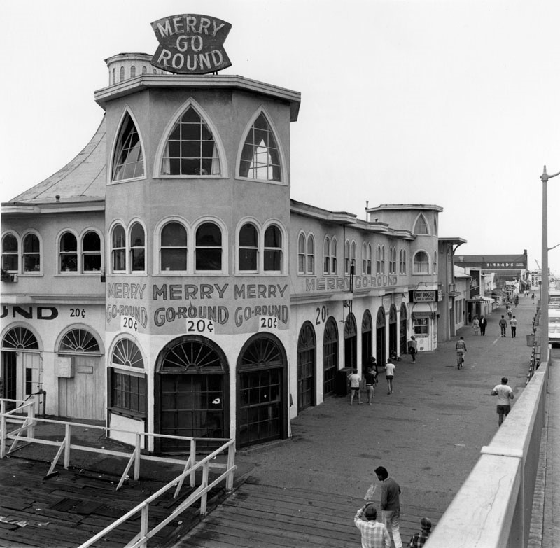 |
|
| (1966)* - Merry-Go-Round (Looff Hippodrome) on the Santa Monica Pier. Photo by William Reagh |
Historical Notes In 1987, the Santa Monica Looff Hippodrome was added to the National Registry of Historic Places. |
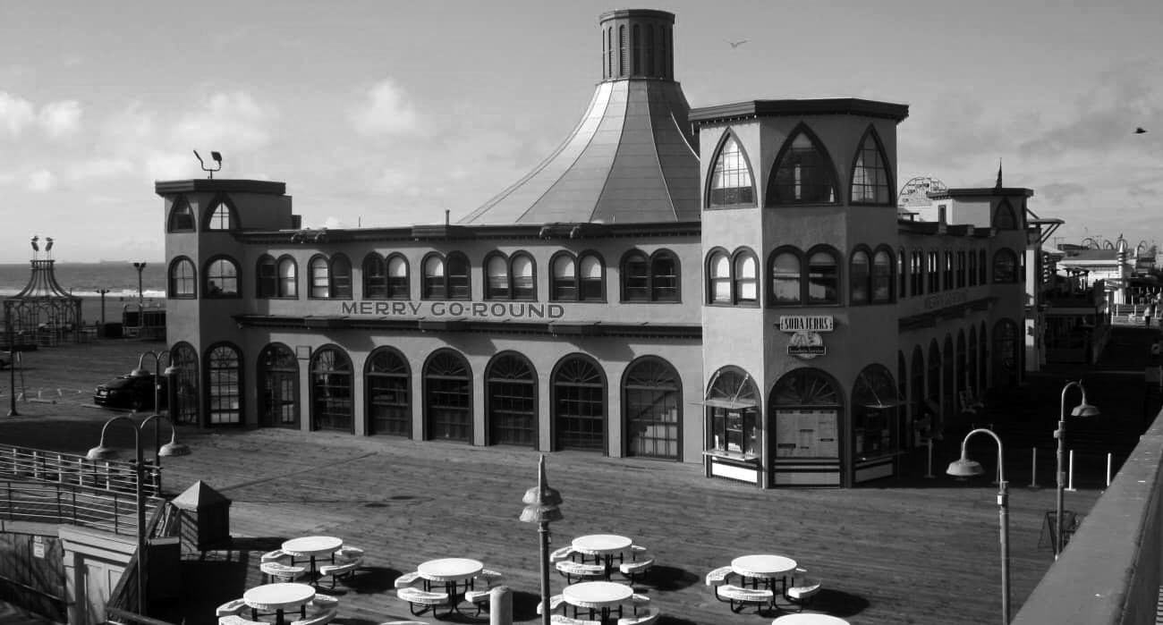 |
|
| (2020)^ - Santa Monica Looff Hippodrome as it appears today. Photo courtesy of Terry Krell Reynolds-Gallob |
Historical Notes Today, the Looff Carousel is the only original structure remaining on the Santa Monica Pier. Records do not indicate what happened to Looff's merry-go-round which was installed in the hippodrome. We do know that it was replaced by one from the old Ocean Park Pier in 1939. The current merry-go-round was built by the Philadelphia Toboggan Company in 1922; its original home was Nashville, Tennessee. The carousel arrived on the West Coast before World War II and in 1947 it was moved from Venice pier to the Santa Monica pier. It has been owned since 1977 by the City of Santa Monica. The 44 original hand-carved and painted wooden horses were restored in 1981-1984. +^ |
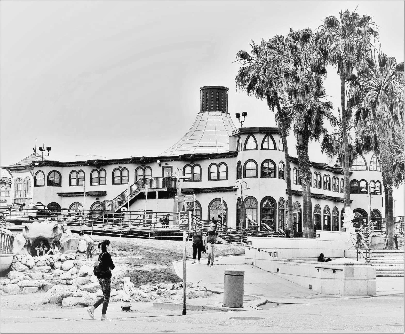 |
|
| (2021)* - Contemporary view of the Merry-Go-Round (Looff Hippodrome) on the Santa Monica Pier. Photo by Howard Gray |
* * * * * |
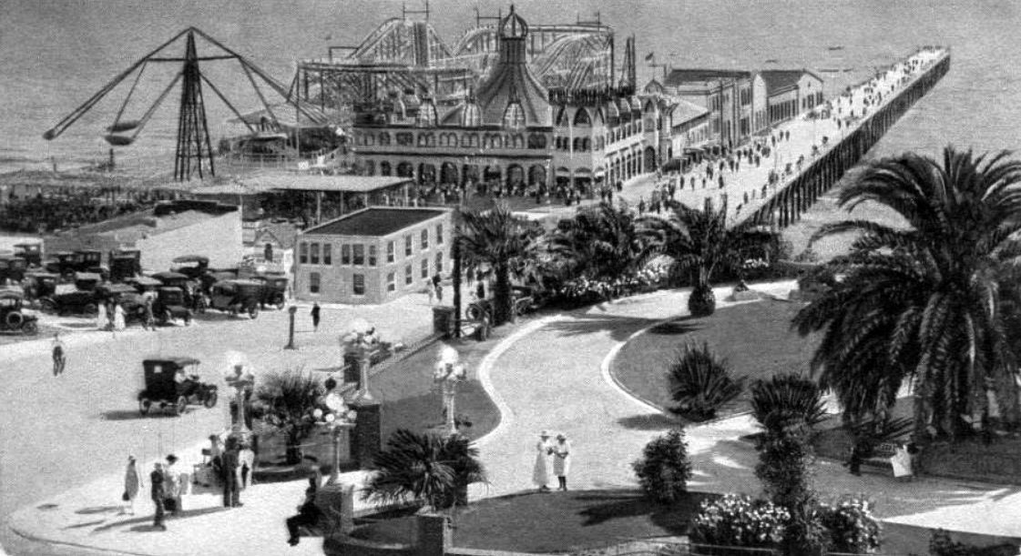 |
|
| (1922)#^# – Postcard view showing Pleasure Pier in Santa Monica. Various rides can be seen on the pier including a large roller coaster. The building with the large circus-like tent on top houses the Merry-go-round. |
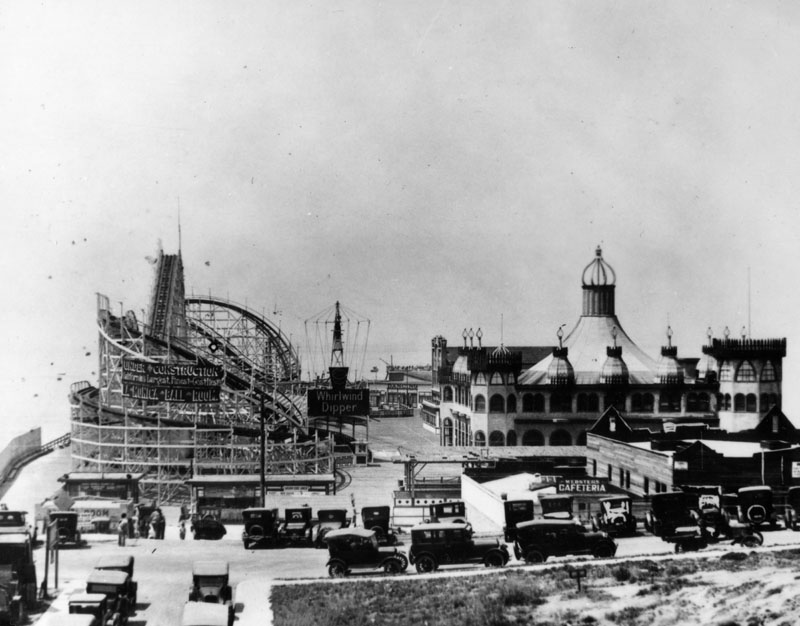 |
|
| (ca. 1924)* - View shows the amusement park, complete with wooden roller coaster, on the Santa Monica pier. |
Historical Notes In additon to the hippodrome, the pier included a billiards and bowling hall, a two-track Blue Streak Racer wooden roller coaster along with The Whip and the Aeroscope thrill rides, a "What Is It?" maze, and several smaller rides.* |
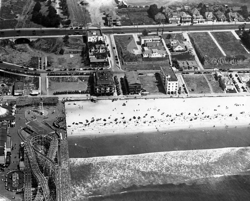 |
|
| (1924)* - Aerial view of the Santa Monica pier located on the beach in Santa Monica. An amusement park with several amusement rides is located on the pier, including a large roller coaster. Several hotels can be seen on the oceanfront of Santa Monica beach. |
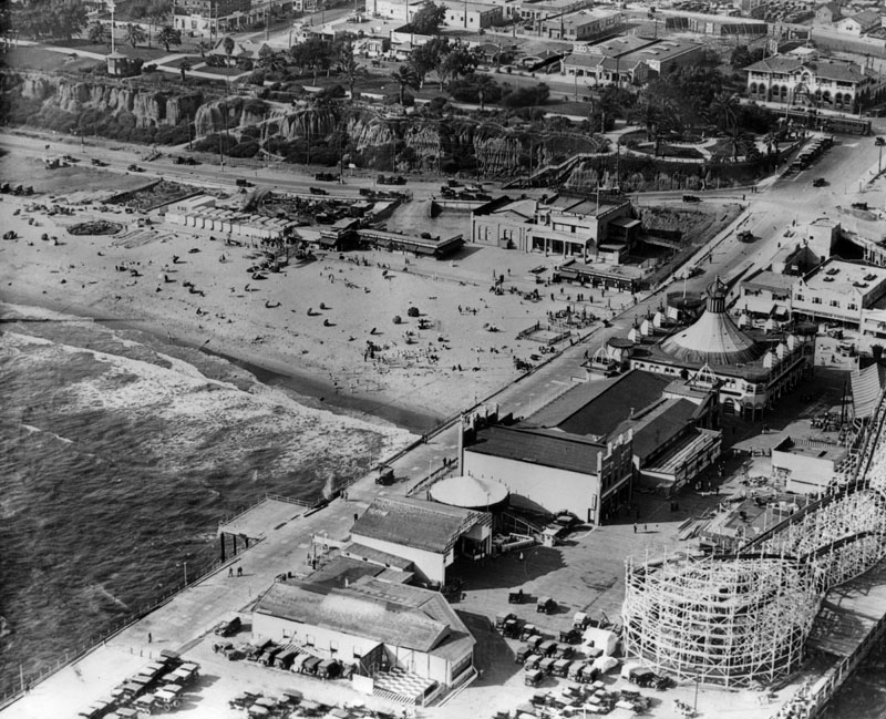 |
|
| (1924)* - Aerial view of the Santa Monica pier. Beach and buildings can be seen on the north side of the pier. |
Historical Notes Looff called this the perfect location for an amusement park, since the area was easy to access via the popular Pacific Electric Air Line as well as an electric trolley that ran from Santa Monica to Venice.*^*^* |
Pacific Electric Stations
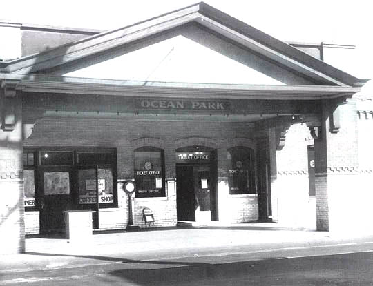 |
|
| (1920s)**#* - In the 1920s the Santa Monica line — then called the Venice via Sawtelle line — stopped at this station in Ocean Park, at Pier St. |
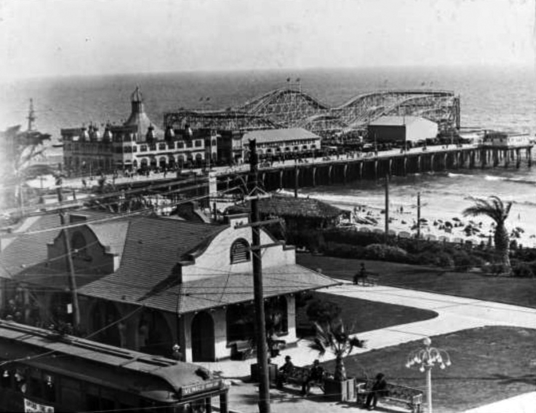 |
|
| (ca. 1917)+^^ – View showing the Pacific Electric Railway Ocean Avenue depot in the foreground, with a streetcar marked "Venice" and the Looff Pleasure Pier, Santa Monica Municipal Pier and beach in distance. The Looff Hippodrome (with "Welcome" sign), "Bowling and Billiards" building, the Blue Streak Racer roller coaster, and Aeroscope rides are visible on the pleasure pier. |
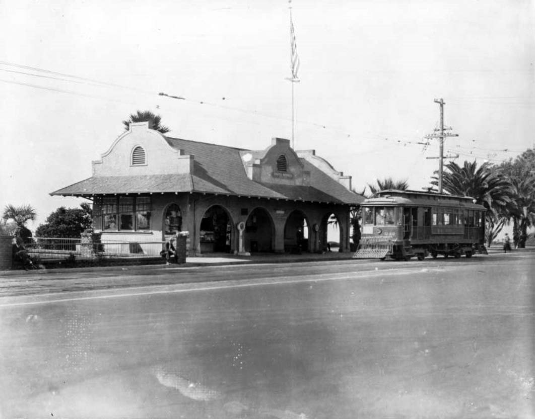 |
|
| (ca. 1922)** - Exterior view of the Pacific Electric Station in Santa Monica. The small station is at center and is a single-story Spanish-style building. Several large archways provide access to a small porch in front of the building, and tall stucco walls project out of the roof. A streetcar is visible on the tracks in front of the station. A metal fence encloses a small yard at left, and several palm trees are visible in the distance at right. A massive American flag is hanging from a pole near the train station. |
.jpg) |
|
| (1920s)#^ – View showing a Pacific Electric Railway train passing Linda Vista Station on Ocean Avenue. Banners hang from a dual-lamp light post. Click HERE to see more Early LA Streetlights. |
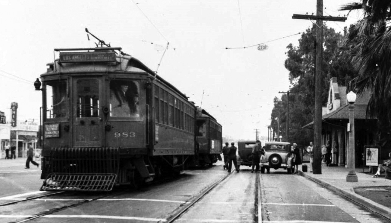 |
|
| (ca. 1930s)*– View showing Pacific Electric streetcar no. 983 at the Ocean Avenue depot in Santa Monica. Signs on the front of the streetcar read "Los Angeles vis Beverly Hills" and "West Los Angeles Westwood Beverly Hills Carthay Center." |
Historical Notes In the 1930s the Santa Monica via Beverly Hills line had the highest patronage of any inter-city or suburban line of the Pacific Electric Railway. Yet it was converted to bus operation in 1940, unlike the various PE suburban lines that survived World War II. |
* * * * * |
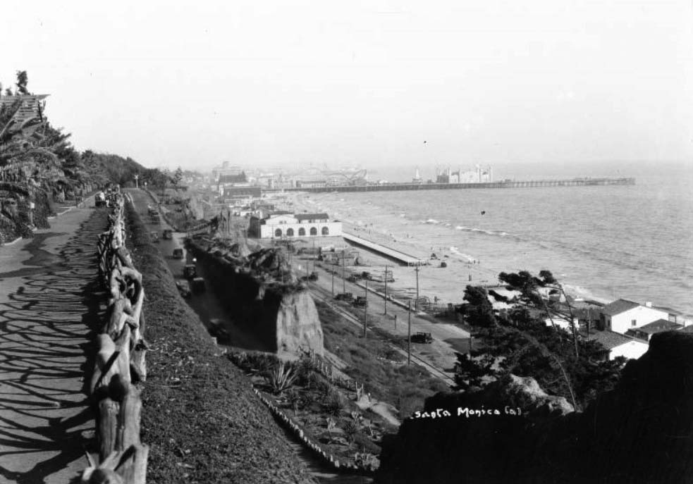 |
|
| (ca. 1924)* - View of the Santa Monica Pier looking south from the Palisades Park cliff path. The pier is in the distance at center and stretches out into the ocean at right. There are several large buildings and a roller coaster on the long wooden walkway. There are several early-model automobiles making their ways up and down the incline. |
* * * * * |
La Monica Ballroom
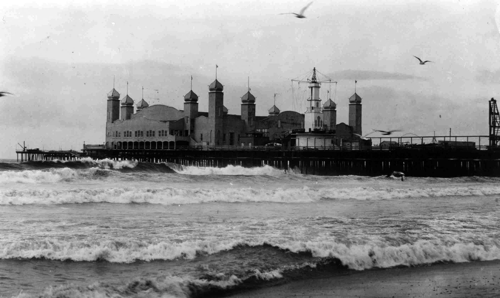 |
|
| (1926)*- Looking out toward the Santa Monica Pier, with the exotic La Monica Ballroom extending over the ocean at its western end. Designed in a blend of Spanish Colonial and French Renaissance styles, it was once the largest ballroom on the West Coast. |
Historical Notes Opened in July 1924 and designed by amusement architect T.H. Eslick, the La Monica Ballroom quickly became one of the most iconic dance venues on the West Coast. With domed corner towers and curvilinear gables, it evoked a seaside palace hovering above the waves. |
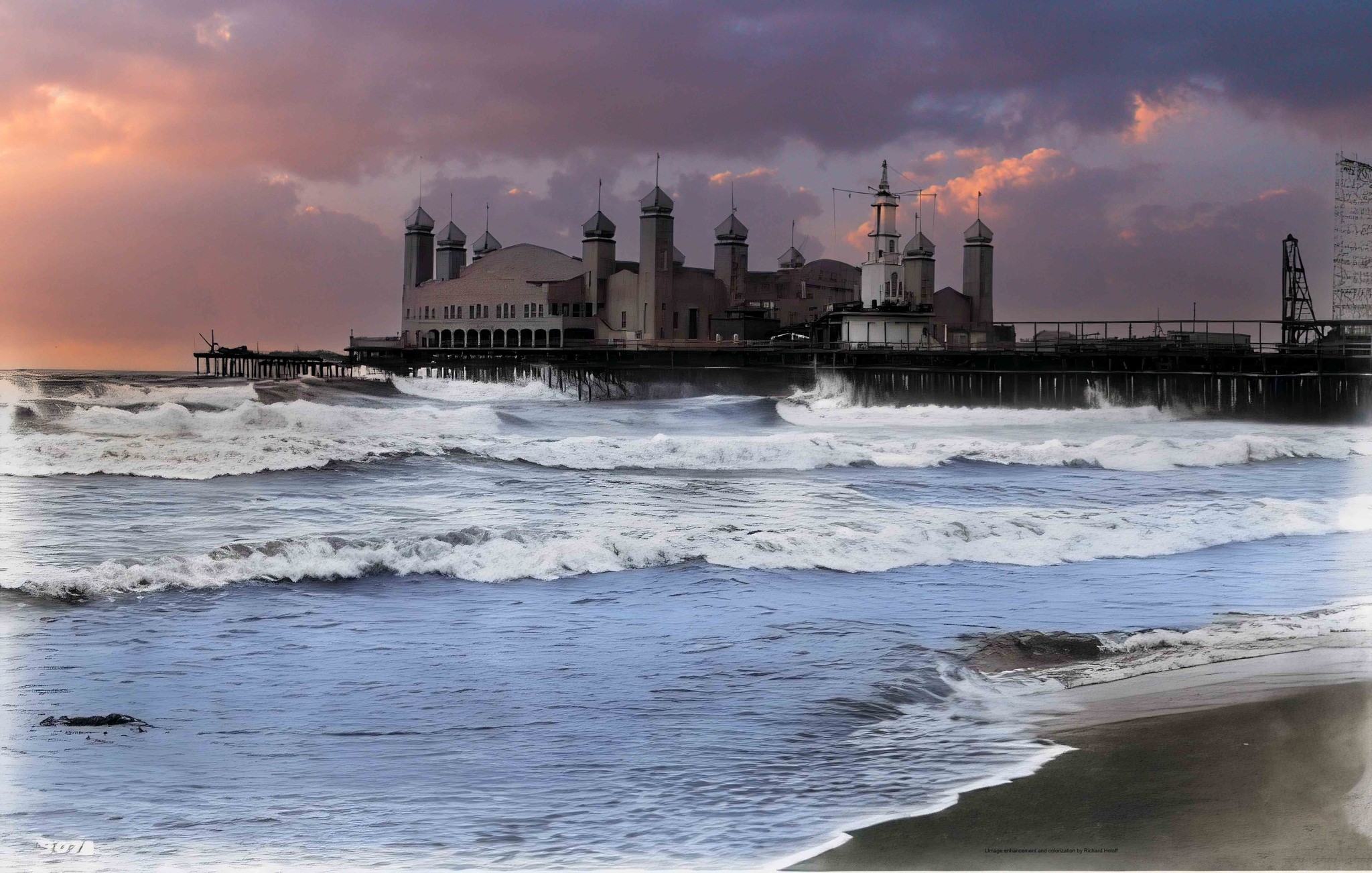 |
|
| (1926)* - Colorized view of the Santa Monica Pier, showing the La Monica Ballroom with its dramatic domed towers rising above the waves. Photo by C.C. Pierce; colorization by Richard Holoff. |
Historical Notes This enhanced photo captures the exotic silhouette of the La Monica Ballroom, whose rooftop minarets and arches made it a standout along the coastline. The ballroom could accommodate up to 5,000 dancers on its massive maplewood floor, drawing crowds nightly in the 1920s. |
 |
|
| (1924)* - Early aerial looking east over the Santa Monica Pier, showing the Whirlwind Dipper, Looff Hippodrome, and the La Monica Ballroom nearing completion at the pier’s end. |
Historical Notes This 1924 photo shows the Santa Monica Amusement Pier in its prime, shortly before the La Monica Ballroom opened to 50,000 eager attendees. At the time, the ballroom was one of the largest in the world and would soon redefine nightlife along the California coast. |
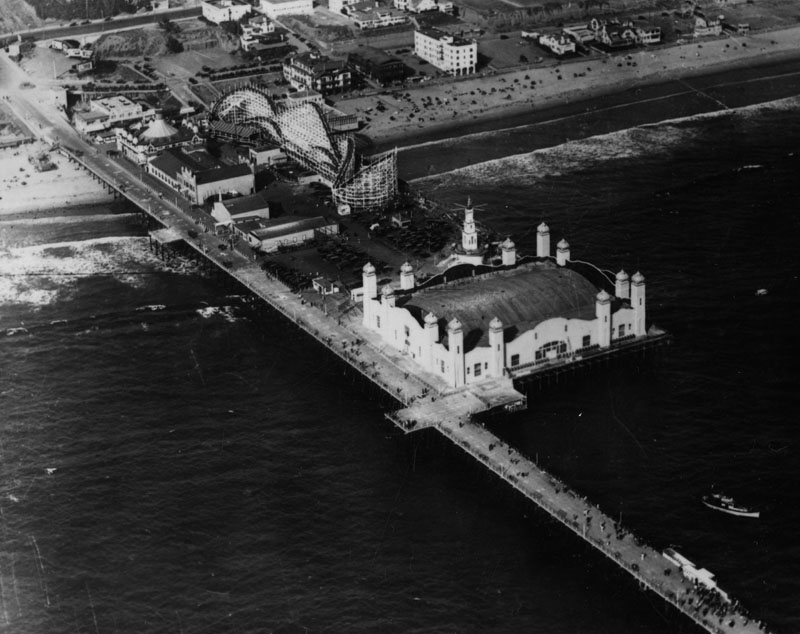 |
|
| (1924)* - Overhead view of the newly completed La Monica Ballroom sitting at the end of the Santa Monica Pier. |
Historical Notes Seen here shortly after completion, the La Monica Ballroom’s footprint dominated the western end of the pier. Its elaborate façade and rooftop domes added a new architectural grandeur to the Santa Monica shoreline. |
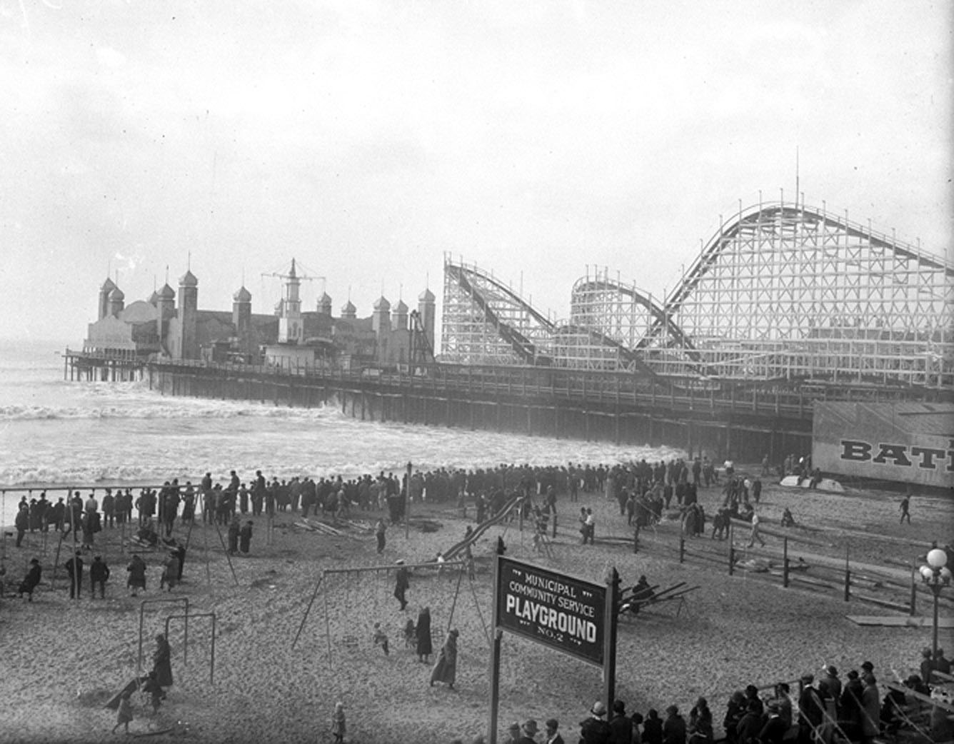 |
|
| (1924)* - View looking northwest toward the Santa Monica Pier. In the foreground is the "Municipal Community Service Playground No. 2. Beyond that, crowds of people are seen looking out toward the surf. In the background stands the pier with its roller coaster and the newly constructed La Monica Ballroom. |
Historical Notes This image captures the pier during a bustling beach day in 1924, with the whimsical La Monica Ballroom rising in the distance like a Moorish castle above the Pacific. |
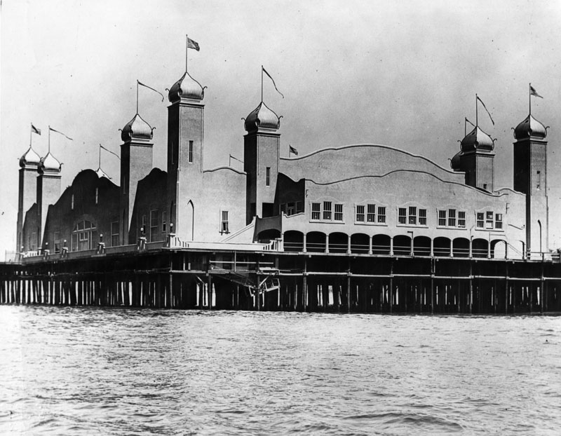 |
|
| (1924)* - The elegant La Monica Ballroom perched over the ocean at the western edge of the Santa Monica Pier. |
Historical Notes The 15,000-square-foot ballroom featured a "submarine garden" interior theme and open windows for ocean breezes—creating a fantasy-like atmosphere for dancing couples above the sea. |
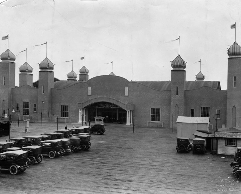 |
|
| (1924)* - Autos crowd the pier during the grand opening of the La Monica Ballroom on July 23, 1924. |
Historical Notes The ballroom’s debut drew over 50,000 people, resulting in the first recorded traffic jam in Santa Monica history. The interior’s marine motif and spacious dance floor made it a sensation nearly overnight. |
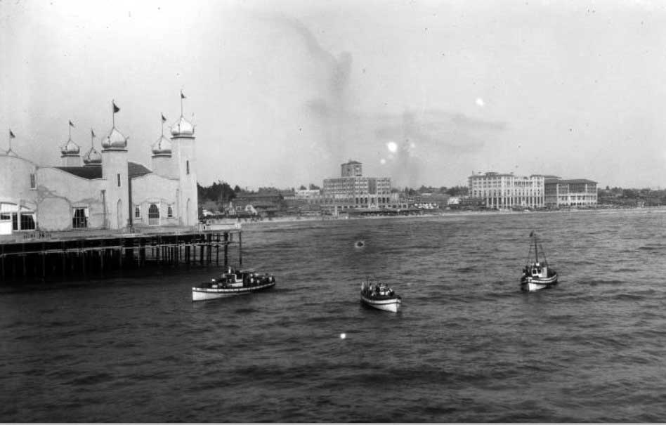 |
|
| (ca. 1920s)* - Looking back toward the Santa Monica coastline from the end of the pier, with the La Monica Ballroom in the foreground and the city’s beachside hotels rising behind. |
Historical Notes This view illustrates how the ballroom functioned as both a social and visual anchor for the pier. It served as a glamorous contrast to the stately hotels lining Ocean Avenue. |
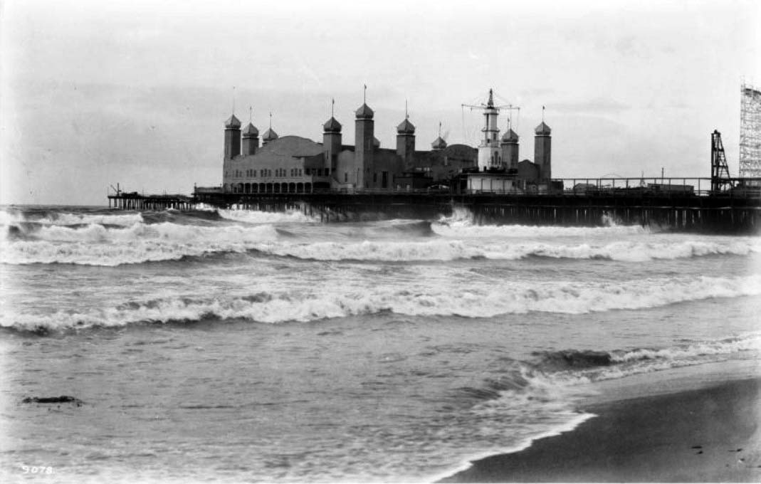 |
|
| (ca. 1926)*- Heavy surf crashes along the shore as the ornate La Monica Ballroom looms above the waves at the end of the pier. |
Historical Notes While the La Monica Ballroom is often described as having four minaret-topped corner towers, historical photographs show that it also featured several smaller domed cupolas along the roofline. These secondary turrets enhanced the building’s symmetry and gave it the exotic silhouette of a Moorish palace, especially when viewed from the beach or bluffs. |
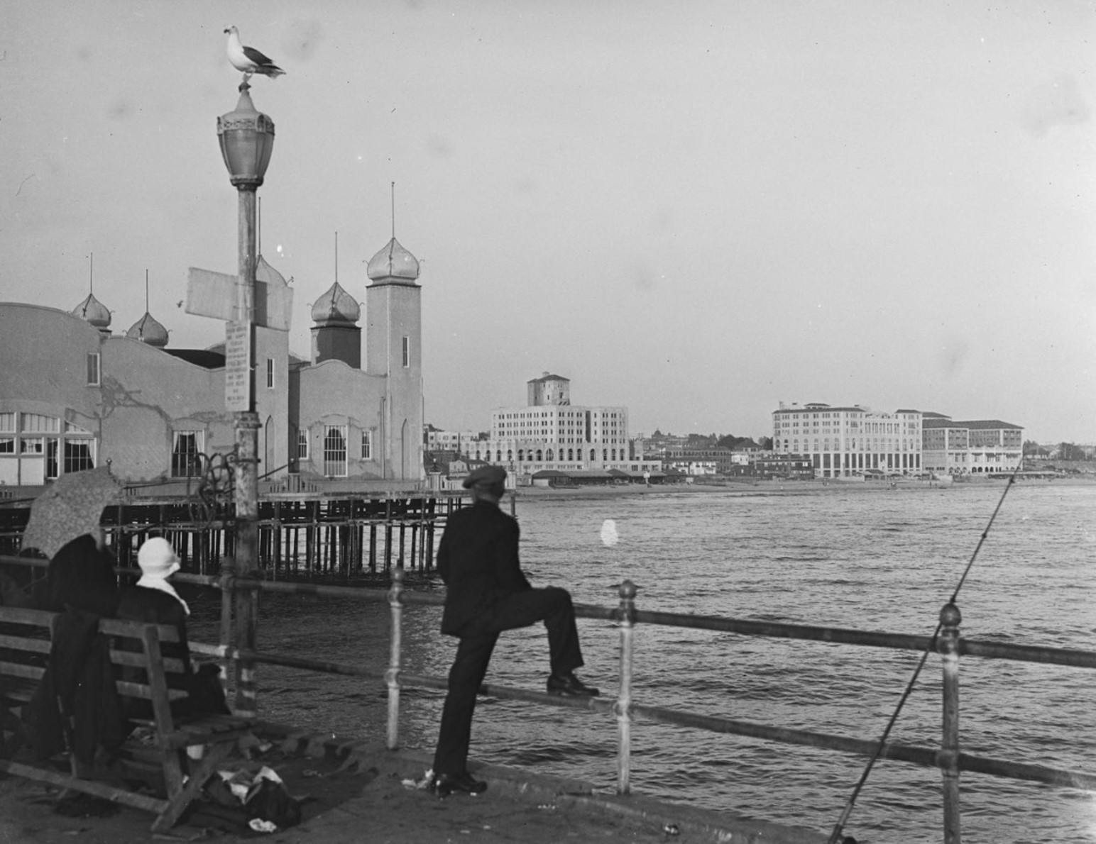 |
|
| (ca. 1927)* - Looking out to the shoreline from the Santa Monica Pier with the La Monica Ballroom seen at left. |
Historical Notes As the centerpiece of the pier, the ballroom’s massive frame offered sweeping views of both sea and shore, making it an attraction not just for dancers, but also for sightseers. |
Then and Now
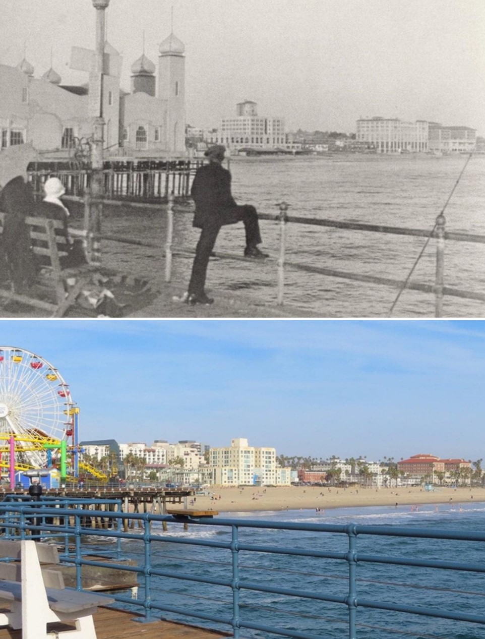 |
|
| (1927 vs Now)* - Santa Monica Pier showing the LA Monica Ballroom where the Ferris wheel is today. Contemporary photo by Lorie Vignolle-Moritz. Photo comparison by Jack Feldman. |
Historical Notes Though demolished in 1963, the legacy of La Monica lives on. The footprint once covered by its maple dance floor is now part of a modern amusement park that still entertains crowds above the surf. |
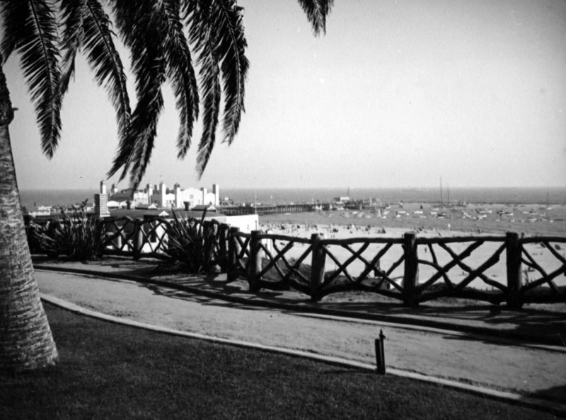 |
|
| (ca. 1937)* - Looking out from Palisades Park towards the La Monica Ballroom on the Santa Monica Pier. Beachgoers cover the beach and many boats are docked in the bay. |
Historical Notes Though the ballroom’s dance heyday faded during the Depression, the building remained a dominant feature on the coastline, serving multiple functions including a lifeguard HQ and convention center. |
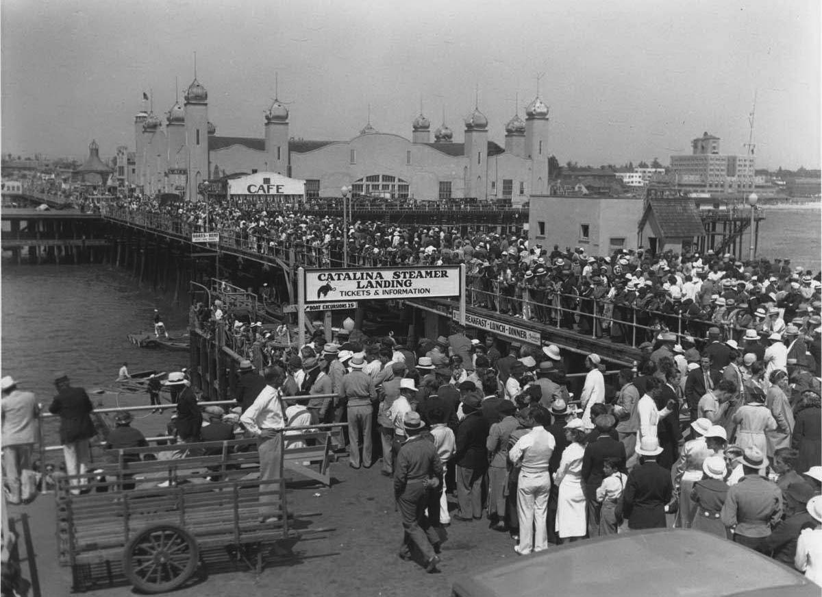 |
|
| (1936)* - Crowds of people standing in line at the Catalina Steamer Landing on Santa Monica Pier across from the La Monica Ballroom. |
Historical Notes During the 1930s, the pier also served as a passenger terminal and yacht harbor. La Monica, now repurposed, witnessed the shift from dance hall to multipurpose waterfront facility. The Thirties saw the rise of the Santa Monica Yacht Harbor. A breakwater was constructed so boats could be safely moored and to also protect the pier. A collection of yachts, fishing boats and a cruise liner to Catalina made the yacht harbor their home base. However, the breakwater was poorly engineered and began to sink into the sandy ocean floor and it is almost completely submerged today. With Marina del Rey, the worlds' largest man-made pleasure boat harbor opening in 1965 just a few miles south of the pier, signaled the end of boating activities at the Santa Monica Pier. |
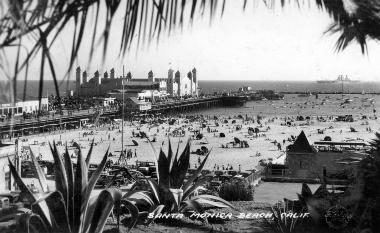 |
|
| (1936)* – Postcard view of Santa Monica Beach showing the La Monica Ballroom on the pier. A portion of the Deauville Club can be seen in lower right (opened in 1927). |
Historical Notes By this time, the ballroom was no longer hosting nightly dances but remained a landmark structure amid the evolving beachscape and social clubs along the coast. |
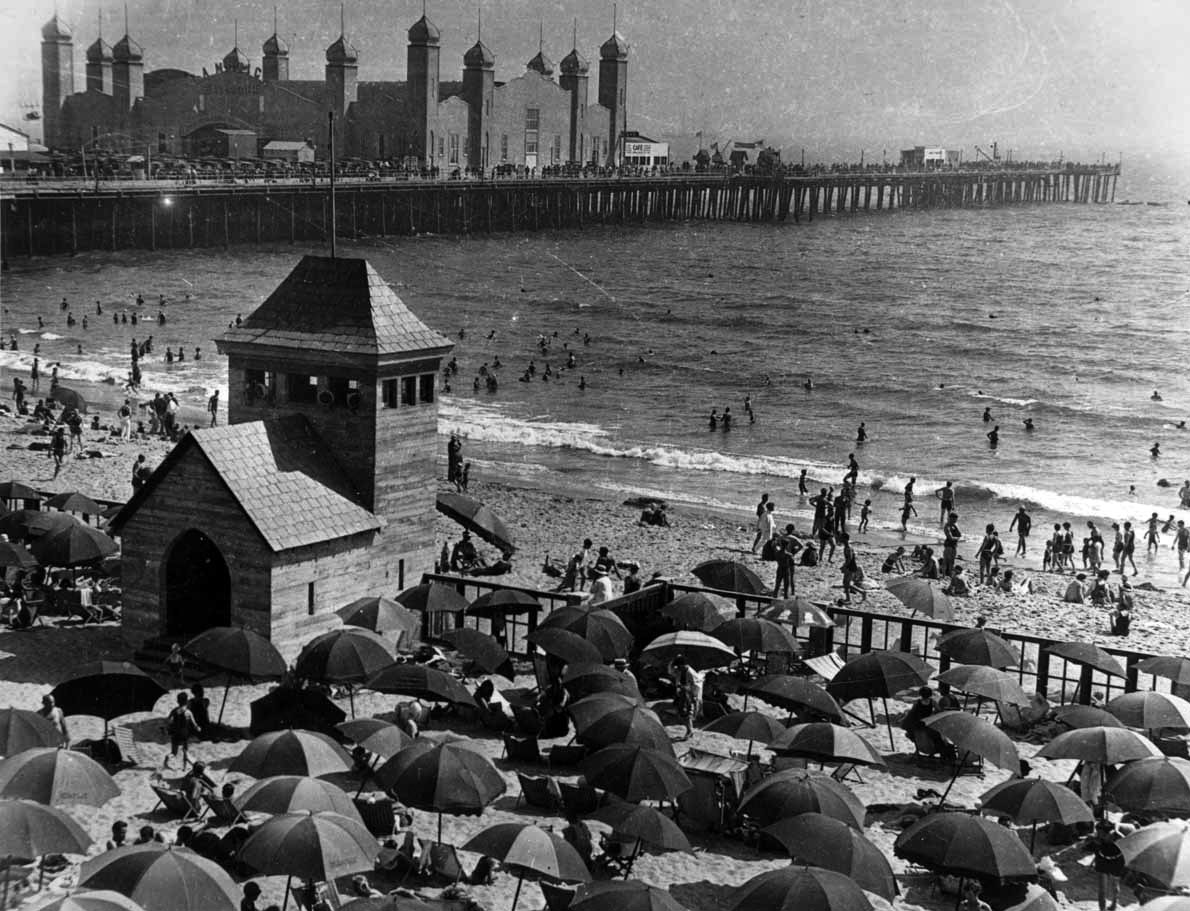 |
|
| (ca. 1930)* – The Santa Monica Deauville Club in the foreground, with the La Monica Ballroom rising in the distance above the pier. |
Historical Notes As elite beach clubs sprang up along the coast in the late 1920s, La Monica continued to be a popular public venue—bridging the divide between exclusive leisure and mass entertainment. |
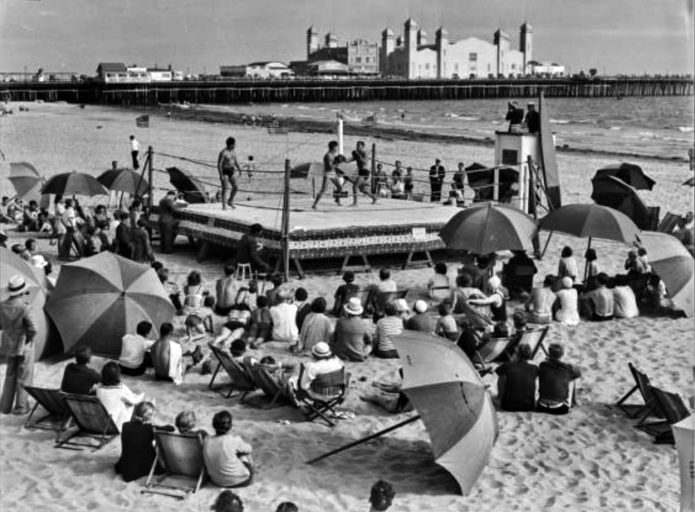 |
|
| (ca. 1934)* - Image of a crowd amid beach umbrellas watching two pugilists boxing in an outdoor boxing ring on the beach in front of the Santa Monica Athletic Club. The Santa Monica Pleasure Pier with the La Monica Ballroom and Municipal Pier are in the background. |
Historical Notes As its dance hall fame declined, the La Monica Ballroom stood witness to a new era of beachside attractions, civic events, and sports exhibitions—all reshaping Santa Monica’s identity during the Depression. |
* * * * * |
Venice Trams (Between Venice and Santa Monica)
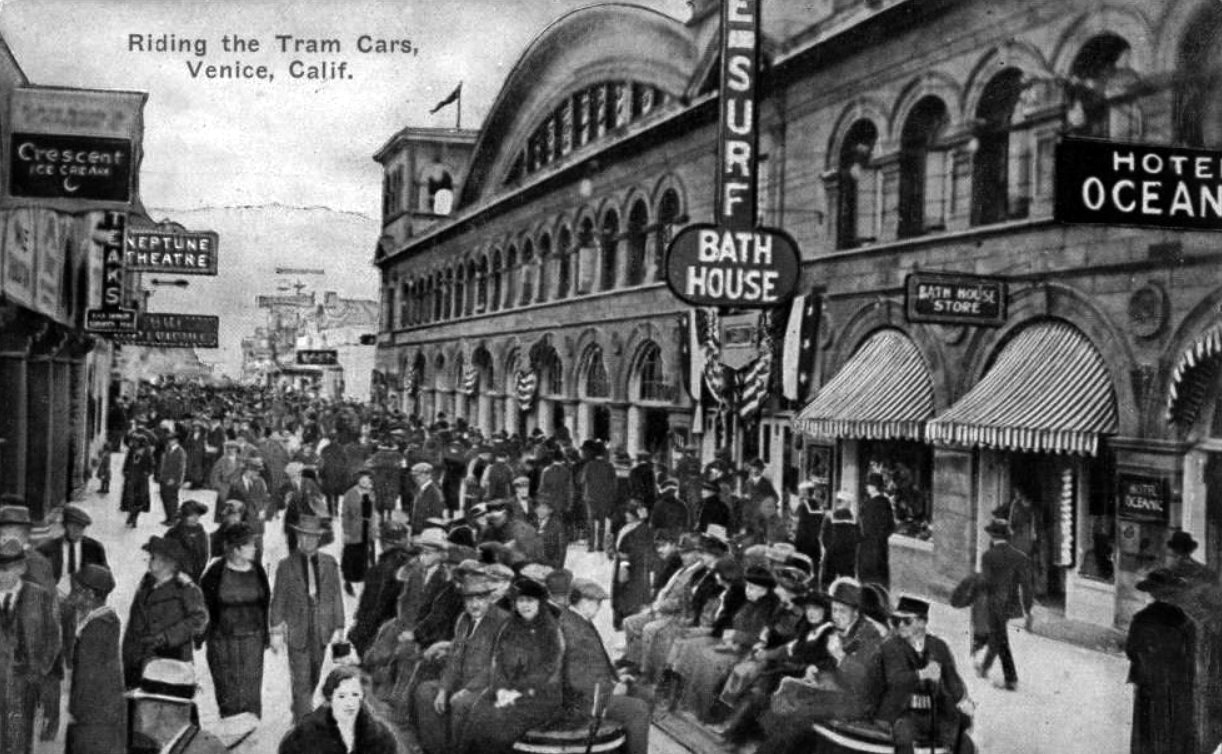 |
|
| (1910s)* – Postcard view of ‘Riding the Tram Cars’, Venice, Calif. |
Historical Notes The Venice trams were operated by a uniformed motorman along a north and south route on the concrete boardwalk between Santa Monica and Venice. These trackless electric trams amounted to battery powered upholstered wicker benches with lever type hand controller and mechanical brake at one end. The electric trams operated between 1916-1929. By the 1930s, the trams had 4 cylinder, Ford model A engines. |
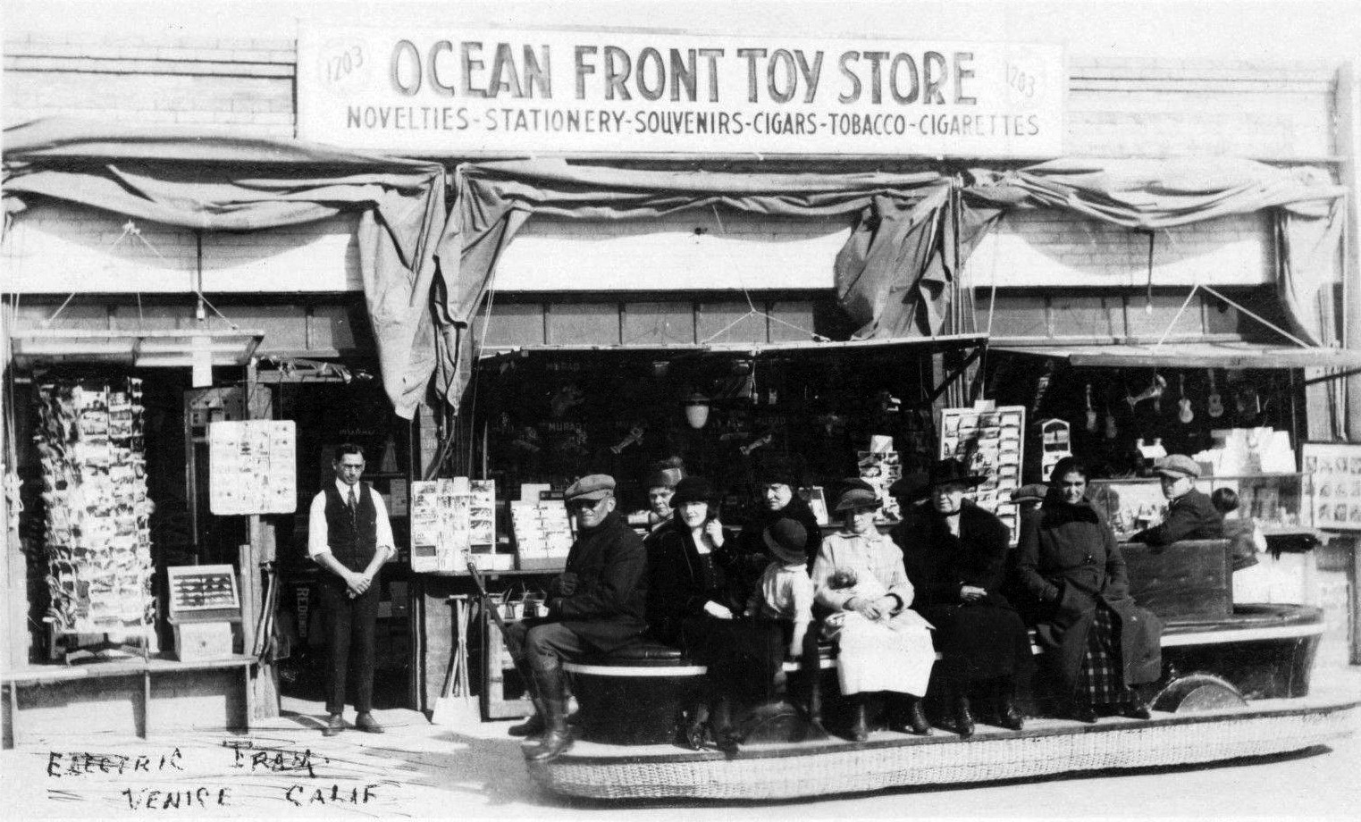 |
|
| (ca. 1916)* - Electric tram ride on the Ocean Front with Ocean Front Toy Story in the background. |
Historical Notes The conductor of this tram would switch end positions at Santa Monica to drive it back to Venice. There was no feature that allowed for turnaround. And there was also nothing to protect passengers from the hot sun overhead. |
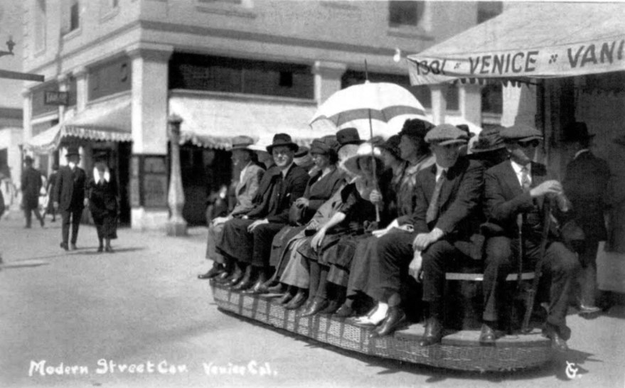 |
|
| (ca. 1910s)* – Postcard view showing one of the first generation electric trams that ran from Venice to Santa Monica. Photo courtesy of Sarah and John Schacht. |
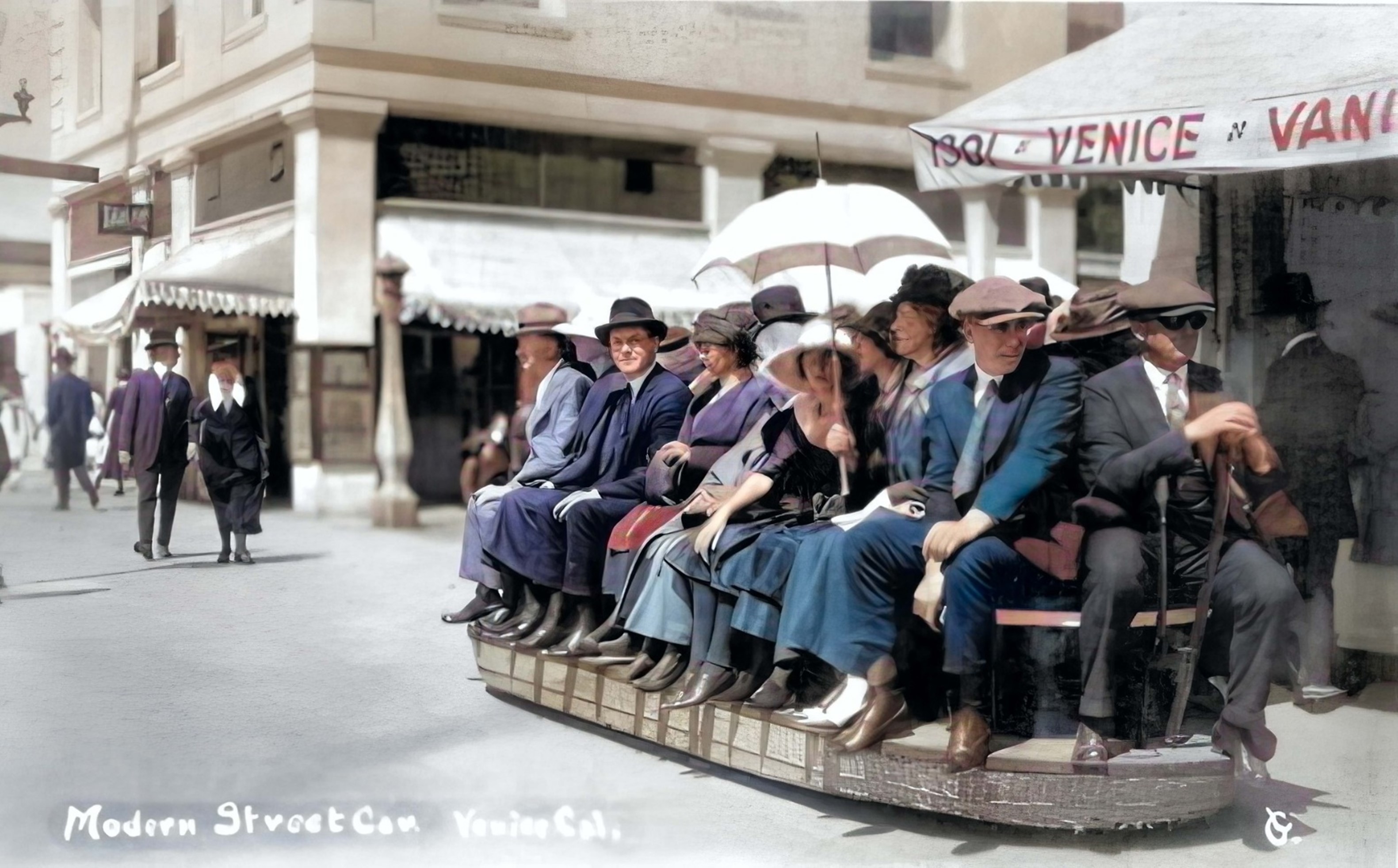 |
|
| (ca. 1910s)* – Postcard view showing one of the first generation electric trams that ran from Venice to Santa Monica. Photo courtesy of Sarah and John Schacht. Image enhancement and colorization by Richard Holoff. |
 |
|
| (1920s)* - View showing a 2nd generation tram sitting on the Venice sidewalk/street, This open sided electric tram had an awning above and room for seating on all sides. |
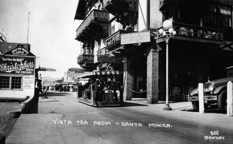 |
|
| (1920s)* - Exterior view of the Vista Tea Room in Santa Monica. On the left is a small building called Over the Waves Lunch, and the Seaside Novelty can be seen in the background. An electric tram moves people along the walkway. |
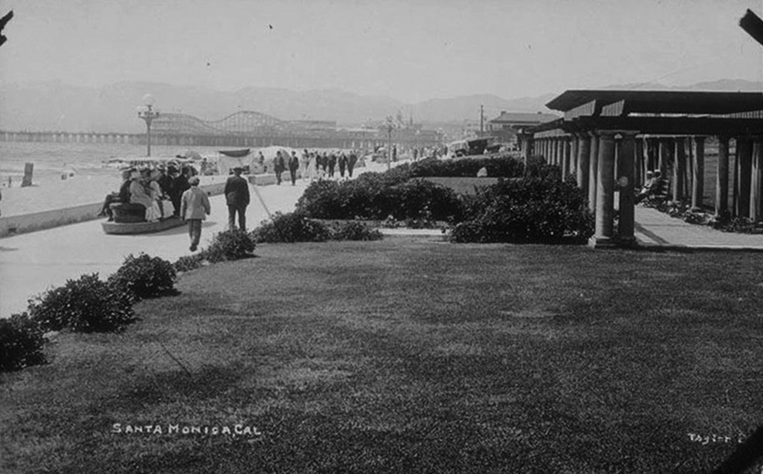 |
|
| (1920s)* – View showing an electric tram heading north on Ocean Front Walk in front of Seaside Park (present day Crescent Bay Park). |
Historical Notes Electric tram service on Ocean Front Walk between Venice and Ocean Park began operation in 1916. By 1920 the trams were electric battery powered. They ran from Windward Ave. and the Venice Pier, to the Ocean Park Pier, and then to the Santa Monica Pier, and back. In 1923, the Venice Tram Company was formed. |
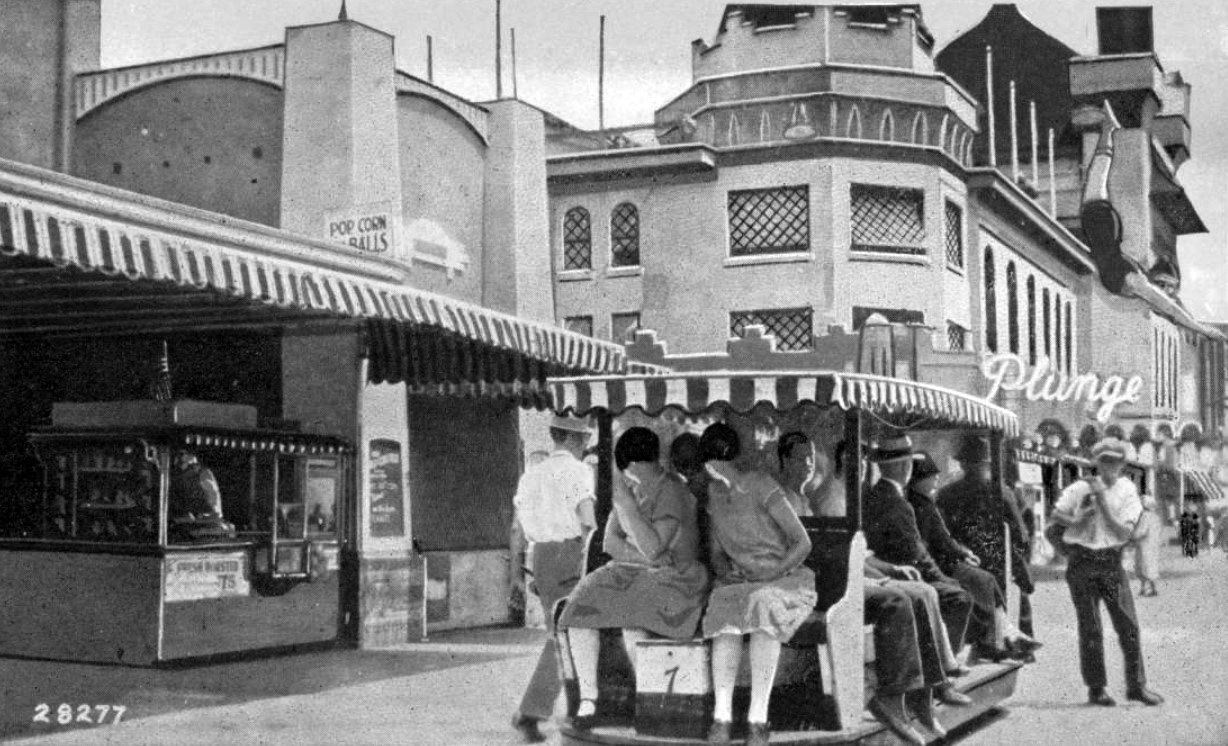 |
|
| (1930s)* - Postcard of a tram running between Venice, Ocean Park, and Santa Monica. The Ocean Park Plunge can be seen in the background. |
Historical Notes By the 1930s, the trams had 4 cylinder, Ford model A engines and canopy tops. There were also similar 4 cylinder, Chevy engines. The seats faced toward the ocean or shops plus it had a back seat. |
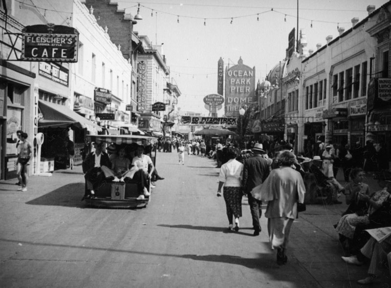 |
|
| (1920s)* - Crowds of people and an electric tram are seen in the fun section of the pier. A large sign hangs at far end of the street announcing Ed Fitzpatrick and his Dancing Rhythms. Also seen are signs for Feisher's Cafe (left) and the Dome Theatre (far back on the right). An electric tram can be seen transporting a full load of passengers down the walkway. |
* * * * * |
1st Dome Theatre
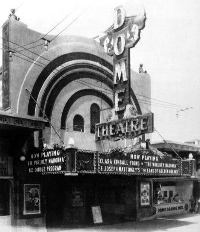 |
|
| (ca. 1922)^ – View showing the original Dome Theatre located on Ocean Front Walk in Venice. |
Historical Notes The first Dome Theatre was originally a dance hall that had opened on July 4, 1916. The building was constructed on the Great Western pier at Ocean Front Walk. The location at the northwest corner of Ocean Front Walk and Navy Ave. is just south of the Santa Monica city limits. In the 1923-24 directory it's listed as 3034 Ocean Front Promenade, Venice. The main space was a 100 foot concrete dome. It was converted into a theatre in 1922 when the Lick Pier was constructed. The Lick Pier was constructed seaward of the dance hall, just south of the Fraser/Pickering Pier (aka Ocean Park Pier) that was the original location of the Rosemary Theatre. |
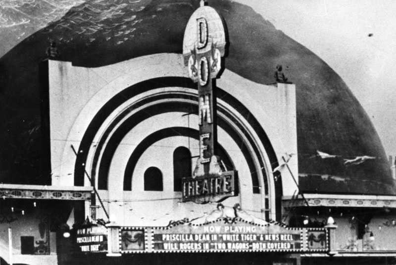 |
|
| (1923)* - View showing the marquee and dome of the first Dome Theatre. The show playing is Priscilla Dean in "White Tiger." The theater burned down in 1924, but was rebuilt a year later. |
 |
|
| (1924)^ – View of the first Dome Theatre burning. |
Historical Notes Demolished after a fire on January 6, 1924. The building was a total loss except for the entrance portion of the structure. This was used with a new building behind and became the new Rosemary Theatre. In addition to the Dome Theatre, the fire consumed the adjacent Ocean Park and Lick Piers. |
2nd Dome Theatre and Entrance to Ocean Park Pier
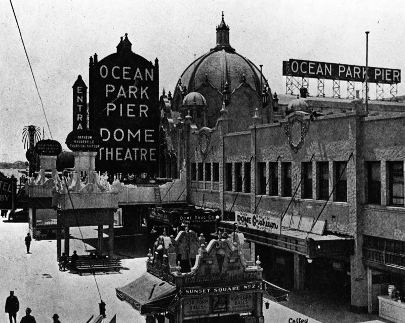 |
|
| (1925)* - View showing the newly completed 2nd Dome Theatre with signage advertising Orpheum Vaudeville on the Weekends. The big dome straddled the entrance to the pier and was not part of the theatre itself. |
Historical Notes West Coast Theatres and the Venice Investment Co. acquired the assets of the Pickering and Lick Pier Pier operating company two weeks after the 1924 fire. After difficult negotiations with the city of Santa Monica, they rebuilt the pier including a new Dome Theatre. The new Dome Theatre was just a few doors north of the original location. |
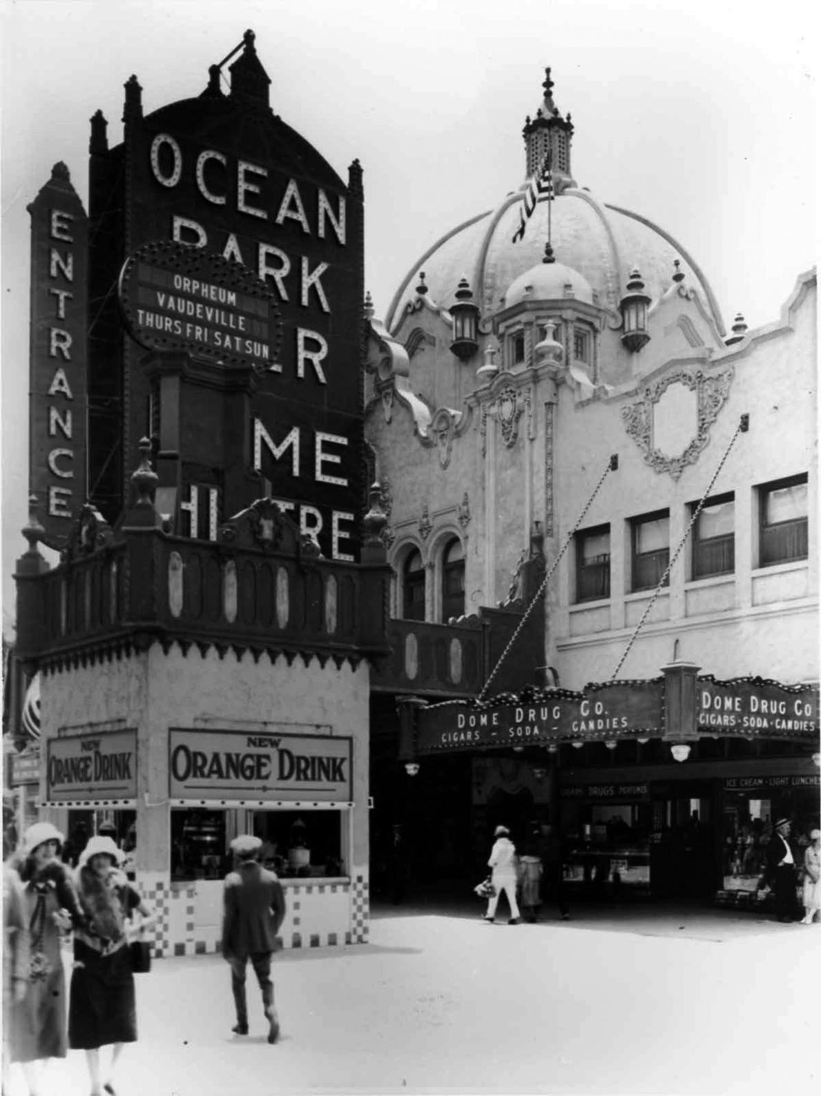 |
|
| (ca. 1925)* - Close-up view showing the newly constructed 2nd Dome with the Dome Theatre to the left out of view. Also seen here is the Dome Drug Co. store. |
Historical Notes Note that the prominent decorative dome in the new construction is not the theatre, but the entrance to Ocean Park Pier. The theatre itself was just to the south of the dome. |
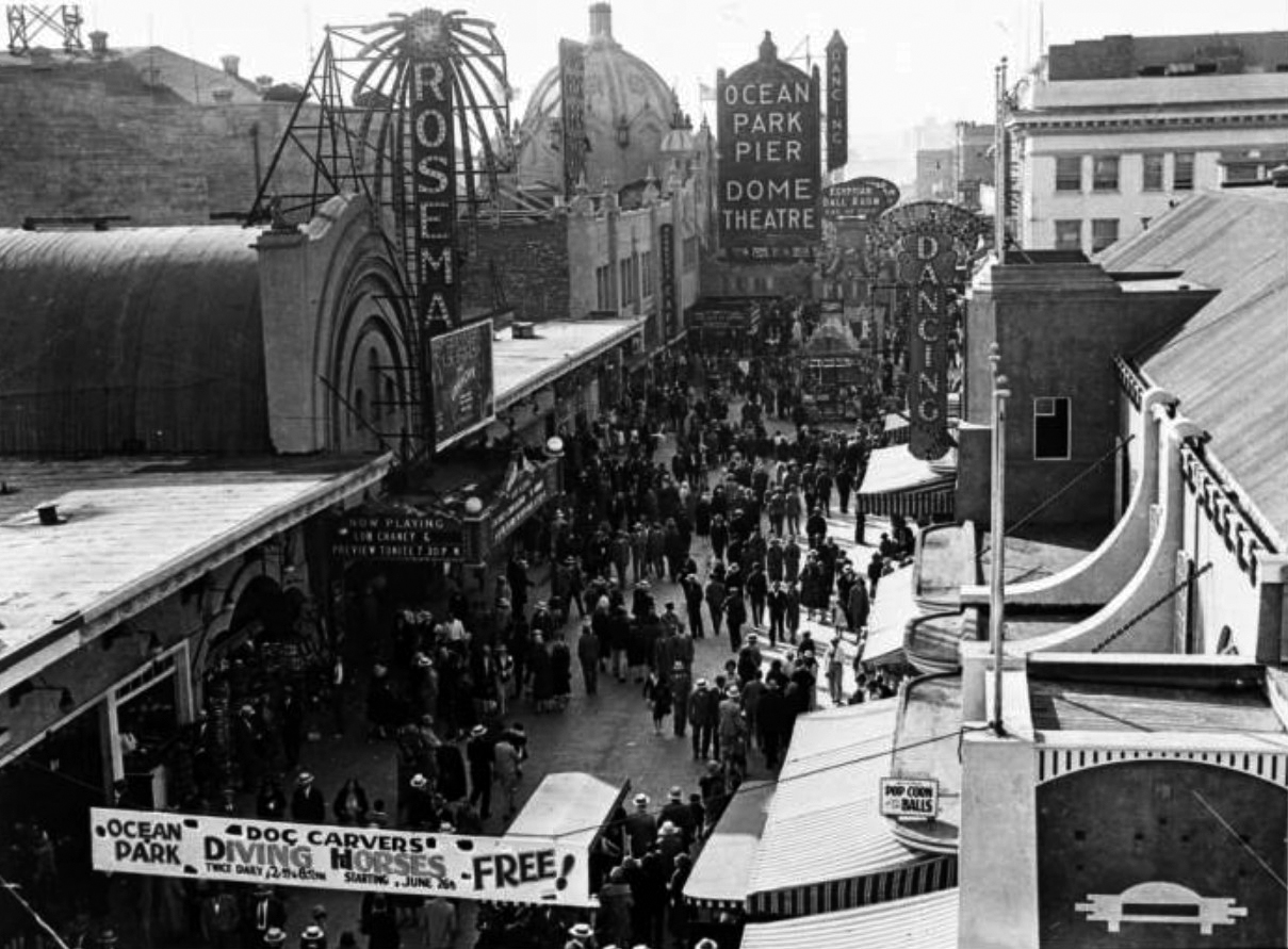 |
|
| (1927)^ - Image of a crowd of people on the Ocean Front Walk next to the Ocean Park Pier in Santa Monica, California. There is a banner in the foreground for "Ocean Park Doc Carvers Diving Horses- Free staritng June 26" and the marquee on the Rosemary Theater at left reads "Now playing Lon Chaney & Preview Tonite" with a poster for the movie "The Unknown." Additional signs include "Dancing", "Ocean Park Pier Dome Theatre", and "Egyptian Ball Room." |
Historical Notes The Dome's place in history is assured as it is the theatre where the Mickey Mouse Club fad began there in 1929. It was part of a matinee promotion by manager Harry Woodin. |
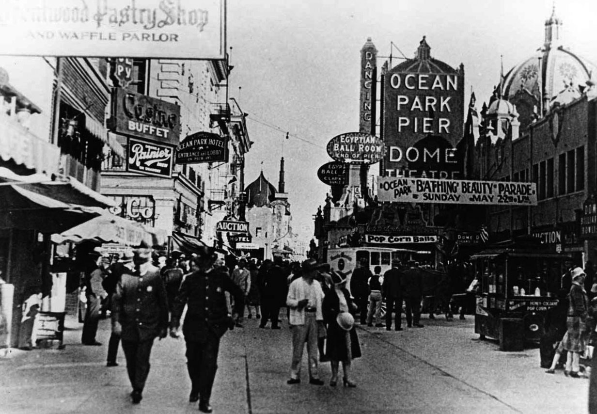 |
|
| (ca. 1925)^ – Policemen walk the beat on Ocean Front Walk with the Ocean Park pier entrance and Dome Theatre in the background. Further in the distance can be seen the Ocean Park Bath House with its Moorish-style domes. |
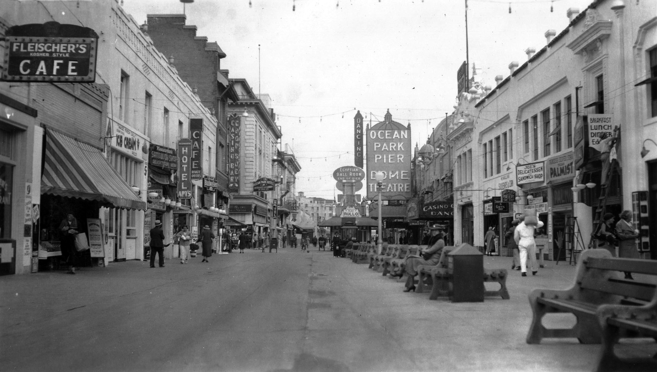 |
|
| (ca. 1935)* – Photo titled Ocean Park Pier amusement zone in Santa Monica, with the Dome Theatre seen in the background. William M. McCarthy Photograph Collection |
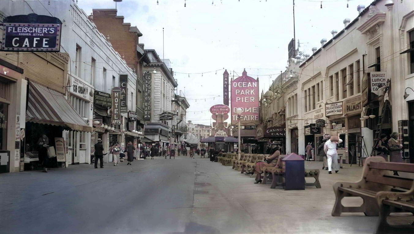 |
|
| (ca. 1935)* – Looking down Ocean Front Walk with the Ocean Park pier entrance and Dome Theatre in the background. Fleischer’s Kosher Style Café is seen on the left. Photo credits: California State Archives, William M. McCarthy Photograph Collection; AI image enhancement and colorization by Richard Holoff |
* * * * * |
Wing-Walking over Santa Monica Bay
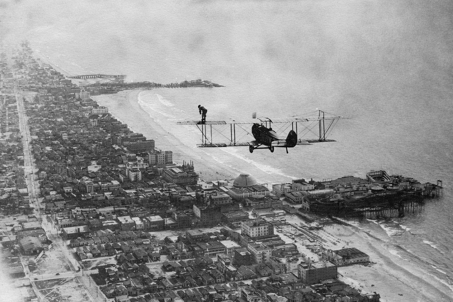 |
|
| (1918)* - Walking over Santa Monica. A Curtiss JN biplane flies low over Santa Monica Bay as a woman stands upright on the wing, looking down at the shoreline below. Ocean Park Pier and its amusement park appear directly beneath the aircraft, while Venice Pier is visible farther south in the distance. |
| Historical Notes
This photograph was taken on August 14, 1918, and shows an early aviation stunt known as wing-walking. The woman standing on the wing is Babe Kalishek, one of the most skilled and well-known female aerial performers of the time. The Curtiss JN biplane is flown by experienced aviator Jim Hester. Wing-walking combined flying and acrobatics at a time when airplanes were still new and risky. Performers moved across the wings and struts of open airplanes without safety harnesses, relying on balance and strength while the plane stayed in flight. These stunts were meant to impress crowds and build excitement about aviation. Santa Monica Bay was a perfect setting for these displays. Large crowds gathered along the coast and on the piers below, especially at Ocean Park and Venice. The aircraft in this photo flies directly over Ocean Park Pier, with Venice Pier visible farther south. The same people who came for rides and amusements also looked up to watch aviation performances, linking early flight with the rise of the great piers along Santa Monica Bay. |
* * * * * |
Piers of Santa Monica BayAmusement, Competition, and the Golden Age of the Coast |
From the early 1900s through the 1930s, Santa Monica Bay contained one of the greatest concentrations of piers on the West Coast. Built during a period of rapid growth in Southern California, these structures served many purposes. Some were created to attract crowds with rides, entertainment, and spectacle, while others supported fishing, boating, and everyday coastal activity.Together, they transformed the shoreline into a dense and highly competitive coastal landscape. Rail lines, roads, and growing populations turned the beaches into destinations and helped create an era when amusement piers became some of Southern California’s most recognizable landmarks. Most would not survive beyond the Depression era, leaving only a few reminders of what was once one of the most intensely developed recreational coastlines in the nation. |
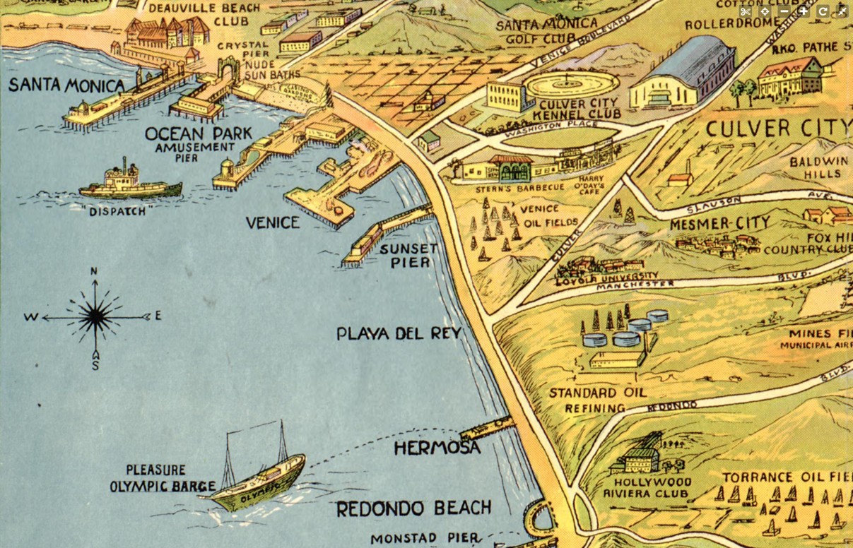 |
|
| (1932)* - Map showing the piers of Santa Monica Bay. The coastline is dotted with multiple piers extending from Santa Monica south toward Redondo Beach. A structure labeled Monstad Pier appears near Redondo Beach at lower right. |
| Historical Notes
The 1932 map captures Santa Monica Bay during the height of the pier era, when the coastline supported one of the densest collections of piers in the United States. The greatest concentration appeared around Santa Monica, Ocean Park, and Venice, where neighboring communities competed directly for visitors and investment. The map should be read as a snapshot of what was active and significant at the time rather than a complete record of every structure along the coast. Smaller working piers were often given less attention than amusement destinations that attracted large crowds and generated publicity. Near Redondo Beach, the map identifies Monstad Pier, built in the 1920s by Captain Hans C. Monstad. Unlike the larger amusement piers to the north, it served fishing boats and small craft. Although less well known today, portions of the structure are often described as having influenced or been incorporated into later Redondo pier development. |
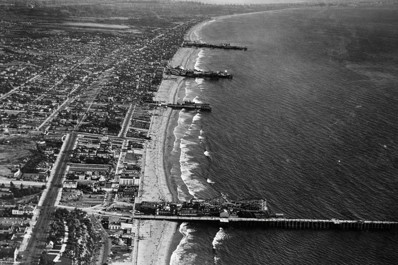 |
|
| (1919)* – Aerial view looking south showing four Santa Monica Bay piers. From bottom to top: Santa Monica Pier, Crystal Pier, Ocean Park Pier, and Venice Pier. |
| Historical Notes
This aerial view captures the height of the amusement pier era. Improved transportation, especially electric rail lines, allowed visitors from across the Los Angeles region to reach the coast with ease. Pier owners responded by competing for crowds through larger rides, brighter lights, and increasingly ambitious attractions. The close spacing of these piers created an almost continuous entertainment district along the shoreline. Fires, storms, and structural failures were common because most piers were built largely of wood, yet destruction rarely marked the end. Piers were often rebuilt larger and more elaborate than before, reflecting both optimism and sustained public demand. Not all of these piers survived. Crystal Pier, originally built as White Star Pier and later known as Bristol Pier before becoming Crystal Pier, remained smaller than its neighbors. After years of decline, it was condemned in 1943 and demolished in 1948, marking the gradual end of Santa Monica Bay’s most concentrated era of amusement pier development. |
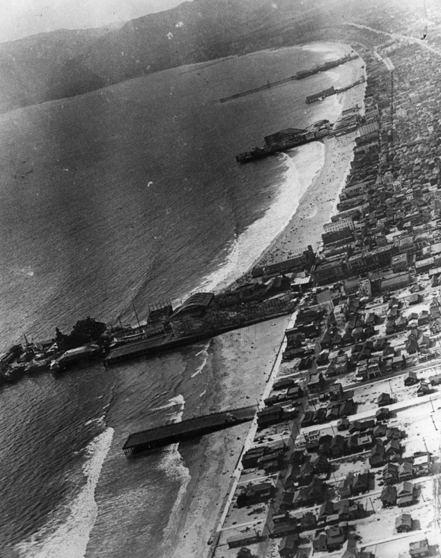 |
||
| (1920s)* - Aerial view looking north along the Santa Monica Bay coastline. At least 6 or 7 piers can be seen extending out into the ocean. Venice Pier and amusement park can be seen in the foreground. Ocean Park Pier, with its own amusement park, is the next pier over. Beyond that, the long pier at the top of the photo is Santa Monica Pier, which also developed into a major amusement destination. |
| Historical Notes
During the 1910s and 1920s, Venice, Ocean Park, and Santa Monica functioned less as separate beach towns and more as direct competitors for Southern California's growing tourist market. Each promoted its own mix of rides, entertainment, food, and attractions. Between 1904 and 1925, at least fourteen roller coasters operated along this stretch of coast. The shoreline became a constantly changing landscape of towers, lights, rides, and crowds, creating one of the most concentrated amusement districts in the nation. Visitors could move easily between attractions, producing an almost continuous recreational corridor along Santa Monica Bay. The density seen here would never again be repeated after the Great Depression. Changing economics, evolving entertainment patterns, and the cost of maintaining large wooden structures gradually brought an end to this extraordinary concentration of amusement piers. |
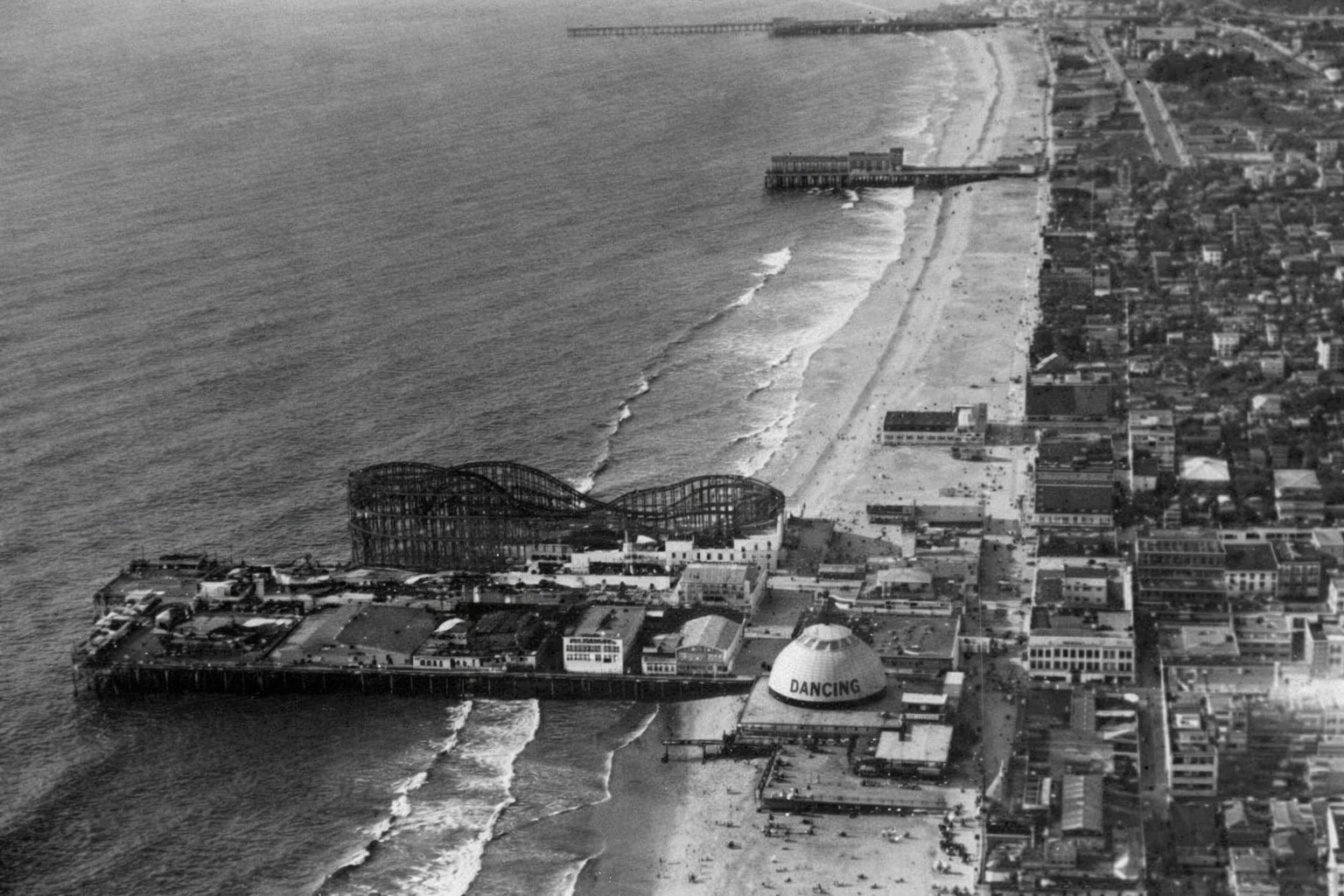 |
|
| (1920)* - Aerial view of Ocean Park Pier showing its large roller coaster. The longer pier to the north is Santa Monica Pier, which also developed into a major amusement destination. Between them stands Crystal Pier, originally known as White Star Pier and later Bristol Pier. |
| Historical Notes
Ocean Park Pier became one of the most heavily developed amusement destinations on Santa Monica Bay. Roller coasters were its most visible attraction, but arcades, concessions, and gathering spaces encouraged visitors to spend entire days along the waterfront. The close proximity of Santa Monica Pier, Crystal Pier, and Ocean Park created a layered entertainment landscape unlike anywhere else on the Southern California coast. Success depended not only on location but also on scale, novelty, and the ability to attract repeat visitors. Crystal Pier served as a smaller companion to the larger amusement complexes nearby and changed ownership several times during its history. As entertainment patterns shifted and maintenance costs increased, many of the bay’s early piers disappeared or were rebuilt, leaving Santa Monica Pier as the most recognizable surviving landmark of Santa Monica Bay’s amusement era. Click HERE to see more in Early Views of Southern California Amusement Parks |
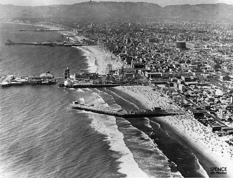 |
|
| (ca. 1930s)* – Aerial view showing the pleasure piers of Venice and Santa Monica. From bottom to top: Sunset Pier, Venice Pier, Ocean Park Pier, Crystal Pier, Santa Monica Pier…all that remains are the rocks of the breakwater behind the Venice Pier and the Santa Monica Pier. Photo taken by Spence Air Photos. |
| Historical Notes
This aerial view captures the final years of the great amusement pier era along Santa Monica Bay. Stretching from Venice north to Santa Monica, these five piers created one of the most concentrated recreational landscapes on the West Coast. By the time this photograph was taken, however, the period of rapid expansion and competition was already beginning to fade. Several of the piers shown here disappeared within the following decades. Sunset Pier and Venice Pier were among the earliest losses as changing conditions and expiring leases brought an end to their operations. Ocean Park later evolved into Pacific Ocean Park, a major amusement destination that operated from 1958 to 1967 before closing and eventually being demolished. Crystal Pier, visible between Ocean Park and Santa Monica, had already entered decline and was condemned in 1943 before being demolished in 1948. Of the five piers shown in this photograph, only Santa Monica Pier survives today as a functioning pier and direct continuation of the amusement era shown here. Its longevity owed less to amusement attractions than to its municipal role and later preservation efforts that prevented demolition during the 1970s. The original Venice amusement pier and the other recreational piers shown here have long since disappeared, leaving Santa Monica as the last standing reminder of one of Southern California’s most remarkable periods of coastal recreation and entertainment. |
 |
|
| (ca. 1940)* - Four people stand on Ocean Park Pier looking north toward Santa Monica, with Crystal Pier and Santa Monica Pier visible in the distance. Photograph by Ansel Adams. |
| Historical Notes
This quiet scene provides a striking contrast to the crowded amusement views that defined Santa Monica Bay during earlier decades. Rather than emphasizing rides, lights, and spectacle, the photograph focuses on atmosphere, distance, and the changing relationship between people and the shoreline. By around 1940, the great amusement pier era had begun to fade. Economic pressures, aging wooden structures, storms, and changing patterns of recreation gradually transformed the coastline. What had once been one of the most intensely developed recreational corridors on the West Coast was becoming quieter and less crowded. Photographed by Ansel Adams during his 1940 documentary work in Los Angeles, the image captures a moment of transition along a shoreline that had already begun its long transformation away from the amusement era. |
* * * * * |
Venice Pier
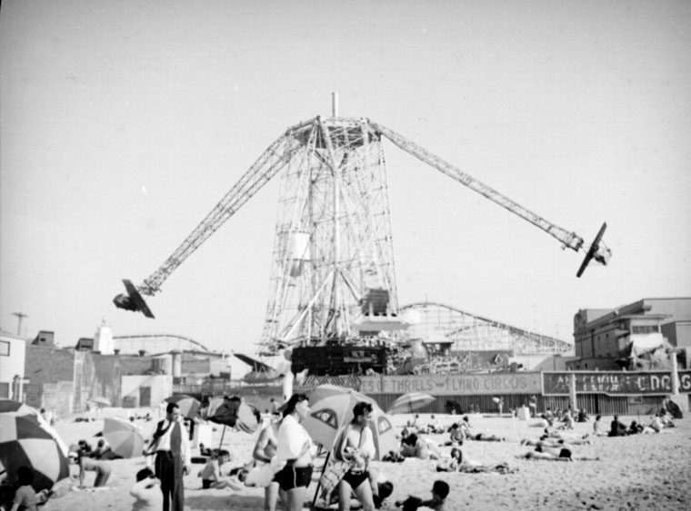 |
|
| (ca. 1925)* - Two airplanes rotating around the center tower on the Venice amusement park ride are visible. This ride, called the Flying Circus has 6 to 8 passenger cars circling the main tower 65 feet above the peer. Seen here from the sandy beach in the foreground. |
Historical Notes Click HERE to see more Early Views of Venice Amusement Pier. |
Ocean Park Pier
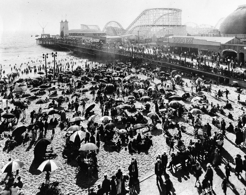 |
|
| (ca. 1920)* - Crowds enjoying a sunny day at the beach alongside Ocean Park Pier. The amusement park can be seen on the pier. |
Historical Notes The original Million Dollar Pier opened in 1911 but burned down just 15 months later in September 1912. It was quickly rebuilt and reopened as the Ocean Park Pier on May 30, 1913, becoming a popular regional attraction. In 1924, another devastating fire destroyed the pier, prompting new owners to rebuild it entirely out of reinforced concrete and steel as a fireproof structure. In 1925 Ocean Park Pier reopened. The new 960-foot long, 275-foot wide concrete Ocean Park Pier celebrated its grand opening on August 29, 1925 with a 10-day festival attended by 100,000 people on opening day. |
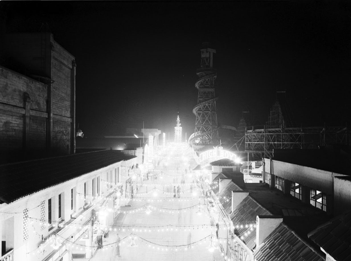 |
|
| (1924)* - Ocean Park Pier at night. |
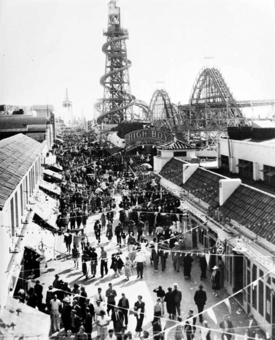 |
|
| (1929)* – View showing the Lighthouse Slide, High Boy roller coaster and Chute the chutes ride on the Ocean Park Pier at Ocean Park in Santa Monica. |
Historical Notes Click HERE to see more Early Views of Ocean Park and Other Santa Monica Amusement Parks. |
* * * * * |
Research, writing, and image curation by Jack Feldman, Water and Power Associates, with editorial assistance.
* * * * * |
More Historical Early Views
Newest Additions
Early LA Buildings and City Views
History of Water and Electricity in Los Angeles
* * * * * |
References and Credits
* LA Public Library Image Archive
^^The California History Room, California State Library
^*LMU Digital Collection: Arcadia Hotel
#^ Santa Monica Public Library Image Archive
+# Santa Monica Mirror: Statue of Santa Monica
+^ Santa Monica Landmarks: Looff Hippodrome
## Library of Congress: Santa Monica Bay ca. 1908; Ferris Wheel
***Cinema Treasures: El Miro Theatre; Criterion Theatre and Thrid Street; Criterion Theatre
^x^Facebook.com: Venice, Ca, Ocean Park, & Santa Monica in the 20th Century
**^Noirish Los Angeles - forum.skyscraperpage.com; Deauville Club; Palisades Park Cannon
^^*Deviantart-Studio5: Santa Monica Beach
^^#University of California Digital Library: The Deauville Club
^^+Stanford University Revs Digital Library
*^#Nuestra Señora la Reina de los Ángeles: losangelespast.com
*#*KCET: A Historical Look at SoCal's Beaches
*#^Santa Monica Public Library
^#*Santa Monica History Museum
^#^Framework.latimes.com: Santa Monica Beach, 1936; Santa Monica Aerial, 1937; McClure Tunnel
^##The Malibu Times: Historic Las Flores Canyon
+##Facebook.com: Vintage Los Angeles
*#*KCET: A Historical Look at SoCal's Beaches; Arch Rock and Castle Rocks; When L.A.'s Most Famous Streets Were Dirt Roads
**#The Central Tower Building - City Landmark Assessment and Evaluation Report
#**MTA Transportation and Research Library Archives
#^^Huntington Digital Library Archive
#*^Electric Railway History: Venice Trams
#+#Facebook.com: Photos of Los Angeles
^^^California State Library Image Archive
****Life.time.com: Stoked-Life Goes Surfing
^^^^Pinterest/Santa Monica Past: Santa Monica Canyon Flood; Santa Monica Airport/Clover Field; Douglas Aircraft
*^*^Santa Monica Beach Stories
^**^California Legends: Santa Monica at the End of Route 66
*^^*Discoverlosangeles.com: Santa Monica
*^^^NonPhotography.com-Nika: Santa Monica Pier
***^History of the Fairmont Miramar Hotel and Bungalows
^***Southern California Beaches: Santa Monica Beach
**#*Santa Monica via Beverly Hills Line - uncanny.net
*#**Los Angeles Westerners Corral: Venice Miniature Railway
*##*AkamaIdivers.com: Pacific Ocean Pier
*##^Santa Monica Conservancy; Henshey’s Tegner Building
*#*#Los Angeles Then and Now: Douglas' Dream Took Wing in Santa Monica
*#^#Flickr.com: Walking Over Santa Monica
^#*#Venice History: Roller Coasters and Carousels
^^*#Oceanpark.wordpress.com: Ocean Park Time Line
*^*#Santa Monica Municipal Airport
*^^#LAistory: The Santa Monica Pier
#*^*Cardcow.com: Marion Davies' Mansion
#***California 2012 - Travel w/ Terry: Annenberg Beach House
#*#*Flickr.com: Michael Ryerson
#^#*Denver Public Library Image Archive
#^^^Survey LA: Brentwod-Pacific Palisades Community Plan Area
#^*^Santa Monica Landmark Properties
#^^*Pinterest.com: Old Hollywood
#^#^Paslisades Park: smgov.net
##*^Facebook.com: Hollywood's Garden of Allah Novels, Martin Turnbull
##^^MartinTurnbull.com: Gables Beach Club
****^Facebook.com: West San Fernando Valley Then And Now
^*^*^Wehadfacesthen.tumblr.com
*^*^*SantaMonicaPier.com
*#*#*Venice Miniature Railroad - Jeffrey Stanton
*^ Wikipedia: California State Route 1; History of Santa Monica; Alphonzo Bell; Venice; California Incline; Route 66; Third Street Pomenade; Santa Monica Pier; Casa del Mar Hotel; Pacific Palisades - Castellammare; Parkhurst Building; Venice Canal HIstoric District; Annenberg Community Beach House; Santa Monica High School; Jack Dempsey; Muscle Beach; Wilshire Boulevard
< Back