Early Los Angeles City Views (1900 - 1925)
Historical Photos of Early Los Angeles |
 |
|
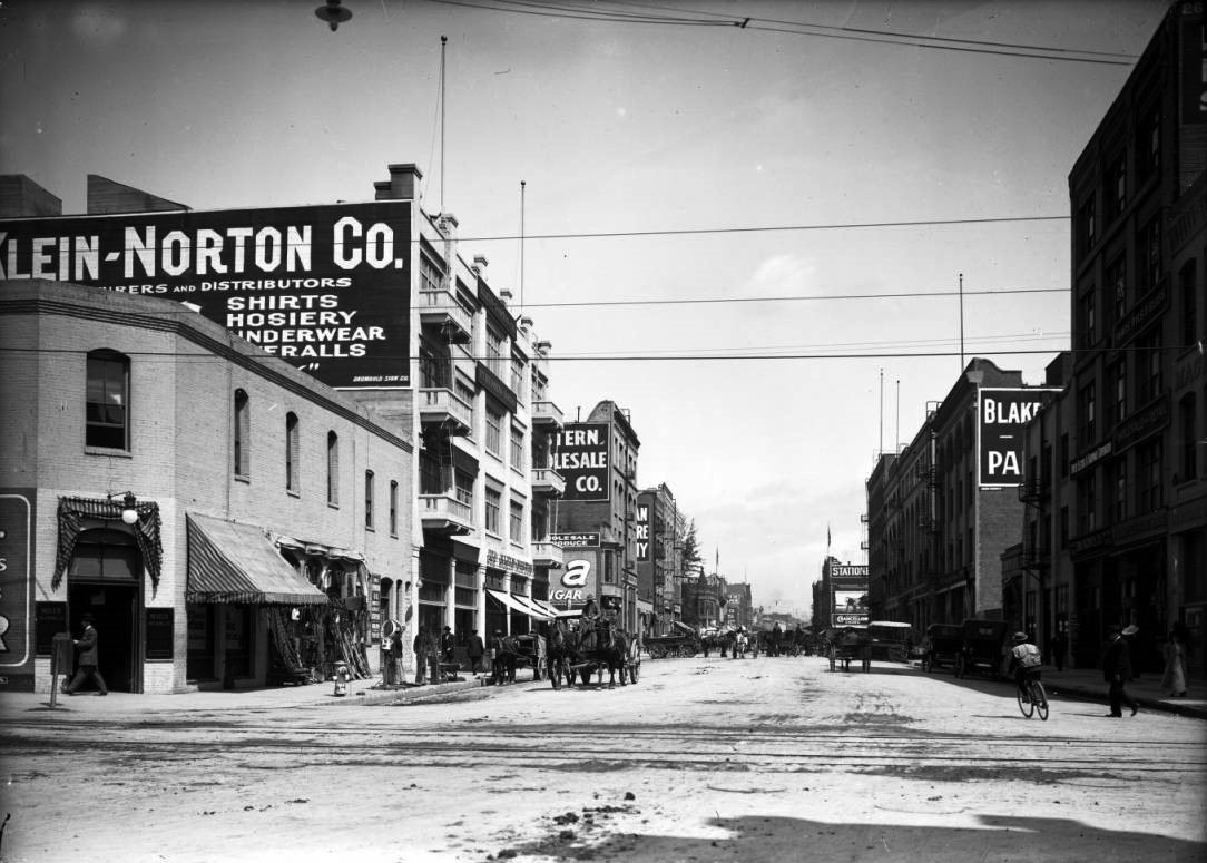
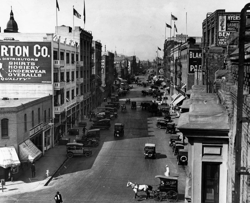
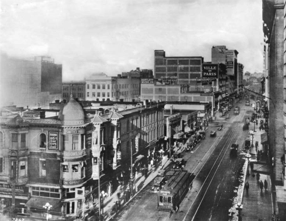
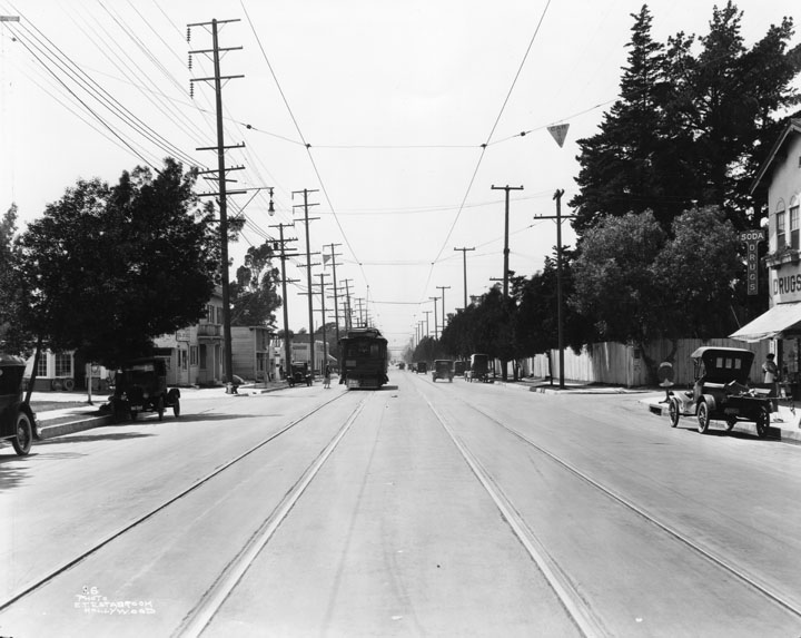
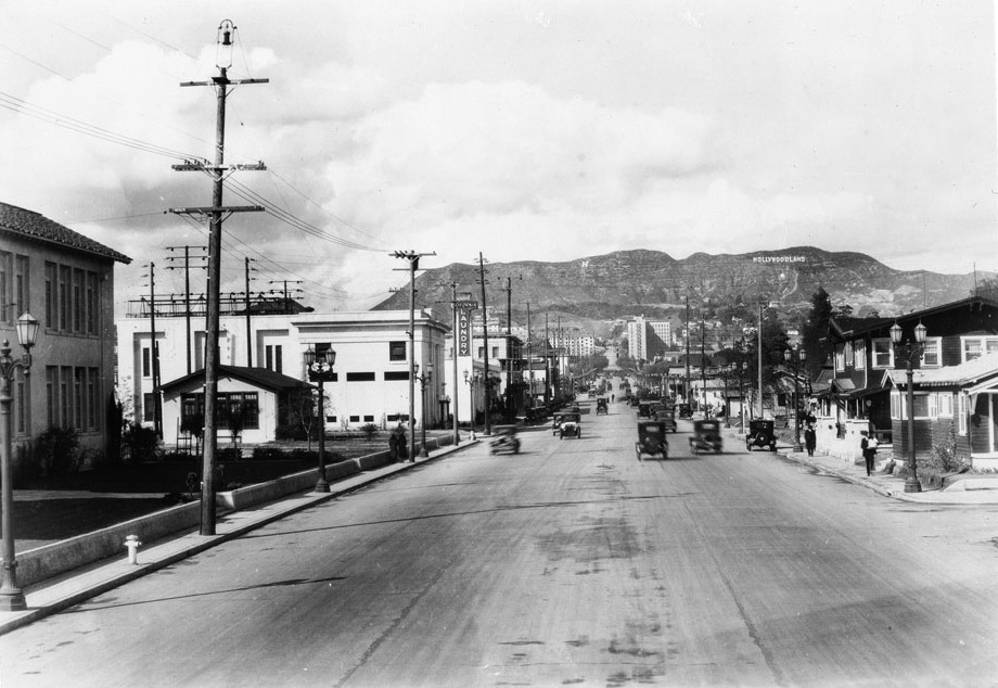
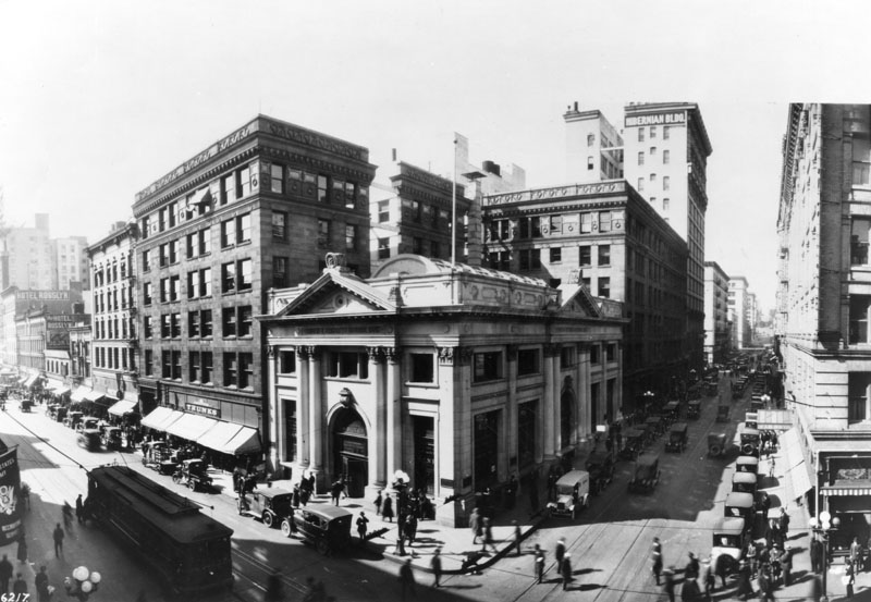
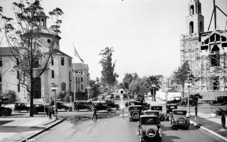
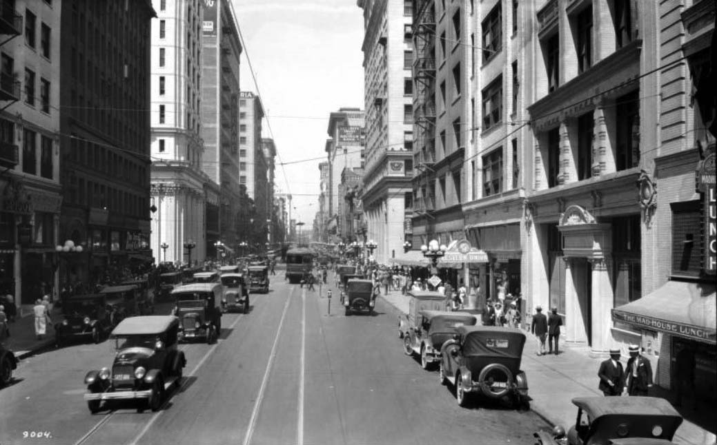
| (ca. 1918)^ - View looking north on Los Angeles Street from Third Street. There are two sets of streetcar tracks running down the middle of Third Street through the dirt intersection. Los Angeles Street is crowded with horses, carriages, automobiles, and pedestrians. A lone bicyclist is headed into the traffic at right. |
Historical Notes The Loew's State Theater is noted for the seated Buddha located in a niche above the proscenium arch. The exterior has an elaborate "silver platter" chased ornamentation above the ground story. In 1998, Metropolitan Theaters stopped showing movies at the State and leased the space to the Universal Church. As of 2008, the State was being operated as a Spanish-language church.*^ |
 |
|
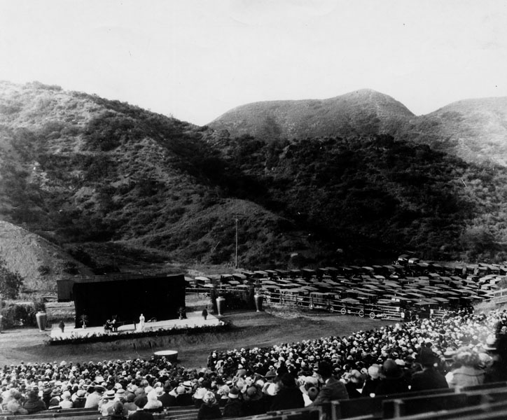
| (ca. 1922)^ - Concert by Rosa Paniella at the Hollywood Bowl. Note the location of the parked cars. |
Historical Notes In 1922 the price of admission to the Hollywood Bowl was only 25 cents. |
 |
|
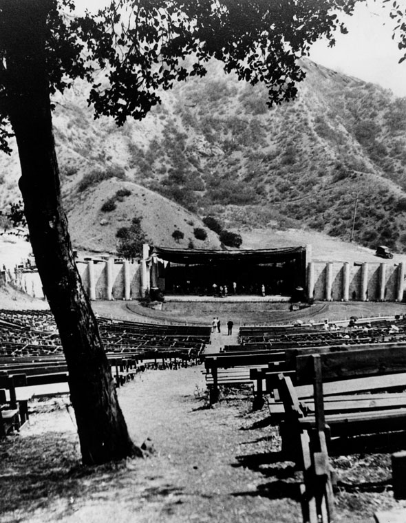
| (1920)* - Easter Service at the Hollywood Bowl befoe the shell. |
Historical Notes The 1st shell at the Hollywood Bowl did not go in until 1929.. |
Click HERE to see more in Early Views of the Hollywood Bowl |
* * * * * |
Los Angeles and 3rd Street
 |
|
| (ca. 1918)^^ - View looking north on Los Angeles Street from Third Street. There are two sets of streetcar tracks running down the middle of Third Street through the dirt intersection. Los Angeles Street is crowded with horses, carriages, automobiles, and pedestrians. A lone bicyclist is headed into the traffic at right. |
 |
|
| (ca. 1920)^ - View of Los Angeles Street, looking north from 3rd Street. Horse drawn vehicles as well as automobiles travel on this busy street. Note how some of the cars are parked perpendicular to the curb. |
Los Angeles and 2nd Street
 |
|
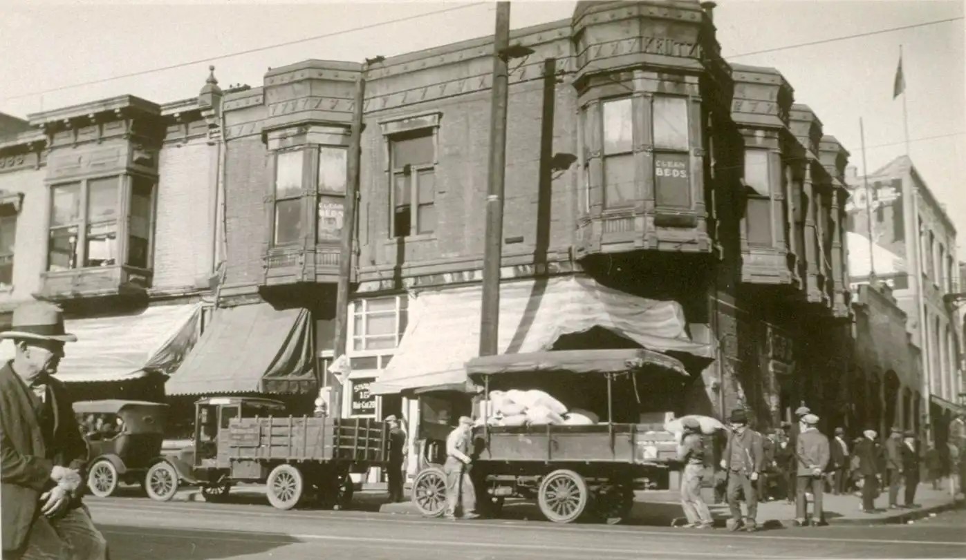
| (1920s)^ – View looking at the northwest corner of 2nd and Los Angeles streets. They're advertising clean beds in the upstairs windows. |
* * * * * |
 |
|
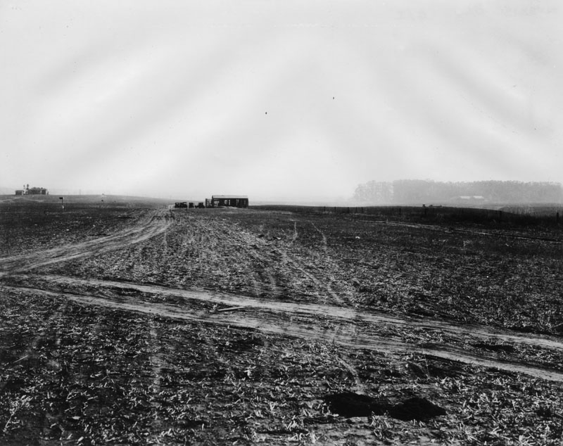
| (1922)^^ - Engineering notebook photo print of unrepaired pavement over recent excavation on Vermont Avenue 100 feet south of 54th Street, Los Angeles. In the background can be seen businesses with signs reading: “Hoffs Dry Goods – Mens Wear” and “Jewler, Optician” |
 |
|
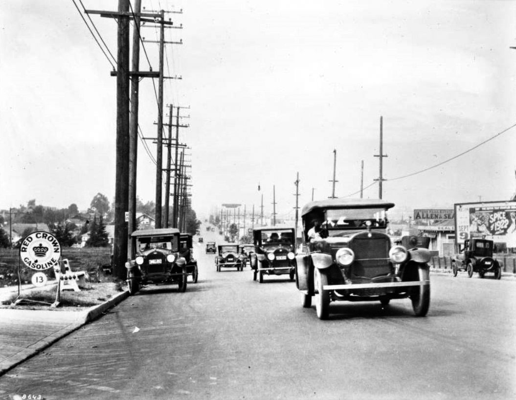
| (ca. 1922)^^ - View of Western Avenue looking north from Pico Street. Billboard signs can be seen along the street advertising various business from gasoline to real estate. |
 |
|
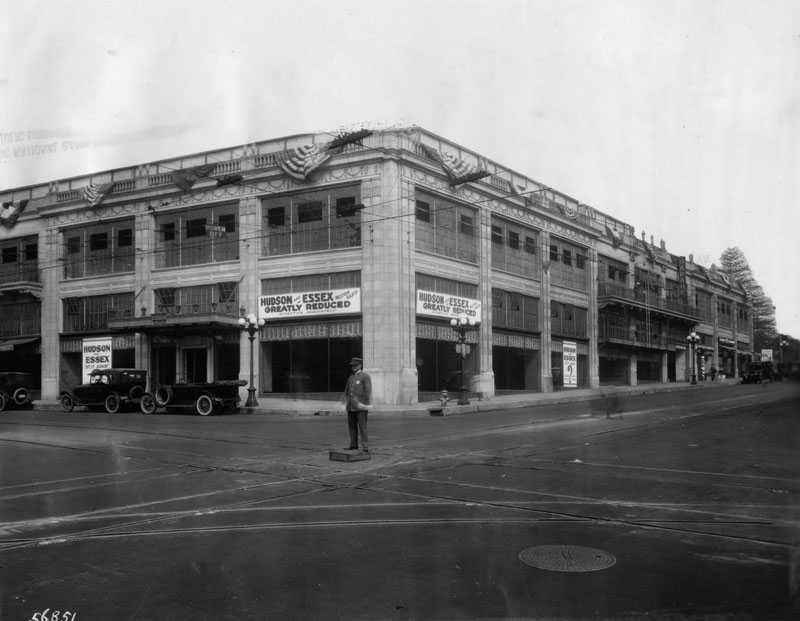
| (1922)^ - View of the Arnold Building on the northwest corner of 7th and Figueroa. Several banners hang outside of the building. They read: "Hudson and Essex motor cars. Greatly reduced. Effective immediately", and "Hudson and Essex. At it again. Lower prices. Easier terms". Electric car tracks and wiring can be seen on the streets and above, and a police officer stands in the middle of the street directing traffic, although there is none. |
Historical Notes The Arnold Building seen above served as the framework for the Statler Hotel in 1951. |
Broadway and 7th
 |
|
| (1921)^^ - Birdseye view of Seventh Street looking west from Broadway, showing the Vogel Block on the corner at left. The three-story building is topped by a spired dome and covered with signs. Its windows have molding reminiscent of Victorian architecture. |
Historical Notes In 1921 the 1893-built Vogel Block would be demolished to make room for Loew's State Theatre (currently United Building). |
 |
|
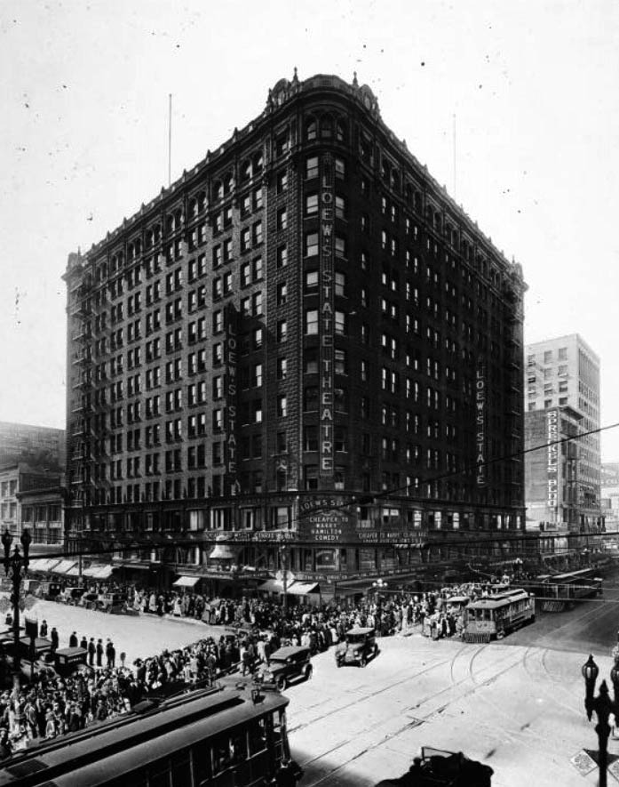
| (ca. 1921)^^ – View of the Loew's State Building (Loew's State Theatre) at the southwest corner of Seventh Street and Broadway. Many streetcars can be seen operating here as thousands crowd into the theatre. |
Historical Notes Loew's State Theatre was built as the west coast showcase for the product of the Loew's subsidiary Metro Pictures. The opening was on November 12, 1921 at one of downtown's busiest intersections, 7th and Broadway. Loew's State once used entrances on both streets. The 7th St. entrance was closed in 1936. |
 |
|
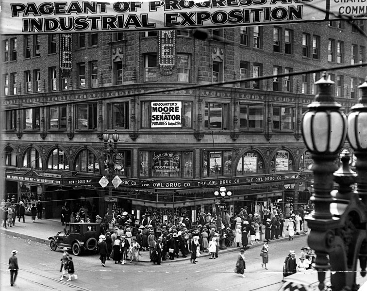
| (1922)^ - Exterior view of Loew's State Theatre building located at the intersection of Broadway and 7th Streets. Entrance to the theatre is on the left of this photo. Marquee reads: Now- Flapper week-Doris May in "Gay and Devilish." Occupants of the building also includes a dentist, Headquarters for Moore for Senator campaign, Star Shoe Co. and the Owl Drug. Co. The streets are crowded with pedestrians crossing and standing along the sidewalks. |
Historical Notes The Loew's State Theater is noted for the seated Buddha located in a niche above the proscenium arch. The exterior has an elaborate "silver platter" chased ornamentation above the ground story. In 1998, Metropolitan Theaters stopped showing movies at the State and leased the space to the Universal Church. As of 2008, the State was being operated as a Spanish-language church.*^ |
 |
|
| (ca. 1922)^ - Cars are lined up in both directions on Broadway and pedestrians are numerous in this view of Broadway looking towards 7th St. On the corner of 7th (upper left side in the picture) is the Bank of America. |
* * * * * |
State Normal School to Central Library
 |
|
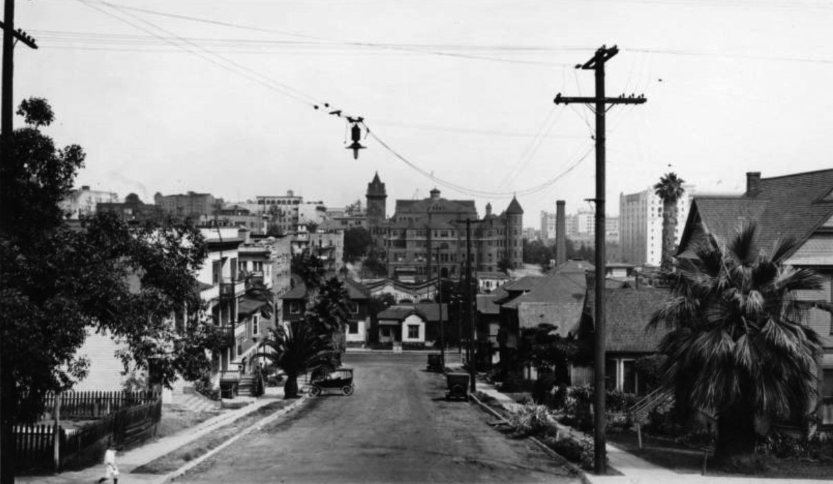
| (1922)* - Photograph (engineering notebook photoprint) taken at the head of 5th Street on Fremont Avenue looking east, showing possibilities of extending 5th Street through to Olive Street. The State Normal School is seen in the background where 5th Street would need to go through to complete the extension. |
Historical Notes In 1922 the State Normal School was demolished and 5th Street was straightened to run through the property. The remainder of the site was eventually occupied by the Los Angeles Central Library (1925). Click HERE to see the connection between the State Normal School and UCLA. |
Then and Now
 |
|
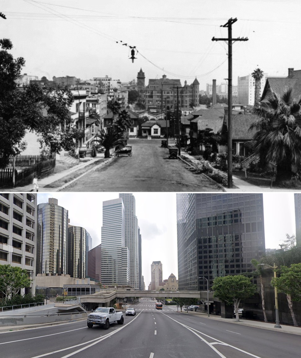
| (1922 vs 2021)* – Looking east on 5th Street toward Figueroa Street in DTLA. The top photo, dated 1922, shows the State Normal School located atop the last knoll of Bunker Hill, aptly dubbed 'Normal Hill.' In the mid-1920s, the school was demolished, Normal Hill was leveled, 5th Street was extended through to Grand Avenue, and the LA Central Library was constructed on the site where the old school once stood. Photo comparison by Jack Feldman. |
Historical Notes Click HERE to see more Early Views of the State Normal School. Click HERE to see the connection between the State Normal School and UCLA. Click HERE to see more on the Construction of the LA Central Library. Click HERE to see more Early Views of the LA Central Library. |
* * * * * |
Alvarado and 1st Street (later Beverly)
 |
|
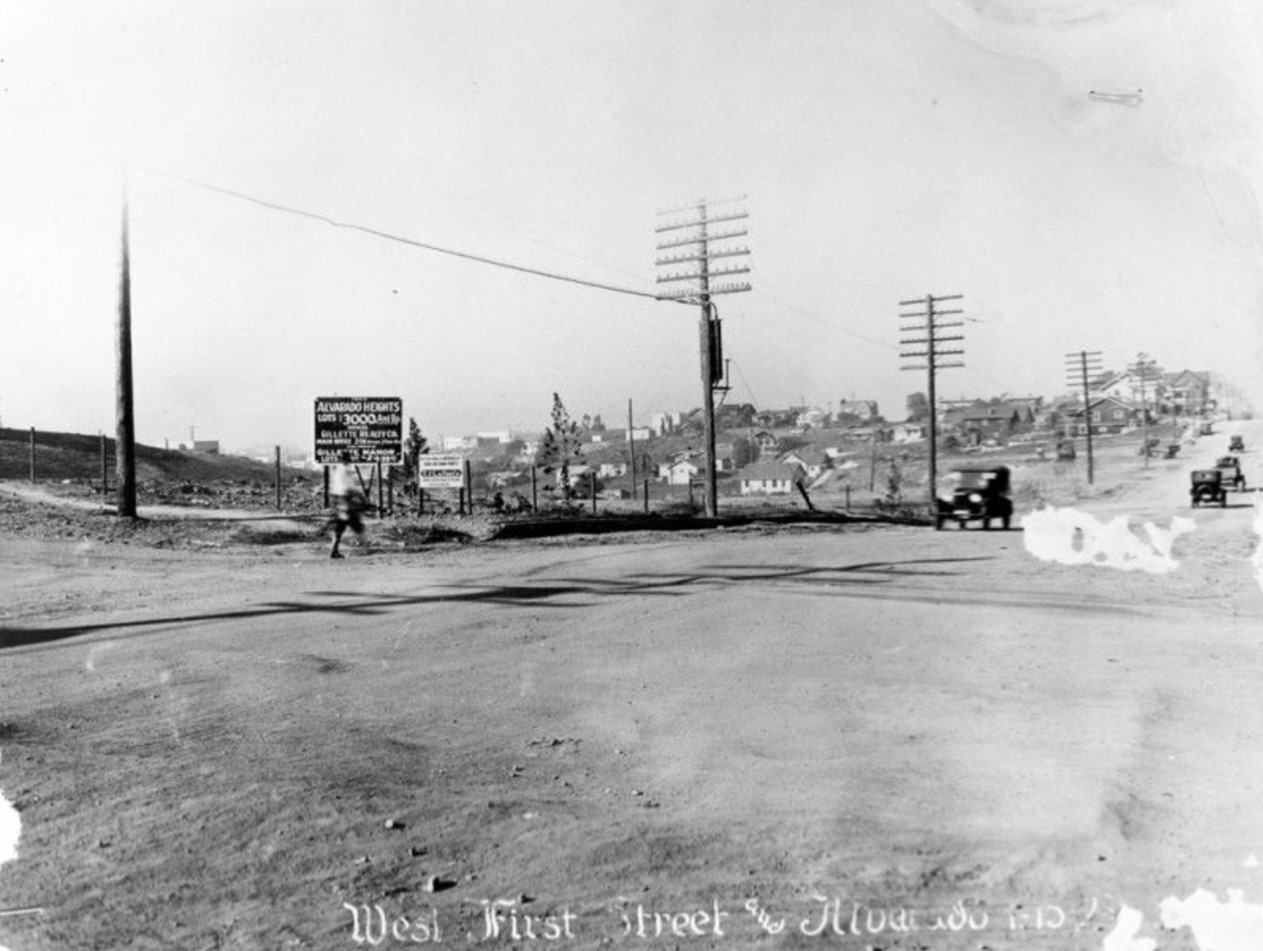
| (1923)* - An unpaved West 1st Street at Alvarado Street on January 10, 1923. The Alvarado Heights house lots are for sale for $3000 and up by Gillette Realty Co. Gillette Manor lots are also available. Other existing homes are in the distance. |
Historical Notes The term "Alvarado Heights" appears in historical contexts related to Los Angeles. For instance, the Southern California Quarterly published an article titled "A Pueblo de Los Angeles Memoir ... ALVARADO HEIGHTS," which suggests that the name has been used in historical narratives about the city. Additionally, contemporary rental listings reference "Alvarado Heights" as a neighborhood in Los Angeles, indicating that the term is still in use today. However, detailed historical information specifically about "Alvarado Heights" is limited. It's possible that the area was known by this name in the past, but over time, the designation may have fallen out of common usage or been absorbed into other neighborhood identities. |
 |
|
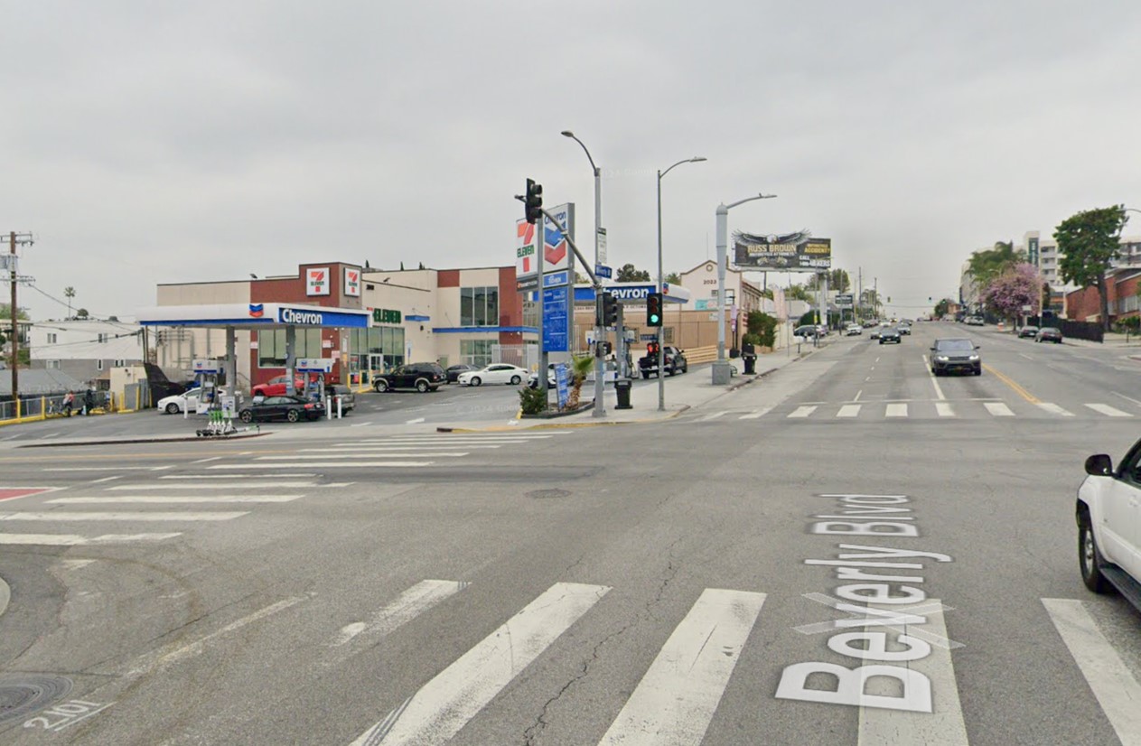
| (2024)* - Looking west on Beverly Boulevard (original 1st Street) from Alvarado Street). |
Historical Notes Beverly Boulevard was named after Beverly Hills, which was founded in 1906. The name "Beverly" was adopted to enhance the area's appeal, reflecting its association with the fashionable and affluent community of Beverly Hills. In the early 1920s, the City of Los Angeles combined sections of 1st Street and Temple Street, renaming this new thoroughfare "Beverly Boulevard" to connect the city to the ocean. Initially, Beverly Boulevard extended to the coast, but in 1934, the segment between Benedict Canyon and the ocean was renamed Sunset Boulevard to maintain continuity. |
Then and Now
 |
|
| (1923 vs 2022)*- Looking west from the intersection of Alvarado and 1st streets (later Beverly Boulevard). Photo comparison by Jack Feldman. |
* * * * * |
Alvarado and Temple
 |
|
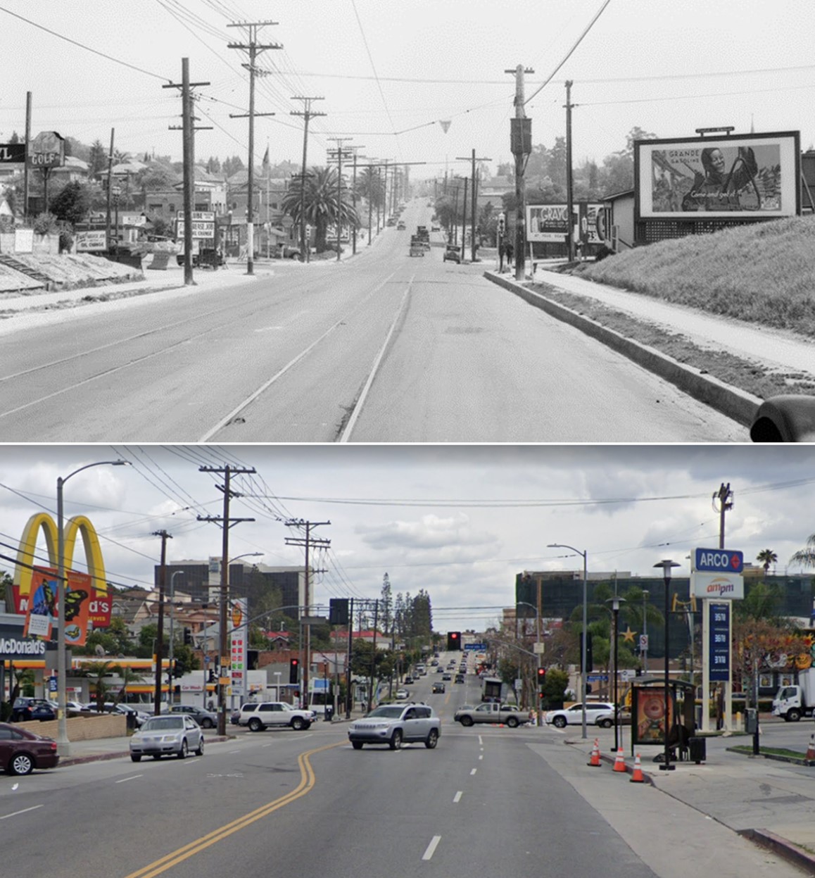
| (1923)* - Looking east on Temple Street toward Alvarado Street. |
Historical Notes Alvarado Street was named after Juan Bautista Alvarado, a Mexican governor of Alta California. The street received its name in 1855, as part of a broader effort by city leaders to honor former Mexican governors during Los Angeles' expansion following California's statehood. Juan Bautista Alvarado, born in 1809 in Monterey, served as governor from 1836 to 1842, although his tenure was not continuous. He assumed office at the age of 27 after leading a coup in 1836. The naming of Alvarado Street reflected a wider trend in Los Angeles during the 1850s, when several streets were named after former Mexican governors of Alta California. This practice highlighted the city’s complex cultural and political history during its transition from Mexican to American rule. The naming initiative likely occurred in 1853, amid a period of significant growth and development in Los Angeles. |
 |
|
| (2019)* - Looking west on Temple Street at Alvarado Street. |
Historical Notes The community around Alvarado and Temple Streets in Los Angeles is known as Historic Filipinotown, or HiFi. It was officially designated by the City of Los Angeles on July 31, 2002. The neighborhood's boundaries are defined as follows: to the east, Glendale Boulevard; to the north, the 101 Freeway; to the west, Hoover Street; and to the south, Beverly Boulevard. Prior to this designation, the area was referred to as the "Temple-Beverly Corridor." In 2008, it was further recognized with federal status as a Preserve America neighborhood. Signage marking the neighborhood was installed at key locations, including the intersection of Temple Street and Hoover Street, as well as along the 101 Freeway at the Alvarado Street exit. |
Then and Now
 |
|
| (1923 vs 2019)* Looking east on Temple Street at Alvarado Street. Photo comparison by Jack Feldman. |
* * * * * |
Silver Lake Boulevard and Temple Street
 |
|
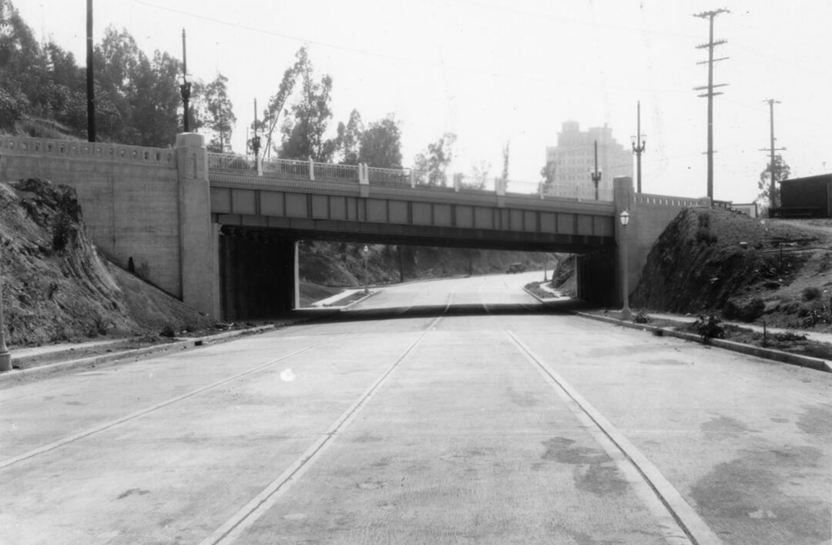
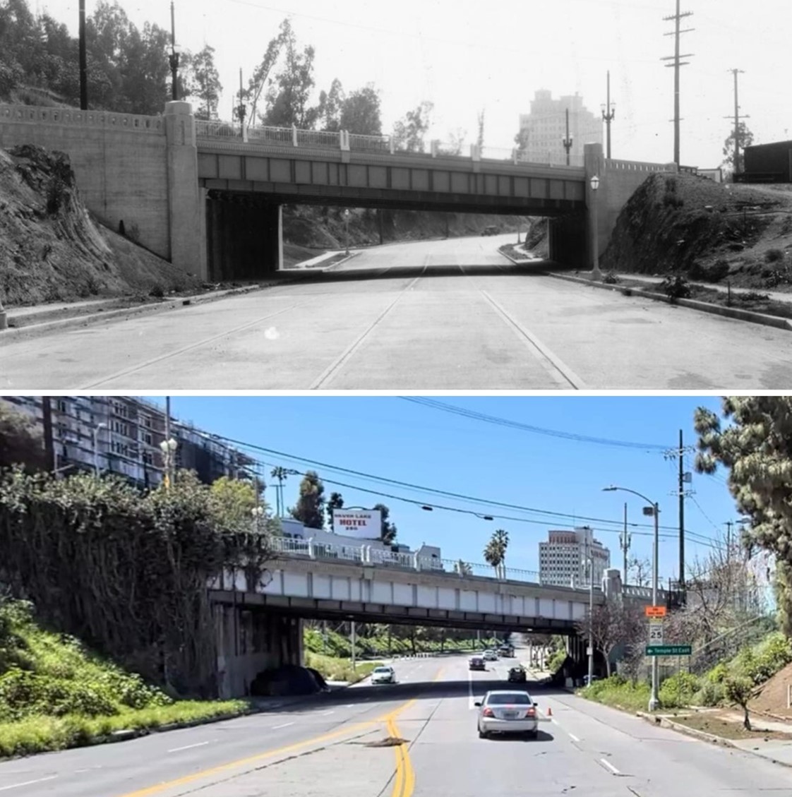
| (1934)* – Looking southwest on Silver Lake Boulevard at the Temple Street overcrossing, with the 13-story American Storage Building (built in 1928) visible in the distance. The photo was taken on June 11, 1934, shortly after the construction of grade separation. |
Historical Notes The American Storage Building at 3636 Beverly Boulevard is a historic 13-story Art Deco landmark in Los Angeles, originally constructed in 1928 as an innovative storage facility. Renowned for its architectural beauty, the building features a distinctive poured concrete façade and was once marketed as "the most beautiful storage building in the world." Throughout its history, the structure has served multiple purposes beyond storage, including hosting a unique rooftop nightclub called "The Thirteenth Heaven" and allegedly functioning as a speakeasy during Prohibition. The building's top floor featured fascinating amenities like a radio broadcast station and an aircraft beacon light, reflecting the innovative spirit of the late 1920s. Over the decades, the building has transformed from a cutting-edge storage and social venue to its current incarnation as a Public Storage facility, while maintaining much of its original architectural charm. Today, it remains a significant architectural landmark that offers a glimpse into Los Angeles's vibrant early 20th-century urban landscape, preserving elements of its colorful past while continuing to serve a practical modern purpose. Click HERE to see more early views of the American Storage Building (today, Public Storage Building). |
 |
|
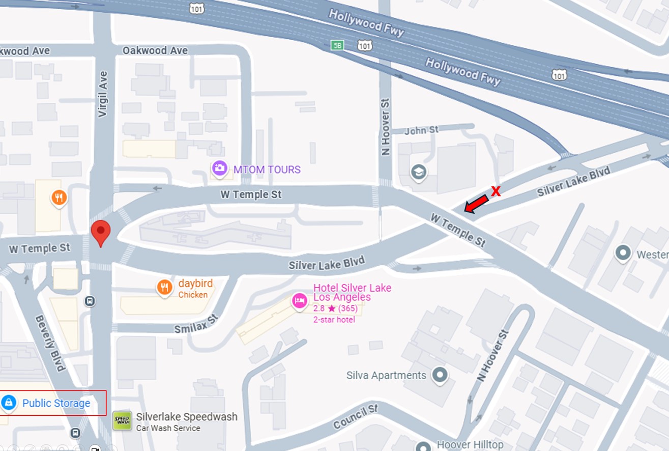
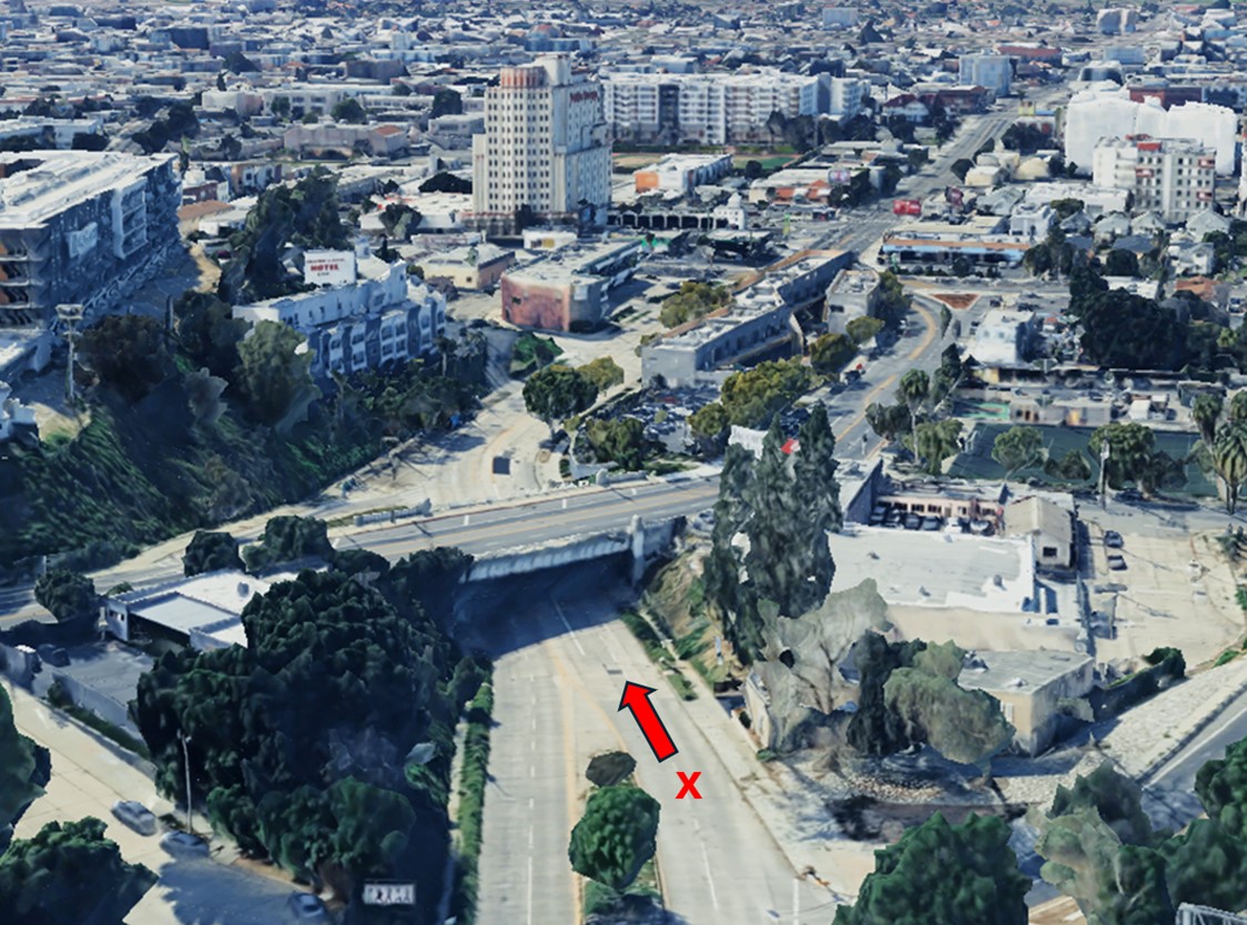
| (2025)* – Annotated Google Map showing the camera's location and direction near the Temple Street overcrossing, with the Public Storage building on Beverly Boulevard visible at the lower left. |
Historical Notes The neighborhood surrounding Temple Street and Silver Lake Boulevard is part of the Temple-Beaudry neighborhood, which is located near Historic Filipinotown and Silver Lake. This area is situated in the east-central region of Los Angeles, close to several notable neighborhoods including Echo Park, Los Feliz, and East Hollywood. |
 |
|
| (2023)* – Annotated Google Earth view looking southwest, showing the camera's location and direction in the original 1934 image near the Temple Street overcrossing, with the Public Storage building on Beverly Boulevard visible in the distance. |
Historical Notes The tallest building in the distance is the Public Storage Building at 3636 Beverly Boulevard. This historic 13-story Art Deco landmark, built in 1928, is located near the intersection of Beverly and Temple. |
Then and Now
 |
|
| (1934 vs. 2024)* – A ‘Then and Now’ view looking southwest on Silver Lake Boulevard at the Temple Street overcrossing, with the historic Public Storage Building visible in the distance. Photo comparison by Jack Feldman. |
* * * * * |
Western and Pico
|
|
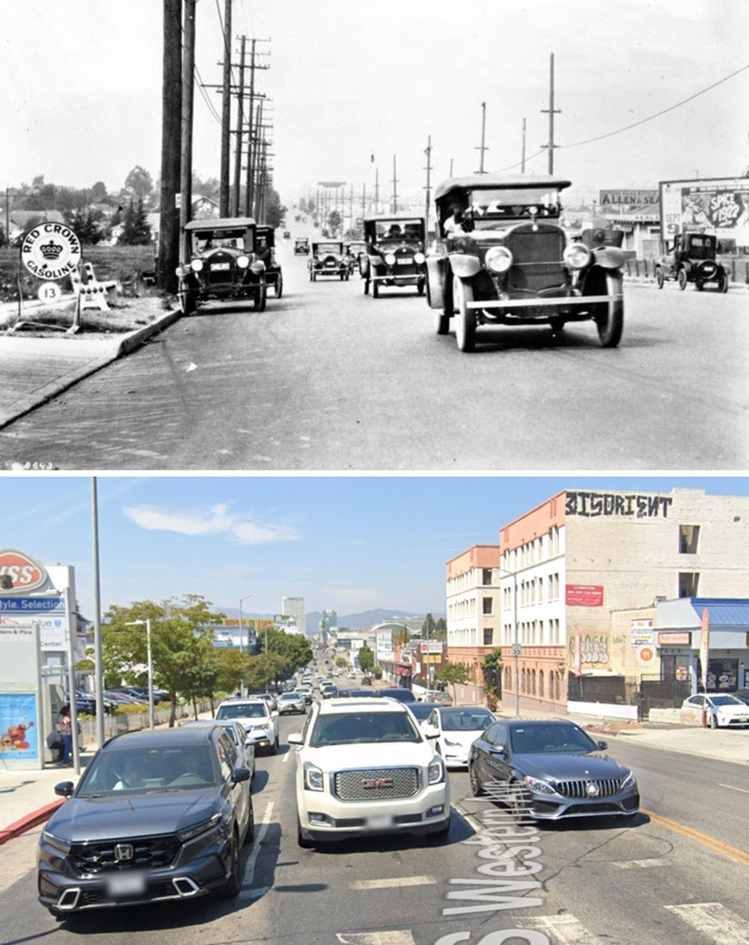
| (ca. 1922)* - Looking north on Western Avenue from Pico Boulevard. Billboard signs can be seen along the street advertising various businesses from gasoline to real estate. |
Historical Notes In the early 1920s, this intersection marked a rapidly developing edge of Los Angeles. Western Avenue had originally been the western boundary of the city grid, but by this time it was evolving into a major north south thoroughfare as residential neighborhoods expanded westward. Much of the surrounding area had only recently been subdivided, and new homes, small businesses, and open lots still existed side by side. Pico Boulevard itself was part of this transformation. Originally known as Pico Street, the name was changed to Pico Boulevard in 1914 as the roadway was widened and upgraded. In 1917, Pico Boulevard was extended westward toward Santa Monica, incorporating portions of what had been Fremont Avenue. These changes helped establish Pico as a major east west route and reinforced the importance of intersections like Pico and Western as development accelerated. The billboards lining Western Avenue reflect the growing influence of the automobile. Advertisements for gasoline, real estate, and local services targeted passing motorists and symbolized a city reshaping itself around car travel. This stretch of Western was becoming a commercial corridor designed as much to be seen at speed as to serve nearby residents. |
 |
|
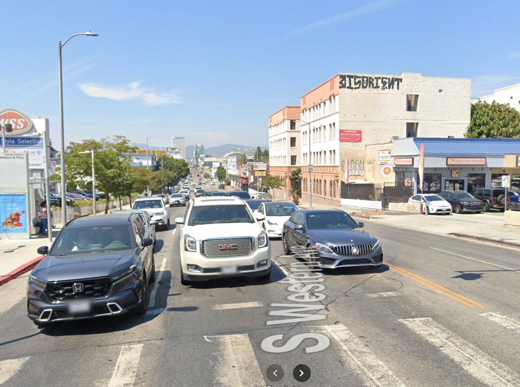
| (2025)* - Google street view looking north on Western Avenue from Pico Boulevard. |
Historical Notes Today, Western and Pico is a fully urban intersection within a dense, active neighborhood. The open spaces and billboard lined frontage seen in the 1920s have been replaced by continuous development, including apartment buildings, storefronts, and service oriented businesses. Traffic is steady throughout the day, and the street functions as a key connector between surrounding communities. The area reflects the everyday character of modern Los Angeles. It is diverse, heavily residential, and largely renter occupied, with many people living in multi family housing close to transit routes. Western Avenue remains an important spine for movement, commerce, and daily neighborhood life, much as it was a century ago, though on a far more intensive scale. |
Then and Now
 |
|
| (1922 vs. 2025)* - Looking north on Western Avenue from Pico Boulevard. Photo comparison by Jack Feldman. |
Historical Notes This comparison illustrates the transformation of Los Angeles from a city still pushing into open land to one that is fully built out. In 1922, Western and Pico represented growth, speculation, and opportunity, with development still catching up to ambitious street layouts and advertising driven commerce. By 2025, the same intersection shows the long result of that expansion. Buildings fill nearly every parcel, streets support constant activity, and the neighborhood functions as a lived in, working part of the city. While the physical appearance has changed dramatically, the intersection’s role as a crossroads of movement, services, and neighborhood life has remained consistent across generations. |
* * * * * |
Catalina
 |
|
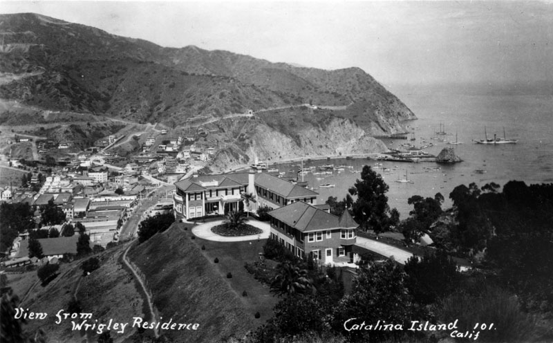
| (1920s)^ - William Wrigley's two-story, L-shaped home rests atop a grassy hill, overlooking Avalon and beyond. Small houses as well as various tourist-oriented businesses, office buildings and several larger apartment complexes are nestled in the hills. The first Catalina Casino, Sugarloaf Rock, and numerous small boats are visible at the edge of the bay on the right, surrounded by the sea on three sides. |
Historical Notes William Wrigley, Jr. (1861-1932), chewing gum industrialist and founder of the William Wrigley Jr. Company, played an instrumental role in the history of Catalina Island. He bought the island from Joseph and Hancock Banning in 1919, and improved it with public utilities, new steamships, a hotel, the Casino building, and extensive planting of trees, shrubs, and flowers. Wrigley was the owner of the Chicago Cubs baseball team, which held its annual spring training on the island. In 1920, William Wrigley Jr. and David M. Renton had a small casino built to serve as an entertainment and gathering place for Catalina Island's visitors. In a short period of time though, this establishment - the Sugarloaf Casino, proved to be too small to accommodate the growing number of guests, and in February 1928 it was demolished to make room for a much larger building. The Catalina Casino Ballroom, also known as Avalon Ballroom, was built on the same spot - adjacent to Sugarloaf Rock by architects Sumner A. Spaulding and William Webber. Sugarloaf Rock was eventually blasted away in order to enhance the view from the Casino. Wrigley's budget for the design and construction of the Catalina Casino was $600,000, but when all was said and done, he ended up spending $2 million. |
 |
|
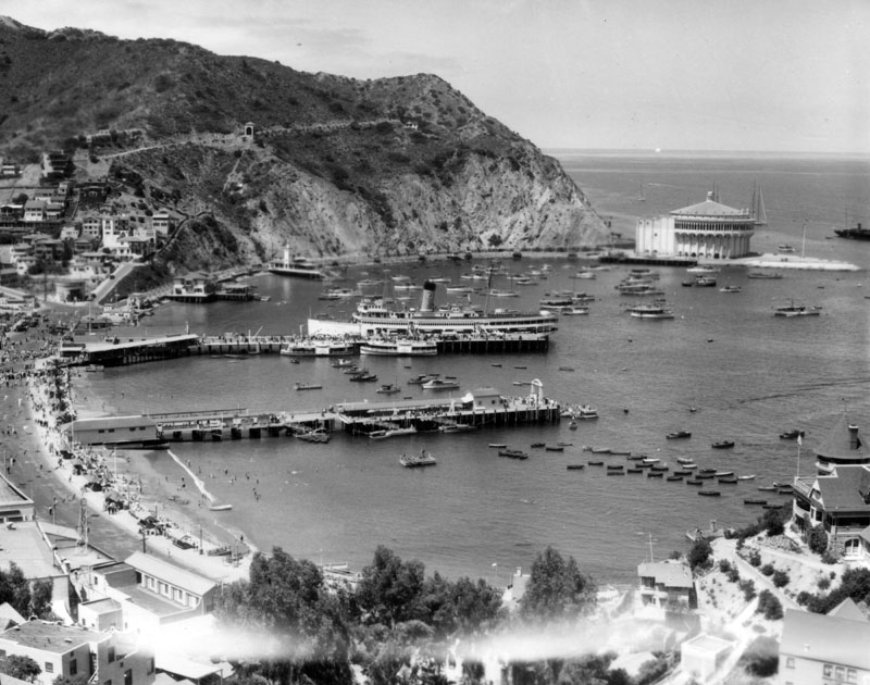
| (1920s)^ - View of Avalon Bay across Crescent Bay, on Santa Catalina Island as seen from a mountain top. The Catalina Casino, surrounded by the sea on three sides, is visible at the edge of the bay on the right along with several boats along with the S.S. Catalina, "The Great White Steamer". |
Historical Notes The S.S. Catalina, known as "The Great White Steamer", was laid down on December 26, 1923, christened on May 3, 1924, completed in 1924, and took its maiden voyage on June 30, 1924. The 301-foot ship, originally built at a cost of $1 million dollars, was in service from 1924 and carried about 25 million passengers between Los Angeles and Avalon Harbor until she was retired on September 14, 1975. |
 |
|
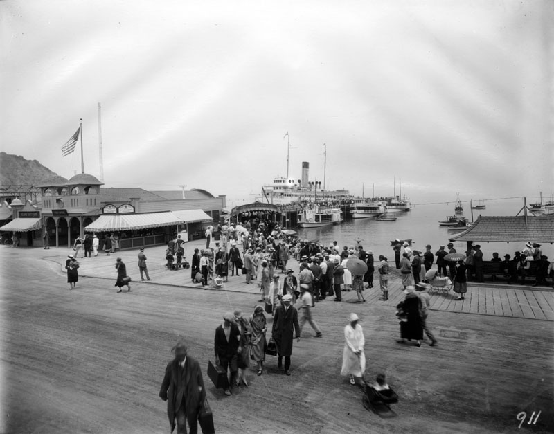
| (1920s) - View of the dock, or ferry slip, which is full of passengers that appear to be unloading out of the S.S. Catalina, nicknamed "The Great White Steamer". Dozens of people wait for these travelers, making a pathway for them to walk through. The Post Office and Island Gift Shop can be seen on the left, and several small boats are visible to the right of the wharf. |
Historical Notes The S.S. Catalina has been recognized as a Historic-Cultural Monument, No. 213 (Click HERE to see the LA Historic-Cultural Monuments List) and also California State Historic Landmark No. 894 (Click HERE to see more California Historic Landmarks in LA). She was listed on the National Register of Historic Places in 1976. Click HERE to see more Early Views of Catalina |
* * * * * |
Wrigley Field (Los Angeles)
 |
|
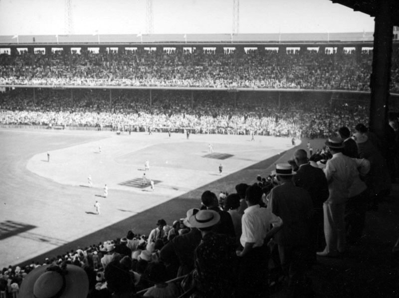
| (1920s)^ - Partial view of the "first" Wrigley Field - home for the Los Angeles Angels of the Pacific Coast League. The bleachers are practically bursting at the seams with eager spectators cheering on their favorite teams. |
Historical Notes Wrigley Field, built on 10 acres of land in South Los Angeles between San Pedro Street (on the west), Avalon Blvd (to the east), E. 41st Place (to the north), and E. 42 Place (to the south), served as host to minor league baseball teams in the region for over 30 years, and was the home park for the Los Angeles Angels of the Pacific Coast League. Chewing gum magnate, William Wrigley, Jr. purchased the Angels in 1921 for the (then) astronomical sum of $150,000 and then built a stadium for the team a few years later. Construction for Wrigley Field began in 1924 and the 21,000-seat, million-dollar stadium opened on September 29, 1925. For 33 seasons (1925-1957) the park was home to the Angels, and for 11 of those seasons (1926-1935 and 1938) it had a second home team in the rival Hollywood Stars. The Stars eventually moved to their own new ballpark, Gilmore Field. Prior to 1925, the Angels played at their former home at Washington Park, and before that, at Chutes Park.^ |
Click HERE to see more Early Views of Catalina |
* * * * * |
Fairfax-Wilshire Area
 |
|
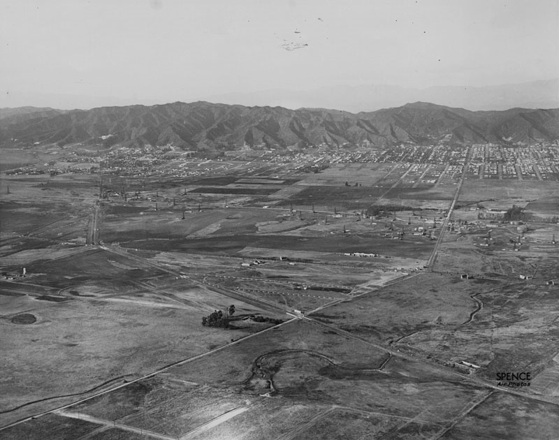
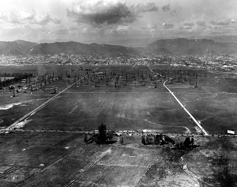
| (1922)^ - Aerial view looking northwesterly showing Crescent Ave (later Fairfax Ave) running diagonally from lower-left to center-right where it crosses Wilshire Boulevard and makes a slight bend north towards the Hollywood Hills. San Vicente runs diagonally from lower-right to upper left and turns up toward West Hollywood. Note the oil wells scattered across the open land. |
Historical Notes The Fairfax District was little more than bean fields at the turn of the century when Arthur Fremont Gilmore set out to dig a well on his 256-acre dairy farm near West 3rd Street in Fairfax Avenue. But instead of water, Gilmore struck oil. His 1901 discovery is credited with prompting an oil exploration boom in the area- later called the Salt Lake oil fields. Gilmore helped build the Fairfax area into one of the city’s best-known commercial areas (Farmers Market). +# |
 |
|
| (1920)^ - Aerial view of Crescent Avenue (now Fairfax) and Wilshire Boulevard in 1920 showing undeveloped land with many oil derricks. In the lower part of the photograph is Chaplin Airport. The tree-lined street is Wilshire. The diagonal line at the bottom is actually railroad tracks that would later become San Vicente Bouelvard. |
Historical Notes Chaplin Airfield was located on leased property that is now bounded by Wilshire Boulevard, Fairfax Avenue, and San Vincente Boulevard. The Syd Chaplin Aircraft Corporation advertised that it “maintained a fleet of newest Curtis one and two-passenger aeroplanes, large shops with complete equipment and hangars for our own ships as well as those belonging to business firms and individuals.” Syd Chaplin was the brother of famed actor Charlie Chaplin. |
 |
|
| (1919)^* - Aerial view looking southeast showing crowds of people at Sid Chaplin's airport at the southwest corner of Wilshire Boulevard and Crescent Avenue (now Fairfax Avenue). Dozens of cars are parked in rows in the foreground, with several airplanes parked behind them in the more open field. A vendor tent is visible farther up the image, near more parked cars. A billboard to the left reads "Racine Tires". |
Historical Notes The Chaplin Aircraft Company offered observation flights for $10 and round-trip flights to San Diego for $150 (at a time when the average wage was $1,200 per/year). Obviously, the cost of air travel was very steep and Chaplin’s enterprise had a brief life span. Around 1920 Chaplin sold out to Emory H. Rogers, a business partner, who renamed it Rogers Field. Click HERE to see more in Aviation in Early L.A. |
 |
|
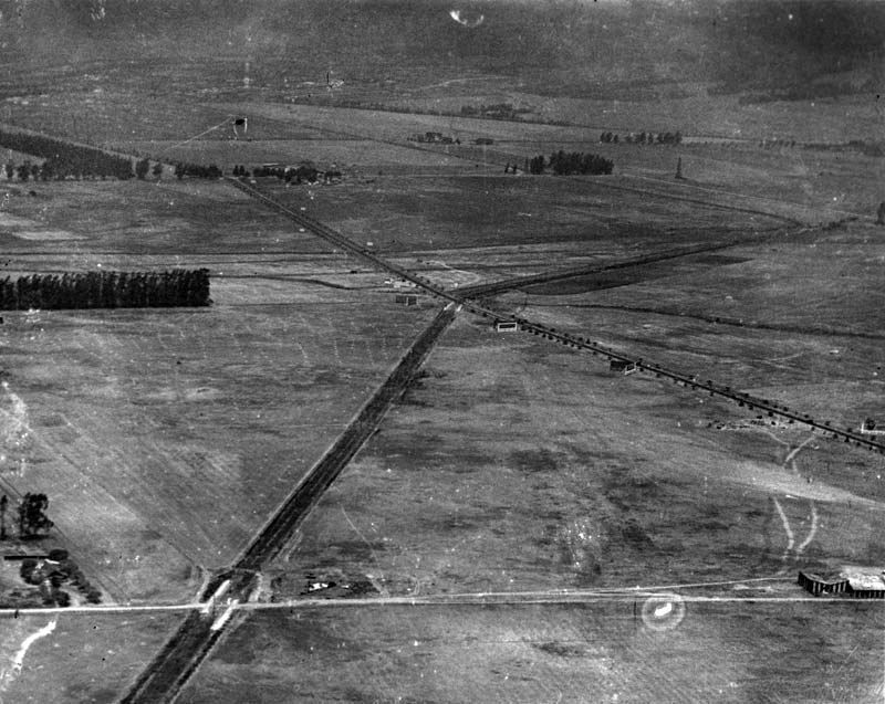
| (1922)^^ - Aerial photograph, looking east, showing the intersection of Wilshire and San Vicente boulevards. San Vicente Boulevard is one of the few major streets in this area of Los Angeles that runs diagonally. |
Historical Notes The main reason that San Vicente Boulevard runs diagonally as it does is because it was built on the Los Angeles Pacific Electric Railway Right-of-way in the early 1900s. Named for the Rancho San Vicente y Santa Monica that had previously occupied the area, it begins at Venice Boulevard between Crenshaw Boulevard and La Brea Avenue and travels in a northwesterly direction towards Beverly Hills. The roadway splits into two streets past La Cienega Boulevard, with the western branch becoming Burton Way, which eventually becomes Santa Monica Boulevard South and connects directly to downtown Beverly Hills. San Vicente Boulevard itself continues north into West Hollywood and ends at Sunset Boulevard. A separate stretch of road with the same name, San Vicente Boulevard, runs from Brentwood to Santa Monica. Originally, this boulevard ran from the Soldiers' Home (Sawtelle Veterans Home) in Los Angeles to Ocean Avenue in Santa Monica. This tree-lined street was 130 feet wide, with trolley lines used by the Los Angeles Pacific Electric Railway running down its center.*^ |
 |
|
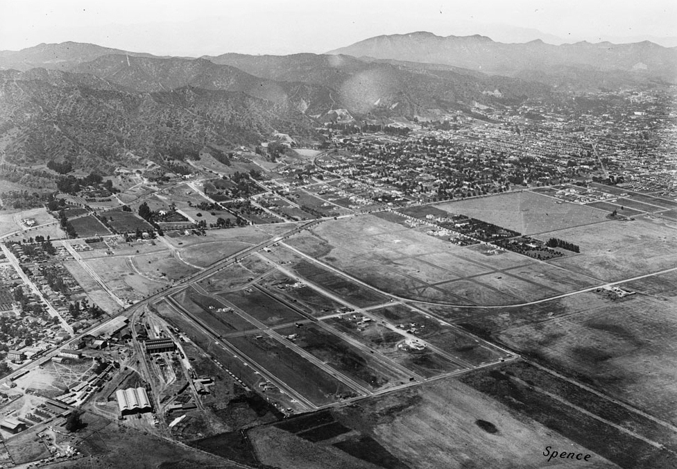
| (1922)^ - Aerial view of Carthay Center, looking west across field of the first Rogers Airport at Wilshire Boulevard and Fairfax Avenue (lower right of photo). Wilshire Boulevard is the tree-lined street seen in the center of the image. The diagonal line running from lower left to upper right is the San Vicente line of the Pacific Electric Railway, later to become San Vicente Boulevard. |
Historical Notes In 1922, J. Harvey McCarthy developed an upscale residential district along the San Vicente Boulevard line of the Pacific Electric Railway, bounded by Wilshire Blvd. on the north, Fairfax Avenue on the east, Olympic Blvd. on the south and Schumacher Drive on the west. McCarthy originally named the district Carthay Center (Carthay being a derivative of the developer's last name). The areas to the south of Olympic Boulevard remained undeveloped until 1933, when developer Spyros George Ponty built several hundred homes in two districts later named "South Carthay" and "Carthay Square." *^ |
 |
|
| (1922)*#*# - View looking west over Wilshire Boulevard at Crescent Avenue (later Fairfax Ave). Rogers Airfield (previously Chaplin Airfield and DeMille Airfield No.2) can be seen straddling Wilshire Blvd at center of photo. Crescent Ave (later Fairfax Ave) runs horizontally at bottom. The diagonal line (upper-left) are railroad tracks (today, San Vicente Boulevard). |
 |
|
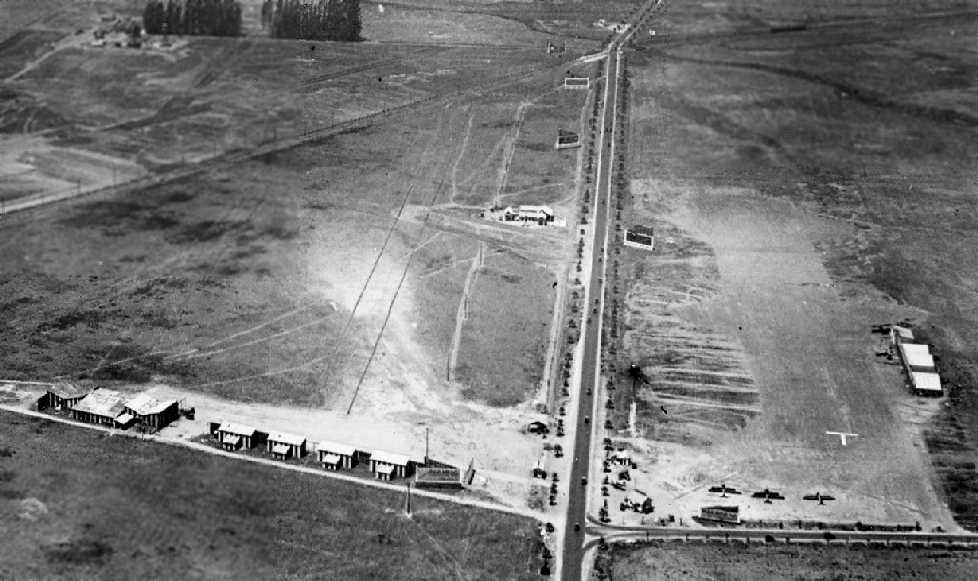
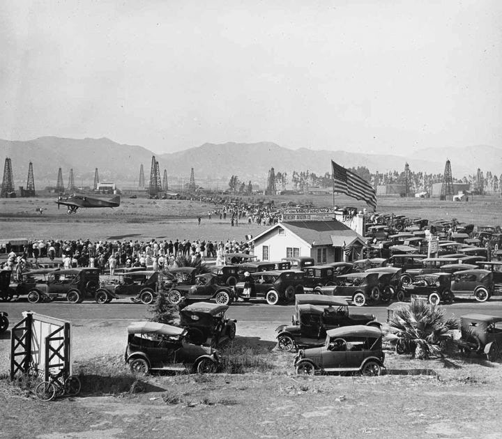
| (ca. 1920)^#^# - Parking lot is full as crowds attend air show at DeMille Field No. 2. The sign on top of the structure with the large American Flag reads: DeMille Field No. 2. View is looking northeast near the NW corner of Wilshire and Fairfax. |
Historical Notes Cecil B. DeMille founded the Mercury Aviation Company ( aka Mercury Air Lines ) in 1919. Mercury was the first American airlines to carry air freight and passengers commercially on regularly scheduled runs. It scheduled service to Santa Catalina Island and San Diego, later San Francisco, with Junker-Larsen JL-6 monoplanes. Inaugurated five months before KLM began operations in Europe.^^^ Click HERE to see more in Aviation in Early L.A. |
 |
|
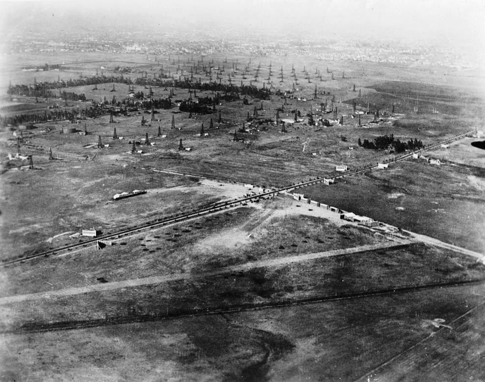
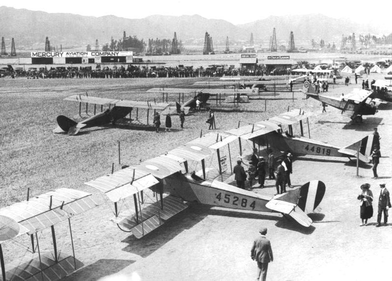
| (ca. 1922)^^#^ - Ground view of Rogers Airfield (previously DeMille Field No. 2) on the northwest corner of Fairfax and Wilshire. The Mercury Aviation Company sign can be seen on a hangar in the upper left of photo. The oil derricks seen in the background are part of the Salt Lake Oil Field. |
Historical Notes In the 1890s, dairy farmer Arthur F. Gilmore found oil on his land, probably in the vicinity of the La Brea Tar Pits. The field was named after the Salt Lake Oil Company, the first firm to arrive to drill in the area. The discovery well was spudded (started) in 1902. Development of the field was fast, as oil wells spread across the landscape, with drillers hoping to match the production boom taking place a few miles to the east at the Los Angeles City field. Peak production was in 1908. By 1912, there were 326 wells, 47 of which had already been abandoned, and by 1917 more than 450, which had by then produced more than 50 million barrels of oil. After this peak, production declined rapidly. Land values rose, corresponding to the fast growth of the adjacent city of Los Angeles, and the field was mostly idled in favor of housing and commercial development. The early wells were abandoned; many of their exact locations are not known, and are now covered with buildings and roads.*^ |
 |
|
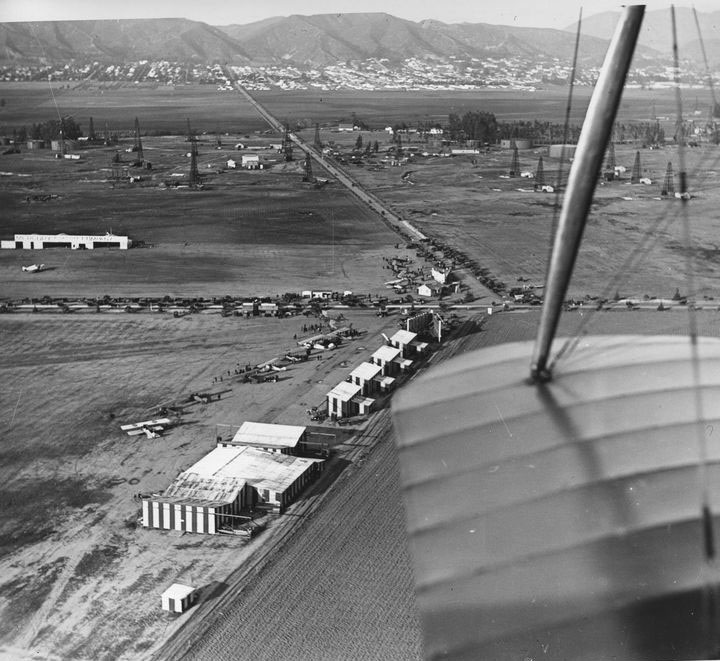
| (ca. 1922)^##* - View looking north over the wing of a plane showing the intersection of Crescent Ave (Fairfax) and Wilshire Blvd. A crowded airfield is seen below. In the distance oil derricks straddle Fairfax where 6th Street is located today. In the far background at the foothills can be seen a built-up Hollywood. |
Click HERE to see more in Aviation in Early L.A. |
 |
|
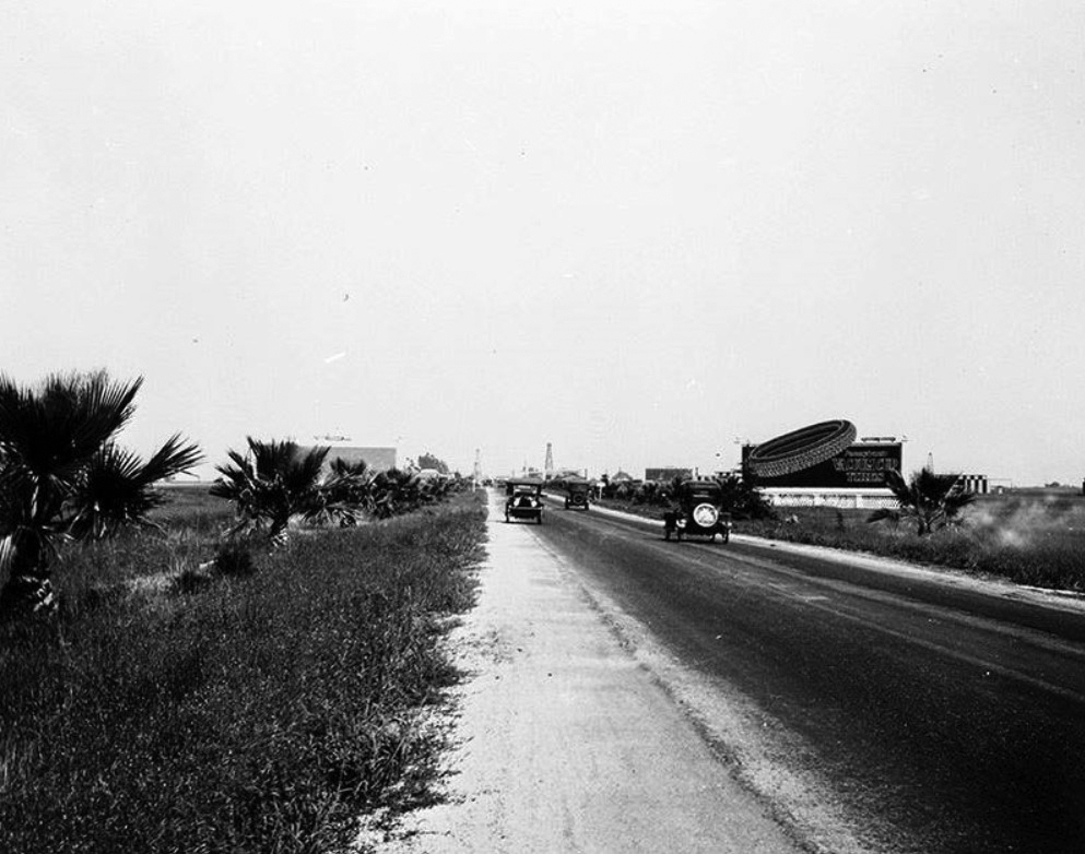
| (1920)+^^ – View looking east on a two-lane Wilshire Boulevard from near La Brea Avenue. Signboards, open fields, and oil derricks are about all you can see. |
 |
|
| (1922)^ - Aerial view looking north of Wilshire at La Brea. Oil wells may be seen in the area and residential homes in the distance. |
 |
|
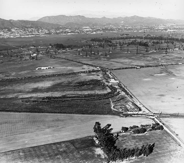
| (ca. 1922)^##* - View looking north shows numerous cars parked on a lot (center of photo) near the airfield as well as along Wilshire Blvd. and Crescent Ave (Fairfax). Large sign on building in the lower-right center at the intersection of Fairfax and the San Vicente line of the Pacific Electric Railway reads: Albers Oats. |
* * * * * |
West Hollywood
 |
|
| (1922)^^ - Aerial view of Santa Monica Boulevard looking northeast from Sherman (now, West Hollywood). The buildings in the bottom-left stand at the present-day site of the Pacific Design Center. Santa Monica Boulevard runs left-right, intersecting with Holloway Drive at roughly the center of the photograph. Hollywood is visible in the top-right. |
Historical Notes During the final decade years of the nineteenth century, the first large land development in what would later become West Hollywood—the town of "Sherman"—was established by Moses Sherman and his partners of the Los Angeles and Pacific Railway, an interurban railroad line which later became part of the Pacific Electric Railway system. Sherman became the location of the railroad's main shops, railroad yards, and "car barns". Many working-class employees of the railroad settled in this town. It was during this time that the city began to earn its reputation as a loosely regulated, liquor-friendly (during Prohibition) place for eccentric people wary of government interference. Despite several annexation attempts, the town elected not to become part of the City of Los Angeles. In a controversial decision, in 1925 Sherman adopted "West Hollywood", "...a moniker pioneered earlier in the decade by the West Hollywood Realty Board" as its informal name. though it remained under the governance of Los Angeles County.*^ Click HERE to see more Early Views of the Town of Sherman and West Hollywood. |
 |
|
| (n.d.)* - Residential neighborhood near Santa Monica Blvd. and Gardner Ave. A house with greenery on each side is in the foreground and the background shows additional houses, trees and open spaces. |
* * * * * |
Westwood
 |
|
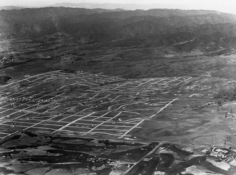
| (1922)^ - Aerial view overlooking Westwood. Photo dated: 1922. |
Historical Notes Westwood and UCLA were developed on the lands of the historic 'Wolfskill Ranch', a 3,000-acre parcel that was purchased by Arthur Letts, the successful founder of the Broadway, and Bullock's department stores, in 1919. Upon Arthur Lett's death, his son-in-law, Harold Janss, vice president of Janss Investment Company, inherited the land and started to develop the area in 1922.*^ Click HERE to see more of Westwood and UCLA in Early Views of UCLA. |
 |
|
| (ca. 1925)^ - View of part of the old Wolfskill Ranch, also known as the Rancho San Jose de Buenos Aires. The house, shown here on the extreme left, occupied the present corner of Wilshire Boulevard and Beverly Glen, and UCLA occupies part of the rancho. |
Historical Notes Rancho San Jose de Buenos Ayres remained intact until John Wolfskill's death in 1913, the last of the ranchos to do so. In 1919 the Wolfskill heirs sold much of the rancho to Englishman Arthur Letts, of The Broadway and Bullock's fame. A huge $2 million investment. He planned to subdivide and develop the northern portion into estates, but died without being able to realize his vision.^#^ |
.jpg) |
|
| (1922)* - Aerial view of Westwood and surrounding area looking north. Santa Monica Boulevard runs horizontally at bottom of photo while a tree-lined Wilshire Boulevard runs from left to right at center. Beverly Glen, not yet constructed here, will run from lower-left, under Santa Monica Boulevard bridge, up north to the Wolfskill ranch house (seen at center-left) on Wilshire Boulevard. |
Historical Notes The view above, from about the time of the Letts purchase, shows the land with the Wolfskill ranch house (center left), located on what is today the northwest corner of Wilshire Boulevard and Beverly Glen. |
.jpg) |
|
| (1922)^ - Three men with plans in hand examine the area to become Santa Monica Boulevard. Taken in 1922, the photo also shows a billboard announcing Westwood, now open, by Janss Investment Co., in addition to the sign reading, "New 50 Foot Boulevard Starts Here." |
Historical Notes Harold Janss of Janss Investment Company, Arthur Letts son-in-law, was more interested in middle-class homes, as opposed to estates. He started with the southern part of the parcel, diverted the springs into underground pipes, filled in the streams and platted 1,000 home and business lots in a development he named Westwood Hills. "Janss Investment Company" was stamped repeatedly in the wet concrete of the sidewalks. It was known as a "country district". Many families bought three house lots, particularly south of the P.E. tracks, where they were cheaper, using the extra space to grow vegetables and raise chickens and rabbits. Some wealthier homeowners added a tennis court to one extra lot and a swimming pool to the other. Homes had fireplaces for heat and backyard incinerators for trash. With rising land prices after WWII, most of these extra lots were sold off for new houses. One can still notice the pattern in the ages of the homes. Model homes were built, the usual CC&R's were added, including, as well as the racial ones, the restriction of architecture styles to English, Spanish or Mediterranean, and lots offered for sale as early as 1922. Westwood Village, very large home lots and UCLA will be developed in 1928-29 north of Wilshire.^#^ |
 |
|
| (1924)^ - View of the new development reaching from Wilshire on the north to Pico on the south and from Westwood Blvd on the west to Fox Hills Drive on the east, with a further small section running SW from Patricia and Pico. |
Historical Notes The large empty parcel, upper left, within the platted area is the Wolfskill ranch house, on the P.E. route, at the T-junction with Overland Ave, standing alone on twenty-five plus acres. The Harold Lloyd Motion Picture Company's Westwood studio ranch occupied this site a bit after this photo was taken. The northern portion was sold off to build the Saint Paul the Apostle RC church and school circa 1930. Lloyd's declining fortunes caused him to sell the rest to the LDS church in 1937. The church finally built the LDS Temple there in 1956. The area immediately to the east of Fox Hills Drive, once Tom Mix' ranch, will become the present home of 20th Century Fox Studios, stretching from Pico on the south, where it forms a T-junction with Motor Ave. to Santa Monica Blvd on the north. The northern half of the studio will become Century City in the early 1960s. The Los Angeles Country Club, at its third home since 1911, is above the future home of Fox Studios and slightly to the east. Rancho Country Club, taking up the lower quarter of the photo will become Rancho Park Recreation Center and Cheviot Hills Park, to the west of Motor Ave, and Hillcrest Country Club to the east. Beverly Hills and the Beverly Hills Oil Field are on the right margin.^#^ |
Click HERE to see more in Early Views of UCLA |
* * * * * |
Bel-Air
 |
|
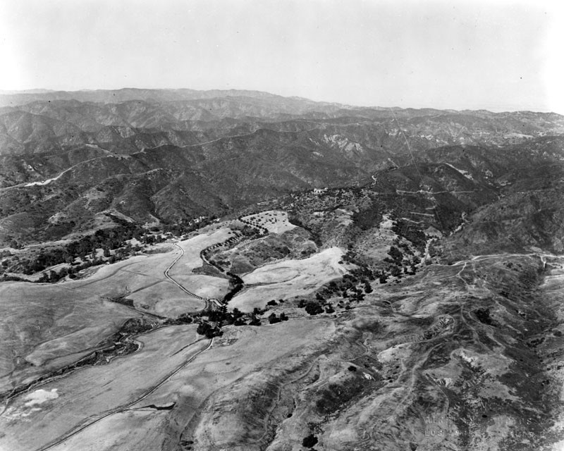
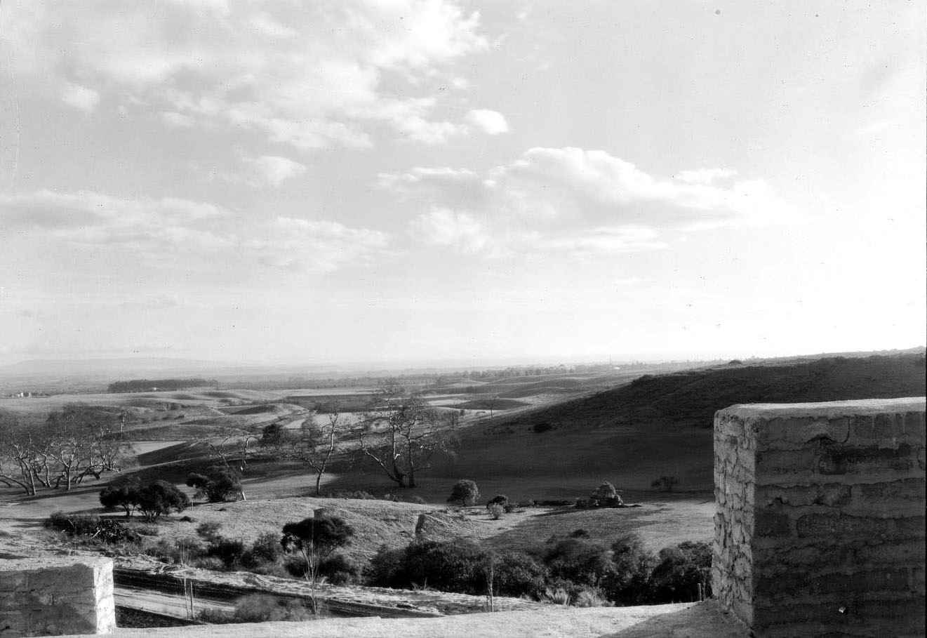
| (1922)^ - Aerial view looking northeast showing a very undeveloped area of land which would become Bel-Air, with the Santa Monica Mountains in the background. Spence Airplane Photos |
Historical Notes The community of Bel-Air was founded in 1923 by Alphonzo Bell. Bell owned farm property in Santa Fe Springs, California, where oil was discovered. He bought a large ranch with a home on what is now Bel Air Road and then subdivided and developed the property with large residential lots. He also built the Bel-Air Bay Club in Pacific Palisades and the Bel-Air Country Club. His wife chose Italian names for the streets. She also founded the Bel-Air Garden Club in 1931. Bell was a native and lifelong resident of Los Angeles whose family had deep financial and historical ties to the area, and played a key role in the history and development of Southern California. He was the son of James George Bell, who established Bell Station Ranch (now the site of the City of Bell), in the Santa Fe Springs area in 1875, and of Susan Albiah Hollenbeck. His uncle, Ed Hollenbeck, who arrived in California in the 1850s, founded the First National Bank, created Los Angeles's public transportation trolley system, and developed eastern portions of Los Angeles County.*^ |
 |
|
| (1921)^ - An aerial view of the Bel Air district of Los Angeles. Shown are the Danziger, Bell and Chester Kent estates. |
Historical Notes On the undeveloped hillsides of original Bel Air in 1922, Alphonzo Bell built water and sewage pipes, installed underground electric and telephone lines, and planted thousands of trees along winding streets traversing the hilly terrain. *^ |
 |
|
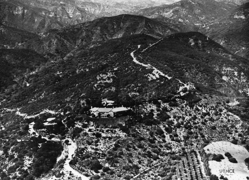
| (1927)^^ – A rural view from the home of Arthur S. Brent in Bel Air. A break in the stone fences in the foreground reveals the view of the thin, dirt road below. Small trees line the road while much larger trees stand in the open grass fields which blanket the rolling countryside as it extends into the distance. |
Historical Notes Alphonzo Bell refused to sell the original Bel Air allotments to anyone in the film business, though changed his mind with the arrival of the Great Depression. A design committee existed (and still exists to the present day) to preserve the “architectural harmony” of the community, with restrictions including low masses, horizontal lines, pitched roofs, and unobtrusive and harmonious colors, and deed restrictions required land purchasers to spend a minimum of $20,000 on home construction. *^ |
 |
|
| (1929)^ – View looking southeast as seen from the hills of of Bel-Air. Oil derricks can be seen in the distance, near where Centruy City is today. |
.jpg) |
|
| (1929^ - View looking southwest as seen from the hills of Bel Air with the new UCLA campus seen in the background. To the left of the campus can be seen trees being cultivated on UCLA property, later used for its own landscapping |
Historical Notes Bel-Air is situated about 12 miles west of Downtown Los Angeles and includes some of the foothills of the Santa Monica Mountains. It lies across Sunset Boulevard from the northern edge of the main campus of the University of California, Los Angeles. At the heart of the community sits the Bel-Air Country Club and the Hotel Bel-Air. *^ |
 |
|
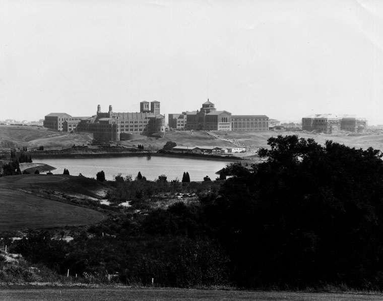
| (1930)* - A panoramic view of the UCLA Westwood campus, shortly after it opened in 1929. View is looking from the golf course of the Bel-Air Country Club. The body of water shown is the Sawtelle Reservoir. The twin towers of Royce Hall are seen in the middle of this photo. |
.jpg) |
|
| (1931)* – Right panel of a panoramic photo of Bel-Air. View is looking south showing the UCLA campus and Westwood in center-right. The large body of water is the Sawtelle Reservoir and the long two-story building behind it is Marymount High School. |
Bel-Air Country Club
 |
|
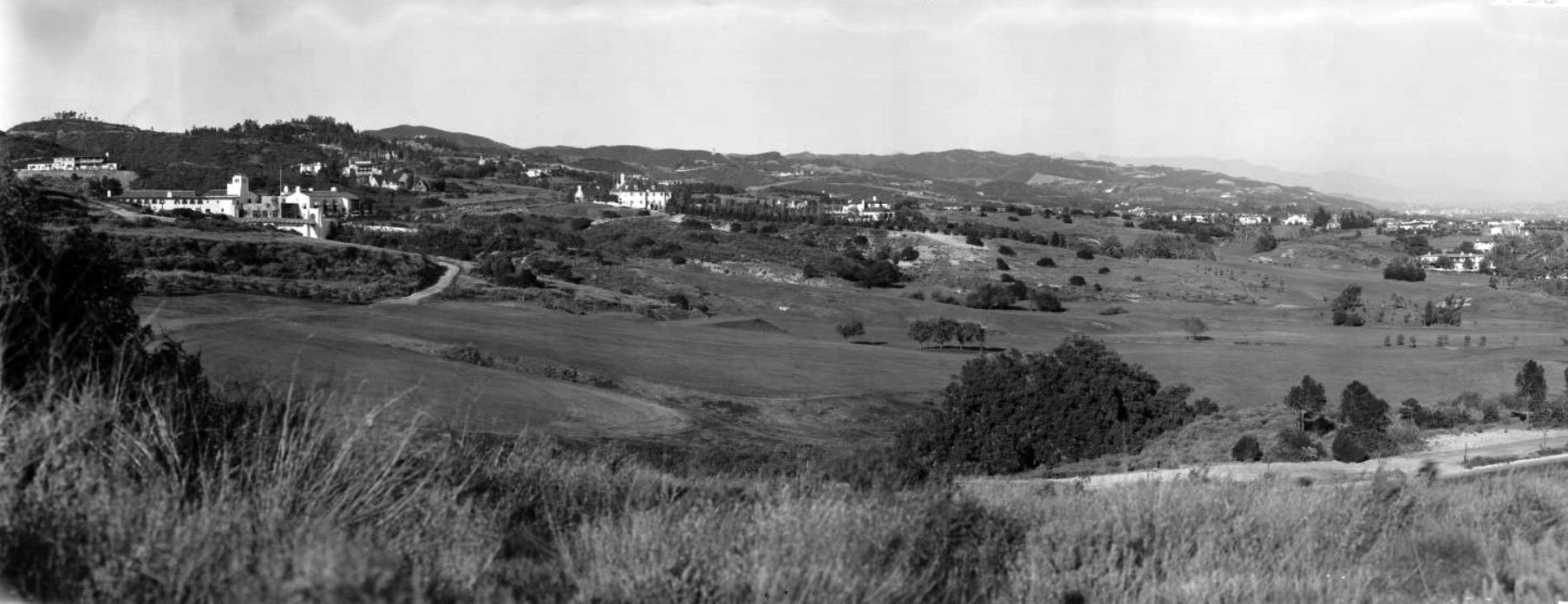
| (1931)* – Left panel of a panoramic photo of Bel-Air. View is looking northeast showing the Bel-Air Country Club on the left. |
Historical Notes The Bel-Air Country Club was started by Alonzo Bell as a social club. It inlcuded tennis courts and an 18-hole golf course designed by famed golf architect, George C. Thomasand (also designed the Riviera Country Club in 1927) . |
 |
|
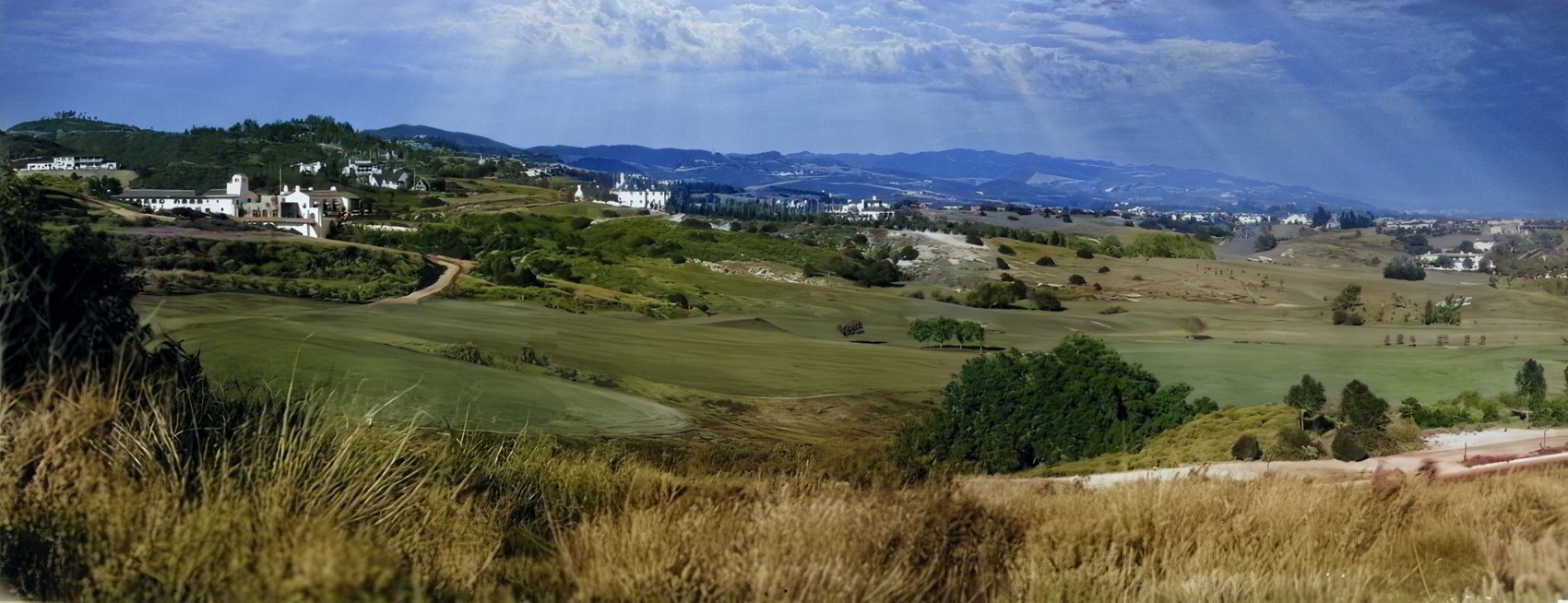
| (1931)* – Panoramic photo of Bel-Air. View is looking northeast showing the Bel-Air Country Club on the left. AI image enhancement and colorization by Richard Holoff |
 |
|
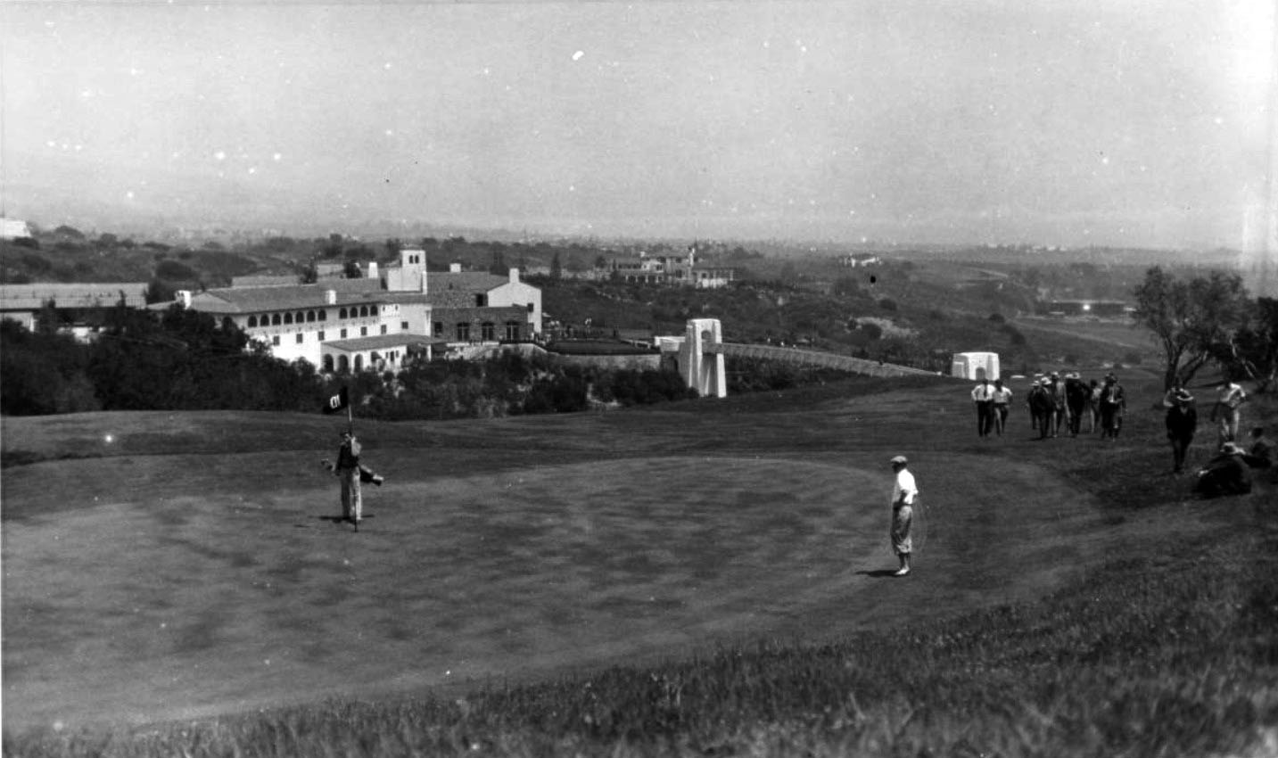
| (ca. 1930)^^ - Photograph of a panoramic view of a golf course at the Bel-Air Country Club. A caddie can be seen holding up a flag to the left of the center; the flag is labelled with a number "10". A man is observable to the right of the center, dressed in traditional golf clothes. A group of men is visible in the right side, either sitting on a hillside or appearing to be walking towards the sitting men; they are located just behind the first man. Further back to the left, a bridge can be seen that leads to the patio of a large house which is visible in the background. Additional large houses can be seen farther in the back sitting on a series of hills and surrounded by vegetation. |
Historical Notes Alonzo Bell incorporated the Bel-Air Country Club on May 8, 1925. The construction of the clubhouse and golf course was completed in late 1926. The now famous "Swinging Bridge" walkway over the ravine at hole no. 10 quickly became the Club's architectural landmark. *^ |
 |
|
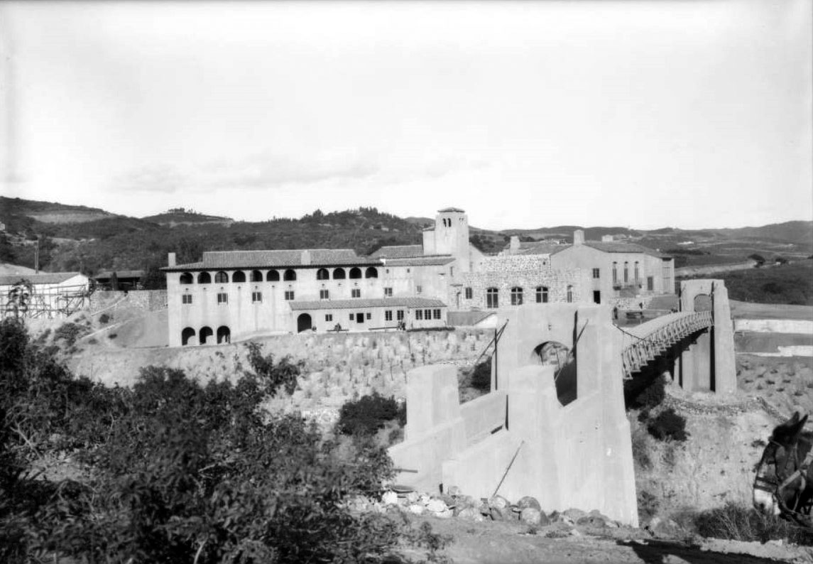
| (1926)^^ – Close-up view of the Bel-Air Country Club showing a bridge ("The Swinging Bridge") leading to the club house. |
Historical Notes Bell continued to own (and subsidize) the Bel-Air Country Club until 1940 when he transferred to the members of the club legal title to the property and improvements. He died in 1947, at age 72. *^ |
 |
|
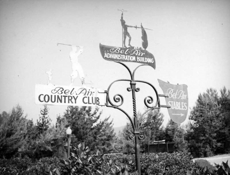
| (ca. 1937)^ - Decorative signs point the way to Bel-Air Country Club, Bel-Air Administration Building, and Bel-Air Stables. |
 |
|
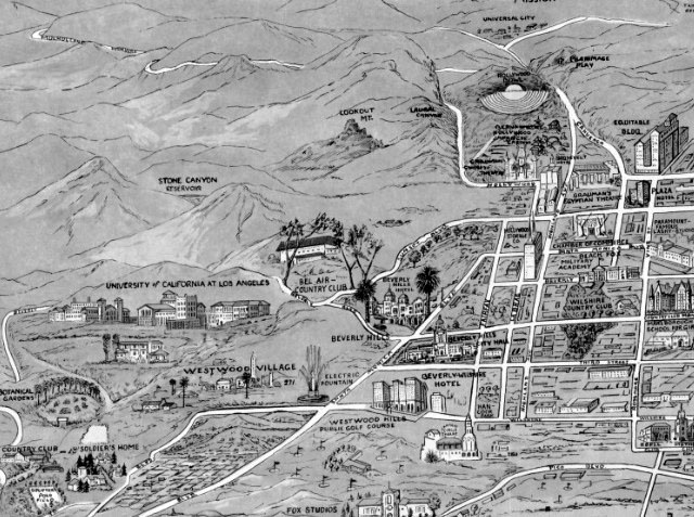
| (1932)**++ - Map showing Bel-Air, Bel-Air Country Club (center of photo) and adjacent communities. |
Historical Notes Together with Beverly Hills and Holmby Hills, Bel-Air forms the Platinum Triangle of Los Angeles neighborhoods. |
Bel-Air Sunset Gate Entrance
 |
|
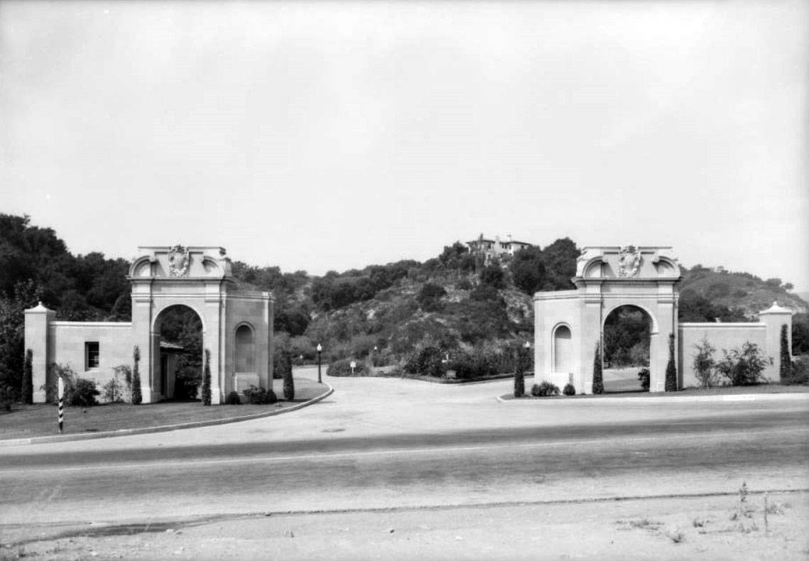
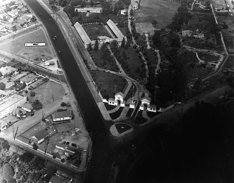
| (1932)^^ – View showing the newly contsructed Sunset Gate (aka West Gate) entrance to Bel-Air, 10951 Sunset Boulevard. Click HERE to see contemporary view. |
Historical Notes Of several entrances, there are two main ones: (1) the East Gate at Beverly Glen and Sunset Boulevards and (2) the West Gate at Bellagio Drive of UCLA and Sunset Boulevard (seen here), opposite an entrance to UCLA. Bel Air is generally subdivided into three distinct neighborhoods: East Gate Old Bel Air, West Gate Bel Air, and Upper Bel Air.*^ |
 |
|
| (1932)^^ – Profile close-up view showing the Sunset Gate (aka West Gate) at Bellagio Drive and Sunset Boulevard. |
Then and Now
 |
|
| (1932 vs. 2021)* - Sunset Gate (aka West Gate) at Bellagio Drive and Sunset Boulevard. |
Bel-Air East Gate Entrance
 |
|
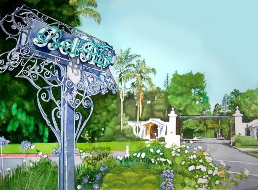
| (2016)*^ – View showing the East Gate entrance to Bel-Air at Beverly Glen and Susnet Boulevards. Photo by Socccal |
 |
|
| (2016)* – East Gate entrance to Bel-Air at Beverly Glen and Susnet Boulevards. Watercolor by Cecily Willis |
* * * * * |
Lincoln Park (Eastlake Park)
 |
|
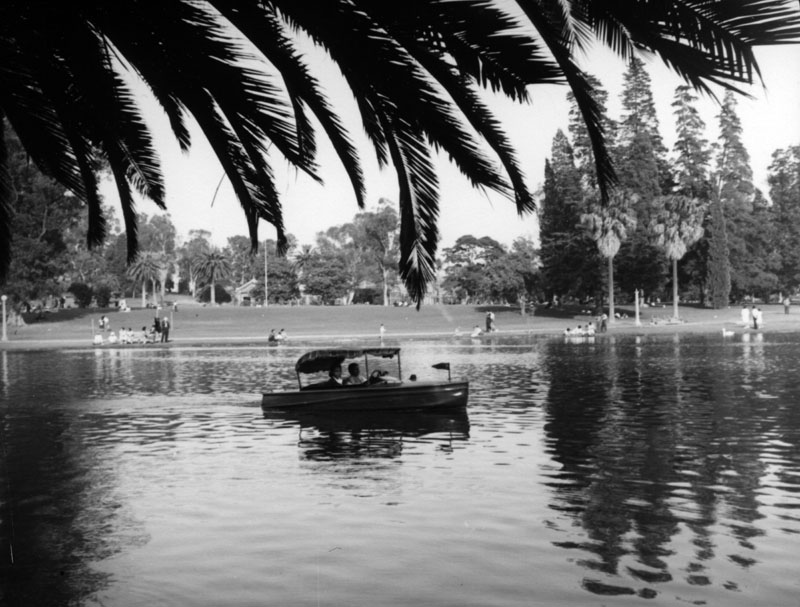
| (Early 1920s)^ - A couple can be seen relaxing and enjoying a nice sunny day as their canopied boat floats across Lincoln Park (Eastlake Park) lake, its surface giving a lovely reflection of the trees in the surrounding area. Several people can be seen on shore at the other end of the lake. |
Historical Notes Lincoln Park was originally created by the City of Los Angeles in 1881, from land donated by John Strother Griffin. It was one of Los Angeles' first parks. It was originally called East Los Angeles Park. By 1901 it had become a major amusement center for the people of Los Angeles, and it was at this time that the name was changed to Eastlake Park. On May 19, 1917, the park was renamed Lincoln Park after Lincoln High School.^ |
 |
|
| (1924)^ - Aerial view of the Selig Zoo. The zoo's entrance is marked by the two arches (right of center), where N. Mission Road (running from upper left to lower center) meets Selig Place (running right center to lower center). This was originally opened as a private zoo in 1885 in downtown Los Angeles. |
Historical Notes In 1911 William Selig opened a zoo on the northern edge of Eastlake Park, and this became one of the main attractions; in 1914 a carousel was added, which drew 150,000 riders a year; and a short while later, an arboretum was erected on the premises that housed a large greenhouse (hothouse) with rare and exotic plants. On May 19, 1917, the City Council responded to a petition from nearby residents and renamed it Lincoln Park, named after Lincoln High School.^ On April 21, 1976 the carousel was designated Historic Cultural Monument No. 153 by the City of Los Angeles, but was destroyed just a few months later. Click HERE to see the LA Historic Cultural Monuments List. |
Click HERE to see more in Early Southern California Amusement Parks |
East Los Angeles
.jpg) |
|
| (1921)^ - Left panel of a panoramic photo of East Los Angeles, revealing the large agricultural fields that once existed throughout the community. The view is looking north from Whittier Blvd near Atlantic Blvd. A partial view of a billboard for Silverwood’s is seen to the right of this panel; the other half of the billboard can be seen on panel 2. |
Historical Notes East Los Angeles (also called East L.A.) is an unincorporated area in Los Angeles County, forming part of the East Los Angeles Region. It is located immediately east of the Boyle Heights district of Los Angeles, south of the El Sereno district of Los Angeles, north of the city of Commerce, and west of the cities of Monterey Park and Montebello.*^ |
.jpg) |
|
| (1921)^ – Center panel of a panoramic photo looking north from Whittier Blvd near Atlantic Blvd showing agricultural fields in East Los Angeles, with a small cluster of homes scattered in the background. A partial view of a billboard is seen to the left of this panel; the other half of the billboard can be seen in the previous photo. |
Historical Notes At the beginning of the twentieth century, East Los Angeles became a popular immigrant destination. In the early 1900s, Russians, Jews, Japanese, and Mexicans all had a significant presence in the area. Living east of the LA River and working in nearby factories, or traveling by electric rail into downtown Los Angeles, immigrants and their children helped fuel the prosperity of the growing metropolis. By the onset of World War II, East Los Angeles was a nearly exclusively Latino community, soon reinforced by Mexican workers who arrived to man the machines in the area's burgeoning war industries. Although the face of the city of Los Angeles and its surrounding communities has changed considerably, East Los Angeles has maintained this basic character throughout the last sixty years. ++^ |
.jpg) |
|
| (1921)^ - Right panel looking north from Whittier Blvd near Atlantic Blvd showing a wide open area of agricultural fields. |
* * * * * |
Hollywood
 |
|
| (1922)^ - Passengers getting on streetcar at Santa Monica Boulevard and Gower Street. |
 |
|
| (1922)^ - View of two streetcars running down the center of Santa Monica Boulevard near Western Avenue. |
 |
|
| (1920s)^ - View of Western Avenue looking north at its intersection with Santa Monica Boulevard. The Security Trust & Savings Bank Building is on the left hand side; billboards and businesses are across the street. Mt. Lee, tallest peak in the Hollywood Hills, can be seen in the distance. |
 |
|
| (1923)^ - View of the intersection of Western Avenue and Santa Monica Boulevard. Pedestrians are seen crossing the street despite the heavy traffic. Note the sporty roadster convertible heading north on Western Ave. |
 |
|
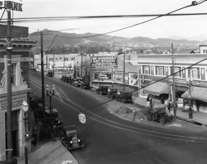
| (ca. 1924)^^ - View of Santa Monica Boulevard looking east toward Western Avenue, Hollywood. At left, the Security Trust & Savings Bank Building can be seen on the northwest corner of Western and Santa Monica. On the right, southwest corner, is the Taft Public Market. |
 |
|
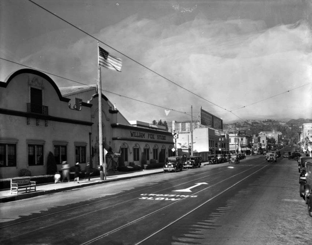
| (ca. 1924)^^ – View looking north on Western Avenue toward Sunset Boulevard. The front entrance to William Fox Studio is seen on the left. |
Historical Notes Between 1917 and 1924, William Fox Studio was firmly established at the expanded Dixon Studios in East Hollywood, at the junction of Sunset and Western. The site still houses an important part of the film-making process, being the home of Color by Deluxe - film processing and post-production company with strong ties to 20th Century Fox. Deluxe was first on the site in 1917.^*#^ |
 |
|
| (ca. 1923)^ - Bird's eye view looking west on Hollywood Boulevard at Cahuenga. The Hollywood Public Market can be seen in the top center of photo at the corner of Wilcox. In the distance can be seen the three-towered Christie Hotel. |
Historical Notes The eight-story Christie Hotel was considered Hollywood's first skyscraper when it opened in 1922. |
 |
|
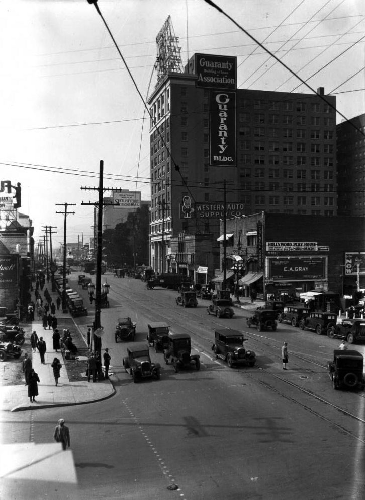
| (ca. 1923)^^ - View looking west on Hollywood Boulevard at Vine Street. Two-story buildings can be seen on both sides of Hollywood Boulevard, and the very tall, rectangular Guaranty Building can be seen at right at the northeast corner of Hollywood and Ivar. |
Historical Notes The 12-story Guaranty Building is a Beaux Arts office building built in 1923. It's currently owned by the Church of Scientology.*^ |
 |
|
| (1923)^ - View of Hollywood Boulevard at Cahuenga with traffic and pedestrians waiting to cross. The Security Trust & Savings Bank Building is on the left side of the photograph. In the distance is the Guaranty Building flying an American Flag. |
 |
|
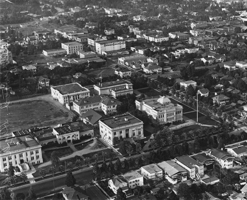
| (1922)^ - An aerial view of Hollywood High School from the southwest. There is practice of some kind on the athletic field. Palm trees line the campus on Sunset and Highland. The original 1905 building is on the bottom right. The Household & Fine Arts building is in the middle of the quadrangle and the gymnasium is to its left when facing Highland. |
Historical Notes The school with a student body of 2500 was three blocks from Charlie Chaplin's studio and six blocks from Mary Pickford's and Douglas Fairbanks' studios. The homes bordering the upper side of the campus were just condemned by the city to make room for additional buildings. The original 1905 building is on the bottom right, the Household & Fine Arts building is in the middle of the quadrangle, and the gymnasium is top, center.* |
 |
|
| (ca. 1922)^ - Looking west from Sunset Boulevard where it meets Highland Avenue. Hollywood High School can be seen on the northwest corner to the right. It was only six blocks from Mary Pickford's and Douglas Fairbanks' studios. |
 |
|
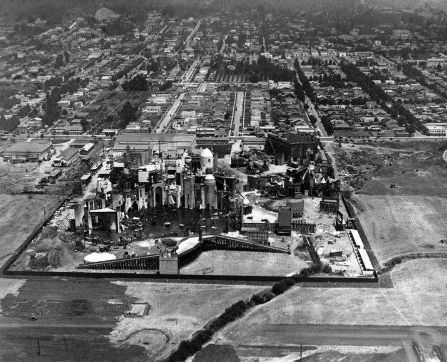
| (1923)+^^ - Aerial view of the Pickford-Fairbanks Studios located at the corner Santa Monica Boulevard and Formosa Avenue, showing the amazing set for Douglas Fairbanks’ “Thief of Bagdad”. Note all the open land surrounding the studio. |
Historical Notes This is the lot where Mary Pickford and Douglas Fairbanks established the Pickford-Fairbanks Studios in 1922, later to be renamed United Artists. It is still a studio lot, creatively entitled “The Lot.” +^^ Click HERE to see more early views of the Pickford-Fairbanks Studios. |
 |
| (1925)^^ - View of Hollywood looking north from Rossmore and Rosewood avenues showing Vine Street from Rossmore's north turn near Melrose Avenue. In the distance is the “Hollywoodland” sign. At top center-left can be seen the Mulholland Dam shortly after it was completed (Dec. 1924). |
Historical Notes Rossmore turns into Vine Street north of Melrose Ave in Hollywood. Vine Street is so named because it went through the vineyard of 1880s US Senator Cornelius Cole. Rossmore was named after Miracle Mile's developer, A.W. Ross. ##*# |
 |
|
| (ca. 1925)^^ - View of Vine Street looking north from Barton Avenue towards the Hollywood sign. |
 |
|
| (ca. 1925)^^ - Panoramic view of Hollywood looking north on Vine Street from Clinton Street. Residential blocks full of one-story houses fill the foreground, turning into high rise hotel buildings as Vine Street approaches the mountains. A single “H” as well as the “Hollywoodland” sign are visible. A small section of the Mulholland Dam is visible at left. |
Historical Notes The Mulholland Dam, built in 1924, can be seen at left-center. The dam still exists today but can no longer be seen from this view or from just about anywhere in Hollywood. Click HERE to see more in Mulholland Dam and Hollywood Reservoir. |
 |
|
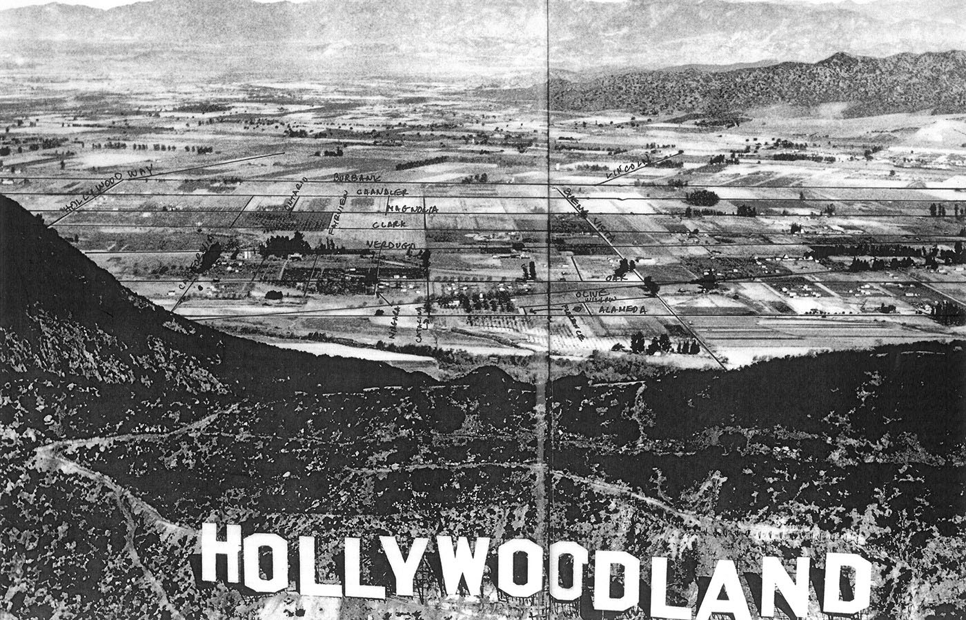
| (ca. 1920s)**^** - Aerial view of the Hollywoodland Sign showing the newly developed land in the foreground. Beyond the Hollywood Hills can be seen the vast amount of open space and farmland of the San Fernando Valley. The HOLLYWOODLAND sign sits below Mt. Lee. Another sign ( just the letter 'H') is seen to the left on top of Mt. Cahuenga. |
Click HERE to see more in Early Views of Hollywood (1920 +) |
 |
|
| (ca. 1924)^* - Aerial view overlooking the Hollywood Hills and HOLLYWOODLAND sign into Burbank in the east San Fernando Valley. Farmland and open fields can be seen throughout. |
 |
|
| (ca. 1924)^#^ - Panoramic look over the “Hollywoodland” Sign and over the ridge of the Hollywood Hills showing a detailed view of Burbank with streets annotated. Note the vast amount of farmland and open fields. |
Click HERE to see more in Early Views of the San Fernando Valley |
Vermont and Manchester (1920 - 1945)
 |
|
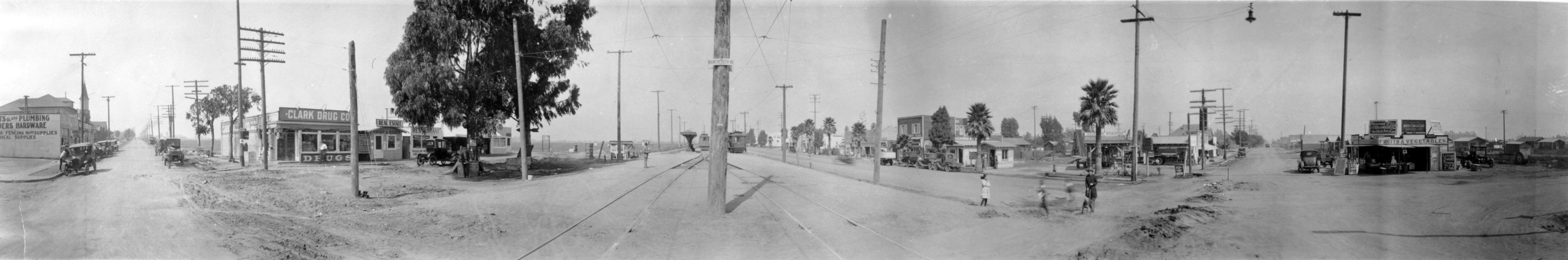
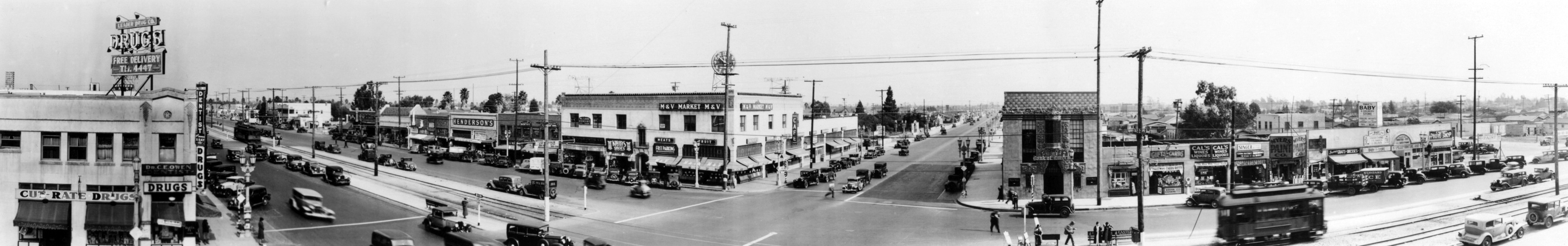
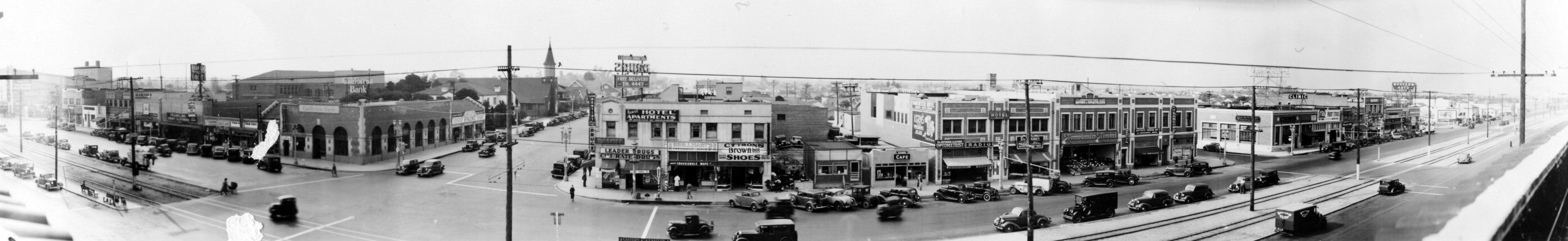
| (1920)* - Panoramic photo of the intersection of Vermont Avenue and Manchester Avenue. |
 |
|
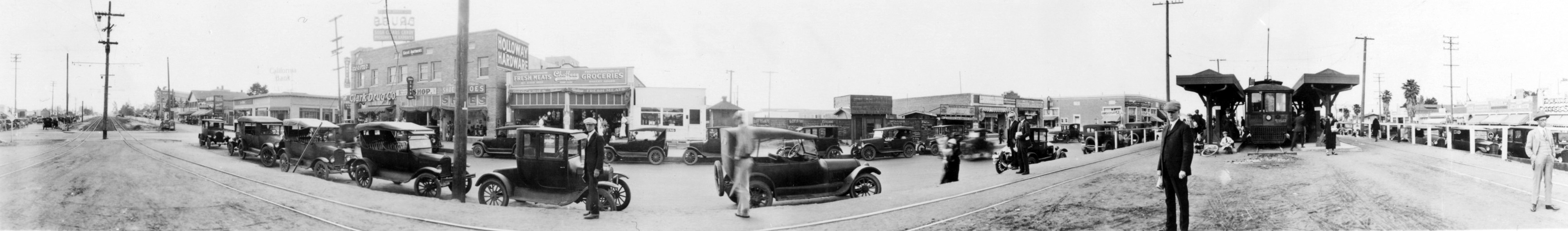
| (1925)* - Panoramic photo of the intersection of Vermont Avenue and Manchester Avenue. |
 |
|
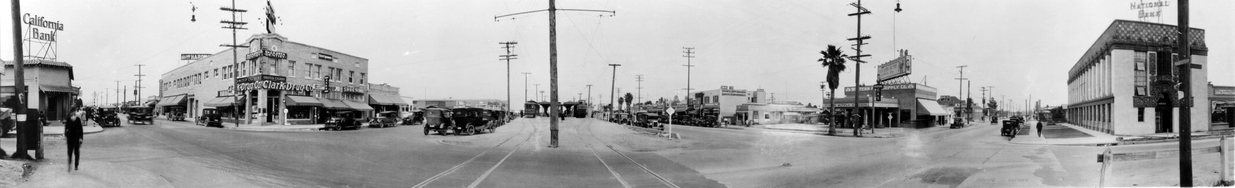
| (1930)* - Panoramic photo of the intersection of Vermont Avenue and Manchester Avenue. |
 |
|
| (1935)* - Panoramic photo of the intersection of Vermont Avenue and Manchester Avenue. |
 |
|
| (1940)* - Panoramic photo of the intersection of Vermont Avenue and Manchester Avenue. |
John Muir Junior High School
.jpg) |
|
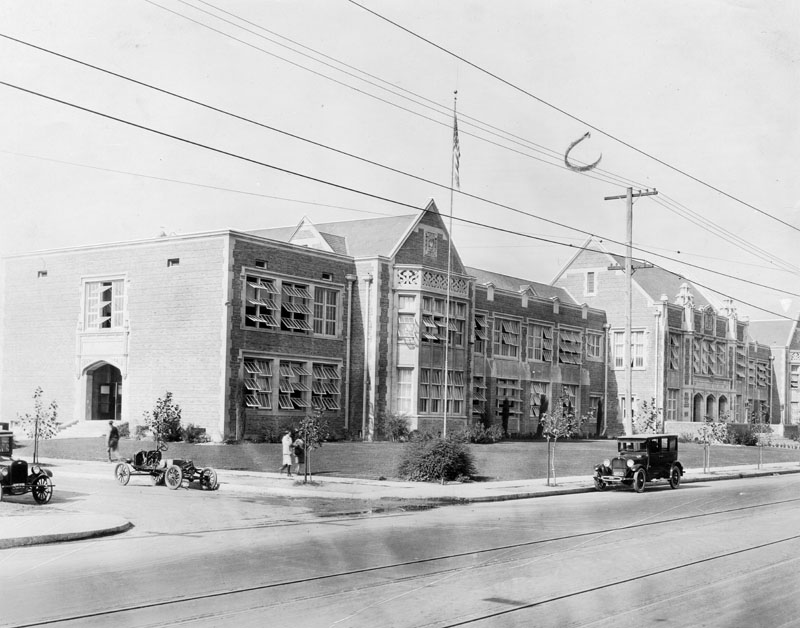
| (1920s)* - Aerial view of Muir Junior High School taken from the east. |
Historical Notes John Muir Junior High School, located at 5929 S. Vermont Avenue and 62nd Street, was built in 1922 and named for American conservationist John Muir. It served as a junior high school for approximately 72 years, from 1922 to 1994. In September 1994, the school was reconfigured to serve grades 6-8 and renamed John Muir Middle School.* |
 |
|
| (1920s)* - Front view of John Muir Junior High School. The sprawling school shows numerous windows, partly opened, and a nicely manicured lawn with young trees planted along the front sidewalk. Three people can be seen walking along the side of the building, probably 62nd Street, and three antique cars are parked on the street. |
 |
|
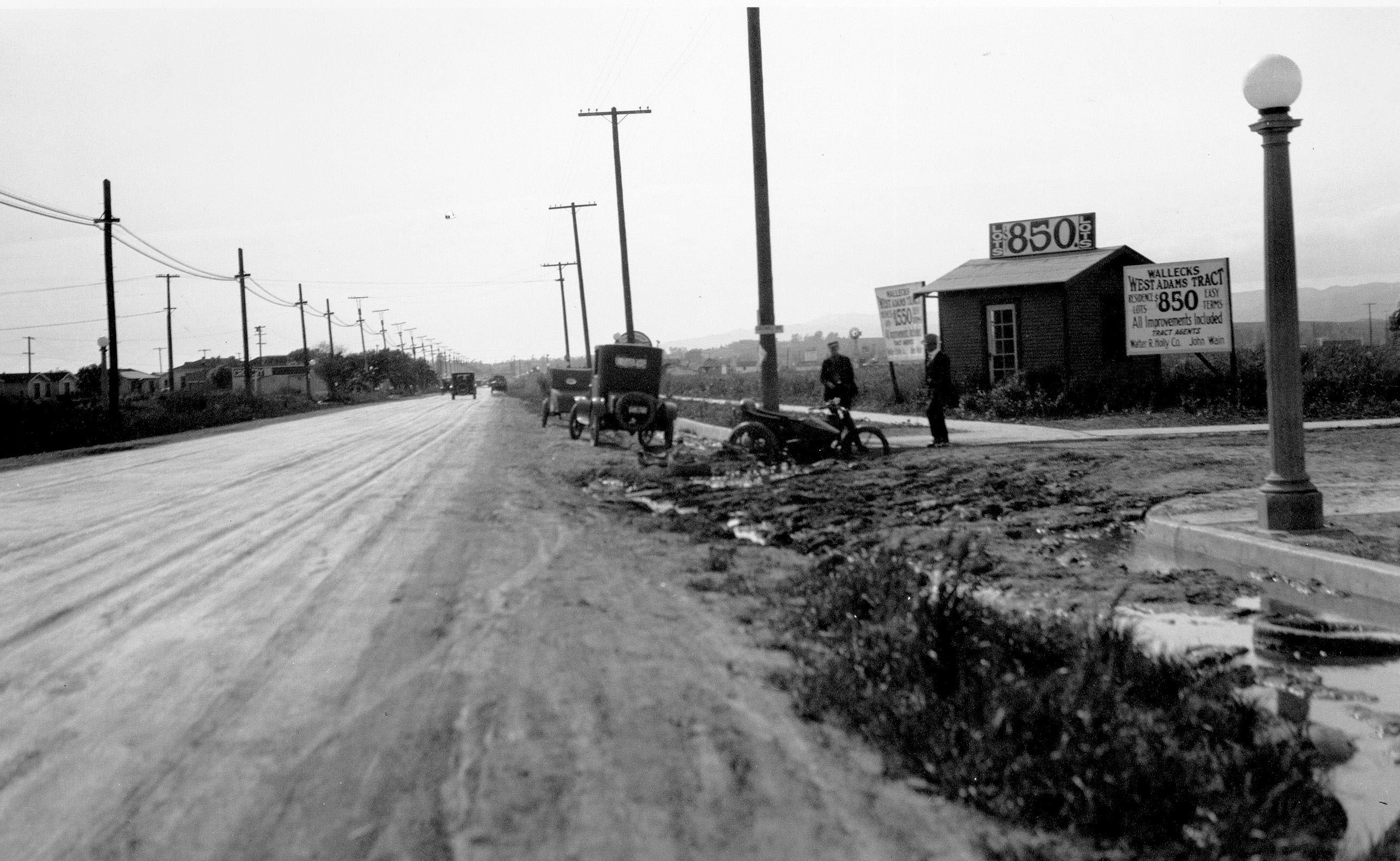
| (1923)^^ - Motorcycle stuck in mud at intersection of West Adams Boulevard and Caldwell Avenue (now Ridgley Drive). Real estate sign behind them reads: WALLECKS WEST ADAMS TRACT - LOTS $850 - EASY TERMS. |
 |
|
| (1923)^ - View of the intersection of 4th and Main streets. Passengers are making their way onto a streetcar on Main Street (lower left) while pedestrians are seen crossing 4th Street. The ornate Classical Revival style Farmers and Merchants Bank of Los Angeles stands on the southwest corner. |
Historical Notes The Farmers and Merchants Bank was the first incorporated bank in Los Angeles, founded in 1871 by 23 prominent Los Angeles businessmen. The three largest subscribers were Isaias W. Hellman, former California Governor John G. Downey, and Ozro W. Childs who in later years became the founders of the University of Southern California. Other investors included Charles Ducommun, I.M. Hellman and Jose Mascarel. Downey was named the first president. Isaias later served as president of the bank till his death in 1920.*^ |
Adams and Figueroa
 |
|
| (1923)^^ - View looking northeast from the balcony of the Dining Room at the Automobile Club Building, showing congestion at the intersection of Adams and Figueroa. The empty lot on the northwest corner is where the St. Vincent Church would be built the next year. |
 |
|
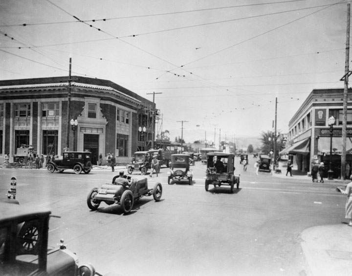
| (1923)^ - View looking South on Figueroa Street near Adams Blvd. There is heavy traffic in both direction. The Automobile Club of Southern California is seen on the southwest corner. Across the street (n/w corner) is the construction site for the new St. Vincent Church. |
Historical Notes With nearly 70,000 cars passing through each day, the intersection of Adams and Figueroa was the busiest in the United States in the early 1920s .*+* |
 |
|
| (1923)+^^ – View looking north on Figueroa Street at Adams Boulevard. At the N/W corner can be seen part of the construction site for the St. Vincent Catholic Church. At the center of the intersection is an odd looking device. It was an experimental traffic signal called “American Bobby”. |
 |
|
| (ca. 1924)^.^ - View looking west on Adams at Figueroa showing the Automobile Club Building on the left and the St. Vincent de Paul Roman Catholic Church under construction on the right (NW corner). Click HERE for contemporary view. |
 |
|
| (ca. 1924)^ - A construction fence and temporary buildings surround the St. Vincent Catholic Church, 621 W. Adams Blvd., as it is being built. Scaffolding is on the dome and sides. Limestone blocks for the facade lie on the ground in front of the entrance. The surrounding neighborhood has stately homes with extensive grounds. |
Historical Notes The St. Vincent Catholic Church was built in the 1920s and designed by architect Albert C. Martin, Sr. Dedicated in 1925, it was located in what was then one of the wealthiest sections of the city, on land adjacent to the Edward Doheny Mansion and Stimson House. It was the second Roman Catholic church in Los Angeles to be consecrated.*^ |
 |
|
| (ca. 1925)^ - View of a newly completed St. Vincent Catholic Church located at the northwest corner of Adams and Figueroa St. The shadow in the foreground is that of the Automobile Club Building across Adams. |
Historical Notes St. Vincent de Paul Roman Catholic Church was a gift from oil magnate and benefactor Edward Laurence Doheny I, who drilled Los Angeles' first oil well in 1892.^ In 1971, Saint Vincent de Paul Church was dedicated Los Angeles Historic-Cultural Monument No. 90 (Click HERE for complete listing). Click HERE to see more Early Views of the St. Vincent Catholic Church. |
 |
|
| (1926)^ - Figueroa Street looking northwest toward West Adams Boulevard. On the left is the Automobile Club of Southern California and St. Vincent Catholic Church. |
Historical Notes The building pictured here originally served as the Auto Club's main office. It was built between 1922-1923 by architects, Sumner P. Hunt, Silas R. Burns, and Roland E. Coate in the Spanish Colonial Revival style. Today, this building serves as the Los Angeles district office, but the administrative offices are now located in Costa Mesa.^ |
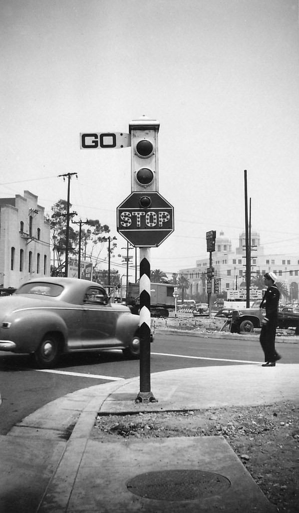
Early LA Traffic Signals (American Bobby)
 |
|
| (ca. 1924)^ - Exterior view of the Automobile Club of Southern California, located at 2601 S. Figueroa St. on the southwest corner of Adams and Figueroa. Three cars can be seen waiting for the unuusal looking traffic signal (located in the center of the intersection) to change. |
Historical Notes The Automobile Club of Southern California was once responsible for producing state road maps, as well as posting thousands of porcelain-to-steel traffic signs throughout the state to create a uniform signing system - which it continued to do until the task was taken over by the State of California in the mid-1950s.^ The Automobile Club Building was designated LA Historic-Cultural Monument No. 72 (Click HERE to see complete listing). |
 |
|
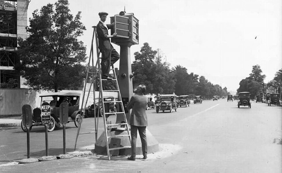
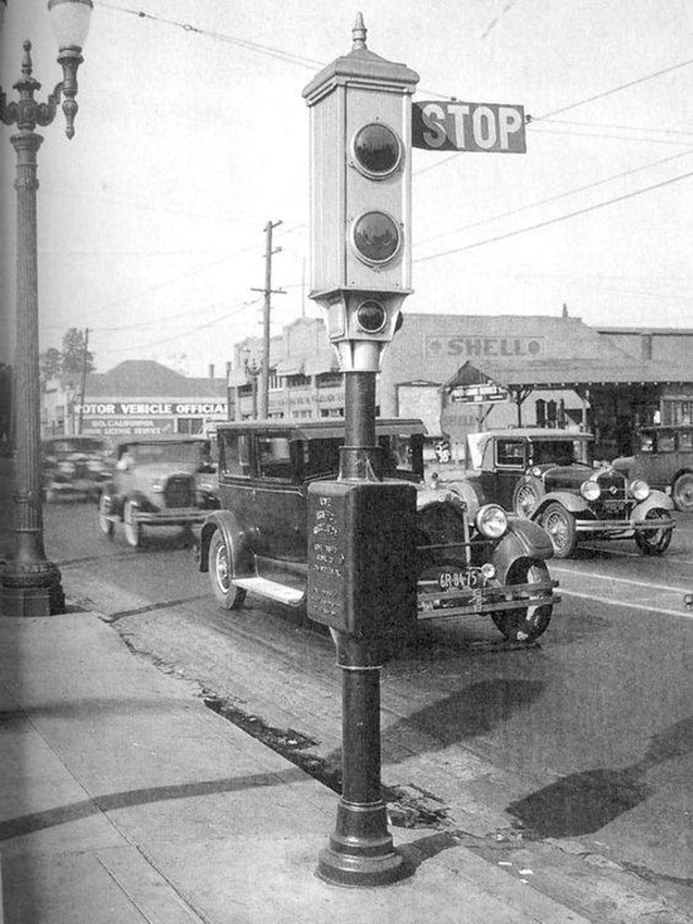
| (ca. 1924)* – View showing a man on a ladder making adjustments to an experimental traffic signal situated in the middle of the intersection of Adams and Figueroa, near the Automobile Club (out of view). Photo Courtesy of the Automobile Club. |
Historical Notes Los Angeles experimented by placing signals in the middle of a few of its busiest intersections. Nicknamed the “American Bobby” since it stood in the same place as a London traffic control officer, the new signal stood high atop a tall stanchion. Its location in the center of the intersection may have presented a traffic hazard, but the red and green lights, which replaced the unreliable semaphore arms, were easily visible to motorists in all four directions. In May 1924, the Automobile Club of Southern California installed one of the first American Bobby signals—pictured above in a photo from the Auto Club Archives—outside the club headquarters at Adams and Figueroa. |
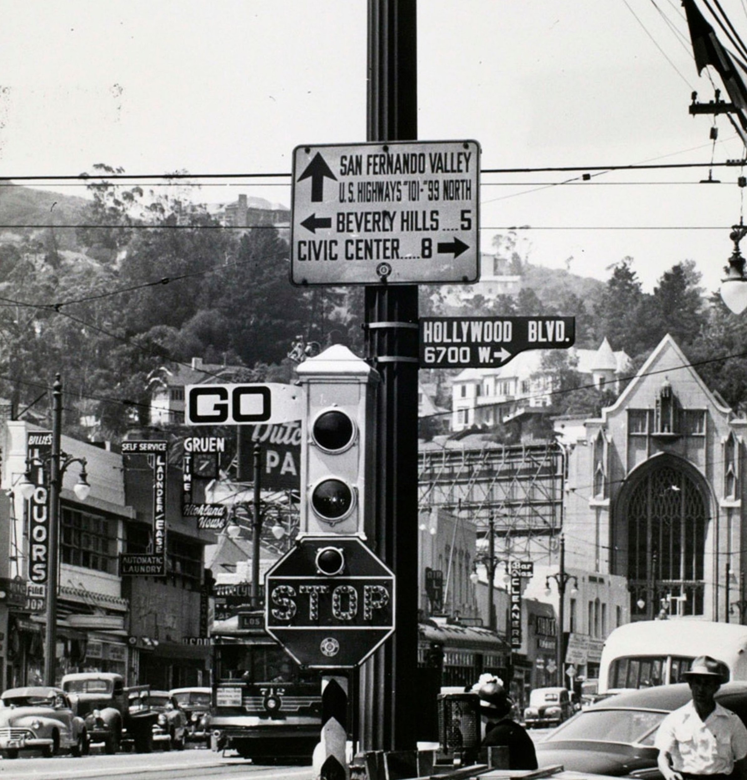
ACME Semaphore Traffic Signal
 |
|
| (ca. 1925)* – Looking east on 5th Street at Hill Street showing a newly installed semaphore traffic signal on the SW corner. |
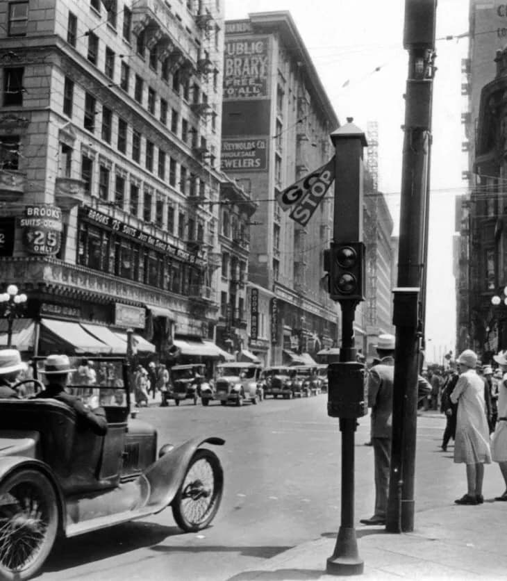
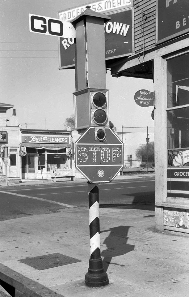
Historical Notes The semaphore traffic signal was invented in 1917 by Frank J. Husbands. In 1920, the first installation in Los Angeles of this type traffic regulator was made at five intersections along Broadway between Third and Seventh Streets. The new signals were a success. Over 800 intersections throughout the city were equipped with the new devices first being Acme Type Four and later Type Five. In 1931 tricolor lights were first installed along Wilshire Boulevard. After that year, no more semaphore signals were installed. They were slowly phased out with the last Acme removed in December of 1956. |
 |
|
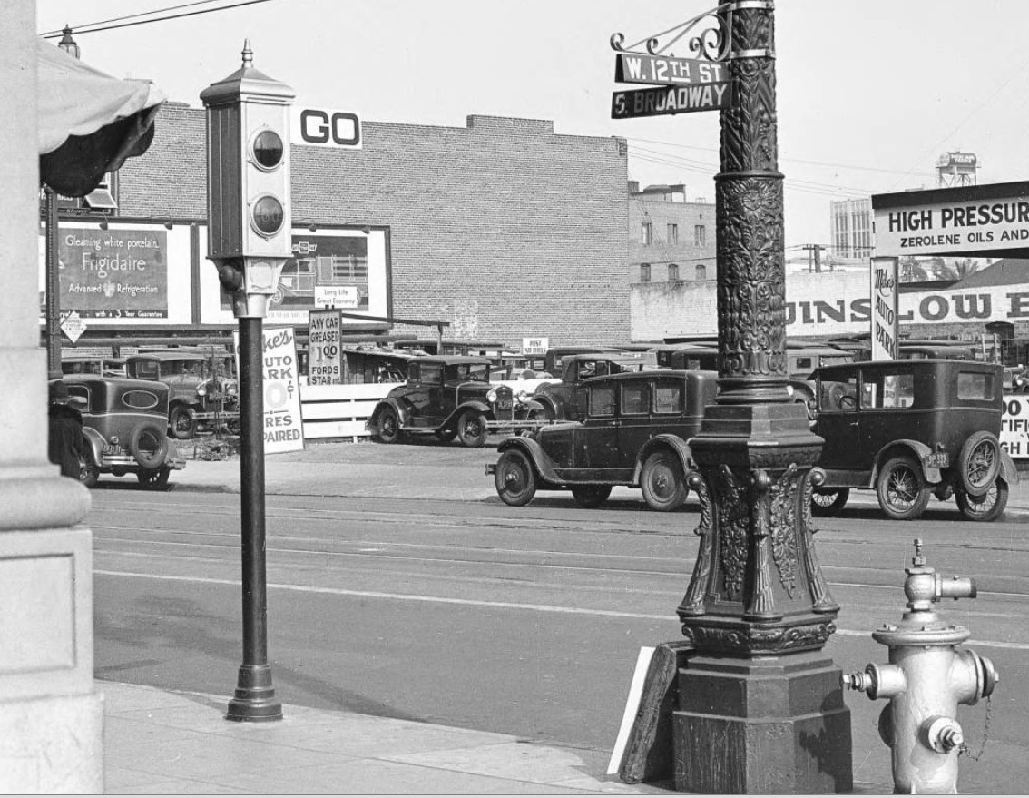
| (1920s)* - An Acme Semaphore traffic signal stands on the corner of Broadway and 12th Street in downtown Los Angeles. |
Historical Notes These early signals, manufactured by the Acme Traffic Signal Co., paired "Stop" and "Go" semaphore arms with small red and green lights. Bells played the role of today's amber or yellow lights, ringing when the flags changed—a process that took five seconds. |
 |
|
| (ca. 1928)* - Semaphore traffic light somewhere in Los Angeles. |
 |
|
| (ca. 1950)*– View showing a semaphore traffic signal (Type Four) located on North Figueroa at Avenue 26 in Lincoln Heights. Note the Auto Club Logo on the stop sign hawking back to the era when the club posted all road signage around California. |
 |
|
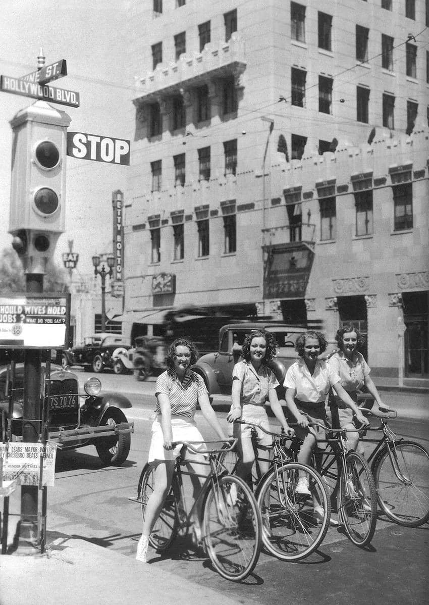
| (1933)* - Girls on bikes stopped by the semaphore traffic signal on the NW corner of Hollywood and Vine. |
Historical Notes Note the advertisement in front of the semaphore traffic signal: "Should Wives Hold Jobs"...a sign that things were changing. |
 |
|
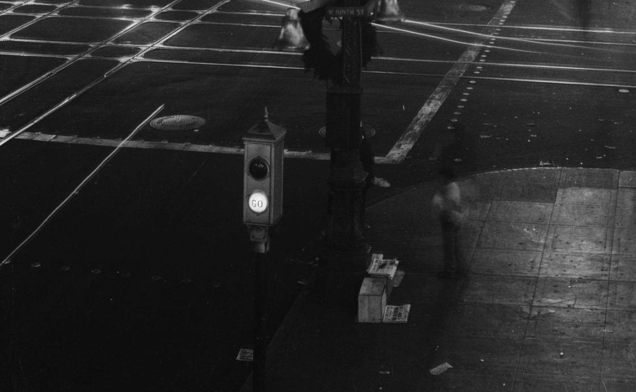
| (ca. 1938)* - Nightime view of Ninth Street and Broadway showing a Semaphore Traffic Signal at one of the corners. |
 |
|
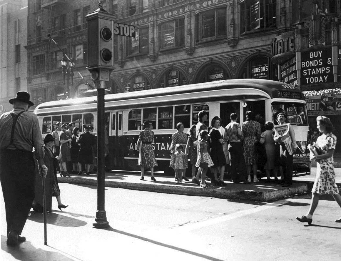
| (1942)* - A streetcar stops in front of Lowe's State Theatre at Broadway and 7th Street in downtown L.A. A semaphore is seen on the corner in the foreground. |
 |
|
| (1940)* – View showing an Acme Semaphore Traffic Signal located on the SE corner of Hollywood and Vine. On the right is an Owl Drug Co Store located on the ground floor of the Taft Building. |
 |
|
| (1943)* - A man in a suit seems to be measuring the height of a sign attached to a streetlight post at the inersection of Hollywood and Vine with a semaphore traffic signal seen to the left. |
Historical Notes The Acme semaphore traffic signals at Hollywood and Vine represent a historical aspect of Los Angeles traffic management before the adoption of modern traffic lights. This significant intersection, known for its cultural and historical importance since the 1920s, was a bustling hub for the entertainment industry. The semaphore signals featured red and green lights to control traffic during the day, with a flashing yellow light at night to indicate caution and manage flow during off-peak hours. These signals allowed for dynamic responses to changing traffic conditions and could be manually adjusted in emergencies. Although no longer in use, the Acme semaphore signals played a crucial role in shaping early traffic management practices in Los Angeles, reflecting the city's evolution in urban infrastructure as it adapted to increasing vehicle volumes and safety standards. |
 |
|
| (1940s)* - A couple of starlets posing in front of a semaphore traffic signal at Hollywood and Vine. |
 |
|
| (1942)* – View showing a STOP/GO semaphore traffic signal (Type Five) at the corner of Sunset and Vine in the heart of Hollywood, with what looks like a half-chewed stop sign at the bottom, and a glimpse of Wallichs Music City in the background. |
 |
|
| (ca. 1942)* – View looking toward the Terminal Annex Building showing an Acme Semaphore Traffic Signal standing on the southeast corner of Marchessault and Los Angeles streets. To the left is the eastern face of the Plaza Substation building. Seen on the right is a sailor in uniform about to cross Los Angeles Street, heading toward the Plaza. Behind him, on the other side of the street, is where the old Water Department Building once stood. |
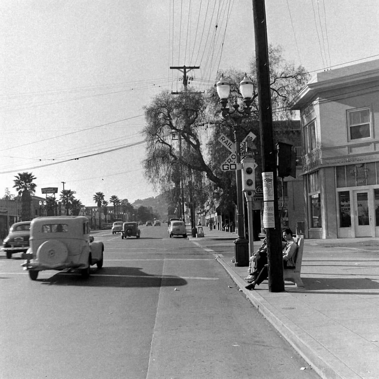 |
|
| (1948)* - Looking west on Sunset Boulevard at the Gardner Street showing a Semaphore traffic signal in front of a rail crossing. This is the Pacific Electric Red Car crossing known as Gardner Junction. |
Historical Notes Note the beautiful streetlight standing between the rail crossing and the semaphore traffic signal. This type of streetlight was called a "Western" Dual-Lamp Llewellyn Electrolier. |
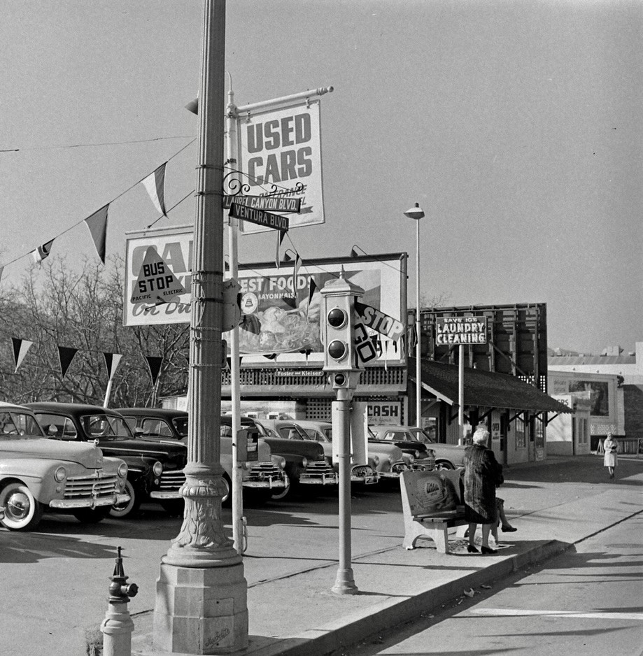 |
|
| (1948)* - Looking at the southwest corner of Ventura and Laurel Canyon boulevards in Studio City showing a semaphore traffic signal next to a bus stop. Today a CVS Pharmacy stands at the corner. |
 |
|
| (1950)* – View looking north from the southeast corner of Hollywood and Highland, with the Hollywood First Methodist Church visible in the distance. Note the semaphore traffic signal and the sign on the light post. |
 |
|
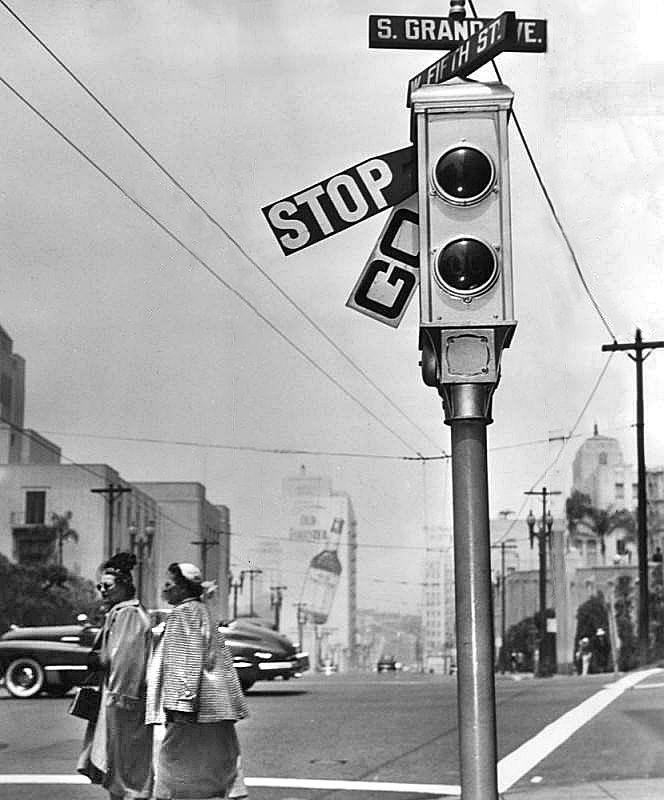
| (1950)* - A Semaphore traffic signal located at the corner of 5th Street and Grand Avenue. Photo: Herald Examiner |
 |
|
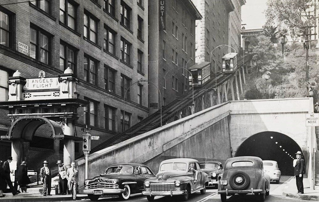
| (1950s)* - A semaphore traffic signal near the entrance of Angels Flight with the 3rd St. Tunnel on the right. |
 |
|
| (1956)* - Semaphore traffic signal at the corner of Sunset Boulevard and Spring Street in Downtown Los Angeles. |
 |
|
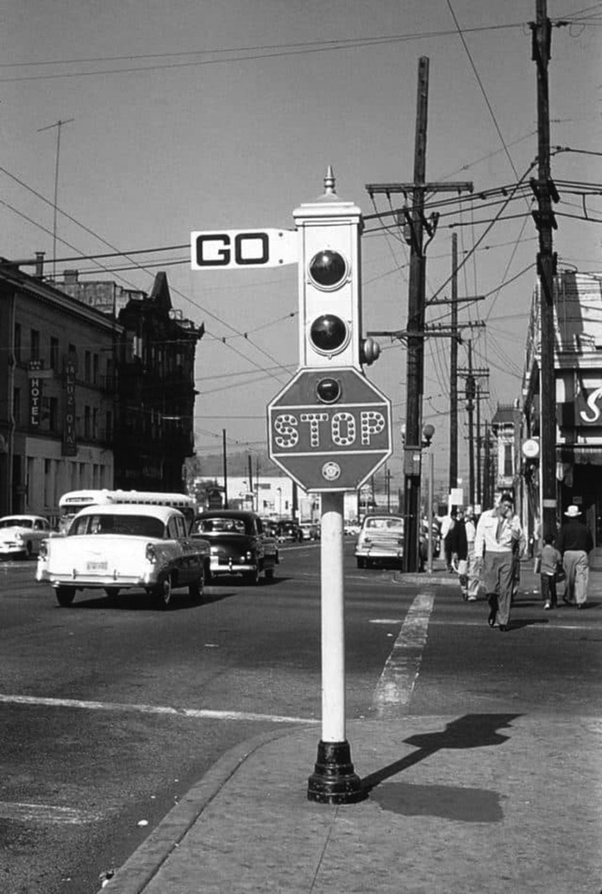
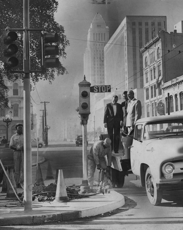
| (1956)* - Traffic officials Lloyd Rush, Arnold Kunody and Arthur Butz, watch workmen at Sunset and Main Streets removing a 1923-installed ACME Semaphore Traffic Signal. |
 |
|
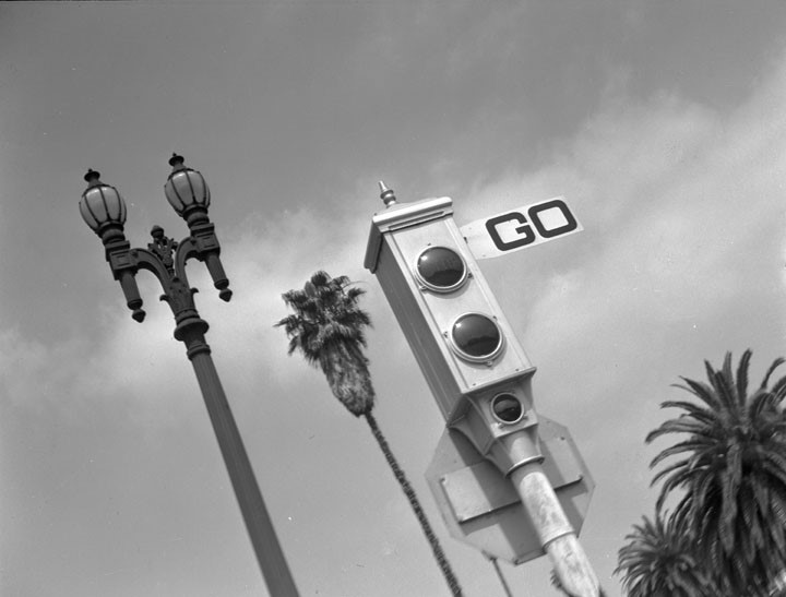
| (1937)^ - This photo in the Westlake area defines some of the qualities (good and bad) of Southern California: Ornate Streetlights, Palm Trees, and Traffic (signals). |
* * * * * |
Sunset and Figueroa
 |
|
| (1924)^ - View looking east toward the intersection of Sunset Boulevard and Figueroa Street. A Gilmore service station can be seen on the NE corner. The Orsini Apartment Complex is now situated at this site. |
Historical Notes The portion of Sunset Boulevard east of Figueroa Street was renamed Cesar Chavez Avenue in 1994 along with Macy Street and Brooklyn Avenue in honor of the late Mexican-American union leader and civil rights activist.*^ |
Then and Now
 |
|
| (1924 vs 2018)*– Looking east on Sunset Boulevard at Figueroa Street. |
Downtown
 |
|
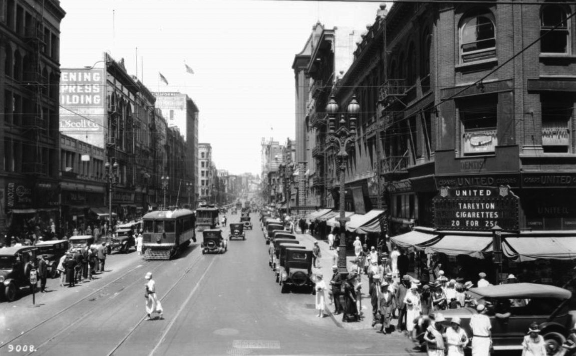
| (ca. 1924)^^ – View looking north on Broadway from 3rd Street. On the northeast corner is United Cigars, a store with a sign advertising Tareyton Cigarettes, 20 for 25¢. |
 |
|
| (ca. 1924)^^ - View of a busy Main Street looking north from 4th Street. Notice the decorative 5-bulb lamp posts running along both sides of the street. Click HERE to see more in Early Los Angeles Street Lights. |
Historical Notes The four prominent buildings seen above at the intersection of 4th and Main are the: Van Nuys Hotel (N/W), Westminster Hotel (N/E), Farmers and Merchants Bank Building (S/W), and San Fernando Building (S/E). The bank building features Greek-like architecture while the other buildings along the street are more contemporary. |
 |
|
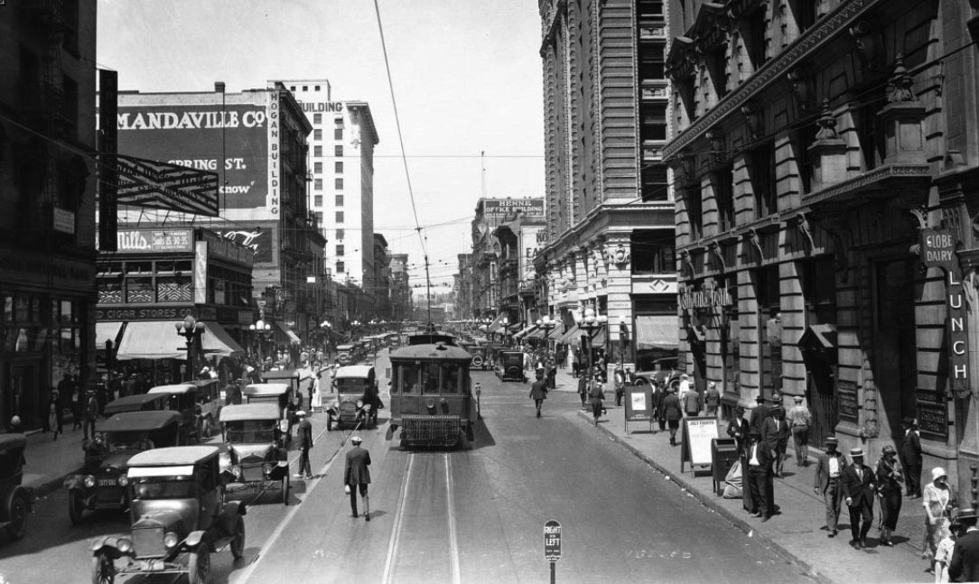
| (ca. 1924)^^ – View looking north on Spring Street from 4th Street. The street is busy with pedestrian, automobile and trolley car traffic. Prominent buildings are the Angelus Hotel (at left), Hogan Building (at left), and California Bank Building (at right). |
 |
|
| (ca. 1924)^^ - View of Spring Street from below 6th Street. The street is busy with pedestrian, automobile and street car traffic. |
Historical Notes The Mad-House Lunch room (ground floor of the Bixby Building) on the extreme right next door (going north or to the left) to the Seaboard National Bank Building with the lovely arched portico, the Western Union Office and the Grosse Building on the corner. Across the street we've got the very dark (appearing) Hotel Hayward on the SW corner of Spring and 4th Streets and across 4th Street the bright, white collumned Trust &Savings Building with the short, formal Desmond's Building next door and up the block, in the shadows, the Arcade Building at 541 S. Spring Street.#^ |
 |
|
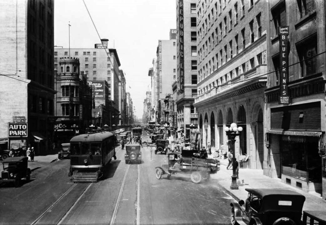
| (ca. 1924)^^ - View of the 700 block of Spring Street looking north from 8th Street. The street is busy with pedestrian, automobile and railway car traffic. |
Historical Notes Legible signs include: "W.A. Douglass, merchant tailor", "auto park", "Chas H. Clark Co., Jewelers", on a railway car "Moneta Ave. via [...] to 116th St.", "I.N. Van Nuys building", "United Cigar Stores", "State Mutual Building and Loan Association", "Republic Life", and "Blue Prints".^^ |
 |
|
| (1923)^^ – View looking east on 8th Street at Hill Street. The May Company Building (previously Hamburger’s Department Store) is seen on the southeast corner. |
 |
|
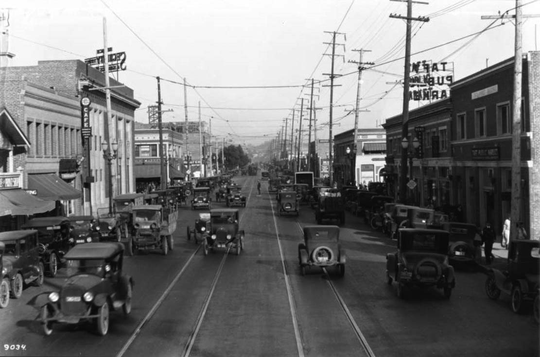
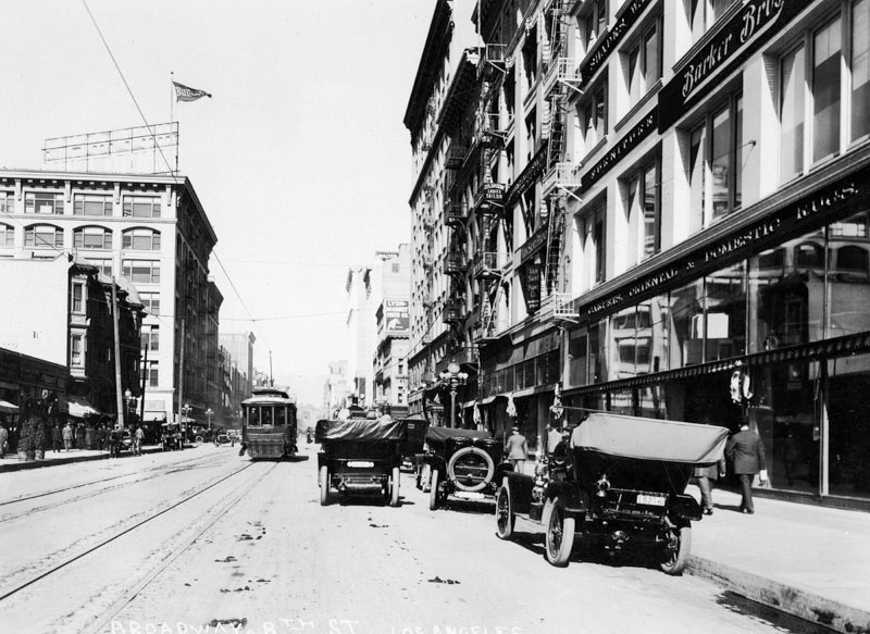
| (ca. 1923)^ - View looking north on Broadway at 8th Street showing a streetcar sharing the road with early model cars, most of them with their tops down. Barker Bros. is seen in the foreground on the right. In the distance, on the northwest corner of Broadway and 7th Street, stands the Bullock's Department Store with large flag above its roof. |
 |
|
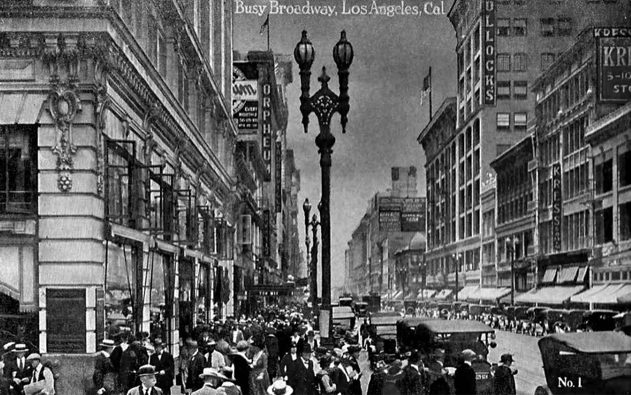
| (1920s)^#*^ – Postcard view of a “Busy Broadway” looking south from Sixth Street. On the right can be seen Bullock’s Department Store and Kress Shoes. On the left stands the Orpheum Theatre. |
Historical Notes The Orpheum (at 630 S. Broadway) became the Palace when the Orpheum circuit moved into their extravagant new home at 842 S. Broadway in 1926.^#*^ Note the ornate 2-lamp streetlights running up and down Broadway. Click HERE to see more in Early Los Angeles Streetlights. |
 |
|
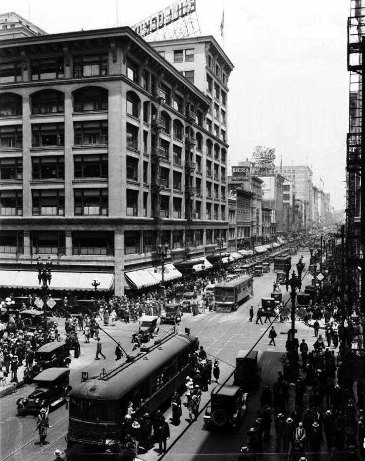
| (ca. 1924)^^ – View looking north on Broadway at Seventh Street. The Bullocks Department Store stands at the northwest corner. The sidewalks are crowded with pedestrians, while streetcars and automobiles can be seen in the road. |
 |
|
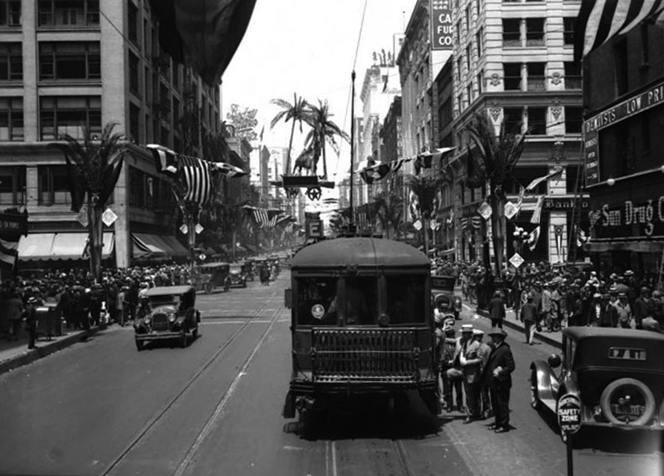
| (1925)^^ – View looking north on Broadway toward 7th Street. American flags hang on wires that cross the street in preparation for the Shriner’s parade. The streetlight posts have been decorated to look like palm trees. The sidewalks that border the street are packed with pedestrians. |
 |
|
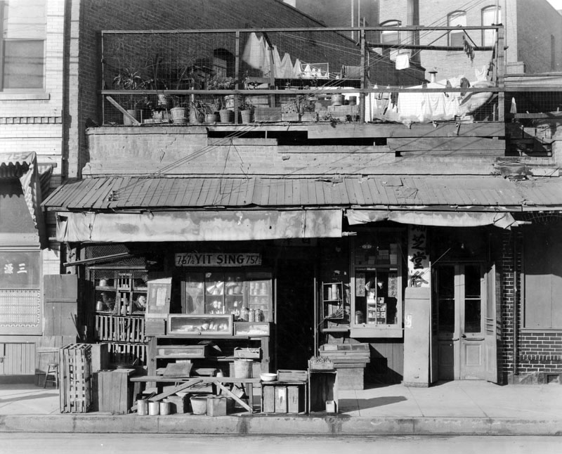
| (ca. 1920s)^ - Exterior view of Yit Sing, a Chinese merchant at 757-1/2 North Alameda Street. |
 |
|
| (ca. 1924)^ - Aerial view of the Los Angeles Plaza and surrounding buildings. The streets from top to bottom are: Alameda Street running diagonlly at the upper left, Los Angeles Street, and Main Street. Nearly half the buildings to the right of the Plaza (south of the Plaza) were demolished in the 1950s to make way for the Hollywood Freeway. |
Historical Notes The sole occupant of the entire city block bounded by Los Angeles, Marchessault, and Alameda streets (upper left corner of the photo) was a sturdy, square, two-story brick structure. Built originally for a furniture factory, it was later remodeled to serve as a headquarters of the Los Angeles Water Department’s predecessor, the Los Angeles City Water Company. Click HERE to see more in Water Department's Original Office Building. |
 |
|
| (ca. 1925)^ - The Plaza Church on Main Street across from the Plaza and Olvera Street. Behind the streetcar is the Hotel Pacific, the office of Philip Morici and Co., "Agencia Italiana," and the grocery store of Giovanni Piuma, who also made wine (Piuma Road in Malibu was named for him). The area north of the Plaza was at this time an Italian neighborhood. |
Click HERE to see more in Early Views of the Los Angeles Plaza |
 |
|
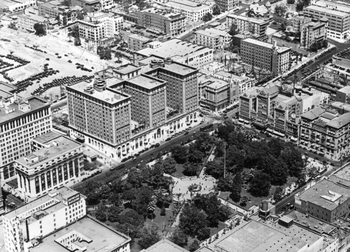
| (1924)^ - Aerial view of Downtown Los Angeles as seen from 6th Street and Grand Avenue. Pershing Square can be seen in the center of the photo. Some identifiable buildings include: The Brack Shops on the lower right, the Bible Institute and Hotel Savoy on the lower left, the Detwiler Building center right, and Biltmore Hotel center left. |
 |
|
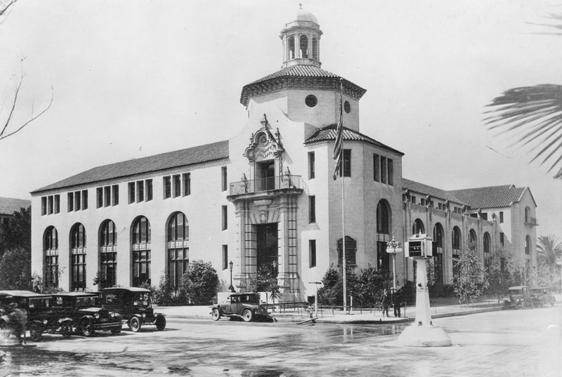
| (ca. 1924)^ - Aerial view looking northwest of Pershing Square, the Biltmore Hotel, and preparation of the State Normal School site for the construction of Los Angeles Central Library (upper-left corner). |
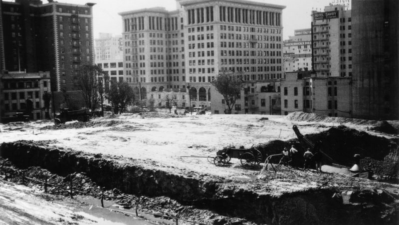 |
|
| (ca. 1924)^ - This is the site of the former Los Angeles State Normal School, and future site of Central Library of the Los Angeles Public Library. The area has been dug out for the foundation and work is well under way. The dark building on the left is the Biltmore Hotel, the large white building in the background is the Pacific Mutual Building, and the building on the extreme right is Hotel Savoy. |
 |
|
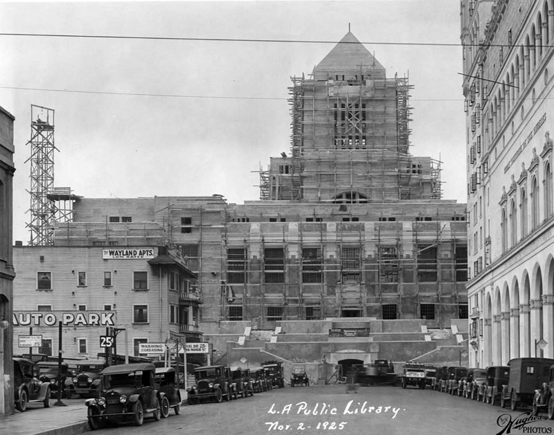
| (1925)^ - Photograph shows construction of the Los Angeles Central Library, located at 630 W. Fifth Street; view is looking north on Hope Street. The structure, which is almost complete, shows scaffolding along the entire south side as well as surrounding the tower at the top. A sign posted above the tunnel entrance, at the end of this street reads: "Weymouth Crowell Co. - General Contractors". The Wayland Apts. offering "low rates" is visible on the left corner next to Savoy Auto Park, whose rates are .25 cents all day, or $5.00 per month. The large white building on the right is the Bible Institute, later to become Church of the Open Door/Biola Institute, located at 555 S. Hope Street. Numerous automobiles are parked on both sides of the street. |
* * * * * |
Westlake Park (Later MacArthur Park)
 |
|
| (1920s)^ - A man enjoying the afternoon in a canoe at Westlake Park (later MacArthur Park). |
Historical Notes Westlake was one of the first areas of Los Angeles west of Figueroa Street to see residential development. By the 1920s Westlake resembled the Upper East Side of Manhattan (complete with a large Jewish population). Wealthy businessmen commuted to downtown, Wilshire Center (now Koreatown), Hollywood, and the Miracle Mile from the district's Spanish Revival and Art Deco mansions. The district's less affluent northeastern blocks also became the home of Los Angeles' Filipino population, much of which remains in Westlake and nearby neighborhoods to this day.** Westlake Park was renamed MacArthur Park on May 7, 1942.*^ |
 |
|
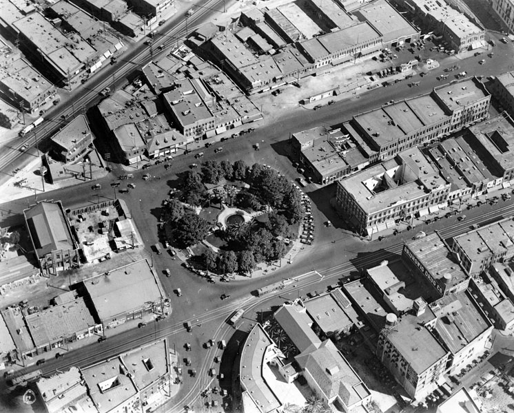
| (ca. 1923)^ - Aerial view of Westlake Park looking east. 6th Street runs from bottom to top at the left of photo. 7th Street runs from lower-right to right-center. Wilshire dead-ends at the lake between 6th and 7th at center bottom-right. Orange Street picks-up on the other side of the lake, opposite the Wilshire dead-end, and extends to downtown Los Angeles. |
Historical Notes Some have called Wilshire Boulevard “The backbone of Los Angeles.” The city used to pretty much end at MacArthur Park, which at the time was called Westlake Park. Then they built a causeway over the lake and extended Wilshire to meet the former Orange Street, which was re-named, and now reaches the ocean. It’s probably the busiest street in Los Angeles.*^ |
 |
|
| (1924)^ - Aerial view of the northwest corner of Westlake Park showing the new Elks Club Building (built in 1923-24) and surrounding area. At lower-left can be seen Wilshire Boulevard which dead-ends at the lake. 6th Street runs diagonally from lower-right to upper-left. |
Historical Notes The Elks Club Building was originally designed for the Benevolent and Protective Order of Elks (B.P.O.E). by renowned Art Deco architect Claud Beelman, during the time he was a Senior Partner at the prestigious firm he co-owned in the 1920s, Curlett and Beelman.*^ |
Wilshire Boulevard Extension through Westlake Park
 |
|
| (ca. 1925)^ - Aerial view of Westlake Park looking east toward downtown Los Angeles from a higher elevation. 6th Street runs from bottom to top on the left of photo. Wilshire Boulevard ends at the west side of the lake (lower center). 7th Street is on the south (right). |
Historical Notes Wilshire Boulevard formerly ended at the lake on its west side, but in the early 1930s a berm was proposed to be built to cross and link up with the existing Orange Street (which ran from Alvarado to Figueroa) into downtown Los Angeles. Orange Street was later renamed Wilshire and extended east of Figueroa to Grand Ave. This divided the lake into two halves; the northern one was subsequently drained.*^ |
 |
|
| (1931)^ - Drawing of the proposed bridge to carry Wilshire Boulevard across Westlake Park. The plan was also to widen Orange Street between Alvarado and Figueroa and then rename it Wilshire Boulevard. |
Historical Notes Photo Caption reads, "This plan for a bridge to carry Wilshire Boulevard across Westlake Park was under consideration by the city park board today. The drawing shows how the structure, with a 70-foot boulevard-width roadway and 6-foot sidewalks, would curve across the park and an arm of the lake. The plan, developed by Lincoln Rogers, former New York park board architect, and submitted by the Wilshire Boulevard Association, would cost approximately $250,000. Its advocates say that the cost would be less than a suspension bridge, straightaway bridge or tunnel". ^ The plan: widen and rename Orange Street, bridge the lake to link the two sections of Wilshire, and then extend the boulevard through several dense city blocks into the heart of downtown. Local residents protested, and the dispute made its way to the state supreme court, which eventually allowed the construction to proceed.**# Click HERE to see more on the Widening of Wilshire Boulevard (Orange Street) from Figueroa to Westlake. |
.jpg) |
|
| (1934)^^ - View looking east. Completed in 1934, a causeway connected Wilshire Boulevard with Orange Street, linking the grand boulevard with downtown Los Angeles. Orange was renamed Wilshire. |
Historical Notes On December 7, 1934, city officials celebrated the opening of the Wilshire causeway through Westlake Park. Millions of dollars had been expended, residents and businesses had been displaced, and one of the city's preeminent public spaces had been sacrificed, but Wilshire Boulevard finally linked downtown to the sea.**# |
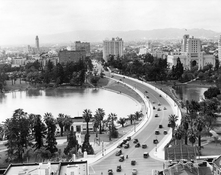 |
|
| (1934)^ - Panoramic view of Westlake Park looking west on Wilshire from Alvarado shortly after the bridge over the lake was constructed. |
 |
|
| (ca. 1934)^#^ – Street view looking northwest showing "Wilshire Blvd. thru West Lake Park". Note the beautiful streetlights lining both sides of the boulevard. These ornate streetlights, called "Wilshire Specials", were installed on Wilshire Boulevard in the late 1920s and 1930s. |
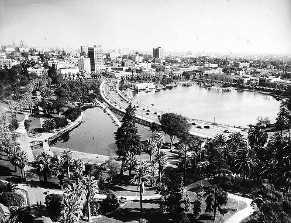 |
|
| (1934)*# - View looking southeast from the Elks Club Building at the corner of 6th Street and Park View Avenue showing how the lake is now bisected by the newly constructed Wilshire Boulevard. |
Historical Notes On May 7, 1942, the Los Angeles Park Commission renamed Westlake Park in honor of Gen. Douglas MacArthur. The decision to rename the park, which had been known as Westlake Park for more than 50 years, was made in preparation for an observance of MacArthur Day on June 13th.*^ |
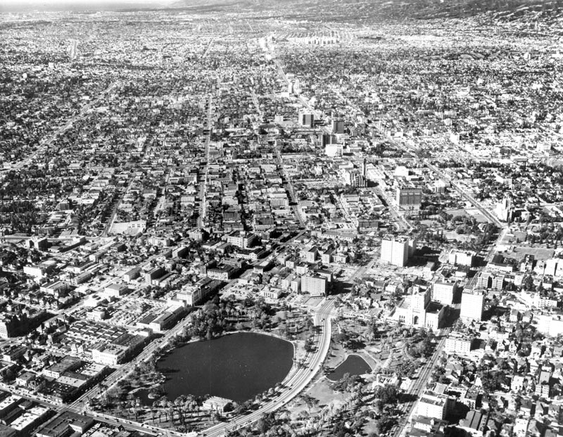 |
|
| (ca. 1940s)^ - Aerial view of the Westlake and Wilshire District, looking west. MacArthur Park with its large lake is visible in the foreground and a smaller lake, also part of MacArthur Park, is on the right. Wilshire Blvd., which is the curved street (lower middle), has separated the park and lake. Wilshire now runs 15.8 miles from Grand Avenue in Downtown Los Angeles to Ocean Avenue in the City of Santa Monica. |
Historical Notes MacArthur Park was designated city of Los Angeles Historic Cultural Monument #100. Click HERE to see the LA Historic-Cultural Monuments List. |
Click HERE to see more Views of Westlake Park as it appeared in the 1880s. |
* * * * * |
Western Avenue
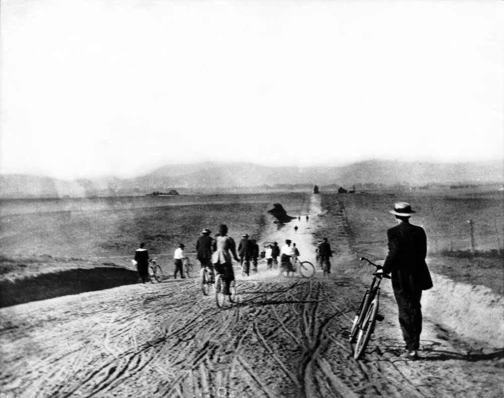 |
|
| (1895)^^ - View showing the Los Angeles Times Bicycle Club on Western Avenue north of Pico. |
Historical Notes Western Avenue, apart from Sepulveda Boulevard, is one of the longest north–south streets in Los Angeles. The name of the street is derived from its history as the westernmost border of Los Angeles before annexations in the early 20th century expanded the city. Western Avenue eventually ends north of Franklin Avenue in the Hollywood Hills. It swerves to become an east/west street, Los Feliz Boulevard.*^ |
Then and Now
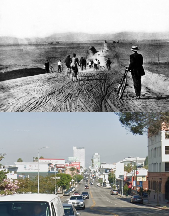 |
|
| (1895 vs. 2021)* - Western Avenue looking North from Pico Boulevard. |
Western and Beverly
 |
|
| (1920s)^ - View of Western Avenue, looking north from Beverly Blvd. toward the Hollywood Hills. Several businesses and automobiles can be seen along Western with residential homes riddling the rest of the view. |
 |
|
| (1924)^^ - View looking north on Western Avenue at Beverly Blvd. This intersection looks like its in need of a traffic signal. Note the unusual triangular sign attached to a power pole on the upper right. It reads: CAR STOP. |
Then and Now
 |
|
| (1924 vs. 2021)* – Looking north on Western Avenue at Beverly Boulevard. |
Western and 1st
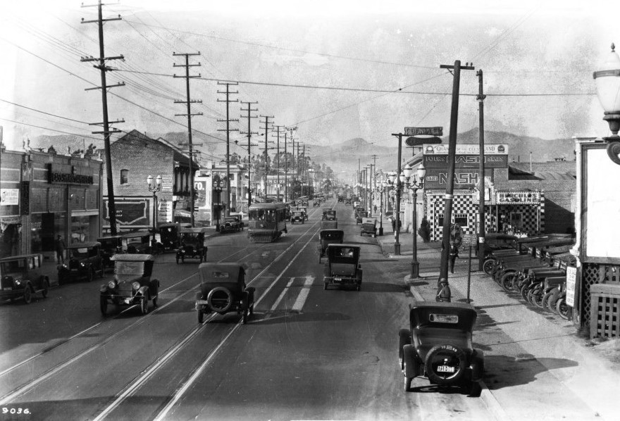 |
|
| (ca. 1924)^^ - View of Western Avenue looking north from 1st Street toward the Hollywood Hills. |
Western and 6th
 |
|
| (ca. 1924)^^ - View looking north on Western Avenue at 6th Street. |
Western and 7th
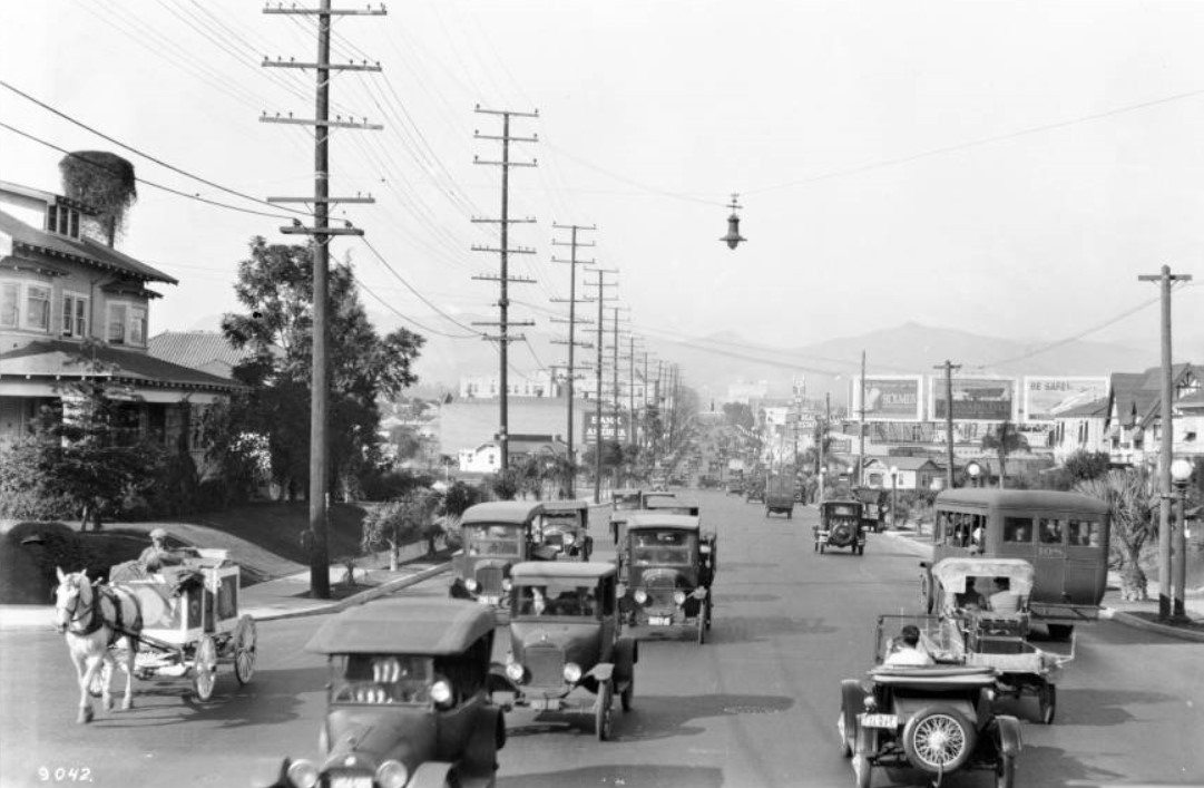 |
|
| (ca. 1924)* - View of Western Avenue looking north from 7th Street. Automobiles and a horse-drawn carriage make their way towards the viewer at left, while other traffic, a small bus amidst it, moves down the paved road to the right. |
Historical Notes Horses continued to march down (and foul up) Los Angeles streets well into the 1920s. Not until 1924 had the balance of power tilted to motorists such that city leaders felt comfortable banning horse-drawn vehicles from downtown during rush-hour -- a traffic-relief measure that remains on the books to this day.* |
Then and Now
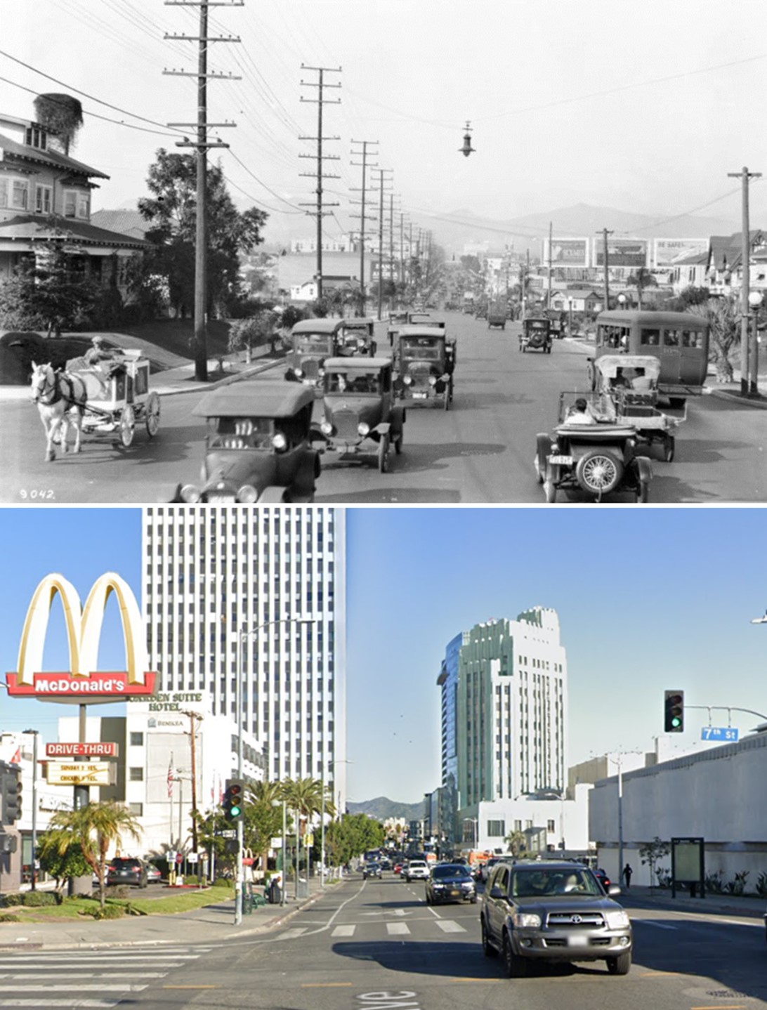 |
|
| (1924 vs 2023)* - Looking north on Western Avenue at 7th Street. |
Western and Vernon
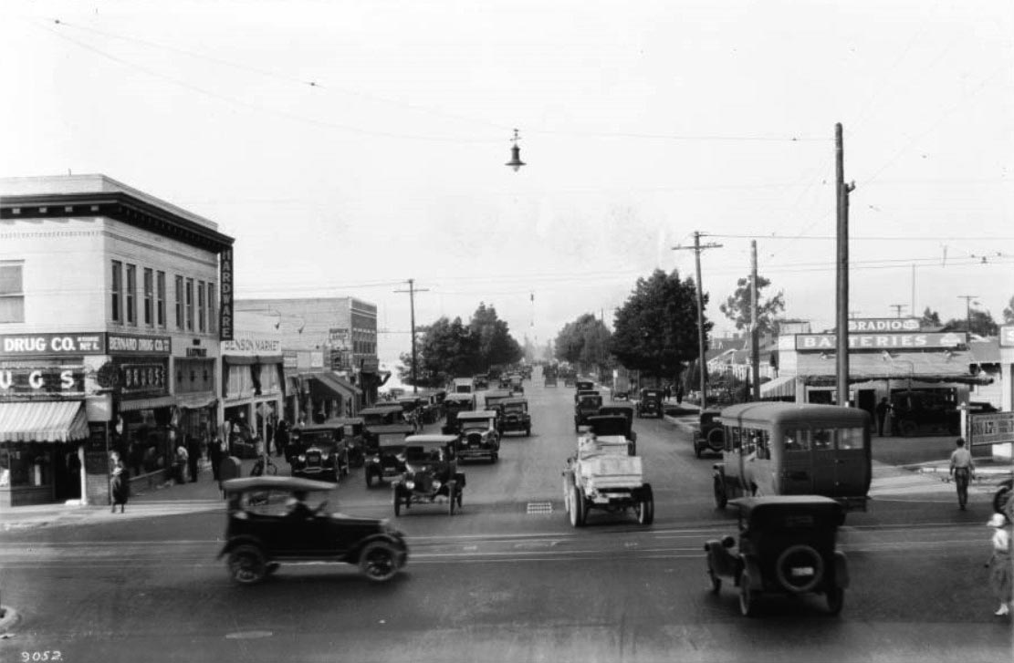 |
|
| (ca. 1924)^^ – View showing the intersection of Western and Vernon avenues. One automobile crosses the width of the image on Vernon, while the majority of the other autos, including a bus and a lightly-colored car, make their way up and down Western. On the corner to the left, the two-story brick building of the Bernard Drug Company can be seen, just in front of the Benson Market building, where pedestrians can be seen making their way along the sidewalk. More pedestrians can be seen crossing the intersection at the extreme right of the photo. Gas at the Gas Station on the right is going for 17 cents/gallon. Click HERE to see more early LA Gas Stations. |
Wilshire and Western
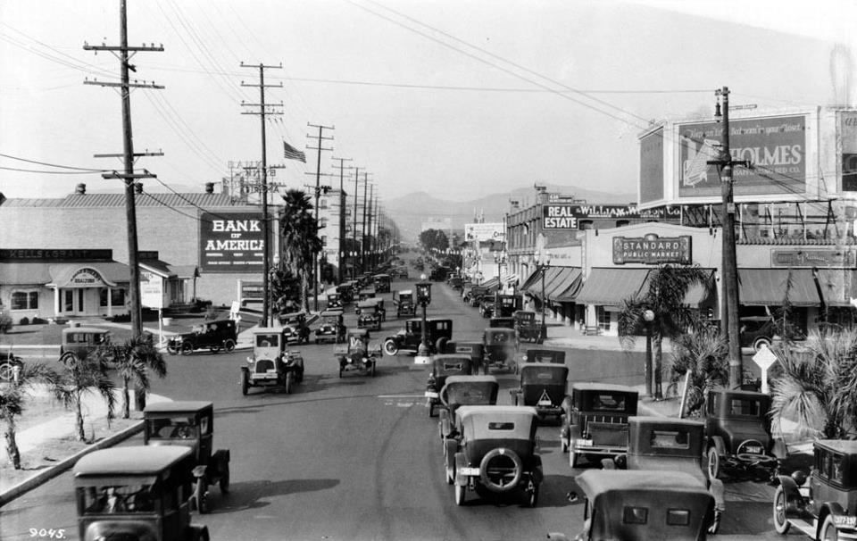 |
|
| (ca. 1924)^^ - Street view looking north on Western Avenue at Wilshire Boulevard. Note the traffic signal in the middle of the intersection. |
Historical Notes Los Angeles experimented by placing signals in the middle of a few of its busiest intersections. Nicknamed the “American Bobby” since it stood in the same place as a London traffic control officer, the new signal stood high atop a tall stanchion. Its location in the center of the intersection may have presented a traffic hazard, but the red and green lights, which replaced the unreliable semaphore arms, were easily visible to motorists in all four directions..*+* |
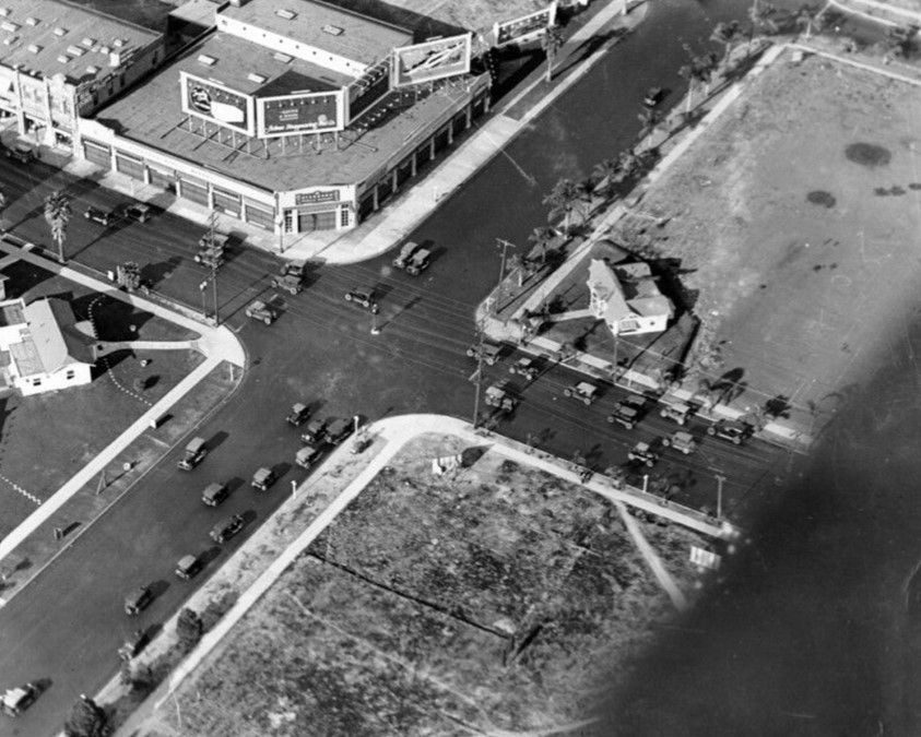 |
|
| (1924)^ - Aerial view of the intersection of Wilshire Boulevard (running bottom left to upper right) and Western Avenue with traffic signal in the middle of intersection. Both corners on the right side of the picture are so far undeveloped, although there is a real estate office on one corner. |
Historical Notes The Pellissier Building and Wiltern Theatre would be built in 1931 on the southeast corner of Wilshire and Western (upper-right), where the real estate office is locted. |
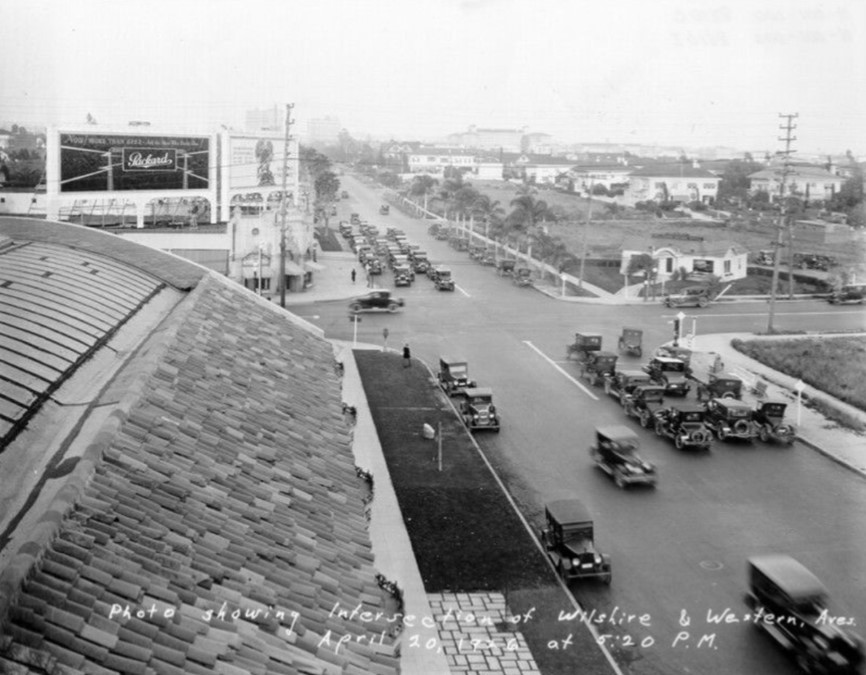 |
|
| (1926)^ – Rooftop view looking east on Wilshire Boulevard showing stopped cars while cross traffic on Western Avenue passes. Across the street on the S/E Corner (upper-right) stands a real estate office building. This will be the location of the Pellissier Building and Wiltern Theatre. |
.jpg) |
|
| (1926)^ - Street view looking east on Wilshire Boulevard from Western Avenue showing newly installed traffic signal. |
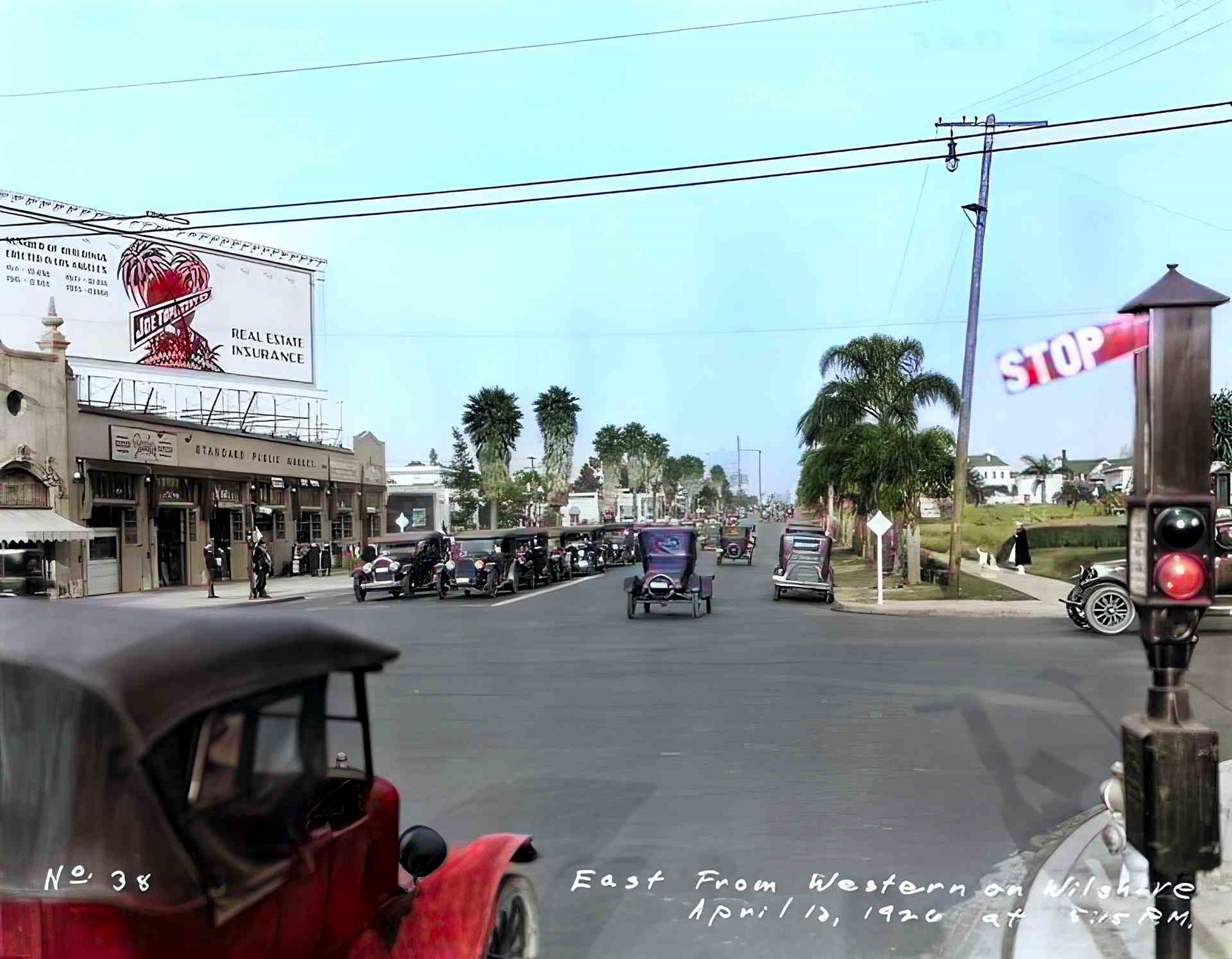 |
|
| (1926)^ - Street view looking east on Wilshire Boulevard from Western Avenue showing newly installed traffic signal. Image enhancement and colorization by Richard Holoff. |
Then and Now
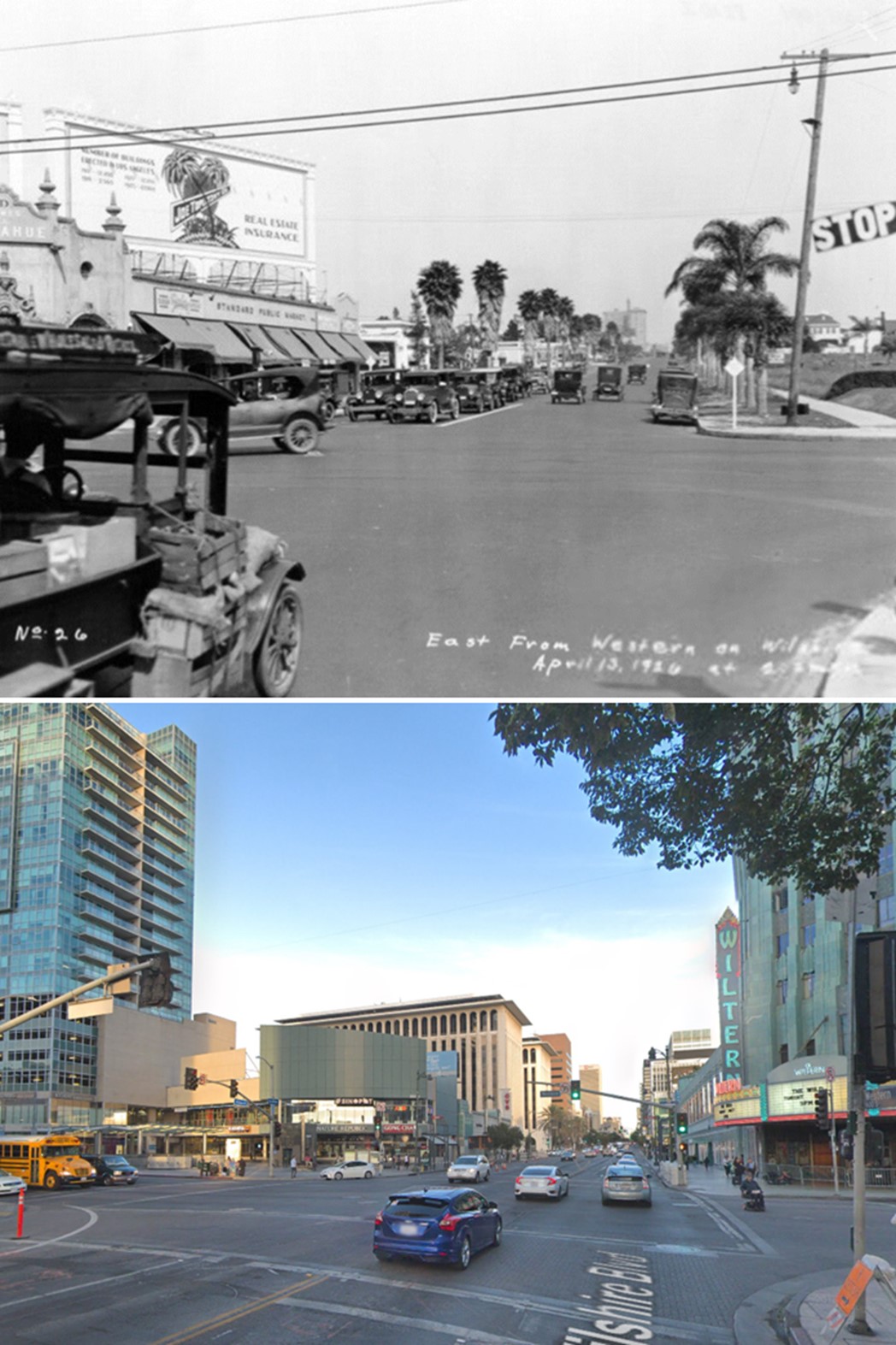 |
|
| (1926 vs 2017)* - Looking east on Wilshire Boulevard from Western Avenue. |
.jpg) |
|
| (1926)^ - View looking west on Wilshire Boulevard at Western Avenue. Traffic is stopped whiule a pedestrian crosses Wilshire. |
Historical Notes By the 1930s and 1940s, Wilshire and Western would become the nation's busiest intersection, and the Miracle Mile would emerge as an important retail center.**# Click HERE to see more Early Views of the Wilshire and Western intersection (1929 - 1931). |
* * * * * |
 |
|
| (ca. 1924)^ - View showing the intersection of 3rd and Rampart with a billboard in the background advertising for Desmond’s Clothing Store. |
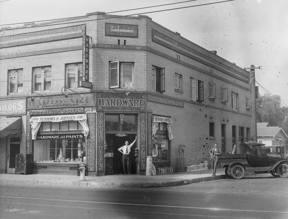 |
|
| (1924)^^ - View of a man standing in the doorway of Burrows & Johnson Hardware Store, at 3755 S. Vermont Ave. Another man is leaning on a truck parked diagonally against the curb. |
Historical Notes The Burrows & Johnson Store on the corner of 37th St. and Vermont Ave. was one of many businesses lining Vermont near the University of Southern California (USC). A tailor’s shop is seen next door. This building and the house behind it are now a gravel empty lot.^*#* |
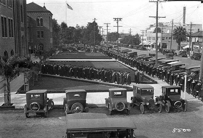 |
|
| (1925)^*#* - View from the USC Student Union building, looking north at Bovard and University Avenue (now Trousdale). |
Historical Notes Behind the line of graduates can be seen some of University Avenue before USC took over. There is a row of stores along the street, and the roof of the Shrine Auditorium is visible in the background. The two story commercial building on the corner is now where Von Kleinsmid Center is located.^*#* |
 |
|
| (1926)^^ -- View of the USC Academic Serpentine of '26 at the Los Angeles Memorial Coliseum. The President, deans and faculties advance through the rows of graduates who are about to receive their diplomas in the stadium, June 5th, 1926 |
Historical Notes Click HERE to see more in Early Views of USC |
Rancho La Cienega O' Paso de la Tijera
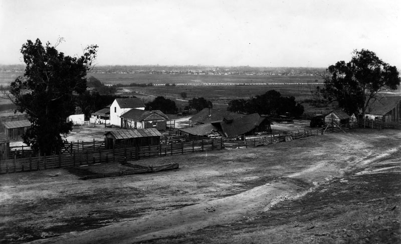 |
|
| (1924)^ - Panoramic view of Rancho Cienega O' Paso de la Tijera located on the 2400 block of S. Crenshaw Boulevard in the Baldwin Hills area, looking east. It shows an adobe, as well as several small buildings and a few trees, clustered inside a fenced-in area. |
Historical Notes Rancho La Cienega O' Paso de la Tijera was a series of adjoining adobe structures located on the eastern side of the Baldwin Hills in an area determined to be approximately 4,481 acres. The unusual title of the Rancho is actually two names combined: "La Cienega" ("The Swamp"), refers to the marshes in the area between Baldwin Hills and Beverly Hills; the latter half of the name "Paso de la Tijera" ("Pass of the Scissors"), was a name used by the early Spanish to describe the pass through the nearby hills that resembled an open pair of scissors.^ |
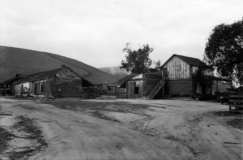 |
|
| (1924)^ - View of Rancho Cienega O' Paso de la Tijera shows two adobes, a single-story on the left, and a two-story on the right; another smaller building is visible in the background between the adobes. |
Historical Notes The Rancho La Cienega O' Paso de la Tijera area remained unclaimed for many years following the first Spanish settlements in California. Squatters from the pueblo considering these lands public and built the La Tijera adobe as early as 1790 or 1795 for the purpose of raising cattle on surrounding land. In 1843, Manuel Michaeltorrena (then Mexican Governor of Alta California) formally granted Rancho La Cienega O' Paso de la Tijera to Vicente Sánchez. In more recent years, a portion of Rancho La Cienega O' Paso de la Tijera became the center of Sunset Fields public golf links located at 3725 Don Felipe Drive, off Crenshaw Boulevard. In 1959, Bernadette Fathers sold the property to Park View Women's Club.^ Rancho La Cienega O' Paso de la Tijera was declared Los Angeles Historic-Cultural Monument No. 487 on May 1, 1990 (Click HERE to see complete listing). |
Click HERE to see more Early Views of Rancho La Cienega O' Paso de la Tijera |
* * * * * |
Olympic and La Cienega
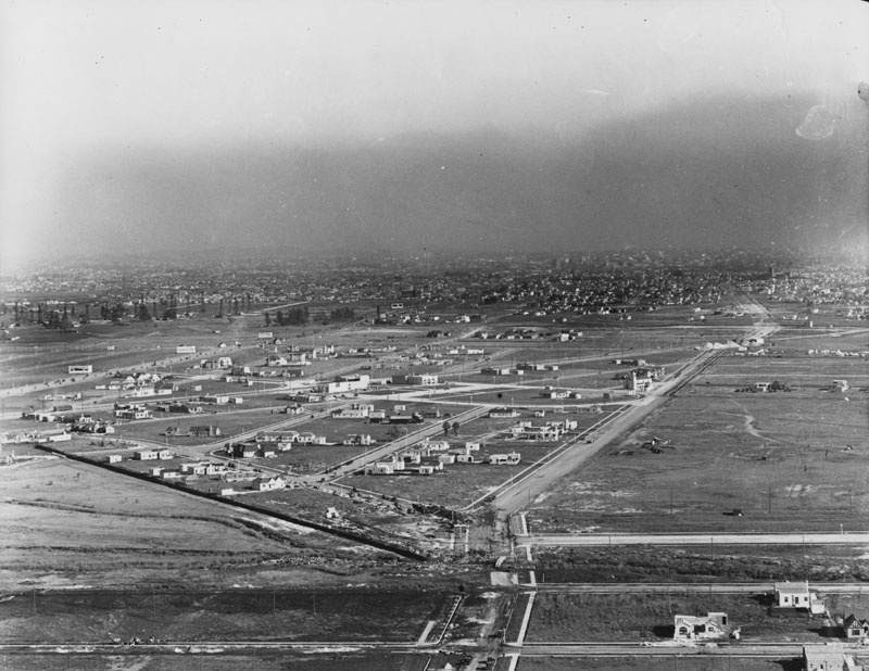 |
|
| (1924)^ - Aerial view looking east from Western, towards Olympic Boulevard, La Cienega and Carthay Circle. |
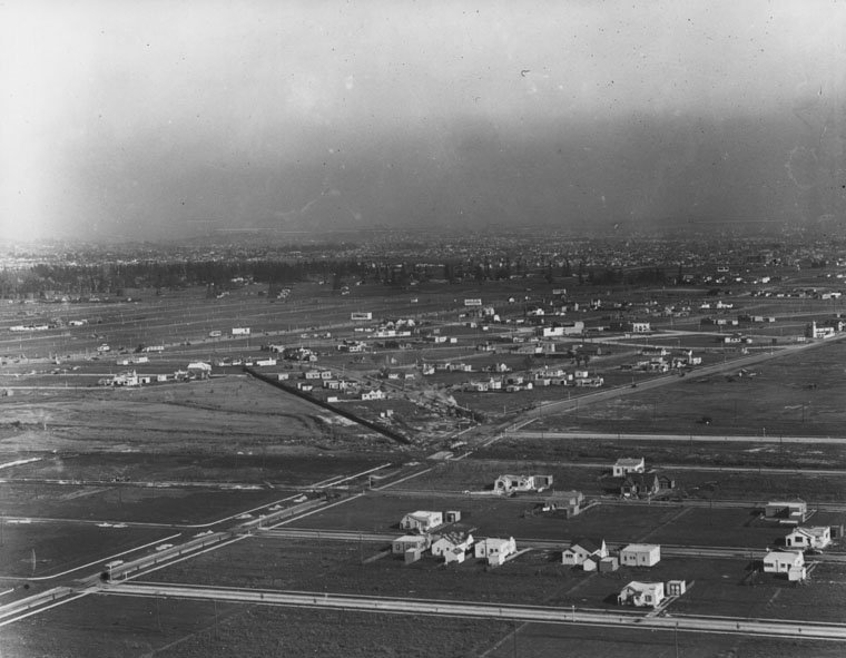 |
|
| (1924)^ - Another aerial view looking east from Western, towards Olympic Boulevard, La Cienega and Carthay Circle. |
Beverly Hills
.jpg) |
|
| (ca. 1924)^ - A panoramic view of Beverly Hills and neighboring cities, seen from an airplane. Especially noticeable is an area where 6 roads all meet. To the left of that intersection the Beverly Hills Hotel can be seen. |
Historical Notes Two years before Beverly Hills became an incorporated city, the Beverly Hills Hotel opened on May 12, 1912; the hotel initially included the main building and twenty-three separate bungalows in the Mediterranean Revival style, designed by Elmer Grey. In the 1940s, a new wing was added to the east side of the main building. Eighty years after it opened, the hotel closed for two and a half years for a complete restoration. The hotel was named the first historic landmark in Beverly Hills on September 12, 2012.^ |
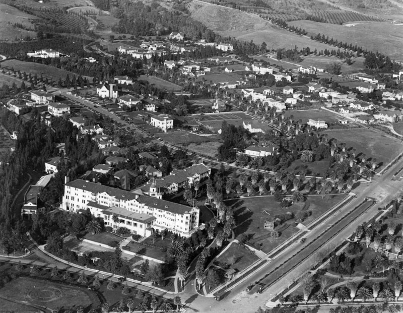 |
|
| (ca. 1924)^ - Aerial view of Beverly Hills, with the Beverly Hills Hotel in the foreground, located on Sunset Blvd. A number of homes have been built in the development. Elmer Grey was the architect of the hotel, built in Mission Revival style in 1911-1912. |
Click HERE to see more Early Views of Beverly Hills. |
San Pedro Harbor
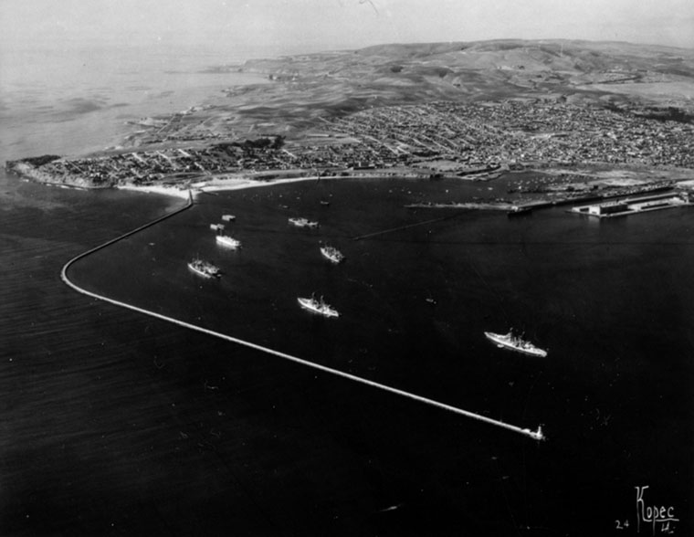 |
|
| (ca. 1924)^ - Aerial view of Point Fermin, Palos Verdes and hills, government breakwaters and the outer harbor. Ships can be seen in the harbor. |
Historical Notes After the Panama Canal opened in 1914, the Port of Los Angeles became the natural port-of-call for most transpacific and coastal users. |
Click HERE to see more in Early Views of San Pedro and Wilmington |
Palos Verdes Peninsula and South Bay Area
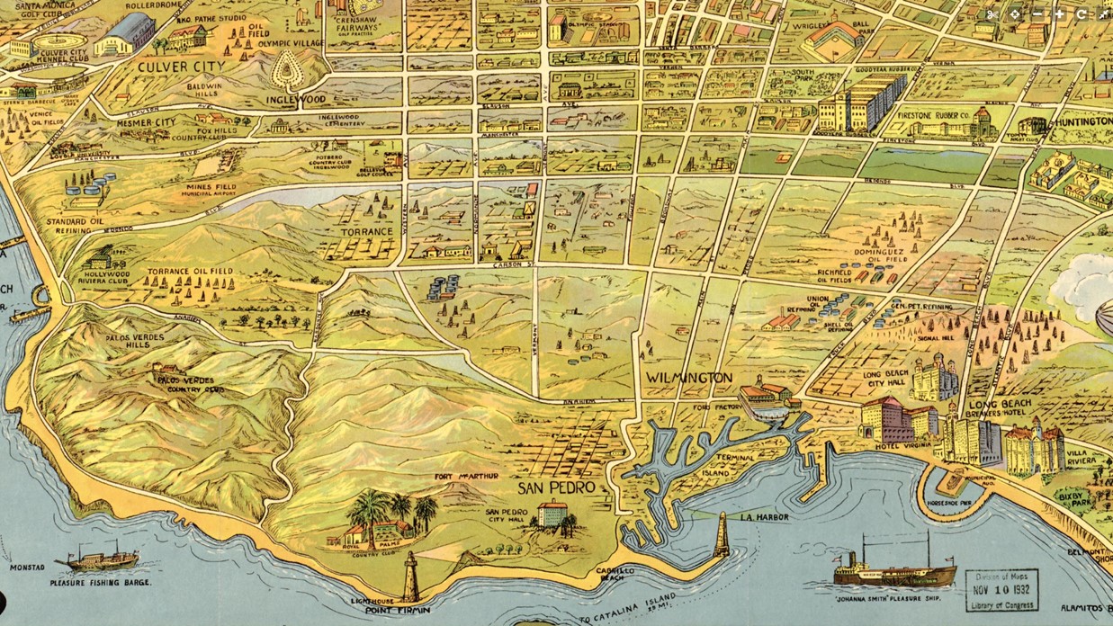 |
|
| (1932)*– A map highlighting significant points of interest in the South Bay area of Los Angeles. |
Historical Notes The South Bay area of Los Angeles County includes the following cities and neighborhoods: Beach Cities: Hermosa Beach, Manhattan Beach, Redondo Beach Palos Verdes Peninsula: Palos Verdes Estates, Rancho Palos Verdes, Rolling Hills, Rolling Hills Estates Neighborhoods of the City of Los Angeles: San Pedro, Wilmington, Harbor City Inland Cities: Carson, El Segundo, Gardena, Hawthorne, Inglewood, Lawndale, Lomita, Torrance |
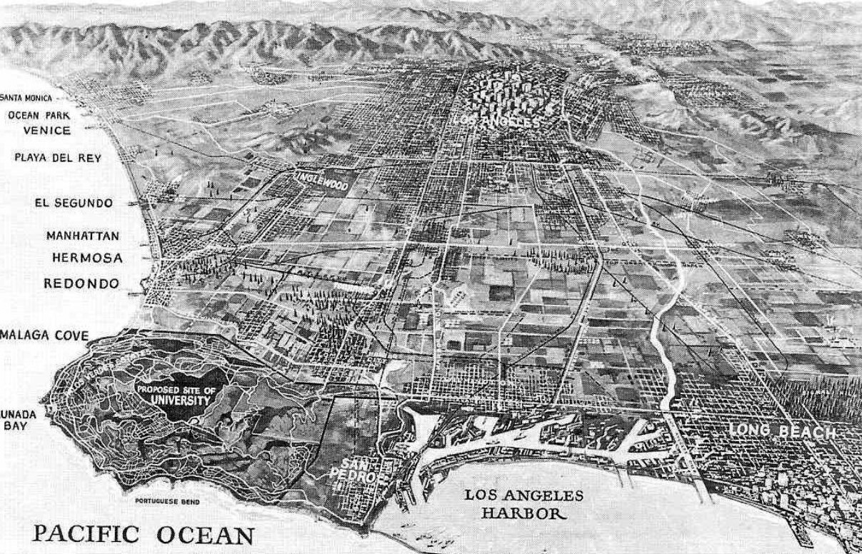 |
|
| (1923)* – Birdseye view of the Southland showing the beachfront communities between Santa Monica and Long Beach. Note the undeveloped land between Los Angeles and the ocean. At left can be seen the proposed site of a new Universtiy in Palos Verdes. Turns out this was one of the sites proposed for the UCLA campus. |
Historical Notes UCLA as well as Cal State Dominquez were both almost located in Rancho Palos Verdes: A section of 1,000 acres was originally set aside by the planners of the Palos Verdes Project for a University campus, In November 1921, a proposal was made for the relocation of the southern branch of the University of California , which later became UCLA. This land was in the center of the Palos Verdes Peninsula where Peninsula High School, the Peninsula Shopping Center, and the Avenue of the Peninsula Shopping Center is located. |
Palos Verdes Peninsula
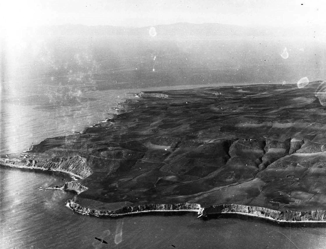 |
|
| (ca. 1920)* - Aerial view looking north showing the Palos Verdes Peninsula. Click HERE for contemporary view. |
Historical Notes Palos Verdes means green sticks, and was the homeland of the Tongva-Gabrielino Native American people for thousands of years. There are archeological sites that date back 8,000 years in the Los Angeles Basin. Legend says that these Indians blessed the land of “green sticks” making it the most beautiful place on Earth.* |
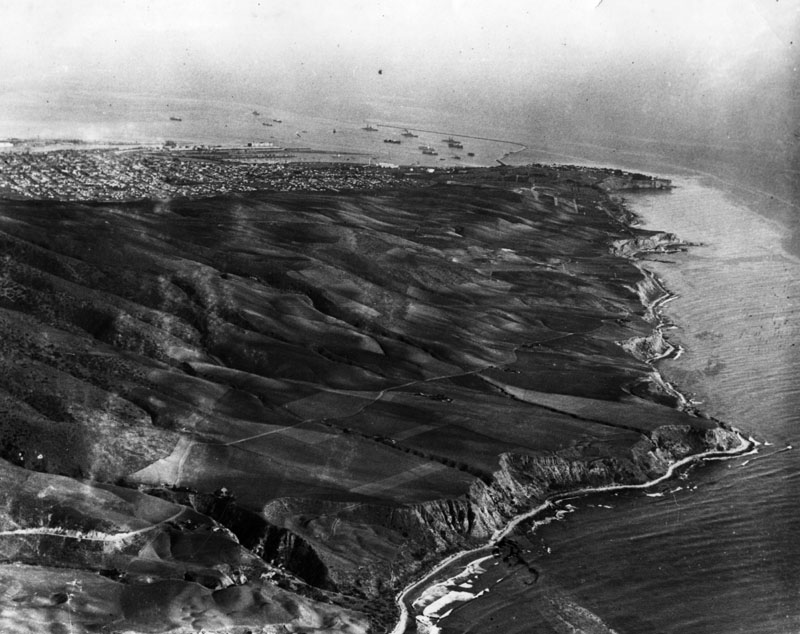 |
|
| (1924)^ - Aerial view of the Palos Verdes Peninsula, looking southeast towards Point Fermin. San Pedro Harbor can be seen in the background. |
Historical Notes In 1882 ownership of the 16,000 acre hill was passed to Jotham Bixby who used the land as a cattle ranch and also leased Rancho De Los Palos Verdes to Japanese farmers who built the first roads on “the hill”. Bixby’s Forman Harry Phillips built the first permanent residence in 1894 and planted Eucalyptus trees. Bixby sold the ranch in 1913 to Frank A Vanderlip, a New York banker who created one of the first planned communities dividing the ranch into Estates. His intention included a magnificent golf club and clubhouse on the bluffs. Vanderlip hired the designer of Manhattans Central Park the Olmsted Brothers to help design the gardens and park like atmosphere of the community. Development in Malaga Cove began in the 1920’s, and by 1923 the first structure was completed, the La Venta Inn.* |
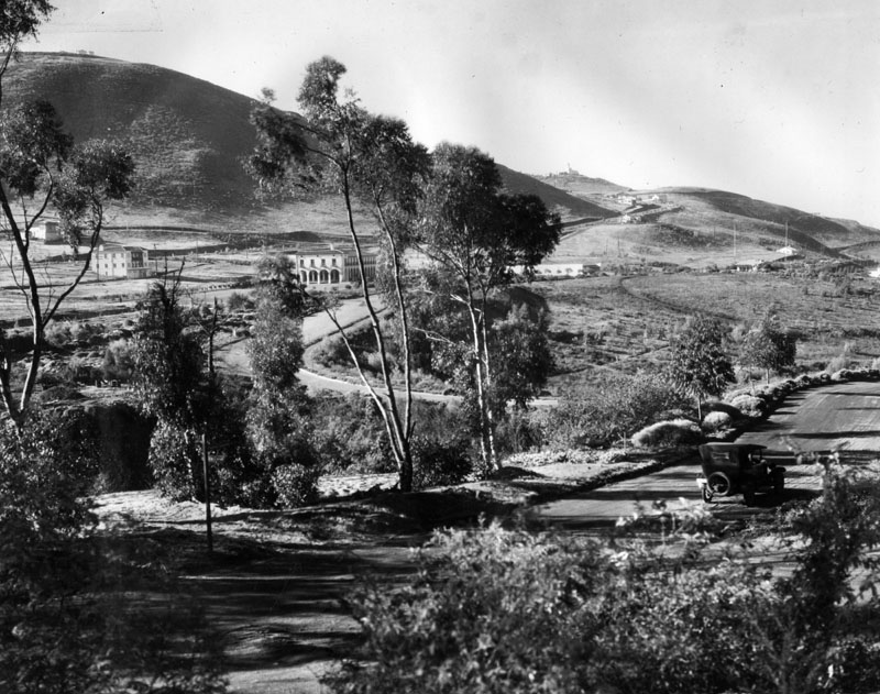 |
|
| (1923)^ - Panoramic view from Palos Verdes Drive North looking southwestwardly toward the early construction of Malaga Cove Plaza. |
Historical Notes The plaza, library, and original homes were built starting in the late 1920s. At the center of the historic plaza is the King Neptune Fountain which is a copy of a famous statue in Bologna, Italy that was presented as a gift to the City of Palos Verdes Estates. At the time of the city's incorporation in 1939, the business and shop area around Malaga Cove had most of the Peninsula's earlier buildings. The Malaga Cove Plaza building of the Palos Verdes Public Library, designed by Pasadena architect Myron Hunt, was placed on the National Register of Historic Places in 1995. |
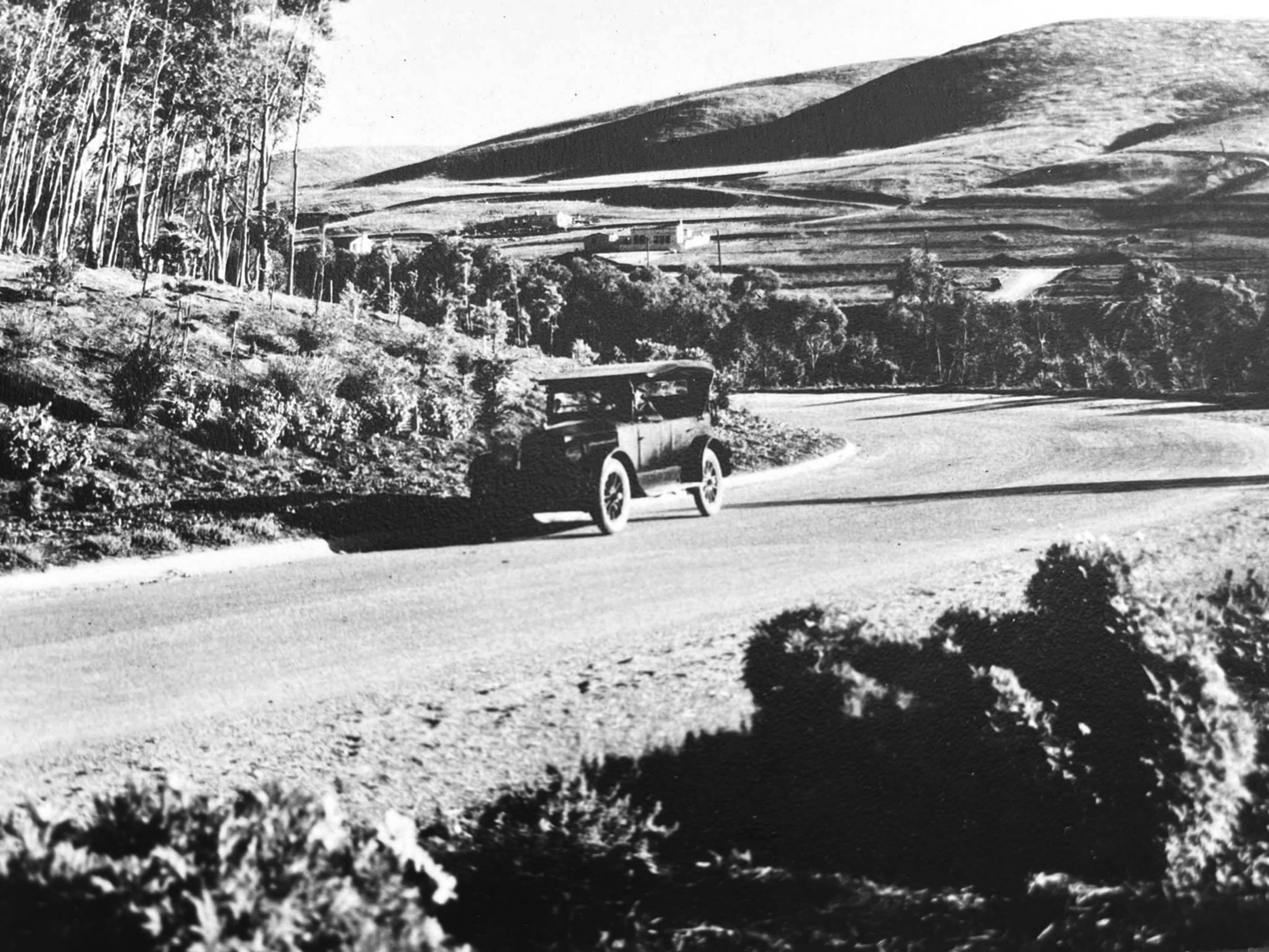 |
|
| (ca. 1925)^ - The view toward the Plaza area in Malaga Cove from where P.V. Drive North originates. The present location of St. Francis Episcopal Church would be immediately to the right of the picture. |
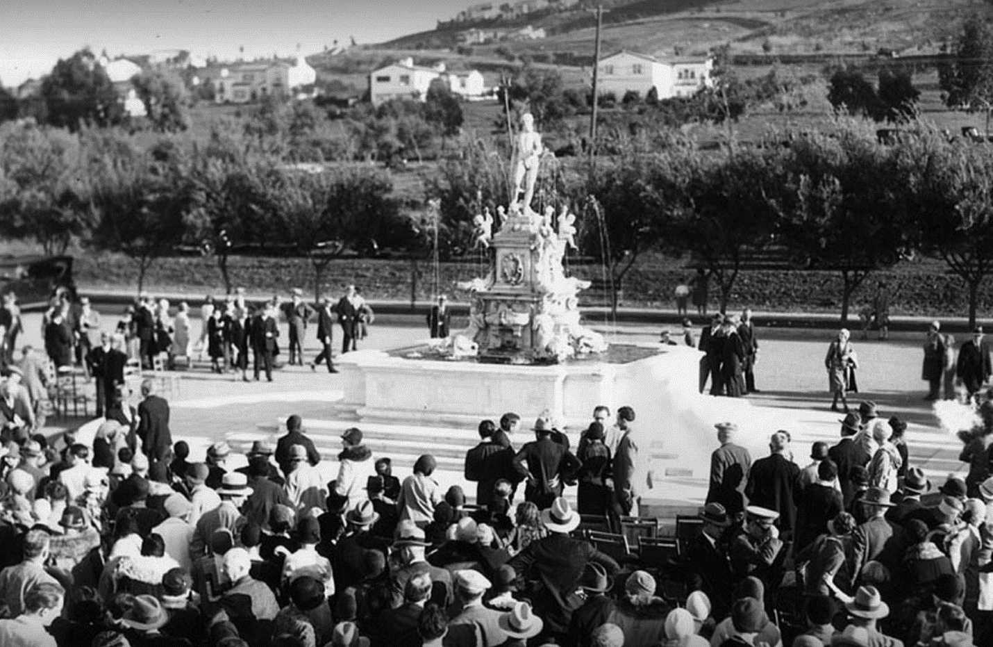 |
|
| (ca. 1928)* - Dedication of the fountain at Malaga Cove Plaza. |
Historical Notes This 19th century white marble fountain in the center of the Malaga Cove Plaza in Palos Verdes Estates, is a replica of the famous bronze Neptune fountain in Bologna, Italy, and was part of an old villa in Venice for more than a century before it was donated to the city in 1930. It was restored in 1997. |
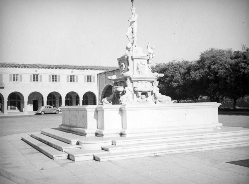 |
|
| (ca. 1937)^ - Close-up view showing the 19th century white marble fountain in the center of the Malaga Cove Plaza, decorated with dolphins, sea shells and a mermaid, and topped by the heroic figure of Neptune, the god of the sea who looks out at the ocean. |
Then and Now
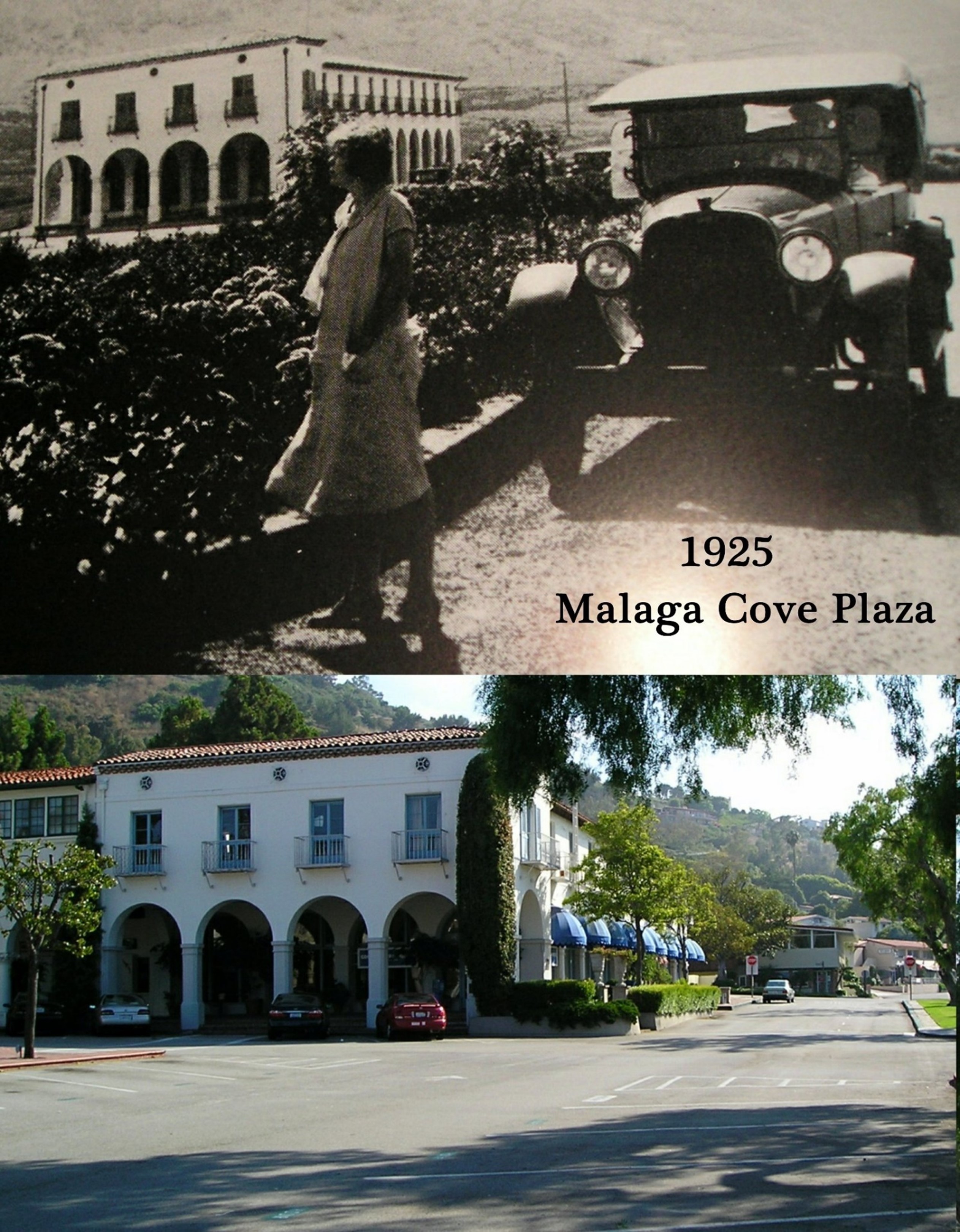 |
|
| (Then and Now)* - Malaga Cove Plaza |
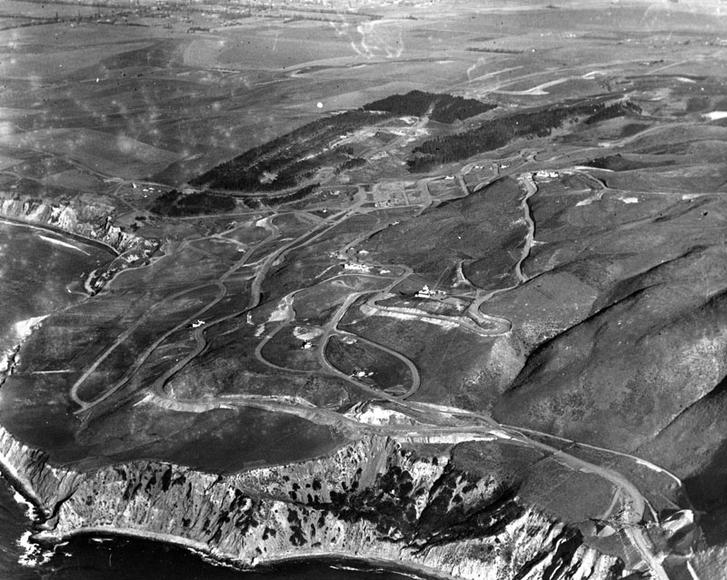 |
|
| (1925)^ - Aerial view of Palos Verdes. Most of the land on the peninsula and beyond is yet to be developed. |
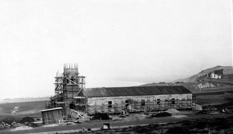 |
|
| (1926)^ – Panoramic view looking northeast showing the construction of Malaga Cove School, located at 385 Via Almar in Malaga Cove. Malaga Cove School opened on April 5, 1926. The roof is in place, and scaffolding surrounds the tower. Visible in background at far right is the Frederick Law Olmsted Jr. residence, located on Rosita Place, which was demolished in 1971 due to bluff erosion. |
Historical Notes By April of 1926 there were 35 students and 3 teachers at Malaga Cove School with 3 classrooms, a large 294 seated auditorium, dressing rooms, plus offices, toilet rooms, and a community kitchen. Malaga Cove School is now the hub of the hill and multiple events are at the school. |
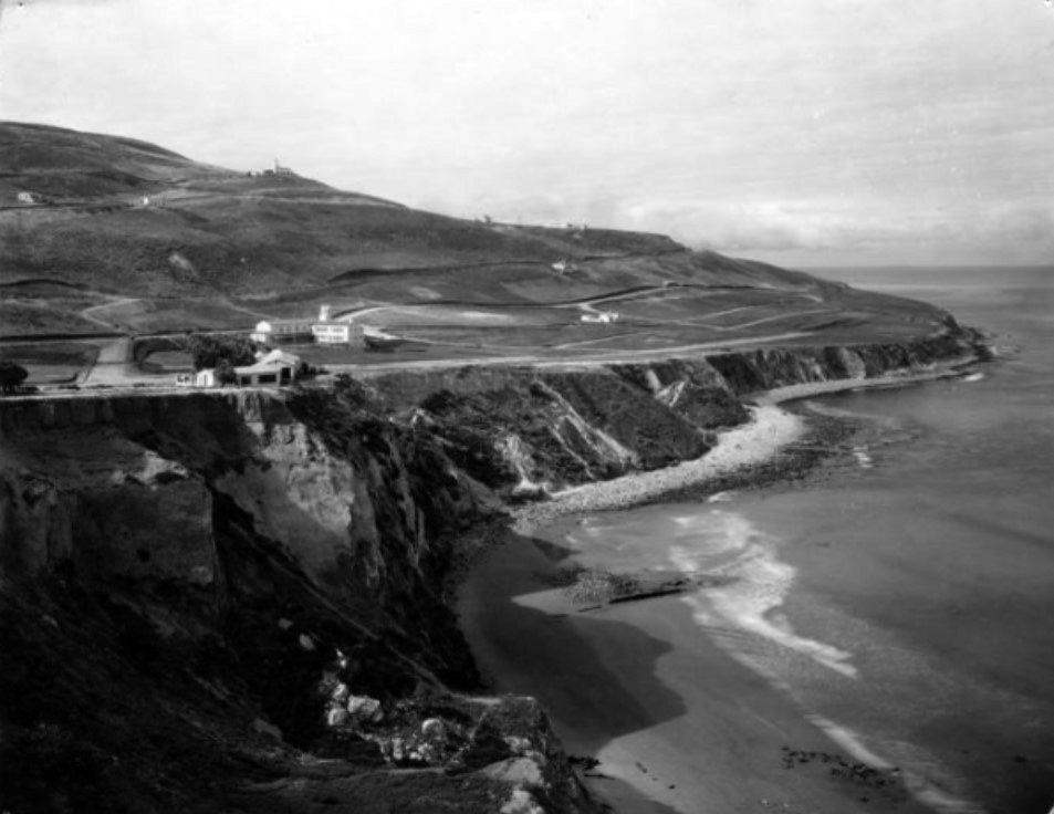 |
|
| (1925)^ – Elevated view looking south with the Frederick Law Olmsted Jr. residence located on Rosita Place at far left overlooking the cliffs of Malaga Cove. The house was demolished in 1971 due to bluff erosion. Malaga Cove School is beyond the Olmsted house, with La Venta Inn visible along hilltop in background. |
Palos Verdes Peninsula: Then and Now
|
|
 |
|
| (1920 vs. 2021) - Palos Verdes Peninsula |
 |
|
| (1924 vs 2023)* - Palos Verdes Peninsula, looking southeast towards Point Fermin with San Pedro Harbor seen in the distance. Portuguese Bend is at lower right. |
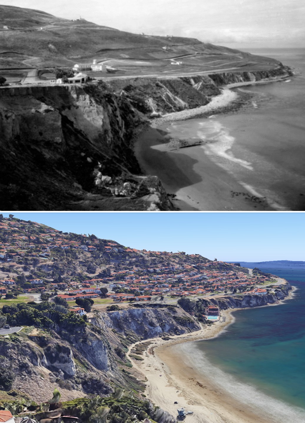 |
|
| (1925 vs 2023)* - Looking SW showing the cliffs of Malaga Cove, Palos Verdes Peninsula. |
Historical Notes In the earlier image, the Frederick Law Olmsted Jr. residence is seen on Rosita Place at far left overlooking the cliffs. The house was demolished in 1971 due to bluff erosion. Malaga Cove School is beyond the Olmsted house, with La Venta Inn visible along the hilltop in background |
La Venta Inn
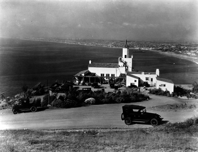 |
|
| (1926)^ - A scenic point of the Palos Verdes Peninsula, showing La Venta Inn in Palos Verdes Estates and the coastline from Redondo Beach on. |
Historical Notes Opened in 1924, La Venta was the first structure to be completed on the Palos Verdes Peninsula. Originally, it served as a clubhouse for the entertainment of realtors and prospective land owners. Architects Walter and Pierpont Davis designed the building and the famous landscape architects, the Olmstead brothers, designed the gardens.* |
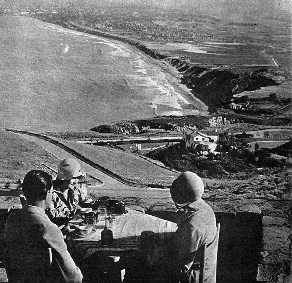 |
|
| (1930s)* - View looking north from the patio of La Venta Inn in Palos Verdes. |
Historical Notes In the 1920's, it became a famous black-tie restaurant and in the 1930's, a weekend tourist retreat for such notable people as Charles Lindberg, Tyrone Power, Cary Grant and Gloria Swanson. During World War II, La Venta's tower was utilized as a 24 hour lookout point for the US Coast Guard.* |
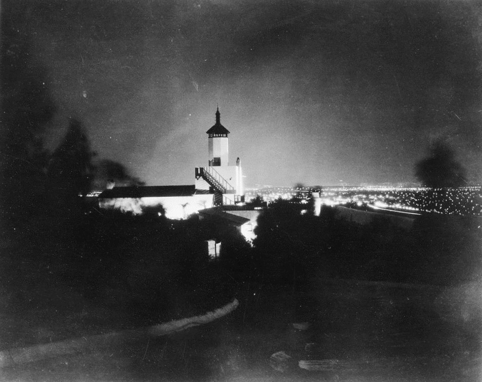 |
|
| (1930)^^ - Exterior view of the La Venta Inn at night, Palos Verdes, April 1930. |
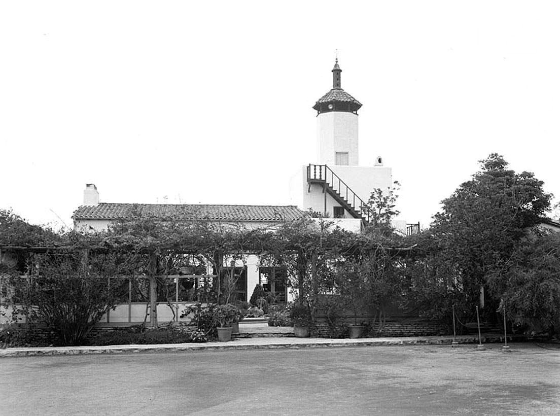 |
|
| (1930s)^.^ – Close-up daytime view of the La Venta Inn. |
Historical Notes In 1944, La Venta was purchased as a private residence, however due to popular demand; the family immediately reopened the property as a peninsula social center hosting a myriad of events including weddings and receptions. In 1992, the New York Food Company was invited to become the in-house management team.* |
* * * * * |
Playa Del Rey
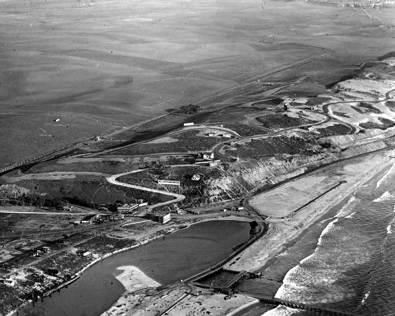 |
|
| (ca. 1924)^ - Aerial view of Playa Del Rey showing the area called "Surfridge". |
Historical Notes A small airfield opened to the east of Surfridge in 1928. It became a popular location for residents to see air shows. The growing number of commercial flights into Los Angeles following World War II meant a higher number of planes flying low over Surfridge. Many residents learned to co-exist with the noise from propeller planes, but jet engines were impossible to ignore. In the 1960s and 1970s, the Sufridge area was condemned and acquired by the City of Los Angeles in a series of eminent domain purchases to facilitate airport expansion (LAX) and to address concerns about noise from jet airplanes. Home owners were forced to sell their property to the City. Several homeowners sued the City and remained in their houses for several years after the majority of houses were vacated. Eventually all the houses were either moved or demolished. |
* * * * * |
Venice Canals
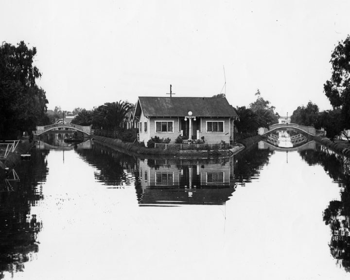 |
|
| (1924)^ - Looking straight ahead at the houses you see a complex of rental bungalows known as United States Island. It was accessible only by the foot bridges seen on either side of it. In this view, looking north, Altair Canal is on the left and Cabrillo Canal on the right. |
Click HERE to see more Early Views of the Venice Canals (1904+). |
* * * * * |
Santa Monica Pier
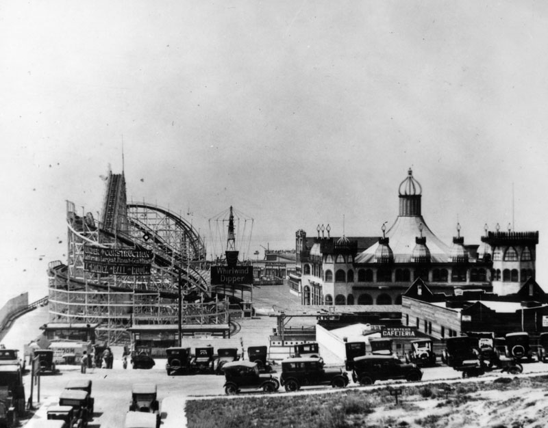 |
|
| (1924)^ - View shows an amusement park, complete with wooden roller coaster, on the Santa Monica pier. |
Historical Notes The Santa Monica Municipal Pier opened in 1909 and was the first pier on the west coast to use reinforced concrete pilings. It was thirty-six feet wide and stretched 1200 feet into the Pacific Ocean. In 1916, Charles I.D. Looff constructed a Moorish-Byzantine hippodrome, which housed a merry-go-round with 44 hand-crafted horses, a billiards and bowling hall, a two-track Blue Streak Racer wooden roller coaster along with The Whip and the Aeroscope thrill rides, a "What Is It?" maze, and several smaller rides. Looff's opening day, July 4, 1917, drew over 100,000 people; the biggest crowd in the city's history.^ In 1987, the Santa Monica Looff Hippodrome was added to the National Registry of Historic Places. Click HERE to see more in Early Views of Southern California Amusement Parks |
Venice Pier
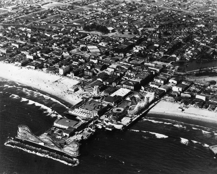 |
|
| (ca. 1925)^ - Aerial view of Venice, its beach and pier. The canals are visible at the extreme right. |
Click HERE to see more in Early Views of Southern California Amusement Parks |
* * * * * |
Southland Beaches
_1925.jpg) |
|
| (1925)^ - The ocean water is filled with people swimming or playing, and the beach is likewise filled with people and umbrellas (to keep off the sun). The view is looking north towards Ocean Park where some buildings and part of Lick Pier are visible. |
Click HERE to see more early views of Southland Beaches in Early Views of Santa Monica |
* * * * * |
San Fernando Valley
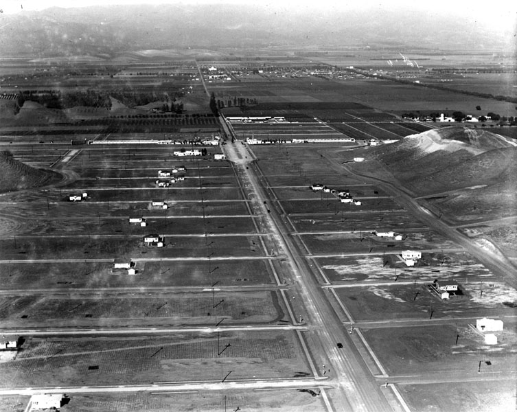 |
|
| (1924)^ - Aerial view of Woodland Hills (Girard) in 1924. |
Historical Notes Victor Girard Kleinberger was a land huckster with big dreams. Born in Kentucky, he began his sales career peddling Persian rugs -- fakes, of course -- door to door. Girard's modus operandi was to shove the rolled-up rug into the door frame (thus preventing the door from being slammed shut on him) and begin coughing profusely -- all the while mumbling about tuberculosis and priceless rugs. It was a ruse that apparently worked, and by 1899, with his fortune already made, the 18-year-old Girard (he had dropped his last name) headed west to Los Angeles, where he branched out into other enterprises, including real estate.*## In 1922, Girard Kleinberger bought 2,886 acres in the west San Fernando Valley and founded the town of Girard. He sought to attract residents and businesses by developing an infrastructure, advertising in newspapers, and planting 120,000 trees. His 300 pepper trees forming an arch over Canoga Ave. between Ventura Boulevard and Saltillo St. are Los Angeles Historic-Cultural Monument #93 in 1972 (Click HERE to see the LA Historic-Cultural Monuments List***). |
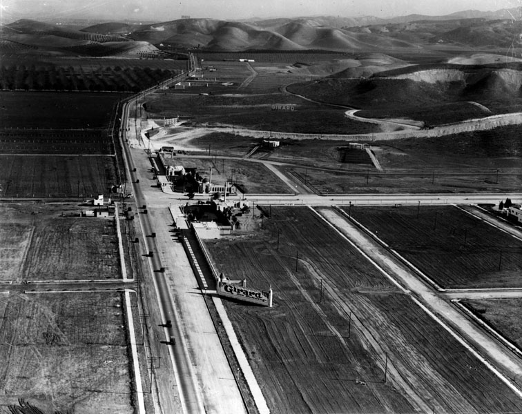 |
|
| (ca. 1924)^ - This is the intersection of today's Ventura Boulevard (foreground) and Topanga Canyon Boulevard, in the real estate development of Girard. |
Historical Notes Although Girard Kleinberger's early efforts were criticized as providing only a dubious facade of economic activity (local lore has it that in order to attract development he erected false store fronts on Ventura Boulevard, for which he spent time in jail), the Girard Golf Course completed in 1925 continues to operate today as the Woodland Hills Country Club, and his scheme was ultimately successful in attracting interest in the community. |
Click HERE to see more in Early Views of the San Fernando Valley |
* * * * * |
Mulholland Highway
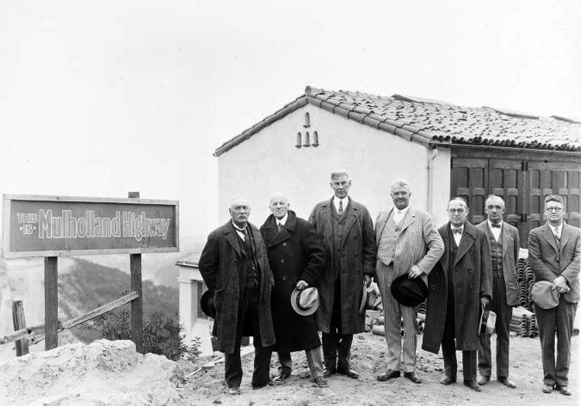 |
|
| (1920s)*^#^ - William Mulholland (far left), Moses Sherman (2nd from left), Harry Chandler (center) and a group of men posing next to a "Mulholland Highway" sign while out examining the Mulholland Dam site. |
Historical Notes Mulholland Highway (later Mulholland Drive) has its origins in 1921 as a scenic drive, with the “working name” of Skyline Drive, engineered by DeWitt Reaburn. The scenic drive was engineered in small sections, with work actually beginning at several points along the route simultaneously. The road was originally planned to encompass a right of way of 200 feet and intended to be 20 miles long, taking a mere two years to complete. For reasons, some to honor Mulholland, but mostly to use his stature and accomplishments to silence opposition, the most traveled scenic highway conceived as Skyline Drive became Mulholland Highway. ##** |
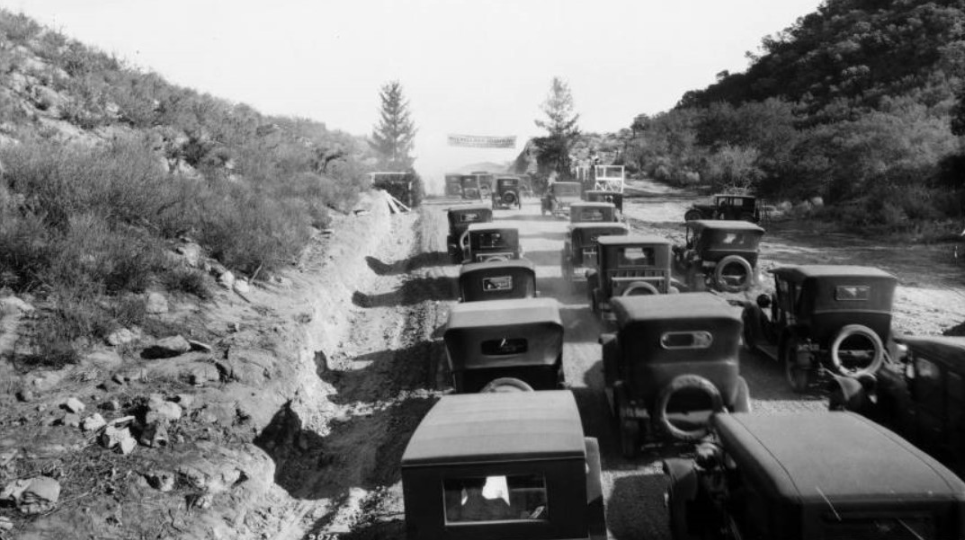 |
|
| (1924)^^ - View of over a dozen early model cars clustered at the opening of the Mulholland Highway. Three rows of early automobiles make their way up the hill and through the mountains on the Mulholland Highway. Rocks and scrub vegetation cover the slopes to either side, a parked car and a wooden platform visible to the right, just off the road. At the peak of the hill, a banner is hung between two trees. |
Historical Notes This winding ridgeline road in the Santa Monica Mountains was dedicated in honor of William Mulholland, the water engineer who designed the Los Angeles Aqueduct, on Dec. 27, 1924. Originally dirt and called Mulholland Highway, the name was changed to Mulholland Drive in 1939. Portions of the original road remain unpaved.^* |
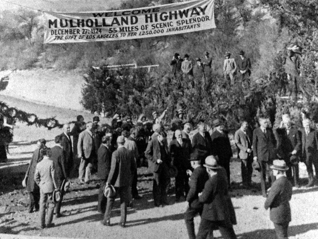 |
|
| (1924)^#*^ – Closer view showing dignitaries assembling near a banner which reads: Welcome Mulholland Highway - December 27, 1924 – 55 Miles of Scenic Splendor – The Gift of Los Angeles to her 1,250,000 Inhabitants |
Historical Notes The eastern terminus of Mulholland Drive is at its intersection with Cahuenga Boulevard at the Cahuenga Pass over the Santa Monica Mountains (at this point Cahuenga Boulevard runs parallel to Highway 101/The Hollywood Freeway). The road continues to the west, offering vistas of the Hollywood Sign, downtown Los Angeles, and then Burbank, Universal City, and the rest of the San Fernando Valley with the San Gabriel, Verdugo, and Santa Susana Mountains.*^ |
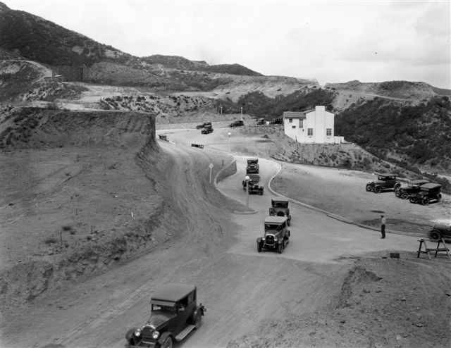 |
|
| (1925)^ - View of Mulholland Highway under construction near Beachwood Canyon. |
Historical Notes Mulholland Highway curves around the western edge of Beachwood Canyon like a massive snake. A man-made thoroughfare buttressed by granite retaining walls, the Highway was built, like all the roads in Hollywoodland, in the mid-1920s. It contains both a split-level section (under construction in the photo above) and a cliff-side stretch locals call the blind curves. |
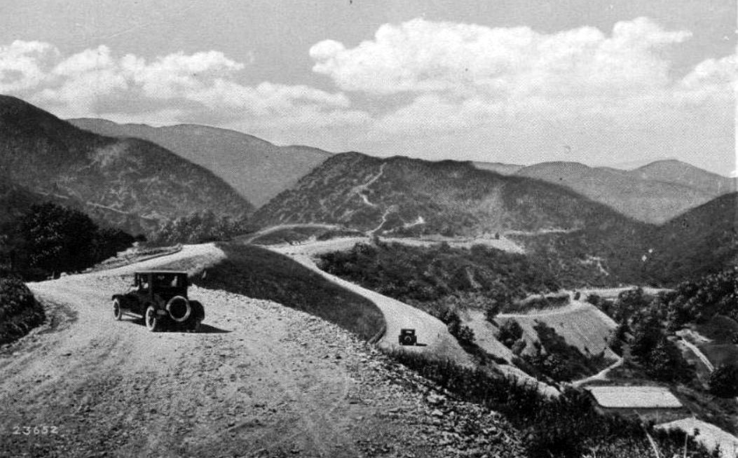 |
|
| (ca. 1925)^*## – Postcard view showing two early model cars near the intersection of Mulholland Highway (later Drive) and Franklin Canyon. |
Historical Notes Curving ingeniously through the eastern Santa Monicas, the Mulholland Drive motorway once brought a heavy slew of Angelenos into the Valley. In the early 1970s, however, 5,000 local activists successfully prevented the cement paving of most of that stretch. To this day, that section is known as 'Dirt Mulholland', and is only open to cyclists and pedestrians. From the famous Mulholland Bridge east, Mulholland Drive completes its creator's vision, and winds through the affluent Hollywood Hills to Mulholland Drive's easternmost terminus at Cahuenga Boulevard, near Universal Studios, until again becoming an unpaved footpath to Griffith Park. The paved road begins again east of Topanga Canyon Boulevard at Santa Maria Road. Shortly thereafter, the thoroughfare splits into Mulholland Drive and Mulholland Highway. Mulholland Drive terminates at U.S. Highway 101 (the Ventura Freeway), where it becomes Valley Circle Boulevard. Mulholland Highway continues to the southwest until it terminates at State Route 1 (PCH) in Leo Carrillo State Park at the Pacific Ocean coast and the border of Los Angeles and Ventura counties.*^ |
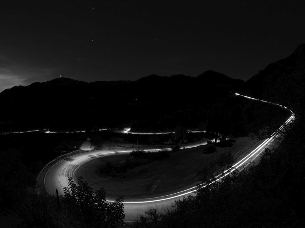 |
|
| (ca. 2011)+^+ – Time-lapse image showing Mulholland Drive at night. |
Historical Notes The road offers spectacular views of the Los Angeles Basin, the San Fernando Valley, and the Hollywood Sign. Mulholland Drive is home to some of the most exclusive and most expensive homes in the world. Many of these homes are set back from the road and offer outstanding views of downtown Los Angeles. Celebrities such as Jack Nicholson, Sylvester Stallone, Justin Timberlake, Eric Stoltz, Jessica Biel, Paris Hilton and Reese Witherspoon all live nearby.*^ |
Click HERE to see more in Mulholland Monuments |
* * * * * |
Family Camps and Parks
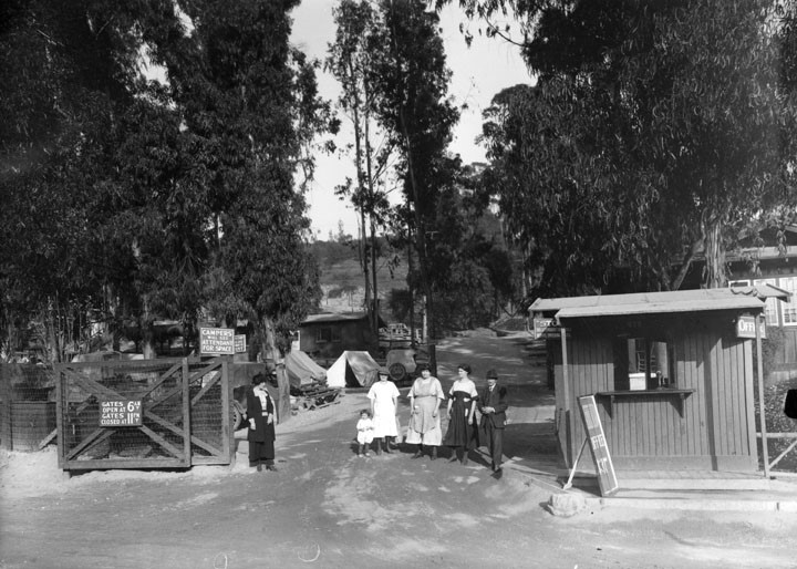 |
|
| (1920s)^ - Five adults and a child stand at the entrance to a camping area in Elysian Park. Next to them is a wooden building with the sign "Office" on the end. The gates on the other side of them announce they open at 6 and close at 11. |
Historical Notes From humble beginnings, City Council created the Department of Parks in 1889. At that time the city owned several pieces of land that were believed suitable for park purposes. They turned over these properties to the newly-organized Department of Parks. In a generous mood during Christmas of 1896, Colonel Griffith J. Griffith offered to donate five square miles of the Los Feliz Rancho to the City as a park. He said, "it must be made a place of recreation and rest for the masses, a resort for the rank and file, for the plain people..." What followed was the development of several more parks including the original pueblo lands of the old plaza, Elysian Park, Pershing Square, and later Lincoln Park, MacArthur Park, Echo Lake Park, and Hollenbeck Park.++* |
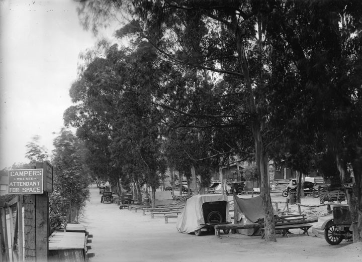 |
|
| (1920s)^ - A view from the entrance gate down two rows of campsites at Elysian Park. A few tents and a few cars are already in place. At the entrance a sign notifies all that "Campers will see attendant for space". |
Historical Notes Children's camps and family camp as a municipal recreation service began in 1913. Although no longer open, the first camp was established in Redondo Beach. In 1914 Camp Seely in the San Bernardino Mountains in Crestline was the first family camp built, and in 1919 Camp Radford opened in Big Bear in the San Bernardino National Forest. Camp High Sierra in the Mammoth region opened to families in 1924 and has proved popular to this day with generations of the same family members attending the camp. Then came the local camps; Griffith Park Boys Camp opened in 1925 and a year later Hollywoodland Girls Camp opened. The last two camps to be added were Decker Canyon Camp in Malibu and Camp Valcrest in Angeles National Forest. The Department's camping program was so innovative that Oakland, Berkeley, Sacramento, Stockton, Long Beach, and San Diego followed suit.++* |
* * * * * |
Downtown Los Angeles
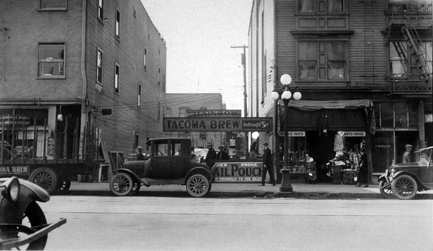 |
|
| (1924)#^ - Open Fruit Stand, 812 E. 5th Street, Los Angeles. Sign reads: 'Rainbow Tacoma Brew - 5 Cents' |
Hill and 5th Street
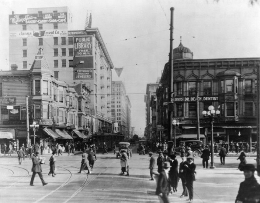 |
|
| (1920)* - Looking east on 5th at Hill street. Several buildings such as the Spinks, Metropolitan and Bath Building (aka Willoughby Hotel) can be seen, as well as several storefronts like Dr. Beach, Dentist. Pershing Square is to the right out of view. |
.
 |
|
| (1922)^^ – View looking east on 5th Street at Hill Street. Streetcars, autos, and pedestrians share the streets. Boos Bros. Cafeteria can be seen behind the streetcar. The building on the right is the Willoughby Hotel (S/E corner of 5th and Hill) which was built in 1898 and demolished in 1982. Pershing Square is across the street from the Willoughby out of view (to the right). |
Historical Notes In 1906, Horace Boos and three siblings opened one of Los Angeles' first cafeterias. Their idea of a fast food, self-service restaurant consisted of unheard-of impositions for that time: patrons would wait on themselves and return their trays and dishes to the kitchen. The brothers' downtown cafeteria was the first link, in a chain of seven that ultimately stretched from Los Angeles to San Francisco. They opened four more in the downtown area one in Santa Catalina Island, and two in San Francisco. By the 1920s, the chain of cafeterias had become widely known. When Horace Boos died in 1926, the surviving brothers sold the seven cafeterias for a record $7 million to the Childs Corp. In turn, Childs sold two of the cafeterias to Clifford E. Clinton, who launched the Clifton's Cafeteria Chain. Eventually, Henry Boos bought back two, one on Hill Street and the other in Avalon on Catalina Island. The Boos Brothers offered inexpensive fare of a "40-cent dinner", but would call it quits in the late 1940s, before cafeterias began losing popularity due to the arrival of luncheonettes, soda fountains, and fast-food restaurants.^ |
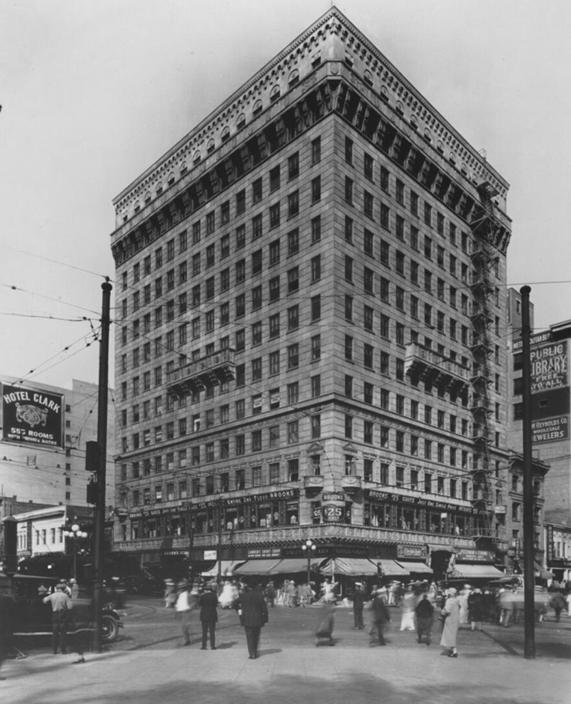 |
|
| (1924)* – Looking at the NE corner of 5th and Hill streets showing the newly built Pershing Square Building. |
Historical Notes The Pershing Square Building was built in 1924 and designed by architects Claud Beelman and Aleck Curlett in the Italian Renaissance Revival style that features classic design elements, symmetry, arches, and ornamental stone brackets. |
|
|
| (ca. 1925)* – Looking east on 5th Street at Hill Street showing a newly installed semaphore traffic signal |
Then and Now
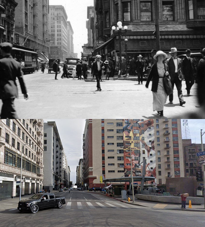 |
|
| (1922 vs. 2022)* - 5th Street looking East from Hill Street. Pershing Square is on the right behind the camera. |
Then and Now
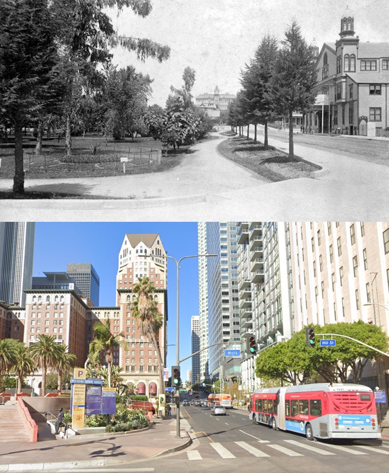 |
|
| (1890 vs. 2021)* – 5th Street looking West from Hill Street with Pershing Square (then 6th Street Park) seen on the left. |
Pacific Electric Hill Street Station and Subway Tunnel
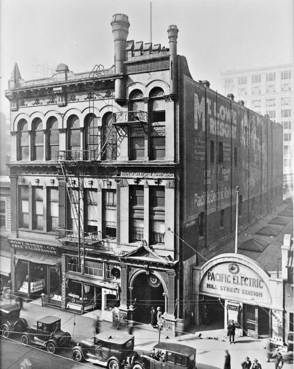 |
|
| (ca. 1920s)^## - Pacific Electric Hill Street Station & Masonic Bldg. West side of Hill St. between 4th & 5th Streets. |
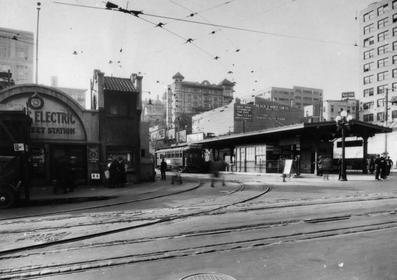 |
|
| (ca. 1922)^ - The Pacific Electric Hill Street station, located at 427 South Hill Street, between 1922 and 1925. |
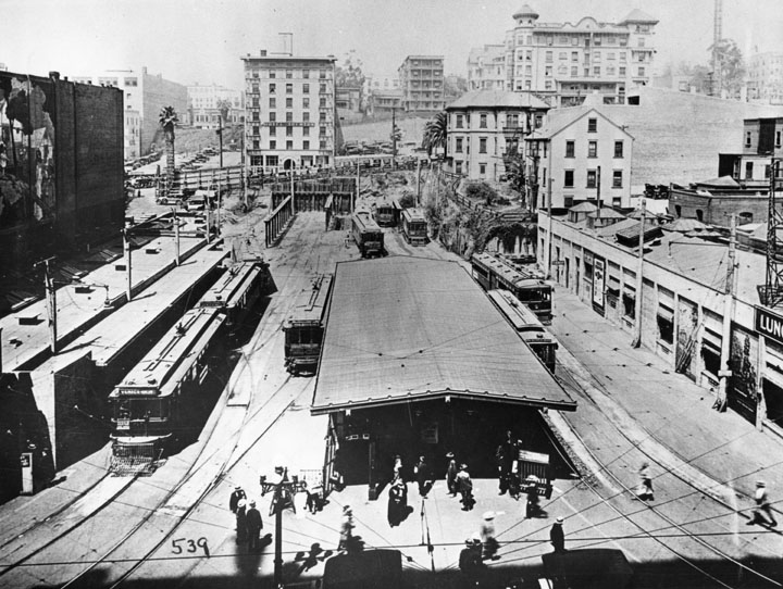 |
|
| (ca. 1920s)^ - The Hill Street station for electric cars during 1922 to 1925, before the Subway Terminal Building was built, looking west toward Bunker Hill. |
Historical Notes As street traffic increased in downtown Los Angeles, the Pacific Electric Railway undertook its most ambitious project, a dedicated right of way into downtown through a subway - the existing terminal in the Pacific Electric Building at Sixth and Main was reached by shared street running. Responding to the traffic congestion that clogged the streets, the California Railroad Commission in 1922 issued Order No. 9928, which called for the Pacific Electric to construct a subway to bypass downtown's busy streets.*^ |
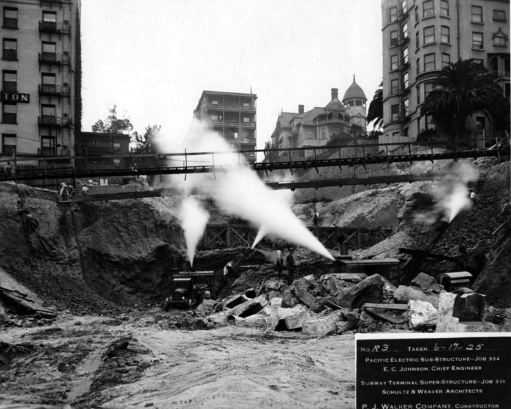 |
|
| (1925)^.^ – View, looking west from Hill Street, of the construction site as the PE Hill Street Station is converted to a massive building and entrance to a subway tunnel which will cross Bunker Hill to Toluca Yard (1st/2nd/Beverly Boulevard/Glendale Boulevard). Here they have breached the Olive Street roadbed and spanned the vacated Olive Street School/Health Department property. The Trenton (on the left) and the Fremont (on the right) look on nervously. The Rose Mansion at 4th Street and Grand Avenue can be seen behind the Fremont Hotel. |
Historical Notes After 18 months of construction and $1.25 million in expenditures, the Subway officially opened to the public on December 1, 1925, between the intersection of Beverly and Glendale Blvds in Westlake, and the Subway Terminal Building.*^ |
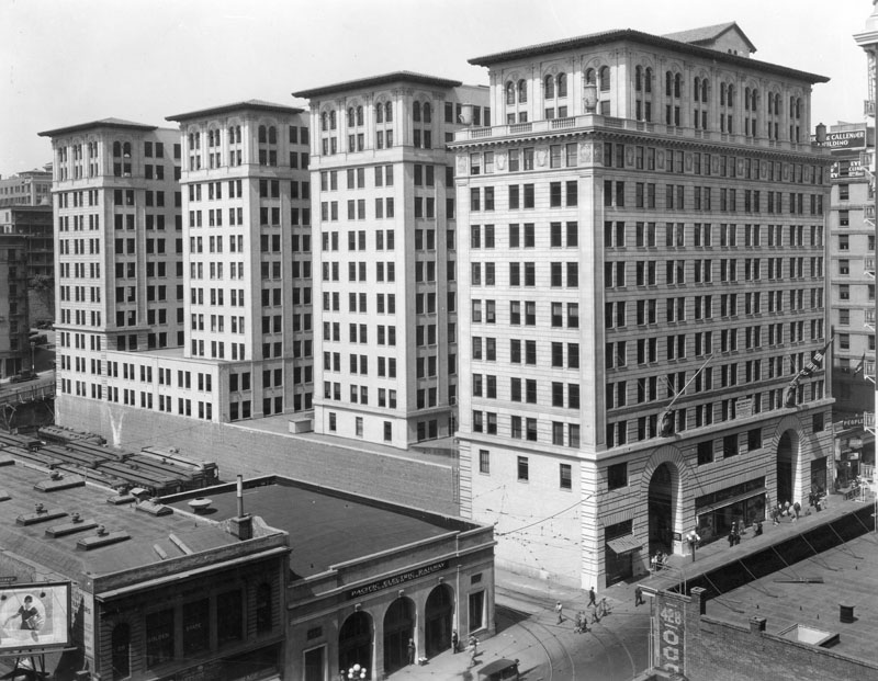 |
|
| (1925)^ - View of the Subway Terminal Building and the Pacific Electric Railway Passenger Station in 1925, the year they were built. View is of the Hill Street side south of 4th Street. |
Historical Notes The Subway Terminal Building was built to conform to the 150 foot height limit imposed on all downtown construction. The other end of the subway line emerged at the surface at the Belmont Tunnel / Toluca Substation and Yard.*^ |
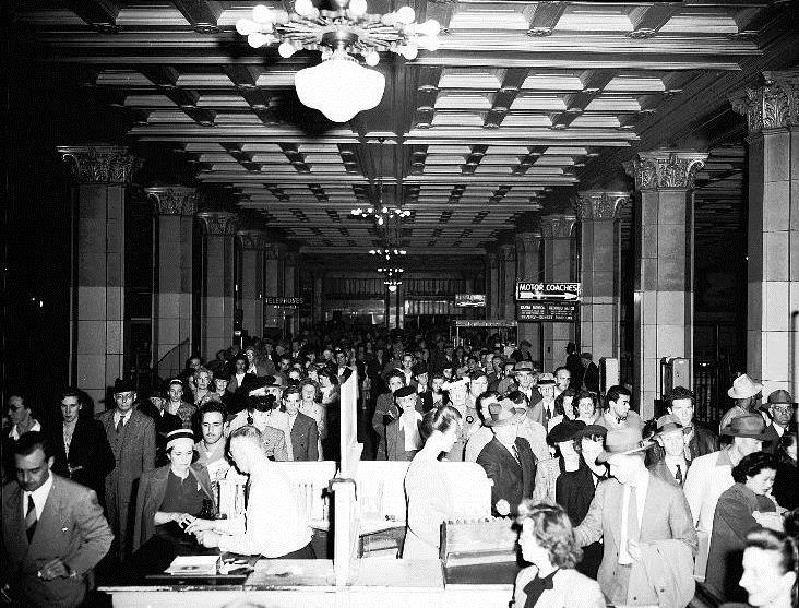 |
|
| (ca. 1925)^## - View showing crowds of people navigating through the Subway Terminal main hall. |
Historical Notes After 18 months of construction and $1.25 million in expenditures, the Subway officially opened to the public on December 1, 1925. The trains, which traveled a distance of slightly over one mile, transported passengers between the tunnel's mouth near the intersection of Beverly and Glendale Boulevards in Westlake, and the Subway Terminal Building.*^ |
 |
|
| (ca. 1925)^ - Interior view of the Subway Terminal Building in downtown Los Angeles, showing Pacific Electric car tracks running in various directions in the subway. |
 |
|
| (n.d.)^## - View of the symmetry in the tracks within the Pacific Electric Subway Building. The subway was in operation from 1925 to 1955. |
* * * * * |
Belmont Tunnel / Hollywood Subway – Western Portal & Toluca Yard
Construction of the Western Portal
 |
|
| (1924)* - Construction of the western portal of the Pacific Electric subway tunnel at 1st Street and Glendale Boulevard. |
Historical Notes Plans for what newspapers called the “Hollywood Subway” (officially the Pacific Electric Subway) were prepared in early 1924, and groundbreaking took place on May 3, 1924. The tunnel provided a grade-separated shortcut beneath Bunker Hill between the Subway Terminal at 4th and Hill Streets and the western portal near Beverly and Glendale Boulevards. It was approximately one mile long and double-tracked. Click HERE to see construction of the Eastern Portal of the PE Subway Tunnel. |
Opening of the Tunnel
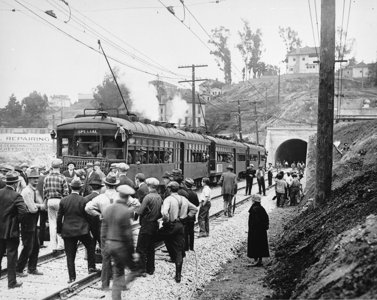 |
|
| (1925)* - Ceremonies commemorating the opening of the Pacific Electric tunnel under Bunker Hill, from Beverly Boulevard to 5th and Hill Street. The line opened to the public on December 1, 1925. |
Historical Notes The Subway Terminal at 417 South Hill Street and its new tunnel were built to move cars faster than street traffic. The terminal opened December 1, 1925, after roughly eighteen months of construction. |
Early Operation
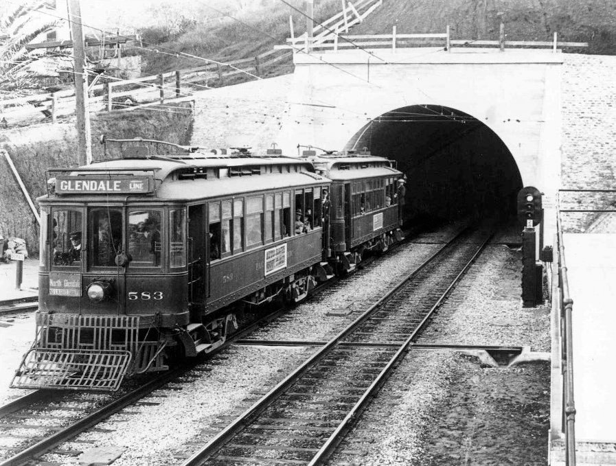 |
|
| (1927)* - Glendale-bound car No. 583 exits the Pacific Electric subway portal. |
Historical Notes Through the late 1920s and 1930s, the subway carried heavy daily traffic. During World War II, service peaked at about 65,000 riders per day and 880 train movements through the tunnel. |
Intersection Complexity and Expansion
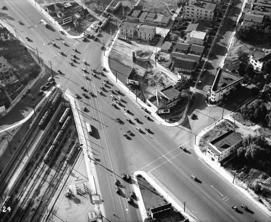 |
|
| (1936)* - Aerial view of the junction of 1st Street, 2nd Street, Beverly Boulevard, and Glendale Boulevard with the Pacific Electric Toluca Yard at lower left. The subway portal is off-frame at lower left. The awkward multi-street meeting often caused congestion and crashes, which led to construction of a new viaduct in the early 1940s. |
Historical Notes The photograph looks northwest over the intersection where east-west 1st became Beverly, and 2nd curved north to become Glendale. The Toluca Yard sat just below the Beverly/1st Street viaduct line. |
Postwar Years
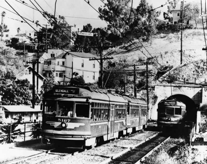 |
|
| (ca. 1950s)^ - Two Pacific Electric cars leave the subway at Beverly Boulevard, one bound for Glendale (Burchett Street) and one for Hollywood Boulevard. Photo courtesy of Tom LaBonge. |
Historical Notes The tunnel carried Red Cars from the Pacific Electric Subway Terminal downtown to points west and north, including Hollywood, Santa Monica, Glendale, and Burbank, without mixing with downtown street traffic. It was an important link that kept Pacific Electric service efficient and separated from the growing congestion above ground. |
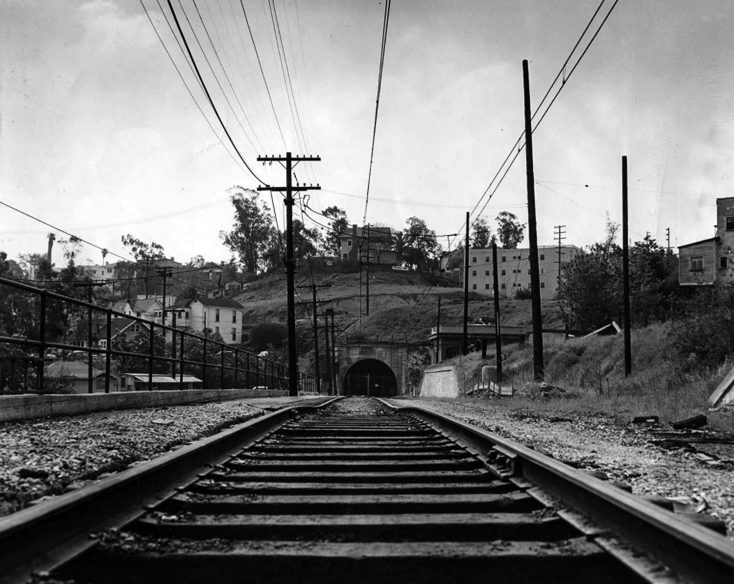 |
|
| (1956)* - View of the old Pacific Electric subway tunnel between Glendale Boulevard and the Subway Terminal. Passenger service ended in June 1955. |
Historical Notes The final passenger run took place on June 19, 1955, with a banner reading “To Oblivion” hanging from the lead car. Soon after, the rails were removed, the terminal was closed, and the Toluca Substation was disconnected—marking the end of Pacific Electric’s subway era. |
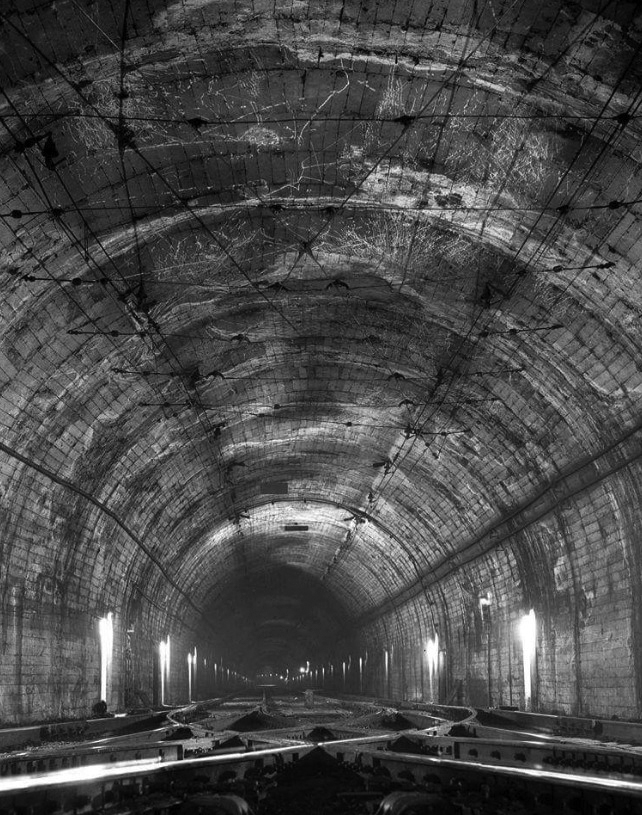 |
|
| (ca. 2000)* – View showing the 1925-built, one-mile Pacific Electric tunnel under Bunker Hill before the north end was sealed. |
Historical Notes In the 1960s, the city explored various uses for the old tunnel, including car storage and later as an emergency shelter. The only major change came in 1967, when a section between Flower and Figueroa Streets was filled in to make room for the Bonaventure Hotel’s foundation. |
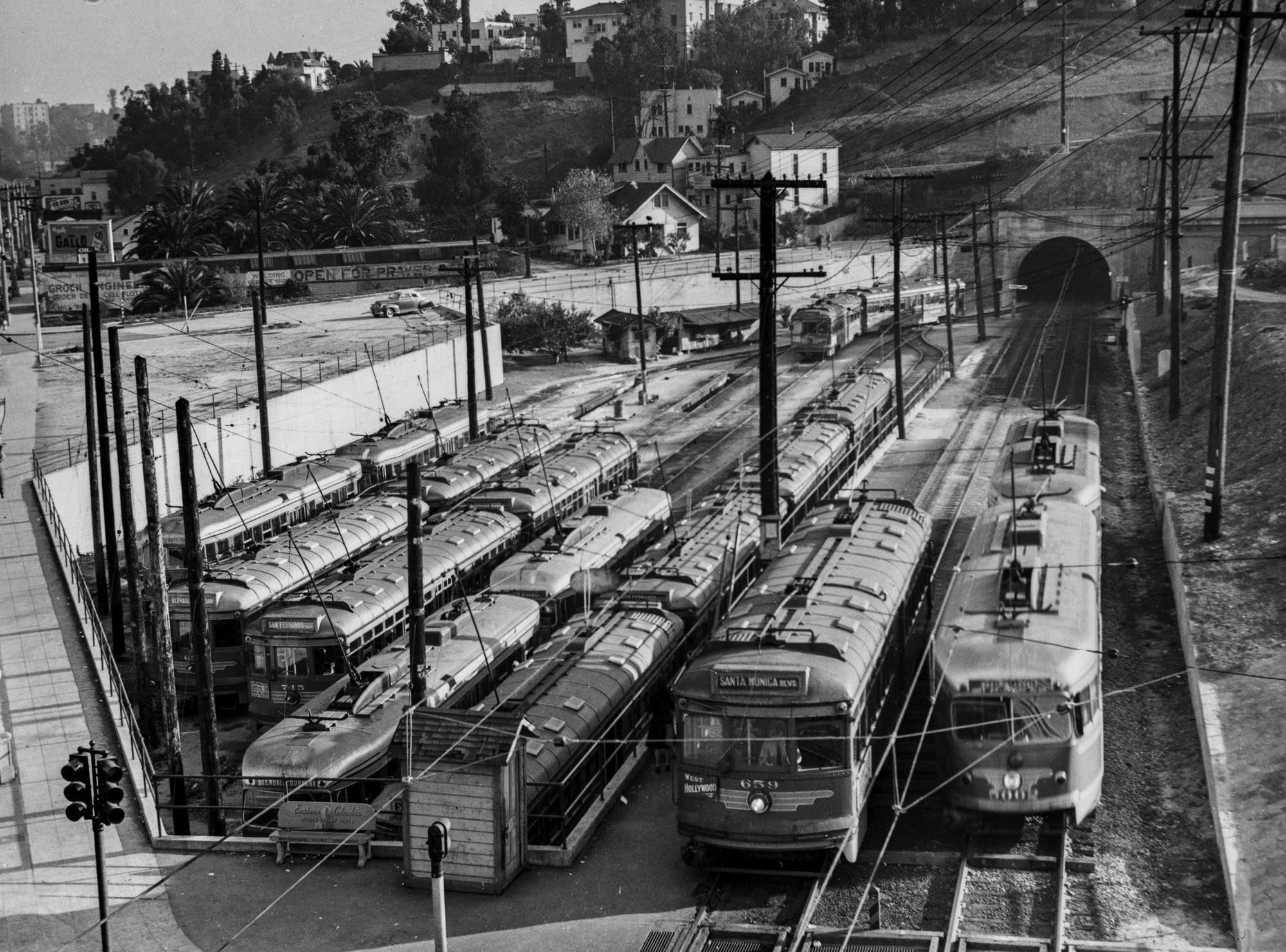 |
|
| (1950s)* - Pacific Electric cars pass the Toluca (Belmont) Yard as seen from the First Street Bridge. Within a few years, the yard was shut down and abandoned. Photo by Ralph E. Melching. |
Historical Notes After the Pacific Electric system shut down, both the yard and tunnel saw limited use before falling into neglect. Over time, the site became overgrown and largely forgotten, a silent reminder of the once vast electric rail network that served Los Angeles. |
 |
|
| (2023)* – Contemporary view looking southeast toward the site where the Toluca (Belmont) Pacific Electric Yard and Tunnel once stood. The area is now occupied by apartment buildings, with the downtown Los Angeles skyline rising in the background. |
Historical Notes The former Toluca (Belmont) Yard is now covered by apartment buildings and streets near Glendale and Beverly Boulevards. The tunnel entrance, long sealed, still extends underground toward downtown beneath the western slope of old Bunker Hill, a hidden remnant of Pacific Electric’s once-busy subway system. |
Then and Now
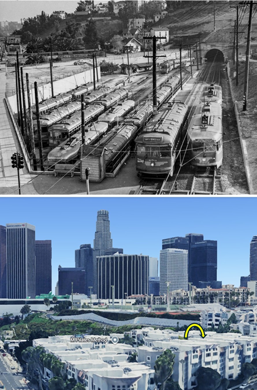 |
|
| (1950s vs. 2023)* – A “Then and Now” view looking southeast from the First Street (Glendale Boulevard) Viaduct toward the Toluca (Belmont) Pacific Electric Yard and Tunnel. Photo comparison by Jack Feldman. |
Historical Notes Once filled with Red Cars awaiting service, this area is now occupied by apartment buildings. The modern view is taken from a slightly higher elevation, with the approximate location of the now sealed-off tunnel highlighted by a yellow semicircle. |
Abandonment and Urban Change
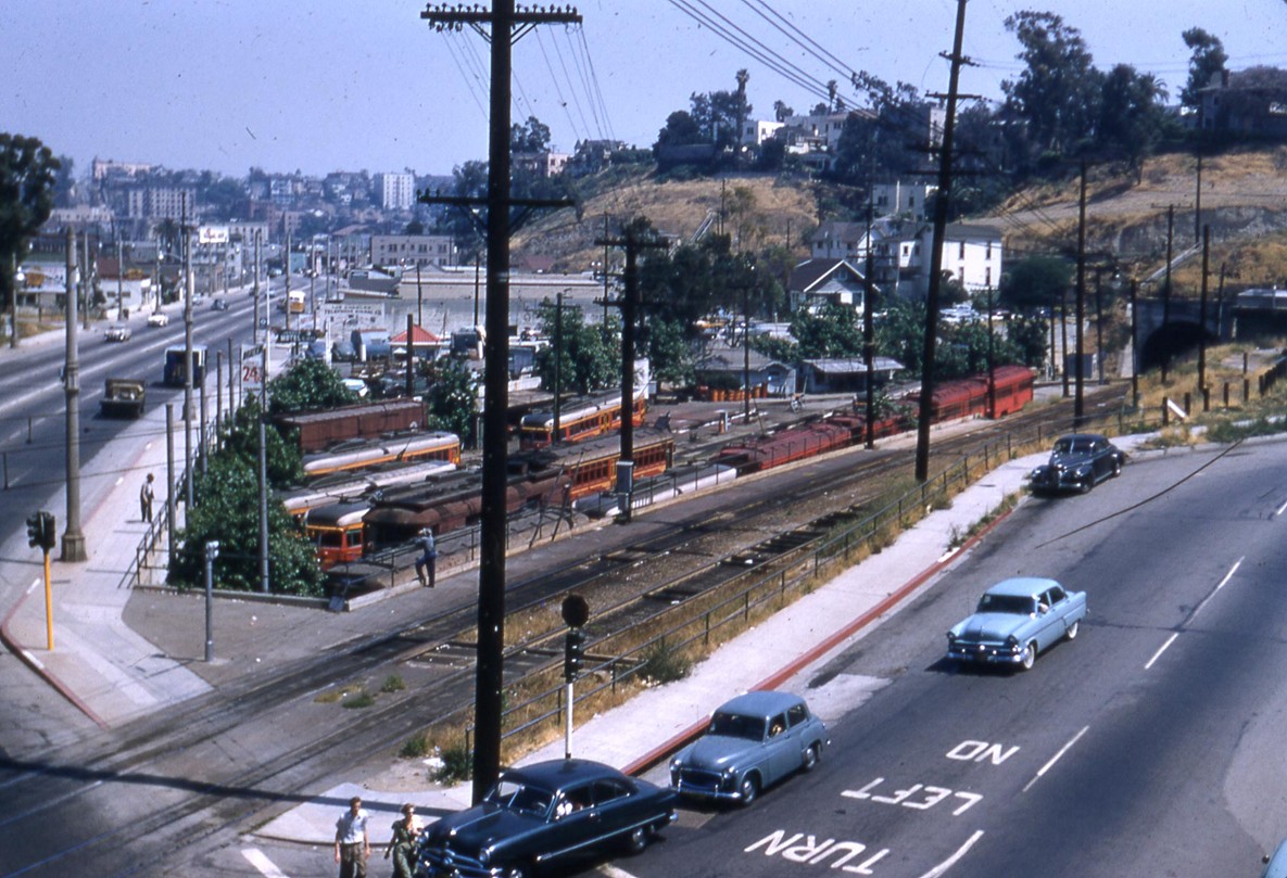 |
|
| (1955)* – View showing the Pacific Electric Subway Yard at Glendale Boulevard and Beverly Boulevard, where Red Cars paused before entering the tunnel beneath Bunker Hill to the Subway Terminal Building at 4th and Hill Streets. The tunnel portal appears at the far right. This small yard served as storage and a turnaround for interurban cars on the Glendale–Burbank and Hollywood lines. Photo from the Ralph Cantos Collection. |
Historical Notes This yard was commonly called Toluca Yard in company records. It sat just west of the 1st/Beverly viaduct and alongside Glendale Boulevard. |
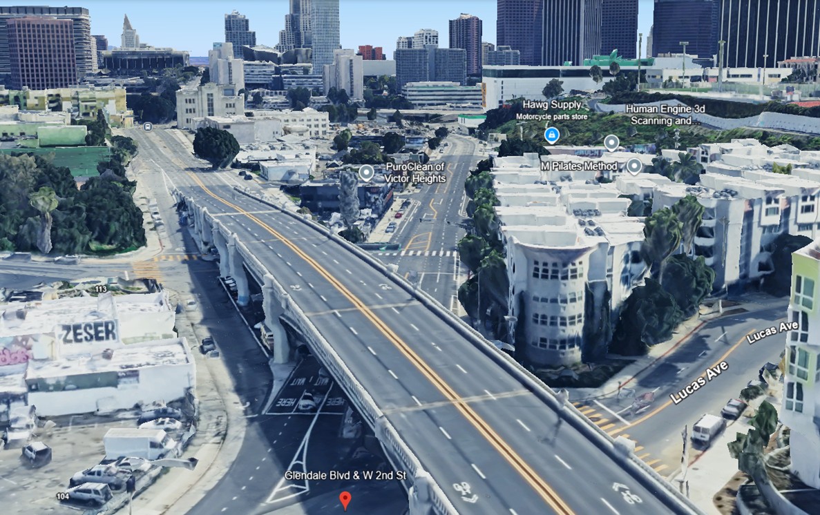 |
|
| (2023)* – Google Earth view shows what exists today on the site of the Pacific Electric Subway Yard. The yard and portal have been replaced by apartments and the curve of Lucas Avenue. Glendale Boulevard and West 2nd Street are visible at the bottom. |
Historical Notes The former yard was redeveloped as Belmont Station Apartments, with the portal sealed and painted with a Red Car mural by artist Tait Roelofs. The Toluca Substation façade survives at the edge of the property. |
Then and Now
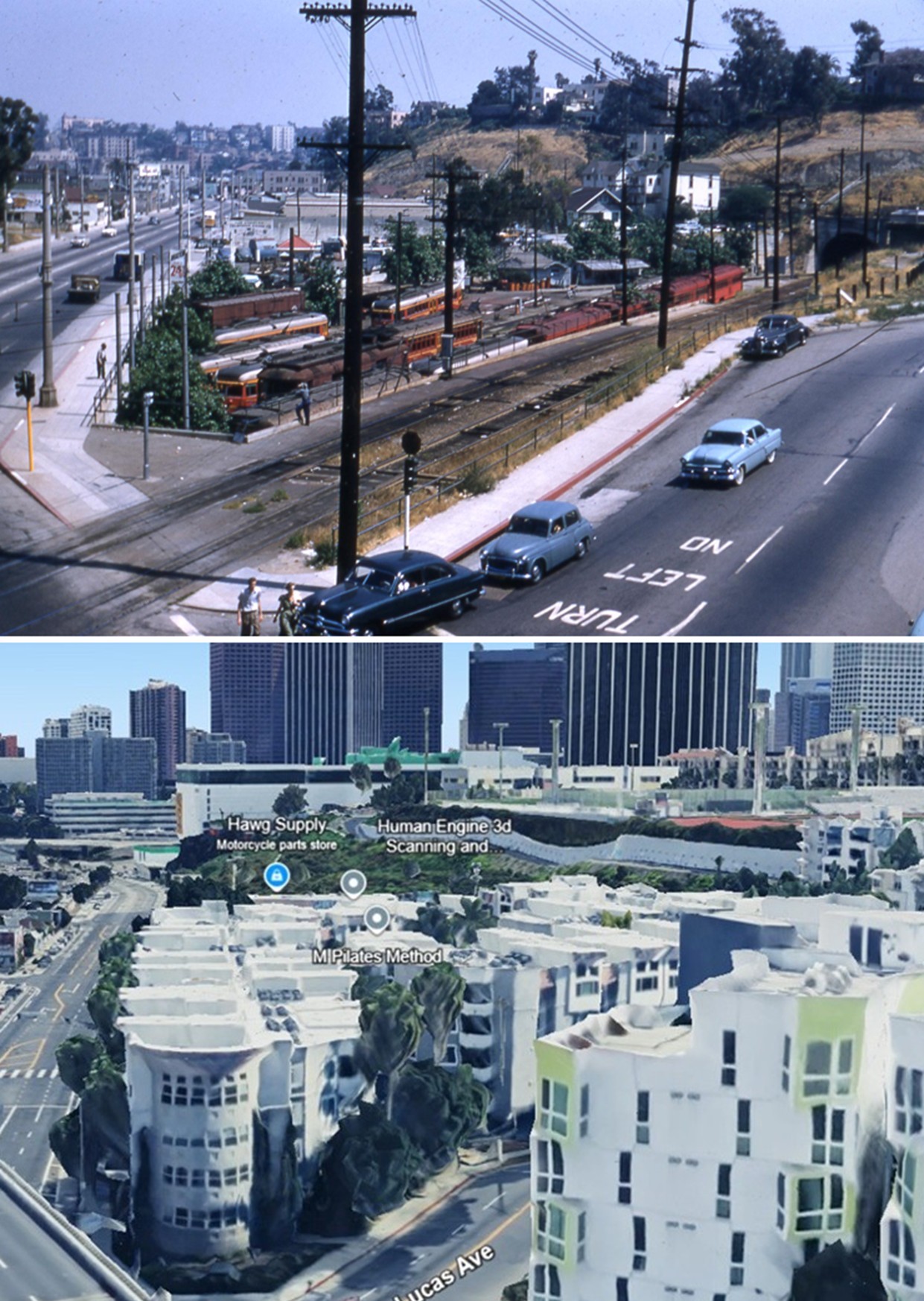 |
|
| (1955 and 2023)* – Comparison views showing the Pacific Electric Subway Yard at Glendale and Beverly (top) and the site today (bottom). In 1955, Red Cars paused here before entering the tunnel. Today the site contains apartments along Lucas Avenue; Glendale Boulevard and West 2nd Street remain in the street grid. Photo comparison by Jack Feldman. |
Historical Notes The tunnel alignment under Bunker Hill still exists but is sealed in sections due to later building foundations; the Subway Terminal survives as Metro 417 apartments, while Pershing Square’s Metro station lies nearby. |
Later Years and Preservation
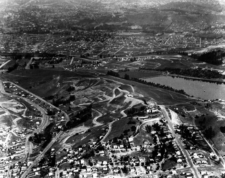 |
|
| (ca. 1924)^ - View of the Silver Lake Reservoir and surrounding area, with streets readied for houses. View is looking north. |
Historical Notes In 1896 Herman Silver was elected to the Los Angeles City Council and was soon voted its President – acting often as the Mayor pro tem of the city. In 1902, he City Council created a the 1st Water Commision and named Herman Silver as its Chairman. Silver was instrumental in planning a reservoir Northeast of Downtown that would combine stored water with a development of nice homes and parks. The next Mayor came into office and failed to re-appoint Silver to the Water Board – for political reasons. The City Council reacted – praising Herman Silver by naming the new water project after him. The area has been known, ever since, by the name – Silverlake.^**# |
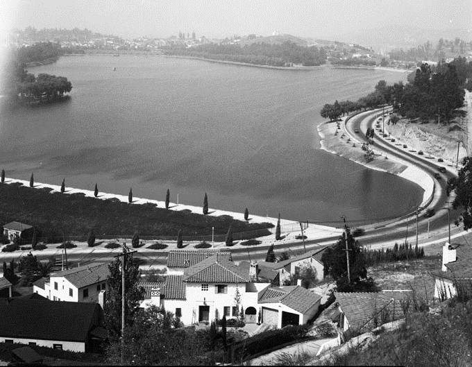 |
|
| (1930)* - Silver Lake Reservoir - Silver Lake Reservoir was named for Herman Silver, first president of the Board of Commissioners, Domestic Water Works System. He served from 1902-1903. The reservoir is a earth fill dam, asphalt concrete, with paved slopes. It was put into service in May 1908. |
Historical Notes In 1989, the Silver Lake Reservoir was designated LA Historic-Cultural Monument No. 422 (Click HERE to see complete listing). |
Click HERE to see more in Early LA Water Reservoirs |
Los Feliz
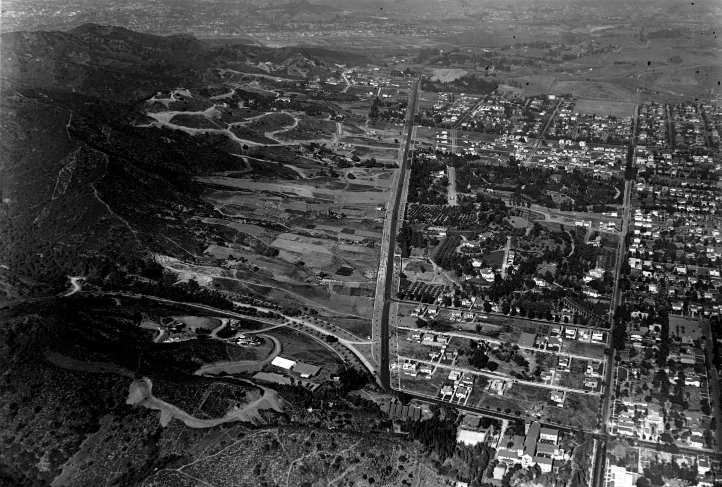 |
|
| (1922)^^+ – Aerial view looking east on Los Feliz Boulevard from above where Western Avenue makes a sharp turn into Los Feliz. Franklin Avenue runs away from the camera on the right. |
Historical Notes The west-east thoroughfare runs through Los Angeles and Glendale. It starts off at its east most point at Glendale Avenue as Los Feliz Road. After passing the railroad tracks in Glendale west most section, it enters Los Angeles and changes to Los Feliz Boulevard. Los Feliz passes through Atwater Village and Griffith Park. After Griffith Park, it swerves to a north-south street and ends. It then merges and becomes Western Avenue which in turns runs all the way down to the San Pedro area. Los Feliz Boulevard was named for Rancho Los Feliz, one of the first land grants made in California. Corporal Feliz, a veteran of the Anza Expedition of 1776, was a guard at the Pueblo of Los Angeles. In 1787 Governor Fages appointed Feliz as Comisionado of the Los Angeles Pueblo, giving him the powers of Mayor and Judge. For his service, Feliz was granted Rancho Los Feliz.*^ |
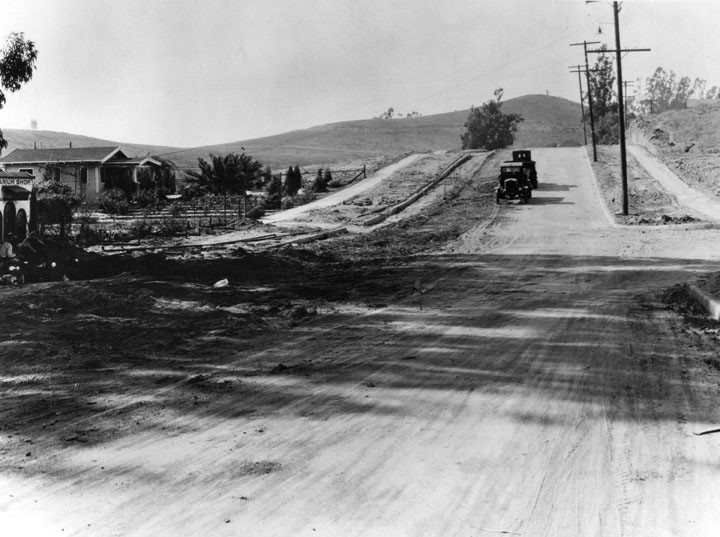 |
|
| (1920)^ – View showing two houses in a new tract south of Los Feliz Boulevard and east of Vermont Avenue which sold out in one day in 1920. It took two months to put in the streets. |
Historical Notes The Los Feliz neighborhood has been home to movie stars, musicians, and the Hollywood elite. It boasts some of the best-known residential architecture in the city, including two homes designed by Frank Lloyd Wright—the Ennis House and the Hollyhock House—and Richard Neutra's Lovell House. Mickey Mouse was "born" in Los Feliz: Walt Disney drew his first image of the now-legendary character in the garage of his uncle's house, on Kingswell Avenue between Vermont Avenue and Rodney Drive. Disney's first animation studio was also on Kingswell Avenue, just down the street from his uncle's house and east of Vermont Avenue. Disney's second, larger studio (now a Gelson's supermarket) was at the corner of Griffith Park Boulevard and Hyperion Avenue, on the Silver Lake side of the Los Feliz – Silver Lake boundary.*^ |
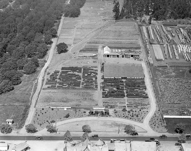 |
|
| (ca. 1924)^ – Aerial view looking northwest from above Los Feliz Boulevard in Atwater Village. The Theodore Payne Nursery is seen, as well as part of Tam O'Shanter Restaurant (lower middle). Franciscan Pottery Manufacturing is at upper-right. |
Historical Notes Theodore Payne was an English horticulturist, gardener, landscape designer, and botanist. He is known for urging the use of California native plants and lecturing across the state on preserving the wild flowers and landscapes native to California. The 10-acre Payne Nursery opened in 1922 and was located at 1969-99 Los Feliz Boulevard in Atwater Village, across the street from the Tam O’Shanter Restaurant and adjacent to property owned by Gladding McBean, manufacturers of Franciscan Pottery. Payne obtained an architectural rendering from Myron Hunt for the nursery building and developed a full-service horticultural operation. He propagated and sold plants in the nursery, and had enough acreage to grow row crops of wild flower and collection of seed that he would then sell to the public.*^ |
 |
|
| (2015)##^* – Google Earth view looking northwest from above the Tam O'Shanter Restaurant . The Franciscan Metro Shopping Center is now where the old Theodore Payne Nursery and Franciscan Tile Company used to be. |
Early Gas Stations
 |
|
| (ca. 1920s)* - Service station on north Vermont Avenue shows three automobiles parked next to the gas pumps as two attendants fill them up with "filtered gasoline". Other services such as polishing and simonizing are offered at this station, possibly named "Ventura Gasoline". |
 |
|
| (ca. 1925)^^ - Exterior view of a Richfield Service Station. Four gasoline pumps stand below a large covering which reads "Richfield Service Station, Richfield Oil Company". Between the gasoline pumps a man in a lightly-colored uniform can be seen in the doorway of the shop which stands behind the station with the label "Open day and night". A second man in an identical uniform tends to an automobile on the right. |
Click HERE to see more Early Views of LA Gas Stations |
 |
|
| (1925)^^ - View showing a Yellow Cab with taxi driver inside, in front of a building at 427 South Normandie. |
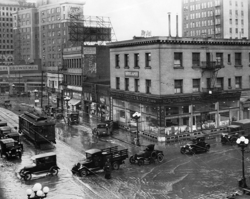 |
|
| (1925)^ - A wet policeman directs traffic in a flooded intersection at Main and 10th Streets in 1925. He is dressed in rain gear. The Hotel Apex is on the corner, as well as W. P. Fuller & Co., paints and glass. |
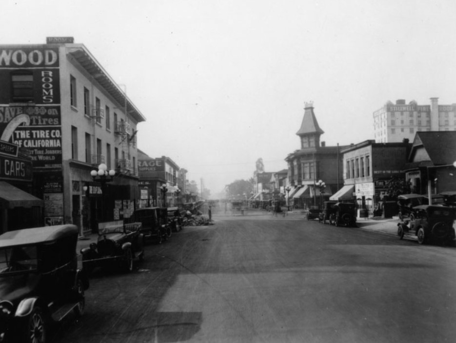 |
|
| (ca. 1925)^ – View looking south on Olive Street between 7th and 8th streets. The rear of the Stillwell Hotel shows at right, located at 838 So. Grand Ave. Another hotel is at left, and various small businesses and cars line the street. A pile of debris is in the street at left, and men are working. Note the ornate tower/steeple of the building on the southwest corner of Olive and 8th streets. |
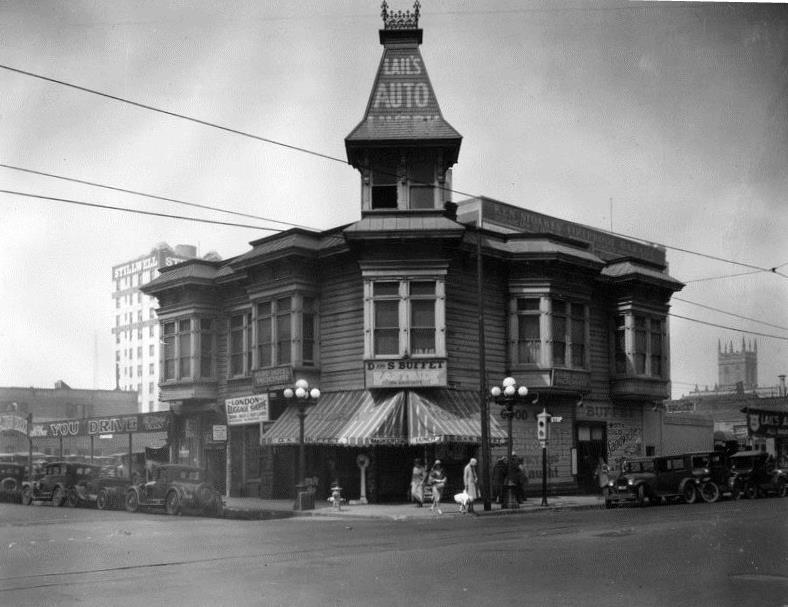 |
|
| (1927)^ - View showing the southwest corner of 8th and Olive streets. The building shown has several signs advertising: "Lail's Auto Livery" on the steeple as well as on either ends of the building; "Ward Hotel rooms" below two windows, also on both sides of the building; "London Luggage Shoppe" with an entrance on the left side; and "D and S Buffet Eastside" prominently in the middle, offering hot and cold sandwiches. The Stillwell Hotel as well as a church tower can be seen in the background |
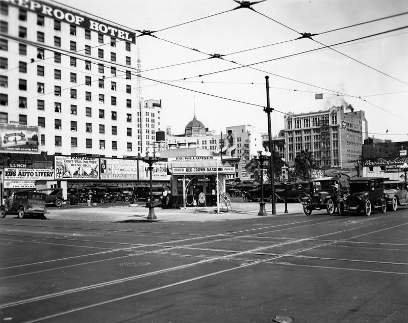 |
|
| (1927)^– View looking at the northeast corner of Grand Avenue and 9th Street, where one end of the Stillwell Hotel can be seen on the left. "FIREPROOF HOTEL" is painted high on the wall, in large capital letters. Mid-photo in the background, a cupola peeks from behind another building, the sign on it reads: "Hill Street Theatre". This refers to the RKO Hill Street Theater, which occupied the northwest corner of 8th and Hill Street. On the corner stands Red Crown Gasoline station, offering Zerolene and Mobiloil. It’s owned and operated by Ed. Willumsen, a "correct lubrication specialist"; he possibly also owns Ed's Auto Livery, which is adjacent to the gasoline station. Several cars can be seen waiting for the light to change along 9th Street. |
Historical Notes The 250-room Stillwell Hotel was built in 1906 and is located at 838 S. Grand, between 8th and 9th. The RKO Hill Street Theater, occupied the northwest corner of 8th and Hill Street. It had a seating capacity of 2,219 and ran for 46 years, from 1922 to 1968, when it was demolished.* |
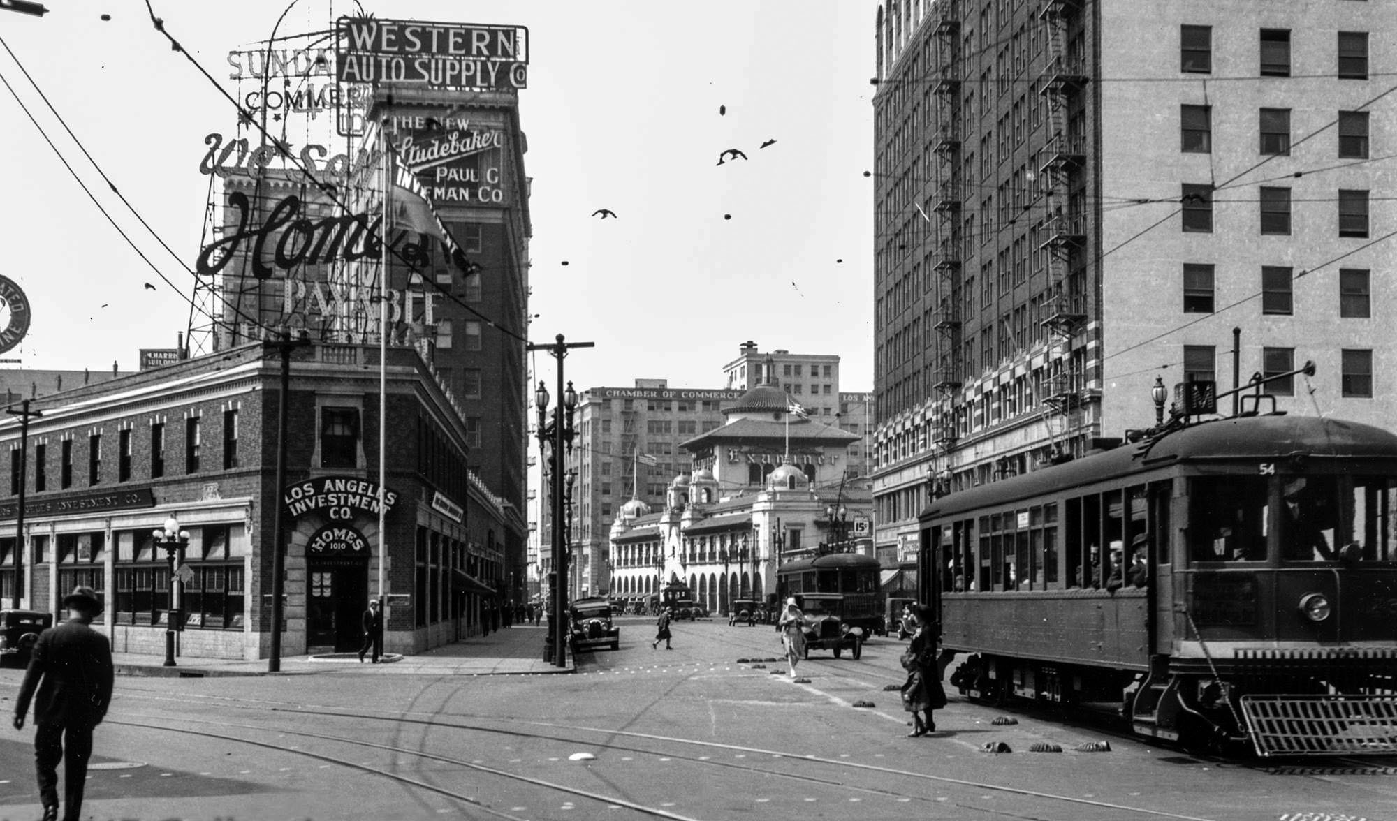 |
|
| (1920s)++++ - View looking south on Broadway from 10th Street (later Olympic) showing two streetcars of the LA Railway's "M Line" with the Examiner Building in the background on the S/W corner of Broadway and 11th Street. The Los Angeles Investment Co. and Western Auto Supply are at left, followed by the Paul G Hoffman Studebaker sales office. |
Historical Notes 10th Street was renamed Olympic Boulevard for the 1932 Summer Olympics, as that was the occasion of the tenth modern event. *^ |
* * * * * |
Legion Ascot Speedway
 |
|
| (1925)^ - Aerial view of the Legion Ascot Speedway located along Soto Street from Valley Blvd. to Multnomah St. The speedway operated between 1924 and 1936 in the Lincoln Heights area. |
Historical Notes The five-eighths mile Ascot Speedway began life as the New Ascot Speedway on January 20, 1924. The banked oval that was originally dirt but constant applications of road oil soon produced a surface that was similar to pavement. The cars that raced at Ascot throughout the years were the ancestors of what we today call "sprint cars". The hill in the center of photo, with the dirt loop going around it, would become the future site El Sereno's Wilson High School. This same hill was the location for the never completed El Sereno Country Club, which began construction in 1926. Legendary golfer Harry Cooper was the clubs lead golfer and even opened a golf store near the premise. However, by 1928 the Country Club was mired in lawsuits as business partners sued each other for various differences. To this day many former residents remember the catacombs, swimming pool, and foundation of the El Sereno Country Club. *^# |
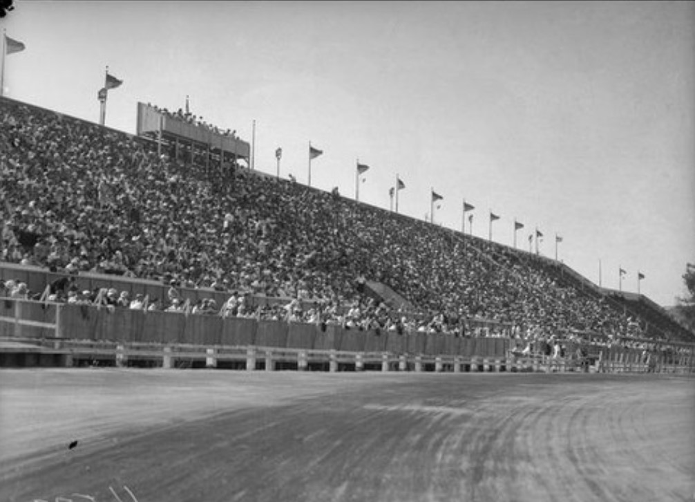 |
|
| (1935)^x^ - Crowd watching at the Legion Ascot Speedway as Bob Swanson and Rex Mays race. |
Historical Notes From 1924 there had been several people running the race track, but in 1928 the Glendale American Legion Post started promoting and bringing in cars and drivers from the American Automobile Association (AAA). In those days the AAA controlled all the major speedways including Indianapolis Speedway. A major speedway was born and it was called Legion Ascot Speedway. Under the promotion of the Legionnaires the crowds soon grew to over 10,000 making large purses and hot competition. Races were held on Sundays and Wednesday nights under the lights. Auto racing (also motorcycle racing) was increasingly popular in the 1920s and 30s. Two speedways would also be built on the West Side of Los Angeles: Beverly Hills Speedway and Culver City Speedway. |
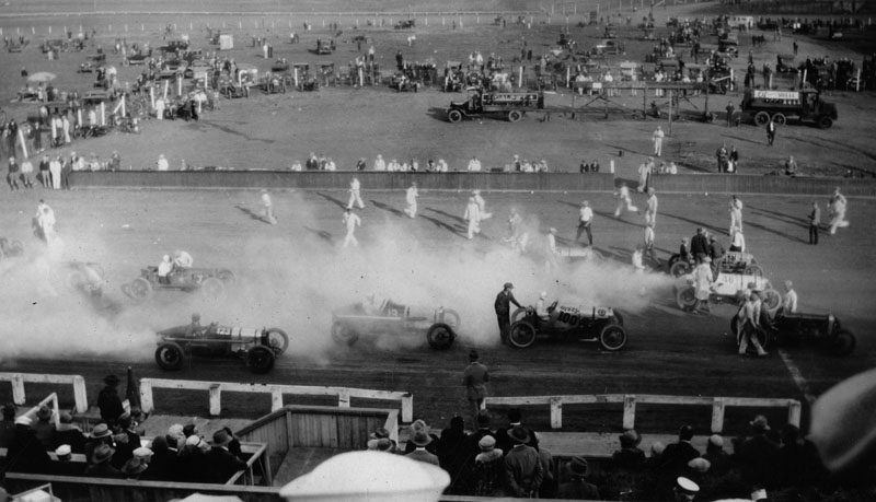 |
|
| (1927)^- Crowds look on as drivers prepare to begin the 100 mile race at the Legion Ascot Speedway, located on Soto Street in Los Angeles. |
Historical Notes IIn 1928 the Glendale American Legion Post took over the promotion and brought in the cars and drivers of the American Automobile Association (AAA). The AAA was the leading racing organization in the country and controlled all the major speedways including Indianapolis.*^# |
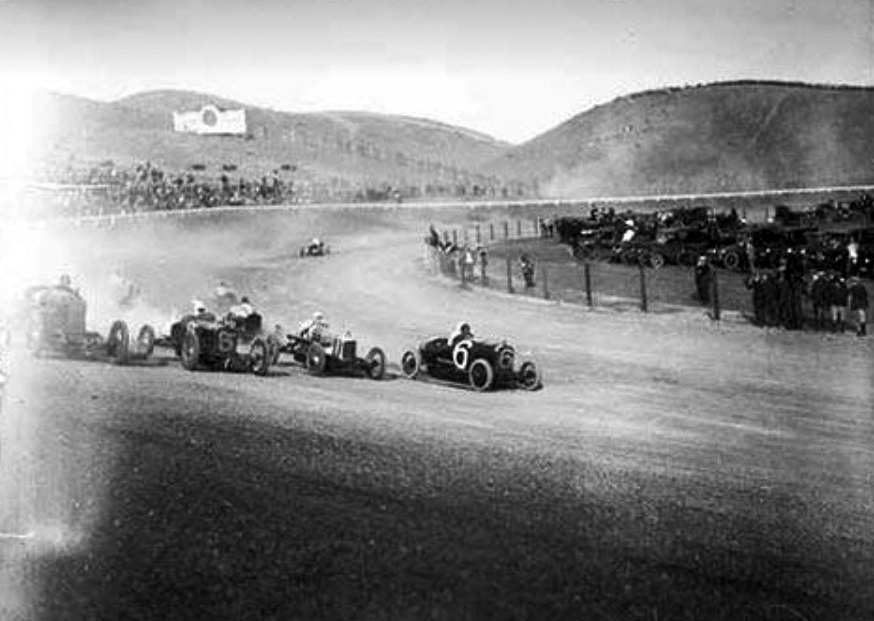 |
|
| (n.d.)^x^ - Cars make the last turn before heading into the final stretch at Legion Ascot Speedway. |
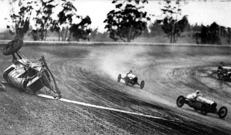 |
|
| (n.d.)^x^ - Race car crashes after losing control on one of the turns at Legion Ascot Speedway. |
Historical Notes From 1924 to 1936, a multitude of crashes resulted in loss of life. Some two dozen drivers lost their lives at Ascot.*^# |
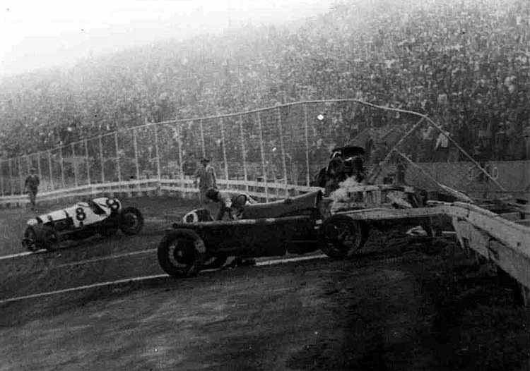 |
|
| (ca. 1930s)^x^ - More than 20 people died on what became known as the “Killer Track.” |
Historical Notes The death toll was one reason the Glendale American Legion bowed out of race promotion in early 1935---the other reason was the diminishment of crowds due to the emergence of midget auto racing at the time. Eleven years after it opened, the Ascot Legion Racetrack was shut down. Eight months later the grandstands of the abandoned speedway burned to the ground. The land was soon subdivided and sold off. Today, Multnomah Elementary School and a housing tract sit on the old Ascot Speedway site.*^# |
* * * * * |
Ince Triangle Studios/Goldwyn Studios (later Metro-Goldwyn-Mayer)
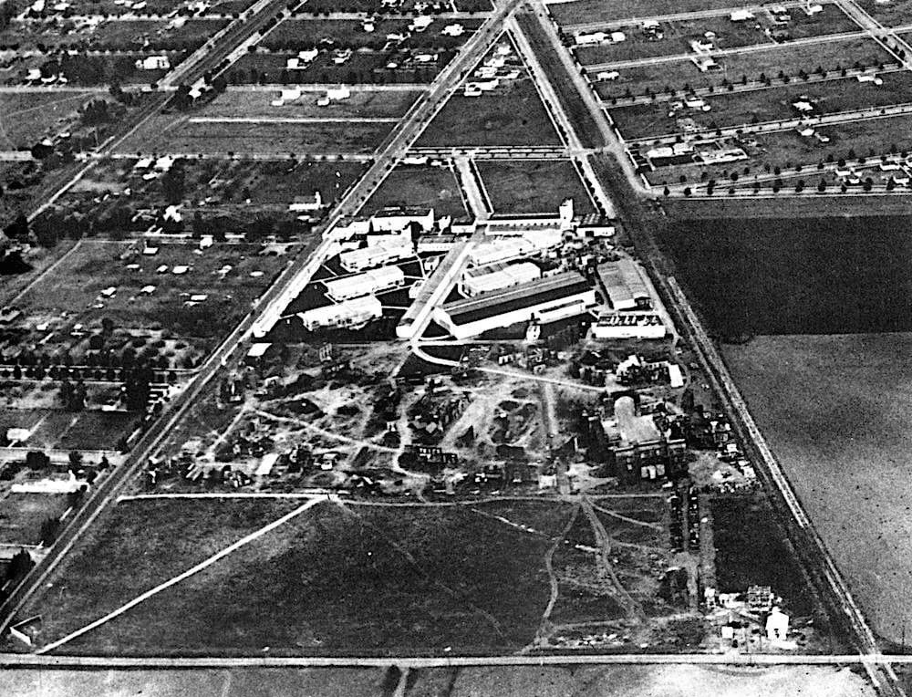 |
|
| (1920s)* – Aerial view the Triangle Motion Picture Company lot. It’s not hard to see where they got the name: the triangular shape of their studio lot bordered by Washington Blvd on the left (north), Culver Blvd on the right (south), and Overland Ave along the bottom (west). |
Historical Notes It got its start in 1915 when Harry Culver gave land to Thomas Ince to build this studio-the first in Culver City, Ince Triangle. Ince persuaded D.W. Griffith and Mack Sennett, two other luminaries of the era (and hence the "Triangle" part of the moniker), to partner with him. Ince and Sennett actually were employees of New York Motion Picture Company (also known as Kessel and Bauman (KayBee for short) and the early studio sign reflected this association. |
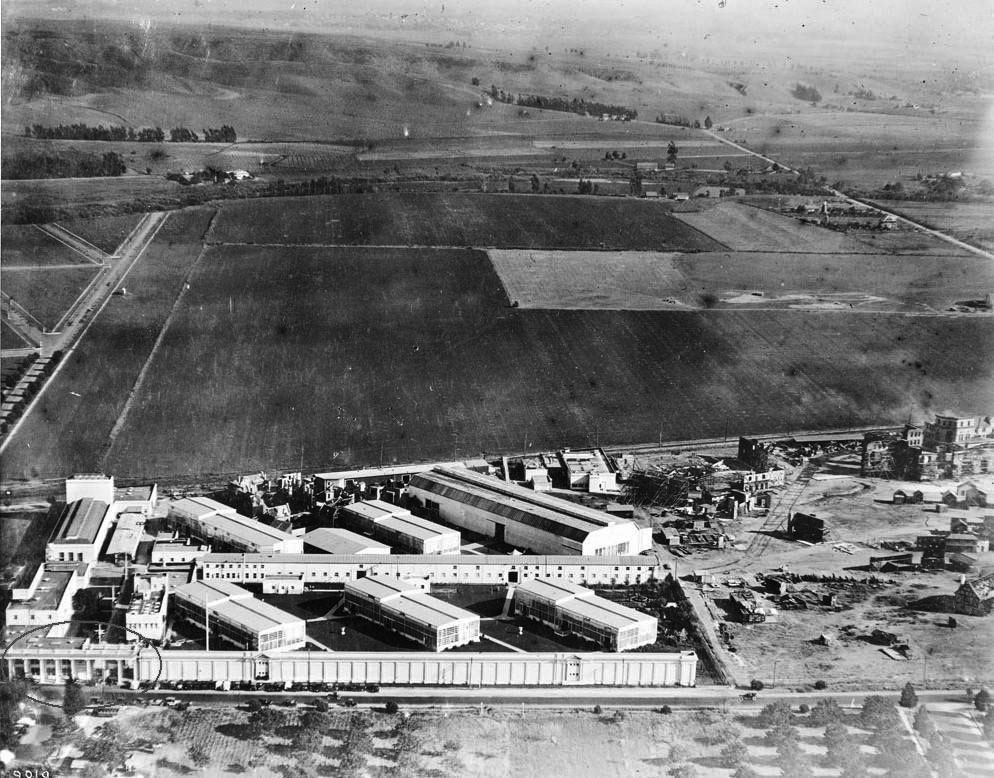 |
|
| (ca. 1920)^^ - Aerial view of the Goldwyn Studios in Culver City looking south. At the bottom of the photo is the front entrance of the studio known as the Colonnade Building. The Colonnade runs parallel to Washington Boulevard. To the right of the studio buildings is what was known as Lot #2 where sets were constructed for the many films produced at Goldwyn Studios. The Main Gate (circled) and part of the Colonnade still stand today, most everything else has been replaced. |
Historical Notes In 1919 the studio was bought by Sam Goldwyn became Goldwyn Studios, who expanded the footprint into a larger studio. In 1924 mergers and buyouts turned it into Metro-Goldwyn-Mayer, the venerable M-G-M studios. Goldwyn had been bought out, though the studio name reflected his former association. Under the guidance of Louis B. Mayer the studio was greatly expanded and eventually grew to encompass 6 lots around Culver City.* Behind the studios are empty fields which became home the the Culver City Speedway in 1924. |
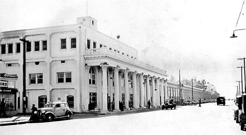 |
|
| (1938)+^^ - Metro-Goldwyn Mayer Studios main gate entrance viewed from the left side of the colonnade. |
Historical Notes The studio fell on hard times in the 1970s, and 5 of its lots were sold, along with its costume and prop departments. The lot became MGM/UA after a merger with United Artists, then was sold to Lorimar Telepictures, and in 1990 to Sony Corp,, becoming Columbia Pictures Studios (Sony having purchased Columbia and the smaller Tri Star Pictuers). After extensive renovations the studio was rechristened Sony Entertainment Studios, the name it has today.^ |
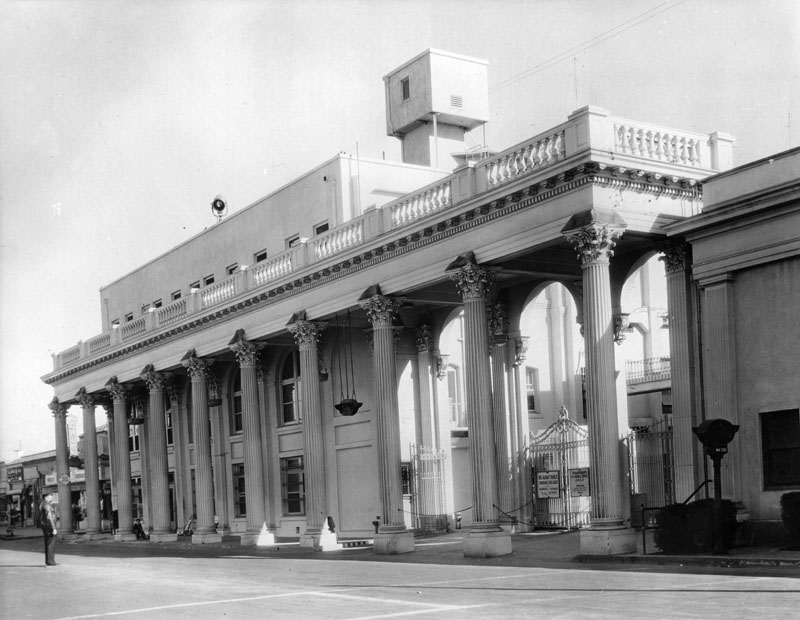 |
|
| (ca. 1920)^ - Close-up view of the Metro-Goldwyn-Mayer front entrance and main gate. |
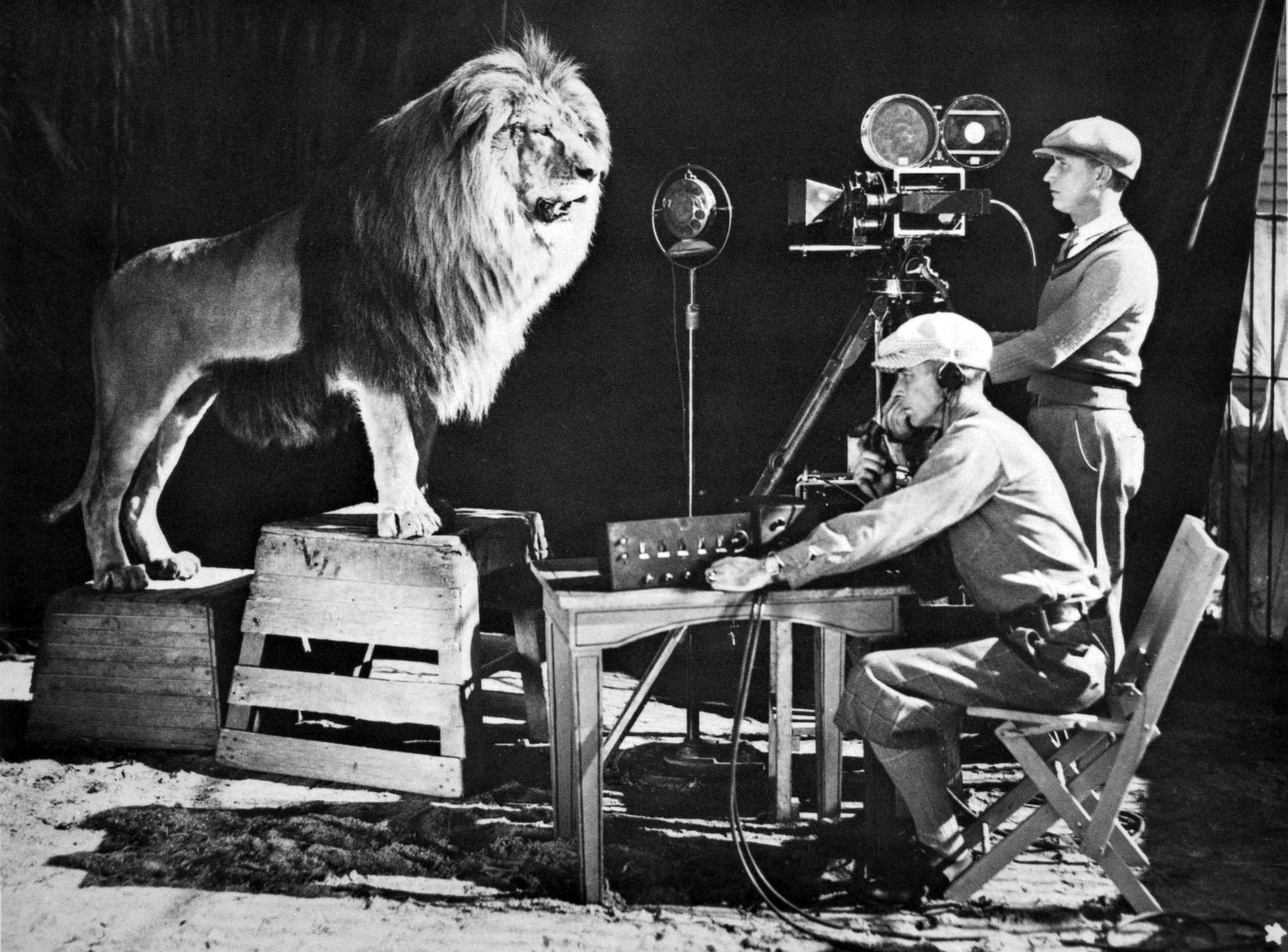 |
|
| (1928)* - MGM opening credits in the making. Yes, that's how they did it! |
Historical Notes With visionary Louis B. Mayer and production genius Irving Thalberg at the helm, MGM, with its legendary roaring lion logo, was a powerhouse of prolific artistry and filmmaking expertise. During a golden three decades from 1924 to 1954, the Culver City-based studio dominated the movie business, famously attracting "more stars than are in the heavens" and creating a Best Picture nominee at the Academy Awards every year for two straight decades. Historically, in 1939 two of MGM's most iconic films, Gone With the Wind and The Wizard of Oz, were both nominated for Best Picture. Gone With the Wind ultimately took home the Best Picture prize that year along with eight other Oscars, including one for Hattie McDaniel who won for Best Actress in a Supporting Role and became the first African American to be nominated for and win an Oscar. The Wizard of Oz would go on to secure two Oscars of its own.* |
Before and After
|
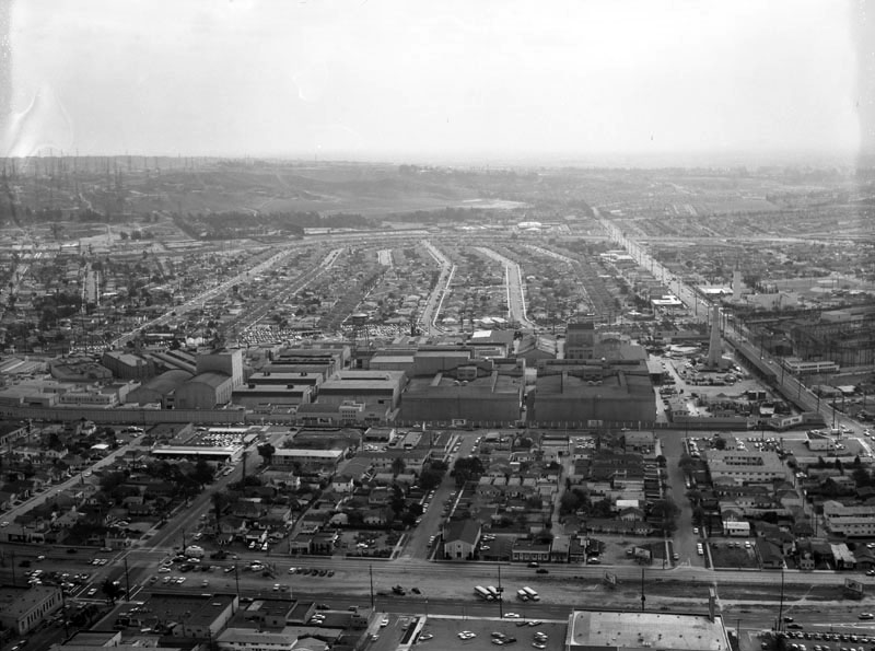 |
|
| (1918)^^ - Aerial view of the Goldwyn Studios in Culver City looking south. At the bottom of the photo is the front entrance of the studio known as the Colonnade Building. The Colonnade runs parallel to Washington Boulevard. To the right of the studio buildings is what was known as Lot #2 where sets were constructed for the many films produced at Goldwyn Studios. The Main Gate (circled) and part of the Colonnade still stand today, most everything else has been replaced. | (1960)* - Aerial view of the Metro Goldwyn Mayer Studio lot, located at 10202 Washington Boulevard in Culver City; view is looking southeast. Venice Boulevard is horizontally at foreground; Washington Boulevard is horizontally at center; Culver Boulevard is horizontally behind the studios; Overland Avenue is vertically along the right, followed by (r to l): Keystone Avenue, Mentone Avenue, Le Bourget Avenue, Motor Avenue, Vinton Avenue and Jasmine Avenue; Ballona Creek flows horizontally in the distance. |
Historical Notes The top two photos show how the Culver City landscape was transformed over the years. However, there was one intermediary development that occurred between the time that these to images were taken. It was called the Culver City Speedway. |
Ince Studios or the Pathe Exchange Studios (aka Culver Studios)
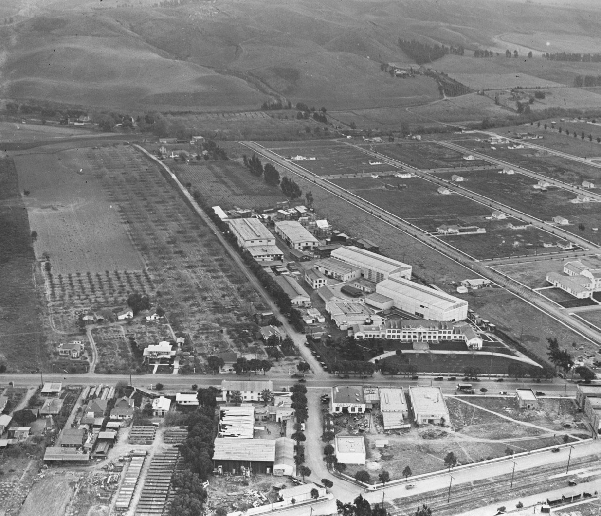 |
|
| (1920s)^ - Aerial view of Ince Studios or the Pathe Exchange Studios (also known as Culver Studios) located on 9336 Washington Blvd. in Culver City which is still rural at this time. |
Historical Notes The Culver Studios was built by Thomas H. Ince in 1918 after he acquired it from landowner Harry Culver. Meyer & Holler were the architects and construction company. The silent movie actor, director and producer had grand ambitions to create his own studio unique from all the others. * |
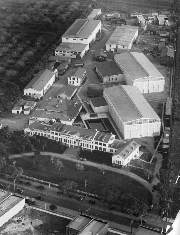 |
|
| (1920s)^ - Closer view of Ince Studios or the Pathe Exchange Studios (also known as Culver Studios) in Culver City. An elegant convertible is parked in front of the Colonial style building. Less elegant cars are in the street. Formal gardens front the Colonial Revival building that houses the offices, behind which are the actual studios. |
Historical Notes The original studio was named the Thomas H. Ince studios and became the second major motion picture concern in Culver City that is now acquired by Amazon Studios.* |
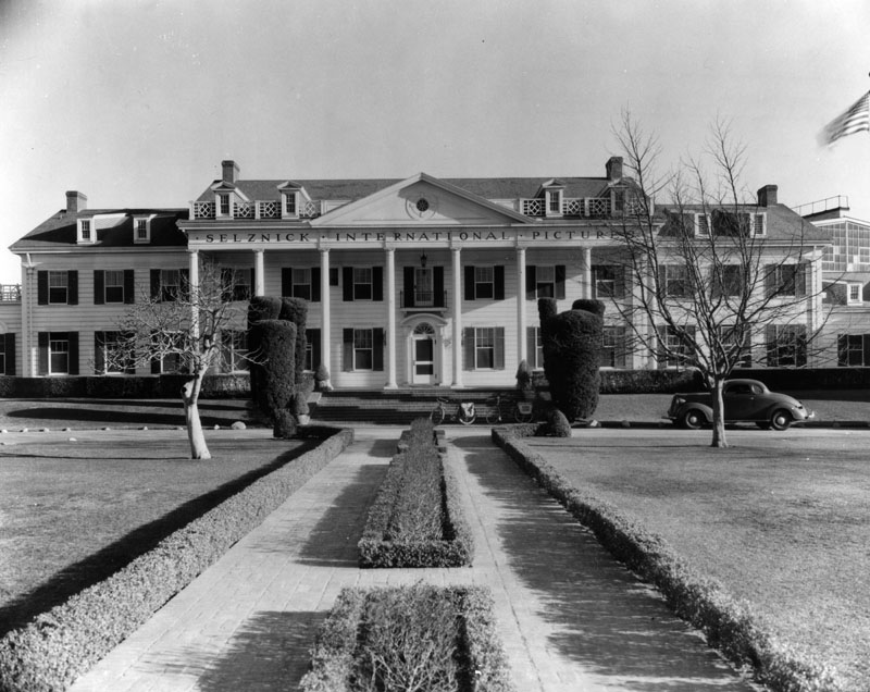 |
|
| (1935)^ - Exterior view of Selznick International Pictures offices, located on Washington Boulevard in Culver City. |
Historical Notes The picturesque mansion house is the centerpiece of Culver Studios lot and has landmark status. It is a classic example of 1920s Colonial Revival architecture and was the first building to go up on the site shortly after Thomas H. Ince's acquisition of the land in 1918. Modeled after George Washington's home at Mount Vernon, it currently serves as the main administrative building on the lot. Famous producers including Ince, Cecil B. DeMille and David O. Selznick once had offices there. One long corridor runs the length of the 15,000 square foot structure which has eight two-story high grand white columns. The facade looks out onto a manicured lawn,* |
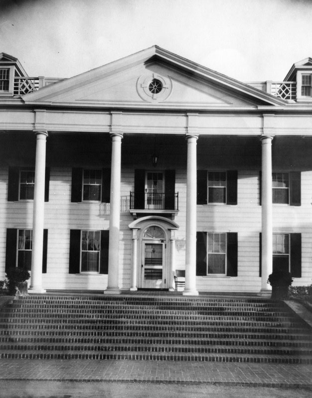 |
|
| (ca. 1930s)^#^ - Close-up view of the Colonial style Ince Studio (later Selznick International Studios) offices. |
Historical Notes There is a common misconception that the mansion house was Tara in Gone With the Wind. The building was used in the credits but Tara was a separate building constructed on the Forty Acres backlot by art director Lyle Wheeler, where the scene depicting the burning of Atlanta was filmed.* |
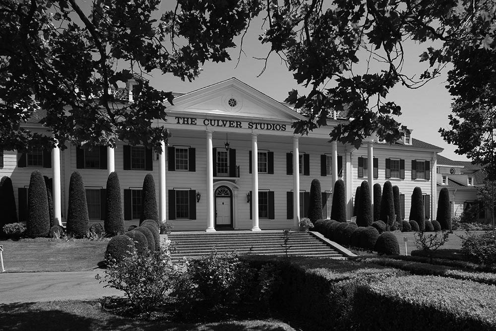 |
|
| (2013)^ – Front view of The Culver Studios. |
Historical Notes Name changes: 1919-1924, The Ince Studios; 1925-1928, Pathé Exchange Studios; 1928-1935, RKO Studios; 1935-1948, Selznick International Pictures; 1948-1955, Howard Hughes Studio; 1955-1957, General Tire and Rubber Company; 1957-1968, Desilu Studios; 1968-1969, Perfect Film and Chemical; 1969-1977, Culver City Studios; 1977-1986, Laird International Studios; 1986-1991, The Culver Studios; 1986-, Sony Corporation; As of 2019, the studio is under redevelopment, with much of the redeveloped studio to be leased by Amazon Studios. |
* * * * * |
Culver City Speedway and the Rise of Board Track Racing (1924 to 1927) |
Origins: From Beverly Hills to Culver City |
In the early 1920s, automobile racing was one of the most popular spectator sports in the country, and Southern California had already proven itself fertile ground for the sport. The Beverly Hills Speedway, which opened on February 28, 1920, near the intersection of Wilshire and Santa Monica boulevards, was among the finest racing venues in the nation. Designed by track builder Jack Prince and engineer Art Pillsbury, the 1.25 mile wooden oval featured 35 degree banked turns and drew world class drivers from the American Automobile Association circuit. By 1924, however, the rapid growth of Beverly Hills made the land far too valuable to keep as a racetrack, and the promoters began looking for a new home. They found it in Culver City, at the intersection of Culver Boulevard and Overland Avenue, just south of the expanding MGM studio complex. Pillsbury once again applied his engineering expertise, designing a 1.25 mile wooden board oval with steeply banked 45 degree turns, steeper than those at Beverly Hills. The track debuted on December 14, 1924, with more than 70,000 spectators in attendance, and board track specialist Bennett Hill won the 250 mile inaugural race in a supercharged Miller at an average speed of 127 miles per hour. |
Building the Speedway: Design and Setting
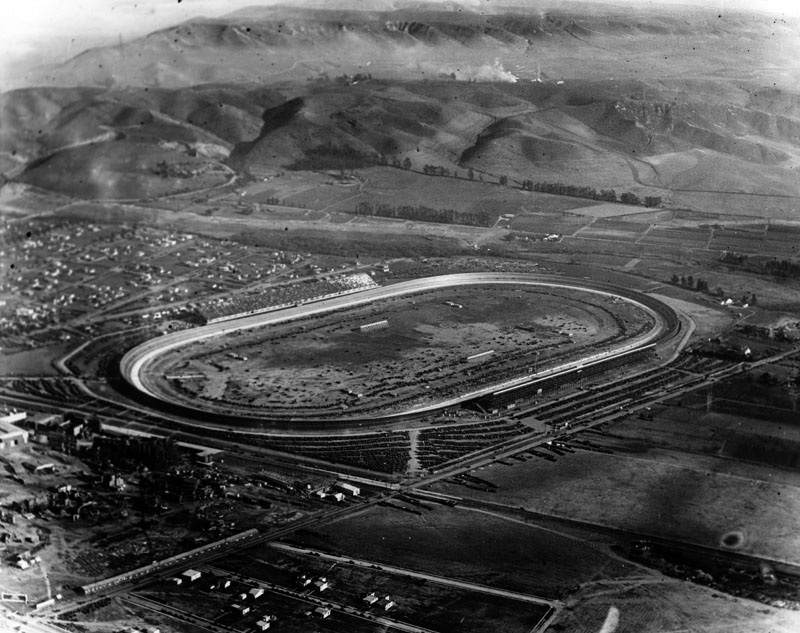 |
|
| (1924)* - Aerial view of the Culver City Speedway, also known as the Los Angeles Speedway, looking southeast. The 1.25 mile wooden board oval sits at the intersection of Culver Boulevard and Overland Avenue, with the future site of Metro Goldwyn Mayer Studios visible just across the street to the north. |
Historical Notes Before the speedway was built, the same land had briefly hosted a horse racing track in 1923, an enterprise that failed after roughly a year and left the site available for a more ambitious purpose. The location offered two important advantages: affordable land in a city still establishing itself, and direct access to three separate streetcar lines that made the venue easy to reach from Los Angeles, Santa Monica, and surrounding communities. Designer Art Pillsbury applied the Searles Spiral Easement Curve to the corners, a technique borrowed from railroad engineering that allowed cars to enter and exit the steep 45 degree banking without abrupt changes in direction, enabling drivers to carry maximum speed all the way through the turns. The resulting track was steeper than the Beverly Hills Speedway had been, and it showed in the speeds drivers were able to achieve from the very first race. The Culver City Speedway was sometimes referred to as the Los Angeles Speedway, a name informally carried over from its predecessor. The Beverly Hills Speedway had operated under that name from 1920 to 1924, and when the same promoters relocated to Culver City, the familiar designation came with them. |
A New Kind of Racing
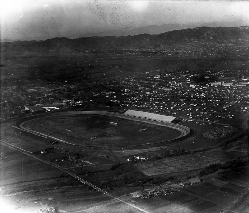 |
|
| (1924)* - Aerial view of the Culver City Speedway looking north toward Beverly Hills. The large slanted structure at the right is the main grandstand, with a second grandstand visible across the oval. Residential neighborhoods spread across the surrounding flatlands. |
Historical Notes Board track racing, sometimes called toothpick track racing for the thousands of narrow wooden planks that made up the surface, reached the height of its popularity during the 1910s and 1920s. California alone was home to approximately six such speedways, and the races held on them were among the fastest and most closely watched sporting events in the country. Radio broadcasts brought the action to fans at home, reflecting both the reach of the sport and the rapid spread of broadcasting technology during this period. The Culver City Speedway took its place on the American Automobile Association national championship schedule immediately, replacing the Beverly Hills Speedway as the West Coast venue for top level competition. |
Race Day at the Speedway
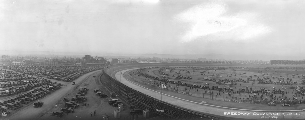 |
|
| (December 14, 1924)* – Panoramic view of the Culver City Speedway on opening day, photographed from the top of the grandstand looking northwest. The steeply banked 45 degree wooden board track sweeps through the foreground, while the parking lot along Culver Boulevard is packed with automobiles and more than 70,000 spectators fill the infield. The early Culver City commercial district and the Goldwyn Studios lot are visible on the horizon. An enlarged view of the left portion of this image appears below. |
Historical Notes This panoramic photograph was taken on the very first day the Culver City Speedway opened to the public. The scene captures the scale of the occasion — a crowd of more than 70,000 people, a packed parking lot, and a brand new wooden oval that would become one of the fastest racetracks in the country. Board track specialist Bennett Hill won the 250 mile inaugural race in a supercharged Miller at an average speed of 127 miles per hour. The wooden surface of the track required almost continuous maintenance. The pine boards were laid tightly together in rows that followed the curve of the banking, but the combination of California sun, motor oil, and the repeated pounding of heavy race cars caused them to swell, warp, and splinter over time. Crews worked between events to replace damaged planks and keep the surface as smooth as possible, but the deterioration was relentless. This maintenance burden was one of the primary reasons that board tracks across the country began disappearing in the late 1920s, as the cost of upkeep grew faster than the revenues the races could generate. |
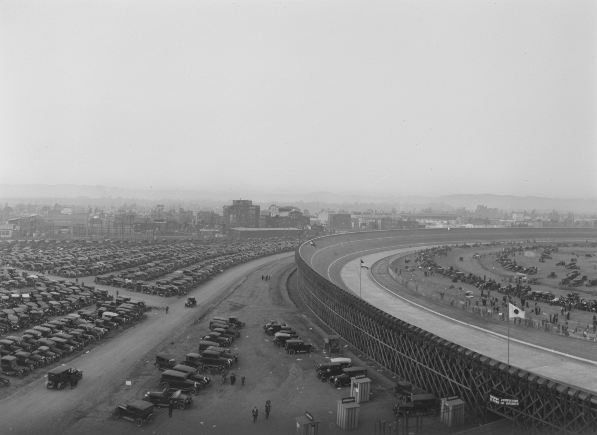 |
|
| (December 14, 1924)* – Enlarged view of the left portion of the panoramic image above, showing the steep banking and the packed parking lot along Culver Boulevard in greater detail. The view looks northwest from the top of the grandstand toward the early Culver City commercial district and the Goldwyn Studios lot on the horizon. |
| Historical Notes
Opening day at the Culver City Speedway, December 14, 1924, drew more than 70,000 spectators, filling the infield and the parking lot along Culver Boulevard. The photograph was taken from the top of the grandstand looking northwest across the 45 degree banked turn toward the Culver City skyline. A Japanese flag is visible on the infield, reflecting the international character of the American Automobile Association racing circuit. Board track specialist Bennett Hill won the 250 mile opening race in a supercharged Miller at an average speed of 127 miles per hour. The Goldwyn Studios lot visible on the horizon had just been absorbed into the newly formed Metro Goldwyn Mayer complex earlier that same year, in April 1924. The speedway and the studio grew up side by side during this period, giving Culver City a unique double identity as both the Heart of Screenland and one of the premier racing destinations in the United States. |
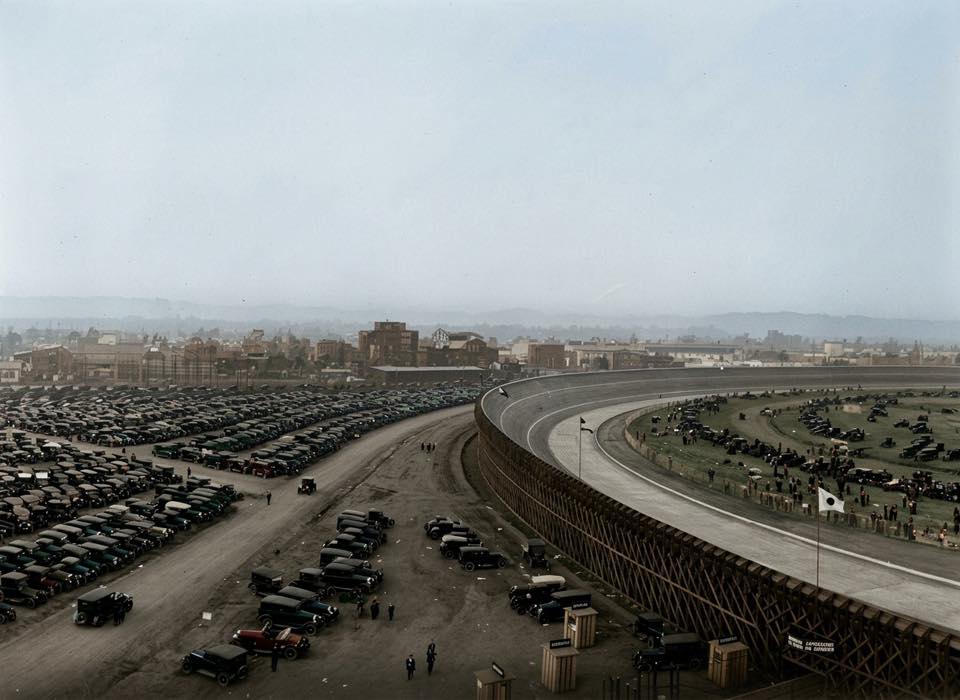 |
|
| (December 14, 1924)* - Elevated view looking northeast from the top of the grandstand at the Culver City Speedway (aka Los Angeles Speedway), showing the steeply banked wooden board track curving through the foreground, the parking lot along Culver Boulevard filled with period automobiles, and the MGM studio complex visible along Washington Boulevard on the horizon. Image enhanced and colorized by Nic Marckstadt.* |
| Historical Notes
This colorized and enhanced view from the grandstand top offers a vivid sense of what race day looked like at the Culver City Speedway during its brief but celebrated run from 1924 to 1927. The steep 45 degree banking of the wooden board track dominates the foreground, sweeping away from the camera toward the far turns of the oval. The parking lot along Culver Boulevard, packed with Model T Fords and other period automobiles, reflects the enormous crowds the speedway regularly attracted. The large brick structures visible on the horizon are the MGM studio facilities along Washington Boulevard, a reminder that the speedway and the film industry grew up side by side in Culver City during this period. At the final race held here on March 6, 1927, driver Frank Lockhart set a world speed record of 144 miles per hour in qualifying, a mark that would not be surpassed at Indianapolis for nearly three decades. Shortly after, the wooden track was dismantled and the land was converted to housing and studio expansion, leaving almost no trace of one of the fastest racetracks ever built. |
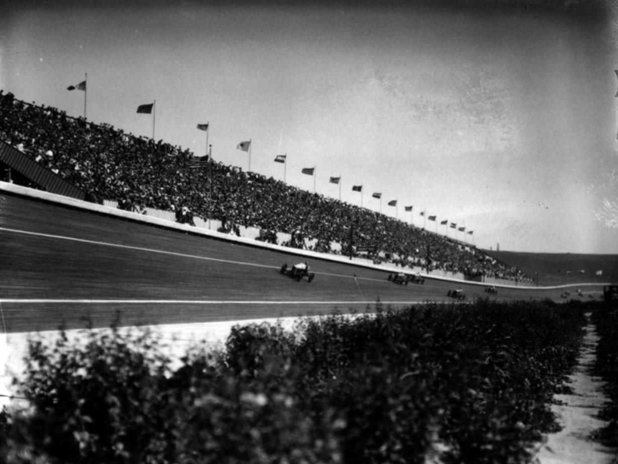 |
|
| (ca. 1927)* - The grandstand at the Culver City Speedway packed with spectators, flags from several countries waving above the crowd. The international field of drivers and the reach of the AAA circuit gave events here a cosmopolitan character unusual for a venue of this size. |
Historical Notes The international flags on display above the grandstand reflected the global character of AAA board track racing. Drivers came from across the United States and from Europe to compete at Culver City, and the events drew enthusiastic crowds who followed the sport closely through newspapers and radio broadcasts. Among the top competitors who raced at Culver City were Tommy Milton, a two time Indianapolis 500 champion; Harry Hartz, one of the most consistent performers on the AAA circuit; Peter DePaolo, who won the Indianapolis 500 in 1925; Leon Duray, a French born driver known for his aggressive style; and Bennett Hill, who won both the opening race in December 1924 and the sole race held at the track in 1926. Their presence brought national and international attention to a venue that had existed for less than three years. |
Speed and Danger on the Boards
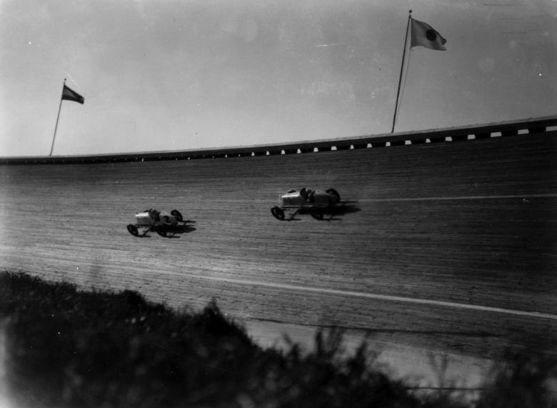 |
|
| (1927)* - Two race cars navigate the steep banking of the Culver City Speedway, with car number 1 in close pursuit of car number 2. The extreme angle of the boards is clearly visible, illustrating the engineering that allowed drivers to maintain full speed through the turns. |
Historical Notes In qualifying for the final race at the speedway on March 6, 1927, a young Southern California driver named Frank Lockhart set a world closed course speed record of 144 miles per hour in a specially prepared Miller with an engine intercooler he had developed himself. Lockhart had won the Indianapolis 500 as a rookie in 1926 and was regarded by many as the most talented driver of his generation. His record at Culver City stood as the standard for closed course speed until 1956, when it was finally exceeded at the Indianapolis Motor Speedway, nearly three decades after Lockhart had set it on this short lived wooden oval in the middle of what was then the outskirts of Los Angeles. |
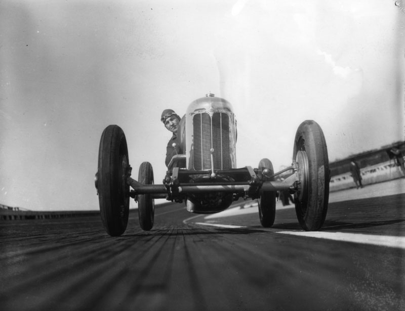 |
|
| (1927)* - A driver poses in his open cockpit race car at the Los Angeles Speedway. The exposed engine, wire wheels, and minimal bodywork are characteristic of the Miller and Duesenberg powered cars that competed in AAA championship events during this period. |
Historical Notes Racing in this era demanded both exceptional skill and a willingness to accept serious risk. Drivers wore little protective gear, cars had no roll cages or safety harnesses, and the wooden track surface could become treacherous at speed. The dangers became real on November 29, 1925, when driver Ray Cariens was fatally injured after his car made contact with another and rolled repeatedly down the track. He was the only driver killed on an AAA board track during the entire 1925 season. Despite such tragedies, the sport continued to grow in popularity, and its leading figures became celebrated names known to fans far beyond the boundaries of California. |
After the Track: Studios, Homes, and Carlson Park
 |
|
| (ca. 1927)* - Aerial view of the former Culver City Speedway site with new streets annotated, showing the early stages of residential subdivision. The oval outline of the old track is still faintly visible as land is cleared and lots are laid out. |
Historical Notes The Culver City Speedway closed on March 6, 1927, and just five months later, on August 8, 1927, the City Council voted to plat the property for housing and reserve a portion for public use. The site was divided into residential lots that were quickly sold, while the parkland set aside between Le Bourget and Motor avenues along Braddock Drive became the first public park in Culver City. The park was initially named Victory Park, a name proposed by the mayor's wife as a reflection of what she considered a community achievement. In 1964, the city council voted to rename the park in honor of Dr. Paul Carlson, a Culver City born medical missionary who was killed that year while serving in the Republic of the Congo. The renamed Carlson Park stands today as the only piece of land from the former speedway site that remains in public hands, a quiet remnant of one of the most exciting chapters in the city's early history. |
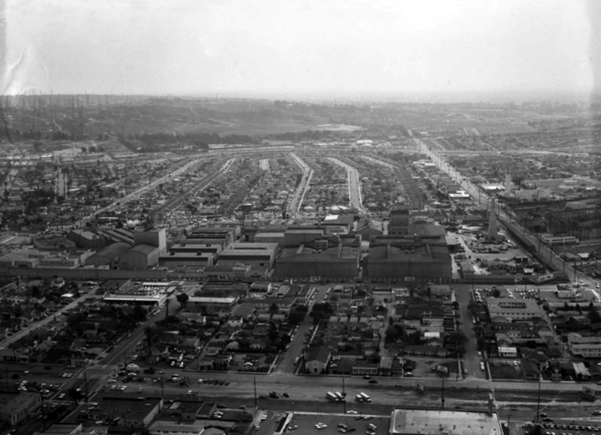 |
|
| (1960)* - Aerial view of the former Culver City Speedway site after full development, showing residential tracts occupying the land where the oval once stood and the expanded Metro Goldwyn Mayer studio lot pressing against the southern edge of the neighborhood. Venice Boulevard runs horizontally in the foreground; Washington Boulevard crosses the center of the frame. |
Historical Notes By 1960, the transformation of the speedway site was complete. The MGM studio lot, which had been just across Culver Boulevard from the track during the racing years, had expanded substantially and now occupied land that once formed part of the oval and its infield. The residential streets that replaced the track were absorbed into the Culver City grid, making the original circuit nearly impossible to trace on foot today. Only Carlson Park, tucked between Le Bourget and Motor avenues along Braddock Drive, preserves any geographic connection to the former speedway, though nothing at the park marks its origins as part of one of the fastest wooden board tracks ever built in the United States. The rest of the land had been fully reinvented, as so much of Southern California has been, leaving its racing history visible only in photographs and records. |
Then and Now (1927 vs 2023)
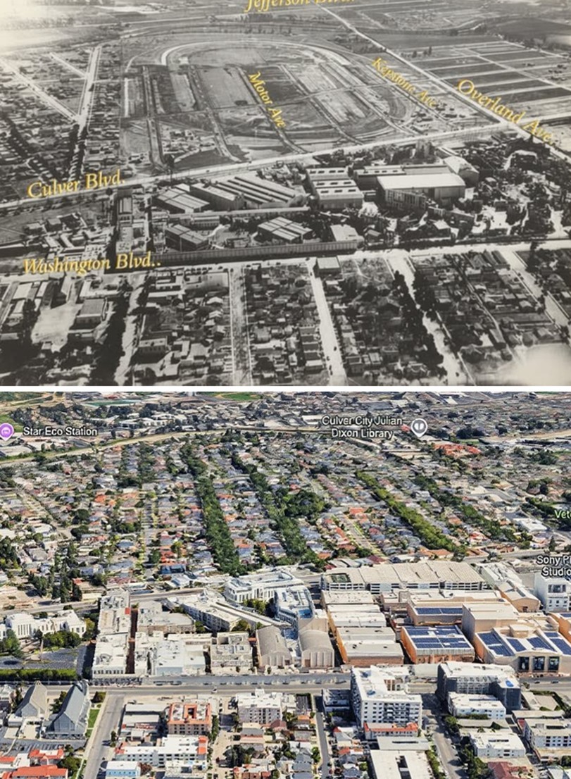 |
|
| (1927 vs 2023)* - Then and Now aerial view looking northwest over the former Culver City Speedway site. In the upper image, the track has already been demolished and the land is in the early stages of residential subdivision, with Culver Boulevard, Motor Avenue, Keystone Avenue, and Overland Avenue annotated. The faint outline of the former oval is still traceable in the newly laid out lots. In the lower Google Earth view, the neighborhood is fully developed, with Carlson Park near the center of the former track and the Sony Pictures Studios lot visible at right. Photo comparison by Jack Feldman. |
| Historical Notes
These two views, taken nearly a century apart, tell the complete story of the speedway's transformation in a single glance. In the upper image, the Culver City Speedway has already been dismantled and the land is in the early stages of residential subdivision, with the street grid of Culver Boulevard, Motor Avenue, Keystone Avenue, and Overland Avenue annotated and taking shape. The faint outline of the former oval can still be traced in the way the new lots were laid out, but the track itself is gone. In the modern view, even that ghost outline has disappeared entirely, and Carlson Park, the only public land set aside from the original speedway property, sits quietly near the center of where the oval once stood, its origins unmarked and largely forgotten. The studio complex visible along Washington Boulevard in both images has its own remarkable history. Founded in 1915 as Triangle Studios by Thomas Ince, it became Goldwyn Studios in 1918 and then the home of Metro-Goldwyn-Mayer in 1924 — the same year the speedway opened just across Culver Boulevard. At its peak MGM released fifty films a year with a roster that included Greta Garbo, Clark Gable, Spencer Tracy, and Joan Crawford. After MGM departed in the 1980s, the lot passed through Lorimar-Telepictures and Warner Communications before Sony purchased it in 1990, investing heavily to renovate the complex and rename it Sony Pictures Studios, the name it carries today in the lower image. |
Legacy of the SpeedwayThe Culver City Speedway existed for only a brief moment in time, yet it captured something essential about Los Angeles at a particular turning point in its history, a moment when speed, technology, and entertainment were all reshaping the region at once. In just over two years, a horse track became a world class racing venue, set a speed record that endured for nearly three decades, drew tens of thousands of spectators from across Southern California, and then gave way entirely to housing, studios, and a neighborhood park. The land moved through these identities with a speed almost as remarkable as anything that happened on the track itself. Today almost nothing remains of the speedway, no grandstand, no banking, no trace of the boards that once carried cars at 144 miles per hour through the warm California air. But its story is a vivid illustration of how this region has always worked: building boldly, moving quickly, and reinventing the landscape before the paint has had time to dry. In Southern California, entire worlds can rise, run their course, and disappear within a single generation, leaving behind only the historical record and, if the community is fortunate, a park. |
* * * * * |
More Historical Early Views
Newest Additions
Early LA Buildings and City Views
History of Water and Electricity in Los Angeles
* * * * * |
References and Credits
* DWP - LA Public Library Image Archive
^ LA Public Library Image Archive
^*The Valley Observed: Street Name Origins; Timeline of Valley History
*# blogdowntown: Third Street Tunnel
+#Fairfax High School Home Page
#* About.Com: History of Electric Vehicles
#**U.S. Geological Survey Photographic Library
*##LA Times: Dig Into History You'll Find Snake Oil..Victor Girard Kleinberger
^##Metropolitan Transportation Library and Archive
*#*Historical Los Angeles Theatres: The Philharmonic Auditorium; Downtown Theatres
^#^Noirish Los Angeles - forum.skyscraperpage.com; Ince Studios; Aerial of Burbank and Hollywoodland Sign
*^#LincolnHeightsLA.com: Legion Ascot Speedway
**#KCET - Lost Tunnels of Downtown LA; Urban Surgery: Wilshire Extension; When L.A. Was a Horse-Powered Town
*#^Maureen Megowan: History of Hermosa Beach; Secrets about the Palos Verdes Peninsula
^#*City of Redondo Beach HIstory
^^*Early Downtown Los Angeles - Cory Stargel, Sarah Stargel
^^+Silverlake.org: Historic Photos
++*Los Angeles Parks: laparks.corg
*+*Los Angeles Magazine: Early Traffic Signals in Los Angeles
++^LA County Public Library: East Los Angeles
+^+LASeoulguy.com: Mulholland Drive
***Los Angeles Historic - Cultural Monuments Listing
**^Historicechopark.org: Echo Park Lake
*^*California Historical Landmarks Listing (Los Angeles)
*^^Nuestra Señora la Reina de los Ángeles: losangelespast.com
+^^Facebook: Garden of Allah Novels
^*#California State Library Image Archive
^^^Aerofiles - US Aviation Firsts
*#*#Abandoned & Little-Known Airfields – Paul Freeman
*##*Chatsworth Historical Society
**^#Historical LA Theatres: Loew's State Theatre
**++Big Map Blog
*^#^Huntington Digital Library Archive
##**Canyon News: Mulholland HIghway
##*#LAist.com: Why Vine Becomes Rossmore
++++Facebook.com – Los Angeles Heritage Railroad Museum
^**#Jewish Museum of the American West: Herman Silver
^*#*Before USC
^*#^Studiotour.com: William Fox Studio
^*##Calisphere: University of California Image Archive
^^##SanPedro.com: Fishing Industry
^^^#Los Angeles Fire Department Historical Archive
^^#^Facebook.com - Great Photos from Los Angeles' Past: Western Ave; Rogers Airfield
^#*^Facebook.com - Bizarre Los Angeles
^##*Pinterest: Bygone Los Angeles
***^Oviatt Library Digital Archives
**^**Retronaut - Hollywoodland Sign
*^ Wikipedia: H.J. Whitley; Occidental College; Beverly Hills; Beverly Hills Hotel; Los Angeles Railway; Pershing Square; Broadway Tunnel: Isaac Van Nuys; Sawtelle; Port of Los Angeles; Tournament of Roses Parade; Angels Flight; Occidental College; Mt. Washington, LA; Broadway, LA; Hancock Park; La Brea Tar Pits; Los Angeles City Oil Field; Deadman's Island (San Pedro); Moses Sherman; Rose Bowl Game; Hollywood Hotel; Hollywood HIgh School; California Club; San Pedro; Salt Lake Oil Field - Gilmore Oil Field; Westwood; 2nd Street Tunnel; Hermosa Beach; Los Angeles Memorial Coliseum; Redondo Beach Pier; Redondo Beach; West Hollywood; Pacific Palisades; 1910 L.A. International Air Meet at Dominguez Hills; Hancock Park; Marlborough School; Subway Terminal Building; Hollywood Bowl; Carthay Circle; Sunset Boulevard; Farmers and Merchants Bank of Los Angeles; History of Los Angeles Population Growth; Palos Verdes Estates; Palisades del Rey; Carlson Park, Culver City; St. Vincent Church; San Vicente Boulevard; Salt Lake Oil Field; Mulholland Drive/Highway
< Back