Early Views of Hollywood (1920 +)
Historical Photos of Early Hollywood |
 |
|
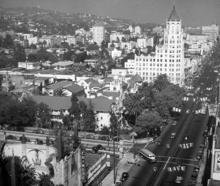
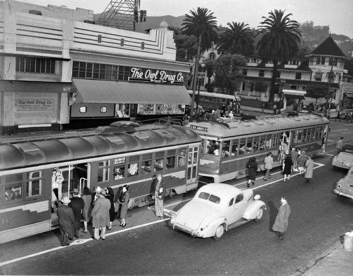
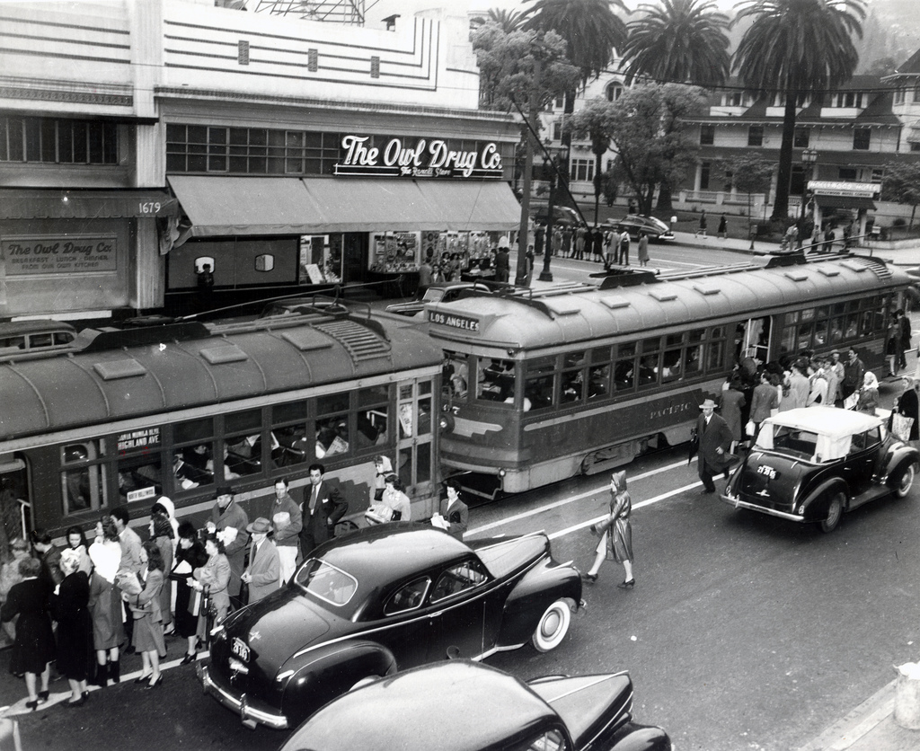
| (ca. 1940s)* - Daytime view of Grauman's Chinese Theatre, located at 6925 Hollywood Blvd., as seen from across the street. It is one of Hollywood's most beautiful theaters. |
Historical Notes Between 1933 and 1949 the Grauman's Chinese Theatre was in a "Golden Age," where the movies were the number-one entertainment in America, resulting in the studios who made them becoming very profitable. Grauman's Chinese, the glamourous flagship venue of the Fox West Coast Theatres chain (itself owned by 20th Century-Fox and the Skouras Brothers) and under the continuing management of Sid Grauman, played host to a large number of Fox films, rotating with product from Metro-Goldwyn-Mayer and the occasional offering from United Artists. Theatres during this time tended to play pictures from the studio who owned them (or had strong business ties to). All remained well until, after World War II, film attendance dropped off, then another blow: television. However, in the long run Hollywood found ways of making motion picture entertainment more attractive. People would once again return to the box office and pay admissions to see motion pictures instead of remaining home before their television sets. |
 |
|
| (1944)* – View of the Grauman's Chinese Theatre just prior to the 16th Annual Academy Awards of Merit ceremony, Thursday, March 2, 1944. |
Historical Notes Originally handed out at a formal banquet at either the Ambassador Hotel in the Cocoanut Grove or Fiesta Room, or at the Biltmore Hotel downtown, in the Sala D'Oro or Biltmore Bowl, the enormity of interest in the Oscars outgrew the formal banquet idea. When it came time to hold the ceremony in a regular theatre environment, Grauman's Chinese was the obvious choice. Widely considered Hollywood's "town hall," for the first ceremony held there on Thursday, March 2, 1944, the theatre was donated for the event by Charles Skouras, president of National Theatres, whose Fox West Coast Theatres division operated the Chinese, with Sid Grauman as the theatre's Managing Director. |
 |
|
| (1946)* - Stars arrive at Grauman's Chinese Theater for the Academy Awards presentation on March 8, 1946. |
Historical Notes This was the year that “Lost Weekend” won Best Picture, Best Director, Best Actor in a Leading Role, and Best Screenplay. If these people were hoping to see Joan Crawford, they were disappointed. She was so freaked out at the thought of losing that she pretended to be ill—and then won the Oscar for “Mildred Pierce.” |
.jpg) |
|
| (1946)* – Thousands of movie fans crowded the front of Grauman's Chinese Theater in which the Academy Awards presentation was held. This is a section of the huge crowd as they watched the parade of stars arriving at the theater on March 8, 1946. |
Historical Notes National Theatres continued to make the Chinese Theatre available to the Academy for their Awards of Merit program at no cost, in 1944, 1945 and 1946. In short time the ceremony had outgrown even Sid's Hollywood masterwork, so it moved to the 6,000 plus-seat Shrine Auditorium near downtown for 1947 and 1948. |
 |
|
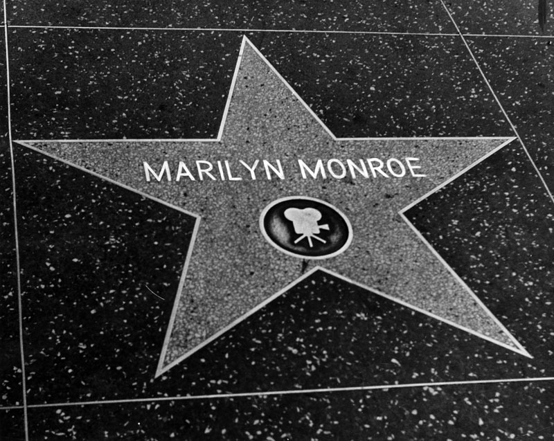
| (ca. 1960)* - Name of the star-crossed beauty is emblazoned on the sidewalk of Hollywood Boulevard. |
Historical Notes The Hollywood Walk of Fame comprises more than 2,500 five-pointed terrazzo and brass stars embedded in the sidewalks along 15 blocks of Hollywood Boulevard and three blocks of Vine Street. Locations of individual stars are not necessarily random or arbitrary. Stars of most legendary and world-famous celebrities—the so-called "show business royalty"—are found in front of TCL (formerly Grauman's) Chinese Theatre. Oscar winners' stars are usually placed near the Dolby Theatre, site of the annual Academy Awards presentations. Location decisions are made by the Hollywood Chamber of Commerce.* |
 |
|
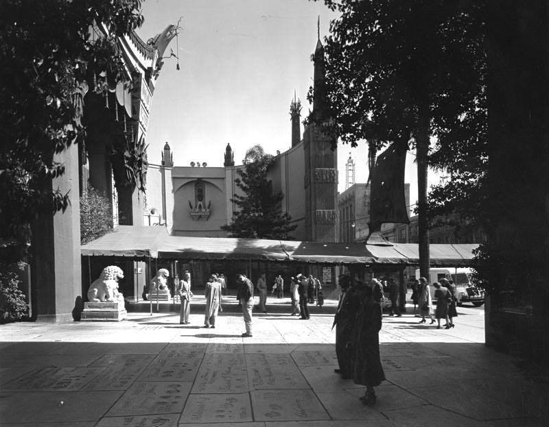
| (1950s)* – View showing the forecourt of Grauman’s Chinese Theatre where visitors are trying to find the footprints of their favorite star and marvel at how small their handprints were. |
 |
|
| (1962)* – Aerial view looking down at the foot and hand prints outside the Grauman’s Chinese Theatre. |
 |
|
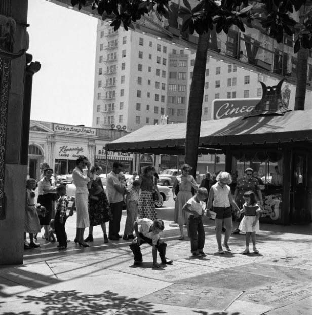
| (ca. 1960)* – View showing tourists standing in the forecourt of the Grauman’s Chinese Theatre. A boy is seen comparing his hand to the handprint of a Hollywood star.
|
Roosevelt Hotel
 |
|
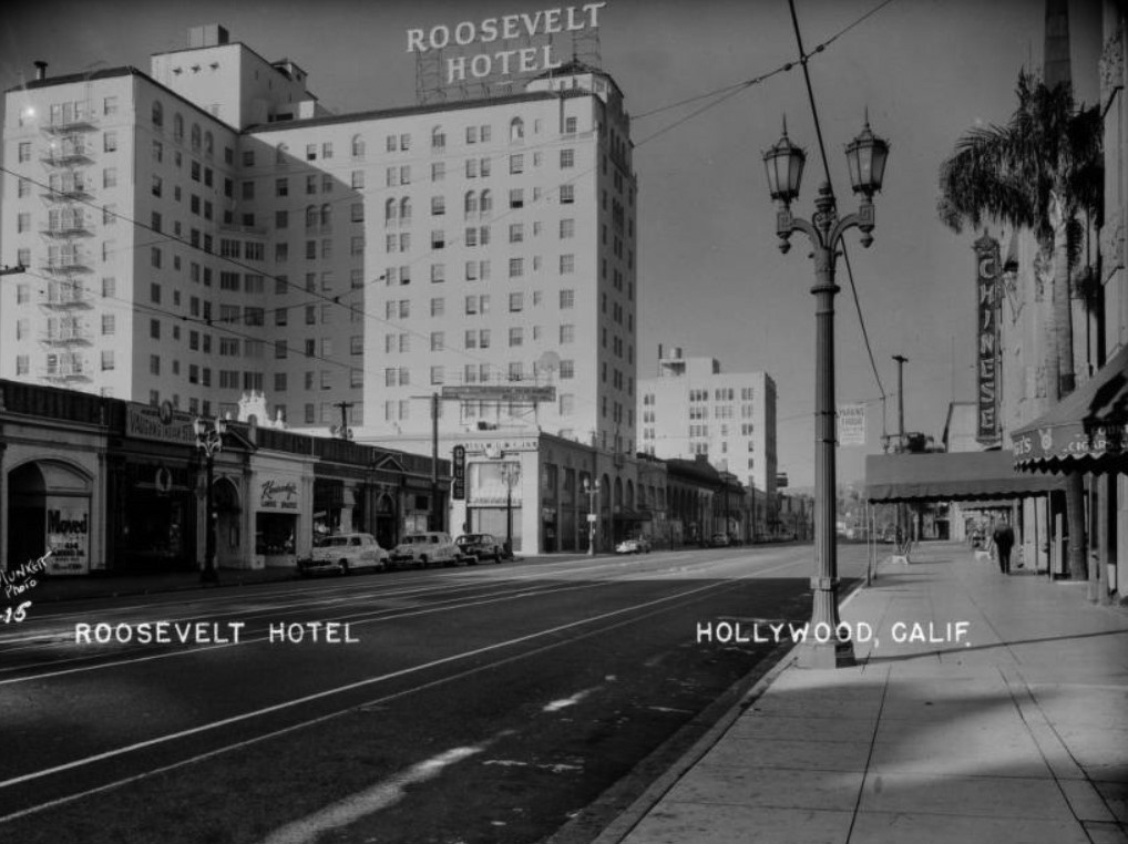
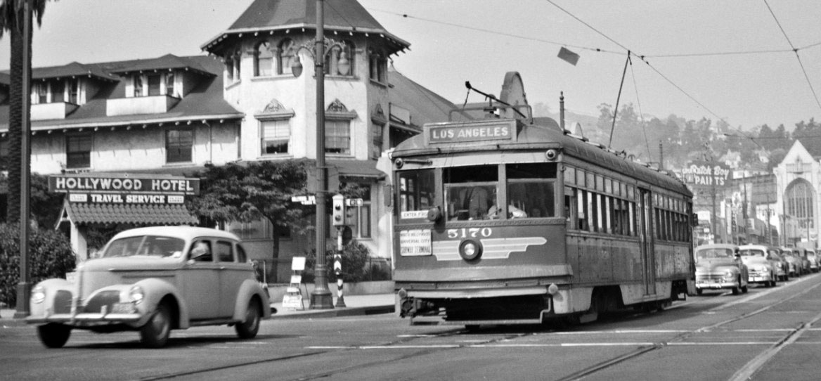
| (1947)* – Early morning postcard view of Hollywood Boulevard with no traffic showing the Roosevelt Hotel. Signs along the street read "Moved to Rodeo Dr., Beverly Hills" "Vaughn's Indian Store" "Kennedy's Lamps Shades" "Roosevelt Drug Co." "Drugs" "Western Airlines" "Outstanding Entertainment Cinegrill" and "Chinese" (in front of Grauman's Chinese Theatre at right). |
 |
|
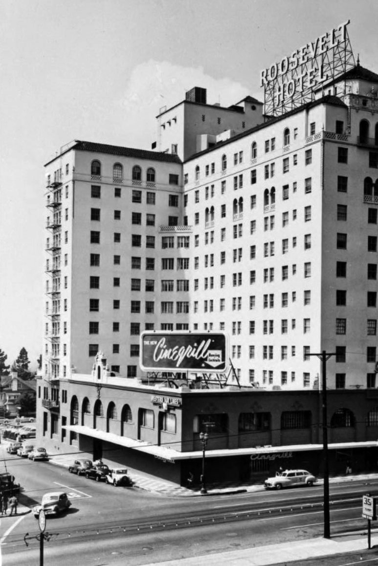
| (1949)*^#* – View of the Hollywood Roosevelt Hotel on the southwest corner of Orange Drive and Hollywood Boulevard, located across the street from and a short block away from Grauman's Chinese Theatre. |
Historical Notes Marilyn Monroe was a resident at the Hollywood Roosevelt for two years when her modeling career took off. Her first magazine shoot was taken in the Roosevelt. Clark Gable and Carole Lombard paid five dollars a night for their penthouse; it is now named the Gable & Lombard Penthouse. There is also a Marilyn Monroe Suite at the hotel. |
|
 |
|
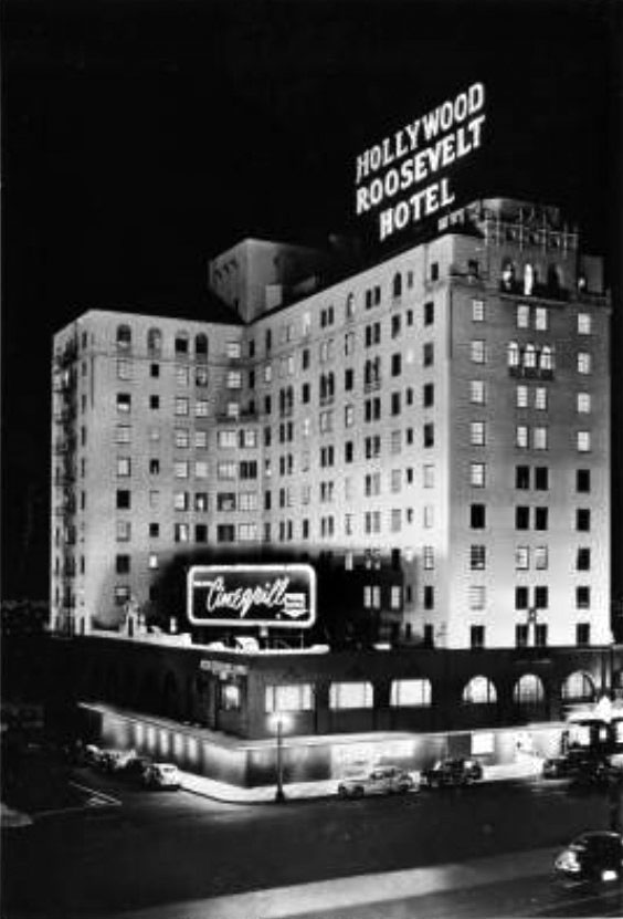
| (1949)* - Hollywood Roosevelt Hotel - Day & Night Views |
 |
|
| (ca. 1958)* - The Roosevelt Hotel at 7000 Hollywood Boulevard. |
 |
|
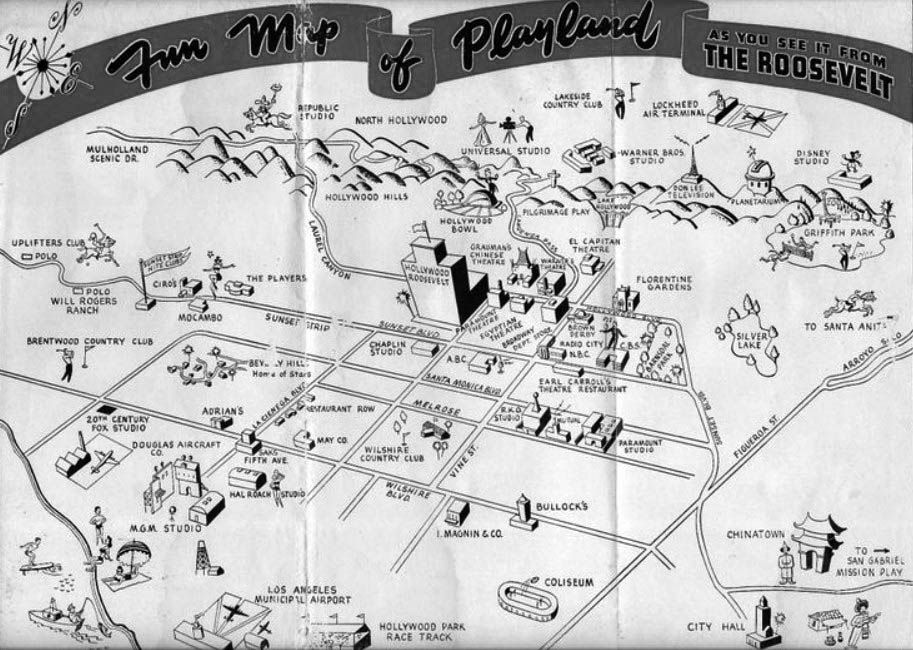
| (1950s)#^* – “Fun Map of Playland – As you see it from the Roosevelt Hotel." |
 |
|
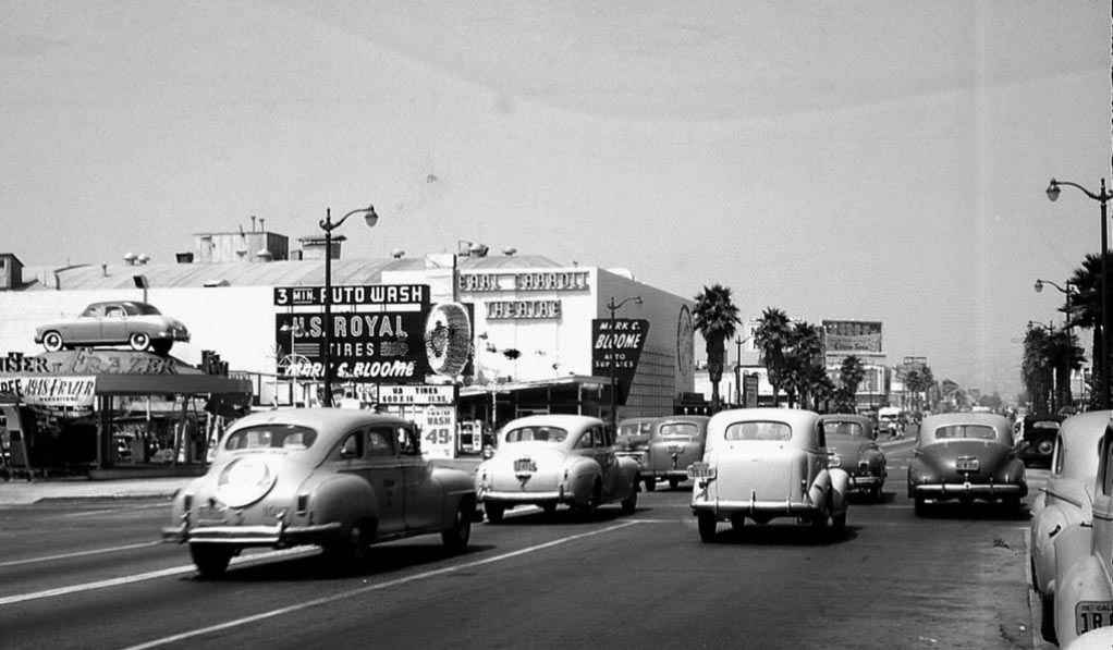
| (1948)* – View looking west on Sunset Boulevard at N. El Centro Ave. The Earl Carroll Theatre can be seen in the distance, with Mark C. Bloome Tires on the left. The Hollywood Palladium is just out of view to the right. |
CBS Columbia Square
 |
|
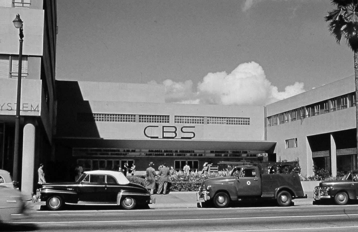
| (ca. 1948)* – Close-up view showing the entrance to CBS Columbia Square located at 6121 Sunset Boulevard. Note the early model phone company truck parked in front. |
Historical Notes From 1938 to 2007, Columbia Square was home of CBS's L.A./west coast radio/tv operations. It was also home to radio stations KNX 1070 and KCBS 83FM. The historic site is currently under redevelopment. |
 |
|
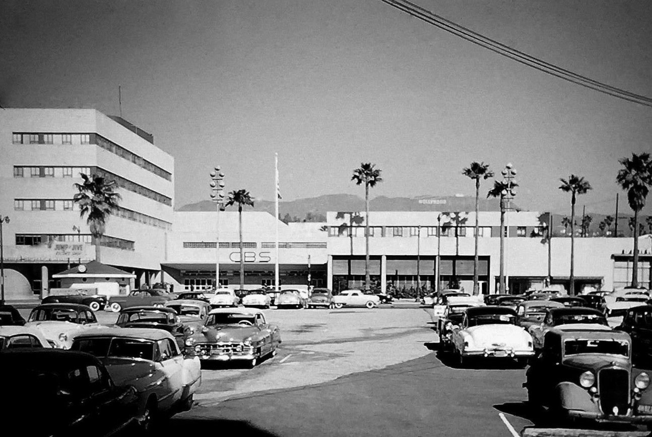
| (ca. 1951)* – View of CBS Columbia Square looking north from the Gower Gulch shopping center, close to where Denny’s currently is at Sunset and Gower. The Hollywood Sign is seen in the distance. |
* * * * * |
Vista Theatre
 |
|
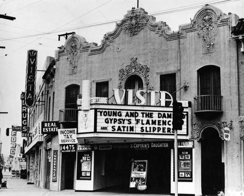
| (1951)* - View showing the Vista Theatre located at 4473 Sunset Drive, East Hollywood. Note the architectural design details (Spanish Colonial Revival Style) on the face of the building. Architect: Lewis A. Smith. |
Historical Notes Vista Theatre opened on October 16, 1923, as a single-screen theater. In addition to screening films, the theater also showed vaudeville acts on stage. Originally known as Lou Bard Playhouse on opening day in 1923, the cinema played the film Tips with Baby Peggy. It is one of the remaining historic structures from the 1920s, when Hollywood was first built up and began attracting residents to its new suburban homes from areas near downtown Los Angeles and East Los Angeles, at the time middle and wealthy class sections of Los Angeles. |
 |
|
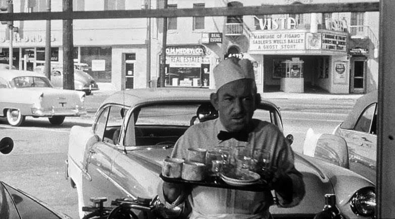
| (1955)* - A shot of the Vista Theatre from inside Stan's Drive-in Restaurant seen in "The Crooked Web" (Columbia, 1955). Thanks to Jonathan Raines for the screenshot. |
 |
|
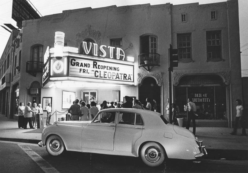
| (1980)* - A crowd of people stand at the entranceway awaiting the grand reopening of the Egyptian revival style Vista Theatre, featuring the 1934 version of "Cleopatra." Silent-film star Mary MacLaren (1896-1985) helped re-open the Vista. Baby Peggy came back: In 1923 she opened the theater. |
Historical Notes Standing at the "five corners" intersection of Hollywood Blvd, Sunset Blvd, Sunset Drive, Virgil Ave and Hillhurst Ave, the Vista is listed as being in Los Feliz, but some locals will tell you "even the Los Feliz Theatre isn't in Los Feliz!" They say its East Hollywood, and in fact, old pictures of the theatre show the words "VISTA, EAST HOLLYWOOD" in neon on the rooftop sign and on the marquee. In a manner reminiscent of Grauman's Chinese Theatre, the theater's forecourt features cement handprints and footprints of notable film figures. However, the handprints and footprints at the Vista Theatre tend to include more icons of independent and cult films such as Spike Jonze, John C. Reilly and Martin Landau, among many others. |
* * * * * |
Hollywood Boulevard
 |
|
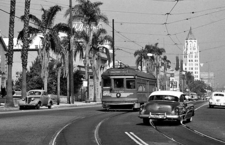
| (1950)* – View looking east on Hollywood Boulevard from N. McCadden Place. Some of the distinguishable signs include: Pickwick Book Store, Vogue Theatre, and The Broadway-Hollywood. Note the overhead streetcar wires running along the Boulevard. |
 |
|
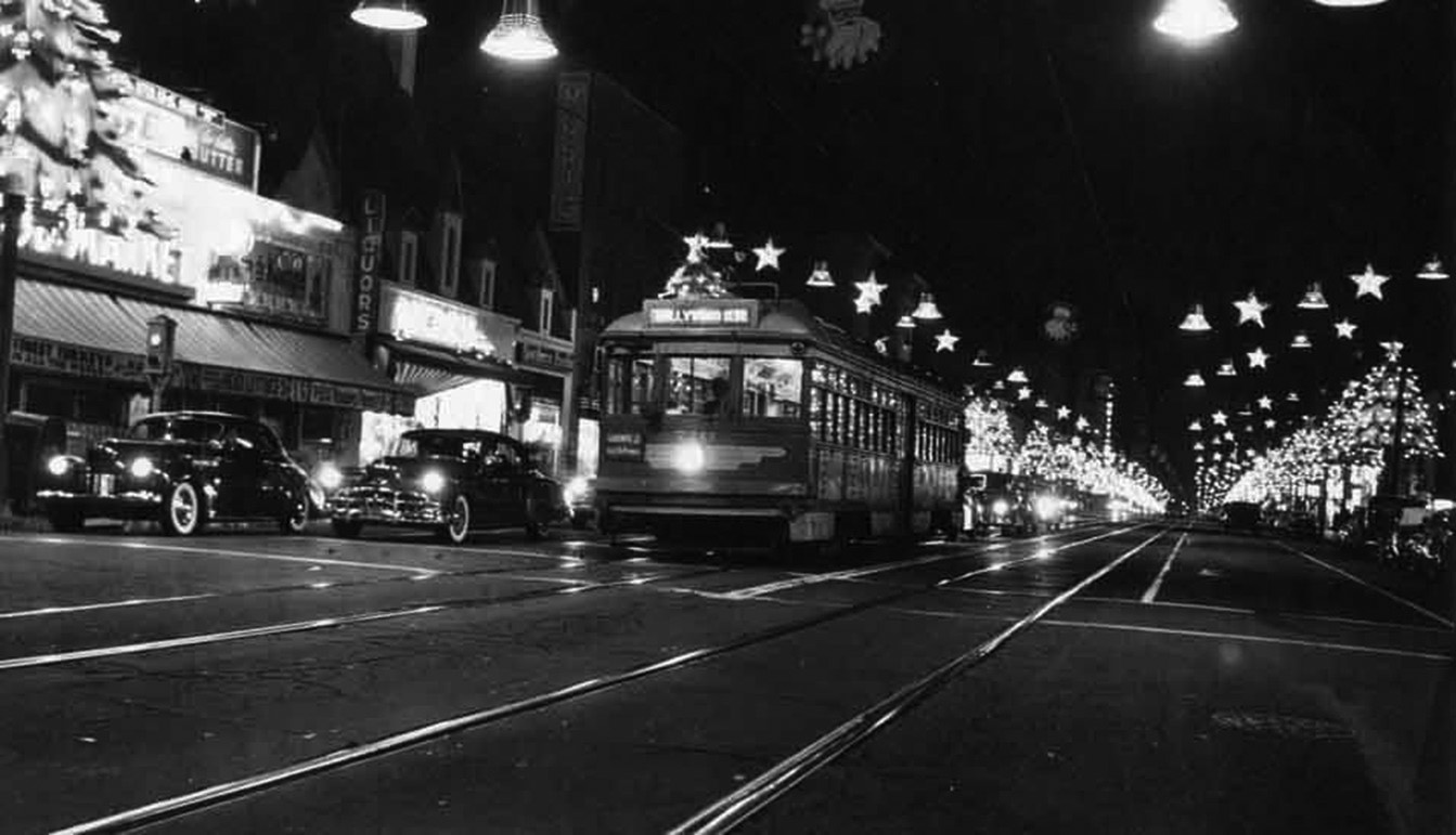
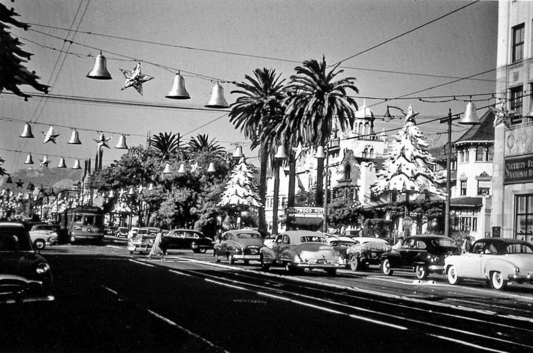
| (1950s)* - Streetcar down the center of Hollywood Boulevard during the holiday season. |
Historical Notes September 26, 1954 was the last day for streetcar service on Hollywood Boulevard. |
* * * * * |
Hollywood and Highland
 |
|
| (1950)* – View looking north from the southeast corner of Hollywood and Highland, with the Hollywood First Methodist Church visible in the distance. Note the semaphore traffic signal and the sign on the light post. |
Historical Notes In the 1950s, the intersection of Hollywood Boulevard and Highland Avenue underwent significant transformation, marking the end of an era with the demolition of the historic Hollywood Hotel (out of view) in August 1956. This iconic establishment, which had been a landmark since its opening in 1902, had fallen into decline by the mid-20th century. Following its demolition, construction began on the First Federal Savings & Loan Building, a modern high-rise that was dedicated in February 1959, becoming a focal point of the intersection. Additionally, the area was redeveloped into a parking lot with small retail buildings, reflecting the changing urban landscape and increasing automobile access. The late 1950s also saw the introduction of the Hollywood Walk of Fame, with a sample section unveiled at the intersection in September 1958, aimed at revitalizing Hollywood. Amidst this transformation, Grauman's Chinese Theatre continued to be a major attraction, ensuring that Hollywood and Highland remained a bustling hub of cultural and commercial activity throughout the decade. |
 |
|
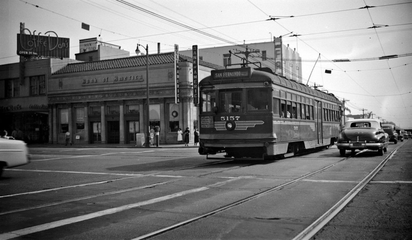
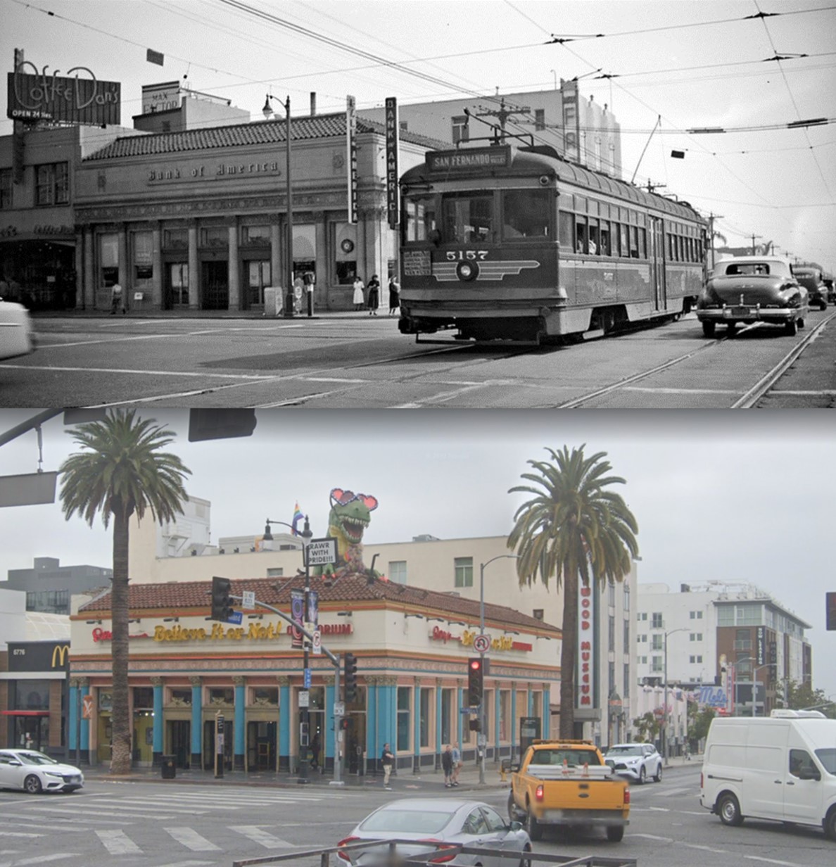
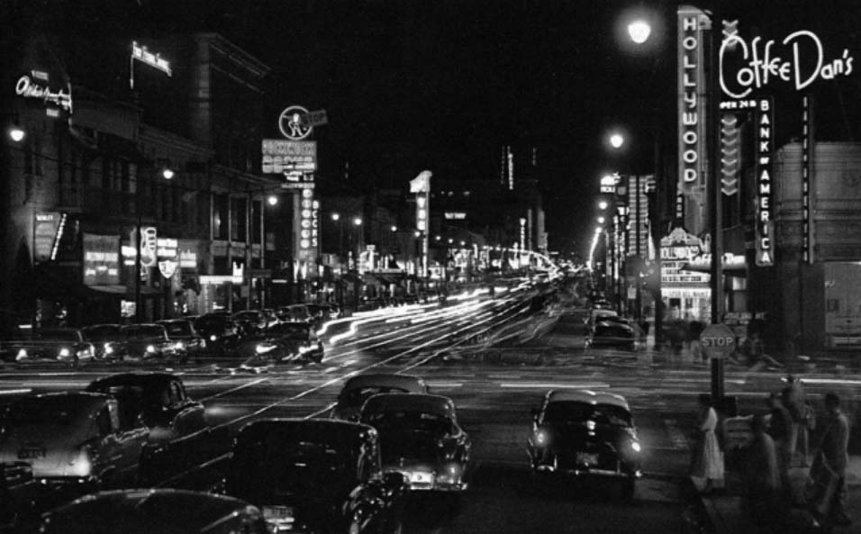
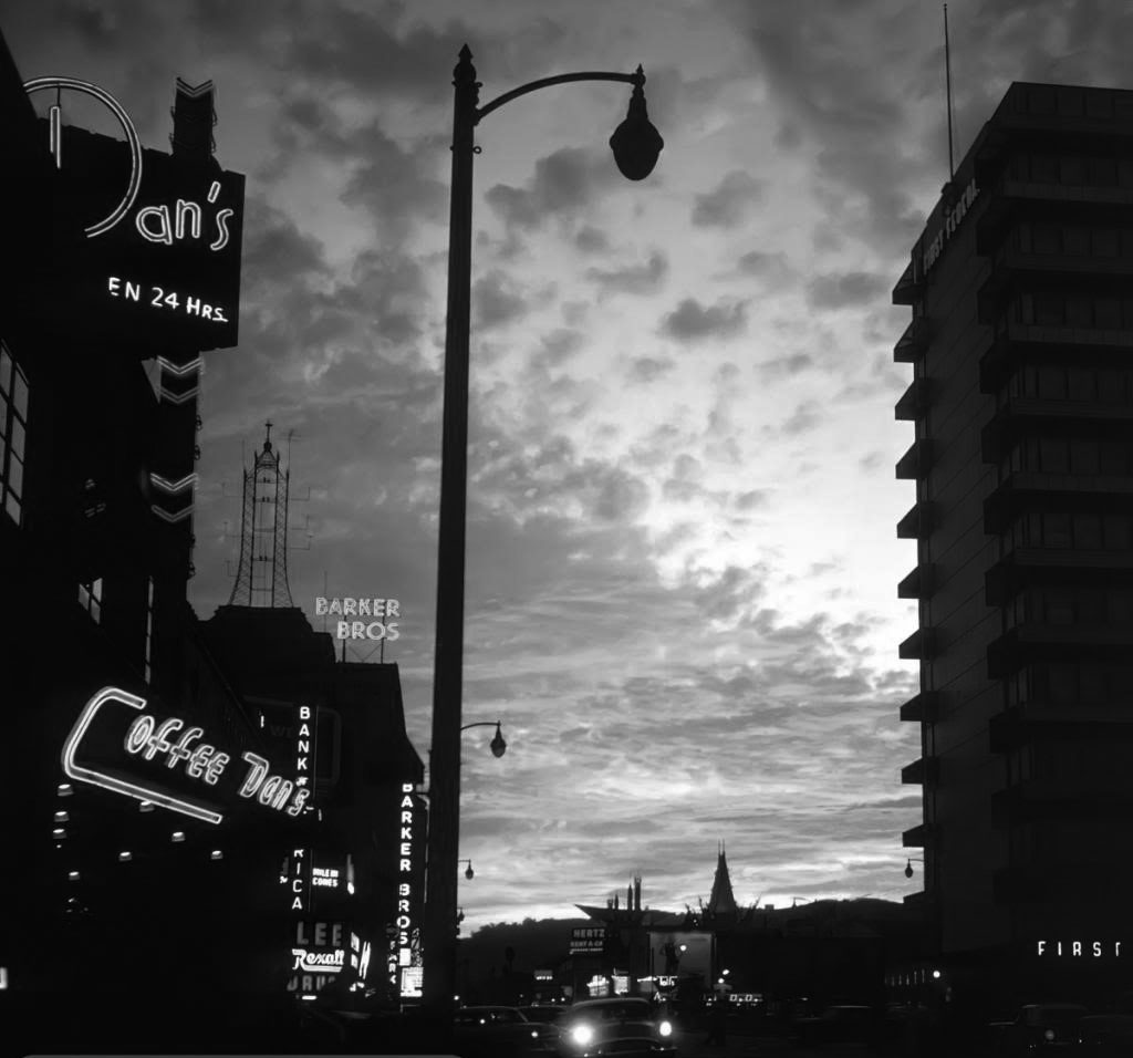
| (ca. 1950)* – View looking south on Highland Avenue at Hollywood Boulevard showing the Van Nuys Line Red Car heading north toward Cahuenga Pass and the San Fernando Valley. The Bank of America Building and Coffee Dan’s are on the left with the Max Factor Building seen behind the streetcar. |
Historical Notes Coffee Dan's, located at 6768 Hollywood Boulevard near the intersection of Hollywood Boulevard and Highland Avenue, opened in the 1940s and became a lively gathering spot for locals and tourists. Part of the Coffee Dan's chain known for its 24-hour service and "bottomless" coffee, the restaurant featured a retro aesthetic and a diner-style menu, attracting Hollywood personalities and moviegoers due to its prime location near the Hollywood Walk of Fame. However, it closed its doors in the late 1970s, marking the end of an era for this iconic establishment. In the early 1950s, the Pacific Electric Railway's Red Car system was a vital transportation link in Los Angeles, particularly along Cahuenga Boulevard and Highland Avenue. The Van Nuys Line ran north on Highland, connecting Hollywood to the San Fernando Valley and passing notable landmarks such as the Bank of America Building and Coffee Dan's. However, this era came to an end on September 26, 1954, when streetcar service was discontinued, reflecting a broader trend of declining streetcar systems in favor of automobile culture. |
 |
|
| (1950)* - Looking east on Hollywood Boulevard at Highland Avenue with the 1927-built Art Deco/Gothic style First National Bank building on the norrtheast corner. Photo by Bob Plunkett from the Ernest Marquez collection. |
Historical Notes The First National Bank Building, located at the northeast corner of Hollywood Boulevard and Highland Avenue, is a landmark thirteen-story structure built in 1927 and opened in 1928. Designed by the renowned architectural firm Meyer & Holler—who also created the nearby Egyptian and Chinese Theatres—the building combines Art Deco and neo-Gothic styles, featuring a striking tower, elaborate decorative elements, and four-foot-high gargoyles that evoke the sense of fantasy characteristic of Hollywood at the time. Upon completion, it was the tallest building in Los Angeles until City Hall opened later that year, symbolizing Hollywood’s economic optimism and burgeoning business district. Originally serving as both a bank and office building, it quickly became a hub for financial, legal, medical, and entertainment industry professionals, with over 80% occupancy by the summer of 1929. The building has also been a notable filming location, famously appearing in the 1950s Superman television series. Despite its prime location and architectural significance, the building has been vacant since 2008, though it remains a celebrated and enduring fixture of Hollywood’s historic landscape. |
 |
|
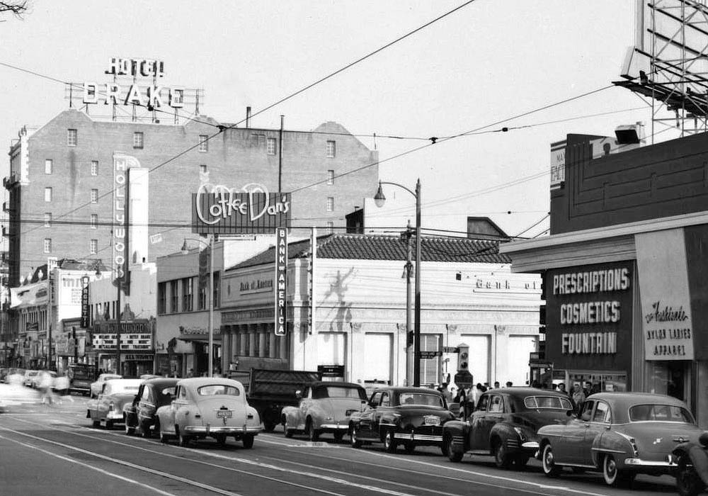
| (ca. 1950)* – View looking southeast showing the intersection of Hollywood and Highland. Several businesses can be seen on the south side of Hollywood Boulevard including: Bank of America, Coffee Dan’s, Hollywood Theatre, the Hotel Drake (formerly the Hotel Christie). |
Historical Notes Today, Bank of America is a Ripley’s Believe it or Not, Coffee Dan’s is a McDonalds, the Hollywood Theater is the Guinness World Records Museum, and the Hotel Drake is a Scientology center. Click HERE for contemporary vi |
Then and Now
 |
|
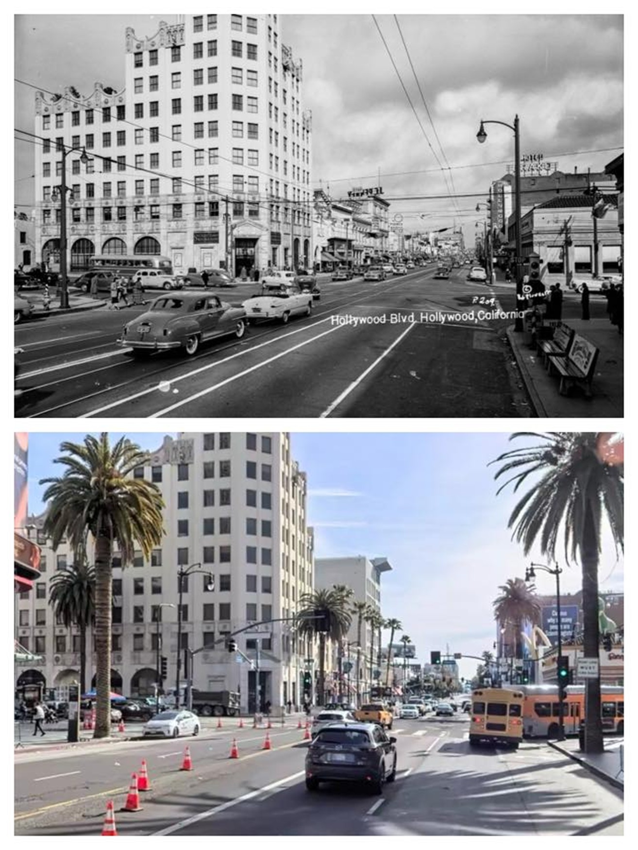
| (1950 vs 2020s)* – A ‘Then and Now’ view looking east on Hollywood Boulevard at Highland Avenue. Photo comparison by Trey Callaway. |
Historical Notes The intersection of Hollywood Boulevard and Highland Avenue has transformed significantly since the 1950s, with the First National Bank Building—a 1928 Art Deco and neo-Gothic landmark—remaining a key fixture. In the 1950s, the area was a bustling commercial and entertainment hub with the bank building fully occupied and surrounded by historic venues like the Hollywood Hotel. Today, the intersection is a major tourist destination dominated by the Hollywood & Highland Center and the Dolby Theatre, with heavy pedestrian traffic and modern commercial development. While the First National Bank Building is now vacant, it stands as a historic reminder of Hollywood’s evolving identity from a local business center to a global entertainment landmark. |
Then and Now
 |
|
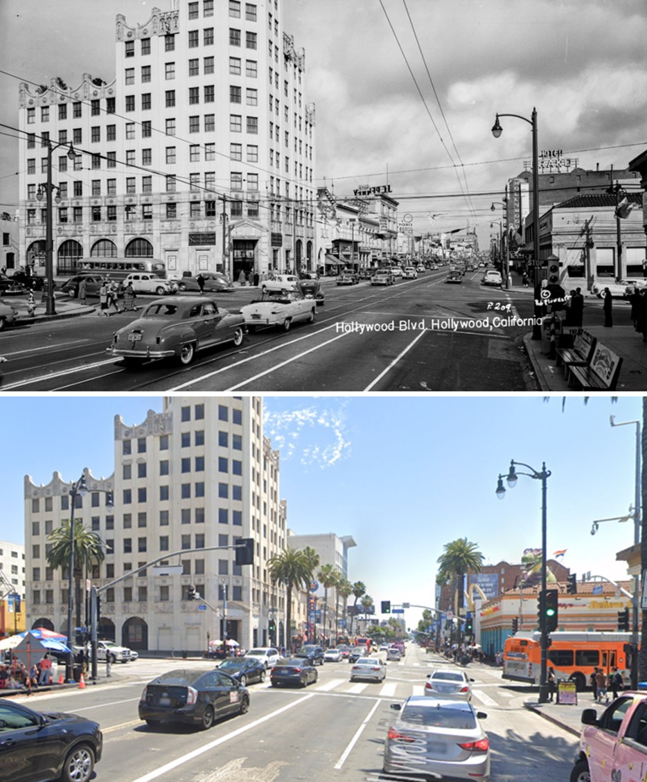
| (1950 vs. 2024)* – A ‘Then and Now’ view looking east on Hollywood Boulevard at Highland Avenue. This busy intersection has seen dramatic change since the 1950s, but the 1927-built First National Bank Building—an Art Deco and Gothic Revival landmark—still anchors the northeast corner. Photo comparison by Jack Feldman. |
Then and Now
 |
|
| (1950 vs 2022)* – Looking south on Highland Avenue at Hollywood Boulevard showing the Van Nuys Line Red Car heading north toward Cahuenga Pass and the San Fernando Valley. The Bank of America Building (now Ripley's Believe It or Not!) and Coffee Dan’s are on the left with the Max Factor Building seen behind the streetcar. Photo comparison by Jack Feldman. |
Historical Notes Ripley's Believe It or Not! is located at 6780 Hollywood Boulevard, on the southeast corner of Hollywood and Highland. Opened in 1995, this expansive museum showcases a variety of bizarre and unusual exhibits, including rare artifacts and interactive displays, making it a family-friendly attraction. As one of the largest Odditoriums in the world, it continues the legacy of Robert Ripley's original cartoon series that began in 1918. With its engaging offerings and easy accessibility, Ripley's has become a popular stop for tourists exploring the iconic Hollywood area. |
 |
|
| (1950s)* - Postcard nighttime view looking east on Hollywood Boulevard at Highland Avenue showing Coffee Dan's between the Bank of America and the Hollywood Theatre. Note the Stop sign at lower right. |
 |
|
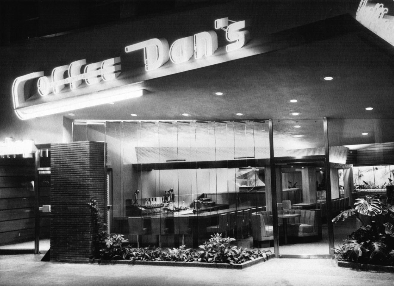
| (1950)* – View showing the front entrance to Coffee Dan’s restaurant near the intersection of Hollywood Boulevard and Highland Avenue. |
Historical Notes Alan Hess, the author of Googie: Fifties Coffeeshop Architecture, traces Googie Architecture back to three Coffee Dan's restaurants designed by John Lautner in the early forties. "He selected the vaults and glass walls and trusses and angles of his buildings to fit the original, often unusual, concepts of space he favored," writes Hess. |
2nd Coffee Dan's on Hollywood Blvd
 |
|
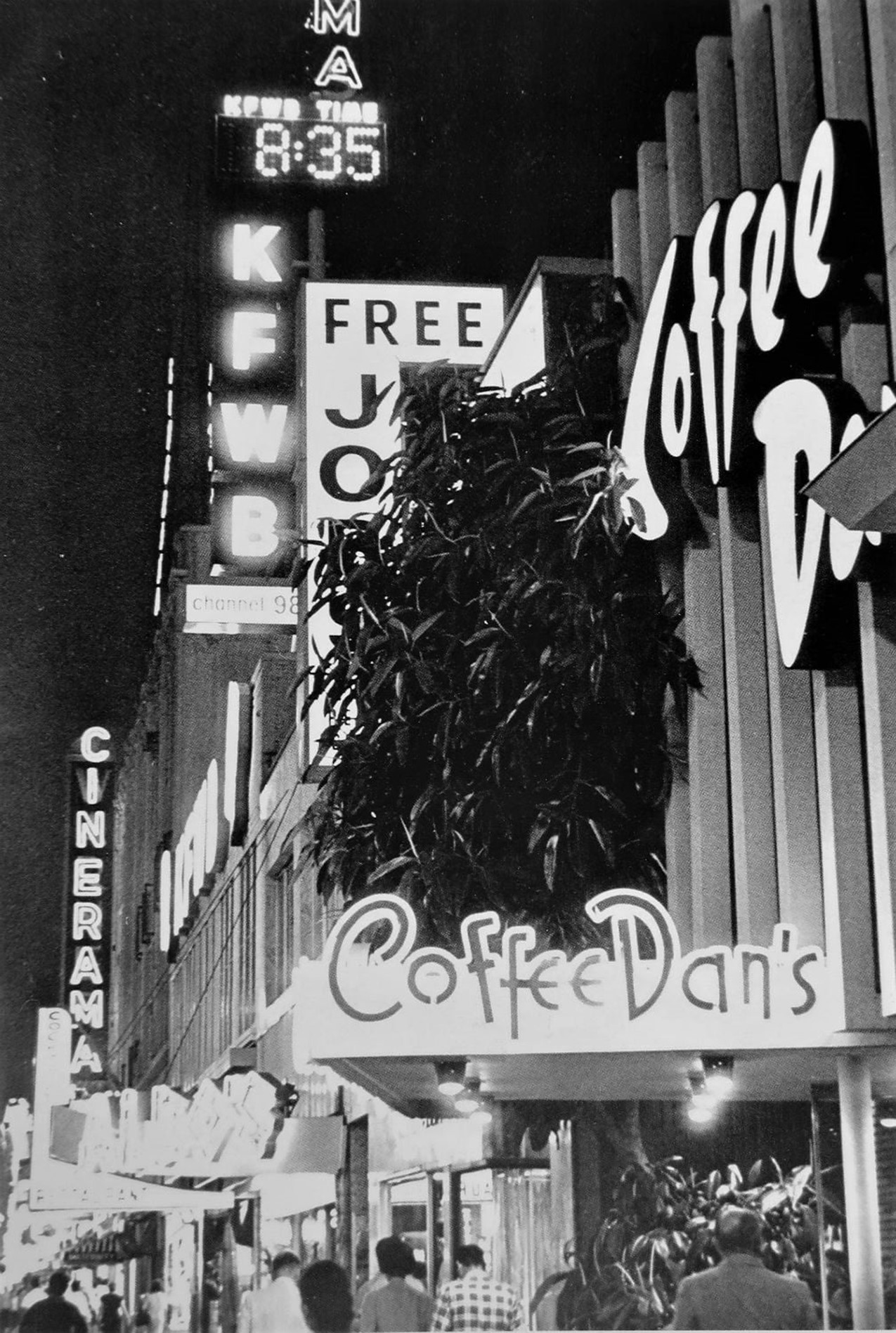
| (1960s)* – Looking west from the north side of Hollywood Boulevard in front of Coffee Dan's (second Hollywood Boulevard location) toward the Warner Cinerama Theatre, with the KFWB neon sign affixed to its roof. |
Historical Notes There were two Coffee Dan’s locations on Hollywood Boulevard over the years. The first, opened in the 1940s near Highland Avenue and became a lively gathering spot for locals and tourists. Part of the Coffee Dan's chain known for its 24-hour service and "bottomless" coffee, the restaurant featured a retro aesthetic and a diner-style menu, attracting Hollywood personalities and moviegoers due to its prime location near the Hollywood Walk of Fame. However, it closed its doors in the late 1970s, marking the end of an era for this iconic establishment. The second Coffee Dan’s (seen above) opened later on the 6400 block of Hollywood Boulevard, just two doors down from the Warner Cinerama Theatre (originally known as the Warner Bros. Hollywood Theatre), which housed KFWB Radio Station. Coffee Dan’s grew from a single restaurant in Los Angeles in the 1920s into a popular chain, particularly across California. By the peak of its expansion, it had around 30 locations across the U.S., primarily in California and a few other states. The chain was known for its casual 24-hour service, drawing in patrons with its late hours and lively atmosphere. |
 |
|
| (1953)* – View looking west on Hollywood Boulevard at Highland during the holidays with the Hollywood Hotel at right. Note the Stop sign on the corner. |
* * * * * |
Red Cars of Hollywood |
For nearly half a century, the Red Cars of the Pacific Electric Railway were woven into the daily life of Hollywood. At the intersection of Highland Avenue and Hollywood Boulevard, passengers could board an electric streetcar heading downtown through the Hollywood Subway, or ride north through Cahuenga Pass all the way to the San Fernando Valley. The cars were a familiar sight on Highland Avenue from the early years of the twentieth century, rolling past the Hollywood Hotel and the budding commercial district that would grow into one of the most recognized corners in the world.The Van Nuys Line was the last of the San Fernando Valley routes still operating via Highland Avenue in the early 1950s. By then the Pacific Electric was already in steep decline, facing competition from automobiles and buses on a growing freeway network. The line's final day came on December 28, 1952, when the last regular car departed the Subway Terminal in the early hours of the morning. A ceremonial excursion run followed the next day before power to the line was cut at three in the afternoon. The Red Cars that had connected Hollywood to the Valley for more than four decades were gone.What remained along Hollywood Boulevard a little longer were the so-called Hollywood Cars, the 600-class streetcars that ran west toward Beverly Hills and east toward downtown. Those continued under Pacific Electric and then under the Metropolitan Coach Lines, which took over all PE passenger operations on October 1, 1953. The Hollywood Boulevard line survived until September 26, 1954, when motor coaches replaced the last streetcars. The photos and maps in this section document the final years of Red Car service in Hollywood, along with the right-of-way the cars traveled and the junction at Gardner Street where lines diverged on their way toward Fairfax and Santa Monica. |
Highland Avenue and the Van Nuys Line |
For anyone standing at the corner of Hollywood Boulevard and Highland Avenue in the early 1950s, the sight of a Red Car rolling south from the hills was still an everyday part of life. The Van Nuys Line had been running north on Highland since 1908, climbing through Cahuenga Pass on its own private right-of-way before descending into the San Fernando Valley and eventually reaching Van Nuys, more than eighteen miles from downtown Los Angeles. Unlike many Pacific Electric lines that saw ridership fall after World War II, the Van Nuys Line actually grew busier in its final years, carried along by the valley's rapid postwar population growth. By 1950 one-man operation had replaced the two-man crews that had staffed the cars for decades. It was a lean, efficient line right up to the end, which came on December 28, 1952. |
 |
|
| (1952)* - A Pacific Electric Red Car heads south on Highland Avenue toward Hollywood Boulevard. At the left edge of the frame, the eastern facade of the Hollywood Hotel is just visible. The Hollywood United Methodist Church, seen in the distance at Franklin Avenue, is the one landmark from this view still standing today. |
Historical Notes The Pacific Electric Railway's Van Nuys Line used Highland Avenue as its main corridor between Hollywood and the San Fernando Valley for more than four decades. Running north from the Hollywood Subway terminal downtown, the cars turned up Highland, climbed through Cahuenga Pass, and eventually reached Van Nuys, more than eighteen miles away. On the return trip they rolled back south down Highland, passing the Hollywood Hotel, the Bank of America Building, and Coffee Dan's restaurant before reaching Hollywood Boulevard, giving riders a close-up view of the neighborhood at the height of its commercial life. By the early 1950s, ridership had actually increased on this line even as other PE routes were being cut, a sign of how many valley commuters still depended on the electric cars. The end came quickly. The final regular car left the Subway Terminal at 1:20 in the morning on December 28, 1952. A ceremonial excursion run followed the next day before power to the line was officially cut off at three in the afternoon. Buses running over the new Hollywood Freeway replaced the streetcars almost immediately. The Hollywood Boulevard line, operated separately, continued under Pacific Electric and then the Metropolitan Coach Lines until September 26, 1954, when that service was also converted to motor coaches. |
 |
|
| (2024)* - Looking north on Highland Avenue from Hollywood Boulevard. The Hollywood United Methodist Church stands at the corner of Franklin Avenue, as it has since 1930. To the left is Ovation Hollywood, the shopping and entertainment complex that opened on this site in 2001 on the former grounds of the Hollywood Hotel. |
Historical Notes Hollywood United Methodist Church traces its roots to 1909, when a small group of congregants began organizing on Prospect Street, the road that would later be renamed Hollywood Boulevard. They held early services in a rented space above the Owl Drug Store before the growing congregation moved to its current site at the corner of Franklin and Highland Avenues. Construction began in the early 1920s, starting with the recreational wing, and the main sanctuary was completed and opened on March 16, 1930. Designed by architect Thomas P. Barber in the English Gothic Revival style, the building was designated Los Angeles Historic-Cultural Monument No. 248 in 1981. The church has long been active on social issues, becoming one of the first congregations in the region to respond publicly to the AIDS crisis. On World AIDS Day in 1993, members fashioned two large red ribbons and attached them to the church tower, a practice that has continued ever since with permanent ribbons mounted in 1996. The building is also widely known as a filming location, with scenes from Sister Act, Back to the Future, Jarhead, and other productions shot on its grounds. The church remains an active congregation today, serving several hundred worshippers each Sunday. |
Then and Now
 |
|
| (1952 vs. 2022)* – Seen top and bottom: looking north on Highland Avenue from Hollywood Boulevard, nearly 70 years apart. The Hollywood United Methodist Church anchors the same spot at Franklin Avenue in both views, while nearly everything else along the corridor has changed. To the left in the modern view is Ovation Hollywood, which opened in 2001 on the site of the long-gone Hollywood Hotel. Photo comparison by Trey Callaway and Jack Feldman. |
| Historical Notes
These two views, taken about 70 years apart, capture how completely Highland Avenue between Hollywood Boulevard and Franklin Avenue was transformed in the second half of the twentieth century. In 1952 the street was lined with low commercial buildings, the Hollywood Hotel occupied the northwest corner of Hollywood and Highland, and a Pacific Electric Red Car ran down the center of the roadway. The church was already 22 years old and well established as the most prominent architectural feature on the corridor. By 2022 the hotel was long gone, replaced first by the First Federal Savings and Loan Building and then by Ovation Hollywood, the retail and entertainment complex that opened in 2001. Palm trees now line the sidewalk where storefronts once stood, and a Metro B Line station sits underground at the Hollywood and Highland intersection. The church, its tower still rising above everything around it, remains the one element that connects the two images across the decades. |
 |
|
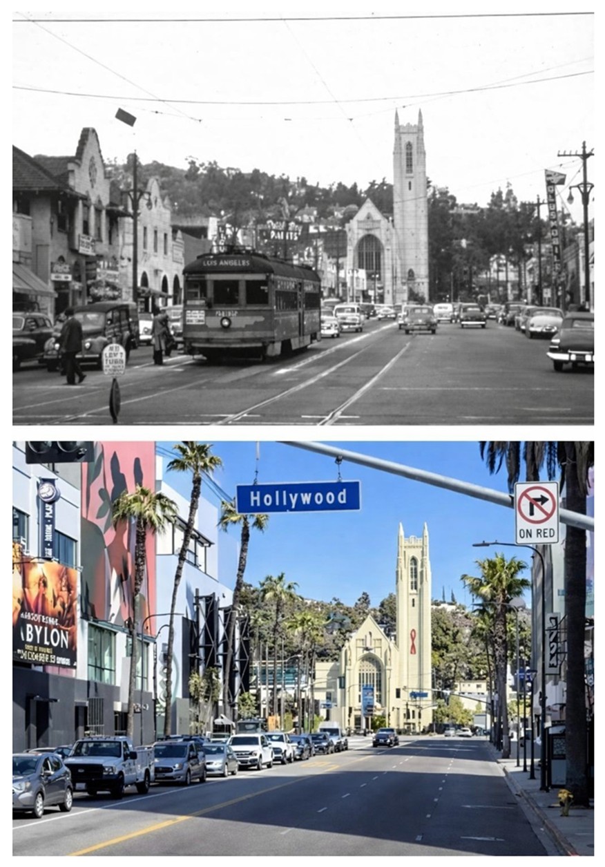
| (ca. 1954)* – A Pacific Electric streetcar heads west on Hollywood Boulevard at Highland Avenue, in what were the final months of Red Car service on the boulevard. The Pickwick Book Store at 6743 Hollywood Boulevard is visible at center-right. |
Historical Notes The Pickwick Book Store was opened in 1938 by Louis Epstein, a Russian immigrant who had a gift for creating the kind of store where people wanted to linger. He named it after the Charles Dickens novel The Pickwick Papers, and the shop quickly drew a loyal following that included Hollywood studio workers, actors, and serious book collectors. Its location on Hollywood Boulevard put it at the center of the neighborhood's commercial life, and it became one of the better-known independent bookstores in Los Angeles during the postwar years. This photo was taken near the very end of Red Car service on Hollywood Boulevard. The Metropolitan Coach Lines, which had taken over Pacific Electric's passenger operations in October 1953, ran the boulevard streetcars until September 26, 1954, when motor buses replaced them for good. The overhead wires visible in earlier photographs of the boulevard came down not long after, and the tracks were eventually paved over as the street adapted to a future built around the automobile. |
 |
|
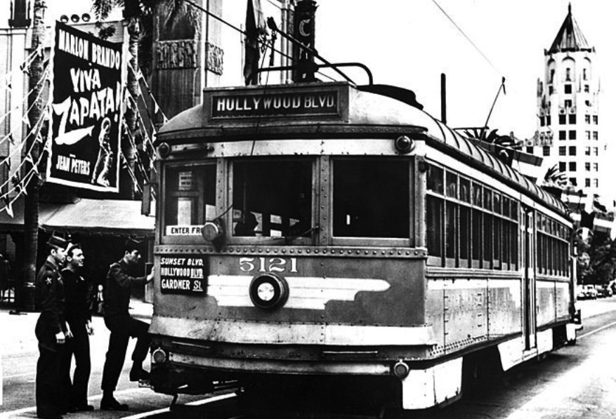
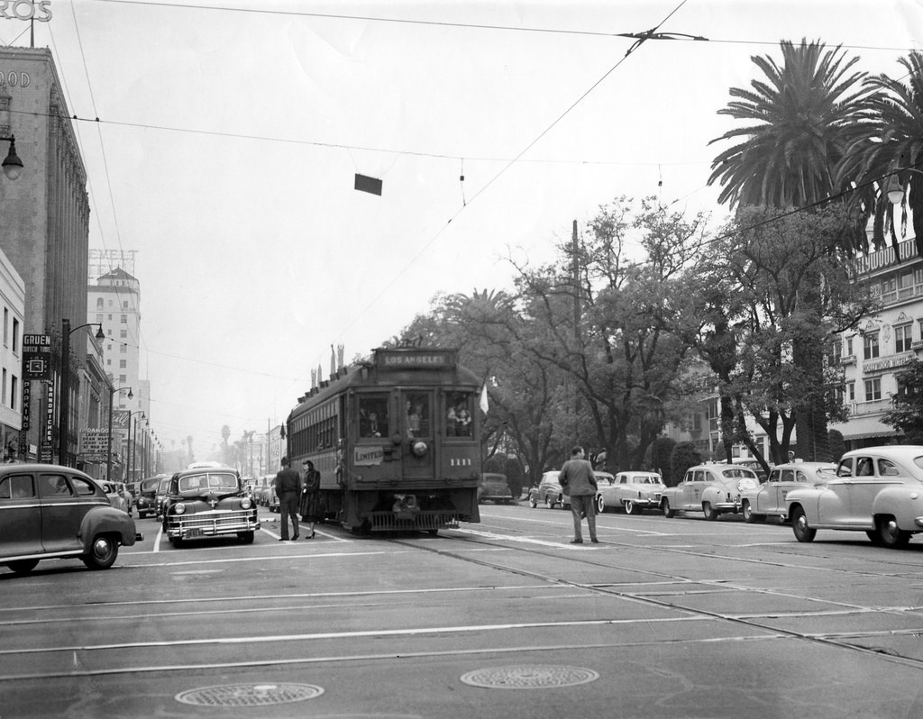
| (1952)* - Three uniformed soldiers board westbound car 5121 at Hollywood Boulevard and North Orange Drive. Grauman's Chinese Theatre and the First National Bank Building are visible in the background. The Chinese Theatre marquee advertises Viva Zapata!, then in first-run release with Marlon Brando in the title role. |
Historical Notes Viva Zapata! was released by 20th Century Fox in 1952 and directed by Elia Kazan, who had just come off the success of A Streetcar Named Desire. The screenplay was written by John Steinbeck, who drew on Edgcumb Pinchon's biography Zapata the Unconquerable as his primary source. Marlon Brando played the Mexican revolutionary Emiliano Zapata, tracing his life from a peasant upbringing through his rise to power in the early years of the twentieth century and on to his death. Jean Peters appeared alongside Brando, and Anthony Quinn won the Academy Award for Best Supporting Actor for his portrayal of Zapata's brother. The three soldiers in this photo are boarding a car that still had about two more years of service ahead of it on Hollywood Boulevard. The 5100-series cars had been the workhorses of the Van Nuys Line through Cahuenga Pass. By 1952 many had been reassigned as the valley service was being wound down, and they continued carrying riders along Hollywood Boulevard until the line was sold to the Metropolitan Coach Lines and eventually converted to bus service in September 1954. |
The Back Yard Right-of-Way |
Not all of the Pacific Electric's track in Hollywood ran along public streets. Between La Brea Avenue and Fairfax Avenue, the Hollywood Line used a private right-of-way that cut diagonally across the street grid in a southwesterly direction, allowing the cars to travel between Hollywood Boulevard and Santa Monica Boulevard without mixing with automobile traffic. This stretch was known informally as the back yard right-of-way, and for good reason: it passed behind homes and apartment buildings, threading through the neighborhood in a path that had nothing to do with the surrounding streets. It was efficient while it lasted, but once the cars stopped running in September 1954, the land sat idle. Over the following six decades it was sold off piece by piece and absorbed into apartment development, the last segment going in 2012. |
 |
|
| (ca. 1953)* - Looking east on Hollywood Boulevard from La Brea Avenue. Grauman's Chinese Theatre and the First National Bank Buildin are visible in the distance. The Pacific Electric streetcar appears to be turning onto La Brea but is actually entering a private right-of-way that carried the line diagonally toward Santa Monica Boulevard and Fairfax Avenue. |
Historical Notes The Pacific Electric Hollywood Boulevard line had a routing quirk that puzzled anyone who watched a streetcar apparently turn off the boulevard at La Brea Avenue. Rather than following the street grid, the cars ducked into a private right-of-way that cut diagonally across several blocks in a southwesterly direction. This allowed them to travel from Hollywood and La Brea all the way to Fairfax Avenue without running along any public street, emerging onto Santa Monica Boulevard before turning west toward the beach communities. Private rights-of-way were a common feature of Pacific Electric's design philosophy across the Los Angeles basin. Running on dedicated track away from automobile traffic let the cars move faster and more reliably than they could in mixed traffic. The diagonal stretch between La Brea and Fairfax passed near Gardner Street Elementary School, a landmark that gives its name to the junction described in the section below. The map that follows shows the routing in detail. |
 |
|
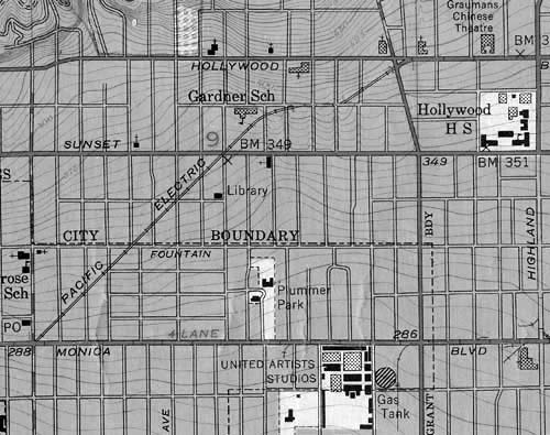
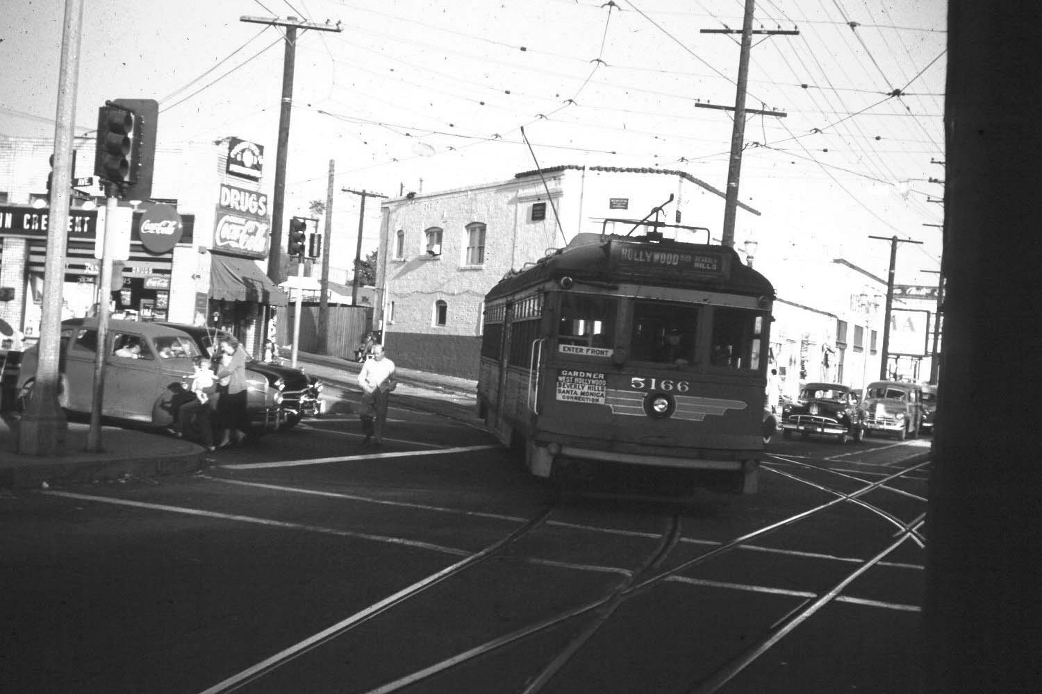
| (1953)* – Map of the Pacific Electric right-of-way running from Hollywood Boulevard and La Brea Avenue (upper-right) to Santa Monica Boulevard and Fairfax Avenue (lower-left). The tracks followed a diagonal path across the street grid, making a turn near Gardner Street Elementary School. |
Historical Notes From La Brea Avenue the tracks ran southwest on private right-of-way, crossing Sunset Boulevard at the point known as Gardner Junction, named for the nearby intersection with Gardner Street. At that junction the Laurel Canyon line had once branched off to the west, but by the early 1950s the only remaining service used this stretch to move between Hollywood Boulevard and the Santa Monica line. After crossing Sunset, the tracks continued toward Fairfax Avenue, where the cars curved westbound onto Santa Monica Boulevard to continue their journey toward the coast. Over the decades after the streetcars stopped running, this stretch of private right-of-way was sold off in pieces and gradually absorbed by apartment development. The last remaining segment, behind Gardner Street Elementary School, was finally developed in 2012, more than 58 years after the last car passed through. Today almost no trace of the route survives above ground, though the diagonal street pattern of the neighborhood still hints at where the tracks once ran. |
Gardner Junction: Where the Lines Diverged |
About halfway along the back yard right-of-way, where the tracks crossed Sunset Boulevard near Gardner Street, stood one of the more operationally interesting spots on the Pacific Electric's Western District. Gardner Junction was the point where the Laurel Canyon streetcar branch once split from the main Hollywood line, heading west along Sunset to the mouth of Laurel Canyon Boulevard. There, passengers could transfer to the Laurel Canyon trolley bus, a modest two-car operation that began service on September 2, 1910, and holds the distinction of being the first commercial trolley bus line in the United States. The trolley buses wore out by 1915 and were replaced by steam-powered vehicles, while the PE streetcar branch at Gardner Junction continued as a short-turn point for Hollywood Boulevard rush-hour service until the branch itself was abandoned on March 10, 1924. The junction remained a familiar landmark to car crews for another three decades after that, as the right-of-way continued to see daily use until the last day of Hollywood Line service in September 1954. |
 |
|
| (1924)* – Aerial view of the Gardner Junction area, with the junction itself visible at lower-right. Gardner Street runs diagonally from lower-center to upper-left, and the edge of Sunset Boulevard appears at the lower-right corner. Gardner Street Elementary School is at the top of the photo, fronting Hawthorne Street, on the same site it occupies today. Photo courtesy of Ralph Cantos. |
Historical Notes Gardner Junction took its name from its location near the intersection of Gardner Street and Sunset Boulevard. It was a branch point on the Pacific Electric system where the Laurel Canyon streetcar line split from the main Hollywood and Beverly Hills route and headed west along Sunset on a single track to Laurel Canyon Boulevard. There it connected with the Laurel Canyon "Trackless Trolley, an electric bus service that began running on September 2, 1910, and is recognized as the first commercial trolley bus operation in the United States. The trolley buses were replaced by steam-powered vehicles around 1915, but the Pacific Electric streetcar branch at Gardner Junction continued as a short-turn point for rush-hour service until the branch itself was abandoned on March 10, 1924. A crossover visible at the lower left of this image had served those Laurel Canyon cars and remained in place, though unused, until it was removed around 1947. Even after the branch line was gone, Gardner Junction continued to serve as a turnaround point for some Hollywood Boulevard rush-hour cars, which would reverse direction here rather than continuing all the way to Beverly Hills. A crossover on the southwest side of Sunset Boulevard was used for that purpose. The junction also marked where the diagonal private right-of-way from La Brea crossed Sunset before continuing southwest toward Fairfax, making it one of the more operationally complex spots on the Western District. Gardner Street Elementary School, visible at the top of this photograph, remains on the same site today. |
 |
|
| (1954)* – Aerial view of the Gardner Junction. Three Pacific Electric streetcars are visible at lower-left where the tracks cross Sunset Boulevard near Gardner Street. The Oriental Theater appears at center-left along Sunset. Photo courtesy of Ralph Cantos. |
Historical Notes By 1953 Pacific Electric management was already trimming service as part of a steady drawdown. On June 1, 1953, two-car rush-hour trains on the Hollywood Boulevard and Beverly Hills line were replaced by single cars running every four minutes to Gardner Junction, with every other car continuing to Beverly Hills on a seven-minute headway. It was a holding pattern more than a long-term plan. On October 1, 1953, Pacific Electric sold all its passenger operations to the Metropolitan Coach Lines, which continued running the streetcars until September 26, 1954, when the last cars on the Hollywood and Beverly Hills line were replaced by buses. The private right-of-way that the cars had used between La Brea and Fairfax did not disappear overnight. After the tracks were lifted, the land sat largely undisturbed for years, a narrow band of open space threading through back yards and alongside the school on Gardner Street. Over the following decades it was sold off in pieces and developed into apartment buildings. The last segment, running behind Gardner Street Elementary School between Vista Street and Sunset Boulevard, was finally sold and developed in 2012, fifty-eight years after the last car passed through. |
 |
|
| (ca. 1972)* – Looking northeast from the corner of Sunset Boulevard and Gardner Street, the former Pacific Electric right-of-way has become a parking lot. By this point the tracks had been gone for nearly 20 years. Click HERE to see contemporary view. |
Historical Notes By the time this photograph was taken, the Pacific Electric tracks at Gardner Junction had been gone for nearly twenty years. The private right-of-way that once carried streetcars across Sunset Boulevard had been cleared and paved over, becoming the kind of surface parking lot that spread across Los Angeles in the postwar decades as the city reorganized itself around the automobile. The transformation was typical of what happened to former PE corridors throughout the region: land that had been reserved for rail use was quietly absorbed into the surrounding neighborhood, with little to mark where the cars had once run. The section of right-of-way visible here would continue to sit in various stages of vacancy and informal use until development pressure finally caught up with the last remaining segments in the early 2000s and again in 2012. |
 |
|
| (1948)* - Looking west on Sunset Boulevard at the Gardner Junction, six years before the streetcars on this corridor made their last run. Photo by J.R. Eyerman, Life Magazine. |
Historical Notes This photograph was taken in 1948 by J.R. Eyerman for Life Magazine, six years before the last Pacific Electric car made its final run through the Gardner Junction area. At that point the Van Nuys Line was still operating through Cahuenga Pass and the Hollywood Boulevard line was carrying tens of thousands of riders a week, with no public indication that either service was about to end. Life Magazine covered Los Angeles frequently during the postwar years, drawn by the city's explosive growth and its transformation into a national symbol of modern suburban life. Eyerman's photograph captures the junction at a moment when the streetcar system still looked like a permanent part of the landscape rather than an institution in its final years. |
 |
|
| (ca. 1953)* – Looking northeast along the Pacific Electric private right-of-way as an outbound Hollywood Boulevard car approaches Fairfax Avenue. Here the Hollywood Boulevard line curves onto Santa Monica Boulevard, where it joins the tracks of the Santa Monica line entering from the right. |
Historical Notes Pacific Electric acquired the Hollywood Boulevard line in 1911 as part of its expansion through the Western District, eventually building it into one of the busiest routes in the system. The line carried riders from downtown Los Angeles through the Hollywood Subway to the boulevard, then west toward Beverly Hills and eventually Santa Monica. At Fairfax Avenue, as shown in this photograph, the Hollywood line merged with the Santa Monica Boulevard line, giving passengers a connection to the beach communities without changing cars. Pacific Electric sold its entire passenger operation to the Metropolitan Coach Lines on October 1, 1953. The new operator continued running the Hollywood Boulevard cars until September 26, 1954, when the line was finally converted to motor bus service. That date effectively marked the end of Red Car service in Hollywood, closing a chapter that had begun more than four decades earlier. The private right-of-way seen in this photograph was subsequently sold off and developed, leaving no visible trace of the tracks by the end of the twentieth century. |
 |
|
| (ca. 1952)* – A Pacific Electric streetcar leaves the private right-of-way and turns onto Santa Monica Boulevard heading west at Fairfax Avenue. |
Historical Notes This view captures the moment where the back yard right-of-way ended and the Hollywood Line rejoined the public street grid. At Fairfax Avenue the cars curved out of their private corridor and onto Santa Monica Boulevard, where they picked up passengers at the stop shared with the Santa Monica line before continuing west. The transition from private right-of-way to city street was one the motormen made dozens of times each day, and it marked the point where the quiet, uninterrupted run through the back yards of Hollywood gave way to the slower pace of mixed traffic. |
* * * * * |
Hollywood Panoramic |
 |
|
| (1950s)* – Panoramic roofline view looking north toward the Hollywood Hills as seen from Sunset Boulevard near Vine St. The intersection of Hollywood and Vine is at center left surrounded by a cluster of high-rise buildings. The ‘Hollywood Sign’ can be seen in the background. Photo by Dick Whittington |
* * * * * |
Hollywood and Vine (1950s) |
 |
|
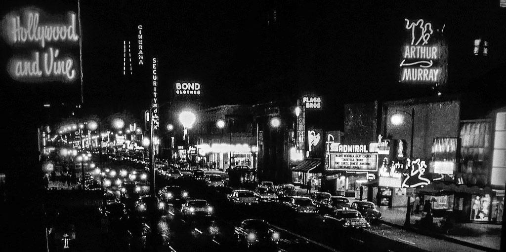
| (ca. 1952)* – Postcard view looking south showing a congested Hollywood and Vine intersection. Note the Stop Sign in the foreground (northwest corner). |
Historical Notes The intersection of Hollywood and Vine in the 1950s was a pivotal location in the heart of Hollywood's entertainment industry, though it was beginning to show signs of decline. It remained a central hub for radio, film, and music, with iconic landmarks like the Pantages Theatre and the newly constructed Capitol Records Building, which became a defining feature of the area. The intersection was also the focal point of the Hollywood Walk of Fame, established in 1958, further solidifying its cultural significance. These attractions continued to draw tourists and locals alike, maintaining the area's allure as a symbol of Hollywood's glamour. |
 |
|
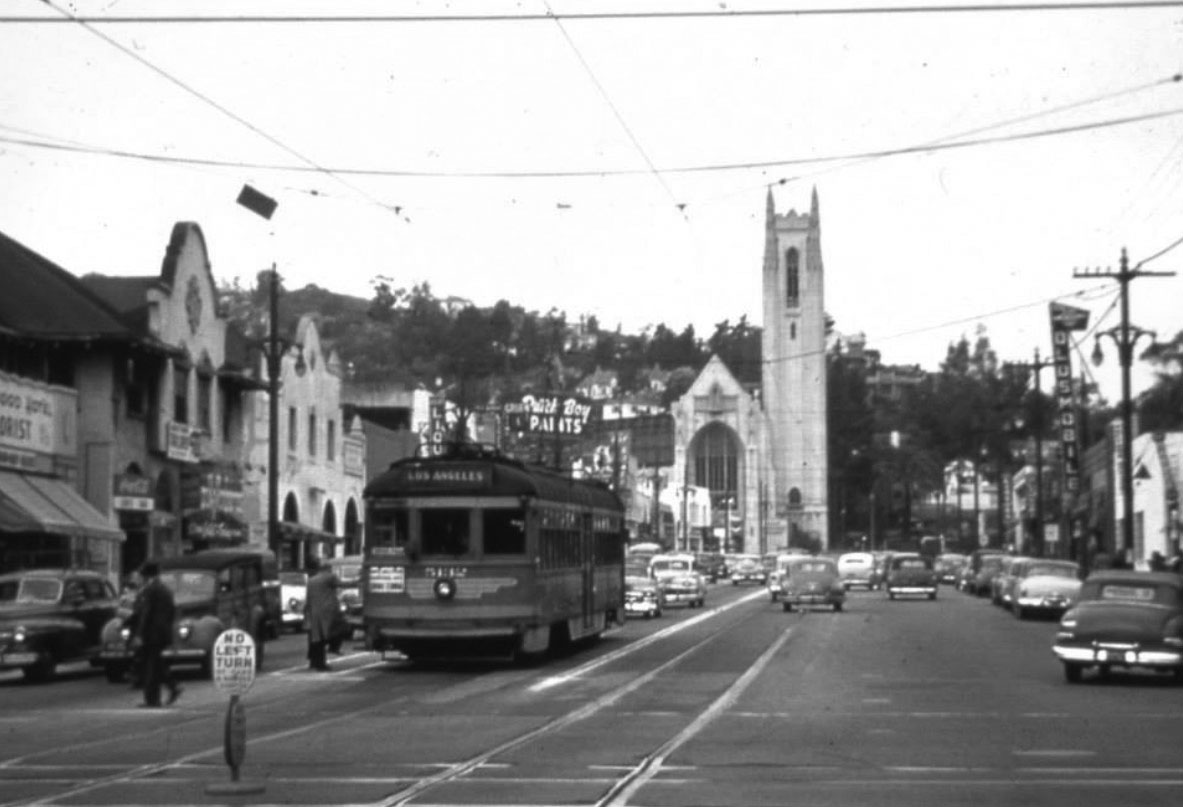
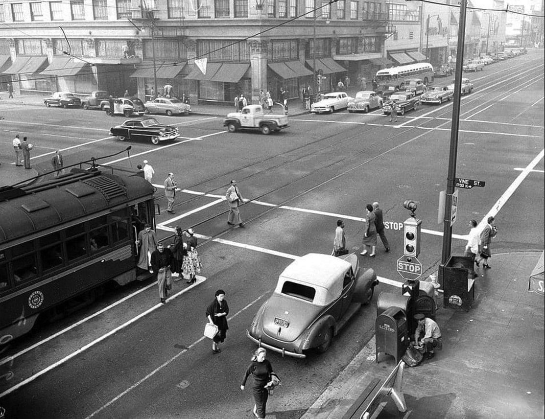
| (ca. 1953)* – View looking west on Hollywood Boulevard at Vine Street showing passengers disembarking from a streetcar. Note the semaphore traffic signal above the stop sign. |
Historical Notes Pacific Electric Streetcars ran down the center of Hollywood Boulevard until 1954. Click HERE to see more. |
 |
|
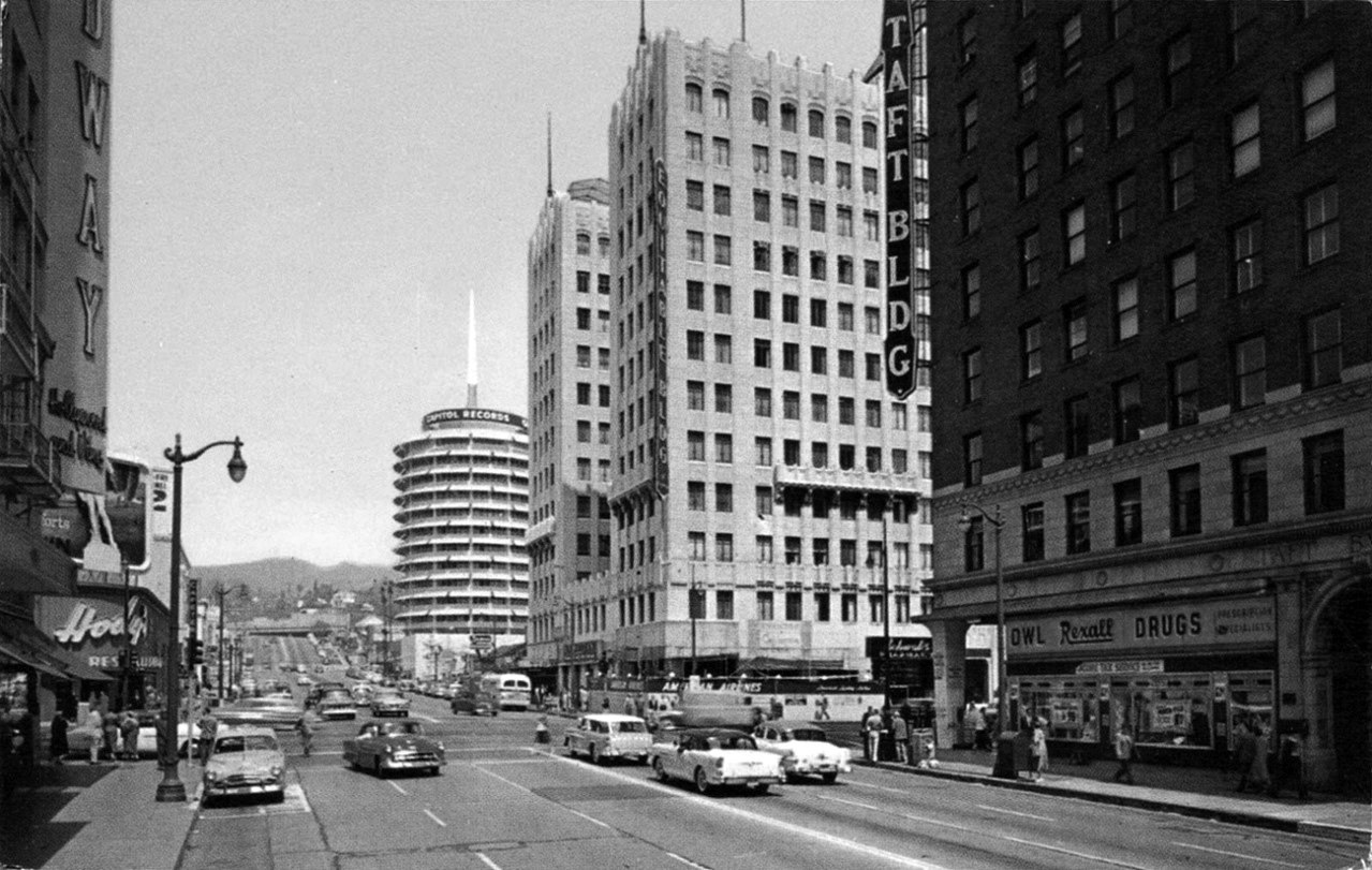
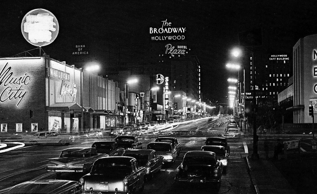
| (1956)* - View looking north toward the intersection of Hollywood and Vine. The four main buildings located on the corners of the intersection can be seen (L to R): The Broadway-Hollywood, Hody's Coffee Shop, Equitable Building, and the Taft Building. The iconic Capitol Records Building stands in the background. |
Historical Notes Despite its enduring appeal, the area's prominence as an entertainment hub gradually diminished as many studios and businesses began relocating to other parts of Los Angeles. The historic buildings and landmarks, such as the Taft Building and Broadway-Hollywood, still stood as testaments to its past glory. The streets were vibrant with neon lights, but by the late 1950s, the area started to develop a reputation for seediness as its golden age waned. Overall, Hollywood and Vine in the 1950s stood at a crossroads between its glamorous past and an uncertain future, maintaining its iconic status while facing challenges that would shape its evolution in later decades. |
 |
|
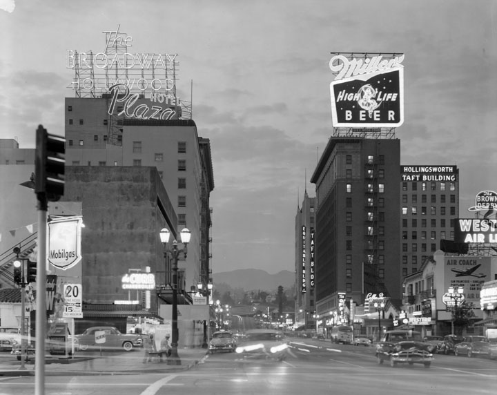
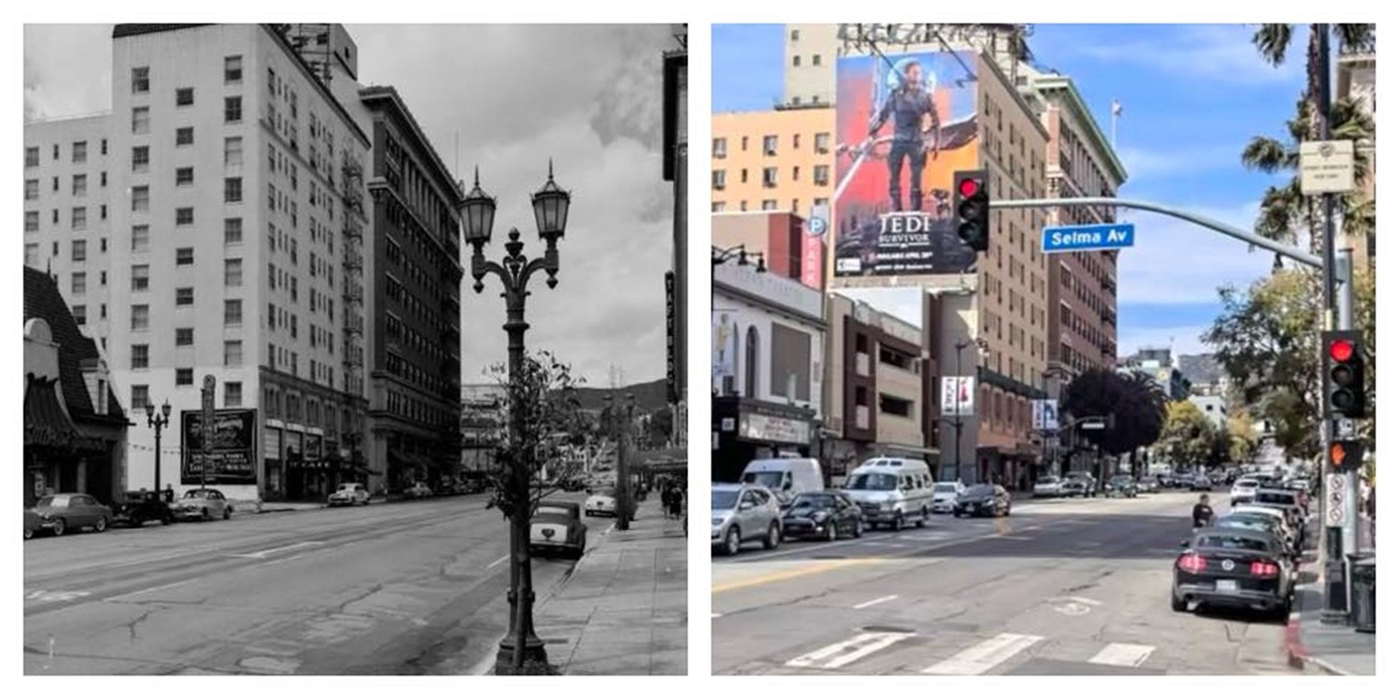
| (ca. 1950s)* - View at dusk, neon signs lit, looking northward on Vine Street from Selma Ave. On the left, The Broadway-Hollywood Building, Plaza Hotel, Mobilgas ; on the right, Equitable Building, Taft Building, The Brown Derby Coffee Shop |
Historical Notes The intersection of Vine and Selma in the 1950s was significant due to its proximity to major landmarks like the Capitol Records Building, which was completed in 1956 (see previous image) and stood just north of the intersection. The March of Time Studio Theatre, now known as the Ricardo Montalban Theatre, was also nearby, contributing to the area's cultural importance. The streets were lined with various businesses, including auto parks and retail stores, catering to both locals and tourists. |
 |
|
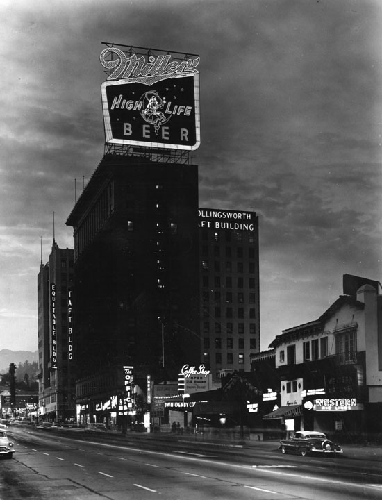
| (ca. 1950s)* - Vine Street looking northward from Selma Avenue. View of the Equitable Building, Taft Building, Brown Derby coffee shop, Western Air Lines. Atop the Taft building a very large neon sign for Miller high life beer. Architects of the Taft Building were Walker and Eisen. |
Historical Notes In 1999, the Taft Building and Neon Sign were designated Historic-Cultural Monument No. 666 (Click HERE to see complete listing). |
 |
|
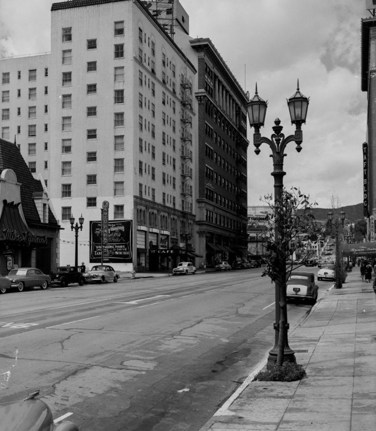
| (1950s)* – Looking north on Vine Street toward Hollywood Boulevard, with the Plaza Hotel and Broadway Hollywood Building on the left and a partial view of the Taft Building and Brown Derby on the right. The streetlight in the foreground stands out—commonly referred to as the "Metropolitan." This beautiful two-lamp streetlight was originally developed for Hollywood but eventually appeared on the "best" streets of surrounding communities. The ‘Metropolitan’ remains a common sight in Hollywood today. Photo by Bob Plunkett from the Ernest Marquez Collection. |
Historical Notes Click HERE to see more early views of the Metropolitan Streetlight. |
Then and Now
 |
|
| A 'Then and Now' comparison showing Vine Street lookng north from Selma Avenue. Photo comparison by Trey Callaway.* |
* * * * * |
Pantages Theatre
 |
|
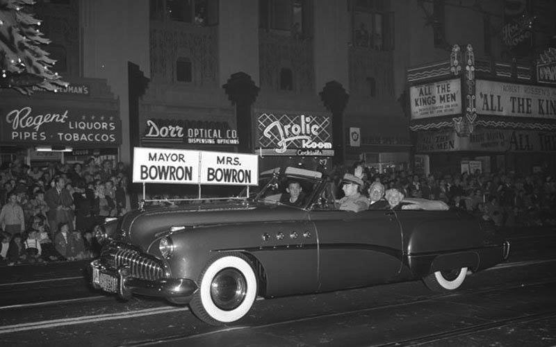
| (1948)* - Los Angeles Mayor Fletcher Bowron and his wife Irene smile at the crowds as they travel west past the Pantages Theatre in a 1949 Buick Roadmaster convertible during the Santa Claus Lane Parade, later the Hollywood Christmas Parade. The Frolic Room bar and other businesses are seen in the background on the 6200 block of Hollywood Boulevard. Click HERE to see contemporary view. |
Historical Notes Fletcher Bowron was the mayor of Los Angeles from 1938 to 1953. He was the longest-serving mayor to date in the city, and was the city's second longest serving mayor after Tom Bradley, presiding over the war boom and very heavy population growth, and building freeways to handle them.*^ |
Academy Awards - Pantages Theatre
 |
|
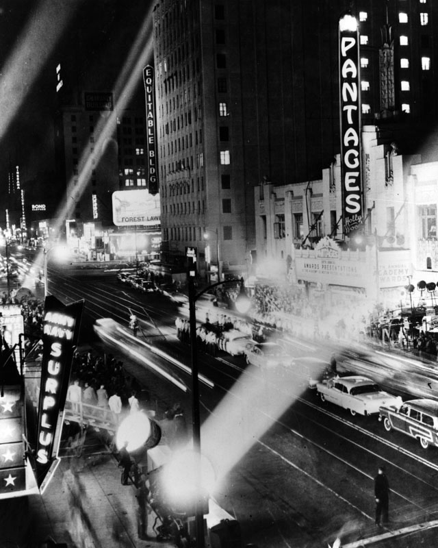
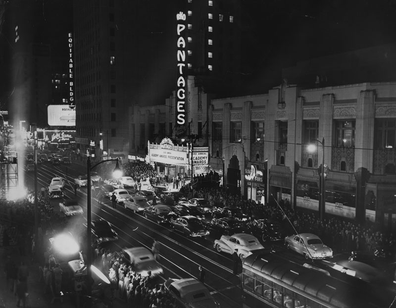
| (1950)* - Exterior view of the Pantages Theatre during the 20th Annual Academy Awards. Crowds of people are seated in bleachers directly outside the theater and on the south side of Hollywood Blvd. A line of cars is seen in the middle of the boulevard. Various signs identify neighboring buildings and businesses: Army Navy store, the Equitable Building, Bond Clothiers, Bank of America, Cinerama and the Guaranty Building. Street car tracks are visible on the street. |
Historical Notes From 1950 to 1960, the awards were presented at Hollywood's Pantages Theatre. The 22nd Academy Awards Ceremony awarded Oscars for the best in films in 1949. This was the last year for which all five Best Picture nominees were in black and white.*^ Best Picture: All the King's Men Best Actor: Broderick Crawford – All the King's Men Best Actress: Olivia de Havilland – The Heiress |
 |
|
| (1951)* - The 23rd Annual Academy Awards at the Pantages Theatre in Hollywood. |
Historical Notes The 23rd Academy Awards Ceremony awarded Oscars for the best in films in 1950. The nominations were notable this year, as All About Eve was nominated for fourteen Oscars, beating the previous record of thirteen set by Gone with the Wind.*^ 23rd Annual Academy Awards (March 29, 1951): Best Picture: All About Eve Best Actor: José Ferrer – Cyrano de Bergerac Best Actress: Judy Holliday – Born Yesterday |
 |
|
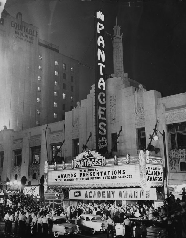
| (1956)* - View of the crowd gathered in front of the Pantages Theater in Hollywood to watch the stars come out for the Academy Awards. More than 10,000 gathered in front of the famed theater on March 21, 1956, to cheer their favorites. More than 90 regular and reserve policemen were needed to keep the crowd in order. |
Historical Notes The 28th Academy Awards, saw, Marty, a simple and low-budget film usually uncharacteristic of Best Picture awardees, became the shortest film (as well as the second Palme d'Or winner) to win the top honor.*^ 28rd Annual Academy Awards (March 21, 1956): Best Picture: Marty Best Actor: Ernest Borgnine – Marty Best Actress: Anna Magnani – The Rose Tattoo |
 |
|
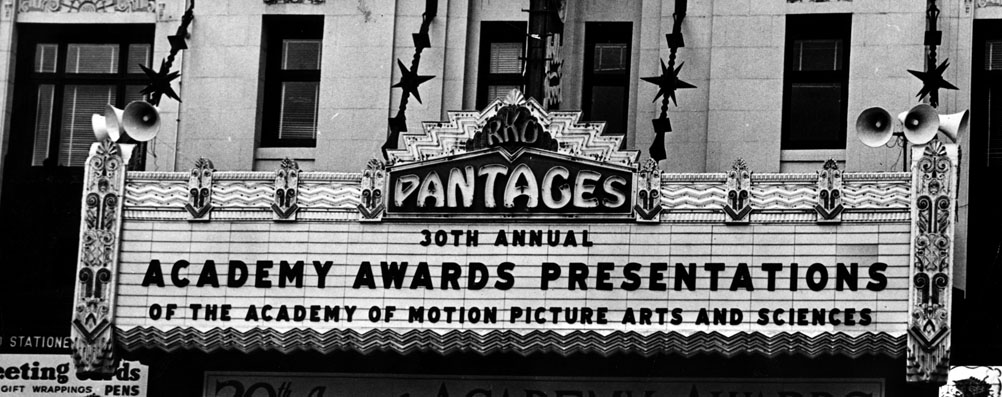
| (1958)* - 30th Annual Academy Awards at the Pantages Theatre. |
Historical Notes 1957's best films were honored at the 30th Academy Awards. The Oscar for Writing Based on Material From Another Medium was awarded to Pierre Boulle for The Bridge on the River Kwai, despite the fact that he did not know English. The actual writers, Carl Foreman and Michael Wilson were blacklisted at the time and did not receive screen credit for their work. Foreman and Wilson have since been acknowledged by the Academy for their contributions. Joanne Woodward's win for Best Actress for her triple role as Eve White, Eve Black and Jane in The Three Faces of Eve marked the film as the last film to win Best Actress without being nominated for other awards. This was broken 31 years later when Jodie Foster won Best Actress for her role in The Accused, the film's only nomination. Peyton Place tied the record for the most nominations without a single win (9) with The Little Foxes. It would not be broken until 1977 when The Turning Point received 11 nominations without a win, which has not been broken since, though The Color Purple subsequently tied the record. Peyton Place also set the record for most unsuccessful acting nominations with five; this record has been tied once, by Tom Jones at the 36th Academy Awards.*^ |
 |
|
| (1958)* - Crowds gather outside of the Pantages, watching for their favorite celebrities as they arrive for the 30th Academy Awards ceremony on March 26, 1958. Photo by Ralph Crane / Life Magazine |
Historical Notes The 30th Academy Awards. It was the first time the ceremonies were broadcast live. 30th Academy Awards (March 26, 1958): Best Picture: The Bridge on the River Kwai Best Actor: Alec Guinness – The Bridge on the River Kwai Best Actress: Joanne Woodward – The Three Faces of Eve |
 |
|
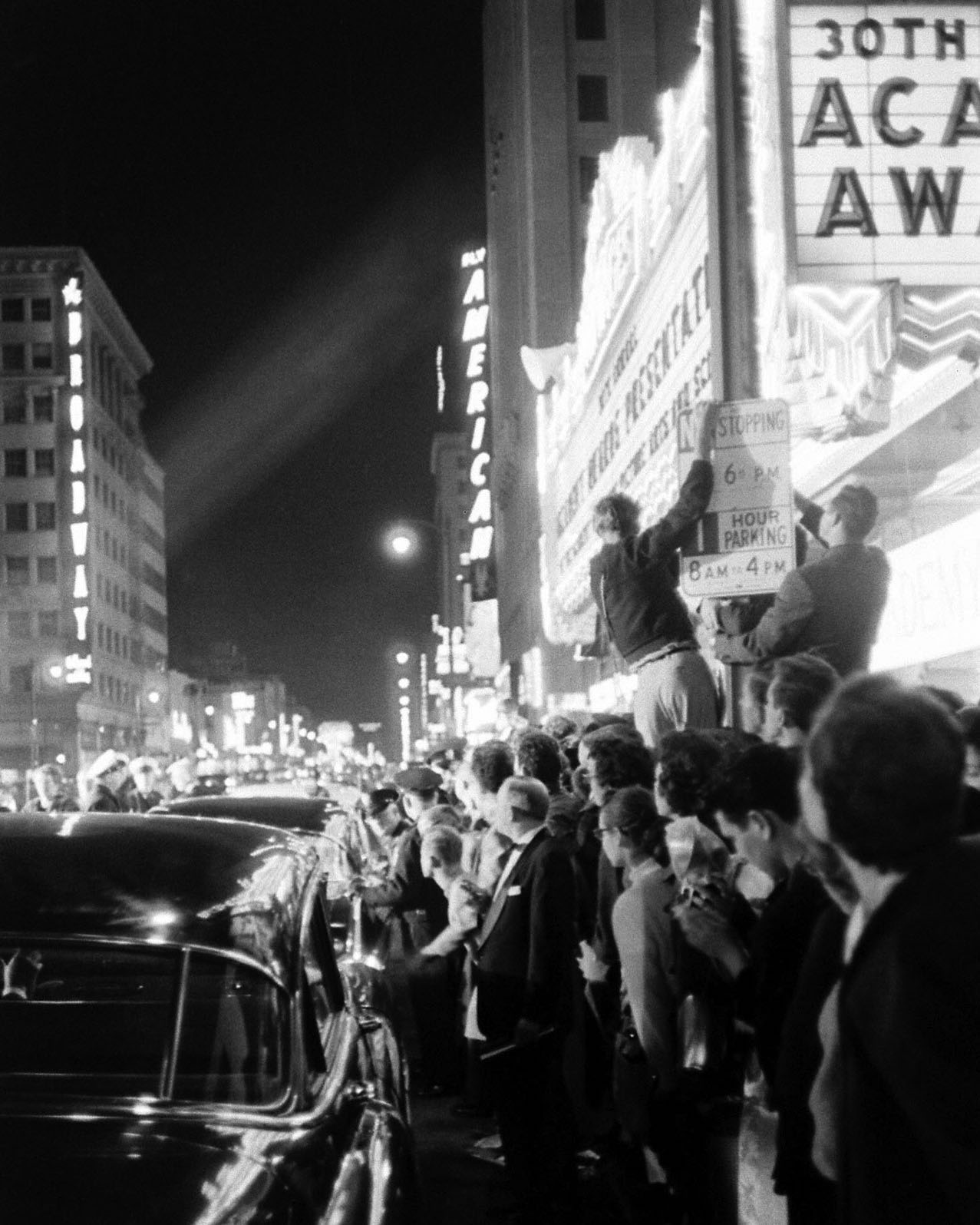
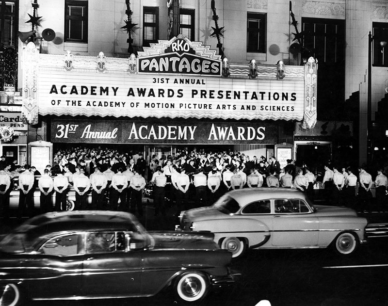
| (1959)* - Photograph caption dated April 7, 1959 reads, "Theater lobby packed - Here at the last moment, crowds of ticket holders make a rush for the Hollywood Pantages door in anticipation of the two-hour telecast of the Academy of Motion Picture Arts and Sciences' 31st annual awards presentation. More than 100 famed stars were on hand to regale the packed audience.". |
Historical Notes The 31st Academy Awards ceremony was held on April 6, 1959, to honor the best films of 1958. The show's producer, Jerry Wald, started cutting numbers from the show to make sure it ran on time. Unfortunately, he cut too much material and the ceremony ended 20 minutes early, leaving Jerry Lewis to attempt to fill in the time. Eventually, NBC cut to a re-run of a sports show. The film Gigi won nine Oscars, breaking the previous record of eight (set by Gone with the Wind and tied by From Here to Eternity and On the Waterfront). It would be shortlived, however, as Ben-Hur broke the record with eleven Oscars the following year.*^ 31st Annual Academy Awards (April 6, 1959): Best Picture:Gigi Best Actor: David Niven – Separate Tables Best Actress: Susan Hayward – I Want to Live! Click HERE to see more in Early Views of the Pantages Theater |
* * * * * |
Hollywood Savings and Loan
 |
|
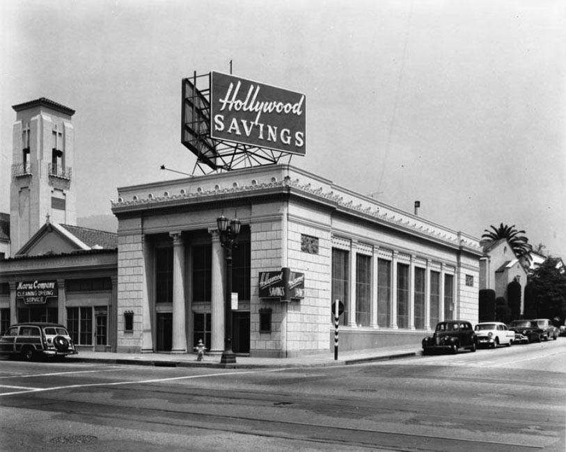
| (ca. 1956)^^ – View showing Hollywood Savings & Loan on the northwest corner of Hollywood Boulevard and Wilton Place (5701 Hollywood Blvd). Moore Company Cleaning & Dyeing Service is to the left. |
Historical Notes The Beaux Art building was designed by Morgan, Walls, and Clements. It was built in 1930 to house a branch of Security Pacific Bank, one of the first Los Angeles banks to open branches in the Hollywood suburbs. The sign on the building today reads Escrow Center. Click HERE for contemporary view. |
Hollywood Masonic Temple
 |
|
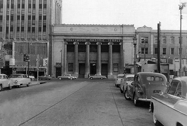
| (1955)* – View looking south on Orchid Avenue toward Hollywood Boulevard. The Hollywood Masonic Temple is seen on the other side of Hollywood Boulevard at the T-intersection with the Paramount Theatre on the left. Toff's Coffee Shop can be seen on the northwest corner. Photo: Vintage Los Angeles. |
Historical Notes In 1921, the Hollywood lodge of the Masons relocated from their existing lodge on the current site of the Kodak Theatre. The construction of the new three-story building was led by lodge master, Charles E. Toberman, who was responsible for the Hollywood Bowl, Grauman's Chinese Theatre, the Roosevelt Hotel and the Max Factor Building. When the new temple opened, it was one of the most substantial structures in Hollywood. It had a billiard room, pipe organ, ladies parlor, ballroom and lodge rooms. One writer described the building as "unsurpassed for beauty, attractiveness and richness of equipment. The architect, John C. Austin also worked on the Shrine Auditorium, Griffith Observatory and Los Angeles City Hall. In 1984, the Hollywood Masonic Temple was dedicated LA HIstoric-Cultural Monument No. 277 (Click HERE to see complete listing). The building, now known as the El Capitan Entertainment Centre, was also listed in the National Register of Historic Places in 1985. |
 |
|
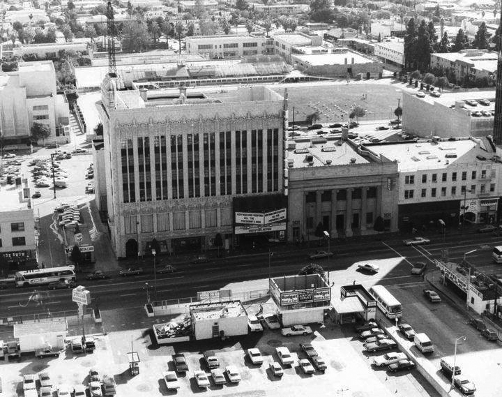
| (ca. 1976)##^* – Aerial view looking south showing the intersection of Hollywood Boulevard and Orchid Avenue (center-right). Both the Paramount Theatre and Masonic Temple can be seen on the south side of the Boulevard with Toff's Coffee Shop on the NW corner (lower-right). The Hollywood High School athletic field is seen at top of photo. |
Historical Notes The Hollywood Highland complex would be built in the 1990s where the parking lots and Orchid Ave are seen in the above photo (bottom of photo). |
Toff's Coffee Shop
 |
|
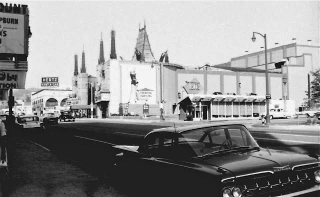
| (1959)^v^ – View looking northwest toward Grauman’s Chinese Theatre. Toff’s Coffee Shop, located on the northwest corner of Orchid Avenue and Hollywood Boulevard, is seen at center-right. A 1959 Chevrolet Impala is parked in front of the El Capitan/Paramount Theatre in the foreground. |
 |
|
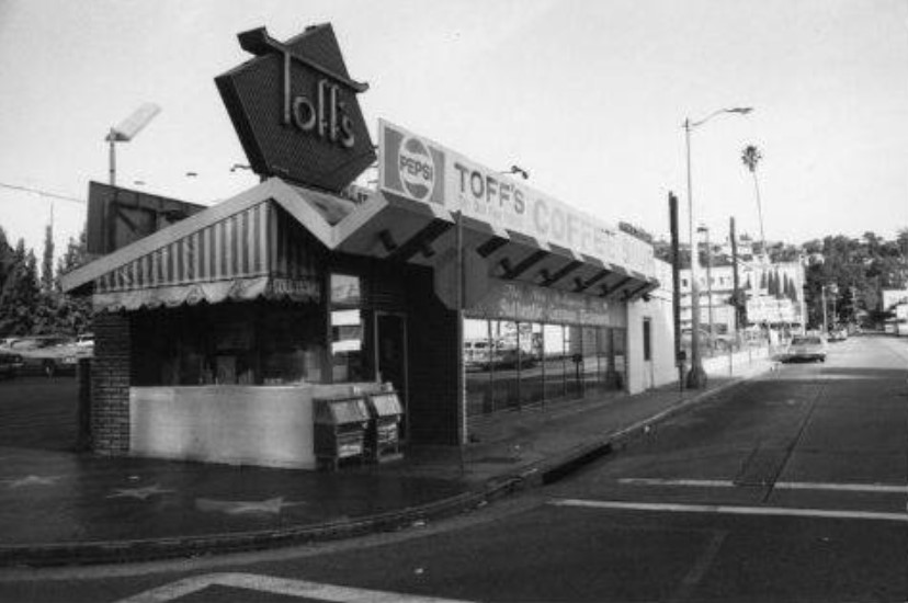
| (ca. 1970)##^* – View of Toff’s Coffee Shop on the northwest corner of Hollywood Boulevard and Orchid Avenue, just east of the Chinese Theatre. |
Historical Notes Orchid Avenue at Hollywood Boulevard "disappeared" during the construction of the Hollywood Highland complex in the late 90s. The other half of the street still exists and can be accessed off of Franklin Ave, the next street north of Hollywood Blvd. |
 |
|
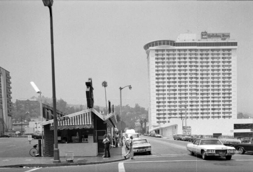
| (1970s)^.^ – View looking north on Orchid Avenue at Hollywood Boulevard showing Toff’s Coffee Shop on the NW corner. In the distance can be seen the 22-story Holiday Inn (today Loews Hollywood Hotel) |
Historical Notes Built in 1972 as the Holiday Inn, converted in 2001 to the Renaissance Hollywood following a $130 million renovation as part of the Hollywood & Highland complex. Converted to Loews in June 2012.* |
* * * * * |
 |
|
| (1939)*# - View showing a bus making a right turn onto Hollywood Boulevard from Orchid Avenue. The Hollywood Hotel is seen on the north side of Hollywood Blvd. between Orchid and Highland. |
Historical Notes Today, both this section of Orchid Avenue and the Hollywood Hotel are gone. In their place stands the Hollywood and Highland Entertainment Complex. |
 |
|
| (1940s)* – View looking north on Highland Avenue at Hollywood Boulevard showing P.E. No. 5170 heading south. The Hollywood Hotel is seen on the northwest corner. Further down Highland at Franklin (on the right) stands the Hollywood United Methodist Church. |
 |
|
| (1940s)* – Passengers boarding the PE San Fernando Valley bound line at Highland and Hollywood with the Hollywood Hotel seen in the background. |
 |
|
| (ca. 1945)*^* - View of the P.E. No. 707 (San Fernando Valley Line), north bound on Highland Avenue at Hollywood Boulevard. People are lined up as they get ready to board both electric cars. The Owl Drug Store is seen on the southwest corner. The Hollywood Hotel is directly across the street, northwest corner of Hollwood and Highland. |
.jpg) |
|
| (ca. 1950)* – View looking north on Highland Avenue toward Hollywood Boulevard. The image is dominated by the Hollywood First National Bank Building on the N/E corner with the Hollywood United Methodist Church further back at Franklin. On the right is the Max Factor Building and, further north on the S/E corner, Bank of America. |
.jpg) |
|
| (1953)*^* - View looking east on Hollywood Boulevard toward Ivar Avenue. The Broadway-Hollywood Building can be seen on the right in the distance on the southwest corner of Hollywood and Vine. The Guaranty stands at left on the northeast corner of Hollywood and Ivar. Part of Schwabs can be seen in the far right. |
 |
|
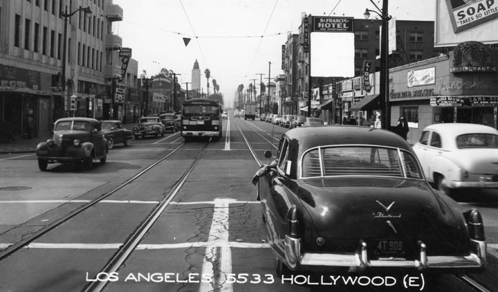
| (ca. 1950s)* - Looking west on Hollywood Boulevard from Western Avenue. Cars dating from the early 1950's and earlier are seen sharing the road with a streetcar. |
 |
|
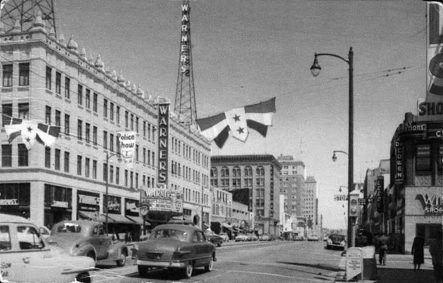
| (1950s)*^#^* - Postcard view looking east on Hollywood Boulevard at Wilcox Avenue. Warner Bros. Theatre is seen on the northeast corner. |
Historical Notes Warner Bros. Hollywood Theatre has also been known as Warner's, the Warner, Warner Cinerama, Warner Hollywood Cinerama, the Hollywood Pacific and the Hollywood Pacific 1-2-3. |
 |
|
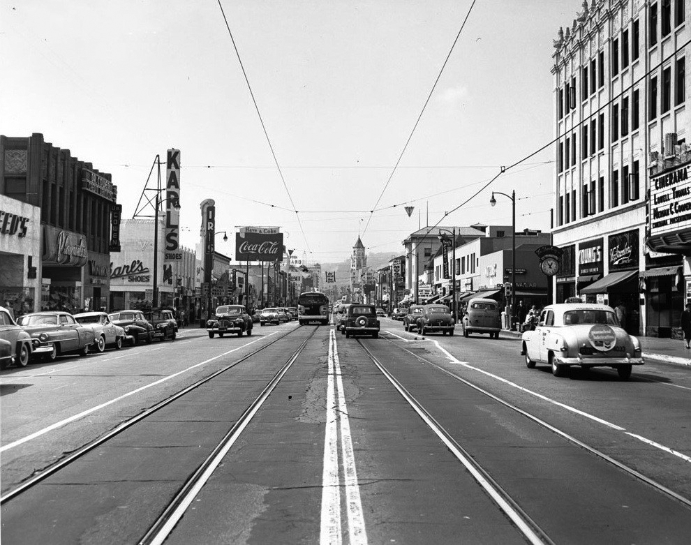
| (1953)^^ – View looking west down the center of Hollywood Boulevard. The Warner Bros. Theatre on the northeast corner of Hollywood and Wilcox is on the right. Three large signs are seen on the left: Karl’s Shoes, Iris Theatre, and Coca Cola. The First National Bank Building tower can be seen in the distance. |
 |
|
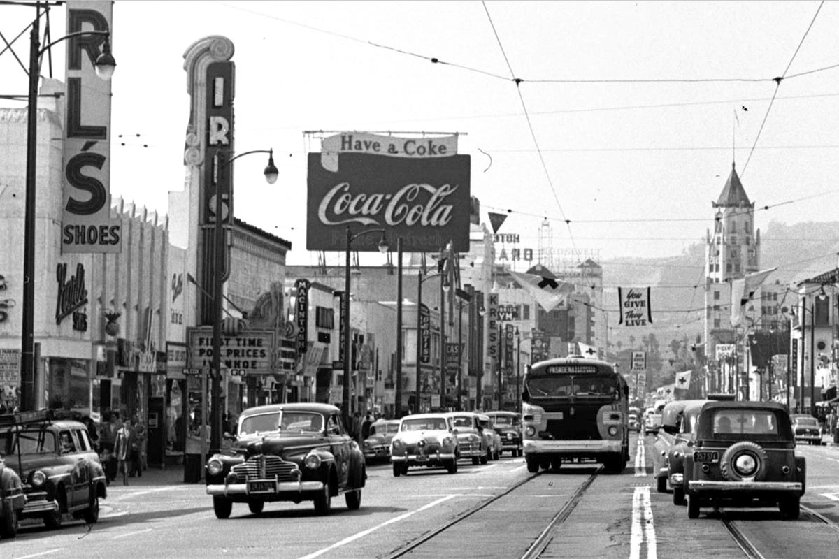
| (1953)^^ – View looking west on Hollywood Boulevard (detail view of previous photo). |
 |
|
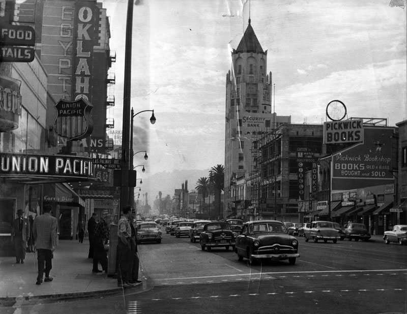
| (ca. 1955)* - View of Hollywood Boulevard looking west from the corner of Las Palmas Avenue. Various businesses, restaurants, bookstores, theaters, and banks are found on the north and south sides on the boulevard, where traffic is flowing in both directions. On the left, a sign identifies the stage production of Oklahoma! taking place at the Egyptian Theatre. First National Bank of Hollywood, located at 6381 Hollywood Boulevard, is visible in the center of the image and the Chinese Theatre is present in the background. |
 |
|
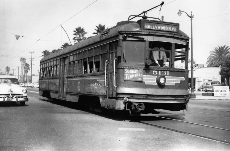
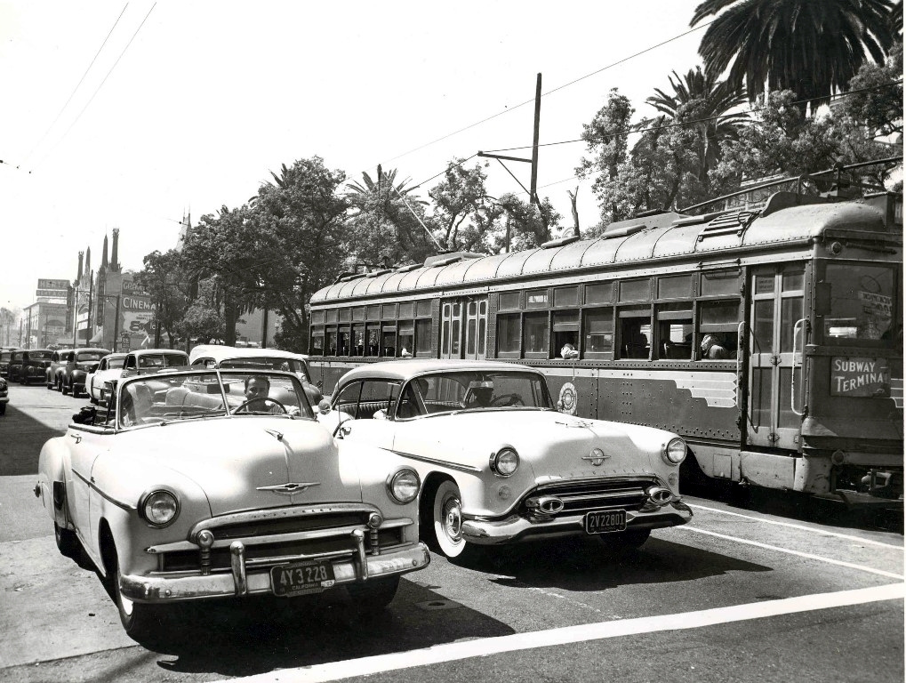
| (ca. 1954)* - A Hollywood Boulevard Pacific Electric Railway car that goes to Subway Terminal Building. The street sign says "Sunset Boulevard." |
Historical Notes On October 1, 1953, Pacific Electric sold all its passenger business to Metropolitan Coach Lines. Metro continued the operation of this line until September 26, 1954, when the line was converted to motor coach operation. |
 |
|
| (1951)* – View looking west on Hollywood Blvd at Highland with the Roosevelt Hotel in the distance on the left and the Hollywood Hotel to the right. The Dean Martin/Jerry Lewis film "At War with the Army" is playing at the Paramount Theatre on the left. The Chinese Theatre spires can be seen over the P.E. Red Car. |
 |
|
| (ca. 1954)*^* - Cruising Hollywood Boulevard heading east at Highland Ave. Grauman's Chinese Theatre can be seen in the background. The Hollywood Hotel is on the right behind the P.E. Red Car. |
 |
|
| (1955)* - Hollywood Freeway through Cahuenga Pass. View looking north from Mulholland Drive bridge shows traffic, backed up because of a car accident on the freeway. A sign of more things to come as the City continues to grow. Click HERE to see more Early Views of Cahuenga Pass. |
 |
|
| (1956)* - Looking northeast over the Sunset Strip in what is now West Hollywood. Off of Sunset Boulevard (left of center running from the foreground to the middle), are several landmarks, including the Argyle Hotel, aka Sunset Tower (center), Ciro's, and the Chateau Marmont (left of center). Fountain Avenue, which runs parallel with Sunset Boulevard, is seen in the foreground, veering to the right as it continues on into the background. |
Historical Notes Designed by Leland A. Bryant, an architect known for luxurious structures, the Sunset Tower (Argyle Hotel) has been a popular destination since it opened. Over the years, it has served as the residence for many celebrities, including Frank Sinatra, Howard Hughes, Elizabeth Taylor, Zasu Pitts, Bugsy Siegel, Errol Flynn and Marilyn Monroe. The hotel has also appeared in a number of films and books. |
 |
|
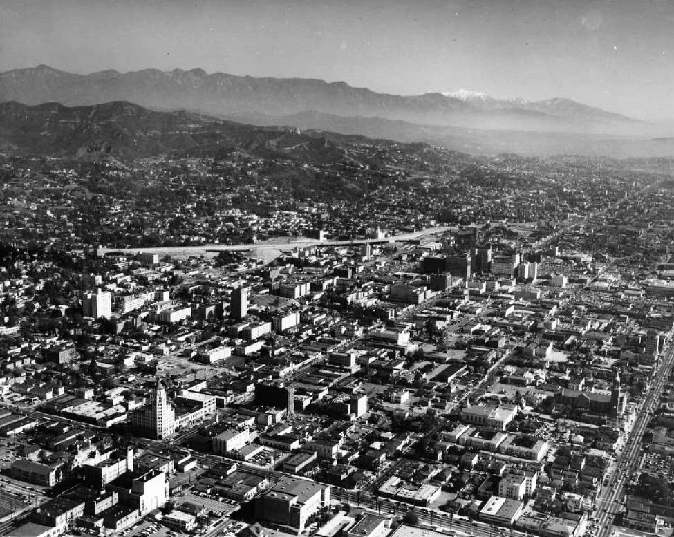
| (1954)* - Aerial view of Hollywood facing northeast with snow-capped San Gabriel Mountains in the far distance. Hollywood Boulevard runs diagonally from lower-left corner to upper-right. The Art Deco/Gothic style First National Bank Building is seen in the lower left on the northeast corner of Hollywood and Highland. The Hollywood Freeway is in the center-left. |
 |
|
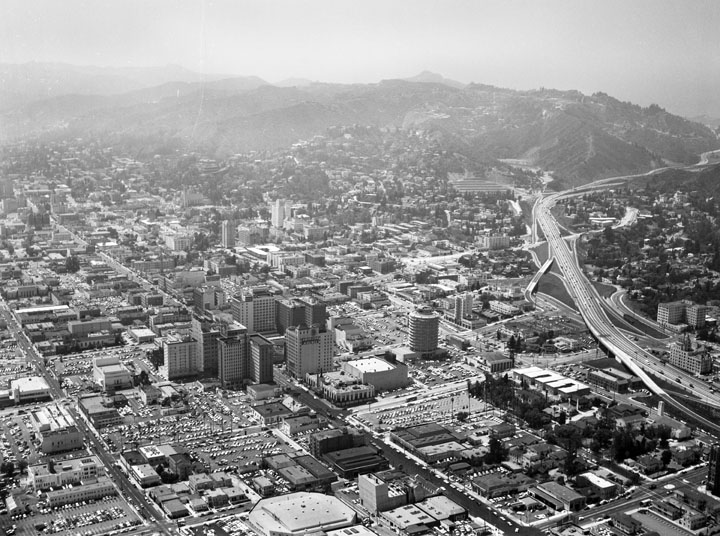
| (1956)* - Aerial view looking northwest showing the Hollywood business district, with the Capitol Records Building visible middle right. Other visible buildings include: Pantages Theatre, E.F. Hutton Building, Broadway-Hollywood, Hotel Knickerbocker, Guaranty Building, and the Taft Building. The streets are (diagonally, l to r): Selma Avenue, Hollywood Boulevard, and Yucca Street; and (bottom to top) Gower Street, Argyle Avenue, Vine Street, Ivar Avenue, and Cahuenga Boulevard, to name a few. The Hollywood (101) Freeway is visible along the right. |
* * * * * |
Before the Hollywood Freeway
 |
|
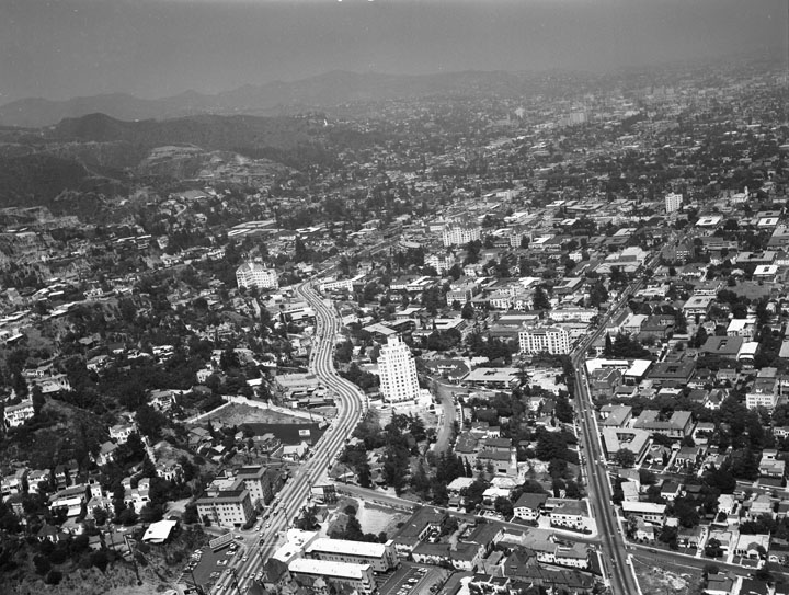
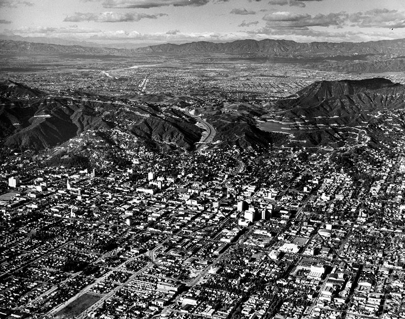
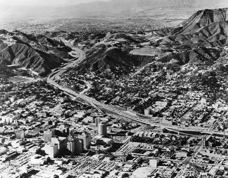
| (ca. 1950)* - Aerial view of Hollywood, north of Sunset between Highland and Gower before the second section of the Hollywood Freeway was built (1954). The Hollywood Reservoir (middle right) is in the hills above Hollywood. There is a clear view of San Fernando Valley in the background. |
Historical Notes This view captures Hollywood in its pre-freeway landscape, with neighborhoods stretching unbroken toward the San Fernando Valley. At the time, voters had already approved funding (1924) for a “stop-free express highway,” but the freeway trench through Hollywood would not be realized until the early 1950s. The Pacific Electric Red Cars still ran nearby, but automobile congestion made the coming transformation inevitable. |
* * * * * |
Construction of the Hollywood Freeway through Hollywood
 |
|
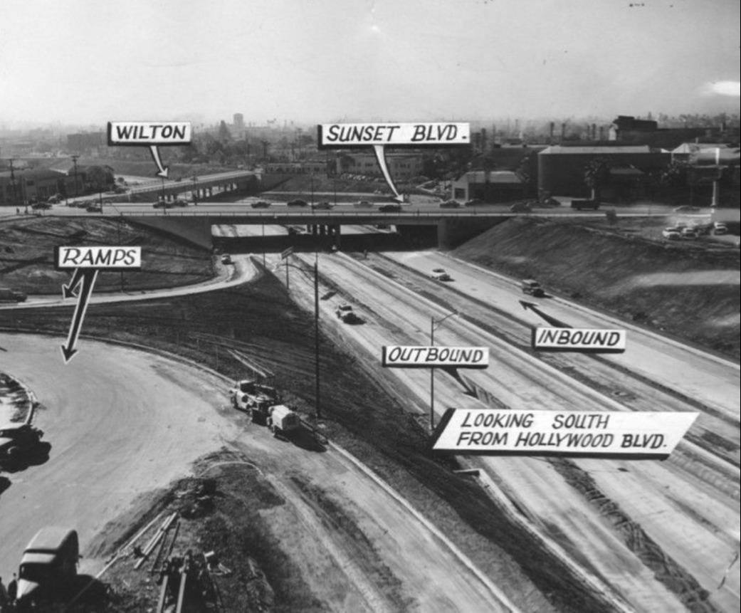
| (1952)* - Looking NW over Hollywood Fwy (US-101) construction as it made its way to Cahuenga Pass. Sunset Blvd and Wilton Place intersect in foreground with Hollywood Blvd parallel to Sunset Blvd across center of photo. |
Historical Notes The freeway through Hollywood was built in stages between 1947 and 1954. The section shown here represents the push northward toward the Cahuenga Pass, where the first 1.5-mile stretch had already opened in 1940 with Pacific Electric tracks running down its median. By 1952, construction through Hollywood required excavation of a deep trench, spanned by bridges to preserve the street grid. While Hollywood landmarks such as KTTV Studios and the First Presbyterian Church were spared, neighborhoods like Whitley Heights lost dozens of historic homes, including Rudolph Valentino’s villa. |
 |
|
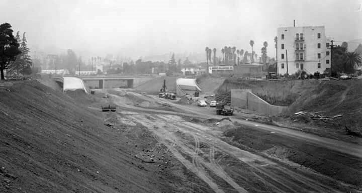
| (1953)* - Looking south during the construction of the Hollywood Freeway as seen from Hollywood Boulevard. |
Historical Notes This view highlights the depressed roadway design engineers adopted to keep Hollywood’s surface streets functioning. One by one, overpasses were built to carry traffic across the new trench. The engineering feat reflected both progress and sacrifice: by 1953, nearly half of the project’s $55 million cost had gone to property acquisition, displacing thousands of residents. |
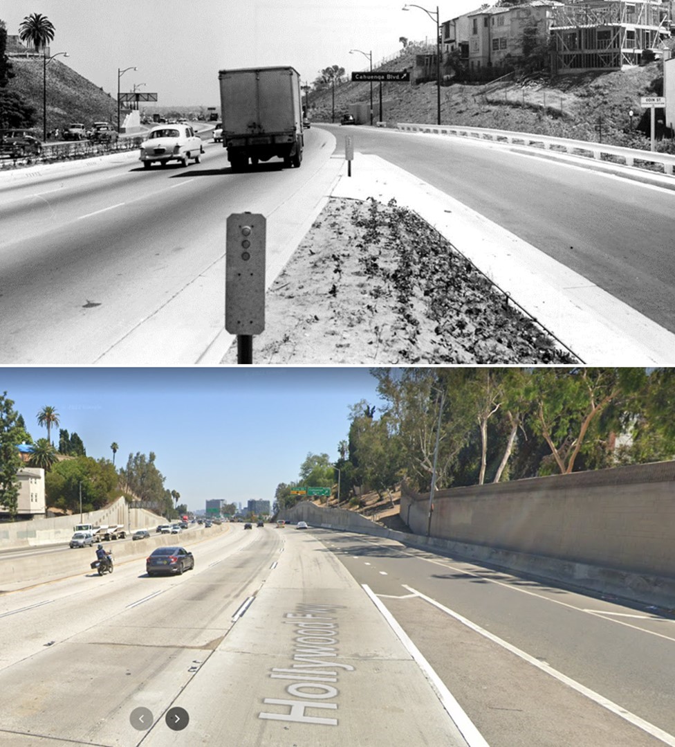
Before and After
 |
|
 |
|
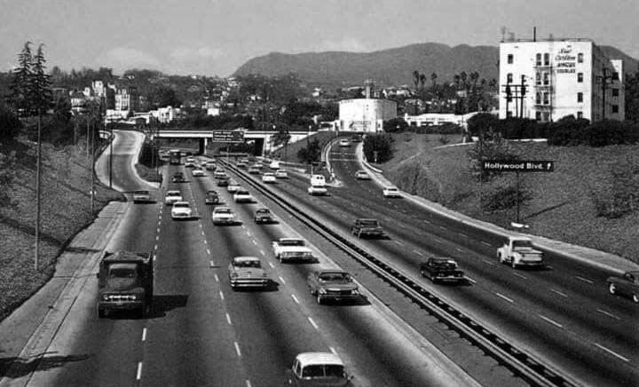
| (ca. 1952)* vs. (ca. 1970)* - View of the Hollywood Freeway at the Hollywood Boulevard Exit. |
Historical Notes The “before” shows the trench being excavated, while the “after” reveals the finished freeway reshaping Hollywood. By the 1970s, the freeway had already far surpassed its intended capacity, carrying nearly twice the 100,000 cars per day it was designed for. The transition illustrates how mid-century freeways permanently altered Los Angeles neighborhoods—cutting through them while connecting commuters across the region. |
 |
|
| (1953)* - Looking north over northbound Hollywood Fwy (US-101) off-ramp at Cahuenga Blvd. Traffic control officers direct traffic while stop sign remains shrouded. Photo date: 10-7-53 |
Historical Notes Even before completion, the freeway required new systems of traffic management. Officers directed flows where ramps met surface streets, foreshadowing the installation of California’s first permanent ramp meters on this very freeway at Sunset Boulevard in 1967. |
* * * * * |
After Completion of the Hollywood Freeway
 |
|
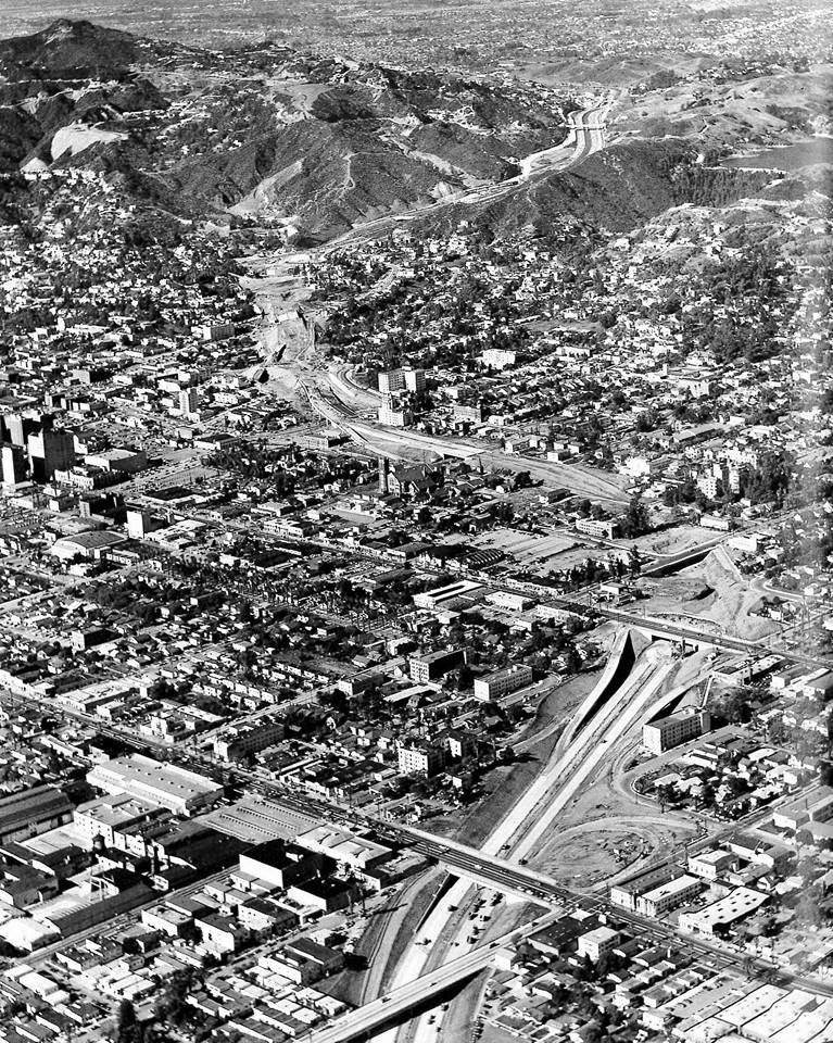
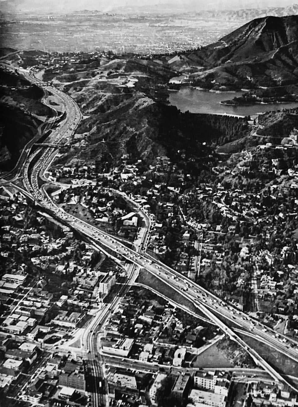
| (ca. 1960s)* - Aerial view of Hollywood and its surrounding areas after the second segment of the Hollywood Freeway was completed (1954). The Mulholland Dam and Hollywood Reservoir are seen in the hills above Hollywood (upper center-right). Capitol Records Building is in the middle foreground of this photo. |
Historical Notes By the 1960s, the Hollywood Freeway had become a defining feature of Los Angeles. The trench carved through Hollywood allowed traffic to flow between downtown and the San Fernando Valley, fueling suburban expansion while bisecting established neighborhoods. New icons, such as the Capitol Records Building (1956), rose alongside the freeway, tying Hollywood’s identity to the automobile age. |
 |
|
| (1957)^ – Aeiral view giving a closer look at the Hollywood Freeway, Mulholland Dam and Hollywood Reservoir. |
Historical Notes The freeway’s passage through the Cahuenga Pass brought motorists directly past the Mulholland Dam and Hollywood Reservoir. This juxtaposition of infrastructure—early 20th-century waterworks and mid-20th-century freeways—symbolized the city’s constant reinvention to meet the needs of a growing metropolis. Click HERE to see more in Early Views of Mulholland Dam and Hollywood Reservoir |
 |
|
| (ca. 1955)* – Looking southeast on the Hollywood Freeway near Vine Street. The First Presbyterian Church of Hollywood can be seen in the distance (center of photo). Note the center median with planters. |
Historical Notes Route adjustments spared certain landmarks, such as the First Presbyterian Church, even as hundreds of homes were demolished. Early freeway medians featured planters, part of a short-lived effort to combine parkway aesthetics with modern expressways. These landscaped touches were soon sacrificed to add more lanes for ever-growing traffic. |
 |
|
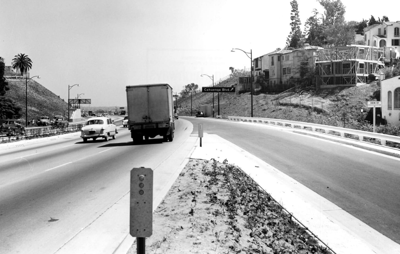
| (1955)* - Southbound Hollywood Fwy (US-101) at Highland Ave on-ramp in Whitley Heights, approaching Cahuenga Blvd exit. |
Historical Notes Whitley Heights was one of the most impacted neighborhoods, with 49 homes—including silent film stars’ residences—razed for the freeway’s path. This photo shows the Highland Avenue on-ramp built over the southern edge of that historic enclave, forever reshaping the area’s landscape. |
Then and Now
 |
|
| (1955 vs 2022)* - Southbound Hollywood Fwy (US-101) at Highland Ave on-ramp in Whitley Heights. Photo comparison by Jack Feldman. |
Historical Notes This juxtaposition illustrates nearly 70 years of continuity and change. While the alignment remains, the surrounding city has densified, and the freeway carries more than triple the traffic it was built for. It underscores the long-term legacy of freeway building in shaping both mobility and neighborhood identity. |
 |
|
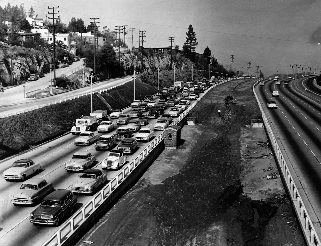
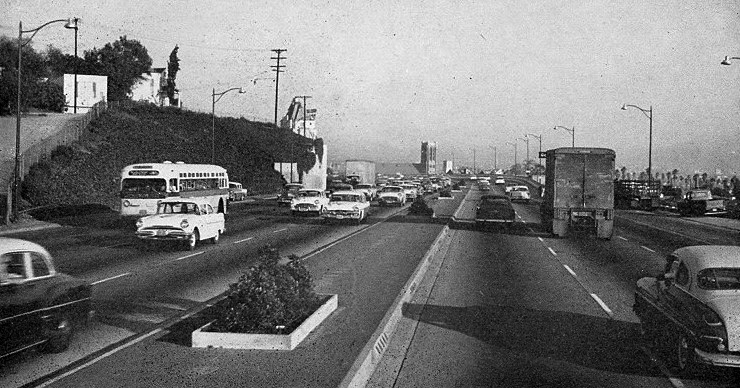
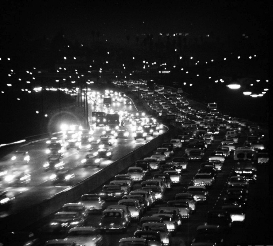
| (ca. 1959)* – Night view showing heavy traffic on the northbound side of the Hollywood Freeway. |
Historical Notes Within just a few years of opening, the freeway was already infamous for congestion. By 1955, it carried 183,000 vehicles daily—almost double its design. At night, streams of headlights reflected the city’s embrace of the car, but also its dependence on it. |
 |
|
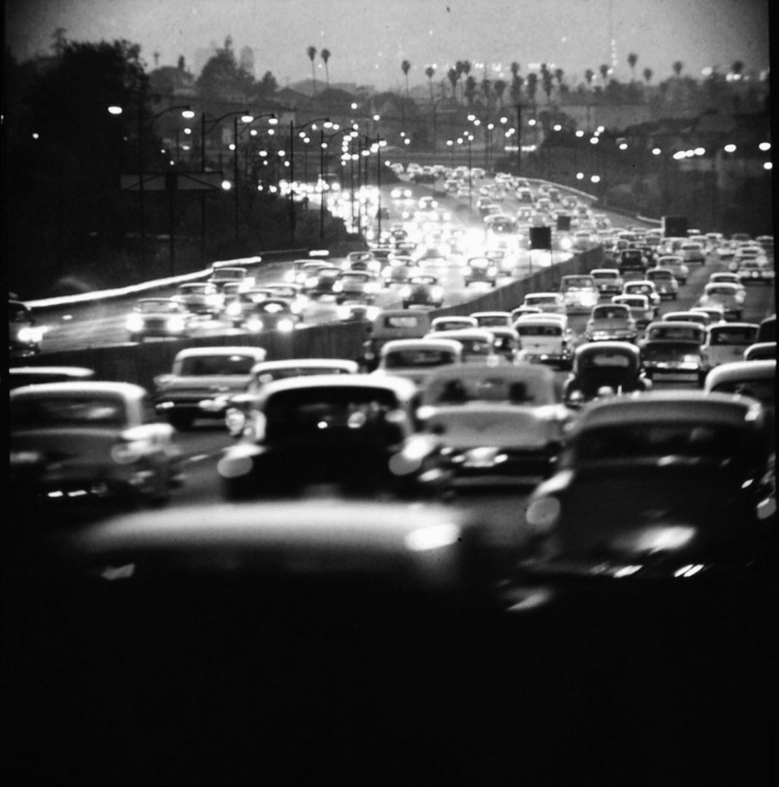
| (1959)* – Rush hour traffic on the Hollywood Freeway. |
Historical Notes The freeway that was meant to relieve congestion quickly became its own choke point. Bob Hope’s quip dubbing it “the biggest parking lot in the world” resonated with Angelenos caught in daily traffic jams. |
 |
|
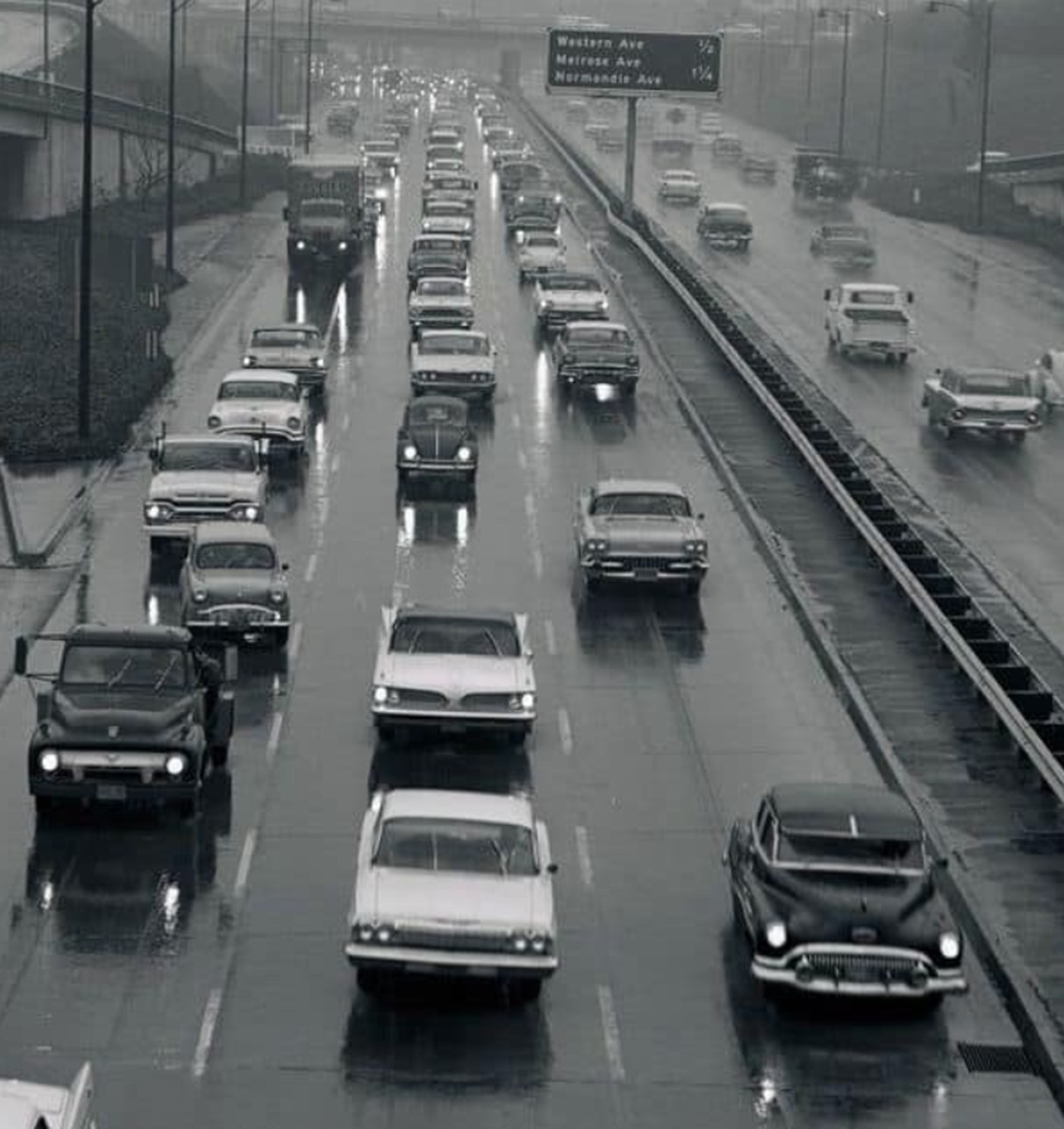
| (1960s)* - Hollywood Freeway on a rainy day. |
Historical Notes By the 1960s, the freeway was entrenched in L.A.’s landscape—so much so that even rain-soaked days could not slow the constant demand for mobility. What began as an engineering marvel had by then become both an indispensable artery and a symbol of Los Angeles’ challenges with growth, smog, and congestion. |
* * * * * |
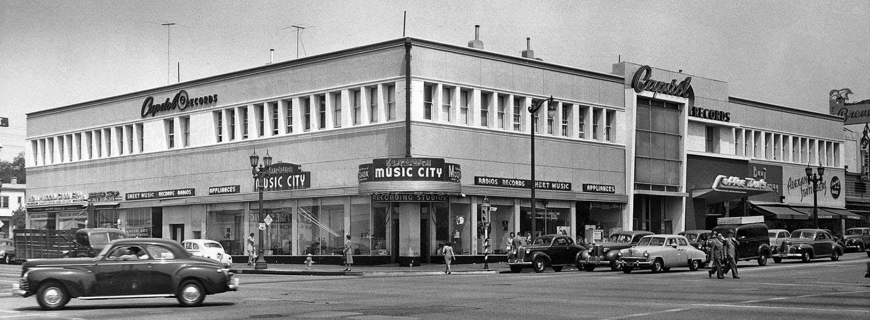
Wallichs Music City (Sunset and Vine)
 |
|
| (ca. 1946)* – Panoramic view looking northwest across the intersection of Sunset Boulevard and Vine Street showing Wallichs Music City on the corner. Capitol Records is on the 2nd floor. |
Historical Notes Before the Capitol Building opened in 1956 on Vine Street north of Hollywood Boulevard, Capitol Records had, as their corporate offices, the second floor of this building above Wallichs Music City. |
 |
|
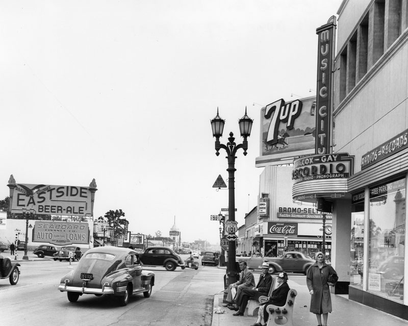
| (ca. 1945)* - View looking south on Vine Street at Sunset Blvd. Various businesses are seen, including the Wallichs Music City (right). Billboards and signs promote various types of products and beverages, such as locally brewed Eastside Beer. |
Historical Notes Wallichs Music City was located on the northwest corner of Sunset & Vine and operated from 1940 to 1978. Owner Glenn E. Wallichs had started Capitol Records, along with Tin Pan Alley songsmith Johnny Mercer and ex-Paramount movie producer Buddy De Sylva from a small office a little further south down Vine Street in 1942 and moved to larger offices above the store in 1946. After Capitol Records moved into The Capitol Tower in 1956 the offices become the home of Dot Records. |
.jpg) |
|
| (ca. 1952)* - View looking west on Sunset at Vine as seen from in front of NBC Radio City. Wallichs Music City is seen on the NW corner. |
Historical Notes Until Tower Records set up on the Sunset Strip 30 years later, Wallichs Music City was the place to go for concert tickets, sheet music, LPs, 45s, tapes, 8-tracks, cassettes, and musical instruments. |
 |
|
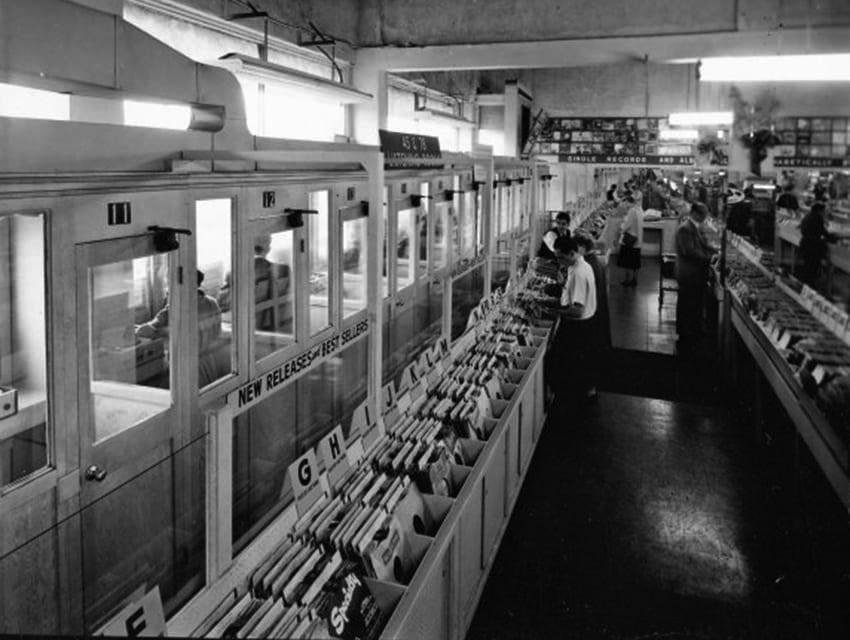
| (1950s)* - Listening booths inside Wallachs Music City. |
Historical Notes Wallichs Music City was one of the first-known music stores to seal record albums in cellophane and put them in display racks for customers to browse. The racks were tabletop height trapezoid-shaped browser boxes (designed by Capitol Records' Frederick Rice) that allowed the covers they contained to be viewed like a card index without damaging the sleeves. The store was also the first to have demonstration booths for listening to records. |
 |
|
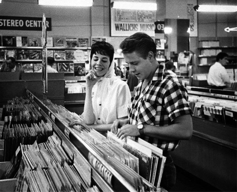
| (1950s)^ - View showing rock star Eddie Cochran shuffling through albums as one of his fans looks on, at the Wallichs Music City store. |
Historical Notes Edward Raymond 'Eddie' Cochran captured teenage frustration and desire in the late 1950s and early 1960s. Cochran's rockabilly songs included "C'mon Everybody", "Somethin' Else", and "Summertime Blues". He experimented with multitrack recording and overdubbing even on his earliest singles, and was also able to play piano, bass and drums. His image as a sharply dressed and good-looking young man with a rebellious attitude epitomized the stance of the 50s rocker, and in death he achieved an iconic status. Cochran died at the young age of 21 after a road accident, while travelling in a taxi in Chippenham, Wiltshire, during his British tour in April 1960, having just performed at Bristol's Hippodrome theatre. Though his best-known songs were released during his lifetime, more of his songs were released posthumously. In 1987, Cochran was inducted into the Rock and Roll Hall of Fame. |
 |
|
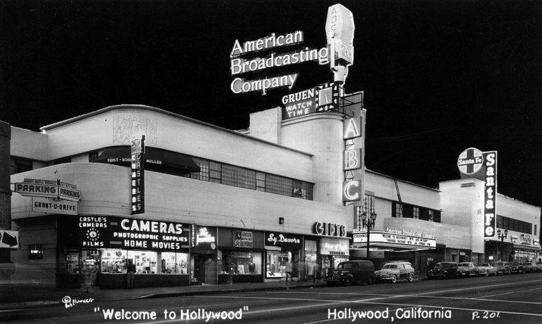
| (ca. 1949)^^^ - Postcard view of the American Broadcasting Company's Building on the west side of Vine Street north of Sunset Boulevard. This is the same building once occuppied by Tom Breneman's Restaurant. |
Historical Notes American Broadcasting Company broadcast its radio station, KECT from this building. The 790 AM station's callsign was named after Los Angeles broadcasting pioneer Earle C. Anthony, whose initials were also present on then-sister TV Channel 7, KECA-TV (now KABC-TV).*^ In the forties four big national networks dominated the radio industry. The network affiliations were KECA (790 AM, ABC), KFI (640 AM, NBC), KNX (1070 AM, CBS) and KHJ (930 AM, Mutual-Don Lee). |
 |
|
| (ca. 1950)##^* – Close-up view showing the storefronts and signs of the American Broadcasting Company Building located at 1541 N. Vine Street. |
 |
|
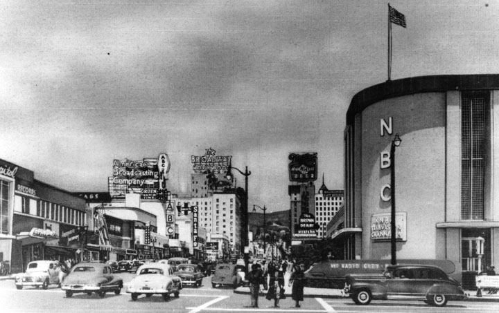
| (ca. 1950)* - Looking north on Vine Street from Sunset Boulevard. Lots of automobile and pedestrian traffic. Signage on various buildings include American Broadcasting Company, The Broadway-Hollywood, The Brown Derby, and NBC Radio City. |
 |
|
| (ca. 1950)* – View Looking northeast across the intersection of Sunset Boulevard and Vine Street with Wallichs Music City on the NW corner and NBC Radio City on the NE corner. Three Studebakers can also be seen in this shot. |
 |
|
| (1950)* - Looking southwest across the intersection of Sunset Boulevard and Vine Street. Seen are various businesses (left) and a Foster and Kleiser billboard for Schlitz beer. |
 |
|
| (1960)*# – View looking northwest toward the intersection of Sunset and Vine showing Wallichs Music City (NW corner) and NBC Radio City (NE corner). |
 |
|
| (ca. 1950s)* - Looking north on Vine Street toward Sunset and Vine showing the neon signs on display. |
 |
|
| (ca. 1960)* – Night view looking north on Vine Street at Sunset Boulevard. |
 |
|
| (1965)* - KTLA Telemobile at Sunset and Vine. |
 |
|
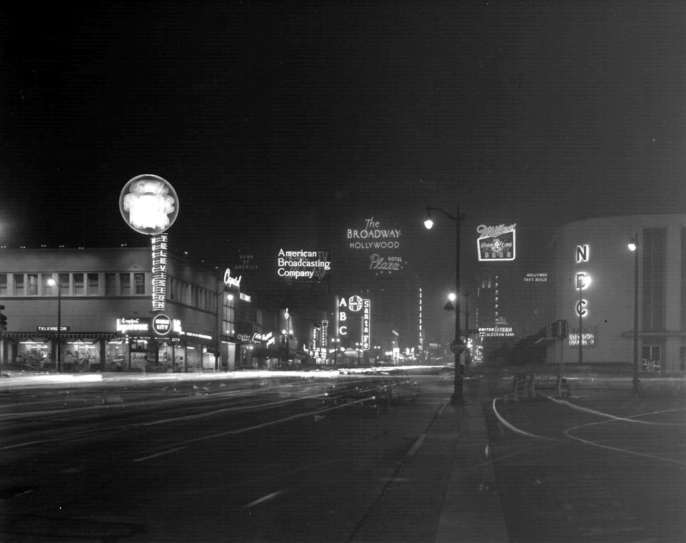
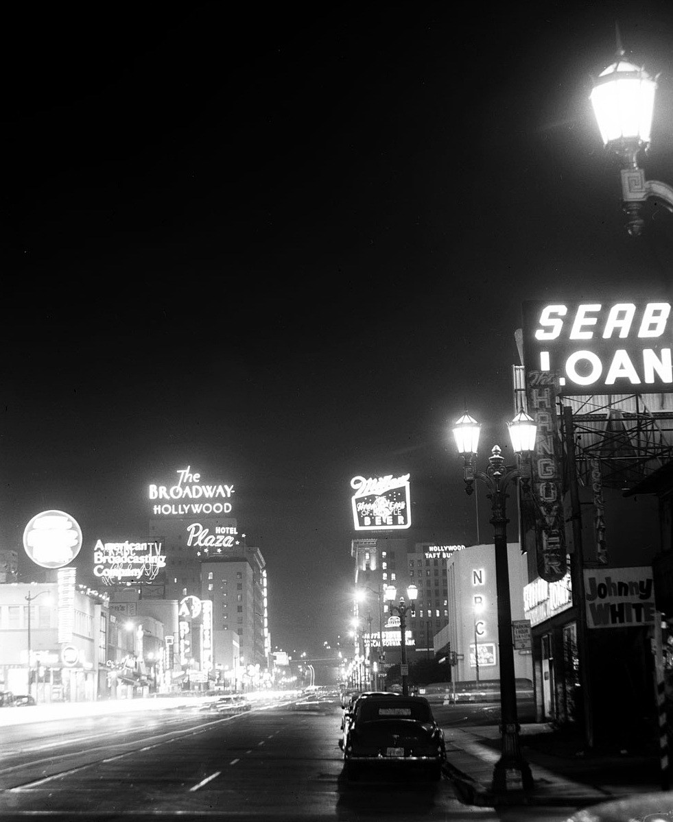
| (1957)* - View of Vine Street looking north, ilumminated by both streetlights and neon signs. The Hangover Nightclub featuring Johnny White can be seen at right. |
 |
|
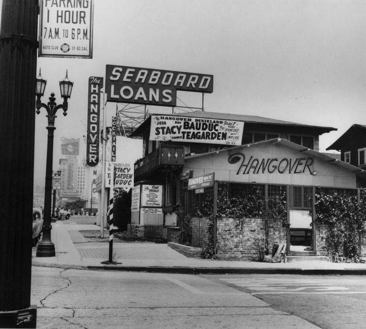
| (ca. 1960)* – Daytime view showing the Hangover Nightclub located on the northeast corner of Vine Street and Leland Avenue. A large rooftop sign reading 'Seaboard Loans' stands tall in the background. Click HERE to see contemporary view of the same corner. |
Hollywood Hotel
 |
|
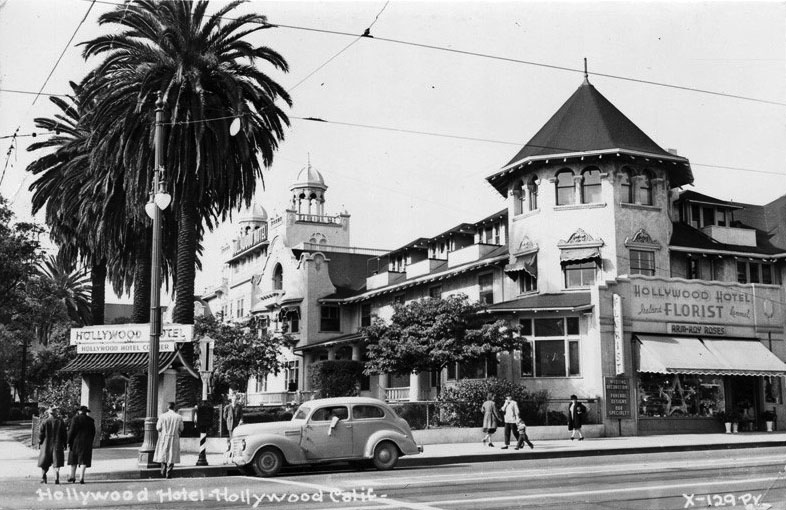
| (1940s)* - Postcard view of the Hollywood Hotel on the northwest corner of Hollywood and Highland. The hotel’s florist shop fronts Highland and can be seen in the lower right. |
 |
|
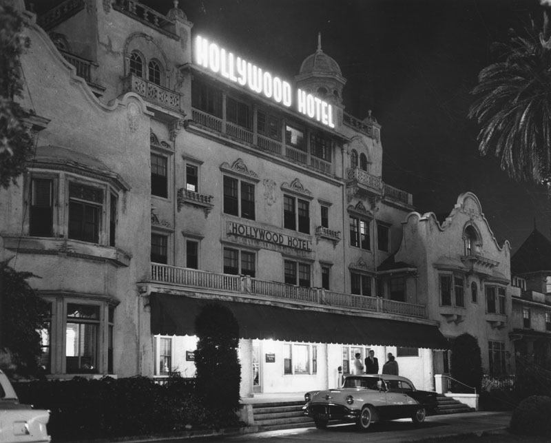
| (ca. 1956)* - Night view of the Hollywood Hotel shortly before it would be razed to make room for a new 12-story First Federal Savings and Loan building. |
 |
|
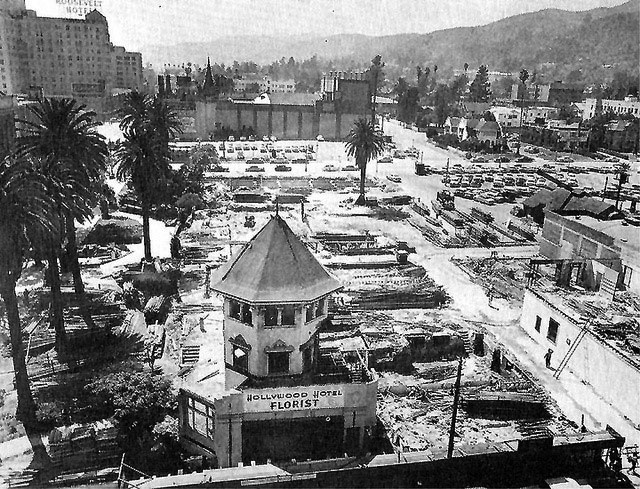
| (1956)^#^* – View showing the demolition of the Hollywood Hotel, N/W corner of Highland and Hollywood, with only its florist shop left standing. Both the Chinese Theatre and the Roosevelt Hotel are seen in the background. |
Historical Notes Though the Hollywood Hotel housed many of the great stars in its day, it was razed in August 1956 to make way for a $10 million development, with a twelve story office building for the First Federal Savings & Loan Association of Hollywood, a shopping center and parking lots. |
 |
|
| (ca. 1959)* - View looking west on Hollywood Boulevard showing what appears to be a 1957 Thunderbird convertible heading towards the camera. In the background can be seen the 12-story First Federal Savings and Loan Building on the northwest corner of Hollywood and Highland, where the Hollywood Hotel once stood. |
First Federal Savings and Loan Building
 |
|
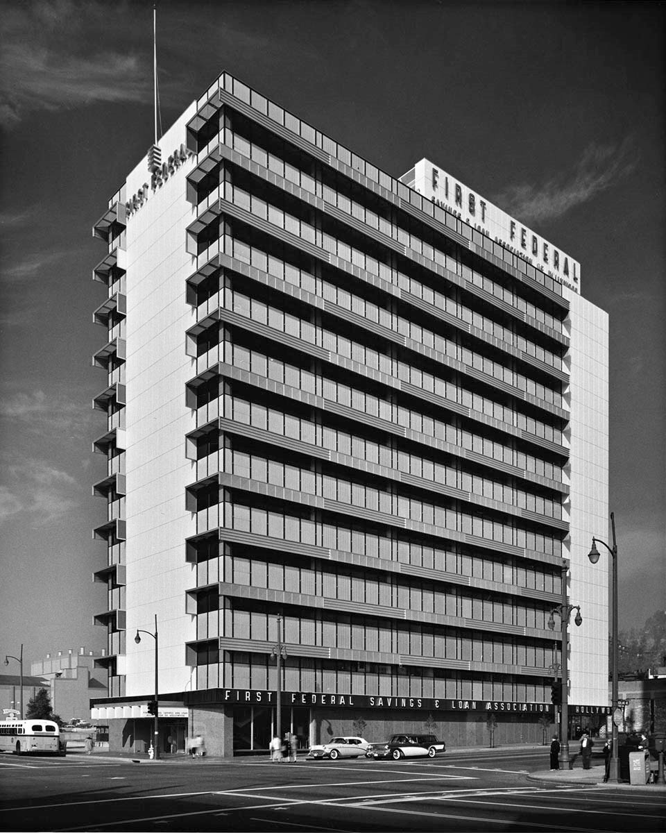
| (ca. 1959)* – View looking toward the old location of the Hollywood Hotel (N/W corner of Hollywood and HIghland) showing the newly constructed 12-story First Federal Savings and Loan Building. |
Historical Notes In 1955, the southeast portion of the old Hollywood Hotel property was sold to First Federal Savings and Loan of Hollywood, and in August, 1956, the hotel was razed and the 12-story First Federal building was erected on the northwest corner of Hollywood Blvd. and Highland where it stood from 1959 until 1998. |
 |
|
| (1959)*– View looking west on Hollywood Boulevard at Highland Avenue showing the First Federal Savings and Loan Building at right (N/W corner) and the Grauman’s Chinese Theatre in the distance. Coffee Dan's, on the left, was a familiar landmark in Hollywood for decades. |
Historical Notes In 1998, the 12-story First Federal Savings and Loan Building was torn down to make way for a new entertainment center. The Hollywood and Highland Center, the current home of the Academy Awards, was constructed on the site in 2001. Click HERE for contemporary view. |
* * * * * |
Hollywood Boulevard
.jpg) |
|
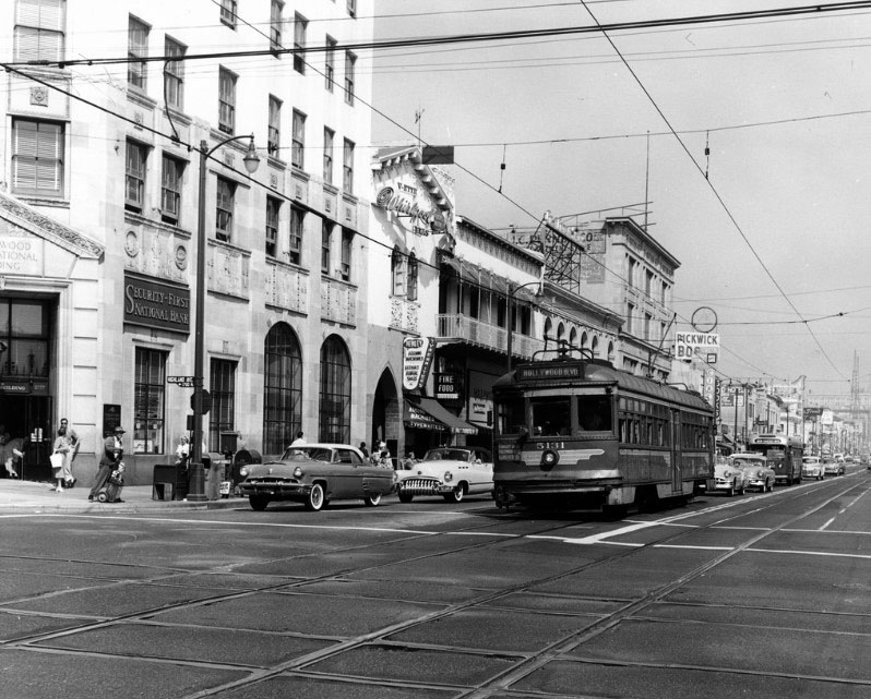
| (1953)*^* - View of Hollywood Blvd. looking east from the roof of the Roosevelt Hotel. The Hollywood Hotel and the Security First National Bank Building can be seen at the intersection of Highland Ave and Hollywood Blvd. |
 |
|
| (ca. 1957)* - Aerial nighttime view of the Hollywood skyline, with klieg light beacons for movie premieres. View is looking east on Hollywood Boulevard from Highland Avenue. Building on left: First National Bank Building with tower. Right: Paramount Theatre. |
 |
|
| (1958)**## – Night shot of Hollywood Boulevard looking west from the Hollywood and Vine corner. The Admiral Theatre we can see on the right opened in 1940, then later became the Vine Theater. Arthur Murray Dance Studio is next door. This is a couple of years before the city of Hollywood initiated it’s Hollywood Walk of Fame with the stars on the sidewalk, sealing the city of Hollywood’s fate as a tourist destination more than a local residential area which it had been for the previous 100 years. |
Sunset Boulevard
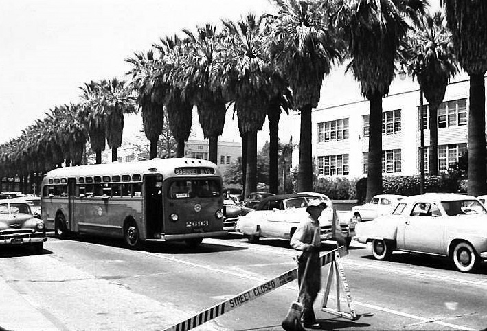 |
|
| (ca. 1951)##^* – View looking west on Sunset Boulevard from near Highland Avenue. Hollywood High School is seen in the background fronted by a row of palm trees. In the foreground a construction worker stands in front of a baricade with a broom in hand. |
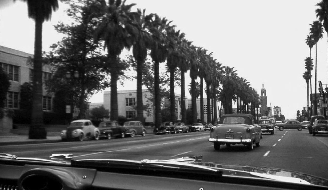 |
|
| (1956)^##*– Dashboard view looking east on Sunset Boulevard toward Highland Avenue with Hollywood High School at left. It appears we’re riding in a new Oldsmobile (‘56 or ‘57). |
Sunset and Highland
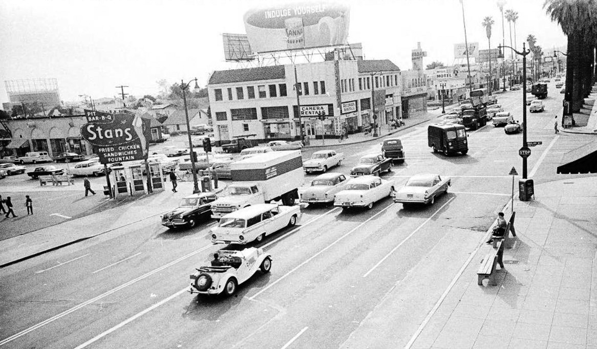 |
|
| (1961)^^ – View looking west on Sunset at Highland showing Stan’s Drive in on the left (SE corner). Hollywood High School (out of view) is behind the palm trees at upper-right. |
Stan's Drive-in (Sunset and Highland, SE Corner)
 |
|
| (1958)^^ - View showing Stan’s Drive-in Coffee Shop on the SE corner of Sunset and Highland, 6760 Sunset Blvd, across from Hollywood High School and Currie’s ice cream. |
Historical Notes Previously, the southeast corner of Sunset and Highland was the site of Simon’s Drive-in…one of two Simon’s on Sunset for a few years (since 1938). As of December 1951, Simon’s became a Stan’s drive-in. Since Stan’s took over the Carpenter’s at Vine that same year, there were now 2 Stan’s on Sunset. |
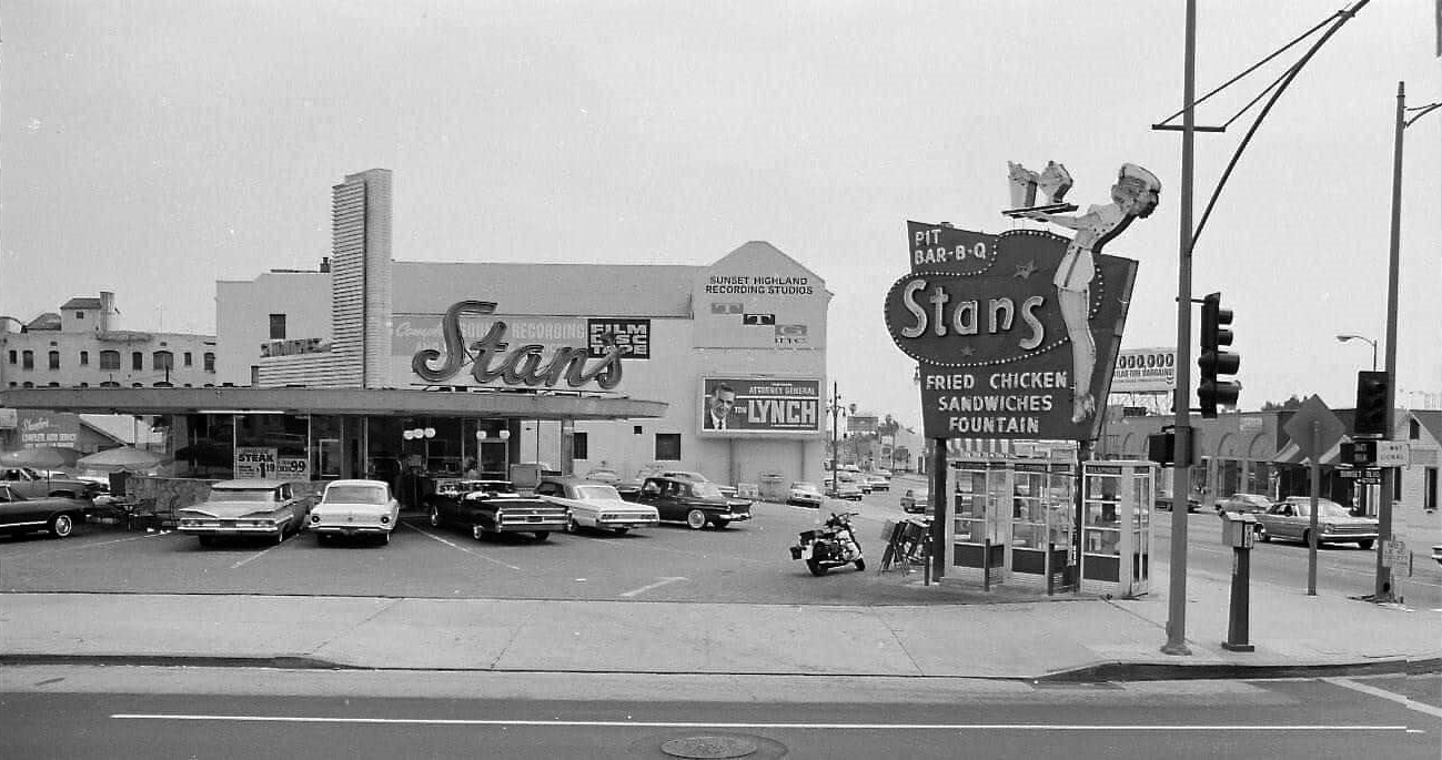 |
|
| (ca. 1966)^.^ - Stan’s Drive-in on the SE corner of Sunset & Highland, kitty-corner to Hollywood High School. Sunset-Highland Recording Studios is seen in the background. |
Historical Notes Stan’s stood on the SE corner as seen above until 1971 when it was demolished. Today, a Chick-fil-A is at the corner. Click HERE to see contemporary view. |
* * * * * |
Stan's Drive-in (East Hollywood)
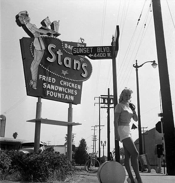 |
|
| (1950s)##^* – View showing a woman drinking a soda while leaning on a street sign post with a Stan’s Drive-in seen in the background on the 4400 block of Sunset Blvd (SE corner of Sunset and Virgil Ave, across the street from the Vista Theatre). Click HERE for contemporary view. |
Historical Notes Stan's was a chain of drive-in's with at least a dozen LA locations built in the late 1950's and 60's. Click HERE to see more in Early Views of LA Drive-in Restaurants. |
* * * * * |
Sunset Boulevard (between Argyle and El Centro Avenues)
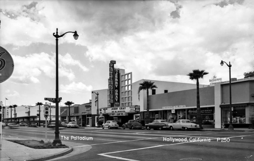 |
|
| (ca. 1950)^** – Postcard view looking NW towards Sunset Boulevard from the intersection of El Centro Avenue, with the Hollywood Palladium at center, Radio City NBC Studios at far left and the Broadway Building Sign in the distance at right. The Palladium marquee reads "Jerry Gray and his Orchestra" next to a storefront with a sign for Photostats - Music Prints" |
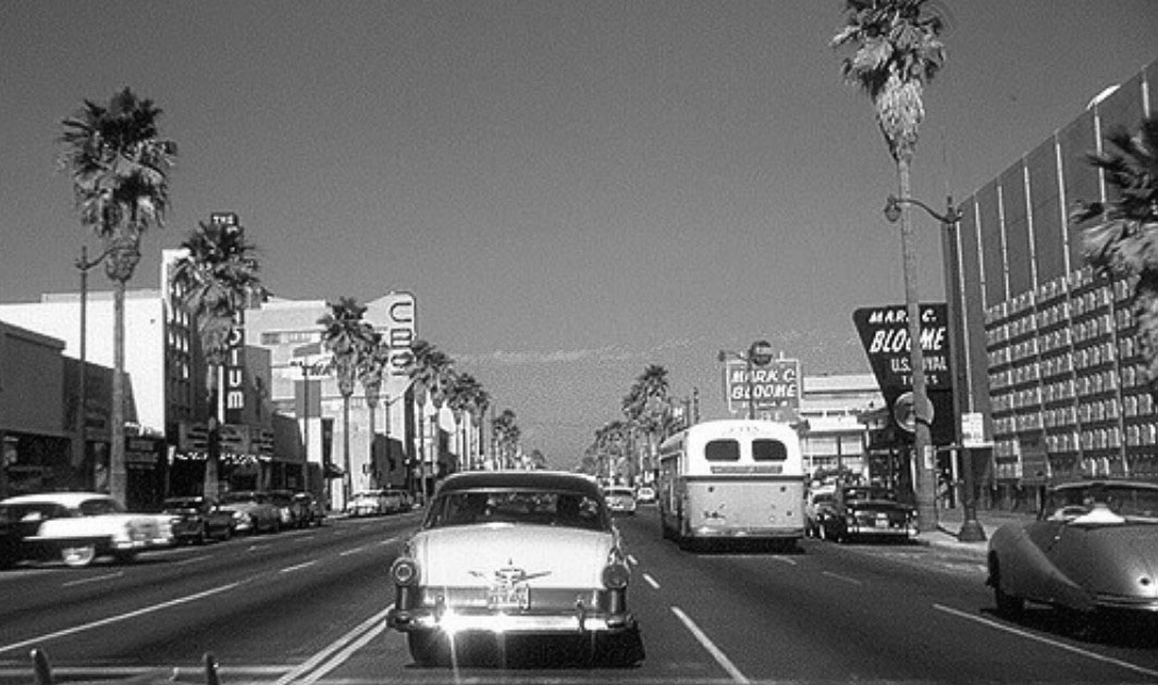 |
|
| (1959)+#+# – View looking east on a plam tree-lined Sunset Boulevard at Argyle Avenue. From left to right can be seen: Hollywood Palladium, CBS Columbia Square, Mark C. Bloome, and the Earl Carroll Theatre. |
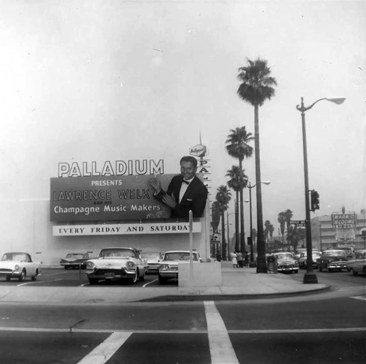 |
|
| (ca. 1959)^.^ – View looking east across Argyle Avenue towards the Palladium showing an oversized bilboard for Lawrence Welk and his Champagne Music Makers on the west face of the building. Mark C. Bloome can be seen across the street (south side of Sunset). Click HERE to see contemporary view. |
Hody's Coffee Shop
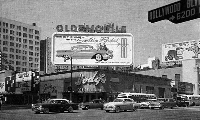 |
|
| (1957)* – View looking at the northwest corner of Hollywood and Vine showing Hody’s Restaurant (previously Melody Lane Cafe). Signboard on top of building shows a 1957 Oldsmobile Rocket 88. |
Historical Notes In 1940, restaurateur Sidney Hoedemaker of the Pig 'N Whistle - Melody Lane chain, leased the northwest corner Hollywood and Vine transformed it into a Melody Lane Restaurant. In 1949, Hoedemaker founded Hody's Restaurant Inc. Hoedemaker's restaurants were all about service, efficiency, cheerfully and courtesy. One was always greeted with a smile. And in 1955, Hody's restaurant group signed a 20 year lease for the property on the northwest corner of Hollywood Blvd and Vine Street. Hoedemaker had it remodeled extensively. |
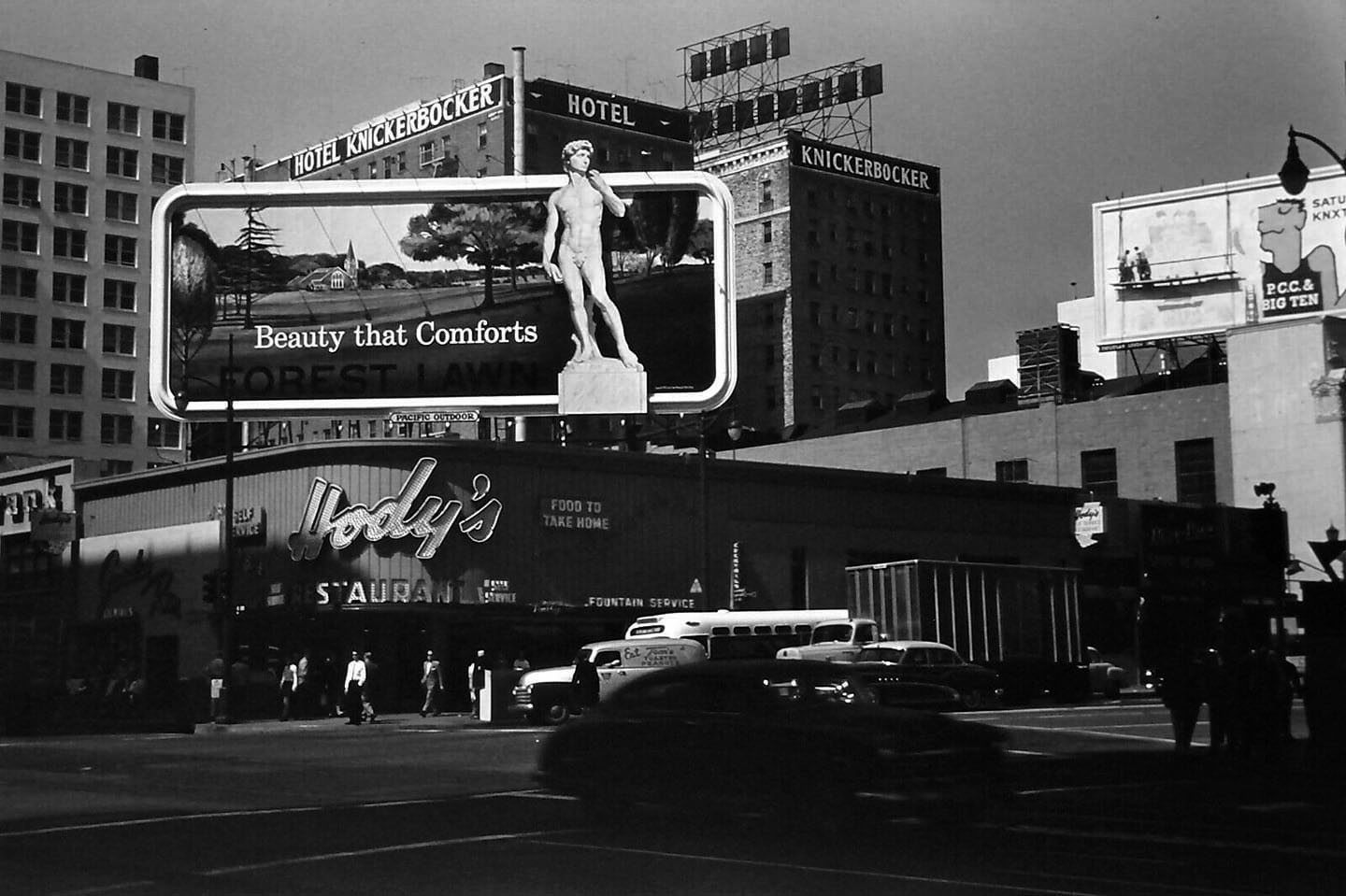 |
|
| (1950s)^ - View showing Hody’s Coffee Shop with a Forest Lawn advertisement on it’s large roof-mounted signboard. The Hotel Knickerbocker is seen in the background. |
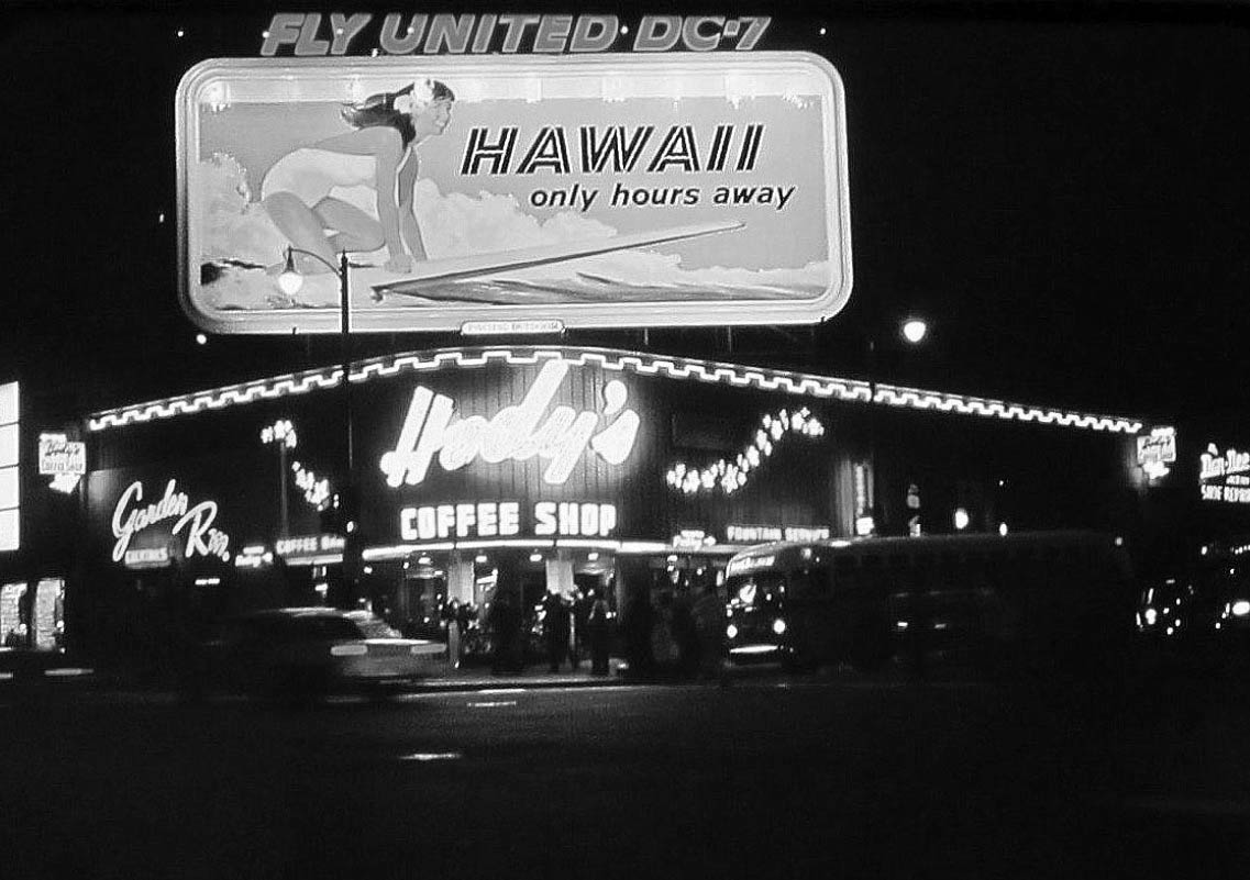 |
|
| (1959)^ – Nighttime view showing Hody's Coffee Shop located on the N/W Corner of Hollywood and Vine (previously Melody Lane Cafe). |
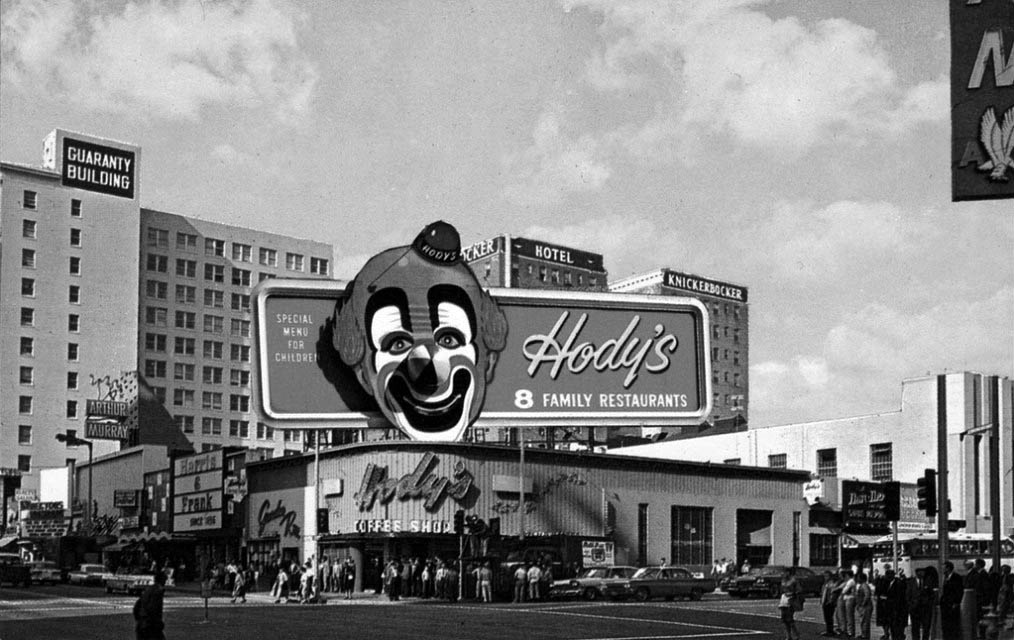 |
|
| (ca. 1961)^ – Daytime view of Hody’s Coffee Shop, N/W Corner of Hollywood and Vine, with the Guaranty Building and Hotel Knickerbocker seen in the background. Next door to Hody's to the west was a Harris & Frank Clothiers and an Arthur Murray School of Dance studio. |
Historical Notes Hody's was a family restaurant. Kid's would get a kid's clown menu that could be worn on their face. By 1969 there were 8 Hody's restaurants in Southern California. |
* * * * * |
Hollywood Ranch Market (Originally Mandarin Market)
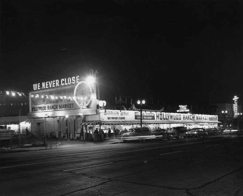 |
|
| (1961)* - Exterior view of the Hollywood Ranch Market, located at 1234-1248 Vine Street. The market with its large neon sign and the neighboring Art Linkletter Playhouse are clearly visible. Remnants of the original Chinese influenced architecture from when the building served as the Mandarin Market are visible above the roof line in the center of the photograph. |
Historical Notes The Hollywood Ranch Market started out as The Mandarin Market. Built in 1929, it was touted as being one of the first drive-in markets of its kind in Los Angeles. The architect was Henry L. Gogerty, who later designed "gliding acoustical walls" for classrooms, and assembly line buildings for Howard Hughes' Spruce Goose project.^*^# Click HERE to see the original Mandarin Market. |
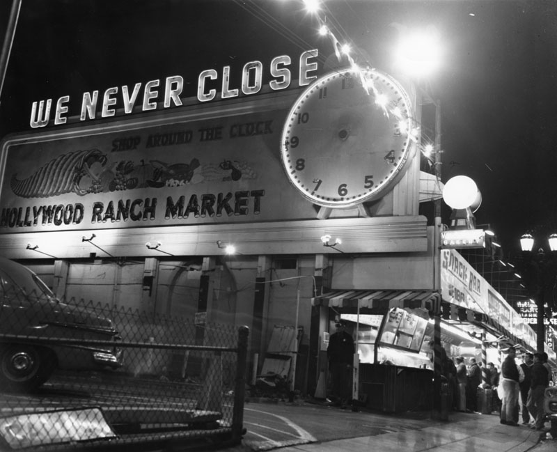 |
|
| (1961)* - Closer view of the Hollywood Ranch Market. The market's neon sign with a clock reads, "We never close" and "Shop around the clock." This side view only allows one of the market's vendors, the snack bar, to be visible. |
Historical Notes It wasn’t unusual to see such personalities as Frank Sinatra, Ava Gardner or Red Skelton or at the Hollywood Ranch Market’s snack bar. Steve Allen used to broadcast his shows from his studio close by. ^#^^ |
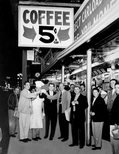 |
(1954)* - Herald Examiner photo showing several men toasting with a cup of coffee in front of Hollywood Ranch Market.
|
Historical Notes Examiner article reads: "The all-night Hollywood Ranch Market sidewalk lunch counter on Vine Street is one of many places revolting against the hike in coffee prices. This place reduced its price from 10 cents to 5 cents per cup. Celebrating with steaming mugs beneath the sign are, left to right: Richard Wilson, jazz musician-composer; night manager Roy McCully; co-owner Larry Frederick; writer Roger Fair; and newsboy Eddie Levin, on February 2, 1954." * |
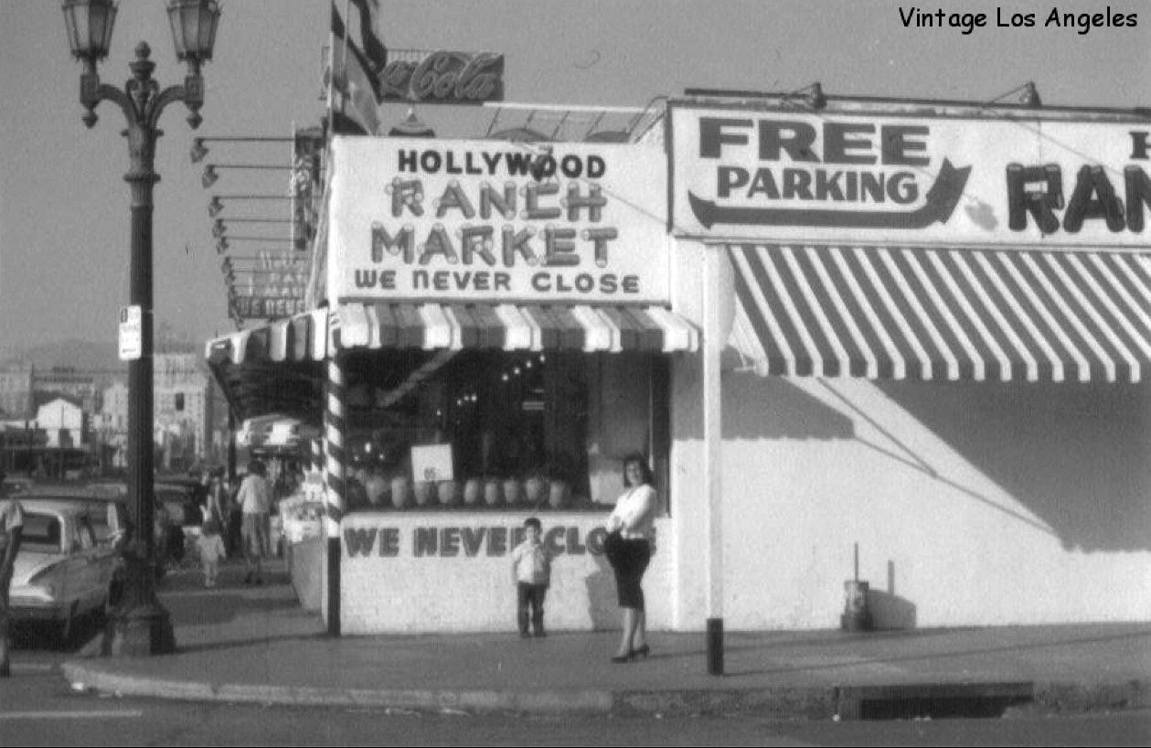 |
|
| (ca. 1960s)^#^^ – View looking north showing a woman and young child standing in front of the Hollywood Ranch Market on the northeast corner of Vine Street and La Mirada Avenue. |
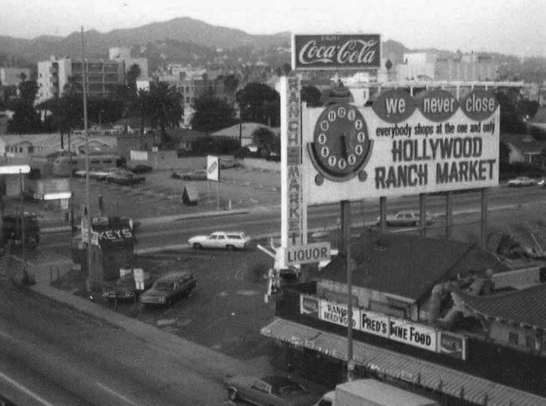 |
|
| (1970s)##^* – View looking northeast toward the Hollywood Hills and Mt. Lee with the Hollywood Ranch Market at lower right. The large sign reads: We Never Close – Everyone Shops at the One and Only HOLLYWOOD RANCH MARKET. |
Historical Notes The Hollywood Ranch Market (originally Mandarin Market) burned down in the early 80s and is now a strip mall that includes an Office Depot and an El Pollo Loco.#^* Click HERE to see contemporary view. |
* * * * * |
Please Support Our CauseWater and Power Associates, Inc. is a non-profit, public service organization dedicated to preserving historical records and photos. Your generosity allows us to continue to disseminate knowledge of the rich and diverse multicultural history of the greater Los Angeles area; to serve as a resource of historical information; and to assist in the preservation of the city's historic records.
|
More Historical Early Views
Newest Additions
Early LA Buildings and City Views
History of Water and Electricity in Los Angeles
* * * * * |
References and Credits
* LA Public Library Image Archive
^*California Historic Landmark Listing (Los Angeles)
^ California Historical Society Digital Archive
** Retronaut - Hollywoodland Sign
#* Pinterest - California and DailyBreeze.com; Mid Century Hollywood; Been There: Hollywod Sign; "HOLLYWEED" Sign
*^#LosAngelesPast.com: Cahuenga Pass
^^#LA Times: 'Swing in, pig out, drive off'; Hollywood Bond Cavalcade; Sunset Vine Tower; Taft Building; Pickwick Bookshop
***The Story of Hollywood by Gregory Paul Williams
**^Table Magazine: LA Observatory
**+Hollywood Renegades Archive: "The Lot"
**#Beguiling Hollywood: The Hollywood Hotel
^**Huntington Digital Library Archive
*^*MTA Transportation and Research Library Archives
^^*Cinema Treasures:Ricardo Montabaln Theater
^^^California State Library Image Archive
^+^Cool Culinaria: Restaurateur Mike Lyman
+^*Jewish Museum of the American West: Restaurateur Al Levy
+^^Don Lee Mutual Broadcasting Building
+^+GoGoNotes.blogspot.com: Hollywood and Cherokee
++#Facebook.com: Photos of Los Angeles
*^^*Photos of Vintage Los Angeles: Facebook.com; Palladium; Capitol Records; Cruising Hollywood Blvd; Masonic Temple; Hody's Coffee Shop
^^^^Water and Power Associates
*^#*Calisphere: University of California Image Archive
*^*#Pinterest.com: Favorite Places and Spaces
**^*LA Daily News: Hollywood Sign Celebrates its 90th Birthday
***#Art Deco Architecture: LA Radio City
**##MartinTurnbull: Cross Roads of the World; Biff's Coffee Shop
^^##Alison Martino's Vintage Los Angeles: Wallichs Music City
++##Grauman's Chinese.org: Academy Awards
*#^^Flickr.com - Daniel Pouliot
*##*Squidoo.com: Lawrence Welk
*##^The Daily Meal: Formosa Cafe
^##*Flickr.com: Michael Ryerson; Baytram366; Melody Lane
^###Uncanny.net: Hollywood Pacific Electric Line
^#*#Bellaonline.com: Mickey Rooney and Judy Garland
+#+#Flickr,com
^#^*Flickr.com: Los Angeles - Back in the Day
^#^^Facebook.com - Vintage LA: Hollywood Palladium; Hollywood and Gower; Hollywood and Vine; Sunset & Vine; Capitol Records Building; United Methodist Church; Hollywood Ranch Market; Wallichs Music City; Tiny Naylors
^^#^History of the Samuel Goldwyn Studio
^^^#KCET's First Hollywood Home: The Historic Mutual-Don Lee Studios
#^**The Go Go's: Local Coffee Shops and Diners
^*#*Pinterest - Memories in the SFV 50's, 60's, & 70's
^*##Vintage Inspired California - marinachetner.com
^*^^Pomona Public Library Poscard Collection
^*^#Facebook.com - Bizarre Los Angeles
#**^Starlinetours.com: TLC Chinese Theatre
#**#Facebook.com: Garden of Allah Novels, Martin Turnbull
#*^#Historic Hollywood Theatres: Warner Bros. Hollywood Theatre
#^*#TheHollywoodMuseum.com: Max Factor Building
#^**The Go Go's: N/W Corner of Hollywood and Vine
#^^^Once Upon a Screen: Hollywood Canteen
#^#^Groceteria.com: A&P History
##**The Story of the Hollywood Sign: allanellenberger.com
##*^The Hollywood Sign: hollywoodsign.org
##*#Flickr.com: Paul Bajerczak
#*##Electric Railway Historic Association: Hollywood PE Line
##^*Facebook.com: Classic Hollywood-Los Angeles-SFV
##^^halfcoastal.com: The Hollywood Sign
***^Pinterest: Travel The World: 'HOLLYWEED'; Los Angeles and Hollywood
*^^ Nuestra Señora la Reina de los Ángeles: Vogue Theater; Hollywood Blvd Night 1930s; Hollywood and Vine ca.56
*^*^#Facebook.com: West San Fernando Valley Then And Now
^^***Pinterest: Diners
^^*^*Los Angeles Magazine: Capitol Records Building Christmas
^^*^^sittininthehills64.blogspot.com: Hollywood Views
*^^**Blogspot.com: Hollywood HoJo
*^#^*Vintage Everyday
^#^#^LA Curbed: Al Levy's Tavern
^###^Flickr.com: timetravelnow
*# Skyscraperage.com. - Griffith Observatory; CBS West Coast Headquarters; LA Fun Map; NBC Hollywood Radio City; Cross Roads of the World; Hollywood and Vine; Orchid Ave and Hollywood Blvd; Max Factor Building; Cahuenga and Yucca St.; Vine and Sunset; PE on Fairfax and Santa Monica; Sunset and Vine 1960
*^ Wikipedia: Hollywood; Hollywood Athletic Club; Hollywood Bowl; Grauman's Chinese Theatre; Grauman's Egyptian Theatre; Pantages Theatre (Hollywood); John Hanson Ford Theatre; 20th Century Fox; Samuel Goldwyn.Studio; Barnsdall Art Park; Greek Theatre; Griffith Observatory; Cinerama Dome; Ralphs; Hollywood Palladium; Hollywood and Vine; Hollywood Masonic Temple; Hollywood Pacific Theatre; Max Factor; West Hollywood; Brown Derby; Hollywood Christmas Parade; Tom Breneman; Schwab's Pharmacy; Capitol Records Building; CBS Columbia Square; West Coast Radio City - Los Angeles; Crossroads of the World; Hollywood Sign; Lawrence Welk; Du-Par's Restaurant; Formosa Cafe; Hollywood Walk of Fame; Marilyn Monroe; John C. Austin; KFWB; The Beatles at the Hollywood Bowl; 2005 Hollywood Sign; Rexall - Owl Drug Store; Hollywood Canteen; KABC; Wallichs Music City; Thrifty Drug Stores; Lasky-DeMille Barn; Mt. Lee; The Wizard of Oz ; Hollywood Roosevelt Hotel; Eddie Cochran; Guarantee Building; Hollywood United Methodist Church; Carolina Pines, Jr.; Vista Theatre
< Back