Then and Now
 |
|
| (1920s vs. 2021)* - Avenue of the Palms - a section of Stadium Way. Note the new Chilean Wine Palms planted in-between the century old original palms. |
Historical Notes Around 1895, Elysian Park received its most recognizable tree planting with the creation of the Avenue of the Palms, an allee of date palms (Canary Island Date Palms) along present-day Stadium Way. Click HERE to see more. |
 |
|
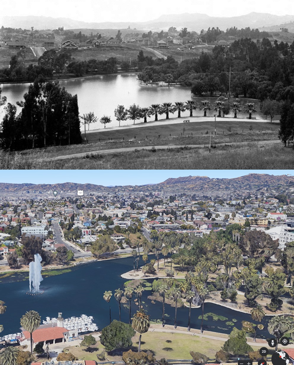
| (1911 vs. 2022) - Echo Park Lake with the Hollywood Hills in the distance. |
Historical Notes Echo Park Lake didn’t start out as a man-made lake. Instead, its earliest use by the city was as a reservoir, storing water in a section sometimes known as the city’s “West End.” In those years this area was thought of as the city’s west side. The Los Angeles Canal and Reservoir Co. formed Reservoir No. 4 in 1868. The company obtained the water by digging a ditch that sent water flowing from the Los Angeles River, in the area now known as Los Feliz, along a zigzag path that merged with the Arroyo de los Reyes and then emptied into the reservoir. Click HERE to see more. |
 |
|
| (1904 vs. 2022)* - Looking north on Glendale Boulevard (then Lake Shore Ave) toward the Sunset Boulevard overcrossing. The early photo was taken at the grand opening of Sunset Boulevard that now connected Los Angeles with the then-independent city of Hollywood. |
Historical Notes Property owners in the hilly area now known as Silver Lake and Echo Park soon realized that the road would catalyze development and boost the value of their holdings. In 1892, led by the Los Angeles and Pacific Railway and a Confederate Civil War veteran named George H. Smith, they petitioned the city to open Sunset Boulevard through their land. The city council mapped out a route the following year, tracing the path of the defunct Ostrich Farm Railway. Actual work, however, didn't begin in earnest until April 18, 1903, when contractor Charles Stansbury and his workers began carving the boulevard's meandering path into the area's soft sandstone hills.* Click HERE to see more. |
 |
|
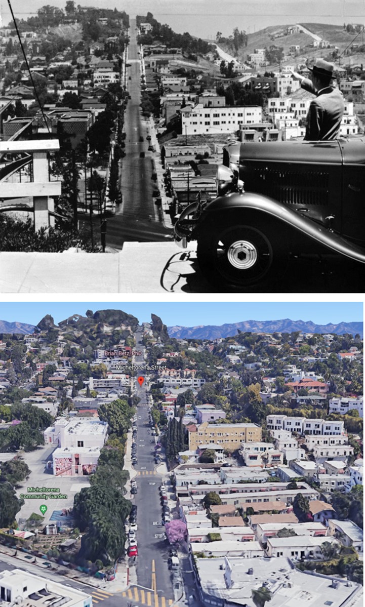
| (1932 vs. 2022)* - A view of Silver Lake, looking north on Micheltorena Street from above Sunset Boulevard. |
Historical Notes Silver Lake is a residential and commercial neighborhood in the east-central region of Los Angeles. Originally home to a small community called Ivanhoe in honor of Sir Walter Scott. In 1907, the Los Angeles Water Department built the Silver Lake Reservoir, named for LA Water Commissioner Herman Silver, giving the neighborhood its name. The area is now known for its architecturally significant homes, independently owned businesses, diverse restaurants, painted staircases, and a creative environment. The neighborhood is also home to several highly rated public and private schools.* Click HERE to see more on the Silver Lake Reservoir. |
 |
|
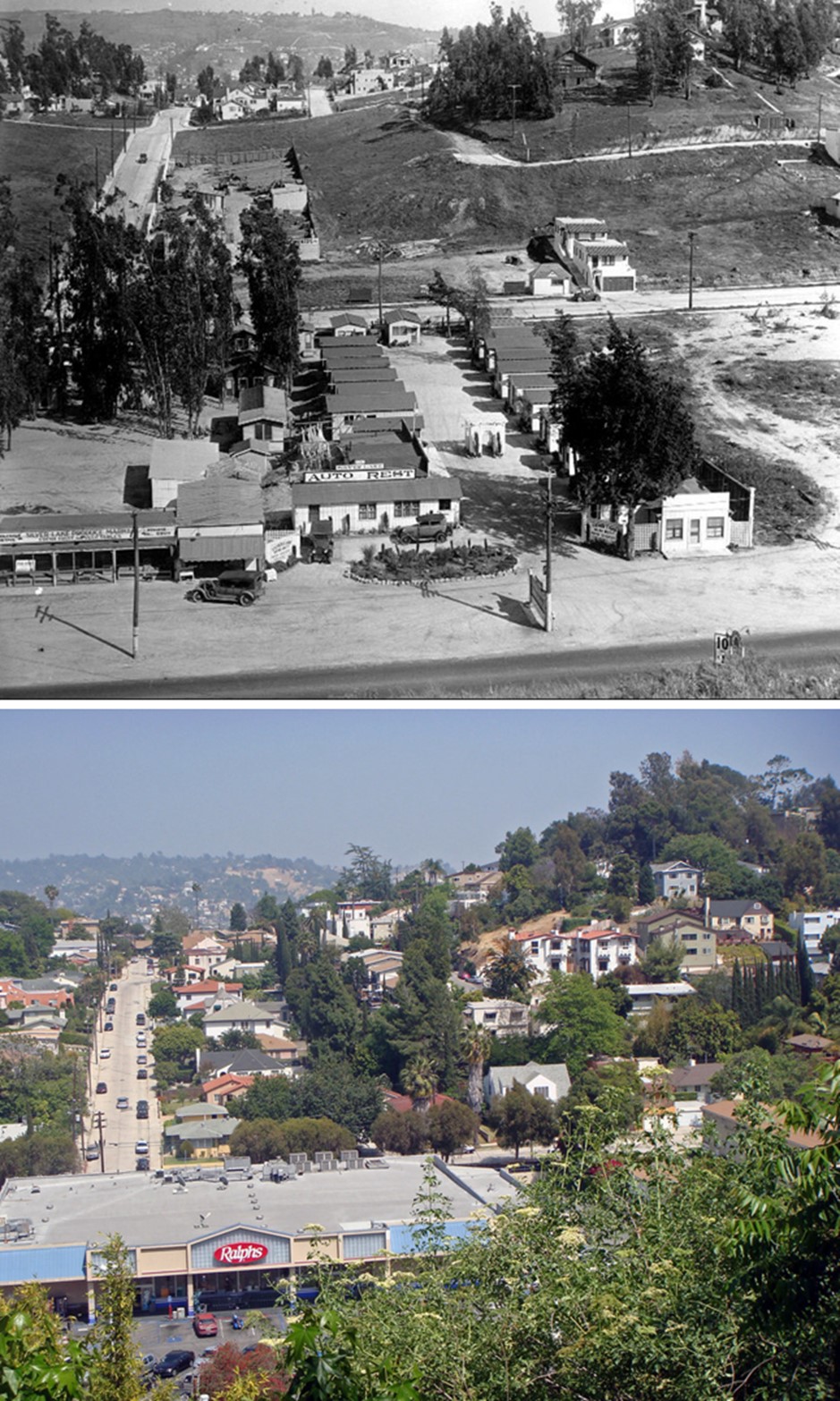
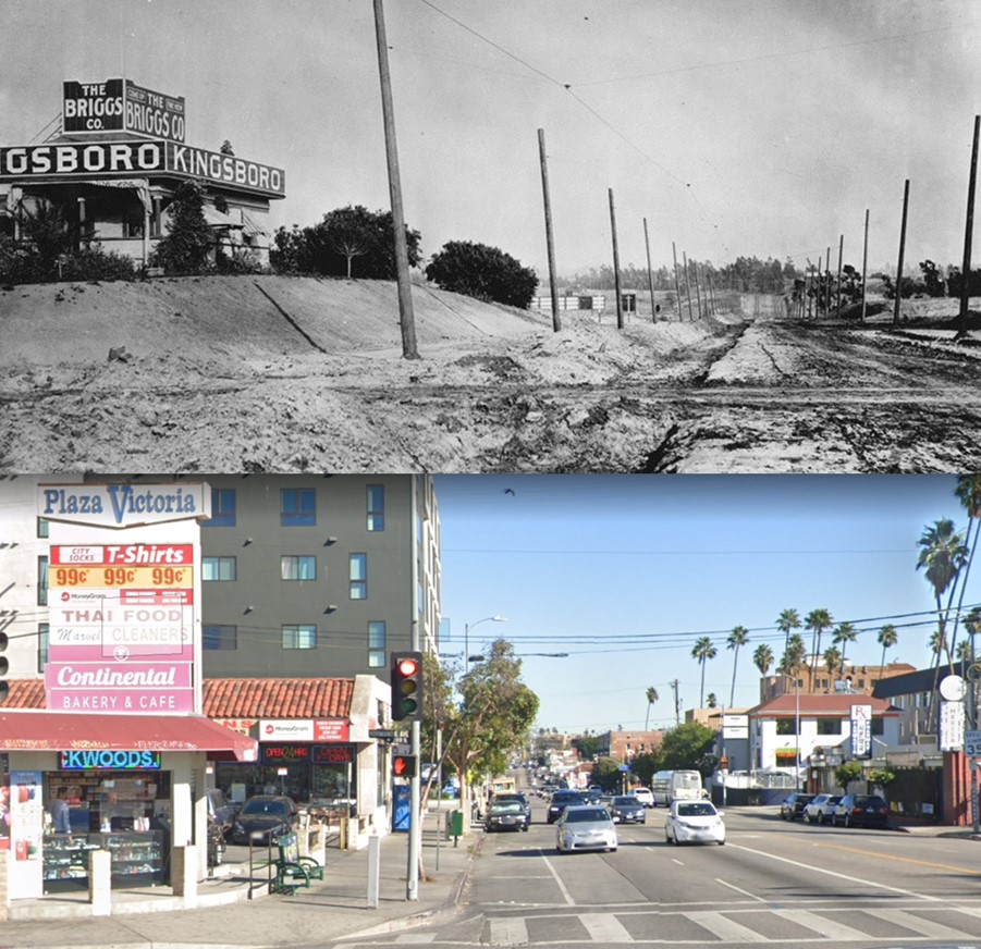
| (1920s vs 2016)* – Looking east from over Glendale Blvd with India Street running away from the camera on the left. The Ralphs Market seen below is now a Whole Foods Market (2520 Glendale Blvd). |
* * * * * |
 |
|
| (1949 vs. 2022)* - Looking south from the northern portal of the 1901-built Broadway Tunnel. In 1949, the construction of the 101 freeway through downtown L.A. reduced Fort Moore Hill to a stump and converted the section of Broadway between Temple and Sunset from a tunnel to a freeway overpass. Click HERE to see more on the Broadway Tunnel. |
 |
|
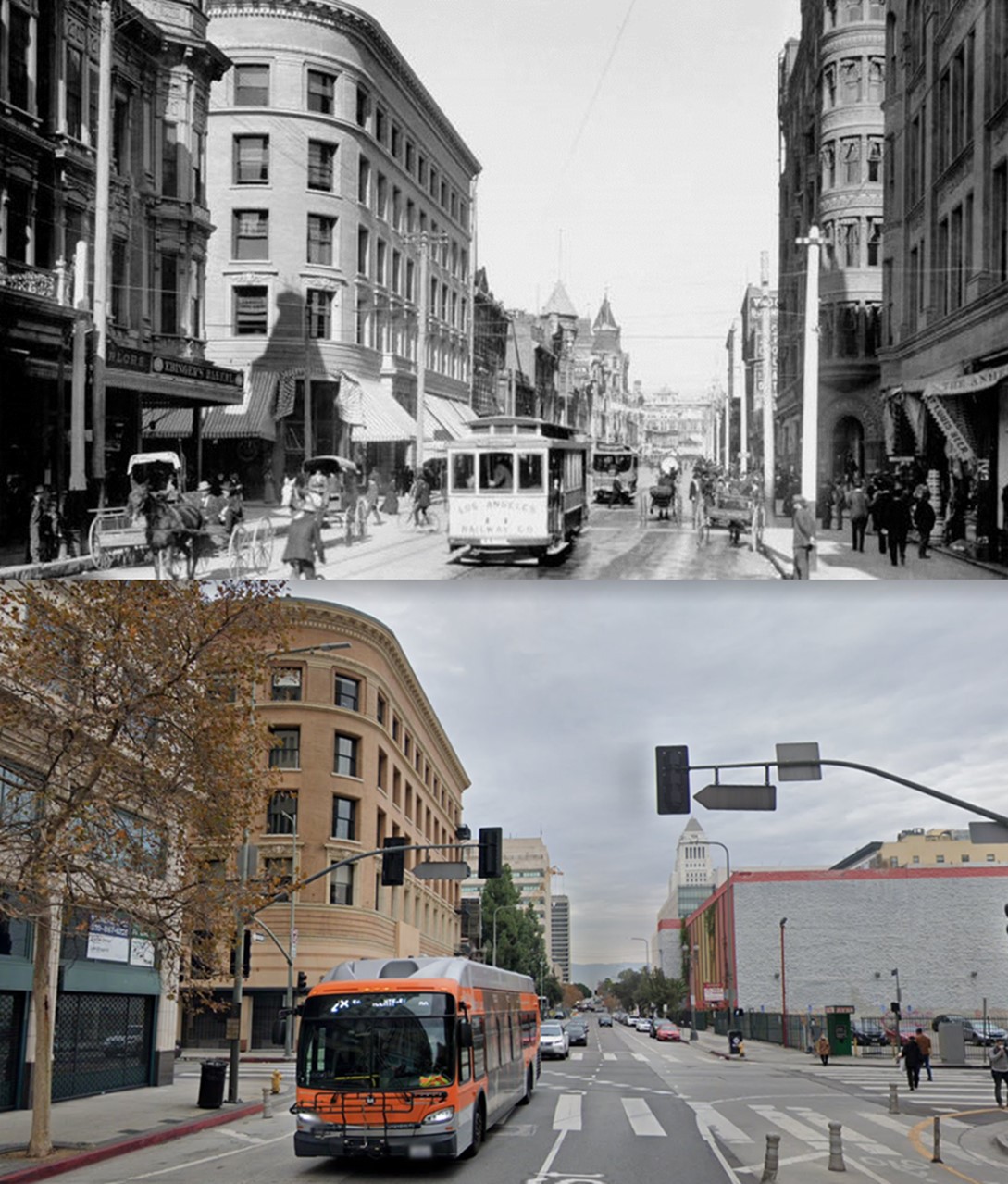
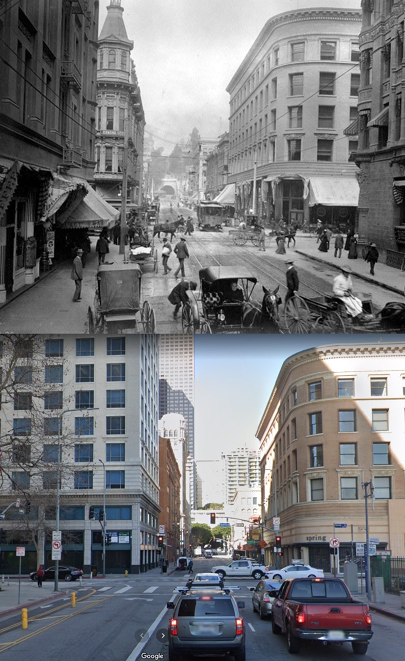
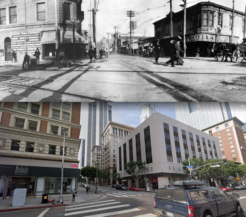
| (1903 vs. 2021) – View looking North on Spring Street at 3rd Street with the Douglas Building seen on the NW corner. |
Historical Notes The Douglas Building was commissioned by T.D. Stimson, a lumber baron turned real estate mogul who fostered commercial development in Los Angeles during the 1890s. The five-story building was designed by San Francisco architects James and Merritt Reid, who gained fame for designing the remarkable Hotel del Coronado near San Diego in 1888. The Douglas Building was one of Los Angeles’ greatest office building and commanded the highest rentals. In its early years, it housed the chief ticket office of the Southern Pacific Railroad. During that time many travelers passed through its doors to purchase a ticket. In 2005, this former office block was renovated into 50 residential units.* |
 |
|
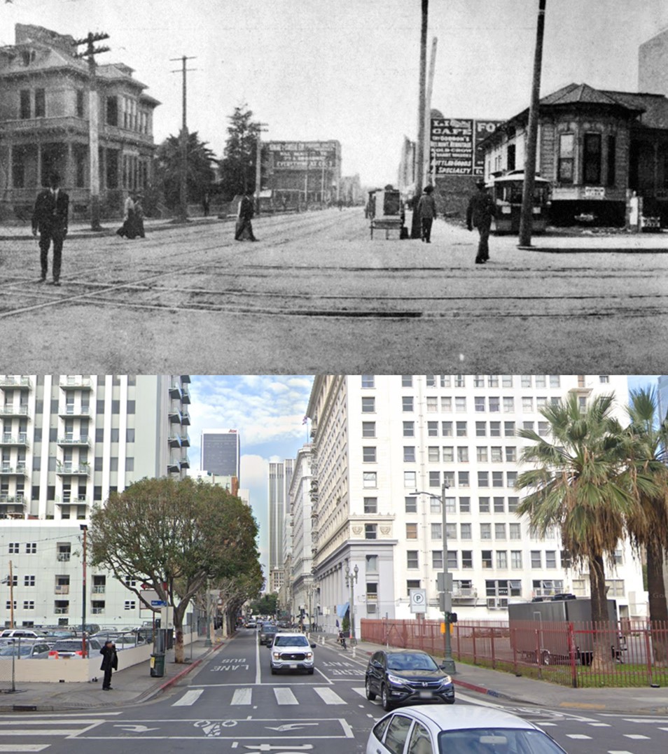
| (1901 vs 2022)* - Looking west on 3rd Street toward Spring Street with the Third Street Tunnel seen in the distance. |
 |
|
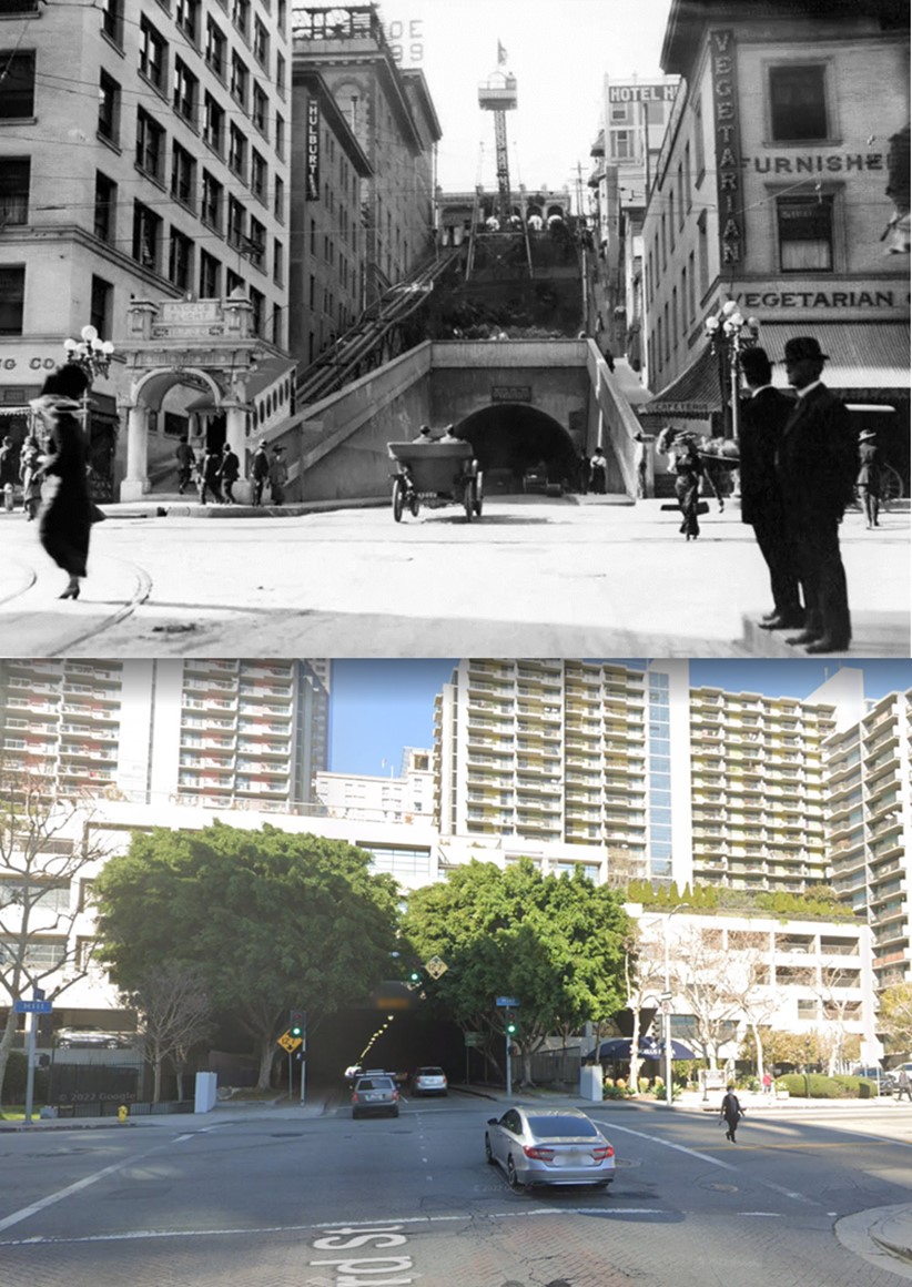
| (1910s vs. 2022)* - Looking toward the Third Street Tunnel and Angels Flight. |
Historical Notes On July 3, 1893, residents and taxpayers presented a petition to the Los Angeles City Council asking that a tunnel be created to connect those who lived in the Crown Hill neighborhood with the business district located on this side of Bunker Hill. Their plans called for a tunnel 1080 feet long, with a twenty-six foot roadway and eight foot sidewalks. Nothing happened for five years. In 1898 the City Council ordered the City Attorney to draw up an ordinance putting tunnel bonds in front of the public via a special election. That election was held on July 6, 1898, and funds were approved for both the Third Street and Broadway tunnels. On January 21, 1900, a serious disaster struck. Thirteen men were "entombed" in the tunnel dig after a massive cave-in on the western end. Several were killed in the collapse, but others were trapped inside with only the air in the tunnel. Frantic efforts were made to dig into their position. Ten men were rescued, while three perished. In March of 1901 the tunnel was opened to the public. It was unpaved and unlit. Gutters weren’t installed until 1902. Click HERE to see more on the Third Street Tunnel and Angels Flight. |
 |
|
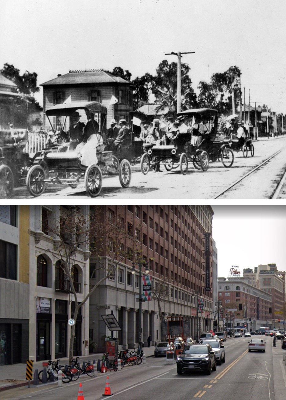
| (1903 vs. 2022)* - Looking south on Broadway from 9th Street. Click HERE to see more. |
 |
|
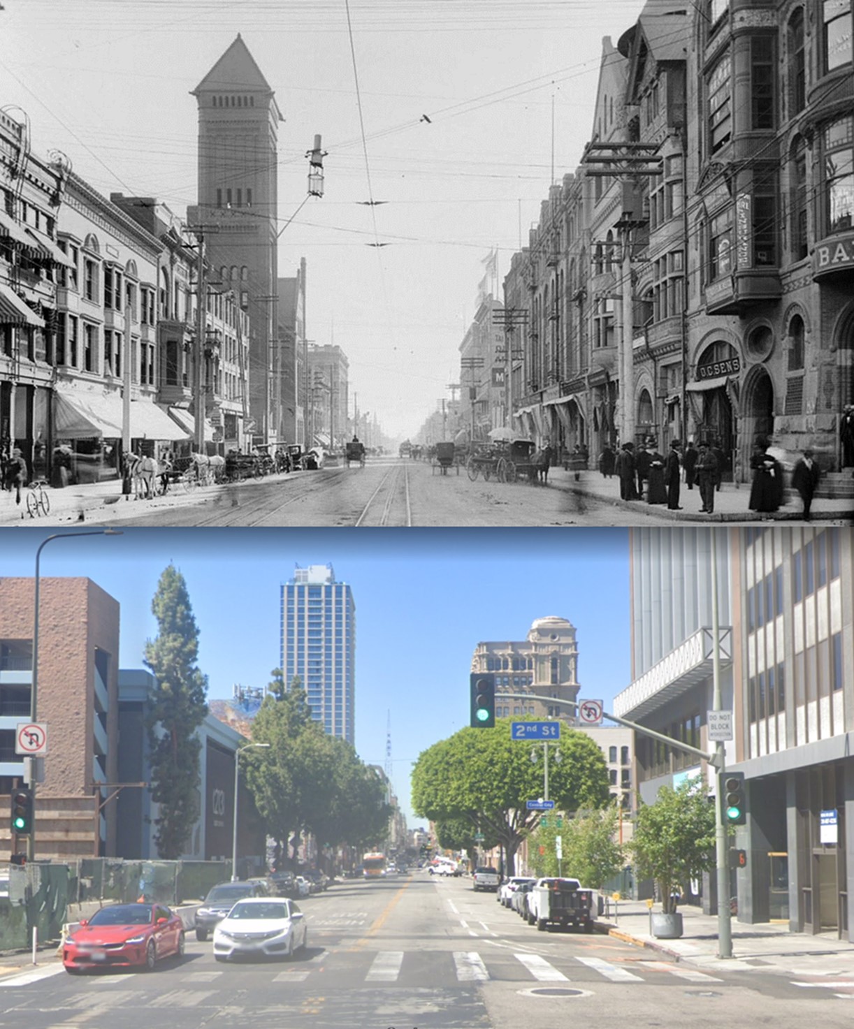
| (1904 vs. 2022)* - Looking south on Broadway at 2nd Street. |
Historical Notes The tall Romanesque tower seen in top photo is the 1888-built Los Angeles City Hall located at 226-238 South Broadway. It stood for 40 years until 1928 when the present day City Hall was completed. Click HERE to see more. |
* * * * * |
 |
|
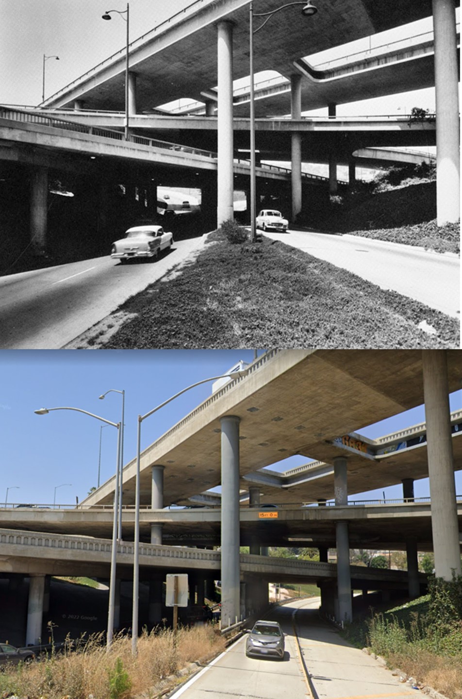
| (1954 vs 2022)* - The Four Level relatively unchanged (except for streeetlights and landscaping). Click HERE to see more. |
* * * * * |
 |
|
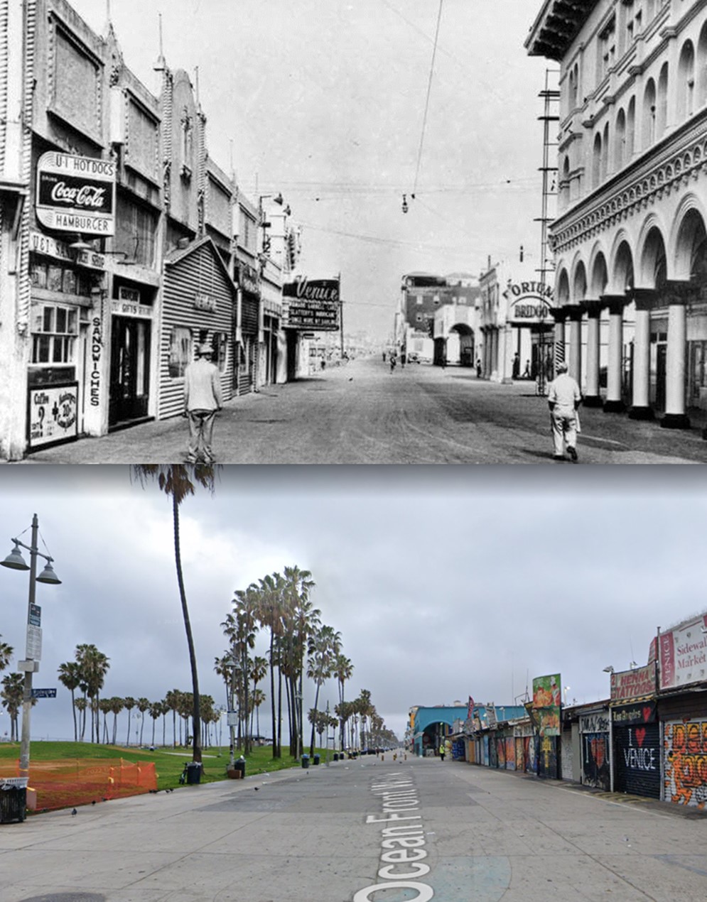
| (Then and Now – Looking north on Ocean Front Walk from Windward Avenue in Venice (1949 vs. 2021)*. Note: The St. Marks Hotel, seen on the right, was demolished in 1956. The entire row of buildings on the left, including the Vista Theatre, was also demolished and today is the location of Windward Plaza Park. |
Historical Notes In 1905, the founding year of Venice, Windward Avenue was two blocks long, stretching between the canal system and the pier, lined with hotels that featured hot salt water in every room. Click HERE to see more. |
 |
|
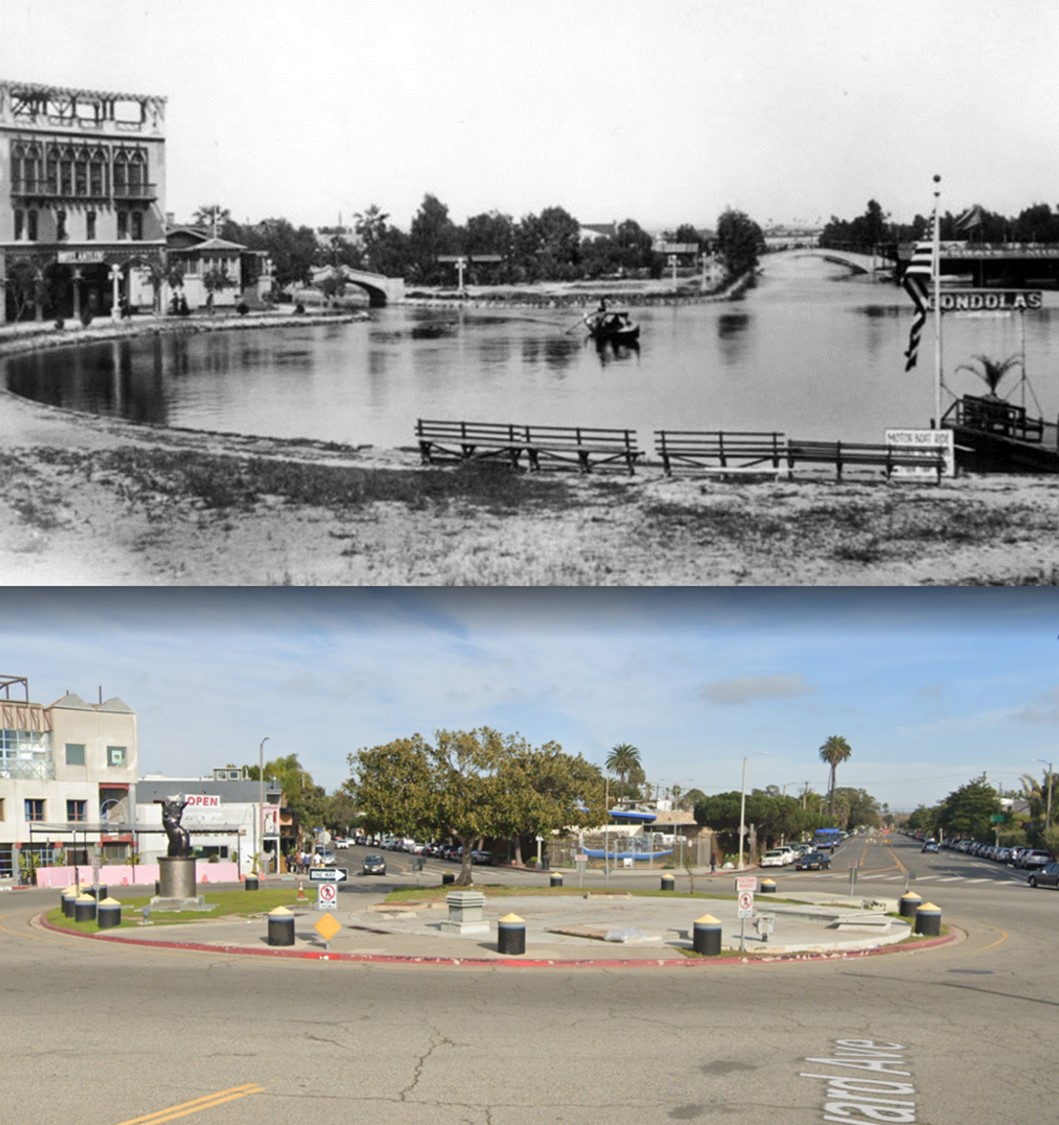
| (Then and Now – Looking east showing the Venice Lagoon now the Windward Traffic Circle (1910s vs 2021)*. Windward Ave (previously Lion Canal) is on the left while Grand Blvd (previously Grand Canal) is on the right. The Antler Hotel is seen at upper-left. |
Historical Notes The Venice Canals converged on a large saltwater lagoon that later became a traffic circle. The bulk of the canals were filled in 1929 to create roads.* Click HERE to see more. |
* * * * * |
 |
|
| (1900 vs. 2022) – Looking east on 3rd Street from Normandie Ave. |
 |
|
| (1900 vs. 2022)* - Looking West on 6th Street at Olive Street. |
 |
|
| (1903 vs 2022)* – Looking west on 6th Street from Main Street. |
* * * * * |
Then and Now
 |
|
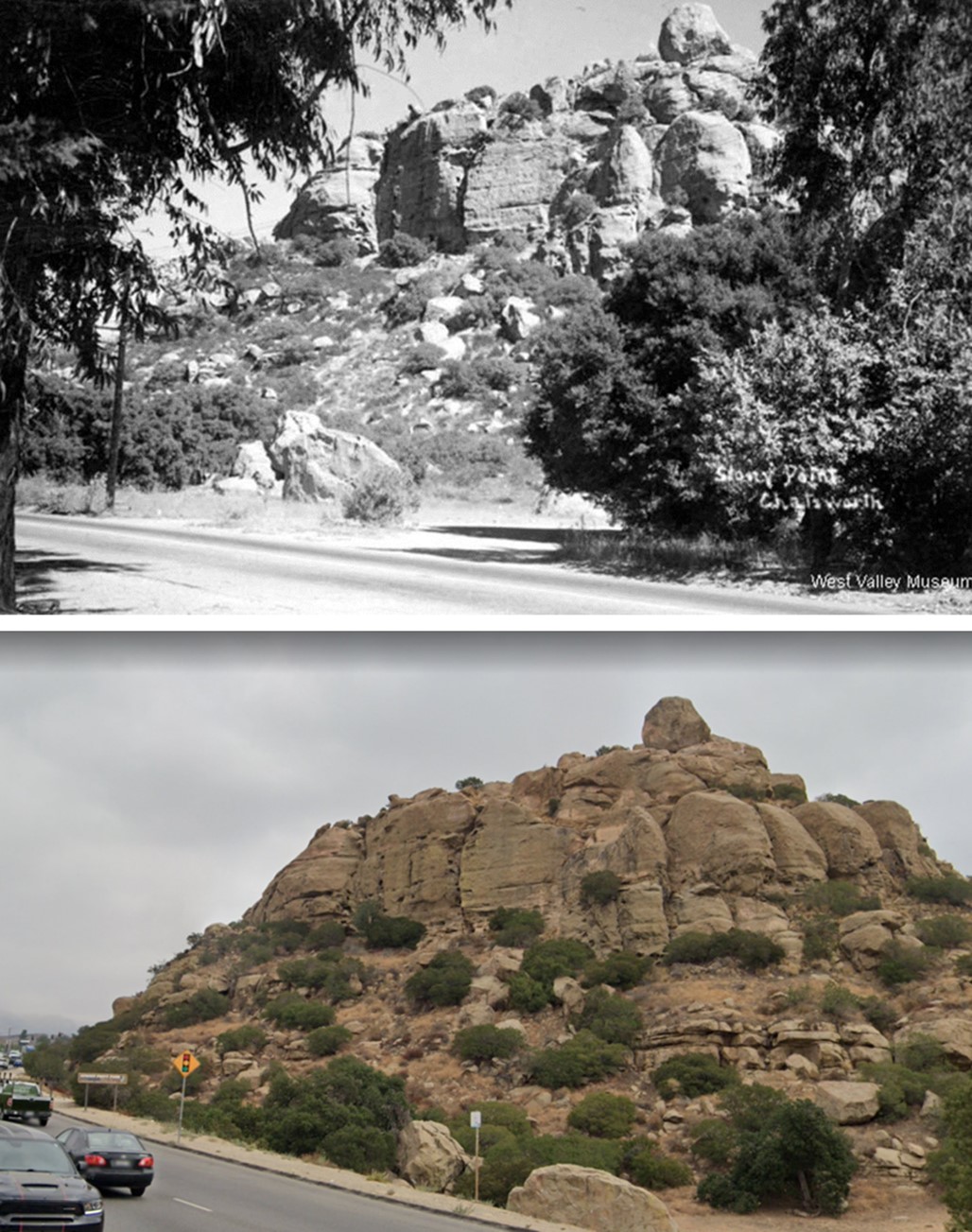
| (1935 vs 2022) - Stoney Point, Chatsworth. Some things never change. Click HERE to see more early views of Stoney Point. |
* * * * * |
Then and Now
 |
|
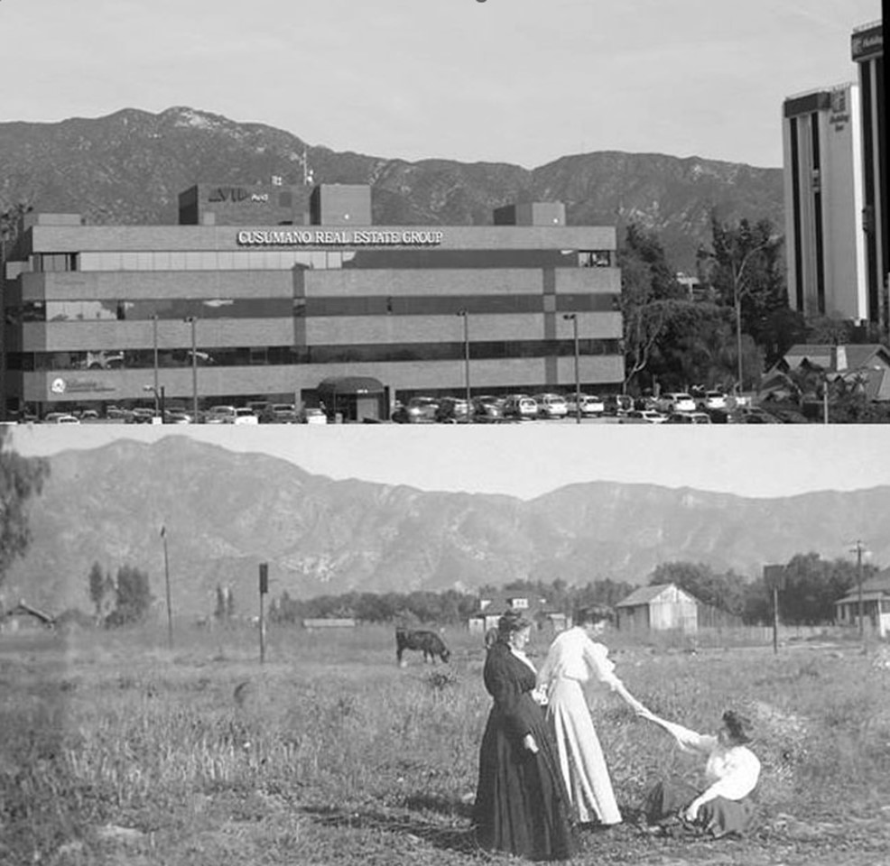
| Now and Then – Looking east toward the Verdugo Mountains from near the Olive Ave overpass of the Golden State Freeway in Burbank. Bottom photo was taken in 1909. Everything has changed except for the contour of the mountains. Click HERE to see more of Early Burbank. |
* * * * * |
 |
|
| (1940s vs. 2021)* - Designed by Architects: Bakewell & Brown, the 1927-built Pasadena City Hall is the favorite historic building in Pasadena based on recent polls. |
Historical Notes In 1923, the people of Pasadena approved a bond measure issuing $3.5 million towards the development of a civic center. City Hall was to be the central element of this center. The San Francisco architecture firm of Bakewell and Brown designed City Hall, which has elements of both Mediterranean Revival Style and Spanish Colonial Revival Style architecture. Click HERE to see more. |
* * * * * |
 |
|
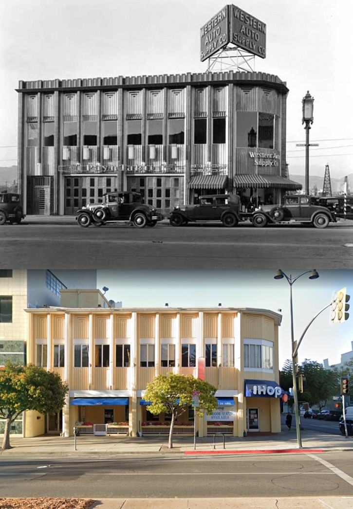
| (1931 vs. 2021)* - Western Auto Supply Co. Building, currently an International House of Pancakes (IHOP) restaurant, located on the the northwest corner of Wilshire and Hauser Blvds. Click HERE to see more. |
* * * * * |
 |
|
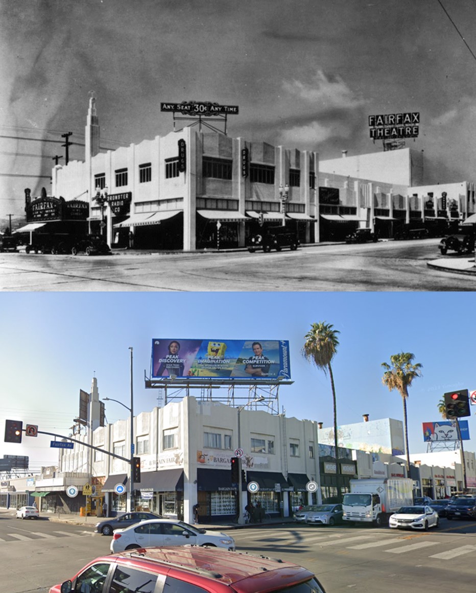
| (1930 vs. 2022)* - Fairfax Theatre, located on the NW corne of Beverly and Fairfax. |
Historical Notes In 2021, the Art Deco Society of Los Angeles and Save Beverly Fairfax were successful in their efforts to landmark the 1929-1930 Fairfax Theatre at 7901-09 Beverly Blvd. The community rallied to preserve this prominent Art Deco theater, which became a catalyst in forming a new Jewish community on the westside of Los Angeles when it opened. On November 30, 2021, the Fairfax Theatre was was officially designated a Cultural Heritage Monument in the City of Los Angeles.* Click HERE to see more. |
 |
|
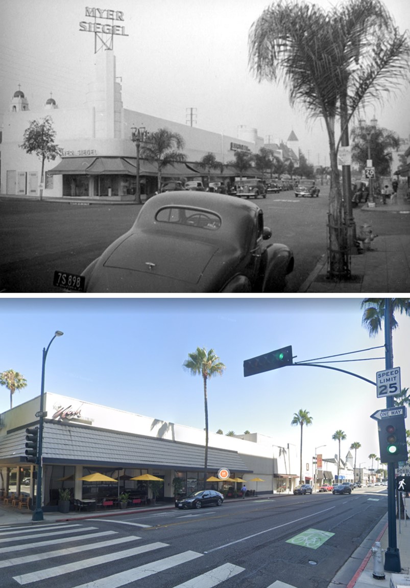
| (1937 vs 2022)* – Looking toward the NE corner of 'Little' Santa Monica Boulevard and N. Roxbury Drive. |
Historical Notes Click HERE to see more. |
* * * * * |
|
Other Sections of Interest |
|
Water and Power in Early LA |
|
Newest Additions |
New Search Index |

A new SEARCH INDEX has been added to help navigate through the thousands of topics and images found in our collection. Try it out for a test run.
Click HERE for Search Index |
* * * * * |
< Back