Early Los Angeles City Views (1800s)
Historical Photos of Early Los Angeles |
This section brings together a wide range of 1800s city views that show Los Angeles in its earliest stages, from a compact pueblo centered on the Plaza to a growing town extending into new streets, businesses, schools, and transportation routes. Rather than focusing on a single event, these images follow the city’s physical form and daily life as it changed over time, using photographs, sketches, maps, and panoramic views to document what early residents saw and experienced.The views that follow include early depictions of the Plaza and surrounding adobes, the first street grid and landmark blocks, and key corridors such as Main Street, Spring Street, Aliso Street, and Commercial Street. They also illustrate the systems that supported early growth, including water infrastructure tied to the Los Angeles River and the Zanja Madre, along with later signs of modernization such as gas lighting and the city’s first electric streetlights. Additional images expand beyond the pueblo to San Pedro and Wilmington, showing the development of the harbor and its role in connecting Los Angeles to regional and global trade. |
 |
|
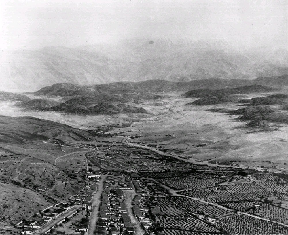
View showing a model of Los Angeles as it appeared in 1850. Looking northeast, the layout of the new city can clearly be seen with the Los Angeles Plaza located in the lower left center. The large white structure to the left of the Plaza is the Old Plaza Church. The two streets running from the bottom of the model to the Plaza are Main Street on the left and Los Angeles Street on the right. Alameda Street runs from the lower right corner diagonally toward the lower center. The Los Angeles River can be seen running from the lower right toward the center, where it turns left and disappears behind the mountain. The Arroyo Seco joins the river at that point. Vineyards blanket the area between the city and the river. The large dark spot in the lower right is El Aliso, the historic sycamore that once marked the Tongva village of Yangna. The San Gabriel Mountains rise in the distance. Note: Picture file card identifies the above image as a diorama of the Pueblo of Los Angeles as it appeared in 1850, designed by J. Marshall Miller. The file card also reads “Prepared for the Los Angeles Times Anniversary 1931?”.* |
Historical Notes The City of Los Angeles began here. Nuestra Señora Reina de los Angeles was founded on September 4, 1781, by a group of Spanish pobladores consisting of 11 families, a total of 44 men, women, and children. They were originally led by Fernando Javier Rivera y Moncada and accompanied by soldiers sent from Mission San Gabriel Arcángel to establish a pueblo near the Porciuncula River at the Tongva village of Yangna. In 1841, Los Angeles’ first census recorded a population of 141. Gold was discovered in 1842 at Placerita Canyon near Mission San Fernando, and the larger Gold Rush era that followed brought new arrivals. By 1850, the population had reached 1,610. |
 |
|
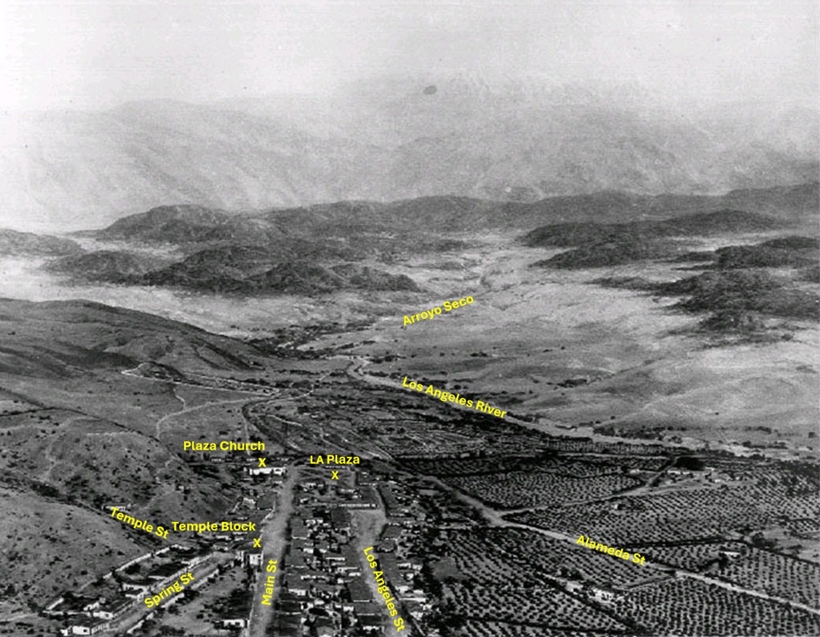
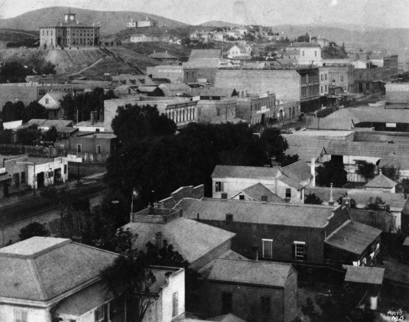
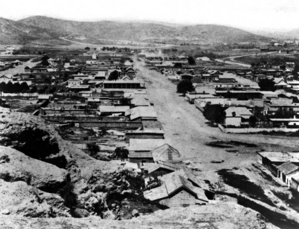
| (1850)* - Aerial view looking northeast across the site of early Los Angeles, with major landmarks labeled. The Plaza, Old Plaza Church, Temple Block, and the main north south streets appear in the foreground. The Los Angeles River and the Arroyo Seco flow through the center distance, with the San Gabriel Mountains rising behind them. Annotated by Jack Feldman. |
Historical Notes This view shows the layout of the early pueblo and the landscape that shaped its growth. The Plaza served as the social and civic center of the settlement, with the Old Plaza Church beside it as the town’s most familiar building. Temple Block marked the western edge of the early business district and remained an important focal point for decades. Main Street, Spring Street, Los Angeles Street, and Alameda Street made up the earliest street grid. Much of the flat land east of the Plaza was planted in vineyards and orchards, which were common in the region long before large scale urban development. The Arroyo Seco joined the Los Angeles River just north of the pueblo. This natural water system supported both the Zanja Madre and later water projects that helped the community expand. Early residents often described the valley as a fertile plain set at the foot of a dramatic mountain range. |
.jpg) |
|
| (ca. 1850)* - Photo of a sketch showing the LA Plaza and surrounding area as it appeared in 1850. The Old Plaza Church is seen at upper left. The map is based on the 1849 Ord Survey. |
Historical Notes The Ord Survey of 1849 was the first detailed map of the pueblo created under United States authority. It documented the shape of the Plaza, the position of the church, and the alignment of the early streets. Many of the lots shown would later become the center of the growing business district. The sketch reflects a community still organized around Spanish and Mexican planning traditions, with the Plaza as its focal point. Click HERE to see more in an Interactive Map of Early Los Angeles as it appeared in 1850. |
 |
|
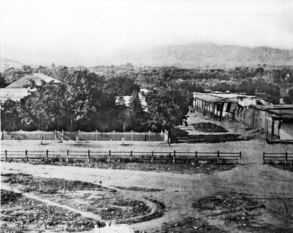
| (ca. 1858)* - This is the earliest known close-up photograph of the Los Angeles Plaza. There is a square main brick reservoir in the middle of the Plaza, which was the terminus of the town's historic lifeline: the Zanja Madre ('Mother Ditch'). The reservoir was built in 1858 by the LA Water Works Company. |
Historical Notes The site of the Plaza today is not the original location. It is the second, third, or maybe even the fourth. One of the earlier plots is believed to be around where the current Pershing Square sits. It’s also thought that at least one of the first three was washed away in a flood. The current Plaza dates from as early as 1815. When early settlers arrived at the Los Angeles River by way of Mission Road, they picked as a nearby gathering point a huge sycamore (upper right-center of photo) that gave them shelter and became a landmark, "El Aliso." That Spanish word for sycamore was later used to name the road carved out near the river (Aliso Street in 1854). El Aliso (upper center-right of photo) sprang from the ground near the western bank of the Los Angeles River in the late fifteenth century, about the same time Columbus arrived in the Americas. As it matured, the sycamore -- located at the juncture of the Los Angeles coastal plain and the San Fernando and San Gabriel valleys -- became a gathering place for Los Angeles' indigenous Tongva people. Local leaders traveled from their villages across Southern California to confer under the shade of the tree's canopy. By the mid-eighteenth century, the mighty sycamore stood at the center of one of the largest Tongva villages, Yangna. By the 1830s, due to the encroachment of the pueblo, El Aliso had ceased to function as the symbolic center of daily Tongva life as Yangna changed locations twice before dissolving into historical oblivion. As the settlement expanded and formal water distribution became necessary, several private water companies operated in Los Angeles during this period under shifting names and franchise agreements, reflecting the evolving nature of the city’s early water system before municipal ownership. |
 |
|
| (ca. 1858)* - Close view of the Los Angeles Plaza in 1858 with the central brick reservoir and nearby adobe buildings. The Carrillo Adobe stands at lower right. It was demolished in 1870 to clear the site for the future Pico House. Colorized by Richard Holoff. |
Historical Notes From this vantage point the early heart of Los Angeles is clearly visible. The reservoir marked the end of the Zanja Madre and supplied water to the growing settlement. The Carrillo Adobe, one of the older structures near the Plaza, belonged to the family of Carlos Carrillo. Its removal in 1870 made way for the Pico House, which became one of the most significant buildings of early American Los Angeles. The Plaza area continued to evolve in the years after this photograph was taken. New businesses, hotels, and public buildings soon surrounded the square, and the community began expanding beyond its original boundaries toward Temple Block and the later civic center. Click HERE to read more about the Zanja Madre and Los Angeles' first water supply. |
.jpg) |
|
| (ca. 1860)* - One of Los Angeles' first water reservoirs was the brick structure shown in the center of the Plaza. The adobe directly behind was owned by Augustin Olvera. The 3-story building behind was the Sisters of Charity Hospital. |
Historical Notes In 1858, the LA Water Works Co., headed by William G. Dryden, constructed a large brick and wood storage tank in the center of the city plaza. It would remain there for about 10 years and then be replaced by a fountain. Water would continue to be stored in other tanks on the periphery of the plaza as well as in other nearby reservoirs. In 1876, the Buena Vista Reservoir in Elysian Park was built by the privately-owned Los Angeles Water Co. The LA Water Co., headed by John S. Griffen, Solomon Lazard, and Prudent Beaudry, signed a 30 year lease franchise agreement with the City to run its water system (1868 - 1898). Click HERE to read more in Water in Early Los Angeles. Click HERE to see more in Early LA Water Reservoirs. |
 |
|
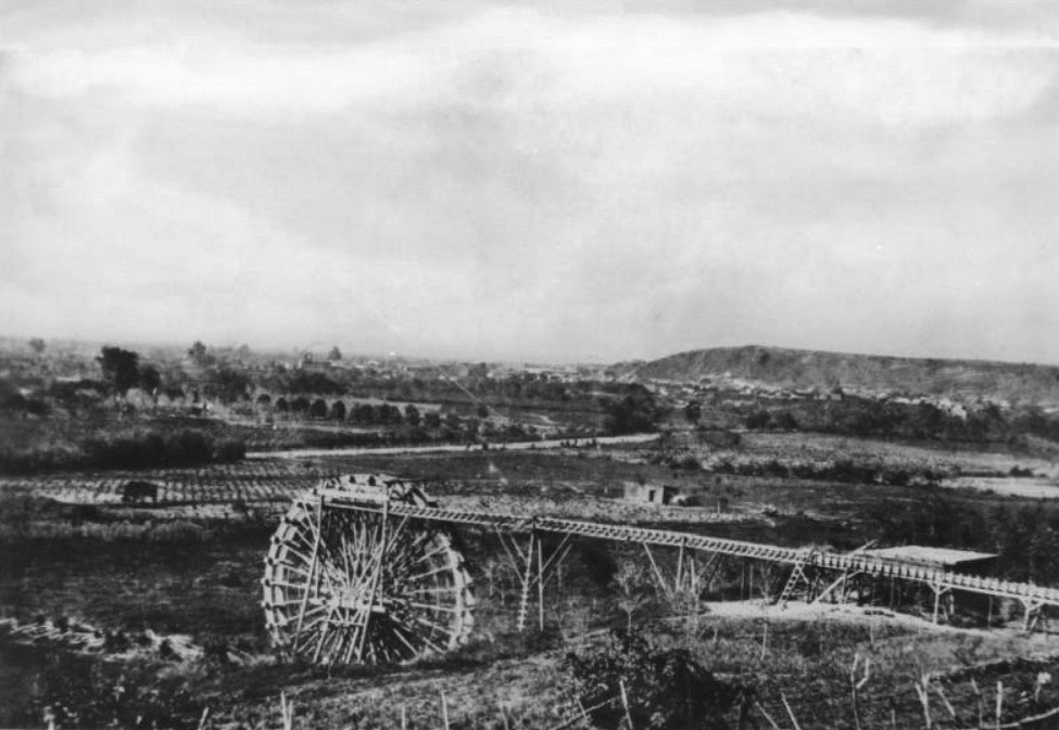
| (1863)^ - A water wheel on the Los Angeles River at start of Zanja Madre, LA's original aqueduct. The river has been the life-source of Los Angeles since it was settled in 1781. |
Historical Notes The 40 ft. water wheel seen above was used to raise a portion of the Los Angeles River water supply to a height permitting gravity flow to homes, fields and storage. In 1857, William Dryden was granted a franchise by the City Council to construct a system to provide a water supply. Under this system a brick reservoir was built in the center of the plaza to store the water brought to it by the Zanja Madre. A water wheel was also constructed to lift the water from the river to the Zanja Madre. Water then was distributed to a number of houses along the principal streets through a system of wooden pipes. Click HERE to read more about William Dryden. |
 |
|
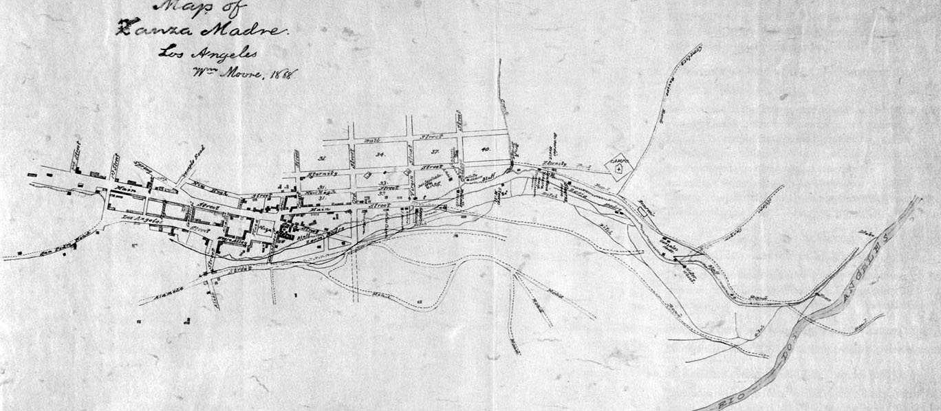
| (1868)^ - This manuscript map traces the path of the essential lifeline of early Los Angeles: the Zanja Madre, or Mother Ditch, prepared by cartographer William Moore. |
Historical Notes The Zanja Madre is shown here from the river at the right edge of the map, running along the bluffs in the proximity of current day North Broadway, completely open to the elements. A few years after this rendering, a brick tunnel enclosed the Zanja Madre in an attempt by the Common Council and the Los Angeles City Water Company to preserve the precious water flowing down from the river. The map includes the Campo Santo cemetery (the second one) at the end of Eternity Street, the water wheel that propelled the flow toward the pueblo, and the homes of pioneers like Jose Sepulveda, Abel Stearns, and Bernardo Wilson. Click HERE to see more in Zanja Madre - LA's Original Aqueduct |
 |
|
| (ca. 1868)^ - The Plaza, looking east, with LA's first above ground reservoir to the right of the picture. The two-story building directly behind the reservoir is the Vincent Lugo Adobe. The building in front of the reservoir with the gazebo-like tower is the 'Old Plaza Church'. |
Historical Notes The Lugo Adobe, said to have been built in the 1840s by Don Vicente Lugo, was one of the very few two-story houses in the pueblo of Los Angeles. In 1867, Lugo donated this house on the Plaza to St. Vincent's School (forerunner of Loyola University). |
 |
|
| (n.d.)* - Map showing the LA Plaza area as it appeared in 1860. Adobe structures are predominately on all sides. |
Historical Notes Click HERE to see more in Early Views of the Los Angeles Plaza. |
* * * * * |
 |
|
| (1860)^ - A view of north Broadway from Fort Hill. A small cluster of homes line the unpaved street. |
Historical Notes Fort Hill (also known as Fort Moore Hill) was a prominent hill overlooking the pueblo of Los Angeles. Its commanding view of the city made it a strategic location. Fort Moore was an historic U.S. Military Fort during the Mexican–American War. Its approximate location was at what is now the Hollywood Freeway near the intersection of North Hill Street and West Cesar Chavez Avenue, downtown. The hill on which it was built became known as Fort Moore Hill, most of which was removed in 1949 for construction of the freeway. The hill was located one block north of Temple Street and a short distance south of present day Cesar Chavez Avenue, between the Los Angeles Civic Center and Chinatown. The fort is now memorialized by the Fort Moore Pioneer Memorial, 451 North Hill Street. |
* * * * * |
Aliso Street
_cleanup.jpeg) |
|
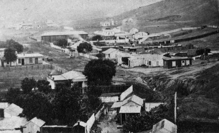
| (ca. 1860)* - Looking west on Aliso Street from Alameda Street, with Fort Moore Hill visible in the background at upper right. At the time, this was the principal thoroughfare to the Pueblo. Today, the 101 Freeway runs along and beneath the right side of this view. |
Historical Notes Aliso Street was first named in 1854. When early settlers arrived at the Los Angeles River (El Rio de Nuestra Senora de Los Angeles de Porcinucula) by way of Mission Road, they picked as a nearby gathering point a huge sycamore that gave them shelter and became a landmark, "El Aliso." That Spanish word for sycamore was later used to name the road carved out near the river. In 1860, the population of Los Angeles was 4,385, almost three times what it was 10 years earlier. |
 |
|
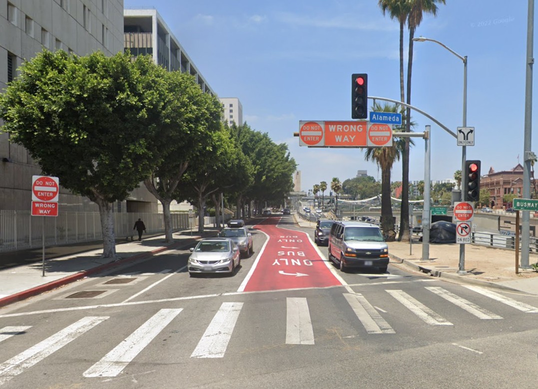
| (2022)* - Looking west on Aliso Street at Alameda Street in Downtown Los Angeles, with the 101 Freeway running parallel on the right. |
Historical Notes In the 1950s, most of Aliso Street through downtown was excavated to make way for the 101 Freeway, a transformation that was part of a larger "urban renewal" project that dramatically reshaped the area. The dense neighborhood surrounding Aliso Street was replaced with government buildings of the Civic Center, leaving the street today as primarily a frontage road for the Hollywood Freeway—a stark contrast to its former role as a bustling urban thoroughfare. |
Then and Now
 |
|
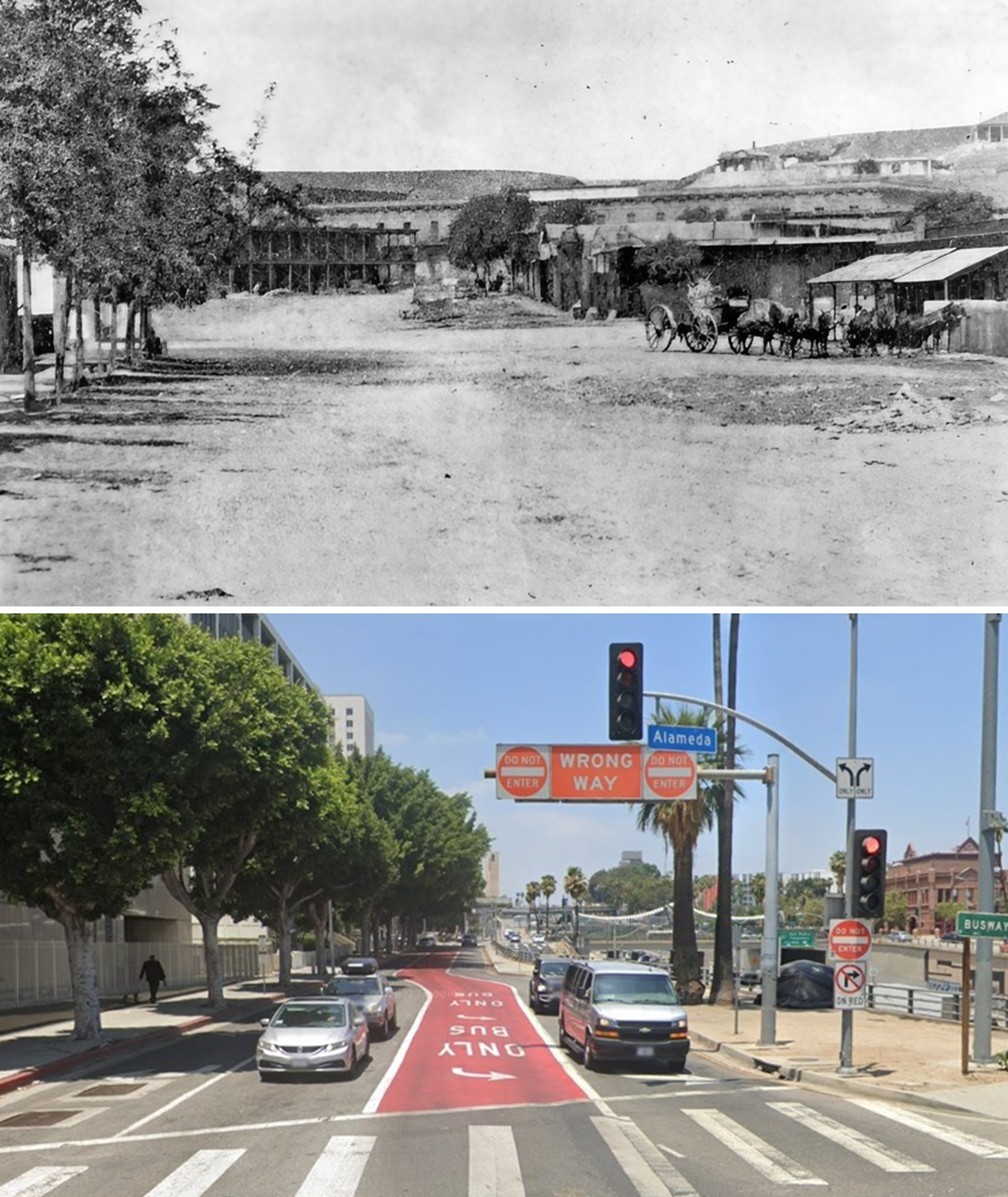
| (1860 vs. 2022)* – A ‘Then and Now’ comparison of Aliso Street looking west from Alameda Street in Downtown Los Angeles. In 1860, Aliso Street was the principal thoroughfare to the Pueblo. Photo comparison by Jack Feldman. |
Historical Notes In the 1950s, most of Aliso Street through downtown was excavated to make way for the 101 Freeway, visible on the right in the lower photo. Fort Moore Hill, seen in the upper right, was also partially excavated in 1949 to accommodate the freeway. Click HERE to see more Early Views of Aliso Street. |
* * * * * |
Main Street
 |
|
| (1868)^ - View of the adobe buildings on Main Street in from Temple Block in 1868. |
Historical Notes Main Street was dedicated in 1849. The community's first Calle Principal connected the San Gabriel Mission with the San Fernando Valley and many established ranchos. One section near the Plaza was known as Bath Street after, legend has it, the facilities featuring "scarlet women." Temple Street was named after John Temple in 1859, who opened the first store in Los Angeles. He built a block of shops, lawyers' offices and a saloon at Main and Temple streets, where Los Angeles City Hall stands today. |
 |
|
| (1868)^ - View taken from the top of the U.S. Hotel on Main and Requena streets in 1868. View is looking east from Main. Willow trees in background, are on the banks of the Los Angeles River. |
Historical Notes Manuel Requena was the first Mexican-American mayor of Los Angeles (only 11 days). He was instrumental in the building of the first public school at Second and Spring Streets. Requena Street was named in his honor, but which has since been renamed Market Street. He is also known for founding the Lincoln-Johnson Club. |
* * * * * |
Spring Street School |
(Los Angeles’ First Publicly Funded School) |
Built in 1855, the Spring Street School was Los Angeles’ first publicly funded school under American civil government. Located at the northwest corner of Second and Spring streets, the modest two-story brick structure marked the formal beginning of organized public education in the growing city. Just five years after California achieved statehood, the establishment of this school reflected Los Angeles’ transition from a small pueblo into an organized American municipality with civic institutions supported by public taxation. |
 |
|
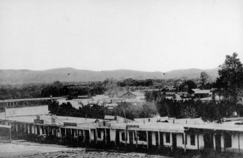
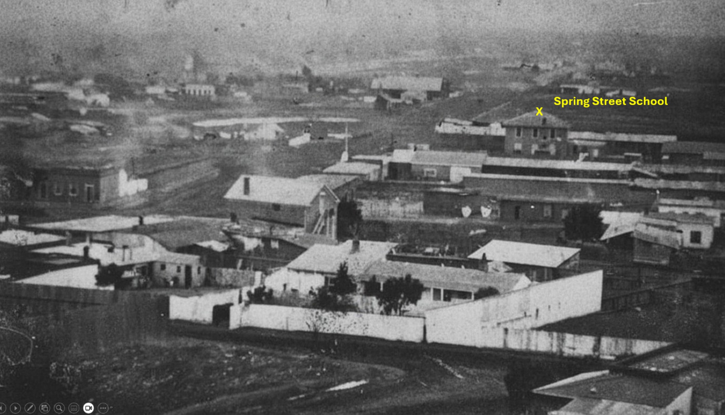
| (ca. 1860s)* - Panoramic view looking south across early Los Angeles showing the Spring Street School near the northwest corner of Second and Spring streets. The two-story building with three second-floor windows opened in 1855 and served as the city’s first publicly funded school. Image courtesy of the Natural History Museum of Los Angeles County. |
Historical Notes The Spring Street School opened on March 19, 1855, at a time when Los Angeles had only a few thousand residents. By 1873, the school enrolled approximately one hundred pupils and was staffed by a single teacher. That same year, the city reported five public schools with fourteen teachers serving 835 students, averaging roughly sixty pupils per teacher. Rapid population growth soon strained available classroom space, and by the mid-1870s the school operated on a double-session system, with one group of students attending in the morning and another in the afternoon. In 1884, the original Spring Street School was vacated to make way for a new Los Angeles City Hall and government complex. The site briefly served as City Hall before later redevelopment transformed the block into part of the Times Mirror Square complex, long home to the Los Angeles Times. The Los Angeles Times Building opened in 1935 and served as the newspaper’s headquarters for decades. The Times Mirror Square property was sold in 2016, and the newspaper relocated its newsroom in 2018. Redevelopment plans for the historic complex continue to evolve. After leaving the Second and Spring location in 1884, Spring Street School relocated south on Spring Street between Fifth and Sixth streets, where it continued serving students in the expanding public school system. Click HERE to see more about the second location of Spring Street School: |
 |
|
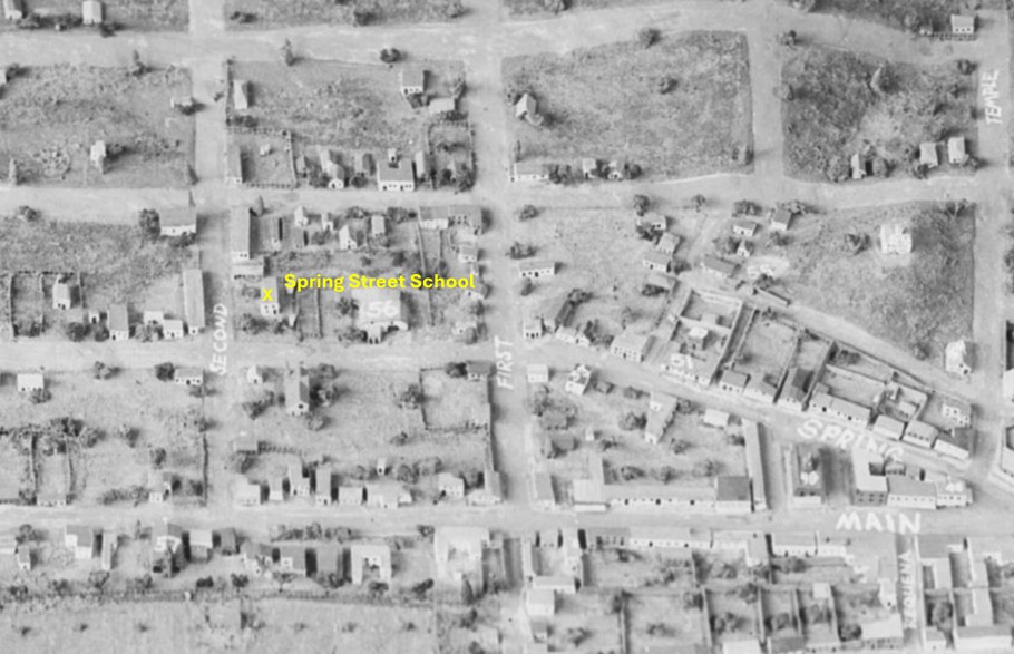
| (n.d.)* - Model view of early Los Angeles highlighting the northwest corner of Second and Spring streets, site of the Spring Street School from 1855 to 1884 before the property was redeveloped for City Hall and later Times Mirror Square. |
* * * * * |
Commercial Street |
Los Angeles’ Early Business Core |
In the late 1860s and early 1870s, Commercial Street formed the heart of Los Angeles’ business district. Though only a short stretch running east from Main Street, it was lined with dry goods stores, hardware merchants, banks, hotels, saddle shops, and general suppliers that served a rapidly growing pueblo transitioning into a commercial city. At a time when most structures were still built of adobe, Commercial Street featured some of the earliest brick and two-story buildings in Los Angeles.This compact corridor — bounded by Main Street, Los Angeles Street, and nearby Calle de los Negros — functioned as the city’s principal mercantile center. Prominent figures such as I.W. Hellman, Charles Ducommun, F.P.F. Temple, and others conducted business here, helping lay the economic foundation of modern Los Angeles. Much of the original stretch shown in these early photographs has since disappeared due to redevelopment, freeway construction, and federal building projects, but a short portion of East Commercial Street still survives today near the Los Angeles River. |
 |
|
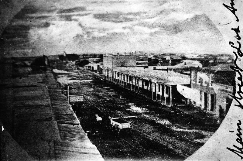
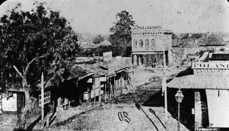
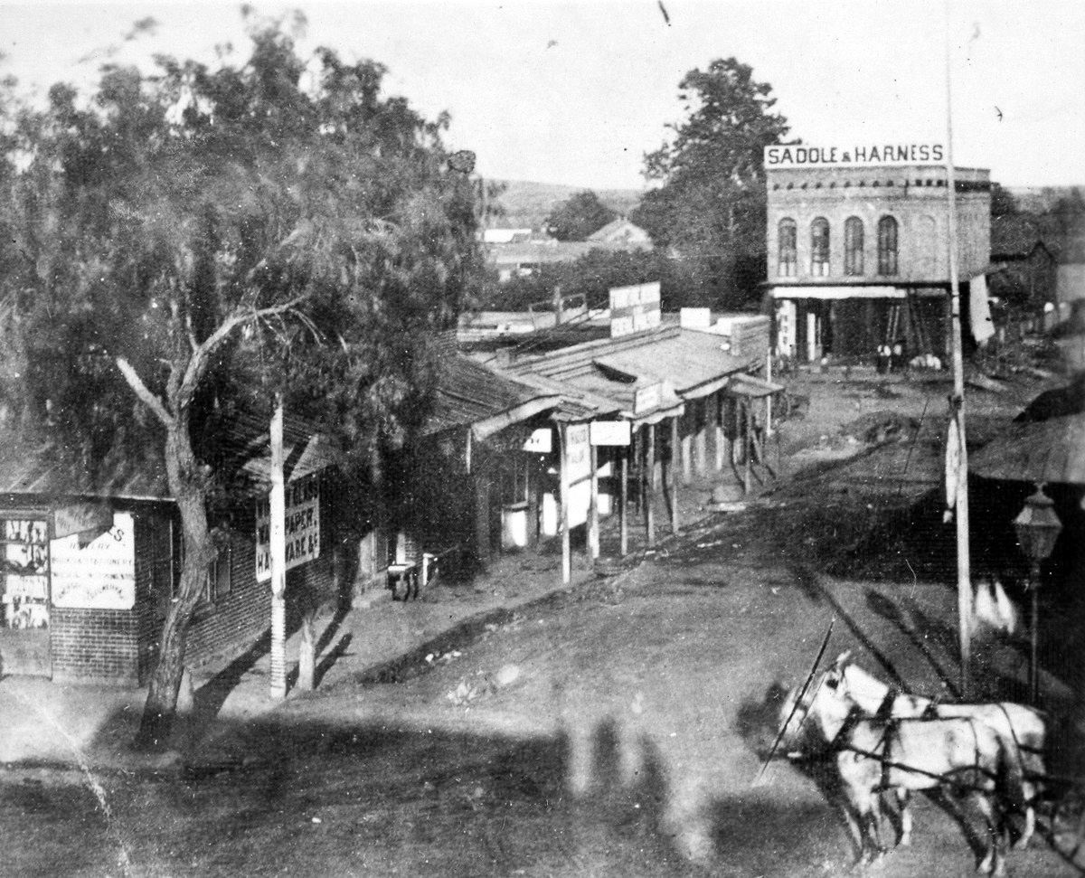
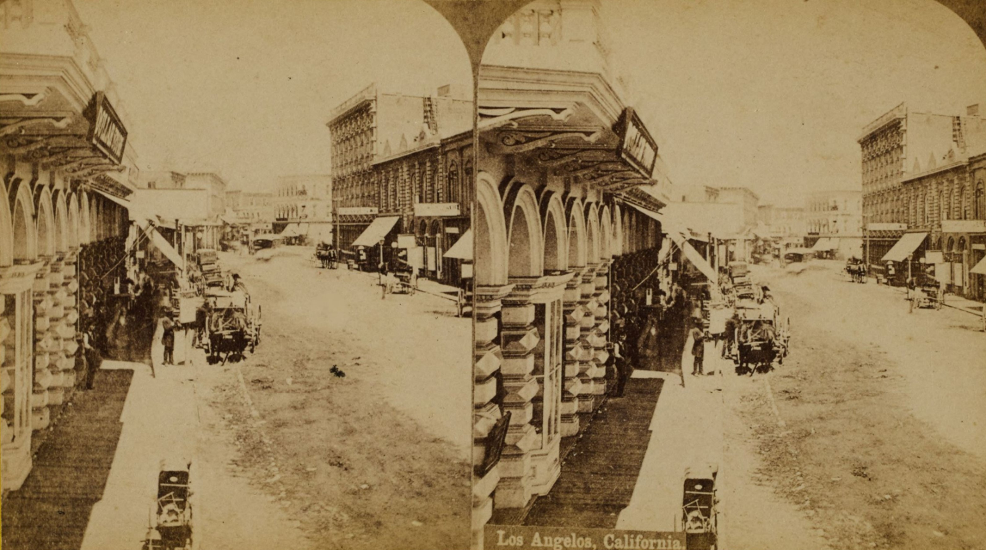
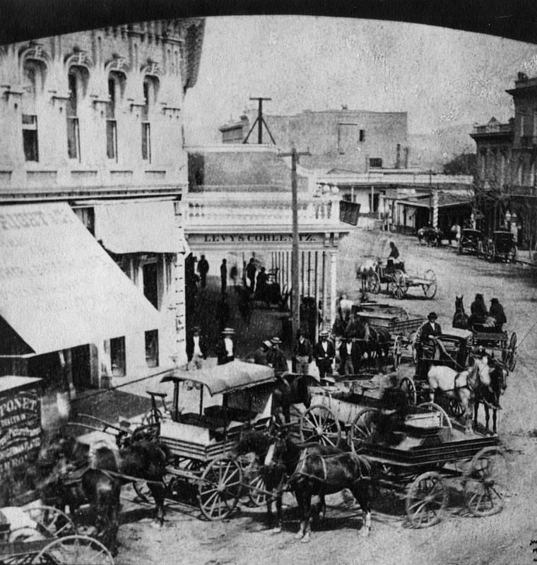
| (1869)^ - Early view of Commercial Street, looking east from Main Street, just north of Temple Street, near the site of the later City Hall. On the right is Polaski and Goodwin's Dry Goods Store, sold to them by I.W. Hellman in 1868, and where the Farmers and Merchants Bank did business for years. Charles Ducommun operated a jewelry and hardware store in the building in left foreground. In the background is Herman Heinsch's Saddle and Harness shop, a newly-erected brick building. A gas street light is in the right foreground. |
Historical Notes This was Los Angeles’ principal business district. In the 1860s, “Commercial Street” often referred to the short business stretch between Main and Los Angeles Streets; later mapping and redevelopment extended the name eastward. It was bounded by Commercial Street, which was only one block long and was located between Main and Los Angeles streets; Los Angeles Street, one block north from Commercial to Arcadia and Aliso streets; and Calle de los Negros, which extended north from Aliso to Plaza streets. Nearly all of the houses were built of adobe blocks, which are made of earth and straw and molded and dried in the sun, of a size twenty inches long, fourteen inches wide and five inches thick. There were about a dozen brick houses and a few frame dwellings. |
 |
|
| (1869)* - Early view of Commercial Street, looking east from Main Street, just north of Temple Street, near the site of the later City Hall. On the right is Polaski and Goodwin's Dry Goods Store, sold to them by I.W. Hellman in 1868, and where the Farmers and Merchants Bank did business for years. Charles Ducommun operated a jewelry and hardware store in the building in left foreground. In the background is Herman Heinsch's Saddle and Harness shop, a newly-erected brick building. One of LA's first gas streetlights* is seen at lower-right. |
Historical Notes Charles Louis Ducommun, a watchmaker by training, emigrated to the US from Switzerland in the early 1840s. He started a general store, providing supplies (and credit) to gold prospectors and other pioneers who had settled in the burgeoning pueblo of Los Angeles. *In 1867, Los Angeles Gas Company, the forerunner of today's Southern California Gas Company, installed 43 new gas lamps along Main Street, making the city safer at night. The gas lighting business was run by five entrepreneurs who manufactured the gas from asphalt, a tar-like substance, and later from oil. Click HERE to see more in Early Los Angeles Streetlights. |
 |
|
| Map highlighted to indicate the location and direction of the camera in the previous photo. |
Historical Notes Not surprisingly, Commercial Street is much changed from what it was nearly 150 years ago. For one thing the stretch shown in this photo is gone, as the section from Main to Alameda is now taken up with commercial and government buildings, including the regional office of the Internal Revenue Service, the Edward Roybal Federal Building and Metropolitan Detention Center. What remains are several blocks paralleling the 101 Freeway, built through the area in the 1950s, from Alameda (where the Gold Line runs over the intersection from Union Station south and then east into Boyle Heights and East Los Angeles ) east to the Los Angeles River. A short stretch of East Commercial Street still exists today between Alameda Street and the Los Angeles River. Parking structures and commercial buildings are along this largely non-descript portion of the roadway. |
 |
|
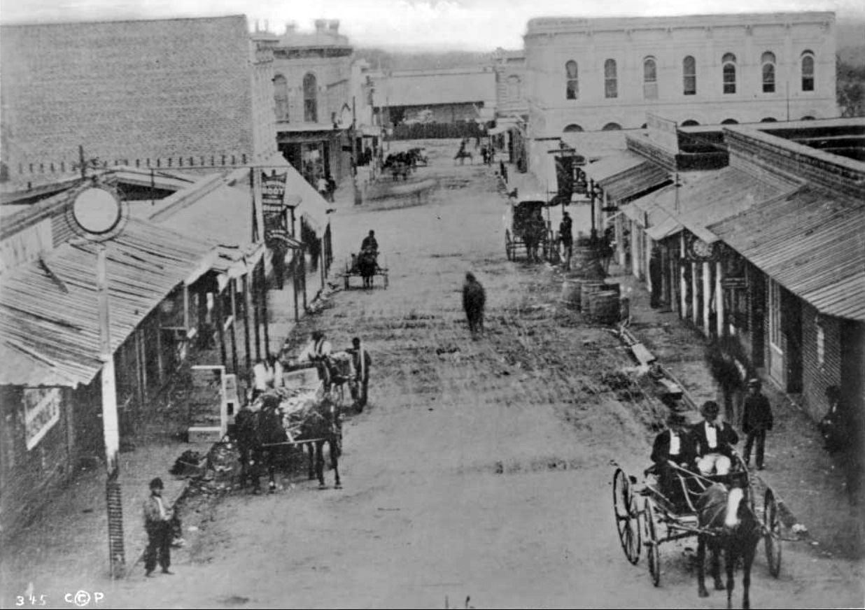
| (ca. 1870)* - View of Commercial Street, looking east from Main Street. The two-story White House Hotel is seen at far right on the southeast corner of Commercial and Los Angeles Streets. At left is one of the first two-story buildings built in Los Angeles, by I.W. Hellman in 1870. Ducommun Hardware is at the first left-hand corner. This was the business center of Los Angeles at the time. Horse-drawn carriages are in the unpaved street. |
Historical Notes Isaias Wolf Hellman was a German-born American banker and philanthropist, and a founding father of the University of Southern California. |
 |
|
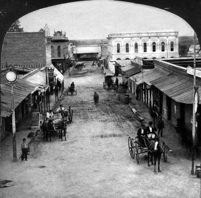
| (1872)* - Stereoscopic photograph showing Commercial Street, looking east from Main Street. The view is taken from Main Street just north of Temple Street and the Temple Block, owned by F.P.F. Temple, and looks east down Commercial Street, also known as “New Commercial Street” in some sources. Commercial Street was an apt name because the length of this section was devoted exclusively to businesses and shops located in a variety of structures along the thoroughfare. Photo by William M. Godrey, Homestead Collection. |
Historical Notes In the foreground left is the location of the hardware and jewelry store of Charles Ducommun, who settled in Gold Rush Los Angeles and who, within a couple of years, expanded his business with a two-story building and had frontage on both Commercial and Main streets. Today, Ducommun, Inc., provides electronic and structural manufacturing systems for aerospace, defense and general industry. Click HERE to see more Early Views of Commercial Street (1950s thru Today) |
 |
|
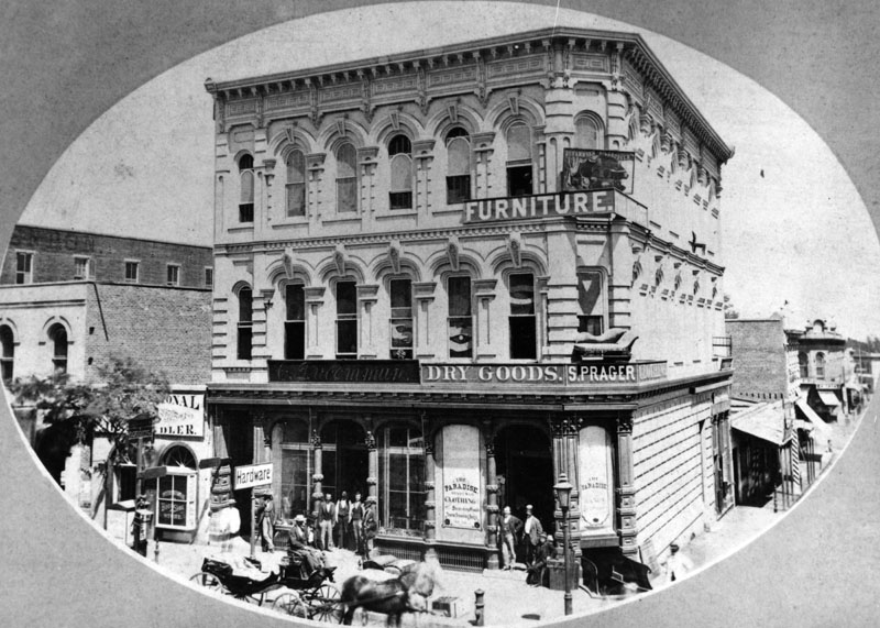
| (ca. 1882)* - Hardware Store of C. Ducommun, dry goods store of S. Prager and a furniture store at 204 N. Main Street (after 1890 at 304 N. Main Street) are shown. The 1883-4 edition of the city directory lists C. Ducommun Hardware at this location. This was the NE corner of Main and Commercial streets. |
Historical Notes Click HERE to see more on the Ducommun Building. Click HERE to see more Early Views of Commercial Street (1950s thru Today) |
 |
|
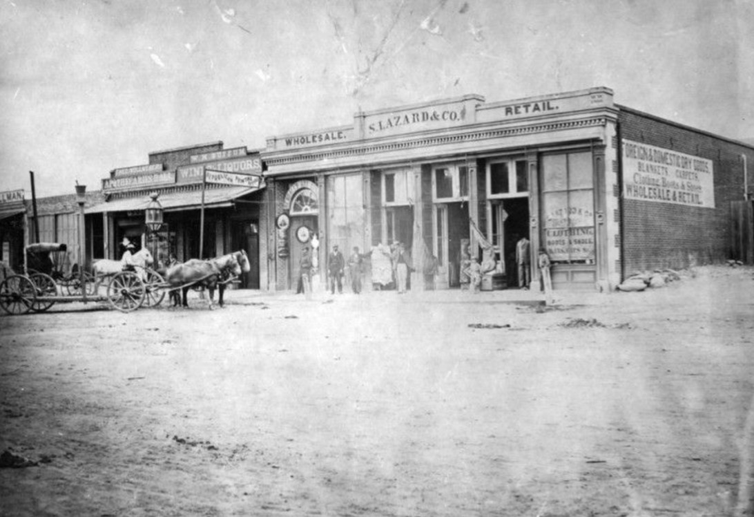
| (1870)* - View of Main Street, north of Commercial Street. At left is Theodore Wollweber's Apothecaries Hall at 59, with its symbol on a pole in front, W.M. Buffum's Wines & Liquors, Republican Printing Office, and the S. Lazard & Co. foreign and domestic dry goods store, wholesale and retail, at 53. At left, on the corner of Main and Commercial, is the store purchased in 1865 by I.W. Hellman, 22 years old, from Adolph Portugal. Horse-drawn vehicles are waiting in the street. A gas lamp is behind them. |
* * * * * |
Downey Block
 |
|
| (ca. 1870)* - Main Street view of the Downey Block, located on the N/W corner Temple and Main streets. Horse-drawn wagons are parked in front of storefronts with their prominent signs displayed high above where everyone can see. |
Historical Notes Construction on the Downey Block began in 1869. It was named for John Gately Downey, a pharmacist who served as the governor of California for two years (1860-1862) before becoming a real estate developer. Downey was also one of the founders and first president of Farmers and Merchants National Bank. The city of Downey was named in his honor after he subdivided his land holdings there and converted them into farms. |
 |
|
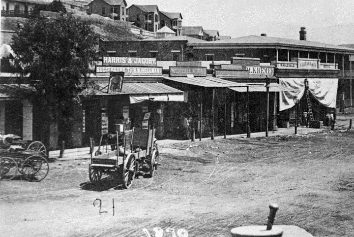
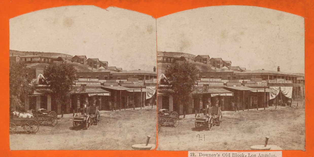
| (ca. 1870)* - Stereoscopic view looking northwest at wagons in front of the Downey Block on Main Street, with Fort Moore Hill in the background. Temple Street is out of view to the left. The Lafayette Hotel is visible on the far right. Signs on the storefronts read: 'Harris & Jacoby, Successors to H.W. Hellman' and 'M. Kremer.’ |
Historical Notes Click HERE to see more Early Views of the Downey Block. |
 |
|
| (n.d)* - An early photo of a model of downtown Los Angeles, highlighting the location of the Downey Block. |
* * * * * |
Poundcake Hill
 |
|
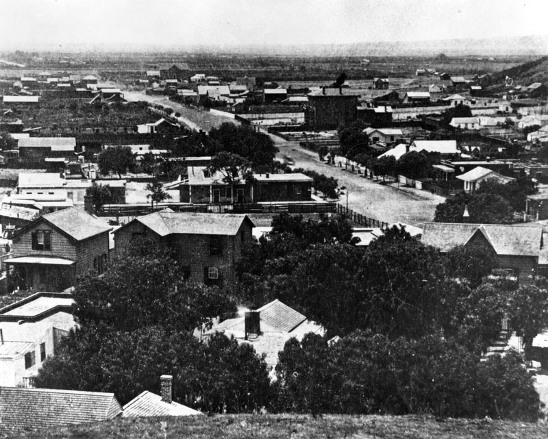
| (1868)^ - View looking south from ‘Poundcake Hill’. Broadway is the main street in the middle of the photo. |
Historical Notes A completely barren bunker hill before Beaudry's development is on the right. Third Street is the main street off in the distance running from right to left. Broadway is the street in the middle of the photo. Hill Street at the base of Bunker Hill is just a dirt path at best. In later years, this view would be looking right smack at the north elevation of the hall of records. This view today would be looking at the north side of the LA times building complex. |
 |
|
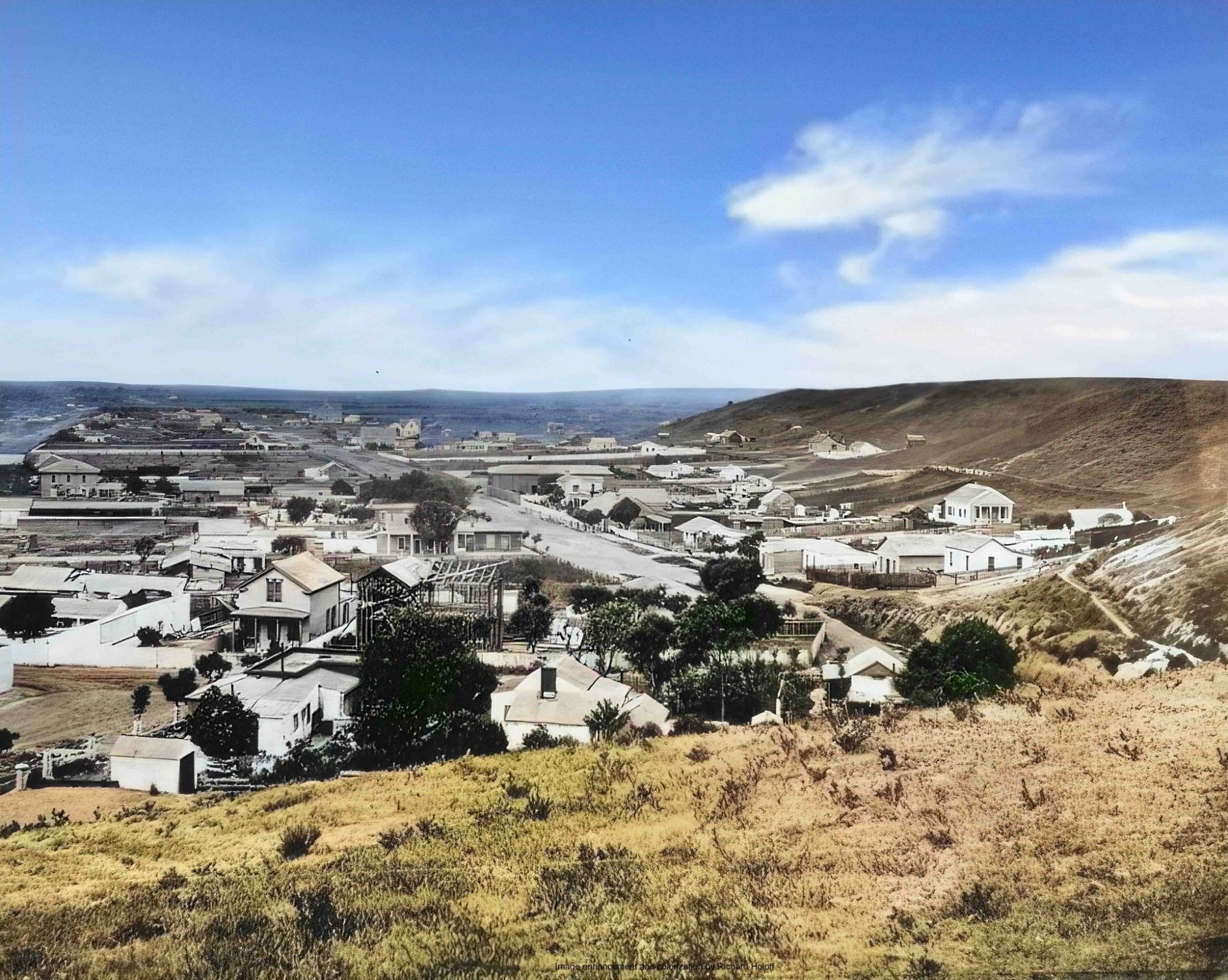
| (1868)^ - View looking south from ‘Poundcake Hill’ showing Broadway running diagonally down the center of the photo. Bunker Hill on the right is mostly barren. Image enhanced and colorized by Richard Holoff. |
 |
|
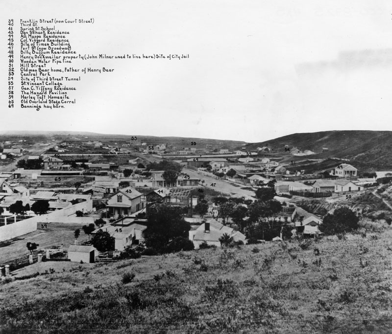
| (1868)^ - Same photo as shown above but with buildings and key areas identified by numbers (see below). |
Historical Notes The numbered areas are listed as follows: #39 Franklin Street (now Court Street); #40 Third Street; #41 Spring Street School; #43 Dan Scheck residence; #44 A.G. Mappa residence; #45 Col. Vineyard residence; #46 Site of Times Building; #47 Fort Street (now Broadway); #48 Billy Buffum residence; #49 Henry Dockweiler property (John Milner used to live here), site of the city jail; #50 Wooden Water Pipeline; #51 Hill Street; #52 Old man Bear home, father of Henry Bear; #53 Central Park; #54 Site of Third Street Tunnel; #55 St. Vincent's College; #57 George C. Tiffany residence; #58 The Hazard's Pavilion; #59 Harley Taft home site; #65 Old Overland Stage Corral; #69 Banning’s Hay Barn. |
 |
|
| (ca. 1870)^ - View of Broadway looking south from near Temple Street. The large building to the right rear was St. Vincent's College, facing 6th Street between Broadway and Hill Street. |
Historical Notes In 1870, the population of Los Angeles was 5,730. |
* * * * * |
Los Angeles Plaza
 |
|
| (1869)^ - Panoramic view of the Plaza and 'Old Plaza Church' (Mission Nuestra Senora Reina de Los Angeles). The square main brick reservoir in the middle (partial view) was the water reservoir built by William Dryden and his LA Water Works Co. |
Historical Notes The building in the top right background was the Sisters of Charity Hospital. The three adobes seen on the north side of the Plaza were owned in 1869 by M. Norton (built 1854), John Downey (shrouded by trees, built 1844) and Augustin Olvera (built 1854). They are all gone now. The first lost to the widening of Main St, the second torn down in 1894 to build the Simpson-Jones Building and the last demolished in 1916 and replaced with the Plaza Methodist Church. The two gas lamps seen on the corners of the LA Plaza were the first streetlights installed in Los Angeles. Click HERE to see more in Early LA Streetlights. Click HERE to read more on Wiliam Dryden. |
 |
|
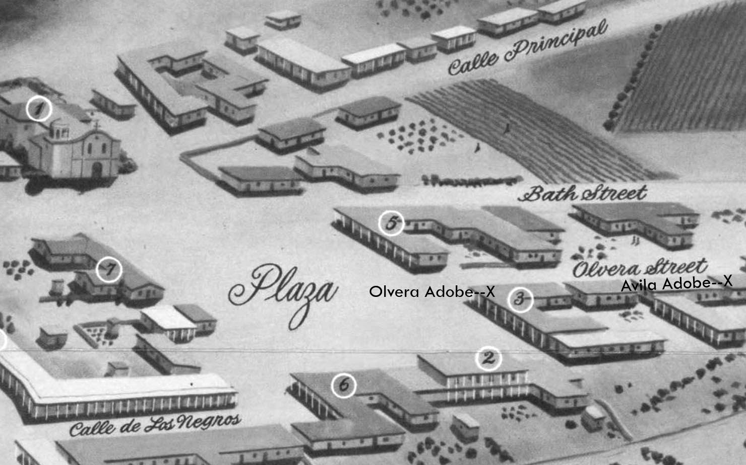
| (ca. 1869)* - View of the edge of the Los Angeles Plaza and the entrance to Wine Street (renamed Olvera Street in 1877) looking north from the Pico House. The Avila Adobe is visible on Wine Street. The Olvera Adobe can also be seen on the right. In the foreground running horizontally two fences, a wrought-iron fence and a post-and-rail fence, can be seen on either side of the street. |
Historical Notes Don Francisco Avila, a wealthy cattle rancher and one-time Mayor of the pueblo of Los Angeles, built the Avila Adobe in 1818. The Avila Adobe, presently the oldest existing residence within the city limits, was one of the first town houses to share street frontage in the new Pueblo de Los Angeles. |
 |
|
| (1850)* - Map view looking northwest showing the LA Plaza and surrounding area as it appeared in 1850. To the right can seen Olvera Street (Wine Street until 1877) at its intersection with the Plaza, with both the Olvera Adobe and Avila Adobe locations marked with an X. The Old Plaza Church is in the upper left corner. |
 |
|
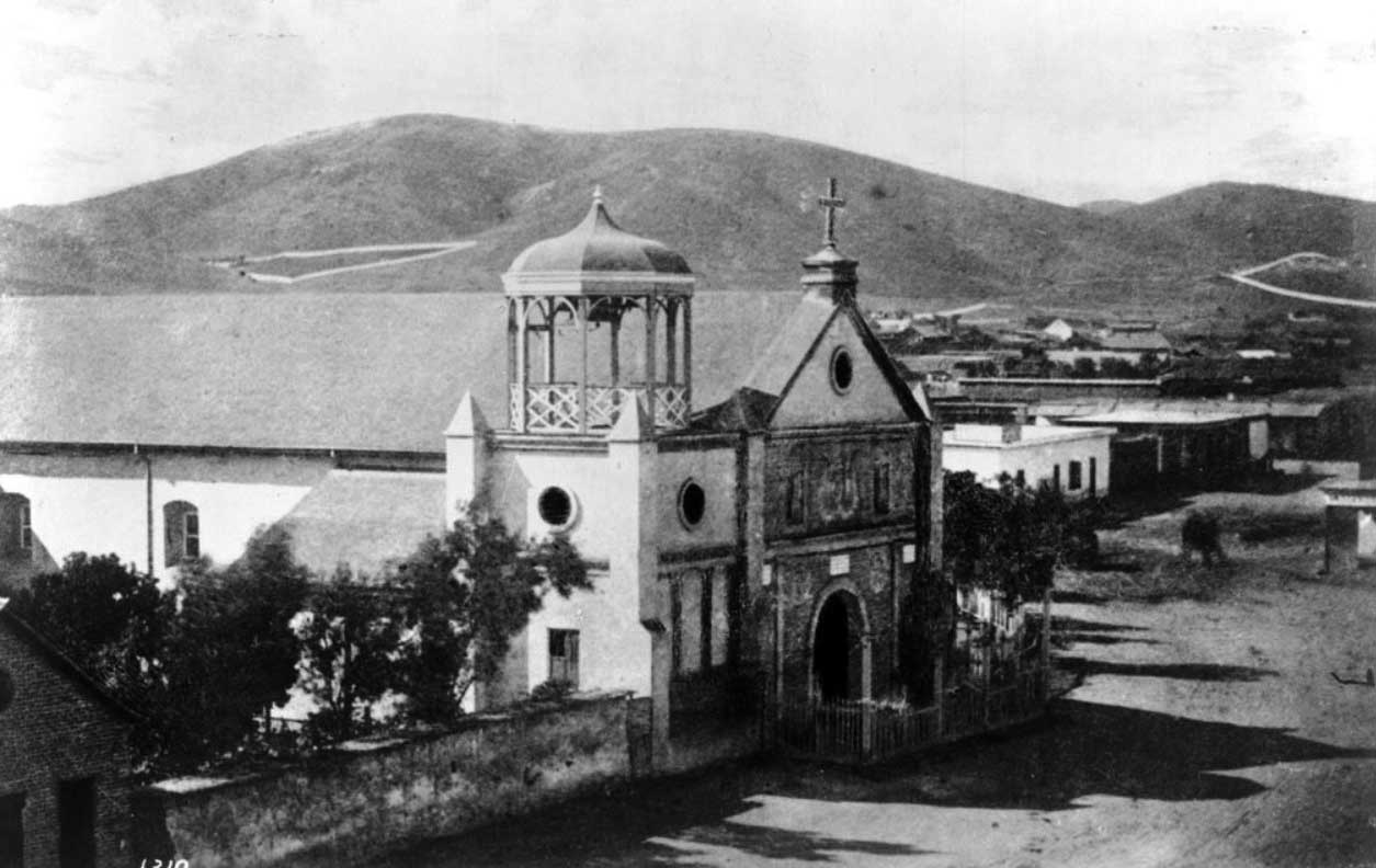
| (1869)^^ - View of the 'Old Plaza Church' (Mission Nuestra Senora Reina de Los Angeles) with bare hills in the background. Chavez Ravine, over the church at left, is where Dodger Stadium is now. |
Historical Notes The 'Church of Los Angeles' was founded on August 18, 1814 by Franciscan Fray Luis Gil y Taboada. He placed the cornerstone for the new church in the adobe ruins of the original "sub-station mission" here, the Nuestra Señora Reina de los Ángeles Asistencia (founded 1784), thirty years after it was established to serve the settlement founding Los Angeles Pobladores (original settlers). The completed new structure was dedicated on December 8, 1822. A replacement chapel, named La Iglesia de Nuestra Señora de los Ángeles - for Mary, mother of Jesus or "The Church of Our Lady of the Angels" - was rebuilt using materials of the original church in 1861. The title Reina, meaning "Queen," was added later to the name. For years, the little chapel, which collected the nicknames "La Placita" and "Plaza Church," served as the sole Roman Catholic church in emerging immigrant Los Angeles. |
 |
|
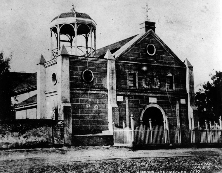
| (1870)^ - Close-up detailed view of the front entrance to the 'Old Plaza Church'. Across the street is the LA Plaza. |
Historical Notes The original 1822-built "Church of Our Lady of the Angels" incoporated a three-bell campanario, or "bell wall" which was replaced by a gazebo-like structure (seen above) when the Church was rebuilt in 1861. The "bell wall" or "bell tower" would once again return when the Plaza Church was repaired/remodeled circa 1901. The 'Old Plaza Church' was one of the first three sites designated as Historic Cultural Monuments by the City of Los Angeles, and has been designated as a California Historical Landmark No. 144. Click HERE to see the complete listing of California Historical Landmarks in L. A. Click HERE to see more on the Old Plaza Church. |
 |
|
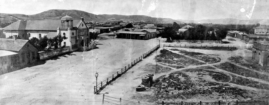
| (1869)* - View showing the Pico House, Masonic Lodge and the Plaza area from Fort Moore Hill. In the foreground is a community of small houses. Just beyond the community is the Pico House, which faces Main Street. The Plaza is to the left of the Pico House. The Masonic Lodge (or Hall) stands two buildings to the right of the Pico House. A majority of the buildings in view are residential houses. |
Historical Notes The Pico House, built in 1869-70, was known as the "finest hotel in Southern California," boasted "bathrooms and water closets for both sexes" on each floor. Pio Pico, the last governor of Mexican California, sold his land in the San Fernando Valley to raise money for its construction. It was Los Angeles' first three story building. The hotel had 82 bedrooms, 21 parlors and two interior courtyards. A French restaurant was located on the ground floor. |
* * * * * |
Los Angeles in 1871
 |
|
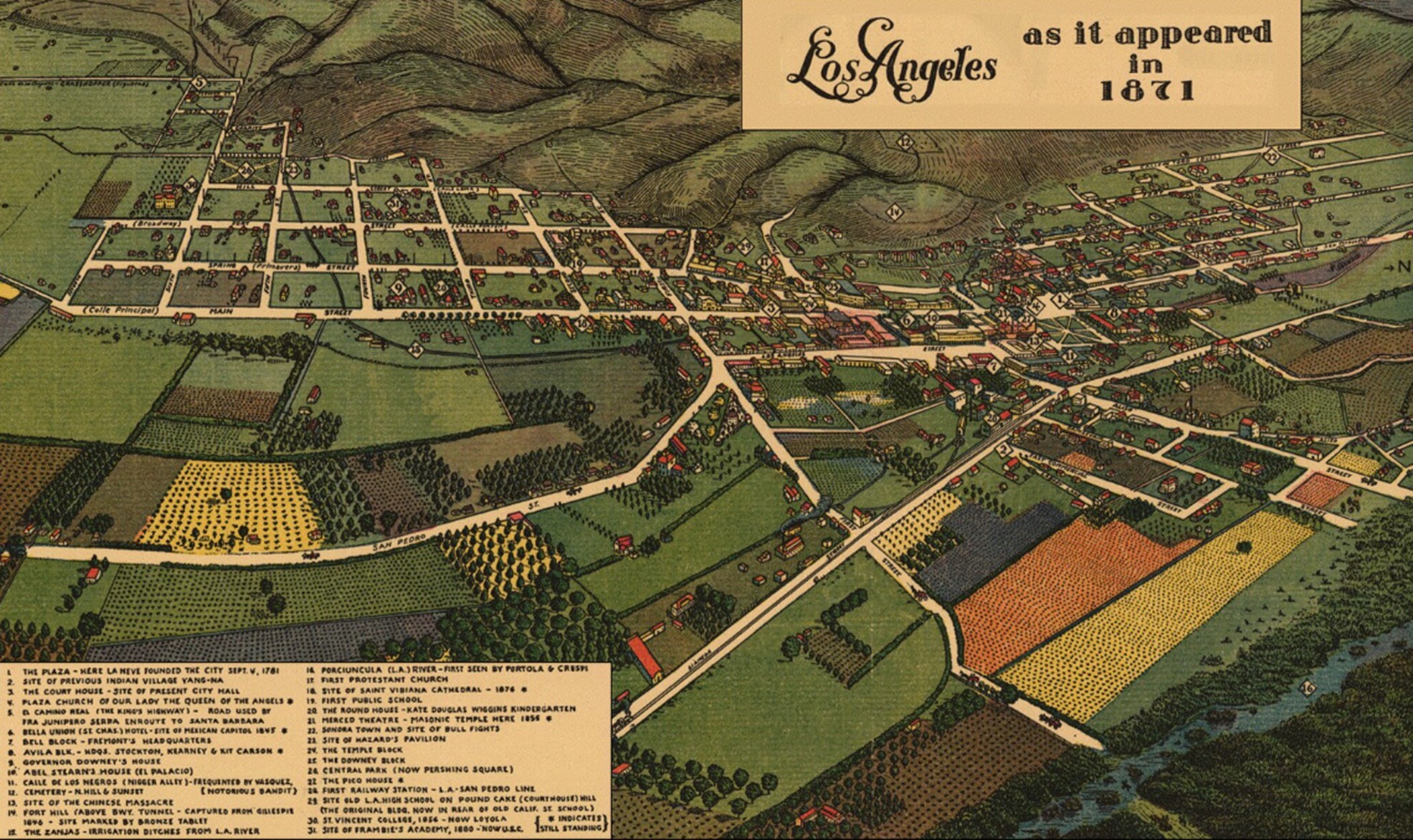
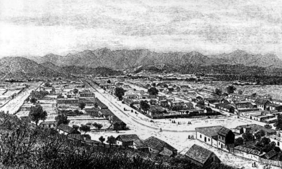
| (1871)* - Los Angeles as it appeared in 1871. Source: Library of Congress. |
Historical Notes The map "Los Angeles as it appeared in 1871" was created in 1929 by the Women's University Club of Los Angeles. This historical map provides a bird's-eye view of Los Angeles as it looked in 1871, offering a perspective on the city's layout and development nearly six decades earlier. The map was approved by the Historical Society of Southern California, lending it credibility as a historical document. It includes colored illustrations, historic notes, an index to points of interest. |
 |
|
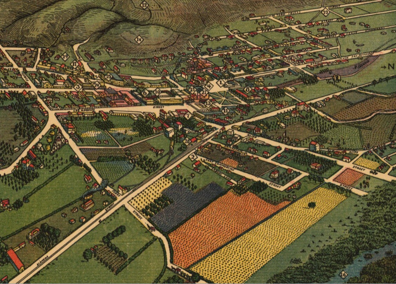
| (1871)* - North end of Los Angeles as it appeared in 1871. |
 |
|
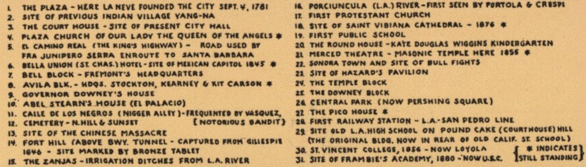
| (1871)* - Legend for Los Angeles as it appeared in 1871. |
 |
|
| (1871)* - Closer look at the north end of Los Angeles as it appeared in 1871. |
 |
|
| (ca. 1871)* - Photograph of a lithograph of Los Angeles with the LA Plaza and Pico House at center-right. The lithograph shows Los Angeles at an early age where most of the city consists of agricultural land showing orchards and farmland (foreground). Majority of the homes and buildings are clustered closer to the mountains in the background. |
Historical Notes Los Angeles in 1871 was a small but rapidly growing city of about 5,700 to 6,000 people. The population was diverse, including Anglo, Latino, and Chinese residents, with the Chinese community making up about three percent of the total. Although still compact in size, the city was experiencing growing pains as it adjusted to new populations, expanding commerce, and limited civic infrastructure. Much of this activity centered around areas such as Calle de los Negros, later incorporated into Los Angeles Street, which became associated with vice and overcrowding and was home to much of the city’s Chinese population. Chinese immigrants faced widespread discrimination, yet they played an essential role in supplying food and operating small businesses throughout the city. Racial tensions during this period culminated in the Chinese Massacre of 1871, a tragic event that underscores the social strains present during this phase of Los Angeles’ early growth. |
.jpg) |
|
| (ca. 1873)^ - View across the Plaza where three people are posing for the photograph. The Plaza Church and the Cape House Restaurant are seen in the background. In the far background can be seen Fort Moore Hill. Note how the Plaza has taken on a different look (compare to previous photos). |
Historical Notes In 1869 the water storage tank was replaced with a fountain, the Plaza's shape changed from rectangular to circular, and the grounds were landscaped and made into a public park. This was done by a newly formed private water company, LA City Water Co., as one of several conditions they agreed to in return for entering into a 30 year franchise agreement with the City.Click HERE to see more in Water in Early Los Angeles. |
 |
|
| (ca. 1873)* - Main Street and Plaza showing the Pico House, the Merced Theater, and the Masonic Lodge. The first gas works can also be seen in the foreground; the tanks were built in 1867, the Pico House and Merced Theater in 1870 and the Masonic Lodge in 1865. |
Historical Notes The gas tanks were built in 1867 when the LA Gas Company (forerunner of Southern California Gas Co.) installed the city's first streetlighting system consisting of 43 gas lamps along Main Street. By 1873, 136 gas lamps provided the outdoor night lighting for the City. The gas company's plant, including two large tanks, was located across the street from the Plaza, just south of the Old Plaza Church (see next photo). Things would change in 1882 when electricity was introduced. Click HERE to see more in Early Los Angeles Streetlights. |
.gif) |
|
| (1873)* - Ruxton Survey of the Central Pueblo. This oversize plat shows the plaza area in 1873, including the center of town with the early buildings, the Zanja Madre ('Mother Ditch'), the streets in use and the early owners of many of the properties. The layout of the plaza itself, however, is shown as it appeared before the change in landscaping in the prior two years before it bacame rounded. |
Historical Notes Click HERE to see more in Early Views of the Los Angeles Plaza. |
* * * * * |
Los Angeles Harbor (San Pedro and Wilmington)
 |
|
| (1800s)^ - View of Timms Point, Los Angeles Harbor. Breakwaters and Deadman's Island can be seen in the background. Railroad tracks shown in foreground. |
Historical Notes Deadman's Island was one of two islands near San Pedro in the 19th century. The land, sometimes referenced as Dead Man's Island, Isla Del Muerto, and Reservation Point, was dredged away in 1928 as part of a harbor development effort. Rattlesnake Island, the other islet in the area, became Terminal Island.*^ |
 |
|
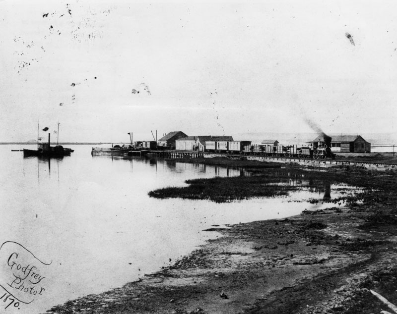
| (1870)^ - View of Wilmington harbor in 1870, showing the Los Angeles and San Pedro Railroad, which had been completed by Phineas Banning in 1869--the first railroad to the harbor. Before that, freight was transported to Los Angeles by ox carts and later by horse-drawn wagons. |
Historical Notes In 1542, Juan Rodriquez Cabrillo discovered the "Bay of Smokes". The south-facing San Pedro Bay was originally a shallow mudflat, too soft to support a wharf. Visiting ships had two choices: stay far out at anchor and have their goods and passengers ferried to shore; or beach themselves. Phineas Banning greatly improved shipping when he dredged the channel to Wilmington in 1871 to a depth of 10 feet. The port handled 50,000 tons of shipping that year. Banning owned a stagecoach line with routes connecting San Pedro to Salt Lake City, Utah and to Yuma, Arizona, and in 1868 he built a railroad to connect San Pedro Bay to Los Angeles, the first in the area. |
 |
|
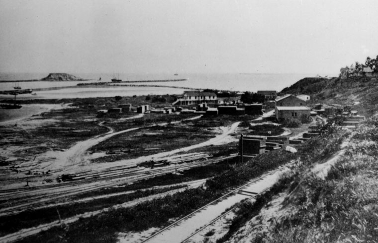
| (late 1800s)^ - View of an unpaved road with horses and carriage in San Pedro; in the distance the harbor can be seen. |
 |
|
| (ca. 1865)^ - View of the Wilmington Exchange building, hotel and stage station to Los Angeles before the railroad on Canal Street (now Avalon Boulevard). In the front of the hotel is a 4-horse stagecoach with passengers. |
Historical Notes In 1863, the Wilmington Exchange Hotel was built and was the first hotel in Wilmington. Phineas Banning’s first Wilmington home was the single-story building attached to the hotel (as seen above). Besides operating a freighting business, Banning operated a stage coach line between San Pedro and Wilmington, and later between Banning, California, which was named in his honor, and Yuma, Arizona. In 1868, Banning built a railroad to connect San Pedro Bay to Los Angeles, the first in the area. |
 |
|
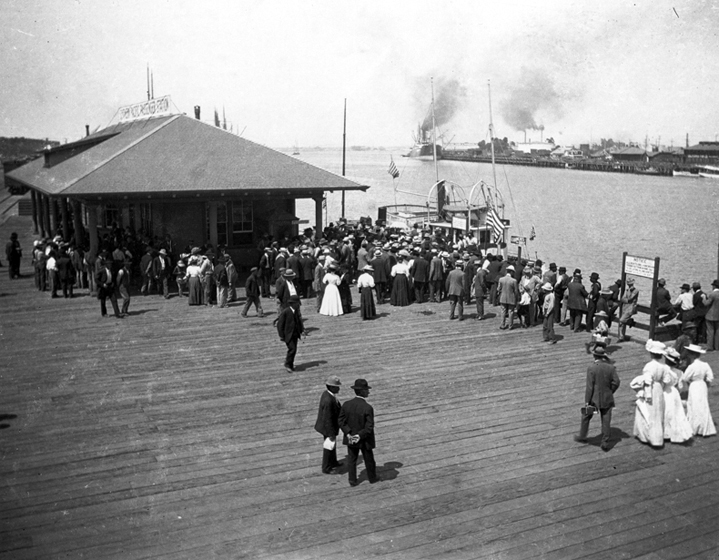
| (ca. 1888)*#* - Shipping in San Pedro circa 1888. Port of Los Angeles. |
 |
|
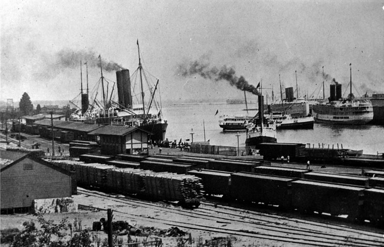
| (1913)^ - The Port of Los Angeles in 1913. The harbor appears to be filled to capacity with steam ships and train cars full of cargo (This is the same view as previous photo but 25 years later). |
 |
|
| (ca. 1899)*#* - View of the Port of Los Angeles circa 1899. Crowds of people are dressed up and appear to be viewing the arrival of a vessel. |
Historical Notes Click HERE to see more in Early Views of San Pedro and Wilmington |
* * * * * |
Los Angeles Commercial Center
 |
|
| (1870s)^ – View showing Don Abel Stearns' Arcadia Block, the first brick business building in Los Angeles, later demolished for the #101 Freeway. Numerous horse-and-buggies are parked in front. |
Historical Notes In 1858, Abel Stearns constructed a two-story business block on Los Angeles Street and called it Arcadia Block after his young bride, Arcadia. |
 |
|
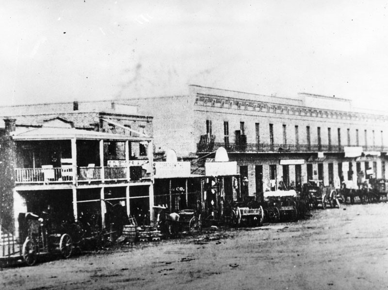
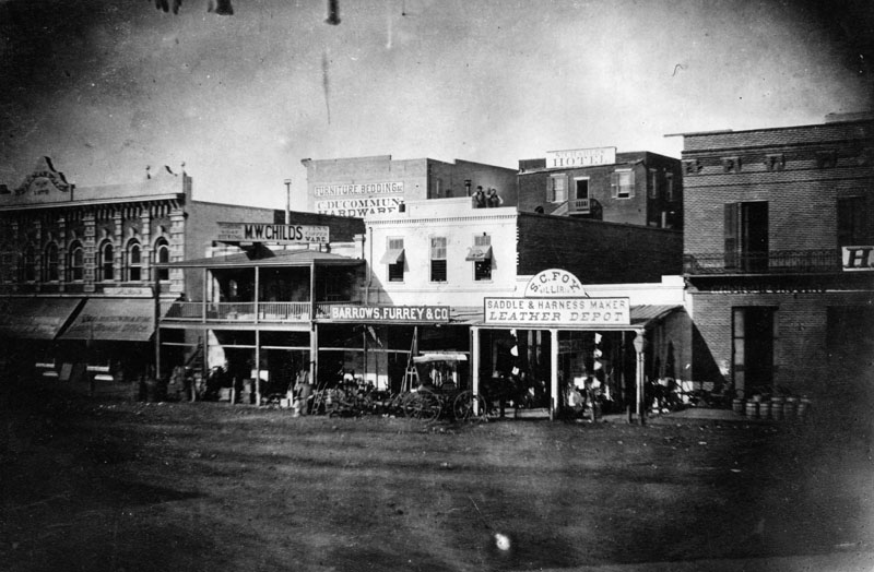
| (1870s)^ - View of the west side of North Los Angeles Street, between Commercial and Arcadia, streets. The Samuel C. Foy Leather Depot stands in the center-right. In the far left is I.W. Hellman's building, one of the first two-story buildings in Los Angeles. |
Historical Notes Isaias Wolf Hellman was a German-born American banker and philanthropist, and a founding father of the University of Southern California. On September 1, 1868, Hellman and Temple founded Hellman, Temple and Co., the fledgling city’s second official bank. In 1871, Hellman and John G. Downey, a former governor of California, formed the Farmers and Merchants Bank, which became Los Angeles' first successful bank. Hellman lent the money that allowed Harrison Gray Otis to buy the Los Angeles Times and Edward Doheny and Charles Canfield to drill for oil. Hellman was also a major landowner in Southern California and his holdings included numerous city lots and vast swaths of former rancho land. In 1871, he and a syndicate bought the 13,000-acre Rancho Cucamonga. In 1881, Hellman and members of the Bixby family purchased the 26,000-acre Rancho Los Alamitos (now home to Long Beach and Seal Beach). He also purchased the Repetto Ranch (now Montebello) with Harris Newmark and Kaspare Cohn. Hellman and Downey also bought up swaths of Rancho San Pedro from the Dominguez family. Hellman also owned much of Boyle Heights with William H. Workman. At his death in 1920, Hellman was considered the leading financier of the Pacific Coast. His son (I.W. Jr.) and grandson (Isaias Warren Hellman) later became presidents of Wells Fargo Bank; and the Union Trust Company was merged with Wells Fargo after his death. His original Farmers and Merchants Bank would later merge with Security First National Bank. |
 |
|
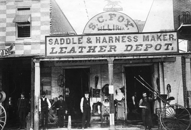
| (1860s)^ - Exterior view of S. C. Foy saddlery shop, housed in a one-story, brick building with a portico. The store sign reads "Saddle & Harness Maker, Leather Depot" and has a silhouetted prancing horse on top. Tack and saddles are displayed on the front and several men are posing for the camera. |
Historical Notes Samuel Calvert Foy moved to Los Angeles in 1854 and operated a successful harness business at 217 Los Angeles Street, which was the oldest business establishment in the city at the time of his death. He also served as the city's Chief of Police for a time. In 1872, Foy built a house at the corner of Grasshopper (now Figueroa) and 7th Streets. The house was reportedly "the first three-story building in the city." At the time the Foys built their house, the site was considered to be "way out in the country." Foy's daughter, Mary Foy, was the city's first woman librarian from 1880-1884, a leader in the California Women's suffrage movement, a leader of the Democratic Party, and the first woman to be a member of one of the major parties' national committees. |
 |
|
| (1871)^ - View of the corner of North Main Street at Arcadia Street in the Plaza area in 1871, showing at right the residence of the wealthy merchant, trader, and government official, Don Abel Stearns. This residence was a virtual mansion at the time, with fourteen beautifully-decorated rooms. It was the social center of the pueblo. Later it became the site of the Baker Block. A number of low-lying adobe and brick buildings are seen in this panoramic view. |
Historical Notes In 1829 Abel Stearns came to Monterey, California, then settled in Pueblo de Los Angeles, present day Los Angeles. He obtained a concession to build a warehouse in San Pedro. Later, he established a stagecoach route connecting San Pedro Bay with the Los Angeles pueblo. In 1831, he built a three-story flour mill on North Spring Street, Los Angeles. Soon Stearns became one of the most prominent and influential Californian citizens of the pueblo. Abel Stearns represented Los Angeles under American military rule, 1848-1850. He was a delegate to the 1849 California Constitutional Convention, representing the district of Los Angeles; later he was California State Assemblyman, and a Los Angeles County Supervisor and Los Angeles City Councilman. In 1858, Stearns constructed a two-story business block on Los Angeles Street nearby and called it Arcadia Block after his young bride, Arcadia. |
 |
|
| (ca. 1858)* – View looking southeast showing a man with a rifle standing on New High Street (later Spring Street). At center right is the intersection of New High and Temple streets. The brick two-story building at center is the Allen Block, at the SW corner of Spring and Temple. Behind it can be seen the Clocktower Market/Courthouse. |
Historical Notes Los Angeles, an extremely violent city in the 1850s, reported one death a day from fights or assassinations. Law enforcement was practically non-existent as they were often the victims of the violence. Click HERE to see another view of New High and Temple. |
 |
|
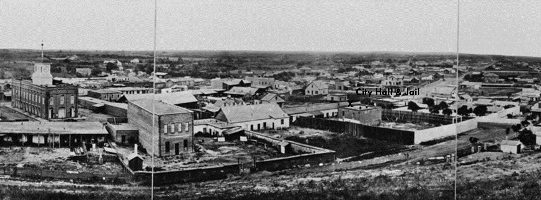
| (1868)+^ - Composite panoramic view looking southeast showing Los Angeles’ 1st City Hall & Jail at center-right. John Temple's 1858-built Clocktower Market/Courthouse building is on the left. |
Historical Notes Los Angeles' the first City Hall and Jail was located on the northwest corner of Spring and Jail St, (which later became Franklin St.). This building was established in 1850 and located directly opposite of where City Hall stands today. It was originally built as a residence by Antous Jose Rocha, who had come to L.A. from Portugal in 1815. Los Angeles, an extremely violent city in 1853, reported one death a day from fights or assassinations. Law enforcement was practically non-existent as they were often the victims of the violence. The yard behind the jail is where gallows were erected to hang condemned prisoners. Some prisoners were lynched by vigilantes from the gateway at the rear of the jail yard (and elsewhere). The 10-foot-high fence around the jail yard was built to keep vigilantes out, not to keep prisoners in. Click HERE to see more views of Los Angeles' First City Hall and Jail. |
.jpg) |
|
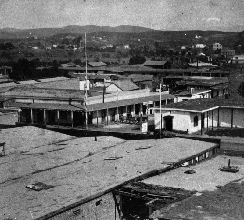
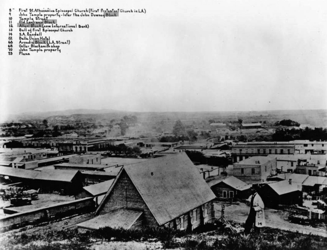
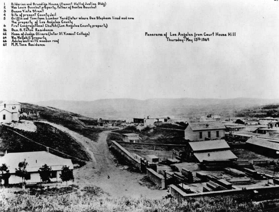
| (ca. 1869)* - Left panel of a panoramic photograph/sketch of downtown Los Angeles looking southeast from Bunker Hill with each property annotated and listed at top. The photographer, S. A. Rendall, can be seen standing in his own photo (#14). |
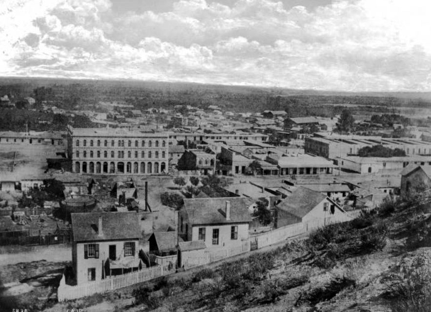
Historical Notes The above photo was taken from a section of Bunker Hill called "Poundcake Hill", the future site of the old Los Angeles High School (1873) and later the location of Los Angeles' second County Court House (1891). It was this time that Los Angeles began growing faster than anywhere in the country. By 1870, the City's population increased to 5,730, a 350% jump from when it was incorporated as a municipality in 1850. By 1900, LA's population would mushroom to over 100,000 people. |
 |
|
| (ca. 1869)* – Closer view of S. A. Rendall standing on the hillside with the St. Athanasius Episcopal Church (First Protestant Church in LA) directly below him at center (No. 8). |
 |
|
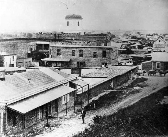
| (1869)* – Closer look at the left panel of Rendall’s panoramic view of early Los Angeles as seen from Court House Hill showing the Griffin and Tomilson Lumber Yard at lower-right. |
.jpg) |
|
| (ca. 1869)^^ - Right panel of a panoramic photograph/sketch of downtown Los Angeles looking southeast from Bunker Hill with each property annotated and listed at top. The location of the camera was at the top of a hill called ‘Poundcake Hill’ the future site of Los Angeles High School (1873) and the 2nd L.A. County Court House (1891). |
Historical Notes S. A. Rendall, the photographer of the amazing panoramic photo seen above, is mentioned in a 1911 publication titled: OUTPOST – Preserving Historical Data by W. S. Broke. “Remembering that no city in the United States has had a rate of growth commensurate with that of Los Angeles, the preservation of historical data becomes of pressing importance. Much of the photographic material illustrating the early life of the city has been preserved but as far as can be ascertained little of this immediately available for all comers. … There does not appear to have been any systematic attempt to preserve photographs of the city prior to the early 80s. The late S. A. Rendall, whose children now reside in Los Angeles, was a photographer who did much toward preserving the appearance of the early Los Angeles—the city of the ‘60s and ‘70s. What has become of most of his negatives is not known, although they would be of immense historical value were they now available. Perhaps the best thing that he left behind is a bird’s eye view of Los Angeles taken in 1868 from the site of the present court house. This photograph is the property of George W. Hazard, who has it covered by copyright, and who has it on sale. It is a remarkable photograph in every way.” |
 |
|
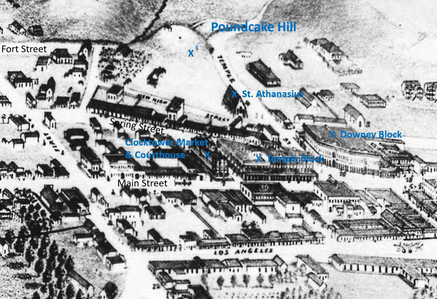
| (1871)* - Photograph of a lithograph showing Los Angeles as it appeared in 1871 with Poundcake Hill at top. Also seen and highlighted are: St. Athanasius, Downey Block, Temple Block and the Clocktower Market/Courthouse. |
Historical Notes In 1873, Los Angeles High School (1st high school in the Southland) would be built on top of Poundcake Hill. Fort Street (upper left) would be extended horizontally to cross Temple Street. It would also be renamed “Broadway” in 1890. |
* * * * * |
Los Angeles High School
 |
|
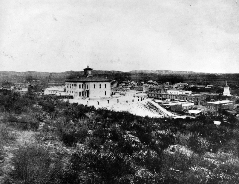
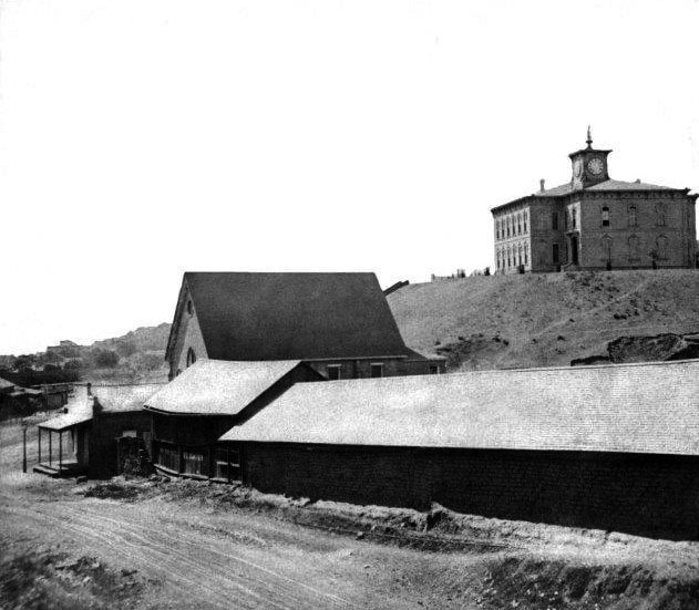
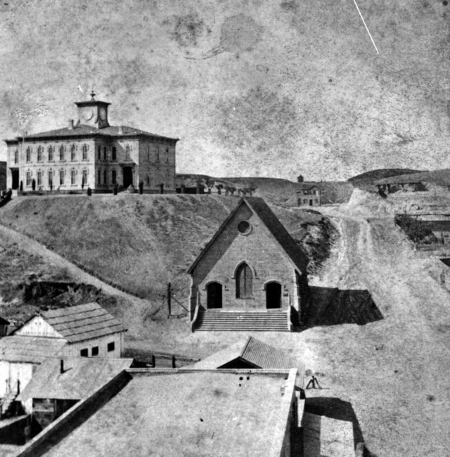
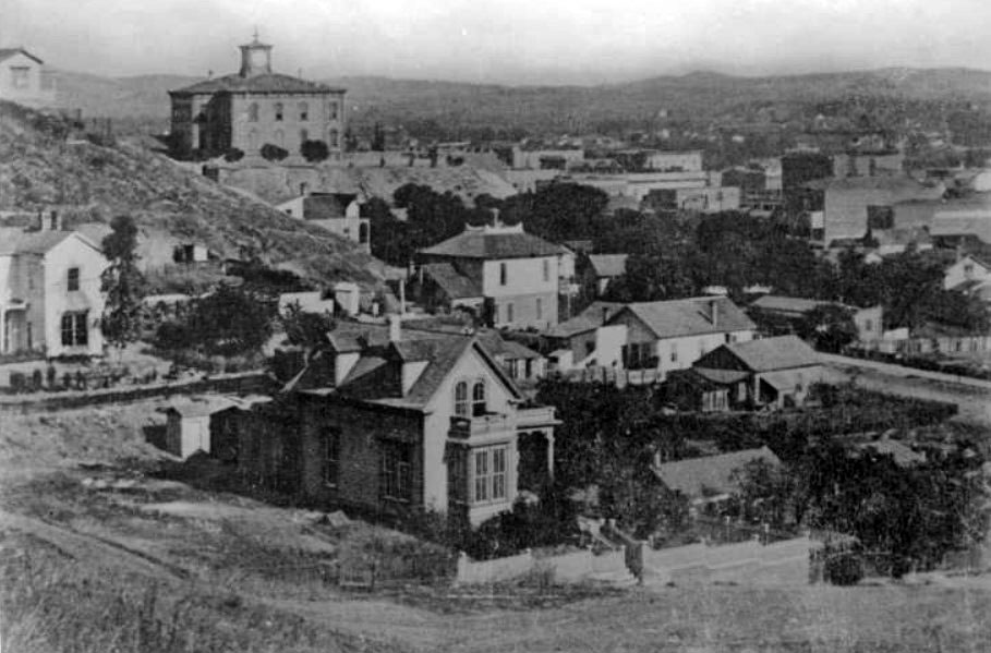
| (1873)^ - Old Los Angeles High School, looking east from the hill on North Broadway at Court Street. The building in the center, occupying the 2nd site of the County Court House (1891-1932), is the old school house. The Temple Block stands to the right of the school. Broadway, first known as Fort Street, was cut through the bushes in the foreground. |
Historical Notes Construction on Los Angeles' first high school, which was also the first and only one in Southern California for a number of years, began on July 19, 1872, at the former site of Central School on what was then known as Poundcake Hill. It was located at the southeast corner of Fort Street (later Broadway), which the front of the school faced, and Temple Street, with the back of the school to New High Street (later Spring Street). As it was on the hill, a few hundred feet from the streets below, steep wooden stairways led up to the schoolyard. The name of the school has led to some confusion due to its evolving role in early Los Angeles education. Initially, it was established as Central School, serving as an elementary school. As the city's educational needs grew, four rooms within the building were allocated for secondary education, which led to the formation of Los Angeles High School, the first public high school in the city. Despite this distinction, the school building continued to be referred to by both names—Central School for its original function and Los Angeles High School for its role in secondary education. This dual usage contributed to historical inconsistencies in naming references. The first graduating class, in 1875, consisted of seven students. |
 |
|
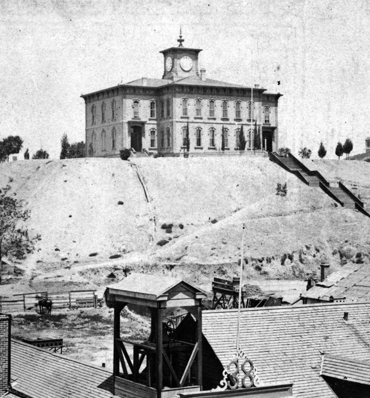
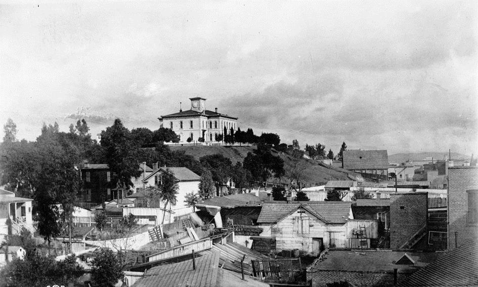
| (ca. 1870s)^ - The first Los Angeles High School was built in 1873, with Dr. Lucky as principal. The corner stone was laid July 19, 1872. Cost was $19,000. A horse can be seen standing by a fence in the left foreground. |
Historical Notes In 1886, the decision was made to move the high school building to Sand Street (later California Street, now part of the Hollywood Freeway), just to the west of North Hill Street and below the south side of Fort Moore Hill, in order for the Los Angeles County Courthouse to be built on Poundcake Hill. The contractor, Mr. Hickam, said he could do the job with scaffolding, rollers, horses and workmen. But his bid turned out to be too low. He lost a considerable amount of money because of his elaborate preparations, including the high wooden trestle which carried the building over the intersection of Temple and Fort Street. |
 |
|
| (ca. 1873)* - View showing the newly built Los Angeles High Schoo, the Griffith, Lynch and Company lumber yard and St. Athanasius Episcopal Church. New High Street is in the foreground and the intersection with Temple Street is at the left center edge. |
Historical Notes This photograph was taken by pioneer Los Angeles photographer Henry T. Payne about 1873 and shows the newly built high school on Poundcake Hill. |
 |
|
| (ca. 1874)* - Los Angeles High School atop Poundcake Hill, circa 1874. The St. Athanasius Episcopal Church can be seen in the center of the photo. The street behind the high school is Fort Street (later Broadway). |
Historical Notes Built in 1864, St. Athanasius was the first Episcopal church in Los Angeles. In 1881, the church was renamed St. Paul's. Two years later, this church building was sold to Los Angeles County, and a new St. Paul's Church was built where the Biltmore Hotel now stands at Pershing Square. Click HERE to see more Early Views of the St. Athanasius Episcopal Church. |
 |
|
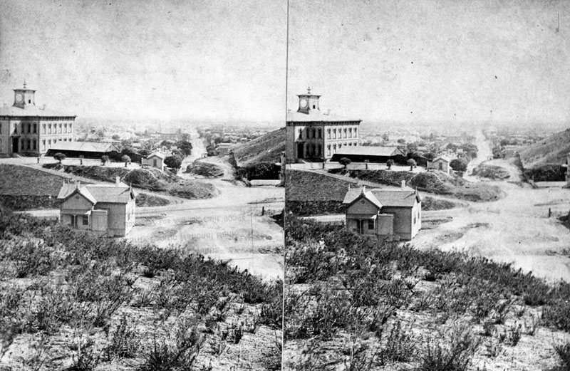
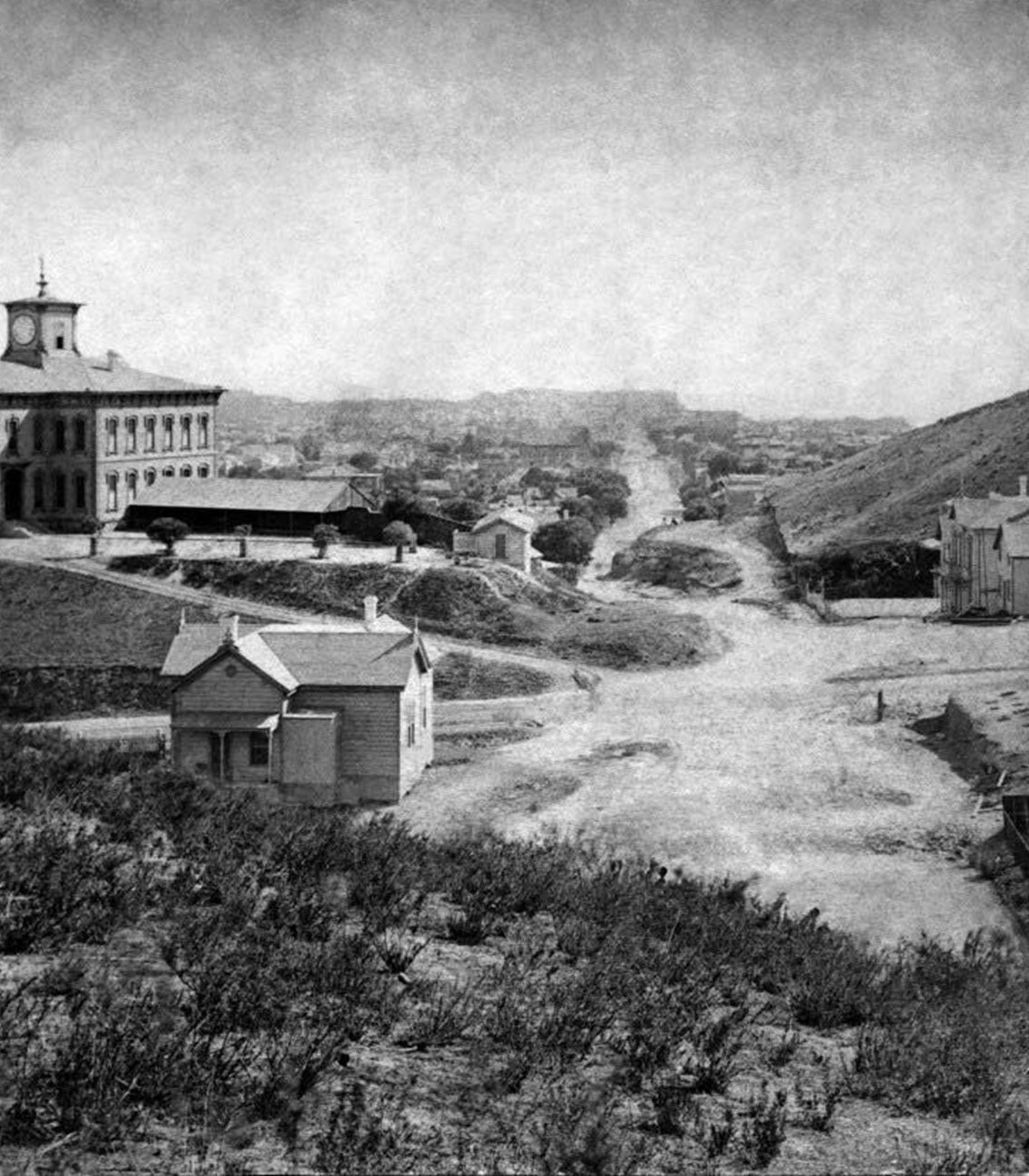
| (ca. 1875)^ - Stereoscopic view of Fort Street (later Broadway) looking south from Fort Moore Hill, at Temple Street. Los Angeles High School sits on Poundcake Hill on the left. |
 |
|
| (1875)*- Looking south on Fort Street (now Broadway) showing Los Angeles High School as seen from Fort Moore Hill. Source: Henry T. Payne stereographic photograph. |
 |
|
| (2023)* - Google Earth view looking south on Broadway toward its intersection with Temple Street. The view is from where the top of Fort Moore Hill once stood. |
Then and Now
 |
|
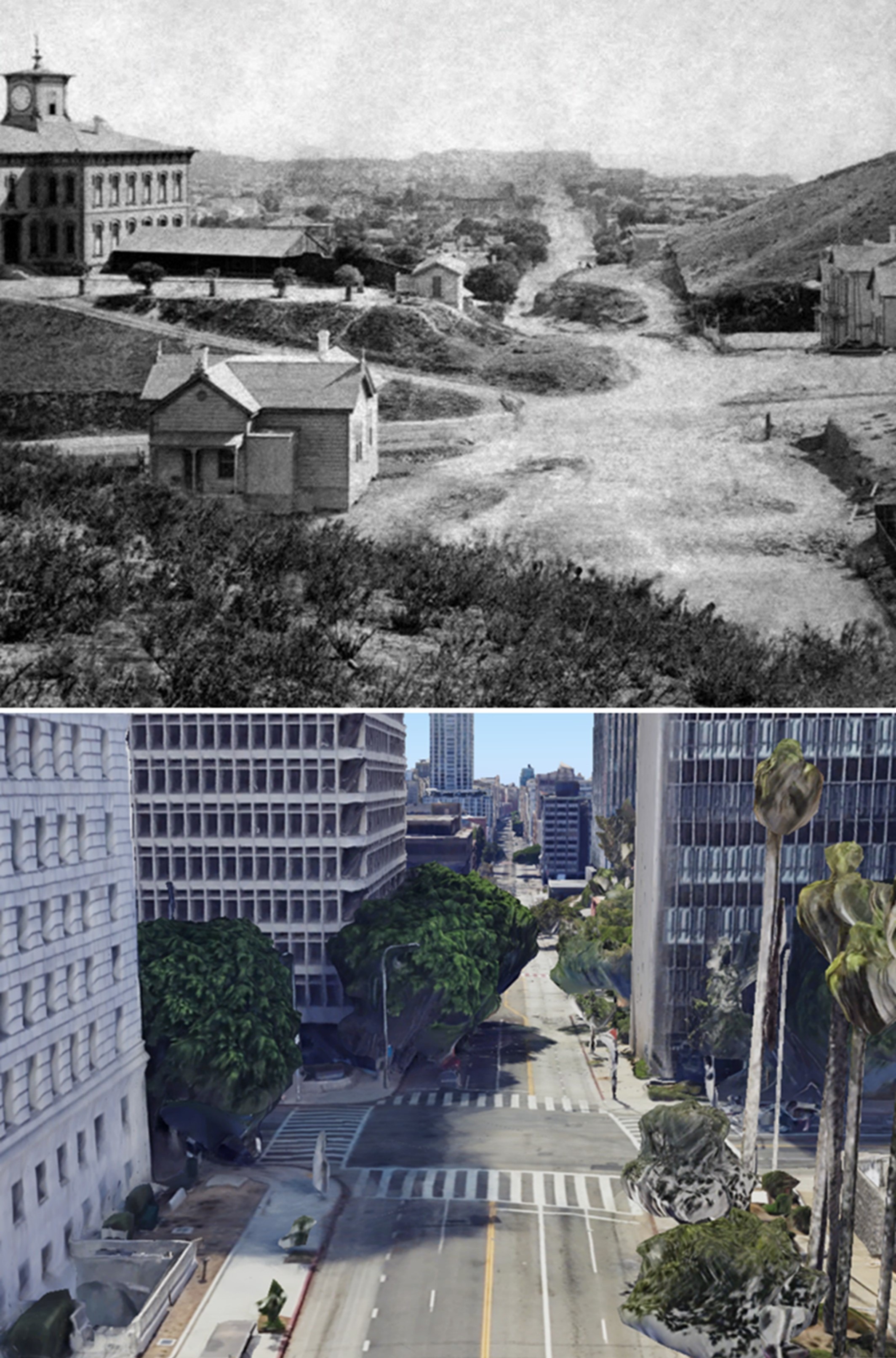
| (1875 vs 2023)* – Looking south on Broadway (originally Fort Street) at Temple Street. Los Angeles’ first public High School (LA High School) once stood near the SE corner as seen above (upper-left corner). In 1886 the high school was moved to a new location to make room for the construction of the LA County Courthouse. The courthouse would be torn down in 1936 and replaced by single story courthouse bungalow buildings. In 1972 the Criminal Courts Building later renamed the Clara Shortridge Foltz Criminal Justice Center would be constructed on the site (seen here on the SE corner). Photo comparison by Jack Feldman. |
Historical Notes The original view was taken from Fort Moore Hill, which was later leveled. The current view is a Google Earth perspective from approximately where the top of Fort Moore Hill once stood. |
 |
|
| (ca. 1875)^ - Main and 1st streets looking northwest, showing buildings in foreground and Los Angeles High School on top of Poundcake Hill in the upper left. |
* * * * * |
Spring and Court Streets
 |
|
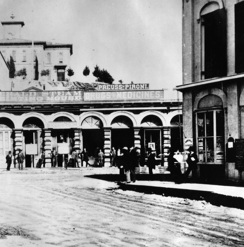
| (1875)* - View of Court Street looking west toward North Spring Street in 1875. Seen is what seems to be a printing house, and the Preuss-Pironi Drugs & Medicine store. Behind, on Poundcake Hill, is the original Los Angeles High School. |
Historical Notes In the early 1870s, Court Street was a hub of commercial activity, lined with businesses and shops. Los Angeles High School stood on Poundcake Hill, visible from Court Street. |
 |
|
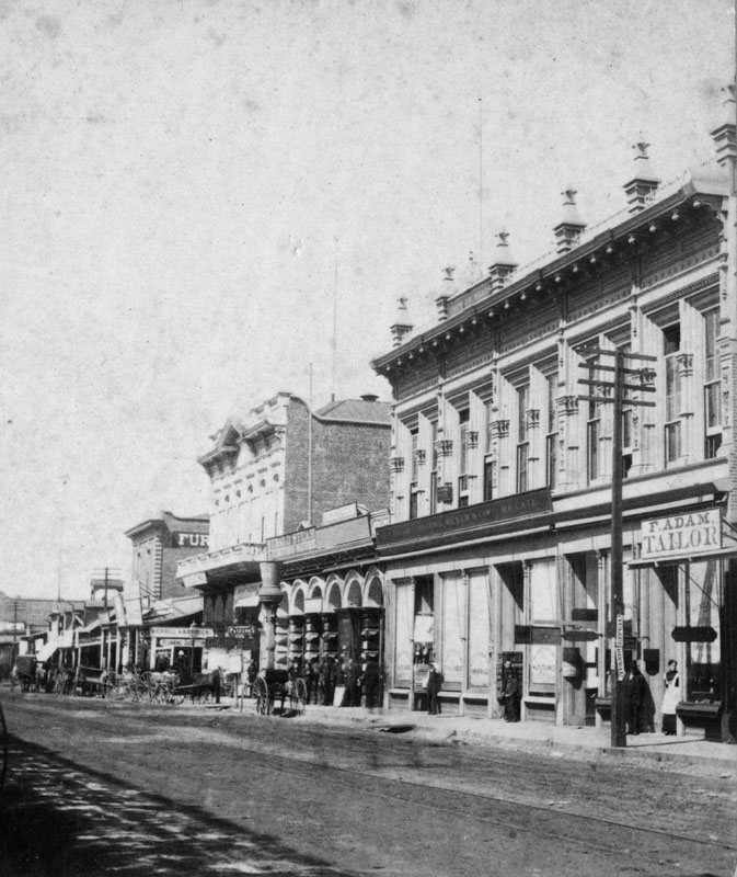
| (1875)^ - View of Spring Street near Court Street. On thie right is F. Adam, Tailor; and the top of the building has sign "City of Paris?" Los Angeles High School sits Poundcake Hill behind these buildings. |
Historical Notes In the 1870s, Spring Street in Los Angeles began to emerge as a key commercial thoroughfare, particularly between Court Street and Main Street. As part of the city's developing downtown, this stretch of Spring Street experienced notable growth and transformation during the period. Prominent landmarks included the Temple Block, constructed by F.P.F. Temple between 1868 and 1871 at the intersection of Spring, Main, and Temple streets. The Temple and Workman Bank, housed in the northernmost part of the Temple Block, marked the beginning of Spring Street's evolution into Los Angeles' financial hub. Additionally, John T. Sheward's store, one of the first businesses to open on Spring Street, symbolized its rise as a vital commercial center. |
 |
|
| (1870s)* – A stereoscopic image looking north along Spring Street toward its intersection with Main Street in downtown Los Angeles. Horse-drawn wagons are mostly parked along the curb, with the three-story Italianate Temple Block visible in the center-right distance. In the left foreground, signs for a bookstore and a 'Dollar Store' are visible, along with a baby carriage holding a small toy cart. Photo from the Ernest Marquez Collection. |
* * * * * |
 |
|
| (ca. 1878)* - Panoramic view of Fort Street (later Broadway) from the edge of Bunker Hill as seen from First Street and Hill Street, looking northeast. At center, a group of at least six buildings can be seen with some type of vegetation between some of the homes. LA High School is seen in the background. |
Historical Notes First Street can be seen in the extreme foreground, descending past the picket fence of the house to the left with two dormers. The street angling slightly upward from the middle right (before disappearing behind the houses) is Broadway, proceeding north from its intersection with First Street. The first Los Angeles High School can be seen located atop Poundcake Hill. The school has a square cupola, with a clock on three of its four faces (all but the west). Some other buildings discernible in the photo include: in the middle, at the very right, the Peoples Store can be seen located at the west side of Spring and Court Streets, with an illegible white writing on its side; just to the left, the Masonic Lodge is visible located at the west side of Spring and Market Streets. Also visible are: the Temple Block, located between Main and Spring and Temple and Market Streets; the Downey Block and the Allen Block (both at Spring and Temple Streets), and the upper right portion of the Mirror Printing Office located at Temple and New High Streets. Temples Market and Theater (later, the first Los Angeles County Courthouse) is just out of frame to the right of the Peoples Store. In the extreme background, a mountain range extends from left to right. Earlier version of the record reads: "Sheriff Barns' house on corner". |
 |
|
| (ca. 1883)* - View of Los Angeles High School atop Poundcake Hill as seen from the Nadeau Hotel on 1st & Hill Street. |
Historical Notes Los Angeles High School was founded in 1873 and is the oldest public high school in the L.A. Unified School District. Construction on this building began on July 19, 1872 at Temple and Broadway (the current site of the Los Angeles County Court House), and the school opened in 1873. In 1891, L.A. High School moved to its second building at a new location on nearby Fort Moore Hill, located on north Hill Street between California (now the 101 Freeway) and Sunset Blvd (now Cesar E. Chavez Ave). In 1917, the school moved once again to what would be its present location at 4650 W. Olympic Blvd. |
* * * * * |
Main Street
 |
|
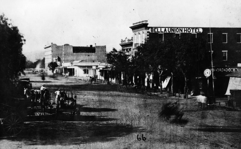
| (1871)^ - View of North Main Street, looking north from Temple with the Downey Block on the N/W corner (left). On the far right hand side is the last building of the Bella Union Hotel. A multitude of horse-drawn wagons are seen in the congested foreground. |
 |
|
| (ca. 1870)^ - View of North Main Street taken after erecting Pico House, but before completion of Merced Theater. The Bella Union Hotel can be seen at right-center of photo. |
Historical Notes The Bella Union Hotel was considered the first hotel in Los Angeles. It became the Clarenden in 1873 and the St. Charles in 1875. Pico's Building, to the left, was the original home of Farmers and Merchants Bank, later merged into Security Pacific Bank. |
* * * * * |
Parades - 4th of July
 |
|
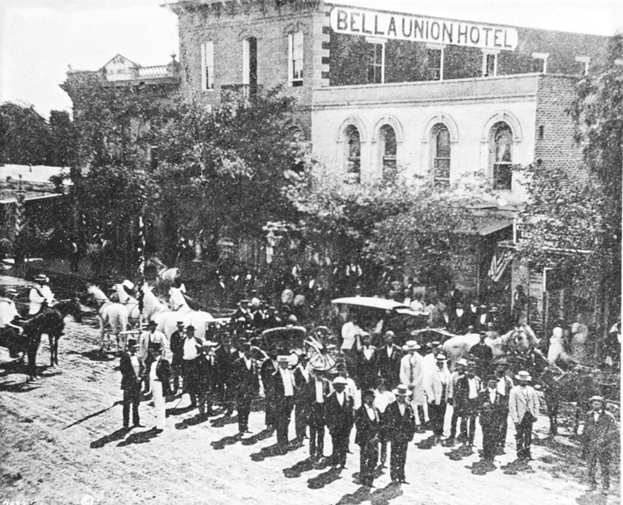
| (1871)* - A 4th of July parade on North Main Street of the Veterans of the War of 1812. Men are seen in two lines standing in the street, horses and carriages waiting and people on the sidelines. The Bella Union Hotel in the background is partially obscured by trees. |
Historical Notes The area in front of the the Bella Union Hotel was long used as a social and political center. Here, on October 7, 1858, the first Butterfield Overland Mail stage from the east arrived 21 days after leaving St. Louis. Warren Hall was the driver, and Waterman Ormsby, a reporter, the only through passenger. Originally constructed in 1835 as the home of New England merchant Isaac Williams, the Bella Union Hotel was Los Angeles' first hotel. Over the years, it served various roles, including as the capitol of Alta California during the Mexican era, a military base for American forces in 1847, and later a saloon. By early 1850, it began operating as the Bella Union Hotel and became the county's first courthouse that same year. Located on the east side of the historic 300 block of North Main Street, the Bella Union Hotel building stood until the 1940s, when the entire block was demolished to make way for the extension of Aliso Street. Today, the Hollywood Freeway (Route 101) runs under the site where Los Angeles' first hotel once stood. The Bella Unioin Hotel site was designated California Historical Landmark No. 656. Click HERE to see more in California Historical Landmarks in LA. |
 |
|
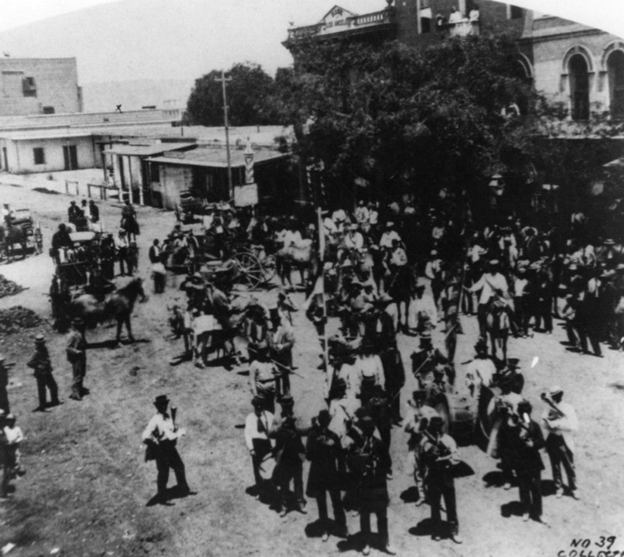
| (1871)* - View shows a 4th of July celebration in the street in front of the Bella Union Hotel. A crowd is gathered, some standing, some on horses, or in carriages, several playing instruments. The Bella Union Hotel in the background is obscured by trees. |
Historical Notes Los Angeles had been celebrating Independence Day since at least the 1850s. The parades typically formed on N. Main Street in front of landmarks like the Bella Union Hotel. The area served as a social and political center for the city. The hotel's location was often used as a gathering point for celebrations and parades. Click HERE to see more Early Views of North Main Street. |
 |
|
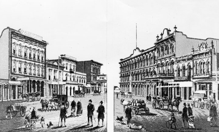
| (1870s)^ - Rendering of how the Main Street scene was in the 1870's. On the left, the St. Charles Hotel, originally the Bella Union Hotel. The Bella Union became the Clarenden in 1873 and the St. Charles in 1875. On the right, rear of Pico's Building, which was the original home of the Farmers and Merchants Bank, later merged into Security Pacific Bank. Next to Pico's Building are the Merced Theatre and Masonic Lodge #42. |
* * * * * |
300 Block of North Main Street
 |
|
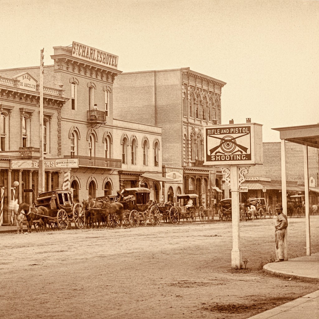
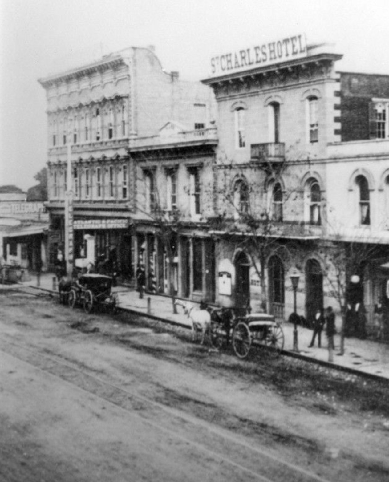
| (1877)* - View looking across Main Street toward the St. Charles Hotel (previously the Bella Union Hotel). Horse-drawn wagons are parked in front. A man on the right side of the image leans against a post next to a small sign advertising “Rifle and Pistol Shooting.” |
Historical Notes This photograph was taken from directly across Main Street and gives a clear, head-on view of the St. Charles Hotel. The scene shows the everyday business activity of the block with wagons, deliveries and pedestrians. The man leaning on the post and the small shooting gallery sign are details often missed in later views. The St. Charles Hotel retained much of the earlier Bella Union structure, which began as an adobe residence in the 1830s. By the 1870s, it stood as one of the city’s oldest continuously used commercial buildings. This portion of Main Street was a center of activity in the 1870s, with hotels, banks and small storefronts serving travelers, merchants and local residents. |
 |
|
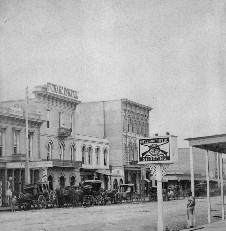
| (1877)* - View looking southeast showing St. Charles Hotel, originally the Bella Union Hotel. Horses and buggies are lined up along the street. In the foreground a sign reads, “Rifle and Pistol Shooting,” a reminder that Los Angeles was a Western frontier town. |
Historical Notes In the 1870s, downtown Los Angeles, including Main Street, was a place where gun violence and regulation coexisted. The city, with a population of nearly 6,000, had a higher homicide rate than New York or Chicago. Most men walked the streets armed with pistols and knives, and it was said that a murder occurred every day in the city. However, gun control laws were also present in early Los Angeles. Like many towns in the Old West, Los Angeles had regulations on carrying firearms within city limits. Typically, visitors were required to leave their weapons with a law officer upon entering town, receiving a token to reclaim them when leaving. Carrying any kind of weapon, including guns and knives, was generally not allowed within town borders, except inside homes. |
 |
|
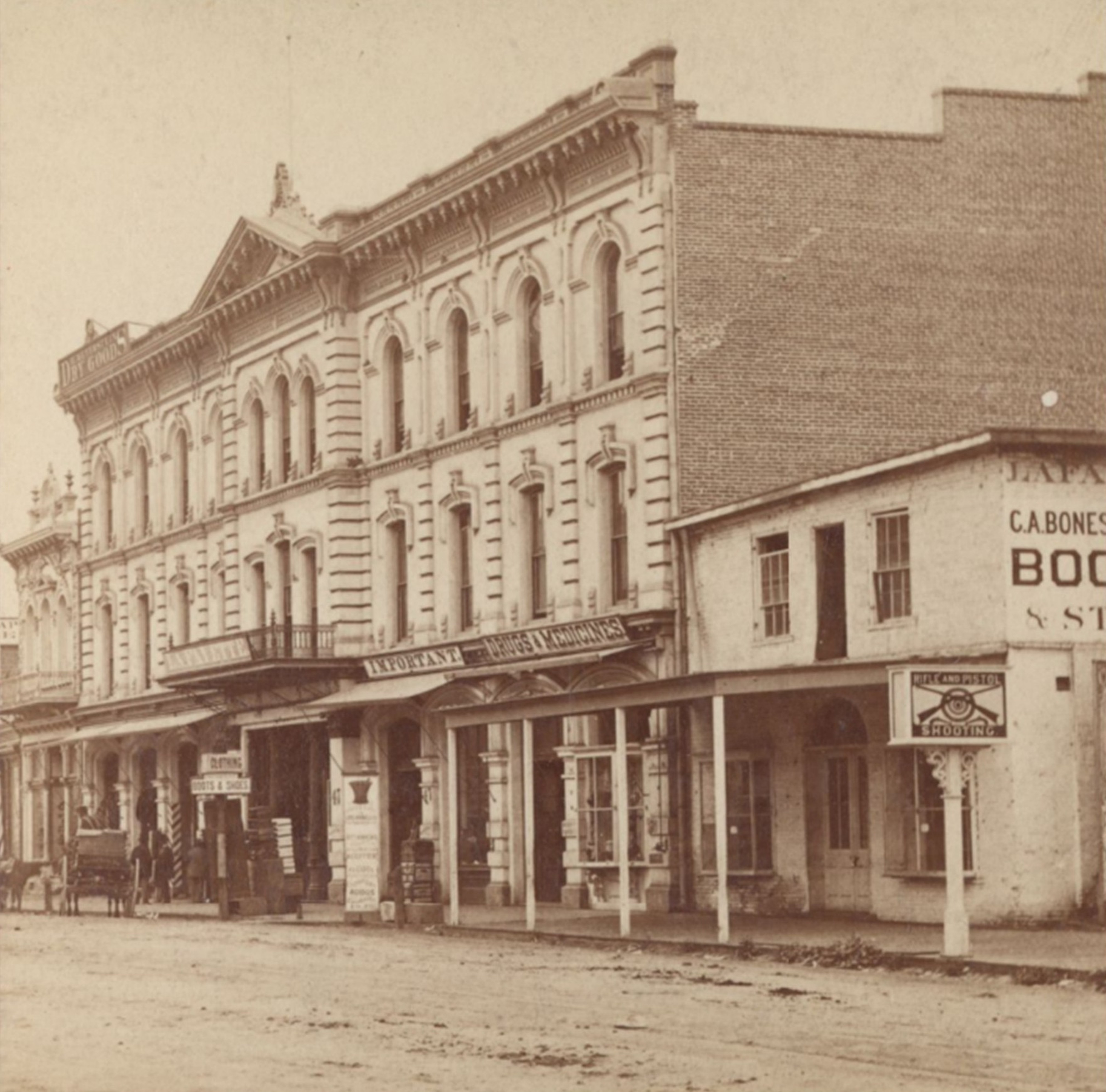
| (1877)* – View of the Lafayette Hotel, on the west side of Main Street opposite the St. Charles Hotel. The sign at right reading “Rifle and Pistol Shooting” advertises Brulon & Loiseau’s Shooting Gallery. |
Historical Notes The Lafayette Hotel was built in the early eighteen fifties and soon became one of the leading hotels in early Los Angeles. Over the years it carried several names, including the Cosmopolitan and later the St. Elmo, but longtime residents continued to associate it with its original name. The hotel stood just north of Main and Temple and served travelers, merchants and residents during a time when the city was shifting from an adobe settlement to a more structured commercial center. Architecturally, the Lafayette was one of the earliest Italianate style buildings in Los Angeles. This style is seen in its tall arched windows, strong vertical lines, evenly spaced pilasters and the deep cornice supported by decorative brackets. These features gave Main Street a more polished appearance that contrasted with the simpler buildings around it. The shooting gallery sign at the right highlights the mix of entertainment, lodging and small business that once defined this busy block. Today the site is part of the Civic Center near City Hall, and none of the original structures remain. |
 |
|
| (ca. 1880)* - Closer view of the Lafayette Hotel. Several men sit and stand in front of the hotel entry way. The street is unpaved and two horses and carriages are seen in front of the building, one near the Insurance and Real Estate sign. |
Historical Notes This closer view shows the Lafayette Hotel after more than two decades of service and during a period when it was sometimes called the Cosmopolitan and later the St. Elmo. The scene in front, with men gathered near the entrance and carriages waiting at the street, reflects the steady movement of travelers and business activity that made this section of Main Street an important center for the growing town. The Italianate style of the Lafayette is especially clear in this view. The hotel’s brick walls, tall arched windows, iron balcony railings and strong bracketed cornice were all hallmarks of this popular mid nineteenth century style. These features brought a sense of permanence to a city that still had unpaved streets and wooden sidewalks. Within a few decades this entire block was replaced by public buildings, and the Lafayette site became part of the modern Civic Center landscape. |
 |
|
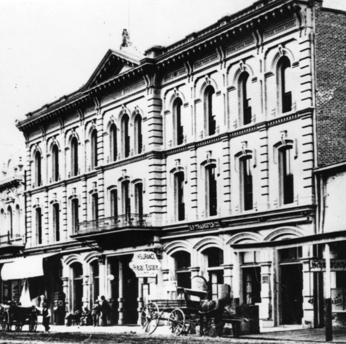
| (1880)* - View looking northeast showing the St. Charles Hotel, originally the Bella Union Hotel. To the left (north) stands the Farmers and Merchants Bank (previously the Pico Building). Further north is the 3-story Grand Central Hotel, built in 1876. |
Historical Notes The two-story building to the north of the St. Charles Hotel (seen above) is the Pico Building, built by Pio Pico in 1868 (two years before the Pico House). In 1871, the building became home to the Farmers & Merchants Bank, the first incorporated bank in the Los Angeles, directed by former California Governor John G. Downey. In 1871, Isaias W. Hellman and John G. Downey formed the Farmers and Merchants Bank, which became Los Angeles' first successful bank. Hellman lent the money that allowed Harrison Gray Otis to buy the Los Angeles Times and Edward Doheny and Charles Canfield to drill for oil. |
 |
|
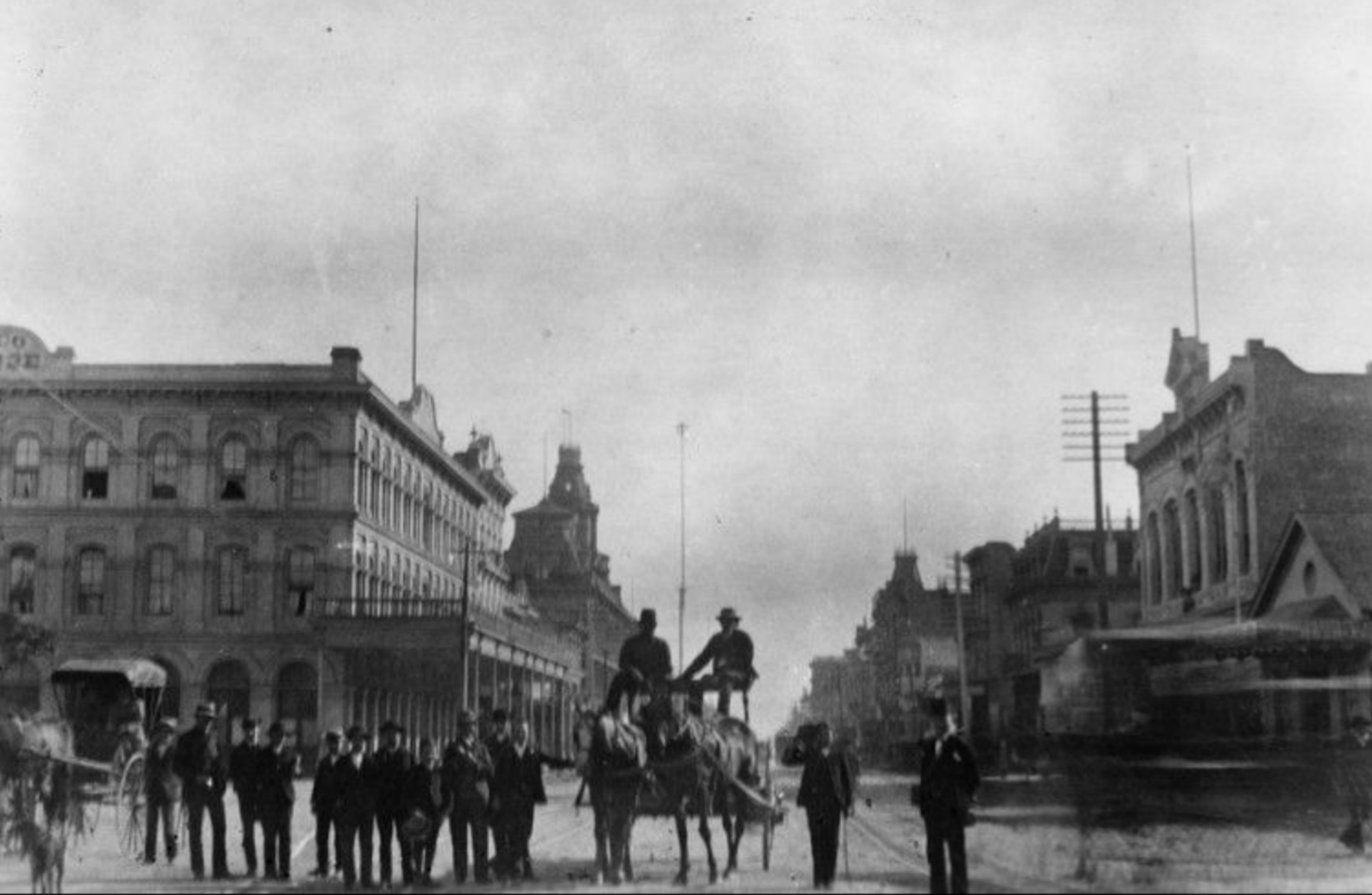
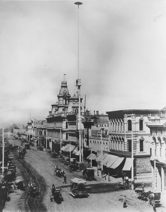
| (1883)* - View looking south on Main Street showing a group of men standing next to a horse-drawn wagon with two men seated on top. The Plaza is on the left (out of view). In the left background stands the Pico House and the Baker Block with its distinctive towers. There is a very tall pole seen between the two men on the wagon which appears to be a flagpole, but is not. It is a 150-foot tall electric street light mast that was one of the first to be installed in the City of Los Angeles. |
Historical Notes In 1882, C. L. Howland installed seven 150-foot tall streetlight masts, each carrying three carbon-arc lamps of three thousand candle-power. He also installed a small power plant to provide the electricity for his new street light system. The following year Howland and other investors would go on to form the Los Angeles Electric Company. It was the first electric utility in Los Angeles. Click HERE to see more on LA's first electric streetlights. |
 |
|
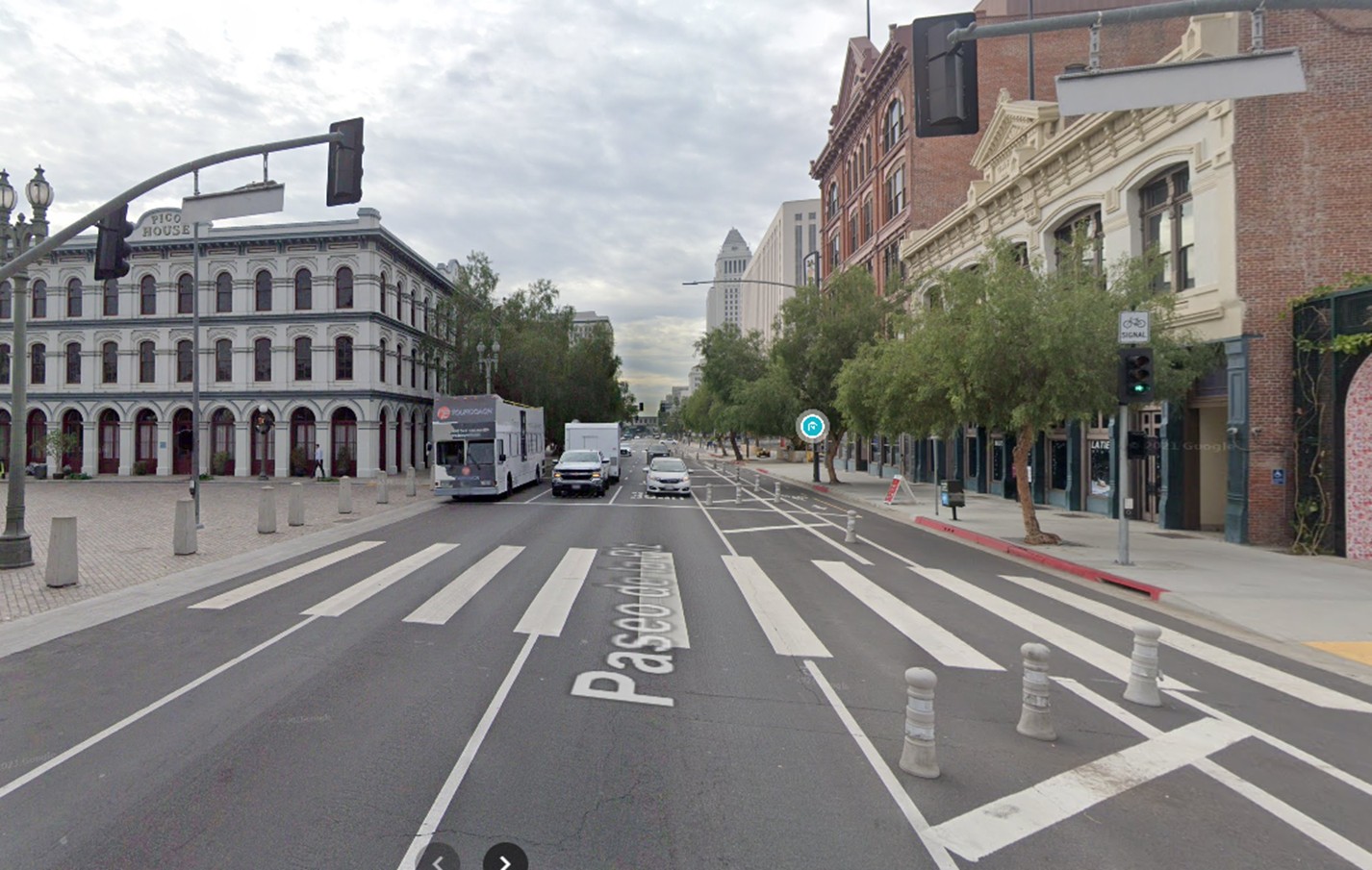
| (2021)* – Contemporary view looking south on Main Street from in front of the LA Plaza with the Pico House visible on the left. |
Then and Now
 |
|
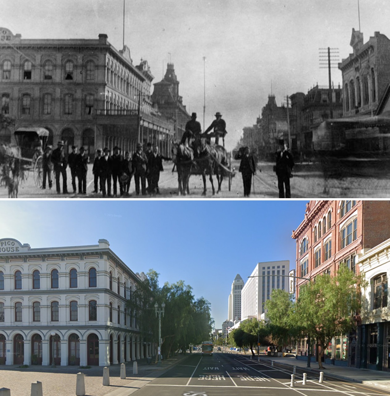
| (1883 vs. 2021)* – A ‘Then and Now’ view looking south on Main Street from in front of the Los Angeles Plaza with the Pico House on the left. Photo comparison by Jack Feldman. |
 |
|
| (ca. 1882)** - View looking toward the Baker Block on the east side of Main Street north of Commercial Street showing one of the first of seven electric street lights installed in the City of Los Angeles in 1882. It stood 150 feet tall! A man can be seen standing on a platform half way up the street light mast. |
Historical Notes Click HERE to see more on LA's first electric streetlights. |
* * * * * |
Calle de Los Negros
 |
|
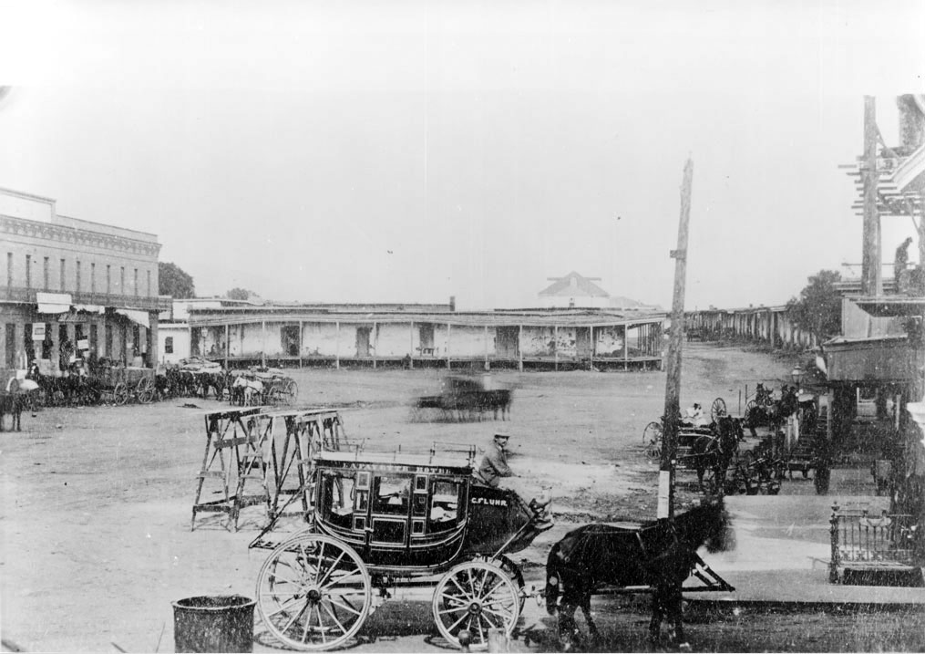
| (1870s)* - Lafayette Hotel stagecoach near the adobes in Calle de los Negros, presently Los Angeles Street and Arcadia Street. The old Antonio Coronel adobe is in the background. Numerous horse-drawn wagons and carriages are parked along the street. The above area was the scene of a Chinese massacre in 1871. |
Historical Notes The stagecoach in the foreground was owned by the Lafayette Hotel, the second Los Angeles hotel (after the Bella Union), owned by C. Fluhr (Fleubul?). Calle de los Negros is at the extreme right of the image and ran north from Los Angeles Street toward Aliso Street, ending where Dr. Gelsich had an apothecary shop. The two story brick building at the extreme left corner, on Arcadia Street, was occupied mainly by Caswell and Ellis grocers (or General Merchandise store of Harris Newmark?). In the corner was a saloon run by Marjett. He sold the first 5-cent beer. Marjett also owned a ranch in Antelope Valley to which the name of "Cinco Centavos" was given on account of his 5-cent beer. A son of Marjett later lived in Ocean Park. The open space in the foreground of the image is the end of Los Angeles Street. The hat on the stagecoach driver is a typical French cap of the time. |
 |
|
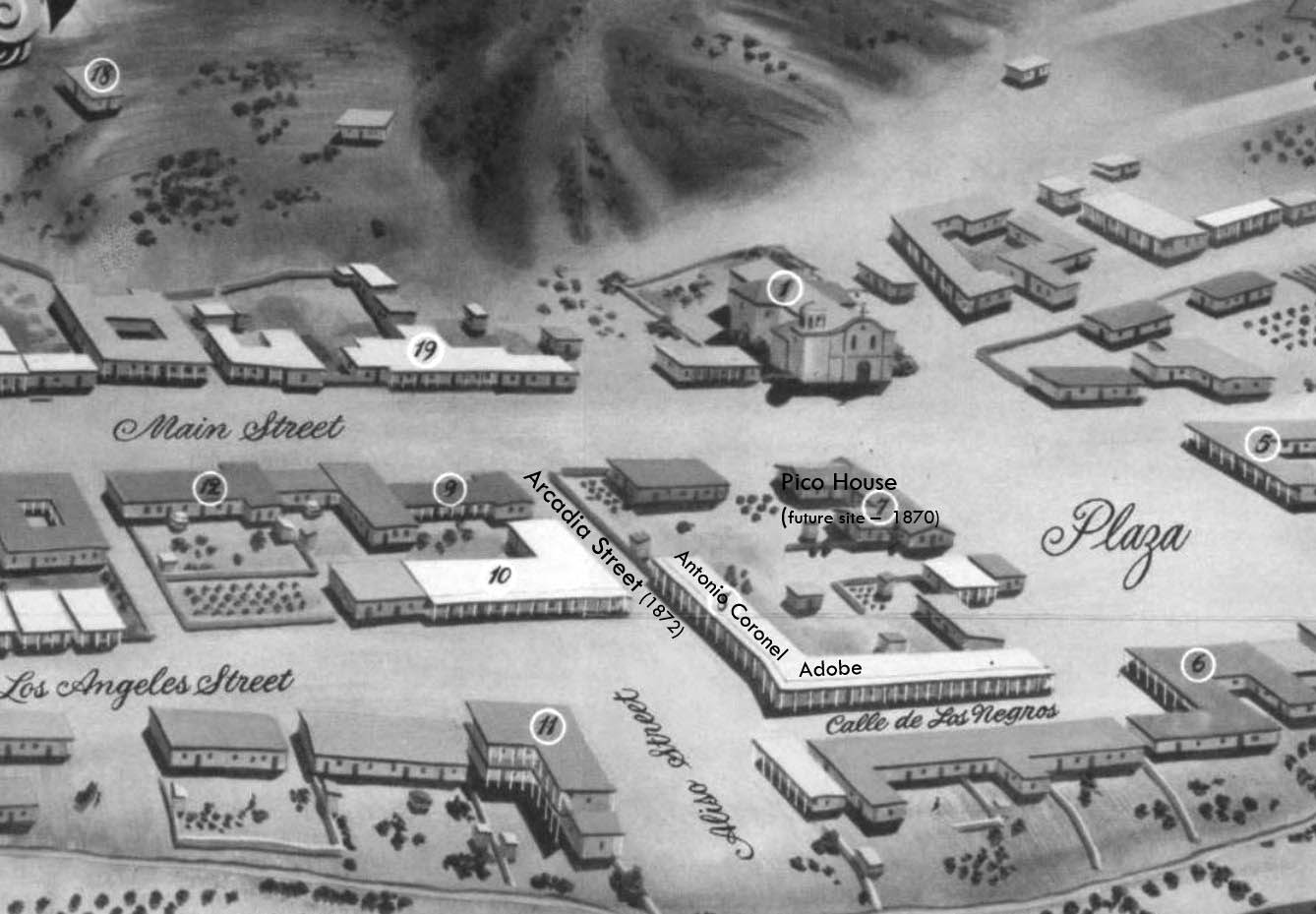
| (1850)* - Map view looking northwest showing the LA Plaza and surrounding area as it appeared in 1850. The intersection of Aliso Street (later Arcadia) and Calle de Los Negros is seen at lower center-right with the Antonio Coronel Adobe on the northwest corner. |
Historical Notes The Pico House (center-right) wasn't built until 1870. The section of Aliso Street seen above was renamed Arcadia Street in 1872. |
 |
|
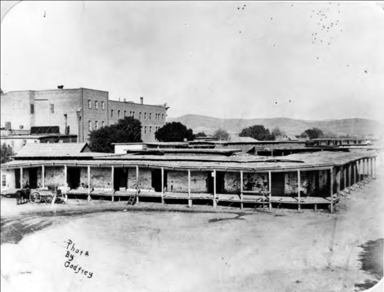
| (1875)* - Closer view of the Coronel Adobe with its covered sidewalk, located on the northwest corner of Arcadia Street and Calle de Los Negros (later Los Angeles Street). The back part of the Pico House (built in 1870) across Sanchez Street is on the left and the LA Plaza (out of view) is at center-right. |
Historical Notes Antonio F. Coronel, was a state treasurer and former Los Angeles mayor who owned the main block of rundown adobe stores and apartments in this area. The Coronel house was the scene of the beginning of the Chinese massacre of 1871. Once home to the town’s most prominent families, the neighborhood had deteriorated into a slum by the time Los Angeles’s first Chinatown was established there in the 1860s. |
.jpg) |
|
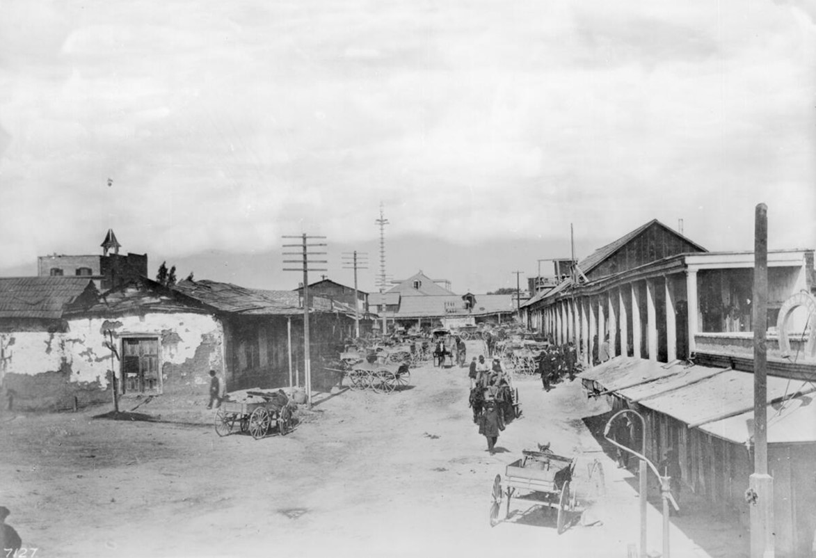
| (ca. 1882)* - Stereoscopic photograph showing Calle de los Negros, later Los Angeles Street, on the east side and south of the Plaza. The dirt road is lined with older adobe structures with covered sidewalks and the area was mainly inhabited by Chinese from the late 1860s. In the right foreground is a sign in the shape of a horseshoe and the name "J. Kennedy" upon it. Horse-drawn vehicles are parked or moving on the street. At the far left is a portion of the building owned by Antonio Franco Coronel, in which the Chinese Massacre of 1871 occurred. Photo courtesy of the Workman and Temple Family Homestead Museum. |
Historical Notes Los Angeles Street was first named in 1854. Before the first official survey of the area in 1849, most of this thoroughfare was called Calle Principal (Main Street). Other sections were known as Calle de la Zanja (Ditch Street), Calle de Los Vinas (Vineyard Street) and--much to the south--Calle de los Huertos (Orchard Street), which is now San Pedro Street. These formed the principal highway running south to the Embarcadero of San Pedro. At its northern end, near the Plaza, a 500-foot stretch was known as Calle de Los Negros, which had a racially diverse population. |
 |
|
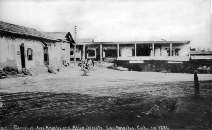
| (ca. 1884)* - View of Calle de los Negros. On the left is the adobe of Antonio Coronel; behind the adobe and with belltower is the Plaza Firehouse; center with a gable roof is the Vincent Lugo Adobe (facing the plaza on Los Angeles Street); and right with columns is the Antonio Maria Lugo adobe, which he willed to his son, Dolores del Carmen Lugo. View is looking north toward the Plaza from near the northeast corner of Calle de Los Negros and Aliso Street. |
Historical Notes There was no area more colorful than Los Angeles’s Calle de los Negros, a short dirt thoroughfare located just off the eastern edge of the historic Plaza and considered to be the center of the town’s “red light” district. Saloons, gambling dens, brothels, and other entertainment venues were said to proliferate on the Calle; the same could also be said for crime. The Plaza Firehouse was built in 1884. Click HERE to see more. |
 |
|
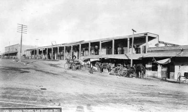
| (1880s)* - Elevated view of the dirt road, horse-drawn wagons, and storefronts along the Calle de los Negros (also known as "Nigger Alley") in Old Chinatown in Los Angeles, California, with a sign for "J. Kennedy" in the shape of a horseshoe at right and a fire hydrant on the sidewalk. Photo from the Ernest Marques Collection. |
Historical Notes The Chinese massacre of 1871 was a racially motivated riot on October 24, 1871 in Los Angeles, when a mob of over 500 men entered Chinatown to attack, rob and murder Chinese residents of the city. The riots took place on Calle de los Negros (Street of the Negroes), also referred to as "Nigger Alley", which later became part of Los Angeles Street. A total of 18 Chinese immigrants were systematically killed by the mob, making the so-called "Chinatown War" the largest incident of mass lynching in American history. |
 |
|
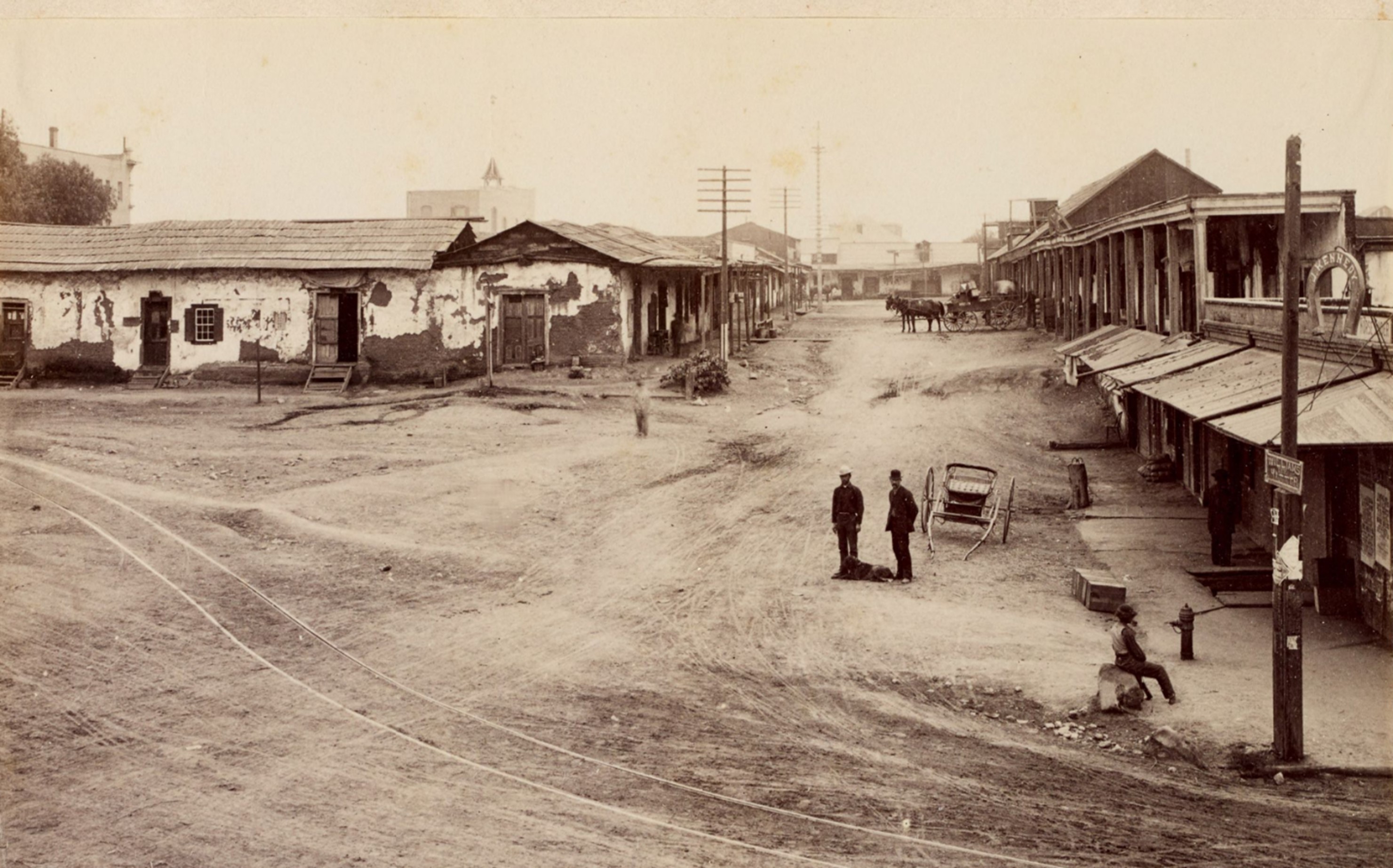
| (ca. 1886)^ - View of Calle de los Negros, running south of the Plaza along what is now the east side of Los Angeles Street. |
Historical Notes Calle de los Negros was situated immediately northeast of Los Angeles’s principal business district, running 500 feet from the intersection of Arcadia Street to the Plaza. The unpaved street took its name from the dark-complexioned Californios (pre-annexation, Spanish-speaking mixed-race Californians) who had originally lived there. |
 |
|
| (1886)* - View looking east from Aliso Street at the entrance to "the alley". |
Historical Notes In 1886, the extension of Los Angeles Street eliminated the alley and today the site adjoins the Hollywood Freeway. |
* * * * * |
Sonora Town
 |
|
| (ca. 1869)* – View of north Broadway (then Eternity Street) in Sonora Town looking north from Fort Hill. Rocks cut in from the left foreground, obscuring some of the view of the town, which is comprised mostly out of craftsman-style houses arranged more or less each on their own block. |
Historical Notes The part of the city called Sonora Town was an old adobe village north of the Plaza and Church of Our Lady, Queen of the Angels. It was Los Angeles' first Mexican quarters, or barrio. The area was named for the numerous miners and families who came from Sonora, Mexico, and may have still been around in the 1930s. Now part of it is Los Angeles' Chinatown District. |
 |
|
| (ca. 1870)* - Photograph of the drawing "A Flower from the Golden Land" by Ludwig Louis Salvator depicting north Broadway from Hill Street south of Sunset Boulevard in Sonora Town. Sonora Town is shown from above, its blocks filled with residences and buildings arranged around courtyards. A set of streetcar rails can be seen in the middle of the street, which curves in from the right towards the mountains in the distance and which groups of pedestrians can be seen on. A grassy hill is partially visible in the left foreground. |
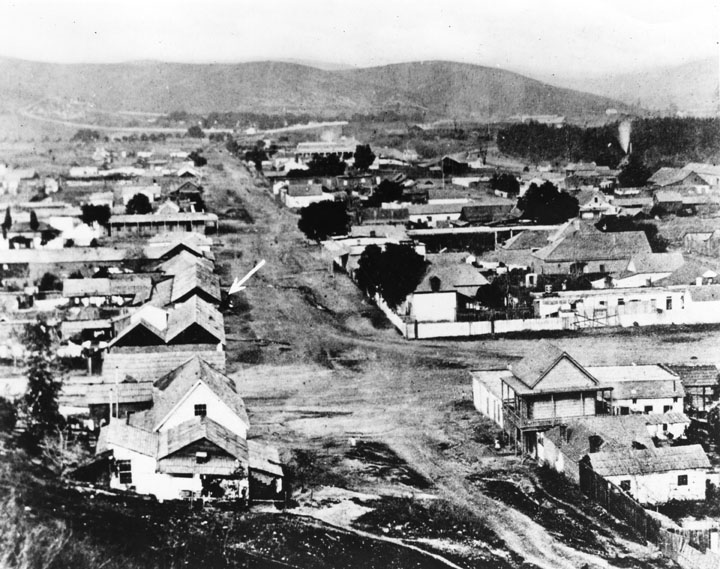 |
|
| (ca. 1871)^ - Early view of Eternity Street in Sonora Town, northeast of Fort Moore Hill. An arrow points to the adobe home of Don Jose Aguilar. |
Historical Notes The Calle Eternidad (Eternity Street) extended from the foot of the hill where Calle Alta intersected it to the Campo Santo, or Calvary Cemetery. The name was fitting. For half a century the dead of the pueblo were carried over it to their eternal rest Campo Santo, the location of LA's first cemetery. Later the name was changed to Buena Vista Street and it was extended to the river. Forten Street (Fort Street), changed to North Broadway, was tunneled through the hill into Buena Vista Street. |
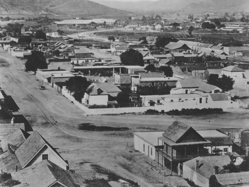 |
|
| (1871)^ - View of Los Angeles, "Sonora Town" in 1871. Photo was taken from Gen. Phineas Banning's residence on Fort Hill. View is east of North Broadway (then Buena Vista), from the hill over where North Broadway tunnel was later put in. Southern Pacific Railroad shops can be seen in the distance. |
Historical Notes Broadway was officially dedicated in 1890. Part of it was first called Calle Fortin--Fort Street--because it passed through the hilltop Ft. Moore. Another section was known as Eternity Street, because it led to a cemetery; Downey Avenue, after Gov. John G. Downey, and Buena Vista Street, whose "good view," as legend has it, was the view from the hillside of the women's bathing pools (where the senoritas wore bathing dresses). City officials eventually decided to rename Fort Street because the area's many German citizens had trouble with the pronunciation--it would come out "Fourth Street," causing confusion with a thoroughfare by that name. By 1910, all sections were dedicated under the one name, Broadway. |
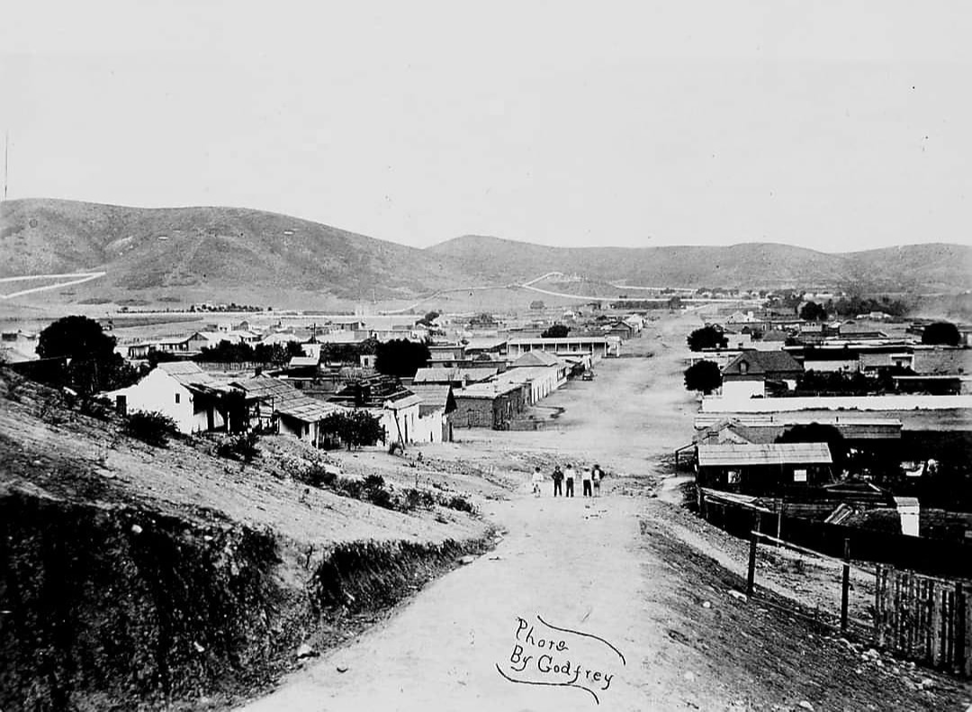 |
|
| (1870s)* - Looking northeast on Eternity Street (later North Broadway) in Sonora Town, as seen from Fort Moore Hill, with Calvary Cemetery visible in the distance. |
Then and Now
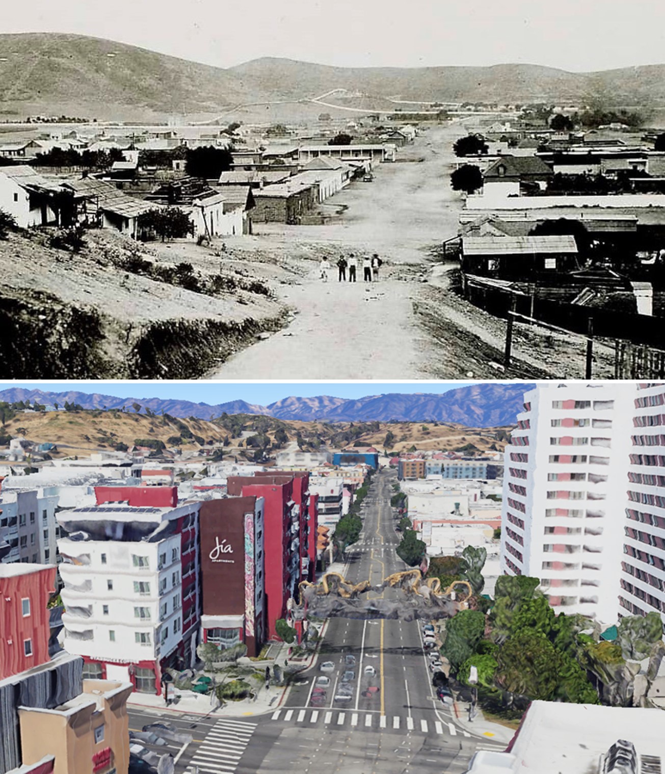 |
|
| (1870s vs 2020s) - Looking northeast on Broadway from just south of Cesar Chavez Ave (Sunset Blvd). Photo comparison by Jack Feldman. |
Historical Notes Click HERE to see more Early Views of Sonora Town. |
* * * * * |
Calvary Cemetery
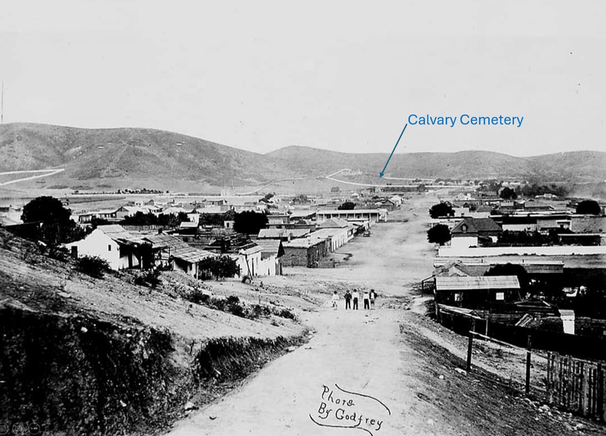 |
|
| (1870s)* - Looking northeast on Eternity Street (later North Broadway) in Sonora Town, as seen from Fort Moore Hill, with Calvary Cemetery visible in the distance. |
Historical Notes Calle Eternidad, later known as Eternity Street, was the original Spanish name for what eventually became North Broadway in Los Angeles. The street earned its name because it served as the main route for funeral processions traveling from the pueblo to Calvary Cemetery. In the early days of Los Angeles, following the city's founding in 1781, the need for a dedicated burial ground became apparent. The Catholic Church acquired land northeast of the pueblo, at the mouth of a ravine against the base of the Stone Quarry Hills. This area became known as Cemetery Ravine, which later evolved into Chavez Ravine. Calvary Cemetery, established in 1844-45, was located about a mile north of the plaza at the mouth of what would become Chavez Ravine. The street leading to this cemetery from the downtown area was called Calle Eternidad, which was later Anglicized to Eternity Street. Funeral processions would travel along Calle Eternidad, passing through the Sonoratown barrio, carrying the deceased from the plaza church to their final resting place in Calvary Cemetery. This practice continued for several decades, with the cemetery receiving an estimated 10,000 burials over its lifetime. As Los Angeles grew and developed, Calle Eternidad/Eternity Street evolved along with the city. The street was eventually renamed Broadway. Despite the name change, the street's historical significance as the pathway to eternity remained an important part of Los Angeles' cultural memory. |
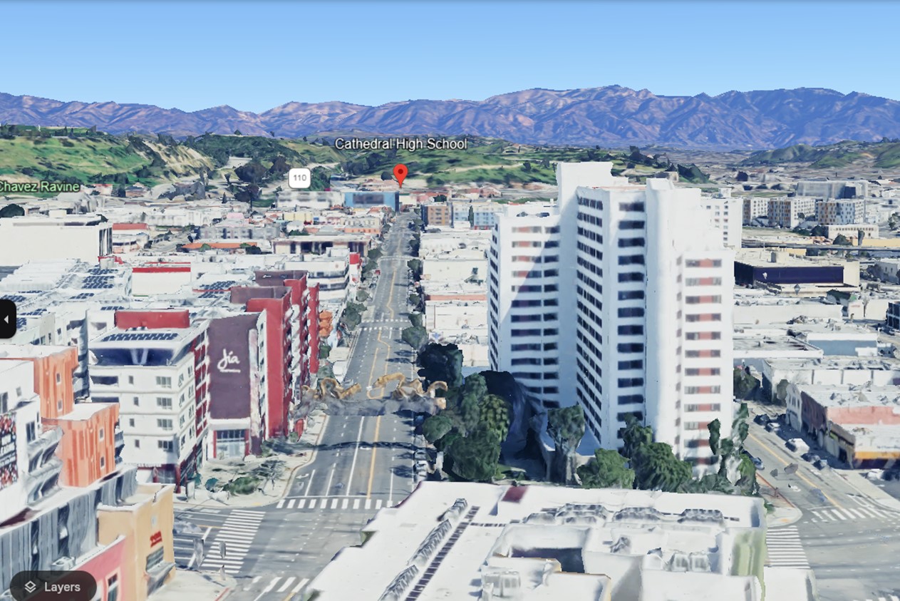 |
|
| (2023)* - Google Earth view looking north on Broadway toward Elysian Park, the former site of Calvary Cemetery, now home to Cathedral High School. |
Historical Notes Today, while the original Calvary Cemetery has been relocated and the street name has changed, the history of Calle Eternidad continues to be an integral part of Los Angeles' early development and cultural heritage. In 1896, a new Catholic cemetery was established across the Los Angeles River in East Los Angeles. This cemetery, which still exists today, is known as New Calvary Cemetery or simply Calvary Cemetery. |
Then and Now
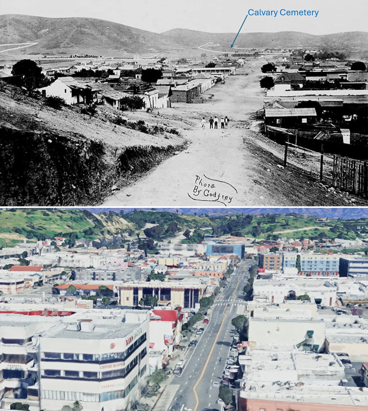 |
|
| (1870s vs 2023)* – Looking north on Eternity Street (today North Broadway) toward Calvary Cemetery, today the site of Cathedral High School. Photo comparison by Jack Feldman. |
Historical Notes This original area of Cavalry Cemetery became known as Cemetery Ravine, which later evolved into Chavez Ravine. Cathedral High School's football field is aptly named "The Graveyard," a moniker that directly ties to the school's historical location. Also, the school's athletic teams are known as the "Phantoms," a nickname that also pays homage to the school's unique location. |
* * * * * |
Broadway between Temple and 1st Streets
 |
|
| (ca. 1874)^^ - View looking south southwest down Fort St (renamed “Broadway” in 1890) between Temple (behind the camera) and 1st Street (beyond the first cut). Los Angeles High School is out of frame on the left (east) on Poundcake Hill. The steep slope spilling onto unpaved Fort Street is the future site of the Court Flight incline railway. The hill to the right was named "Bunker Hill" by developer and future LA Mayor, Prudent Beaudry (See Below). |
Historical Notes In 1867, an enterprising French Canadian immigrant named Prudent Beaudry bought the land atop Bunker Hill -- at the reported cost of $51. Beaudry constructed a system of pipes and steam-powered pumps to deliver water to the hilltop from a reservoir below. He also built roads to connect the hill to the developed flatlands below and laid out streets atop the hill. One of them, which Beaudry named Bunker Hill Avenue in honor of the 100th anniversary of the Revolutionary War battle fought in Boston, eventually lent its name to the entire hilltop community.*#* In 1868, Prudent Beaudry and his two partners, John Griffen and Solomon Lazard, formed the private Los Angeles Water Company. They would go on and sign a 30 year lease franchise agreement with the City to run its water system (1868 - 1898). Prudent Beaudry also served as the 13th Mayor of Los Angeles from 1874 to 1876. Click HERE to read more in Water in Early Los Angeles. |
Then and Now
 |
|
| (1874 vs 2023)* - Looking south on Broadway from near Temple Street. Photo comparison by Jack Feldman. |
* * * * * |
Broadway and 1st Street
(Note: Broadway was known as Fort Street until 1890)
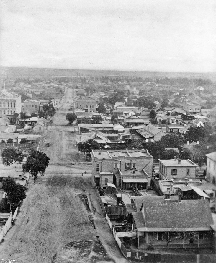 |
|
| (ca. 1870)^ - Looking east on First Street toward Broadway. |
 |
|
| (ca. 1870)^ - Looking east on First Street toward Broadway. (AI image enhancement and colorization by Richard Holoff). |
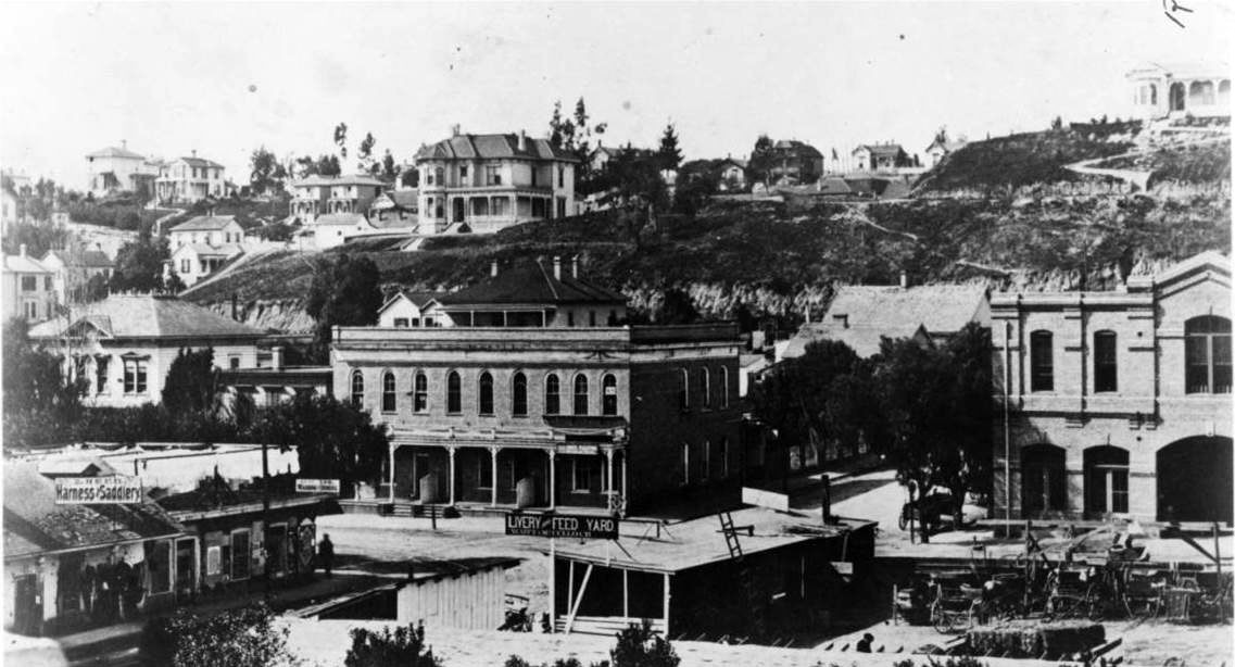 |
|
| (ca. 1874)^^ - View looking southwest at the intersection of 1st and Fort Street (later Broadway). The LA Times Building would be built on the northeast corner in the lower right. The sign on the wooden shed reads: Livery and Feed Yard. |
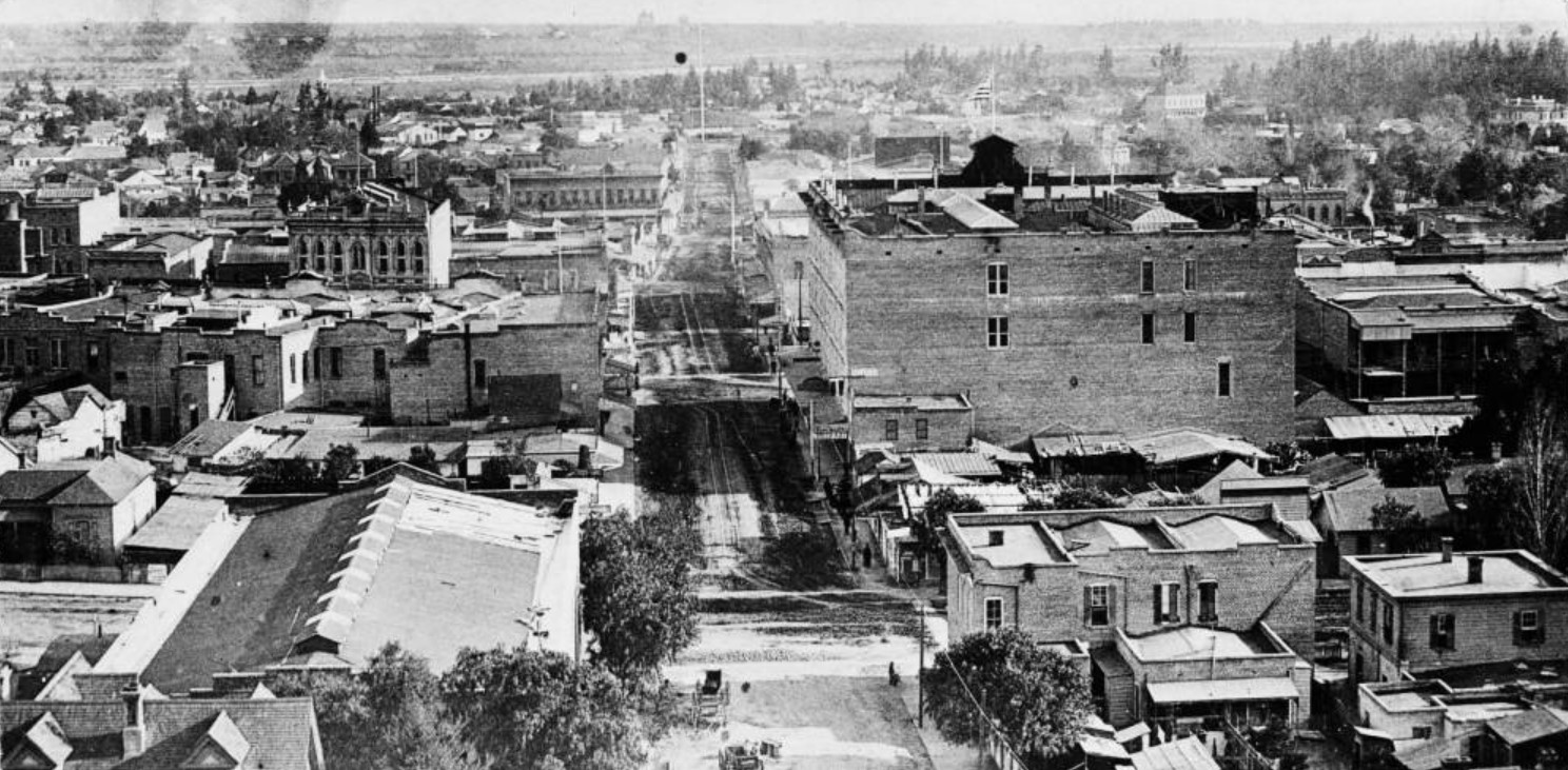 |
|
| (1884)^^ - Panoramic view looking east on First Street from Hill Street, showing the 4-story Nadeau Hotel located on the southwest corner of First and Spring streets. |
Historical Notes The photograph's dominant structure is the Hotel Nadeau, while the Natick House can be seen further east on First and Main Streets. The photograph features the following buildings: De Turk's Livery, Feed & Sale Stable (built before 1880), it's a larger building at lower left, on the north-west corner of First Street and Broadway; Hotel Nadeau (1882-1931), a large building in right center, located at the southwest corner of First & Spring Streets; Larronde Block (built in 1883), located across First Street from Nadeau Hotel, on the north-west corner with Spring Street. Schumacher Block (1880 - ca.1931), to the left of the Larronde Block, on Spring Street. Natick House (built in 1883), to the left of Nadeau, on the southwest corner of First and Main Streets; Pithian Castle Block (built in 1877) can be seen directly above Schumacher Block, with tall, narrow windows, located on Spring Street just north of First Street.^^ |
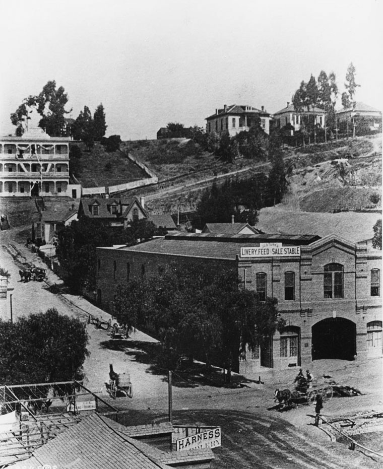 |
|
| (1886)^^ - A view of the northwest corner of 1st & Broadway. Horses and carriages were common as were the stables and liveries. The J. G. De Turk Livery Feed & Sale Stable seen here later became the Tally Ho Stables. Later the first home of the Chamber of Commerce was located here. |
Historical Notes In the lower right hand corner of the photo is an excavation for the LA Times Building which was completed in 1887. At the upper-left, the 3-story building at the northwest corner of First and Hill is the Highland Villa. |
Then and Now
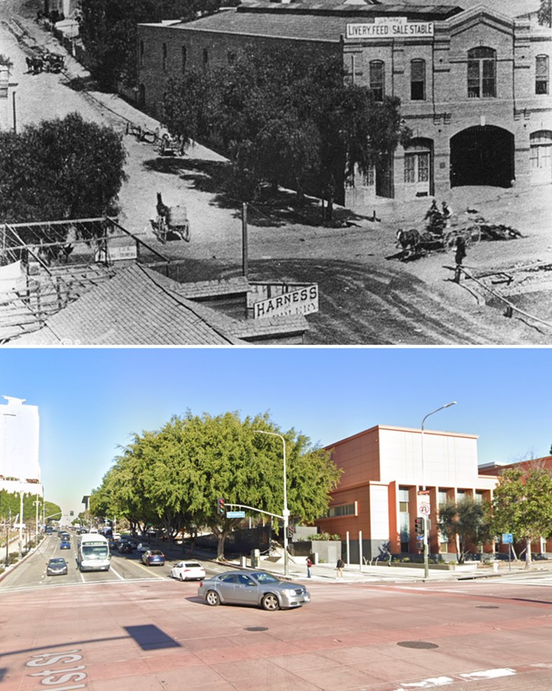 |
|
| (1886 vs 2023)* – Looking at the NW corner of Broadway and 1st streets. Photo comparison by Jack Feldman. |
* * * * * |
Los Angeles Plaza Area (Then and Now)
|
|
| (ca. 1858)* - This is the earliest known close-up photograph of the Los Angeles Plaza. There is a square main brick reservoir in the middle of the Plaza, which was the terminus of the town's historic lifeline: the Zanja Madre ('Mother Ditch'). The reservoir was built in 1858 by the LA Water Works Company. Click HERE to read more about the Zanja Madre and Los Angeles' first water supply. |
Historical Notes The site of the Plaza today is not the original location. It is the second, third, or maybe even the fourth. One of the earlier plots is believed to be around where the current Pershing Square sits. It’s also thought that at least one of the first three was washed away in a flood. The current Plaza dates from as early as 1815. When early settlers arrived at the Los Angeles River by way of Mission Road, they picked as a nearby gathering point a huge sycamore (upper right-center of photo) that gave them shelter and became a landmark, "El Aliso." That Spanish word for sycamore was later used to name the road carved out near the river (Aliso Street in 1854). El Aliso (upper center-right of photo) sprang from the ground near the western bank of the Los Angeles River in the late fifteenth century, about the same time Columbus arrived in the Americas. As it matured, the sycamore -- located at the juncture of the Los Angeles coastal plain and the San Fernando and San Gabriel valleys -- became a gathering place for Los Angeles' indigenous Tongva people. Local leaders traveled from their villages across Southern California to confer under the shade of the tree's canopy. By the mid-eighteenth century, the mighty sycamore stood at the center of one of the largest Tongva villages, Yangna. By the 1830s, due to the encroachment of the pueblo, El Aliso had ceased to function as the symbolic center of daily Tongva life as Yangna changed locations twice before dissolving into historical oblivion. |
|
|
| (ca. 1858)* - This is the earliest known close-up photograph of the Los Angeles Plaza. There is a square main brick reservoir in the middle of the Plaza, which was the terminus of the town's historic lifeline: the Zanja Madre ('Mother Ditch'). The reservoir was built in 1858 by the LA Water Works Company. Image enhancement and colorization by Richard Holoff. |
Historical Notes Click HERE to read more about the Zanja Madre and Los Angeles' first water supply. |
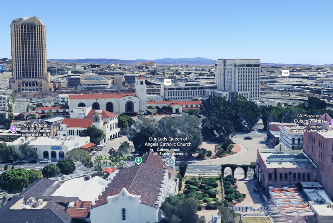 |
|
| (2023)* – Contemporary Google Earth view of the Los Angeles Plaza, now circular and surrounded by trees, government buildings, and Union Station. |
Historical Notes Though heavily modernized, the Plaza Church (just left of center) still stands as the oldest building on the site, dating to 1822. The former site of the Carrillo Adobe (demolished in 1870) is now occupied by the Pico House. |
Then and Now
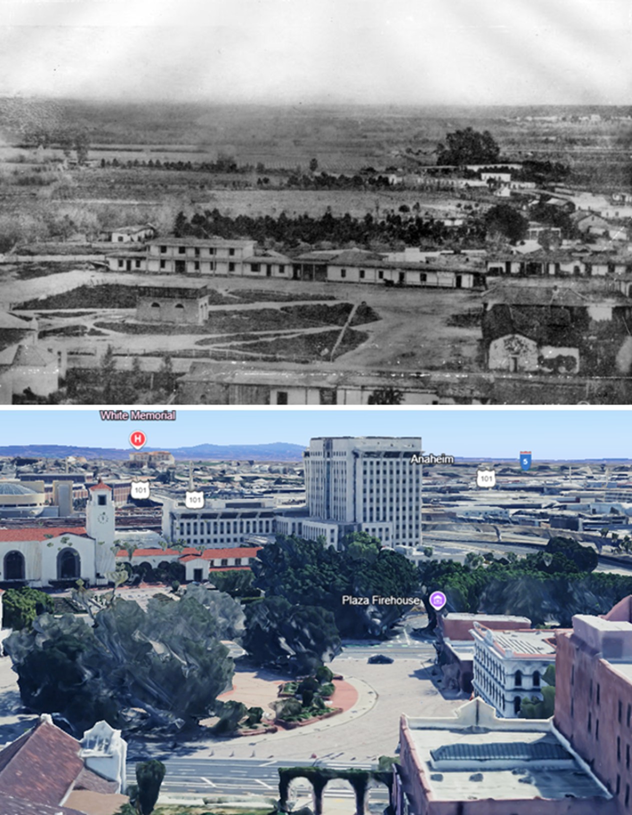 |
|
| (1858 vs. 2023)* – A 'Then and Now' view of the Los Angeles Plaza. Photo comparison by Jack Feldman. |
Historical Notes A few highlights for reference: The Plaza, once square, is now circular. In the lower-right of the 1858 image is the Carrillo Adobe, demolished in 1870 to make way for the Pico House. The Plaza Church, partially visible in the lower-left foreground of both images, is the only building still standing today. |
* * * * * |
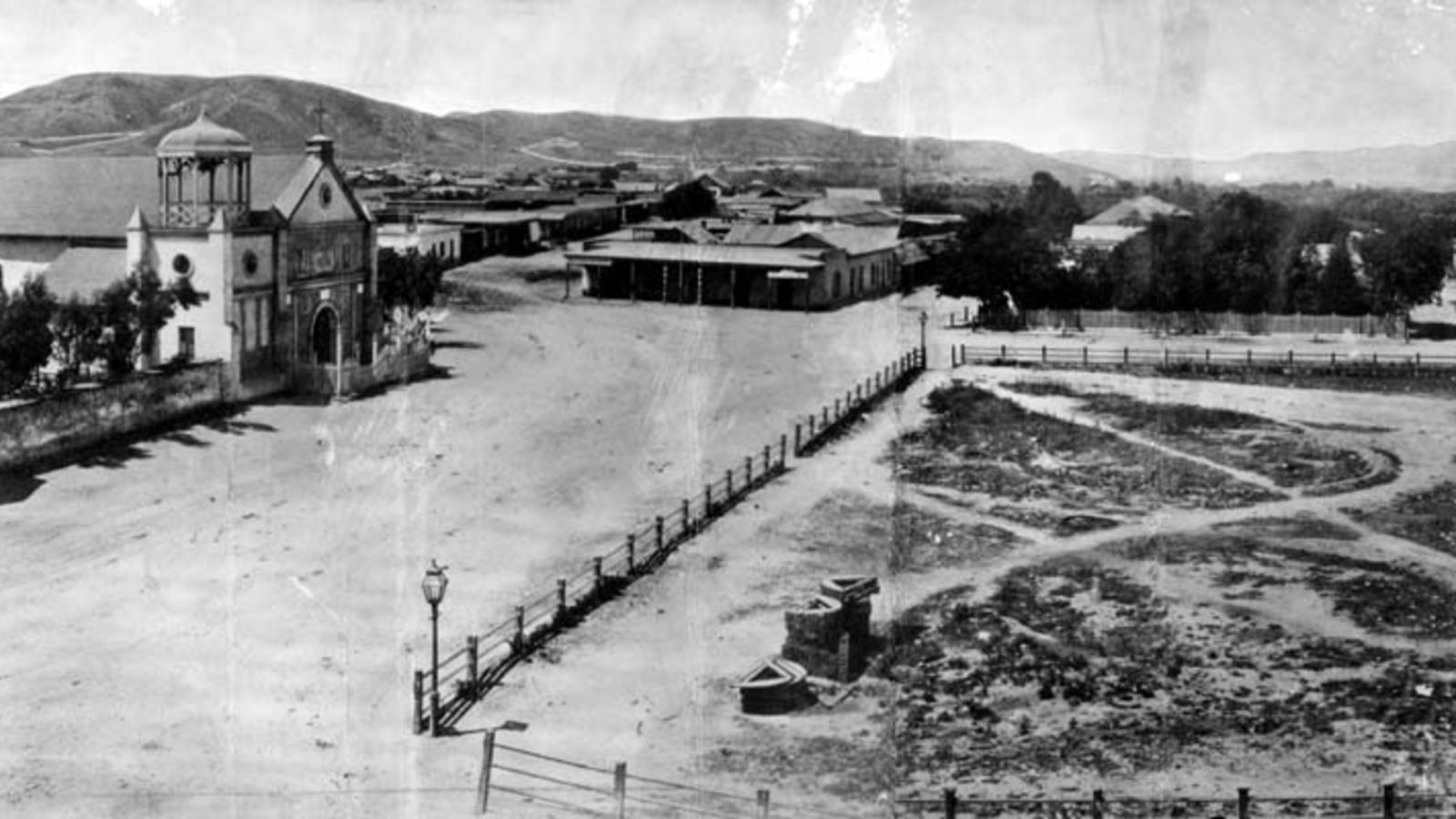 |
|
| (1869)* - View of Calle Principal (now Main Street) looking north with the Old Plaza Church seen on the left. To the right is the Los Angeles Plaza (square at the time) with two gas lamps, one on each of its corners. These were the first gas lamps installed in the City of Los Angeles. |
Historical Notes In 1867, Los Angeles Gas Company, the forerunner of today's Southern California Gas Company, installed 43 new gas lamps along Main Street, making the city safer at night. The gas lighting business was run by five entrepreneurs who manufactured the gas from asphalt, a tar-like substance, and later from oil. Click HERE to see more in Early Los Angeles Streetlights. |
 |
|
| (2015)* - Street view looking toward the Old Plaza Church on Main Street with the Los Angeles Plaza on the right. Note the ornate streetlamps. |
Historical Notes The 2015 view echoes the past while reflecting over a century of urban development. The Plaza remains a cultural centerpiece and historic landmark. |
Then and Now
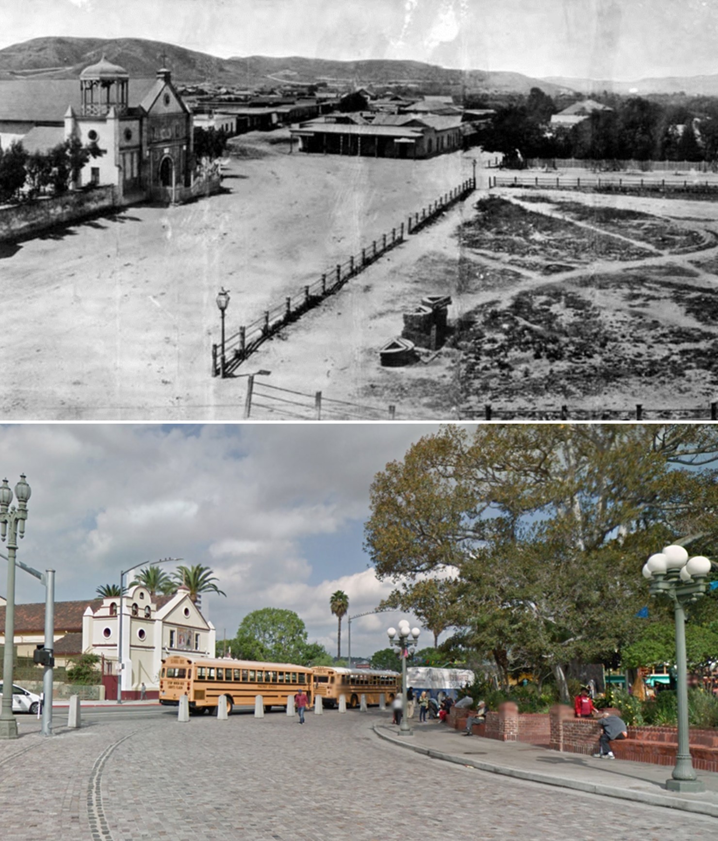 |
|
| (1869 vs 2015)* - A 'Then and Now' view of the Los Angeles Plaza and Calle Principal (Main Street). Photo comparison by Jack Feldman. |
Historical Notes These two images span nearly 150 years. The Old Plaza Church—present in both—remains a lasting symbol of the city’s origins. Gas lamps have been replaced by electric fixtures, and the unpaved Plaza is now a landscaped public space surrounded by urban infrastructure. |
* * * * * |
 |
|
| (1872)* - Looking south on North Main Street from in front of the Los Angeles Plaza and the Old Plaza Church showing the Pico House and, behind it, the Merced Theatre. In the distance can be seen the Temple Block where today's City Hall Stands. |
Then and Now
 |
|
| (1872 vs 2021)* – Looking south on Main Street from in front of the LA Plaza. Three buildings still exist today: The Pico House and the Merced Theatre on the left, and the Plaza Church on the right. In the distance of the early photo can be seen the Temple Block, current site of Los Angeles City Hall. Photo courtesy of Mark Frazier. |
Historical Notes Click HERE to see more Early Views of the 300 Block of Main Street. |
* * * * * |
|
|
| (ca. 1870)* - Early view of the 300 block of North Main Street and beyond (view is looking North). Two large buildings stand out; the Pico House on the left and the Bella Union Hotel on the right. The Pico House is located one block north, across the street from the Los Angeles Plaza. It was built in 1870 by Pio Pico, the last Governor of Alta California under Mexican rule. Click HERE to see a Then and Now comparison of the above scene. |
Historical Notes The 300 block of North Main Street was an important part of Los Angeles history as early as the mid-1800s. It was considered the uptown commercial heart of the old city and was always buzzing with activity. Built there was Los Angeles’ first hotel, the Bella Union, which was long a social and political center. The first county courthouse was in the adobe hotel, where court was held in rented rooms from 1850 to 1852. Beginning in 1858, it was the region's transportation hub. The Overland Mail Company operated by John Butterfield (the founder of American Express) rented space for a station. The Wells, Fargo and Company also had their office here and Phineas Banning operated coaches to Wilmington and San Bernardino from the hotel. Just north of the two-story Bella Union was the Pico Building, built by Pio Pico in 1868 (two years before the Pico House). In 1871, the building became home to the Farmers & Merchants Bank, the first incorporated bank in Los Angeles. |
Then and Now
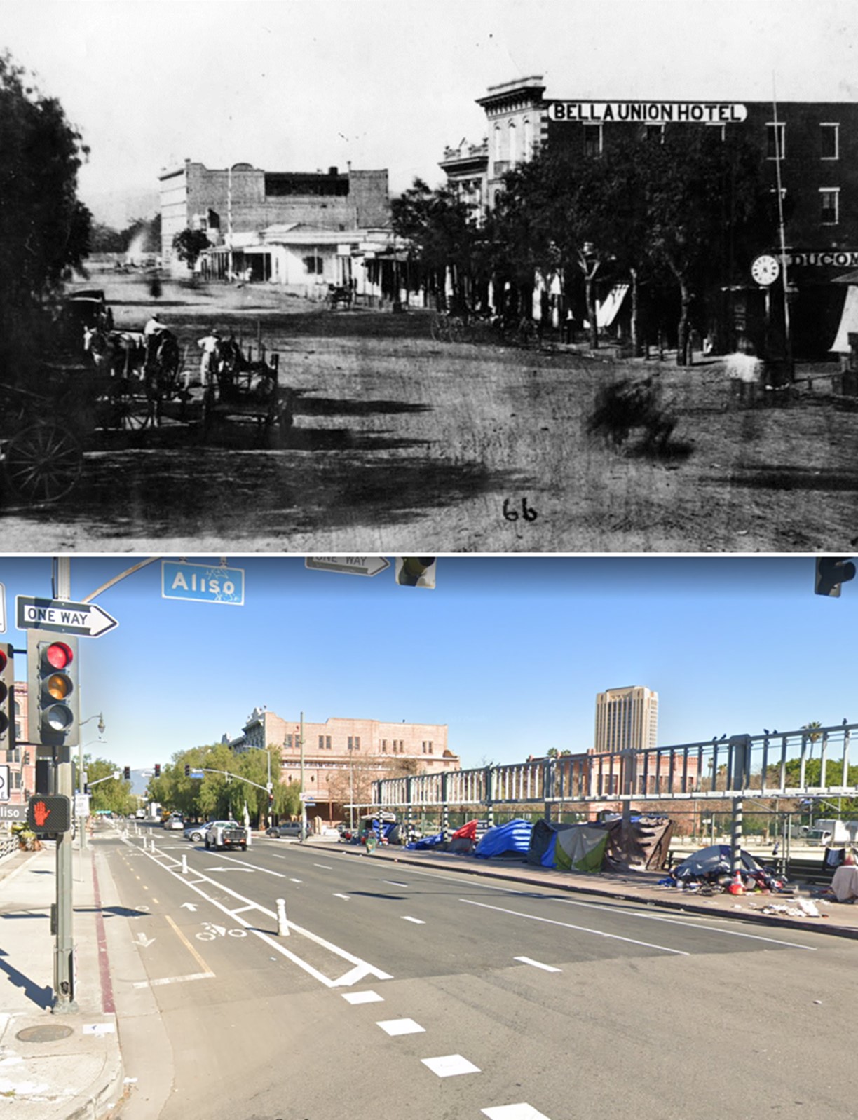 |
|
| (1870 vs 2022) – Looking North on Main Street from Aliso Street in Old Downtown Los Angeles. Photo comparison by Jack Feldman. |
Historical Notes Click HERE to see more Early Views of the 300 Block of Main Street. |
* * * * * |
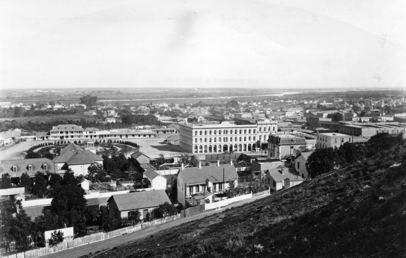 |
|
| (1876)^ - Panoramic view of the Los Angeles Plaza on a very clear day. The Pico House is the prominent 3-story white building at the center of the photo. To its right stands the Merced Theatre. The LA River can be seen in the background. |
Historical Notes Pío Pico constructed the Pico House in 1869-70. The first three-story hotel built in Los Angeles, it had about eighty rooms, large windows, a grand staircase, and a small interior courtyard. In 1880, Pio Pico would lose the hotel by foreclosure. Also, between 1892 and 1920, the hotel would be known as the National Hotel. The Pico House (Hotel) was designated as California Historical Landmark No. 159. Click HERE to see California Historical Landmarks in LA. |
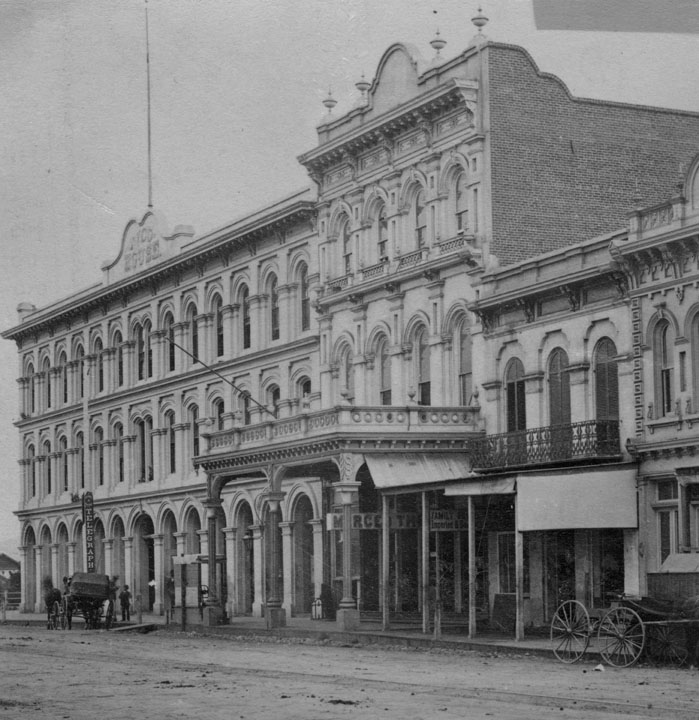 |
|
| (1870s)^ - The Merced Theater sits between the Pico House and the Mason Lodge. This was the "first business block on Main Street". |
Historical Notes The Merced Theatre, erected in 1870 on North Main Street next to the Pico House, was the first building built expressly for theatrical purposes in Los Angeles. It was built by William Abbot, a cabinetmaker, and named in honor of his wife Merced Garcia. The theater was built in an Italianate style and operated as a live theater from 1871 to 1876. When the Woods Opera House opened nearby in 1876, the Merced ceased being the city's leading theater. Eventually, it gained an "unenviable reputation" because of "the disreputable dances staged there, and was finally closed by the authorities." The Merced Theatre was dedicated as California Historical Landmark No. 171 (Click HERE to see complete listing). It is also listed on the National Register of Historic Places. |
* * * * * |
LA's First Streetcars
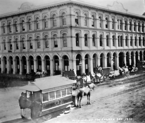 |
|
| (1874)^^ - A horse-drawn streetcar of the Spring & Sixth Railway in front of the Pico House (Note: the photo indicates 1870, however, that date does not align with historic records indicating first streetcar in 1874). |
Historical Notes L.A.'s first streetcars ran under horsepower. Steam locomotives were considered too dirty and dangerous for use on city streets still teeming with easily spooked horses, and cable car technology was still new and expensive. Electric-powered traction railways, meanwhile, remained more than a decade off. On July 1, 1874, the modest, horse-drawn cars of the Spring and Sixth Street Railroad became the first streetcars to roll down Los Angeles streets. Founded by lawyer Robert M. Widney, the Spring & Sixth operated a regular schedule, running cars hourly on weekdays between 6:30 a.m. and 10 p.m. For a ten-cent fare, passengers could ride the one-and-a-half-mile route from the intersection of Temple and Spring south to Sixth, and then west to Figueroa. Soon, L.A.'s streetcar network expanded as new railways opened and existing lines extended their tracks across the city. The Plaza functioned as a central hub for the city's growing streetcar network, with lines radiating out in several directions. Click HERE to see more on horse-drawn streetcars. |
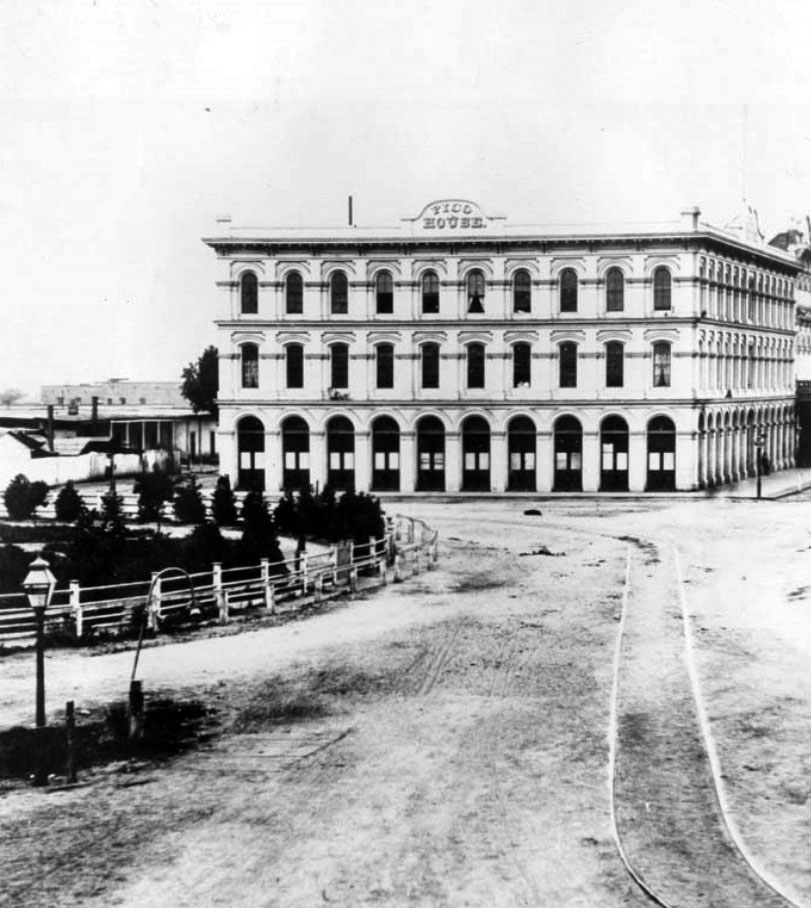 |
|
| (ca. 1877)^## – View looking southeast toward the Pico House with the LA Plaza on the left. Streetcar rails are seen on the dirt road. Note the gas street lamp on the left. |
Historical Notes In 1867, Los Angeles saw its first street gas lamps. A total of 43 were installed along Main Street. A lamplighter on horseback rode down the street at dusk to light the streetlights. By 1873, about 136 gas lamps provided the outdoor night lighting for the City. Things would change in 1882 when electricity was introduced. That year 3,000-candle power arc lamps were lifted atop seven 150-foot poles. The state of the art at that time encouraged the use of a few tall standards with high illumination. The gas street lamps would see their last days. Click HERE to see more in Early Los Angeles Streetlights. |
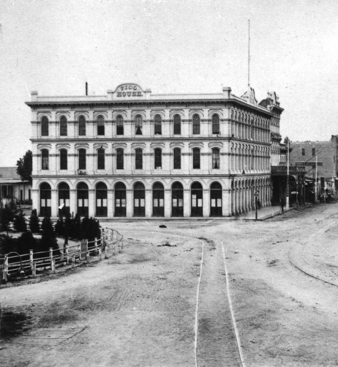 |
|
| (1878)^ - The Pico House, sometimes called "Old Pico House", built by Pio Pico in 1869-70. Seen here from the Main St. entrance of the Plaza. The road in front and to the side of the building is dirt, and a set of tracks runs down the middle. The railway tracks were part of the East L.A. and San Pedro Street Railway. (Same as above but shows a portion of Main Street). |
Historical Notes The East Los Angeles & San Pedro Railway Company was founded by Judge Robert M. Widney (also one of the founders of the University of Southern California), this line was incorporated on May 1, 1875 but did not begin construction until March 1876. This horse car driven system ran north from Fourth Street and was intended to lay track to the new Southern Pacific depot. It reached only to College Street and North Broadway. The Pico House was designated California Historical Monument No. 159 (Click HERE to see complete listing). It is also listed on the National Register of Historic Places: NPS-72000231. Click HERE to see more in Early Views of the LA Plaza. |
* * * * * |
300 Block of North Main Street
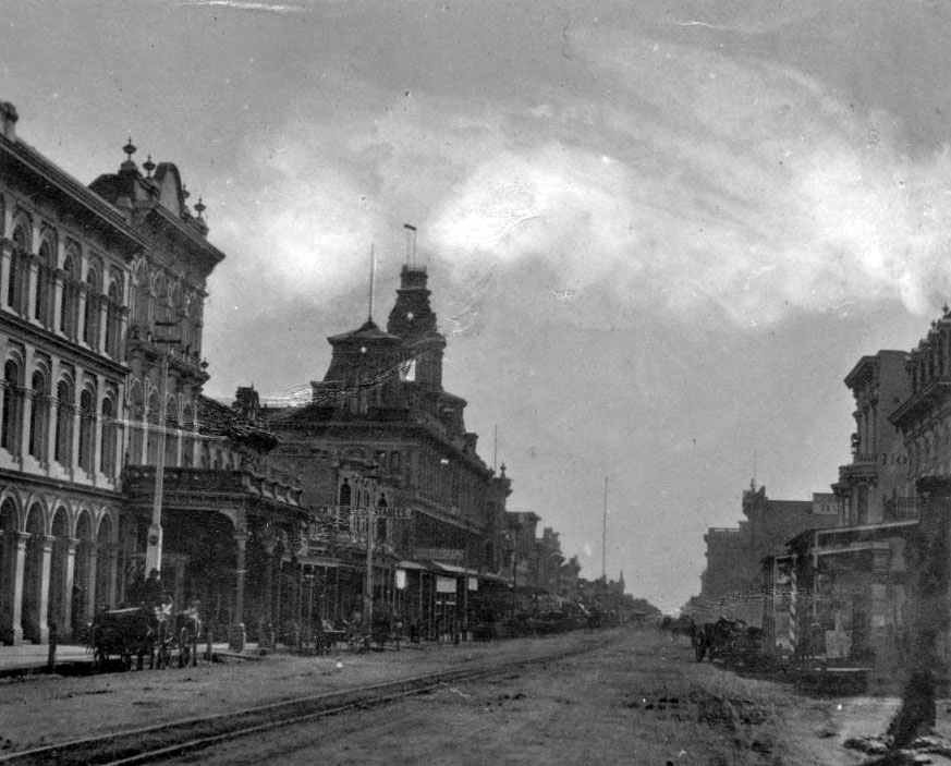 |
|
| (ca. 1878)^^ - View of the 300 block of N. Main Street looking south from near the LA Plaza. A horse-drawn wagon with two men in it is parked in front of the Pico House near the Merced Theatre on the left. The road is unpaved and a streetcar track runs down the middle. Both sides of the street are lined with imposingly large buildings. At center on the left side of the street is a very large ornate building topped by three prominent towers. It is the historic Baker Block. |
Historical Notes The 300 block of North Main Street was an important part of Los Angeles history as early as the mid-1800s. It was considered the uptown commercial heart of the old city and was always buzzing with activity. Built there was Los Angeles’ first hotel, the Bella Union, which was long a social and political center. The first county courthouse was in the adobe hotel, where court was held in rented rooms from 1850 to 1852. Beginning in 1858, it was the region's transportation hub. The Overland Mail Company operated by John Butterfield (the founder of American Express) rented space for a station. The Wells, Fargo and Company also had their office here and Phineas Banning operated coaches to Wilmington and San Bernardino from the hotel. Click HERE to see more in Early Views of the Historic 300 Block of N. Main Street. |
* * * * * |
Temple Block
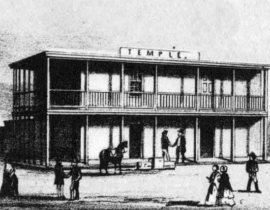 |
|
| (ca. 1850s)^^# - Sketch of John Temple’s original two-story adobe at the intersection of Spring, Main and Temple, which became known as Temple Block. |
Historical Notes In 1827, Jonathan Temple moved to the Pueblo de Los Angeles, where he opened the pueblo's first store, a business he operated for almost thirty years. Temple Street (Los Angeles) was developed by him as a modest one-block dirt lane in the 1850s. |
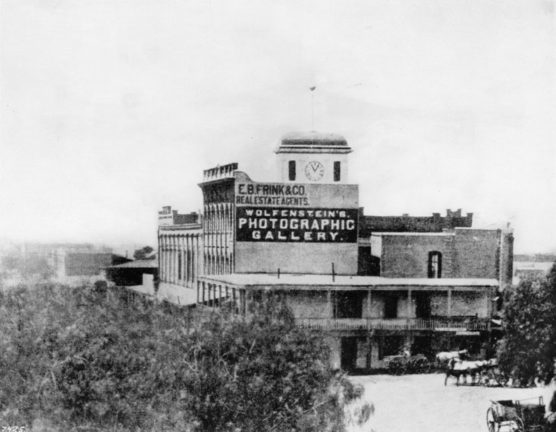 |
|
| (ca. 1872)^ - Temple Block exterior view looking south toward Temple Street from some point on the Main Street side of the buildings. John Temple's original two-story adobe can be seen as part of the Temple Block. |
Historical Notes The view above shows John Temple's 1858 Clocktower Market/Courthouse building and the first three buildings on the rest of Temple block. The original Temple Block structure is the two-story adobe at front (see photo above) at the intersection of Spring, Main and Temple. It was demolished by FPF Temple ("Tempelito"), John's half-brother, to build the new Temple Block building in 1871. "Temple Block" seems to be used to identify all of these buildings and also, only the one in front, facing the intersection (whether the old adobe Temple Block or the new Italianate Temple Block). |
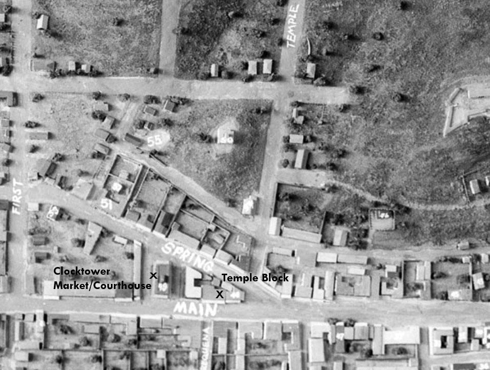 |
|
| (n.d.)* - Temple Square (Temple Block) appears at the bottom-center of this photograph of a model of old Los Angeles. John Temple's 1858 Clocktower Market/Courthouse building is also identified. This would become the future site of the current City Hall. |
Historical Notes Spring Street was realigned when construction of the new City Hall began in early 1927. Spring now runs parallel to Main, and intersects with Temple where the current 28-story City Hall building is now located. Click HERE to see more Early Views of the Original Temple Block |
* * * * * |
Temple Street
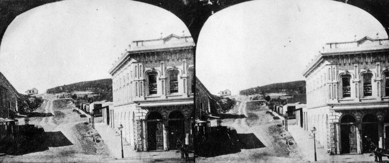 |
|
| (ca. 1870)^ - Stereographic card showing an unpaved Temple Street, looking west from Main Street. In the right foreground is the Downey Block located on the northwest corner. |
Historical Notes In 1827, Jonathan Temple moved to the Pueblo de Los Angeles, where he opened the pueblo's first store, a business he operated for almost thirty years. Temple Street was developed by him as a modest one-block dirt lane in the 1850s. |
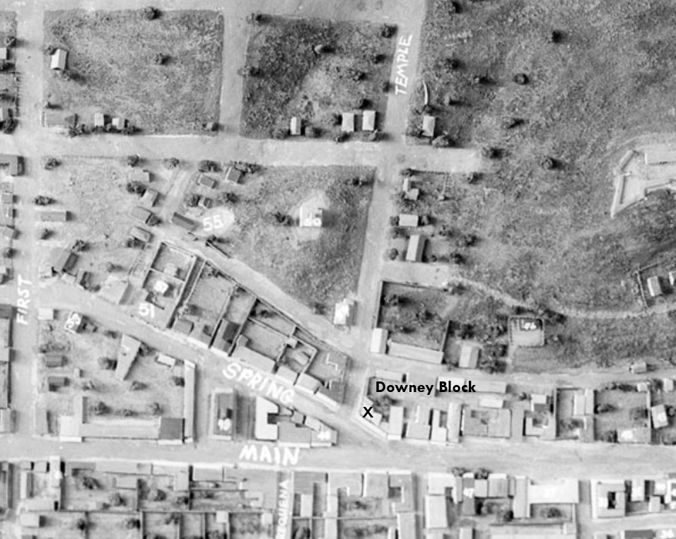 |
|
| (n.d.)* - Downey Block was located on the northwest corner of Main and Temple streets, highlighted at the bottom-center of the above model of old Los Angeles. Temple Street starts at the intersection of Spring and Main from where the Temple Block was built. |
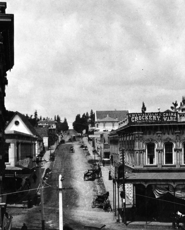 |
|
| (ca. 1884)* - View of an unpaved Temple Street, looking west as seen from the second floor of the Temple Block on Main Street. Horse-drawn carriages and wagons are parked along the street. In the right foreground is the Downey Block, housing the Crystal Palace, wholesale and retail sellers of crockery and china ware. Behind it is the Temple Street Stables. At left-center with ptiched roof and circular window is the St. Athanasius Episcopal Church located at the southwest corner of Temple and New High streets. Poles strung with electric/telephone wires are seen in the foreground. |
Historical Notes Temple Street here runs up a pretty steep hill (Poundcake Hill). Over the years the hill would be shaved down to accomodate new construction and an easier passage. Click HERE to see more Early Views of Poundcake Hill. |
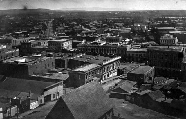 |
|
| (1870s)^## - View looking northeast from the top of Poundcake Hill showing the Downey Block (center) at Temple and Main streets. The building with the pitched roof in the foreground is St. Athanasius Episcopal Church. Across the street is the Temple Street Stables (lower-left). Also seen is the Temple Block at center-right. The Los Angeles River runs horizontally across the top of the photo and the wide street at upper left is Aliso Street where the 101 Freeway runs today. |
Then and Now
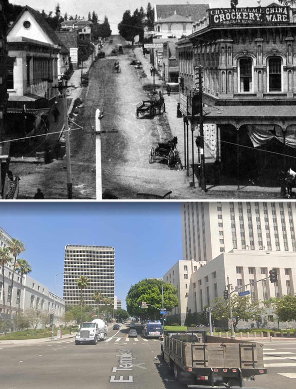 |
|
| (1884 vs. 2022)* - Looking west on Temple Street at Main Street. Note how much the hill (Poundcake Hill) in the background has been shaved down over the years. Photo comparison by Jack Feldman. |
Historical Notes Click HERE to see more Early Views of Poundcake Hill. |
* * * * * |
Main Street in the 1870s, North of Temple Street
 |
|
| (ca. 1870)* — View of wagons in front of shops on the west side of Main Street, north of Temple Street. The Lafayette Hotel appears at the far right, identifiable by its chimney. Houses on Fort Moore Hill rise in the background. Store signs include “Harris and Jacoby, Successors to H. W. Hellman” and “M. Kremer.” |
Historical Notes This view shows Main Street when it was still unpaved and dominated by horse drawn traffic. The businesses along the west side served merchants, travelers, and nearby residents. The Lafayette Hotel was one of several early lodging houses catering to visitors arriving by stage and rail. Fort Moore Hill, seen behind the shops, was an early residential and military landmark that later disappeared as downtown expanded and streets were regraded. |
 |
|
| (1873)* - View looking north on Main Street near Temple Street. The Downey Block, located at the northwest corner of Main and Temple streets, is visible on the left. |
Historical Notes The Downey Block was one of the most important commercial buildings in early Los Angeles. Its second floor housed the photography studio of Henri Penelon, who documented the city during its formative years. The Lafayette Hotel stands just beyond it, marked by a chimney. In the far distance is the belfry of the Plaza Church. In 1873, Los Angeles organized its Chamber of Commerce and opened its first public library nearby, signaling the city’s transition from frontier town to organized municipality. |
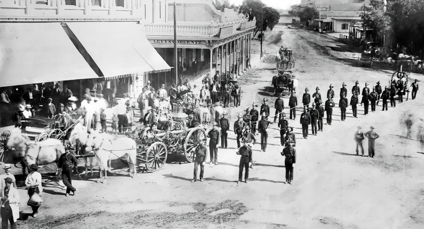 |
|
| (1871)* - First civic parade in Los Angeles, July 4, 1871. Volunteer firemen follow a horse drawn cart carrying a pressurized water pump. The view looks north at the intersection of Main, Spring, and Temple streets, with the Downey Block on the left. |
Historical Notes Public celebrations such as this parade were important expressions of civic pride in early Los Angeles. The volunteer fire department played a central role in public life, as fires were a constant threat in a city built largely of wood. The Downey Block’s prominent location made it a frequent backdrop for parades, speeches, and gatherings, reinforcing its role as a civic landmark. |
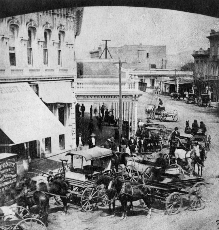 |
|
| (ca. 1871)* - North Main Street, looking north from Temple Street. The Downey Block stands on the northwest corner at left. In the upper right is the Bella Union Hotel, considered the first hotel in Los Angeles. Horse drawn wagons crowd the foreground. |
Historical Notes This image illustrates the congestion and activity of Temple Square, the commercial and transportation center of the city. The Bella Union Hotel served travelers, politicians, and businessmen and was closely tied to the city’s early social life. The heavy wagon traffic reflects Main Street’s role as a supply route linking farms, ranches, and regional trade with downtown businesses. |
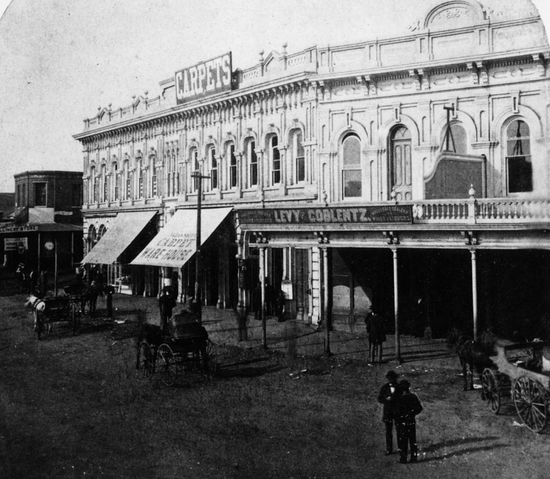 |
|
| (ca. 1875)* - View showing the Main Street side of the Downey Block, with Temple Street at left. Two well dressed men stand on the dirt roadway in front of the building. |
Historical Notes By the mid 1870s, the Downey Block symbolized stability and success in a growing city. The men’s clothing reflects rising prosperity and a more established business class. The block housed a variety of offices, shops, and services that attracted professionals and merchants and helped define Main Street as Los Angeles’s primary commercial corridor. |
 |
|
| (1878)* - View looking north on Main Street from in front of the Temple Block. The Downey Block is on the left at the northwest corner of Main and Temple streets. In the distance stands the ornate Baker Block with its rooftop towers. |
Historical Notes The Baker Block, completed around 1877, represented a new level of architectural ambition in Los Angeles. Its height and ornamentation reflected confidence in the city’s future. Over time it housed offices, shops, and apartments. The eventual demolition of both the Baker Block and surrounding structures made way for U.S. Route 101, permanently altering this historic area. |
|
|
| Model of downtown Los Angeles in the 1870s, showing the location of the Downey Block at the northwest corner of Main and Temple streets.* |
Historical Notes This model helps place the Downey Block within the broader landscape of 19th century Los Angeles. The intersection of Main, Spring, and Temple streets formed Temple Square, the city’s commercial and civic heart. The Downey Block anchored this area and supported dozens of businesses, contributing to the development of downtown as the economic center of Southern California. Click HERE to see more early view of the Downey Block. |
Then and Now
.jpg) |
|
| (1873 vs. 2024)* — Main Street looking north from near Temple Street, showing the Downey Block at left, now the site of the U.S. Courthouse. Photo comparison by Jack Feldman. |
Historical Notes This view compares Main Street in 1873 with the same location in 2024. In the earlier image, the Downey Block stands on the northwest corner of Main and Temple streets. At the time, this area was the center of business and daily life in Los Angeles, with unpaved streets, horse drawn wagons, hotels, shops, and nearby civic buildings. Today, the Downey Block is gone and the site is occupied by the United States Courthouse. The change reflects how downtown Los Angeles evolved from a small commercial district into a center of government and public institutions. Over time, many early buildings were removed as streets were widened and the area was rebuilt to serve new uses. Seen together, the images show how Main Street has changed in appearance and purpose while remaining an important part of the city’s history. |
* * * * * |
Main Street in the 1870s, South of Temple Street
.jpg) |
|
| (1873)* - View looking south on Main Street from Temple Street during a Fourth of July parade. Horse drawn vehicles and spectators line the street as the procession passes through the area near the Temple Block. |
Historical Notes Fourth of July parades were major civic events in early Los Angeles and often followed routes through the city’s most important commercial and governmental areas. South of Temple Street, Main Street passed directly alongside the Temple Block, which housed city and county offices and served as a focal point of public life. Parades moving through this area symbolized civic unity and local pride. The scene reflects how public celebrations, government functions, and daily commerce overlapped in the heart of the city during the 1870s. |
* * * * * |
Downey Avenue Bridge
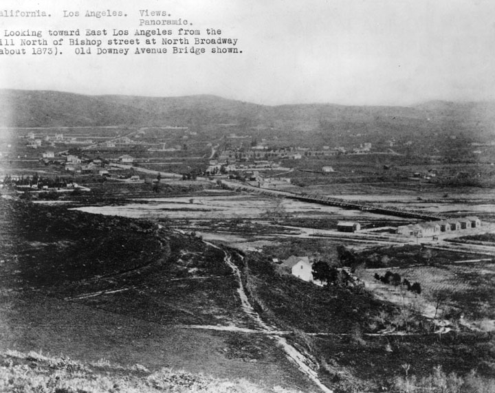 |
|
| (ca. 1883)^ - View looking toward Boyle Heights and East Los Angeles from the hill north of Bishop Street at North Broadway. The Old Downey Avenue Bridge (now North Spring St.) across the Los Angeles River is seen at center. |
 |
|
| (1886)* - View showing the flood damage to the Santa Fe tracks on the old Downey Avenue Bridge (later North Broadway) during the Los Angeles flood of 1885-1886. Several people are standing in front of a lumber pile and shed, near the washed-out Santa Fe tracks on the banks of the Los Angeles River. In the foreground, two large ropes cross the tracks and continue down to the river, where one rests on a pile of debris. Across the water, the damaged Downey Avenue Bridge can be seen, and a streetcar is at the extreme right of the picture. |
Historical Notes In 1886, the LA River washed out the adjacent tracks of the Santa Fe Railroad. The Downey Avenue Bridge, visible in the background, was also destroyed. Click HERE to see more in Los Angeles River the Unpredictable. |
* * * * * |
Boyle Heights
 |
|
| (1877)* - Drawing by E.S. Glover showing Boyle Heights with the Los Angeles River across the center and Los Angeles city in the background. The Aliso Street Bridge can be seen at center with the Macy Street Bridge to its right. |
_CROPPED.jpg)
Historical Notes In 1858, Andrew Boyle purchased land on Paredon Blanco, planted vineyards, and built a home on what became Boyle Avenue. The area was once called Paredon Blanco (White Bluff) when California was part of Mexico. In 1875, William H. Workman subdivided the area east of the Los Angeles River for residential development and named it "Boyle Heights" in honor of his father-in-law, who he inherited the land from. |
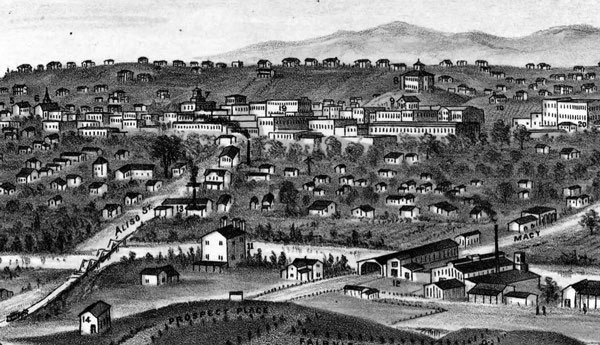 |
|
| (1877)* - Detail of previous drawing, showing the city's first bridge, Macy Street Bridge on the right and the later Aliso Street bridge on the left. The view looks west toward downtown Los Angeles from Boyle Heights. |
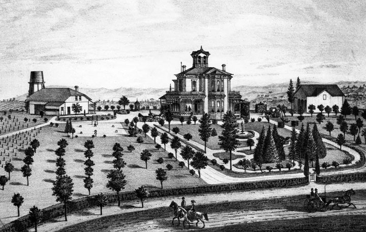 |
|
| (ca. 1880)^ - Engraving of the "Villa de Paredon Blanco," Residence of J.E. Hollenbeck, in Boyle Heights, 1-1/4 miles southeast of downtown Los Angeles. |
Historical Notes In 1874, John Edward Hollenbeck and his wife visited Los Angeles. The community was growing rapidly, and businesses were investing heavily in anticipation of the coming of the Southern Pacific Railroad. While visiting California, Hollenbeck, who made his wealth in Nicaragua, purchased several parcels of real estate and deposited funds in Temple and Workman Bank. Hollenbeck soon closed out his Nicaraguan businesses and made his final move to the United States. Arriving in Los Angeles early in the spring of 1876, Hollenbeck purchased land on the east side of the Los Angeles River, and built a large residence with broad verandas and a tower on extensive grounds on Boyle Avenue. He made twenty-seven acquisitions of property by 1880; spending $108,875 for a total of 6,738 acres. The real estate holdings included 600 acres south of the city limits, much of which was planted in vineyards. In the San Gabriel Valley, he owned orchards of oranges, lemons, and grapes; and invested in 3,500 acres of Rancho La Puente — a grain and stock ranch. In 1884 he purchased and developed an urban business district, known as the Hollenbeck Block, within Los Angeles. Hollenbeck was elected to the Los Angeles Common Council, the governing body of the city, on December 3, 1877, for a term ending on December 6, 1878. In 1878 Hollenbeck became a stockholder in the Commercial Bank of Los Angeles, and was elected its president. In 1881, he and other investors organized and established the First National Bank. |
* * * * * |
Main, Spring, and 9th Streets
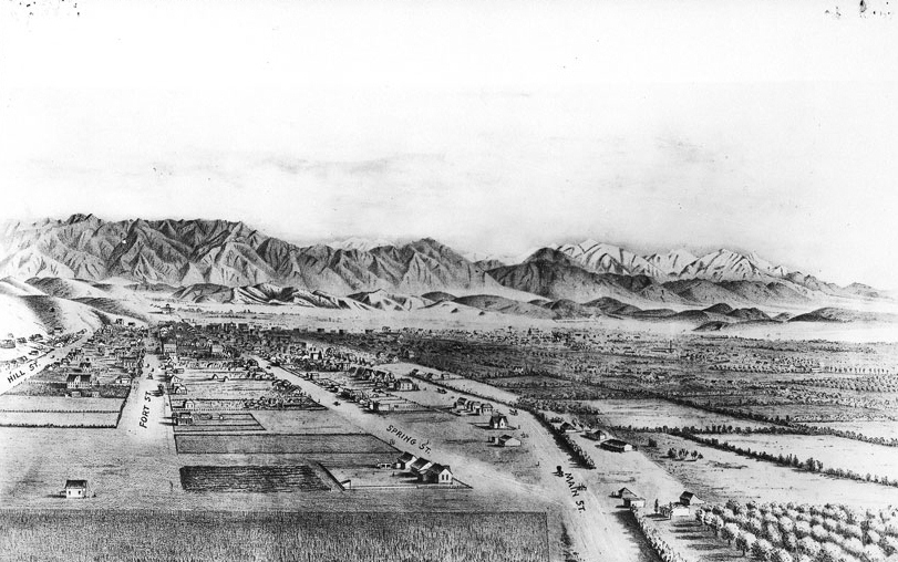 |
|
| (ca. 1873)* - Drawing of Los Angeles as it appeared circa 1873. View looking North from the junction of Main, Spring, and 9th Street. |
Historical Notes The junction of Main, Spring, and 9th streets, seen at lower-right, has beeen one of the most photographed intersections in the City. Click HERE to see more. |
* * * * * |
Main and 10th Street (Elijah Workman Home)
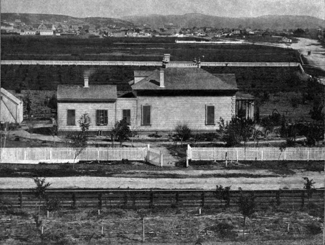 |
|
| (ca. 1870)* - This early photo captures the one-story home of Elijah Workman, built on his 40-acre farm bounded by Main Street, Broadway, 10th Street, and 11th Street. Looking north, Main Street stretches into the heart of Los Angeles, with Spring Street branching off to the left at 9th Street, visible in the upper right of the photo. Photo by W.M. Godfrey (Ernest Marquez Collection). |
Historical Notes Much of the young city—then home to about 6,000 residents—is visible beyond the house. Straight behind the peak of the roof, the white clocktower of the County Courthouse atop the Temple Block rises prominently—one of the most recognizable landmarks of early Los Angeles. To the far left, St. Vincent’s College can be seen near the newly created Central Park (later renamed Pershing Square). |
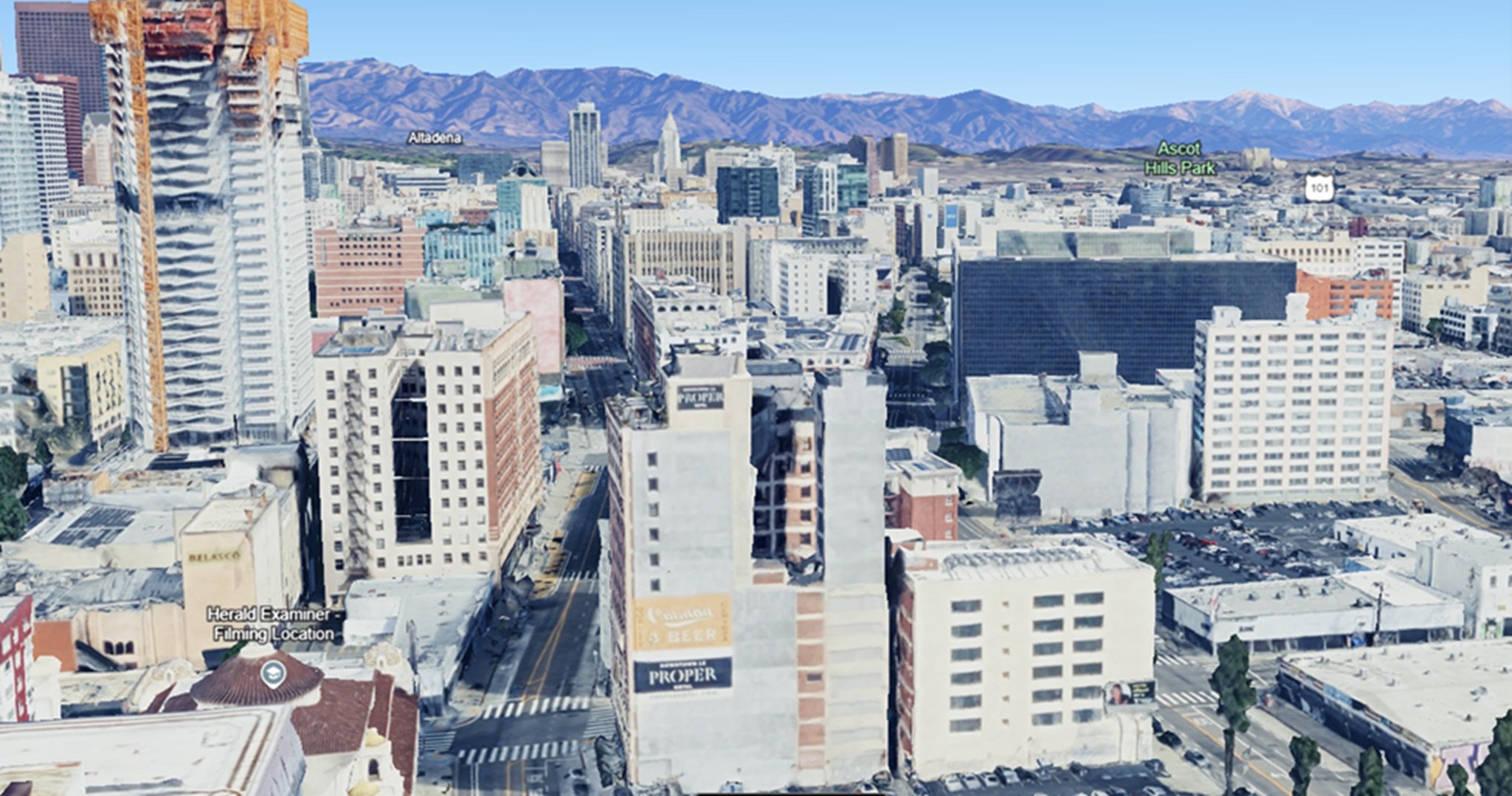 |
|
| (2024)* - Contemporary view looking north from above where Elijah Workman's house once stood. |
Then and Now
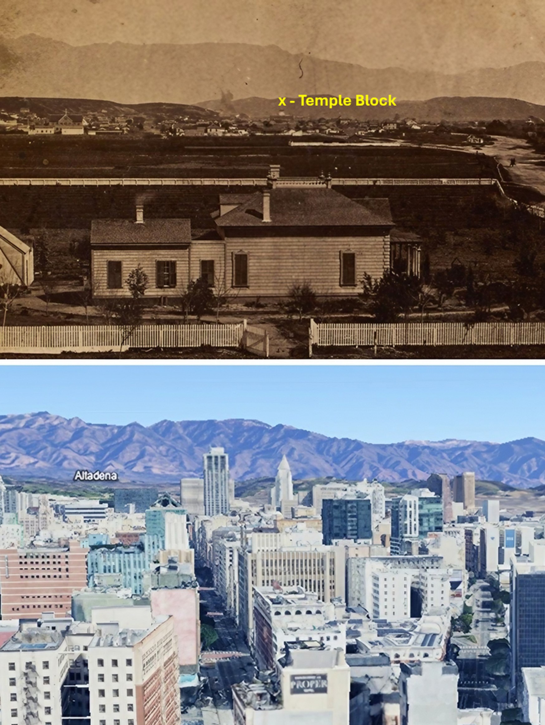 |
|
| (1870 vs. 2024)* – A "Then and Now" comparison looking north from 11th Street between Broadway and South Main Street toward the heart of downtown Los Angeles. The early photo shows Elijah Workman's farmhouse and farmland, with the young city just beginning to emerge in the distance. If you look closely, you can spot the white clock tower of the County Courthouse atop the Temple Block—the site where today's Los Angeles City Hall now stands. Photo comparison by Jack Feldman. |
* * * * * |
Main Street and 11th/12th Street (Ozro Child House)
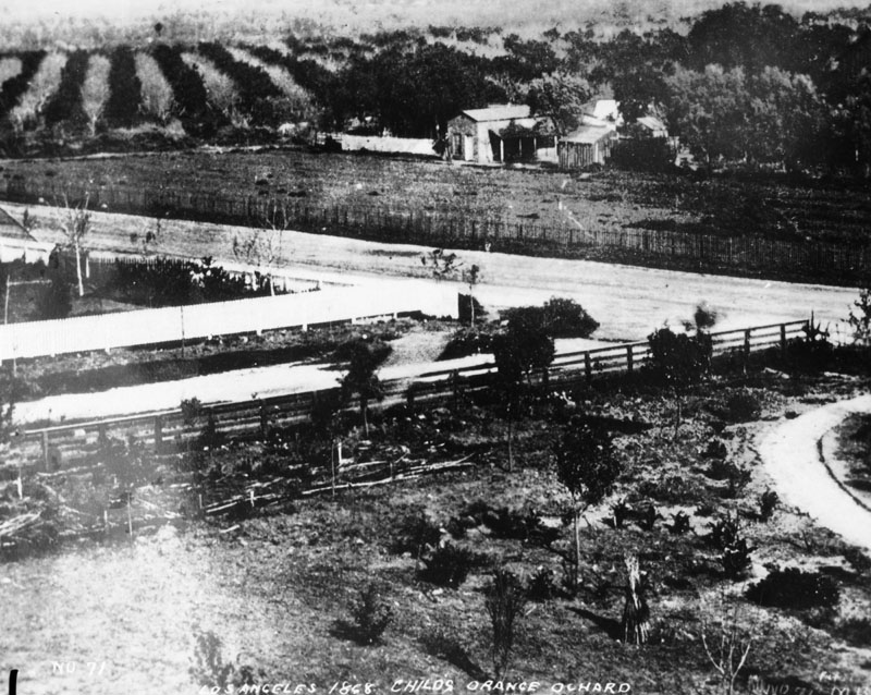 |
|
| (1868)^ - View of Ozro Childs' orange orchard in 1868 at the corner of Main and 12th Streets. The Childs Residence was located at 1111 S. Main Street. |
Historical Notes Ozro W. Childs obtained the contract to build an extension of the Zanja Madre, a canal system to bring water to the fields south of the pueblo. He was paid in land in that area – all now within present day Downtown Los Angeles - from Sixth to Ninth, and Main to Figueroa Street. Click HERE to see more in Zanja Madre - LA's Original Aqueduct. This property was the foundation of his fortune. He built a substantial house at 10th and Main, then a half-mile from town center, and on his property took up planting. In his day, Ozro Childs was Los Angeles’s most prominent plantsman, with a Plant nursery. Childs was also involved in philanthropic work. When Judge Robert Maclay Widney set out to create a university in Los Angeles in the 1870s, he received assistance from donors including Childs. In 1879, Childs contributed a considerable amount of land to the founding of the University of Southern California, which opened in 1880. |
 |
|
| (ca. 1880s)* - View of Ozro W. Childs’ house located at 1111 S. Main Street. The photo shows the exterior front of the house, with a horse-drawn carriage next to a tree, as well as a child wearing a white dress and hat to the left of the picture. |
Historical Notes Childs was also involved in philanthropic work. When Judge Robert Maclay Widney set out to create a university in Los Angeles in the 1870s, he received assistance from donors including Childs. In 1879, Childs contributed a considerable amount of land to the founding of the University of Southern California, which opened in 1880. |
* * * * * |
Early Downtown
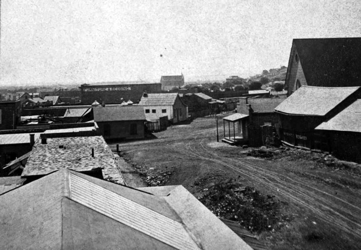 |
|
| (ca. 1874)#^ - View looking south on New High Street in downtown Los Angeles, towards the intersection with Temple Street. The steep roof of St. Athanasius Episcopal Church can be seen at the intersection with Temple Street at right and the side of a two-story building with the sign "Furniture & Bedding" can be seen, located on Spring Street. Further back can be seen a large building. This was Congregation B'nai B'rith, LA's first Synagogue. |
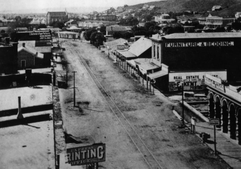 |
|
| (1874)^ - View looking south on Spring Street from the Temple Block. The large building in the distance is the the first Jewish Synagogue in Los Angeles. At lower left hand is the first office of the Evening Express in the Temple Block. Note the tracks running down the center of Spring Street. |
Historical Notes 1873 marked the dedication of Los Angeles' first Synagogue, erected by Congregation B'nai B'rith on Fort Street (now Broadway) between 2nd and 3rd Streets. The site now is marked by a commemorative plaque.*+ |
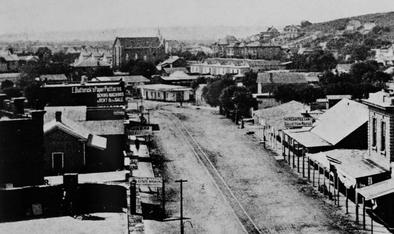 |
|
| (1874)+^ – Close up wide-angle view looking south on Spring Street. To the right of center is a building with a steep roof and a sign that says “Mercantile Law Collection Books.” The building immediately south of that, on the northwest corner of Spring and Franklin Streets, is the first Los Angeles City Hall, a building the city and county shared. The taller building in the distance, near the top center of the photo, is the City's first Synagogue, built in 1873. |
Historical Notes In August 1853, an adobe home that had been built in the 1820s at the northwest corner of Spring and Franklin Streets – a site now under the current city hall – was sold by John Temple to the city and to Los Angeles County for a city hall and courthouse. The city owned a one-quarter interest in the property, and the county owned a three-quarters interest. A brick jail used by both the city and county was constructed behind the adobe in 1853-54, the first (non-adobe) brick building built in Los Angeles.+^ Click HERE to see more early views of Los Angeles' first City Hall & Jail. |
.jpg) |
|
| (ca. 1875)^ - View looking south on Main Street from near the Bella Union Hotel showing Temple Block and the Downey Block at the junction of Main Street with Spring and Temple streets (upper-left). Livery stables appear on both sides of Main Street in the foreground. The tracks of the Main Street and Agricultural Park Street Railroad run down the center of the street. |
Historical Notes The Main Street and Agricultural Railroad was the first suburban line in Los Angeles and was chartered in November 1874. The line operated through the city on Main Street to Washington Boulevard and extended to Agricultural Park (now Exposition Park), traveling by way of Washington, Figueroa, and Wesleyan (now University Avenue).*## Financed by John Downey, Isaias Hellman, William Workman, and others, the Main Street and Agricultural Park Street Railroad connected the city's business district near Temple Street to Agricultural Park, a haven for gamblers and vice-seekers. The park, outfitted with a racetrack, saloon, and brothel, was rechristened Exposition Park in 1913.*^^* |
 |
|
| (Early 1870s)^ - San Pedro Street, a muddy dirt street, near 2nd Street in the early 1870s. A gas lamp post can be seen surrounded by a puddle of water. |
Historical Notes In 1873, about 136 gas lamps provided the outdoor night lighting for the City of Los Angeles. That would change in 1882 when electricity was introduced and Los Angeles saw its first electric streetlights being installed (Click HERE to see more in Early L.A. Streetlights). |
* * * * * |
Vermont and Melrose
 |
|
| (ca. 1874)^ - Farmer Dennis Sullivan farms a section of land where L.A. City College presently stands, on Vermont Ave. The location was the site of UCLA until the university moved to Westwood. Click HERE to see more Early Views of UCLA. |
* * * * * |
Los Angeles and Independence Railroad Company
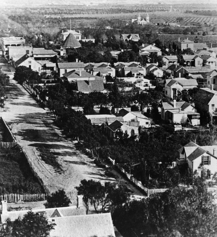 |
|
| (1875)^ - 3rd Street, looking east in 1875. There is a small residential area, beyond which are farms and orchards. In the right distance can be seen the newly built Los Angeles and Independence Rail Road Terminal at Fifth Street and San Pedro Street. |
Historical Notes The Los Angeles and Independence Railroad Company was incorporated in January 1875 with Francisco P. Temple, John P. Jones, Robert S. Baker, T. N. Park, James A. Pritchard, J. S. Slauson, and J. U. Crawford, as directors. Col. Crawford was the engineer and general manager. The 16.67 miles of track between Los Angeles and Santa Monica were privately built without government subsidies or land grants, all in a little over ten months - primarily using 67 Chinese laborers imported for the task. Right-of-way between Los Angeles and Santa Monica was given by local ranchers who were anxious to have access to a railroad. The line opened October 17, 1875, with two trains a day running between Santa Monica and Los Angeles; the fare was fixed at $1.00 per trip, freight at $1.00 per ton.*^ |
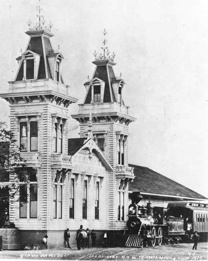 |
|
| (1875)^^ - View of a steam locomotive in front of the Los Angeles and Independence Rail Road Terminal at Fifth Street and San Pedro Street, 1875. Two lavishly decorated brick towers extend from the main building to either side of its entrance. |
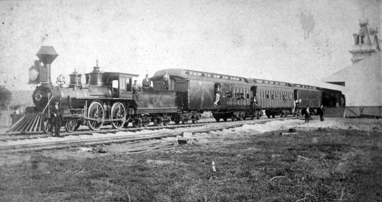 |
|
| (1876)* – View showing Locomotive No. 1 and passenger cars of the Los Angeles and Independence Railroad on train tracks next to the railroad's terminal at Fifth Street and San Pedro Street in Los Angeles. The train is full of passengers and is about to leave for Santa Monica. |
Historical Notes Opposition to continued construction east of Los Angeles by Southern Pacific Railroad's refusal to allow crossing of their main line tracks, and the unexpected depletion and closure of the Panamint silver mine in 1877 (owned by John P. Jones), led to severe fiscal difficulties for the young steam line. On July 4, 1877 the Los Angeles & Independence was acquired by Southern Pacific.*^ Click HERE for more on the Los Angeles and Independence Railroad. |
* * * * * |
Santa Monica
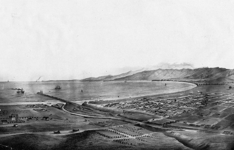 |
|
| (1875)* - View of Santa Monica and bay showing the road and wharf of the Los Angeles & Independence Railroad, about 1875. The wharf was completed in 1875 and sold in June 1877 to the Southern Pacific Railway Company, This print was photographed from an old lithograph. |
Historical Notes The new railroad made Santa Monica accessible to Angelinos. Tourists began to visit and the town grew and prospered. By November 1886, the electorate went to the polls and voted 97 to 71 to incorporate Santa Monica. |
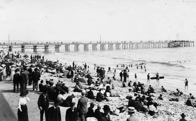 |
|
| (1880)* - View of the pier and beach in Santa Monica in 1880. People are walking on the boardwalk, sitting on the beach, and enjoying the surf. This was considered casual attire in the 1800s. |
Historical Notes In the mid-1880s, tourism in Santa Monica was booming. Roughly 2,000 to 3,000 tourists visited Santa Monica in the summer of 1887. This was not the same pier as today's Santa Monica Pier. Several others would be built after this one. Click HERE to see more in Early Views of Santa Monica |
* * * * * |
Sisters of Charity
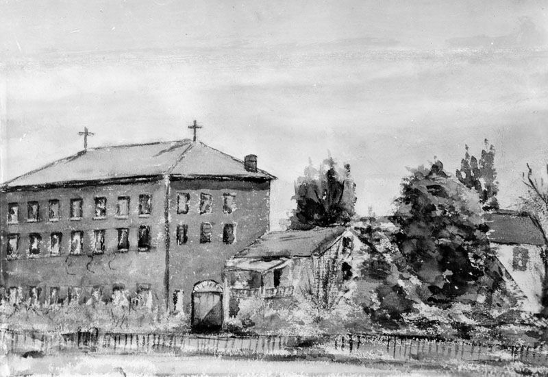 |
|
| (1860)^ - Photo of a watercolor painting of the first school (and Sisters of Charity Orphanage) in Los Angeles, made in 1860 by a student. |
Historical Notes The Los Angeles Orphan Asylum, originally called the Los Angeles Charitable Institute and later known in Spanish as Casa de las Hermanas, was established in 1856 by the Daughters of Charity of St. Vincent de Paul. Seeking to provide care for the growing number of orphaned and destitute children in the young pueblo, the Sisters purchased property from Benjamin D. Wilson, an early mayor of Los Angeles. The parcel, located at the corner of Alameda and Macy Streets (now Cesar E. Chavez Avenue), included roughly twelve acres of land and Wilson’s old wood-frame house, which had originally been shipped around Cape Horn. The Sisters bought the property for $8,000, a significant investment at a time when Los Angeles was still little more than a dusty frontier town. |
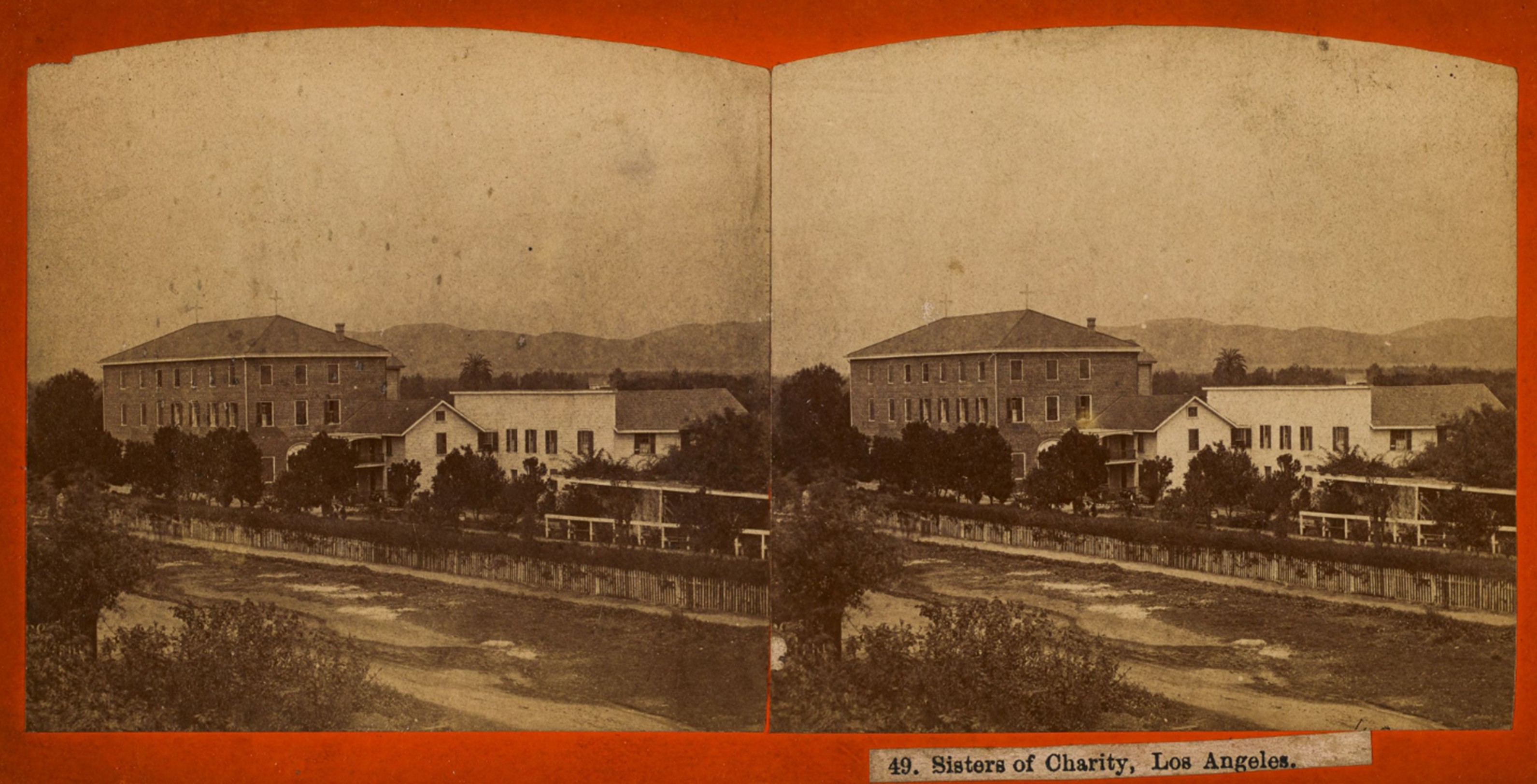 |
|
| (ca. 1868)* - Stereoscopic image showing the property of the Daughters of Charity of St. Vincent de Paul (also known as the Sisters of Charity), as seen from across Alameda Street near Macy Street (now Cesar E. Chavez Avenue). Visible is the Los Angeles Orphan Asylum and School, initially called the Los Angeles Charitable Institute. Photo by William M. Godfrey from the Ernest Marquez Collection. |
Historical Notes The Wilson house initially served as the Sisters' residence and the first orphanage quarters. However, recognizing the need for a more permanent facility, the Sisters quickly set about constructing a new building. By 1858, a large three-story brick structure—one of the first of its kind in Los Angeles—was completed, using bricks and building materials also brought by ship around Cape Horn. The school and orphanage faced Alameda Street and opened with about twenty girls enrolled. Early instruction was led by Don Francisco Coronel, father of prominent Californio figure Don Antonio Coronel, along with Coronel's two daughters. Notably, one of his daughters later married the well-known historian Hubert Howe Bancroft, linking the institution to broader California history. |
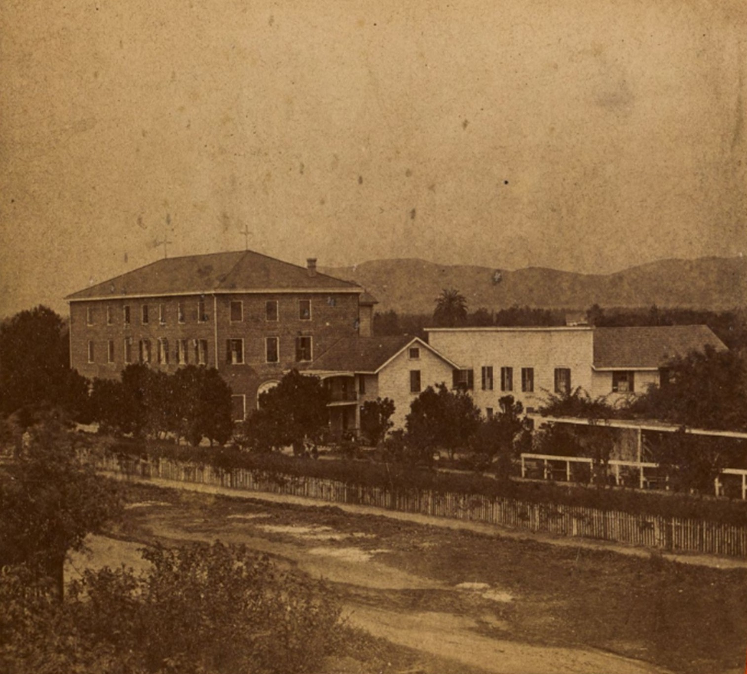 |
|
| (ca. 1868)* – Left panel of a stereoscopic image showing the property of the Daughters of Charity of St. Vincent de Paul (also known as the Sisters of Charity), as seen from across Alameda Street near Macy Street (now Cesar E. Chavez Avenue). Visible is the Los Angeles Orphan Asylum and School, initially called the Los Angeles Charitable Institute. Photo by William M. Godfrey from the Ernest Marquez Collection. |
Historical Notes For more than three decades, the Los Angeles Orphan Asylum served as a vital institution in the community, providing shelter, education, and care to countless children. Its imposing brick building and cultivated grounds, including gardens and orchards, made it a familiar landmark just outside the central Plaza area. At a time when most structures in Los Angeles were still modest one-story adobe or wood buildings, the orphanage stood out as a symbol of permanence and the Catholic Church’s growing influence in the city’s social services. The Sisters continued their work at the Alameda and Macy location until 1891, when the growing city and the increasing number of orphans necessitated a move to a larger, more modern campus in Boyle Heights. |
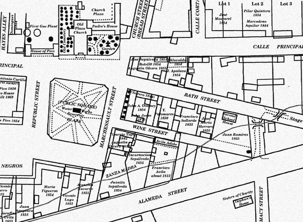 |
|
| (1873)* – Early map showing the Plaza area, including the center of town with its early buildings and the Zanja Madre, Los Angeles' original water aqueduct and lifeline. The Sisters of Charity building is seen at lower right on the southeast corner of Alameda and Macy Street. |
Historical Notes The map also shows the streets in use and the early owners of many of the properties. The layout of the plaza itself, however, is shown as it appeared before the change in landscaping in the prior two years before it became rounded. |
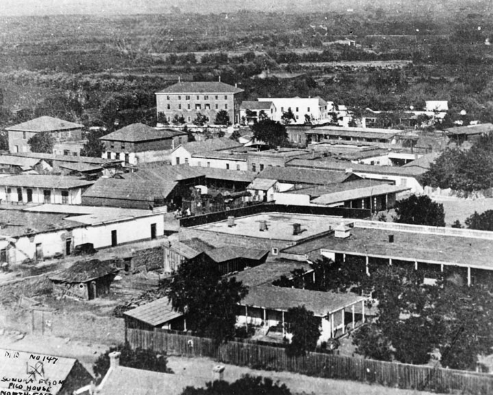 |
|
| (1875)* – View looking northeast over the Los Angeles Plaza area and Wine Street (later Olvera Street) showing the 3-story brick building of the Sisters of Charity on the southeast corner of Alameda and Macy Streets. |
Historical Notes In the foreground of the above photo is the courtyard of Nuestra Senora la Reina de Los Angeles, showing the padres' kitchen, bishop and padres' quarters, parochial school and courtyard planted to citrus orchard. To the left of this, a low white adobe, is the bakery of Pierre Domegue and his Indian wife, who baked sourdough French bread. Behind this on the next block are two square buildings, the Bath Street (later Olvera Street) Public School. In the rear is a three-story building at Alameda and Macy Streets, the Los Angeles Charitable Institute run by the Sisters of Charity. Just behind the bakery is the Pelanconi Winery, later La Golondrina Restaurant. Also shown, behind the church facilities, is the adobe residence of Mr. and Mrs. John Jones, parents of Mrs. Lankershim. |
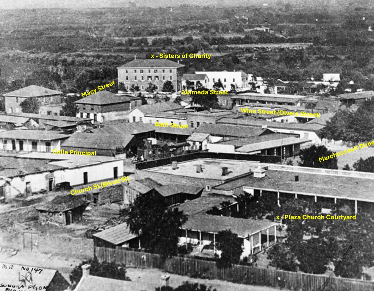 |
|
| (1875)* – View looking northeast over the Los Angeles Plaza area and Wine Street (later renamed Olvera Street), showing the 3-story brick building of the Sisters of Charity on the southeast corner of Alameda and Macy Streets. Today, the site is adjacent to Union Station and the Mozaic at Union Station Apartments. |
Historical Notes Following the Sisters' departure, the original property underwent dramatic changes. In the early 20th century, Los Angeles embarked on major redevelopment projects, and the orphanage site became part of the land cleared for the construction of Union Station, completed in 1939. Although the original orphanage buildings were lost to time, the historical significance of the location remains. Today, the site is adjacent to Union Station and Mozaic at Union Station Apartments, standing as a quiet reminder of one of Los Angeles' earliest and most important charitable institutions. |
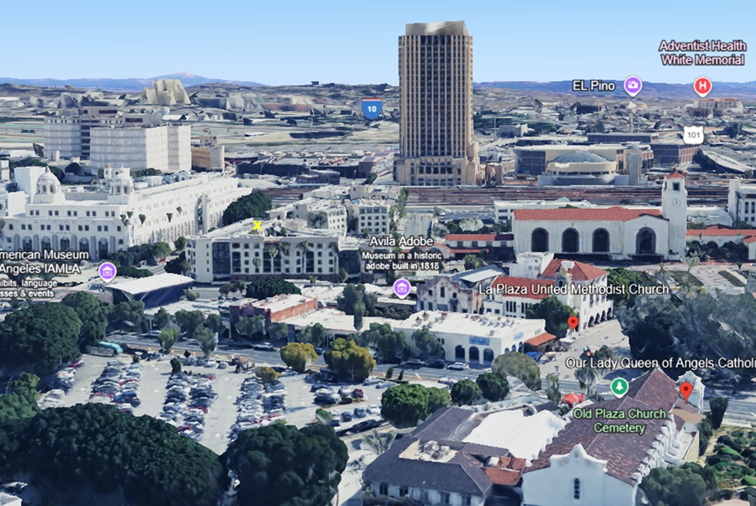 |
|
| (2023)* – Google Earth view looking toward the southeast corner of Alameda Street and Cesar Chavez Avenue (originally named Macy Street), where an "X" marks the spot where the main 3-story Sisters of Charity building once stood. Today, the site is occupied by the Mozaic at Union Station Apartments. |
Then and Now
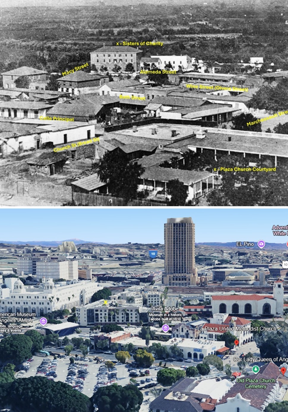 |
|
| (1875 vs. 2023)* – A ‘Then and Now’ comparison showing the 3-story Sisters of Charity building at the southeast corner of Alameda Street and Macy Street (now Cesar Chavez Avenue), where the Mozaic at Union Station Apartments stand today, directly across from the Terminal Annex Post Office Building. Photo comparison by Jack Feldman. |
* * * * * |
Antonio Mario Lugo Adobe
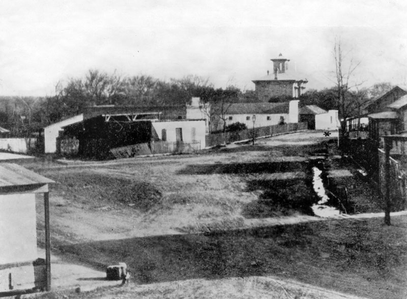 |
|
| (ca. 1875)^ - Early view of the Plaza surroundings, including Antonio Maria Lugo adobe, built in 1820, and located at San Pedro near 2nd Street. The Lugo adobe is indicated by a star (middle right), and the large towered building seen in the center distance is the Wallace Woodworth residence. |
Historical Notes Antonio Maria Lugo (1775-1860) was born at the San Antonio de Padua Mission near Monterey. A Corporal in the Spanish army, he received his discharge after seventeen years and was granted 29,514 acres of land as a reward for his faithful service to the King of Spain and the military. He named this tract of land Rancho San Antonio, after his birthplace. Lugo maintained a beautiful adobe home in the pueblo, located in the exclusive Plaza and across from the church. In 1816 Lugo was appointed Alcalde (Mayor) of Spanish Colonial Los Angeles, and served until 1819. Don Antonio Maria Lugo, or "El Viejo Lugo" - an endearing title bestowed upon him, gradually added vast properties, and was the owner of much of what is now the city of Los Angeles; it was said he could ride from San Diego to Sonoma, a distance of nearly 700 miles, without once leaving his own land. After Don Antonio's death in 1860, the rancho was divided among his children: José María, José del Carmen, Vicente, Jesus, and Merced. |
.jpg) |
|
| (ca. 1885)* - View showing the home of Don Antonio Mario Lugo located on San Pedro Street, near Second Street, Los Angeles. |
Historical Notes The Don Antonio Mario Lugo adobe was built in 1820. The single-story house has extended roof supported by beams at about every ten feet. A wooden fence encloses the perimeter to the right of the house. Trees are visible in the background. Picture file card reads: "1st house with wood floor?" |
* * * * * |
Horticultural Hill & North Edge of Bunker Hill
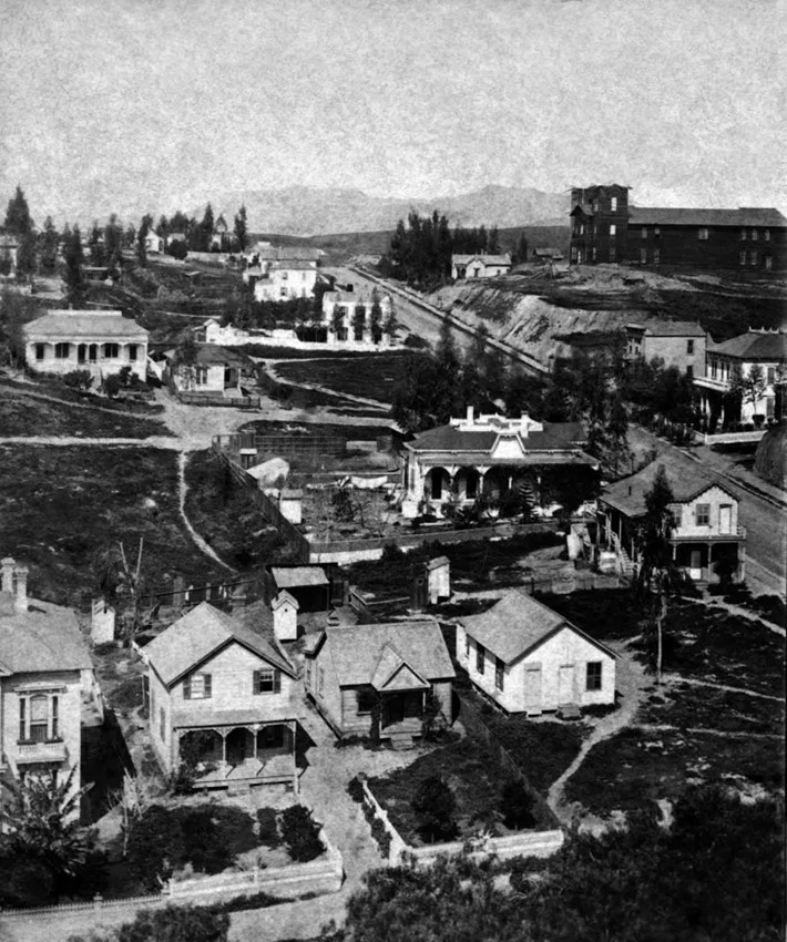 |
|
| (ca. 1875)^ - View is toward the N/W on Temple Street looking across Horticultural Hill. Olive Street is in the foreground. The Horticultural Hill on Temple Street is at upper right. The Hollywood Hills are faintly seen in the background. One can make out the tallest peak, Hollywood Peak, near where the Griffith Observatory stands today. |
Historical Notes The Horticultural Pavilion is the largest and tallest structure appearing in the upper right of the photo. A grand staircase would later be built from the pavilion down to Temple St. Directly across the pavilion on Temple St. was the first Los Angeles home of Sarah Bixby Smith ("Adobe Days", 1931). In her memoir of early Los Angeles she describes the Horticultural Pavilion as "a barn-like, wooden building" which was the venue for "county fairs, conventions and operas". In 1880, President and Mrs. Hayes visited Los Angeles, the first President to visit California. After speeches from a grandstand set up in front of the Baker Block, the guests adjourned to the St Elmo Hotel for tea. In the evening a public reception and formal dinner were held for the First Couple in the Horticultural Pavilion. The Horticultural Pavilion was lost to fire a few years later. Its function was replaced by Hazard's Pavilion (1887) at 5th and Olive streets. Also in the photo is an early home of J.W. Gillette, who built Angels Flight for Col. Eddy. It's near the center of the photo, with a walled backyard. It faces on Temple. |
Then and Now
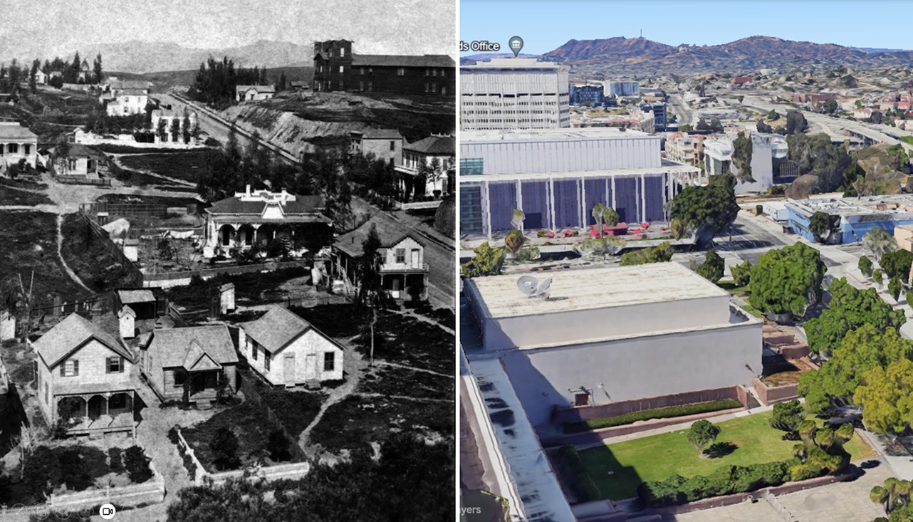 |
|
| (1875 vs 2022)* – View looking NW showing Temple Street running diagonally on the right with the Hollywood Hills in the Background. In the early photo, Olive Street is seen at bottom and Horticultural Hall is seen at top of the hill (aka Horticultural Hill). Note how much the hill as been chopped down over the years. Photo comparison by Jack Feldman. |
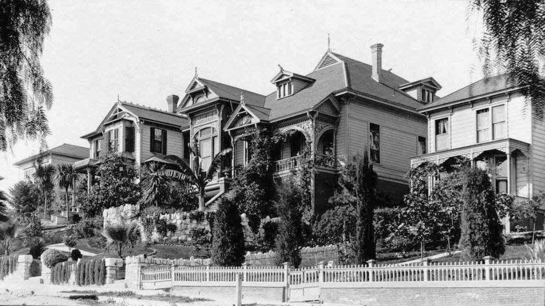 |
|
| (ca. 1895)* – View of the 200 block of South Olive Street in downtown Los Angeles showing beautiful Victorian homes. |
Historical Notes Similar homes can be seen today on Carroll Avenue in Angelino Heights, just outside of downtown. |
* * * * * |
Macy Street Bridge (LA's 1st Bridge)
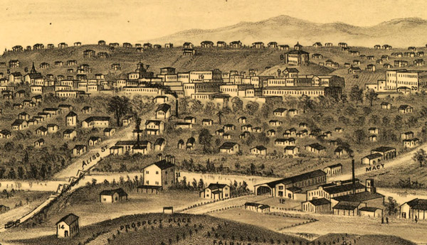 |
|
| (1877)* - Detail of a drawing by E.S. Glover of Los Angeles, showing the city's first bridge on the right and the later Aliso Street bridge on the left. The view looks west toward downtown Los Angeles from Boyle Heights. Los Angeles High School can be seen in the upper right on top of Poundcake Hill. |
Historical Notes A furniture company named Perry and Woodworth built Los Angeles' first permanent bridge, a covered bridge, in 1870. Its construction was considered a major civic achievement; people came from as far away as San Diego to witness the bridge's opening. A covered bridge reminiscent of those in New England, the wooden span carried Old Aliso Road, a segment of El Camino Real later known as Macy Street and now named Cesar Chavez Avenue, across the Los Angeles River. Where wagons once forded the tame summer river -- or simply turned around when winter storms transformed the stream into a torrent -- a bridge now connected the growing city of Los Angeles to the agricultural land on the river's east bank.* |
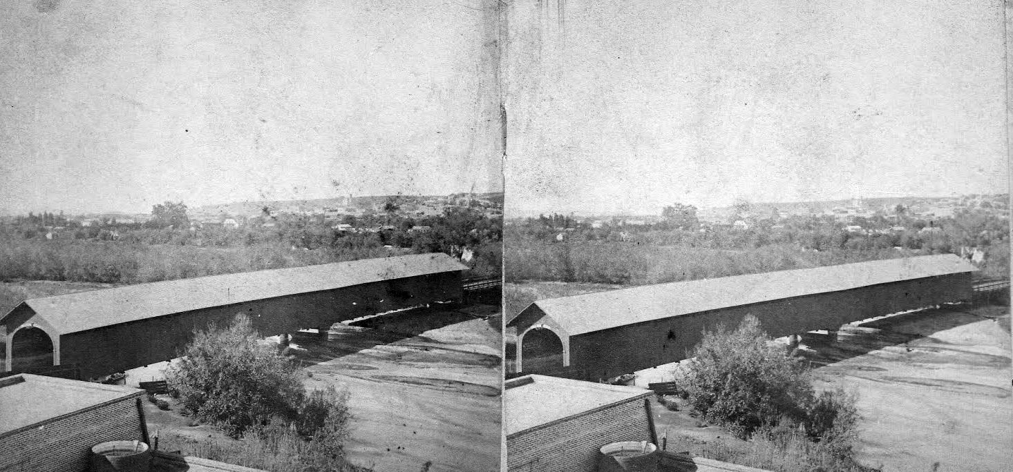 |
|
| (ca. 1870s)^ - Stereographic photo of the covered bridge over Old Aliso Road (Macy Street). |
Historical Notes Without this lengthy span, it would not have been possible to have had the subsequent eastward expansion of the town, which was then embarking on it first significant growth spurt, which began shortly after the conclusion of the Civil War. In 1873, local power brokers created the subdivision of East Los Angeles, later renamed Lincoln Heights, and this was followed in 1875 by the trio of William H. Workman, Isaias W. Hellman and John Lazzarovich's development of Boyle Heights.^ L.A.'s first bridge was resilient, withstanding several severe floods in the 1880s while others failed. But eventually, time wore away at the wooden structure, and by 1895 it was in poor condition. The city engineer recommended replacing it with one of a more modern design, and in July 1904 the bridge finally came down. "One of the old landmarks of the city," the August 1, 1904 Los Angeles Times reported, "has disappeared during the past week, and the Macy-street bridge...is a thing of the past. It has been pulled down to make way for a splendid modern structure which will accommodate traffic for years." * Click HERE to see the 2nd Macy Street Bridge. |
* * * * * |
San Fernando Mission
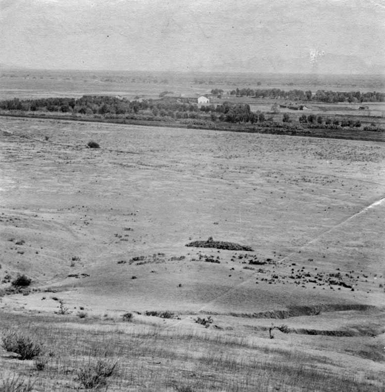 |
|
| (1873)^ - This is the first known photograph of the San Fernando Valley as seen in 1873. View is looking to the south, showing San Fernando Rey de España Mission in the center of the photograph. Apart from the mission, the vast land appears to be completely deserted. Mission San Fernando Rey de España is located at 15151 San Fernando Mission Boulevard. |
Historical Notes In 1821, after the successful Mexican War of Independence from Spain, the Mission San Fernando became part of Alta California, Mexico. In 1834, the Mexican government began redistributing the mission lands. In 1846, the Mexican land grant for Rancho Ex-Mission San Fernando was issued by Governor Pío Pico. It was bounded on the north by Rancho San Francisco and the Santa Susana Mountains, on the west by the Simi Hills, on the east by Rancho Tujunga, and on the south by the Montañas de Portesuelo (Santa Monica Mountains).*^ Click HERE to see more in Early Views of the San Fernando Mission. |
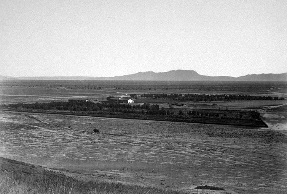 |
|
| (ca. 1875)#^ – Panoramic view of the San Fernando Mission looking south across a largely unimproved San Fernando Valley. In the distance are the Hollywood Hills with Cahuenga Pass (low point on the horizon in the upper-right) and the back of Mount Lee (highest peak and ridgeline). #^* |
Historical Notes Rancho Ex-Mission San Fernando was a 116,858-acre Mexican land grant in 1846 by Governor Pío Pico to Eulogio de Celis. The grant derives its name from the secularized Mission San Fernando Rey de España, but was called ex-Mission because of a division made of the lands held in the name of the Mission — the church retaining the grounds immediately around, and all of the lands outside of this were called ex-Mission lands. The grant encompassed most of the present day San Fernando Valley.*^ |
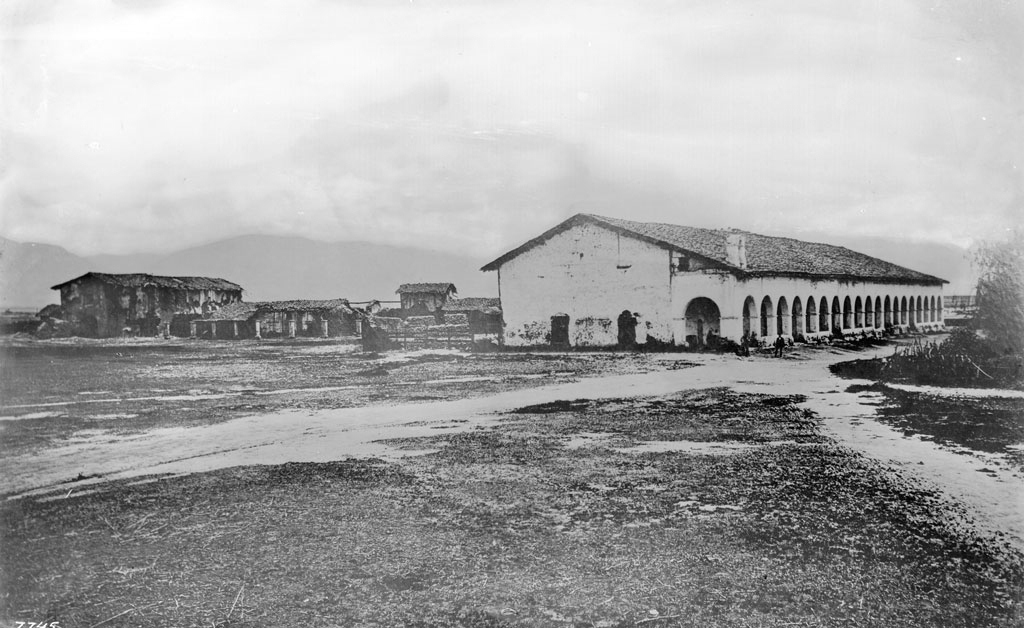 |
|
| (ca. 1870)^^ - Exterior view of the Mission San Fernando, ca.1870. Two dirt paths enter in from the foreground, intersecting at the adobe cloister of the mission, which stands to the right of center. A collection of archways holds the eaves of the terracotta-tiled roof up over the cloister's patio. More adobe buildings can be seen to the left, with two-story adobe building standing to the left of an older cloister whose roof has collapsed. |
Historical Notes In 1874, after the death of Eulogio de Celis, the family sold their northern half of Rancho Ex-Mission San Fernando to northern Californians, California State Senator Charles Maclay and his partners George K. Porter, a San Francisco shoe manufacturer, and his cousin Benjamin F. Porter. The Porters’ land was west of present day Sepulveda Boulevard including most of Chatsworth, and the Maclay land was east of Sepulveda Boulevard. Roscoe Boulevard was the border on the south, with a syndicate led by Isaac Lankershim acquiring the southern half of the Valley.*^ |
 |
|
| (1800s)^ - View of the Convento Building, also known as the "Long Building". Two families stand next to their horse-drawn carriages, which have stopped along the road that would eventually become "El Camino Real". |
Click HERE to see more in Early Views of the San Fernando Valley |
* * * * * |
Catalina Island
 |
|
| (1887)^^ - View of Avalon Bay, Catalina Island, showing a Ferndale steamboat and a Ruby schooner. The schooner is visible on the water at center, a small flatboat with two people visible in front of it. Farther to the left of it, a second sailboat can be seen. The steamer is pictured flying an American flag off of its stern at right. A mountain ridge and large hill are pictured in the background. |
Historical Notes The first European to set foot on Santa Catalina Island was the Portuguese explorer Juan Rodríguez Cabrillo, who sailed in the name of the Spanish crown. On October 7, 1542, he claimed the island for Spain and christened it San Salvador after his ship. Over half a century later, another Spanish explorer, Sebastián Vizcaíno, rediscovered the island on the eve of Saint Catherine's day (November 24) in 1602. Vizcaino renamed the island in the saint's honor.*^ |
 |
|
| (ca. 1888)#**^ - View of a steamer at the dock in Avalon Bay and the Hotel Metropole in Avalon, Santa Catalina (aka Catalina Island or just Catalina). |
Historical Notes The first owner to try to develop Avalon into a resort destination was George Shatto, a real estate speculator from Grand Rapids, Michigan. Shatto purchased the island for $200,000 from the Lick estate at the height of the real estate boom in Southern California in 1887. Shatto created the settlement that would become Avalon, and can be credited with building the town's first hotel, the original Hotel Metropole, and pier. His sister-in-law Etta Whitney came up with the name Avalon, which was taken from Alfred, Lord Tennyson's poem "Idylls of the King," about the legend of King Arthur.*^ |
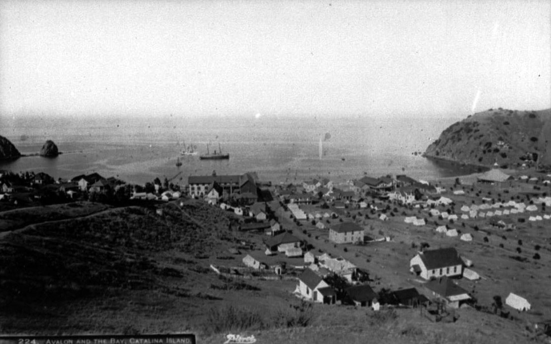 |
|
| (ca. 1890s)^^ - View showing Avalon Bay from the hillside behind the Hotel Metropole (center). A steamboat is seen in the middle of the bay just beyond the hotel. A Multitude of house-tents are seen throughout and Sugarloaf Point is stands on the left. |
Historical Notes To expand Avalon's tourist base, Shatto used steamships he leased from the Bannings to ferry tourists to and from the mainland. Some island tourists arrived to purchase lots in Avalon, which Shatto auctioned off for $150 to $2,000 depending on location and size. Those who purchased one were then free to set up tents or build summer cottages. However, Shatto racked up some hefty bills and defaulted on his mortgage payments only after a few years and the island went back to the Lick estate.^^ |
 |
|
| (ca. 1890s)#^*^ - Panoramic view looking southeast showing Hotel Metropole and steamer Hermosa. The large boat is docked at the pier with smaller boats in the water. Tents are visible close to the beach as well as buildings. Women are wearing high collared long sleeved dresses and gloves. On the right can be seen a windmill and clothes hanging on a clothesline. |
Historical Notes The sons of Phineas Banning bought the island in 1891 from the estate of James Lick and established the Santa Catalina Island Company to develop it as a resort. They had a variety of reasons for doing this. They wanted Catalina's rock to build a breakwater at Wilmington for their shipping company. They had also just built a luxurious new boat, the Hermosa, to bring tourists to the Island. If tourism failed, this investment was at risk. By owning Catalina, they would not only get their rock, but also money from tourists for their passage as well as everything on the Island.*^ |
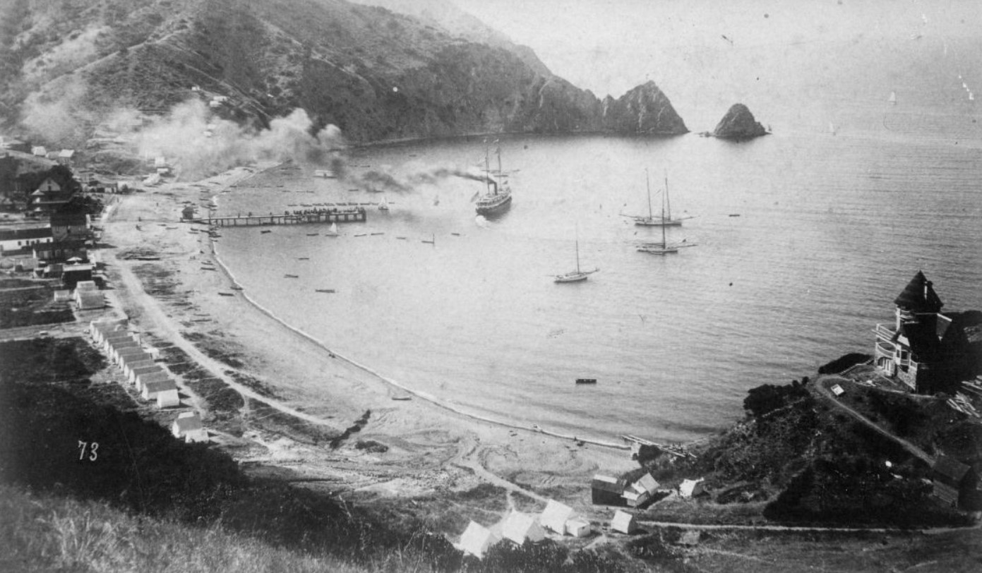 |
|
| (1891)#^*^ – Panoramic view of Avalon Bay on Santa Catalina Island. The rock formation called Sugarloaf Point is at upper-right. The steamship S.S. Hermosa makes its way out toward the ocean away from a pier which is located near where the Hotel Metropole stands. House-tents can be seen all along the beach. At right stands a large Victorian-style home (Holly Hill House) with unobstructed views of the bay. The house still exists today and is Avalon's oldest remaining structure. |
Click HERE to see more in Early Views of Catalina |
* * * * * |
More Historical Early Views
Newest Additions
Early LA Buildings and City Views
History of Water and Electricity in Los Angeles
* * * * * |
References and Credits
* DWP - LA Public Library Image Archive
^ LA Public Library Image Archive
*# Publications of the Historical Society of Southern California, Volume 9: Eternity Street
#* OUTPOST – Preserving Historical Data by W. S. Broke
#^ Huntington Digital Library Archive
+^ Old Los Angeles and Environs blogspot
*+ The Jews of Los Angeles: Urban Pioneers
++ Vigilantism in Los Angeles (1853 - 1874)
^**UCLA-DWP Library Collection: Map of the City of Los Angeles as it Appeared in 1850
***Los Angeles Historic - Cultural Monuments Listing
*^*California Historical Landmarks Listing (Los Angeles)
*^#Public Art in LA: Campo Santo
^^#CSULB - A Visit to Old LA: Main Street
*##Metro.net - Los Angeles Transit History
^##California State Library Image Archive
**#The Cable-Car-Guy.com: The Los Angeles Railway
*#*KCET - Inventing LA: Port of Los Angeles; A Brief History of LA Bridges; LA's First Streetcars
**^History Matters: Calle de los Negros, 1880s
^^*LA Fire Department Historical Archive
^*#Noirish Los Angeles - forum.skyscraperpage.com
^#^Historic Hotels of Los Angeles and Hollywood (USC - California Historic Society): Bella Union Hotel; Lafayette Hotel
#^*Flickr.com: Michael Ryerson
#++Facebook.com: Garden of Allah Novels, Martin Turnbull
*^^Los Angeles Magazine: Zanja Madre 1868
*^*^Wilmington Historic Society
**^^Boyle Heights History Timeline
*#^^LAPL-El Pueblo de Los Angeles Historical Monument Photo Archive
*^^#Boyle Heights History Blog
^#**Santa Monica History Museum
^#*^ElPueblo.lacity.org: Plaza Map
^##^El Pueblo de Los Angeles Historical Monuments Listing
^*^*KCET - El Aliso: Ancient Sycamore Was Silent Witness to Four Centuries of L.A. History
#**^LA County Library Image Archive
#*#^LAPL-El Pueblo de Los Angeles Historical Monument Photo Archive
#^#^Chinese Los Angeles in 1870-1871 - Scott Zesch
#^*^Calisphere: University of California Image Archive
#^#*Picture Gallery of Los Angeles History
*^ Wikipedia: Arcadia Bandini de Stearns Baker; Bunker Hill; Prudent Beaudry; Jonathan Temple; Los Angeles High School; Joseph Widney; Pershing Square; Port of Los Angeles; Belmont High School; Hollenbeck Park; Ducommun; Isaias W. Hellman; Abel Stearns; Sawtelle Veterans Home; Arcade Station; Alhambra; Fort Moore; History of Santa Monica; History of Los Angeles; Burbank; Los Angeles and Independence Railroad; Phineas Banning; History of Los Angeles Population Growth; Ozro W. Childs; The Church of Our Lady the Queen of Angels; Fort Moore; Santa Catalina Island; San Fernando Valley; Chinese Massacre of 1871; The Church of Our Lady the Queen of Angels
< Back