Early Views of the Los Angeles Plaza
| Historical Photos of Early Los Angeles |
 |
|
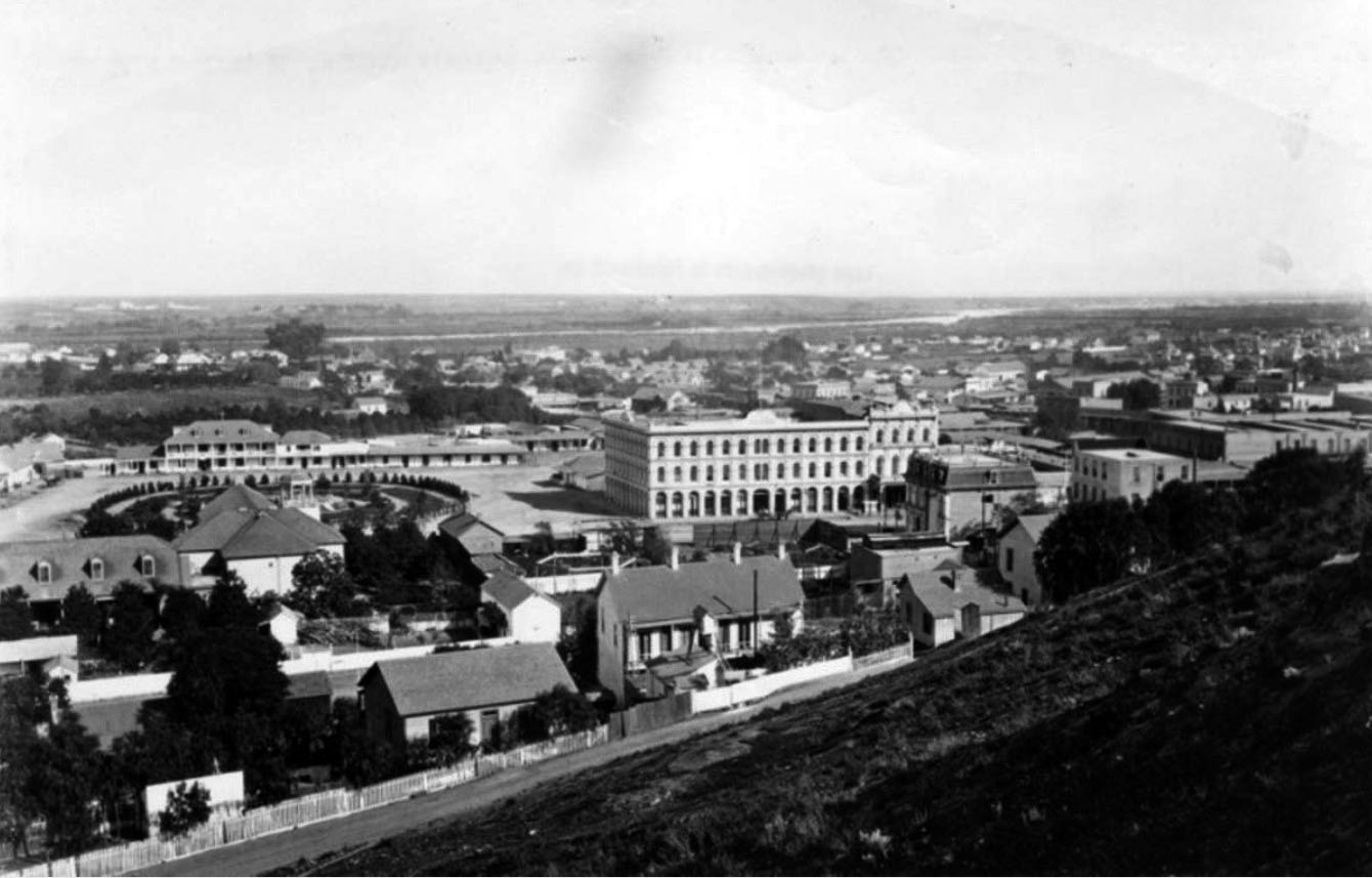
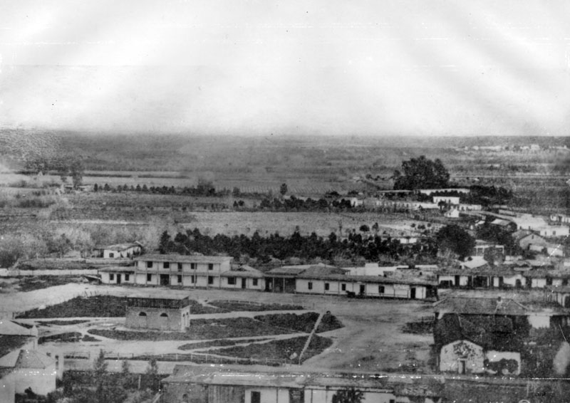
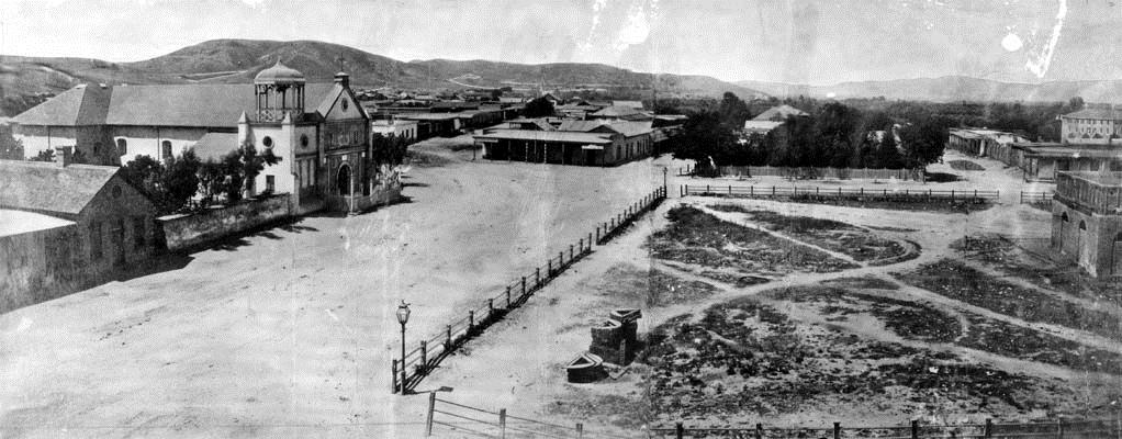
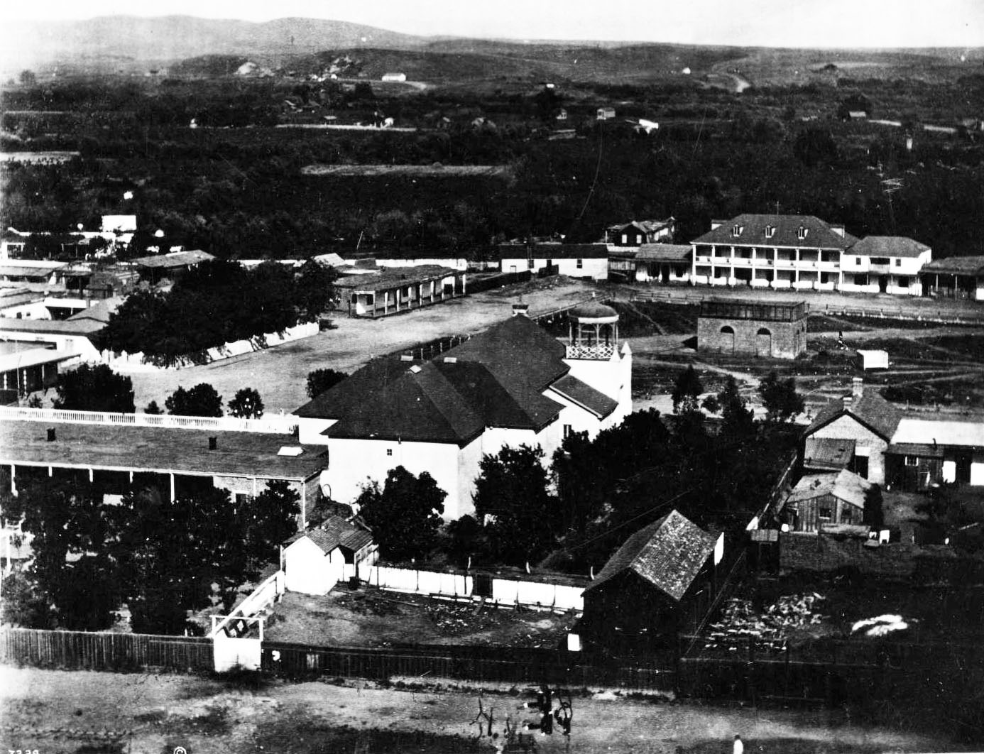
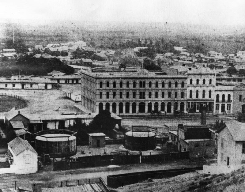
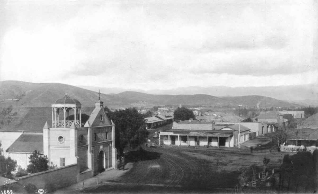
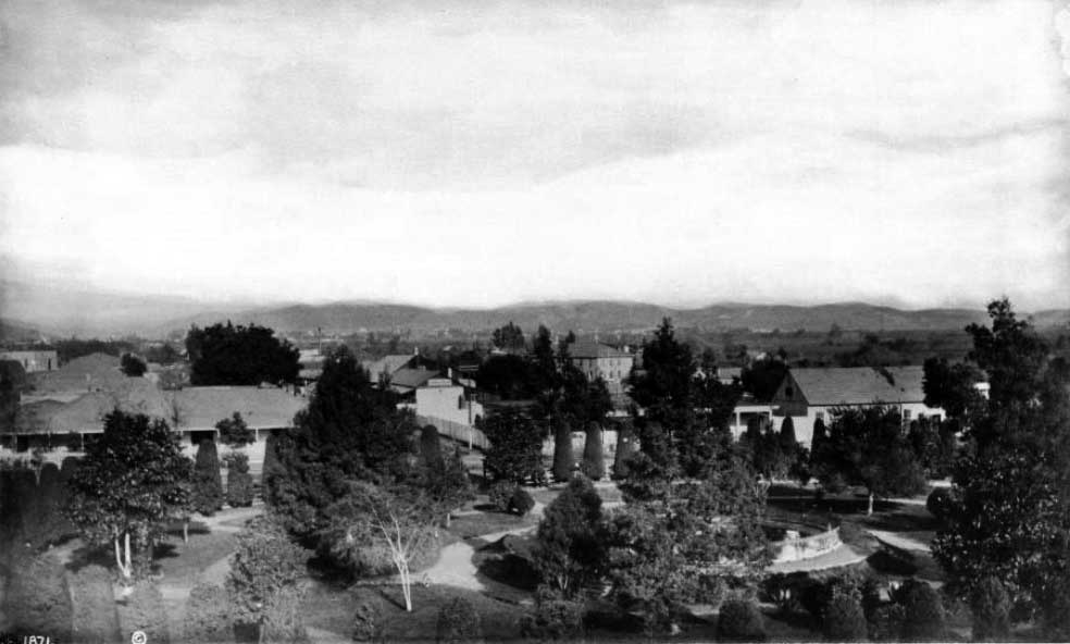
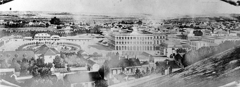
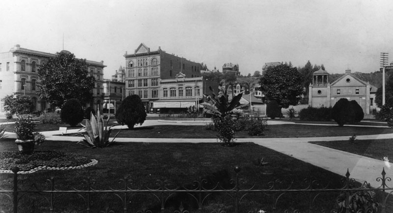
| Panoramic view of the Los Angeles Plaza as it appeared 1876. The Pico House is the prominent 3-story white building at the center of the photo. The back of the Old Plaza Church is in the lower-center left with Los Angeles River seen in the distance.* |
Historical Notes The Los Angeles Plaza Historic District—today part of El Pueblo de Los Angeles State Historic Park—marks the original heart of the city. Known for decades as El Pueblo de la Reina de Los Angeles, this site was the political, cultural, and commercial center of Los Angeles under Spanish, Mexican, and early American rule. The plaza dates back to 1781, when Governor Felipe de Neve—sent by Spain to secularize the mission system and strengthen settlements—selected this spot to establish a civilian town (pueblo). His vision included creating self-supporting agricultural communities to reduce military dependence on the missions. Los Angeles, along with Santa Barbara and San Jose, became one of three such pueblos under his plan. This 1876 photograph offers a rare panoramic view looking east across the Plaza. Pico House, the city’s grandest hotel at the time, stands prominently at center, while the Old Plaza Church and the Los Angeles River help orient this foundational scene. |
 |
|
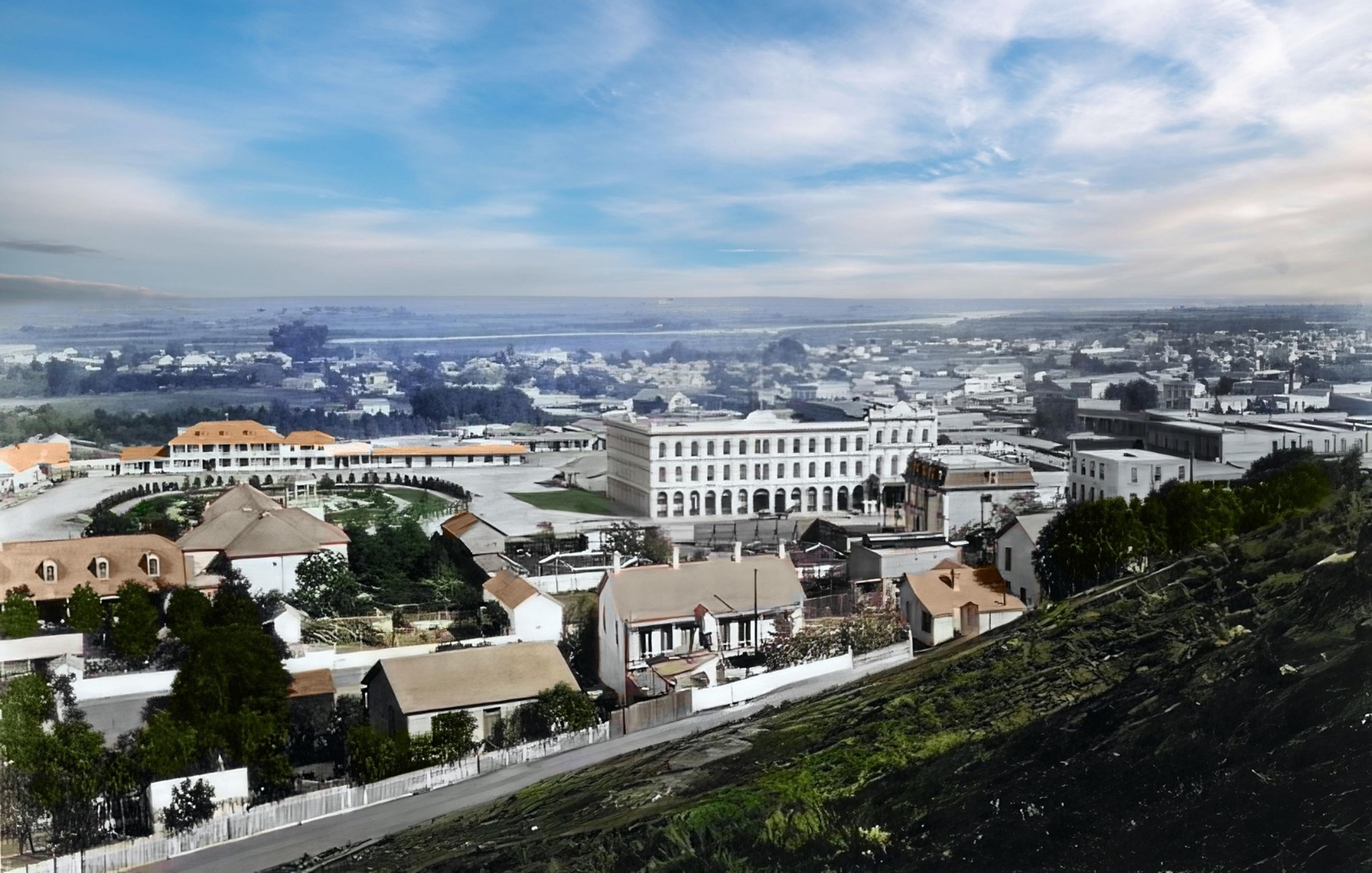
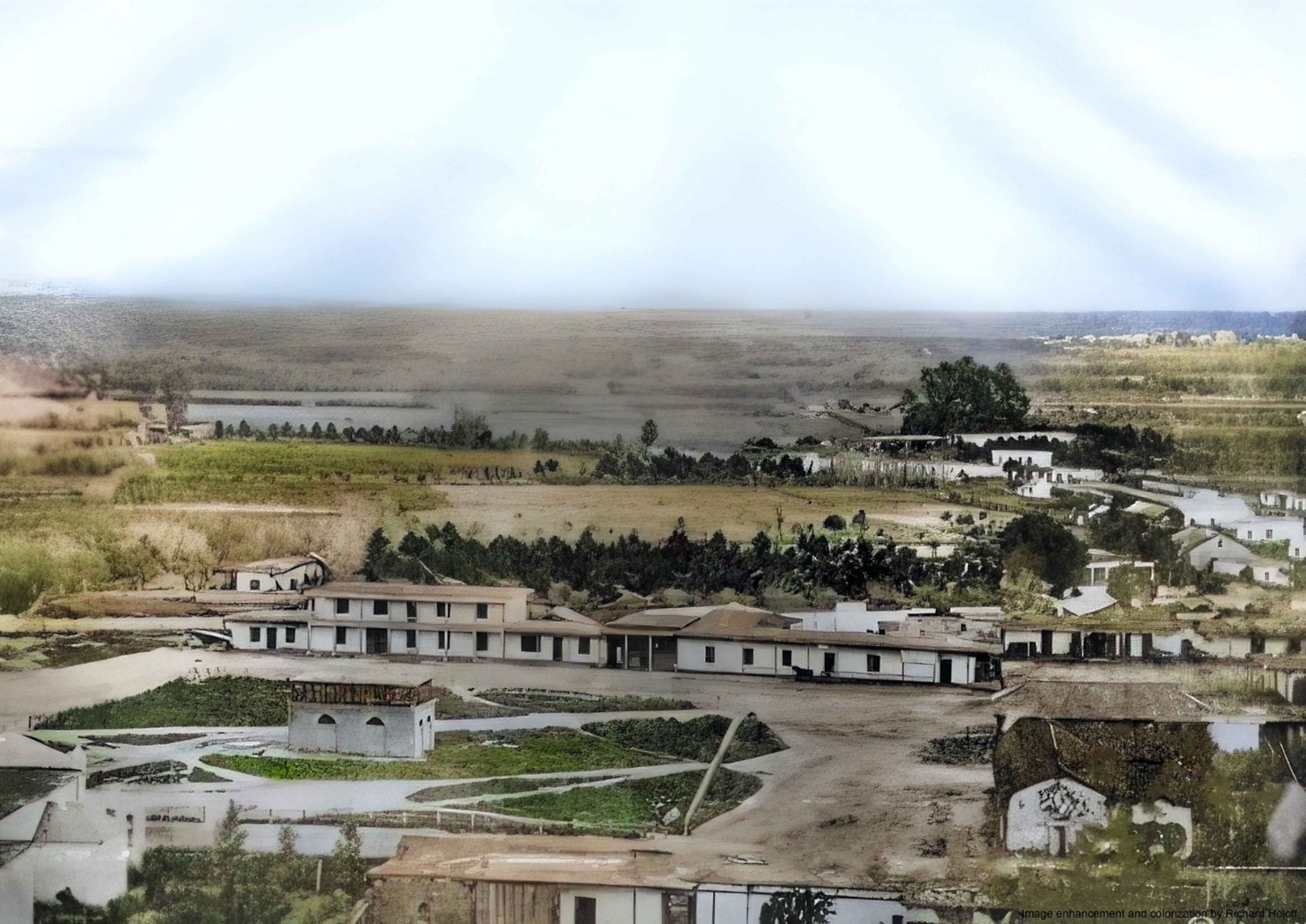
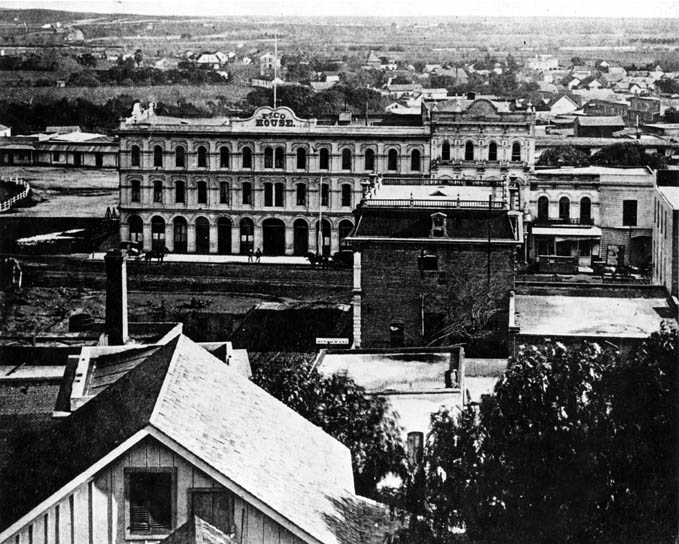
| (1876)* – Los Angeles Plaza and beyond. Note: The LA River can be seen in the distance. (Image enhancement and colorization by Richard Holoff) |
Historical Notes This carefully colorized version of the 1876 panorama brings to life the textures, tones, and architectural details of 19th-century Los Angeles. The vivid hues help modern viewers better imagine the city’s dusty streets, adobe structures, and the imposing presence of the newly built Pico House. Colorization, while interpretive, draws attention to key visual elements such as the natural terrain beyond the Plaza—including the Los Angeles River in the distance—and provides a deeper sense of spatial realism. This image bridges the gap between archival history and contemporary visualization, serving as a compelling entry point into the city’s early development. |
* * * * * |
Earlier Plaza Views
 |
|
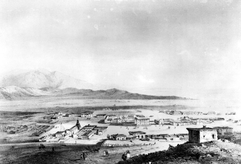
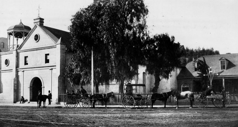
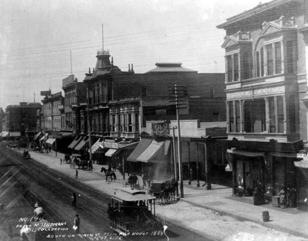
| (1853)* - This picture was scanned from a rare stone lithograph of downtown Los Angeles, cut in 1853, known as the "Survey View." The view is from Fort Moore Hill looking east, toward the LA River. |
Historical Notes The City of Los Angeles originated right here. Nuestra Señora la Reina de los Angeles was founded on September 4, 1781 by a group of Spanish pobladores (settlers), consisting of 11 families – 44 men, women and children. They were originally led by Fernando Javier Rivera y Moncada (1725-1781), and accompanied by a contingent of soldiers – who had set out from the nearby Mission San Gabriel Arcángel to establish a pueblo along the banks of the Porciúncula River at the Indian village of Yangna. The church was considered an asistencia (“sub-mission”). Priests from Mission San Gabriel divided their time between the mission and the Asistencia site. |
 |
|
| View showing a model of Los Angeles as it appeared in 1850. Looking northeast, the layout of the new city can clearly be seen with the Los Angeles Plaza located in the lower left-center. The large white structure to the left of the Plaza is the Old Plaza Church. The two streets running from bottom of photo to the Plaza are Main Street on the left and Los Angeles Street on the right. Alameda Street runs from the lower right corner diagonally toward the lower center of photo. The L.A. River can be seen running from the lower-right diagonally to the center of the photo, turns left and disappears behind the mountain. At that point the Arroyo Seco can be seen at its confluence with the LA River. The tall majestic San Gabriel Mountains stand in the far background. Vineyards blanket the area between the City and the L.A. River (lower right). The large dark spot in the lower-right of the photo is El Aliso, the historic landmark of the indigenous Tongva people who once lived in the Indian Village of Yangna at that location, adjacent to the Los Angeles River. Note: Picture file card identifies the above image as a diorama of the Pueblo Los Angeles as it appeared in 1850 as designed by J. Marshall Miller. Picture file card also reads "Prepared for the Los Angeles Times Anniversary 1931?".* |
Historical Notes It wasn't until April 4, 1850 that Los Angeles was incorporated as a municipality, five months before California achieved statehood. In 1850, the population of Los Angeles was only 1610. |
.jpg) |
|
| (ca. 1850)^** - Photo of a sketch showing the LA Plaza and surounding area as it appeared in 1850. The Old Plaza Church appears at upper left. The map is based on the 1849 Ord Survey. |
Historical Notes Click HERE to see more in an Interactive Map of Early Los Angeles as it appeared in 1850. |
 |
|
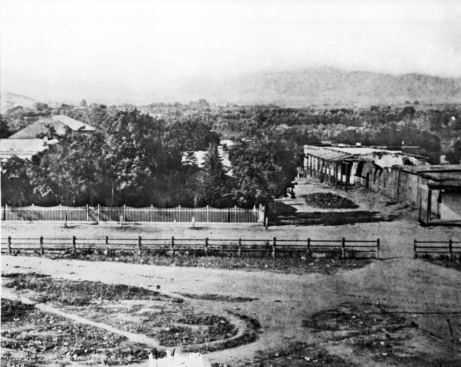
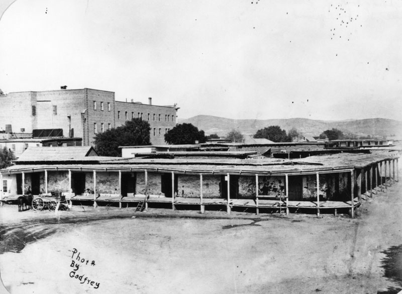
| (ca. 1858)* - This is the earliest known close-up photograph of the Los Angeles Plaza. There is a square main brick reservoir in the middle of the Plaza, which was the terminus of the town's historic lifeline: the Zanja Madre ('Mother Ditch'). The reservoir was built in 1858 by the LA Water Works Company. Click HERE to read more about the Zanja Madre and Los Angeles' first water supply. |
Historical Notes The site of the Plaza today is not the original location. It is the second, third, or maybe even the fourth. One of the earlier plots is believed to be around where the current Pershing Square sits. It’s also thought that at least one of the first three was washed away in a flood. The current Plaza dates from as early as 1815. When early settlers arrived at the Los Angeles River by way of Mission Road, they picked as a nearby gathering point a huge sycamore (upper right-center of photo) that gave them shelter and became a landmark, "El Aliso." That Spanish word for sycamore was later used to name the road carved out near the river (Aliso Street in 1854). El Aliso (upper center-right of photo) sprang from the ground near the western bank of the Los Angeles River in the late fifteenth century, about the same time Columbus arrived in the Americas. As it matured, the sycamore -- located at the juncture of the Los Angeles coastal plain and the San Fernando and San Gabriel valleys -- became a gathering place for Los Angeles' indigenous Tongva people. Local leaders traveled from their villages across Southern California to confer under the shade of the tree's canopy. By the mid-eighteenth century, the mighty sycamore stood at the center of one of the largest Tongva villages, Yangna. By the 1830s, due to the encroachment of the pueblo, El Aliso had ceased to function as the symbolic center of daily Tongva life as Yangna changed locations twice before dissolving into historical oblivion. |
 |
|
| (ca. 1858)* - This is the earliest known close-up photograph of the Los Angeles Plaza. There is a square main brick reservoir in the middle of the Plaza, which was the terminus of the town's historic lifeline: the Zanja Madre ('Mother Ditch'). The reservoir was built in 1858 by the LA Water Works Company. Image enhancement and colorization by Richard Holoff. |
Historical Notes Click HERE to read more about the Zanja Madre and Los Angeles' first water supply. |
.jpg) |
|
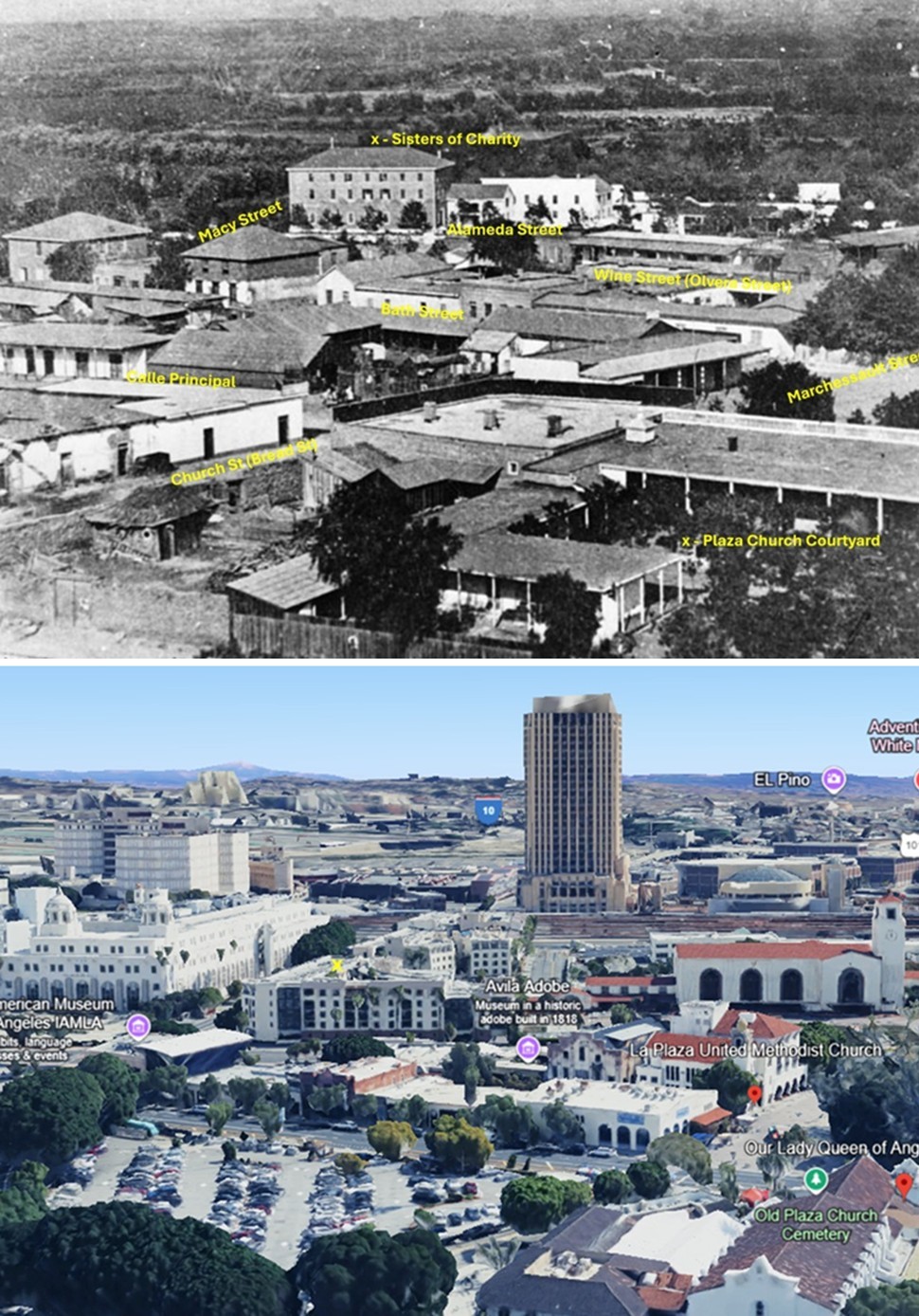
| (ca. 1860)* - One of Los Angeles’ first water reservoirs was the brick structure shown in the center of the Plaza. The street extending to the left is Wine Street (renamed Olvera Street). The three-story building in the background was the Sisters of Charity Orphanage, established in 1856. The reservoir was built in 1858 by William G. Dryden and his Los Angeles Water Works Company. |
Historical Notes In 1857, the City Council granted William Dryden a franchise to deliver water to homes through a network of wooden pipes beneath the streets. As part of this early municipal water system, Dryden and his newly incorporated Los Angeles Water Works Company erected a 40-foot water wheel on the Los Angeles River. Although commonly mistaken for a traditional bucket-lift wheel, this large structure actually powered a pump that drew cleaner water from below the surface of the river and fed it into the city's main aqueduct—the Zanja Madre. This system ensured more reliable and sanitary delivery, avoiding the sediment-laden surface flow of the river. In 1858, the company constructed the brick and wood storage tank seen above, located at the center of the city Plaza. This reservoir served as the main distribution hub for water delivered through the Zanja Madre. It stood for about 10 years before being replaced by a decorative fountain. Additional tanks were installed on the periphery of the Plaza and in nearby areas to serve the growing pueblo. By 1860, Los Angeles had a population of 4,385—nearly triple what it had been a decade earlier. Click HERE to read more about Water in Early L.A. Also, click HERE to see more Early LA Water Reservoirs. |
 |
|
| Map showing the LA Plaza area as it appeared in 1860. Adobe structures are predominately on all sides.* |
 |
|
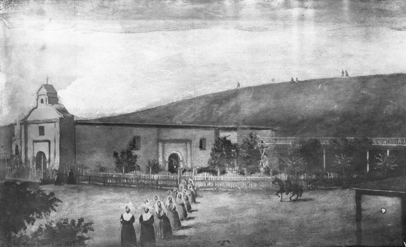
| (1857)* - Photograph of a drawing (by a young lady pupil of Sister's School) of the Los Angeles Plaza Church with a group of 14 nuns processing in the foreground. A wooden picket fence extends from the church at left to the right. A horseman prances nearby (at right). Two people stand near the church entrance (at left). A few other people are visible on the bare hilltop behind. |
Historical Notes The 'Church of Los Angeles' was founded on August 18, 1814 by Franciscan Fray Luis Gil y Taboada. He placed the cornerstone for the new church in the adobe ruins of the original "sub-station mission" here, the Nuestra Señora Reina de los Ángeles Asistencia (founded 1784), thirty years after it was established to serve the settlement founding Los Angeles Pobladores (original settlers). |
 |
|
| (1860)* - Photograph of a lithograph from Benjamin Nayer's diary depicting the exterior of the Plaza Church in Los Angeles, 1860. |
Historical Notes The completed new structure was dedicated on December 8, 1822. A replacement chapel, named La Iglesia de Nuestra Señora de los Ángeles - for Mary, mother of Jesus or "The Church of Our Lady of the Angels" - was rebuilt using materials of the original church in 1861. The title Reina, meaning "Queen," was added later to the name. For years, the little chapel, which collected the nicknames "La Placita" and "Plaza Church," served as the sole Roman Catholic church in emerging immigrant Los Angeles. |
 |
|
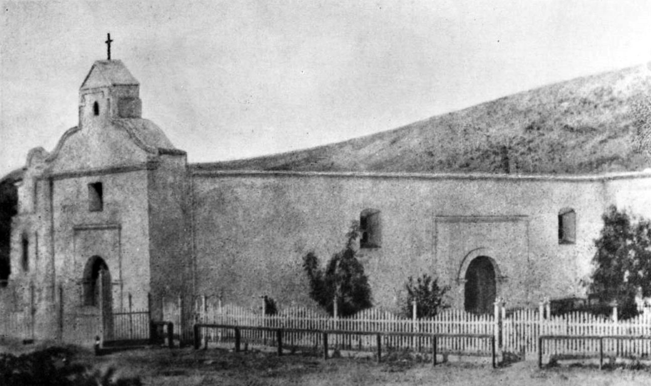
| (1869)* - View of the 'Old Plaza Church' (Mission Nuestra Senora Reina de Los Angeles) with bare hills in the background. Chavez Ravine, over the church at left, is where Dodger Stadium is now. |
Historical Notes The 'Old Plaza Church' was one of the first three sites designated as Historic Cultural Monuments by the City of Los Angeles, and has been designated as a California Historical Landmark No. 144. Click HERE to see the complete listing of California Historical Landmarks in L. A. |
 |
|
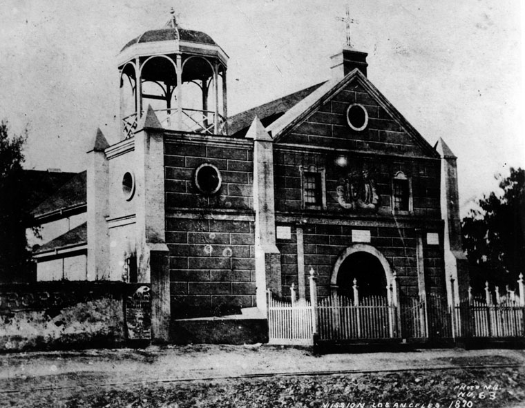
| (1870)* - Close-up detailed showing the front entrance to the 'Old Plaza Church'. |
Historical Notes The original 1822-built "Church of Our Lady of the Angels" incoporated a three-bell campanario, or "bell wall" which was replaced by a gazebo-like structure (seen above) when the Church was rebuilt in 1861. The "bell wall" or "bell gable" would once again return when the Plaza Church was repaired/remodeled circa 1901. |
 |
|
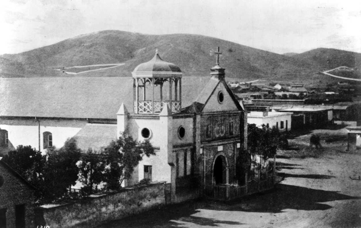
| (1870s)* - Exterior view of the Plaza Church or Mission Nuestra Senora de La Reina de Los Angeles. In front of the church is a fence that encloses the yard (at right). Three trees in the yard hinder the view of the building in the background. Two horse-drawn carriages are parked in front of the church and near the fence. |
Historical Notes IThis is about the time LA Plaza's configuration changed from square to circular. One of the two posts seen in the center of the street appears to be the old gas lamp which was located on the northwest corner of the old square plaza. |
 |
|
| (ca. 1868)** - A view of the northwest corner of the Los Angeles Plaza. This is the intersection of Calle Principal (Main Street) and Marchessault Street. Note the gas lamp at the corner of the Plaza. |
Historical Notes In 1867, Los Angeles Gas Company, the forerunner of today's Southern California Gas Company, installed 43 new gas lamps along Main Street, making the city safer at night. The gas lighting business was run by five entrepreneurs who manufactured the gas from asphalt, a tar-like substance, and later from oil. The gas company's plant, including two large tanks, was located across the street from the Plaza, just south of the Old Plaza Church (see next photo). |
 |
|
| (ca. 1871)* - Photograph of a lithograph of Los Angeles with the LA Plaza and Pico House at center-right. The lithograph shows Los Angeles at an early age where most of the city consists of agricultural land showing orchards and farmland (foreground). Majority of the homes and buildings are clustered closer to the mountains in the background. |
.gif) |
|
| (1873)* - Ruxton Survey of the Central Pueblo. This oversize plat shows the plaza area in 1873, including the center of town with the early buildings and the zanza madra (zanja madre) which was LA's original water aqueduct and lifeline. The map also shows the streets in use and the early owners of many of the properties. The layout of the plaza itself, however, is shown as it appeared before the change in landscaping in the prior two years before it became rounded. |
Historical Notes Calle Principal is now Main Street and follows the old Bath Street, while the upper portion of Calle Principal became Upper Main and later Spring Street, and no longer exists below Sunset Boulevard. (Its remnants can be seen in El Pueblo de Los Angeles Parking Lot Number 2.) Calle de los Negros (then disparagingly called "Nigger Alley") is now the east side of Los Angeles Street. Wine Street is now Olvera Street. Sunset Boulevard (at one time called Short Street) originally ran down Church (Bread) and Marchessault Streets; now it follows a more direct path to connect with Macy Street, and this portion was recently renamed Cesar E. Chavez Street. Calle Alta (old High Street) is now Ord Street. Church (Bread) Street is now an alley. Calle Corto (Short Street) no longer exists. |
 |
|
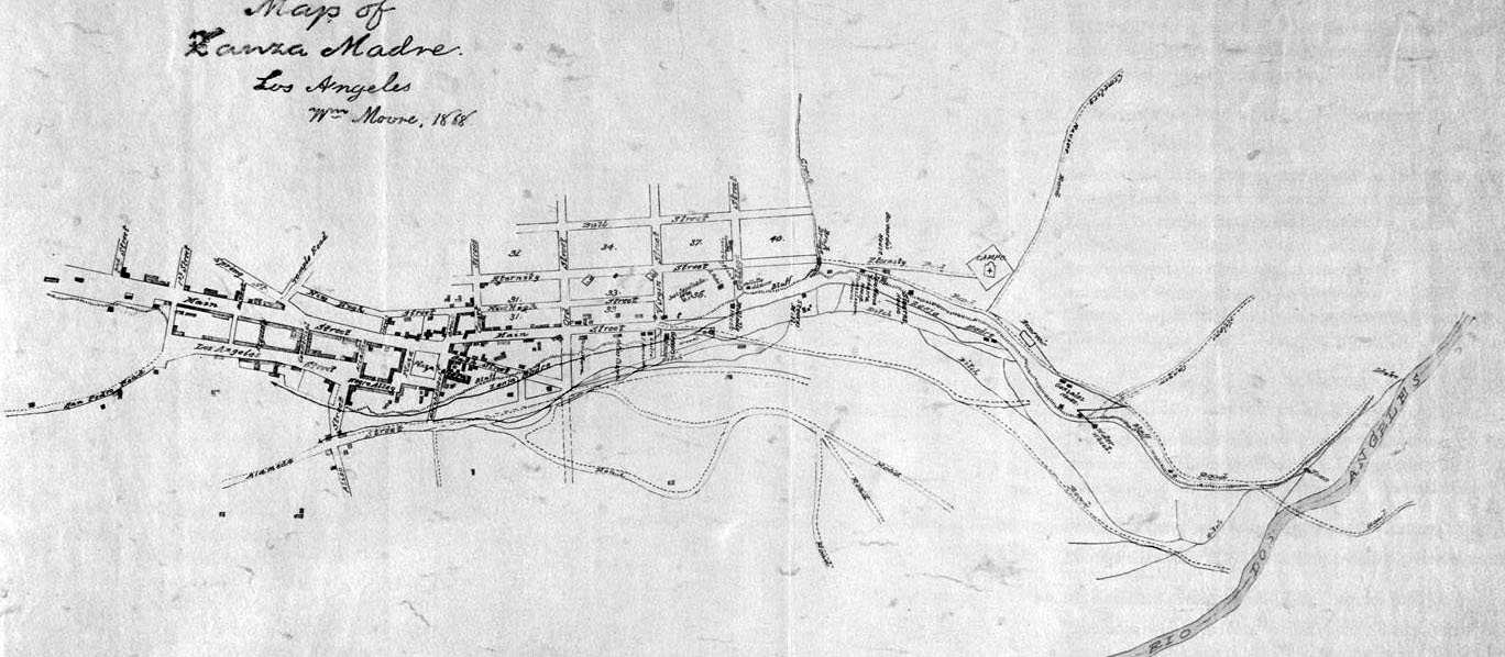
| (1868)^ - This manuscript map traces the path of the essential lifeline of early Los Angeles: the Zanja Madre, or Mother Ditch, prepared by cartographer William Moore. |
Historical Notes The Zanja Madre is shown here from the river at the right edge of the map, running along the bluffs in the proximity of current day North Broadway, completely open to the elements. A few years after this rendering, a brick tunnel enclosed the Zanja Madre in an attempt by the Common Council and the Los Angeles City Water Company to preserve the precious water flowing down from the river. The map includes the Campo Santo cemetery (the second one) at the end of Eternity Street, the water wheel that propelled the flow toward the pueblo, and the homes of pioneers like Jose Sepulveda, Abel Stearns, and Bernardo Wilson. Click HERE to see more in Zanja Madre - LA's Original Aqueduct William Moore, the rendering’s rather robust and tireless cartographer, was county surveyor for two separate terms and a man with such drive that he once tired of waiting for a ship from San Francisco and walked to Los Angeles. Because he was bi-lingual and reportedly quite charming he was involved in many important projects in the days after California gained statehood, including the planning of reservoirs, a sewer system, creation of sidewalks, the Farmers and Merchants Bank, and even orange growing for a time. |
 |
|
| (1869)* - Panoramic view of the Plaza and 'Old Plaza Church' (Mission Nuestra Senora Reina de Los Angeles). The square main brick reservoir in the middle (partial view) was the water reservoir builit by William Dryden and his LA Water Works Co. Click HERE to read more on Wiliam Dryden. |
Historical Notes The building in the top right background was the Sisters of Charity Hospital. The three adobes seen on the north side of the Plaza were owned in 1869 by M. Norton (built 1854), John Downey (shrouded by trees, built 1844) and Augustin Olvera (built 1854). They are all gone now. The first lost to the widening of Main St, the second torn down in 1894 to build the Simpson-Jones Building and the last demolished in 1916 to build the Methodist Church and Conference Center. |
 |
|
| (ca. 1869)* - View of the edge of the Los Angeles Plaza and the entrance to Wine Street (renamed Olvera Street in 1877) looking north from the Pico House. The Avila Adobe is visible on Wine Street. The Olvera Adobe can also be seen on the right. In the foreground running horizontally two fences, a wrought-iron fence and a post-and-rail fence, can be seen on either side of the street. |
Historical Notes Don Francisco Avila, a wealthy cattle rancher and one-time Mayor of the pueblo of Los Angeles, built the Avila Adobe in 1818. The Avila Adobe, presently the oldest existing residence within the city limits, was one of the first town houses to share street frontage in the new Pueblo de Los Angeles. |
 |
|
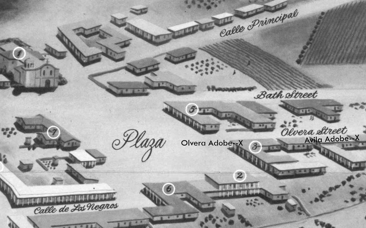
| (1850)* - Map view looking northwest showing the LA Plaza and surrounding area as it appeared in 1850. To the right can seen Olvera Street (Wine Street until 1877) at its intersection with the Plaza, with both the Olvera Adobe and Avila Adobe locations marked with an X. The Plaza Church is in the upper left corner. The Lugo Adobe, the Plaza's only two-story building, is seen at lower right and is identified by the No. 2. |
 |
|
| (ca. 1868)** - The Plaza, looking east, with LA's first above ground reservoir to the right of the picture. The two-story building directly behind the reservoir is the Vicente Lugo adobe house. The building in front of the reservoir with the gazebo-like tower is the 'Old Plaza Church'. |
Historical Notes The Lugo Adobe, said to have been built in the 1840s by Don Vicente Lugo, was one of the very few two-story houses in the pueblo of Los Angeles. In 1867, Lugo donated this house on the Plaza to St. Vincent's School (forerunner of Loyola University). Click HERE to see more of St. Vincent's College (later LMU). |
 |
|
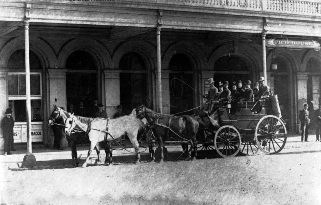
| (1869)* - View showing the Pico House, Masonic Temple and the Plaza area from a hill overlooking Spring Street and Main Street, Los Angeles, December 1, 1869. In the foreground is a community of small houses. Just beyond the community is the Pico House, which faces Main Street. The Plaza is to the left of the Pico House. The Masonic Temple (or Hall) stands several buildings to the right of the Pico House. A majority of the buildings in view are residential houses. |
Historical Notes Between 1868 and 1870, Pio Pico constructed the three story, 33-room hotel, Pico House (Casa de Pico) on the old plaza of Los Angeles, opposite today's Olvera Street. Pío de Jesús Pico was the last Governor of Alta California under Mexican rule. In 1821 Pico set up a tanning hut and dram shop in Los Angeles, selling drinks for two Spanish bits (US 25 cents). His businesses soon became a significant source of his income. By the 1850s Pico was one of the richest men in Alta California. In 1850 he purchased the 8,894-acre Rancho Paso de Bartolo, which included half of present day Whittier. Two years later, he built a home on the ranch and lived there until 1892. It is preserved today as Pio Pico State Historic Park. Pico also owned the former Mission San Fernando Rey de España, Rancho Santa Margarita y Las Flores (now part of Camp Pendleton), and several other ranchos for a total of over one half-million acres, or 800 mi². |
 |
|
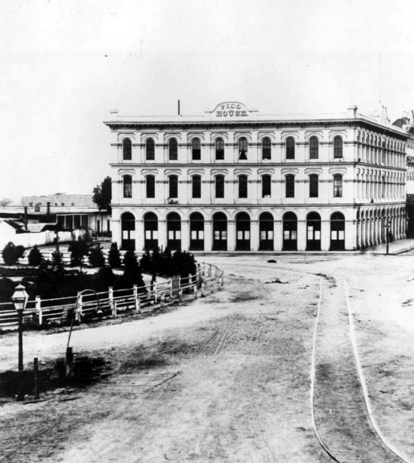
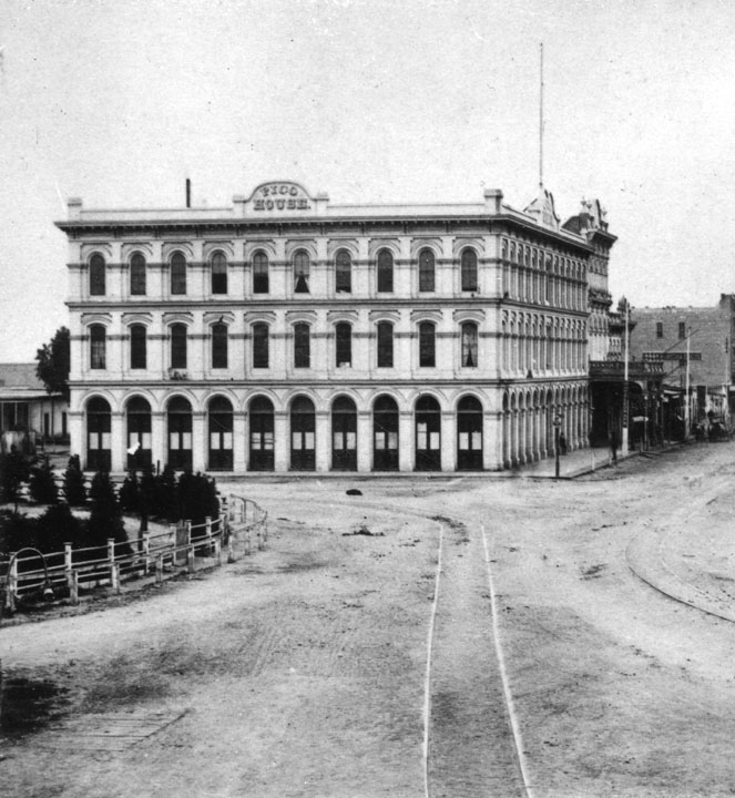
| (1870)** - On the right is the Pico House, erected by the last Mexican governor, Pio Pico. Described as "the latest thing in luxury, gas lights and several bath tubs." On the upper left appears Olvera Street. Note the big water tank reservoir in the middle of the Plaza is gone and replaced with a fountain. |
Historical Notes The Pico House was known as the "finest hotel in Southern California," boasted "bathrooms and water closets for both sexes" on each floor. Pio Pico, the last governor of Mexican California, sold his land in the San Fernando Valley to raise money for its construction. It was Los Angeles' first three story building. |
 |
|
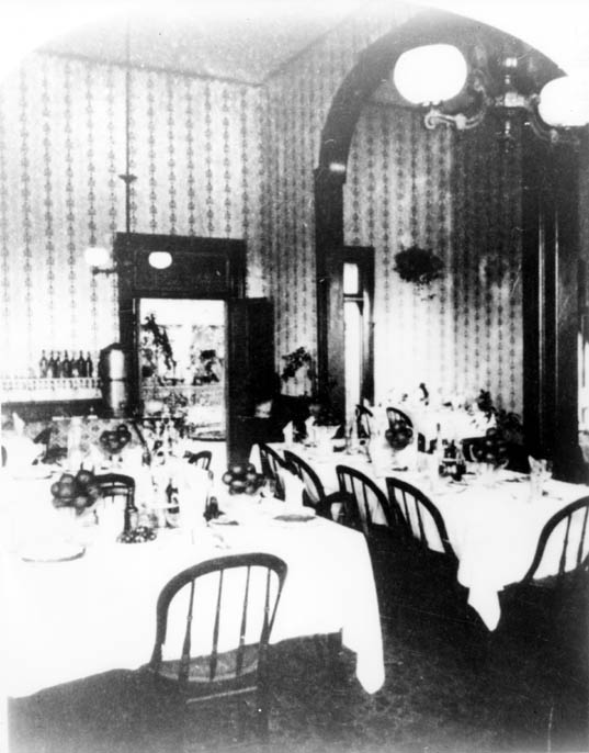
| (ca. 1880s)*#^ - View shwoing the Pico House's French restaurant dining room. |
Historical Notes The Pico House had 82 bedrooms, 21 parlors and two interior courtyards. It also had a French restaurant that was located on the ground floor. |
 |
|
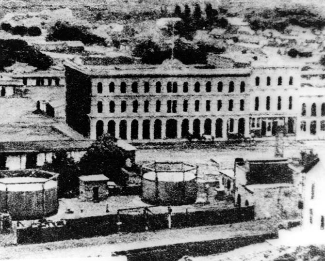
| (ca. 1873)** - View looking east showing the showing the Pico House, the Merced Theater, and the Masonic Lodge, located on Main Street. Two tanks of the City's first gas works are seen in the foreground. They were located just south of the Plaza Church (out of view to the left) and across the street from the Pico House. |
Historical Notes The gas tanks were built in 1867 when the City installed its first streetlighting system consisting of 43 gas lamps along Main Street. By 1873, 136 gas lamps provided the outdoor night lighting for the City. Things would change in 1882 when electricity was introduced. Click HERE to see more in Early Los Angeles Streetlights. |
 |
|
| (ca. 1870s)*#^ - Close-up view of the Pico House and surrounding area, including gas tanks in the foreground. |
 |
|
| (1873)*#^ - The Pico House, and to its right, Merced Theater and Masonic Lodge as seen from Fort Moore Hill. Note the streetcar tracks running down the middle of Main Street. Also, to the left, a fragment of the Plaza, and the adobe structures which stand south of the Lugo Adobe on what is now Los Angeles Street, then Calle de los Negros. The LA River can be seen in the background. |
 |
|
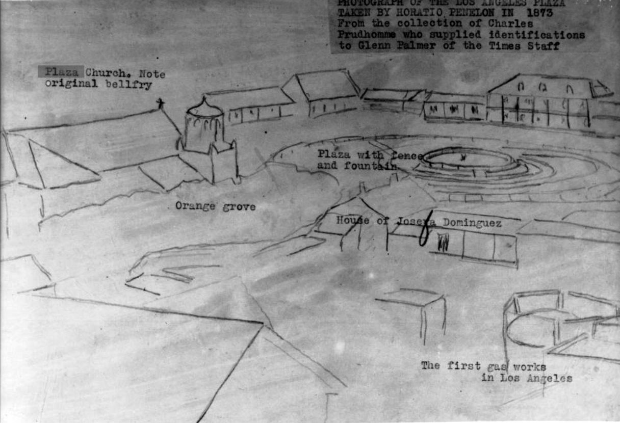
| (1873)* - Photograph of a line drawing of the Los Angeles Plaza representing a photo by Horation Penelon. The plaza and fountain are shown to the right of center, the Josefa Dominguez home represented in front of it. The plaza church is shown to the left, while in the right bottom corner, the first Los Angeles Gas Works is depicted. |
Historical Notes A caption above the image reads: "Photograph of the Los Angeles Plaza taken by Horatio Penelon in 1873. From the collection of Charles Prudhomme who supplied identifications to Glenn Palmer of the Times Staff". The back of the photoprint identifies the structures pictured from left to right: (top) Nuestra Senora la Reina de Los Angeles "Plaza Church" ([...]berela Belfry); Jonas Jones home, ancestor of the Lankershim family; Judge Augustin Olveras, Home and Court Room; Pablo dor(?) Narvaros Adobe; Becente Luego Home, later Saint Vincentia College now Loyola; Don Ignacio del Valle home. Bottom: Plaza Church's campo Santo (cemetary); First Gas Works and Adobe of Dona [B]enancia Dotello de Dominguez. Photoprint also reads "Padre Blas Ra[...] in 1860 on the restoration of the chruch was the pastor". |
 |
|
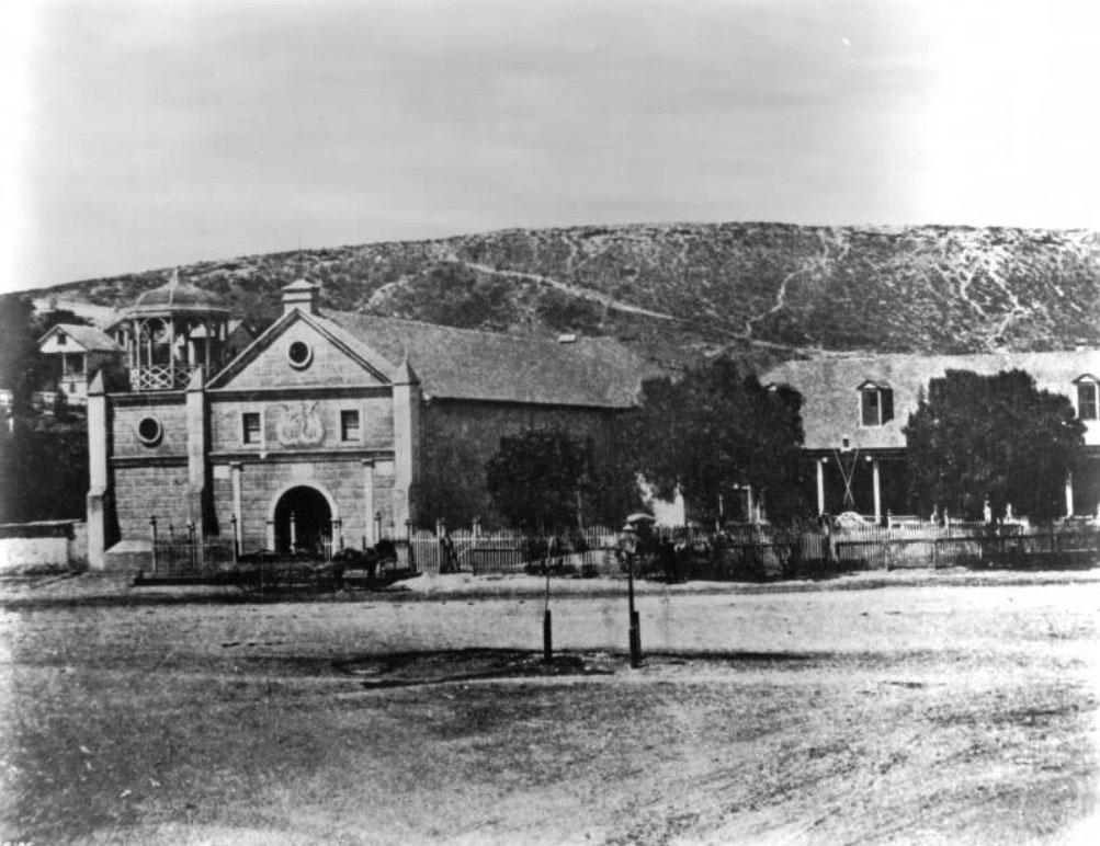
| (1873)** - A view of the Los Angeles Plaza as it looked in 1873. Again, note that the big water tank reservoir in the middle of the Plaza is no longer there. It was replaced with a fountain by the LA Water Company. |
Historical Notes In 1868, John S. Griffen, Solomon Lazard, and Prudent Beaudry, three of the city's more successful businessmen, submitted a proposal to the city council to develop and operate the city's water system. In turn they asked for all of the city's water rights and control over the water rates. They also promised to construct a reservoir for the city, lay twelve miles of iron pipe, install fire hydrants at major street crossings, provide free water to public buildings, and to erect an ornamental fountain in the Plaza. Click HERE to see more in Water in Early Los Angeles. |
.jpg) |
|
| (ca. 1873)** - View across the Plaza in the early 1870's were three people are posing for the photograph. The Plaza Church and the Cape House Restaurant are seen in the background. In the far background can be seen Fort Moore Hill. The Plaza was landscaped in 1871 and has served since that date as a public park. |
Historical Notes Fort Hill (also known as Fort Moore Hill) was a prominent hill overlooking the pueblo of Los Angeles. Its commanding view of the city made it a strategic location. Fort Moore was an historic U.S. Military Fort during the Mexican–American War. Its approximate location was at what is now the Hollywood Freeway near the intersection of North Hill Street and West Cesar Chavez Avenue, downtown. The hill on which it was built became known as Fort Moore Hill, most of which was removed in 1949 for construction of the freeway. The hill was located one block north of Temple Street and a short distance south of present day Cesar Chavez Avenue, between the Los Angeles Civic Center and Chinatown. The fort is now memorialized by the Fort Moore Pioneer Memorial, 451 North Hill Street. |
 |
|
| (ca. 1875)* - Another view of the LA Plaza from a slightly different angle as seen from Fort Moore Hill. The Pico House can be seen to the right of the photo. To the left is the Plaza Church and next to it, at center of photo, are the City's gas works and tanks. |
* * * * * |
Sisters of Charity
 |
|
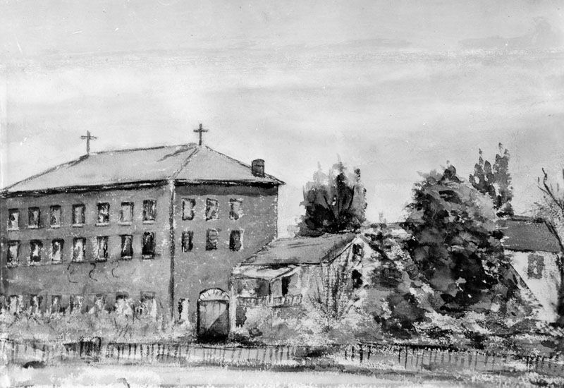
| (1860)^ - Photo of a watercolor painting of the first school (and Sisters of Charity Orphanage) in Los Angeles, made in 1860 by a student. |
Historical Notes The Los Angeles Orphan Asylum, originally called the Los Angeles Charitable Institute and later known in Spanish as Casa de las Hermanas, was established in 1856 by the Daughters of Charity of St. Vincent de Paul. Seeking to provide care for the growing number of orphaned and destitute children in the young pueblo, the Sisters purchased property from Benjamin D. Wilson, an early mayor of Los Angeles. The parcel, located at the corner of Alameda and Macy Streets (now Cesar E. Chavez Avenue), included roughly twelve acres of land and Wilson’s old wood-frame house, which had originally been shipped around Cape Horn. The Sisters bought the property for $8,000, a significant investment at a time when Los Angeles was still little more than a dusty frontier town. |
 |
|
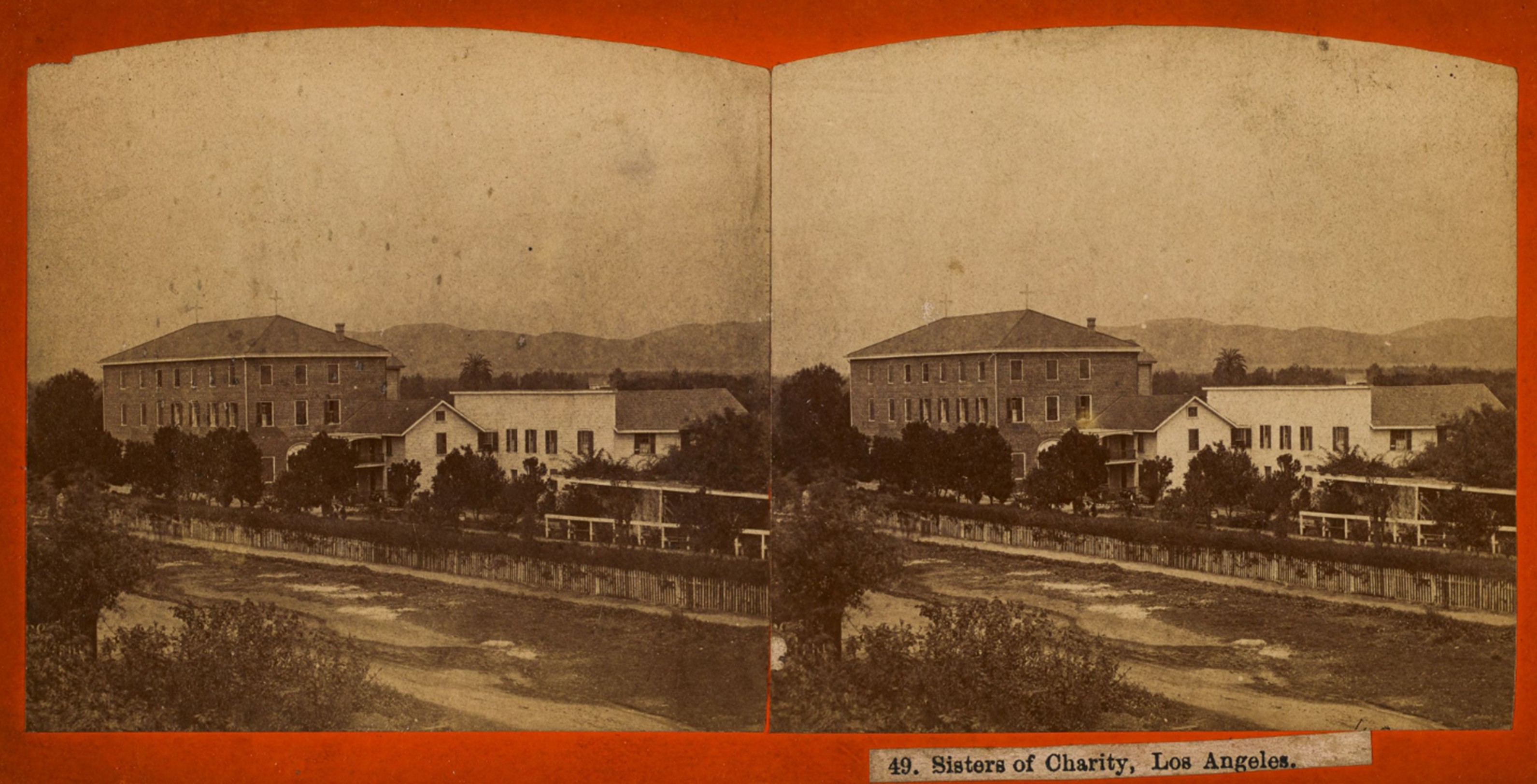
| (ca. 1868)* - Stereoscopic image showing the property of the Daughters of Charity of St. Vincent de Paul (also known as the Sisters of Charity), as seen from across Alameda Street near Macy Street (now Cesar E. Chavez Avenue). Visible is the Los Angeles Orphan Asylum and School, initially called the Los Angeles Charitable Institute. Photo by William M. Godfrey from the Ernest Marquez Collection. |
Historical Notes The Wilson house initially served as the Sisters' residence and the first orphanage quarters. However, recognizing the need for a more permanent facility, the Sisters quickly set about constructing a new building. By 1858, a large three-story brick structure—one of the first of its kind in Los Angeles—was completed, using bricks and building materials also brought by ship around Cape Horn. The school and orphanage faced Alameda Street and opened with about twenty girls enrolled. Early instruction was led by Don Francisco Coronel, father of prominent Californio figure Don Antonio Coronel, along with Coronel's two daughters. Notably, one of his daughters later married the well-known historian Hubert Howe Bancroft, linking the institution to broader California history. |
 |
|
| (ca. 1868)* – Left panel of a stereoscopic image showing the property of the Daughters of Charity of St. Vincent de Paul (also known as the Sisters of Charity), as seen from across Alameda Street near Macy Street (now Cesar E. Chavez Avenue). Visible is the Los Angeles Orphan Asylum and School, initially called the Los Angeles Charitable Institute. Photo by William M. Godfrey from the Ernest Marquez Collection. |
Historical Notes For more than three decades, the Los Angeles Orphan Asylum served as a vital institution in the community, providing shelter, education, and care to countless children. Its imposing brick building and cultivated grounds, including gardens and orchards, made it a familiar landmark just outside the central Plaza area. At a time when most structures in Los Angeles were still modest one-story adobe or wood buildings, the orphanage stood out as a symbol of permanence and the Catholic Church’s growing influence in the city’s social services. The Sisters continued their work at the Alameda and Macy location until 1891, when the growing city and the increasing number of orphans necessitated a move to a larger, more modern campus in Boyle Heights. |
 |
|
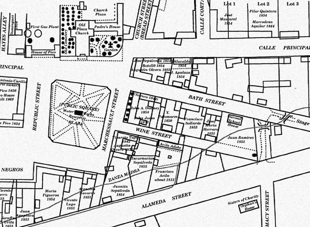
| (1873)* – Early map showing the Plaza area, including the center of town with its early buildings and the Zanja Madre, Los Angeles' original water aqueduct and lifeline. The Sisters of Charity building is seen at lower right on the southeast corner of Alameda and Macy Street. |
Historical Notes The map also shows the streets in use and the early owners of many of the properties. The layout of the plaza itself, however, is shown as it appeared before the change in landscaping in the prior two years before it became rounded. |
 |
|
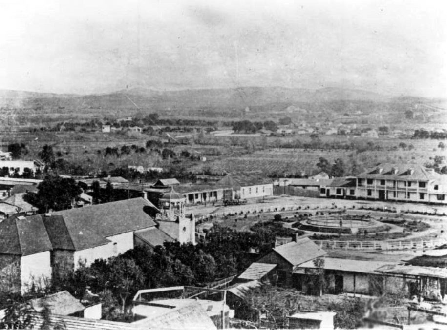
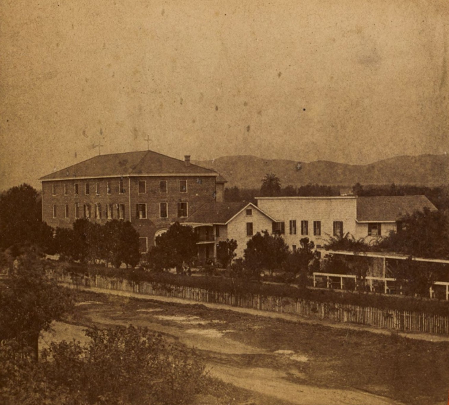
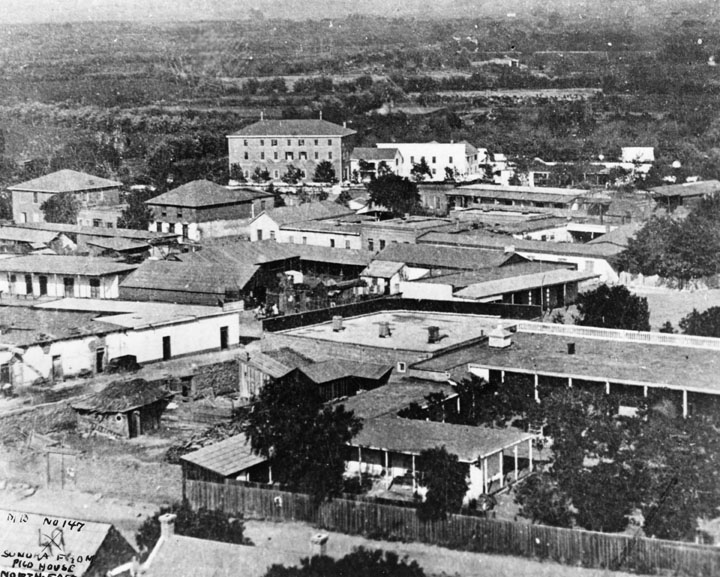
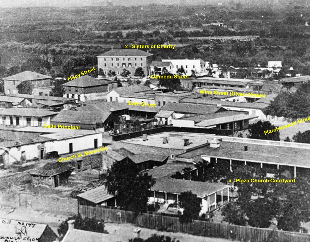
| (1875)* – View looking northeast over the Los Angeles Plaza area and Wine Street (later Olvera Street) showing the 3-story brick building of the Sisters of Charity on the southeast corner of Alameda and Macy Streets. |
Historical Notes In the foreground of the above photo is the courtyard of Nuestra Senora la Reina de Los Angeles, showing the padres' kitchen, bishop and padres' quarters, parochial school and courtyard planted to citrus orchard. To the left of this, a low white adobe, is the bakery of Pierre Domegue and his Indian wife, who baked sourdough French bread. Behind this on the next block are two square buildings, the Bath Street (later Olvera Street) Public School. In the rear is a three-story building at Alameda and Macy Streets, the Los Angeles Charitable Institute run by the Sisters of Charity. Just behind the bakery is the Pelanconi Winery, later La Golondrina Restaurant. Also shown, behind the church facilities, is the adobe residence of Mr. and Mrs. John Jones, parents of Mrs. Lankershim. |
 |
|
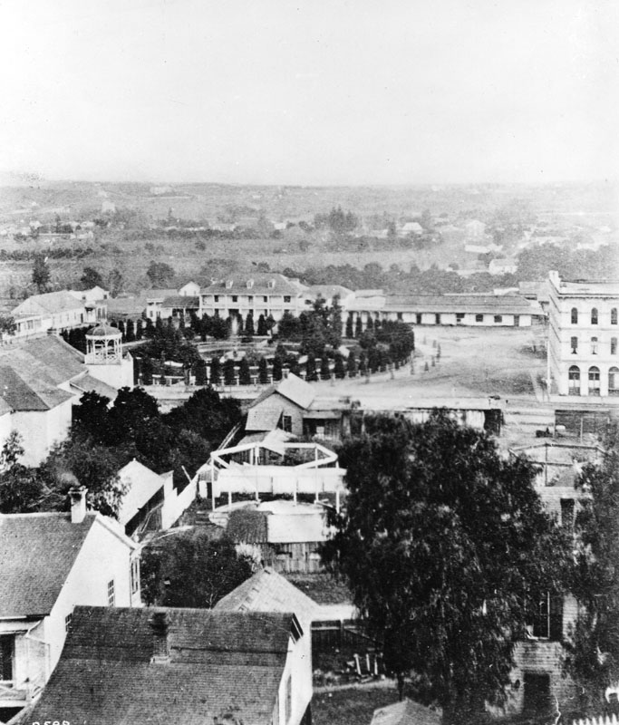
| (1875)* – View looking northeast over the Los Angeles Plaza area and Wine Street (later renamed Olvera Street), showing the 3-story brick building of the Sisters of Charity on the southeast corner of Alameda and Macy Streets. Today, the site is adjacent to Union Station and the Mozaic at Union Station Apartments. |
Historical Notes Following the Sisters' departure, the original property underwent dramatic changes. In the early 20th century, Los Angeles embarked on major redevelopment projects, and the orphanage site became part of the land cleared for the construction of Union Station, completed in 1939. Although the original orphanage buildings were lost to time, the historical significance of the location remains. Today, the site is adjacent to Union Station and Mozaic at Union Station Apartments, standing as a quiet reminder of one of Los Angeles' earliest and most important charitable institutions. |
 |
|
| (2023)* – Google Earth view looking toward the southeast corner of Alameda Street and Cesar Chavez Avenue (originally named Macy Street), where an "X" marks the spot where the main 3-story Sisters of Charity building once stood. Today, the site is occupied by the Mozaic at Union Station Apartments. |
Then and Now
 |
|
| (1875 vs. 2023)* – A ‘Then and Now’ comparison showing the 3-story Sisters of Charity building at the southeast corner of Alameda Street and Macy Street (now Cesar Chavez Avenue), where the Mozaic at Union Station Apartments stand today, directly across from the Terminal Annex Post Office Building. Photo comparison by Jack Feldman. |
* * * * * |
 |
|
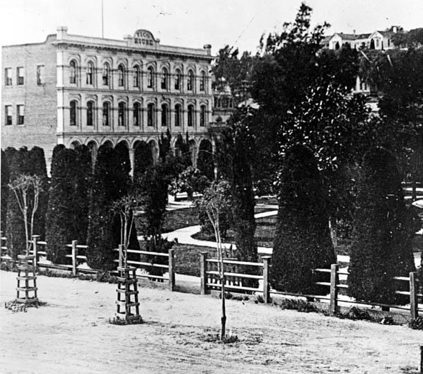
| (1876)** - Panoramic view of the Los Angeles Plaza on a very clear day. The Pico House is the prominent 3-story white building at the center of the photo. To its right stands the Merced Theatre. The LA River can be seen in the background. |
Historical Notes Pío Pico constructed the Pico House in 1868-70. The first three-story hotel built in Los Angeles, it had about eighty rooms, large windows, a grand staircase, and a small interior courtyard. |
 |
|
| (ca. 1885)* - The Plaza as seen from the Pico House. The street on the left is Main Street and Los Angeles Street is on the right. Olvera Street can be seen in the upper center where it intersects with Marchessault Street. Sisters of Charity Orphanage can also be seen in the distance. John R. Putnam and Carlton O. Valentine Collection, California State Historical Society. |
Historical Notes The Pico House was built in 1868. |
 |
|
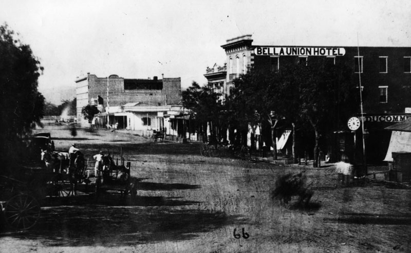
| (ca. 1870)* - Early view of the 300 block of North Main Street and beyond (view is looking North). Two large buildings stand out; the Pico House on the left and the Bella Union Hotel on the right. The Pico House is located one block north, across the street from the Los Angeles Plaza. It was built in 1870 by Pio Pico, the last Governor of Alta California under Mexican rule. Click HERE to see a Then and Now comparison of the above scene. |
Historical Notes The 300 block of North Main Street was an important part of Los Angeles history as early as the mid-1800s. It was considered the uptown commercial heart of the old city and was always buzzing with activity. Built there was Los Angeles’ first hotel, the Bella Union, which was long a social and political center. The first county courthouse was in the adobe hotel, where court was held in rented rooms from 1850 to 1852. Beginning in 1858, it was the region's transportation hub. The Overland Mail Company operated by John Butterfield (the founder of American Express) rented space for a station. The Wells, Fargo and Company also had their office here and Phineas Banning operated coaches to Wilmington and San Bernardino from the hotel. Just north of the two-story Bella Union was the Pico Building, built by Pio Pico in 1868 (two years before the Pico House). In 1871, the building became home to the Farmers & Merchants Bank, the first incorporated bank in Los Angeles. |
 |
|
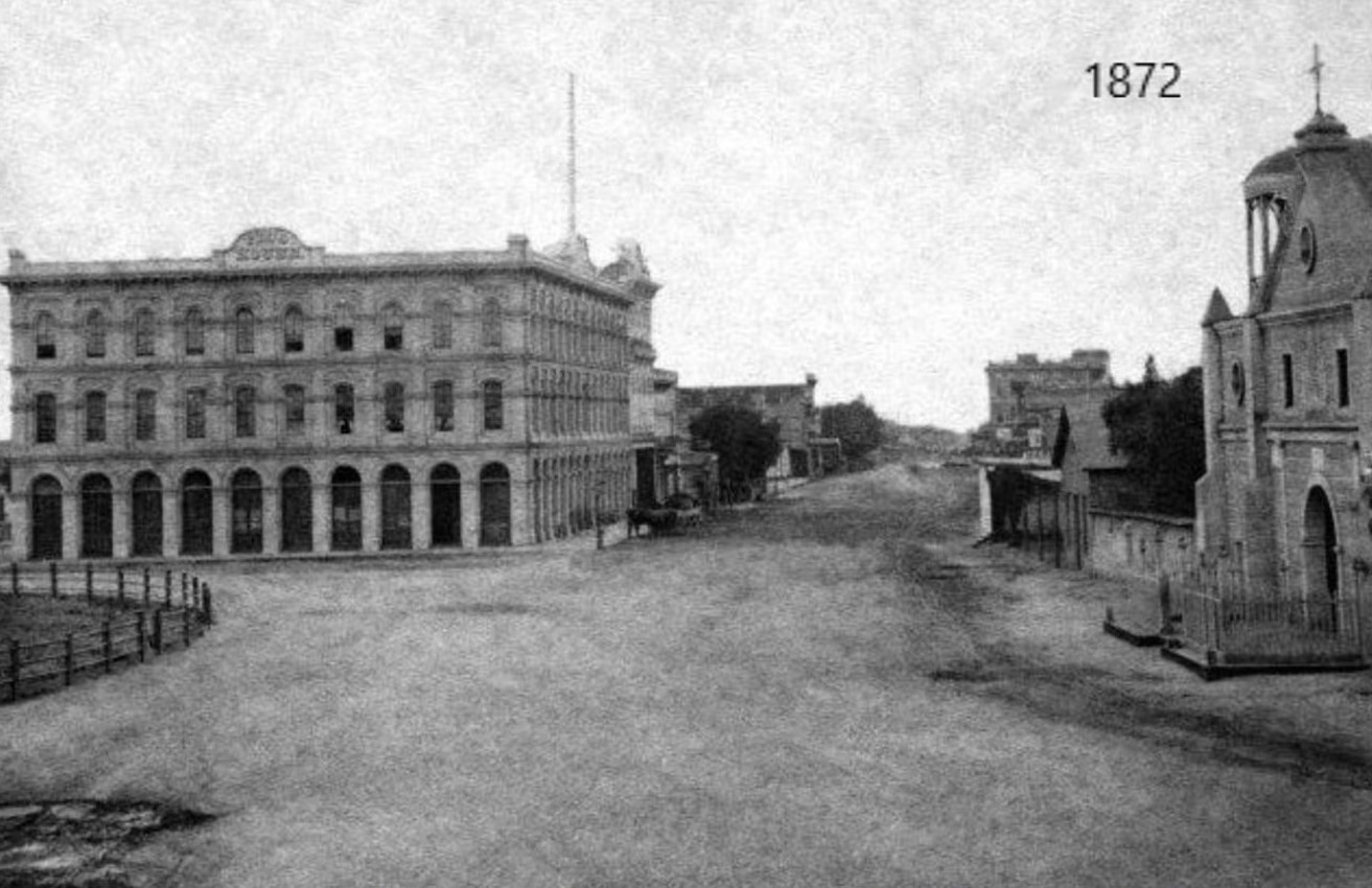
| (1872)* - Looking south on North Main Street from in front of the Los Angeles Plaza and the Old Plaza Church showing the Pico House and, behind it, the Merced Theatre. In the distance can be seen the Temple Block where today's City Hall Stands. |
Historical Notes Click HERE to see a Then and Now comparison of the above scene. |
 |
|
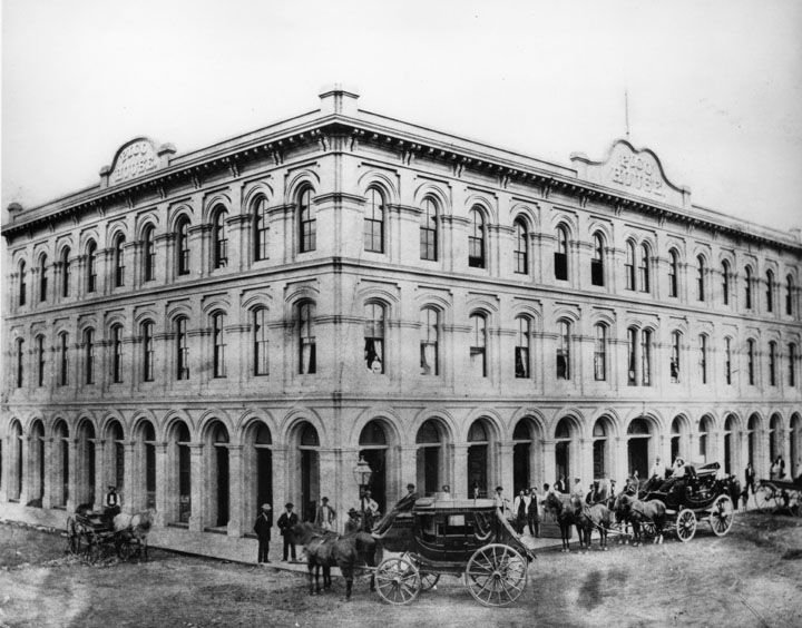
| (1875)** - View of the Pico House, built by Pio Pico. There is a stage coach in front of the hotel and a horse drawn-carriage parked along side it. Approximately two dozen men seem to be standing on the sidewalk looking toward the photographer. |
Historical Notes In 1880, Pio Pico would lose the hotel by foreclosure. Also, between 1892 and 1920, the hotel would be known as the National Hotel. The Pico House (Hotel) was designated as California Historical Landmark No. 159. Click HERE to see California Historical Landmarks in LA. |
 |
|
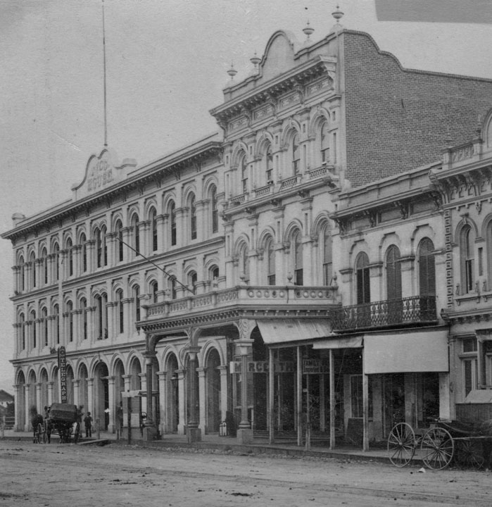
| (1870s)** - The Merced Theater sits between the Pico House and the Mason Lodge. This was the "first business block on Main Street". |
Historical Notes The Merced Theatre, erected in 1870 on North Main Street next to the Pico House, was the first building built expressly for theatrical purposes in Los Angeles. It was built by William Abbot, a cabinetmaker, and named in honor of his wife Merced Garcia. The theater was built in an Italianate style and operated as a live theater from 1871 to 1876. When the Woods Opera House opened nearby in 1876, the Merced ceased being the city's leading theater. Eventually, it gained an "unenviable reputation" because of "the disreputable dances staged there, and was finally closed by the authorities." The Merced Theatre was dedicated as California Historical Landmark No. 171 (Click HERE to see more in California Historical Landmarks in Los Angeles). |
 |
|
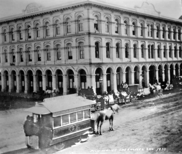
| (1874)*** - A horse-drawn streetcar of the Spring & Sixth Railway in front of the Pico House (Note: the photo indicates 1870, however, that date does not align with historic records indicating first streetcar in 1874). |
Historical Notes L.A.'s first streetcars ran under horsepower. Steam locomotives were considered too dirty and dangerous for use on city streets still teeming with easily spooked horses, and cable car technology was still new and expensive. Electric-powered traction railways, meanwhile, remained more than a decade off. On July 1, 1874, the modest, horse-drawn cars of the Spring and Sixth Street Railroad became the first streetcars to roll down Los Angeles streets. Founded by lawyer Robert M. Widney, the Spring & Sixth operated a regular schedule, running cars hourly on weekdays between 6:30 a.m. and 10 p.m. For a ten-cent fare, passengers could ride the one-and-a-half-mile route from the intersection of Temple and Spring south to Sixth, and then west to Figueroa. Soon, L.A.'s streetcar network expanded as new railways opened and existing lines extended their tracks across the city. The Plaza functioned as a central hub for the city's growing streetcar network, with lines radiating out in several directions. |
 |
|
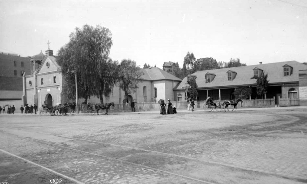
| (1878)* – View looking southeast toward the Pico House with the LA Plaza on the left. Streetcar rails are seen on the dirt road. Note the gas street lamp on the left. Photo by C. C. Pierce. |
Historical Notes In 1867, Los Angeles saw its first street gas lamps. A total of 43 were installed along Main Street. A lamplighter on horseback rode down the street at dusk to light the streetlights. By 1873, about 136 gas lamps provided the outdoor night lighting for the City. Things would change in 1882 when electricity was introduced. That year 3,000-candle power arc lamps were lifted atop seven 150-foot poles. The state of the art at that time encouraged the use of a few tall standards with high illumination. The gas street lamps would see their last days. Click HERE to see more in Early Los Angeles Streetlights. |
 |
|
| (1878)* - The Pico House, sometimes called "Old Pico House", built by Pio Pico in 1869-70. Seen here from the Main St. entrance of the Plaza. The road in front and to the side of the building is dirt, and a set of tracks runs down the middle. The railway tracks were part of the East L.A. and San Pedro Street Railway. (Same as above but shows a portion of Main Street). |
Historical Notes The East Los Angeles & San Pedro Railway Company was founded by Judge Robert M. Widney (also one of the founders of the University of Southern California), this line was incorporated on May 1, 1875 but did not begin construction until March 1876. This horse car driven system ran north from Fourth Street and was intended to lay track to the new Southern Pacific depot. It reached only to College Street and North Broadway. |
 |
|
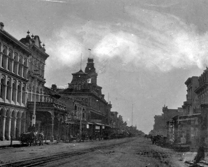
| (ca. 1878)* - View of Main Street looking south. A horse-drawn wagon with two men in it is parked in front of the Pico House near the Merced Theatre on the left. The road is unpaved and a streetcar track runs down the middle. Both sides of the street are lined with imposingly large buildings. At center on the left side of the street is an especially big building topped by three prominent towers (Baker Block ). Most of the other buildings are somewhat Romanesque, with large columns and archways dominating their facades. Click HERE to see more in Early Views of the Historic 300 Block of N. Main Street |
 |
|
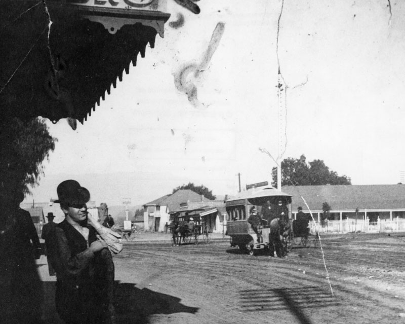
| (1882)** - Man with a hat stands gazing across the Los Angeles Plaza. To the right of the picture, is a horse-drawn trolley and buggy. |
Historical Notes Horse-drawn trolleys were the first form of public transportation to take passengers to and from the Plaza (1874-1887). In 1887 electic power streetcars started to take over. |
 |
|
| (1880)** - Panoramic view of the Plaza Church showing one horse and several horse-drawn wagons "parked" along the street. |
 |
|
| (ca. 1880)* - View of Calle Principal (now Main Street) showing the Plaza Church on the left and the LA Plaza on the right, as seen from the Pico House. Bath Street is on the right running up, away from the Plaza. |
 |
|
| (ca. 1880)* - View of Calle Principal (now Main Street) showing the Plaza Church on the left and the LA Plaza on the right, as seen from the Pico House. Bath Street is on the right running up, away from the Plaza. Image enhancement and colorization by Richard Holoff. |
 |
|
| (1880)*#^ - Looking west across the Plaza towards the Pico House Main Street façade. |
 |
|
| (1882)* - View of the Los Angeles Plaza and Sonora Town looking northeast from the Pico House, April 1882. |
* * * * * |
Calle de Los Negros
 |
|
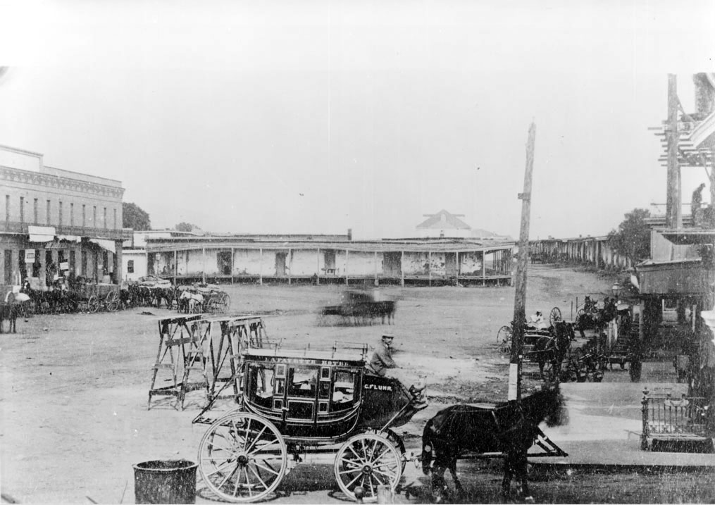
| (1870s)* - Lafayette Hotel stagecoach near the adobes in Calle de los Negros, presently Los Angeles Street and Arcadia Street. The old Antonio Coronel adobe is in the background. Numerous horse-drawn wagons and carriages are parked along the street. The above area was the scene of a Chinese massacre in 1871. |
Historical Notes The stagecoach in the foreground was owned by the Lafayette Hotel, the second Los Angeles hotel (after the Bella Union), owned by C. Fluhr (Fleubul?). Calle de los Negros is at the extreme right of the image and ran north from Los Angeles Street toward Aliso Street, ending where Dr. Gelsich had an apothecary shop. The two story brick building at the extreme left corner, on Arcadia Street, was occupied mainly by Caswell and Ellis grocers (or General Merchandise store of Harris Newmark?). In the corner was a saloon run by Marjett. He sold the first 5-cent beer. Marjett also owned a ranch in Antelope Valley to which the name of "Cinco Centavos" was given on account of his 5-cent beer. A son of Marjett later lived in Ocean Park. The open space in the foreground of the image is the end of Los Angeles Street. The hat on the stagecoach driver is a typical French cap of the time. |
 |
|
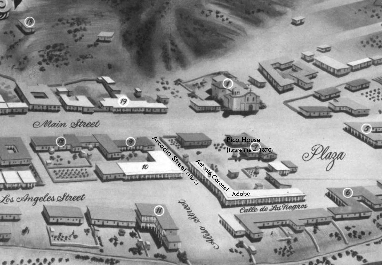
| (1850)* - Map view looking northwest showing the LA Plaza and surrounding area as it appeared in 1850. The intersection of Aliso Street (later Arcadia) and Calle de Los Negros is seen at lower center-right with the Antonio Coronel Adobe on the northwest corner. |
Historical Notes The Pico House (center-right) wasn't built until 1870. The section of Aliso Street seen above was renamed Arcadia Street in 1872. |
 |
|
| (ca. 1870s)^- Closer view of the Coronel adobe with its covered sidewalk, located on the northwest corner of Arcadia Street and Calle de Los Negros (later Los Angeles Street). The back part of the Pico House (built in 1870) across Sanchez Street is on the left and the LA Plaza (out of view) is at center-right. |
Historical Notes Antonio F. Coronel, was a state treasurer and former Los Angeles mayor who owned the main block of rundown adobe stores and apartments in this area. The Coronel house was the scene of the beginning of the Chinese massacre of 1871. Once home to the town’s most prominent families, the neighborhood had deteriorated into a slum by the time Los Angeles’s first Chinatown was established there in the 1860s. |
.jpg) |
|
| (ca. 1882)^ - View of Calle de los Negros. On the left is the adobe of Antonio Coronel; behind the adobe and with belltower is the Plaza Firehouse; center with a gable roof is the Vincent Lugo Adobe (facing the plaza on Los Angeles Street); and right with columns is the Antonio Maria Lugo adobe, which he willed to his son, Dolores del Carmen Lugo. View is looking toward the plaza from the east. |
Historical Notes There was no area more colorful than Los Angeles’s Calle de los Negros, a short dirt thoroughfare located just off the eastern edge of the historic Plaza and considered to be the center of the town’s “red light” district. Saloons, gambling dens, brothels, and other entertainment venues were said to proliferate on the Calle; the same could also be said for crime. |
 |
|
| (1886)^ - View of "Calle de los Negros," which became part of Los Angeles Street. |
Historical Notes Los Angeles Street was first named in 1854. Before the first official survey of the area in 1849, most of this thoroughfare was called Calle Principal (Main Street). Other sections were known as Calle de la Zanja (Ditch Street), Calle de Los Vinas (Vineyard Street) and--much to the south--Calle de los Huertos (Orchard Street), which is now San Pedro Street. These formed the principal highway running south to the Embarcadero of San Pedro. At its northern end, near the Plaza, a 500-foot stretch was known as Calle de Los Negros, which had a racially diverse population. |
 |
|
| (ca. 1882)#^ - View of Calle de los Negros, one of the roughest streets in town. The tower of the Old Plaza Firehouse can be seen in the background. This was Chinatown’s center when eighteen Chinese imigrants were massacred in 1871. |
Historical Notes The Chinese massacre of 1871 was a racially motivated riot on October 24, 1871 in Los Angeles, when a mob of over 500 men entered Chinatown to attack, rob and murder Chinese residents of the city. The riots took place on Calle de los Negros (Street of the Negroes), also referred to as "Nigger Alley", which later became part of Los Angeles Street. A total of 18 Chinese immigrants were systematically killed by the mob, making the so-called "Chinatown War" the largest incident of mass lynching in American history. |
 |
|
| (ca. 1886)^ - View of Calle de los Negros, running south of the Plaza along what is now the east side of Los Angeles Street. |
Historical Notes Calle de los Negros was situated immediately northeast of Los Angeles’s principal business district, running 500 feet from the intersection of Arcadia Street to the Plaza. The unpaved street took its name from the dark-complexioned Californios (pre-annexation, Spanish-speaking mixed-race Californians) who had originally lived there. |
 |
|
| (1886)* - View looking east from Aliso Street at the entrance to "the alley". |
Historical Notes In 1886, the extension of Los Angeles Street eliminated the alley and today the site adjoins the Hollywood Freeway. |
* * * * * |
Paseo de la Plaza and the Pico House
|
|
| (1878)* – View looking southeast toward the Pico House with the LA Plaza on the left. Streetcar rails are seen on the dirt road. Note the gas street lamp on the left. Photo by C. C. Pierce. |
Historical Notes Completed in 1870 by Pío Pico, the last Mexican governor of California, the Pico House was the first three-story hotel in Los Angeles and the most lavish of its time. Its Italianate architecture, arcaded ground floor, and grand scale reflected the city's ambitions following statehood. At the time of this photo, it overlooked an unpaved Main Street and the original LA Plaza, still lined with hitching posts, streetcar rails, and gas lamps. |
 |
|
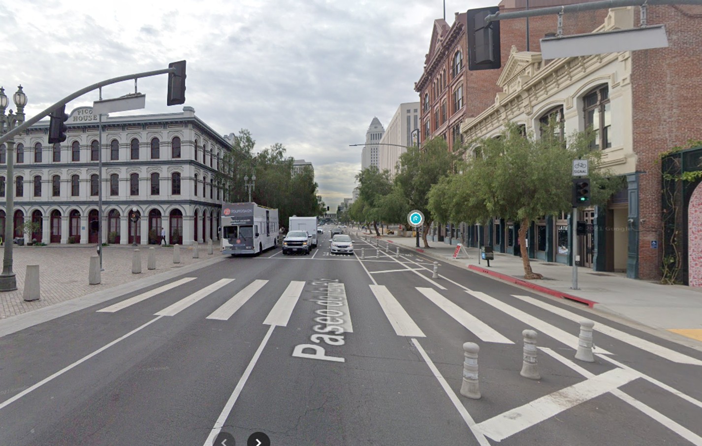
| (2021)* – Contemporary view looking south on Main Street (Paseo de la Plaza), with the historic Pico House at left and Los Angeles City Hall in the distance at right. |
Historical Notes Today, the Pico House is part of El Pueblo de Los Angeles Historical Monument. It now faces a much more modern civic core, including City Hall, seen in the distance. The preserved façade and footprint remain largely unchanged, making the building a vital architectural link between the 19th-century pueblo and today’s urbanized Los Angeles. |
Then and Now
 |
|
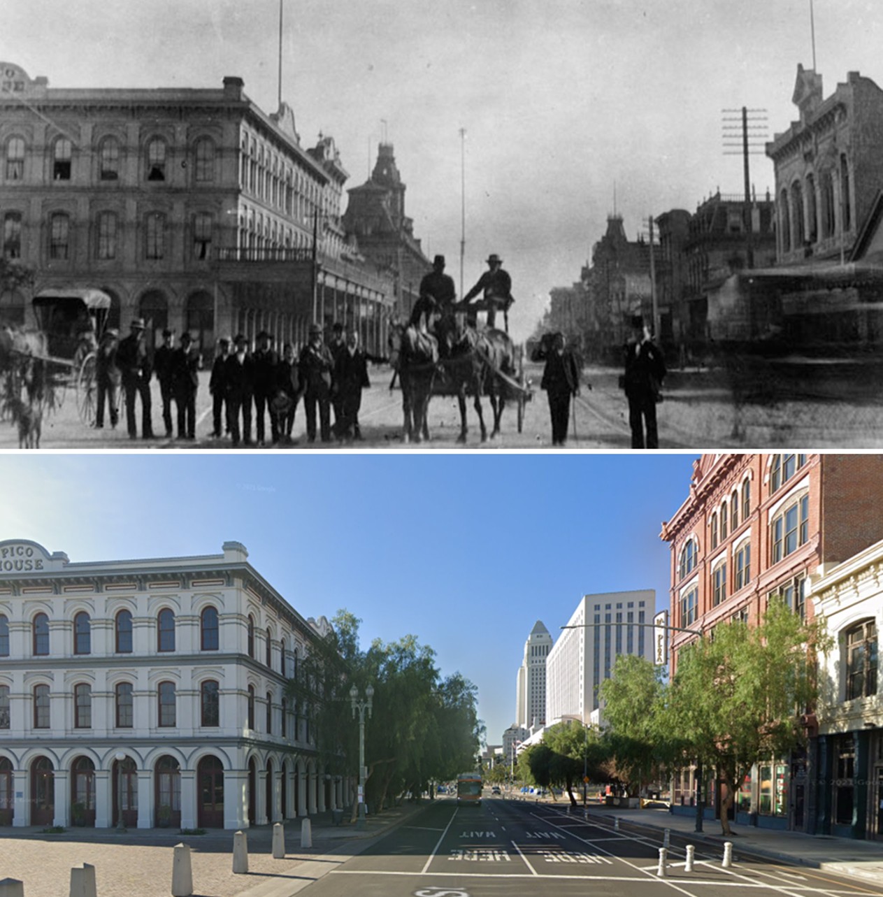
| (1878 vs 2021)* - A 'Then and Now' view of the Pico House and the LA Plaza. Photo comparsion by Jack Feldman. |
Historical Notes This compelling side-by-side contrast highlights 140+ years of transformation. From dusty roadways and horse-drawn streetcars to tour buses and pavement, the Pico House remains a rare constant—a witness to generations of civic evolution. Its survival helps ground the LA Plaza in visual memory and architectural continuity. |
 |
|
| (ca. 1884)* - View showing a stagecoach (or Tally-ho) parked in front of the Pico House. Nine people sit in the uncovered stagecoach. The driver holds a whip over the hitched team of 4 horses. Nine other people stand on the boardwalk in front of Pico House looking on. Photo by C. C. Pierce. |
Historical Notes This image captures the Pico House at its height, when it served as a fashionable hotel and transportation hub. The four-horse stagecoach, likely for sightseeing or hotel service, speaks to a time when Main Street was a bustling hub for travelers arriving by rail, horse, or wagon. The detailed façade and ornamental cast iron of the Pico House mark it as a sophisticated centerpiece of a growing city. |
 |
|
| (2022)* - A school bus parked in front of the Pico House at about the same spot as the stagecoach seen in previous photo. |
Historical Notes More than a century later, a school bus pauses at the same curb. While the means of transport have changed, the enduring architecture of the Pico House continues to evoke its 19th-century grandeur. Now surrounded by museums and historical exhibits, it stands as a silent reminder of LA’s roots—and how dramatically the city has evolved. |
Then and Now
 |
|
| (1884 vs. 2022)* – From stagecoach to school bus! Outside the historic Pico House, horsepower sure has changed. Photo comparison by Jack Feldman. |
Historical Notes This whimsical Then and Now pairing illustrates how LA’s streets have transitioned from equestrian elegance to modern mobility. Though the passengers and pace are different, the Pico House serves as a visual anchor—reminding us that history still rides alongside us in the everyday cityscape. |
 |
|
| (1883)* - View looking south on Main Street showing a group of men and a horse-drawn wagon; the Pico House and Baker Block are visible in the background. |
Historical Notes Beyond the group of men and their wagon stands a 150-foot electric streetlight mast—part of LA’s first public electric lighting system, installed in 1882 by C.L. Howland. These arc lights, some of the tallest in the nation, marked the dawn of the electric age in the city. The Pico House (left) and the towers of the Baker Block (center-left) still dominated the northern end of Main Street at the time. Click HERE to see more on LA's first electric streetlights. |
 |
|
| (2021)* – Contemporary view looking south on Main Street from in front of the LA Plaza with the Pico House visible on the left. |
Historical Notes This modern photo shows a view similar to the one from 1883, with the Pico House still on the left. Even though trees, signs, and cars now block some of the old street view, the photo shows how this historic building has remained while the city around it keeps changing. |
Then and Now
 |
|
| (1883 vs. 2021)* – A ‘Then and Now’ view looking south on Main Street from in front of the Los Angeles Plaza with the Pico House on the left. Photo comparison by Jack Feldman. |
Historical Notes This top-and-bottom comparison shows how much—and how little—has changed in nearly 150 years. The tall electric streetlight mast and horse-drawn wagons are gone, but the Pico House remains a steady landmark, anchoring both views in one of LA’s oldest surviving streetscapes. |
 |
|
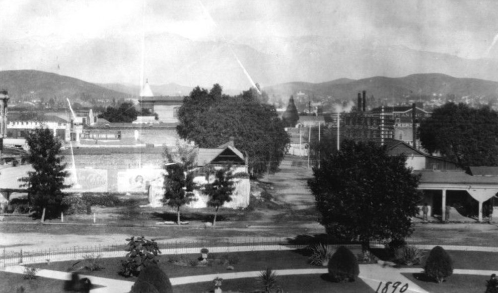
| (1890)* - Main Street looking south in front of the LA Plaza, where pedestrians and horse-drawn wagons travel along a dusty thoroughfare in front of the Pico House (1870) at left, with the Vickrey-Brunswig Building (1888) and Plaza House (1883) to the right. |
Historical Notes This photo shows the Plaza area at the end of the 19th century, when Main Street was still unpaved and served as a busy route for wagons and streetcars. The Pico House, built by Pío Pico as the city’s first grand hotel, remained one of the most recognized buildings downtown. Across the street, the newer brick Vickrey-Brunswig Building and Plaza House reflected the city’s shift toward more substantial commercial architecture. Storefront signs, gas lamps, and hitching posts lined the street, capturing a moment when Los Angeles was evolving from pueblo to metropolis. |
 |
|
| (2024)* – Contemporary view looking south on Main Street from in front of the LA Plaza with the Pico House (1870) at left, and the Vickrey-Brunswig Building (1888) and Plaza House (1883) to the right. |
Historical Notes In the modern view, the same buildings still define the east side of El Pueblo de Los Angeles Historical Monument. The Pico House, long preserved as a landmark, faces a pedestrian-friendly Paseo de la Plaza instead of a dirt road. The Vickrey-Brunswig Building and Plaza House have been restored for cultural and museum use, linking the city’s earliest business district to the civic center that grew up around it. Though surrounded by modern Los Angeles, these structures remain a tangible reminder of the city’s 19th-century origins. |
Then and Now
 |
|
| (1890 vs 2024)* – A ‘Then and Now’ view looking south on Main Street from in front of the LA Plaza with the Pico House (1870) at left, and the Vickrey-Brunswig Building (1888) and Plaza House (1883) to the right. Photo comparison by Jack Feldman. |
Historical Notes This comparison reveals how the heart of old Los Angeles has endured. The dusty wagon road of 1890 has become the paved Paseo de la Plaza, yet the outlines of the historic buildings remain almost unchanged. Together they form a bridge between two centuries of city life, reminding visitors that downtown Los Angeles grew outward from this very spot. |
* * * * * |
 |
|
| (ca. 1884)** - Photograph showing Los Angeles' first fire station, near the Los Angeles Plaza, with a horse and buggy firefighting team (The First Volunteer Company), located at 26 Plaza Street. |
Historical Notes The Old Plaza Firehouse is the oldest firehouse in Los Angeles. Built in 1884, it operated as a firehouse until 1897. The building was thereafter used as a saloon, cigar store, poolroom, "seedy hotel", Chinese market, "flop house", and drugstore. The building was restored in the 1950s and opened as a firefighting museum in 1960. For the first two years of its existence the station housed 38's Engine Company No.1 (comprised of 38 volunteers, a horse cart and 3 horses). The volunteer fire companies also used the area to stage the parades, holiday fireworks displays, monthly inspections and periodic musters which helped to stimulate civic pride. This and the fact that the volunteers continually bickered amongst themselves and some of the companies acted in too independent a fashion, led to the establishment, in December 1885, of the city's first paid Fire Department. The council appointed Walter S. Moore as Fire Chief and the new Board of Fire Commissioners installed another steam engine company (Walter S. Moore Company No. 4) at the Plaza Firehouse with a seven man crew while the Volunteer 38's moved elsewhere or disbanded. The Old Plaza Firehouse was dedicated as California Historical Landmark No. 730. Click HERE to see the complete list of California Historical Landmarks in L.A. |
 |
|
| (ca. 1885)* - Panoramic view of the Plaza Church from the north end of the Plaza. Carriages, people and pepper tree in foreground. A picket fence surrounds part of the property. Dwellings are visible on hill in background. |
Historical Notes The Old Plaza Church was the parish church for Los Angeles and was never a mission. |
.jpg) |
|
| (ca. 1885)* - Panoramic front view of the Los Angeles Plaza Church. There is an open octagonal cupola on the church roof to the left of the cross at the roof ridge. An adjacent building and large tree are behind a wooden picket fence. The street is cobbled. |
 |
|
| (1886)** - Los Angeles Plaza in 1886, looking northeast. Olvera Street is at extreme left. Note the landscaping around the Plaza and the degree to which it has grown. |
 |
|
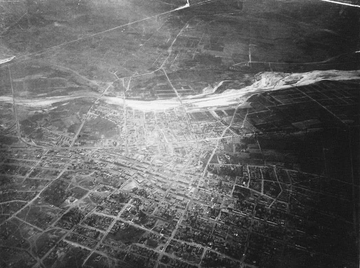
| (1887)* - Aerial photo of Los Angeles looking East on June 27, 1887 taken from a balloon. Note the farmland south of Second Street and east of Main Street to the Los Angeles River. The circular form of the Plaza is visible to the center left. |
Historical Notes Floating some 9,000 feet above the city in a hot-air balloon in 1887, Edwin H. Husher took what may be the first aerial photo of Los Angeles. By 1887 the City's population had grown to over 20,000 people with most of the new development having taken place south of the orignal Pueblo and LA Plaza as seen in the above photo. |
 |
|
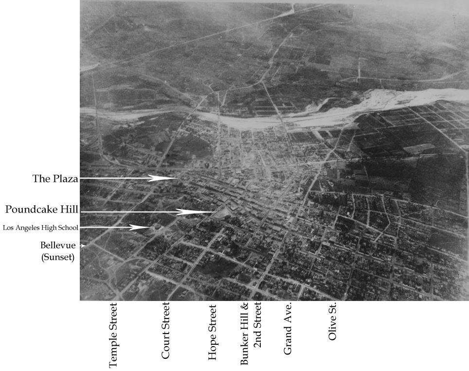
| (1887)** - Same photo as above but annotated to show the location of the Plaza and major streets. The circular form of the Plaza is visible to the center left. Note how the City has spread out mainly to the South of the Plaza. There is still a large area of farmland south of Second Street and east of Main Street to the Los Angeles River. |
 |
|
| (ca. 1887)** - View showing one of Los Angeles' first electric streetcars approacthing the front of the Old Plaza Church. In the background can be seen the Banning House sitting on top of Fort Moore Hill. The Plaza functioned as a central hub for the city's growing streetcar network, with lines radiating out in several directions. |
Historical Notes In 1874, Los Angeles saw it's first streetcars which all ran under horsepower (horse-drawn trolleys). Things would change in 1887 when electric powered streetcars arrived. Charles H. Howland chartered the first electric streetcar company in Los Angeles, LA Electric Railroad Company, on September 11, 1886. It began operations on January 4, 1887 with the line opening from Pico Boulevard and Main Street traveling west to Harvard Boulevard. In 1896, many of the major horse and cable cars operating in Los Angeles converted to electrical power. It should be noted that Howland was also responsible for introducing the first elecric streetlights in Los Angeles (1882). Also, for starting the LA's first electric utility, Los Angeles Electric Comnpany (1883) which evolved into LA Gas and Electric Corporation and then finally absorbed by LADWP (1936). Click HERE to see more in Early Power Generation in Los Angeles. |
 |
|
| (1887)* - Photograph of an open-air car on the first electric railroad in Los Angeles from the Plaza to Pico Heights in 1887. Many men in fine suits and just several women in fine dresses pose in front of an open-air rail car at center. The cars whose sides read "Plaza, Pico Street, Pico Heights" are attached to wires that run above it. The ground around them is dusty and spotted with weeds. |
Historical Notes Started in 1887, the Los Angeles Electric Railway (LAERy) ran the first electric powered streetcars in Los Angeles. It, however, operated only intermittently and frequently one had to wait two hours for a car. Operation was discontinued in the Fall of 1888. In 1890 the LAERy Co. was acquired by the Electric Rapid Transit Company (ERT) which attempted to rebuild the lines and acquire new electric cars. Sixteen new cars were ordered, 10 motors and six trailers. When the cars arrived in Los Angeles the investors could not pay the freight bill and so turned to General Moses Sherman for help. For his $56,000 investment he received one-half interest in the ERT Co. By September 1st 1890 he had secured full ownership. Sherman was also responsible for constructing the electric railway into the San Fernando Valley in the early 1900s which played such an vital role in its development. Click HERE to see more in Early Views of the San Fernando Valley. |
 |
|
| (1886)**- The intersection of Bellevue Avenue and Buena Vista, looking southwest toward Fort Moore, when Los Angeles was a small town. Buena Vista Street was later renamed Broadway. The Banning House sits on top of Fort Moore Hill overlooking the Los Angeles Plaza. |
Historical Notes This section of Buena Vista is soon to be renamed Justicia running south from Bellevue, which would become Sunset and then ultimately become Cesar E. Chavez Avenue (which here runs diagonally across the bottom of the frame from the lower left corner to the right edge) to Temple. Buena Vista north of Bellevue would become N. Broadway. The Broadway tunnel is still fifteen years in the future, the north portal of which will exit the base of the hill behind these adobes. Mary Hollister Banning's house can be seen on the crest of the hill. It will overlook the north portal. |
 |
|
| (ca. 1887)** - View of Fort Moore Hill, showing the home (upper center) of Mary Hollister Banning, widow of General Phineas Banning. Part of the trenches of old Fort Moore, built in 1846-1847, are visible in the upper left. |
Historical Notes The structure was built by Jacob Philippi as a beer hall, but Banning purchased and transformed it into a home. |
.jpg) |
|
| (1888)** - Horses and buggies at the Los Angeles Plaza in 1888. The California Bakery is seen in the background, as well as a covered wagon advertising the Home Ice Company. A horse and buggy in the foreground advertises for Bluett & Sullivan at 1st and Spring streets. Fort Moore Hill can be seen in the background. |
 |
|
| (1888)* - A drawing showing Los Angeles in 1888, with the Los Angeles Plaza on the left, and the Pico House in the center. View is from Fort Moore Hill. |
 |
|
| (ca. 1880)** - View looking north on Main Street from the Downey Building located just south of the Baker Block on the 300 block of N. Main Street. In the distance can be seen the Plaza Church where Main Street veers to the left. Telephone/telgraph lines can be seen on both sides of the street. |
Historical Notes Alexander Graham Bell invented the telephone in the late 1870's and it didn't take long for Los Angeles to adopt the new technology. In 1879, the Los Angeles Telephone Company was formed and it began offering telephone service in the area of what is now Downtown Los Angeles. This was just one year after the very first North America telephone exchange was installed in New Haven, Connecticut (January, 1878). The Los Angeles Telephone Company originally started with only seven subscribers. |
 |
|
| (1880s)** - View looking south on Main Street from near the Pico House. Temple Block can be seen in the distance. A large number of people are on the sidewalks and quite a few horse-drawn vehichles are on the street. The population in Los Angeles had grown to 11, 200 by now. Telegraph/Telephone poles and wires are seen on both sides of the street. The wording 'SUNSET' can be read on one side of the pole to the left. |
Historical Notes In 1883, The Los Angeles Telephone Company merged with another local telephone company based in Northern California, Sunset Telephone Company. In 1906, the Sunset Telephone Company was acquired by Pacific Telephone and Telegraph, later known as Pacific Bell. |
 |
|
| (1888)^## – View looking south, showing the west side of the 300 block of Main Street as seen from the Pico House. A horse-drawn streetcar shares the street with pedestrians, horse-drawn wagons, and a man on horseback (center-left). Click HERE to see more in Early Views of the Historic 300 Block of N. Main Street |
 |
|
| (ca. 1903)** – View looking northwest showing the Olvera Adobe (converted to office space), on the north side of the Plaza, facing Marchessault St. Olvera Street is out of view, west of the adobe. Los Angeles St (running left to right in the foreground) is on the adobe's east side. The building behind the Olvera Adobe, with the stepped gable end, is a Pacific Electric Power Station. It was built in 1903. |
Historical Notes Agustín Olvera arrived from Mexico in 1834 where he had been a Justice of the Peace, and held various offices in the Mexican administration. In 1842 he was granted Rancho Mission Viejo, and three years later, was also granted the 35,501-acre Rancho Cuyamaca. Olvera is noted for helping to bridge the gap between the governance of California by Mexico and the U.S.; helping sign the Treaty of Cahuenga, thus ending the war in California; was appointed to be Judge of the First Instance in 1849; was elected as the first county judge of the newly formed County of Los Angeles in 1850; and eventually entered private practice law. In 1877, the Los Angeles City Council changed the name of Wine Street to Olvera Street in his honor. Marchessault Street is named for French Canadian, Damien Marchessault, who served as mayor of Los Angeles from 1859-1860, and again from 1861-1865. During his term in office, the Plaza Church was rebuilt and the City Gas Company was organized. Marchessault committed suicide in the city council chamber in 1868, after becoming despondent over public criticism of the water system and over gambling debts. |
 |
|
| (1890)* - Looking north across the L.A. Plaza toward the beginning of Olvera Street. The Olvera Adobe is visible on the northeast corner of Olvera and Marchessault streets, to the right in the image. |
Historical Notes Originally called Wine Street (Calle de las Viñas), it was renamed Olvera Street in 1877 to honor Agustin Olvera, Los Angeles County's first judge. |
 |
|
| (ca. 1890)* - The Los Angeles Plaza, around 1890. The one story building on the left is the former residence of Don Augustin Olvera. The large two story on the right is the former residence of Don Vicente Lugo. The LA City Water Company building is at the northwest corner of Marchessault and North Alameda (at the center of the photo). |
.jpg) |
|
| (ca. 1890)* - View of the Plaza as seen from the Brunswig Building (slightly different angle as previous photo). The historic Lugo House faces the circular plaza. The Los Angeles Water Company building is also in view. |
 |
|
| (ca. 1890s)** - Exterior front view of the two-story Vicente Lugo adobe house, seen with hipped roof and dormer windows. The home is on S/E corner of Los Angeles and Alameda Streets, and faces the Plaza. When this photograph was taken, the adobe was home to Leeching Hung & Co., with adjacent buildings flanking it on either side; horse-drawn carriages are parked on the unpaved road in front of the buildings. |
Historical Notes The Lugo Adobe has been designated as a California Historical Landmark No. 301. Click HERE to see more in Early Views of California Histrorical Landmarks in L.A. |
* * * * * |
The Los Angeles Plaza and the Rise of the Vickrey-Brunswig Building |
1887–1890 |
More than a century after the Vickrey-Brunswig Building rose above the Plaza, the historic district remains one of the most important cultural landmarks in Los Angeles. While the surrounding city has expanded into a vast metropolitan center, the Plaza itself has been preserved as part of El Pueblo de Los Ángeles Historical Monument.Today visitors to the Plaza encounter many of the same landmark buildings seen in the nineteenth century, including the Pico House, the Vickrey-Brunswig Building, the Plaza House, and the Old Plaza Church. Although the area no longer functions as the commercial center of the city, it remains a powerful reminder of the early days of Los Angeles and the dramatic transformation that began during the building boom of the 1880s.If you'd like, I can also show you one small adjustment that would make this entire subsection flow even more smoothly with the rest of your LA Plaza page. It is a structural trick museum historians use when presenting image sequences like this. |
 |
|
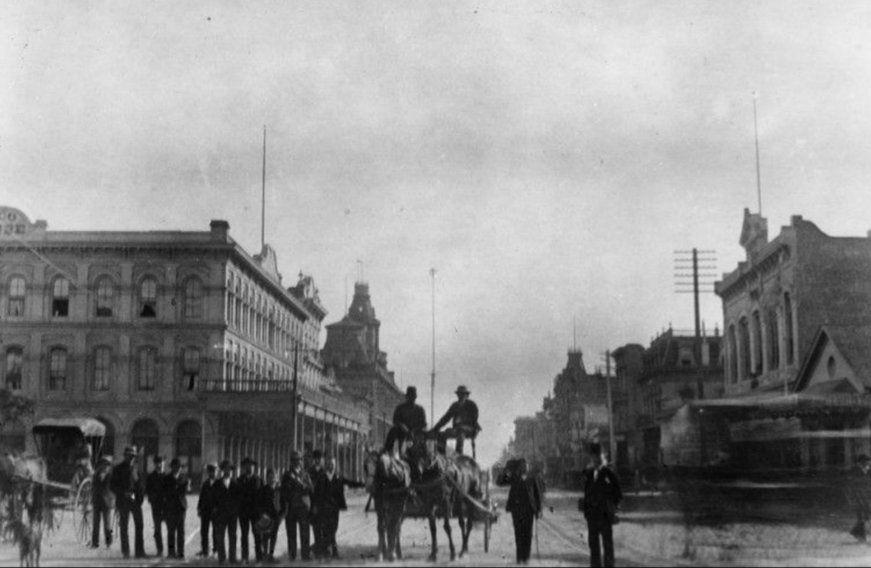
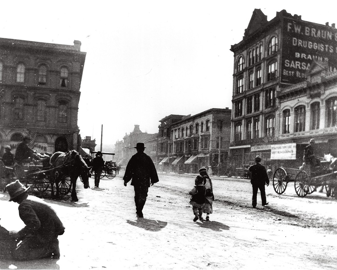
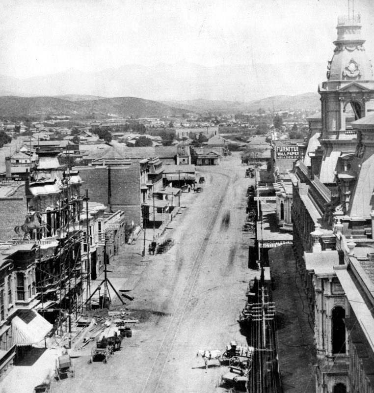
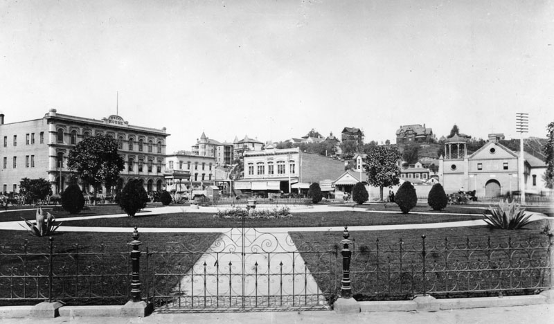
| (ca. 1887)* - A view of the Los Angeles Plaza looking southwest with the Pico House to the left and the Old Plaza Church on the right. The 2-story 'Plaza House' (built in 1883) sits directly across the Plaza on the west side of Main Street. The Vickrey-Brunswig Building, one of the City's first 5-story buildings, would be built within a year of this photo just to the left (south) of the Plaza House. |
Historical Notes This view captures the Los Angeles Plaza at the height of the city’s great real estate boom of the 1880s. The Plaza remained the historic center of Los Angeles, anchored by important landmarks such as the Pico House hotel and the Old Plaza Church. Across Main Street stood the two story Plaza House, commissioned in 1883 by French immigrant Philippe Garnier. At this moment the north side of the Plaza still reflected the earlier scale of the pueblo, with relatively low buildings lining Main Street. Within a year, however, investor William Vickrey would begin construction of a five story commercial building on the parcel immediately south of the Plaza House, dramatically altering the skyline of the Plaza district. |
 |
|
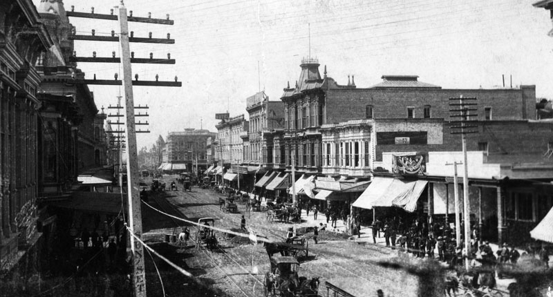
| (ca. 1890)** - Same view as previous photo but three years later. The new addition to the scene is the 5-story Vickrey-Brunswig Building built adjacent to the Plaza House. |
Historical Notes The Vickrey-Brunswig Building was completed in 1888 during the final months of the city’s speculative real estate boom. Rising five stories above Main Street, the Victorian era brick structure quickly became one of the tallest commercial buildings in Los Angeles and a striking new presence overlooking the historic Plaza. Ironically, the building was completed the same year the real estate boom abruptly collapsed. Soon after construction investor William Vickrey was forced to declare insolvency and lost the property to his lender. Despite this setback, the building remained one of the most prominent commercial structures in the Plaza district. At street level the building housed retail establishments, while the upper floors were used for lodging rooms. |
 |
|
| (ca. 1890s)** - Closer view showing the new 5-story Vickrey-Brunswig Building located on N. Main Street across from the LA Plaza and also across the street from the Pico House. Men are seen strolling in front of the Plaza. |
Historical Notes By the 1890s the Vickrey Building had become a major commercial landmark overlooking the Plaza. In 1897 the property was purchased by F. W. Braun & Company and soon became closely associated with the pharmaceutical trade. Reorganized as the Brunswig Drug Company in 1907 under the leadership of Lucien Brunswig, the firm expanded rapidly and developed into one of the largest pharmaceutical manufacturing and distribution companies west of Chicago. Over time the structure became widely known as the Brunswig Building, a name that remained associated with the property for much of the twentieth century. |
Then and Now
 |
|
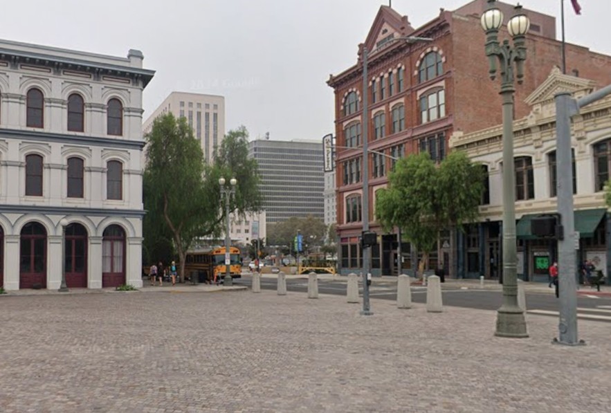
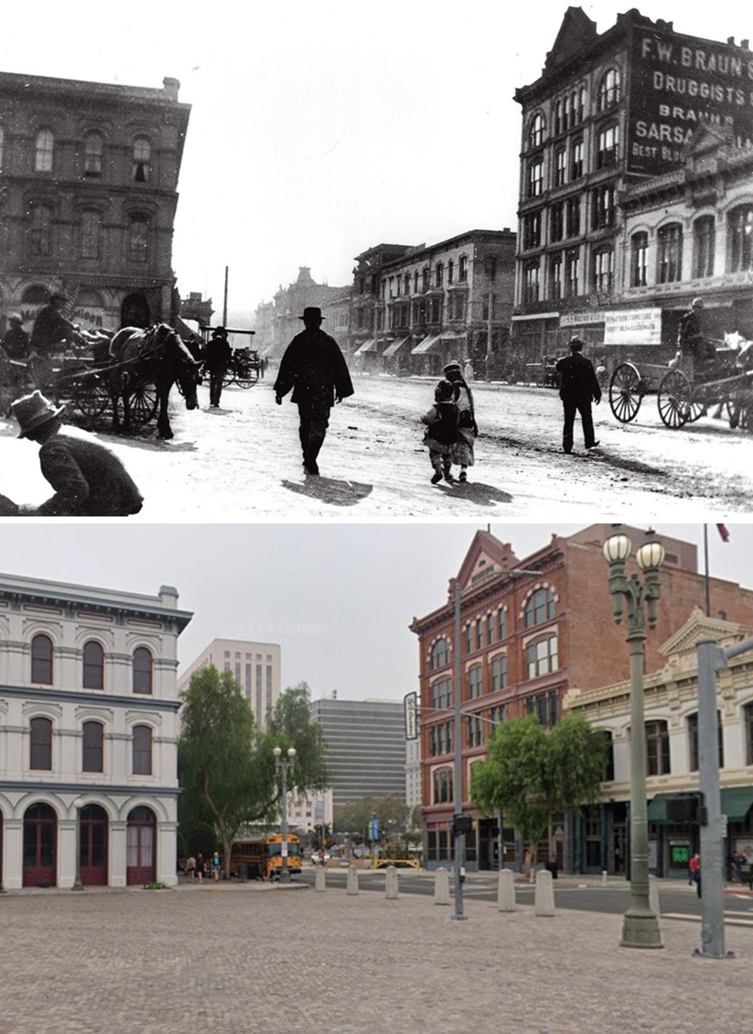
| (1890 vs 2022)* – Looking across the LA Plaza toward (L to R): Pico House, Vickrey-Brunswig Building, Plaza House and the Old Plaza Church. Photo comparison by Jack Feldman. |
Historical Notes More than a century after the Vickrey-Brunswig Building rose above the Plaza, the area remains one of the most historically significant sites in Los Angeles. The Plaza and its surrounding buildings are now preserved as part of El Pueblo de Los Ángeles Historical Monument. Although the city has grown into a vast metropolitan center, the Plaza district still retains many of the landmark structures that defined early Los Angeles, including the Pico House, the Vickrey-Brunswig Building, the Plaza House, and the Old Plaza Church. Together they reflect the layered Spanish, Mexican, and American history that shaped the early development of the city. |
* * * * * |
The Los Angeles Plaza, Sonoratown, and the City Water Co. |
Early 1890s |
By the early 1890s the Los Angeles Plaza remained the historic heart of the city, but the surrounding district had begun to reflect the growing complexity of a rapidly expanding town. North of the Plaza lay Sonoratown, one of the earliest Mexican neighborhoods in Los Angeles, named for the miners and families who had come from the Mexican state of Sonora during the mid nineteenth century. The area was characterized by adobe homes, narrow streets, and small commercial establishments that served the local community.At the same time, new civic and commercial institutions were beginning to appear near the Plaza. Among the most significant was the Los Angeles City Water Company, the private utility that operated the city’s early water system before municipal ownership was established in 1902. Together with nearby landmarks such as the Lugo adobe and the Pico House, these structures illustrate the mix of residential life, commerce, and early infrastructure that defined the Plaza district during the closing years of the nineteenth century.The following photographs provide a glimpse of the Plaza and its surrounding neighborhoods during this transitional period, when the old adobe pueblo and the emerging modern city briefly existed side by side. |
 |
|
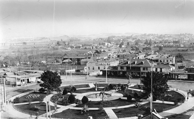
| (ca. 1890)** - Panoramic view of the Old Plaza Church, the plaza, and Sonora Town, looking northeast. The house opposite the church on the other side of the plaza is the adobe of Vincent Lugo on Los Angeles Street. The Los Angeles City Water Company building can also be seen. |
Historical Notes The part of the city called Sonora Town was an old adobe village north of the Plaza and Church of Our Lady, Queen of the Angels. It was Los Angeles' first Mexican quarters, or barrio. The area was named for the numerous miners and families who came from Sonora, Mexico, and may have still been around in the 1930s. Now it is Los Angeles' Chinatown District. |
 |
|
| (ca. 1892)**- Aerial view of the Los Angeles Plaza, circa 1892. The adobe to the left is the former residence and occasional courtroom of Judge Augustin Olvera. The large two-story building on the right is the former residence of Don Vicente Lugo and the first home of St. Vincent's College. The Los Angeles City Water Company has a painted sign, and is visible on the northwest corner of Marchessault and North Alameda Street. |
Historical Notes In 1868, the City of Los Angeles approved a franchise water agreement on a 30 year lease basis with the private Los Angeles City Water Company. In 1899, after the end of the lease, a $2.09 million bond measure for the purchase of LA City Water Co.’s system was approved by city voters by a margin of nearly eight to one. After over two years of litigation the City of Los Angeles finally regained control of its water system on February 3, 1902. A new department was created called the Los Angeles Water Department. Once the purchase was completed, the Los Angeles City Water Department acquired all assets of the privately owned water system including its main office building at Marchessault and North Alameda. Click HERE to see more in Water Department's Original Office Building. |
 |
|
| (ca. 1892)* - View of the LA Plaza as seen from the Pico House. |
.jpg) |
|
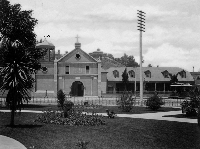
| (ca. 1892)* - On the left is the Pico House, the Plaza Church in the center. Fort Hill appears in the background, with residences of William Wills, and Mrs. Phineas Banning, and the tower of Los Angeles High School. |
* * * * * |
Buildings Along the South Side of the Los Angeles Plaza |
1890s |
By the 1890s the south side of the Los Angeles Plaza was lined with several important civic and commercial buildings that reflected the evolving character of the young city. Facing north toward the historic plaza stood the Old Plaza Firehouse, the office of former California governor Pío Pico, and the elegant Pico House hotel built in 1870. These buildings formed a small but significant civic cluster at the birthplace of Los Angeles. While the Plaza Church stood on the north side of the square, the south side housed services, commerce, and civic activity that supported the growing pueblo. Photographs from the 1890s capture this side of the plaza during a period when horse-drawn equipment, early municipal services, and prominent local figures were still closely connected to the city’s historic center. Together the structures illustrate how the plaza continued to function as a focal point of daily life even as Los Angeles expanded rapidly beyond its original boundaries. |
 |
|
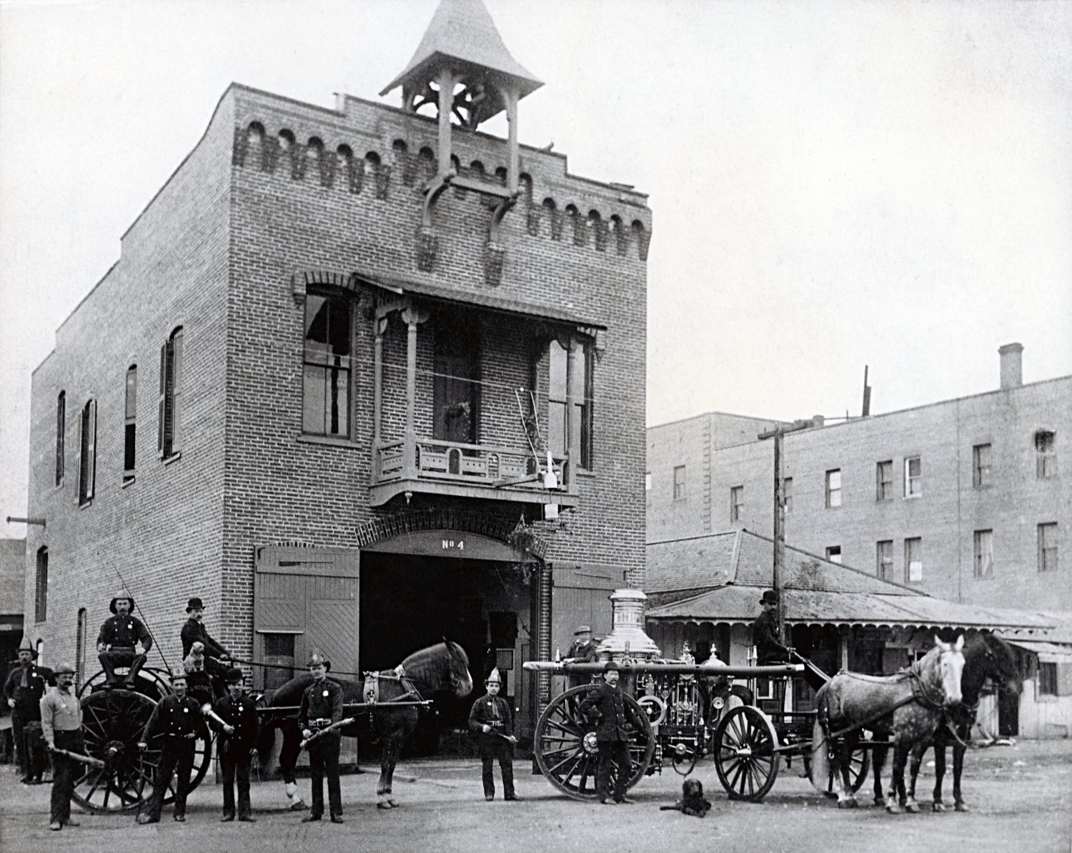
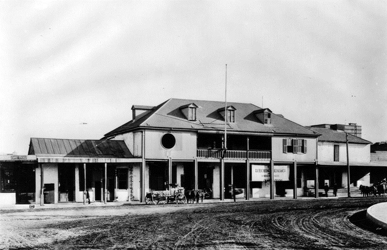
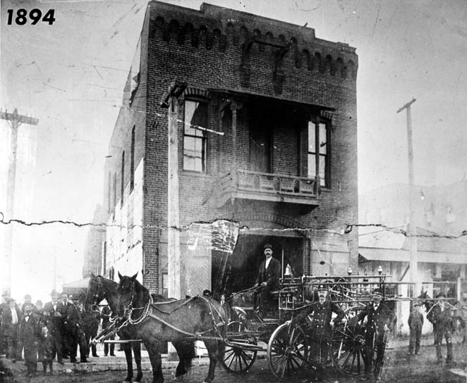
| (1894)* - Fire engine, firefighters, and horses stand in front of the Old Plaza Firehouse on the south side of the Los Angeles Plaza. To the right stands the small adobe office once used by former California governor Pío Pico. |
Historical Notes The Old Plaza Firehouse is the oldest surviving fire station in Los Angeles. Constructed in 1884, it served as an active fire station until 1897, protecting the surrounding plaza district during a period when much of the city’s buildings were still constructed of wood and adobe. After the fire station closed, the building passed through a number of different uses including a saloon, cigar store, poolroom, hotel, Chinese market, and drugstore. By the mid twentieth century the structure had fallen into disrepair before preservation efforts began as part of the restoration of the historic Plaza area. The building was restored during the 1950s and reopened in 1960 as a firefighting museum. Today it stands as one of the earliest surviving municipal buildings in Los Angeles. The Old Plaza Firehouse is designated California Historical Landmark No. 730. |
 |
|
| (1895)* - View of Governor Pio Pico's Office located between the Old Fire Station (left) and the Pico House (right), across from the Plaza. The prominent towers of the Baker Block can be seen in the background. |
Historical Notes Pío Pico, the last governor of Mexican California, built the Pico House in 1870 as one of the most luxurious hotels in early Los Angeles. Designed to serve travelers and businessmen arriving in the growing city, the three story structure was among the most modern buildings in Los Angeles at the time. Adjacent to the hotel stood a smaller adobe structure commonly referred to as Pío Pico’s office. In his later years Pico used this building for business and administrative purposes while remaining closely connected to the plaza district that had long served as the center of civic life. Visible in the background are the distinctive towers of the Baker Block, one of the most prominent commercial buildings in nineteenth century Los Angeles. Completed in the 1870s, the Baker Block stood along Main Street and for many years was one of the city’s best known architectural landmarks. Together the firehouse, Pico’s office, and Pico House illustrate the concentration of civic, commercial, and social activity that once surrounded the Los Angeles Plaza during the late nineteenth century. |
* * * * * |
Plaza Church and the Life of the Los Angeles Plaza |
The 1890s |
By the 1890s, the Plaza Church—formally known as La Iglesia de Nuestra Señora Reina de los Ángeles and often simply called “La Placita”—remained the spiritual and visual center of Los Angeles. Founded in the early years of the pueblo and dedicated in 1822, the church had witnessed the Spanish, Mexican, and American eras of the city’s history.During this decade Los Angeles was transforming rapidly from a dusty frontier town into a growing American city. Around the Plaza, horse-drawn wagons shared the streets with early bicycles and electric streetcars. Merchants operated shops along nearby streets while residents gathered in the plaza itself, which continued to serve as the city’s historic civic heart.Photographs from the 1890s capture this fascinating moment of transition. The old adobe church still stood as a symbol of the Spanish and Mexican past, yet the activity surrounding it reflected the modernization of Los Angeles at the close of the nineteenth century. |
 |
|
| (ca. 1890)* – Circular-shaped view of the Plaza Church, also known as Our Lady Queen of the Angels, La Iglesia Nuestra Señora de los Ángeles, or simply “La Placita,” on North Main Street. Photographed from across the street at the edge of the Los Angeles Plaza, the image shows pedestrians near the church entrance and a man riding a bicycle along the unpaved roadway in front. Photo from the Ernest Marquez Collection. |
Historical Notes After the rebuilding of the Plaza Church in 1861, the traditional mission-style bell wall was replaced with a distinctive gazebo-like bell tower. This open ornamental structure stood as a striking departure from the earlier adobe campanario and reflected changing architectural tastes of the late nineteenth century. Prominent in many period photographs, the unusual tower gave the historic church a slightly Victorian appearance and became a familiar landmark for Angelenos during a time when the city was beginning to grow beyond its original plaza. Around 1901 the gazebo tower was removed and replaced with a bell wall that more closely resembled the earlier Spanish Colonial design. This change represented a conscious effort to restore the church’s historic character. Additional alterations in 1915 further modified the bell gable, reflecting the continuing effort to balance preservation with the evolving needs of the parish. |
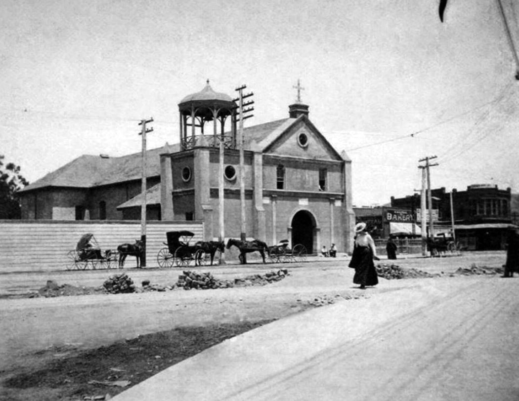 |
|
| (ca. 1894)* – Several horse-drawn wagons are parked near utility poles in front of the Los Angeles Plaza Church. A woman walks toward the plaza while work appears underway on the street, possibly laying brick paving. A bakery sign is visible next door to the church. |
Historical Notes La Plaza Church, founded in 1814 and dedicated in 1822, was established to serve the Catholic community of the growing pueblo of Los Angeles. For many years it functioned as an asistencia, or sub-mission, of Mission San Gabriel Arcángel, with priests traveling from the mission to conduct services. As the settlement expanded through the Spanish, Mexican, and early American periods, the church became the principal parish for the pueblo. By the 1890s it remained a vital center for the Spanish-speaking and Catholic communities even as the population of Los Angeles diversified and expanded. |
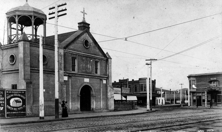 |
|
| (1894)* - Plaza Church as seen looking north from Pico House on Main Street. This was the parish church for Los Angeles and was never a mission. A woman holding a small child stands in front of the church. |
Historical Notes The Los Angeles Plaza surrounding the church remained the historic core of the city well into the late nineteenth century. Nearby structures such as the Pico House, built in 1870 by Pío Pico, reflected the earlier Mexican and Californio influence in the area. By the 1890s, however, the center of commercial activity in Los Angeles was gradually shifting south toward Spring and Main Streets. Despite this shift, the plaza and church continued to serve as important cultural and social gathering places for residents. The Plaza Church was dedicated as California Historic Landmark No. 144. Click HERE to see list. |
.jpg) |
|
| (1894)* - View of Our Lady of Los Angeles church. A stucco and stone building with a bell tower stands at left while a horse-drawn carriage waits in front of the church. At right, a brick house with dormers can be seen. Streetcar tracks run through the cobblestone street. From the W.H. Fletcher Collection. |
Historical Notes The tall clock tower seen in the background on Fort Moore Hill is the 1891-built Los Angeles High School, its second location. |
 |
|
| (ca. 1895)* – Closer view showing the Plaza Church on what appears to be a Sunday. Gentlemen in formal attire gather near the church entrance while everyday activity unfolds nearby. A shoeshine boy works as his customer enjoys a cigar. Bicycles, a horse-drawn carriage, and a passing streetcar add to the lively street scene. |
Historical Notes The Los Angeles Railway (LARy), established in 1895, consolidated several local streetcar lines and began converting them to electric power. The system quickly became a vital part of transportation in the rapidly expanding city. Several early routes began or passed through the Plaza area, running along Los Angeles Street directly in front of the church. As a result, the historic plaza continued to function as an important transportation hub even as the city grew outward. |
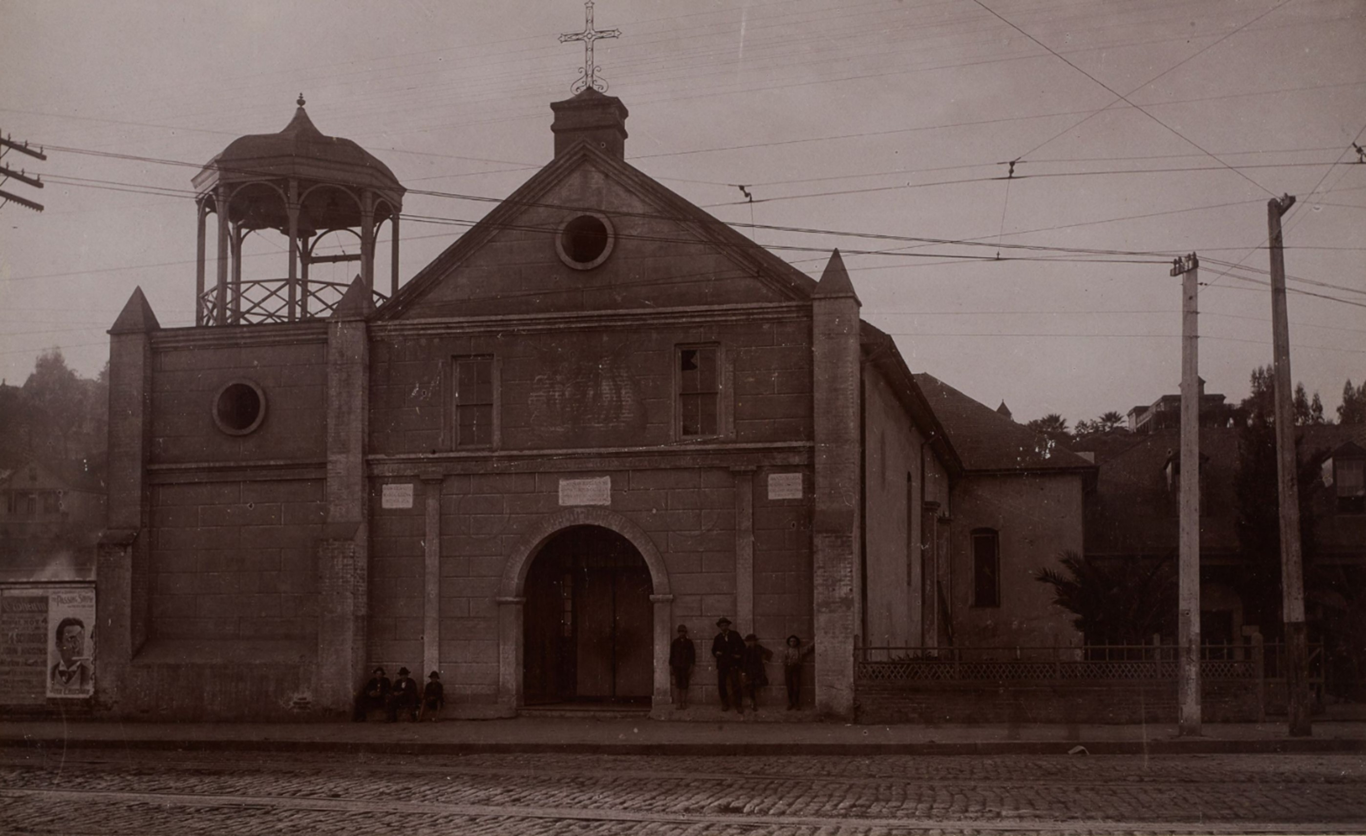 |
|
| (1895)* - View of the Plaza Church, also known as Our Lady Queen of the Angels, on North Main Street in Los Angeles, as seen from across the cobblestone street. From the Ernest Marquez Collection. |
Historical Notes By the mid 1890s the streets surrounding the Los Angeles Plaza were gradually being improved with cobblestone and brick paving, replacing the dusty roadways that had characterized the earlier pueblo. Photographs from this period often show wagons, pedestrians, and streetcars sharing the same streets in front of the historic church. Despite the rapid growth of Los Angeles during this era, the Plaza Church remained a constant presence at the city’s birthplace, continuing to serve as both a religious center and a recognizable landmark in the evolving urban landscape. |
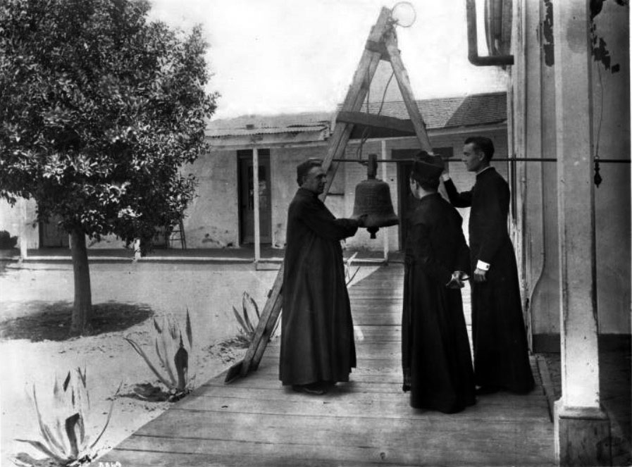 |
|
| (ca. 1890)* - Reverend Father Joachim Adam recounts the history of the old mission bell to two other priests. The bell hangs from a metal rod supported by a folding wooden ladder on the mission grounds. All three priests are dressed in cassocks. Part of the exterior corridor of a one-story adobe building can be seen behind them. |
Historical Notes An inscription on the back of the photograph reads: “This bell (known as the Penance Bell) was given by Henry Delano Fitch as a forfeit for his transgression when he defied civic and ecclesiastical authorities and eloped with Josefa Carrillo, a California woman — the first recorded elopement in California — in 1829.” The story of Fitch and Carrillo became one of the best-known romantic episodes of early California history and has been retold in numerous accounts of the Spanish and Mexican periods of Los Angeles. Click HERE to see more early views of the LA Plaza Church. |
* * * * * |
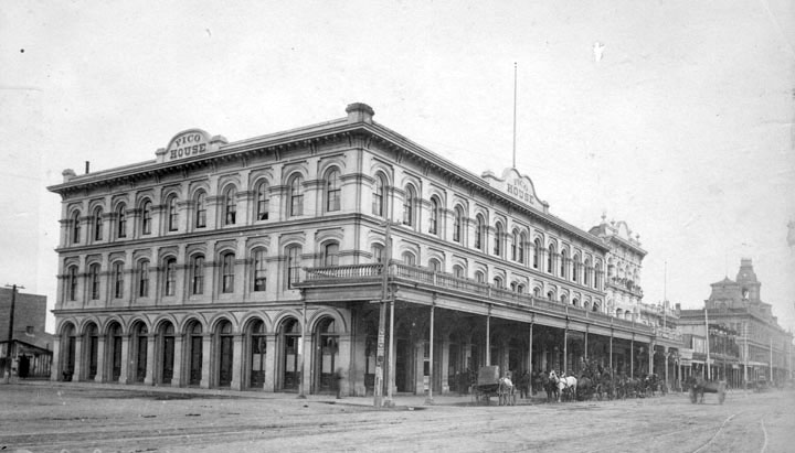 |
|
| (1891)** - The Pico House, sometimes called "Old Pico House", built by Pio Pico in 1869-70. The sign on 2 sides over the building here reads "Pico House" and horses and carriages are on an unpaved Main Street on the right side. Farther back on the right are the towers of Baker Block (built in 1878 and later torn down to make way for the 101 Freeway). |
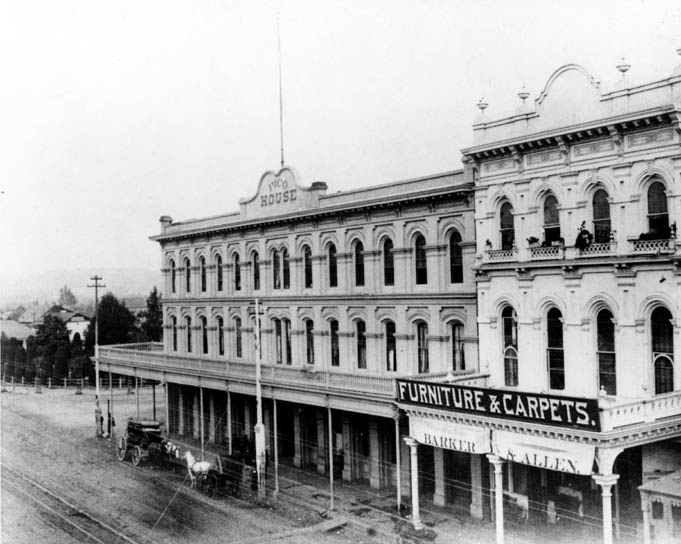 |
|
| (1890s)*#^ - View of Main Street looking northeast. The Plaza, Pico House, and Merced Theater are visible. A sign above the theater reads “Barker & Allen, Furniture & Carpets.” A stagecoach and horse-drawn wagon are parked in front of the Pico House. |
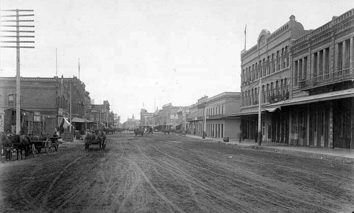 |
|
| (ca. 1895)^## - View looking south on Los Angeles Street near Arcadia Street. Both the Garnier Block and Jennette Block are on the right. |
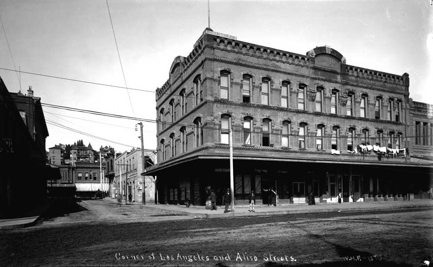 |
|
| (ca. 1895)^## - Looking west on Arcadia Street from Los Angeles Street with Fort Moore Hill in the background. The three story Jennette building is on the northwest corner of Arcadia and Los Angeles Streets with Sanchez Alley running directly behind it up to the Plaza at Republic Street. Photo is misidentified. Aliso Street did not extend beyond Los Angeles Street. This is looking up Arcadia Street. |
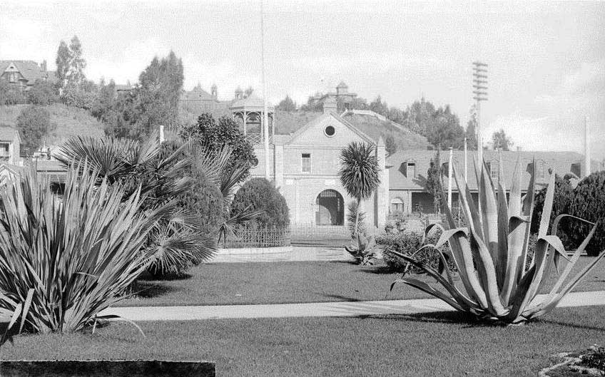 |
|
| (ca. 1890s)^*# - Front view of the Plaza Church standing across from the Plaza. Fort Moore Hill is in the background and the prominent Banning Residence can be seen at top-center, behind the Church. |
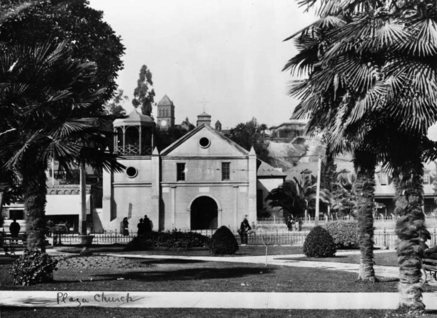 |
|
| (ca. 1900)* - View of the Old Plaza Church as seen from the Los Angeles Plaza. The clock tower of Los Angeles High School can be seen in the background. |
Historical Notes Los Angeles High School (seen above and behind the Old Plaza Church) was completed in 1891 at Castelar and Rock streets (North Hill Street and Fort Moore). It was built on part of the site of the abandoned Fort Moore Hill Cemetery, the first Protestant cemetery in Los Angeles, which was spread over the slopes of the hill. The four-story red brick building had 40 rooms for its 400 students. It was the second Los Angeles High School to be built and replaced the original one that was built in 1872, at the former site of Central School on what was then known as Poundcake Hill, at the southeast corner of Fort Street (later Broadway). Early buildings commissioned to house the Los Angeles High School were among the architectural jewels of the city, and were strategically placed at the summit of a hill, the easier to be pointed to with pride. One of the school's long standing mottos is "Always a hill, always a tower, always a timepiece." In 1917, the school moved to its current location at 4650 West Olympic Boulevard (which incidentally is not on a hill). Click HERE to see more Early Views of Los Angeles High School. |
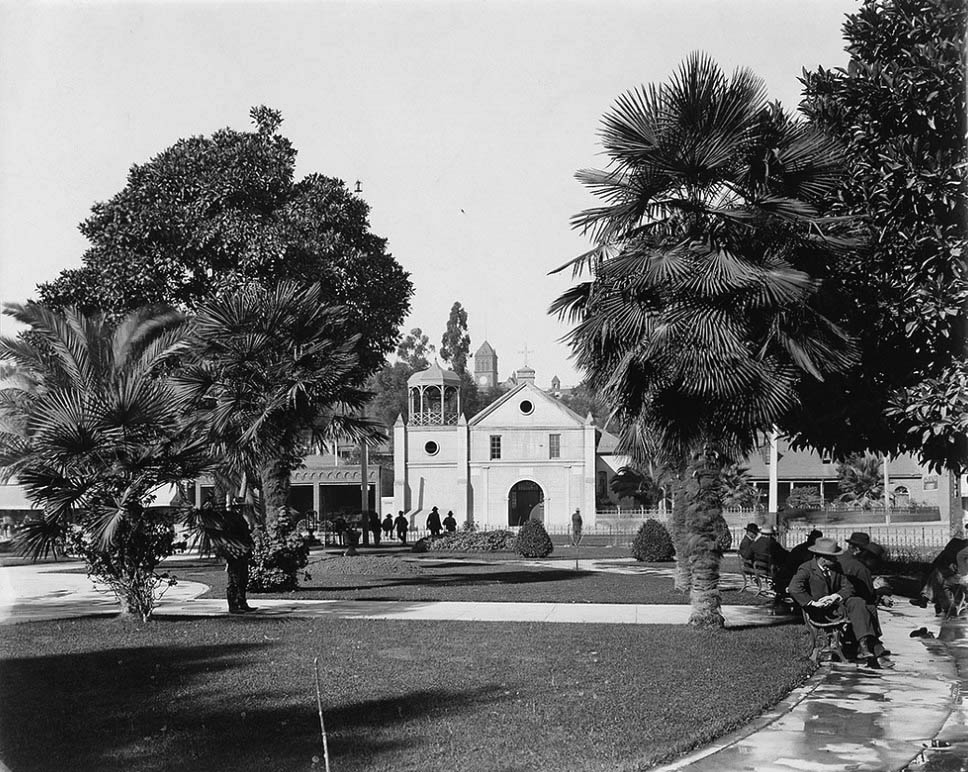 |
|
| (ca. 1900)* - View of the Old Mission Church from across the LA Plaza. Several men are seen relaxing on the Plaza's benches. In the background on top of Fort Moore Hill stands Los Angeles High School. |
Historical Notes This would be one of the last photos taken of the Plaza Church with its gazebo-like tower. It would soon be replaced with a "bell wall" (see next photo) similar to the one it had prior to 1861. |
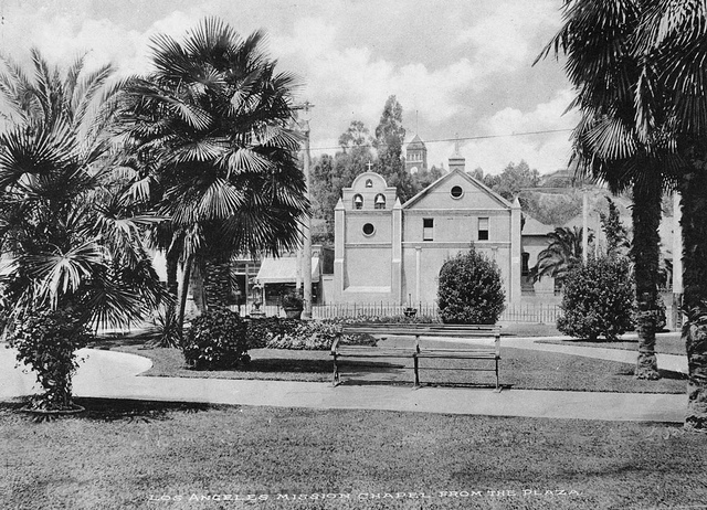 |
|
| (ca. 1901)* - Front view of the Old Mission Church with its newly installed "bell wall". There is a clear view of Los Angeles High School up on Fort Moore Hill and its relative relationship to the Plaza and the Plaza Church. |
Before and After
|
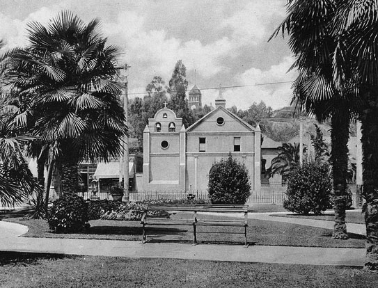 |
|
| (1900 vs. 1901)* - Old Mission Church with "Gazebo Tower" and "Bell Wall Tower". |
Historical Notes After the 1861 rebuilding of the Plaza Church, the traditional mission-style bell wall was replaced with a distinctive "gazebo-like" bell tower. This open, ornamental structure stood out as a marked departure from the original adobe campanario and reflected changing architectural preferences of the late 19th century. Prominent in period photographs, the tower became a familiar feature for Angelenos during a time of rapid urban growth, adding a Victorian touch to the historic church’s silhouette. Around 1901, the gazebo-like tower was replaced by a new bell wall resembling the one that had existed prior to 1861. This change signaled a deliberate return to the church’s earlier Spanish Colonial character. Photographic evidence from the time captures this architectural shift, with one image showing the church just before the tower’s removal and another depicting the newly installed bell wall. By 1915, further modifications were made, including the construction of a new bell gable, illustrating the church’s ongoing effort to preserve its historical identity while adapting to the needs and aesthetics of each era. |
Then and Now
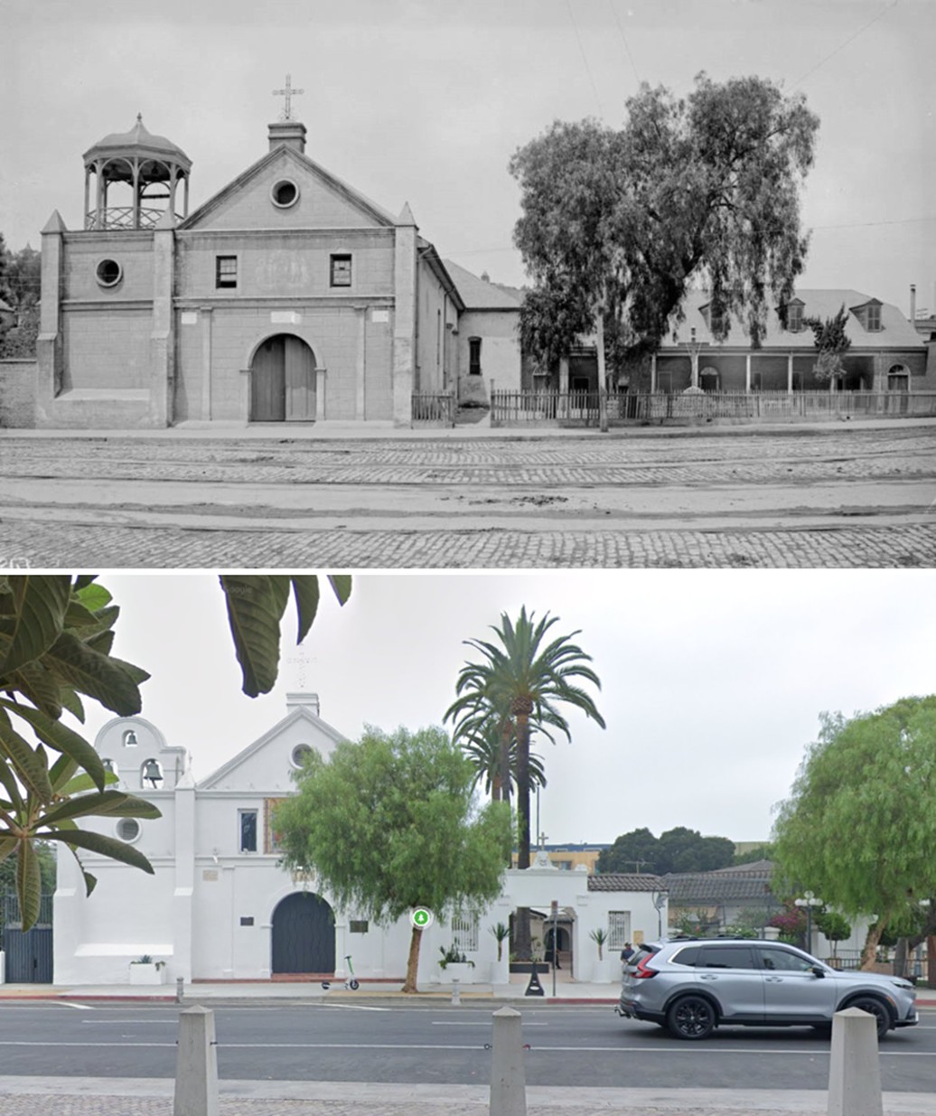 |
|
| (1885 vs. 2024)* – A ‘Then and Now’ comparison of the Plaza Church as seen from the Los Angeles Plaza, looking across Main Street. The gazebo-like tower, visible in the 1885 view, was replaced around 1901 by a new bell wall designed to resemble the one that stood prior to 1861. Photo comparison by Jack Feldman. |
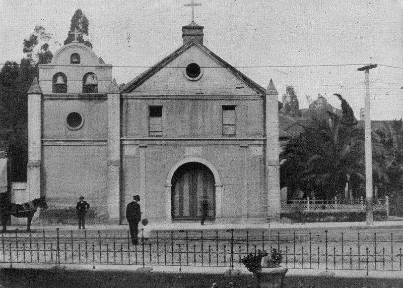 |
|
| (ca. 1901)* - View of the 'Old Plaza Mission' (Plaza Church) with its new 3-bell gable. A man and child can be seen crossing the street heading toward the church. |
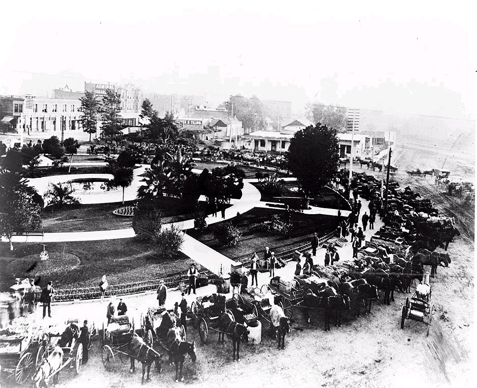 |
|
| (ca. 1900)* - Open air market at the Plaza, view is looking northwesterly from the fire house. |
Historical Notes Initially, the majority of vegetable selling in Los Angeles was done around the circular Olvera Street Plaza, just South of Macy Street, where Caucasian, Japanese and Chinese farmers congregated with their goods. However, the increased presence of wagons and the long hours of the makeshift vegetable market became a nuisance to the city. Click HERE to see more about the Los Angeles City Market. |
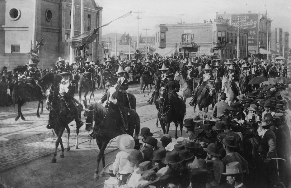 |
|
| (1901)* - Caballeros and señoras parading on horseback in front of the Plaza Church during La Fiesta de Los Angeles. Throngs of well-dressed people crowd the sidewalks on both sides of the street. The Grand Marshall of the parade is Francisco Figueroa. The young woman on the horse in black (foreground) is Katie Abbot, daughter of Merced Abbot of Merced Theatre. |
Historical Notes “La Fiesta de Los Angeles” also called "La Fiesta de Las Flores" was a week-long party that the city threw in its own honor during the 1890s and early 1900s. Staged by the Merchants’ Association, it featured parades—a flower parade, a parade with floats, a torchlight procession—and athletic competitions, a costume ball, and a carnival attended by masked revelers. The first fiesta was held in April, 1894. The Spanish title was reflective of a goal: to capture the color and the aura of old Los Angeles in its days as a pueblo under Mexican rule. Men in the garb of caballeros (horsemen) and vaqueros (cow hands) participated. So did Chinese, native Americans, and African Americans. It was a multi-cultural gala, distinct from any celebration elsewhere. |
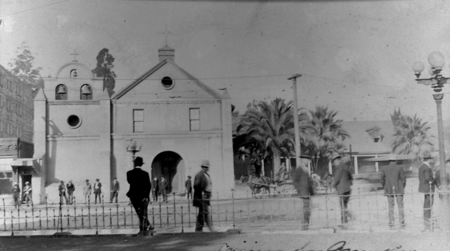 |
|
| (ca. 1902)* - View showing a group of well-dressed men standing on the edge of the LA Plaza and also across the street in front of the Old Plaza Church. There is a horse-drawn wagon parked by the curb near the church with a streetcar passing by. |
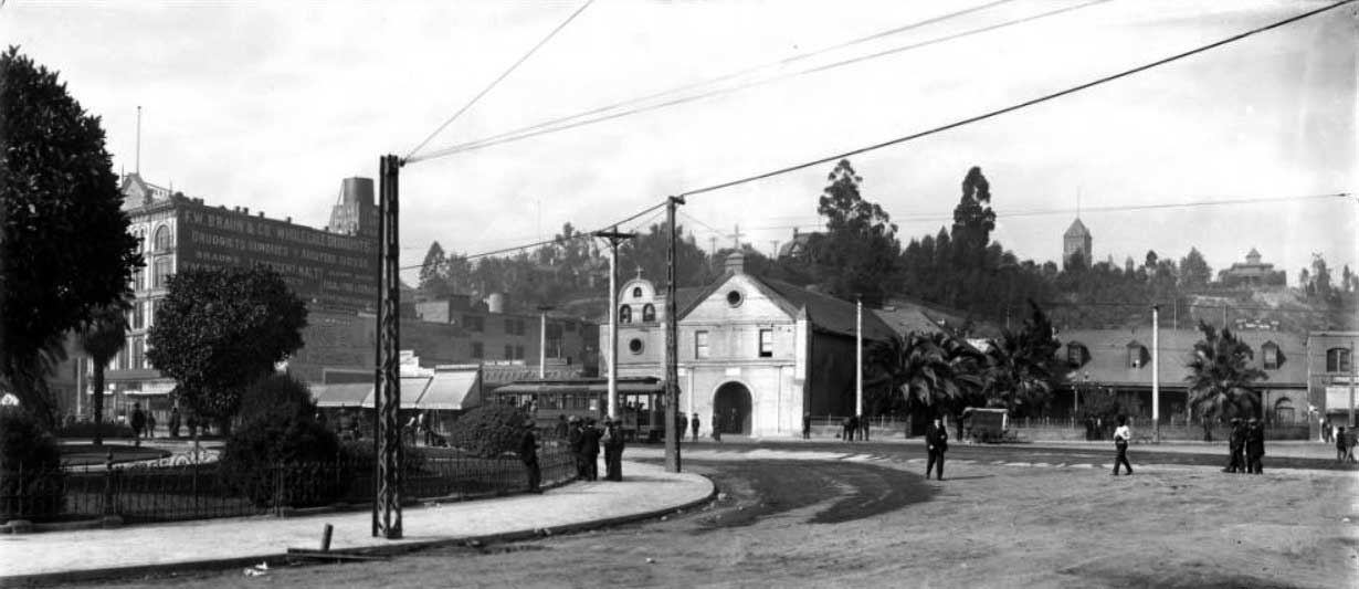 |
|
| (ca. 1905)* - Panoramic view of the Los Angeles Plaza, looking west. The F.W. Braun Building, Plaza Catholic Church, and shops along Main Street are visible in the background. Men are sitting, standing or moving about near the church, plaza and along Main Street. An electric streetcar is passing on Main Street carrying about a dozen passengers. Rocks and other forms of debris litter the dirt road. Utility lines and utility poles run along the streets. |
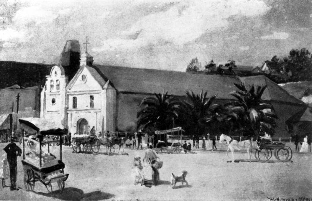 |
|
| (ca. 1905)* - Photograph of a painting by Will N. Drake of the old Plaza Church. The painting depicts a street scene in front of the Plaza Church: In the foreground a cart vendor in dark clothing is pictured. Closer to the church itself are several horse-drawn carriages, drawn both by dark and light horses. Between both the vendor and the carriages, towards the center of the image, a woman with a basket holds the hand of a child to her left. They are followed by what appears to be a dog. Short palms line the side of the church. |
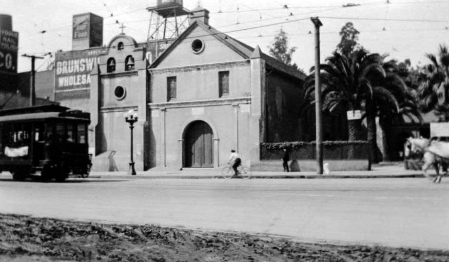 |
|
| (ca. 1909)* – Panoramic view showing the front of the Plaza Church. A wire fence and palm trees can be seen to the right of the church, while tall buildings and water tower are visible behind and to the left of the church. A trolley can be seen at left, a cyclist and a pedestrian are visible just to the right of the church, and a horse pulling a carriage or wagon is visible at right. |
 |
|
| (1906)* - Raising of the first El Camino Real bell at Los Angeles Plaza near Olvera Street to launch the state’s first road marker program. In the next few years, 450 of the bells were placed along the original mission route from San Diego to Sonoma. |
Historical Notes A story on the original El Camino Real bell appeared in the Aug. 16, 1906 Los Angeles Times: “Quaintly beautiful and picturesque were the ceremonies held at the old Plaza Church yesterday noon in dedication of El Camino Real and also in commemoration of the one hundred and twenty-fifth anniversary of the founding of the ancient and honorable pueblo of Los Angeles. … Father (Juan) Caballeria made the opening address and announced the object of the meeting. He spoke eloquently of the wonderful growth of the Golden State and the auspicious affair they were celebrating. He told graphically of when the bare feet of the padre of a century ago trod the famous highway that stretched its entire length throughout the entire State and how the padres that followed in the footsteps of the illustrious fathers of former days had endeavored to add their efforts to the building and growth of the great State. A stirring scene followed the termination of Father Caballeria’s address. As he concluded Gen. Antonio Aguilar, one of the last of the old guard that fought under Fremont and was present when Los Angeles was taken by the United States troops, fired a salute and simultaneously the clapper of the bell on the sign post of El Camino Real was raised and throughout the city echoed the sounds of all the bells in the Catholic churches as they tolled in honor of the reopening of the King’s highway again to travel. …” |
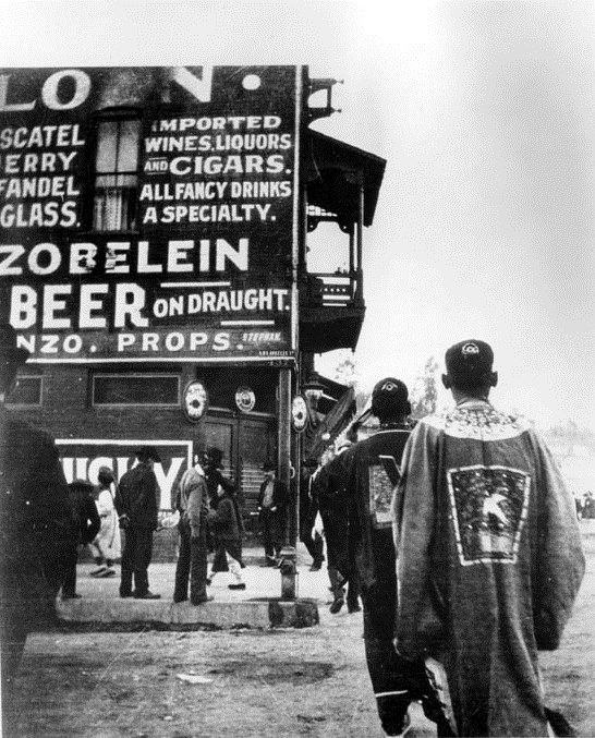 |
|
| (1905)* - View showing the Montezuma Saloon "firehouse" across from the Plaza, advertising Zobelein. |
Historical Notes Over its life, the Old Plaza Firehouse was used as a saloon, cigar store, poolroom, "seedy hotel", Chinese market, "flop house", and drugstore. The building was restored in the 1950s and opened as a firefighting museum in 1960. |
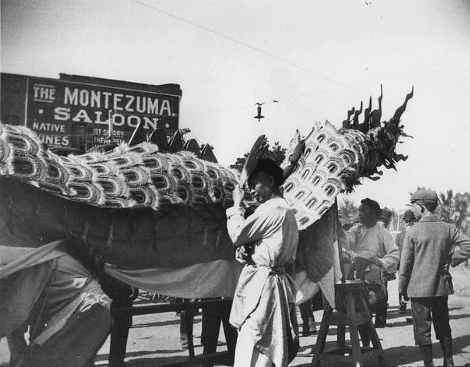 |
|
| (ca. 1905)* - Preparation for the Chinese New Year in front of the Montezuma Saloon, previously the Old Plaza Firehouse. |
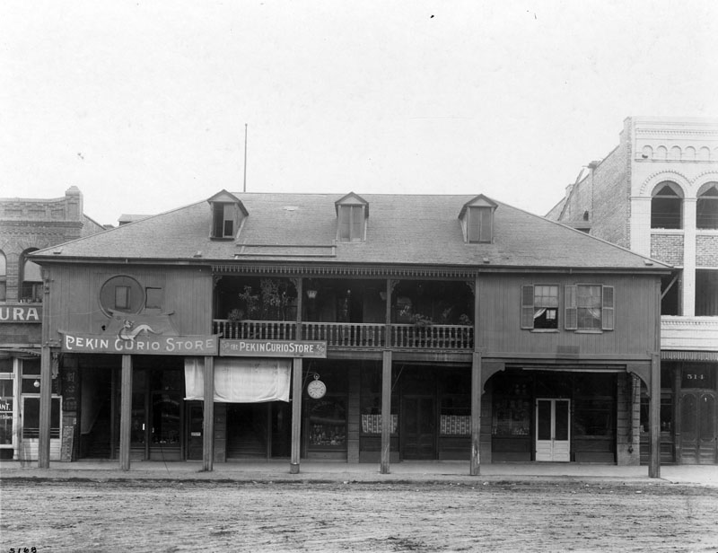 |
|
| (1905)* - View showing the two-story Vicente Lugo adobe house, seen with hipped roof and dormer windows. The home is located at 518-520 North Los Angeles Street and Sunset Boulevard, and faces the Plaza. When this photograph was taken, the adobe was home to the Pekin Curio Store with brick buildings flanking it on either side; and the road was still unpaved. |
Historical Notes La Casa de Don Vicente Lugo located on the east side of the El Pueblo Plaza at North Los Angeles Street and Sunset Boulevard. Built in 1839 by Vicente Lugo, it was one of the few two-story homes in Los Angeles at the time. It was donated in 1867 to St. Vincent's College (which later became Loyola University), the first college in Southern California; but later became known as the Washington Hotel, and later, the Pekin Curio Store. Unfortunately, the structure was so altered, that it does not resemble an adobe. |
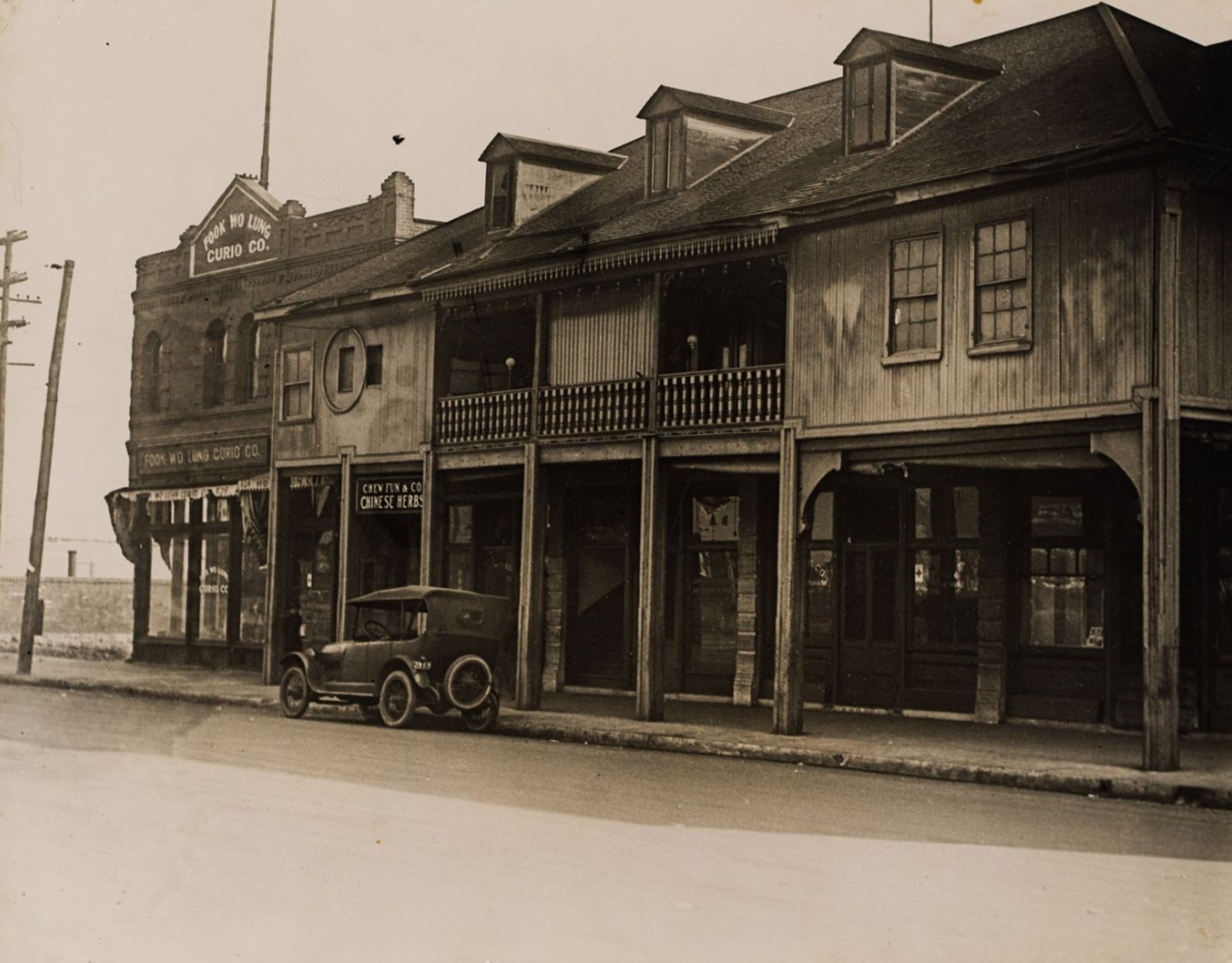 |
|
| (1915)* - View of a row of two-story buildings with balconies in the 500 block of North Los Angeles Street in Old Chinatown, Los Angeles, with signs for "Fook Wo Lung Curio Co." and "Chew Fun & Co. Chinese Herbs" visible and an automobile parked at the street curb. The buildings face the Los Angeles Plaza (not pictured) and the central building (with three dormer windows) was built for Don Vicente Lugo and known as the Lugo Adobe. |
Historical Notes The site of the Vicente Lugo adobe house was designated California State Historic Landmark No. 301. Click HERE for more about the Vincent Lugo Adobe. |
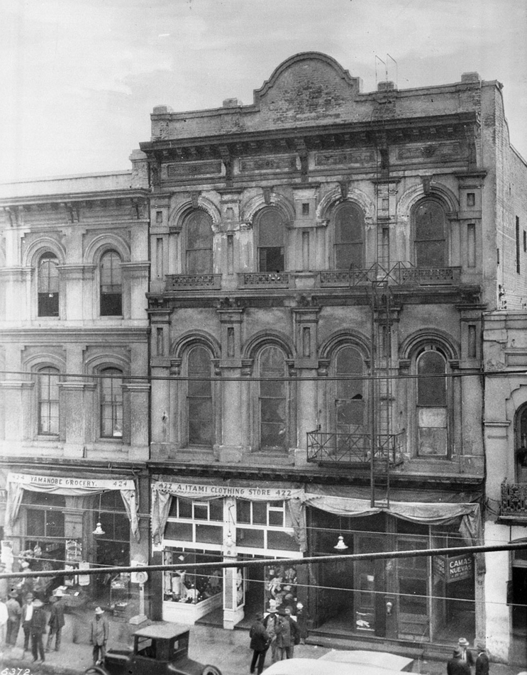 |
|
| (ca. 1909)* - Photograph of the Teatro Mercedes (or Merced Theatre). Below the Romanesque architecture of the three-story building, a crowd of pedestrians stand in front of the Japanese shops at ground level which read "A. Itami Clothing Store" and "Yamanobe Grocery". An early model automobile is partially visible in the foreground. |
Historical Notes The Merced Theater, completed on December 31, 1870, opened its first professional engagement on January 30, 1871. It was "used later as an Armory, then again as a Fire Engine house". |
 |
|
| (ca. 1910s)** - View of the Avila Adobe house on Olvera Street; a small car is parked along the front of the wooden porch next to one of the staircases. Next door on the right (out of view) is the Los Angeles Railway (LARy) Plaza Substation. |
Historical Notes Don Francisco Avila, a wealthy cattle rancher and one-time Mayor of the pueblo of Los Angeles, built the Avila Adobe in 1818. The Avila Adobe, presently the oldest existing residence within the city limits, was one of the first town houses to share street frontage in the new Pueblo de Los Angeles. |
 |
|
| (1913)#*** – View of the Los Angeles Railway (LARy) Plaza Substation (Eastside). The other side of the substation building fronts Olvera Street and is adjacent to the Avila Adobe. |
Historical Notes The Plaza Substation was an electrical substation that formed a part of the "Yellow Car" streetcar system operated by the Los Angeles Railway from the early 1900s until 1963. After being threatened with demolition in the 1970s, the Plaza Substation was added to the National Register of Historic Places in 1978. |
 |
|
| (1913)#*** – Interior view of the Plaza Substation showing three motor-generator sets used to provide electricity for the Los Angeles Railway (LARy). |
Historical Notes In May 1903, Henry Huntington, owner of the Los Angeles Railway, announced plans to build a new substation near the old plaza. The Los Angeles Times reported: "Another mammoth electricity substation is to be constructed by the Los Angeles Railway Company. Its location will be on the Plaza, and its completion will mean a long step forward toward the perfection of a system that already is surpassed by few in this country." The substatin was operating by 1905. The substation is one of the two buildings in the Los Angeles Plaza Historic District that is itself separately listed in the National Register of Historic Places, having been so listed in September 1978 (The Avila Adobe is the other). |
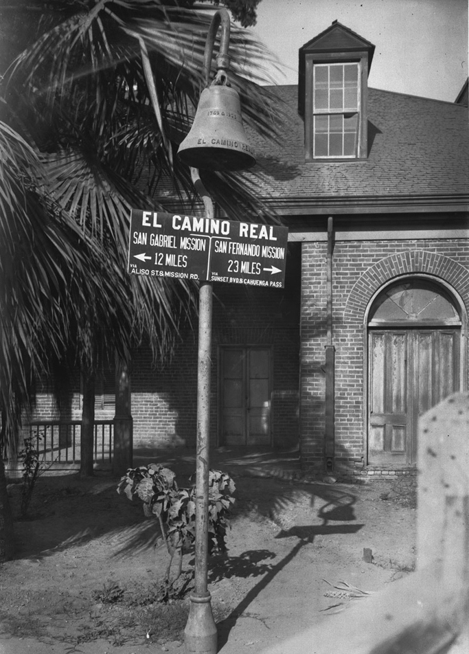 |
|
| (Early 1900s)* - Photograph of the bell of El Camino Real at the Los Angeles Plaza Mission. Behind it is a 1-story brick building with a wooden arched doorway and a dormer window is visible. On the bell in raised lettering "1769 & 1906, El Camino Real". The sign reads: "El Camino Real; San Gabriel Mission, 12 miles, via Aliso St. & Mission Rd.; San Fernando Mission, 23 miles, via Sunset Blvd. & Cahuenga Pass". |
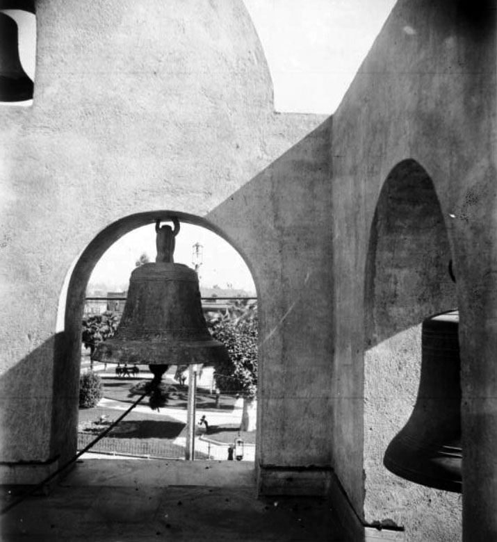 |
|
| (ca. 1910)* - View of the bells in the Los Angeles Plaza Church tower. Through one of the tower openings can be seen sidewalks, trees and people in the Plaza. |
Historical Notes The Plaza Church bells were cast by Paul Revere’s apprentice, George Holbrook. The church, located at 535 North Main Street, is the oldest religious structure in Los Angeles. Originally built as a simple adobe by Franciscan padres with the labor of local Indigenous people, it was completed in 1822 and has remained in continuous use ever since. Later additions included the tile mosaic of The Annunciation (1981) by artist Isabel Piczek, ornate gold-leaf interior decoration, and wrought-iron detailing. |
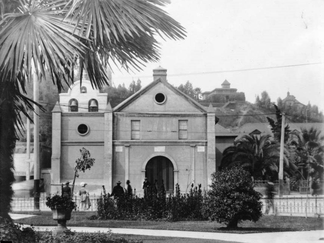 |
|
| (1910s)* - View of the Old Plaza Church, showing what appears to be a new bell gable. Four churchgoers are seen behind a wrought-iron fence in front of the chapel. In the background on top of Fort Moore Hill can be seen the Banning House. |
Historical Notes During this decade, the church’s façade received fresh plaster and minor architectural repairs, including new round window openings (oculi) and decorative trim. The wrought-iron fence and gates were added to protect the churchyard from the growing flow of traffic and streetcar activity on Main Street. The area behind the church, including Fort Moore Hill, remained largely residential until the late 1930s. |
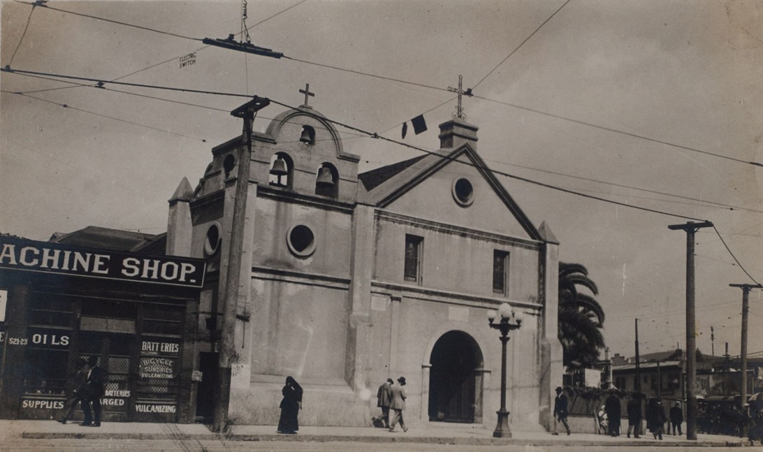 |
|
| (1915)* – View of the Plaza Church (La Iglesia de Nuestra Señora la Reina de los Ángeles) on North Main Street, with a small machine shop next door advertising “Oils,” “Batteries,” and “Bicycle Sundries.” Electric trolley wires crisscross overhead, a streetlight stands at the corner, and pedestrians pass by—capturing a moment when old Los Angeles met the modern age. |
Historical Notes By 1915, Plaza Church stood as a relic of old Los Angeles amid a fully urbanized downtown. Next door, a small machine and bicycle shop at 521–523 N. Main symbolized the city’s technological age—advertising oils, batteries, and vulcanizing services. Overhead trolley wires, streetlights, and pedestrians reflected a city rapidly moving forward. The shop likely stood on ground once part of the church’s early burial yard, long since built over after burials were moved to Calvary Cemetery. Beneath the signs of progress, traces of the city’s earliest days remained—while the church itself continued to bridge Los Angeles’ colonial past with its industrial present. |
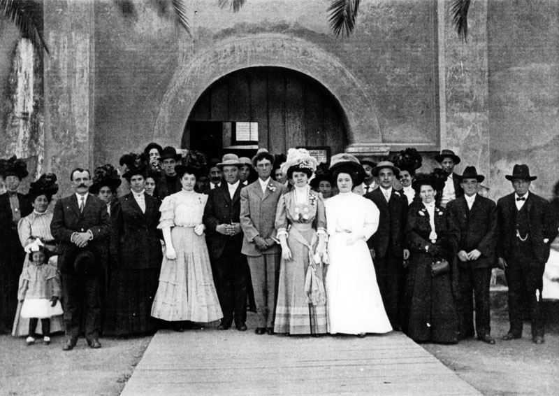 |
|
| (ca. 1917)* - A wedding at the Plaza Church in downtown Los Angeles. Maria Bidart Erramauspe is the bride. Several members of the Bidart family, originally from the Basque region in France and early settlers in Los Angeles, are present. |
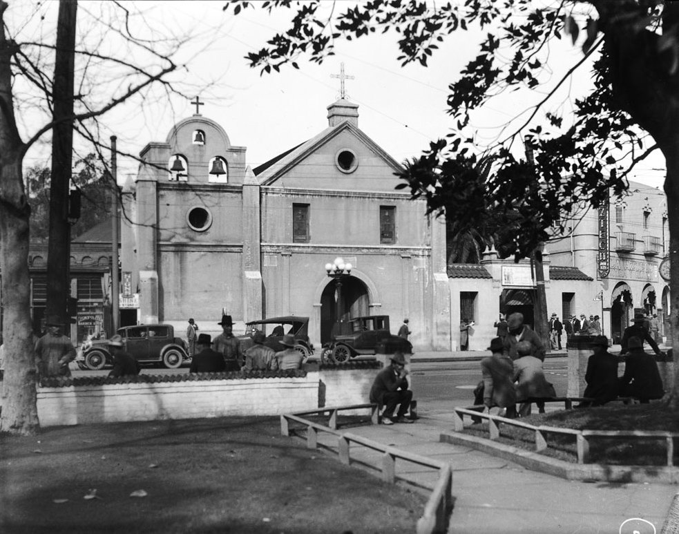 |
|
| (ca. 1920s)* - View of the front of the Old Plaza Church as seen from the L.A. Plaza across the street. Early model cars are seen parked in front of the church. |
Historical Notes With automobiles replacing trolleys and wagons, the Plaza area entered a new era of transformation. Though many nearby adobe structures had disappeared, Plaza Church remained an active parish serving the largely Mexican-American community that now lived around Sonoratown. Its continued use helped preserve the religious and cultural traditions that had defined Los Angeles for over a century. |
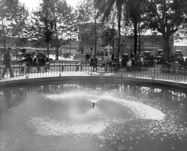 |
|
| (ca. 1920s)^- Plaza Fountain. Several men appear to be reading the daily newspaper. A horse drawn wagon can be seen in the upper left. |
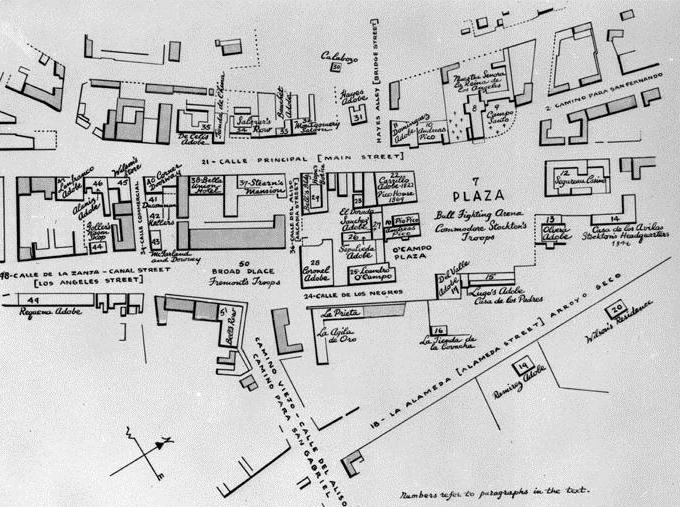 |
|
| (Early 1900s)* - Detailed map of the LA Plaza area in its early days. |
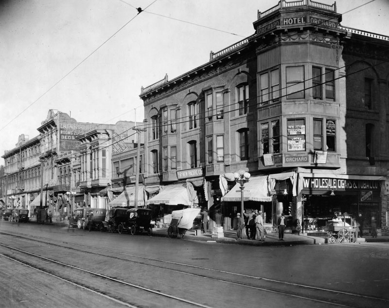 |
|
| (ca. 1920)** - View of North Main Street at Arcadia Street in the Plaza area circa 1920. From left to right: Pico House, Merced Theater, Masonic Temple, and Hotel Orchard on the corner of Arcadia Street. Small shops are at street level, and cars are parked along the curb. Streetcar tracks are in the foreground. |
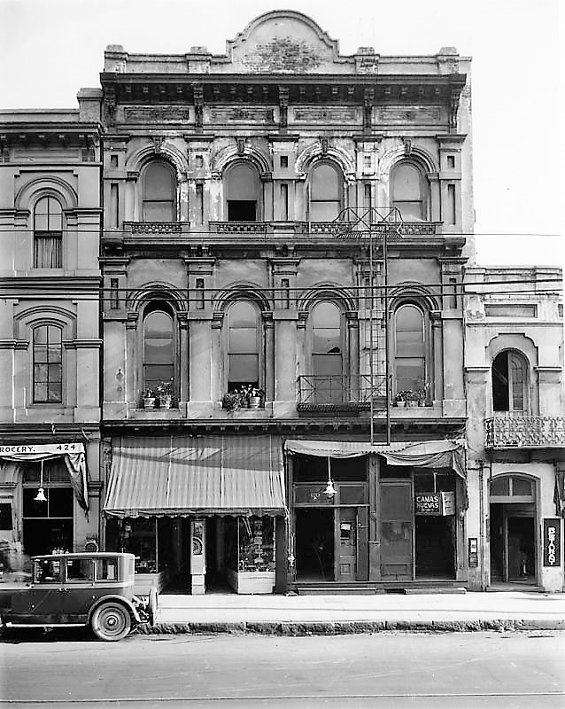 |
|
| (1920s)* - View of the Merced Theater as seen from across the street with commercial stores seen on the ground level. |
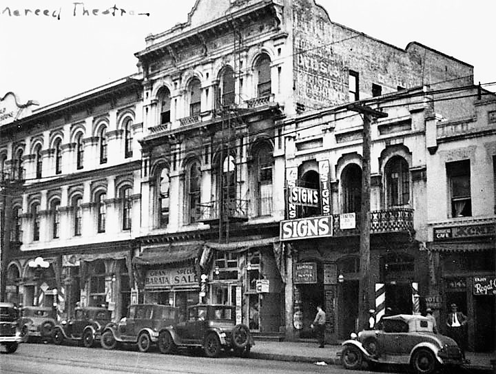 |
|
| (late 1920s)* – The Merced Theater is wedged between the Pico House and the Masonic Hall. |
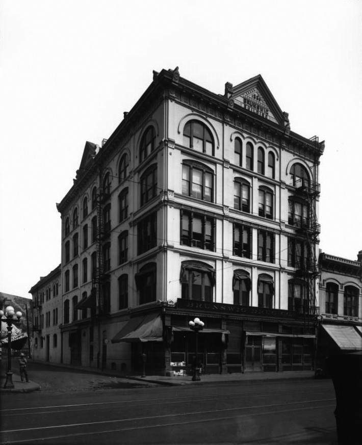 |
|
| (ca. 1920)* - View of the Vickrey-Brunswig Building located on the northwest corner of N. Main and Republic streets. The name of the building appears on two signs, one over the doorway and one on top of the roof. |
Historical Notes Prominent architect Robert Brown Young designed the Vickrey-Brunswig Building in a transitional Italianate style, varying the treatment of each story of the facade for greater visual interest. The windows of the upper floor feature Romanesque arches, while those of the third floor are embellished with turned posts that serve as the mullions between the grouped sashes. R. B. Young was the principal of one of Los Angeles's earliest architectural firms, R.B. Young & Son. Young's office garnered a number of prestigious hotel commissions, such as the Clifton (his first commission in Los Angeles, at the corner of Broadway and Temple Streets), Lankershim, Westminster, Lexington, Hollenbeck, and Occidental hotels. Young also designed the Lankershim office building, the Barker Brothers' block, the Wilson Block, and the California Furniture Company. |
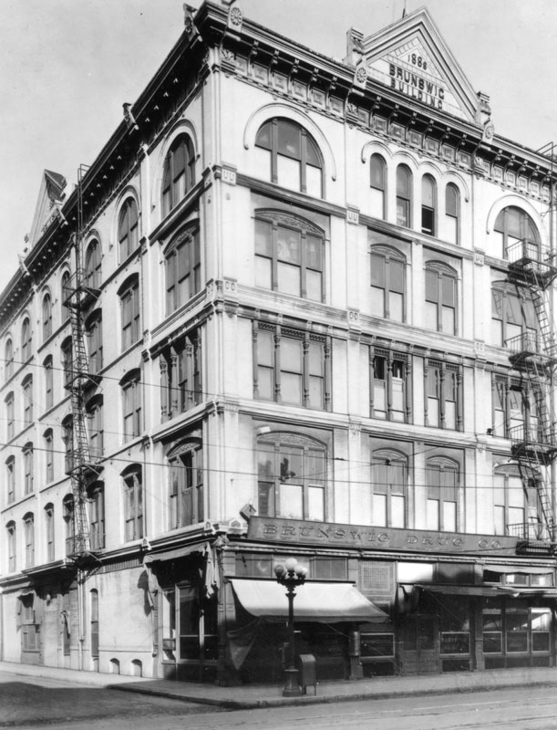 |
|
| (ca. 1921)** - Closer view of the Vickrey-Brunswig Building located at 501 N. Main Street. The roof sign reads: 1888 - Brunswig Building. The sign over the building entrance reads: Brunswig Drug Co. |
Historical Notes The Vickrey-Brunswig Building was constructed of brick on a trapezoidal plan and stands five stories with a full basement. It was constructed in the Italianate style commonly used for commercial architecture in the Iate-19th and early 20th centuries. Characteristic elements of the building include the decorative stringcourse located above the fifth floor windows and the segmental and rounded arched brick windows featured on the south and west elevations. |
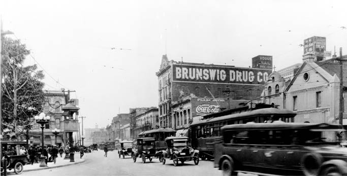 |
|
| (1920)*#^ - View looking south on Main Street showing the Old Plaza Church and Brunswig Building (Brunswig Drug Company) on the right and the LA Plaza and Pico House on the left. The new City Hall which would stand two blocks south would not be built until 1928. Early model cars share the road with electric streetcars. |
Historical Notes Note the elevated kiosk on the edge of the plaza to the left of photo. Elevated booths like these were used by the Los Angeles Railway and the Yellow Cars as a switchman’s tower to control the flow and path of streetcars through the intersection. Many of these were still standing well into the 1920s. |
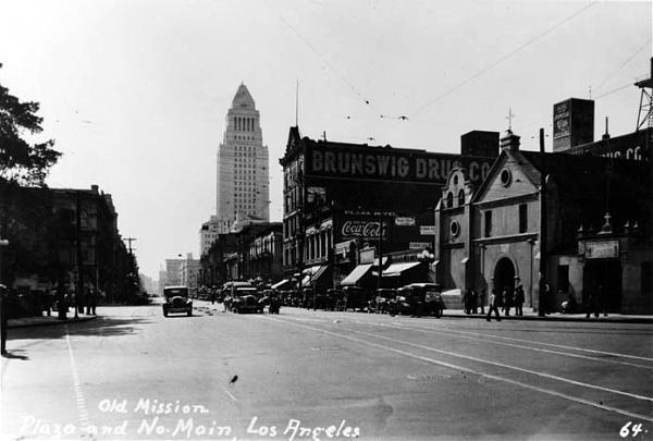 |
|
| (ca. 1928)* - View looking south on Main Street showing the newly constructed City Hall standing in the background (corner of Temple and Main streets) with the Brunswig Building and Old Plaza Church at right. |
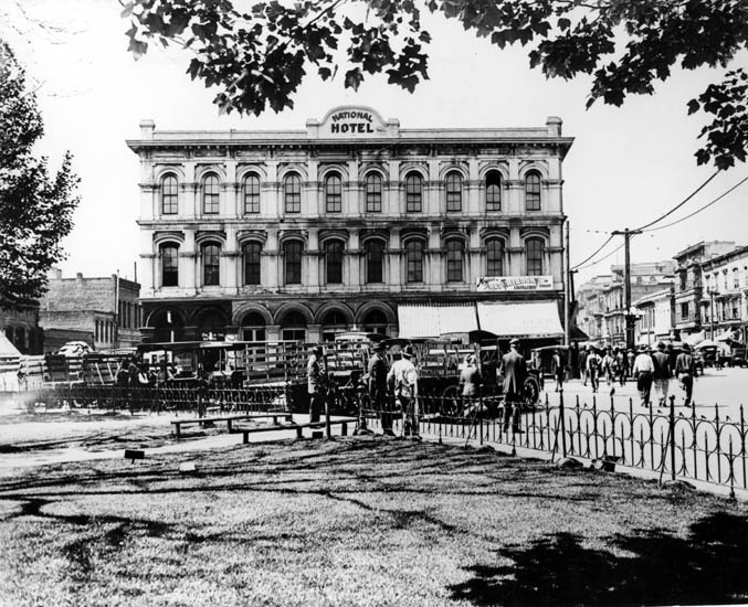 |
|
| (ca. 1920)*#^ - View of the Pico House as the National Hotel from the Plaza circa 1920. |
Historical Notes In 1880, Pico lost the hotel by foreclosure. From 1892-1920 the building was called the National Hotel. |
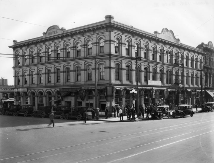 |
|
| (ca. 1920)** - Corner view of the Pico House as the National Hotel with a sign for "Plaza Employment Agency" on the right side of the building. A crowd of people are hanging around the corner, and a row of cars is parked up the left side, while 3 or 4 cars are seen on the right side. |
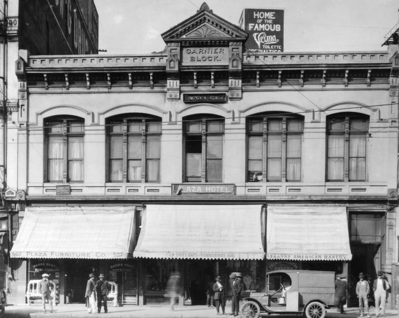 |
|
| (ca. 1920)** - Garnier Block, formerly known as the Plaza House had shops on the ground level and the Plaza Hotel on the second floor. A short distance to the right (out of view) sits the Old Plaza Firehouse. |
Historical Notes The Garnier Building was designed primarily for Chinese commercial tenants. It is the oldest building in Los Angeles exclusively and continuously inhabited by Chinese immigrants from the time of its construction in 1890 until the State took it over in 1953. The building was the headquarters of major Chinese American organizations and housed businesses, churches, and schools. It was an important structure in the original Los Angeles Chinatown. |
 |
|
| (ca. 1925)** - On the left is the Jennette Block on the northwest corner of Arcadia and Los Angeles Streets, and on the right is the Garnier Building at 415 North Los Angeles Street. The construction of the #101 Freeway took away the Jennette Block and left the Garnier Building. |
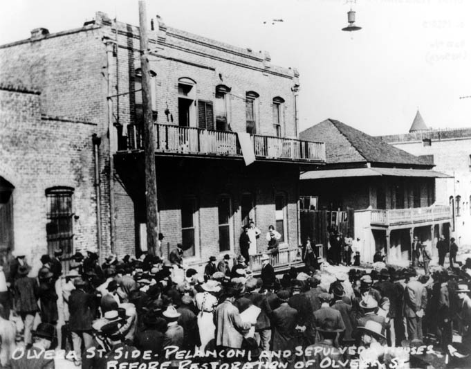 |
|
| (1920s)*#^ - The Olvera Street side of the Pelanconi and Sepulveda Houses prior to restoration. |
Historical Notes Sepulveda House is a 22-room Victorian house built in 1887 in the East lake style. The original structure included two commercial businesses and three residences. Pelanconi House, built in 1857, is the oldest surviving brick house in Los Angeles. In 1930, it was converted into a restaurant called La Golondrina, which is the oldest restaurant on Olvera Street. |
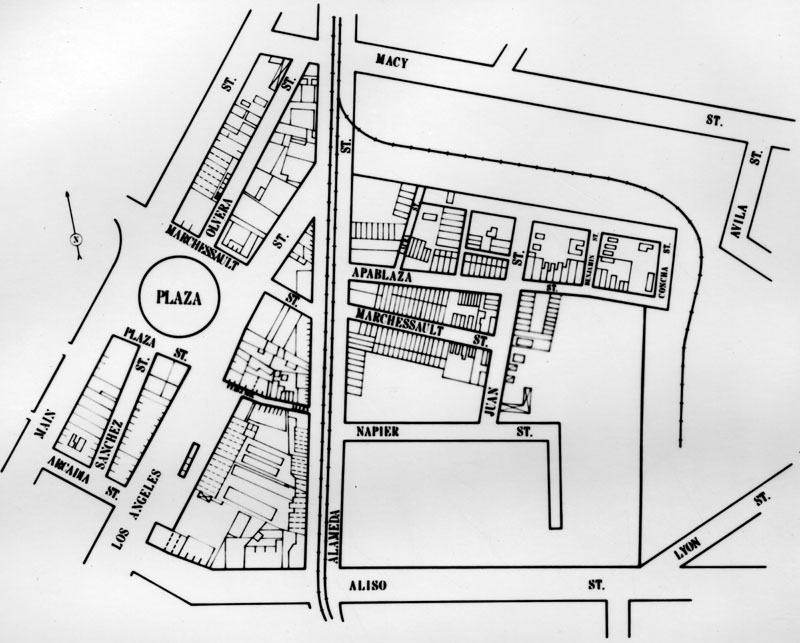 |
|
| (1920s)** - Map of early LA with the Plaza seen just west of Alameda. East of Alameda is the older part of Chinatown that was relocated when the Union Station was built in the late 1930s. Union Staion opened in May of 1939. |
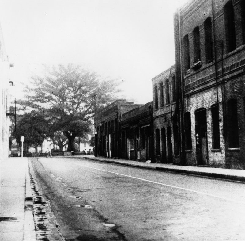 |
|
| (n.d.)* - View of Sanchez Street, lined with brick buildings, looking toward the Plaza. |
Historical Notes This small street, which ran south of the Plaza, was officially named in 1861 for Tomas Avila Sanchez, through whose property it passed. Sanchez was elected Sheriff of Los Angeles County 17 times. He resided for many years in a Glendale adobe. |
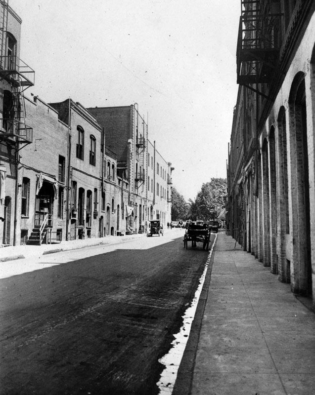 |
|
| (1921)* - View of Sanchez Street, lined with brick buildings, looking north toward the Plaza in 1921. The first building at far left is the rear side of the Pico House and the rear side of the Merced Theater. |
Historical Notes Sanchez Street juts south from the plaza, opposite its more famous twin, Olvera Street, on the north side. It's just a block long, but it's seen a lot of history. In the 1880s and '90s, it was the scene of several crimes reported in The Times. Most involved the local saloons and Chinese gangs of the day, including the 1889 shooting death of the "Peruvian Princess," a woman whose tortured life took her from Lima to China to San Francisco and finally to her death in a Sanchez Street boarding house. In 1914 police fought protesters on Sanchez Street during the Christmas Riot. A member of the International Workers of the World, or Wobblies, was shot and killed. |
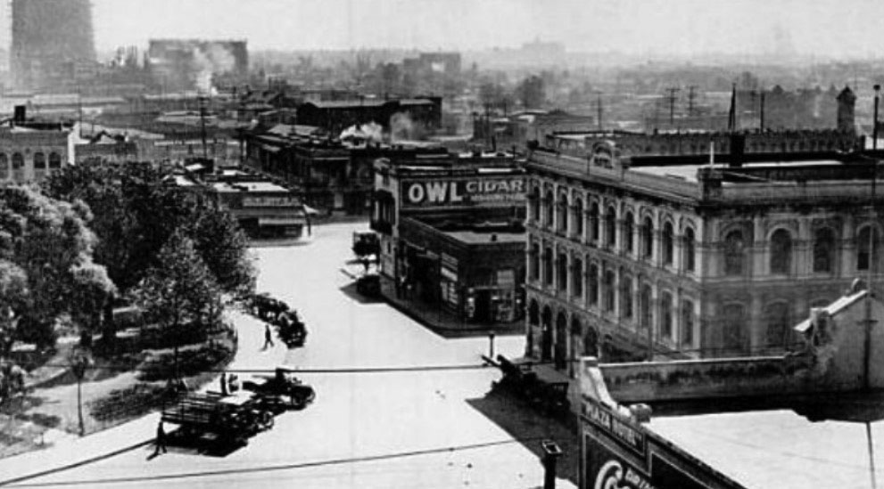 |
|
| (1918)* – View looking down from the top of the Plaza Church showing (L to R): the LA Plaza, the Old Fire Station with “Owl Cigar” billboard on its side, Sanchez Street, and the Pico House. |
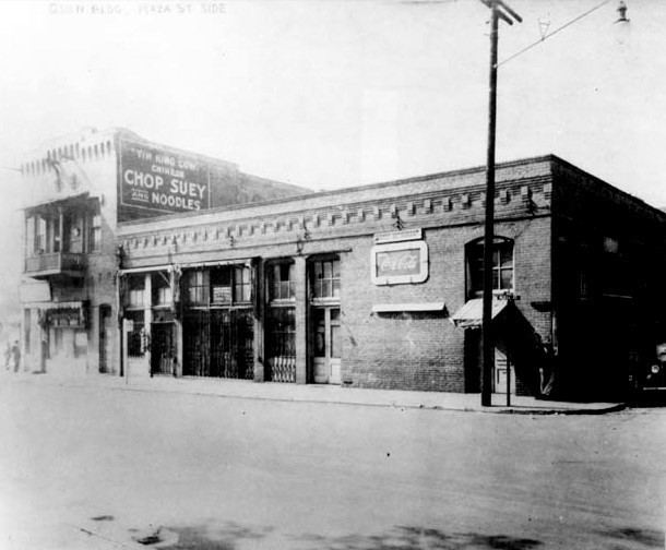 |
|
| (1920s)** - View showing the El Pueblo Hellman/Quon Building on the southeast corner of Republic and Sanchez streets, across from the Plaza, with the Old Fire Station on its left. |
Historical Notes The Hellman/Quon building is named for its two long-time owners, a white European builder and a Chinese businessman. When Hellman, the original owner, died in 1920, the building was sold to Quon How Shing, who helped fellow Chinese learn English and taught them how to adapt to American society. The building had a hidden bell to alert occupants to the presence of unwelcome visitors who might take issue with the gambling and opium smoking within. It is now the offices of Las Angelitas del Pueblo, the volunteer organization that offers free tours of El Pueblo de Los Angeles, and El Pueblo Education Center. The Hellman/Quon Building site was where Governor Pio Pico's Office once stood, the last California capital of Mexico. |
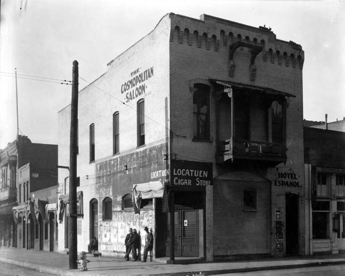 |
|
| (1920s)*#^ - View of the Firehouse with three men standing at the corner, when it was the Cosmopolitan Saloon. The sign over the corner doorway reads: Locatuen Cigar Store. |
Historical Notes Over its life, the Old Plaza Firehouse was used as a saloon, cigar store, poolroom, "seedy hotel", Chinese market, "flop house", and drugstore. The building was restored in the 1950s and opened as a firefighting museum in 1960. |
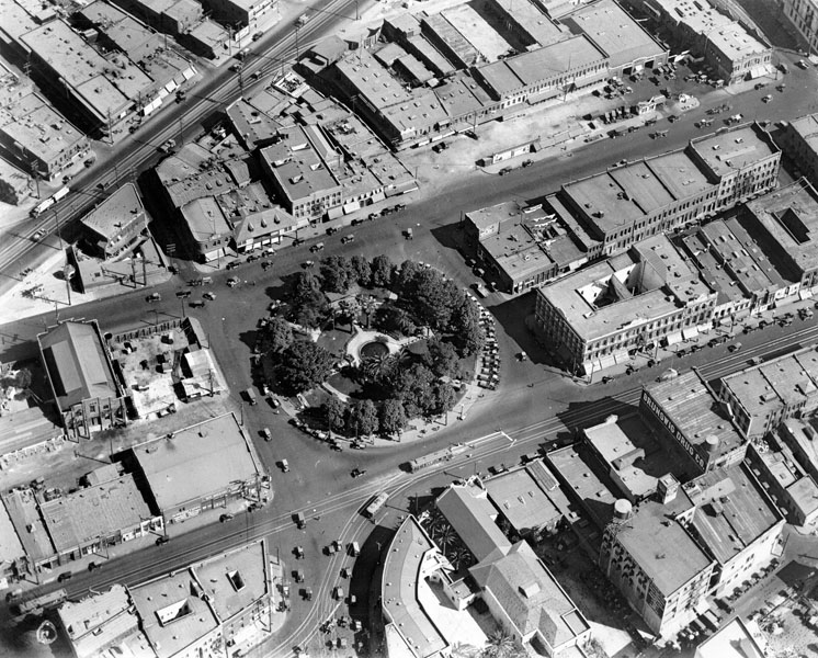 |
|
| (ca. 1924)** - Aerial view of the Los Angeles Plaza and surrounding buildings. The streets from top to bottom are: Alameda Street running diagonally at the upper left, Los Angeles Street, and Main Street. Nearly half the buildings to the right of the Plaza (south of the Plaza) were demolished in the 1950s to make way for the Hollywood Freeway. |
Historical Notes The sole occupant of the entire city block bounded by Los Angeles, Marchessault, and Alameda streets (upper left corner of the photo) was a sturdy, square, two-story brick structure. Built originally for a furniture factory, it was later remodeled to serve as a headquarters of the Los Angeles Water Department’s predecessor, the Los Angeles City Water Company. Click HERE to see more in Water Department's Original Office Building. |
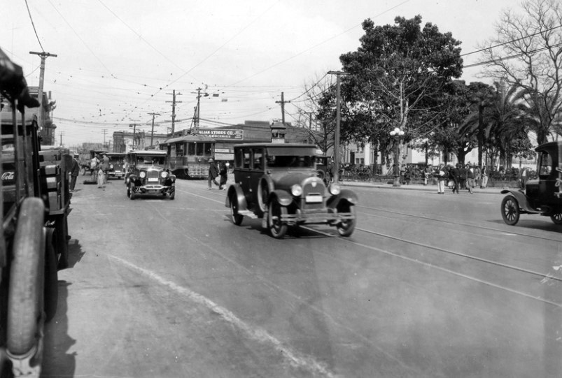 |
|
| (ca. 1924)#*** - View looking north on Main Street with the Los Angeles Plaza visible in the upper right. A Los Angeles Railway (LARy) streetcar and several early model autos are seen on Main Street. |
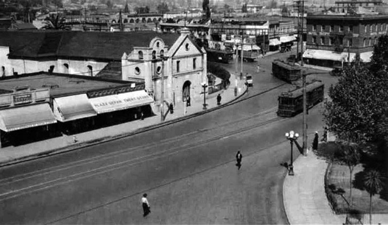 |
|
| (1920s)^^^ – View looking northwest toward The Plaza Church from second floor of The Pico House. Three LARy streetcars are seen near the Old Plaza Church. |
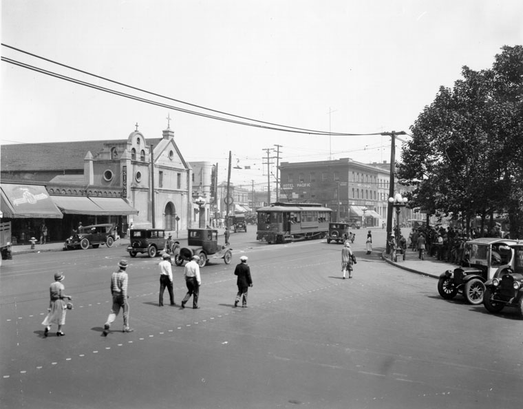 |
|
| (ca. 1925)** - The Plaza Church on Main Street across from the Plaza and Olvera Street. Behind the streetcar is the Hotel Pacific, the office of Philip Morici and Co., "Agencia Italiana," and the grocery store of Giovanni Piuma, who also made wine (Piuma Road in Malibu was named for him). The area north of the Plaza was at this time an Italian neighborhood. |
Historical Notes The area’s decline as the center of civic life led to its reclamation by diverse sectors of the city's poor and disenfranchised. The Plaza served as a gateway for newly arrived immigrants, especially Mexicans and Italians. During the 1920s, the pace of Mexican immigration into the United States increased to about 500,000 per year. California became the prime destination for Mexican immigrants, with Los Angeles receiving the largest number of any city in the Southwest. As a result of this dramatic demographic increase, a resurgence of Mexican culture occurred in Los Angeles. |
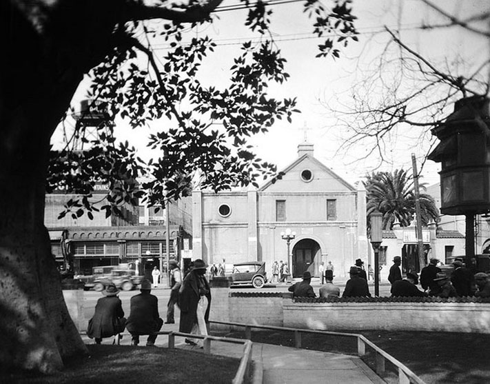 |
|
| (ca. 1925)* - Exterior view of the Plaza Church from across the street. An elevated LARY booth can be seen on the right edge of the photo. |
Historical Notes Elevated kiosks were used by the Los Angeles Railway and the Yellow Cars (LARY) as a switchman’s tower to control the flow and path of streetcars through intersections. |
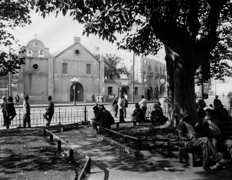 |
|
| (1927)** - View of the plaza with several men lounging and sitting under a big tree. The Plaza Church can be seen in the background. To the right of the church is a parochial school. Next to the school is Azteca, a jeweler's that also carries religious artifacts. |
* * * * * |
Olvera Street
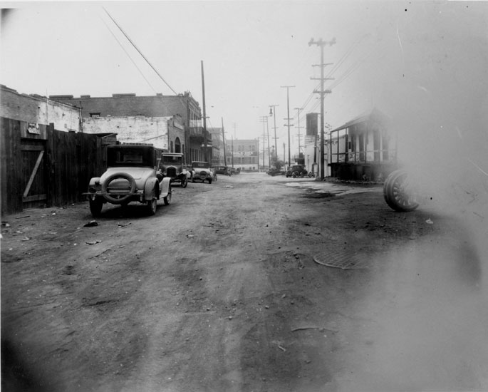 |
|
| (1920s)* - Olvera Street looking north, Avila Adobe on right, old cars parked on west side of street, Sepulveda House has large pole in front of it, Tool and Die shop at north end. The above view is what Christine Sterling saw when she decided that something had to be done to bring this historic street back to life. |
Historical Notes Born in Oakland in 1881, Christine Sterling (originally Chastine Rix) migrated south with her husband and two children, residing on Bonnie Brae as early as 1920. In 1926, during a stroll through the rundown alley, Sterling cringed at what had become of the dilapidated Avila Adobe. In an effort to appeal to Anglo hearts and minds, she orchestrated a one-woman campaign to save the old adobe, reminding citizens that the structure had once housed such American luminaries as Commodore Robert F. Stockton, victorious General John C. Fremont, and early explorer Kit Carson. |
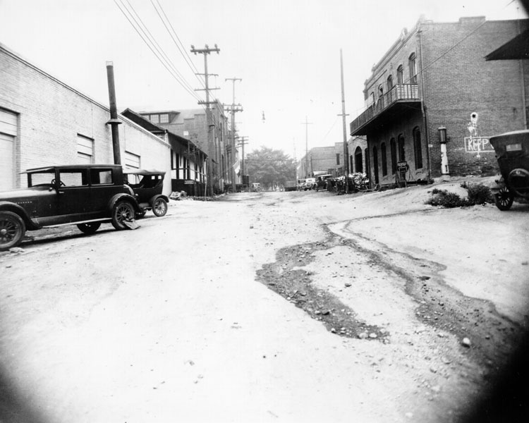 |
|
| (1926)* - View looking south on Olvera Street before improvement and also before City Hall was built. On the left the Avila Adobe is seen. To the right is the Sepulveda House with a gas pump on its side. |
Historical Notes The Avila Adobe was built ca. 1818 by Don Francisco Avila, alcalde (mayor) of Los Angeles in 1810. Used as Commodore Robert Stockton's headquarters in 1847, it was repaired by private subscription in 1929-30 when Olvera Street was opened as a Mexican marketplace. It is the oldest existing house in Los Angeles. |
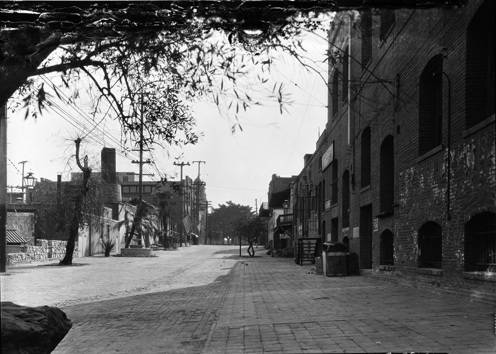 |
|
| (1930)* - View of Olvera Street looking south toward the Plaza before vendor kiosks or restaurants were put in place. Later that year things would change. |
Historical Notes Sterling's sales pitch for a Mexican marketplace, replete with vendors and musicians in ethnic garb, persuaded L.A. Times owner Harry Chandler to contribute $5,000 dollars, and in the process several prominent Angelenos joined his philanthropic party. According to the L.A. Times, during a fundraising BBQ held on the porch of the Avila Adobe, the tequila was flowing in spite of prohibition, and then Chief of Police Charlie "Two Guns" Davis was so moved by Sterling's call to action that he volunteered prison labor for Olvera's reconstruction. |
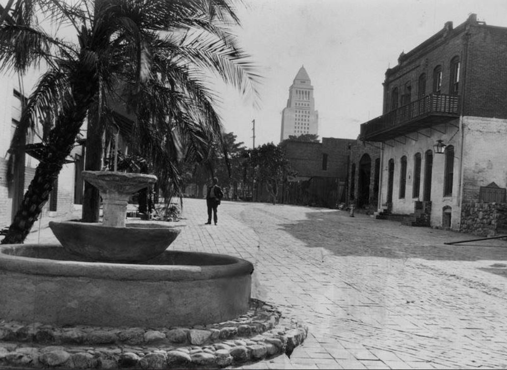 |
|
| (1930)** – View looking south on Olvera Street with City Hall in the background. A man is seen looking at the Avila Adobe. |
Before and After
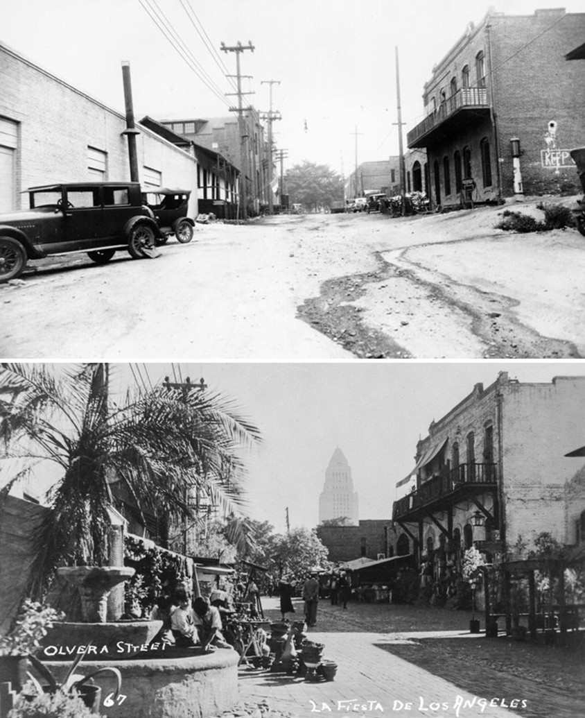 |
|
| (1926 vs. 1930)* - A 'Before and After' comparison of Olvera Street. By 1930, through the efforts of activist Christine Sterling, the Plaza–Olvera area had been revitalized with the opening of Paseo de Los Angeles—soon popularly known by its official name, Olvera Street. Photo comparison by Jack Feldman. |
Historical Notes In 1930, through the efforts of activist Christine Sterling, the Plaza-Olvera area was revived with the opening of Paseo de Los Angeles (which later became popularly known by its official street name Olvera Street). |
* * * * * |
Olvera Street - 1930s
.jpg) |
|
| (ca. 1930)** - A view down Olvera Street shortly after its revitalization with building on the left, booths on both sides, and pedestrians strolling through. The two-story building on the left is the Sepulveda House. |
Historical Notes In 1930, through the efforts of activist Christine Sterling, the Plaza-Olvera area was revived with the opening of Paseo de Los Angeles (which later became popularly known by its official street name Olvera Street). Sterling's vision for a "Mexican Marketplace of Yesterday in the City of Today" opened to the public on Easter Sunday in 1930. Her art and design education from Mills College served to inform her Olvera Street project, as well as her next ethnic re-envisioning, China City. Authenticity has always been tinged with historical fantasy in Los Angeles, and for better or for worse, Sterling's efforts indeed saved the Avila Adobe, and in the process created one of L.A.'s most visited tourist attractions. Towards the end of her life, Sterling would suffer the same fate of the shop owners of old Olvera and the displaced denizens of the first Chinatown, after she was evicted from her Chavez Ravine home to make way for Dodger Stadium. Sterling moved in to the Avila Adobe, which would be her final home before she passed on in 1963 at the age of 82. |
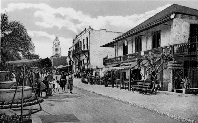 |
|
| (ca. 1930)* - Postcard view of Olvera Street looking south with City Hall in background. Pelanconi House and Sepulveda House on right (west) side. Palm tree and fountain on left side (east). |
Historical Notes When it opened in 1930, Olvera Street featured shops and restaurants selling colorful Mexican goods, as well as musicians performing in the outdoor plaza. It was designed to recreate a romanticized version of "Old Los Angeles." The new City Hall was built in 1928. |
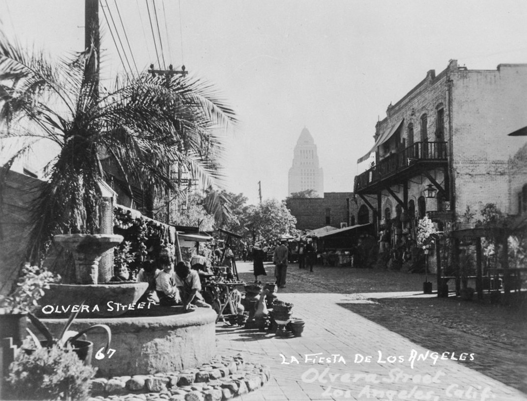 |
|
| (1930s)* – View of Olvera Street with vending stands lining the background and three boys sitting on the edge of a fountain in the foreground. Los Angeles City Hall rises in the distance. Photo from the Ernest Marquez Collection. |
Historical Notes La Fiesta de Los Angeles, first held in 1894, was a citywide celebration that romanticized the region’s Spanish and Mexican heritage through parades, costumes, and music. This spirit carried into the 1930 revitalization of Olvera Street, led by Christine Sterling, who transformed it into a festive marketplace to preserve and promote the city’s Mexican roots. Both the fiesta and Olvera Street reflected Los Angeles’ early efforts to craft a cultural identity that honored its past—though often through a selective, idealized lens. |
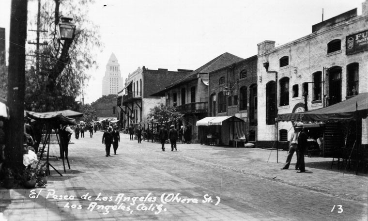 |
|
| (ca. 1930)** - Late afternoon view of Olvera Street with City Hall in the background. |
Historical Notes Originally unveiled as "El Paseo de Los Angeles" on Easter Sunday in 1930, the street quickly became known as Olvera Street, a name that stuck and is more commonly used today. |
 |
|
| (ca. 1930)* - A painting by Chris Siemer of Olvera Street, with L.A. City Hall in the background. The painting was created for display for the L.A. Chamber of Commerce. |
Historical Notes As a tourist attraction, Olvera Street is a living museum paying homage to a romantic vision of old Mexico. The exterior facades of the brick buildings enclosing Olvera Street and on the small vendor stands lining its center are colorful piñatas, hanging puppets in white peasant garb, Mexican pottery, serapes, mounted bull horns, oversized sombreros, and a life-size stuffed donkey. Today, Olvera Street attracts almost two million visitors per year. |
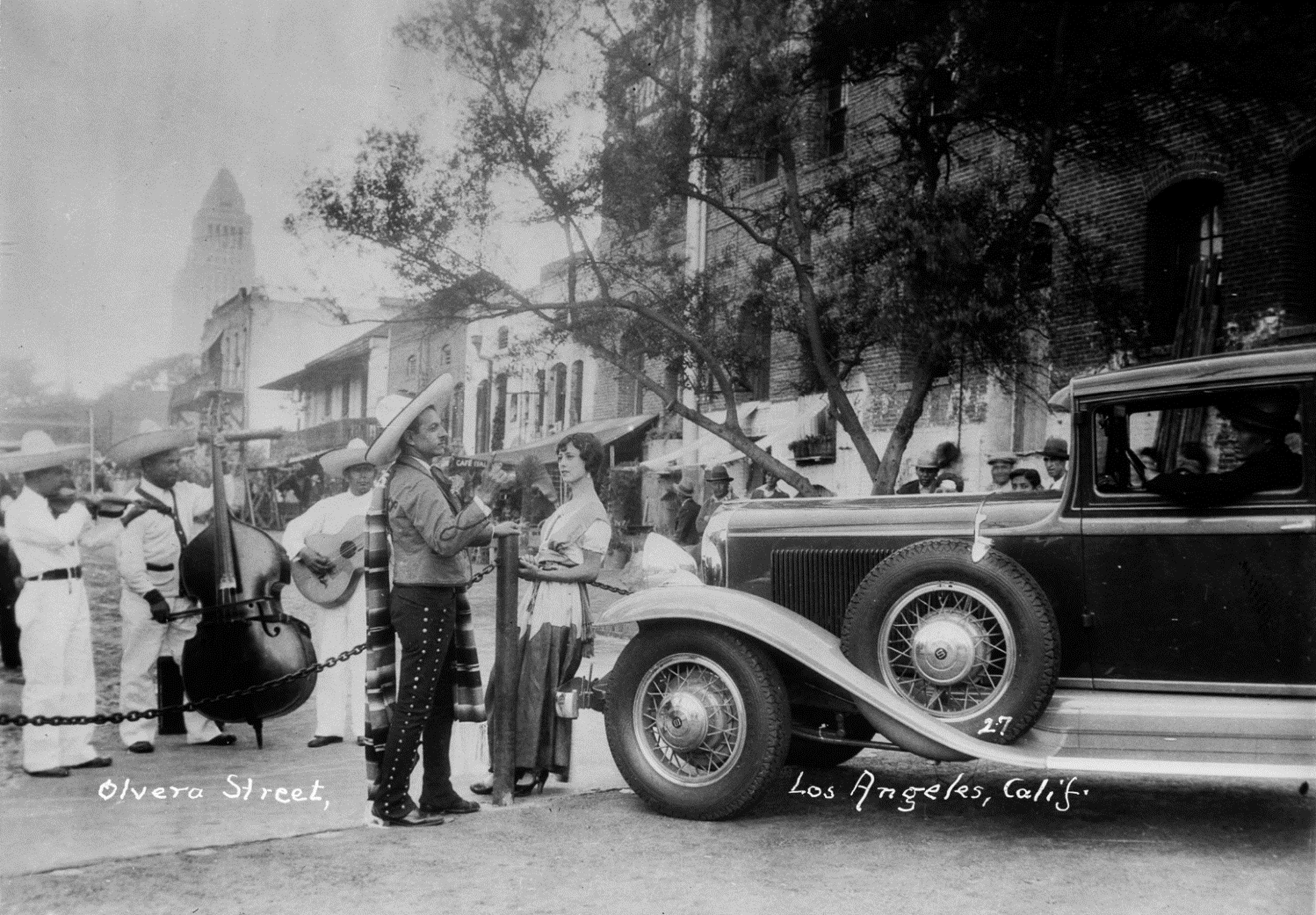 |
|
| (1930s)* – A woman leans against a chain barrier in front of a classic automobile, watching a group of Mariachi musicians playing at the edge of Olvera Street, with L. A. City Hall seen in the distance. Photo from the Ernest Marquez Collection. |
Historical Notes When it opened in 1930, Olvera Street featured shops and restaurants selling colorful Mexican goods, as well as musicians performing in the outdoor plaza. It was designed to recreate a romanticized version of "Old Los Angeles." While it was initially created to cater to a largely Anglo population, over time Olvera Street has become more accepted as a symbolic center of Mexican culture in Los Angeles. |
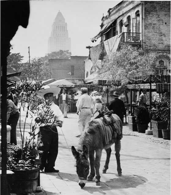 |
|
| (1930s)* - Hino Josa leading a donkey. View toward City Hall-looking at Sepulveda House, donkey on Olvera Street. The Sepulveda House fronts both Olvera and Main streets. |
Historical Notes The Sepulveda house was once the private home of one of the most powerful families in early Los Angeles. The Sepulveda House was built by Eloisa Martinez de Sepulveda in 1887, at a time when all predictions were that the population boom of the 1880s would last. However, Señora Sepulveda's hopes for Main Street were not fulfilled and by 1900 the area around her house was mostly industrial. Since the turn of the 20th century, Sepulveda House has been a bordello, a tearoom and the USO canteen during World War II. |
 |
|
| (1930s)* - Interior view of the Sepulveda House showing wooden floors and staircase. |
* * * * * |
El Paseo de Los Angeles
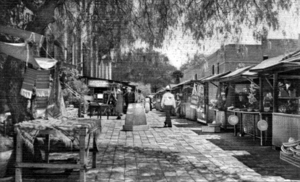 |
|
| (1930s)* – Postcard view of El Paso de Los Angeles "The Pathway of the Angels", Olvera Street, Los Angeles, CA. |
Historical Notes Originally unveiled as "Paseo de Los Angeles" on Easter Sunday in 1930, the street quickly became known as Olvera Street, a name that stuck and is more commonly used today. This historic area, envisioned by Christine Sterling as a vibrant Mexican marketplace and cultural center, is now part of the larger El Pueblo de Los Angeles Historical Monument. It represents the birthplace of Los Angeles and serves as a colorful tribute to the city's Mexican heritage. Olvera Street continues to draw millions of visitors annually with its array of shops, restaurants, and cultural events, offering a unique glimpse into the rich history and diverse culture of Los Angeles. |
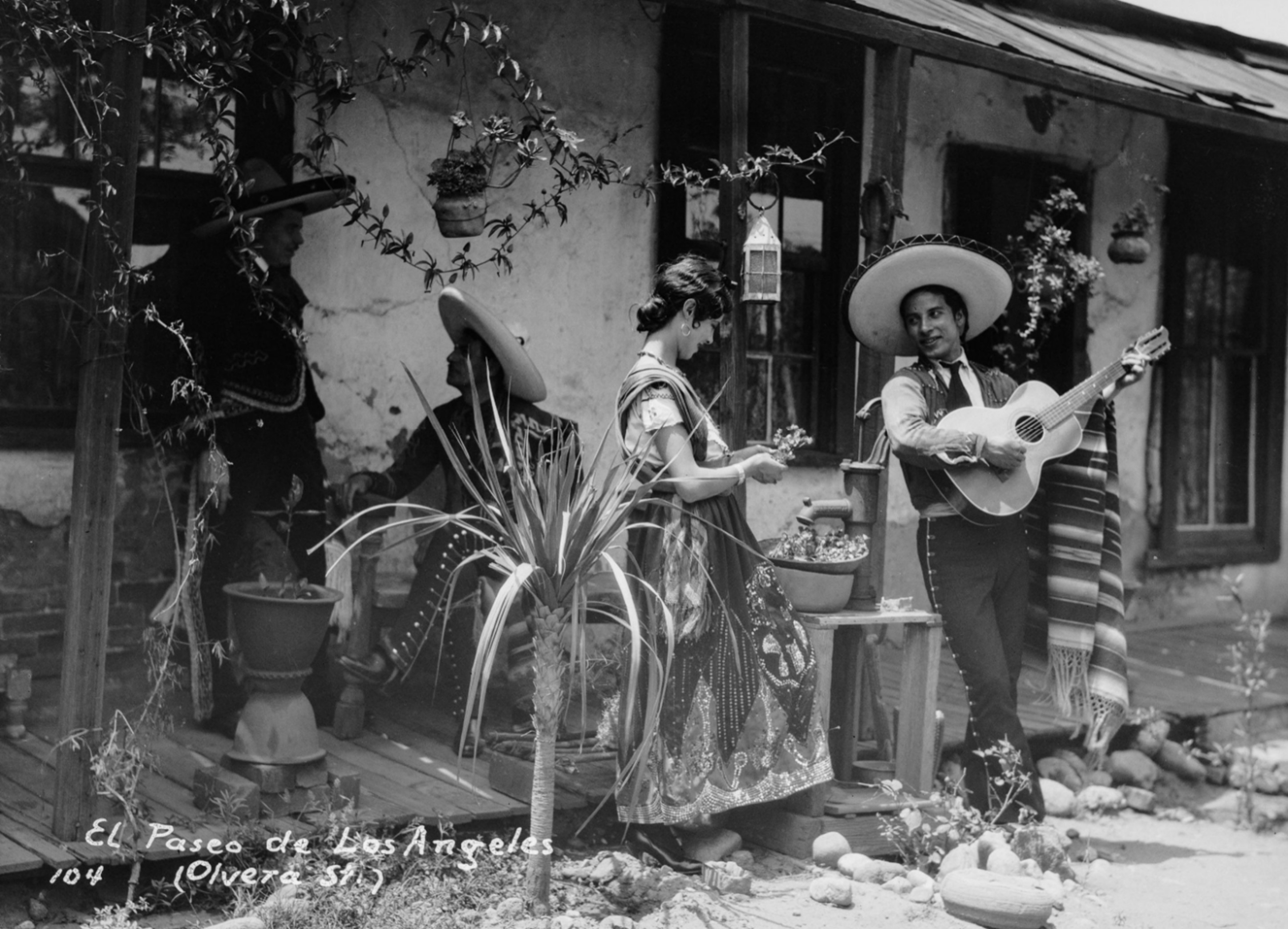 |
|
| (1930s)* – A man playing the guitar serenades a young woman in front of an adobe on Olvera Street. Both are dressed in traditional Mexican clothing. Photo from the Ernest Marquez Collection. |
Historical Notes After Olvera Street first opened in 1930, it quickly became a vibrant cultural and tourist attraction, celebrating the Mexican heritage of Los Angeles. Vendors and performers, often dressed in traditional Mexican clothing such as serapes, rebozos, and charro outfits, helped create an authentic atmosphere. Spearheaded by Christine Sterling, the street was transformed into a Mexican-style marketplace, evoking the early pueblo days of the city. This romanticized vision of Mexican culture became a significant draw for both locals and tourists, preserving the area’s historic charm while promoting Mexican traditions in the heart of Los Angeles. |
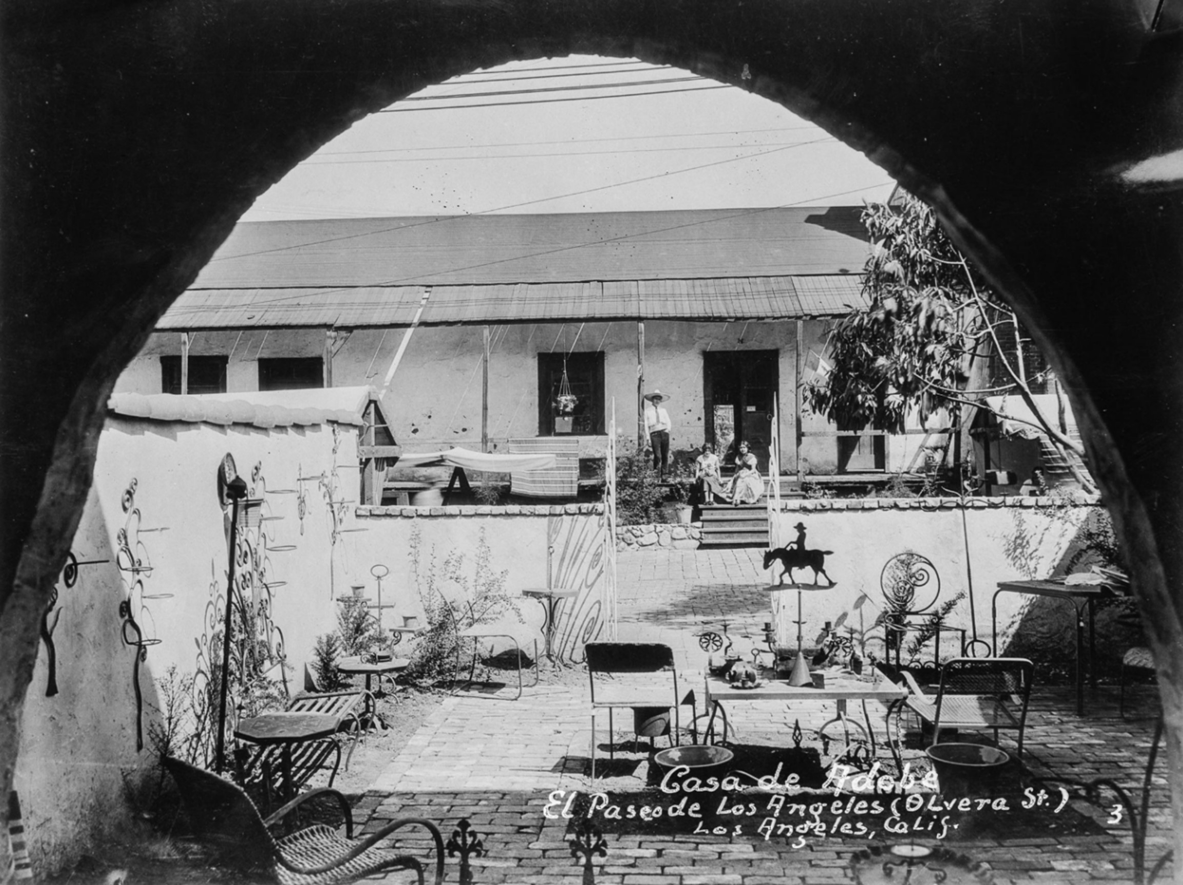 |
|
| (1930s)* – Looking through an archway across a courtyard showing a man and two women on the porch of the Avila Adobe on El Paseo de Los Angeles. Photo from the Ernest Marquez Collection. |
Historical Notes Located at 10 Olvera Street, the Avila Adobe was built in 1818 by Francisco Ávila, a prominent cattle rancher and early mayor of Los Angeles. It is recognized as the oldest standing adobe house in the city. Click HERE to see more early views of the Avila Adobe. |
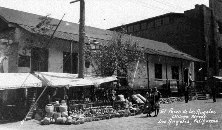 |
|
| (ca. 1930)** - A view of Olvera Street looking across at vending booths in front of the Avila Adobe with two pedestrians walking near. |
Historical Notes In 1930, through the efforts of activist Christine Sterling, the Plaza-Olvera area was revived with the opening of Paseo de Los Angeles (which later became popularly known by its official street name Olvera Street). |
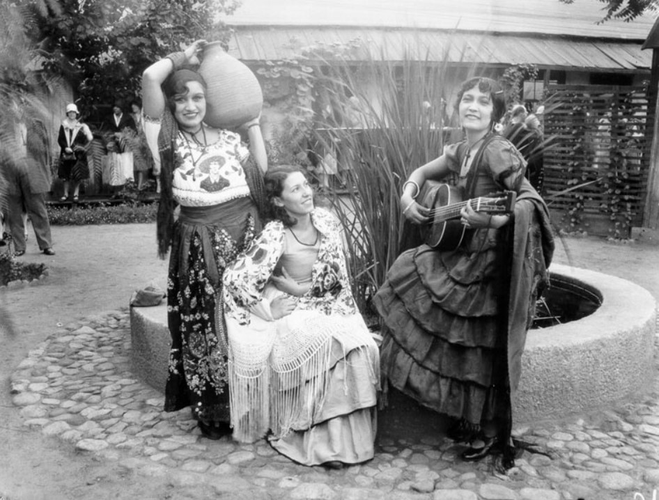 |
|
| (1930s)^ - View of three women dressed up in traditional Mexican/Spanish clothing posing for the camera in front of a fountain on Olvera Street. Socialite and preservationist, Christine Sterling led efforts to preserve the historic plaza and its buildings. |
Historical Notes Current historians note that the original intention of Olvera Street was to focus on LA’s Spanish past instead of its Mexican/Indigenous one. William Estrada, author of “The Los Angeles Plaza: Sacred and Contested Space,” writes: "Olvera Street was successful and even surpassed Mexican tourist zones along border in Tijuana & Mexicali because it fulfilled tourists’ preconceived notions about Mexico & quaintness of its culture without risk or ‘reality’ of actually crossing border." |
 |
|
| (1939)* – Postcard view showing two merchants having a conversation on Olvera Street in front of a vending booth with sign that reads: El Balero |
Historical Notes In its early days Olvera Street catered to a largely Anglo population; however, the meaning of Olvera Street has changed over the years, and the delusional fabrication has now been largely accepted as the symbolic epicenter of Mexican culture. |
* * * * * |
Original Mexican Cafe of Olvera Street
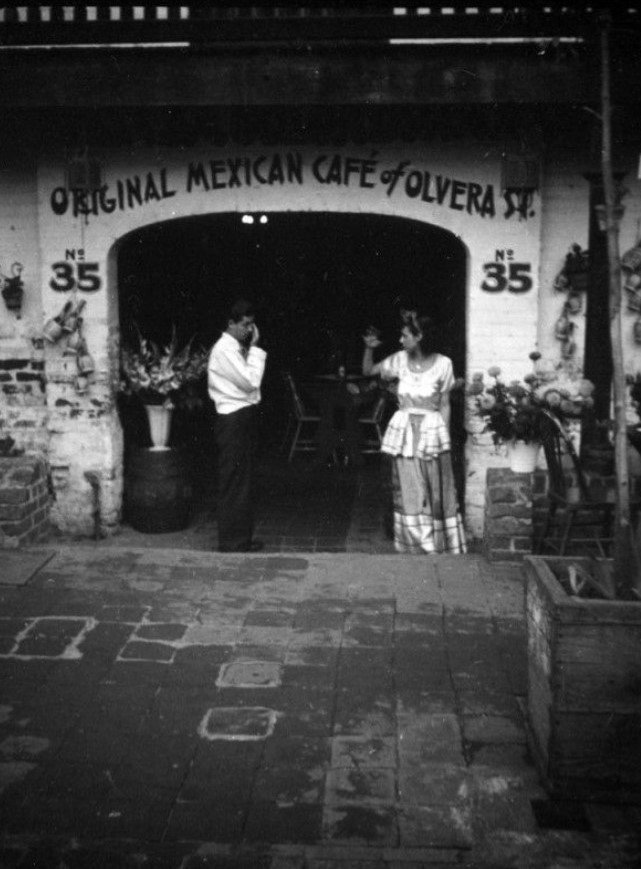 |
|
| (ca. 1937)* - The Original Mexican Café of Olvera Street, at No. 35, Olvera Street. Photo by Herman Schultheis |
* * * * * |
Garnier Block
 |
|
| (1924)* - Aerial view of the Los Angeles Plaza and surrounding buildings, with the Garnier Block highlighted in upper right. Annotated by Jack Feldman. |
Historical Notes Nearly half of the buildings to the right of the Plaza (south of the Plaza) were demolished in the 1950s to make way for the Hollywood Freeway. Similarly, the buildings in the upper left were demolished in the late 1930s to make way for Union Station. |
|
|
| (ca. 1928)* - View looking south on Main Street showing the newly constructed City Hall standing in the background (corner of Temple and Main streets) with the Brunswig Building and Old Plaza Church at right. |
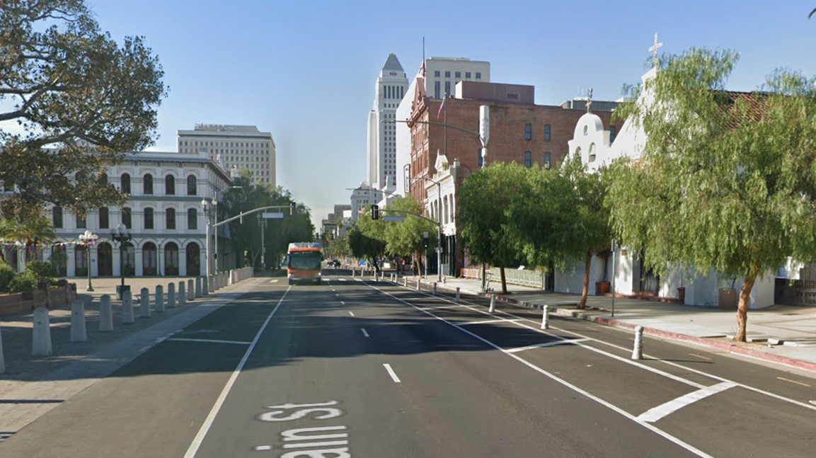 |
|
| (2021)* - Contemporary view looking south on Main Street from in front of the Los Angeles Plaza, with the Old Plaza Church visible on the right. Notable buildings from left to right include the Pico House, City Hall East, City Hall, the Federal Courthouse, the Vickrey/Brunswig Building, and the Plaza House. |
Then and Now
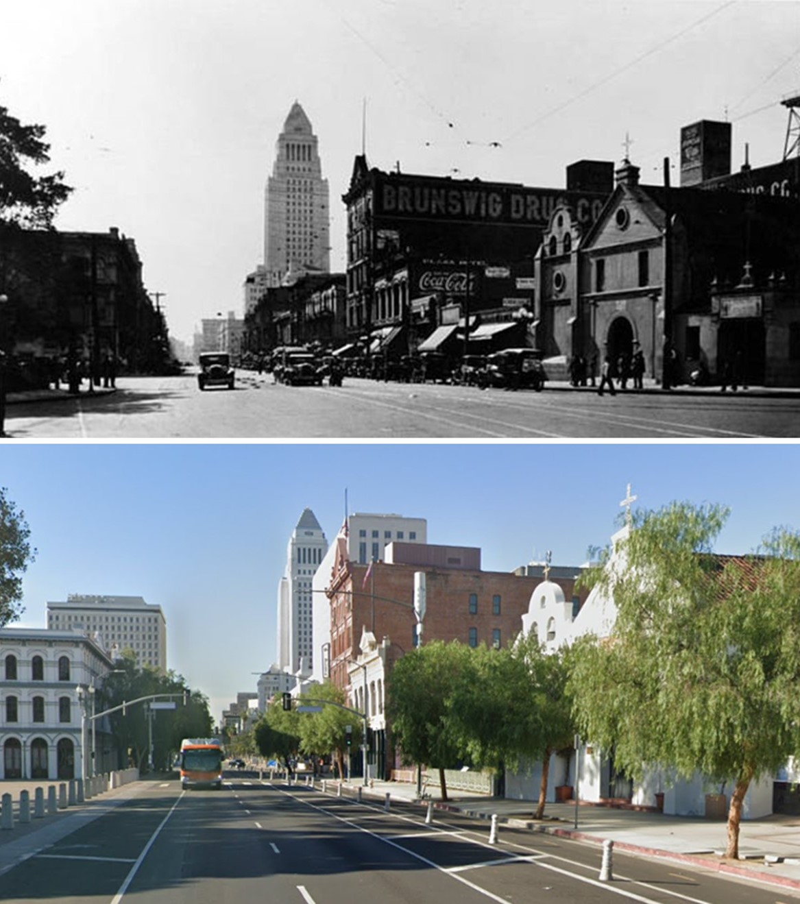 |
|
| (1928 vs. 2021)* – Looking south on Main Street from in front of the Los Angeles Plaza, with the Old Plaza Church visible on the right. Most of the buildings seen in the 1928 photo still stand today. The only additions visible in the contemporary photo are the Federal Courthouse (1940) and City Hall East (1969). Photo comparison by Jack Feldman. |
 |
|
| (ca. 1937)* - View looking southwest across Los Angeles Street showing the Garnier Block with the Jennett Block on the left and City Hall in the background. Photo by Herman Schultheis. |
Historical Notes Built in 1890 by Philippe Garnier—a French settler and prominent businessman—the Garnier Building is the oldest and most important single structure linking the Chinese community to Los Angeles’ original Chinatown. It is also the oldest and most significant Chinese building in a major metropolitan area of the state, as the original buildings in San Francisco’s Chinatown were destroyed by the earthquake of 1906. The southern wing of the Garnier Building was razed in the 1950s along with the Jennette Block to accommodate the construction of the Hollywood Freeway (101). |
 |
|
| (1942)* – View of the west side of Los Angeles Street between Arcadia Street and the Plaza, showing both the Garnier Block and Jennette Block with the newly built Federal Courthouse and U.S. Post Office Building in the background. |
Historical Notes The Garnier Block was a pivotal structure in Los Angeles' original Chinatown during the late 1930s and early 1940s. Located at 415 N. Los Angeles Street near the LA Plaza, it served as a vital hub for the Chinese community, housing various shops, schools, temples, and businesses. The building was not only a commercial center but also an important social venue where community events, dances, and theatrical performances took place. |
 |
|
| (2022)* - Google Street View showing the Garnier Block as it looks today. |
Historical Notes The southern wing of the Garnier Building was razed in the 1950s along with the Jennette Block to accommodate the construction of the Hollywood Freeway (101). |
Then and Now
 |
|
| (1937 vs 2022)* - A view of the west side of Los Angeles Street, where the Garnier Block still stands today. The construction of the Hollywood Freeway (#101) removed everything to the left (south) of the Garnier Building, including an area once known as the Jennette Block. Photo comparison by Jack Feldman |
Historical Notes As plans for Union Station progressed in the 1930s, much of Chinatown faced demolition and displacement. However, the Garnier Block remarkably survived these changes, becoming a symbol of resilience for the community. Today, it stands as the oldest surviving building from LA's historic Chinatown and remains a significant landmark representing the rich cultural heritage of Chinese Americans in California. |
* * * * * |
Jennette Block
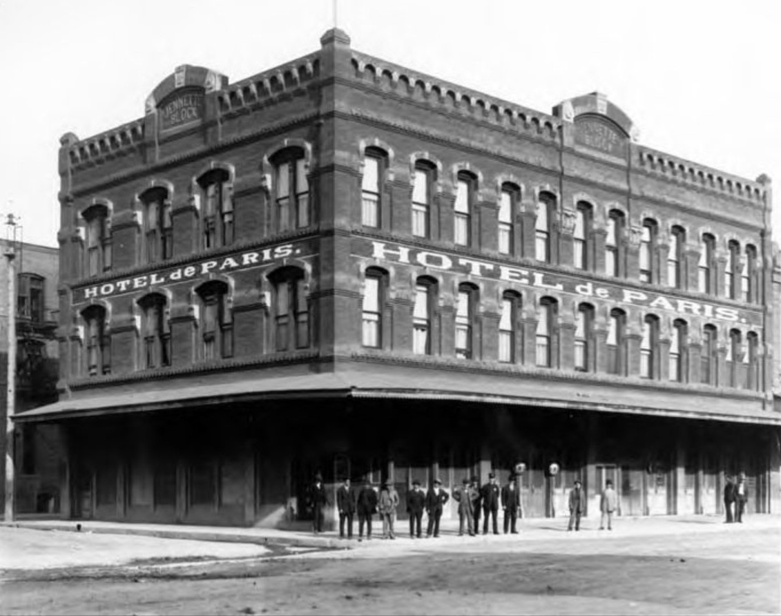 |
|
| (1890)* – A view of the northwest corner of Los Angeles and Arcadia Streets, where the Hotel de Paris was the primary occupant of the Jennette Block. |
Historical Notes The Jennette Block, constructed circa 1888, was a prominent three-story brick commercial building that quickly became a focal point of downtown Los Angeles. The Hotel de Paris, occupying its upper floors, served as a vital hub for French-owned businesses and travelers, making the Jennette Block a central gathering place for the city's French community. The building was part of the diverse urban fabric that defined early Los Angeles, where immigrant populations, including French, Chinese, and others, lived and worked in close proximity. The structure’s Italianate architectural style—with its arched windows, decorative cornice, and ground-floor canopy—was typical of the commercial buildings that shaped the growing city during its transition from a pueblo to a major metropolis. |
|
|
| (ca. 1895)* - Looking west on Aracadia Street toward Fort Hill from Los Angeles Street with the Jennette Block standing on the northwest corner. |
Historical Notes Aliso Street changed names to Arcadia Street west of Los Angeles Street. See map below. |
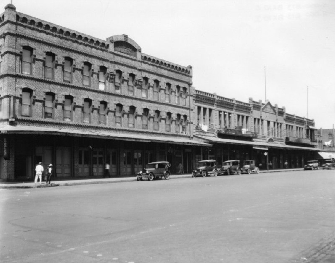 |
|
| (ca. 1925)* - On the left is the Jennette Block on the northwest corner of Arcadia and Los Angeles Streets, and on the right is the Garnier Building at 415 North Los Angeles Street. The construction of the #101 Freeway took away the Jennette Block and left the Garnier Building. The Jennette Block was built circa 1888 and the Garnier Building in 1890. |
Historical Notes By the mid-1920s, the Jennette Block was well-established as a cornerstone of Old Chinatown’s commercial district. The building’s tenants included the Hotel de Paris and a mix of shops, restaurants, and service businesses that catered to the multicultural community of the area. The Jennette Block was known for its lively street presence and its role in bridging various immigrant communities, including French, Chinese, and other downtown residents. The surrounding area reflected the cosmopolitan energy of Los Angeles at the time, filled with hotels, markets, and cultural landmarks. The 101 Freeway’s construction in the 1950s led to the demolition of the Jennette Block and significantly altered the street grid, erasing much of the neighborhood’s original character while the adjacent Garnier Building, though partially reduced, survived and remains an important remnant of the city's early history. |
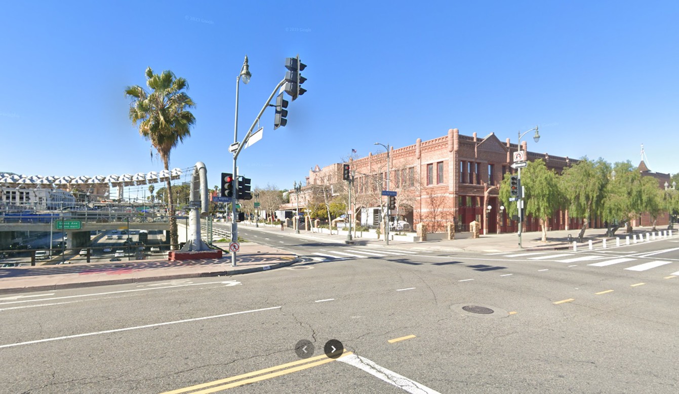 |
|
| (2023)* - Looking across Los Angeles Street toward the former site of the Jennette Block, now replaced by the overcrossing of the 101 Freeway and the realigned Arcadia Street, which now serves as a frontage road. The northern portion of the Garnier Building still stands on the northwest corner, a surviving piece of Los Angeles’ early Chinatown. |
Historical Notes The modern scene reflects the profound changes brought by mid-20th-century urban development. The site where the Jennette Block once stood is now dominated by the Hollywood Freeway overpass and a realigned Arcadia Street, now functioning as a freeway frontage road. This realignment and the freeway’s construction erased not only the Jennette Block but also a portion of Los Angeles’ original Chinatown. The northern part of the Garnier Building, visible in the image, remains as a rare survivor and now houses the Chinese American Museum within El Pueblo de Los Angeles Historical Monument. While the Jennette Block has vanished from the physical landscape, it endures through photographs and historical documentation as a symbol of the diverse immigrant communities that once thrived in the area. |
Then and Now
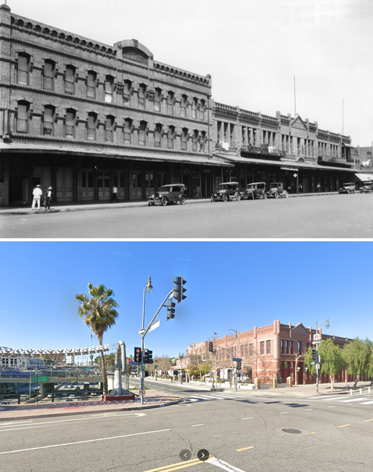 |
|
| (1925 vs. 2023)* – A ‘Then and Now’ Comparison of the Jennette Block and Garnier Building. Looking north across Los Angeles Street, the 1925 image shows the Jennette Block (left) on the northwest corner of Arcadia and Los Angeles Streets, with the Garnier Building (right) extending along Los Angeles Street. By 2023, the Jennette Block and the original stretch of Arcadia Street were removed to make way for the 101 Freeway. The street now visible is a realigned frontage road that retains the Arcadia Street name. The northern portion of the Garnier Building still stands today as part of El Pueblo de Los Angeles Historical Monument, serving as a rare remnant of the city’s early Chinatown. Photo comparison by Jack Feldman. |
Historical Notes This ‘Then and Now’ comparison captures the dramatic transformation of the area over nearly a century. The Jennette Block once played a vital role in the city’s commercial and cultural life, housing the Hotel de Paris and serving as a crossroads for French, Chinese, and other immigrant communities in Old Chinatown. The building’s demolition in the 1950s for the construction of the Hollywood Freeway not only erased a key architectural landmark but also disrupted the surrounding neighborhood and displaced much of the local community. The realigned Arcadia Street, now serving as a frontage road, bears little resemblance to the vibrant streetscape that once existed here. The Garnier Building’s survival offers a tangible link to the past, standing as a testament to the layered history of Los Angeles and the diverse communities that helped shape it. |
* * * * * |
Ferguson Alley
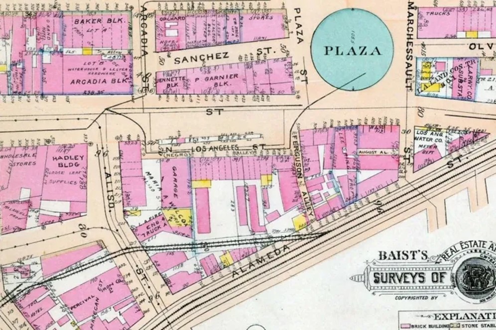 |
|
| (1921)* - This detail from a Baist’s Real Estate Atlas survey map shows the narrow Ferguson Alley running between Alameda Street, across from the southeast corner of the Plaza and where the remaining section of Calle de los Negros, shown as N. Los Angeles Street terminated. |
Historical Notes Ferguson Alley was a narrow thoroughfare in early Los Angeles, located in the city's first Chinatown near the Plaza area. Named after William Ferguson, the alley was a densely populated space that reflected the city's ethnic diversity, housing Chinese residents and businesses alongside other immigrant communities. On October 24, 1871, Ferguson Alley and the surrounding area became the site of one of the darkest events in Los Angeles history. A mob of approximately 500 white and Latino Americans attacked the Chinese community, resulting in the deaths of at least 17 Chinese residents. This massacre, one of the largest mass lynchings in U.S. history, began after a conflict between rival Chinese tongs led to the death of a white rancher. |
 |
|
| (1924)* - Aerial view of the Los Angeles Plaza and surrounding area showing the Ferguson Alley at center top. Annotated by Jack Feldman. |
Historical Notes Ferguson Alley was a narrow thoroughfare in early Los Angeles, named after William Ferguson, an Arkansas native who settled in the city in 1869. It was located near the Plaza, running between Los Angeles Street and Alameda Street. The alley was officially established around 1890, with Ferguson deeding it to the city in 1892. |
 |
|
| (1925)* - Looking at the east side of Los Angeles Street at its intersection with Fergusion Alley see on the left next to the two power poles. |
Historical Notes Old Chinatown, including Ferguson Alley, reached its peak between 1890 and 1910, expanding to about fifteen streets and alleys with around two hundred buildings. However, the area began to decline in the early 1910s due to several factors: negative public perception influenced by gambling houses and opium dens, tong warfare that deterred business, the status of residents as tenants rather than property owners, and the threat of redevelopment that led to neglect in building maintenance. These issues contributed to a downward spiral, with landlords increasingly disinterested in improving their properties and residents facing deteriorating conditions while remaining reluctant to leave. |
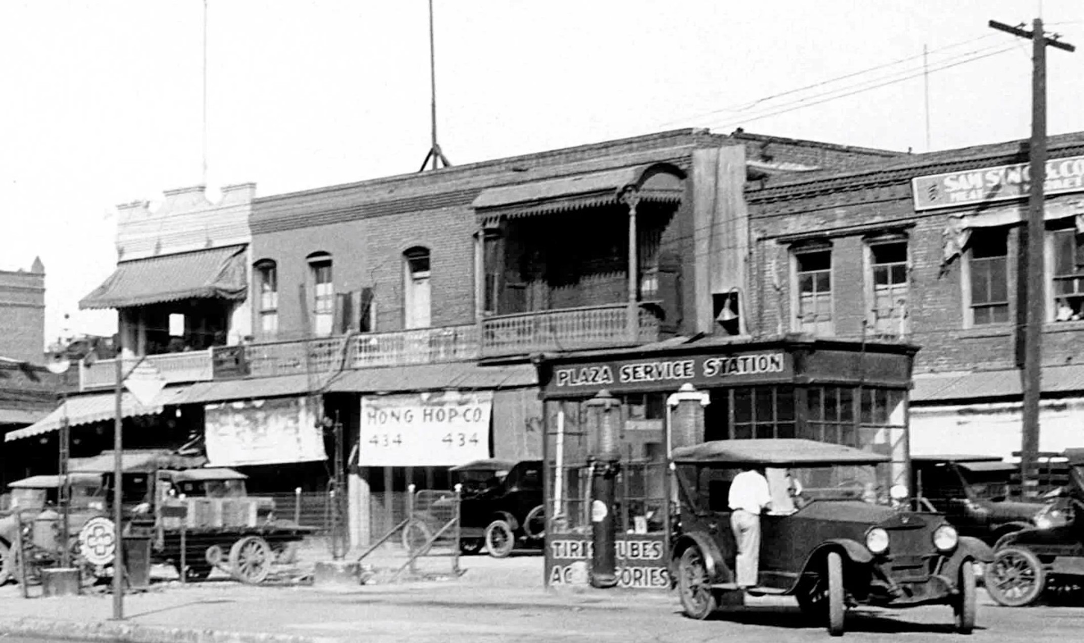 |
|
| (1925)* - The Plaza Service Station located on the east side of Los Angeles Street in old Chinatown with Ferguson Alley at the far left. This is a blow up view of the previous image. |
 |
|
| (1933)* - Looking east down Ferguson Alley from Los Angeles Street in old Chinatown. One-story brick buildings line the narrow alley at left, while two-story buildings can be seen at right. Most of the doorways have metal gates over the openings, suggesting that they are closed. A balcony can be seen on the second story of a building in the foreground at right. An automobile can be seen at left, near a sign that reads "Jerry's 'Where folks eat'". |
Historical Notes Jerry's Joynt was a restaurant located at 211 Ferguson Alley near the Plaza in Los Angeles' Old Chinatown during the early 1900s. It was considered one of the better dining establishments in the area, offering moderate prices and good food. The restaurant featured a jade lounge with carved woodwork and handsome figurines, making it an interesting spot to visit even for those not looking to dine. |
 |
|
| (1934)* – Sketch of Los Angeles Street and Ferguson Alley in Old Chinatown.. |
Historical Notes In the early 20th century, Ferguson Alley remained central to Chinatown's development, reflecting the area's resilience despite challenges like forced relocations due to Union Station's construction. |
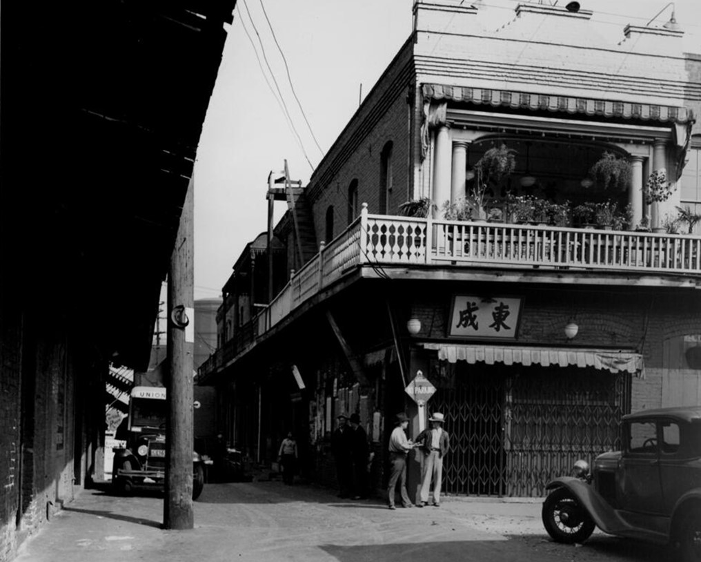 |
|
| (ca 1938)* - Close up view looking east on Ferguson Alley at Los Angeles Street in Chinatown. |
Historical Notes In the 1930s, plans for the construction of Union Station led to the gradual demolition of Old Chinatown. A remnant of the original Chinatown, including Ferguson Alley, persisted into the early 1950s. During this time, several businesses and a Buddhist temple lined Ferguson Alley, which was described as a narrow one-block street running between the Plaza and Alameda. |
 |
|
| (1938)* – Four children and two men pose for the camera in Old Chinatown at the entrance to Ferguson Alley with a sign for Jerry's Joynt on the wall in the background. |
Historical Notes Christine Sterling, known for her work on the Olvera Street and China City projects, advocated for the razing of all remaining structures between the Plaza and Union Station, including those along Ferguson Alley. This ultimately led to the complete demolition of the area, marking the end of Ferguson Alley's history near the LA Plaza. Today, the only remaining edifice from the original Chinatown is the two-story Garnier Building, which now houses the Chinese American Museum. |
 |
|
| (1948)* - Looking south on Los Angeles Street from the corner of Ferguson Alley toward City Hall with the Garnier Block seen across the street. Photo by Arnold Hylen. |
Historical Notes Today, no physical trace of Ferguson Alley remains. The only surviving edifice from the original Chinatown is the two-story Garnier Building, which now houses the Chinese American Museum. The demolition of Ferguson Alley and the surrounding area marked the end of Old Chinatown and paved the way for the modern urban landscape of downtown Los Angeles. |
Then and Now (Hybrid)
 |
|
| (1924 vs. 2024)* – A blended view of the Los Angeles Plaza and its surrounding area. Notice the 101 Freeway on the right and the on-ramp now occupying the former entrance to the historic Ferguson Alley. |
Then and Now
 |
|
| (1924 vs. 2024)* – Aerial view over the Los Angeles Plaza showcasing the dramatic transformation of Old Chinatown (upper half of the photo) over a century. The area is now home to Union Station and part of the 101 Freeway. Notably, the historic intersection of Ferguson Alley and Los Angeles Street has become the on-ramp to the Hollywood Freeway. Photo comparison by Jack Feldman. |
* * * * * |
LA Plaza
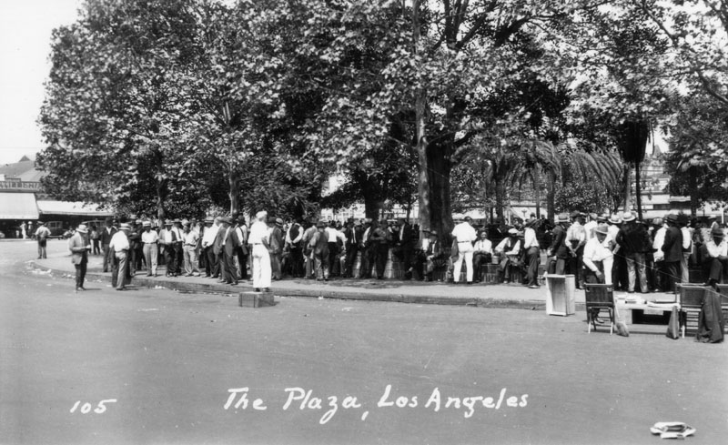 |
|
| (1930)** - A man stands on a soapbox in front of a crowd of men gathered at the Los Angeles Plaza. |
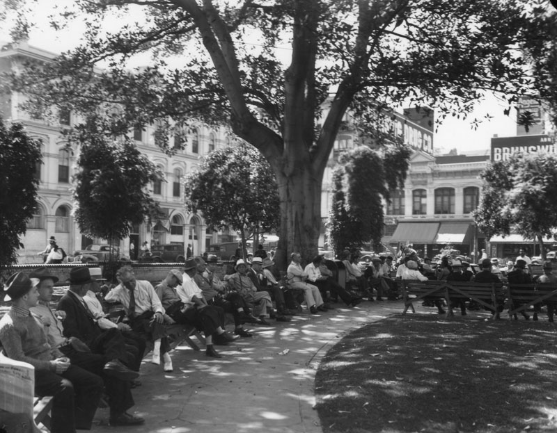 |
|
| (ca. 1930)** - People are seen sitting on benches and relaxing in the shade of a large rubber tree in the Plaza. To the left is seen the Pico House. |
.jpg) |
|
| (ca. 1930)* - Shoeshine in the LA Plaza with the Pico House seen in the background. |
* * * * * |
Avila Adobe
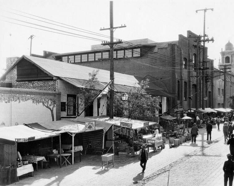 |
|
| (1932)* - View of the Avila Adobe house on Olvera Street, taken in 1932 - two years after Olvera Street was converted to a colorful Mexican marketplace - as made evident by the small vendor stands visible throughout. |
.jpg) |
|
| (1935)** - Avila Adobe as seen from a building across Olvera Street. In front of the house is a wooden cart, and a Mexican flag is by the entrance. It is located at 14-16-18 Olvera Street and was used by the Avila and Rimpau families. |
Historical Notes The Avila Adobe, presently the oldest existing residence within the city limits, was one of the first town houses to share street frontage in the new Pueblo de Los Angeles. The original structure was nearly twice as long as it is now, and was L-shaped with a wing that extended nearly to the center of Olvera Street, which was the town's plaza.** The Avila Adobe is listed on the National Register of Historic Places and is also listed as California State Landmark No. 145 (Click HERE to see more in California Historical Landmarks in LA.) |
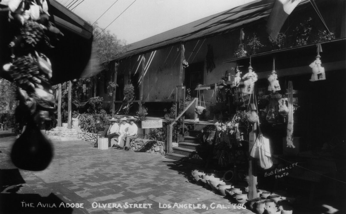 |
|
| (1930s)#+ – Postcard view showing the Avila Adobe on Olvera Street. |
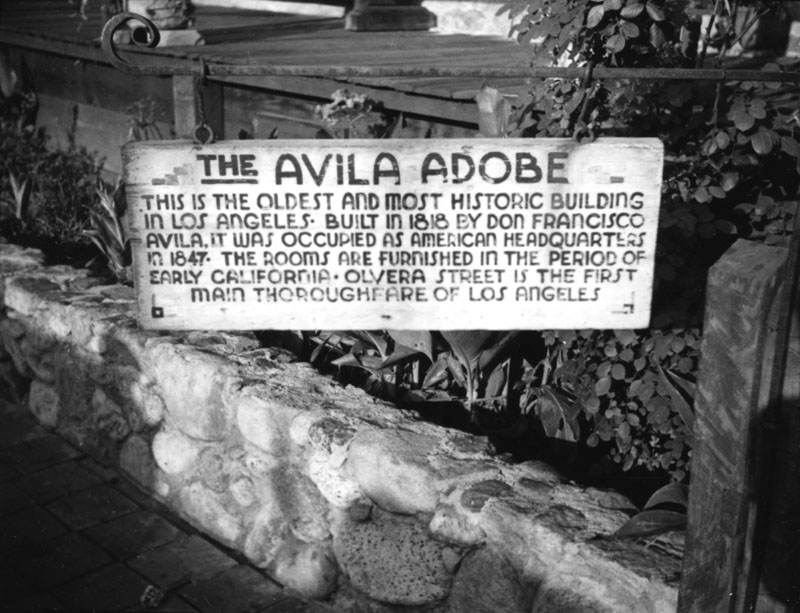 |
|
| (ca. 1935)**- View of the sign in front of the Avila Adobe, the oldest existing residence within the city limits. |
Historical Notes In 1847, this adobe became the temporary headquarters for Commodore Robert Field Stockton and General Stephen Watts Kearny during the American occupation of Los Angeles. At that time, it was the permanent home of Doña Maria Encarnación Avila - widow of Don Francisco Avila. When the townspeople got word that American troops were rapidly approaching the pueblo, many of them evacuated their homes to seek refuge at outlying ranchos. Doña Encarnación was among those that fled their adobes. At which point, Commodore Stockton's men seized the adobe for their commanding officer. When the Treaty of Cahuenga was signed a few days later, Stockton abandoned the adobe and Doña Maria Encarnación returned to her beloved home, where she remained until her death in 1855.** |
 |
|
| (1930s)** - View of the Avila Adobe house on Olvera Street, showing the rear of the home. Several windows and doorways are visible under the long, covered "corredor" (or porch); steps lead down to a lower area of the courtyard. |
Historical Notes The Avila Adobe consisted of a generous courtyard with covered porches for each of the garaging areas, stables, workshops, etc., as well as a garden and vineyard, which Don Francisco tended to regularly.** |
 |
|
| (ca. 1930s)** - An Avila Adobe room - possibly a sitting room or living room. The focal point of the room is a well-used and smoke-stained fireplace along the back wall; a wooden shelf rests along the length of the wall, displaying pots, pans, plates, and knick-knacks. Several different types and styles of chairs are located around the area, and a small table with a tablecloth is visible on the left. |
Historical Notes In 1953, the State of California acquired the Avila Adobe as part of El Pueblo de Los Angeles State Historic Park, and has been opened to tours since 1976.** |
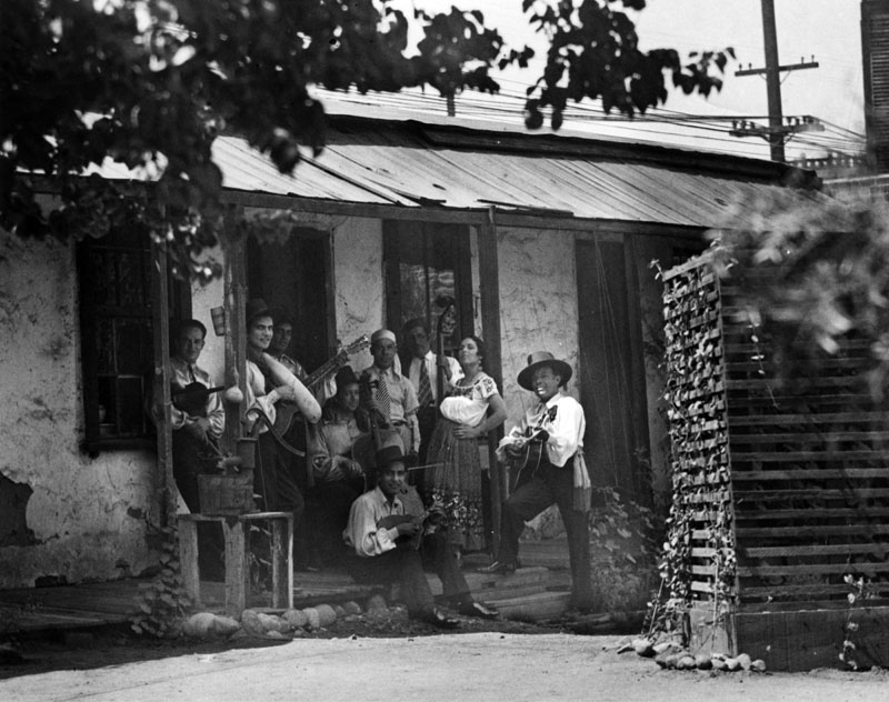 |
|
| (ca. 1930s)* - Group of musicians and dancers pose in the central courtyard of the Avila Adobe. |
Then and Now
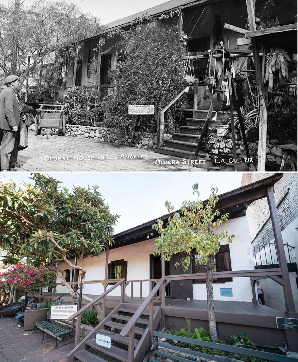 |
|
| (1948 vs. 2020)* - Avila Adobe, the oldest existing residence within the city limits. |
Historical Notes Avila adobe holds the record for being the oldest house in Los Angeles. It was built in 1818 by Francisco Avila. It's protected by the Los Angeles Plaza Historic District & California State Historic Park. The walls of the Avila Adobe are 2.5–3 feet thick and are built from sunbaked adobe bricks.* |
* * * * * |
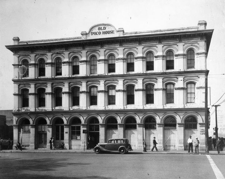 |
|
| (1934)** - The Pico House, sometimes called "Old Pico House", built by Pio Pico in 1869-70. Seen from across the street, "Old Pico House" is on top of the building, and at street level a sign for "Pico House Cafe" is painted on the right side corner of the building. There is an open door in the middle of the block and a closed door farther to the left. One car is parked in front and several people are standing or walking in the area. |
Historical Notes In 1868, Pío de Jesús Pico constructed the three story, 33-room hotel, Pico House (Casa de Pico) on the old plaza of Los Angeles, opposite today's Olvera Street. At the time of its opening in 1869, it was the most lavish hotel in Southern California. Even before 1900, however, it began a slow decline along with the surrounding neighborhood, as the business center moved further south. After decades of serving as a shabby flop house, it was deeded to the State of California in 1953, and is now a part of El Pueblo de Los Angeles State Historic Monument. It is used on occasion for exhibits and special events.^* |
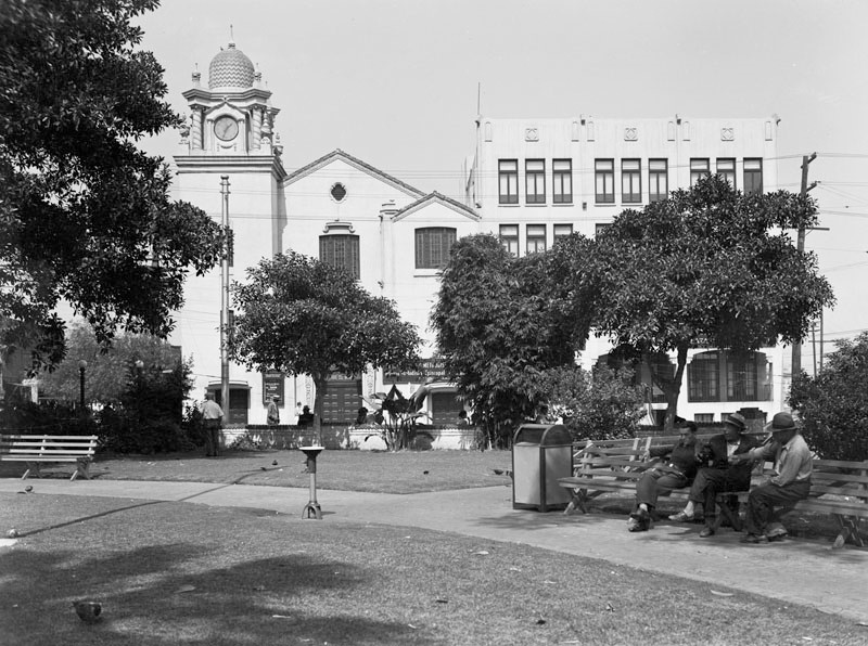 |
|
| (ca. 1935)** – View looking north showing the La Plaza (United) Methodist Church, Plaza Community Center, and the Methodist Headquarters Building, with a portion of the Plaza in the foreground. |
Historical Notes The Church is located on the site of the Tapia/Olvera adobe, which served as an early service building for the United Methodist Church mission in Los Angeles. The Methodist Church was also the founding agent in Southern California for Goodwill Industries. The adobe was torn down in 1917 and, nine years later, architects Train and Williams completed this Churrigeresque-style church. ^#^ |
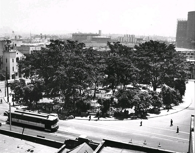 |
|
| (1936)^*# - View of the Plaza as seen from the roof of the Brunswig Building. The Plaza Methodist Church can be seen on the left, where once stood the Olvera Adobe. Several large gas storage tanks are in the background. |
|
|
| (1892)* - Identical view of the Plaza taken from the exact same spot as the previous photo but in 1892 (44 years earlier) with the Olvera Adobe on the left. |
Before and After
|
|
|
| (1892)* - View showing the LA Plaza with the Olvera Adobe at left background and Olvera Street adjacent to it. | (1936)^*# - View of the LA Plaza showing the Plaza Methodist Church at upper-left where the Olvera Adobe once stood. |
Historical Notes The Olvera Adobe was torn down in 1917 and, nine years later, architects Train and Williams completed the Churrigeresque-style Plaza Methodist Church. |
Old Plaza Church
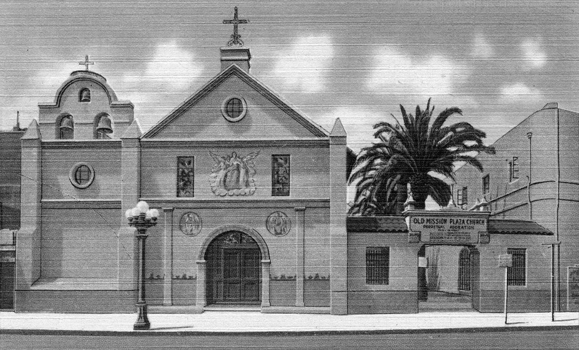 |
|
| (ca. 1930)##* – Postcard view of Our Lady, Queen of Angels, Old Mission Plaza Church. |
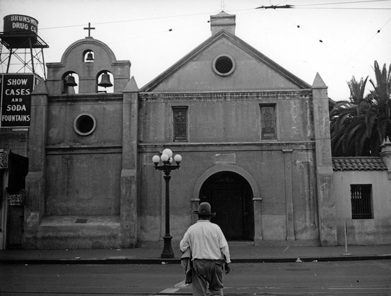 |
|
| (ca. 1937)** - A man is crossing Main Street directly outside of La Plaza Church. Signage on a water tower (upper left) promotes the nearby "Brunswig Drug Co." Photo by Herman J. Schultheis |
 |
|
| (1937)** - According to the sign above the awning "giant malts" and "coloso ice cream cones" can be found at this Mexican ice cream store. Located at 523 North Main Street, El Popo is seen next door to the bells and crosses of the Plaza Church. |
Felipe de Neve Statue
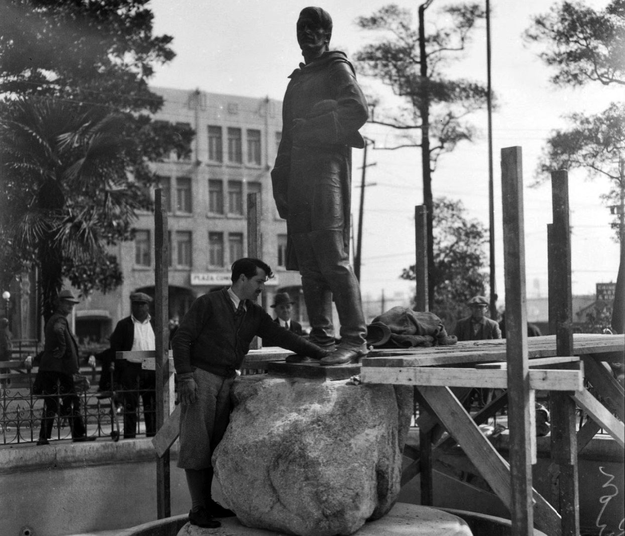 |
|
| (1932)* - Sculptor Henry Lion completing the installation of his statue of Felipe de Neve in La Plaza Park. LA Times / UCLA Image Archives |
Historical Notes Felipe de Neve (1724–1784) was the fourth governor of Las Californias, a province of New Spain, from 1775 to 1782. Neve is considered a founder of Los Angeles and helped to settle towns of Santa Barbara and San José whose surrounding communities became California cities. In 1781, Neve issued the first rules regarding governance of secular pueblos like Los Angeles, the "Regulations for the Government of the Province of the Californias" (Reglamento para el gobierno de la provincia de Californias).^ Sculptor Henry Lion was born in Fresno, California. He studied at the Otis Art Institute and with Stanton Macdonald-Wright. Most of his works were executed in bronze. Lion wrote the book SCULPTURE FOR BEGINNERS, and worked on the WPA art project. |
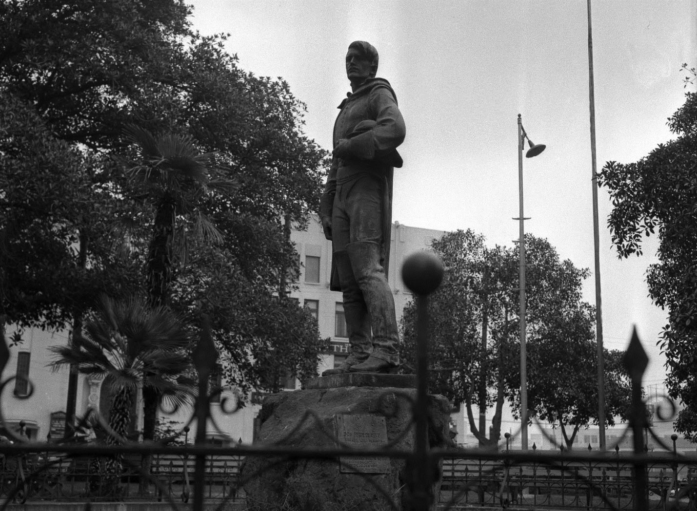 |
|
| (1932)* – Close-up view of the statue of Don Felipe de Neve shortly after being placed in the pool at center of the Plaza. LA Times / UCLA Digital Archives |
Historical Notes In 1932, the 7 foot high statue of De Neve was set in the 1873 pool at the center of the Plaza facing the Plaza Church. The statue was donated by the Daughters of the Golden West. |
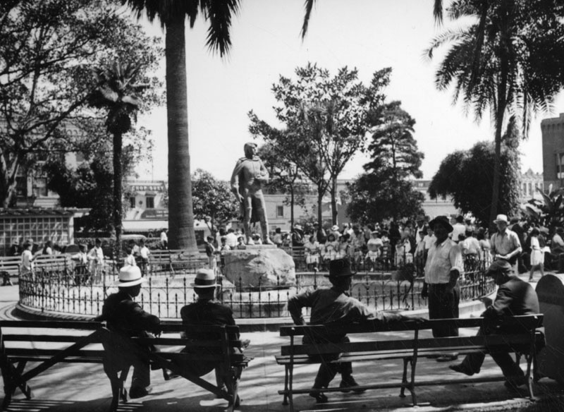 |
|
| (ca. 1937)** - Felipe de Neve statue at the center of the Los Angeles Plaza Park |
Historical Notes The inscription on the statue reads: "Felipe de Neve (1728-84). Governor of California 1775-82. In 1781, on orders from King Carlos III of Spain, Felipe de Neve selected a site near the River Porciuncula and laid out the town of El Pueblo de La Reina de Los Angeles, one of two pueblos he founded in Alta California." |
* * * * * |
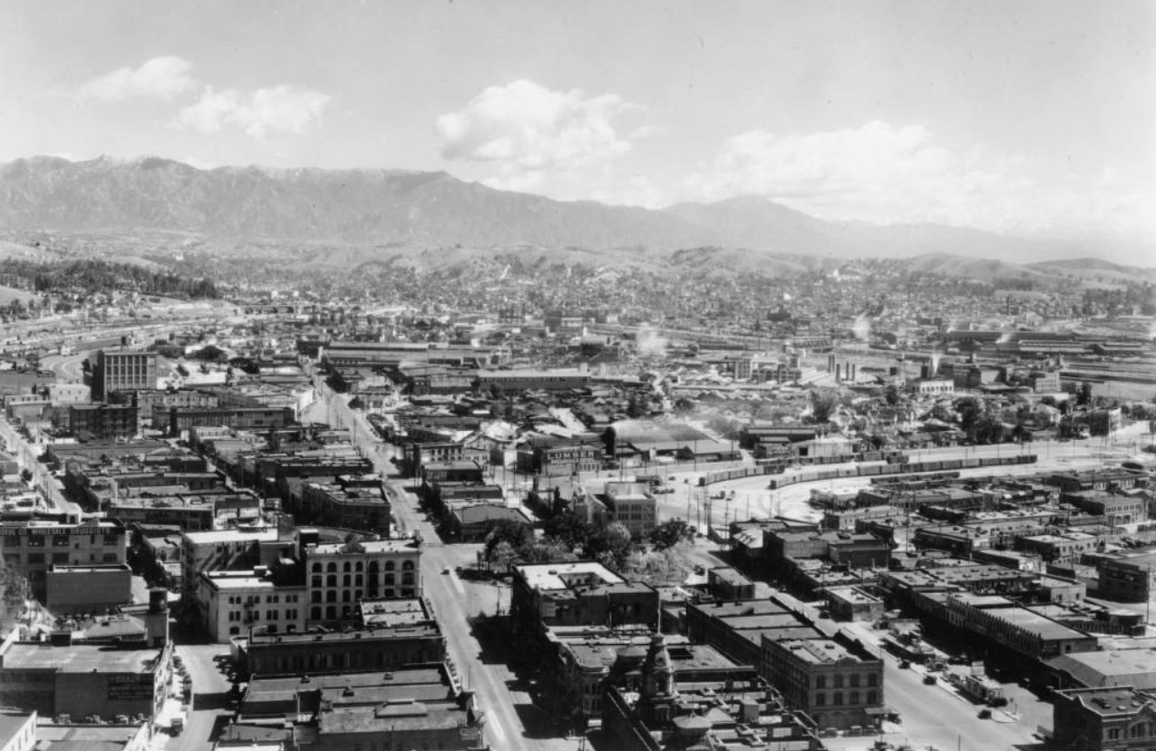 |
|
| (ca. 1930)*** – View of the proposed site for Union Station construction. This is one of the oldest areas in the City, with the Los Angeles Plaza at center and Chinatown at lower right. Main Street is seen at lower center running towards the background. Baker Block is at lower center-right. |
Historical Notes In 1926, a measure was placed on the ballot giving Los Angeles voters the choice between the construction of a vast network of elevated railways or the construction of a much smaller Union Station to consolidate different railroad terminals. The election would take on racial connotations and become a defining moment in the development of Los Angeles. The proposed Union Station was located in the heart of what was Los Angeles' original Chinatown. Reflecting the prejudice of the era, the conservative Los Angeles Times, a lead opponent of elevated railways, argued in editorials that Union Station would not be built in the “midst of Chinatown” but rather would “forever do away with Chinatown and its environs.” Voters approved demolishing much of Chinatown to build Union Station by a narrow 51 to 48 percent.^* |
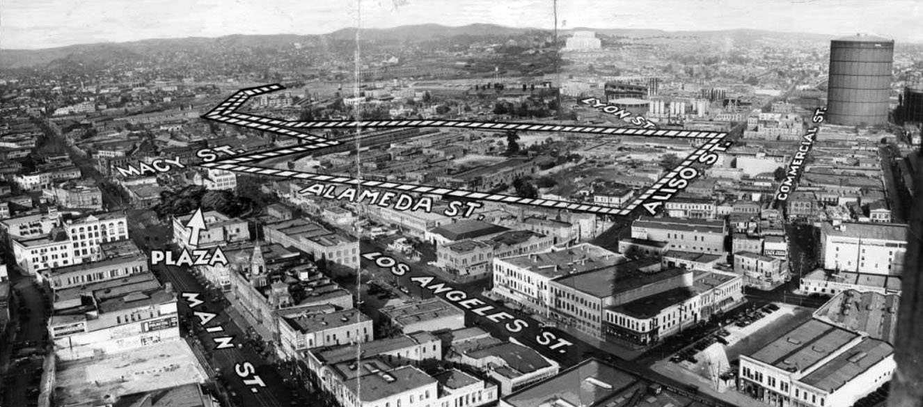 |
|
| (1933)*** - Panoramic view showing the Los Angeles Plaza (arrow) and surrounding area including most of Chinatown. The photo has been annotated to delineate the boundaries of the proposed new Union Station. |
Historical Notes The above photo comes from the September 18, 1933 issue of the Los Angeles Herald Examiner. The article reads: "Chinatown faces extinction in Los Angeles with erection of the new Union Station on the Plaza site. The area enclosed by broken line will be occupied with tracks and the station. It includes most of Chinatown. Upper left hand line shows where trains enter station area from Southern Pacific bridge over Los Angeles River." *** |
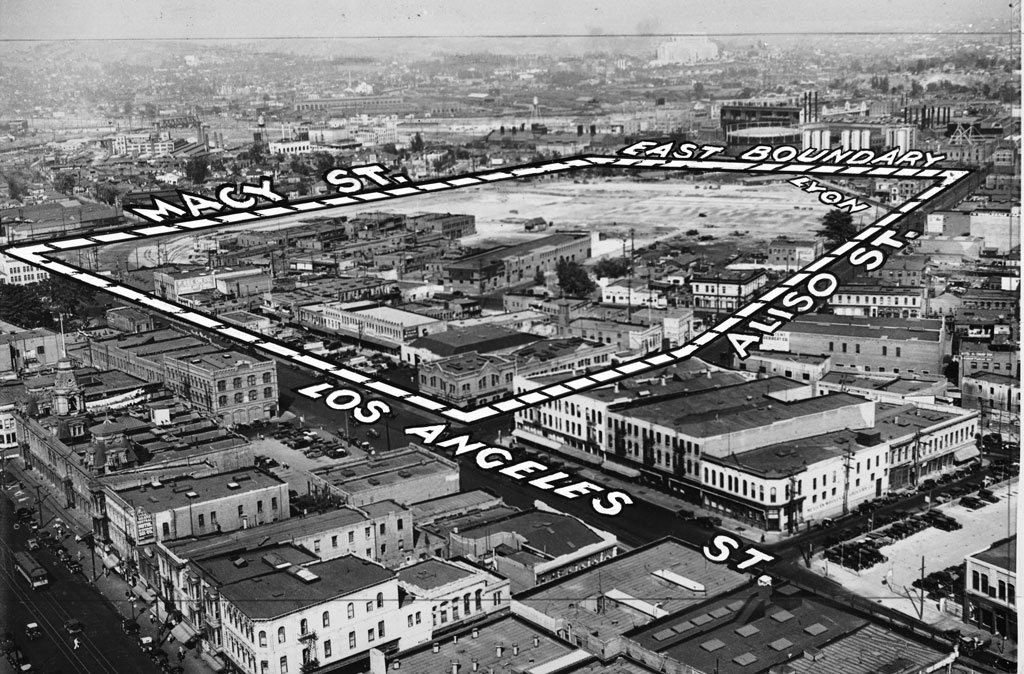 |
|
| (1934)*** - Caption reads: “Site of new Union Terminal (enclosed by lines), where dirt to be removed from Fort Moore Hill will be used for filling in. This great depot will serve all steam railroads entering Los Angeles. Chinatown is seen in foreground of station site." The Los Angeles Plaza can be seen at left-center. The old Baker Block is still standing (lower-left). |
Historical Notes The ornate three-story Baker Block was completed in 1878 by Colonel Robert S. Baker. For a number of years, the building housed offices, shops, and apartments. Goodwill Industries of Southern California purchased it in 1919. Despite plans to relocate the structure for another purpose, the city purchased the Baker Block from Goodwill in 1941 and demolished the building a year later. U.S. Route 101 now runs beneath where these buildings once stood.^ Click HERE to see more in Early LA Buildings (1800s). |
.jpg) |
|
| (1935)*** - View looking west across Lyon Street near its intersection with Aliso Street. The Union Station construction site is seen at center. Ridges in the area are fills, where tracks will be laid. In center, under construction, is the pedestrian tunnel to the tracks. The LA Plaza is at upper-left. Photo Date: August 19, 1935 |
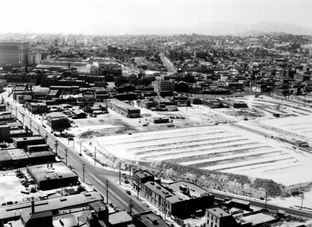 |
|
| (1935)*** - Panoramic view of the construction of Union Station looking northwest from the top of the Los Angeles Gas and Electric tank, August 27, 1935. The site of the terminal is at right and is a trapezoidal area full of graded dirt. The LA Plaza can be seen in the upper-center left. The Hall of Justice Building stands in the upper left. |
Historical Notes By the early 1950s, the section of the 101 Freeway (Hollywood Freeway) that runs through downtown would go right through where Aliso Street is shown above, running diagonally away from bottom center of photo. |
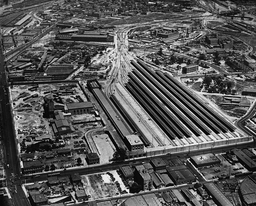 |
|
| (1938)*** - View looking north toward Union Station, still under construction. The main road going along the left side of the photo is Alameda Street. Aliso Street is at the southern end of the station near where the Hollywood Freeway is located today. The LA Plaza is out of view at left-center. |
Historical Notes When Union Station was opened in May 1939, it consolidated remaining service from its predecessors La Grande Station and Central Station. It was built on a grand scale and became known as "Last of the Great Railway Stations" built in the United States.^* |
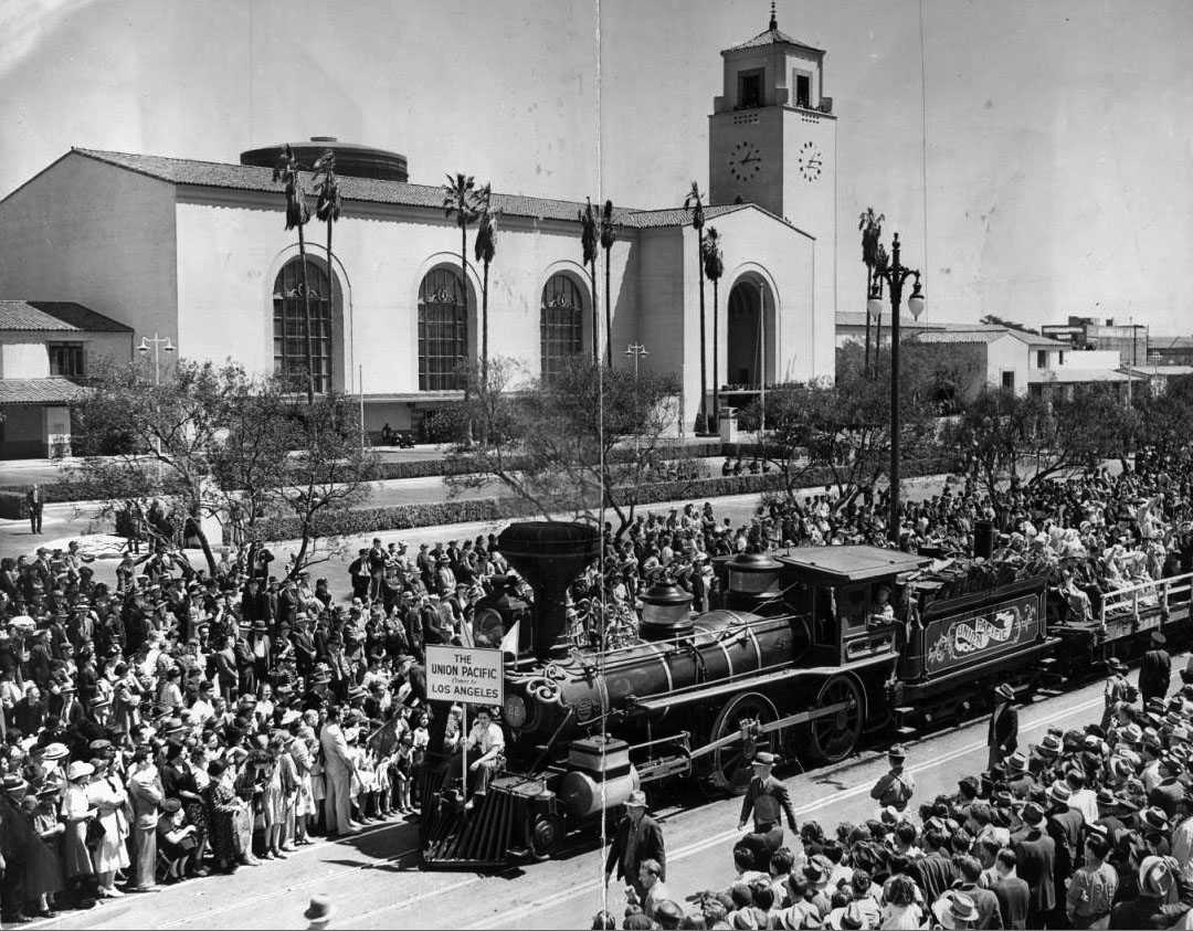 |
|
| (1939)*** - Crowds watch early model train while celebrating completion of the new Union Station located at 800 N. Alameda Street. |
Historical Notes Examiner clipping attached to verso, dated May 4, 1939: "Stirring awake memories that had slumbered for more than a century, railroad officials yesterday staged a colorful pageant of transportation that thrilled thousands of Angelenos for two hours. Gayly costumed ladies of the Gay Nineties -- and the years before -- rode stage coaches and horse cars and stuttering, slow-moving trains of another era. Derby-hatted, mustachioed gentlemen in tight coats pumped high-wheeled bicycles -- 'bone-crushers' they were known as in those days -- all to celebrate formal opening of the new Union Station, pictured in background as oldest Union Pacific train approaches the city's newest in beautiful architecture." *** |
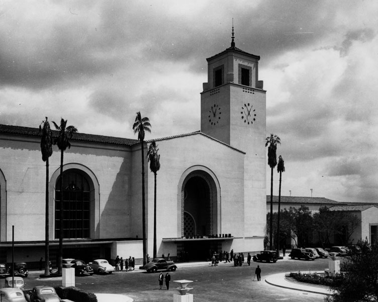 |
|
| (1940)** - Exterior view of Los Angeles Union Station, showing several palm trees, arched windows, and the large tower and clock. |
Historical Notes Union Station was placed on the National Register of Historic Places in 1980. It also is listed as Los Angeles Historic-Cultural Monument No. 101. Click HERE to see more on the Los Angeles Union Station. |
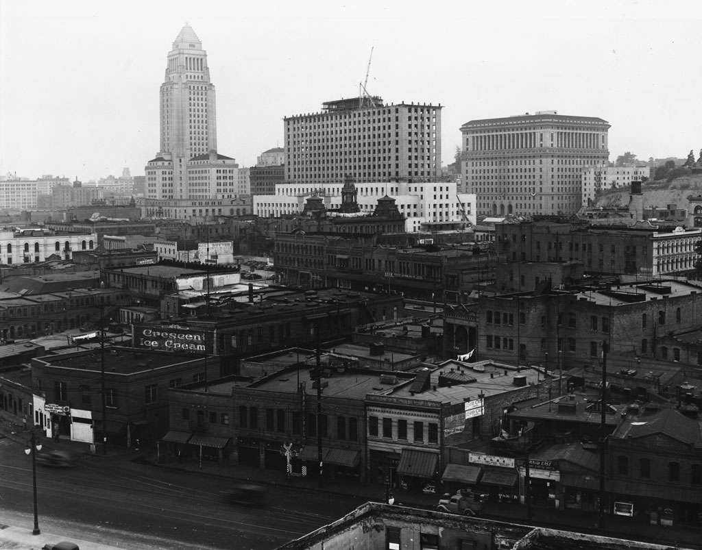 |
|
| (ca. 1938)*** - View of downtown looking southwest from where Union Station sits today. The new Federal Courthouse Building is under construction as seen between City Hall and the Hall of Justice. Alameda Street is in the foreground. The old Baker Block with its distinctive three towers still stands at the center of photo. |
Historical Notes The area in the extreme foreground is now Union Station. The street in front is Alameda Street, and those buildings ahead of Alameda were knocked down and are now landscaping and on ramps to the 101 Hollywood/Santa Ana Freeway. Old Chinatown started being demolished around 1933, and Union Station opened in 1939.^*# To the right-center of the photo is the Pico House in front of the LA Plaza which is out of view to the right. The old 1877-built Baker Block with it's distinctive three towers can be seen in the center of the photo just below the Federal Courthouse Building. The Baker Block would be demoished in 1942 to make room for the 101 Freeway. Click HERE to see more on the Baker Block. |
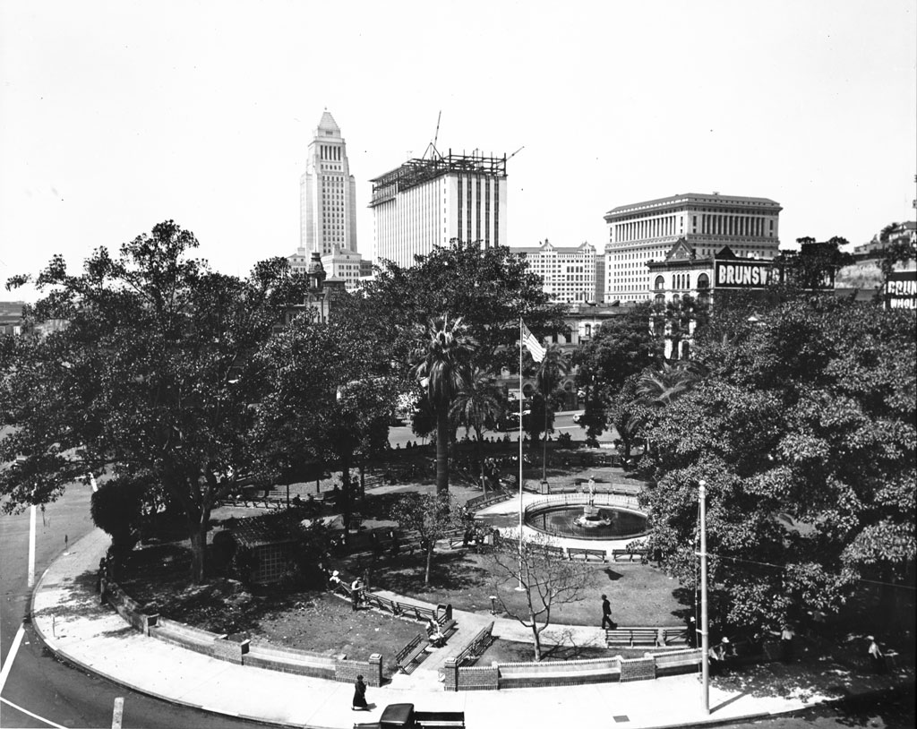 |
|
| (1939)^*# - View of the Plaza with the LA downtown skyline in the background. From left to right stand City Hall, the Federal Courthouse still under construction (completed in 1940), the Hall of Records, and the Hall of Justice. The old Brunswig Building can also be seen on the other side of the LA Plaza across from the Pico House. |
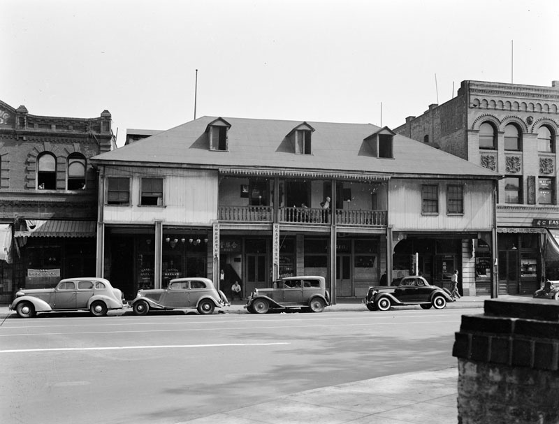 |
|
| (1939)* - Exterior front view of the two-story Vincent Lugo Adobe house, located on Los Angeles Street and facing the Plaza. It is now flanked by brick buildings, with cars parked on the street in front. |
* * * * * |
Marchessault and Los Angeles Street
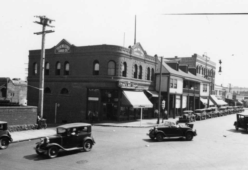 |
|
| (1930s) – Looking at the SE corner of Los Angeles and Marchessault streets showing Ying's Art Shop located in Fook Wo Lung Curio Company building. To its right is the old Vincent Lugo Adobe house. |
Historical Notes Marchessault Street was located along the north side of the historic Los Angeles Plaza. It was named after Damien Marchessault, a French-born two-time mayor of the city who later died by suicide. |
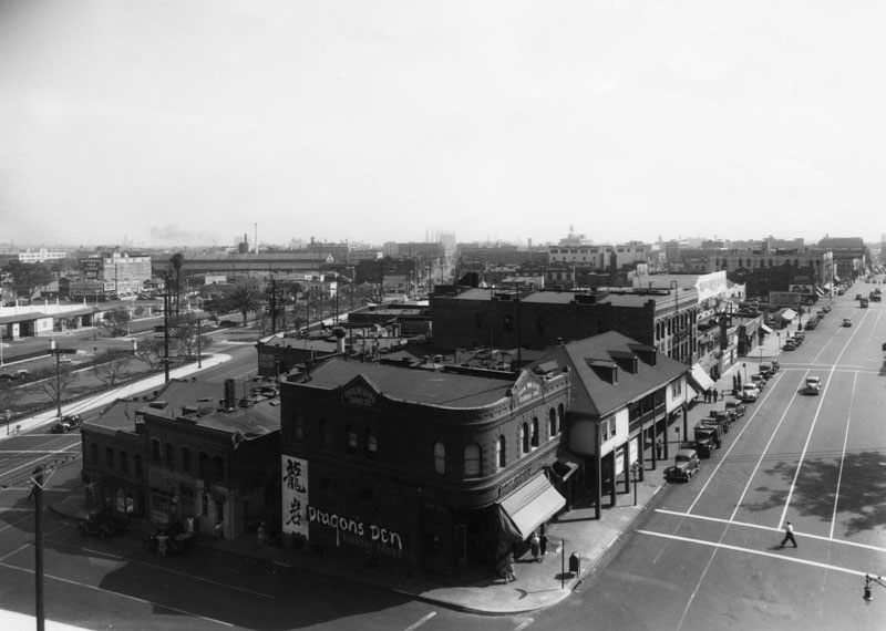 |
|
| (ca. 1939)** - View of Chinatown, looking south on Los Angeles and Marchessault streets. The Dragon's Den, a Chinese food restaurant, is in the Fook Wo Lung Curio Company building at the corner of the block. |
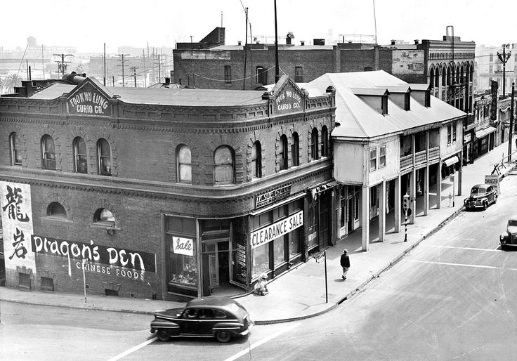 |
|
| (1949)*^# - View of the southeast corner of Marchessault and Los Angeles St. The old two-story Vincent Lugo Adobe house can be seen with its hipped roof and dormer window. It sits directly across the street from the LA Plaza. The brick building on the corner is the Fook Wo Lung Curio Company building. The painted sign on its side reads: Dragon's Den Chinese Food. |
Historical Notes In 1935, Eddy See opened the Dragon's Den Restaurant in the basement of the F. Suie One Company. On the exposed brick of the basement walls, Benji Okubo, Tyrus Wong and Marian Blanchard painted murals of the Eight Immortals and a dancing dragon. An arty crowd, including Walt Disney and the Marx Brothers, came to see the murals and sample the "authentic fare." In an era when Chinese restaurants were known as chop-suey joints, Dragon's Den served egg foo young, fried shrimp and almond duck. Non-Chinese diners during the Great Depression considered these "exotic" dishes. |
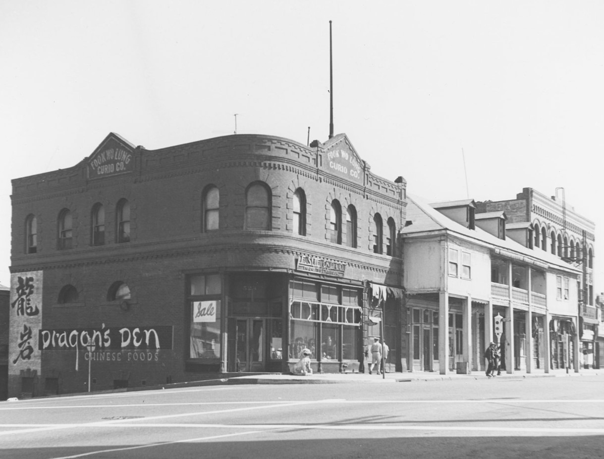 |
|
| (1950)* - View of Fook Wo Lung Curio Company building, containing the Dragon's Den Chinese Foods, SE corner of Alameda and Marchessault streets. |
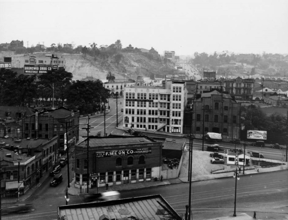 |
|
| (ca. 1939)* - View looking up Marchessault Street (with Alameda Street crossing at bottom and Los Angeles Street crossing at mid distance) shows the LA Plaza. The old Water Department Building, now occupied by the F. See On Company, stands on the northwest corner of Marchessault and Alameda. |
Historical Notes In 1939, the first home of the Department of Water and Power was sold to the City to make way for the Civic Center development planned in connection with the new Union Passenger Depot. Located at the corner of Marchessault and Alameda Streets, directly across from the almost completed railroad station, the property was the main office of the municipal water works when the City bought out the private water companies operating here until 1902. |
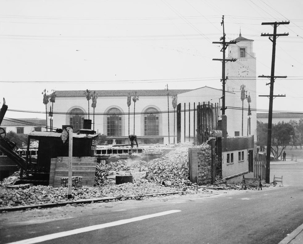 |
|
| (1939)* - View looking toward Union Station from the SE corner of Marchessault and Los Angeles streets. Photo caption reads: "Another Landmark Gives Way to Progress -- Photo shows wrecking yesterday of first home of the Department of Water and Power, recently purchased by the City, to make a wide approach by way of Marchessault Street to the new Union Station. With work being rushed, thousands of persons will occupy the site of this landmark on May 3, when the celebration's parade passes on Alameda Street. The old building was the main office of the municipal water works when the City bought out the private water companies operation here until 1902." |
Historical Notes Click HERE to see more in Water Department's Original Office Building. |
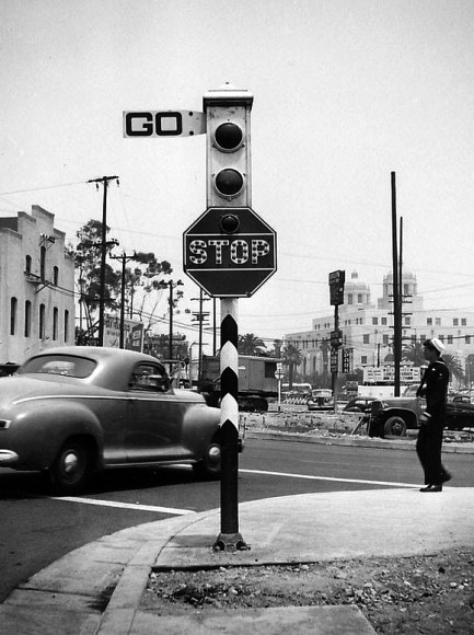 |
|
| (ca. 1942)* – View looking toward the Terminal Annex Building showing an Acme Semaphore Traffic Signal standing on the southeast corner of Marchessault and Los Angeles streets. To the left is the eastern face of the Plaza Substation building. Seen on the right is a sailor in uniform about to cross Los Angeles Street, heading toward the Plaza. Behind him, on the other side of the street, is where the old Water Department Building once stood. |
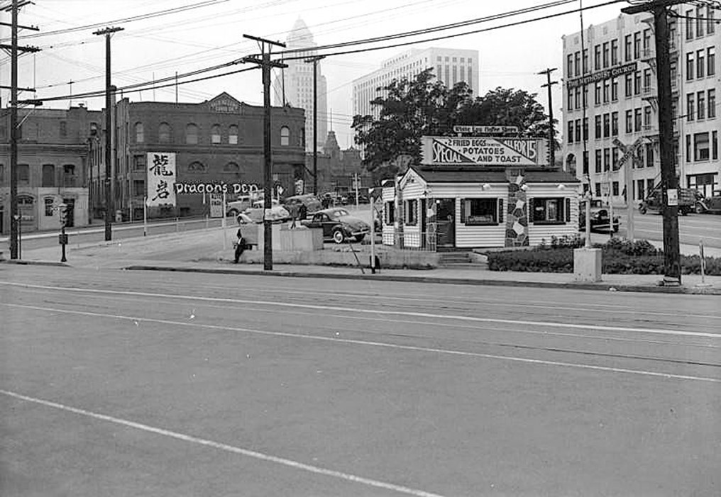 |
|
| (1943)* – Looking SW towards the LA Plaza and the Civic Center from N. Alameda, north of where it crosses Marchessault Street(left). Union Station is behind the camera. Seen here are Tyrus Wong's Dragon's Den Chinese Foods Restaurant (part of Old Chinatown), a glimpse of the Baker Block on Main Street, City Hall, the U.S. Post Office and Courthouse, the headquarters of the Southern California-Arizona Conference of the Methodist Church (in what later became the Biscailuz Building), and a White Log Coffee Shop. |
Historical Notes Today, Los Angeles Street curves sharply to the right into Alameda Street where Marchessault Street once existed. |
 |
|
| (2021)* - Looking SW toward the LA Plaza and the Civic Center from Alameda Street and Los Angeles Street (originally where Marchessault Street intersected with Alameda Street. Union Station is behind the camera. |
Historical Notes Los Angeles Street now curves sharply to the right into Alameda Street where Marchessault Street once existed. |
Then and Now
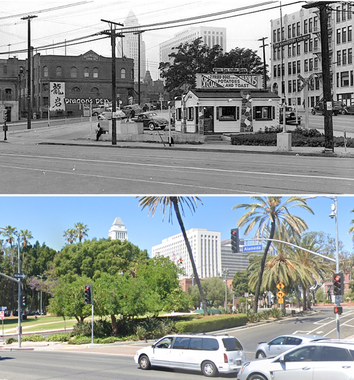 |
|
| (1943 vs 2021)* - Looking SW toward the LA Plaza and the Civic Center from Alameda Street and Los Angeles Street (originally where Marchessault Street intersected with Alameda Street. Union Station is behind the camera. |
Then and Now
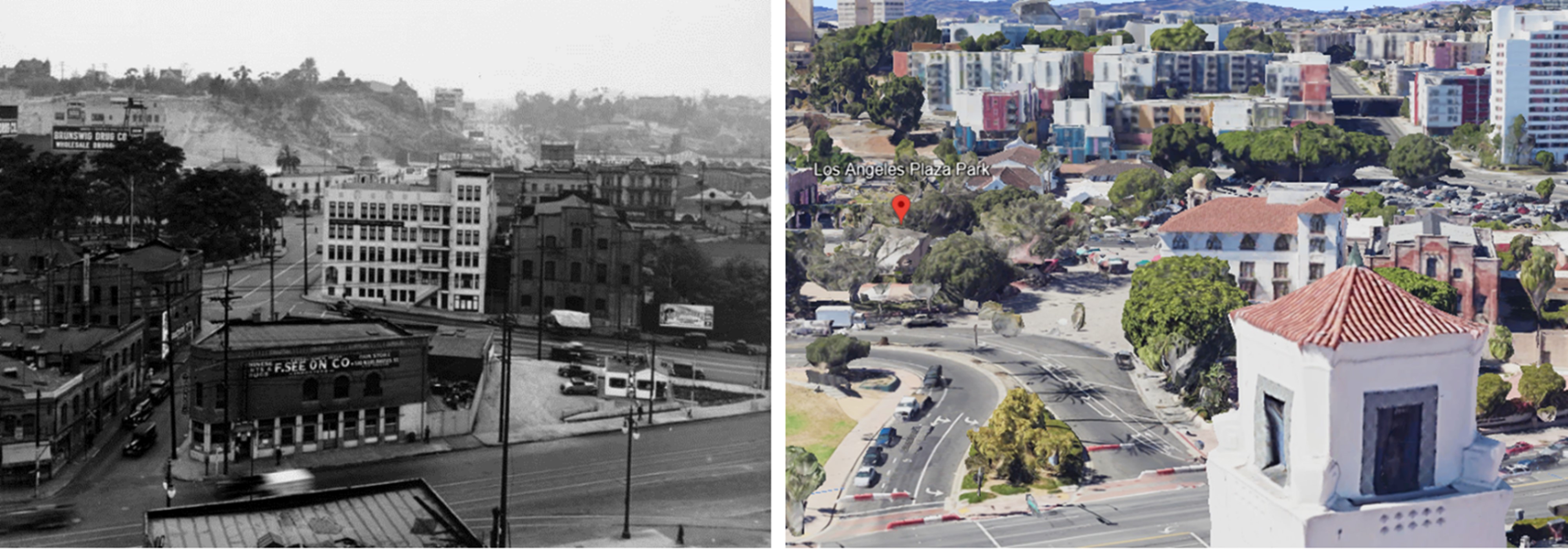 |
|
| (1939 vs 2022)* - Looking SW toward the LA Plaza from Alameda Street and Los Angeles Street (originally where Marchessault Street intersected with Alameda Street. Union Station is behind the camera. |
Then and Now
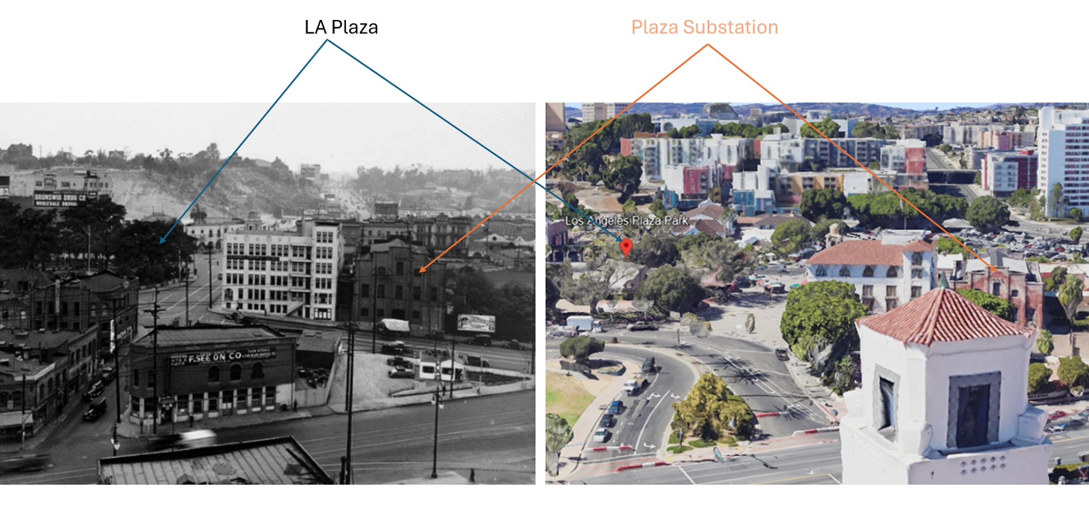 |
|
| (1939 vs 2022)* - Looking SW toward the LA Plaza from Alameda Street and Los Angeles Street (originally where Marchessault Street intersected with Alameda Street. Union Station is behind the camera. The LA Plaza and Plaza Substation are highlighted to get a better perspective. |
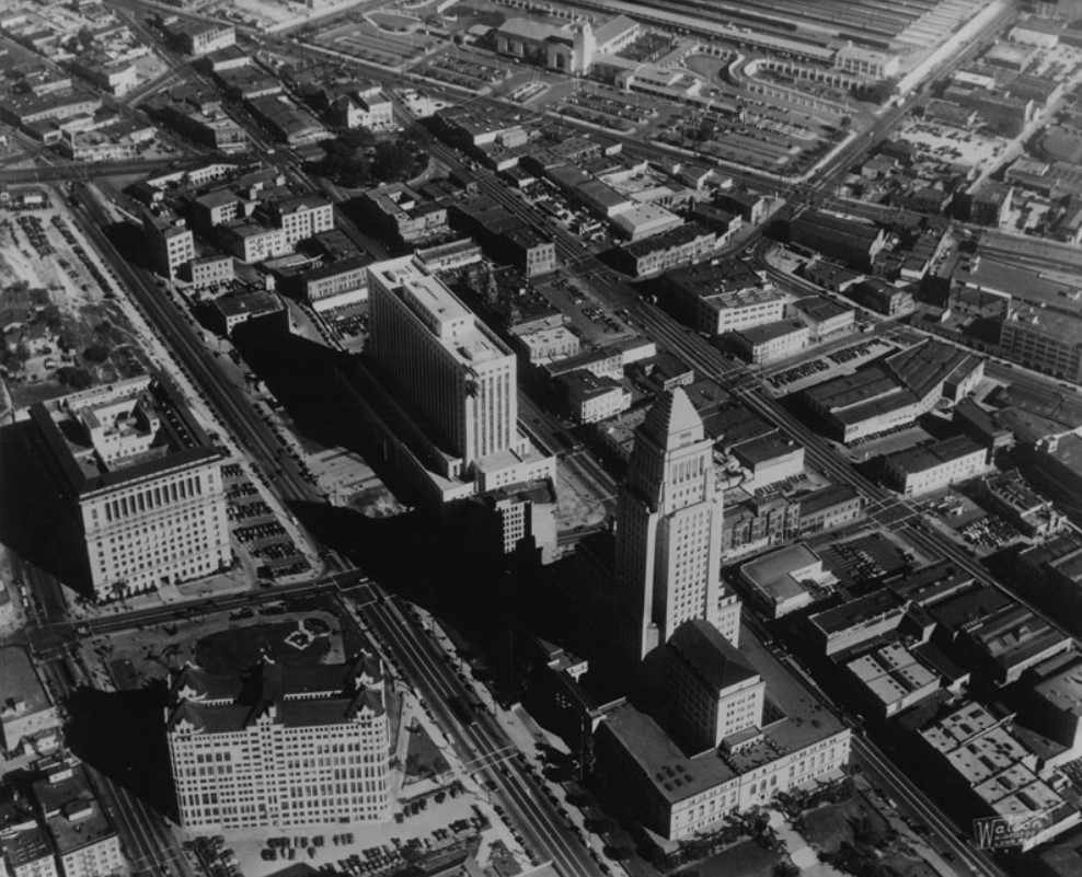 |
|
| (ca. 1940)* - Aerial view of the Civic Center, Union Station and the LA Plaza. The Plaza is in the upper center-left of photo. The flattened lot of the where the old Water Department building once stood can be seen just to the northeast of the Plaza. |
* * * * * |
Marchessault and Alameda Street |
At Alameda and Marchessault Streets, Los Angeles once had a very different face. This intersection sat within the city’s original Chinatown near the Plaza, where Chinese immigrants built businesses, institutions, and daily life within a district shaped by segregation and exclusion.
|
Life in Old Chinatown |
.jpg) |
|
| (ca. 1900)* – View looking east on Marchessault Street at Alameda Street in Los Angeles’ original Chinatown. |
Historical Notes Los Angeles’ original Chinatown grew near the Plaza in the late 1800s. Segregation and discrimination shaped where Chinese residents could live and work. The district supported stores, restaurants, laundries, herbal medicine shops, and family associations that provided mutual aid and social support. At its peak, Old Chinatown housed several thousand residents and workers within a compact area. |
 |
|
| (ca. 1900)* – A man crosses the unpaved Alameda Street at Marchessault Street, with a horse-drawn wagon seen behind him. Note the wooden plank at the lower left, placed for crossing the gutter. |
Historical Notes Street scenes like this show how active and crowded the district was. Community life centered on work, family ties, and tradition. Chinese New Year brought music, food, and celebration. Temples and associations helped residents support one another in a city where anti Chinese laws and attitudes were common. |
Where It Was |
 |
|
| (1920s)* - Map of early Los Angeles showing the Plaza just west of Alameda Street. Old Chinatown lies east of Alameda. The Alameda and Marchessault intersection is near the center. Union Station later replaced much of this area. |
Historical Notes Old Chinatown occupied land that later became Union Station and its rail yards. When the city pursued a central passenger terminal, the neighborhood was condemned and cleared. New Chinatown opened in 1938 a short distance northwest through Chinese American leadership and investment. Damien Marchesseault served several terms as mayor of Los Angeles and also worked as the city zanjero overseeing the water system. Marchessault Street was named in his honor. |
 |
|
| (1924)* - Aerial view of the Plaza area. The intersection of Alameda and Marchessault appears at the upper left. |
Historical Notes This aerial shows how close Old Chinatown was to the Plaza. In the mid 1920s Los Angeles debated rail solutions. Voters approved a union station concept and later selected the Plaza area site by a narrow margin. The decision placed the station directly over the Chinatown district. |
The Decision and Its Impact |
 |
|
| (1935)* - Looking northeast from the City Hall tower as Old Chinatown disappears and Union Station construction advances. |
Historical Notes By the mid 1930s demolition and evictions were under way and Old Chinatown was disappearing. Families and businesses had little time to relocate. After the clearances began, two nearby districts developed. China City opened in 1938 as a themed project. New Chinatown opened in 1938 as a Chinese American planned and owned district. |
Union Station Rises |
 |
|
| (1937)* - The shadow of City Hall falls across the steel framework of the new Union Station. |
Historical Notes Union Station rose where homes and shops once stood. City leaders promoted it as modernization. For former residents it marked the loss of their neighborhood. Community leaders worked to establish New Chinatown nearby. |
 |
|
| (1938)* - Looking east on Marchessault Street from Alameda Street with Union Station’s clock tower rising in the background. |
Historical Notes This view shows the overlap between the old street grid and the new station project. Construction replaced the neighborhood block by block. |
 |
|
| (1938)* - Looking toward City Hall from the southeast corner of Alameda and Marchessault where the Tuey Far Low Cafe stands. |
Historical Notes Tuey Far Low was a well known restaurant in Old Chinatown and later operated in New Chinatown on Gin Ling Way. It served as a social center and hosted meetings tied to planning New Chinatown. |
Then and Now (Alameda and Marchessault) |
These comparisons show how completely this part of Los Angeles changed in a short time. Streets, homes, and businesses of Old Chinatown gave way to rail yards, Union Station, and later freeways. The images help connect today’s landscape with what once stood here. |
 |
|
| (1924 vs. 2024)* - Aerial view of the Plaza area showing the former location of Alameda and Marchessault. Photo comparison by Jack Feldman. |
| Historical Notes
This comparison helps place Old Chinatown within the modern city. The rail terminal and its approaches replaced most of the neighborhood. Later transit projects uncovered artifacts that revealed details of daily life in Old Chinatown. |
 |
|
| (2024)* - Looking east toward Union Station and its clock tower from Alameda Street. |
Historical Notes Union Station opened in 1939 and became the city’s main rail hub. Its construction required clearing Old Chinatown. Today the station is both a transportation center and a reminder of the neighborhood that once stood here. |
Then and Now
 |
|
| (1900 vs. 2024)* – View looking east at Alameda and Marchessault, now the entrance to Union Station. Photo comparison by Jack Feldman. |
Historical Notes This is the most direct before and after. A small scale immigrant business district gave way to the gateway of a major rail station. The change happened within a few decades. |
Then and Now
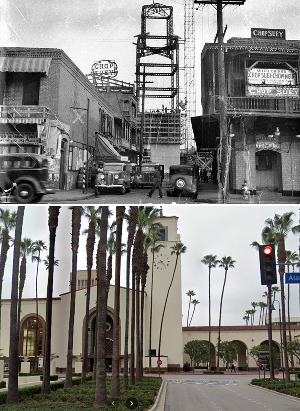 |
|
| (1937 vs 2021)* - View looking east along former Marchessault Street, now the Union Station entry. Photo comparison by Jack Feldman. |
| Historical Notes
Marchessault Street once ran through a dense neighborhood of homes and shops. The street was later absorbed into the station grounds and surrounding roadways. |
Then and Now
 |
|
| (1939 vs 2022)* - Looking west near the former line of Marchessault Street where Los Angeles Street meets Alameda. |
| Historical Notes
This view helps orient the former Chinatown street grid within today’s street pattern. Most of the earlier blocks no longer exist in their original form. |
Then and Now - Transformation of Old Chinatown into Union Station |
These images capture a turning point in Los Angeles history. A working neighborhood was cleared and replaced by a grand transportation hub. The comparison helps connect the lives once lived here with the landscape we see today. |
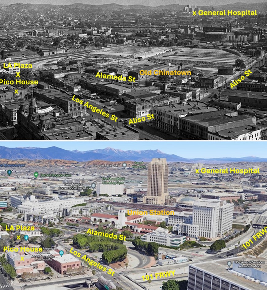 |
|
| (1935 vs. 2023)* – View toward Union Station from near City Hall showing the former site of Old Chinatown. Photo comparison by Jack Feldman. |
Historical Notes This wide view shows several layers of change. Old Chinatown was cleared for Union Station. Later freeway construction reshaped the area again. Each project changed both the landscape and the communities connected to it. |
* * * * * |
Plaza Church |
By the 1940s, the Plaza Church stood as one of the oldest and most recognizable landmarks in Los Angeles. While the city around it was modernizing with new roads, rail lines, and civic buildings, the church remained a visible link to the city’s Spanish and Mexican roots. Its simple adobe form and bell wall connected visitors to the earliest days of the pueblo.During this period, the Plaza area was no longer the city’s center of activity, yet it remained a gathering place for longtime residents and immigrant communities. The Plaza Church continued to serve both religious and cultural roles, anchoring a historic district that was beginning to be valued for its past as much as its present. |
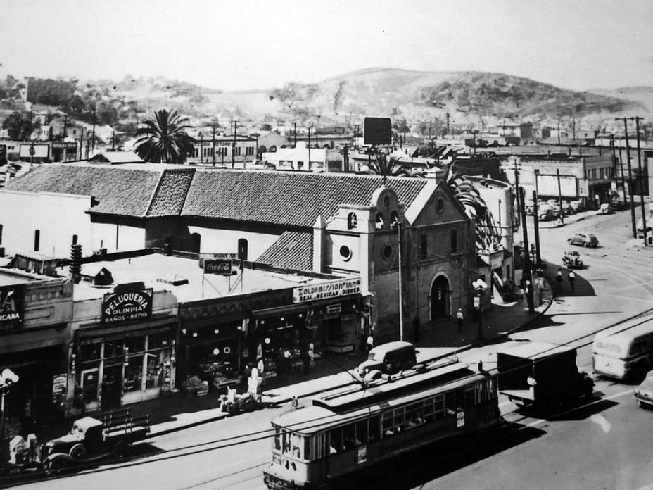 |
|
| (ca. 1941)* - View of the Plaza Church from the roof of the Pico House with N. Spring Street at the right and the Villa Cabrini orphanage (grounds of the J.W. Robinson Mansion) upper left. Clear shot of the Bozanni Motors building (former PE terminal) at N Broadway and Sunset Boulevard. |
Historical Notes In the 1940s, the Old Plaza Church, officially known as La Iglesia de Nuestra Señora la Reina de los Ángeles, was a significant landmark in Los Angeles, reflecting the city's rich history. Originally founded in 1814 and rebuilt in 1861, the church featured a distinctive bell wall and three historic bells. By this time, however, the surrounding area had transformed dramatically; the construction of the 101 freeway created a barrier between the old Plaza and the modern civic center, while the Plaza itself had shifted from being the city's social hub to a neighborhood primarily inhabited by immigrants, including those from Sonoratown and Chinatown. Despite these changes, the Old Plaza Church remained a vital cultural center and a symbol of Los Angeles' Spanish and Mexican heritage, standing as one of the city's oldest buildings amidst a rapidly evolving urban landscape. |
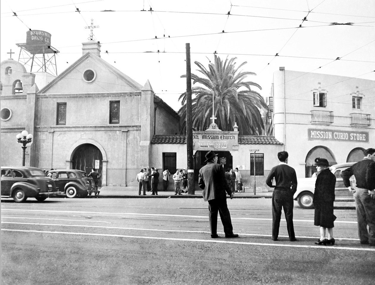 |
|
| (ca. 1945) - People stand by the tracks as they wait for the next streetcar with the Old Plaza Church seen across the street. The Mission Curio Store (souvenir shop) is on the right. Photo courtesy of Roy Koch in honor of his father (also Roy Koch) who took this picture shortly after WWII. |
Then and Now
 |
|
| (1945 vs. 2015)* – Looking across Main Street toward the Plaza Church from the Los Angeles Plaza. |
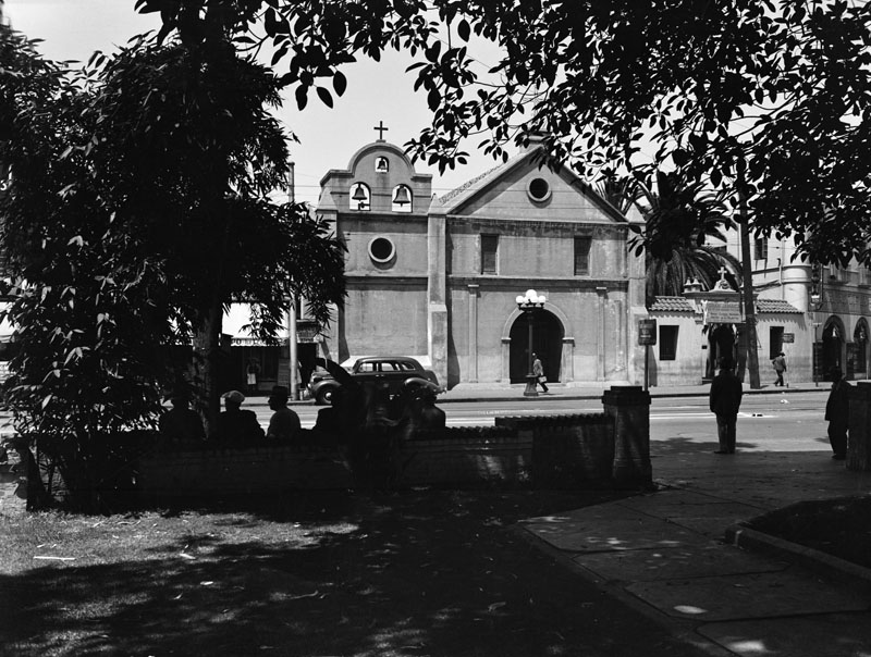 |
|
| (1940s)* - View showing the main facade of the "Old Plaza Church" as seen from the Plaza. |
Historical Notes The older part of the building is seen here with the three bells; the church was expanded and the plaza was added much later, which includes a hall and rectory. It was dedicated as California Historic Landmark No. 144. |
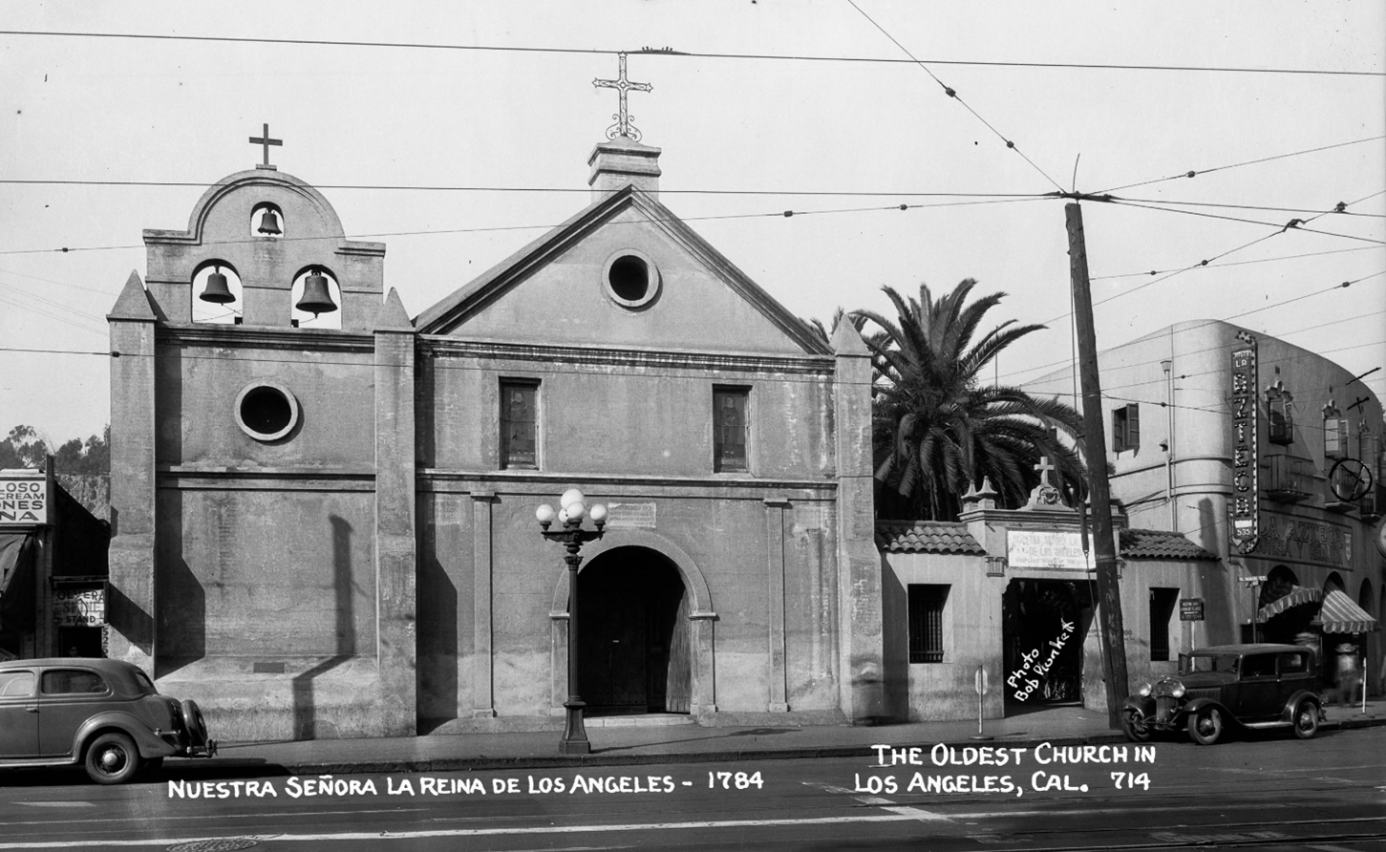 |
|
| (1940s)* - Image of the Plaza Church, also known as Our Lady Queen of the Angels or La Iglesia Nuestra Señora de los Angeles, on North Main Street. Photo by Bob Plunkett from the Ernest Marquez Collection. |
Historical Notes This 1940s photograph captures the historic Plaza Church (Nuestra Señora la Reina de Los Ángeles), founded in 1784 and considered the oldest church in Los Angeles. Located on North Main Street near the Los Angeles Plaza, the church's adobe structure and three-bell façade reflect its Spanish colonial roots. Visible to the right is the Azteca Theater, a popular venue for Spanish-language films that served the local Mexican-American community. Streetcar wires and vintage automobiles hint at the era’s urban rhythm. Though much around it has changed, the church remains an enduring landmark within the El Pueblo de Los Ángeles Historical Monument. |
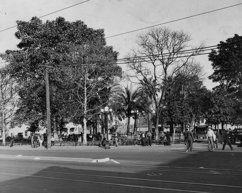 |
|
| (1940)* - View from of the Plaza as seen from the Old Plaza Church. Note the streetcar tracks. |
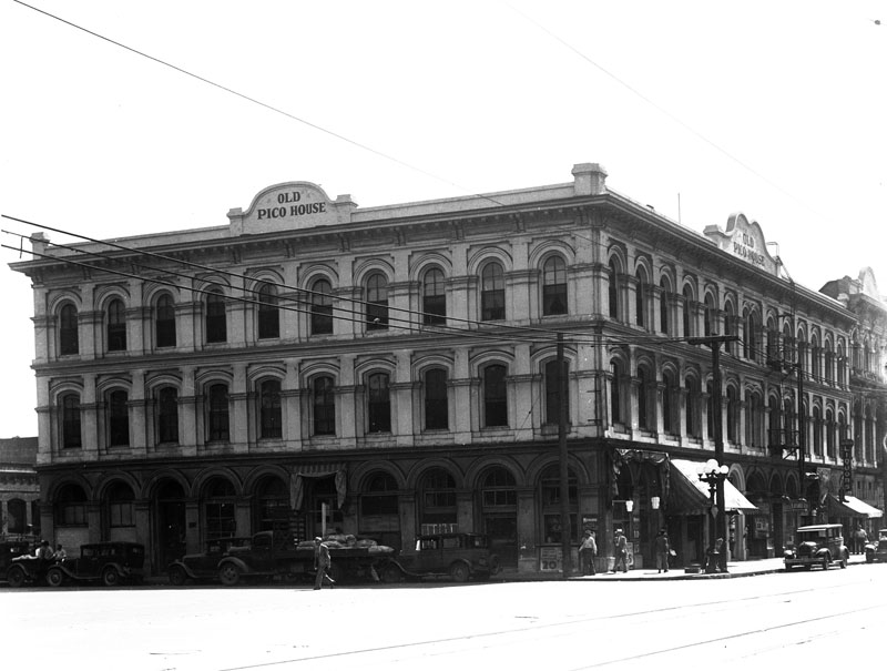 |
|
| (1939)** - Exterior corner view of the Pico House, the hotel facing the Plaza. At the time it was called the Old Pico House. It was built by Pio Pico. Photo dated: May 4, 1939. |
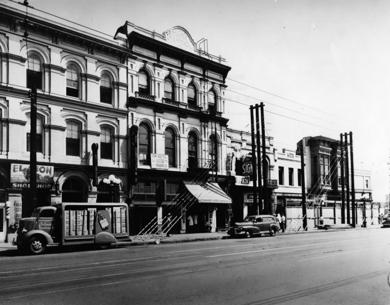 |
|
| (ca. 1945)* - Exterior view of front of the Merced Theater and businesses to the left and right down the street. Signs can be seen for a barber shop, a shoe shop, the Tom Hotel and others. To the left of the Merced is a portion of the Old Pico House. |
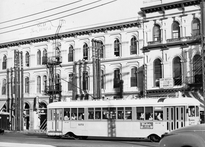 |
|
| (ca. 1940s)* - The Old Pico House exterior with an electric bus seen in front. |
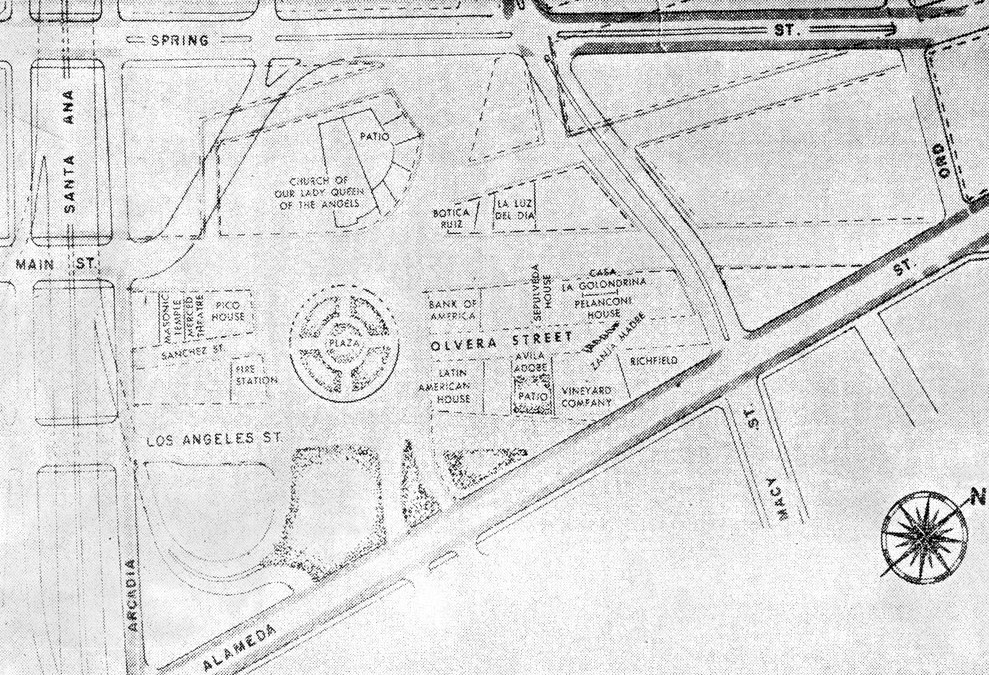 |
|
| (ca. 1940s)^* - MASTER PLAN – Ultimate street pattern and the boundaries for Pueblo de Los Angeles are portrayed in this drawing. Eleven square blocks on all sides of the Old Plaza have been made “sacred and inviolate.” |
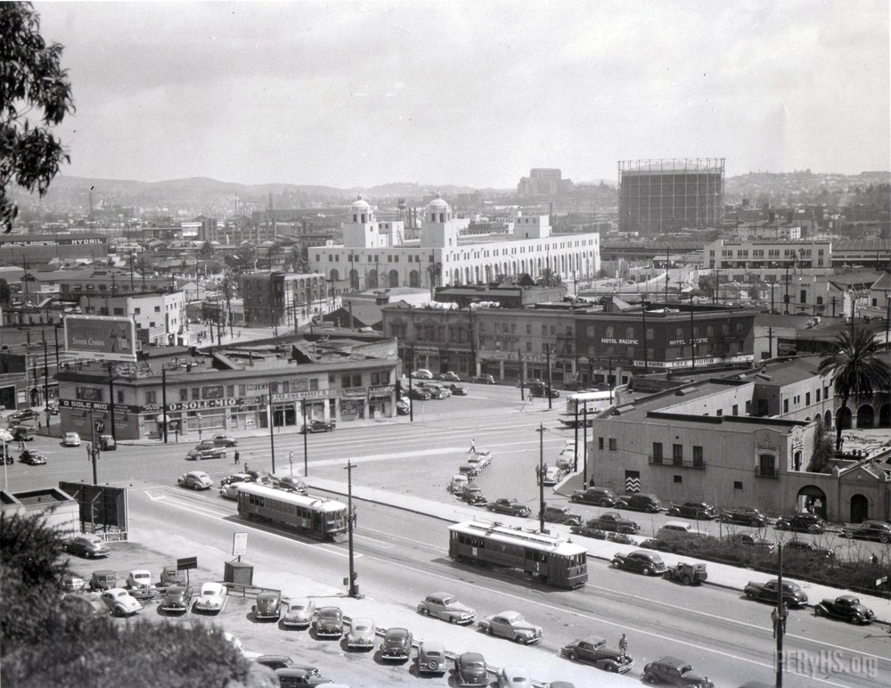 |
|
| (1940s)* – Panoramic View looking northeast showing a pair of LARy streetcars passing one another near the intersection of Spring and Sunset with the back of the Old Plaza Church at right and the Plaza further back (out of view). The Terminal Annex building with its twin towers looms in the distance. |
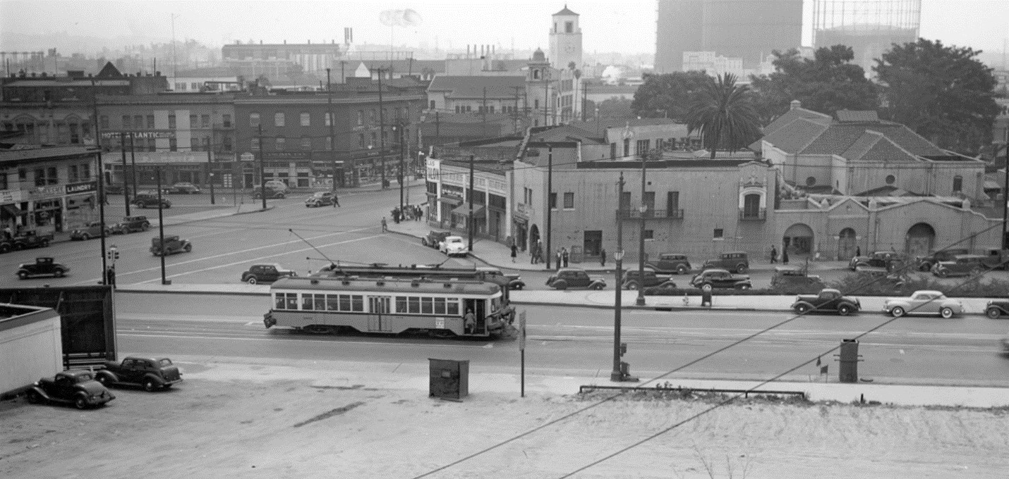 |
|
| (1940s)#*** – Panoramic view looking east at the intersection of Sunset and Spring with two LARy streetcars (side-by-side) in the foreground. The Union Station tower can be seen at top-center of photo. The back of the Old Plaza Church is at right with the Los Angeles Plaza (cluster of trees) directly behind it. |
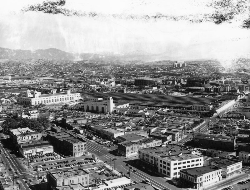 |
|
| (ca. 1940s)* - Aerial view showing the Plaza and surrounding area before construction of the Hollywood Freeway. The new Union Station is in the center of the photo. A parking lot exists now where the Baker Block once stood. |
Historical Notes Union Station opened in May, 1939. The Hollywood Freeway would not be constructed until 1950. |
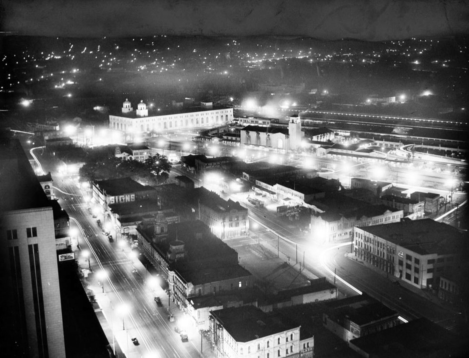 |
|
| (1941)*** - Night view of the L.A. Plaza, Union Station, and Terminal Annex Post Office as seen from City Hall. |
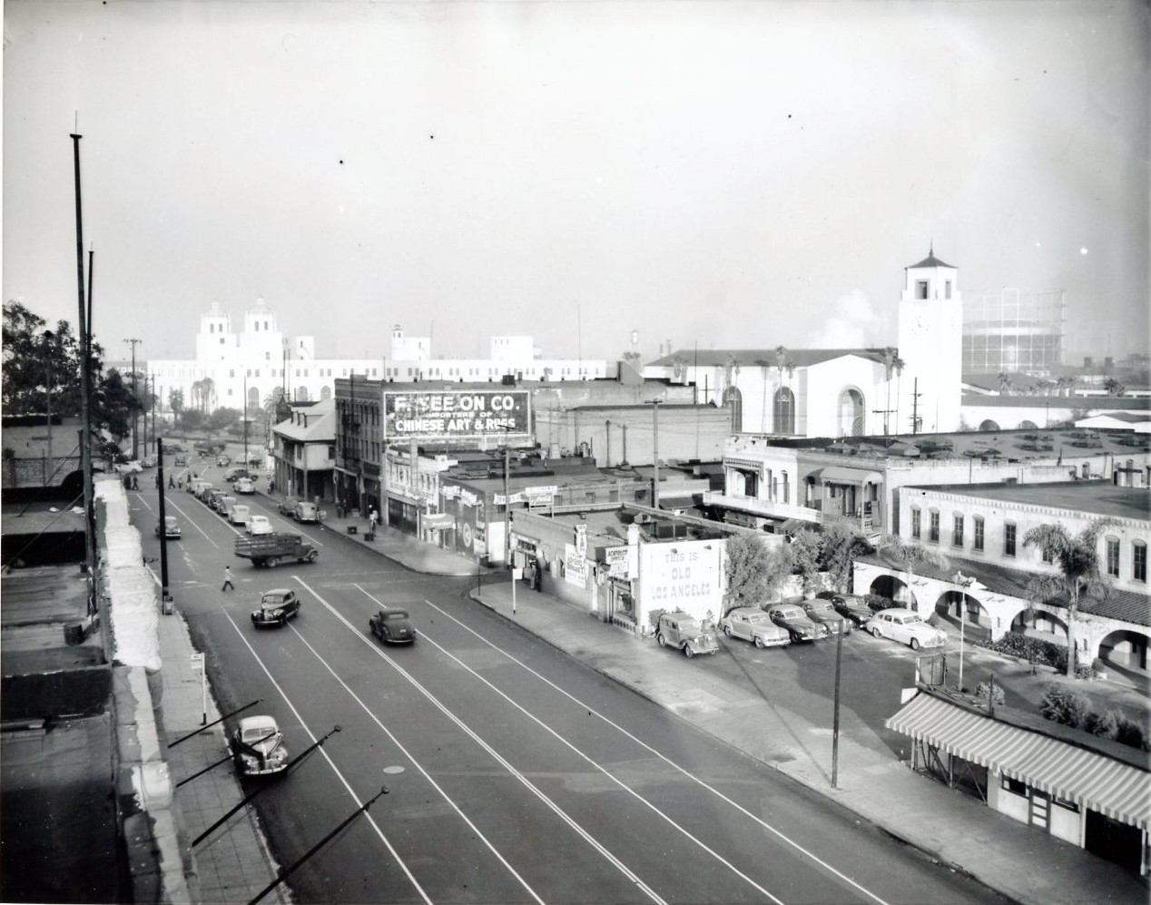 |
|
| (1947)^*# - View of Los Angeles Street looking north. The large trees in the upper left are in the LA Plaza and across the street is the Vicente Lugo adobe house with its distinctive hipped roof and dormer windows. In the background can be seen both the Terminal Annex Post Office and Union Station. |
 |
|
| (1947)*#^ - Firehouse as a Chinese store with City Hall and the Federal Courthouse in background. |
 |
|
| (1950s)*#^ - View from Union Station of San Antonio Cafe, now Firehouse #1, at the corner of Los Angeles and Plaza streets. |
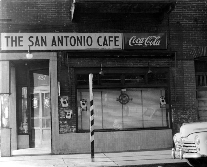 |
|
| (1950s)*#^ - Front view of the San Antonio Cafe, now Firehouse #1. |
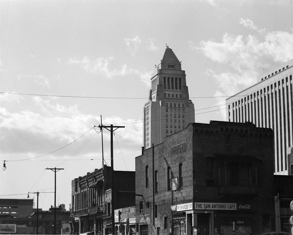 |
|
| (1951)*** - View of the San Antonio Cafe (Old Plaza Firehouse #1) with City Hall rising above in the background. |
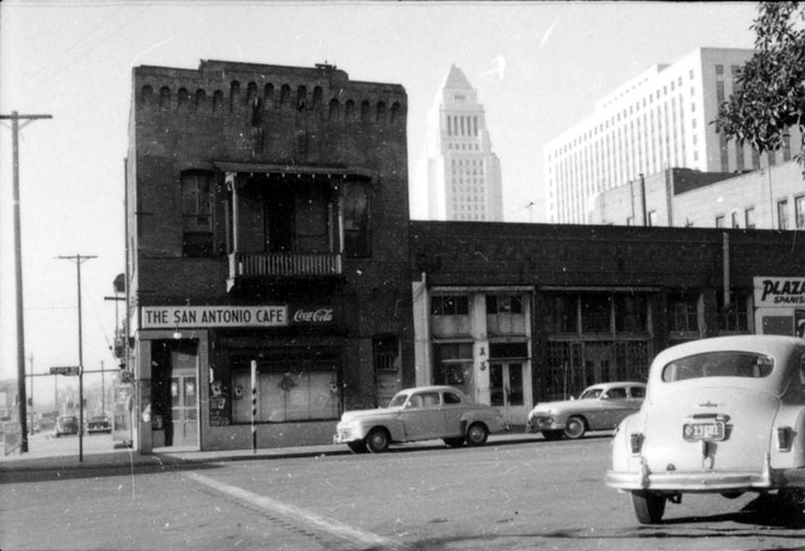 |
|
| (1954)*#^ - View of the San Antonio Cafe (Old Firehouse #1) with City Hall and the Federal Courthouse in the background. |
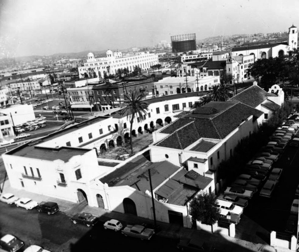 |
|
| (1960)*** - Birdseye view of the old adobe Plaza Church. The large rectangular building has archways surrounding the perimeter of its courtyard and the church roof is made from terracotta tiles. Union Station can be seen in the distance at right and is identified by its large tower. In the upper left stands the Terminal Annex Post Office with its two domed towers. |
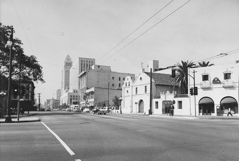 |
|
| (1960)*** - View of the Old Plaza Church from the north end of the Plaza. City Hall can be seen in the background. |
 |
|
| (1949 – 1959)*^# - Two photos of the El Camino Real bell located at the Old Plaza Church. Maria Luz Ramirez, left, on May 26, 1959, with the El Camino Real bell. On right is a Jan. 22, 1949 image of Esther Tarin with the bell. Credit: Frank Q. Brown and Jack Carrick (both of the LA Times). |
Historical Notes Some 450 of these 100-pound iron bells mounted on staff-shaped steel standards 11 feet high once lined El Camino Real from San Diego to Sonoma. The first was installed with great ceremony in the Los Angeles Plaza on Aug. 15, 1906. Spaced approximately a mile apart along the El Camino Real, the bells each had a sign showing the direction and distance to the nearest mission.*^# Click HERE to see the 1st installation. |
 |
|
| (n.d.)* - Sign for the Los Angeles Plaza. It reads "Historical Landmark, State of California, No.156." People sitting in the park can be seen in the background. |
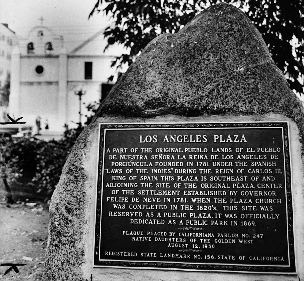 |
|
| (1961)*** - View of landmark plaque in the Los Angeles Plaza with the Old Plaza Church in the background. |
Click HERE to see more in California Historical Landmarks in L.A. |
|
|
| (ca. 1940s)* - Aerial view of Los Angeles near the Plaza before construction of the Hollywood Freeway with Union Station in the background. The Plaza is seen to the left. |
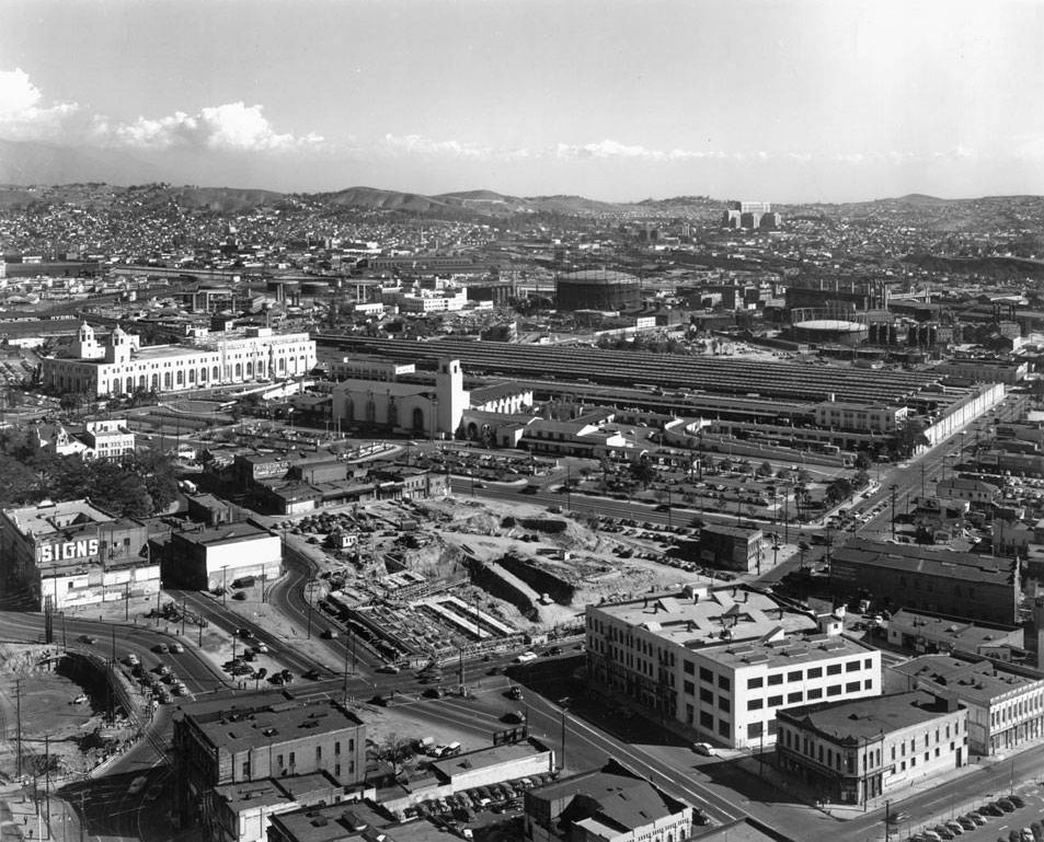 |
|
| (ca. 1950)*** - Construction of the 101 Freeway begins through the old section of Los Angeles. Photo by Dick Whittington. |
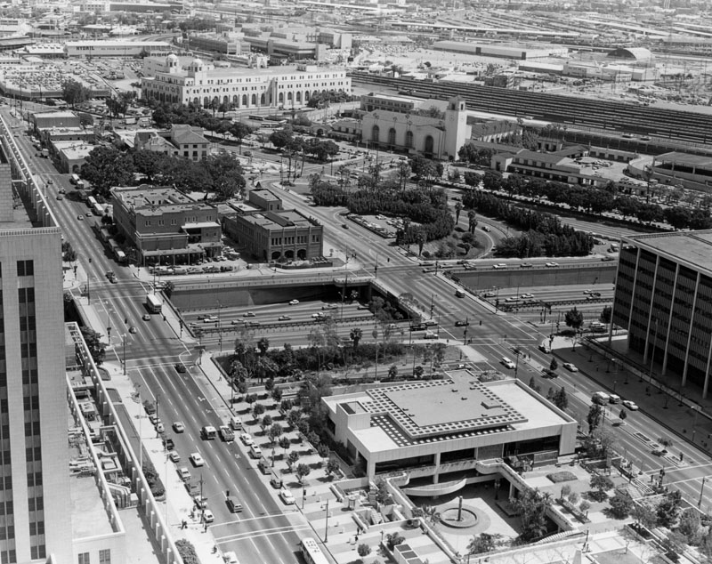 |
|
| (ca. 1970s)** - Panoramic view from Los Angeles City Hall, looking northeast from the southern side of Highway 101. Several landmarks are visible, including the Terminal Annex Post Office, Union Station, and La Plaza. |
Historical Notes The Hollywood Freeway through Downtown LA opened on December 27, 1950. Construction of the highway spelled the end for several pieces of Downtown history. Compare the above aerial photo with previous photo dated ca. 1940s. Note the number of buildings that are now gone. The route cut through Fort Moore Hill, site of the Los Angeles High School. The school originally opened at Broadway and Temple in 1873, and was moved to the Fort Moore site. The Broadway tunnel also found its end come with the construction of the freeway. The razing of Fort Moore Hill and the cut of the freeway brought the new roadway into the path of Broadway. That tunnel, which opened in 1901 (the same year as the Third Street Tunnel) was 760 feet long and 40 feet wide. It was closed on June 2, 1949.**^ |
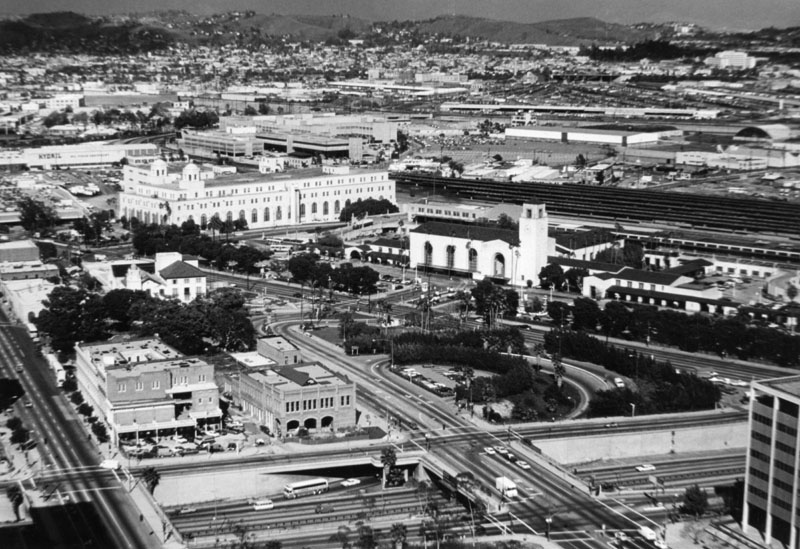 |
|
| (ca. 1970s)** - Aerial view of the Plaza area looking northeast from the top of City Hall. The Plaza may be seen in the lower left of this photo, showing the rear of Pico House and the Garnier Building. Union Station and the huge Post Office Terminal Annex is near the center of this photo. The Hollywood Freeway is at the bottom. |
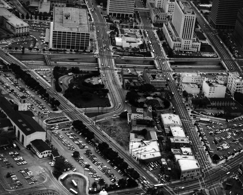 |
|
| (ca. 1970)** - Aerial view looking south of the Los Angeles Plaza (center), Olvera Street, and Union Station (left). The Hollywood Freeway now separates Historic Downtown from today's Downtown. |
.jpg) |
|
| (1971)*#^ - View of the Kiosko area of the Plaza looking towards the Biscailuz Building, taken from the roof of the Pico House. |
Historical Notes The Biscailuz Building (1925-26) is located on the site of Juan Sepulveda's adobe. It had served as the United Methodist Church Conference headquarters, the Plaza Community Center and the Consulate-General of Mexico. In 1968, it was named after Eugene Biscailuz, a former Los Angeles Sheriff, who had helped Christine Sterling in her struggle to save this historic section of Los Angeles. In 1978, Leo Politi painted a mural on the south and east facades that depicts the Blessing of the Animals, a traditional event held annually in El Pueblo on Easter Saturday. It now houses El Pueblo's administrative offices and the Instituto Cultural Mexicano.**^^ |
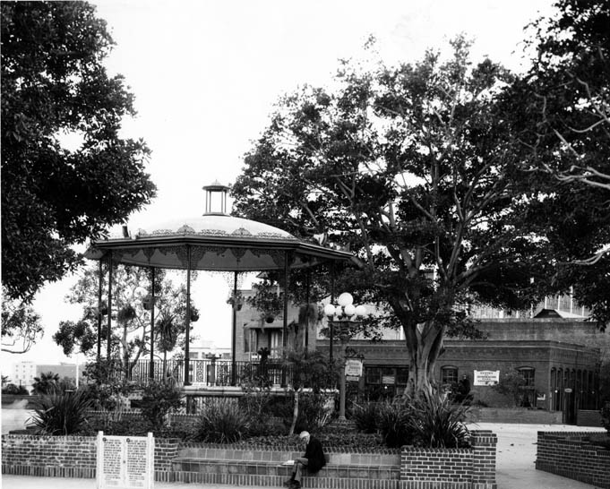 |
|
| (1971)*#^ - A closer view of the Plaza and Kiosko bandstand just east and south of original plaza site between Main Street and Los Angeles Street looking towards the Pico House. The Old Firehouse can also be seen in the background. |
Café Caliente (later El Paseo Inn Restaurant)
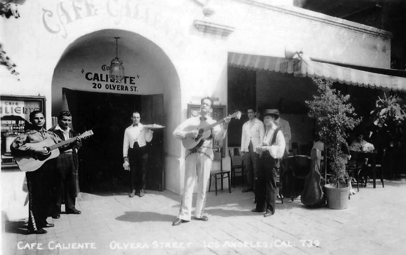 |
|
| (ca. 1930s)^.^ - Performers and a waiter stand by front entrance to Café Caliente on Olvera Street. |
Historical Notes At 11 Olvera Street, there used to be the Pelanconi Winery that operated from 1874 to 1914. It was remodeled into the Café Caliente by the Peluffo family. In 1953 they sold it and it became the El Paseo Inn. The son of the Peluffo family then opened the Casa Vega restaurant in Sherman Oaks. |
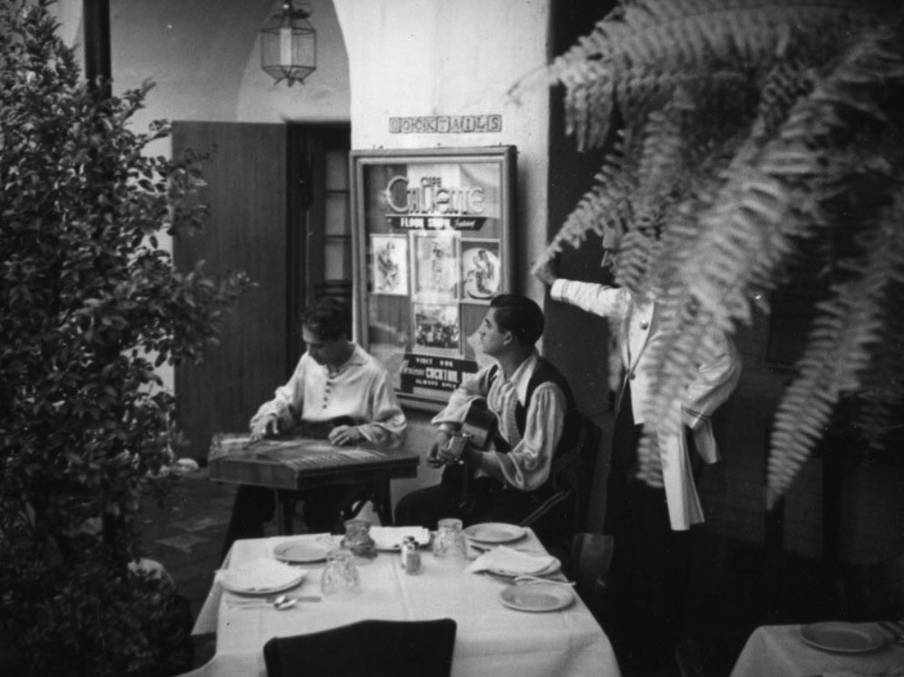 |
|
| (ca. 1930s)^* – Entertainment while dining at the Café Caliente on Olvera Street. Later it would becom El Paseo Inn Restaurant. |
El Paseo Inn Restaurant
 |
|
| (1950s)^* – View showing dining area at the El Paseo Inn (originally Café Caliente). Sign reads: ‘Enchilada or Tamale’. |
Historical Notes El Paseo Inn Restaurant was established in the 1930’s and was originally located in another portion of Olvera Street, W-23. In 1953, it moved to its current location at E-11 which prior to that time was occupied by Café Caliente. Mrs. Elena Peluffo and Mr. Frank Webb were the first owners of El Paseo Inn at E-11, and Andy M. Camacho, purchased it from them. El Paseo Inn has served many special guests over the years, including civil rights leader Cesar Chavez and Presidents George H.W. Bush and Bill Clinton. Originally, El Paseo Inn housed a large dance floor in the middle of the dining room where it featured a Latin orchestra and Folklorico dancing performances. Today, it still has one of the oldest bars, designated a historical landmark, in the City of Los Angeles. |
Olvera St. Theatre (Originally Leo Carillo Theatre)
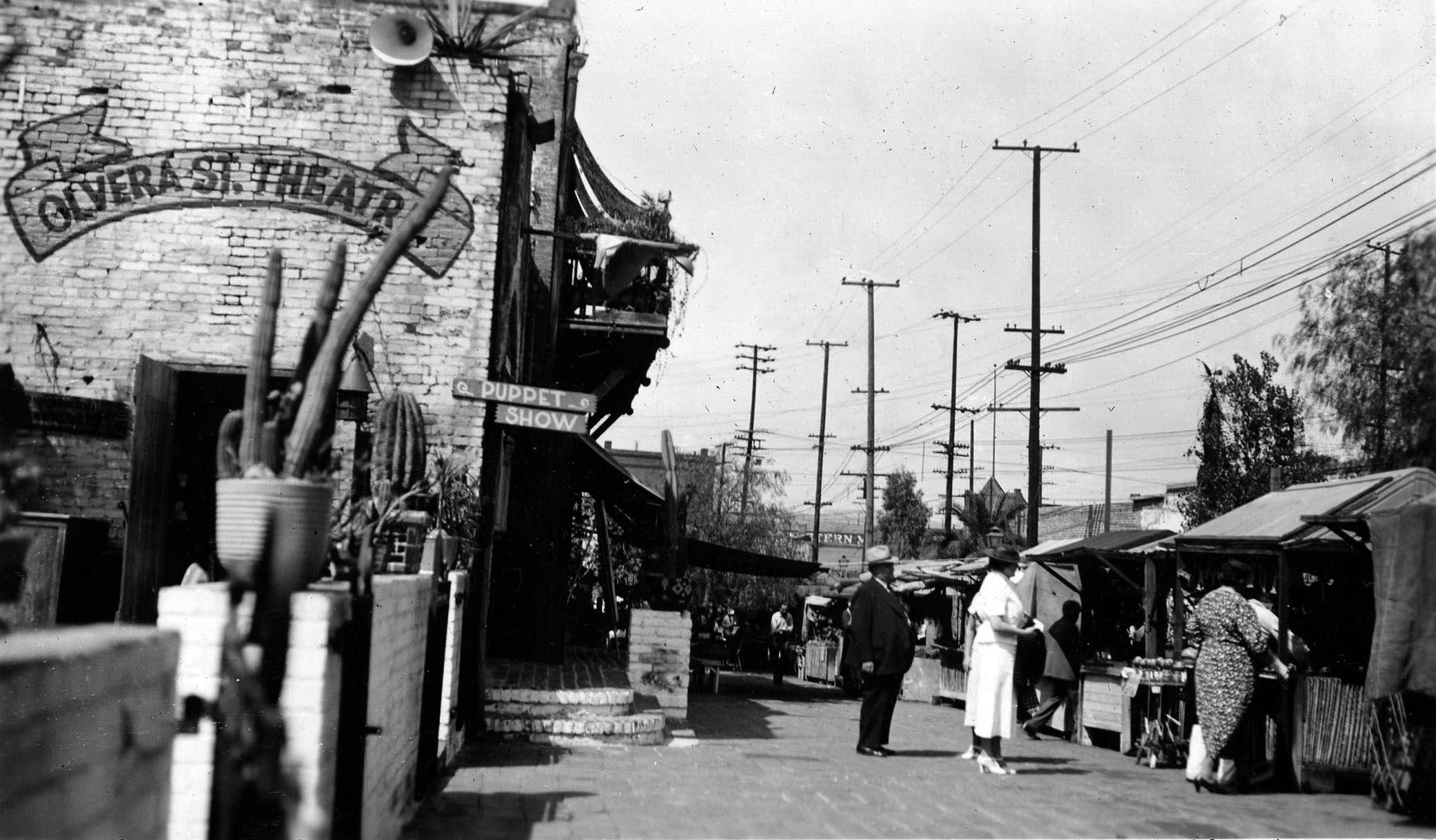 |
|
| (1934)^## - View showing the Olvera Street Theatre located in the Old Machine Shop Building (21 Olvera St / 620 N. Main St). Sign on side of building reads ‘Puppet Show’. |
Historical Notes Opened in 1930 as the Leo Carillo Theatre at the time Olvera St. was rehabilitate. The theatre was named after the vaudeville actor and film star Leo Carillo and originally featured live shows. By the mid-30s it had become the Olvera St. Theatre featuring puppet shows by Walton & O'Rourke. |
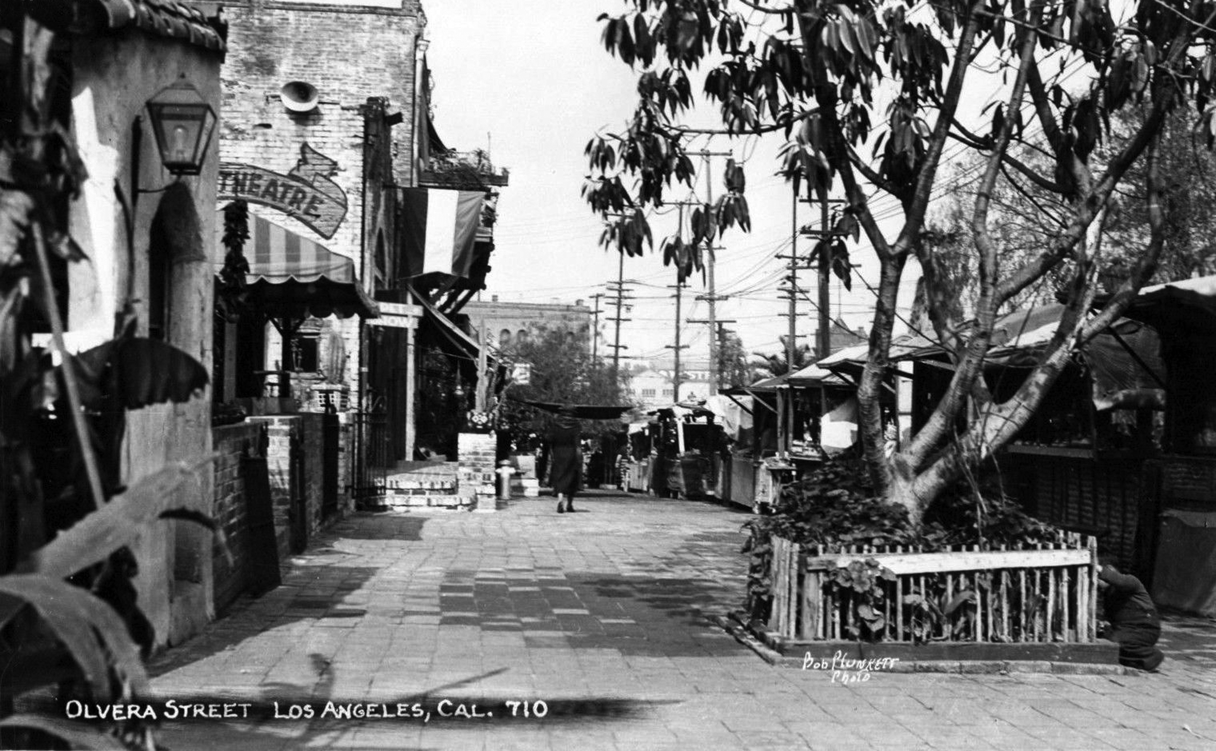 |
|
| (1930s)#++ – Postcard view looking north on Olvera Street. Note the Theatre sign. That was the Olvera Street Theatre that once occupied the Old Machine Shop Building. |
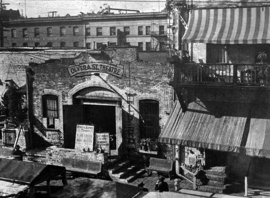 |
|
| (1930s)^.^ - View showing entrance to the Olvera Street Theatre located in the old Machine Shop Building with the Sepulveda House seen at right. The multi-story building in the background is on Main Street. |
Historical Notes The Machine Shop is a one and a half story building that was built on Main Street around 1910 and extended all the way back to Olvera Street. The building is located on the site of what is believed to have been the stables of Doria Deighton Jones’ adobe home which was torn down in 1886, and was built by her daughter Constance Jones Simpson. The first tenants of the building were engaged in light industrial occupations such as tinsmithing, electroplating, metal patterning and machining. With the advent of the Mexican market place on Olvera Street in 1930, the uses of the Machine Shop were changed and the front doors were opened on Olvera Street, rather than Main Street. The first tenant was the Leo Carrillo Theatre, followed by the Olvera Street Puppet Theatre. The proscenium arch and a segment of the stage still survive. ^#^ |
 |
|
| (1940s)^x^ – View looking north showing the Olvera Street Market. The Olvera Street Theatre can be seen in the background. |
Historical Notes In 1926, Christine Sterling began efforts to preserve the buildings on and around Olvera Street (one of the oldest parts of Los Angeles). After several years of struggle and fundraising, Olvera Street was closed to automobile traffic in 1929, and opened as the Paseo de Los Angeles in 1930. The street and its market quickly became popular tourist sites, promoters touting the area as "A Mexican Street of Yesterday in a City of Today." |
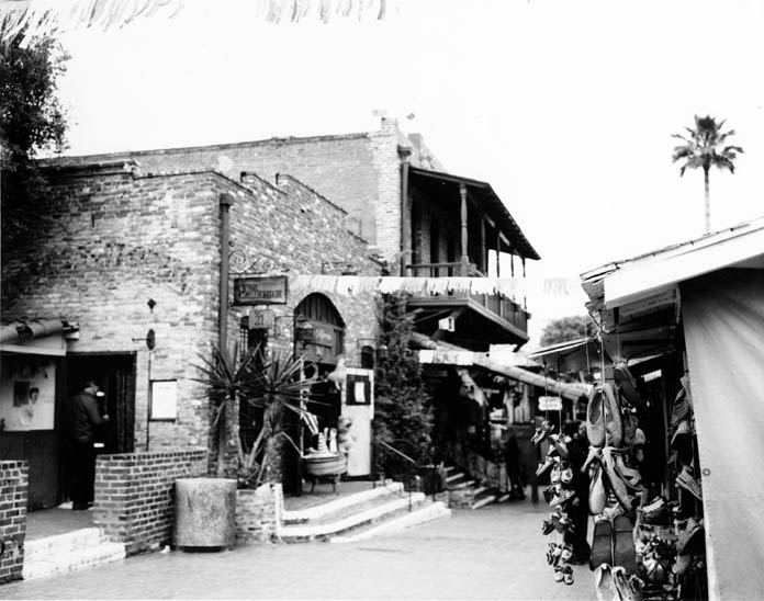 |
|
| (1970s)*#^ - View looking north on Olvera Street showing the old Machine Shop building with faded Theatre sign (on the left) and the two-story Sepulveda House (center). |
Historical Notes The building dates from around 1910 and is known as the Machine Shop. Apparently the early tenants did metal work and related light industrial tasks. The space ran as a theatre evidently into the 50s. It's now a retail store, Casa California. |
Sepulveda House
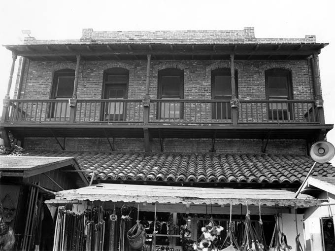 |
|
| (1977)*#^ - Sepulveda House, Olvera Street side, with second floor balcony and puestos in view. |
Historical Notes Eloisa Martinez Sepulveda built this Eastlake Victorian style structure for use as stores and as a boarding house (1877). After Olvera Street had been transformed into a Mexican marketplace in 1930, the cellar and first floor of this building were rented to artisans and shopkeepers, while the second floor became a center for artists and craftsmen, and boasted an import shop and the tea room. During the 1930s, the Yale Puppeteers maintained a theater on the first floor, and in World War II it housed a USO canteen. Now it serves as the Park’s Visitors and Orientation Center and has exhibits illustrating life in Los Angeles in the 1890s.^ |
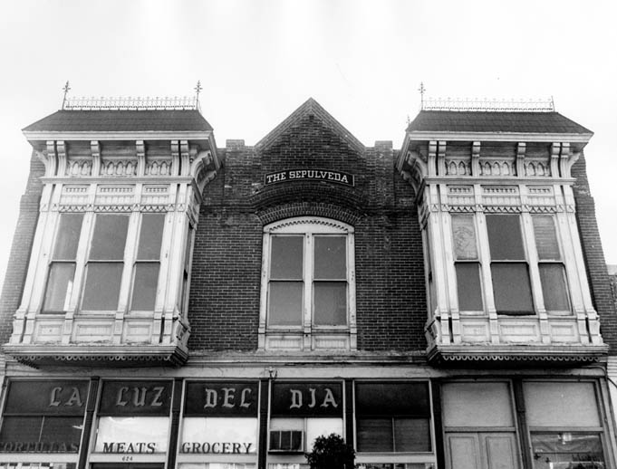 |
|
| (1970s)*#^ - View of the second floor reconstruction of Sepulveda House on the Main Street side in the mid 1970’s. |
Historical Notes The twenty two room building had two large stores fronting on Main Street, and for boarders, fourteen bedrooms and a bathroom on the second floor. Senora Sepúlveda’s private quarters in the rear were separated from the stores by a breezeway. In 1901 she gave the building to her favorite niece and goddaughter Eloisa Martinez de Gibbs who had married Edward Gibbs, a City councilman. Several of the Gibbs children were born in the Sepúlveda House. Senora Sepúlveda died in 1903 and the Gibbs family moved away in 1905, but owned the building until the State of California took it over in 1953.^#*^ |
 |
|
| (1978)*#^ - Close-up view of the bay window of the Sepulveda House, Eastlake style. |
* * * * * |
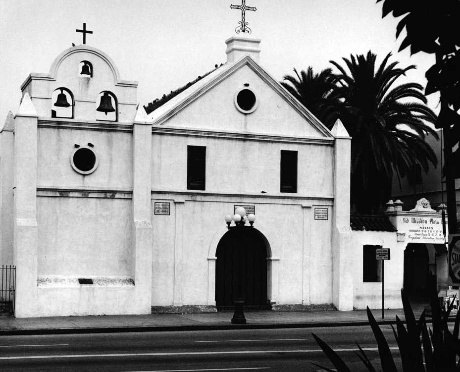 |
|
| (1970s)*** - Photograph of an exterior view of the Plaza Church, Los Angeles, ca.1970-1979. The two-story building can be seen at center. Three bells can be seen hanging above the roof at left, while two crosses are visible atop the roof. A lamp-post is visible on the sidewalk in front of the arched entrance. |
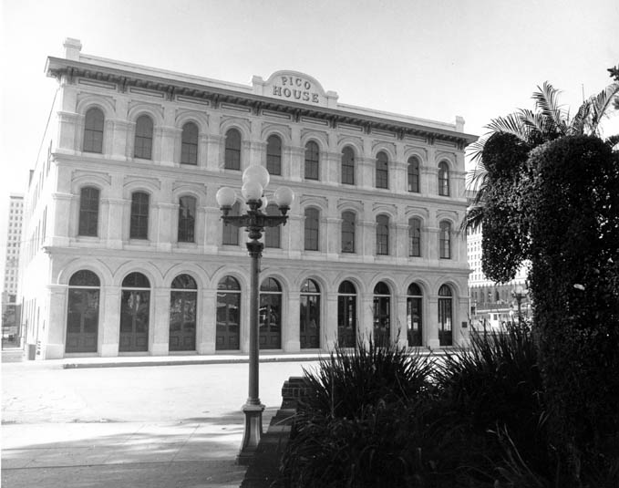 |
|
| (1970s)*#^ - Calle de la Plaza facade of the Pico House. |
 |
|
| (ca. 1971)*^*^ - View of the Pico House's interior courtyard shortly after it was restored. |
 |
|
| (1968)** - View showing the front of the Merced Theater. At the very top reads, "1st L.A. Theater Mercedes." On the left is the Pico House. Photo by William Reagh |
Historical Notes Ezra F. Kysor designed the Italianate theater, built in 1870 by William Abbott and named for his wife. It opened on January 30, 1871 and is the oldest surviving theater in Los Angeles.** The Merced Theatre was dedicated as California Historical Landmark No. 171. |
 |
|
| (n.d.)+^ – View looking northeast from Olvera Street showing the El Pueblo Plaza Substation (built in 1903-1904). In the background can be seen one of the two towers of the old Terminal Annex Building (built in 1939-1940), located across Union Station on Alameda Street. |
Historical Notes The Plaza Substation was an electrical substation that formed a part of the "Yellow Car" streetcar system operated by the Los Angeles Railway from the early 1900s until 1963. After being threatened with demolition in the 1970s, the Plaza Substation was added to the National Register of Historic Places in 1978.^* |
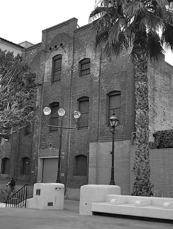 |
|
| (2006)++ - View showing the front (east side) of the El Pueblo Plaza Substation as it appears today. The other side of the building faces Olvera Street. |
Historical Notes After being threatened with demolition in the 1970s, the Plaza Substation was added to the National Register of Historic Places in 1978. Plans now call for the building to become a museum on Los Angeles trolley cars.++ Click HERE to see more on the Plaza Substation. |
 |
|
| (n.d.)* – View showing the Vickrey-Brunswig Building located at 501 N. Main Street, across the street from the Pico House. Photo by Flora Chow |
Historical Notes The County of Los Angeles purchased the Vickrey-Brunswig Building and the adjacent Plaza House in 1948 and renovated them for use by the Los Angeles County Civil Service Commission, County Superior Courts, Police Crime Laboratories and the County Sherriff’s offices through the mid-1970s. * |
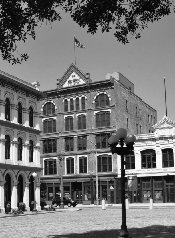 |
|
| (2014)*** - View of the Vickrey-Brunswig Building as seen from the LA Plaza with the Pico House on the left and the Plaza House on the right. |
Historical Notes After enduring three decades of vacancy and deterioration, the County rehabilitated both buildings to house LA Plaza de Cultura y Artes, a Mexican and Mexican-American cultural center which opened in 2011.* |
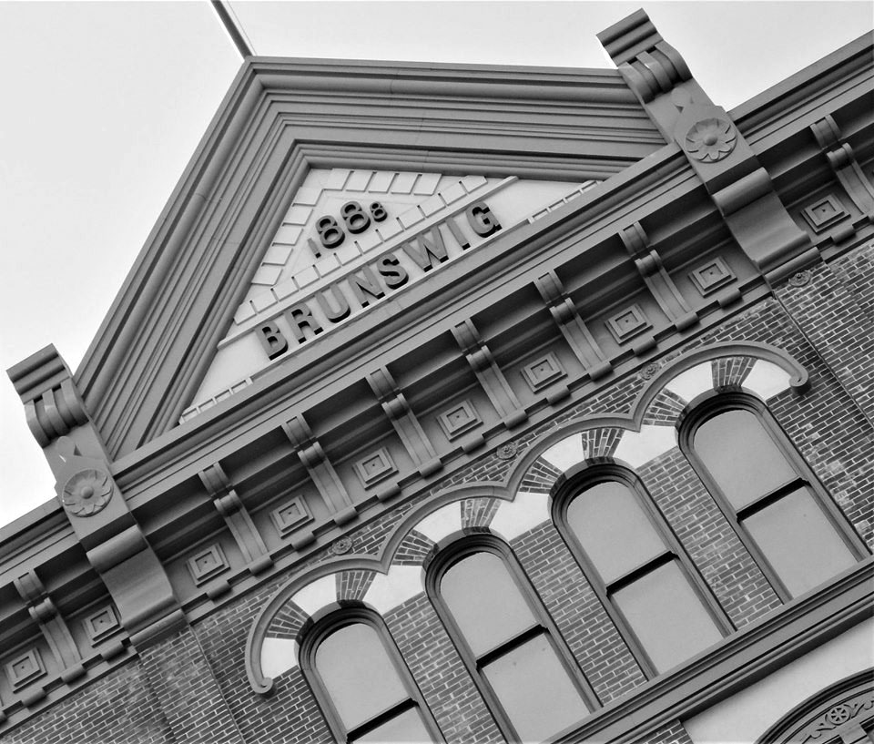 |
|
| (2019)^.^ - Close-up detail view showing the Vickrey-Brunswig Building after renovation Photo by Howard Gray |
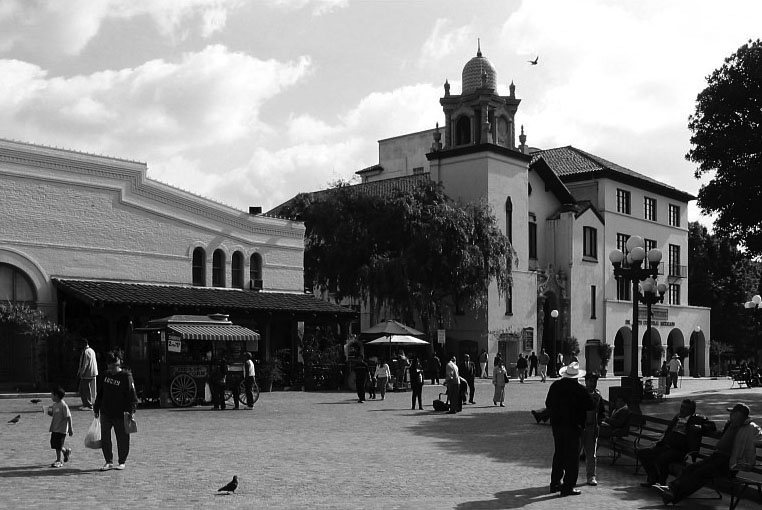 |
|
| (2010s)**++ – View looking northeast toward the entrance to Olvera Street as seen from the Plaza showing the Plaza Methodist Church with its clock tower. To the right of the Church is the Mexican Cultural Institute of Los Angeles. |
Historical Notes The State of California purchased the Church, Community Center and Headquarters in 1956 under the threat of eminent domain to create the Los Angeles Plaza Historic District. The Church signed a 50-year lease to continue operations that was successfully renegotiated in 2011 with the City of Los Angeles. Located next to the church in the Biscailuz Building is the Mexican Cultural Institute of Los Angeles, which is the premier venue for the expression of traditional and contemporary art and culture from the Mexican, Mexican American and Chicano perspective. |
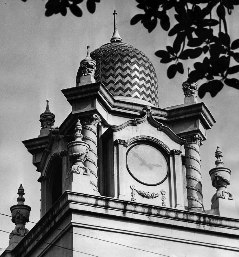 |
|
| Close-up view showing Plaza Methodist Church's beautiful clock tower. - LA Times Photo (Dec. 13, 1955) |
Historical Notes The Churrigeresque-style Methodist Church was designed by architects Train and Williams and built in 1926 on the site of the old Olvera Adobe (demolished in 1917). |
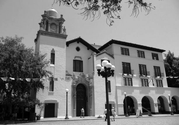 |
|
| (2011)***+ - View of the Plaza Methodist Church with the Biscailuz Building next door to the right. |
Historical Notes The building to the right of the Plaza Methodist Church is the Biscailuz Building, built 1925-1926. Located on the site of the Juan Sepulveda adobe, it was designed as the Untied Methodist Church Conference Headquarters and the Plaza Community Center. In 1968, the building was re-named after Eugene Biscailuz, a former Los Angeles County Sheriff, who had helped Christine Sterling in her struggle to save this historic section of Los Angeles. In 1979, Leo Politi painted a mural on the south and east facades that depicts the Blessing of the Animals, a traditional event held in the Park every year on Easter Sunday. |
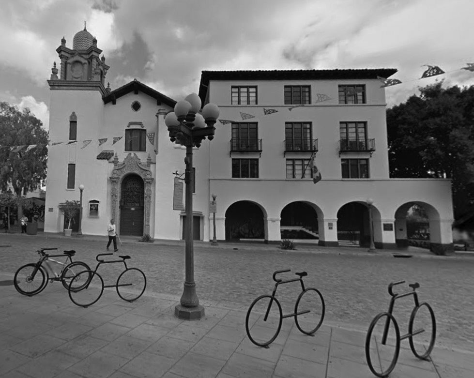 |
|
| (2015)* – Google street view looking north showing the Plaza Methodist Church and the Biscailuz Building as seen from the Plaza with the entrance to Olvera Street on the left. |
Historical Notes Today, the El Pueblo de Los Angeles Historical Monument Administrative Offices are located in the Biscailuz Building, to the east of the Plaza Methodist Church. |
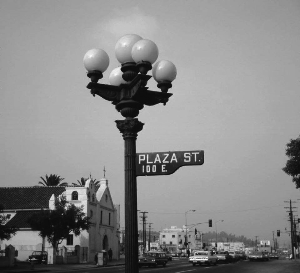 |
|
| (1969)^ - View looking northwest showing an ornate 5-globe Llewellyn Electrolier standing on the edge of the LA Plaza with the Old Plaza Church seen in the background. Photo by Glen Norman |
Historical Notes The most common of the incandescent multiple globe electroliers of the early 1900s were those manufactured by the Llewellyn Iron Works of Los Angeles. The firm became so identified with this style of street light that any multiple globe electrolier became commonly known as a Llewellyn. The Llewellyn Iron Works, founded in 1889‐1890, was one of the largest metal working facilities in Los Angeles. It manufactured structural steel – including that for the Bradbury Building (1893). |
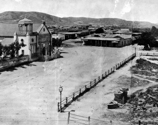 |
|
|
| (1869 vs 1969) - View looking NW showing the Old Plaza Church as seen from the Pico House. |
Historical Notes Click HERE to see more in Early Views of the L.A. Streetlights. |
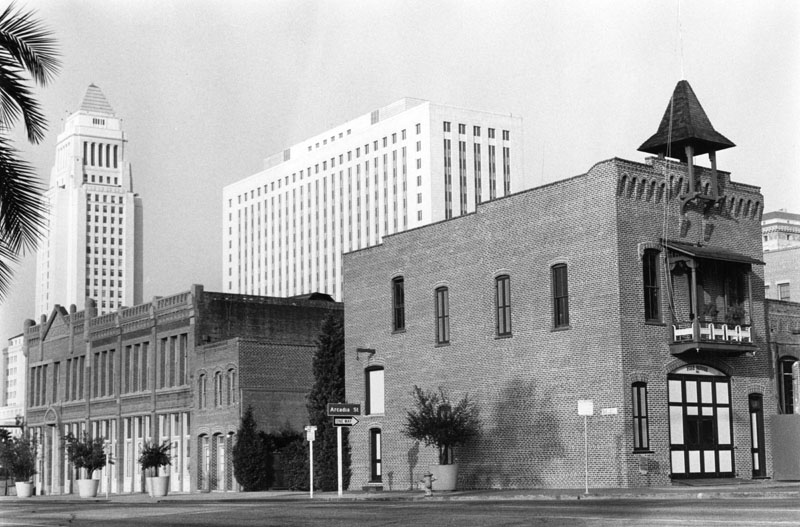 |
|
| (n.d.)** - Exterior of the Old Plaza Fire House which houses "Firetruck No. 1". To the left is the restored Garnier Building. City Hall and the Federal Courthouse are seen in the background. |
Then and Now
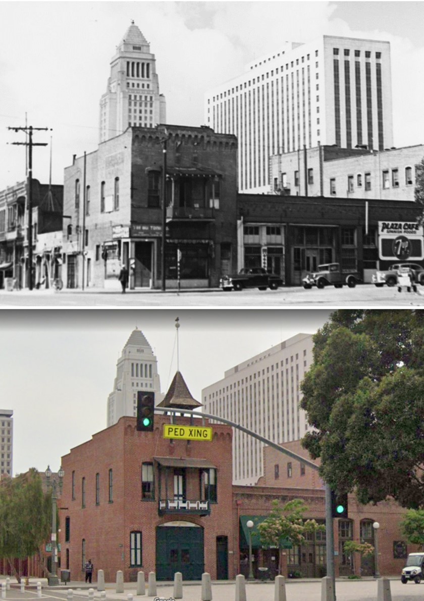 |
|
| (1944 vs 2021)* - Looking at the SW corner of Los Angeles Street and Plaza Street showing the Old Plaza Firehouse with City Hall and the Federal Building in distance. Photo comparison by Jack Feldman. |
Historical Notes The Old Plaza Firehouse is the oldest firehouse in Los Angeles. Built in 1884, it operated as a firehouse until 1897. The building was thereafter used as a saloon, cigar store, poolroom, "seedy hotel", Chinese market, "flop house", and drugstore. The building was restored in the 1950s and opened as a firefighting museum in 1960. Click HERE to see more Early Views of the Old Plaza Firehouse. |
 |
|
| (1980)* – Mayor Tom Bradley addresses a crowd gathered at the Los Angeles Plaza, with the Pico House, City Hall, and other notable buildings visible in the background. Photo by William Reagh. |
Historical Notes Tom Bradley, born in 1917 to Texas sharecroppers, became the first African American mayor of Los Angeles, serving an unprecedented five terms from 1973 to 1993. After excelling at UCLA, joining the LAPD, and becoming an attorney, he entered politics in the 1960s, winning the mayoral election in 1973. Over his tenure, Bradley transformed Los Angeles into a diverse, international city, revitalized downtown, hosted the 1984 Olympics, and enacted key reforms. Despite challenges like the 1992 riots, his legacy includes advancing diversity, economic growth, and environmental policy, leaving a lasting impact before his passing in 1998. |
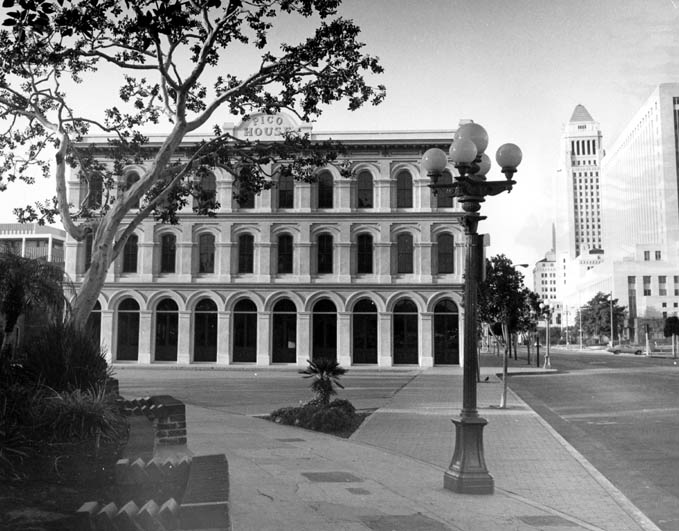 |
|
| (1977)** - View of the Pico House from the Plaza with City Hall in the background. Ornate 5-lamp streetlight sits in the foreground. Click HERE to see more in Early L.A. Streetlights. |
.jpg) |
|
| (1977)*#^ - Facade of the Pico House looking up sides of the building's arches. |
 |
|
| (2019)* – Corner detail view of the Pico House as it appears today. Photo by Howard Gray |
* * * * * |
Then and Now
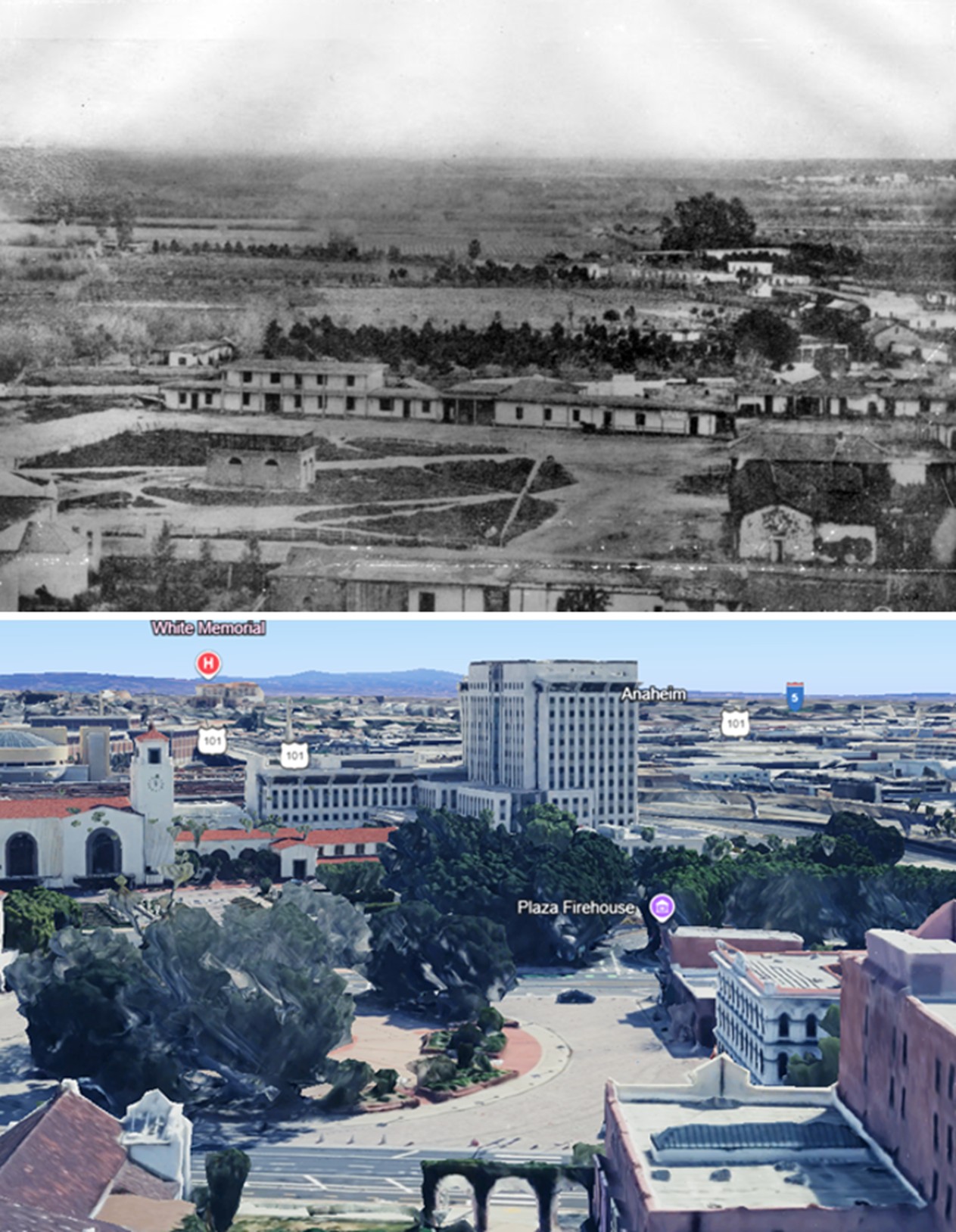 |
|
| (1858 vs. 2023)* – A 'Then and Now' view of the Los Angeles Plaza. Photo comparison by Jack Feldman. |
Historical Notes A few highlights for reference: The Plaza, once square, is now circular. In the lower-right of the 1858 image is the Carrillo Adobe, demolished in 1870 to make way for the Pico House. The Plaza Church, partially visible in the lower-left foreground of both images, is the only building still standing today. |
Then and Now
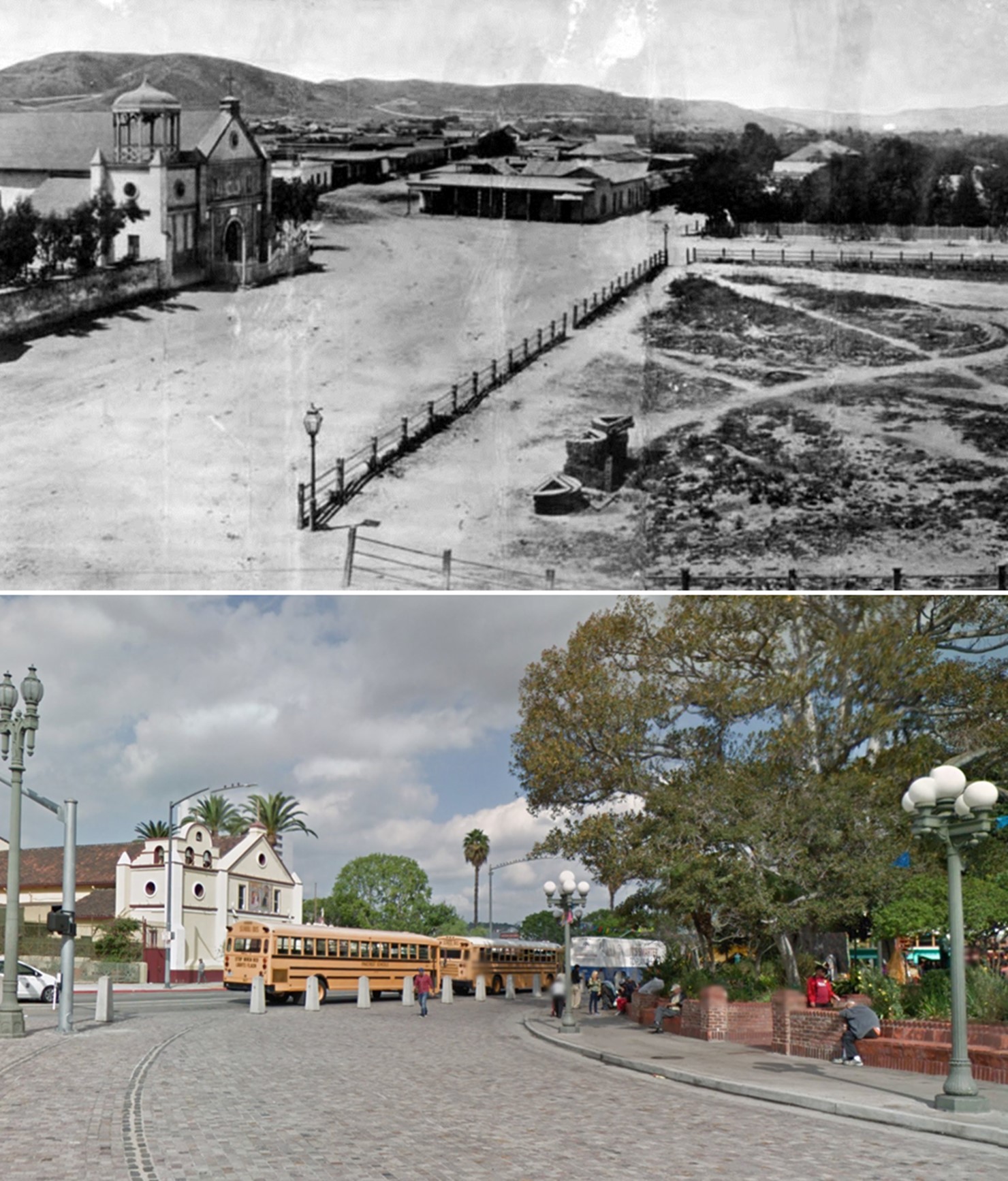 |
|
| (1869 vs 2015)* - Los Angeles Plaza Area, Then and Now. Note the variations in streetlights. Photo comparison by Jack Feldman. |
Historical Notes The 1869 photo shows the first gas streetlights used in the City of Los Angeles. Click HERE to see more in Early LA Streetlights. |
Then and Now
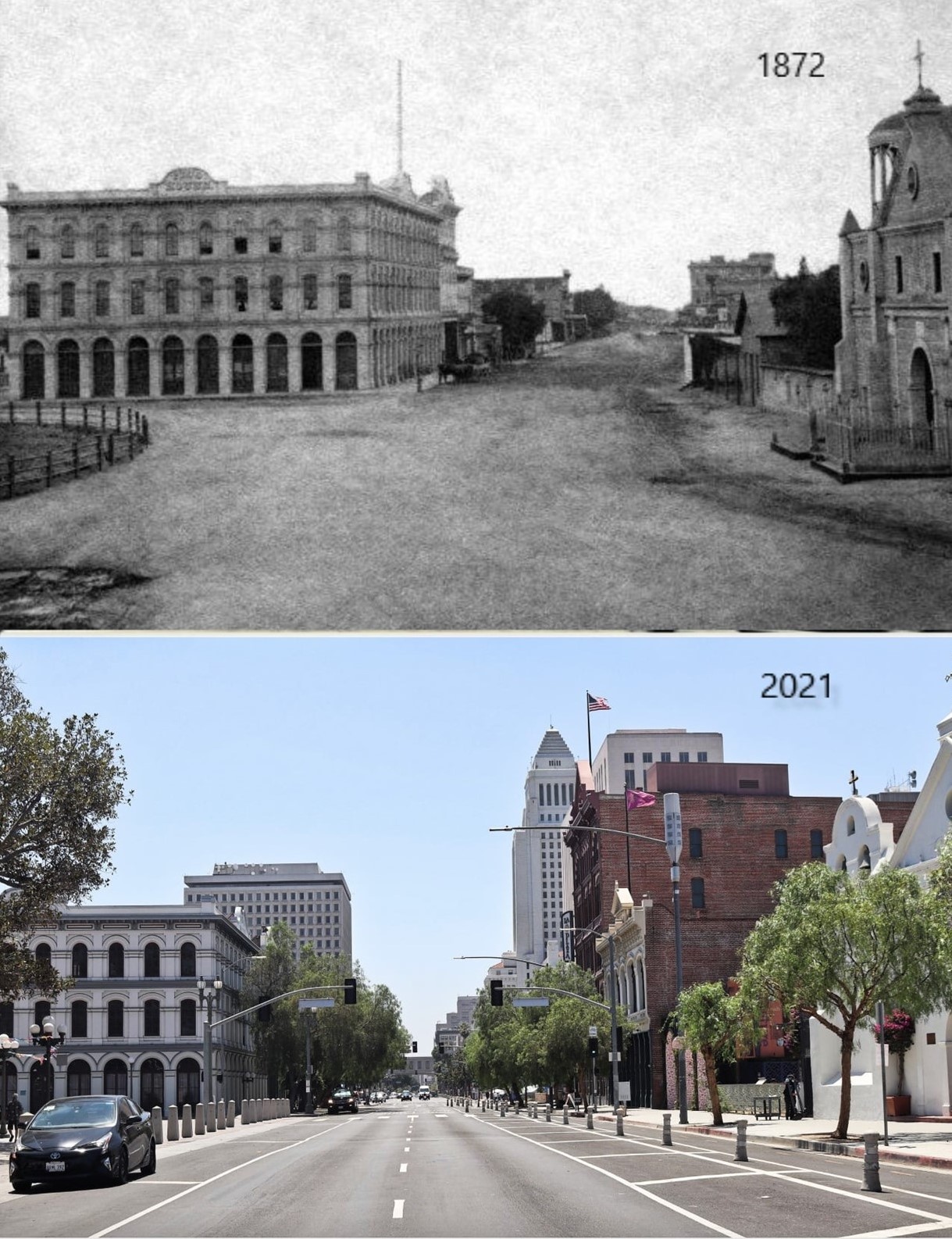 |
|
| (1872 vs 2021)* – Looking south on Main Street from in front of the LA Plaza. Three buildings still exist today: The Pico House and the Merced Theatre on the left, and the Plaza Church on the right. In the distance of the early photo can be seen the Temple Block, current site of Los Angeles City Hall. Photo courtesy of Mark Frazier. |
Then and Now
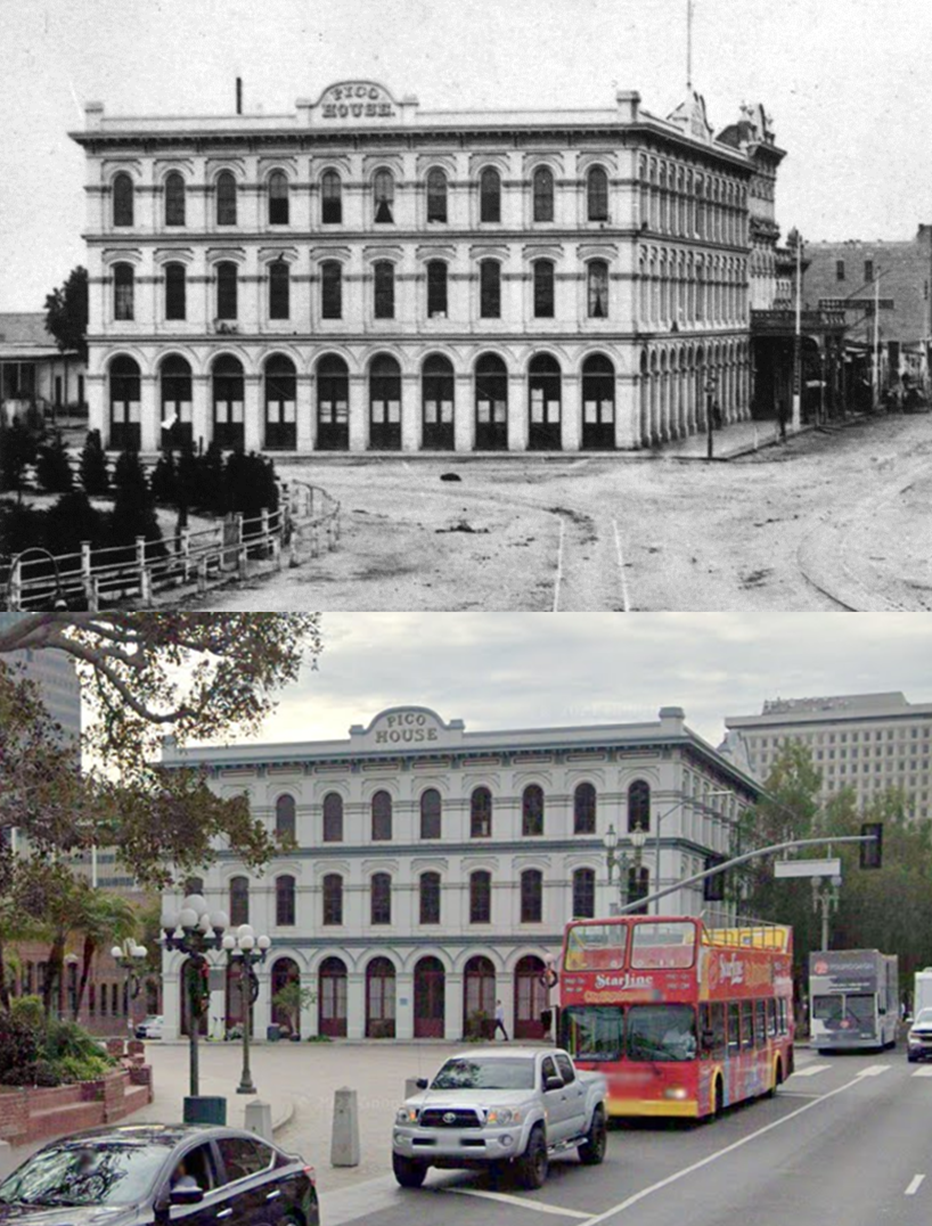 |
|
| (1878 vs. 2021) – Then and Now; Photo comparison by Jack Feldman. |
Then and Now
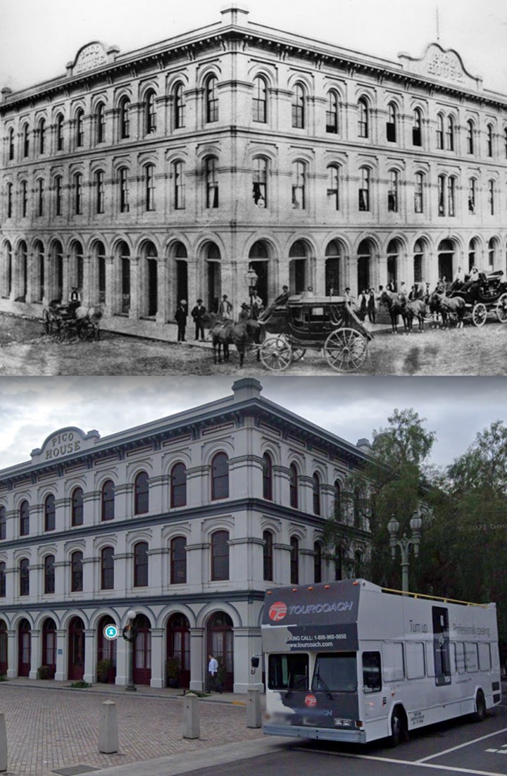 |
|
| (1875 vs. 2021) – Two different types of coaches parked in front of the Pico House at El Pueblo de Los Angeles Plaza Historic District. |
* * * * * |
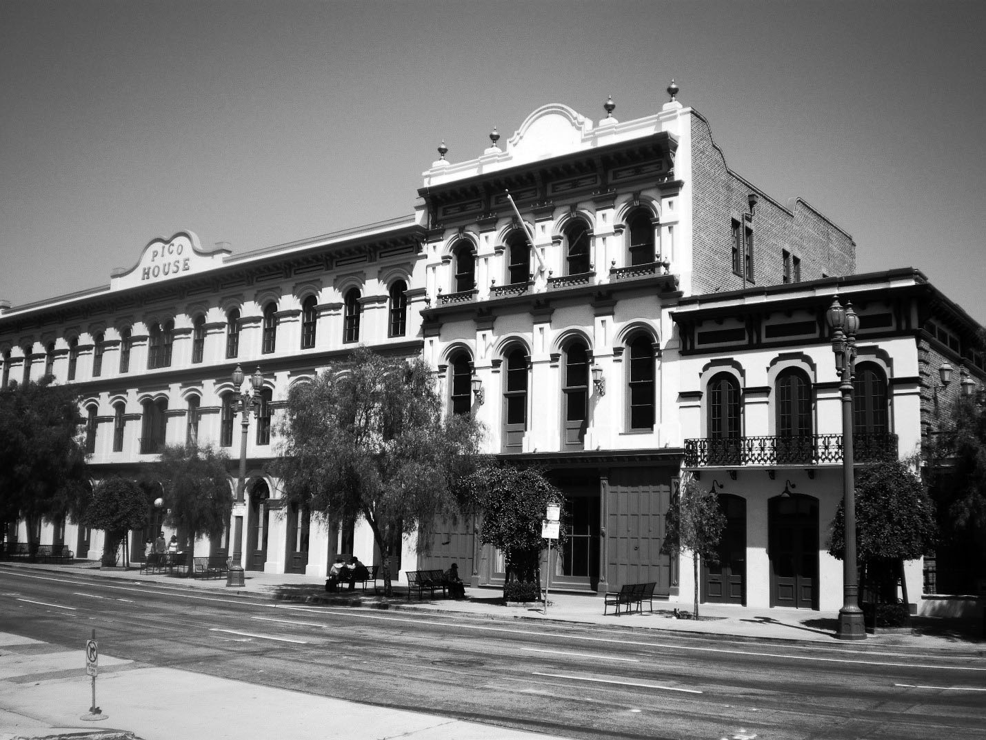 |
|
| (2008)* - View showing from left to right: the Pico House (1870); Merced Theater (1870); and Masonic Hall (1858) — at El Pueblo de Los Angeles Plaza Historic District. |
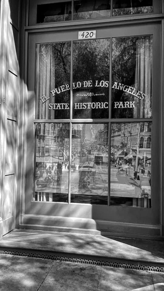 |
|
| (2021)^ – Window adjacent to front entrance of the Merced Theater located at 420 N. Main Street in El Pueblo de Los Angeles State Historic Park. Photo by Carlos G. Lucero |
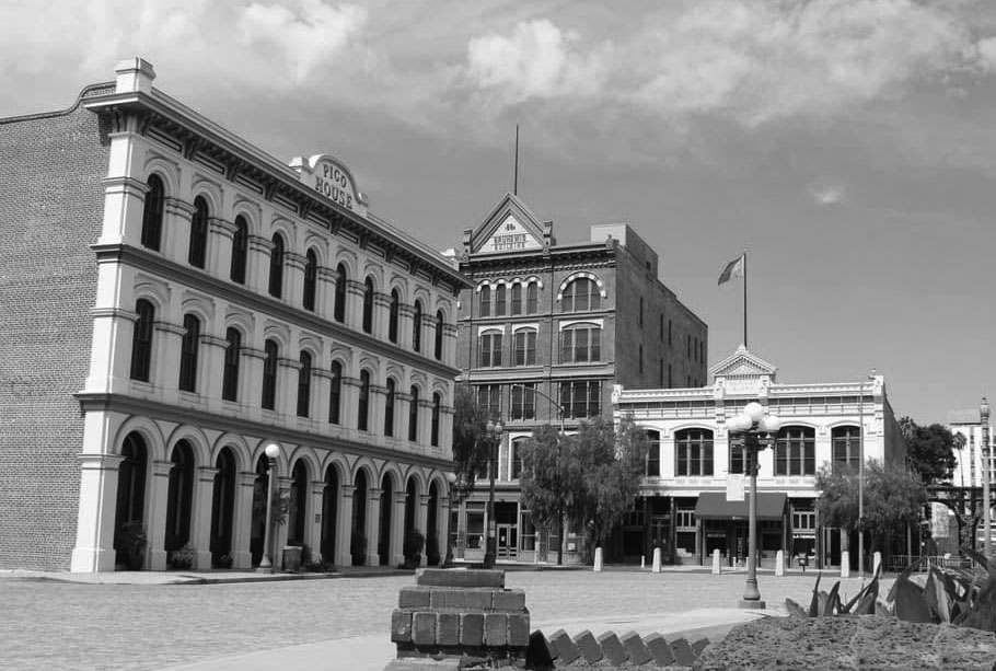 |
|
| (2021)* – View looking across the LA Plaza showing the 1868-built Pico House on the left, the 1888-built Vickrey-Brunswig Building at center, and to its right, the 2-story 1883-built Plaza House. Photo by Flo Selfman |
Final Note A plaque across from the Old Plaza commemorates the founding of the city. It states: "On September 4, 1781, eleven families of pobladores (44 persons including children) arrived at this place from the Gulf of California to establish a pueblo which was to become the City of Los Angeles. This colonization ordered by King Carlos III was carried out under the direction of Governor Felipe de Neve." The small town received the name El Pueblo de Nuestra Señora Reina de los Ángeles sobre El Rio Porciuncula, Spanish for The Town of Our Lady Queen of the Angels on the Porciuncula River. The original pueblo was built to the southeast of the current plaza along the Los Angeles River. In 1815, a flood washed away the original pueblo, and it was rebuilt farther from the river at the location of the current plaza. |
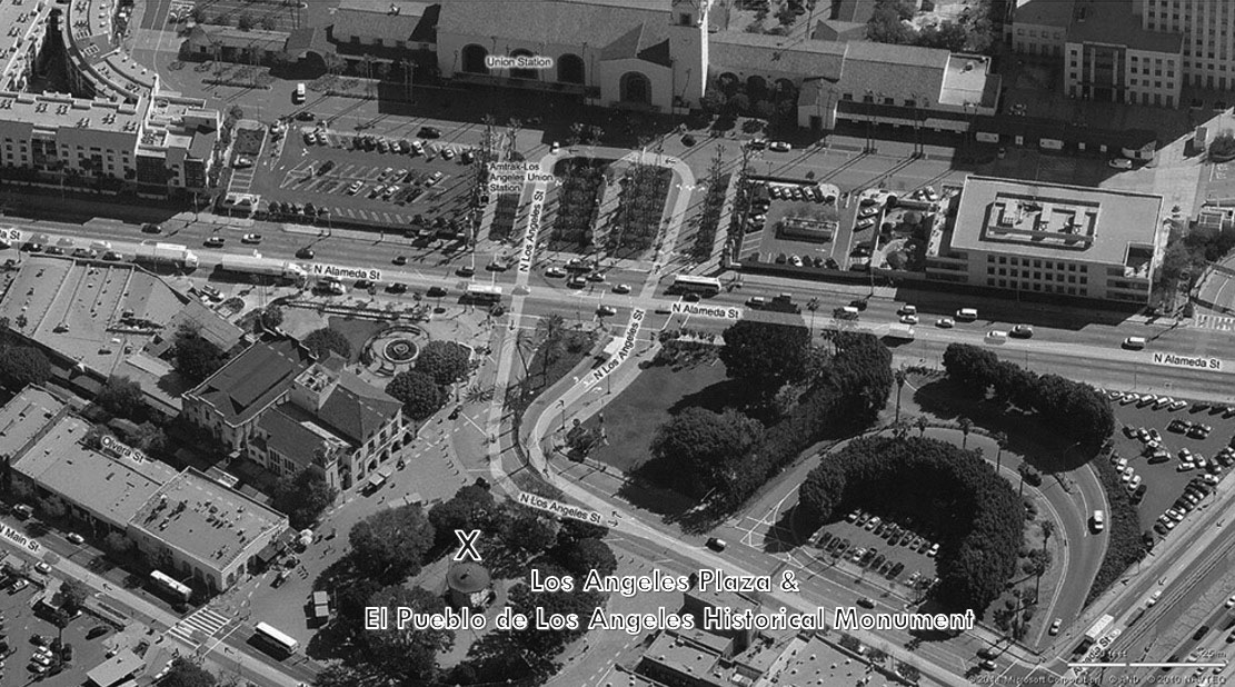 |
|
| (2010)^*# - Aerial view of the Los Angeles Plaza and surrounding area - El Pueblo de Los Angeles Historical Monument. |
Click HERE to see a detailed map of El Pueblo de Los Angeles Historical Monument |
|
* * * * * |
More Historical Early Views
Newest Additions
Early LA Buildings and City Views
History of Water and Electricity in Los Angeles
* * * * * |
References and Credits
* DWP - LA Public Library Image Archive
**LA Public Library Image Archive
*^LA Fire Department Historical Archive
^^California Historical Landmark Listing (Los Angeles County)
#^Huntington Digital Library Archive
#+Maviealosangeles.com: Avila Adobe
+^You Are Here: Peublo Substation
+#LA County Natural History Museum
*#^LAPL-El Pueblo de Los Angeles Historical Monument Photo Archive
^#^El Pueblo de Los Angeles Historical Monuments; Garnier Building; Plaza Methodist Church; Machine Shop
^x^Main Street Los Angeles Theatres
^#*Flickr.com: Michael Ryerson
^##California State Library Image Archive
^**UCLA-DWP Library Collection: Map of the City of Los Angeles as it Appeared in 1850
^*^Electric Railway History Association: The Street Railway History of Los Angeles
^*#Noirish Los Angeles - forum.skyscraperpage.com; North Los Angeles Street
^^^Metro - Los Angeles Transit History
**^History Matters: Calle de los Negros, 1880s
**#Metnews.com: ‘La Fiesta’ Is Annual Event in Late Victorian L.A.
^^#The Museum of the San Fernando Valley
*^#LA Times: What's in a name? A family's history, Sanchez Street, (4-5-2-10); Los Angeles Chinatown then and now
*#*Picture Gallery of Los Angeles History
*##Calisphere: University of California Image Archive
##*Boston Public Library: Flickr.com
#^^Flickr.com: Views of Los Angeles
#*^Flickr.com: Views of Los Angeles
#^*Flickr.com: Michael Ryerson
*^*LA Times: Los Angeles Street Name Origins
**^Blogdowntown: Hollywood Freeway
*^^Los Angeles Magazine: Zanja Madre 1868
^^*Los Angeles History Resources: Brunswig Building
+++Pulpinternational.com: Semaphore Traffic Signals
**^^El Pueblo Biscailuz Building
***+KPCC - Plaza Methodist Church
**++You Are Here: El Pueblo de Los Angeles
*^^*KCET - El Aliso: Ancient Sycamore Was Silent Witness to Four Centuries of L.A. History; LA's First Streetcars
^*^#Facebook.com - Bizzare Los Angeles
^^^^US Department of the Interior: Vickrey-Brunswig Building
^^^#A History of the Los Angeles City Market
^#*^ElPueblo.lacity.org: Plaza Map; Sepulveda House
^#^*Nathan Masters: Los Angeles From the Air, 1887 vs. 2013
^##^Asian Pacific American Center: Dragons Den
*##*Nuestra Señora Reina de los Angeles Asistencia Gallery
#***Flickr.com: Metro Library and Archive
#+++The Plaza Methodist Church Collection
#*#*Los Angeles Conservancy: Vickrey-Brunswig Building
#**#The Pacific Electric Railway Historical Society (PERyHS)
#^#^Chinese Los Angeles in 1870-1871 - Scott Zesch
*^*^UCLA Libraries Special Collection: Pico House Courtyard
^* Wikipedia: Pío Pico; Los Angeles Plaza Historic District; Hollywood Freeway; History of Los Angeles; The Church of Our Lady the Queen of Angels; Fort Moore; History of Los Angeles Population Growth; Olvera St.; Sepulveda House; Los Angeles High School; Union Station; Plaza Substation; Chinese Massacre of 1871; Wikimapia: Brunswing Building ca. 1928; Wikimapia: Vickrey-Brunswig Building
< Back